New York Leftovers

I rode the subway a lot in New York, as I always do. Remarkable how different the stations and the cars look compared with the early ’80s, but I felt that way 10 years ago. Mainly it’s that lack of graffiti. If you’re ever interested in what the cars looked like back then, see the last 15 minutes or so of Saturday Night Fever. Upset over the turn of events, Tony rides the subway all night – sitting in cars covered with graffiti.

Another, smaller difference I wondered about: does the system use the IRT, BRT and IND designations for anything? I didn’t see them on maps or at stations. I know that they haven’t actually referred to different systems since the consolidation in 1940, but I think that even in the ’80s I saw lines referred to using those letters, at least on maps, and maybe signs in the stations – the IRT especially. Or maybe I’m misremembering. But at least as late as the 1960s, “IRT” must have been understood, hence the remarkably dated lyric:

LBJ took the IRT/Down to Fourth Street USA/When he got there what did he see?/The youth of America on LSD

The Times Square Alliance tells me 360,000 pedestrians pass through Times Square every day. Walking through it, that’s easy to believe. One evening I finished a meeting not too far away and wandered over, just to see the nighttime light spectacle again. Of course it’s a tourist destination. That should keep me away? I’d rather walk through it now than 31 years ago, which I did. The place was a dump then.

After I’d had enough of Times Square – it doesn’t take too long – I headed east toward Hell’s Kitchen. I examined restaurant menus along the way. Lesson: the further you get from Times Square, the more reasonable the prices become, though you’re always paying Manhattan prices.

Something I didn’t realize: Times Square used to be Longacre Square (or Long Acre). For a period before 1904, that is, when the Times built a new building there. (And there’s always something interesting at Shorpy.) The old name survives faintly in the Longacre Theater on West 48th St.

Another day, I also took a quick stroll through Grand Central, since I was nearby. No doubt about it, it’s a monumental space.

Grand Center Station, dammit
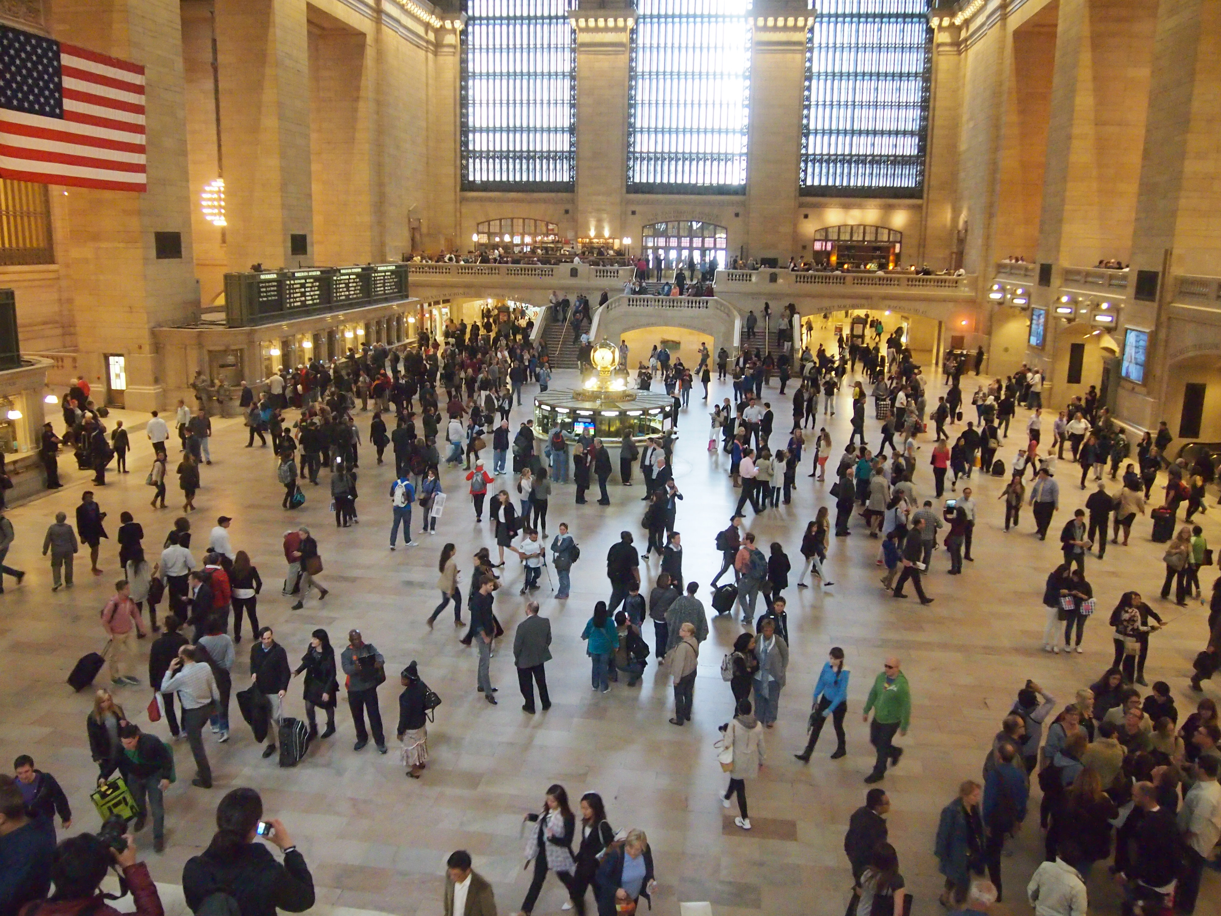
There’s an Apple Store in Grand Central now. That didn’t used to be there. I didn’t visit it, but I did visit the NY Transit Museum’s shop in Grand Central, and bought a few fridge magnets and postcards (just a few, they were overpriced).

Speaking of postcards, I’m happy to report that tourist shops on the streets around Times Square still sell cards at 10 or 12 for a $1. The only deal near Times Square. Remarkably, not all of the cards are crummy and unimaginative. The best ones I found were of not only the Brooklyn Bridge, but also the Manhattan and Queensboro bridges.

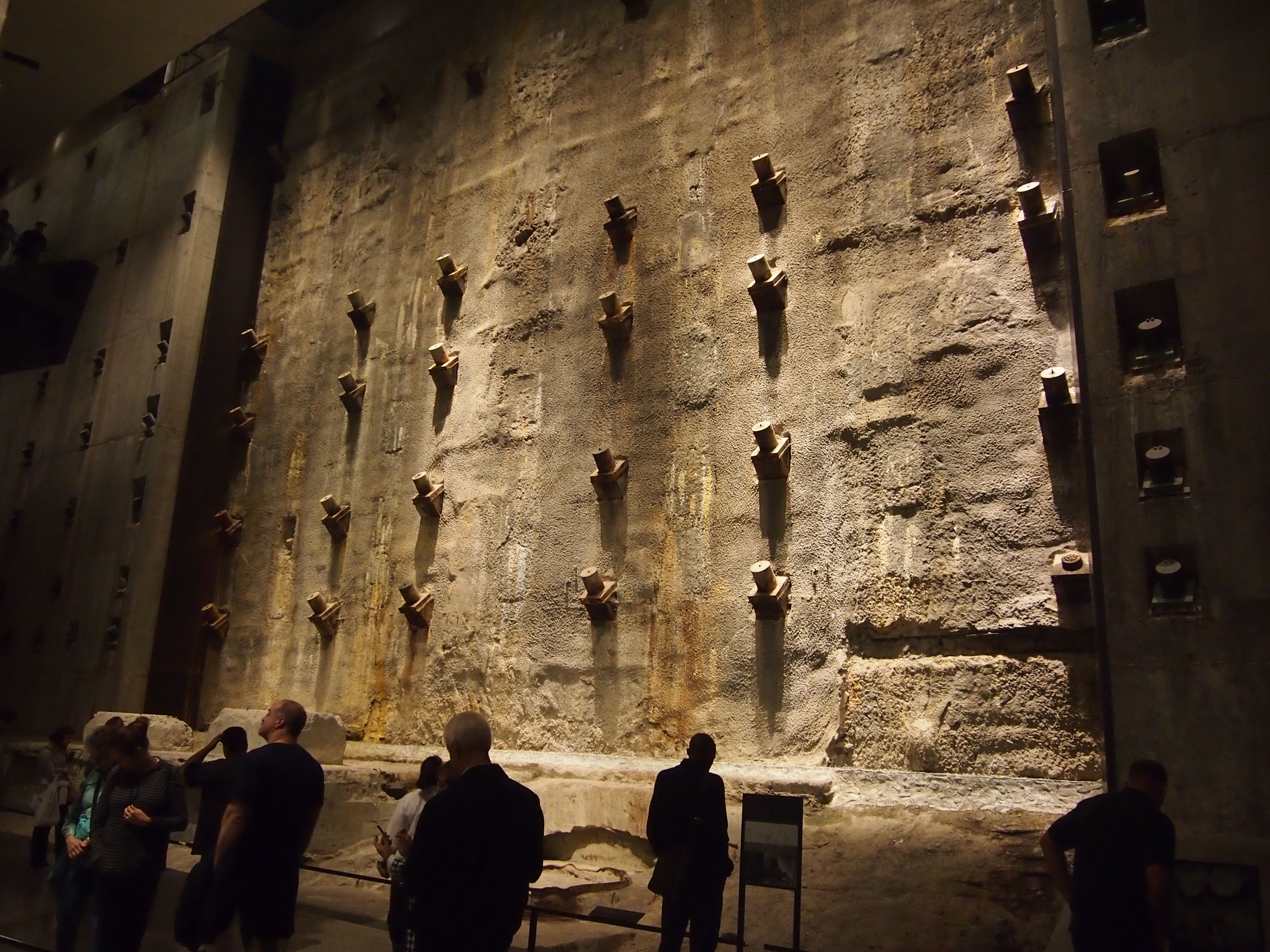
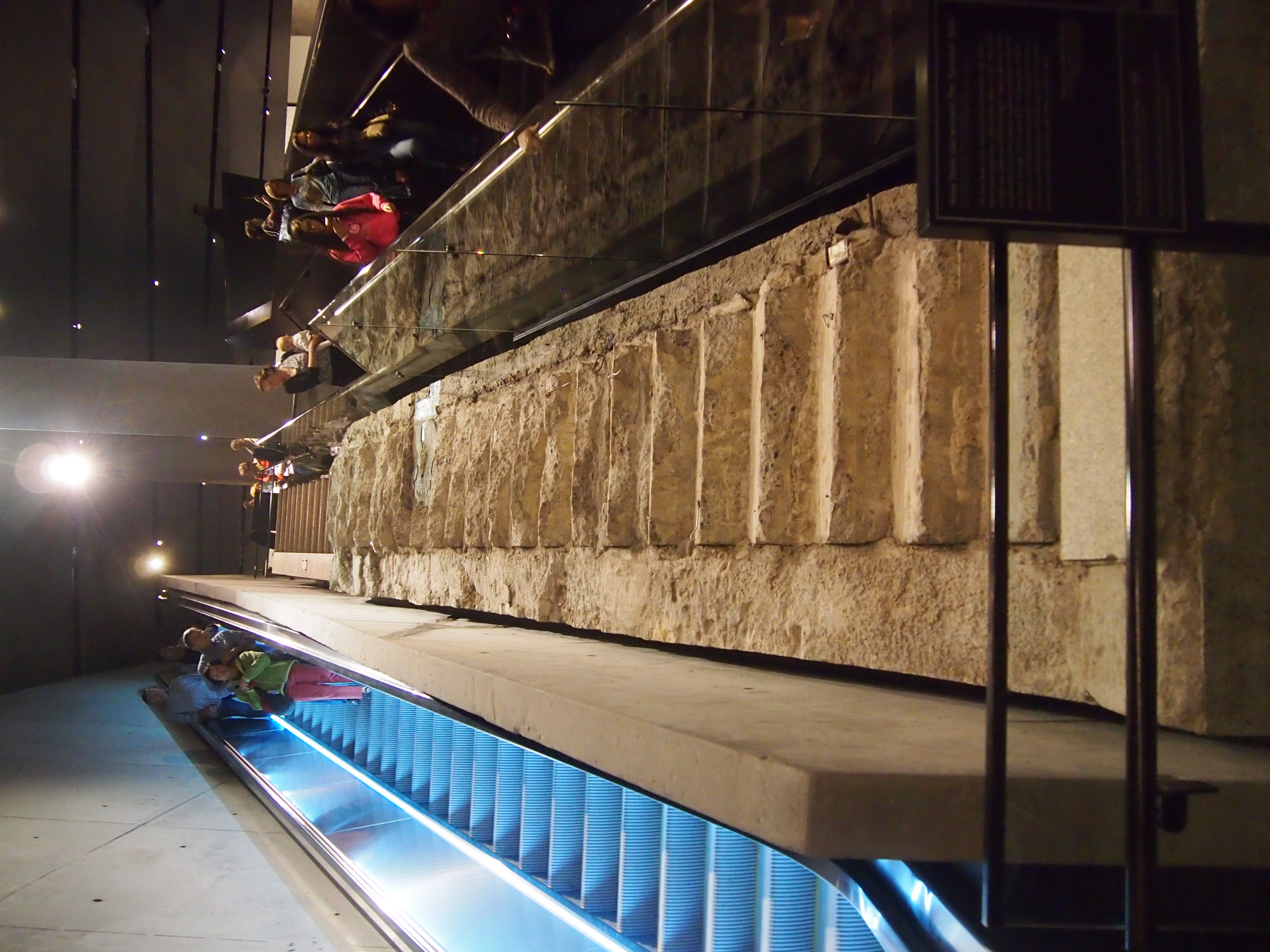
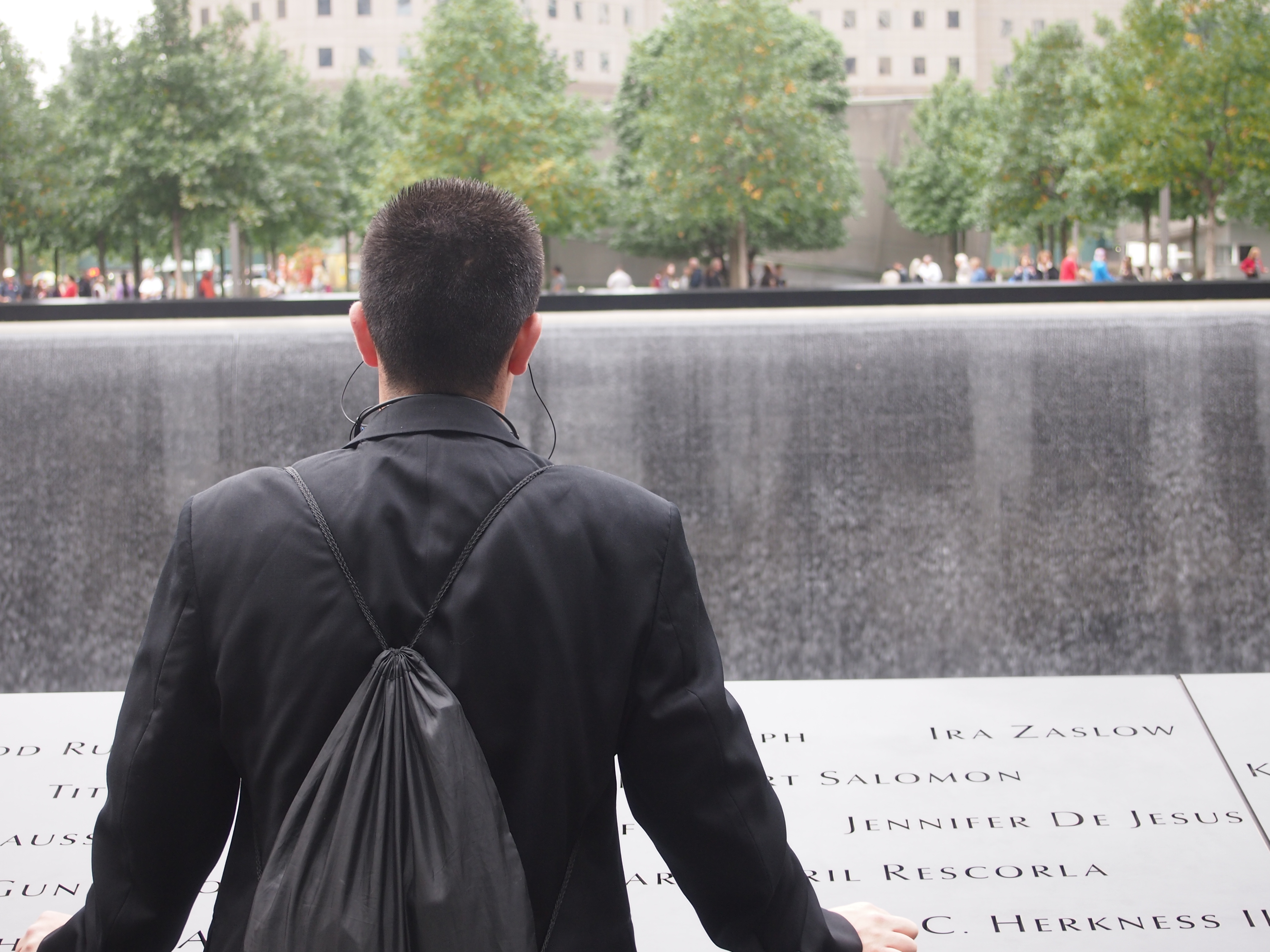
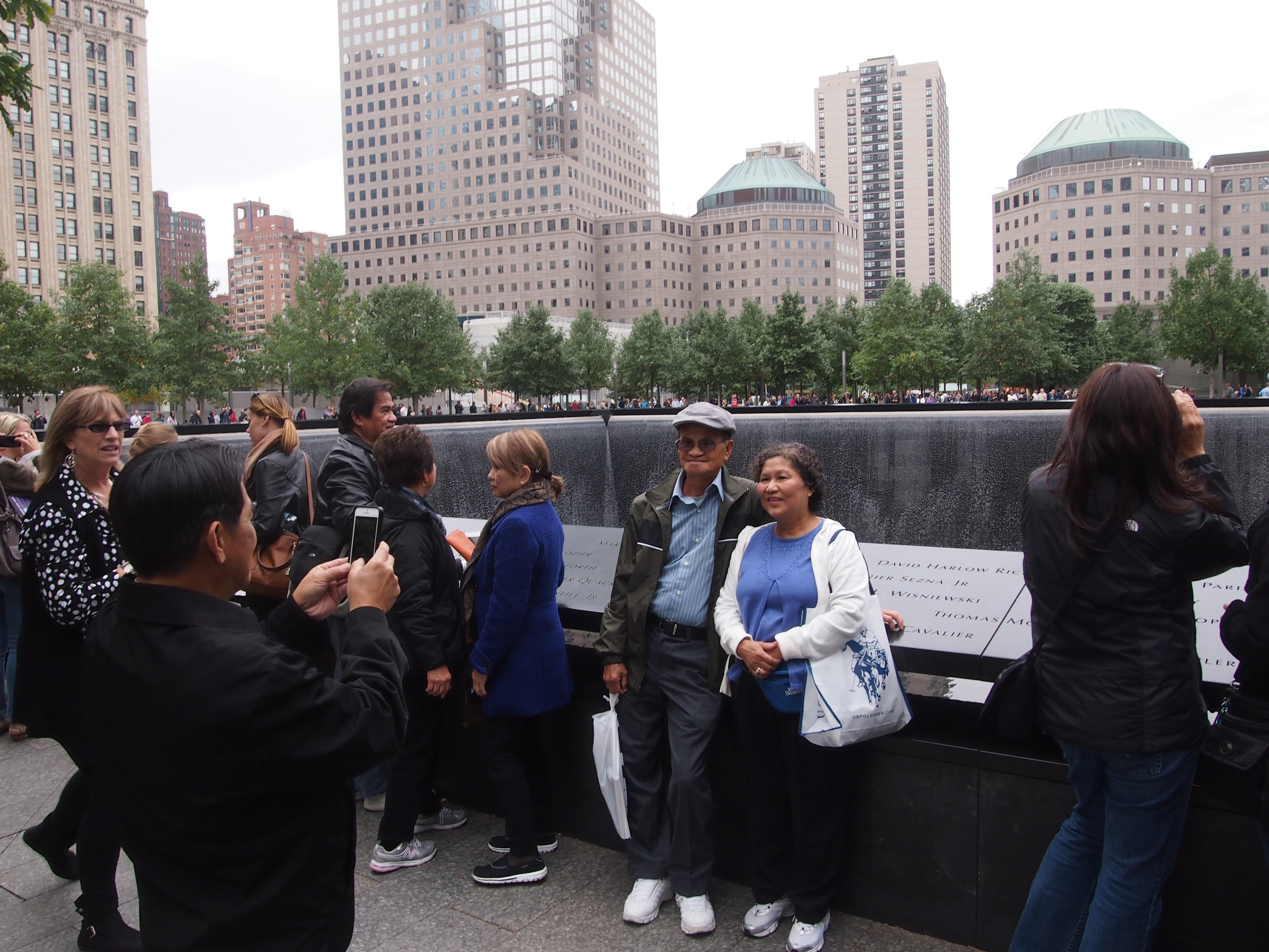
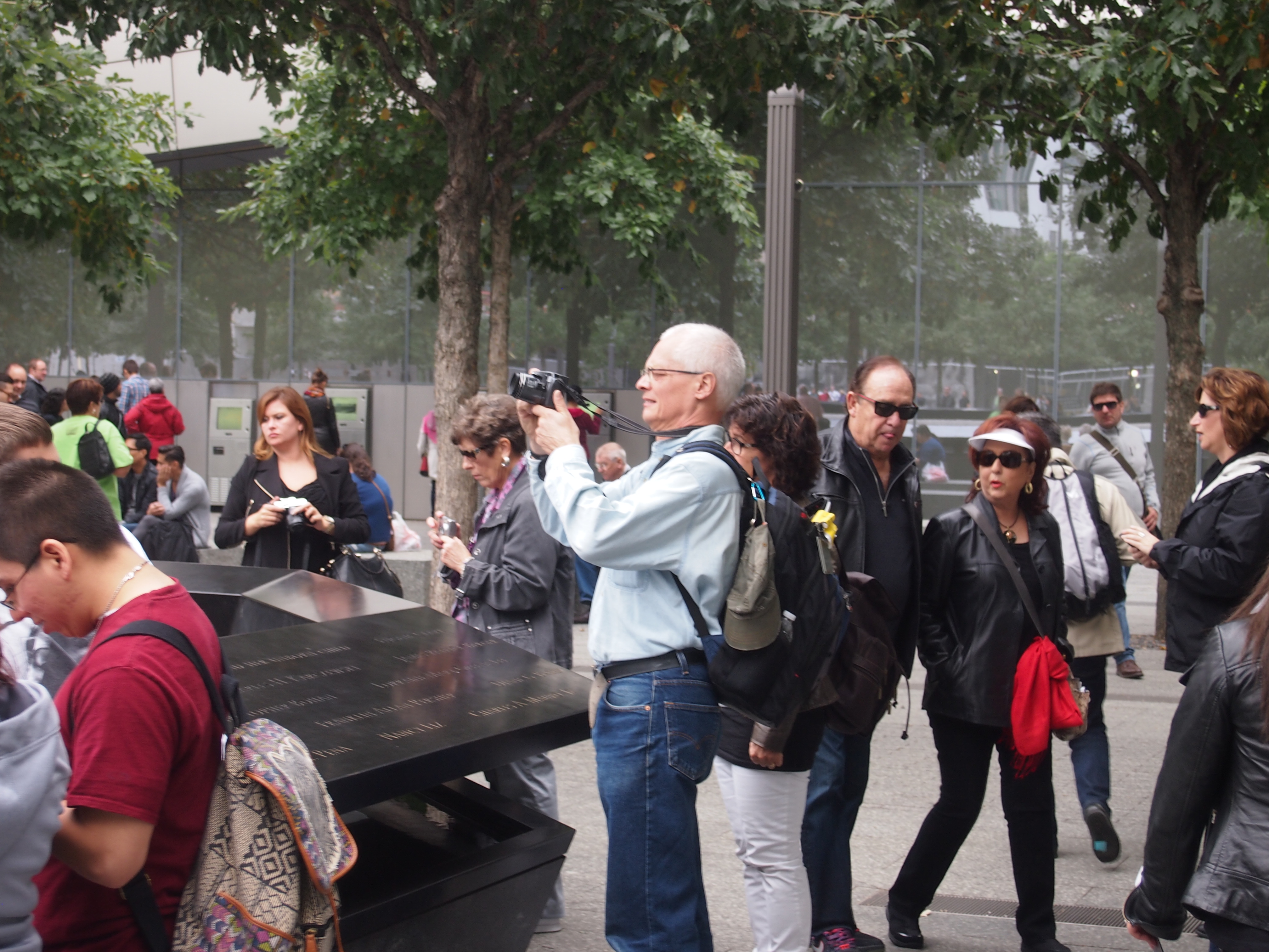
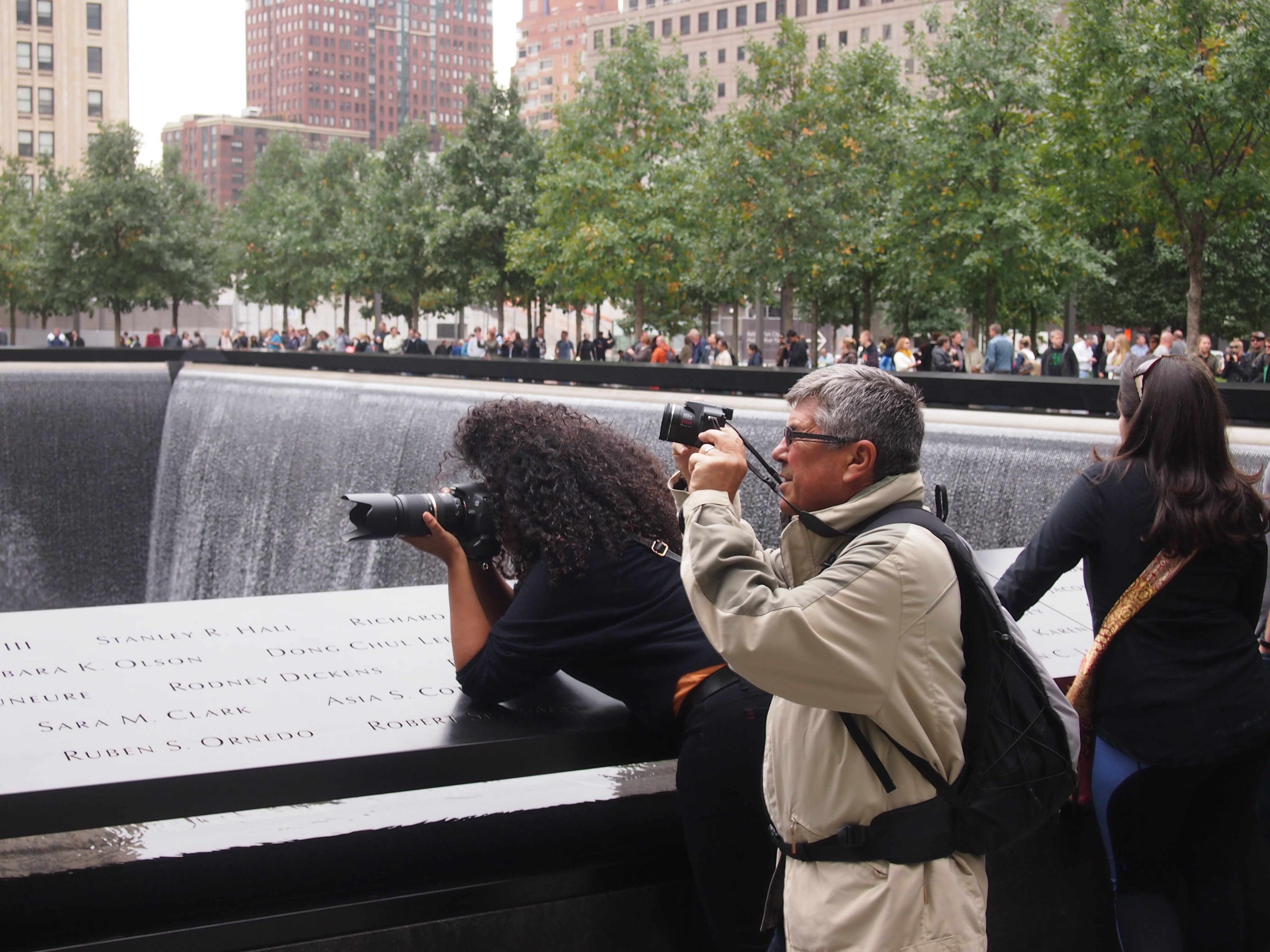
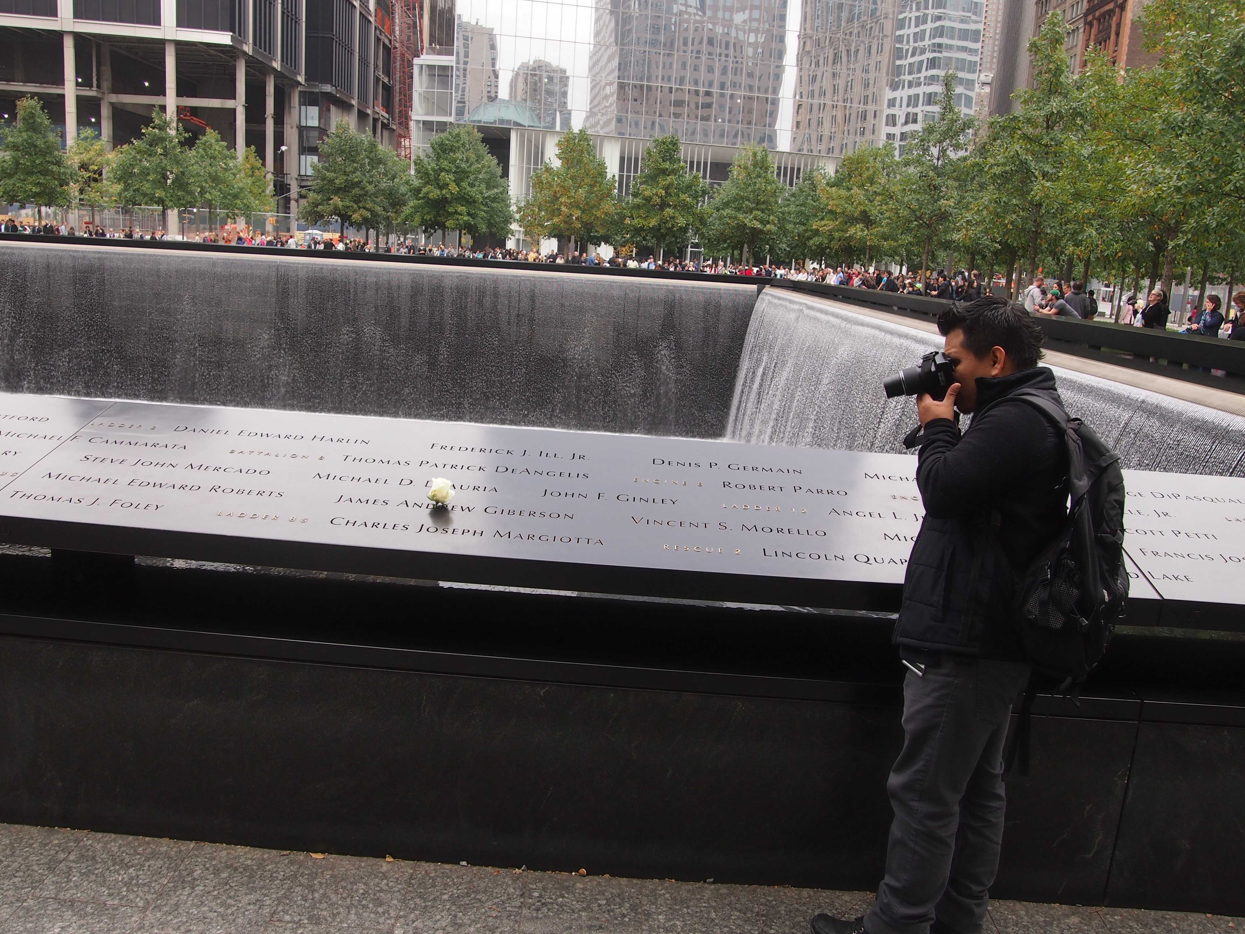
Under construction near the September 11 Memorial Museum: Santiago Calatrava’s World Trade Center Transportation Hub – the new PATH station with service to New Jersey, that is. Behind it is the soon-to-open One World Trade Center. It might now be the tallest building in the Western Hemisphere, but it doesn’t stand out in the skyline like the Twin Towers did. Maybe that’s a good thing.

World Trade Center - new terminal, Oct 10, 2014
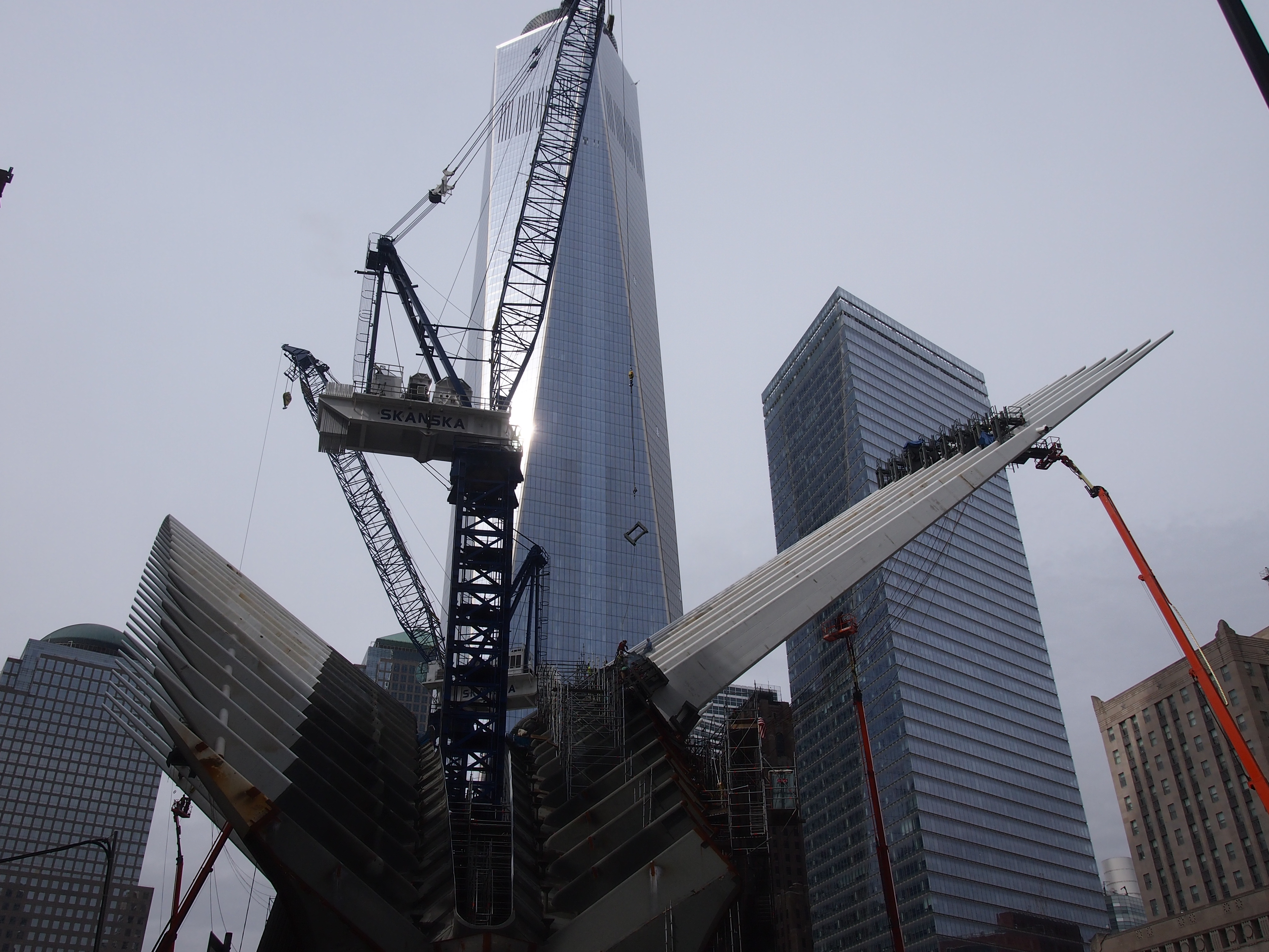
Reviews of Calatrava’s design are mixed. As reviews tend to be. The station will open next year.

The National September 11 Memorial Museum

I didn’t realize it until later, but the National September 11 Memorial Museum, which is mostly underneath the former site of the World Trade Center Towers, only opened in May of this year, as opposed to the memorial, which opened in 2011. You access the museum through timed tickets. I thought it was worth visiting, but I’ll also say this: $24 is too much for any museum, regardless of subject or newness. If I hadn’t been traveling alone, and had to spend nearly $100 just to get my family in, I wouldn’t have gone, though I might have sent my children, who aren’t old enough to remember that day.

I was in the 2:30 pm line on October 10. A lot of other people entered at the same time. From the daylight at ground level, it’s something like entering a cave by walking down a wide ramp. That seemed a little odd at first, but I came around to the idea later, when I noticed signs in various parts of the museum telling me where I stood in relation to the towers, both in vertical and horizontal terms, such as Where You Are Standing Now was in the SE Corner of the North Tower, Third Basement Level (I’m making that up to illustrate the point). There would also be a graphic illustration to help you understand your position. Somehow it seemed important to know that. The space created for the museum used to be the foundation level of those behemoths.

The exhibits cover the building of the towers, their few decades of existence, their destruction, rescue efforts, the excavation, and the rebuilding, among other things. There are tributes to the first responders and the other victims, and displays about the attack on the Pentagon, and Flight 93, and the 1993 attack on the towers (the six victims of that incident are memorialized here, too, as they are at the above-ground memorial).

Much of the material was familiar, but a lot wasn’t. I was interested to learn, for instance, about Radio Row, the nickname of the Manhattan commercial district bulldozed in the 1960s to make way for the World Trade Center redevelopment (local property owners fought the eminent domain taking but lost). Some of images were arresting. Someone, for instance, made a video of the towers early in the morning of September 11, 2001, just after sunrise from the look of it, and it plays on one of the museum walls. Late summer Lower Manhattan was just minding its own business that morning.

Like any good history museum, the National September 11 Memorial Museum sports artifacts. An entire wall is an artifact: the Slurry Wall, built originally to keep the Hudson River from leaking into the lower levels of the tower, and the focus of much concern after the attacks. Namely, would it hold, or would an inundation add to the woes? It held. Part of it forms one of the walls of the museum, rising a few stories.

National September 11 MuseumThere’s also a staircase remnant, the Vesey Street Stairs. A lot of people escaped using those stairs, which survived the collapse, but were damaged during the excavation. They were installed between another staircase and an escalator that lead down into the main exhibit floor.

National September 11 MuseumTwisted girders speak of extreme violence. These are from above the 90th floor of the North Tower, near the area that absorbed the impact.

National September 11 MuseumI wasn’t sure what this was until I read the sign. It was once a section of the antenna on the North Tower.

National September 11 MuseumOne of the fire engines destroyed by falling debris.National September 11 MuseumThis artifact wasn’t moved into location. It is what’s left of one of the box columns that used to support the buildings, so in a real sense the museum was built around it and the others like it. The North Tower had 84 of them, the South Tower 73.

National September 11 MuseumThe museum wasn’t just about the history of the event or the wreckage. An interior room (“In Memoriam”) had four walls covered with faces of the dead, arrayed in rows, with their names. Computer consoles allow you to look up a biographical sketch for any name on the wall. I looked up a few at random, and picked the most unusual name I found on the wall and made a note of it. I have a fondness for unusual names, after all.

I picked Ricknauth Jaggernauth. A fellow originally from Guyana, as it happened. The following is the entirety of his profile in the NYT in October 2001.

“Every day when he came home to Brooklyn from his construction job, Ricknauth Jaggernauth would grab a beer and sit in his front yard, and play with his grandchildren and other neighborhood children until it was time for dinner. ‘My father was a happy, loving, giving man,’ said his daughter Anita, 31. ‘He loved to talk to young people about their lives and about how important it was to get a good education.’

“He would have only one or two beers, but his wife, Joyce, teased him and called him ‘drunkie grandpa,’ a nickname the children used for him. He came here from Guyana 19 years ago, and worked for a company that was renovating offices in the World Trade Center. The day it was attacked, they were working on the 104th floor of the first tower.

“Mr. Jaggernauth, 58, planned to retire in two years and wanted to visit his homeland. He had five children and three grandchildren, and all lived together in the family’s two-story house on Pennsylvania Avenue. His daughter said that if his body is recovered, the family will have a traditional Hindu funeral for him. ‘It’s what he did for his own mother,’ she said.”

The National September 11 Memorial

I knew that the centerpieces of the National September 11 Memorial were the footprints of the World Trade Center towers, and that some kind of pools had been built there. But I hadn’t followed the design or construction very closely.

So I wasn’t prepared for the square black pools with water cascading far down all four sides, down to another, smaller square into which the water seemed to vanish. Or the rows of trees canopying the grounds. Or the people on all sides, looking down into this metaphoric void. Or the names of the dead, etched in black on the parapets around the waterfalls. It was a place to stand and look.

The National September 11 Memorial

The National September 11 MemorialAnd take photographs.

The National September 11 MemorialThe National September 11 MemorialThe National September 11 MemorialThe National September 11 MemorialI understand that an organization puts flowers on the names of victims on their birthdays. So October 10 was James Andrew Giberson’s birthday. He was a fireman who lived on Staten Island, belonging to Ladder 35 in Manhattan, and last seen entering Tower 2.

The High Line

As a public, linear park in Manhattan, and driver of real estate values in its vicinity, the High Line is so new that it didn’t exist in its current form the last time I was in town in the mid-2000s. It was a derelict elevated railroad line then, but the movement to make it a park was well under way, mostly the efforts of citizens inspired by the similar park in Paris with its suitable French name, Promenade Plantée. (There’s also a linear park in development in Chicago, the Bloomingdale Line, and other places; the idea is catching on.)

More about the effort to transform the old line into the High Line is here. I didn’t know, until I read about it, that construction of the original elevated rail line was done as a safety measure, approved in 1929. It replaced a previous ground-level rail line that had been chugging through the West Side of Manhattan for decades. Turns out that running a freight train at ground level through a crowded metropolis isn’t a very good idea. The train’s path was nicknamed Death Avenue.

On the afternoon of October 10, after visiting the September 11 Memorial and Museum, I was fairly tired, but still determined to walk at least some of the High Line. I made my way to the 14th St. entrance and as soon as I was up on the line, I got my second wind. Walking most of the route, to the 30th St. entrance, didn’t tire me further. I went as far as the work on the Hudson Yards Redevelopment project, which the brand-new section of the High Line curves around beginning at 30th, but it was getting dark by then, and I decided not to go any further. The High Line is best seen in the light, better yet in the twilight.

This is the view near the 14th St. entrance, looking north.

High Line, Oct 2014Note the amenities. A plank walkway, plantings on either side, and — sometimes most importantly — places to rest. Not a lot of backless benches, either, but wooden chairs with their backs at a permanently comfortable angle. Not so comfortable you’re likely to fall asleep, but a great place to rest. Sometimes I did. Just a little further north, the High Line passes through the Chelsea Market, where various food vendors are arrayed.

The line also offers some good views of the city below. This is 15th St., looking west.

High Line, Oct 2014This is Tenth Ave., looking north.

High Line, Oct 2014On a pleasant fall afternoon, the High Line is a popular place.

High Line, Oct 2014Further north, there’s even a green tunnel, at least during the warm months.

High Line, Oct 2014At this point, rail lines are embedded in the planks. Must be left over from when the train tracks ran this way. They appear at your feet fairly often, but not always. Sometimes they course through the plantings.

New buildings have sprouted along the line.

High Line, Oct 2014I was amused to see just how many advertisements for nearby buildings bragged about being near the High Line. Once upon a time, property owners in the area wanted the elevated tracks dismantled, never imaging that they’d drive value growth for nearby properties someday.

Green-Wood Cemetery

One of the larger neighborhoods in Brooklyn is a necropolis, with about 560,000 permanent residents: Green-Wood Cemetery. Take the R line subway to either 25th St. or 34th St. station, and you’re there. Fairly early in the morning of October 14, I went to 34th St. station, got a map from the guard at the entrance, and walked right in.

“Founded in 1838 as one of America’s first rural cemeteries, the Green-Wood Cemetery soon developed an international reputation for its magnificent beauty and became the fashionable place to be buried,” the map tells me “By 1860, Green-Wood was attracting 500,000 visitors a year, rivaling Niagara Falls as the country’s greatest tourist attraction…”

Besides groundsmen and other obvious cemetery employees — including one driving a garbage truck — I noticed exactly three other people visiting Green-Wood that morning. It was a weekday, but even so cemetery tourism isn’t what it used to be.

I didn’t have all day – or even all morning – to explore the vastness of Green-Wood, so I cut a path from the 34th St. entrance to the 25th St. entrance, spending about an hour. The better way to see the place would be the trolley tours that the cemetery gives, but I couldn’t fit that into my schedule. Still, I managed to wander some of the paths.

Green-Wood Cemetery, Oct 14, 2014 And marvel that the cemetery has hills. A lot of hills. Since when does Brooklyn have hills? Turns out Brooklyn has glacial moraine hills in spots, especially the cemetery, which in fact includes the highest point in the borough (about 200 feet above sea level).

Green-Wood Cemetery, Oct 14, 2014Note the street sign. There are many streets and paths in Green-Wood and, unlike some other parts of the borough, they’re all well marked.

OLYMPUS Green-Wood Cemetery, Oct 14, 2014DIGITAL CAMERA“Today Green-Wood is 478 spectacular acres of hills, valleys, glacial ponds and winding paths, throughout which exists one of the largest outdoor collections of 19th- and 20th-century statuary and mausoleums,” the map continues. It also points out that there are also 7,000 trees, though I’ve read that some of them were knocked down by Hurricane Sandy. I didn’t see any lingering damage from the storm, but I didn’t really see that much of the place, either.

I did see some funerary art. At the Michel mausoleum, for instance, a pair of dogs waits patiently for their masters – the Michels would be my guess. It’s pretty clear they aren’t guarding the place.

Green-Wood Cemetery, Oct 14, 2014Other mausoleums sported angels.

Green-Wood Cemetery, Oct 14, 2014An awfully female-looking being, considering that angels are thought to have no gender. This particular angel is associated with the mausoleum of Rocco M. Agoglia. You have to like a name like that.

Green-Wood Cemetery, Oct 14, 2014Find A Grave, for what it’s worth, tells me that “Rocco M. Agoglia of 7717 Narrows Avenue, Brooklyn, New York, died suddenly at Amityville, Long Island, on July 1, 1931. He was 69 years old. He is survived by eight sons, John, Fury, Sylvester, Arthur, Joseph[,] Rocco Jr., Herman and George, and one daughter, Mrs. Ida Carey.”

Fury? At least his many children (presumably) still had the scratch during the Depression to commission a nice mausoleum for their father in Green-Wood, which causal passersby can still see here in the early 21st century. Or maybe they couldn’t pay for it until a lot later. Or maybe Rocco himself paid for it before he needed it. Anyway, there it is.

Jesus Himself makes an appearance above this stone.

Green-Wood Cemetery, Oct 14, 2014Being such a fashionable cemetery at one time, Green-Wood sports a good many notable dead people, especially but not exclusively from the 19th century. The map notes some that are instantly recognizable, such as Henry Ward Beecher, Leonard Bernstein, DeWitt Clinton, Henry Halleck, Samuel Morse, Boss Tweed, Horace Greeley, and Louis Comfort Tiffany. Others noted include Cooper Union founder Peter Cooper, “Father of Baseball” Henry Chadwick, silent movie star William S. Hart, actress Laura Keene, artist Jean-Michel Basquiat, “dancer, adventuress” Lola Montez, Broadway lyricist Fred Ebb, and “Steeplechase founder” George Tilyou.

I really wanted to visit Boss Tweed, but he was pretty deep into the cemetery, so I had to settle for a handful of other notables. Such as D.M. Bennett.

Green-Wood Cemetery, BrooklynD.M. Bennett? I’d never heard of him, either. But DeRobigne Mortimer Bennett (1818-1882), his stone says, was “the founder of The Truth Seeker, the defender of liberty and its martyr, the editor tireless and fearless, the enemy of superstition, as of ignorance, its mother, the teacher of multitudes… though dead, he still speaks to us and asks that we continue the work he left unfinished.” Though it’s arrant reductionism, I’m going to characterize him as a free-love advocate. At least, Comstock busted him for sending free-love pamphlets through the mail.

Later I found my way to the large memorial of DeWitt Clinton (1769-1828), sixth governor of New York and main impetus behind the Eire Canal (“DeWitt’s Ditch”) – which, if you think about it, makes him an indirect founder of Chicago. He has a statue atop his grave, with the plinth memorializing the building of the canal.

DeWitt Clinton StatueThe sun wasn’t in the best position for a good shot of Gov. Clinton, but I gave it a go.

DeWitt Clinton statue Note that good republican that he was, the governor’s wearing a toga. He is not, however, bare-chested, unlike a certain noteworthy statue of George Washington. The Clinton statue is by Henry Kirke Brown, better known for equestrian statues in New York.

Roosevelt Island & the Queensboro Bridge

I’d seen Roosevelt Island on maps before, even knew that before it honored the 32nd President of the United States, it was known as Welfare Island (and Blackwell’s Island before that.) But I didn’t give it much thought until earlier this year when I wrote in passing about a development on the island. People do live there, and they even blog about its charms. Or used to.

Roosevelt Island is a skinny piece of land in the East River, about two miles long but only 800 feet wide at most. All together, that’s about 147 acres, with a population of 12,000 or so, and politically part of the borough of Manhattan. Residential use is relatively new in the history of the island, unless you count a long line of hospitals and prisons and the like as residential properties. Recently I read a bit more about it, and found out intriguing things, so I decided to visit on October 12 (arriving by aerial tram, as mentioned yesterday).

After leaving the tram, I headed south, soon finding a relic of earlier time, namely the south campus of the Coler-Goldwater Specialty Hospital and Nursing Facility, which is currently surrounded by a fence and being demolished.

Roosevelt Is Oct 12, 2014The walkway to the southern tip of the island is still open, and on a warm October afternoon, offered walkers a nice view of Manhattan on one side and cherry trees on the other.

Roosevelt Is Oct 12, 2014Further south are the ruins of the Smallpox Hospital. That’s really what I came to see. There aren’t many ruins to see in New York, even fewer that that are landmarks. This is the only one, in fact.

Roosevelt Is Oct 12, 2014

Roosevelt Is Oct 12, 2014The sign at the site says: “The Smallpox Hospital, also known as the Renwick Ruin, was designed by James Renwick Jr (1818-1895) and built between 1854 and 1856. James Renwick was the architect of Grace Church and St. Patrick’s Cathedral. The hospital is designed in the Gothic Revival style and is faced with locally quarried grey gneiss.

“The hospital opened in 1856, with room for 100 smallpox patients, on what was then known as Blackwell’s Island. It was converted in 1875 into a training school for nurses. The building was abandoned in the 1950s. In the late 1960s, the NYC Landmarks Preservation Committee deemed it worthy of preservation… as ‘a picturesque ruin.’ ”

Roosevelt Is Oct 12, 2014At the southern tip of the island is the four-acre Franklin D. Roosevelt Four Freedoms Park, opened only in 2012 after years of some kind of wrangling between the city and donors that I don’t feel like investigating further. Anyway, the park is there now, designed four decades ago by Louis Kahn. A large floating FDR head greets visitors to the park. I later found out that it dates from the 1930s, done by sculptor Jo Davidson (who did Emma Goldman’s gravestone portrait, among many other things). For a sense of scale, I took a picture of a man and boy at the statue; maybe he was telling the lad who this enormous head was.

http://dees2.blogspot.com/2011/11/commie-plots.htmlBeyond the FDR bust is a triangular patch of land planted with rows of trees on either side, and other features, leading to a space that I’ve read is called The Room, which is partly but not completely enclosed by granite walls. There you can find the Four Freedoms carved in stone. The Room is at the very tip of the park, and the island, and the view from there is one of rocks, bridges, and the shores of NYC. An AIA article about the park is here.

The island also offers fine views of the Queensboro Bridge, standing now for more than a century. Co-designed by Henry Hornbostel and Gustav Lindenthal and overshadowed in the popular imagination by the prettier Brooklyn Bridge, it’s still worth a good look. This is the bridge going to Manhattan.

Queensboro Bridge, Oct 12, 2014And going to Long Island City in Queens.

Queensboro Bridge, Oct 12, 2014For the centennial of the bridge in 2009, the NYT did an item that noted, “Hornbostel and Lindenthal, who was the city’s bridge commissioner in the early years of the 20th century, are no longer household names. [Hornbostel might be better known in Pittsburgh.] For a while this month, the Web site of the city’s Bridge Centennial Commission referred to Hornbostel as ‘Henry Hornblower.’ By Friday, his name had been corrected. Besides the Queensboro, the two men also designed the Hell Gate Bridge, which links Queens and the Bronx.”

The Roosevelt Island Tramway

Who doesn’t like a good aerial tram ride? I know I do. New Yorkers also seem to like a good aerial tram ride. At least the Roosevelt Island tram was packed full when I rode it on October 12, a clear Sunday afternoon. Since it was Sunday, I knew they were pleasure-seekers, not commuters.

To ride the Roosevelt Island tram, you either have to go to 60th St. and Second Ave. in Manhattan, or the station on Roosevelt Island itself, which is accessible by subway and road. I wanted the experience of riding from Manhattan to Roosevelt Island, so I took the subway to Lexington Ave. & 59th St. and walked the short distance to the tram station, which is at the top of its own tower.

As I mentioned, the car was full. Excited kids were up front for the view, which starts in above a major street, then goes up over the East River, with the Queensboro Bridge to the right (officially named after Ed Koch, but I don’t think anyone calls it that) before dropping down to the tram station on the island.

Roosevelt Is Tram

It’s a short, smooth ride to the island. Unlike some of the skyrides I’ve been on, there was very little bumping as you roll over the wheels on the towers holding the thing up. A little later, I took a picture of one of the cars coming over, appearing to glide under the bridge, but in fact on the other side.

Roosevelt Is Tram + Queensboro BridgeOne of the cars as it leaves the station on Roosevelt Island. I’ve read they they aren’t the original cars, but newer ones acquired for the renovation of the system a few years ago.

Roosevelt Is Tram Oct 12, 2014Tram basics, as provided by Billie Cohen in a NYT series about commuting in the region: “Until Portland, Ore., opened its aerial commuter tram in 2006, the Roosevelt Island tram was the only commuting one in America… Well, our tram was first, and it has swooshed across the East River since 1976. It travels 16 miles per hour, completing its crossing of the river in four and a half minutes and reaching a height of 250 feet, which is higher than the Queensboro Bridge at certain points.

“The tram runs every seven and a half minutes during rush hour and fits a maximum of 125 people… The tram was originally conceived to be a temporary solution to the island’s lack of subway service. Prior to its inception in 1976, anyone traveling to Roosevelt Island rode a trolley across the Queensboro Bridge, which was equipped with an elevator to take people down to the island. A restored trolley kiosk now serves as a visitor center and is located on the site of the elevator building. The F-train station on Roosevelt Island opened October 29, 1989.”

The Brooklyn Museum

The Brooklyn Museum looks like it could have been at the 1893 Columbian Exposition, and there’s a good reason for that. It’s a Beaux-Arts building from about that period – bright white, domed, columned in front, complete with a pedimental triangle filled with statuary  — designed by McKim, Mead and White, who also did one of the important buildings at the fair (the Agricultural Building), though not one that survived. Anyway, it looks like an art palace. And that’s what it is, coming in at 560,000 square feet and holding a collection of 1.5 million works.

In a lot of other places, it would be a top-dog art museum in town. As it is, the Brooklyn Museum competes for attention with the likes of the Met and MoMA. For casual visitors, that’s an advantage. The museum wasn’t nearly as crowded as those big boxes in Manhattan and, for that matter, not as expensive to get in. The art’s also just as interesting.

I’m not very methodical when it comes to large museums. Or small ones either. I go in, wander around, maybe consult a map, or recall what I’ve heard about the place, and look at whatever strikes me as worth looking at. That’s usually a lot of things. So I took a two-and-a-half-hour whack at the Brooklyn Museum on October 11.

Of course all you’ll get that way is a small sample. The museum has collections of American, European, African, Islamic, Pacific Island, Asian, contemporary, and decorative art; a large collection of Egyptian, Classical, and Near Eastern works; photography; the Elizabeth A. Sackler Center for Feminist Art; The Steinberg Family Sculpture Garden; and special exhibits, such as the one when I visited on the art of the high-heel shoe (I missed it). I spent the bulk of my time in the European collection and the Egyptian rooms, though I passed through a fair number of other galleries.

It’s good to wander a sizable museum sometimes, just to be reminded that the human urge to create art is strong, and just about universal. Besides, even a small sample – if the museum is any good – offers a lot.

Such as two enormous, arresting canvasses by Vasily Vereshchagrin (1842-1904), “Resting Place of Prisoners” and “Road of the War Prisoners,” which hang on a third floor wall within sight of that floor’s elegant dome room, along with other Russian works. One depicts prisoners grouped together in the middle of a blizzard; the other, a road littered with the frozen dead.

The museum describes the latter this way: “In the winter of 1877, while working as a war correspondent, [Vereshchagrin] witnessed thousands of Turkish prisoners freezing to death while being marched to Russian war camps…The openly antiwar “The Road of the War Prisoners” was rejected for the czar’s collection, but Vereshchagin finally sold both canvases displayed here in 1891 to collectors in New York still reeling from the horrors of the American Civil War.”

Not far away, and less grim, was a fine portrait, “Old Trombola” by Boris Gregoriev (1886-1939). “In Old Trombola, Grigoriev heightens his sitter’s emotional state by emphasizing his intense gaze and exaggerating the sculptural qualities of his weathered hands and face,” the museum notes. “Grigoriev later wrote, ‘I have been watching and studying the Russian people for many years … and these paintings are the fruits of my observations.’ ”

Besides the Russians, the European collection had plenty else, such as a self-portrait by Gerrit Dou (1613-1675) that, according to the museum, has only recently been identified as genuinely his. In storage since 1945, it was returned to display in 2014.

Naturally, I spent a good chunk of the visit in the mostly Egyptian wing. Not my favorite part of Antiquity, but always worth a look. It’s billed as one of the largest collections of ancient Egyptian art in the U.S., and I believe it: room after room of statues and other sculptures, friezes, papyri, pots, jewelry, tools, and of course sarcophagi and mummies. My favorite name among the items I saw – so delightful I wrote it down – was the Cartonnage of Nespanetjerenpere, which besides having a good name, was a handsome work.

The museum’s been at Egyptology for more than a century now. “The Brooklyn Museum’s collection of ancient Egyptian art, one of the largest and finest in the United States, is renowned throughout the world,” it asserts. “The Museum began acquiring Egyptian antiquities at the beginning of the twentieth century, both through purchases—such as a group of Egyptian objects collected by Armand de Potter in the 1880s—and through archaeological excavation. [Back when the getting was good, in other words.] Between 1906 and 1908, the Museum sponsored an expedition that dug at very early sites in southern Egypt and brought back numerous objects of historical and artistic value.

“Between 1916 and 1947, the Brooklyn Museum acquired the important collection formed by the pioneer American Egyptologist Charles Edwin Wilbour (1833–1896), which included many types of Egyptian antiquities, from fine works of statuary and relief to unique documents written on papyrus. In addition to his collection of objects, Wilbour’s heirs also donated his professional library to the Museum and established a financial endowment in his memory. The Charles Edwin Wilbour Fund made possible the establishment of both the Wilbour Library of Egyptology, one of the finest Egyptological libraries of its kind anywhere in the world, and a curatorial department for ancient Egyptian art.”

Wow, an Egyptological library right here in the USA. Egypt might not be my favorite, but how cool is that?

Brooklyn Ramble

There’s a stone in Brooklyn Bridge Park, near the edge of the water at the place once called the Fulton Ferry Landing, with a plaque on it. Naturally, I had to look at it.

THIS TABLET MARKS THE BROOKLAND FERRY LANDING FROM WHICH POINT THE AMERICAN ARMY EMBARKED DURING THE NIGHT OF AUGUST 29TH 1776 UNDER THE DIRECTION OF GENERAL GEORGE WASHINGTON ABLY ASSISTED BY COLONEL JOHN GLOVER OF MARBLEHEAD, MASSACHUSETTS. Erected by the Brooklyn Bridge Plaza Association 1929.

Washington’s famed escape, helped by the weather as well as Col. Glover and his men, happened right there, back before the 19th- and 20th-century docks occupied the area, back before it was in the shadow of the Brooklyn Bridge, back before the redevelopment of the area into a public amenity for 21st-century New Yorkers. It was good to find a presidential site on my walkabout in Brooklyn on October 11.

By the time I got to Brooklyn Bridge Park, I’d been walking much of the afternoon, and was also glad find the many benches available at the park, among the greenery and other amenities. From that vantage, the Brooklyn Bridge looms large, gracefully taking up the sky, its great stone towers hung with the familiar web of steel cables. Hard to believe something so hard and massive can give the impression of floating, but it does. I was reminded of the time I sat under that other late Victorian metal marvel, the Eiffel Tower, gawking up at it. One horizontal, one vertical, both gargantuan works of sculpture, besides being engineering feats that I can’t pretend to understand (and in the case of the Brooklyn Bridge, critical infrastructure).

A constant stream of pedestrians, silhouettes of walking figures, crossed the bridge as I watched. I didn’t remember the foot traffic on bridge being so heavy, but my hazy memories of walking across the bridge in 1983 involve a hazy summer day. I don’t remember my exact route then, but after crossing from Manhattan to Brooklyn – the first time I’d been to the borough — I made my way to the Brooklyn Heights Promenade, famous for its view of Manhattan, and sat around there for a while. I found, or bought, a newspaper, and I read about the assassination of Benigno Aquino on the promenade. I’d never heard of him before.

Behind the Brooklyn Bridge, at least from the vantage of the park, is the Manhattan Bridge, which is overshadowed by its neighbor. But it too has its aesthetic charms. One of these days, I ought to walk across it as well. The Manhattan Bridge is the newer of the two, designed (in part) by Leon Moisseiff and opened in 1909. Moisseiff’s better known for consulting on the Golden Gate Bridge design and, infamously, the original Tacoma Narrows Bridge.

Brooklyn Bridge Park is a fine new public space. Brooklynbridgepark.org says it “extends 1.3 miles along the East River on a defunct cargo shipping and storage complex. The ambitious park design sought to transform this environmentally hostile site into a thriving civic landscape while preserving the dramatic experience of the industrial waterfront. This site also presented excellent opportunities including its adjacency to two thriving residential communities and its unparalleled viewsheds to the fabled Lower Manhattan skyline.” Viewshed, there’s an urban planning word you (I) don’t see much.

“Brooklyn Bridge Park’s lush lawns, young trees and beautiful flowers have created a robust landscape and brought nature to this former industrial site. Public access to the long, narrow site was enabled by ‘urban junctions,’ neighborhood parks at key entry points that transition between the park and adjacent residential communities. These entry parks host program such as dog runs, civic lawns and playgrounds, which foster community stewardship and the safety that comes with constant occupation.”

I’d come to Brooklyn Bridge Park after spending the afternoon in Downtown Brooklyn and then the Brooklyn Museum, which is near Prospect Park. Then I took the subway to the High Street station, which actually deposited me at a large street called Camden Plaza West. From there I crossed through a small section of Brooklyn Heights notable for the Fruit Streets: Cranberry, Pineapple, and Orange, which each feature a few blocks of brownstones, former carriage houses, wood frame structures, small restaurants and shops, and a few churches (including Plymouth Church, whose first pastor was Henry Ward Beecher; I didn’t know it was there until later). Enormous trees shelter the neighborhood, and in some spots, roots push up parts of the ancient sidewalk. It was easily the most handsome neighborhood I encountered during my visit, and probably one of the more expensive in Brooklyn these days. Much more about the area around Middagh St. (which parallels the Fruit Streets) is here.

Walk far enough down a Fruit Street and you reach the Fruit Street Sitting Area, a small park – near but apparently not part of the Promenade — with a large view of Lower Manhattan. I arrived just as the sun was setting. Complete serendipity, and I sat down to enjoy it. A number of other people were there to watch the glow off in the west.

As I left the area, I noticed that the playground across the street from the Sitting Area is named for Harry Chapin, who was from Brooklyn Heights. I hadn’t thought about him in a long while. I wondered how long it had been since he died in an accident on the Long Island Expressway – 10? 15 years ago? Later, I looked it up. He died in 1981. This kind of memory disconnect happens sometimes.

Proceeding down a steep hill – and there aren’t many of those in New York – on a street called Columbia Heights, I came to Brooklyn Bridge Park, and a bit of the area lately known as Dumbo — Down Under the Manhattan Bridge Overpass, supposedly. I wandered around there as it grew dark, though I didn’t make it as far as the Manhattan Bridge on foot that evening. I’d written about the district before, since it’s the kind of place where former industrial buildings become residential properties. Eventually I cooled my heels on a bench at Pier 1 in Brooklyn Bridge Park and watched the city and the bridges light up.

Brooklyn ’14

So that explains it. New York ComicCon was at the Javits Center in Manhattan from October 9-12. Normally this would concern me not at all, but when riding the subway in Manhattan last week, sometimes I noticed youth in costumes, some elaborate, that seemed to evoke comic book characters, though none I recognized. Being too early for Halloween, despite marketers’ best efforts to pull that event forward, I figured it was something else.

But the oddest thing I saw in the subway was a normally dressed young woman waiting for a train going Uptown. She looked a little bored. Then I noticed the unloaded crossbow that she was holding, pointing down. Where does one practice crossbow on this teeming, crowded island? There must be an indoor range somewhere. Still, it was something you don’t see every day, not even in New York.

I left for New York on October 9 and returned on the 17th. I had business to attend to, but also made an effort to see things I hadn’t before. No matter how many times you visit – and I’ve lost count now – there’s always more, since New York is just that kind of place. I spent time in Manhattan, of course, but the focus this time around was Brooklyn. Over the years, my visits to the borough have been only sporadic, and now they say it’s the place to be in New York. My nephew and his flatmates in Bed-Stuy, who are passing their young manhood there, were good enough to put me up.

So I walked the streets and rode the trains, and a few buses. I ate barbecue, supposedly Texas style, Southern-style chicken (though not quite spiced in any Southern style I know), a Turkish gyro, a Cuban sandwich, slices of pizza standing up, some pretzels, food at diners – surprisingly common in the city – and visited a few tiny grocery stores, the kind large boxes have killed in most places, because Ye Shall Know Them by Their Grocery Stores. Almost everything is overpriced, but what isn’t in that part of the country? I marvel that the non-wealthy can live there at all.

In Manhattan, I made it to the High Line, a truly remarkable new public space, and the September 11 Memorial and Museum, besides a few moments at familiar old places, such as Grand Central and the streets of Midtown. In Brooklyn, I wandered around parts of Bed-Stuy, Downtown, Brooklyn Heights, and Dumbo. Every now and then, I would see a development, usually an apartment building, that I’d written about at one time or other.

Brooklyn Bridge Park, besides being up close under that highly aesthetic feat of bridge engineering, is also a truly remarkable new public space. One morning I got up early and made my way to the bucolic and vast Green-Wood Cemetery, south of Prospect Park. One afternoon I spent a few footsore hours in the Brooklyn Museum, an institution overshadowed by the big-box museums on Manhattan, but a palace of art in its own right.

Years ago, I took a Circle Line tour, which involves taking a boat all the way around Manhattan while a guide makes bad jokes on the intercom. Or at least it did then. This time, I opted for the much cheaper East River Ferry, for a view of the city by night, and no narration. Also, I took a walk on Roosevelt Island, taking the aerial tram to get there, in the company of other tourists, but also a fair contingent of Hasidim on an afternoon excursion.

On the whole, the place made me tired. It’s crowded, noisy, dirty and expensive. Who would have it any other way? I’m glad I was able to make it this year.