The Great American Traffic Jam

Back to posting on September 5. If you can’t take Labor Day off, when can you?

One more thing about the Great American Solar Eclipse. It was followed by the Great American Traffic Jam. Or, to hark back to an increasingly distant bit of history, the Mother of All Traffic Jams.

We left Paducah, Kentucky, at about 2 p.m. on August 21. It took us about 12 hours to get home. Twice as long as under normal conditions.

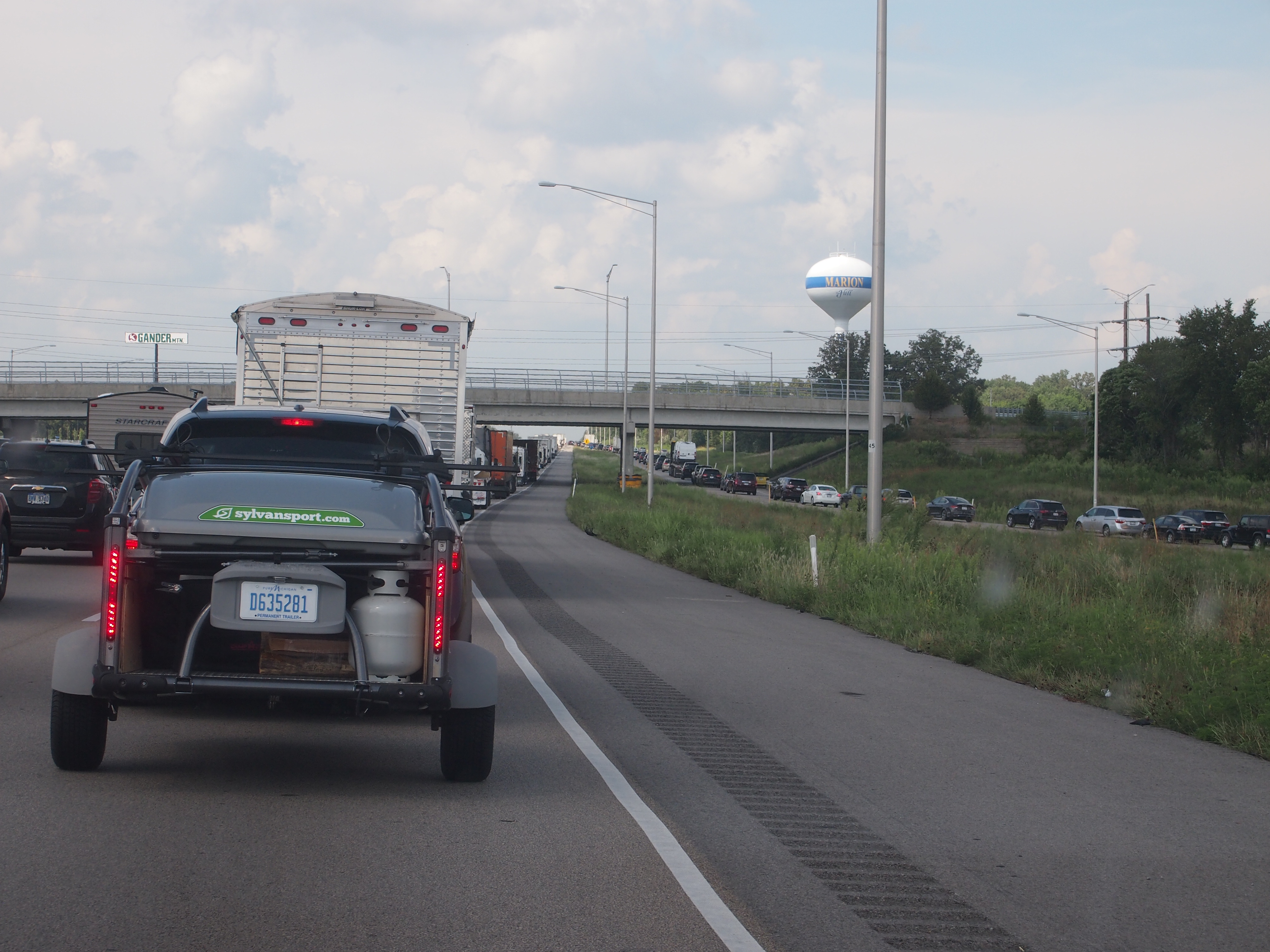
Since not a lot of people jammed into Paducah to see the eclipse, I-24 north from the town wasn’t bad at all. Even I-57 wasn’t too crowded at first, until around Marion, Illinois. Then traffic stopped dead.

So much so that I could take a picture of the road ahead, at my leisure, while in the driver’s seat. No one was moving.
Traffic Jam August 21, 2017A lot of people had gone to Carbondale, west of Marion, to see the eclipse. The road from Carbondale, Illinois 13, meets I-57 at Marion. Google Traffic showed red and worse for miles and miles north of there.

After a long time of not moving at all, punctuated by exciting periods of slowly crawling along, we were able to get off I-57 and take to smaller roads, such as Illinois 1 and 130 and others. We should have done that from the get-go, but I mistakenly thought traffic would only be heavy on I-57, not molasses.

The alternate routes didn’t entirely get us away from traffic, and at times we encountered slowdowns, such as when hit by a lot of rain. That was the weather system that clouded over the partial eclipse in the Chicago area, and which would have obscured totality for us had it arrived further south a day earlier. Sometimes you, and thousands of others, get lucky.

Our onboard navigation system wasn’t a lot of use. No matter where you were, or what the traffic conditions were, its suggestions to get home amounted to get on the nearest Interstate. If it were programmed to nag, it would have said, “Why aren’t you on the Interstate? You know that’s the best way to go. Get on the Interstate!” Robert Moses isn’t dead.

My old friend Tom was in Madisonville, Tenn., for the eclipse, reporting flawless weather for the event, as seen from Kefauver Park (as in, Estes). He also said getting back to Atlanta involved sticky traffic and a succession of small roads.

Enough about the traffic. It was merely an unpleasant coda to an otherwise remarkable experience. When we finally got home, exhausted, I asked a rhetorical question: Was it worth it? Was it ever.

More Vincennes

At Grouseland in Vincennes, during the tour, our guide pointed out a sizable crack in the wall of one of the upstairs bedrooms. She said that was the only damage to the interior walls that the long-time modern owners of the property, the Daughters of the American Revolution, decided not to repair. That’s because the 1811-12 New Madrid earthquakes make the crack. That crack might be the only visible relic anywhere of that long-ago event. Historic damage preservation, you might call it.

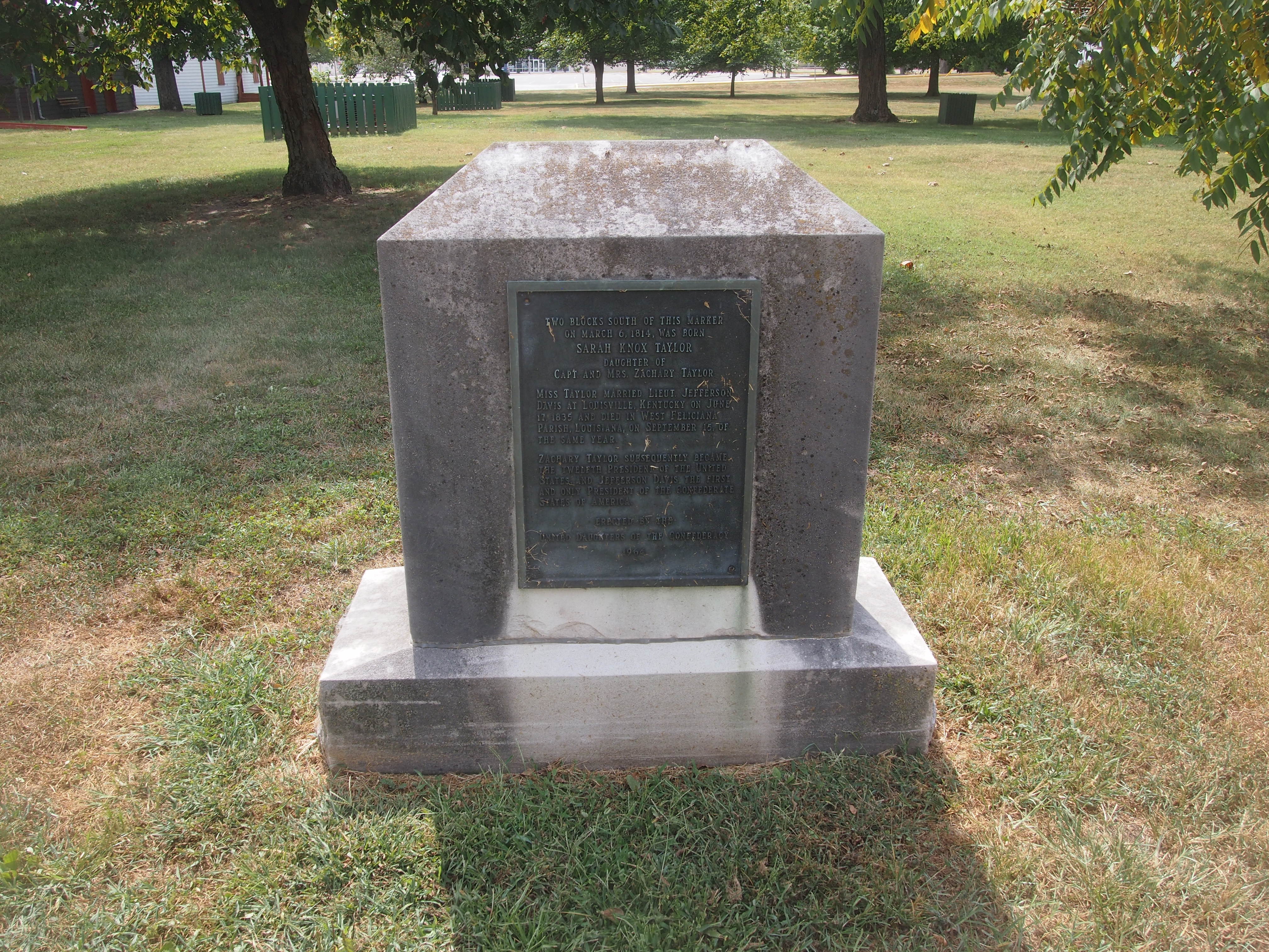
Outside of the Harrison mansion are a few memorials, one of which is homely indeed.
Two blocks south of this marker on March 6, 1814, was born Sarah Knox Taylor, daughter of Capt. and Mrs. Zachary Taylor.

Miss Taylor married Lieut. Jefferson Davis at Louisville, Kentucky on July 17, 1835 and died in West Feliciana Parish, Louisiana, on September 15 of that same year.

Zachary Taylor subsequently became the twelfth President of the United States, and Jefferson Davis the first and only President of the Confederate States of America.

Erected by the United Daughters of the Confederacy 1964

A Confederate memorial, sort of, but somehow I doubt that memorial revisionists are going to be flustered by it.

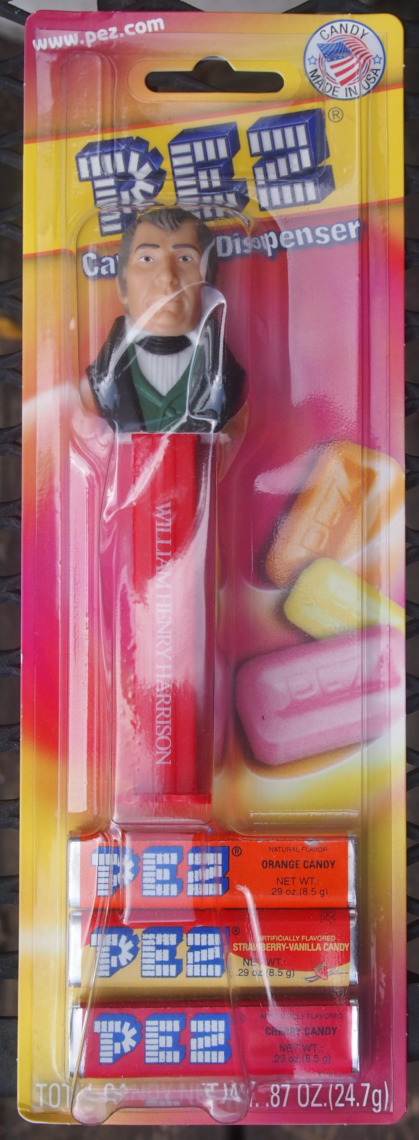
Grouseland has a small gift shop. You can buy William Henry Harrison Pez dispensers there. I did.

William Henry Harrison PezWHH Pez is now going to keep company with my Franklin Pierce bobblehead.

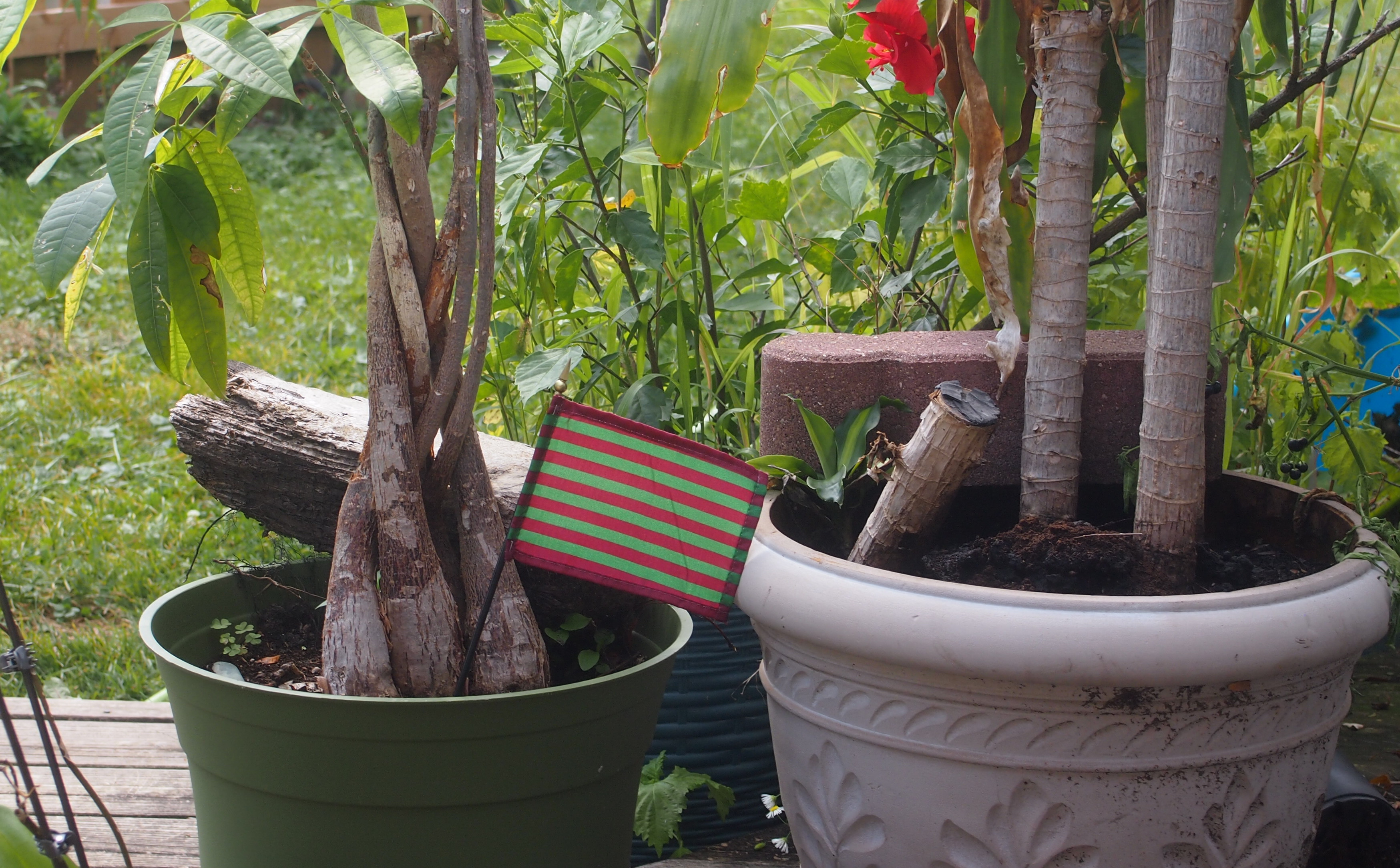
At the George Rogers Clark National Historical Park gift shop, you can buy a flag I’ve never seen anywhere else: the George Rogers Clark Flag. I got one of those, too.
George Rogers Clark FlagThe Clark flag is now going to keep company with my Come And Take It flag that flies on our deck during the warm months.

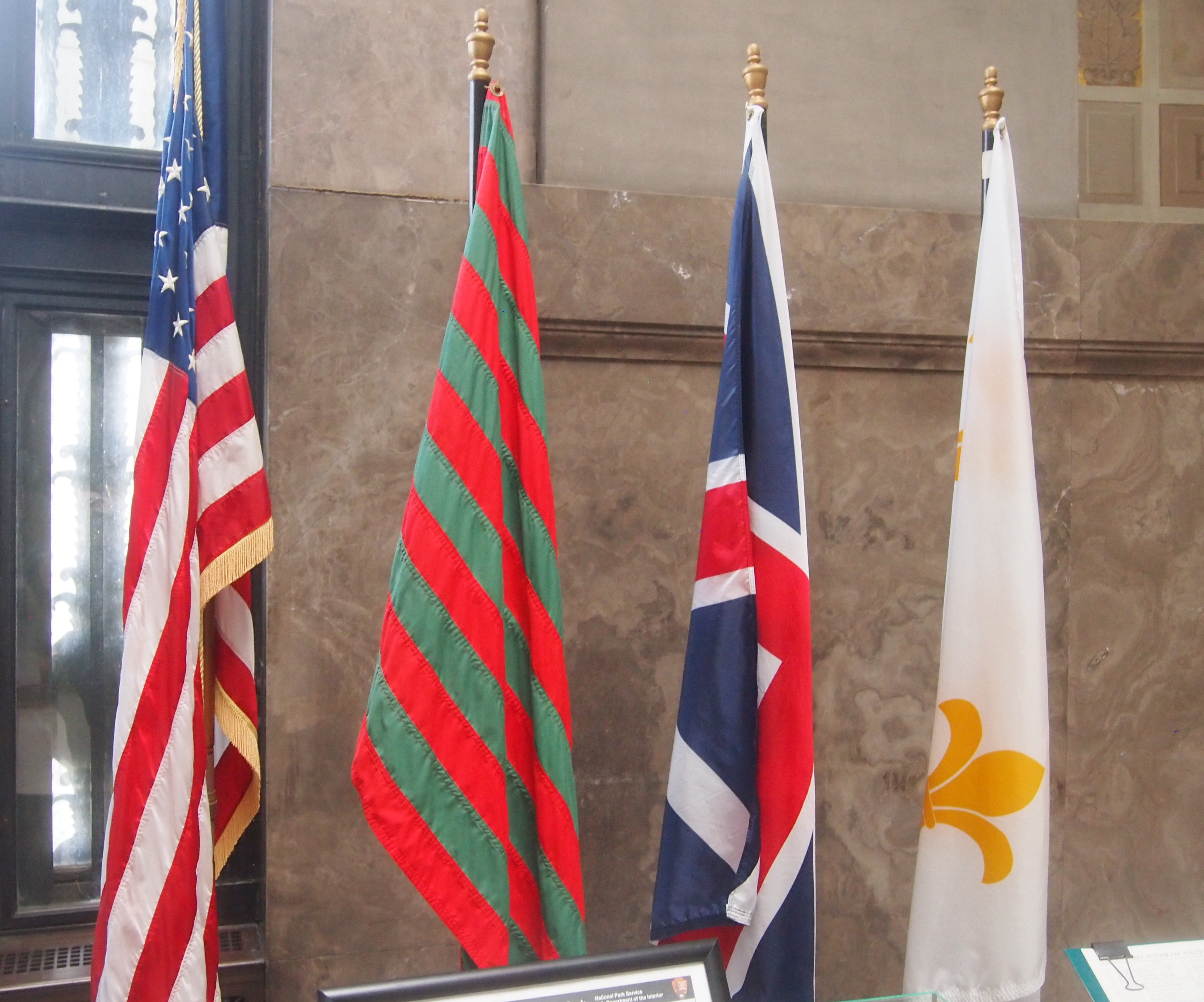
Apparently Clark’s men didn’t carry the flag at the Battle of Vincennes, but it was around — a previous American commander at Sackville, before the British took the fort, might have used it. Clark got his name attached to it anyway. Also, it isn’t clear why red and green were its colors. Never mind, all that mystery adds interest. It’s distinctive, and you can find it displayed with more conventional flags at the National Historical Park.
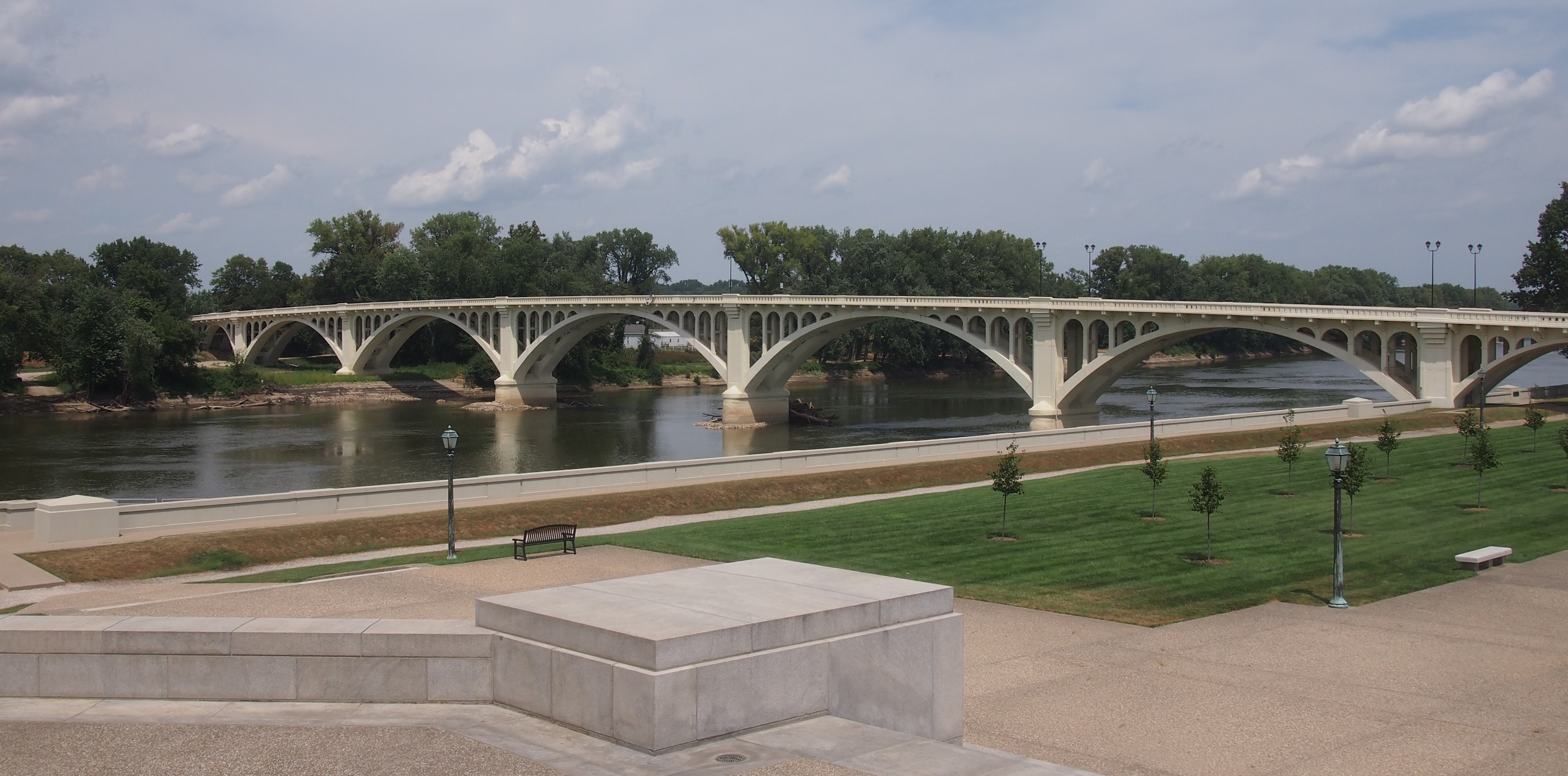
George Rogers Clark Memorial flagsVisible from the George Rogers Clark National Historical Park is the Lincoln Memorial Bridge across the Wabash (US 50), the border at that place between Indiana and Illinois. An elegant bridge.
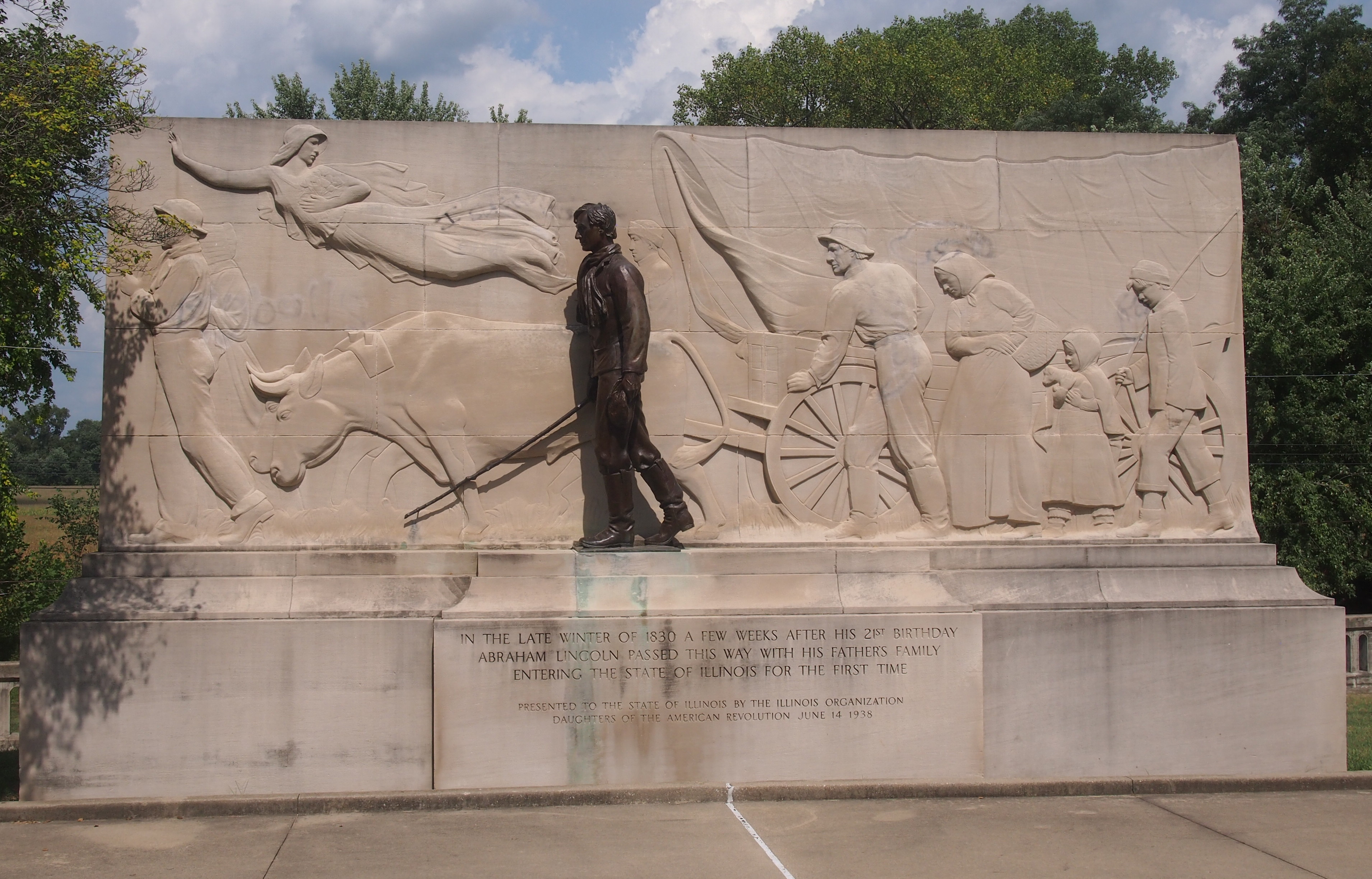
Lincoln Memorial Bridge, Vincennes, IndianaThis was where a young Abraham Lincoln (age 21) and his family is thought to have crossed into Illinois for the first time in 1830. On the Illinois side of the river, that event is marked with a memorial.
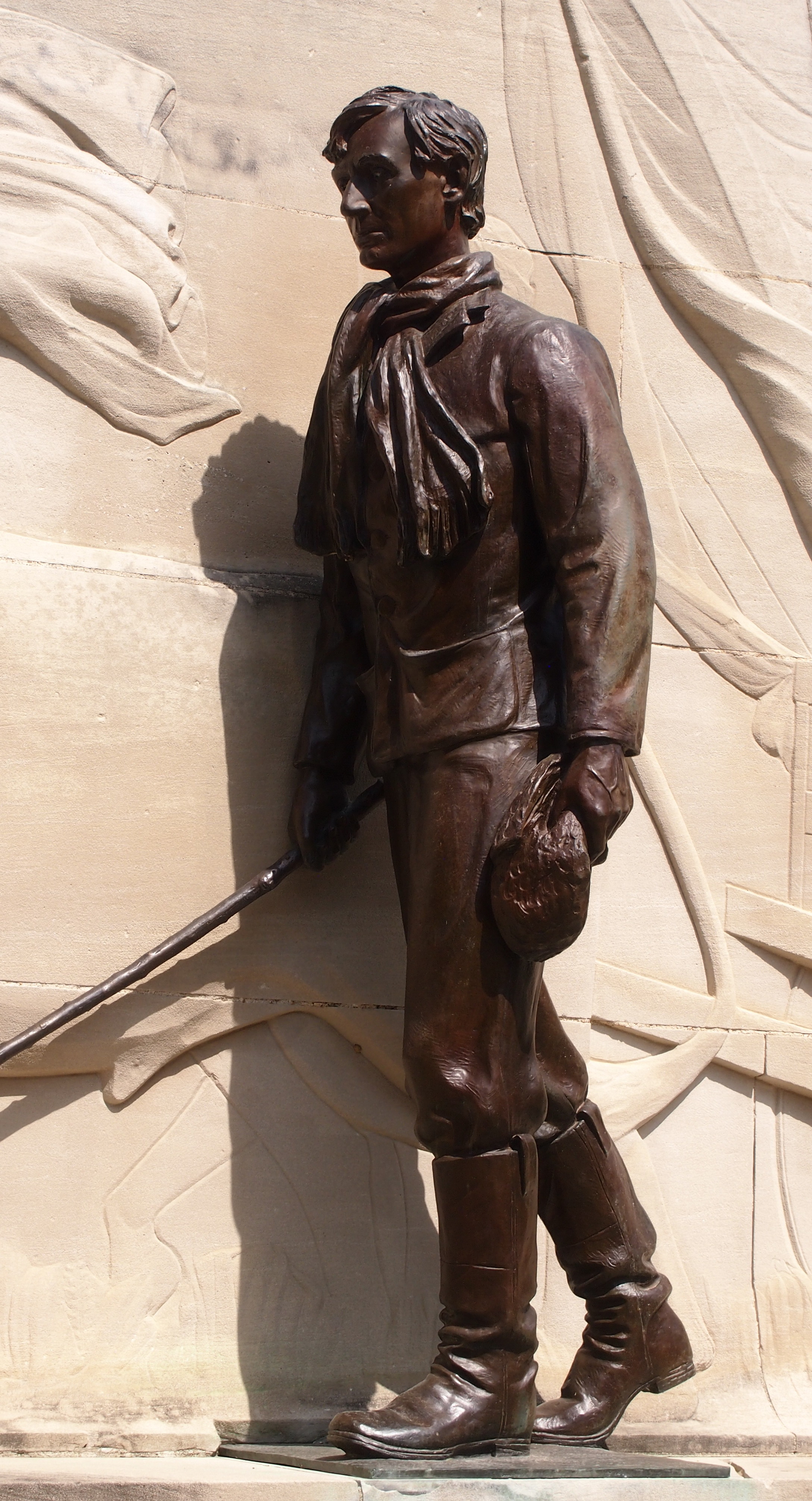
Lincoln at 21 memorial, entering IllinoisProbably the Lincolns crossed the river on a ferry. Crossed the river, checked out the memorial, and then when on their way. I admit, that sounds like a scene from a Mel Brooks movie, but it’s something I thought of while looking at the memorial.

Lincoln crossing into Illinois memorial

Officially, it’s the Lincoln Trail State Memorial, designed by Nellie Verne Walker and erected in 1938.

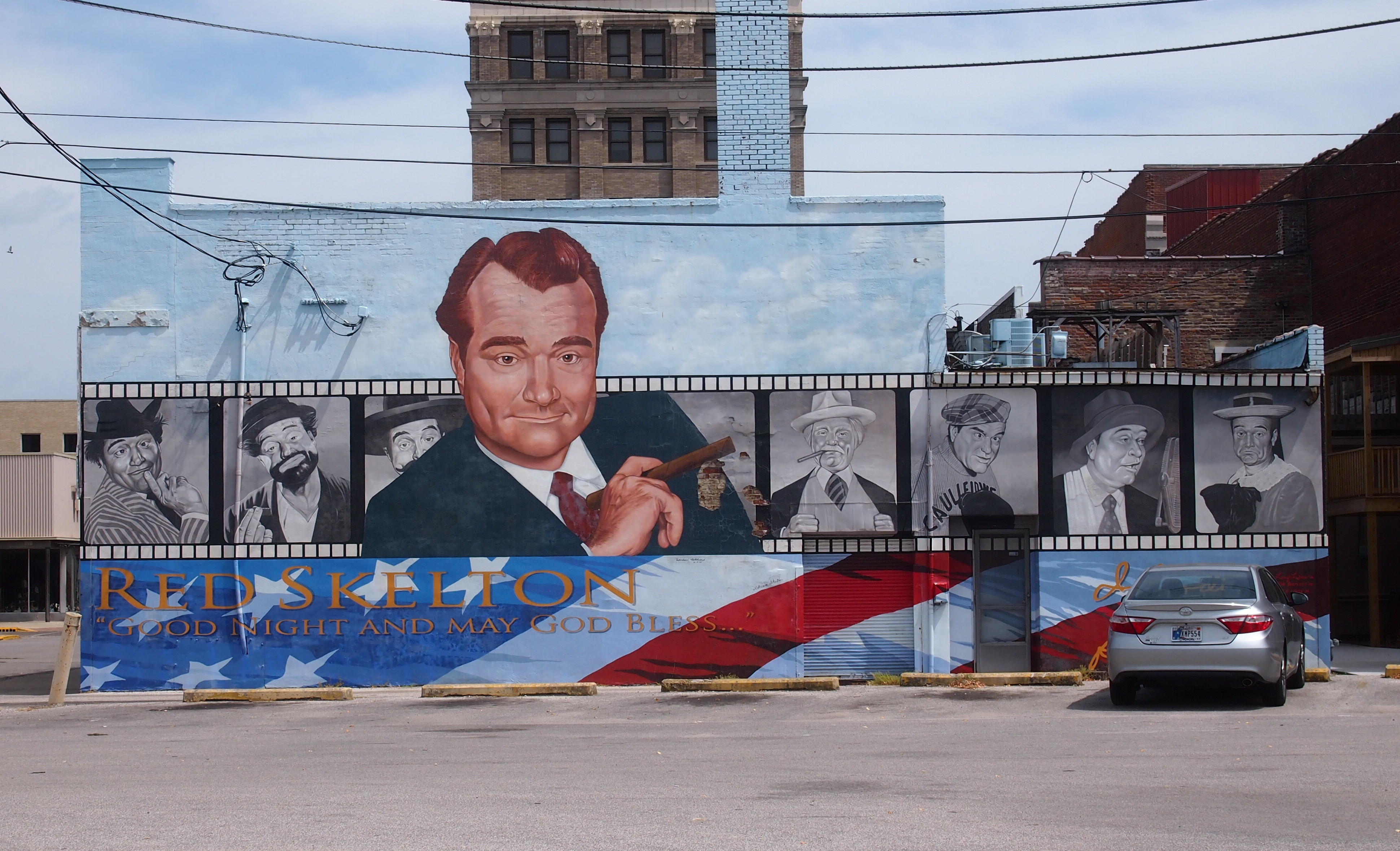
One more thing in Vincennes: a small museum to a native son. Anyone younger than me (roughly) might have a hard time identifying him.
Red Skelton mural, VincennesThe museum was closed on Sunday, and we didn’t have time for it anyway, but I did tell the girls that Red Skelton was an old vaudevillian, long before my time. I remember him on television, which was essentially televised vaudeville in his case. Who in our time would do comedy that included “The Silent Spot”?

George Rogers Clark National Historical Park

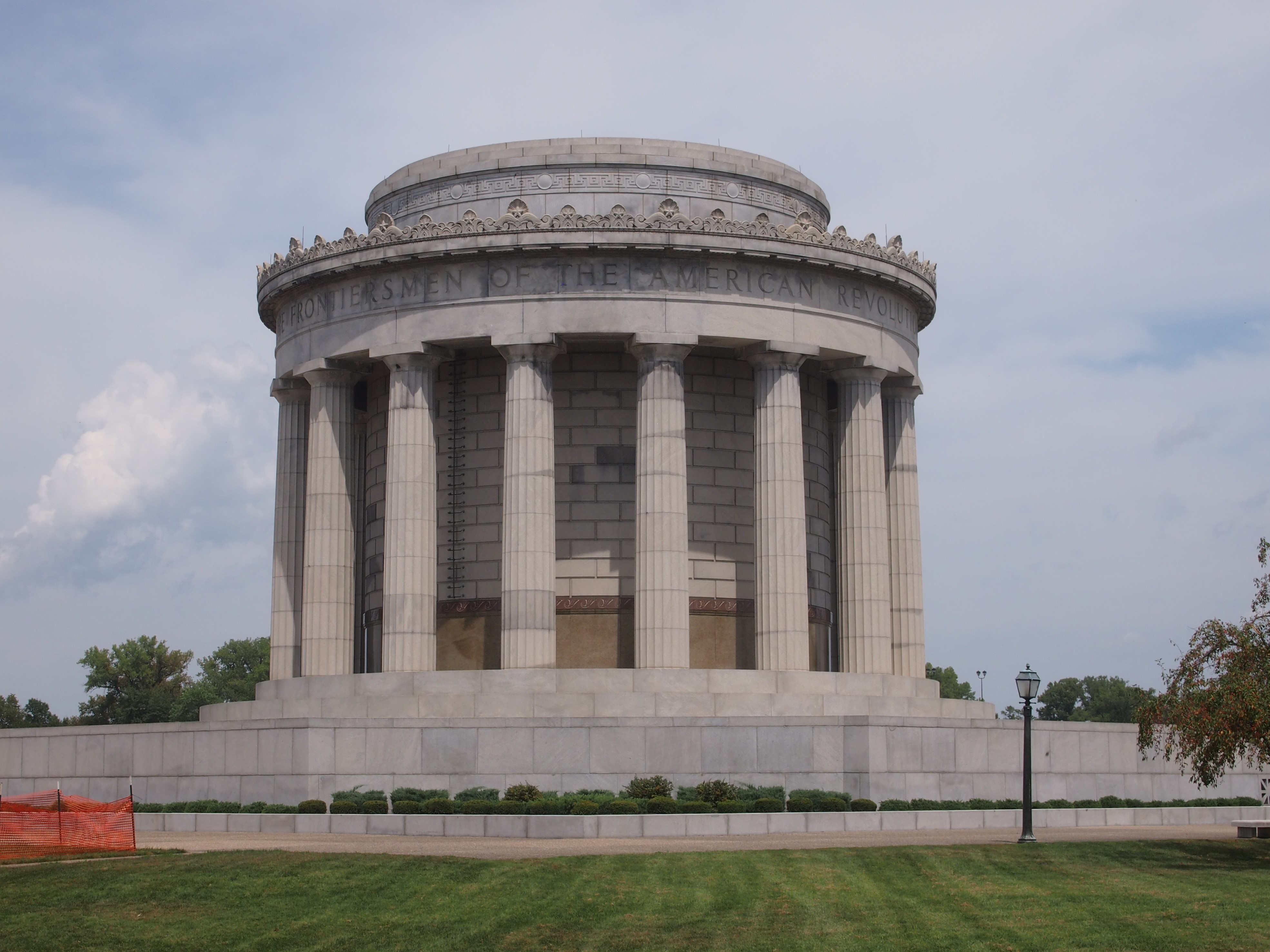
There’s probably no way to measure this, but I believe that the George Rogers Clark Memorial, which looks very much like it belongs on the National Mall or somewhere equally prominent, is the most obscure large memorial in the country. Who’s ever heard of it, especially outside Indiana? But at more than 80 feet high and 90 feet across at the base, with walls two feet thick, it cries out to be acknowledged as Founding Father-class memorial.George Rogers Clark MemorialThe structure is the centerpiece of the George Rogers Clark National Historical Park, which is near the Wabash River in Vincennes, Indiana, just across from Illinois. In early 1779, when Indiana and Illinois were unrealized political entities contingent on a Patriot victory in the Revolution, Fort Sackville stood on the site — more or less. It was around the area somewhere, and occupied by a British garrison.

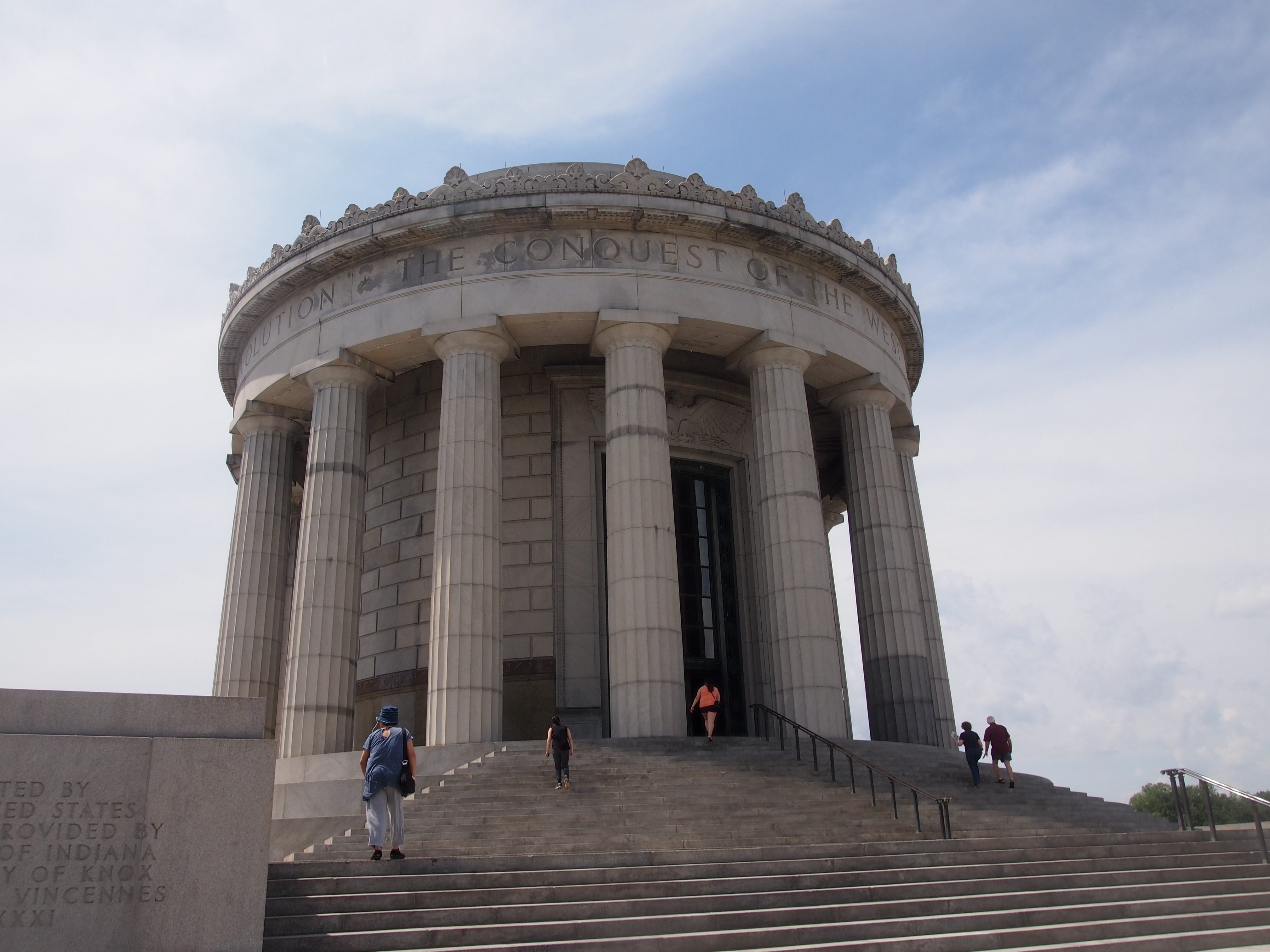
Above the memorial’s 16 Doric columns, the inscription says: The Conquest of the West – George Rogers Clark and The Frontiersmen of the American Revolution.
George Rogers Clark MemorialIn a tour de force, days-long maneuver in the dead of a Midwestern winter, George Rogers Clark led the forces that assaulted Fort Sackville and took it from the British. But that was just the climax of his efforts.

“Clark began his campaign of attempting to weaken the British position by influencing the French settlers in the area to support the American cause,” the NPS says. “Through these efforts, Clark was able to capture the Illinois Country posts of Kaskaskia, Prairie du Rocher, and Cahokia. Soon after, this French influence was extended over 150 miles to the settlers in Vincennes, and they also declared themselves allies to the Americans.

“… George Rogers Clark in the late summer of 1778 [was] in Cahokia, at a council he called with local Indian tribes in an effort to negotiate peace. By convincing [British Lt. Gov. Henry] Hamilton’s Indian allies to switch sides, Clark could further diminish the resources available to the British.

“Although Clark’s forces at this council were far outnumbered by the Indians in attendance, he impressed the warriors with his bold manner. Many of the leaders of these tribes were convinced to accept the white belt of peace rather than the red belt of war. While this council certainly strengthened Clark’s efforts, there were still many tribes who chose to continue their alliances with the British.”

In older histories, at least, Clark is thus credited with allowing the United States to acquire the Northwest Territory under the terms of the Treaty of Paris in 1783. Of course, more recent historians disagree about how important Clark’s campaign was in influencing that outcome, as historians do.

Probably the Crown considered that part of North America lost anyway, since newly independent Americans would surely pour into the territory. On the other hand, who knows? Had there been a British garrison in Indiana, and more British-aligned Indians, they might have tried to hang on to the area, as they did Canada.

Also, just in passing, Clark established a settlement in Kentucky that would become Louisville. Finally, he’s William Clark’s elder brother; he of Lewis & Clark fame, whom everyone has heard of. So why is George Rogers Clark so obscure? (Well, not completely to Hoosiers.)

Such is the ebb and flow of historic reputation. Still, Clark got himself a spiffy monument eventually, at the insistence of the people of Vincennes and probably a fair number of Indiana politicians in Washington, around the time of the 150th anniversary of the battle.

New York architect Frederic Charles Hirons designed the memorial, and it was considered important enough for President Roosevelt himself to come dedicate it in 1936 (though the Coolidge administration got the process started).

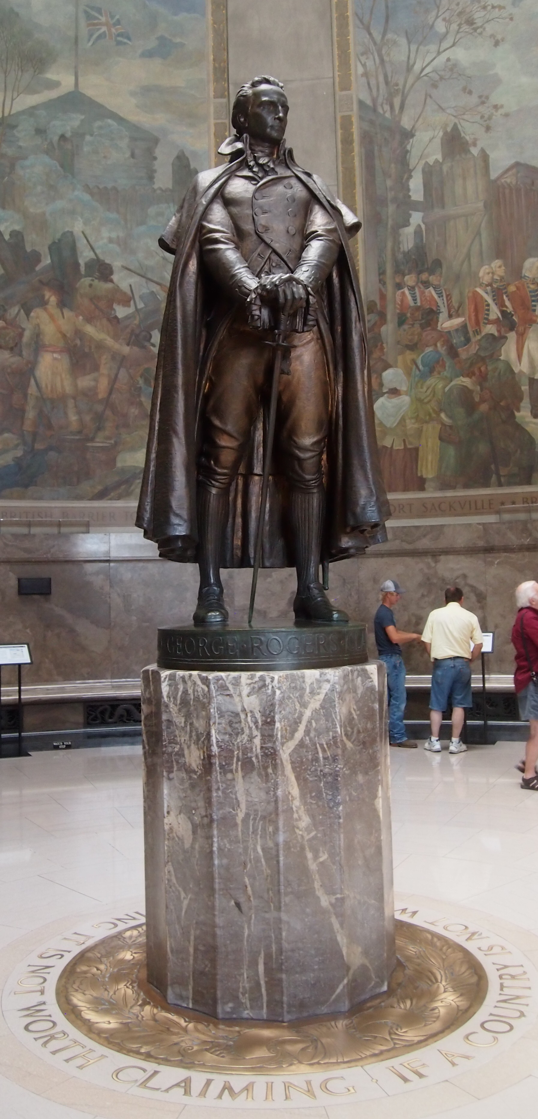
Inside — air conditioned in our time, a good thing — is a bronze of Clark. On the floor is Clark’s statement to the Virginia Council in 1775, requesting aid for Kentucky: If a country is not worth protecting, it is not worth claiming.

George Rogers Clark statue, Vincennes

Hermon Atkins MacNeil did the sculpture. I’d heard of him already — he also designed the aesthetic Standing Liberty Quarter, which I’d argue we should go back to, once Washington’s been on the quarter 100 years (coming up in 2032).

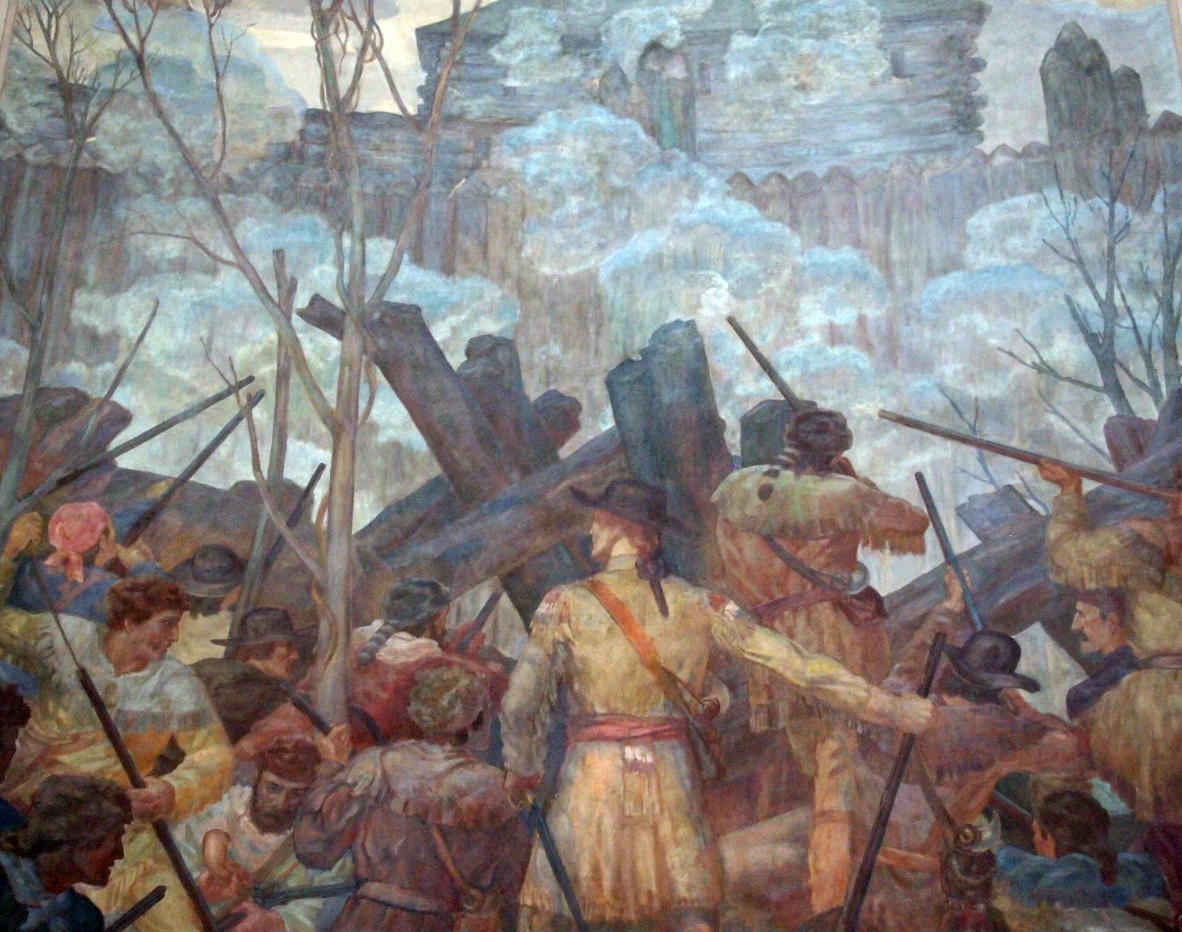
The murals depicting the campaign are by Ezra Winter. Some details:

George Rogers Clark Memorial

George Rogers Clark Memorial - muralAfter I wrote about Geo. Rogers Clark and his NHP, I mulled over how many National Historical Parks there are, and how many I’ve been to. Fifty-one all together — not the same as National Historical Sites, of which there are 78. I remember visiting 13 such NHPs, two of which were only this year, though I might have forgotten a few. As for sites, only 11. I need to get out more.

The Basilica of St. Francis Xavier, Vincennes

Ah, woe is Houston. It could have easily been my hometown. Even though it isn’t, I hate to see it underwater.

Vincennes, Indiana, has a handsome downtown, or at least a well-appointed main street. We drove on that street on August 20, but didn’t stop because the 90-plus temps that day discouraged walking around. Elsewhere in the town, I noticed the grass as it should be in August: brown, indicating sustained heat and not a lot of rain recently.

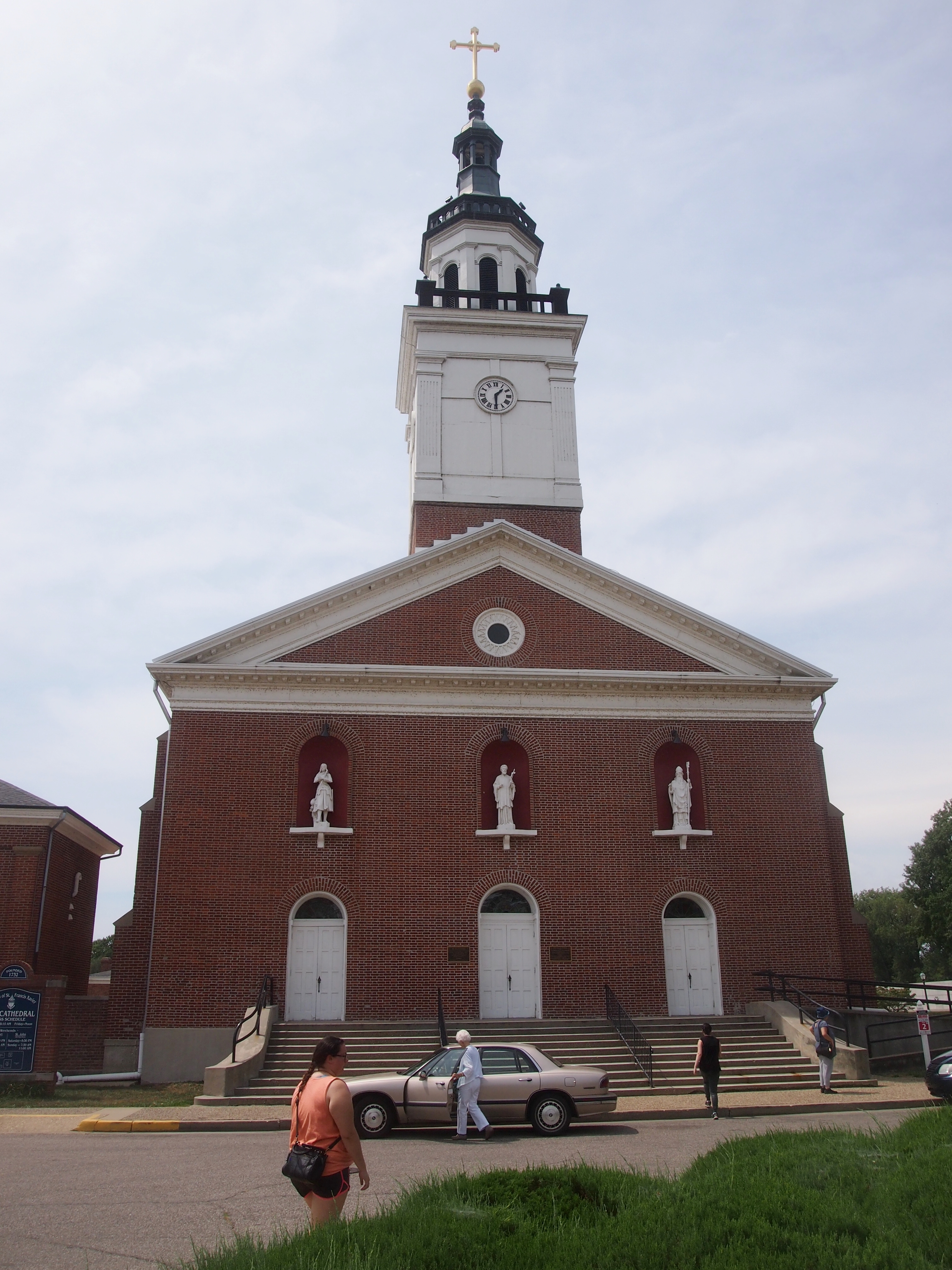
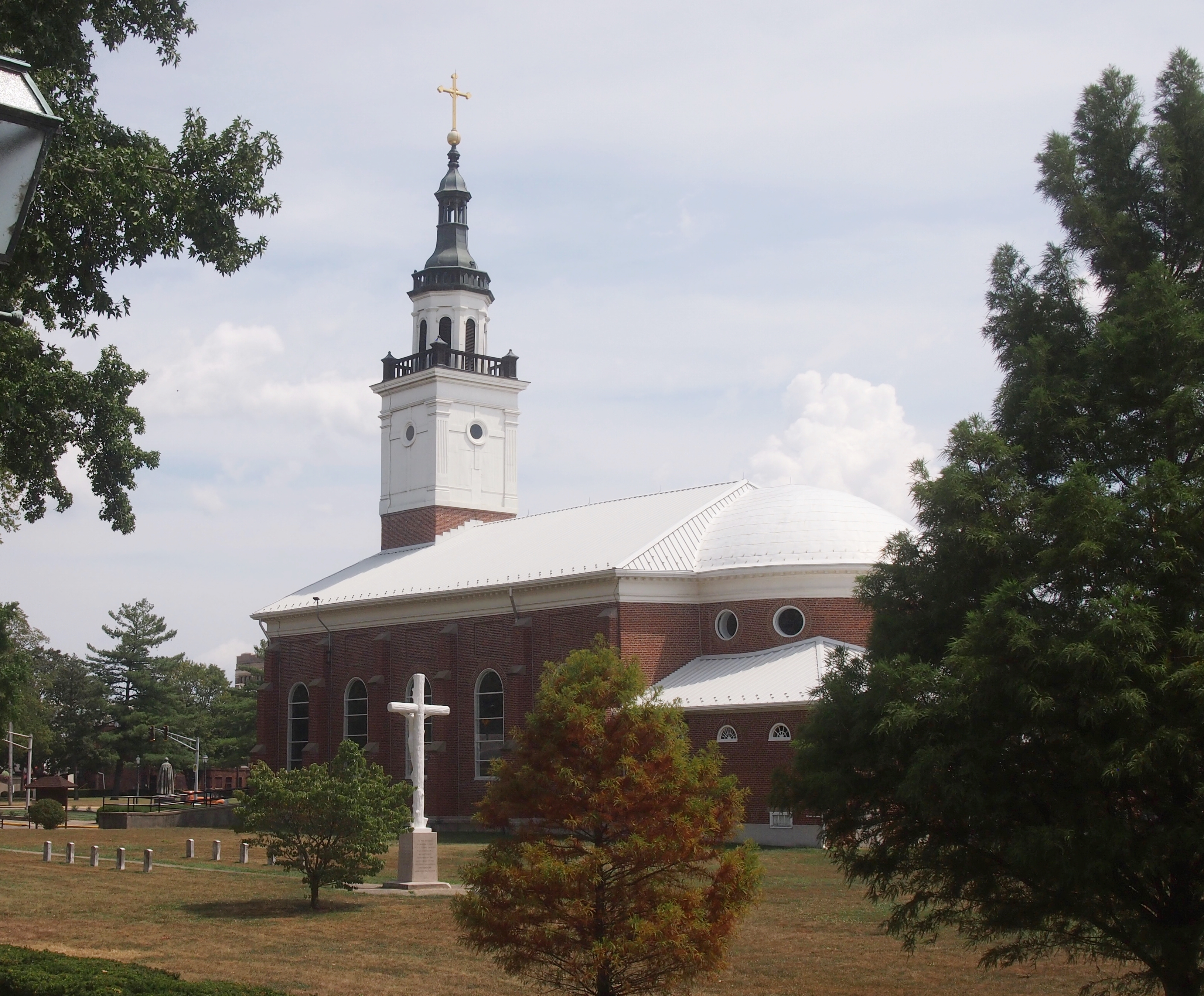
A few blocks away from downtown Vincennes is the Greek Revival-style Basilica of St. Francis Xavier, dating from 1826 and built on the site of two previous churches, the first going back to Frenchmen building a log structure ca. 1732. A plaque near the entrance calls it The Old Cathedral.

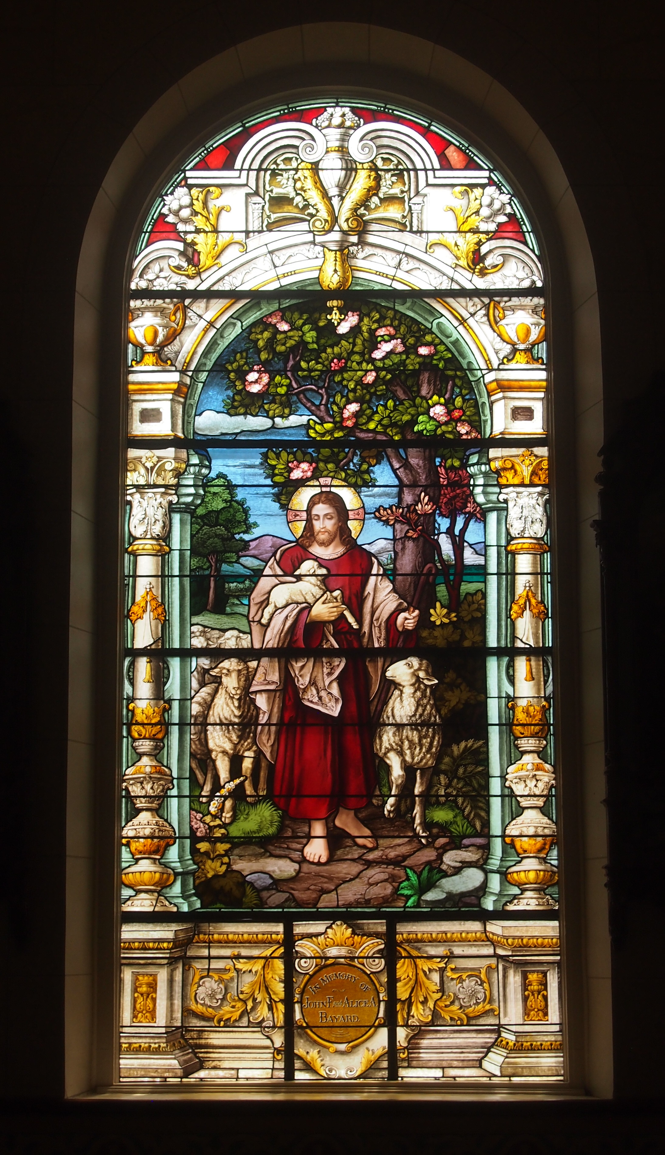
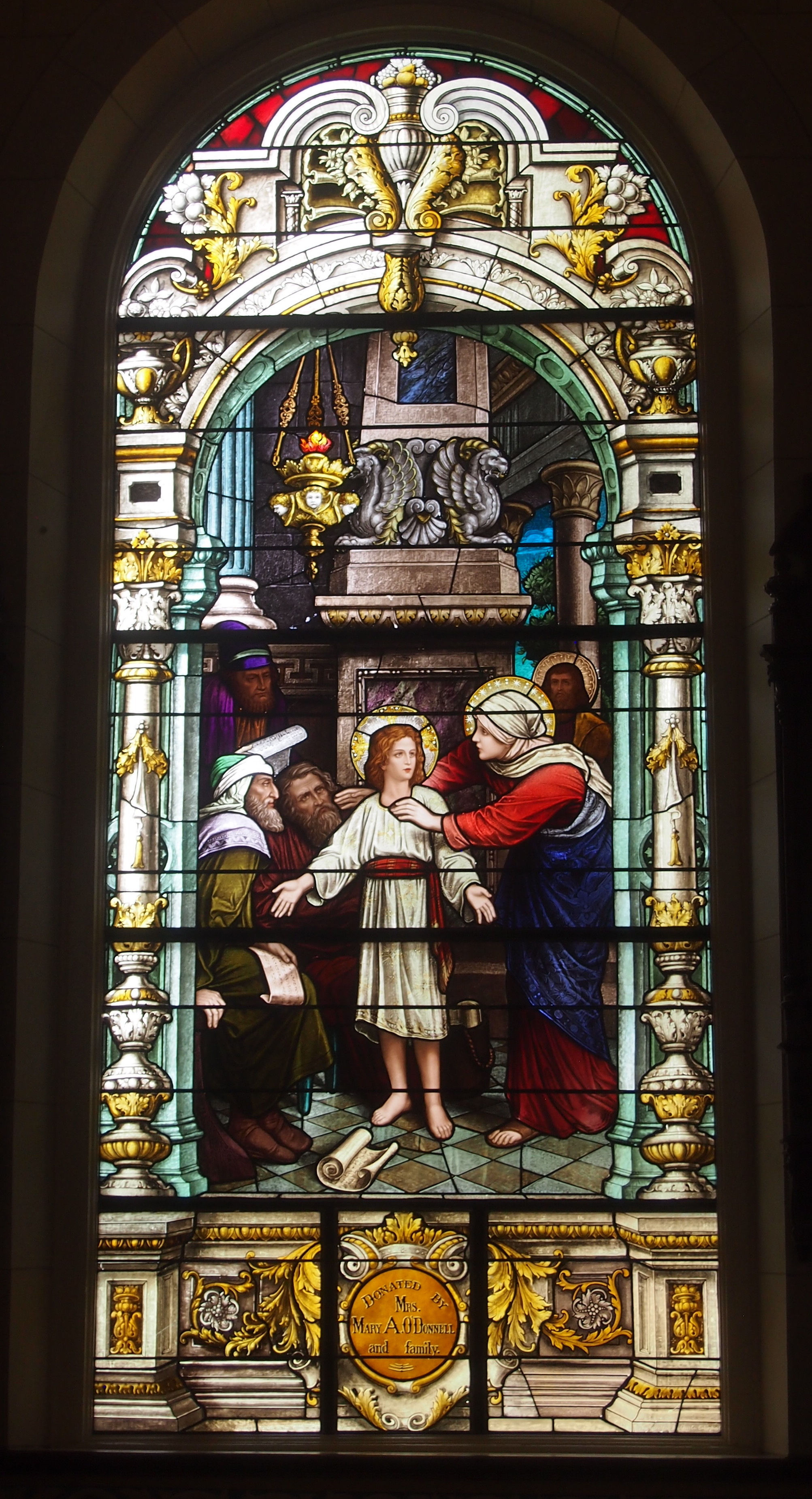
Center of the Catholic faith and scene of the great events of early American history in the old Northwest Territory. This historic and stately cathedral was raised to the rank of a basilica by His Holiness, Pope Paul VI, March 14, 1970.The Basilica of St. Francis Xavier, VincennesThe Basilica of St. Francis Xavier, VincennesThe interior sports large wooden Doric columns dividing the nave from aisles, a painted ceiling, murals and some fine stained glass. Stately indeed.
The Basilica of St. Francis Xavier, VincennesI told Ann how stained glass was used to tell Biblical stories to people back when most were illiterate, and that the tradition continued after that. Or sometimes they illustrate general principals, such as Jesus being Jesus.
The Basilica of St. Francis Xavier, VincennesOne you don’t see too often, or at least I don’t think so: the Lord as a 12-year-old at the Temple.
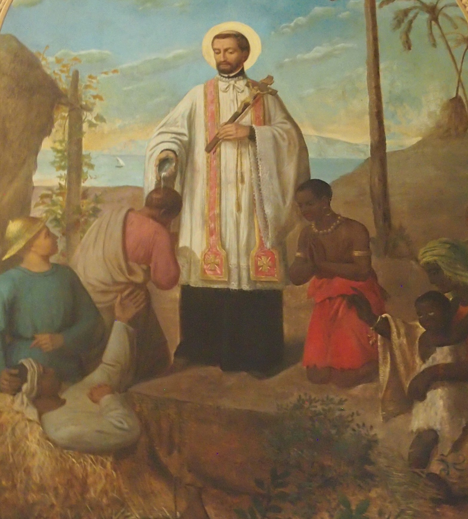
The Basilica of St. Francis Xavier, VincennesI’m just guessing, but the mural to the left of the altar (its own left) seems to be St. Francis Xavier in the Spice Islands (Malikus). Here’s a detail.

St. Francis Xavier Basilica, Vincennes

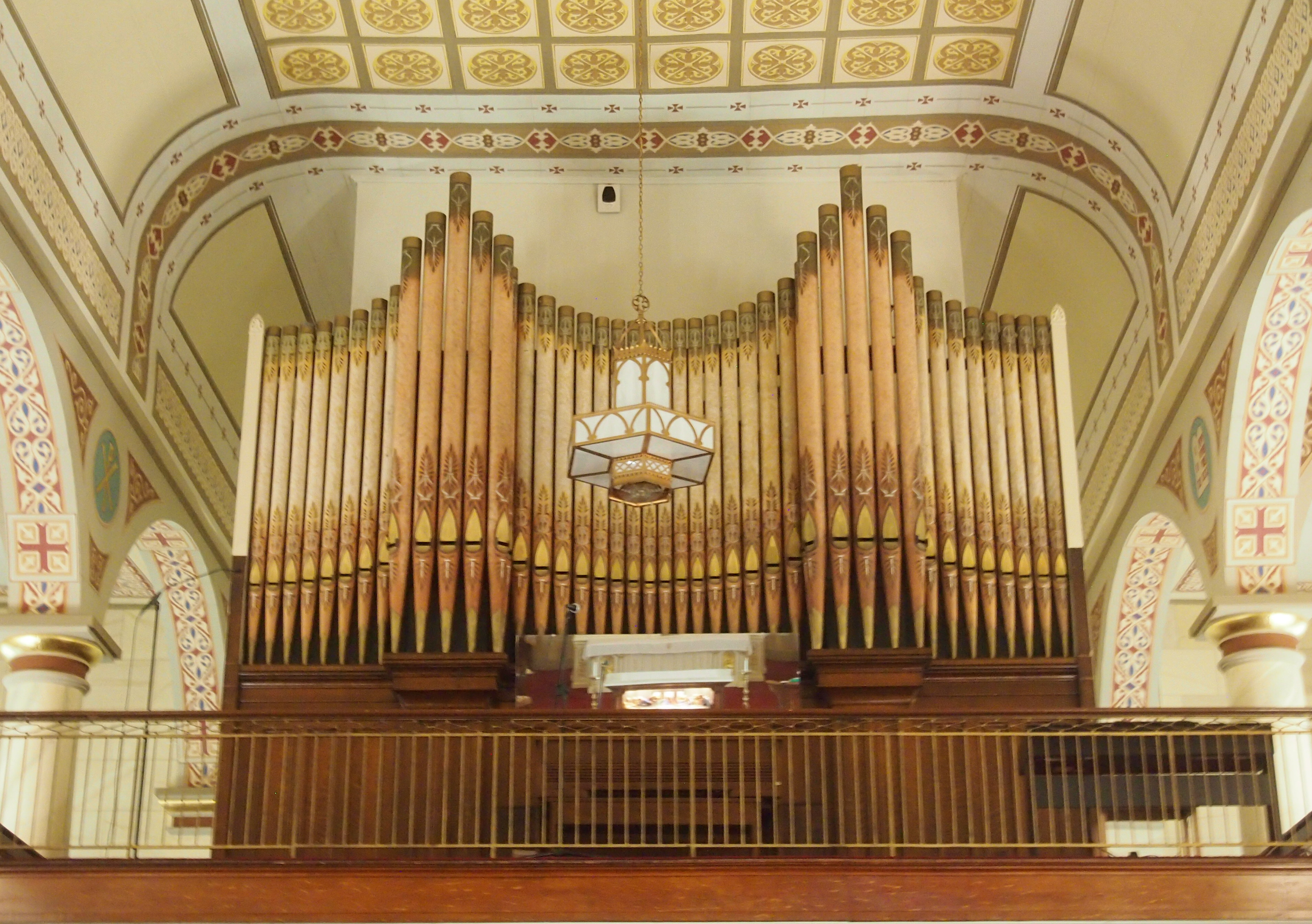
Toward the back is a fine-looking organ. I can’t say a thing about it, except I wouldn’t have minded hearing its pipes blow.
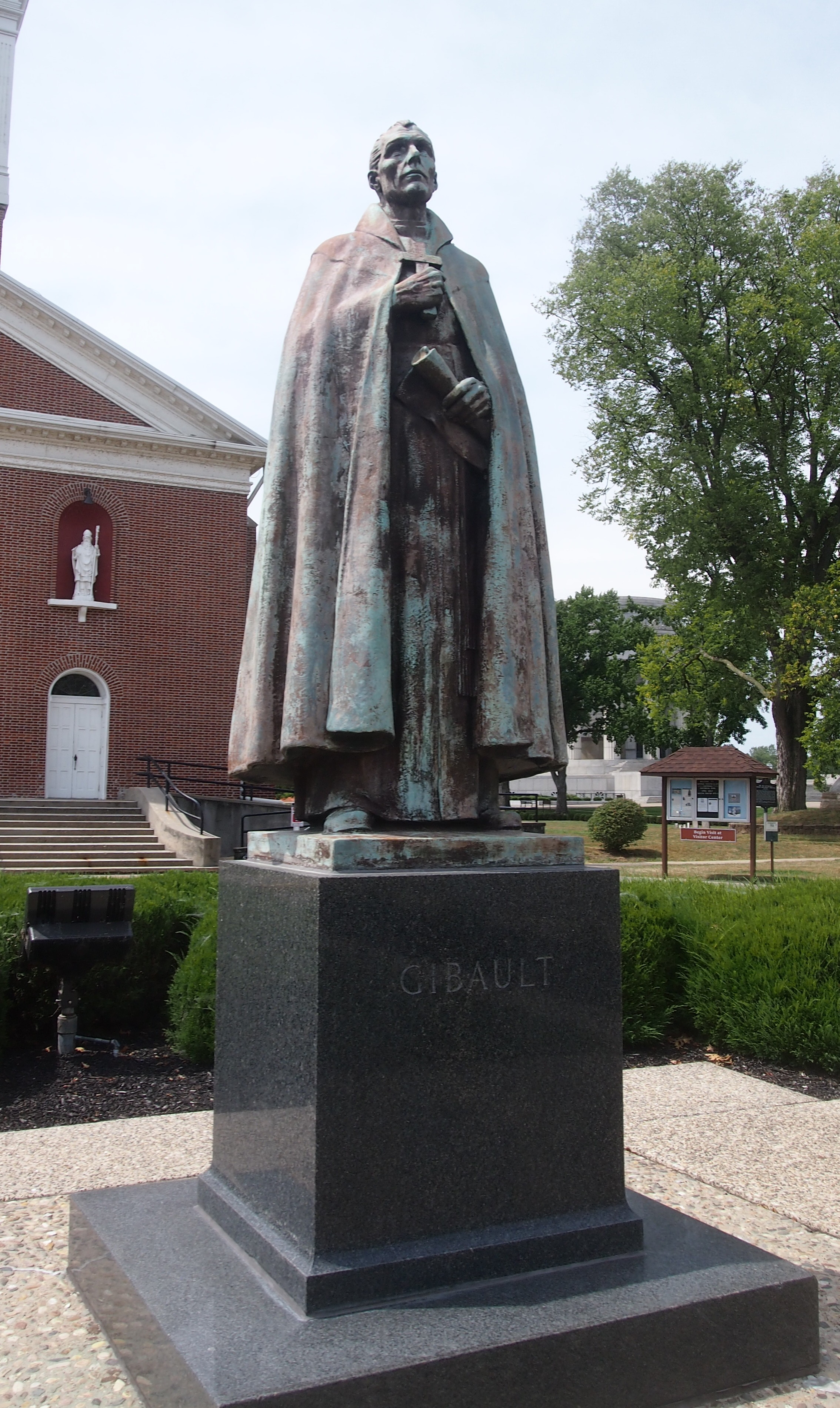
St. Francis Xavier Basilica, VincennesOut in front of the basilica, there’s a statue that’s unlikely to rise the ire of any would-be memorial revisionists: Father Pierre Gibault (1737-1802). Sculpted by Albin Polasek, much of whose work is visible in Florida.
St. Francis Xavier Basilica, VincennesI had to look him up. He was a Jesuit missionary and priest in the Northwest Territory, and when war came, he provided vital help to George Rogers Clark in his effort to capture Vincennes from the British in February 1779. Perhaps that was his way of paying back the British, whom he witnessed conquer New France in the Seven Years’ War.

Grouseland

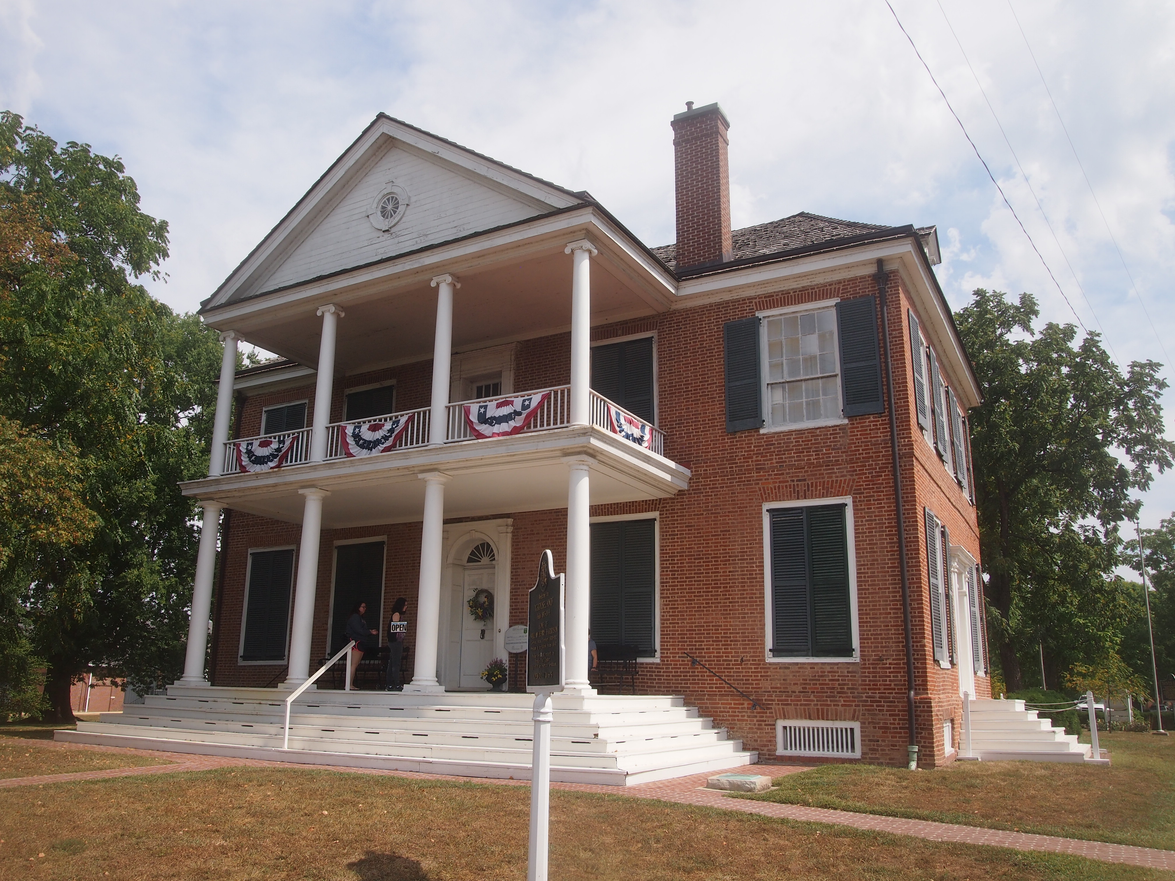
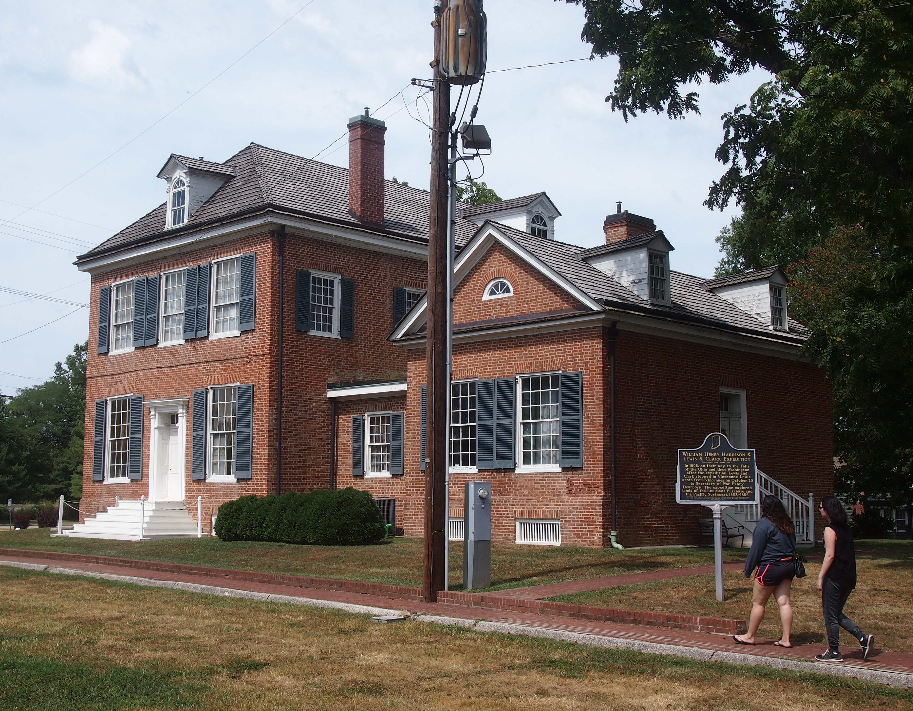
Grouseland is the inelegant name of a more elegant-that-expected house, supposedly named after the plentiful birds in the area, and thought to be the first brick building in Indiana — the Indiana Territory in those days. It was the home of territorial Gov. William Henry Harrison and his family in the early years of the 19th century. Long before Tippecanoe and Tyler too.

Even longer before “We Are the Mediocre Presidents,” though I’d argue that Wm. Henry Harrison was one of the great U.S. presidents. And one of the worst. He didn’t have time to be anything else.

Last Sunday we arrived in Vincennes, Indiana, hard by the Wabash River, and Grouseland was our first stop. Guess I need to add it to my vanity list of presidential sites, which I haven’t updated in more than three years. Maybe next Presidents Day.

Grouseland, Vincennes, Indiana

Patterned after the Harrison manse in Virginia, Grouseland probably would have been no great shakes in the early 19th-century Old Dominion, but out in the wilderness of Indiana, it must have been impressive. It’s still impressive in small-town Vincennes. The exterior walls were built sturdy enough to endure for more than two centuries, but most of the interior is a faithful re-creation, considering that after the Harrisons left, the property was given over the other uses, including a period as a barn.

Grouseland, Vincennes, Indiana“As governor, Harrison saw his principal task as opening lands belonging to the local Indian tribes to white settlement,” the NPS says of Grouseland’s heyday. “He negotiated a series of treaties that provided for the cession of millions of acres of land, but his success generated strong resistance.

“Tecumseh, the famous Shawnee leader, who was trying to recruit other tribes to join him in armed resistance, met with Harrison at Grouseland in 1810 and warned that his people would fight to prevent further white encroachment. Located to the left of the center hall, the ‘Council Chamber,’ is where Harrison held many meetings with Indian leaders and conducted much of his business as governor.”

We got to the house just in time for a guided tour, given by a fetching Vincennes University history major undergrad volunteering for the gig. The campus extends off in the distance from Grouseland. Until I looked it up, I knew nothing about the school except as a spot on the map. (Pretty much the same could be said for Vincennes.)

From its web site: “VU is Indiana’s first college. William Henry Harrison, the ninth U.S. President, founded VU in 1801 while serving as governor of the Indiana Territory. VU was incorporated as Vincennes University on November 29, 1806.”

So that’s another Harrison legacy. Attaboy, William Henry.

Totality

There’s no suspense to this narrative: we saw the 2017 total eclipse in its full glory on Monday (Moon Day, fittingly) beginning at about 1:22 p.m. CDT. That’s hindsight, of course. During the 30 minutes before totality, there was no way to know which way the wind would blow, and where it would carry the clouds.

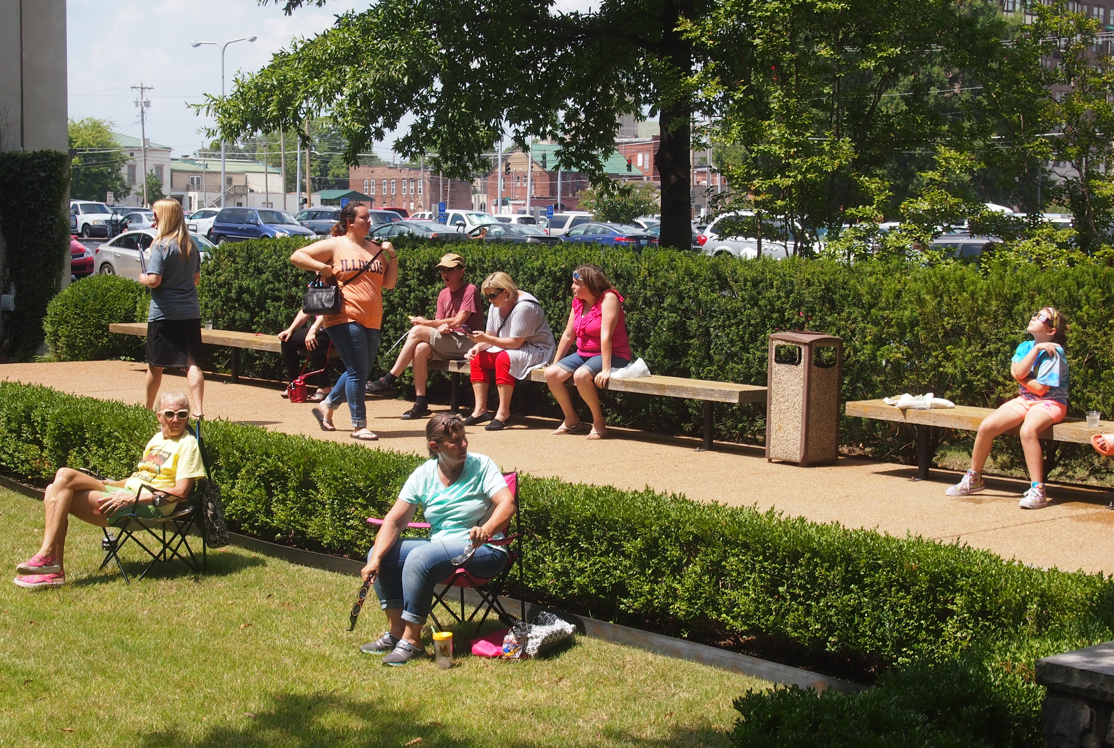
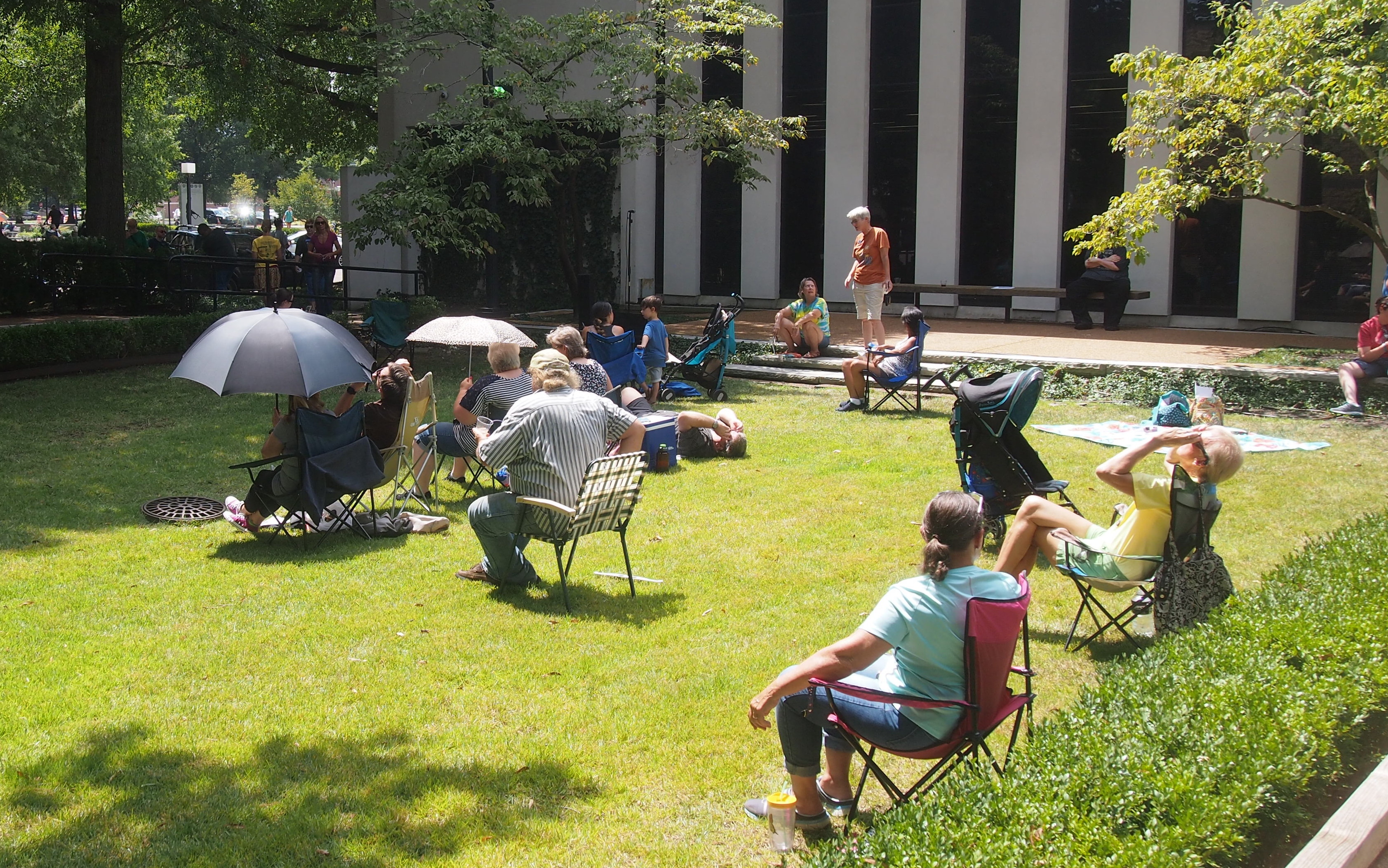
As the Moon slowly ate the Sun, people gathered at the McCracken County Library courtyard for the event.

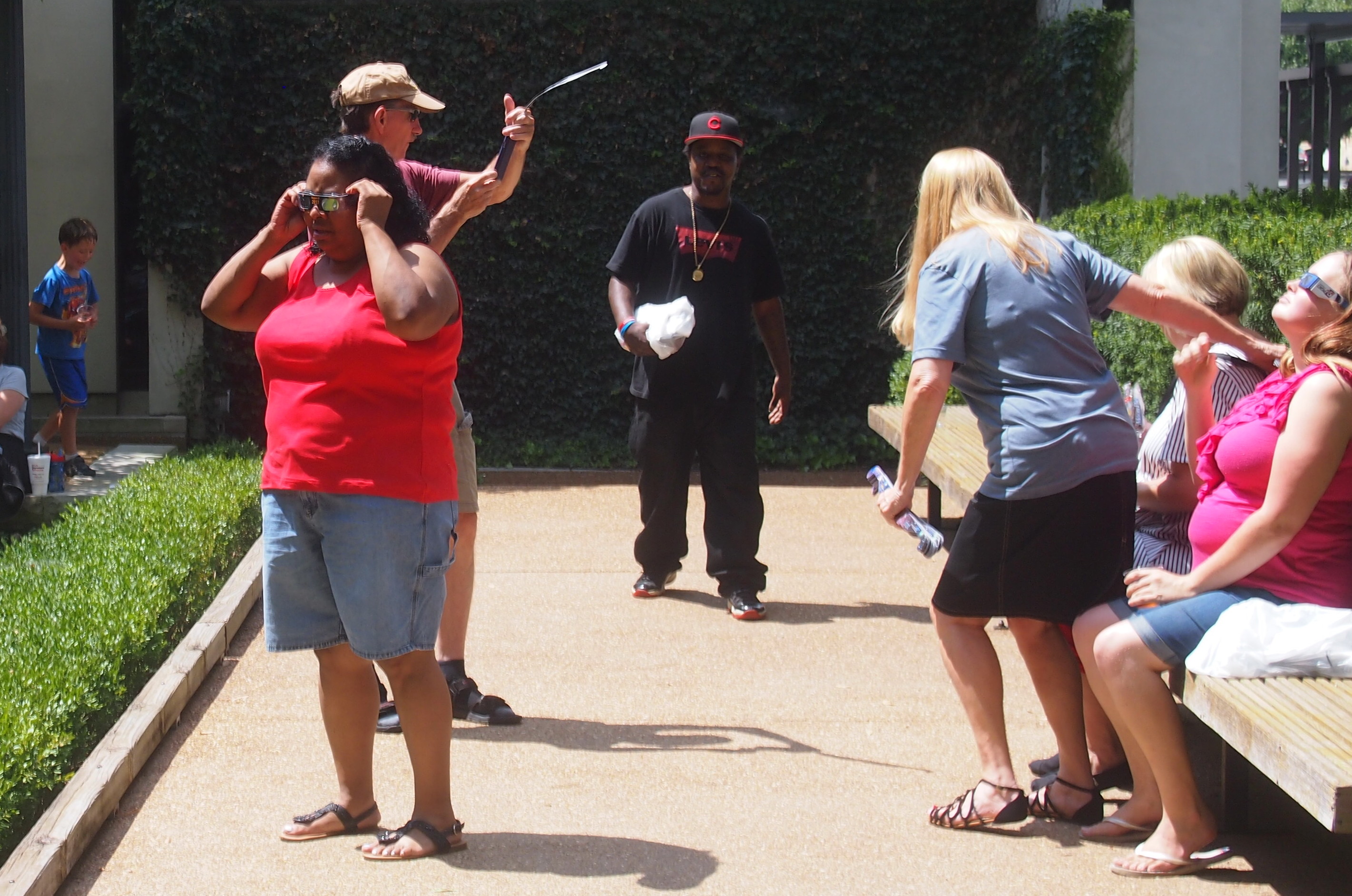
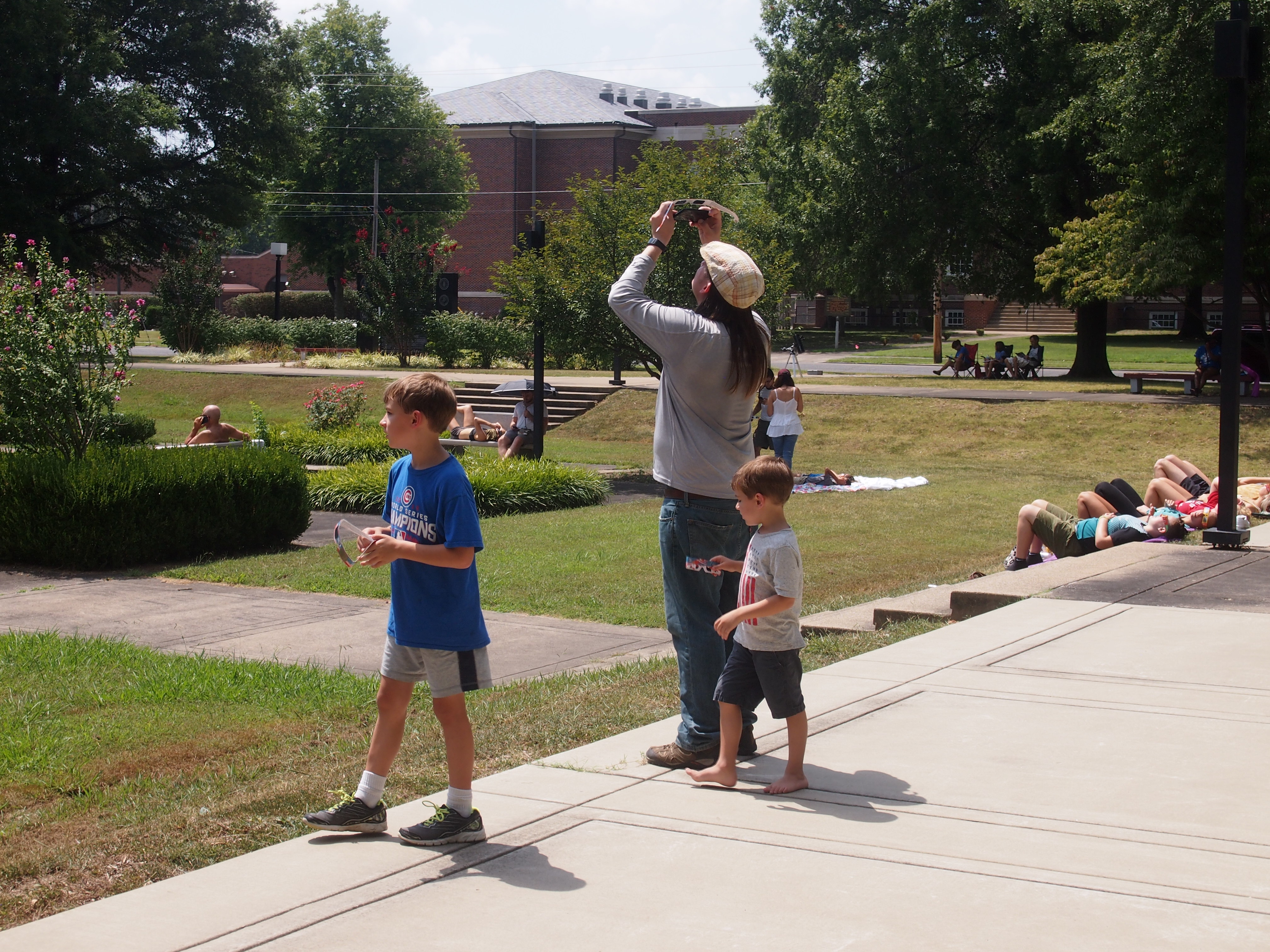
Paducah KY Total EclipsePaducah KY Total EclipsePeople tried on their glasses.
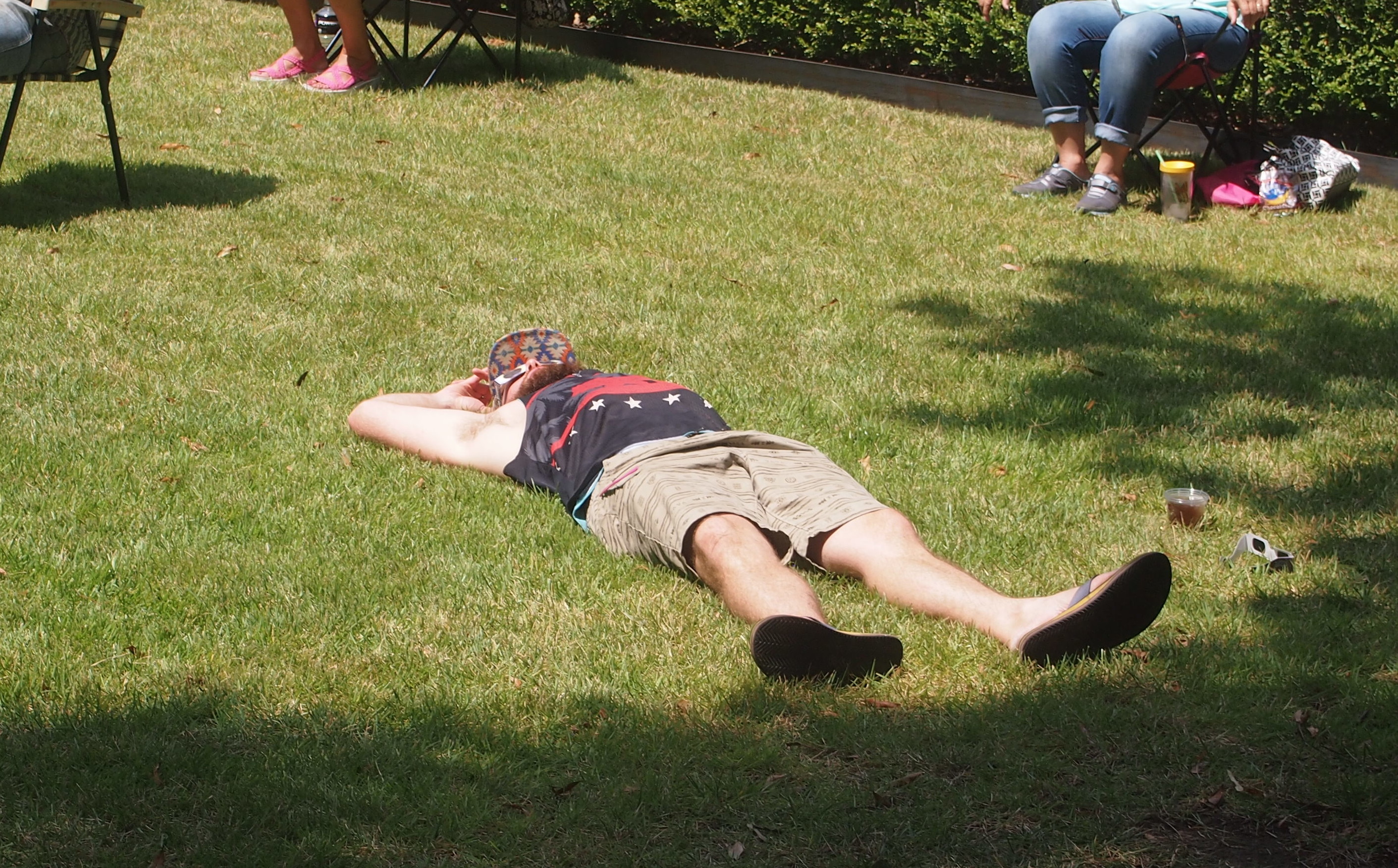
Paducah KY Total EclipseDudes were stretched out on the grass with their glasses. This dude, anyway.
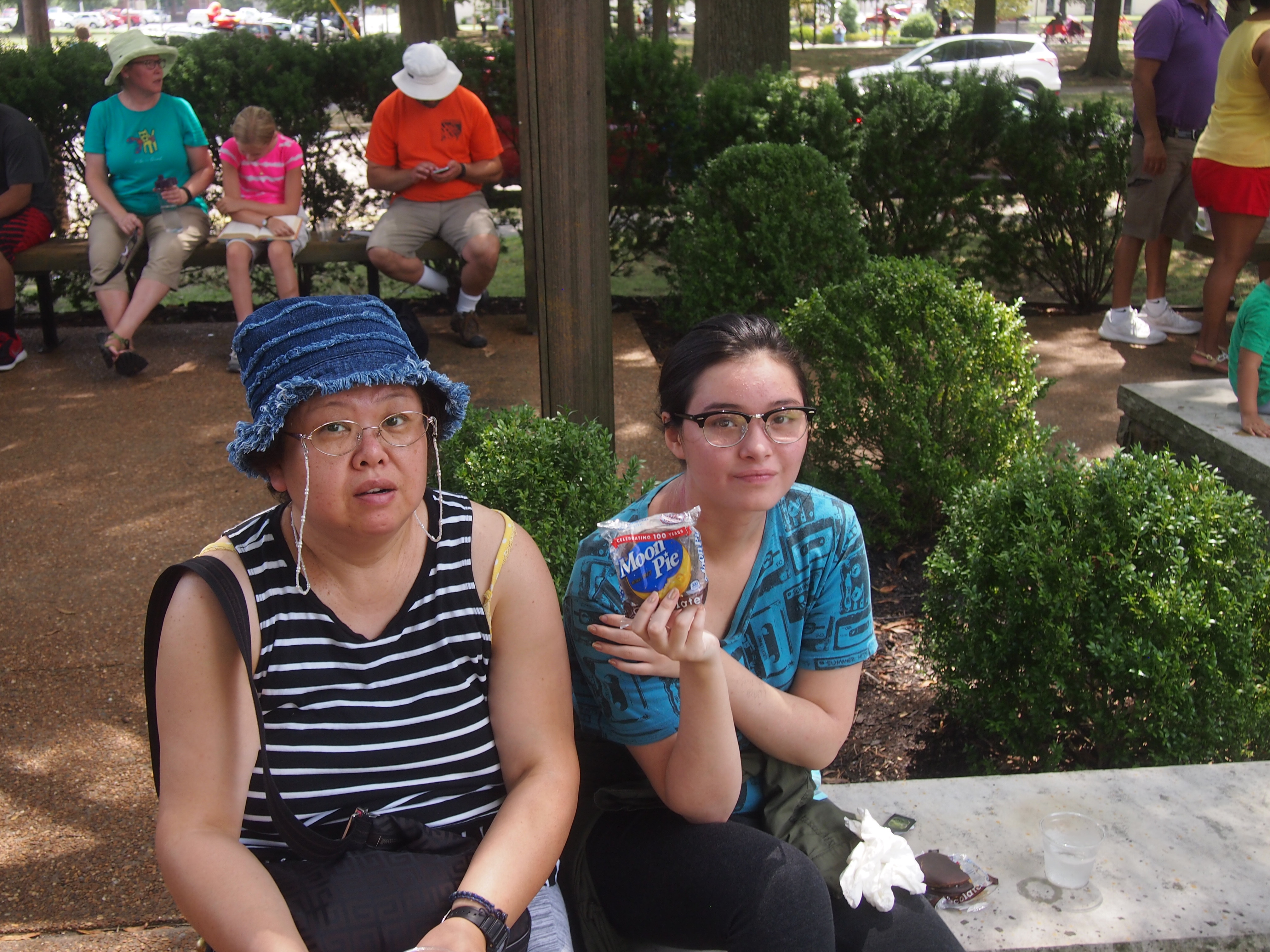
Paducah KY Total EclipseThe library was giving away glasses, but also cold water, tea and Moon Pies.
Paducah KY Total EclipseWe stayed at the courtyard a while, but then I went over to the plaza across Washington St. to see whether the vantage was better. The sky was more open there, and so we all went.

Later I found out that the place is formally called Dolly McNutt Memorial Plaza, named after the first female mayor of Paducah, who was in office during the 1970s. The plaza is a square city block, ringed on four sides by trees but open to the sky inside, and featuring memorials to various branches of the armed forces.

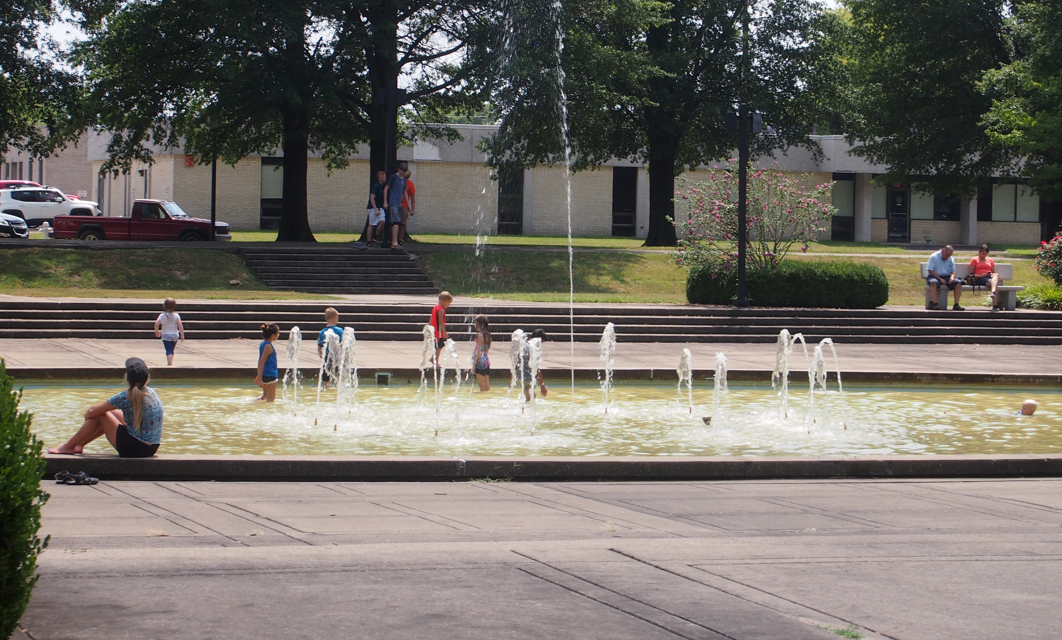
A sidewalk inside the plaza forms a smaller square around an oval-ish fountain at the center. On Monday afternoon, kids were splashing around in the fountain — which looked pretty scummy, actually — just like they would on any warm day.
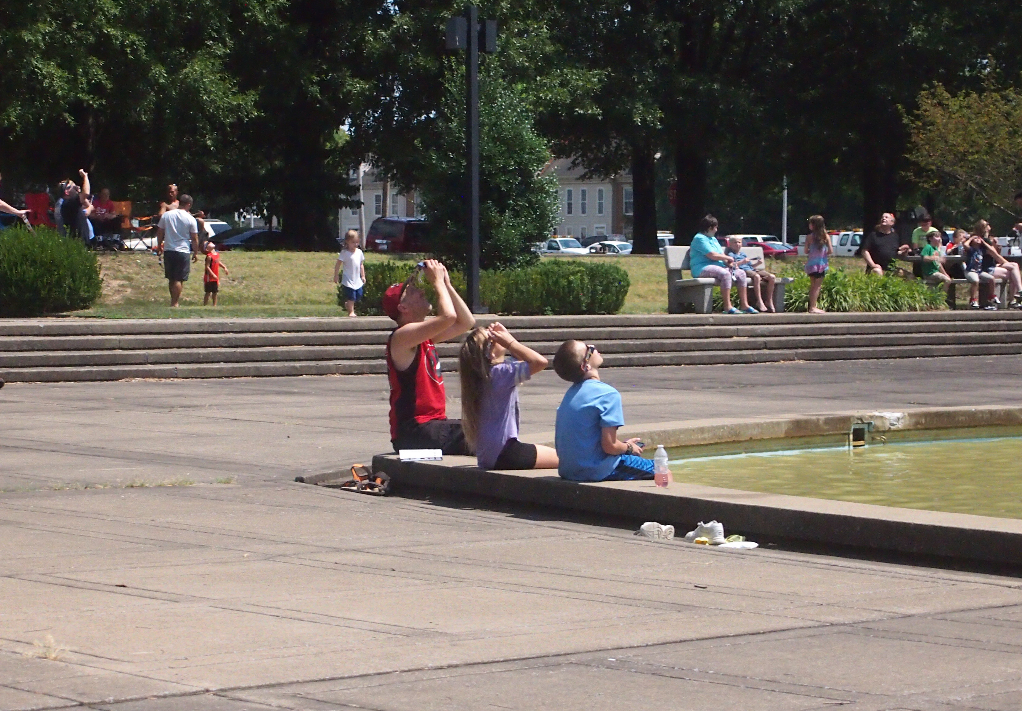
Paducah KY Total EclipseAt that moment, people were looking to the sky all around the plaza.

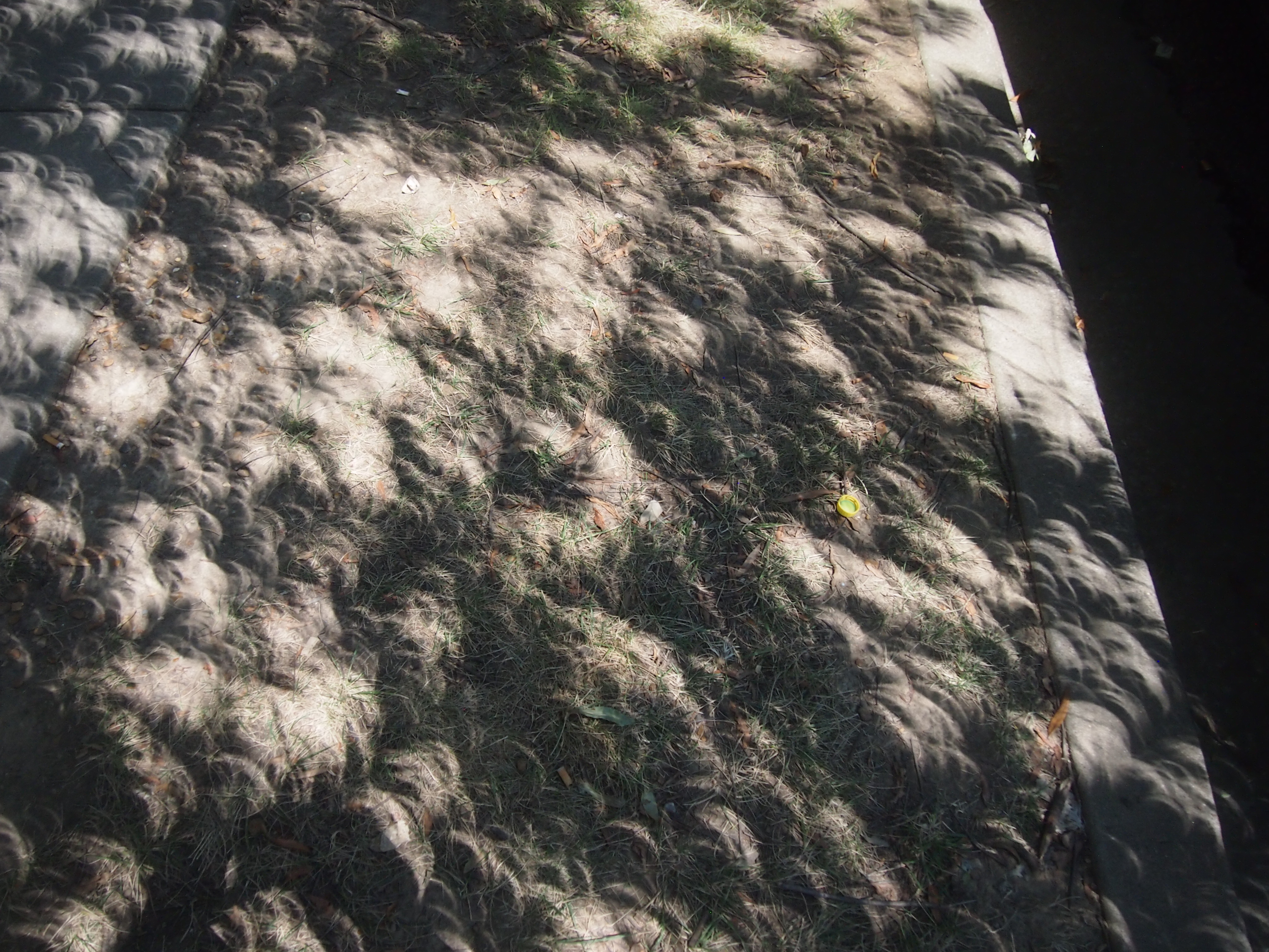
Paducah, KY EclipsePaducah KY Total EclipseAt first, we sat under some of the trees, since it was still fairly hot. The curious shadows of the leaves were visible.
Paducah KY Total EclipseSoon we moved to the short set of steps surrounding the fountain and sat there. By then the sky was dimming and the air was noticeable cooler, maybe 10 degrees F. It wasn’t exactly a comfortable spot, but good enough for the minutes leading up to totality.
Paducah KY Total EclipseThe clouds had held back. I knew we were going to see totality unobscured from Dolly McNutt Memorial Plaza, at about 37.083543 degrees North, 88.598450 degrees West, according to calculations I later made using Google Maps, so take that for what it’s worth.

The dimming of the sky proceeded, unlike any dusk. I saw streetlights come on, and a flock of birds head out from a tree. The last of the crescent sun, seen through our glasses, dwindled to nothing. Then it happened. Glasses came off, people in the plaza mostly expressed themselves without words, cheering and whooping and even clapping, and the show was on. We were swept up by it.

Much has been written about totality. A common theme is that photos do it no justice. This is completely correct, even an understatement. The event doesn’t look like its pictures, not even the best images from the best machines. We fool ourselves into thinking that cameras capture images like the eye. A solar eclipse puts the lie to this. For human beings, eyes are the thing.

I’d never seen anything like it. The black disk — the corona’s tendrils — wisps — curls — glowing ringlets — luminous strands — and the surrounding darkness where sunlight should be — were awesome. As in, inspiring awe.

It wasn’t a religious experience. It didn’t make me appreciate the wonders of the cosmos any more than I did before, which is a lot. It didn’t change my life in any fundamental way. But the black sun and wondrous corona did make me very glad to be alive and fortunate enough to see such majesty.

One Hot Morning in Paducah, Kentucky

The weather forecast for Paducah, Kentucky, on August 21, 2017, called for partly cloudy skies. Ah, but which part? As good as weather forecasting has gotten in recent decades, that’s beyond its competence. When waiting for a solar eclipse under partly cloudy skies, you just have to hope for the best.

In the mid-morning that day, at least, partly cloudy meant high, thin cirrus clouds that probably wouldn’t obscure the eclipse too much. They certainly didn’t block the bright sunlight. So we went about our business. Mine was business. I got up early in the morning and wrote and filed and edited and so forth, continuing what I’d started Sunday afternoon and evening, compressing the day’s work into the morning, so I’d be free to watch the sky in the early afternoon.

Late in the morning, we checked out of the motel and headed to downtown Paducah, to seek out a late breakfast. We didn’t want to be distracted by hunger while looking up at the totality, nor during much of the drive home afterward. A scattering of stores along the way, and a few downtown, offered eclipse-related souvenirs.

That was the case even before we got to Paducah. One small-town restaurant not actually in the path of totality had a marquee advertising eclipse burgers and eclipse shakes, whatever those were. Officialdom, in the form of flashing highway signs, had also taken to warning drivers about traffic around the time of the eclipse. One sign — in rural Indiana, I think — said that pulling over to the side of the road to watch the event was unsafe.

All the way down to Kentucky, the radio mentioned the event, both in the form of news and deejay patter, some of it not very bright. On the morning of the eclipse, I spotted people wearing t-shirts commemorating the event. I know it was a superstitious feeling, but I thought that was a bad idea. Wearing a shirt about an event that hadn’t happened yet, and which could be spoiled by errant clouds? That’s just asking for cloudy trouble.

We arrived at about 11:00 for late breakfast/early lunch at the Gold Rush Cafe on Broadway. Gold rush indeed. The place was doing a land-office business. There was a 30-minute wait for a table, we were told. While the rest of my family waited, I took the opportunity to scout out the place where I’d planned to see the eclipse, a few blocks away at or near the McCracken County Library, which was holding an eclipse-themed event starting around noon.

I made my way from the restaurant south on 4th St., to Washington St., where I turned west. At Washington and 5th St. is the library, a modernist joint with a small area of greenery and trees next to the building. People were already gathering there, their cars filling the parking lot behind the library. Looked like an OK spot, as did the plaza across Washington from the library. I turned north on 5th past, amusingly, the offices of the Paducah Sun, and headed back to Washington. Another block east and I was back at the restaurant, sweating profusely. (Is there any other way to sweat on a hot summer day?) It was about 90 F and the sun was strong under those thin hazy clouds. Not perfect, but very good skies — if it would last another two hours.

We only waited about 20 minutes to get a table. The restaurant was abuzz with eclipse talk. The people at the next table, two of whom were wearing science-nerd t-shirts, talked about it. A woman at another table talked of seeing another eclipse in Australia. A bearded fellow at the table next to ours, eating by himself, talked to his waitress about where he might find some eclipse glasses. The place was full — more business than they usually get on a Monday, I figure — and the event seemed to be on everyone’s mind.

Later, I saw the restaurant’s Facebook page, which posted that morning: “Ok folks, I don’t imagine many of you are running around downtown today…. we’re taking our last orders at 12:30 so that way we can go see the eclipse as well. Thanks for your understanding!”

As for eclipse glasses, I’d acquired some Celestron brand shades online the month before, when I’d read that such glasses shouldn’t be used after more than three years. The ones we have from the Transit of Venus are five years old. That’s erring on the side of caution, since I don’t really know whether they degrade enough to be hazardous after five years.

Then, of course, there were reports of substandard glasses, either made carelessly or purposely so. If made with intentional disregard for eye safety, that’s as bad as making bogus antibiotics. Bastards. So that’s in the back of one’s mind, though I’d tested the glasses the week before in my back yard without ill effect. I’m glad to report that our Celestrons seem to have protected us.

As for a shortage of eclipse glasses on the day itself, there was none. The library was giving them away, and so was an antique shop across the street from Gold Rush Cafe (or maybe selling them, I didn’t ask).

While eating lunch, the skies outside dimmed for a short spell. I knew it was too early for the partial phase of the eclipse, so that meant only one thing: clouds. When we emerged from the restaurant some time after noon, white, fluffy cumulus clouds punctuated the sky. The kind you don’t mind seeing any other time. Some were sizable. This was bad. Periodically the sun would be obscured for a few minutes.

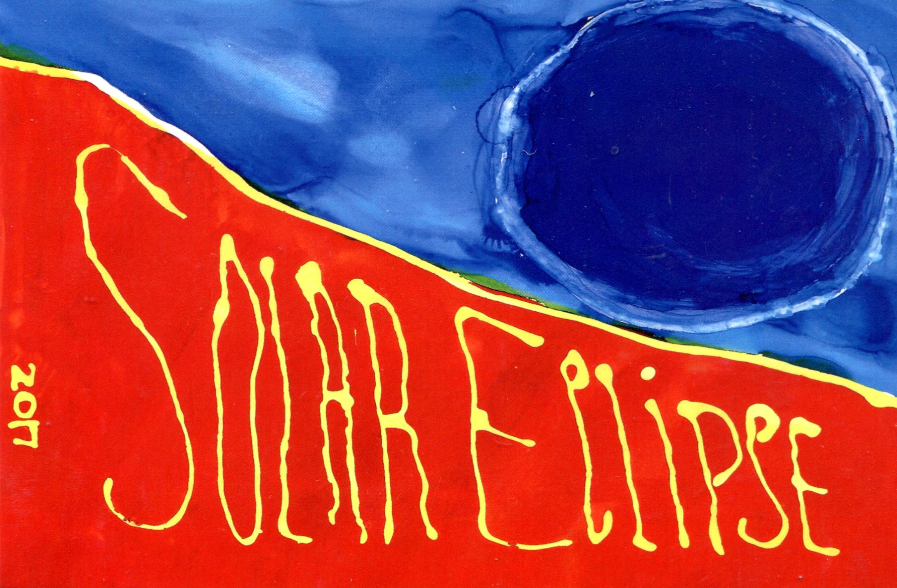
There was nothing for it but to wait. We spent a while in the antique store. I bought some postcards there, because of course I did, including an eclipse souvenir card. Glad I found it. The artist is Jane E. Viterisi, apparently a local artist.
At about 12:30, we went to the McCracken County Library. The crowd wasn’t enormous, but sizable. People were milling around, parked in chairs and sitting on the ground. Just about everyone had glasses. We tried our eclipse glasses out for our first look at the event while in the library parking lot.

There it was, through the shades that excluded all other light: a fat orange crescent sun. Quite a sight all by itself, and getting leaner all the time. Meanwhile, the skies around the sun were clear, but clouds lurked elsewhere. Totality was coming.
The Great American Solar Eclipse Road Trip

How long did I know about this week’s solar eclipse? I don’t know. It wasn’t because of the recent media buzz. The better part of a decade ago, probably. Sometime back then, I filed away the notion: I am going to see the solar eclipse of August 21, 2017. In the path of totality.

So I did yesterday, along with my immediate family. And some unspecified millions of other people. It was an event among events. During totality, we were in Paducah, Kentucky, which occurred there for a bit more than two minutes beginning at 1:22:15 pm CDT. All my remaining days, I will remember where I was at that moment, and what I saw, and I hope so will the other members of my family.

I’d like to report that I overcame various trials and adversity to arrive at that place at that time, like an intrepid 19th-century scientist off to see eclipses over remote parts of the globe, but all it really took was a modest amount of planning, plus a bit of time and money. Back in October, for instance, I booked a room at a limited-service motel in Paducah for the night of August 20. I mentioned this to the clerk.

“That’s why you paid the regular rate,” she said. “People who booked this month had to pay twice as much.” Surge pricing among motels. She also claimed that nearby motels, only a bit better than the one we were staying in, charged $400 a night for some rooms. “And they’re getting it.”

We left on Saturday and drove from the northwest suburbs via Champaign-Urbana to Terre Haute, Indiana, where we spent the night of the 19th. On the way, we stopped at Shades State Park in Montgomery County, Ind.

The next day we went from Terre Haute to Paducah, spending a few hours in between in Vincennes, Indiana, on the Wabash River. We saw three things there: Grouseland, home of William Henry Harrison as governor of the Indiana Territory; the splendid Basilica of St. Francis Xavier, and the monumental yet obscure George Rogers Clark National Historical Park.

The thinking behind these stopovers was that seeing the eclipse at totality was no certain thing. Clouds don’t care about your peak-life-affirming-you-are-a-child-of-the-Universe experience, or even if you’re a scientist (or citizen scientist) looking to add to mankind’s body of total knowledge. It’s just another day to the atmosphere. So in case that happened — and the prospect kept me antsy for days — the trip wouldn’t be a total bust.

All together, the trip from our house to Paducah, using the most direct roads, is nearly 400 miles. St Louis is closer, about 300 miles, but I wanted to stay away from a large city for the event, which would mean adding crowds to crowds. Also, I’d acquainted myself with much smaller Paducah in 2009 at the same time as Metropolis, Ill. (misspelling Paducah in my posting), and found it pleasant enough.

Why see the eclipse at all? Because of the astronomy books I had as a kid that explained and illustrated the phenomenon, especially with maps of where total eclipses would be in far-off future years like 1979. Because of the eclipse of March 7, 1970, which was partial in Texas. My eight-year-old self made a pinhole box but, finding that unsatisfying — and this was before widespread eclipse glasses — I stole an instant’s look at it the thing itself in partly cloudy skies, very clearly seeing the black disk on the bright one. Because the subject came up at the planetarium I visited almost monthly in elementary school. Because men were going to the Moon at the same time. Because of the lyric in “You’re So Vain” that seems to reference the ’70 eclipse. The idea of winging off to Nova Scotia just to see an eclipse seemed (seems) impossibly intoxicating. Because of A Connecticut Yankee in King Arthur’s Court and “Nightfall” and other stories and movies using an eclipse as a plot point. Because I read Isaac Asimov writing about the Eclipse of Thales, and later read Herodotus on that event, which probably was on May 28, 585 BC, and if so history’s first exact date. Because I read about the eclipse of May 29, 1919, which helped confirm general relativity. Because of the annular eclipse I experienced in Nashville (as a partial) on May 30, 1984, which dimmed the sky in a strange way. Because it’s a cool thing to see not before I die, but while I’m still alive, just like the Transit of Venus. Because, to paraphrase George Mallory, it’s up there.

What Kind of Dog Days Are These?

Time to knock off for a little while. Back to posting around August 22. Got stories to file, things to plan, maybe a marvel or two to see.

These ought to be the dog days, when Sirius returns and dogs lie around. Of course dogs lie around all the time. The swelter ought to be enough to make us all want to lie around. Hasn’t happened this summer, at least here in northern Illinois. We haven’t been oppressed by much heat this August, even by local standards (anything around 90 F. or more).

It’s also supposed to be the silly season. You know, when there isn’t much serious news. Maybe that’s an old-fashioned concept in our time, when information of all kinds and quality oozes from every medium. Even so, lately there’s been entirely too much serious news, too much for any time, much less August.

Got reading to do, too. Always that. Four or five books at a time. Always that, who would do it any differently?

Lately read the following passage by Jack Kerouac in The Dharma Bums, one that runs on yet holds together, as he had a talent for. The woods don’t quite have this effect on me. Too bad.

“I felt like lying down by the side of the trail and remembering it all. The woods do that to you, they always look familiar, long lost, like the face of a long-dead relative, like an old dream, like a piece of forgotten song drifting across the water, most of all like golden eternities of past childhood or past manhood and all the living and the dying and the heartbreak that went on a million years ago and the clouds as they pass overhead seem to testify (by their own lonesome familiarity) to this feeling.”

Fish Heads, Fish Heads

The main course of this evening’s dinner, still in its packaging, before it became dinner.

Snapper Supper

We didn’t eat the fish head. I was told long ago — I think by an elementary school teacher — that fish heads were eaten in Japan. I later discovered that wasn’t universally true, just more likely than in this country.

At least one writer argues that stubborn Westerners ought to eat ’em up, yum. I’m not persuaded.