Most of an Empress Hotel Postcard

Postcards are sometimes educational, if you let them be. Another of the cards that I dug up this weekend depicts the Empress Hotel in Victoria, BC.Empress Hotel

I picked it up during my only visit to that city (1985), though to judge by the image, the picture might have been taken ca. 1970. I filled the card with correspondence, even to the point of stamping it, but I never sent it. At some point I removed the stamp for other usage.

Curious about the property, vintage 1908, I looked it up and thus learned about an entire class of hotels — namely, Canada’s grand railway hotels, mostly built by Canadian railway companies in a style that evokes French châteaux: Canadian National Railway, Canadian Pacific Railway and Grand Trunk Railway.

Some of the properties don’t exist anymore, but many do, such as the recently mentioned Banff Springs Hotel. That there are such palatial hotels is a good thing to know about Canada, I think.

Pacific Northwest Etc.

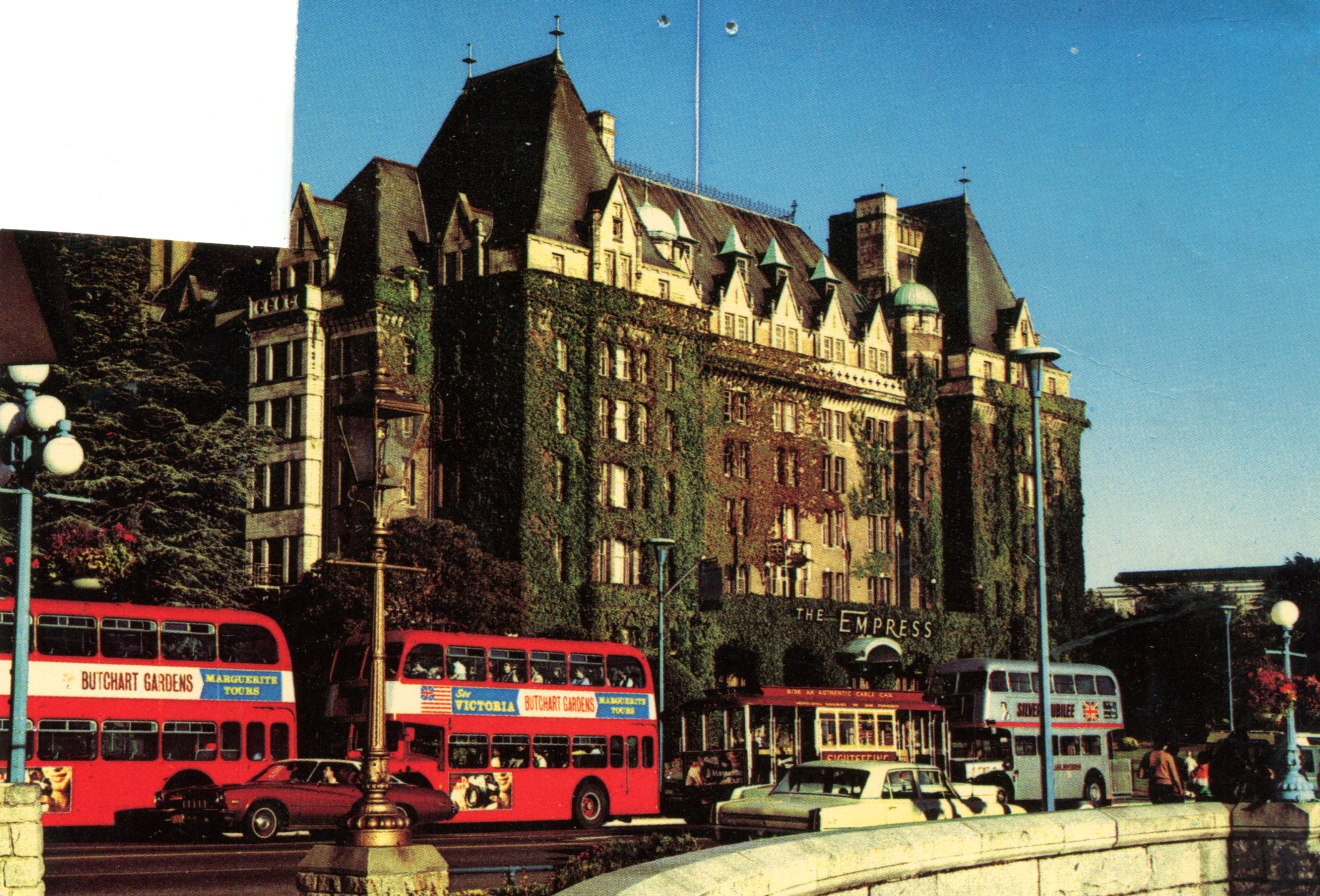
For once, I happened to be on the right side of the airplane when the pilot pointed something out. Namely, one of the massive forest fires burning on August 21 in the mountains of Washington state. It was an enormously tall, light gray cloud, reaching down toward the irregular ground below. If you looked carefully, you’d notice that very near the ground the cloud was tinged orange. I’d never seen the likes of it before.

Two days later, one of my ambitions on the road was to see Mount St. Helens, that storied volcano whose eruption captured the nation’s attention in the spring of 1980. No dice. When I got to the Mount St. Helens National Volcanic Monument visitors center, the ranger there told me that while I could drive to the lookout points, visibility was nil because of forest fire smoke.

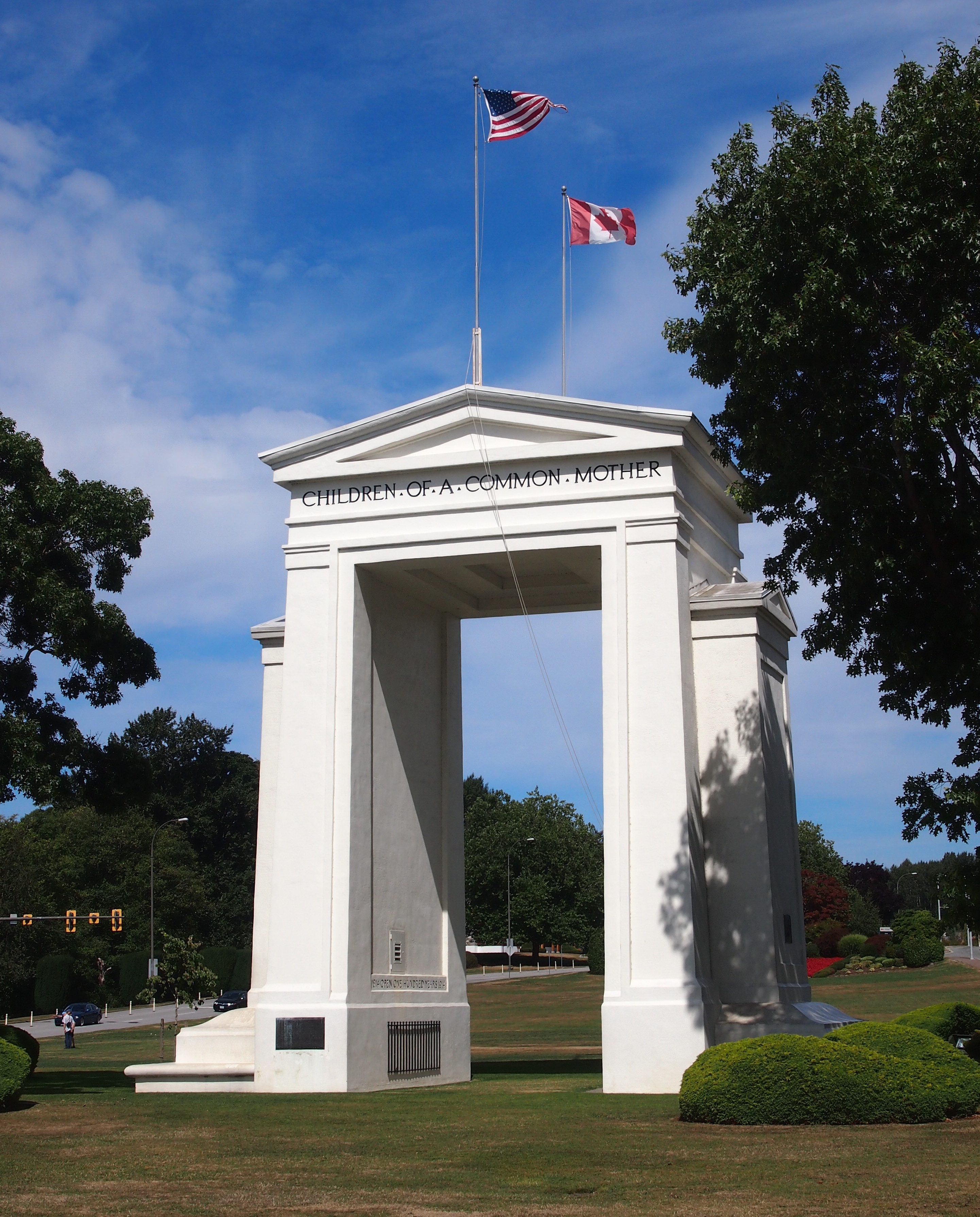
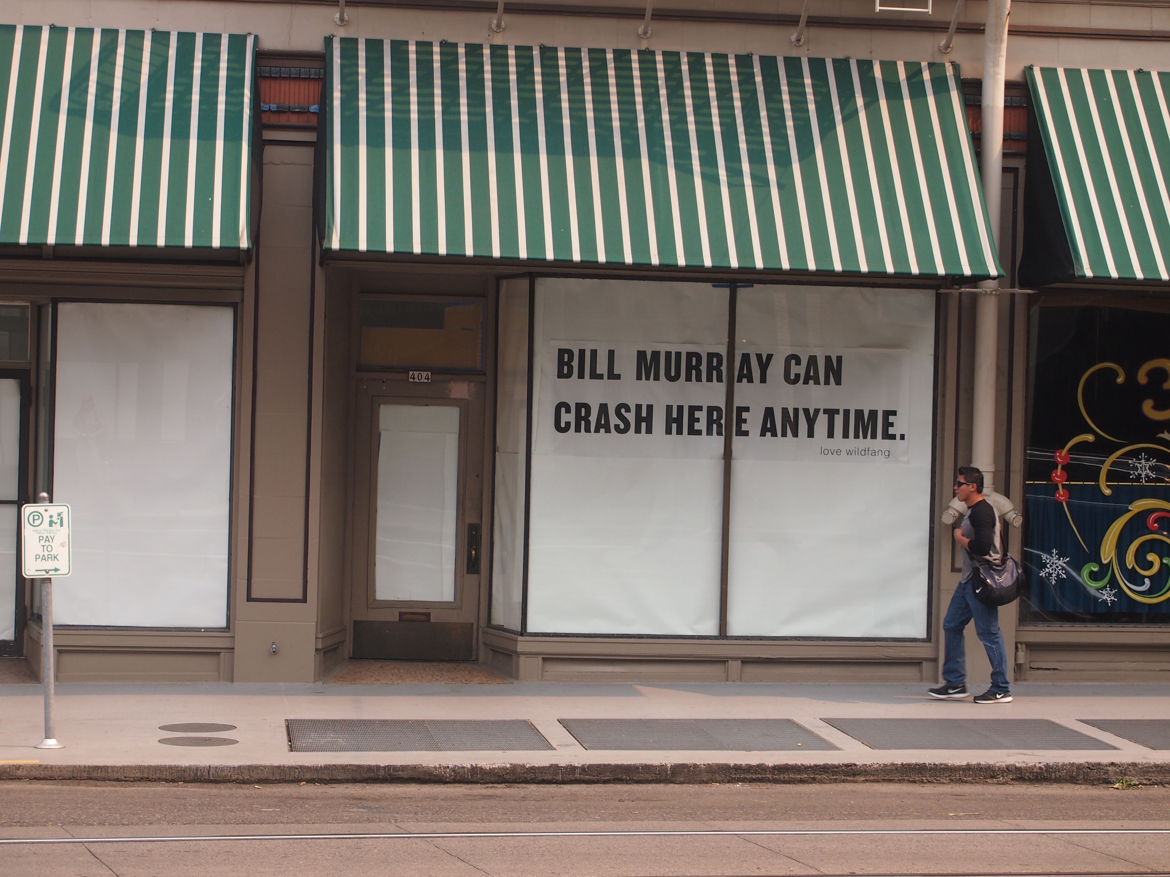
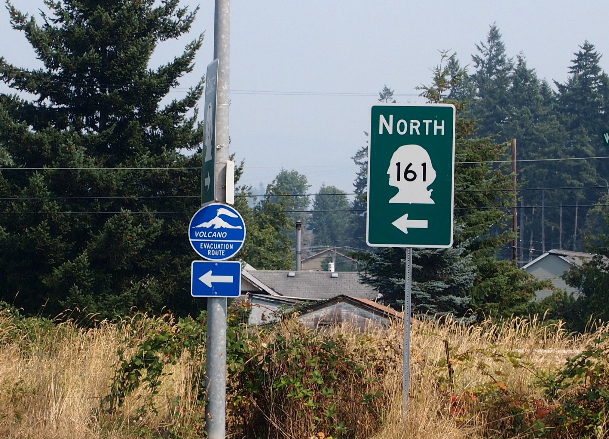
The only volcano I saw on this trip was on a sign not too far from the famed volcano.

Washington state, Aug 2015I consulted my map and picked out something else in the vicinity to see. That turned out to be Mossyrock Dam in Lewis County, Wash.

Mossyrock Dam
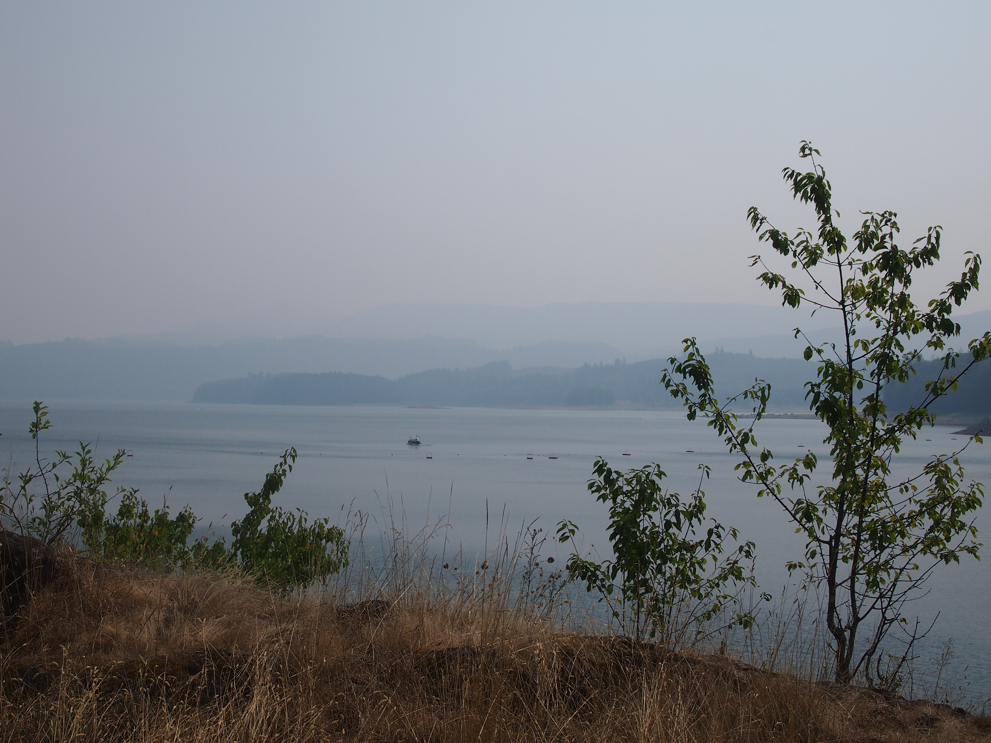
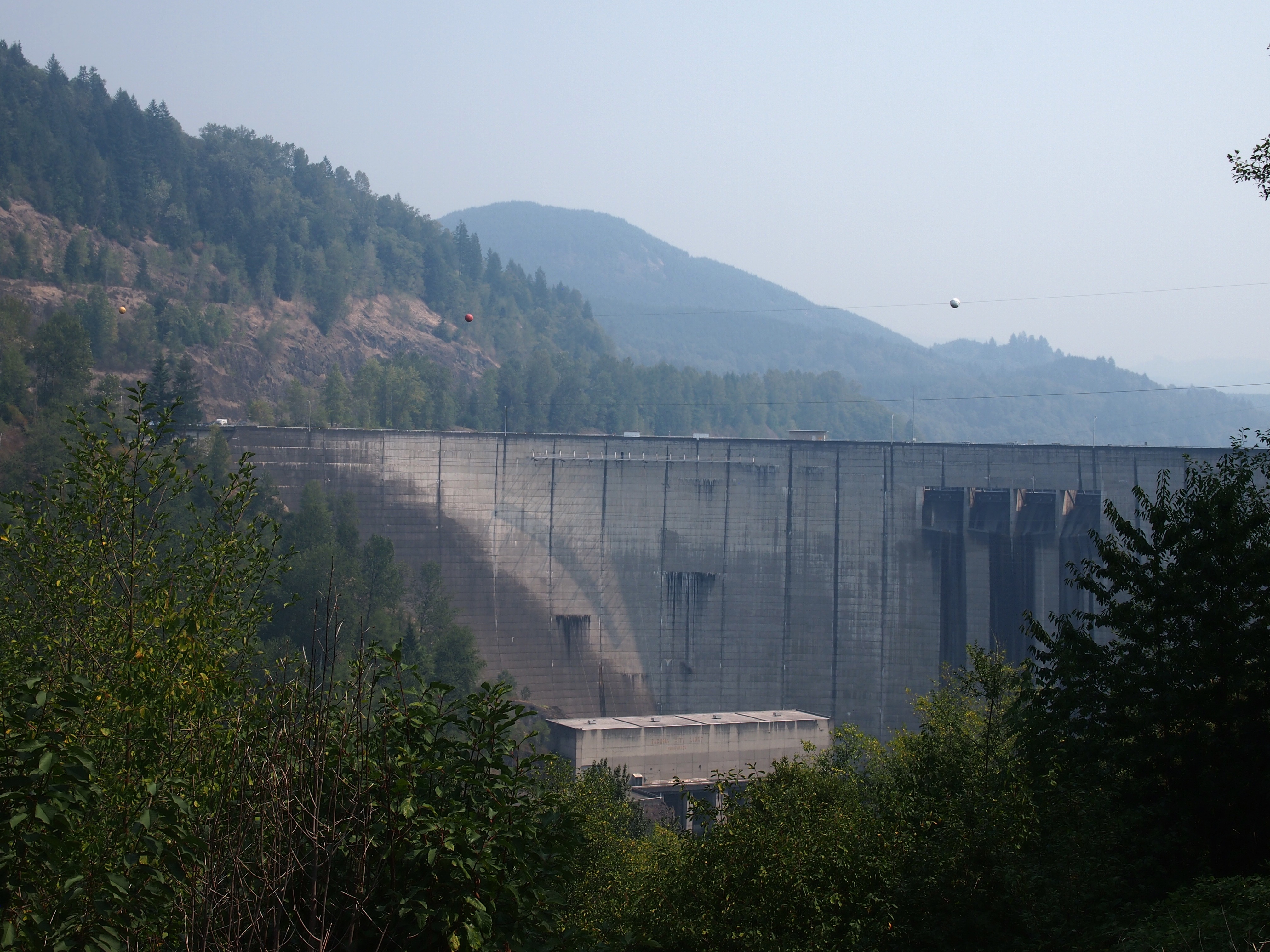
Note the haze in the background. That was everywhere in the distance that day. Mossyrock Dam dates from toward the end of the U.S. dam-building frenzy of the 20th century, being completed in 1968 (the frenzy has moved to China in our time). It dams the Cowlitz River, a tributary of the Columbia, and its main purpose is hydroelectric production. According to a number of sources, Mossyrock is the tallest dam in Washington state. I’d have guessed the Grand Coulee Dam, but maybe it just gets better press.

While I was reading about the dam, I came across an article about some towns that were flooded by the creation of the lake. That’s interesting, but I was also reminded of hearing about the 1940s flooding of the town of Stribling, Tennessee. I’m pretty sure my cousin Cook Wilson of Mississippi told my brother Jay, and Jay told me. Or maybe Cook told both of us at the same time, but I would have been pretty young, eight or so.

I looked it up again, and Stribling is under Kentucky Lake, one of the Between the Rivers lakes created by the TVA. When I was a kid, I imagined that such a town included whole buildings covered with water, and if you dove down, you could open the doors and look inside flooded buildings. It didn’t occur to me that pretty much everything would have been carted away before the inundation, even if only for scrap, leaving only building foundations, if that. Which would soon be silted over.

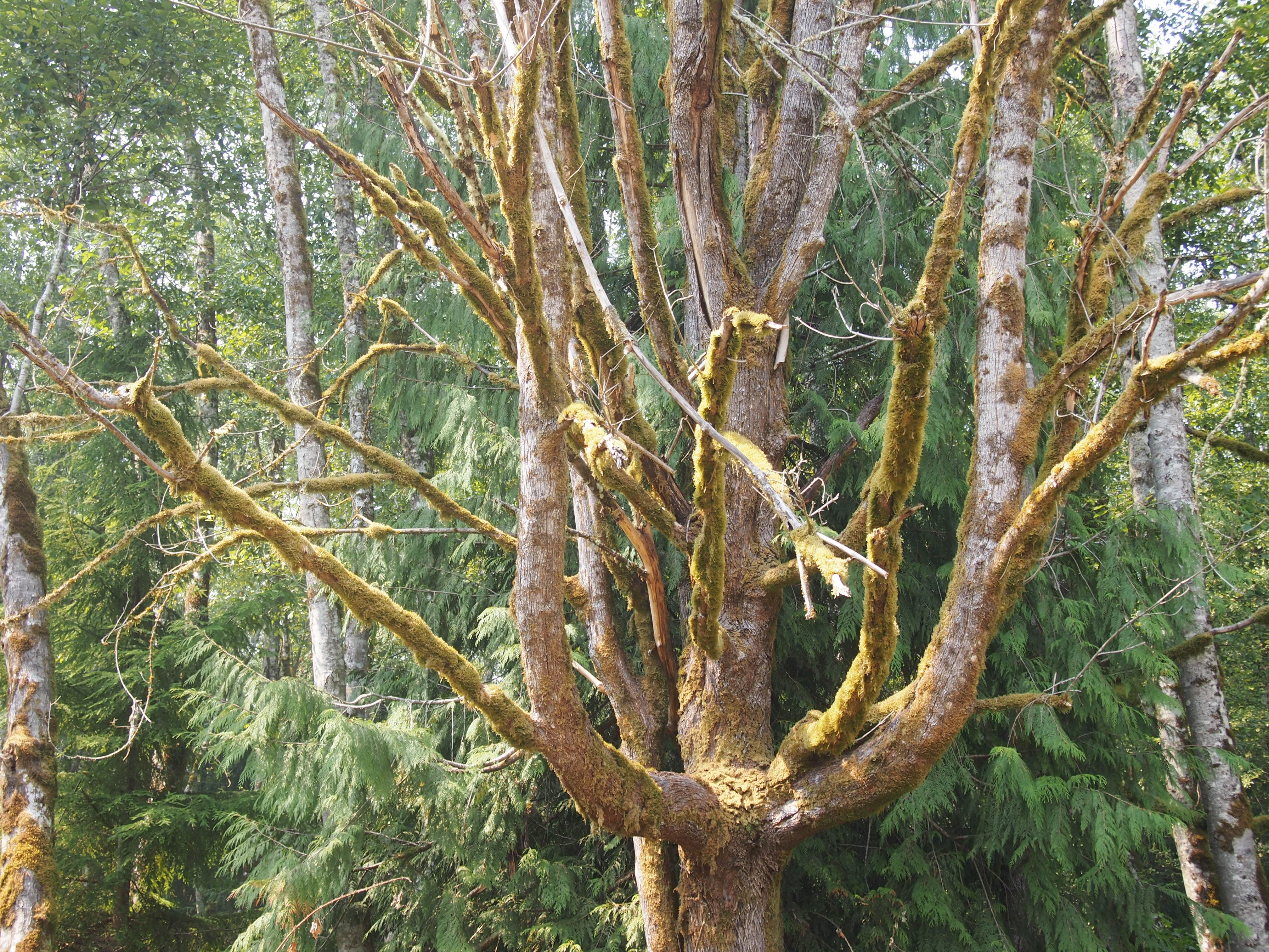
I also saw some mossy trees near the Mossyrock Dam.
Washington state, Aug 2015
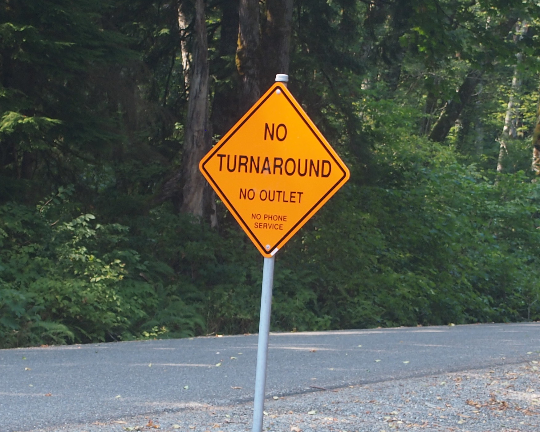
And a sign that might as well have said ABANDON ALL HOPE… What’s the point of this road?
Go the hell awayThis is Riffe Lake, created by the Mossyrock Dam, and just as hazy that day.
Riffe Lake
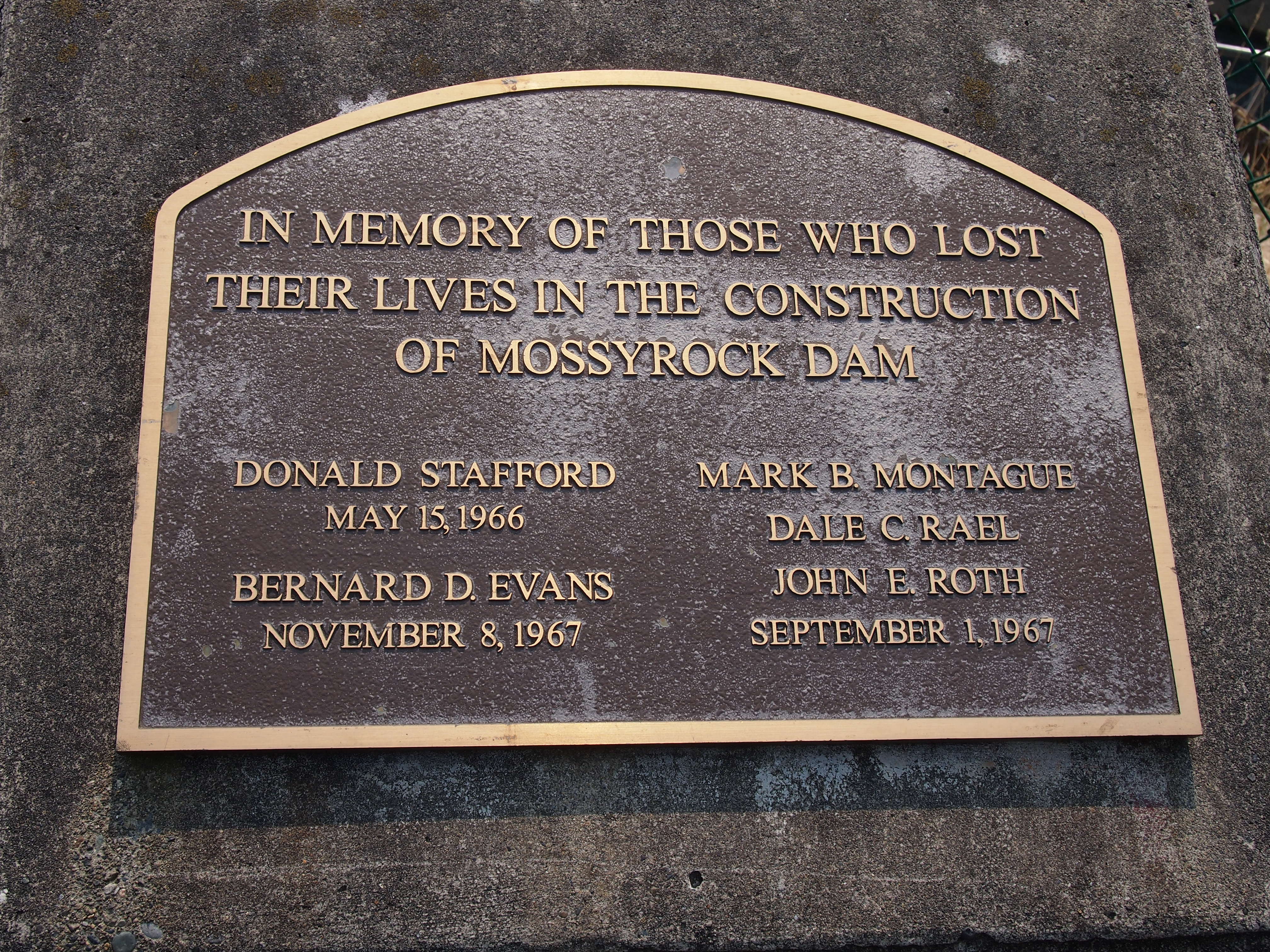
I noticed this plaque near the dam’s observation point. I’m glad the men have some kind of memorial. More than the many more who died building the Coulee seem to have gotten.
In Memoriam
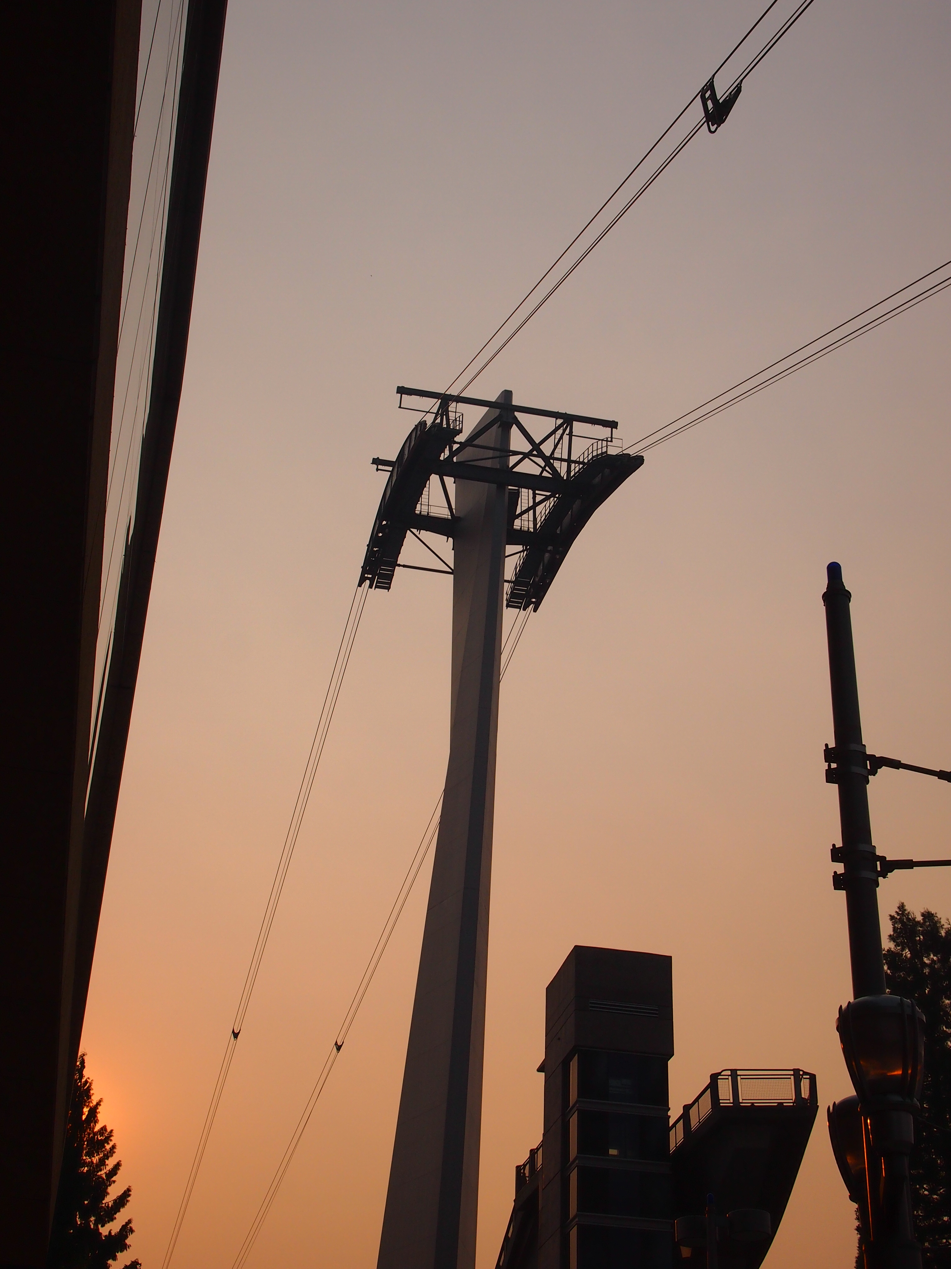
Something else I didn’t get to do: the Portland Aerial Tram. On the morning I got to Portland, I could see it, but without a more detailed map, I couldn’t get to the damned thing. The part of town that’s home to one of the terminals, which is on the river, is essentially cut off from the rest of town by a freeway, and if you don’t know the exact way to get past that obstacle, you’re out of luck. By the late afternoon, when I had a better map and could find the tram, it was closed. Ah, well.
Portland Aerial Tram
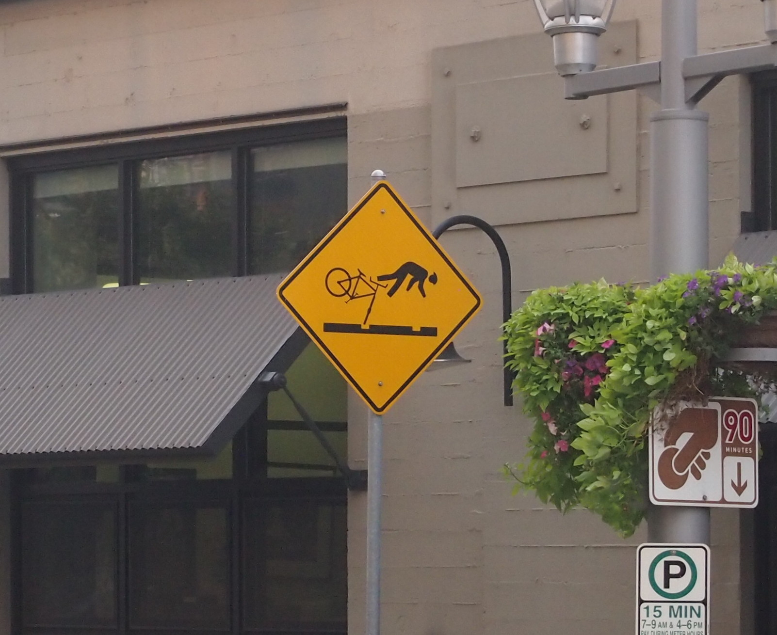
Portland has a number of light rail lines, and I rode those just to ride them. I also noticed these signs near the lines, something I’ve never seen anywhere else.
PortlandUp north, one thing I noticed about major Canadian surface streets — or at least those streets in the Vancouver area — was that there’s no such thing as a double yellow line. BC 99 turns from a limited-access highway into a six-lane major street as you enter the city, and it’s divided by a single yellow line. It’s silly how unnerving that was, because the difference is only a few inches. Even so, all that separates you from a mass of cars and trucks coming at you is a thin yellow line instead of a double thickness of two. Canadian drivers must be used to it.

Know what else Vancouver doesn’t seem to have? Free parking. Not even at Stanley Park.

Finally, the Bullitt Center in Seattle, one of the greenest buildings in the nation, and a marvel of a building in that way.

The Bullitt Building, Seattle
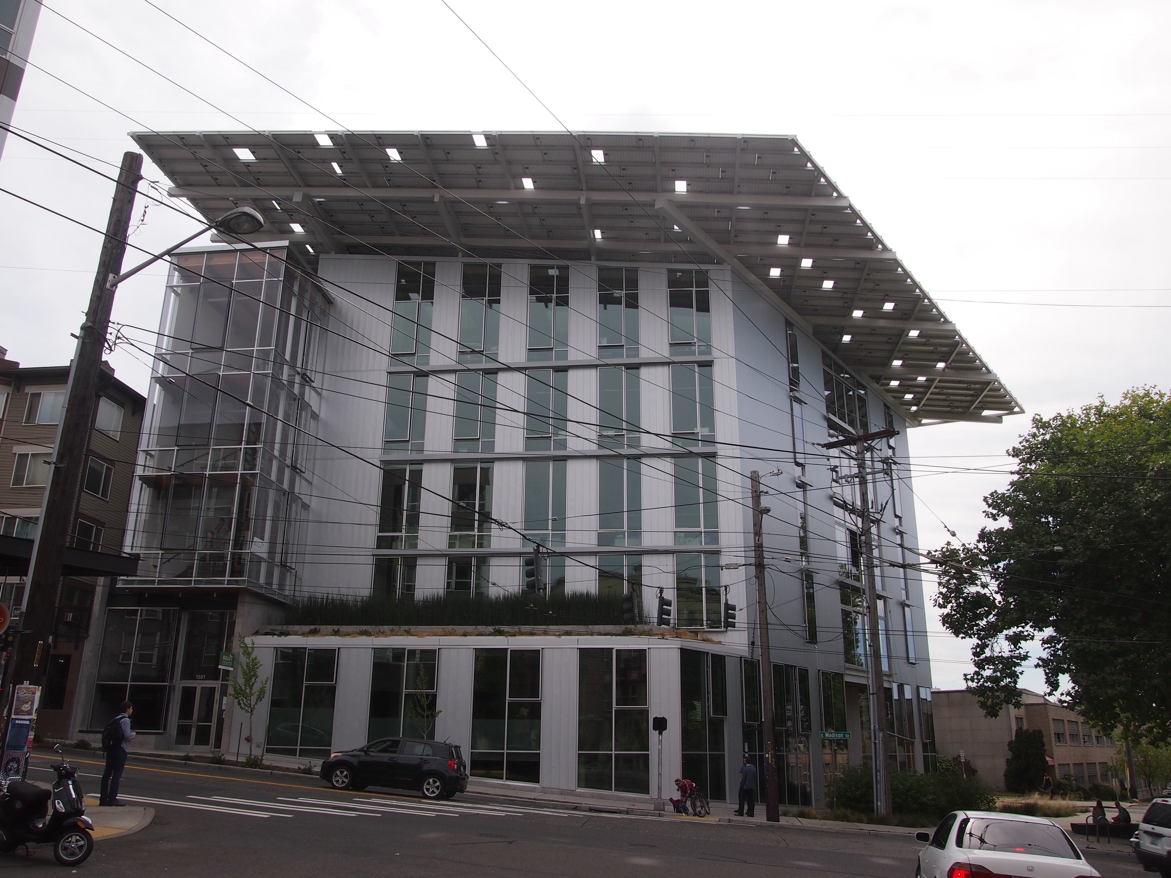
For instance, that hat of a roof? An array of solar panels that produces more power than the building uses. As part of my work, I got a tour from the property manager. This is my writeup of the visit.

The University of British Columbia Museum of Anthropology

Visit the University of British Columbia Museum of Anthropology, as I did on the afternoon of August 25, and you’ll probably end up in awe of this fellow.Cedar ManIt’s the head and chest of Cedar Man, who stands about two stories tall in the museum’s Great Hall. He has arms and legs, but they were in shadow.

The museum says: “Carved welcome figures on the Northwest Coast have traditionally been raised on village beaches to greet visitors. Joe David carved this one for a different purpose: to protest logging operations on this birthplace of Meares Island, part of the ancestral territories of the Tla-o-qui-aht and Ahousaht peoples of the Nuu-chah-nulth First Nations.”

Meares Island is off the west coast of Vancouver Island in Clayoquot Sound. This was the first I’d heard of it. The protest was in 1984, and eventually the Indians won the day, and the ancient trees on the island still stand. The museum bought Cedar Man from Joe David in 1987.

All together the UBC Museum of Anthropology houses 38,000 ethnographic objects — which I suppose includes artwork like Cedar Man, made in living memory — plus 535,000 archaeological objects. The ethnological collections include over 15,000 objects from Asia, almost 12,000 from North America (including over 7,100 from B.C. First Nations), about 4,300 from South and Central America, 4,000 from the Pacific islands and over 2,300 from Africa.

An overwhelming amount of stuff, in other words, and not just from the Pacific Northwest, though that’s a heavy emphasis. The mass of carvings in the Great Hall, which includes an array of other Northwest Coast totem poles, house poles (carved structural elements), masks, and more, is only the beginning.

The face is pretty much universal.

UBCUBCUBCThe museum goes off in a number of directions, branching into various displays. An entire room is devoted to a sculpture called “The Raven and the First Men” by Bill Reid, which used to be on the Canadian $20 bill.

In other galleries, all stuffed to the gills with items from around the world, I encountered the work of Kwakwaka’wakw carver Willie Seaweed (ca. 1873-1967), which the museum calls “one of the great 20th-century artists of the Northwest Coast.” Among other things, he made ritual items for potlatches while they were illegal in Canada (1884-1951).

UBCI was surprised to find a room devoted to European ceramics, but there it was in the Koerner Ceramics Gallery. I’m not up on European ceramics, so I’d never heard of the likes of Bellarmine or Bartmann jugs, which have bearded faces at the base of the neck, and seemed to have been the last word in jugs in the 16th and 17th centuries, and mostly made in western Germany.
UBCOther galleries sported plenty of other things from around the world. Such as a familiar image of Buddha, though its origin is uncertain (either China or Japan).
UBCA puppet from China, though it reminded me of the ones from the East Indies.
UBCHere’s my own favorite from the UBC, a recent work — the last 30 years or so — from Papua New Guinea, many of whose inhabitants are inordinately fond of The Phantom, who appears on their battle shields like this one.
The Phantom!A great example of cross-cultural WTF. More examples are here.

Peace Arch Park

One thing to think about at Peace Arch Historical State Park in extreme northwestern Washington state is the last time the United States invaded Canada, namely the bungled campaigns of 1812 and ’13. Bungled from the U.S. point of view, that is, though of course there were some successes, such the battles of the Thames and Lake Eire (“We have met the enemy and they are ours.”).

The War of 1812 was the last bit of fighting along the U.S.-Canada border, not counting spats over fishing, so it’s reasonable that a bi-national park on the border commemorates the long peace. Peace Arch Park is that place, 22 acres south of the border (Peace Arch Historical State Park) and nine hectares north of the border (Peace Arch Provincial Park).

I arrived around noon on August 25, driving up from Bellingham, Wash. You take the last U.S. exit on I-5 (or maybe it’s the first exit) and park nearby, just south of the border, and then walk to the Peace Arch, which is slap on the border, meaning it’s also exactly 49 degrees North, as well as in the grass median between the northbound and southbound lanes of the highway (the meeting of I-5 and BC 99). Since traffic stops on each side of the border, crossing the road on foot there isn’t very risky.

Peace Arch, August 25, 2015On the U.S. side, the Arch is 67 feet tall; on the Canadian side, 20.5 meters. It’s been standing for there for 94 years, built at the behest of Pacific Northwest business tycoon Sam Hill (1857-1931), who also had a replica of Stonehenge built in another part of Washington state, and who was an avid advocate of road improvement. (“Good roads are more than my hobby; they are my religion.”) Presumably Hill would have been happy that a major road linking the two nations passes around the Arch.

The border’s also marked by a number of concrete posts.
US-Canada borderThe International Boundary Commission (Commission de la frontiere internationale) put the plaque at the bottom of the post on the occasion of its centennial in 2008. I figure most Americans, and most Canadians, have never heard of the commission. I barely remember reading about it some years ago in the context of the Alaska-Yukon border.

According to the commission’s web site, “Officially, the Commission’s work is described as maintaining the [U.S.-Canada] boundary in an effective state of demarcation. This is done by inspecting it regularly; repairing, relocating or rebuilding damaged monuments or buoys; keeping the vista cleared, and erecting new boundary markers at such locations as new road crossings.”

My italics. This is the body that’s responsible for clear-cutting the border between Alaska and Yukon — a 20-foot (six-meter) swath all the way along the 141st meridian. Since I read about that some years ago, I’ve since pondered the usefulness of doing such a thing. The commission asserts that “the boundary vista must be entirely free of obstruction and plainly marked for the proper enforcement of customs, immigration, fishing and other laws of the two nations.” I’m not quite persuaded, but anyway, more about the line is here.

The border posts have four sides: UNITED STATES on the south face (visible in my picture), CANADA on the north face, and INTERNATIONAL BOUNDARY and TREATY 1925 on the other two. I wondered about that. The commission references it too.

The treaty’s formal name is: “Treaty Between the United States of America and His Britannic Majesty, in Respect of the Dominion of Canada, to Define More Accurately at Certain Points and to Complete the International Boundary Between the United States and Canada and to Maintain the Demarcation of that Boundary, Signed at Washington, February 24, 1925.”

I made a point of crossing and recrossing the border a number of times near the posts. Now I can accurately say I’ve been to Canada more than a dozen times, including the six regular check-your-passport visits, plus the half-dozen (maybe more) crossings at the Peace Arch.

Pacific Northwest ’15

I left for the Pacific Northwest on August 21 and returned home late yesterday. Imagine an axis that connects Portland, Seattle, Bellingham and Vancouver, which are all linked by I-5 (British Columbia 99 north of the border). That axis was the focus of the trip. I went to all of those cities and some points in between, some for a matter of hours, others for a few days. I spent time away from those cities as well, in hilly territory lorded over by towering pines and enchantingly quiet at night.

I drove a lot but also managed to spend a solid chunk of time walking and riding buses and light rail. The visit involved attending a conference, touring an exceptional building and seeing other fine ones, experiencing two large public markets, wandering through one of the largest book stores anywhere and a few other excellent ones, and seeing two museums and a Chinese garden very much like some of the wonderful ones in Suzhou. I ate food both awful and extraordinary, including things I’d never heard of before.

Going to another part of the country means doing new things, too. Or it should. Not necessarily life-changing experiences, but the sort of petite novelties that add up over time to make the fabric of one’s life better. Even before I got there, this was the first time I’d ever booked a rental car through Costco or a room through Airbnb. I attribute a less expensive trip, and a better one, to both. I visited a new city (Portland) in a new state (Oregon) and visited new parts of places I’d been (Vancouver in British Columbia, the Fremont neighborhood in Seattle). I witnessed a major forest fire from the air and smelled the result on the ground as the wind wafted west. Unexpectedly, according to the residents. I stood inside a building designed by Frank Gehry, rather than looking at its curious outside.

I saw a number of odd and interesting things, such as the street musician who’d modified a bagpipe and played it on stilts (Vancouver, just outside the Pacific Central Station). What to call it? Steampunk bagpiping?
Vancouver, August 25, 2015Or the Gum Wall (Seattle, next to the Pike Place Market). Each of the those bits of color is ABC gum, often used to attach cards and small posters to an alley wall. Why? As near as I can tell, just because.

Gum Wall, Seattle, AugOr the echo of a celebrity event I’d missed when it happened, the Bill Murray Party Crashing Tour of 2012 (this sign was in Portland).

Portland, August 22, 2015I can think of a lot worse people to show up at one’s party uninvited; maybe he’s still doing it occasionally.

Most importantly, I reconnected with two dear old friends, one of whom I hadn’t seen in 18 years, another I hadn’t seen in 30 years, since my last visit to Seattle. Our friendships have been maintained over the years mostly through paper correspondence, with a more recent electronic component. But there’s no substitute for being there.

Pacific Northwest Ephemera

Thirty years ago this month, I took a trip to Seattle and other parts of the Pacific Northwest. I hadn’t been there before and I haven’t been back, though I want to go. That was where I saw an enormous fallen tree in Mount Rainier NP and the excellent-in-every-way Butchart Gardens in Victoria, BC.

WAferries85I took no camera. It was that kind of trip. I did return with a lot of ephemera, though. Such as a Washington State Ferries schedule. I was staying with a college friend of mine the first weekend I was there, and took the ferry with him and friends of his. From Seattle to Winslow, I think, but in any case across Puget Sound.

We were the last car in, shoehorned into the back of the ferry, and during the crossing mostly sat in the car listening to a tape of United States Live by Laurie Anderson, which was fairly new at the time. I distinctly remember her relating a story about an obscure Chinese dialect in which the word for “Heaven” and “Moon” are the same, and how it was reported in this part of China that American astronauts had traveled to Heaven. If I were feeling that kind of ambition, I’d listen to the five disks of United States Live to find out where this bit occurs. I don’t feel like it — I’d rather retain this odd amalgam of a memory, made up of her strange story and the trip across Puget Sound, unimpaired by hearing the story again.

That weekend we also spent some time under gray skies on one of the beaches on the sound, playing volleyball and hunting geoduck. Or at least one or two members of the party were looking for geoduck, which I’d never heard of before. From a hole in the sand, they managed to pull up the neck of one of those clams, which was long and gross, but not the body. “That’s one hurting geoduck,” said one of the fellows who pulled it up.

It’s pronounced “gooey duck,” incidentally, and later at the Seattle Aquarium, I saw an entire geoduck. They might be good eating (I didn’t eat one), but they’re also remarkably ugly.

It was also on that beach that I found a shell partly covered in barnacles. It’s a little hard to get an image of it, but here it is anyway, top and bottom.

shell1shell2I’ve had the shell ever since, though some years ago a child managed to break it. I glued it back together. There’s something about it.

BCferries85There was nothing much as memorable about crossing from Tsawwassen to Swartz Bay in British Columbia. That time I was in my own rental car, and drove to Victoria, a fine little city.

On this trip I covered a lot of ground in my car, admiring the forests, except where they’d been clear-cut, and fond of the fields of blooming Scotch broom, which I later learned is an invasive species in the Pacific Northwest. Maybe not quite in a league with kudzu, but bad enough.

One more item, which I kept because you don’t see this kind of thing inland so much: a tide table. It was a lagniappe from the handsome Kalaloch Lodge, which is on the Pacific coast, and actually within the boundaries of Olympic National Park. Kalaloch85I spent the night there. Lovely place, though most of the scenery was obscured by drizzly clouds. Still glad I went. If only to go to a place that gives out tide tables to its guests.

On the Borders

In July 2006 we found ourselves – because of much sustained effort, mostly in the form of driving long distances – at a triple border. I can’t think of anywhere else I’ve been quite like it. The spot is at the meeting of British Columbia and Alberta; of Banff National Park and Kootenay National Park; and on the Continental Divide. On one side of the road are three flagpoles, with the Maple Leaf flying between the provincial flags of British Columbia and Alberta.

On the other side of the road is a large wooden sign offering some geographic information (it says 5,382 ft). I wore my Route of Seeing cap, and a shirt acquired on a previous visit to Canada, for a snap with the three-year-old Ann. (Be sure to read about Ed and Haleakala and that thing called Death.)

Not too far away, or at least northward on the British Columbia-Alberta border, is a triple continental divide, the Snow Dome of the Columbia Icefield. Our guide on the Icefield pointed it out to us, but that’s as close as we got. At that point water drains either to the Atlantic, Pacific or Arctic oceans.