Down in Galveston, Up in Yellowstone

Back to posting on Tuesday, since of course Juneteenth is a holiday. I just found out that since last year, there’s been a mural in Galveston commemorating the issuance of General Order No. 3 by (Brevet) Maj. Gen. Gordon Granger, who would be wholly obscure otherwise. The artist, Reginald C. Adams, is from Houston.

Something to see if I ever make it back to Galveston, which is more likely than, say, Timbuktu. But I don’t believe I’ll go to Galveston in the summer again.

I downloaded a National Park Service image (and thus public domain) today of the road near the north entrance of Yellowstone NP, showing the damage from the recent flooding. Damn.Yellowstone NP flood 2022

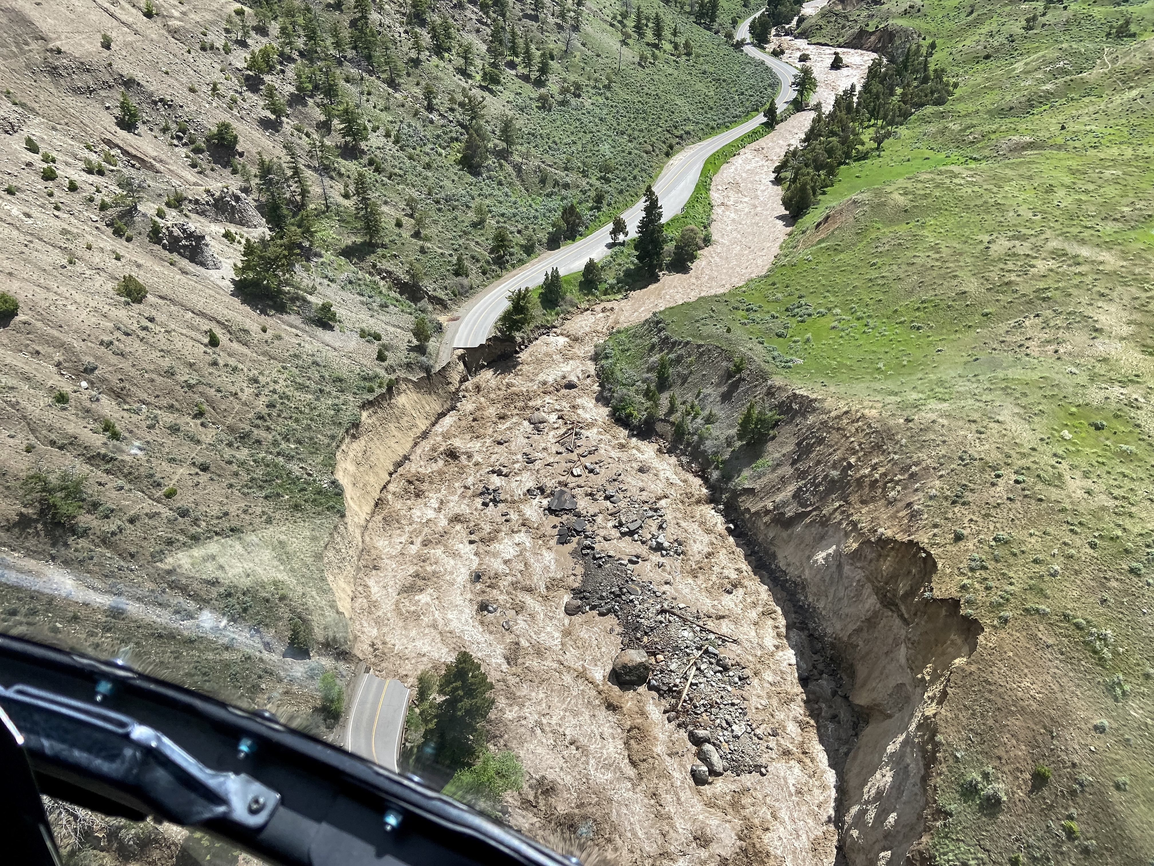
Many more pictures of the flooding in the park and in Montana are here, along with a story about the curious absence of the governor of Montana.

“Aerial assessments conducted Monday, June 13, by Yellowstone National Park show major damage to multiple sections of road between the North Entrance (Gardiner, Montana), Mammoth Hot Springs, Lamar Valley and Cooke City, Montana, near the Northeast Entrance,” the NPS says. “Many sections of road in these areas are completely gone and will require substantial time and effort to reconstruct.”

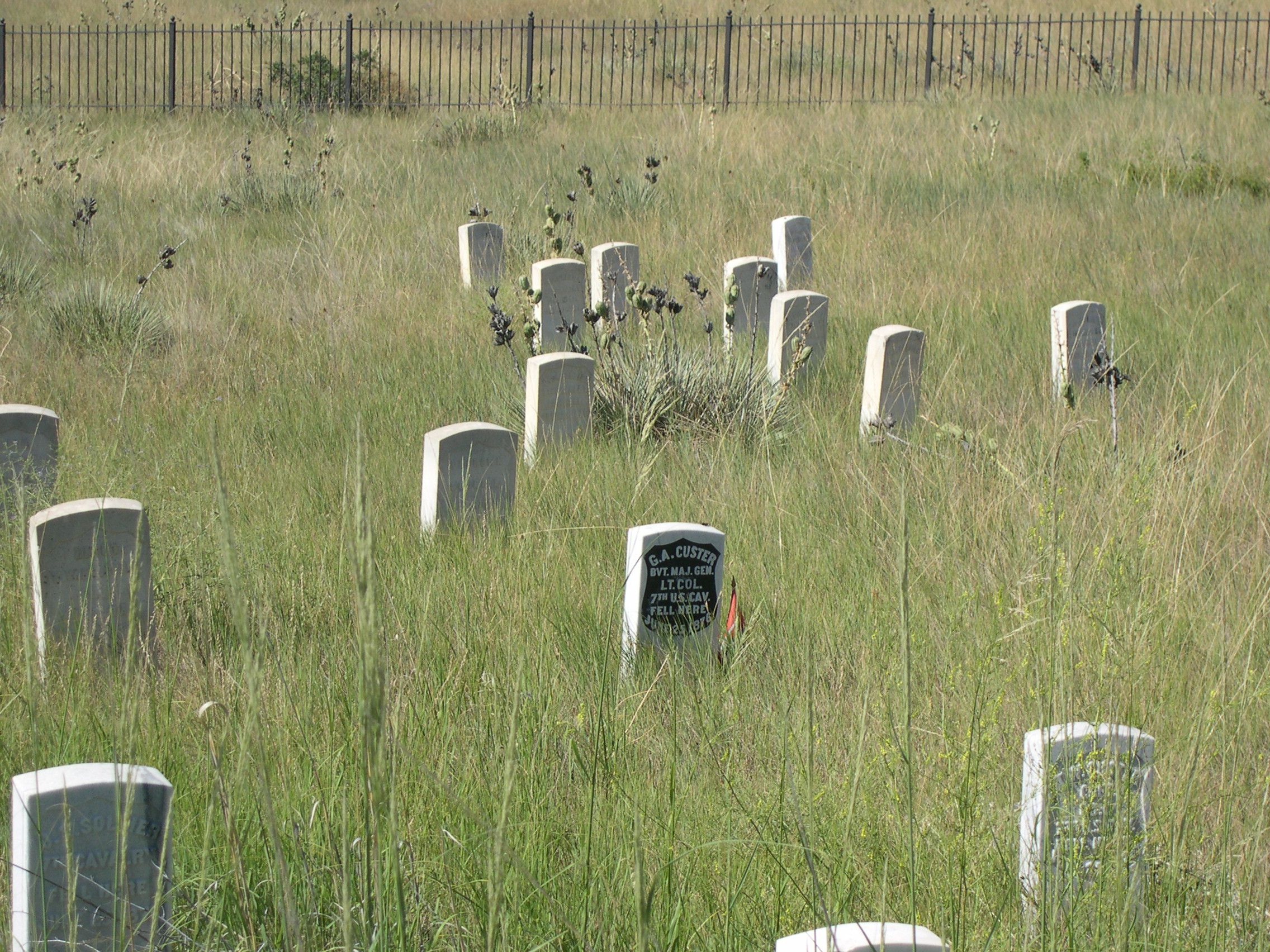
No doubt. We entered the park at the north entrance back in ’05 and spent some time in that part of Yellowstone. The Gardiner River was much more peaceful then.Gardiner River 2005

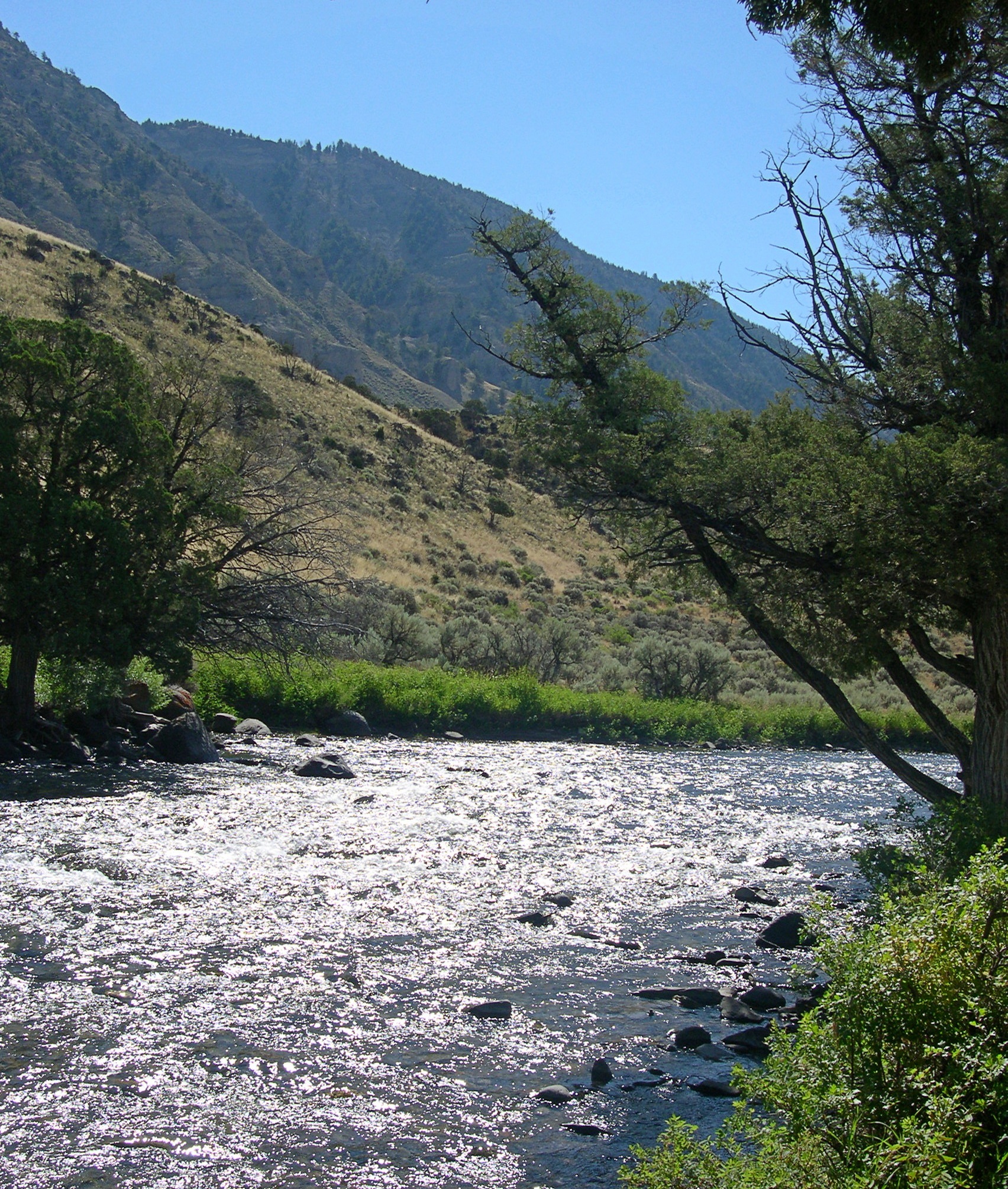
“Just south of the park’s north entrance, there’s a parking lot next to the Gardiner River. Just beyond the edge of the lot is a path that follows the edge of the river, under some shade trees,” I wrote at the time.

“The river is very shallow at that point, with a cold current pushing over piles of very smooth stones… piles of rock moderated the current a little, so that you could sit in the river and let it wash over you. It wasn’t exactly swimming, but it was refreshing.

“Along the road, just at the entrance to the parking lot, there were two signs: ENTERING WYOMING and 45TH PARALLEL of LATITUDE HALFWAY BETWEEN EQUATOR and NORTH POLE.”

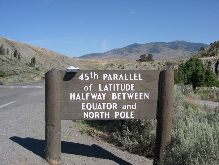
Wonder if that sign is still standing.

Custer Shorn

Historical tidbit for the day, from The Last Stand by Nathaniel Philbrick, subtitled “Custer, Sitting Bull, and the Battle of Little Bighorn” (2010), p. 38.

“Custer was known for his long hair, but in 1876 he, like many men approaching forty, was beginning to go bald. Before leaving Fort Lincoln, he and another officer with thinning hair, Lieutenant Charles Varnum, ‘had the clippers run over their heads.’ This meant that the former ‘boy general’ with the famously flowing locks now looked decidedly middle-aged.”

Nice detail. All the depictions I’ve ever seen of Custer just before he met his fate feature the distinctive locks. It’s a good book so far, as all of the other Philbrick books I’ve read – Sea of Glory, Mayflower, and In the Heart of the Sea – though this one isn’t about the sea. Unless you consider the Great Plains as a vast kind of ocean.

As the subtitle says, the book isn’t just about Custer. Sitting Bull gets equal billing as the winning commander.

Also interesting to note: Going west that spring, Custer, publicity hound that he was, hoped that a battle with the Indians would win him a large measure of fame back east in time for the Centennial. Sure enough, it did. But maybe not quite in the way he planned.

I don’t think I’ve read this much about Custer since before we went to Little Bighorn in 2005.

Last Stand Hill, 2005The stone with the black backdrop is Custer’s, but unlike the other men, his body was reburied elsewhere, at West Point in fact.

Border Crossings of the ’00s

Somewhere in western South Dakota in early August 2005, I got the idea to document our crossing into Montana, where we were headed en route to Yellowstone NP. Document my crossing, really, in a moment of self-absorption. Because anyone who likes maps knows that borders are fascinating. So I got a paper plate and drew “46” on it. As in, my forty-sixth state.

MontanaUS212Lilly took the picture. I thought the number would be a little more visible, but it isn’t. In any case, that’s beside the road on US 212, which cuts from South Dakota briefly through Wyoming, and then into Montana. We camped that night at Custer National Forest and the next day stopped at Little Big Horn.

The next year, I wanted the number to be visible, so I had Lilly stand closer. This wasn’t actually the moment I crossed in North Dakota from Minnesota, which was on the Interstate 94 crossing the Red River of the North between Moorhead, Minn. and Fargo, ND a few hours earlier.

I noticed that just north of our campsite in Lindenwood Park in Fargo, on the river, was a footbridge back into Minnesota.

NorthDakotaNo paper plate seems to have been handy, so I used a piece of paper. Standing in the middle of the bridge, I had Lilly capture the moment.