Return From Seattle

Ann’s back from Seattle, where she went last Thursday for a visit with her sister. I picked her up at O’Hare this evening. Heavy snow in the Chicago area today, the heaviest of the winter so far but which tapered off late in the afternoon, delayed her for a few hours at her layover point in Denver after an early start this morning.

She said she’d never been so glad to leave a place as the Denver airport. Just wait, I said, there will be even longer travel days eventually. At least I hope so; airport purgatory is one of the mild prices one pays to see distant things in the modern age.

While in Seattle, she enjoyed some of the cultural richness of that city.

That’s at a place called Archie McPhee’s Rubber Chicken Museum. Can’t believe I’d never heard of it. Only open since 2018, though. Like the Chihuly Museum, a place I must see next visit to Seattle. Of course, it’s really a novelty shop. Ann bought me some stickers there, sporting rubber chickens, and I was happy to get them.

Out in Washington State

Two days after I returned from the UP and packed my friends off at O’Hare, I was back at that airport, dropping Yuriko and Ann off. They were headed for Washington state to visit Lilly, returning six days later.

They took in some Seattle sights.Seattle 2022 Seattle 2022

Last year, I recommended that Lilly go up the Space Needle on her 24th birthday, because that’s what I did on my 24th birthday in 1985 (and she hadn’t been yet). She wasn’t able to do that — November’s probably not a great time for views anyway — but at least she did so when she was still 24.Seattle 2022

Views of Puget Sound.Puget Sound 2022 Puget Sound 2022

Plus sights east of the metro, such as Snoqualmie Falls.
Snoqualmie Falls

And the curious town of Leavenworth, Wash., which is Bavarian themed. With street trolls, apparently.Leavenworth, Wash.

Looks like they ate well, too.

The trip was everything they thought it should be, they told me. Good to hear.

North to Alaska

Last week, I found myself at the Arctic Circle. Or so the sign said. I didn’t bother to check with GPS, since I knew it was close enough, like the Prime Meridian line in Greenwich, England. I posed with it. That’s the tourist thing to do, especially when you’ve come a long way.Arctic Circle Sign, Alaska July 2021

A fleeting but memorable moment there at 66 degrees, 33 minutes North, early during my recent visit to Alaska, which ran from July 26 to July 31. Before that, I flew to Seattle to spent a long weekend with Lilly, who has established a life in that city. I also visited some of my old friends — stretching back to college and high school — now resident in that part of the country.

On the first day in Seattle, July 23, Lilly and I walked from her apartment in the Wallingford neighborhood (near Fremont) over to Gas Works Park under a warm summer sun. That was one of the first places I ever visited in Seattle in ’85, long before the notion of walking anywhere with a grown daughter. After an afternoon nap (for me), we had a delightful take-out dinner at Bill and Gillian’s back yard in Edmonds, with another friend, Matt, joining us.

On Saturday the 24th, I had breakfast up the street from Lilly’s with a high school friend, Louis, whom I hadn’t seen in… 40 years? Late in the morning, Lilly and I went to the Seattle Art Museum, which has quite the collection, arrayed in galleries each featuring a certain genre or artistic theme – usually a radically different one from the neighboring galleries. Out to smash that paradigm called “chronology” or “art history,” I suppose.

That afternoon, we went to the Ballard Locks, formally known as the Hiram M. Chittenden Locks, which connect Puget Sound with Lake Washington, a worthwhile suggestion of Jay’s. Not as impressive as the Panama Canal, Lilly said, but still a feat of 1910s engineering. That evening, old age rested (me) and youth went out (Lilly). That meant that the next morning, youth was a lot more tired than old age during the ferry ride and drive to spend the day at Olympic National Park, where we took a hike along Hurricane Ridge and then a walk to see Marymere Falls.

On July 26, I flew to Fairbanks, my base for the rest of the week. I didn’t have a rental car at first, so I got around via cabs and municipal buses in roughly equal measure – the former being infinitely more expensive than the latter, since the buses have been free since the pandemic hit. I took in the excellent Museum of the North on the sprawling campus of the University of Alaska Fairbanks and visited downtown Fairbanks long enough to get dinner.

The next day, I made my way to a general aviation runway near the airport and took a tour that involved flying in a small plane to Coldfoot, Alaska, which isn’t even a town, but rather a camp on the Dalton Highway, about 250 miles north of Fairbanks. North of Coldfoot, there are no services for 240 miles, until Deadhorse.

We didn’t continue further north. The tour then headed southward by bus on the gravel road that is the Dalton, stopping at a few places, including the Arctic Circle sign.

On July 28, I picked up a rental car and spent some time looking around Fairbanks, including the Birch Hill Cemetery on the outskirts of town, and then suburban North Pole, Alaska, for a look at the curiosities there. Mainly, the Santa Claus House. From there I headed south on Alaska 3, a two-lane road to Anchorage. I didn’t go to that city, but rather to a hotel near the entrance of Denali National Park, where I spent the night. Along that road, I unexpectedly found a presidential site.

The next day, I took a bus tour of the national park, which took us along the only road in the park to see magnificent vistas and animals along the way. We saw many of each. We also saw Denali itself for a short time without a shroud of clouds, gleaming white among the brown mountains. About 600,000 people visited Denali NP in 2019, a record, and I understand the attraction.

That evening, or rather during the long twilight afternoon, I drove back to Fairbanks, only about 90 miles. On the morning of July 30, I spent time futzing around downtown Fairbanks, this time using the rental car, occasionally marveling that I was in the furthest north U.S. city.
welcome to alaska

A heavy lunch made me tired, so I returned to my room and napped and read and wrote postcards and watched YouTube and regular TV. Even tourists need time off. If the trip had ended then, I would have been more than satisfied, but I had scheduled one more day.

It was a good one. Better than I expected. I’d considered going to a hot spring about 60 miles from Fairbanks, but I’d had enough of long drives, so instead I visited another cemetery, some churches, a couple of neighborhoods and had a lighter lunch than the day before.

That meant I was ready for the Fountainhead Antique Auto Museum in the afternoon. I almost didn’t go. Two museums seemed like enough for this trip. But I figured I’d go look at some old cars for an hour or so, since I was nearby anyway. I was astonished at the place. Not only was it an excellent car museum, it was an excellent museum, period: an amazing collection expertly displayed and curated.

That wasn’t quite all. I spent a little more time before returning to the airport walking on the trails of Creamer’s Field Migratory Waterfowl Refuge, including its boreal forest trail, a term that evokes the trackless reaches not much further out of town. My July 31 flight from Fairbanks was a redeye, bringing me home early today.

My senses had to work overtime to take in all that I experienced. Alaskan vistas tend to be intense, in spots sweeping far to the distance; more expansive than I’d ever seen, besting even the Grand Canyon or the Canadian Rockies or the Gobi Desert. Roads took me through vast forested square miles without much human presence. On learning that there are really only six main species of trees in the Alaskan forests, and that one of them is the quaking aspen, I started noticing them everywhere. At one rest stop, I listened to the wind blow through a stand of maybe half a dozen quaking aspens, a distinctive rustle I’ve heard in my own back yard, only magnified.

Mostly the temps were in the 60s and 70s, and as high as 80, though a rainy cool day on the Dalton made the gravel crunch and the mud stick, and some of it yet remains dried on my hiking shoes. As the days passed, I started noticing the hours-long twilight and the never-quite dark of the night, strange to contemplate, if you’re not used to it. The signs and businesses and other details along the way in Fairbanks spoke to a strong regional identity, as much as in Texas.

At first, Fairbanks itself didn’t impress. The Lubbock of the far north, I thought. But the longer I stayed, the more I began to appreciate its light traffic, historic spots, and restaurants that wouldn’t be out of place in any much larger American city.

And its oddities. Perhaps none as odd as the green pyramid at the University of Alaska Fairbanks, in front of the engineering building.
Engineers Tradition Stone University of Alaska
The text is here.

The Alaska leg of the trip was a little expensive, at least after arrival, because the airfares to get there and away were the least expensive part of the trip. Everything else in Alaska is expensive. But I have to add: entirely worth it.

Fremont Avenue ’15

Near the end of August 2015, I spent a few hours wandering around the Fremont neighborhood in Seattle. One place I went was Fremont Avenue, which ran roughly from where I was staying in Upper Fremont down to the rest of the neighborhood.Fremont Seattle

Fremont SeattleIt’s one thing to tag a lonely wall somewhere, but a street sign? Wankers.

I was footloose and had a camera, so I took pictures of whatever caught my eye along the street.

Fremont Avenue SeattleFremont Avenue SeattleFremont Avenue Seattle

Not something you see often. Or ever. An orange Bel Air station wagon.
Fremont Avenue SeattleWith a sleek hood ornament.
Fremont Avenue SeattleTravel far enough south on Fremont Ave. and you’ll come to the Fremont Bridge.
Fremont Bridge SeattleFremont Bridge SeattleFremont Bridge SeattleFremont Bridge SeattleFremont Bridge Seattle“Today, with traffic across the bridge a constant, the bridge opens around 35 times [daily], often creating long waits for drivers,” notes Atlas Obscura, which asserts that it is the most-opened drawbridge in the country.

North to Alaska — Some Other Time

The other day I spent some time reading about the Alaska Marine Highway, which is a ferry service that ordinarily runs along the coast of that state. I’ve known about it for years, but it’s one of those things you look into now and then, to see if anything has changed. After all, time flies, and a lot of good things get lost or kicked around.

Naturally you can look up the schedule on system’s web site. I checked the sailings scheduled out of Bellingham, Wash.

Maybe not lost, but it looks like the system is getting kicked around these days. I picked Bellingham because it’s the southernmost port for the ferries, but also because I’ve been to the terminal. Ed suggested we look around there when I visited him in ’15. No sailing happened to be scheduled that day, so few other people were around. Now it’s like that for the unforeseeable future.

Short Travels With Ed

Some years ago, Ed Henderson told me that we’d probably travel well together. That is, not get on each other’s nerves too much over the course of a multi-day trip. I took that as a compliment, but not anything we’d actually follow up on. And we never did.

Ed’s passing made me think about the scattering of places we did go, all day trips of one kind or another. In late ’91, for instance, two places on two separate occasions: Ishiyama-dera and Koyasan.

I wrote about Ishiyama-dera: “Warm and sunny day, flawless weather to visit the exquisite Ishiyama-dera. I went with Ed and Lynn, two former fellow teachers, and Americans as it happens, to the temple, which is in Otsu, Shiga Prefecture. It’s near the shores of unscenic Lake Biwa, the sludgepot that provides greater Osaka with its drinking water.

“No, that’s not the best way to begin to describe Ishiyama-dera, which is set in the forested hills not far from the lake. You forget about Biwa while visiting the fine old wooden structures, which manage to convey their great age through their smell, somehow, maybe redolent of centuries of incense. This time of year, the temple also has the aesthetic advantage of seasonal reds and yellow. It augments the aura of esoteric objects honoring esoteric gods on remote shores.”

As for Koyasan, I don’t ever seem to have written about it. That surprises me a little, since it was one of my favorite places in Japan, and I went there at least three times (maybe four). Whenever someone was visiting me from the States, I would take them there to marvel — as I always did, each time — at the enormous trees and the ancient shrines and the vast cemetery among the trees and the shrines. Just the way the afternoon sunbeams slipped through the towering tree canopy to touch the grass next to monuments, or dappled mossy statues, was worth the ride into the mountains to get there.

Koyasan, along with two neighboring sites, was put on UNESCO’s World Heritage list in 2004, and for good reason. “Set in the dense forests of the Kii Mountains overlooking the Pacific Ocean, three sacred sites – Yoshino and Omine, Kumano Sanzan, Koyasan – linked by pilgrimage routes to the ancient capital cities of Nara and Kyoto, reflect the fusion of Shinto, rooted in the ancient tradition of nature worship in Japan, and Buddhism, which was introduced from China and the Korean Peninsula,” the organization says.

“The sites (495.3 ha) and their surrounding forest landscape reflect a persistent and extraordinarily well-documented tradition of sacred mountains over 1,200 years. The area, with its abundance of streams, rivers and waterfalls, is still part of the living culture of Japan and is much visited for ritual purposes and hiking, with up to 15 million visitors annually. Each of the three sites contains shrines, some of which were founded as early as the 9th century.”

My college friend Steve — whom I did travel with once upon a time, in Europe — was visiting Japan that fall, and he and I and Ed went to Koyasan one day. It was there that Ed told me about his medical condition, perhaps (but I can’t remember now) in a discussion of why he, someone not even 30, needed a cane that day.

Here’s a thought: I wonder what a world map would look like with pushpins to mark the all the places all three of us have been, since Steve is fond of travel as well. A porcupine of a map.

As I mentioned yesterday, in May 1997, Ed and Lynn and Yuriko and I went to the Boyce Thompson Arboretum, about an hour east of Phoenix on 392 acres in the Sonoran Desert. It was a hot day, as you’d think, but we had an enjoyable walk on the grounds, taking a look at its large variety of desert plants. Not all of which were cacti. But many were.

Boyce Thompson Arboretum 1997Boyce Thompson Arboretum 1997Last August — only 11 months ago — while visiting Ed in Washington state, I suggested we go to Vancouver for a day. It was a city he knew well, but one that I’d bypassed in 1985 to go to Vancouver Island instead. He wanted to go, but had no energy for it. So I went by myself.

During that visit, however, we did go to Bellingham, a much shorter distance from his home, with me driving and him navigating. Among other things, we spent time at two bookstores in downtown Bellingham within walking distance of each other — the excellent and large Village Books and the excellent and small Eclipse Books. Like me, Ed owned and read a lot of books about a lot of different things, and thus spent a lot of time in bookstores.

We also ate gas station pizza. It was a favorite of Ed’s, bought at a Bellingham gas station, which actually had a fairly large shop attached to it. We got our slices to go and went to the Alaska ferry terminal, sitting on one of the benches facing the water to eat the pizza. Since no ship was due to arrive or depart that day, few other people were around. At that moment, he might have suspected he’d never return to Alaska, a place he liked so much; I wondered if I’d ever make it.

Actually, Ed did return, or will eventually. I understand that his ashes have been — or will be — scattered in the Stikine River, which empties into the Pacific just north of Wrangell, Alaska, where he lived for a time.

Pacific Northwest Etc.

For once, I happened to be on the right side of the airplane when the pilot pointed something out. Namely, one of the massive forest fires burning on August 21 in the mountains of Washington state. It was an enormously tall, light gray cloud, reaching down toward the irregular ground below. If you looked carefully, you’d notice that very near the ground the cloud was tinged orange. I’d never seen the likes of it before.

Two days later, one of my ambitions on the road was to see Mount St. Helens, that storied volcano whose eruption captured the nation’s attention in the spring of 1980. No dice. When I got to the Mount St. Helens National Volcanic Monument visitors center, the ranger there told me that while I could drive to the lookout points, visibility was nil because of forest fire smoke.

The only volcano I saw on this trip was on a sign not too far from the famed volcano.

Washington state, Aug 2015I consulted my map and picked out something else in the vicinity to see. That turned out to be Mossyrock Dam in Lewis County, Wash.

Mossyrock DamNote the haze in the background. That was everywhere in the distance that day. Mossyrock Dam dates from toward the end of the U.S. dam-building frenzy of the 20th century, being completed in 1968 (the frenzy has moved to China in our time). It dams the Cowlitz River, a tributary of the Columbia, and its main purpose is hydroelectric production. According to a number of sources, Mossyrock is the tallest dam in Washington state. I’d have guessed the Grand Coulee Dam, but maybe it just gets better press.

While I was reading about the dam, I came across an article about some towns that were flooded by the creation of the lake. That’s interesting, but I was also reminded of hearing about the 1940s flooding of the town of Stribling, Tennessee. I’m pretty sure my cousin Cook Wilson of Mississippi told my brother Jay, and Jay told me. Or maybe Cook told both of us at the same time, but I would have been pretty young, eight or so.

I looked it up again, and Stribling is under Kentucky Lake, one of the Between the Rivers lakes created by the TVA. When I was a kid, I imagined that such a town included whole buildings covered with water, and if you dove down, you could open the doors and look inside flooded buildings. It didn’t occur to me that pretty much everything would have been carted away before the inundation, even if only for scrap, leaving only building foundations, if that. Which would soon be silted over.

I also saw some mossy trees near the Mossyrock Dam.
Washington state, Aug 2015And a sign that might as well have said ABANDON ALL HOPE… What’s the point of this road?
Go the hell awayThis is Riffe Lake, created by the Mossyrock Dam, and just as hazy that day.
Riffe LakeI noticed this plaque near the dam’s observation point. I’m glad the men have some kind of memorial. More than the many more who died building the Coulee seem to have gotten.
In MemoriamSomething else I didn’t get to do: the Portland Aerial Tram. On the morning I got to Portland, I could see it, but without a more detailed map, I couldn’t get to the damned thing. The part of town that’s home to one of the terminals, which is on the river, is essentially cut off from the rest of town by a freeway, and if you don’t know the exact way to get past that obstacle, you’re out of luck. By the late afternoon, when I had a better map and could find the tram, it was closed. Ah, well.
Portland Aerial TramPortland has a number of light rail lines, and I rode those just to ride them. I also noticed these signs near the lines, something I’ve never seen anywhere else.
PortlandUp north, one thing I noticed about major Canadian surface streets — or at least those streets in the Vancouver area — was that there’s no such thing as a double yellow line. BC 99 turns from a limited-access highway into a six-lane major street as you enter the city, and it’s divided by a single yellow line. It’s silly how unnerving that was, because the difference is only a few inches. Even so, all that separates you from a mass of cars and trucks coming at you is a thin yellow line instead of a double thickness of two. Canadian drivers must be used to it.

Know what else Vancouver doesn’t seem to have? Free parking. Not even at Stanley Park.

Finally, the Bullitt Center in Seattle, one of the greenest buildings in the nation, and a marvel of a building in that way.

The Bullitt Building, SeattleFor instance, that hat of a roof? An array of solar panels that produces more power than the building uses. As part of my work, I got a tour from the property manager. This is my writeup of the visit.

The EMP Museum

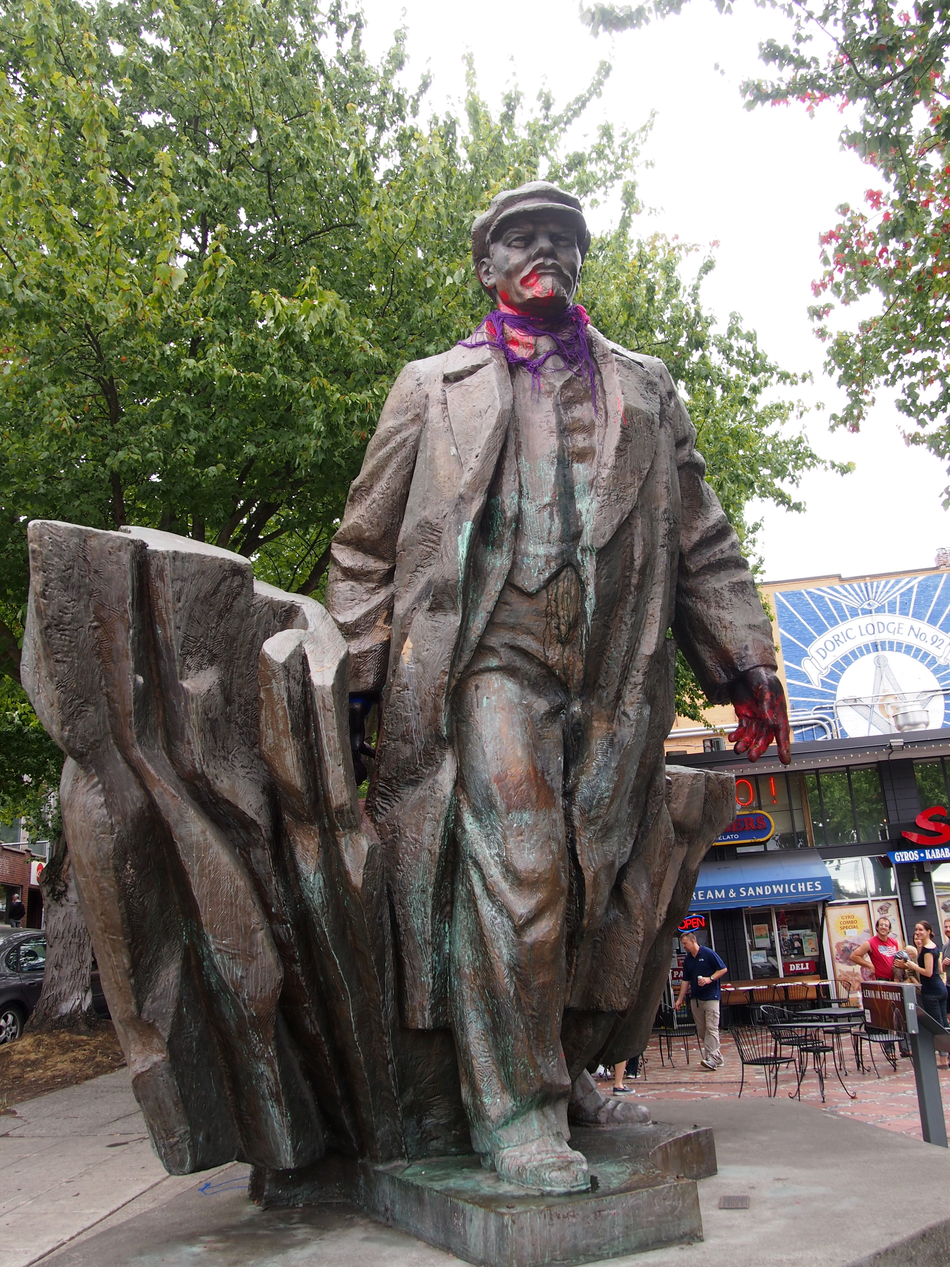
By chance today I saw about 10 minutes of Pompeii, a movie that apparently came out last year. The scene pitted gladiators vs. Roman soldiers, and clearly the gladiators were the put-upon salt-of-the-earth hero and his friends, while the soldiers fought for a cartoon Roman upper-class twit bad guy. I watched anyway. Nothing like a little implausible sword play to liven your afternoon. It didn’t take long to come to the conclusion that overall the movie was very stupid indeed.

But maybe I should have watched the end. According to Marc Savlov in the Austin Chronicle: “We all know what happens in the end and, to his credit, Anderson [the director] totally nails the vulcanization of Pompeii. You want it? You got it: flaming chariot melees, massive tsunamis, and a downright hellacious pyroclastic flowgasm that makes the ones in Dante’s Peak look like so many Etch-a-Sketch doodlings (all of it shot in well-above-average 3-D). Pompeii delivers the goods – well, at least during its final 20 minutes.”

It took me a while to remember what EMP stands for in the EMP Museum in Seattle, which I visited on the afternoon of August 28. That evening I said (jokingly) that I’d gone to the Electromagnetic Pulse Museum, because I’d forgotten it stands for Experience Music Project.

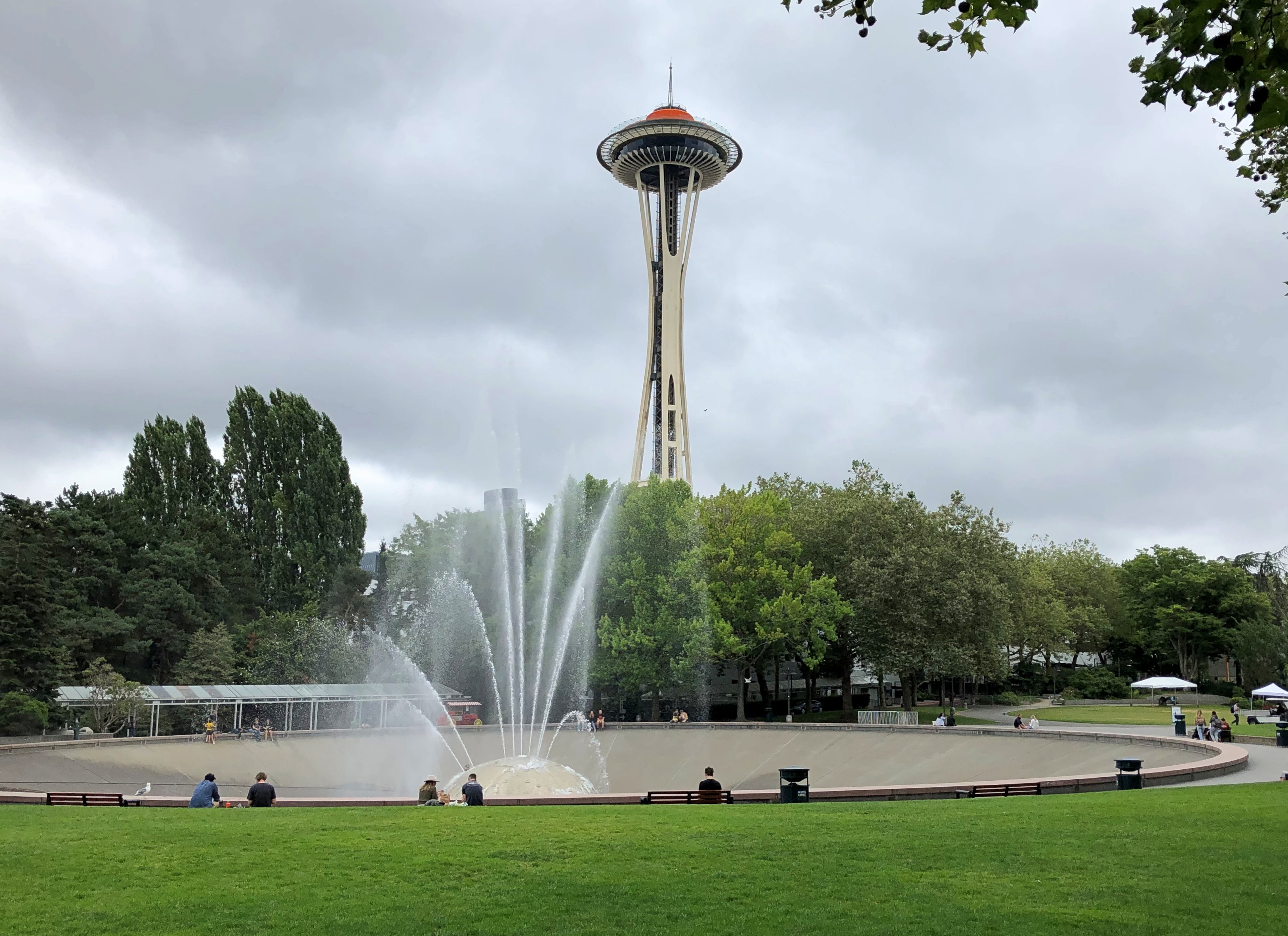
The EMP is at Seattle Center, just north of downtown. Seattle Center was the site of the 1962 world’s fair, interestingly known as the Century 21 Exposition. EMP didn’t come along until near the actual beginning of the 21st century, back in 2000, as the creation of Microsoft billionaire Paul Allen and right-angle averse starchitect Frank Gehry.

It’s a colorful 140,000-square foot blob of a building, roundly hated by many. I didn’t hate it, but it didn’t inspire much admiration in me either. I’ve seen plenty uglier buildings, following my own visceral and idiosyncratic standard for ugliness, which is uninformed by theory. Most parking garages are worse. So are many brutalist and otherwise concrete-based structures. EMP just seemed like Gehry being Gehry.

I understand it was a technical marvel to build, with more than 21,000 exterior aluminum and stainless steel shingles all uniquely shaped and designed to fit together like pieces of a puzzle, and an interior defined by strange irregular shapes and held up by 280 steel ribs. I found myself looking up at the interior with more admiration than the exterior. The engineers needed a terrific amount of computing power to design and put the thing together, which somehow seems fitting, considering that a software philanthropist paid for it.

Here’s an odd assertion from the museum: “If [the building’s] 400 tons of structural steel were stretched into the lightest banjo string, it would extend one-fourth of the way to Venus.” That must mean the average distance, since the true distance from the Earth to Venus changes every moment. Or maybe it means the distance between the orbits of Earth and Venus.

Wonder how many ping-pong balls it would take to fill it. Someone at the museum needs to figure that out.

Richard Seven wrote in the Seattle Times in 2010: “A smashed guitar, in honor of Seattle’s Jimi Hendrix and his rebellious style, was the inspiration and template. But the real collision was between one of the world’s most relentlessly anti-box architects, an unfathomable task of trying to freeze the rock ‘n’ roll process, and a wealthy private client who embraced the costs and advances in computing and engineering that allowed a building like that to even stand…

“When he toured the building just before it opened in the summer of 2000, Gehry told reporters, ‘It’s supposed to be unusual. Nobody has seen this before or will see it again. Nobody will build another one.’ ” Probably so.

As a museum, EMP is devoted to pop culture. Though “music” is in the name — and Jimi Hendrix and Nirvana each have their own galleries — that’s only part of the equation. One of the current exhibits, for instance, is “Star Wars and the Power of Costume,” which sounds like a display of costumes from that franchise. It cost extra, so I took a pass.

I didn’t miss “What’s Up Doc? The Animation of Chuck Jones.” That alone was almost worth the inflated price of admission to EMP. Besides original sketches and drawings, storyboards, production backgrounds, animation cels, photographs, and a fair amount to read, there was the opportunity to see cartoons on big screens, such as “What’s Opera, Doc?”, one of the Roadrunner cartoons — I forget which, not that it matters — and “One Froggy Evening,” which I probably hadn’t seen in more than 30 years, and which I didn’t fully appreciate when young. Especially the notion of a frog singing tunes from the 1890s.

The museum features some impressively large installations. One is made of guitars. A lot of guitars, arrayed upward in a kind of mass cone of guitars (and banjos and keyboards and other musical instruments) two stories high. The work is called “IF VI WAS IX,” and it was put together by a Seattle artist who goes by the single name Trimpin.

It’s more than just a cone of instruments. EMP notes that “short stretches of music were played into a computer then organized by Trimpin into a continuous electronic composition, with notes assigned to specific instruments. Customized robotic guitars play one string at a time. Six guitars work together to create the sound of one chord—a mechanical metaphor for how musical styles and traditions continue to influence one another.”

Nearby is the “Sky Church” room, whose main feature is a 33’ x 60’ HD LED screen that projects images on (from?) an enormous wall. The 65-foot ceiling is illuminated with parasols that seem to float overhead, and the space is well equipped with special-effects lighting. Technically impressive.

The perfect venue for, say, the restored color version of A Trip to the Moon. Or “Steamboat Willie.” Or “Duck Amuck.” Or the “Thriller” music video. Or any of many possibilities. All short, all worth seeing on a vast screen. Maybe shorts like these play at the Sky Church, but the day I was there, the venue seemed mostly to pump out music videos for people under 30.

I’ve read that the full name of the museum used to be the Experience Music Project and Science Fiction Museum and Hall of Fame (with the clunky initials EMP|SFM), but some years ago, the science fiction aspect was demoted. The museum still covers science fiction, as well as the horror genre, but in two galleries in the basement.

Not bad displays. I enjoyed seeing an assortment of SF movie and TV show props, such as the original Terminator’s leather jacket and I forget what else (no Lost In Space Robot, though), and playing with at least one of the interactive features: a large globe that would take on the likeness of each of the Solar System’s planets, along with the Moon (and Titan?), at the touch of a button.

Oddly enough, I got more out of the horror exhibit than the SF one. Besides static displays and props and the like, the horror gallery included a number of alcoves in which you can watch well-made short films on various renowned horror movies. These proved interesting, even though I don’t much care one way or the other about the genre.

Because of these shorts, I’m now inspired to watch two horror movies I’ve never gotten around to: The Cabinet of Dr. Caligari and The Exorcist. The former was on TCM late Sunday night, but I didn’t want to stay up late to watch it; such is middle age. I did see the haunting green credits, however, and I’ll get around to the whole thing before long.

There’s also a first-floor gallery devoted to the fantasy genre, but by the time I got there, I was a little tired of the museum. At least I happened to see the costume that Mandy Patinkin wore as Inigo Montoya.

As mentioned, two Seattle musical acts, Jimi Hindrix and Nirvana, had their own galleries. Of the two, I spent more time in the Hindrix room, despite being too young when he was alive to fully appreciate his talents, since he was common enough on the radio well into the 1970s. As for Nirvana, I was too old to appreciate them when they were around, and in fact out of the country during their heyday. I remember hearing about Kurt Cobain’s suicide right after I arrived in Hong Kong in April 1994, and my first thought was, Who?

Both galleries apparently change from time to time, rather than being generic tributes to the artists. The Hendrix exhibit I saw was  “Wild Blue Angel: Hendrix Abroad, 1966-1970.” It detailed his travels as a successful musician. As the museum explains: “At the height of his fame, Jimi Hendrix performed more than 500 times in 15 countries and recorded 130 songs in 16 studios. He was a musical nomad, his life an endless series of venues, recording sessions, flights, and hotels.”

His passport was on display. I got a kick out of that. Even better, while the original was behind glass, you could leaf through a replica, which I did. The dude got around.
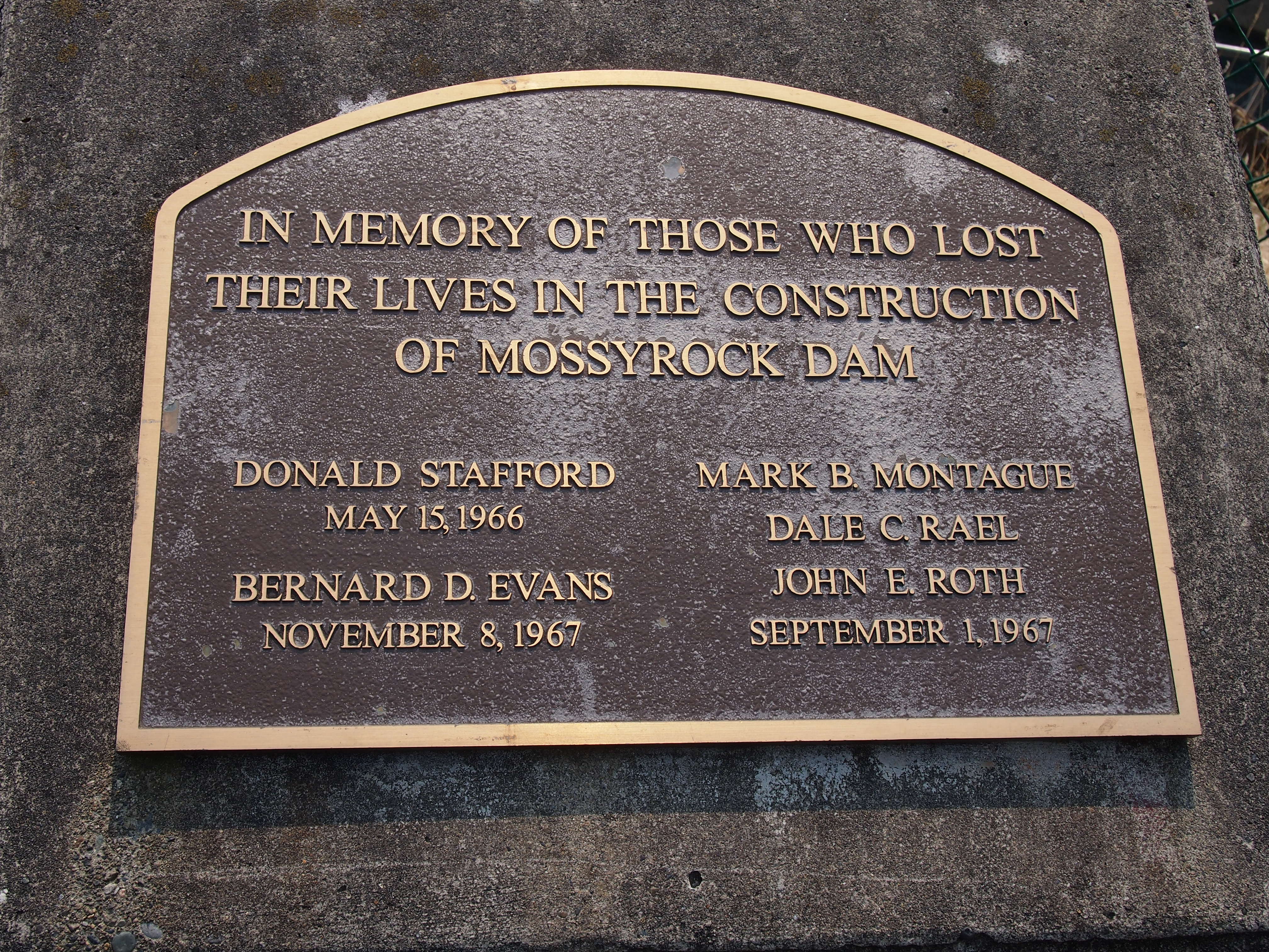
Fremont, Seattle

A popular thing to do during a visit to the Fremont neighborhood of Seattle is to pay your respects to the Fremont Troll. I’m not one to ignore a little local color, so naturally I went to see the troll on the morning of August 28, making my way there on foot from the room I’d rented in the “Upper Fremont,” about a 20-minute walk away.

I wasn’t the only one enjoying the troll that morning.
Fremont TrollFittingly, the troll is directly underneath a bridge, one that carries traffic across Lake Union on Aurora Ave. (Washington 99) to and from downtown Seattle (it’s also known as the Aurora Bridge, more about which later). The troll is right where the bridge starts to rise away from the ground, so it has a cozy home.

Roadside America, which of course lauds the troll as “major fun,” reports that, “the Fremont troll — a big, fearsome, car-crushing bruiser — took up residence under the north end of the Aurora bridge on Halloween 1990. He was sculpted by four Seattle area artists — Steve Badanes, Will Martin, Donna Walter and Ross Whitehead — for the Fremont Arts Council. The head-and-shoulders sculpture is 18 feet tall.”

The nose is sizable, too.
Fremont Troll 2015As are the hands. Paws? What do you call troll extremities?

Fremont TrollRoadside America again: “The shaggy-haired troll glares southward with his shiny metal eye — a hubcap? In his left hand, he crushes an old-style Volkswagen Beetle, which originally contained a time capsule of Elvis memorabilia; it was removed after the car was vandalized and the California license plate was stolen (the crushed car and out-of-state plate were meant as protests against ‘outsider’ development). There are plenty of places to pose, and interaction with the troll is encouraged as long as you’re respectful.” The entire entry is here.

Every year on October 31, the Fremont Arts Council holds an event called a Troll-a-ween. Not sure what that involves besides dressing up the troll.

Just to the east of the troll, I noticed a path running parallel to the roadway, through a patch of undeveloped land. No one else had shown any interest in it.
Fremont, 2015I soon discovered that the place was a residential pocket — an informal neighborhood for the homeless tucked in between Aurora Ave. and Winslow Pl. N., a surface street.
Fremont homeless tentAfterward, I made my way to Fremont Center, if in fact it’s called that, though “Lower Fremont” would be better, since the land slopes down from Upper Fremont toward the water at that point. There were other things to look for there, and I found most of them. Such as the statue of Lenin.
Fremont, 2015Fremont, 2015How did Lenin come to be in Fremont? A long story, apparently. The statue wasn’t on display in Slovakia very long, since it was erected in 1988 by an unpopular government that didn’t know it was on its last legs. After the Velvet Revolution, an American found the statue lying face down in the mud, and connived to bring it to Washington state. Various complications ensued, not all of which are clear, but I can report that as of the summer of 2015, Lenin stands on Fremont Pl. N. near N 36th St. and Evanston Ave. More detail is (again) at Roadside America.

Like the troll, Lenin is the focus of an event, too. Fremont seems fond of events, the best known of which is the Solstice bicycle parade in June, which involves painted bicyclists in various states of undress. In Lenin’s case, at least according to the Fremont C-of-C pamphlet that I picked up, there will be a “Festivus Celebration and Lenin Lighting” in early December.

Not far away is the Fremont rocket.
Fremont rocketFremont rocketAcross the street from the rocket is the Saturn Building, which I had a special fondness for even before I came to Seattle this time, having written about it (see No 4). I was happy to see it in person. That’s one thing this country needs: more planet models on more buildings.
Saturn BuildingI also managed to see the Fremont artworks called “Waiting for the Interurban,” along with “Late for the Interurban,” which is just down the street. I’d never heard of The J.P. Patches Show, but I didn’t pass my childhood in Seattle, either. That statue immediately suggested to me that Dallas needs a statue of Icky Twerp.

I took a walk along the Ship Canal at the very southern edge of the neighborhood, which connects Salmon Bay with Lake Union, and admired the Aurora Bridge — formally the George Washington Memorial Bridge, the same one under which the troll resides — as it soars more than 160 feet above the water.

Aurora BridgePeople who live in the area might not appreciate it for the fine bridge that it is. Or maybe they do. I didn’t fully appreciate it just driving across it. The view might be nice, but you can’t pay attention as a driver. Crossing on a bus, as I also did, was better, but even so there’s nothing quite like standing underneath an excellent bridge like this.
Aurora BridgeCrossing the bridge on foot is an option. The bridge is unfortunately notorious for despondent people taking a dive off of it. For non-despondent walkers, the pedestrian walkway looked so narrow and so close to the road, which is very busy, that a walk across would probably be made unpleasant by car noise and exhaust most times of the day.

The Pike Place Market

Labor Day weekend proved to be very warm this year in northern Illinois, with temps in the low 90s F some days, though I understand that a front will blow through soon and cool things off. The beginning of the slide into ice and snow, in other words.

Almost the entire time I was in the Pacific Northwest, the weather was clear and the temps pleasant — 70s and 80s F every day, except for the day I left, August 29, when it rained. Early on that morning, I lay nearly awake and heard the pleasant sound of rainfall. That was the first time I’d experienced rain in Seattle.

I read somewhere or other that the main sign of the Pike Place Market in Seattle — which actually says Public Market Center — is the most photographed spot in the city. I don’t know how you’d determine such a thing, but I’m sure the sign must be the subject of a lot of pictures. I did my little part to make it a famed Seattle image as I arrived at the market just after noon on August 27.
Pike Place MarketThen there’s Rachel the Pig.
Rachel the PigThe market’s web site says: “Rachel arrived at the corner of Pike Place under the iconic ‘Public Market Center’ sign and clock in 1986. She is a bronze cast piggy bank created by Georgia Gerber, a sculptor from Whidbey Island, Washington. Weighing in at 550 pounds (250 kg), Rachel was named after a real 750-pound pig who won the 1985 Island County Fair. Her cousin, Billie the Piggy Bank, arrived in the Market in 2011 and sits on Western Avenue at the bottom of the Hillclimb.

“Rachel was the inspiration behind the ‘Pigs on Parade’ fundraiser throughout downtown Seattle in 2001 and again in 2007 for the Market’s centennial celebration.”

Whatever else it is, the Pike Place Market is popular. This is the Pike Place-level crowd on a Thursday, among the purveyors of flowers and clothes and fish and other things.
Pike Place Market August 27, 2015The market tells us: “In 1906-1907, the price of produce—onions namely—soared, leaving the farmers none the richer and the citizens angry over the price gouging. The uproar led one local official to try to find a solution. In the summer of 1907, Seattle City Councilman Thomas Revelle proposed the city create a public market place where farmers and consumers could meet directly to sell and buy goods and thereby sidelining the wholesalers.

“On the public market’s first day, August 17, 1907, crowds of shoppers seeking fresh produce and bargains descended upon the new marketplace. The first farmer sold out of produce within minutes. Within a week, 70 wagons were gathering daily to sell along the newly named Pike Place, a wooden roadway that connected First St. to Western Ave.

“Developer Frank Goodwin, who had recently returned with a small fortune from the Klondike Gold Rush, saw an opportunity in the flourishing market and began construction of the permanent arcades that make up the heart of today’s Market. The Market prospered during the 1920s and 1930s, and was home to a lively mix of Japanese and Italian American farmers, struggling artists, political radicals, and eccentrics.”

The market was run down by the 1960s, and true to the spirit of the times, the plan was to tear it down. I shudder to think what would be there now had that happened. Ugly parking garages, maybe. Something that could be anywhere, rather than what it is, something unique to Seattle.

“When the maze of aging buildings was slated for demolition in the 1960s, architect Victor Steinbrueck rallied Seattle to ‘Save the Market,’ ” the market web site continues. “Voters approved a 17-acre historic district on November 2, 1971, and the City of Seattle later established the Pike Place Market Preservation and Development Authority to rehabilitate and manage the Market’s core buildings.”

And so it is in the early 21st century. An expansion’s under way now as well. It’s a major tourist draw, and for all I know Seattleites like it too. The crowds couldn’t all be tourists.

Besides, the seafood looks pretty good.
Pike Place MarketSo do the vegetables.
Pike Place MarketThe fishmongers offer expert advice, no doubt.

Pike Place MarketThe market’s built on a slope, so it has a number of levels below Pike Place, accessible by stairs and elevator.
Pike Place MarketThe lower levels are a mix of shops, including sellers of art, books, candy, flowers, gifts, kitchen equipment, imported goods, jewelry, tobacco, and toys, along with some more unusual ones, such the Pike Place Magic Shop.
Pike Place MarketOne place I missed at the market was Metskers, a map store. It has a branch at Seatac Airport, and I chanced across it there just before I left Seattle. I had a few minutes. I could have spent an hour looking at all the fine, fine maps. I bought a Chicago Popout Map — which I can use — and some postcards, just to support the place. The clerk told me the main store was at the Pike Place Market. Argh.