The 606 is east-west trail with a few kinks and smooth curves here and there, but mostly conforming to the direction of Bloomingdale Ave. below, which itself is part of the Chicago grid. So when we arrived at the Humboldt Blvd. entrance on Saturday, we had the choice of east or west. Humboldt Blvd. is roughly two-thirds of the way toward the west terminus. We decided to go east. Lots of other people were doing the same.
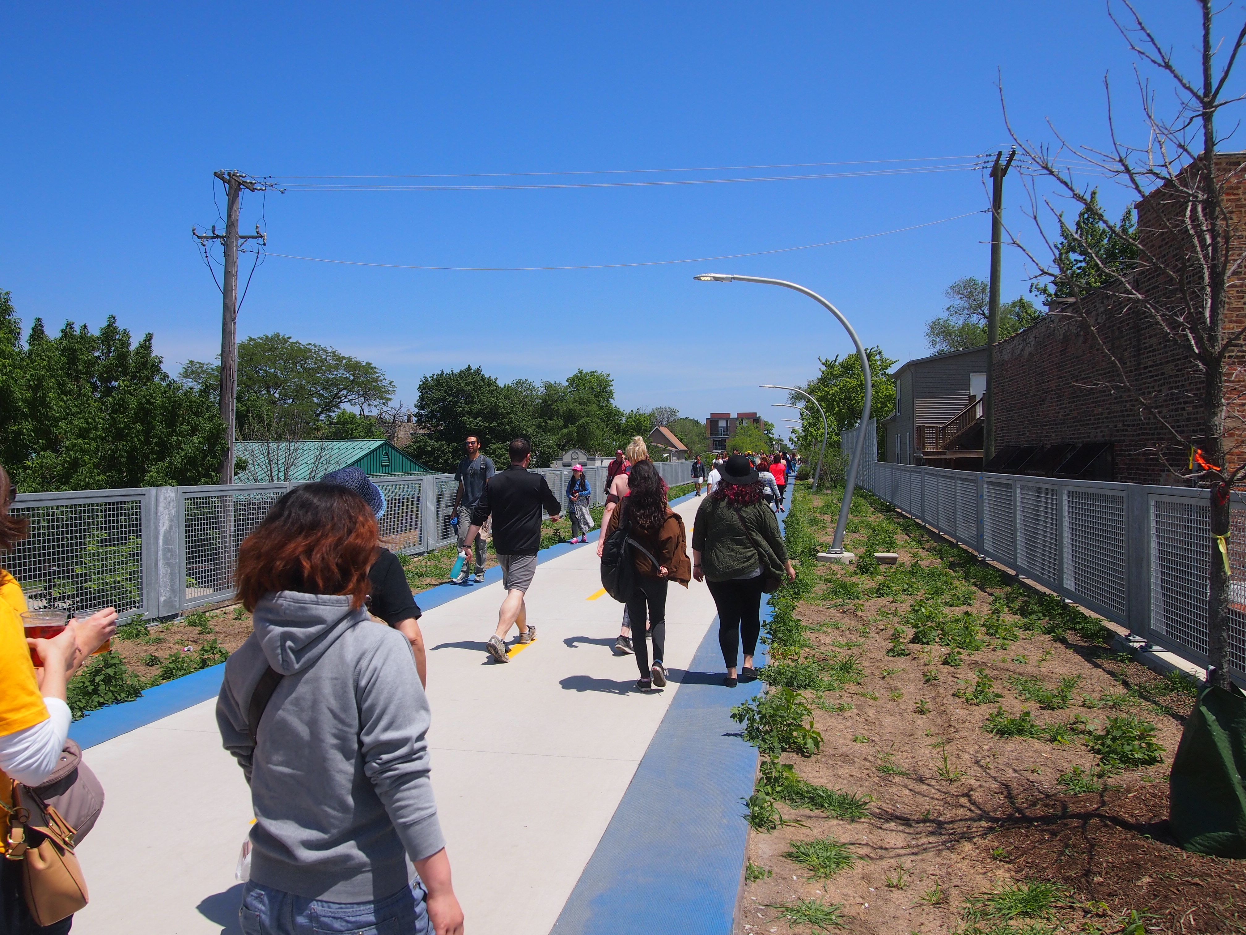 As you can see, the landscaping still isn’t up to bourgeois standards, but I figure as the years go by, planting will be done, and the trailside will be greener in future Junes. In some places, small trees will become larger trees. Various sources tell me there are 200 species of plant along the trail.
Where the trail passes over Washtenaw St., there’s an “environmental sentinel.”
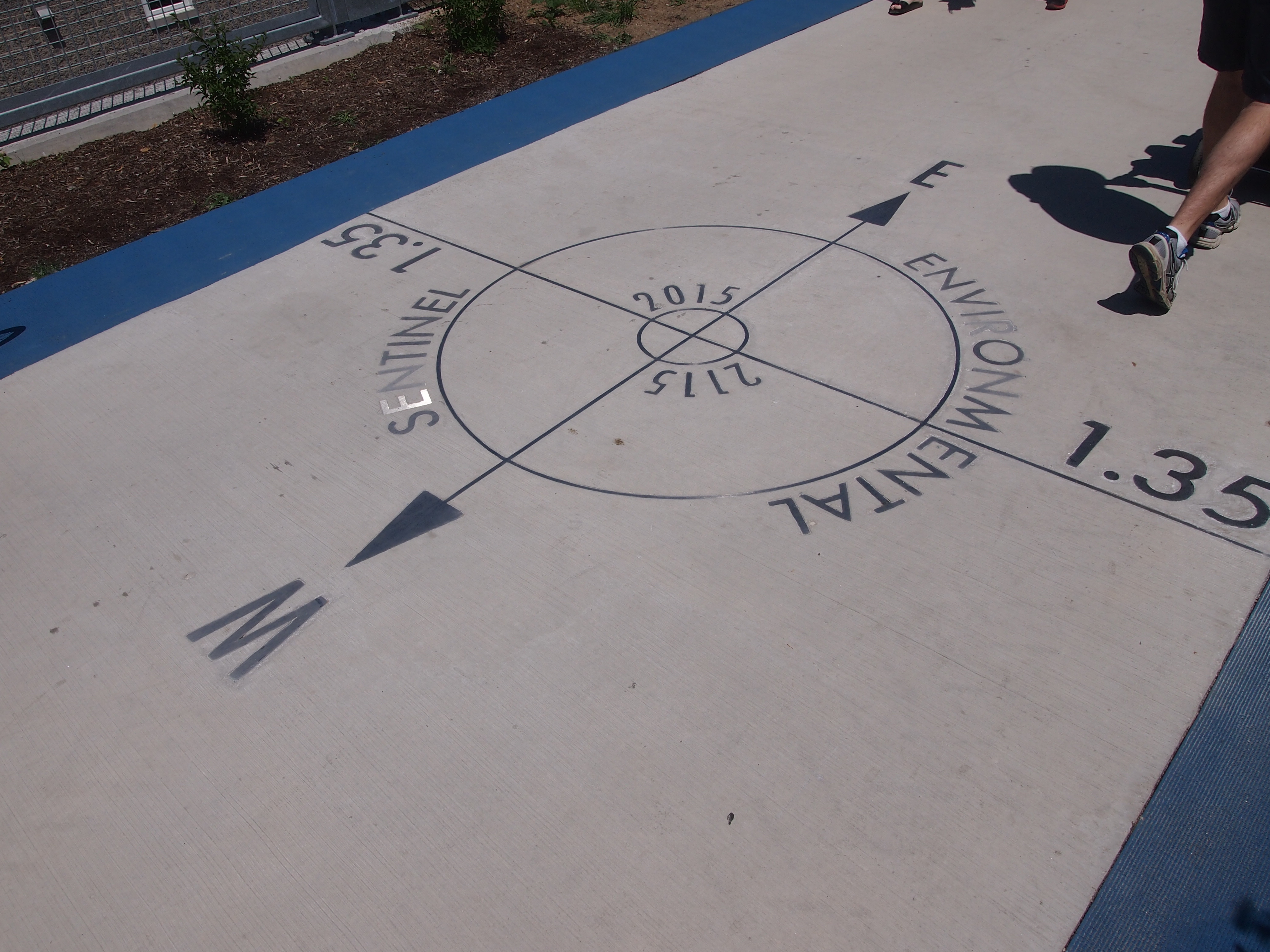 It’s also apparently the mid-point of the trail, 1.35 miles in either direction. Nice to know. Also nice that the planners resisted Lincoln Chafee’s call for metrification of the trail. (Well, I made that up.) But why “2015 2115”? Is there a time capsule we don’t know about planted here, waiting for the 22nd century?
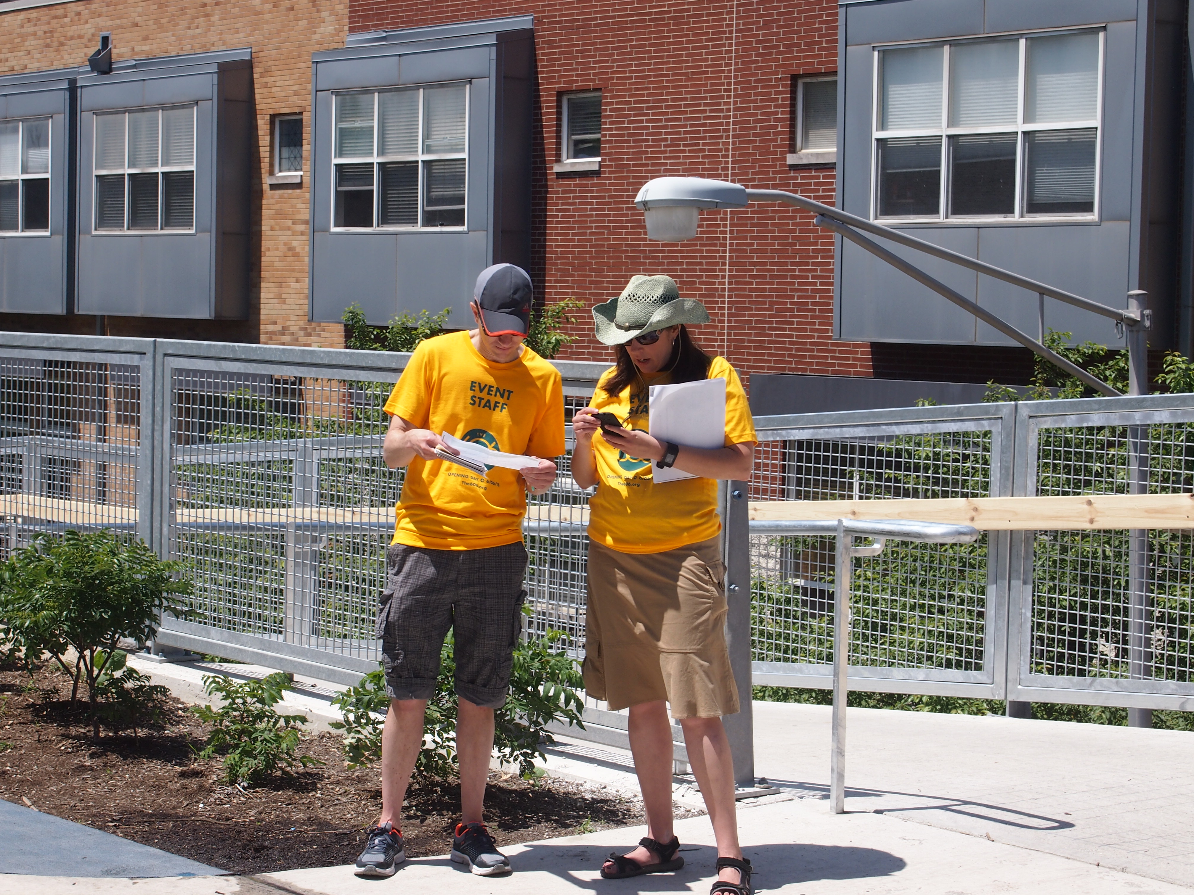
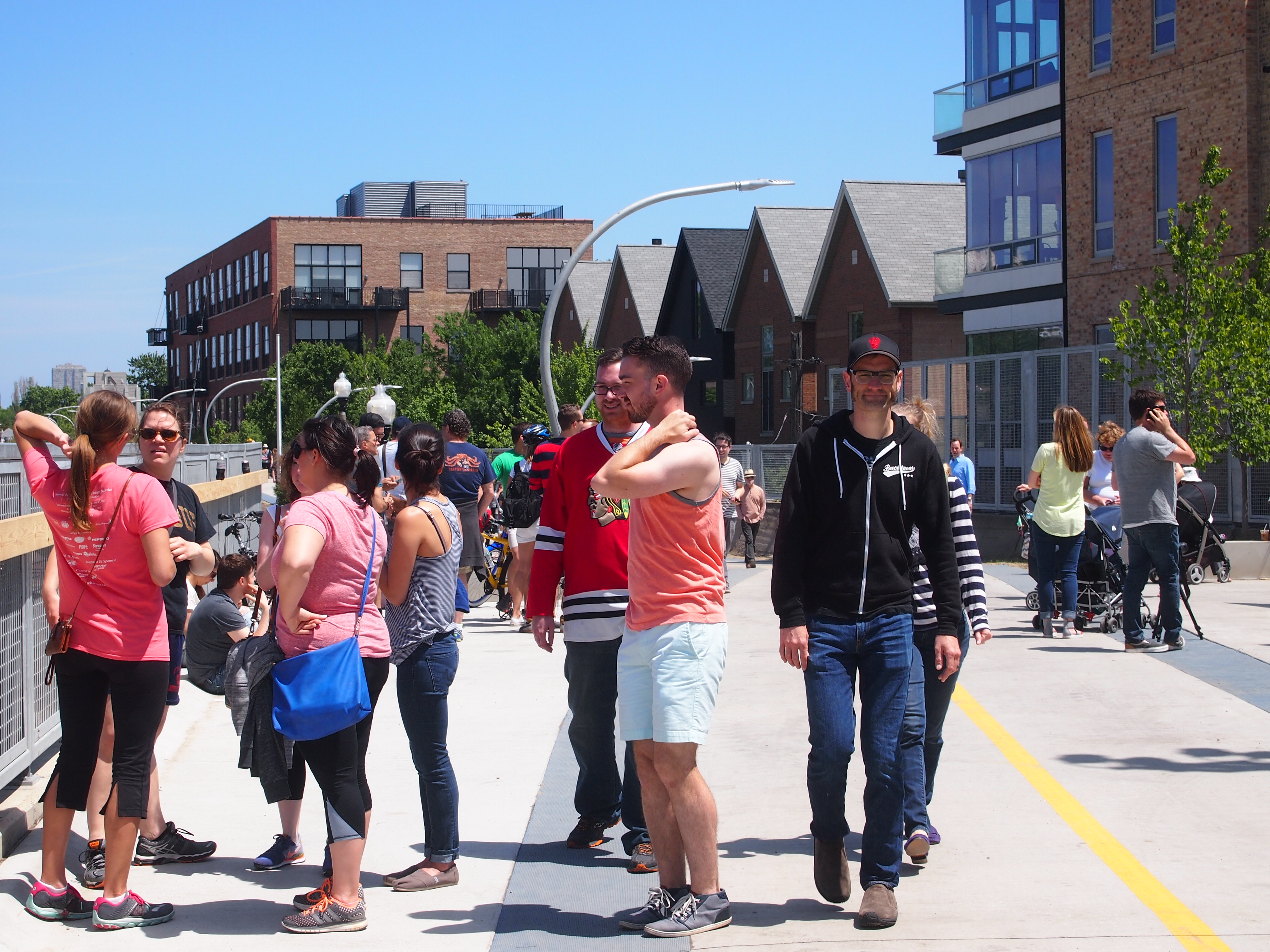
Volunteers in yellow shirts stood near the entrance ramps, ready to give out information. I got a map from one of them.
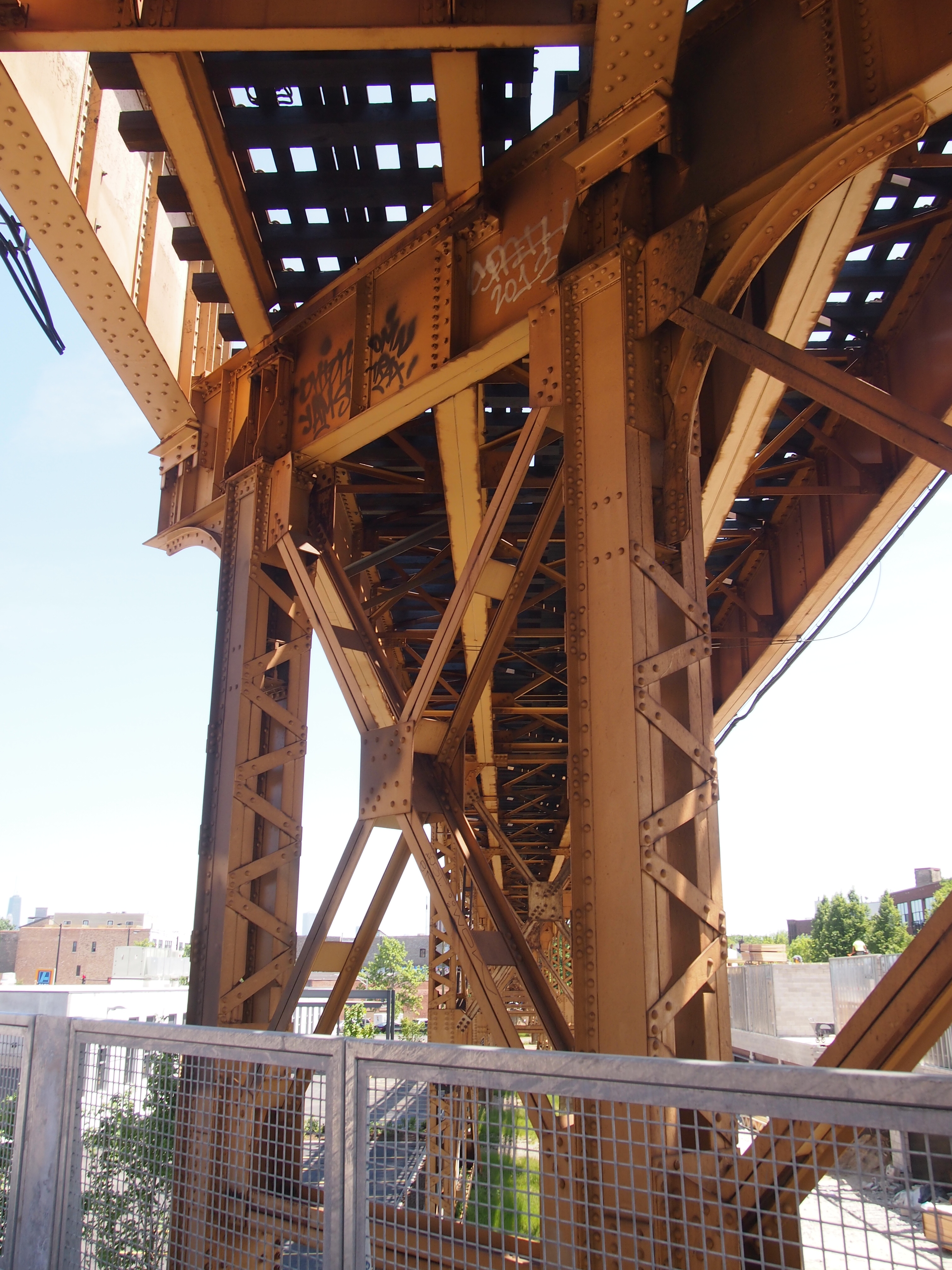
 The trail passes under the El — the line that goes to O’Hare from downtown — near Milwaukee Ave.
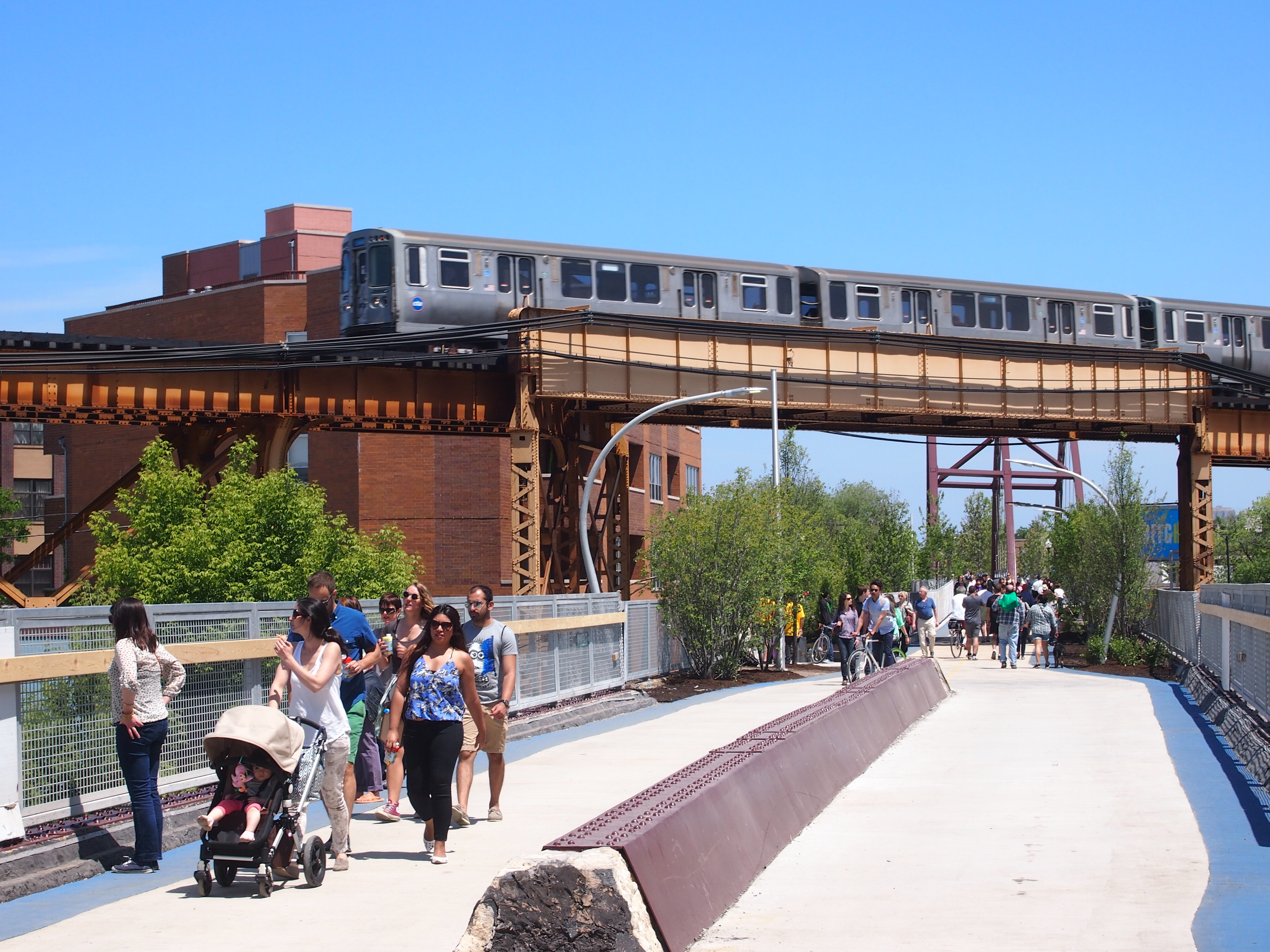 Mighty steel holds up the El. Just what you want if you’re on a train flying overhead. Or underneath the train, for that matter.
 Just east of that point is the trail’s bridge over Milwaukee Ave., which a major northwesterly spoke road, as opposed to the grid roads. Spoke roads in Chicago were often Indian traces in earlier times.
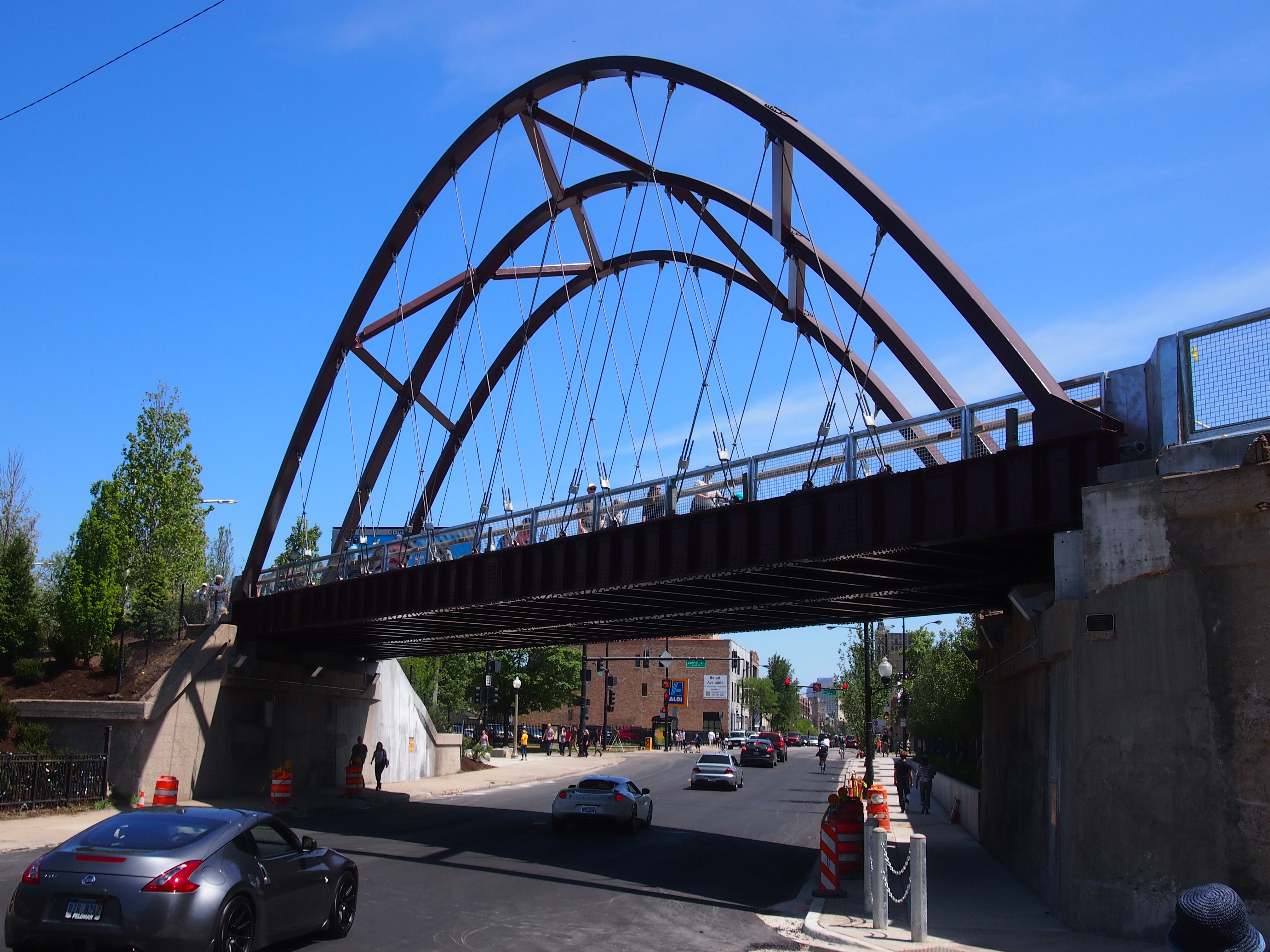 “At Milwaukee Avenue, where an arched bridge has served as the public centerpiece to the park during its construction, that story is told horizontally instead of vertically,” Chicago magazine says. “Dolomitic limestone boulders — from the formation that underlies Chicago, the limestone that architects Walter Netsch and Bruce Graham used as an anchor for their Inland Steel Building in one of the city’s herculean efforts to rise above the swamp — lead up towards the trail.”
The majority of the $95 million cost to build the 606 came from a $50 million Federal Congestion Air Mitigation Quality grant. Another $20 million was raised through private fundraising and $5 million came from local government, with ongoing fundraising for further improvements.
I’ve seen people grousing about the cost, especially the fact that the federal government paid so much of it (and I get what I deserve for reading comments sections). Sure, it’s an outrage that the government devoted roughly (very roughly) 0.00016 percent of its annual budget on an investment that’s going to generate large amounts of new value, in a measurable way for private property owners in the area, and in a less tangible but still important way for anyone who uses the trail. You know, spending for the common good.
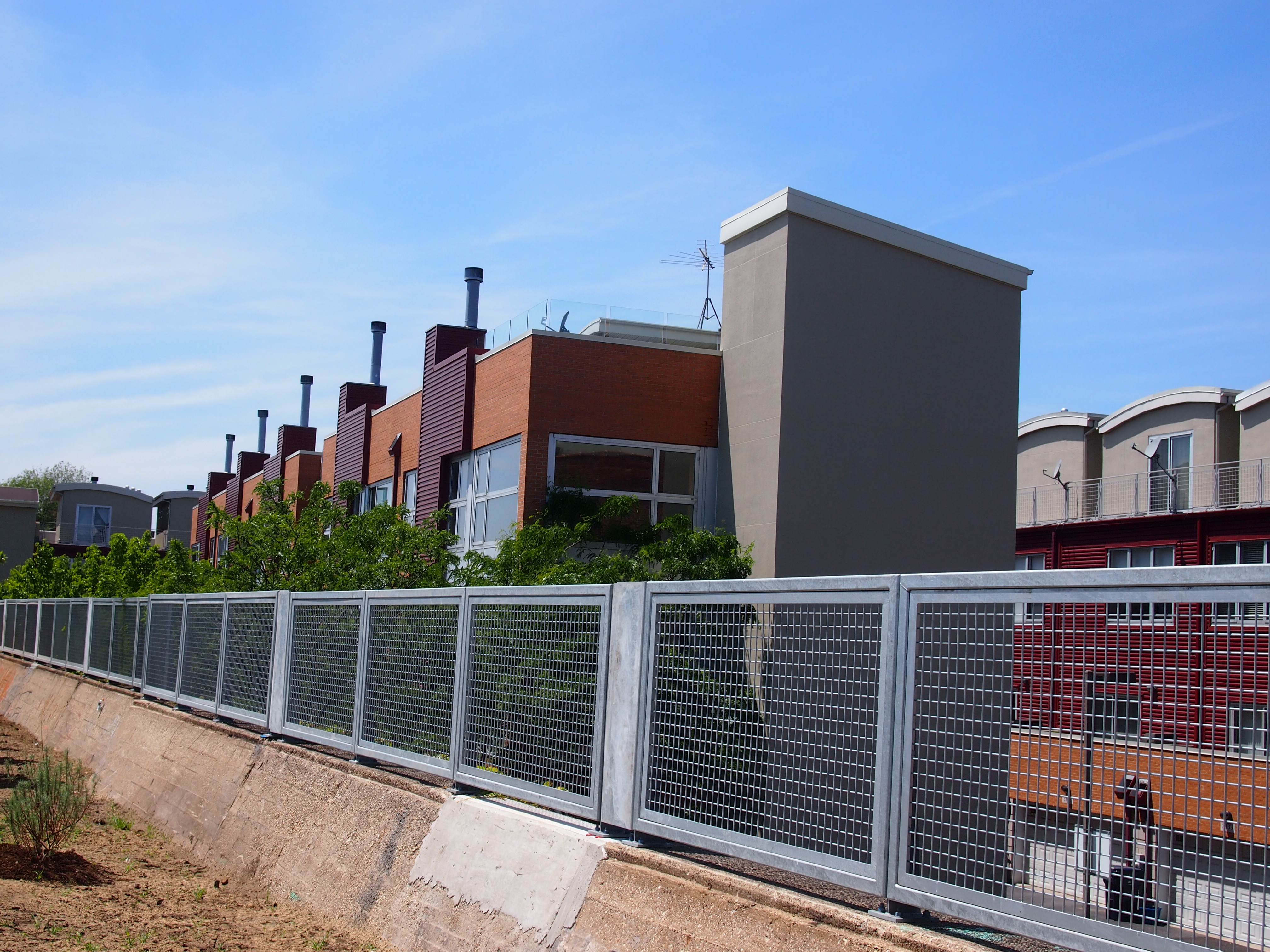
New residential properties have already been developed in anticipation of the trail, and more are coming. Some examples are in the background here, east of Milwaukee Ave.
 If the High Line’s any indication, existing retailers will also benefit, and there will be new ones sprouting near the trail.
We made it as far east as Damen Ave., within sight of the dome of St. Mary of the Angels, which I want to see the inside of sometime, then we went back the way we came. So we walked about half of the trail. That leaves the rest for another time.