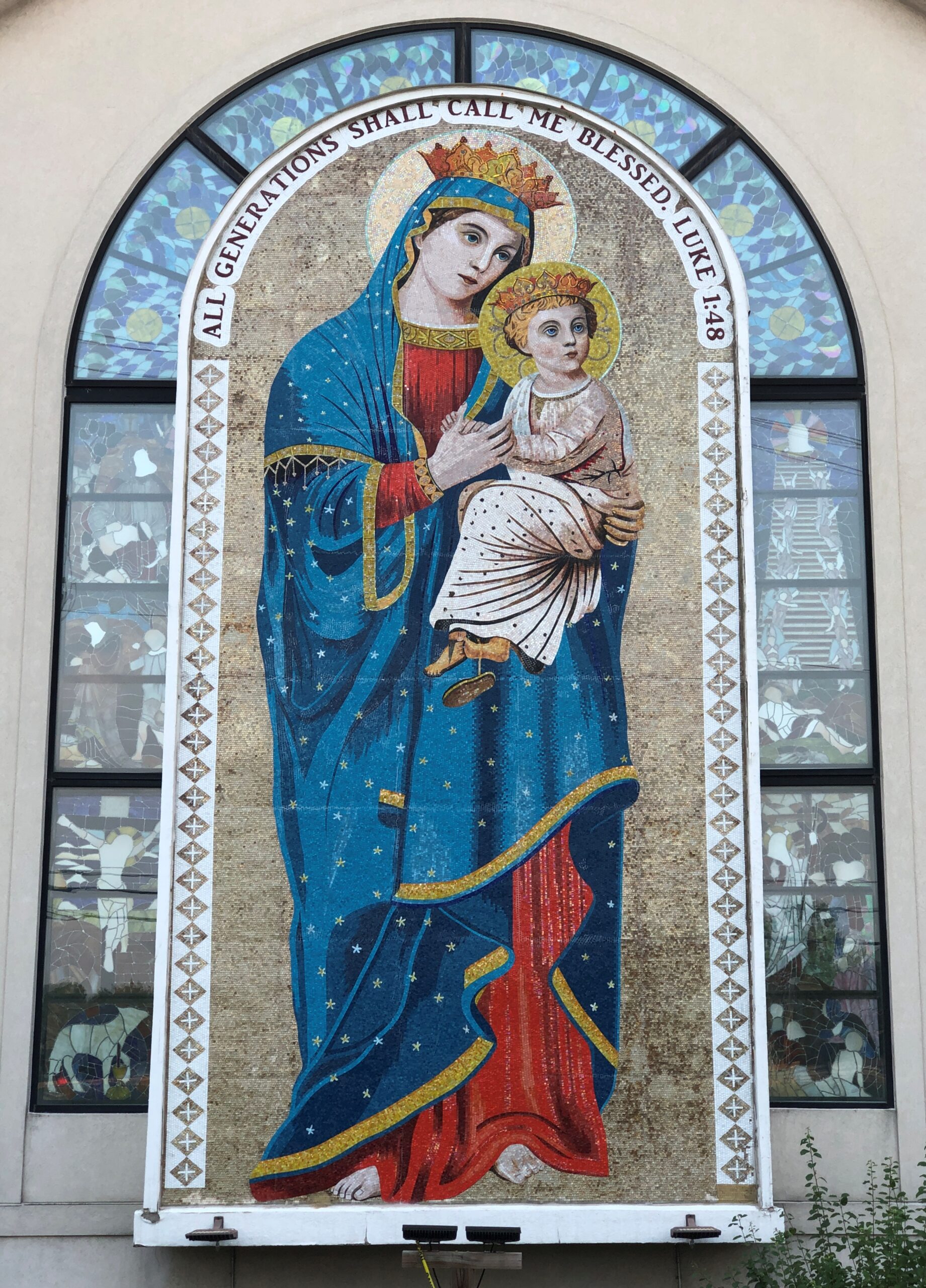
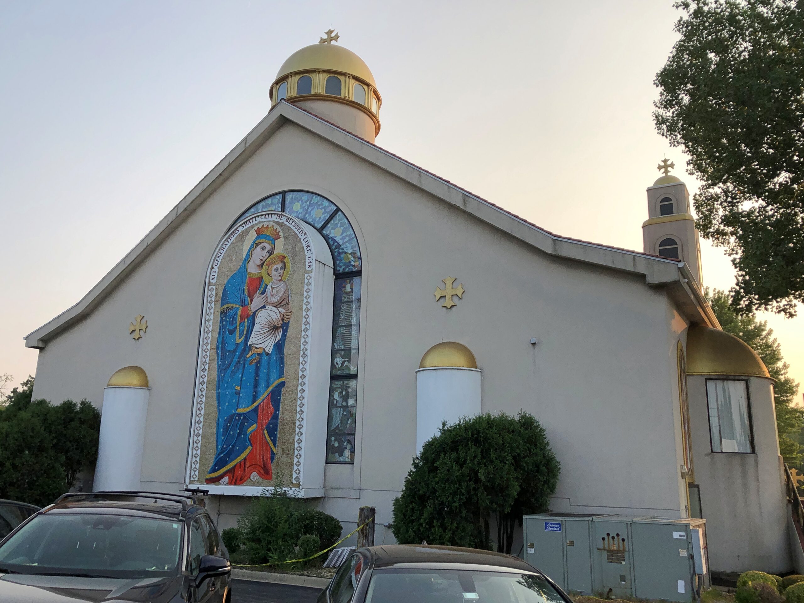
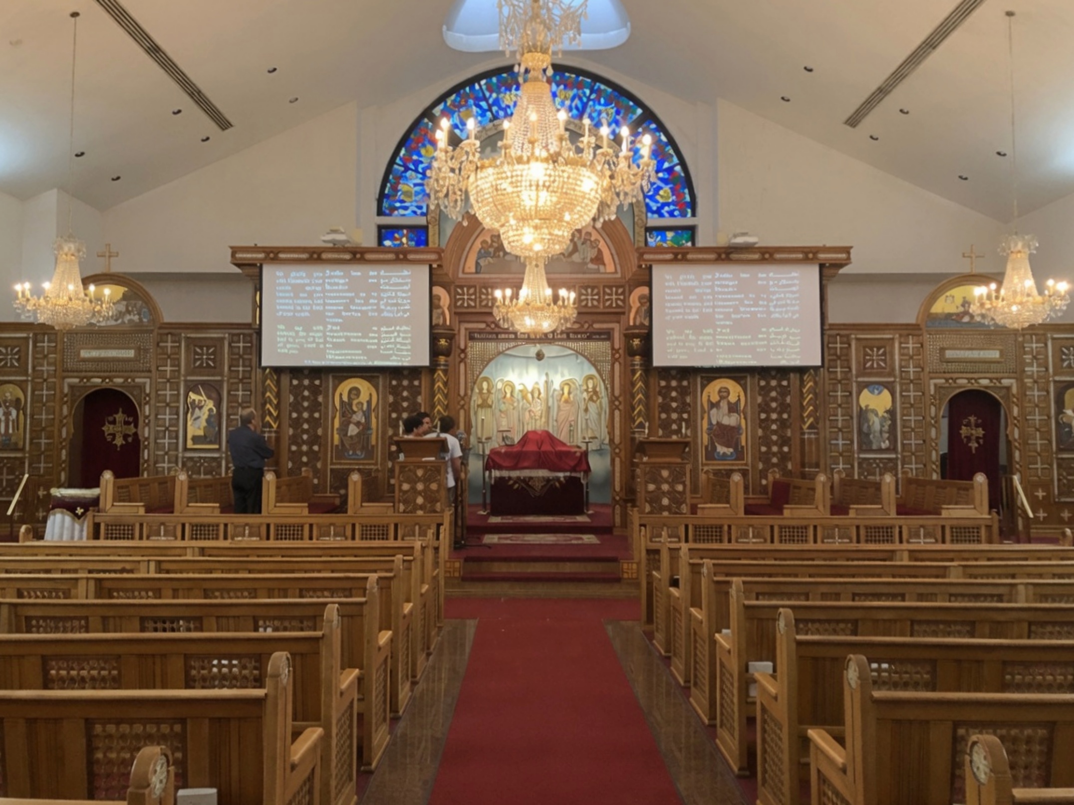
Earlier this month, entirely by chance, I saw that St. Mary’s Coptic Orthodox Church in Palatine was about to hold its annual Egypt Fest. I noticed, besides offering the kinds of things you’d find at a local festival, such as food and children’s rides, the event also offered the opportunity to visit the church building. Instantly I knew I wanted to attend. I didn’t remember ever visiting a Coptic church before. So I went that Saturday afternoon.
The church is in a prosperous neighborhood not far from a major highway that I drive often, and I knew it well, in the sense that St. Mary and the Christ Child in their glory are visible from the highway. But also as a flyby. Visiting in person, I got a better look.
They are featured on the back wall. Facing east, if my geographic awareness is correct.
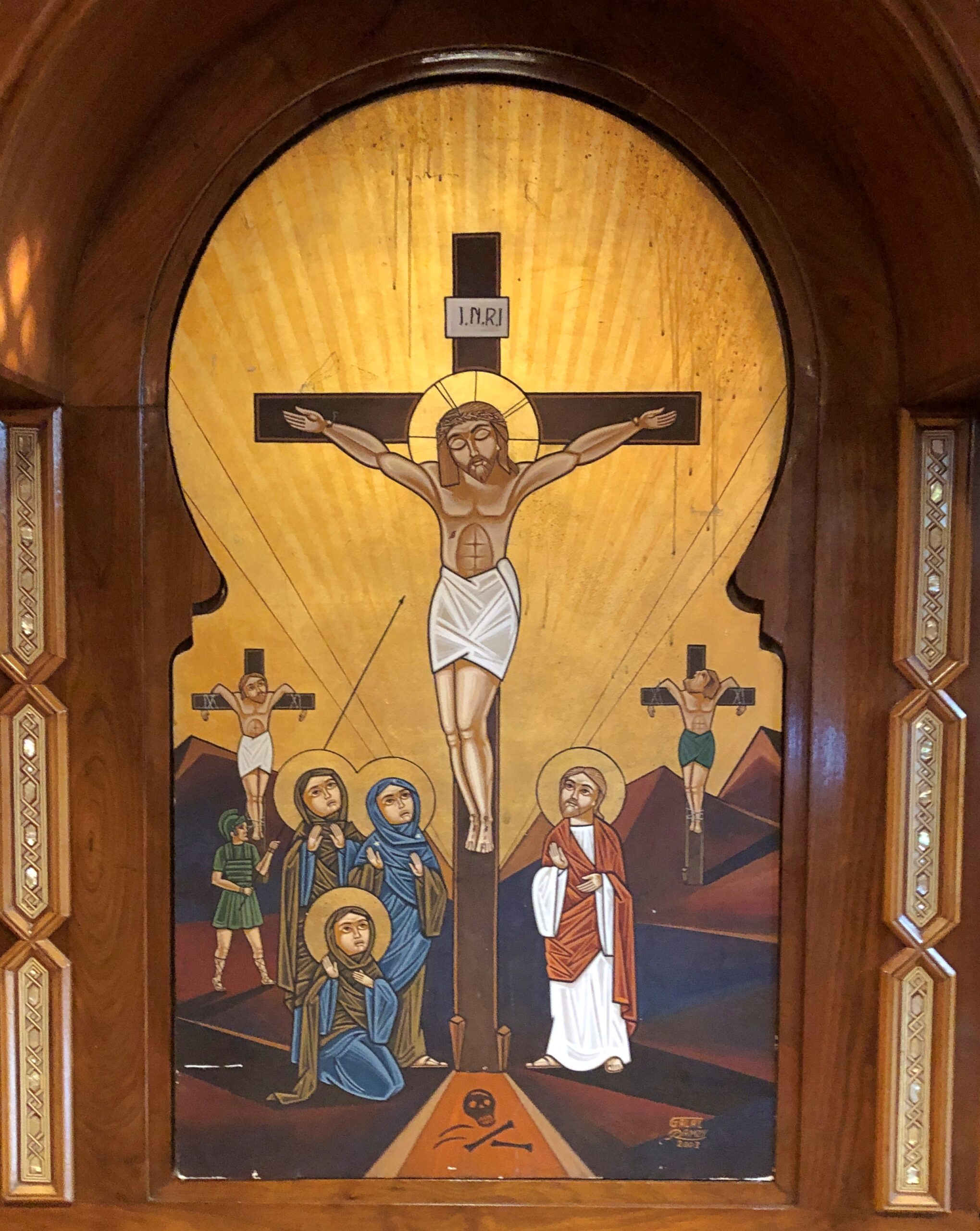
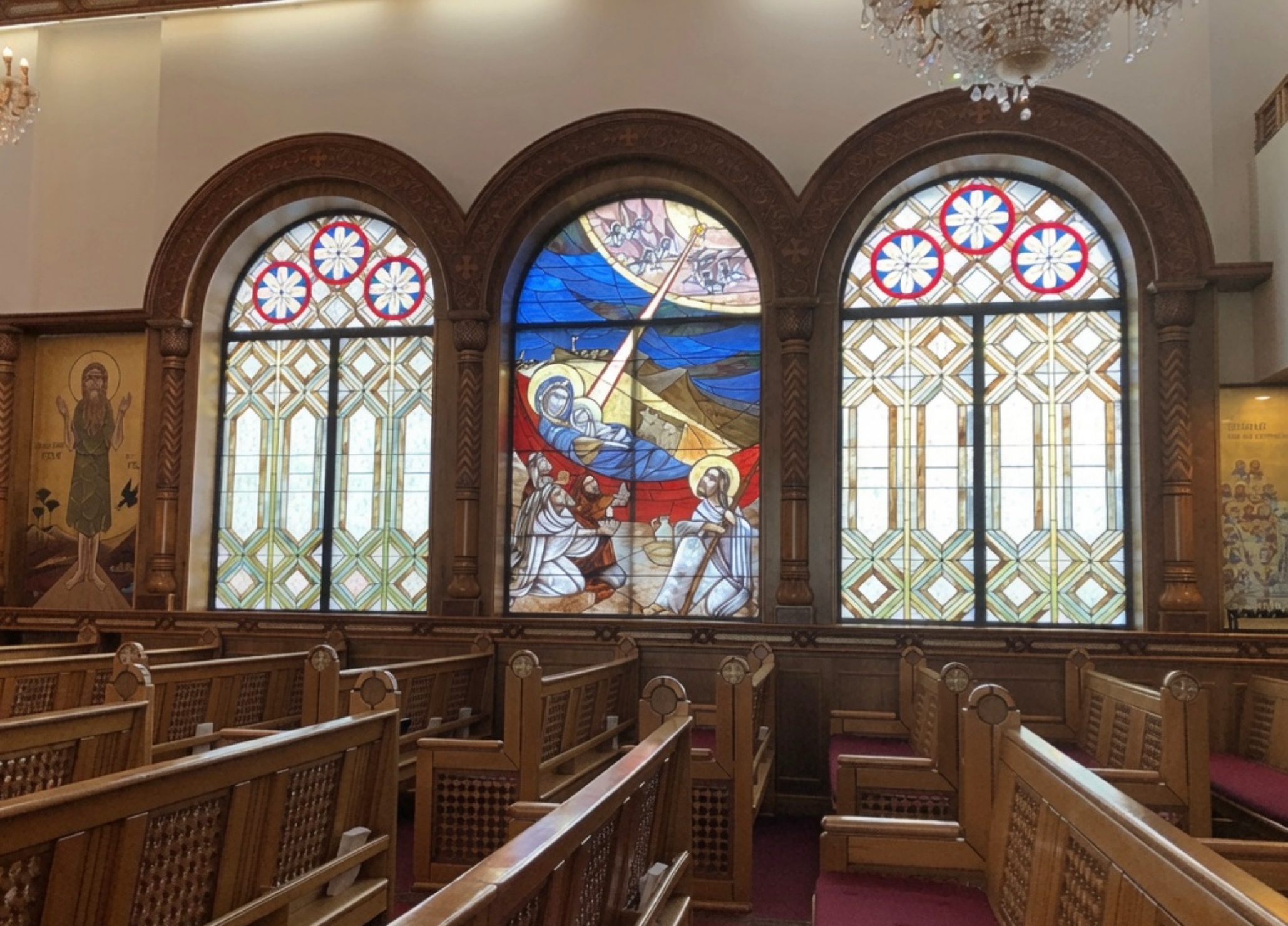
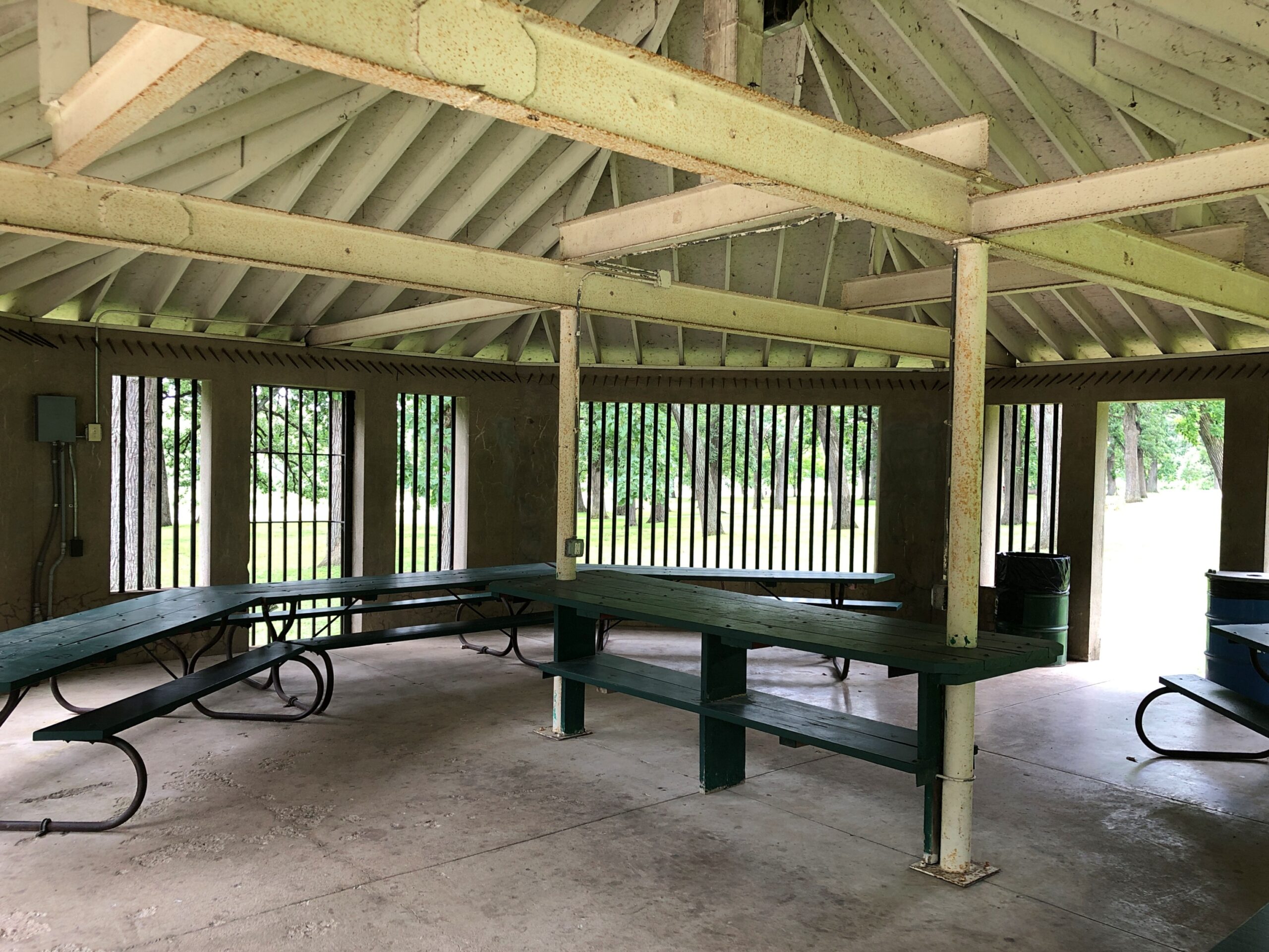
The church was indeed open. An interior detail.
Stained glass.
Pews and an iconostasis. Unusual, but I’ve seen it before. Priests and a few laymen were active. The prayers, which I took to be partly in Coptic, had a hypnotic quality. Text of the prayers scrolled by in English, Coptic (I assume) and Arabic.
That kept me in the pews a while, as I tried to remember what I learned, many years ago, about what had caused the rupture between Constantinople and Alexandria in the 5th century. During the Council of Chalcedon. That much I remembered. The nub of the quarrel? I had to look that up later.
The nature of the Son. The sort of argument that inspired riots, once upon a time. Now I imagine even most lifelong parishioners of whichever side would shrug at the difference. The Copts have more immediate concerns anyway, such as ongoing persecution in Egypt itself. We have our issues in North America, but at least Copts can live in peace here, and maintain an elegant church in a prosperous neighborhood.
Yesterday a near-full moon rose in the evening, as coppery a color as I’ve ever seen the lunar disc, including during eclipses – which wasn’t happening that evening. Not quite the color of an uncirculated penny, but close, with the addition of a dash of yellow. Must be the peculiar optics generated by thin wafts of smoke from Canada. This evening, there was still a tinge of copper, but the moon had mostly returned to silver-white.
Then it occurred to me that future generations, maybe even people being born around now, won’t know the color of an uncirculated U.S. penny. The color of a Moscow mule cup, then.
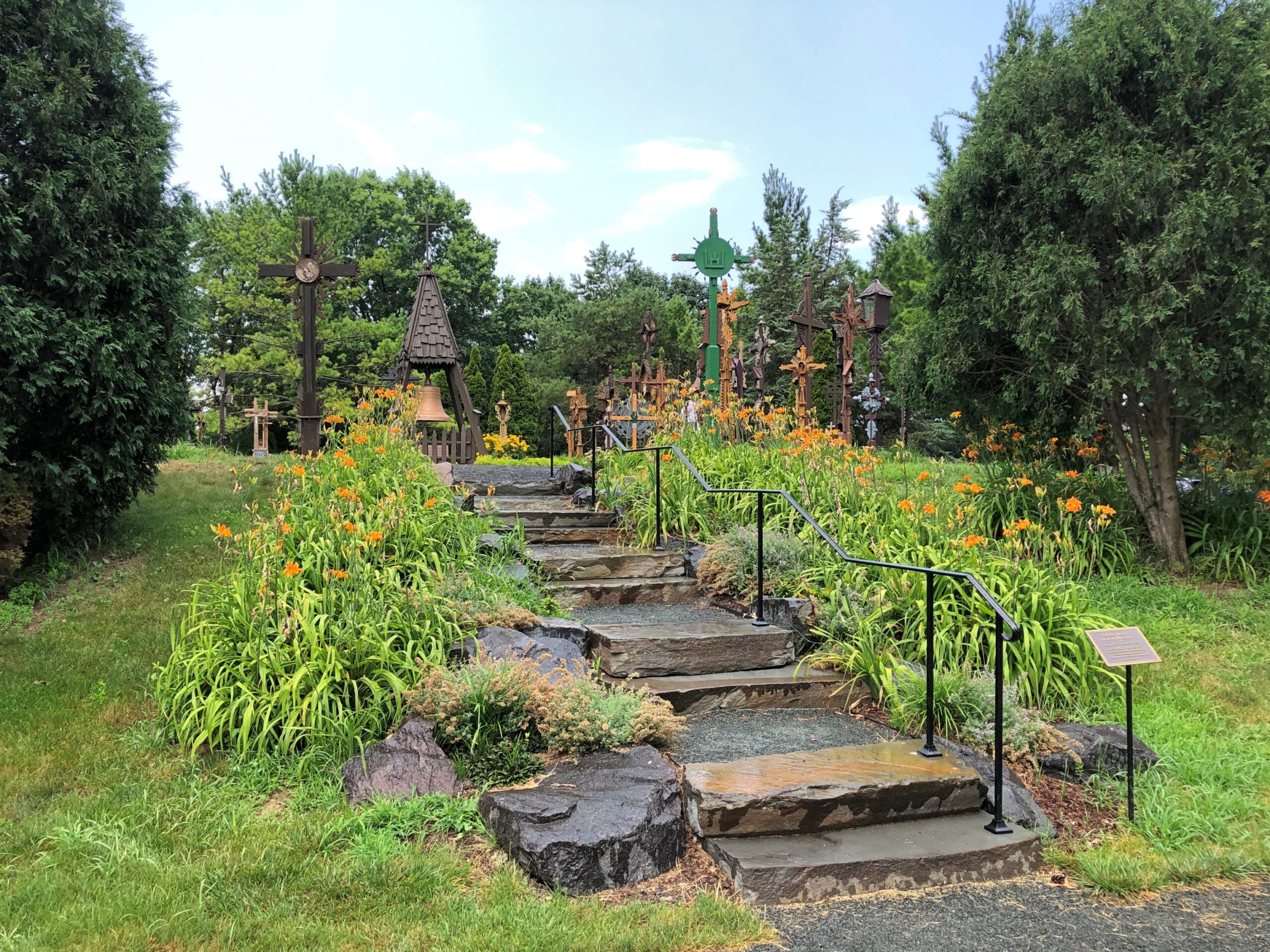
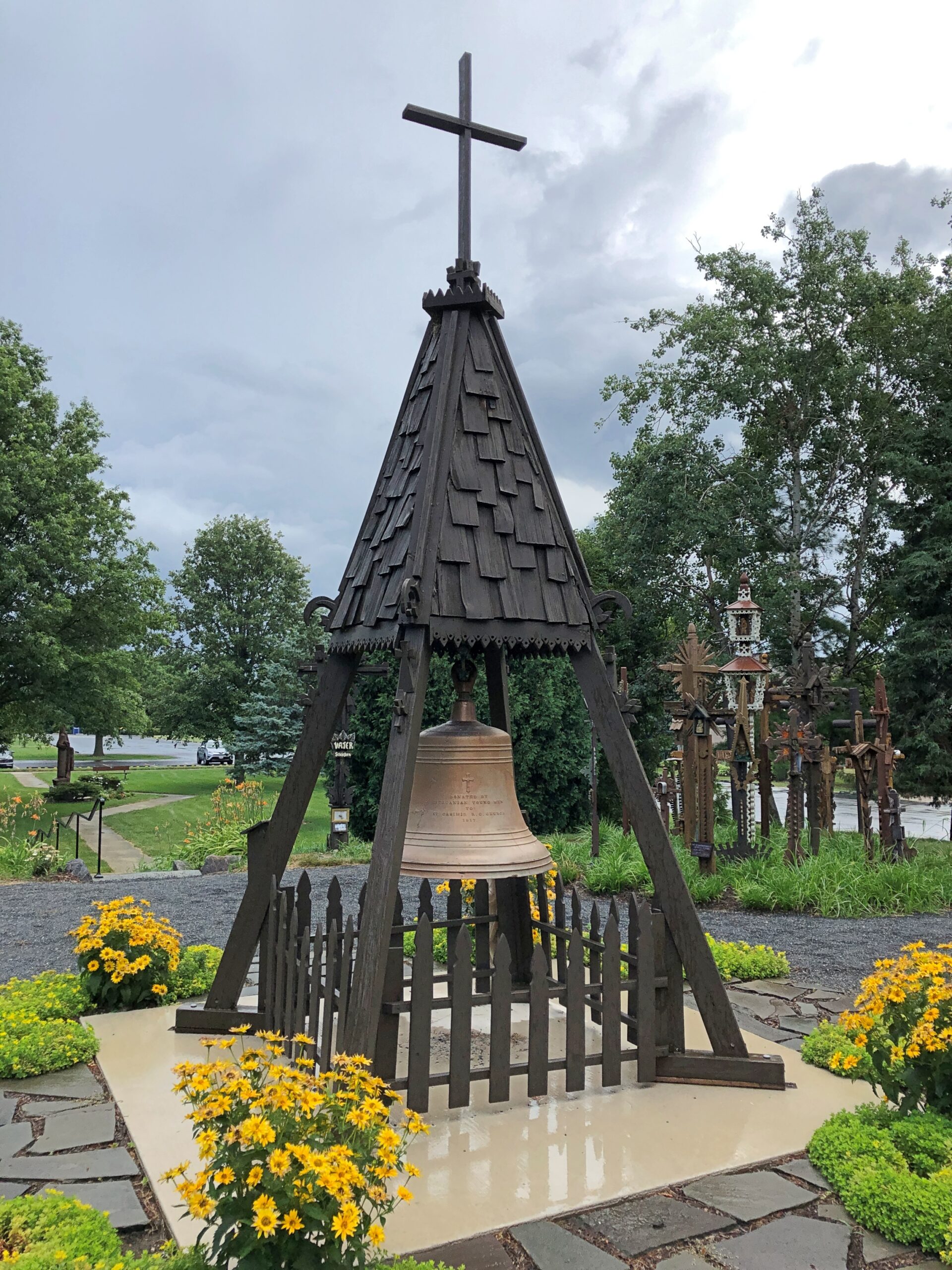
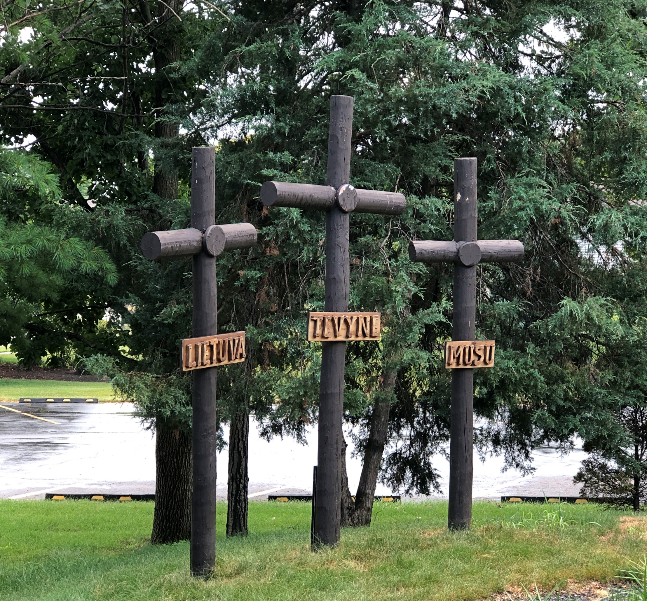
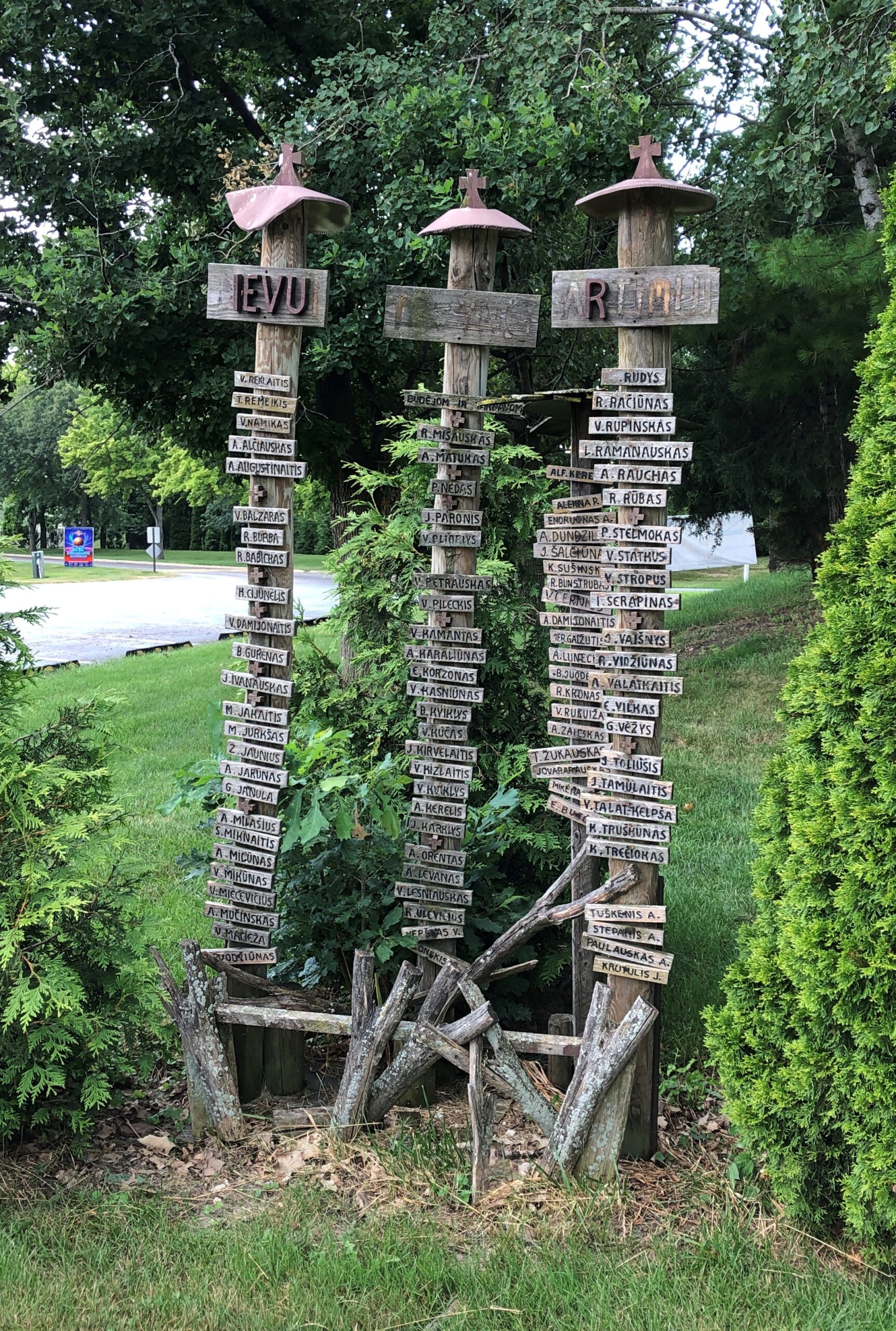
During a recent visit south of home but still in the suburbs, we came across something unexpected in the town of Lemont: a Hill of Crosses.
Not a large hill, more like a hillock, but still a distinctive homage to the Hill of Crosses in Lithuania, in the northern part of that country. The Lemont hill is part of a sizable complex called Lithuanian World Center, whose web site calls it “the largest Lithuanian community and cultural center outside Lithuania.” It has conference rooms, event halls, office space, gyms, classrooms (for three schools, two taught in Lithuanian), soccer fields, a Catholic church and a museum devoted to Lithuanian art. And, near the front parking lot, a Hill of Crosses.
As for the one in Lithuania, it’s known for its 100,000 (at least) crosses, erected spontaneously over the centuries and re-populated with crosses whenever secular authorities (namely the Soviets) took it in the their heads to destroy the place. Quite the story. Wish I’d seen it in ’94. Lemont will have to do for now.
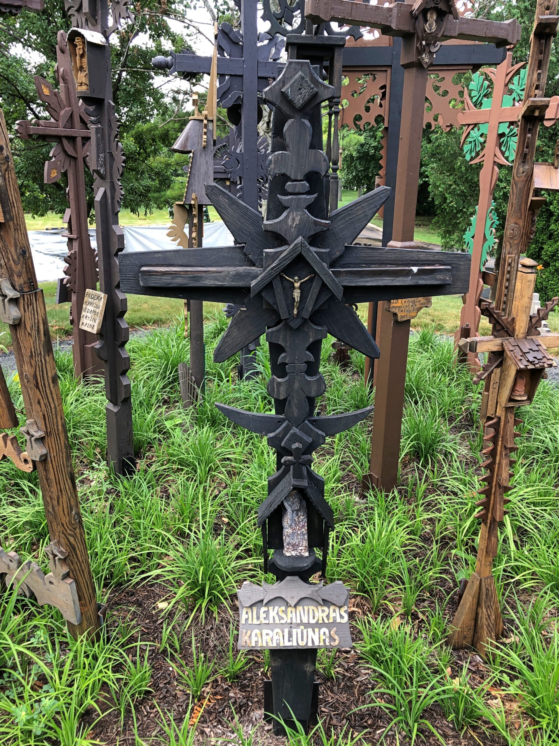
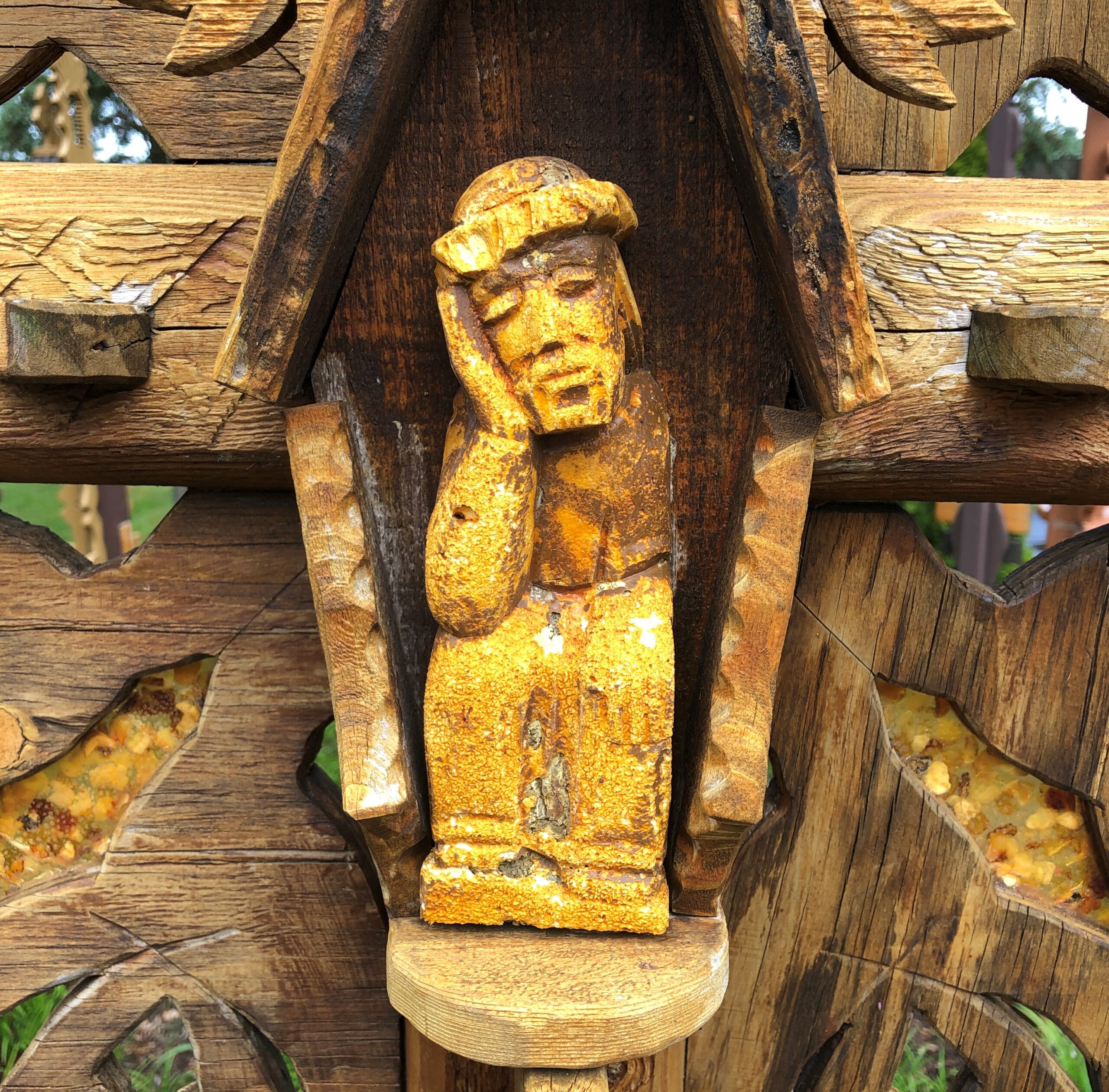
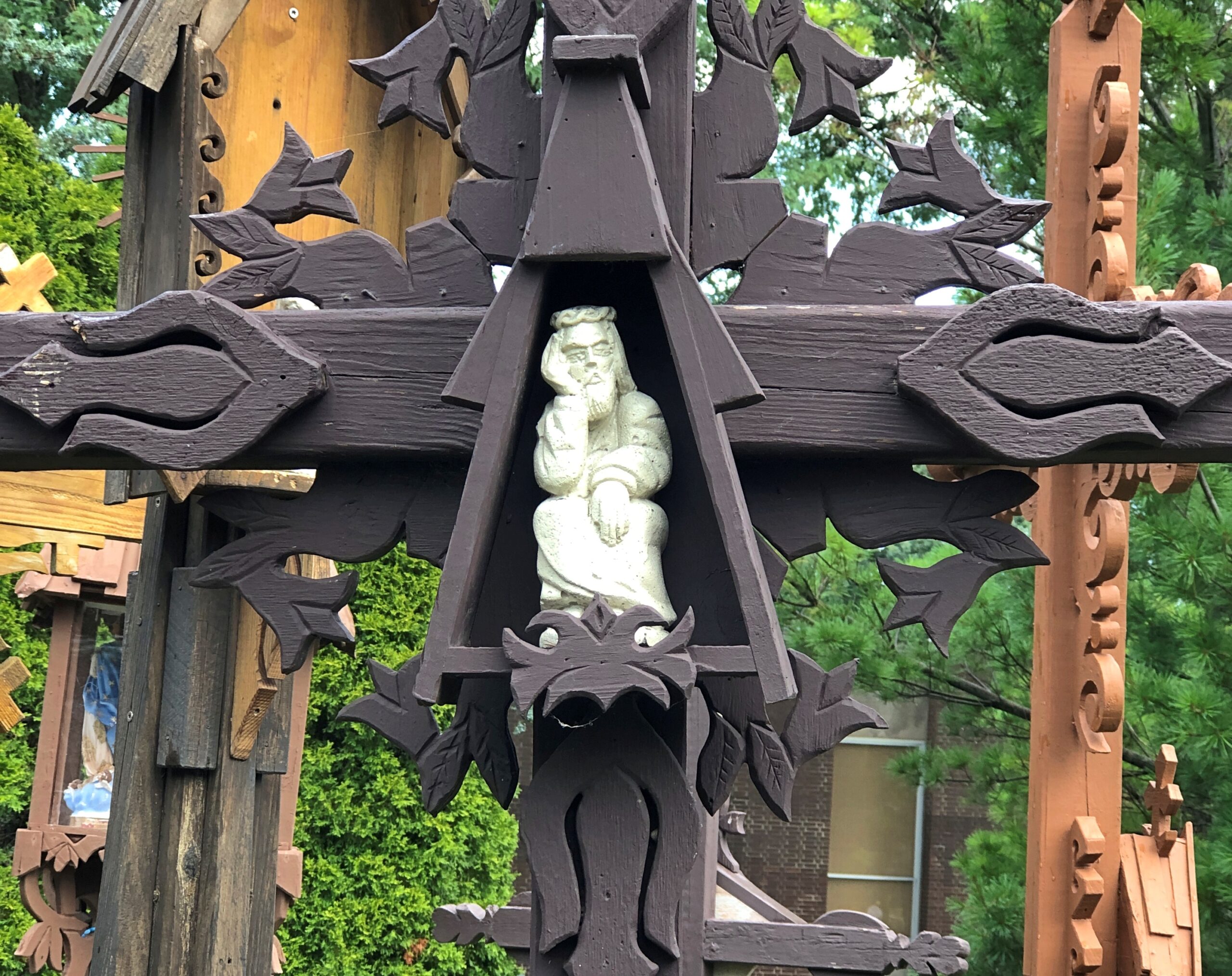
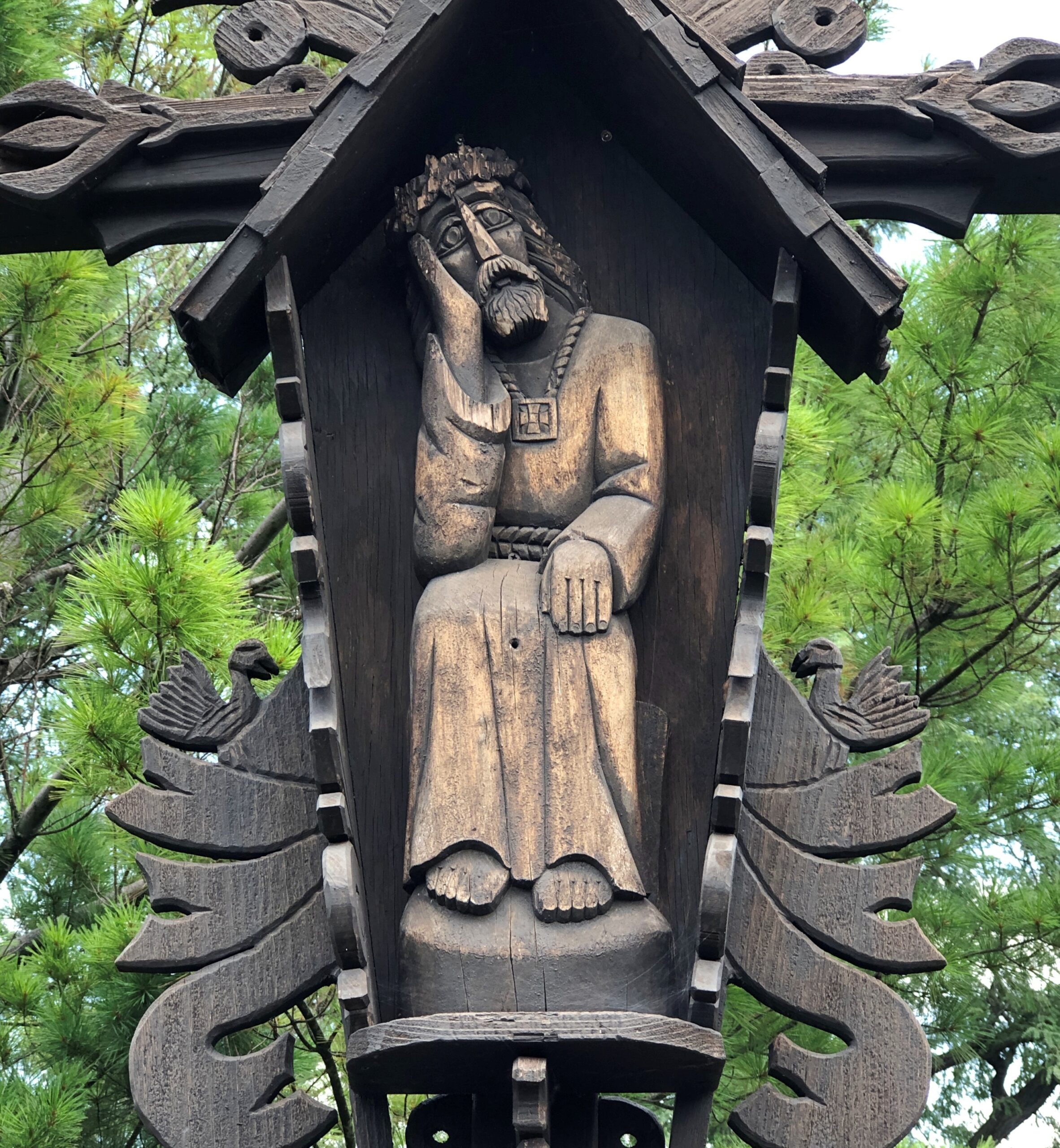
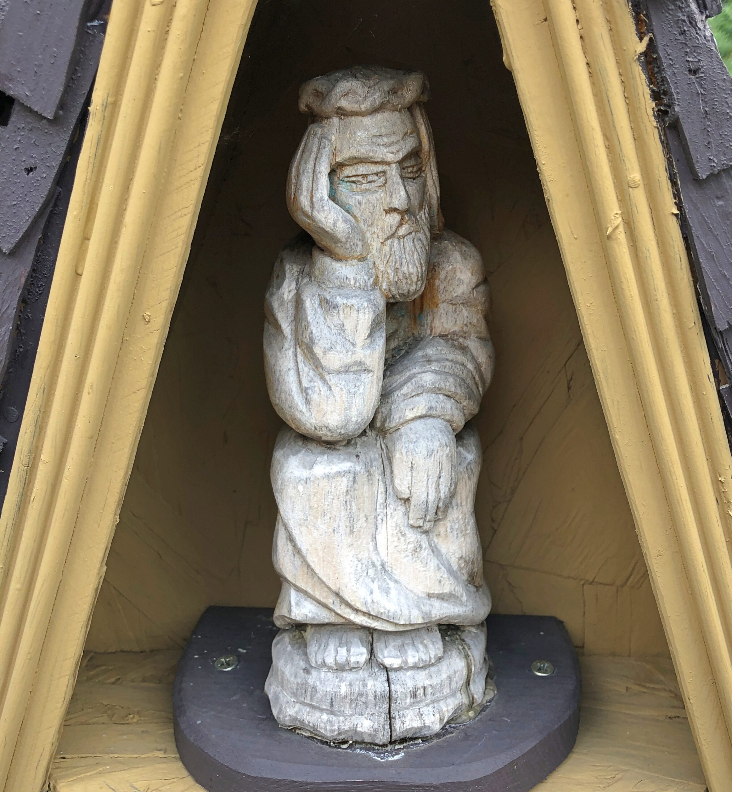
The one in Lemont is a place for family members to honor the departed.
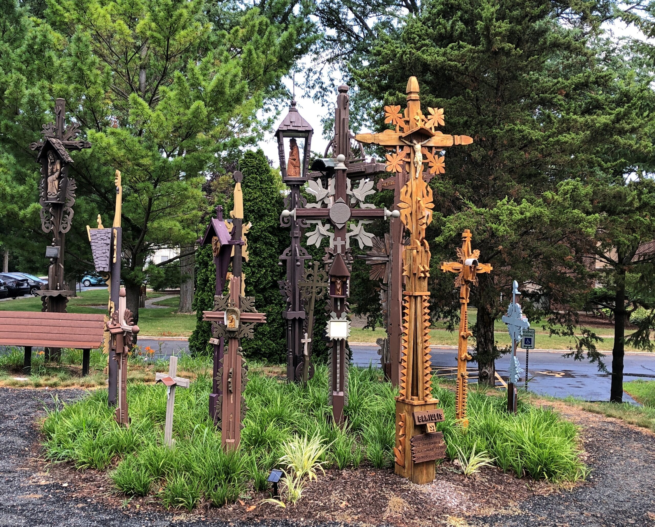
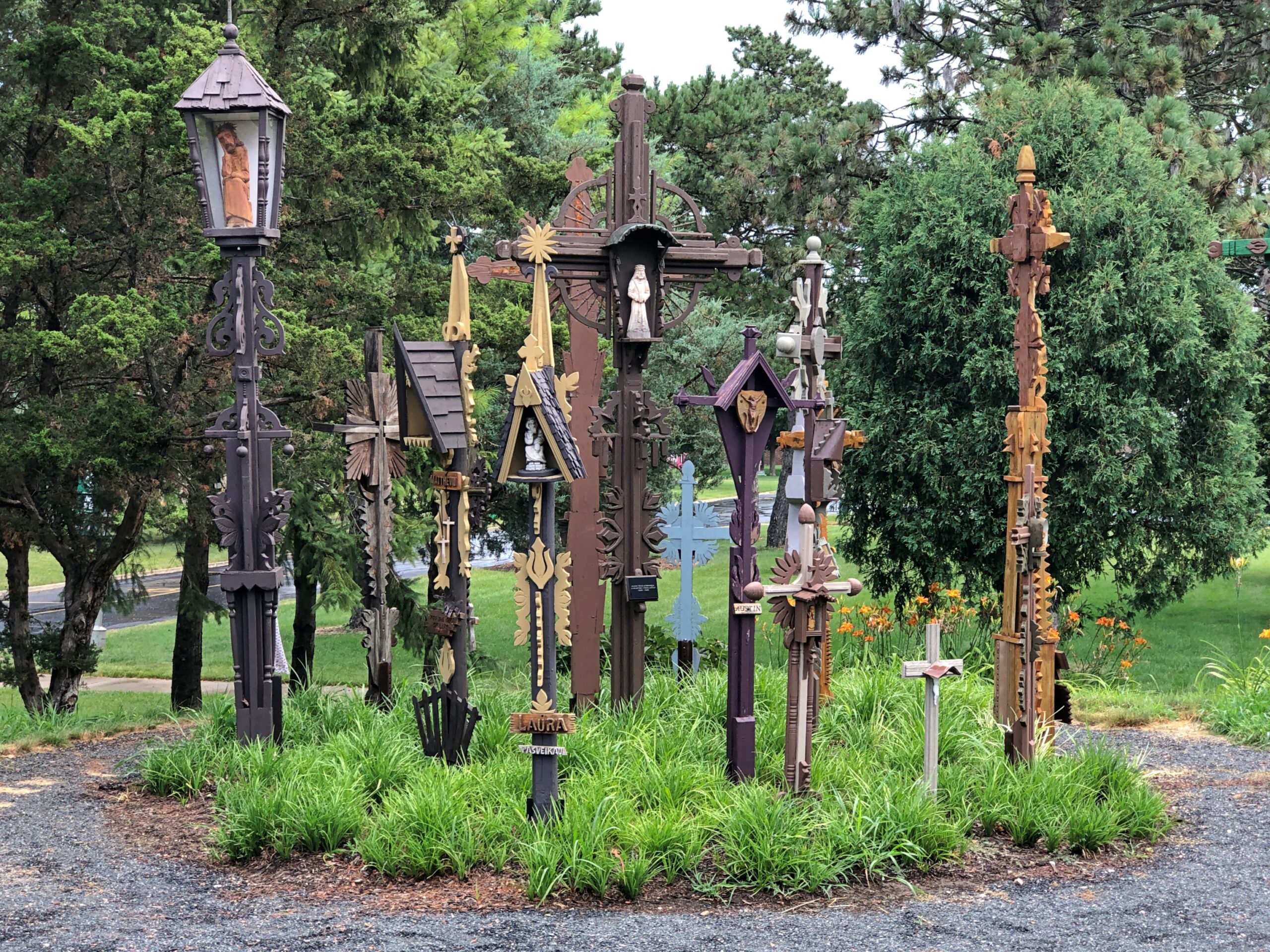
We started noticing a certain depiction of Christ.
Later, when we happened upon a nun at the church, I asked her about the depiction. “Pensive Christ,” she called it. That sounded familiar, but I couldn’t quite remember when I’d heard about it. Popular in Lithuania, apparently.
Per Wiki: “The image became especially popular in Silesia and Pomerania, and then Poland and Lithuania, where it became strongly entrenched in folk art wood carvings by Dievdirbiai (Lithuanian folk carvers).”
Just before noon yesterday, the clouds opened up and dumped rain and small bits of hail on my part of the world. One of those short, sudden downpours of summer. By this morning, the deck had dried out enough for me to do what I often do there, have breakfast and engage in some loafing.
Another summer note: in the evenings, crickets have received their chirping orders. For a few nights, only one or two bothered, on and off as the cicadas faded for the day. Now strong cricket choruses sound off by night. An excellent sound to fall asleep to.
Doesn’t this sound grand: a few weeks ago I attended a social event on the North Shore. But it wasn’t grand, not in the sense of a palatial setting. But it was at one of the many pleasant middle-class neighborhoods of the area whose real estate valuations lifted stratospherically in recent decades.
Driving all the way to the shore of Lake Michigan means passing through some thick traffic, so to my way of thinking, that also means you should go a few hours early for a look around parts of the North Shore, that narrow but long strip from Evanston to some point in Lake County to the north.
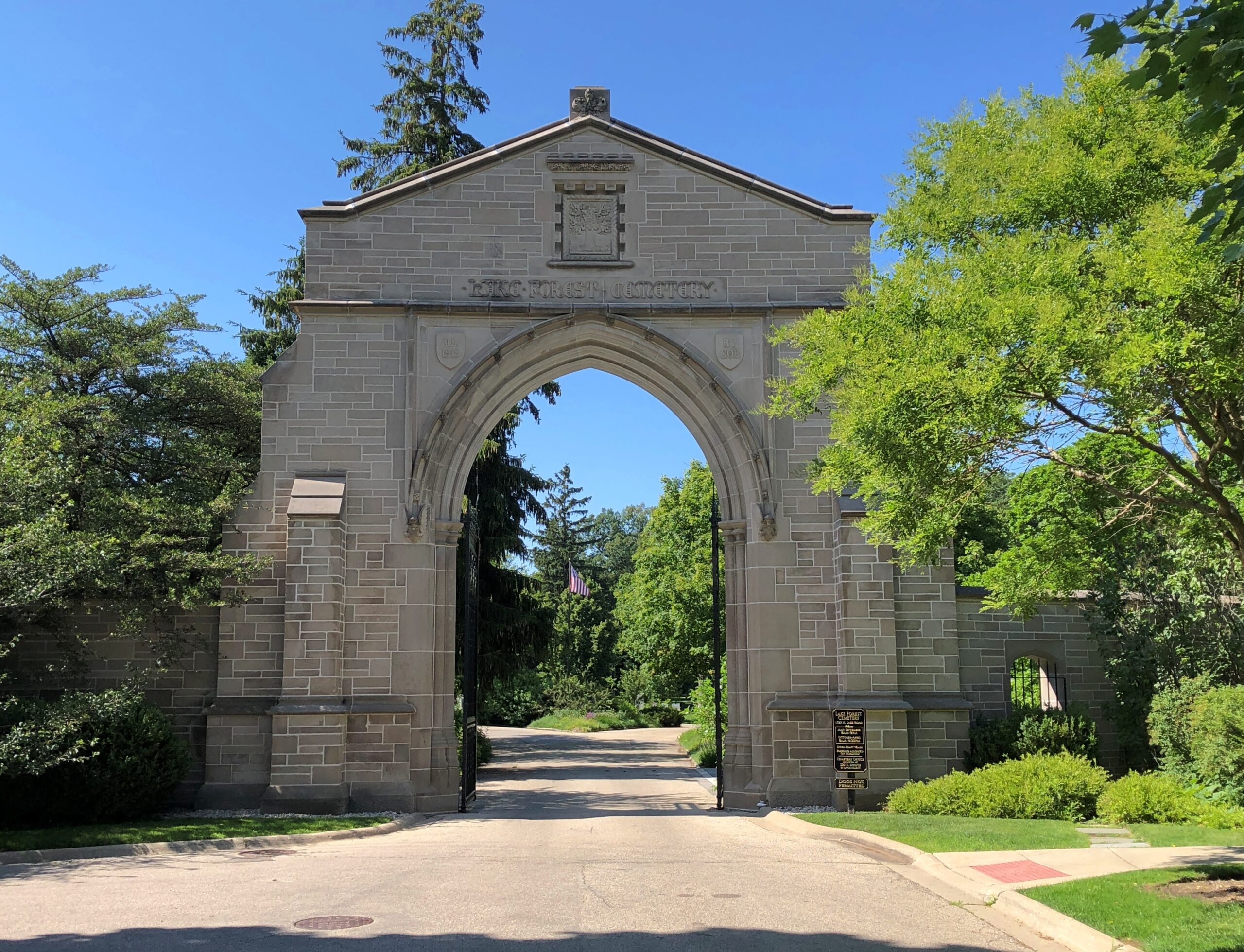
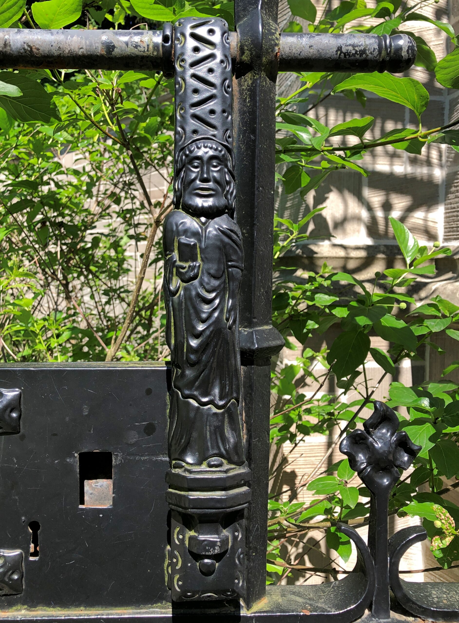
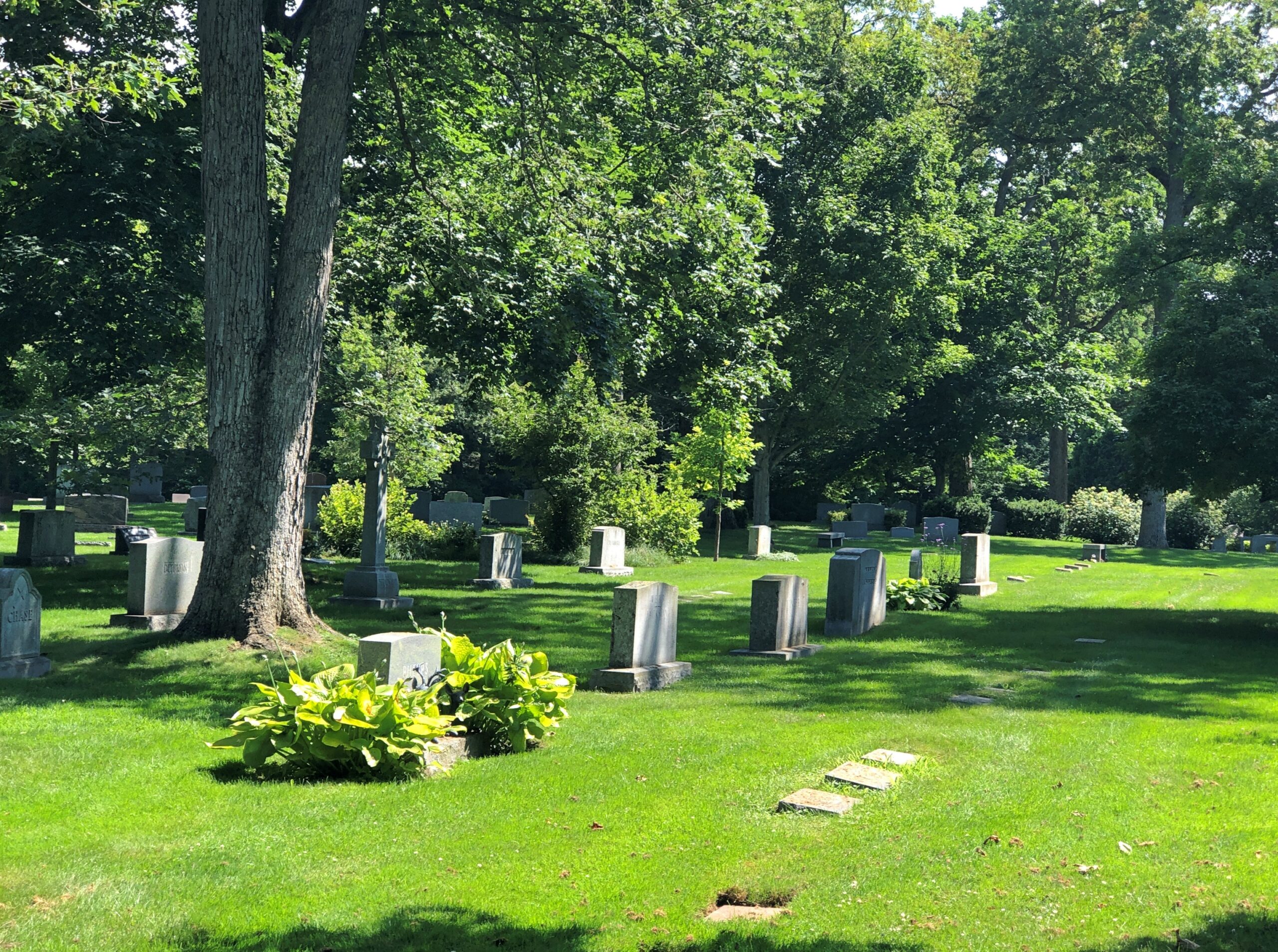
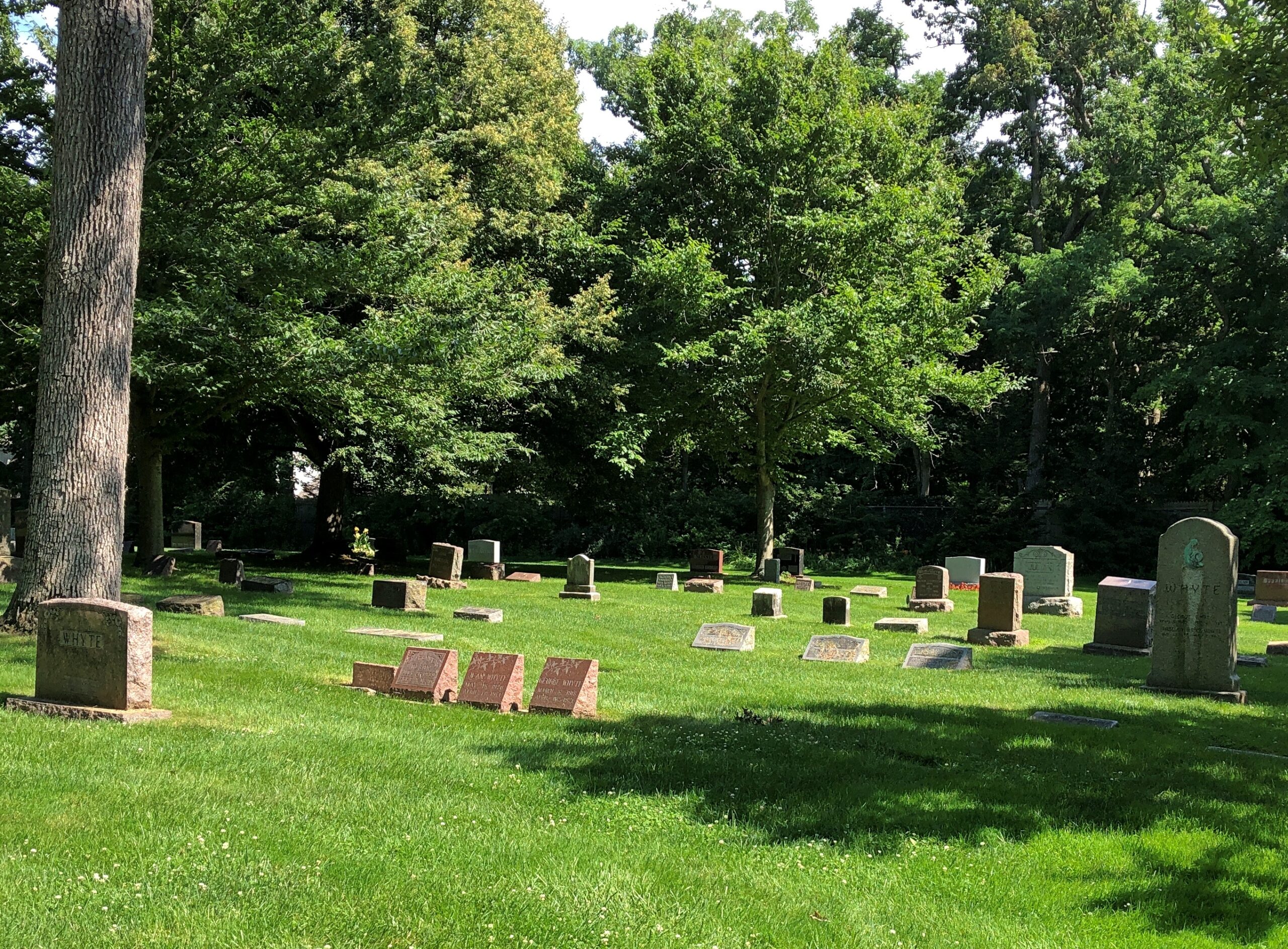
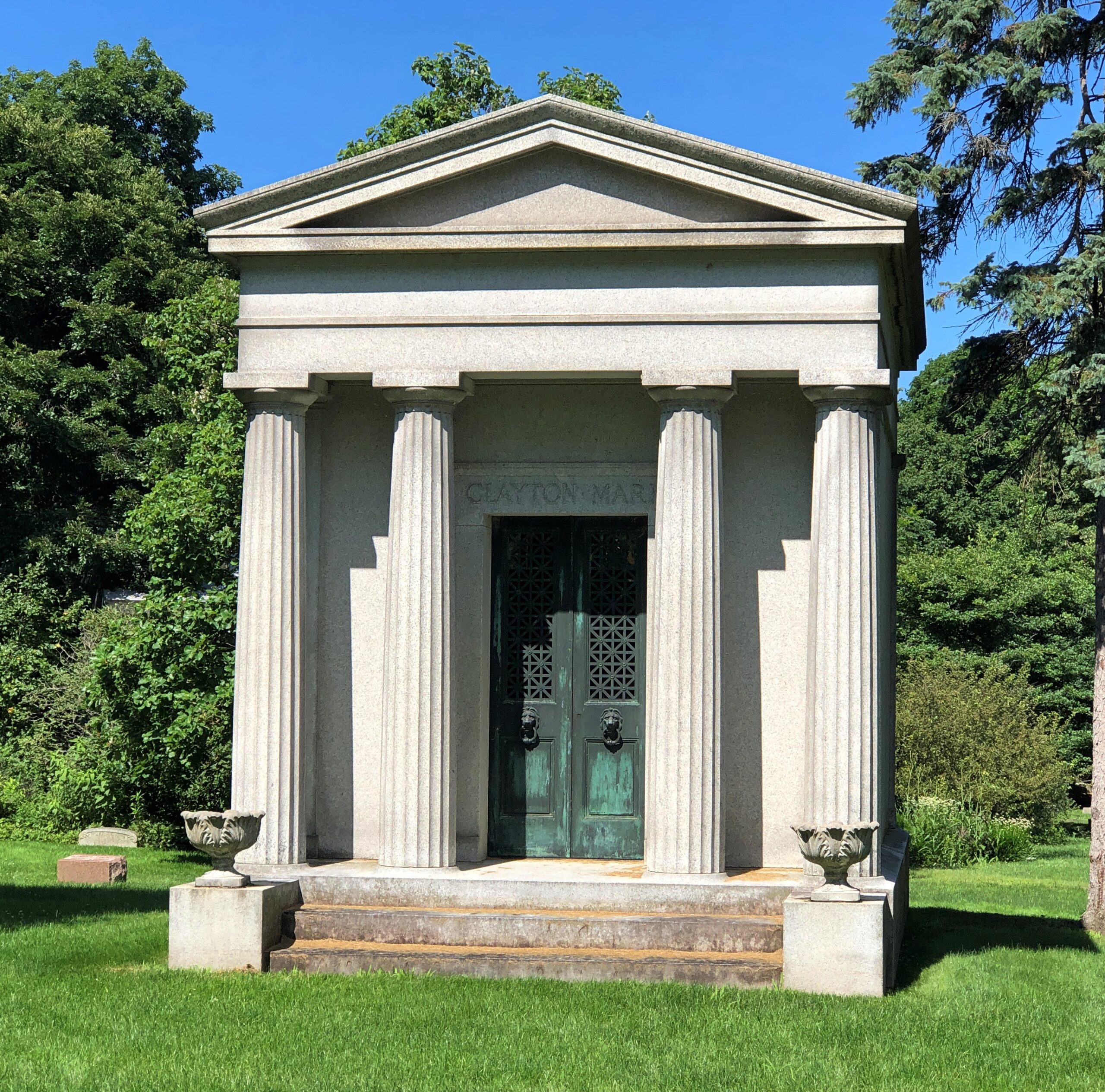
Drive up that way and you might find yourself at Lake Forest Cemetery. At the entrance gate.
Who’s waiting there, as part of the iron gate? St. Peter. Usually he has keys, but I suppose he’s holding the book he consults at the Pearly Gates.
Among the grand old rural cemeteries of metro Chicago, Lake Forest is one of the smaller ones, at 15 acres. Due to its lush landscaping, however, it seems bigger.
It too has a rural cemetery pedigree, selected as a cemetery site in 1857, coinciding with the founding of the town of Lake Forest.
“The site… selected contained the characteristics appropriate for a design in the naturalistic style,” according to a detailed history of the property at the National Registry of Historic Places. “It had topography with gently rolling changes in grade, ravines that added a rugged dimension, and a vista toward the lake.”
But some decades passed before its roads and landscaping were in place. William Le Baron Jenney (d. 1907), who designed the first fully metal-framed building – the Home Insurance Building in Chicago, the first skyscraper – did the roads and some other features in 1882 (not long before Home Insurance).
“In 1900, Ossian Cole Simonds [d. 1931] was selected to develop the site further and is responsible for its design in the Prairie Style. He perfected its beautiful graded surface, its broad open spaces, and its simple groups of trees, often with branches sweeping to the ground…
“Whereas the site had previously been open like a park, he enclosed the property with plantings, providing a feeling of privacy for the bereaved. The location of the cemetery on the bluff above the lake and surrounded by ravines provided a natural setting for quiet meditation that he emphasized through plantings. Unlike other cemetery sites that have been overtaken by urbanization, Lake Forest Cemetery still retains the character that Simonds emphasized through his plantings.”
I’ve happened across some of Simonds’ other work — Lincoln Park, but also Library Park in Kenosha.
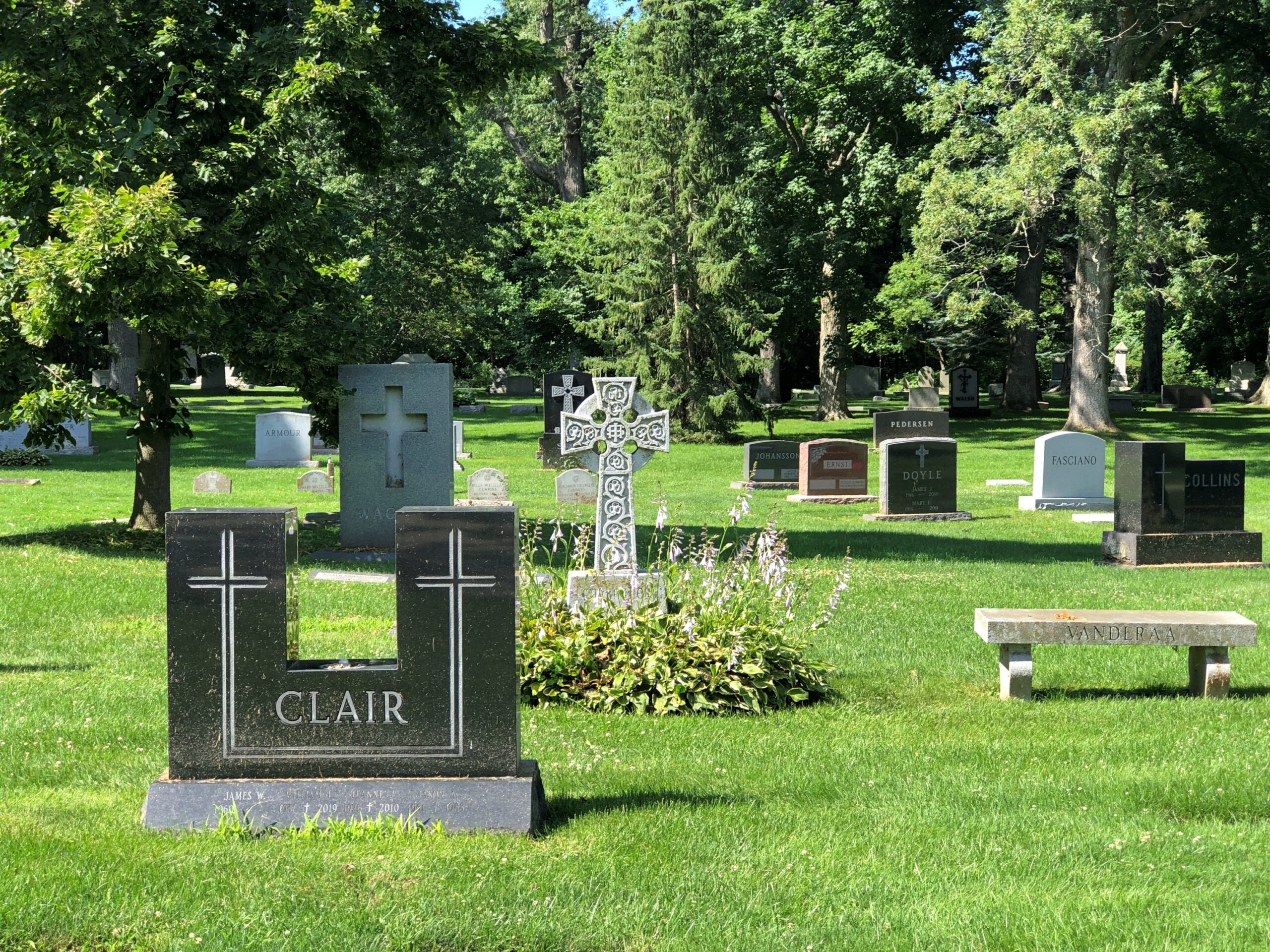
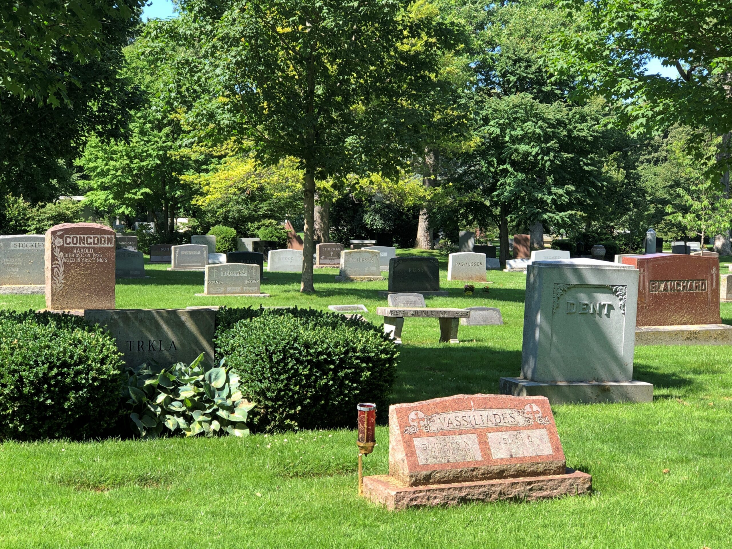
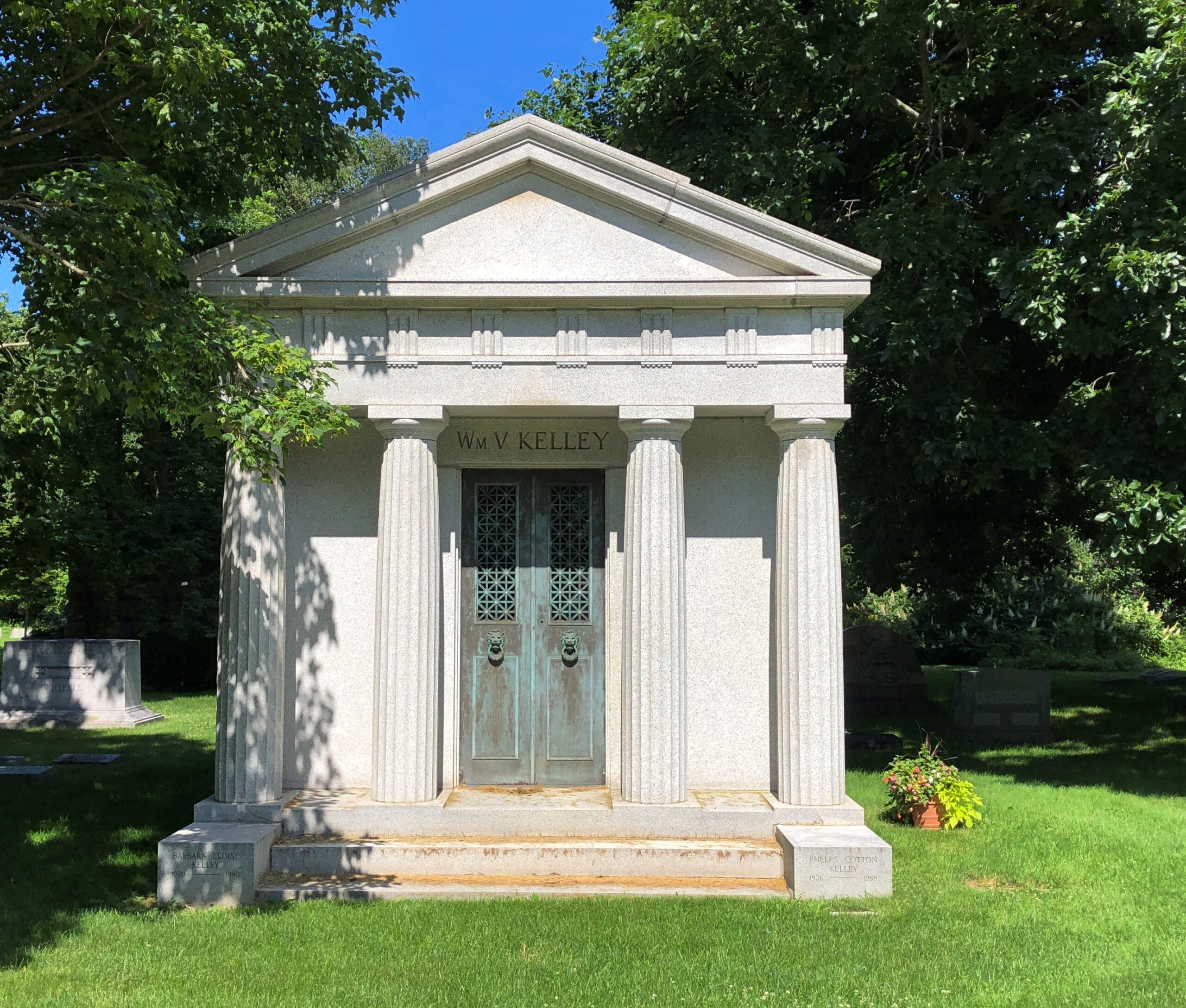
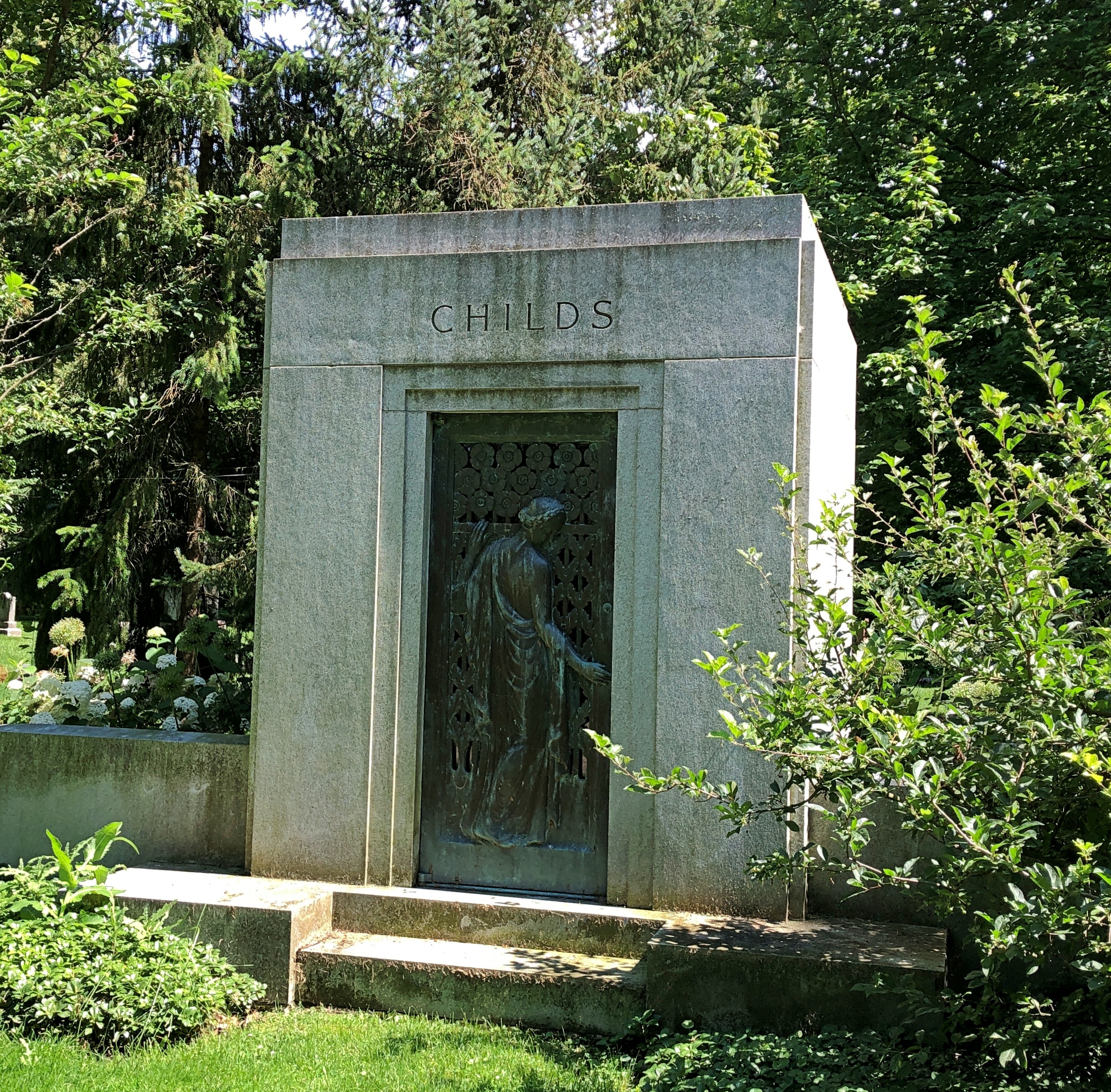
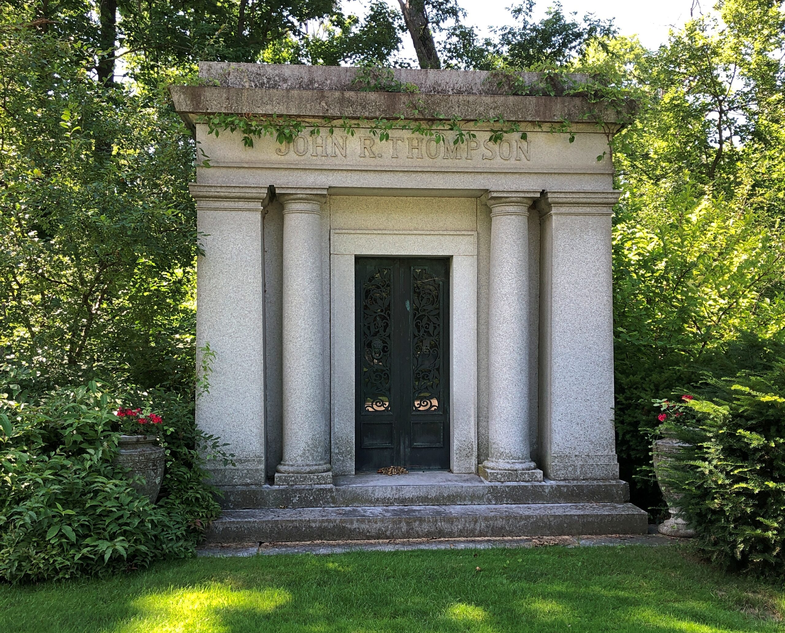
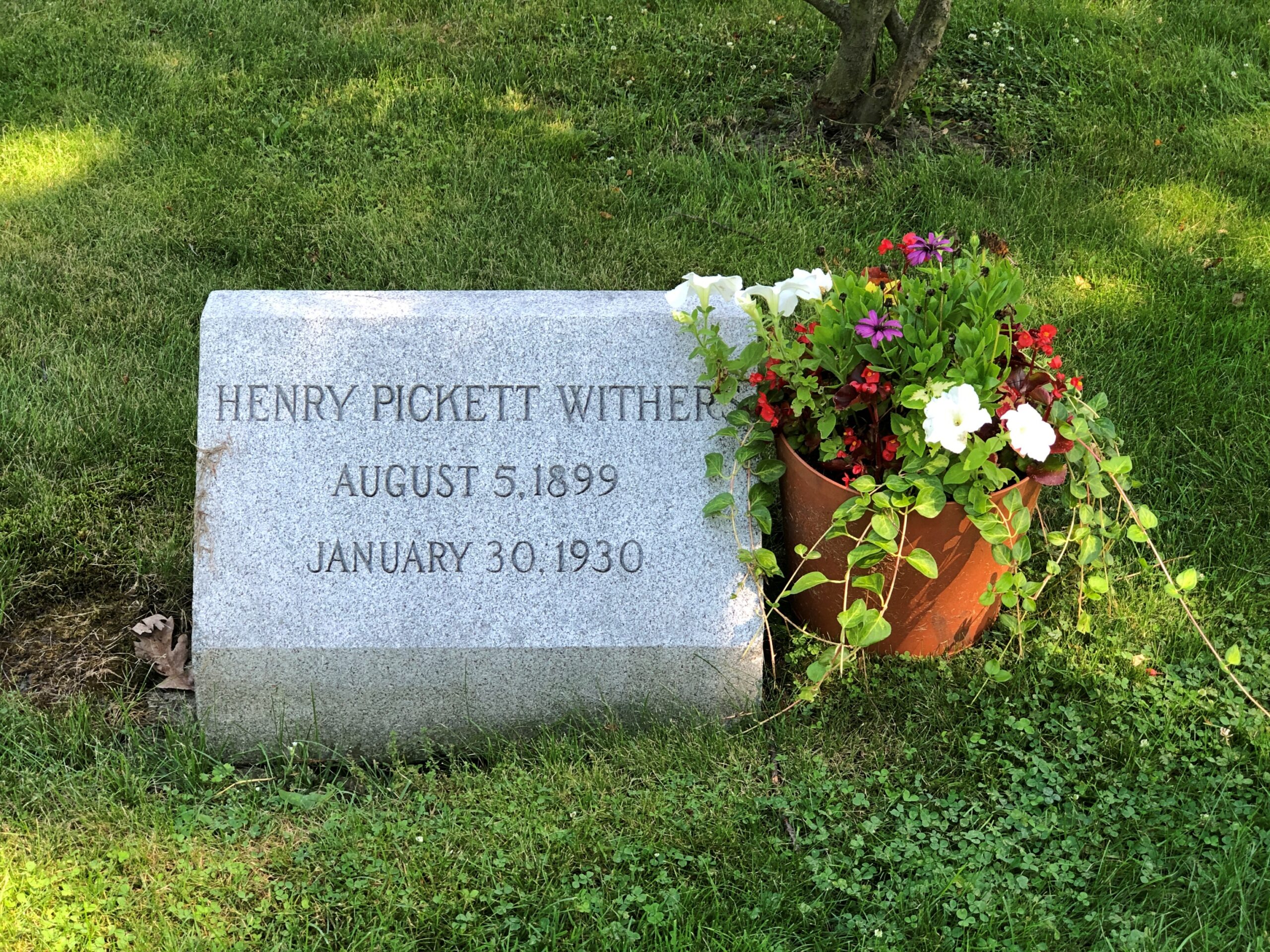
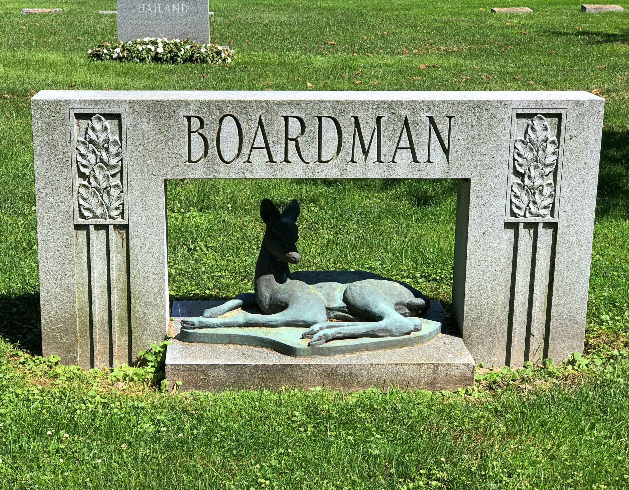
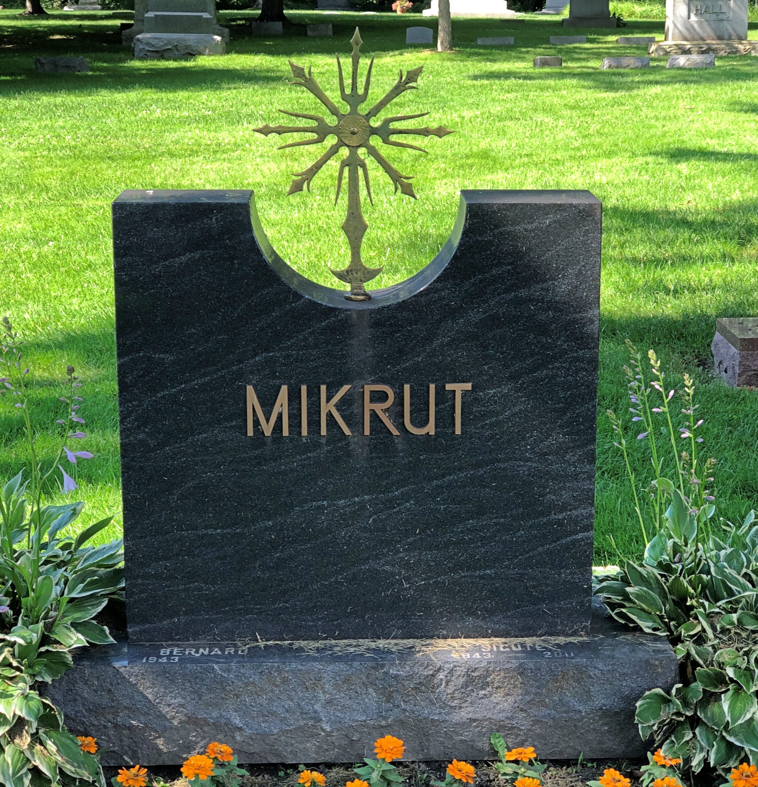
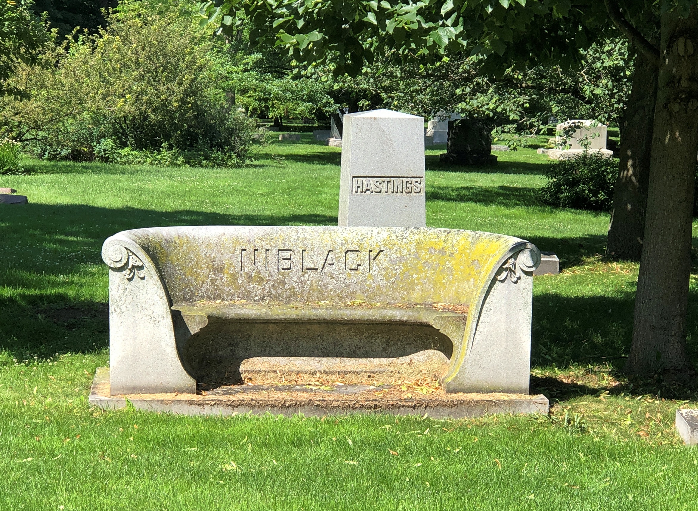
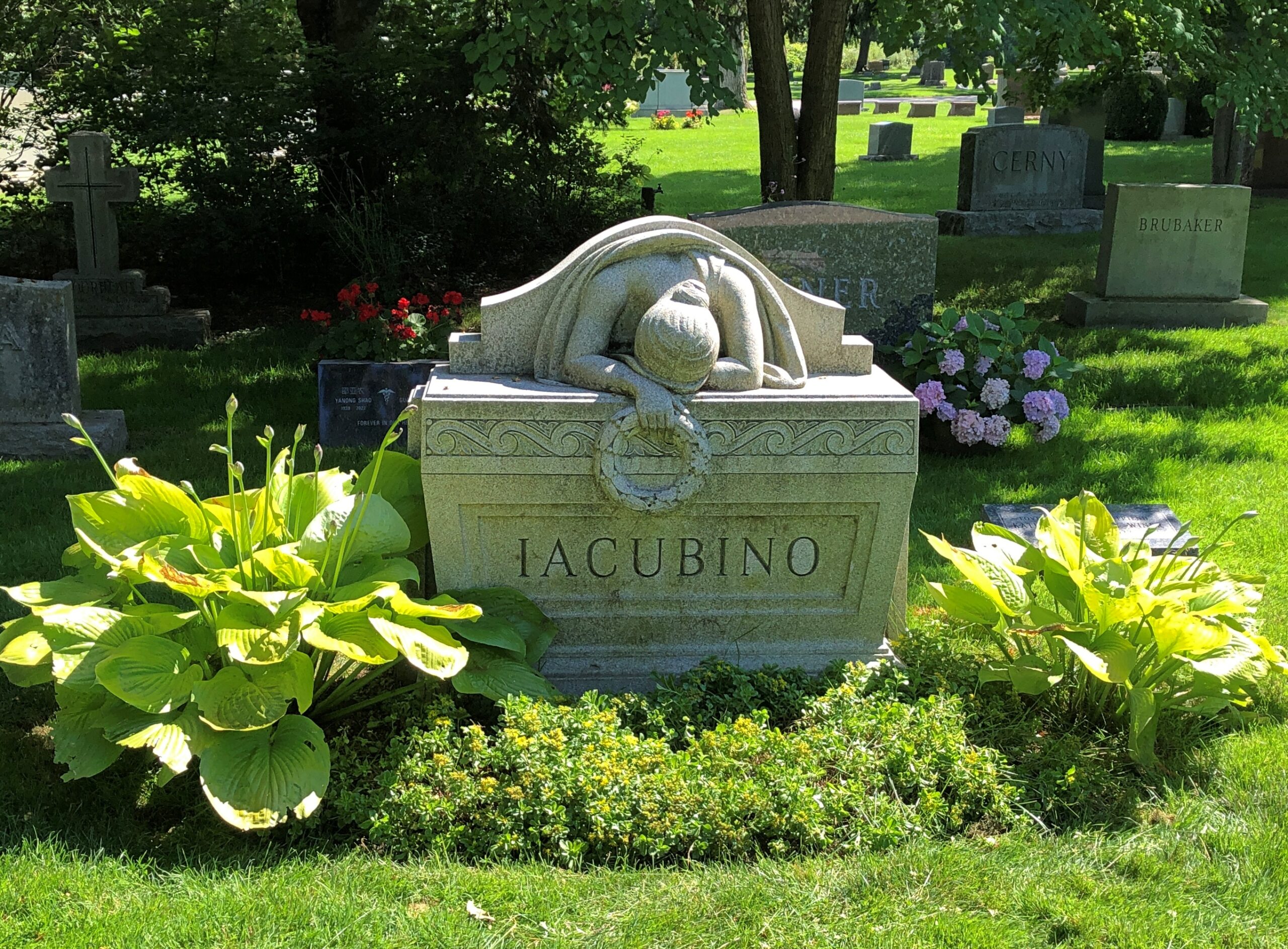
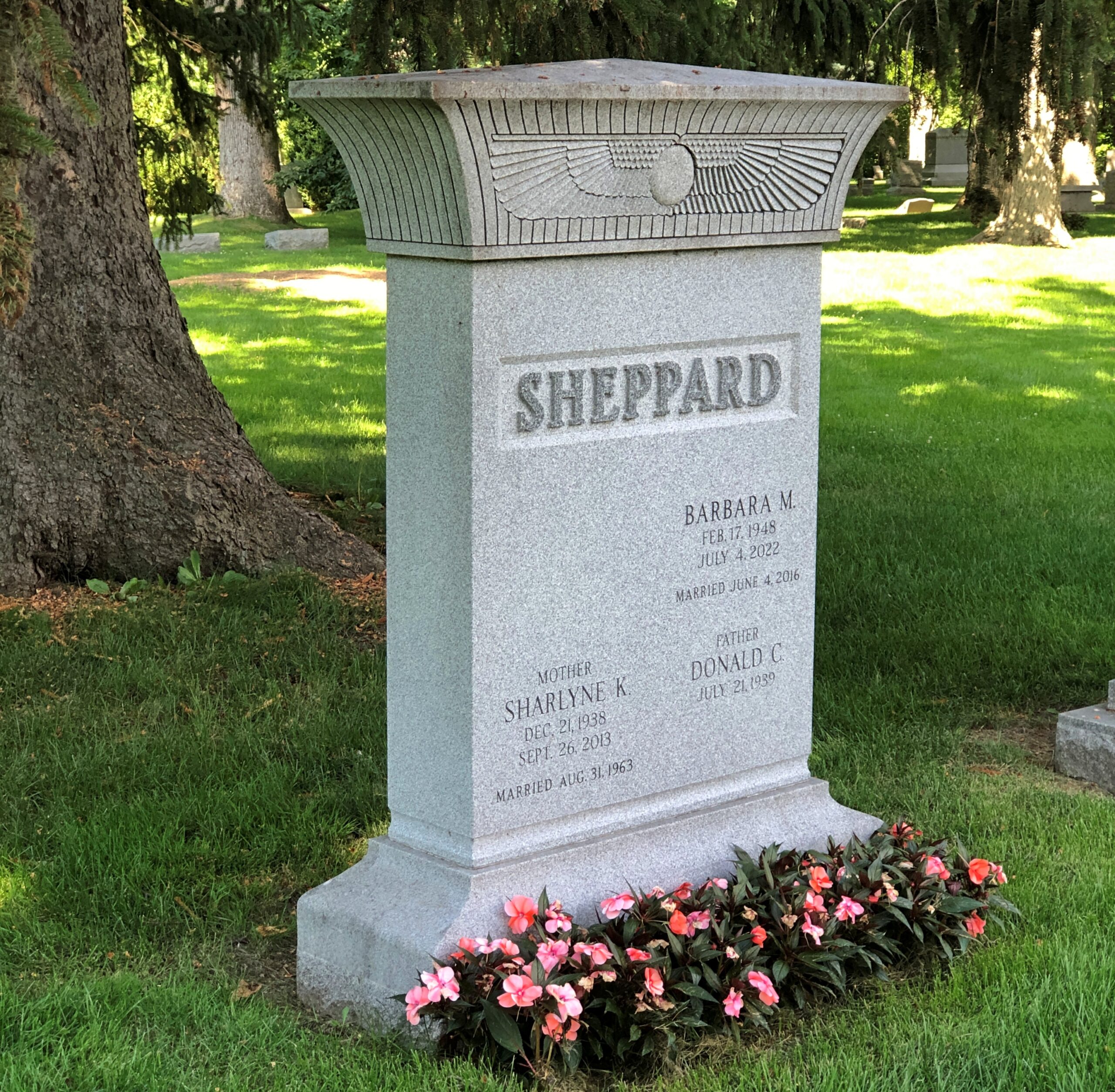
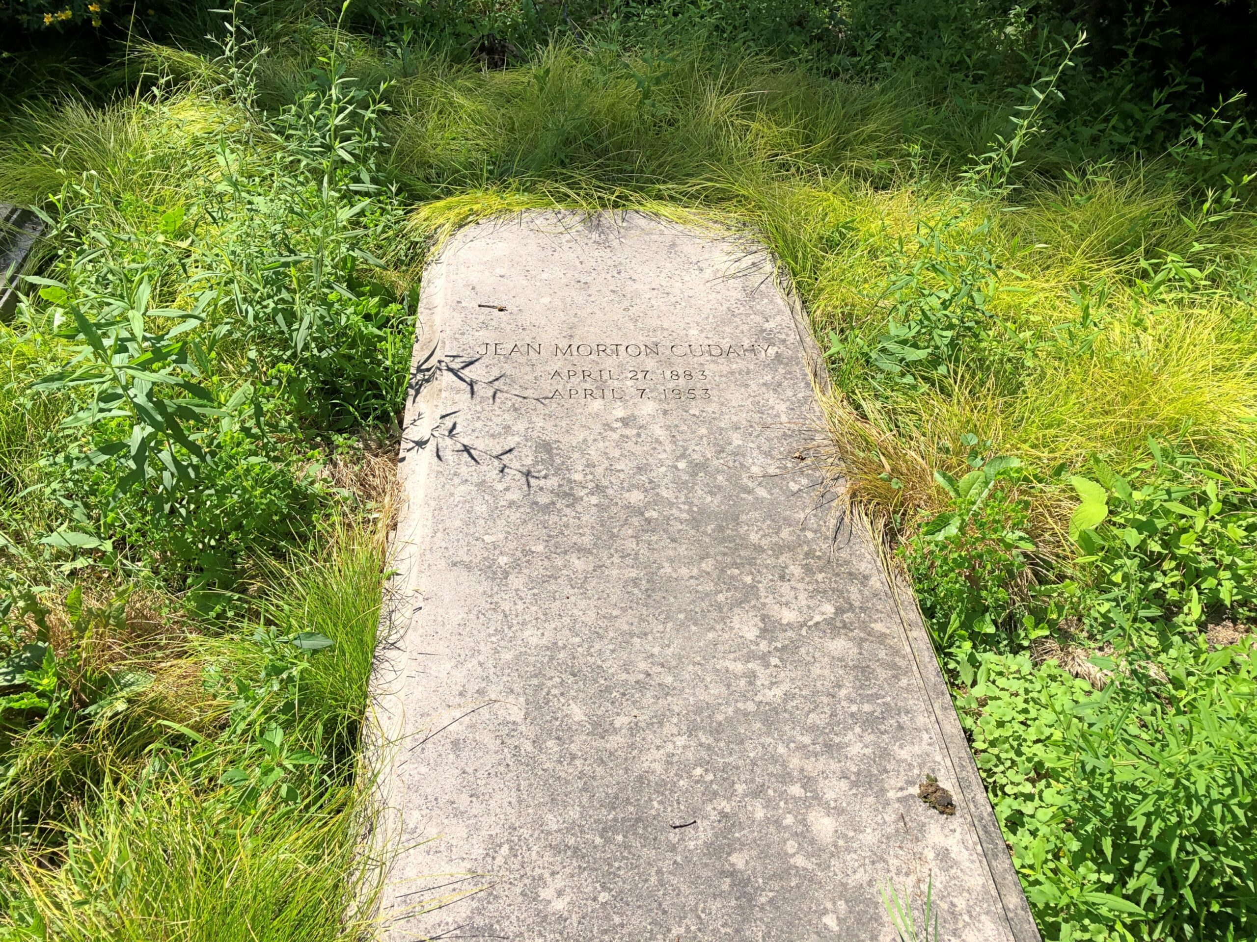
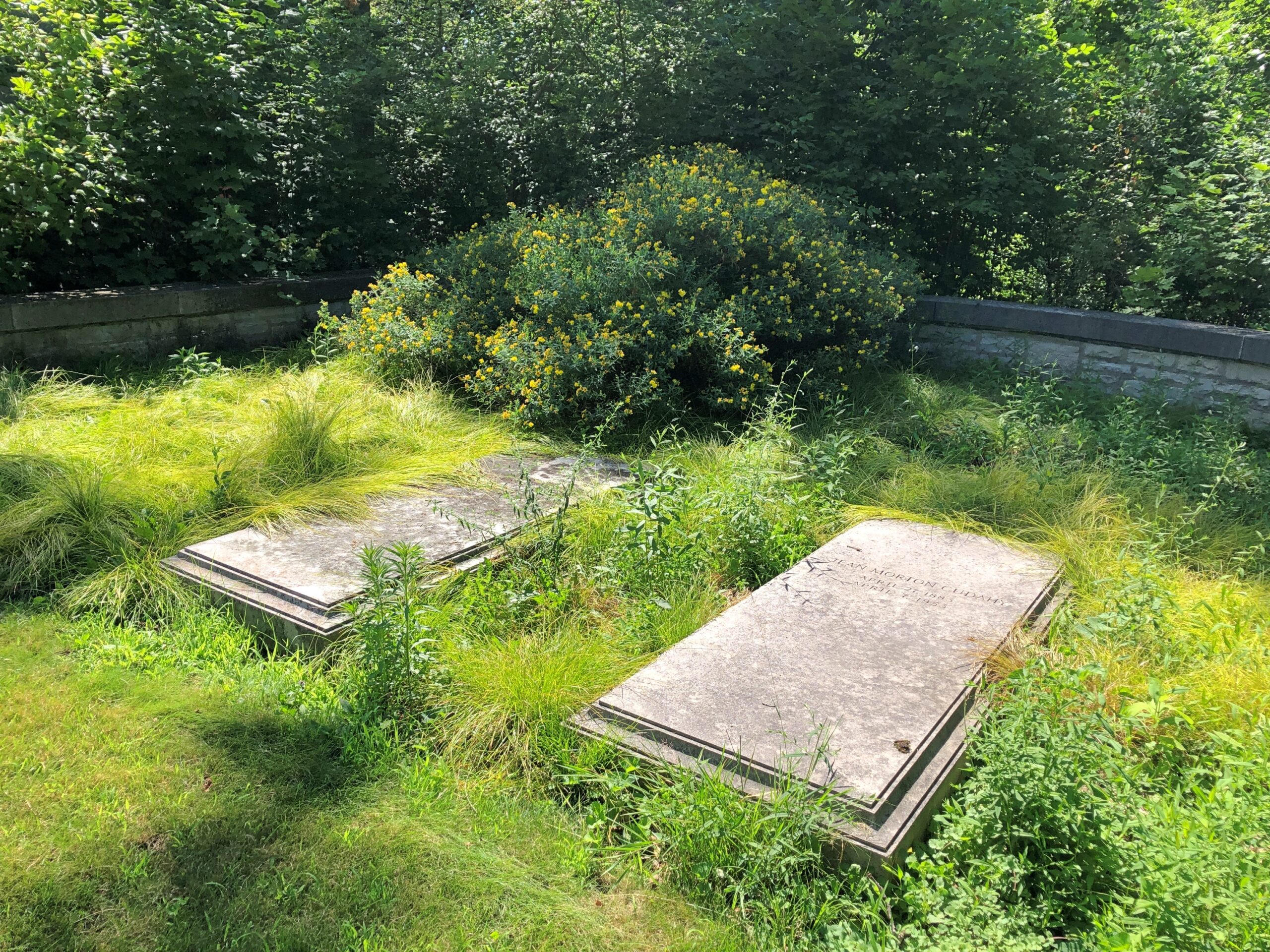
Like any good cemetery, there’s a mix of memorials. Considering the decades of affluence on the North Shore, no shortage of sizable mausoleums.
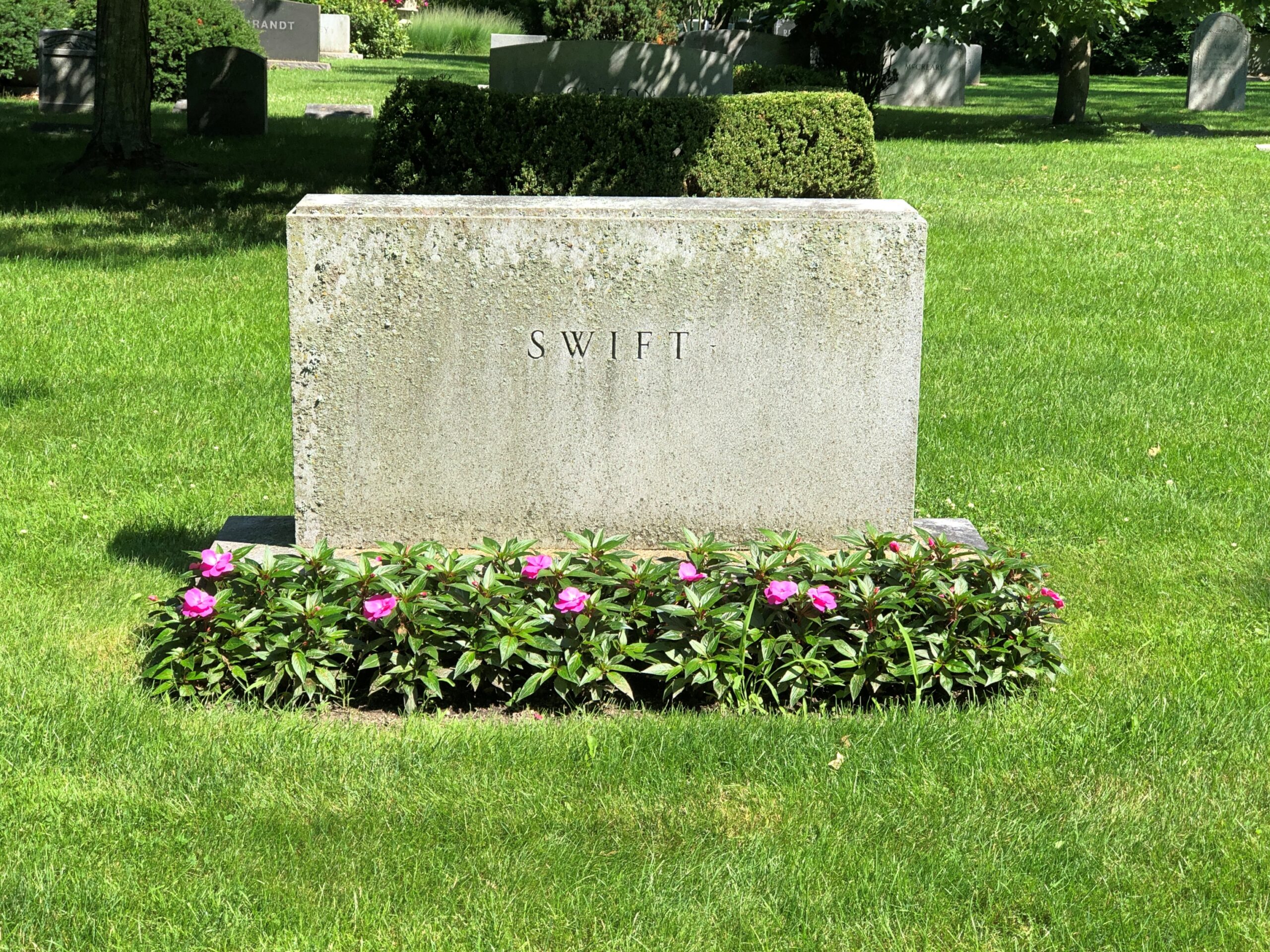
More modest stones, but certainly weighty. Physically, but also emotionally for the bereaved.
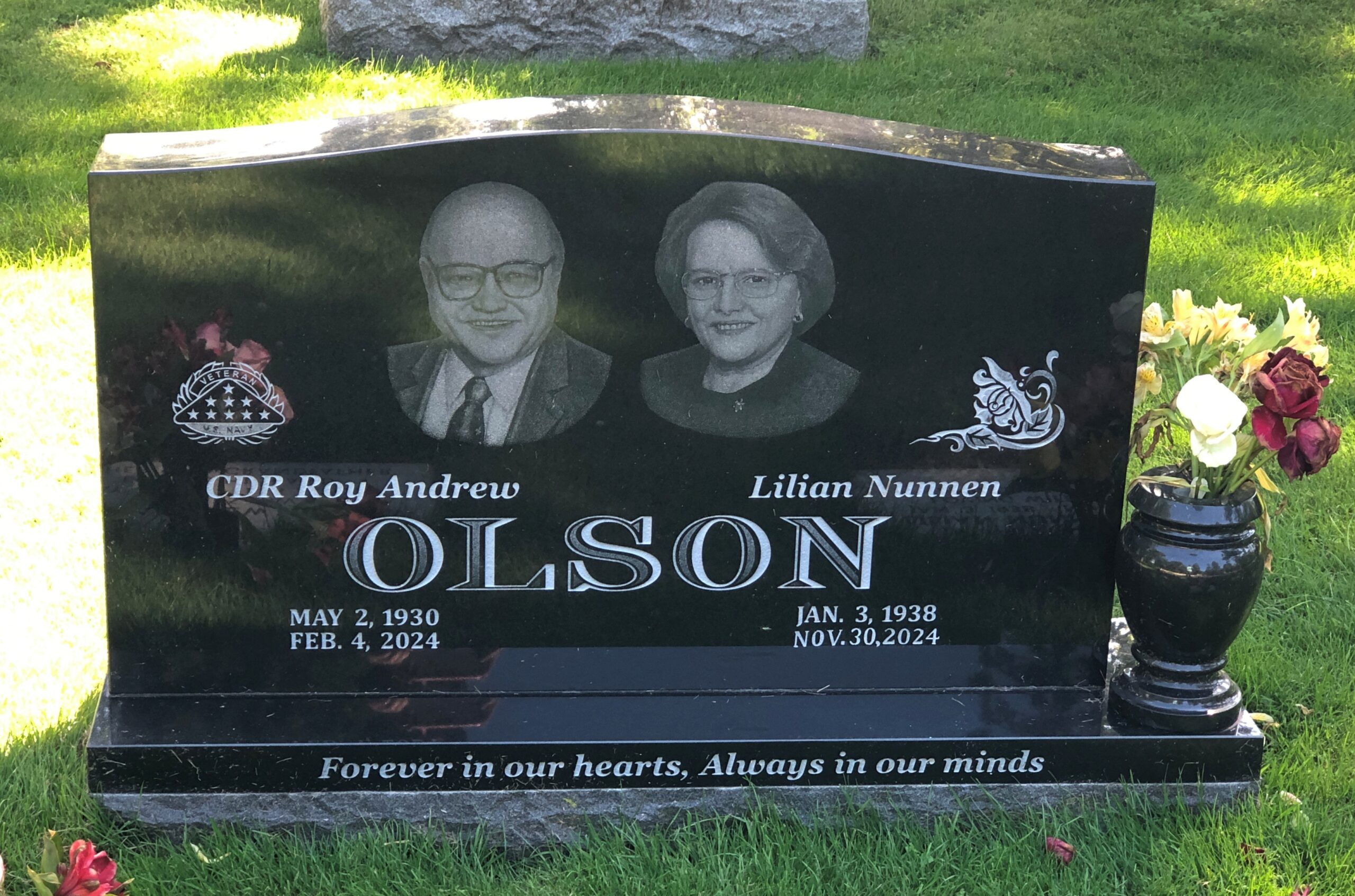
More artful stones.
Not much Egyptian Revival that I saw, but there was a little.
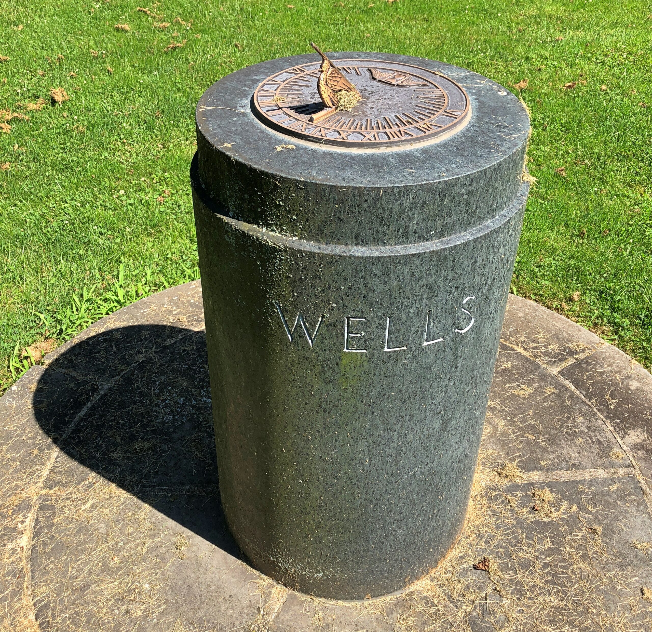
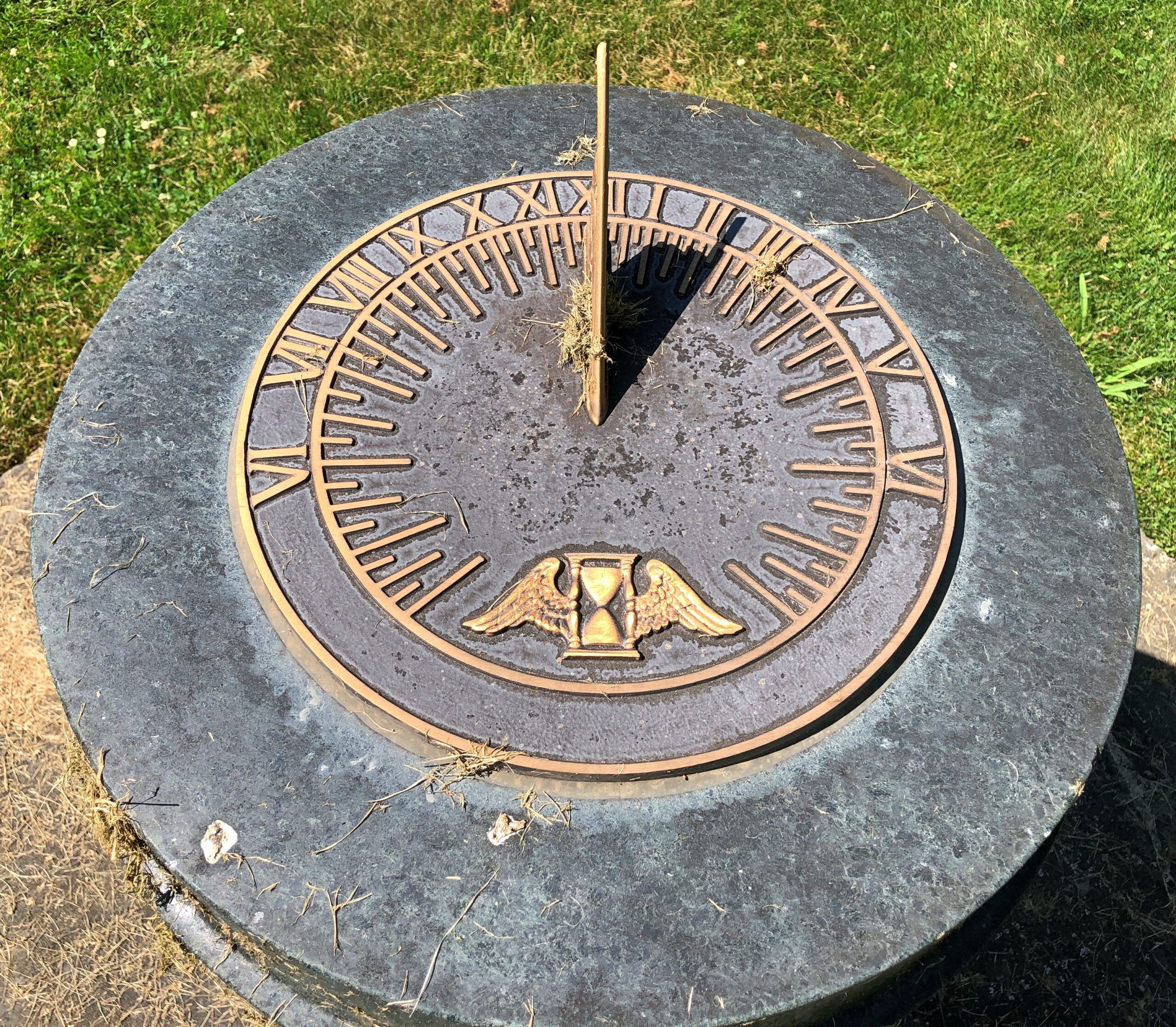
The aforementioned sun dial memorial.
I liked this small section: unkempt on purpose, I think.
Lake Forest’s landscaping is meticulous otherwise, so that seems more reasonable that an omission by the groundskeepers.
Not to be too carried away with AI image creation – whose power at mimicking continues to astonish – but it’s like I’ve discovered a new toy. Late to the party, as usual, but so what?
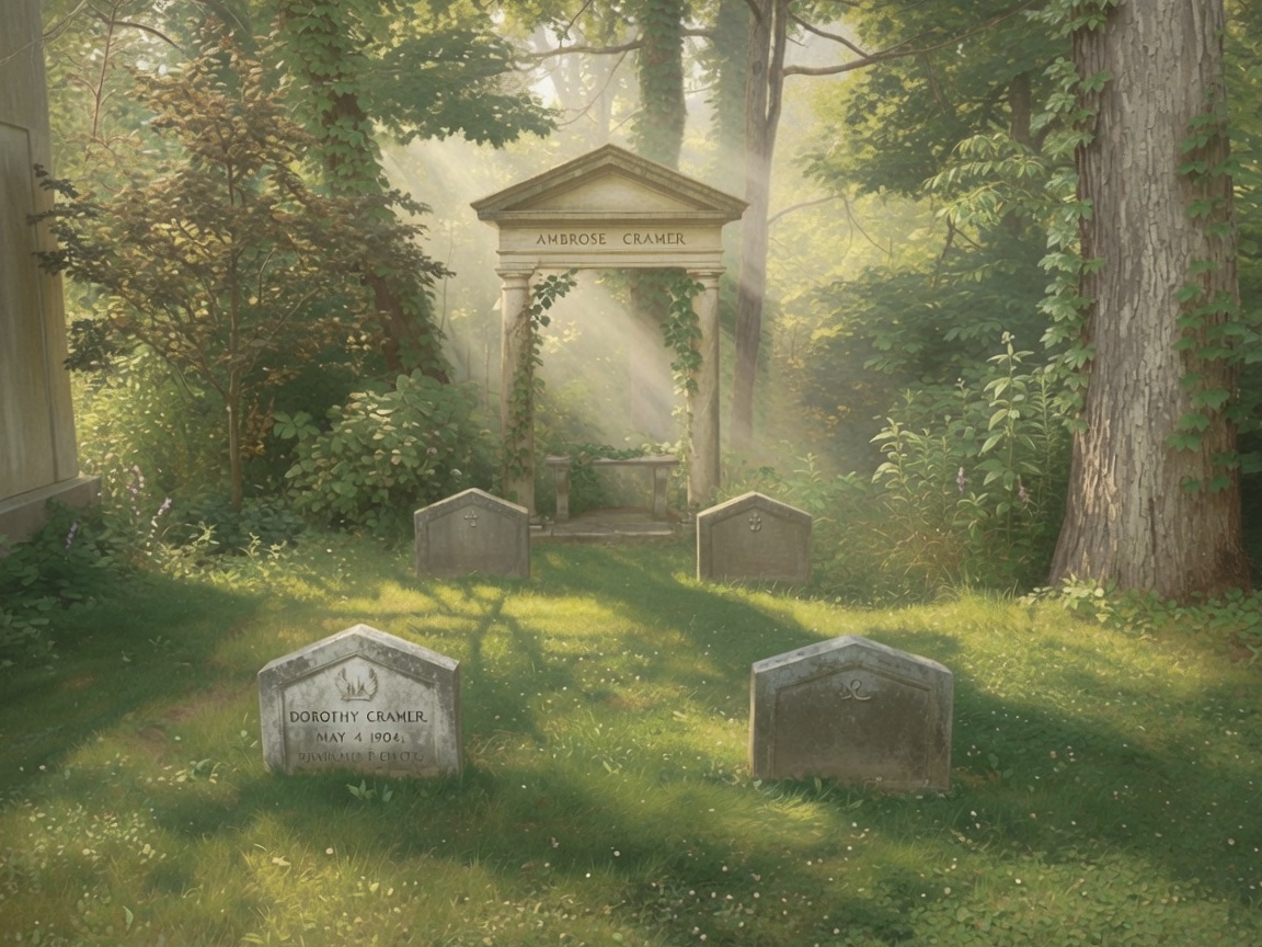
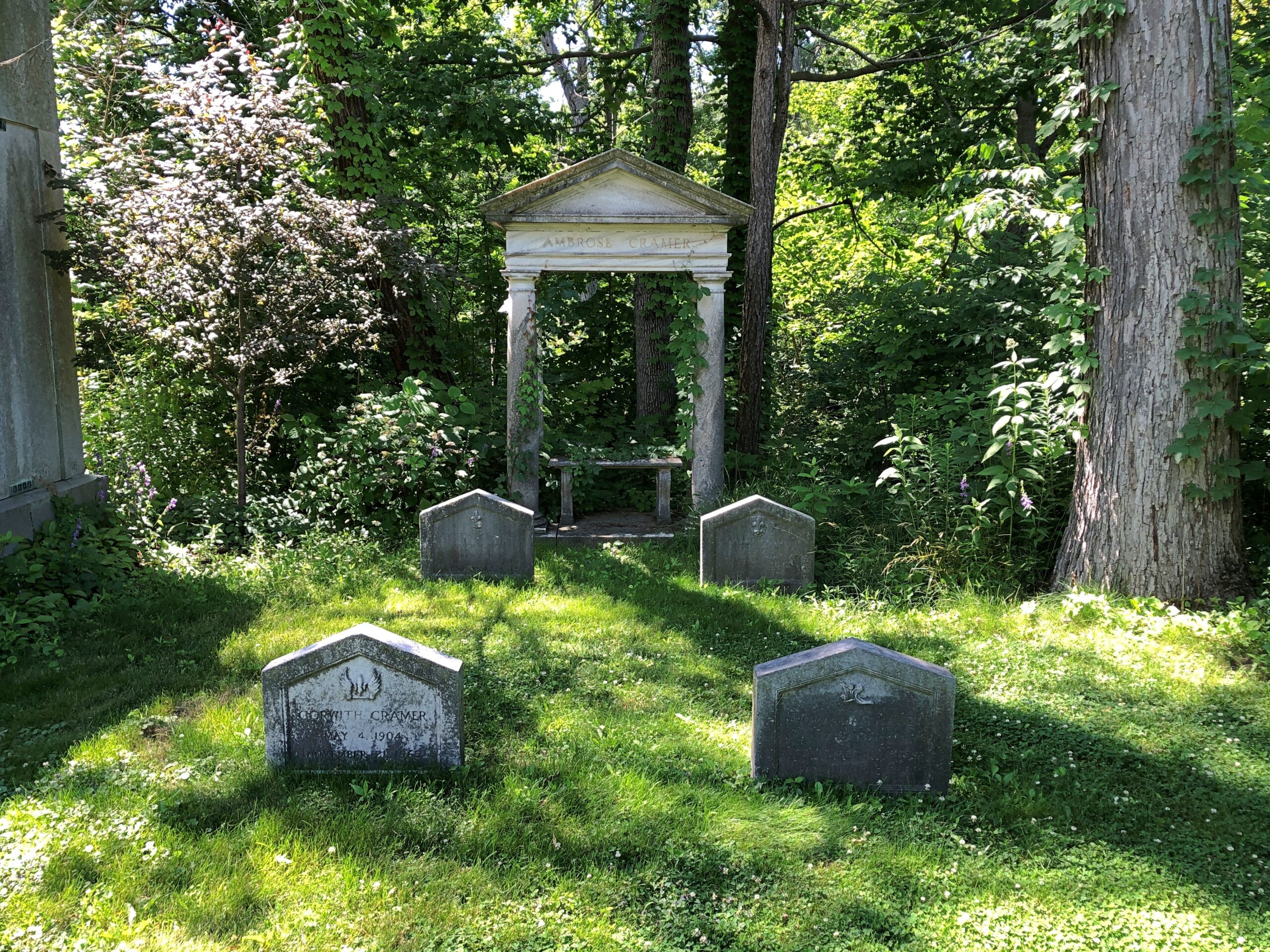
The other day I figured, what better than Victorian-style landscape painting to render an image of a cemetery whose founding and inspiration was Victorian? Of course, you can argue that “Victorian” is too nebulous to mean much, but this is AI we’re talking about. Its entire realm is nebulous – and yet also a dive into a vast body of images somehow or another associated with “Victorian,” thus spinning out something new in some old style.
That’s a long-winded way to say that I gave AI treatment to some images I took a couple of weeks ago at a major Chicago-area cemetery, more about which later. Some of the photos I’d taken hadn’t impressed me particularly, but I wanted to see what the image grinder could make them into.
Prompt: “Victorian-style landscape painting”
Original.
AI made a reasonable choice when it came to shifting the light around the image. I didn’t ask it to keep the lighting the same or similar, but even if I had, it might have ignored those instructions, as it does.
As I said, a new toy.
Prompt: “Escher-style”
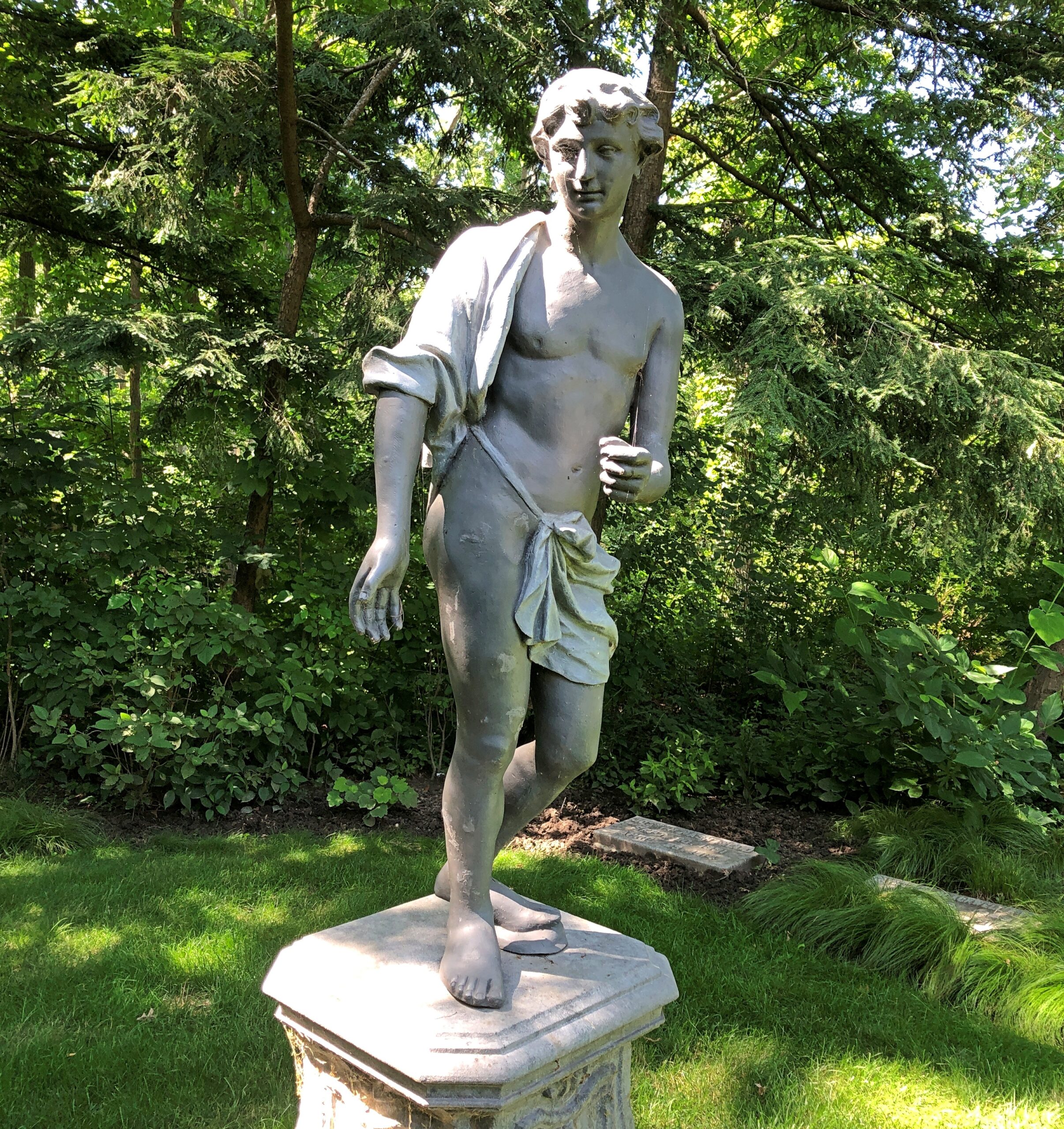
Original – a sundial as a headstone. I don’t know that I’d seen that before, but it fits. As the surfers say, Tempus fugit, dude.
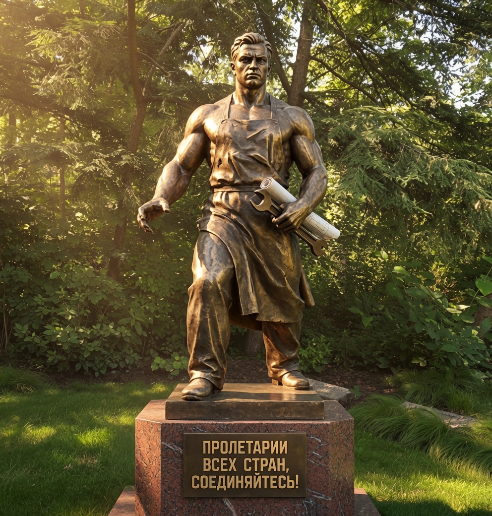
Prompt: “Socialist realism style.”
Original.
With the information marvels at hand, it didn’t take long to figure out “Workers of the World, Unite.” It looked familiar anyway. I regenerated the image a few times, and the slogan came back again and again. Also, the system persistently associated socialist realism with workers’ overalls. Guess there are good reasons for that.
As usual for a Northern summer – the best thing about it, really – the heat has been on and off even in July. Last week we had highs only in the 80s, and sometimes lows in the 60s at night. Those days gave way to hotter temps today, with the promise of more heat to come. For a few days.
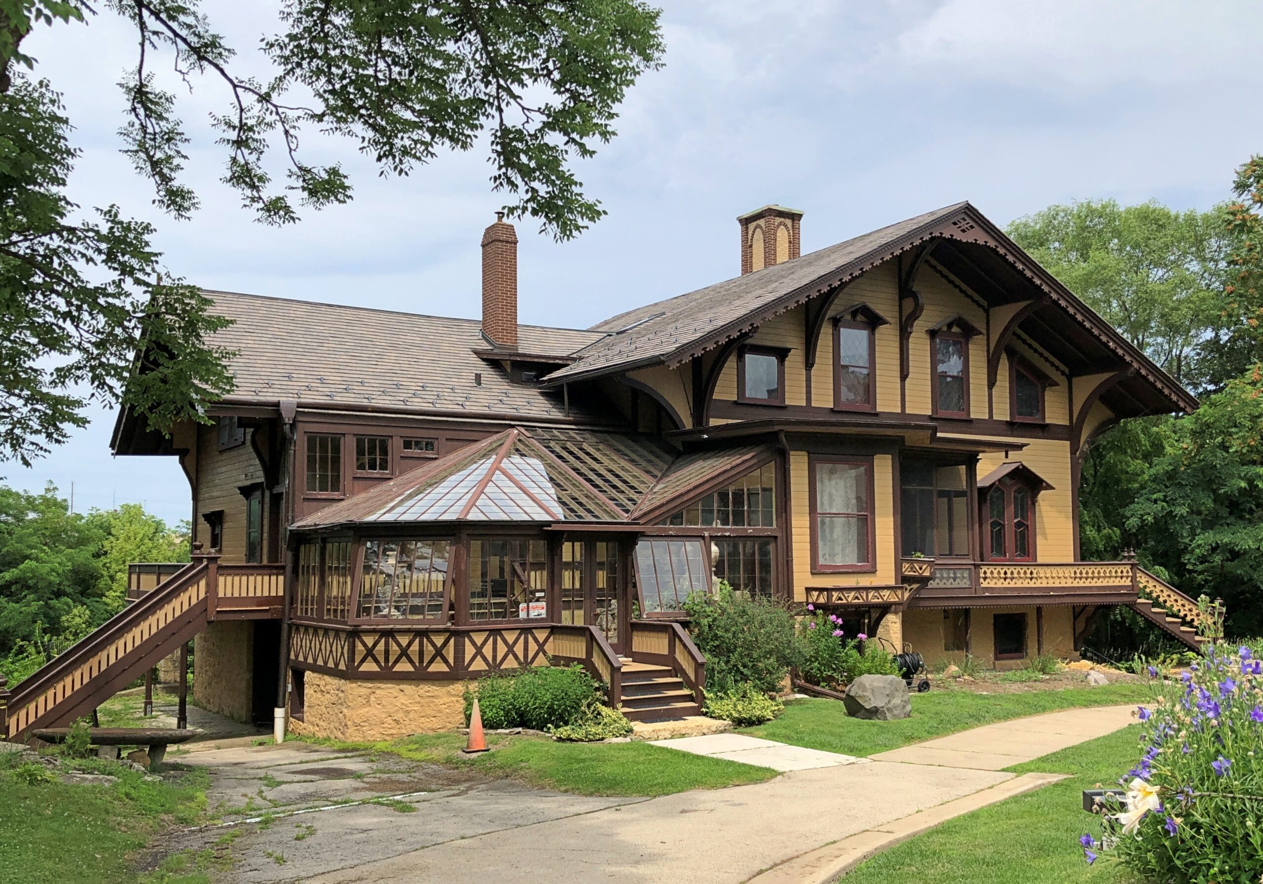
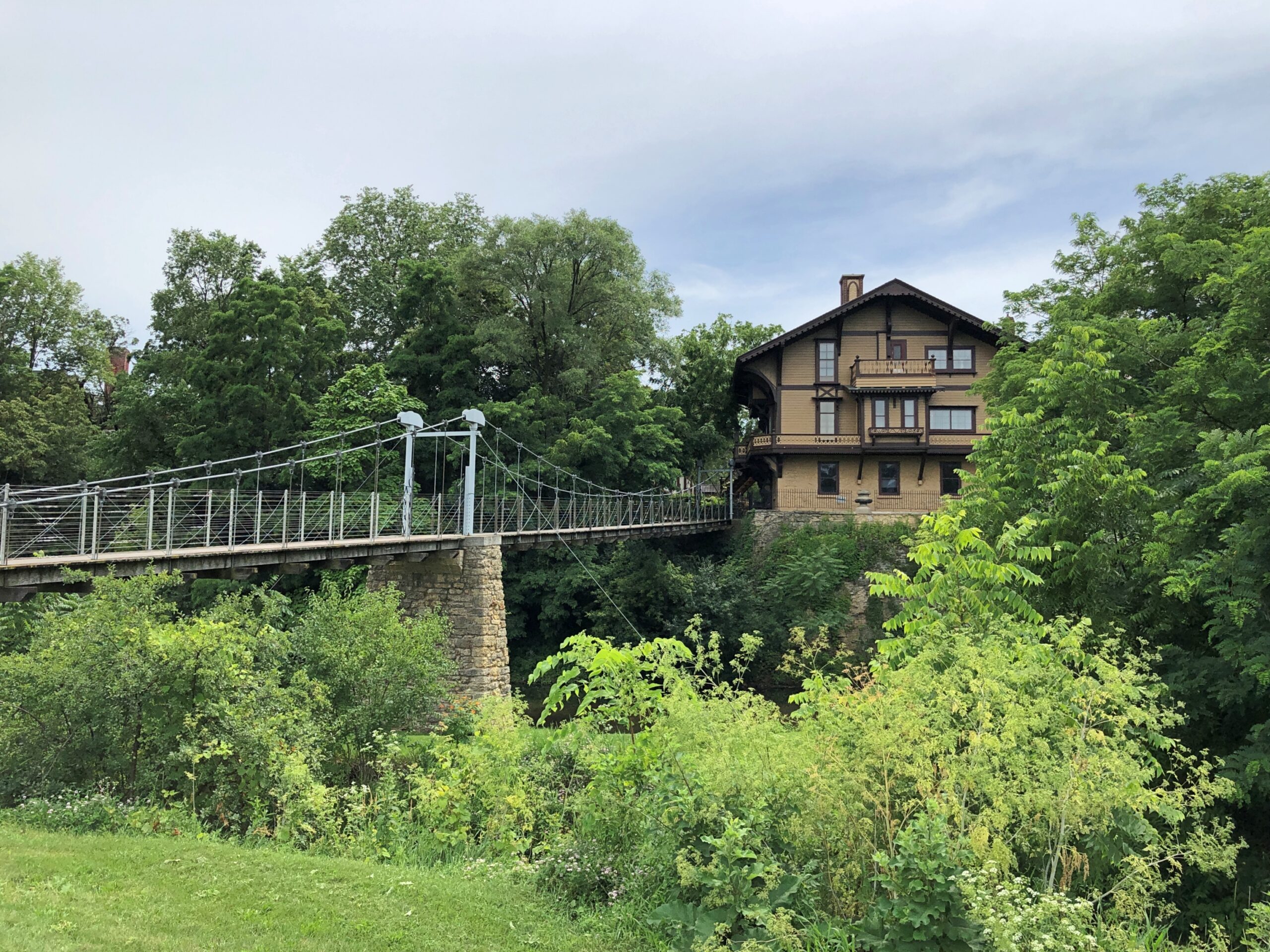
Back on July 3, a fairly hot day itself, we buzzed out to Rockford, the furthest I’ve been for months now. After a hearty lunch at the Stockholm Inn, we visited the handsome and distinctive Tinker Swiss Cottage Museum & Gardens, which is just south of downtown Rockford. Known about the place for years, finally made time for it.
Another legacy of an American who traveled to Europe long ago. Apparently he was besotted with the Swiss design of the time. That American would be Robert Tinker (d. 1924), though his story is more convoluted than most. During the boom early days of mechanical reapers in the 1850s, one John Manny ran a reaper works in Rockford as one of the more nimble competitors of Cyrus McCormick (who sued Manny for patent infringement and lost). John Manny died suddenly in 1856, as even wealthy people sometimes did in those days, leaving his widow Mary in control of the company.
Young Robert Tinker (younger than Mary) worked in a management position at the company. He had not, himself, come from a wealthy family, but apparently was a man of sideways ambition. In 1862, Mary paid for Robert to spend an extended period in Europe, while still drawing a salary from the company. So not only was he able to take a sort of sabbatical from factory operations, and skip out on risking his life for the Union, he got to take a Grand Tour.
The docent was clear on all this as we toured the interior of the house – and I later discussed it with the museum’s director of education and collections, who affirmed the gist. Less clear is exactly how that happened. Mary and Robert were obviously close, very close, though their exact relationship is obscured from prying minds of the 21st century by a screen of Victorian propriety. Eventually (1870) the two married, and lived a long time as prominent Rockford citizens.
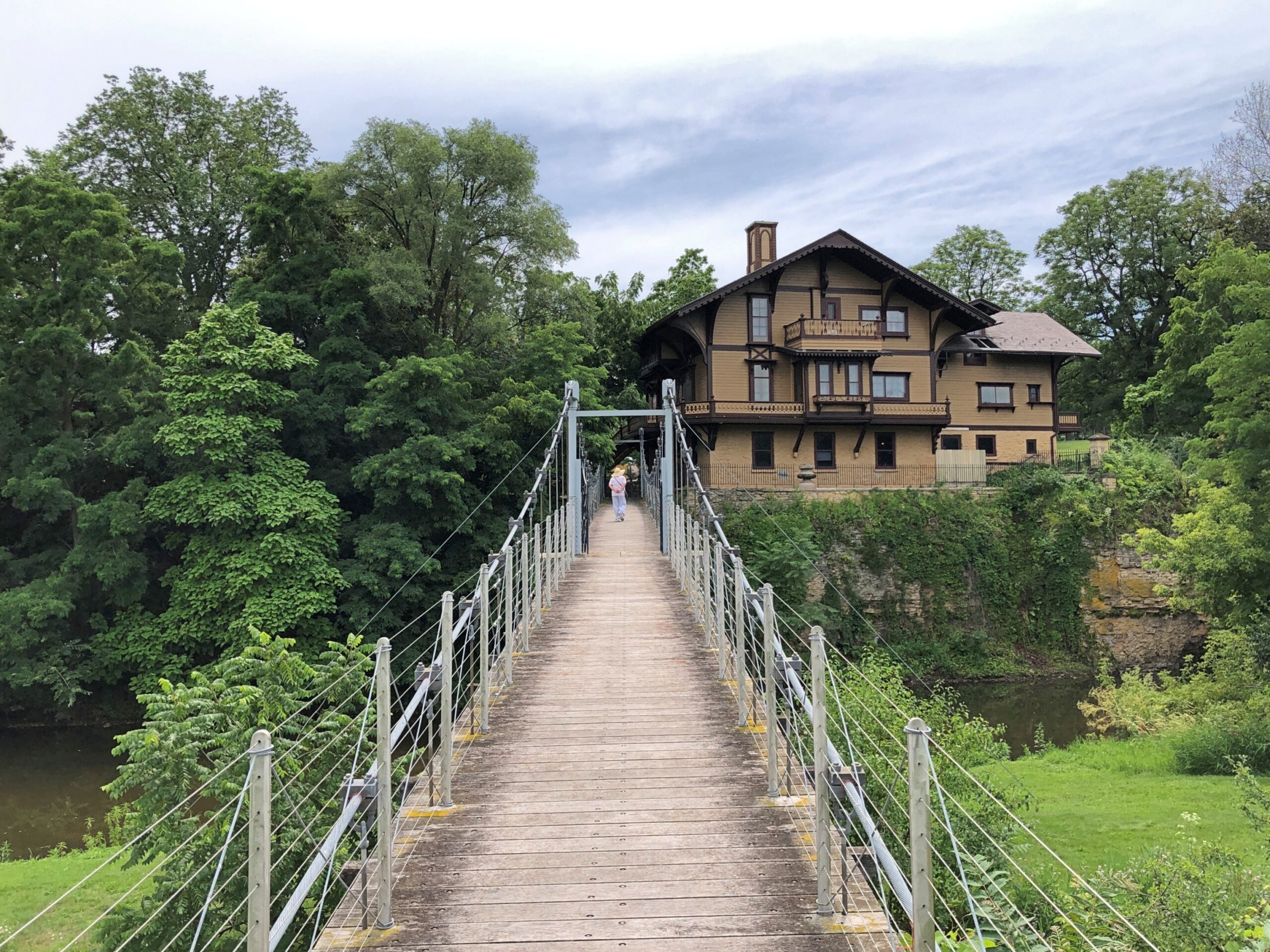
Robert was already at work on the Swiss Cottage before that, starting construction in 1865 on a limestone bluff overlooking Kent Creek, near when it meets the Rock River, finishing it around the time he got married. (Germanicus Kent being one of the founders of Rockford.)
I understand the gardens in the name used to be more extensive, but much remains.
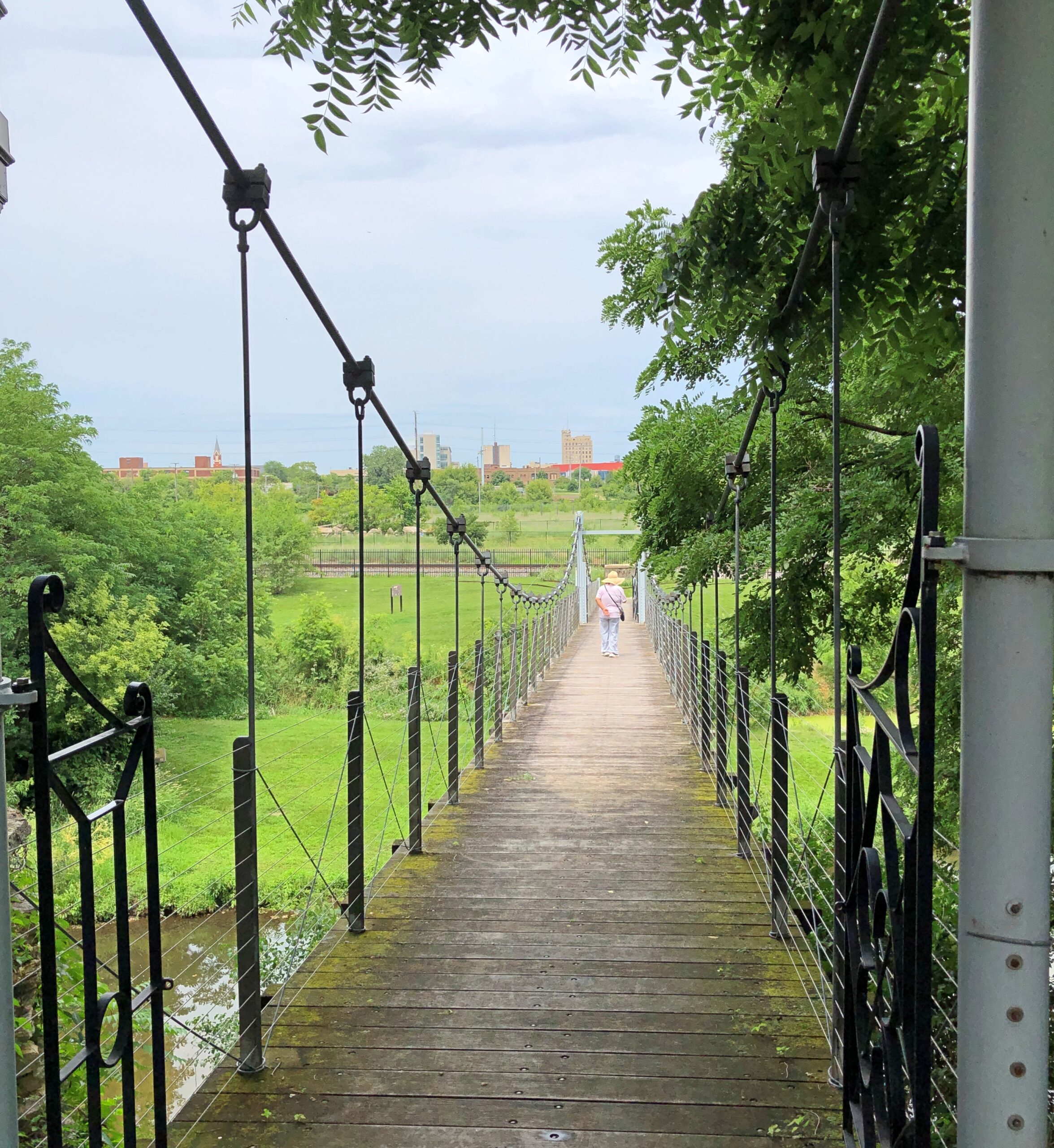
Behind the house is a bridge across the creek, leading to an undeveloped patch of land, formerly part of the gardens, along a rail line.
Of course we had to cross the bridge, despite the heat. It’s a personal motto of mine: cross that bridge if possible. In this case, you’re rewarded by a view of the back of the Swiss Cottage, perched above the creek.
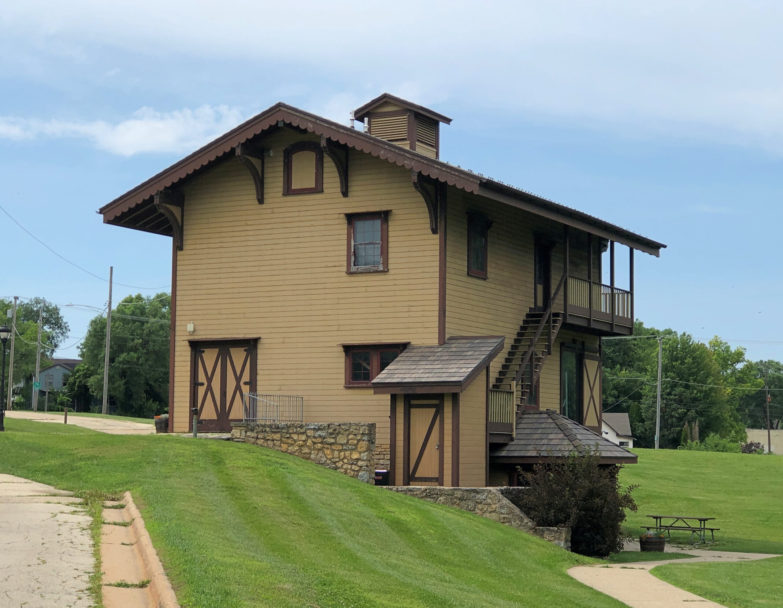
The property, now belonging to the Rockford Part District, also includes a three-story Swiss inspired barn. Formerly home to cows and horses and such, these days it’s a shop and visitors center and such. An unusual sort of barn, I’d say.
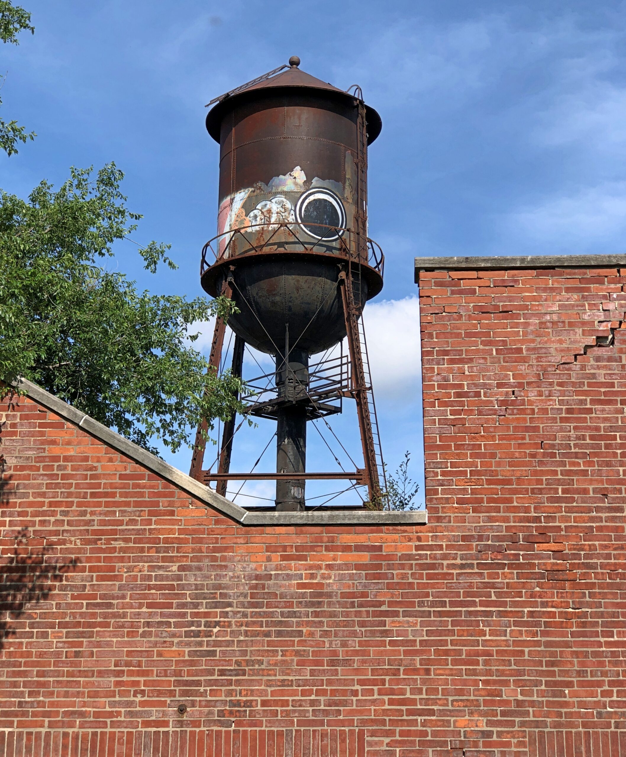
After Robert Tinker’s time, a factory was developed near the house. Nothing to do with reapers or the Tinkers. Just an opportune spot near the Rock River. Its hulk remains behind sturdy brick, lorded over by a rusty water tower.
The factory has been abandoned for some years. But I understand that socks, and indeed sock monkeys, used to be made there.
More fun with AI today. I subscribe to a transcription service which is incredibly useful – there was nothing I disliked more about my job than transcribing interviews by hand. I’d mention the system by name, but not unless I receive a month or two free. Are you reading me closely, Algorithm? Have the company make me an offer.
The transcription isn’t as accurate as its ads claim, however. That’s to be expected. It’s pretty good though, and I can work up accurate quotes, especially if I compare the transcription to the recording. But it isn’t very good at listening to song lyrics. This morning, I let “Moonlight Cocktail” play as the system struggled to transcribe it, to see what would happen.
“Moonlight Cocktail” is best known as a Glenn Miller recording, released in early 1942. Considering how popular the song was – number-two song for that year after “White Christmas” – it’s remarkable how completely forgotten it’s been. It shouldn’t be. It’s a wonderful, lilting piece, evoking in rich strokes the common experience of young sweethearts tucking themselves away somewhere pleasant during the “blue of a June night.”
Its dulcet music was by Luckey (Lucky) Roberts (d. 1968), all-about man of popular music in the early 20th century whom you can imagine tickling a keyboard vigorously at a lively Harlem nightspot, if you put your mind to it. Sweet lyrics by Kim Gannon (d. 1974), best known for “I’ll Be Home for Christmas.”
The first two stanzas, as recorded by the Glenn Miller Orchestra:
Couple of jiggers of moonlight and add a star Pour in the blue of a June night and one guitar Mix in a couple of dreamers, and there you are Lovers hail, the moonlight cocktail
Now add a couple of flowers, a drop of dew Stir for a couple of hours ’til dreams come true As to the number of kisses, it’s up to you Moonlight cocktails need a few
As heard by my transcription system:
Awful of jiggers of moonlight and the sun pour in the blue of the June night and roar good heart. I had a couple of flowers of dry or dew, slur for a couple of hours till dreams come true. As for the number of kisses, it’s up to you.
Interesting, though I don’t know what it means, that the system got the sentence, “As for the number of kisses, it’s up to you” exactly right, which the Modernaires sung in close harmony, but then didn’t catch the next sentence at all, which lead singer Ray Eberle started, only to be finished winsomely by the Modernaires. Actually, it bypassed the lines beginning “Mix in a couple of dreamers…” as well. The ways of AI are mysterious.
Guess the system needs more work – but who really needs a transcription service for songs anyway? How could it overcome the challenges associated with (say) “Louie, Louie”? All questions for minds (or machines) more probing than mine.
As long as I was playing around with the song, I used another AI system, one of the many image generators, with this prompt: Draw cover art for the song Moonlight Cocktail.
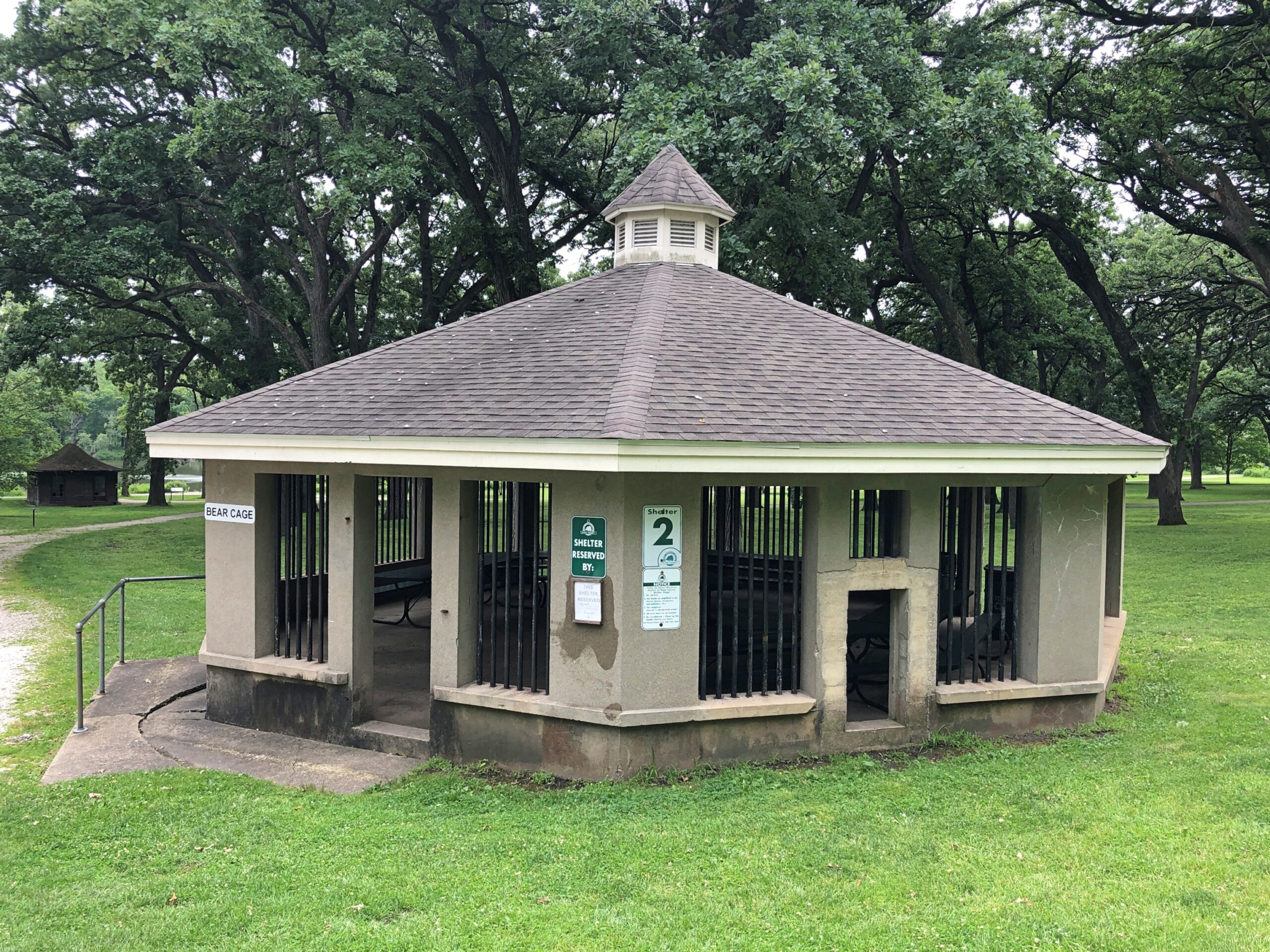
Another relic of the Fabyan’s time along the banks of the Fox River in Geneva, Illinois, is a bear cage.
To be more exact, it’s a former bear cage, now used for picnics at the forest preserve. A nearby sign tells the story:
This picnic shelter actually began as a large cage built to house the Fabyan bears. It was built around 1920 to replace the first bear cage, which was a wire-and-wood structure. [Perhaps the bears had a habit of escaping that cage.] The first inhabitant, Mary, was a female American black bear. Later, two American brown bears, Tom and Jerry, lived here. During the Fabyan period, the cage did not have a roof. Spikes may still be seen along the top of the inside walls. These were meant to keep the bears from climbing out of their cage. The bears also had a large tree branch placed in the center of their cage so they could climb on top and look out over the estate. What a surprising sight this must have been to passers by.
At one time or another, the Fabyans also kept alligators and a monkey — and the latter lived in the house. The docent was happy to point out a room where he spent much of his time. Sure, things were different then. But I’m hard pressed to think that having a monkey in your house would have ever been a good idea.
For someone who has never written for television, and surely never will, I’ve got a few ideas. Just today: the wacky comedy adventures of three Florida Men who manage to kill themselves in a humiliating way – getting drunk and naked and trying to drive a cherry picker on the highway, say, with them in the basket.
They return as ghosts, condemned to haunt Florida retirement communities, though sometimes they find themselves in Miami Beach among the crabby ghosts of former retirees who came to live there in the ’60s. A twist: a fourth Florida Man, their friend who was driving the cherry picker, survived the accident and now he’s the only one who can see them. Hilarity does what it does, ensues.
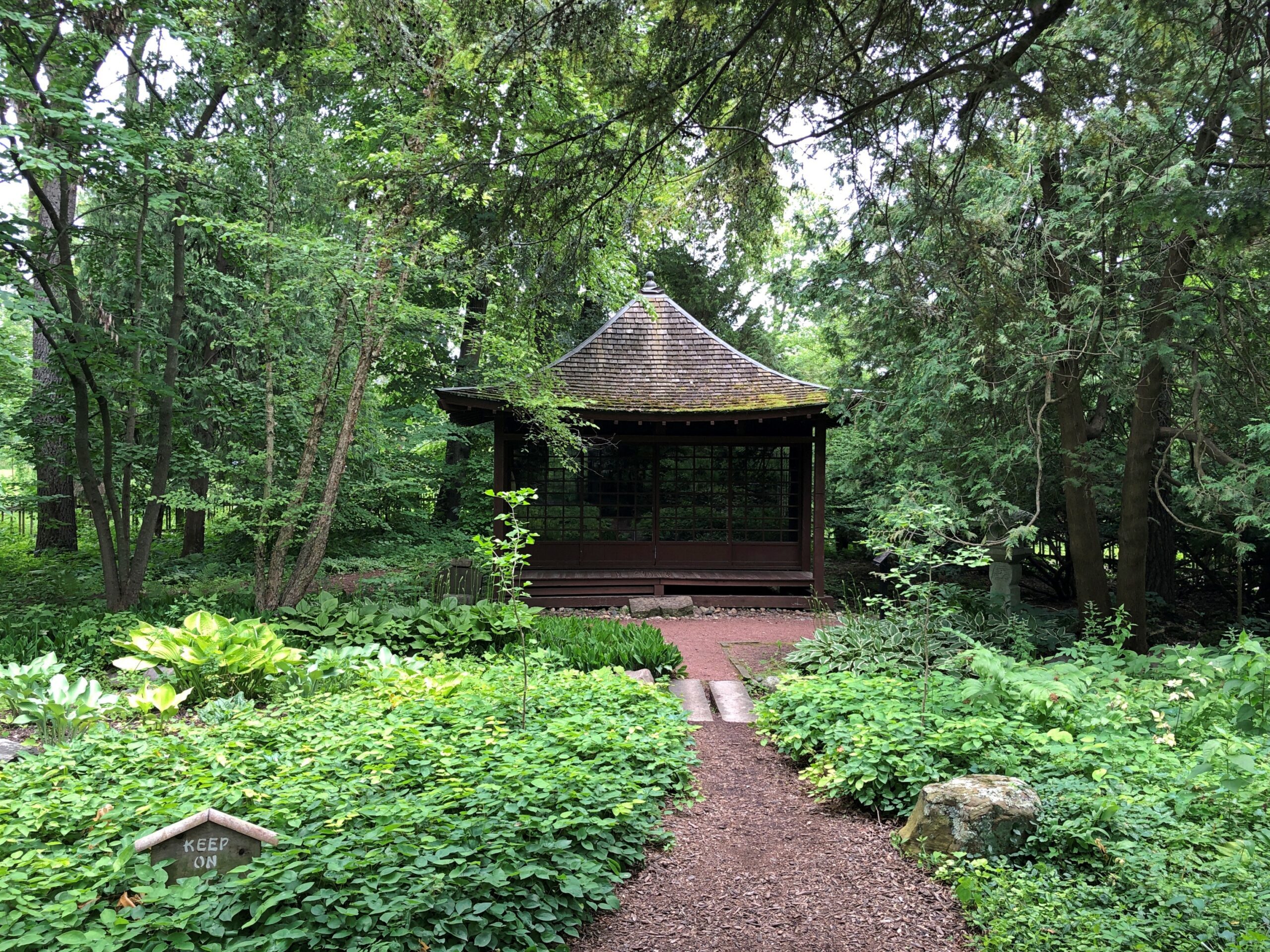
In the 1890s, Japan was still newly open, and apparently exotic to the likes of wealthy Illinoisans George and Nelle Fabyan. The story is that they came away from the Japanese Pavilion at the 1893 Columbian Exposition deeply impressed by Japanese culture. It was a common reaction, I’ll bet, and most people might have bought a book or two, or a bit of art, and left it at that.
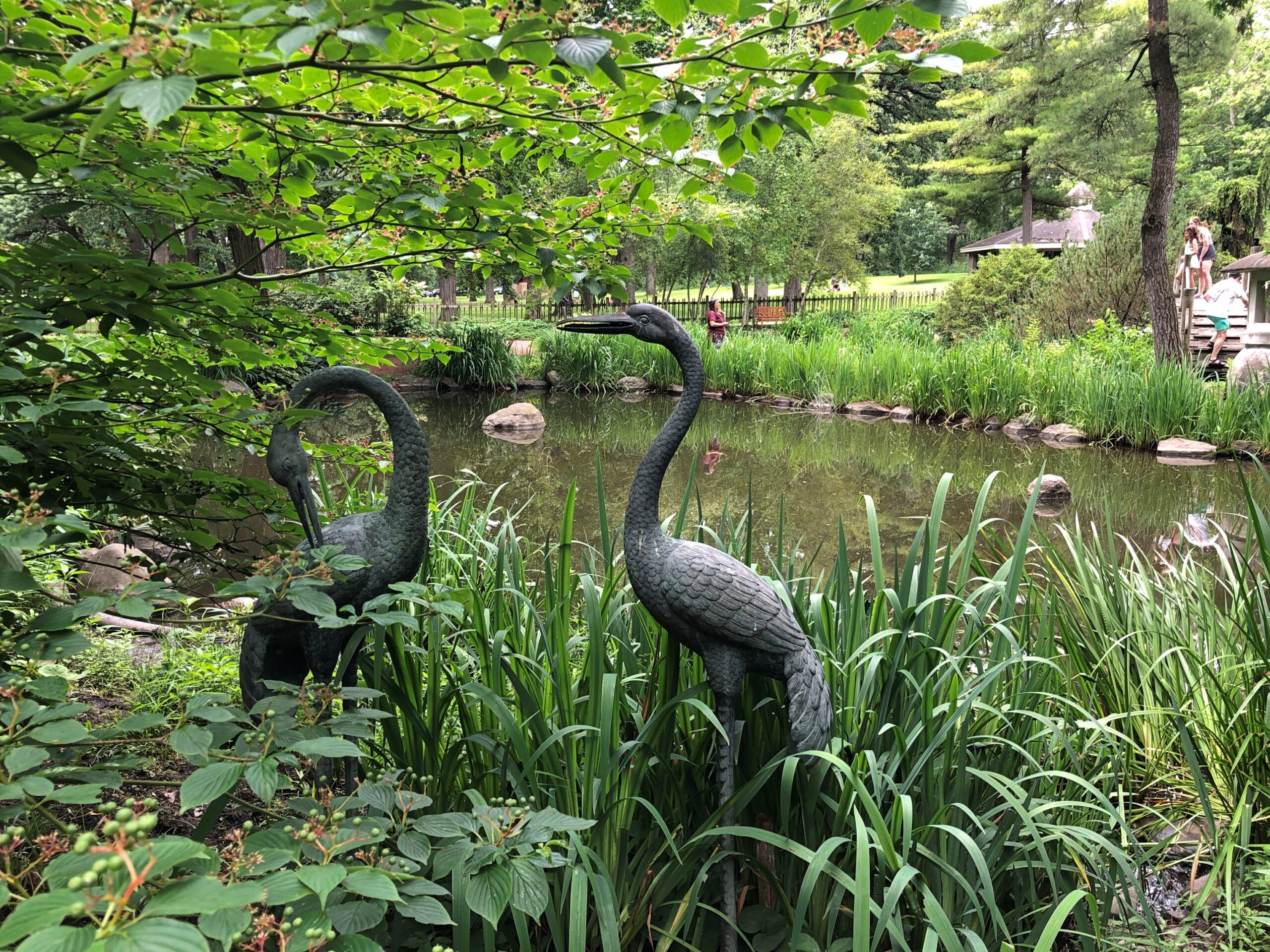
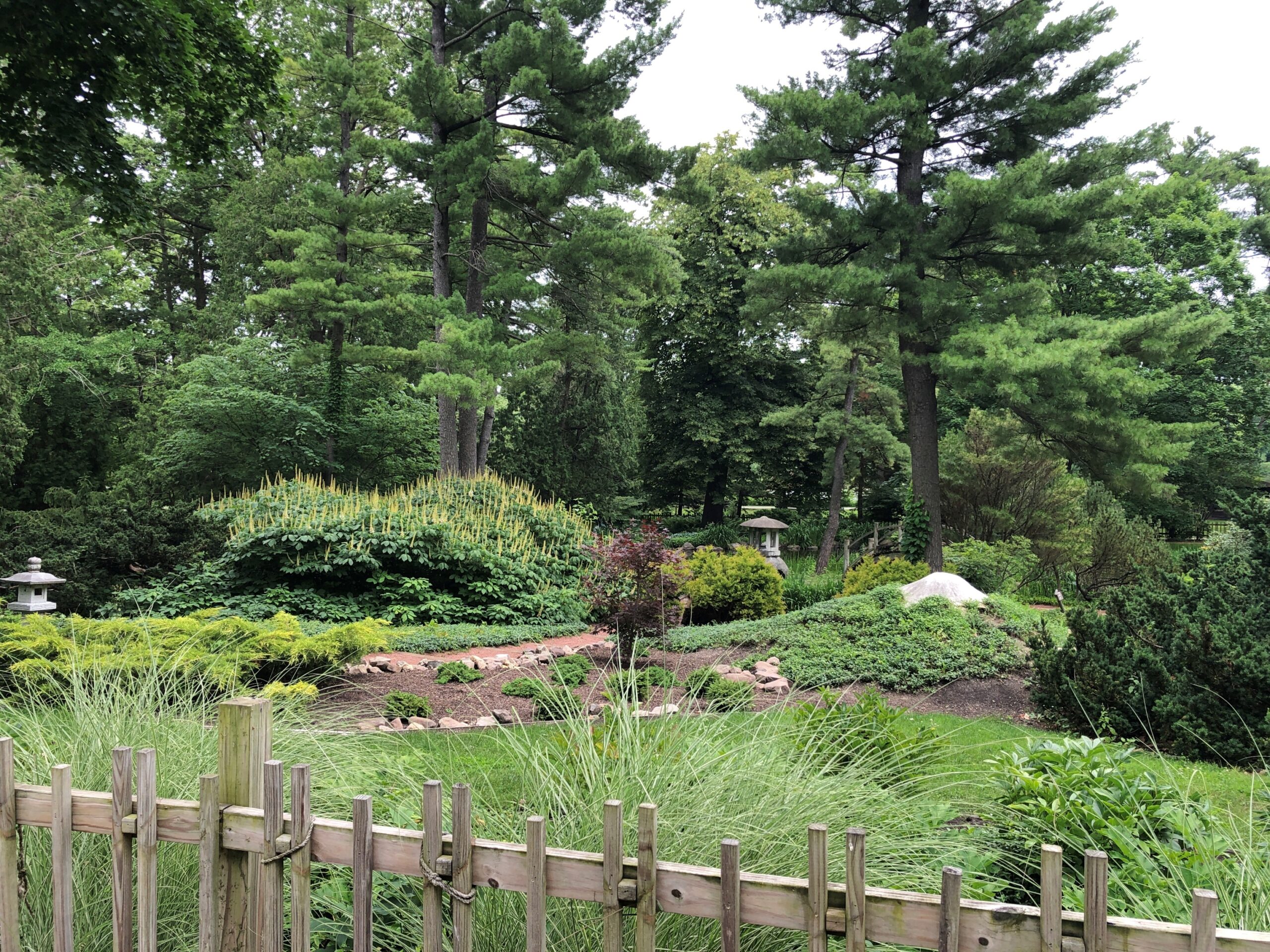
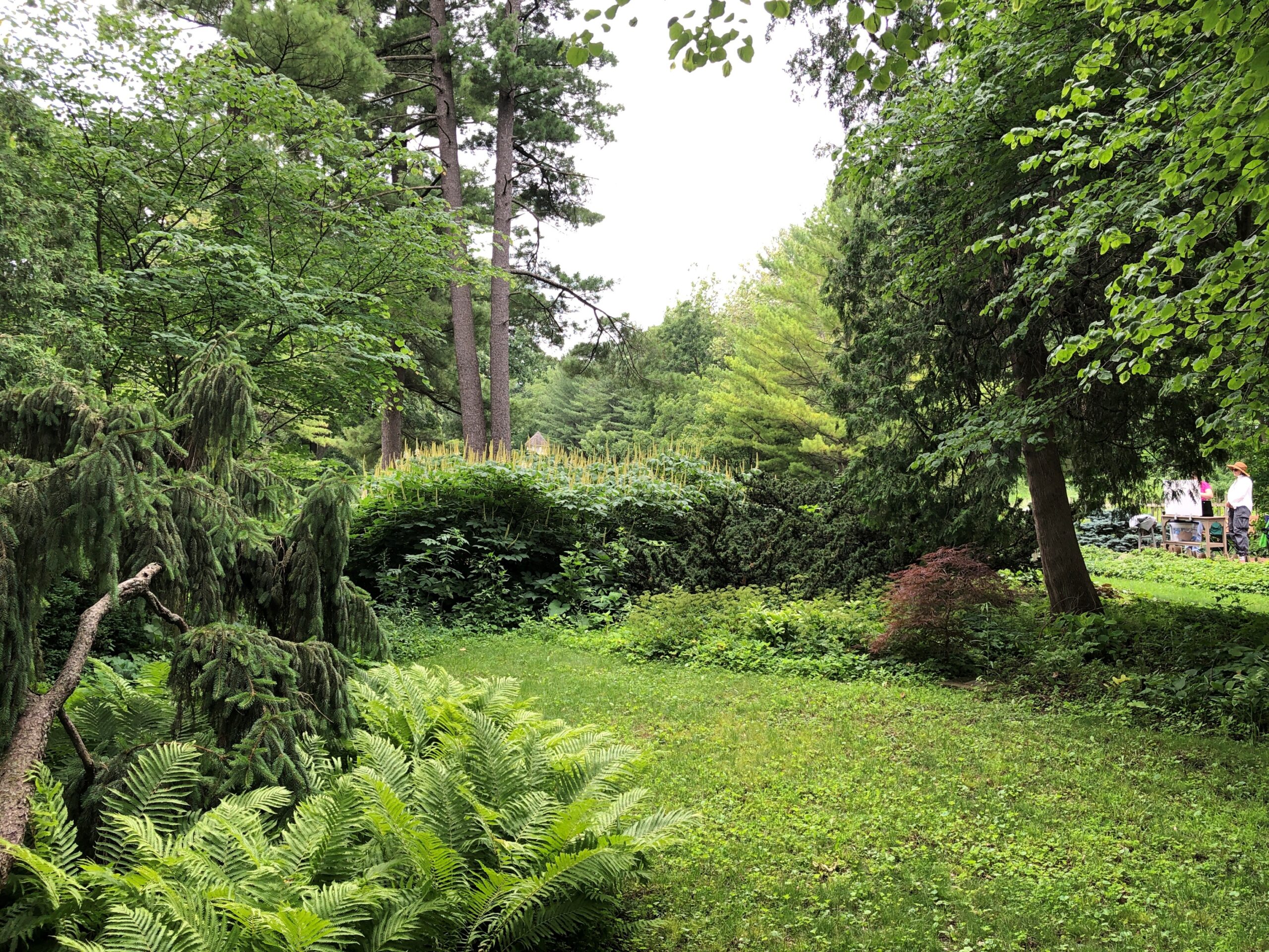
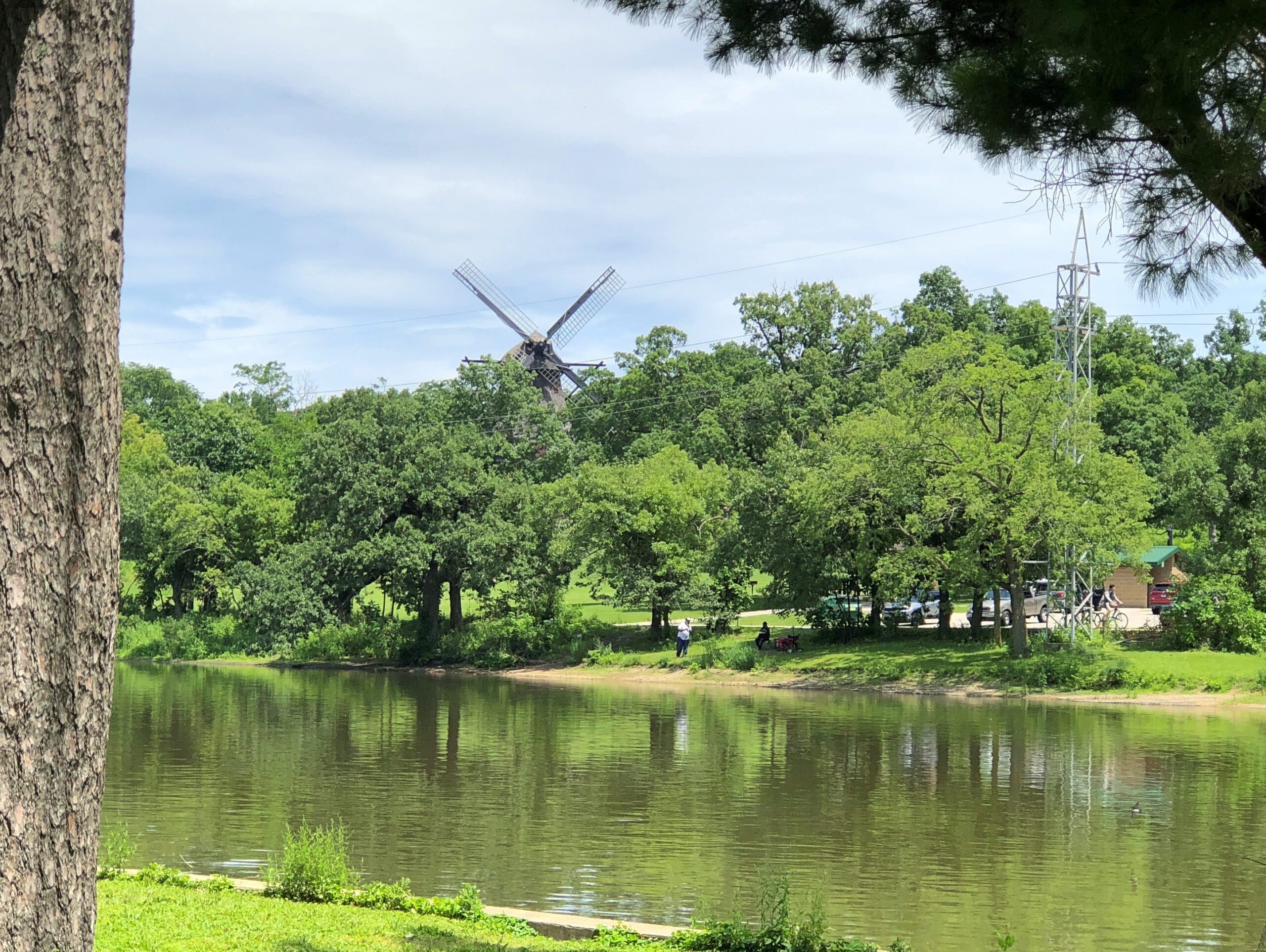
Not George Fabyan, the Great Collector of the Fox River Valley (gardens, windmills, mummies and more!). He had a Japanese garden built downslope from his home near the Fox. During the summer, visitors can go there even now, though ownership long ago passed to the Kane County Forest Preserve District.
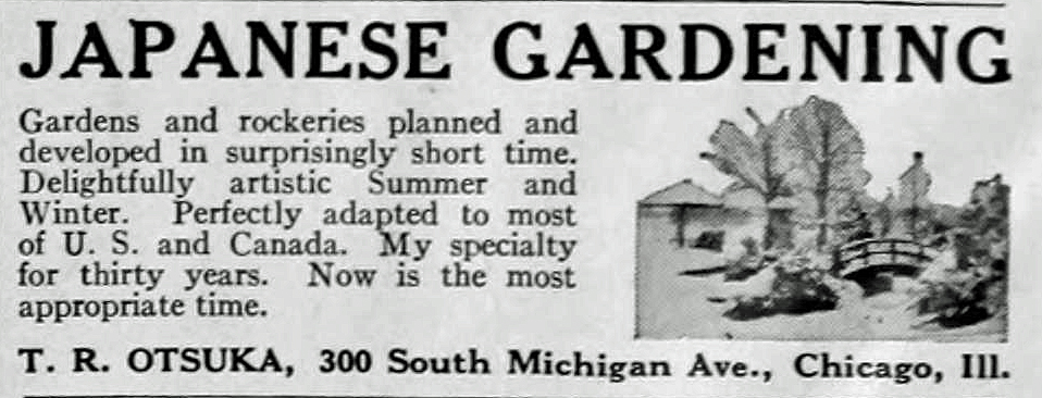
He tasked Japanese garden designer Taro Otsuka to undertake the project, which was completed not long before the Great War. Otsuka, an early 20th-century immigrant, found his niche on these shores. Namely, in designing a wave of Japanese gardens in the Midwest.
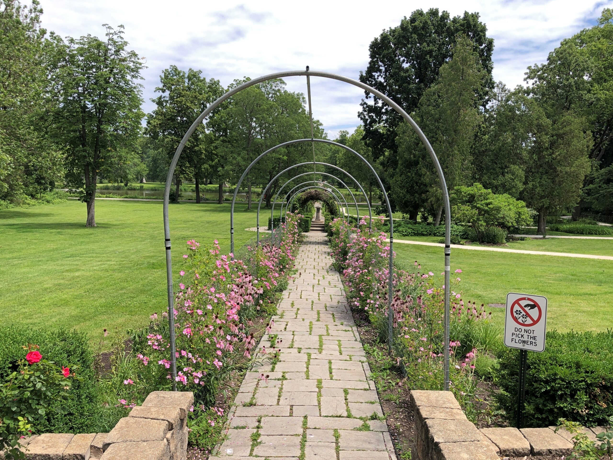
Through cycles of decline and restoration, the Fabyan garden has abided. Free admission, donations accepted.
The garden designer’s raw material is the local flora, resulting in a garden on traditional lines that nevertheless has a look apart of the models of the old country, taking aspects of the new country. Don’t ask me the details, that’s just the sense one gets.
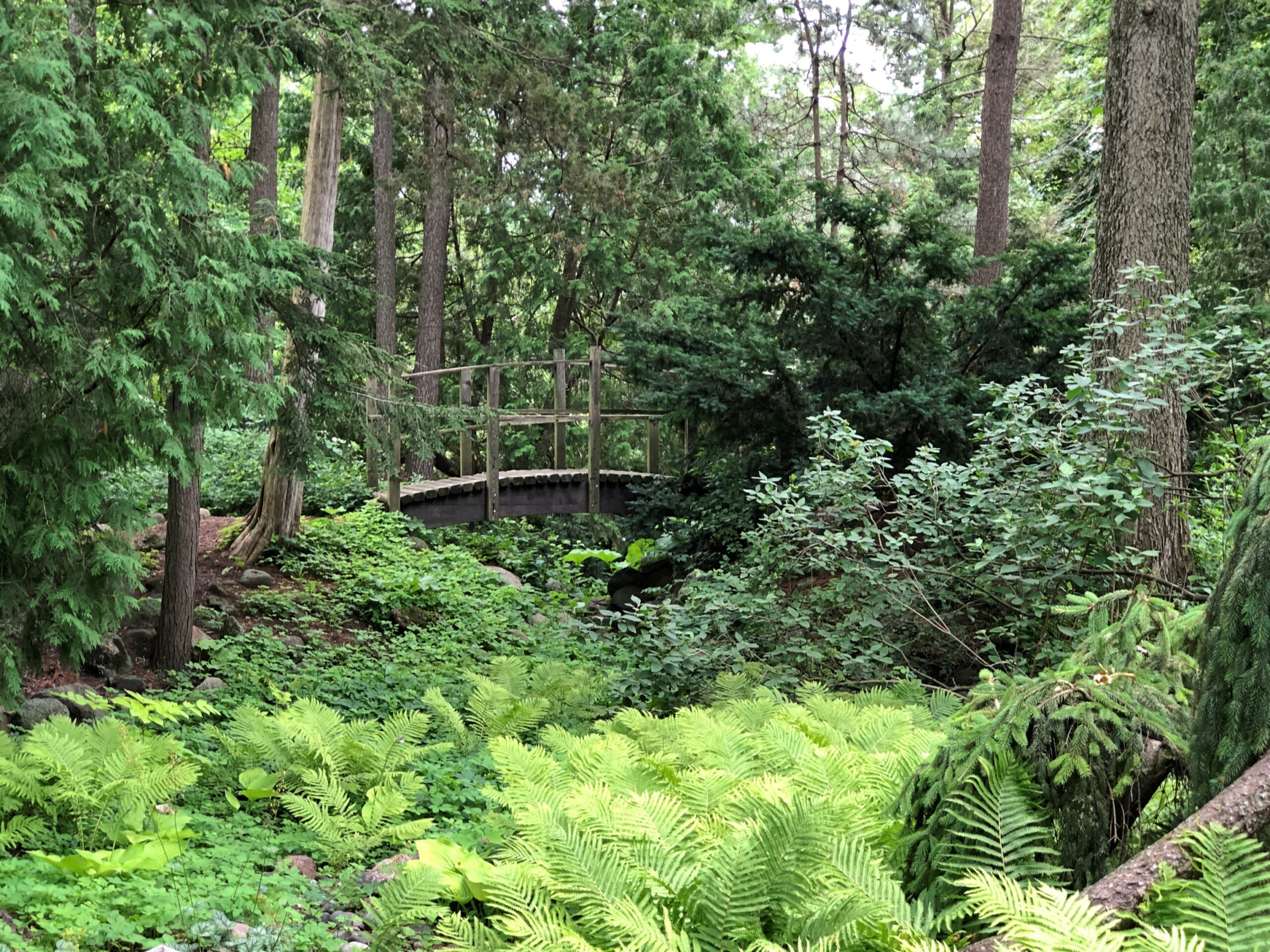
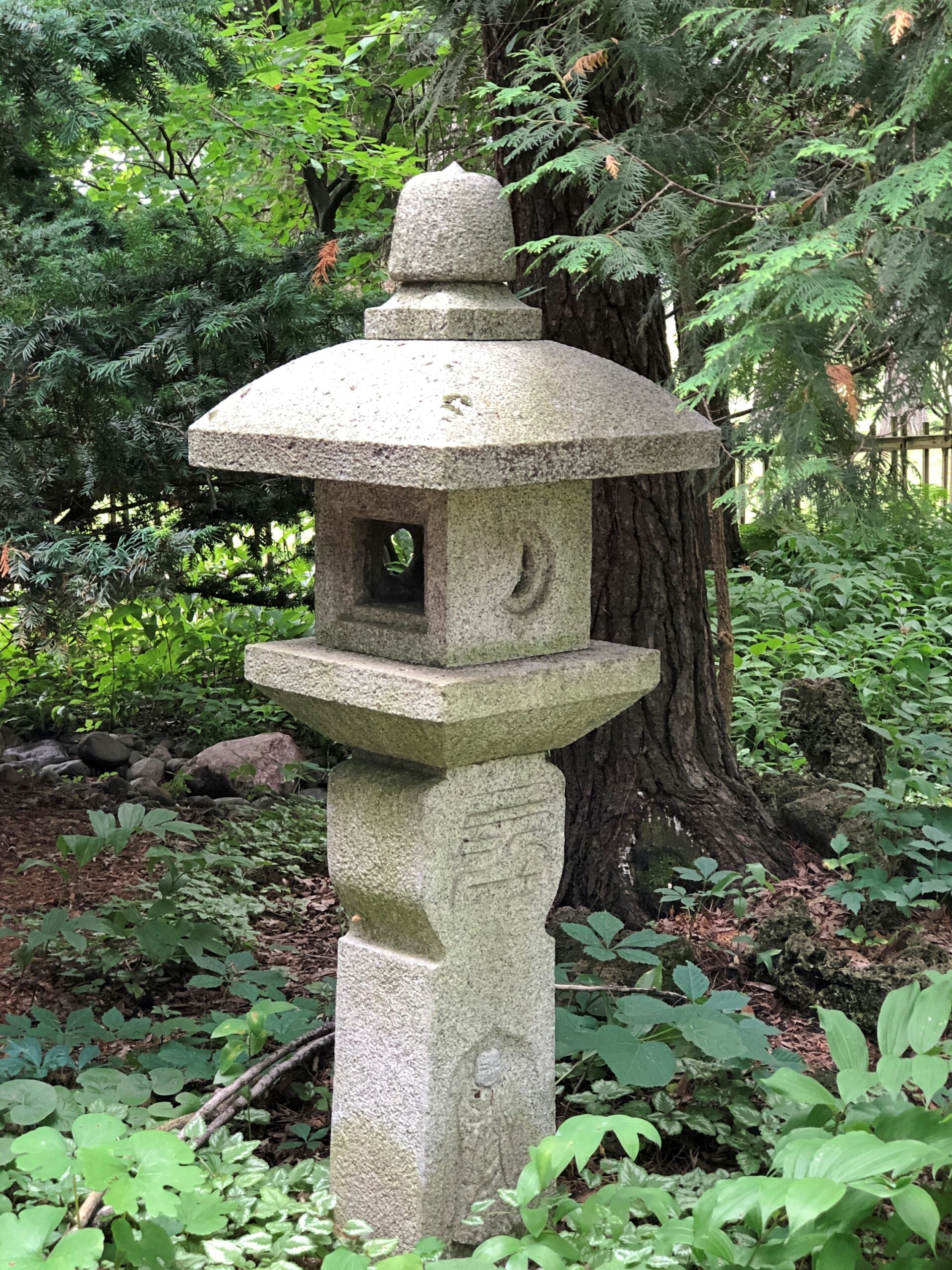
Lanterns.
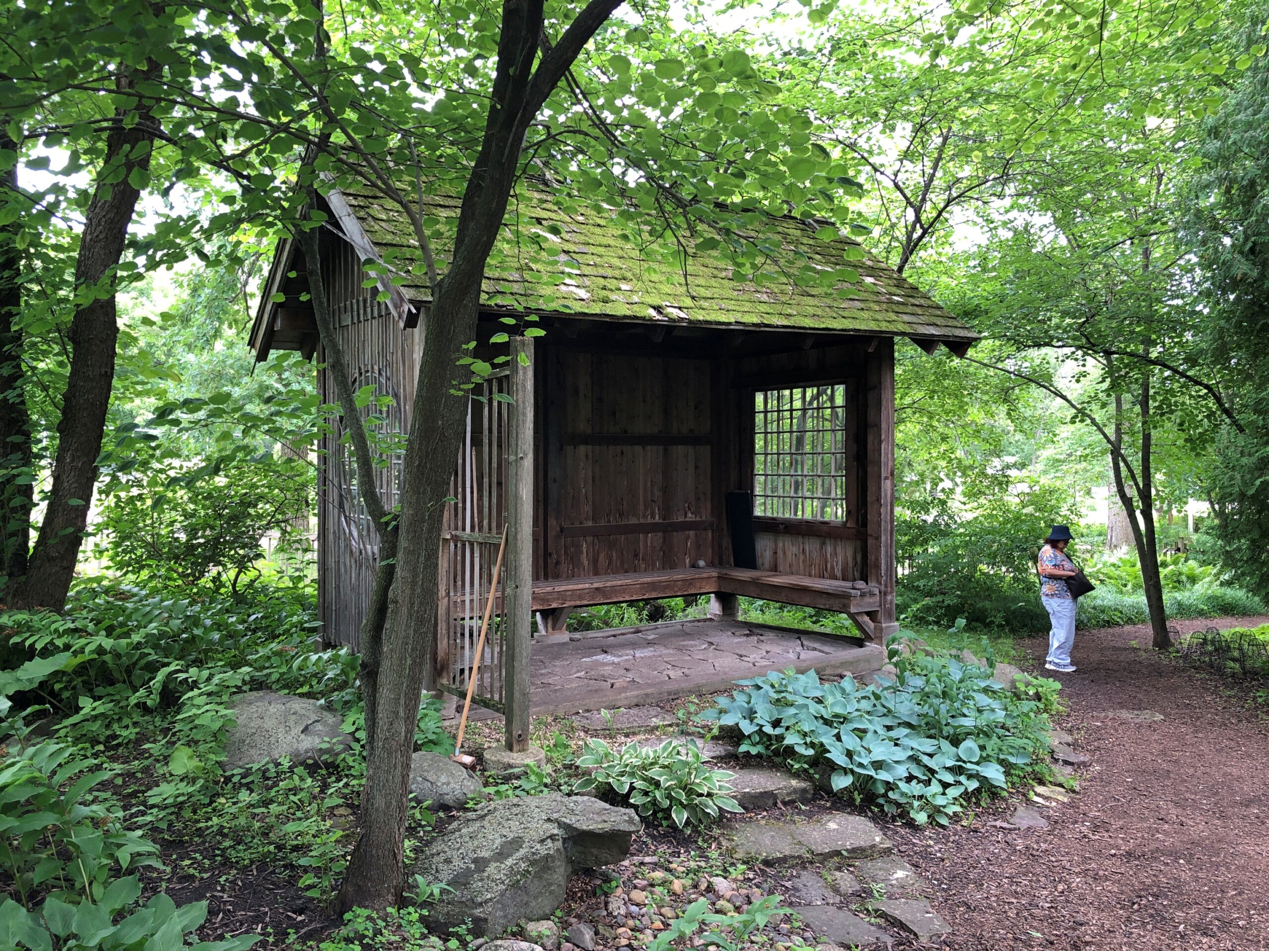
Structures.
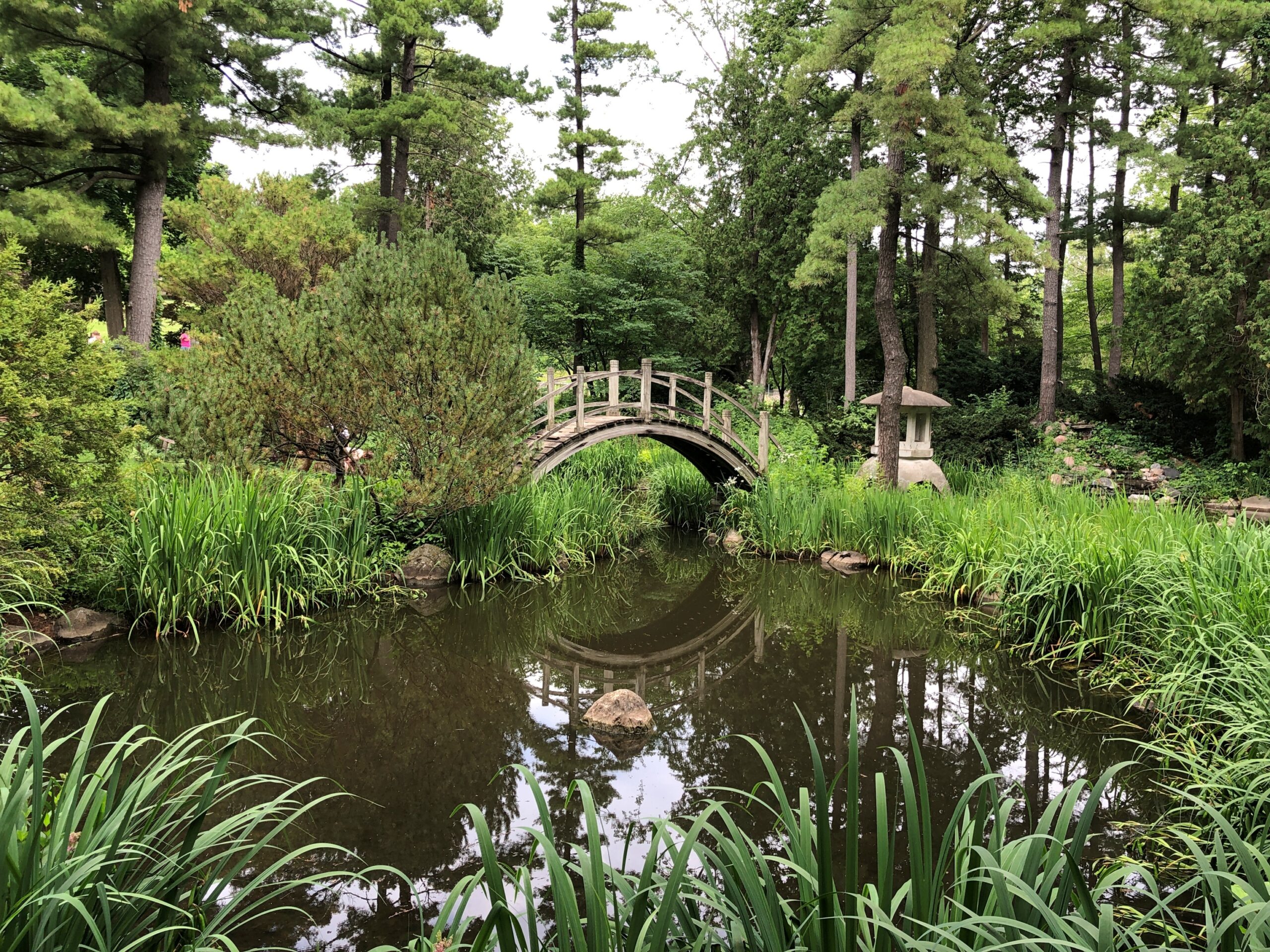
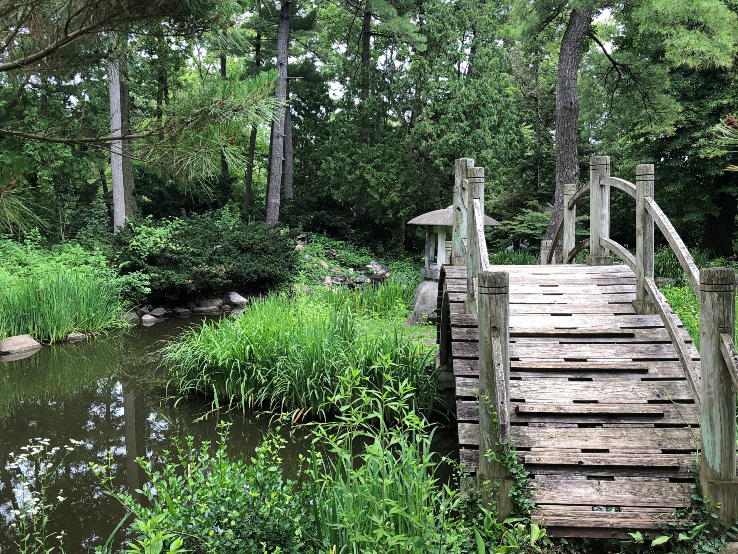
Teahouse of the Fox River, you could call that one.
What’s a Japanese garden without an impressive bridge over an elegant water feature?
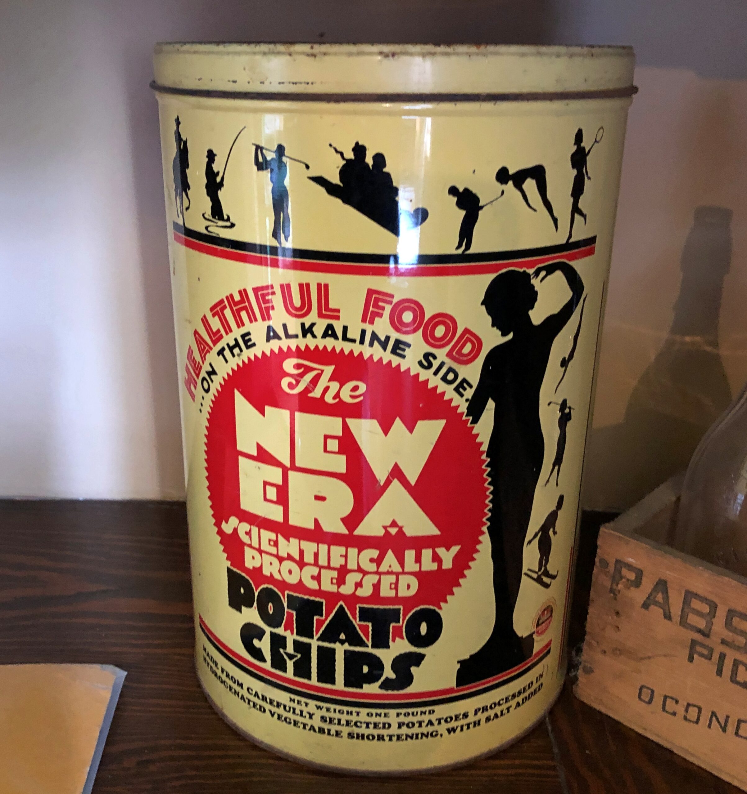
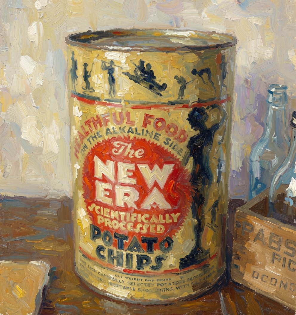
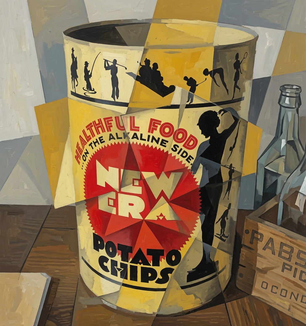
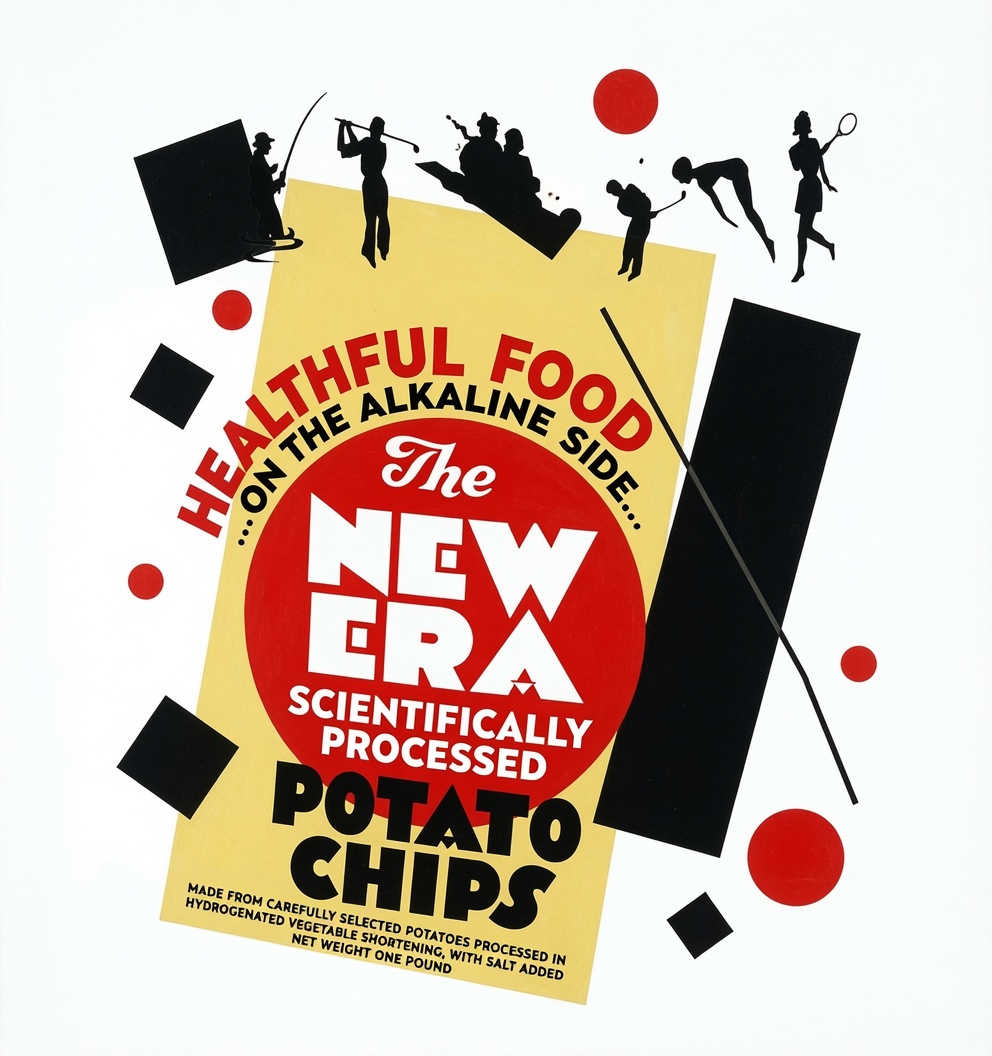
On my way to writing some regular number of words, my attention was shanghaied by an AI image generating service. What, I wondered, could the New Era Potato Chip can become, in the hands of an LLM, or I suppose Large Image Model? This can, also posted yesterday.
Looks like we’ve hit the mid-July stride of chamber-of-commerce weather, with low 80s F for highs, high 60s for lows, for some days ahead. On the other hand, standard forecasts don’t include smoke, which could well make a comeback in the coming days.
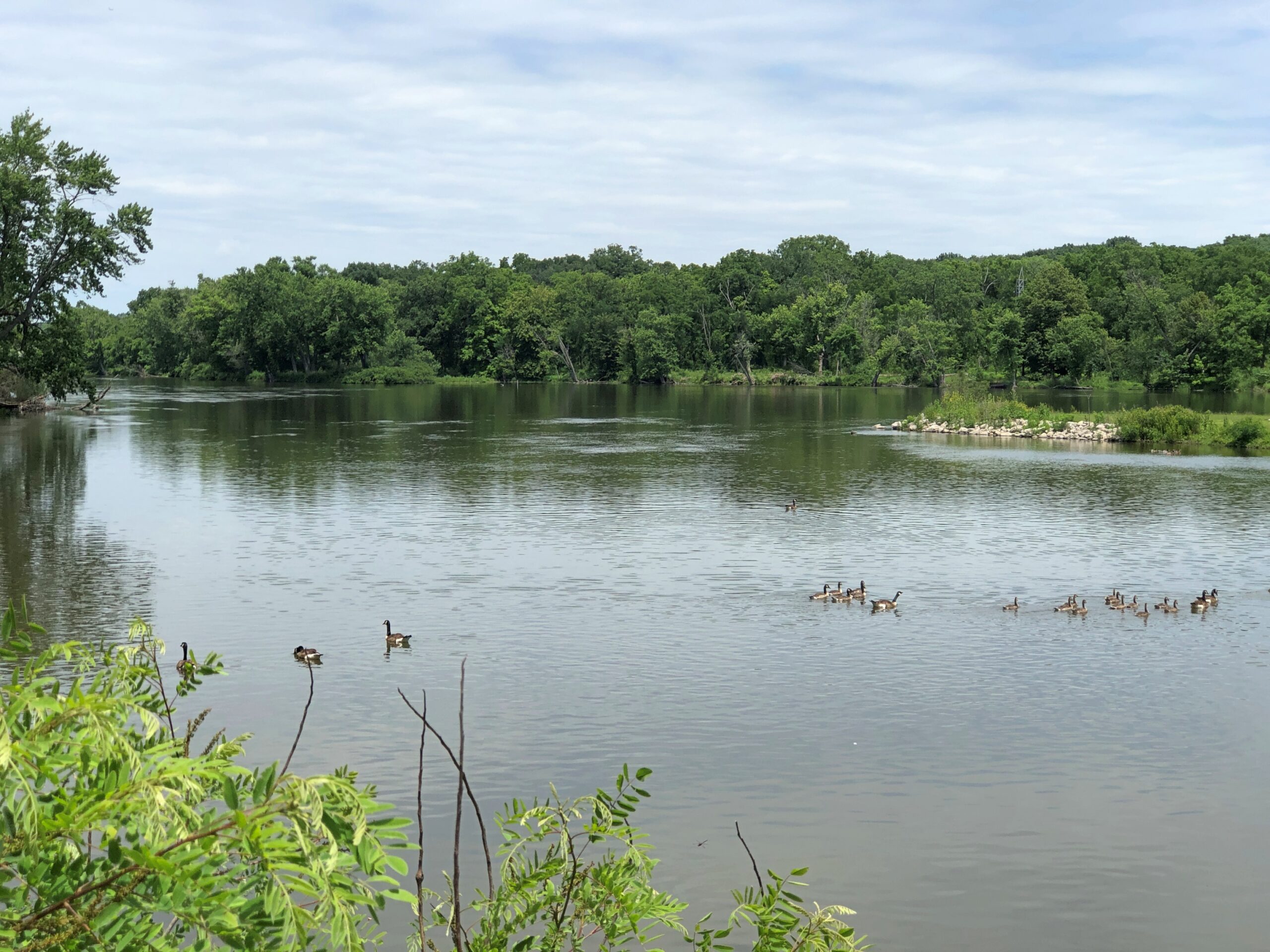
It was a rainy May and June, bringing the flow of the Fox River fairly high by the time last month that we took a short walk nearby, largely under the flush of greenery.
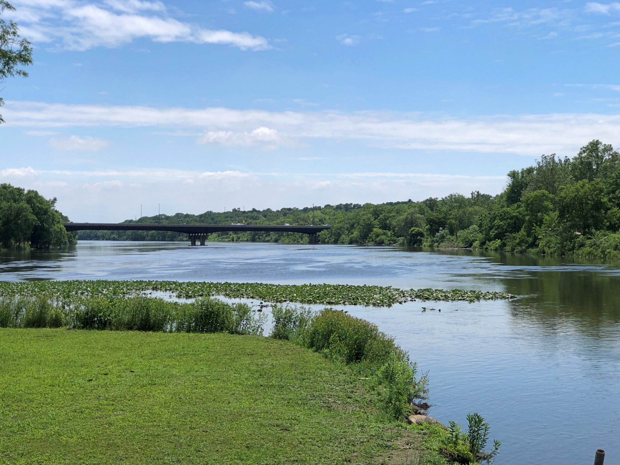
As mentioned, we visited the Fabyan Forest Preserve in Geneva, Illinois one Saturday not long ago. The holdings — formerly part of the estate of George Fabyan (d. 1936) — include land on both sides of the river, and a large island accessible on both sides by footbridges. The view from the island.
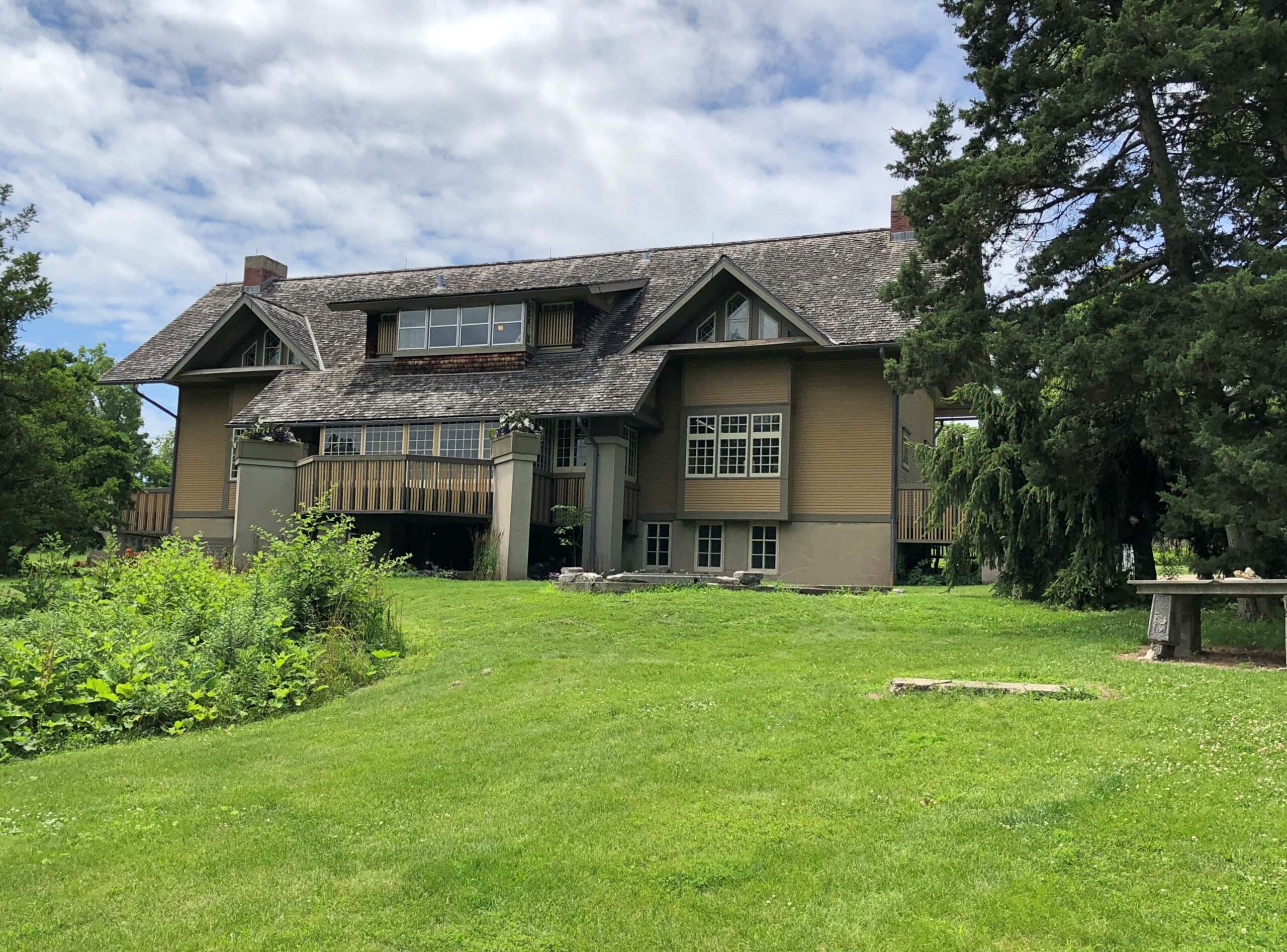
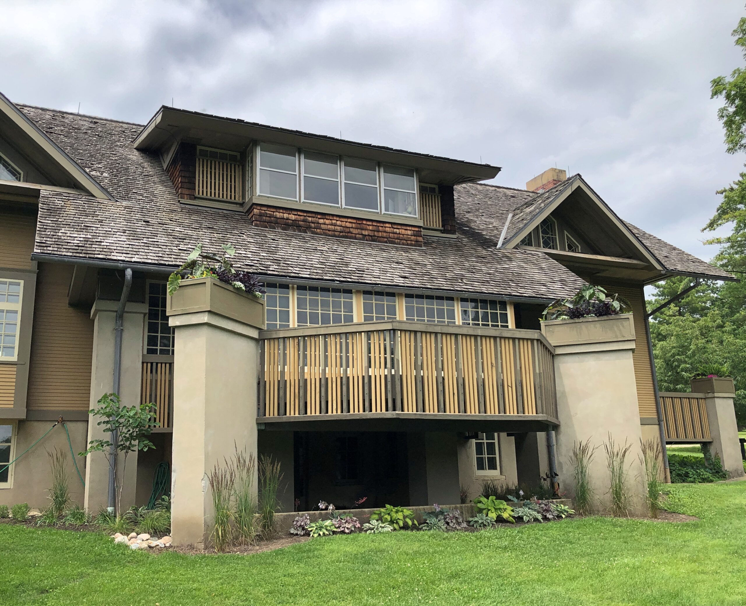
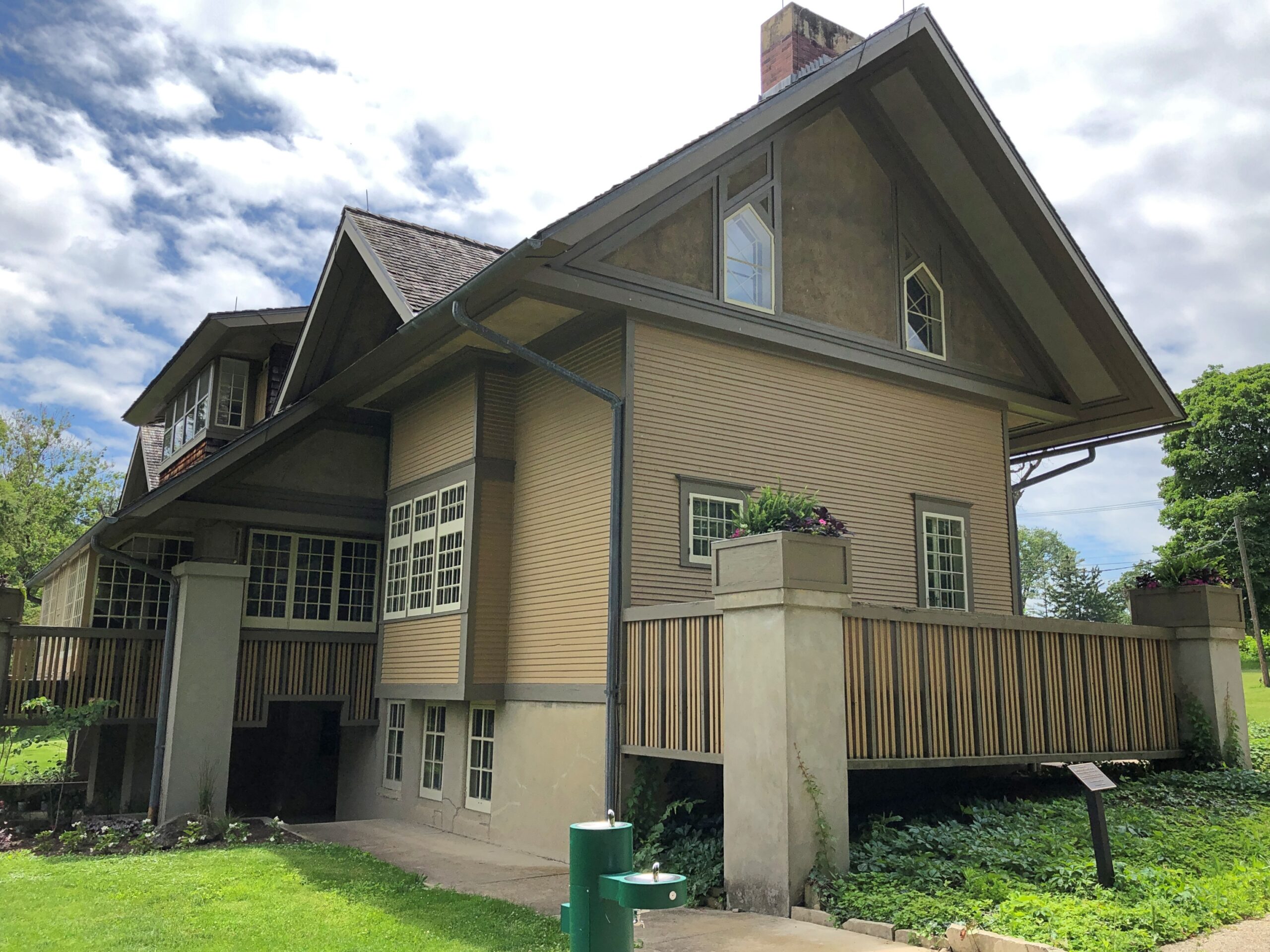
We didn’t go there this time, but rather lingered on the west bank, around the Fabyan Villa, which we toured, taking in the bogus mummy. FLW did some renovation on the property, a fact well emphasized at the museum.
One view from the villa toward the Fox. If you’re going to build near a river — or any flowing body of water — give it some height.
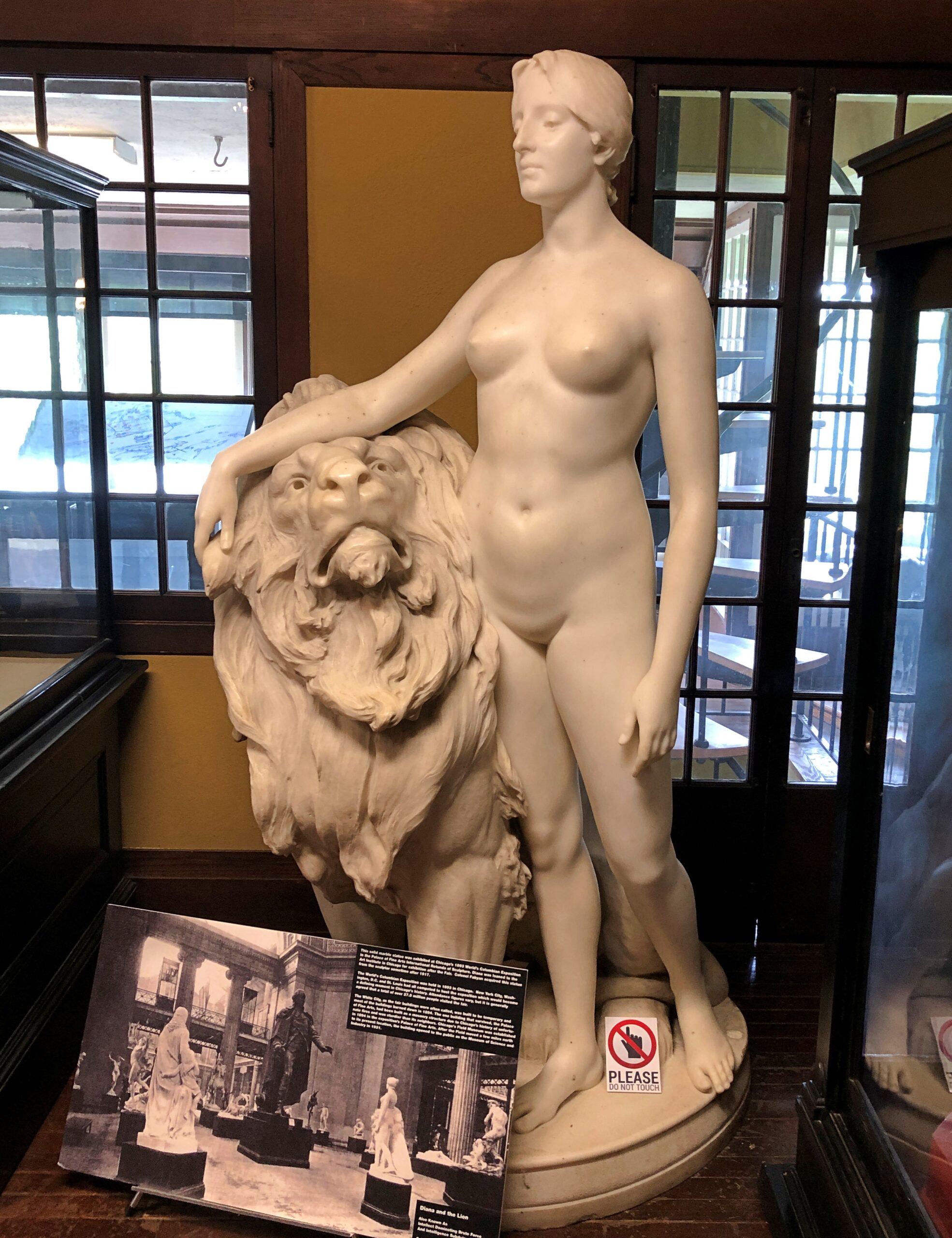
Fabyan collected a lot more, including European artwork, back when that was doable.
Once upon a time (probably), the Fabyan kitchen served New Era Potato Chips. Glad to see it. The memory of the same such can at the Cuneo Museum is a minor delight for me.
Back when food processors crowed about have food science on their side. These days, that might get them MAHA’d into consumer skepticism.
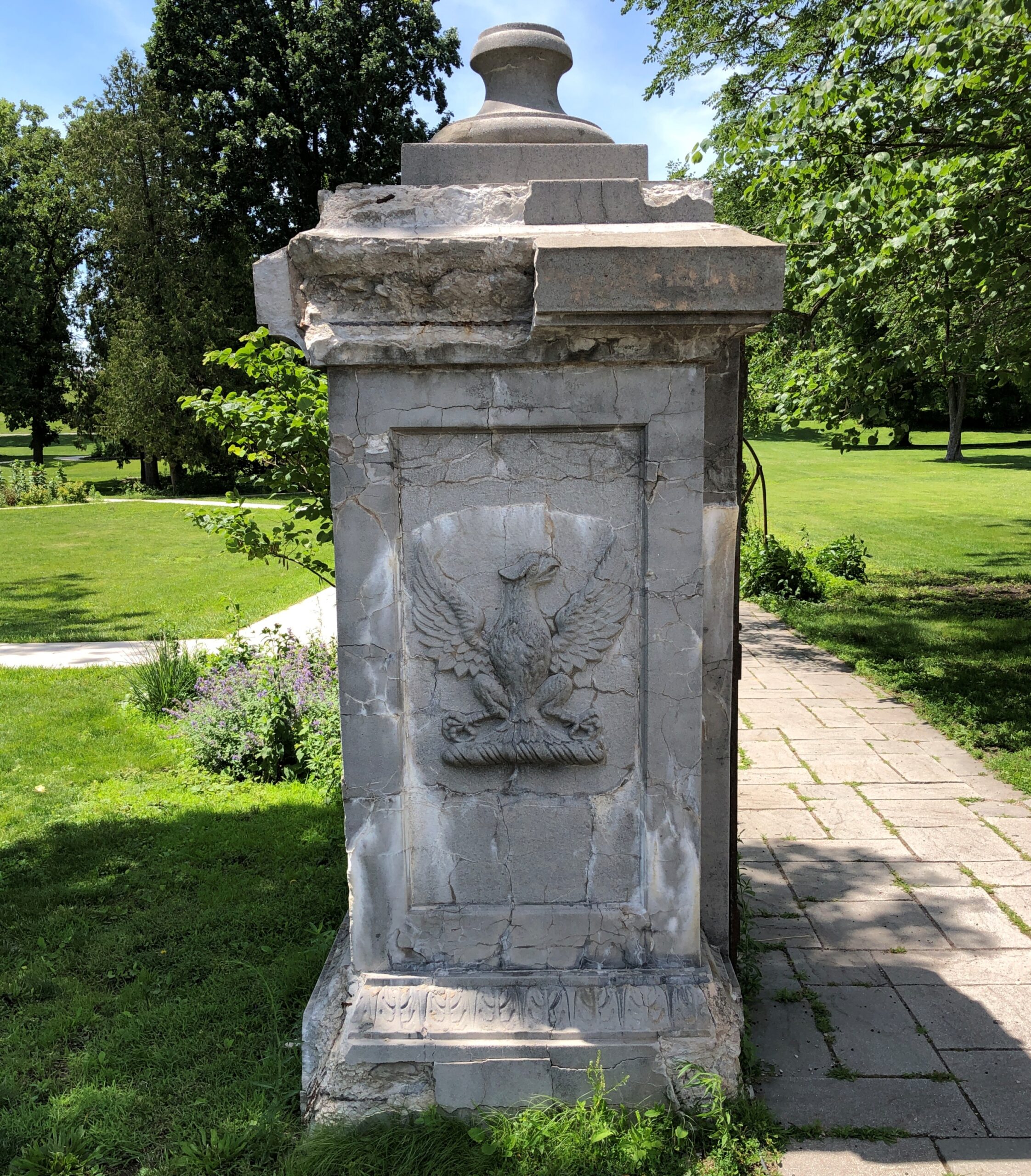
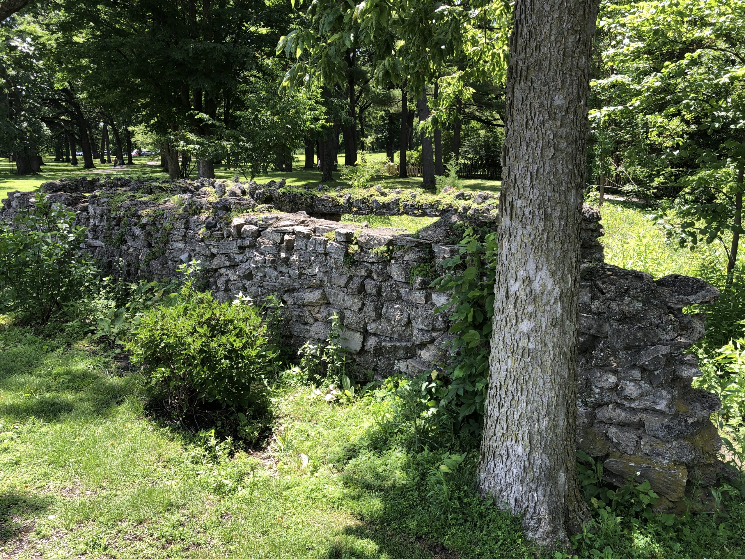
Outside, more features, including a ruin from Fabyan days. I understand that the Roman-themed pool on the island has mostly been reclaimed by the river. This wasn’t part of the pool. A out-of-place gatepost, from the looks of it.
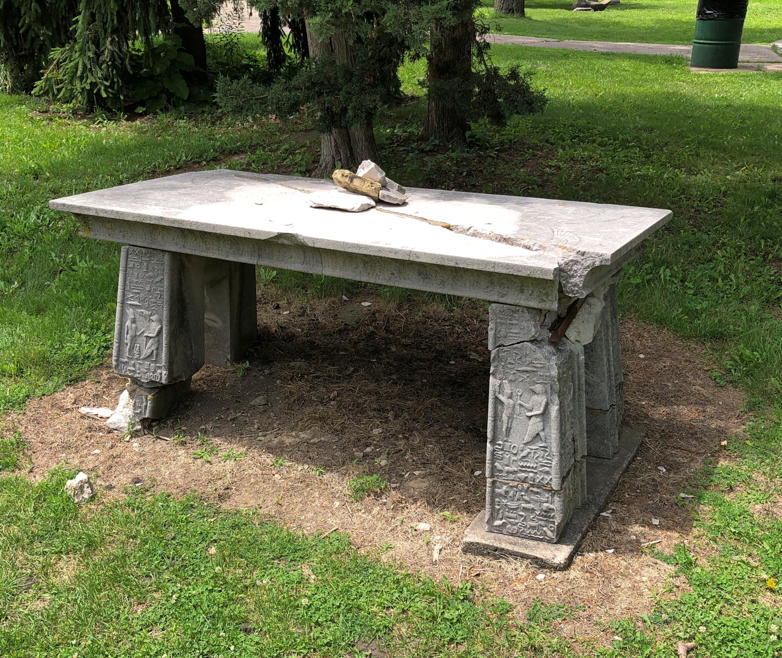
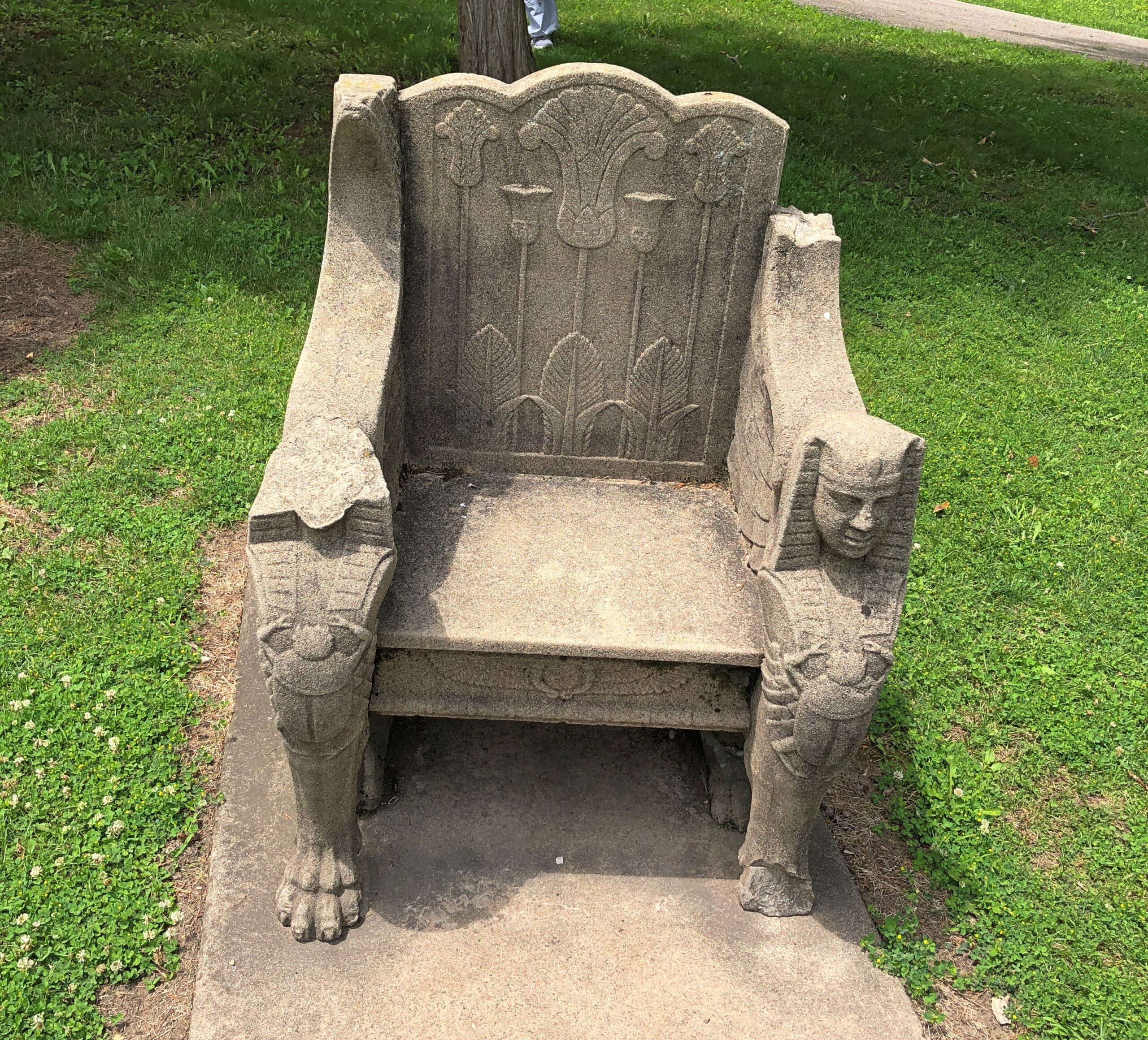
More evidence of the passing wave of Egyptomania.
Looking a little worse for roughly a century of wear.


