Shelburne, Massachusetts

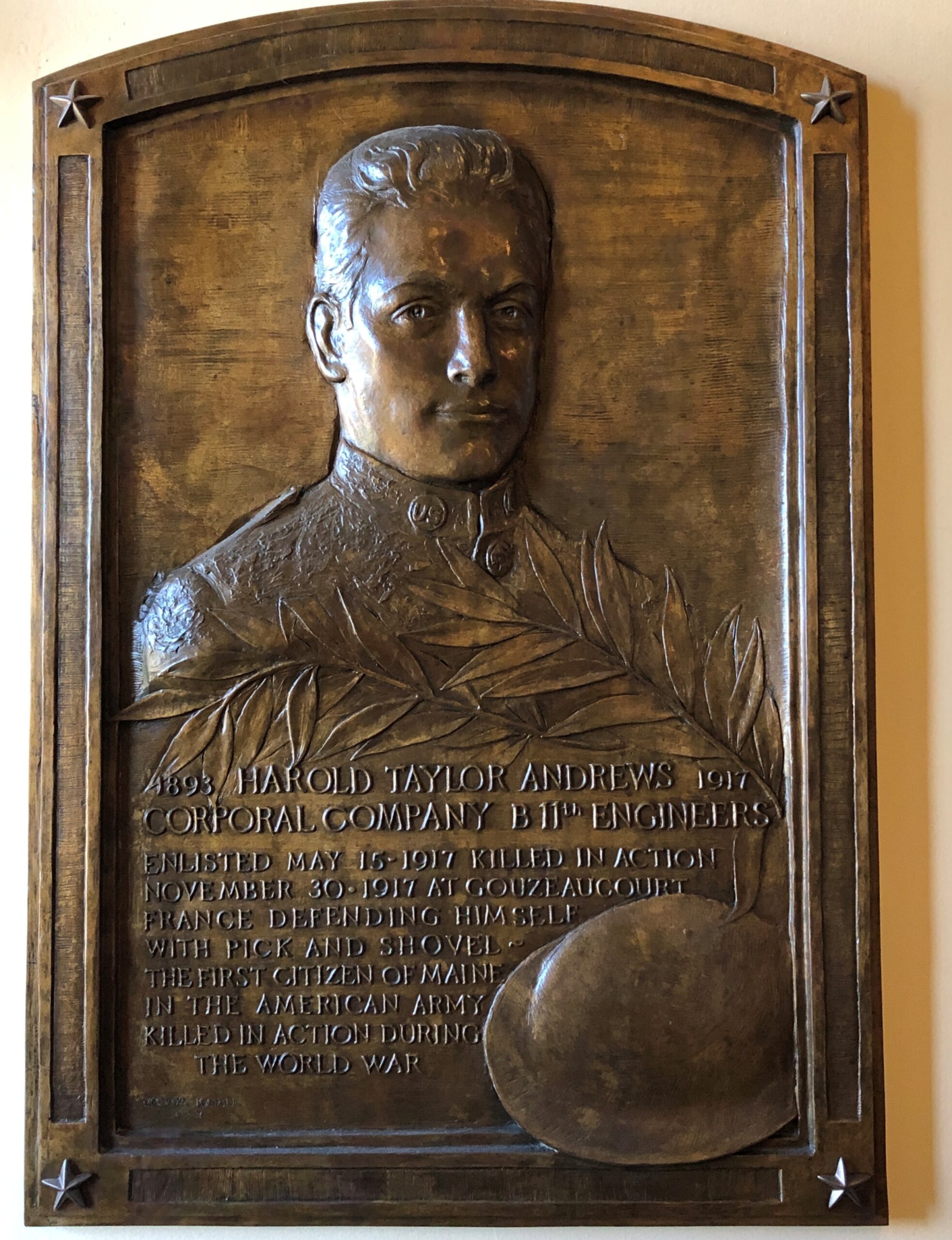
I heard by chance that the Spurs are in the playoffs, again. NBA games are on the list of things I don’t care about, but this is the Spurs we’re taking about, so Go Spurs. I’m old enough to remember when pro sports were considered a modest-priced entertainment, which would have been the days when the Spurs huffed along in the ABA. When that league went under, that paved the way for the basketball monopoly we now enjoy.

I remember a print ad for the Spurs from their early NBA days. A basketball, mostly in shade, set against a pitch black background; a small but bright light is emerging from a crack in the basketball; the tag line says, In the Arena, Everyone Can Hear You Scream. Brilliant.

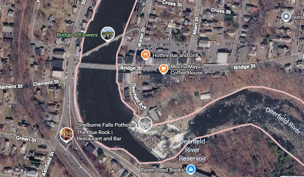
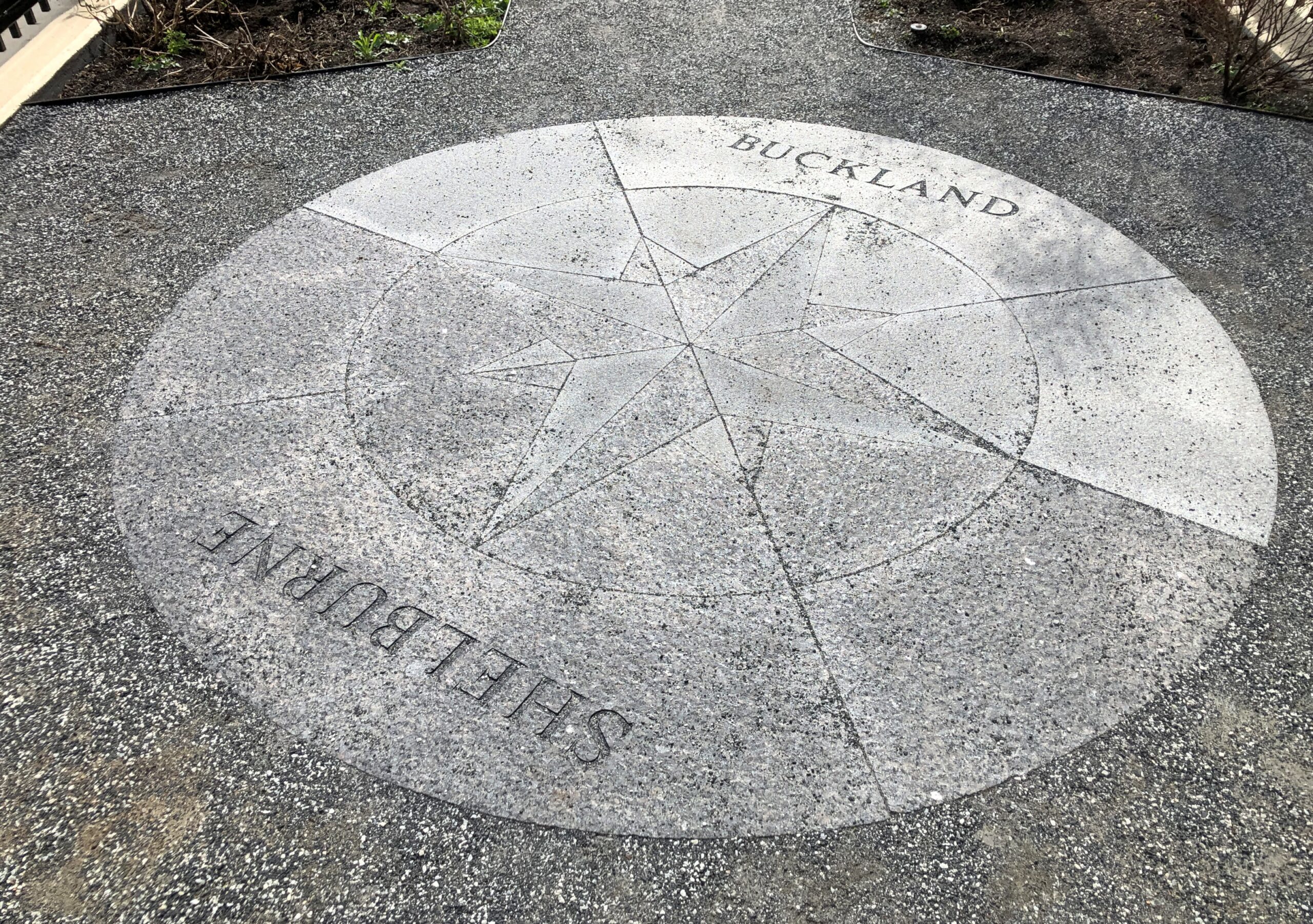
Here we go again with the incongruous Massachusetts place names: “The village of Shelburne Falls is located partly in Shelburne and neighboring Buckland,” notes Wiki.

So I suppose I visited Shelburne Falls the whole time when I visited Shelburne and walked across a bridge to Buckland, and then back to Shelburne on a different bridge.

Interesting that a town in the United States is named for Lord Shelburne, a British prime minister when the Revolution was still ongoing. On the other hand, it was on his short watch – at the end of that war – when the British government said, enough already, be independent if you want it so much. So there ought to be something named for him on this side of the Atlantic (and there’s another in Vermont, besides one in Ontario).

The Bridge of Flowers

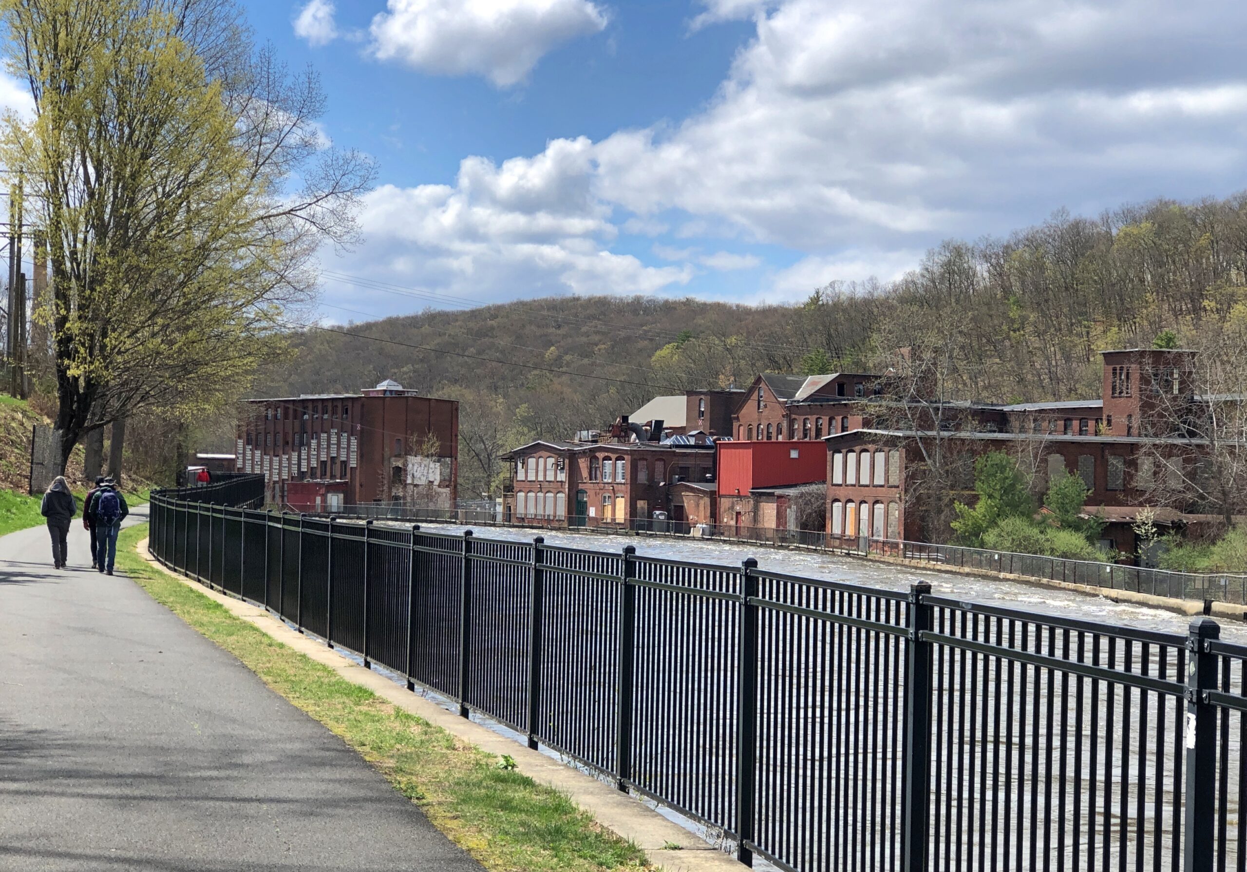
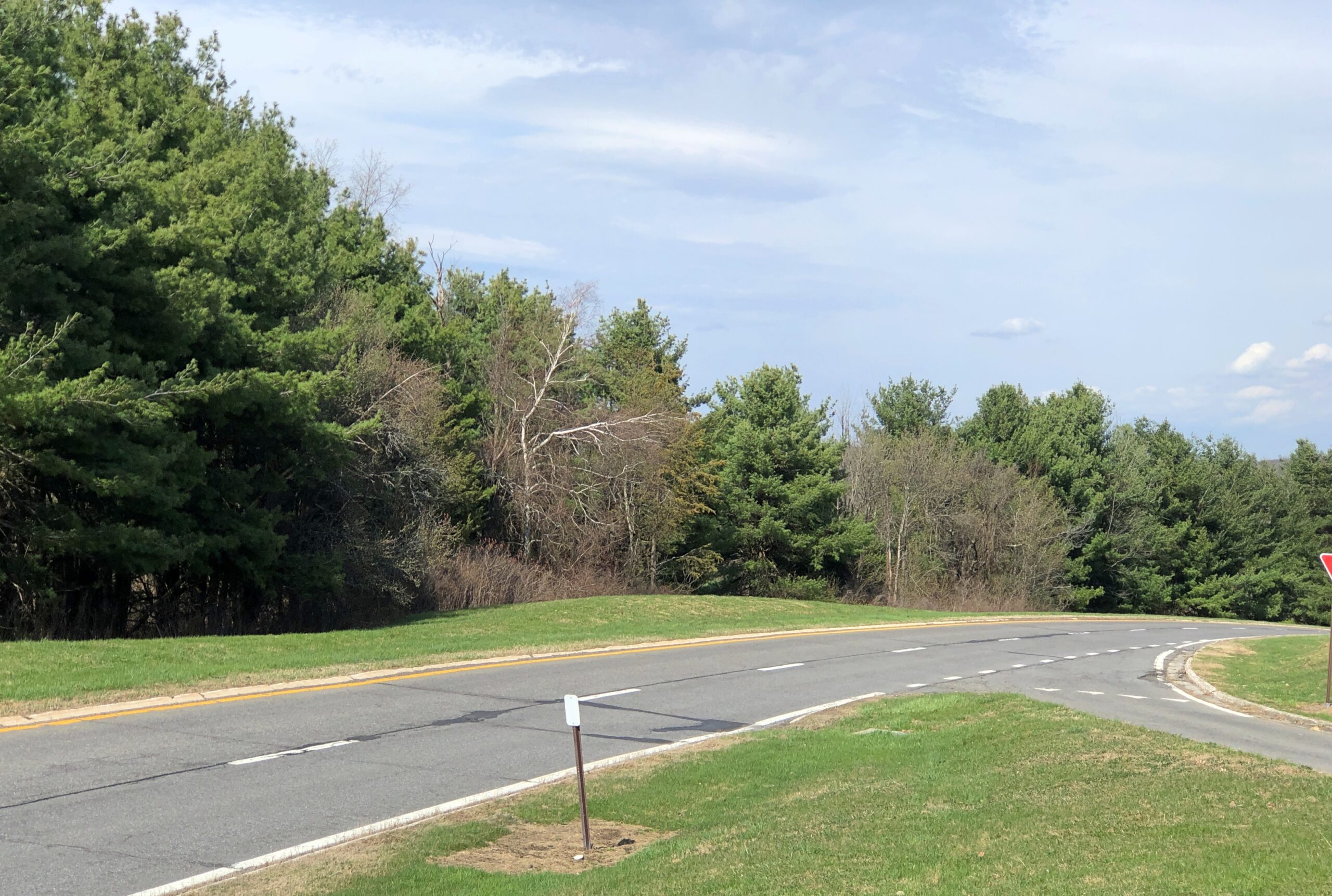
I had good weather for my return to the Midwest from the Northeast, beginning on a clear, warm day in Massachusetts. Large towns hang like pearls on Route 2, and while I would have made a selection of them to visit even in chillier weather — and spend time on foot in those towns — the spring warmth was one of those travel bonuses you can appreciate right away. Pop off Route 2 in Franklin County and you’re in Shelburne.

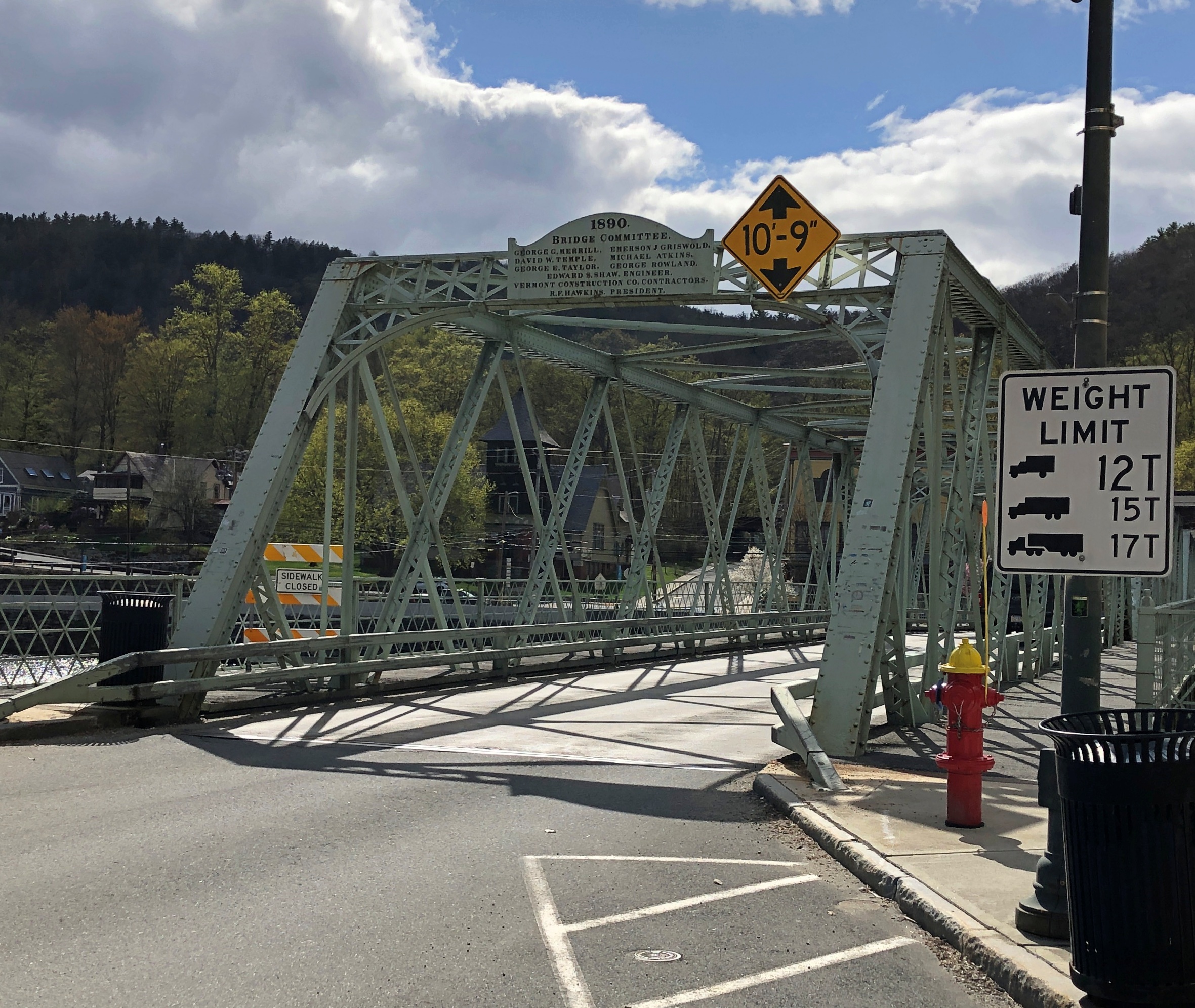
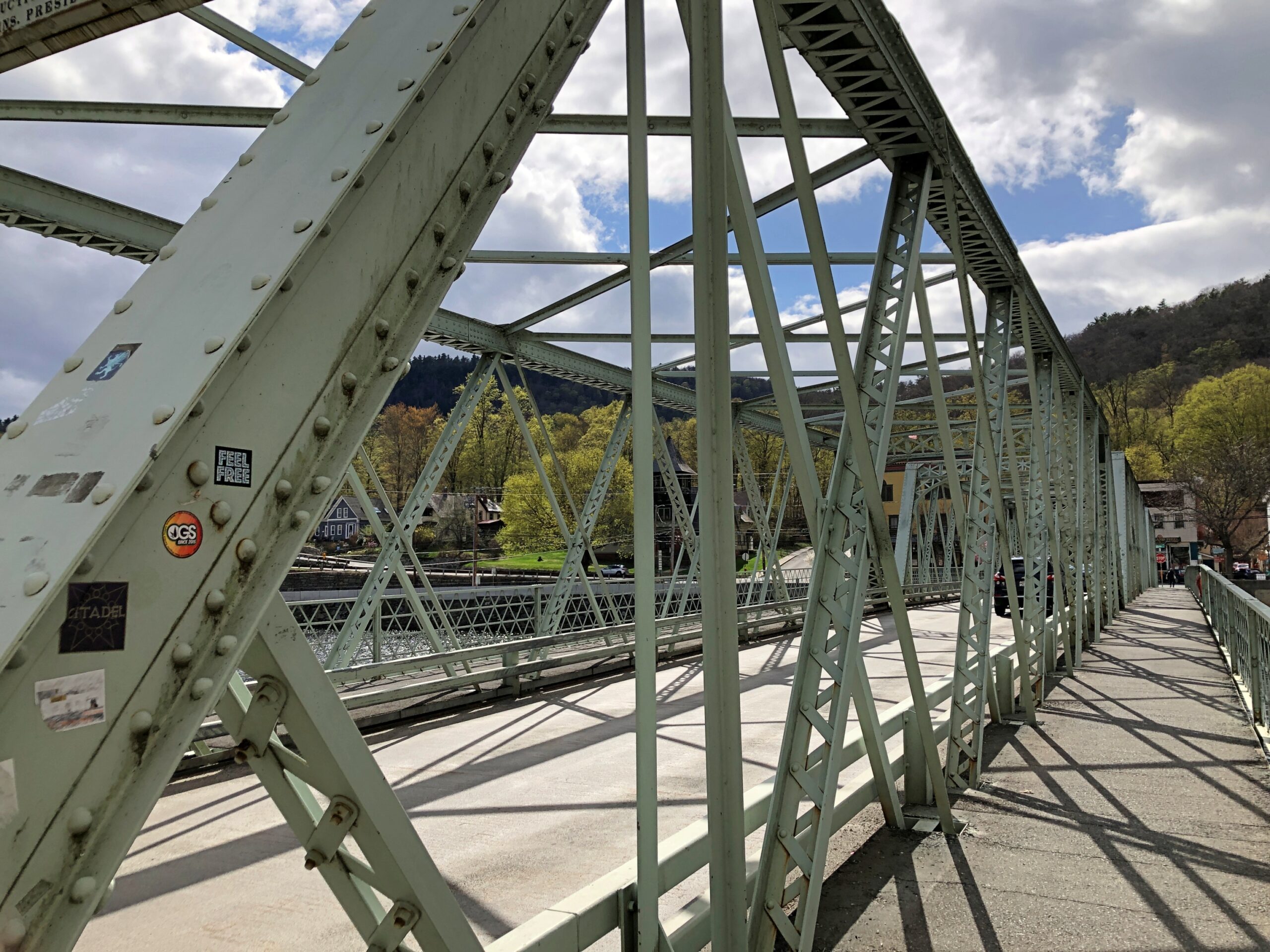
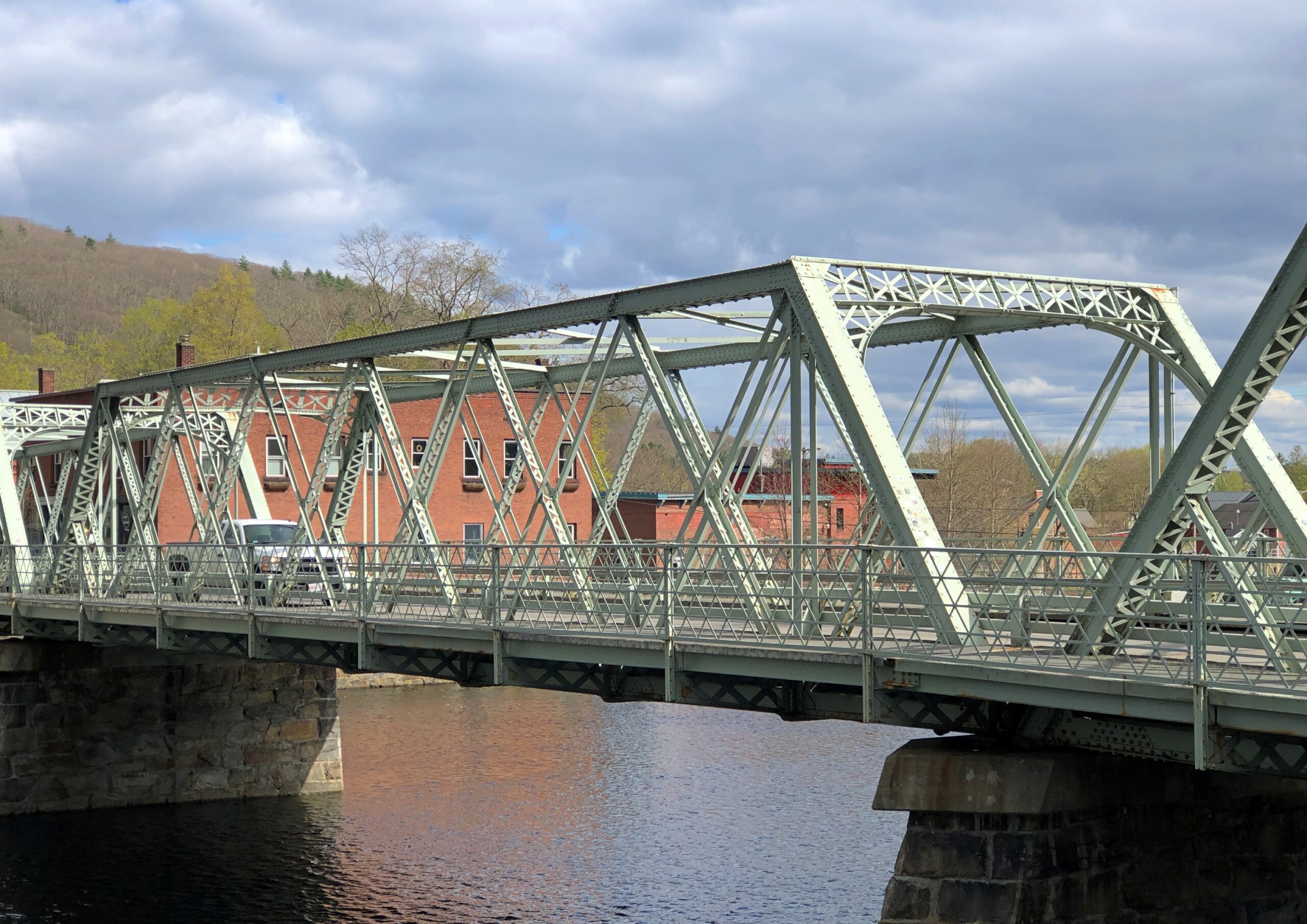
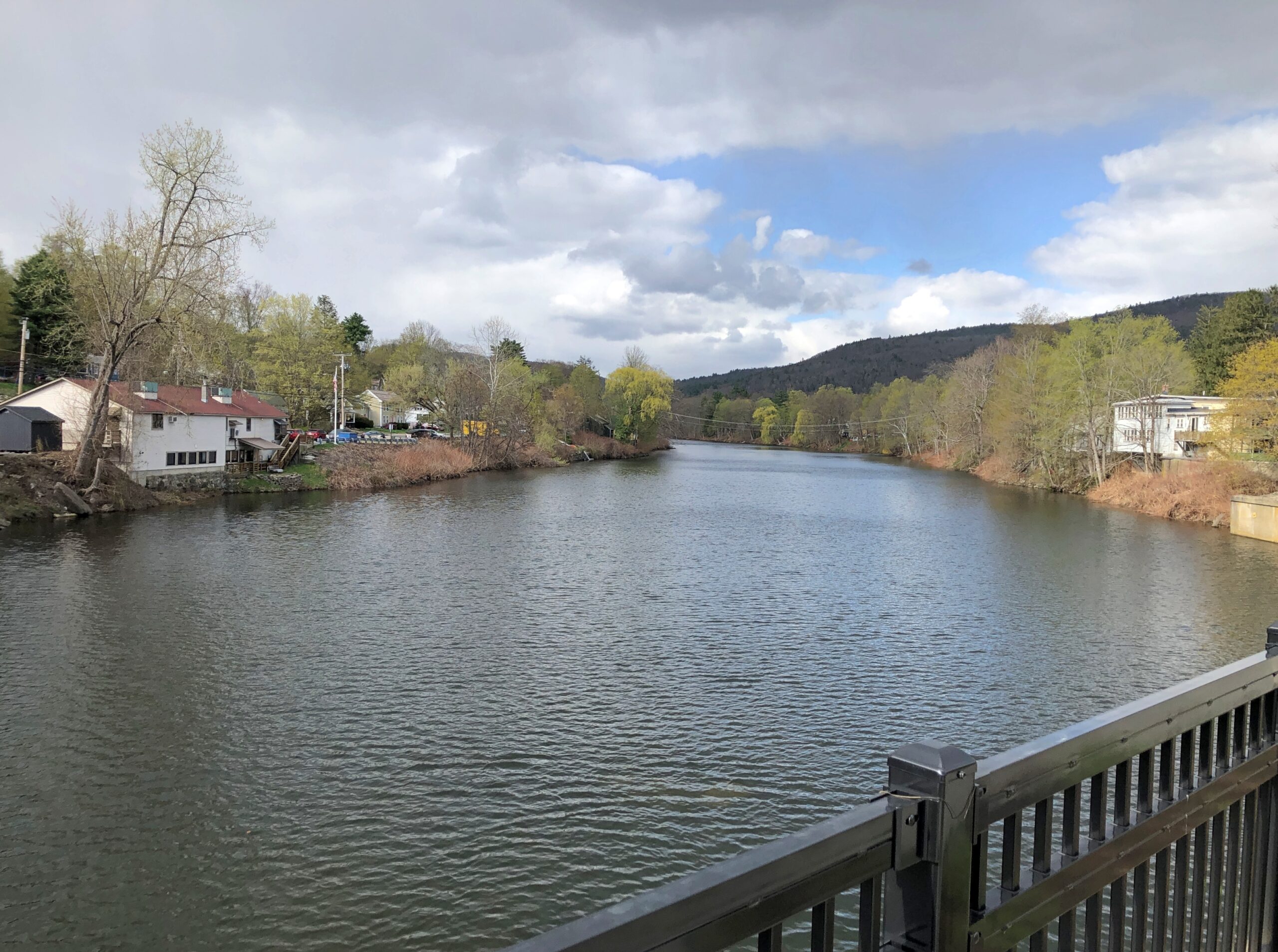
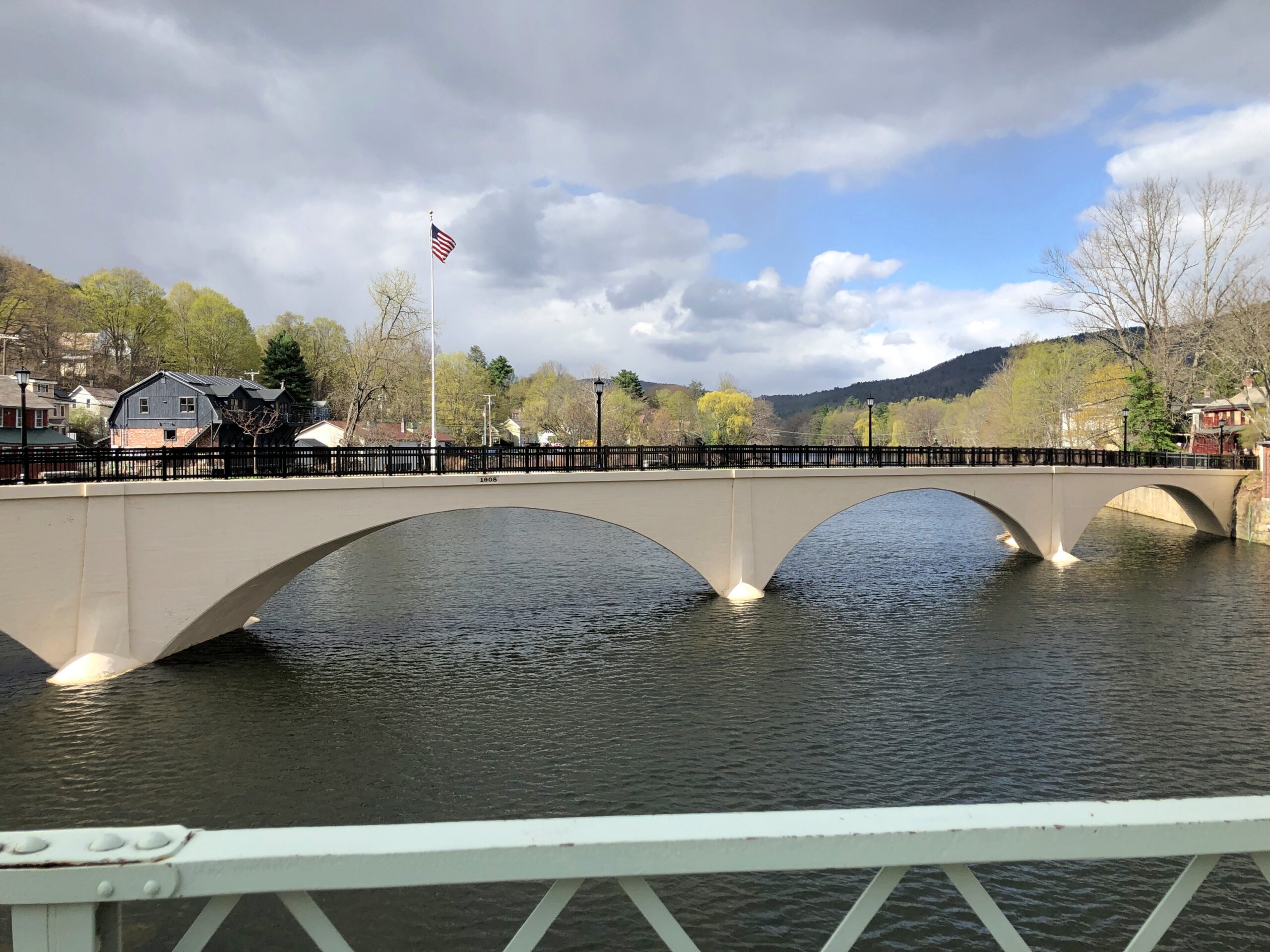
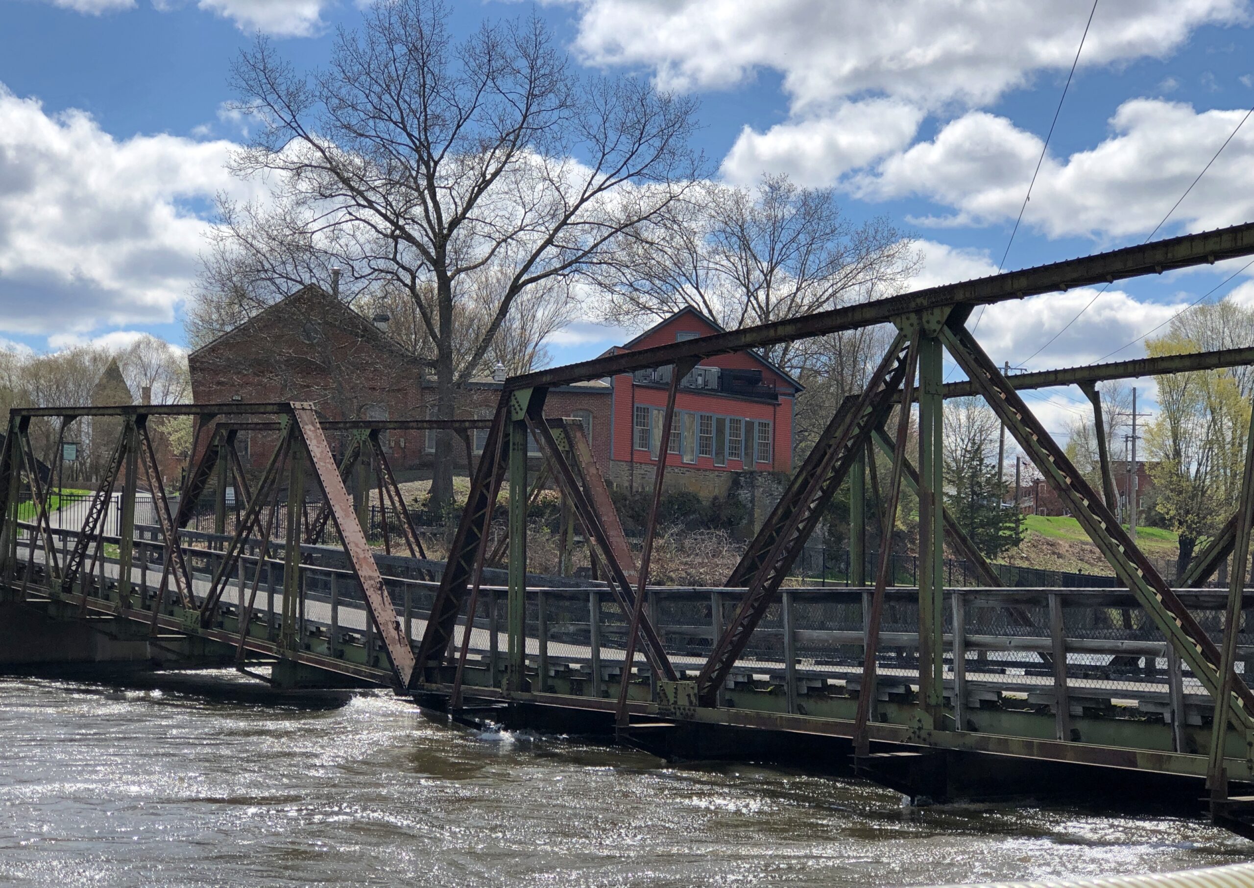
Shelbourne hugs the Deerfield River, so Shelbourne needs bridges. You can still drive across one erected in 1890, which the city fathers of the time signed like it was a work of art. As well they should have. Better, you can walk across the structure, which is known locally as the Iron Bridge. Bridge Street goes across it.

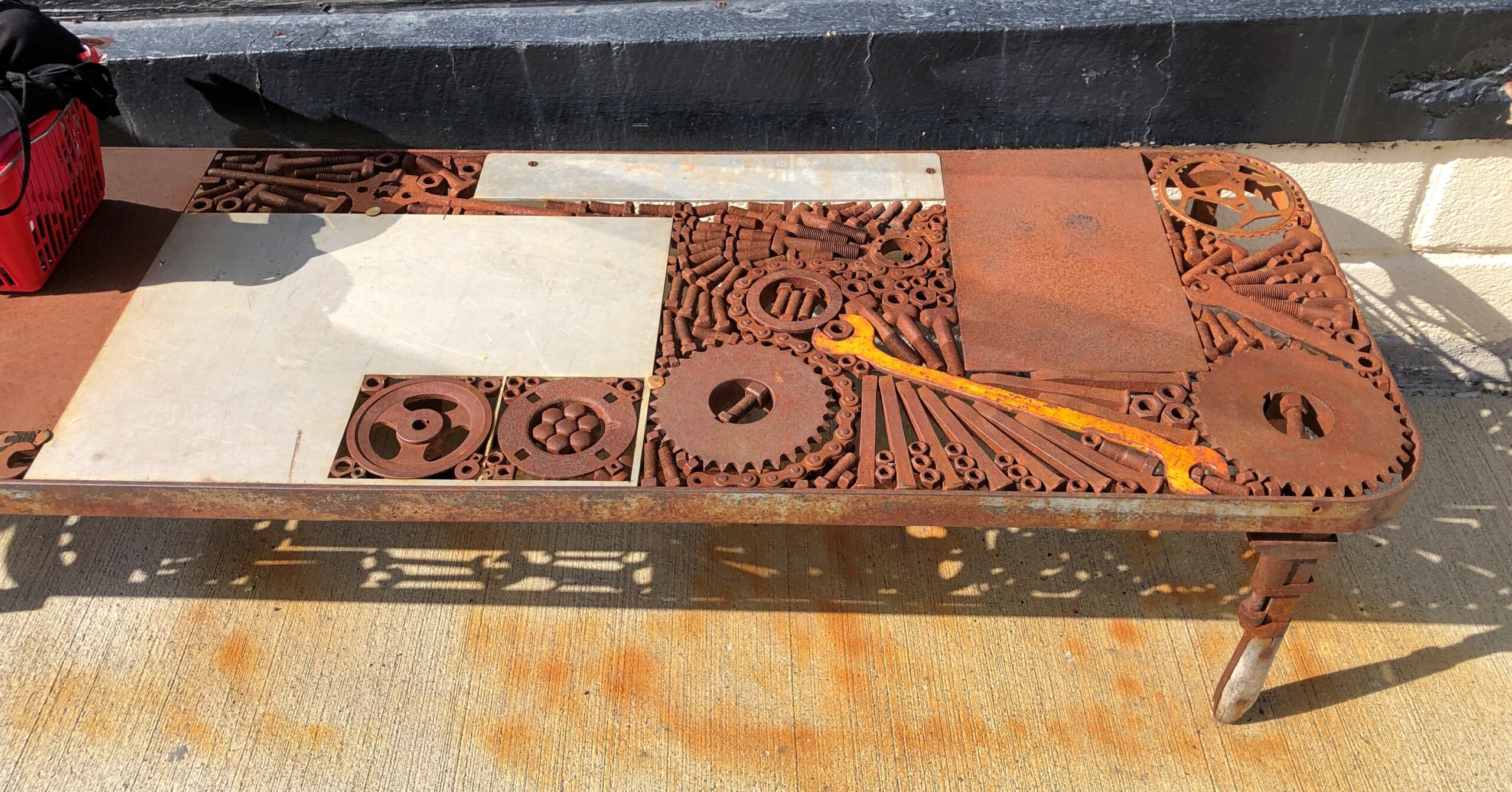
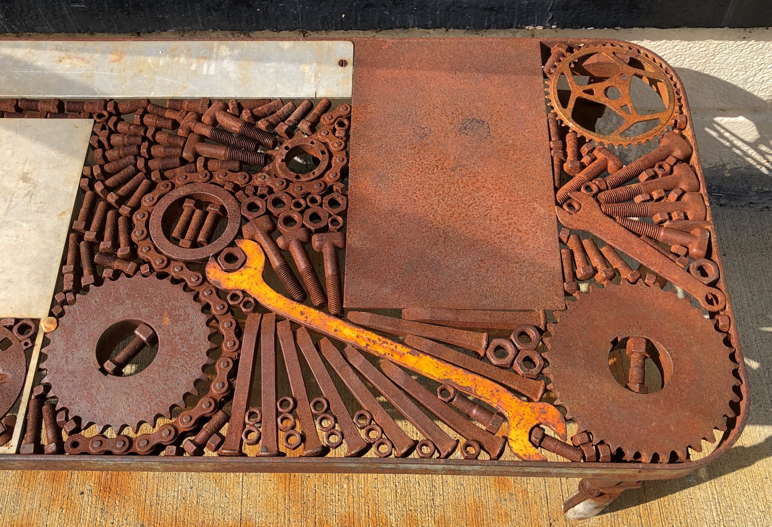
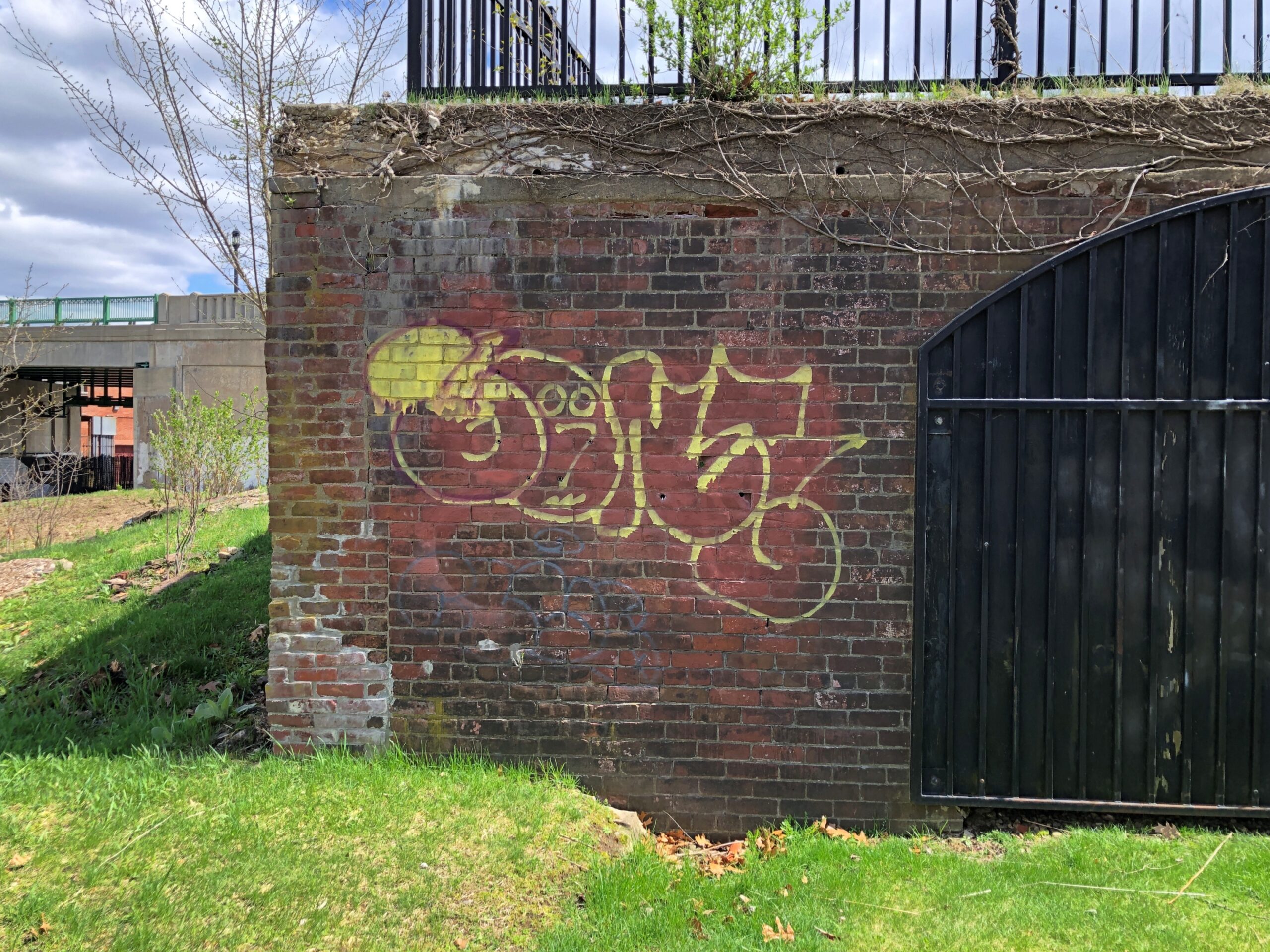
One of the more unusual metal benches I’ve encountered, just off the Shelburne entrance to the Iron Bridge. More iron. Yes, you can sit on it.

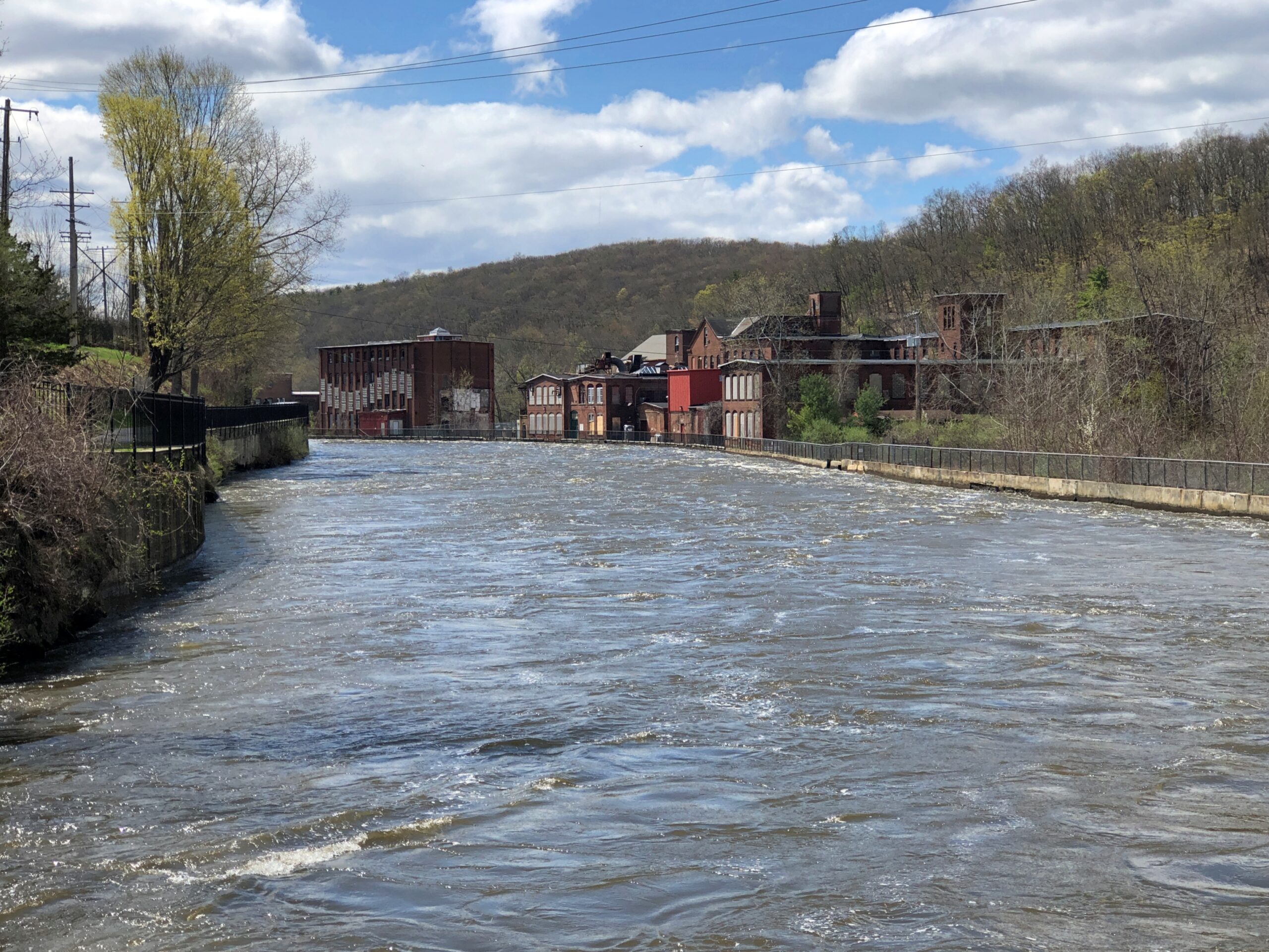
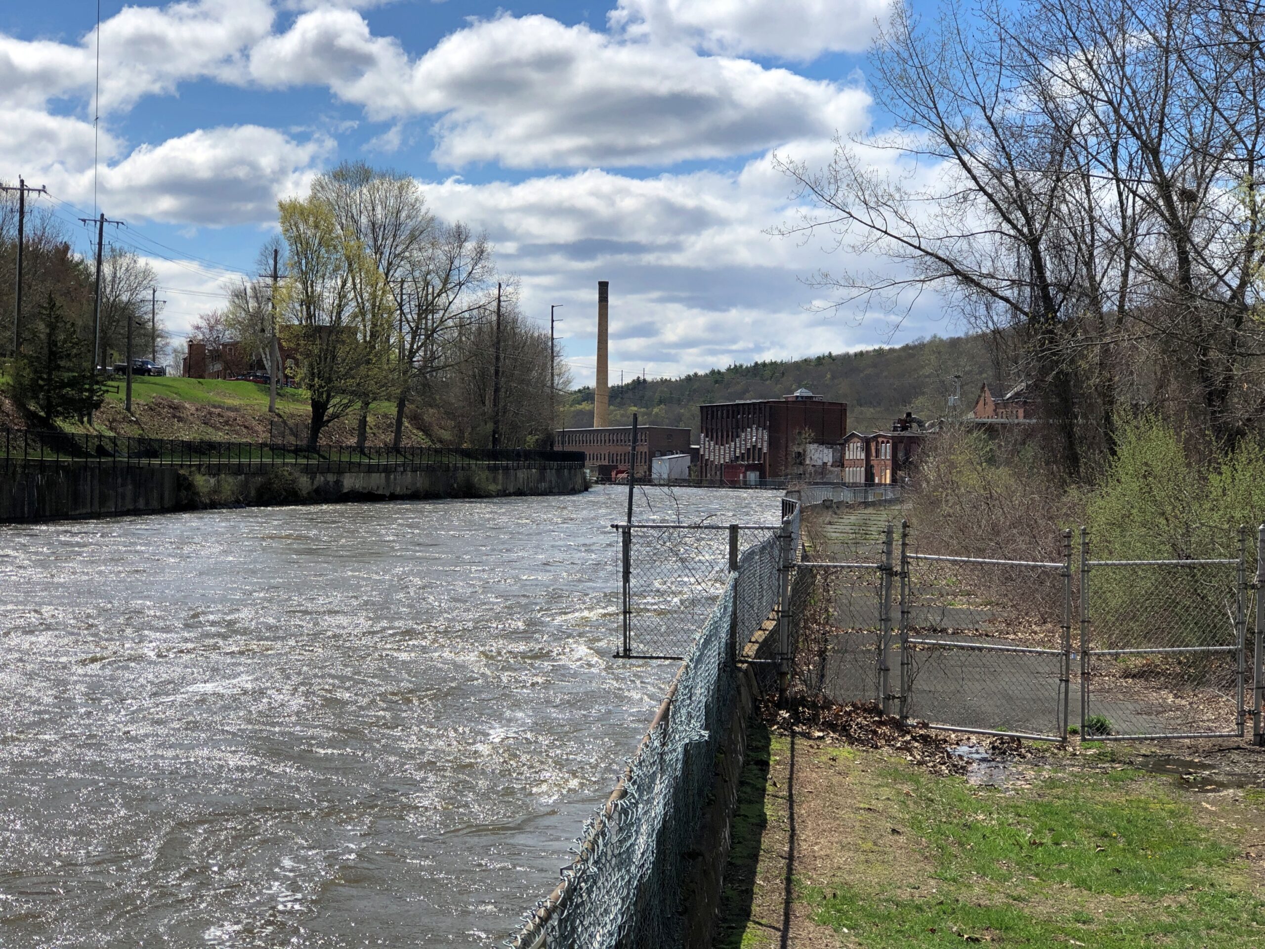
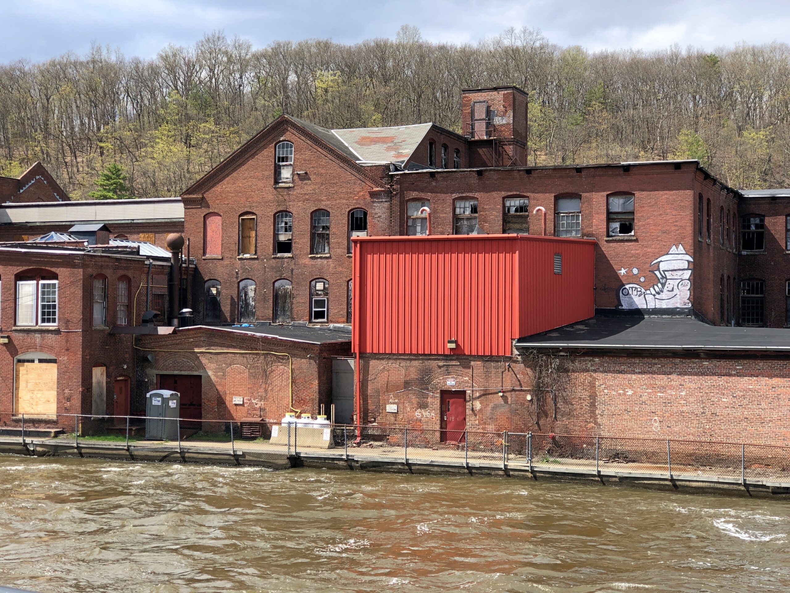
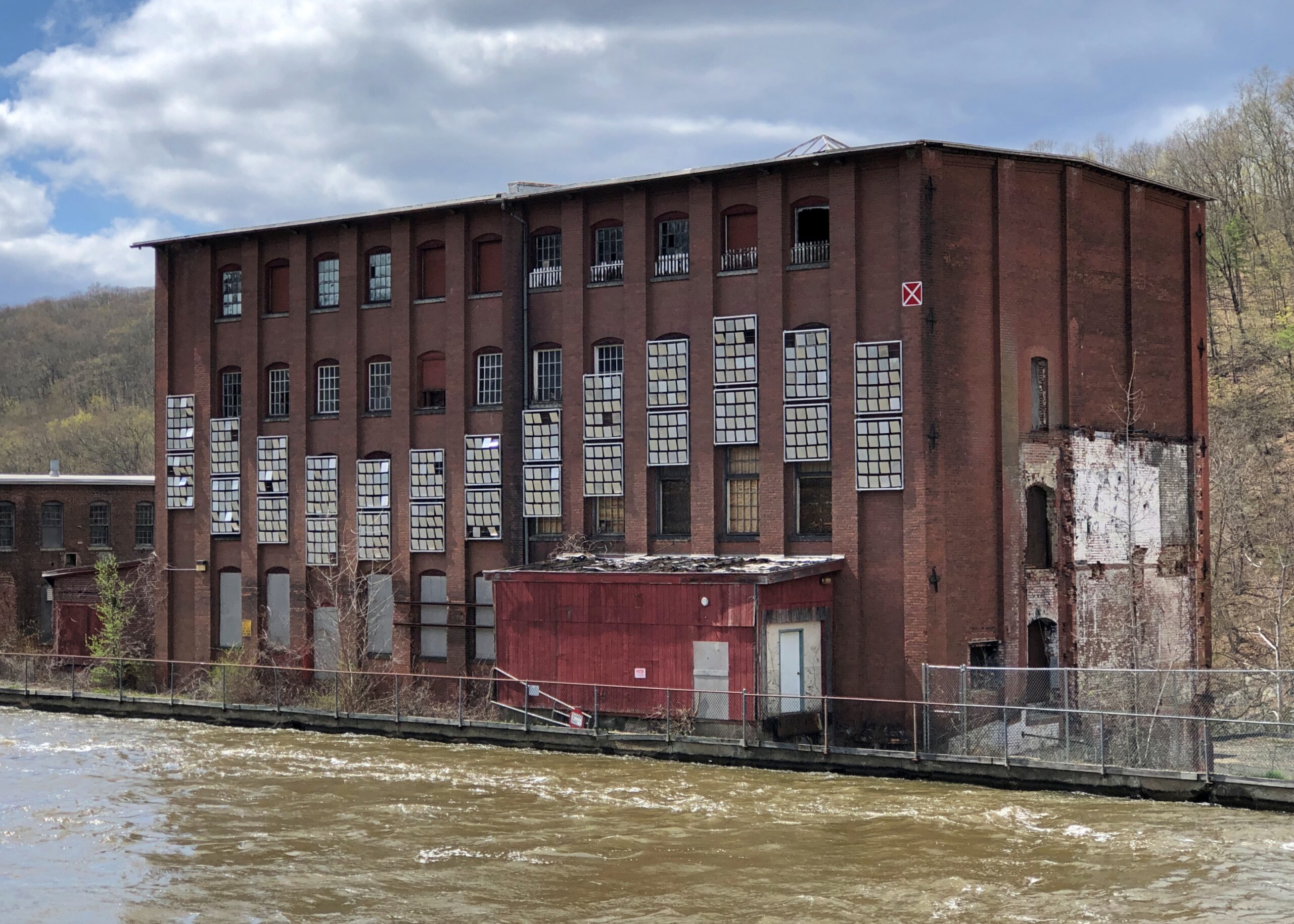
The Dearfield, major tributary of the Connecticut.

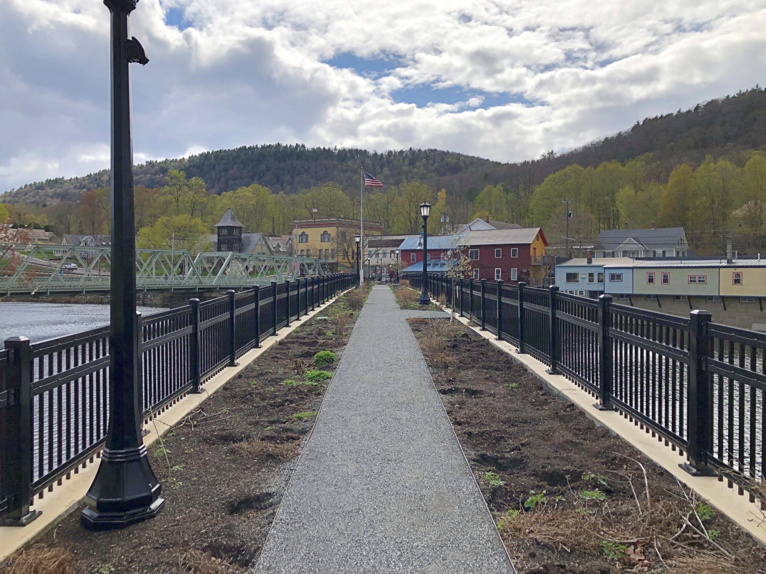
The Iron Bridge takes you to Buckland, though I guess you’d still be in Shelburne Falls, but anyway, a few steps along river – and I mean that literally, maybe 20 or 30 steps – is the Bridge of Flowers. The view looking back across at Shelburne.

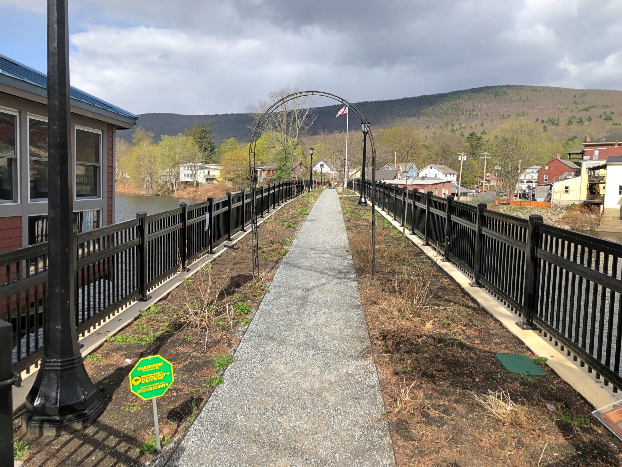
Not many flowers at that moment, but replanting was underway. Long ago the narrow bridge carried a trolley, but after that business went bust in the late 1920s, the Shelburne Woman’s Club facilitated its transformation into a linear garden.

Mid-way across the Bridge of Flowers. Even though not flowering (much), a bridge very much worth crossing.

The view looking back at Buckland.

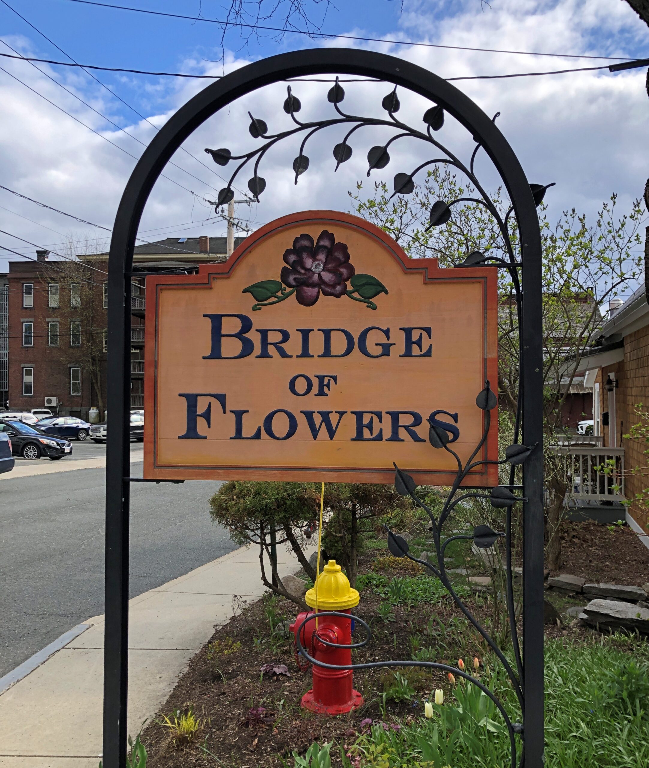
The sign on the Shelburne side.

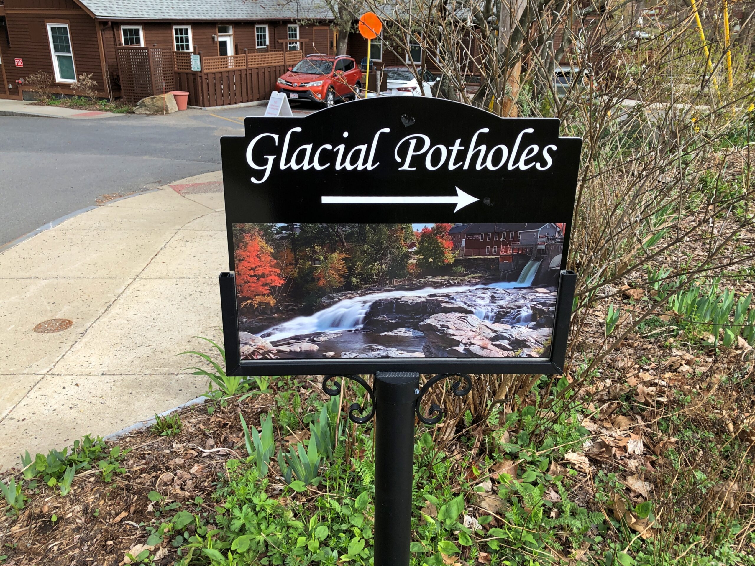
Nothing is far apart in Shelburne, so a short walk takes you to a geological oddity.

Glacial Potholes

Another sign.

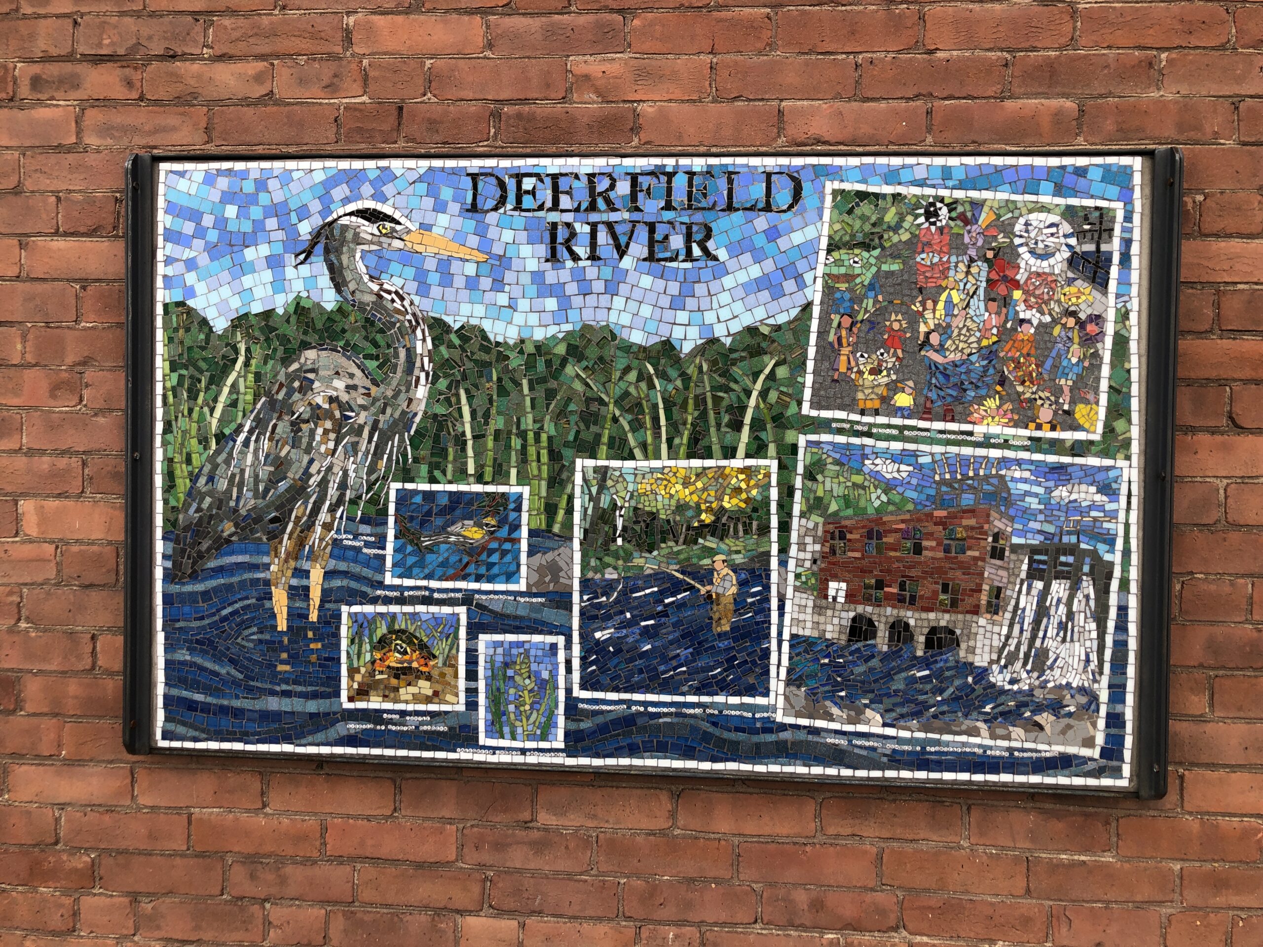
Follow the arrow and you pass a mosaic celebrating the locale. A high-quality image of this would make a good postcard.

Then come the potholes.

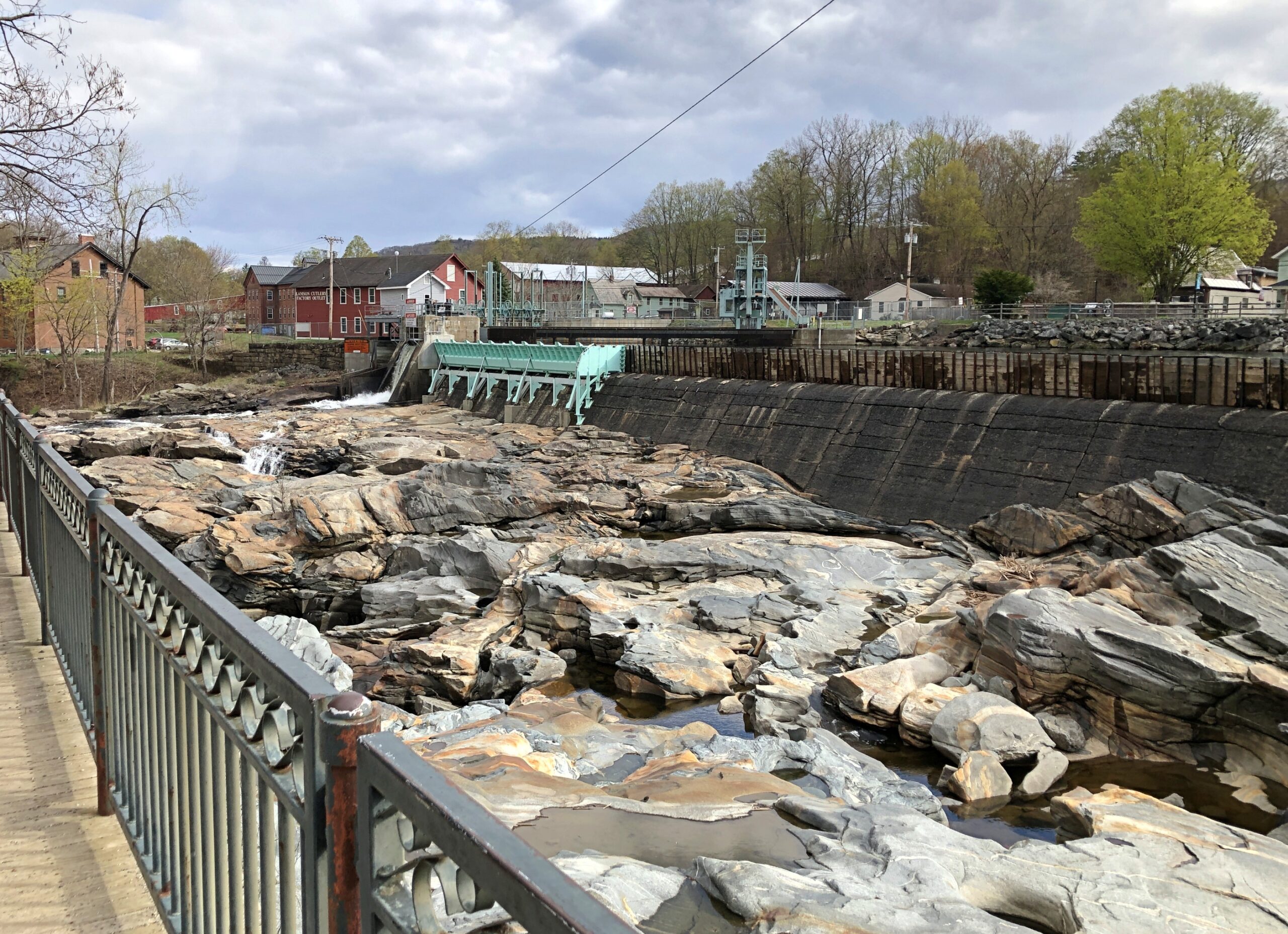
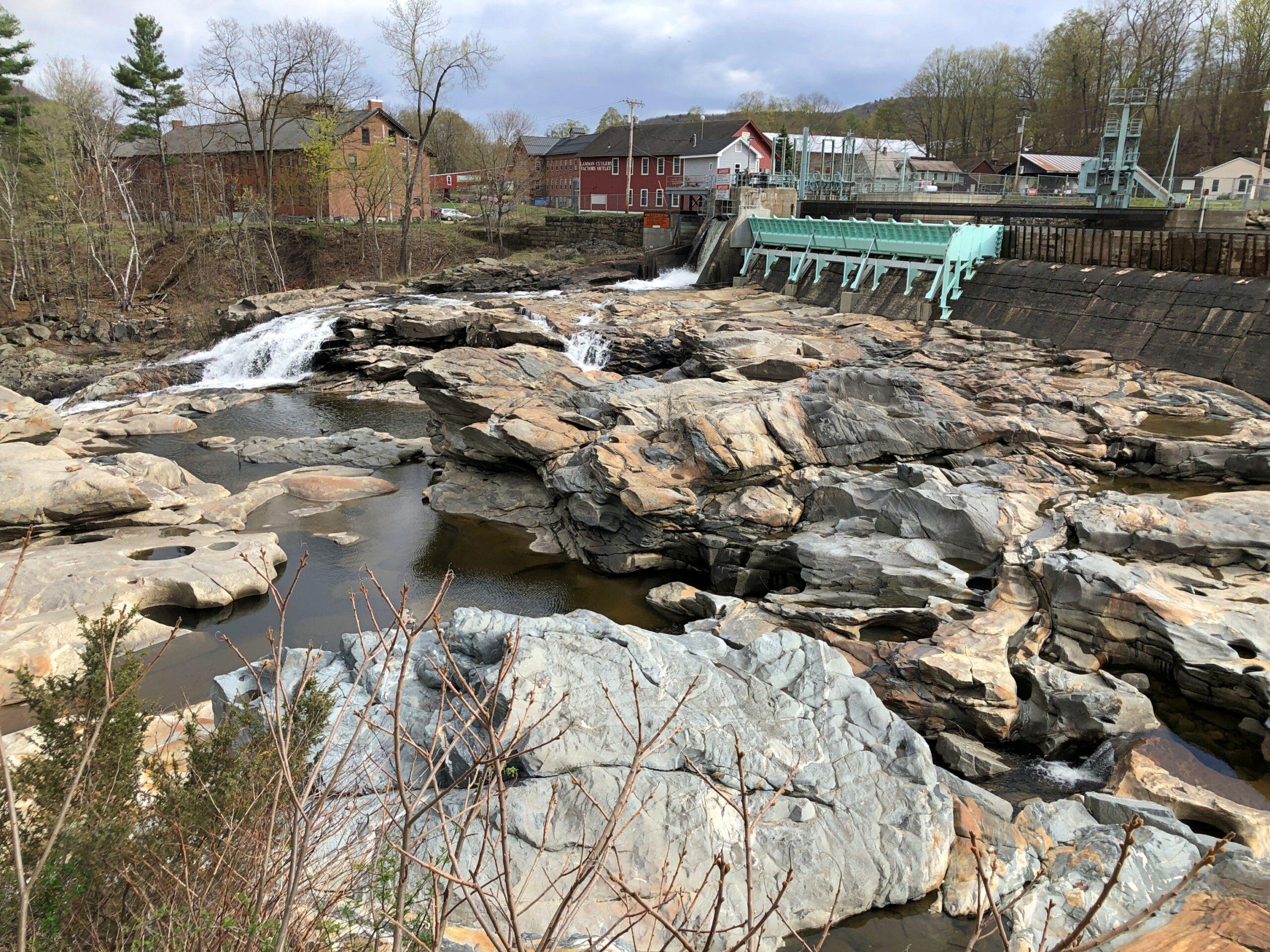
I didn’t know glaciers could create potholes, but it seems that they can and have. Also known as giant’s kettles.

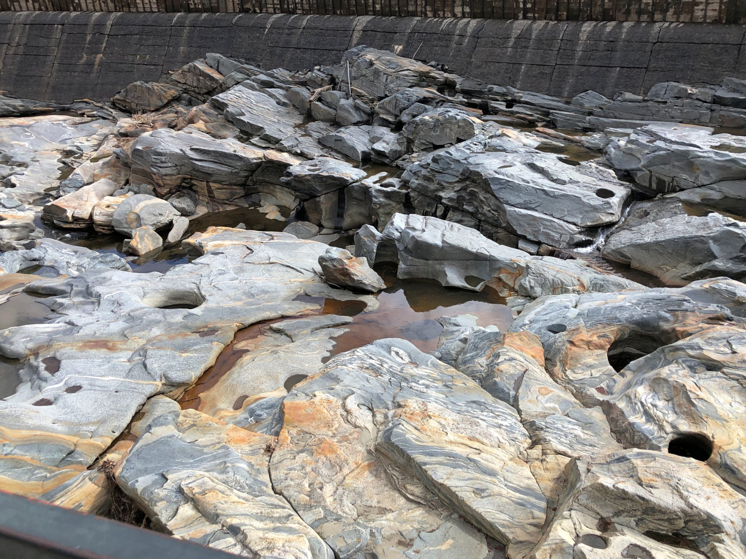
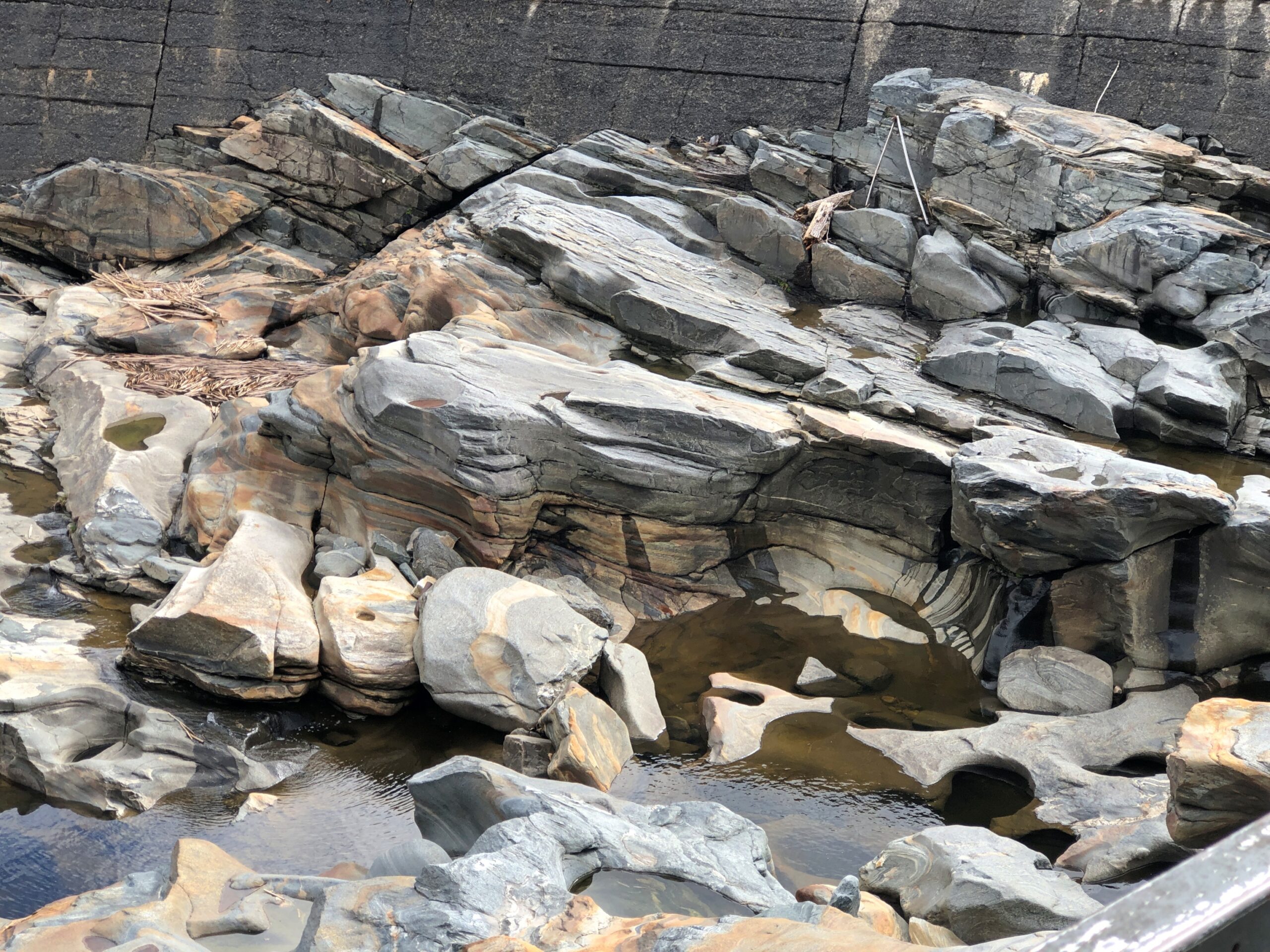
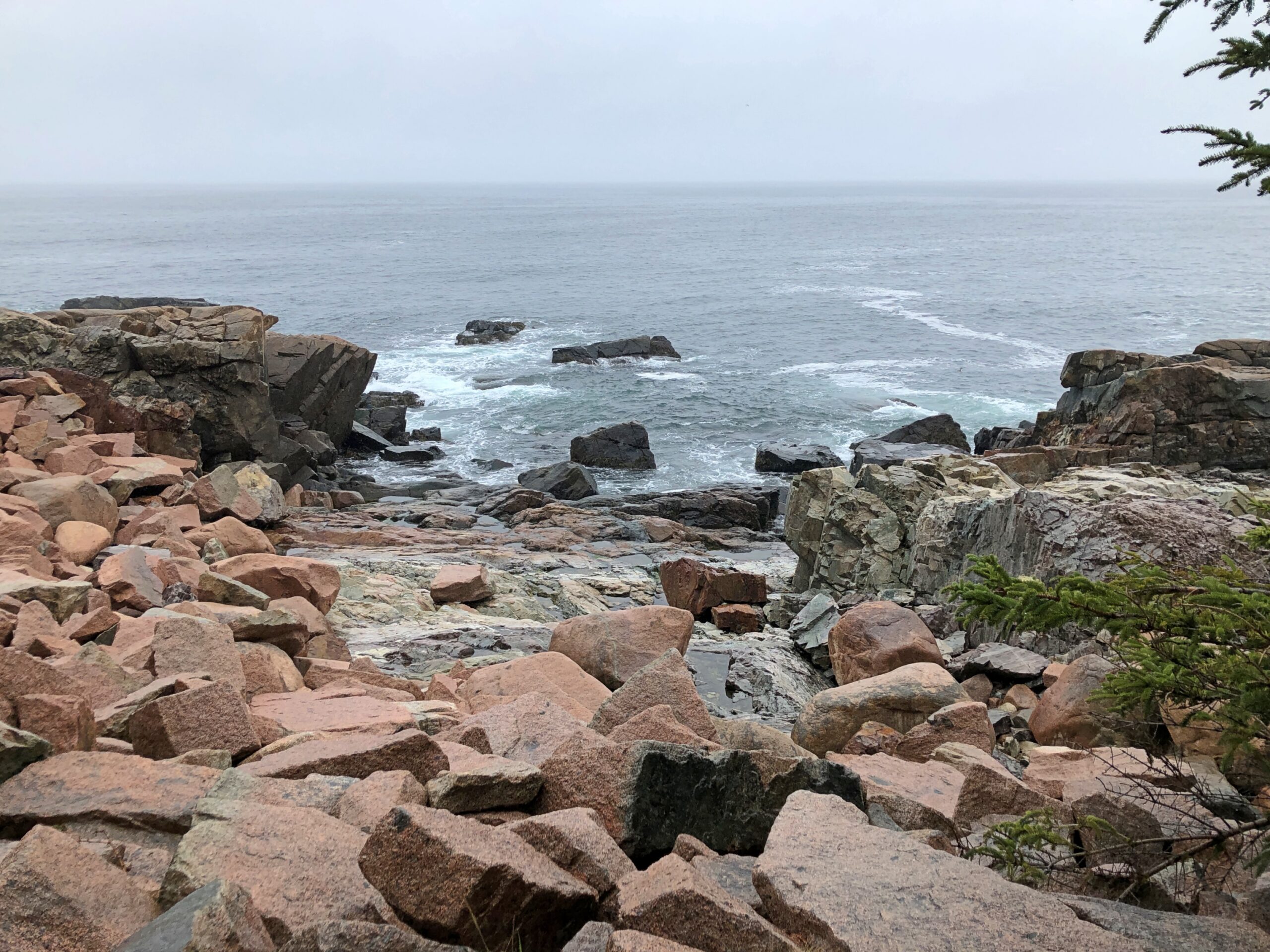
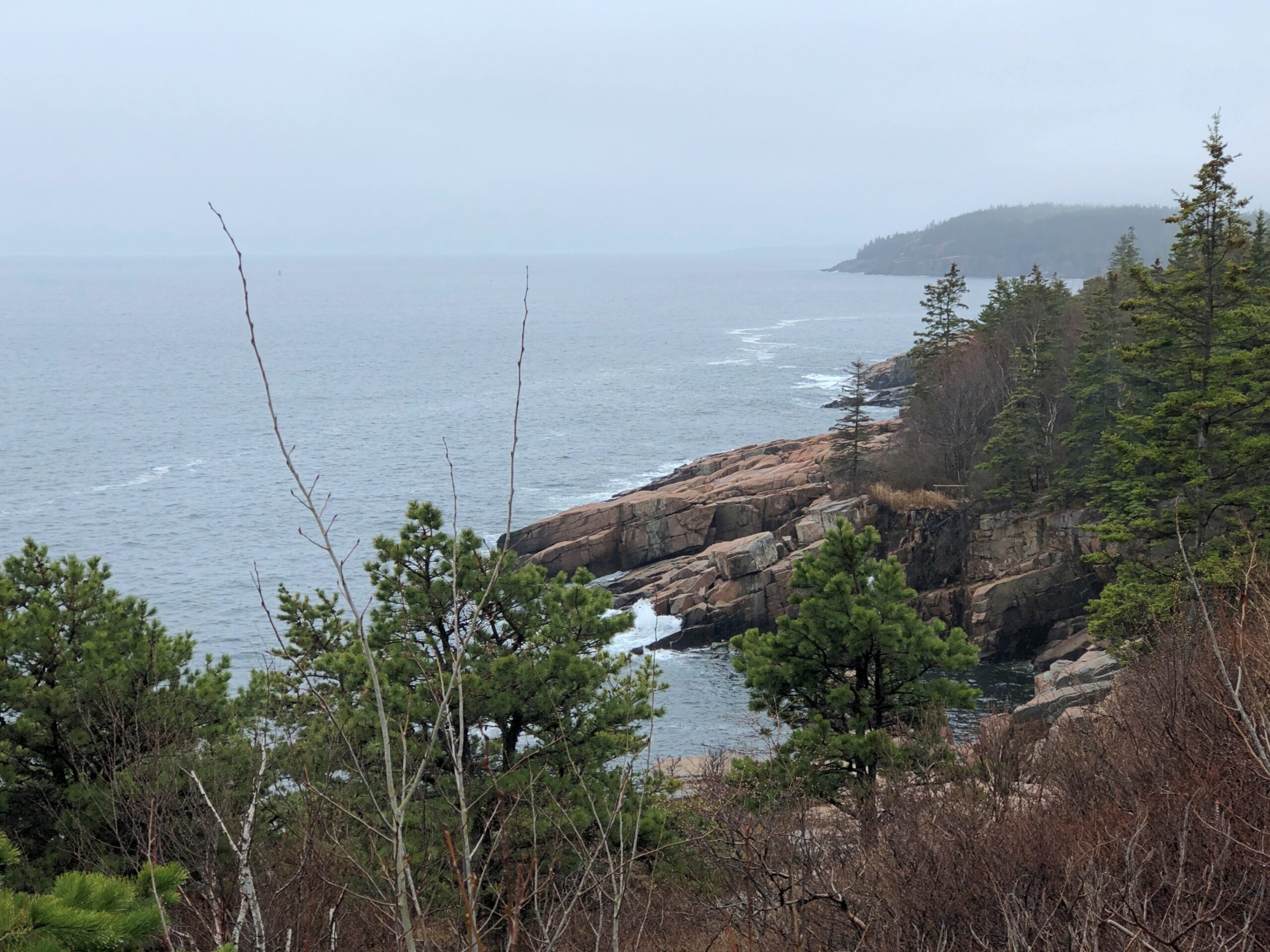
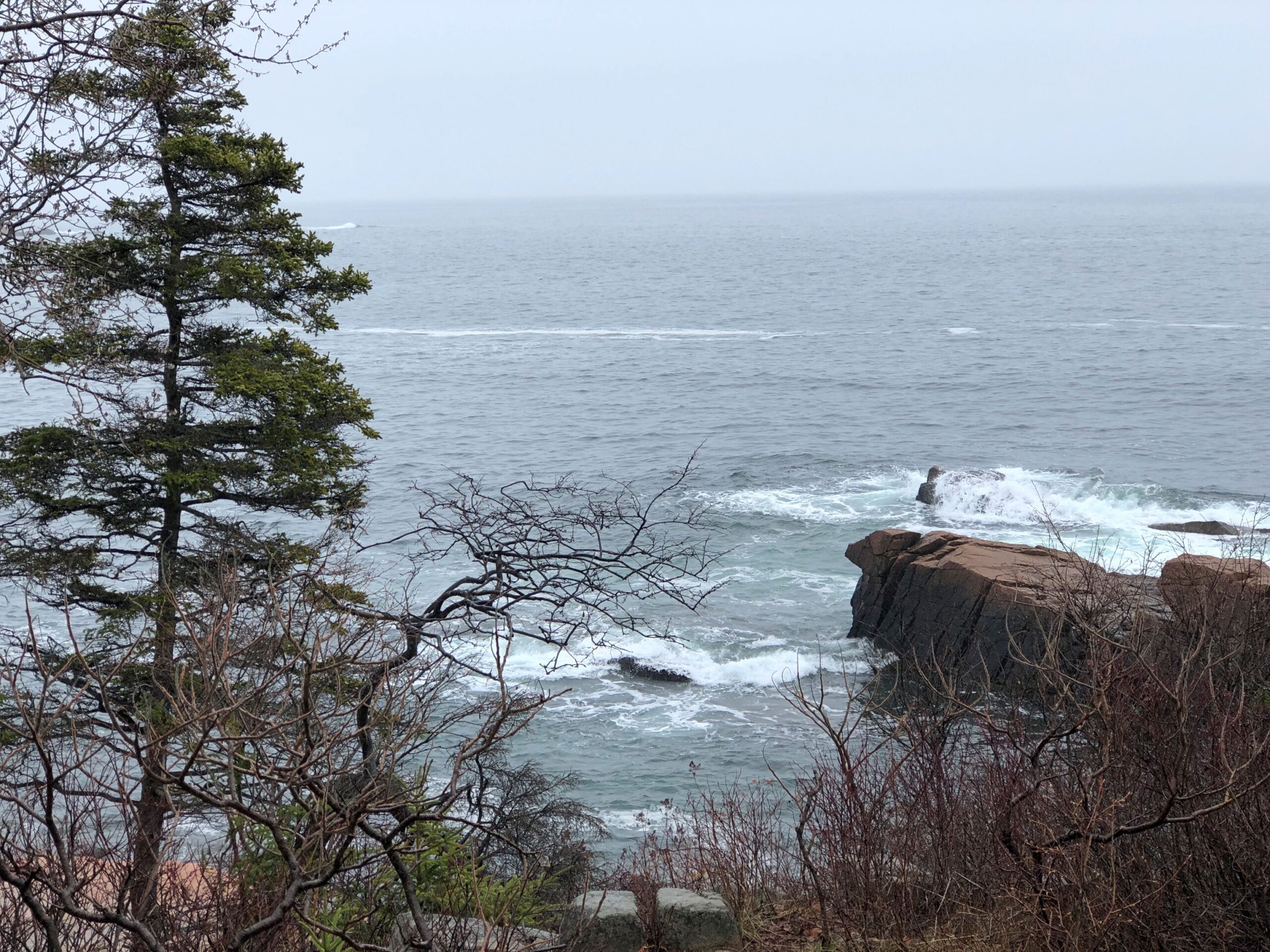
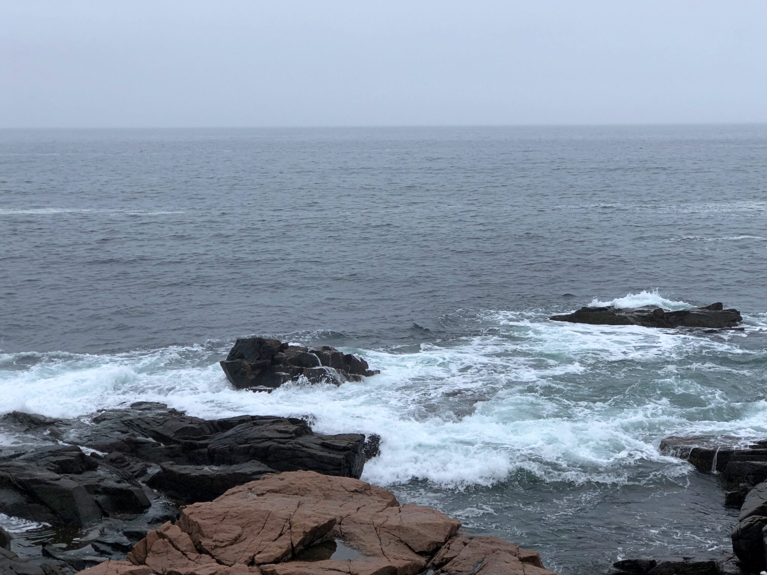
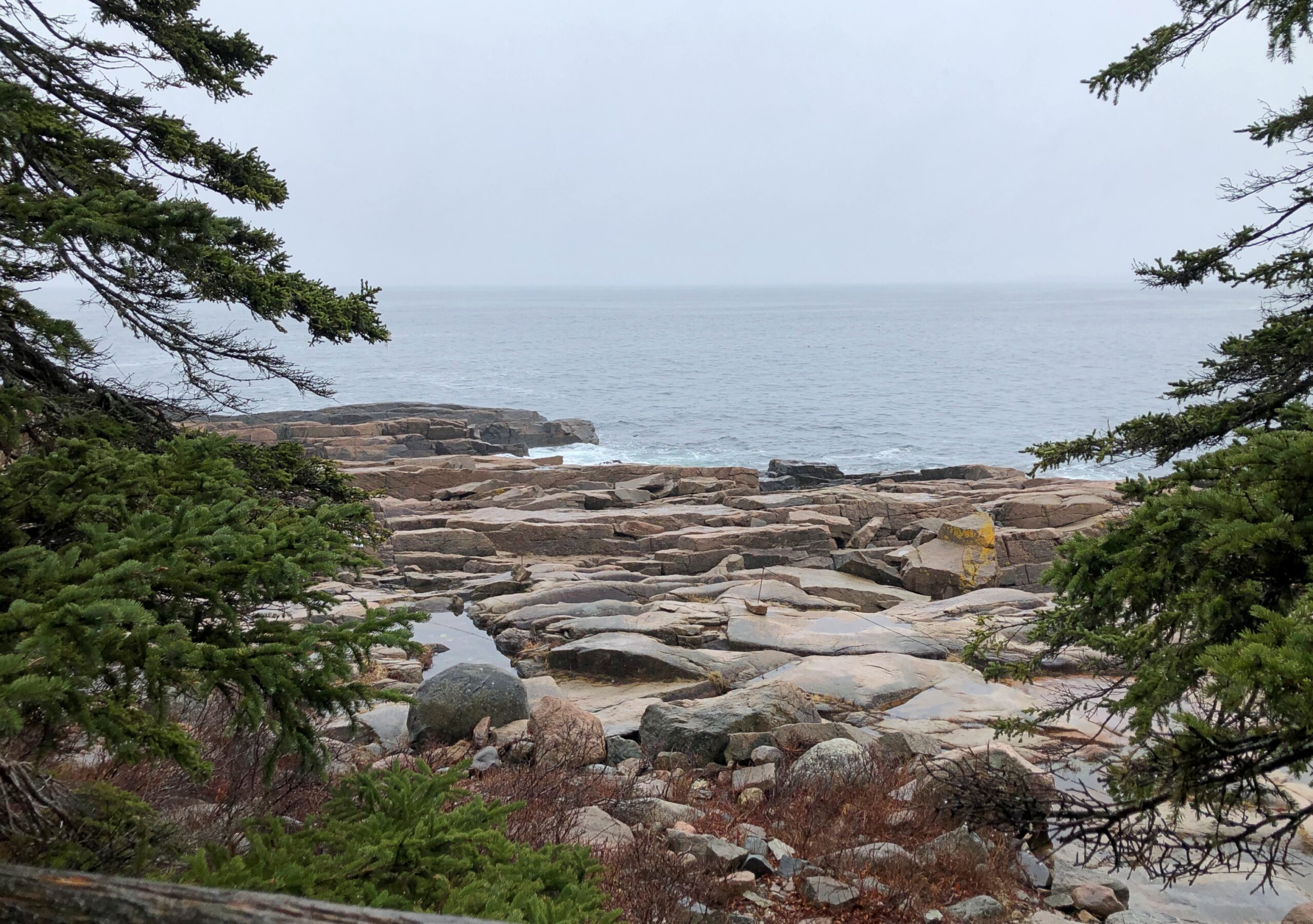
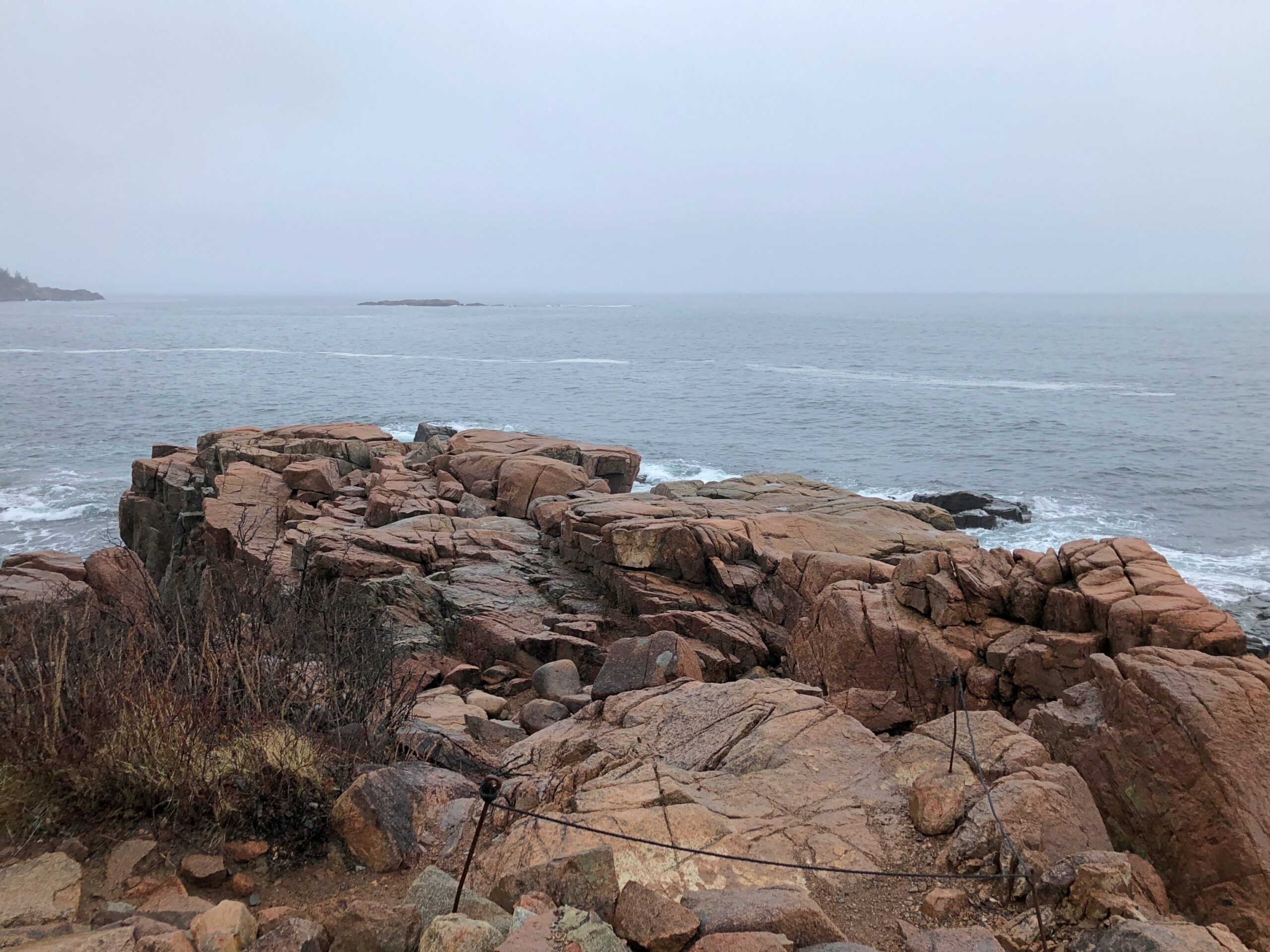
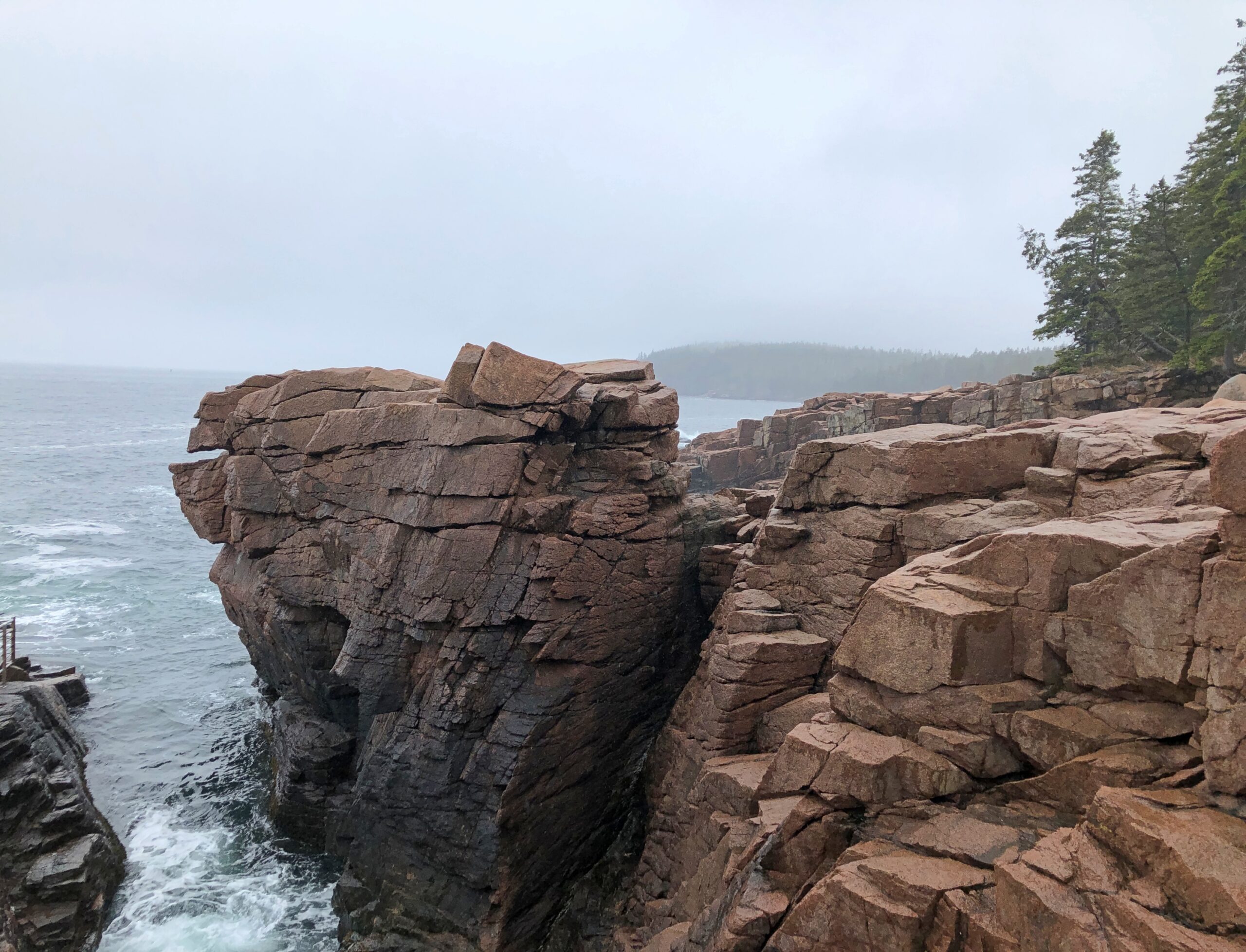
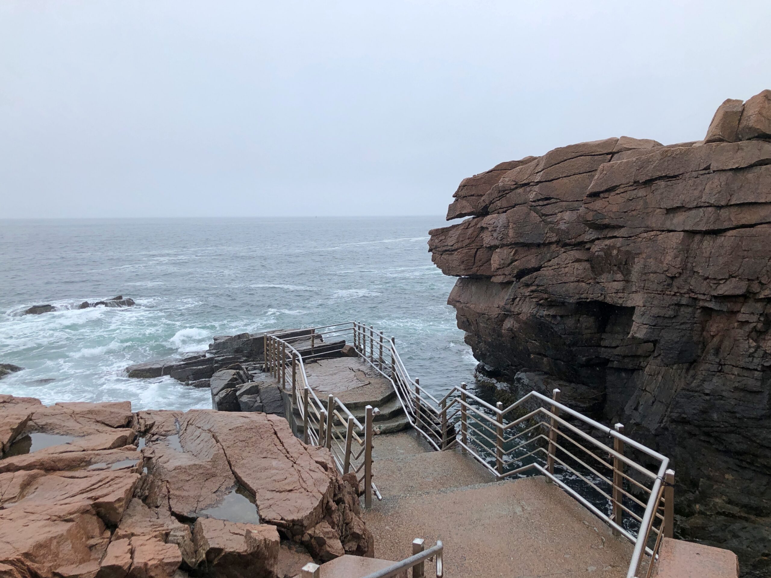
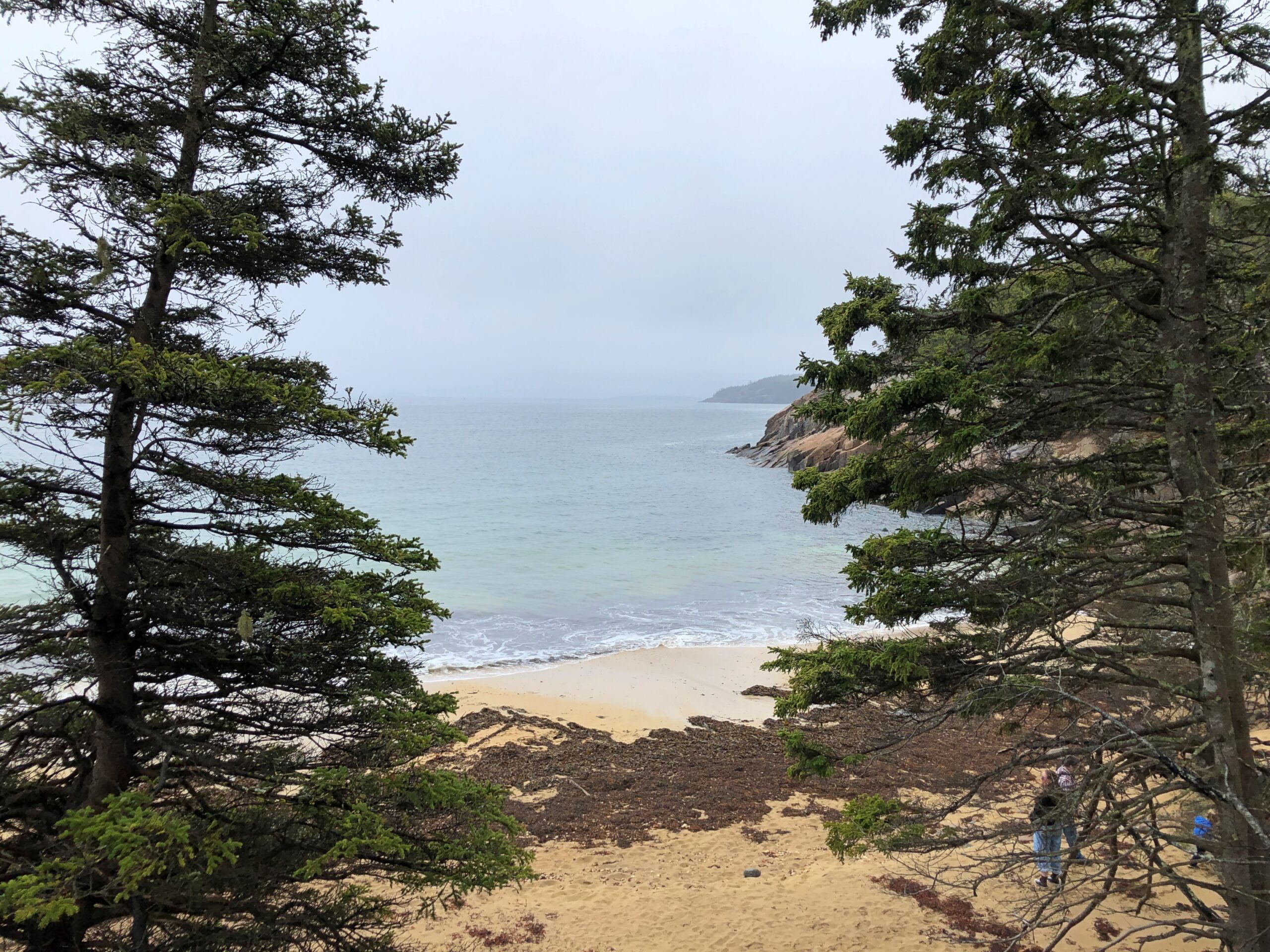
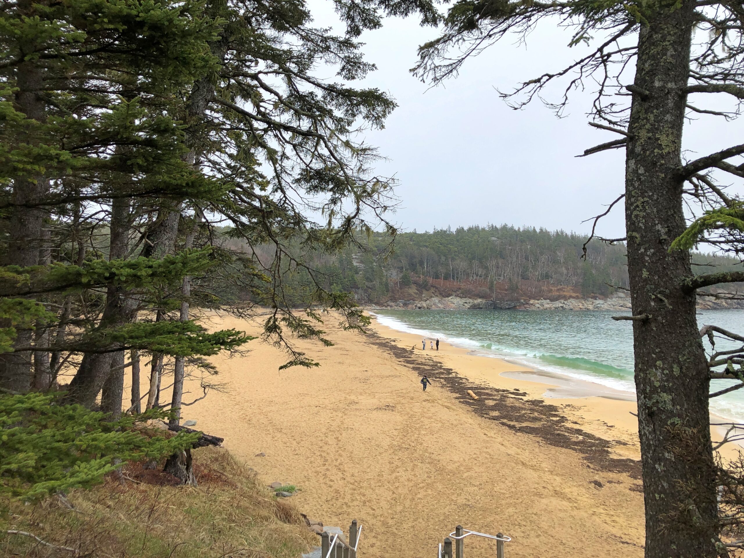
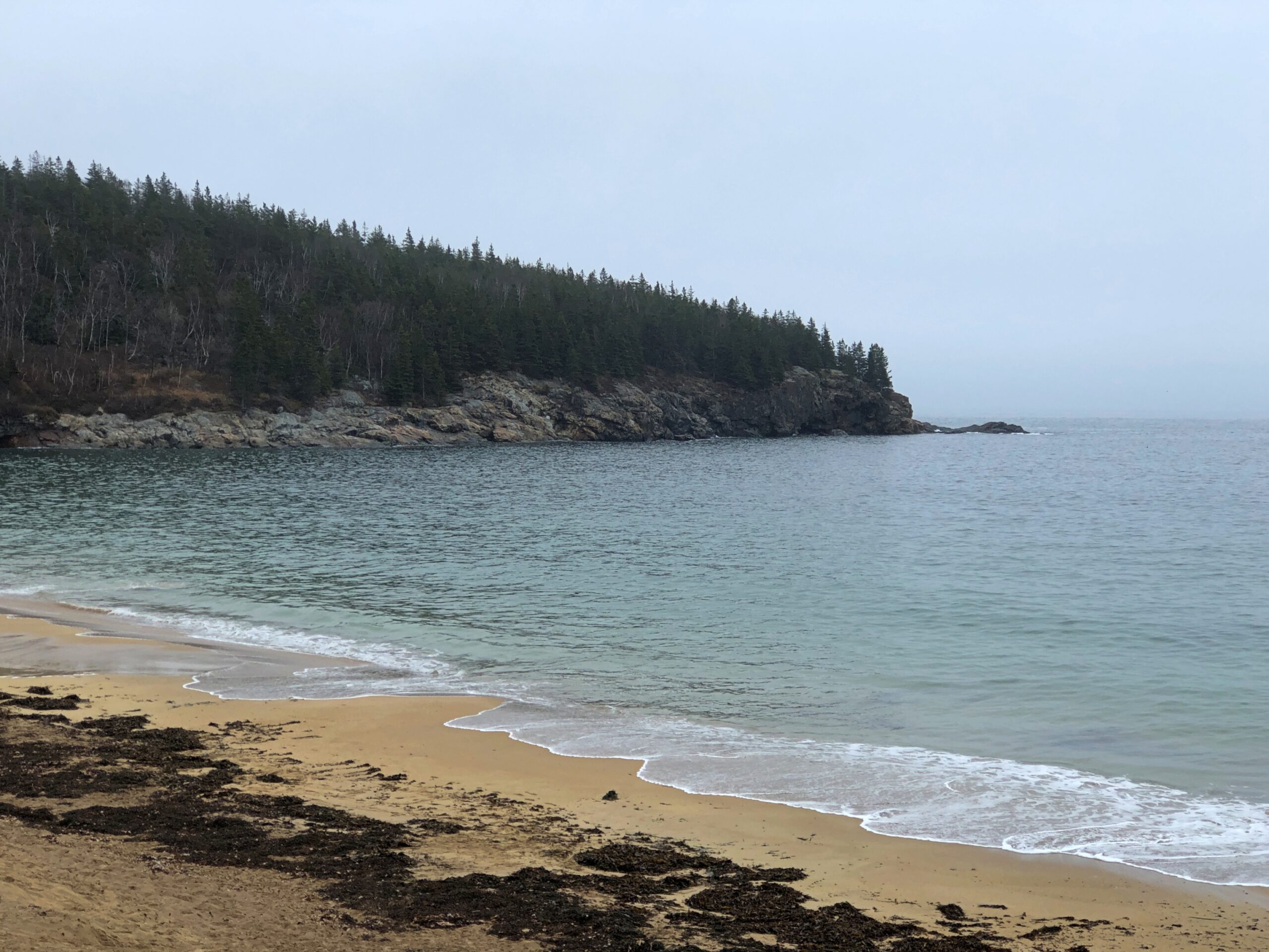
Different in details — stone and coloration and process — but erosion as much as Sioux Falls in Sioux Falls. Or on the Bruce Peninsula. Or the coast of Maine, for that matter. Water doing its grind beyond the timescales of humanity.

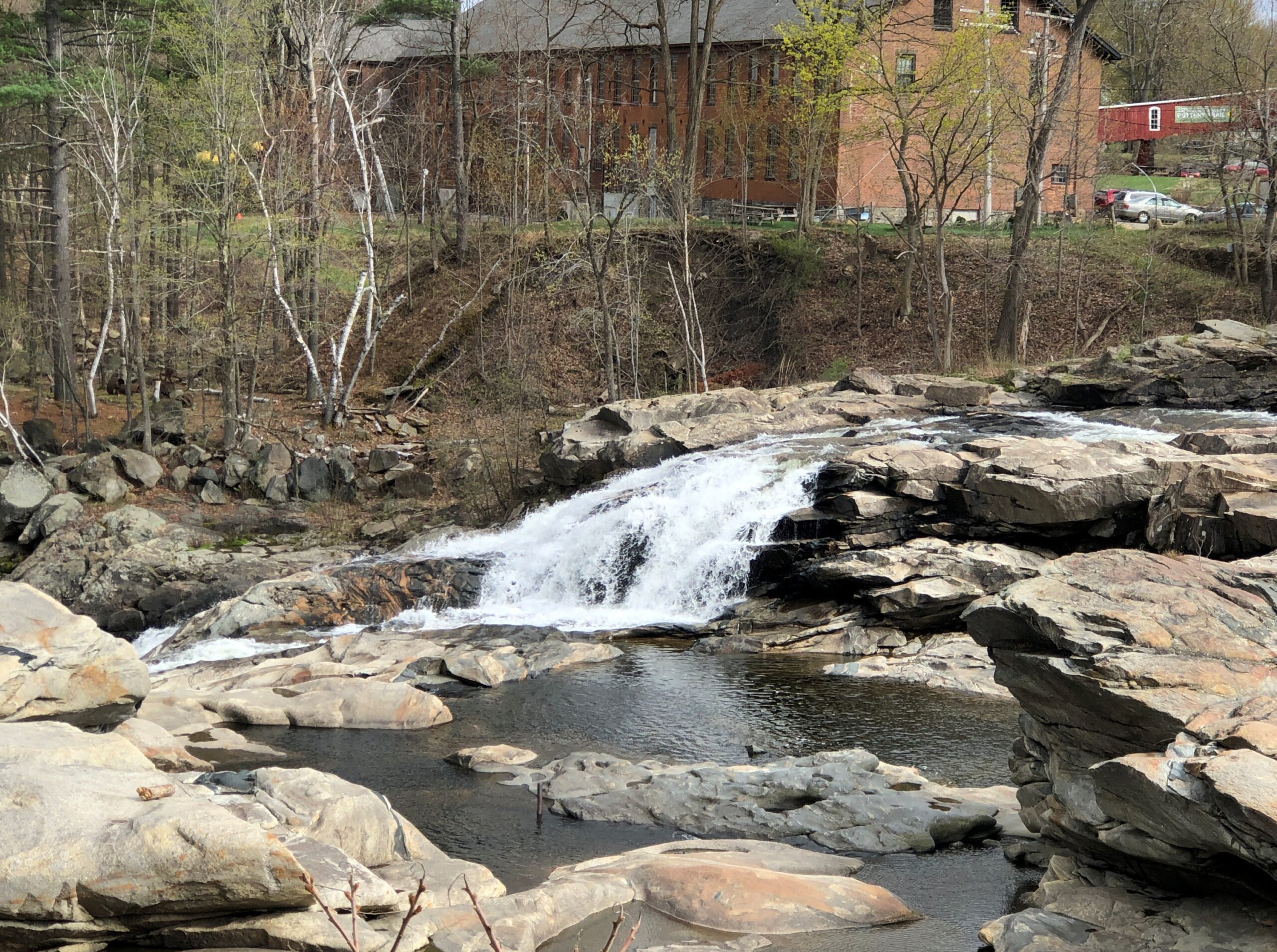
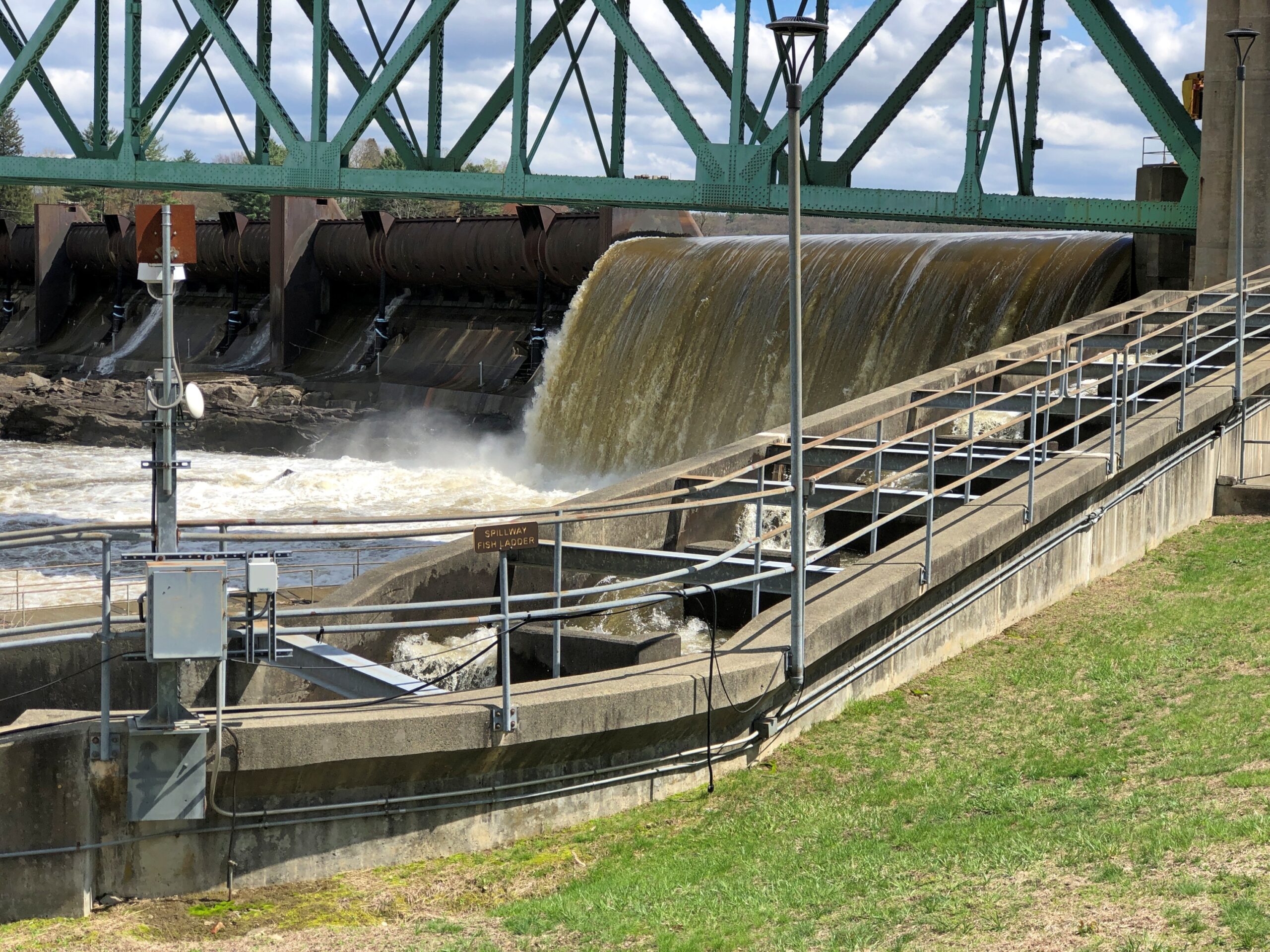
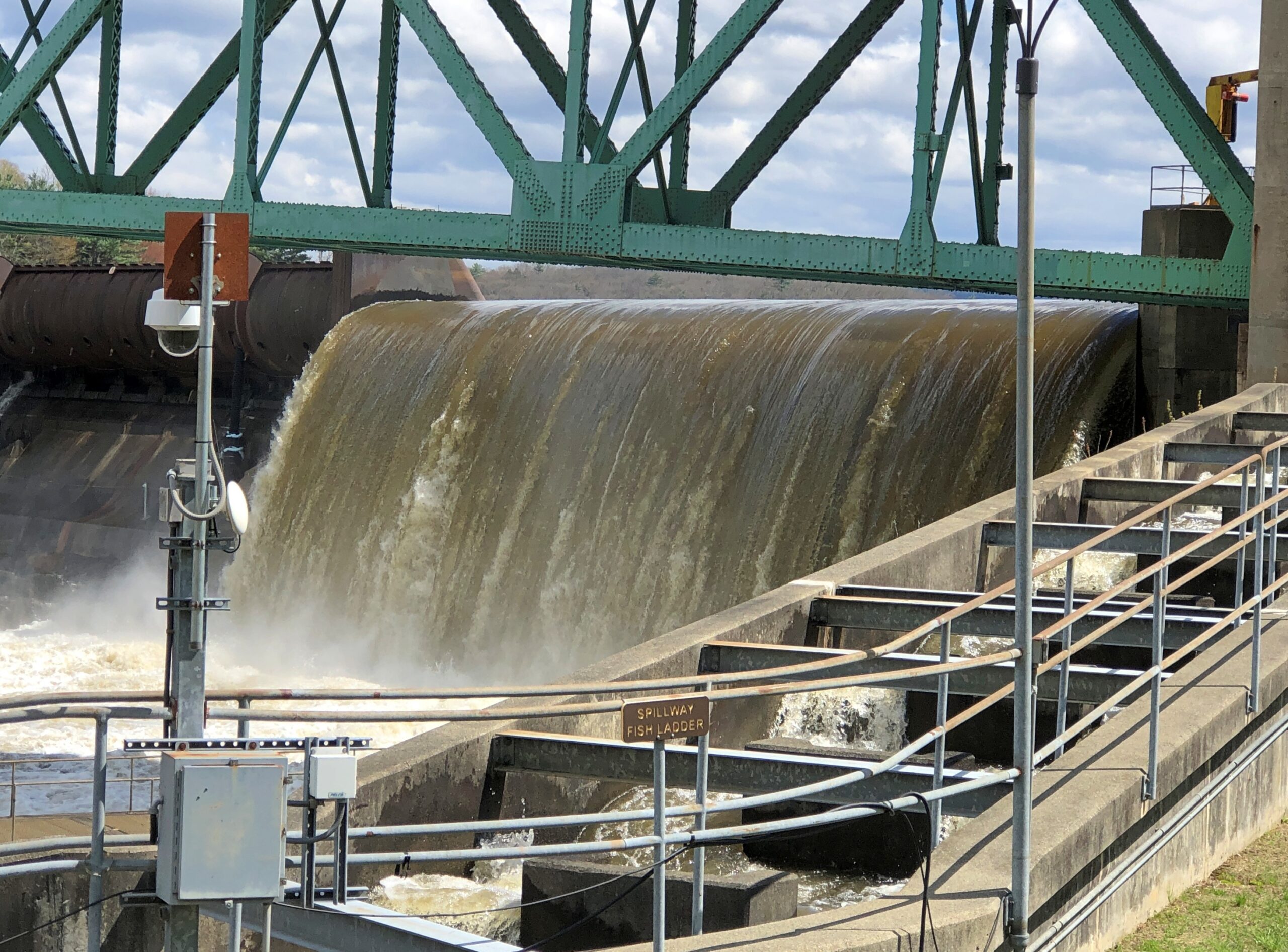
The spillway was busy. It had been a rainy day before.

Artful rocks, with no artist except erosion.

Turners Falls Canal

I can’t say I hadn’t been warned.

FirstLight describes itself as a “clean power producer, developer, and energy storage company.” Such as from legacy dams of the Connecticut River watershed, though some of those are coming down.

Luckily, the nearby waters didn’t make any sudden moves in the vicinity of my person that afternoon. I was near the Connecticut River at a place called Turners Falls (no apostrophe), Massachusetts. The sign is posted on a man-made island, in fact, created by a canal paralleling the river – Turners Falls Canal.

I’d crossed the Connecticut via a bridge, and the canal too, and parked on Avenue A in Turners Falls near the Great Falls Discovery Center, which is housed in restored mill buildings on the south edge of the canal.

Great Falls Discovery Center, owned by the Massachusetts Department of Conservation and Recreation, includes open habitat exhibits, fish tanks, and dinosaur fossils, and is generally geared to small fry. It does have a nice, if underutilized, exhibit space in one of the restored buildings.

I understand that “Great Falls” is an earlier name of the falls, now the site of a dam, and that a fellow named Turner led an attack on a native settlement on the river 350 years ago, leading to the renaming of the falls – more about all that later. A path from the center leads to the canal.

A rusty foot bridge across the canal.

Looks a little dodgy, especially when the flow is strong, as it was that day in the wake of heavy spring rain the day before.

But not dodgy enough to keep me from crossing to take in the views of the canal from the footbridge.

Turners Falls Canal, Mass.

The tip of the island, while accessible at that point, is desolate. The rest of the island seemed to be fenced off.

But it does offer a view of the dam and its associated fish ladder. A powerful flow that day.

Also visible: the bridge across the Connecticut that I’d driven a little while before, the Turners Falls-Gill Bridge, completed in 1938 and renovated in the 2010s. Gill is the town on the other side.

I crossed back and took a stroll down the footpath along the canal: the Canalside Rail Trail.

An earlier canal – dug early in the 19th century, just as the U.S. canal boom was getting underway – provided passage via locks around Turners Falls, and a boon to trade in the area. Railroads made that canal obsolete by the mid-19th century, so when the river was dammed, a different canal, a “power canal,” was created to provide water power for factories (the first canal, I believe, was submerged, but I’m not quite sure). Anyway, those factories are closed in our time, but their husks linger.

Waiting for the time when the area’s population is growing again — perhaps during a reverse migration from the too sunny South in the next mid-century — and these sturdy structures can be remade into residential properties.

Mount Auburn Cemetery: The Stones

The main gate of Mount Auburn Cemetery, an Egyptian Revival structure, was behind a temporary fence the day I dropped by. That’s only reasonable, as an object that needs periodic renovation.

I took a paper souvenir from the cemetery, one that’s given away: a detailed map and guide. An exceptionally detailed map and guide, I should add, including not only the vehicular roads that twist around the grounds (something like the roads in greater Boston), but all of the many, many footpaths, all of which seem to have names. Also noted are special features, including chapels, ponds, named knolls, the sites of 62 notable people buried on the grounds, plus the sites more than 20 notable memorials or works of funerary art. It’s more than anyone could take in during a short visit, or even a lot of longer visits.

That’s never deterred me. I parked near the entrance and set out, picking up the map at the visitors center and spending a moment at Story Chapel.

The chapel is named for Joseph Story (d. 1845), associate justice of the Supreme Court, colleague of John Marshall and, in as much as I know about the subject (not much), a titan of early U.S. jurisprudence. He was also first president of Mount Auburn and, when his time came, he was buried there, though that was among the many memorials I didn’t happen to see.

So many memorials. Some more conventional, but no less beautiful or impressive for it.

Some less conventional. Any grand cemetery needs a component of the unusual or odd.

A number of mausoleums, though perhaps not as many as you’ll see at Green-Wood or Woodlawn in the Bronx.

More modest stones.

Men who died for the Union.

A good many couples.

Mount Auburn Cemetery

A sad story, one of many.

Maybe a sad story. A little enigmatic, anyway.

Looking at the map’s list of famous permanent residents, one thinks: “Right, I know him. And him. And him. And her. There’s another person I’ve heard of. And another. And I think I know that one – I do…”

On it goes. A short selection of those I didn’t have to look up: Louis Agassiz, John Bartlett (of Quotations fame), Edwin Booth, Charles Bulfinch, Dorothea Dix, Mary Baker Eddy (“discoverer” of Christian Science, the map says), Edward Everett (spoke at Gettysburg, was upstaged), Fannie Farmer, Felix Frankfurter, Buckminster Fuller, Charles Dana Gibson, Curt Gowdy, Oliver Wendell Holmes Sr., Julia Ward Howe, Henry Cabot Lodge, Henry Wadsworth Longfellow, Bernard Malamud, Arthur Schlesinger Jr., B.F. Skinner, I.F. Stone, and Charles Sumner.

I could have spent all day looking for them, but mostly I didn’t. I did see Charles Sumner’s stone. People leave smaller stones. I found one and did too.

Near Sumner. I’d never heard of him, but I like that name.

Solomon Sias Sleeper (d. 1895), successful Cambridge merchant and local politico and philanthropist.

The map also lists impressive memorials. I found a number of those. Such as the Rev. Hosea Ballou Monument, honoring a Universalist clergyman (d. 1852).

A Civil War memorial, erected in 1872 — the only time I’ve seen a sphinx used for that purpose.

“The sphinx was chosen because of its ideal personification of intellect and physical force and its representation of the combined ideas of beauty and strength,” the notes on the map say. I know the sphinx has a very long history and comes with a lot of encrusted lore, but that sounds like a peculiar Victorian interpretation that didn’t really stick.

The Scots’ Charitable Society Lot.

An organization founded in 1657 in Massachusetts. It “aims to help people of Scottish heritage by providing relief to Scottish-American individuals and families in need, and by granting undergraduate scholarships to the Scottish-American community,” says its web site because it is still around.

Bigelow Chapel.

Named for Jacob Bigelow (d. 1879), second president of Mount Auburn.

Washington Tower. The highest point on the grounds, honoring George Washington. Designed by Bigelow in collaboration with architect Gridley J. F. Bryant. I didn’t have the energy to climb the hill and then the tower at that moment. Too bad. I understand the view of the Boston skyline from there is terrific.

A cenotaph for four members of the U.S. Exploring Expedition who didn’t return from the Pacific.

I was delighted to see it. In its way, as important as Lewis and Clark’s journey, and something I’m certain 99-point-more percent of Americans have never heard of.

Back to Joseph Story. He gave the dedication speech at the cemetery on September 24, 1831. It’s a long one, per custom of the time. Per custom of my time, a short quote:

Here, let the brave repose, who have died in the cause of their country. Here, let the statesman rest, who has achieved the victories of peace, not less renowned than war. Here, let genius find a home, that has sung immortal strains, or has instructed with still diviner eloquence. Here let learning and science, the votaries of inventive art, and the teacher of the philosophy of nature come. Here let youth and beauty, blighted by premature decay, drop, like tender blossoms into the virgin earth; and here let age retire, ripened for the harvest. Above all, here let the benefactors of mankind, the good, the merciful, the meek, the pure in heart be congregated, for to them belongs an undying praise.

The Maine State House

Though state capitols tend to be grand buildings with opulent fixtures and decorous memorials, small surprises outside the official scheme sometimes await casual visitors. Such as rocking chairs at the Maine State House.

The building is perched on a hill, as capitols sometimes are, with a sizable porch with a long view. Obscured off in the distance is the Kennebec River.

That porch is a good place for rocking chairs, someone thought at some point; someone associated with the capitol in some way that made it a reality, so I suppose in that sense, the chairs are as official as memorial busts or portraits. I had a seat. I couldn’t very well ignore the obvious thing to do in a place where rocking chairs aren’t an obvious thing to have. Also, I get tired more easily than I used to. I took in the view.

Augusta was the last place I visited in Maine last month. I could hardly miss it on my way out of the state. For one thing, I’d been to Augusta, Ga. less than a year earlier. Mostly, I had a new state capitol to visit. A box to check. Thinking of it that way might perturb travel purists who insist that travel is about “expanding your horizons,” or “living like the locals” or some other vague nonsense. There’s nothing wrong with a few lists to consult along the way. Think of them as “goals.” Gives a little structure to an interest, and I’ve long had an interest in state capitols.

In this case, I was committed to meeting my friends that evening in suburban Boston, so as interesting as Augusta looked – especially the busy State St. on the way to the capitol – I only had time for one thing. The Maine State House was it.

Maine statehood was a process that “took 28 years… six referendums and a war before the District of Maine escaped the rapacious grasp (to some) of Massachusetts,” according to the New England Historical Society. But once the doughy Mainers had broken away, they needed a capital and a capitol. The more-or-less central Augusta for the former, and a design by Charles Bulfinch (d. 1844) for the latter. Bulfinch, who also designed the Massachusetts State House, was an architect of the early Republic, maybe the architect of the early Republic, as the starting point of Federal style.

Not the most ornate of capitols, but a pleasant design. Mainers of yore are honored in various spots, but a special place of honor is for Gov. Percival Baxter (d. 1969), who sounds like an all-around swell fellow. Baxter State Park way up in the northern wilderness is named for him, and for good reason: being personally wealthy, he was able to acquire the land for the park himself, which he gave to the state.

A number of portraits hang on the wall, also as usual for a capitol. One intriguing one: Jonathan Cilley (d. 1838). A Congressman from Maine who, as the sign under the painting says, was “victim of the last Congressional duel.” Shot by fellow Congressman William Graves over some arcane point of honor, he was. Quite the story.

Another story on the wall: Sgt. Harold Andrews, the first U.S. soldier from Maine to die in the Great War (November 30, 1917). An exact contemporary of my grandfather, and an engineer as well. Grandpa returned from France to have descendants, Andrews did not.

If for no other reason than to make the acquaintances of Gov. Baxter and Rep. Cilley and Sgt. Andrews, the Maine State House was a good box to check.

The thing about state capitols, though, is there aren’t many new ones left for me to visit. Got a few more provincial capitols — parliament buildings — however.

Green: interior visits. Orange: exterior visit only. Gold: uncertain. White: more boxes to check.

Acadia National Park: The Coast

We live on the crust of the Earth, and what do crusts do? Crumble. Especially when moving water has anything to do with it, as it does along the coast of Maine. Famously so.

I arrived at the crumbly coastline of Acadia National Park on the morning of April 16. The date is important for only one reason: Park Loop Road, the main scenic drive through the park, opens for the season every year on April 15.

Acadia NP occupies about half of Mount Desert Island and some other nearby peninsula acreage and small islands. The morning of the 16th broke damp and foggy and chilly. From my lodging in the sizable town of Ellsworth, Maine, which is on the mainland near Mount Desert Island, I made my way to the island, then Bar Harbor, then the entrance to Park Loop Road, stopping only for a wonderful breakfast sandwich at one of the few places along the way that was open, Farmstand Coffee House.

The visitors center at the park entrance wasn’t open either. The NPS missed making a sale of post cards to me. By the time I got to the park, the weather was better: slightly less damp and slightly less foggy and slightly less chilly.

Such is Maine in spring. I didn’t mind. In fact, the damp chill meant few other people had come that day. Chilly but no ice underfoot. I like to think that it all melted by April 15. Or maybe on April 15.

I sent a few pictures to Tom in Austin taken while I visiting Acadia NP.

He answered: “Wow. Fabulous. Choosing to visit that national park before May is a bold decision. Looks like you got good weather, though.”

Bold? Maybe. To boldly go where many vacationers have gone before. And will again, real soon.

I didn’t drive particularly fast along Park Loop Road. Little traffic for one thing, too much of a risk of a car-on-tree encounter for another thing, so curvy is it. Gnarly, you could say. The drive, whose construction John D. Rockefeller Jr. facilitated, winds but does not climb much as it follows the curves of the shore. The scenic stops are close to each other, since in national park terms, Acadia is a touch on the small side. Despite that it hardly lacks variety.

Beginning with the rocky shores you’d expect. The fog that day was a nice Maine touch. The foggy shores of Maine. There’s a song title for an AI song writing program: “The Foggy Shores of Maine.” Sad song about a solider dreaming of home on these shores? It worked for “Galveston.”

Boulders and sizable slabs, on their way to being pebbles and sand.

A feature that wears its name well: Thunder Hole.

A loud place, Thunder Hole, the waves bashing the rocks in crash-splashes, followed by the whistling, sucking whoosh as water pulls away from the rocks, followed by another bash against the rocks, all before you can count to three.

You can get closer to Thunder Hole behind the (relative) safety of rails, but that won’t keep you from a good drenching. Not that day, anyway. I kept my distance, and let the sound come to me in its noisy fury.

The park has a sand beach, called on the maps, Sand Beach.

I take that as an indication that most of the shore in these parts is topsy-turvy with boulders. I believe it.

Stockbridge, Massachusetts

Not long ago, I wondered how accurate the lyrics of “Alice’s Restaurant Massacre” were on one specific point. I had my reasons.

You can get anything you want at Alice’s Restaurant
Walk right in, it’s around the back
Just a half a mile from the railroad track

Seems like a convenient rhyme, but that’s not all. Google Maps tells me that the site of Alice’s Restaurant is about a half a mile from a railroad track. I didn’t save the scale on this map, but the distance is correct. This is mildly amazing. Who expects geographical accuracy from a song lyric?

That morning, April 14, I’d extracted myself from Midtown Manhattan via various sorts of transport, retrieving my car at long-term parking at Newark International, and planned to spend the night in Portsmouth, New Hampshire. Though New England isn’t large, it is molasses when it comes to driving through its densely settled areas, and first I had to get out of New Jersey and New York, then cross Massachusetts. All that meant an all-day drive. Stockbridge, Massachusetts, former home of Alice’s Restaurant, was a stop along the way.

Near the eastern edge of New York state, I cruised north on the Taconic State Parkway.

That sounded good, I thought when I noted the name on a map. It was. Budding greenery, smooth driving, no trucks. Or that many other cars, the further north you go. Construction started about 100 years ago, at the urging of then private citizen Franklin D. Roosevelt. The parkway is in the same league as the Natchez Trace Parkway or the Blue Ridge Parkway, though only about a quarter as long as either.

Once I’d gone far enough north, I took connecting roads to the Massachusetts Turnpike. Stockbridge, which is slightly south of the turnpike, counted more-or-less as a midway point on my day’s drive. As I entered town via Massachusetts 102, I noticed a tower. A stone tower, exuding 19th-century New England sturdiness. Its clock was wrong.

The Children’s Chimes Tower, a 19th-century bell tower built on the site of the town’s original church. A 19th-century replacement for that church stands near the bell tower, looking as New England as can be.

The First Congregational Church UCC. Remarkably, it was open.

Musicians were practicing, or rather seemed to be wrapping up a practice. They paid no attention to me as I looked around.

Jonathan Edwards was the church’s second pastor. “Sinners in the Hands of an Angry God” Jonathan Edwards? Yes.

Across the road from the church and freestanding bell tower – which doesn’t chime, except in the summer – is the town cemetery.

“One of the earliest burials was the first minister, John Sergeant, who died in 1749,” says the Stockbridge Library. “Members of the Mohican tribe who joined the church also were buried here. Twenty years later, discussions began about ways to enclose the burial area to keep out cattle, horses, and pigs. It wasn’t until 1853, however, that a new organization in town, the Laurel Hill Association, took on the responsibility to clean and protect the area.”

Route 102 turns into Main Street, with its shops, hotels, and other establishiments.

And, around the back (off Main St., that is), just a half a mile from the railroad track, is Theresa’s Stockbridge Café.

Closed for the day.

Pine Barrens Disorientation

Down in South Jersey earlier this month, I didn’t see the Jersey Devil. I did see Mighty Joe.

He counted as my introduction to the Pine Barrens, standing at a convenience store on US 206 in Indian Mills, Shamong Township, New Jersey. His story, which Roadside America tells well, began in Spain – really? – though immigrant Mighty Joe apparently has spent most of his existence in New Jersey as a commercial mascot of one kind or another. He’s still that, but also a memorial to the son of the store’s owner, Larry Valenzano, according to the sign on the gorilla’s chest. The younger Valenzano, a body builder nicknamed Mighty Joe, died of cancer in 1999.

I didn’t stop for Joe heading south on US 206. Can’t stop for everything. I figured I wouldn’t see him on my return to Trenton either, since I was planning to return on smaller roads through the heart of the Pine Barrens, after visiting Atlantic City. All went according to plan, until I actually got into the heart of the Pine Barrens fairly late in the afternoon of April 9.

Considering how close you are to Philadelphia and New York, it’s remarkable how remote the Pine Barrens feel. The region, I understand, is the largest surviving forest on the Eastern Seaboard south of Maine’s North Woods, totaling over 800,000 acres.

The region is also called the Pinelands. It certainly fits.

Remote, maybe, but still plenty of signs of human habitation, past and present. I stopped to take my bearings at a wide place in the road, and noticed gravestones.

French Cemetery, named for a number of people buried named French, not for their nationality. “One of the oldest burial grounds in South Jersey,” the stone asserts. Could be, but I have no way to check that.

Interesting little spot anyway, northeast from Egg Harbor City and past the Mullica River and near the Wading River. Or was that the actual location? I was traveling on marked county roads, but pretty soon I started seeing county road signs covered with black plastic bags, next to newer signs. I can only guess, but I think that meant a recent change in the numbering of the county roads.

That further meant that both my paper and electronic maps were wrong – in as much detail as they had anyway, which wasn’t a lot. “Lost” is too strong a word, but I’d say I was disoriented in a web of meandering, ill-marked roads. I stopped more than once among the pines of the Pinelands to try to figure out a better course.

Then it occurred to me: I remembered seeing some of the exit numbers on highways near Trenton had been changed, too. I’m speculating, but I think that had something to do with my GPS going just a little funny in the head the night before. Damn it, New Jersey.

Eventually I worked my way back toward Egg Harbor City, a sizable town on US 30, which connects with US 280, which goes straight back to Trenton; the way I’d come. That’s how I was able to stop to see Mighty Joe.

Even so, I happened across a few places in the Pinelands to stop, especially Batsto Village, site of the former Batsto Iron Works.

Most of the open-air museum buildings are 19th century, but the Batsto Iron Works had roots that went back to Colonial times. Some enterprising early NJ settlers found bog iron in the area. By the 19th century, the iron smelting was doing well enough to support a company town, including of course the boss’s house.

The company store.

The company paid in script until the workers were organized enough to demand legal tender for their labor. Unlike at Fayette Historic State Park in Michigan, the actual industrial facility, the 19th-century blast furnace, is long gone. The place has a good-looking lake, however. Created by a small dam on Batsto River to harness the water for the sawmill.

A vista that says New Jersey? Yes, but not the New Jersey of song and story.

Back in Egg Harbor City (pop. 4,442), I chanced across the Egg Harbor City Cemetery – another reason to leave the GPS inactive most of the time. If the box tells you where to go, you’ll miss minor misdirections that take you to unexpected places.

I’ve come up with my next approach to traversing the Pine Barrens. There will be a next time, provided my health holds out. That’s always a contingency these days, but anyway the approach can’t be as rational as trying to plot oneself on a map, or even follow the directions from a machine.

The region isn’t that large. That is, provided your car is gassed and in good running condition, since walking out of the Pine Barrels, even following surfaced roads, seems like a bad idea unless you’ve prepared yourself to do so. Assuming you drive, pick a direction – say east, toward the morning sun – and head that way, hewing to the direction as much as possible. It won’t be too long before you come to a reliably numbered state or US highway. Or in that case, the Garden State Parkway.

Sounds doable. Unless you encounter the Jersey Devil.

Palestine, Texas

Terrific lightning storm rolled by to the south last night at about 11. Little rain but a prodigious amount of cloud-to-cloud lightning, unlike anything I’ve seen in years. The last time might have been when we were under such a near-rainless storm in North Dakota nearly 20 years ago. After watching in fascination from the back door, I got my phone and recorded about 30 seconds of the spectacle.

As usual, video only conveys a fraction of the visual power of the moment. But, in spite of the channel it’s on, it isn’t AI.

I was curious today which volume of the Encyclopedia Brown books — whose protagonist is a sharp grade-school boy who solves crimes and mysteries — mentioned the town of Palestine, Texas. Even though I grew up in Texas, I’d never heard of the place until I read an EB story in the early ’70s that mentioned a string of places that some international jewel thief was traveling to: Moscow, Odessa, London, Paris, Palestine and Athens. The boy detective determined that the criminal would be in Texas, since those are all places in that state, and especially because “Palestine” is called “Israel” now, as he said.

You might wonder (I do now, anyway) what business an international jewel thief would have in a place like Moscow, Texas (pop. 170) or London, Texas (pop. 180), but never mind. It didn’t take long for me to find a YouTube review of Encyclopedia Brown Keeps the Peace (Book 6, originally published 1969), including the case that mentions the Texas towns. The reviewer takes the book to task, asking “can grade-schoolers be expected to know this information?” No, of course not. They can be expected to learn it, however.

Now I know exactly where I learned about Palestine (Pal-es-TEEN) more than 50 years ago. I didn’t arrive in Palestine in person until this February, on my way to Dallas from Nacogdoches. During my visit, I made the acquaintance of this fellow.

The sculpture is called “Chuggin’ ” (2020), created by Dewane Hughes, a sculpture professor at the University of Texas in Tyler. Railroads are important in the history of Palestine, so much so that one terminus of the Texas State Railroad – a linear state park along a former short line RR – is in the town. The other terminus is in Rusk, about 25 miles away. Not running in February, unfortunately.

“Chuggin’ is near the town’s visitor center, a former RR depot.

Also nearby is “Forging History” (2014) by Dale Montagne, with the base made of three actual rail car wheels.

Parking was easy to find in downtown Palestine, traffic light. Parallel parking was available right across from the splendid Sacred Heart Catholic Church, as it happened, an 1890s creation by Nicholas Clayton, who was most active in Galveston before the hurricane. Originally many of the congregation were workers on the International-Great Northern Railroad Co., which had a major presence in Palestine.

Palestine still has a sizable rail yard south of downtown.

Took a walk around downtown. Like most large towns, or small cities, there is a mixture of ongoing businesses –

— with vacancies.

Got some buildings with really good bones, as it’s been said in the real estate biz.

The Palestine City Cemetery is to the east of downtown, but not very far. Nowhere is that far in town.

City Cemetery, Palestine Texas

The crumble is on.

Something you don’t see that often. Not just the Stars and Bars, but the very first version with seven stars. In the fullness of not much time, six more stars were added.

Unknown CSA soldiers.

I assume United Confederate Veterans, the Southern equivalent of the GAR, placed this stone and those like it.

The cemetery has an impressive number of worn, broken stones, soldiering on through the elements.

Victorian sentiment in stone, said with due respect.

Would that kind of soft decay, the romanticism of stones worn by time and the elements, have appealed to Victorian sensibilities? Could be.

Only 90 Miles to Cuba

A curious thing on Google Maps.

Note that “Southernmost Point of the Continental USA” is marked “temporarily closed.” That wasn’t going to deter me from a look if possible, so we headed down Whitehead St. from the Hemingway House. About a block from the site – a painted concrete buoy-shaped structure; I’d seen pictures – the area was closed and torn up for construction, and sure enough, the Southernmost Point was inaccessible.

A little construction wasn’t going to prevent Key West from allowing the Southernmost Point to serve its only purpose, however. That is, attract tourists. So with a little lateral thinking, and in this case literally so, the city installed a duplicate buoy a block away on the coast, at the Gulf of Mexico end of Duval.

It draws a crowd.

Give the people what they want: an inaccurate but fun geographical marker. In fact, there was a line to take one’s picture with the buoy, as the many visitors to Key West have been doing since 1983.

This iteration of the buoy finds itself in a high-toned neighborhood.

Key West

I understand that a later paint job added “90 miles to Cuba” on the buoy. As the crow flies or the Mariel boatlift lifts. A nod to the island with long-standing ties to Key West, especially in the days of Cuban cigars, cigar factories in the town, and Cuban organizations, such as San Carlos, which happens to stand even now on Duval, a few blocks — short island blocks — from the Southernmost Point.

Former school for the Cuban population, along with a stint as a Cuban consulate, and longstanding meeting place for those keen on kicking Spain out of Cuba during the heady 1890s. These days, the island-handsome building is a museum, free to wander around, with (in our case) a spontaneous five-minute introduction on the spot by the volunteer, a woman roughly my vintage, who sat behind a temporary table near the entrance.

Jose Marti is remembered in various spots in the museum.

As well he should be. He spent some time in Key West, gave speeches, and brought the cigar workers around to the cause. San Carlos was the place to do so in town, which happened to be a hotbed of anti-Spanish feeling – San Carlos and the town itself. Nice museum, but almost no one from busy Duval was there. Maybe the nonprofit that owns the building can set up a bar and serve overpriced Cuba libres to cruise ship visitors.

Church of the Holy Cross, Stateburg, SC

Before I take a long drive, I spend time with one or more of my highway atlases sketching a route – Rand McNally, National Geographic or Michelin. Sometimes I refer to highway department folding maps as well. Google Maps has its place, an important one, but it’s no substitute for the big-picture sweep of a paper map.

For the trip to the Carolinas earlier this summer, an atlas map made it easy to see the best way to cut across the state from Myrtle Beach to Columbia, where I planned to spend a night: US 378. As Wiki puts it, “the highway has a lengthy concurrency with US 76 between Columbia and Sumter and serves as a major route between the Midlands and the Myrtle Beach area.”

That is, from the flat damp lands along the coast through pines and the sites of long-ago rice plantations, on to modern crop lands, small sandy wooded rises, and into suburban Columbia. Small towns dot the route: Conway, Gresham, Hannah, Lake City, Turbeville, and Sumter, which is actually a small city (pop. about 43,800).

Not far west of Sumter on US 378, I noticed a point-of-interest sign suggesting a right turn. I don’t remember the exact wording, but the gist that I picked up instantly was historic church. My kind of sight, in other words. After only a few minutes on the side road (South Carolina 261, a.k.a. N. Kings Hwy.), a church and churchyard cemetery appeared.


This turned out to be the Wayman Chapel of the AME Church, which has its own graveyard.

Wayman Chapel, AME SC

A good many AME churches are named Wayman, after Bishop Alexander W. Wayman. Surely the place is historic in its own right, including as part of the wider history of the AME, but it wasn’t what I was looking for. I continued on, and without realizing it, had entered the High Hills of Santee, which sounds like an all around interesting place.

Had I realized that, I might have gone a little further down N. Kings Hwy., but serendipity on the road will only take you so far. In this case, not much further down the road, to the Church of the Holy Cross.

Church of the Holy Cross, SC

The church has a Stateburg address, but isn’t in town. For well over a century, it was an Episcopal church, but the current congregation wants one and all to know that it isn’t any more. A simple sign, but enough to carry a whiff of schism.

The design work was by Edward C. Jones, a busy architect, including designs at Magnolia Cemetery in Charleston. Not brick or the like, but rammed earth. I can’t say that I’d seen a rammed earth church before. It was completed in 1852.

Church of the Holy Cross

Extending some distance behind the church, which was closed, is a handsome cemetery.

Church of the Holy Cross, SC

Impressive ironwork and crumbling masonry. What’s not to like?

Church of the Holy Cross, SC

Another layer of serendipity: not only had I chanced across the church and the graveyard, but someone I’d heard of: Joel R. Poinsett, whose career was astonishingly varied, for good and ill, even for the freewheeling 19th century.

Church of the Holy Cross, SC

Almost everyone else has heard of him too, except they don’t know it, since of course the poinsettia is named for him. A casual search shows that were was a quixotic bubble of interest in the idea of re-naming the flower around the holidays in 2023, but not since, with such headlines as: “Poinsettia by any other name? Try ‘cuetlaxochitl’ or ‘Nochebuena’ “ (Jacksonville Journal-Courier).

Cuetlaxochitl? Names do shift over time, for unpredictable reasons, but I’m not betting on that one entering common usage anytime soon.