One more bit of Maine: “The Stein Song.” Back to posting on May 26, when it might actually be warm around here.
Never been much of a Rudy Vallée fan, as if someone my age (or really, someone still alive) is expected to have an opinion on him – but “The Stein Song” is fun. The only school drinking song to top the U.S. charts, whatever that meant in 1930. Ah, the economy is slowing down. Time to drink.
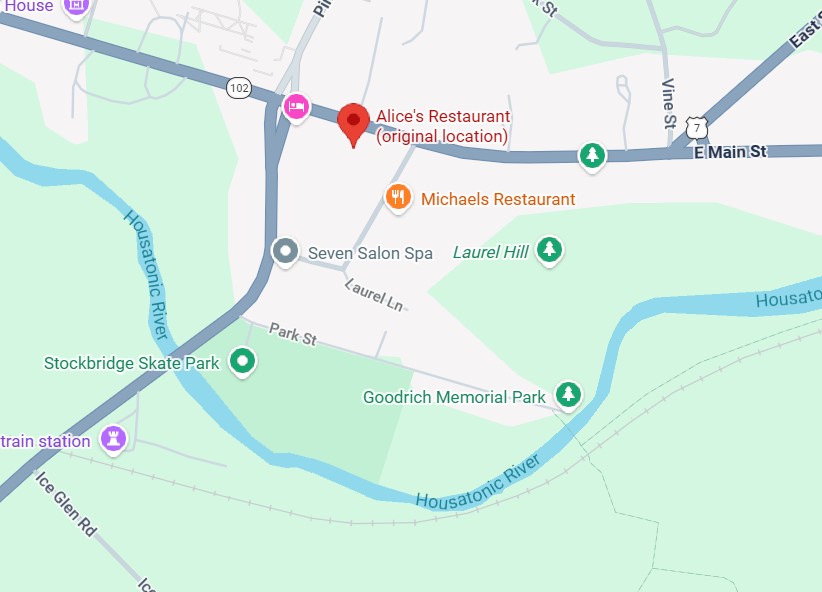
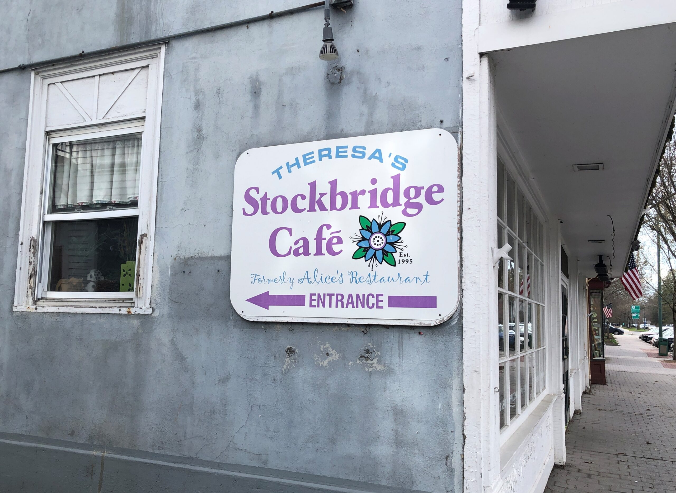
Not long ago, I wondered how accurate the lyrics of “Alice’s Restaurant Massacre” were on one specific point. I had my reasons.
You can get anything you want at Alice’s Restaurant Walk right in, it’s around the back Just a half a mile from the railroad track
Seems like a convenient rhyme, but that’s not all. Google Maps tells me that the site of Alice’s Restaurant is about a half a mile from a railroad track. I didn’t save the scale on this map, but the distanceis correct. This is mildly amazing. Who expects geographical accuracy from a song lyric?
That morning, April 14, I’d extracted myself from Midtown Manhattan via various sorts of transport, retrieving my car at long-term parking at Newark International, and planned to spend the night in Portsmouth, New Hampshire. Though New England isn’t large, it is molasses when it comes to driving through its densely settled areas, and first I had to get out of New Jersey and New York, then cross Massachusetts. All that meant an all-day drive. Stockbridge, Massachusetts, former home of Alice’s Restaurant, was a stop along the way.
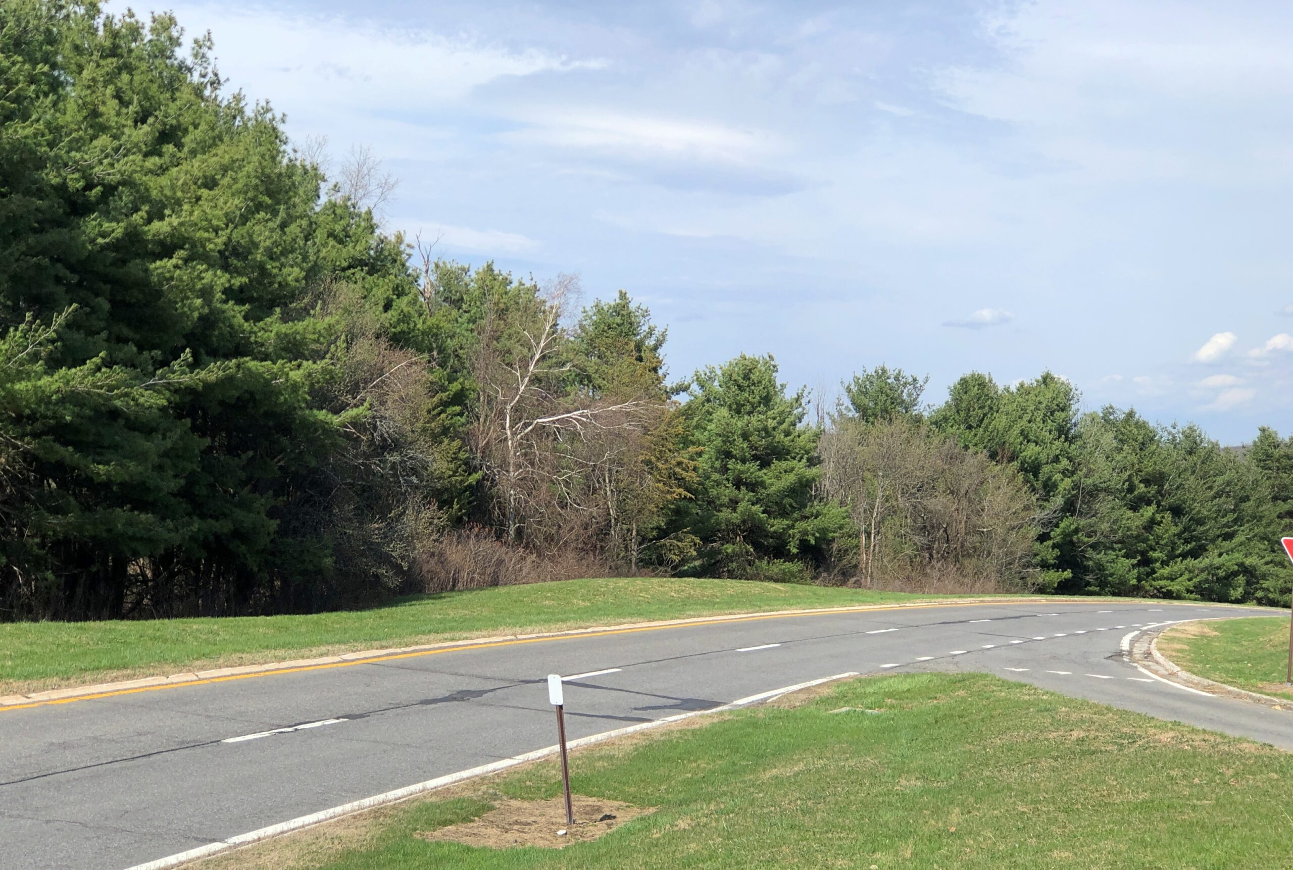
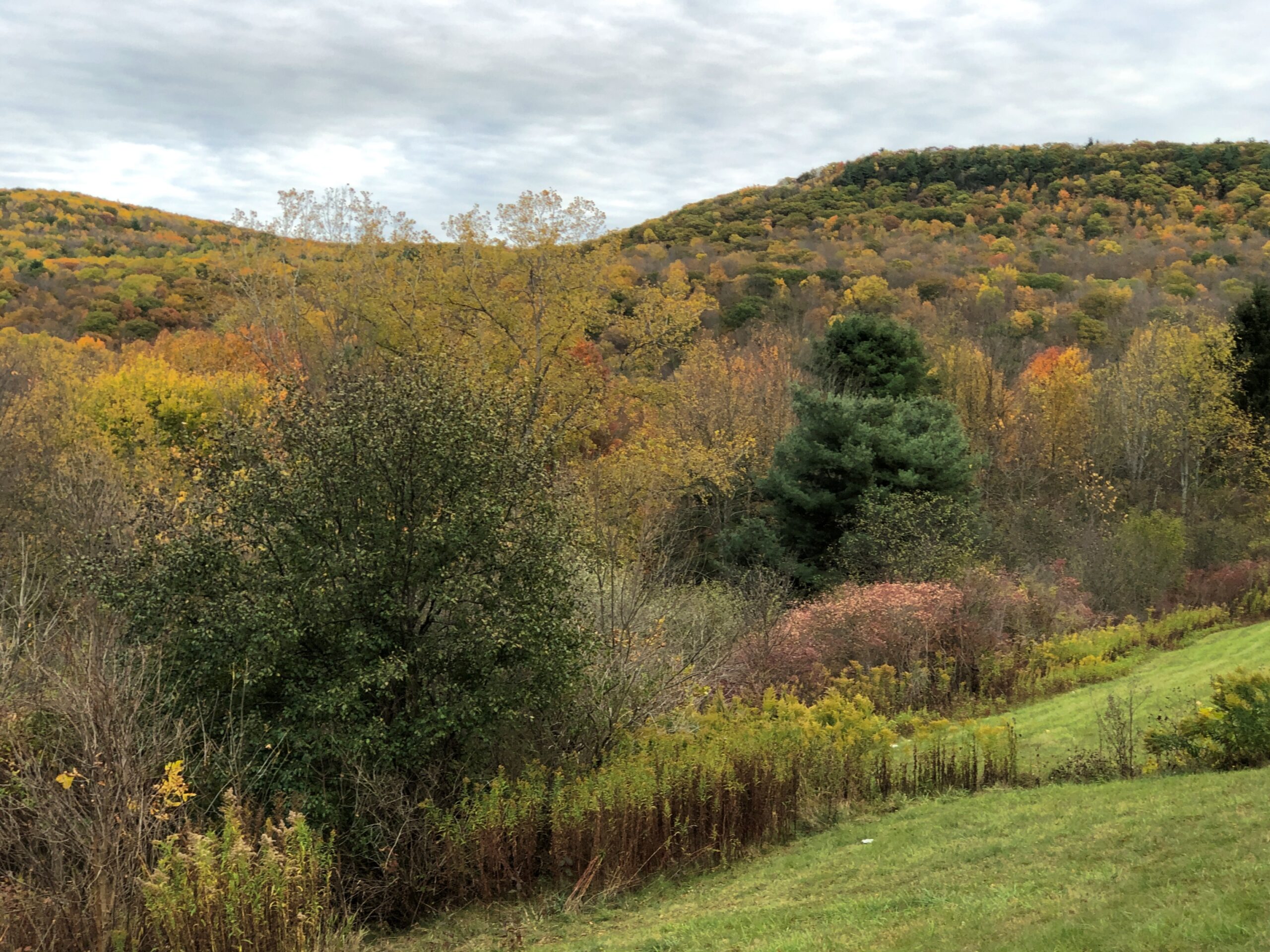
Near the eastern edge of New York state, I cruised north on the Taconic State Parkway.
That sounded good, I thought when I noted the name on a map. It was. Budding greenery, smooth driving, no trucks. Or that many other cars, the further north you go. Construction started about 100 years ago, at the urging of then private citizen Franklin D. Roosevelt. The parkway is in the same league as the Natchez Trace Parkway or the Blue Ridge Parkway, though only about a quarter as long as either.
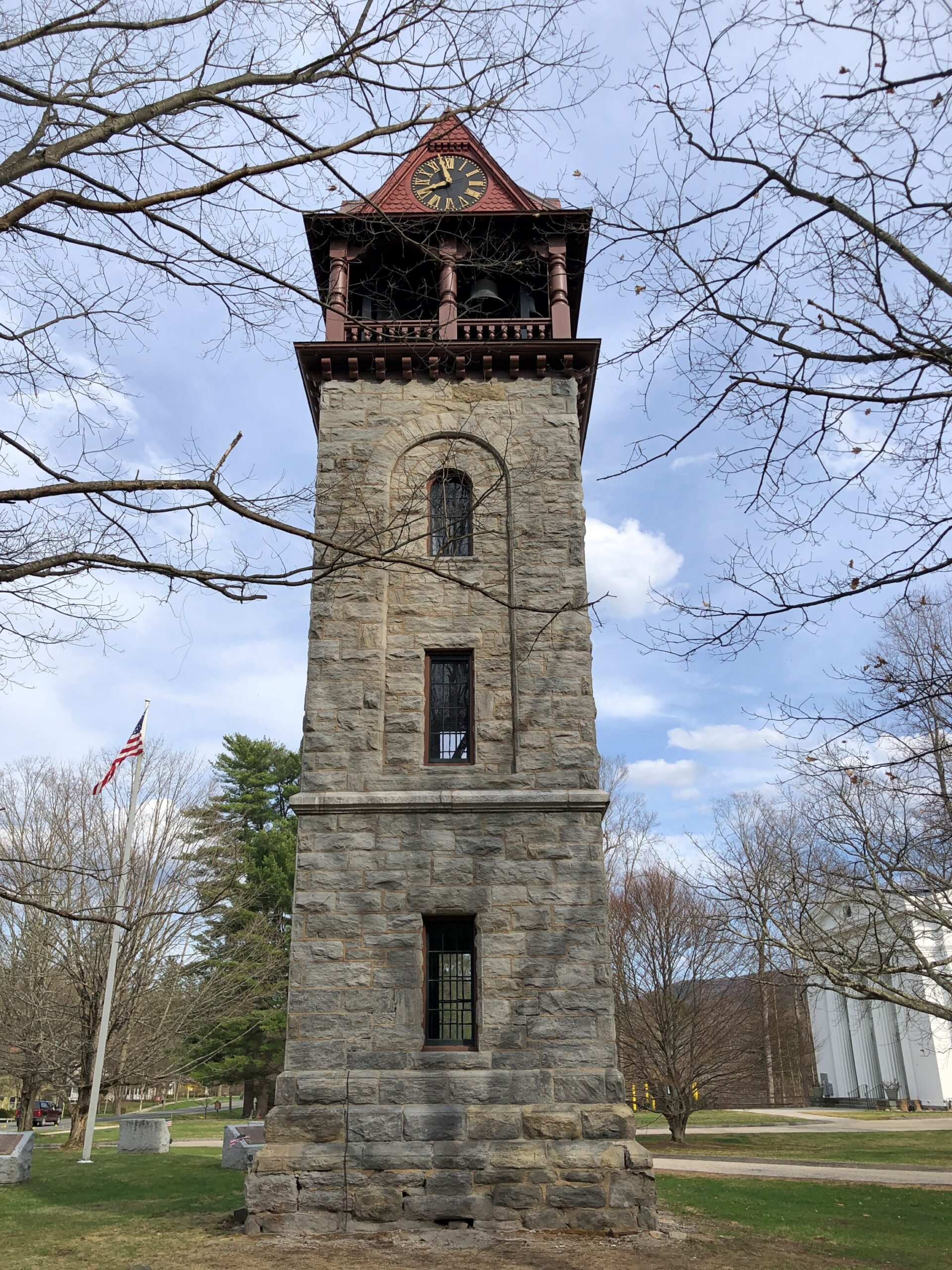
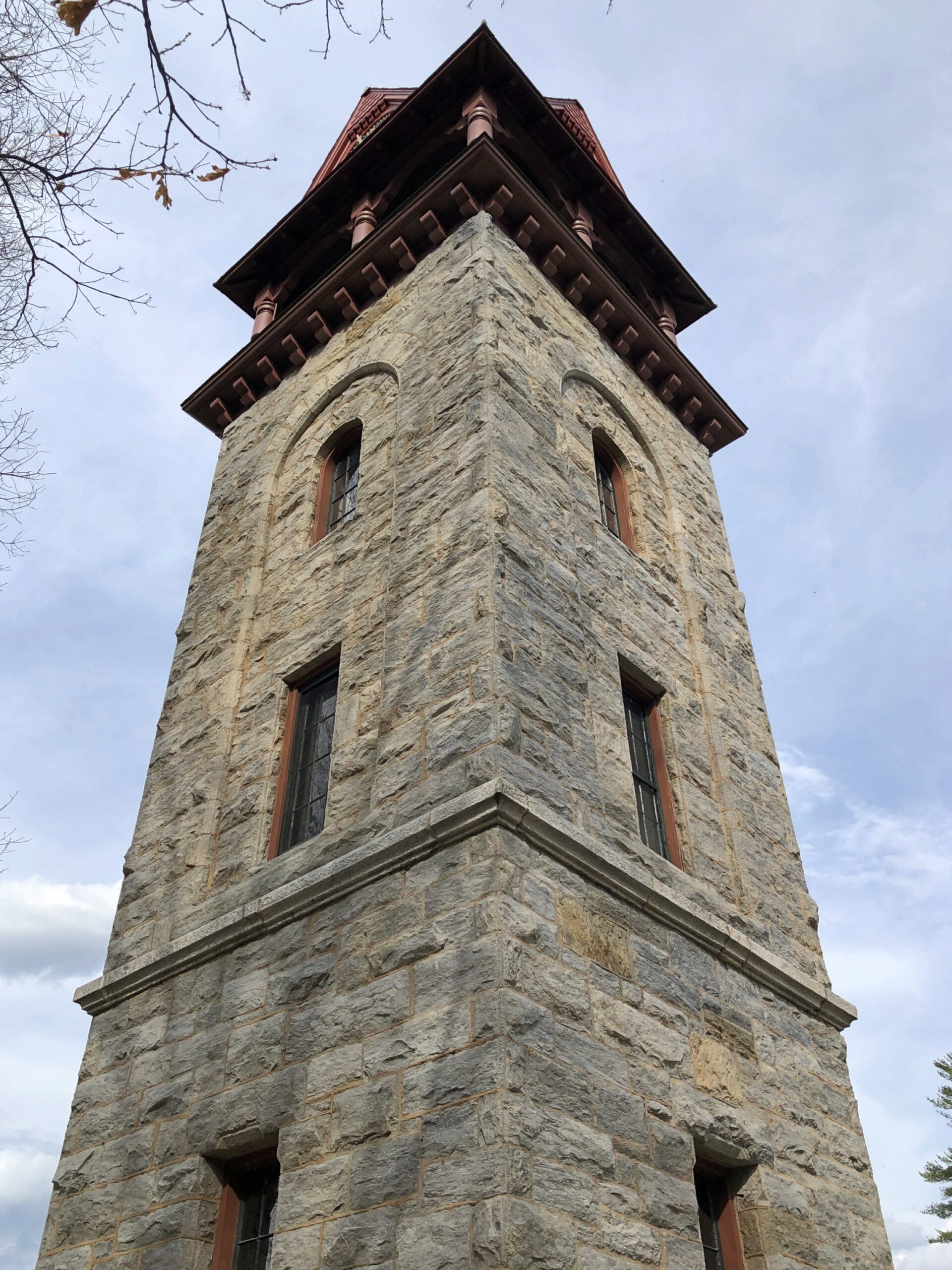
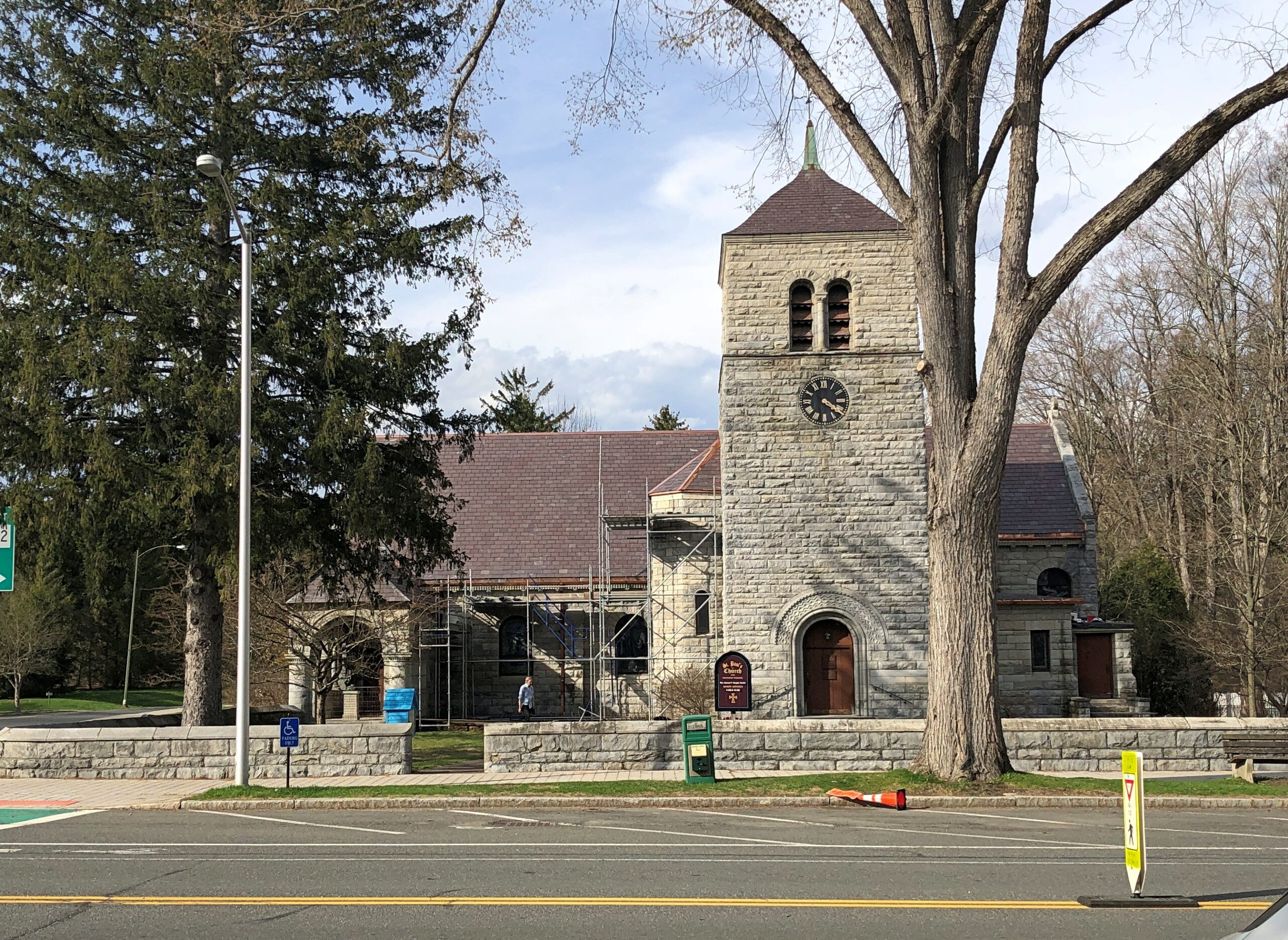
Once I’d gone far enough north, I took connecting roads to the Massachusetts Turnpike. Stockbridge, which is slightly south of the turnpike, counted more-or-less as a midway point on my day’s drive. As I entered town via Massachusetts 102, I noticed a tower. A stone tower, exuding 19th-century New England sturdiness. Its clock was wrong.
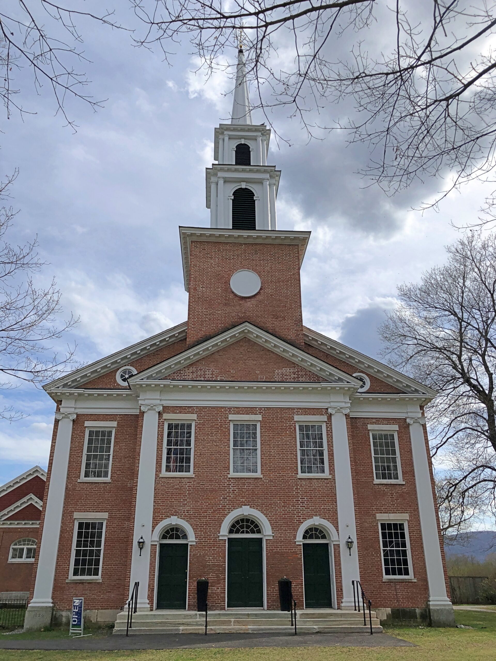
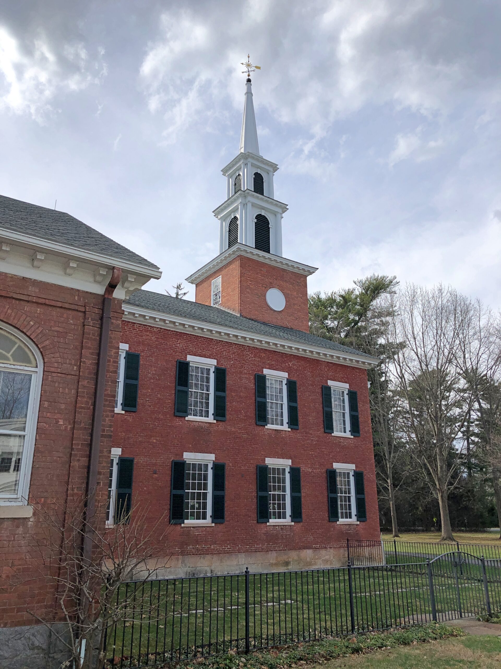
The Children’s Chimes Tower, a 19th-century bell tower built on the site of the town’s original church. A 19th-century replacement for that church stands near the bell tower, looking as New England as can be.
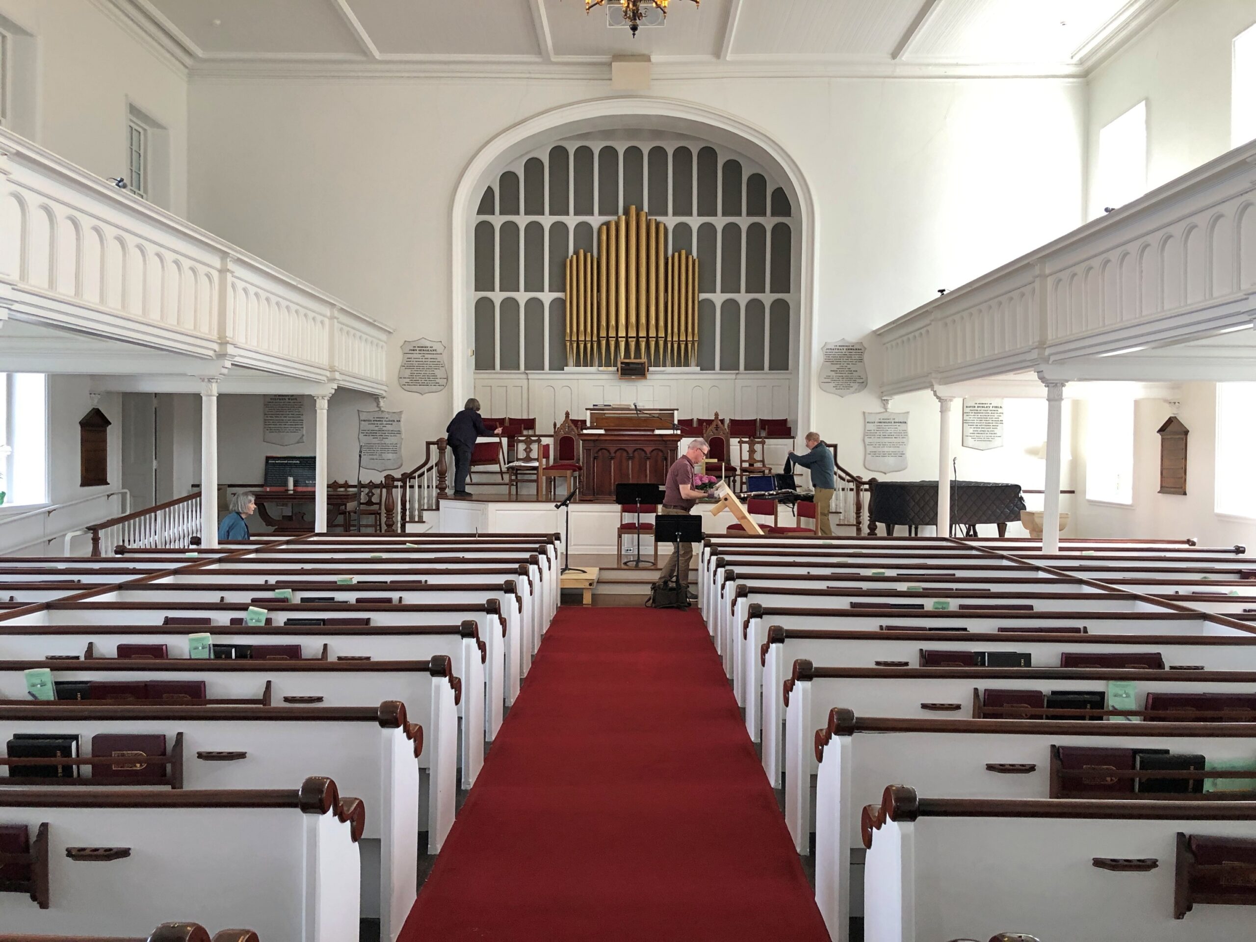
The First Congregational Church UCC. Remarkably, it was open.
Musicians were practicing, or rather seemed to be wrapping up a practice. They paid no attention to me as I looked around.
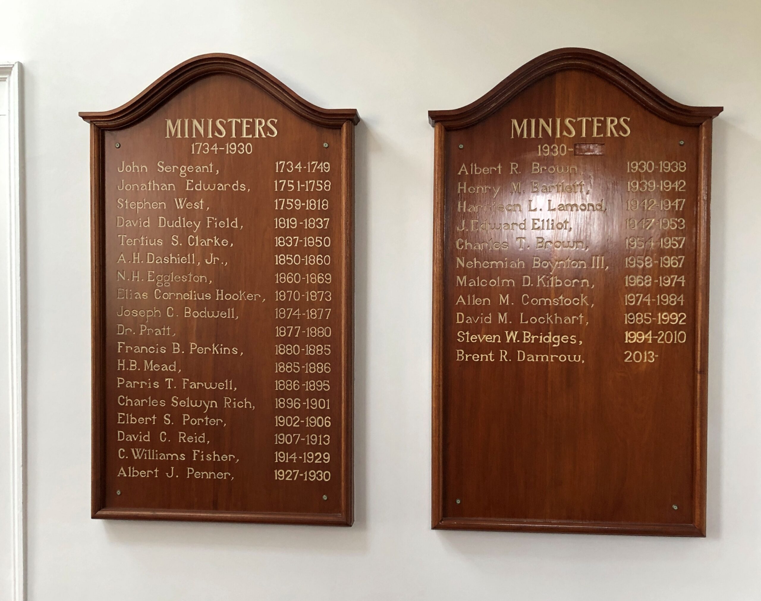
Jonathan Edwards was the church’s second pastor. “Sinners in the Hands of an Angry God” Jonathan Edwards? Yes.
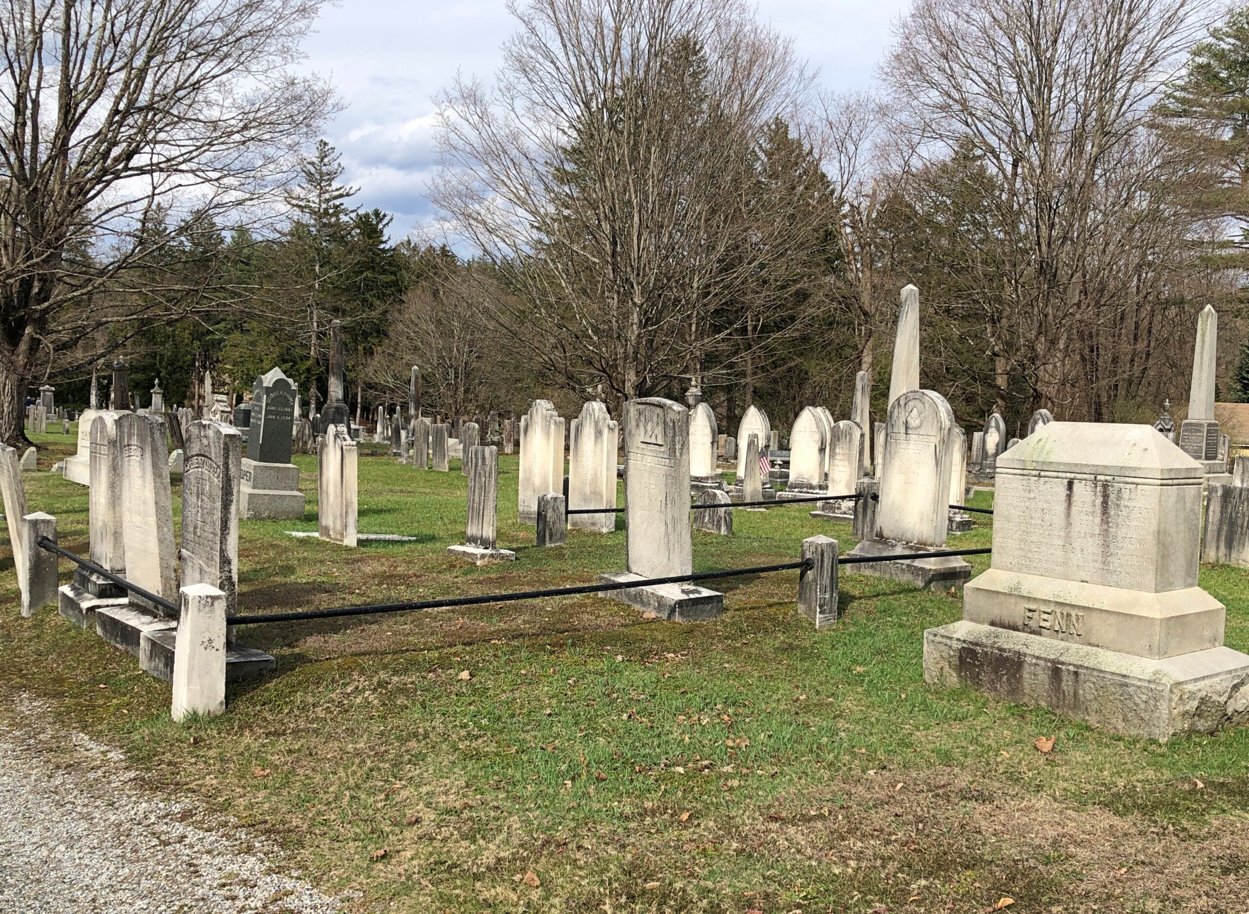
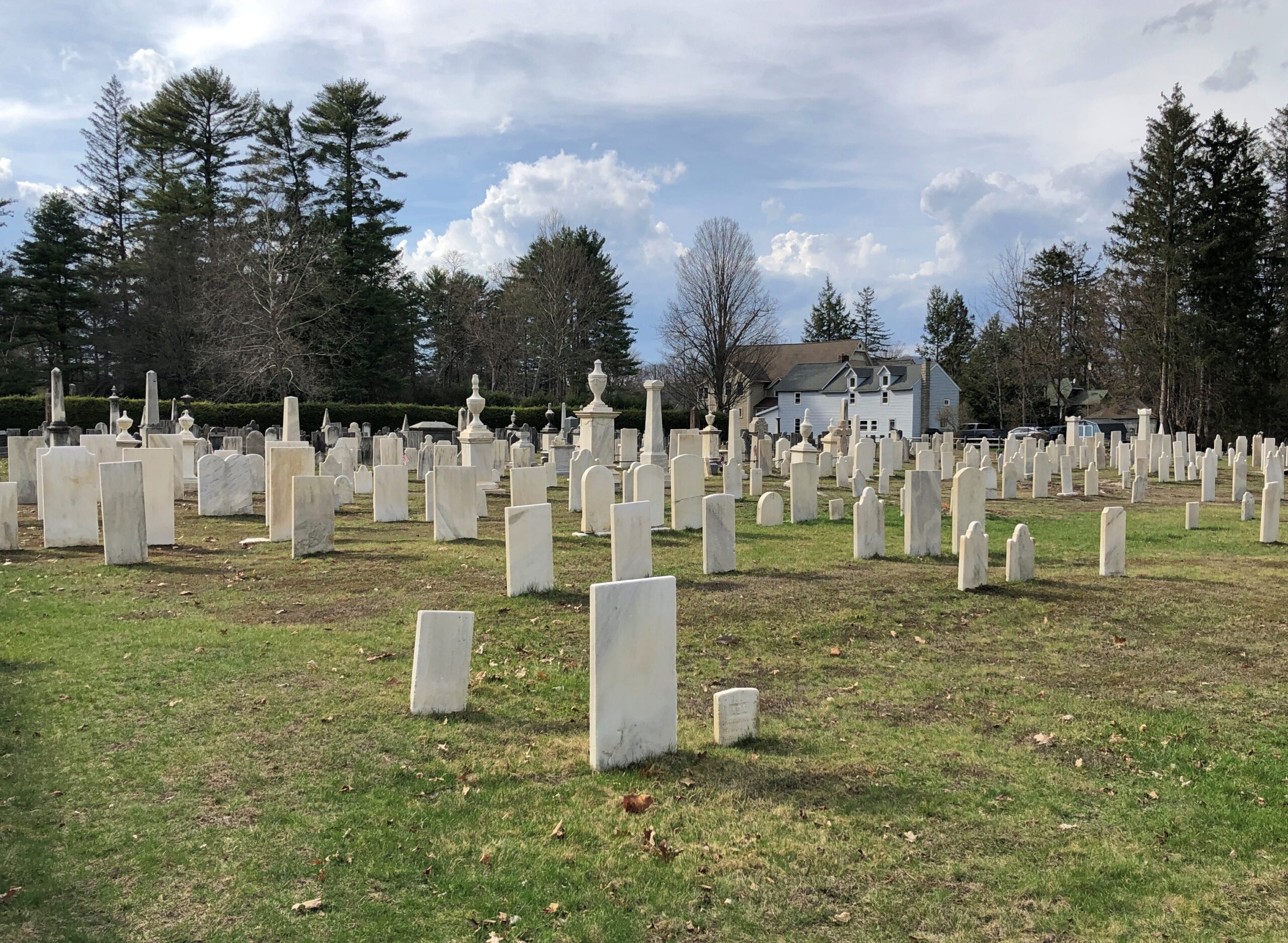
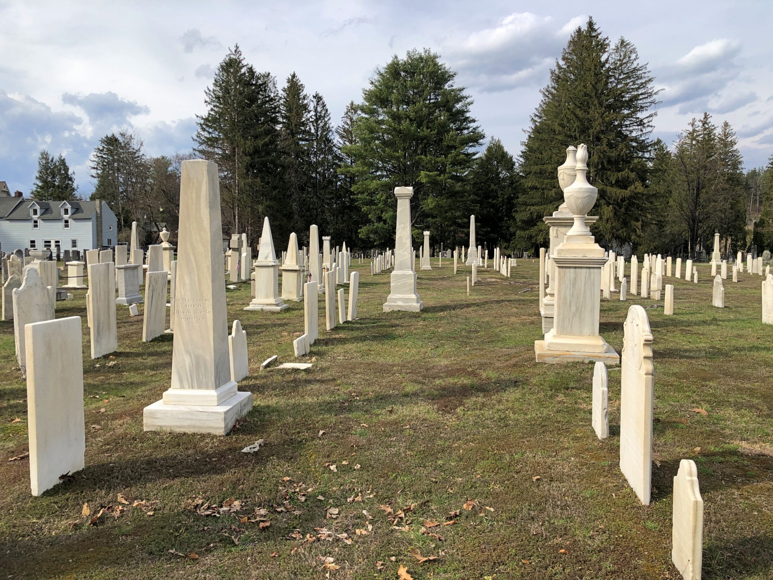
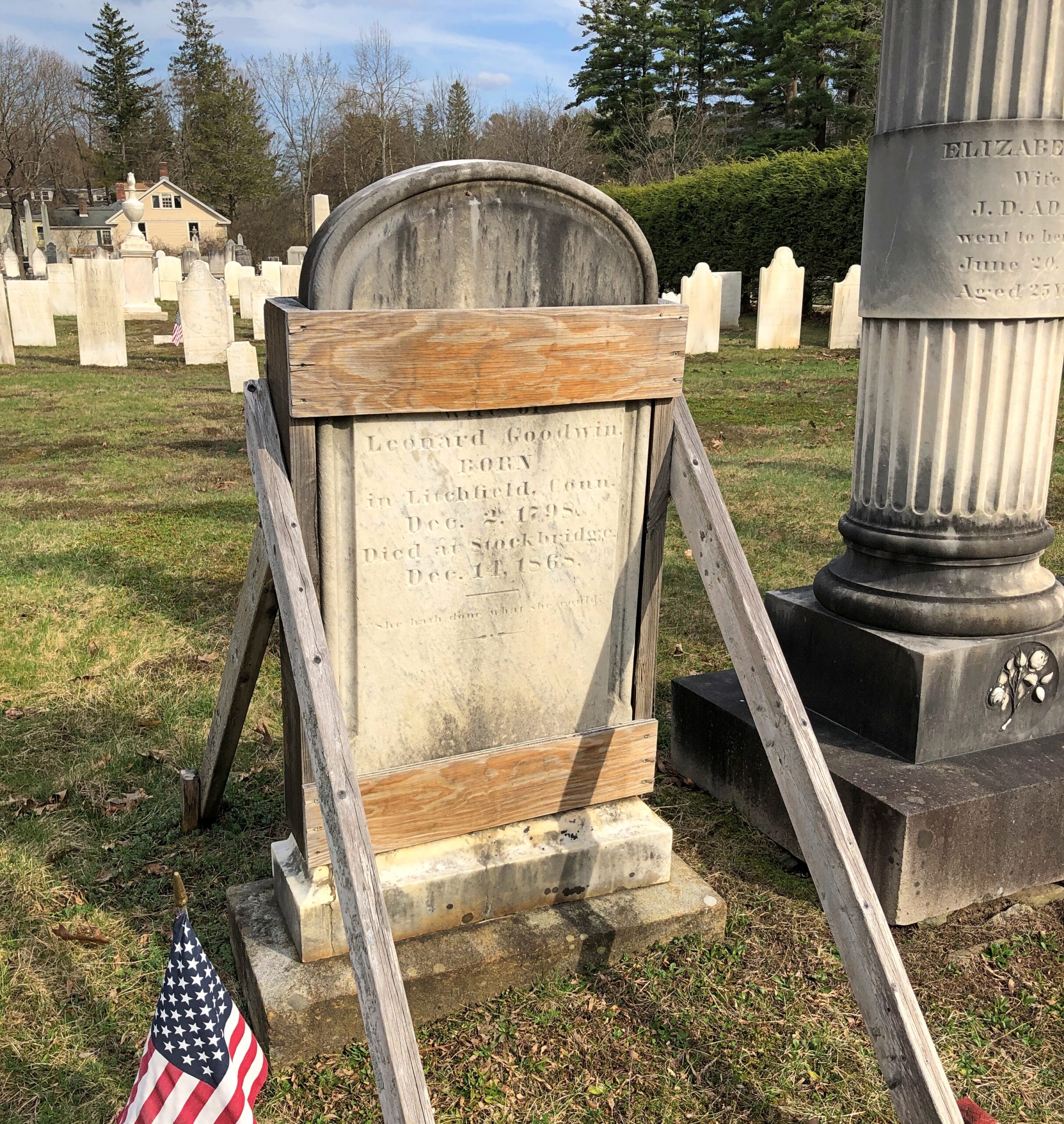
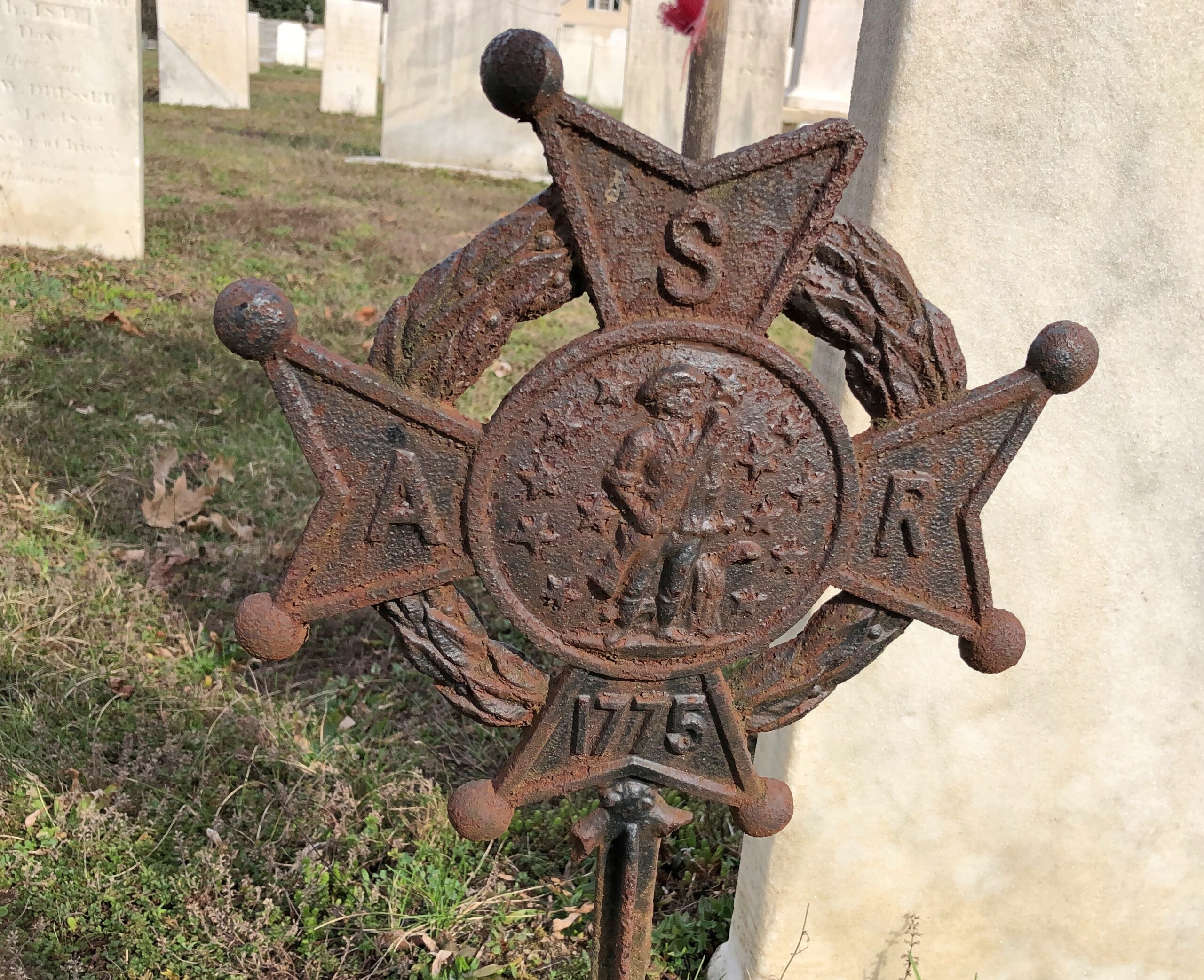
Across the road from the church and freestanding bell tower – which doesn’t chime, except in the summer – is the town cemetery.
“One of the earliest burials was the first minister, John Sergeant, who died in 1749,” says the Stockbridge Library. “Members of the Mohican tribe who joined the church also were buried here. Twenty years later, discussions began about ways to enclose the burial area to keep out cattle, horses, and pigs. It wasn’t until 1853, however, that a new organization in town, the Laurel Hill Association, took on the responsibility to clean and protect the area.”
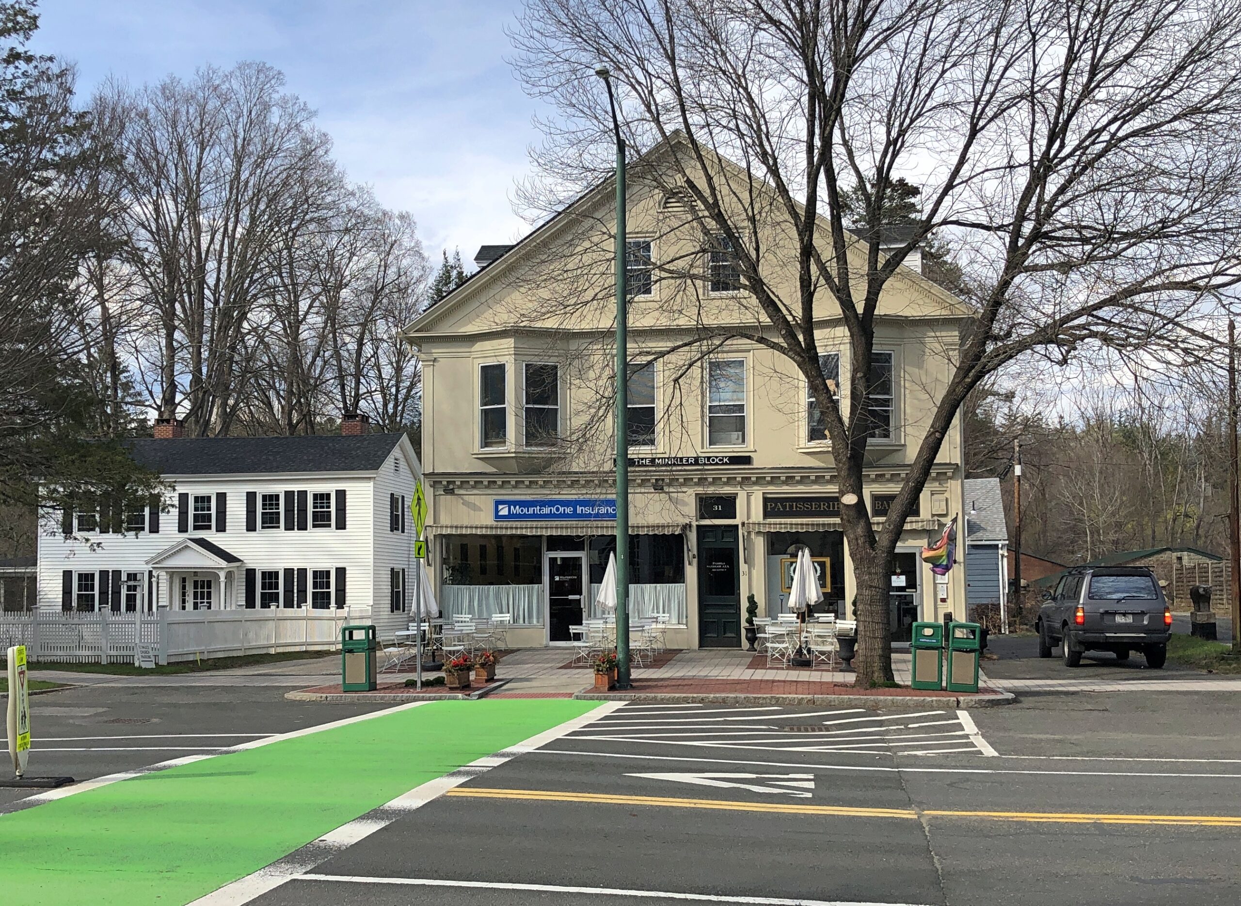
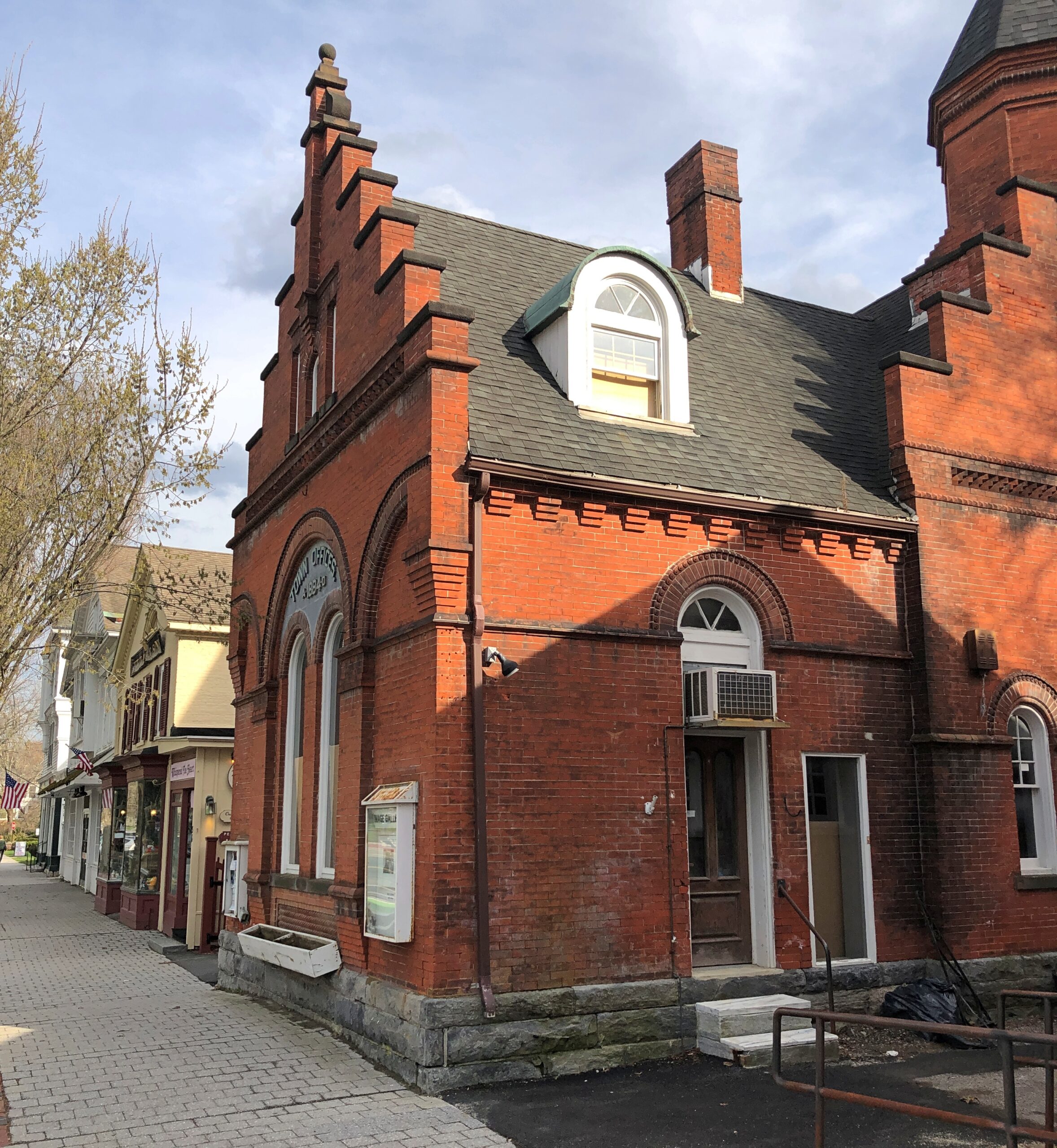
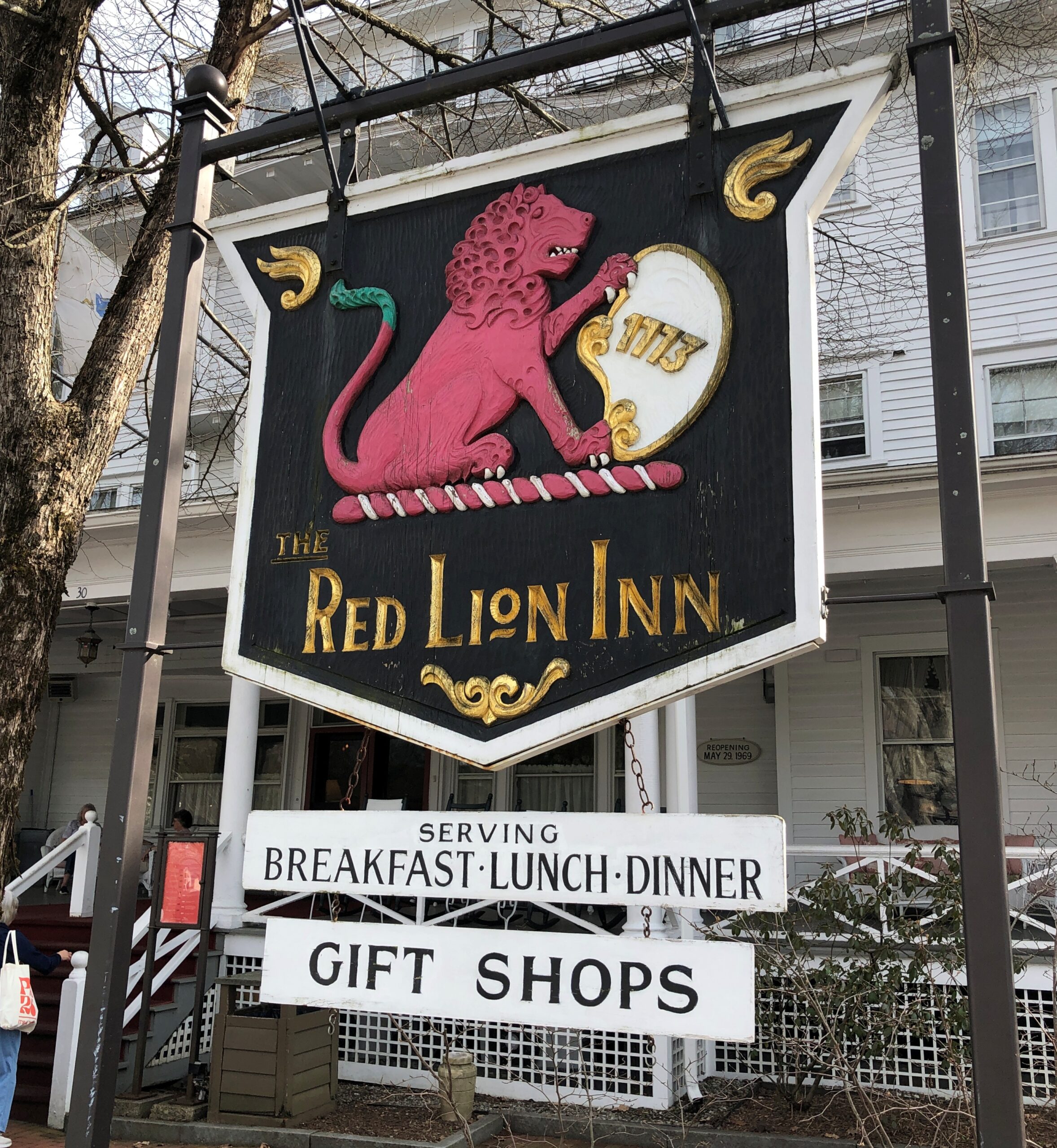
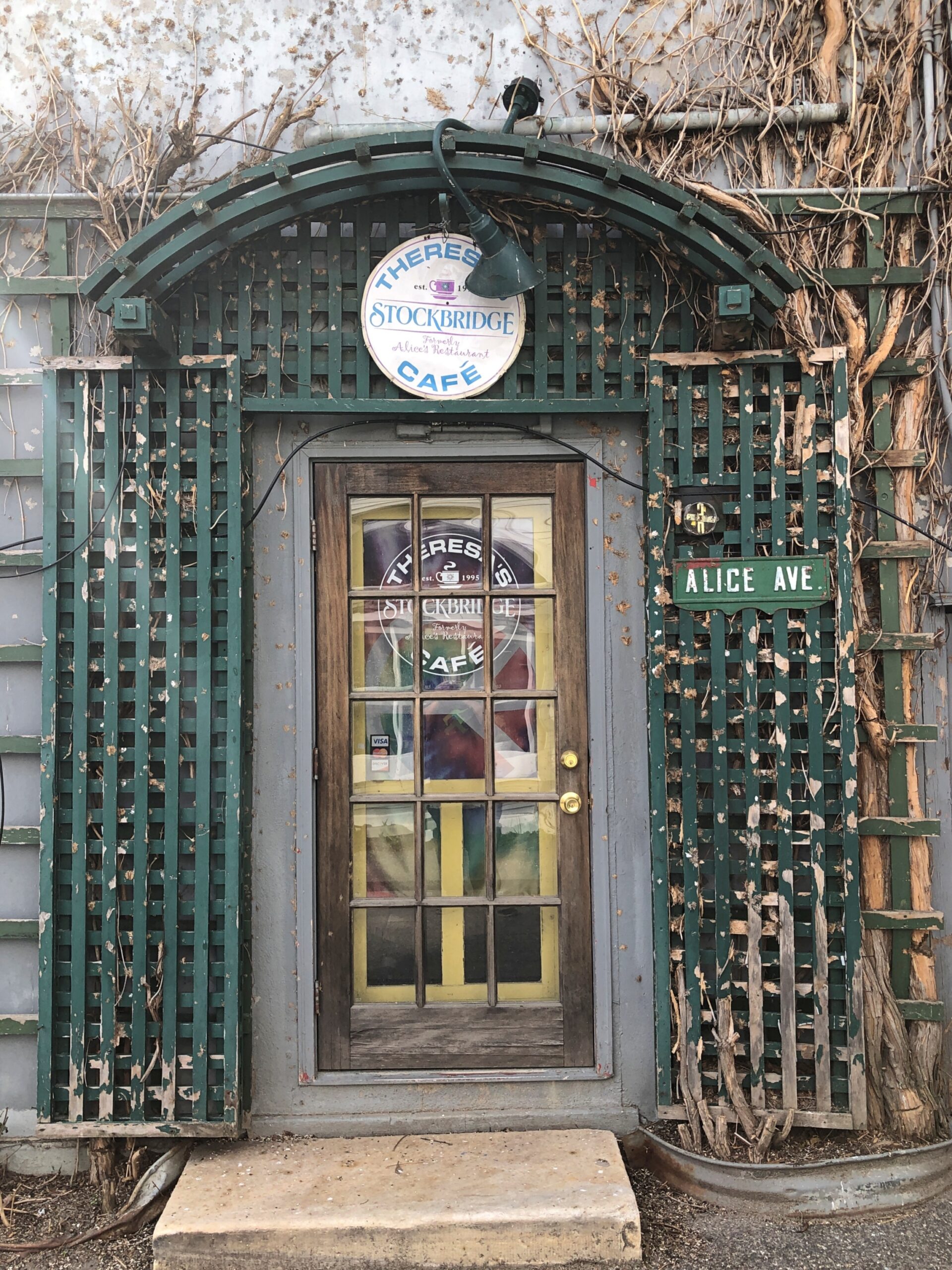
Route 102 turns into Main Street, with its shops, hotels, and other establishiments.
And, around the back (off Main St., that is), just a half a mile from the railroad track, is Theresa’s Stockbridge Café.
Regards for Easter. And Maundy Thursday and Good Friday and Easter Saturday. Back posting on Easter Monday.
This seemed like a fitting set of images for the occasion.
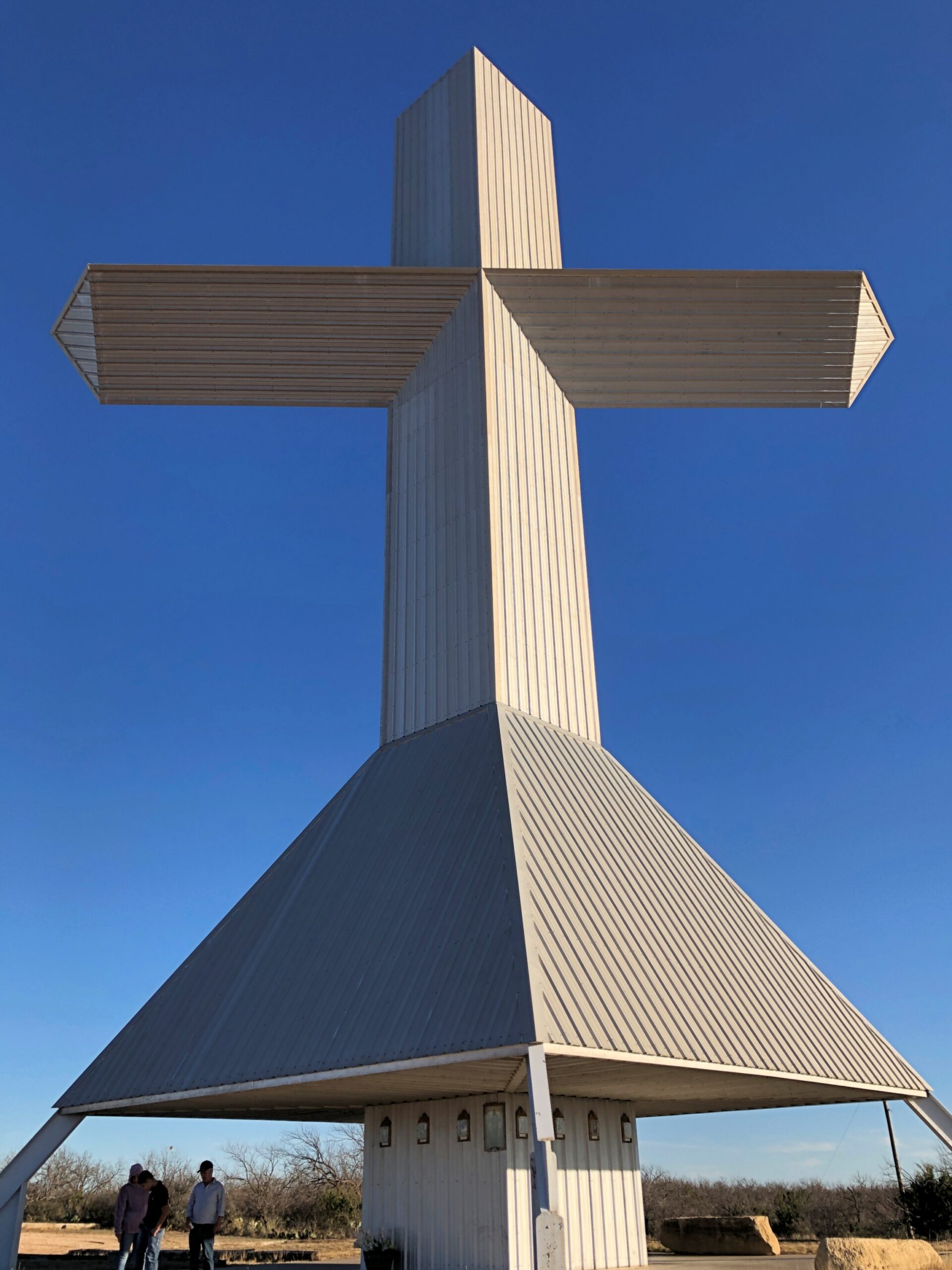
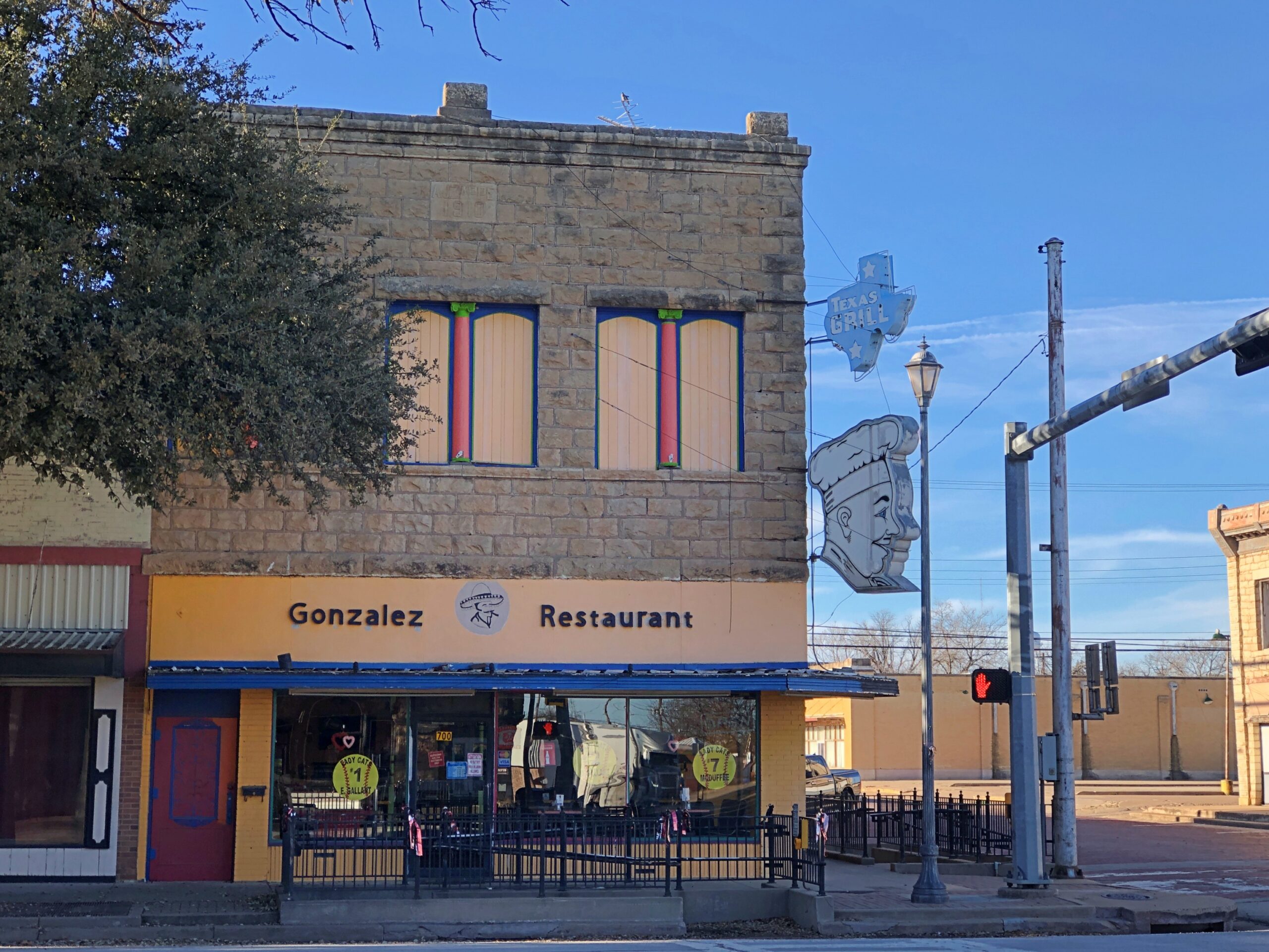
A 100-foot steel cross rises on a small hill a few miles south of Ballinger, Texas, seat of Runnels County. Couldn’t very well pass that up, considering that we were passing through Ballinger (pop. about 3,600) anyway, toward the end of our drive that day from metro DFW to San Angelo, Texas.
“The Ballinger cross was built by a local construction company and commissioned by Jim and Doris Studer, owners of Buddy’s Plant Plus,” notes the Austin Chronicle. “The company is the only U.S. factory making water-soluble fertilizer for Miracle-Gro. After 20 years of making fertilizers in Florida, the Studers went looking for a drier climate. In 1988, they moved the company to Ballinger, where it quickly became one of the largest employers in the county.”
Jim Studer reportedly had been considering the construction of a cross about half that height, as a token of gratitude for a successful business. Then, during a visit to Florida, he was nearly electrocuted in what could easily have been a fatal accident – and decided to roughly double the size of the structure. A thanks to the Lord for not being offed at that moment, perhaps, but no doubt sincere gratitude regardless, for his thriving business. The cross went up in 1993.
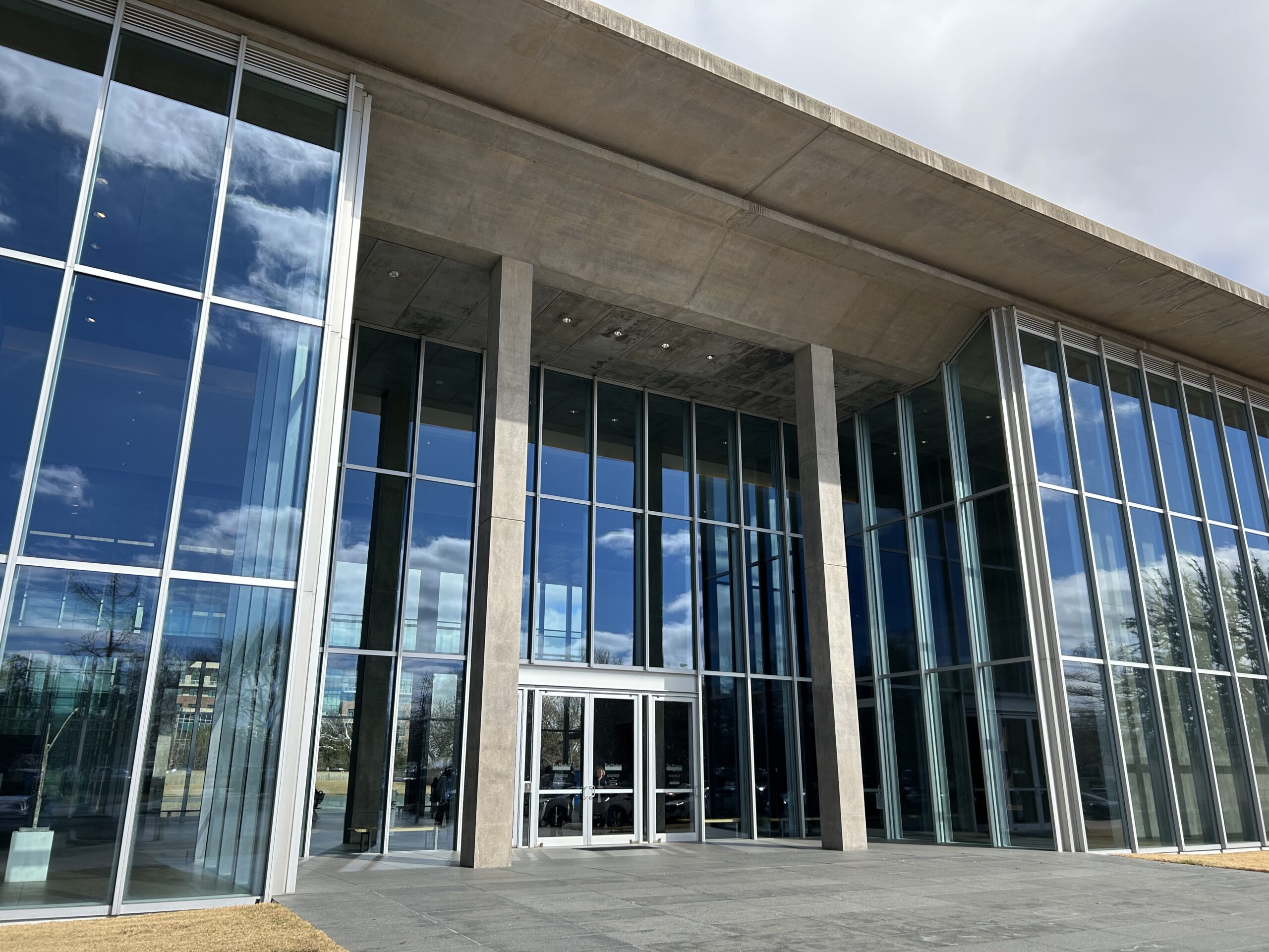
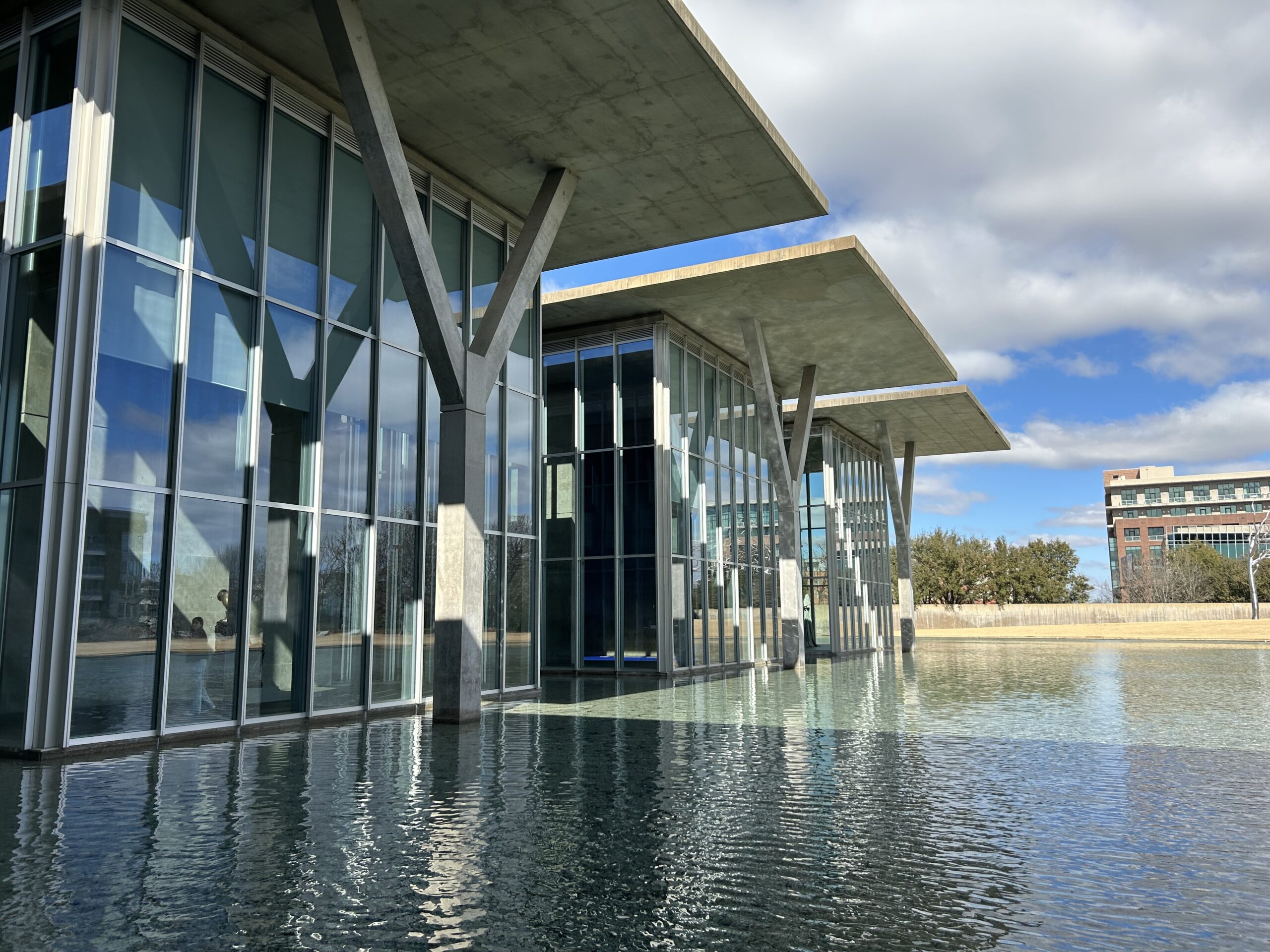
We’d left Dallas that morning in mid-February, skirting the cities on I-20 West, except for a brief stop in the Fort Worth museum district. Specifically, at the Modern Art Museum of Fort Worth. Yuriko had heard about my visit in 2019 and been slightly miffed, since she too wanted to see the Tadao Ando-designed structure. So we shoehorned a visit for a look at the structure on the day’s itinerary, though not the museum collection. It loses nothing on a second viewing. Gets better.
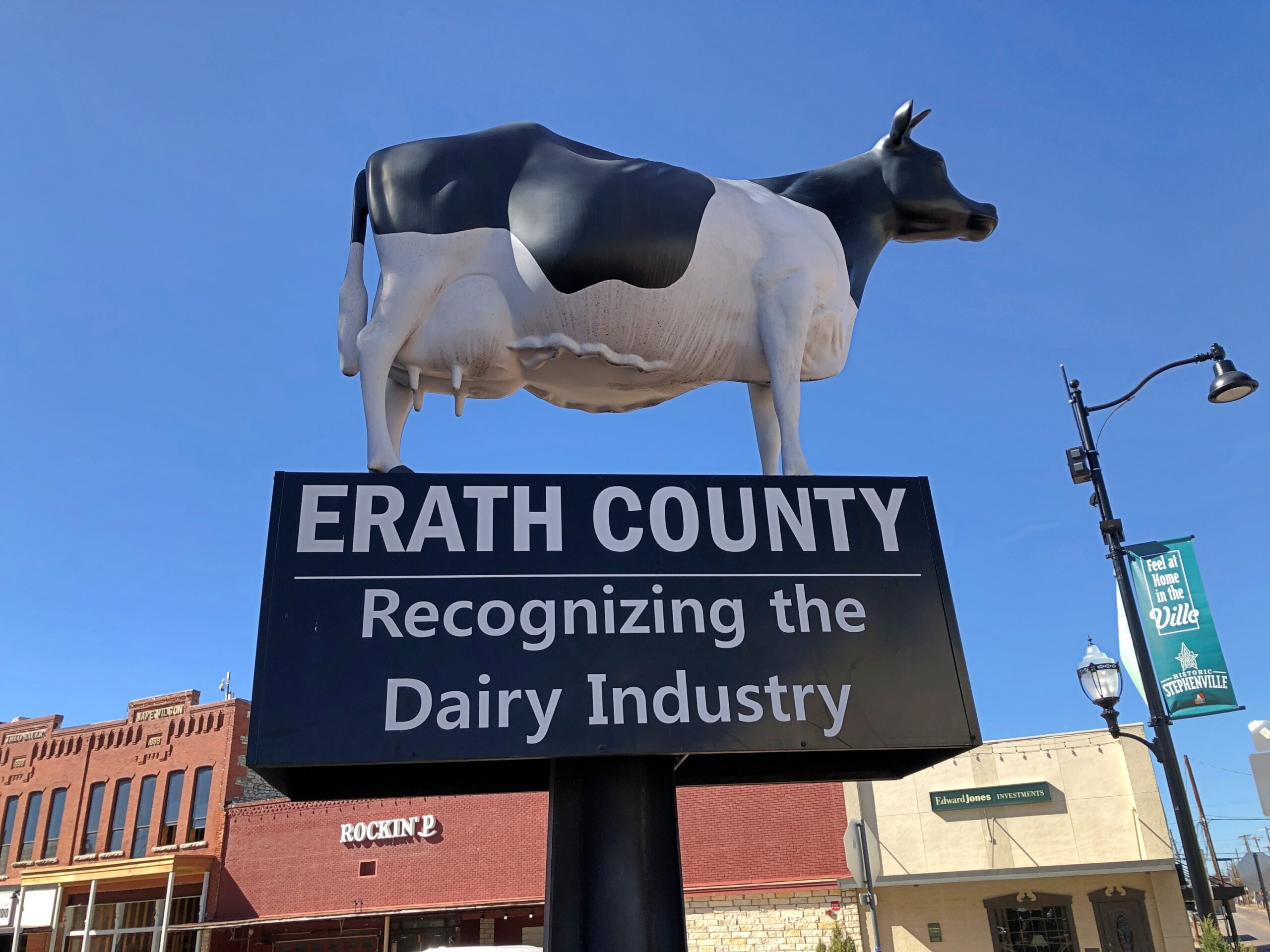
Go southwest from Fort Worth on US 377 and soon enough you’ll arrive in Stephenville (pop. 20,800 or so), seat of Erath County.
A dairy industry in Erath County? Yes, indeed: sales of $350.9 million in 2022, according to the USDA, by far the largest ag product in the county, and third highest for milk sales among all the 254 counties in Texas, and 24th in the nation. Meat cattle in Erath County are a distant second at $82.7 million that year, so a milk cow standing in the shadow on the Erath County courthouse is just about right.
I had to look it up: number one county in nation for milk production by dollar volume is not in Wisconsin, but rather Tulare County, California, at more than $2.8 billion in 2022. First out of 1,770 counties nationwide producing milk. Now there’s a Jeopardy answer to stump everyone.
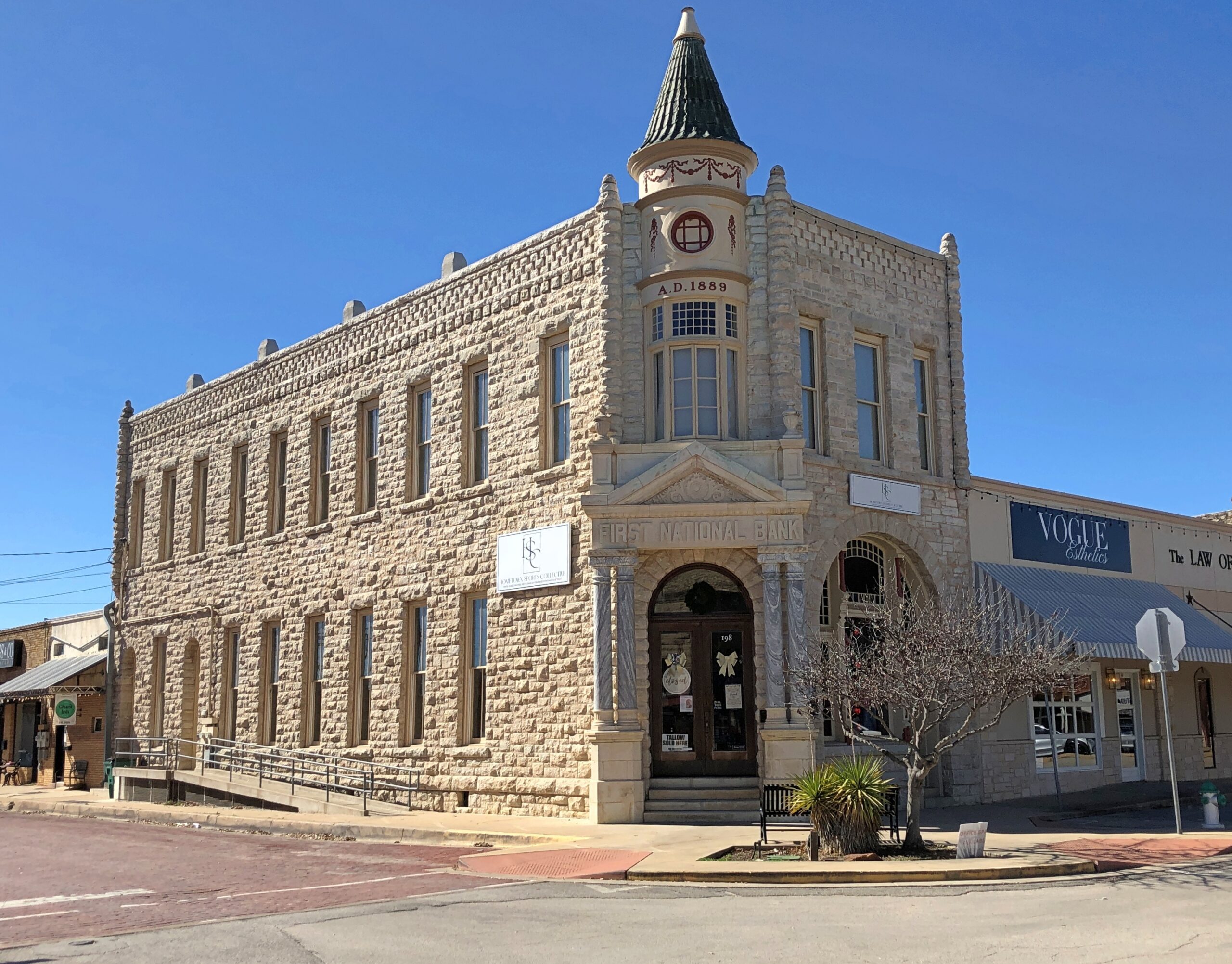
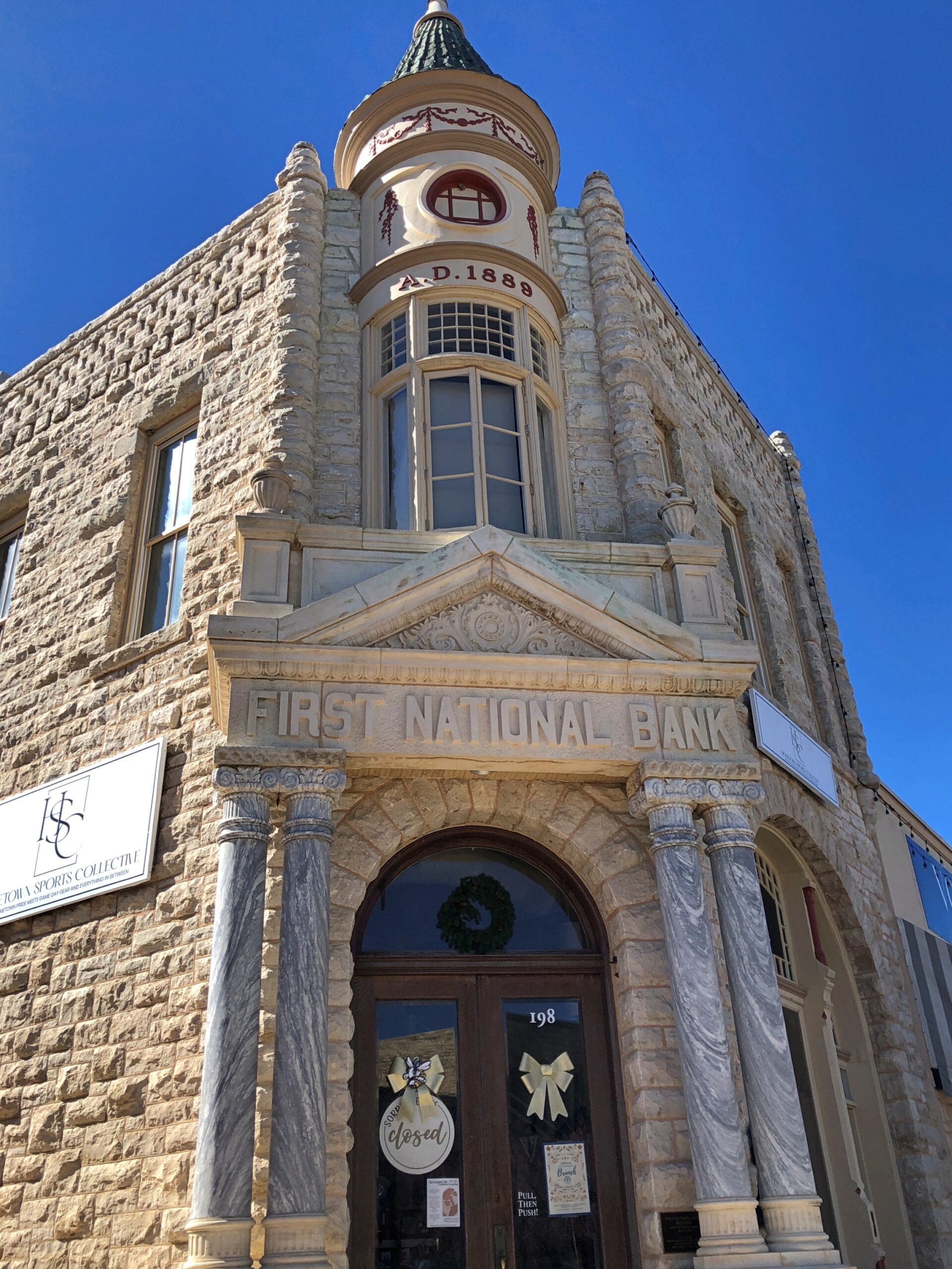
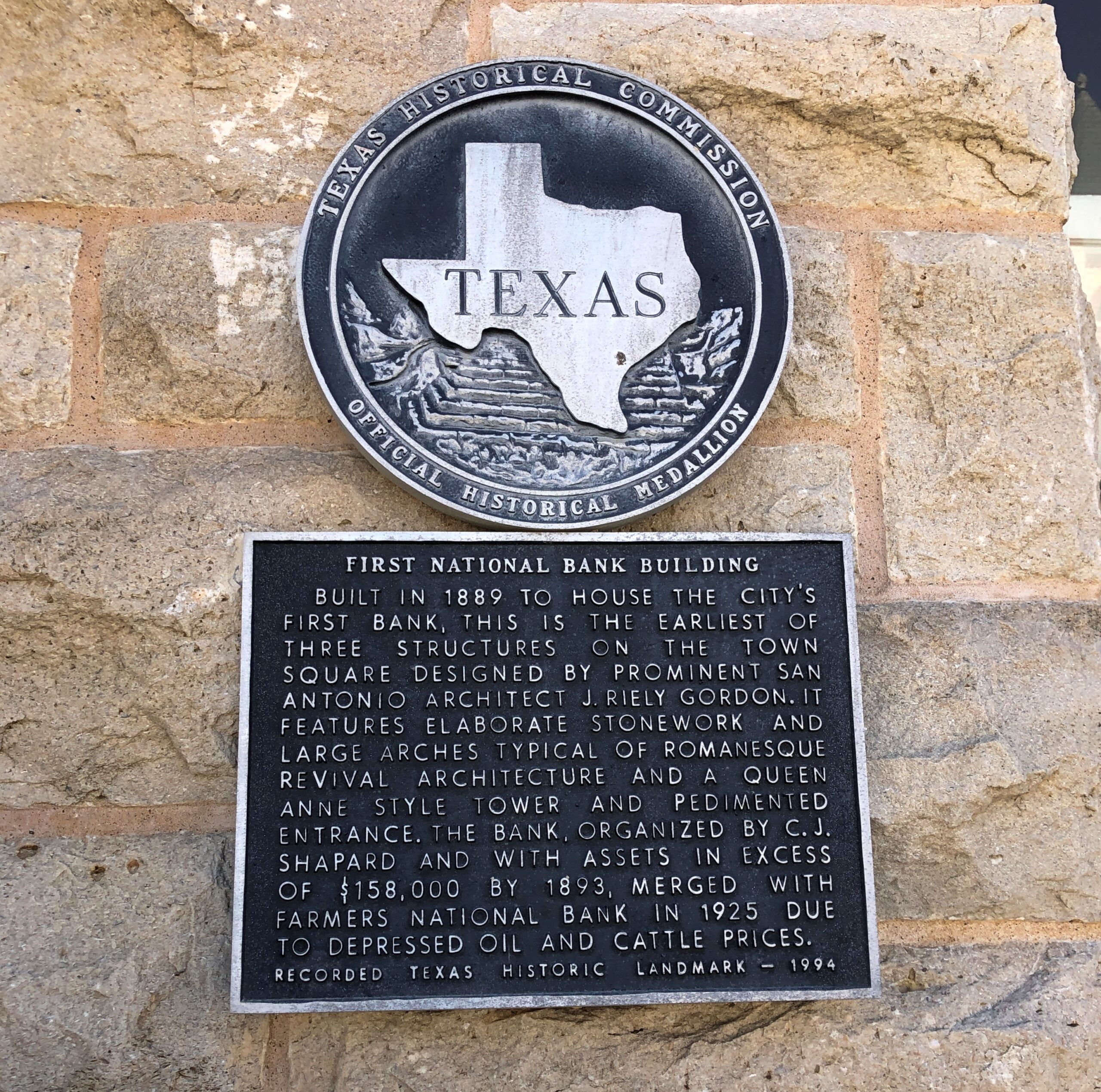
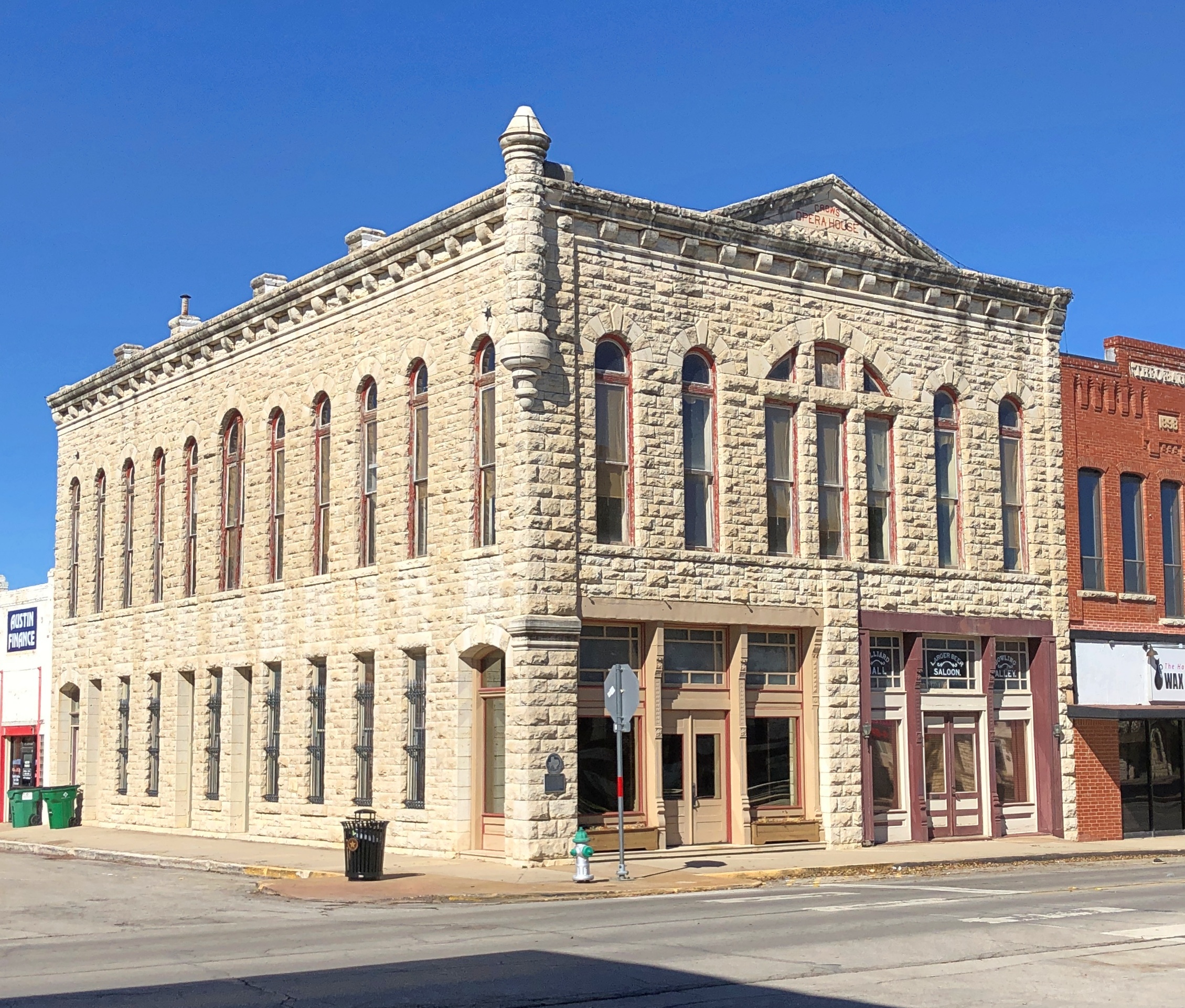
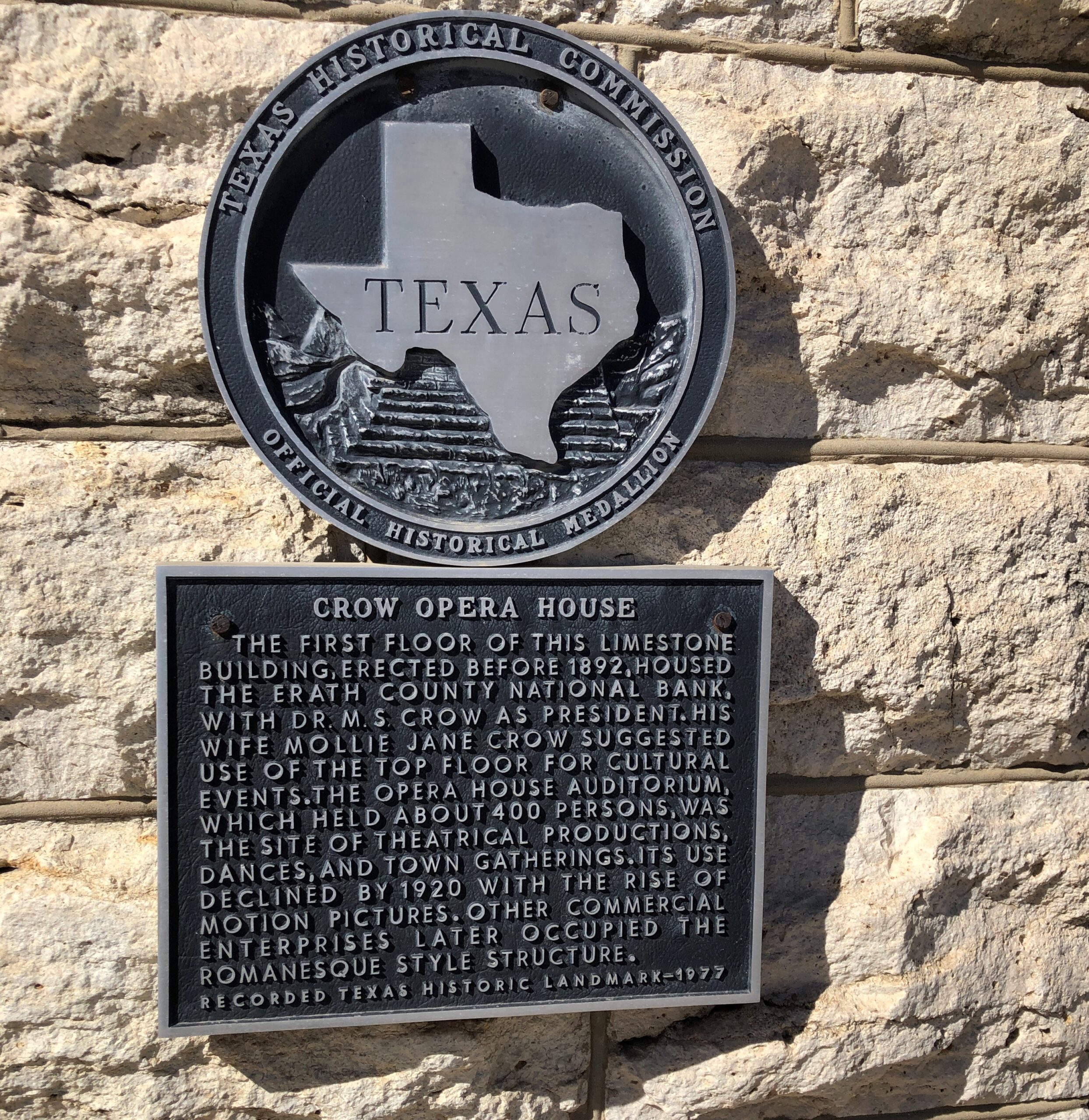
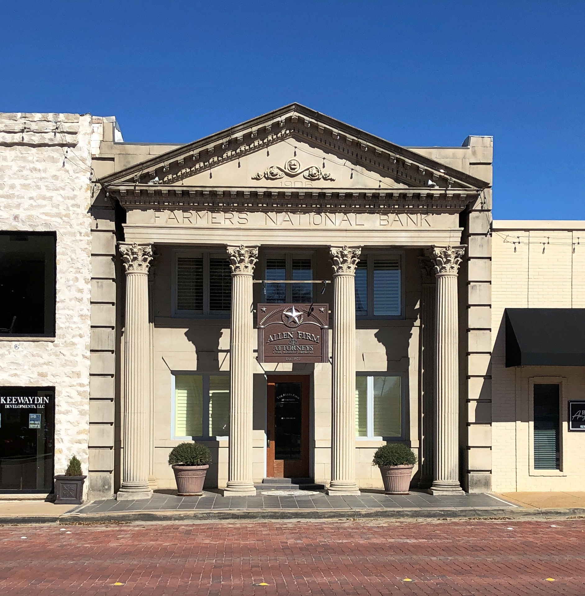
We ate lunch in Stephenville at Greer’s, which served a chicken-fried steak to beat all, then took a constitutional around the Erath County courthouse. Starting with one hefty former bank building, vintage 1889.
For Texas county courthouses, James Riely Gordon (d. 1937) is a starchitect, but of course that wasn’t all he did. When he designed this bank, he was 26.
Every town worth its late 19th-century salt has to have an opera house.
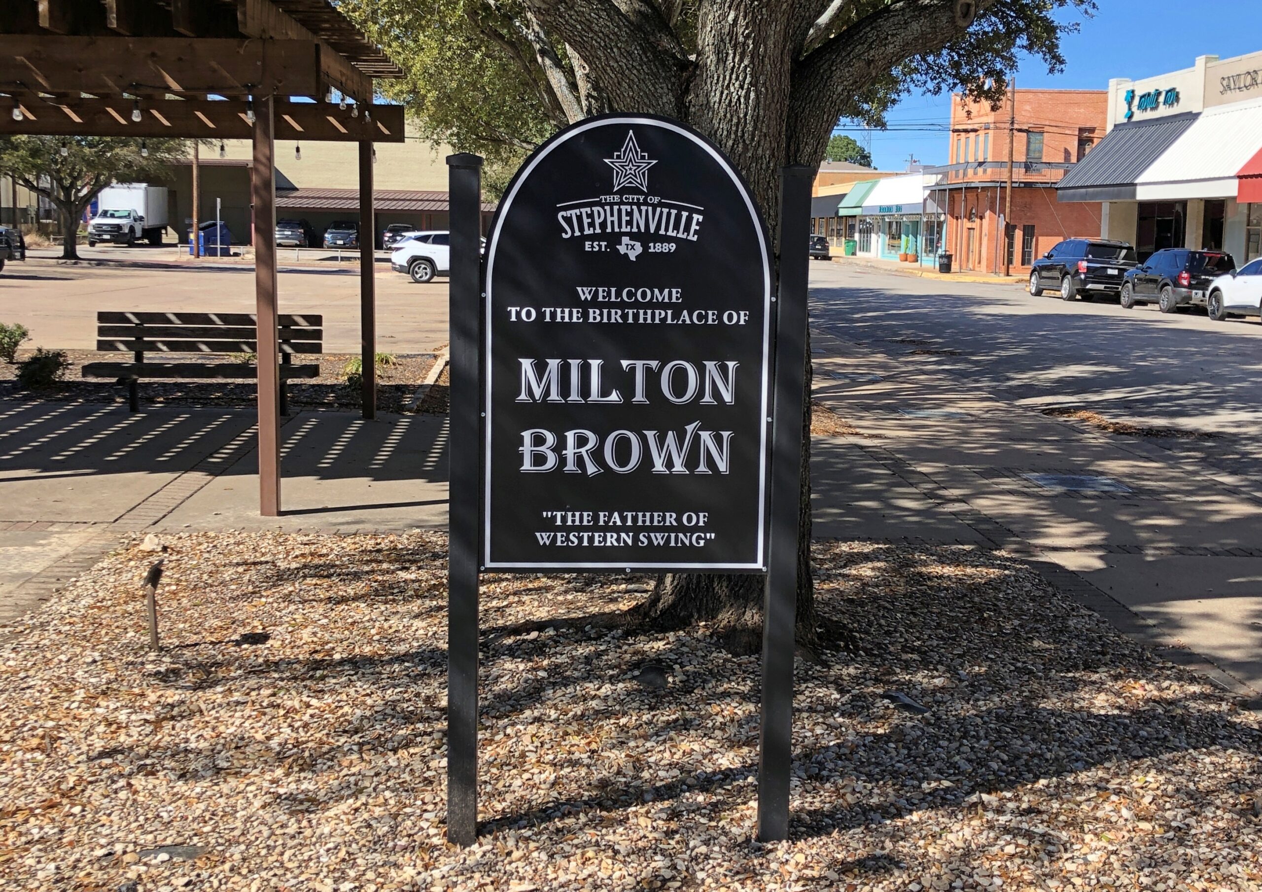
Wiki: “Brown began his musical career in 1930, when he met Bob Wills and guitarist Herman Arnspiger. They were performing at a local Fort Worth dance and Brown joined the duo on a chorus of ‘St. Louis Blues.’ The trio decided to team up to play medicine shows around Texas and Brown landed a regular radio spot on WBAP for the group, where they played a show sponsored by Aladdin Lamp Company, which had the band change its name to the Aladdin Laddies.”
Man, there’s another streaming platform limited series for you: the founding of western swing. Add a fictional love triangle between Bob Wills and Milton Brown and a fictional fetching woman, and some fictional tension between Bob and Milton, who nevertheless produce terrific music to enthusiastic audiences early in the Depression, until Milton dies suddenly in the last episode in a car wreck, as the real musician did in 1936 at age 32. Bob is left to carry on.
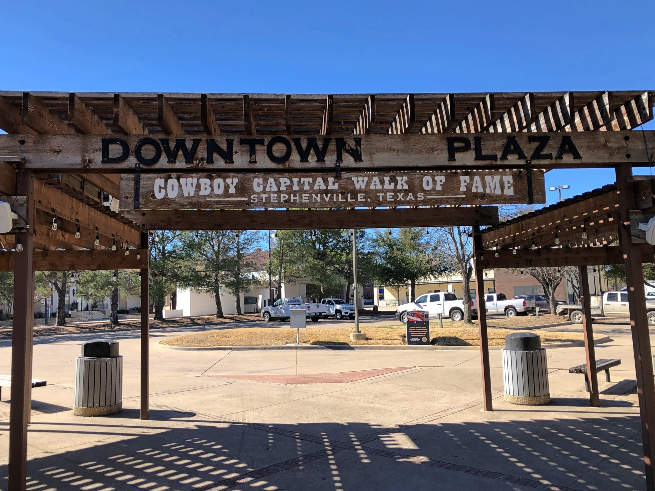
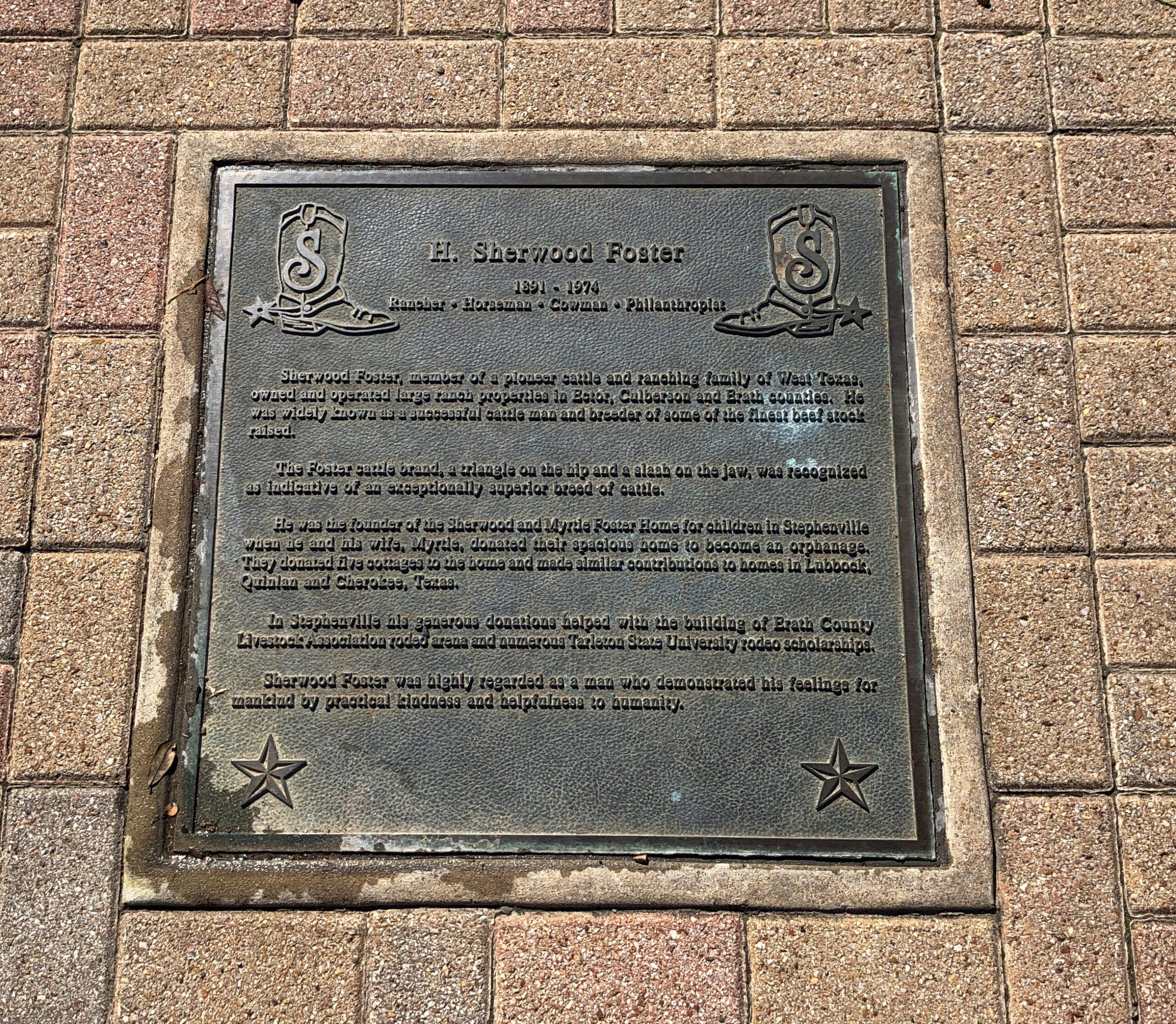
Milton’s not the only one honored near the Erath County courthouse.
There were a fair number of plaques like this, too many to read, so I picked one.
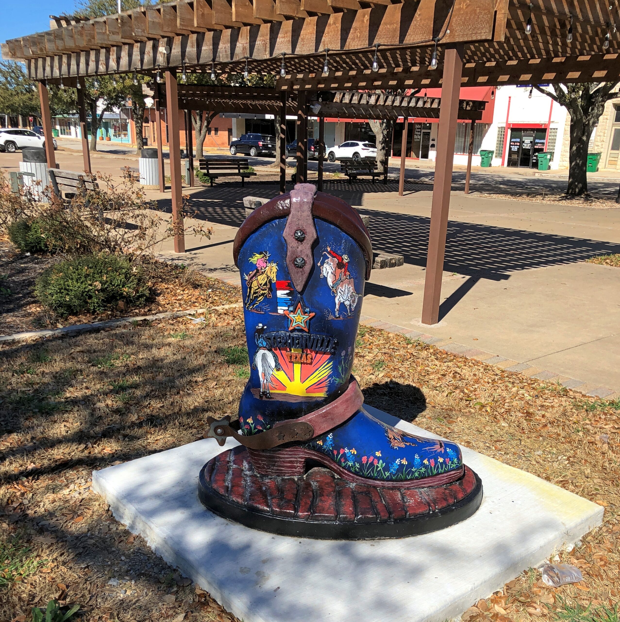
Chicago had its art cows (that was in 1999?!?) and Sturgeon Bay, Wisconsin, has its sturgeons, so Stephenville had boots?
You’d think maybe, considering the importance of dairy locally, there would also be — do dairy workers wear special boots? If so, there should be one of those on display too.
More Stephenville.
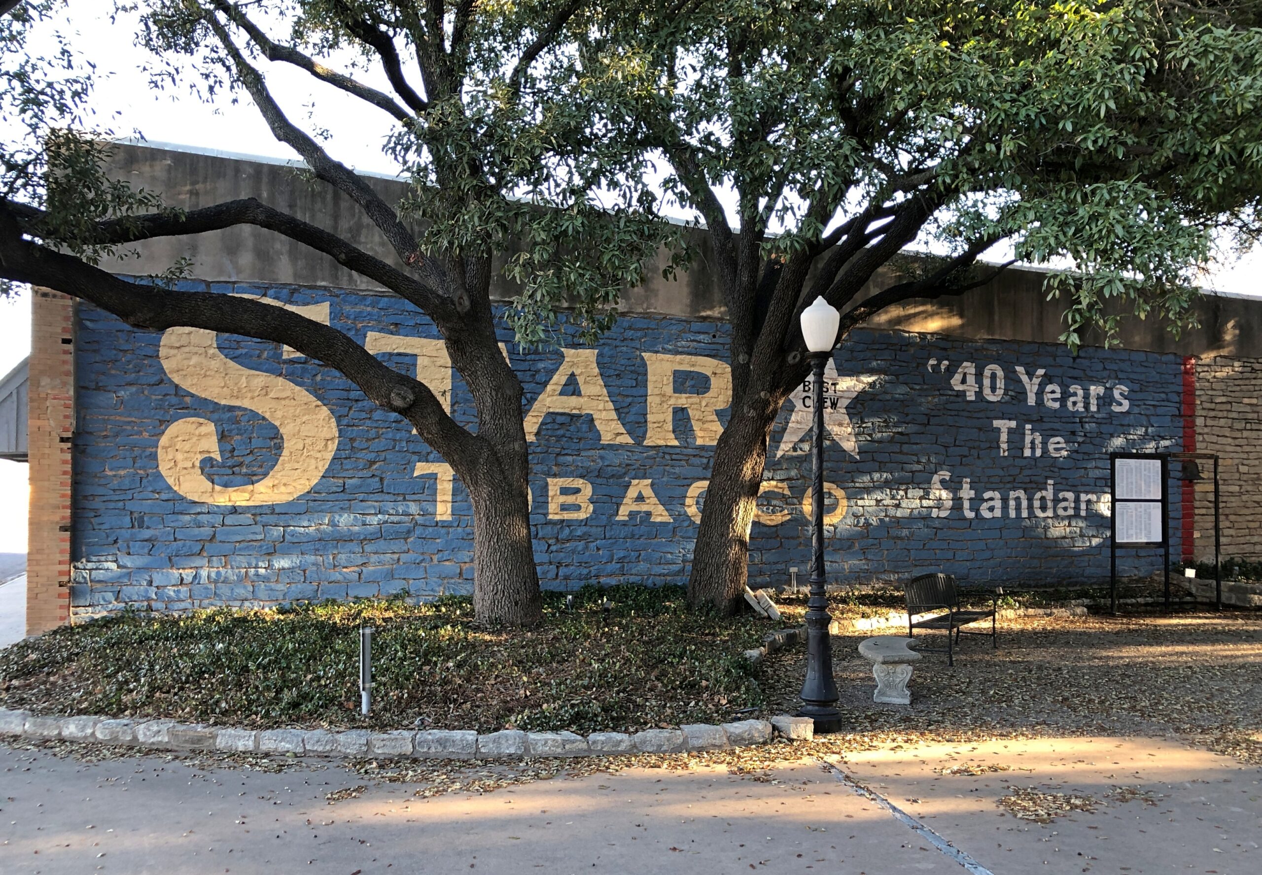
US 67 joins US 377 for a run southwest of Stephenville, through such burgs as Dublin, Comanche and Brownwood. Then US 377 peels away to the south; but we followed US 67 west to Ballinger. That town was mostly a stop to get our bearings, really, but I also did a short walkabout while Yuriko napped in the car.
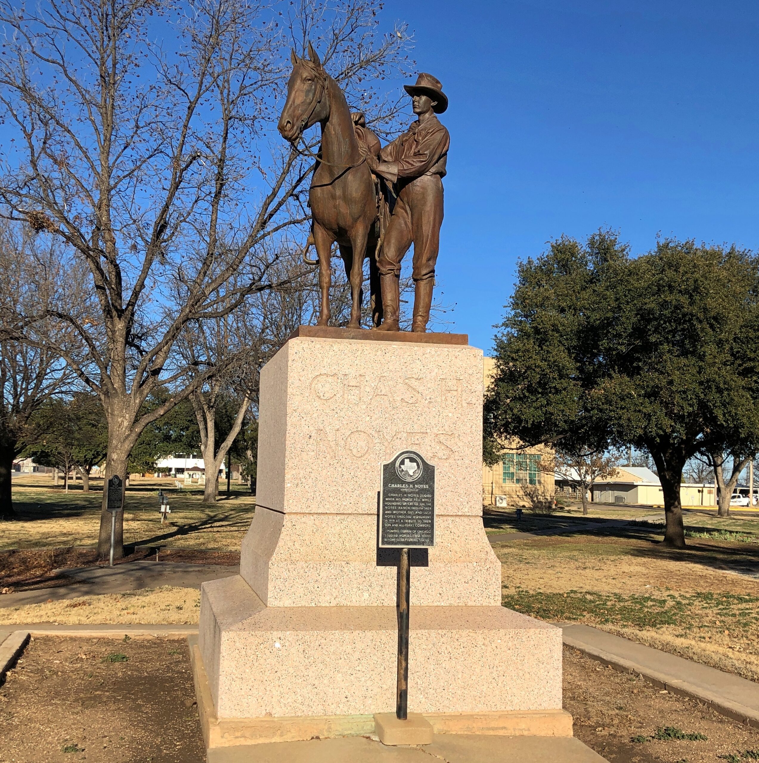
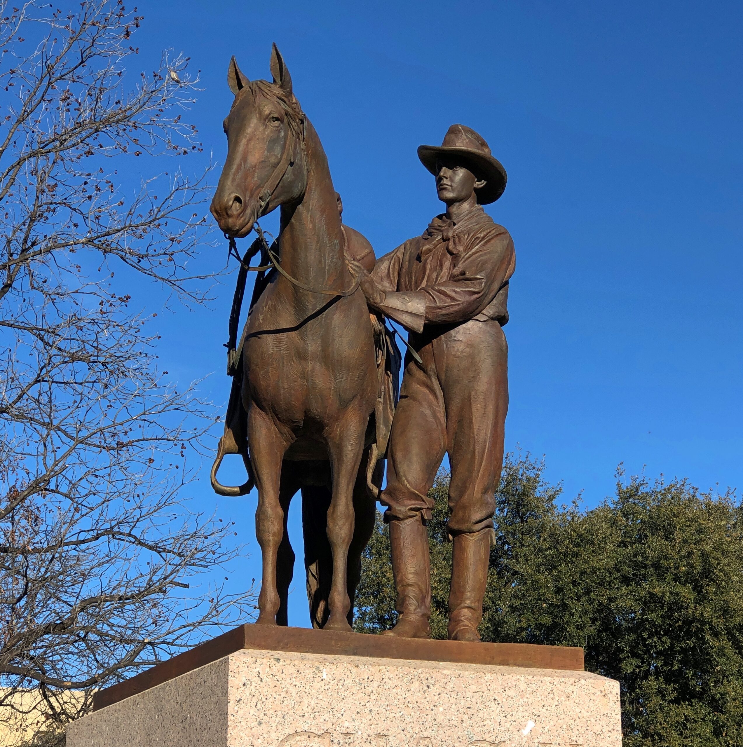
I made the acquaintance of Charles H. Noyes (d. 1917).
Charles was a young Runnels County man who died by being thrown from his horse while minding cattle. His parents tasked no less than Pompeo Coppin to do the sculpture honoring his memory. Nice work, Pompeo. RIP, Charles.
I have to admit it, we bought gas at Buc-ee’s more than once on our trip to Florida. Turns out that the chain’s gas prices are comparable with Costco. That is, 20 to 30 cents cheaper per gallon than most standard gas stations. Costco tends to be on main thoroughfares in densely populated places, which is sometimes convenient, sometimes not. Buc-ee’s is the flip of that, tending to be on major highways at some distance from densely populated places. Sometimes convenient, sometimes not.
We gassed up at the Smiths Grove, Kentucky Buc-ee’s just off I-65 on December 5, early in our trip. We had to make a decision on how to proceed from there. One choice: continue on I-65 to Nashville, take I-40 east from there roughly to Cookeville, Tennessee, and take smaller roads into Jackson County, to reach our friends’ home in the holler. Or: take smaller roads across southern Kentucky and into Tennessee, bypassing metro Nashville and going through towns and hamlets and farmland and woods we’d never seen before, ultimately connecting to the appropriate small roads in Jackson County. It isn’t too hard to guess what we did.
Kentucky 101
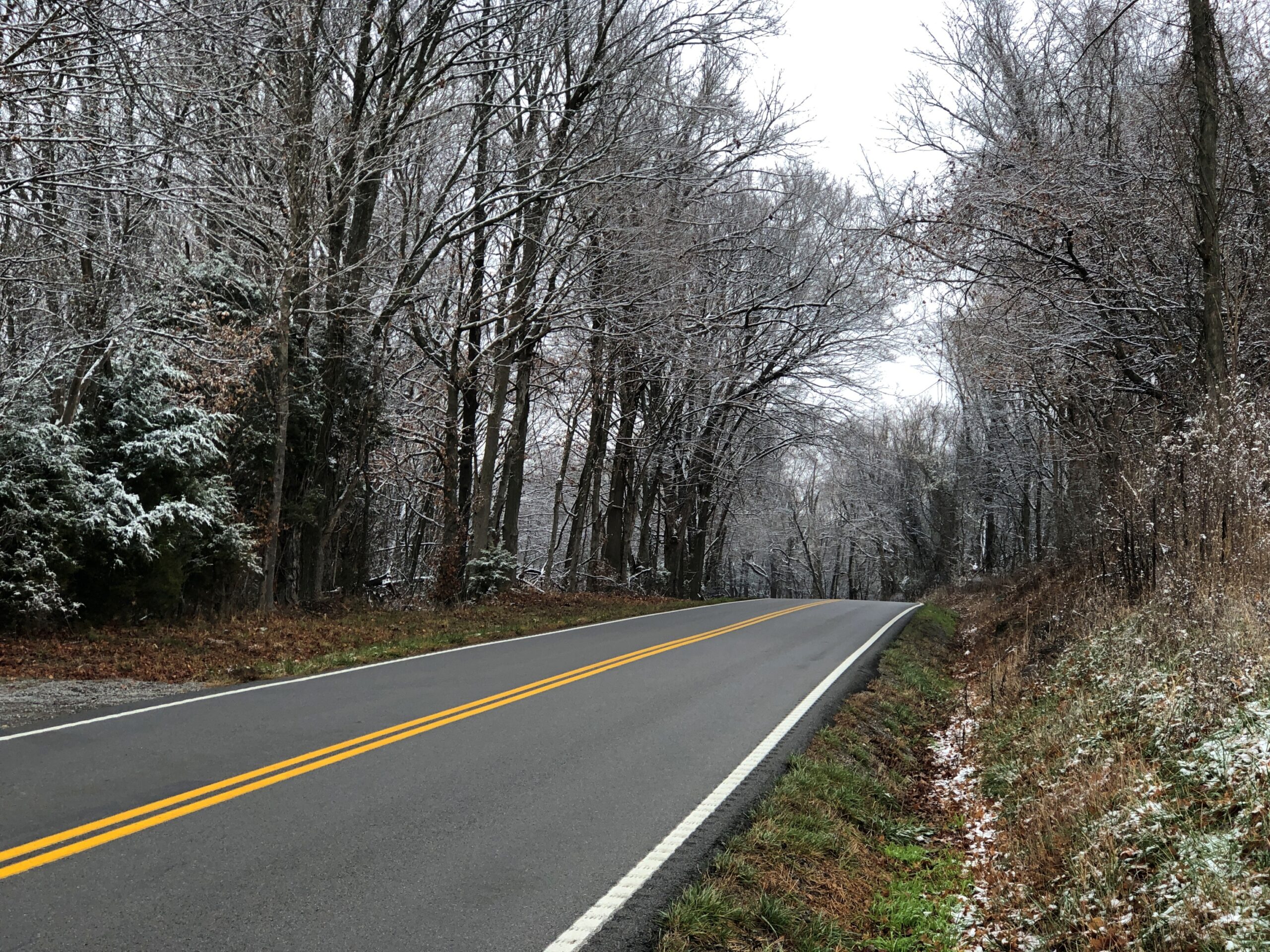
It so happened that exiting from Buc-ee’s in Smiths Grove takes you to Kentucky 101, a two-lane highway that can either take you back to I-65 or south through Warren and Allen counties. Coming from the crowds of Buc-ee’s, people and cars, the contrast of heading south on Kentucky 101 is clear.
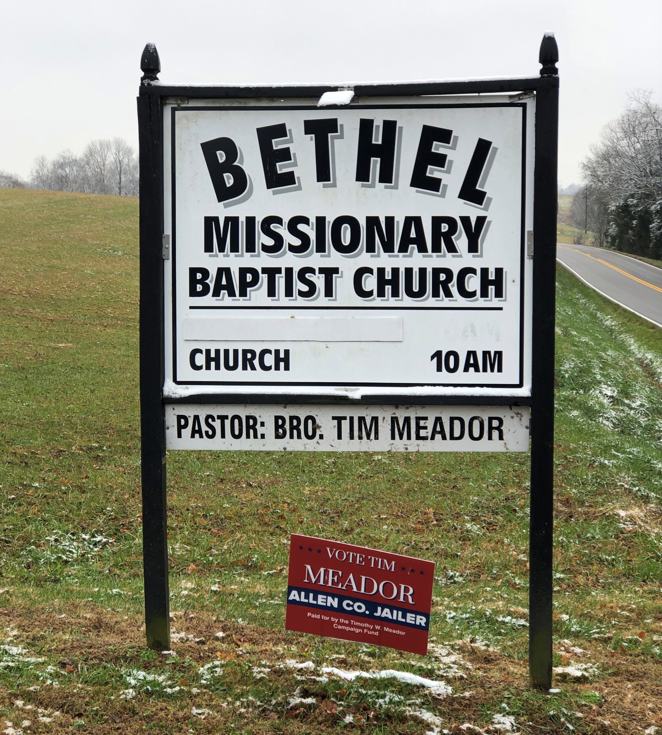
As of now, at least, Bro. Tim Meador is the Allen County Jailer, so I assume he won the most recent election.
I know that’s a county job that probably involves a fair amount of paperwork. Still, I picture the Jailer as an official who, like in a movie, puts offenders in the jug himself, turning a skeleton key (one of a few jangling on a big ring) to lock the cell.
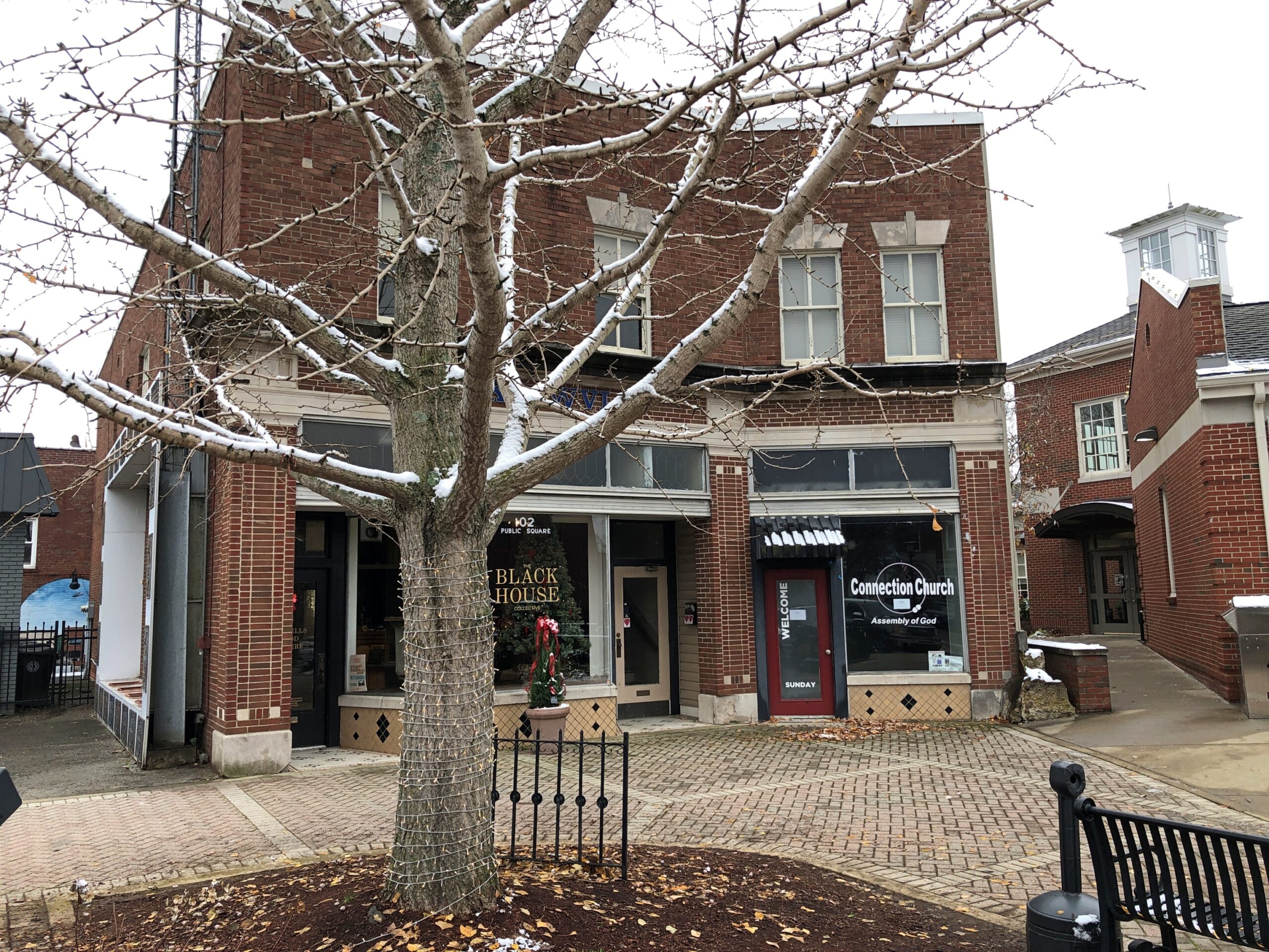
Scottsville, Kentucky
The main traffic hub of Scottsville (pop. 4,300), the seat of Allen County, is the junction of Kentucky 101 and 98, known as Main and Court streets locally. Instead of a county courthouse, the hub is in the form of a square with businesses around it and a lot of traffic passing through. More than I would have guessed.
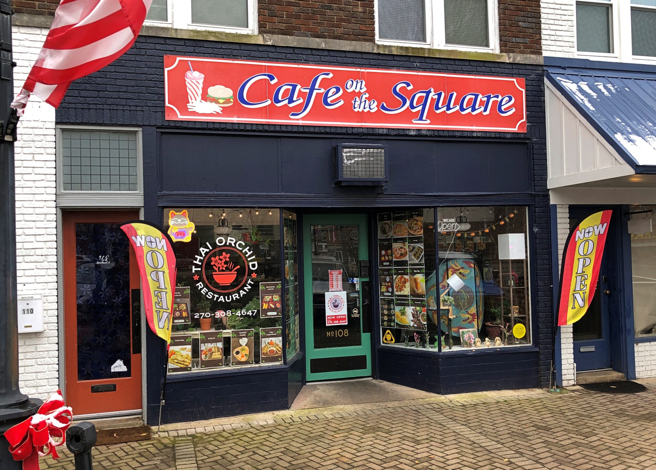
It was lunchtime. I can report that Thai Orchid is as good as you might find in a larger town. In our time, Thai has pretty much joined the tapestry of American cuisine as thoroughly as Chinese or Mexican food did in previous generations.
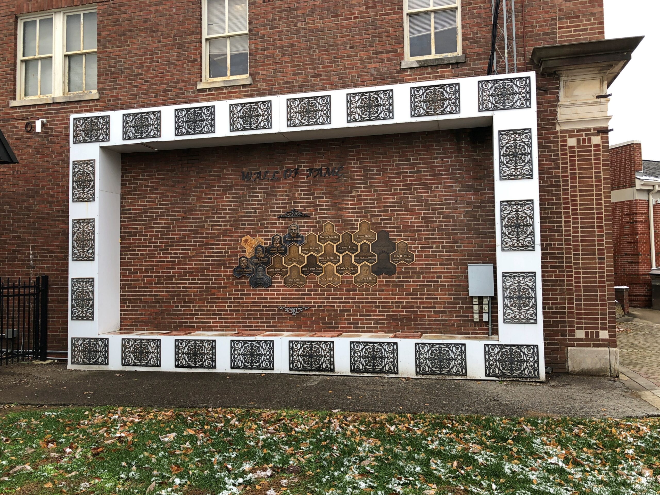
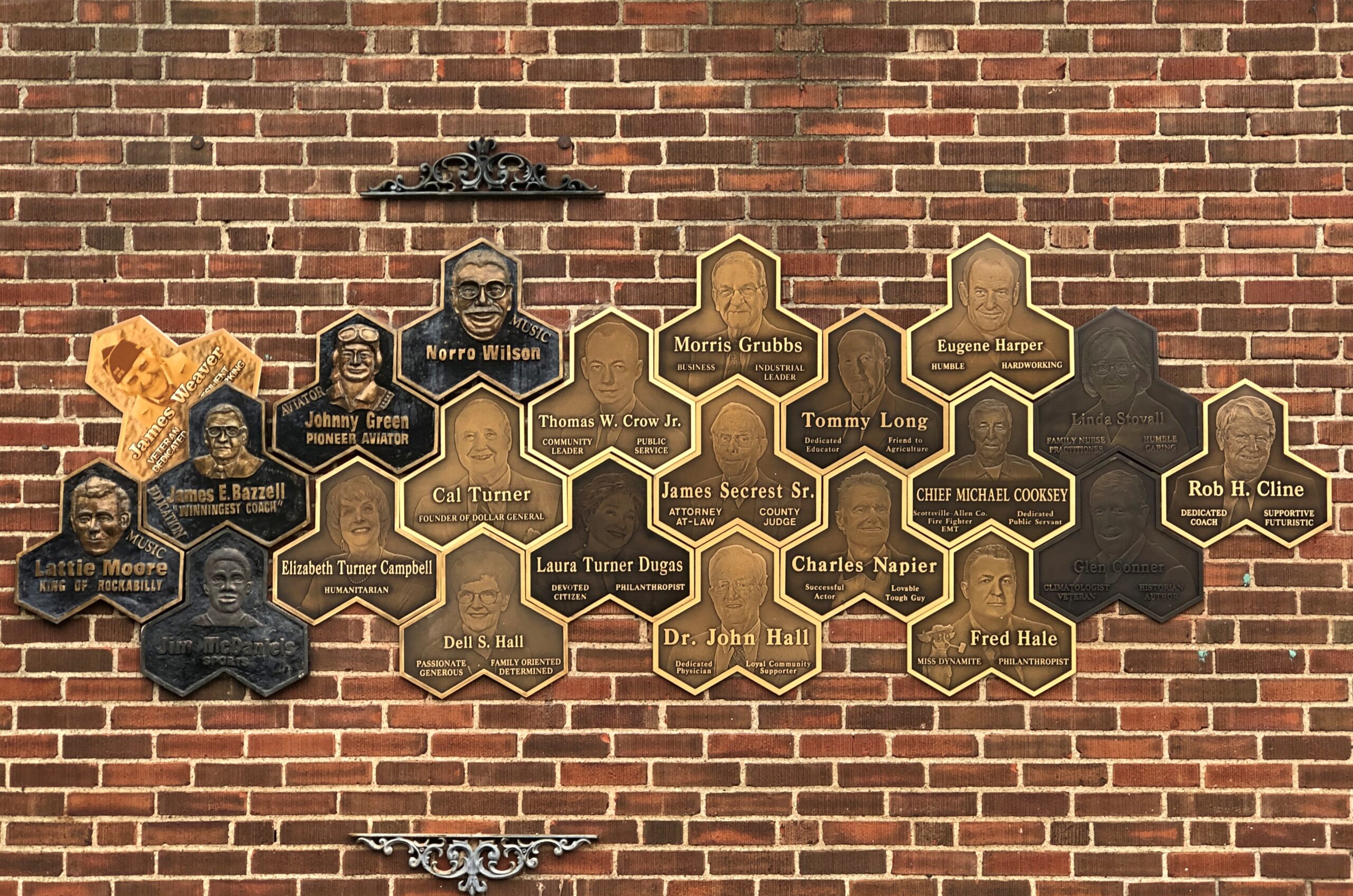
The main public library is near the square, sporting a local Wall of Fame.
The names include Lattie Moore, who sang, “I’m Not Broke but I’m Badly Bent,” a song with pretty much the same theme as Al Dexter’s “Wine, Women and Song.”
I won’t look all the names up, but the Scottsville Wall of Fame also includes Johnny Green, pioneer aviator, who did the first commercial flights between Florida and Cuba, apparently.
Red Boiling Springs, Tennessee
We drove on Kentucky 98 east to the near-border town of Gamaliel, pop. 391, still on the Kentucky side of the line. A lesser-known Biblical name, but I also can’t help thinking of the G. in Warren G. Harding.
South from there, Kentucky 63 turns into Tennessee 56 after a few miles. There’s no sign marking the border, just one announcing the Tennessee highway number. Pretty casual for a line that might have been an international border, had the secessionists had their way (unless, of course, Kentucky left the old US).
Besides a cool name, Red Boiling Springs (pop. 1,205), Tennessee, has a history. As the name suggests, people took the waters there.
“As recently as 1920, Red Boiling Springs had about a dozen places in which visitors could stay,” The Tennessee Magazinereported a few years ago. “The largest was the Palace Hotel, which had 180 rooms. Over the next several generations, business declined… and… a 1969 flood destroyed large parts of the town. However, three of the Red Boiling Springs resort hotels are still open. They were in (nearly) continuous operation throughout the 20th century and still reflect more of the lifestyle of the late 19th century than they do the 21st.”
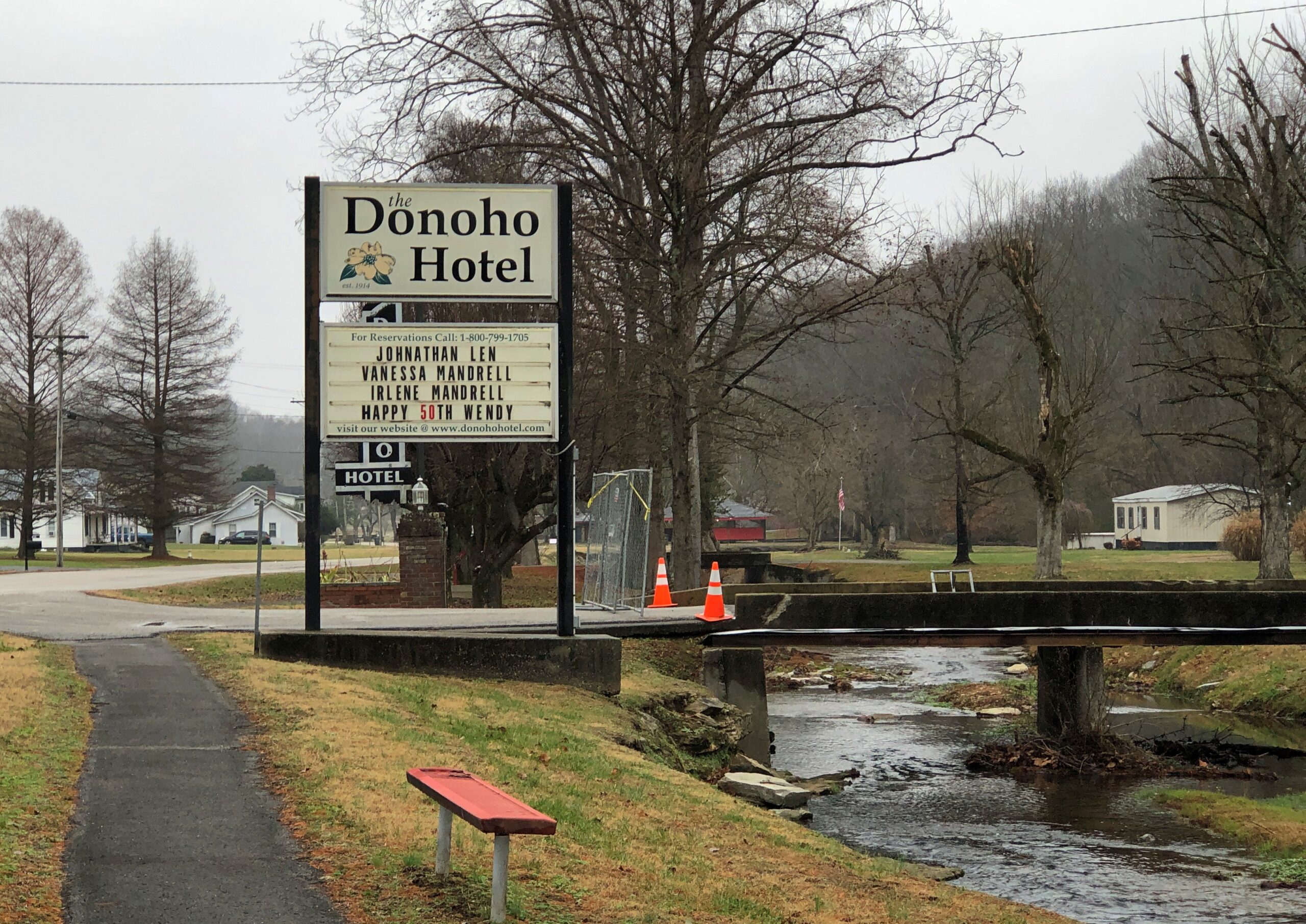
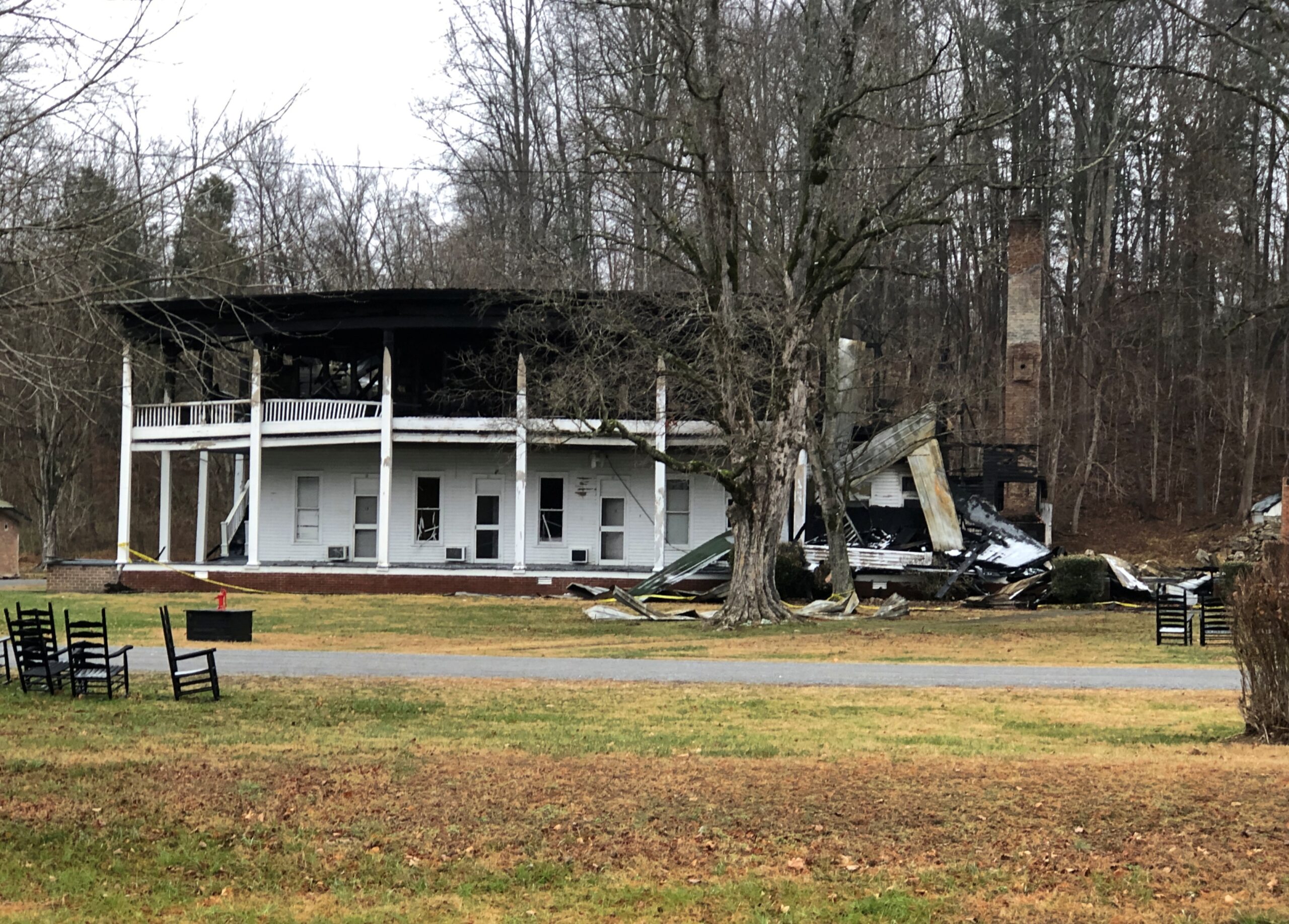
Make that two hotels. One of those mentioned in the article, the Donoho, burned down in November.
The gray, chilly day somehow fit the scene of a wrecked historic hotel.
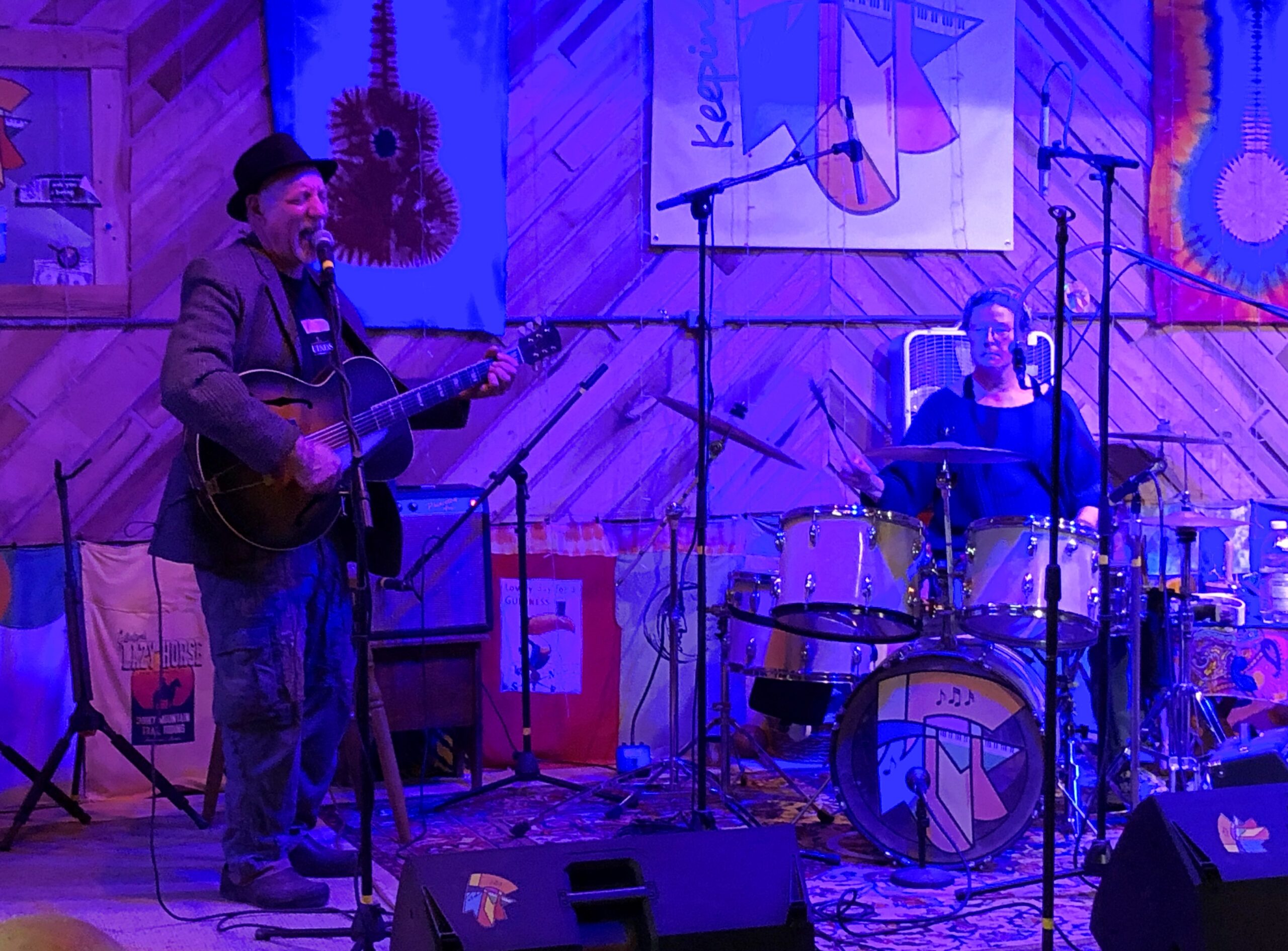
Damned shame. I can’t leave it at that. Soon after passing through Red Boiling Springs, we arrived at our destination in eastern Middle Tennessee. The next day, we enjoyed a Tennessee hootenanny.
Our hosts, Dave and Margaret, on guitar and drums.
Kids came in some numbers for Halloween here in the northwest suburbs yesterday, but I didn’t keep an exact count this year. The day was cool but not cold, without a hint of rain, so that might have encouraged turnout, like for voting. One time a passel of kids showed up, maybe a dozen or so, all under 10, with a smaller passel of parents off near the sidewalk.
We were giving away full-sized candy bars until they ran out, and the passel squealed with delight at receiving the various Hersey products. Even now, the costumes are a blur, maybe because I didn’t recognize a lot of the characters. Ones that I might have known weren’t familiar either. I asked the parents of a very small boy — ah, first-timers — what he was supposed to be. His shirt pattern reminded me of TMNT, but it was Hulk, they told me. “Hulk smash,” they said. “Hulk smash, all right,” I agreed.
All of the Halloween traffic, except for a handful of older kids, came before dark. My not-so-inner curmudgeon reacts: in my day, we trick-or-treated after dark, risking bodily injury on the streets, and we liked it.
But I am glad to report that the older kids – junior high and even high school – are far fewer than they were, say, 20 years ago. So it’s back to the way it should be. For older people, there are always such seasonal events as the Greenwich Village Halloween Parade. To this day, the ’06 iteration of that parade remains the only time I’ve encountered the band KISS live – they were the grand marshals (RIP, Ace Frehley). We also encountered Space Ghost then, or at least a fellow who was adamant about his Space Ghost identity.
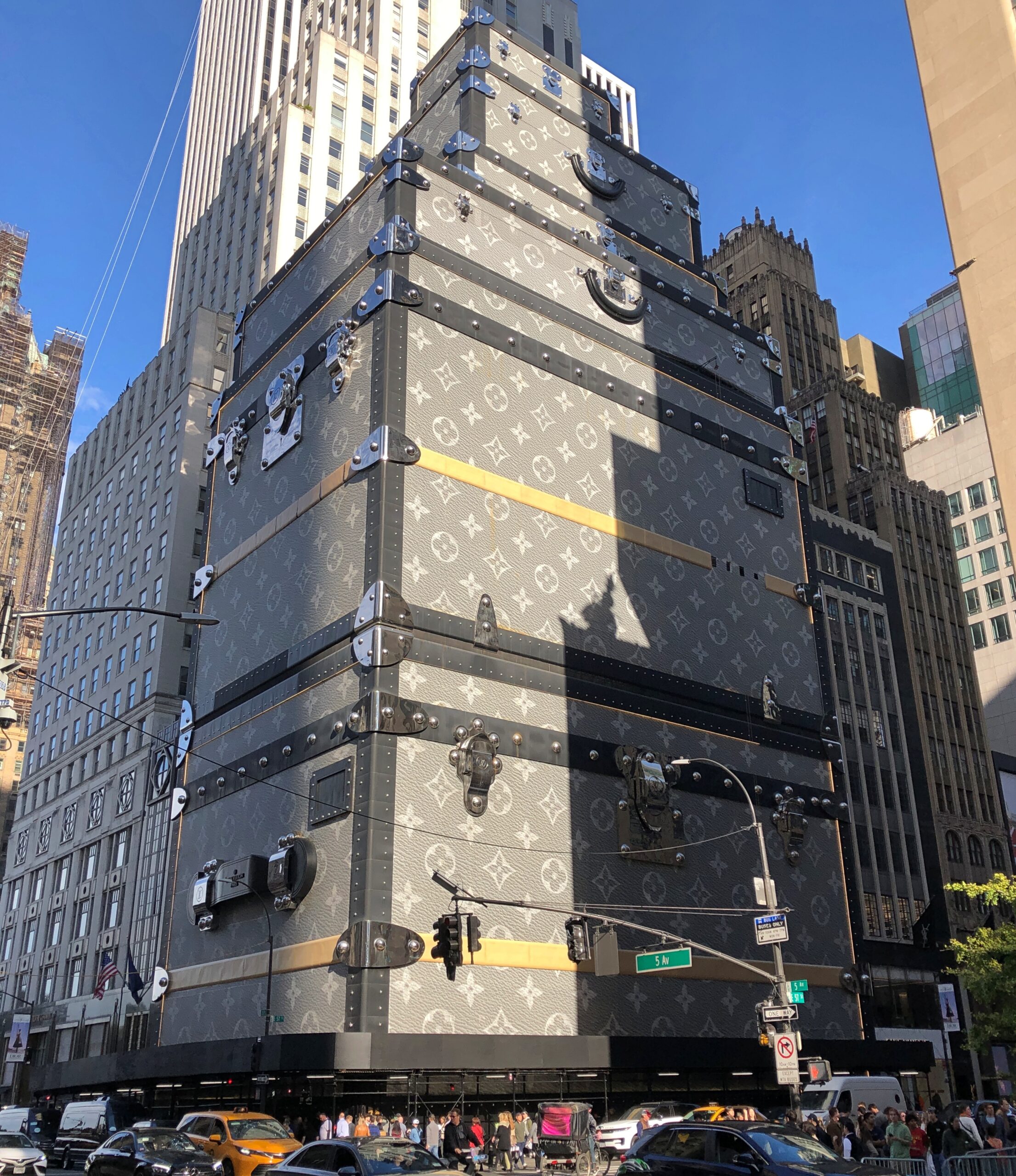
Near Central Park on Fifth Ave. is 1 East 57th Street. We walked by last month.
A few years ago, luxe retailer LVMH Moët Hennessy Louis Vuitton added a faux facade to its NY flagship store there on the avenue, one that evokes its signature luggage trunks in a highly visible way. Redevelopment plans for the building behind the trunks were unveiled not long ago, so I suspect the trunk-appearance doesn’t have much longer to look down on Billionaire’s Row and its strato-priced residential properties (whose high rents and sale prices don’t necessarily guarantee high-quality construction, apparently).
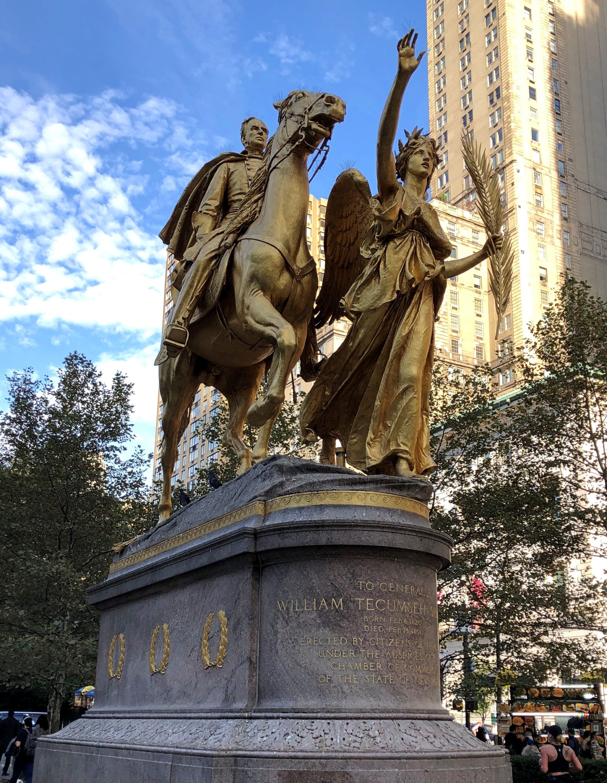
As we neared Central Park, we spent a little time at Augustus Saint-Gaudens’ statue of William Tecumseh Sherman (dedicated 1903) in Grand Army Plaza. Life’s too short not to look at some Saint-Gaudens from time to time.
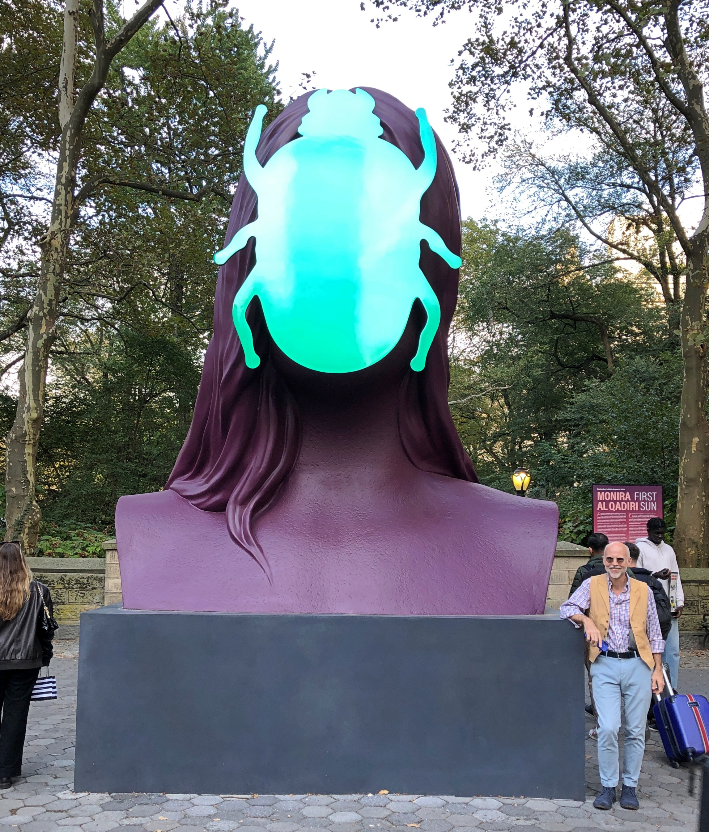
Not far away, something a little newer.
“First Sun,” a painted aluminum sculpture of a human-scarab figure by Senegalese artist Monira Al Qadiri, and slated to be in place until the end of next summer.
Visible from near the statues is the storied Plaza Hotel and an Apple Store, which is open 24 hours, Google Maps tells me. Storied in a different way.
I’m glad the Plaza acknowledges its fictional role in The Great Gatsby by featuring a lavish-beyond-the-dreams of Croesus Gatsby Suite. Of course. A smart hotel operator isn’t going to waste an opportunity like that. In this case, Fairmont Hotels and Resorts, a Canadian company, managing for owner Katara Hospitality – the large hotelier owned by the Qatari government. In the 21st century so far, the Plaza has been owned by an Israeli company and then an Indian one before Katara bought it. There’s something oddly American about an ownership trajectory like that.
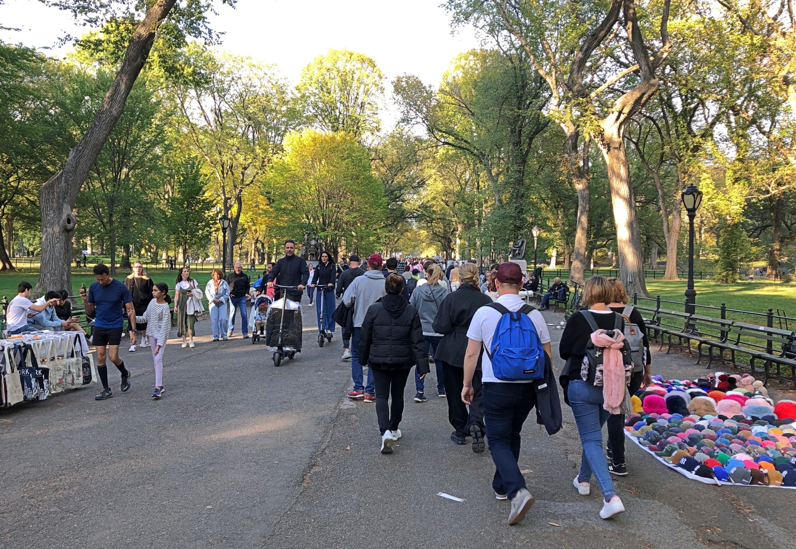
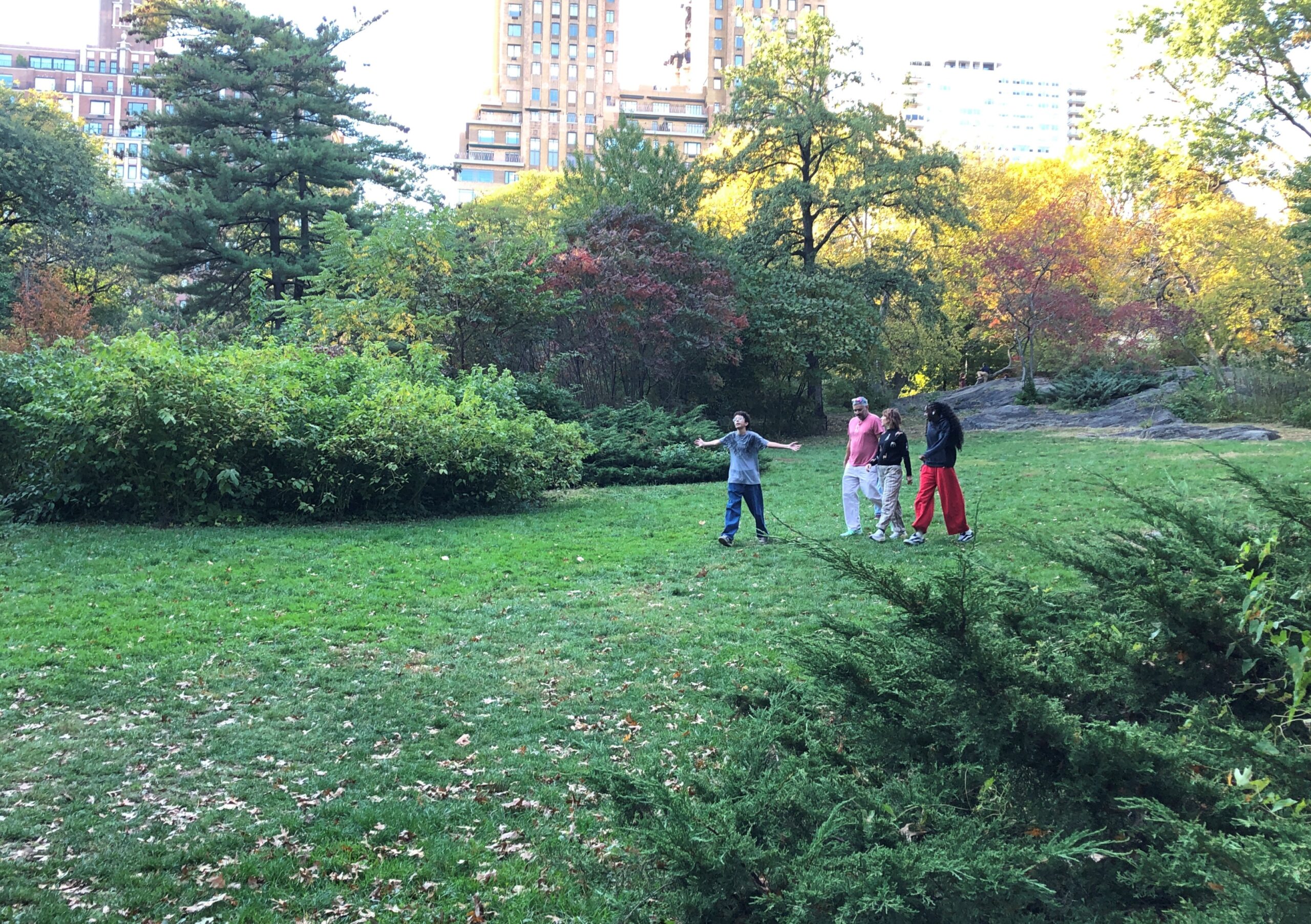
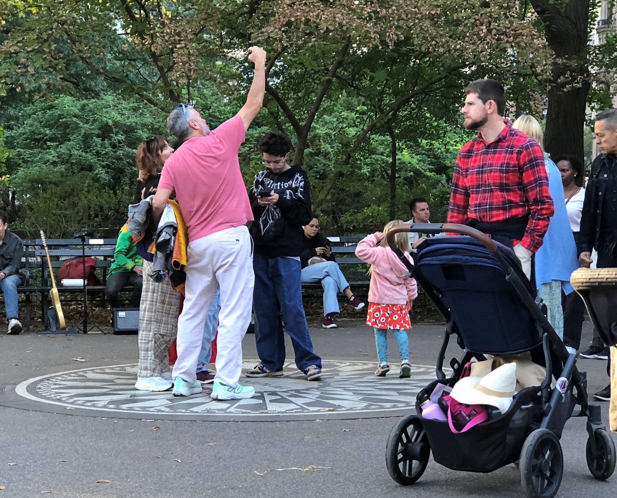
We – Robert, Geof, Yuriko and I – charted ourselves a simple walking path through some of the southern reaches of Central Park. Manhattanites and visitors to the borough were out in Saturday-afternoon force. Saturday, in the park/I think it was the 18th of October. No, that doesn’t scan. A fair number of pitch-a-blanket cap and souvenir salesmen were out, too, but not nearly as many buskers as a great city park like Central Park should attract.
There’s an editorial right there: why America needs more buskers, and why some American cities need to chill when it comes to suppressing buskers. Europeans might not be right about everything, but about allowing buskers? Yes.
The leaves weren’t at peak just yet, with the greens still hanging on more than not. I don’t remember which visit to Central Park it was, but one time I wandered the park during peak coloration, whipped into even greater yellow-and-red glory by a brisk October wind. Temporary clouds of leaves came and went, even as the wind shook more leaves from their branches. Color, but also motion.
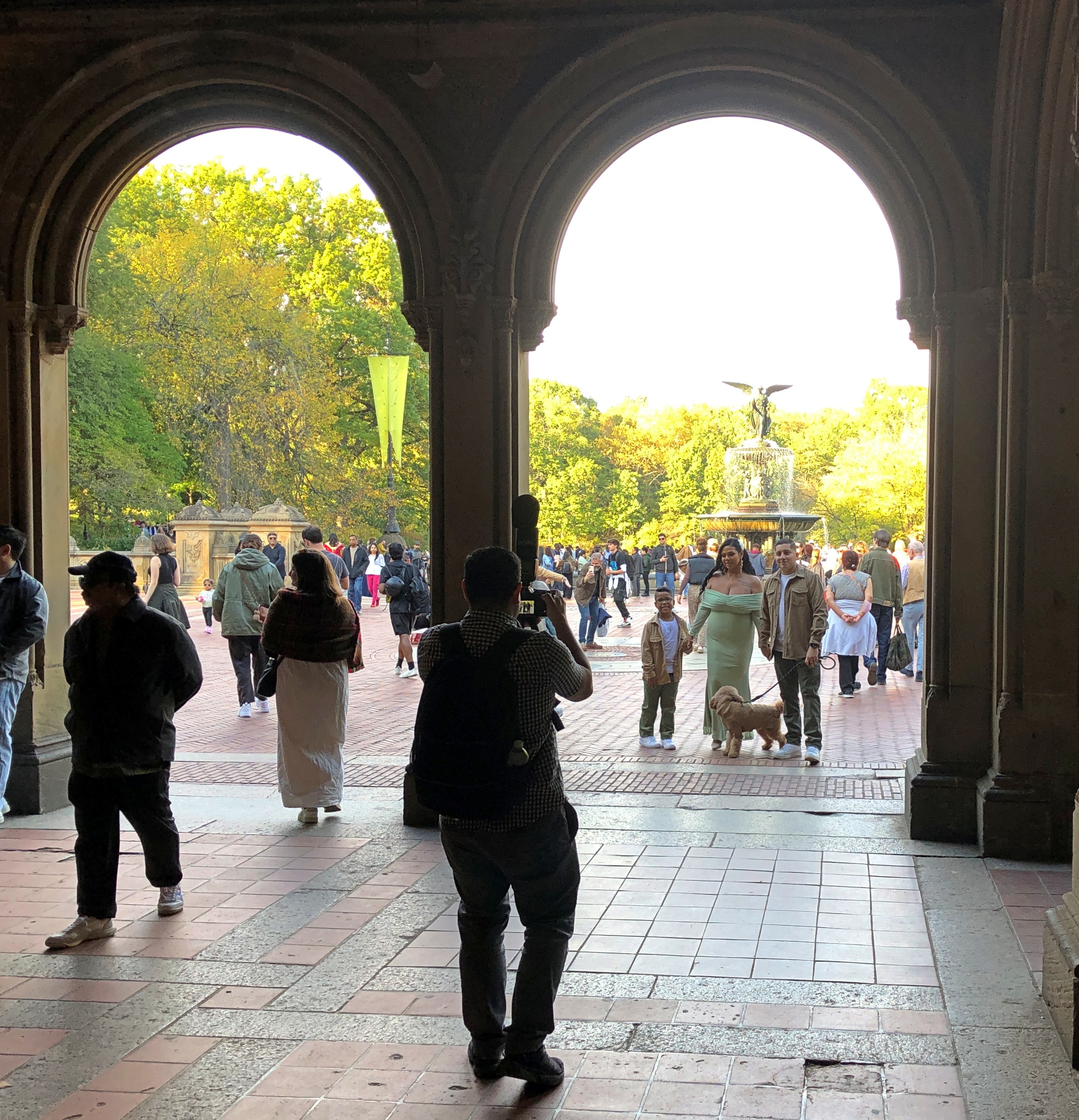
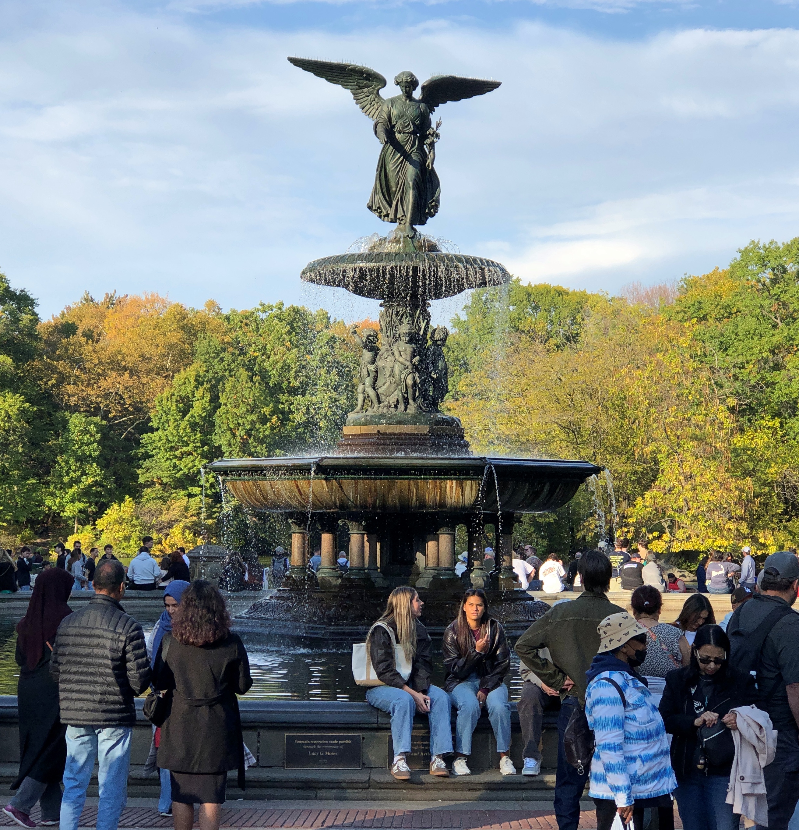
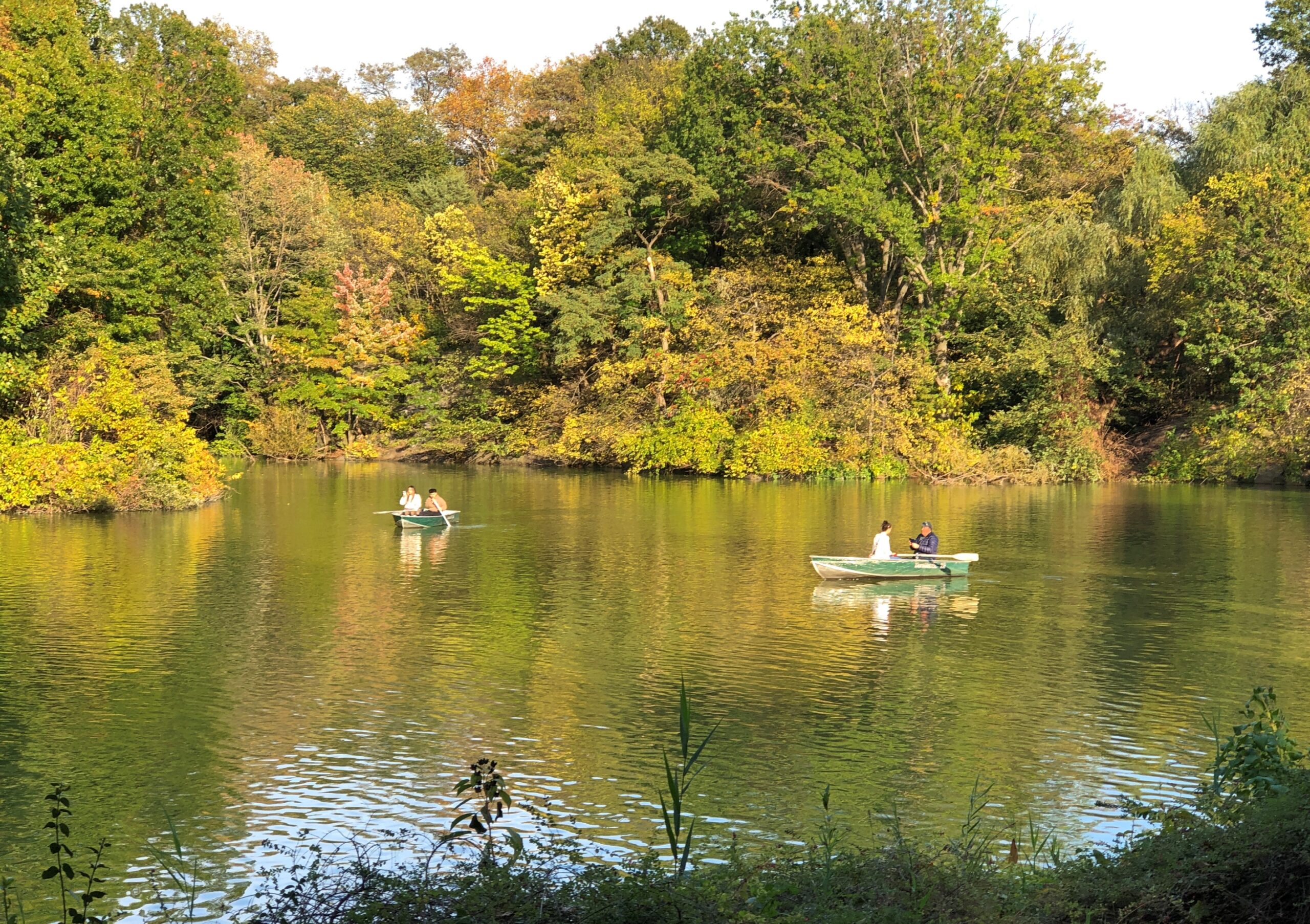
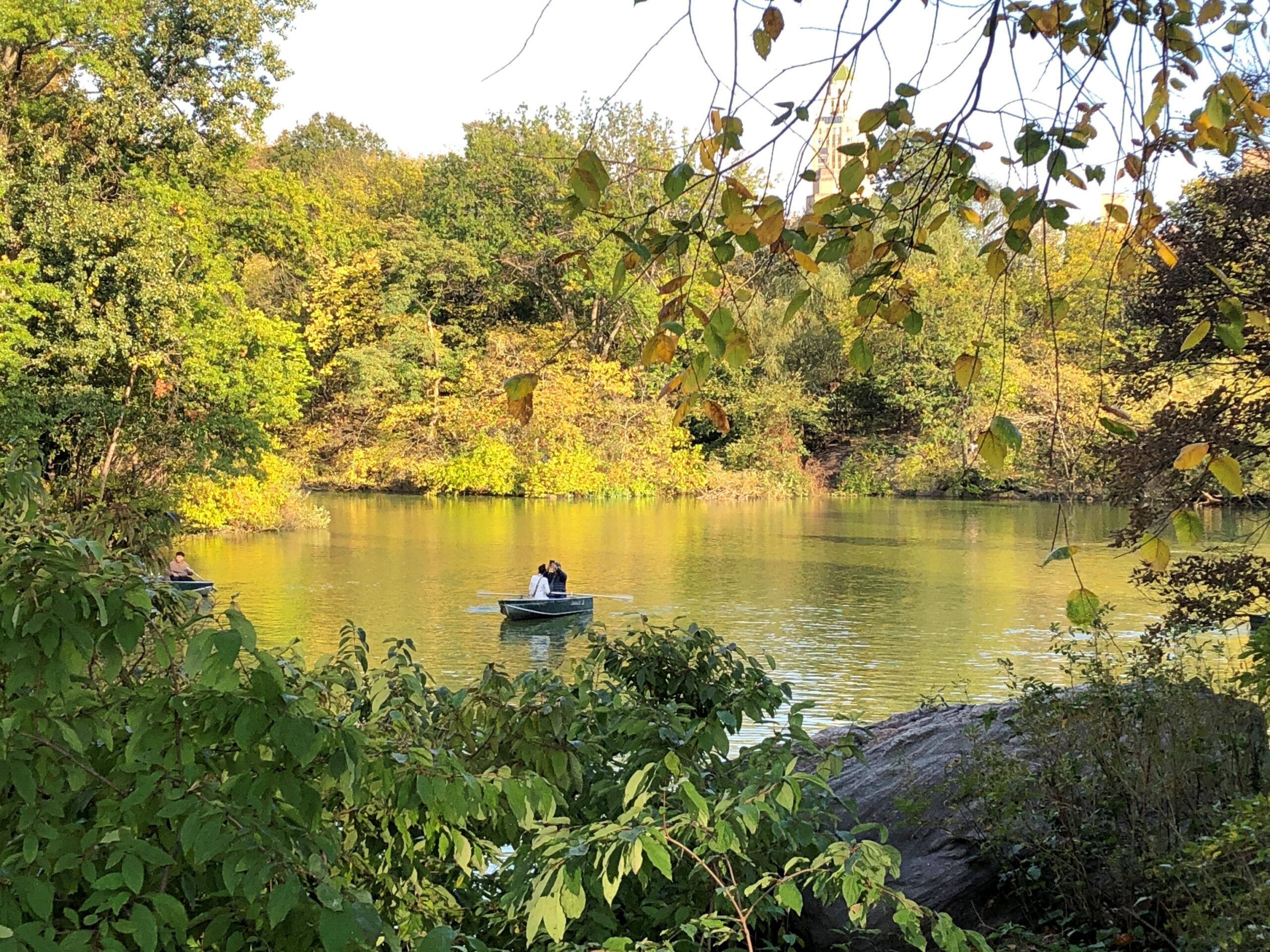
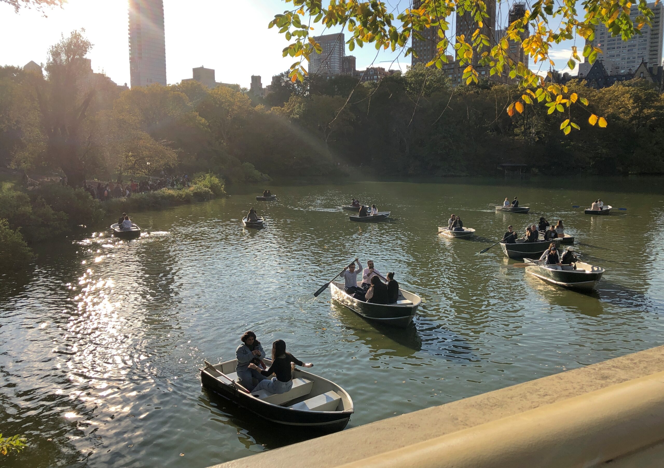
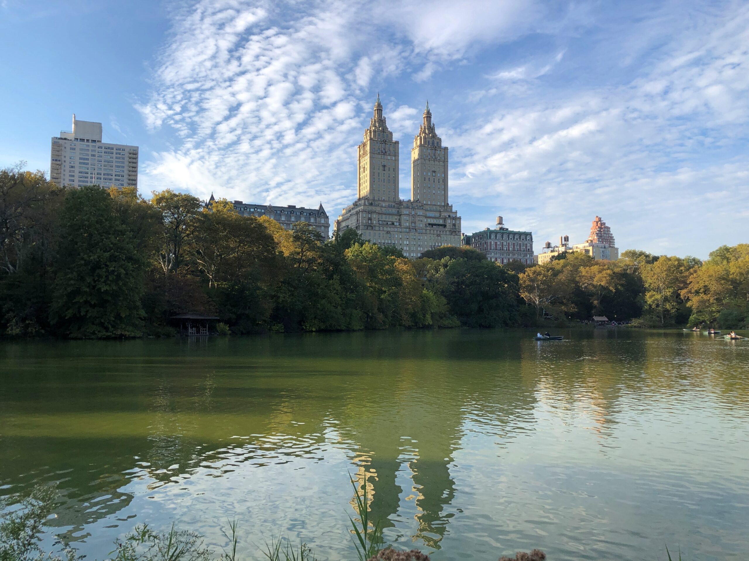
Eventually, we came to The Lake by way of Bethesda Terrace and Fountain.
But not all the way across The Lake to The Ramble, whose Wiki description drily states that “historically, it has been frequented for both birdwatching and cruising,” with hyperlinks articles about both of those activities. What about cruising birdwatchers? There’s a Broadway musical in that concept somewhere.
The Lake was clearly a good time and place for casual boating.
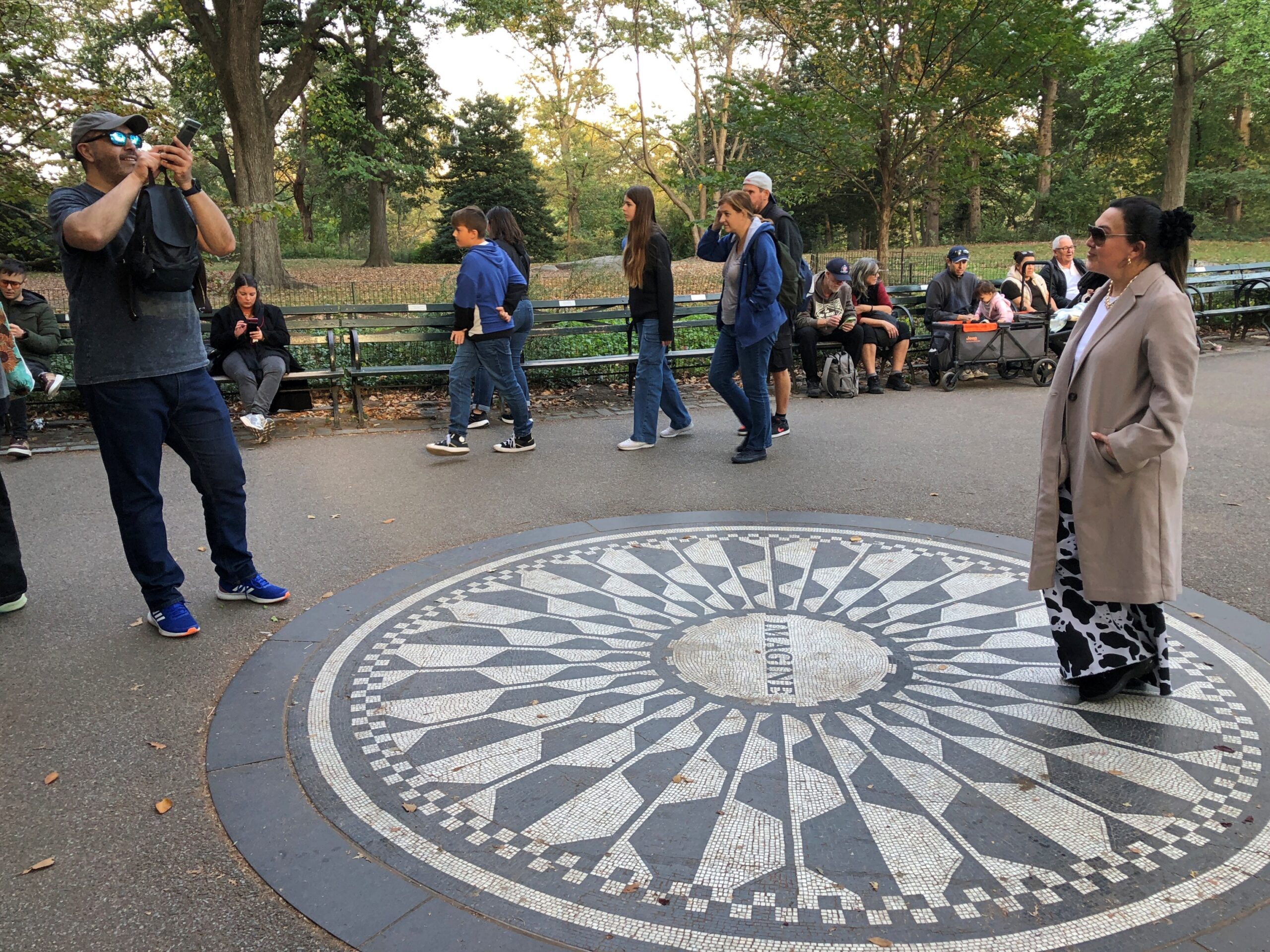
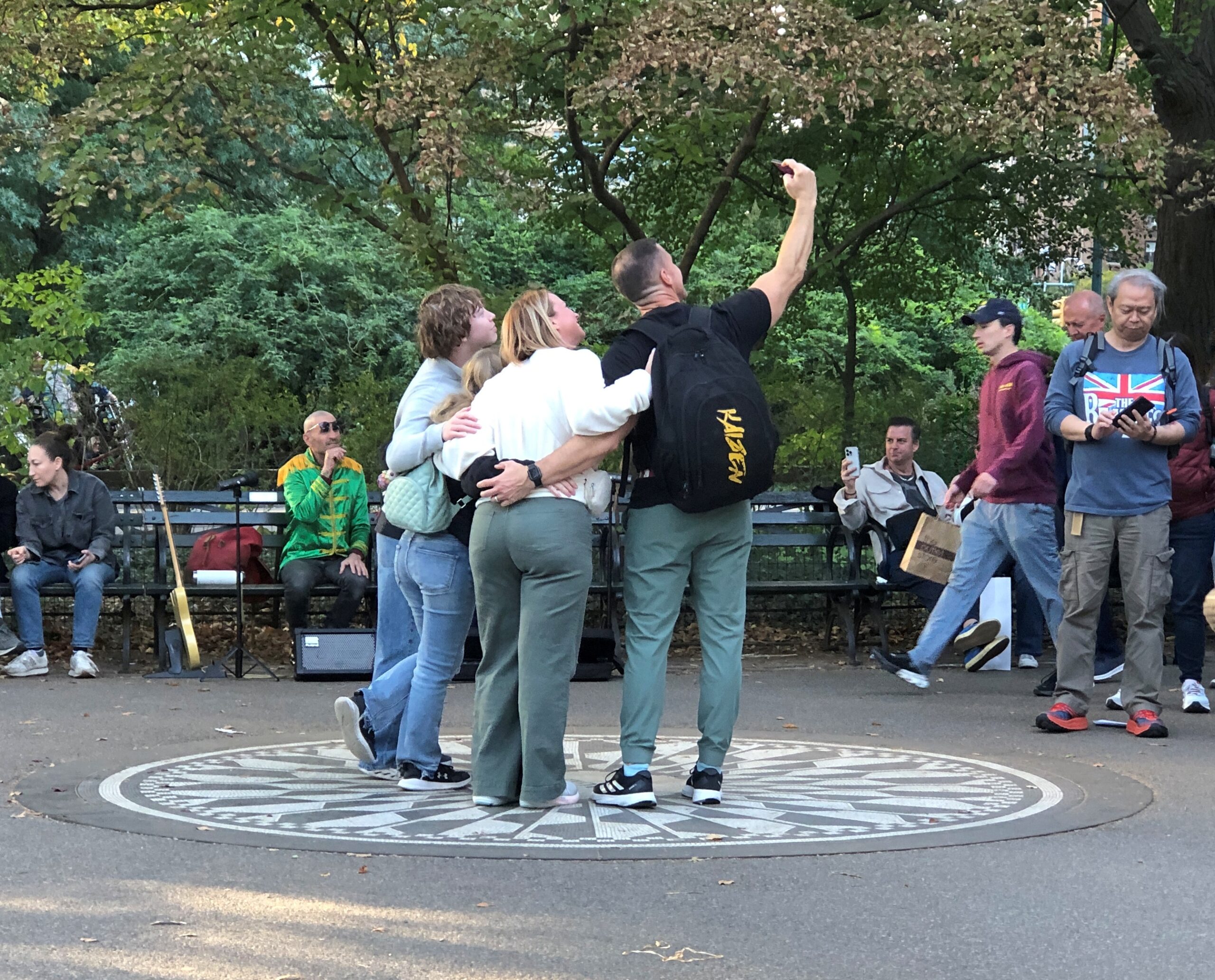
In that part of Central Park, it’s hard to miss Strawberry Fields. There is a fairly empty section.
That’s not the case when you get to the Imagine memorial. Among the visitors, a guitarist was noodling out one of the more famous Lennon-McCartney tunes, but I forget which. One of the usual ones. Not “Dr. Robert,” say, or “Happiness is a Warm Gun.” So that was one busker anyway, since I think he had a guitar case open in front of him. All you need is love, sure, but bills are bills.
Gone these 45 years and still packing ‘em in. Good for you, Mr. Lennon. In another 45 years? It would be interesting to know, and I sure I won’t.
I’m afraid the history of memorials doesn’t bode well for the longevity of any memorial, even the kind that people line up to pose with. I didn’t know the man, but I suspect somehow that the thought of fading into obscurity wouldn’t have bothered John Lennon.
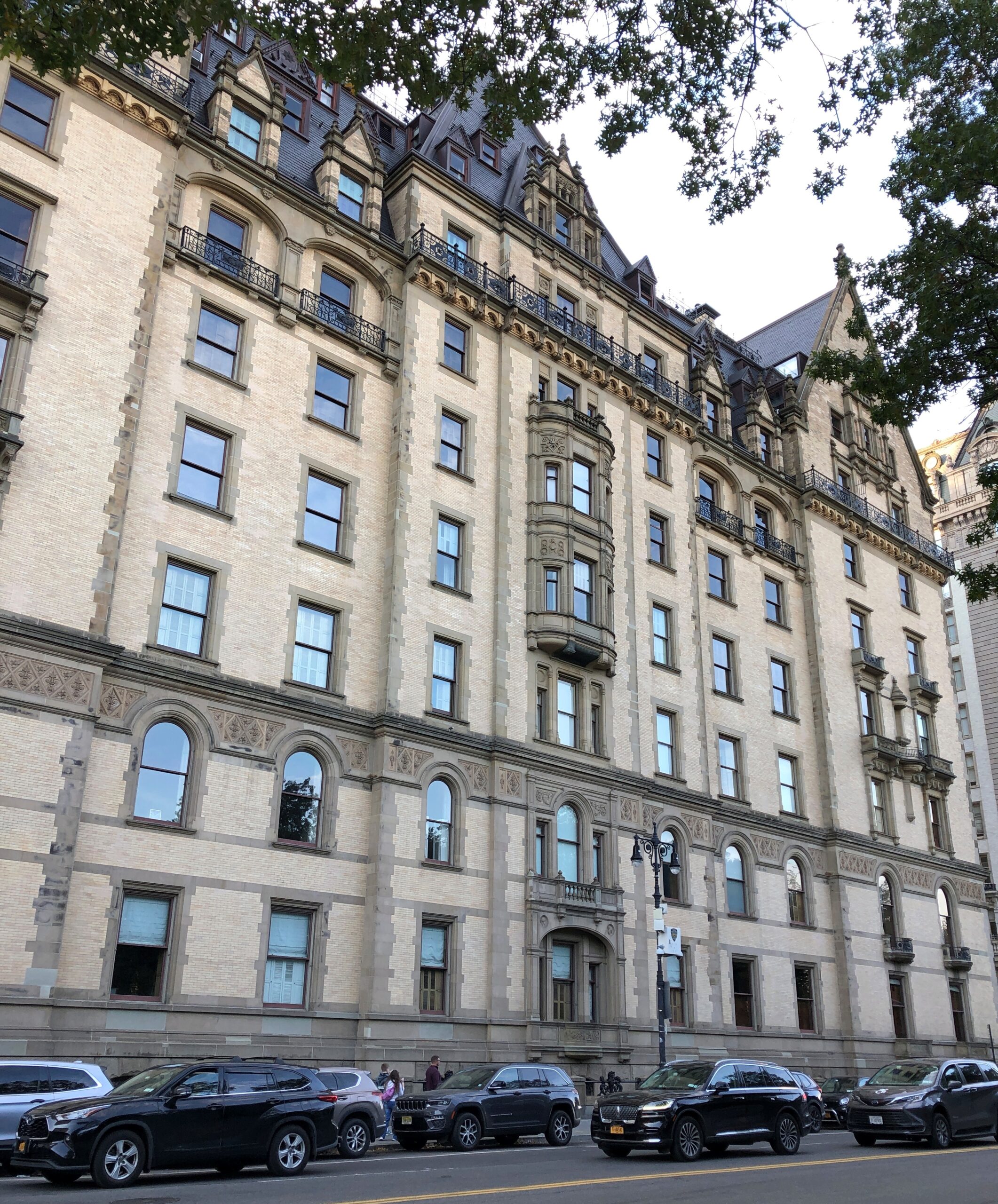
At that point, you emerge from the park and are practically face-to-face with the Dakota.
We headed east to a subway station, and happened to walk by the entrance of the Dakota. In its grim way, it’s a kind of memorial too. The signs make it known with no uncertainty that no one unauthorized is getting in.
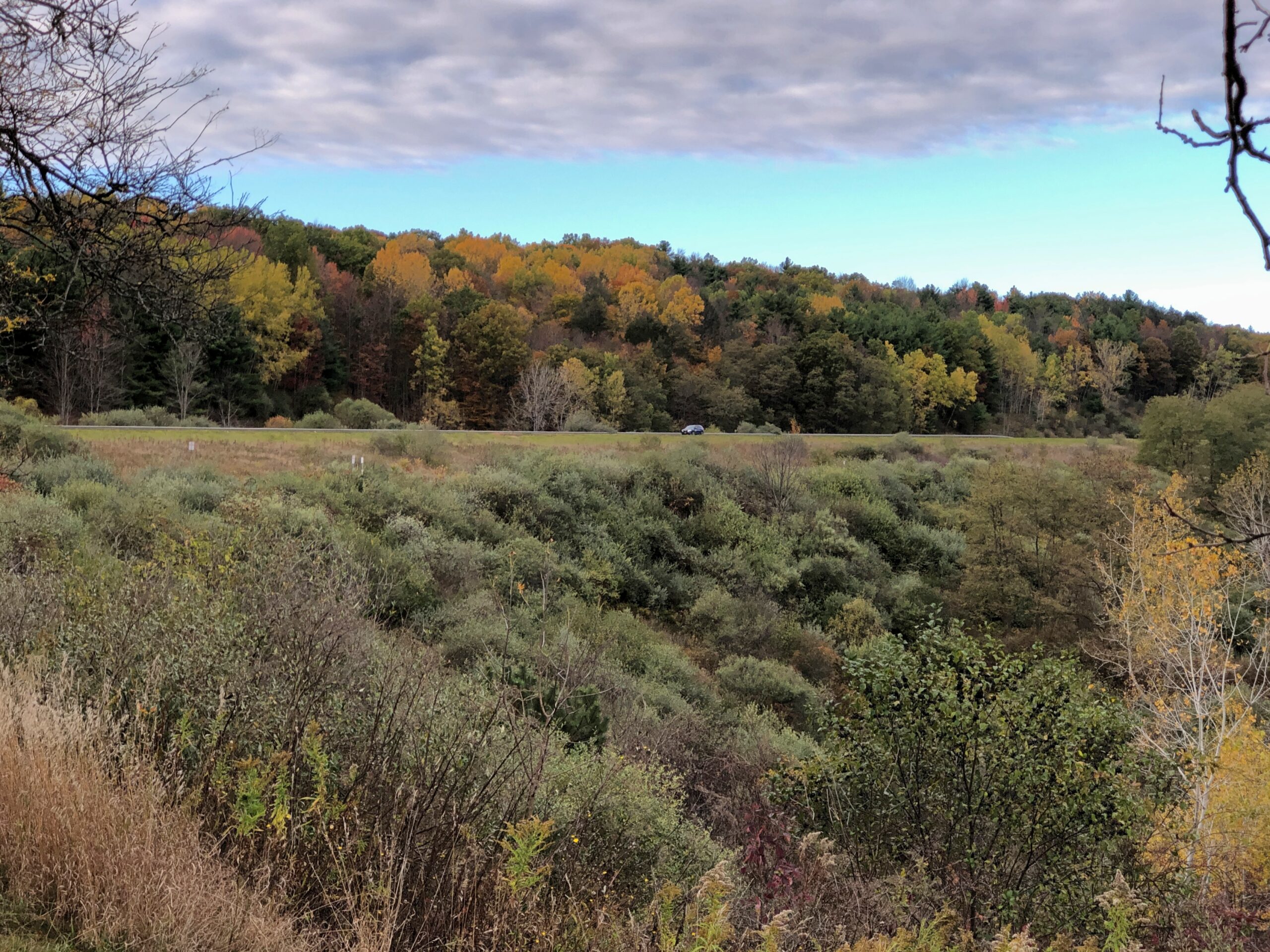
Drive out from Erie, Pa., headed northeast, and soon you have a decision to make: I-90, which becomes the New York State Thruway, or I-86, which does not. Besides costing more money, the NYST went places I didn’t want to go (this time): greater Buffalo, Rochester, Syracuse, Utica and into Albany, a route I drove as long ago as 1991 on my way to Boston.
By contrast, I-86 passes through much smaller places, winding through the hilly Allegheny Plateau, a way I had not been before. High time to do so, I thought. The road is also New York 17, with signs along the way identifying it as the Southern Tier Expressway. “Southern Tier” is the southernmost counties in upstate New York, which apparently is a longstanding regional term.
That’s a good-looking sign, and serves as a nod to the Seneca, who hold land in this part of the state. A Seneca artist named Carson Waterman did the design. For some miles before and after the town of Salamanca, which is part of the Seneca holdings, standard green highway signs include both English and Seneca.
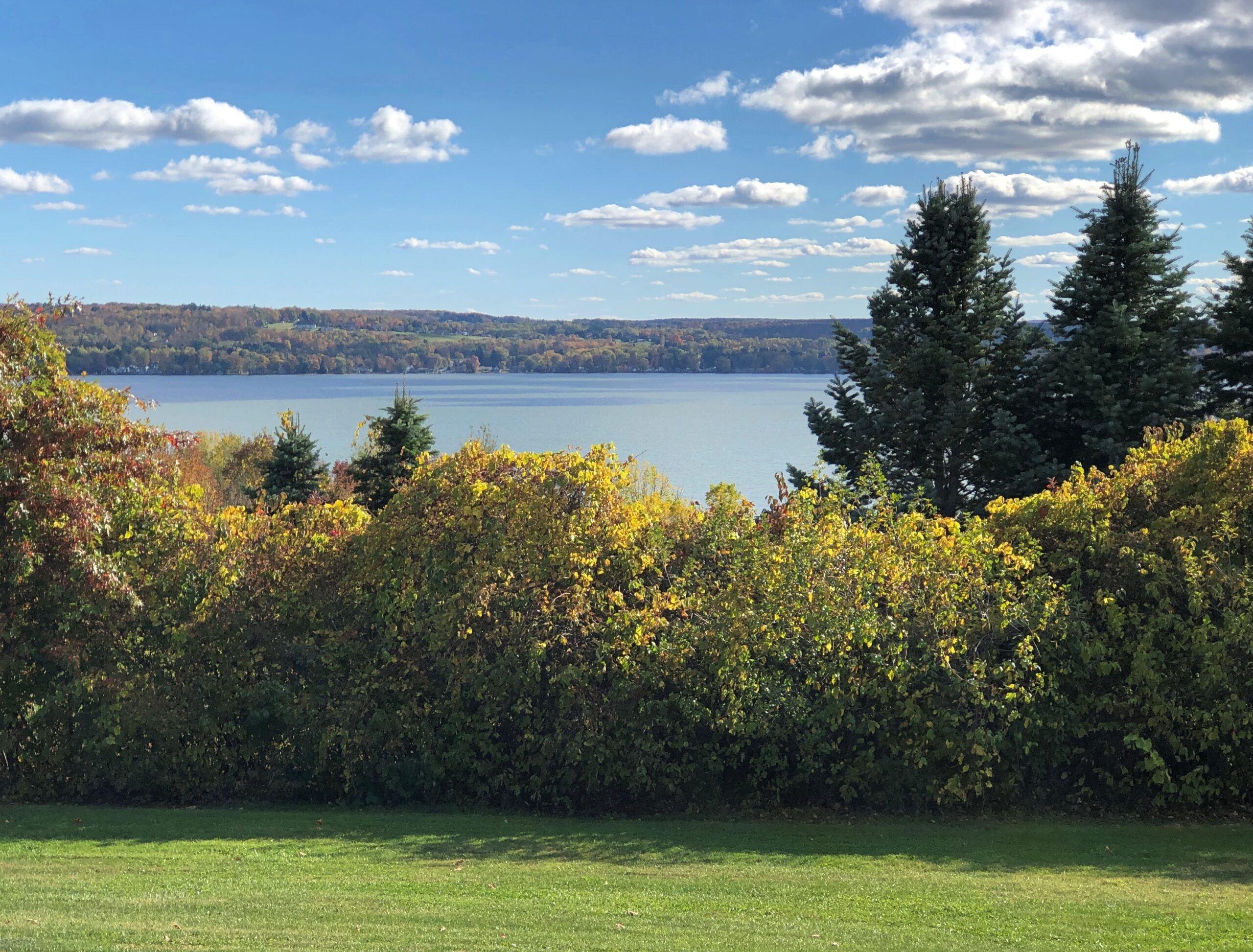
One of the larger places on the Southern Tier Expressway is Jamestown, which I know from the song. It’s a game I occasionally play with my friends: Did You Know There’s A Song About…? and then I name something like rural electrification in Australia or the Versailles conference. In this case, the song is “Maddox Table” and it’s about labor organizing in Jamestown, hometown of the band 10,000 Maniacs. The town isn’t specifically mentioned in the lyrics, but Bemis Point is. Even before the Internet, I could look that up, and note that it’s a local recreation destination on Chautauqua Lake.
Chautauqua Lake is in Chautauqua County, the westernmost bump on the map of New York state. Ah, storied Chautauqua, which brings to mind the outdoor exhortations of men in full suits and women in long dresses, regardless of how hot it was. There’s another streaming service series for you: Chautauqua, set in the raucous 1890s. Could be a comedy or a Gritty Drama.
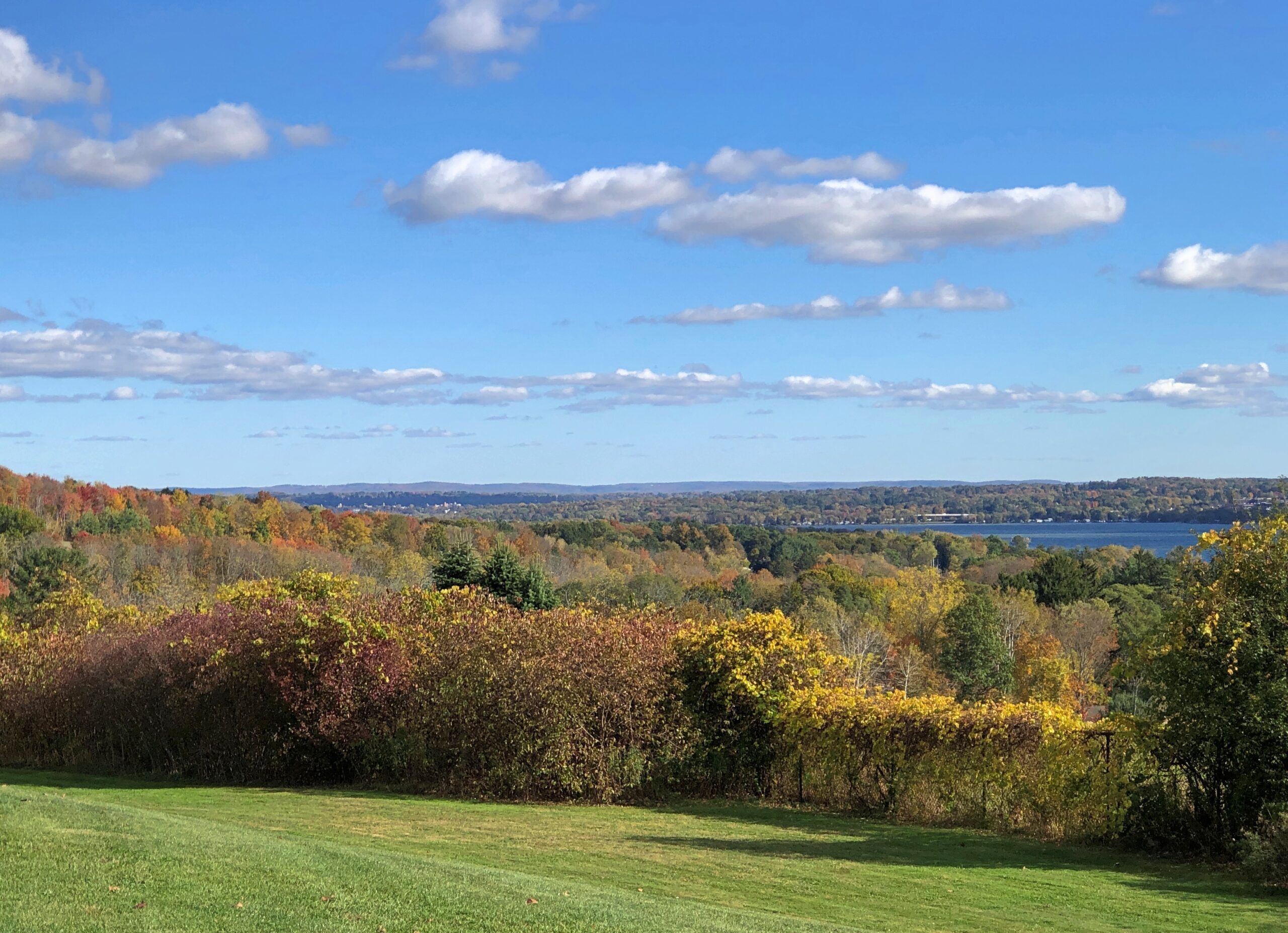
I wanted to reach my destination, Binghamton, NY, before too late, so I didn’t linger near the lake. But I did stop at the rest area on Chautauqua Lake, which is large, and contains multitudes of structures along its shores, and probably many more people in the summer. One of the more scenic rest areas of the trip, it turned out.
So was the next rest area, not far from Corning. A few hours to devote to the glass museum in that town would be well spent, I think.
After an uneventful night in Binghamton – the kind I prefer on the road – I set out for greater NYC, by way of the highway New York 17, the “future I-86” according to my maps, and then the highways New York 30 and 28.
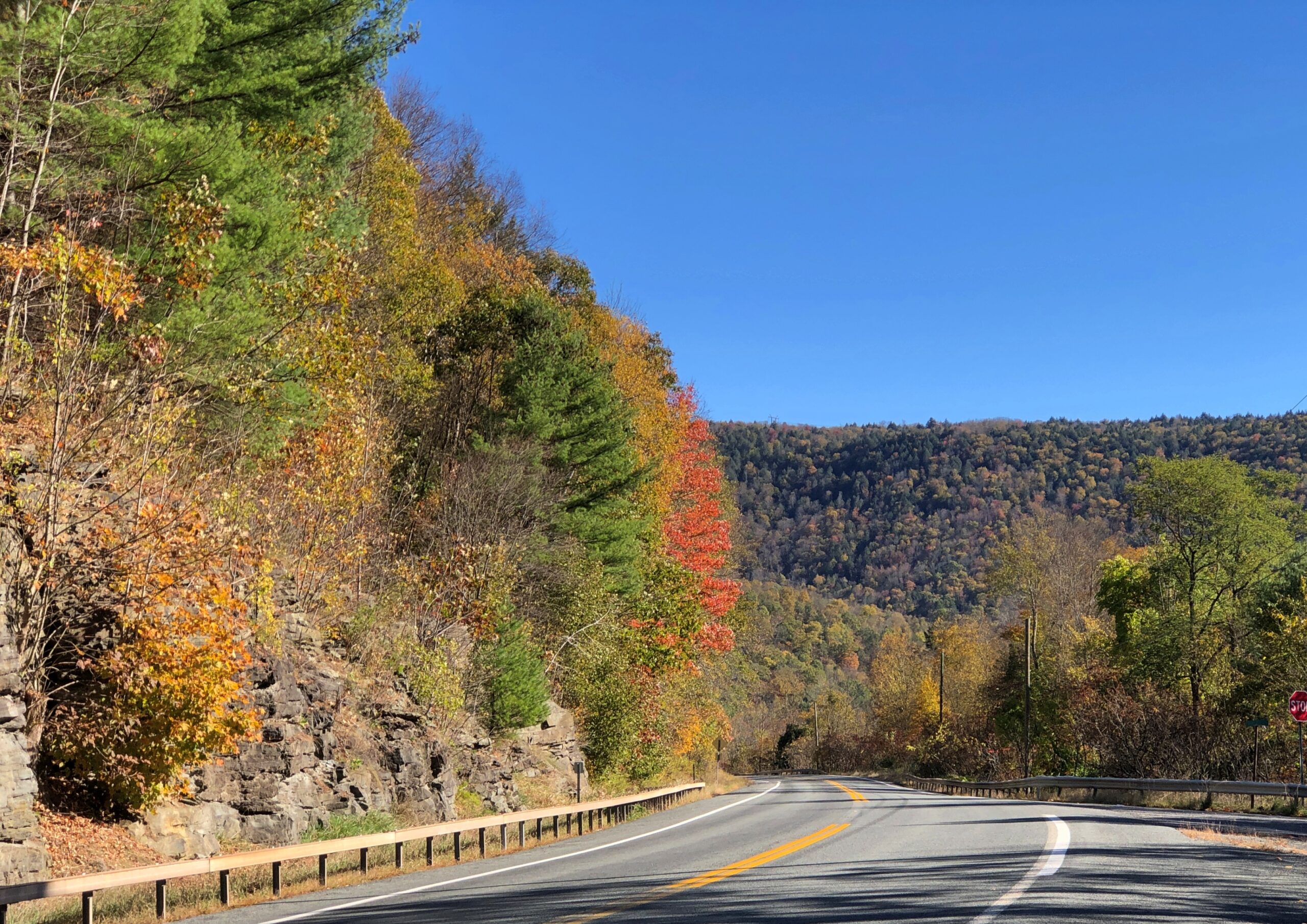
NY 30 skirts the edge of Catskill Park. Last time I was in the Catskills was during the Clinton administration, back when the Concord Hotel and Resort was still clinging to existence, so it’s been a while, and I’d never been in the colorful and nearly empty western edge of the park in October. That emptiness made all the difference in the car commercial driving I enjoyed.
During all the driving over the next week or so after NY 30, empty roads would not be part of my reality.
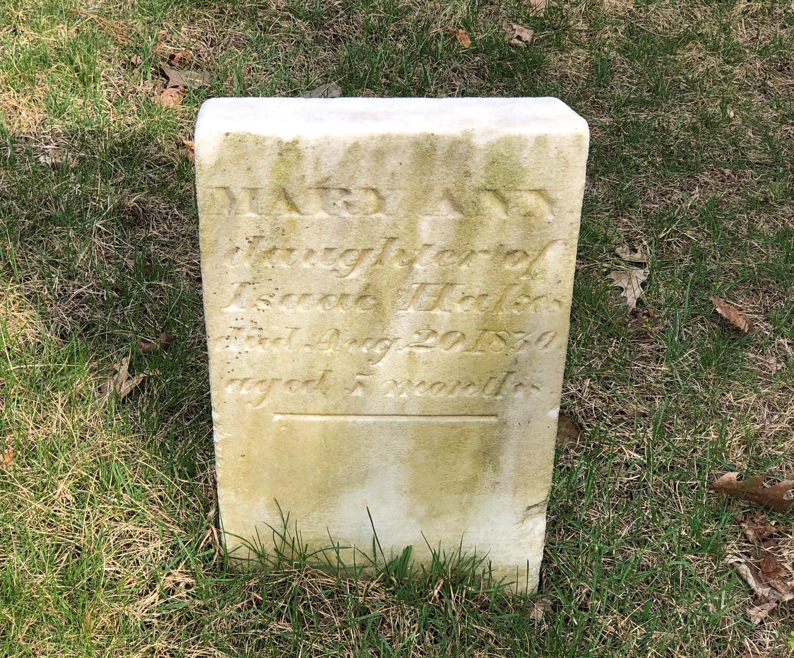
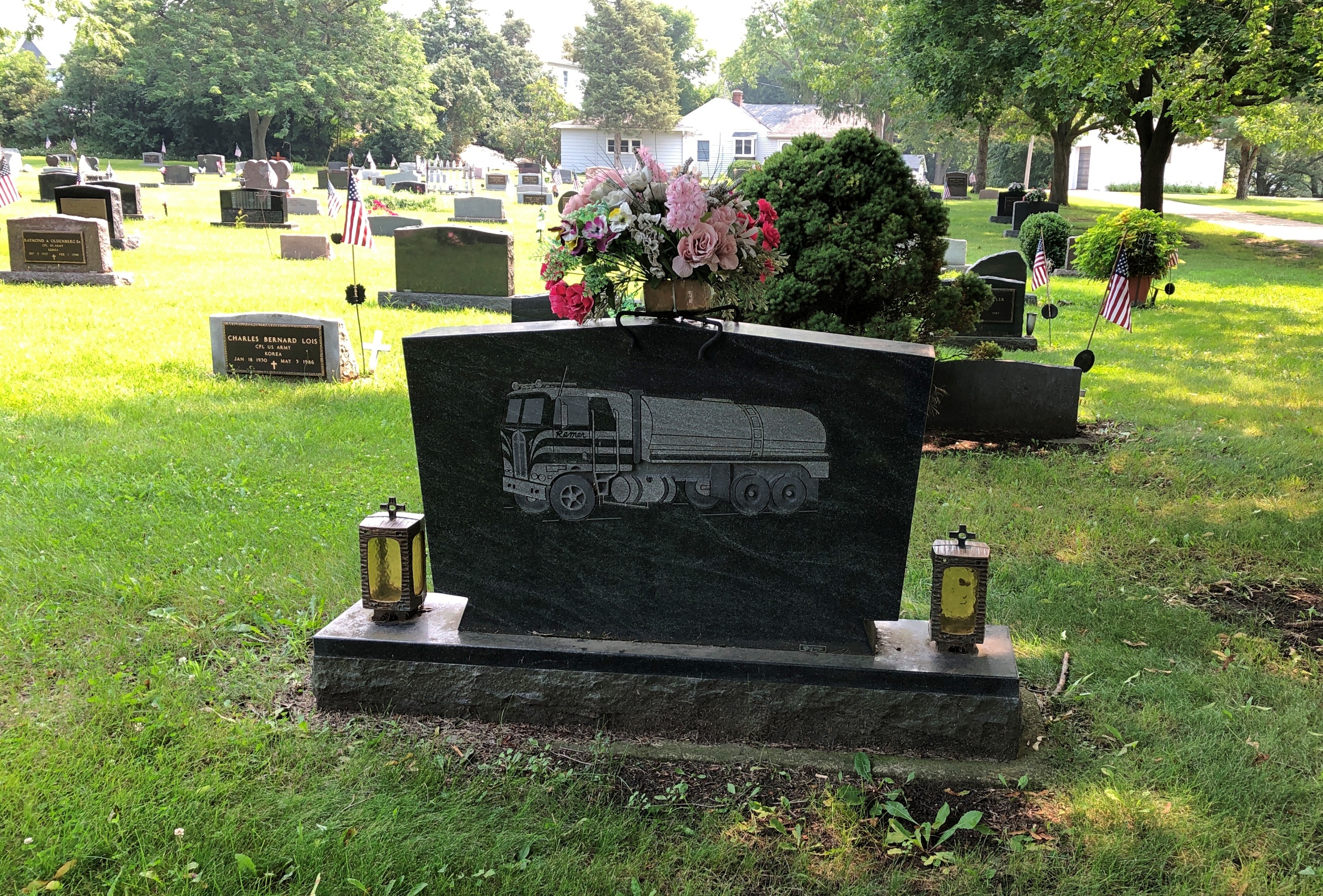
Something I’d never seen on a gravestone: a truck. I’ll bet most people can say that.
My best guess when I saw it was that Kenneth C. Remer was a trucking man who, among other things, lived through the short romanticization of trucking men in the mid-1970s. Something I’m sure is lost on later generations, as if that matters. If I were silly enough to say “That’s a big 10-4” to either of my daughters, I wouldn’t expect comprehension. That bit of code wasn’t invented by truckers, but even so.
I looked him up, as one can in our time. His obit says he was a “partner in Remer Milk Service.” So could be he drove a milk truck, at least sometimes. That is a liquid-hauling truck depicted on the stone. Not something celebrated in song and story, but useful work all the same.
Another thought on that: though “Convoy” was much more popular, C.W. McCall’s “Wolf Creek Pass” is by far the more entertaining song. (And it’s a real place.) A better song about driving a truck is “Willin’,” originally by Little Feat. Of all people, the inestimable Linda Ronstadt did a remarkable cover of it.
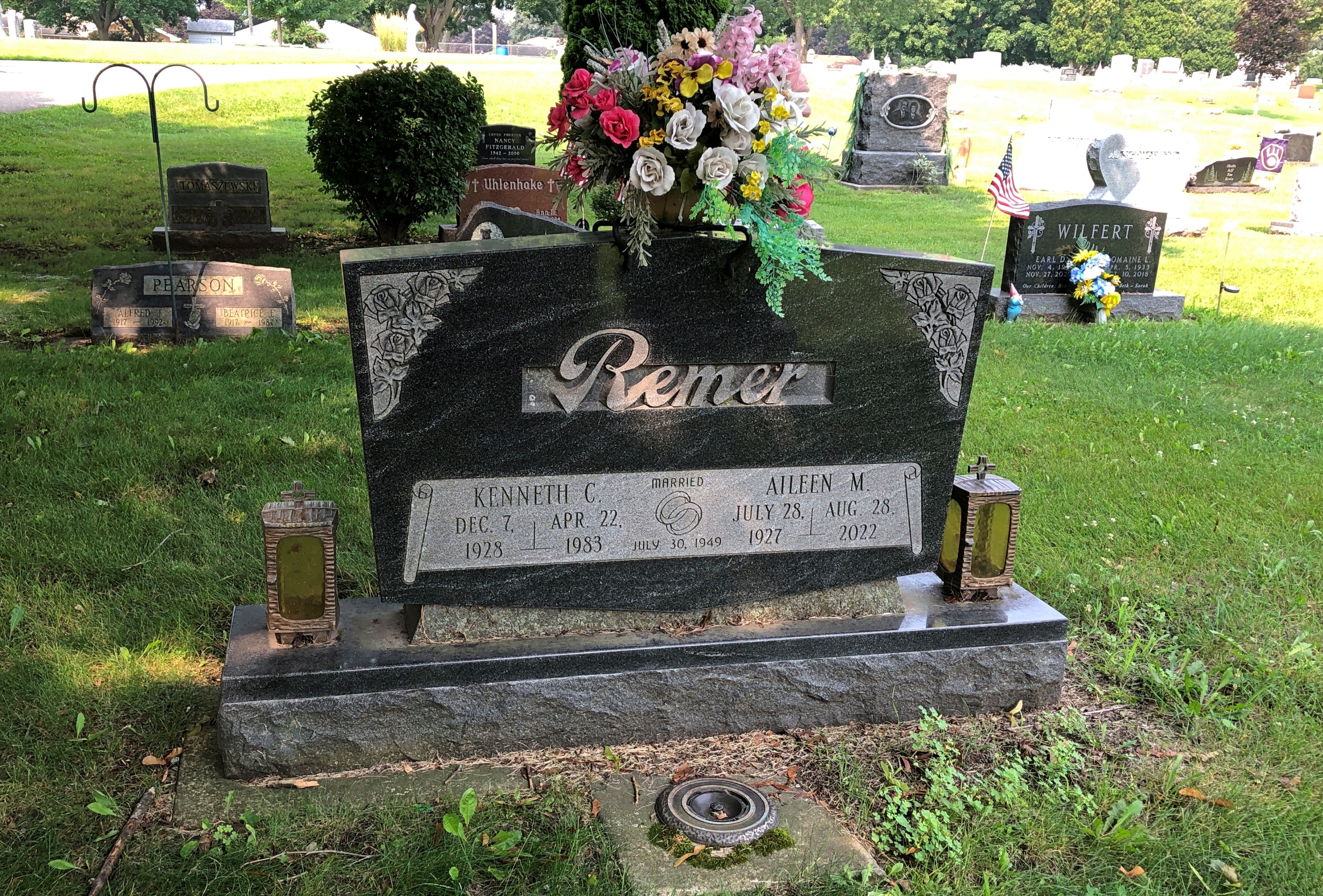
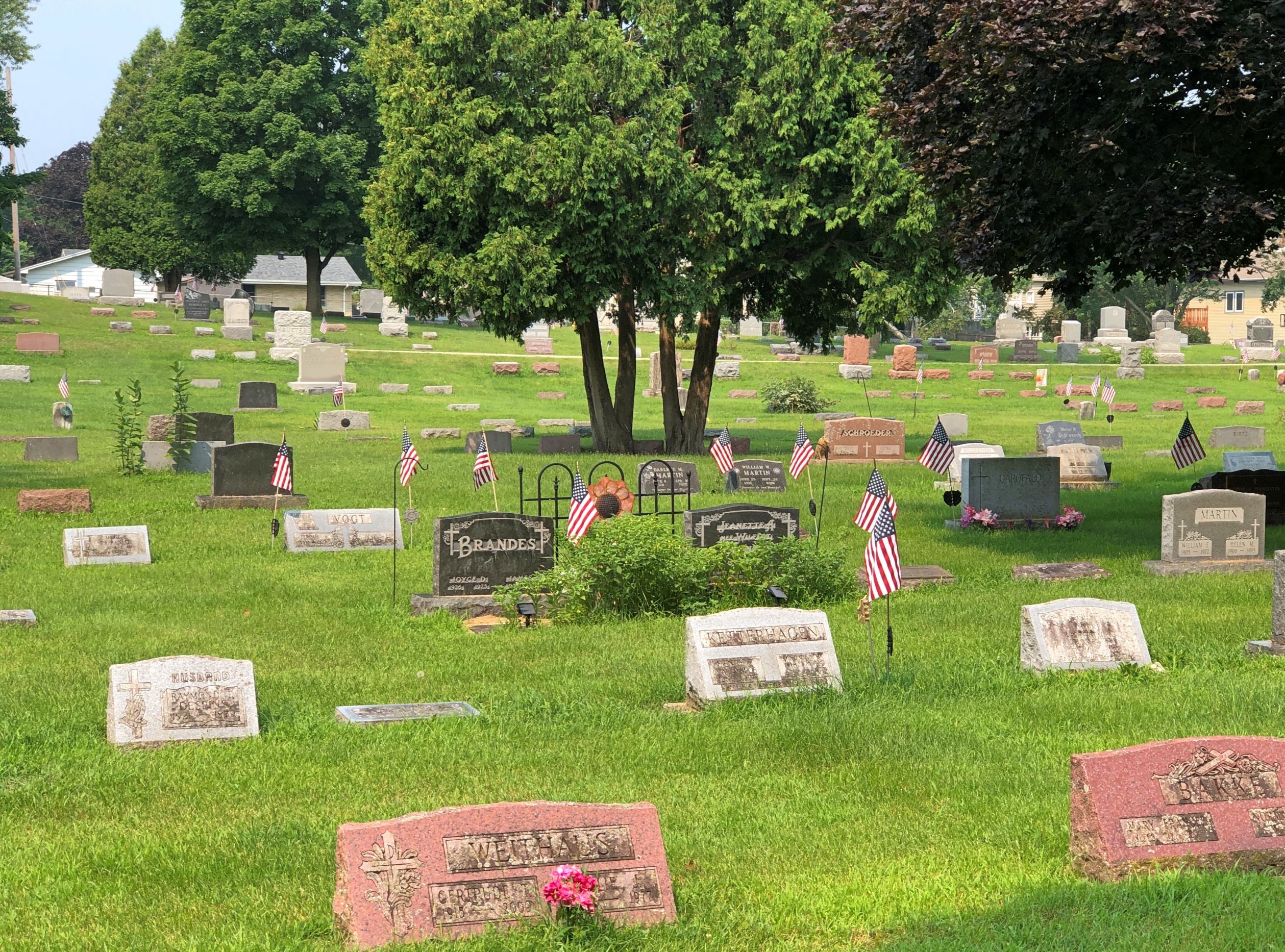
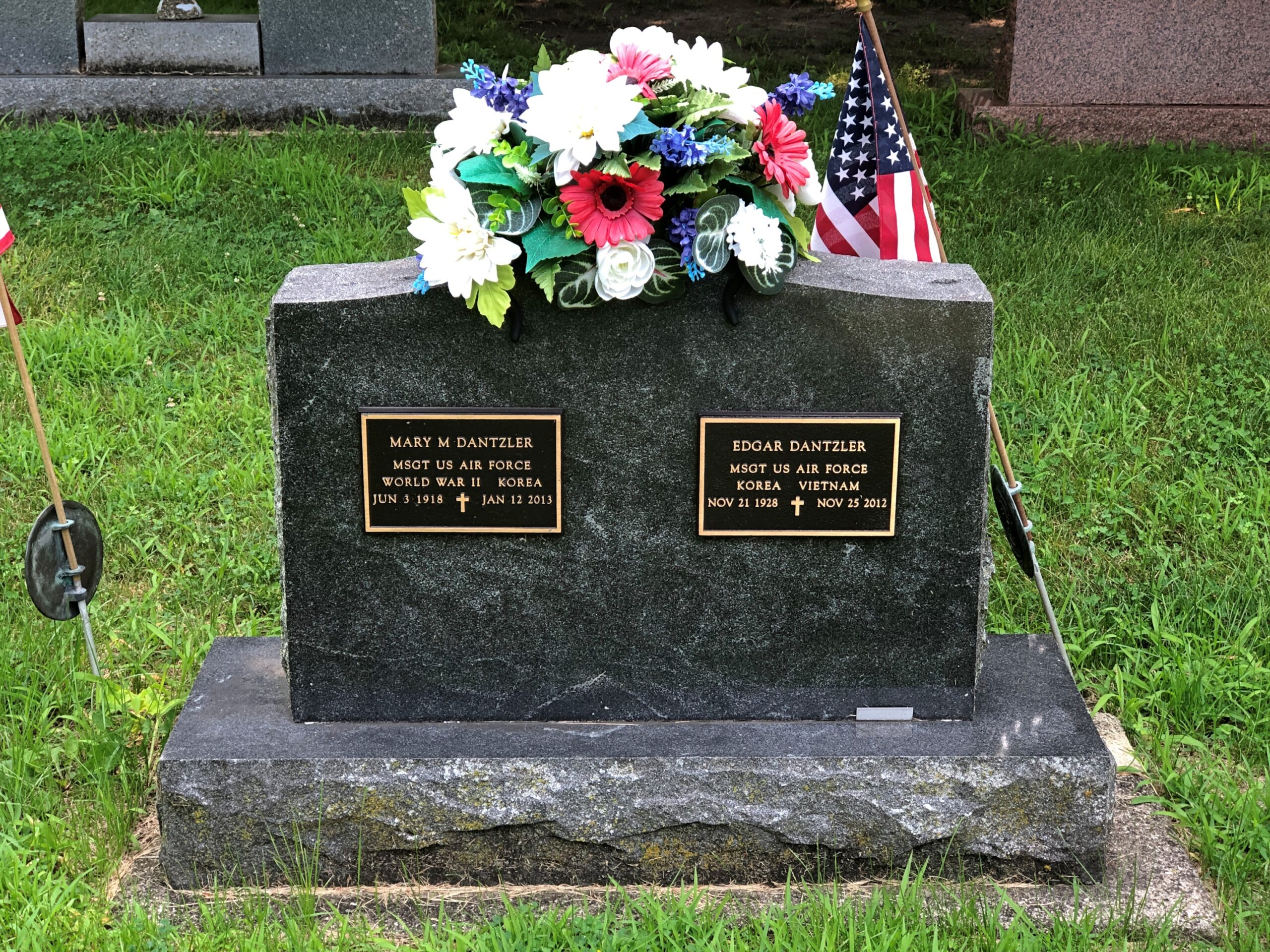
I encountered Mr. and Mrs. Remer at St. Mary’s Cemetery in Burlington, Wisconsin last month. A Catholic cemetery with a nice assortment of stones.
Unusual: two Air Force (I assume originally Army Air Corps) Master Sergeants, married to each other.
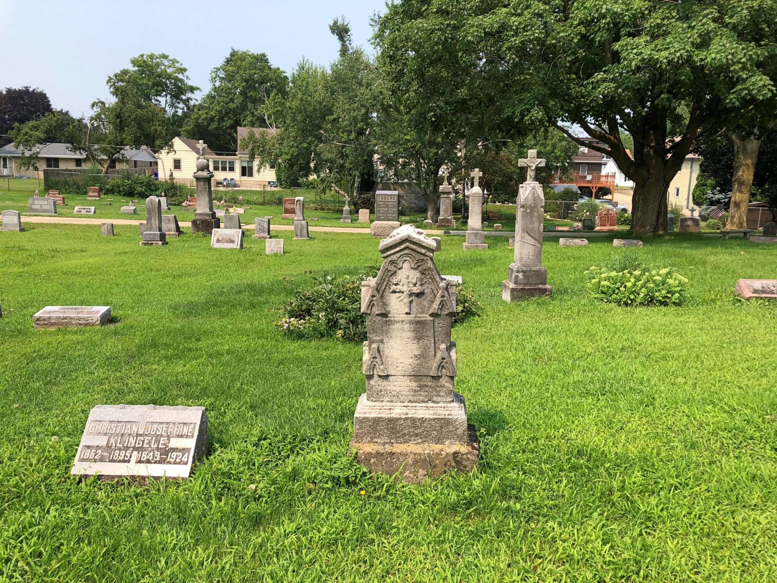
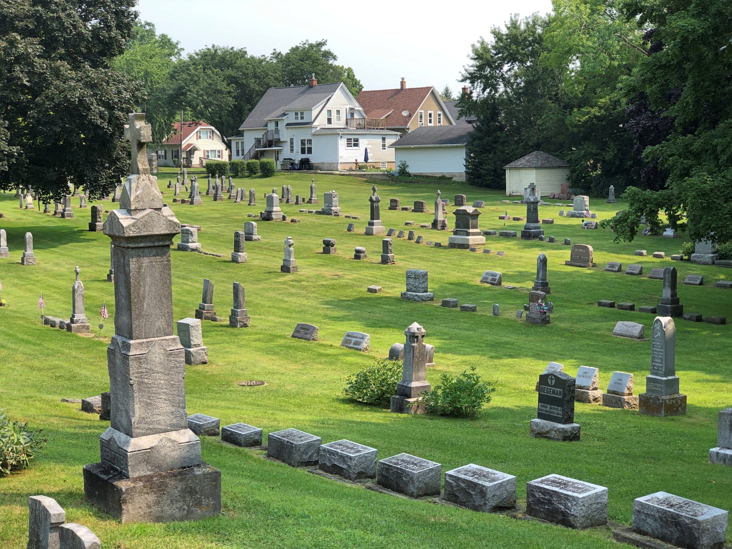
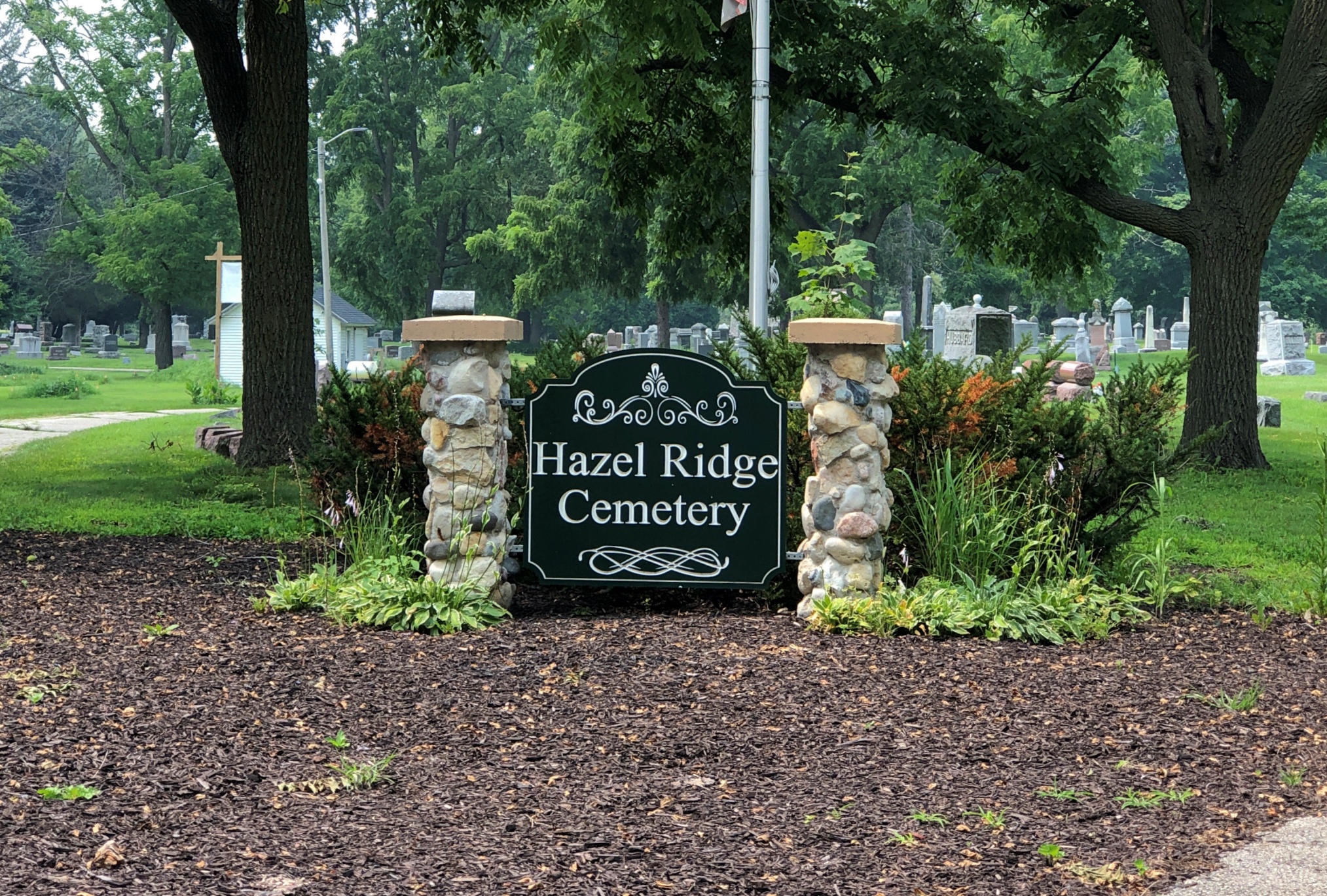
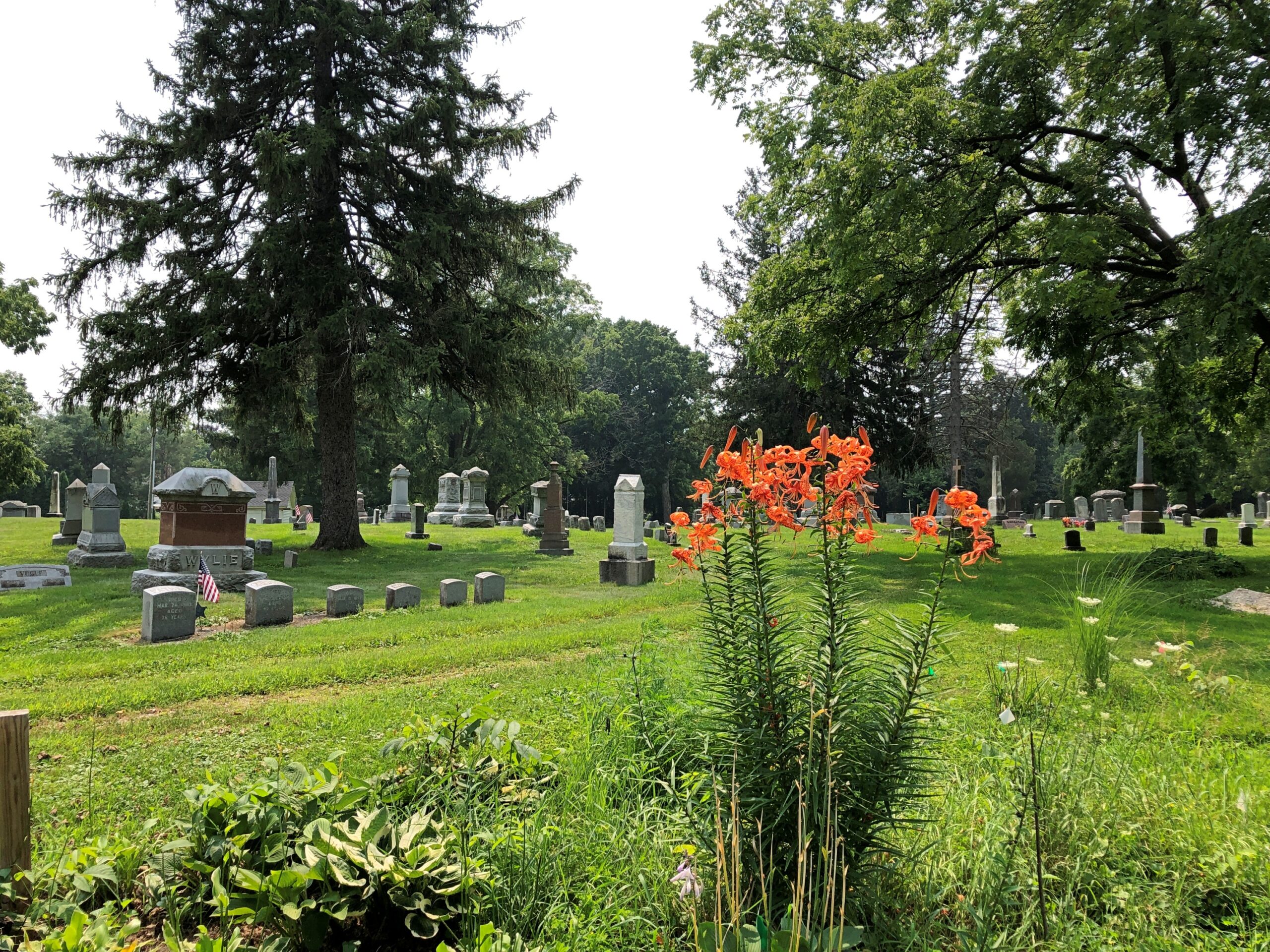
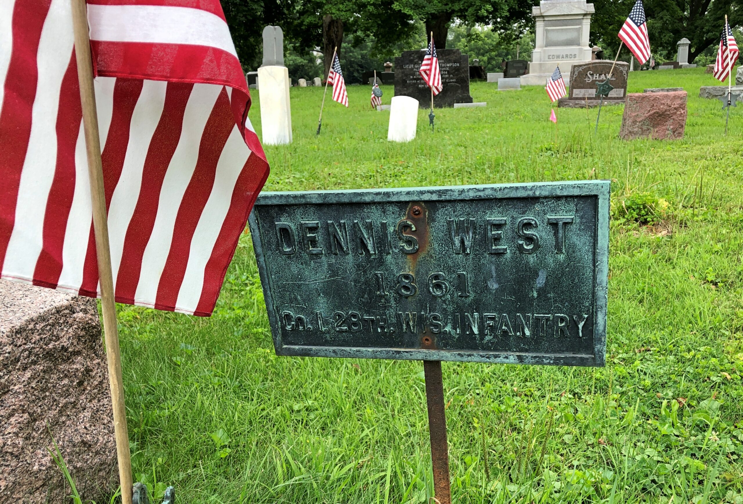
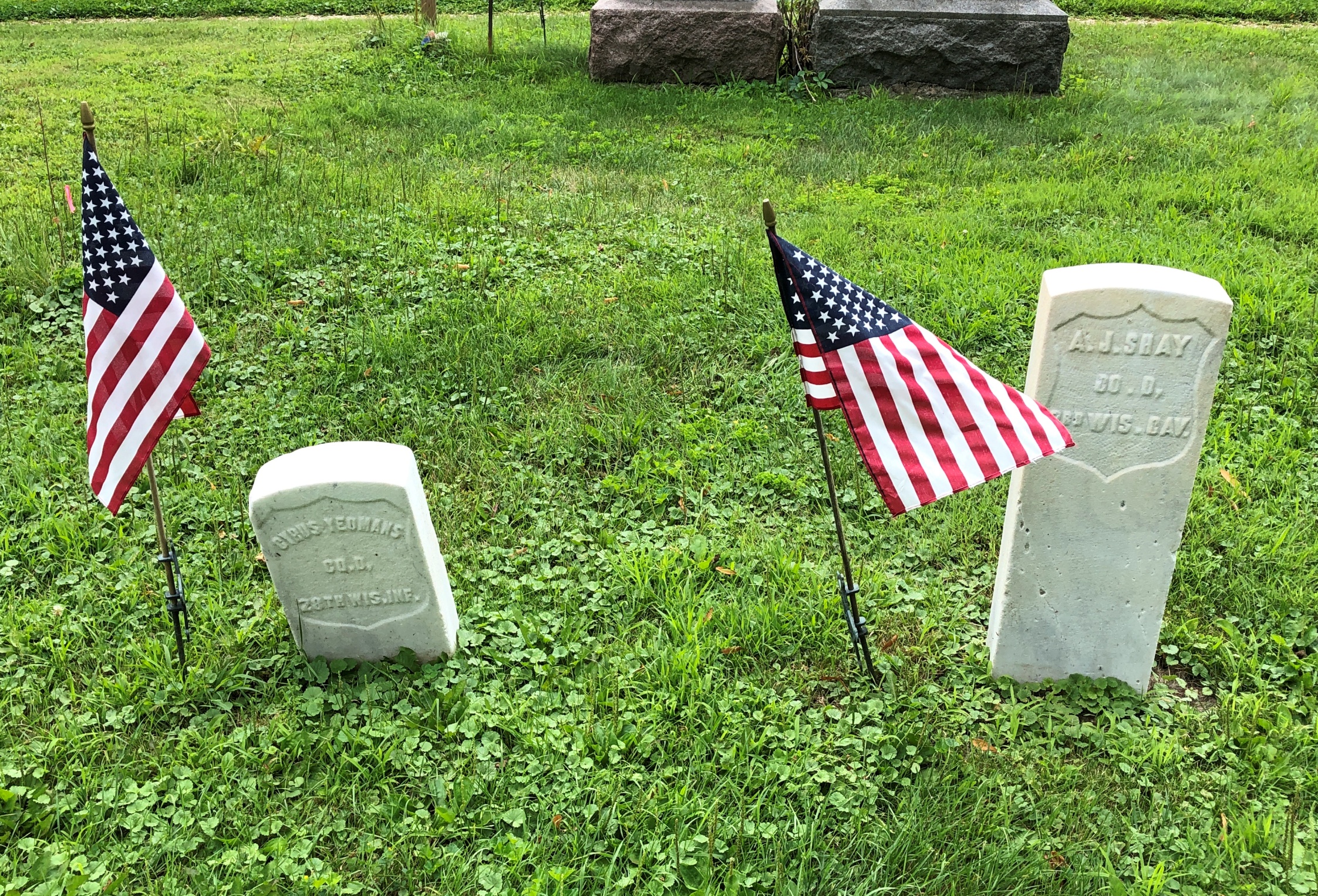
During my recent visit to Elkhorn, Wisconsin, I did no more than look for an “historic cemetery” on Google Maps to find Hazel Ridge Cemetery. Historic for sure, founded more than 150 years ago.
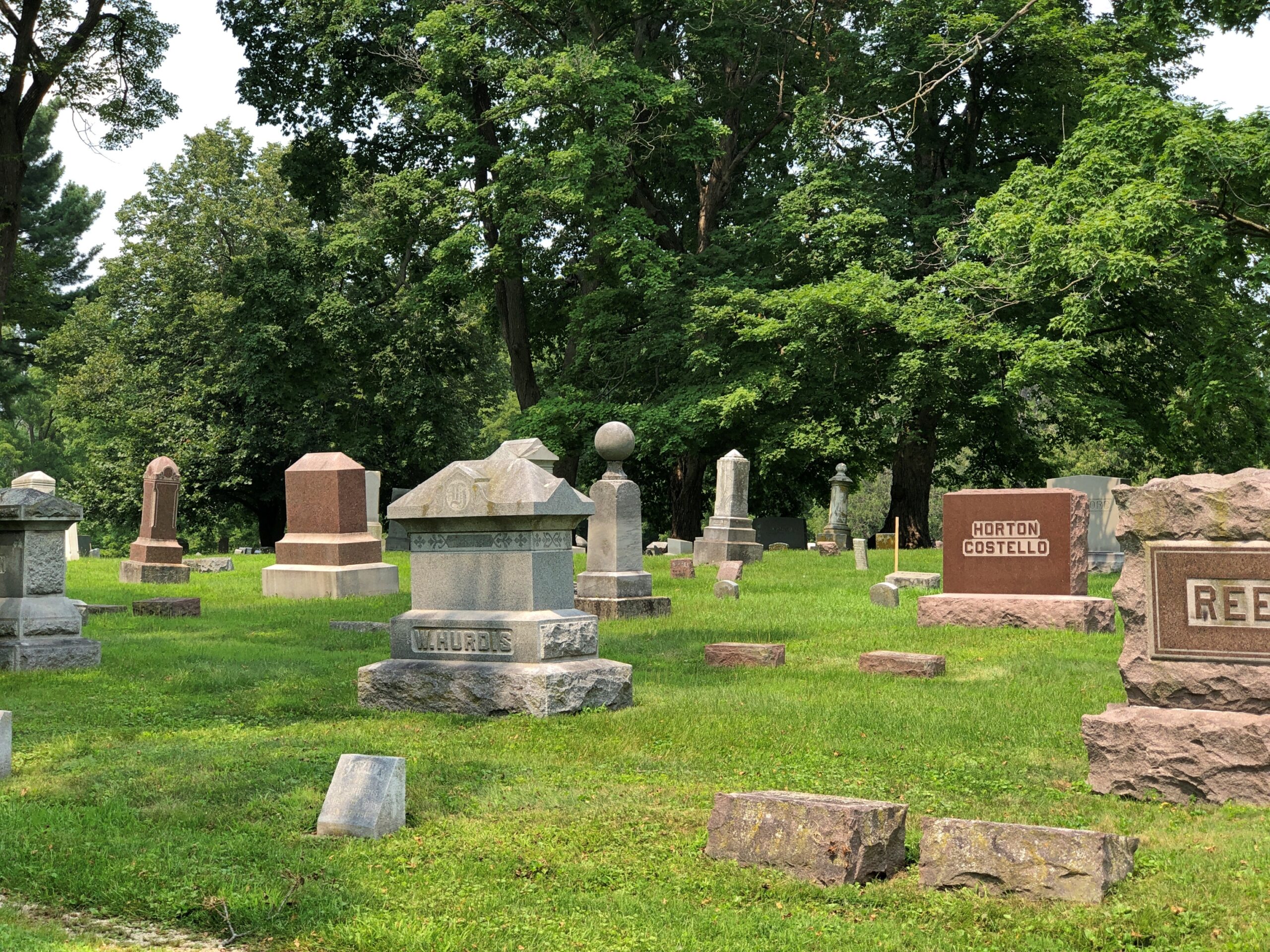
It too has a fine collection of memorials. The cemetery is also an arboretum, with more than 25 native species and ornamental varieties.
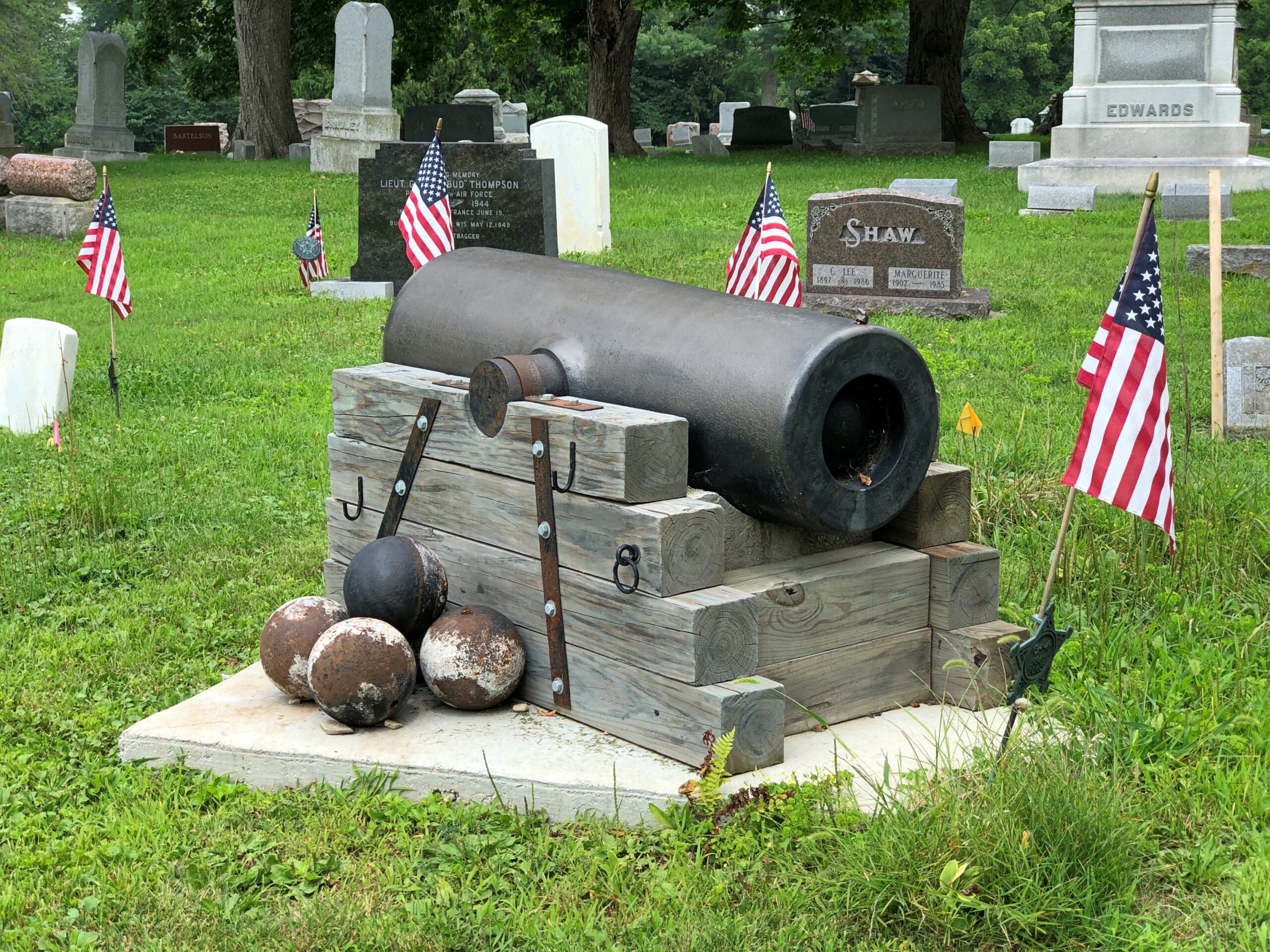
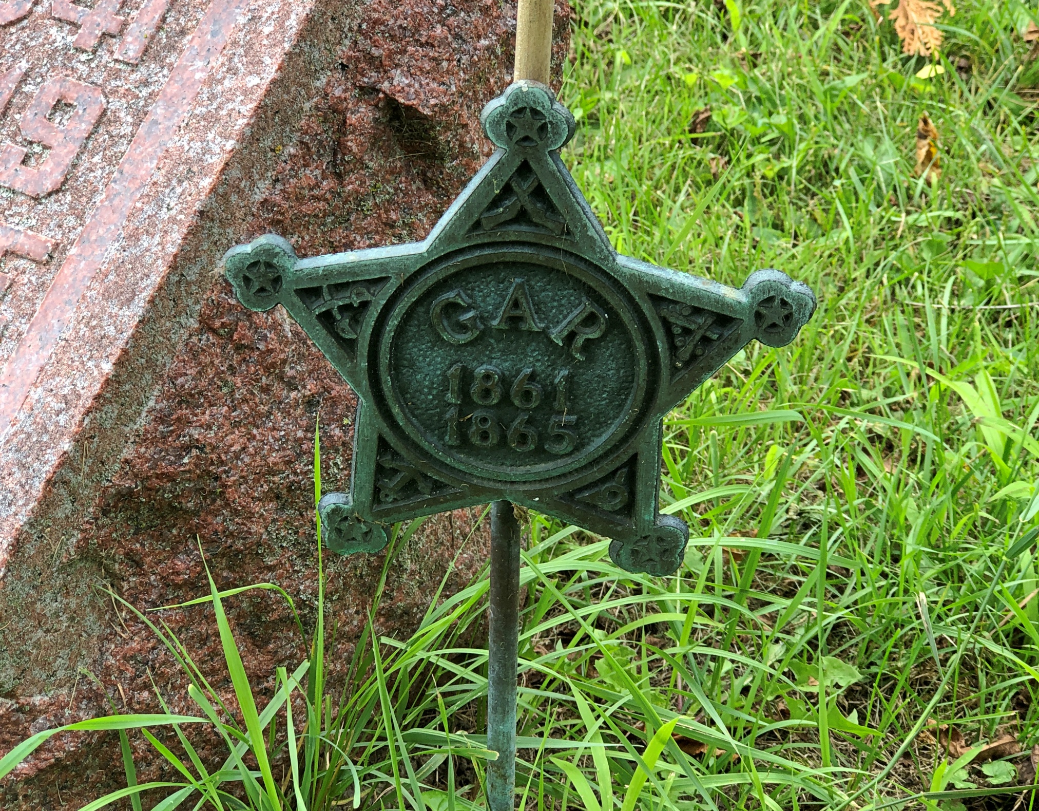
Hazel Ridge has a clutch of war dead memorials, including an 8-inch siege Howitzer as the centerpiece of a Grand Army of Republic memorial.
This particular cannon, according to a nearby sign, was made in 1862 at the Fort Pitt Foundry in Pittsburgh. I assume it did its part for the Union. Nearby are soldiers who did likewise.
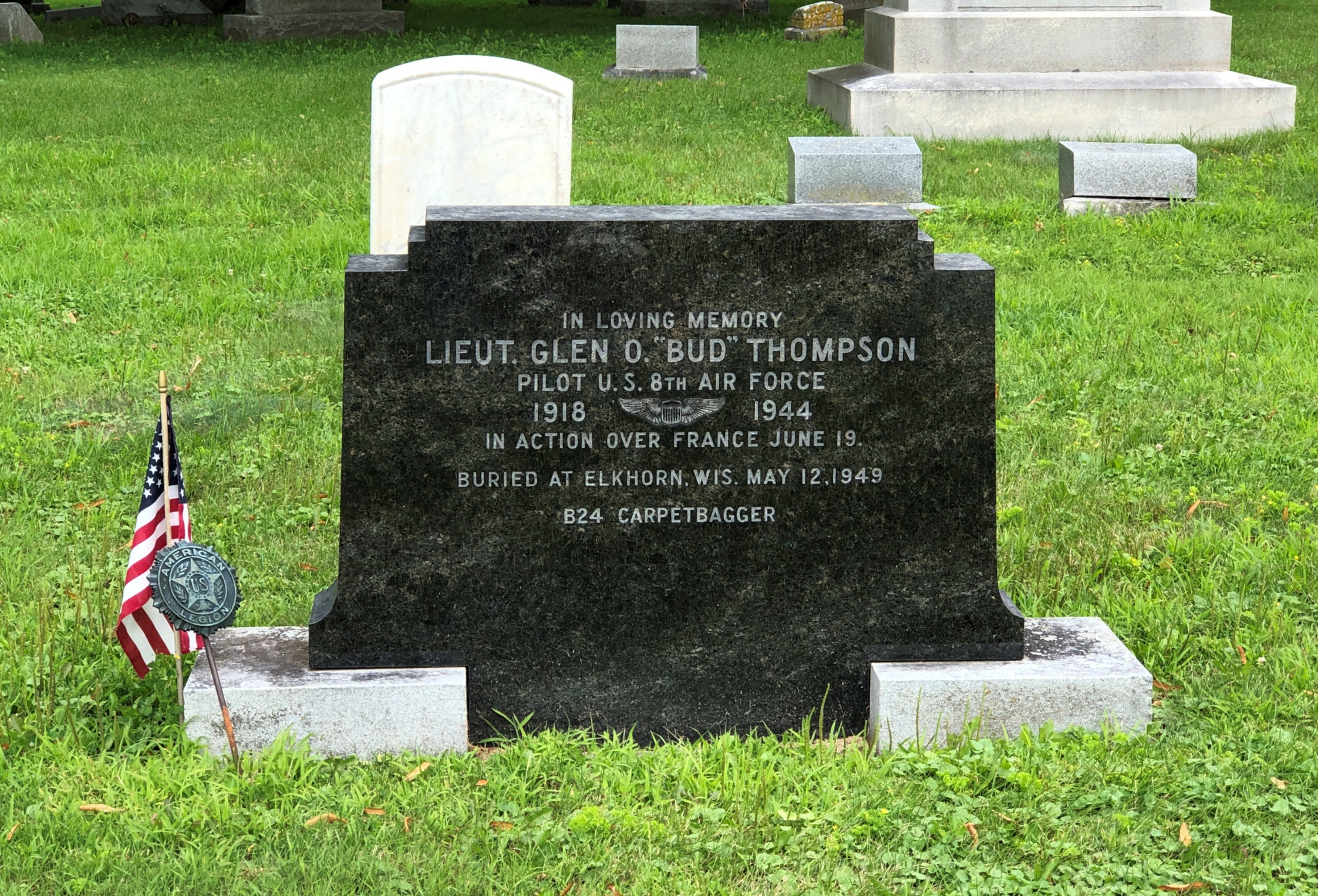
And those who died in later wars.
The single word “Carpetbagger” on the stone tells quite a story. Operation Carpetbagger involved black-painted B-24s flying low and slow by night, dropping supplies and agents to the resistance in France before and after the Normandy invasion. Clearly dangerous work. RIP, Bud.
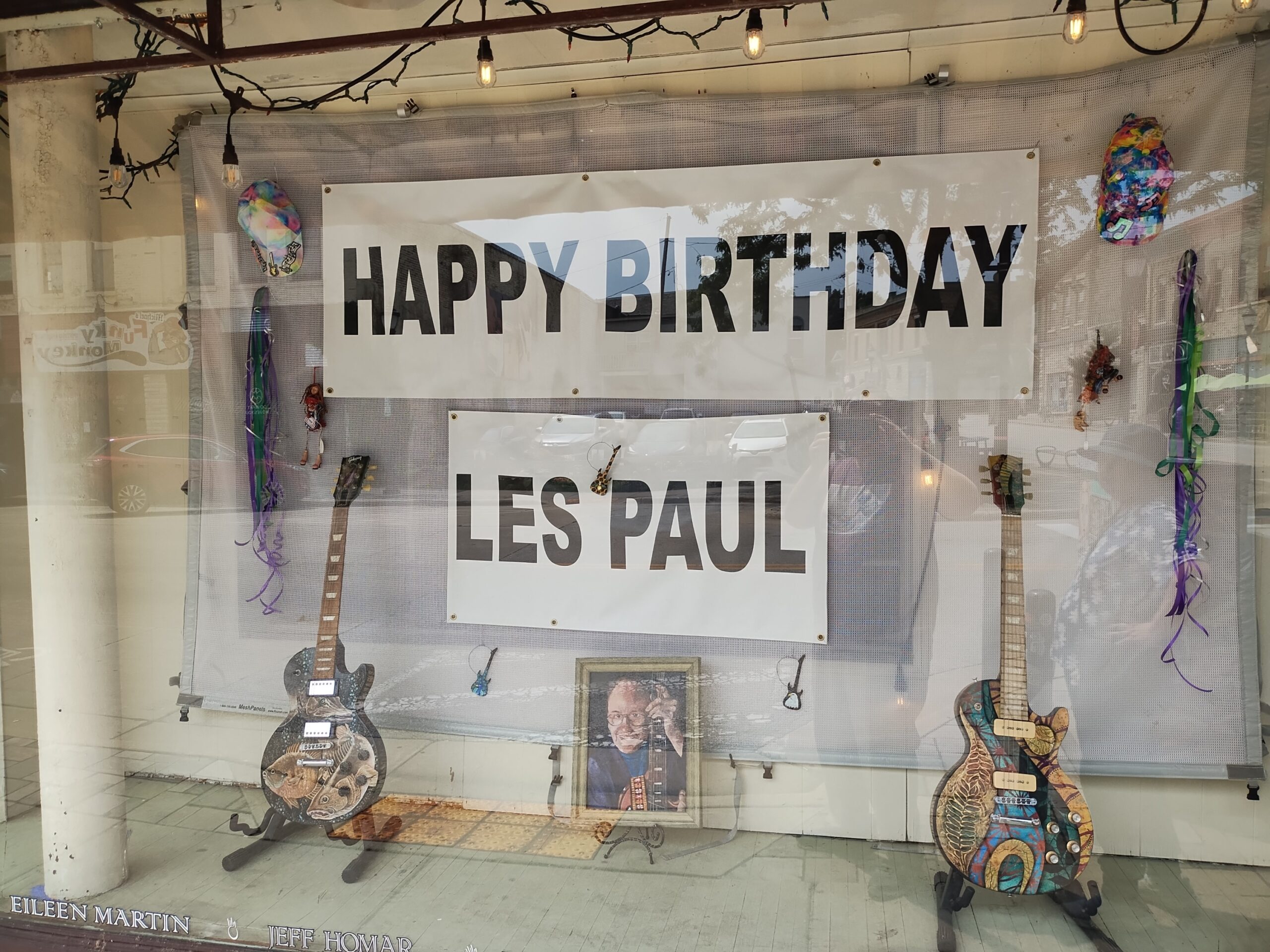
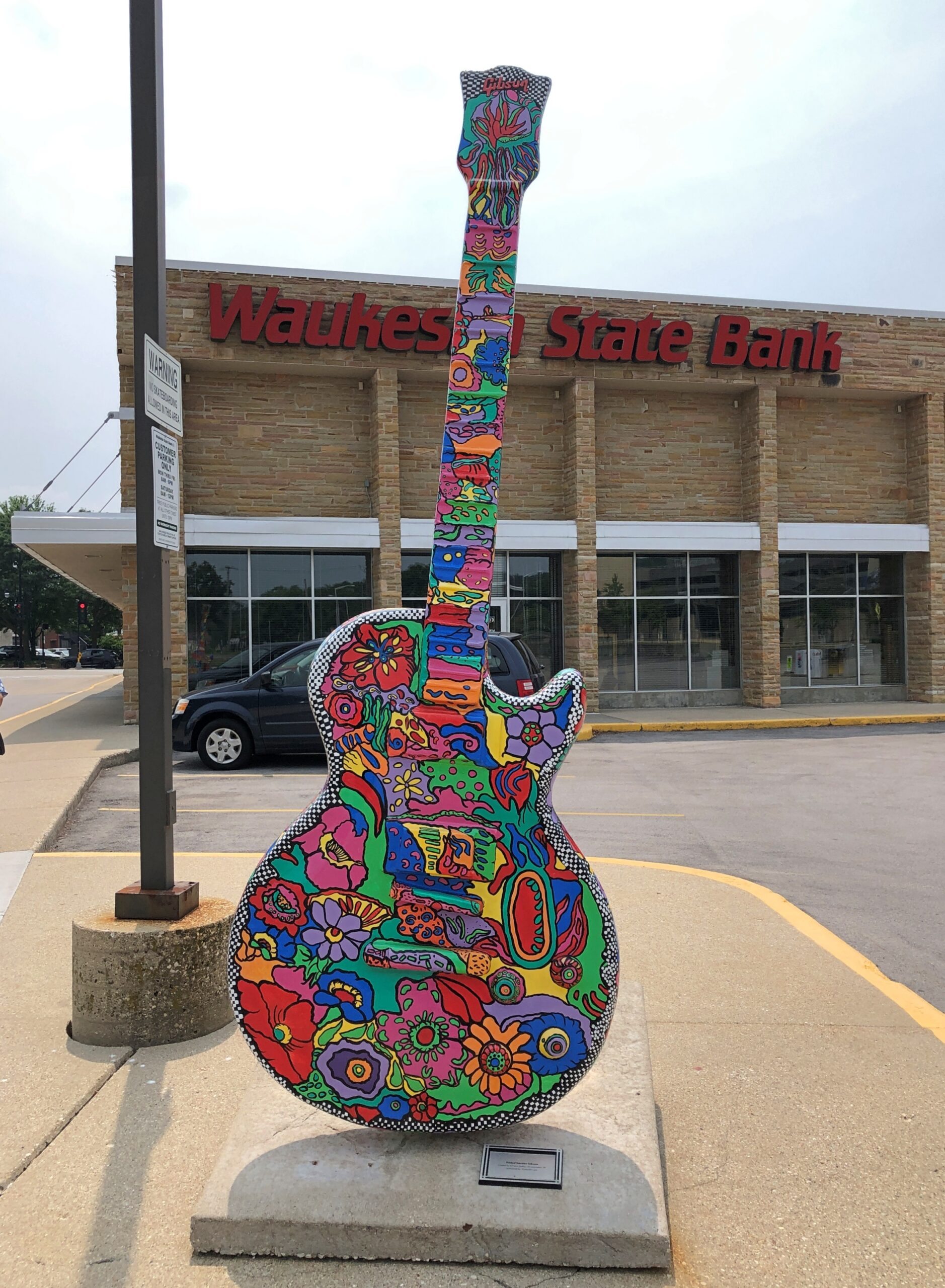
Something I didn’t know about Waukesha, Wisconsin, before we went there last month: that Les Paul (b. 1915) grew up around there. Waukesha certainly hasn’t forgotten.
A recent sign, since his birthday is in early June. Waukesha is a “GuitarTown,” because of its association with the famed musician and music technologist. Apparently there is more than one GuitarTown, since Gibson Guitars doles out the moniker, or at least used to.
“Waukesha was named a Gibson GuitarTown in 2012 and 2013, two years in a row, to honor the birth and resting place of electric guitar legend Les Paul,” The Freeman reports. “Other GuitarTowns include Austin, Nashville and London.”
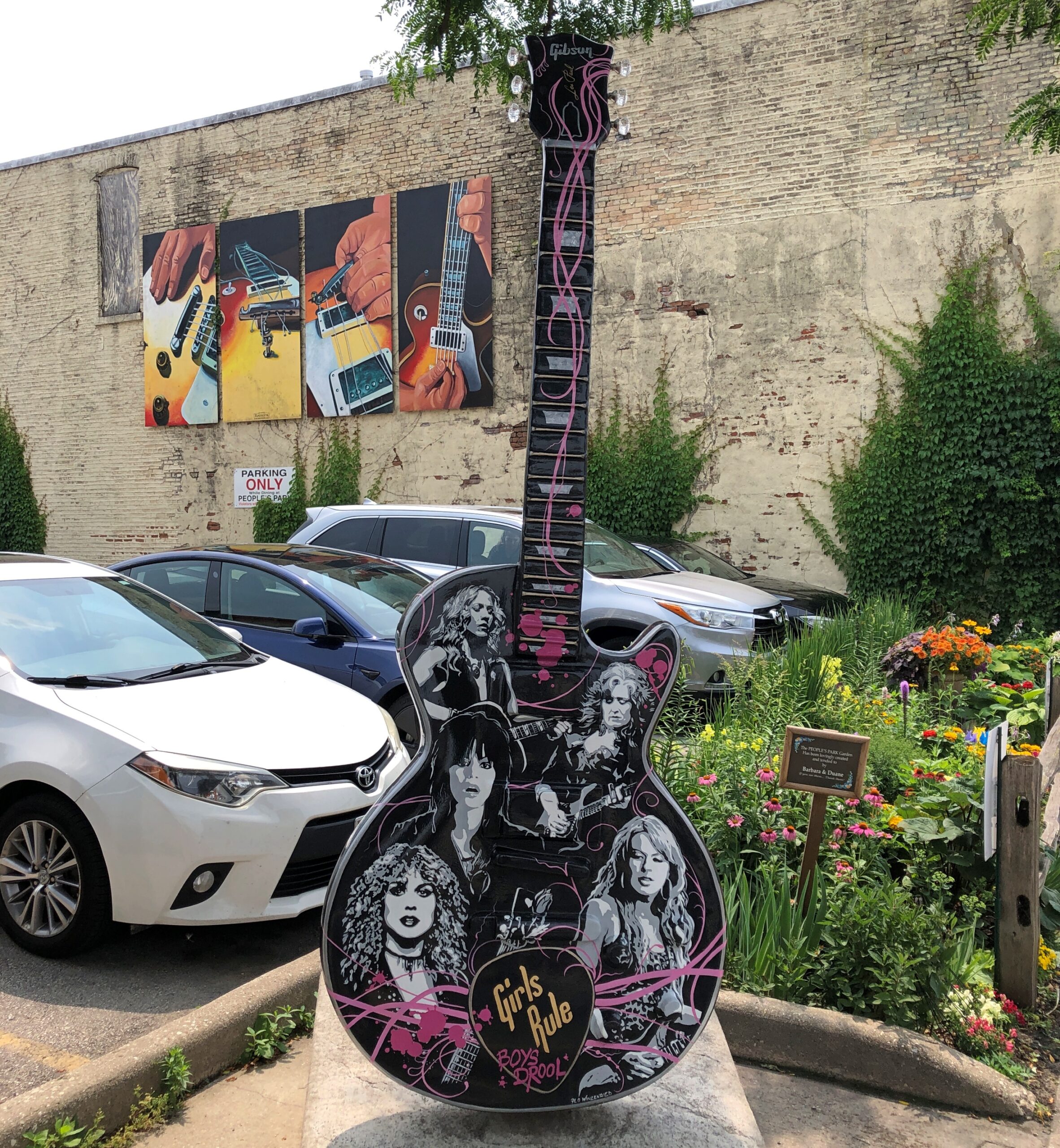
As GuitarTown, Waukesha has 15 guitar statues in public places, each 10 feet tall and designed by local artists. Elsewhere in town, you can find Les Paul Middle School, Les Paul Parkway, the Les Paul Performance Center, and the Les Paul gravesite monument. Missed that, alas. Maybe some other time. But we did drive on his parkway. And see a few of the giant guitars.
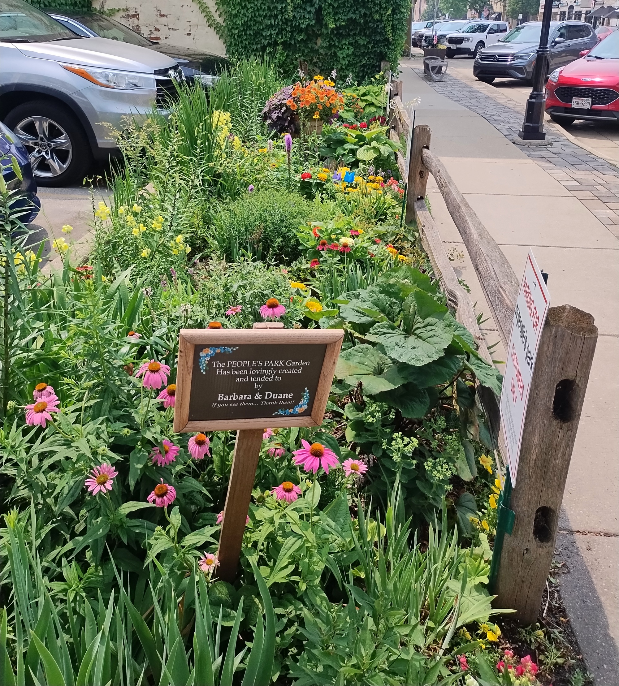
Next to that particular guitar, a small garden is wedged between the sidewalk and a parking lot. The PEOPLE’S PARK Garden, says the sign.
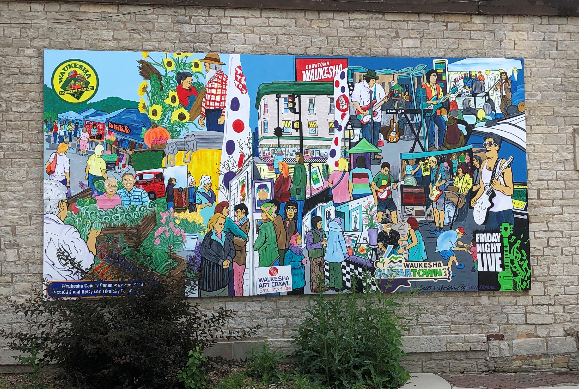
The Wall Dogs also came to town and painted 13 murals. I assume this is one of them.
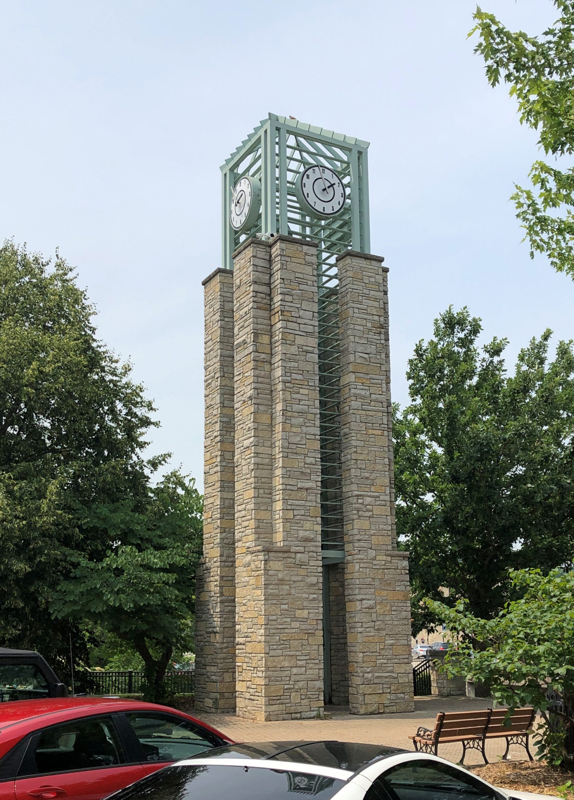
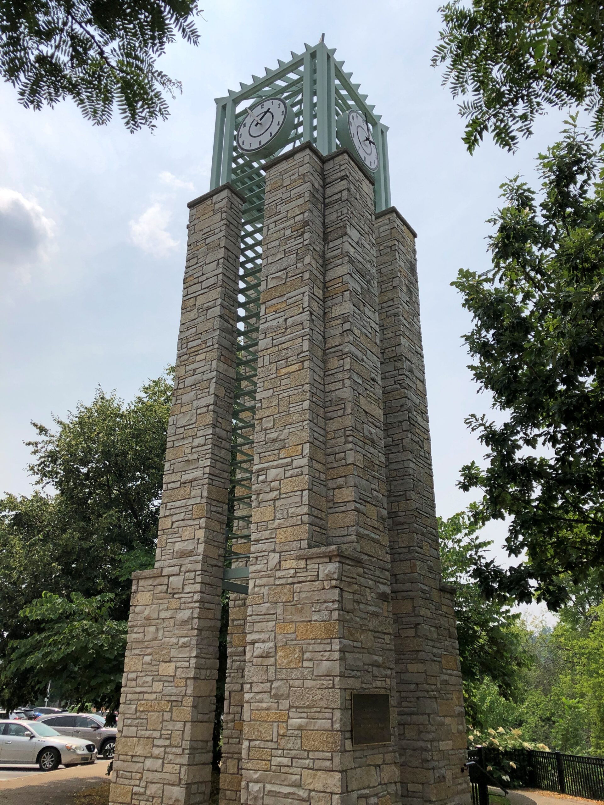
Across a parking lot from that mural rises Waukesha’s impressive stone clocktower.
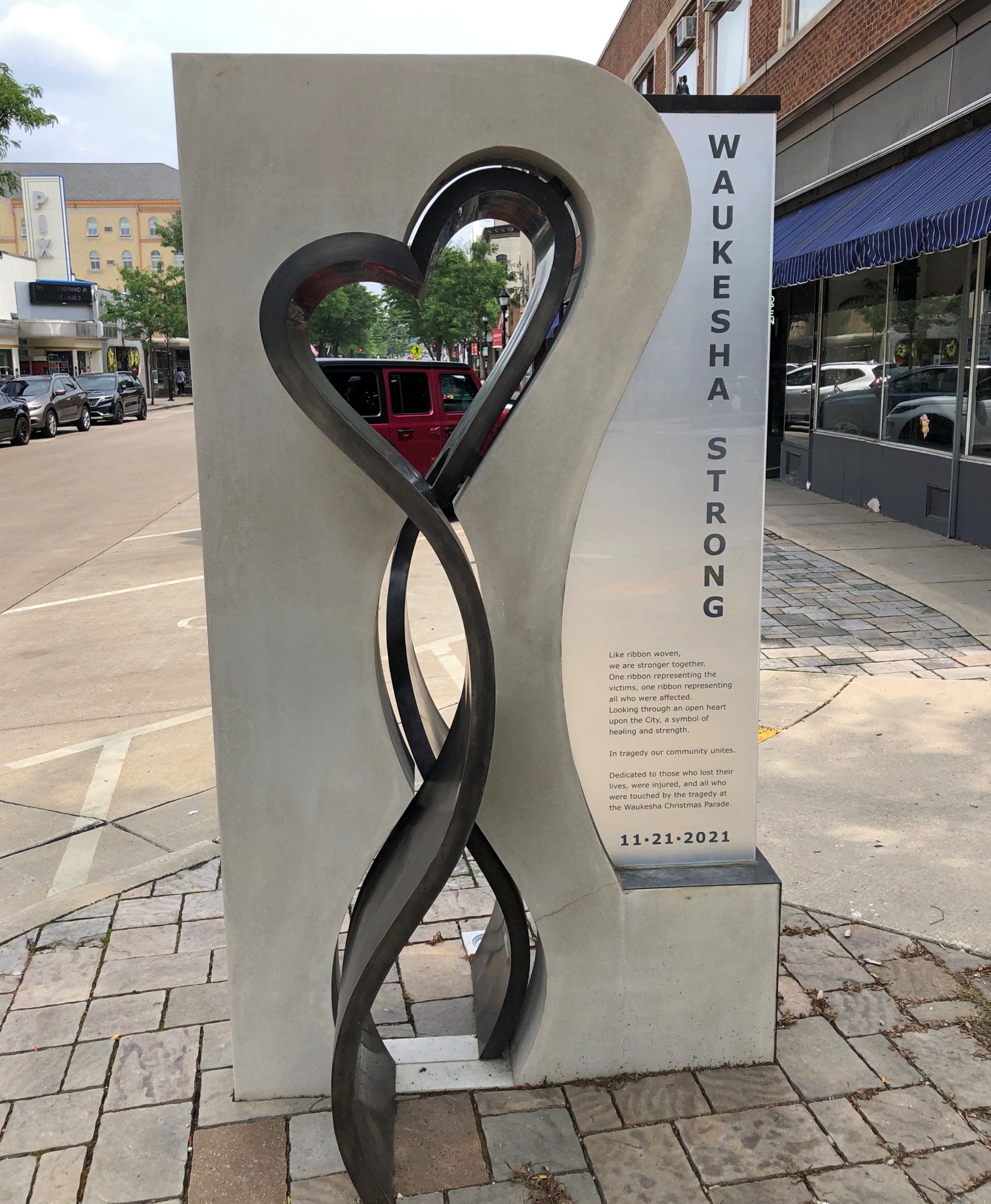
On Main Street, a memorial.
Outrages by homicidal wankers are so common that I had to refresh my memory about that particular one, in late 2021. Then I remembered. The only good thing I can report is that the wanker, who went double wanker at his trial by asserting sovereign citizen nonsense, is now a permanent resident of a tightly locked state facility.
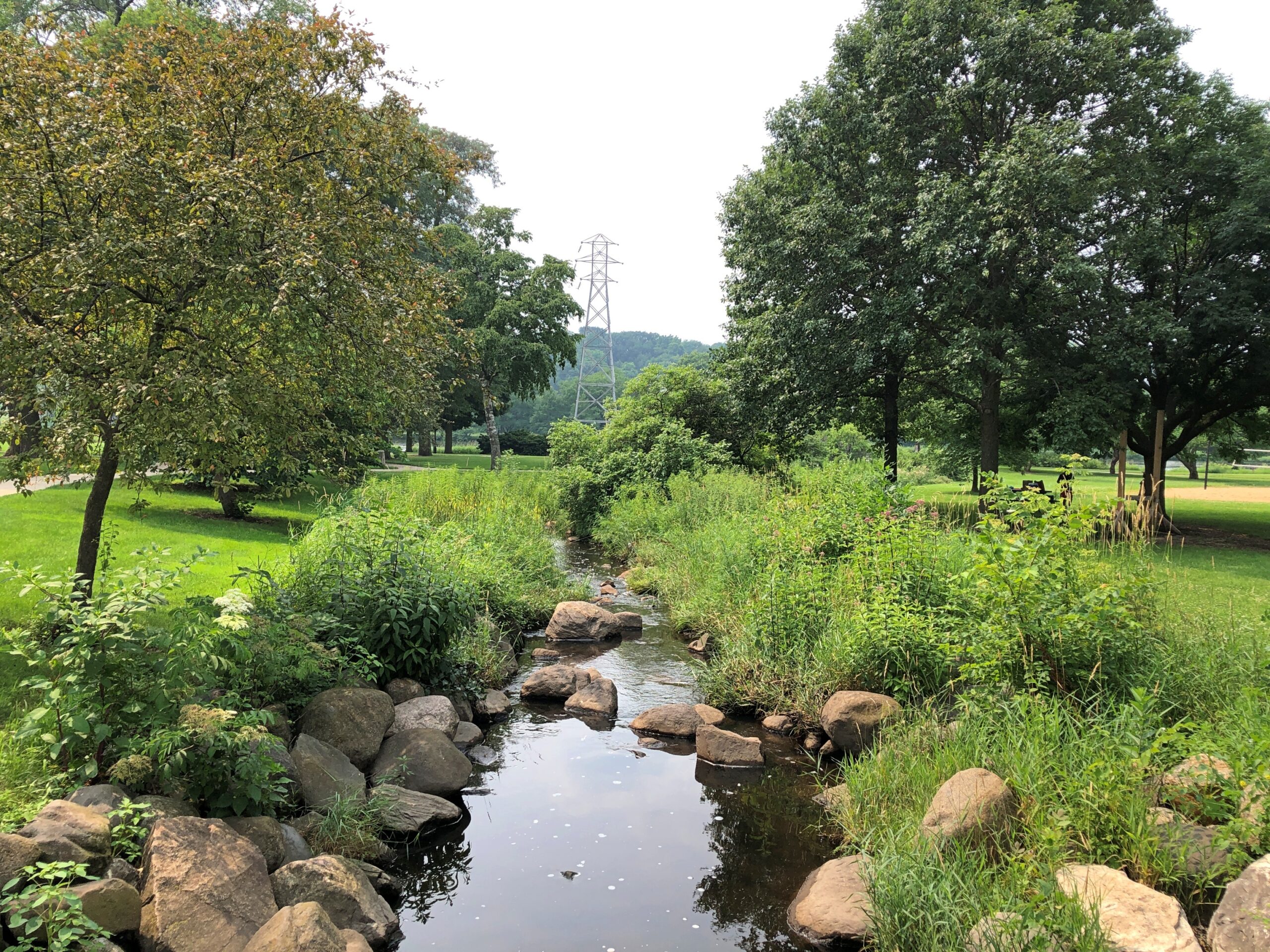
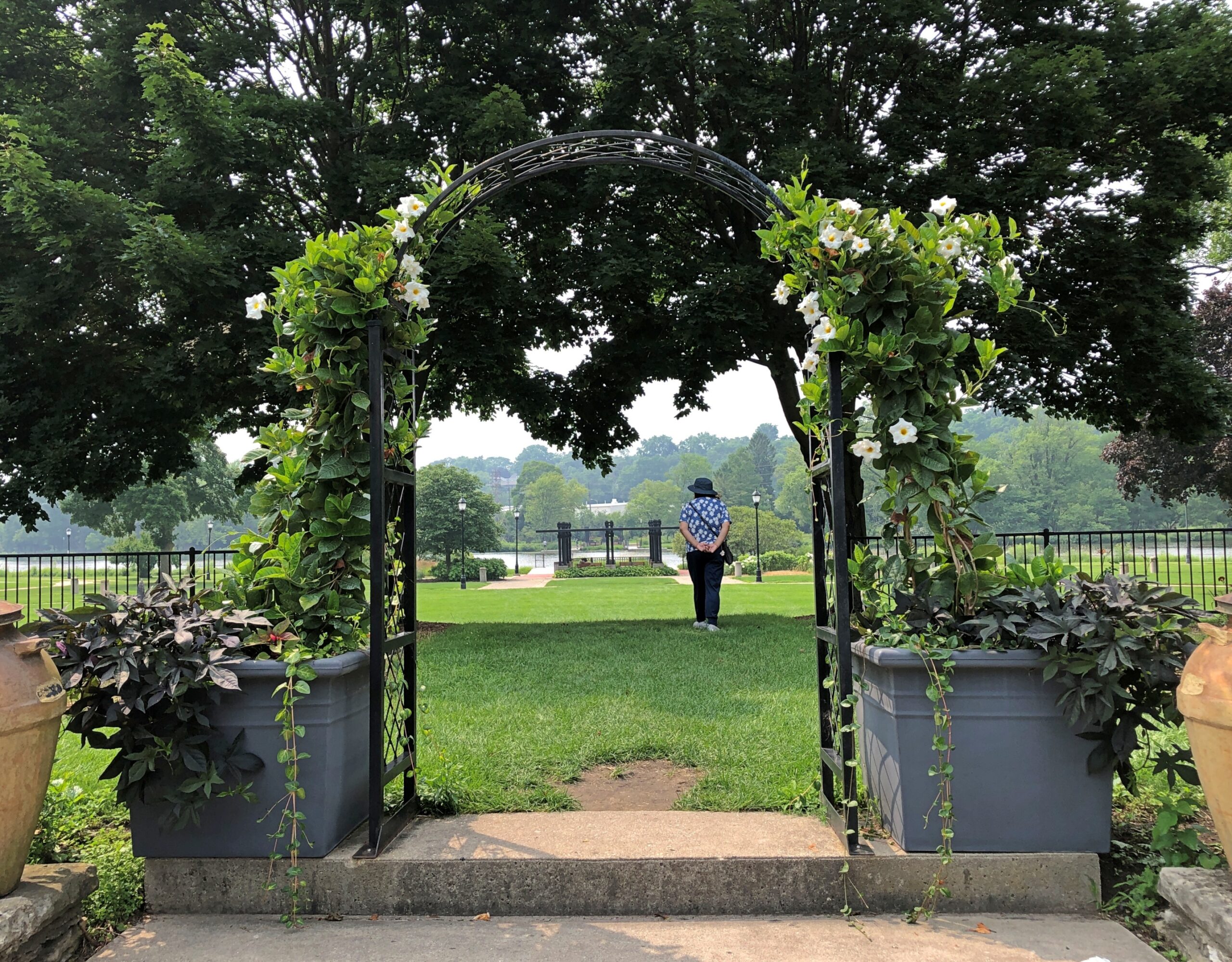
Upriver a half mile or so from downtown is the sizable riverside Frame Park.
Including the Frame Park Formal Gardens.
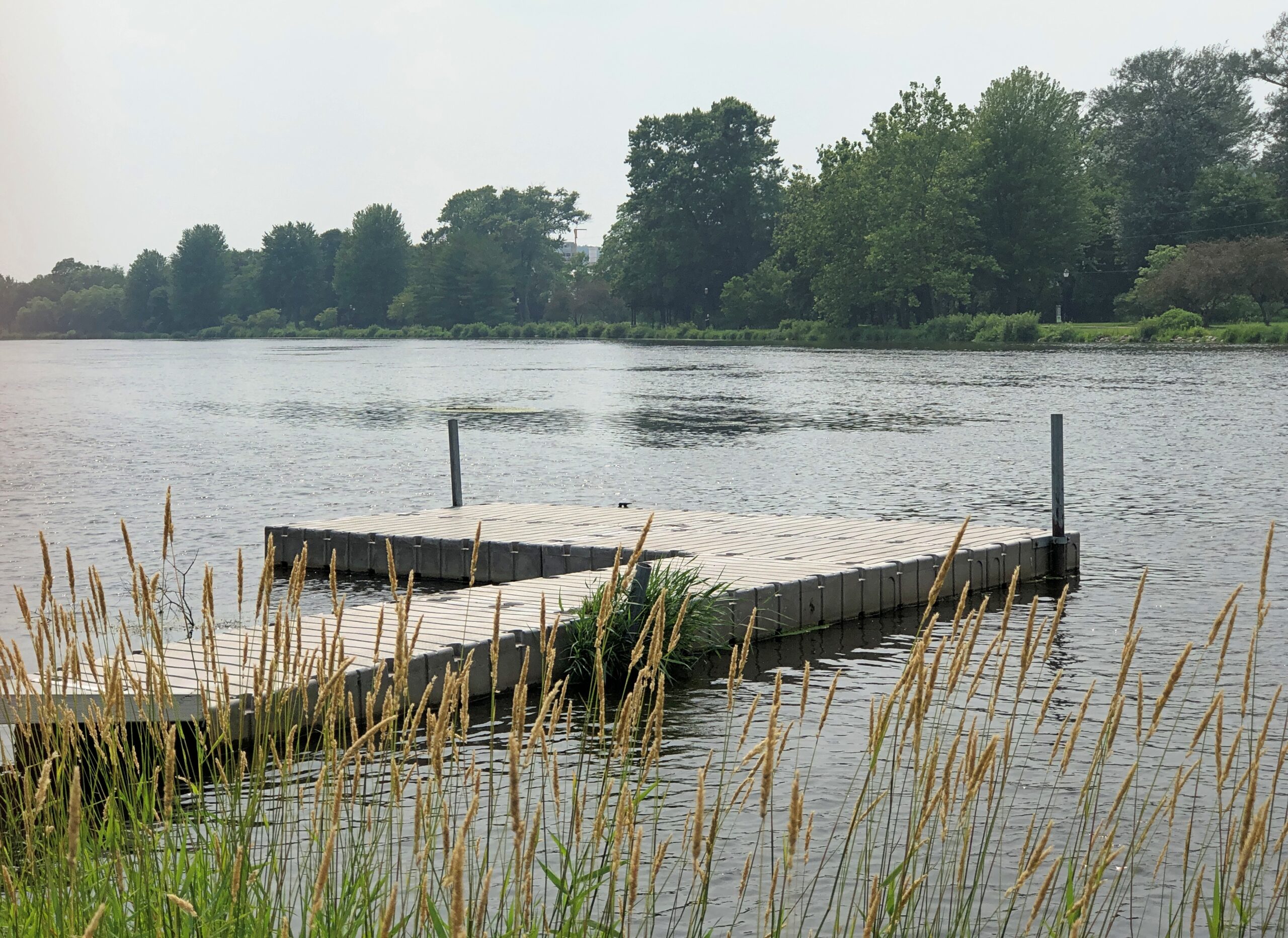
I hope the park and its garden weren’t damaged too much by the raging Fox, since it is flat most of the way from the garden to the river.
The Fox is large at this point. Not something you want to see described as “angry.”
The other day I wondered how long it would take to count a million dollars’ worth of nickels and dimes a million times. That’s one of the dream images from “Minnie the Moocher.” Not just a dream, but an opium dream. After all, no sooner does Minnie learn to kick the gong around, does a vivid dream of wealth begin, all shiny and metallic, ending with:
She had a million dollars worth of nickels and dimes
And sat around and counted them all a million times
Let’s say half the dollar value is nickels, half dimes. That would be 5 million dimes and 10 million nickels. So 15 million individual coins. Let’s also say it takes a second to count each, just to keep it simple. That would be 15 million seconds, or 0.475 years (roughly, I shaved off a few places). Counting them a million times would thus be (roughly) 475,000 years.
Of course, if it’s an opium dream, the niceties of time and such don’t apply. Still, it sounds like a hellish task of a Sisyphean kind. But maybe it would be a heavenly task, if you have no sense of the passage of time.
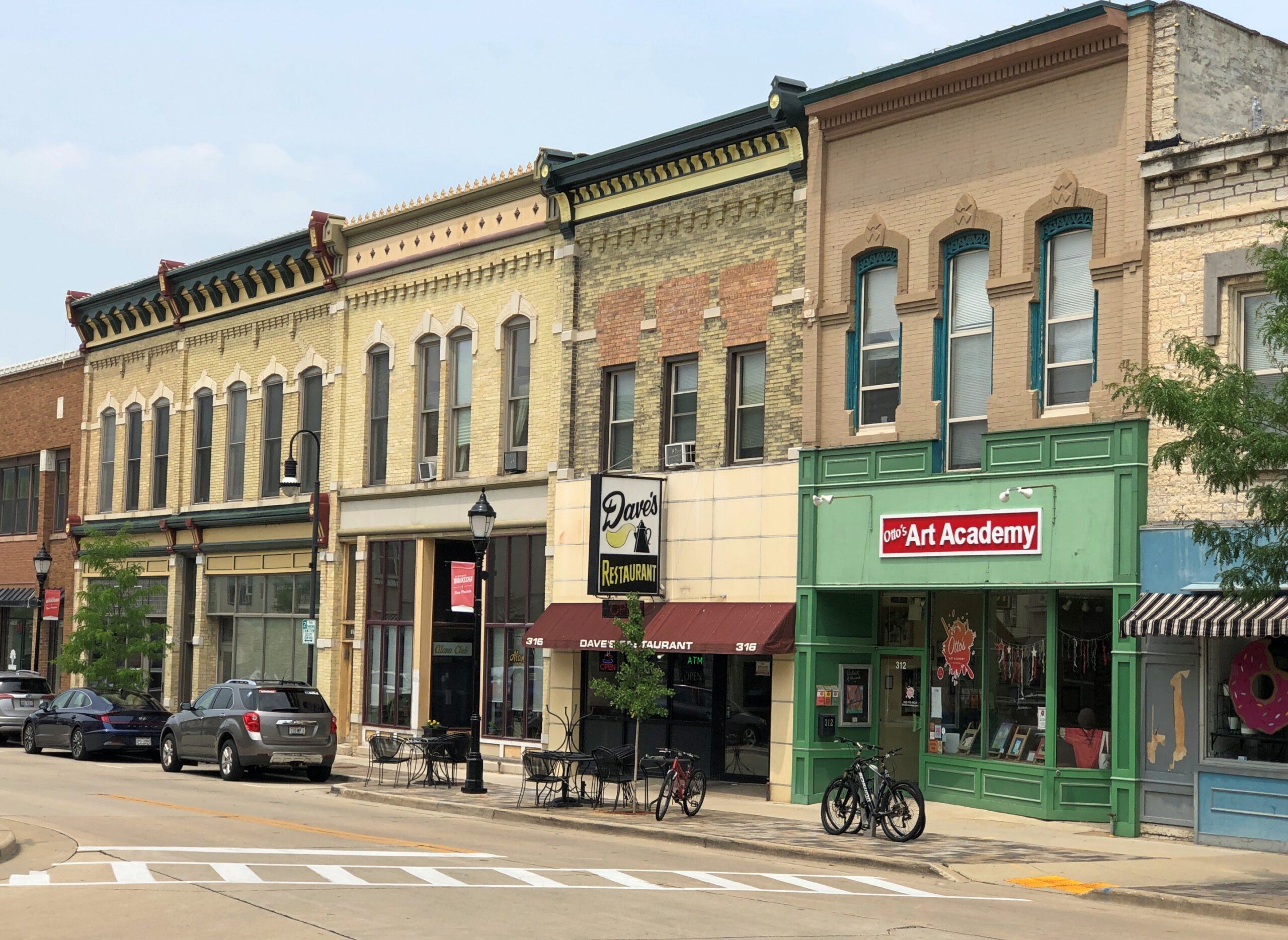
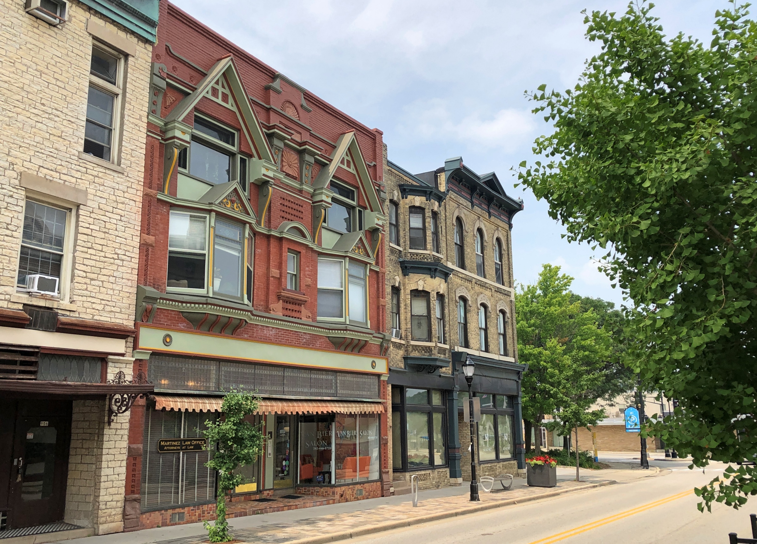
I didn’t sit down to figure all that out until I was at my desk, but the question came out of nowhere during a short interstate drive just before the end of July, up in the southeast corner of Wisconsin. One destination that day, a Sunday, was downtown Waukesha, an outer suburb of Milwaukee, but a place with a distinct history of its own, where people came to take the waters once upon a time.
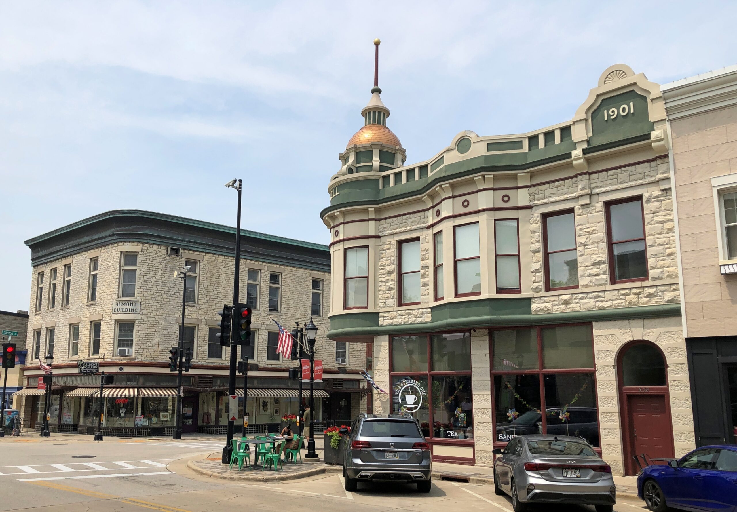
We spent some time near the five-pointed intersection of Main, Broadway and Grand, focal point of a handsome streetscape.
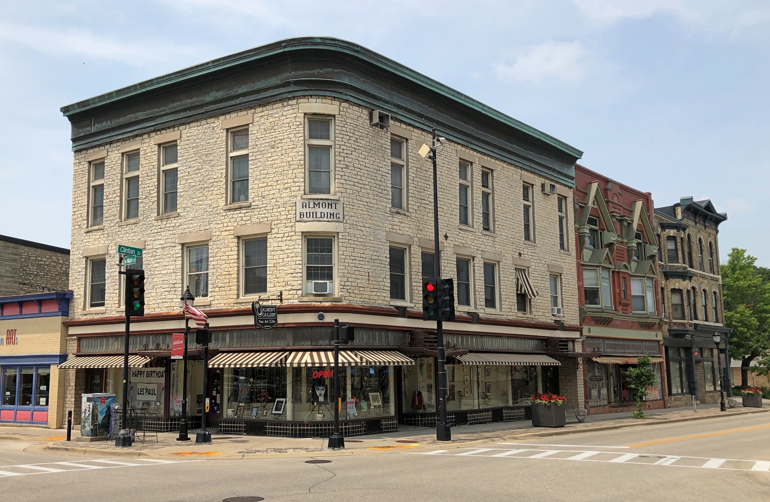
Now this is a set of buildings.
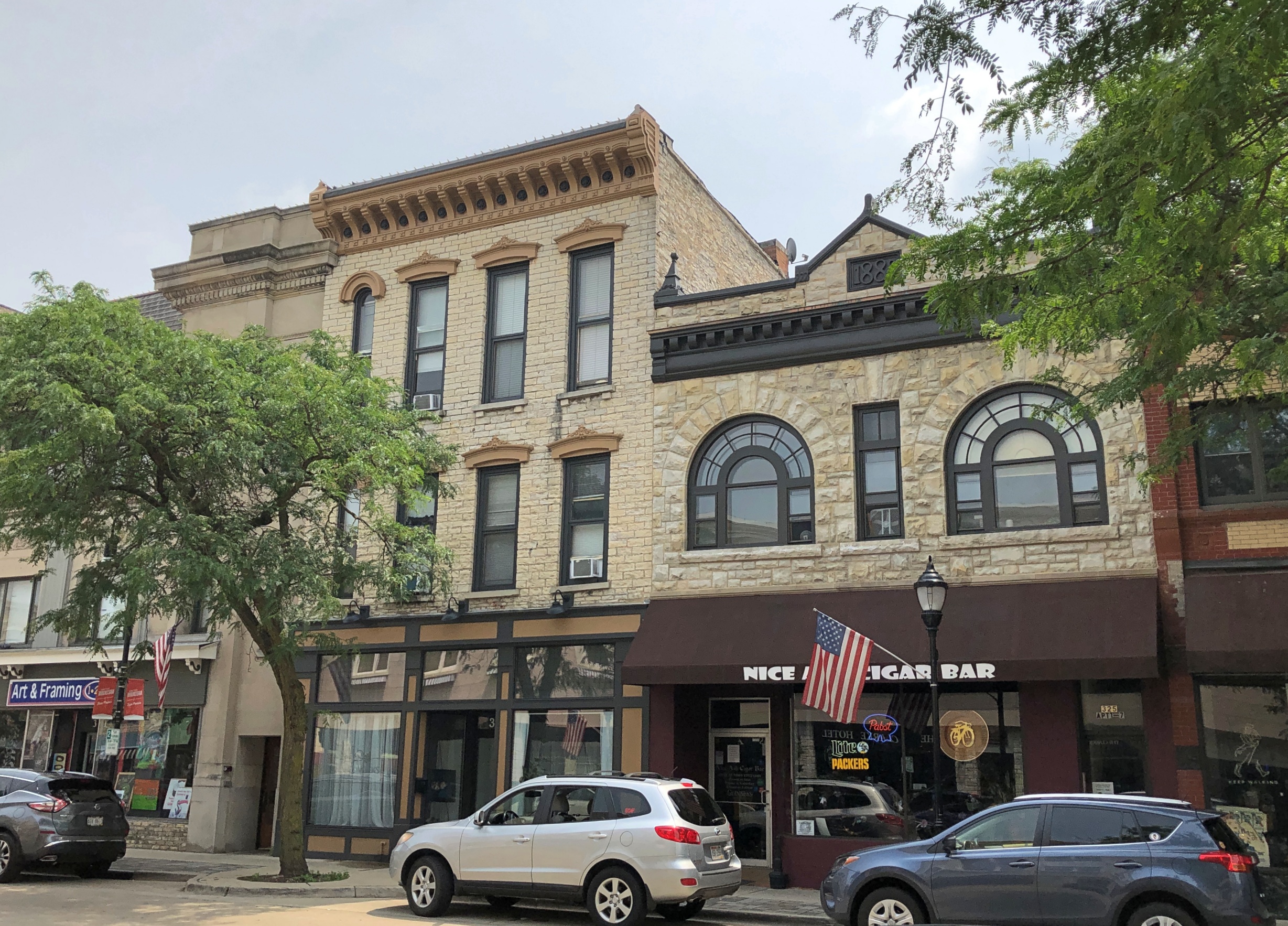
The Almont Building, whose original name was the Robinson Block.
“The core of the downtown, prior to 1856, consisted of freestanding wooden frame buildings, but a new era began after a massive fire nearly destroyed this northern section of Main Street,” the Waukesha County Historical Society & Museum says. “The Robinson Block was built in 1857 with fireproofing in mind and is the first Five Points building to use Waukesha limestone.”
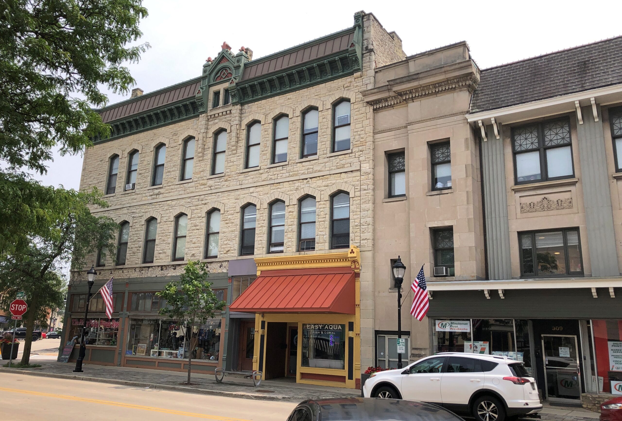
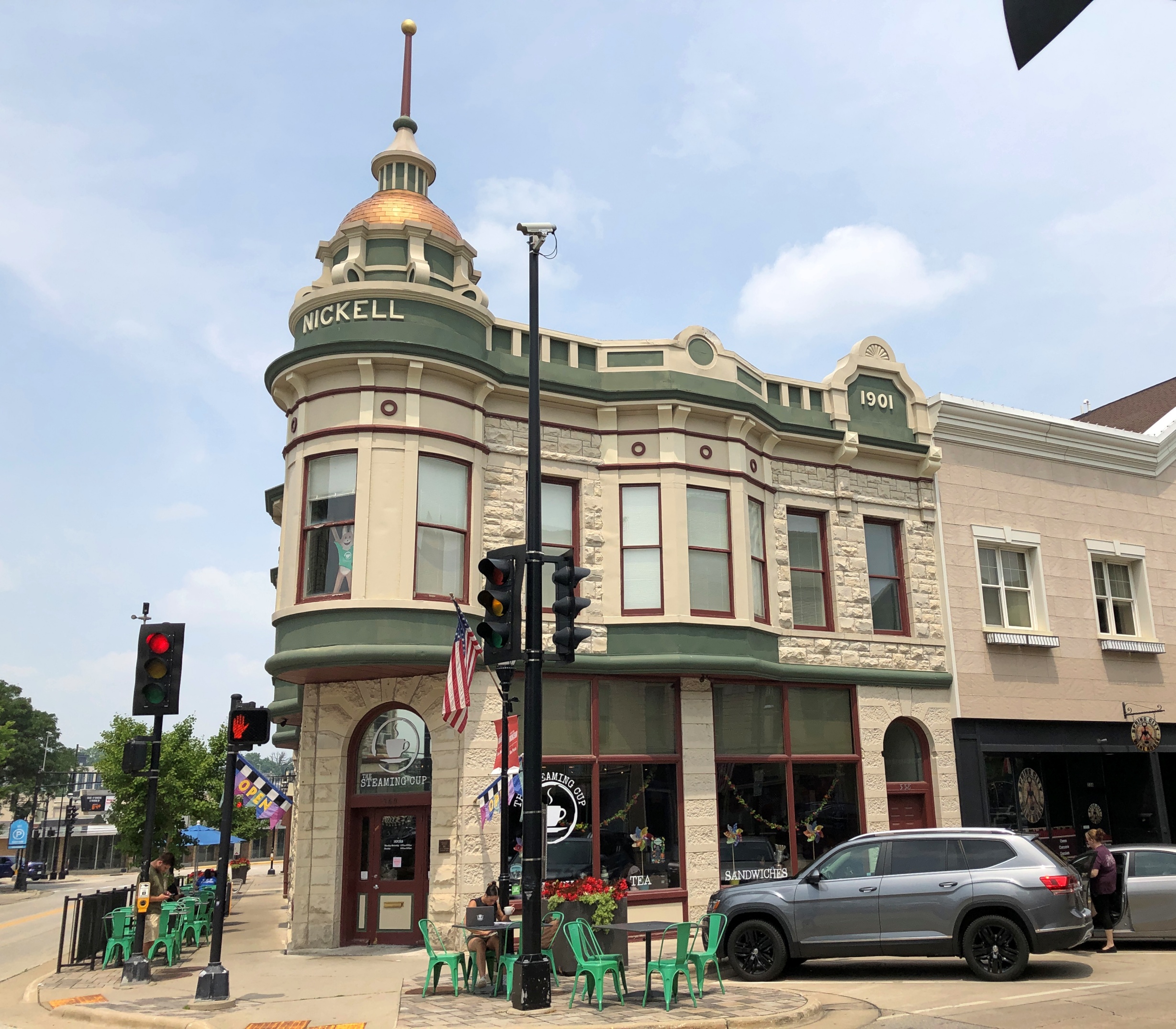
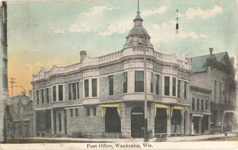
The Nickell Building, as it looked recently, and long ago.
“Built by Addison J. Nickell, local businessman and jeweler, the first floor housed the U.S. Post Office from 1902-1914,” notes the WCHS&M. “The work of Waukesha architect C.C. Anderson, this Queen Anne displays a projecting oriel and corner turret capped by a domed roof: both are covered by pressed metal.”
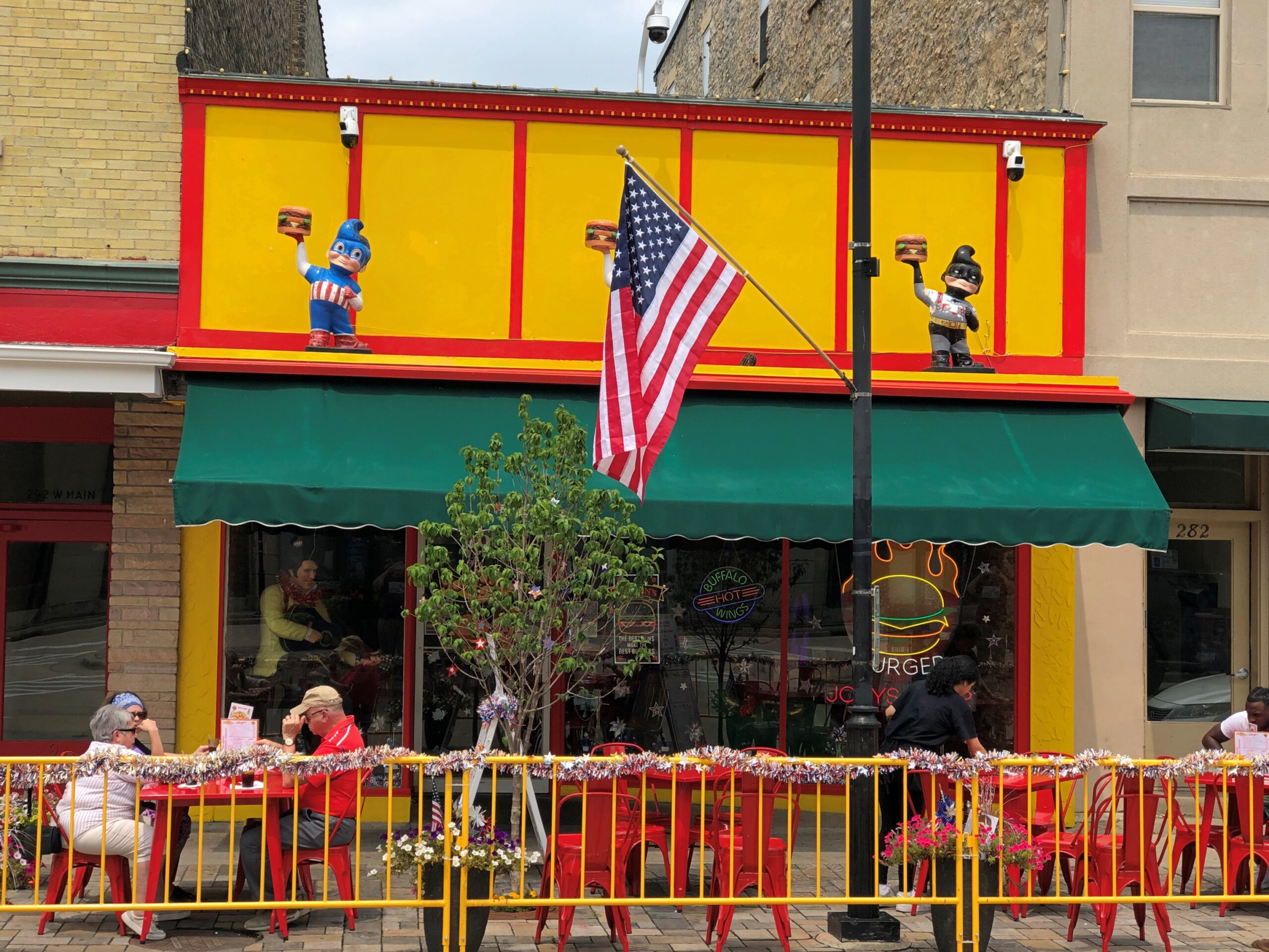
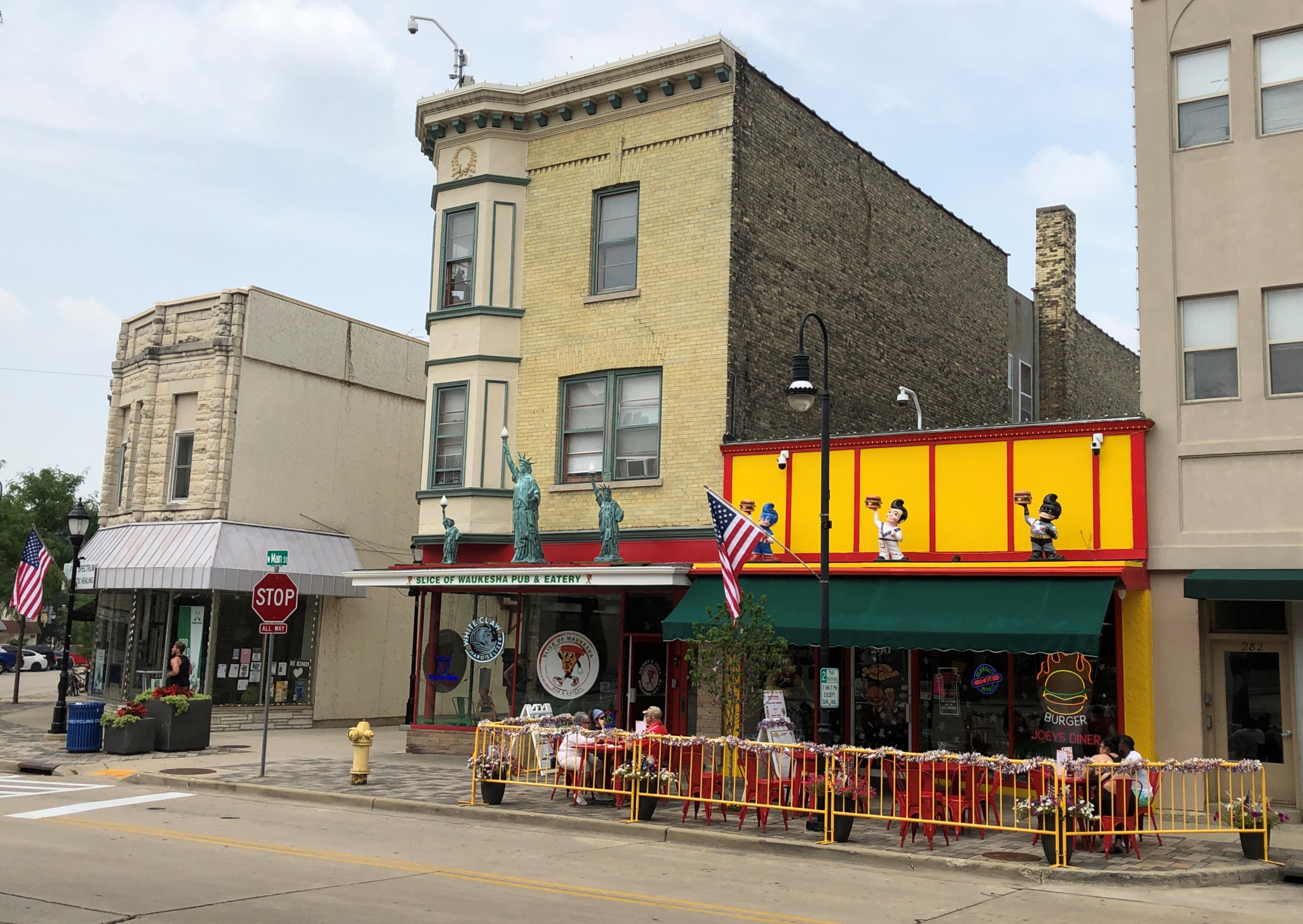
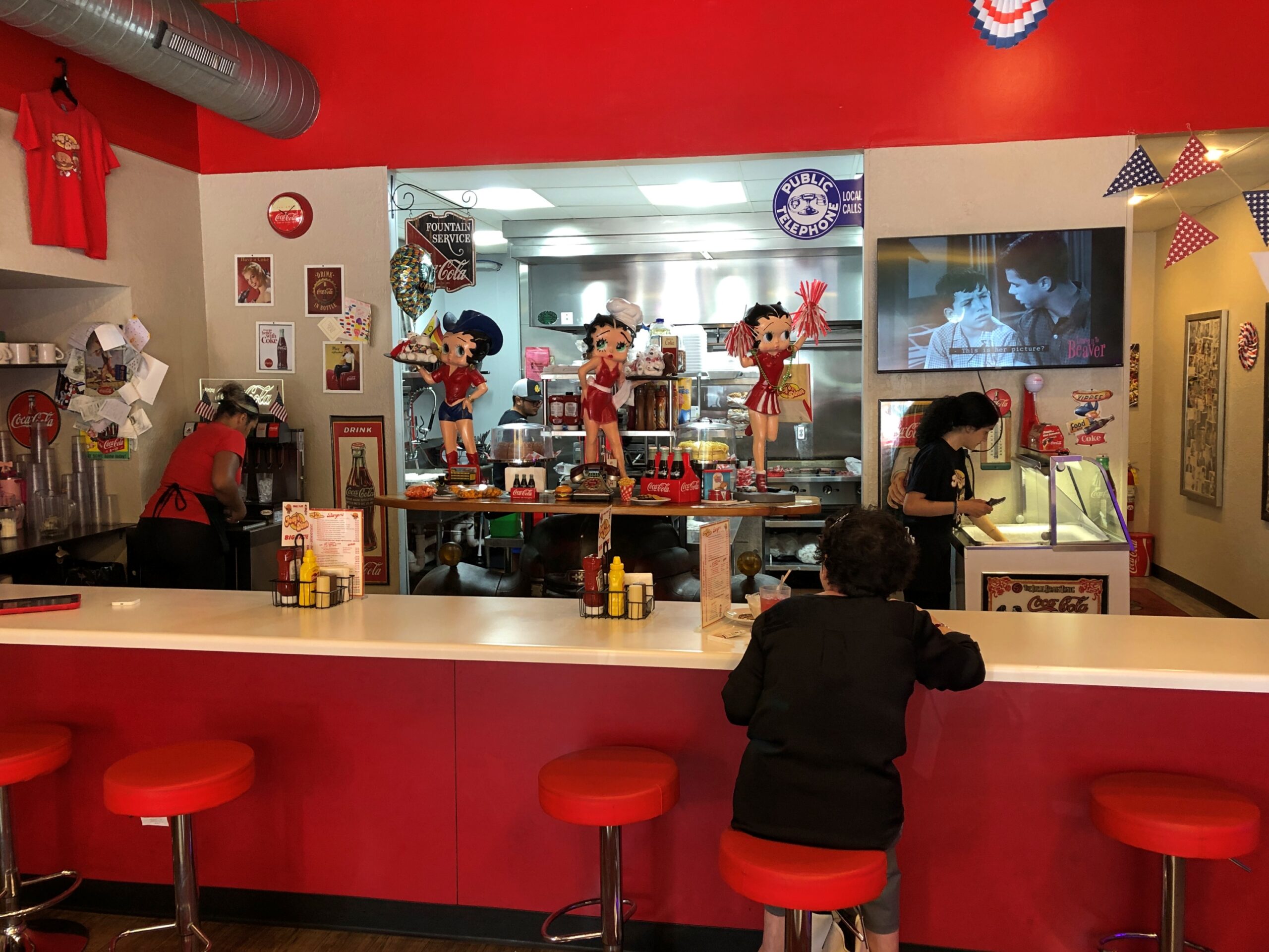
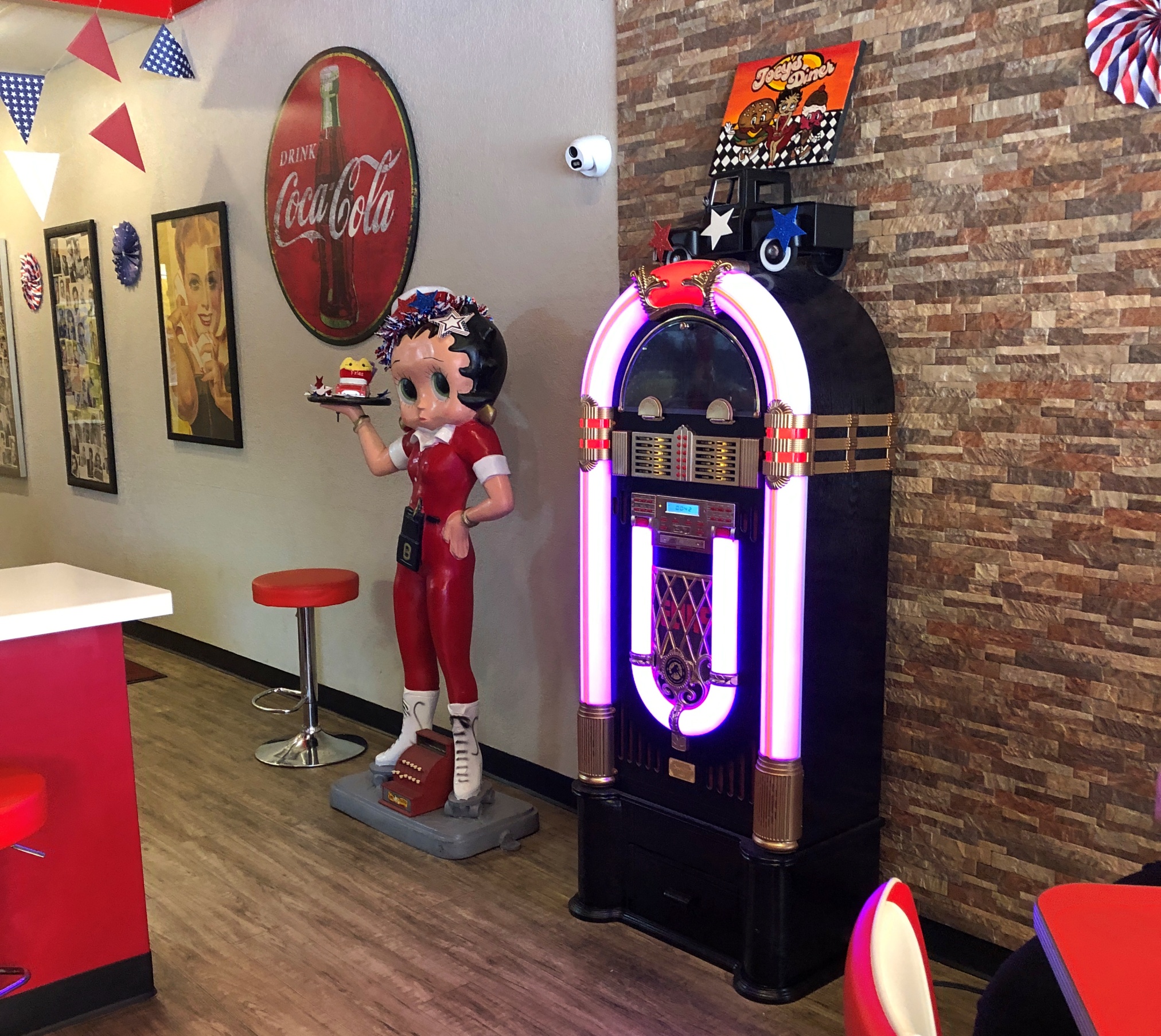
Being mid-day, one bit of business to take care of: lunch. We soon found the friendly joint called Joey’s Diner.
Joey likes Betty.
Joey’s is next to an Italian restaurant, similarly casual, that I think was owned by the same fellow. He was everywhere at once all the time — running a restaurant is nothing if not busy, and he seemed to be running two — but toward the end of our meal, asked how it was. I answered enthusiastically to the positive about my simple but also delicious hamburger. He responded by giving us a slice of chocolate cake, on the house. Thanks, Joey.
The street has other (many other) examples of places found here and nowhere else.
Been a while since I’d seen a joke shop. Closed.
The last one might have been Uncle Fun in Chicago, which closed some years ago. Too bad about that, but at least Jest For Fun Joke Shop, which has been at this Waukesha location more than 40 years, is keeping the retail tradition alive.
In the heat of midday back in late June, en route to Athens, Ga., I arrived at the Georgia Welcome Center on I-20, a sizable structure just inside the state, and did what I needed to do. Returning to my car, I wondered whether I should drive into Augusta, only a few miles off the Interstate at that point. Specifically to downtown, to see what I could see, even at 90+° F. or so.
Would it be worth the short detour? At that moment, the lyrics of a song of my youth came to mind, as the only mention of Augusta I know in popular music.
I beg your pardon, mama, what did you say?
My mind was drifted off on Martinique Bay
It’s not that I’m not interested, you see
Augusta, Georgia is just no place to be.
The song was “An American Dream” by the Nitty Gritty Dirt Band (a.k.a. the Dirt Band) – with backing vocals by Linda Ronstadt, no less – which reached No. 13 on the Billboard Hot 100 after its release in late 1979, and probably annoyed Augusta’s city fathers and other local boosters. But all that was nearly a half century ago, so I expect any annoyance is long gone as the tune has slipped into obscurity.
The song merely came to mind then, as songs often do, and didn’t affect my decision – which was to go. Do a flyby, in my idiosyncratic nomenclature for such a visit. That is, pass through a place, but a little more than merely driving through. If I see anything interesting during a flyby, I’ll stop for a short look. (So not only is my nomenclature eccentric, it isn’t really accurate. Who cares.)
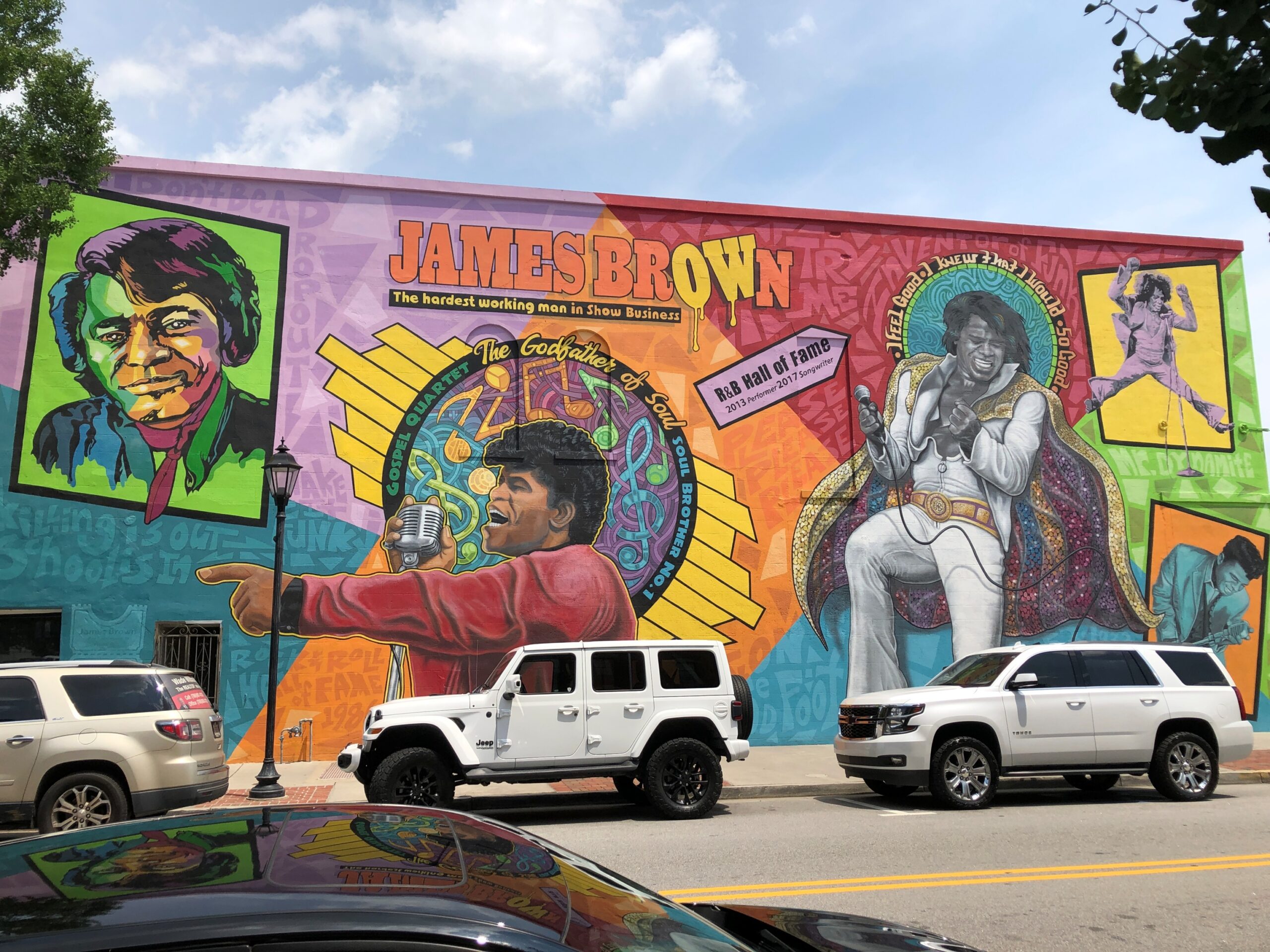
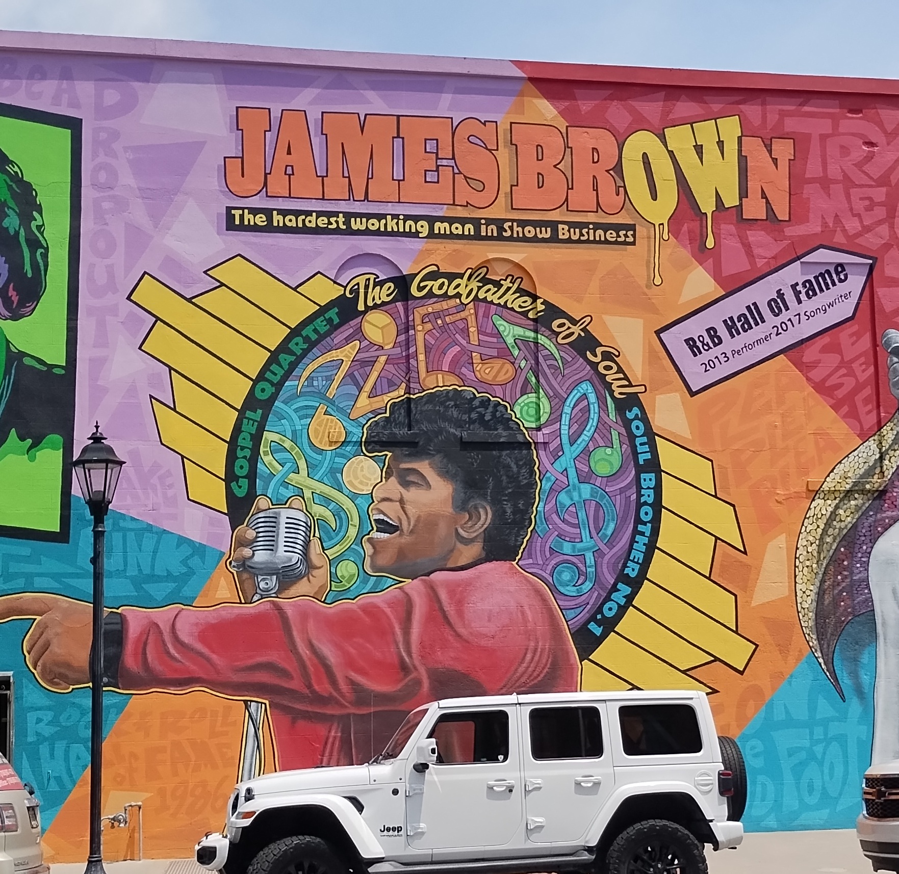
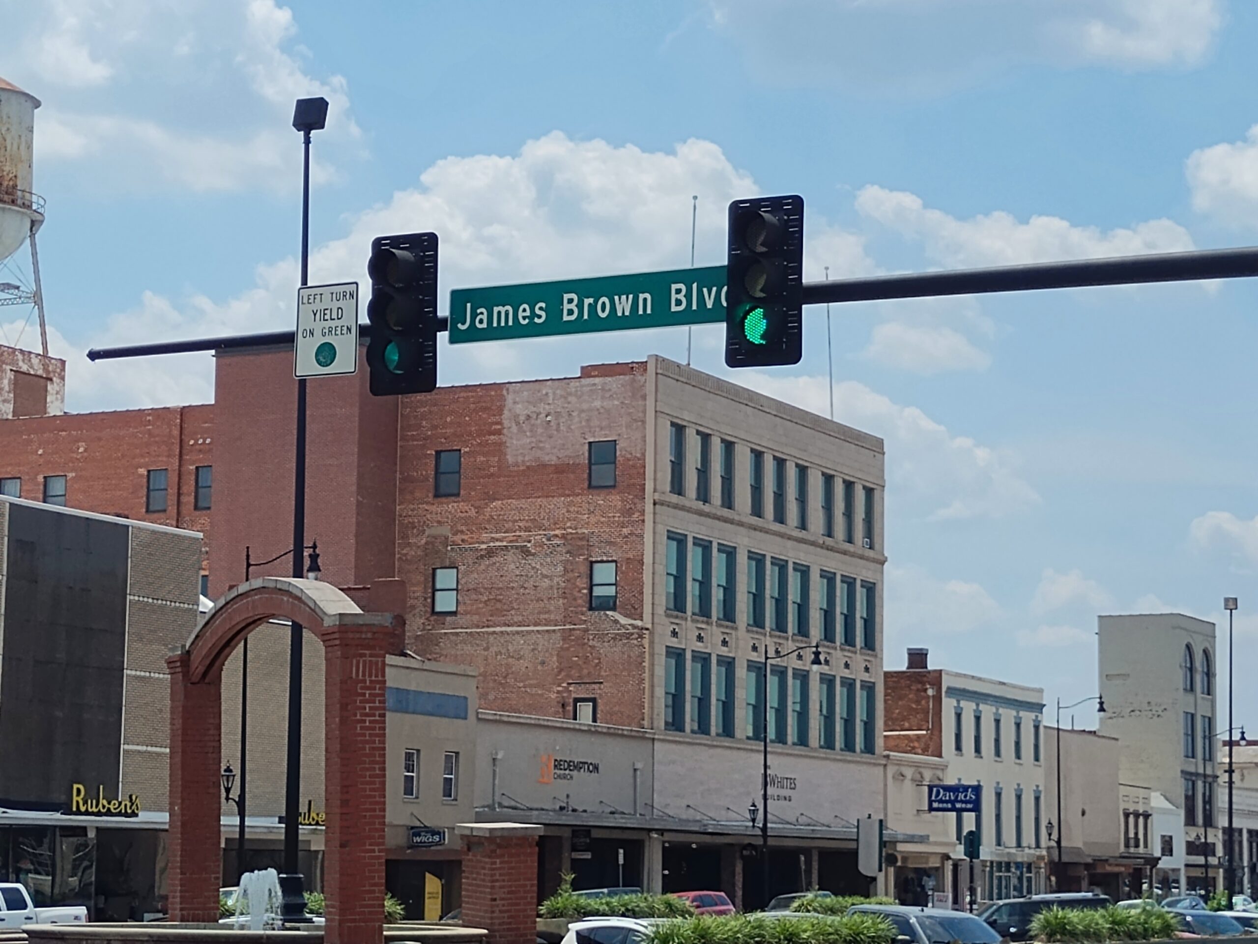
Sure enough, I spotted something worth stopping for.
A mural at the intersection of James Brown Blvd. and Broad St., completed in 2020 by an artist named Cole Phail. Though born in South Carolina, Brown grew up in Augusta, a fact I previously didn’t know.
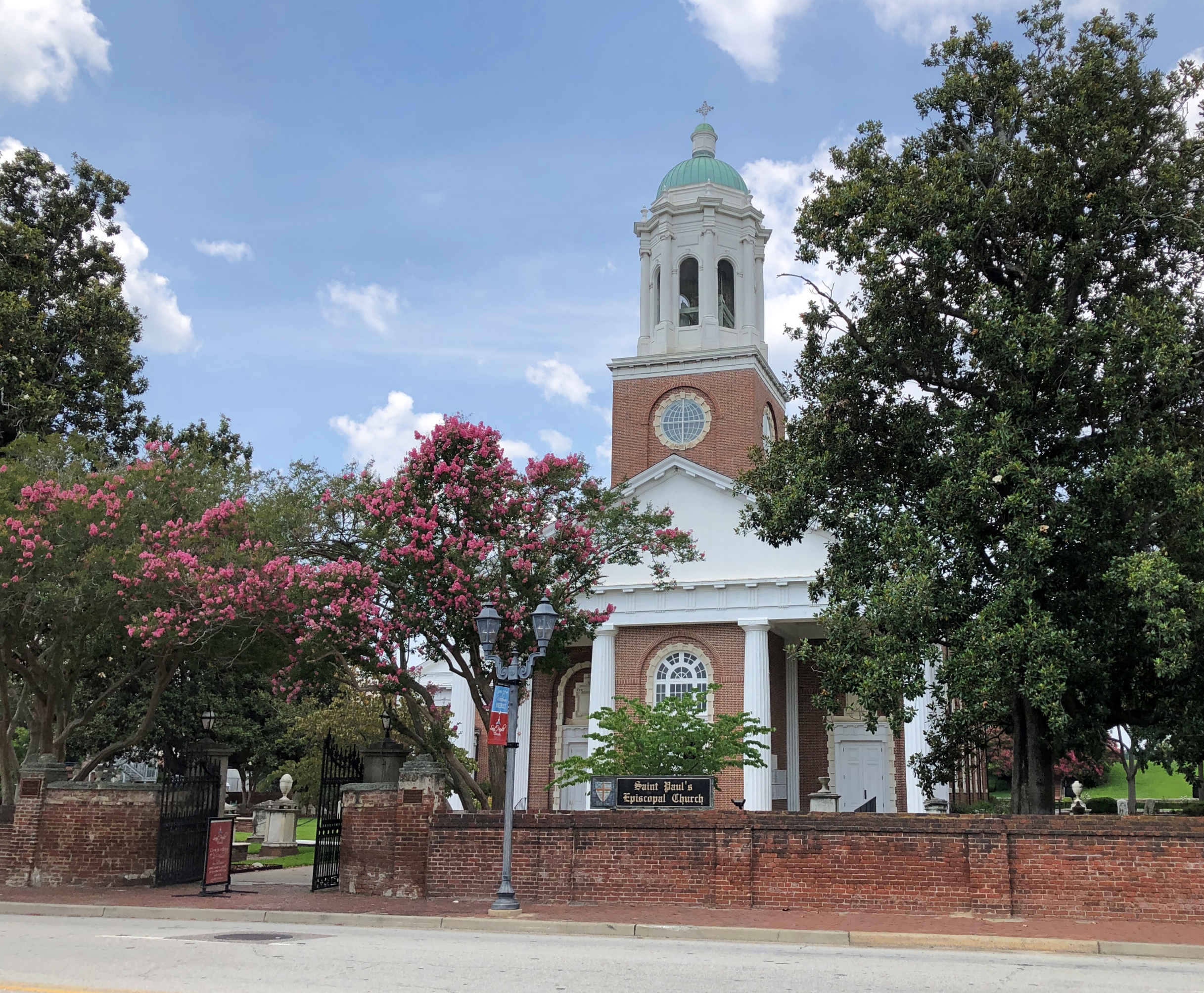
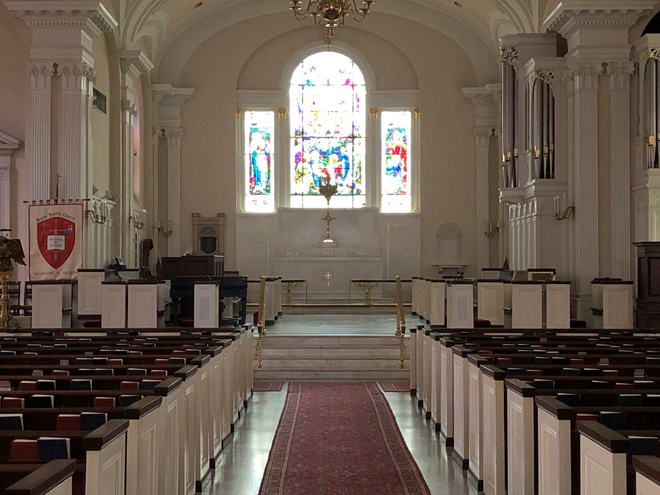
Later I learned that there’s a bronze of the Godfather of Soul not far away on Broad, but I didn’t look around enough to spot it, considering the heat dome, which seemed to be bearing down on me personally at that moment. So I looked at the mural, got back in my car, and blasted the AC. A few blocks away, as I was driving along, I saw an open church. I had to stop for that, too.
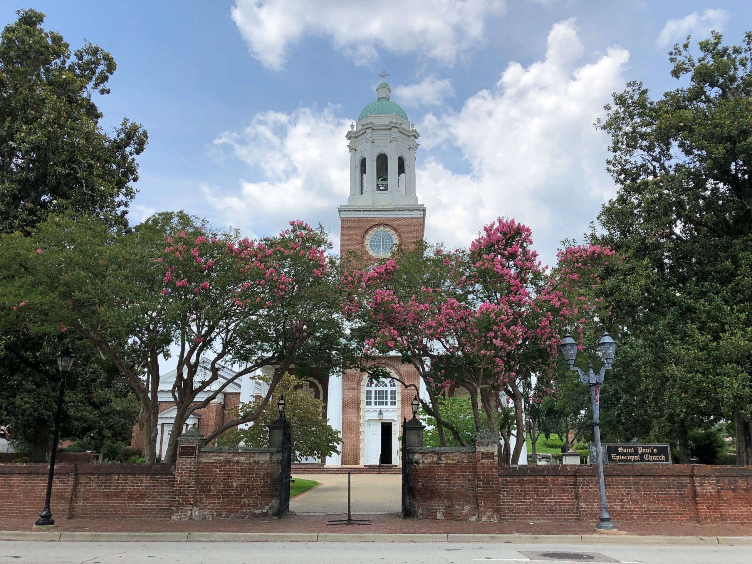
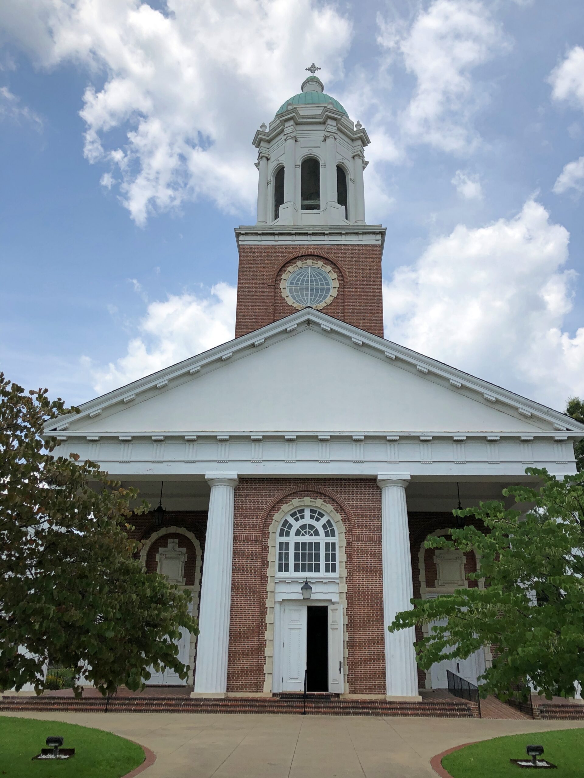
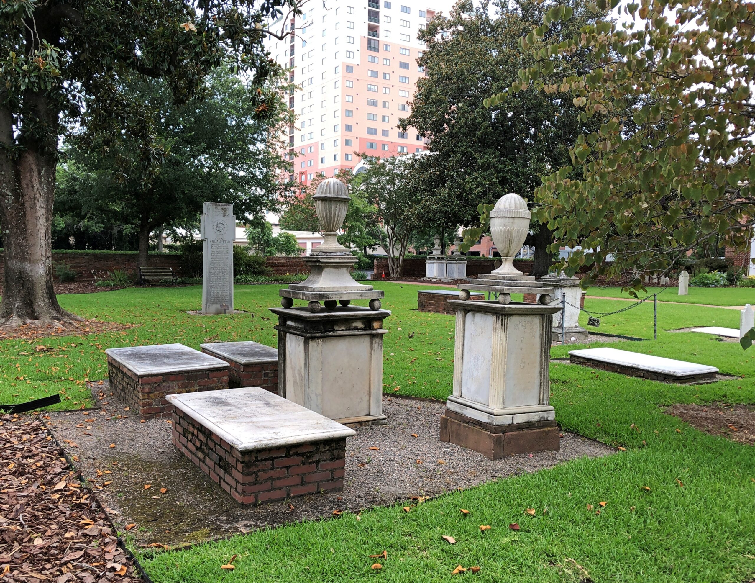
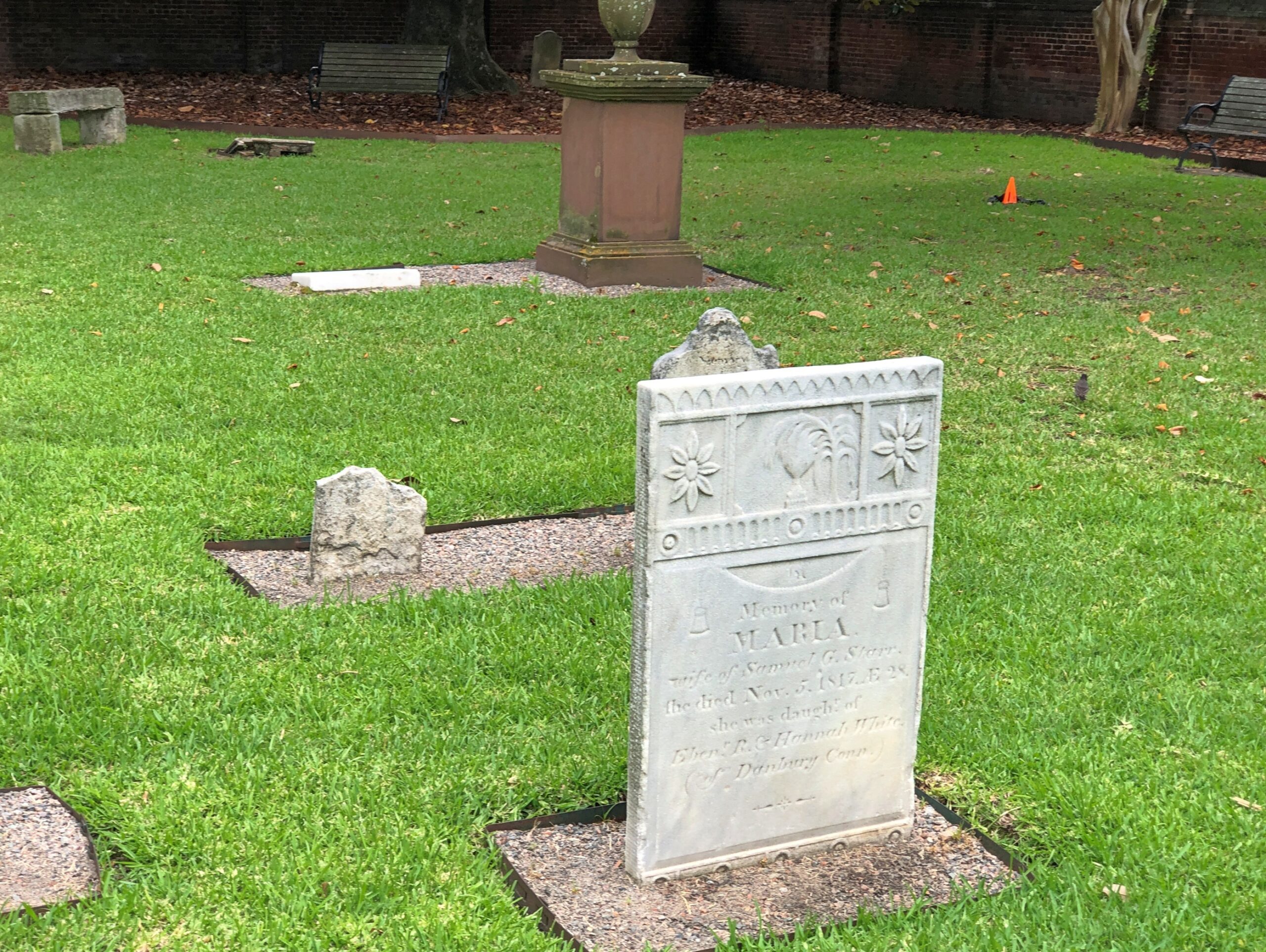
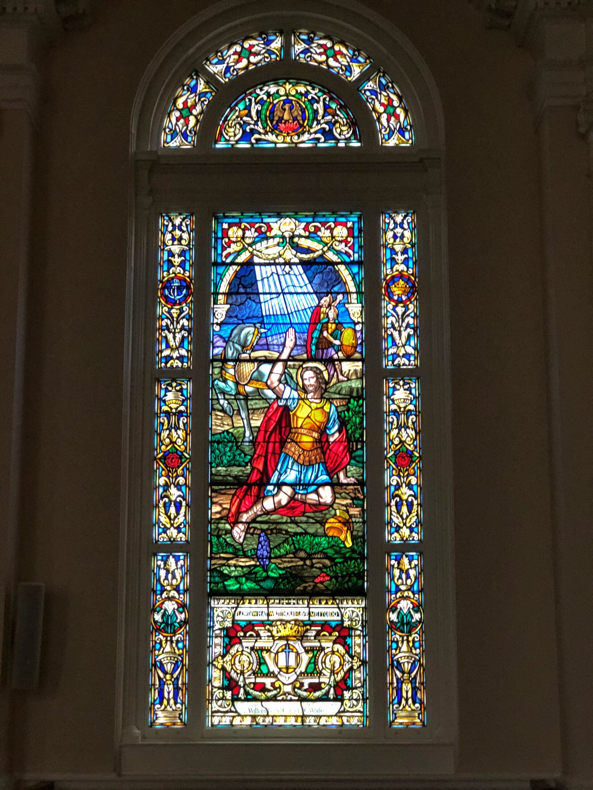
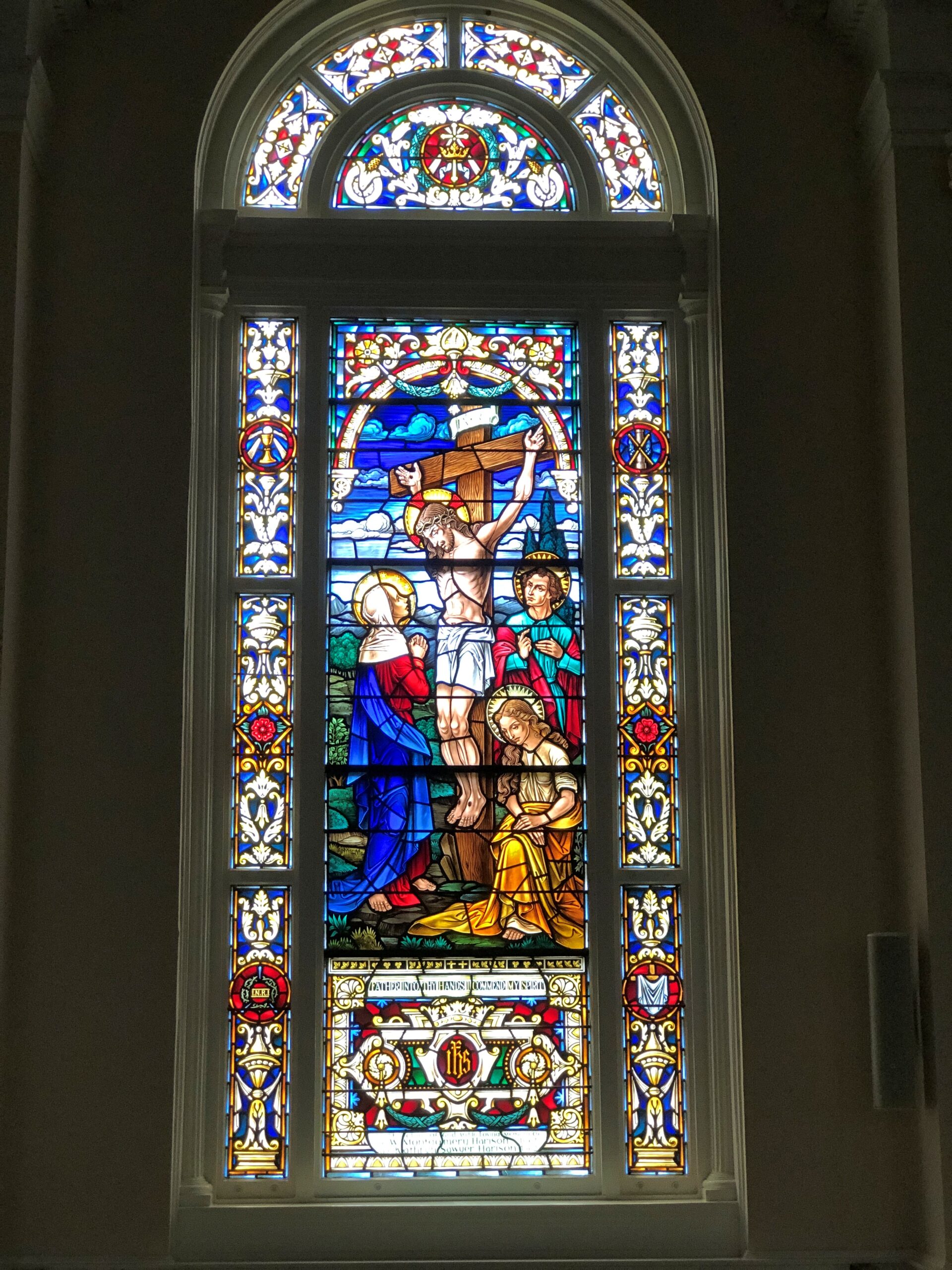
St. Paul’s Episcopal. Not only a church building, but a church graveyard as well.
Inside, some fine stained glass.
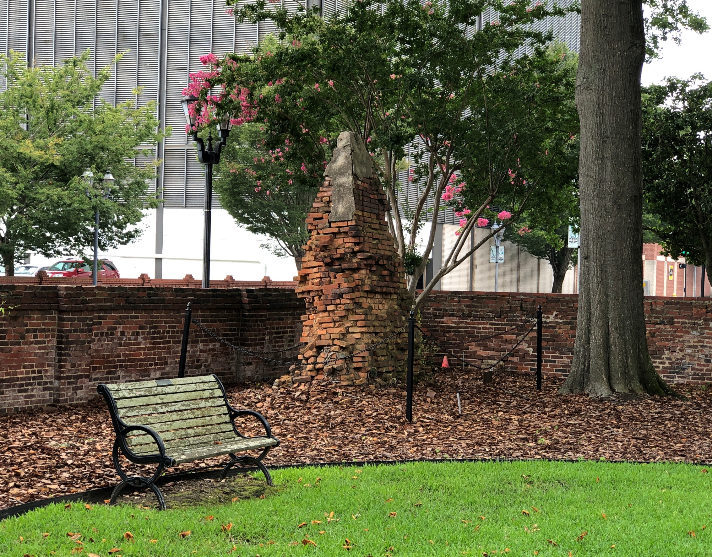
“Four buildings on this site have been destroyed,” the church web site says. (Sank into the swamp? Burned down, fell over, then sank into the swamp? Speaking of 50-year-old references.)
“Our present church, built in 1919, was designed as a larger copy of the 1820 church lost in Augusta’s Great Fire of 1916. Among the furnishings saved from the fire is the original baptismal font brought from England in 1751, now located in the narthex.
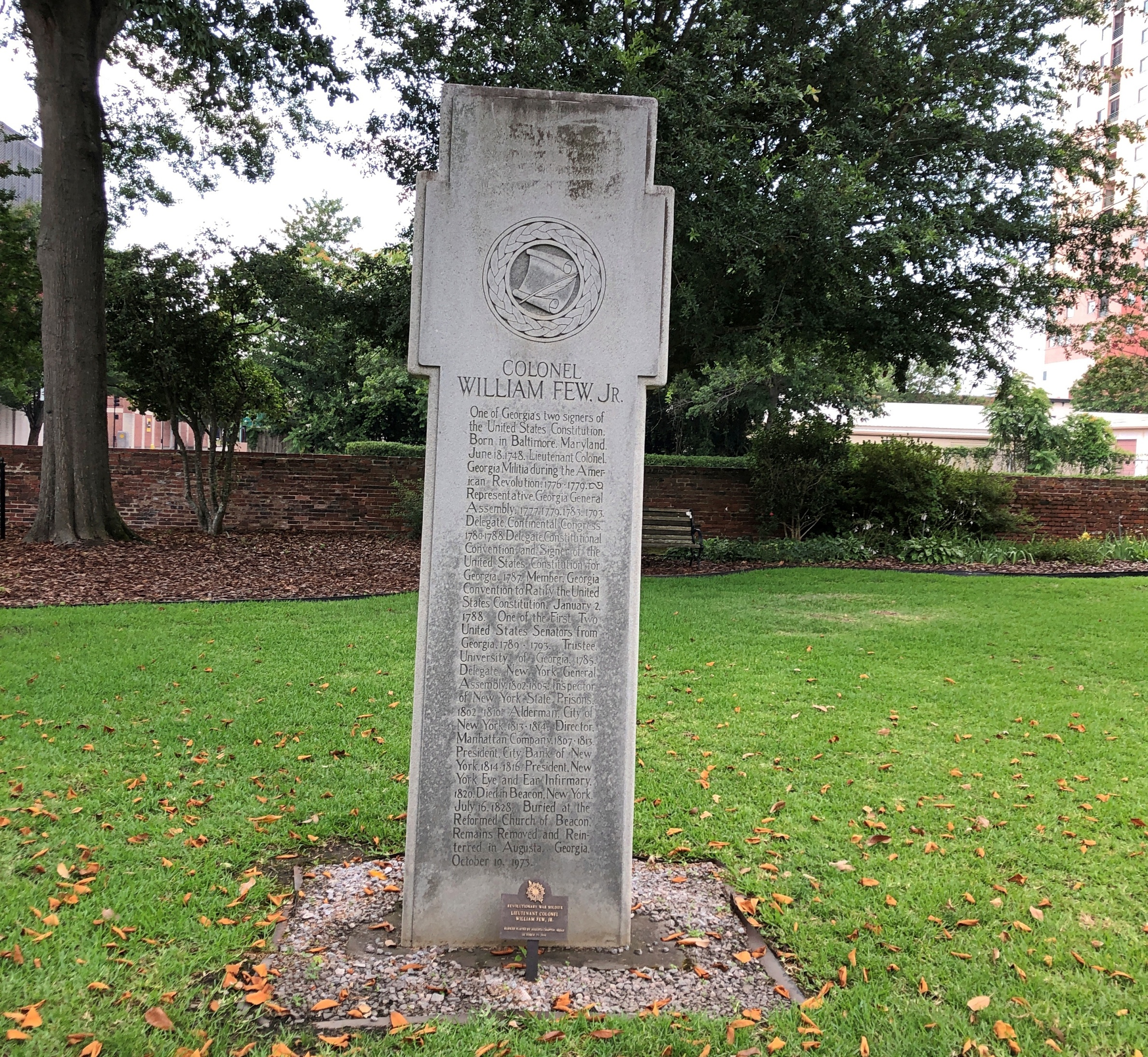
“History buffs will find the church yard fascinating. Many undocumented graves lie beneath the ground, but others are marked, including that of Col. William Few, a signer of the United States Constitution, whose portrait hangs in the narthex…”
Missed the painting. But I did see Col. Few’s stone.
A busy fellow, both before and after the Revolution, including attendance at the Constitutional Convention in 1787, and a stint as one of Georgia’s first Senators under the Constitution. His capsule bio at the Biographical Dictionary of the U.S. Congress mentions all that, except leaving out the fact – detailed by the stone I saw – that he was reinterred at his current location in 1973.
Also, no word on whether he knew Button Gwinnett, everyone’s favorite early Georgia politico. He must have. Gwinnett might have had a similar career had he not ended up on the wrong end of a dueling pistol in ’77.