New Harmony, Indiana, Part 2

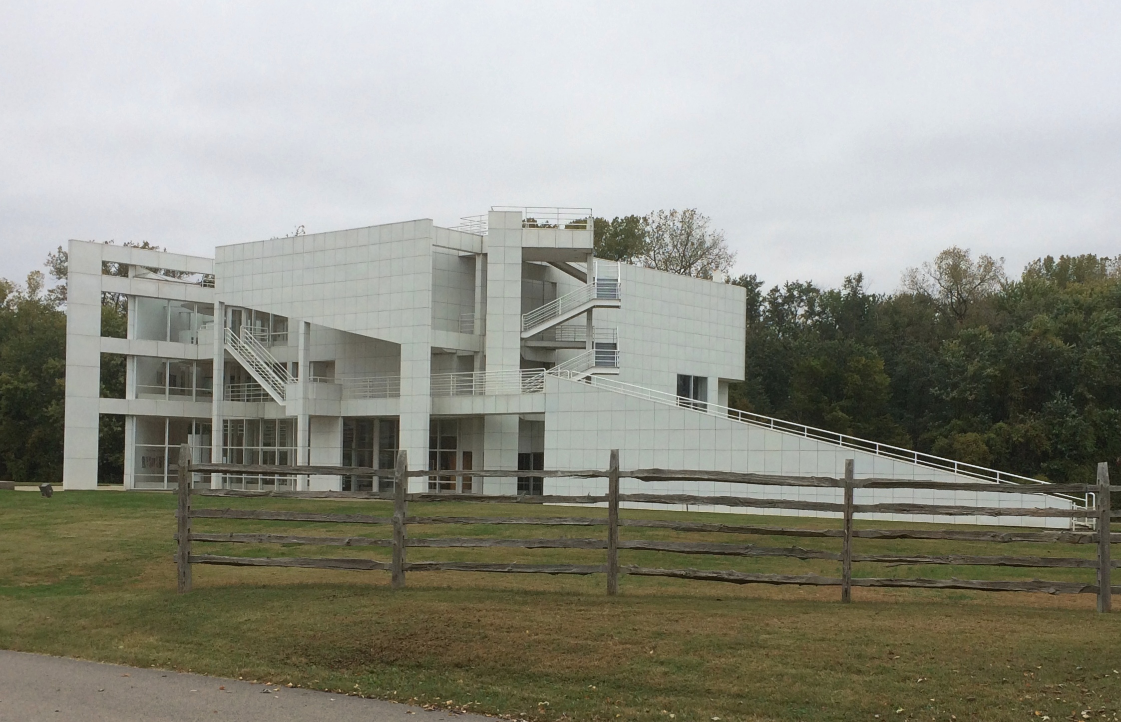
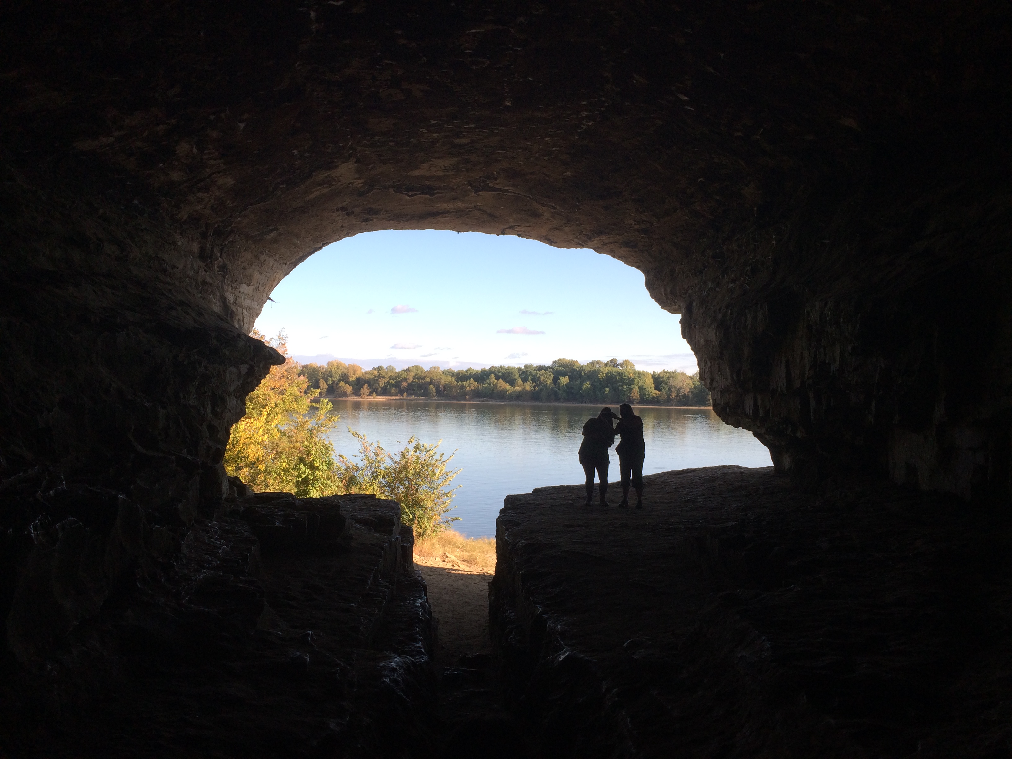
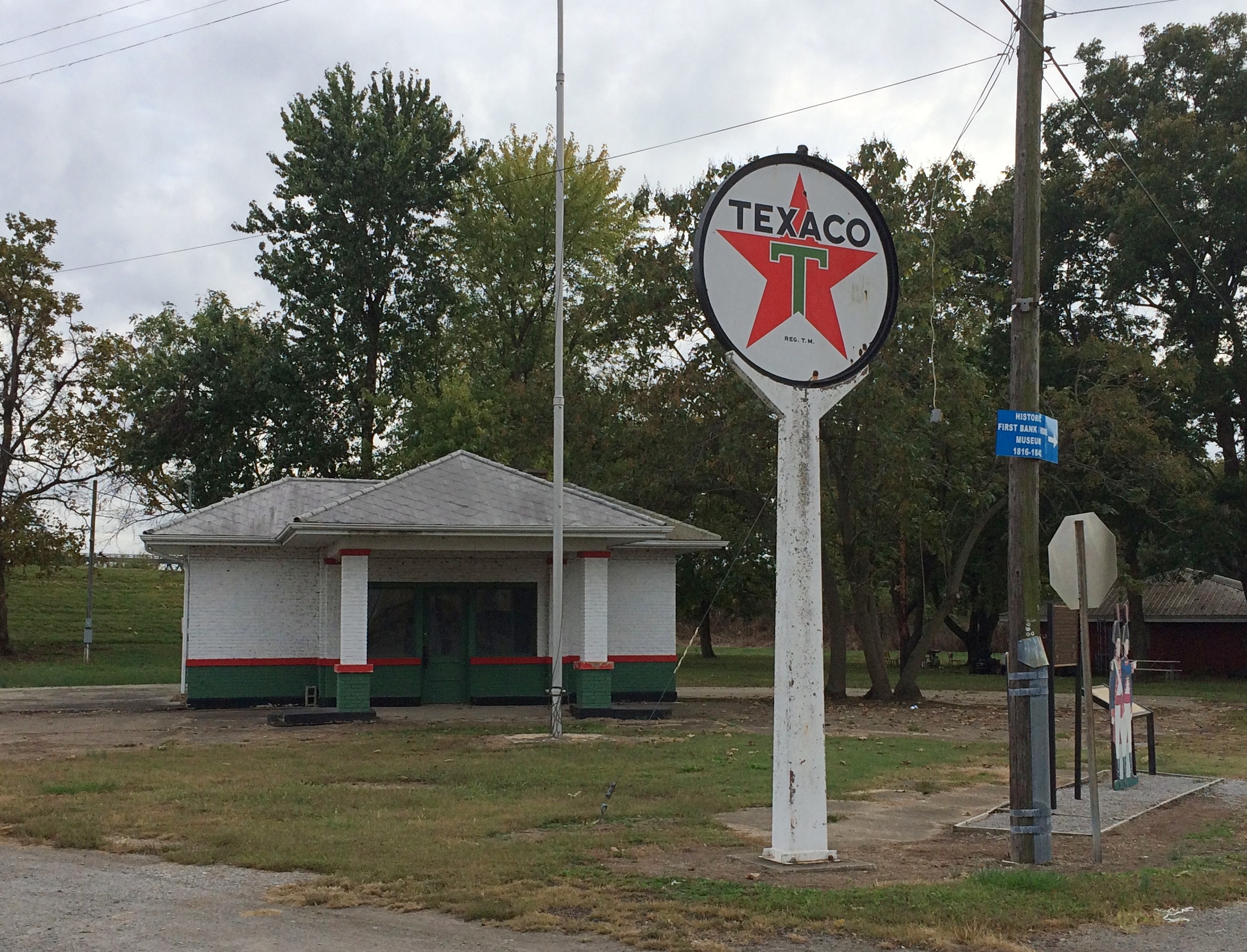
After wandering around New Harmony, Indiana, for a while and seeing many interesting things, it occurred to me that we hadn’t visited one of the places that I was curious to see, because I didn’t know exactly where to find it.

Google Maps in this instance didn’t know either. Or rather, I didn’t know exactly what the spot was called, to tell Google. The search engine isn’t a mind reader, not yet (but surely that’s Alphabet Inc.’s dream).

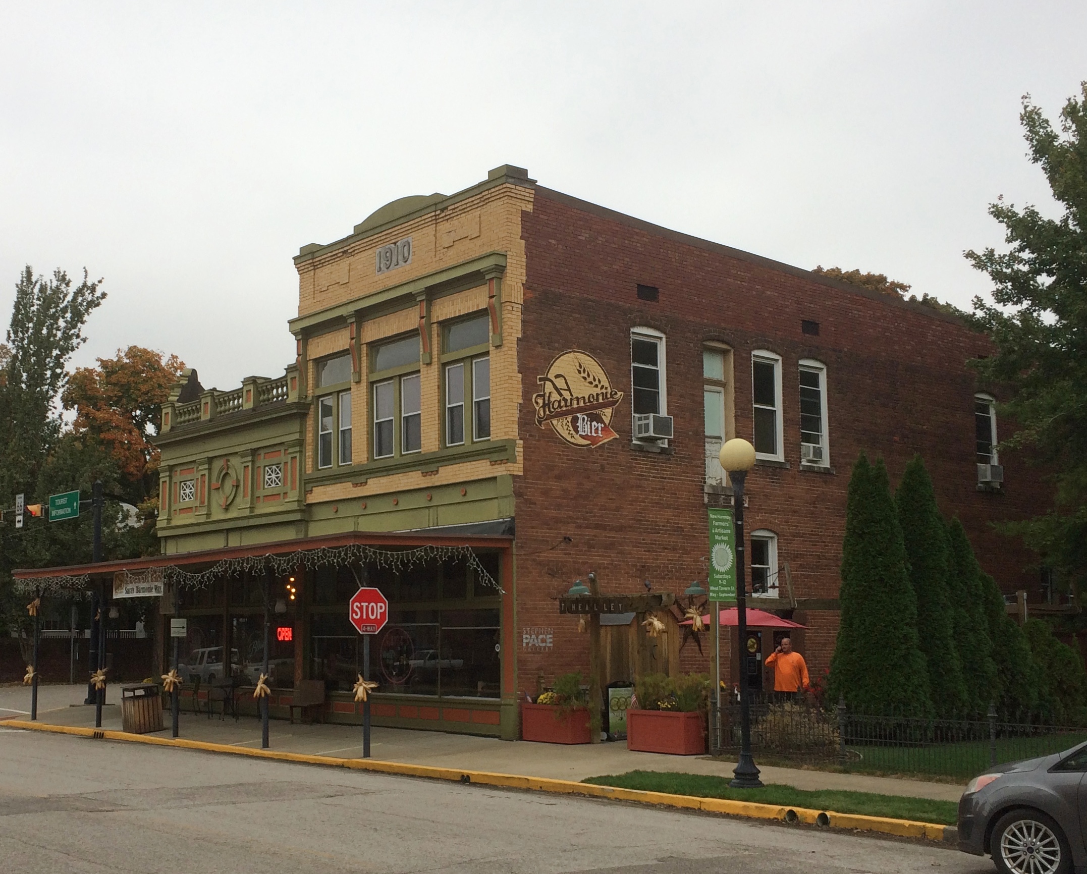
We spent time looking around an antique and knickknack store on the main street, since New Harmony, pop. 750, has some of the elements of a day-trippers town (like Fredericksburg, Texas). I found a candle holder I wanted to give as a gift, and after paying for it, I asked the woman behind the counter two questions.

One, where I might find postcards, since her store had none. She offered a suggestion, and another customer who had overheard us offered another suggestion, which turned out to be closer by and correct.

My other question: “Can you tell me where I can find Paul Tillich’s grave?” I’d read it was in town. Not in a cemetery, but a standalone location.

I can’t claim to be an expert on Paul Tillich, or even remember that much about him or his theological ideas. Whatever I might have learned during my collegiate religious studies had long been forgotten. Still, I figured I should drop by and pay my respects, and later do a little reading to refresh my memory.

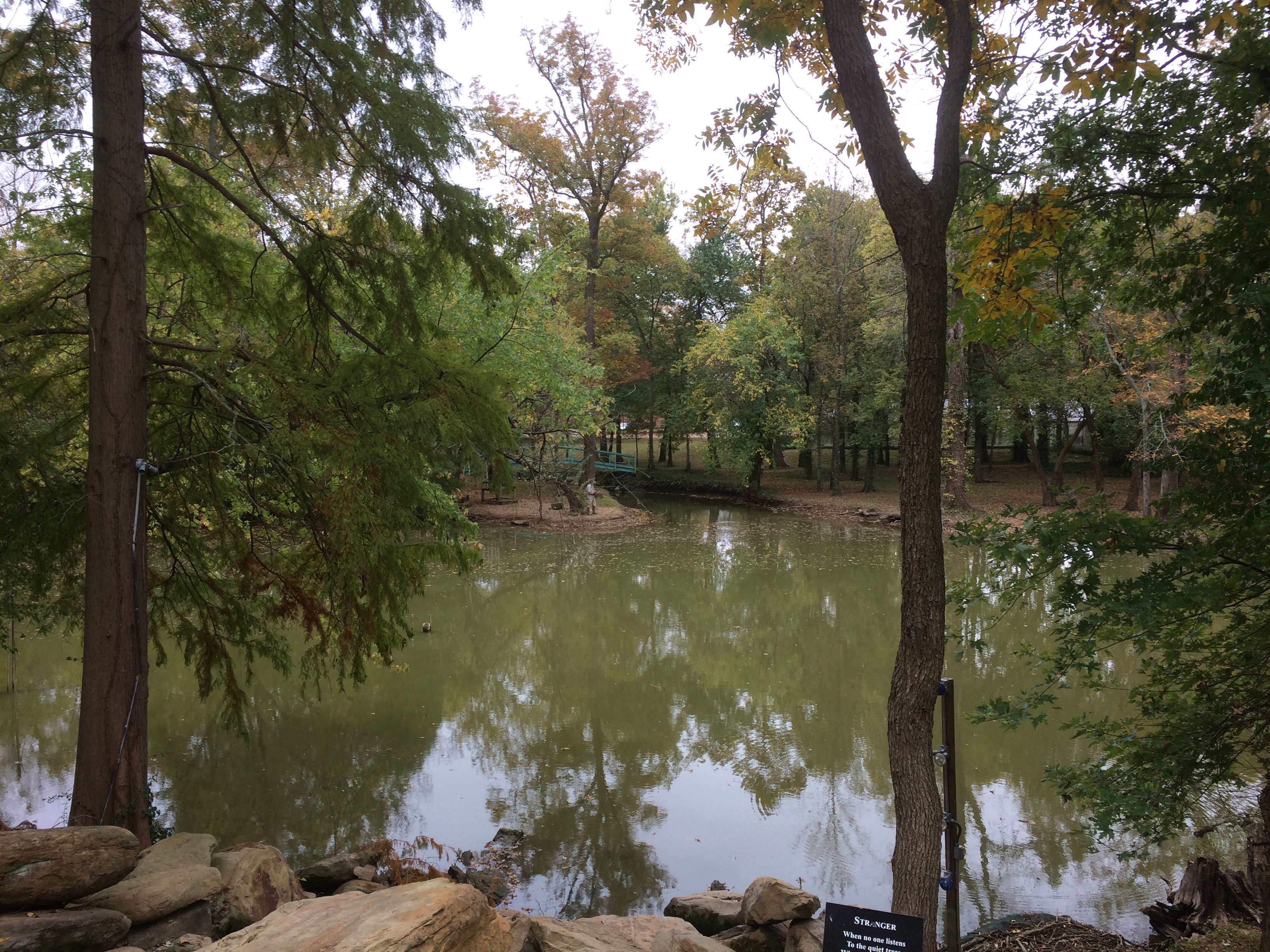
She told me where to find him. We’d wandered by previously without realizing it, since he’s tucked in a grove of conifers forming Paul Tillich Park.Paul Tillich Park New Harmony Indiana

Paul Tillich Park New Harmony Indiana
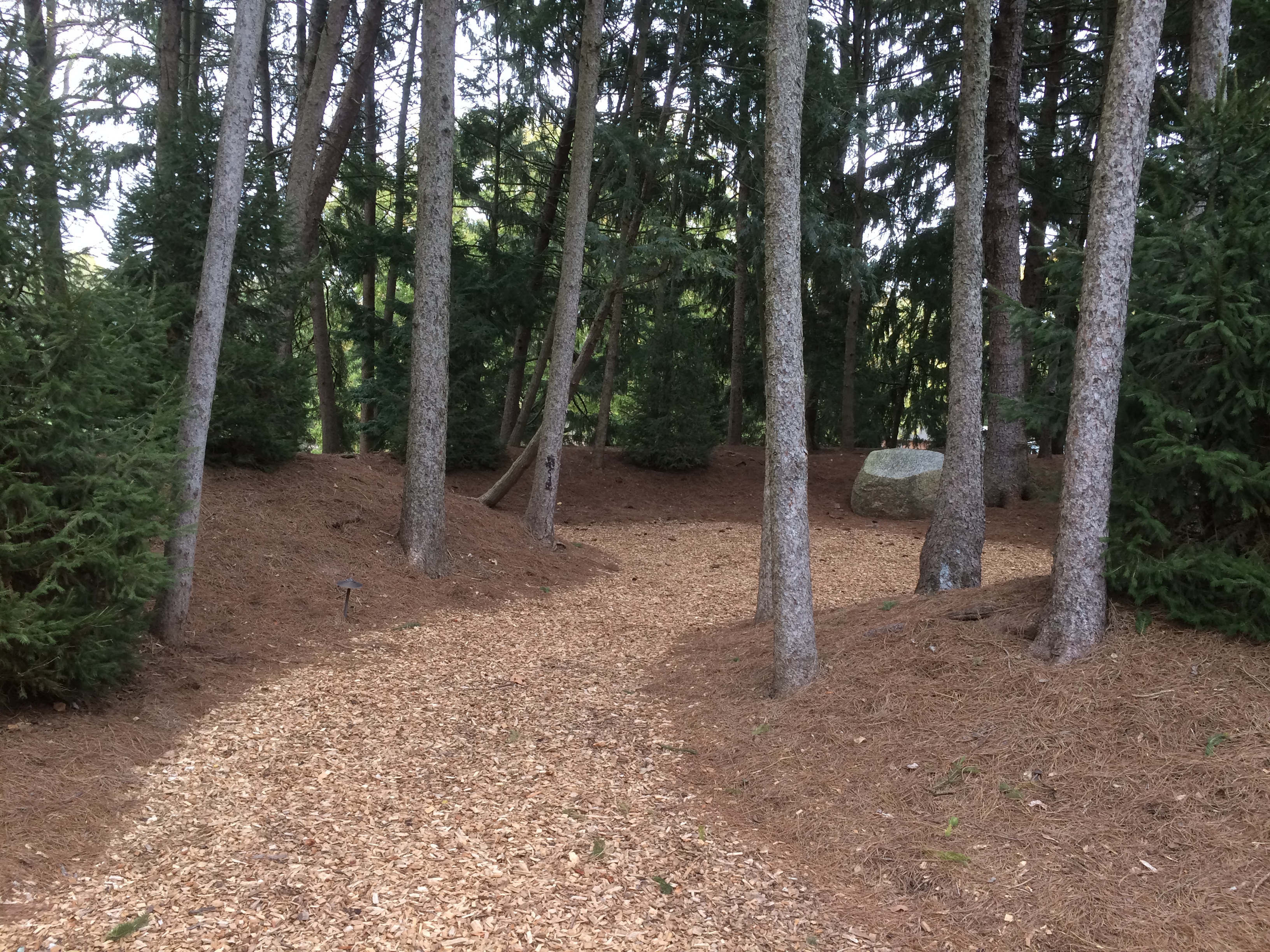
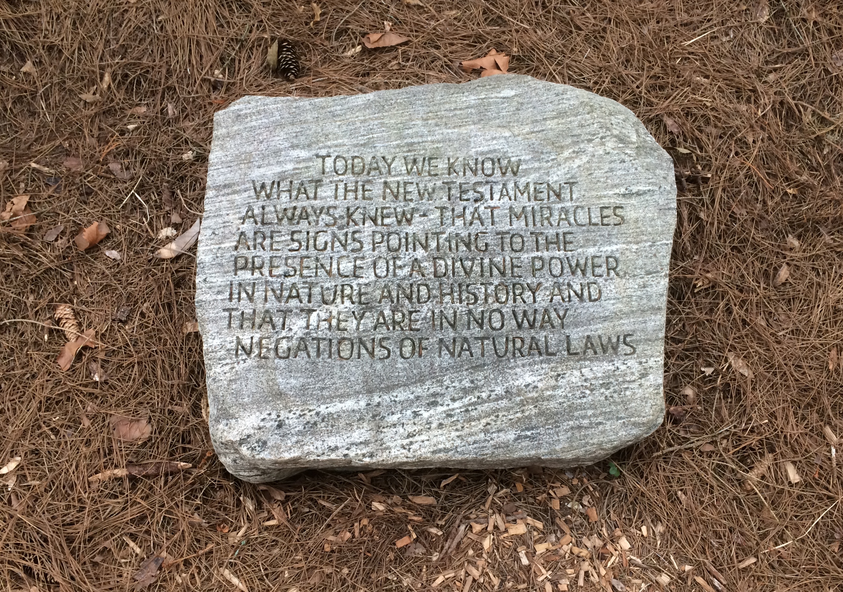
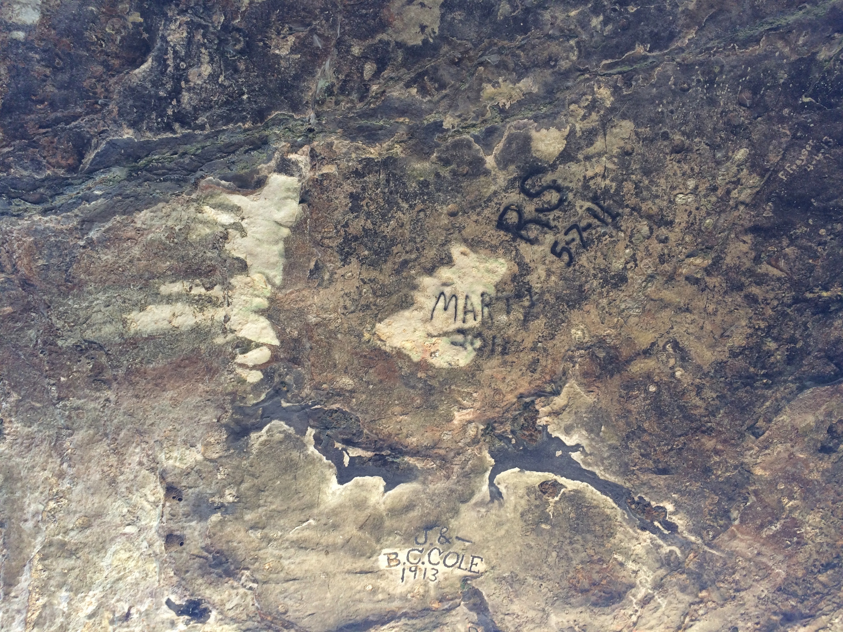
None of the stones in the pictures are his gravestone. Rather, they’re some stones in the park with Tillich’s words carved on them.
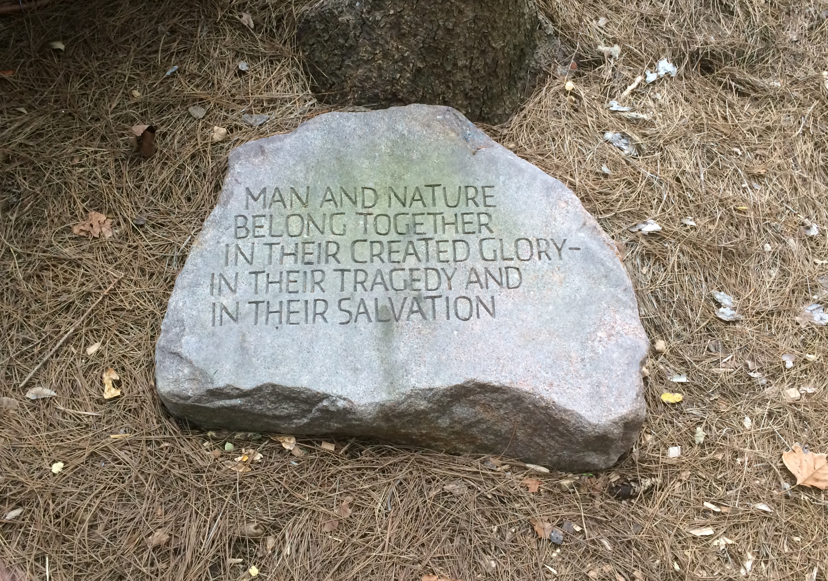
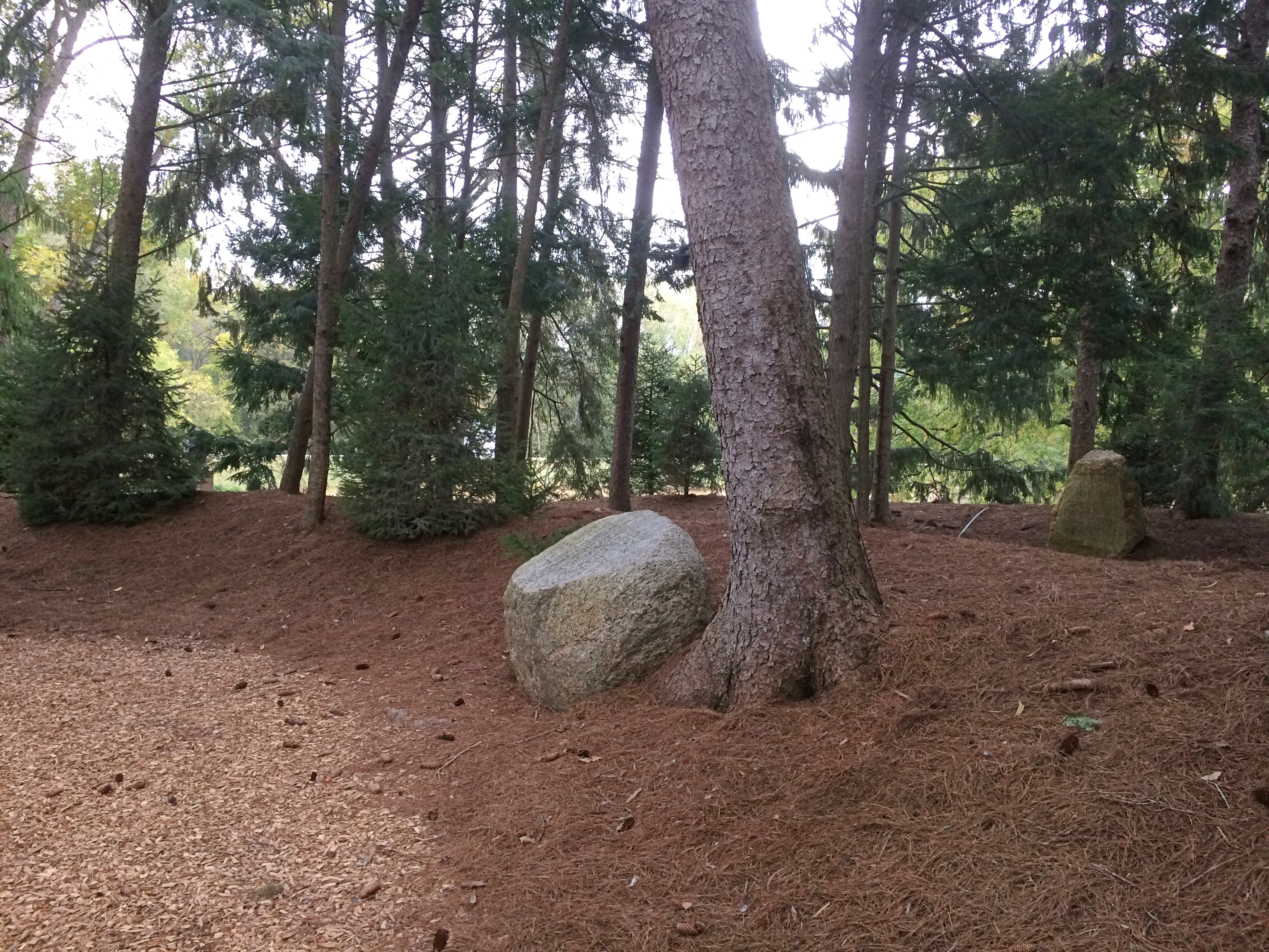
Paul Tillich Park New Harmony Indiana Paul Tillich Park New Harmony Indiana

This is his stone.
Paul Tillich Park New Harmony Indiana
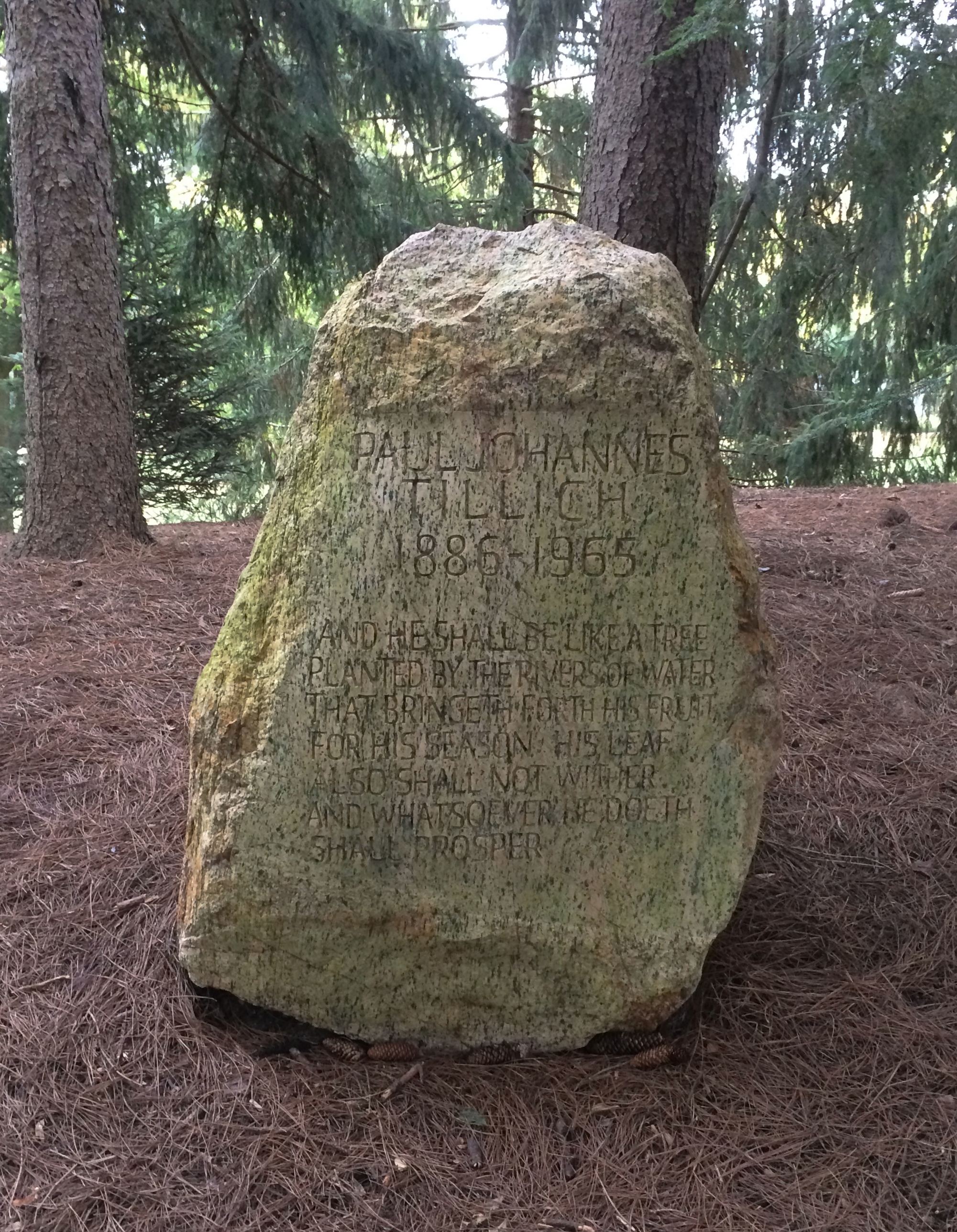
A little hard to read, even when you’re standing in front of it. Turns out to be Psalm 1:3.

PAUL JOHANNES TILLICH
1886-1965
And he shall be like a tree planted by the rivers of water, that bringeth forth his fruit for his season; his leaf also shall not wither; and whatsoever he doeth shall prosper.

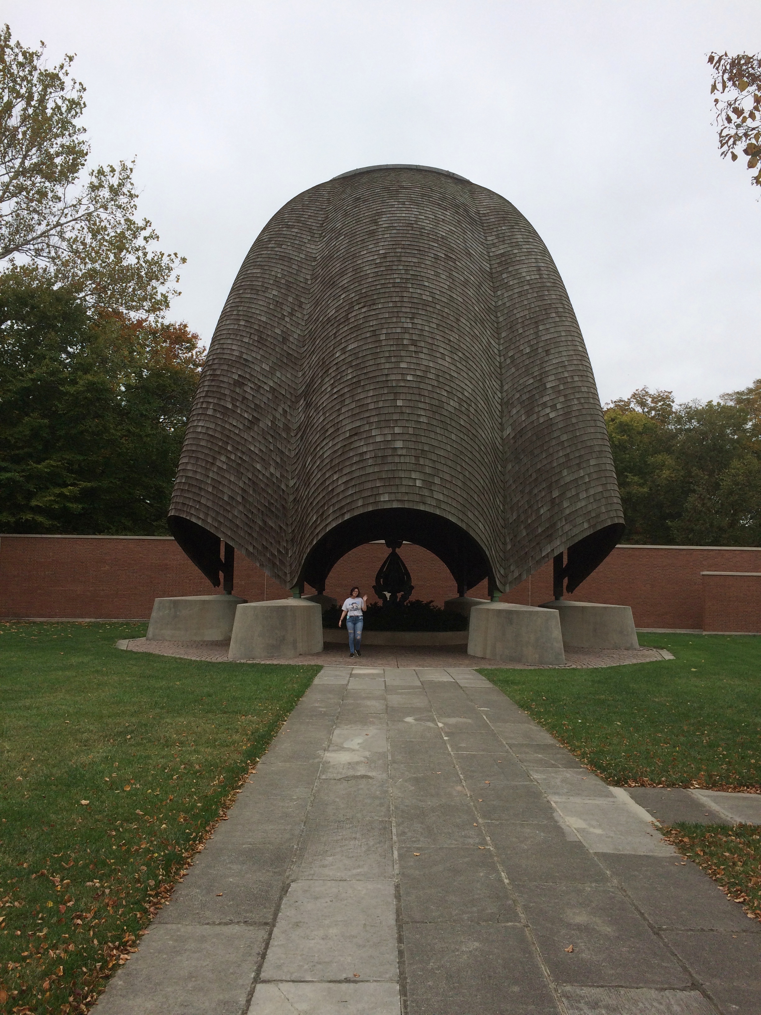
What’s Tillich doing in Indiana? Broadly speaking, he was another inadvertent gift to the United States from the Nazis, like Einstein or Thomas Mann or Billy Wilder or Walter Gropius. Tillich came to America in 1933 and held a number of academic posts in this country. Apparently he was taken with the history and setting of New Harmony.

“Before his death in 1965, the philosopher Paul Tillich hoped to make New Harmony a center for his own teachings, and thus in a way fulfill the early ambitions of Rapp and Owen in making the town an example of spiritual and material concerns successfully united,” notes a 1978 New York Times article, which is worth reading all the way through. “The trust created Paul Tillich Park…”

Jane Blaffer Owen’s trust, that is, mentioned yesterday.

“Jane Owen’s charisma emanated from her spiritual liberality [also, maybe, her largesse]. She was profoundly affected by the teaching of the twentieth-century German-American theologian Paul Tillich, becoming by turns his admirer, student, and friend….” writes Stephen Fox in a magazine published by Rice University — also worth reading all the way through.

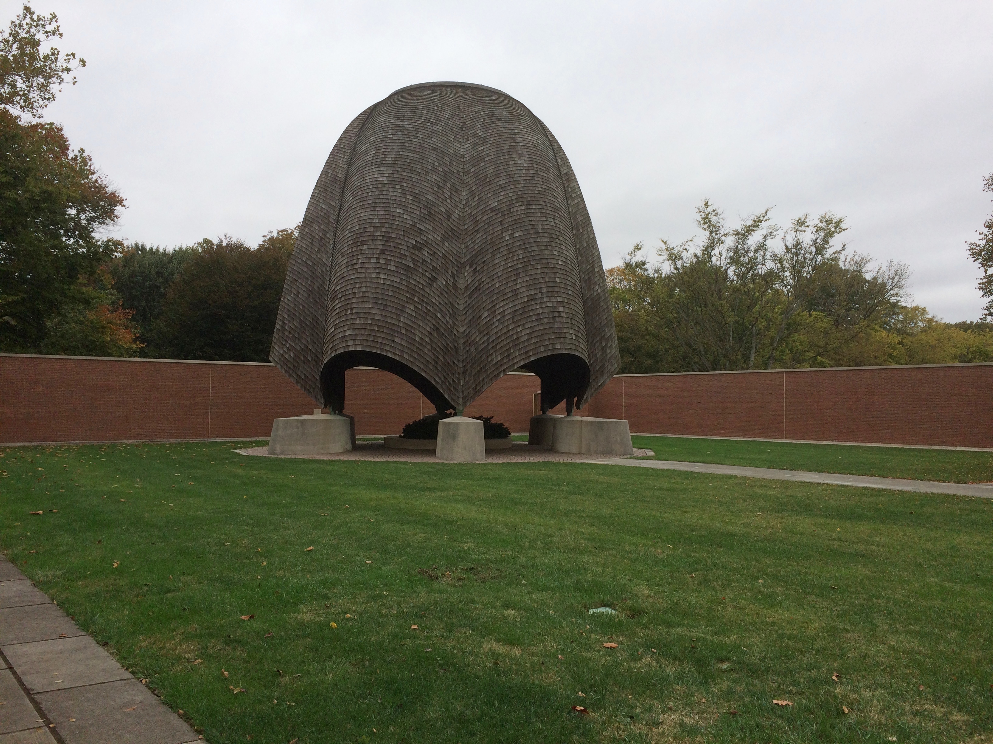
“In 1963, she persuaded Tillich to come to New Harmony to dedicate a site across Main Street from the Roofless Church for a park to be named in his honor.”

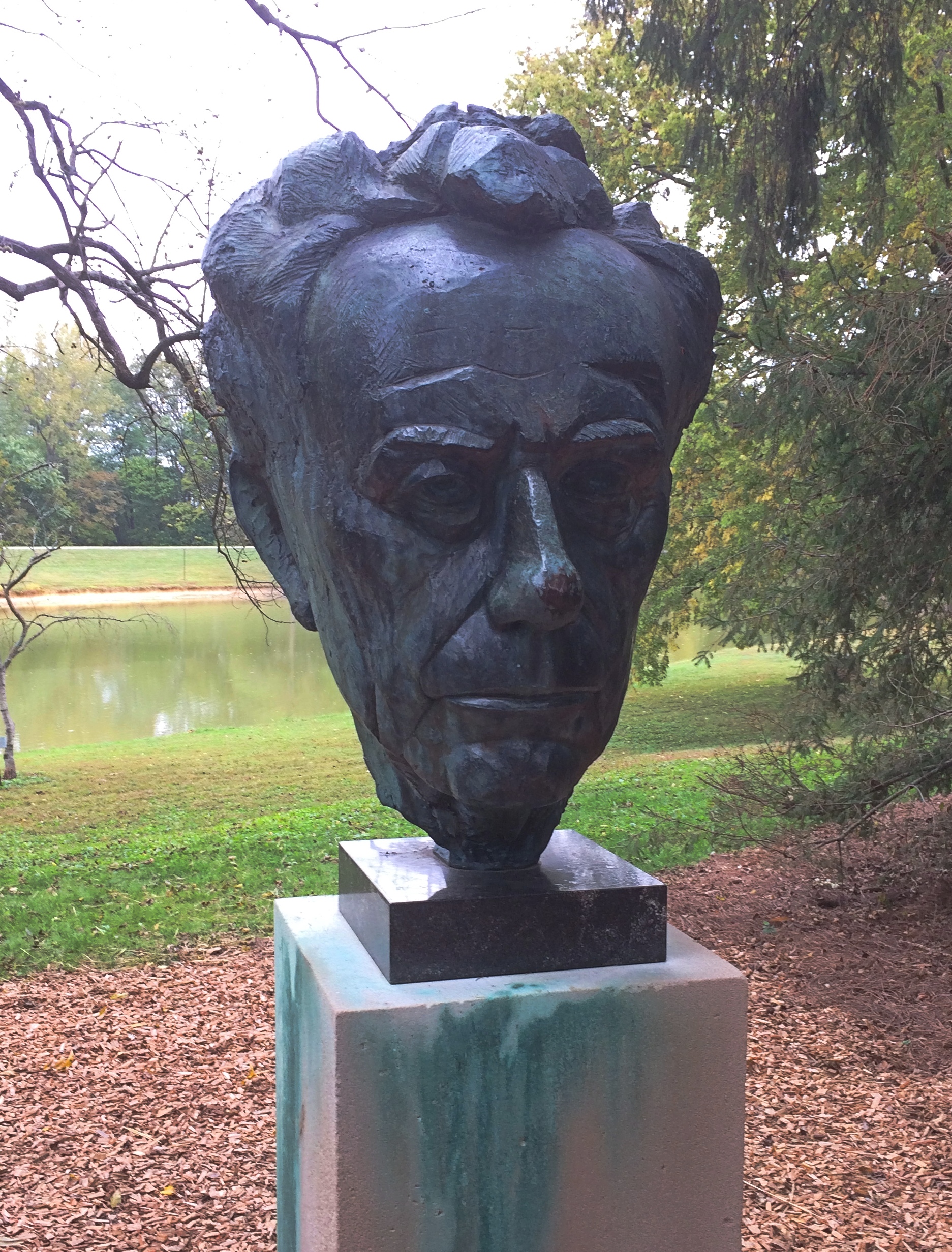
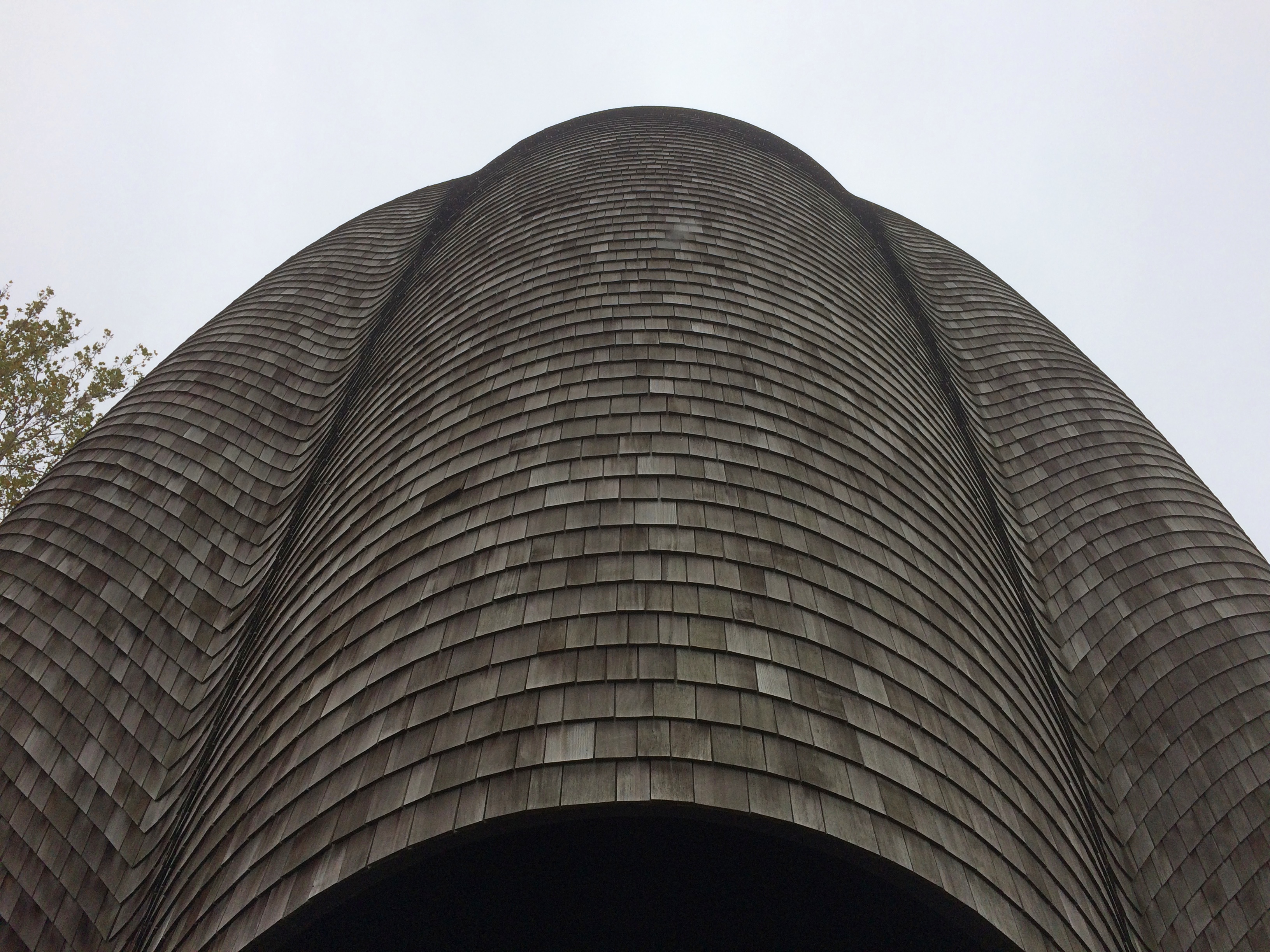
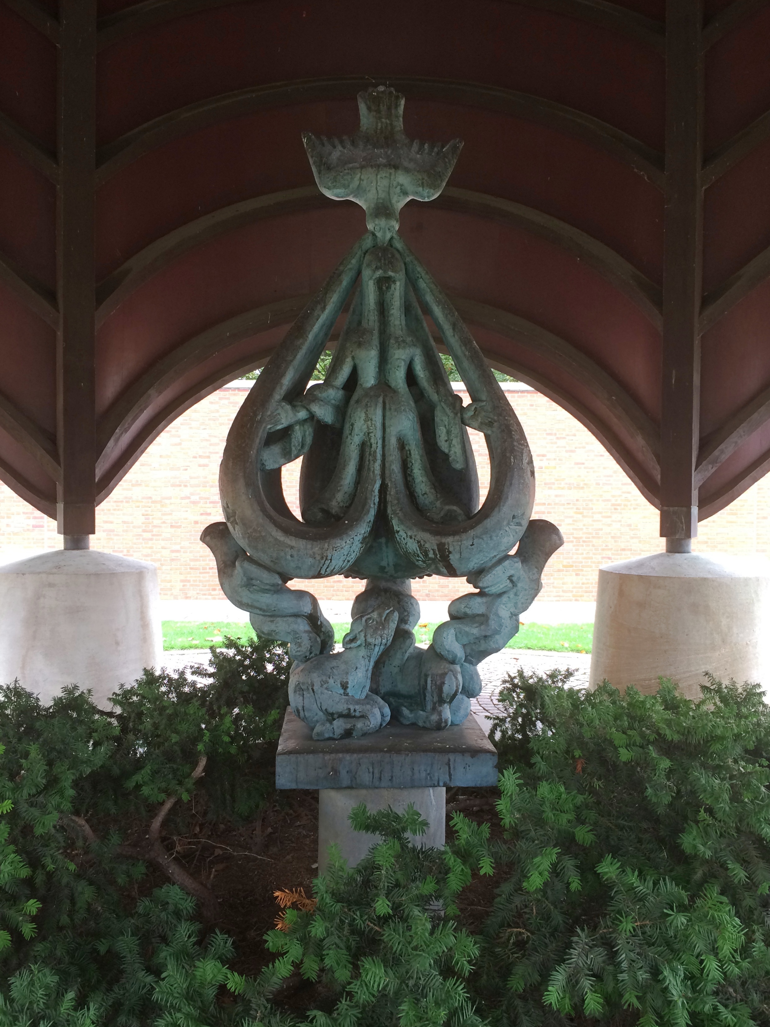
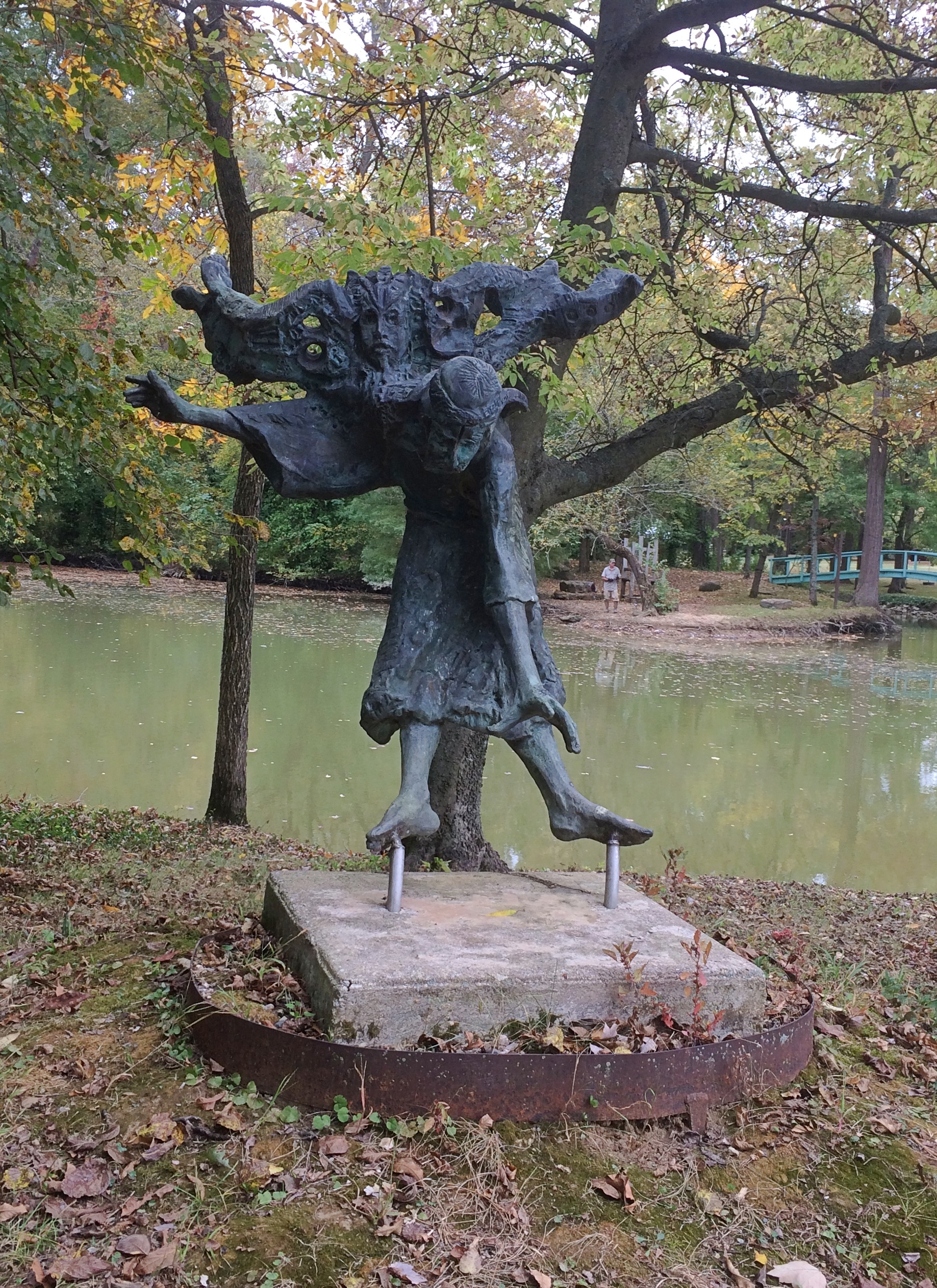
“On [Philip] Johnson’s recommendation, she had the New York landscape architects Zion & Breen design a natural setting of grassless berms planted thickly with spruce and hemlock trees, around which granite boulders inscribed with passages from Tillich’s writings and a bronze bust by James Rosati were installed. This is where Tillich’s ashes were interred in 1966.”

This is the Rosati bust.
Paul Tillich Park New Harmony Indiana

We weren’t quite finished with New Harmony after visiting Tillich. We spent some time at the town’s labyrinth, formally the Cathedral Labyrinth and Sacred Garden and patterned after one in Chartres Cathedral. Another work of the Robert Lee Blaffer Foundation.labyrinth New Harmony Indiana labyrinth New Harmony Indiana

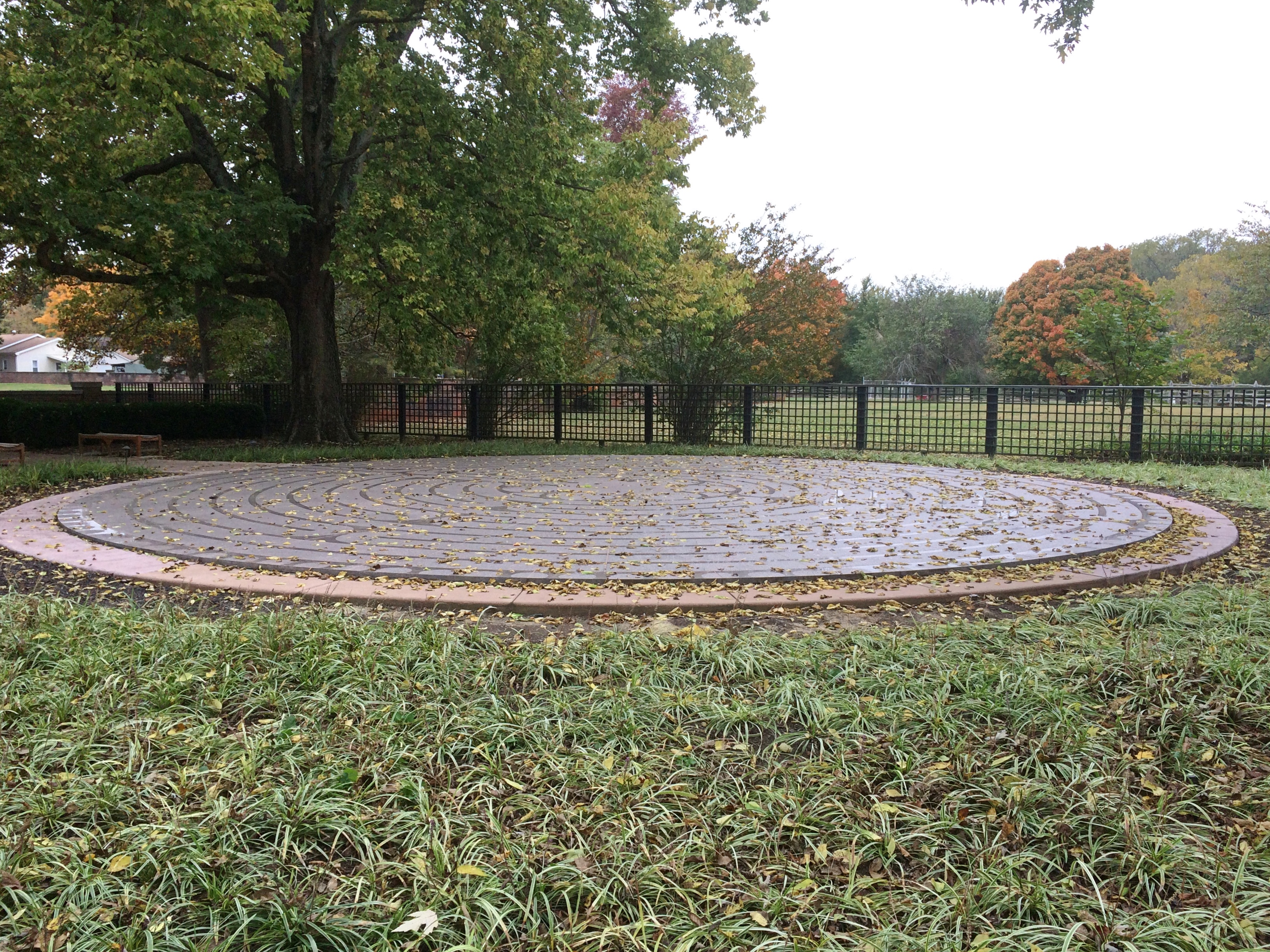
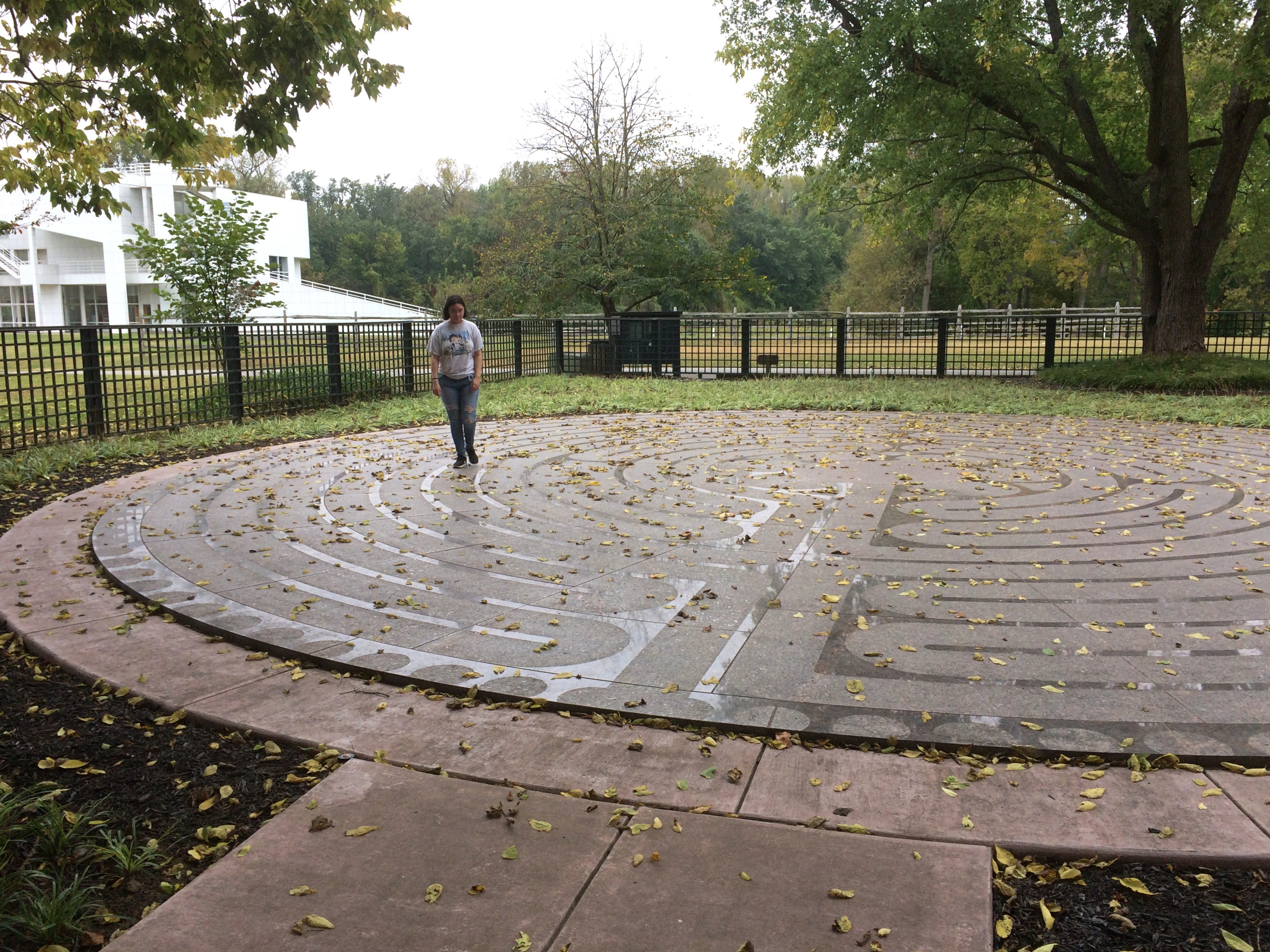
We spent some time walking it. Ann had more patience with it than I did.

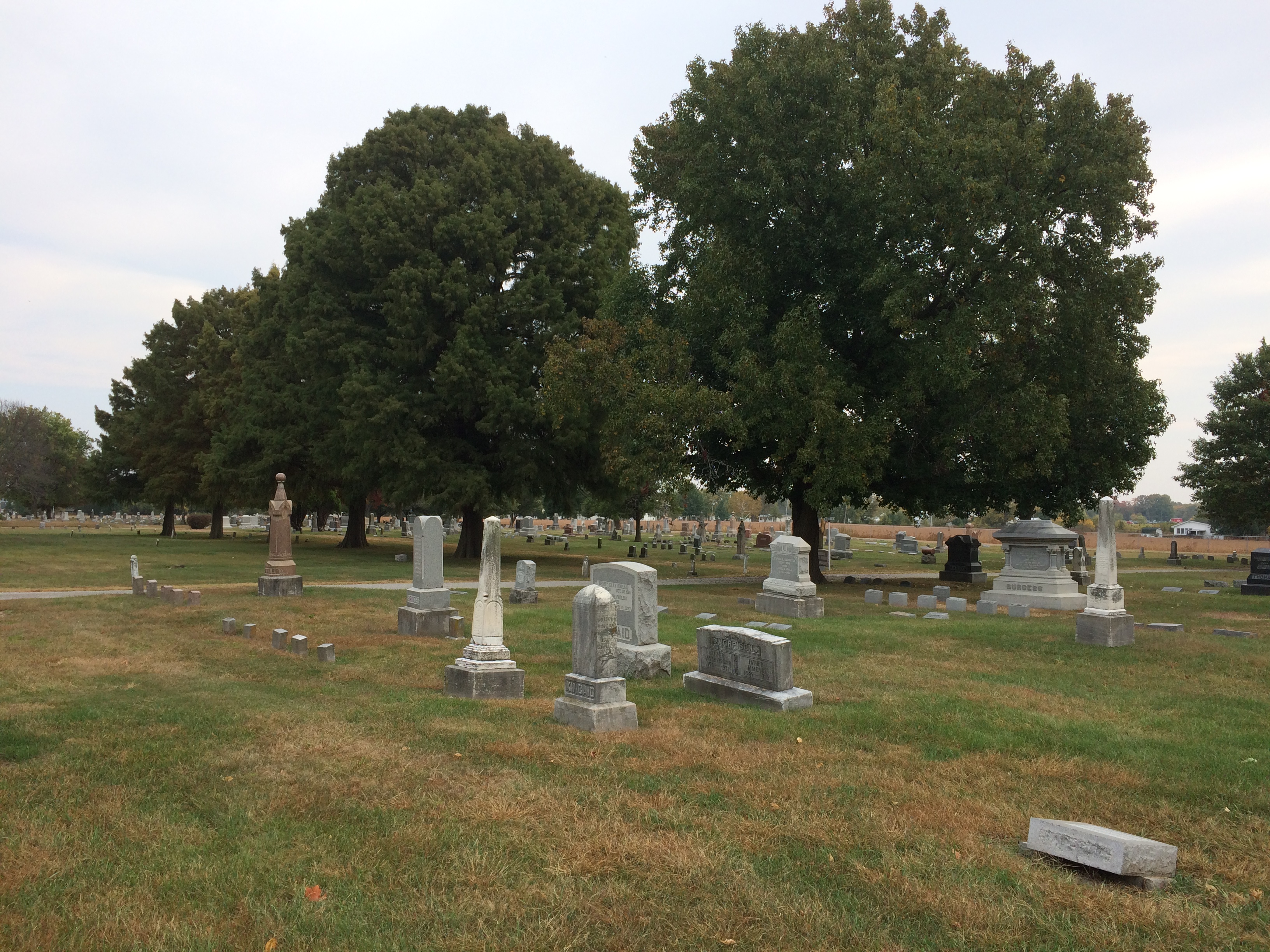
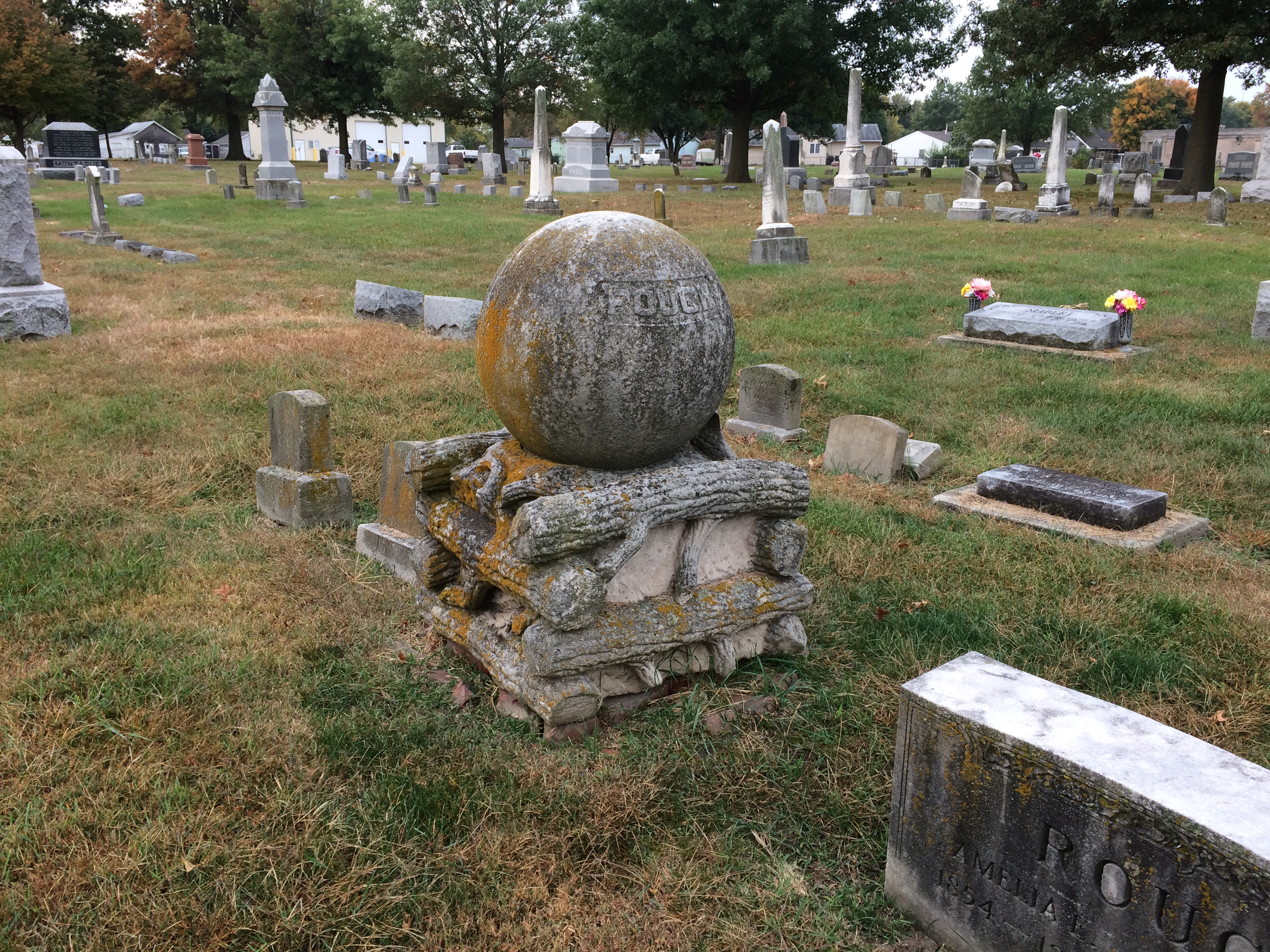
Finally, we approached the Harmonist Cemetery, or the Rappite Cemetery, a burying ground surrounded by a low wall. Outside the wall are an assortment of well-worn stones, dating from the 19th century but after the utopian experiments in New Harmony.
harmonist cemetery New Harmony Indiana

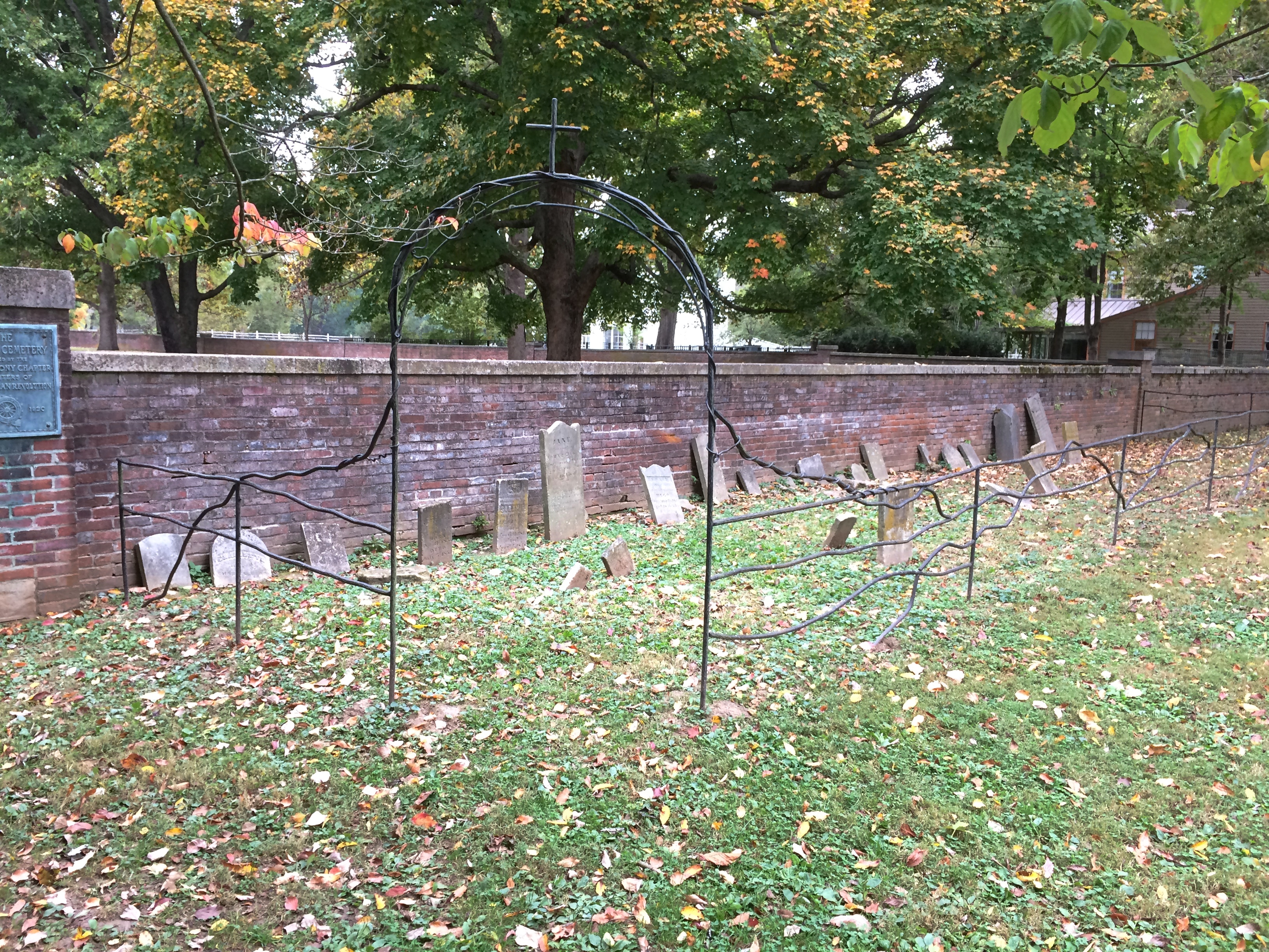
Many are illegible, but I could read the names and much of the info on this one.
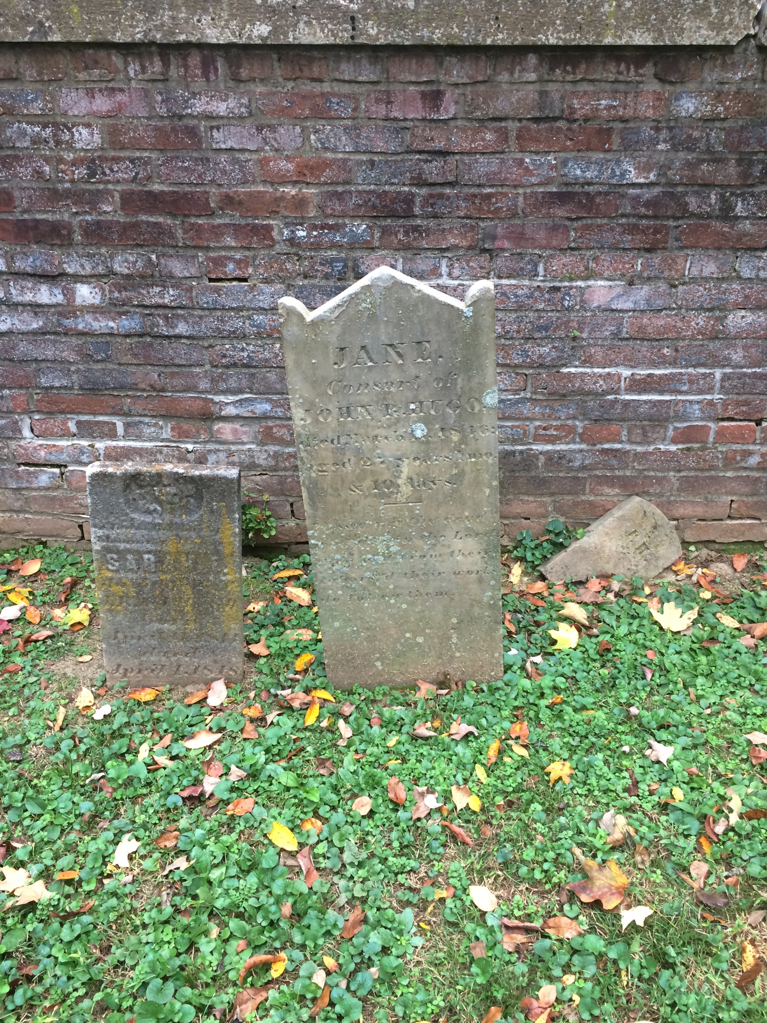
harmonist cemetery New Harmony Indiana

JANE
Consort of
JOHN T. HUGO
Died March 11, 1846
Aged 27 years, __ months and 10 days.

“Consort” isn’t a word I’ve seen too much in cemeteries, but maybe I don’t go to the right ones.

Behind the wall are no stones, just a wide expanse of grassy ground.
harmonist cemetery New Harmony Indiana

There was nothing on site to explain that, but after a moment’s thought we speculated that the Harmonists didn’t believe in individual gravesites or markers, so we were looking at a mass grave. Later I checked, and that’s correct. Ann said that made the site unsettling, and I suppose mass graves can be, say if mass violence was involved. I don’t think that was the case for the Harmonists; just the result of the everyday dangers of living in the 19th-century frontier.

Note also the mounds. Apparently the area was home to Indian mounds before the Harmonists came, and so they must have considered it a natural for a burial ground. About 230 of the colonists lie there.

New Harmony, Indiana, Part 1

Almost all of our Columbus Day weekend trip — Italian Food Day, as Ann calls it — was spent in Illinois, but on October 12 as we drove north toward home, we crossed into Indiana for a visit to the town of New Harmony on the Wabash River, just across from Illinois.

The Harmony Society, originally from Württemberg, moved to the Indiana Territory in 1814 from Pennsylvania and founded the town. You could call the group utopian, but my impression (from only a dollop of reading) is that they were Lutheran separatists and chiliasts. Or you could call them Indiana Territory communists, since they held all of their property in common, before that meant being reds.

Even so, they made a go of it, prospering before selling the site and moving back to Pennsylvania in 1825 at the direction of their leader, George Rapp. “They produced quality products including textiles, rope, barrels, tin ware, leather goods, candles, bricks and much more using the latest machinery and technology available,” the Visit New Harmony web site says.

“Because beverages were in demand [I’ll bet] in neighboring and river towns, wine, whiskey and beer were produced in large quantities. The daily production of whiskey was about 32 gallons and 500 gallons of beer were brewed every other day.”

Welch industrialist Robert Owen bought the place in the 1820s, all 2,000 acres of it, with his own utopian experience in mind. His was a more straightforward failure.

“Owen’s ‘Community of Equality,’ as the experiment was known, dissolved by 1827, ravaged by personal conflicts and the inadequacies of the community in the areas of labor and agriculture,” the University of Southern Indiana explains.

Yet the history of the town didn’t stop when the second experiment did. Scientific and other intellectual activity continued in New Harmony through much of the 19th century, and structures unusual in a Hoosier town rose throughout much of the 20th century. In our time, the restored 19th-century structures and the modernist touches of the 20th century make for an interesting amalgam.

We parked in the lot near the New Harmony Atheneum and started our walk around town.New Harmony, Indiana,

New Harmony, Indiana,
“Clad in white porcelain panels and glass attached to a steel frame, the structure was the first major commission for the now internationally acclaimed architect Richard Meier,” Indiana Landmarks says.

“Built as a visitors’ center for the town [in 1979], the structure is designed to guide visitors along a specific route through the building, with overlaying grids offering frequent views of the surrounding buildings and countryside. From a spacious deck on the roof, visitors can look out over the town and take in views of the Wabash River.”

We would have done all that, but the Atheneum was closed — for Monday, not the pandemic. So on we went, a few leafy blocks to the Roofless Church.
New Harmony, Indiana

The Roofless Church is behind this wall, one of four brick walls forming a rectangle.
New Harmony, Indiana

Inside the walls.New Harmony, Indiana

The structure was erected by the Robert Lee Blaffer Trust, according to a plaque. Jane Blaffer Owen, Humble Oil heiress, founded the organization in honor of her oilman father, and she and her husband, Kenneth Owen, a descendant of Robert Owen, proved instrumental in reinventing New Harmony in the 20th century (she died in 2010, he in 2002).

“Further down North Street and through a gap in a brick wall there is hidden a modernist masterpiece by the architect Philip Johnson, completed in 1960,” says Atlas Obscura.

“It is called the Roofless Church and it says something about how much we expect our building to have roofs, that when people see the shingled structure in the images, they often say, ‘that’s silly, that’s a roof right there.’

“But the church is not simply that space, it is a city block sized footprint of which only a part is enclosed. The curved parabola dome is actually a protective cover for a beautiful sculpture by Jacques Lipchitz.”New Harmony, Indiana New Harmony, Indiana New Harmony, Indiana

Elsewhere within the perimeter of the Roofless Church are trees and benches and small gardens. The east wall has a gate.
New Harmony, Indiana

We walked around a pond not far from the Roofless Church.
New Harmony, Indiana
Near its edge is the Chapel of the Little Portion, built by the New Harmony Inn and Franciscan Brothers, and dedicated to St. Francis.
New Harmony, Indiana
There’s a statue of St. Francis by the pond as well. I keep running into him. Actually, Francis and the Angel of the Sixth Seal by David Kocka.
New Harmony, Indiana

New Harmony isn’t very large, so we wandered from the pond — past the MacLeod Barn Abbey — into the main commercial part of the town in a few minutes. There you can find some handsome restored buildings, such as the Johnson United Methodist Church.
New Harmony, Indiana
The Opera House.
New Harmony, Indiana
A commercial building, at least part of which dates from 1910.
New Harmony, Indiana
A private house (I assume) with Asian design elements.
New Harmony, Indiana
Rappite Community House No. 2, erected 1816-22.
New Harmony, Indiana
If you own everything in common, you’re going to live in communal housing.

Two Southern Illinois Towns: Cave-in-Rock, Equality

Cave-in-Rock IllinoisThe USPS uses the hyphens in Cave-in-Rock, Illinois. I saw the post office in the town and I documented the usage. Other signs around town were about evenly split on using hyphens.

After we visited the state park of the same name, I took a walk around town, mostly along a short stretch of Main Street, while Ann lounged around in the car.

The town’s actual main street seems to be Canal Street, but Main — which parallels the Ohio River — features the post office and Cave in Rock United Methodist Church, which doesn’t bother with the hyphens. Actually, according to the sign out front, the church doesn’t bother with “Cave in Rock” at all.Cave-in-Rock Methodist Church

Rose’s Kountry Kitchen. Not too busy, but it was Sunday afternoon.
Cave-in-Rock Rose's Kountry Kitchen
The River Front Opry House. Not sure if anything goes on there anymore.
Cave-in-Rock River Front Opry House
Some pleasant-looking houses.
Cave-in-Rock Illinois village
Also, art bicycles at various points near the street.Cave-in-Rock art bicycles Cave-in-Rock art bicycles Cave-in-Rock art bicycles
A small group of residents, acting informally, installed the bikes, reports KFVS-12. Civic-minded folks, from the look of it.

Something else about Cave-in-Rock: From 2007 to 2013, the annual Gathering of the Juggalos happened at nearby Hogrock Campgrounds. See SNL for a parody of an infomercial advertising the Gatherings of that period. Also, see a report by the FBI on the Juggalos. I have no idea whether it’s accurate, or whether the G-men had a burr up their butts for no solid reason.

Picture that, a town of 300 people inundated by 10,000 Juggalos. Guess they figured that Juggalo money spends too, despite the risk of damage to the town. Not the only hint of Insane Clown Posse I’ve run across this year.

Between Harrisburg and Shawneetown is the village of Equality, Illinois, pop. about 500. We drove down its main street, W. Lane St., then turned onto N. Calhoun St. Near the intersection of those streets, a restaurant called the Red Onion looked almost pre-pandemic busy.

Not far along Calhoun, I saw a place I wanted to stop.
Equality, Illinois water tower
The Equality water tower rises over the former site of the Gallatin County courthouse. The town was county seat for a while in the 19th century, but eventually lost that distinction. The building, later used as a school, burned down in 1894.

Under the tower is a sizable but timeworn memorial.Michael Kelly Lawler memorial Equality
Michael Kelly Lawler memorial Equality
It honors Michael Kelly Lawler, born in County Kildare, Ireland, but who came to Gallatin County, Illinois, as a boy. A veteran of the war with Mexico, Lawler spent the Civil War in the western theater, most notably as a brigadier general leading Union troops during the Vicksburg campaign.

The state of Illinois erected the memorial in 1913, a good many years after the Gallatin County hometown general in blue had died. A plaque on the memorial lists E.M. Knoblaugh as the sculpture.

A simple Google search uncovers little about him, except the fact from the 1915 edition of Report of the Auditor of Public Accounts that the state of Illinois paid him $688.02 for service as a sculptor, and $4,210 to erect the monument, or $4,898.02 all together. In current dollars, more than $128,000, so he presumably did well in the deal.
Michael Kelly Lawler memorial Equality
Besides that, whoever he was, he did a fine job, especially on the relief, a lifelike visage that looks like it might have been restored sometime recently.

Cave-in-Rock State Park

Snow this morning. It didn’t stick, but it did remind us all of the cold months to come.

At the beginning of 2020, works published in 1924 finally entered public domain in the U.S. The Center for the Study of the Public Domain noted some of the better known works now available to all.

“These works include George Gershwin’s ‘Rhapsody in Blue,’ silent films by Buster Keaton and Harold Lloyd, and books such as Thomas Mann’s The Magic Mountain, E. M. Forster’s A Passage to India, and A. A. Milne’s When We Were Very Young.”

Plenty of obscure works are now available as well. One I have in mind is The Outlaws of Cave-in-Rock by Otto A. Rothert, published in 1924. Rothert (1871-1954) was secretary of the Filson Historical Society in Louisville, and apparently took a strong interest in regional history

The Outlaws of Cave-in-Rock can now be found in Google Books. I haven’t read it all, but I have sampled some of it. Such as the first few paragraphs.

“This book is intended to give the authentic story of the famous Cave-in-Rock of the lower Ohio River… and to present verified accounts of the most notorious of those highwaymen and river pirates who in the early days of the middle West and South filled the Mississippi basin with alarm and terror of their crimes and exploits.

“All the criminals herein treated made their headquarters at one time or another in this famous cavern. It became a natural, safe hiding-place for the pirates who preyed on the flatboat traffic before the days of steamboats….

“A century ago and more, its rock-ribbed walls echoed the drunken hilarity of villains and witnessed the death struggles of many a vanished man. Today this former haunt of criminals is as quiet as a tomb. Nothing is left in the Cave to indicate the outrages that were committed there in the olden days.”

The book also tells the tale, in four chapters, of the exceptionally murderous Harpe brothers (or cousins), a bloody story deftly summarized by the late Jim Ridley in the Nashville Scene some years ago. Enough to note here that the Harpes and their women roamed western Tennessee and Kentucky around the beginning of 19th century, murdering and robbing as they went, but especially murdering.

They spent some time among the blackguards at Cave-in-Rock, but were forced to leave after they threw a man bound to a horse to his (and the horse’s) death off the cliff’s edge above the cave for fun. Even river pirates have their standards.

In our time, and in fact since 1929, the cave has been the central feature of Cave-in-Rock State Park. Not quiet as a tomb, quiet as a minor tourist attraction. It isn’t part of Shawnee National Forest, but some of the national forest lands are nearby. Note the sign isn’t a stickler for hyphens.Cave-in-Rock State Park

The park is near the small town of Cave-in-Rock, Illinois, which is walkable distance to the south from the park. We arrived at the park on the afternoon of October 11.

You park in a small lot and climb 50 or so steps uphill, to a crest overlooking the Ohio River, sporting picnic shelters and tall trees. Views from the crest, looking across to Kentucky.Cave-in-Rock State Park Cave-in-Rock State Park

From the crest, you go down more stairs most of the way to the river’s edge. The cave entrance is under a high cliff and a few feet higher than a small beach on the river.
Cave-in-Rock State ParkLooking back up at some trees lording over the edge of the cliff.
Cave-in-Rock State Park

A few more steps and you’re in front of Cave-in-Rock. It’s an apt name.

Cave-in-Rock State Park Cave-in-Rock State Park

Soon you’re inside, looking out.
Cave-in-Rock State Park

It doesn’t go too far back, at least not that I know of. Graffiti, mostly painted signatures, is prominent on the roof of the cave.
Cave-in-Rock State Park

J. & B.C. Cole were here in 1913, pre-park and probably dangling from a rope over the cliff edge. The more recent Marty and R.S. were here in 2011, and probably had rappelling gear.

Pounds Hollow Recreation Area

The vista at Garden of the Gods in Shawnee National Forest was fairly crowded. A few miles away, the lake and the hiking trails and the bluff at Pounds Hollow Recreation Area were much less busy, though still in the national forest. After taking in the Garden of the Gods, Ann and I spent a few pleasant hours there early on the afternoon of October 11.

Near the parking lot is a small beach on the small Pounds Lake.
Pounds Hollow Recreation Area
From there, a trail leads more-or-less southwest.
Pounds Hollow Recreation Area
The lake’s still in view much of the way, and what a sight in mid-October.Pounds Hollow Recreation AreaTall trees mark the path as well.
Pounds Hollow Recreation Area
Eventually the lake peters out into more of a wetland.Pounds Hollow Recreation Area Pounds Hollow Recreation Area
Leaving that behind, the land is covered with leaves this time of the year.
Pounds Hollow Recreation Area
When the wind blew, more leaves cascaded to the ground.

Pounds Escarpment rises from the forest floor along the trail, with parts of it curiously mottled in black and white.Pounds Hollow Recreation Area


Pounds Hollow Recreation Area

The CCC crafted some stairs to climb to the top. We climbed them.
Pounds Hollow Recreation Area
It wasn’t all stairs. Along the path there were a few fat man’s misery passages, which I suspect were natural cracks enlarged and smoothed by CCC muscle power.
Pounds Hollow Recreation Area
At the top of the escarpment is a viewing platform, not nearly as crowded as the Garden of the Gods.
Pounds Hollow Recreation Area
In fact, we were the only ones there for a few minutes, taking in the wooded vista.

Garden of the Gods

Heavy rain last night, and instead of a winter-like blast today, the afternoon proved to be sunny and warm. More rain is expected this evening, however, and afterwards cold air will blow in. I couldn’t spend much time outside today because of work, but on whole I’m not sorry to be back after taking a week off. That means, among other things, I’m not ready to retire.

Below is the postcard view at Garden of the Gods in Shawnee National Forest, not far south of Harrisburg, Illinois. I think I’ll get that out of the way. Except that’s an obsolete reference. The Instagram view, for people unfamiliar with postcards.
Garden of the Gods
Late in the morning of Sunday, October 11, we arrived at Garden of the Gods, driving the short distance from Harrisburg. Unlike some views that involve hiking and hill climbing, Garden of the Gods is mostly accessible by road. You park at the edge of a path called the Observation Trail and walk it for about five minutes, up a mild slope, to reach the view.

Flagstones pave the trail. That’s got to be CCC work, once again.
Garden of the Gods
You can’t say you haven’t been warned. People meet their end at Garden of the Gods sometimes.Garden of the GodsNear the lookout.Garden of the Gods

Sometimes you don’t need to look to a vista to see interesting rock formations.Garden of the Gods

Sometimes you don't need to look to a vista to see interesting rock formations.
Still, you come for the views.Garden of the Gods

Garden of the Gods

Garden of the Gods

People do take their chances.Garden of the Gods

Garden of the Gods
Most of my pictures don’t show it, but on a pleasant autumn Sunday, a lot of people come to Garden of the Gods. So many that you had to wait behind them sometimes to see an overlook, such as at the postcard view.
Garden of the Gods
It was worth dealing with the crowds to see the rocks, weatherworn relics of an ancient seabed uplifted, rising over a sweeping forest. It’s hard to look at such rocks and think they’re anything but permanent, but they’re as ephemeral as the trees below, just on a much longer scale.

As a tourist mecca, I suspect the rocks are fairly new. One local shop owner I talked to — a small shop, no one else was there — said that Garden of the Gods has been particularly popular since the 2017 eclipse, when Shawnee NF was a good location to see it. No doubt people visited before that, but then again not for so long. The WPA Guide to Illinois (1939) doesn’t have the Garden of the Gods in its index, nor Shawnee NF for that matter, and for good reason when it comes to the latter. The national forest was established the same year the book came out, probably missing the publication deadline by a bit. The book amusingly refers to this part of the state as the “Illinois Ozarks,” a term that seems to have faded away. Well, not quite.

Another thing strange to imagine: Shawnee NF is in Illinois. Same state as the endless corn fields along the highway, the towers of the Chicago megalopolis and my ordinary grassy back yard. This was a thought that came up more than once during our visit to extreme southern Illinois.

Old Shawneetown

If you drive east from Carbondale along Illinois 13, you’ll pass through a number of towns connected by that four-lane highway: Cartersville, Marion and finally Harrisburg, after which the road narrows to two lanes. That was our route on the afternoon of October 10.

There’s a branch of 17th Street Barbecue in Marion, with the original in Murphysboro, Illinois. It’s a barbecue joint of some local renown. I can’t remember when I first heard about it. Some Internet list, probably, but anyway I knew about it and decided to get lunch there in Marion.

Meals on the road in 2020 have involved takeout in all cases, either to eat in the car, or our room, or when possible at an outdoor public picnic table. We found a table in a small park in Marion to eat our 17th Street ‘cue.

We both got barbecue pork sandwiches. The meat was fine, but whoever made the sandwiches shorted us on the sauce, so the meal was a little dry. I’d be willing to try the place again if ever I’m down that way, but I’m going to insist on sauce.

The eastern terminus of Illinois 13 is Old Shawneetown on the banks of the Ohio River. Too close to the river, and thus prone to flooding. The Great Ohio River Flood of 1937 finally drove most of the residents away to found a new Shawneetown a few miles to the west. But Old Shawneetown isn’t a ghost town in our time, since 160 or so people live there, just the residuum of a larger place.

The town’s main intersection.
Old ShawneetownThe original Shawneetown had its moment, a little more than 200 years ago, when it was home to a federal government land office for the Illinois Territory, and as a transshipment point for salt extracted nearby. During the famed 1825 tour of the U.S. by Gen. Lafayette, Shawneetown was on his itinerary, surely marking the town’s peak of fame if not population.

Peaked too soon, looks like. No railroad passed through Shawneetown in the following decades, at least by the time this map was published in 1855. That tells me that Shawneetown never really prospered after the land office and salt mine closed.

I’ve known about the place for a long time. I knew girl in college from around Shawneetown, a coaxing elf of full Irish ancestry who grew up on a nearby popcorn farm. Gallatin County even now is a nexus of popcorn agriculture. Last I heard, she lived in Ankara with her French husband. People get around.

The main surviving building from the town’s storied past is the Shawneetown Bank State Historic Site, dating from 1840. Home to banks for about 100 years — they seem to have come and gone with various financial panics — it stands neglected these days.Shawneetown Bank State Historic Site
Shawneetown Bank State Historic Site
It’s not the only abandoned structure in the neighborhood. A white Texaco station is catercorner across from the bank. If it were on U.S. 66, it might be a little museum. Maybe someone has that in mind. Though abandoned, the structure looks in fairly good shape, especially the sign.
Old Shawneetown Texaco
There are a few plaques and other acknowledgments of the town’s history. Such as cutouts of Lewis & Clark, who passed this way just before there was a town.
Shawneetown Texaco
I like to think that the Corps of Discovery made a stop here at the only gas station along their route.

As Lewis wrote in his journal, Nov. 6, 1803: Arrived at Swanee Txco Station. Pay’d owner 2 dollards for provisions, — Cheetos, other divers chips, Coke & Pepsi, choco bars etc. Men also bought provis. for own use Mr Wm. Jones store mger, reports recent visit by Indian band from furth. north. — buying his entr. stock of funyuns.

Down the street from the abandoned bank and the abandoned gas station is Hogdaddy’s Saloon, an abandoned entertainment venue, though not so long ago, from the looks of it.
Hogdaddy's Old ShawneetownWhat Old Shawneetown needs (in more normal times) is a music festival right there on the main street. If Bonnaroo can, so can Shawneetown. Something for the hipsters to discover, to put the town on the hipster map and attract hipster dollars. As long as they believe the place is authentic somehow, they will come. That way a place like Hogdaddy’s could make a go of it.

An embankment separates the town from the river, part of a levee system built long ago to keep out flood waters — in vain. The always interesting WPA Guide to Illinois (1939) tells the story better than any online source I’ve found (p. 436). For that book, the ’37 flood was a recent event.

“The town bore the yearly invasions of the Ohio unprotected until the unusually severe flood of 1884, after which it constructed a comprehensive levee system,” the Guide notes. “But in 1898, and again in 1913, Shawneetown was under water. In 1932, the levee was raised five feet above the 1913 high-water mark….

“But Shawneetown had not envisioned anything like the 1937 flood. By January 24 of that year, menacing yellow waters were slipping silently past the town, only inches from the levee top… Small groups of people huddled on street corners, terrified, waiting; the telephone service ceased; hemmed in by the ever-swelling Ohio, Shawneewtown flashed a desperate cry for help over an amateur’s short-wave radio.

“Responding to the call, a river packet and several motorboats evacuated the townspeople just as the waters began to trickle over the levee. A roaring crashing avalanche soon inundated the cuplike townsite…

“The 1937 flood marked the end of Shawneetown’s ‘pertinacious adhesion’ to the riverbank. Gone were the packets and keelboats which induced her to hazard annual submersion. Gone was the steady traffic of settlers, goods and singing rivermen. With the aid of the State, the RFC, and the WPA, a project is under way for transplanting the town to the hills 4 miles back from the river… The State plans to establish a State park at the present site of Shawneetown.”

Guess the state never quite got around to that, maybe because not everyone wanted to leave.

A stairway leads to the embankment’s top, which offers a view of the Ohio. Looking upriver.
Ohio River Old Shawneetown
And downriver, looking at the bridge that crosses over to Kentucky.
Ohio River Old Shawneetown
On the side of the embankment is a graffito. Any graffiti would be a little odd in such a town, but this would be odd anywhere.
Ohio River Old Shawneetown
Left by a passing bailiff with a can of spray paint?

SIU and Buckminster Fuller Too

On October 10, Ann and I tooled around the Southern Illinois University campus a bit, agreeing that it isn’t the aesthetic experience that some college campuses are. Visitor parking proved hard to find, so we didn’t take a walk on campus.

We did spot the Wham Building on Wham Drive. Ann suggested that the donors were the British pop duo, now about 35 years passed their heyday. Though as a matter of style, it ought to be the Wham! Building. Their connection to SIU? None that we knew, but never mind. Maybe they decided they had enough money to fund a building on a college campus, and they threw a dart at a map to determine where it would be.

Not long after that conversation, we heard a local station playing “Wake Me Up Before You Go Go.” Coincidence or synchronicity? Coincidence, I’d say.

Not far from campus is a residential neighborhood with a fair amount of student housing, marked by some genteel seediness. Parking was easy around there, so we stopped for a short walk down a residential street.

Some of the residences stood out more than others. Some for their décor. It might be hard to see in the picture, but there’s a neon sign in the window of this Halloween-ready house: PALM READER.Carbondale palm readerOther properties stand out for more fundamental reasons. The R. Buckminster Fuller and Anne Hewlett Dome Home is at the intersection of two small streets in an otherwise unremarkable location in the neighborhood.fuller dome carbondale
fuller dome carbondale
The dome is fenced off and closed. But someone used to live there. Bucky himself, as it happens. A sign on the fence says: “Buckminster Fuller is considered one of the leading visionaries of the 20th century. He patented the geodesic dome in 1954 and it is his most enduring legacy. In April 1960 he assembled this dome home (The Fuller Dome) and lived in it with his wife Anne until 1971.”

How long had it been since I’d thought about Buckminster Fuller? Before finding out about the dome, that is, which was a few days before our visit to Carbondale. A long time, that’s how long. I suspect much of the world can say the same. Whatever Fuller’s contributions to civilization, and I’ll be the first to say geodesic domes are pretty cool, he’s headed for obscurity as surely as Ernie Pyle.

Reading about Fuller made me think of Lucy Kulik, a sixth-grade teacher of mine. She taught us math and I believe also led our participation in Man: A Course of Study almost 50 years ago. I hadn’t thought about her in a long time, either, and checked to see whether she was still among the living. Possible, but not likely, though it turned out she died only last year at 97, and now has a stone at Fort Sam Houston National Cemetery next to her husband, an Air Force lieutenant colonel — something I didn’t know about her.

RIP, Mrs. Kulik. The details have faded after a half century, but I remember you were a good teacher.

In class one day Mrs. Kulik mentioned Buckminster Fuller as the fellow who invented a dome made of triangles and who wanted the world to give up the words “sunrise” and “sunset.” I’d never heard of him at the time, or if I had, I’d forgotten.

Fuller suggested the words sunsight and sunclipse to replace sunrise and sunset, arguing that the common words reflect an incorrect understanding of the way the Earth and the Sun move. You could argue that they do, of course, and the words he suggests are perfectly fine, but to object to sunrise and sunset on those grounds itself reflects an excess of literalism in understanding language. That might be a reason his suggestions didn’t catch on.

His domes might be cool — you can’t stand in front of the Expo ’76 Fuller dome in Montreal and not feel a little awe — but I also have to add that a few of them go a long way. In the case of Carbondale, one is probably enough.

Jeremy Rochman Memorial Park, Carbondale

During the early planning for our recent trip, I didn’t give Carbondale, Illinois, much thought as a possible destination, but then Ann mentioned a park there she’d heard about from a friend who used to live in the area. After a little further investigation, I worked Carbondale, especially the park, into our plans.

“A vocal fan of the role-playing game Dungeons and Dragons, Jeremy ‘Boo’ Rochman was tragically killed in a car accident at the young age of 19,” Atlas Obscura says. “To honor his memory, his father bought a parcel of land across the street from their home in order to build a memorial park. His late son’s passion was for the role-playing game Dungeons and Dragons, so his father decided to turn the park into a fantasy land that his son would have been proud of.”

Jeremy Rochman Memorial Park is on the outskirts of Carbondale. When you arrive, various painted concrete creatures greet you.Jeremy Rochman Memorial Park
Jeremy Rochman Memorial Park

Jeremy Rochman Memorial Park

Jeremy Rochman Memorial Park

Including an enormous dragon, good for climbing, if you’re agile enough.Jeremy Rochman Memorial Park
The “castle” — the whole place is sometimes called Castle Park or Boo Castle Park — is a wood and stone structure with an elaborate set of passageways and stairs for kids to climb around.
Jeremy Rochman Memorial Park
With plenty of figures of its own.
Jeremy Rochman Memorial Park
The park wasn’t overrun with people, but we did notice a birthday party off in one corner.Jeremy Rochman Memorial ParkIf ever there were a good place for a children’s birthday, this is it.

Shawnee National Forest ’20

During my break from posting, Arlo Stribling was born to my nephew Dees and his wife Eden in Austin. Congratulations to the new parents, here’s hoping the boy is a joy. Best regards to little Arlo, an emissary to a future my generation will not see.

On the afternoon of Friday, October 9, Ann and I went southward for a visit in and around Shawnee National Forest, which stretches in large patches — in typical national forest style — from the Ohio River to the Mississippi, or vice versa, occupying a lot of extreme southern Illinois. We looked around the east part of the forest. The weather turned out to be flawless for such a little trip, warm and partly cloudy.

We spent the first night in Mattoon, Illinois, continuing southward the next morning. The first place we went on Saturday morning wasn’t in southeast Illinois, but further west: Carbondale, visiting Castle Park, or more formally Jeremy Rochman Memorial Park, on the outskirts of town. Afterwards, we looked around Southern Illinois State University, and saw the nearby Buckminster Fuller House. A domed house, of course.

Heading east on Illinois 13, we eventually made our way as far east as that road goes, Old Shawneetown, a husk of a formerly much more populous place on the banks of the Ohio, and home to the Shawneetown State Bank Historic Site. We spent the next two nights in Harrisburg, Illinois, which bills itself as the Gateway to the Shawnee National Forest.

On Sunday, we drove the roads of the southeast part of the forest, climbed a modest flagstone path to a grand vista — the Garden of the Gods — hiked along a small lake surrounded by trees approaching their peak coloration, climbed a bluff via a CCC staircase, and visited a large cave entrance facing the Ohio River at Cave-in-Rock State Park.

Small, winding roads pass through the national forest, rising and falling, flanked  alternately by walls of trees and expanses of flat farmland, post-harvest but before a winter freeze. Towns come in the sizes small, smaller and hamlet. In that part of Illinois, sometimes known as Little Egypt, small white churches are a common sight, more Baptist than any other denomination. Not quite as common, but enough in evidence were abandoned structures: farmhouses, gas stations, motels, restaurants and shops. If it were up to the people who put up political signs in that part of the country, the president would be re-elected by a wide margin. A smattering of Confederate battle flags were flying here and there.

Traffic is at a trickle on those roads most of the time. That made for easy, and sometimes picturesque, driving. Car commercial driving, I told Ann.

On Monday, Columbus Day Observed, that lightest, most gossamer of all national holidays, we headed home, with one major short detour into Indiana, to visit the town of New Harmony. The 19th-century utopian colonies there might have failed (two! count ’em, two utopian experiments), but the town has succeeded in being highly pleasant and intriguing everywhere you look in our time. Also, a famed theologian is buried there, in as much as theologians get fame.

As mentioned above, we didn’t spend much time in Mattoon. But early on Saturday I got up and looked around for a few minutes. The town looks frayed, buffeted by the contraction of U.S. manufacturing and the vagaries of the farming industry and the rural economy as a whole.

The town’s relatively greater prosperity in the early 20th century is reflected in its cemetery. A sizable place, the Dodge Grove Cemetery measures about 60 acres and has 20,000 permanent residents, including three Civil War generals and 260 soldiers from that war, one of whom is an unknown Confederate. There’s a story in that last detail, probably lost to time.Dodge Grove CemeteryDodge Grove Cemetery

Dodge Grove Cemetery

Blazes of fall color rise in places.
Dodge Grove Cemetery
According to Find a Grave, only one of those Civil War generals counts as a notable burial in Dodge Grove, James Milton True, commander of the 62nd Illinois Volunteer Infantry. I like the other major item on his CV: U.S. consul in Kingston, Ontario in the 1870s.

That hints at some pull with the postwar federal government, probably based on connections he made during the war, or because he became a local politico who could deliver votes. Or both. Seems like a plumb diplomatic assignment in the 19th century: no language skills necessary, close enough to home that you can visit periodically, and no danger of catching malaria or some other dreaded tropical disease.

I didn’t see his grave. I didn’t know he was there till later. I did see the Pythias obelisk.
Dodge Grove Cemetery

Erected by
Palestine Lodge No. 46
Knights of Pythias
In Memory of
Deceased Members
1929

I’ve encountered vestiges of the Knights before, such as in Atlanta, Illinois. I associated them with an earlier time, the sort of organization that George Babbitt might have mentioned in passing as having a chapter in Zenith. But no: the Knights of Pythias are still around, though at much diminished numbers.

Still around, and up with the times. “The Summer 2020 Edition of the Pythian International is now online,” the fraternal org’s web site says. “It includes information on the rescheduled Supreme Convention, Oct. 1-6.”

As I was about to leave, I spotted this stone.
Dodge Grove CemeteryA heartbreaker of a stone. Though I’m sure combat deaths didn’t quite stop exactly at 11 am on the 11th, since even modern armies with good internal communications can’t stop on a dime. Still, the day before the Armistice. Damn.

I don’t know why I’m surprised any more at anything online, but I was surprised to find a local newspaper account of Lawrence Riddle’s last days, though it doesn’t specify how he died (and this too: a niece that he never knew). In the article, the most attention is paid to Riddle’s participation in combat during the days before his death, charging a German machine gun position with four other men. They seized the position and brought back prisoners.

I wonder whether the Germans, eager to surrender at this point in the war, were making it easy for the raiders, or whether the Americans faced bitter-enders who were still playing for keeps. Either way, a clear act of bravery on the part of Riddle and the others.