Looks like we’ve hit the mid-July stride of chamber of commercial weather, with low 80s F for highs, high 60s for lows, for some days ahead. On the other hand, standard forecasts don’t include smoke, which could well make a comeback in the coming days.
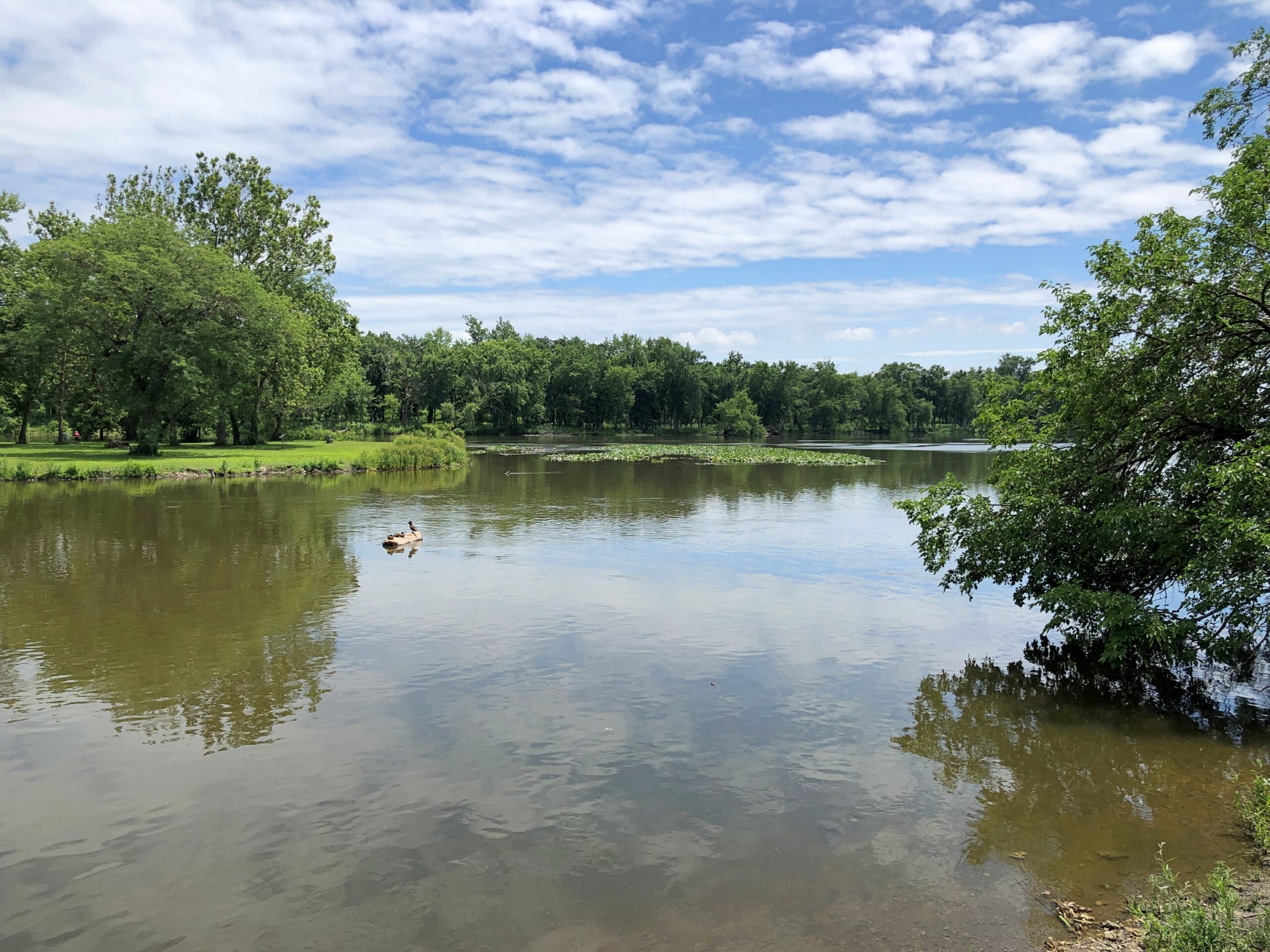
It was a rainy May and June, bringing the flow of the Fox River fairly high by the time last month that we took a short walk nearby, largely under the flush of greenery.
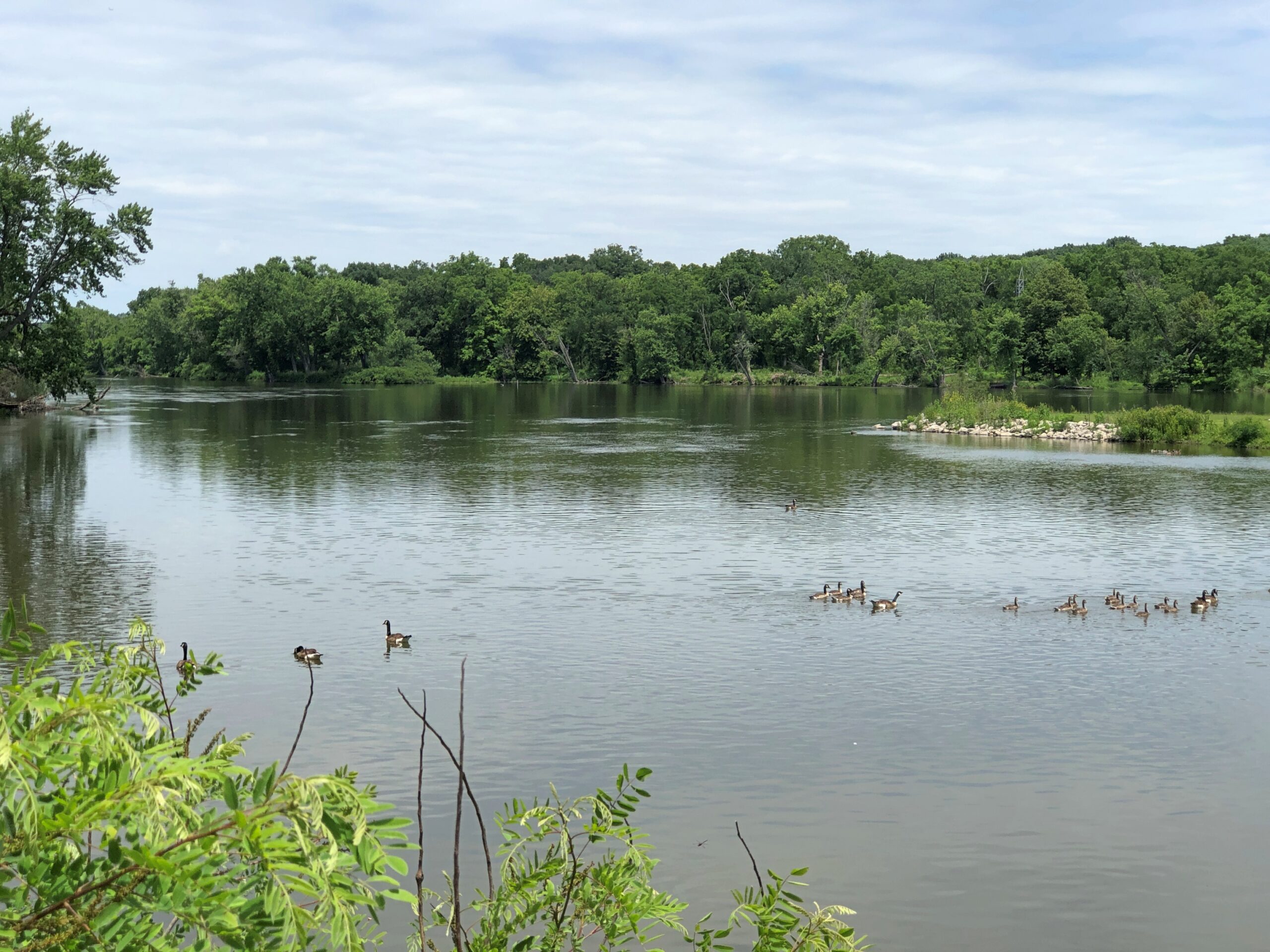
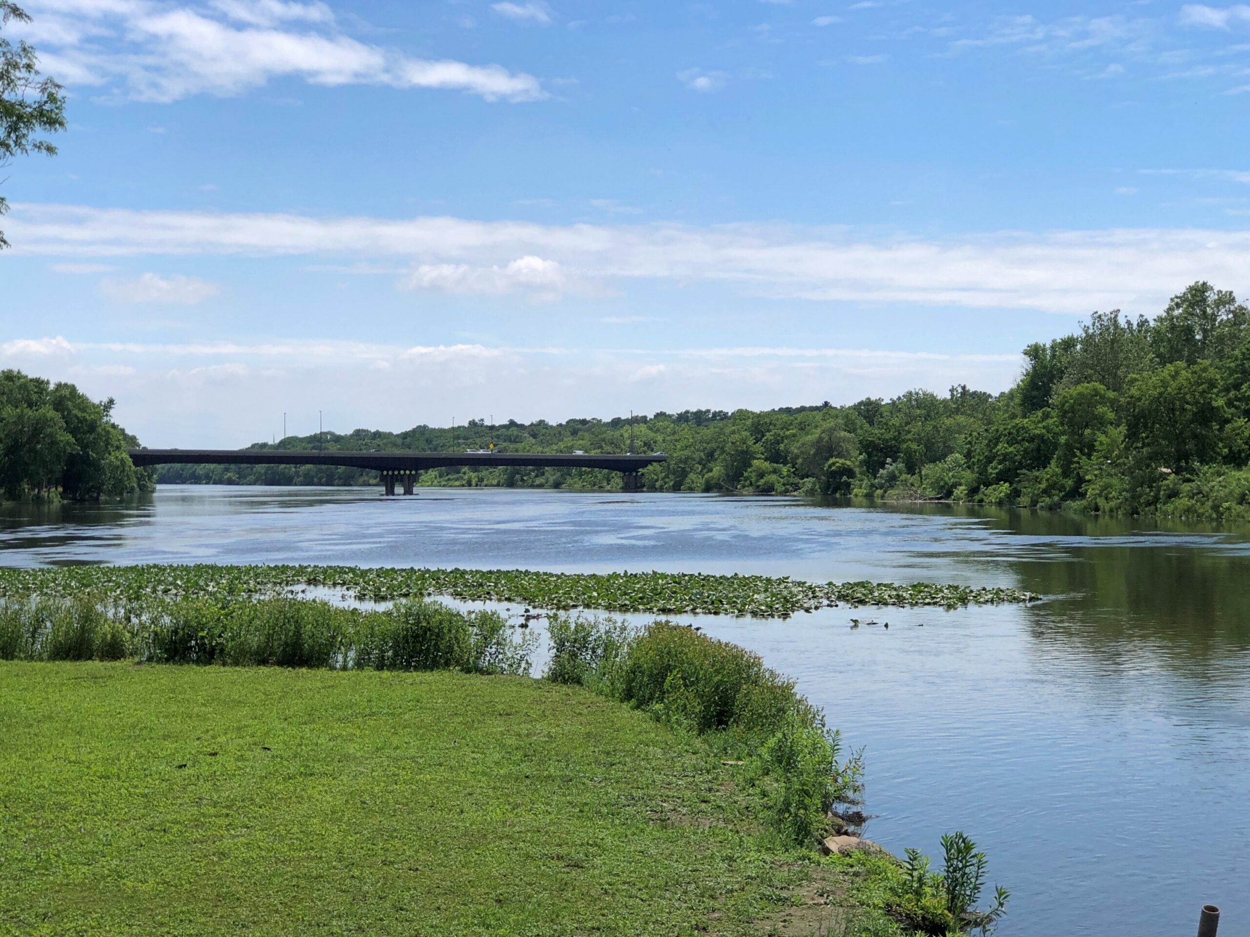
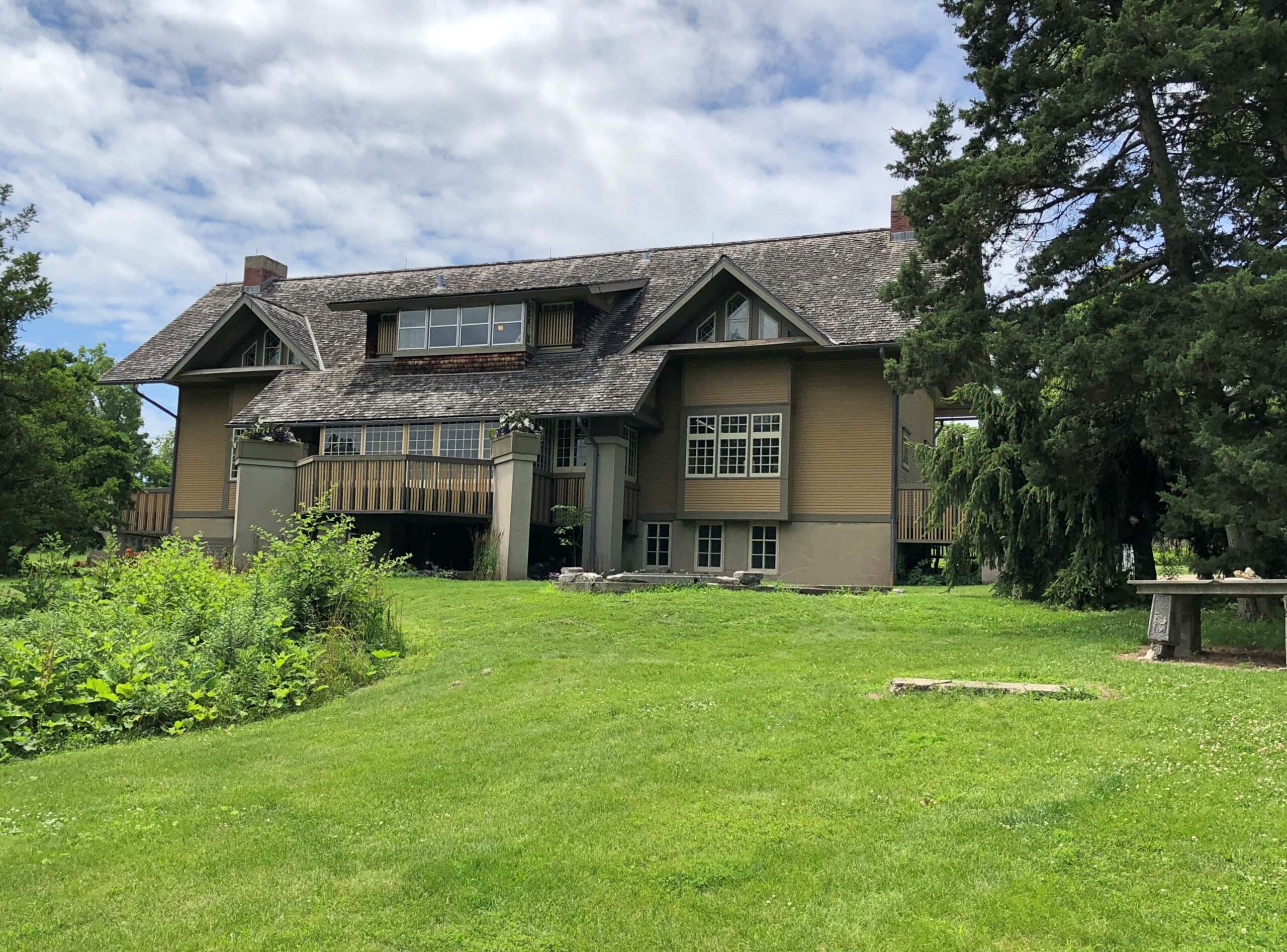
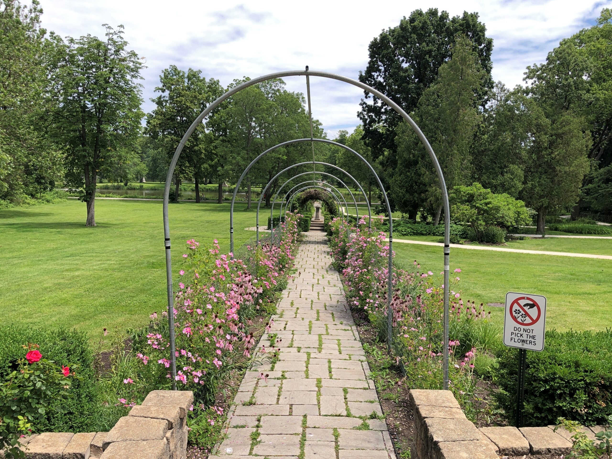
As mentioned, we visited the Fabyan Forest Preserve in Geneva, Illinois one Saturday not long ago. The holdings — formerly part of the estate of George Fabyan (d. 1936) — include land on both sides of the river, and a large island accessible on both sides by footbridges. The view from the island.
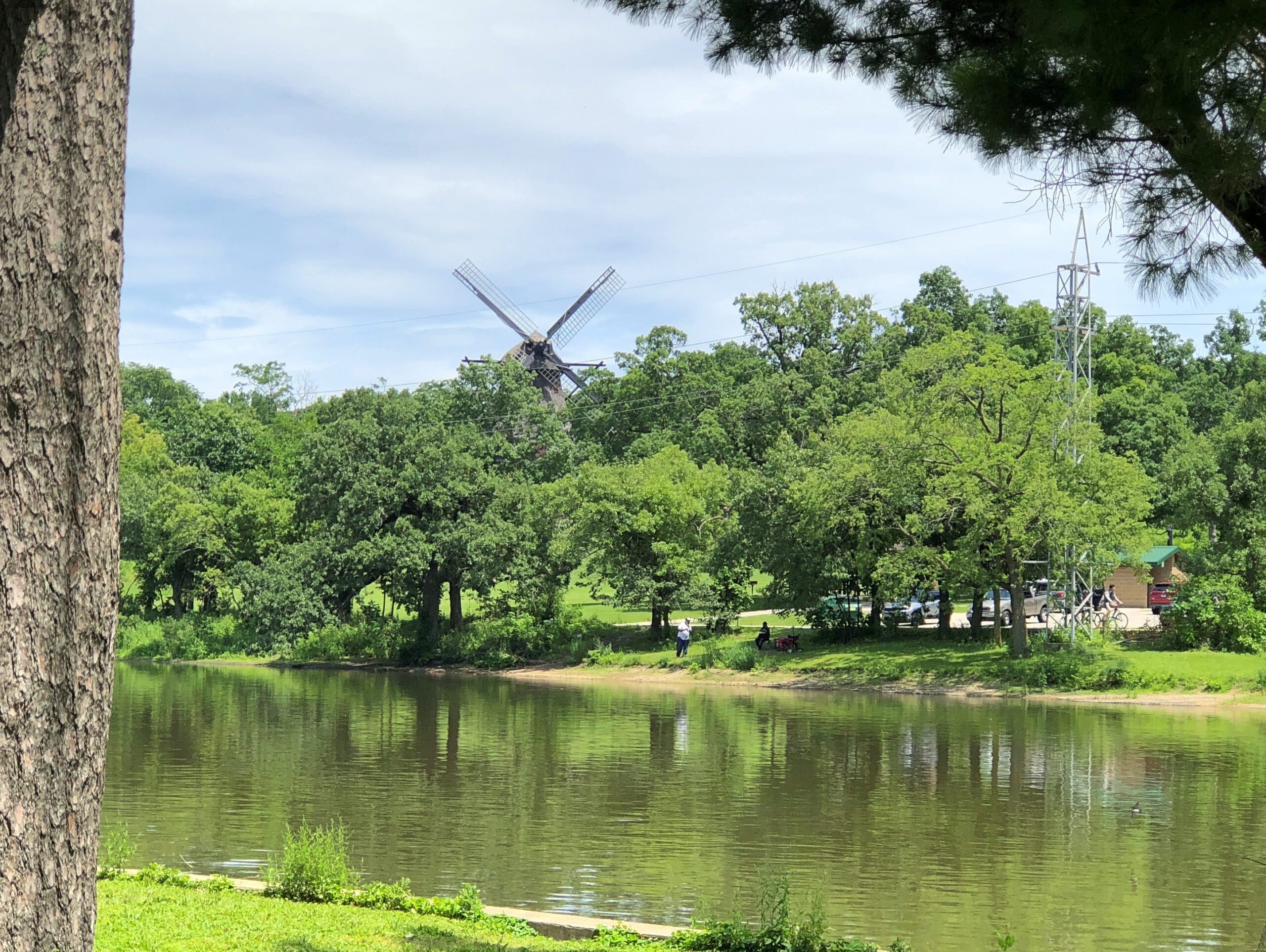
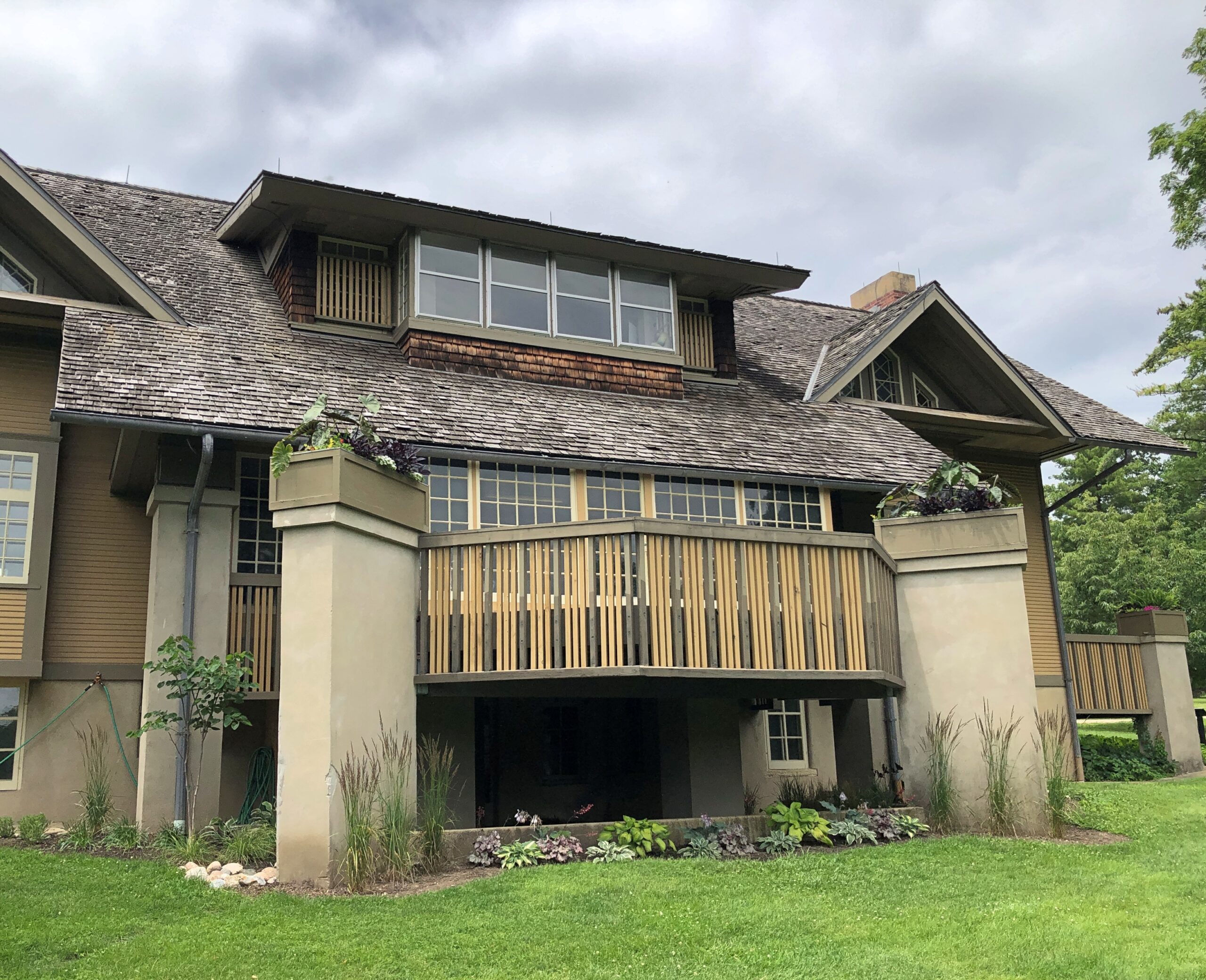
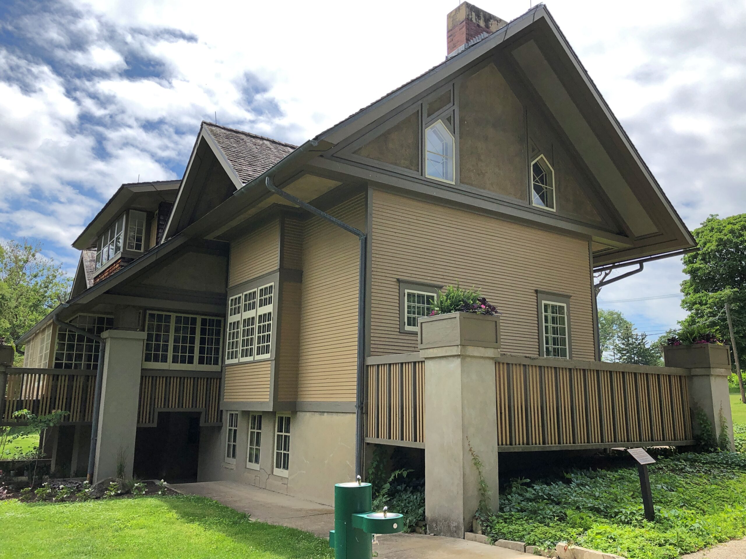
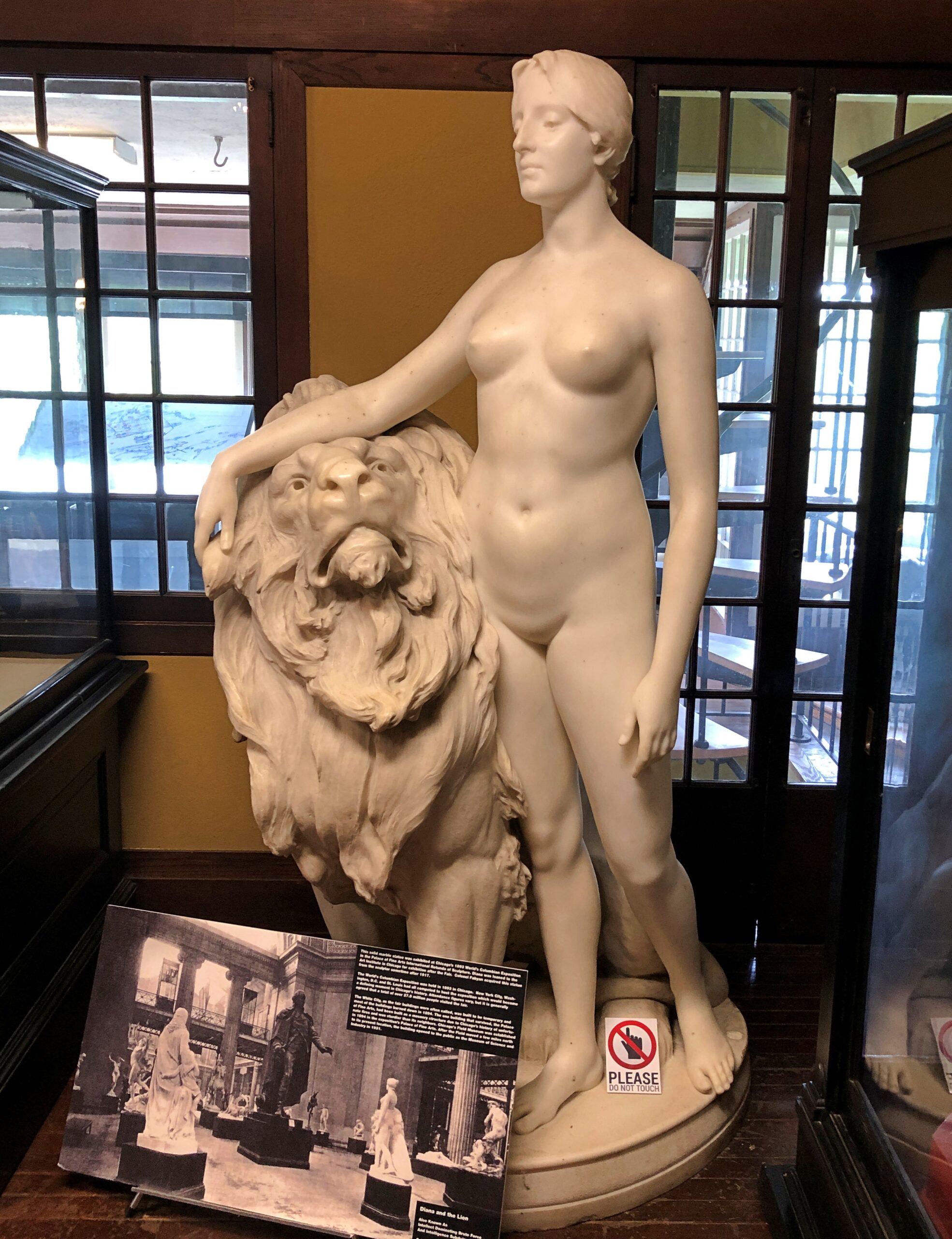
We didn’t go there this time, but rather lingered on the west bank, around the Fabyan Villa, which we toured, taking in the bogus mummy. FLW did some renovation on the property, a fact well emphasized at the museum.
One view from the villa toward the Fox. If you’re going to build near a river — or any flowing body of water — give it some height.
Fabyan collected a lot more, including European artwork, back when that was doable.
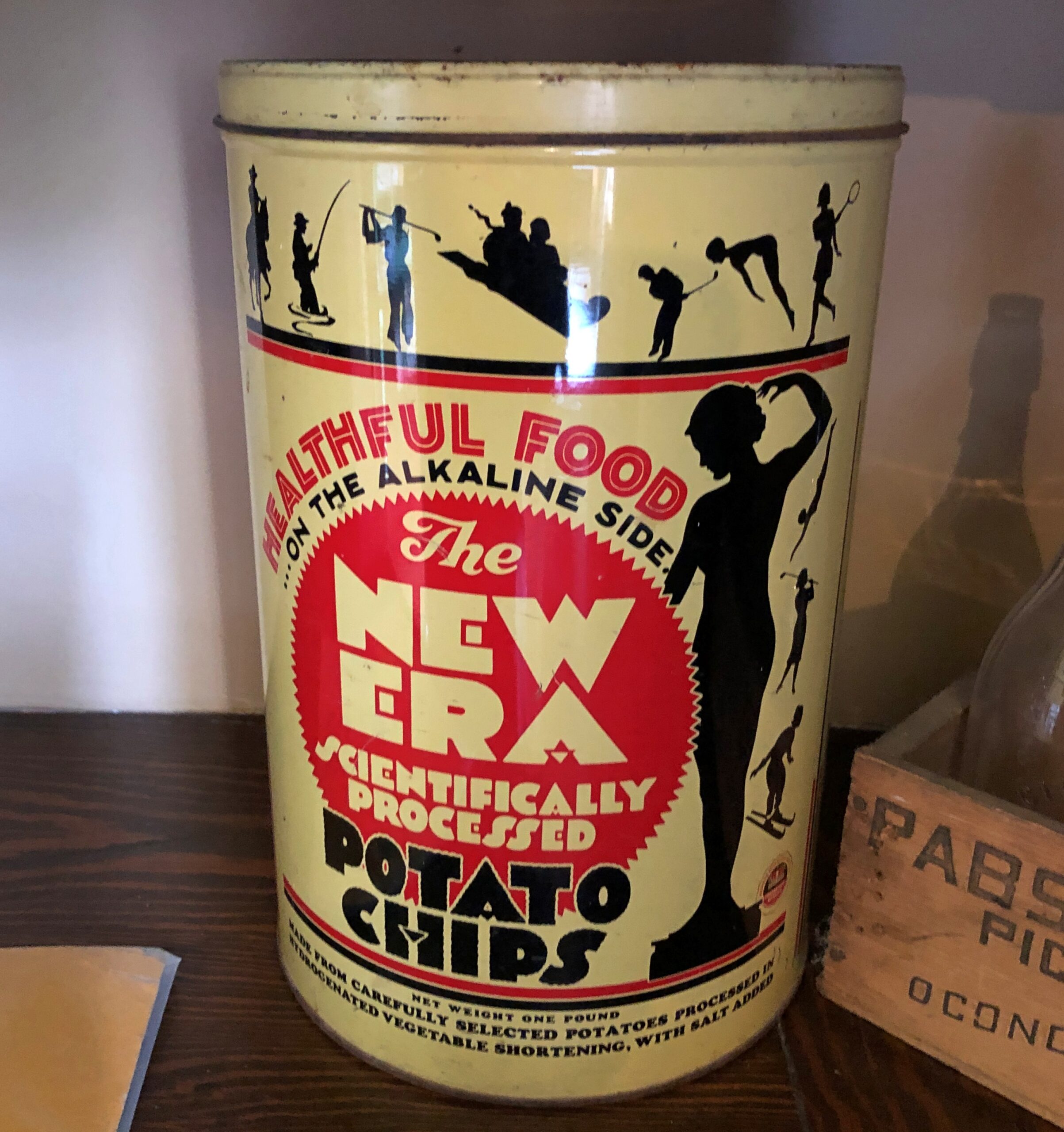
Once upon a time (probably), the Fabyan kitchen served New Era Potato Chips. Glad to see it. The memory of the same such can at the Cuneo Museum is a minor delight for me.
Back when food processors crowed about have food science on their side. These days, that might get them MAHA’d into consumer skepticism.
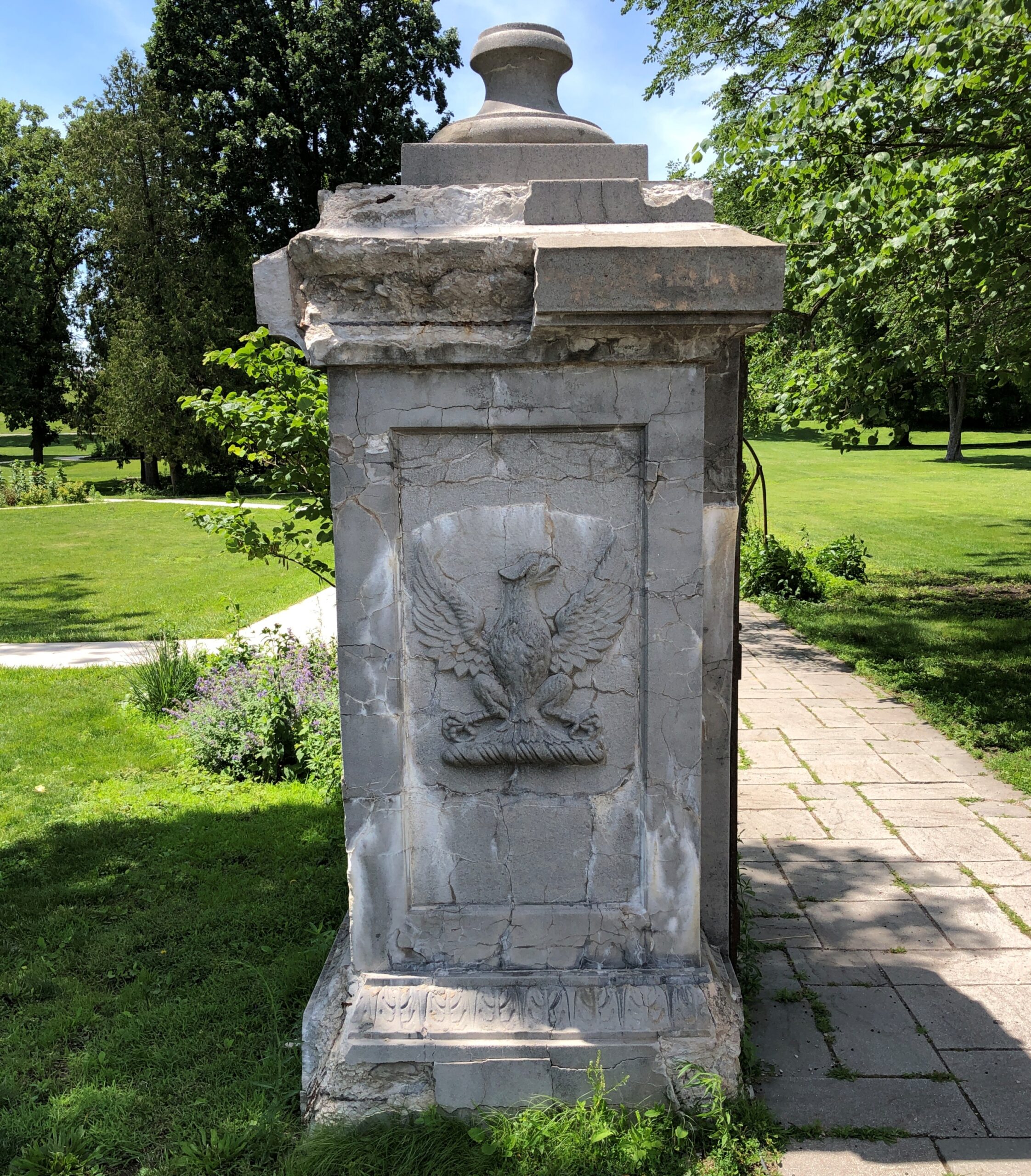
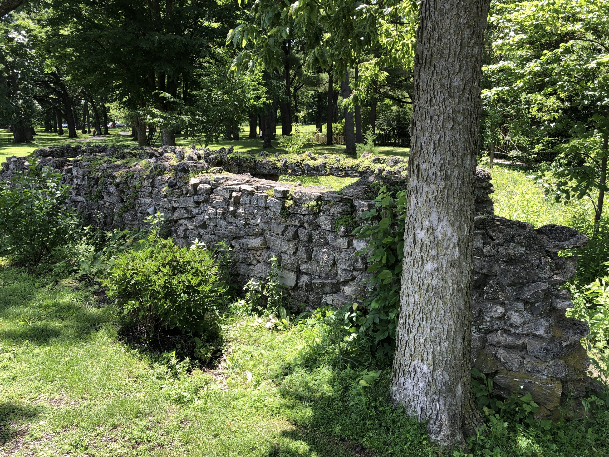
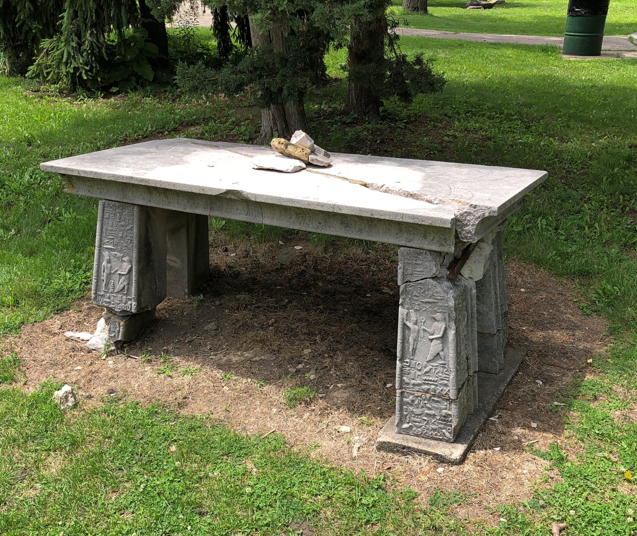
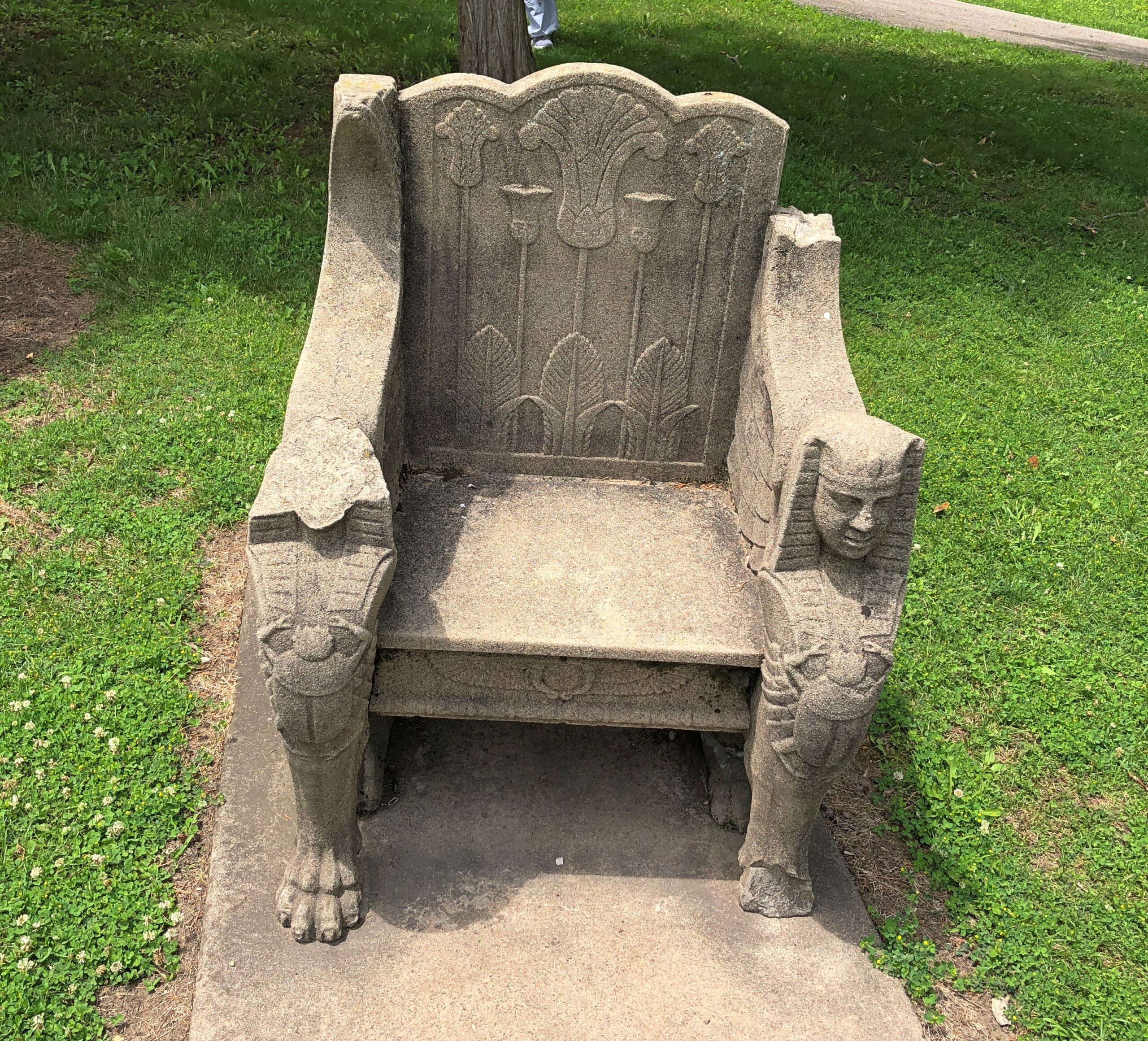
Outside, more features, including a ruin from Fabyan days. I understand that the Roman-themed pool on the island has mostly been reclaimed by the river. This wasn’t part of the pool. A out-of-place gatepost, from the looks of it.
More evidence of the passing wave of Egyptomania.
Looking a little worse for roughly a century of wear.
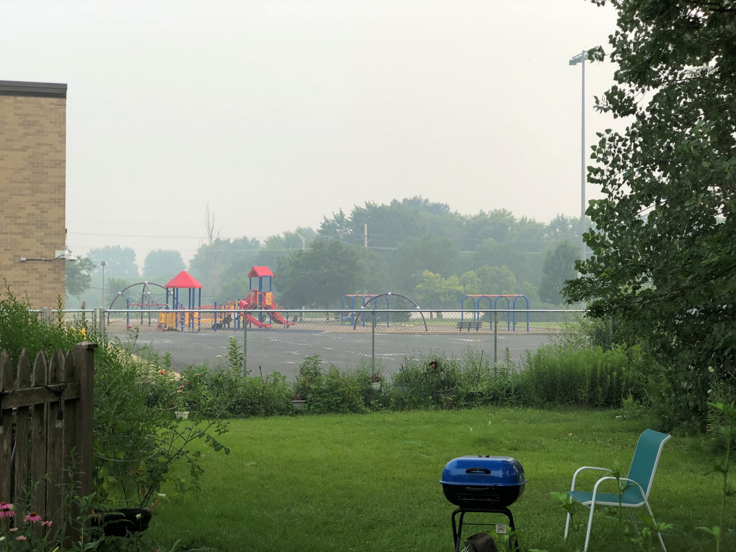
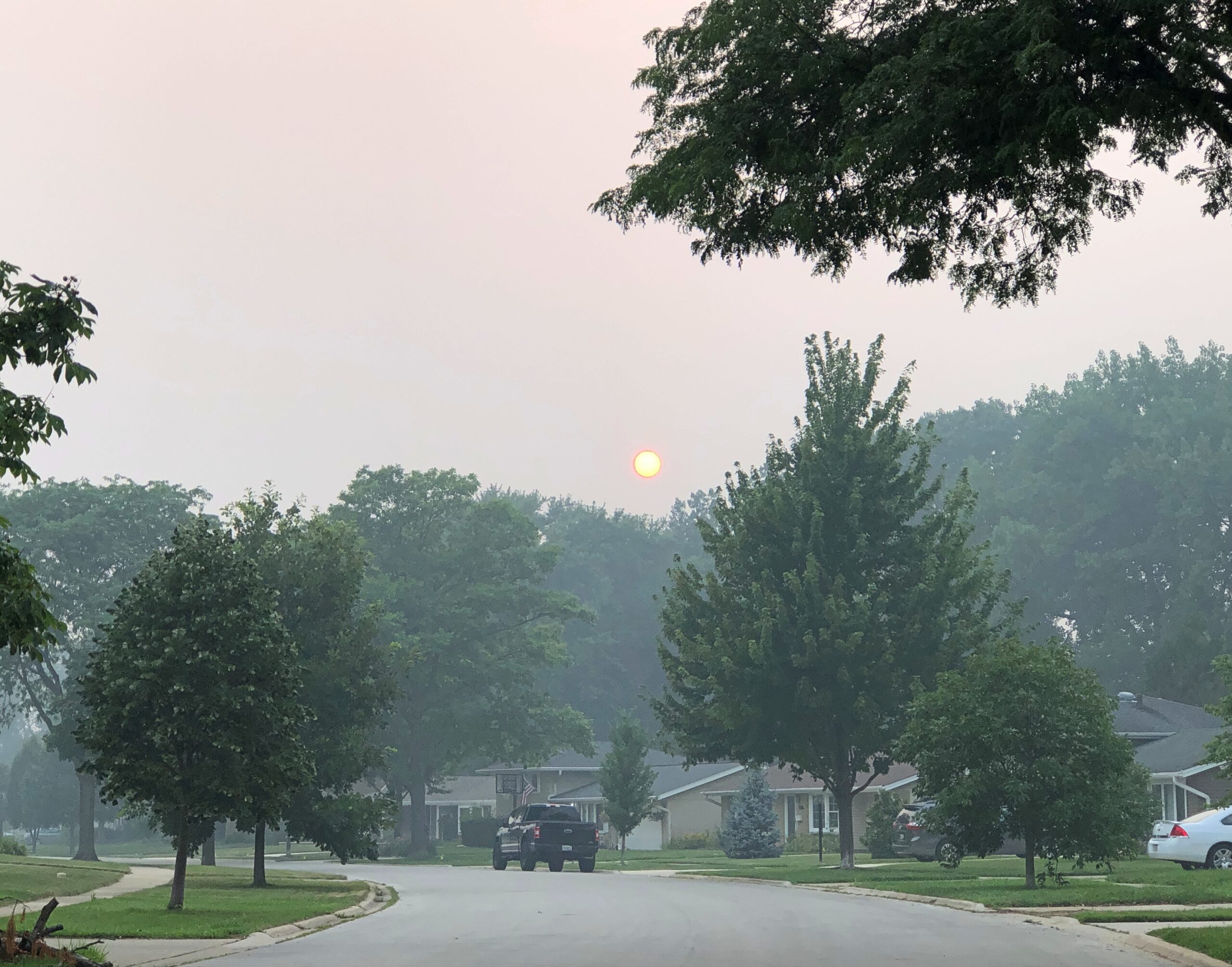
It did seem a little smoky out there today. Actually, a lot. More than I can remember, at least since I spent a smoky day in downtown Portland, Oregon some years ago. Or come to think of it, a very hazy day in Illinois only about three years ago.
The view from my deck this afternoon.
Official notice for today and tomorrow: The Illinois Environmental Protection Agency has issued a Red Forecast Air Pollution Action Day for Friday July 17th for the AirNow AQI forecast sectors of Rockford and all 6 Chicago area forecast sectors. This is in addition to downgrade of the ongoing action day to a Purple Forecast Air Pollution Action Day in effect today.
So today we had Purple Haze, “Very Unhealthy.” Shouldn’t Red be the worst? Maybe the committee of weathermen and atmospheric scientists who invented the AQI considered the matter, and decided that Purple is worse. And worst of all? Maroon. True, I would alarmed if I stepped out into maroon-colored air, but we know things aren’t quite so literal.
Today’s air would have looked foggy, except it doesn’t get thicker at a distance. The smoke is evenly distributed, at least outside my back door. A smell of barbecue comes with the gray mist, except without any hint of the better, and sometimes wonderful smell of grilled meat.
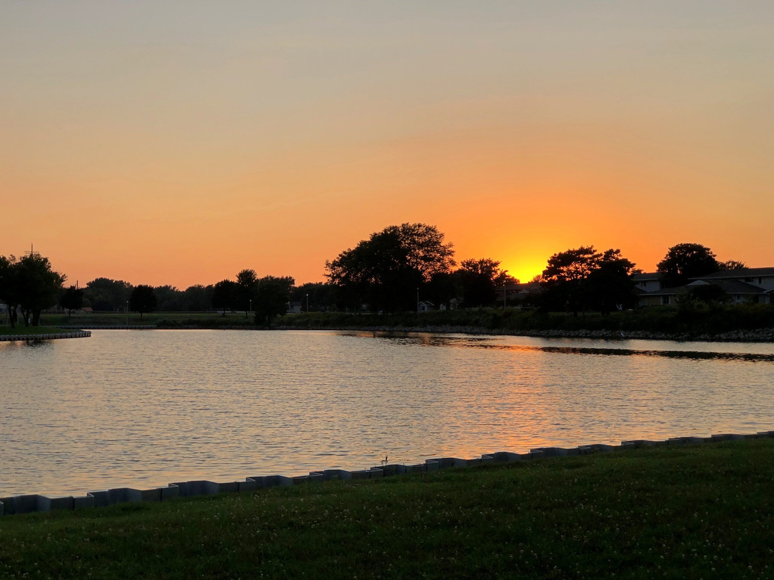
Sunset on Tuesday, though of course my camera didn’t really capture it.
Sunset today, same caveat. Also, a different place, but we weren’t about to talk a walk around the same lake on a Purple Forecast Air Pollution Action Day.
The color looks ordinary, but the sun’s disk, embedded in the gray mist, was a rarely seen red-yellow-orange.
It occurred to me over the Independence Day weekend that I’ve experienced roughly a quarter – 25% – of the entire history of the United States, accepting the commonly held age for the nation of 250 years. Anyone my age or older has, that is. One-quarter of a 250-year span is 62.5 years. At the age of 65, I can’t really claim to remember those first two and a half years, but the furthest reaches of my memory run back to the mid-1960s, so close enough.
And I have to add that if you’re Mel Brooks, you’ve lived 40% of the nation’s history.
Fifty years ago, on the much ballyhooed Bicentennial, it rained in San Antonio, where I was. We stayed home. On Saturday, on the much less ballyhooed 250th, it rained in metro Chicago, where I was. We stayed home. Coincidence? Well, yes.
Been home for a few months now, witnessing a wet and cool spring edge into a wet and warm summer in northern Illinois, and temps finally popped up into the 90s ahead of July 3. The heat was ended by rain and more rain. A pretty typical Northern summertime pattern.
Fireflies have made their appearance, though a meager number, and just today, this afternoon, I heard cicadas bleating ahead of dusk, though no cricketsong came afterward. Could be the Brotherhood of Orthopteran Insects is still negotiating a new contract for this year, and I won’t pretend I didn’t have to look up orthopteran. Mosquitoes are out looking for mammal blood, though considering the temporary wetlands that are our suburban lawns, not as many as you’d expect. Lit up the mosquito coils on my deck table this evening, and it seemed to work.
Old friends Neal and Michele visited from Chicago for the Fourth – a smaller version of the Gabfest, and indoors because of the rain. A delight all the same. They left before dark, after the rain had stopped. A little wet ground wasn’t going to keep the suburban populace from flouting Illinois’ nanny-state fireworks ban, one of the two nights of the year when the pop-pop-BOOM-pop-boom-fssst goes on for a few hours (the other is New Year’s Eve). In recent years I’ve repaired to the garage to listen to the July 4 explosions. The explosion acoustics are good in that cluttered enclosure.
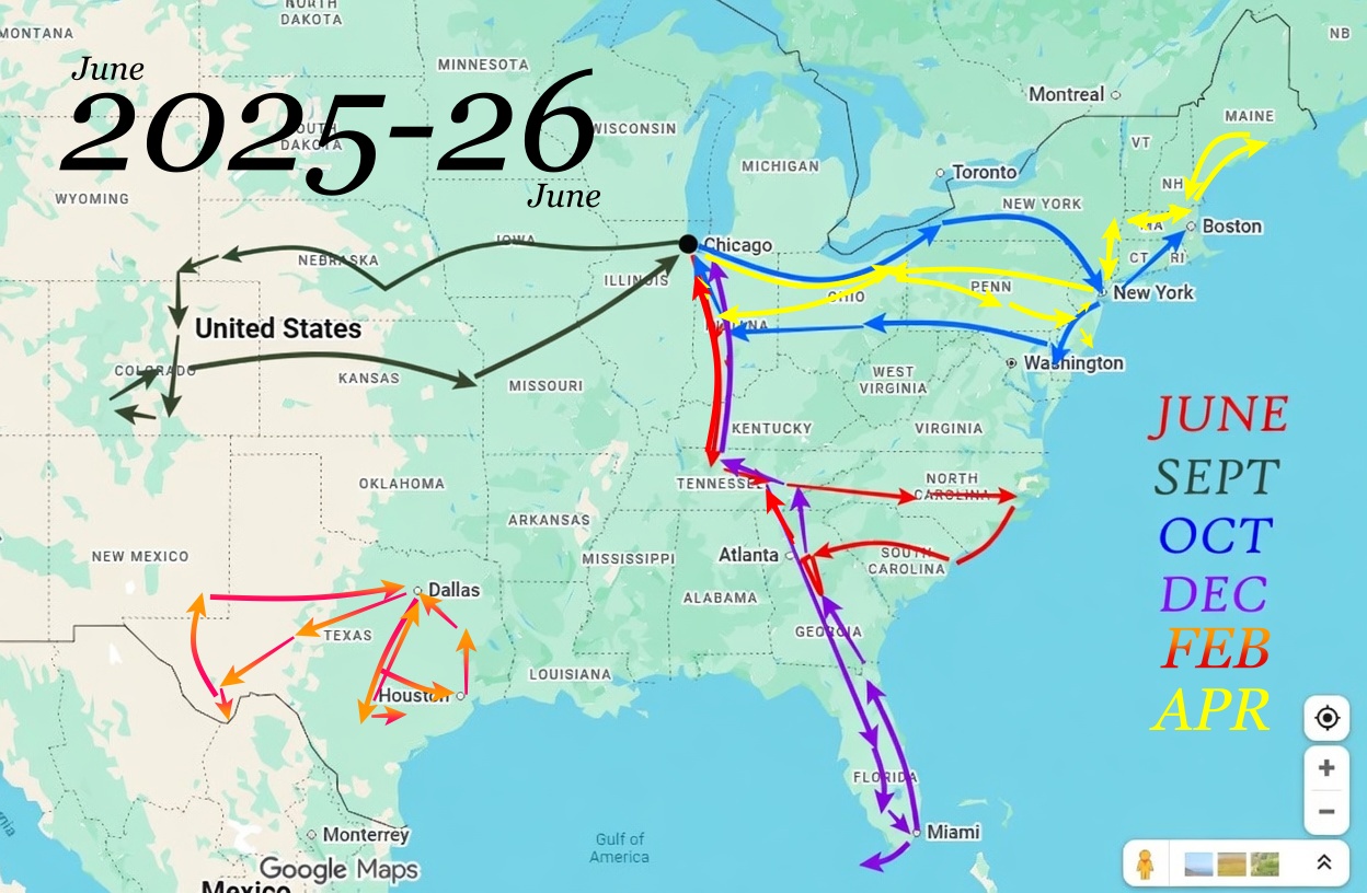
I’ll be home for a few more months. 2026: Summer of Here. People pay money – I’ve paid money – to enjoy warm weather like this, but we’re getting it no extra charge. Also, even I’ve gotten a little tired of the pace of my driving lately.
No long drives this summer. But that doesn’t mean no drives. Back during the pandemic, my thinking was, if you can’t go far, go near, and that kind of thinking took us to new parts of Wisconsin and Illinois. No pandemic this year, fortunately, but the idea is a good one anyway.
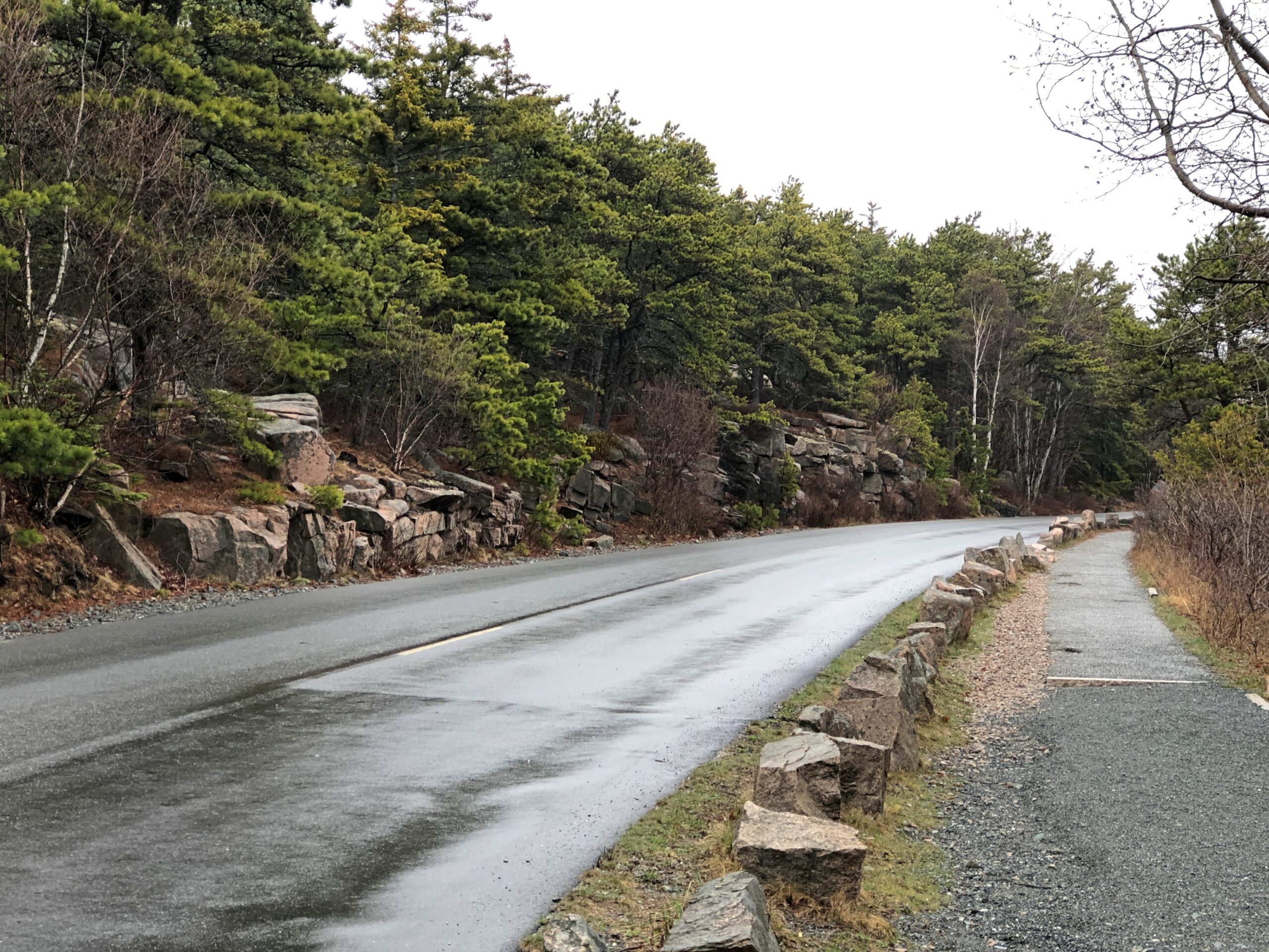
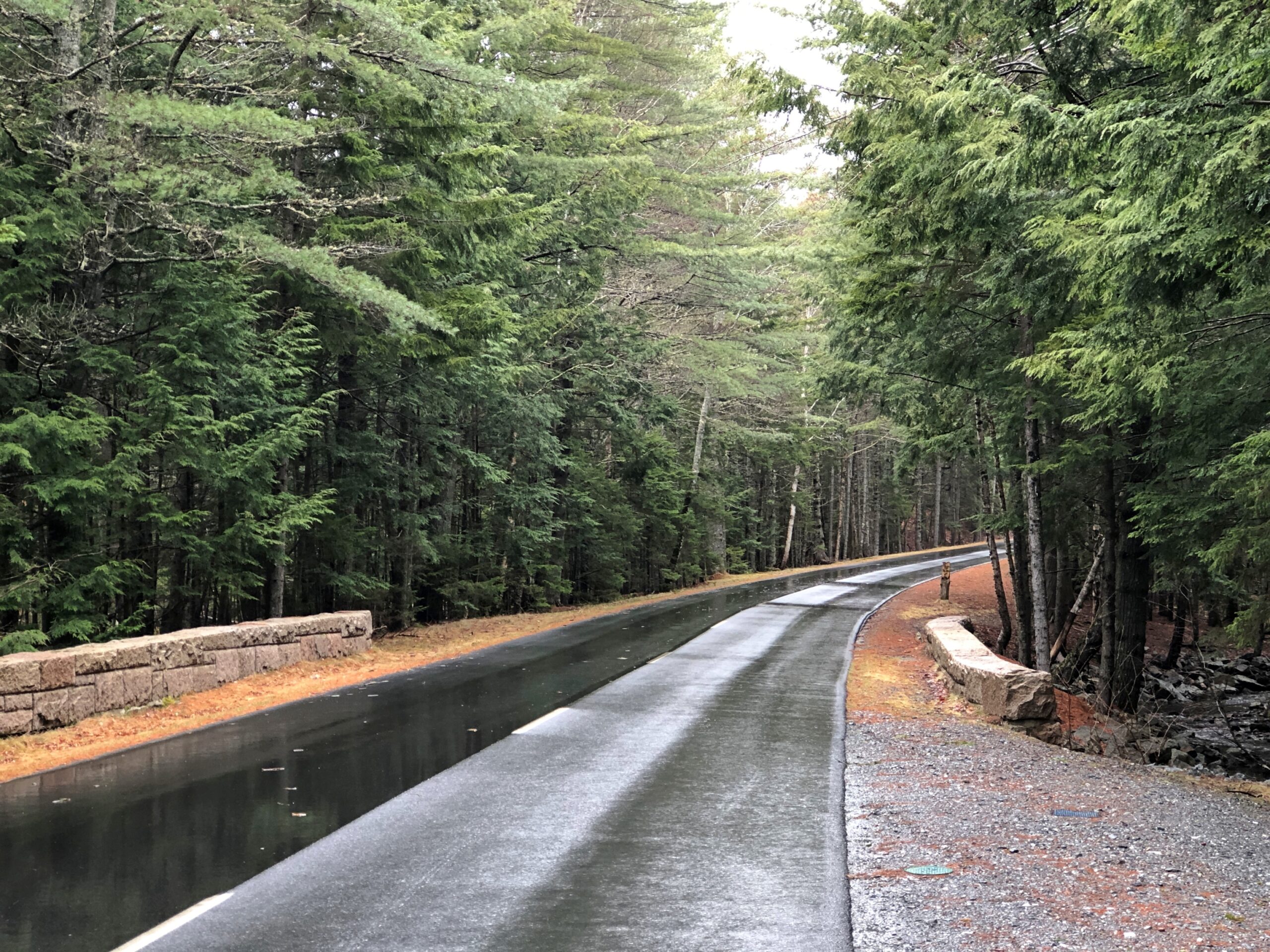
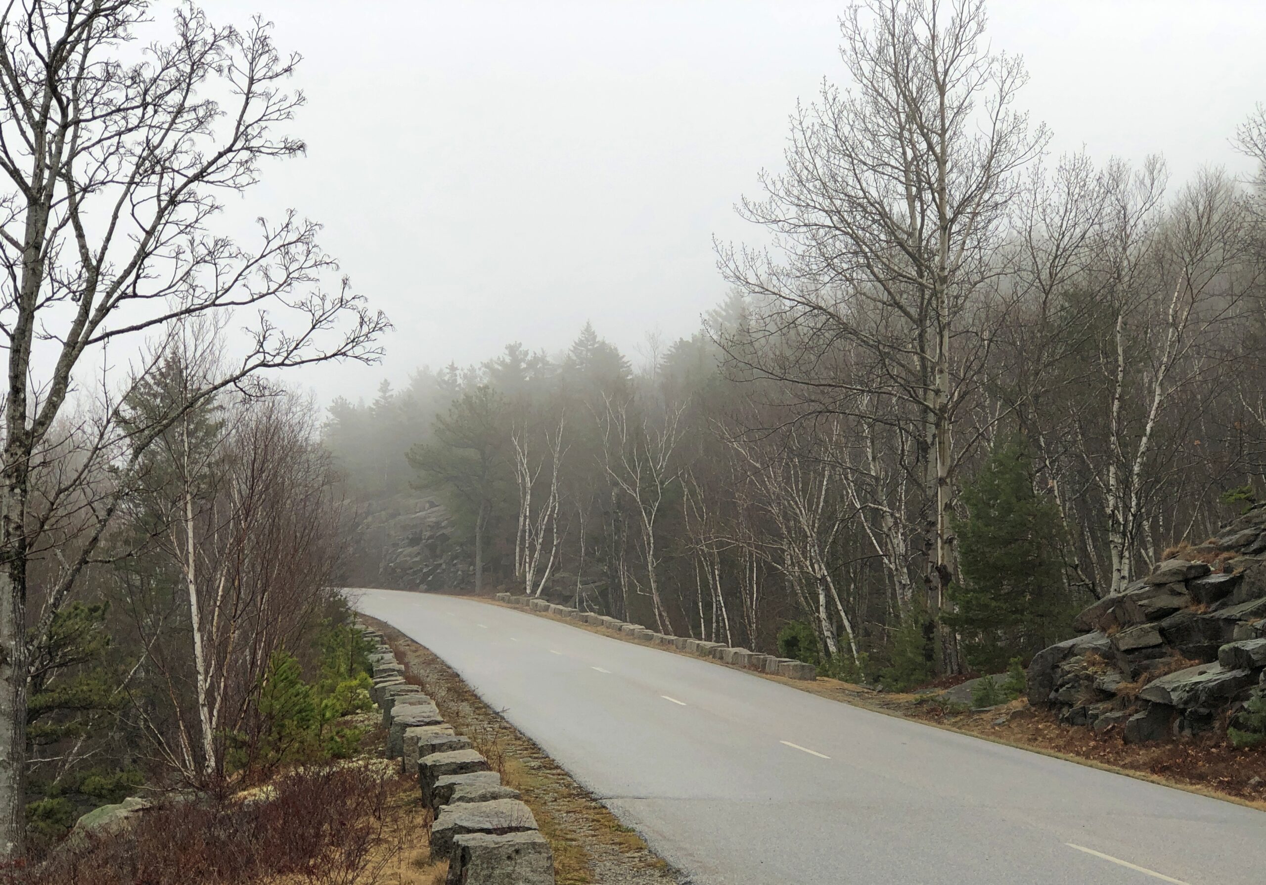
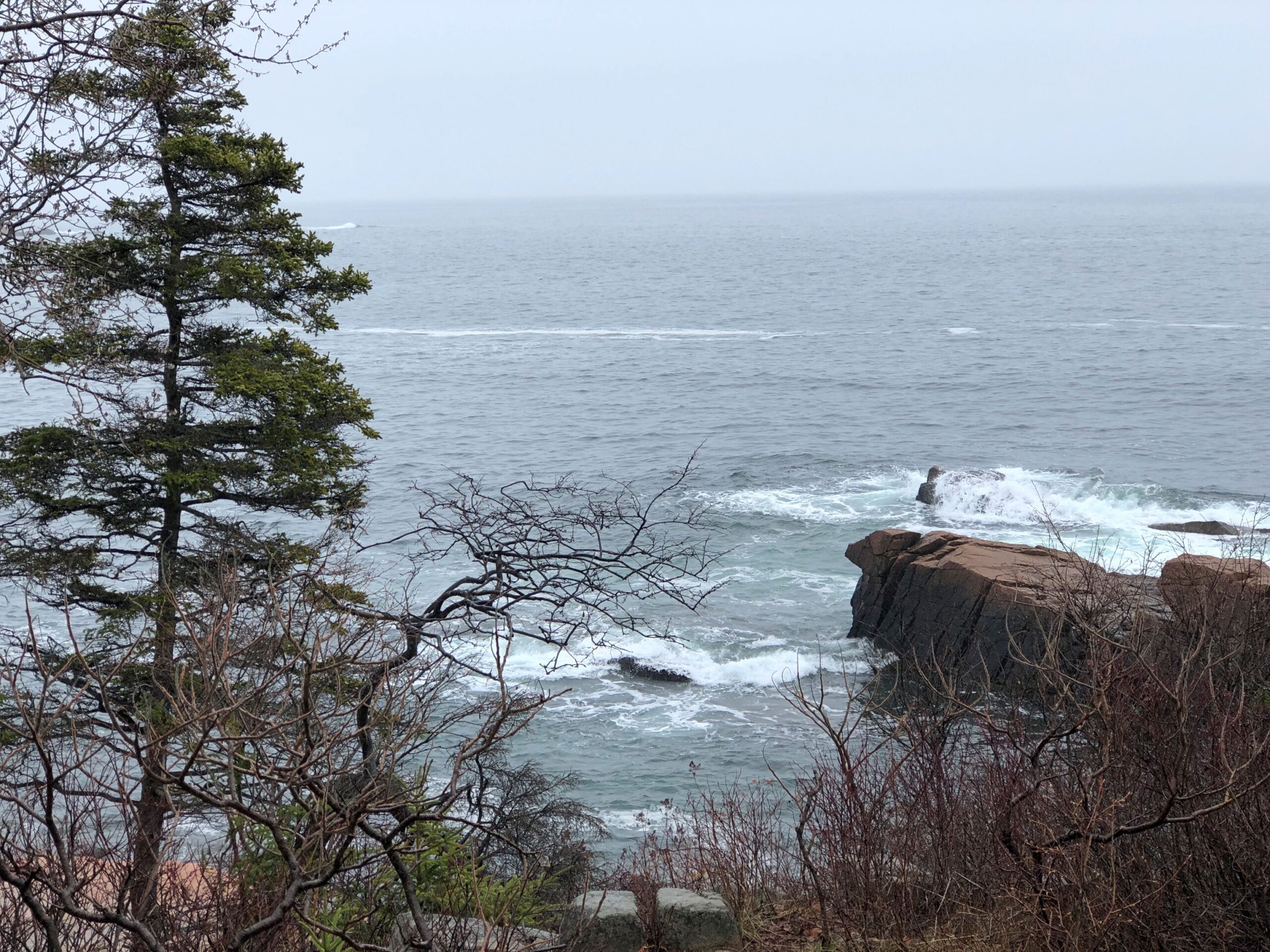
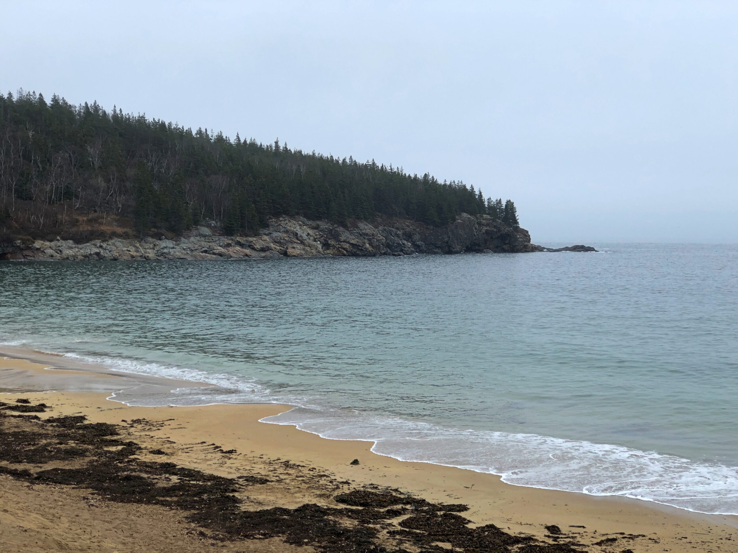
The Park Loop Road in Acadia NP is a fine drive (1) if there aren’t many other cars and (2) you take it easy around those curves. In that, it’s no different than a lot of rural roads. But there’s also the bonus of passing through thick Maine woods. There are brief views of the ocean from the road, but mostly you’re tooling through evergreens.
Through patches of deciduous trees as well.
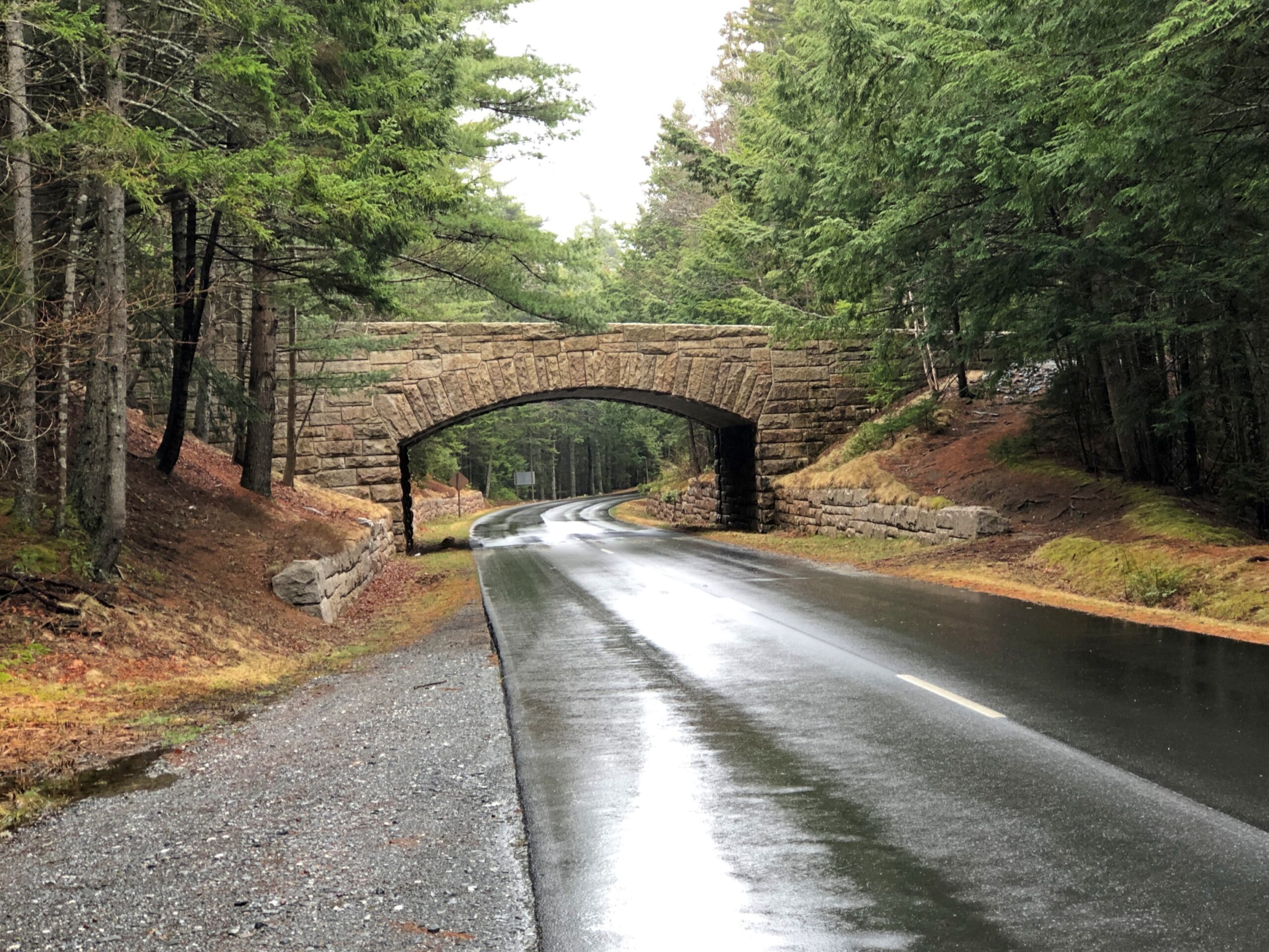
Periodically, the road crosses under handsome bridges.
This made me wonder: bridges for what? Soon I learned that the park not only has a hard-surface road snaking through, but also a network of carriage trails. A lot of them. The bridges are for them.
“Forty-five miles of rustic carriage roads, the gift of philanthropist John D. Rockefeller Jr. and family, weave around the mountains and valleys of Acadia National Park,” says the NPS. “Rockefeller, a skilled horseman, wanted to travel on motor-free byways via horse and carriage into the heart of Mount Desert Island. His construction efforts from 1913 to 1940 resulted in roads with sweeping vistas and close-up views of the landscape.”
It was barely the season for the paved road, and I suspect few visitors were on the carriage roads either. I noticed that the entrance to the Wildwood Stables, a facility that supports carriage riding, and which can be glimpsed from the road, was still closed. A carriage ride through Arcadia NP might be an grand experience, but maybe not in April.
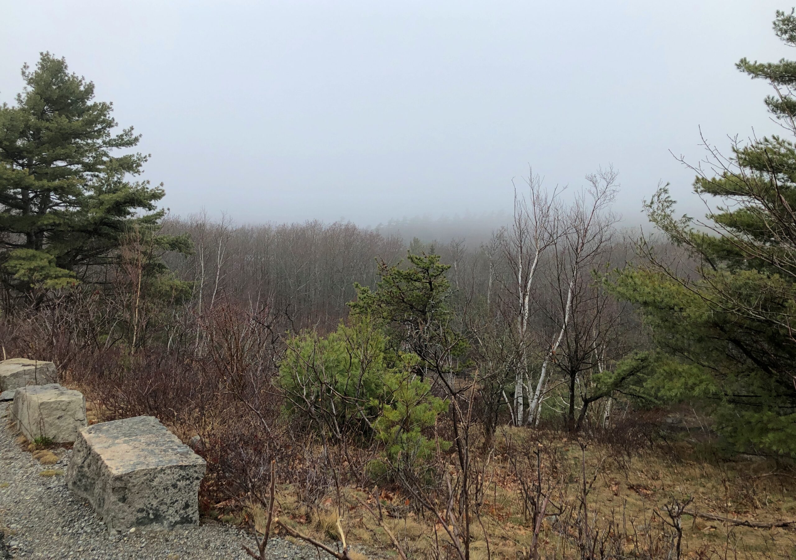
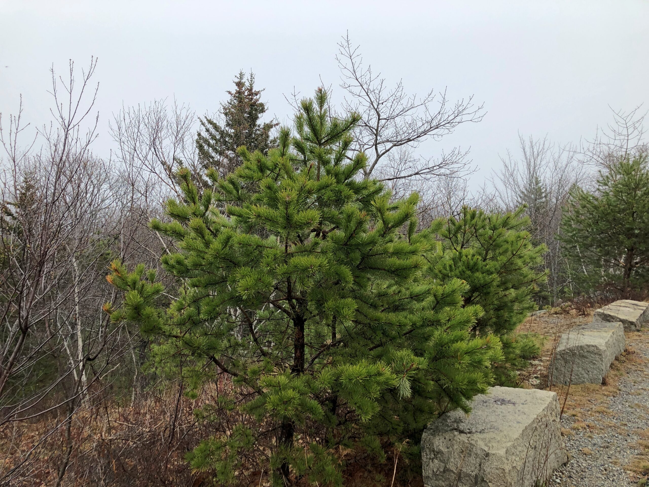
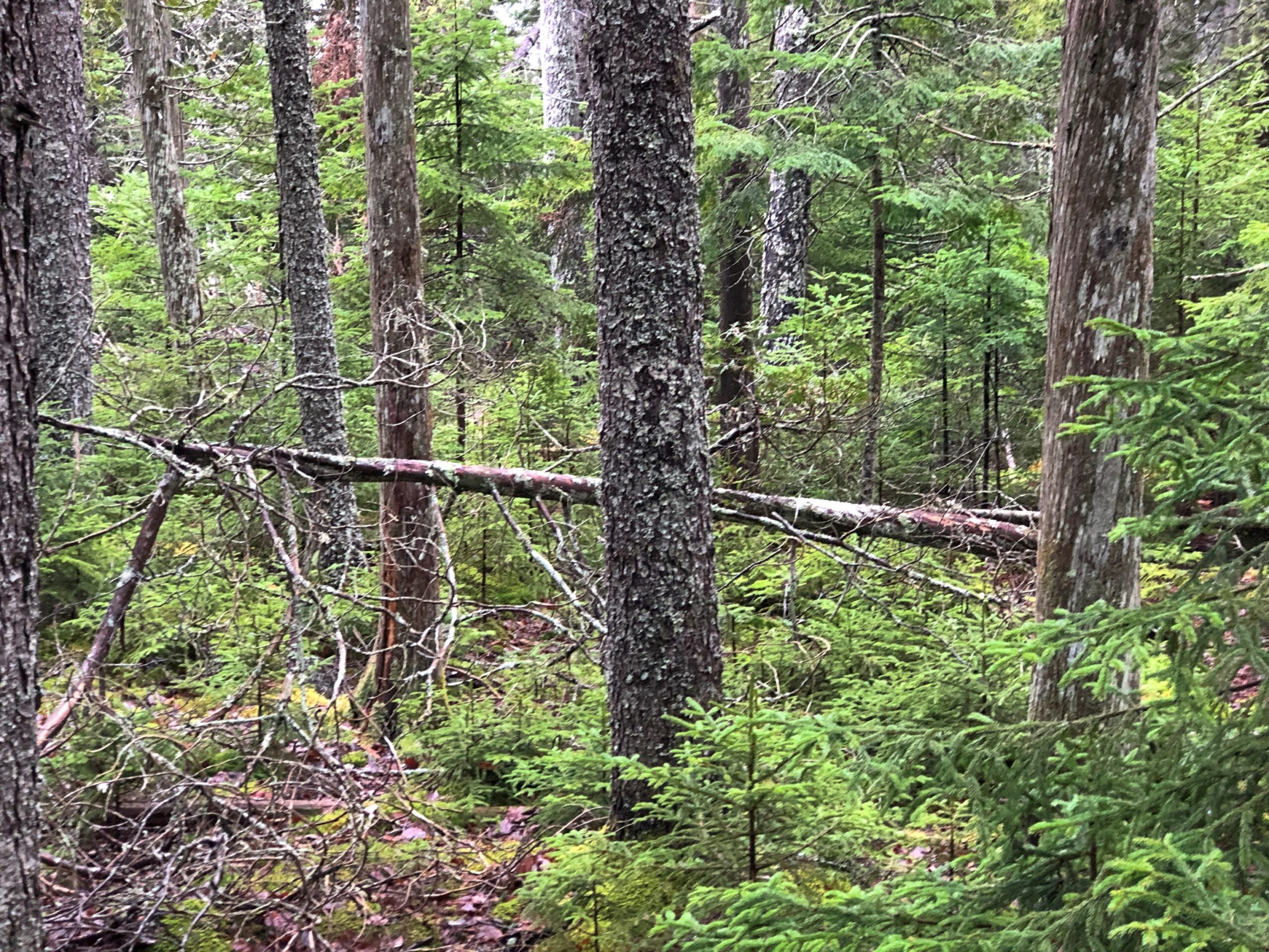
The woods alongside the road.
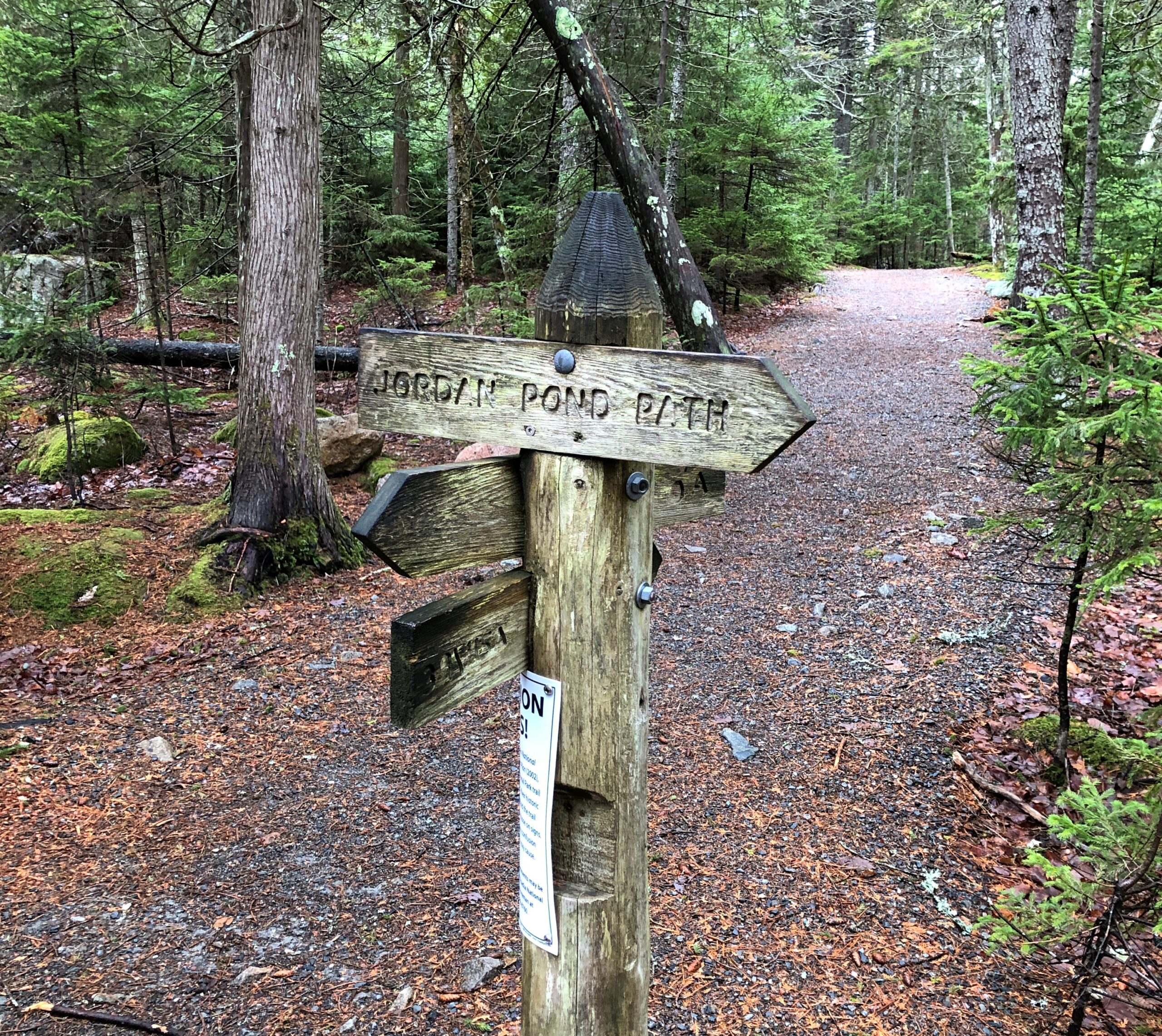
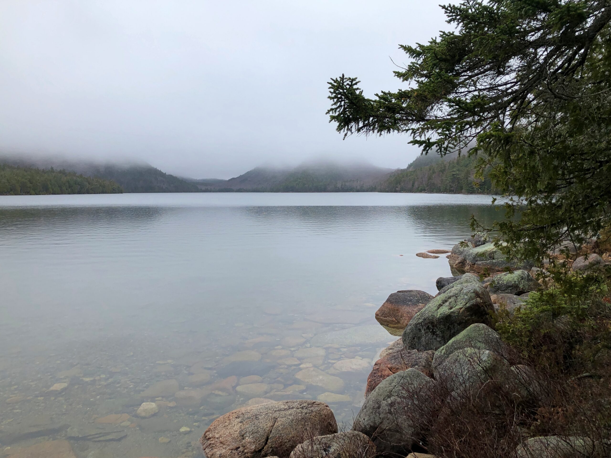
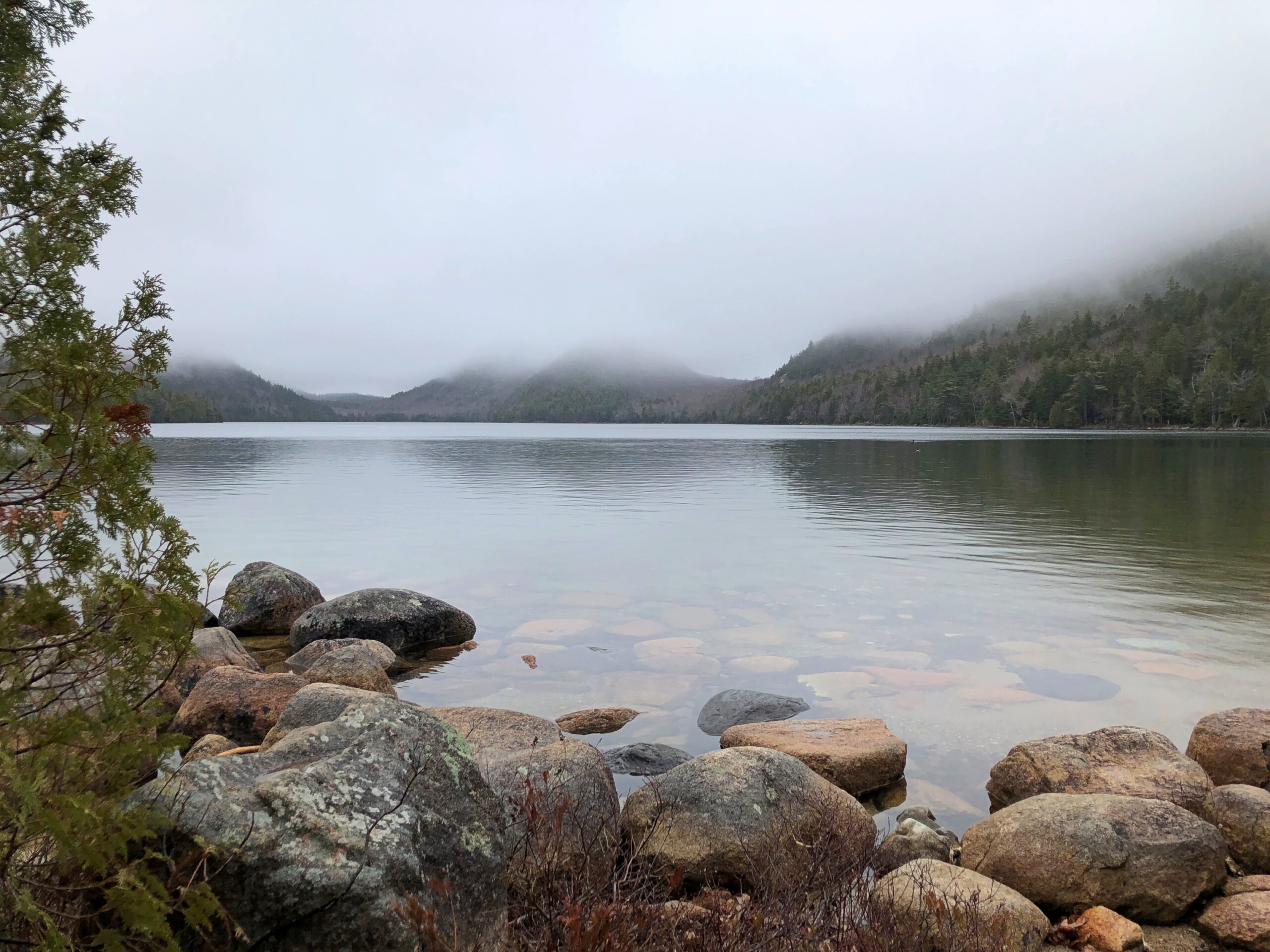
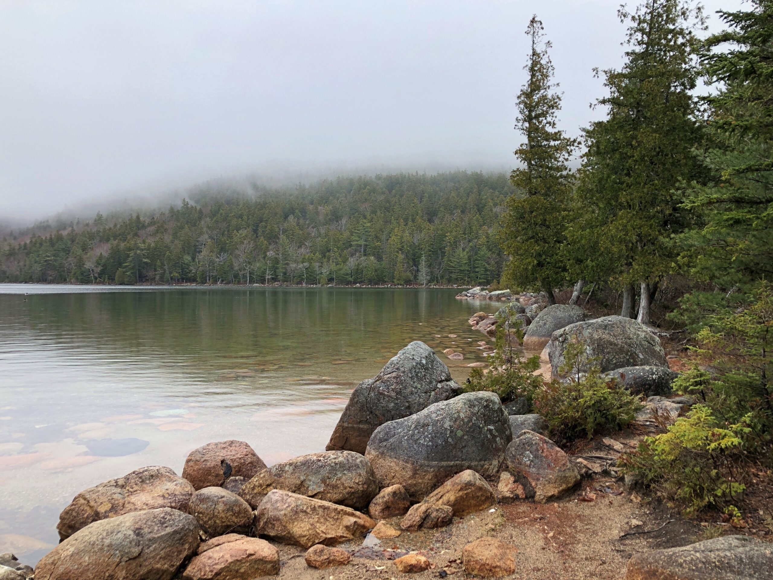
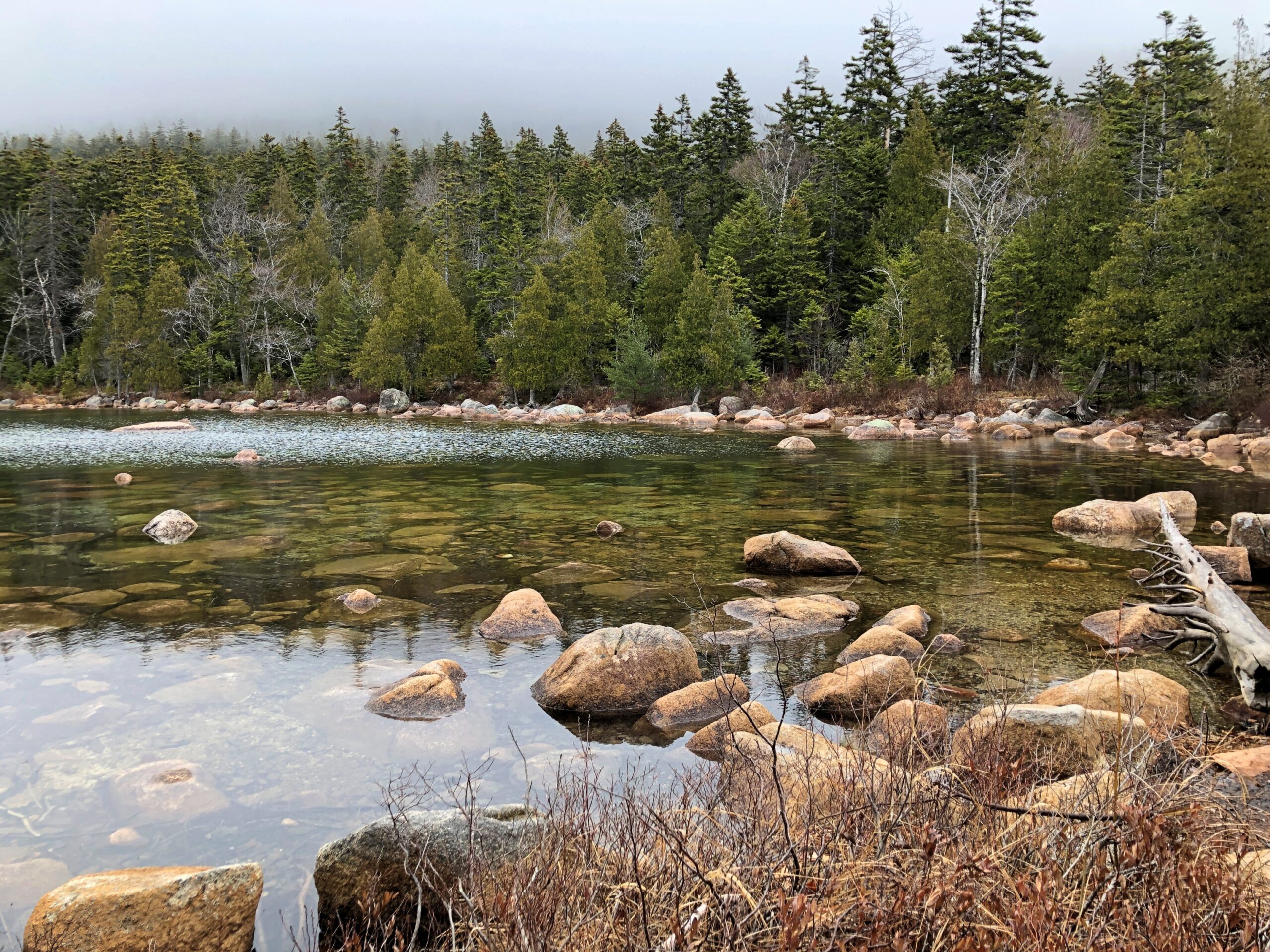
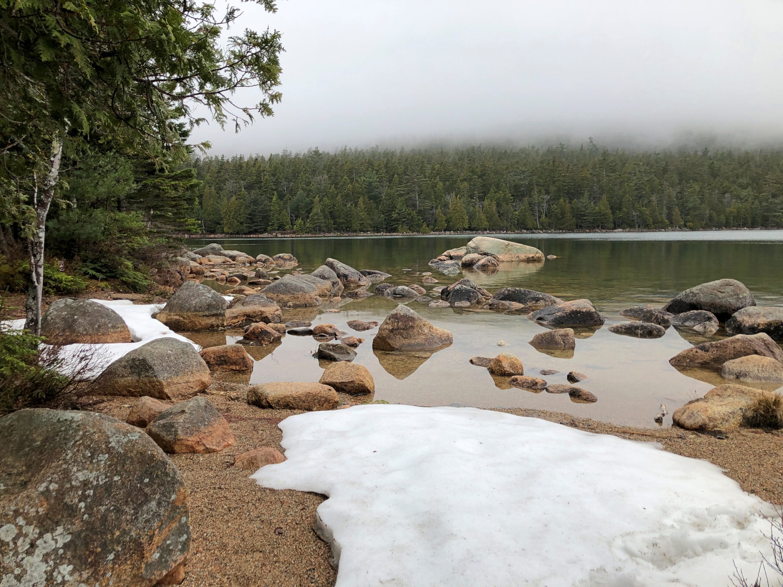
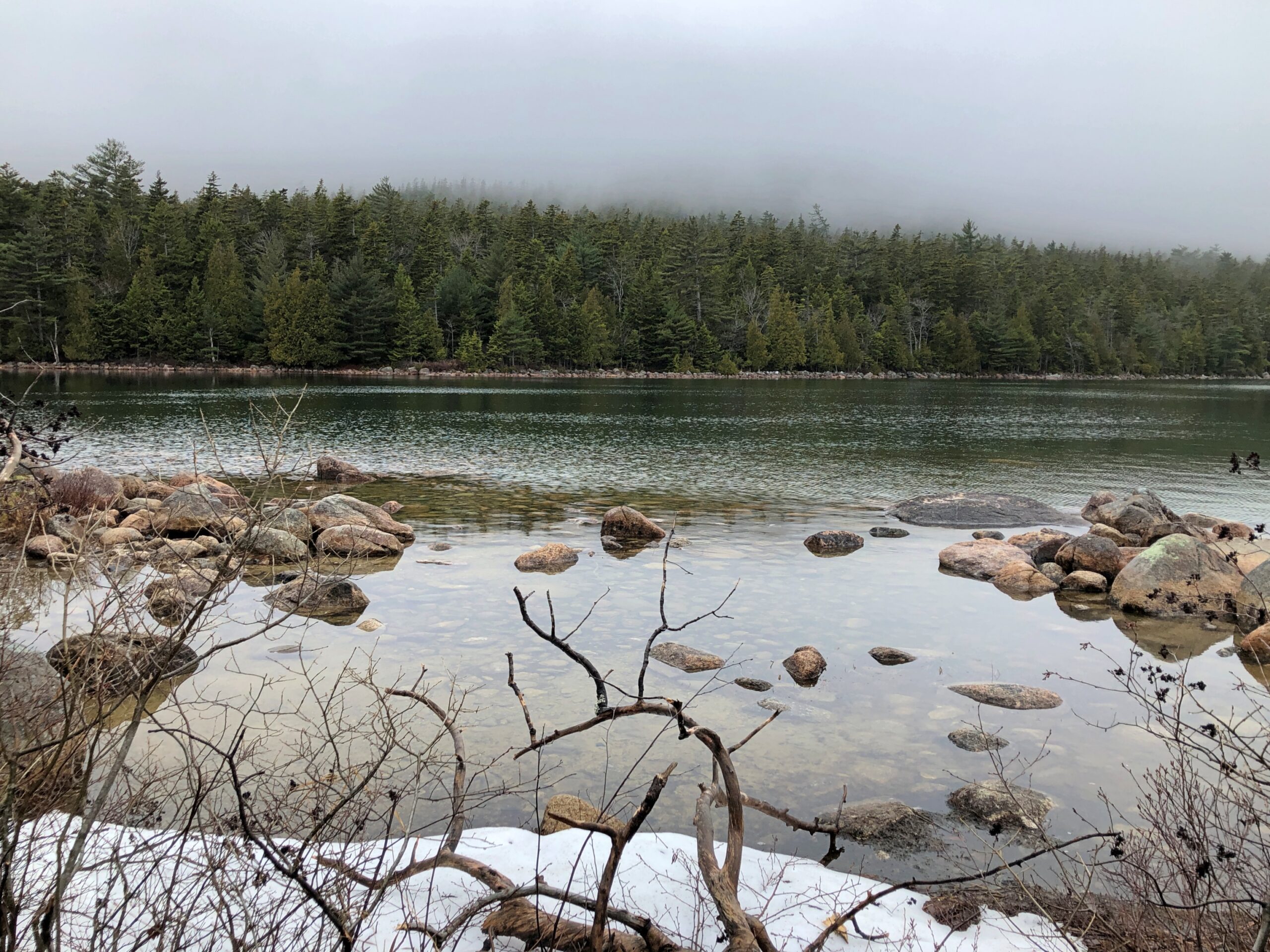
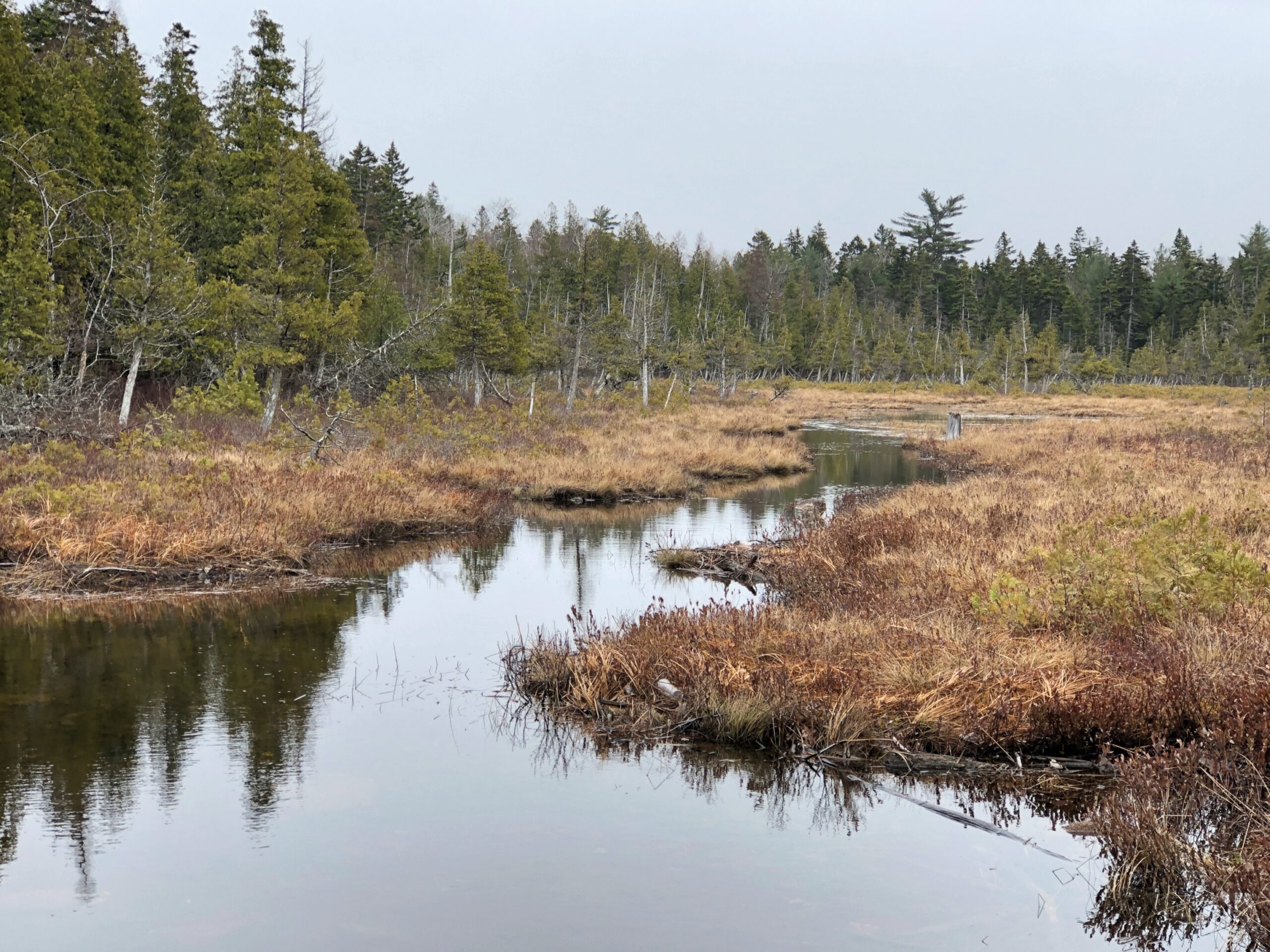
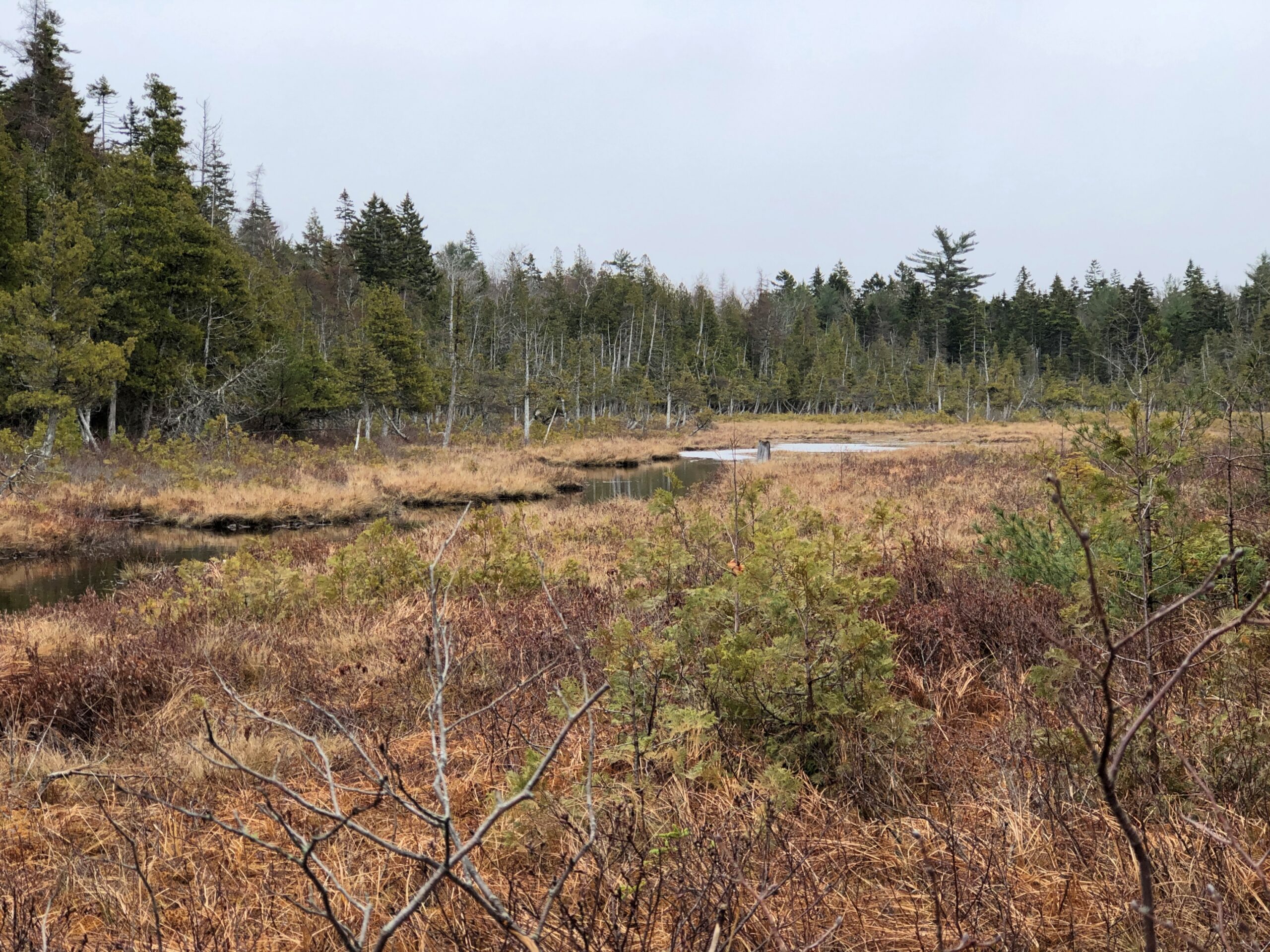
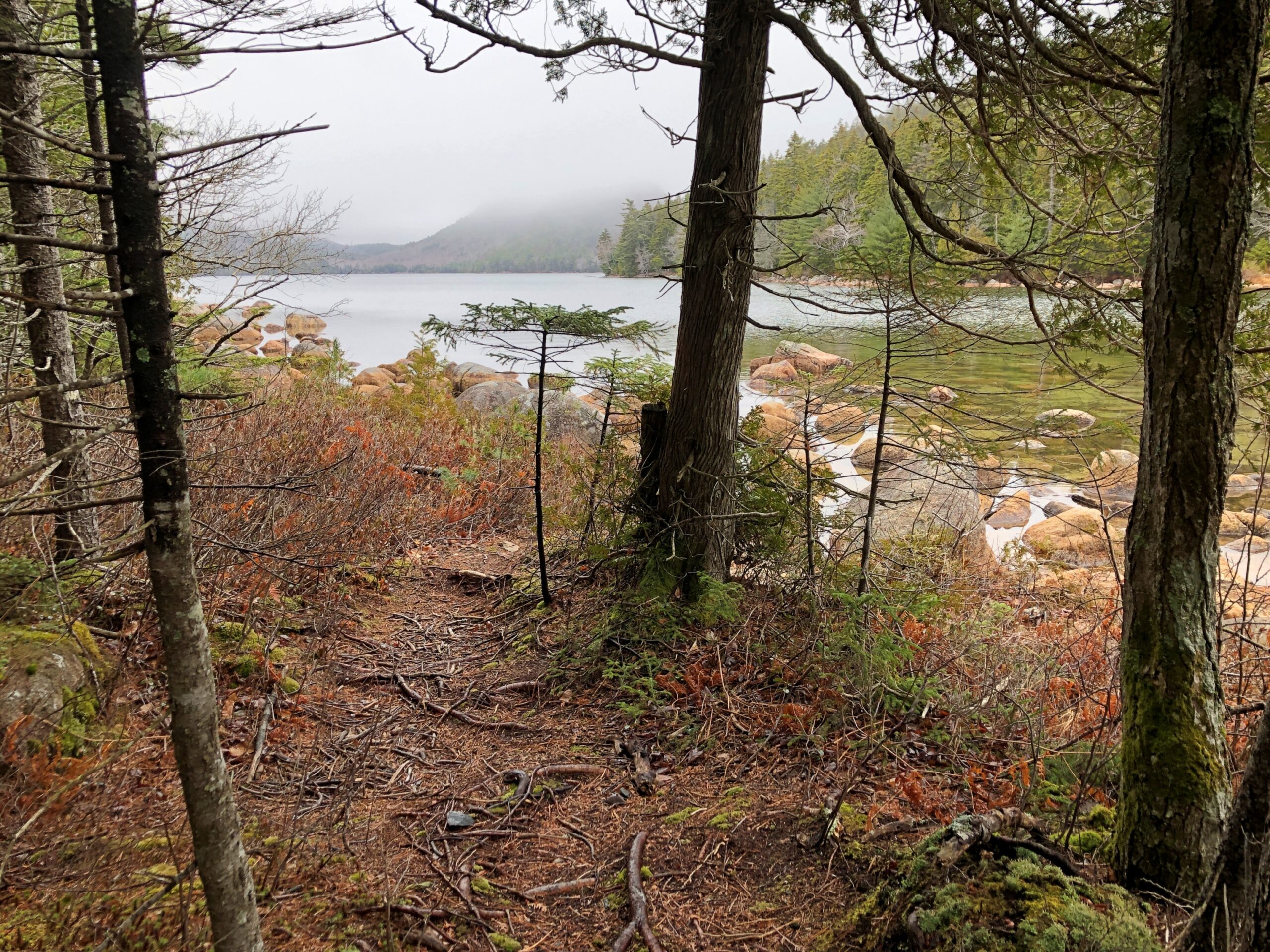
Driving is one thing, but I also wanted to walk. I found my way to Jordan Pond for that purpose.
“Oligotrophic lakes are most common in cold, sparsely developed regions that are underlain by crystalline igneous, granitic bedrock,” the entry says. “Due to their low algal production, these lakes consequently have very clear waters, with high drinking-water quality.”
No giardia in that lake? I didn’t want to find out. I carried my own drinking water as I walked the trails near the pond.
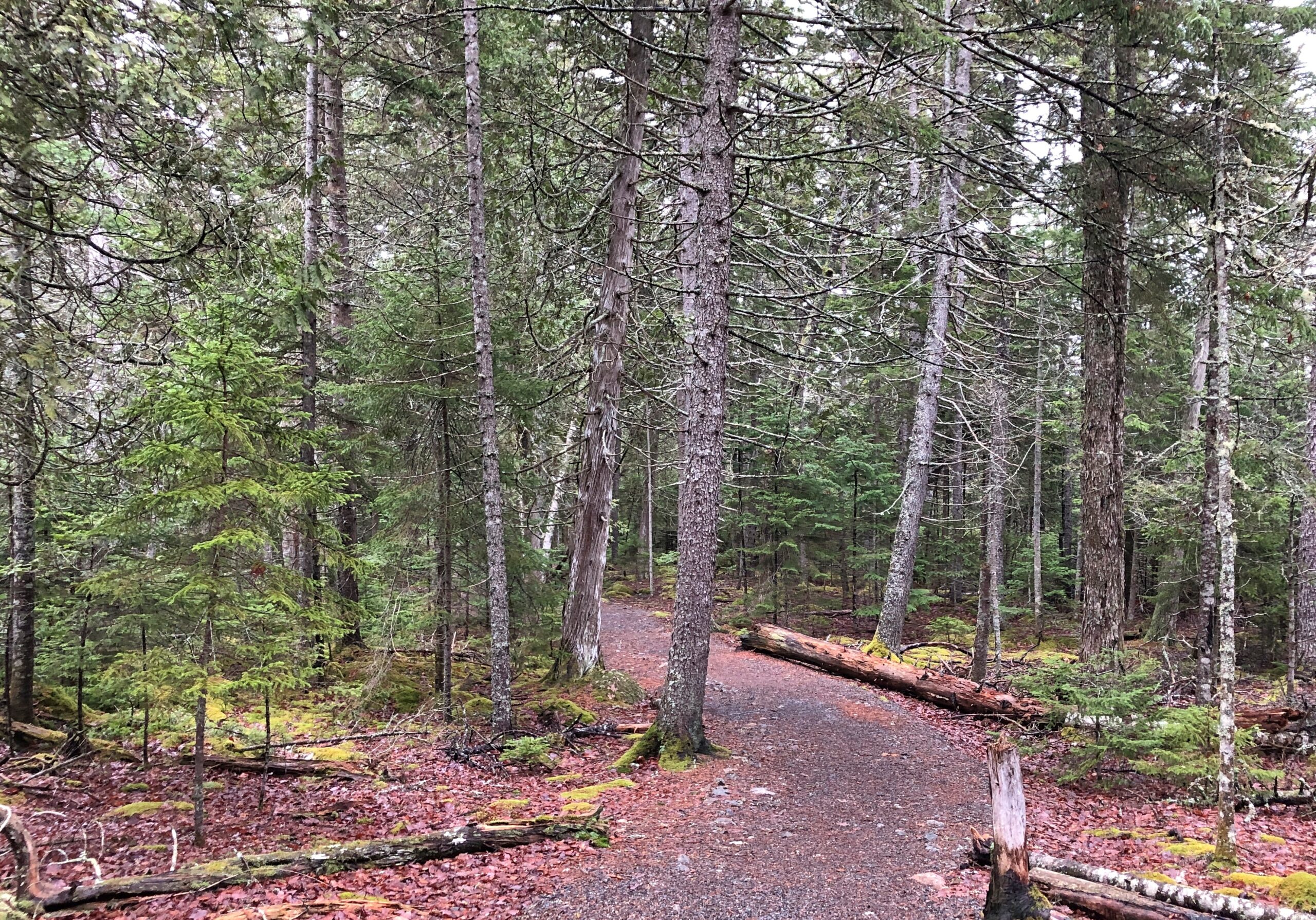
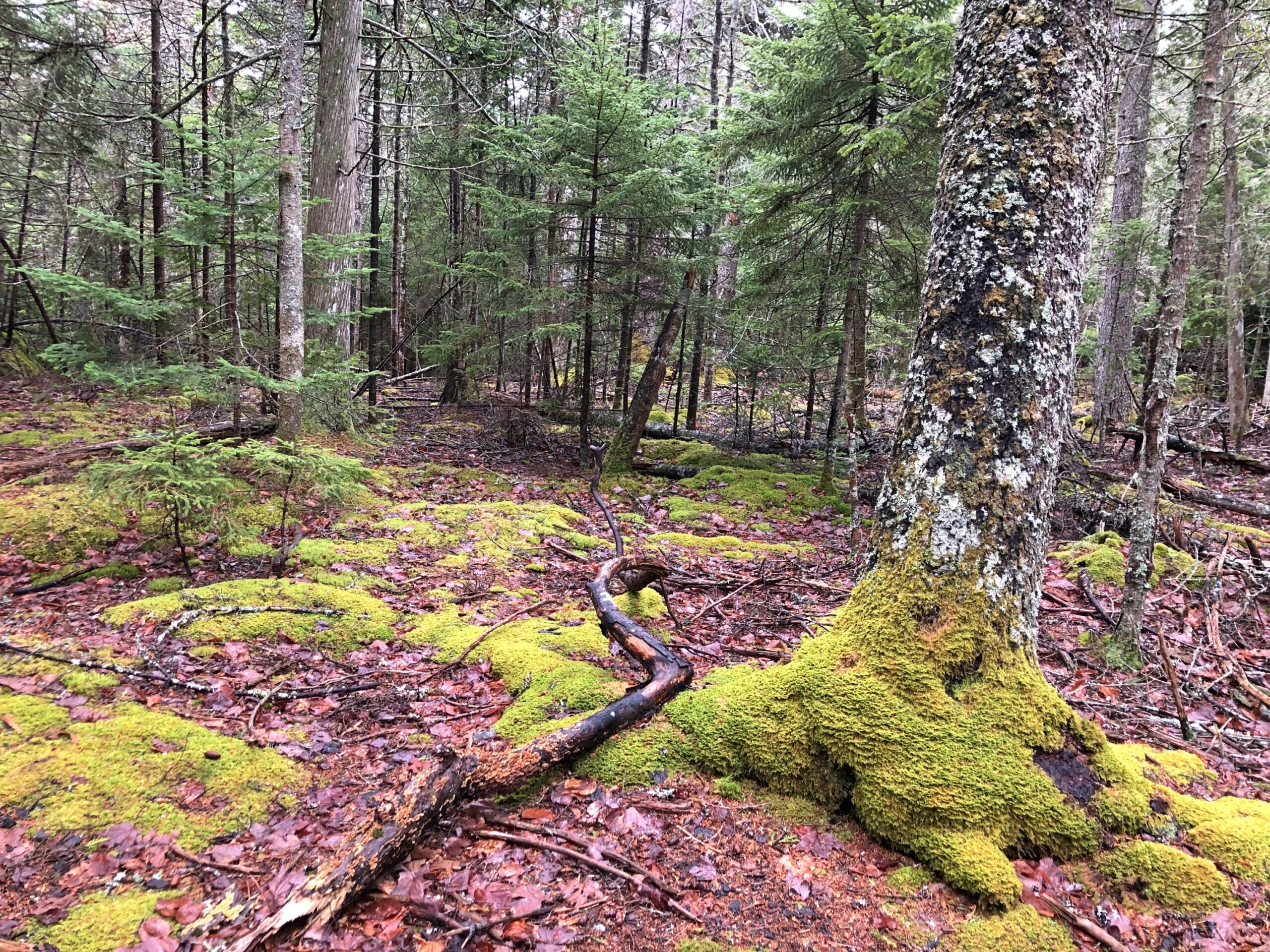
An easy trail. At one point, it crossed a creek feeding into the pond.
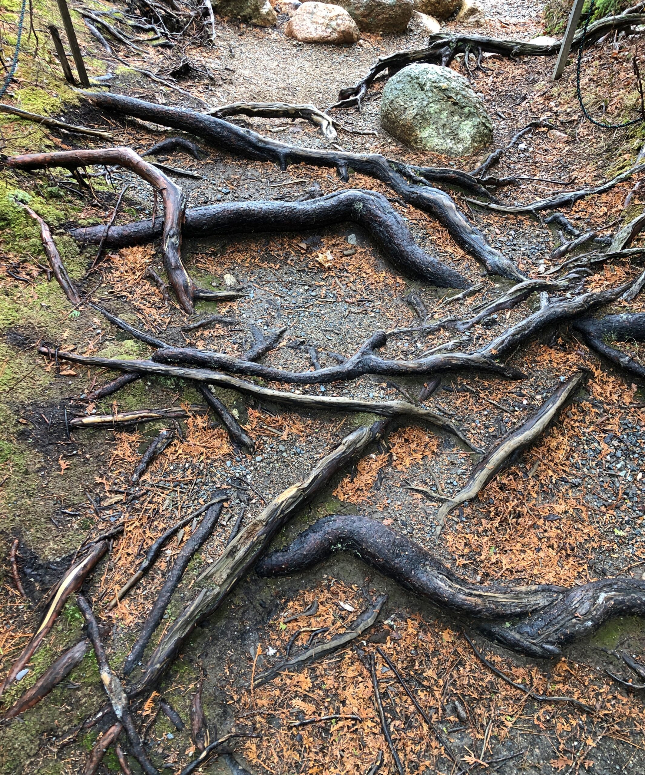
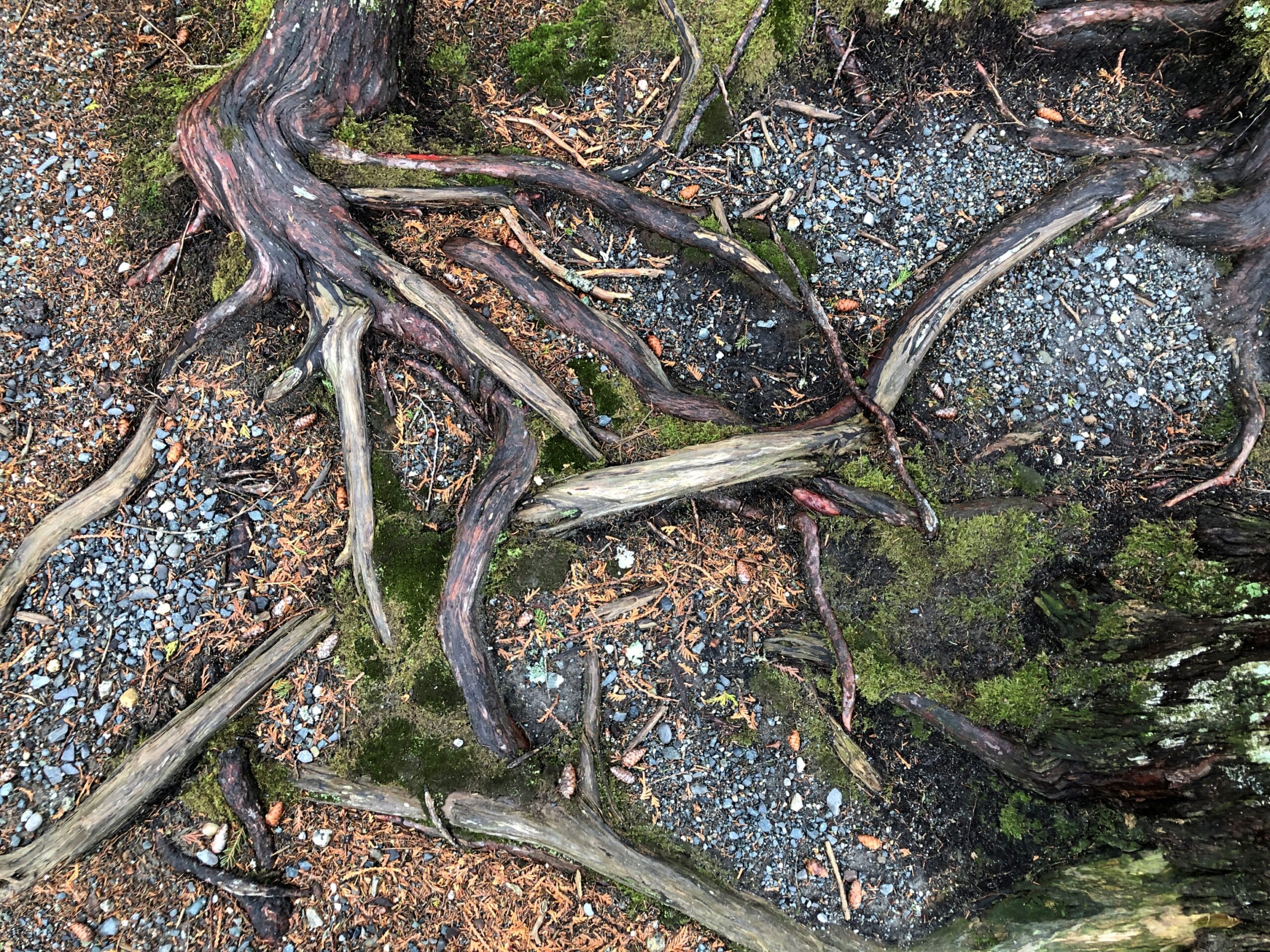
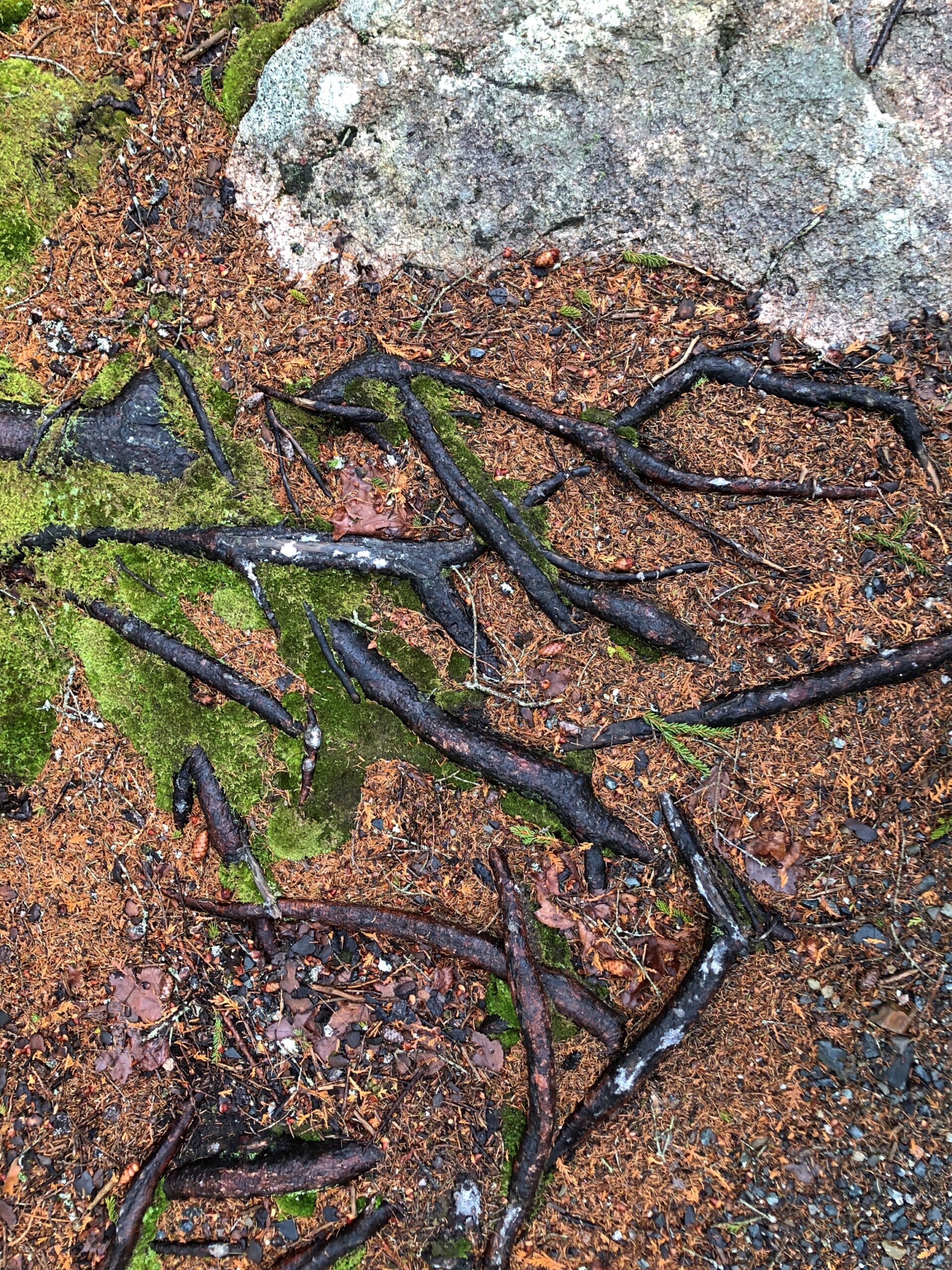
There were too many interesting tree roots to ignore them.
“Roots are typically at least half of a plant’s biomass, but you wouldn’t know it given how little scientific research has been devoted to these critical tendrils,” says the Smithsonian magazine. “Only recently have scientists given plant roots their day in the sun — in fields like collections research, climate science and microbiology.”
Or, in the case of the hardy trees of coastal Maine, their day in the fog.
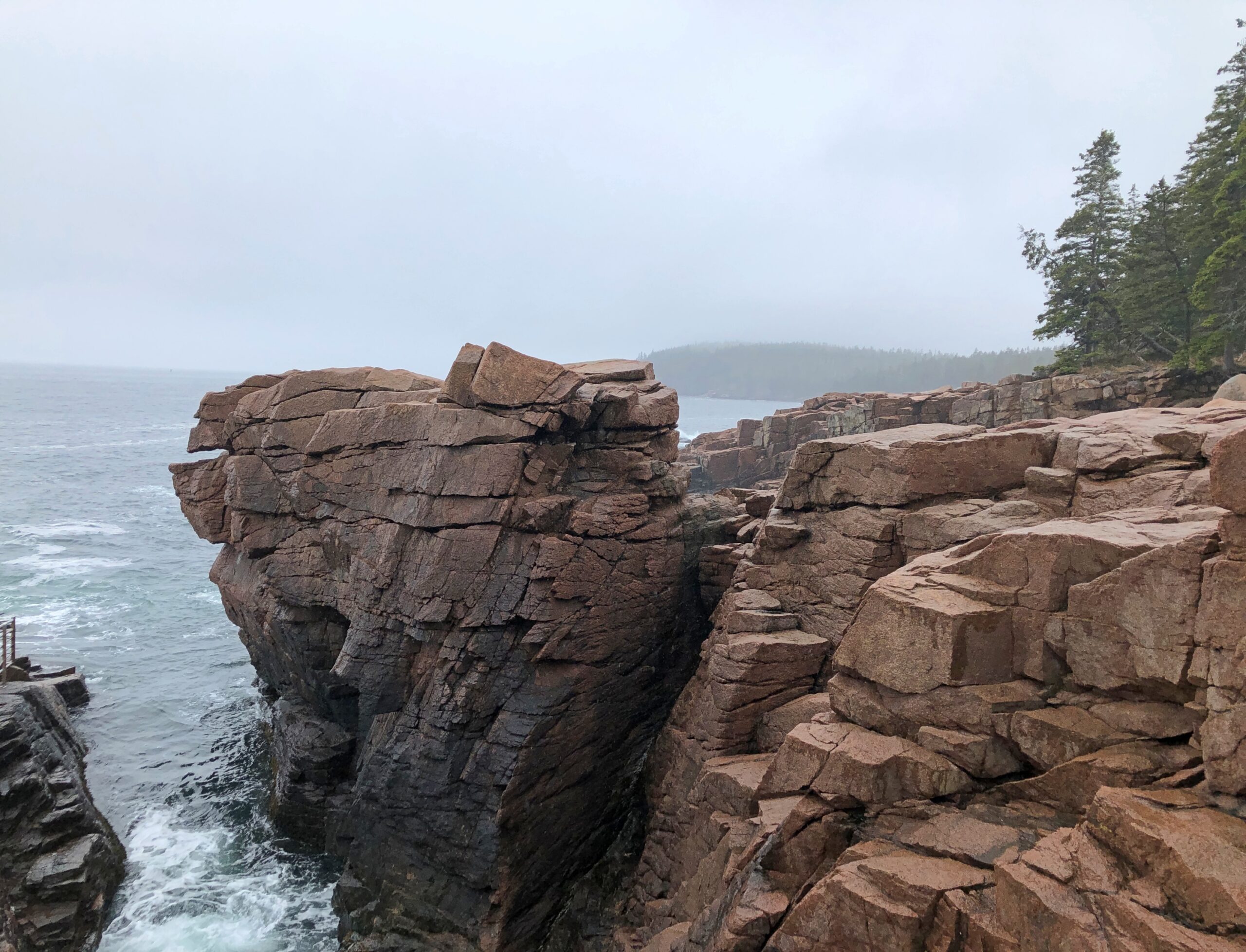
We live on the crust of the Earth, and what do crusts do? Crumble. Especially when moving water has anything to do with it, as it does along the coast of Maine. Famously so.
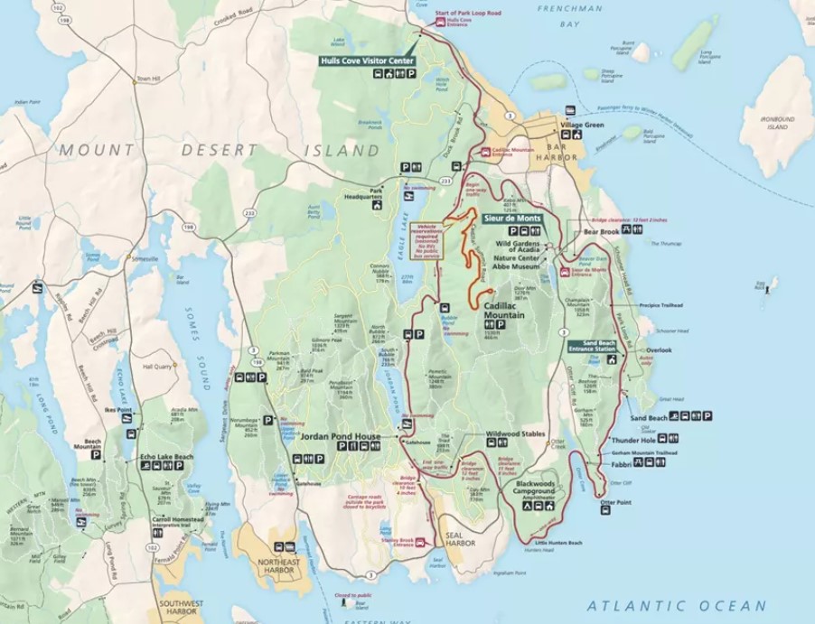
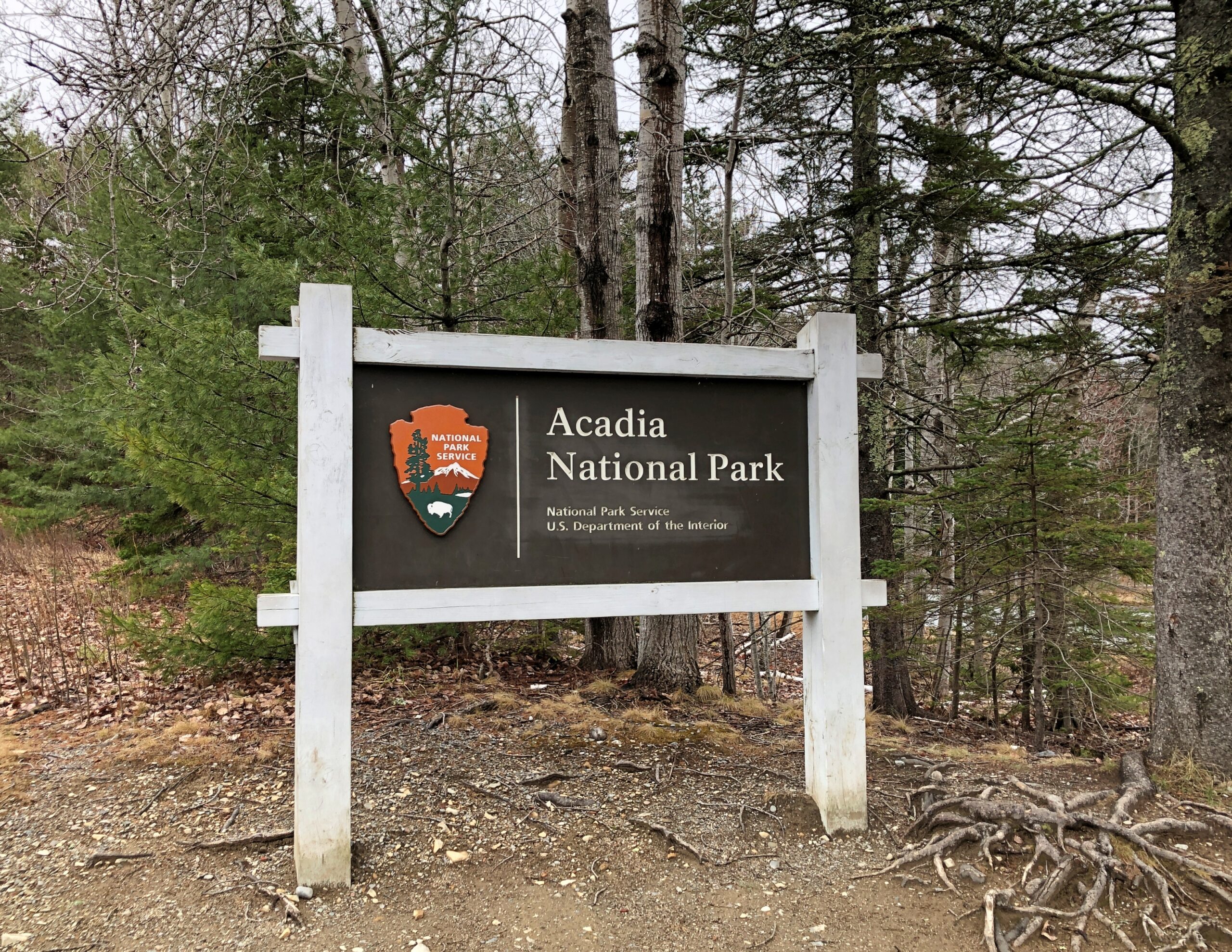
I arrived at the crumbly coastline of Acadia National Park on the morning of April 16. The date is important for only one reason: Park Loop Road, the main scenic drive through the park, opens for the season every year on April 15.
Acadia NP occupies about half of Mount Desert Island and some other nearby peninsula acreage and small islands. The morning of the 16th broke damp and foggy and chilly. From my lodging in the sizable town of Ellsworth, Maine, which is on the mainland near Mount Desert Island, I made my way to the island, then Bar Harbor, then the entrance to Park Loop Road, stopping only for a wonderful breakfast sandwich at one of the few places along the way that was open, Farmstand Coffee House.
The visitors center at the park entrance wasn’t open either. The NPS missed making a sale of post cards to me. By the time I got to the park, the weather was better: slightly less damp and slightly less foggy and slightly less chilly.
Such is Maine in spring. I didn’t mind. In fact, the damp chill meant few other people had come that day. Chilly but no ice underfoot. I like to think that it all melted by April 15. Or maybe on April 15.
I sent a few pictures to Tom in Austin taken while I visiting Acadia NP.
He answered: “Wow. Fabulous. Choosing to visit that national park before May is a bold decision. Looks like you got good weather, though.”
Bold? Maybe. To boldly go where many vacationers have gone before. And will again, real soon.
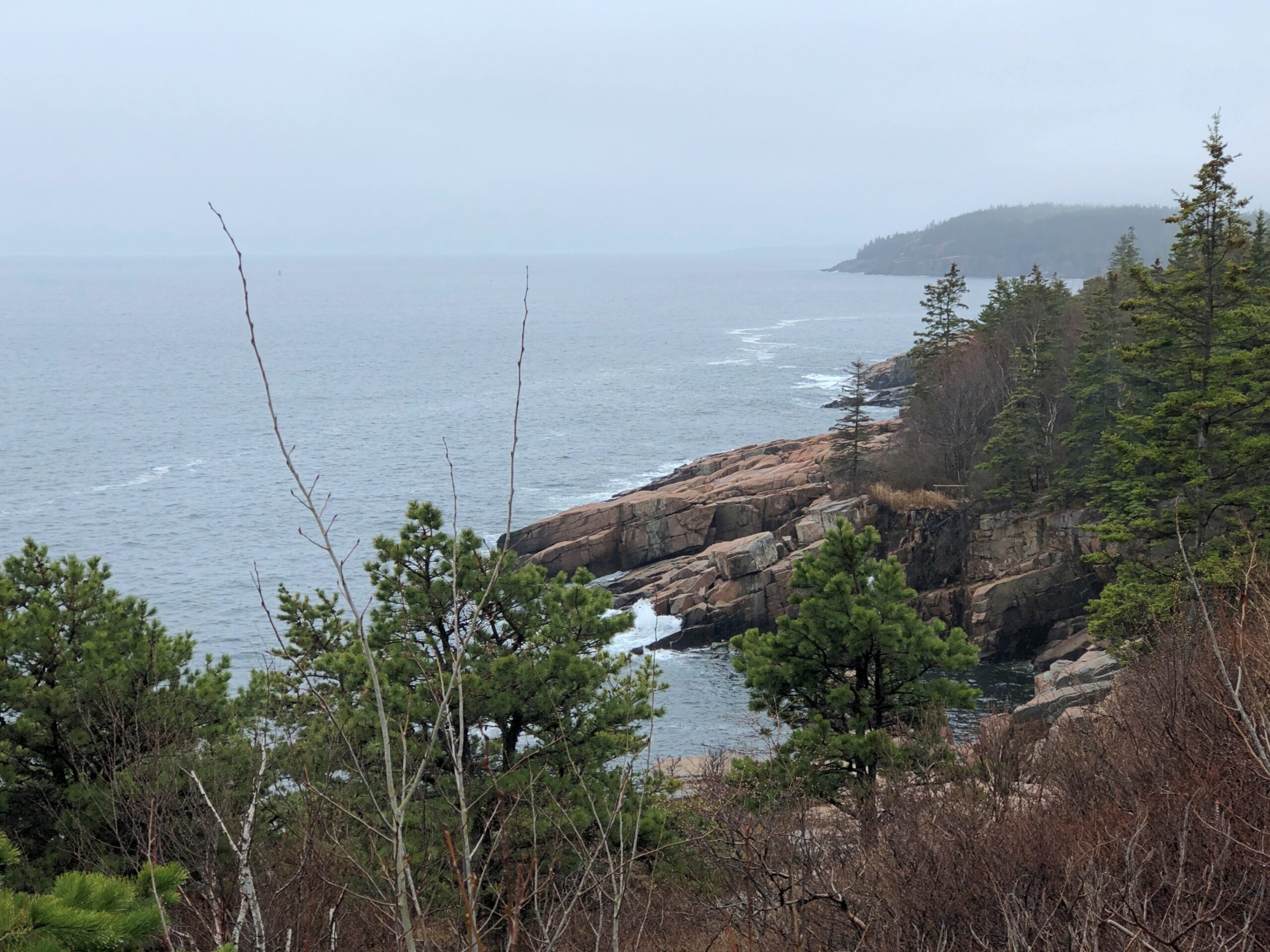
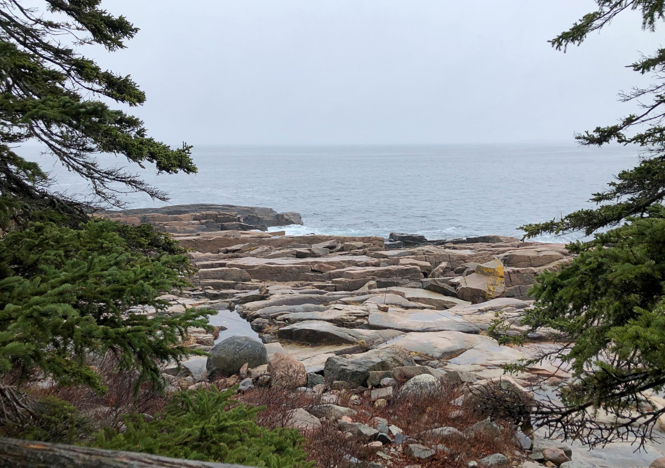
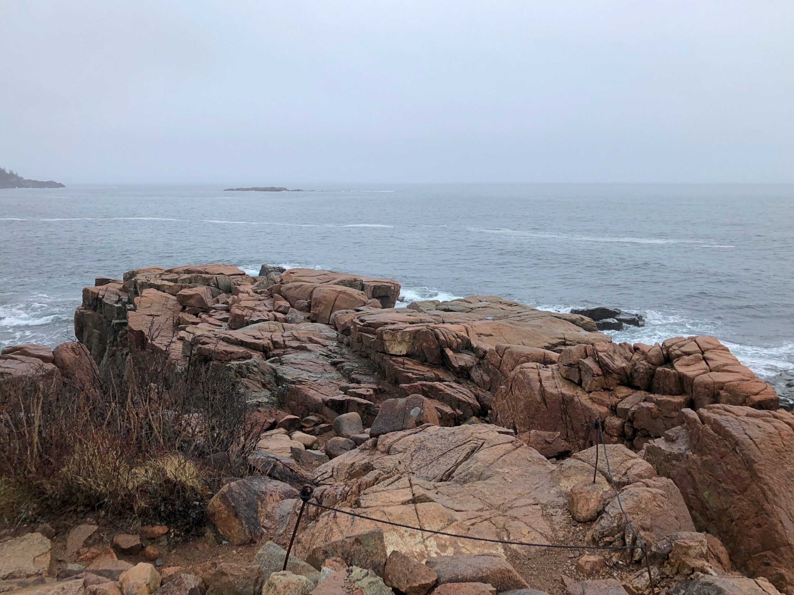
I didn’t drive particularly fast along Park Loop Road. Little traffic for one thing, too much of a risk of a car-on-tree encounter for another thing, so curvy is it. Gnarly, you could say. The drive, whose construction John D. Rockefeller Jr. facilitated, winds but does not climb much as it follows the curves of the shore. The scenic stops are close to each other, since in national park terms, Acadia is a touch on the small side. Despite that it hardly lacks variety.
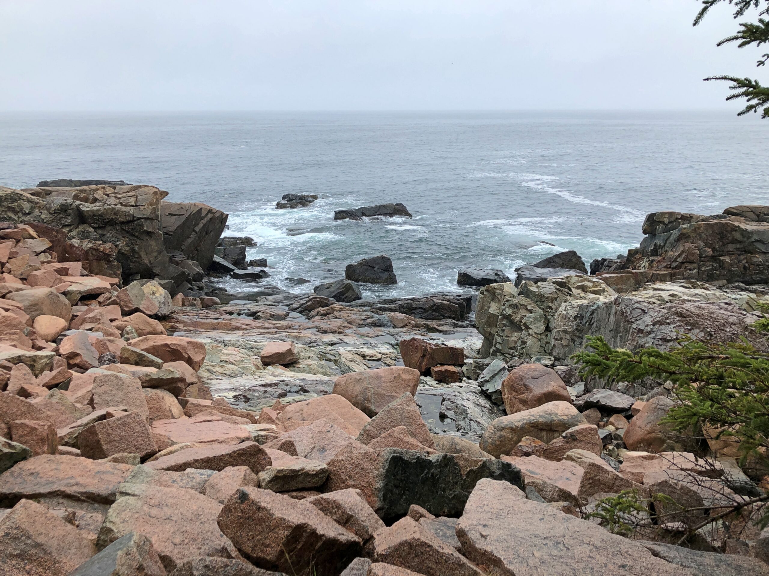
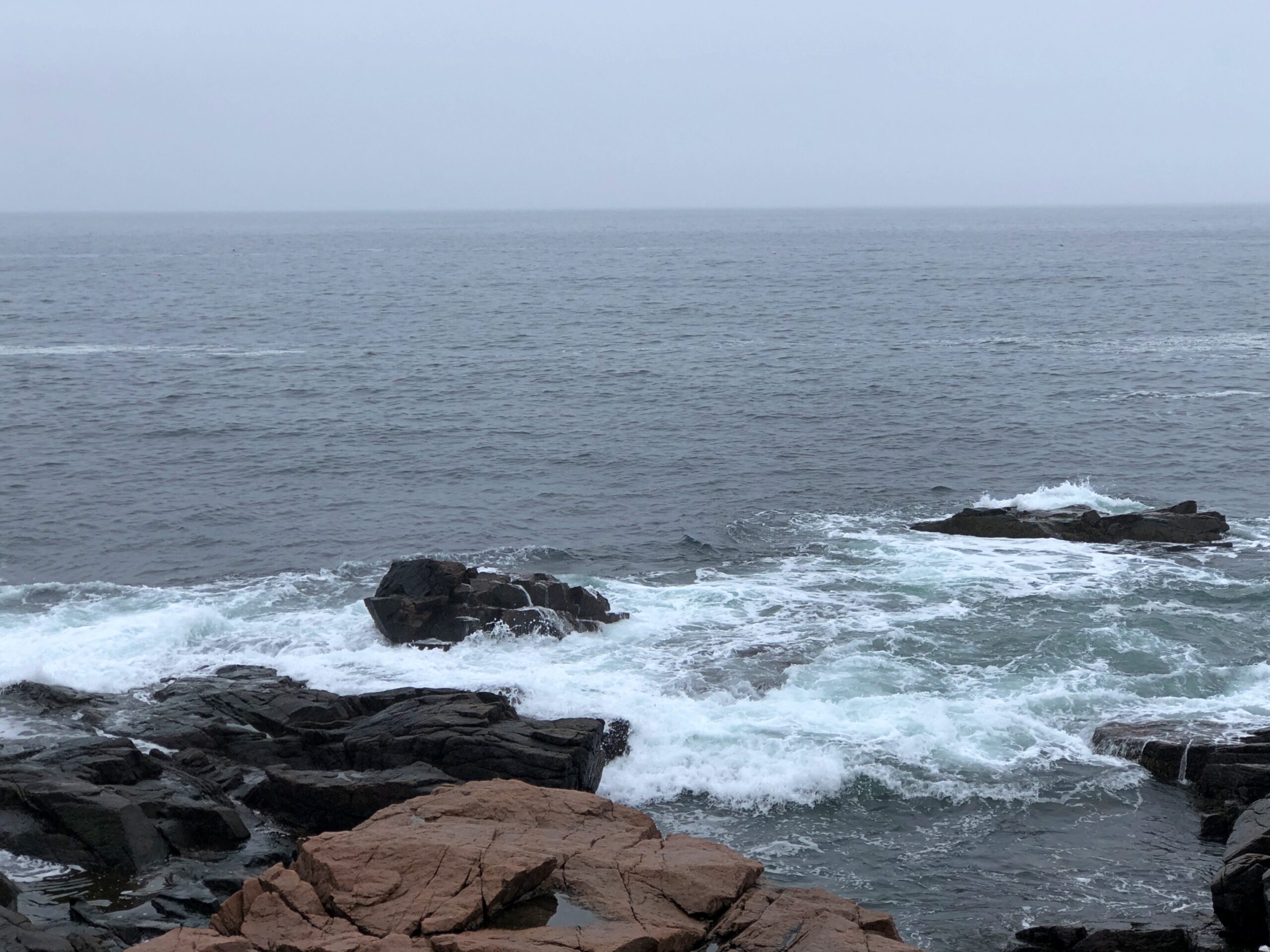
Beginning with the rocky shores you’d expect. The fog that day was a nice Maine touch. The foggy shores of Maine. There’s a song title for an AI song writing program: “The Foggy Shores of Maine.” Sad song about a solider dreaming of home on these shores? It worked for “Galveston.”
Boulders and sizable slabs, on their way to being pebbles and sand.
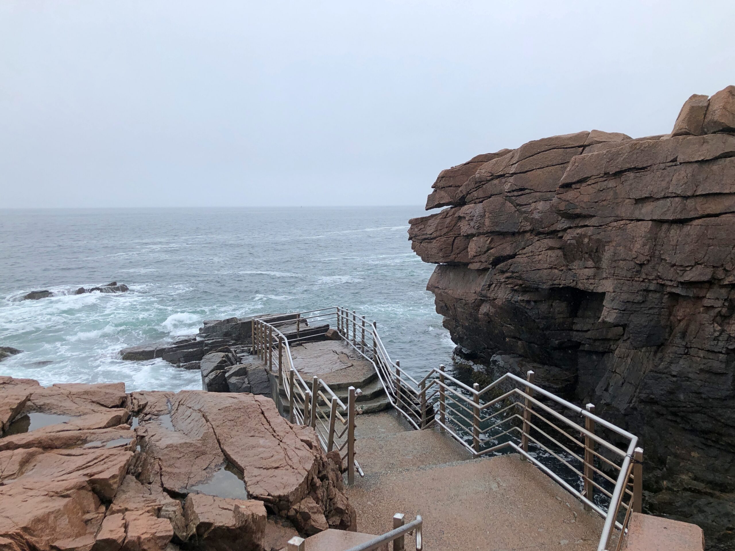
A feature that wears its name well: Thunder Hole.
A loud place, Thunder Hole, the waves bashing the rocks in crash-splashes, followed by the whistling, sucking whoosh as water pulls away from the rocks, followed by another bash against the rocks, all before you can count to three.
You can get closer to Thunder Hole behind the (relative) safety of rails, but that won’t keep you from a good drenching. Not that day, anyway. I kept my distance, and let the sound come to me in its noisy fury.
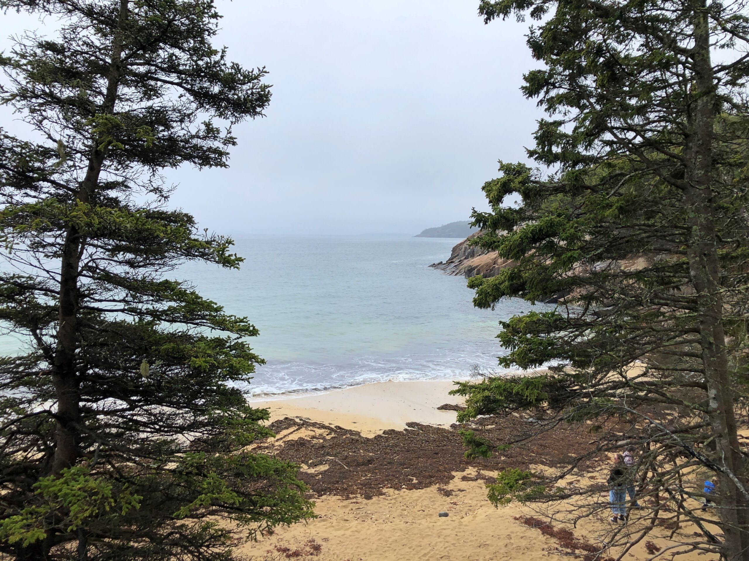
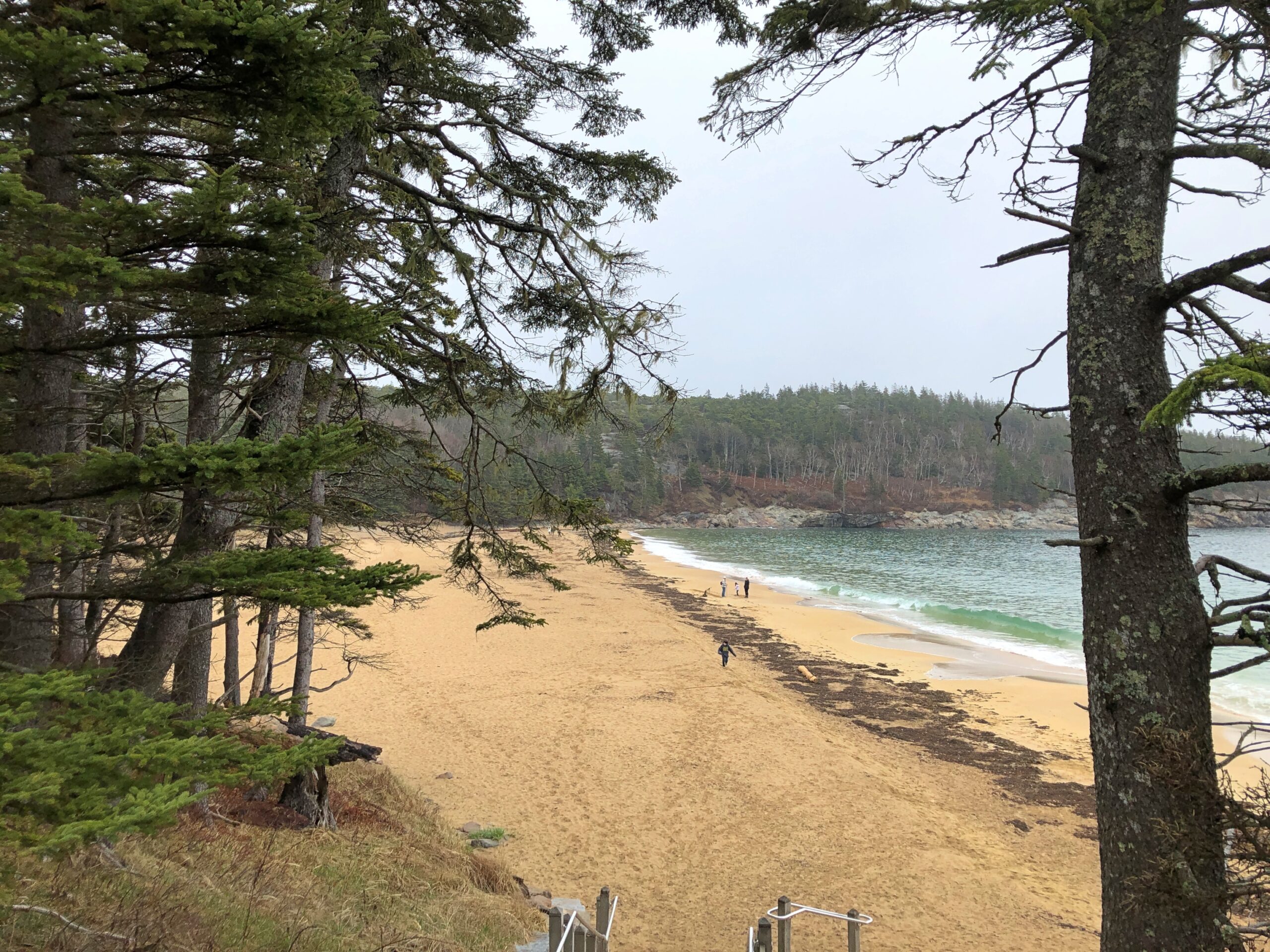
The park has a sand beach, called on the maps, Sand Beach.
I take that as an indication that most of the shore in these parts is topsy-turvy with boulders. I believe it.
Terrific lightning storm rolled by to the south last night at about 11. Little rain but a prodigious amount of cloud-to-cloud lightning, unlike anything I’ve seen in years. The last time might have been when we were under such a near-rainless storm in North Dakota nearly 20 years ago. After watching in fascination from the back door, I got my phone and recorded about 30 seconds of the spectacle.
As usual, video only conveys a fraction of the visual power of the moment. But, in spite of the channel it’s on, it isn’t AI.
I was curious today which volume of the Encyclopedia Brown books — whose protagonist is a sharp grade-school boy who solves crimes and mysteries — mentioned the town of Palestine, Texas. Even though I grew up in Texas, I’d never heard of the place until I read an EB story in the early ’70s that mentioned a string of places that some international jewel thief was traveling to: Moscow, Odessa, London, Paris, Palestine and Athens. The boy detective determined that the criminal would be in Texas, since those are all places in that state, and especially because “Palestine” is called “Israel” now, as he said.
You might wonder (I do now, anyway) what business an international jewel thief would have in a place like Moscow, Texas (pop. 170) or London, Texas (pop. 180), but never mind. It didn’t take long for me to find a YouTube review of Encyclopedia Brown Keeps the Peace (Book 6, originally published 1969), including the case that mentions the Texas towns. The reviewer takes the book to task, asking “can grade-schoolers be expected to know this information?” No, of course not. They can be expected to learn it, however.
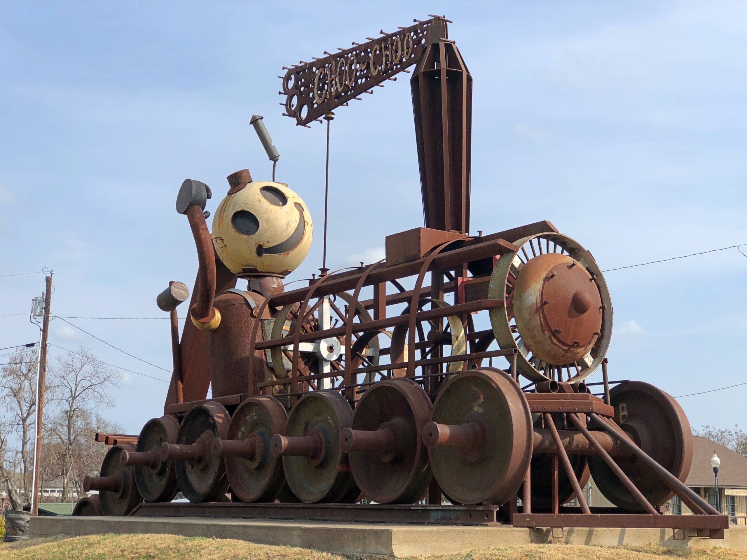
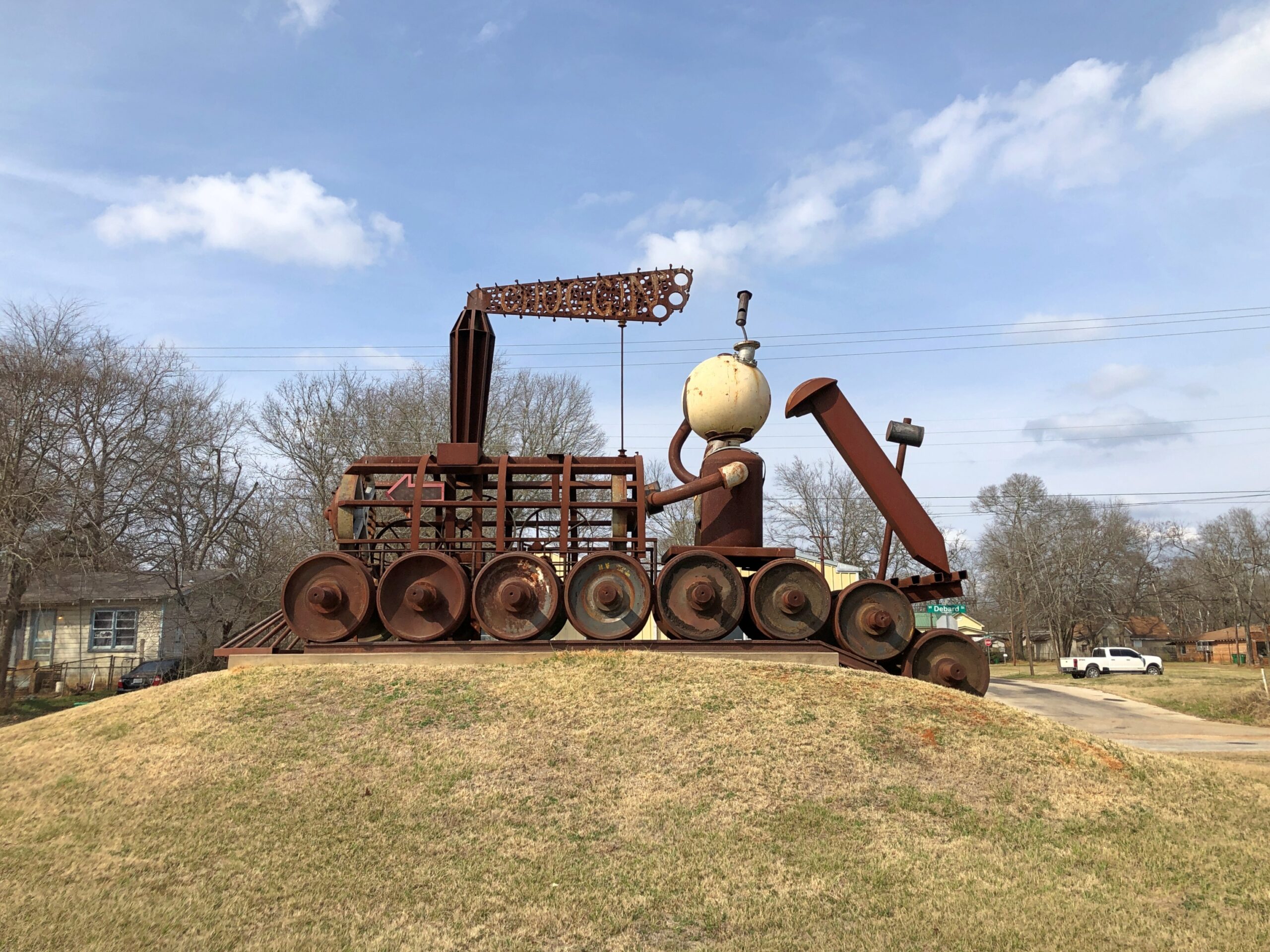
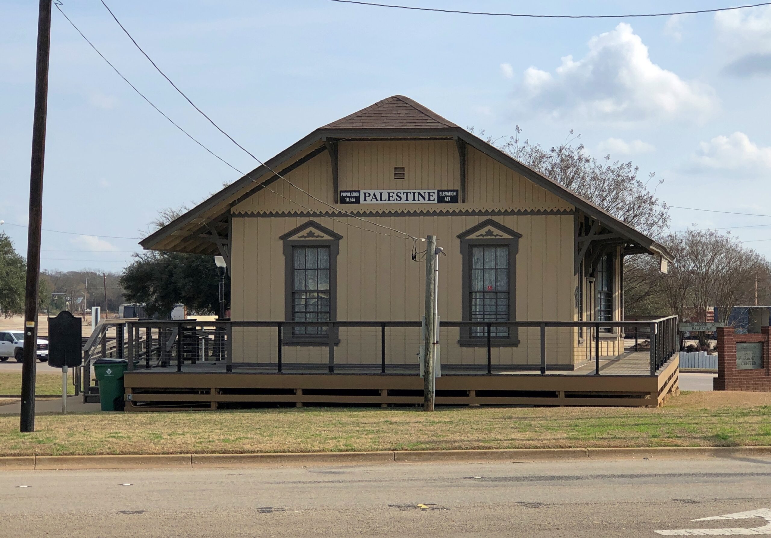
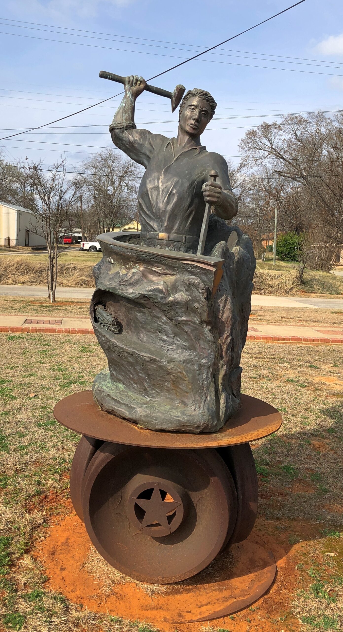
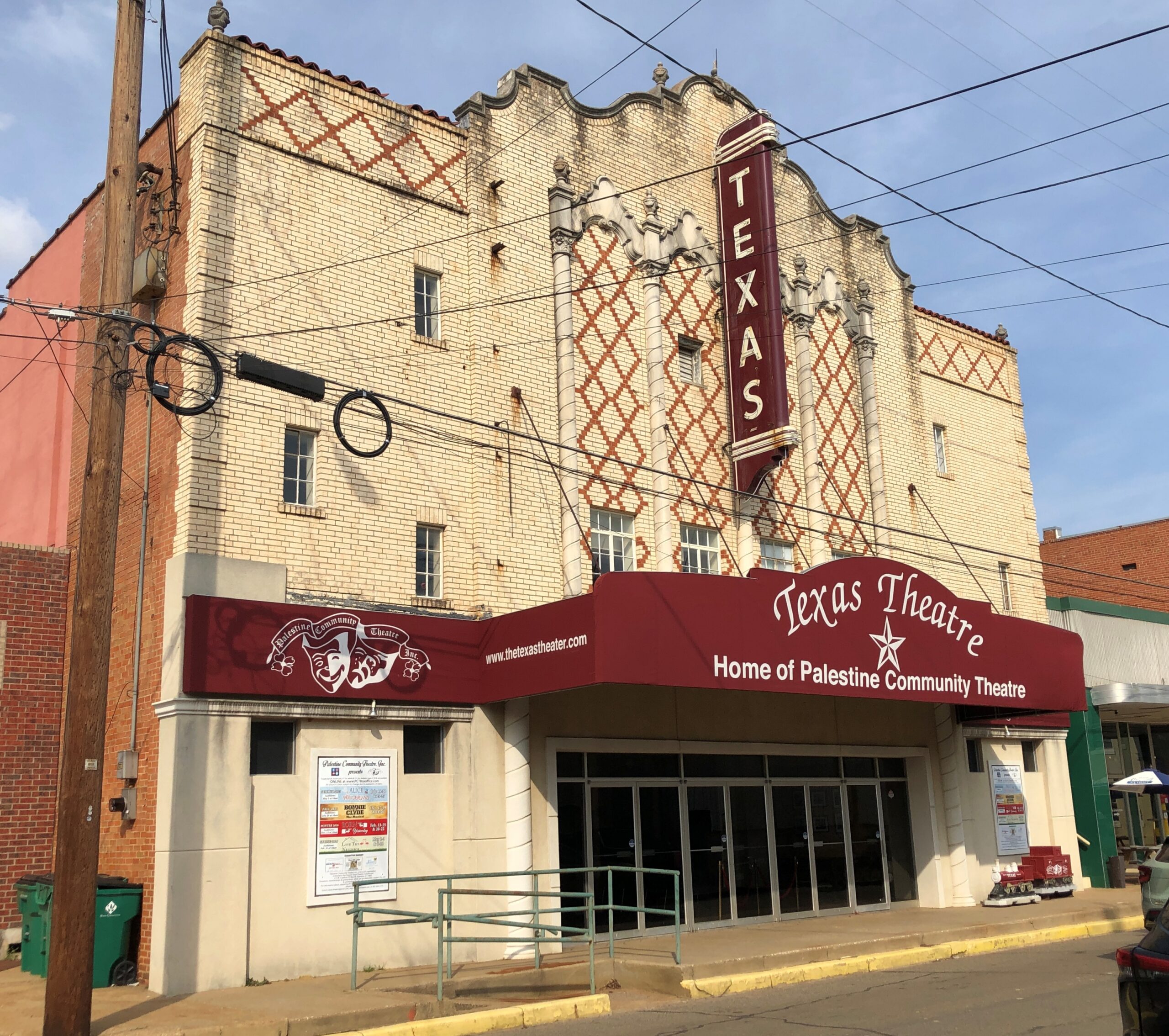
Now I know exactly where I learned about Palestine (Pal-es-TEEN) more than 50 years ago. I didn’t arrive in Palestine in person until this February, on my way to Dallas from Nacogdoches. During my visit, I made the acquaintance of this fellow.
The sculpture is called “Chuggin’ ” (2020), created by Dewane Hughes, a sculpture professor at the University of Texas in Tyler. Railroads are important in the history of Palestine, so much so that one terminus of the Texas State Railroad – a linear state park along a former short line RR – is in the town. The other terminus is in Rusk, about 25 miles away. Not running in February, unfortunately.
“Chuggin’ is near the town’s visitor center, a former RR depot.
Also nearby is “Forging History” (2014) by Dale Montagne, with the base made of three actual rail car wheels.
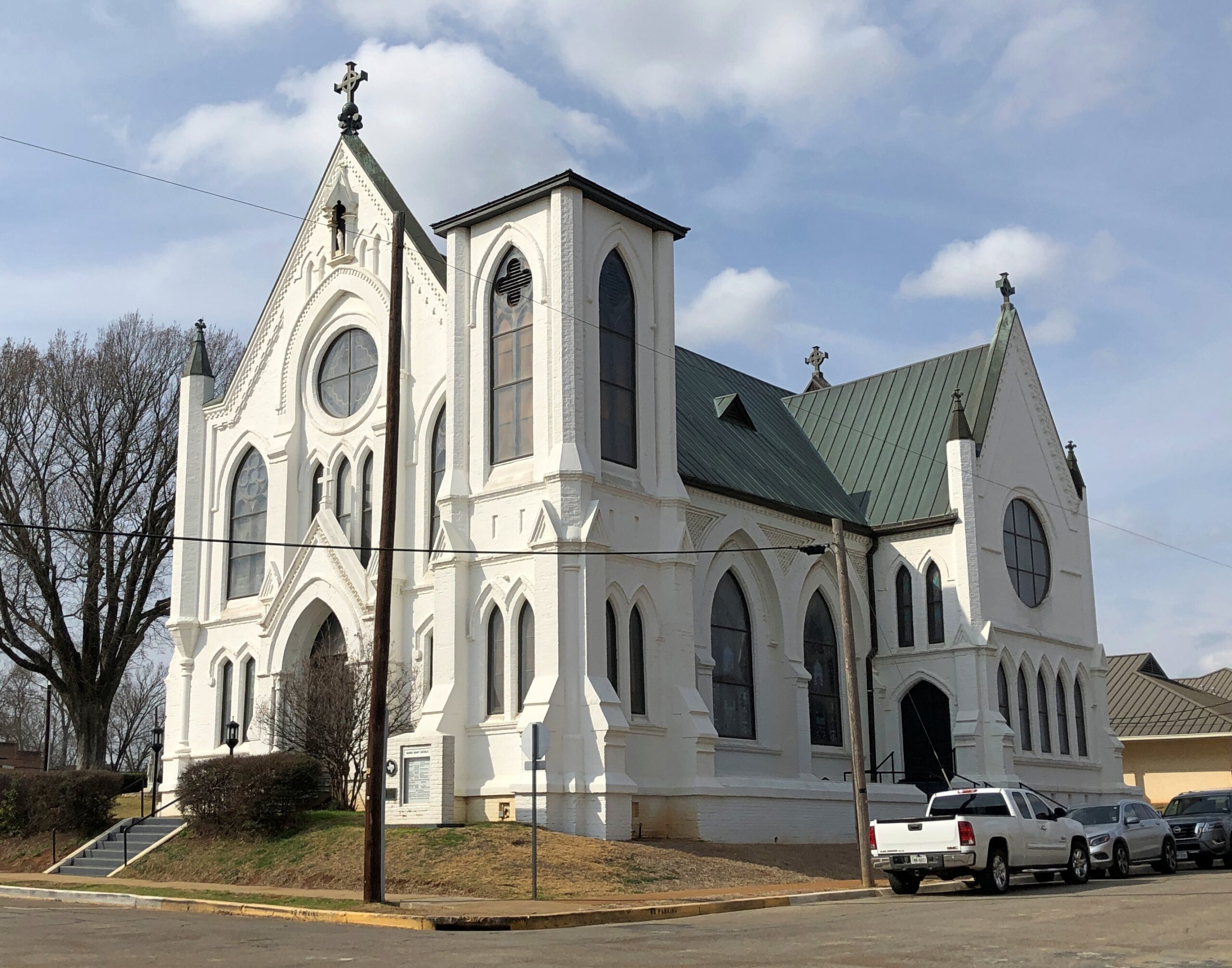
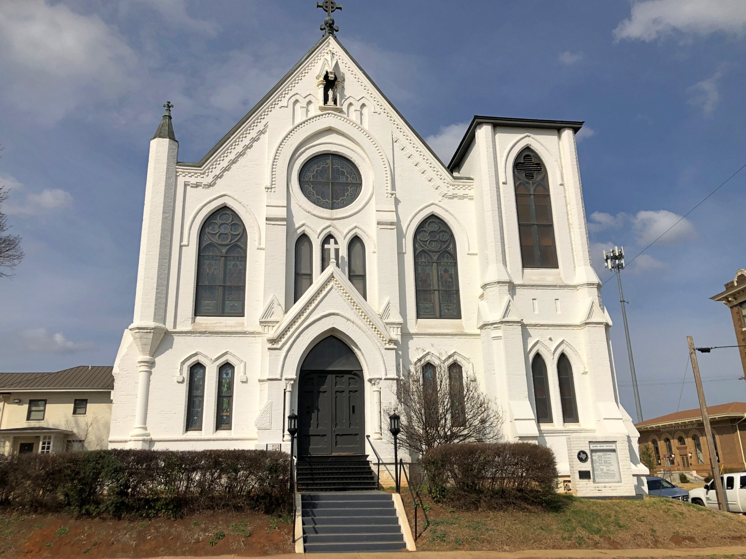
Parking was easy to find in downtown Palestine, traffic light. Parallel parking was available right across from the splendid Sacred Heart Catholic Church, as it happened, an 1890s creation by Nicholas Clayton, who was most active in Galveston before the hurricane. Originally many of the congregation were workers on the International-Great Northern Railroad Co., which had a major presence in Palestine.
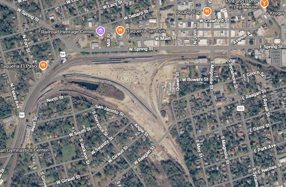
Palestine still has a sizable rail yard south of downtown.
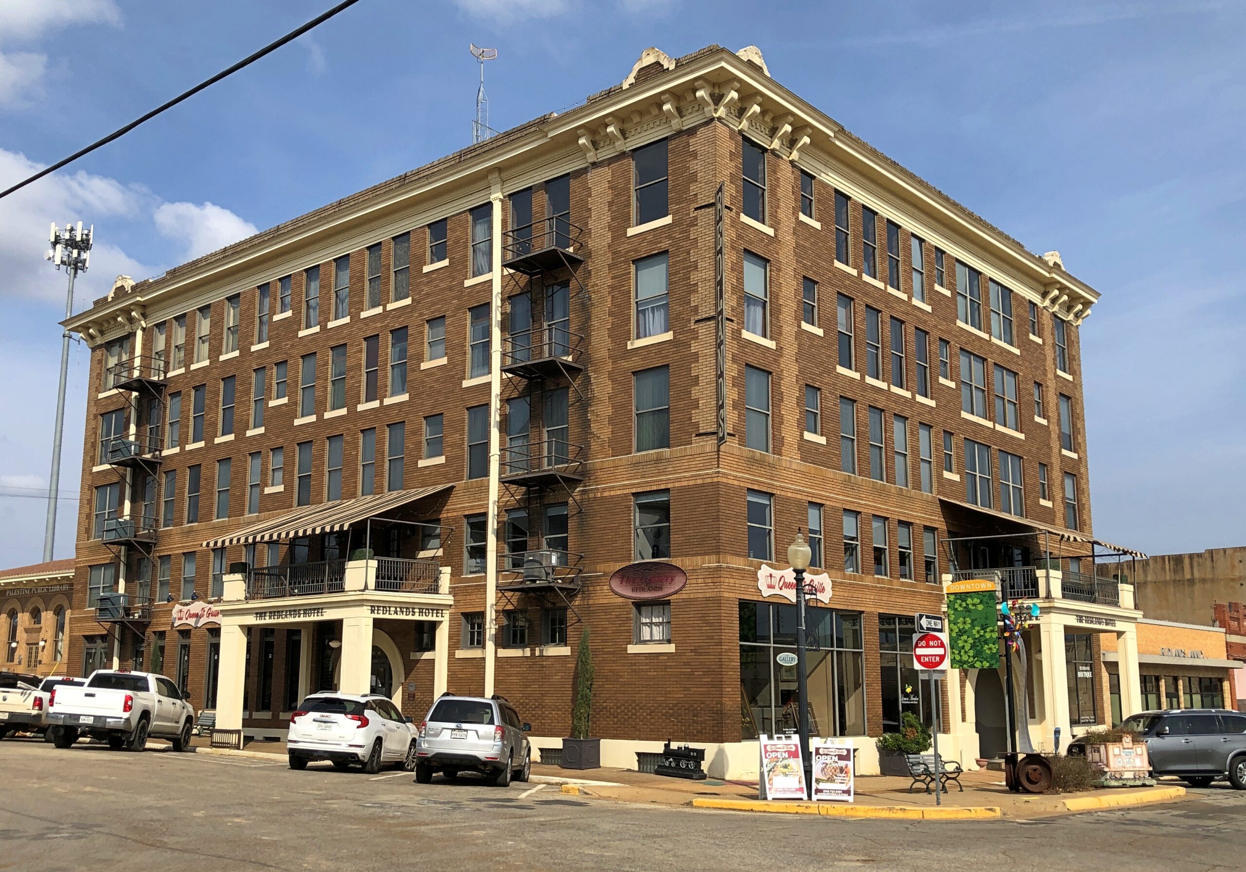
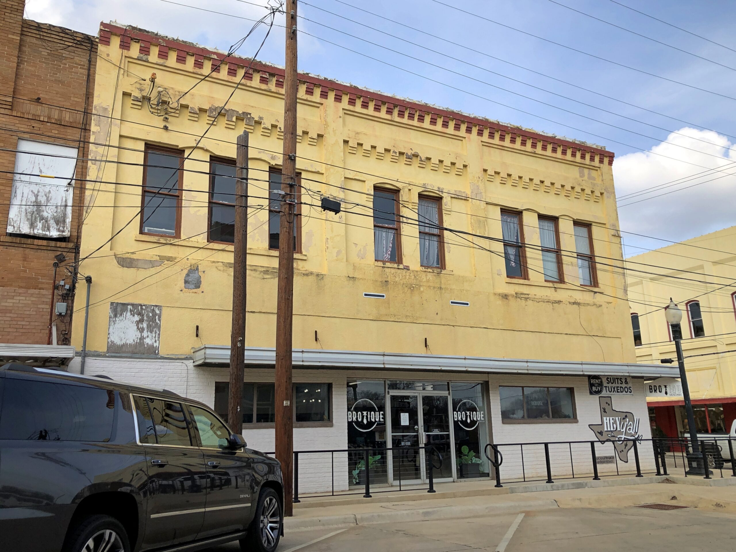
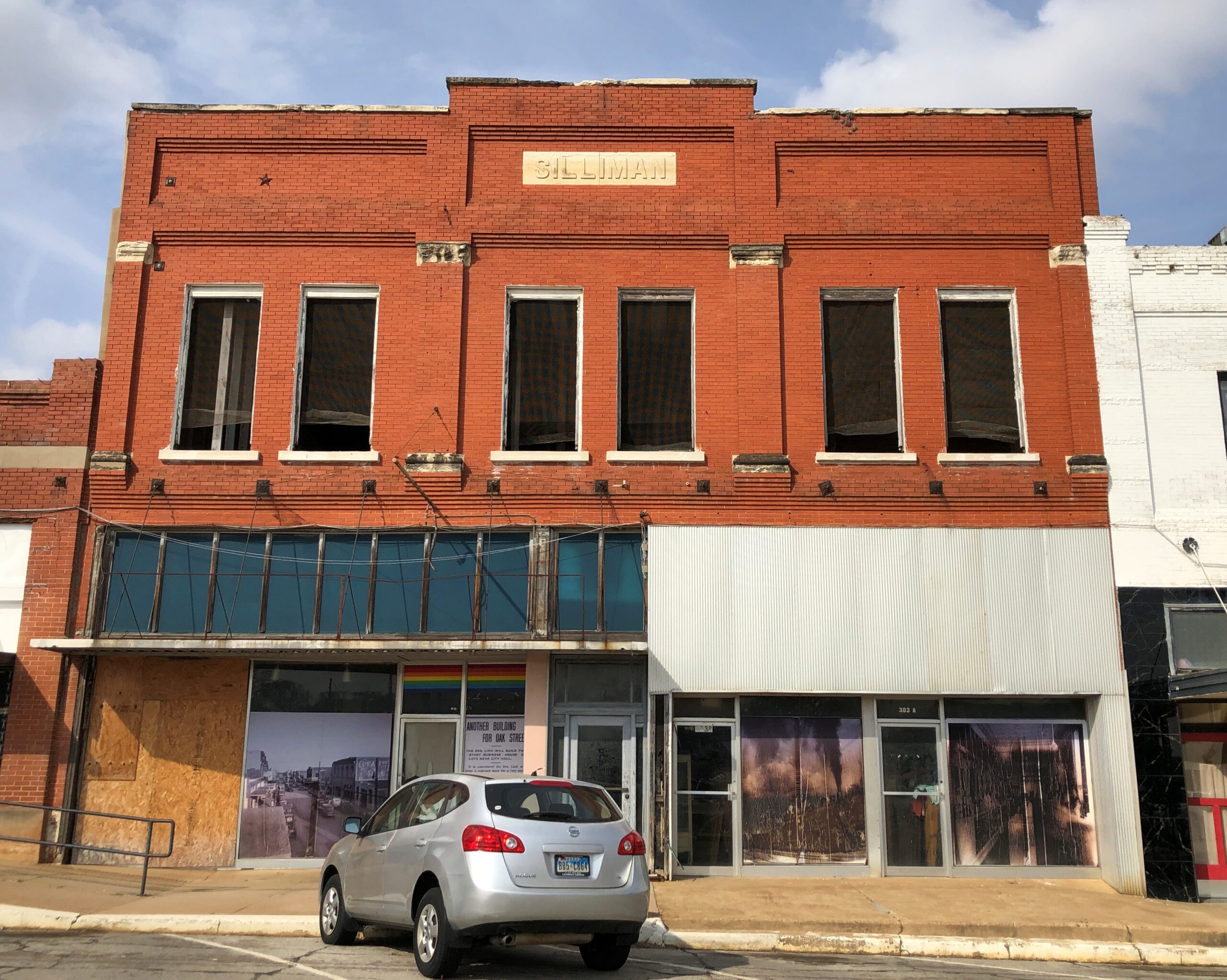
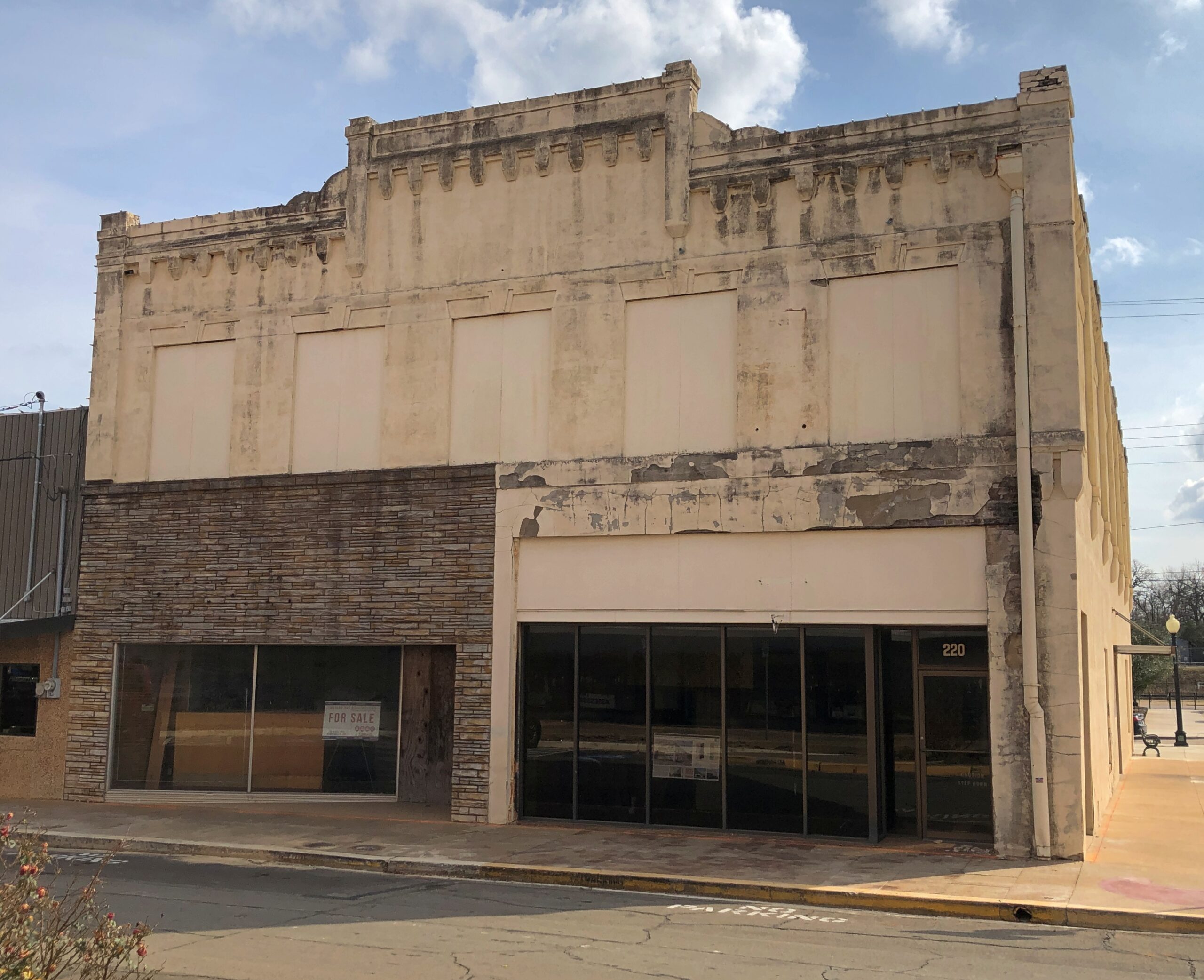
Took a walk around downtown. Like most large towns, or small cities, there is a mixture of ongoing businesses –
— with vacancies.
Got some buildings with really good bones, as it’s been said in the real estate biz.
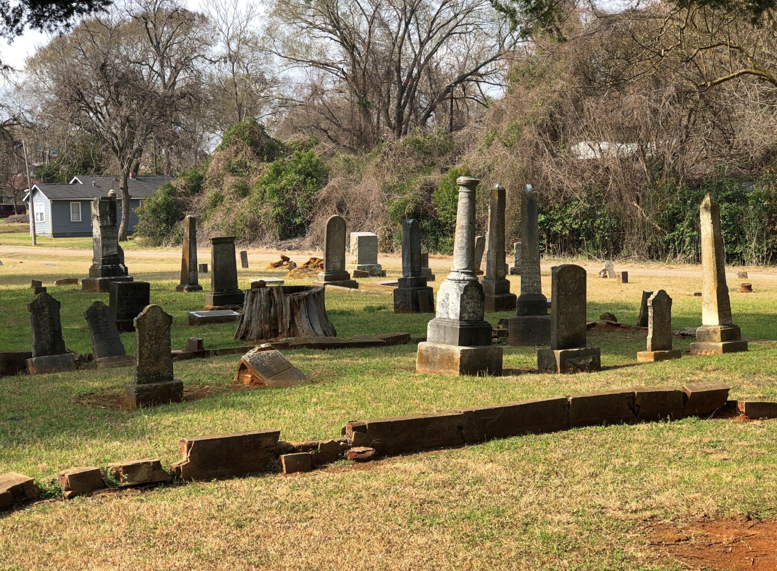
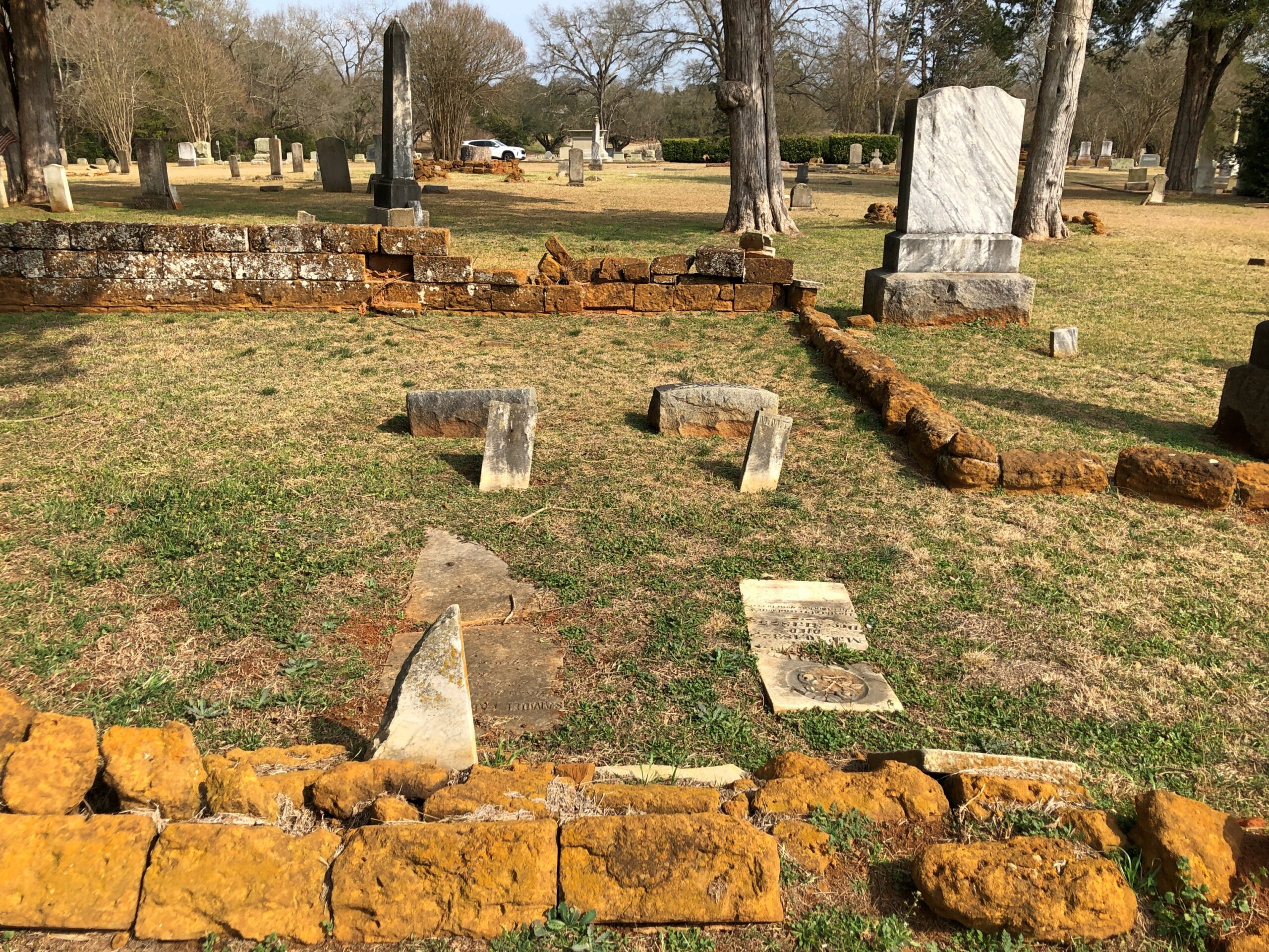
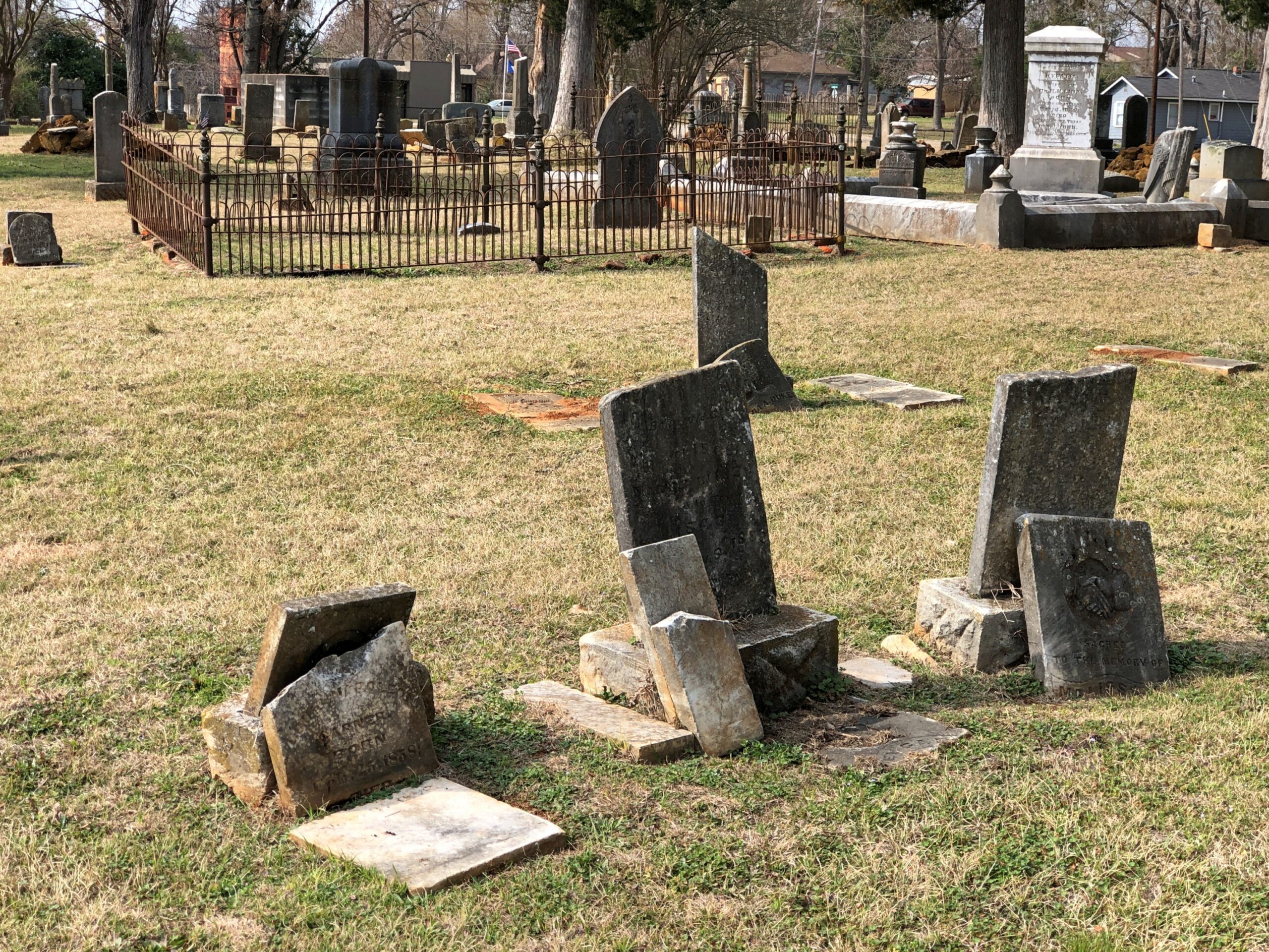
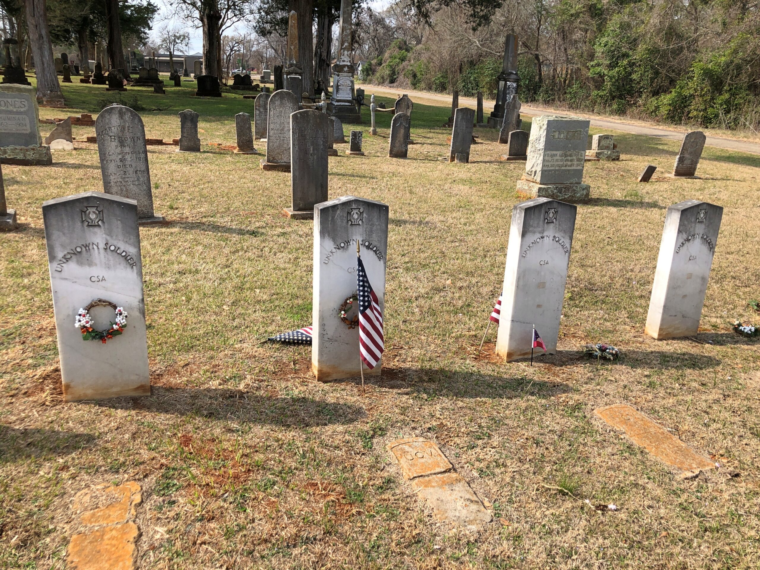
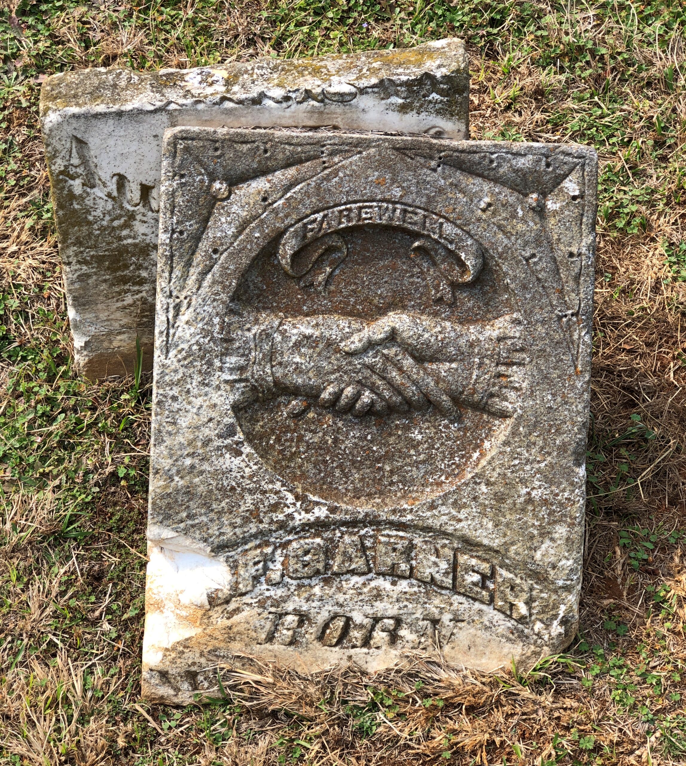
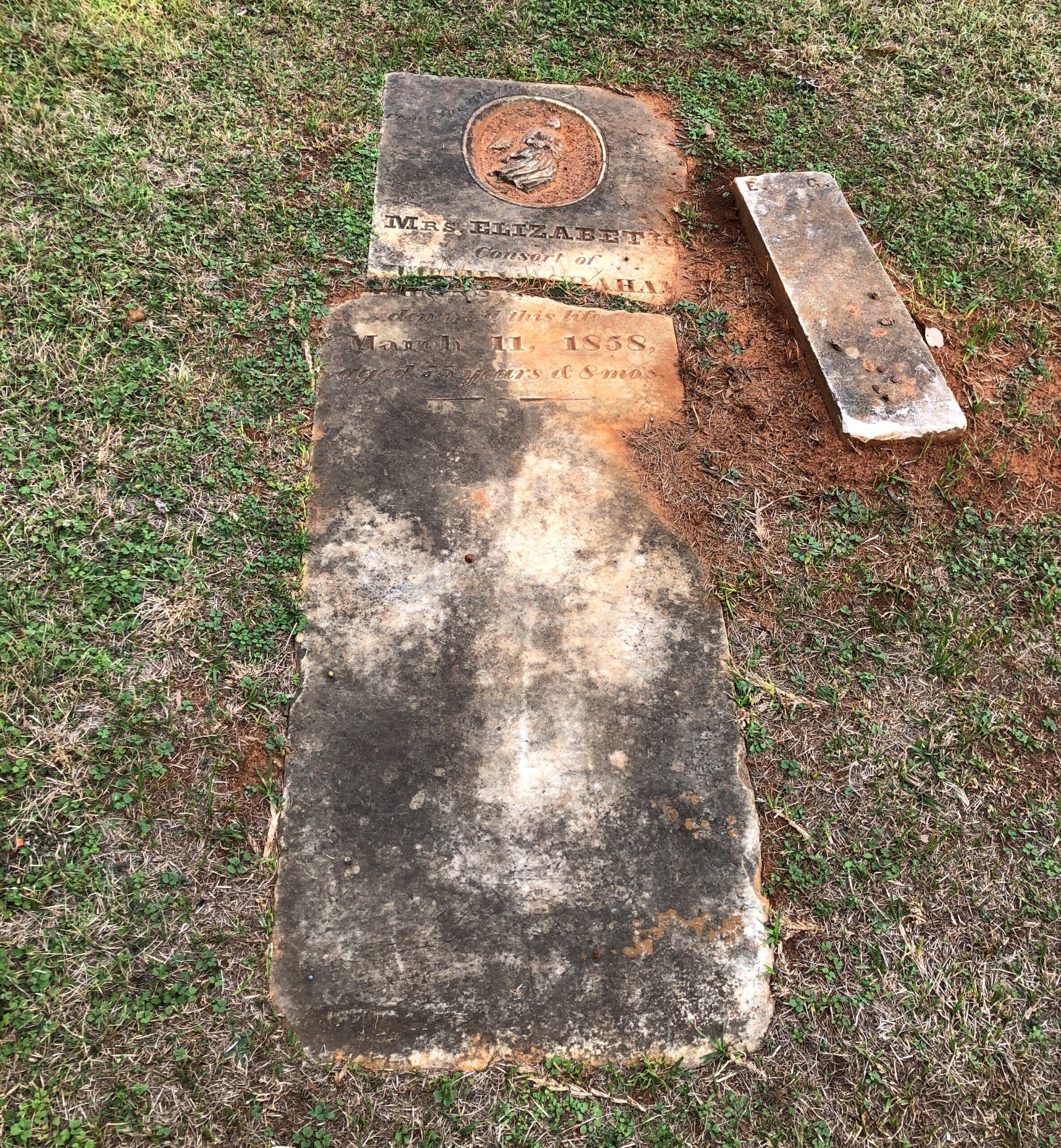
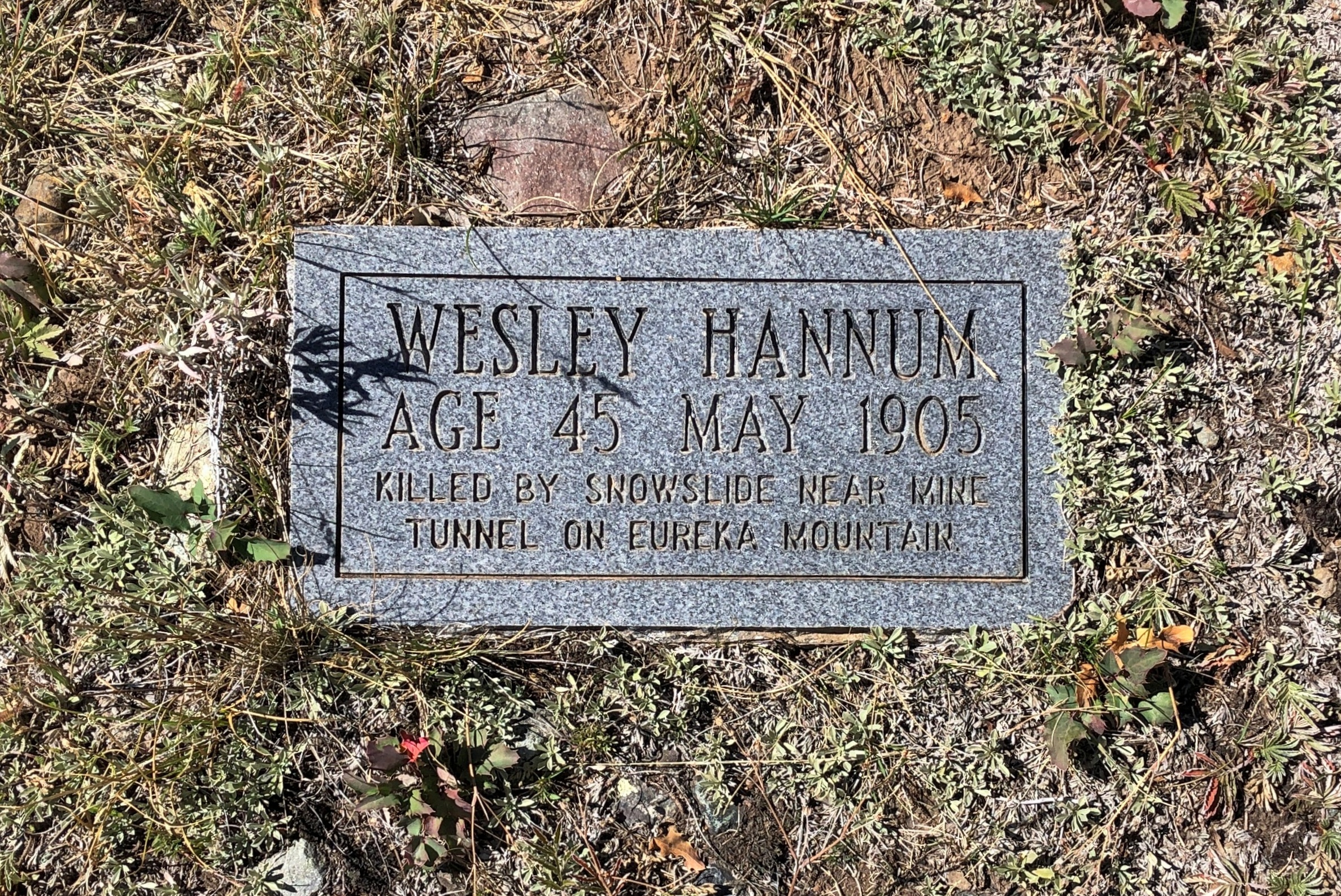
The Palestine City Cemetery is to the east of downtown, but not very far. Nowhere is that far in town.
The crumble is on.
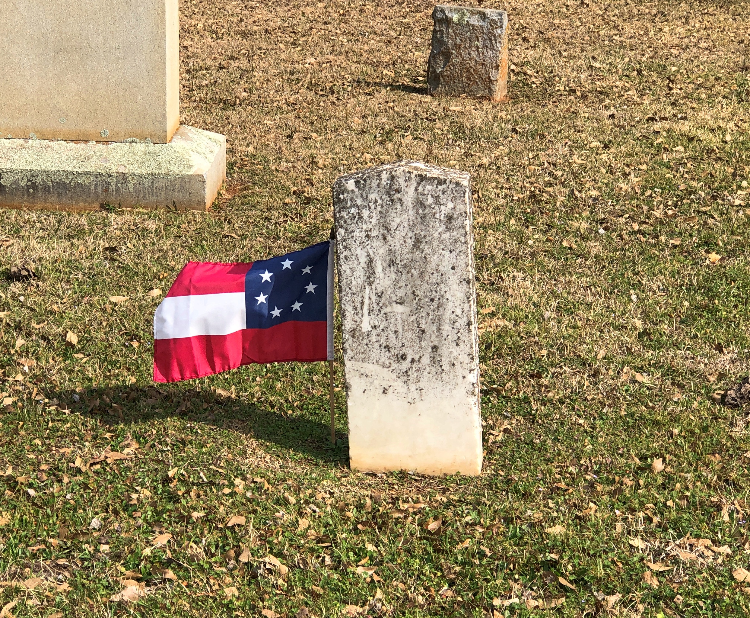
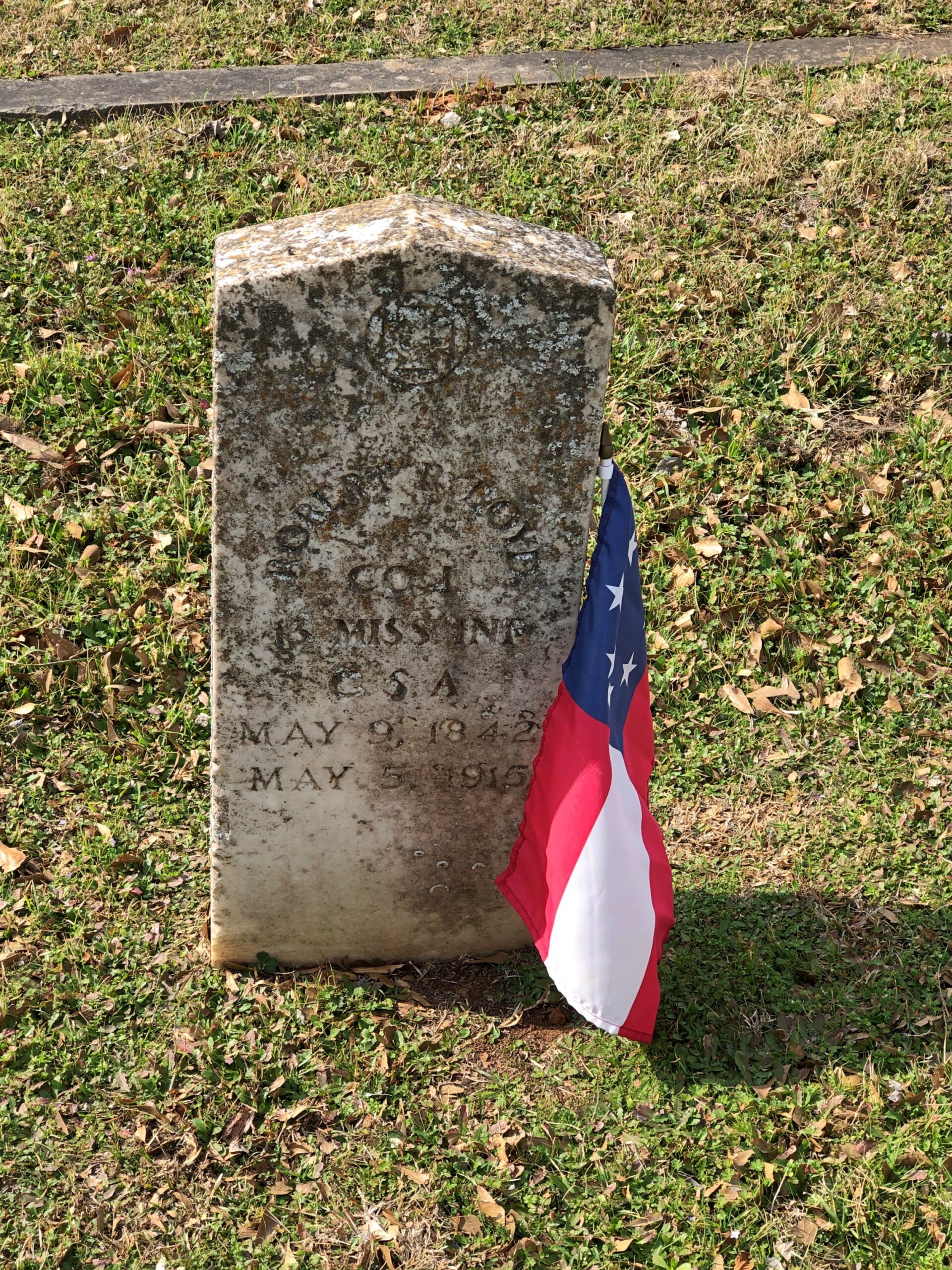
Something you don’t see that often. Not just the Stars and Bars, but the very first version with seven stars. In the fullness of not much time, six more stars were added.
Unknown CSA soldiers.
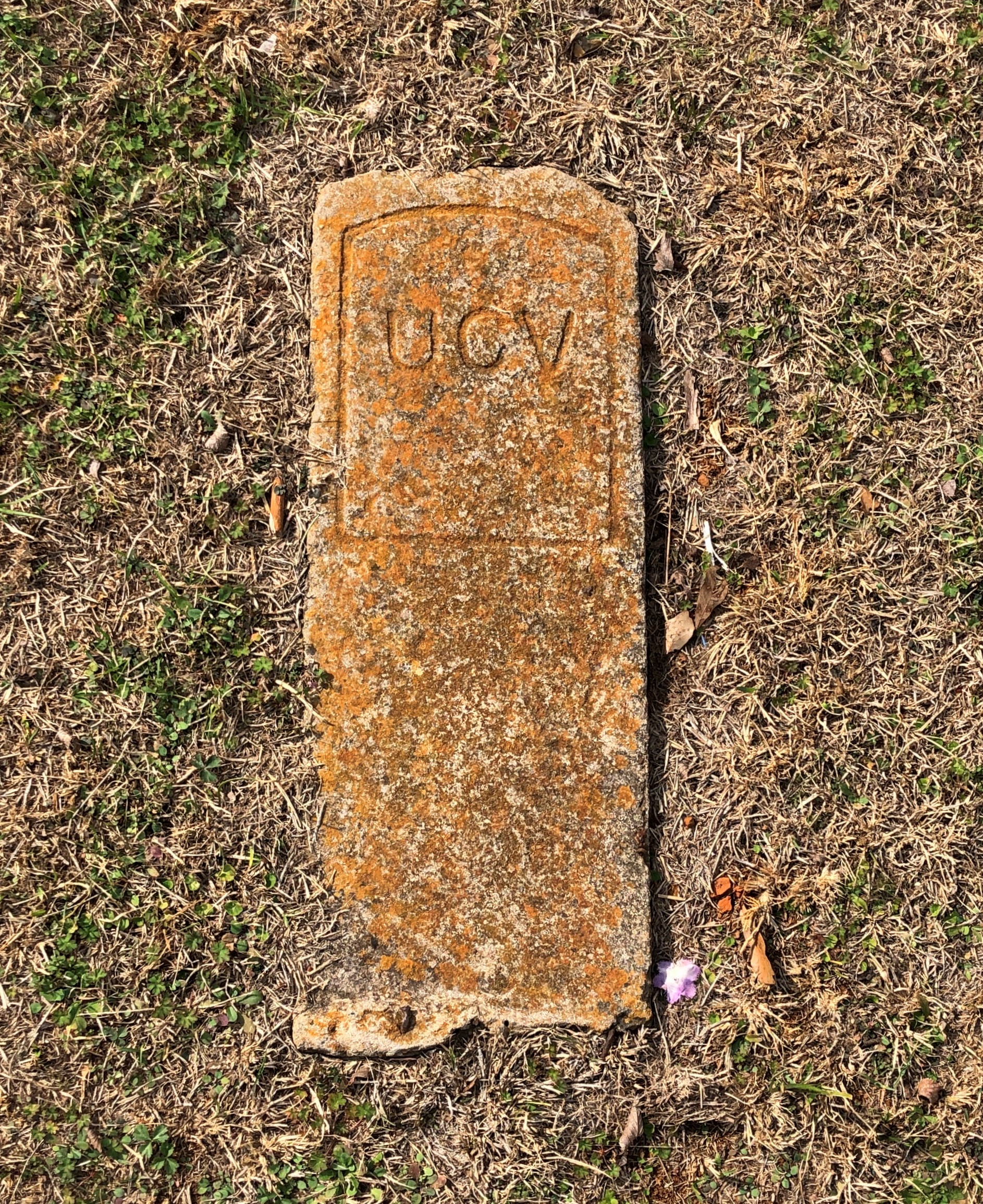
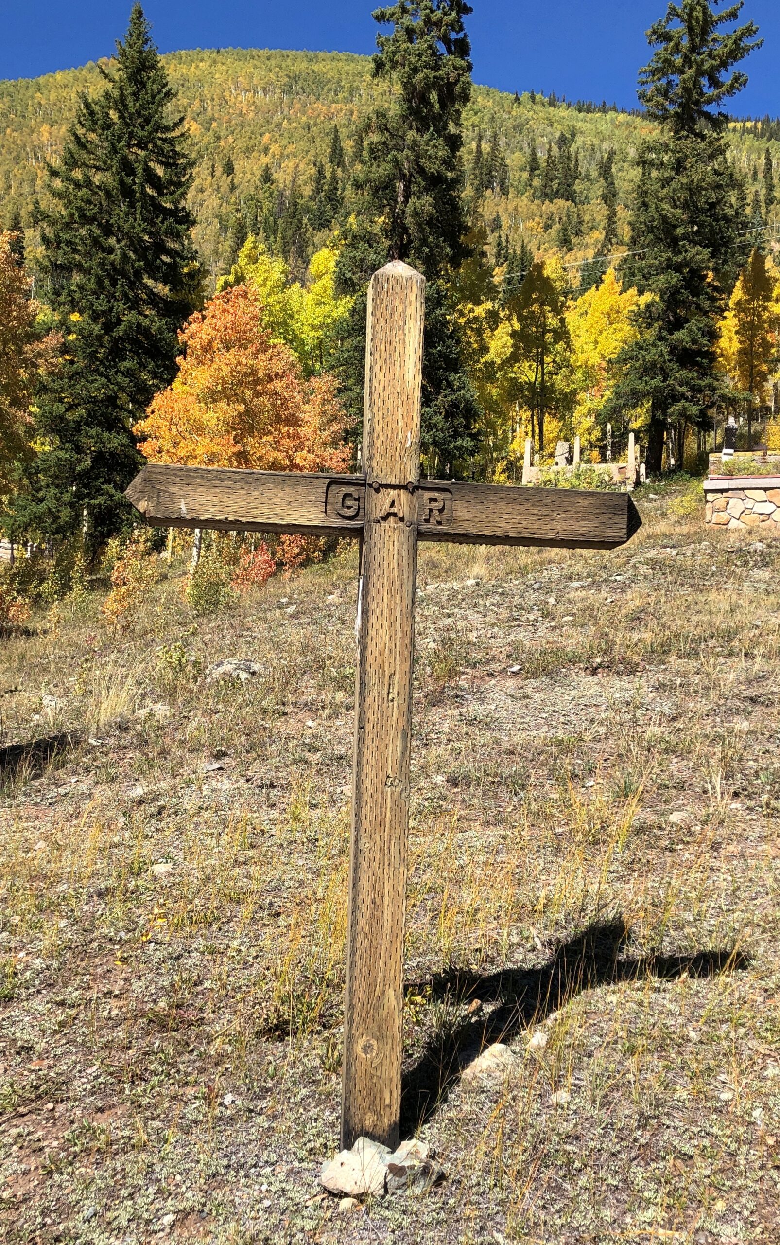
I assume United Confederate Veterans, the Southern equivalent of the GAR, placed this stone and those like it.
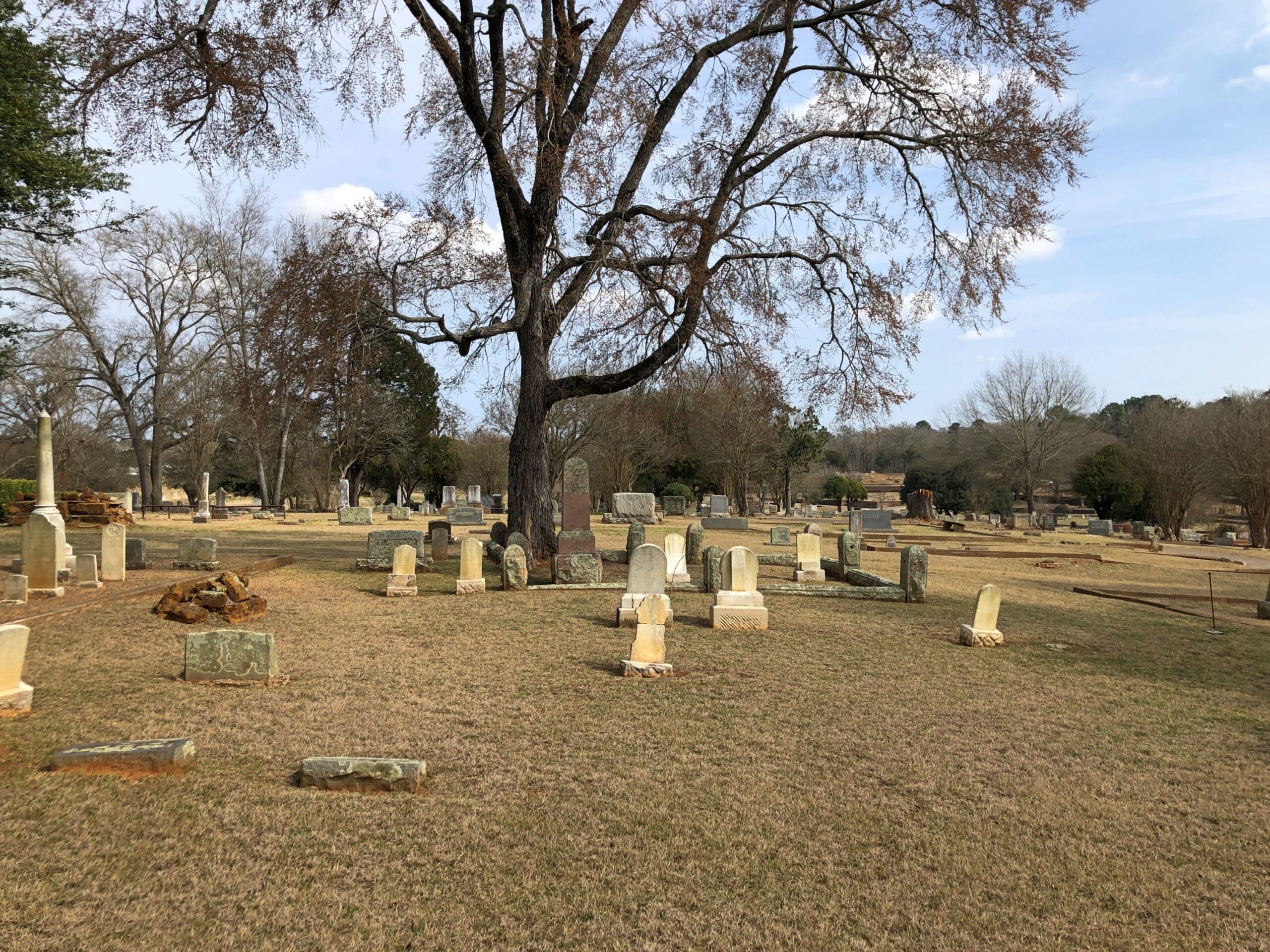
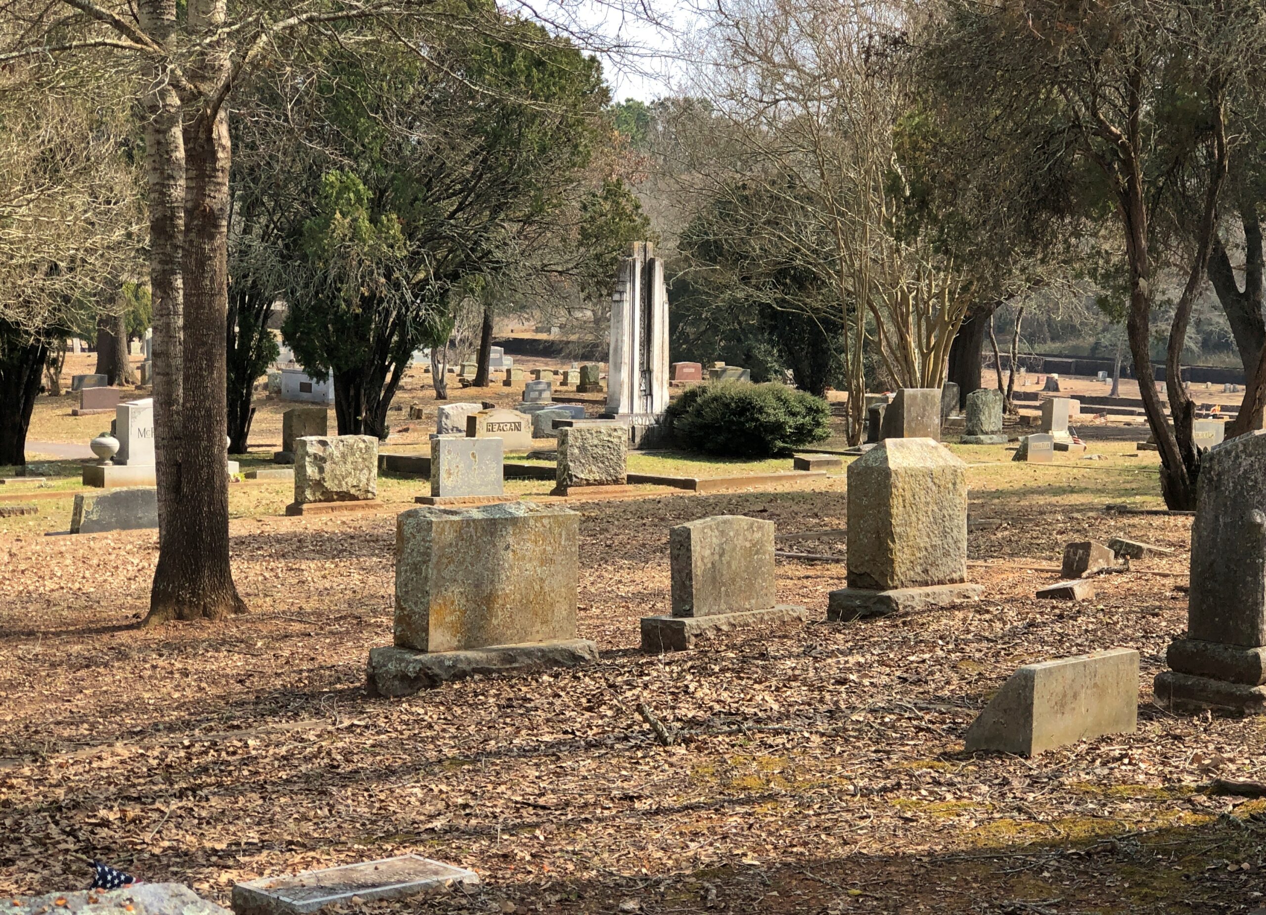
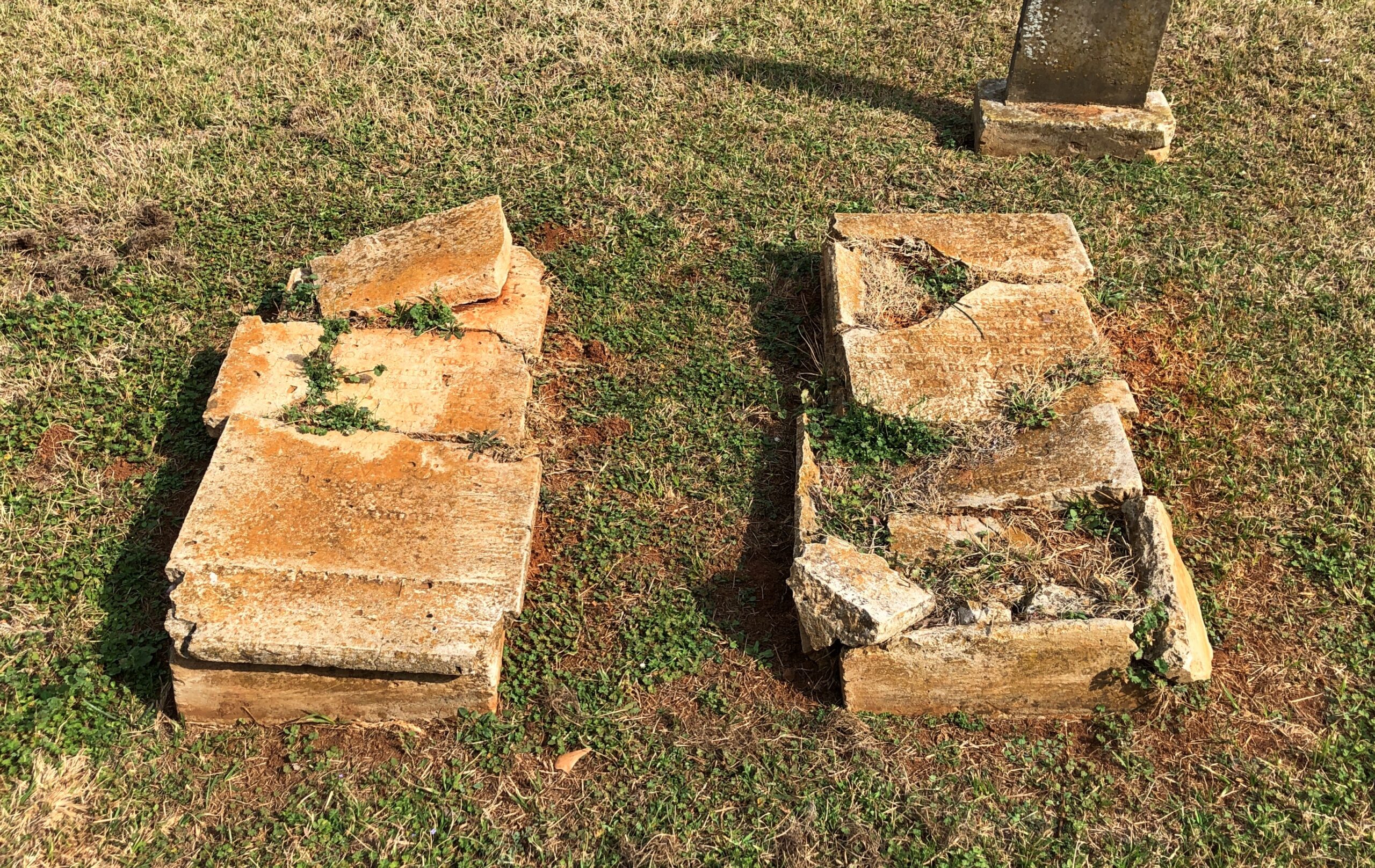
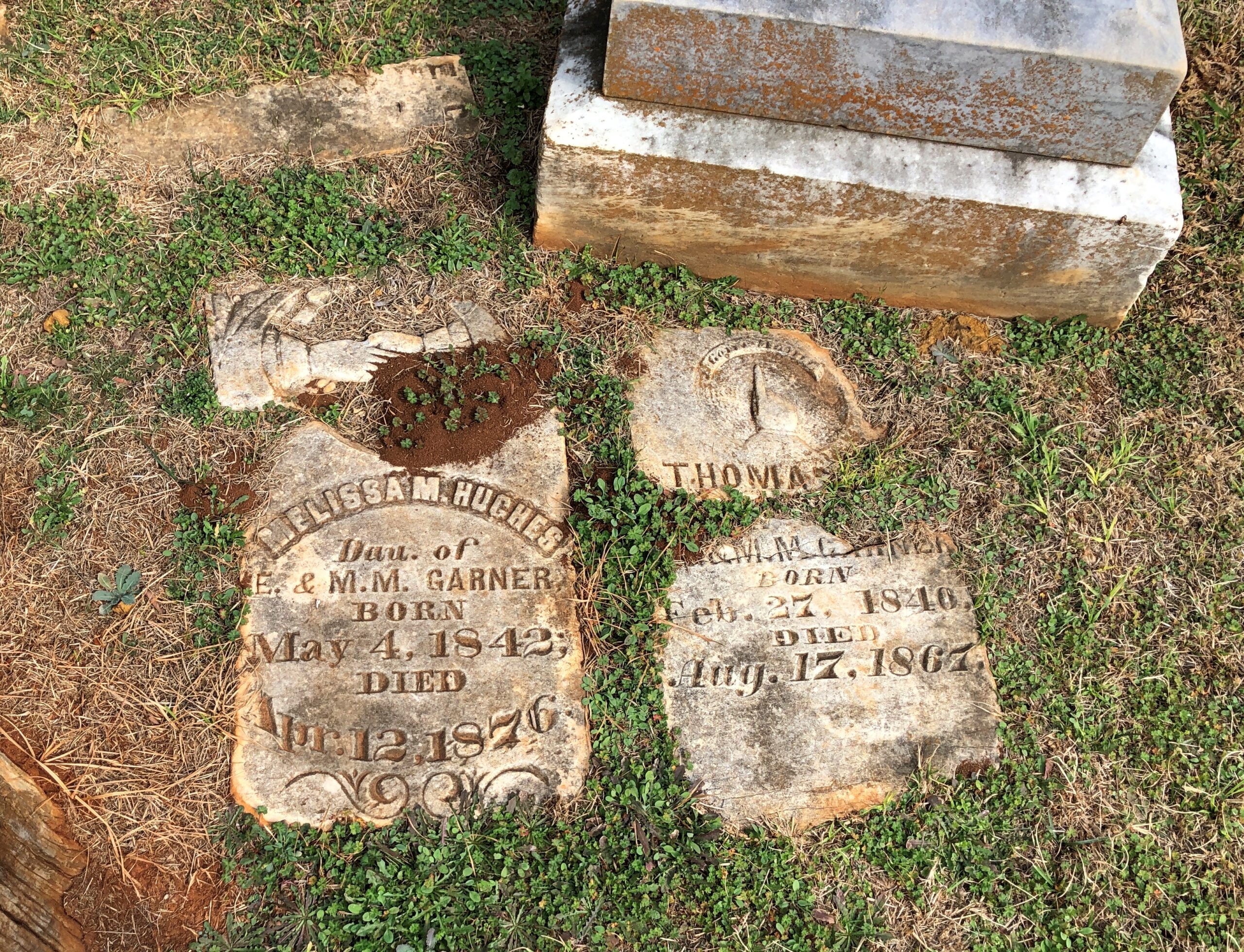
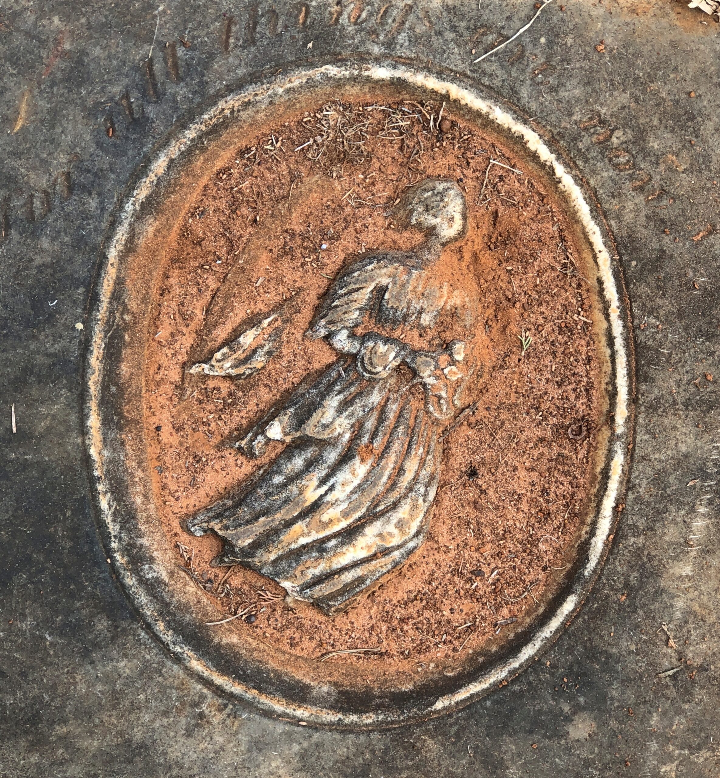
The cemetery has an impressive number of worn, broken stones, soldiering on through the elements.
Victorian sentiment in stone, said with due respect.
Would that kind of soft decay, the romanticism of stones worn by time and the elements, have appealed to Victorian sensibilities? Could be.
Never cared much for the term snowbird, with its connotations of getting up every morning to play golf during winter in some arid place, or spending the evenings with members of your cohort in some gated community, maybe drinking but definitely grousing about the state of the world. Still, considering that in the winter of 25/26, I’ve spent two out of the last three months – the hard winter months, up Illinois way – in warmer places, it would be churlish to cast shade on fellow old people who happen to enjoy golf or grousing.
On the other hand, I’m not about to claim snowbird as descriptive for myself. I just happen to be able to take long trips during the cold months (along with my laptop, for work). In December, Florida. In February, Texas.
Back on February 3, I got on a plane and flew to Austin. I flew home from Dallas on March 3. In between, I spent time – and Yuriko joined me for a while – traversing the state of Texas, going so far west at one point that we ended up in New Mexico. By traversing, I mean long drives, in a rental car part of the time, and in my brother Jay’s car as well, a blue Subaru known as the Blubaru.
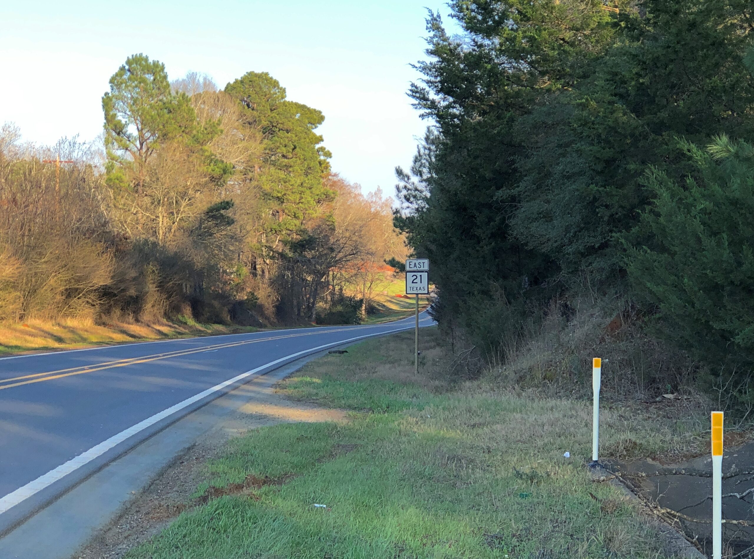
I drove from Austin east to Houston, mostly on US 290; from Houston to Nacogdoches, mostly on US 59; then to Dallas on various state highways, such as Texas 21 and 19; and from Dallas to San Angelo to Marathon, Texas, on US 67 and on the grandly remote US 385, which will also take you to the desert reaches of the Big Bend.
From Marathon, Texas, across to Carlsbad, NM, our route took us along US 90, then Texas 56, then US 62/180. Later, US 62/180 took us from Carlsbad part way back to Dallas — to Sweetwater, Texas — but mostly we went on the faster but less interesting I-20. Dallas to San Antonio was partly I-35, but also US 281, which takes you around the perma-gridlock that is Austin.
Of all those, the road between Nacogdoches and San Augustine on a day trip, Texas 21 heading east, winding through greenish (for February) rolling hills, was a favorite.
The towns listed above were just the places I spent the night, alone or with Yuriko or with my brothers. In between were such places as Bastrop, these days a day-trip from Austin, with the requisite boutiques and restaurants; Huntsville, home of Sam Houston and memorials to the first president of Texas; San Augustine, rival with Nacogdoches in claiming to be the oldest town in Texas; Stephenville and Ballinger, geographically about as deep in the heart of Texas as you can be; the West Texas art town of Marfa and the way station of Van Horn; a string of oil patch towns such as Hobbs, NM, and Seminole, Lamesa, Snyder, and Sweetwater, back in Texas. Later, traversing north to south and back again, I stopped in Hillsboro and Belton, along the I-35 axis; and Lockhart, which has claimed for itself barbecue capital of the state.
Along the way, oddities were encountered. Otherwise, why drive on smaller roads?
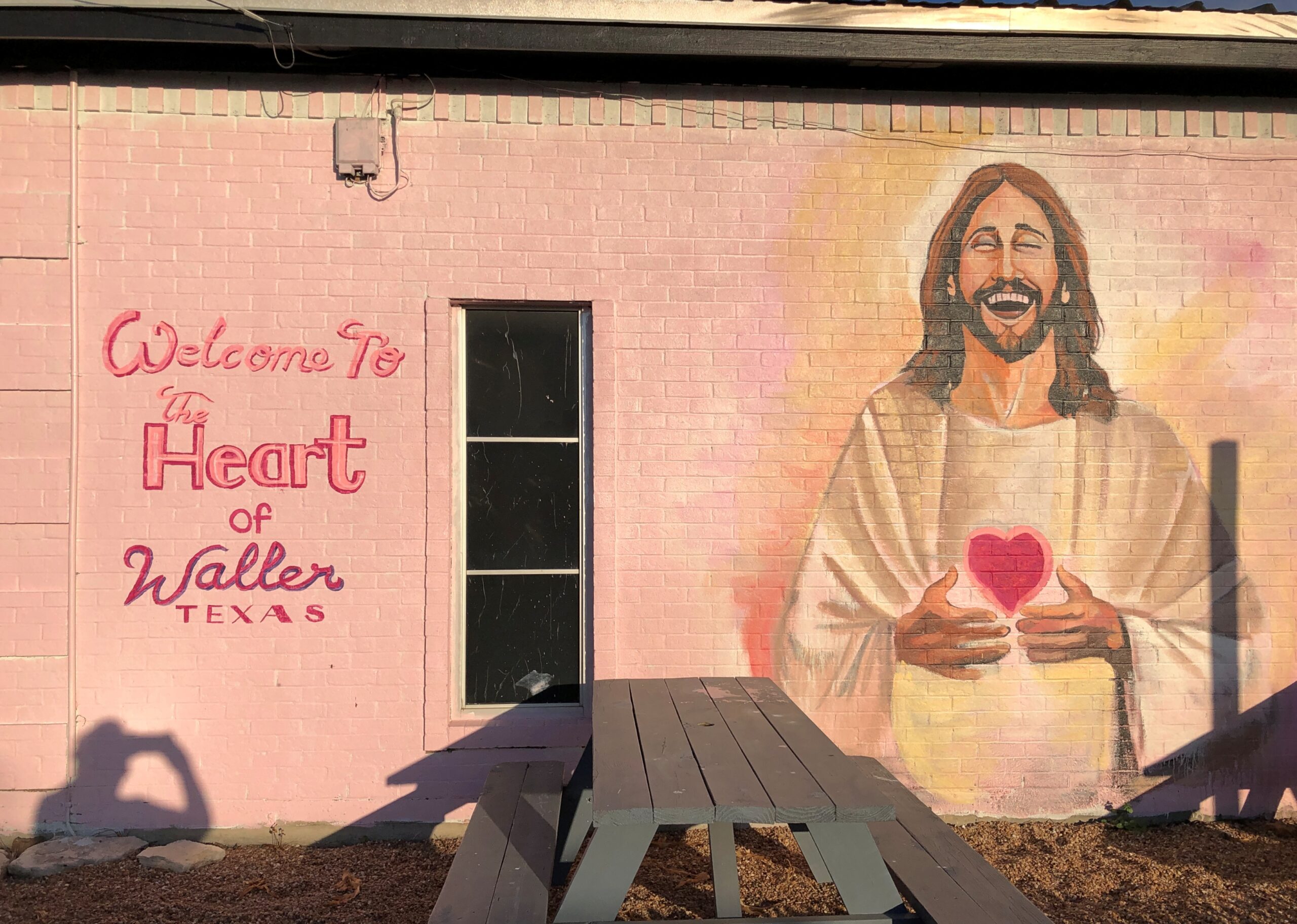
Such as an ice cream shop in Waller, Texas.
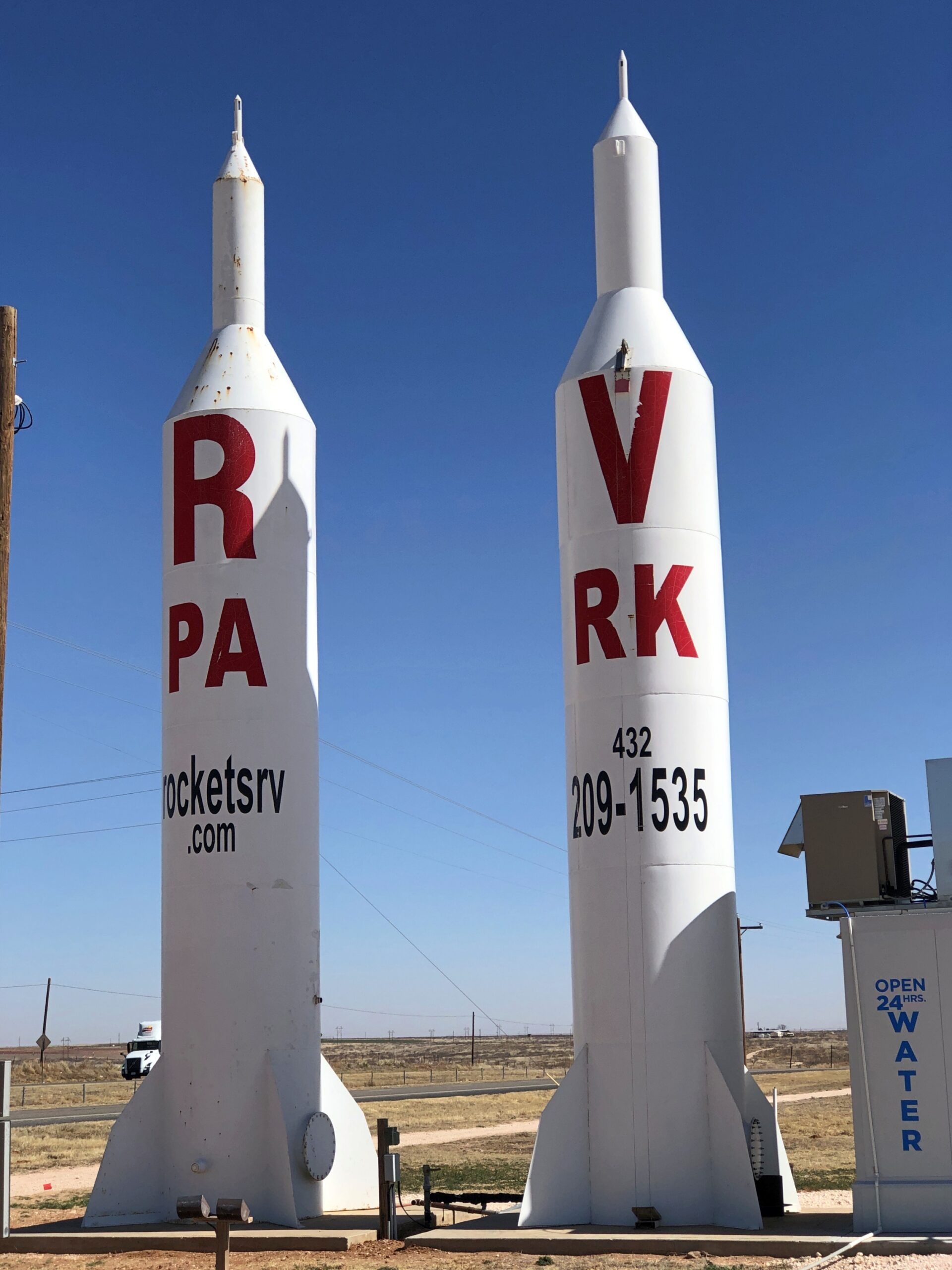
Or a highly visible ad for Rockets RV Park in Gaines County, Texas, not far east of the border with New Mexico.
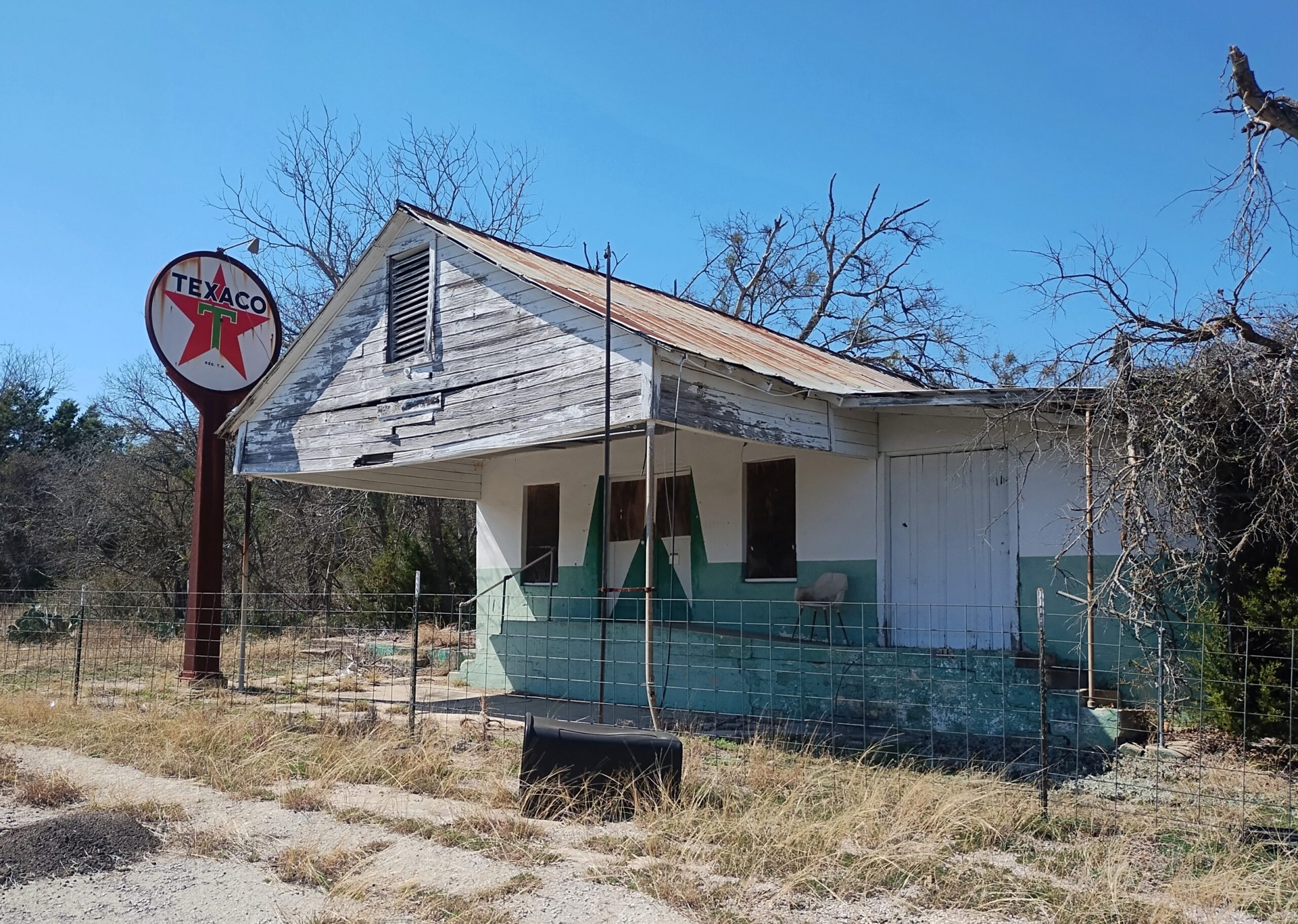
A former Texaco station on an obscure Texas highway (Farm-to-Market 1690).
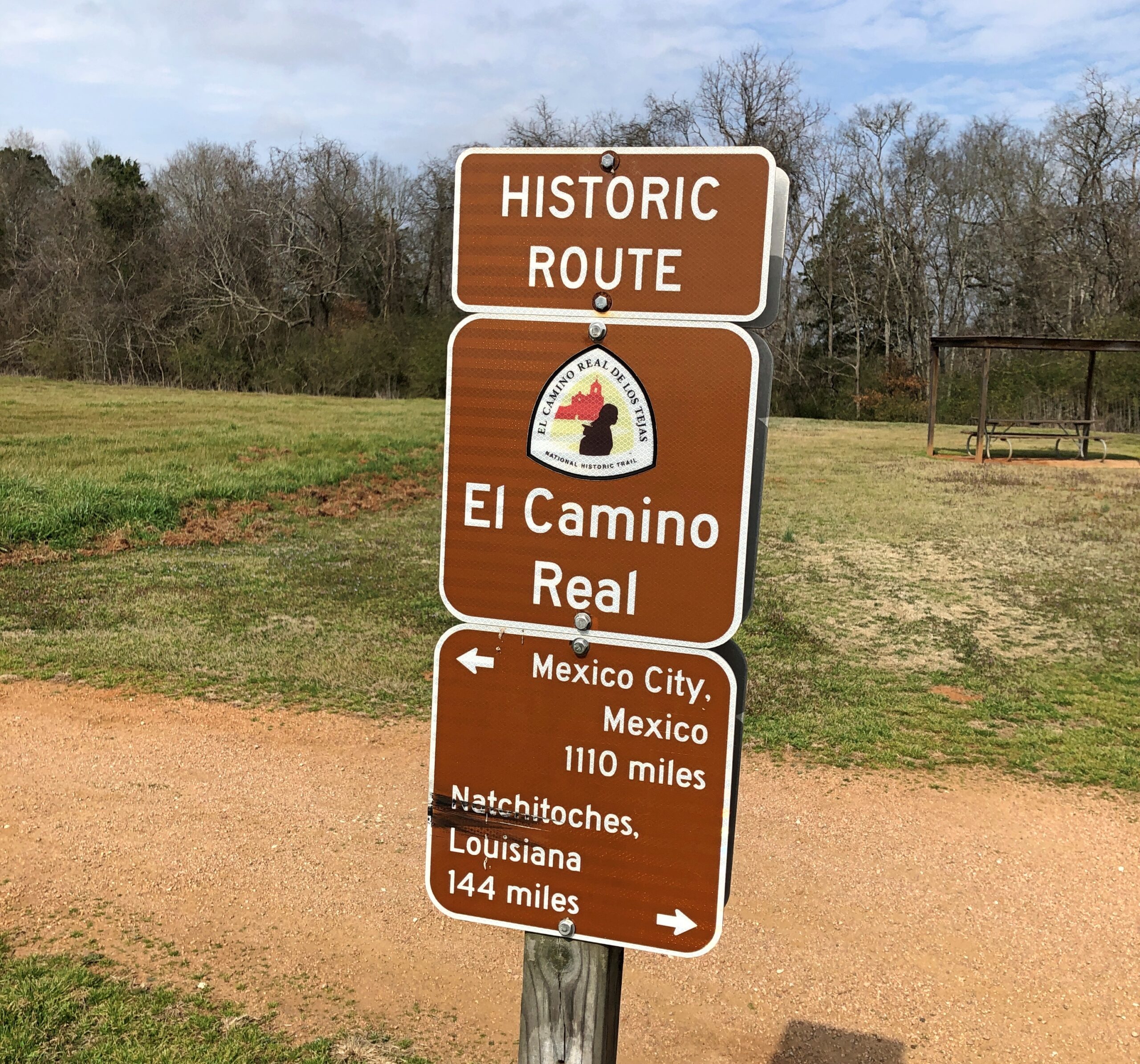
Had various encounters with the historic El Camino Real, whose various tendrils crossed a large slice of the future state of Texas, once upon a time.
Yuriko and I visited Big Bend National Park, Guadalupe Mountains National Park and Carlsbad Caverns National Park. I saw the National Museum of Funeral History in the city of Houston and the museum devoted to Houston (the man) in Huntsville. Also, Roadside America in Hillsboro, an eccentric collection of American commercial art, complete with a personal tour by the proprietor, and the outdoor art at the Chinati Foundation in Marfa, that is, brutalist concrete structures in the brutal desert environment. I became acquainted with the splendid Glenwood Cemetery in Houston and the smaller and more ragged, but no less interesting city cemeteries in Huntsville and Nacogdoches and Palestine. I stopped and looked at about a dozen county courthouses, of which Texas has many.
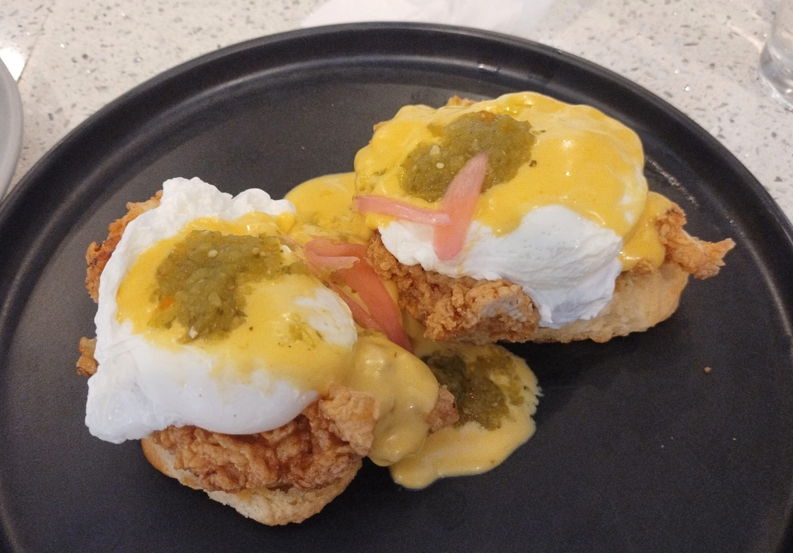
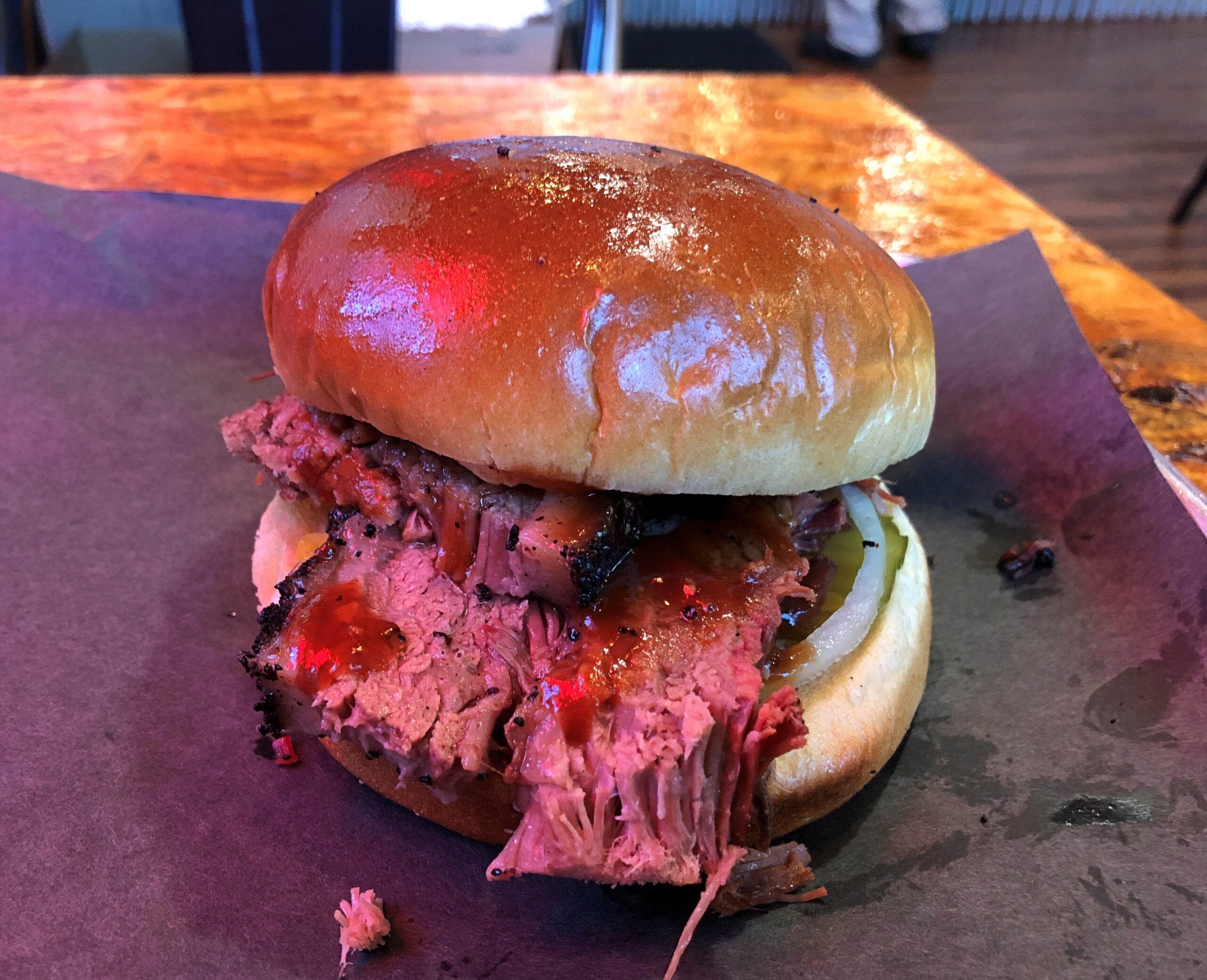
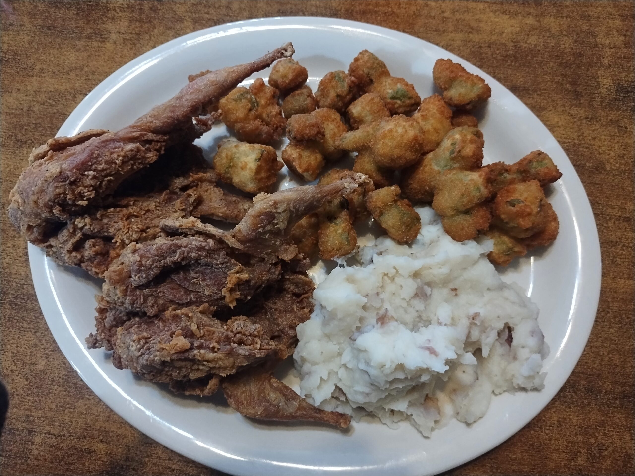
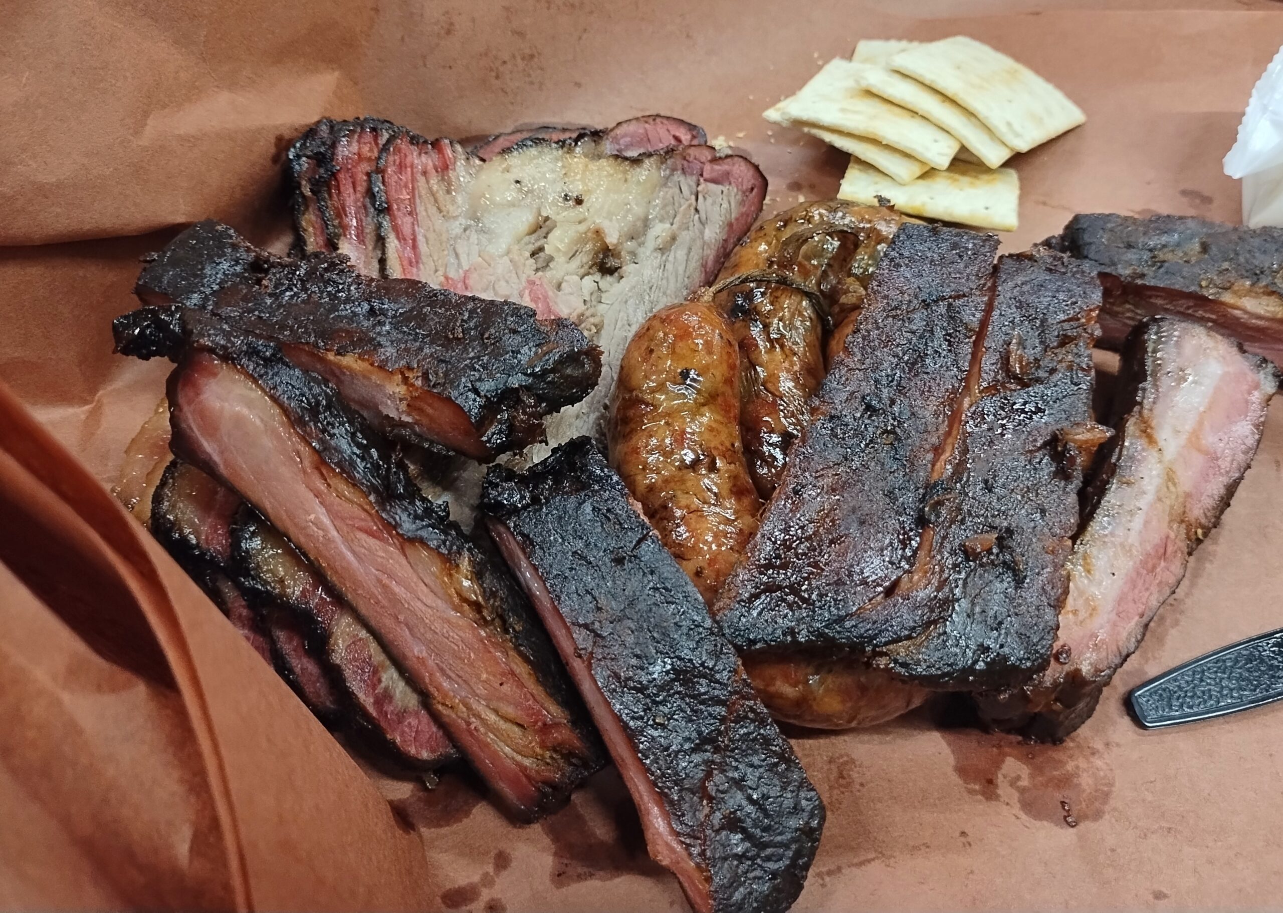
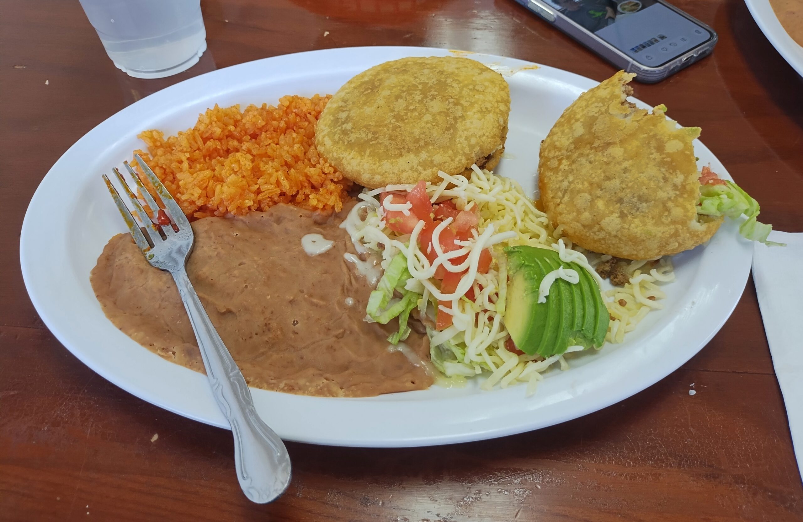
We ate a lot of meat along the way. As one does in Texas.
Also, Mexican food.
Eat like that and you’d better do some walking, and I did: various places in Austin and Houston and Dallas, in all three national parks, around downtowns and courthouse squares in a number of small towns, and a handful of local parks.
All that was good, but of course best of all, I had time to visit friends and relatives, of whom there are many in Texas: Tom and Nancy in Austin, Kirk and Lisa in Nacogdoches, another Tom and Steve and Ron and Greg and Judith in San Antonio, to list the friends; both brothers, two out of three nephews and their wives and all four of their children, to list relatives, along with the mother of one nephew’s wife (niece-in-law sounds peculiar, but that fits too). Also, I met for the first time two good friends of Tom’s in Austin, and one of Kirk and Lisa’s granddaughters.
I’d set out to do four long drives when I was 64, but this makes five. Guess I’m an overachiever about driving, anyway.
Cold winds rolled through northern Illinois today. Seven inches of snow are forecast for Saturday. What? Right, it’s winter. The winter solstice is just the shortest day of the year.
Back to posting on Sunday. Regards for Thanksgiving.
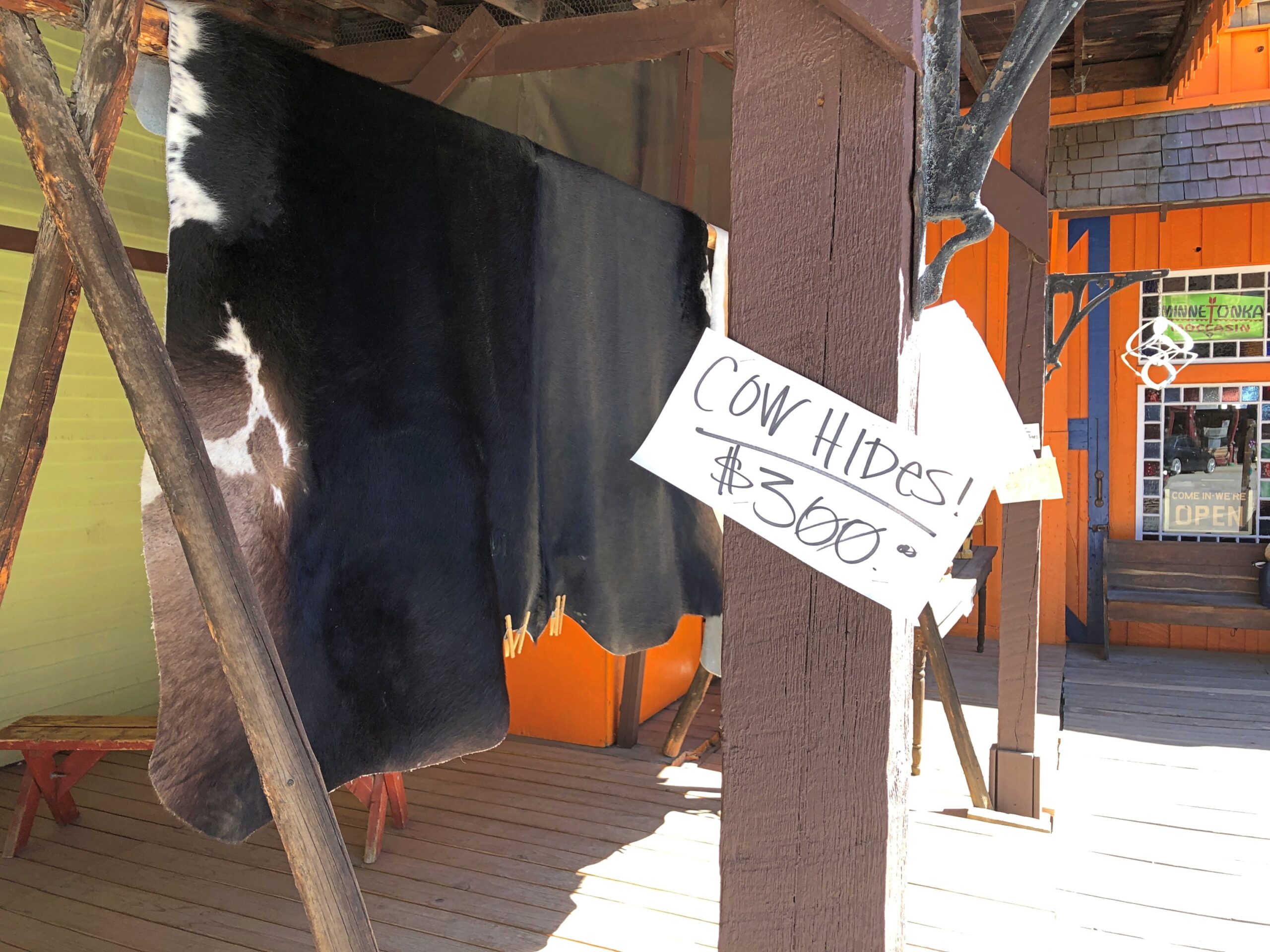
Something to upset PETA sympathizers.
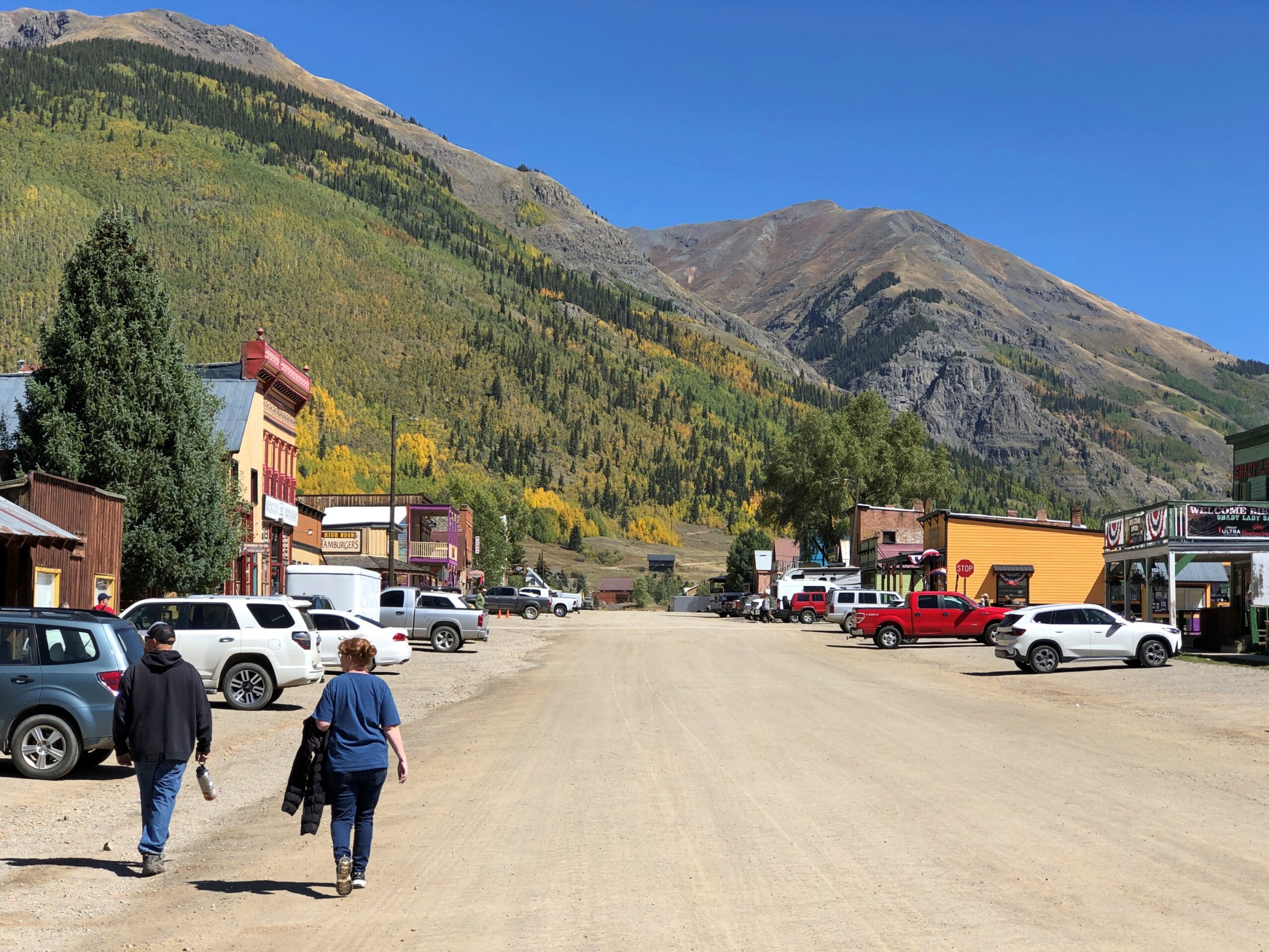
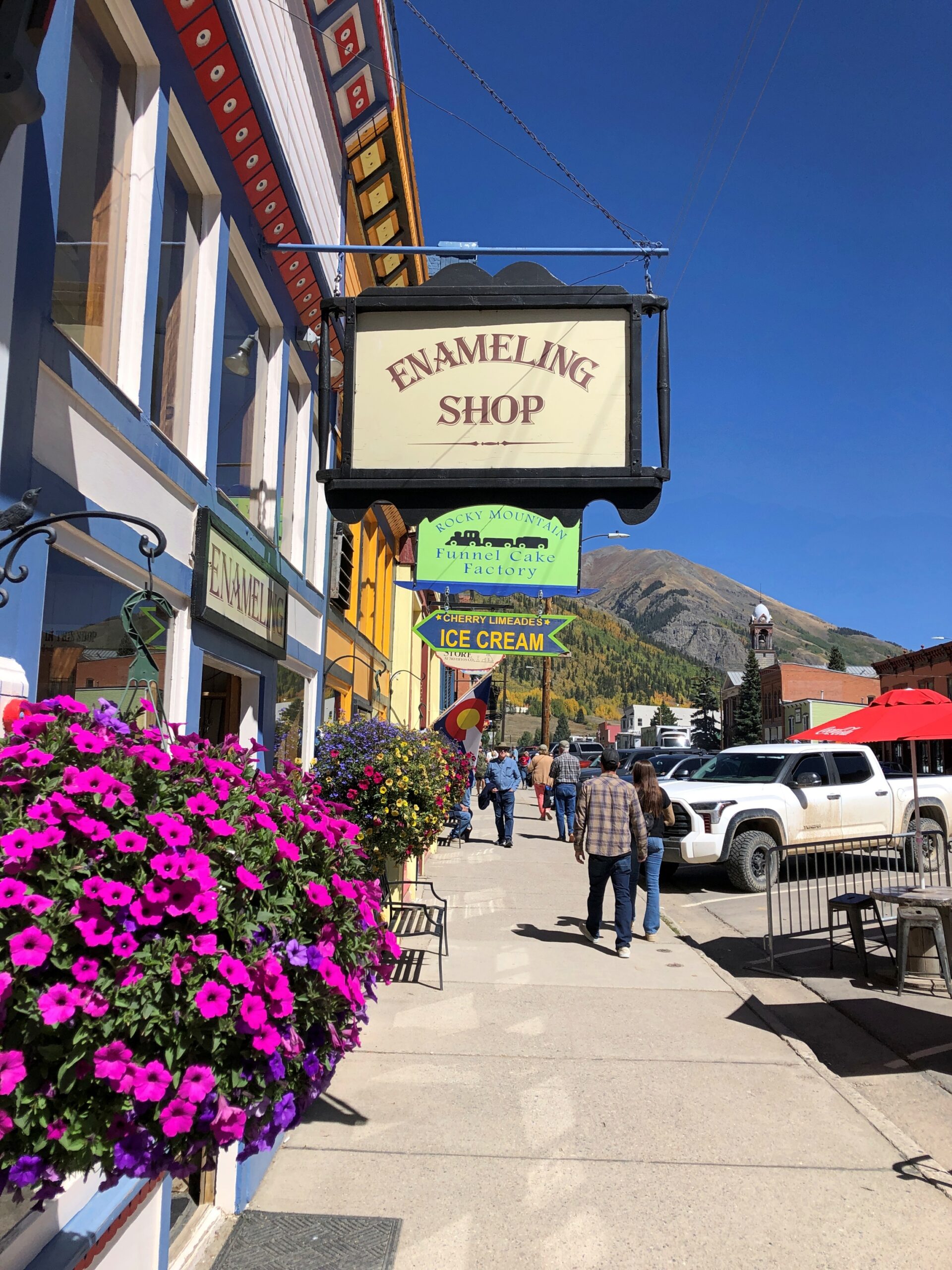
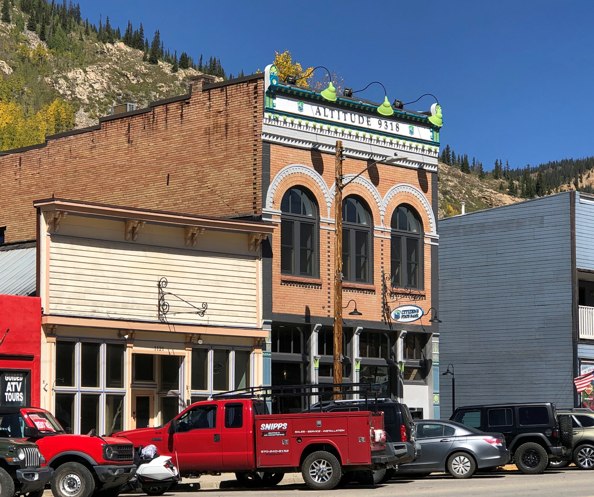
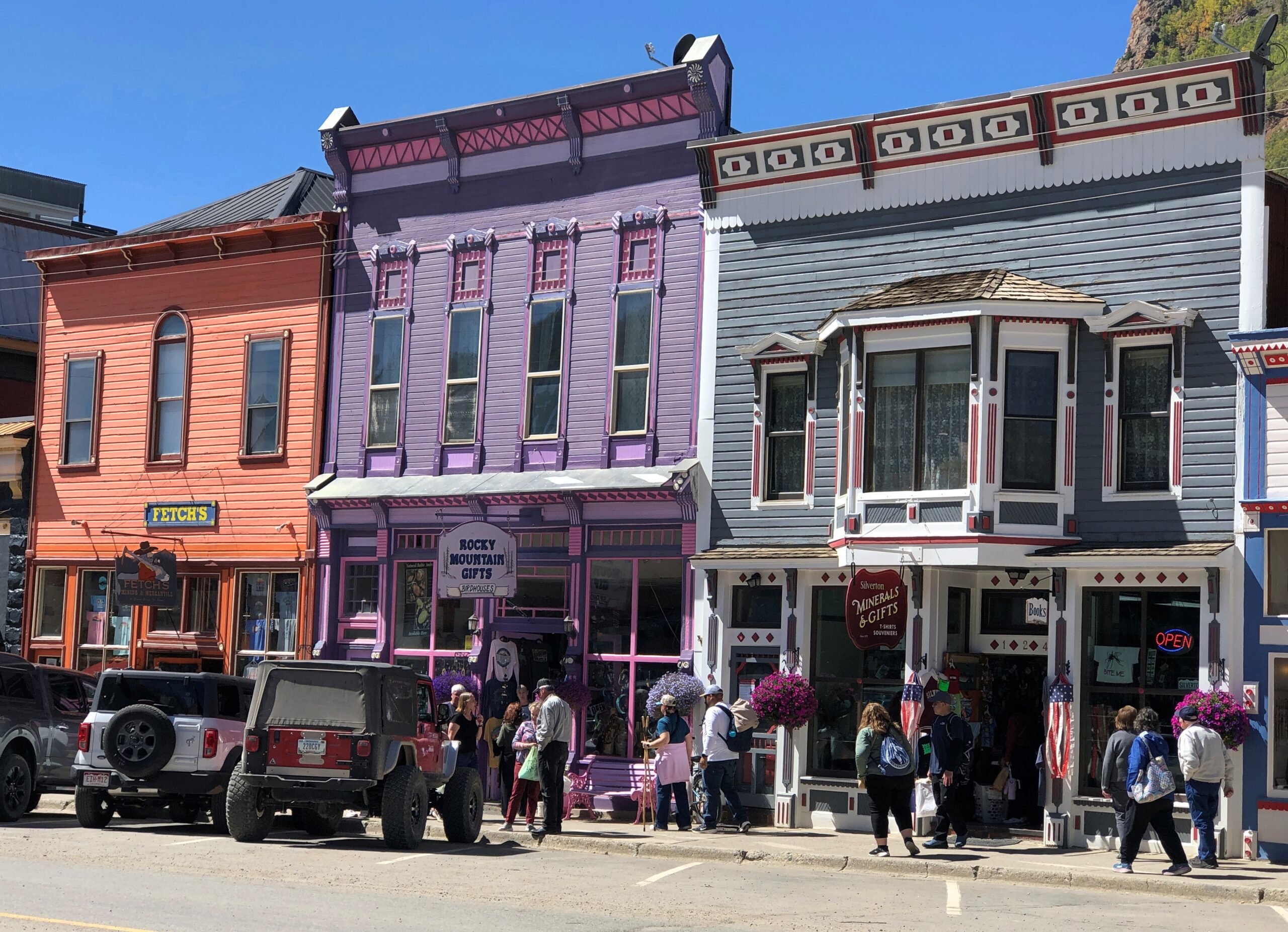
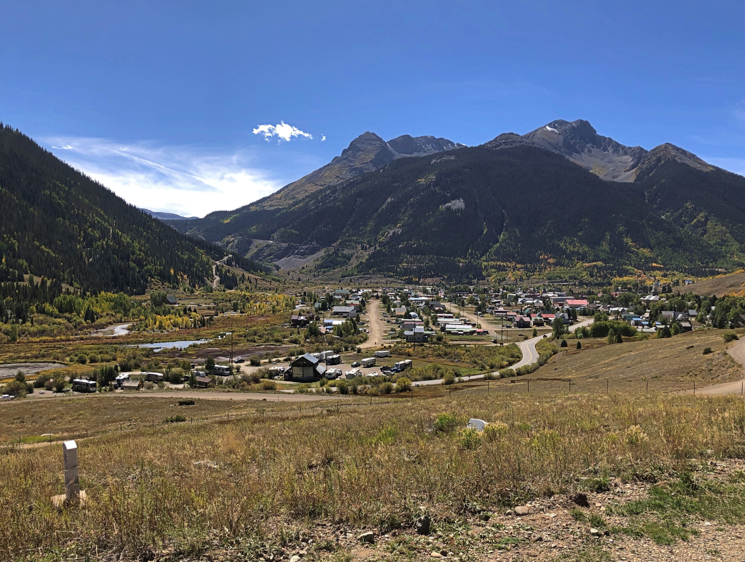
Stroll down Greene St. in the mountain town of Silverton, Colorado, at least in mid-September this year, and you’d have had the opportunity to buy a hide for $300. We did, but declined. Still, it wasn’t just a Colorado detail, but a Western one. The West, where men are men and cow hides hang in the sun. As far as I could tell, you couldn’t buy a hide with Bitcoin, but I suppose you’d have to ask the seller to be sure.
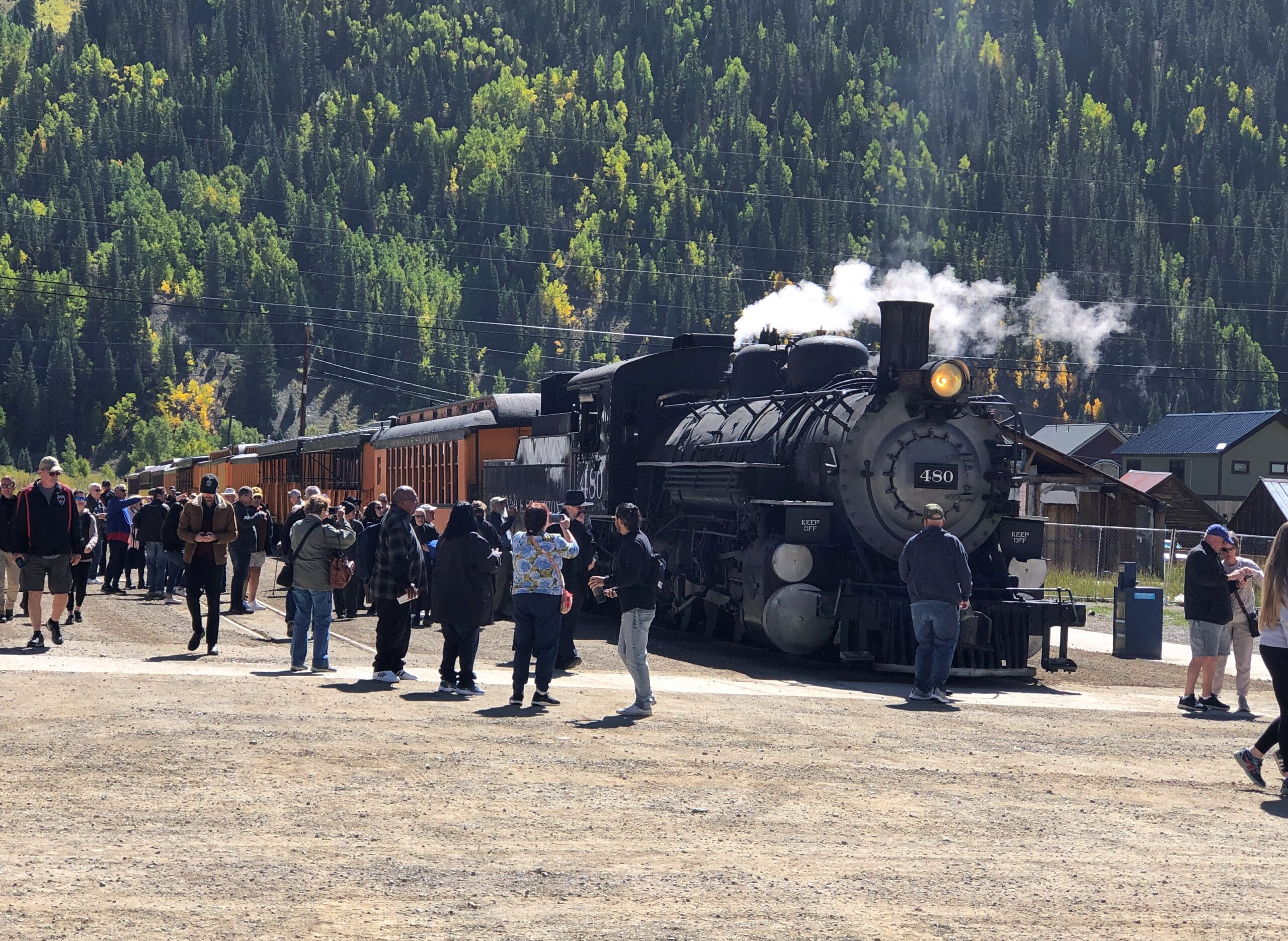
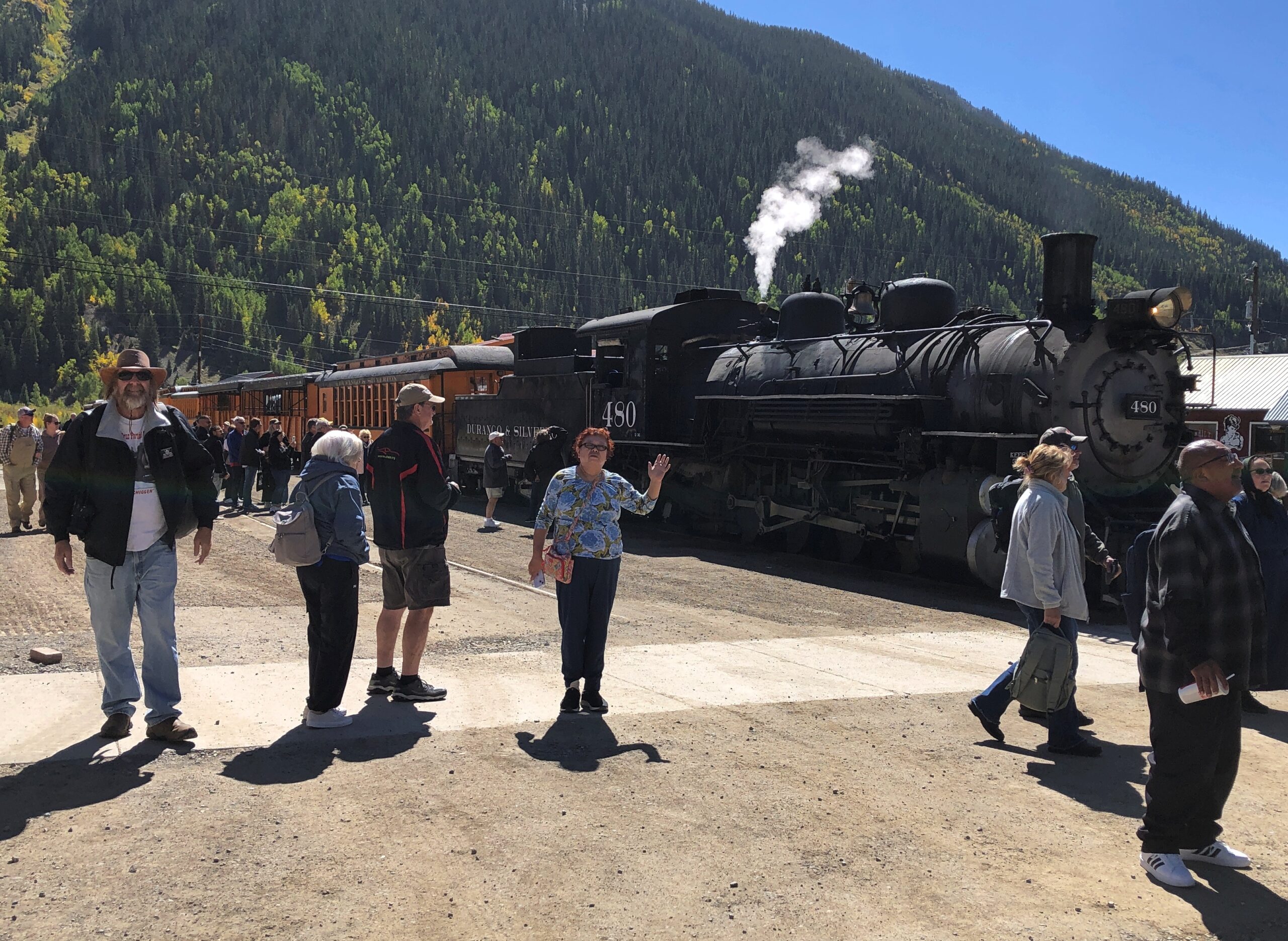
Not five minutes after we’d parked off the main thoroughfare of Greene Street in Silverton, on a large side street, a steam locomotive hauling a valuable cargo — tourists — pulled into town, a block from where we parked. The Durango & Silverton Narrow Gauge RR train from Durango had arrived. Instantly the streets around the train were thick with those same tourists who had paid roughly $100 a head for the scenic ride, though I suppose many, the majority maybe, had gotten a slight discount as seniors.
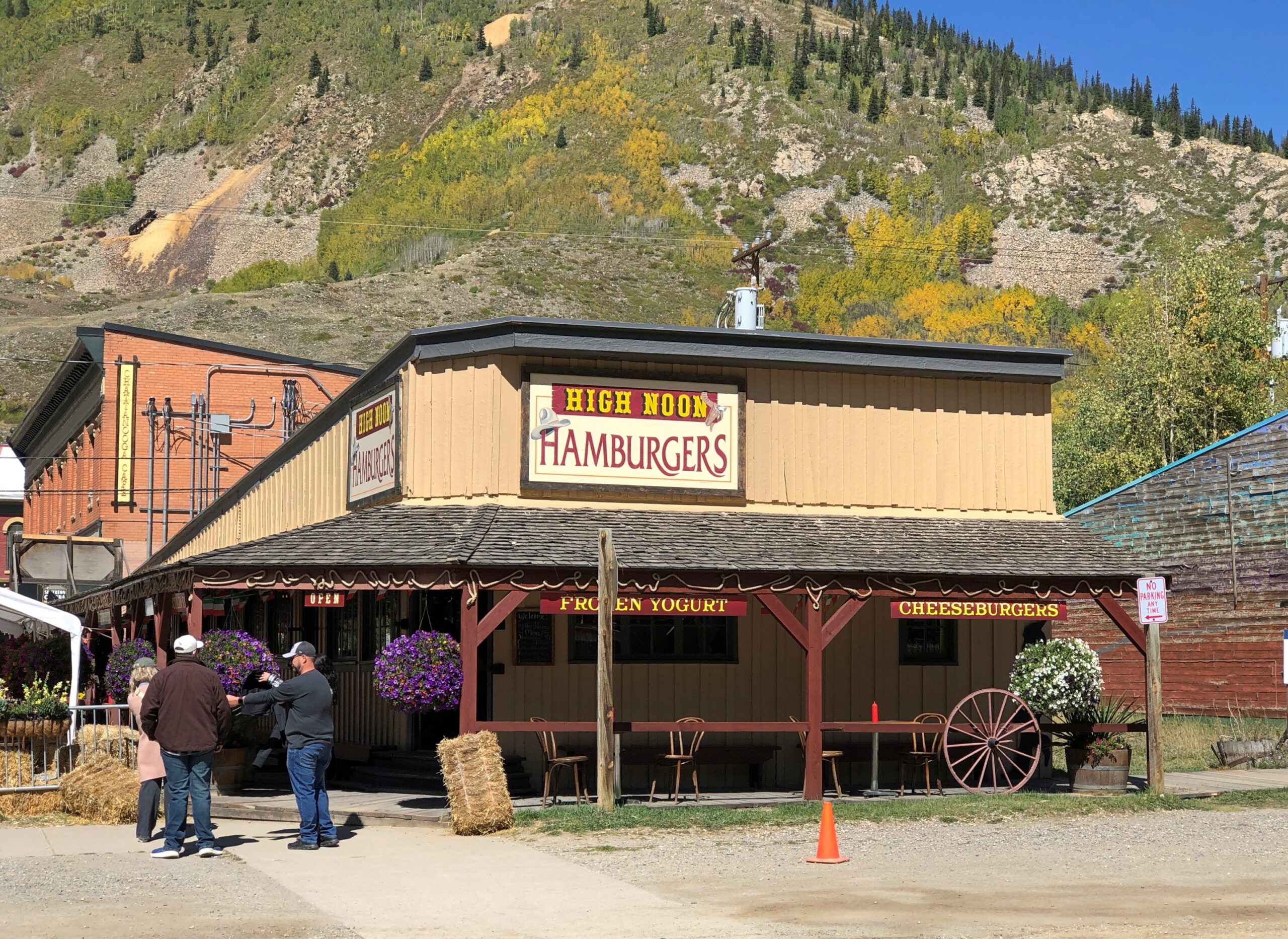
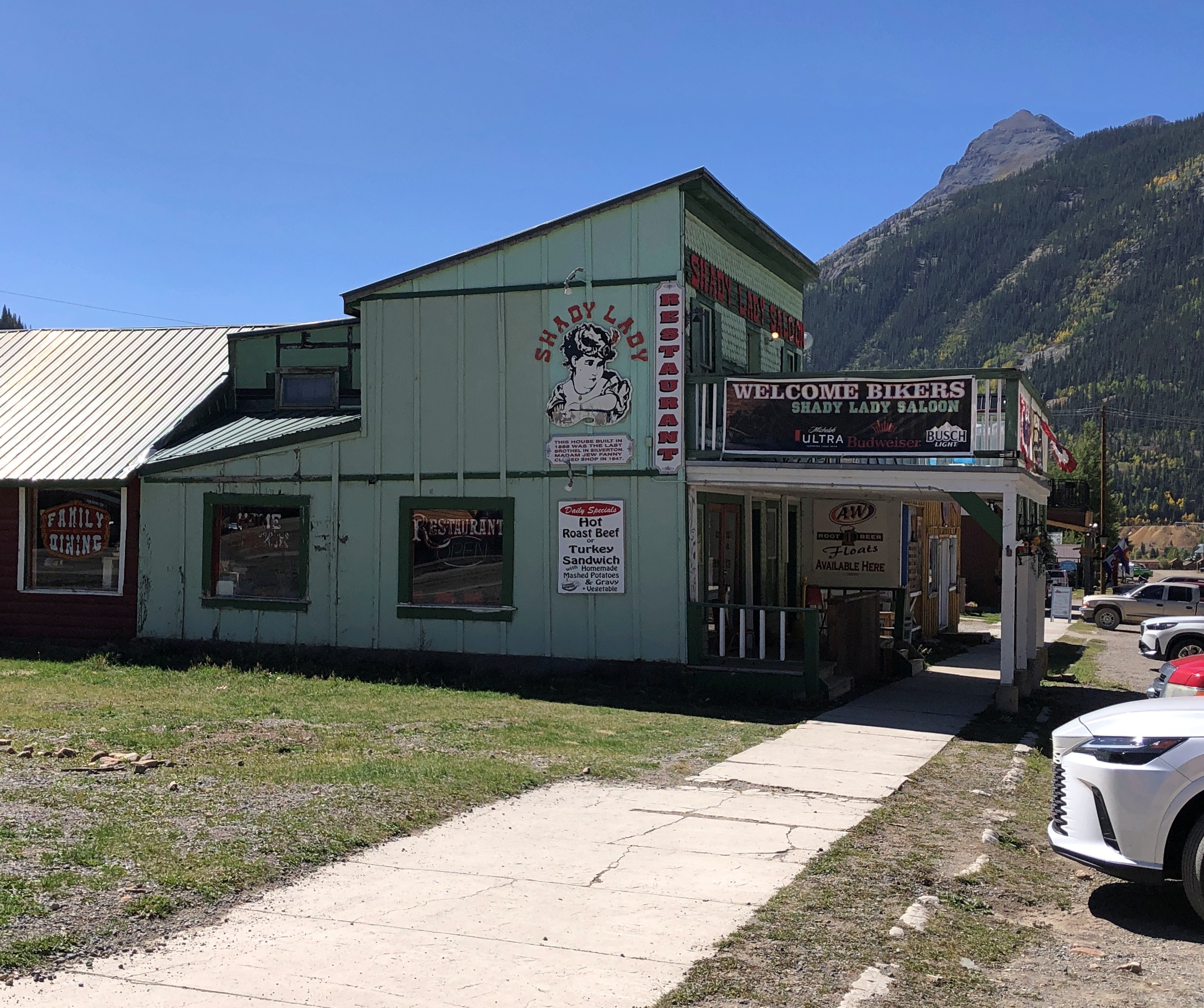
I assume the economy of 21st-century Silverton depends pretty heavily on these arrivals, at least in the warm months, as day after day the line disgorges its many passengers for their layover. No doubt the likes of High Noon Hamburgers or the Shady Lady or a lot of the other businesses in town wouldn’t be viable otherwise.
Blair St., paralleling Greene St. a block away. No need for pavement.
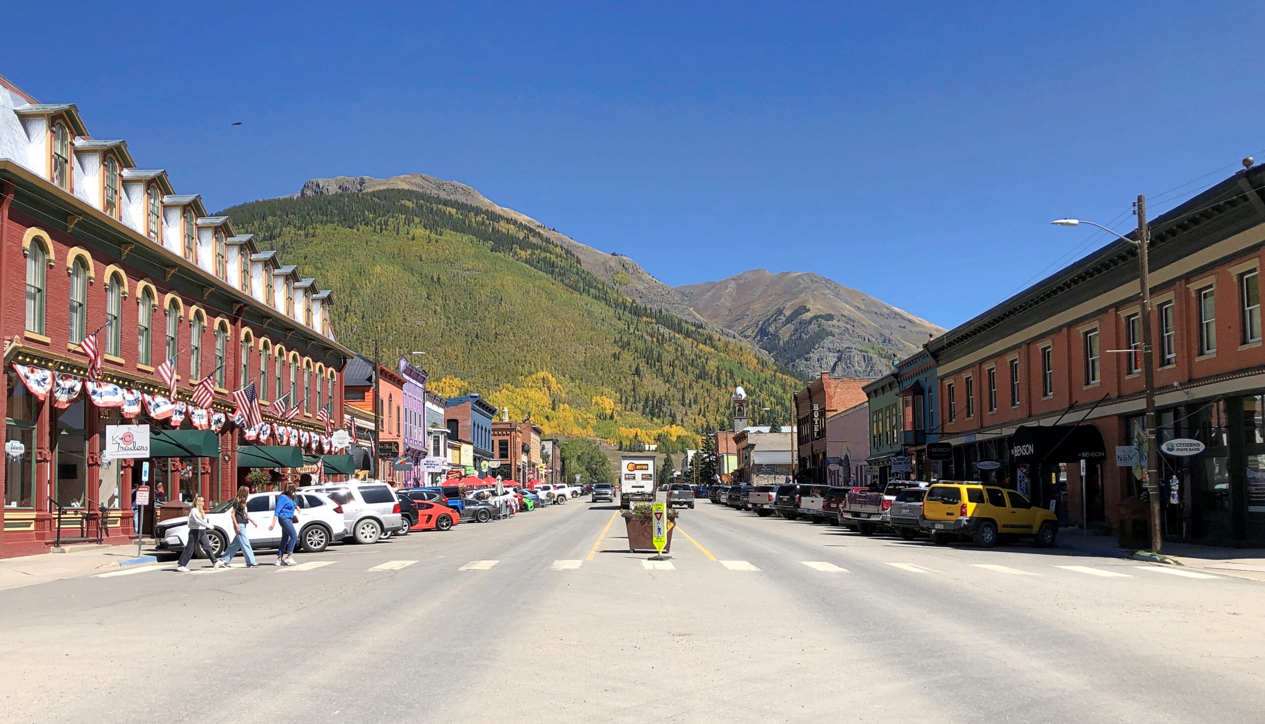
Greene St.
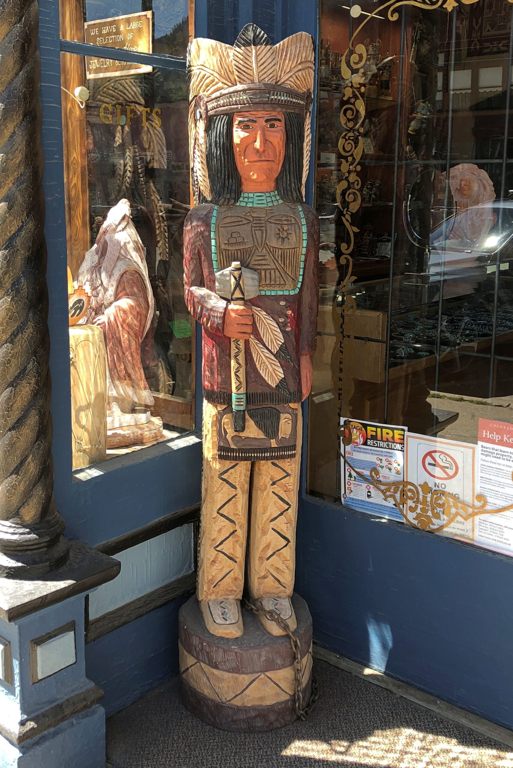
Lots to see on Greene.
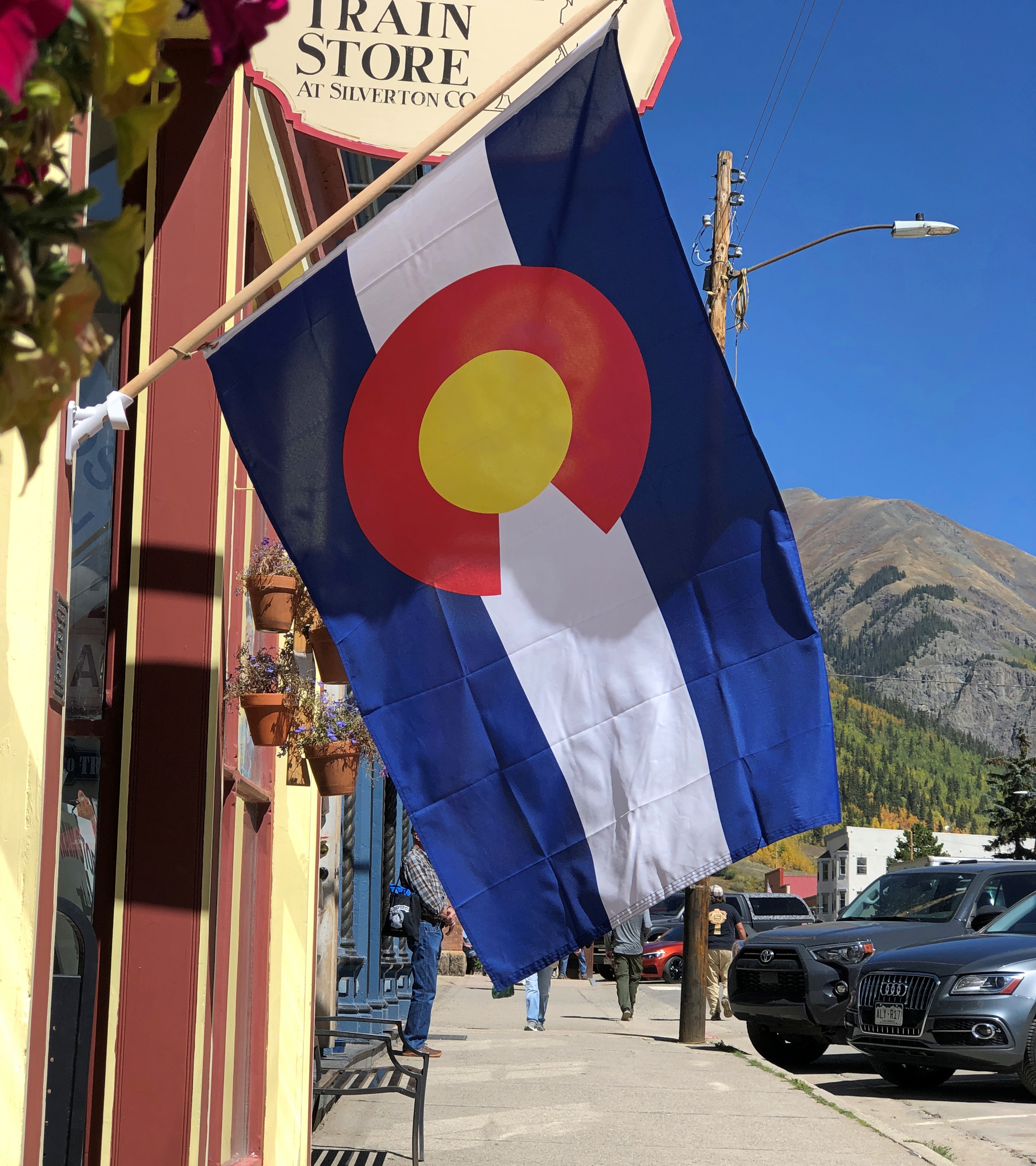
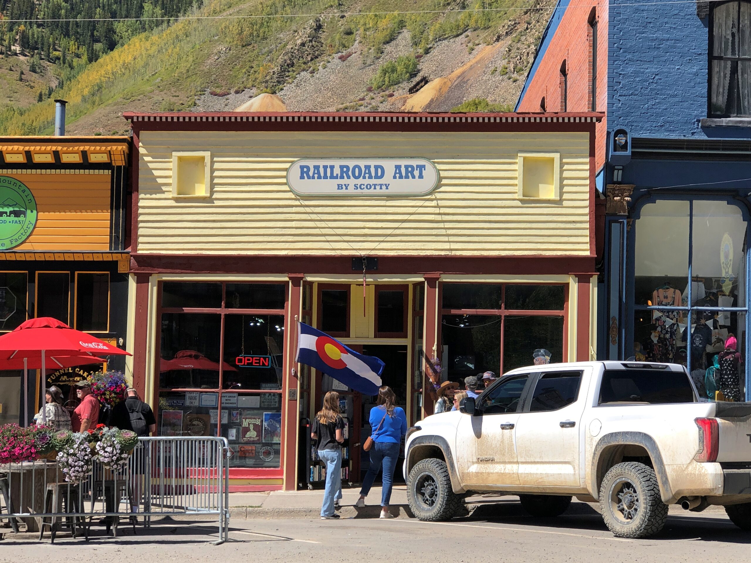
Including the fine Colorado flag, flying at Railroad Art by Scotty, a seriously cool gallery.
“Railroad Art by Scotty presents the custom matted and framed collector Railroad Art Prints by renowned railroad artist H.L. Scott, III,” its web site says. “These are not photographs and they are not created on the computer. These are pen & ink drawings created by Scott using the technique known as STIPPELING or pointillism.”
One of the few buildings I’ve seen that clearly states its elevation.
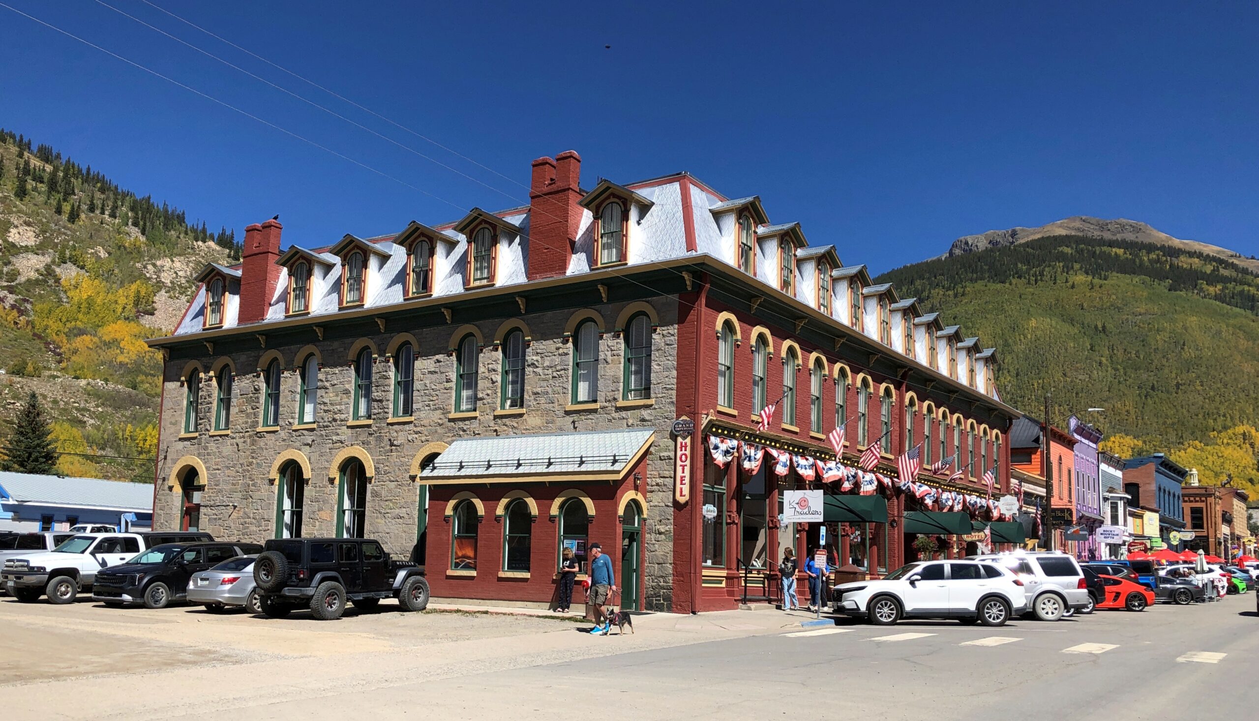
The Grand Imperial Hotel. A lofty name to live up to, but probably posh enough to do so.
Restored to its 1880s appearance in the 2010s, no doubt at considerable expense.
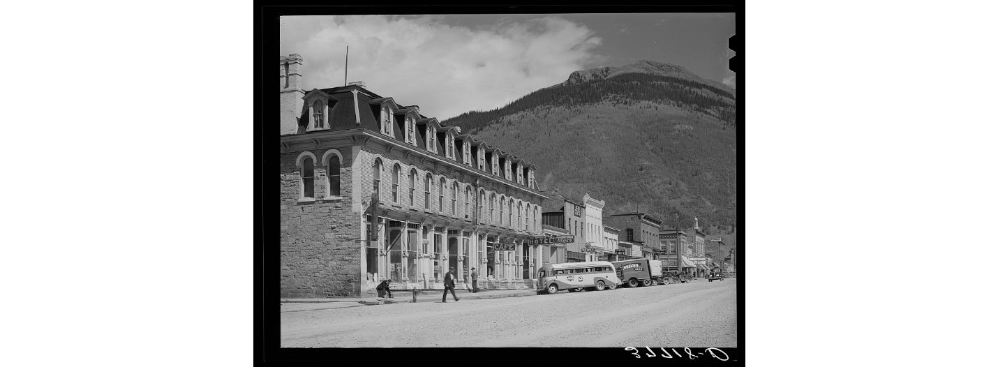
As it looked in 1940, a photo from the Library of Congress, Farm Security Administration-Office of War Information Photograph Collection.
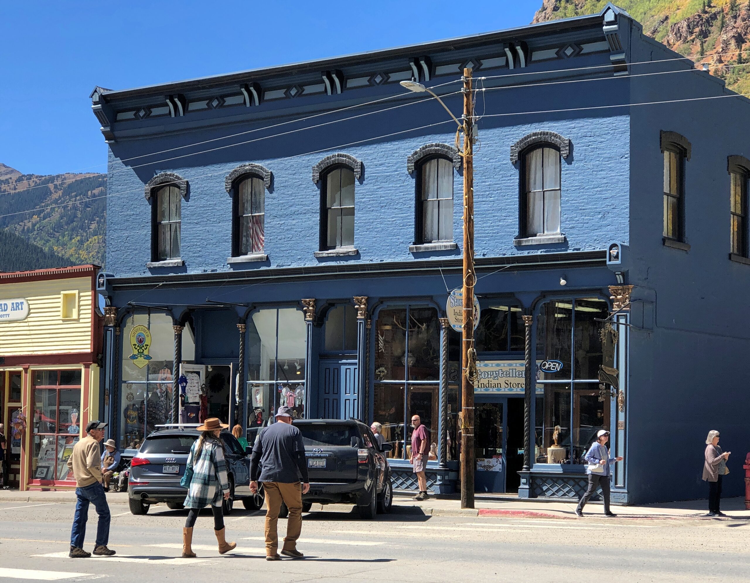
More Greene St.
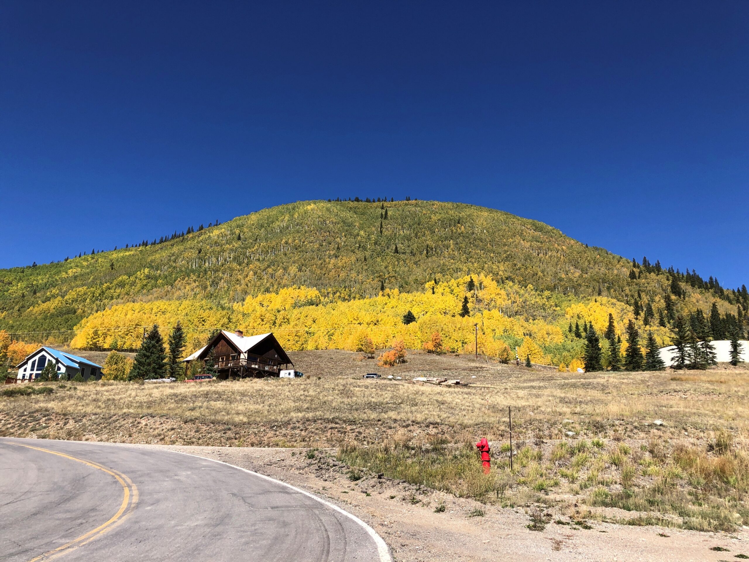
Greene is short, because Silverton isn’t very large, and so the street, now a road, soon heads for the hills.
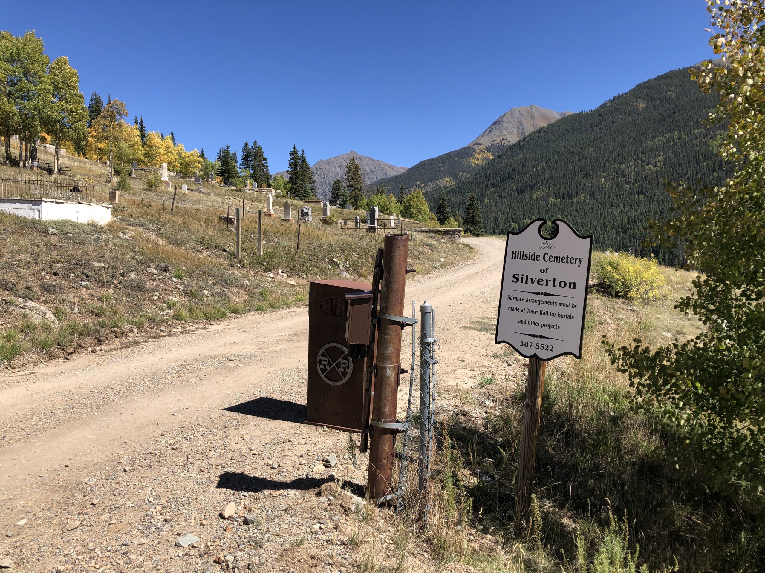
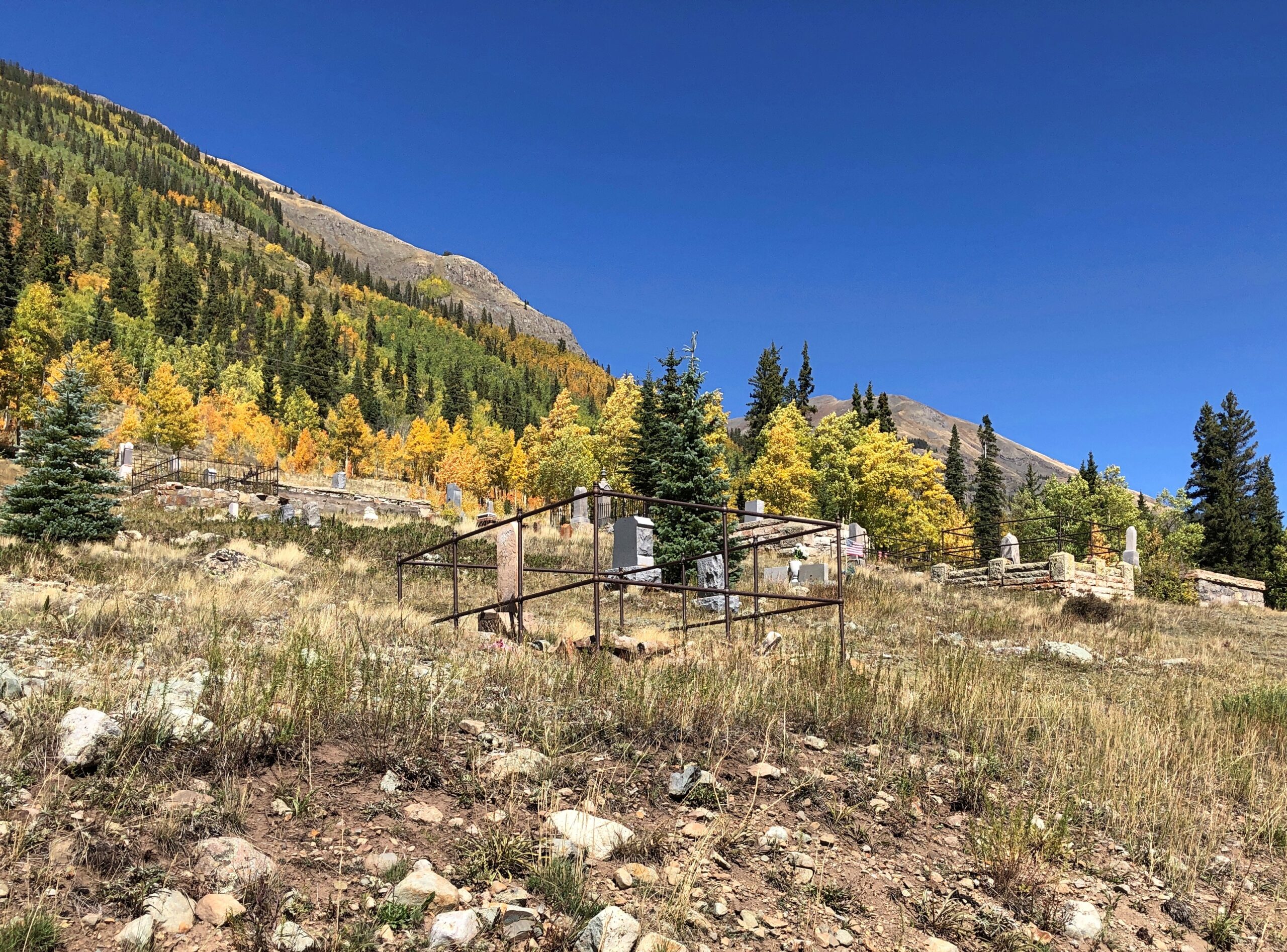
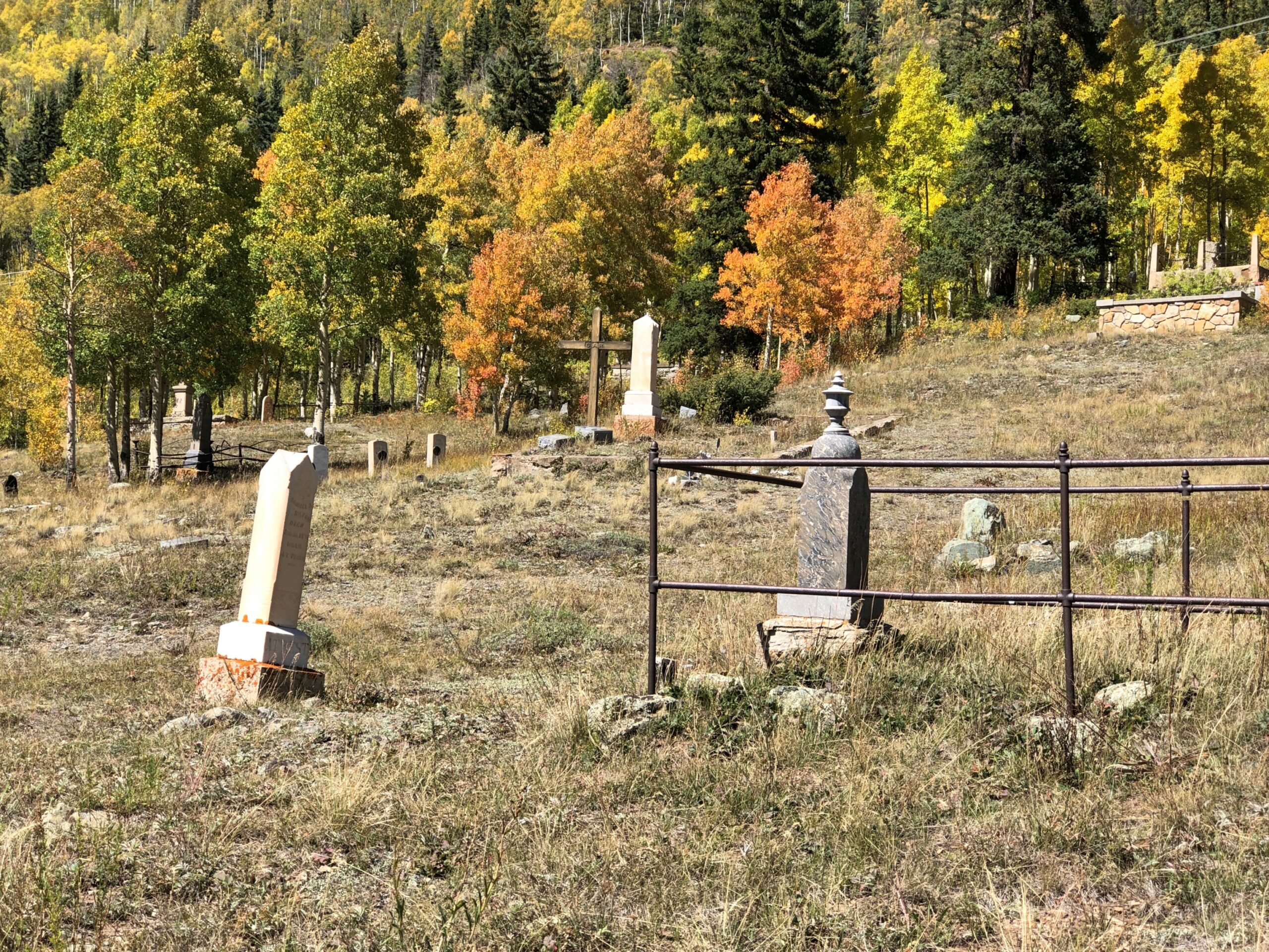
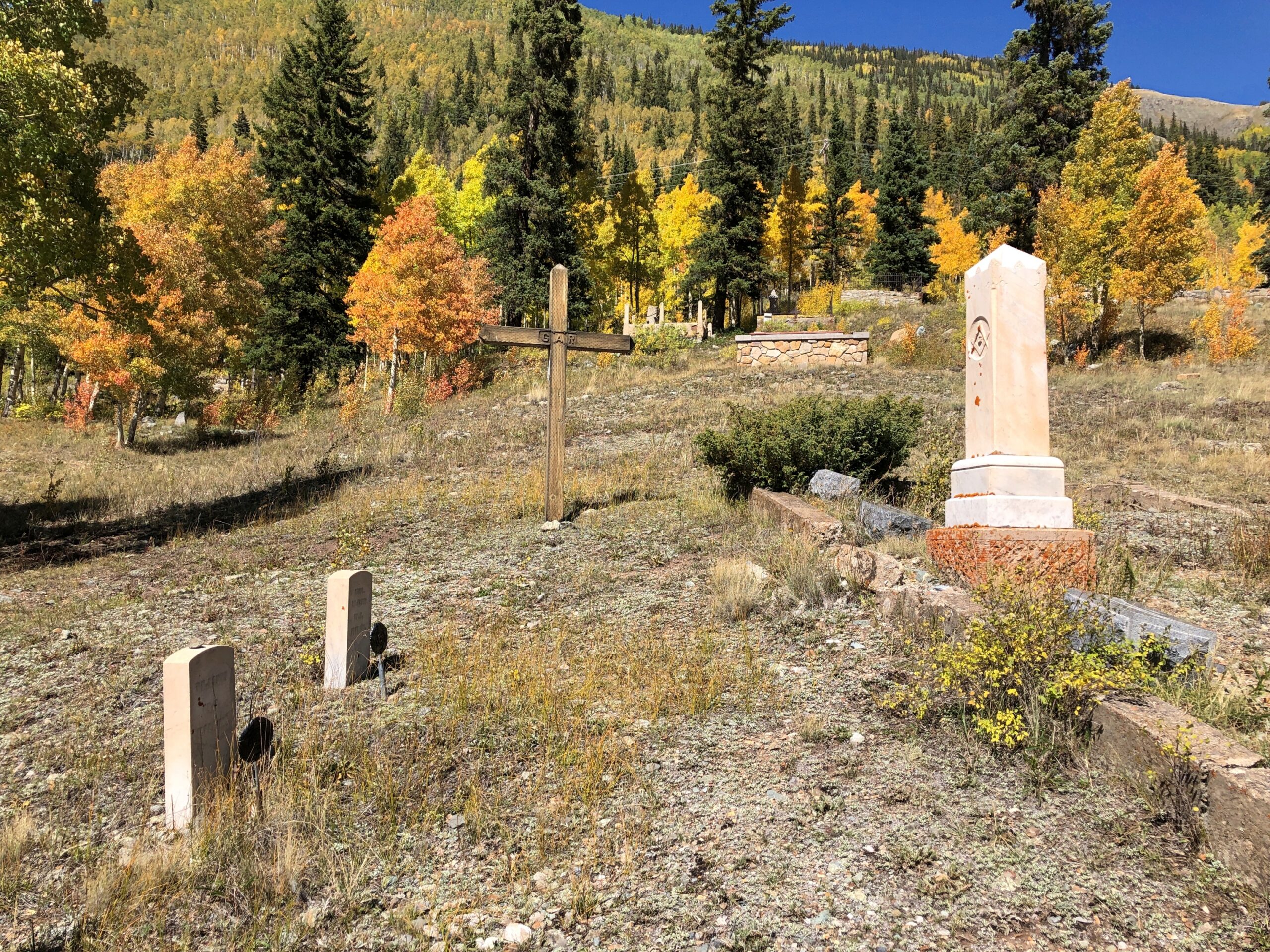
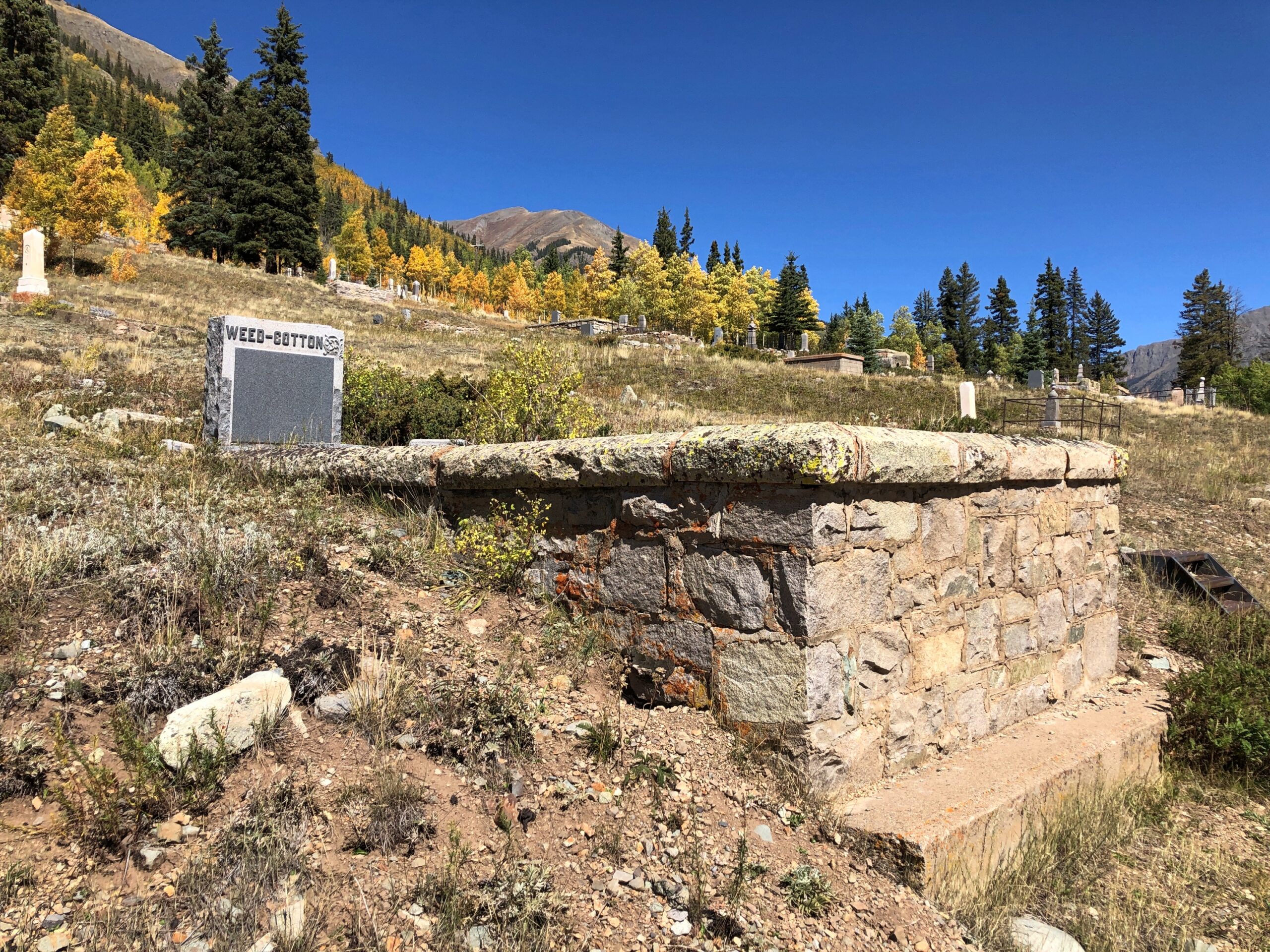
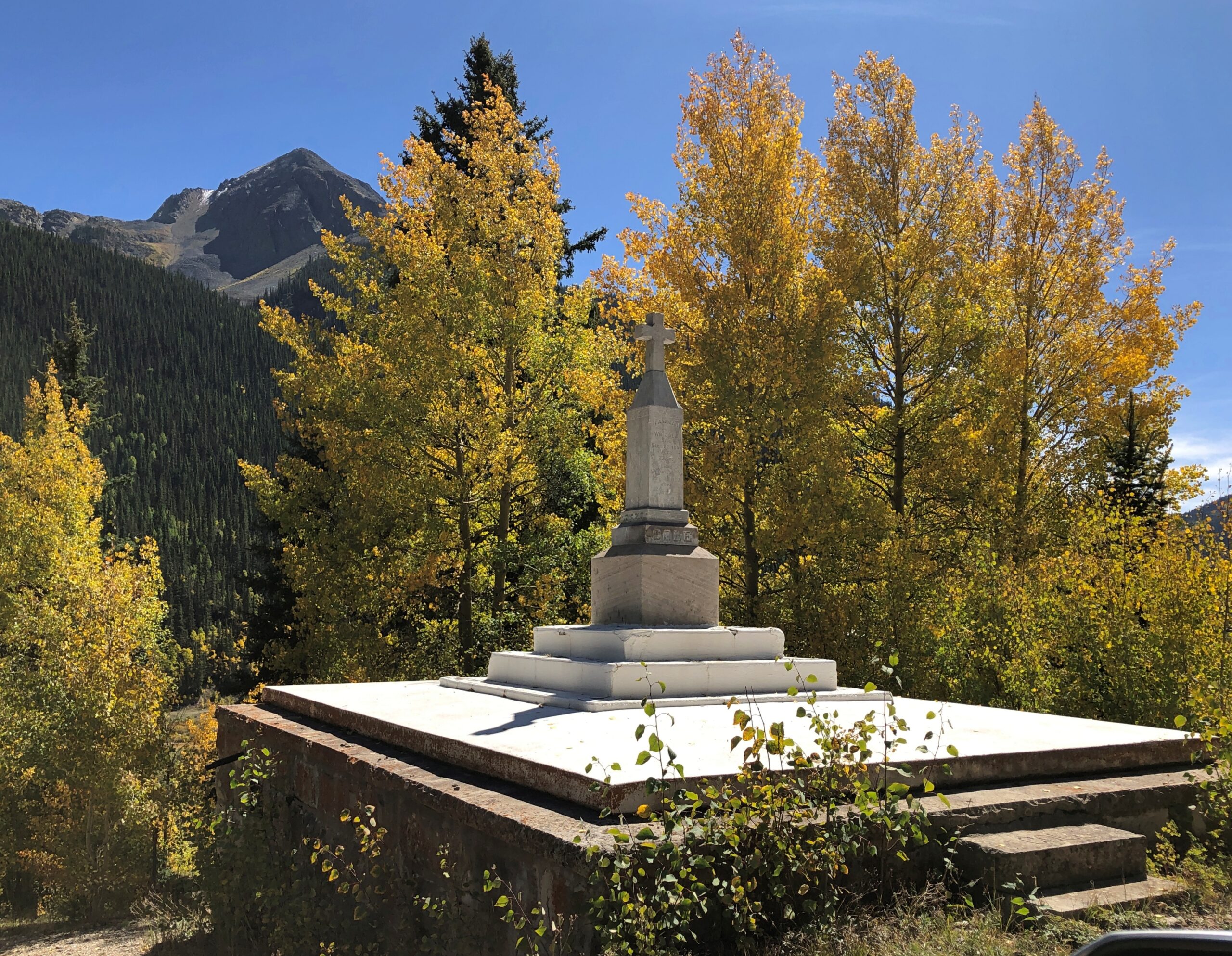
The Hillside Cemetery of Silverton.
An apt name.
With a good view of the town.
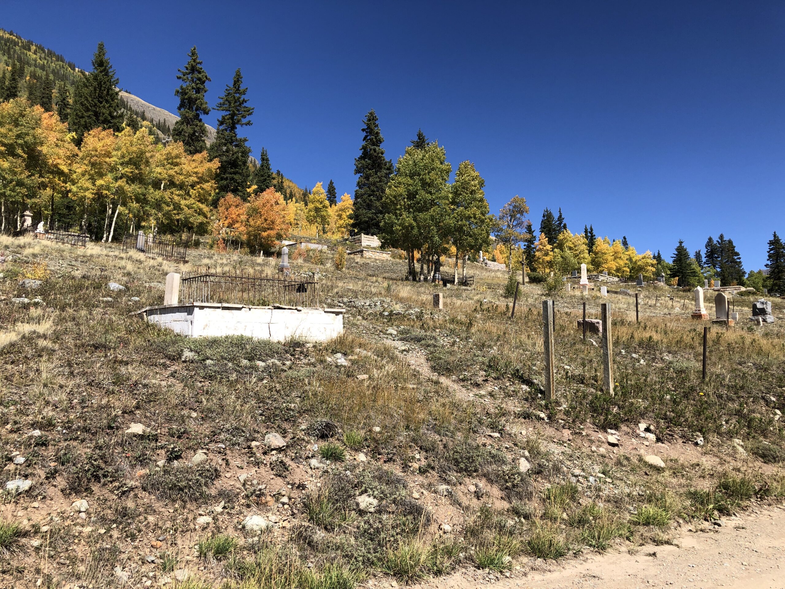
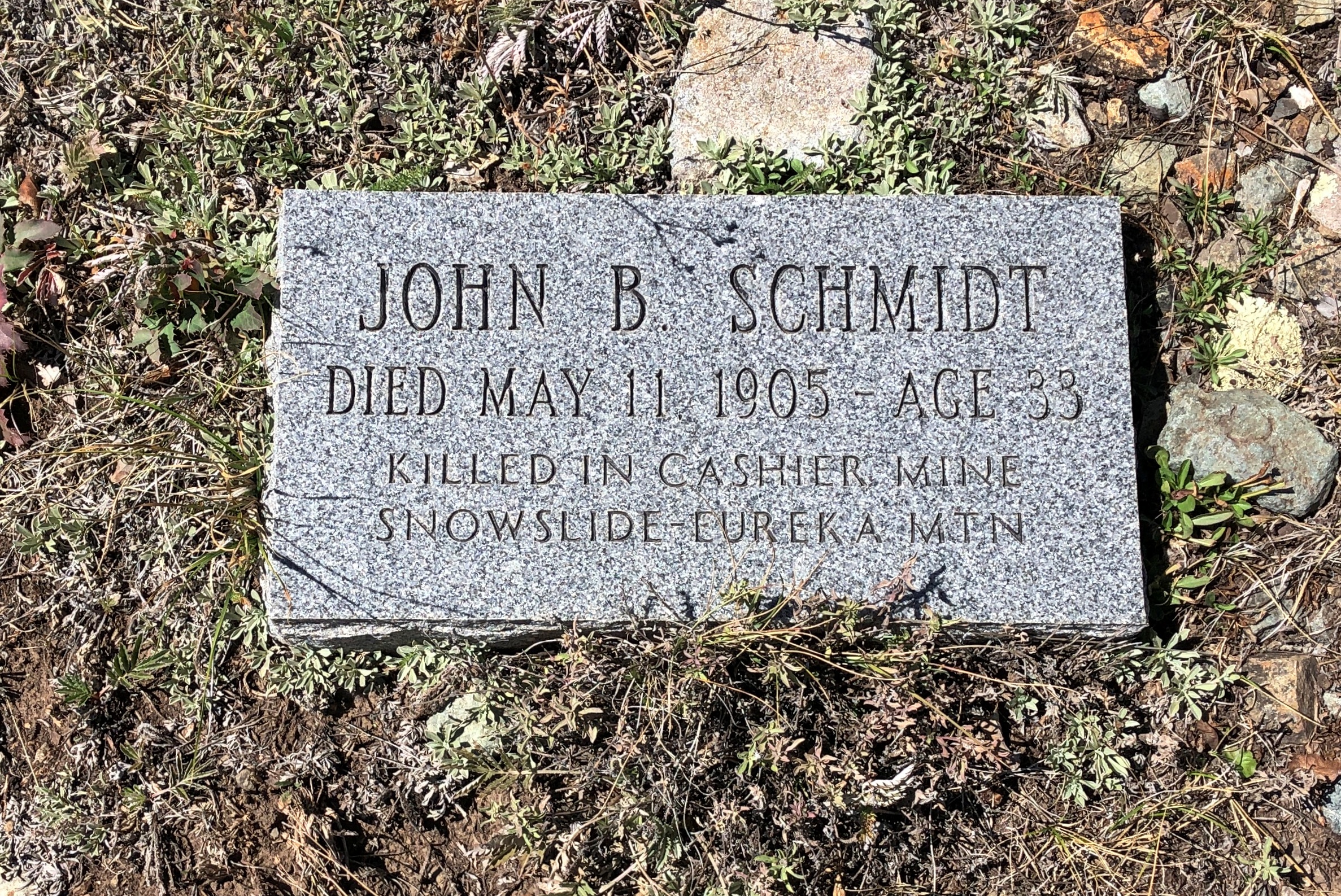
Some sizable memorials.
More modest ones.
Echoes of lost men from another time. Beyond the outstanding beauty of a hillside cemetery in the flush of autumn, reason enough to visit the cemetery.
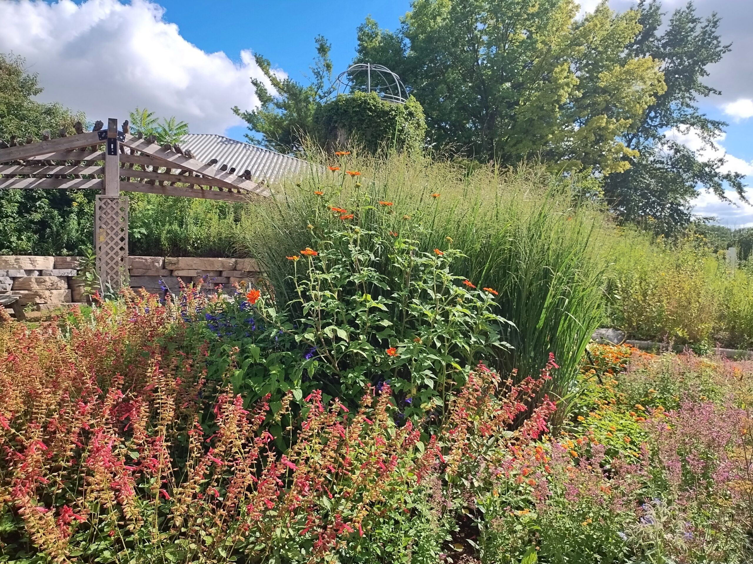
After being relatively wet, August in northern Illinois has turned relatively cool to end its days. A few days ago, we took a walk at the unusually green (for August) Spring Valley here in the northwest suburbs.
August flowers, Illinois edition.
Earlier this month, an enormous rainstorm blew through southern Wisconsin, doing damage in Milwaukee and elsewhere, including Waukesha County. Too much water too fast, and not nearly enough space in the Fox River channel that runs through the city and county of Waukesha. In the city, the river made a raging, dangerous rise not far from the picturesque downtown. If that area had flooded, that would have been in the news cycle for a little while anyway, but it looks like most of the damage was in more rural parts of the county. Regardless, it represents a lot of property damage.
“In Menomonee Falls, a crew was spotted pulling a car out of a massive sinkhole,” local TV News reported. “The once-raging waters this weekend washed away the road in an industrial area on Campbell Drive, leaving just a cliff. In the crater, the car had been trapped. The driver was fine. Inside the sinkhole, drainage pipes seemed to be tossed around like Lincoln Logs.”
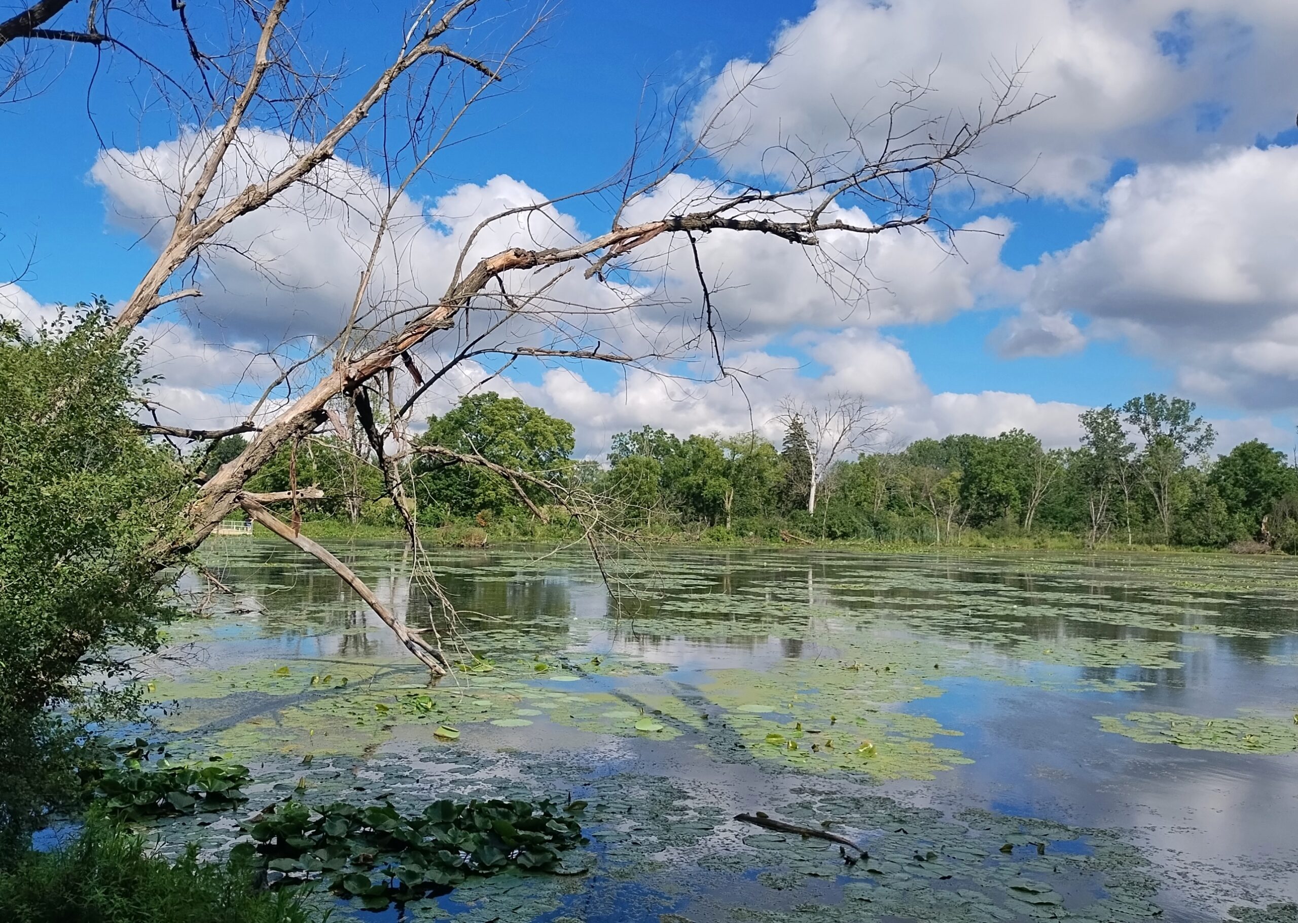
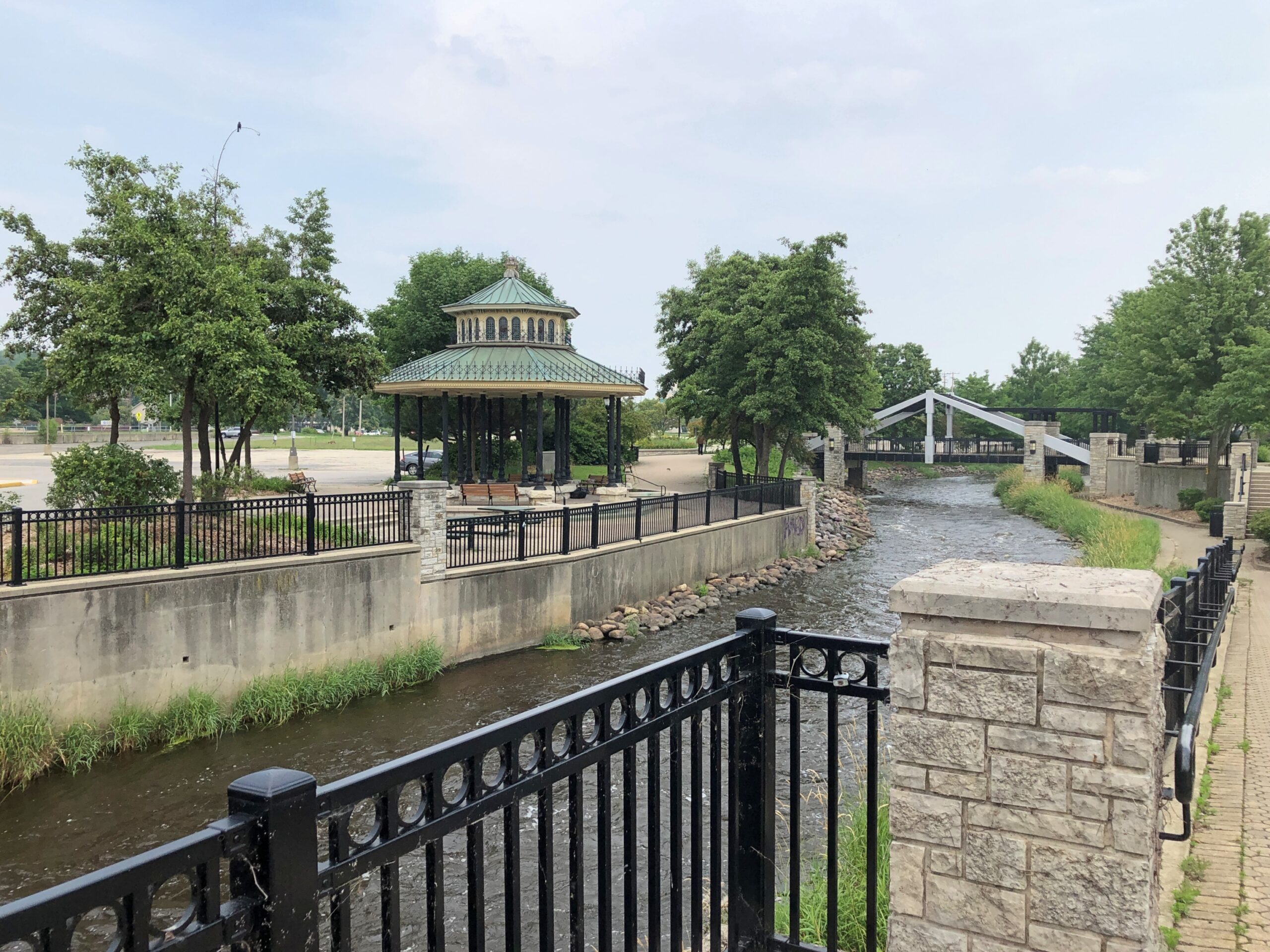
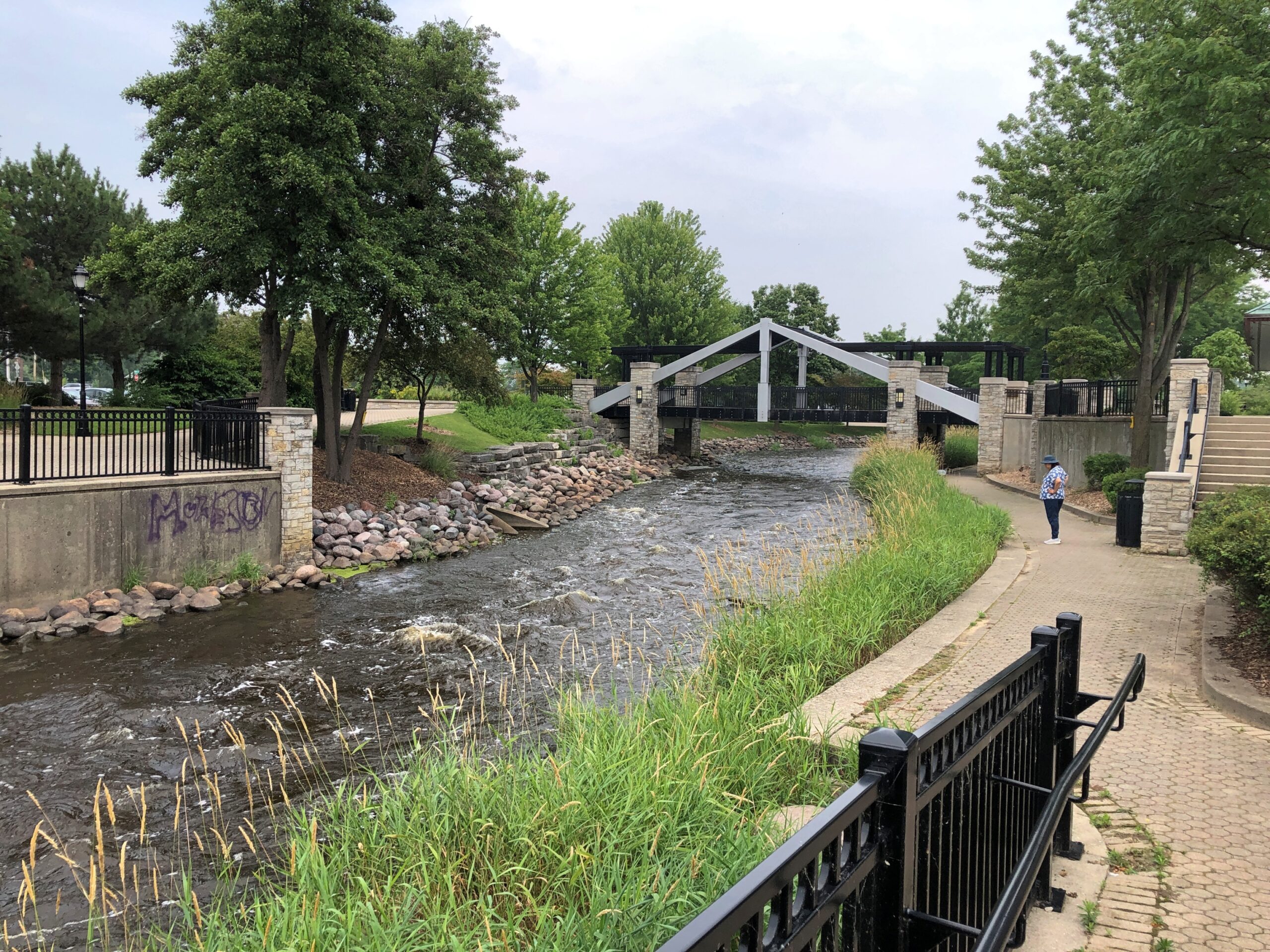
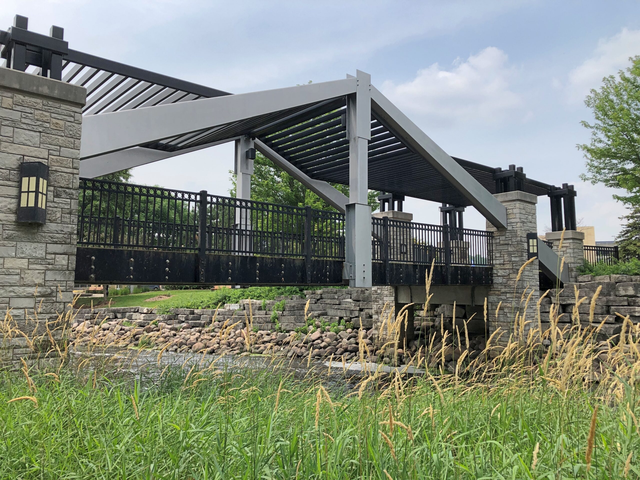
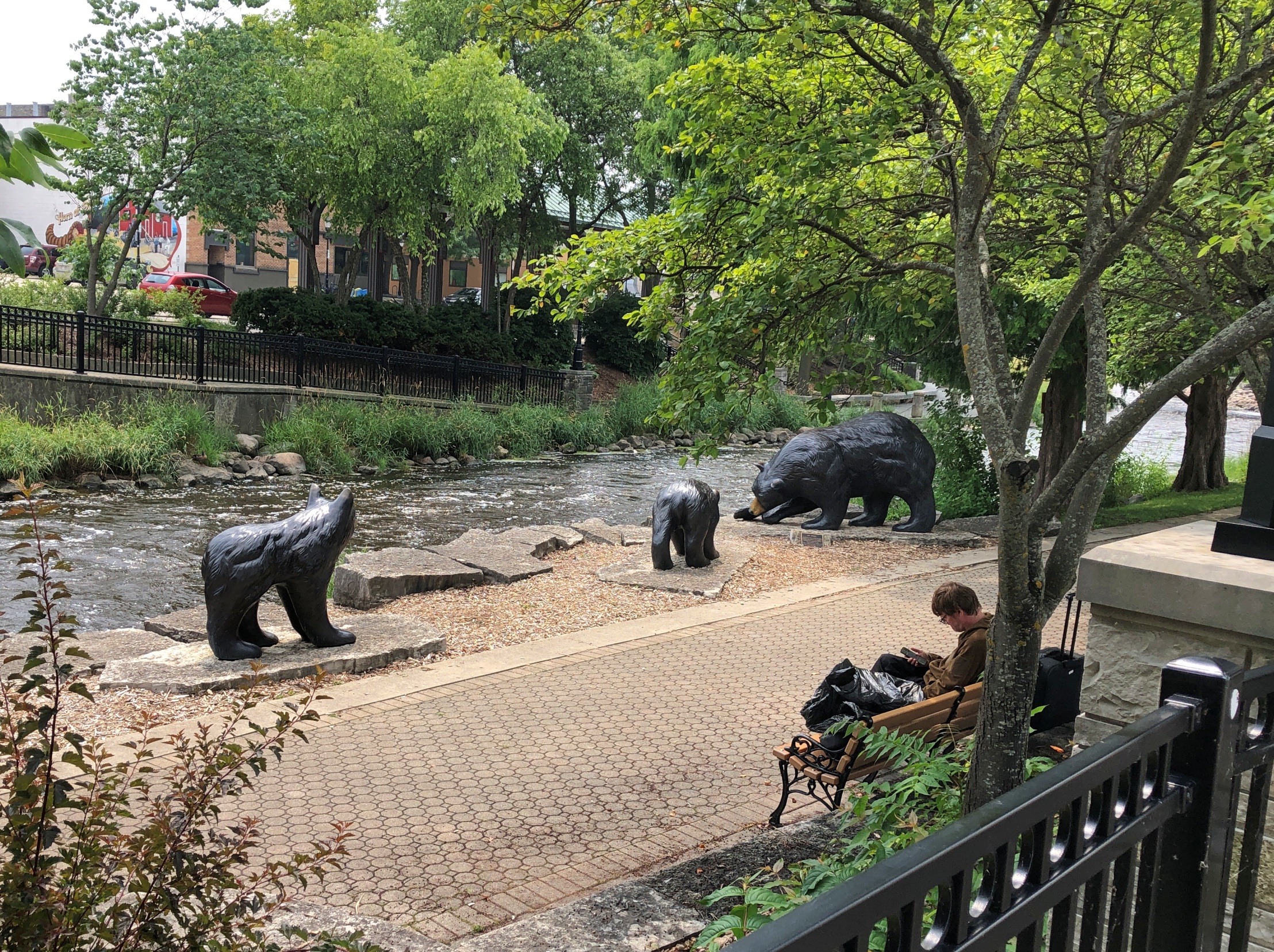
About two weeks earlier, on a nearly hot, clear day, we took a walk along the Fox, accessed a block or so away from downtown’s main streets. The river was flowing vigorously, but without a hint of the rampage to come (and why would there be?). This is the same Fox River that runs west of metro Chicago and to the Illinois River, and not the one that runs into Green Bay. Just to keep things interesting, there are apparently two other Fox Rivers in Illinois as well.
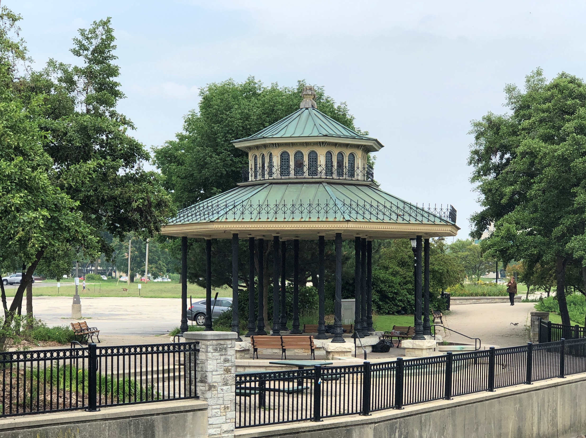
Across the way, a gazebo.
Every town over 5,000 has to have a gazebo, according to Wisconsin law. Wisconsin is almost alone in its gazebo mandates, with most other states having repealed theirs in the 1960s and ’70s – though some counties in other states still mandate the structures.
An artful pedestrian bridge.
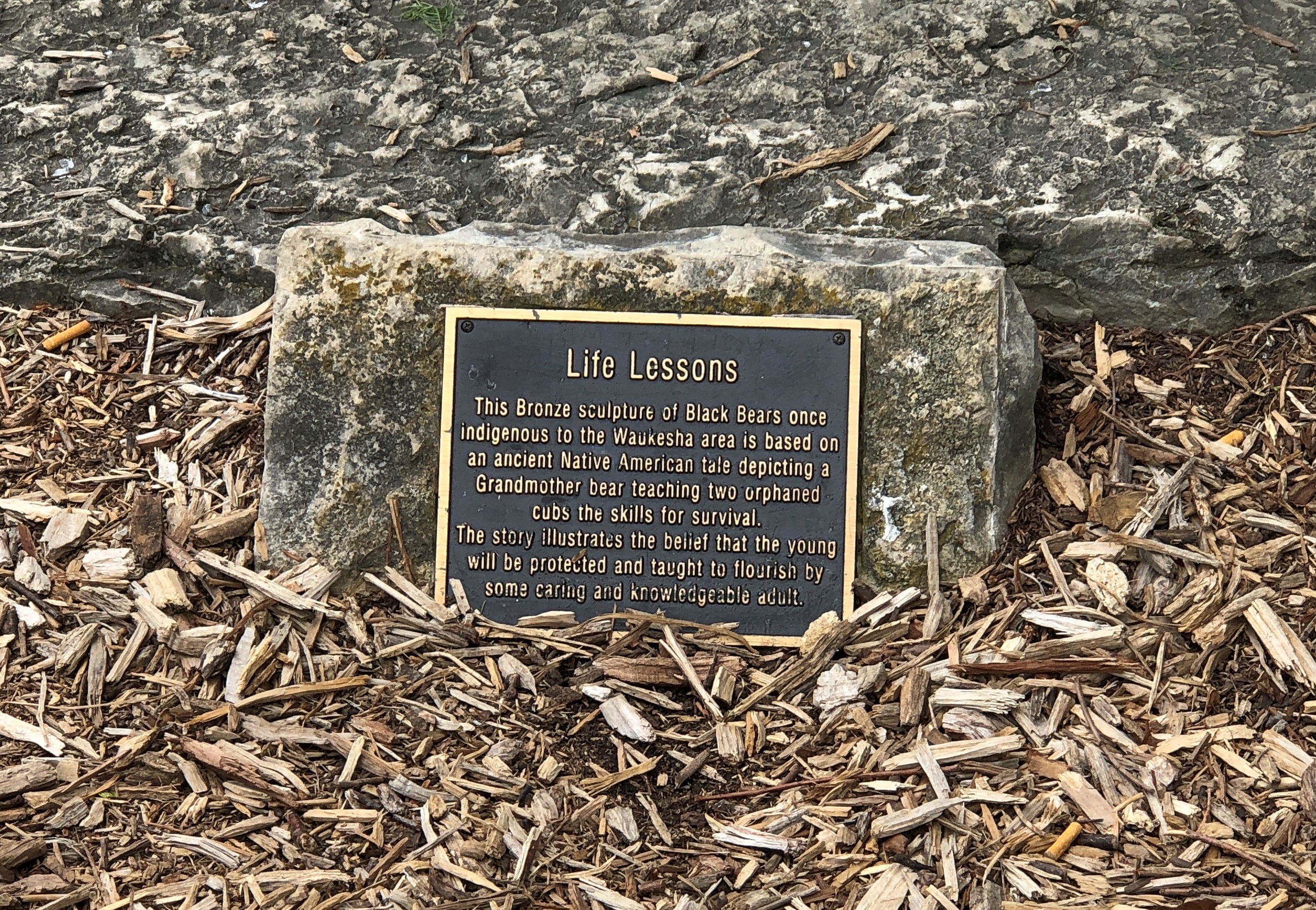
More river, and also bears. Bronze bears.
Hope the river didn’t take them away, but I’d think the figures would be anchored pretty well.
Here we are, in a cold May. Cold and today, rainy. Cold in April is one thing, but in May? Not wintertime freezing cold, of course, but nearly refrigerator chilly. Too cold to lounge around on the deck, which is pretty much my definition of atmospheric chill.
The cold came after considerable warmth last week, even a day that felt hot, during which a dust storm blew through northern Illinois. We didn’t feel the brunt of the storm, just a gusty and dusty edge of it. In all the years I’ve been here, I don’t remember any other Chicagoland-spanning dust storms. Odd.
Out of curiosity, I checked temps in Agra and Jaipur today. At about 2 am IST – the middle of the night – it was 90° F. in Agra. Tomorrow: Abundant sunshine. Hazy. High 106° F. Winds light and variable. As for Jaipur, middle of the night temp, 93° F. Tomorrow: Sunny, along with a few afternoon clouds. Hazy. High 112° F. Winds WNW at 10 to 15 mph.
Zounds. Between Agra and Jaipur, on National Highway 21, is the border of Rajasthan and Uttar Pradesh. This is what it looked like, leaving Uttar Pradesh, headed for Jaipur.
Behold, the National Highway system of India. Infrastructure, by the looks of it, that is reaping enormous economic benefits. The roads were renumbered in 2010. News of that didn’t reach my part of North America, or if it did, it was a squib of an item, lost in the news churn. Under the new(ish) numbering scheme in India, east-west highways are numbered odd, while north-south ones are even, the opposite of the U.S. Interstate system. The numbers increase as you go west or south. Again, the opposite.
Imagine the government committee meetings, the endless, hours-long committee meetings, that must have gone into renumbering the roads. Was there a bureaucratic faction that pushed not to be like the Interstate system, as a matter of national pride?
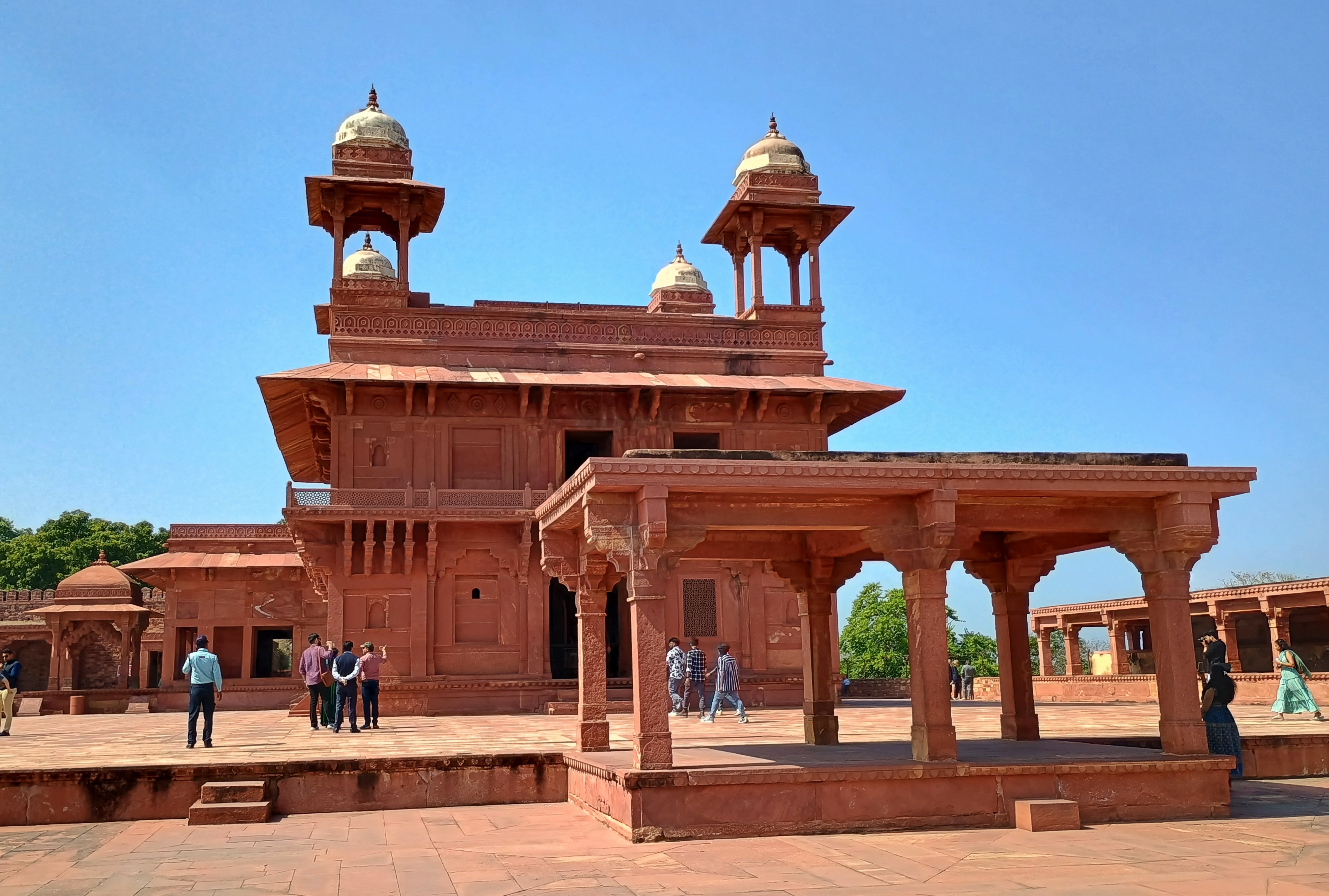
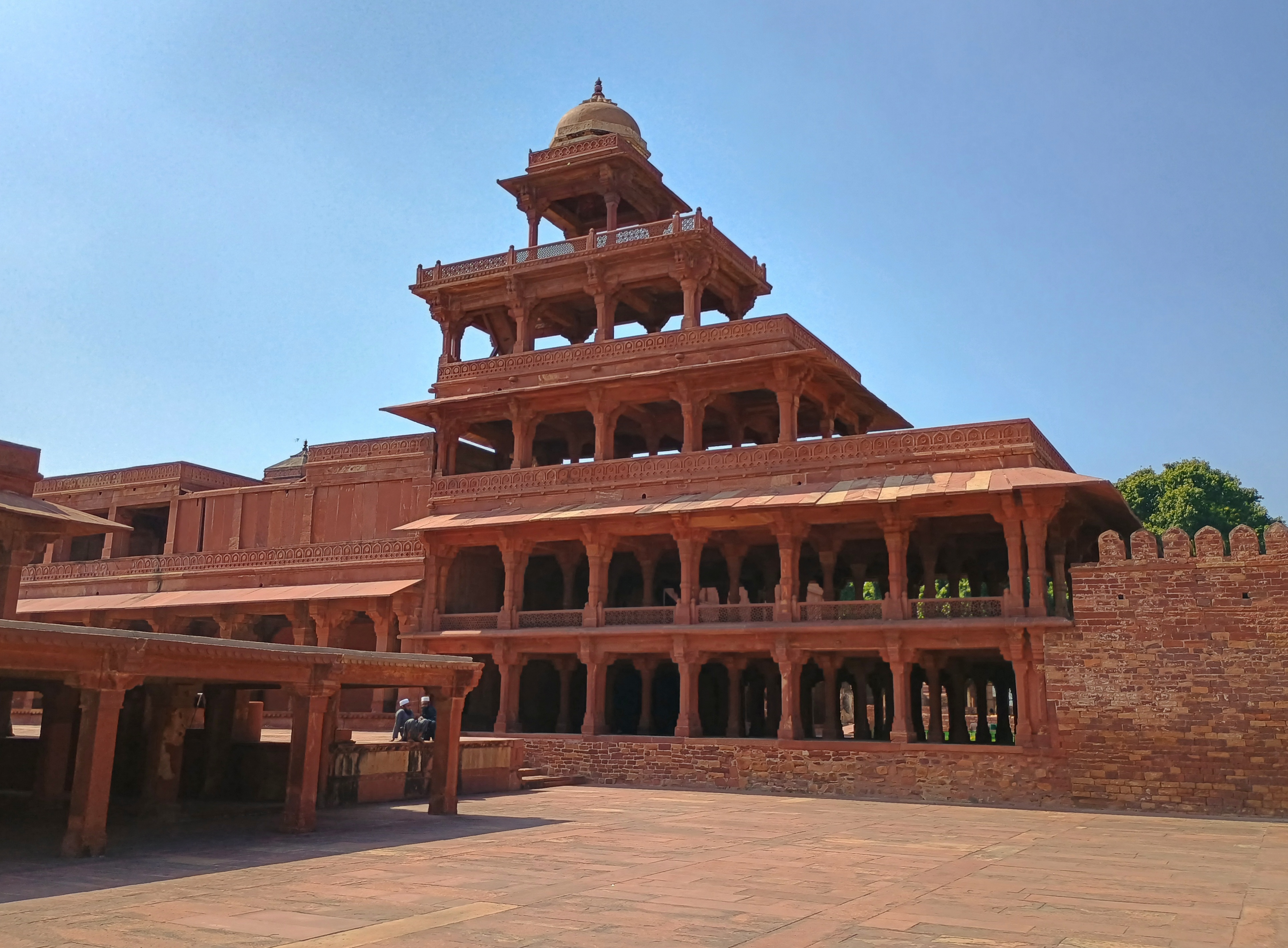
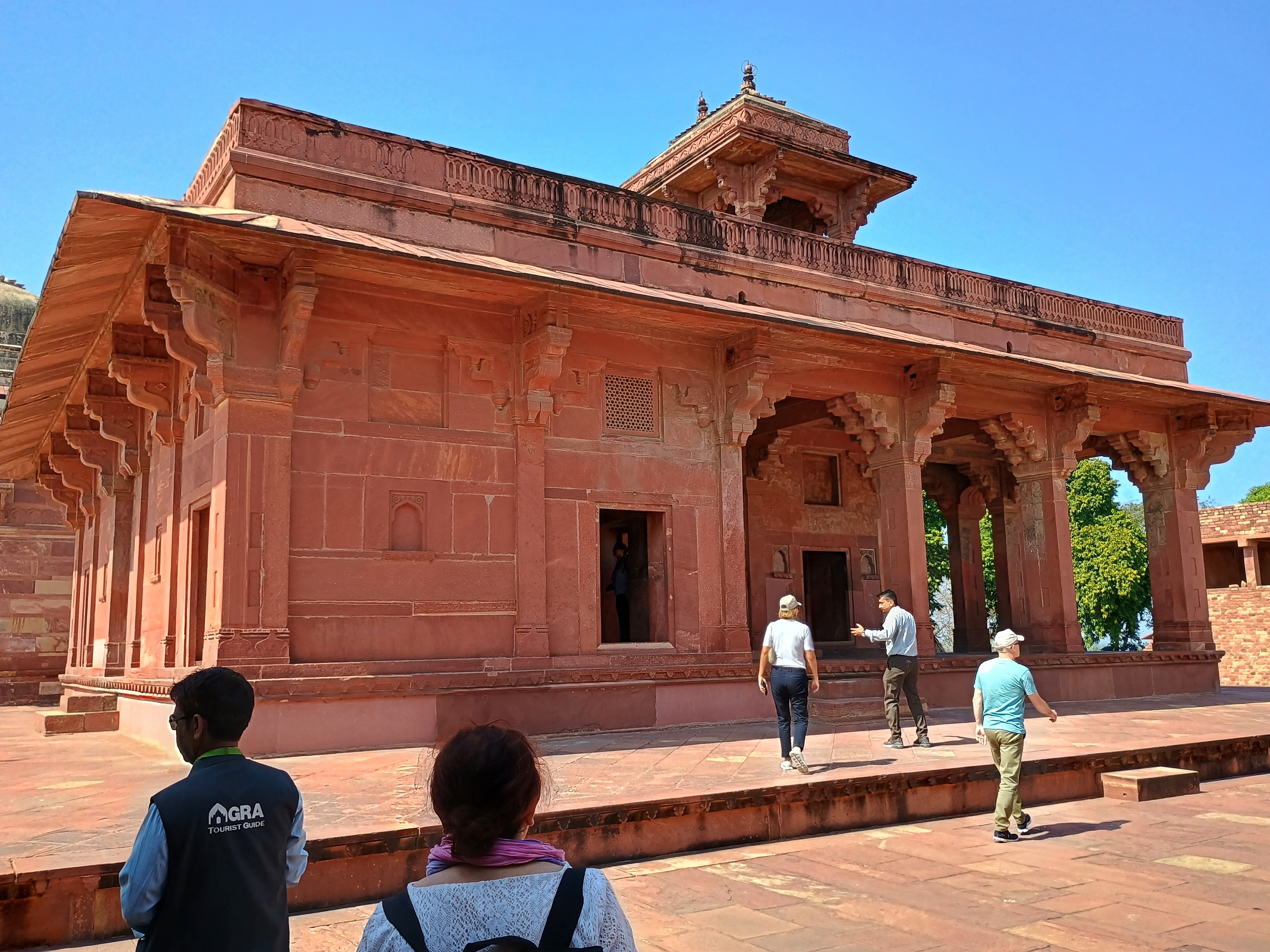
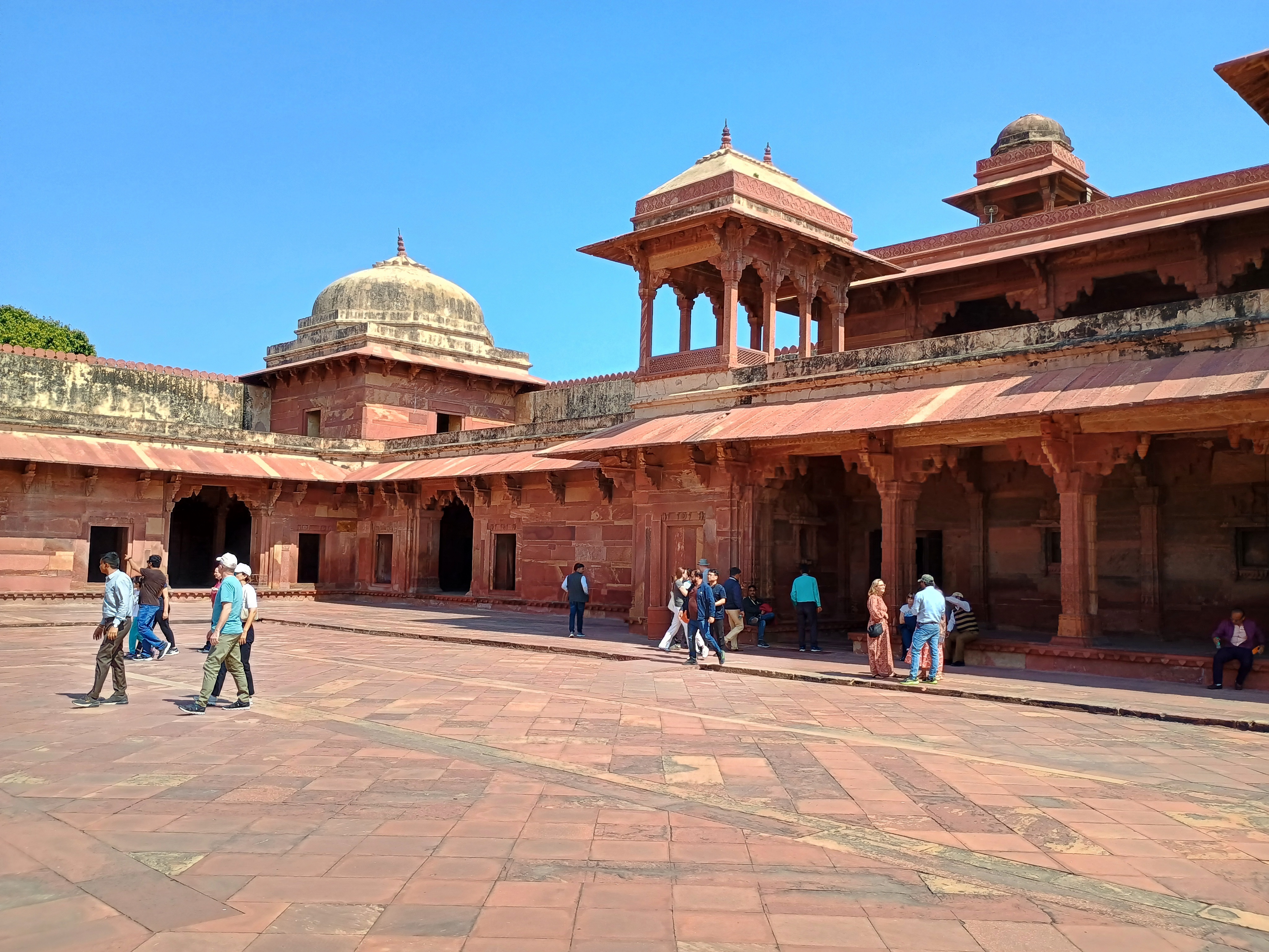
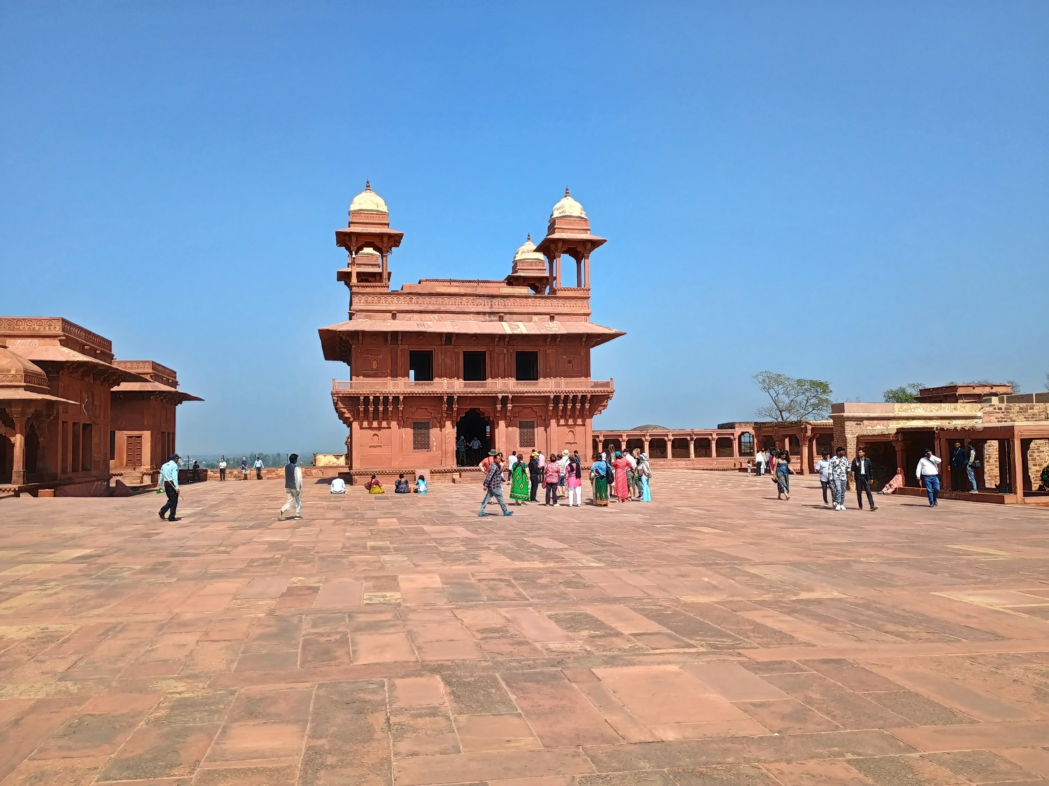
Near the border along NH 21, but still in Uttar Pradesh, is Fatehpur Sikri, which Akbar, the third Mughal emperor, made his capital for a little more than a decade in the 16th century. A short-time capital it might have been, but Akbar didn’t think small when it came to developing Fatehpur Sikri – Mughal potentates never thought small, it seems – and so left behind some World Heritage-class sites (and indeed, it is on the UNESCO list).
When we arrived, temps were nowhere near 100+ F. Maybe 80° F. or so, which I count as pleasant.
Turn up the heat another 20° or so, and those broad stone courtyards wouldn’t be that pleasant for tourists or touts.
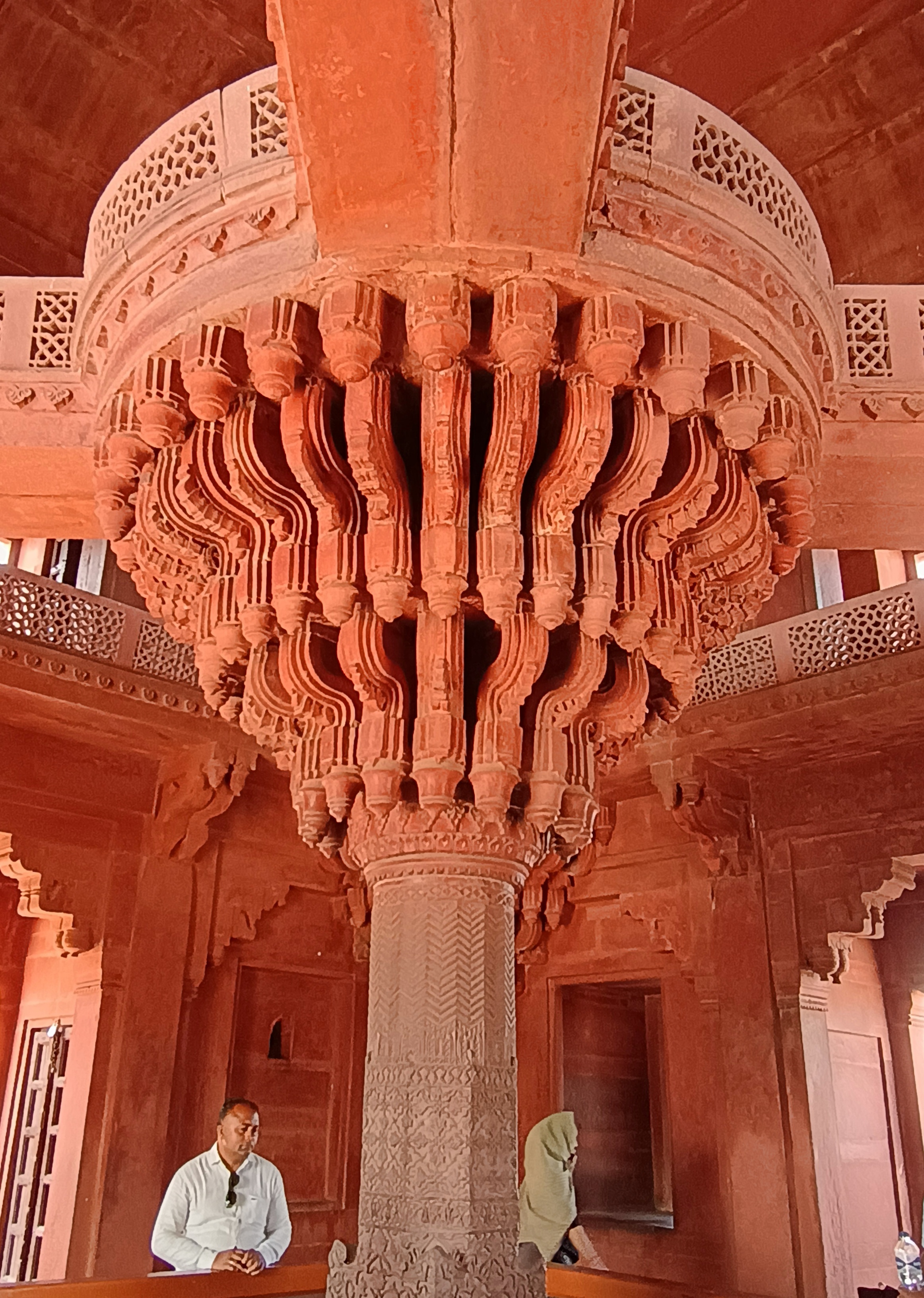
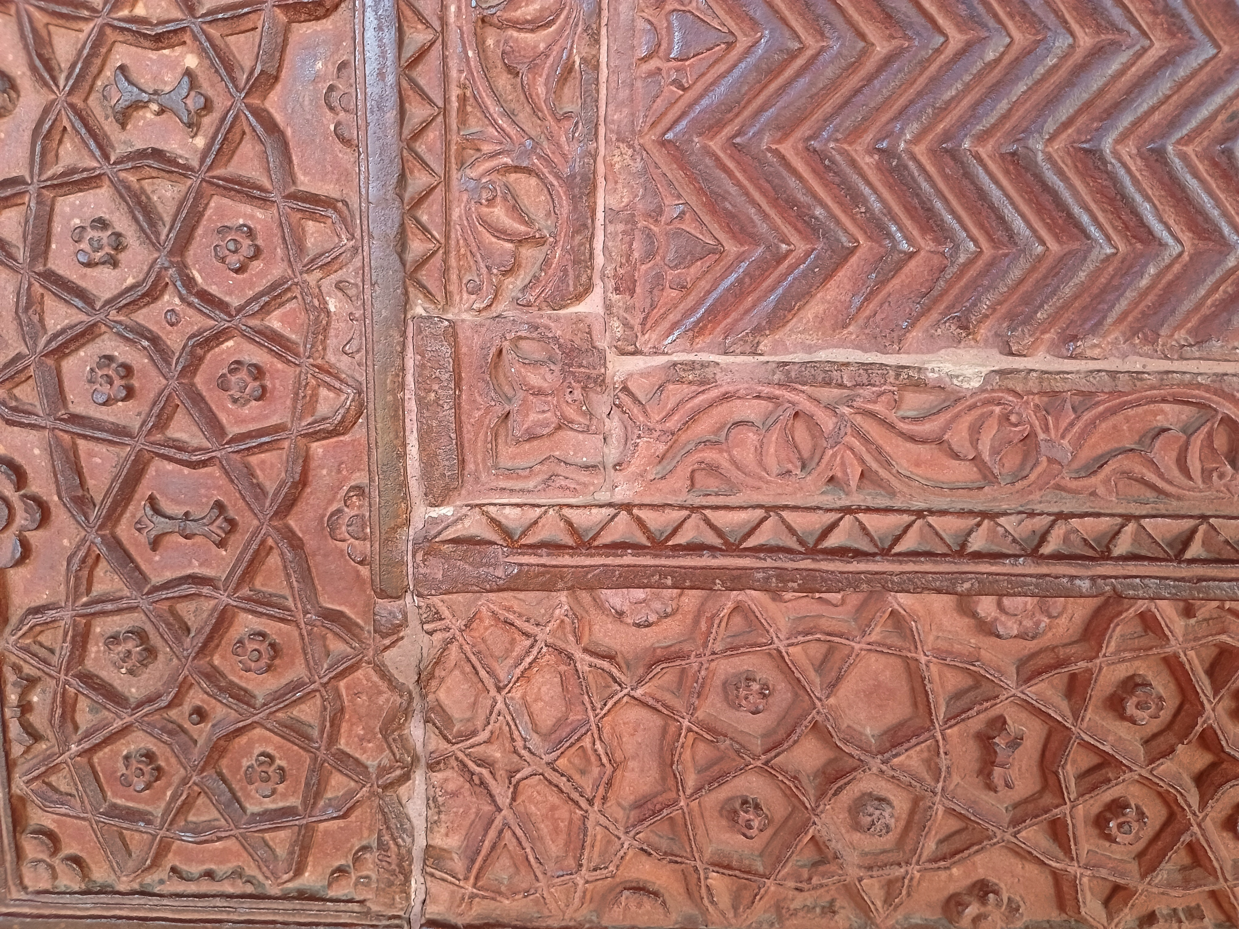
The stonemasons, as usual, did wonders with red sandstone.
Unlike any other big-deal historic site we visited in India in February, roving vendors were allowed inside the complex at Fatehpur Sikri. The vendors tend to swarm, especially if you buy anything from anyone at any moment – as I did, a necklace for Yuriko. I might as well have painted a DayGlo rupee symbol (₹) on my back.
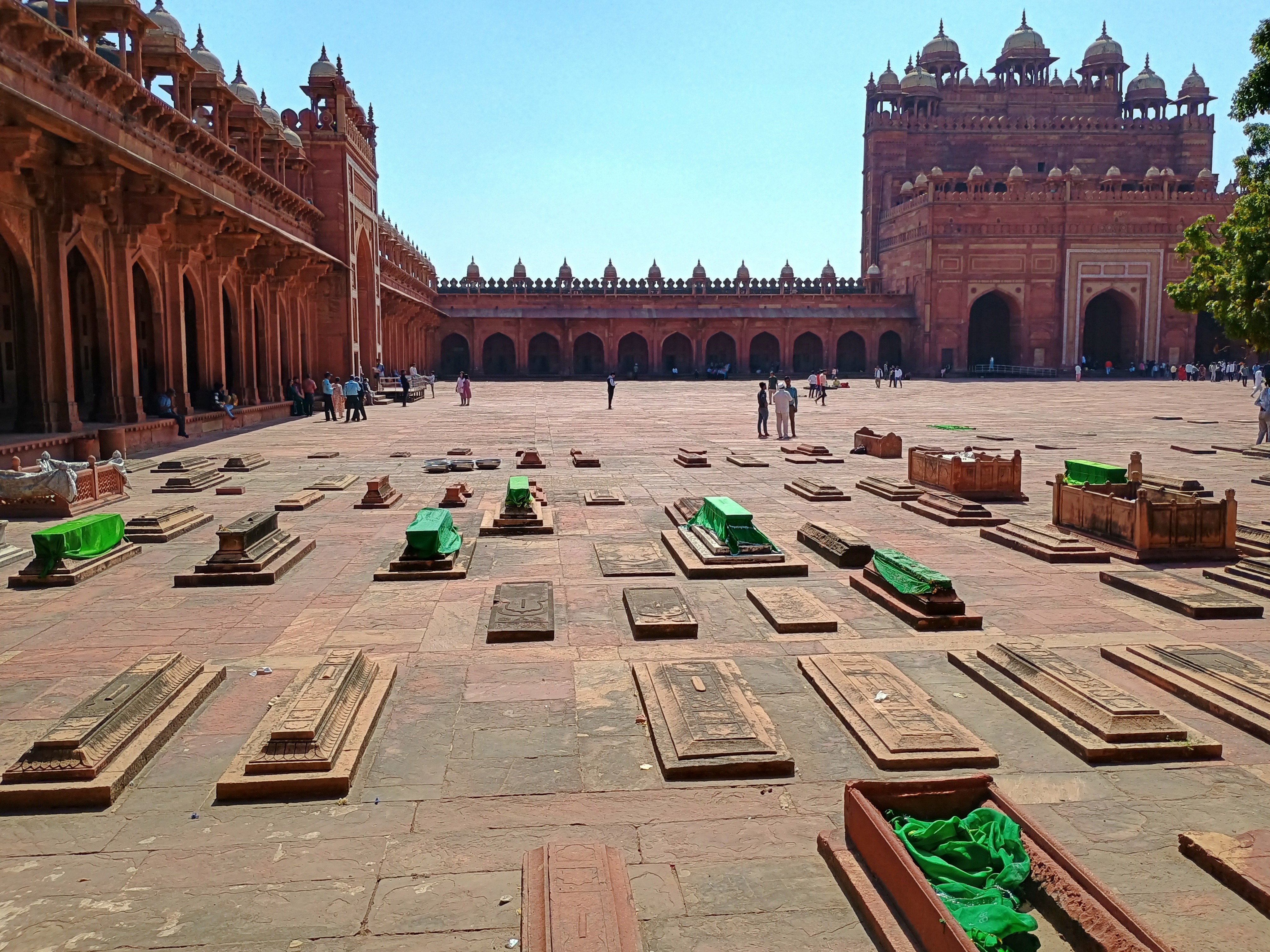
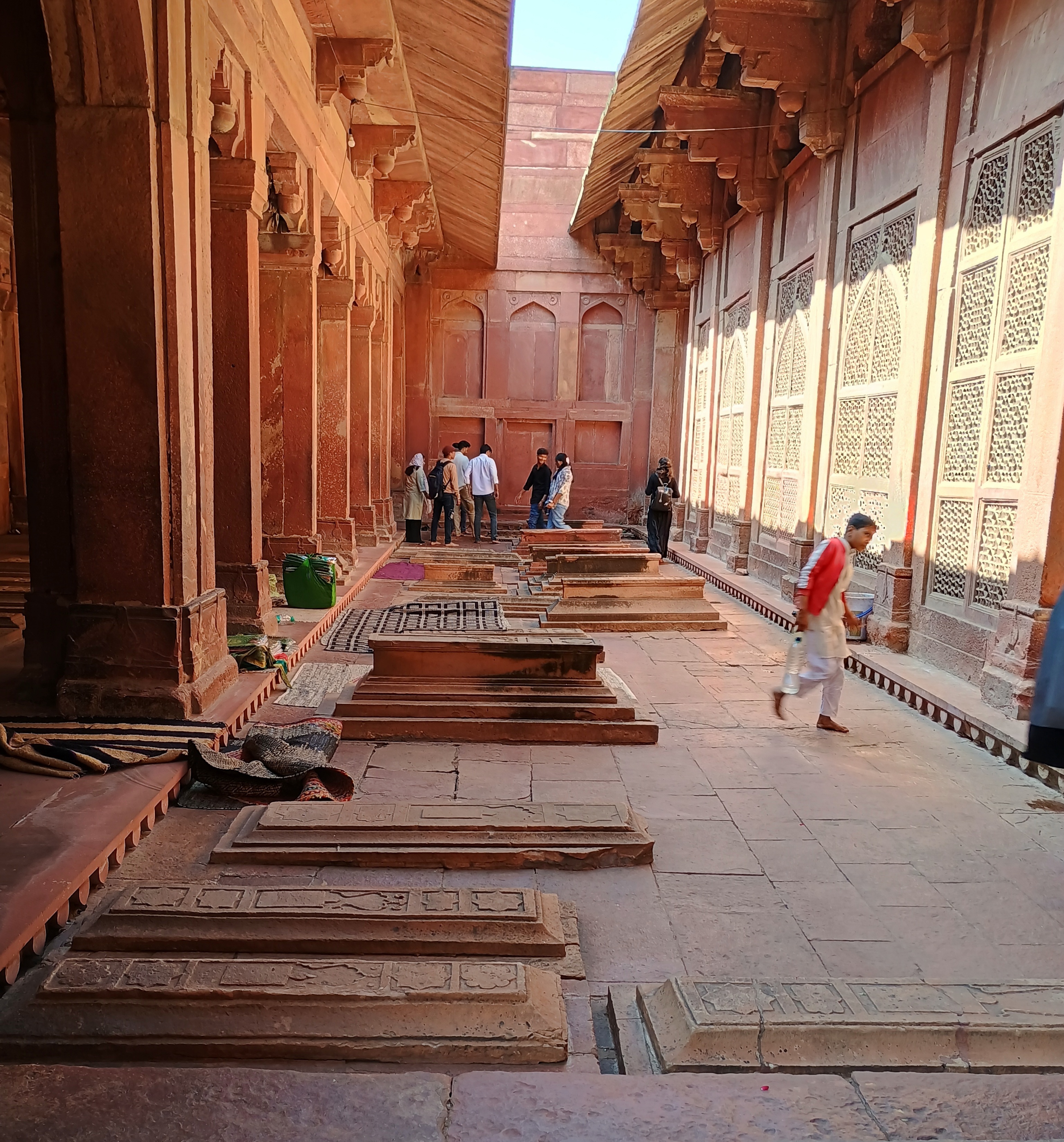
Never mind, Fatehpur Sikri was up to high Mughal standards: a splendor. In one courtyard, an array of Mughal tombs caught my attention, marking resting places on a less grand scale than the likes of the Taj or the Baby Taj.
Royalty gets royal treatment after death, but so many other people were involved in running a court, and they deserved dignified entombments, too. Such as, for example, the overseer of the royal flyswatters. (Servant jobs were very specific in those days.)
I hope our guide for a couple of hours at Fatehpur Sikri got a cut, one way or another, of what we paid to hire the car and driver, on top of the tip we gave him directly. He told us a good many interesting things about the town and its history, but nothing quite as interesting as how an uptick in tourism — mostly domestic tourists, I bet — had allowed him enough money to buy a motorcycle a few years earlier. “Changed our lives completely,” was how he put the impact on his family.
His brother had a souvenir stall near the historic sites, and a clubfoot. We drank tea with them, and in lieu of buying something, I gave him a tip as well. Could be he’s saving for a motorcycle, too, or needs gas money if he’s got one already.


