Have You Ever Been to Nacogdoches?

When planning our most recent trip, devising its dumbbell structure of three days on the road, five in place, and four more on the road, it occurred to me that with a little southward jiggering from Dallas, we could visit Nacogdoches, Texas, one of the oldest towns in the state, rife with history: home to prehistoric Indian activity and the establishment of a Spanish mission in the 18th century, base of filibusters and other rebellions in the early 19th, mentioned famously in a late John Wayne movie, and much more.

All that would have been a reason to come, but mainly I wanted to visit my old friend Kirk, resident of the town for nearly 40 years. We hung out mostly in high school, but had known each other as far back as elementary school, ca. 1970.

In exchanging text messages ahead of the visit, we couldn’t remember the last time we’d seen each other, but finally decided, once Yuriko and I met Kirk and his wife Lisa at their home for lunch on April 13, that it was probably in April 1986 at the wedding of a mutual friend of ours in Austin.

That’s a long time. We had a good visit, a good reconnect – I find it good to reconnect – spending most of the afternoon with them, hearing about life in Nacogdoches, his medical practice there, their raising six children, all grown.

Later in the day, Yuriko and I spent a little time in downtown Nacogdoches, which offers a more sizable square than most towns, even in Texas, handsome on the whole, with a scattering of specialty retail in the area, but mostly still professional services, city government offices and other utilitarian activities.

Mural detail a block from the square, facing a parking lot.Downtown Nacogdoches

We arrived during the 12th annual Nacogdoches Wine Swirl, just by raw chance. I’d never heard of a “wine swirl.” The brick streets around what I took to be the courthouse were closed to cars. People clustered here and there and lined up for wine.Downtown Nacogdoches Downtown Nacogdoches Downtown Nacogdoches Downtown Nacogdoches

The square doesn’t surround a courthouse, but rather a former federal building, now the Charles Bright Visitors Center. Nearby is “The Gateway,” depicting doughty American pioneers traveling the Old San Antonio Road into Texas, a fairly recent work (2013) of Michael Boyett.Downtown Nacogdoches

“The ticketed wine event will showcase Texas wineries and local and regional food trucks and shopping vendors along the historic brick streets,” Visit Nacogdoches says regarding the event. More marketing at work, with the goal of furthering Nacogdoches as a day-trip town.

That Texas has wineries is not news. I went with Jay to visit one of the earlier ones in the Hill Country in the mid-70s. But did Central Texas wine makers come all the way to Nacogdoches to sell their wares? Further investigation tells me there’s an established wine-growing biz in East Texas.

“But, what if I were to tell you that East Texas has over 30 wineries and vineyards just waiting to be explored?!” Totally Texas Travel breathlessly says. Even if that isn’t the precise number, I’ll take even a paid travel site as a reasonable source the existence of wineries here.

Moreover, there’s a marketing invention called the Piney Woods Wine Trail.

The Piney Woods Wine Trail? In East Texas? That goes against stereotype, and I won’t have it. They make (and drink) either beer (domestic beer, closer to Texas-made the better) or hard liquor, the closer to homemade the better. That’s what I get for traveling into East Texas, a busted stereotype.

Pea Ridge National Military Park

I’ve been told that I visited Pea Ridge National Military Park when I was small, four or five years old, during my family’s short vacation in the Ozarks in the mid-60s. Went to Branson, Mo., on that trip as well, when it was merely a minor lake resort and not Las Vegas designed by Ned Flanders.

I don’t remember any of that. I have wisps of other memories, which would be my very first travel memories, but I’m not sure how reliable they are. Maybe that was the trip when billboards for a place called Villa Capri Motel gave my brother Jim giggle fits, because he insisted that it was pronounced “Villa Crap-Eye,” or when he was similarly amused by Skelly gas stations, which became “Skeleton” gas stations, but I’m not sure.

I do remember visiting the future Crater of Diamonds State Park in Arkansas, which would have been a private tourist attraction in those days. The allure of diamonds got through even to a small child (good work, De Beers), but of course we didn’t find any, and the only impression I have now is that it was a hot, dusty, boring field.

When we arrived at Pea Ridge on April 7 around lunchtime, I was essentially seeing it with new eyes. So was Yuriko, who’d never heard it. No surprise, since it isn’t one of the more famed Civil War battles. I expect many Americans, maybe most, haven’t heard of it either. Not necessarily a big deal. Go through a list like this and be impressed by just how many battles there were.Pea Ridge National Military Park

A one-way road circles the 4,300 acres of the battlefield, with signs to explain what happened where in March ’62. About 27,000 men on both sides clashed there, including some hundreds of Cherokee and other Indian cavalry fighting for the Confederacy, or rather, against the United States. They were fully acknowledged as part of the fighting force at the small museum at the visitors center, though perhaps not with as much detail as this article.

Unlike other, more famed battlefields – such as Vicksburg – the place isn’t chockablock with memorials or statues or the like. There are some cannons and restored fences, however.Pea Ridge National Military Park Pea Ridge National Military Park

The view from the East Overlook. The battlefield, I’ve read, is one of the better preserved ones, probably because growth has only come recently to this corner of Arkansas.Pea Ridge National Military Park

Elkhorn Tavern, which was once on the Telegraph Road, a thoroughfare name I find particularly evocative.Pea Ridge National Military Park Pea Ridge National Military Park

Much fighting took place nearby, and the building was pressed into service as a field hospital for a time. First it was captured by Union forces, then Confederates on the first day of the battle. Union forces took it back on the decisive second day, as the battle went their way.

“The Federals used the tavern as a military telegraph station until Confederate guerrillas burned it in 1863,” the NPS says. “The present building is a reconstruction.” Including, if you look closely, an animal skull on the roof — an elk, no doubt.

How I Learned Michael Landon Didn’t Look Much Like Charles Ingalls

Because of our drive through southern Missouri on April 6, first on Missouri 32, then U.S. 63 and U.S. 60, generally trending west but also somewhat south, I’ve learned a few things.

One, there’s a crater on Venus named after Laura Ingalls Wilder, which is mentioned in passing here and confirmed by the USGS.

All features on that planet are named after females, real or fictional. Specifically, according to the IAU, craters are named for “women who have made outstanding or fundamental contributions to their field (over 20 km); common female first names (under 20 km).” I assume the measurements refer to diameter.

This page on planetary nomenclature is fascinating stuff, as far as I’m concerned. Dig down a little deeper, and you’ll find 900 Venusian crater names, from Abigail (the name) and Abington (actress Francis Abington) to Zurka (gypsy first name) and Zbereva (aviator Lidiya Zvereva, d. 1916). With a death date like that, I’d assume a flying accident, but no: typhoid fever.

Also, I learned that Michael Landon, who portrayed Laura Ingalls Wilder’s father on TV, doesn’t look much like the man, Charles Ingalls. I can see that for myself, as he’s pictured with his wife Caroline here.

If it had been up to me, Landon would have at least sported a beard like Chas. Ingalls’. I don’t know whether that would have made Little House on the Prairie a better show, but it couldn’t have hurt.

The drive wasn’t quite car commercial driving. There was some traffic, and while the spring green woods and flowering patches of Mark Twain National Forest and the farms and businesses and churches and small-town buildings of southern Missouri offered pleasant enough scenery (and a favorite town name: Cabool), it wasn’t a Class A two-lane drive, as we would experience later, in Arkansas.

Late in the afternoon, we came to the Laura Ingalls Wilder Historic Home and Museum, near U.S. 60 as it passes through Mansfield, Mo., and we were just in time to catch the last tour of the day. That’s what ultimately turned my attention to Venusian craters, 19th-century beards, etc.Laura Ingalls Wilder home Laura Ingalls Wilder home

Not bad for an essentially self-built house – mostly by Wilder’s husband, Almanzo Wilder. She lived until 1957, for many years at this house, and could afford comfortable furnishings later in life.Laura Ingalls Wilder home Laura Ingalls Wilder home

Though the colors and styles were different, the living room nevertheless reminded me of my grandparents’ home in San Antonio. It had a similar old-folks-in-mid-century feeling somehow.

Elephant Rocks State Park

When planning our not-quite-direct drive to Dallas, I figured we’d have time for one Missouri state park on the morning of April 6, before heading west and south slightly into Arkansas for the night. But which one in SE Mo.?

Such excellent names: Taum Sauk Mountain State Park, Johnson’s Shut-Ins State Park and Elephant Rocks State Park. In the end, we went with Elephant Rocks, and on a Saturday, the place was popular but not overrun. Mostly, I figure, day-trippers from St. Louis out with their small children and dogs, all of whom need walking (as I can attest from experience). The park also offered the open-air pleasures of picnicking, especially on a warm spring day ahead of full-blown mosquito season, in which we ourselves partook.

A mile’s worth of paved path snakes among ancient granite boulders. At only about 133 acres, the park is small. Even so, out in the field of boulders, the park didn’t seem so crowded.Elephant Rocks State Park Elephant Rocks State Park Elephant Rocks State Park Elephant Rocks State Park

Time, geologic uplift and millions of years of erosion produced the boulders, and — I learned — the area counts as a tor.

“The landform is called a ‘tor,’ a stack or pile of spheroidally weathered residual granite rock boulders sitting atop a bedrock mass of the same rock,” says an excellent brochure produced by Missouri State Parks that provides brief but informative descriptions of the park and its history.

“While tors exist elsewhere in the United States and worldwide, they are not abundant anywhere. Elephant Rocks is Missouri’s finest tor and one of the best examples in the Midwest.”

That just makes my day, finding out that I visited a fine tor. Seriously. I didn’t even know there was a geologic definition. Big, rocky hill is how I’d have defined it. I’ve known about tors since the moment I slapped my head upon realizing I could have visited Glastonbury Tor, but didn’t.

People go on about sunsets and views of the ocean and mountain vistas, but human beings are also pretty fond of impressive rocks. Some of us travel a good ways to see them. Elephant Rocks State Park Elephant Rocks State Park

Some fat man’s misery paths.Elephant Rocks State Park Elephant Rocks State Park

“Just outside the park is the oldest recorded commercial granite quarry in the state, producing fine red granite called ‘Missouri Red,’ the brochure says. This quarry, opened in 1869, furnished facing stone for the Eads Bridge piers standing on the Mississippi River levee in St. Louis.”

Cool. A quarry needed a railroad spur, and even a small railroad needed a building for locomotive maintenance. The ruin of such a building stands in the park.Elephant Rocks State Park Elephant Rocks State Park Elephant Rocks State Park

It’s had the benefit of some reconstruction, would be my guess. It certainly looked sturdy enough that I didn’t think that rock was going to tumble on my head.Elephant Rocks State Park

Must be Missouri Red. Why wouldn’t you built it using the stone you had at hand? Good old Missouri Red, which sounds like a dime novel character or a strain of cannabis.

Potosi, Missouri

Sometime in late 18th century, Frenchmen came to a spot in the wilds of North America, which in later years would be southeastern Missouri, and began digging for lead in a place they called Mine Au Breton – Mine of the Breton, for Brittany native Francis Azor, who pioneered the effort in the area to extract the element. The name didn’t last, however. Since early U.S. sovereignty, it’s been Potosi, Missouri.

Still, the earlier name lingers in a small park in Potosi, which we visited on the morning of April 6 after leaving where we’d spent the night, Farmington.Mine Au Breton Heritage Park, Potosi, Mo.

A nice little park, a block from the town’s main thoroughfare, High Street. Mine a Breton Creek runs through it.Mine Au Breton Heritage Park, Potosi, Mo. Mine Au Breton Heritage Park, Potosi, Mo.

A small bridge crosses the creek at one point. You wouldn’t think such a bridge would merit a name, but the people of Potosi (pop. 2,500) clearly disagree.Mine Au Breton Heritage Park, Potosi, Mo.

Red Bridge. It even has a former name: Steel Wagon Bridge. Maybe more minor bridges should have names. Adds a little character to localities. Of course, if that caught on, most of them would be named after minor local politicos.Mine Au Breton Heritage Park, Potosi, Mo.

After the Louisiana Purchase was a done deal, Americans came to the area, but Moses Austin was already there, having cut a deal with the Spanish to mine there. Texas schoolchildren learn who he was, or at least they did 50+ years ago, when I was such a schoolchild. He’s the father of Stephen F. Austin, who was the Father of Texas. So maybe Moses is the Grandpa of Texas. My brother Jay suggested that we visit Potosi to see his grave, and since it was only a few miles out of the way, we did.

The grave itself isn’t one of the better-looking ones I’ve ever seen: a white, virtually unadorned slab under an uninspired protective shelter.Grave of Moses Austin, Presbyterian Cemetery, Potosi, Mo. Grave of Moses Austin, Presbyterian Cemetery, Potosi, Mo.

His wife Mary Brown Austin, daughter of an iron mine owner and mother of Stephen F., is there as well. We didn’t hear that much about her in school.

Moses Austin came to the area to mine lead – and escape debt back in Virginia — and apparently had a good go of it in the 1810s, though I suspect life wasn’t as good for the slaves that did the actual digging. Austin is credited with renaming the town Potosi, after the place in Bolivia, a silver mining center known as the location Spanish colonial mint, producer of countless Spanish dollars. Educated miners like Austin would have known it, anyway, and maybe he was thinking big. As in, dreams of silver. But lead would have to do.

Quite the go-getter, Moses Austin. “He & his 40 to 50 slaves & employees built bridges, roads, a store, a blacksmith shop, a flour mill, a saw mill, a shot tower, and turned out the first sheet lead & cannonballs made in Missouri,” the informative Carroll’s Corner posted.

Austin suffered reversals and ultimately lost his fortune in the Panic of 1819, and so schemed to take settlers to the underpopulated wilds of Texas, then part of New Spain — to escape his debts, among other things. He received a land grant from the Spanish Crown (that’s quite a story), and was set to go when death came calling, leaving the task to his son – who had to deal with newly independent Mexico for his grant. That’s another story, one far from modern Potosi.

Google Maps calls the cemetery along High Street, with the Austins’ grave, City Cemetery. A sign at the site says: Potosi Presbyterian Cemetery, Est. 1833.Presbyterian Cemetery, Potosi, Mo.

It’s a mid-sized, old-style cemetery with some charm.Presbyterian Cemetery, Potosi, Mo. Presbyterian Cemetery, Potosi, Mo.
Presbyterian Cemetery, Potosi, Mo.

With memorials broken and worn.Presbyterian Cemetery, Potosi, Mo.

And others still waiting for that wear to happen. It will.Presbyterian Cemetery, Potosi, Mo.

High Street is the location of a handsome county courthouse (Washington County), the third on the site and a 1908 design by one Henry Hohenschild, a Missouri architect who did a number of public buildings. Remarkably, the same document tells us that Moses Austin (probably) designed the county’s first courthouse. Moses was one busy guy.Washington County Courthouse, Potosi, Mo.

There are a number of antique stores on High Street, and while Yuriko was off exploring them, I was buttonholed by two Jehovah’s Witnesses sitting with their material across the road from the courthouse. Or rather, I allowed myself to be buttonholed, so I could talk a little religion. Just like I did in Salt Lake City. Or religion-adjacent. I think the ladies, Mary and Kay I believe it was, were surprised that I knew about the sale of the JW HQ property in Brooklyn some years ago.

Missouri Mines State Historic Site

Funniest thing I’ve heard in a while, at least in the category of unintentional comedy. The narrator of a video about The Wire that I watched today – just finished the third season, watching once a week or so – broke narrative for a commercial.

“If Omar is coming for you, you’ll need the perfect shoe to get away,” he said, holding up a pair of some running shoes.

Drive about six hours from metro Chicago, south past St. Louis on the state of Missouri side of the Mississippi River, go almost as far as Farmington, Mo. (pop. 18,200) and leave the main road, but only a short distance down a side road, and you’ll find a place to ruminate on time and decay and poisoning. If you’re the ruminating sort.Missouri Mines State Historic Site Missouri Mines State Historic Site

Another day, another day exposed to the elements for the former industrial structures at Federal Mill No. 3, which processed zinc and lead ore from 1906 to 1972 and became property of the state shortly after its closure. It’s now Missouri Mines State Historic Site. Smelting does what it does, leaves slag and moves on. The weathered, rusty structures should count as a kind of slag, but one you can look up at in some awe.Missouri Mines State Historic Site Missouri Mines State Historic Site Missouri Mines State Historic Site Missouri Mines State Historic Site

We’d arrived about an hour before the grounds closed on the afternoon of April 5. Except for one state park service employee, no one else was around, though there were signs advertising an upcoming eclipse event, since this part of Missouri was in the path of totality. Bet the place was overrun for that.

Before coming to the Lead Belt of Missouri, I’d vaguely thought that lead mining was only an historic phenomenon, something like the copper mining in the UP that left behind relics. Missouri Mines didn’t do anything to correct that impression, at least at first. Later I found out was wrong.

“Lead and fur were the most important exports from Missouri during its early years as a Spanish, French, and then United States territory (Burford, 1978),” wrote Cheryl M. Seeger in a monograph called, “History of Mining in the Southeast Missouri Lead District and Description of Mine Processes, Regulatory Controls, Environmental Effects, and Mine Facilities in the Viburnum Trend Subdistrict” (2008).

“Southeastern Missouri, with the largest known concentration of galena (lead sulfide) in the world, was the site of the first prolonged mining in the state and has produced lead almost continuously since 1721,” Seeger notes. Largest in the world? Who knew? (Besides Cheryl Seeger, that is.)

Wiki published a map to illustrate the point, posted by one Kbh3rd, who is duly acknowledged here under the terms of Creative Commons 3.0.

Looks like all the mining action migrated to the west, but not far west, in the 20th century. In the monograph, I also learned that Moses Austin was a lead miner in the region – more about him later.

Most of the buildings at Missouri Mines SHS were roped off, and probably for good reason. But large windows were open, allowing a look inside the largest of them.Missouri Mines State Historic Site Missouri Mines State Historic Site Missouri Mines State Historic Site

Mighty ruins are one thing, but I also like the smaller pieces.Missouri Mines State Historic Site Missouri Mines State Historic Site Missouri Mines State Historic Site

An oddity, but one dug up nearby.Missouri Mines State Historic Site

A giant fossil thrombolite, a nearby sign said. Fossilized creatures, if you can call them that, from a billion years ago.Missouri Mines State Historic Site

Next to the state historic site is St. Joe State Park, with a path leading into that park. The day was warm, but not too warm for a walk. It was then we realized the thing we’d forgotten for the trip, because there’s always something: hats. But we managed.

It was like walking straight into one of the more desolate parts of the West instead of lush, springtime Missouri.St Joe State Park St Joe State Park St Joe State Park

Another legacy of lead mining: ruined land, considered fit only for off-road vehicle tracks these days. Look at enough maps of the Lead Belt, and you’ll find the Superfund maps, too – which cover most of the area.

Is there Superfund site tourism? There must be. No? Now there’s an opportunity for some gritty tours, believe me.

Or maybe infrastructure tourism.

Sign me up for that one.

Gone the Way of Columbia Wearing a Phrygian Cap

A few years ago, a meme about Presidents Day came to my attention. The text: Think you should have Presidents’ Day off work? Name this man.

The image was that of Warren Harding. For me, that was easy. Maybe not so much for a lot of people, though I suspect no survey about President Harding’s enduring fame has ever been done.

A better obscure president for the meme would have been, say, James Garfield or Rutherford B. Hayes or Benjamin Harrison, since Gilded Age chief executives tend to merge into a single hazy gray-bearded visage, except of course for the moustachio’d rotundness of Chester A. Arthur and Grover Cleveland.

Fame wears thin. That came to mind this time last year at the Harding library and museum in Marion, Ohio. Among a number of other interesting artifacts, the museum posted newspaper reactions to the president’s unexpected death on August 2, 1923.Warren G Harding death editorial cartoons Posted in Marion, Ohiov Warren G Harding death editorial cartoons Posted in Marion, Ohio Warren G Harding death editorial cartoons Posted in Marion, Ohio Warren G Harding death editorial cartoons Posted in Marion, Ohio

Note that Columbia is wearing a Phrygian cap. Whatever happened to Phrygian caps? Whatever happened to Columbia in editorial cartoons? They just faded away. Something like the memory of Harding, so vivid once upon a time.

Newspaper editorial cartoons don’t necessarily capture public sentiment, but I understand Harding was a popular president in his lifetime. In terms of reputation, then, he got out while he still had a good one. Not long after, the scandals of his administration came to light, along with allegations of an illegitimate daughter (which were true). A hundred years later, he’s obscure enough to meme-ify, except among historians, who don’t like him.

Monday Moonery

Why should we start sending people back to the Moon? Because it’s still there? Besides that. Rather, because the ranks of those who have flown to the Moon are getting pretty thin – something I thought of when I learned that Tom Stafford (Apollo 10) died. Now only seven of them are left, four who landed on the surface and three who got really close without landing.

At 88, the youngest of this rarefied group is Apollo 16’s Charles Duke. Three have passed just in the last few months, including Ken Mattingly (also Apollo 16) and Frank Borman (Apollo 8) and now Stafford. It wouldn’t be right somehow to have the experience of being close to the Moon slip out of living memory. The plan is for these astronauts to go next year on Artemis 2; we shall see.

If Artemis 2 does come to pass as planned, it would include among its crew one Jeremy Hansen, who happens to be a Canadian astronaut and would be the first non-American (non-citizen of the United States, to nitpickers) to pay a visit to the Moon. Assuming a knot of taikonauts doesn’t surprise the world before Artemis’ flight by appearing on the lunar surface hoisting the flag of the PRC.

Hansen, as Wiki succinctly put it, “Canadian astronaut, fighter pilot, physicist and former aquanaut.” If that’s not an action hero’s resume, I don’t know what would be.

Lots of rabbit-hole material here: Canada currently has four active astronauts (one of whom is Hansen) and a number of retired ones, including the dude astronaut who played “Space Oddity” on the ISS about 10 years ago. They work or worked for the Canadian Space Agency, which has been around since 1989 but I’d say is fairly low profile. Canadians have been going to space since before then, since Marc Garneau went up on a 1984 Shuttle mission. He happens to be a Québécois and until recently fairly highly positioned in the current Trudeau government.

Here’s a question for Moon landing deniers: how come some other nation (say, you know, China) hasn’t faked going to the Moon by now? Certainly Xi Jinping would be able to marshal the resources, by various carrots and sticks, to get the filming and other fakery done.

If someone (say, you know, Kubrick) could fake it using late ’60s video tech, wouldn’t the vast improvements in digital image creation since then mean a higher quality fake by the Chinese government? One so good no one would question it? Except of course for brave Moon-landing deniers.

First in War, First in Peace, and First in the Heart of Generative AI

The “Presidents Day” weekend has rolled around again, but it’s an ordinary weekend for some of us followed by an ordinary Monday. Including me. Still, I can’t let it pass without a mention. If it were up to me, it would still be widely known as Washington’s Birthday, as it was when I was young.

The state of Illinois, for its part, calls it Washington’s Birthday, and has separate holidays for Lincoln and MLK. It has not, as yet, changed Columbus Day to anything else, which surprises me a little, but I’ll chalk it up to legislative inertia and a still distinct Italian-American population.

With Washington on my mind, I went to the first free AI image generator I could find and had it spit out some images of the Father of Our Country in various art styles. Such as – and these are my exact prompts – “George Washington Manga.”

“George Washington Cubist”

“George Washington Dadaist”

That last one has a tinge of nightmare to it. Come to think of it, they all do. Still, while I’m not art expert, I don’t think these quite fit the bill.

Main Street, Louisville, But Not the World’s Largest Baseball Bat

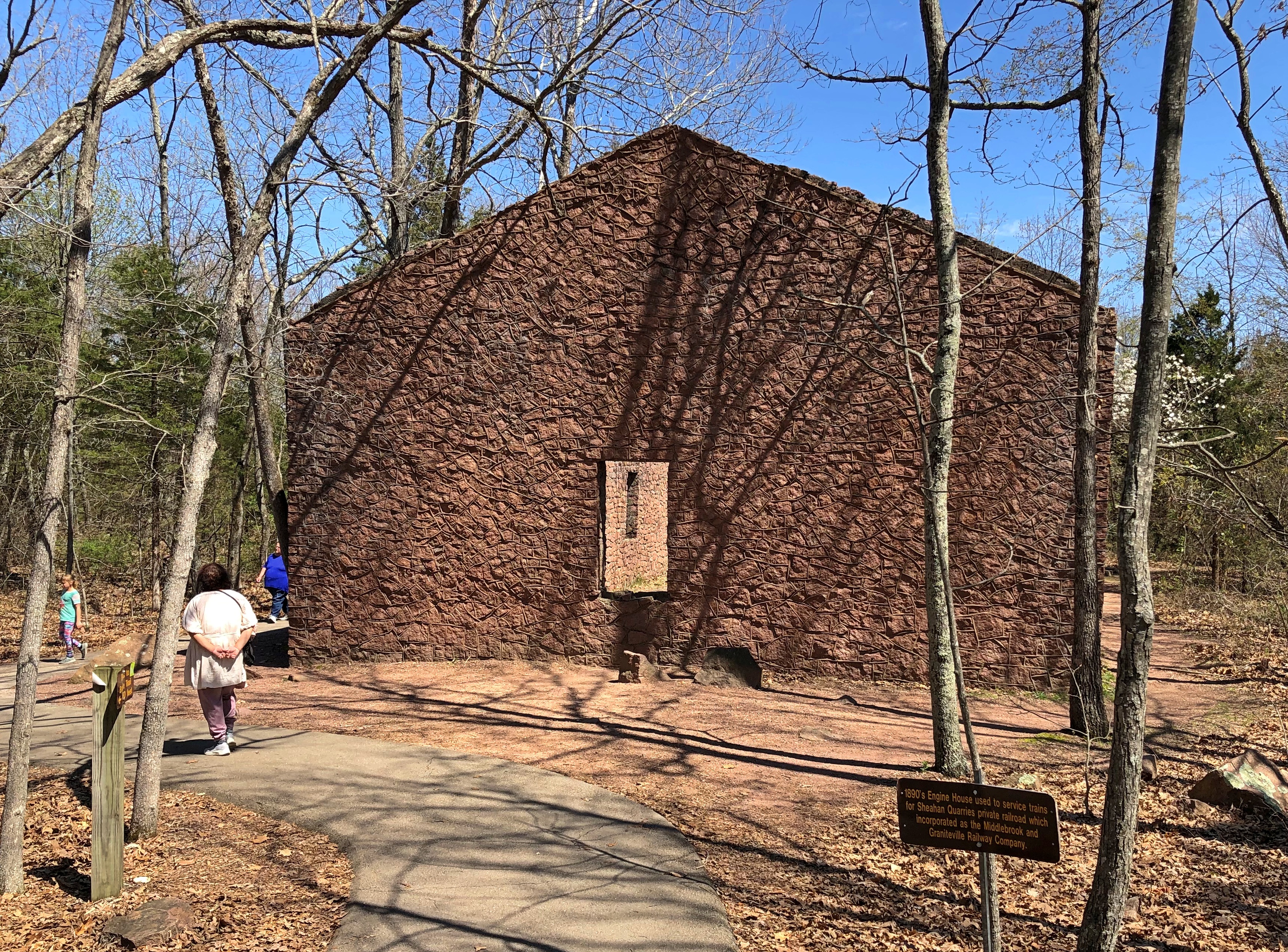
Deep cold these last few days, so we passed the time, including the MLK holiday, in 21st-century central heated space, that is, home. Filed papers, hauled my boxes of postcards out of the closet for a look and a touch of reorganization – not to the point of being highly organized, though – and removed ornaments and lights from the Christmas tree and in one brief expedition into the frozen waste of our back yard, deposited the tree out there.

Should I burn it? Makes a glorious flame, if only for a few seconds. We shall see.

Wonder when the owner of this vehicle removed the Nativity.Louisville

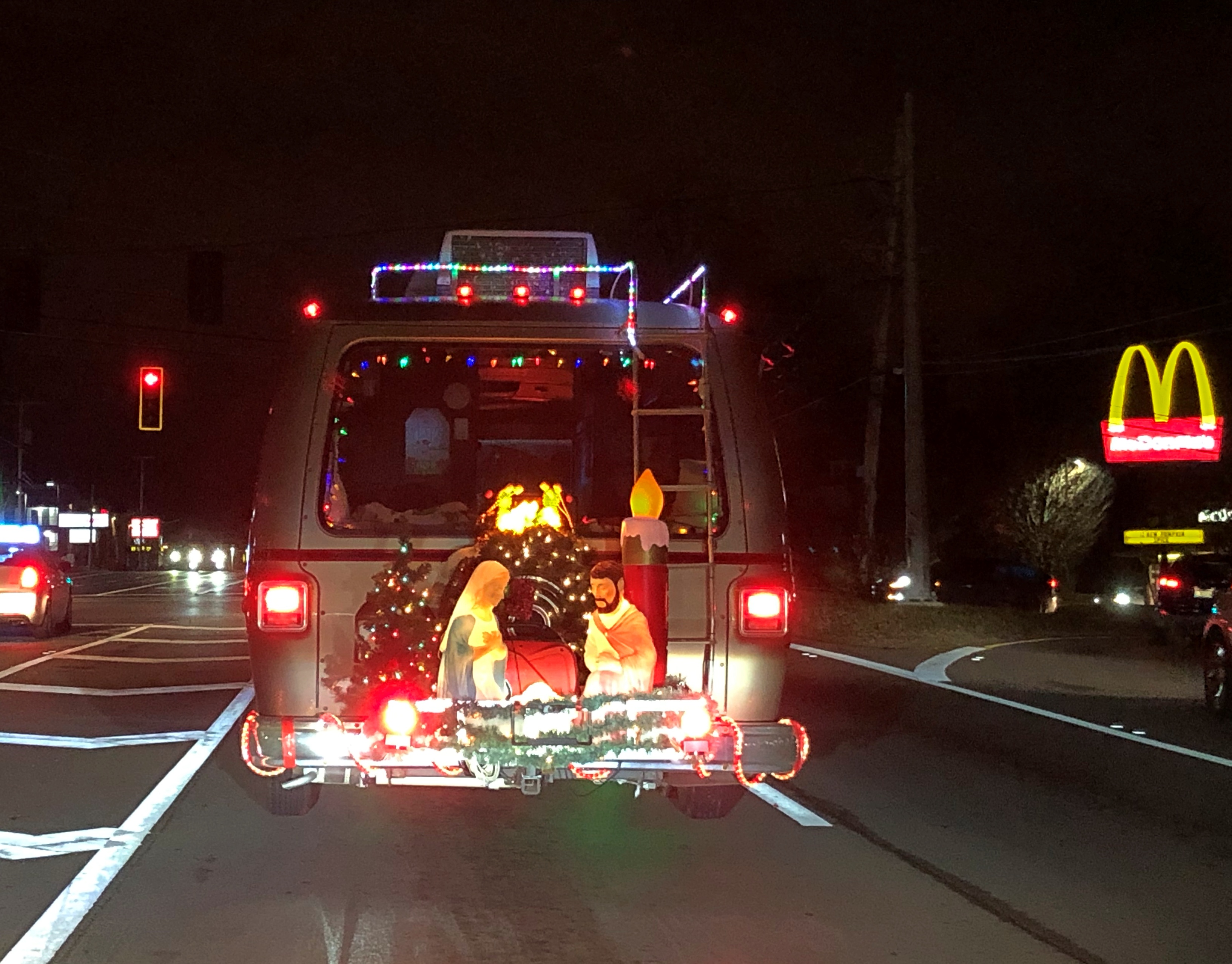
Whenever that was, I have to say that I’d never seen that familiar display in this unusual location. For all I know, however, it could be the next big thing in honoring the First Christmas.

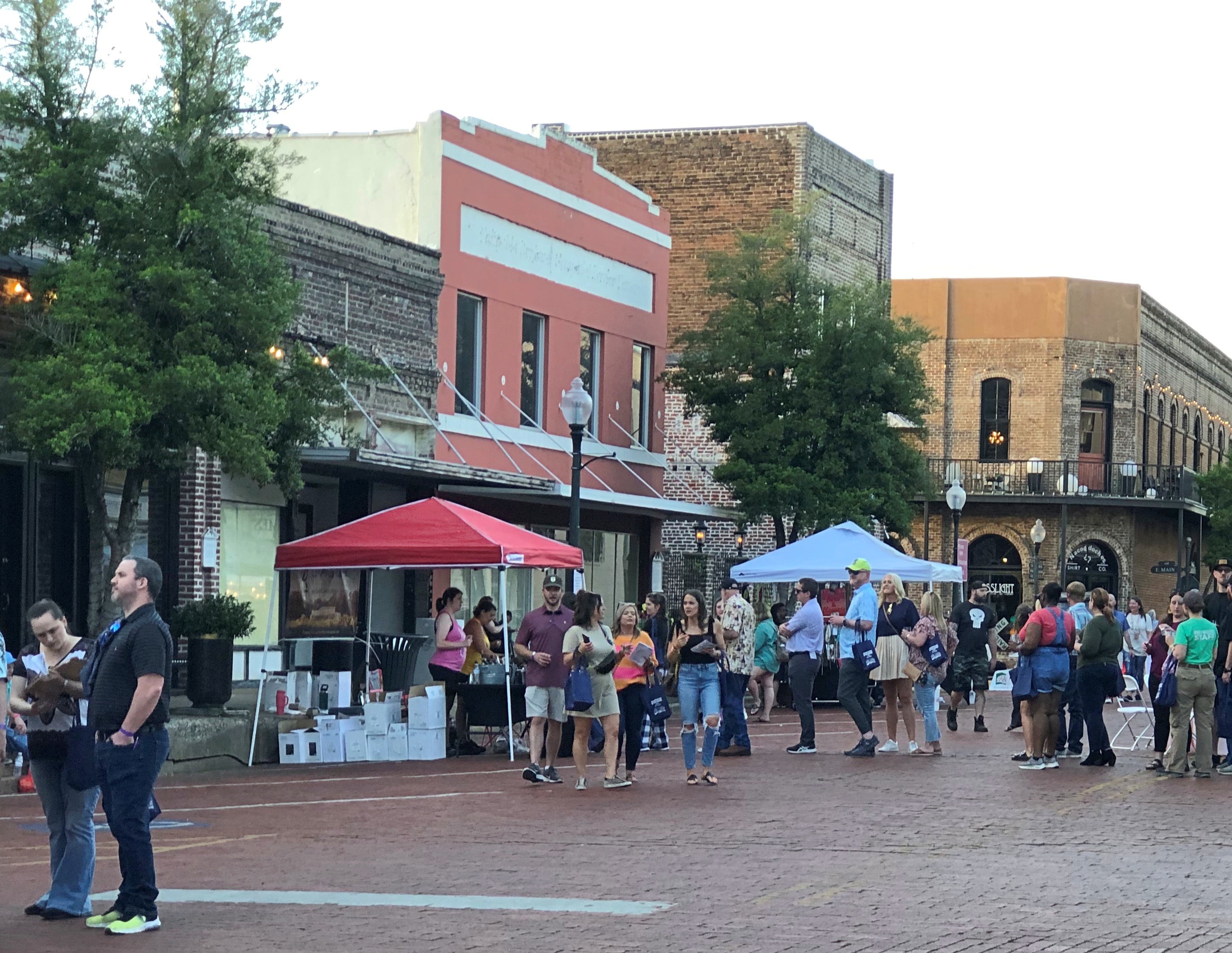
We spotted Bethlehem on wheels in east Louisville on the evening of December 29. The next morning we made our way to Main Street in downtown Louisville; and we returned to the area just before we left town on the morning of New Year’s Eve. Some blocks are exceptionally handsome.Main Street Louisville Main Street Louisville Main Street Louisville Main Street Louisville

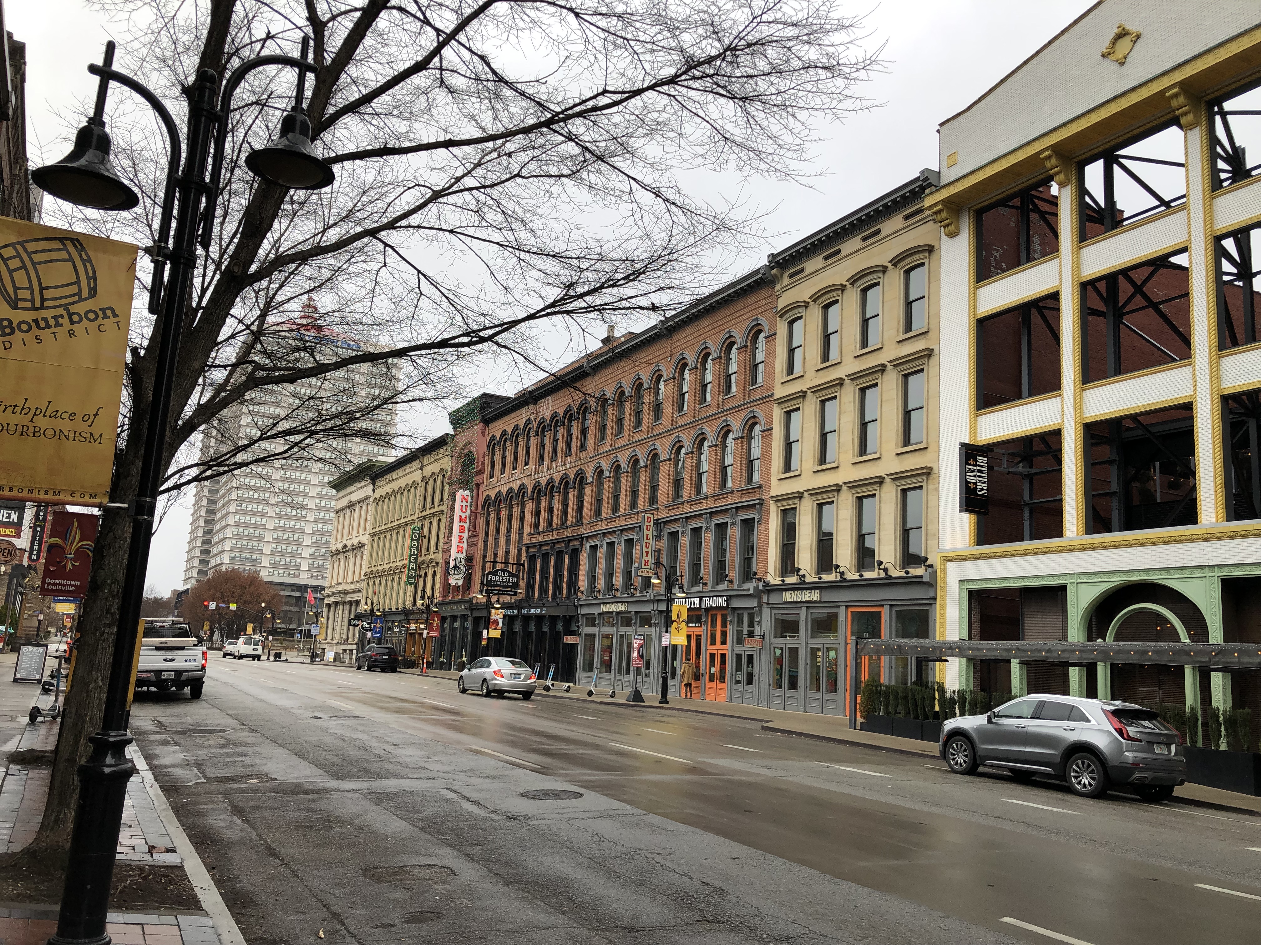
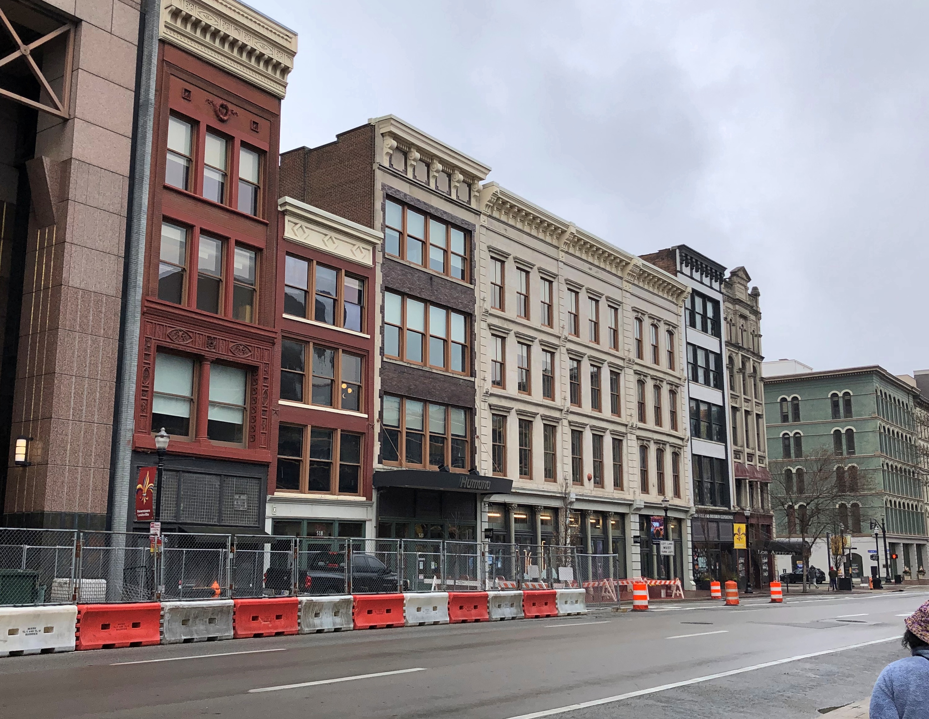
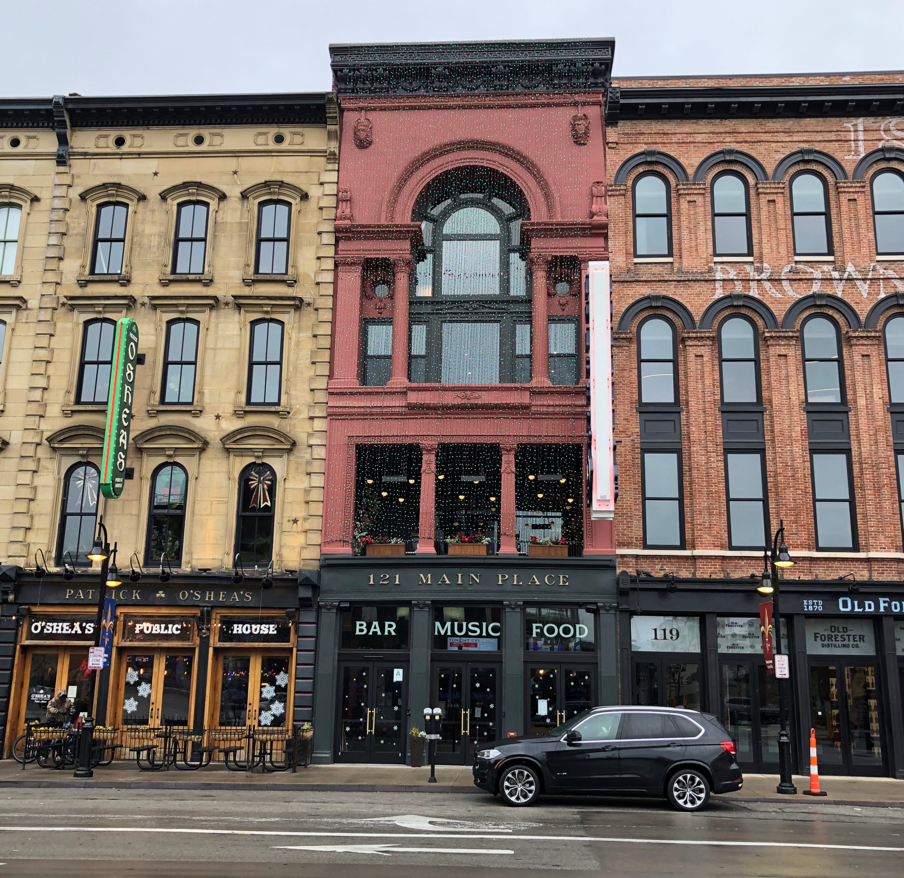
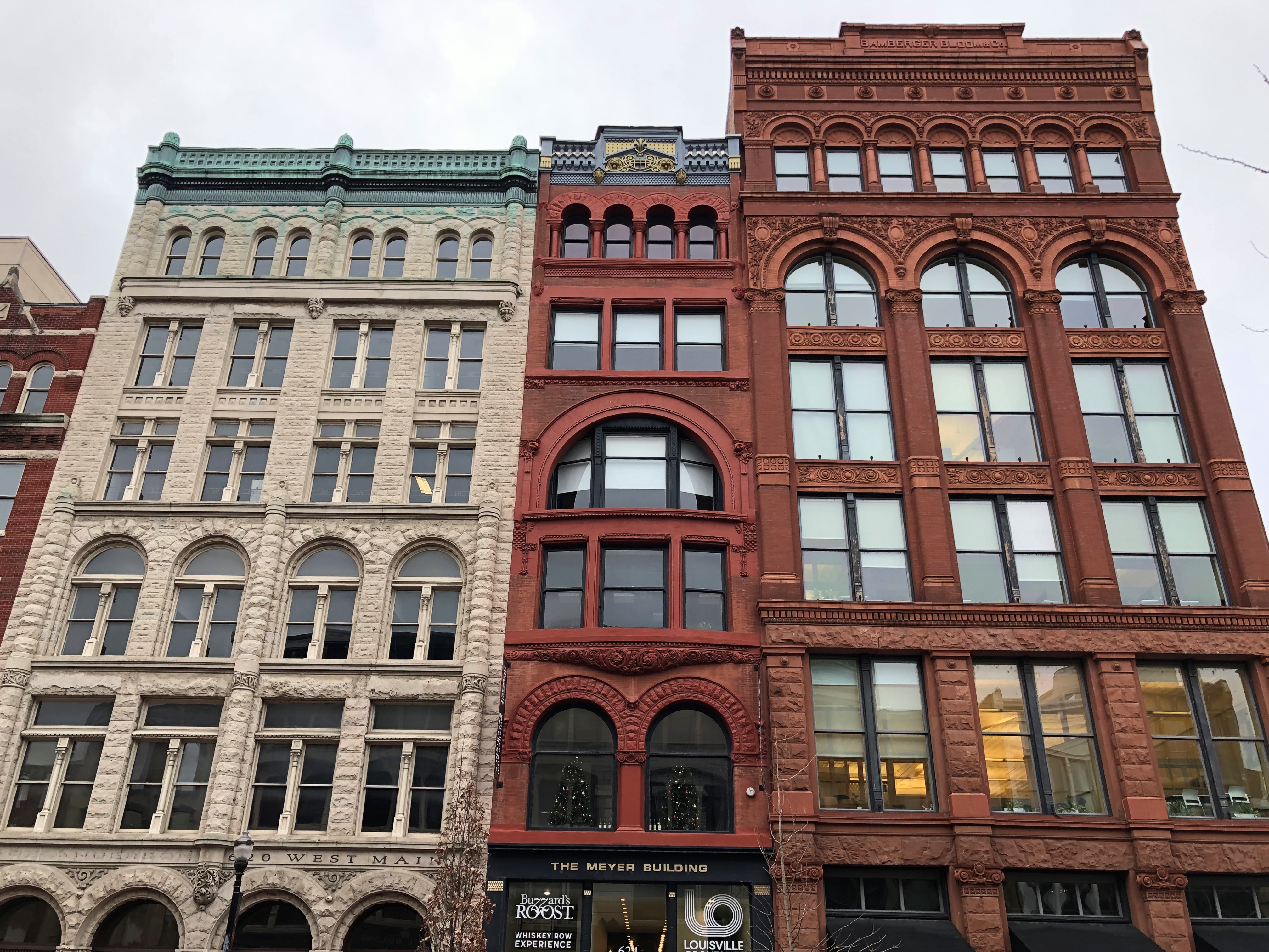
The valuable facades of these pre-Great War vintage buildings look to be, in some cases, saved for later development behind them. Maybe mixed-use, largely residential but also specialty retail. I could imagine that outcome.Main Street Louisville

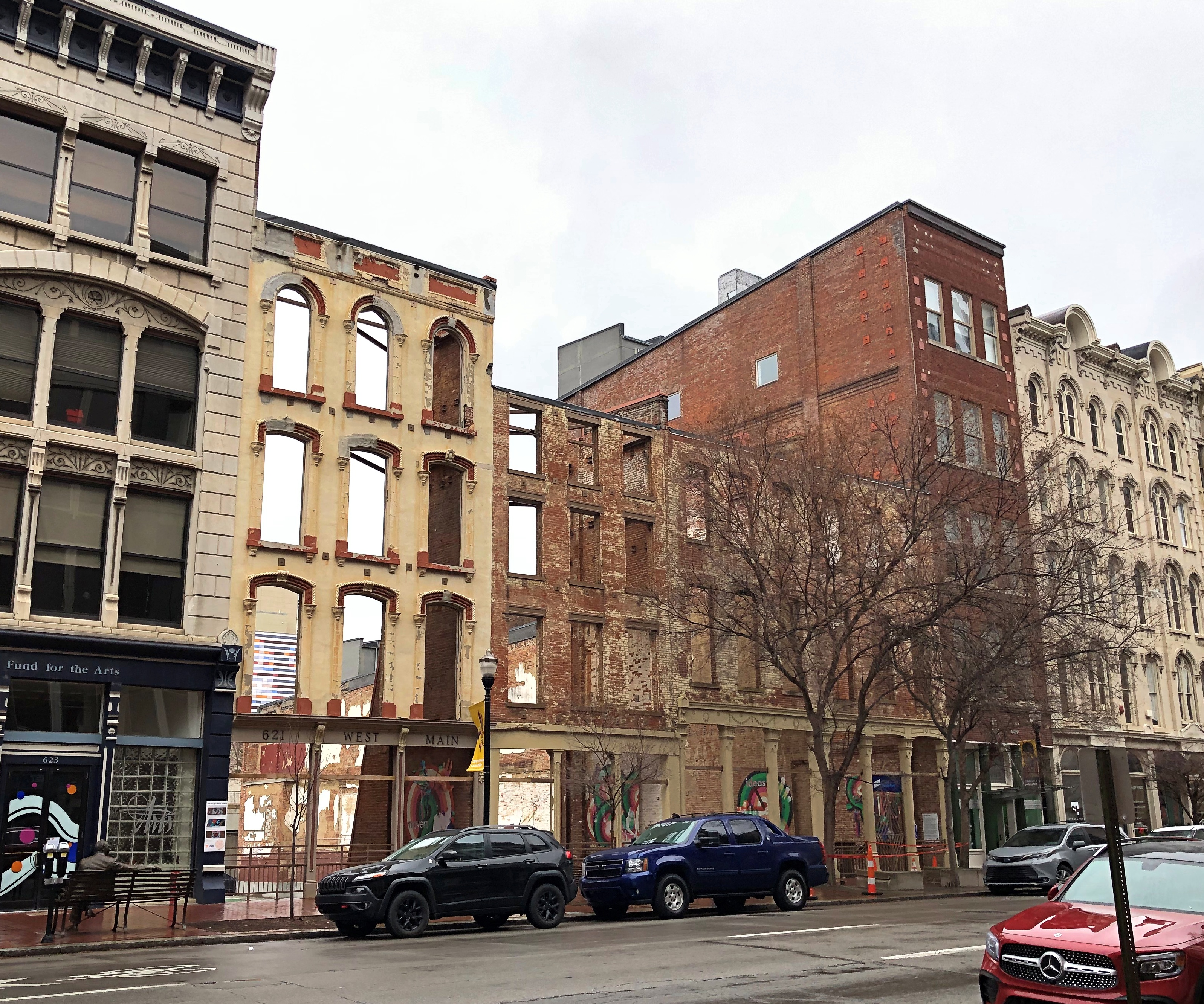
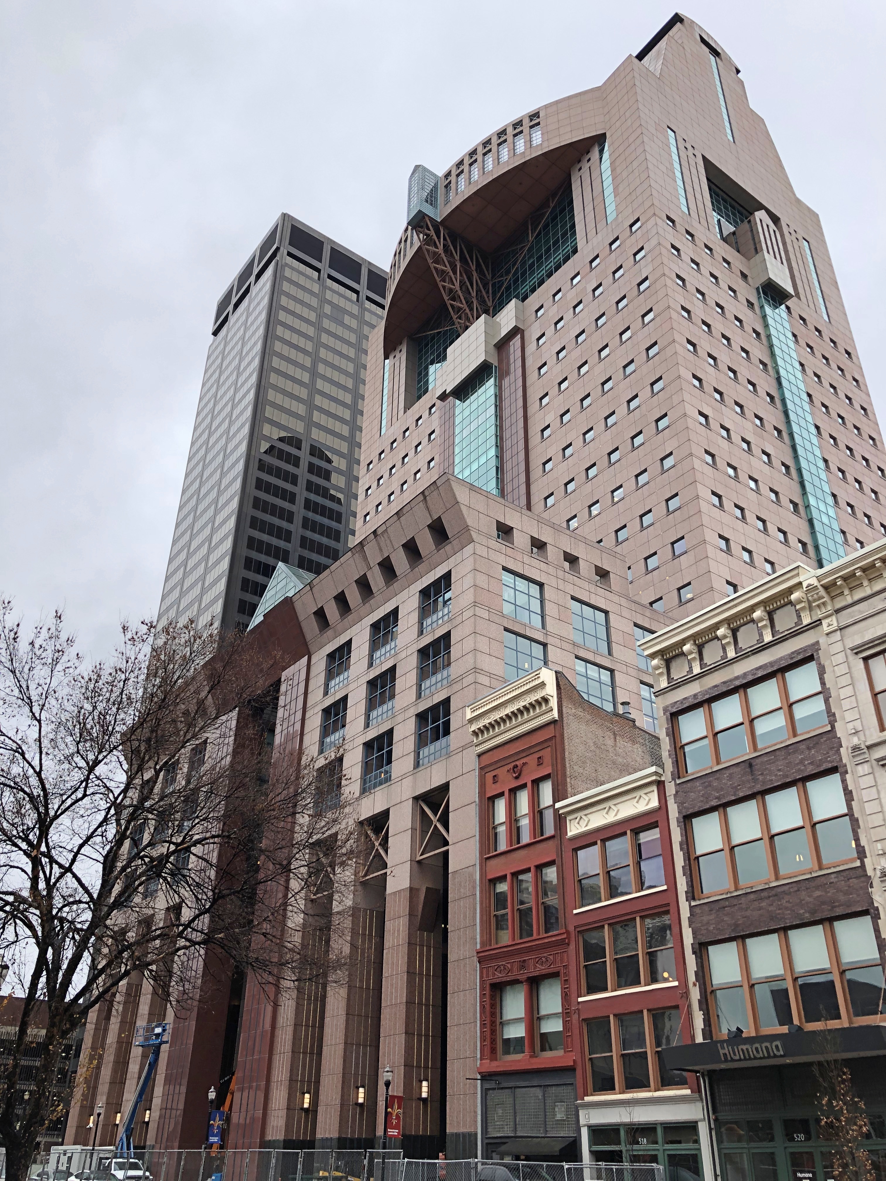
Not all of the street features refurbished leftovers from the late 19th century. Rising at W. Main and 5th Street is a behemoth occupied by a for-profit healthcare behemoth, the Humana Building. Designed by Michael Graves in 1985. Look up postmodern and I think you’d see an image of this building.

The structure is such a behemoth that it was impossible to get the building all within a shot, standing across the street from it. Still — something of a bird of prey vibe, seems like. Mecha-Owl? Main Street Louisville

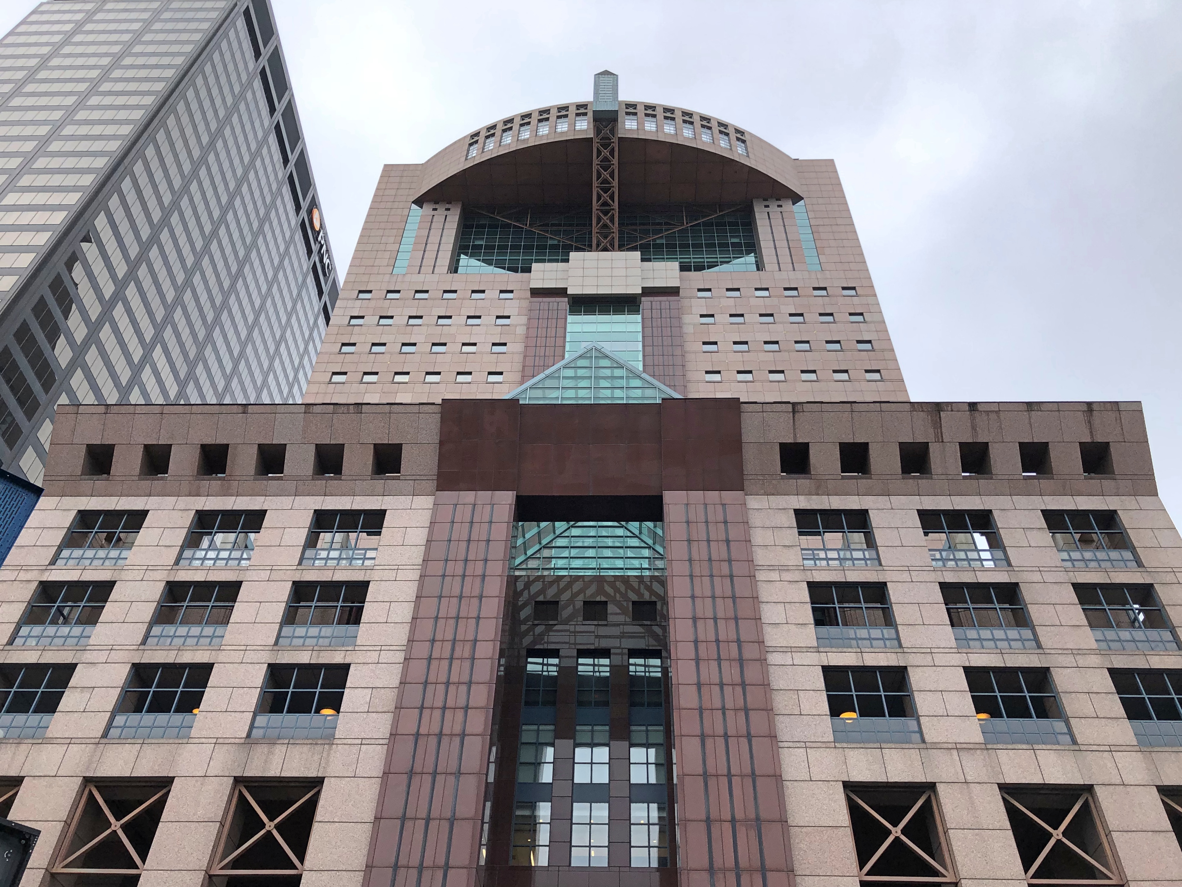
It stands on the site of the Kenyon Building, pictured here in 1927.

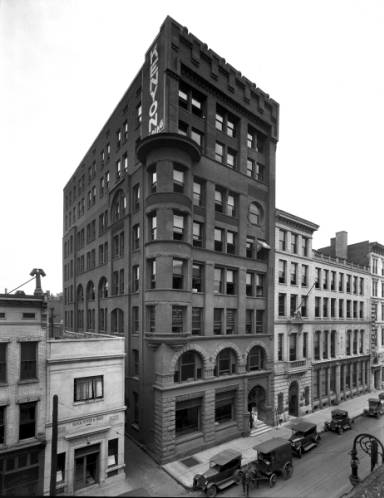
The Kenyon itself no doubt replaced earlier, smaller structures. Louisville emerged as a city with rapidity in the early 19th century, with Main its first focus.

“West Main Street was the first street in the city,” Louisvilleky.gov notes. “The first businesses to line West Main Street included an attorney, grocer, boardinghouse, auctioneer, merchant, carpenter, tailor, shoemaker, tobacco inspector, blacksmith, engineer, physician, hatter, tallow chandler, barber, painter, upholsterer, insurance company, plasterer, druggist, and brewer.”

How many of those professions remain on Main Street? I’m not going to do anything like work to find out, but my guess would be attorneys and insurance companies, certainly, maybe an engineer or two, some physicians, and merchants, depending on how you define that. Very likely no blacksmiths, hatters or tallow chandlers.

In our time, Main is also a street of some curiosities. Such as Jane Fonda in microgravity.Louisville

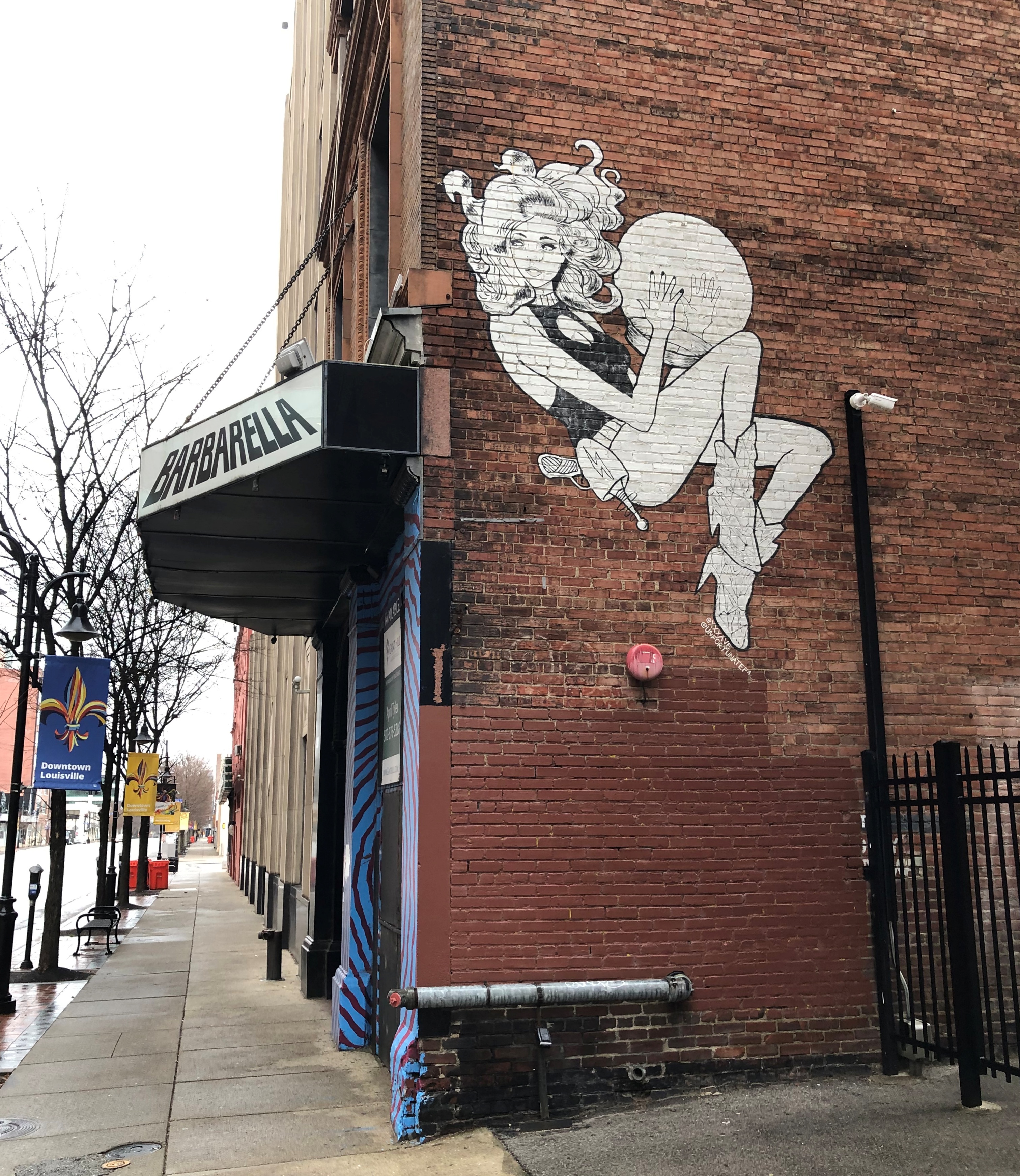
Nightspot Barbarella apparently didn’t survive the pandemic. This is the entirety of the last note from Barbarella on Facebook (October 5, 2021): “Permanently closed bitches!!! Loved y’all. It was a wild ride. But the roller coaster has come to an end!” Louisville Louisville

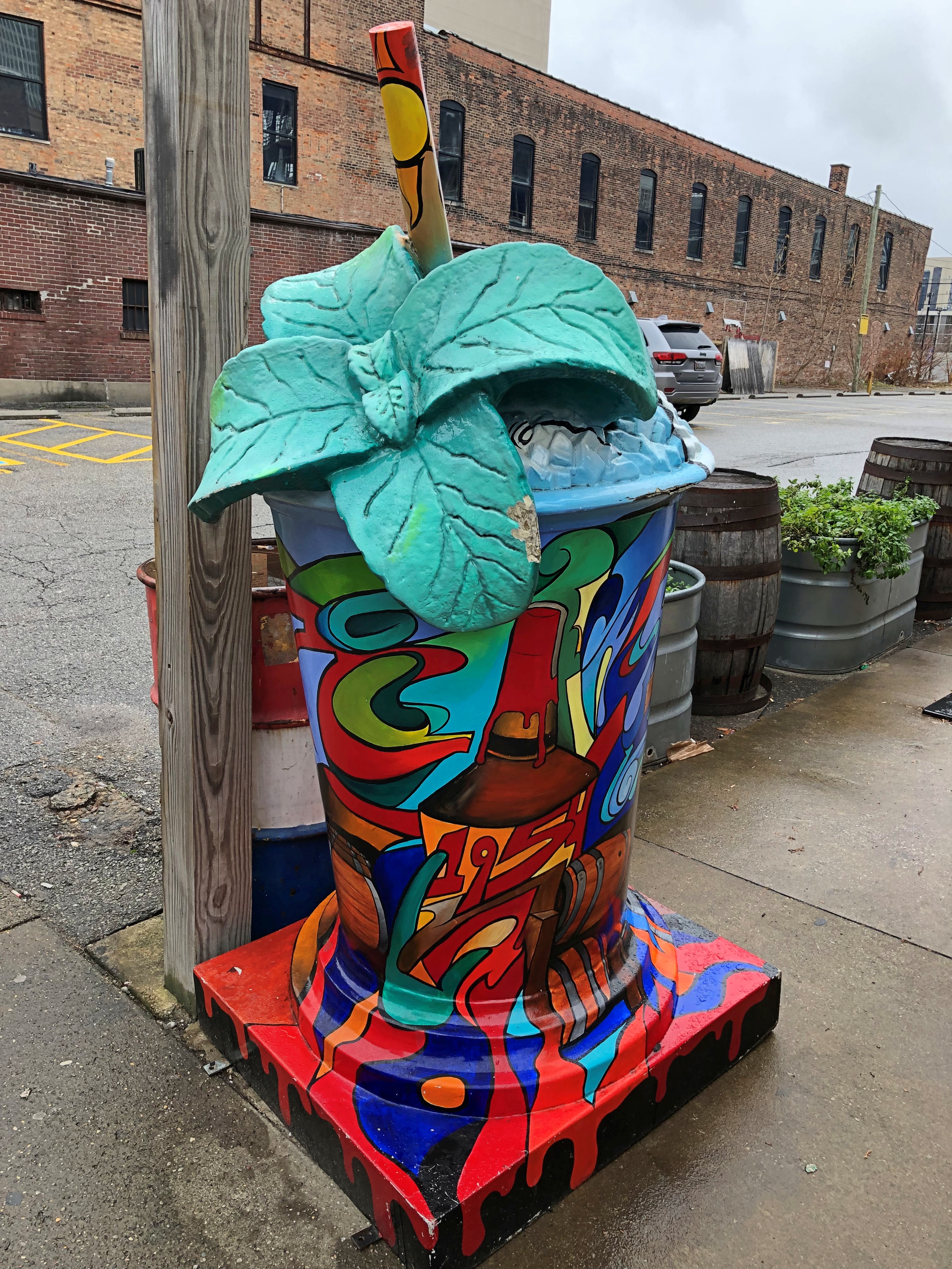
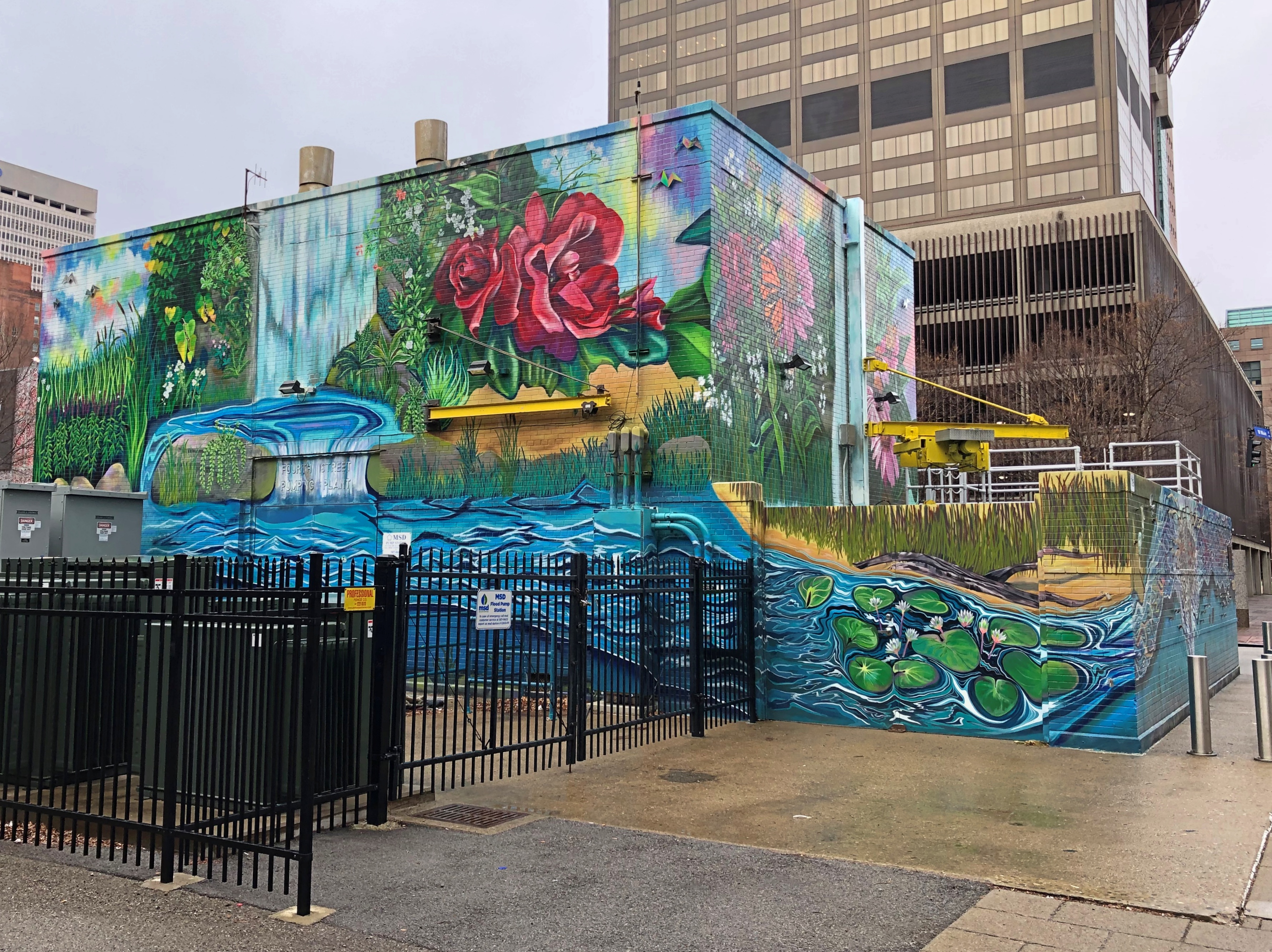
That last image is the Metropolitan Sewer District 4th Street Flood Pump Station, since 2022 adorned with a mural called “Hope Springs – The Wishing Well” by local artist Whitney Olsen. The linked press release also makes mention of the recently completed, fully invisible tunnel under the city — the Waterway Protection Tunnel, four miles long and 18 stories below ground, to capture surges of storm water. I’m no engineer, but that sounds pretty impressive

A more-or-less empty plaza, formally called Riverfront Plaza/Belvedere, extends from Main to a view of the Ohio. Part of the plaza is built over I-64.

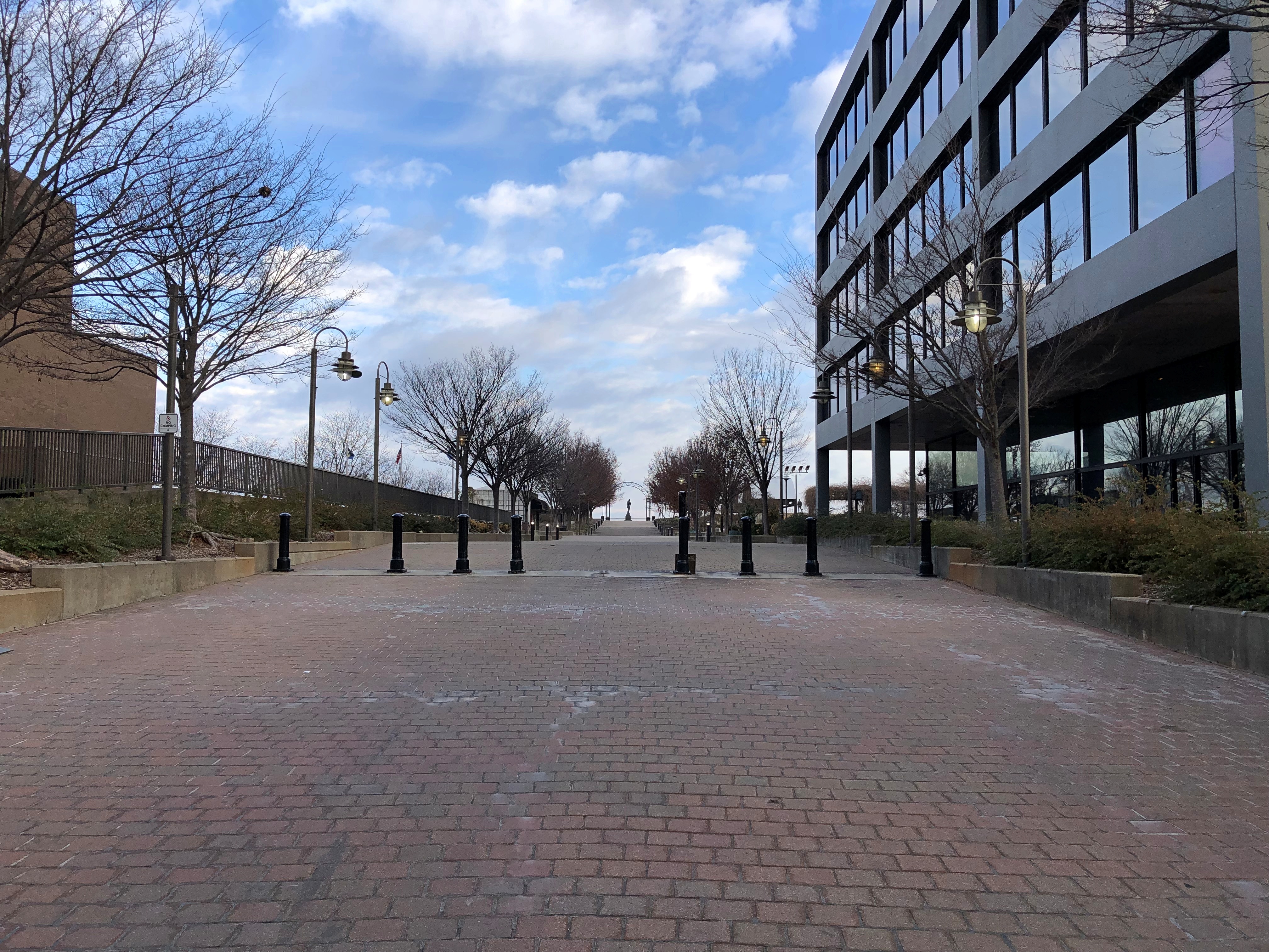
Off in the distance an outline of a statue is just barely visible from Main. I imagined that the statue honored Muhammad Ali. As long ago as 1978, the city renamed a major downtown street after him, though not without resistance that’s completely unimaginable now; and the sizable Muhammad Ali Center is also downtown.

But no: the 1973 work is much more traditional, honoring Louisville founder George Rogers Clark, who has, of course, a larger memorial elsewhere. (The Ali Center is in the distance behind him in my image.)Louisville

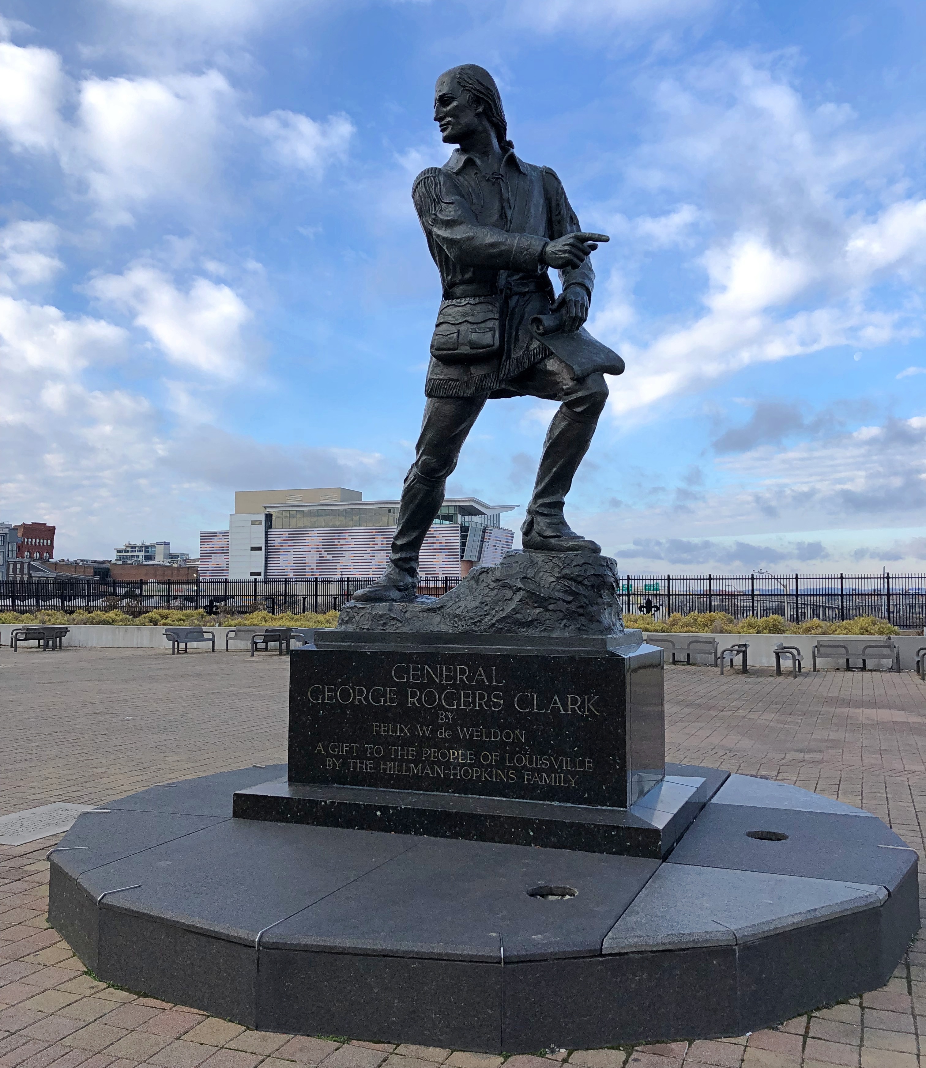
Felix de Weldon did the statue. He’s better known for the Marine Corps War Memorial (Iwo Jima Memorial) at Arlington National Cemetery and, interestingly, he also did the Malaysian National Monument (Tugu Negara) in Kuala Lumpur. I have a vague memory of seeing that, in wilting tropical heat. Weldon did much more over a long life. His partial listing of public sculpture on Wiki begins with King George V in 1935 and ends with another sort of king, Elvis Presley, in 1995.

The George Rogers Clark bronze dates from 1973, but there is another more recent statue on the plaza: York, the only black member of Lewis and Clark’s expedition and as such the first African-American known to cross the continent, in a 2003 work by Ed Hamilton.Louisville- Statue of York

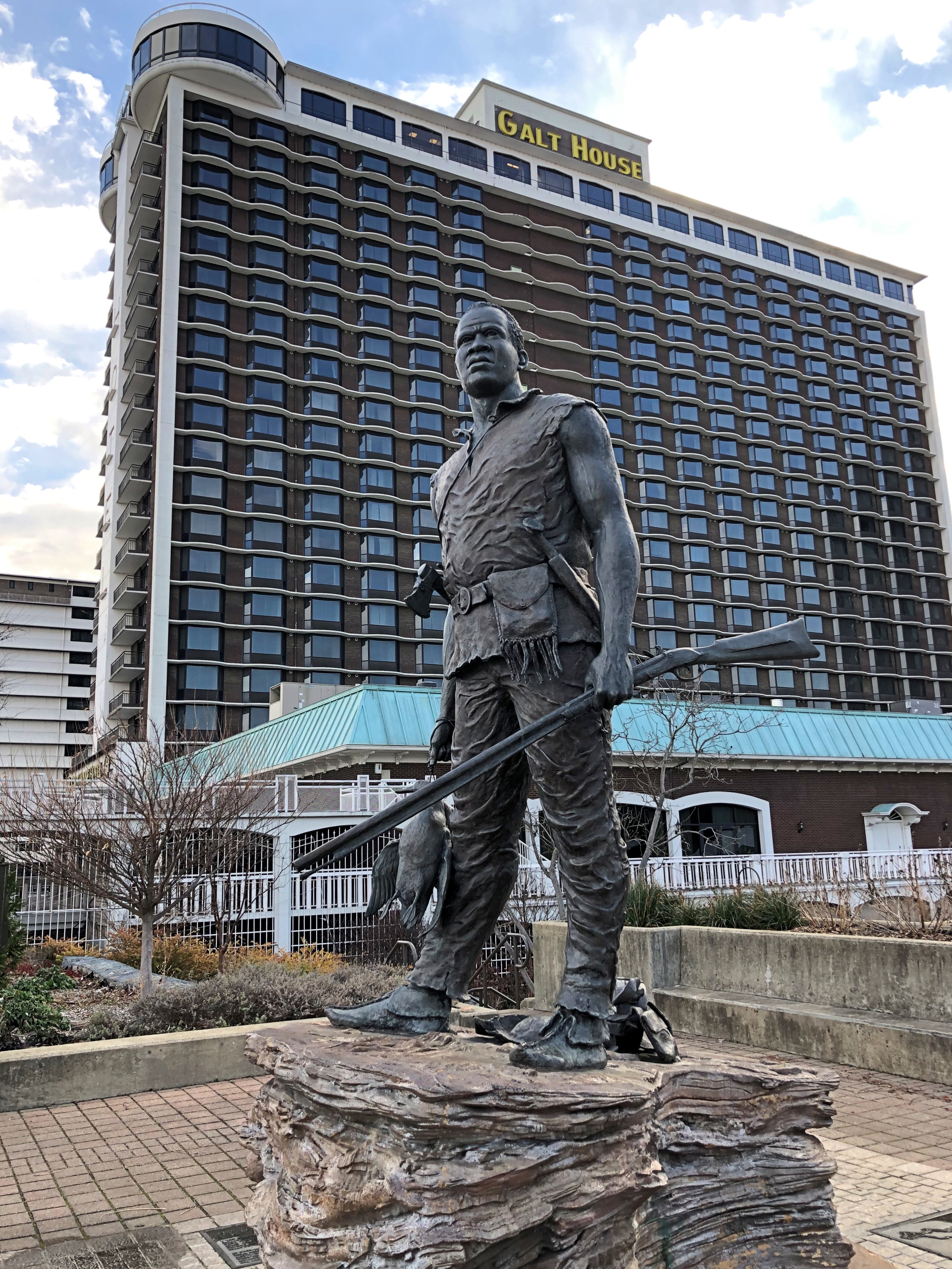
Coming to the Corps of Discovery as Clark’s personal slave, York has quite a story, and an especially awful one after the expedition returned, only much recognized in recent decades (see 37:23 and after in this lecture). No doubt York would have preferred freedom after the trek to the Pacific and back was over, instead of honors 200 years later, but the former isn’t in anyone’s power these days, while the latter is.

The plaza also offers nice views of the Louisville skyline. The Galt House hotel is a whopper: at 1,310 rooms, reportedly the largest in Kentucky, plus 130,000 square feet of meeting space and six restaurants. Developed in the 1970s, the hotel bears a name that’s an homage to a series of earlier hotels called Galt, one with a particularly colorful history that was the site, in ’62, where one Union general offed another Union general with a pistol shot at close range.

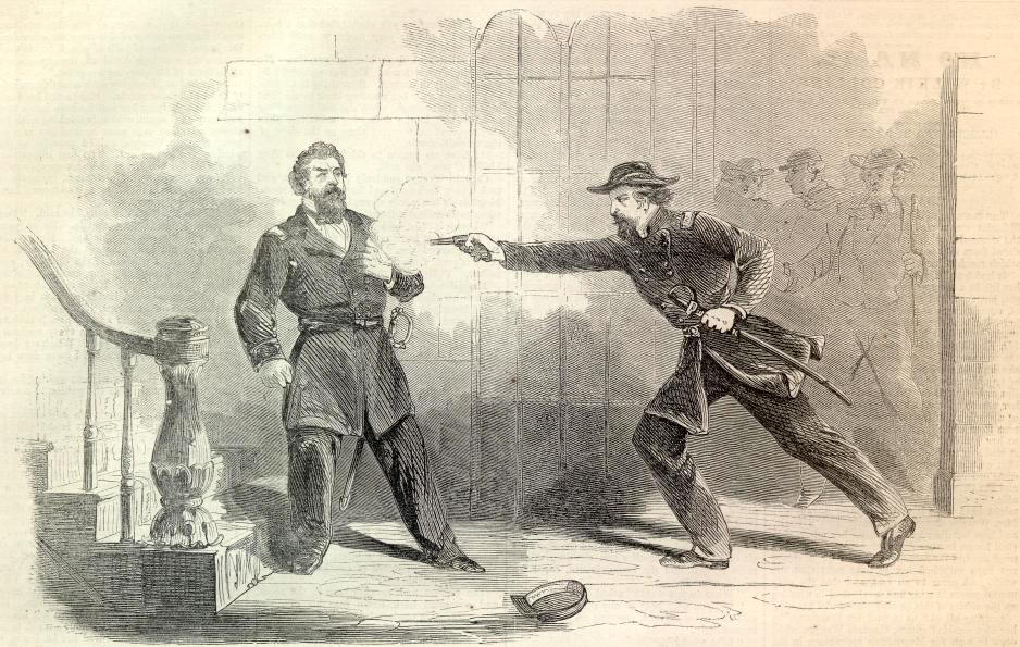
THE MURDER OF GEN. NELSON. ON page 669 we publish an illustration of the ASSASSINATION OF GENERAL NELSON BY GENERAL J. C. DAVIS, which took place ten days since at Louisville. Our picture is from a sketch by our artist, Mr. Mosler, who visited the spot immediately after the affair.

Even more remarkably, the Galt is owned by a single family, not an transnational. A single, sometimes quarreling family, but there isn’t so much remarkable about that.

The 35-story 400 Market, with the domed top, is the tallest building in Louisville.Louisville

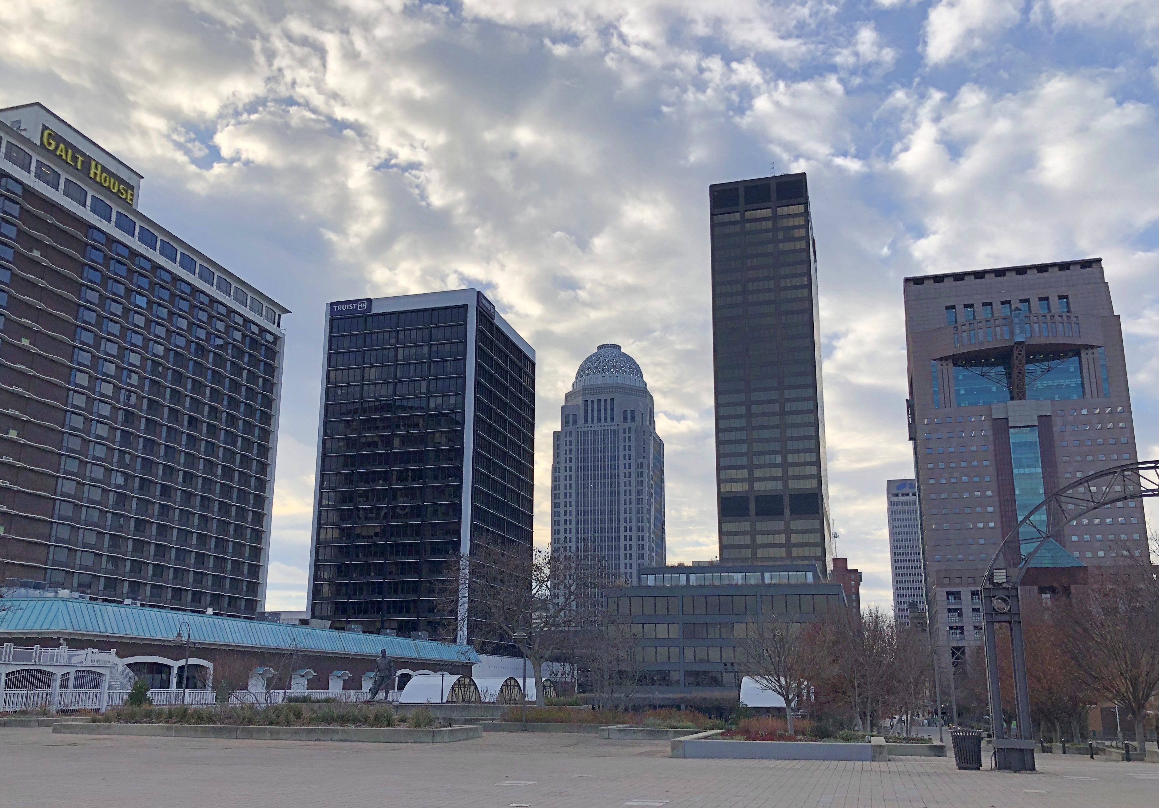
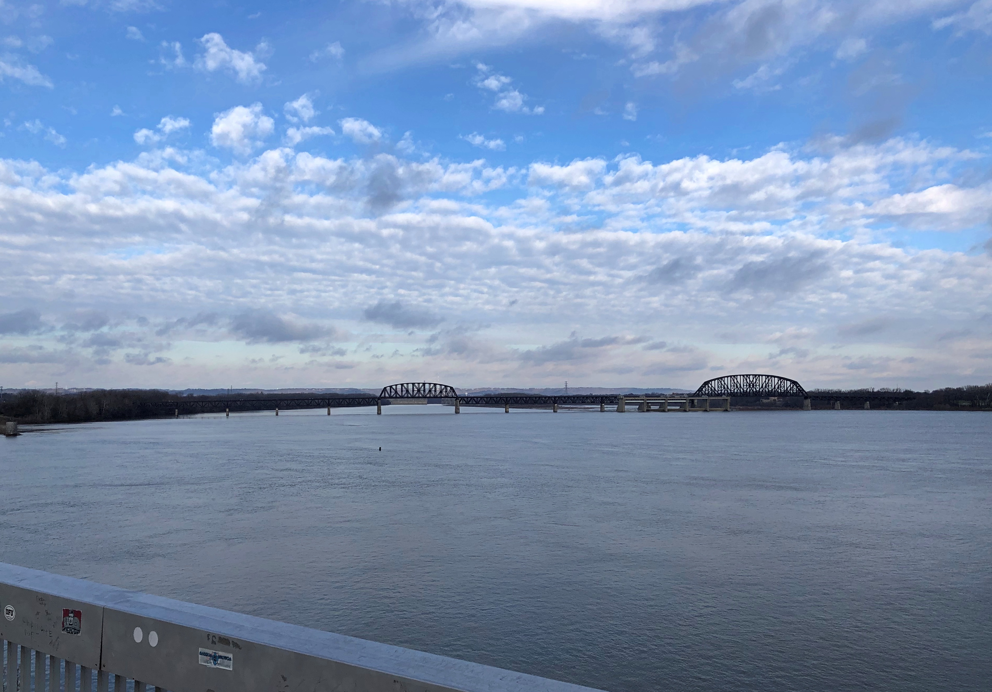
Look the other direction and spy the mighty Ohio.Ohio River, Louisville Ohio River, Louisville

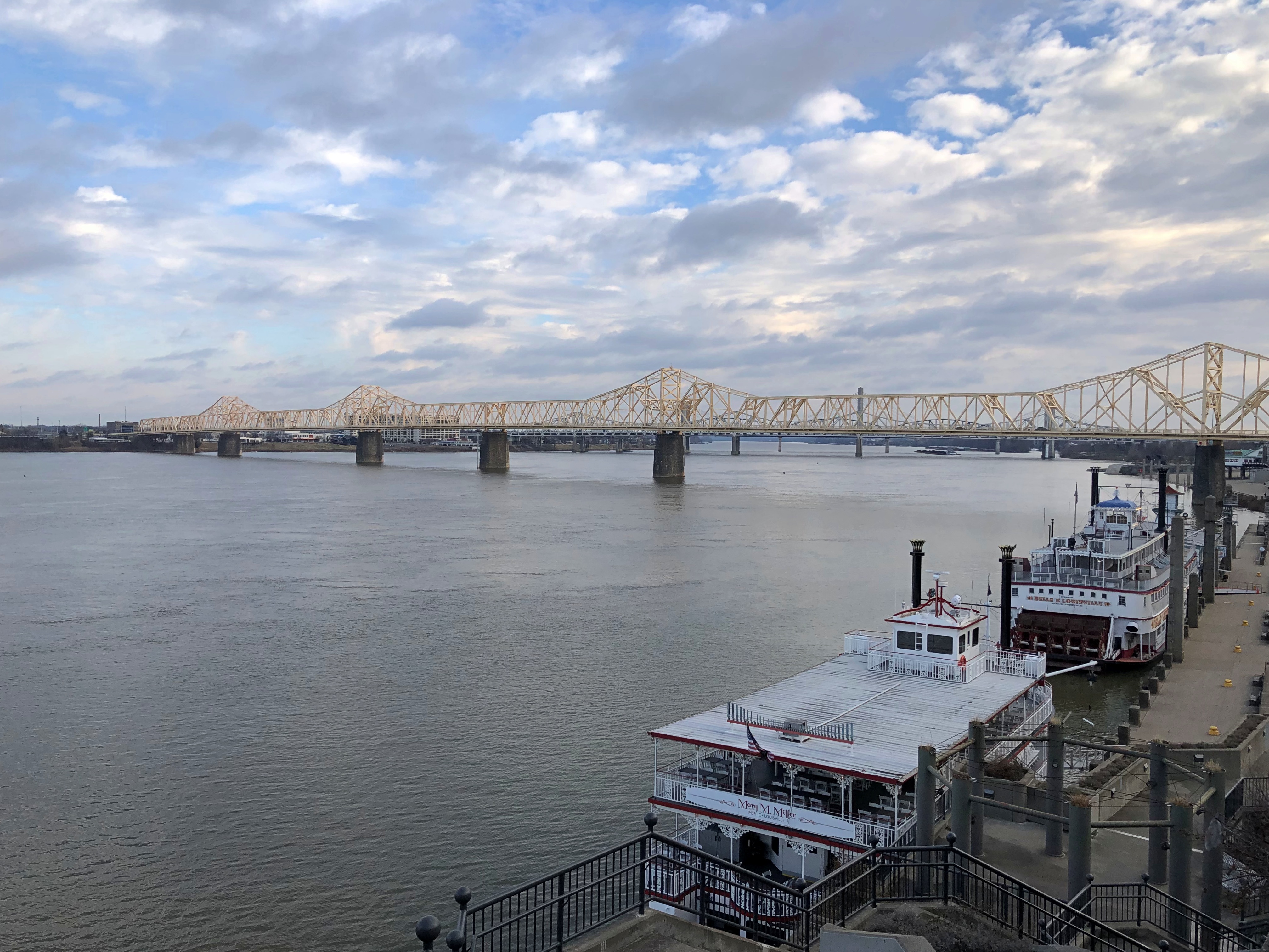
Stairs lead from the plaza down to a riverfront park developed in the 1990s, but late December wasn’t a good time for such a stroll, even though the drizzle had abated by the last day of the year. Some other warmer time, perhaps. Whatever the merits of that park, I doubt that it can erase the fact that the Robert Moses gash that is I-64 largely cuts downtown Louisville off from the river – the very reason there is a city in the first place.

Main Street plaques, along with metal bats, honor baseball players along the way.Main Street, Louisville

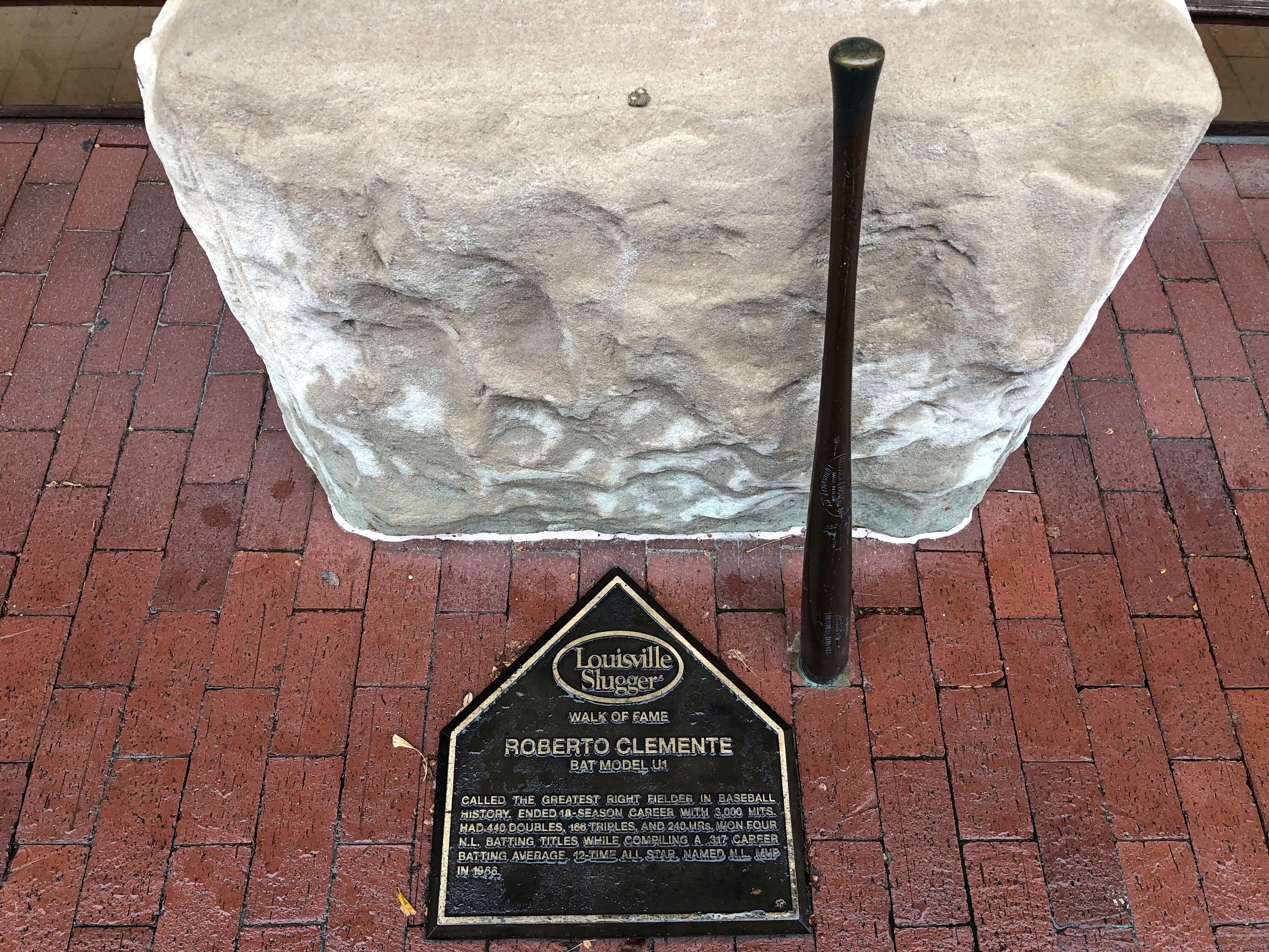
Roberto Clemente is one of 60 honorees in the Louisville Slugger Walk of Fame, which stretches on sidewalks from the Louisville Slugger Museum & Factory on Main St. to Louisville Slugger Field a little more than a mile away. We decided not to visit the baseball bat factory itself, which includes the world’s largest baseball bat (bigger than “Batcolumn in Chicago? Yes, by 19 feet.). Still, we walked by a few other bronze bats and home plates embedded in the sidewalk.

Is Chico Escuela is among the honored? I have to wonder. He should be. Considering that he’s fictional, the plaque wouldn’t have to bother with tedious stats. All it would have to say (naturally) is, “Baseball been barra, barra good to me!”