Buffalo Creek Park, Long Grove

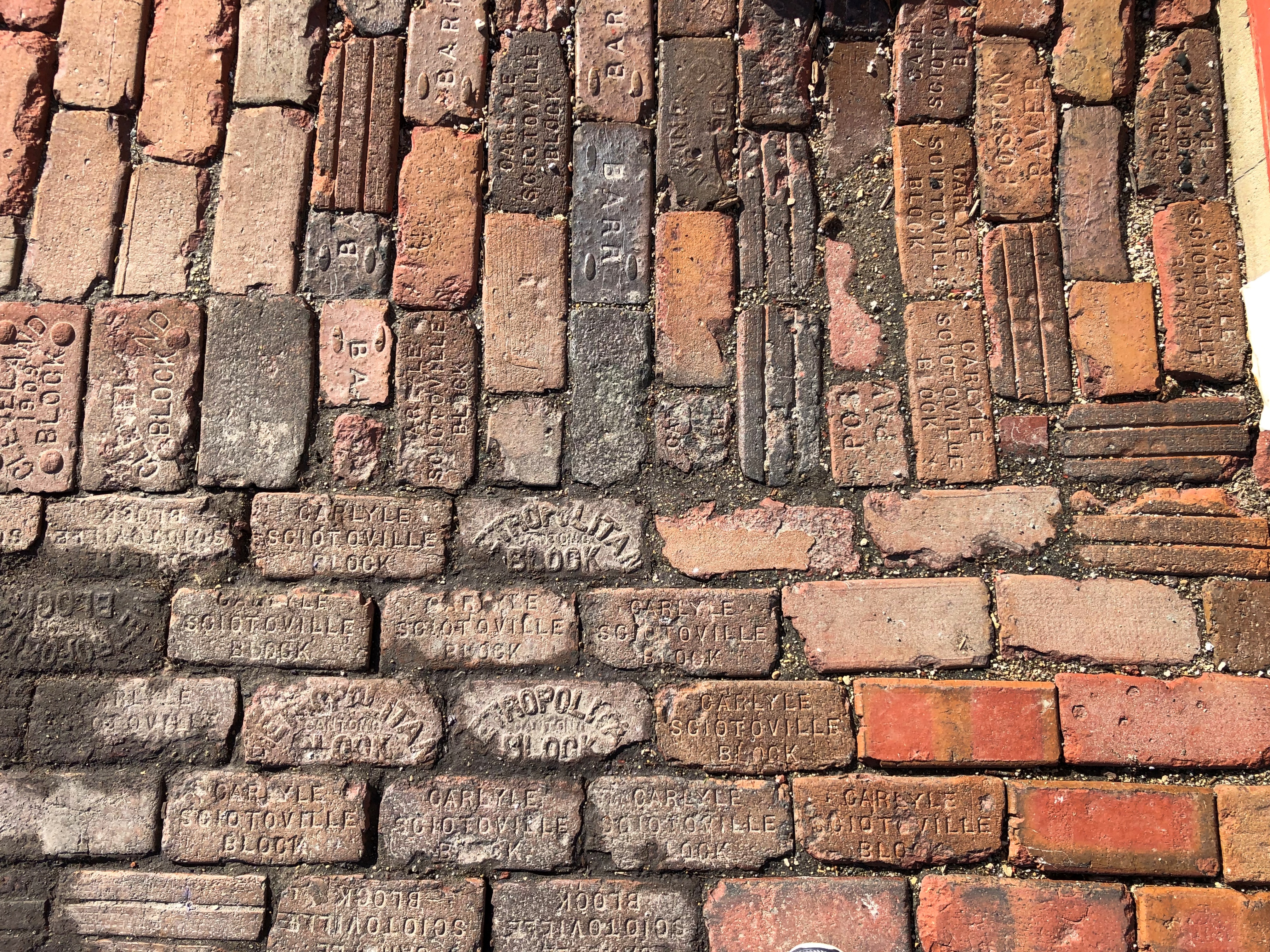
This is all the that Long Grove Park District has to say about Buffalo Creek Park in Long Grove: “Buffalo Creek Park became the Park District.”

Maybe that’s just a mangled placeholder. Guess the district will get around to finishing that description sometime. Unless they decide to let generative AI do their jobs for them, like certain exceedingly lazy employees of my alma mater did recently. They need to be careful, though.

Me: Describe Buffalo Creek Park in Long Grove, Illinois.

Generative AI: Buffalo Creek Park is a public park located in Long Grove, Illinois. The park covers an area of approximately 408 acres and features a variety of natural habitats, including wetlands, prairies, and savannas…

There was more, but I’m skipping it because clearly the program mistook this small park with the much larger Buffalo Creek Forest Preserve. Oops.

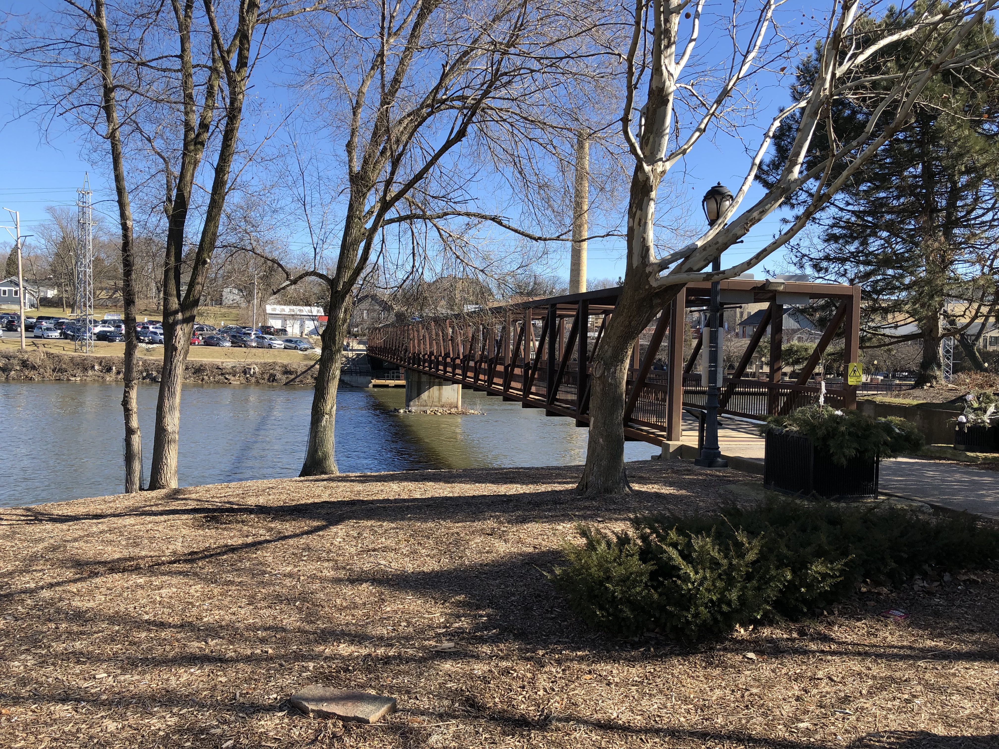
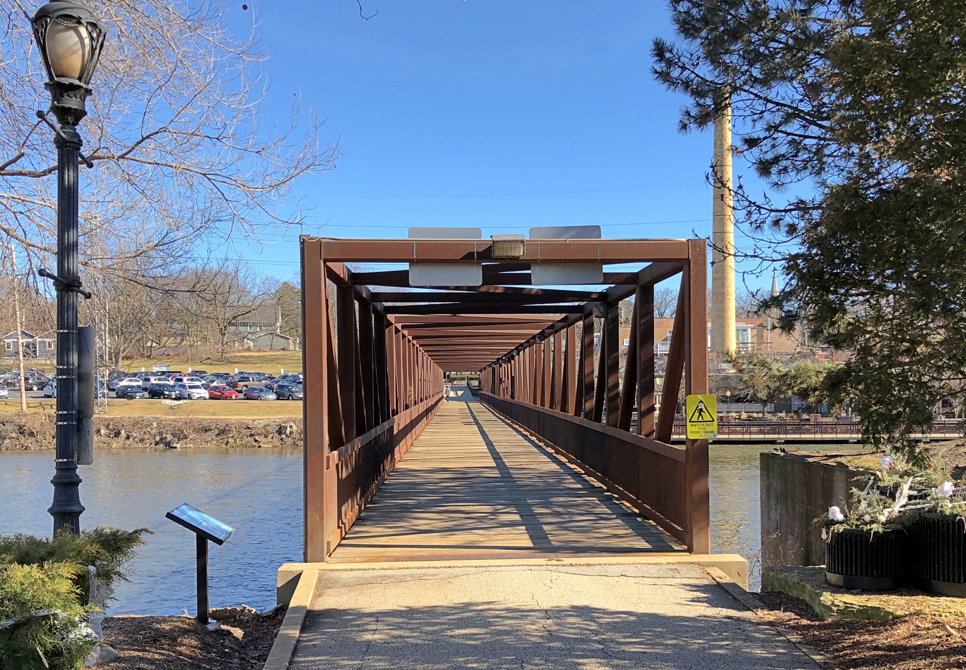
I don’t know the park’s actual size, but I know for certain it isn’t anything close to 408 acres – 20 or 25 would be my guess. One entrance to the park is near Long Grove’s historic covered iron bridge.Buffalo Creek Park, Long Grove, Illinois

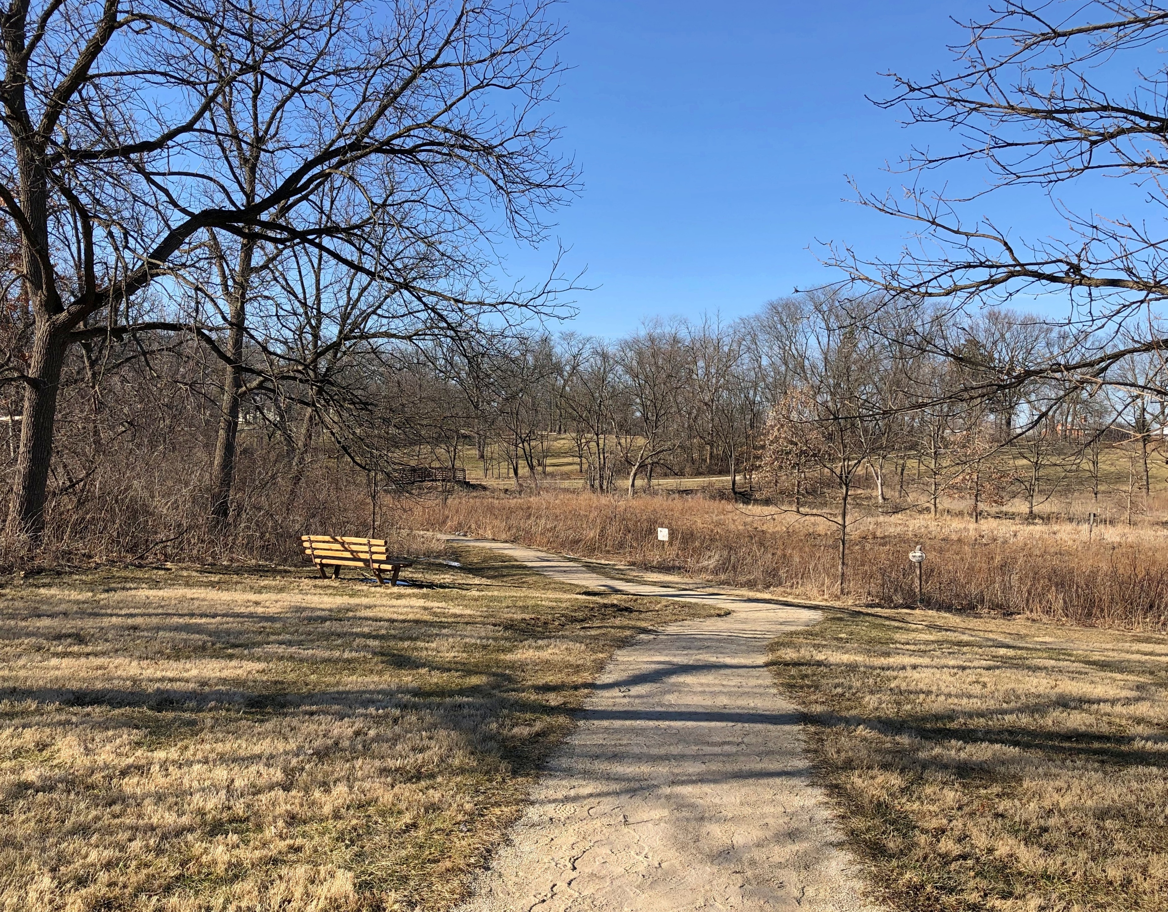
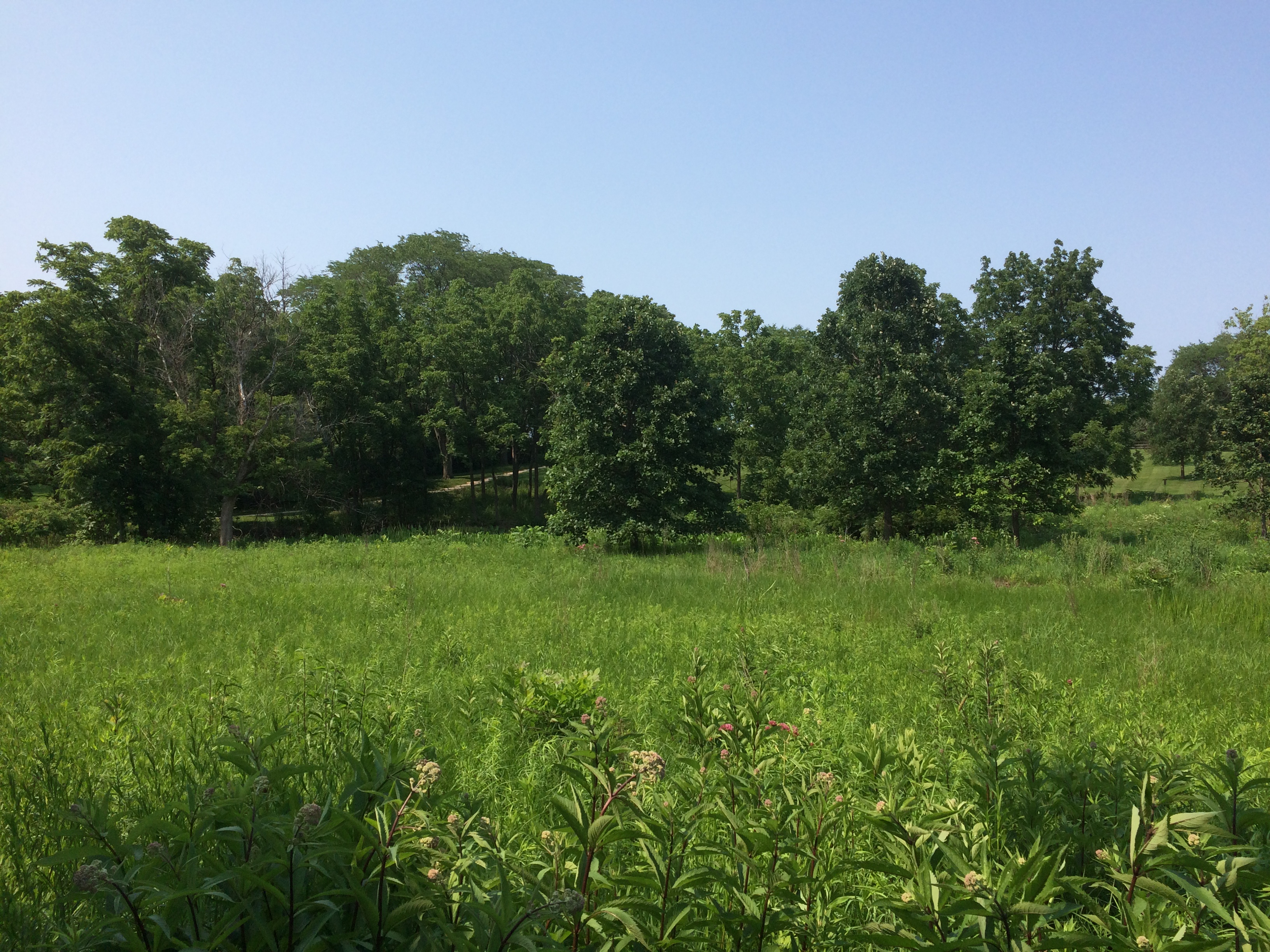
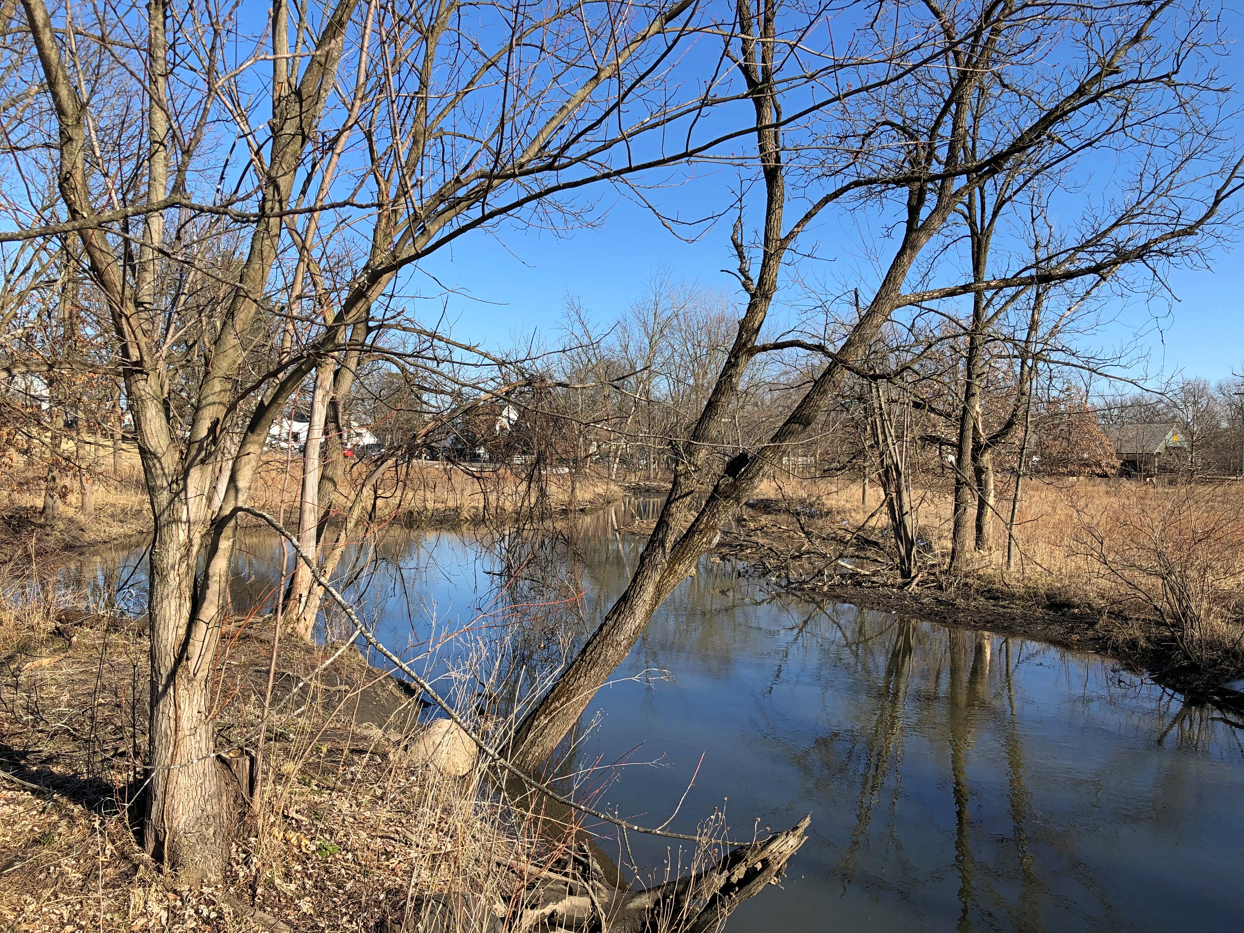
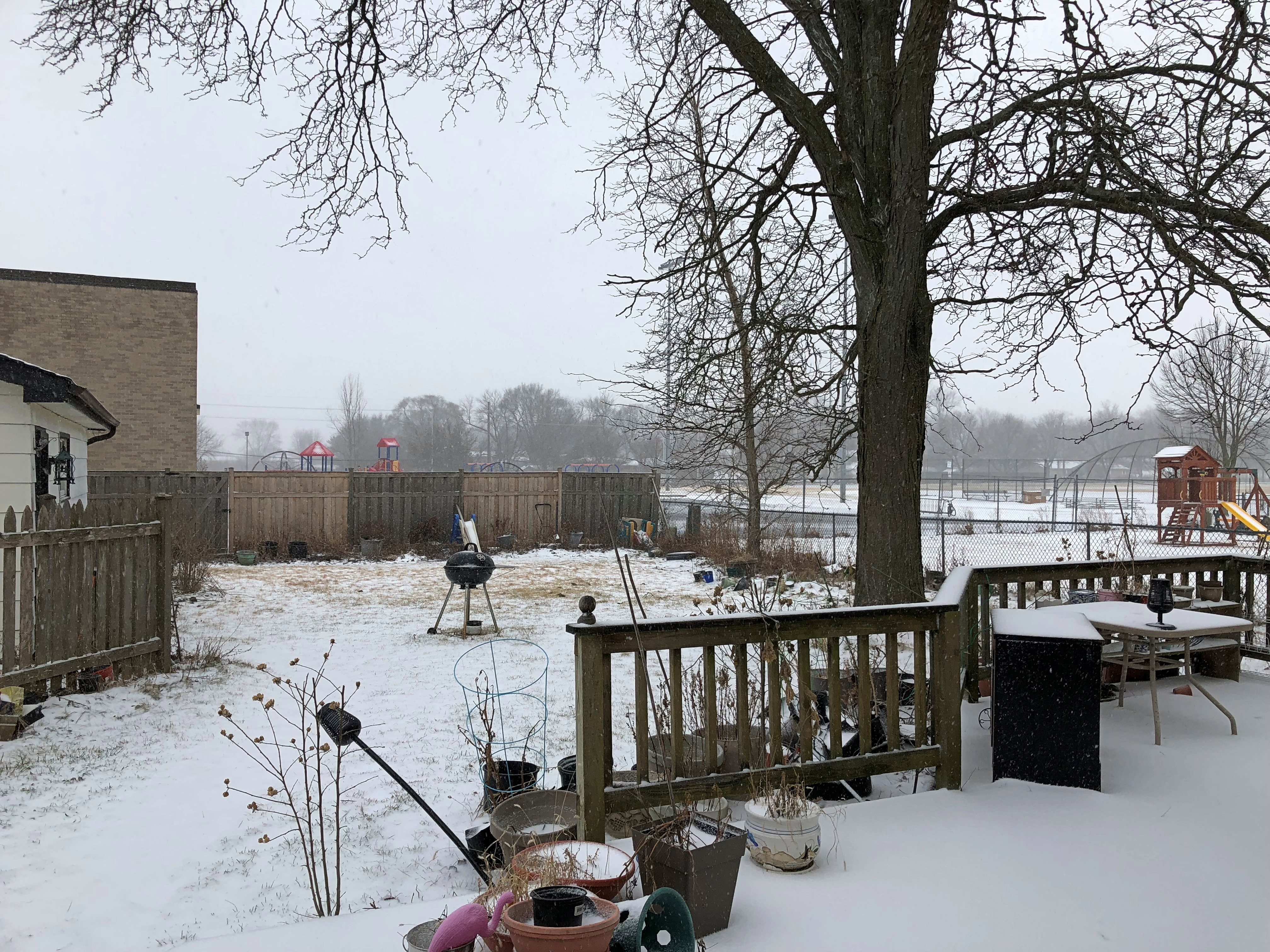
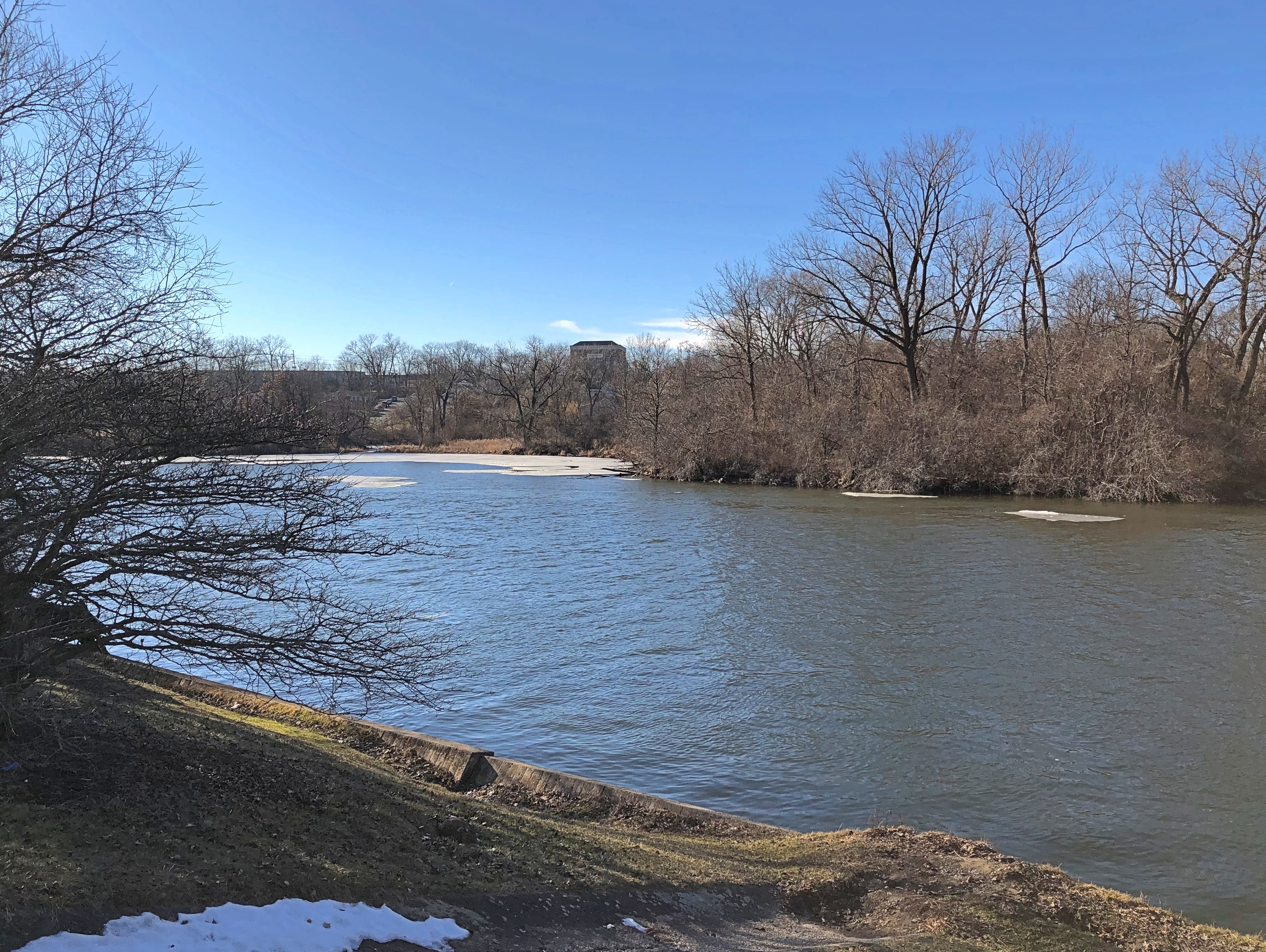
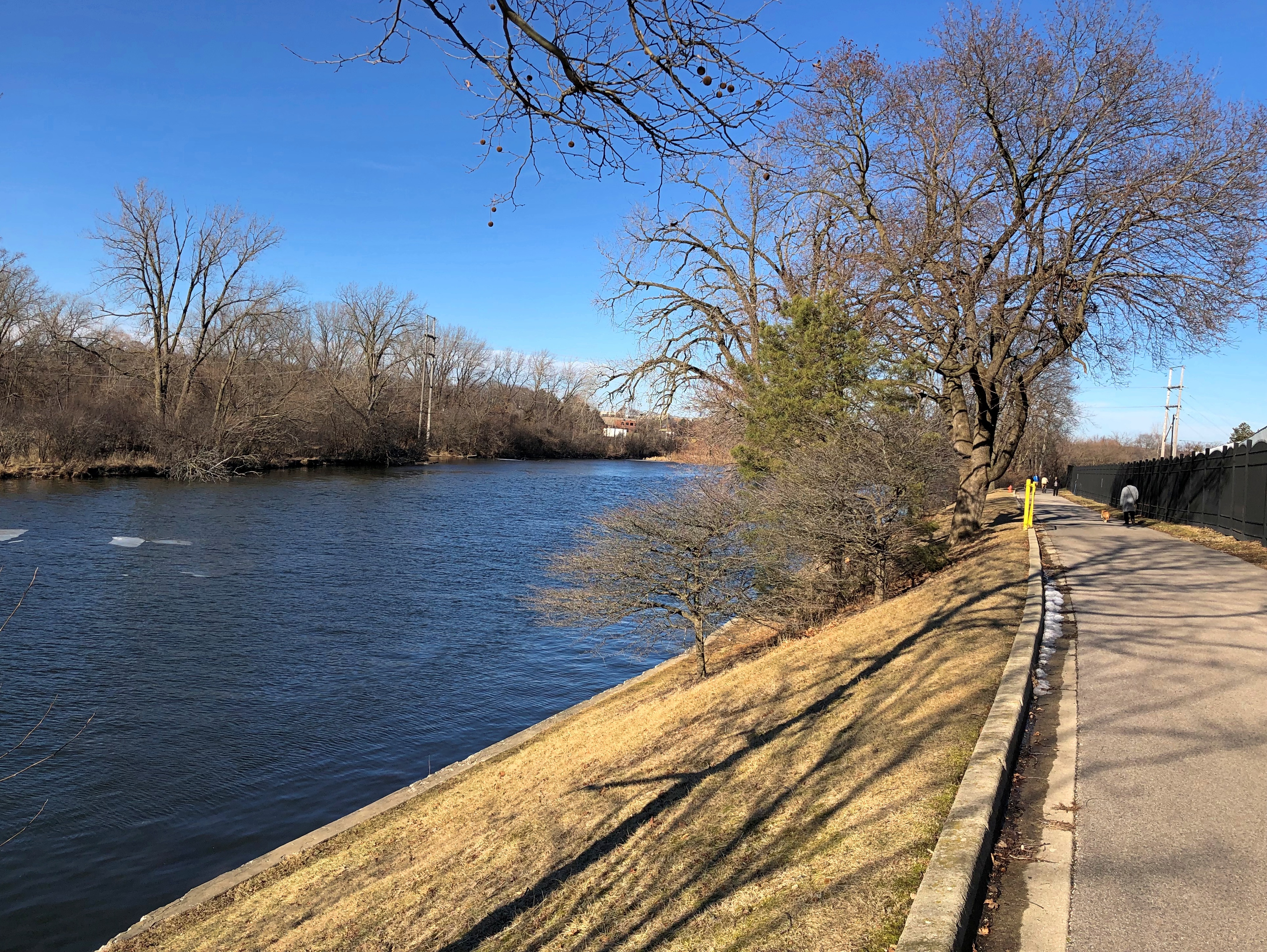
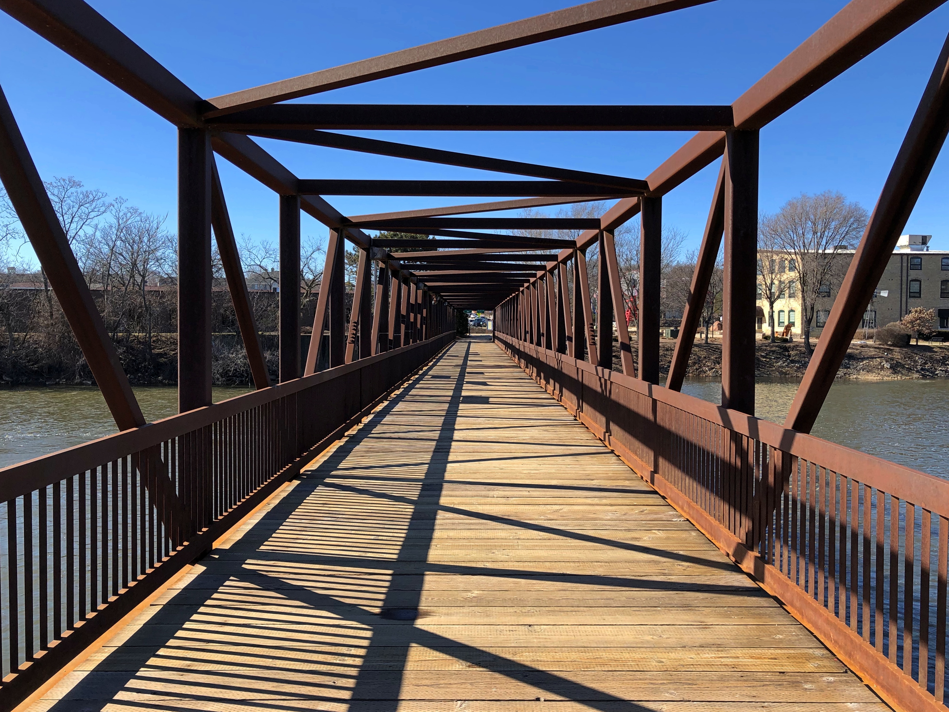
At the stub end of February, the park is a brown expanse.Buffalo Creek Park, Long Grove, Illinois

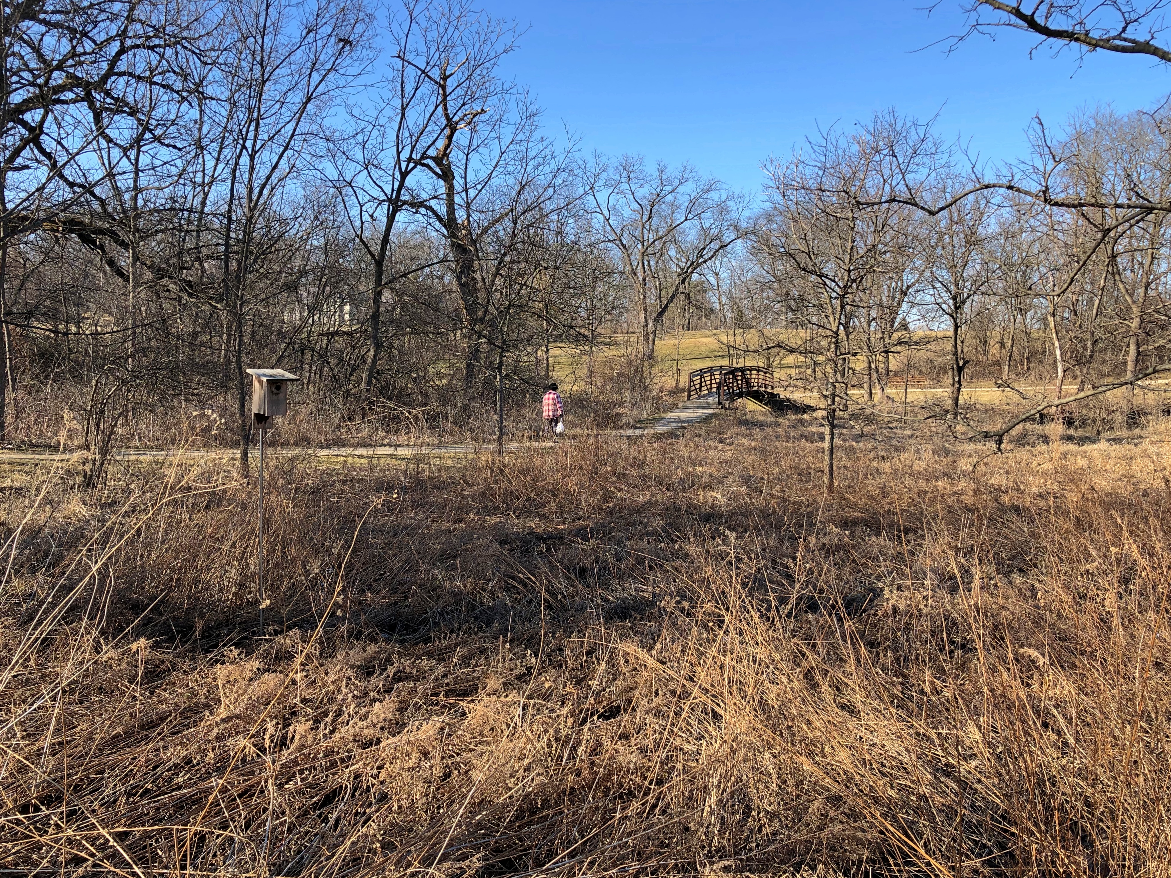
In contrast to what it looks like in July.Buffalo Creek Park, Long Grove, Illinois

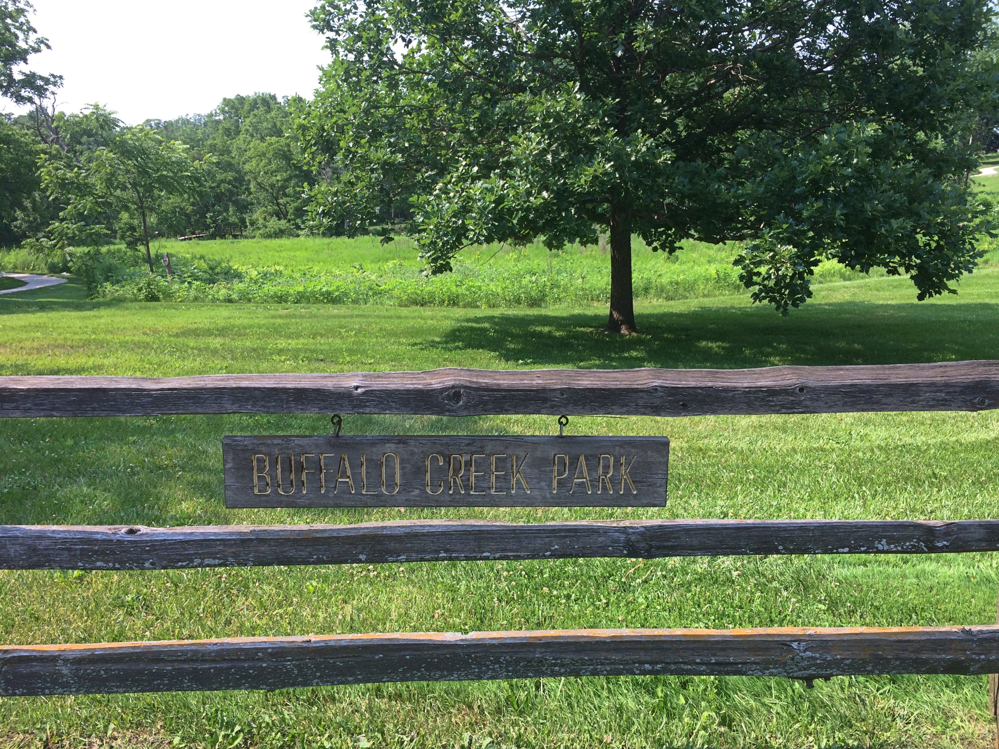
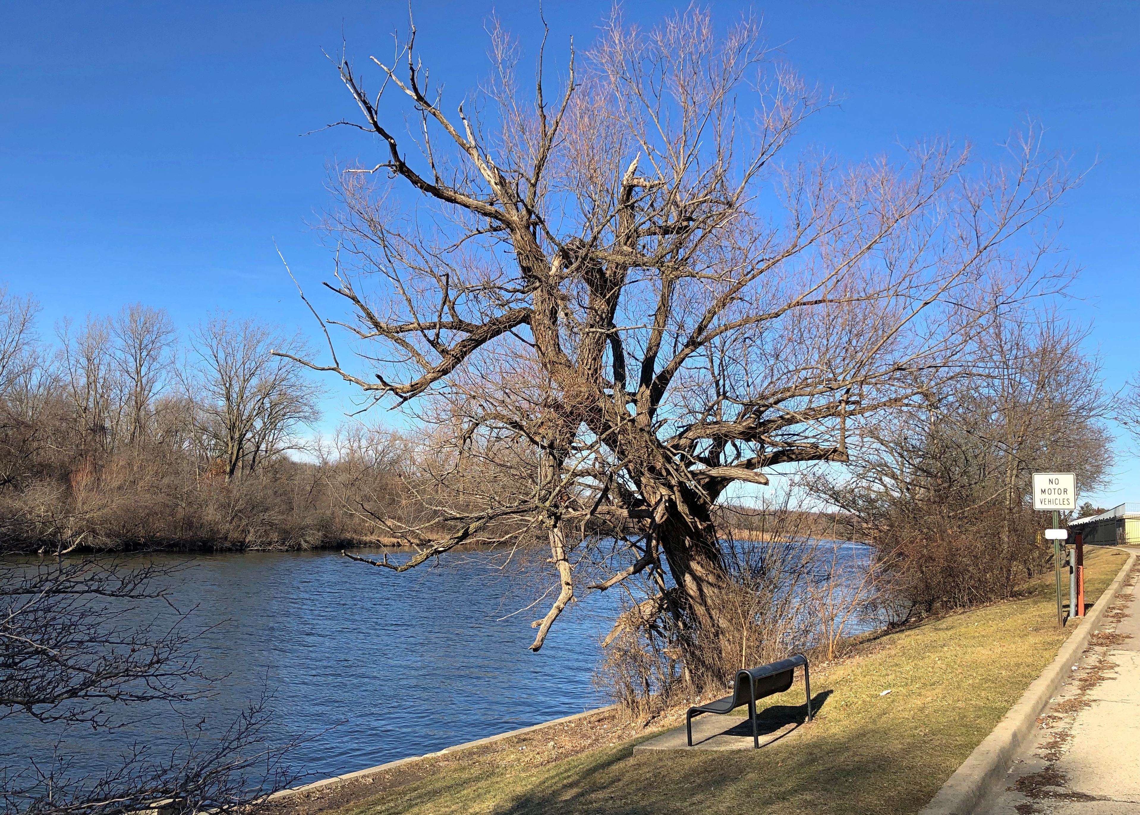
A single bridge crosses Buffalo Creek.Buffalo Creek Park, Long Grove, Illinois

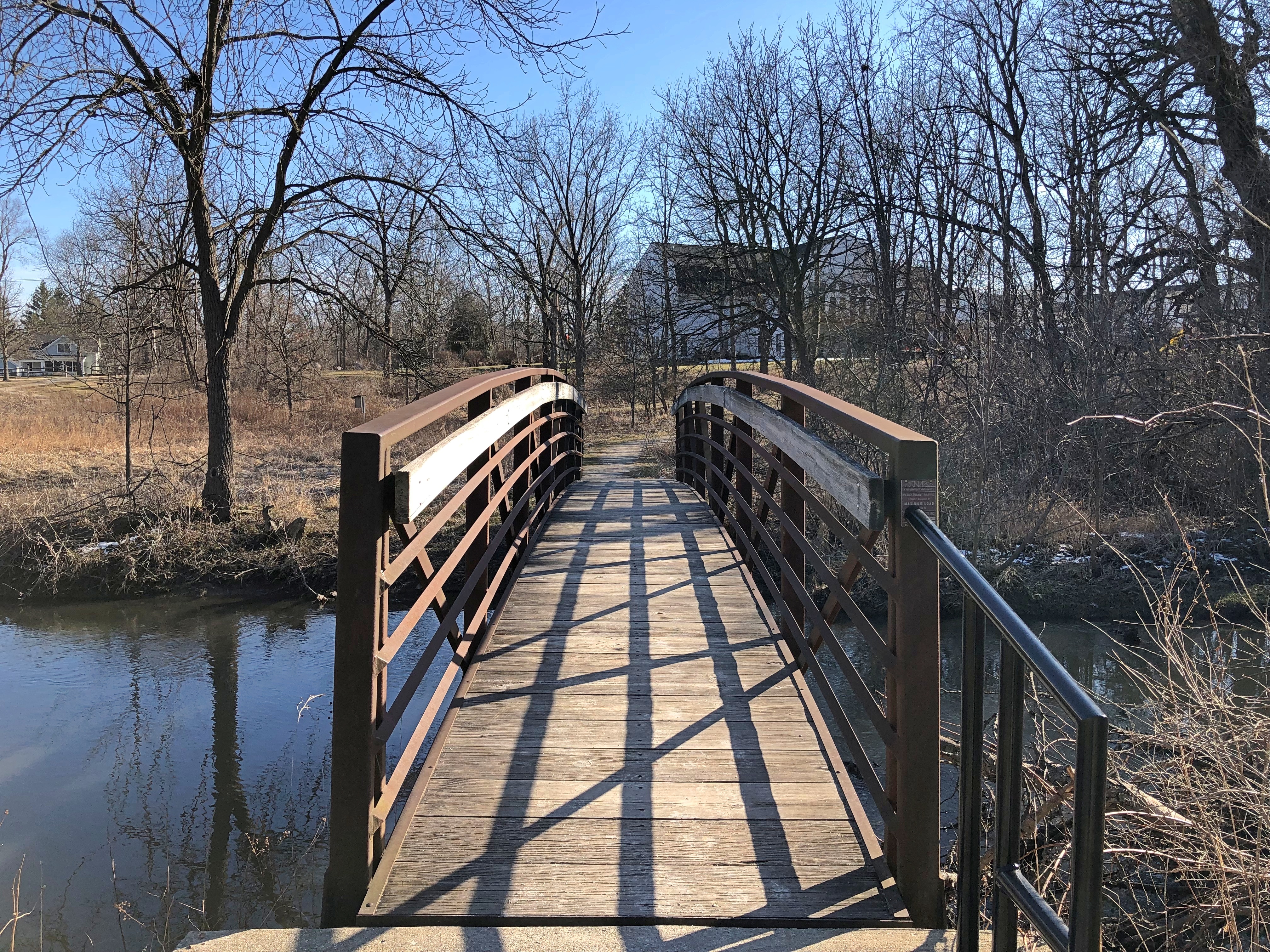
Buffalo Creek is a short (about 11 miles) tributary of the Des Plaines River, which eventually flows to the Illinois, itself is a tributary of the Mississippi. I enjoy knowing that some of the chilled water under that little bridge is bound for the warm reaches of the Gulf.Buffalo Creek Park, Long Grove, Illinois Buffalo Creek Park, Long Grove, Illinois

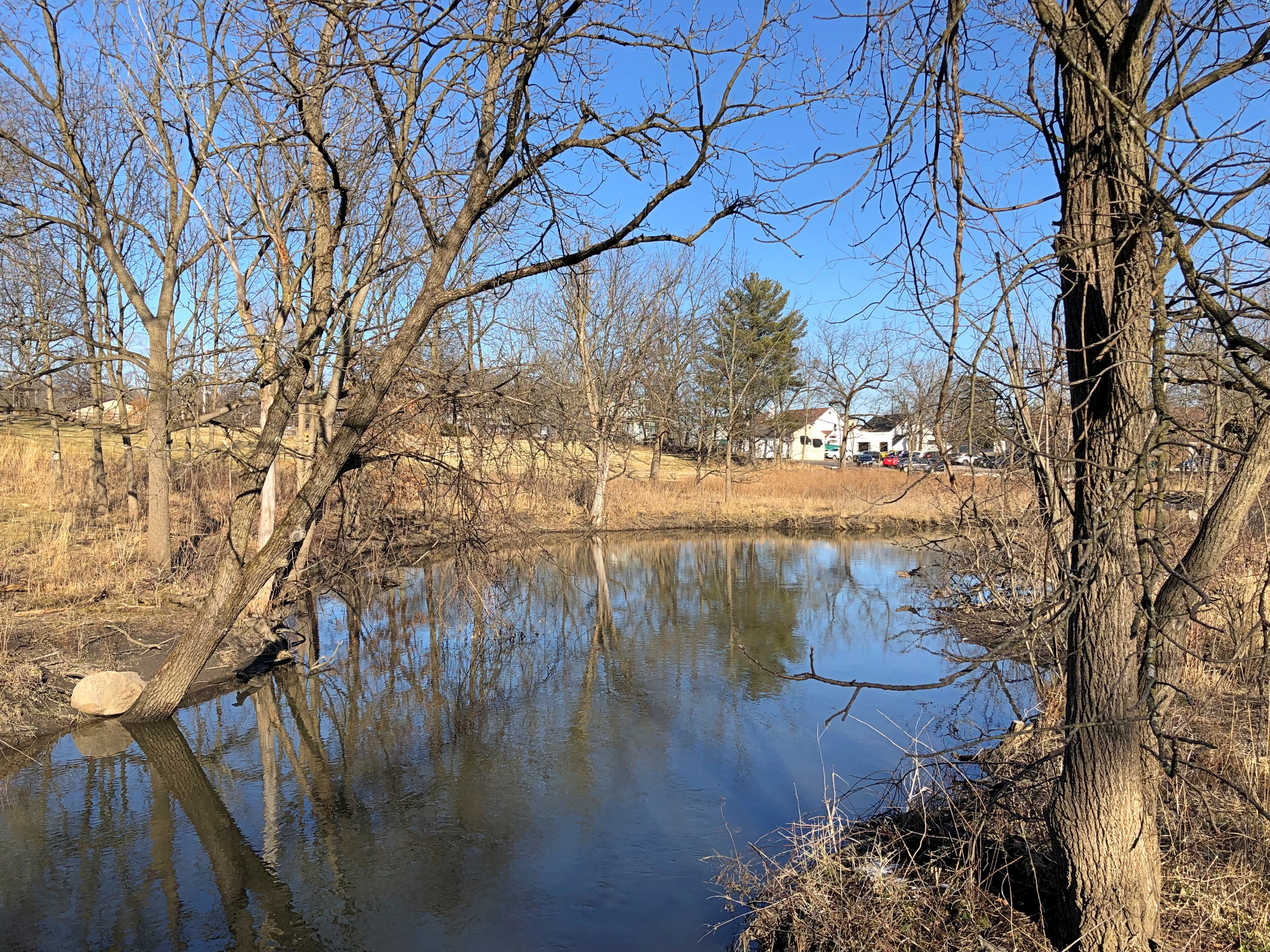
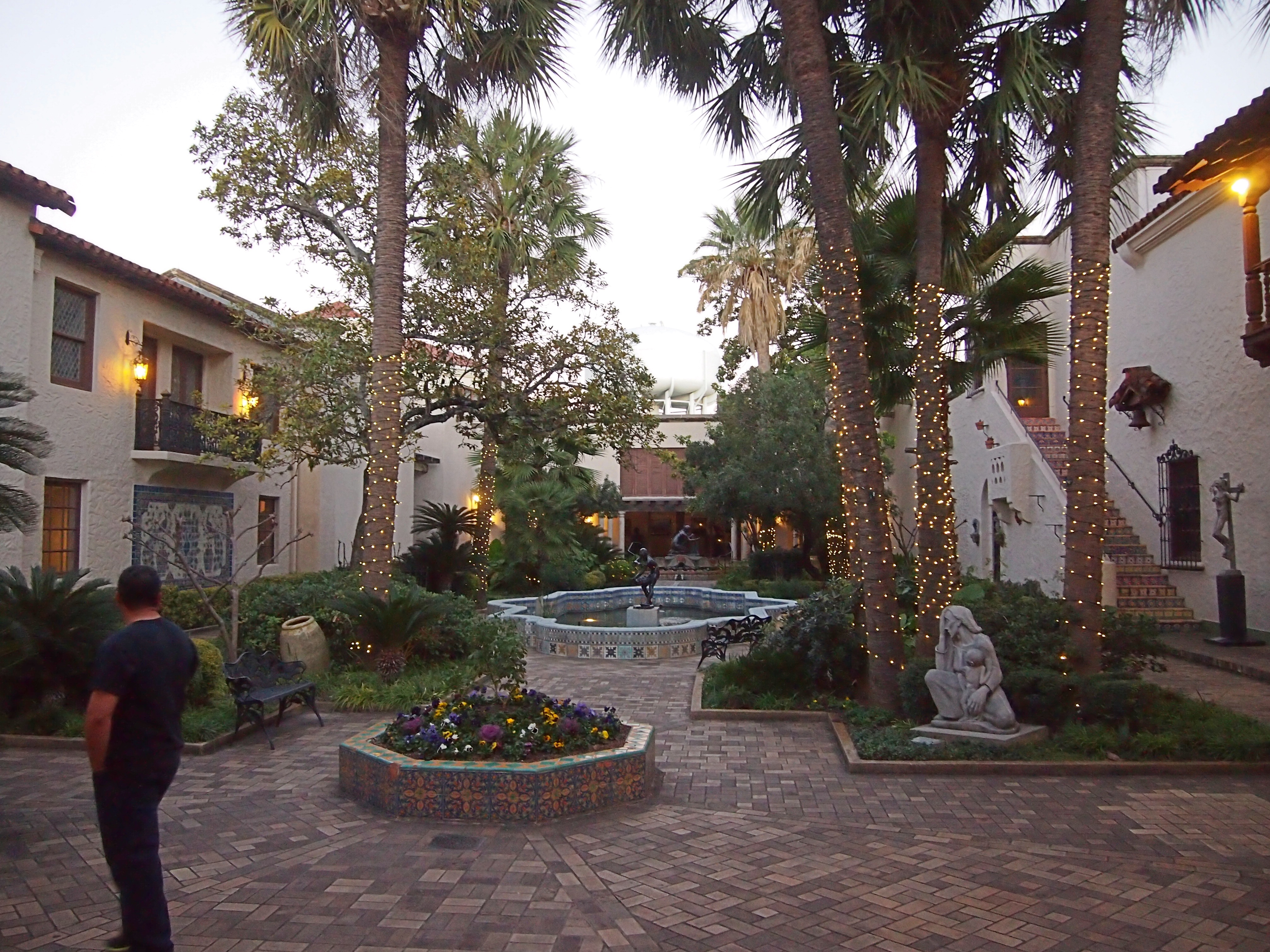
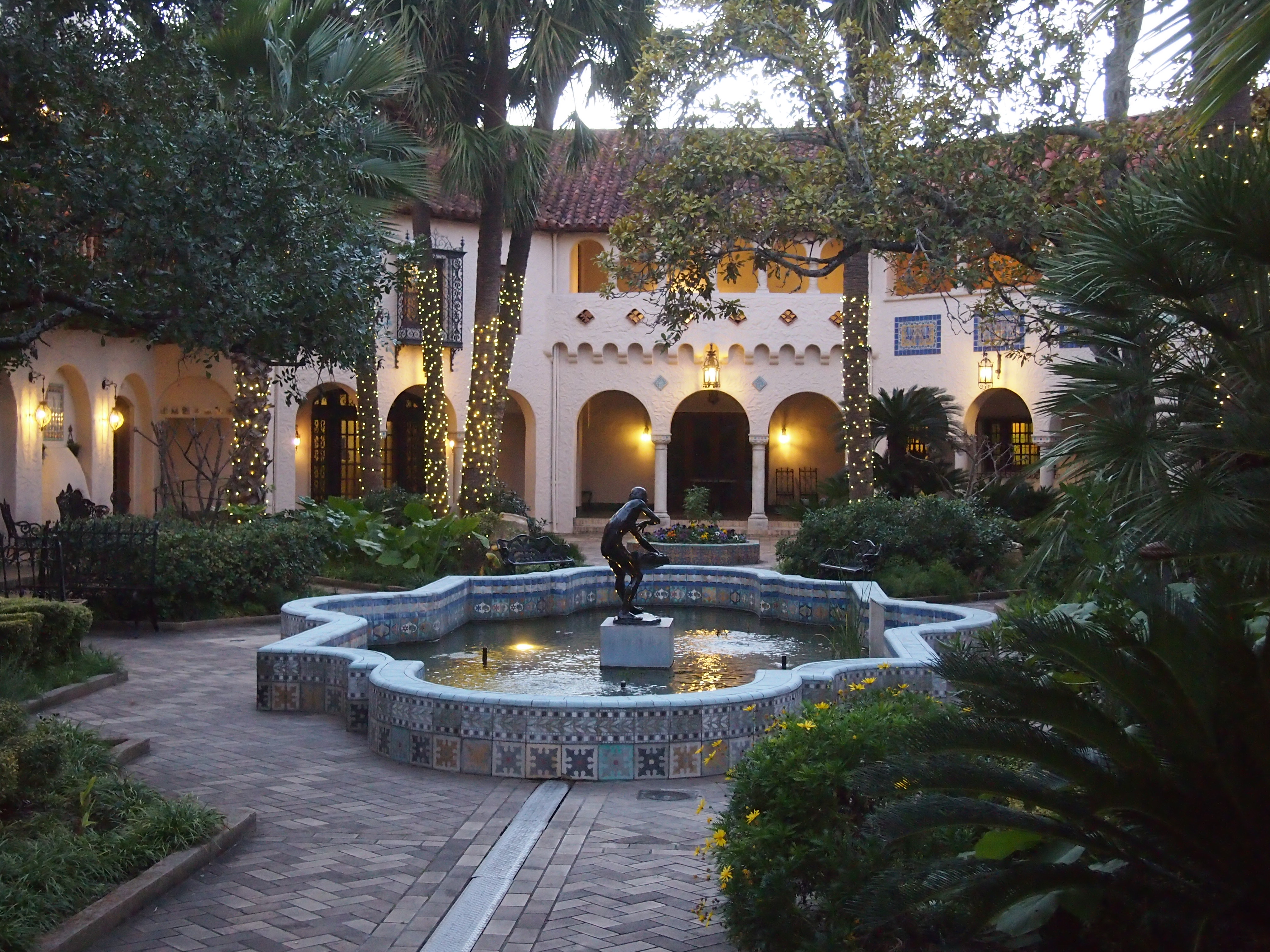
A gazebo. Long Grove wouldn’t be a very civilized place without one, after all.Buffalo Creek Park, Long Grove, Illinois

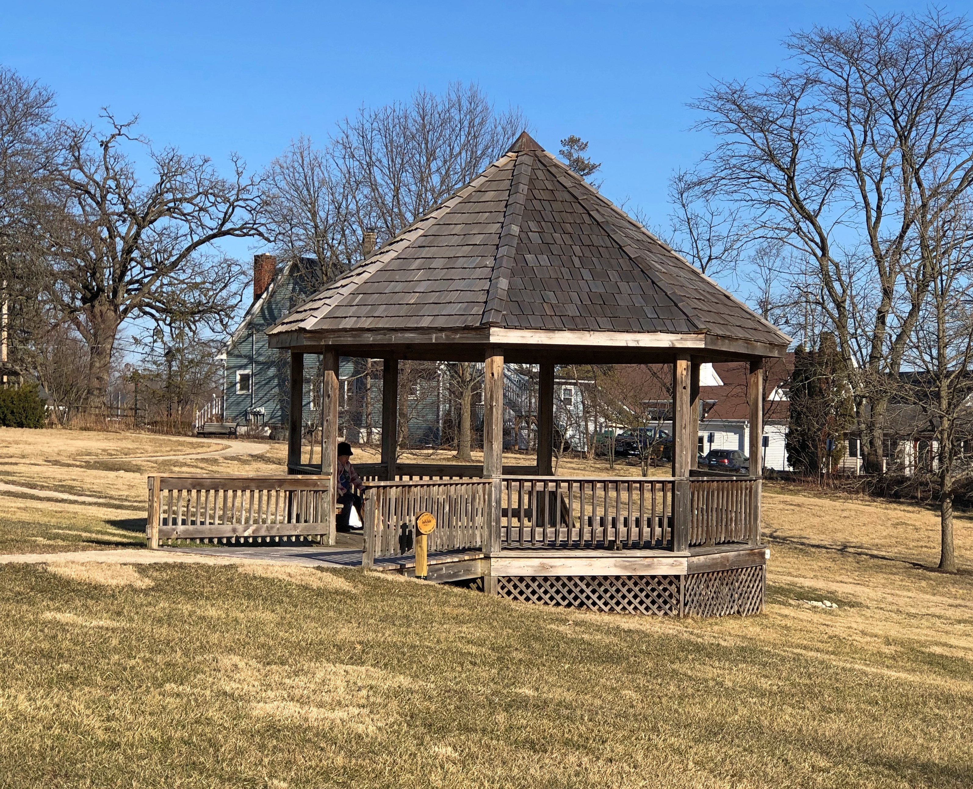
Time to see what ChatGPT knows about gazebos.

Me: What’s the difference between British and French gazebos?

Generative AI: British gazebos are typically more traditional and classic in their design. They often have a hexagonal or octagonal shape, with a pointed or domed roof. British gazebos also tend to feature intricate details such as latticework, ornate moldings, and decorative finials. They may be constructed from wood, metal, or other materials.

French gazebos, on the other hand, are often more ornate and elaborate in their design. They may feature curved lines, intricate ironwork, and decorative scrollwork. French gazebos may also have a more rectangular or oval shape, with a flatter roof. They are often made from wrought iron or other metals, and may be adorned with flowers or other decorative elements.

Oh, really? I can make up stuff about gazebos, too, Mr. Robot Brain. It takes me a little longer, but I’d say my make-believe is still higher quality. For now.

Looks like some Eagle Scouts – and their leader, Aadi Jain? – this troop, since Buffalo Grove isn’t far away? – take an interest in civic improvement projects. I’m happy to report that the gazebo ramp is smooth and stable.Buffalo Creek Park

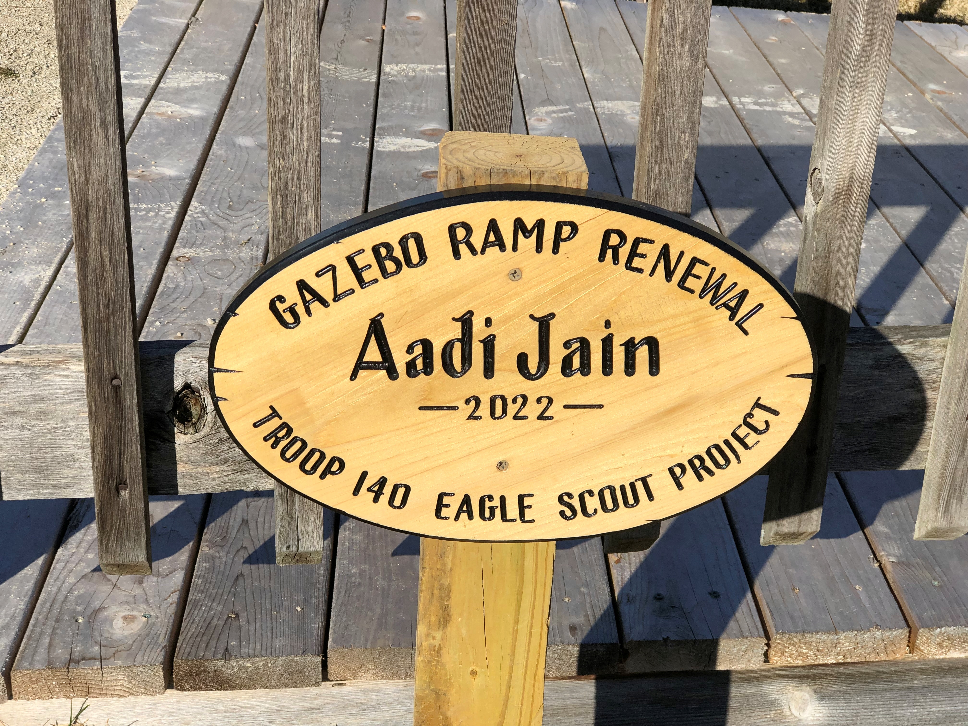
One more park feature: a plaque-on-boulder memorial.Buffalo Creek Park

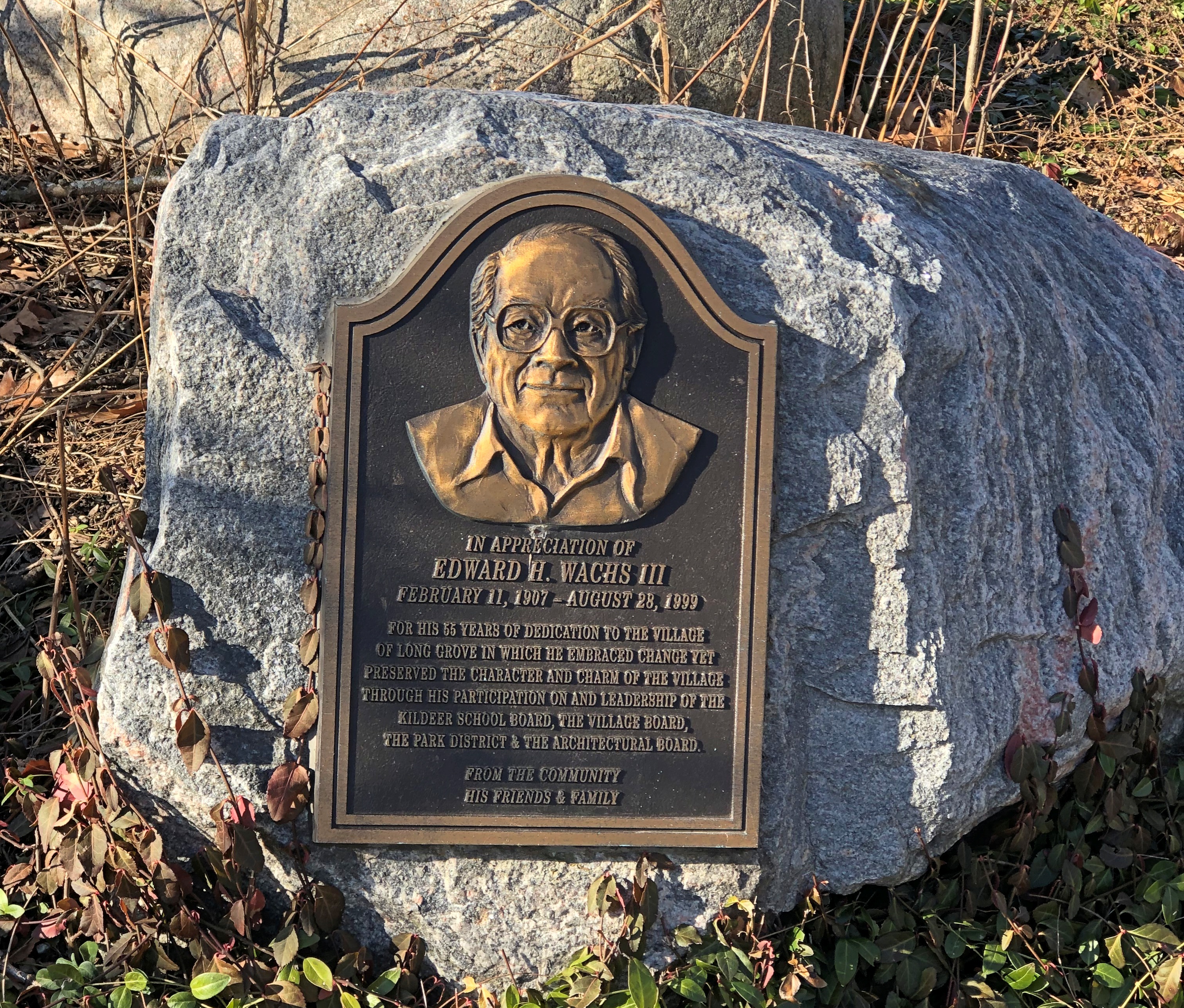
The honoree is one Edward H. Wachs III (1907-99), who, according to the words in bronze, was on the local school board, the village board, the park district board and the architectural board. That’s a long lifetime on boards.

Long Grove in Winter

Heavy rain through much of the wee hours Monday morning, as forecast. Not as pleasant as sleep-time rain on a Friday or Saturday night, or in rental property when the risk of sump pump failure isn’t your concern, but not bad.

Also nice to know that February is just about over. Always good to get the bastard behind you, even if March isn’t that much better. The longer days promise warmer air, and eventually will deliver it.

That said, Sunday was warm (over 50 F.) and sunny enough to inspire us to visit Long Grove, Illinois, whose short and genteel shopping streets can make for a good stroll. The last time I was there, I was promised a sock monkey museum. And there it was!Long Grove, Illinois

Please use front door, the sign said. So we went to around to the front door. No dice. Closed on Sunday. What’s up with that? I could have sworn that most sock monkeys were Seventh-day Sabbatarians, but maybe I’ve been misinformed.

So I spent some time examining the nearby bricks, and least until Yuriko and the dog wanted me to come along with them. Long Grove has extensive brickwork at one’s feet.Long Grove, Illinois

Including named bricks.Long Grove, Illinois Long Grove, Illinois

Such as “Carlyle Sciotoville,” presumably a product of Carlyle Brick of Sciotoville, Ohio; and “Barr” bricks, probably associated with a factory that used to operate in Austin, Minnesota; and “Poston Pavers,” which must have been the product of Poston Brick & Concrete Co. of Sangamon County, Illinois.

Zounds, I’ve discovered one obscure rabbit hole: brick collecting, as discussed in blogs and articles and facilitated by the fact that brickmaking used to be a highly fragmented industry, with countless local brickmakers advertising their wares on the products themselves, so that there are hundreds (thousands?) of distinct varieties.

There’s also the International Brick Collectors Association, whose web site looks like it was set up in 1997 and not modified since, but why does it need to be? It does me good to know such an organization exists, even though I’m not planning to collect bricks like whoever set up BrickCollecting.com.

I like this Tumblr site, That Was Our Work, which is partly about bricks. “Bricks, manhole covers and sidewalks are cogs that help the great machine of the world run. They have stories to tell, histories and trends hidden in their design, their materials and their installation,” the site says.

No archives or index, though, which makes it of limited use for looking things up. But it is good for browsing. I’ve been known to take a look underfoot, too. It’s part of my style as a granular tourist.

McNay Art Museum, 2015

Remarkable how the 2010s are receding so quickly. How is that possible? The tumults of the early 2020s, with the prospect of more to come? A kind of red-shifting of past years that gets more pronounced as old age sets in?

After all, the more moments you’ve had, the less any particular one might count, even relatively recent ones. Or does it work that way? No doubt there are TEDx talks about the plasticity of memory, all erudite and maybe even persuasive — until some future decade, when they’ll be considered wrongheaded if they’re ever watched, which they won’t be.

These thoughts occurred as I was looking through my picture files for February 2015, when I spent some high-quality time in south Texas. One evening during that visit, I popped over the the McNay Art Museum, one of San Antonio’s lesser-known treasures.

I’d been visiting the museum for years. Decades. We went there on field trips in elementary school in the early ’70s. It helps that it’s conveniently located near my mother’s house and the school I went to — no more than a mile away.

“Ohio-born heiress Marion Koogler first visited San Antonio in 1918, shortly after her marriage to Sergeant Don Denton McNay, who was called to active duty in Laredo, Texas. Later that year Don McNay died from the Spanish flu,” the museum says.

“In 1926, Marion moved to San Antonio, where she met and married prominent ophthalmologist Donald T. Atkinson. The following year, she purchased her first modern oil painting, Diego Rivera’s ‘Delfina Flores,’ and the Atkinsons commissioned San Antonio architects Atlee and Robert Ayres to design a 24-room Spanish Colonial-Revival house that would one day become the core of the McNay Art Museum [which opened in 1954]”

There was a later addition (2008) to the house to expand the museum, which now has about 22,000 works, mostly 19th- to 21st century, many regional, but not all.

I’m especially taken with the gorgeous courtyard. I’ll bet more than one proposal of marriage has happened there.McNay Art Museum McNay Art Museum

The courtyard features a few works from the collection, such a Renoir, “The Washerwoman” (1917).McNay Art Museum

The heart-wrenching “War Mother” (1939) by Charles Umlauf (1911-94), a sculptor originally from Michigan, but living in Chicago and working for the WPA when he created it. McNay Art Museum

The work is credited with helping him get a teaching position at the University of Texas at Austin in the early ’40s, which he held to 40 years.

Another Umlauf: “Cruxifix” (1946). McNay Art Museum

A remarkable talent. One of these days, I want to visit the Umlauf museum, which is in Austin. And of course, I want to go back to the McNay again.

1 Dollar, Singapore

Every time I woke last night, which was a few times, I could hear drizzle, but not the tip-tip-tip of frozen drops hitting hard surfaces. I must have slept through the wind gusts, which were reportedly strong in the wee hours. While out late this afternoon, I noticed a number of large tree branches that had been knocked down, as well as a tree completely uprooted and on its side, about a half mile from where we live.

The day was windy and raw, but we had no precipitation after dawn, liquid or otherwise, and the tree and bush branches were no longer tinged with ice. This NWS map from this morning shows how we in northern Illinois dodged the worst of the snowstorm.

What does it all mean? Its snows in the North in winter. Except when it doesn’t.

One more banknote for now. This one does have some Roman letters, prominently featured, and is worth more than a few U.S. mills or cents: the Singapore dollar. The languages on the note include English, Chinese, Malay and Tamil, the four most common ones spoken there.

Also, it’s one that I picked up myself in 1992 or ’94, since these notes – part of the “ship series” – were current at the time, and worth about 60 U.S. cents. These days, I understand that S$1 trades for about 75 U.S. cents, so my note has gained some value, at least in nominal terms. That is, if it can be used as currency at all, since the city-state phased out dollar notes in favor of coins more than 20 years ago.

The ship on the obverse is a junk, common in the waters around Singapore and its predecessor settlements once upon a time. In the ship series, the larger the denomination, the larger the ship, beginning at S$1 and up to the S$10,000 note featuring a general bulk carrier, Neptune Canopus (that note has also been discontinued).

The S$1 reverse features Singapore’s national flower, the Vanda Miss Joaquim, and the Sentosa Satellite Earth Station.Sentosa Island 1992

The flower is also known as the Papilionanthe Miss Joaquim, or the Singapore orchid, and apparently there is a Singaporean drag queen called Vanda Miss Joaquim, which I have to say is a pretty good name for a drag queen.

As for the Earth station on Sentosa, that was the city-state’s first one, operational since 1971. Sentosa is a two-square-mile island just off the southern shore of the main island of Singapore. Formerly a military facility – under the British and then the Singaporeans after independence – the island is better known these days for its recreation, development of which began about 50 years ago.

Back in ’92, I took a cable car over to Sentosa for a look around, though the Earth station wasn’t among the things I saw. Unlike the facility at Tidbinbilla near Canberra, I don’t think it was open to the public.

Sentosa wasn’t nearly developed then as it seems to be now.

Universal Studios Singapore, for instance, didn’t open until 2010, and S.E.A. Aquarium (South East Asia Aquarium) not until 2012. Even the Sentosa Merlion wasn’t there in ’92, since it was completed three years later – and taken down in 2019.

The cable car offered nice views of the island, which isn’t really captured in my snapshots.Sentosa Island 1992 Sentosa Island 1992

I believe this dragon-fountain was fairly near the cable car station on Sentosa, but I haven’t been able to confirm its continued existence, though this is a more recent image.Sentosa Island 1992

I walked over the Fort Siloso, a former coastal artillery battery.Sentosa Island 1992

I also visited the Sentosa Wax Museum that day, mostly I believe to get out of the heat. Most of the wax figures had to do with the history of the city-state (I think), including figures showing two surrenders: the British to the Japanese in 1942 and the Japanese to the Allies in 1945. Not something you’re likely to see anywhere else.

There’s a Madame Tussauds on the island now, so I suspect the old wax museum was replaced by it. The current wax museum’s web site says the place has an “Images of Singapore” exhibit, but I suspect the real action is at the “Marvel Universe 4D” and the “Ultimate Film Star Experience,” and the “K-Wave” zone. Exactly something you’re likely to see somewhere else.

Obviously I haven’t been Madame Tussauds Singapore, but I did pay money, entirely too many pounds sterling, to see the one in London. The place wrote the book on tourist traps. That isn’t to say that wax museums can’t be interesting; the one included in the admission to Tivoli Gardens in Copenhagen was charming indeed, even a little surreal sometimes, such as the setup in which wax Einstein was playing chess with wax Hitler.

Möngö Notes

The winter storm blasting the upper states showed up in my neighborhood today first in the form of a lot of rain, but cold enough to leave a coating of ice on the bare trees and bushes. Then the rain itself started to freeze.

More currency with no Roman letters on it (well, not many). Three bits of currency, each measuring a diminutive 1¾ by 3½ inches, roughly the size of a business card.Mongolian currency

I didn’t have to do any looking around to know who issued them: Mongolia. I’m familiar with Mongolian notes, ever since I picked up a few of them in Ulaanbaatar.

Besides, the Mongolian national symbol – the Soyombo, which appears in the national flag – is a certain giveaway.

“The Soyombo is… attributed to Zanabazar, the 17th-century leader of Mongolian Lamaism, a great statesman, and the father of Mongolian art and script,” says the University of Pennsylvania, including an interpretation of the ying-yang that’s new to me.

“The yin-yang symbol means that men and women are unified. During Communist times it was interpreted as two intertwined fish, which symbolize vigilance and wisdom, as fish never close their eyes.”

Not having eyelids isn’t quite the same as being vigilant, I’d say, and I don’t much associate fish with wisdom, but I suppose that’s just anthropocentric bias, isn’t it?

I didn’t pick up the notes in country. They came with the grab bag of international paper money cheapies, and are 10-, 20- and 50-möngö notes.

A möngö is one-hundredth of a tugrik (tögrög), the base unit. Considering that U.S. $1 fetches about 3,500 tugrik these days, even 50 möngö isn’t going to be worth much. Indeed, Wiki says of the notes, “Very rare in circulation. Abundant among collectors.”

The möngö notes depict Mongolian sports: archery, wrestling and horse riding. Those are known as the “Three Games of Men,” the Mongolian embassy to the U.S. tells me. It also says that “nowadays, track and field sports, football, basketball, volleyball, skating, skiing, motorcycle racing, mountain climbing, chess and other sports are widely played in Mongolia.”

Also, there’s a Mongolian American Football Association. Learn something new every day.

1 Ruble, Transnistria

I’ve looked at enough ruble-denominated currency to know what “ruble” looks like in Cyrillic, namely, рубль. This is somebody’s one-ruble note. 

Not Russia, nor Belarus, which are the two nations that currently call their money that. Not the defunct Armenian ruble, Latvian ruble or Tajikistani ruble, either.

Instead, this is a Transnistrian ruble. To the naked eye, and not the scanner, those black rectangles are shiny silver, which I take to be an anti-counterfeiting measure. That inspires the question: who would counterfeit these notes? Perfidious Moldovans?

In news reports, Transnistria is inevitably referred to as a “breakaway” territory from Moldova that’s “Russian backed.” A polite way – and why do we need to be polite? – to call them Russian stooges. The map accompanying this article shows how that might be a geopolitical concern these days.

In any case, internationally unrecognized Transnistria has its own currency, with the one ruble sporting the famed Russian military commander Alexander Vasilyevich Suvorov, who did so much to facilitate his nation’s imperial expansion under Catherine the Great.

Field Marshal Suvorov has a more direct connection with Transnistria, however, since he’s considered the founder of modern Tiraspol, capital of the breakaway territory. He ordered fortifications built on the site late in the 18th century, though the city had antecedents going back to Greek settlement around 600 BC.

The reverse features an uninspiring image of a monument in Transnistria to one or both of the Jassy-Kishinev offensives of 1944, probably the second, since it was a smashing success for the Red Army and (remarkably) the U.S. Army Air Corps.

“On August 20, 1944, the Soviet Second Ukrainian Front, under the command of General Rodion Malinovsky, and the Third Ukrainian Front, under the command of General Fyodor Tolbukhin, launched a two-pronged attack against German Army South Ukraine…” the National World War II Museum explains.

“By August 23, the German Sixth Army had been surrounded by the two converging Soviet fronts. German air support was nowhere to be found, because it had been eliminated by the United States Fifteenth Air Force.

“While it does not receive a lot of attention, the offensive was one of the most successful joint operations of the war. It was quite an achievement, considering this was only the second time that the Americans and Soviets worked together. Yet you would have to look hard to find literature on the offensive. Perhaps it is time to give the Second Jassy-Kishinev Offensive the attention it deserves.”

2 Taka, Bangladesh

“Presidents Day” is here again, but no holiday for me. George Washington’s birthday isn’t until Wednesday, anyway. It’s all very well to honor the father of our country, but, like Dr. King, why couldn’t he have been born in some warmer month?

Here’s another banknote of mine without Roman lettering that I decided to identify over the weekend.

No Cyrillic, either. It turned out to be relatively easy to pin down, since most notes tend to feature one or the other, even if a country’s dominant language(s) are in another script. Another useful clue are the Hindu-Arabic numerals for the date, 2013.

It’s a two-taka note from Bangladesh, whose symbol is the curious ৳, which seems to suggest the Bengali script for the word, টাকা, but also a Roman t. Various sources say this note has mostly passed from circulation, replaced by coins. Also, its one-hundredth division, poysha, has evaporated in the heat of decades of inflation. In theory, a 2-taka note is worth just shy of U.S. 2 cents.

Speaking of fathers of nations, though a rather different example, father of Bangladesh Sheikh Mujibur Rahman is on the observe. Next to him is the National Martyrs’ Memorial near Dhaka, commemorating those who died for independence in bloody 1971.

In the upper right corner, the national emblem of Bangladesh. “Located on the emblem is a water lily, that is bordered on two sides by rice sheaves. Above the water lily are four stars and three connected jute leaves,” Wiki notes. Jute may yet have its day as a green fiber.

On the reverse, another memorial to the dead. In this case, the Shaheed Minar (The Martyr Tower) of the Bengali Language Movement, whose day happens to be tomorrow.

20 Rubles, Tajikistan

When I had something else to do the other day, naturally I decided it was time to find out where this banknote was from.

I’m assuming that’s the obverse. I’ve had it for a while, obtained as part of a package of banknotes from around the world that I bought for a modest sum a few years ago. They’re all of modest value. In many cases, as modest as possible: zero. This is one of those.

The first thing to look up were the nations that use Cyrillic, so I did. Then the flag threw me off, since I took it to be the Hungarian flag. Except Hungarians don’t use Cyrillic. Could there be some quasi-Hungarian entity somewhere that does?

No. Closer examination of the flag – and it is much harder to see with your eye than the scan – revealed a small gold crown topped by stars in the while middle bar. That proved to be the key. Tajikistan’s flag looks like that, so from there I took a quick look at that country’s currency.

These days, Tajikistan’s currency is the somoni, named in honor of Ismoil Somoni, a ninth-century (849-907) potentate of the region I previously knew nothing about.

He isn’t forgotten in Tajikistan. To quote Wiki: “With the end of Soviet rule in Tajikistan, Ismail’s legacy was rehabilitated by the new Tajik state. He is depicted on the SM 100 banknote. Also, the highest mountain in Tajikistan (and in the former Soviet Union) was renamed after Ismail. The mountain was formerly known as Stalin Peak and Communism Peak but was subsequently changed to the Ismoil Somoni Peak.”

So that’s what happened to Communism Peak. I’m sure I learned that was the highest mountain in the Soviet Union years ago – and that it had been Stalin Peak for a while – but hadn’t thought about it since.

The table of recent Tajikistani currency shows that I don’t have a 20 somoni note, because those weren’t issued until 2000. For a few years before that, however, the country used the Tajikistan ruble. That’s what I have.

The building under the flag is the Majlisi Oli, where the parliament of Tajikistan meets, for what it’s worth. Which probably isn’t much, considering that the nation’s strongman, Emomali Rakhmon, née Emomali Sharipovich Rahmonov, runs elections essentially the same way as in the Tajik SSR, to his president-for-life benefit. He apparently runs the country with a dash – more than a dash – of a cult of personality, too. I’m a little surprised he isn’t on the money.

“Poems were read in his honor in parliament, and the state media often compares him to the sun,” Deutsche Welle reports. “All around Tajikistan, posters with pictures and sayings of Rakhmon have been put up. In public, each person must address Rakhmon as Chanobi Oli, or ‘Your Excellency.’ “

Sea Creatures Along the Fox River Trail

Snow and sleet today. Faux spring has passed.

Actually, it was over before the snow — yesterday was fairly cold — but outside surfaces were dry enough to make walking reasonably safe, if not all that pleasant.

Last Saturday was pleasant for February, Sunday even more so, with temps over 50 degrees F. So we returned to the banks of the Fox River for another walk, but in Elgin instead, which is upriver from Batavia. We parked at a place called Slade Avenue Park on the map, though no signs on the grounds identified it as such. The Fox River Trail, which hugs the east bank of the river, passes through the park at that point.Fox River Trail, Elgin

The trail totals 32 miles all together, passing through Algonquin, Carpentersville, Dundee, Elgin, South Elgin, St. Charles, Geneva, Batavia and North Aurora. We headed north from Slade Avenue Park.Fox River, Elgin Fox River, Elgin Fox River, Elgin

On the other side of a black fence next to the trail is the Slade Avenue Well No. 5, part of Elgin’s water infrastructure. It’s easy to look through the fence at the unpicturesque facility.Slade Avenue Well No. 5

Though it’s a posted no trespassing area, an artist or artists clearly crossed the fence to paint an intriguing mural along a concrete wall just inside.Slade Avenue Well No. 5 mural

Details of which can be photographed from the trail, if you hold your camera just so. I’m not wont to trespass, but it wasn’t necessary to capture some images.Slade Avenue Well No. 5 mural
Slade Avenue Well No. 5 mural

If our dog hadn’t been dragging me along, I would have documented the entire thing.

Fanciful sea creatures, from the look of it. The execution shows considerable talent. Who did it? Why there? How long ago? (It looks fairly new.) Does the city of Elgin know about it? If so, is officialdom planning to destroy it?

Cursory searches reveal nothing about it. Whatever its origin, I hope it is not destroyed merely for being in technically restricted space. It isn’t ugly tagging or thoughtless vandalism, but an odd and expansive mural that enlivens an otherwise completely nondescript concrete surface. There are too many plain concrete surfaces as it is; this is one less.

The Peace Bridge

Not long ago, I learned that gephyrophobia, an irrational fear of bridges, is a real thing. I find it a little hard to imagine. I’ve been on a few white-knuckle bridges in my time, such as the unnamed span that crosses the Mississippi from Savanna, Illinois, to Sabula, Iowa, which is as narrow as two-lane bridge can be and still be two lanes. But that was a rational reaction, not a generalized dread.

“In Michigan, the Mackinac Bridge Authority drives vehicles for free over a bridge that connects the state’s Upper and Lower Peninsulas and rises 199 feet above the strait below,” Car & Driver reports. “Formerly known as the Timid Driver Program, it’s now referred to as the Driver Assistance Program. Bridge staff, who are also responsible for escorting hazardous-materials trucks and maintenance chores, drive up to 10 people across the bridge each day.”

Mostly I have the opposite reaction to bridges, wanting to cross them in one way or another – walking, driving or by public conveyance. That includes the grand bridges I’ve crossed, such as Mighty Mac but also the Brooklyn Bridge, Golden Gate, Sydney Harbour and Seto-Ohashi, as well as mid-sized and smaller ones. Sometimes it’s an essential part of visiting somewhere, such as crossing the bridges on the Thames in London, the Seine in Paris and the Vltava in Prague. Or even the Tridge in Midland, Michigan.

In Batavia, Illinois, a footbridge crosses the Fox River from the west bank peninsula to the east bank. I had no hesitation in crossing it during our Saturday visit. It’s a fairly ordinary iron structure with wood planks, the kind you see in a lot of places. Peace Bridge, Batavia, Illinois
Peace Bridge, Batavia

Except for one feature, best seen from nearby.Peace Bridge, Batavia, Illinois
Peace Bridge, Batavia, Illinois

It’s known as the Peace Bridge. The “PEACE” and “EARTH” letters are 12 feet tall; the “ON” letters eight feet. Beginning from their first installation in 2008, the letters were seasonal each year — around Christmas — but now they are year-round.

Remarkably, the sign was the idea of a local barber, Craig Foltos, owner of Foltos Tonsorial Parlor, who persuaded the Batavia Park District to install the letters he had fashioned (with help).

Foltos Tonsorial Parlor. I like that name so much I might have my hair cut there someday.