Elephant Rocks State Park

When planning our not-quite-direct drive to Dallas, I figured we’d have time for one Missouri state park on the morning of April 6, before heading west and south slightly into Arkansas for the night. But which one in SE Mo.?

Such excellent names: Taum Sauk Mountain State Park, Johnson’s Shut-Ins State Park and Elephant Rocks State Park. In the end, we went with Elephant Rocks, and on a Saturday, the place was popular but not overrun. Mostly, I figure, day-trippers from St. Louis out with their small children and dogs, all of whom need walking (as I can attest from experience). The park also offered the open-air pleasures of picnicking, especially on a warm spring day ahead of full-blown mosquito season, in which we ourselves partook.

A mile’s worth of paved path snakes among ancient granite boulders. At only about 133 acres, the park is small. Even so, out in the field of boulders, the park didn’t seem so crowded.Elephant Rocks State Park Elephant Rocks State Park Elephant Rocks State Park Elephant Rocks State Park

Time, geologic uplift and millions of years of erosion produced the boulders, and — I learned — the area counts as a tor.

“The landform is called a ‘tor,’ a stack or pile of spheroidally weathered residual granite rock boulders sitting atop a bedrock mass of the same rock,” says an excellent brochure produced by Missouri State Parks that provides brief but informative descriptions of the park and its history.

“While tors exist elsewhere in the United States and worldwide, they are not abundant anywhere. Elephant Rocks is Missouri’s finest tor and one of the best examples in the Midwest.”

That just makes my day, finding out that I visited a fine tor. Seriously. I didn’t even know there was a geologic definition. Big, rocky hill is how I’d have defined it. I’ve known about tors since the moment I slapped my head upon realizing I could have visited Glastonbury Tor, but didn’t.

People go on about sunsets and views of the ocean and mountain vistas, but human beings are also pretty fond of impressive rocks. Some of us travel a good ways to see them. Elephant Rocks State Park Elephant Rocks State Park

Some fat man’s misery paths.Elephant Rocks State Park Elephant Rocks State Park

“Just outside the park is the oldest recorded commercial granite quarry in the state, producing fine red granite called ‘Missouri Red,’ the brochure says. This quarry, opened in 1869, furnished facing stone for the Eads Bridge piers standing on the Mississippi River levee in St. Louis.”

Cool. A quarry needed a railroad spur, and even a small railroad needed a building for locomotive maintenance. The ruin of such a building stands in the park.Elephant Rocks State Park Elephant Rocks State Park Elephant Rocks State Park

It’s had the benefit of some reconstruction, would be my guess. It certainly looked sturdy enough that I didn’t think that rock was going to tumble on my head.Elephant Rocks State Park

Must be Missouri Red. Why wouldn’t you built it using the stone you had at hand? Good old Missouri Red, which sounds like a dime novel character or a strain of cannabis.

Missouri Mines State Historic Site

Funniest thing I’ve heard in a while, at least in the category of unintentional comedy. The narrator of a video about The Wire that I watched today – just finished the third season, watching once a week or so – broke narrative for a commercial.

“If Omar is coming for you, you’ll need the perfect shoe to get away,” he said, holding up a pair of some running shoes.

Drive about six hours from metro Chicago, south past St. Louis on the state of Missouri side of the Mississippi River, go almost as far as Farmington, Mo. (pop. 18,200) and leave the main road, but only a short distance down a side road, and you’ll find a place to ruminate on time and decay and poisoning. If you’re the ruminating sort.Missouri Mines State Historic Site Missouri Mines State Historic Site

Another day, another day exposed to the elements for the former industrial structures at Federal Mill No. 3, which processed zinc and lead ore from 1906 to 1972 and became property of the state shortly after its closure. It’s now Missouri Mines State Historic Site. Smelting does what it does, leaves slag and moves on. The weathered, rusty structures should count as a kind of slag, but one you can look up at in some awe.Missouri Mines State Historic Site Missouri Mines State Historic Site Missouri Mines State Historic Site Missouri Mines State Historic Site

We’d arrived about an hour before the grounds closed on the afternoon of April 5. Except for one state park service employee, no one else was around, though there were signs advertising an upcoming eclipse event, since this part of Missouri was in the path of totality. Bet the place was overrun for that.

Before coming to the Lead Belt of Missouri, I’d vaguely thought that lead mining was only an historic phenomenon, something like the copper mining in the UP that left behind relics. Missouri Mines didn’t do anything to correct that impression, at least at first. Later I found out was wrong.

“Lead and fur were the most important exports from Missouri during its early years as a Spanish, French, and then United States territory (Burford, 1978),” wrote Cheryl M. Seeger in a monograph called, “History of Mining in the Southeast Missouri Lead District and Description of Mine Processes, Regulatory Controls, Environmental Effects, and Mine Facilities in the Viburnum Trend Subdistrict” (2008).

“Southeastern Missouri, with the largest known concentration of galena (lead sulfide) in the world, was the site of the first prolonged mining in the state and has produced lead almost continuously since 1721,” Seeger notes. Largest in the world? Who knew? (Besides Cheryl Seeger, that is.)

Wiki published a map to illustrate the point, posted by one Kbh3rd, who is duly acknowledged here under the terms of Creative Commons 3.0.

Looks like all the mining action migrated to the west, but not far west, in the 20th century. In the monograph, I also learned that Moses Austin was a lead miner in the region – more about him later.

Most of the buildings at Missouri Mines SHS were roped off, and probably for good reason. But large windows were open, allowing a look inside the largest of them.Missouri Mines State Historic Site Missouri Mines State Historic Site Missouri Mines State Historic Site

Mighty ruins are one thing, but I also like the smaller pieces.Missouri Mines State Historic Site Missouri Mines State Historic Site Missouri Mines State Historic Site

An oddity, but one dug up nearby.Missouri Mines State Historic Site

A giant fossil thrombolite, a nearby sign said. Fossilized creatures, if you can call them that, from a billion years ago.Missouri Mines State Historic Site

Next to the state historic site is St. Joe State Park, with a path leading into that park. The day was warm, but not too warm for a walk. It was then we realized the thing we’d forgotten for the trip, because there’s always something: hats. But we managed.

It was like walking straight into one of the more desolate parts of the West instead of lush, springtime Missouri.St Joe State Park St Joe State Park St Joe State Park

Another legacy of lead mining: ruined land, considered fit only for off-road vehicle tracks these days. Look at enough maps of the Lead Belt, and you’ll find the Superfund maps, too – which cover most of the area.

Is there Superfund site tourism? There must be. No? Now there’s an opportunity for some gritty tours, believe me.

Or maybe infrastructure tourism.

Sign me up for that one.

My Old Kentucky Home State Park

When John Rowan began work on a house for his family in north-central Kentucky in the 1790s, he called it Federal Hill. Finally completed in 1818 largely by slave labor, it stands today as the centerpiece of My Old Kentucky Home State Park in the outskirts of Bardstown, a handsome structure in a pleasant setting.My Old Kentucky Home State Park My Old Kentucky Home State Park

Besides surviving an 1801 duel in which he killed the other fellow, and beating the rap, Rowan went on to be an important politico in early Kentucky, including a term in the U.S. Senate as an antagonist to Henry Clay and the Whigs, being a Jackson man. He died in 1843, missing the later unpleasantness, and even the war the Mexico.

We visited around noon on December 29. We were the only ones on the tour, in contrast (later that same day) to the distilleries we visited. I hadn’t read much about the place before the visit, and vaguely assumed that there was some good reason that the property’s current name evokes the famed Stephen Foster song. It inspired him in the composition in some way, perhaps.

The house museum doesn’t exactly discourage this line of thinking. At the visitors center is this portrait of Foster.My Old Kentucky Home State Park

There he is, in a 1939 painting by Howard Chandler Christy, receiving the gift of composition from a muse – Euterpe, I suppose, muse of music and lyric poetry and, perhaps, the modern popular song. To the left of the muse’s wings (did muses have wings?) is the entrance of Federal Hill, and there are visual references to some of Foster’s other songs as well.

The Kentucky Colonels’ organization commissioned the painting for the world’s fair in New York that year, and “My Old Kentucky Home” had become the official state (commonwealth) song not too many years earlier. So I assume the Colonels wanted to emphasize a Kentucky connection with the famed song, aside from the fact that the name is in the title and opening lines.

An aside: I know that a Kentucky Colonelcy is an honor bestowed by the commonwealth, but I’m still a little surprised by some of the names on this list, such as Princess Anne, Bob Barker, Foster Brooks (well, he was from Louisville), Phyllis Diller, George Harrison (actually, all the Beatles, even Ringo), David Schwimmer, Red Skelton, and both Smothers brothers (RIP, Tom).

The museum (at least in our time) doesn’t explicitly claim that Federal Hill was an inspiration for the song, since the evidence for that seems to be gossamer thin. I’ve read conflicting reports about whether Stephen Foster, described as a “cousin” of the Rowan family – which could mean various levels of consanguinity in the loose definitions of 19th-century America – even visited Federal Hill from his home in Pittsburgh.

It is clear, however, that “My Kentucky Home” was inspired by Uncle Tom’s Cabin, and as such, sympathized with slaves separated from family members without pity or recourse. The song’s association with a particular mansion in Kentucky, namely this particular one, apparently came later – well after the Civil War. The idea seems to have been promoted by, among others, the last member of the Rowan family to own the mansion, an elderly granddaughter who managed to sell the property to the commonwealth in the early 1920s.

Can’t really blame her if she took a little creative liberty with the history of Federal Hill, since she probably wanted to live somewhere with less expensive upkeep. Also, such a thing would be firmly within the American (and entirely human) tradition of historical storytelling known as “making things up.”

Be that as it may, Federal Hill is well appointed inside with period items, and our guide, a young woman dressed antebellum style, knew her non-made-up stuff. She also sang the first verse of “My Old Kentucky Home” for us, in a pleasant and practiced voice, which I understand is part of all the tours. Of course, the first lines weren’t quite the Steven Foster original, being:

The sun shines bright in the old Kentucky home/
‘Tis summer, the people are gay.

The Kentucky legislature mandated the change, at least for official renditions, after an embarrassing incident in 1986 when a visiting group of Japanese students sang the song, original lyrics and all, to the legislature.

Our guide mentioned, almost in passing, an horrific incident from the time of John Rowan. In 1833, the family, or many of them, ate or drank something contaminated with Vibrio cholerae, and three of Rowan’s children (he had nine), a son- and daughter-in law, a granddaughter, and his sister and brother-in-law all died of cholera in short order, as did a similar number of slaves.

Many of these Rowans are buried within sight of the mansion, and the visitor center, for that matter.My Old Kentucky Home State Park

Sen. Rowan himself joined them later, marked by the obelisk. The memorial behind his, with the grieving figure and lyre, is that of Madge Rowan Frost (d. 1925), the granddaughter who sold the property to the state.My Old Kentucky Home State Park

The park, in the form of its guided tour, and written material on signs, doesn’t ignore the enslaved population, as no historic property of this kind would do any more, possibly following the lead of Monticello. Sen. Rowan owned as many as 39 people at one time. A sign near the Rowan cemetery details what is known about them.My Old Kentucky Home State Park

But not their burial sites; that remains unknown. Likewise, their cabins, along with most of the other outbuildings, are long gone. Mostly what you’ll see at the state park is a picturesque mansion retroactively tied to an enduring song.

Thunder Bay to Marathon, Ontario

On the first day of August, I made the acquaintance of Terry Fox. In bronze, anyway, and perhaps in spirit, since he’d been dead for over 42 years. Died very young; he’d be 65 now, had cancer not taken him away. A contemporary.

Apparently every Canadian knows who he was. Ignorant as I am, I didn’t, but I learned some remarkable things about him after seeing his memorial, which is just off the Trans-Canada Highway not far east of Thunder Bay.

It was a foggy morning in northwest Ontario. The memorial features Fox as a runner, which he was. But not just any runner.

He had only one leg, the other amputated to prevent the spread of osteogenic sarcoma, bone cancer, from his knee.

“In the fall of 1979, 21-year-old Terry Fox began his quest to run across Canada,” the CBC says. “He had lost most of his right leg to cancer two years before.

“[He] hatched a plan to raise money for cancer research by running across Canada. His goal: $1 for every Canadian. Fox’s plan was to start in St. John’s, Newfoundland on April 12, 1980 and to finish on the west coast of Vancouver Island on September 10. With more than 3,000 miles (5,000 km) of running under his belt, he was ready.”

So he ran almost every day early that year, gathering attention as he went. By the time he got to Toronto, the nation was watching. But he didn’t make it all the way to the West Coast.

“As Fox headed towards Georgian Bay, his health changed. He would wake up tired, sometimes asking for time alone in the van just to cry… On August 31, before running into Thunder Bay, Fox said he felt as if he’d caught a cold. The next day, he started to cough more and felt pains in his chest and neck but he kept running because people were out cheering him on. Eighteen miles out of the city, he stopped. Fox went to a hospital, and after examination, doctors told him that the cancer had invaded his lungs… He had run 3,339 miles (5,376 km).

“Terry Fox died, with his family beside him, on June 28, 1981… Terry Fox Runs are held yearly in 60 countries now and more than $360 million have been raised for cancer research.”

My goal that day was much easier: drive to the town of Marathon, Ontario, from Thunder Bay, about 300 km as things are measured locally. I actually like having road distances measured in kilometers on lightly traveled Canadian roads, since they seem to go by quickly. For example, 50 km to go? Ah, that’s only 30 miles. The conversion is easy to do in your head – half + 10%.

Though I have to stress that kilometers should have no place in measuring U.S. roads. Miles to go before I sleep; You can hear the whistle blow 100 miles; I’d walk a mile for a Camel. There’s no poetry to the metric system.

(The conversion of U.S. to Canadian dollars is pretty easy these days too: 75%, or half + 25%. That way a $20 meal magically costs only $15.)

East from the Terry Fox memorial is Ouimet Canyon Provincial Park, which I visited as an alternative to Sleeping Giant Provincial Park, which is highly visible from Thunder Bay but which looks like an all-day sort of place. I preferred to spend the day on the road, stopping where the mood struck.Ouimet Canyon

Ouimet Canyon is striking. A easy walk of 15 minutes or so takes you to the canyon’s edge. Foggy that morning but worth the stop.Ouimet Canyon Ouimet Canyon Ouimet Canyon

There was another place to stop in the park: a pleasant river view seen from a bench not far from the road, but tucked away behind some greenery, so that the road seemed far away. There was virtually no traffic anyway. I sat a while and watched the world go by not very fast. Or at all. I had to listen carefully to realize just how quiet the place is.

Also, the fog had started to burn off. Temps were very pleasant, whether Celsius or Fahrenheit.Ouimet Canyon Ouimet Canyon Ouimet Canyon

The Trans-Canada is King’s Highway 11 and 17 at this stretch. Highway 11 eventually splits off and goes way around to Toronto, including Yonge Street, while highway 17 hews closer to Lake Superior, and is the longest highway in the province. It is the one I eventually drove all the way to Sault Ste. Marie.

Much of the roadside is uncultivated flora. I took this to be fireweed, which meant I was far enough north to see it. I saw it in a lot of places in this part of Ontario.Highway 17 Ontario

But sometimes fauna, of the non-wild sort.

I found lunch in Nipigon, pop. less than 1,500. I could have had my laptop repaired, if it had needed work, or bought worms and leeches, if I were in the mood to go fishing. I never am.Nipigon, Ontario

Nice church. The Annunciation of the Blessed Virgin Mary Roman Catholic Church. Closed, of course.Annunciation of the Blessed Virgin Mary,

Nipigon has an observation platform just off the highway, free and open to all, and completed only in 2018.Nipigon, Ontario

Naturally I climbed to the top for the vista. I need to do that kind of thing while I still can.Nipigon, Ontario

The Trans-Canada crossing the Nipigon River. Elegant, but with a troubled recent history.

The bridge was also completed in 2018. Or rather, it was reopened that year.

“[The reopening] comes nearly three years after the bridge, described as the first cable-stayed bridge in Ontario, failed in January 2016, just weeks after it opened,” notes the CBC. Oops. Apparently no one died as a result, so there’s that.

“Engineering reports found that a combination of design and installation deficiencies caused the failure, which effectively severed the Trans-Canada Highway. Improperly tightened bolts on one part of the bridge snapped, causing the decking to lift about 60 centimetres.”

Further to the east: Rainbow Falls Provincial Park. Another short walk to a nice vista. Another thing to like about this part of Canada.Rainbow Falls, Ontario Rainbow Falls, Ontario

All together, it was a leisurely drive, but even so I arrived in Marathon, pop. 3,270 or so, before dark – long summer days are a boon up north – and took in a few local cultural sights.Marathon, Ontario
Marathon, Ontario

Just the exterior of the curling club. Wok With Chow, on the other hand, provided me dinner that evening, inside and at a table. Good enough chow, and demonstrating just how deeply ingrained Chinese food is in North America.

Kakabeka Falls Provincial Park

The old real estate saw stresses the three important aspects of a property: namely, location repeated three times. That’s something I thought about at the glory that is Kakabeka Falls on the Kaministiquia River, which passes through part of Ontario and drains into Lake Superior. A drop of about 130 feet in two parts.Kakabeka Falls Provincial Park Kakabeka Falls Provincial Park Kakabeka Falls Provincial Park Kakabeka Falls Provincial Park

The closest city to Kakabeka Falls Provincial Park is Thunder Bay, Ontario, which is only about a 20 minute drive to the east of the falls. Thunder Bay’s population is about 108,000, which is nothing to sneeze at, but also not one of the larger cities in Canada.

If Kakabeka Falls could magically be moved closer to a larger city, even something on the order of the Buffalo-Niagara Falls MSA, I believe the sight would have been several times more crowded than I experienced on July 31 (a Monday) and the entrance fee would be more than the reasonable $5.25 Canadian I paid (about $4). Good thing that kind of magic isn’t real. It would be easier to build a city near the falls.

Back in the fur-trading years, the Kaministiquia River had been a route for voyageurs until the North West Co. decided that the Pigeon River (Grand Portage) was better. That was before the American Revolution. After Grand Portage became part of the U.S., the NWC returned to using the Kaministiquia as a main route.

We see natural splendor at Kakabeka Falls. The voyageurs no doubt saw a pain-in-the-ass obstacle to their forward motion, a place they needed to portage around.

I arrived mid-morning after spending the previous night in Thunder Bay, stopping on the way for breakfast at – where else? – Tim Hortons. The falls were the first of a number of grand sights I’d see in Canada on the drive around Lake Superior. If you can’t see those, why drive such a circuitous route?

Once you’ve had your fill gawking at the falls, which I’d say are in almost in the same league as Niagara, the park offers some hiking trails downriver. I headed off on an easy one.Kakabeka Falls Provincial Park

That one soon connected with a “intermediate” trail – the Little Falls Trail — leading to a small waterfall on a creek that feeds the Kaministiquia. I decided to take that trail, even though I didn’t bother to go back for water or a walking stick, both of which were in my car.

That was a mistake. “Intermediate” means many tree roots, lots of uneven rocks, and some change in elevation, though I’ve been on plenty of steeper trails. I don’t believe I was in any real danger, but it was slow going and I got pretty thirsty along the way. At least I had decent hiking shoes.

Still, I enjoyed the feel of being the Ontario woods. A very small slice of them, considering the vastness of the province. Twice the size of Texas, but a lot more empty.Kakabeka Falls Provincial Park Kakabeka Falls Provincial Park Kakabeka Falls Provincial Park

Eventually the trail led to a pleasant little waterfall.Kakabeka Falls Provincial Park Kakabeka Falls Provincial Park

Then it loops back to the banks of the Kaministiquia, and heads back toward the falls.Kakabeka Falls Provincial Park Kakabeka Falls Provincial Park

With a few vistas along the way, after you’ve climbed a bit.Kakabeka Falls Provincial Park

I might have been thirsty at the end of the trail – and I’ll note here that the small shop near the falls run by Parks Canada sold no cold drinks (and I’d have paid a premium) – but better, I believe, to be a casual walker along this river in our time than a voyageur in a much rougher century, with a voyageur-sized load to carry.

Ohiopyle State Park

The curious name Ohiopyle has naught to do with Ohio, which is apparently from a Seneca word meaning “big river” – but rather apparently a Delaware (Lenape) word meaning “frothy waters.” Standing on the banks of the Youghiogheny River, looking at Ohiopyle Falls in Ohiopyle State Park in southwestern Pennsylvania, that’s easy to see.Ohiopyle Falls

For its part, Youghiogheny, also Lenape, apparently means “flowing backwards,” and so it seems to at times, as it twists along, including in the park. I say apparently each time because I only know what I read, and am not an authority on any Native American language, or the place names that evolved from Indian words, which have a long history of being mangled or given over to (apparently) fanciful translations.

The state park is large – more than 20,000 acres – and Fallingwater is just outside its bounds. After visiting Fallingwater, we sought lunch in the town of Ohiopyle, which is actually the borough of Ohiopyle. Pennsylvania has counties, cities, boroughs and townships, but not towns, according to the Pennsylvania Manual, Volume 125, page 6-3. Boroughs form a middle rank of populated areas between cities and townships.

Anyway, the borough of Ohiopyle is only a few blocks in any direction, and clearly a tourist town, but not on the order of Gatlinburg in Tennessee or Wisconsin Dells or Hannibal, Mo. Rather, it caters to visitors to the park, who are mostly there for rafting, kayaking, and canoeing on the waters, and hiking, horseback riding, cross-country skiing, mountain biking and snowmobiling on land. I have a feeling the place is best known to Yinzers and unpleasantly crowded on summer weekends.

Mid-March is low season, and so pleasantly uncrowded. Only one place that served food seemed to be open, and we got sandwiches to go. There must be some full-time residents. Someone goes to Ohiopyle United Methodist Church.Ohiopyle

Across the street from the church is a former train station, these days a tourist office with public bathrooms that serve recreational travelers on the Great Allegheny Passage. I don’t think I could think of a more Pennsylvania-y name than that for a trail. If we had a mind to – or more to the point, time for it – we could have walked to Pittsburgh. Or to Cumberland, Maryland, going the other way.

I didn’t know it at the time, but the trail was formed from a series of abandoned railway lines: Baltimore and Ohio Railroad, Pittsburgh and Lake Erie Railroad, Union Railroad, and Western Maryland Railway. Standing in Ohiopyle, all you see is that the trail crosses a cool old railroad bridge.Ohiopyle State Park Ohiopyle State Park Ohiopyle State Park

Love locks. Not many, though. Guess that beats graffiti. Ohiopyle State Park

Yuriko and the dog went on ahead. I paused here and there to push my camera button, and take in the views of the Youghiogheny in that better way, with your eyeballs.Ohiopyle State Park

I’d just planned to cross the bridge and come back, but they found a trail at the bottom of the stairs, one leading off onto the Ferncliff Peninsula.Ohiopyle State Park

Looked easy enough. Mostly the trail followed the river.Ohiopyle Ohiopyle State Park

Eventually the trail lost its through-the-woods vibe and offered us rock surfaces and large underfoot stones and mud patches, which slowed us down.Ohiopyle State Park Ohiopyle State Park

Better shoes and our walking sticks were back at the car, so eventually we turned around, but not before getting a close look at the top of Ohiopyle Falls.Ohiopyle Falls

Just another bit of turbulence destined for the Gulf: Youghiogheny, Monongahela, Ohio, Mississippi.

Buffalo Rock State Park

This what ChatGPT had to say about Buffalo Rock State Park in LaSalle County, Illinois, in answer to my question, which was, “What can one see at Buffalo Rock State Park in Illinois?”

Buffalo Rock State Park is located in Illinois, USA. It is a historic site that features a large bluff that is shaped like a buffalo, hence the name. The park offers a variety of activities and attractions, including:

  1. Hiking: There are several hiking trails that offer beautiful views of the Illinois River and the surrounding landscape.
  2. Nature watching: The park is home to a diverse array of wildlife, including birds, deer, and other animals. It is also a great spot for bird watching.
  3. Rock Climbing: The park offers several climbing routes on the bluff and is a popular spot for rock climbing.
  4. Camping: The park has a campground with modern amenities, including showers and electrical hookups.
  5. Fishing: The Illinois River is a popular spot for fishing, and the park offers easy access to the water.
  6. Picnicking: There are several picnic areas throughout the park with tables and grills, which is a great place to relax and enjoy the scenery.
  7. History: The park also has a small museum that highlights the history and geology of the area, including the ancient civilizations that once lived in the area.
  8. A playground and a shelter house is also available for visitors.

Overall, Buffalo Rock State Park offers visitors a chance to explore nature, enjoy outdoor activities, and learn about the area’s rich history and geology.

There’s almost nothing distinctive about the writing, and it includes some errors, such as the fact the campground doesn’t have many amenities at all, and there is no small museum. Of course, the system is in beta and presumably will improve in that regard, and the site does warn you that errors are entirely possible. Nay, likely.

More difficult for the generative AI brains to correct, I suspect, will be writing that is so generic as to be almost useless: “The park is home to a diverse array of wildlife, including birds, deer, and other animals. It is also a great spot for bird watching.”

Here’s a human (me) writing the same thing: “A diversity of wildlife calls the park home, including native and migratory birds, foraging deer and other animals. Careful visitors can spot these animals, either as they seek scarce wintertime food or in the flush of spring and summer foliage, but be quiet, since like most wild animals, they shy away from people.”

That, too, is actually generic, but nevertheless a much more readable snippet, if I say so myself, and I do.

Then again, maybe ChatGPT isn’t supposed to function as a replacement for online sources like Wikipedia, or in this case, descriptive information published by the Illinois DNR. Or, for that matter, for a human being who visits a place, sees it with his own eyes, and writes an account of it. Maybe robots will be able to do that someday, but we aren’t there yet.

We went to Buffalo Rock SP on the last day of 2022, which was cold but above freezing. The weather had been dry enough for a few days such that the trails were soggy only in a few spots. The park is indeed a large bluff overlooking the Illinois River, and on the opposite banks from Starved Rock SP, whose views are actually better.

Still, Buffalo Rock isn’t bad at all when it comes to river views.Buffalo Rock State Park
Buffalo Rock State Park Buffalo Rock State Park

Two short trails wind through the grassland and copses. Buffalo Rock State Park Buffalo Rock State Park
Buffalo Rock State Park

The site has a history that goes back to prehistory, involving various native tribes and the explorer LaSalle, but in the 20th century, it was strip mined. One of the unusual aspects of its remediation, which began in the 1980s, is the Effigy Tumuli earthworks. I read about them before going to the park, and figured it would be cool to see them myself.

It wasn’t. But it was cool to read about the project.

“The Effigy Tumuli earthwork consists of five geometrically abstracted animal forms, created on old mining land along the Illinois River…” said the Center for Land Use Interpretation at some point in the past. “It is one of the largest artworks in the country, and the shapes are so large that they can only be discerned from the air. On the ground, one experiences mounded earth, paths, interpretive signs, drainage control gullies, and patches of grass, shrubbery and exposed earth.

“Michael Heizer was commissioned to make the sculpture in 1983 by the president of the Ottawa Silica Co., who had an interest in art and whose company owned the site. The property had been strip-mined for coal, and was a polluted and eroded barren landscape, with highly acidic soil.

“For this ‘reclamation art’ project, instead of drawing on his vocabulary of abstract forms, Heizer used figurative forms, creating mounds shaped like animals native to the region. There is a snake, catfish, turtle, frog, and a water strider. He considered these figures to be evocative of the Indian mounds that can be found throughout the Midwest.”

Forty years after the commission, the Effigy Tumuli are – what’s the word? – invisible. At least from the ground. I think this was one of them. The long hillock in the background, that is. But I can’t be sure.Buffalo Rock State Park

The posts holding up the interpretive signs are still scattered here and there, but the signs themselves are not. Completely effaced, as far as I could tell. So if I hadn’t read about the artwork beforehand, I’d have had no idea it was there. Maybe that was the artist’s intention — for the work to merge, eventually, with its surroundings.

Never mind, we found something more interesting just before we left. Buffalo.Buffalo Rock State Park

Unlike the tumuli, I had no idea there were actual buffalo at Buffalo Rock, but there they were. Three of the creatures, fenced in, each with a body contour just like the image on the former nickel. No signs to explain, but apparently the state maintains them.Buffalo Rock State Park

The fence means you can practically stand next to the animals, something that would be ill-advised without a barrier. Majestic beasts, for sure, but with an epic smell.

Plan B Travels at the End of ’22

Since Tucson was a no go, we decided to spend the same three days, December 29 to 31, visiting new sights close enough to home to be at home, come bedtime. A suite of day trips, that is. If you can’t go far, go near.

On the first day, we drove southward to near our old west suburban haunts, stopping first in Darien, Illinois, which is home to the National Shrine of St. Thérèse. I’d visited the shrine by myself at some point ca. 1999, but took no notes and made no photos, so I didn’t remember much. Besides, I’d read that a new shrine building was completed only in 2018, so it counted as a new place for me.

I’d also forgotten that Thérèse of Lisieux is also known as the Little Flower of Jesus. The entrance of the new shrine announces that, silently, as you enter.Little Flower of Jesus

Later that day, we made our way further south to the Midewin National Tallgrass Prairie. Strictly speaking, we’d been there before as well, all the way back in the summer of ’04. I told Yuriko we’d been there, but she didn’t remember. Maybe I remember because I spent a lot of time that day pushing Ann’s stroller along an uneven grass path under a hot sun. I seem to have left that part out of my posting about it, however.

On the other hand, Midewin is large, with about 13,000 acres and 30 miles of trails open to the public, so I’m sure we walked through an entirely different part this time – one with visible reminders of the area’s time as the site of an ammunition plant.

The sun wasn’t an issue this time.Midewin National Tallgrass Prairie

On December 30, we made our way to a different sort of human environment: downtown Chicago, by way of driving to near O’Hare, parking the car, and riding the El into town. Without planning to, we found something downtown we’d never seen before, an art exhibit in the underground Pedway.Chicago Pedway Dec 30, 2022

The Art of American Victorian Stained Glass, featuring well over a dozen windows from the late 19th century and early 20th. Wow. Well hidden and remarkable.

We also spent time in other parts of downtown, including a walkabout inside holiday- season Macy’s. I’ve been there any number of times, of course, but this time I appreciated the place with new eyes. One conclusion: it ain’t no Marshall Field.

Well, some things are the same. Macy’s still has the holiday horns hanging on State Street.State Street Dec 30, 2022

One of these days, I ought to give State Street the Wall Street or William Street treatment, but I’d have to be by myself to do so. State Street might not exactly be a great street, but it still has character.State Street Dec 30, 2022
State Street

By that, I mean skyscrapers from the early days of steel-reinforced buildings. Also, astonishingly intricate ironwork from a time when a department store (the vanished Carson Pirie Scott) could afford such things.Carson Pirie Scott Chicago ironwork
Carson Pirie Scott Chicago ironwork

Actually, the Louis Sullivan building at State and Madison — the (0 0) of the street numbering system in Chicago — was built in 1899 for the retail firm Schlesinger & Mayer; Carson Pirie Scott was a Johnny-come-lately when it bought Schlesinger in 1904. These days there’s a Target in the lower floor. Sic transit gloria tabernae, I guess.

On the last day of 2022, we headed away from metro Chicago again. We’d considered Starved Rock State Park as a destination, but I wanted something new, so we went to Buffalo Rock State Park, which is more-or-less across the Illinois River from Starved Rock. Nice little park.

Afterward, the weather was good enough, and the temps just warm enough, to allow us to eat Chinese takeout at a picnic table in Washington Park in Ottawa, Illinois, in our coats. The last time we were there, it was hot as blazes.

Didn’t look around too much this time, though someday I want a good look at the many churches along Lafayette St. in Ottawa. I did take a look at LaSalle County’s Civil War memorial.LaSalle County Illinois Civil War memorial

A closer look at the base –LaSalle County Illinois Civil War memorial

– reveals that even the names of the Honored Dead are no match for Time.

Golden West Nuggets

This is the kind of detail that keeps the built environment interesting. A visible part of an alarm system of some earlier vintage, operable or not.Placerville, California

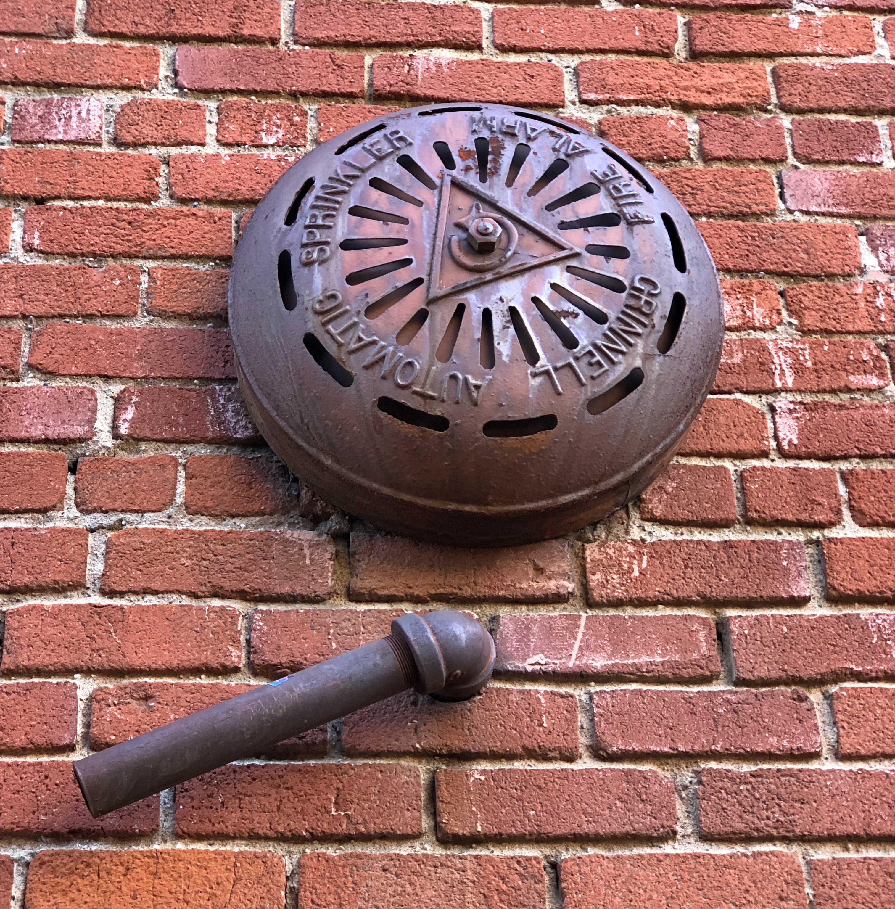
To be found in Placerville, California. You can also take a look at a small tower of some vintage in that town.Placerville, California Placerville, California

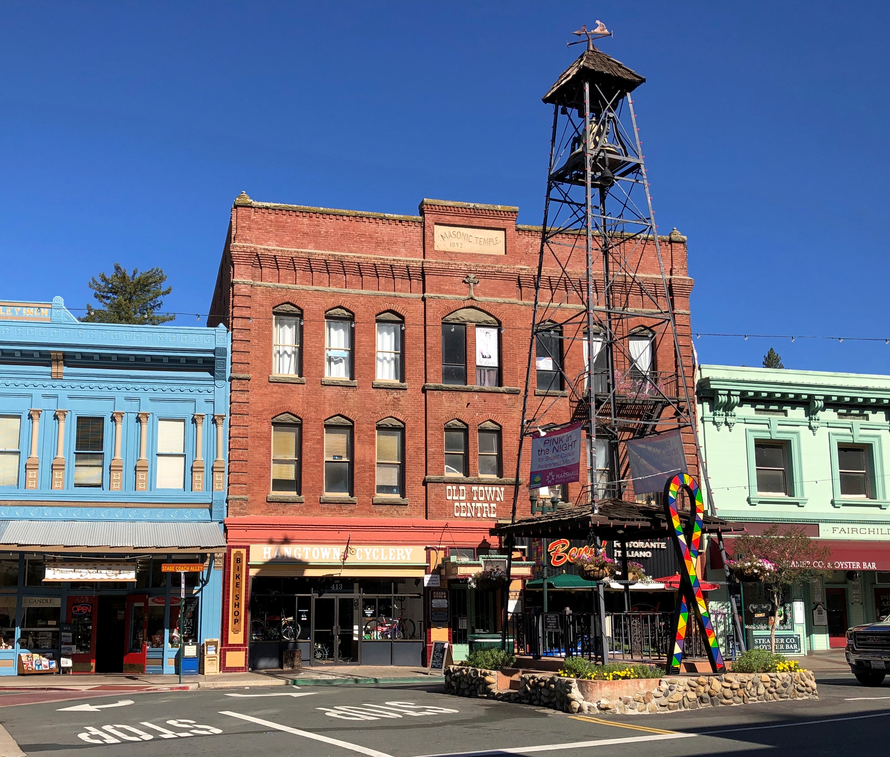
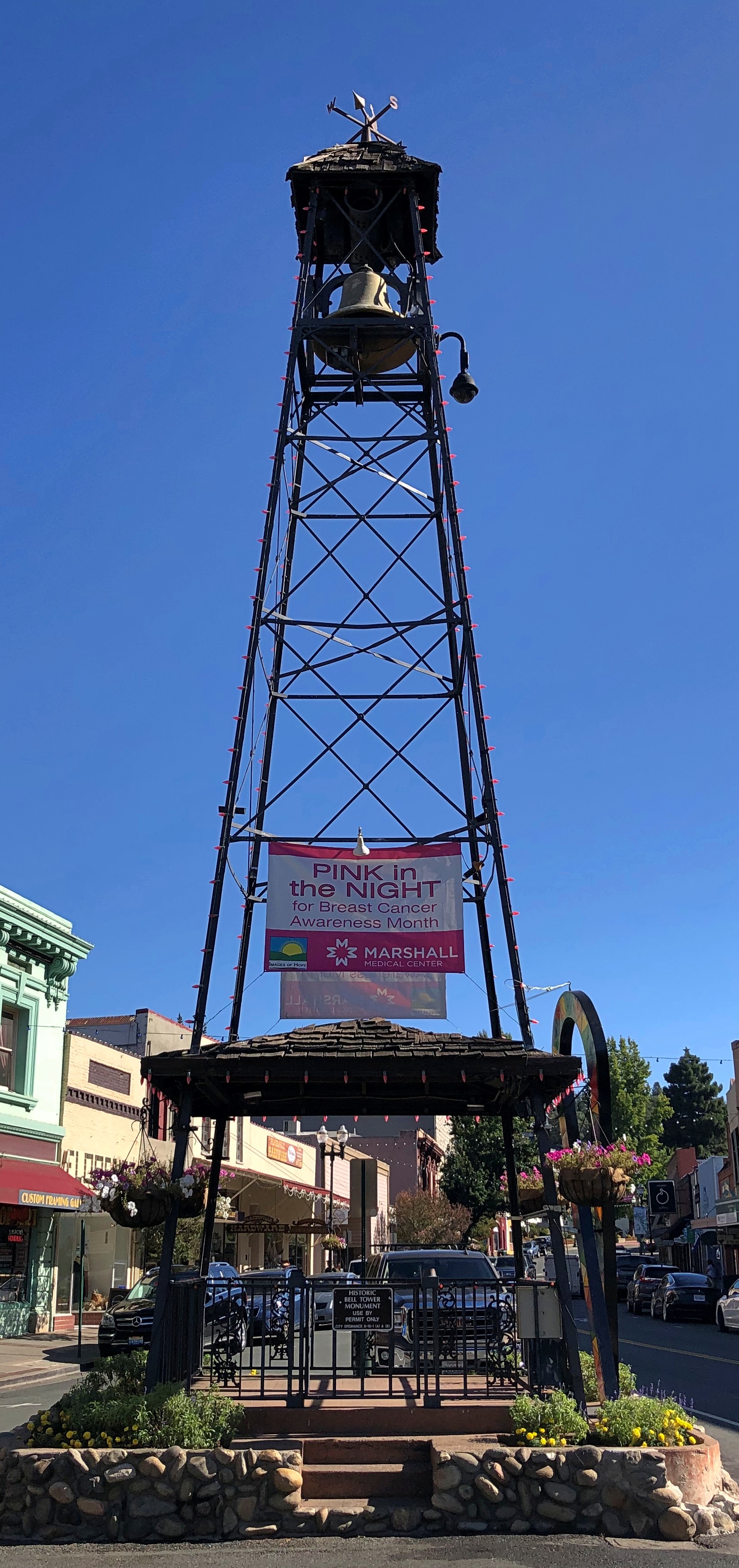
Placerville’s old bell tower. For use in the pre-electronic communication days, with a ring meaning something’s going on, come quick.

Wish I’d been hungry in Placerville, but no.Placerville, California

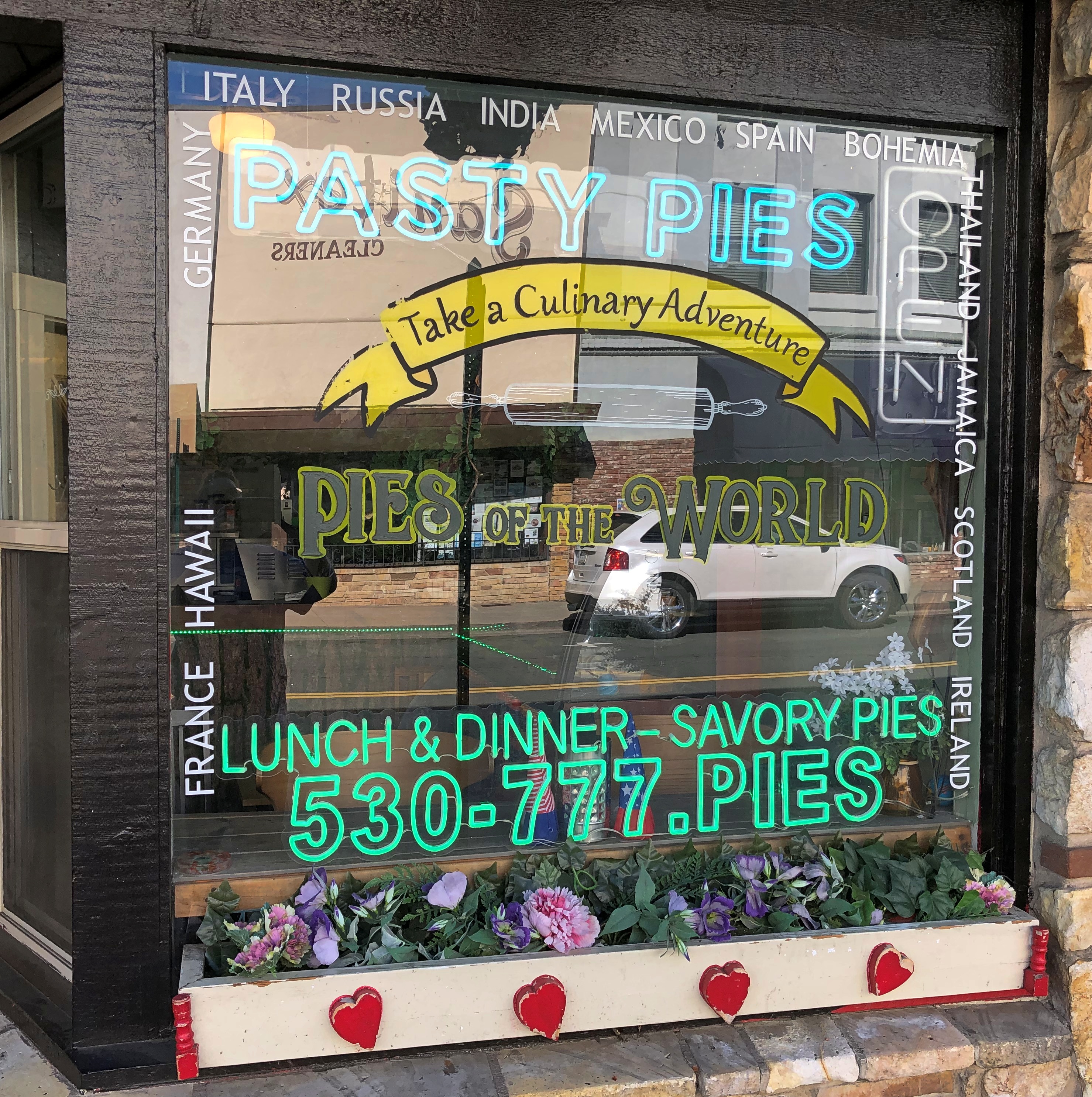
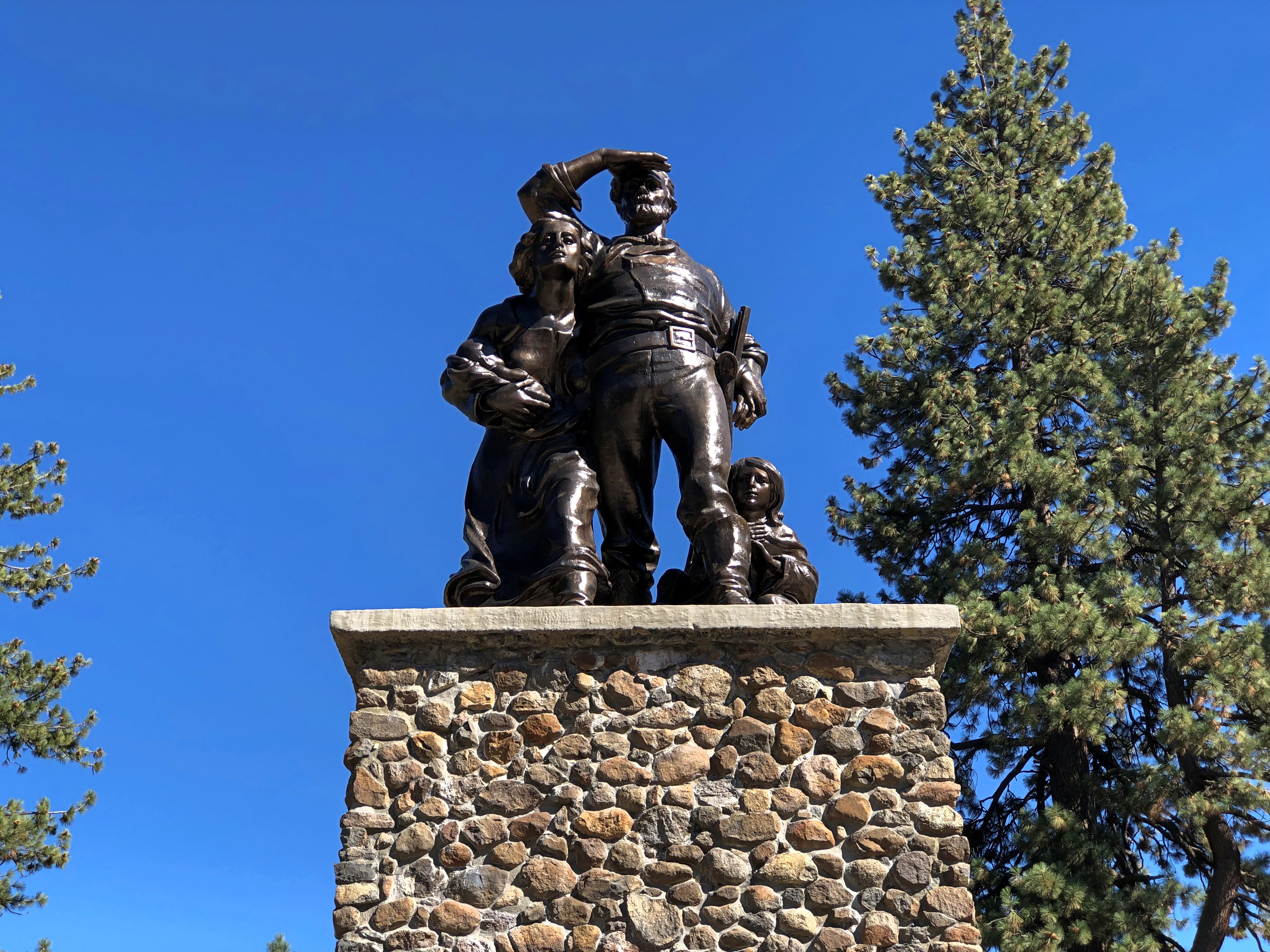
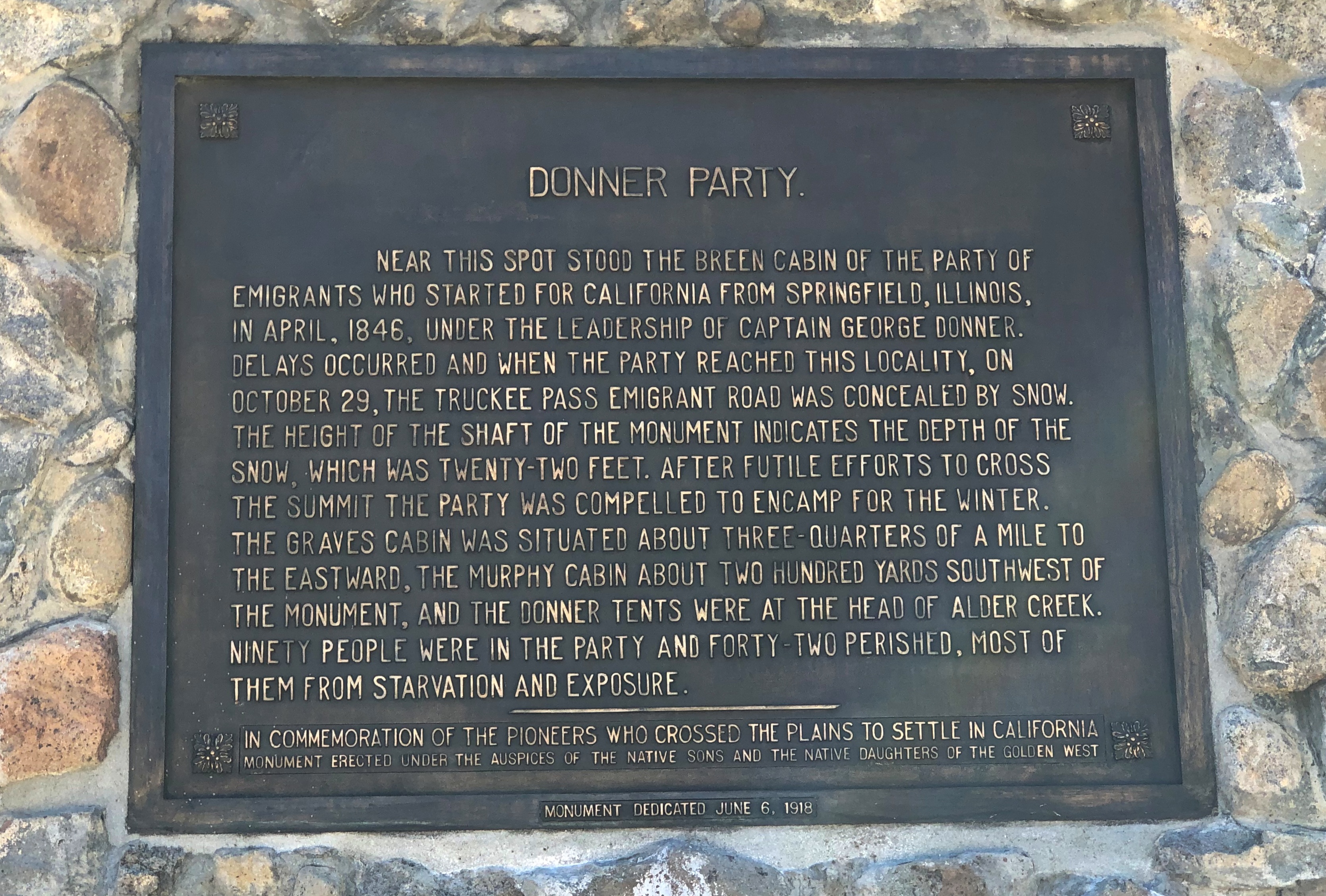
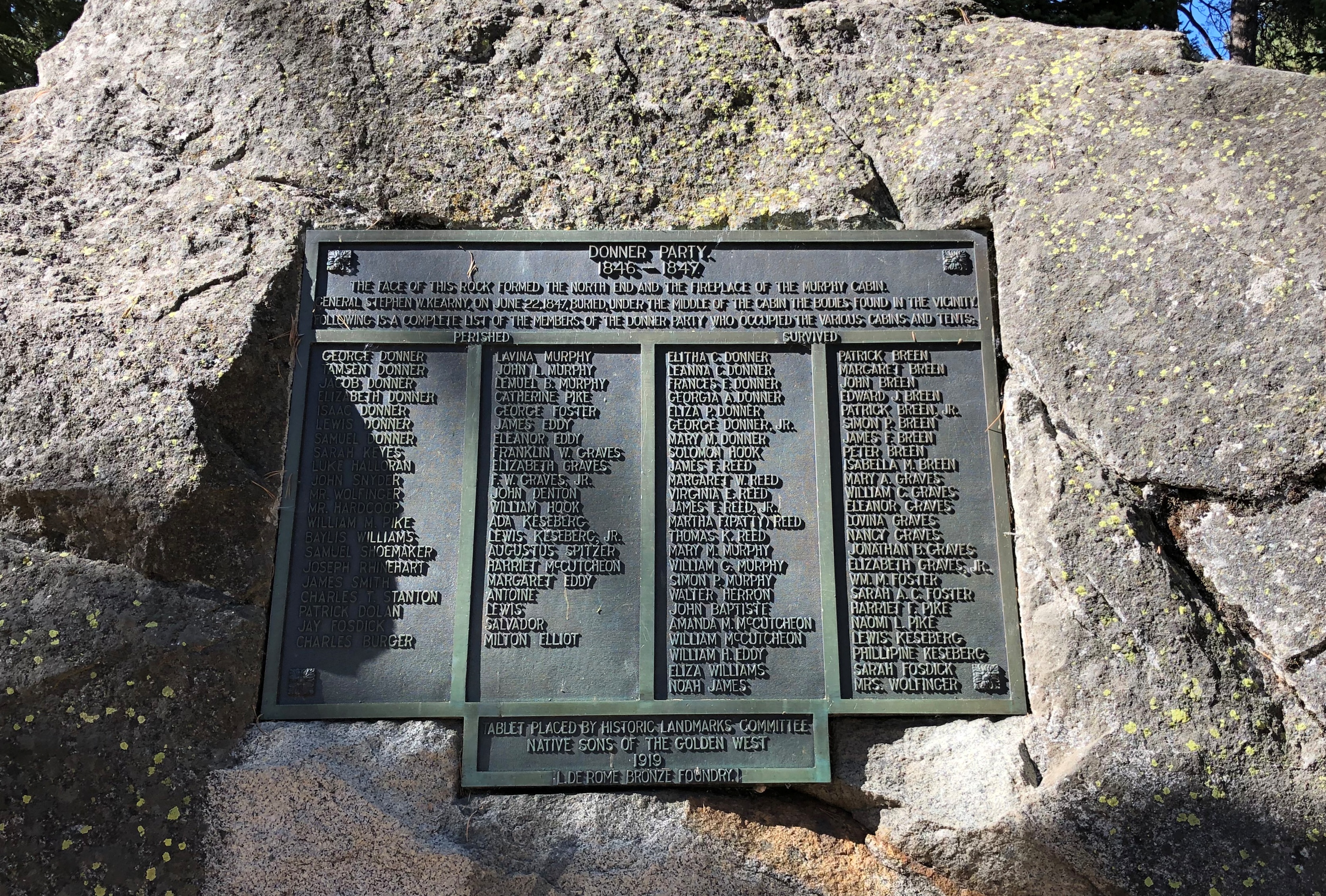
Some miles away, a Coloma plaque. I’m a fairly regular reader of plaques.

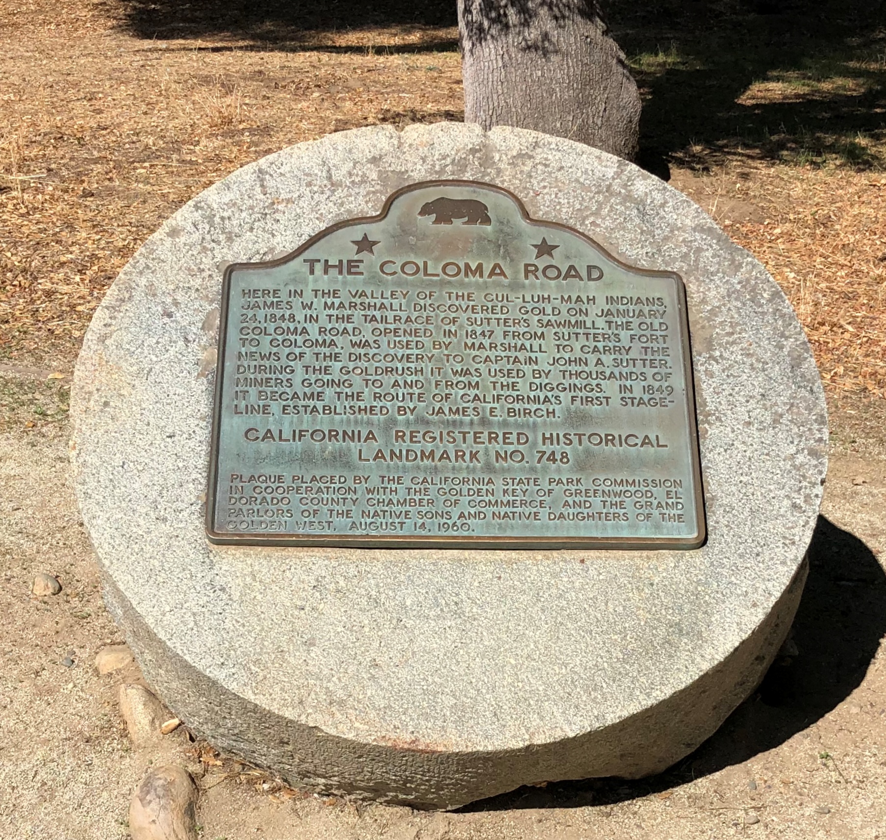
Another. I could post nothing but plaques, but that would be more granular than I want to be.

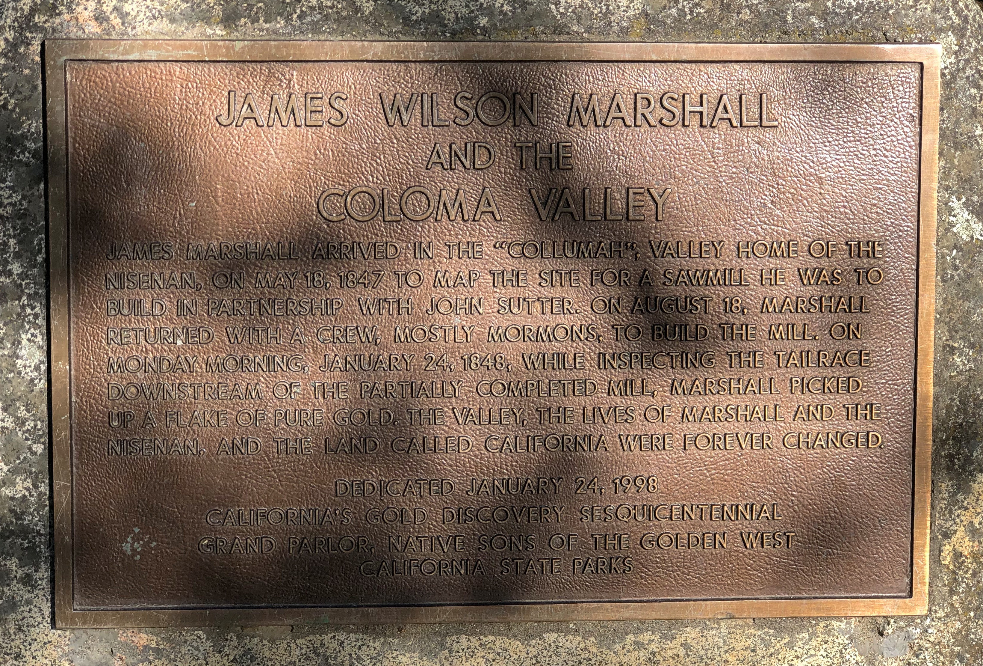
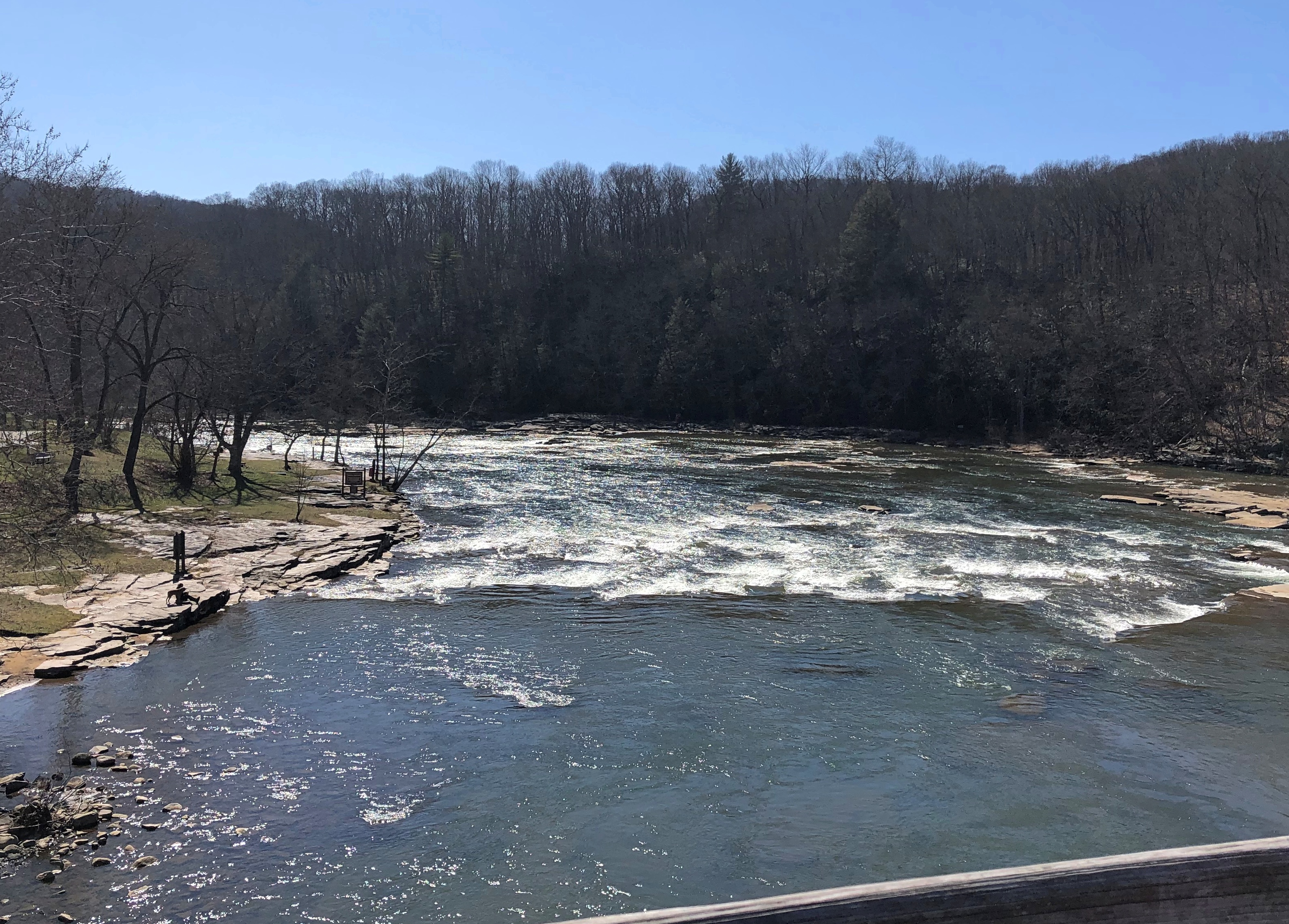
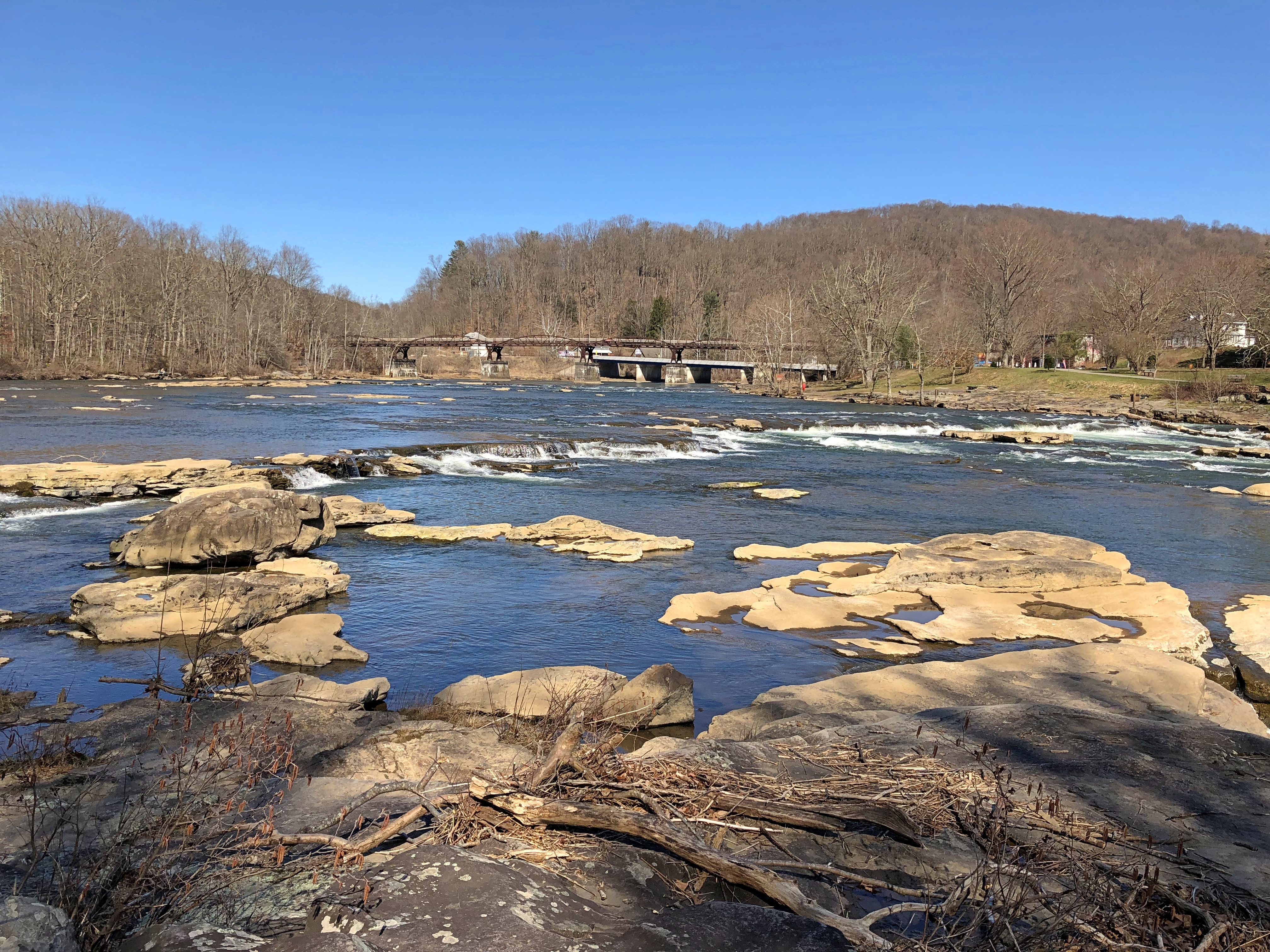
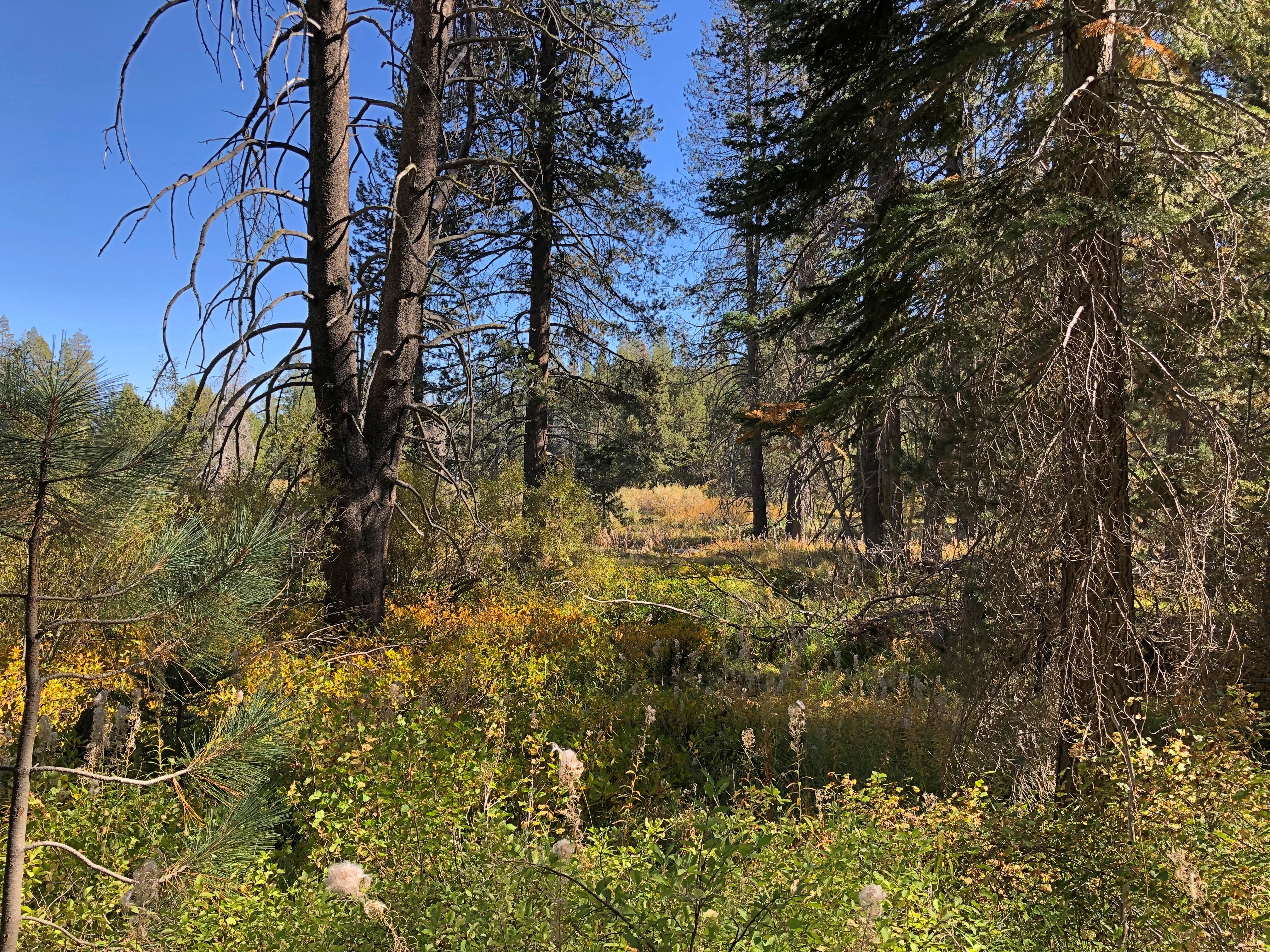
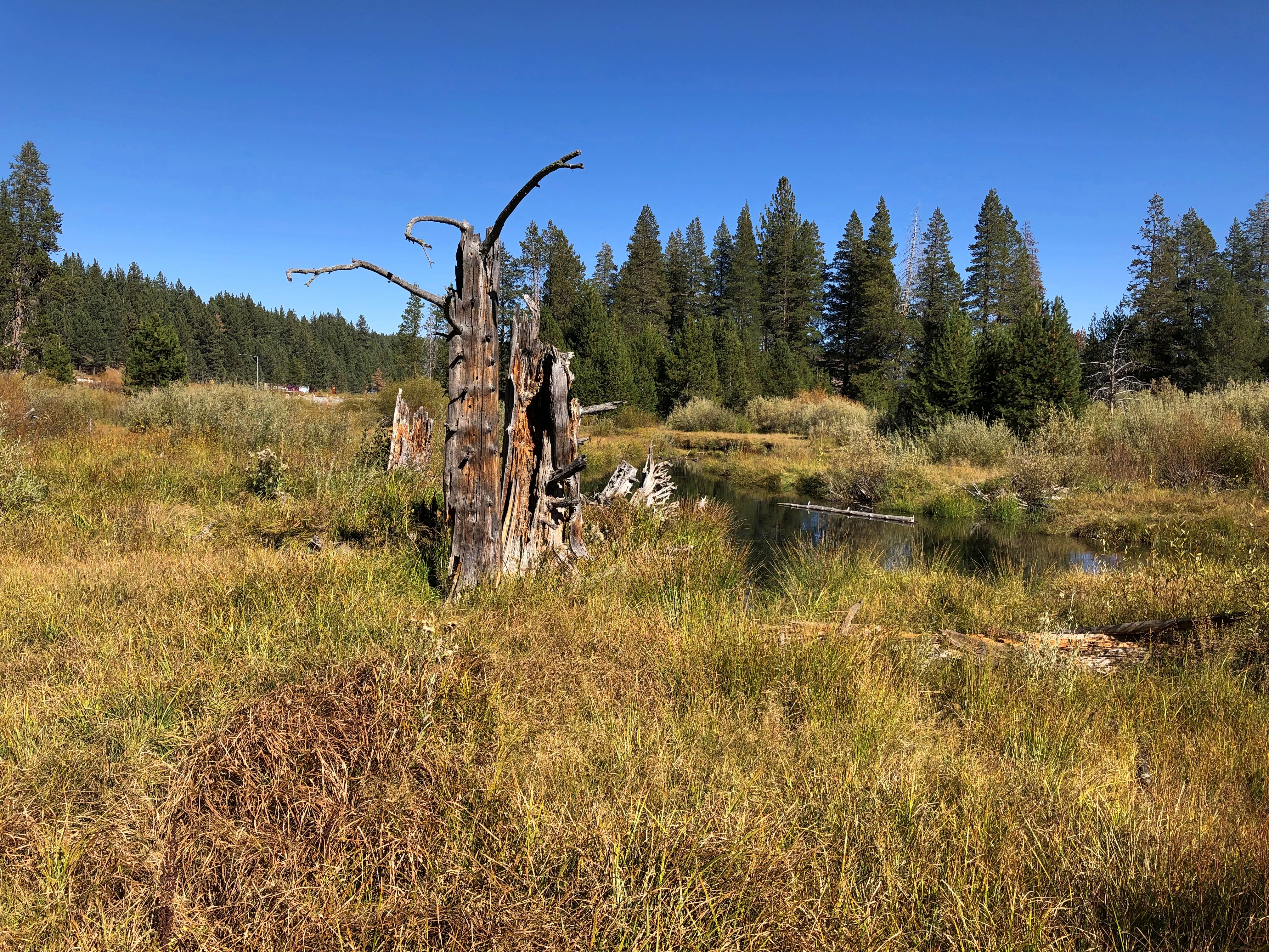
It’s a good-looking part of California anyway.Coloma Valley, California

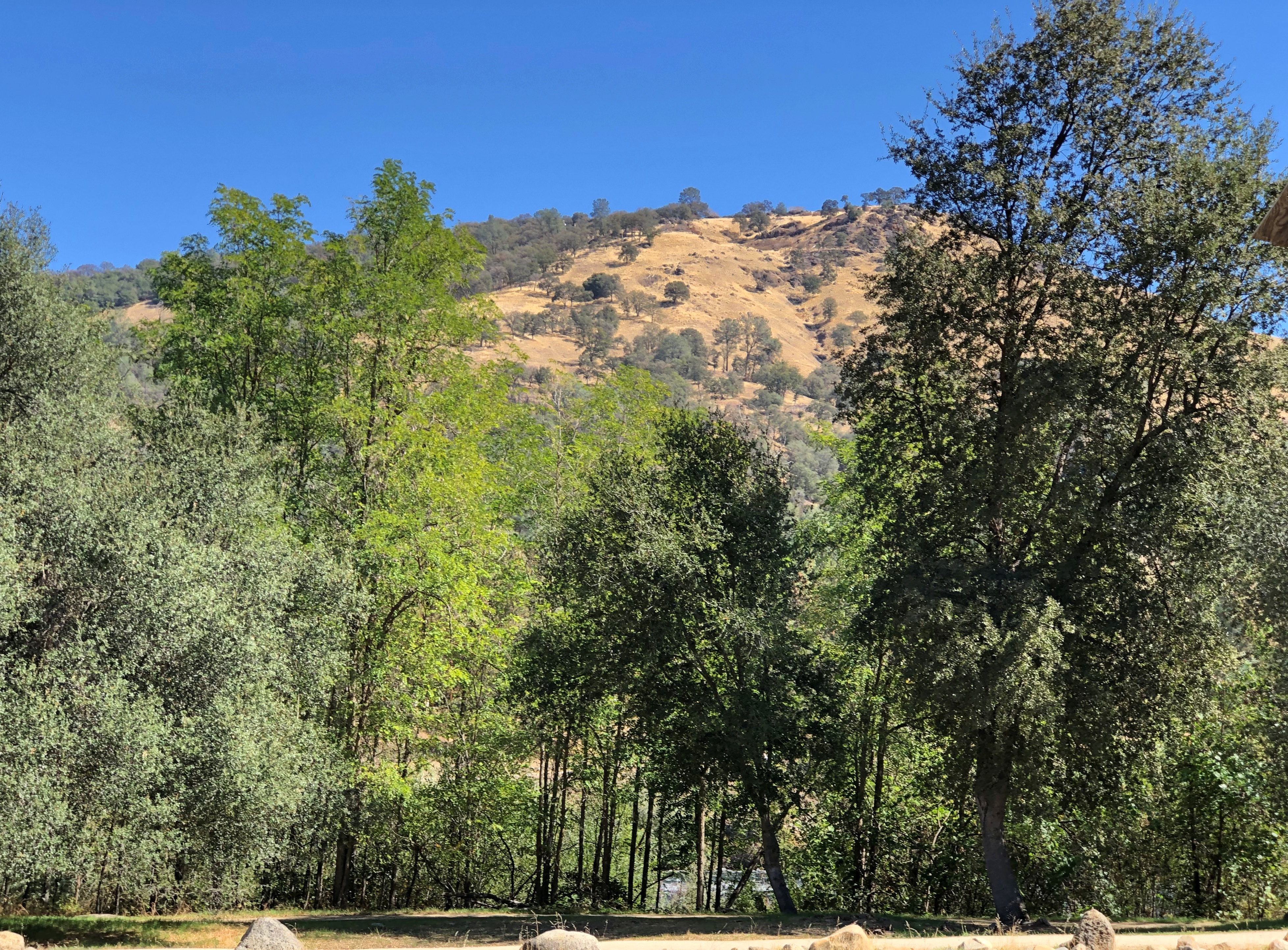
With recreational opportunities.Coloma Valley, California

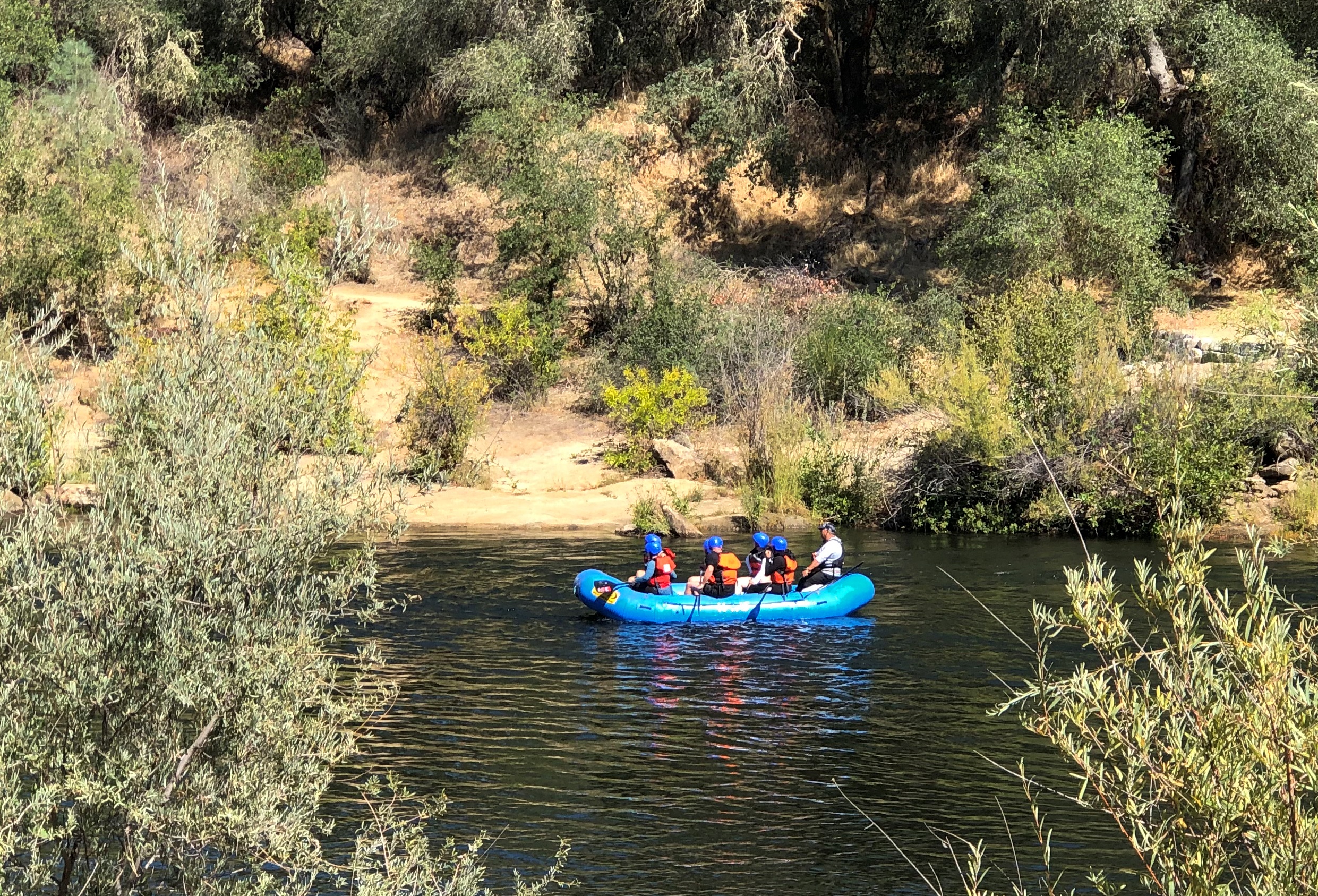
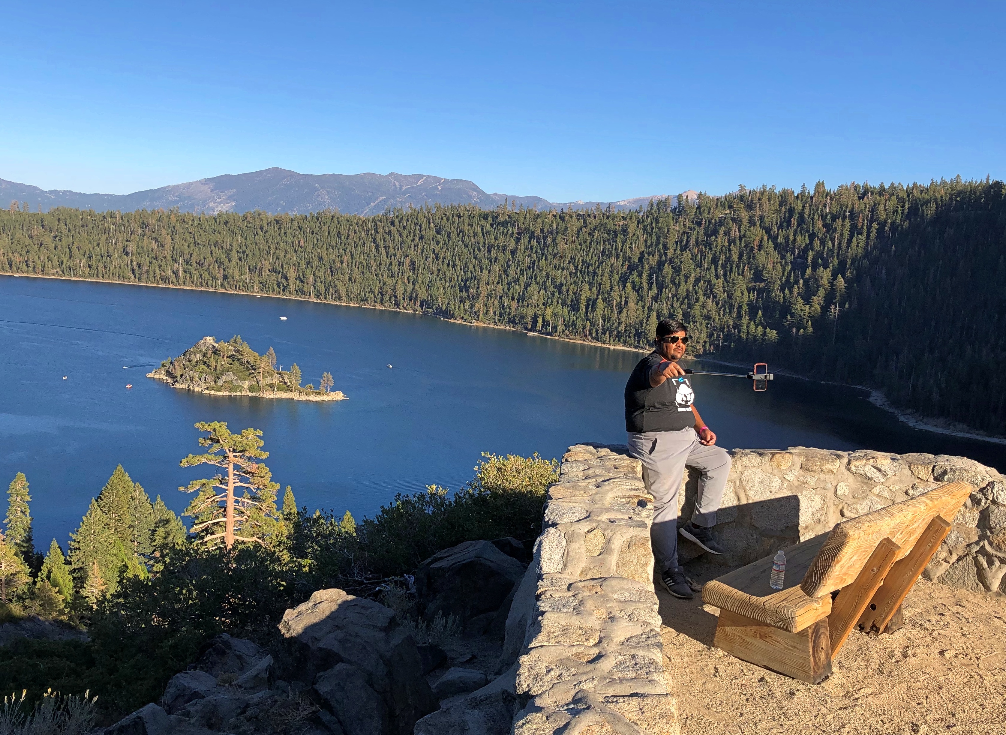
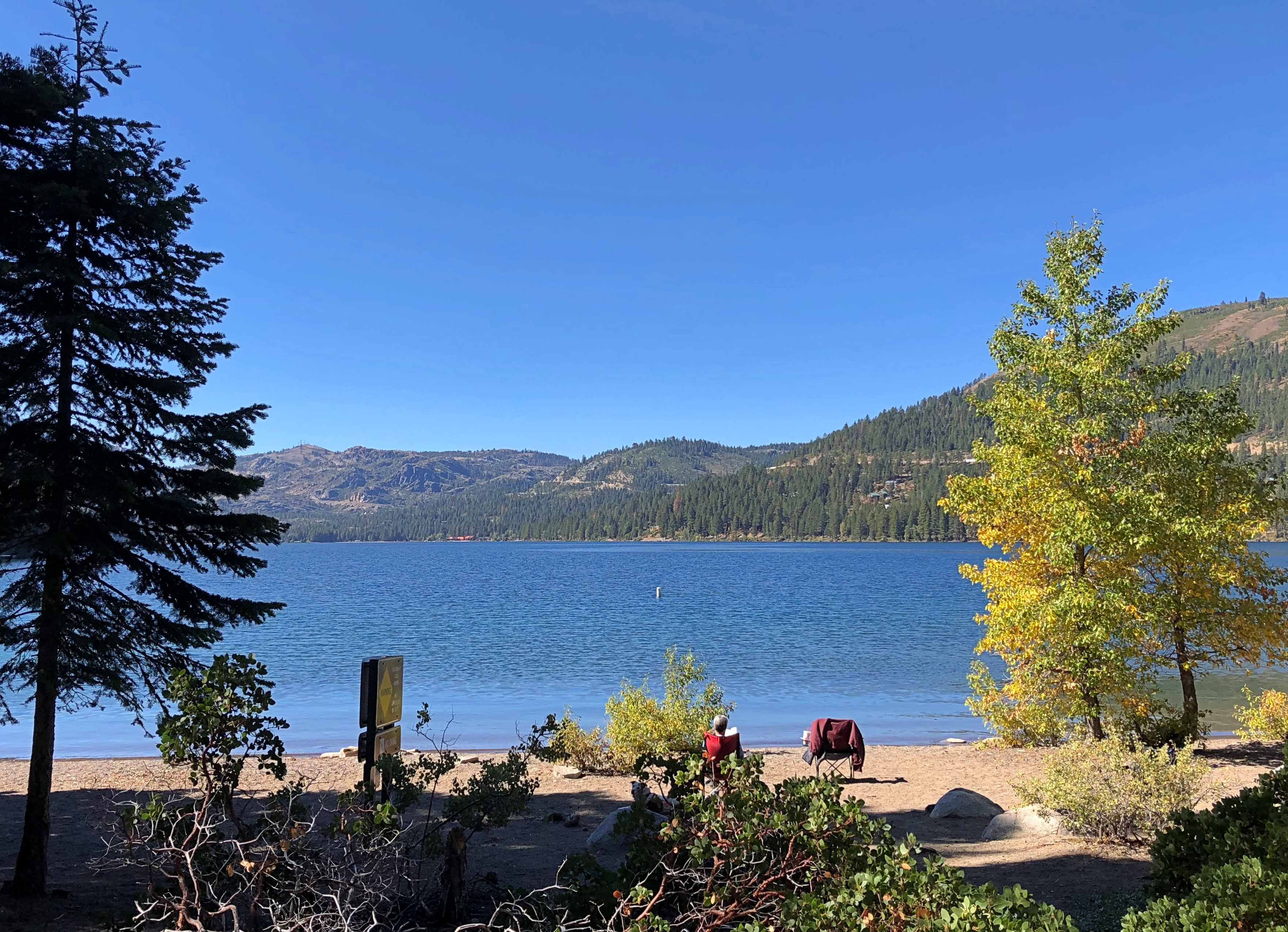
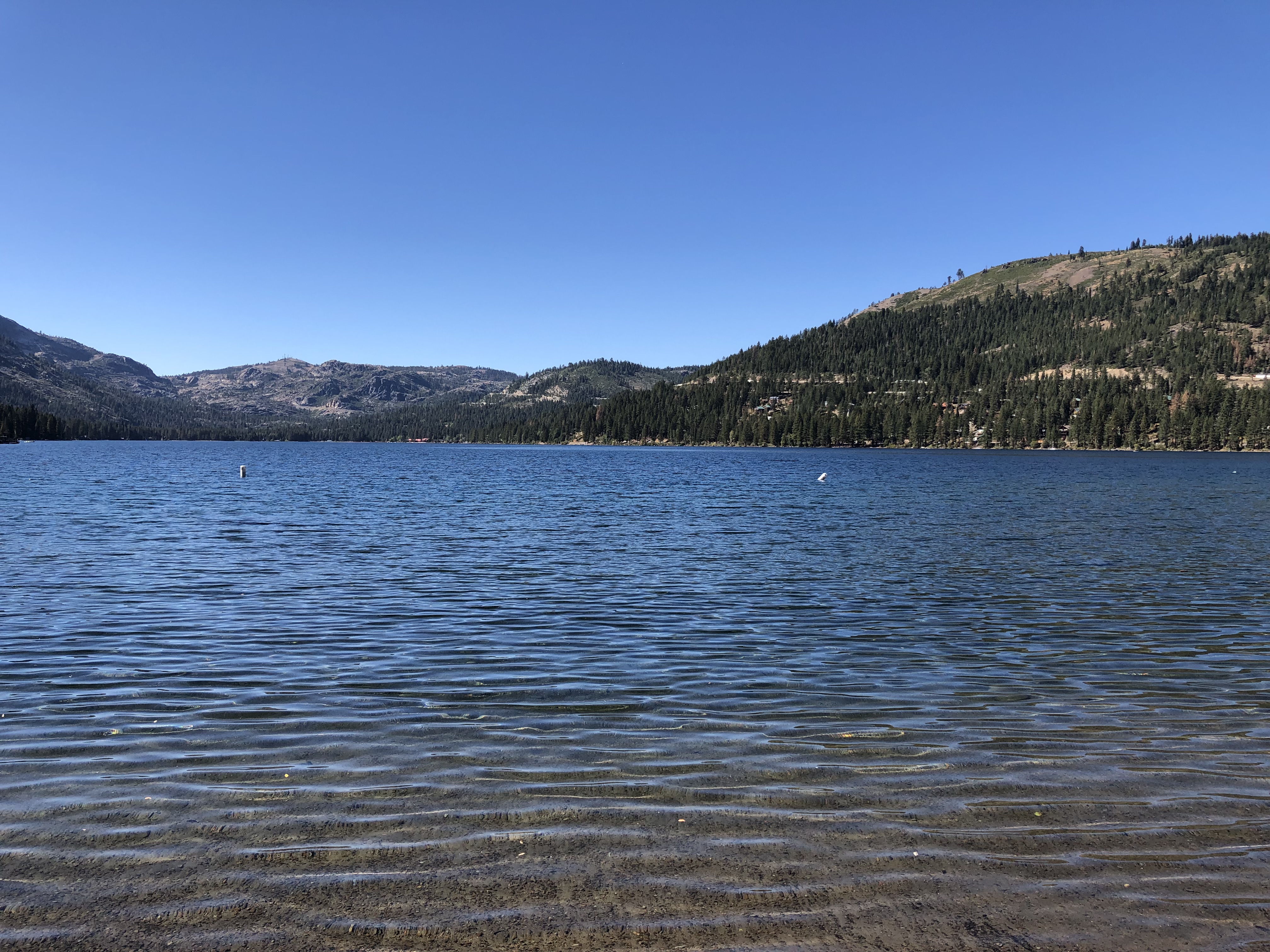
Mark Twain on Lake Tahoe (from Roughing It): “At last Lake Tahoe burst upon us, a noble sheet of blue water lifted some 6,000 feet above the level of the sea, and walled in by a rim of snow-clad mountain peaks that towered aloft a full 3,000 feet higher still.

“As it lay there with the shadows of the mountains, brilliantly photographed upon its surface, I thought it must surely be the fairest picture the whole earth affords.”

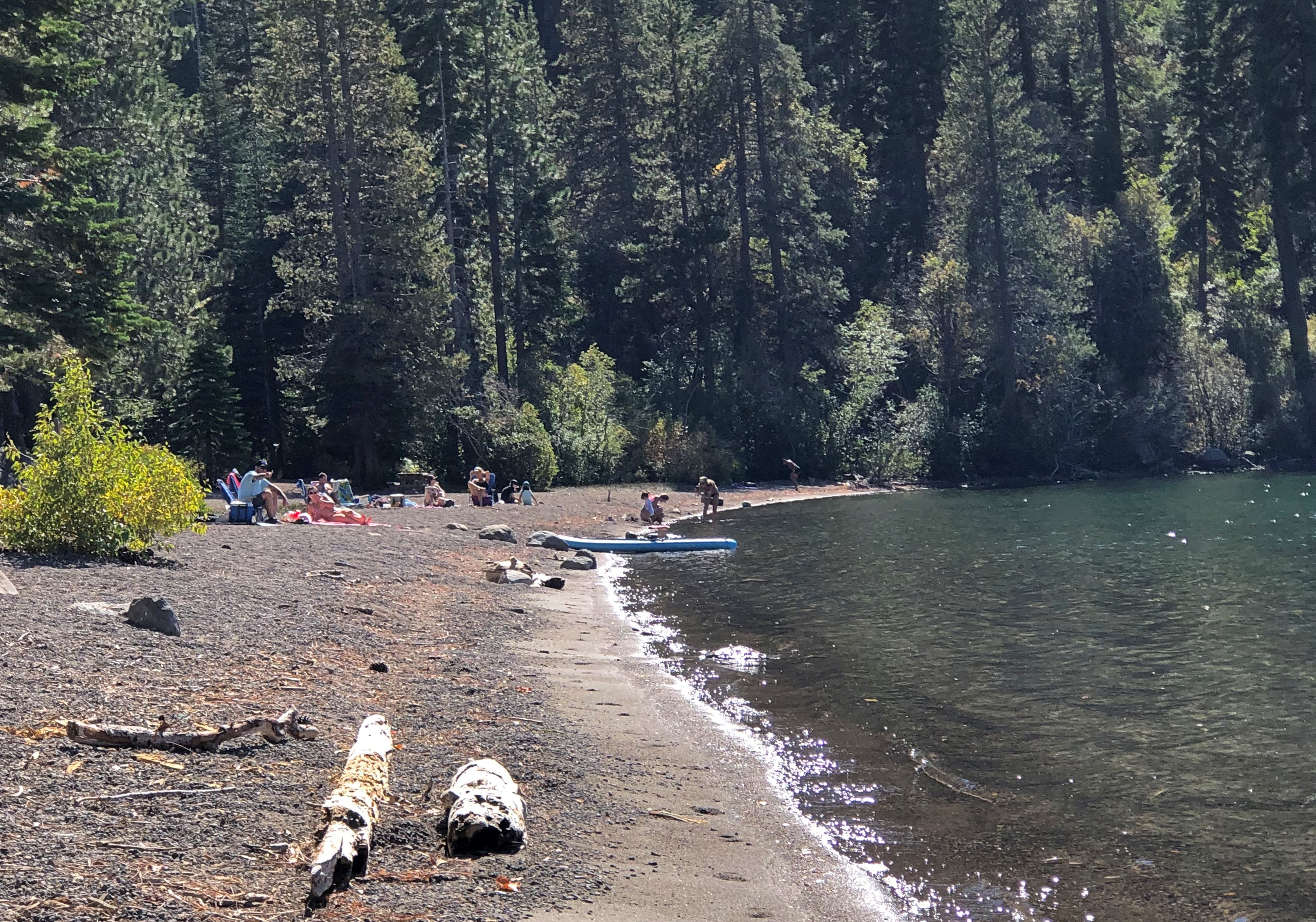
Enjoyable vistas for sure. It was good to see other people there.Lake Tahoe 2022 Lake Tahoe 2022

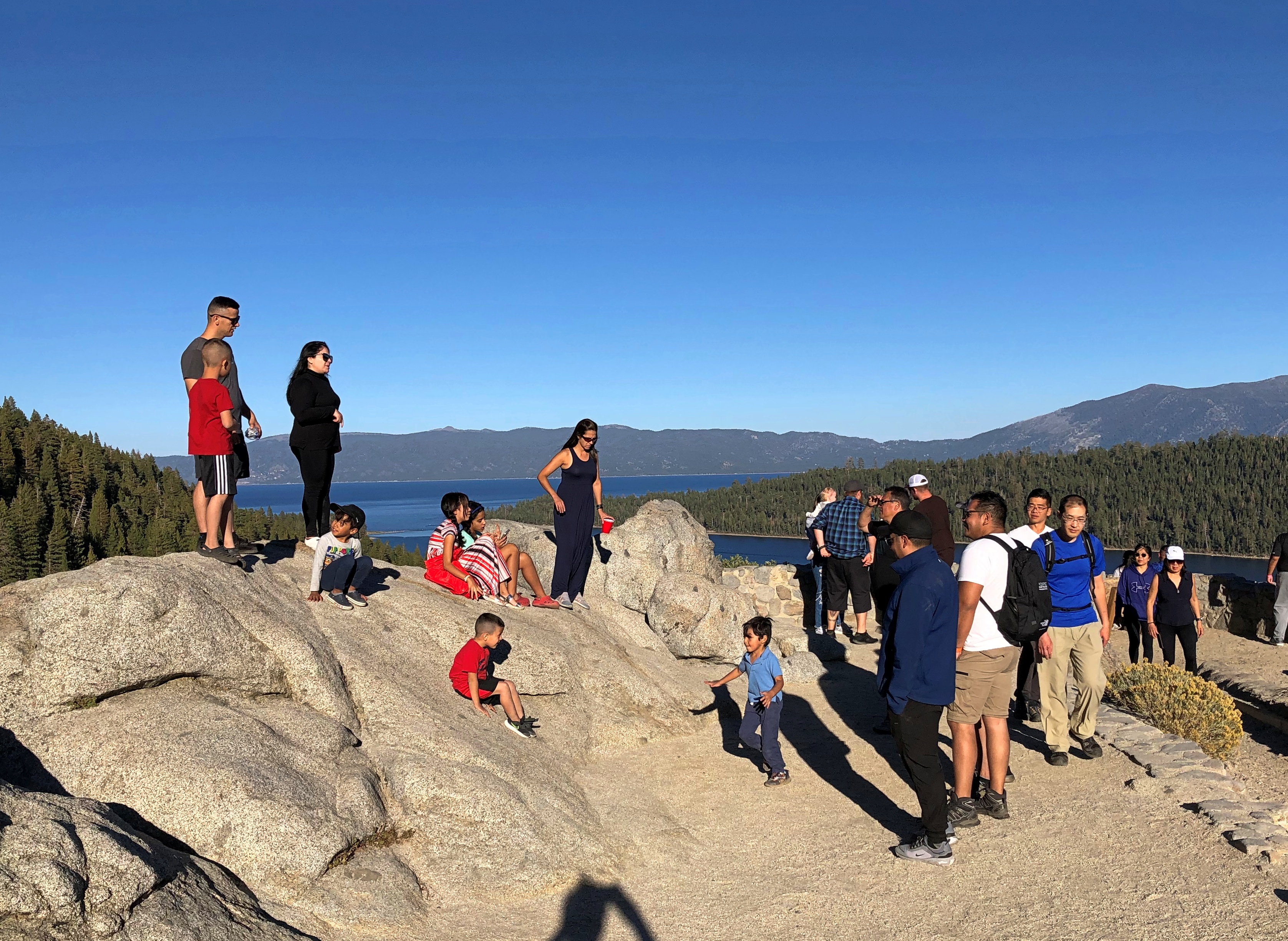
I had breakfast my first morning in Reno at a restaurant for old people — except that’s me now, isn’t it? But on a weekday mid-morning, I was one of the younger patrons. Decent food, though a touch expensive (a contagion from California, no doubt, plus the inflation du jour).

After I finished, I went out to leave, but noticed a sign I had to see, not far away. I took a closer look.Reno
reno

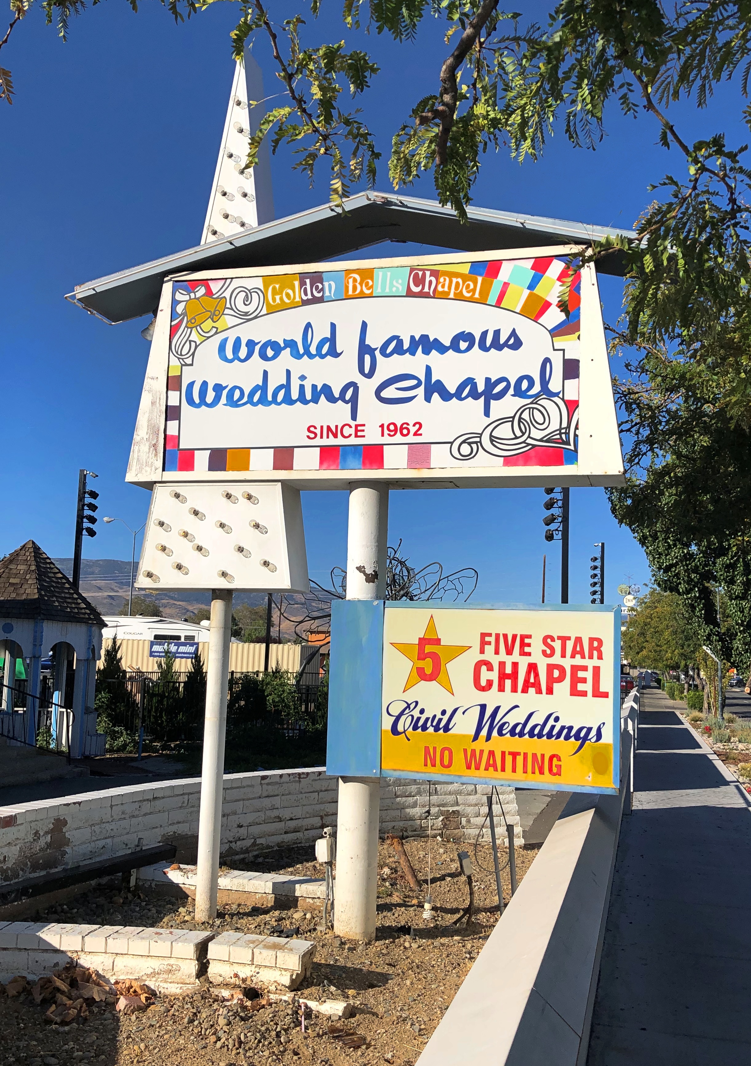
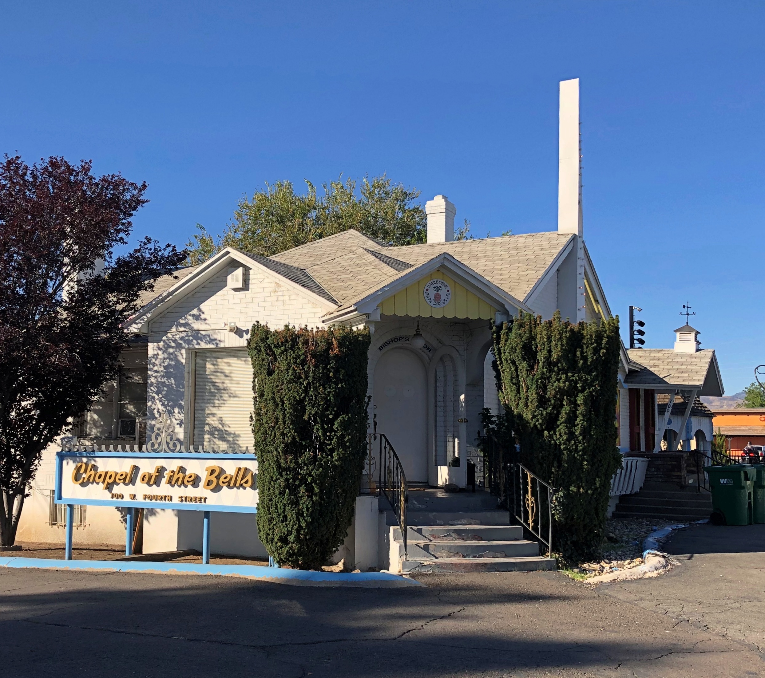
Not in the market, but someone must be. If that isn’t local color, I don’t know what is.

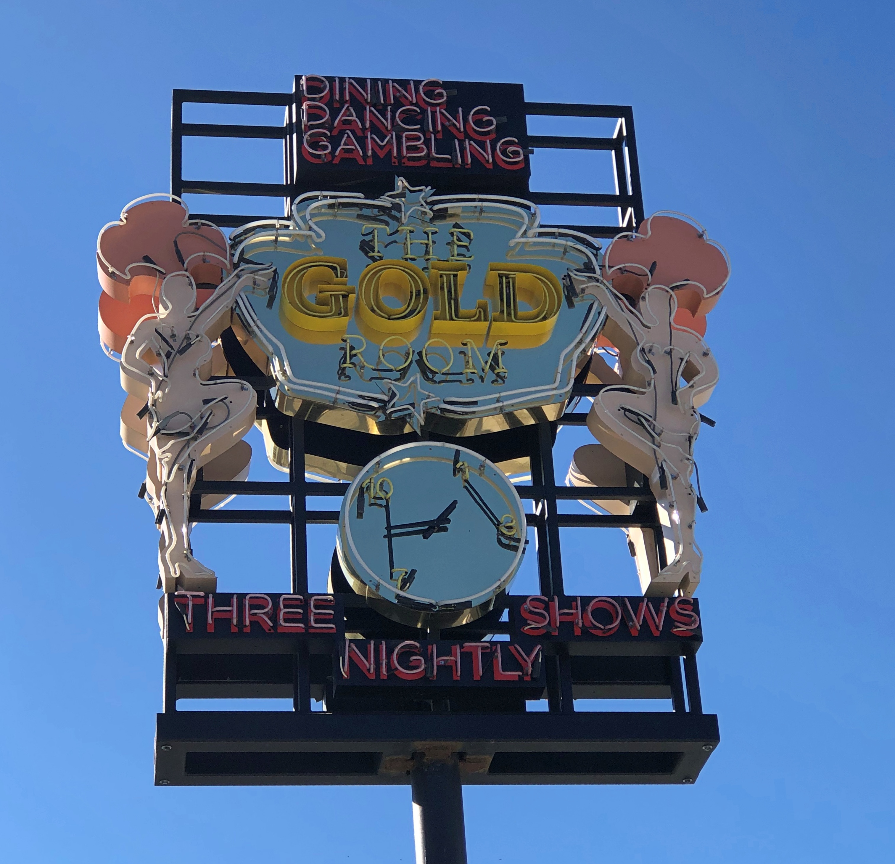
When serendipity is with you on the road, that kind of sighting leads to others. That’s what happened that morning in Reno. This was nearby the wedding chapel.Burning Man art in Reno

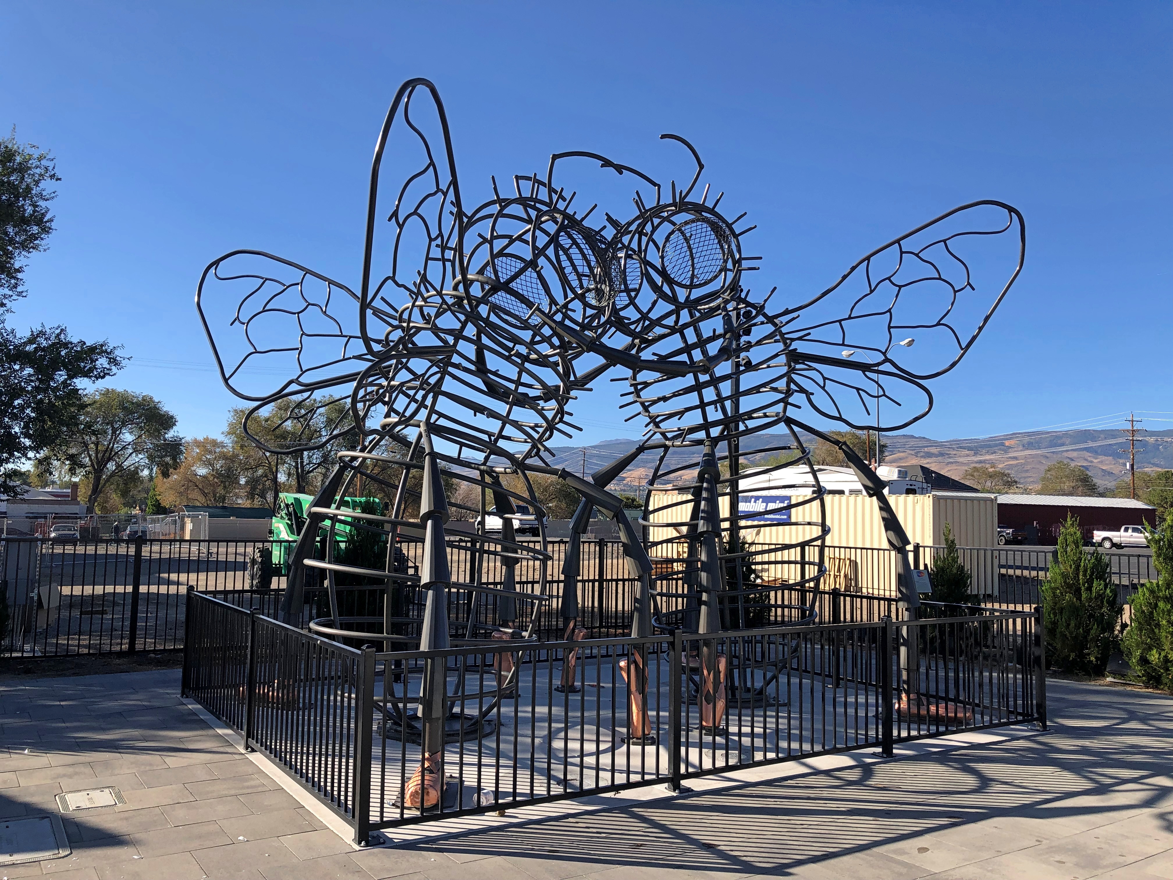
“Bee Dance” by Andrea Greenlees (2019), according to its sign, which also said it was created at Burning Man that year.

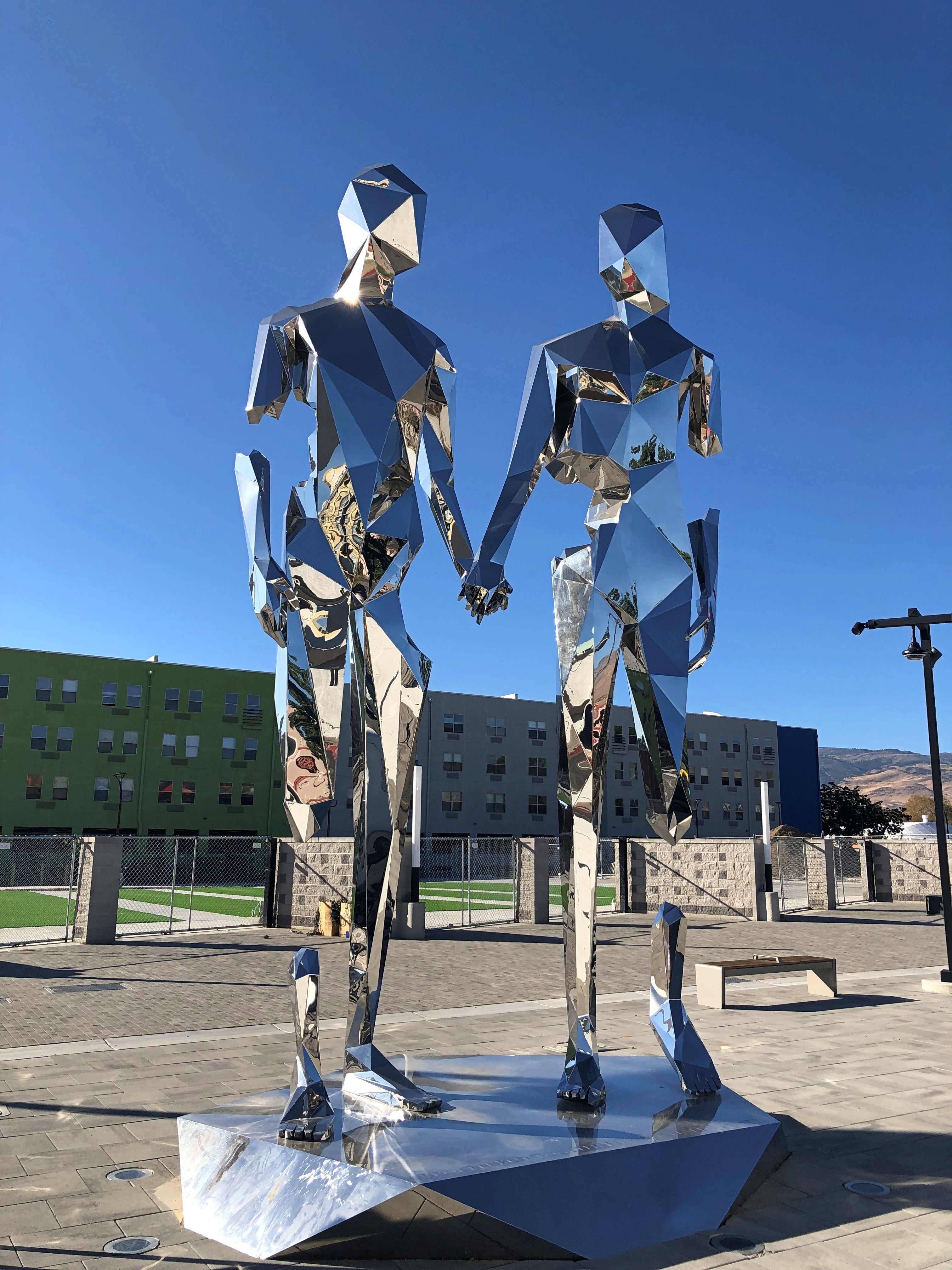
On the next block — all this was on West Fourth Street in Reno — was a closed off place called Glow Plaza, an outdoor event space that only opened this year. Well, open for concerts on the weekends. It wasn’t open for me to look around, though there was some construction going on at an adjacent site (probably new apartments), so maybe that restriction was just temporary.

Anyway, I got a look from the sidewalk. New-looking sculptures.Reno polar bear Reno art

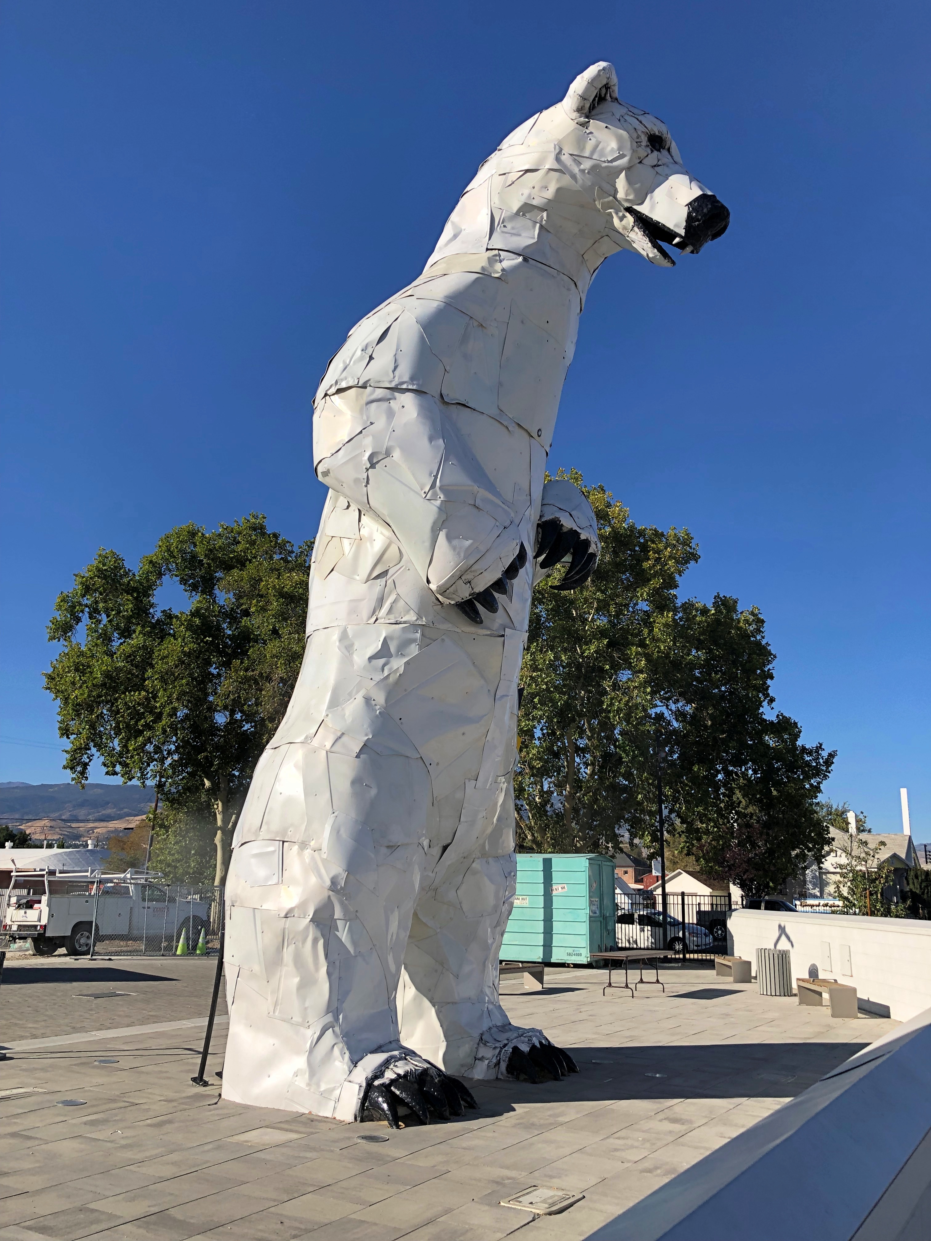
Including vintage Reno neon, or maybe close-replica homages.Reno neon Reno neon

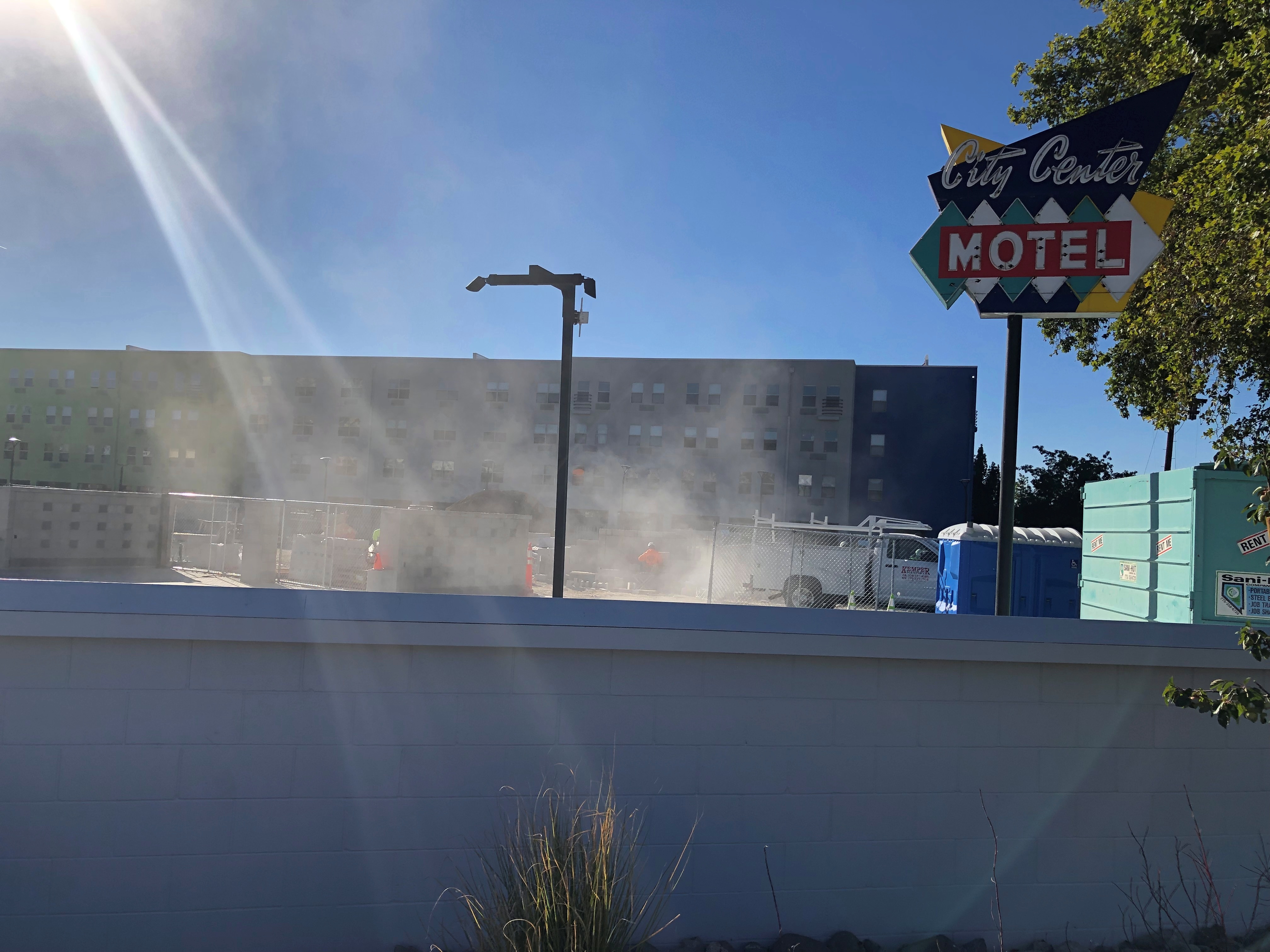
Speaking of apartments, this property in downtown Reno has the look of a 2010s adaptive reuse. I checked, and it is. It used to be a motel. The loss of an SRO property? Maybe, but I didn’t know there was much of that left.The Mod, Reno

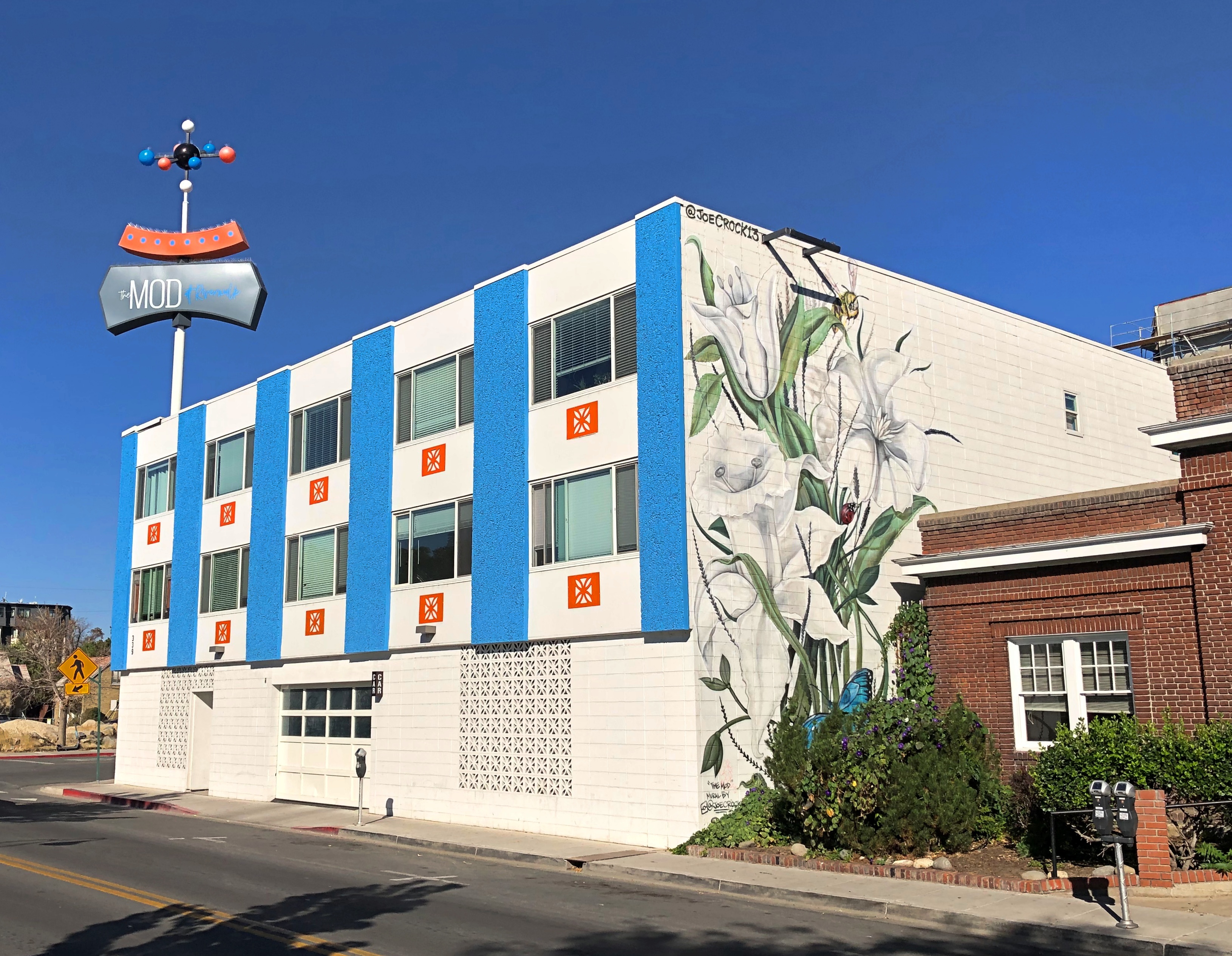
Now it’s an “upscale micro-unit living facility,” to borrow a phrase from Northern Nevada Business Weekly. I checked again, and its rents range from $1,100 to $1,700 (the low end of the range is for about 250 square feet).

Could have done an entire posting of name plates on vintage cars at the National Automobile Museum. The familiar and the less familiar.National Automobile Museum, Reno National Automobile Museum, Reno

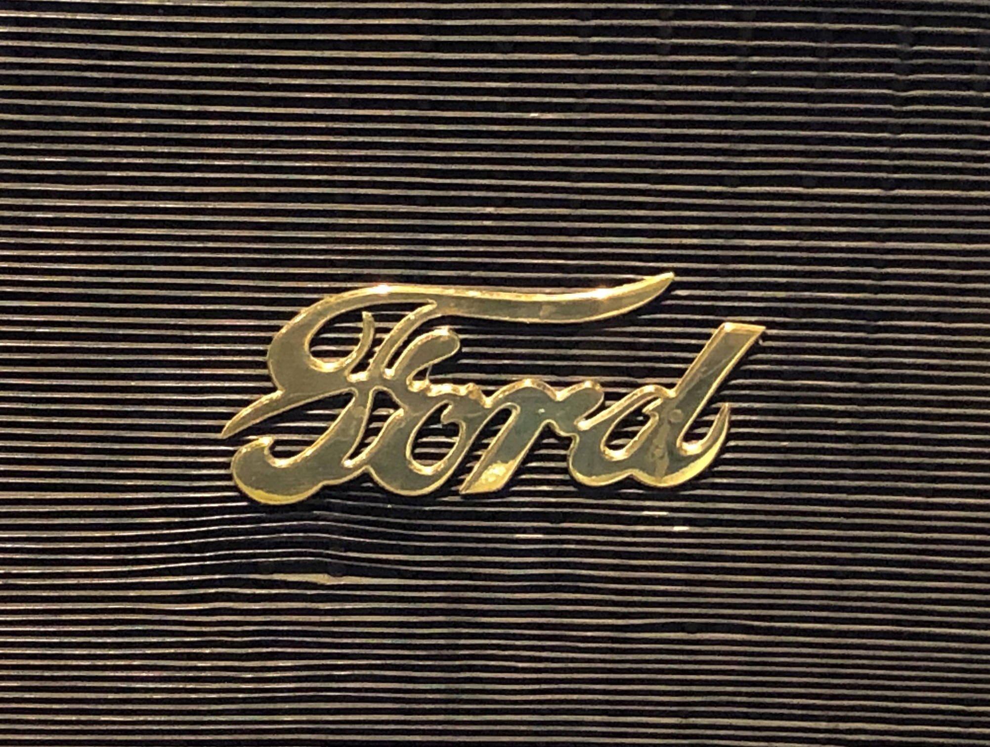
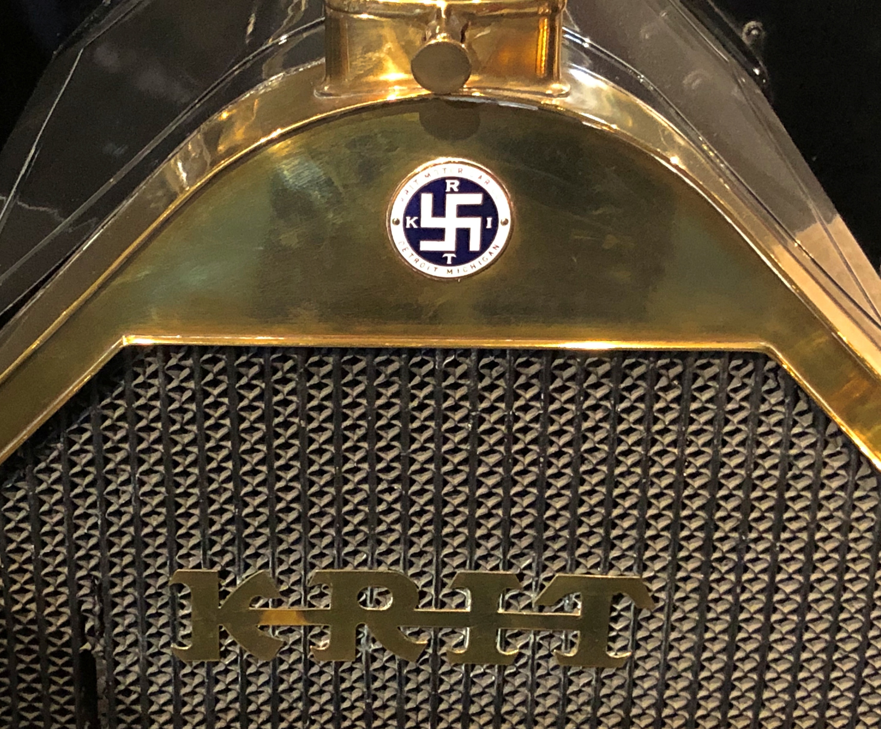
That last one’s an attention-getter. You can find it on a Krit Motor Car Co. auto, made years before jackbooted lowlifes shanghaied the symbol.

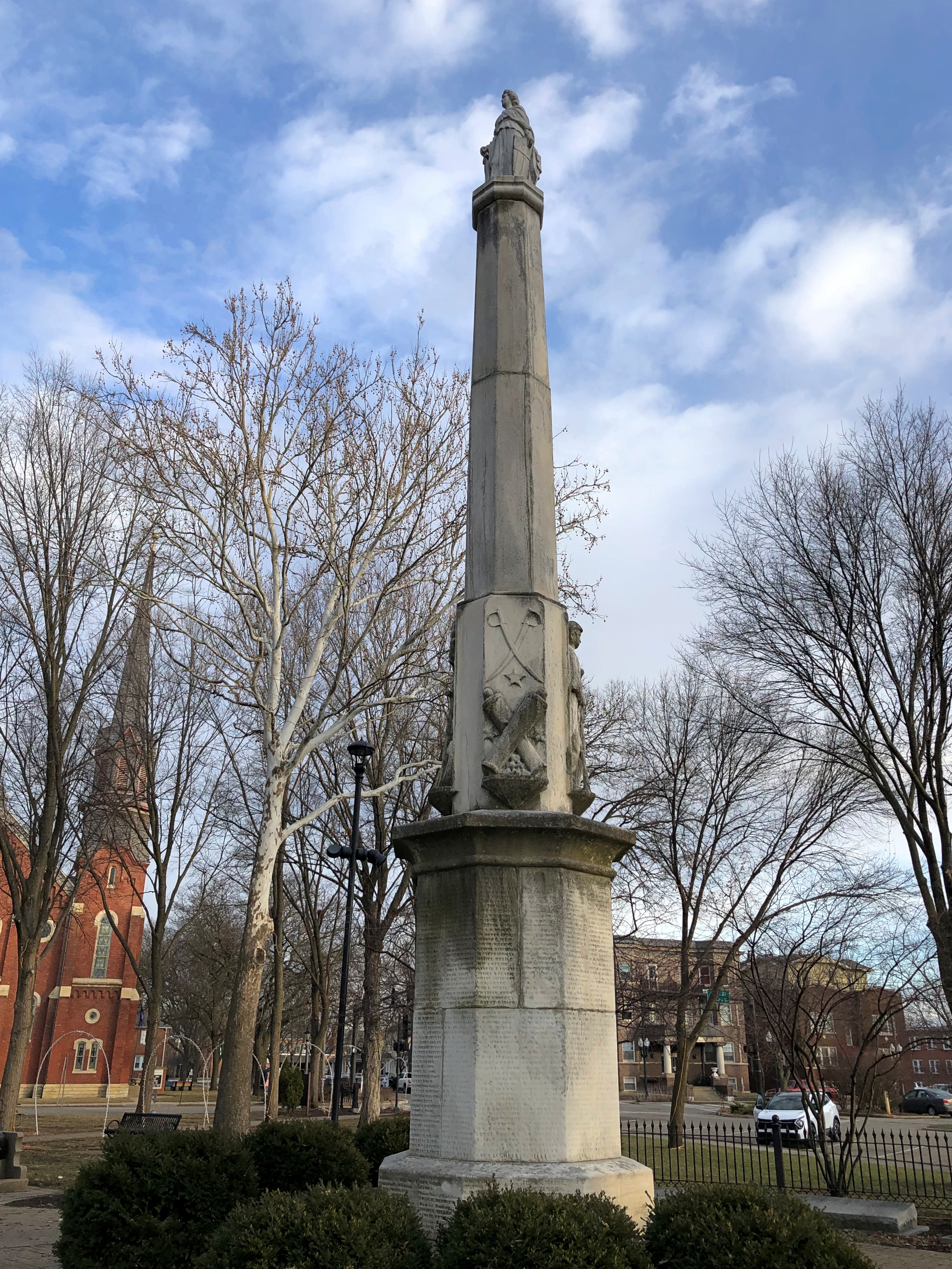
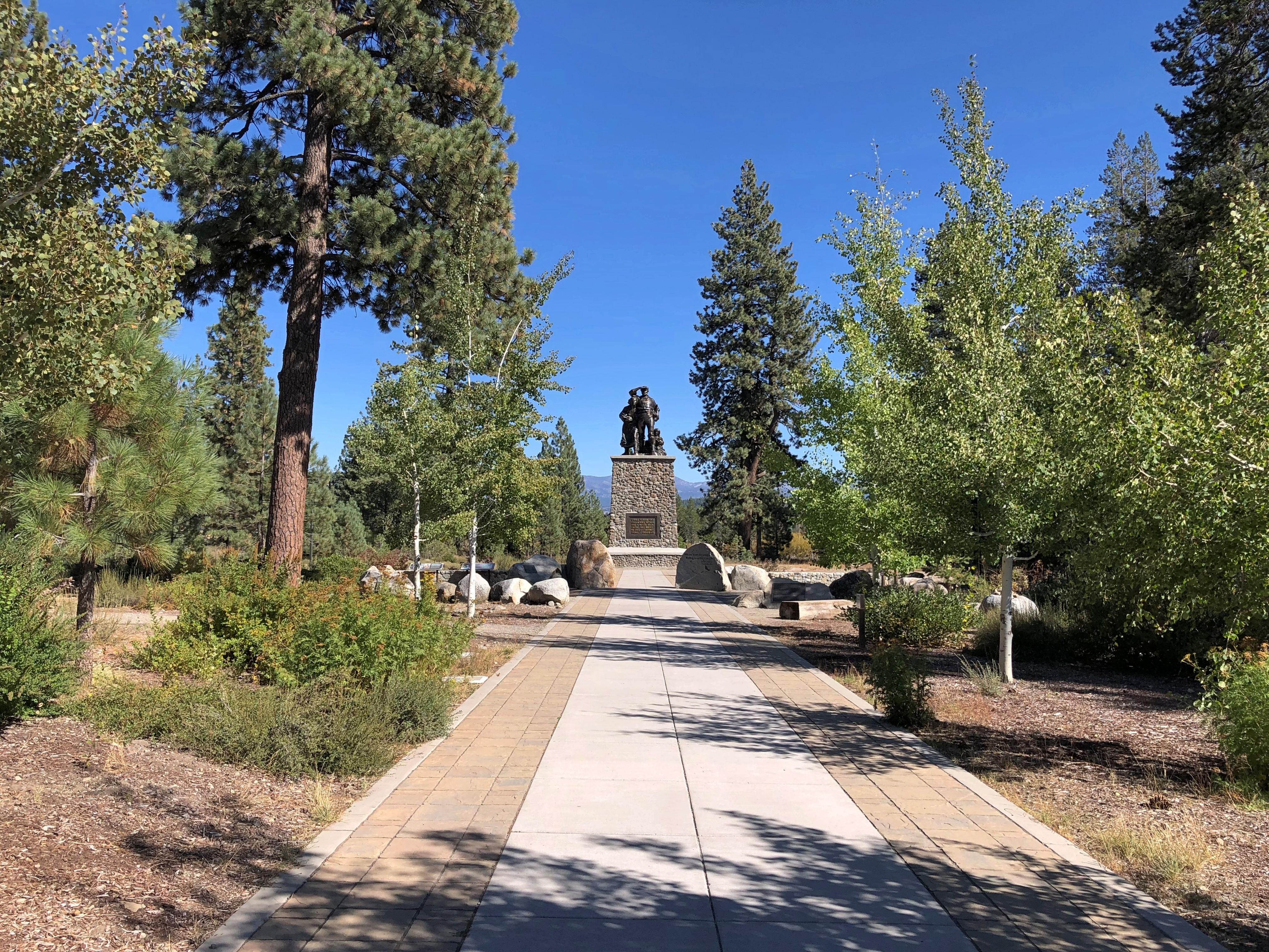
The Battle Born Memorial in Carson City, dedicated to fallen soldiers from Nevada.Battle Born Memorial, Carson City, Nevada Battle Born Memorial, Carson City, Nevada

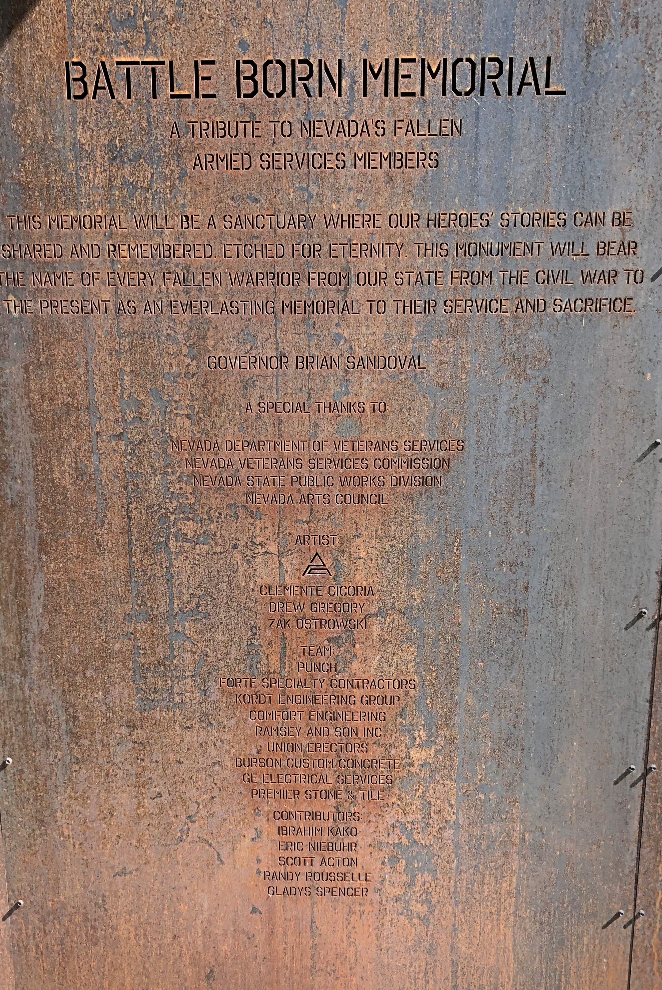
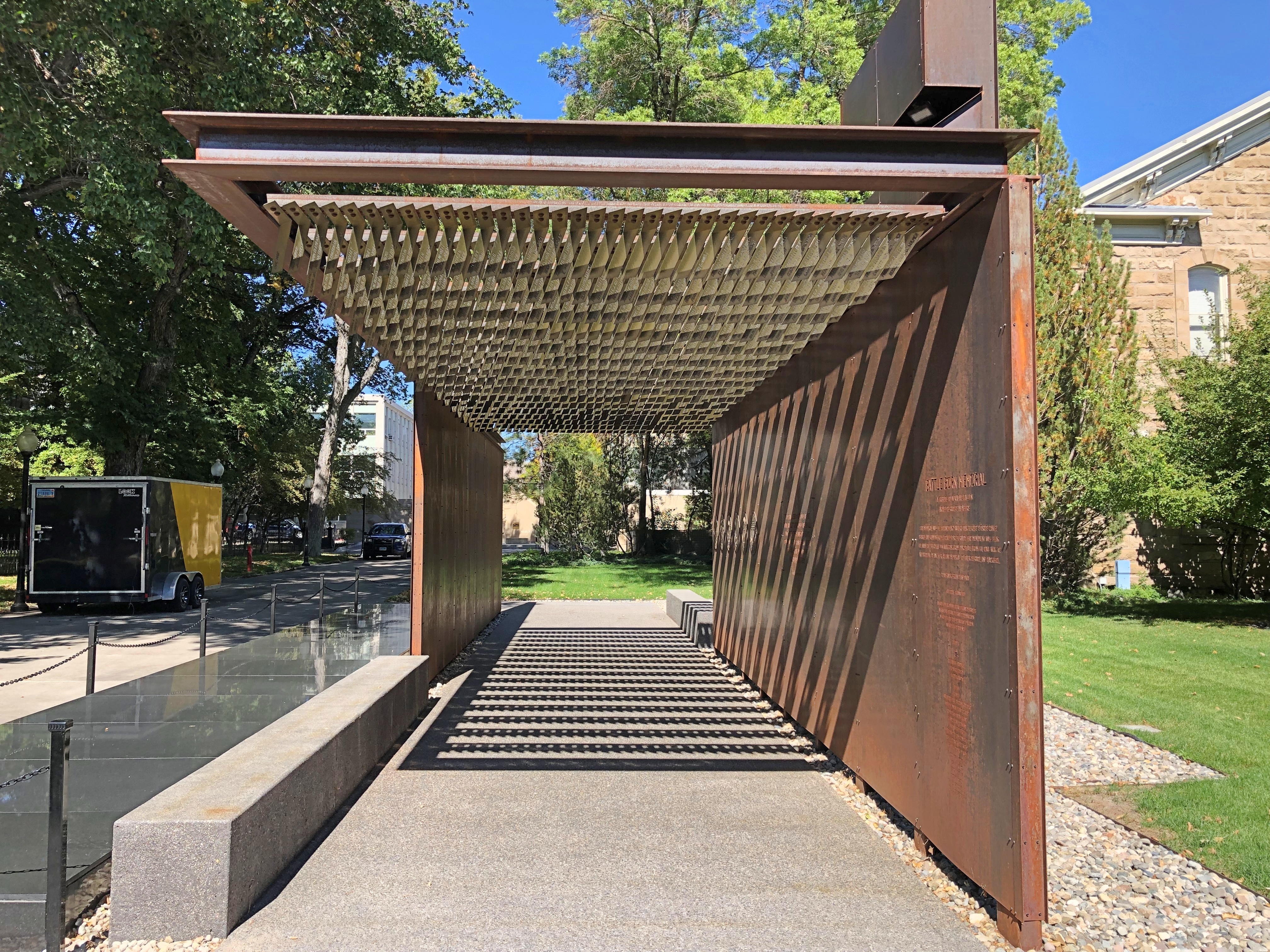
At first I thought, iron? True, iron is at the heart of modern war. But as soon as I was inside, and looked up, I realized how fitting the material is. A remarkable memorial.

Especially when you gaze up at it.Battle Born Memorial, Carson City, Nevada

The names of the fallen are inscribed there.Battle Born Memorial, Carson City, Nevada Battle Born Memorial, Carson City, Nevada

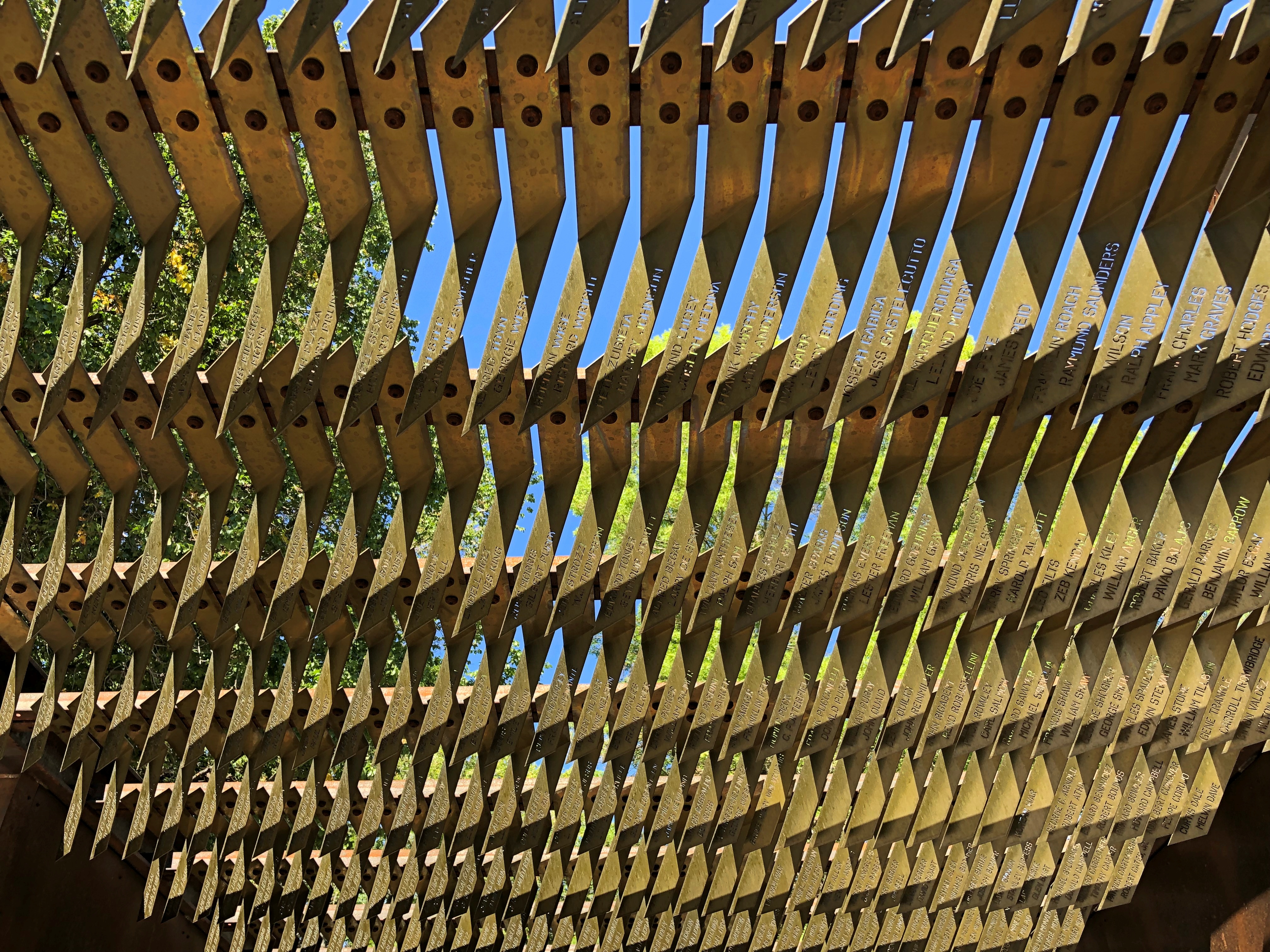
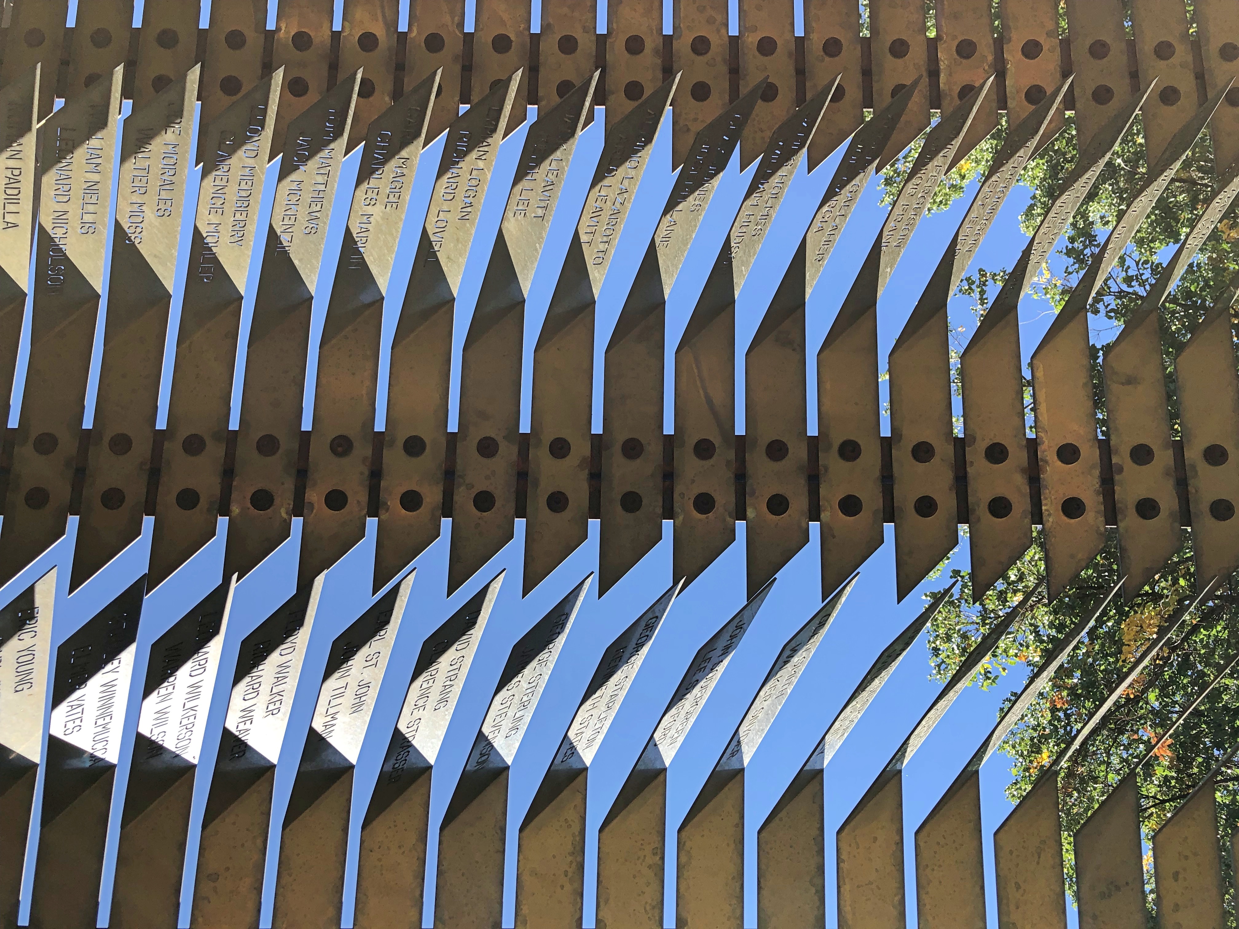
Eight hundred and ninety-five names, I understand. Punch Architecture did the design, which was completed in 2018.

Later I looked up Battle Born. I didn’t know that was a nickname for Nevada. Everyone’s heard Silver State, but not Battle Born State. I puzzled on that a while, but eventually realized that when Nevada entered the union (1864; Lincoln needed another two Senators), it joined the fight, as a state, to keep that union together.

A much smaller metal-work, underfoot in Carson City. Good to know I’ve been on the Kit Carson Trail.
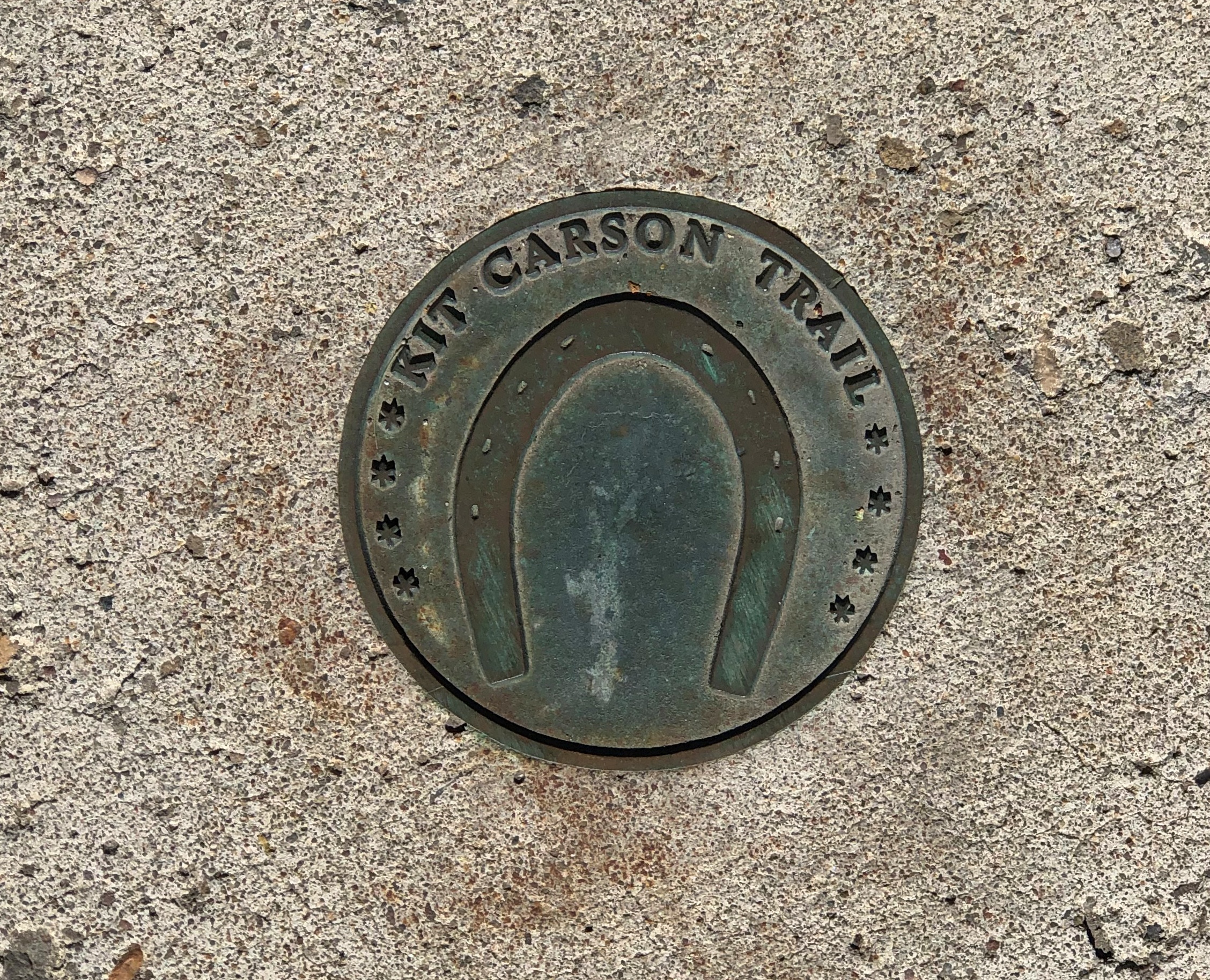
Carson City, Nevada

Underfoot in Reno.Reno, Nevada

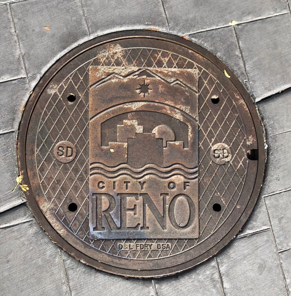
On the road to Virginia City.Gold Canyon, Nevada

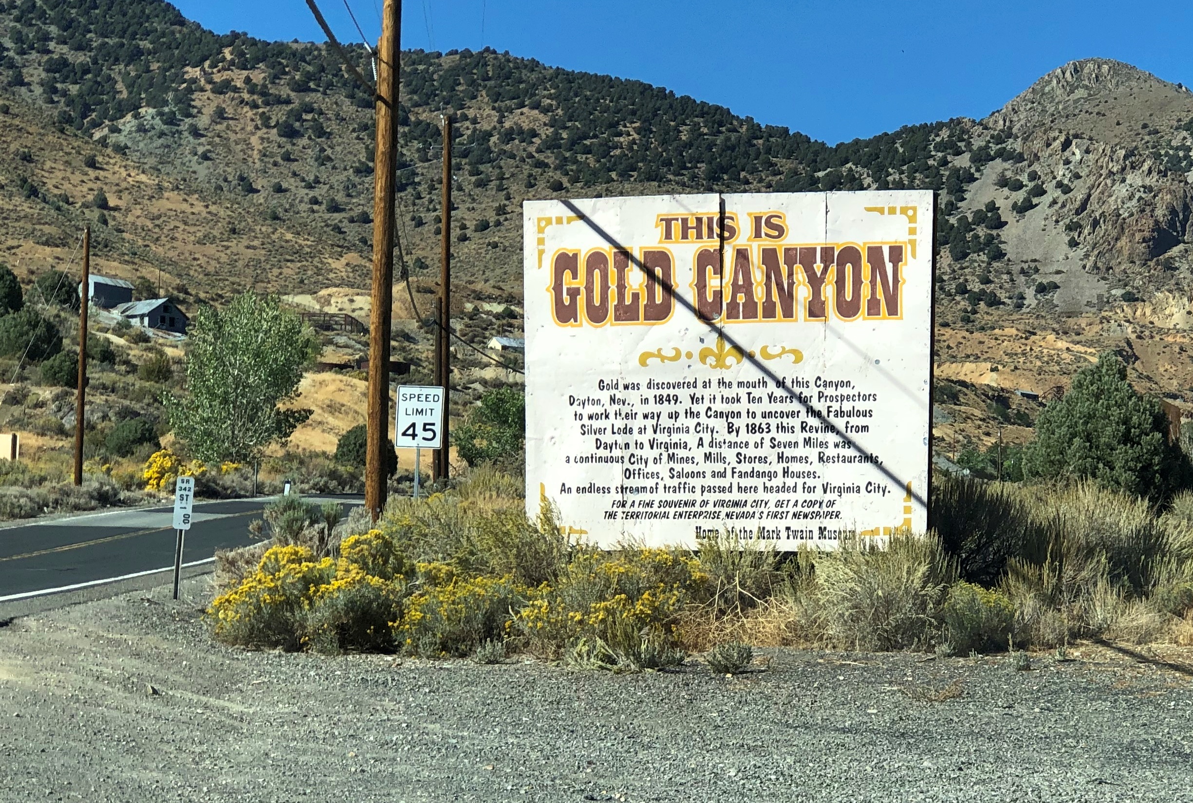
The drive out from Virginia City to I-580 is along Nevada 341, and it’s a winding drop of a drive through arid landforms. This snip from Google maps illustrates the winding-est part of the road, called Geiger Grade Road at that point. The entire drop is from more than 6,100 feet above sea level at Virginia City to Reno’s 4,500 feet.

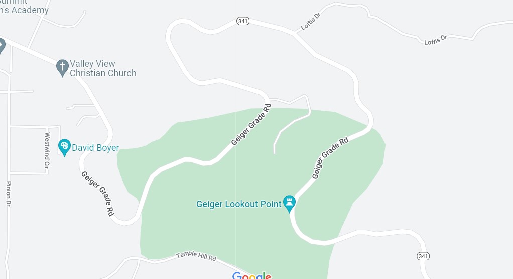
Light traffic on a sunny weekday afternoon. A fine drive if you’re paying attention. Almost car commercial driving.

This instead of a real map.Donner Memorial State Historic Park

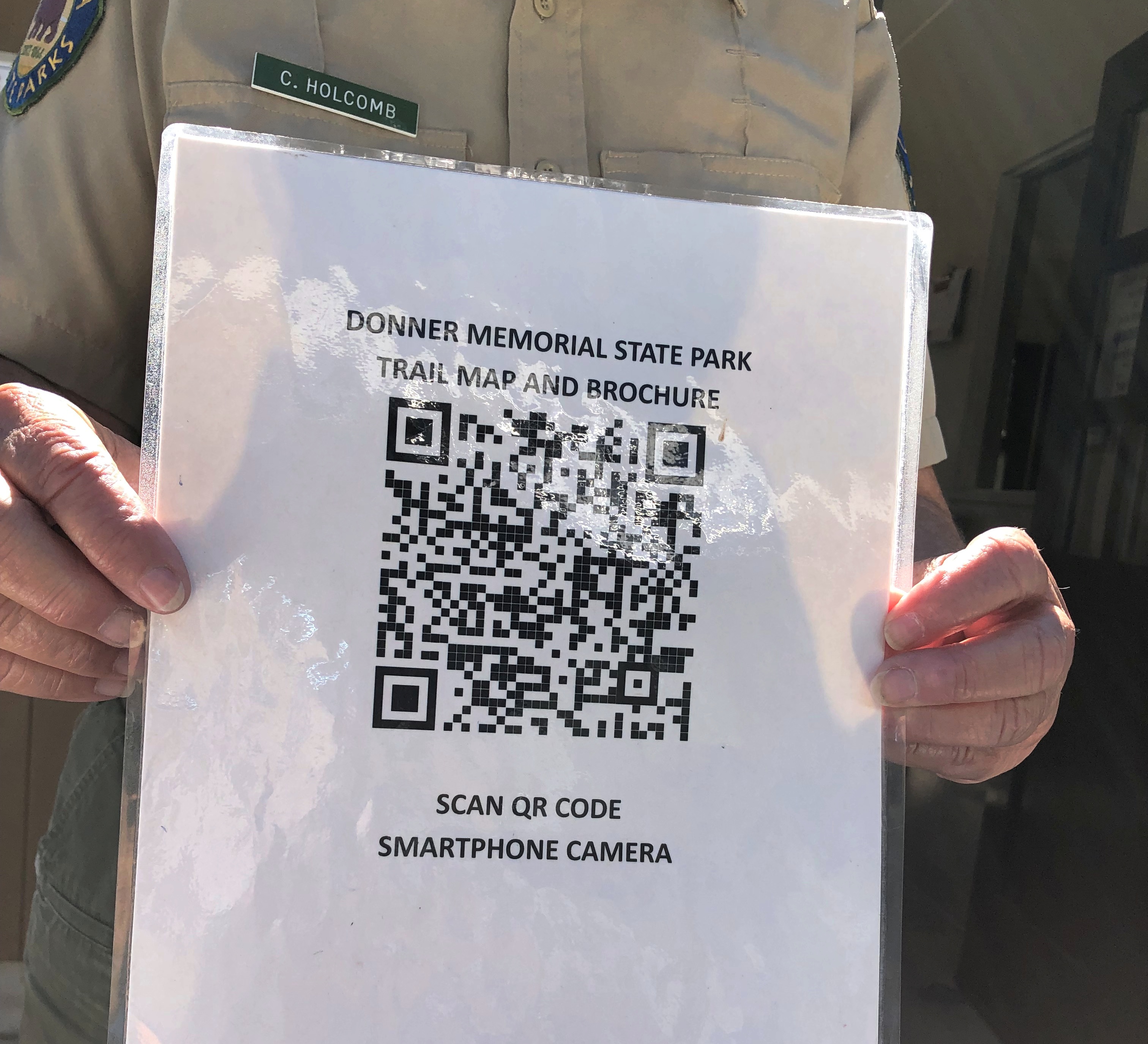
No, California. Don’t do this. It’s false economy. I don’t know how, I just know that it is.

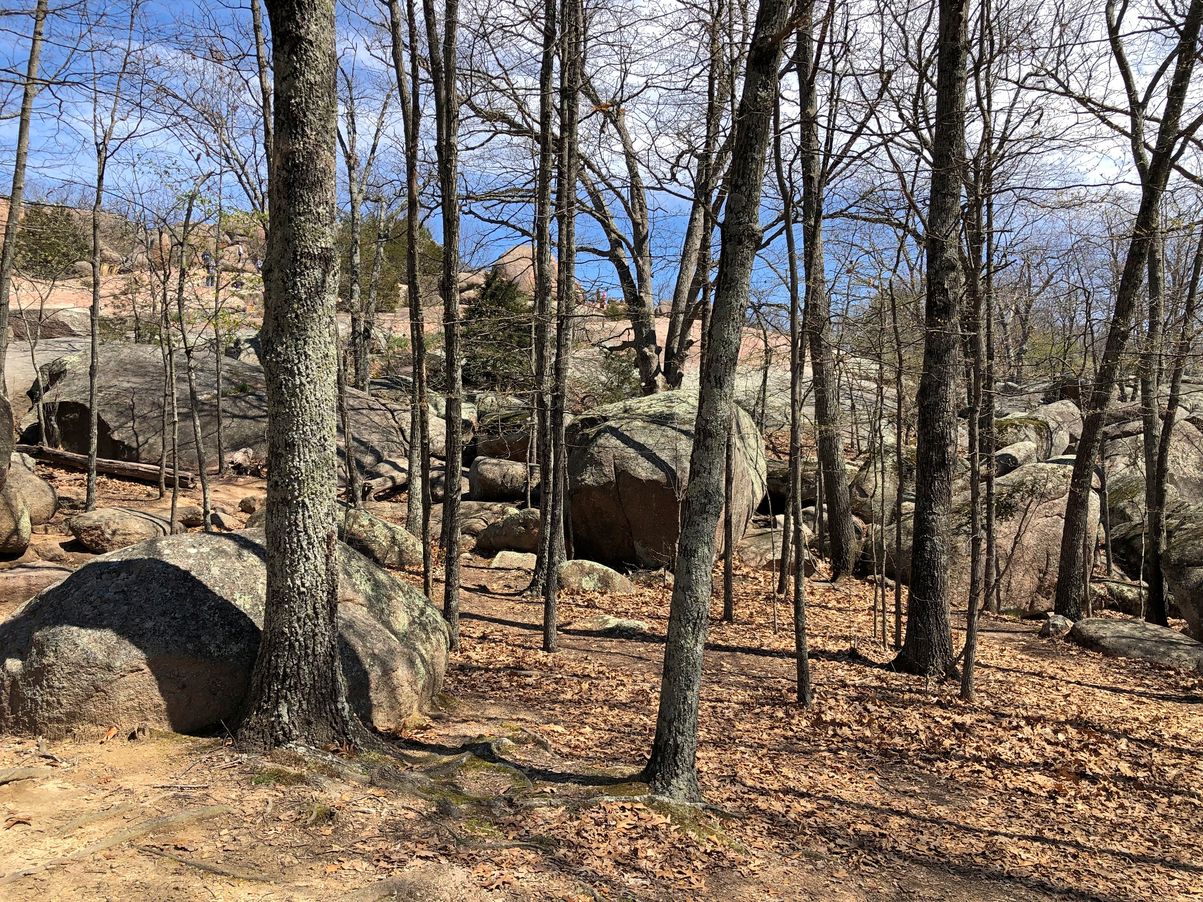
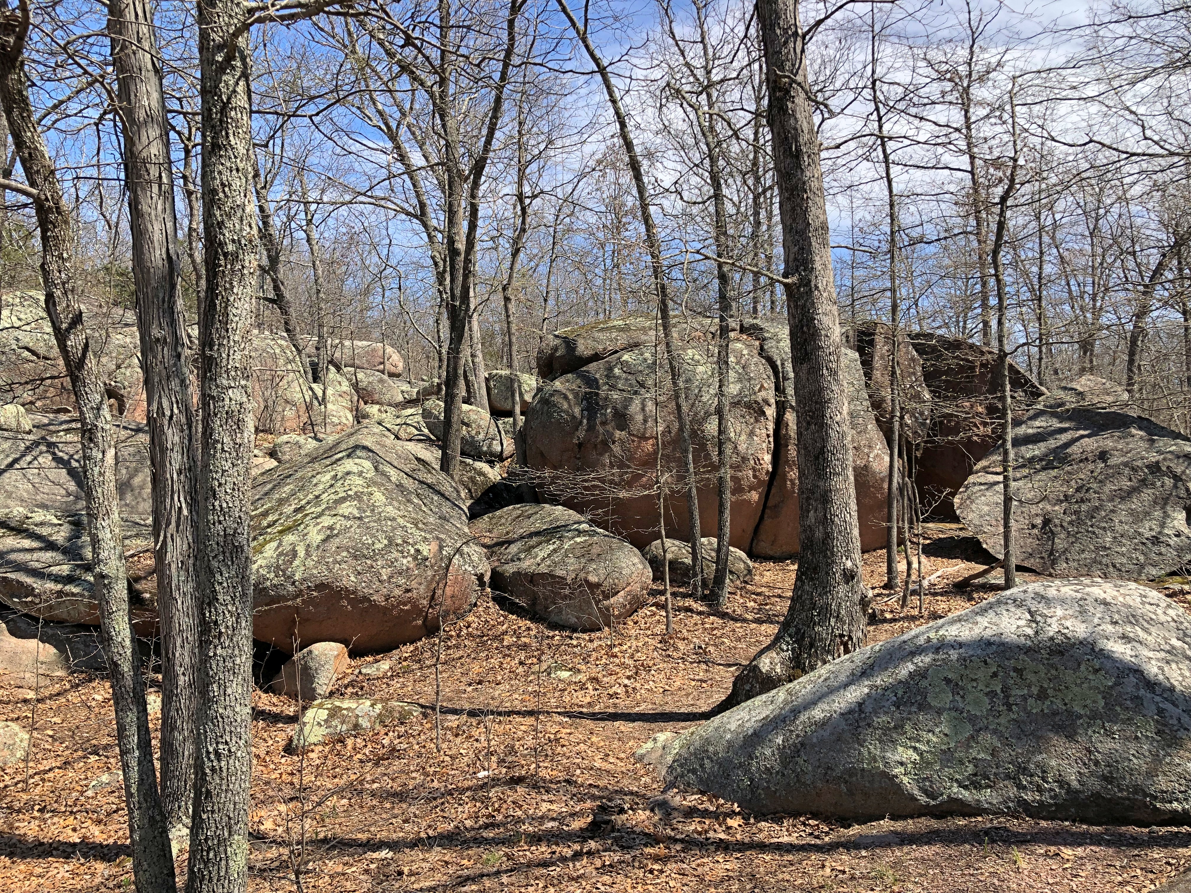
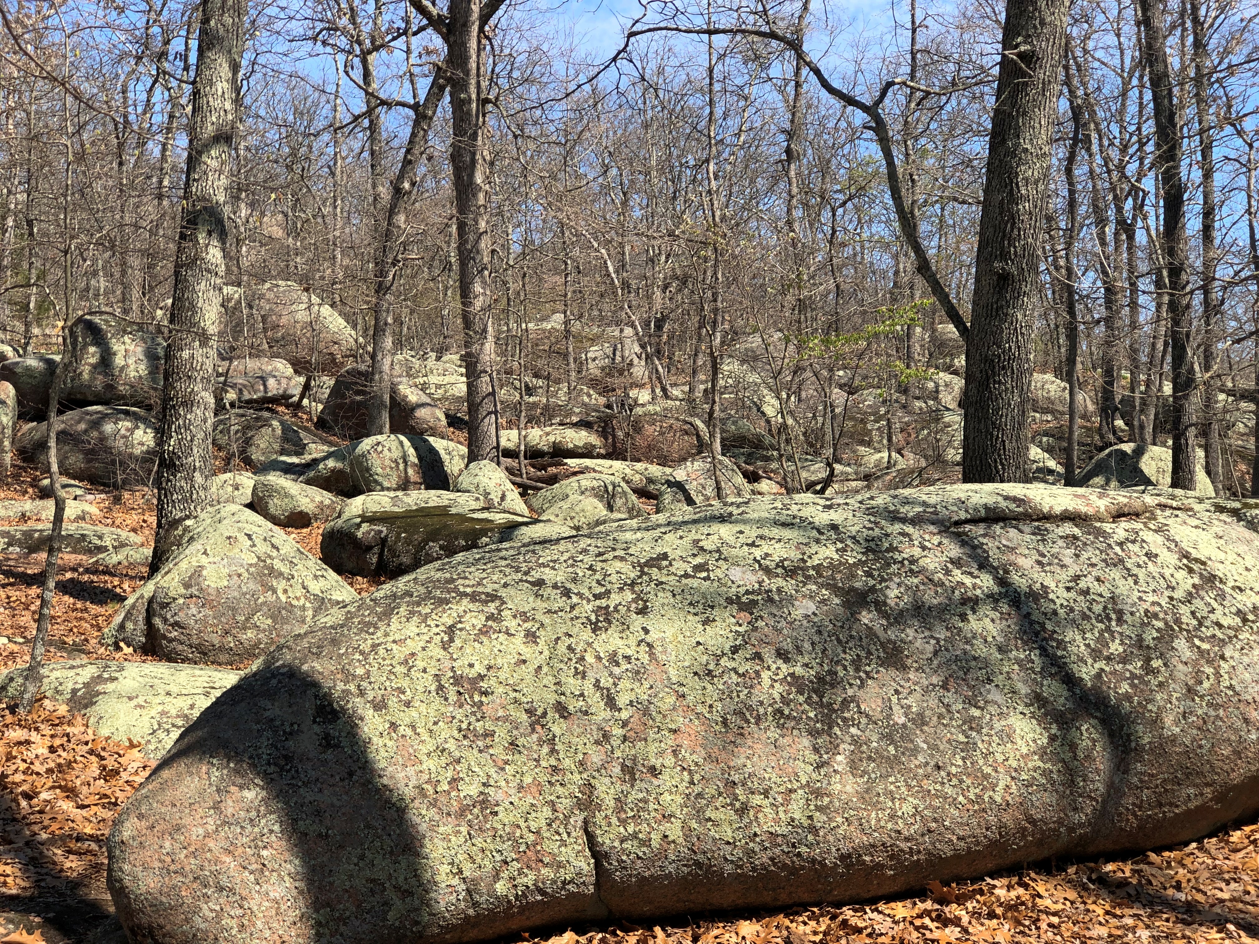
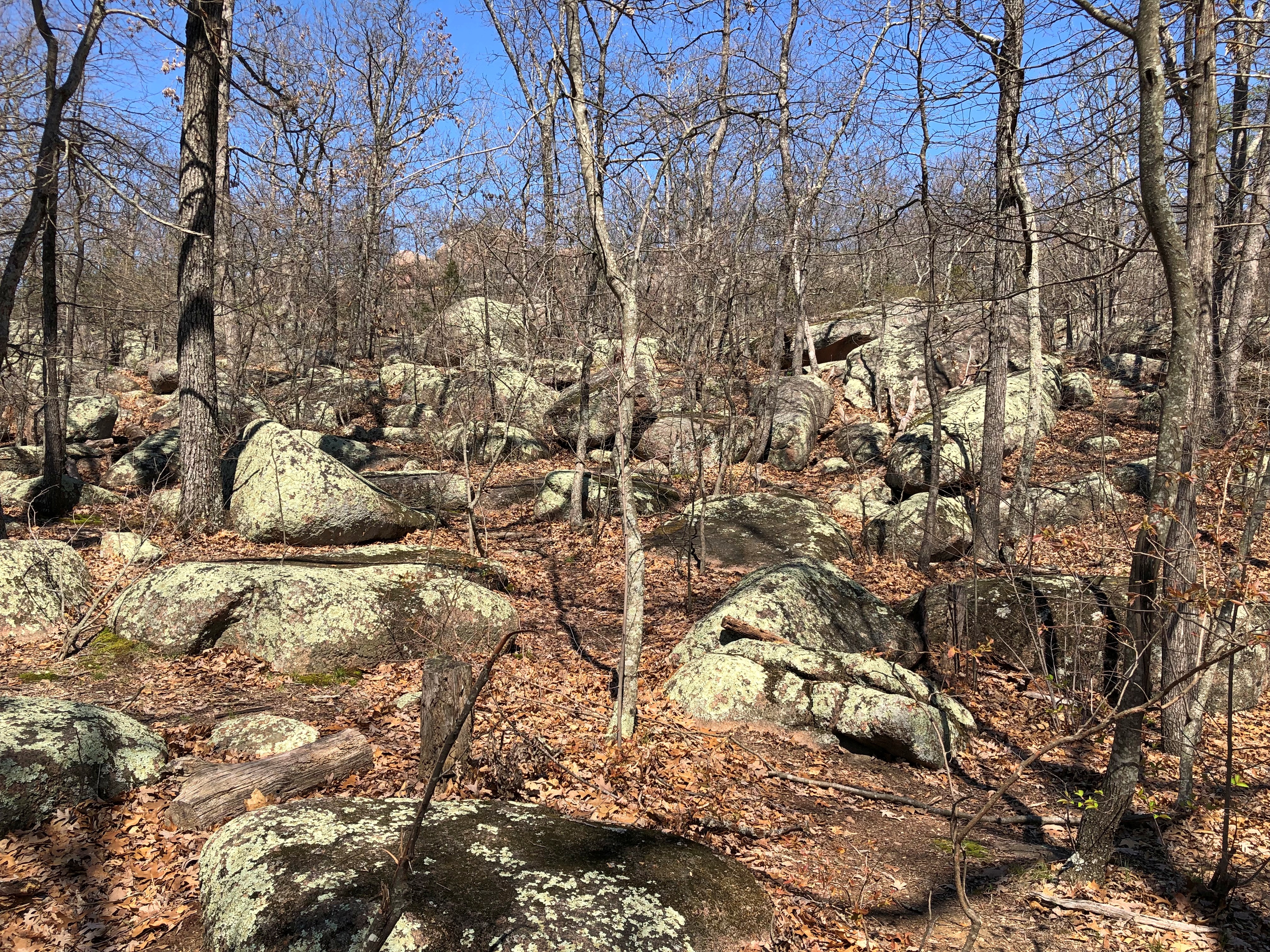
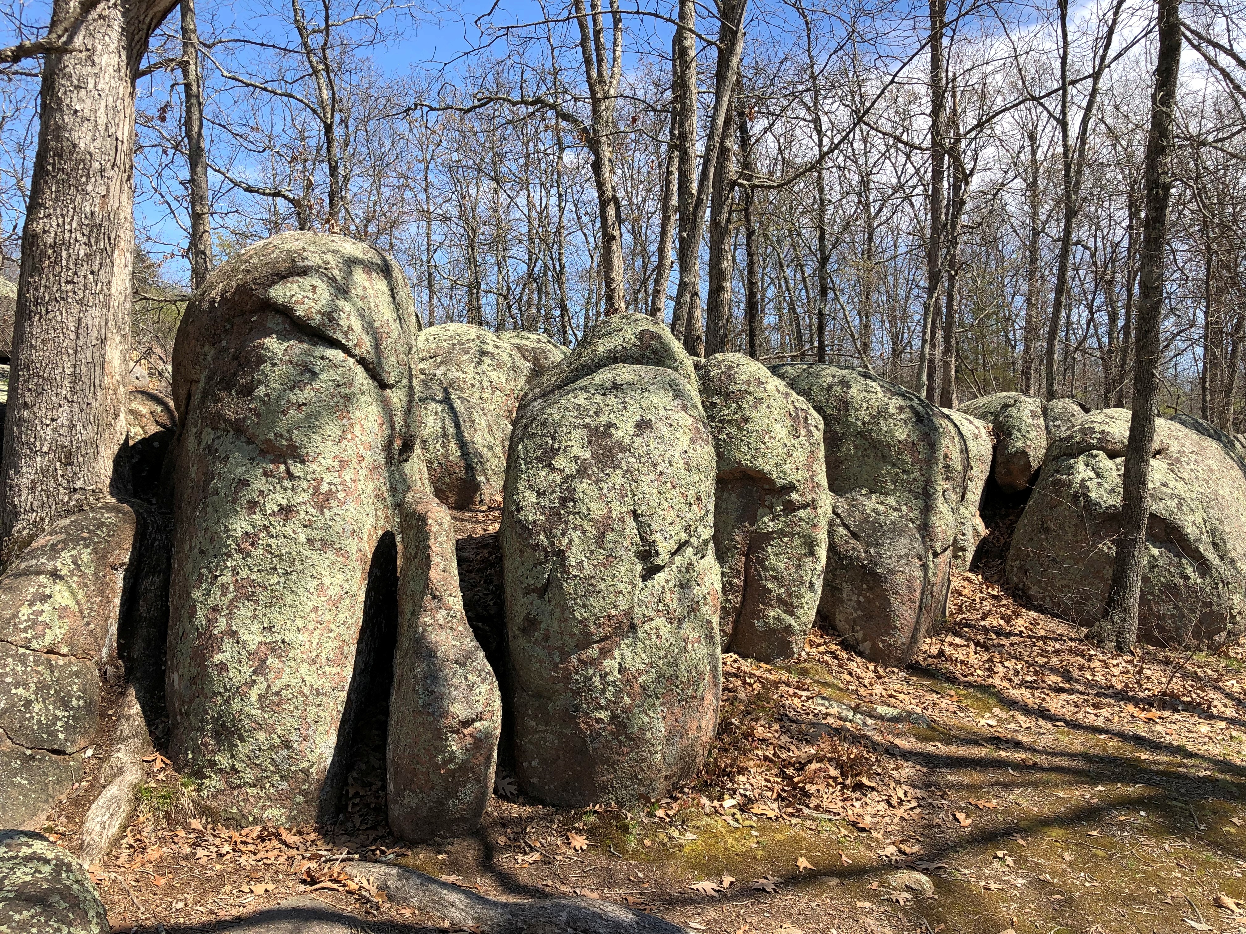
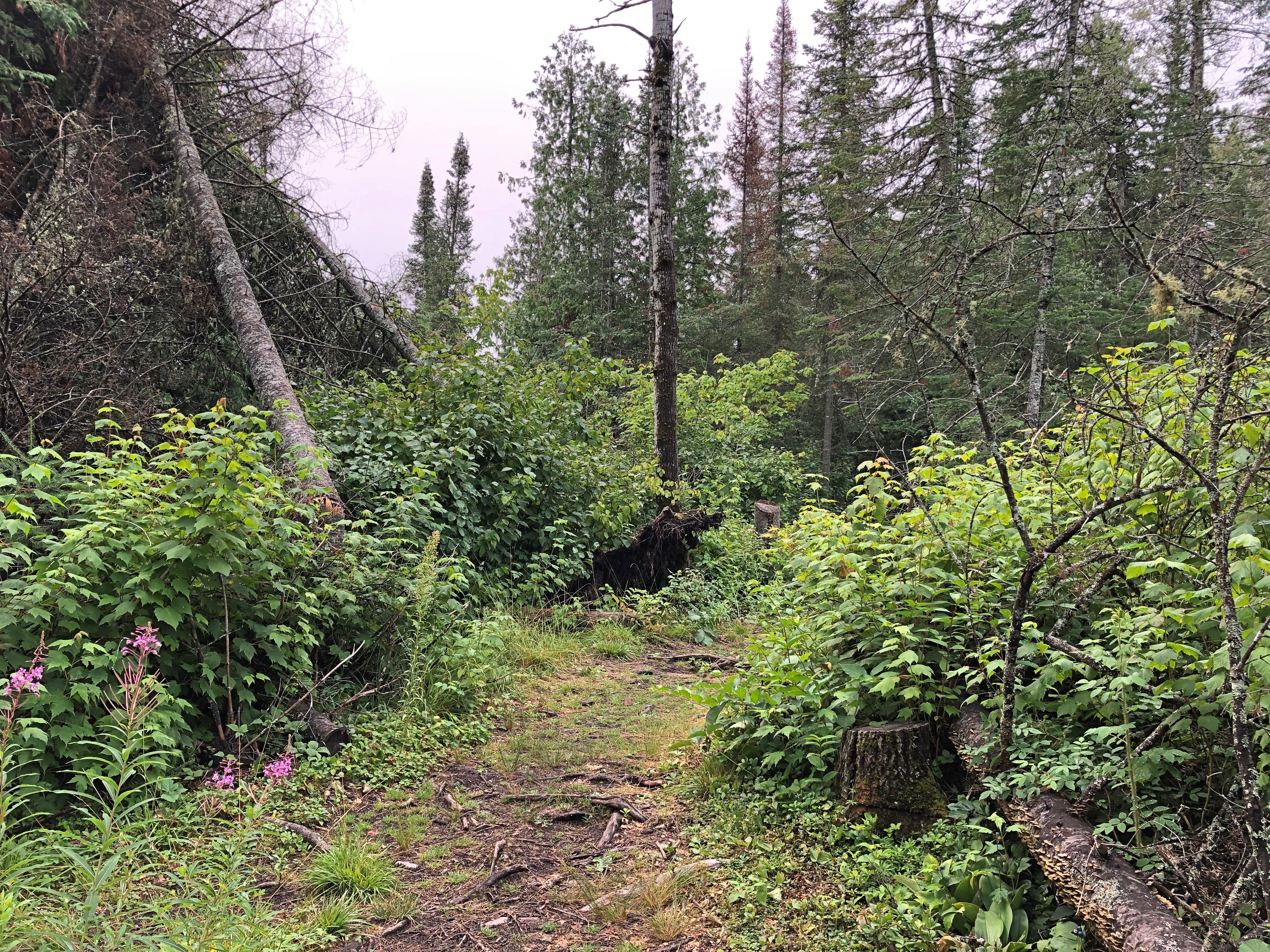
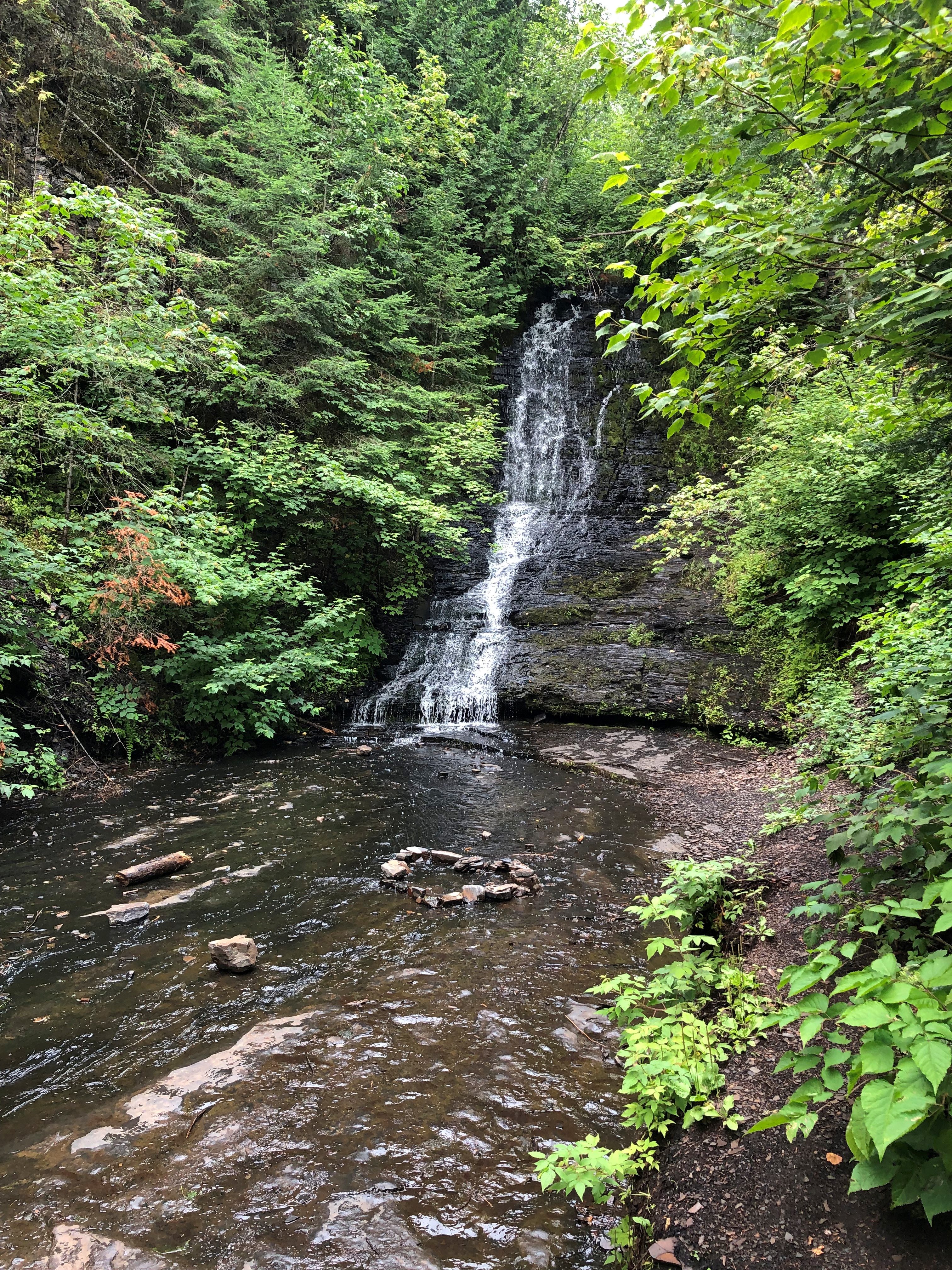
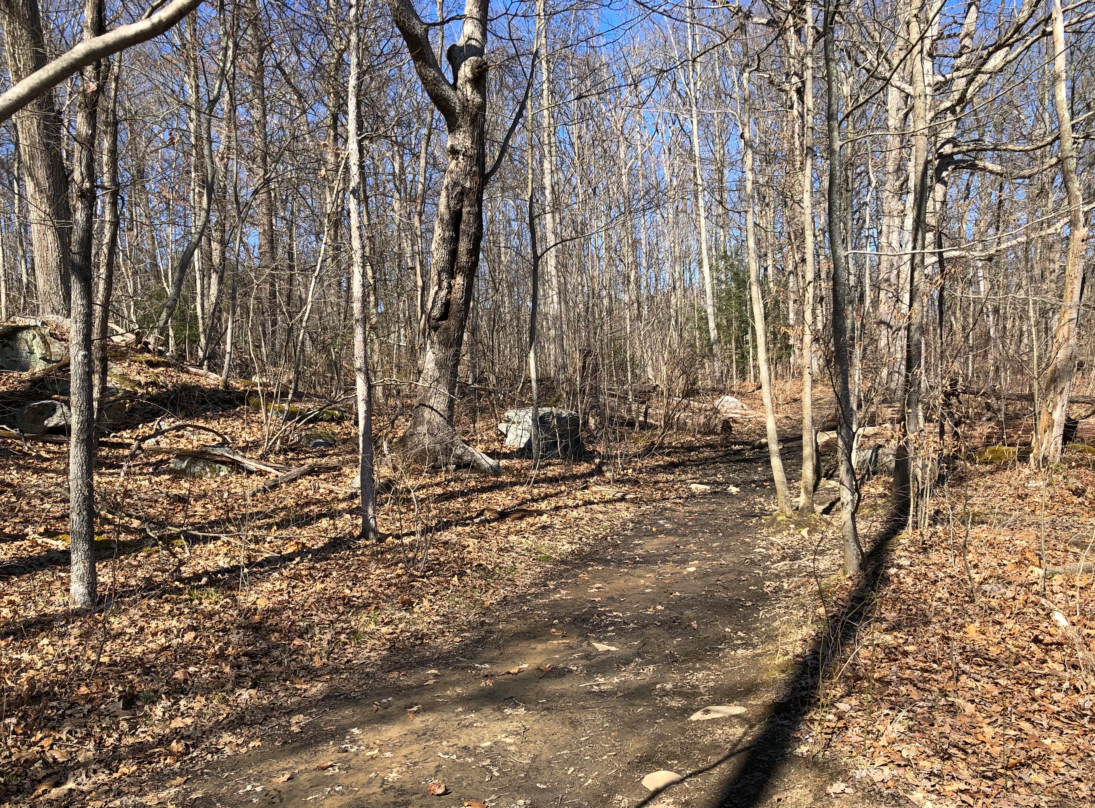
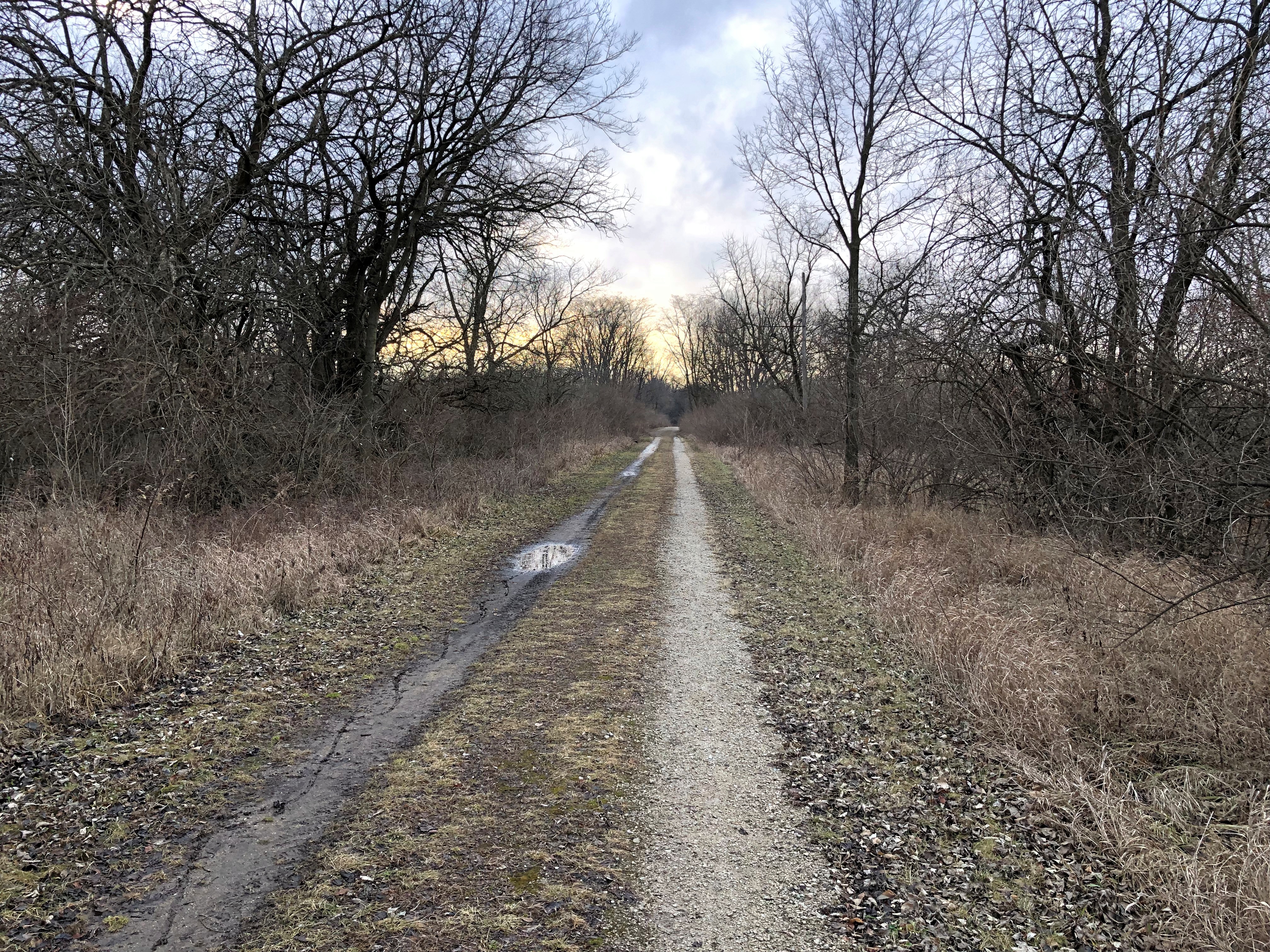
I figured out my way around without a gizmo map. I even found a spot a few hundred yards from a parking lot, and a little off a nearby trail, where I could sit in the sun for a few minutes, and listen to only faint sounds. Almost as quiet as Joshua Tree or Big Bend NPs.Donner Memorial State Park

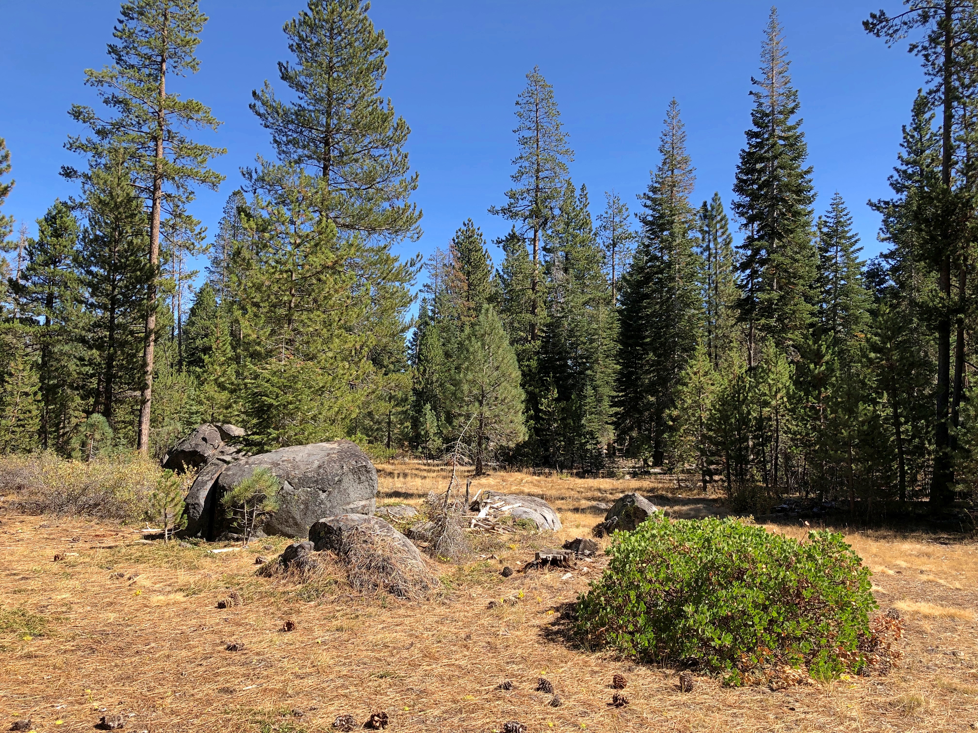
The Hotel Charlotte in Groveland, California. Now a hundred years old, it’s the kind of place that gives you a brass key, and lets you know there’s a fee for replacing it. Basic and comfortable, though the most expensive place I stayed on this trip; you’re really paying for near access to Yosemite NP.Groveland, California

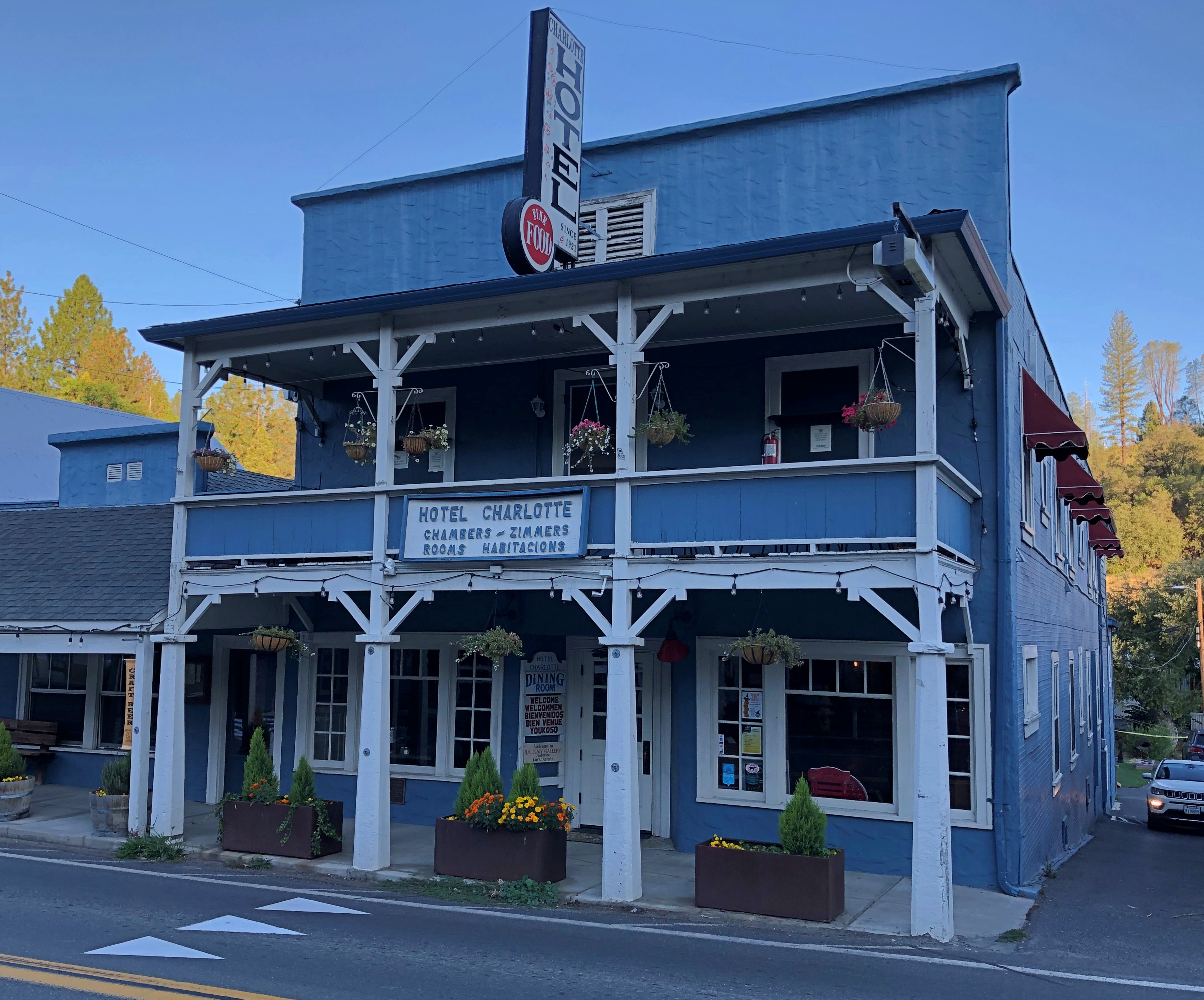
Main Street in Groveland (California 120), just after dawn.Groveland, California

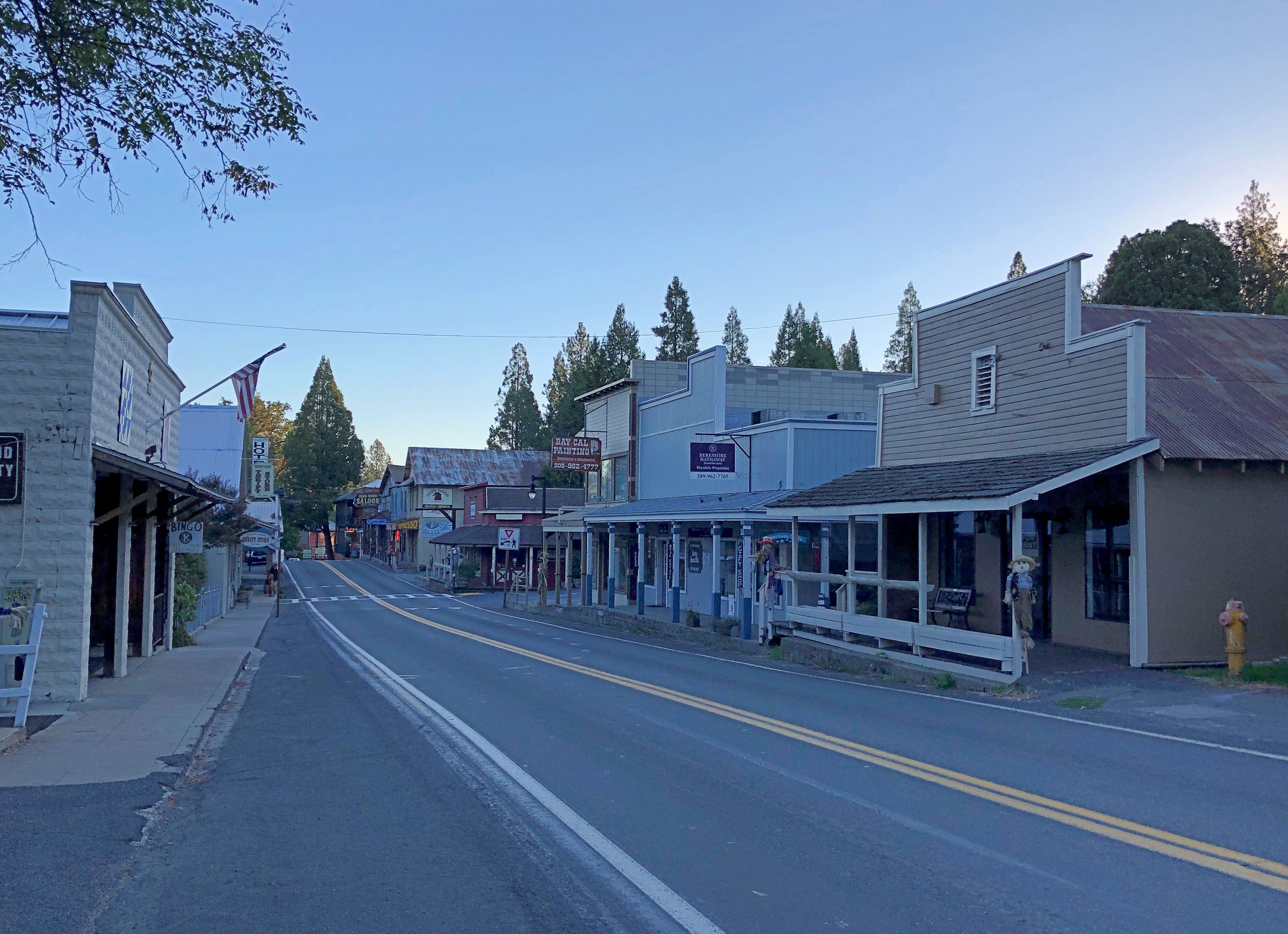
A few more images. Such as in Sacramento.lumpia truck Sacramento

I had to look up lumpia: spring rolls found in the Philippines and Indonesia. And northern California, it seems. Too bad I wasn’t hungry. Also, it was closed. Not long after, I saw a Balinese restaurant in Old Sacramento. Still wasn’t hungry. Damn.

I was driving to the last place I was going to stay in Sacramento on the late afternoon of October 7, and I got a little turned around, wandering some neighborhood streets before the inevitable moment when I pulled over to consult Google Maps.

I chanced on this place.McKinley Rose Garden, Sacramento

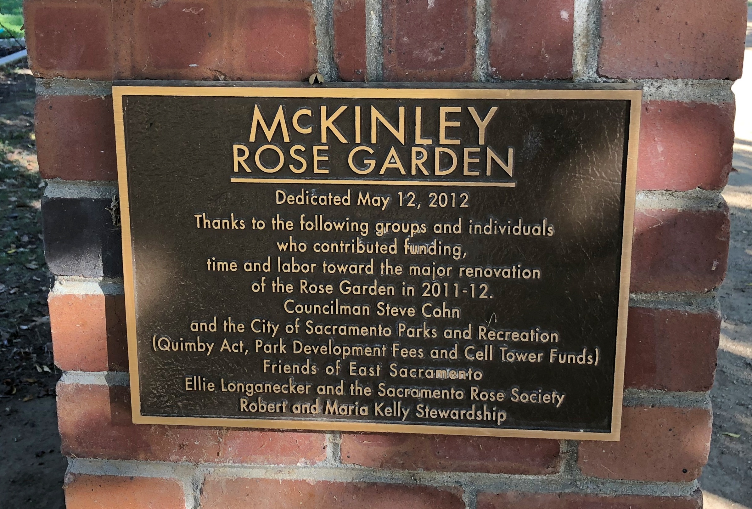
What a garden it is.McKinley Rose Garden, Sacramento McKinley Rose Garden, Sacramento McKinley Rose Garden, Sacramento

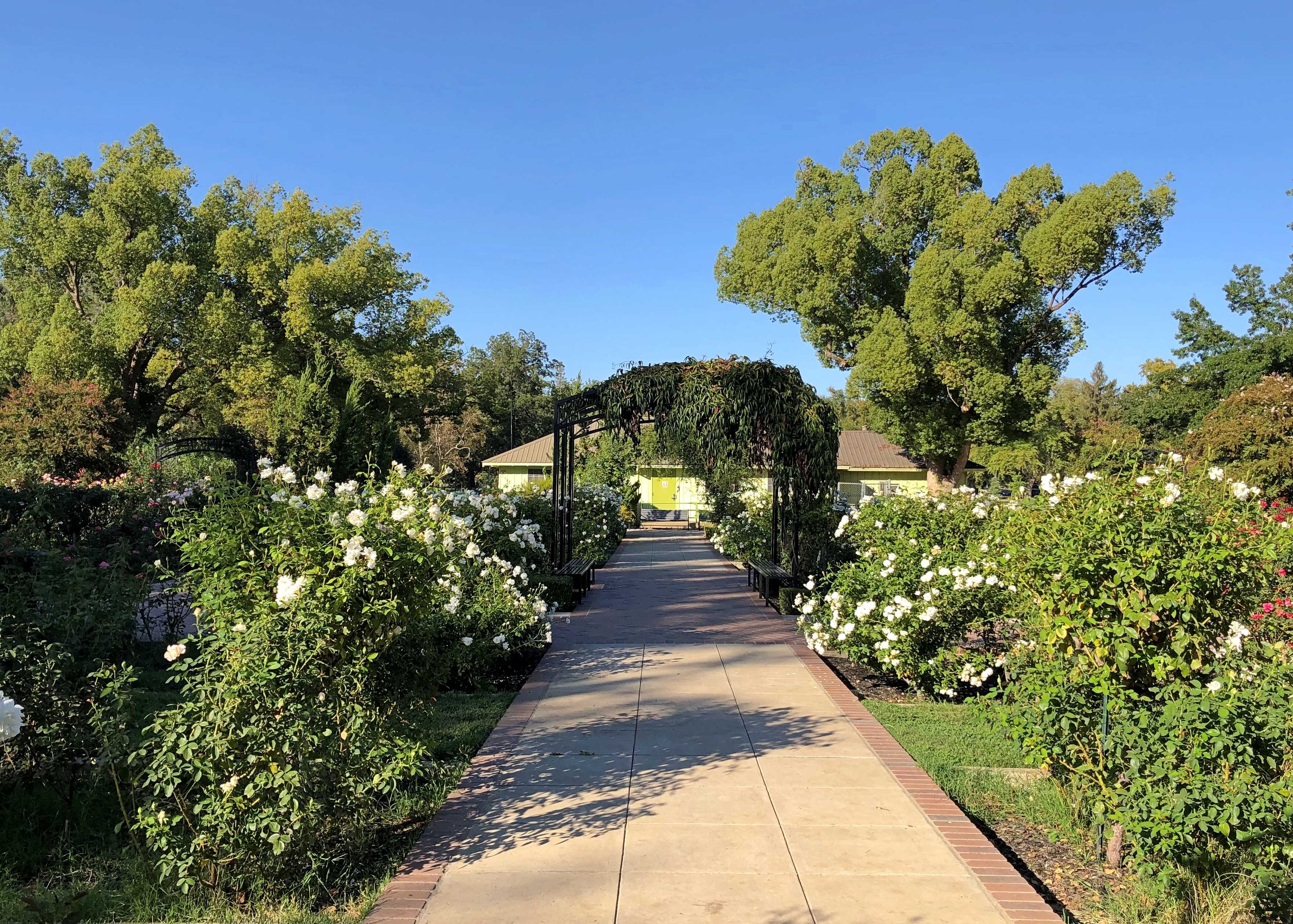
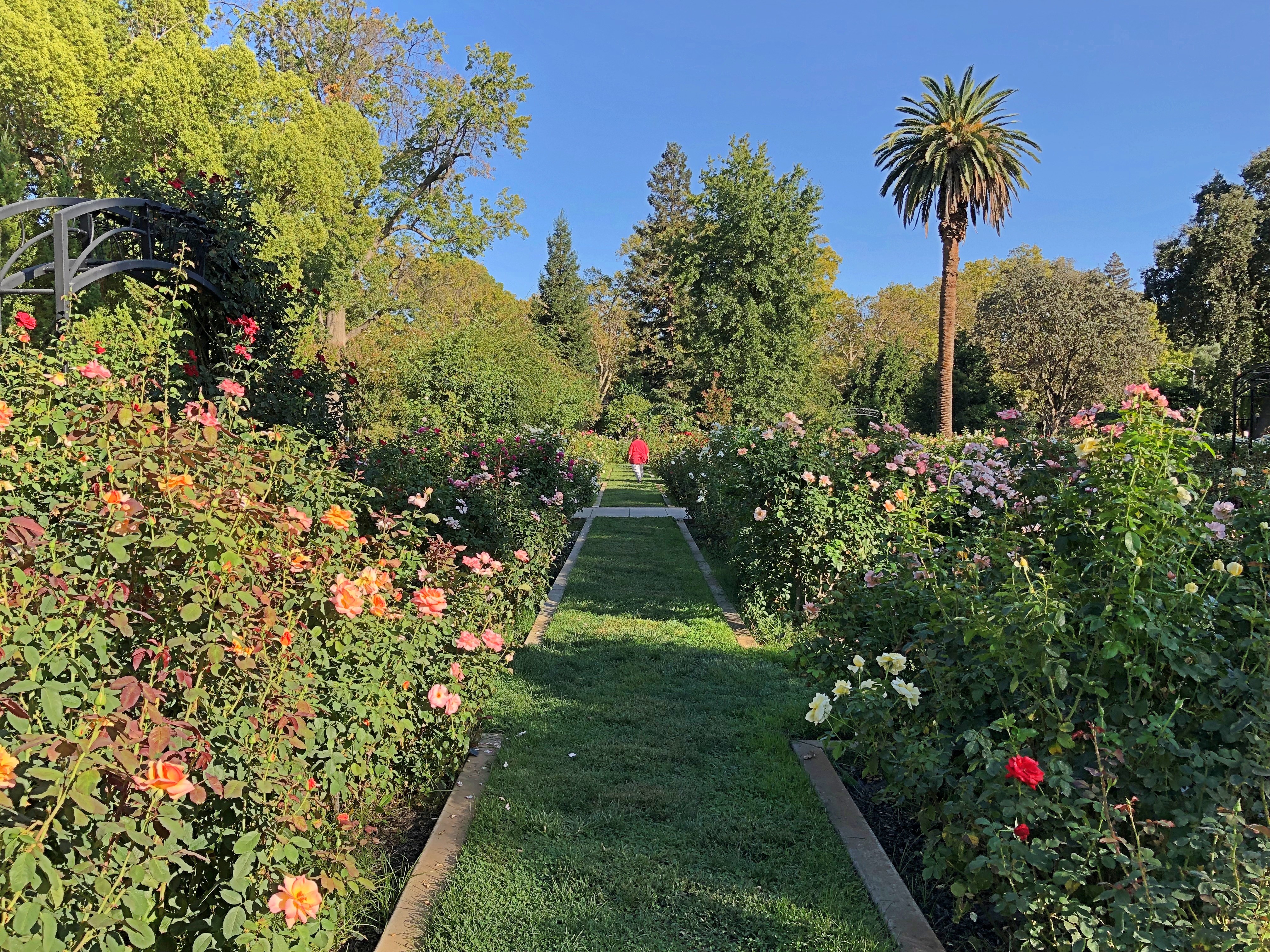
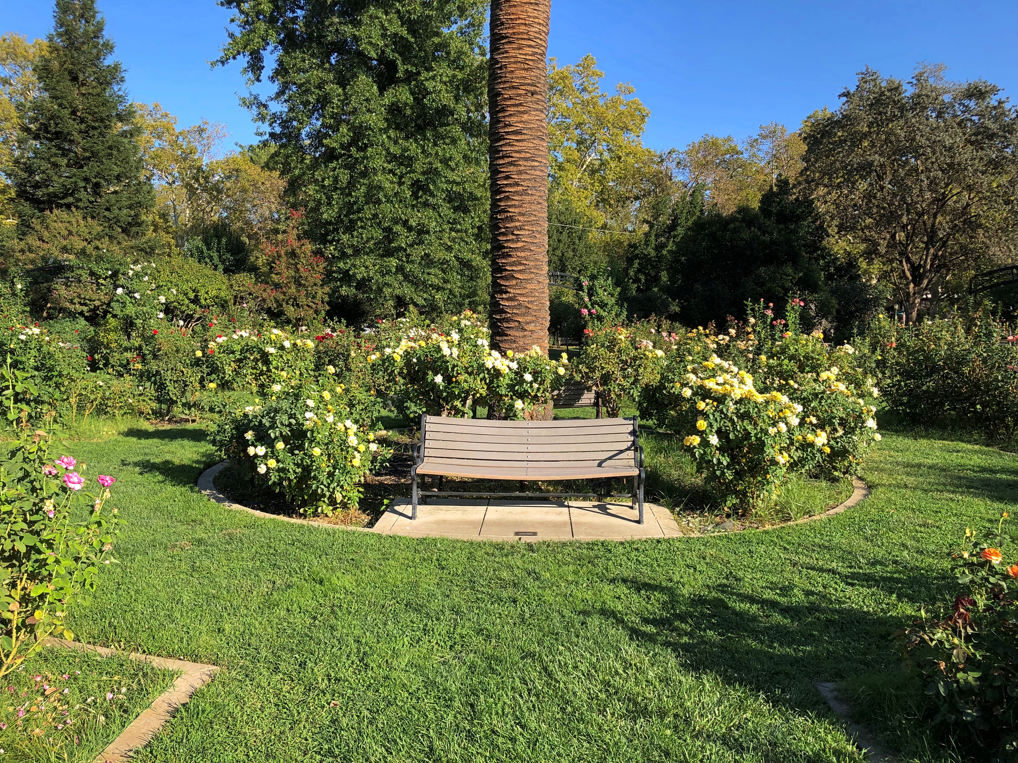
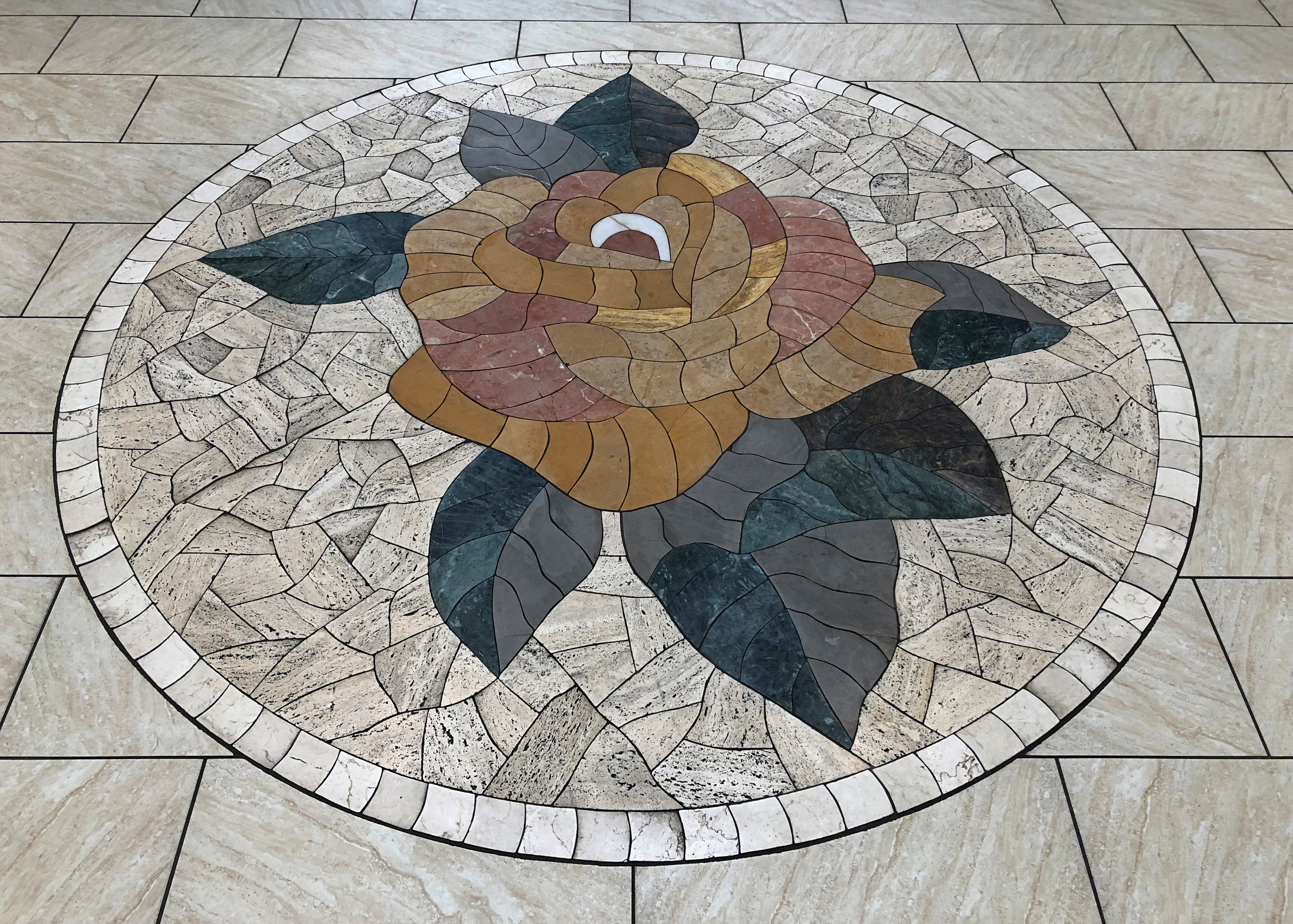
An extravaganza of roses.McKinley Rose Garden, Sacramento McKinley Rose Garden, Sacramento McKinley Rose Garden, Sacramento

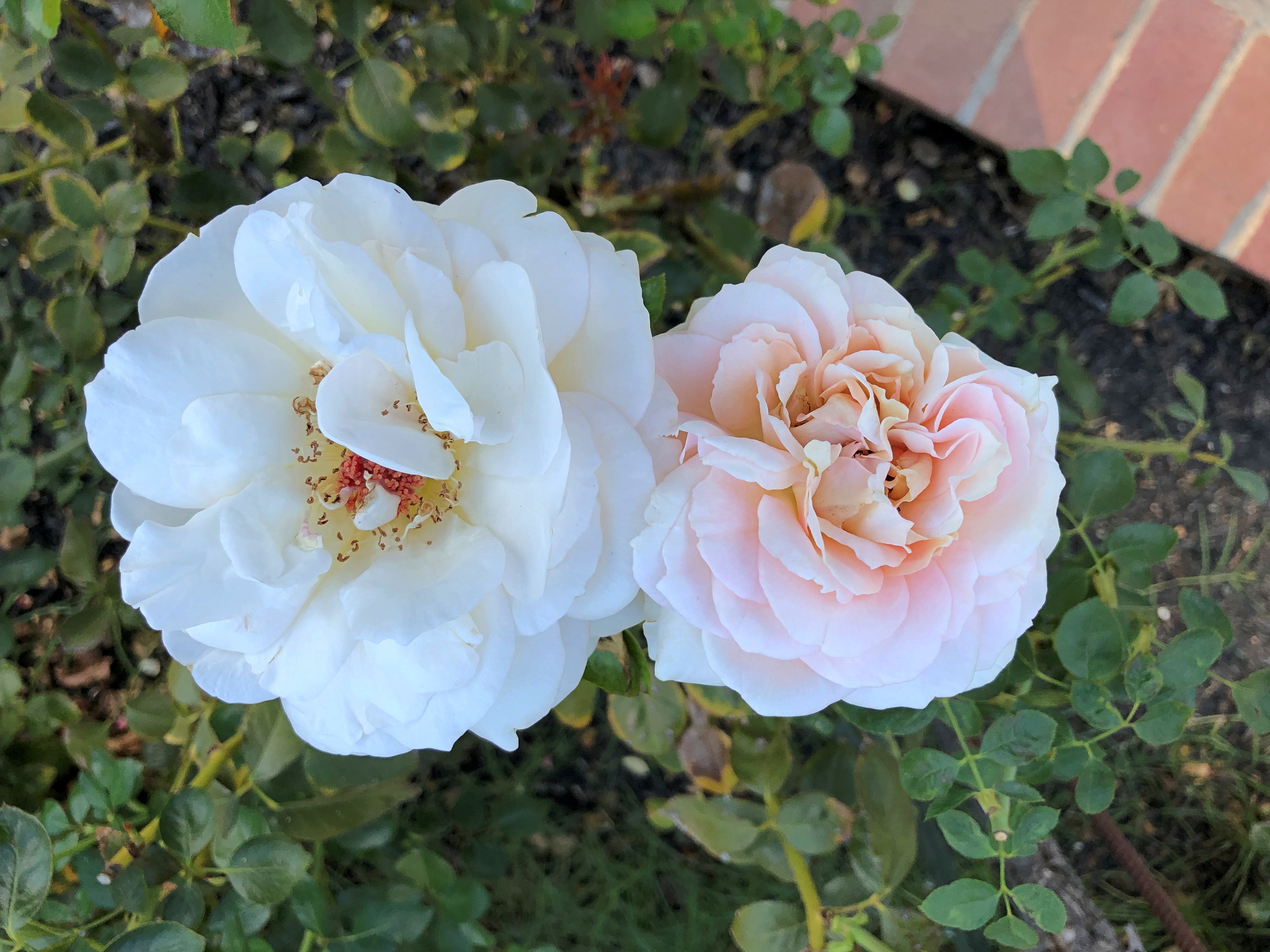
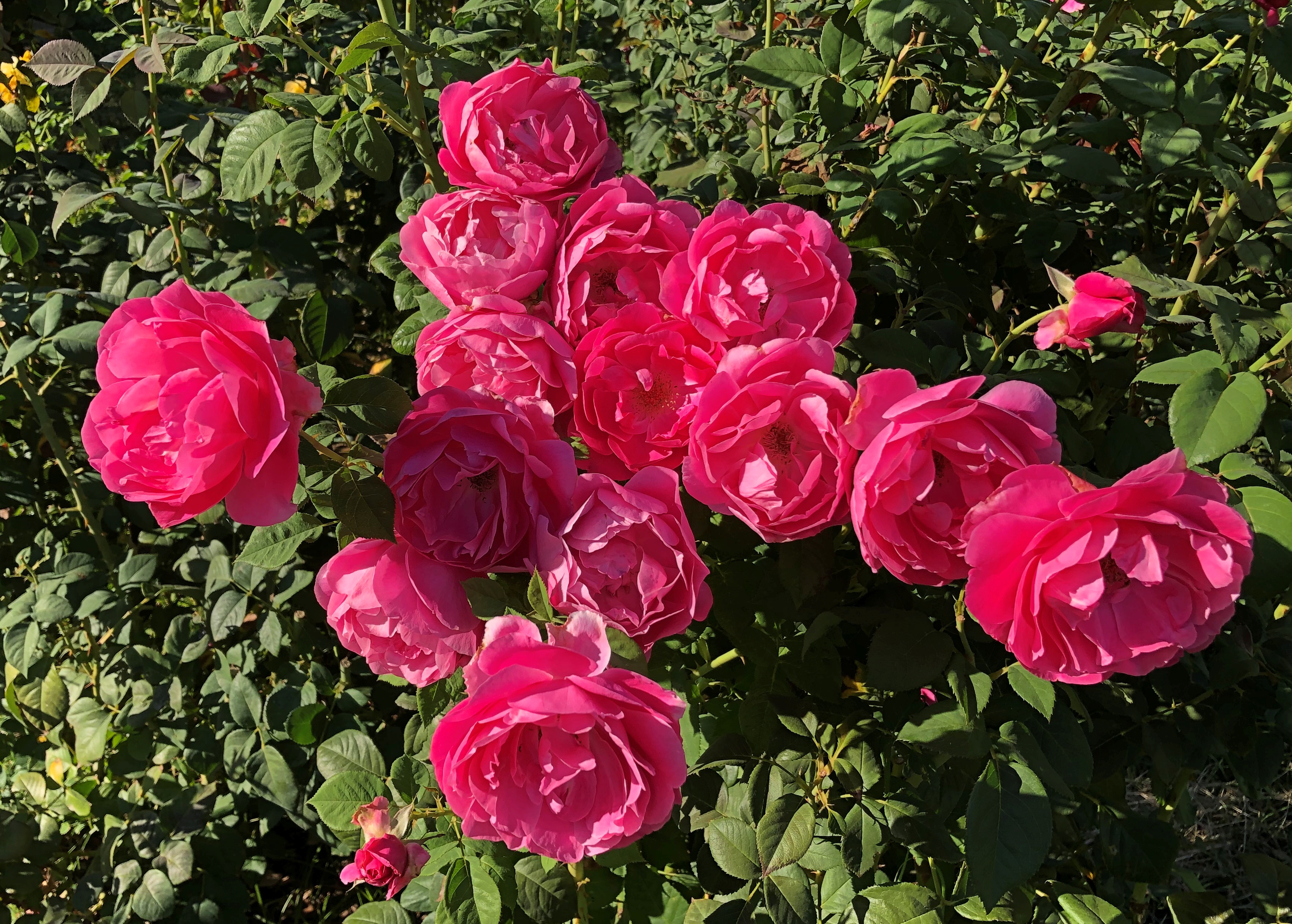
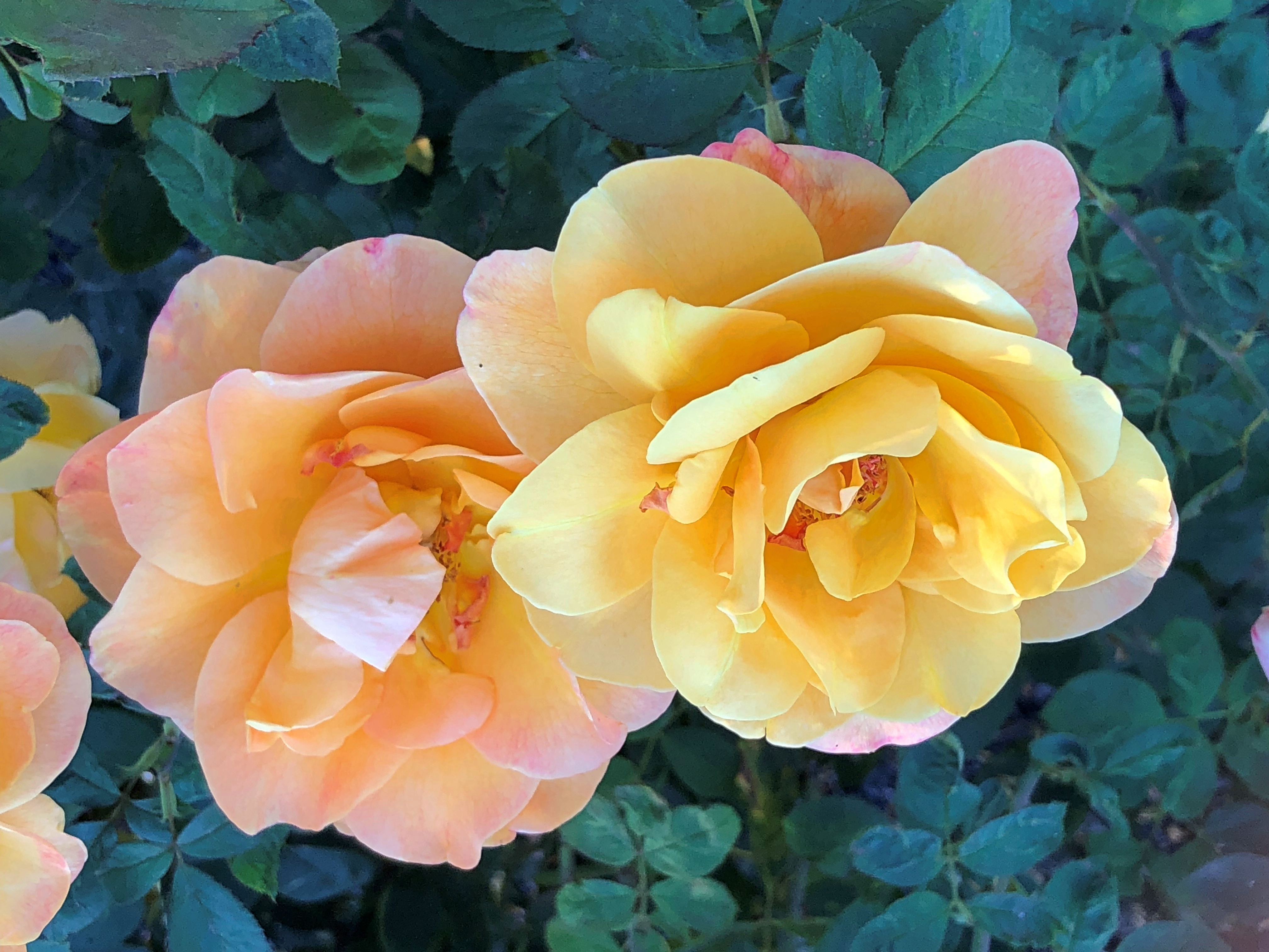
Go in the garden and ask the rose its meaning.

Donner Memorial State Park

Crossing the Sierra Nevada near the Donner Pass is fairly easy in our time, if you have a motorized vehicle, as I did earlier this month when I drove from Reno back to Sacramento. I-80 takes you right across.

Unless, of course, traffic is heavy enough to come to a standstill. Then you might have time to take pictures.I-80 near Truckee, California

Still, you’ll face nothing like the impediments that the Donner Party encountered in the winter of 1846-1847. Their story is well known; accounts of desperate days and cannibalism have a way of piquing people’s interest.

The Donner Party’s agony is, in fact, much better known than (say) the journey of the Stephens-Townsend-Murphy Party, led by mountain man Caleb Greenwood, who in 1844 were the first successful wagon train to cross the pass. They didn’t have an easy time of it, but they made it.

I didn’t know about Donner Memorial State Park till I visited this part of the country, since I’d forgotten exactly where the Donner Party had encountered their ordeal. But when I saw the state park on the map, as well as everything else named for the Donners, I realized that it was here.

The park is just off I-80 not far west of the California-Nevada line. I resolved to go take a look.Donner Memorial State Park

As a memorial park, I expected a memorial. This one isn’t far from the entrance.Donner Memorial State Park Donner Memorial State Park

One of its plaques notes that the height of the memorial’s plinth is 22 feet — which was the depth of the snow that trapped the wagon train.Donner Memorial State Park

That isn’t the only plaque in the park honoring the Donner Party. Along one of the park trails is another plaque listing all of the members. Those on the left two columns died that winter. Those on the right two columns survived.Donner Memorial State Park

Both memorials are the work of the Native Sons of the Golden West, installed even before the state park was established in 1928.

At nearly 3,300 acres, the park is much more than the memorials. I took advantage of some of the trails, passing through nice scenery.Donner Memorial State Park Donner Memorial State Park Donner Memorial State Park

Though not nearly as sizable as Lake Tahoe, Donner Lake is a fine alpine lake in its own right. Only a few people were around.Donner Lake Donner Lake Donner Lake

It was really pleasant at Donner Lake that day, October 4, clear and in the mid-70s Fahrenheit. Hard to image a late October day when the area was buried by snow, but they say the luckless Donner Party encountered an early snow that year. Then again, I just checked, and the evening temps in nearby Truckee are already dropping below freezing every day.