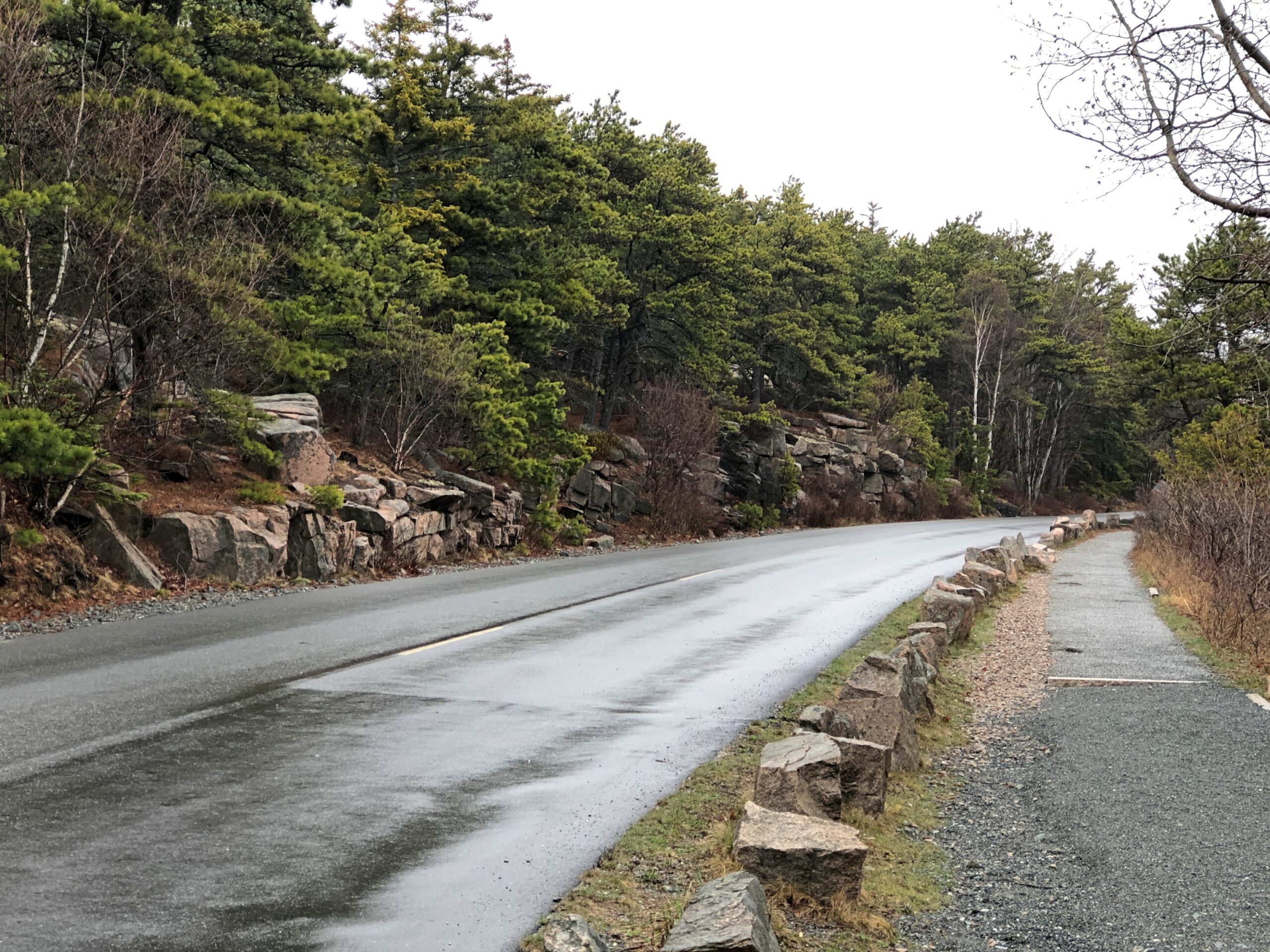
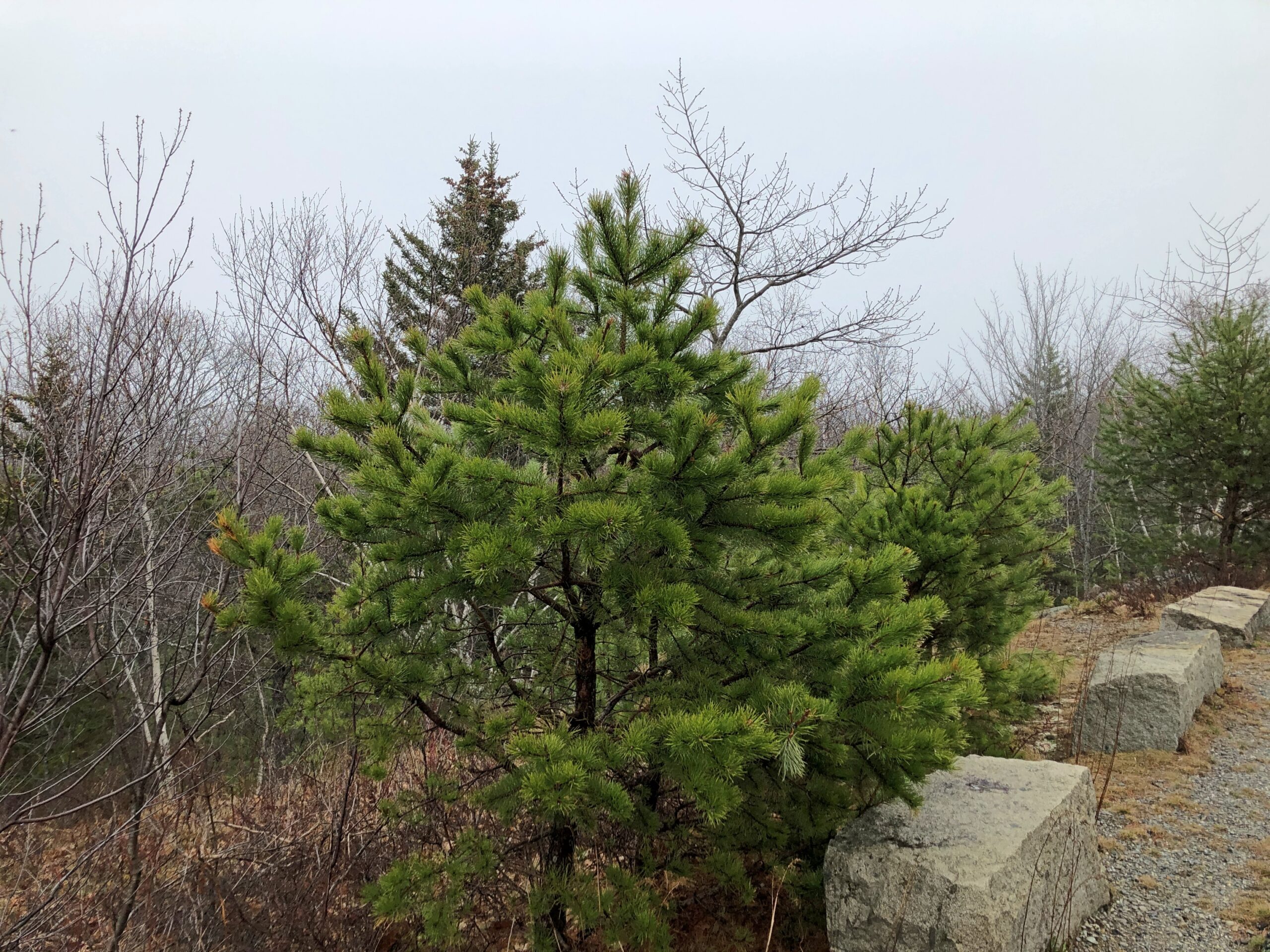
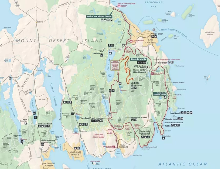
The Park Loop Road in Acadia NP is a fine drive (1) if there aren’t many other cars and (2) you take it easy around those curves. In that, it’s no different than a lot of rural roads. But there’s also the bonus of passing through thick Maine woods. There are brief views of the ocean from the road, but mostly you’re tooling through evergreens.
Through patches of deciduous trees as well.
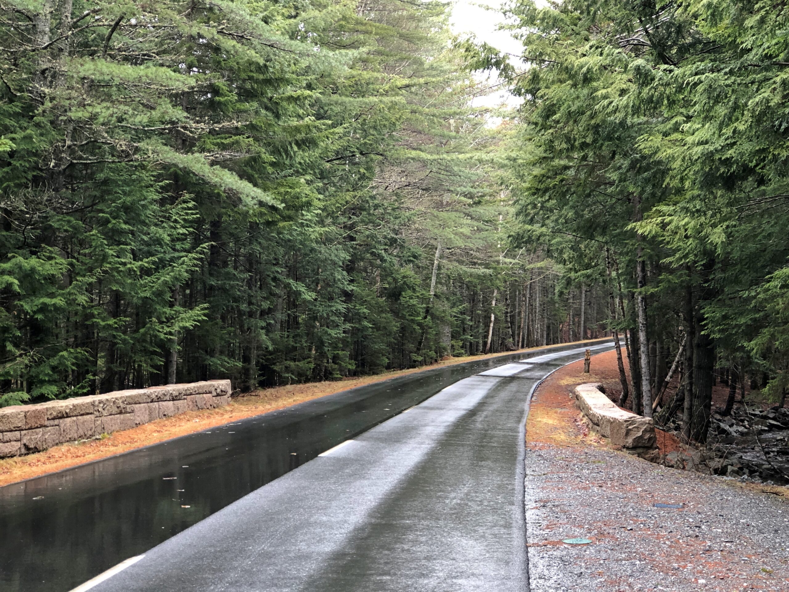
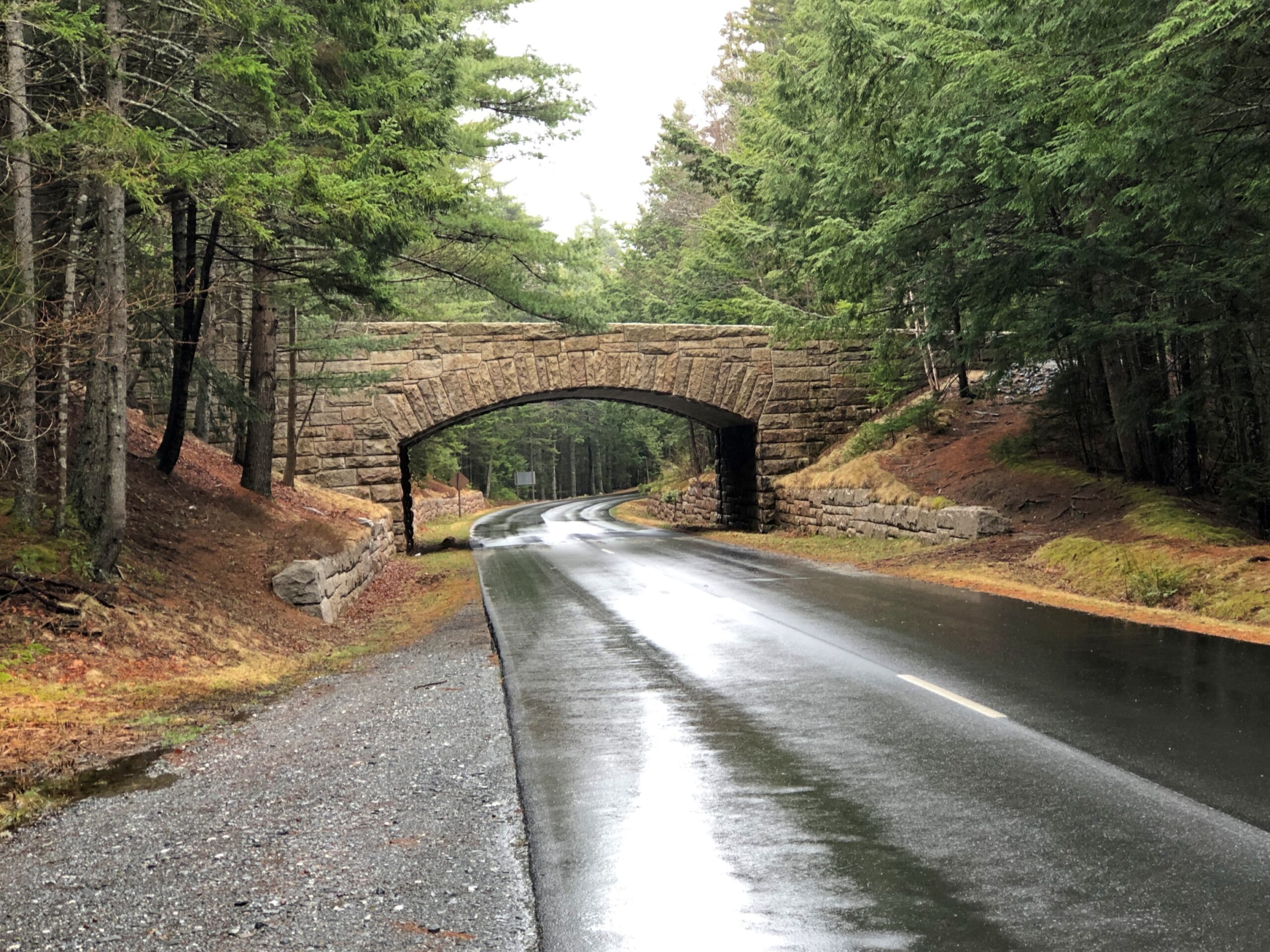
Periodically, the road crosses under handsome bridges.
This made me wonder: bridges for what? Soon I learned that the park not only has a hard-surface road snaking through, but also a network of carriage trails. A lot of them. The bridges are for them.
“Forty-five miles of rustic carriage roads, the gift of philanthropist John D. Rockefeller Jr. and family, weave around the mountains and valleys of Acadia National Park,” says the NPS. “Rockefeller, a skilled horseman, wanted to travel on motor-free byways via horse and carriage into the heart of Mount Desert Island. His construction efforts from 1913 to 1940 resulted in roads with sweeping vistas and close-up views of the landscape.”
It was barely the season for the paved road, and I suspect few visitors were on the carriage roads either. I noticed that the entrance to the Wildwood Stables, a facility that supports carriage riding, and which can be glimpsed from the road, was still closed. A carriage ride through Arcadia NP might be an grand experience, but maybe not in April.
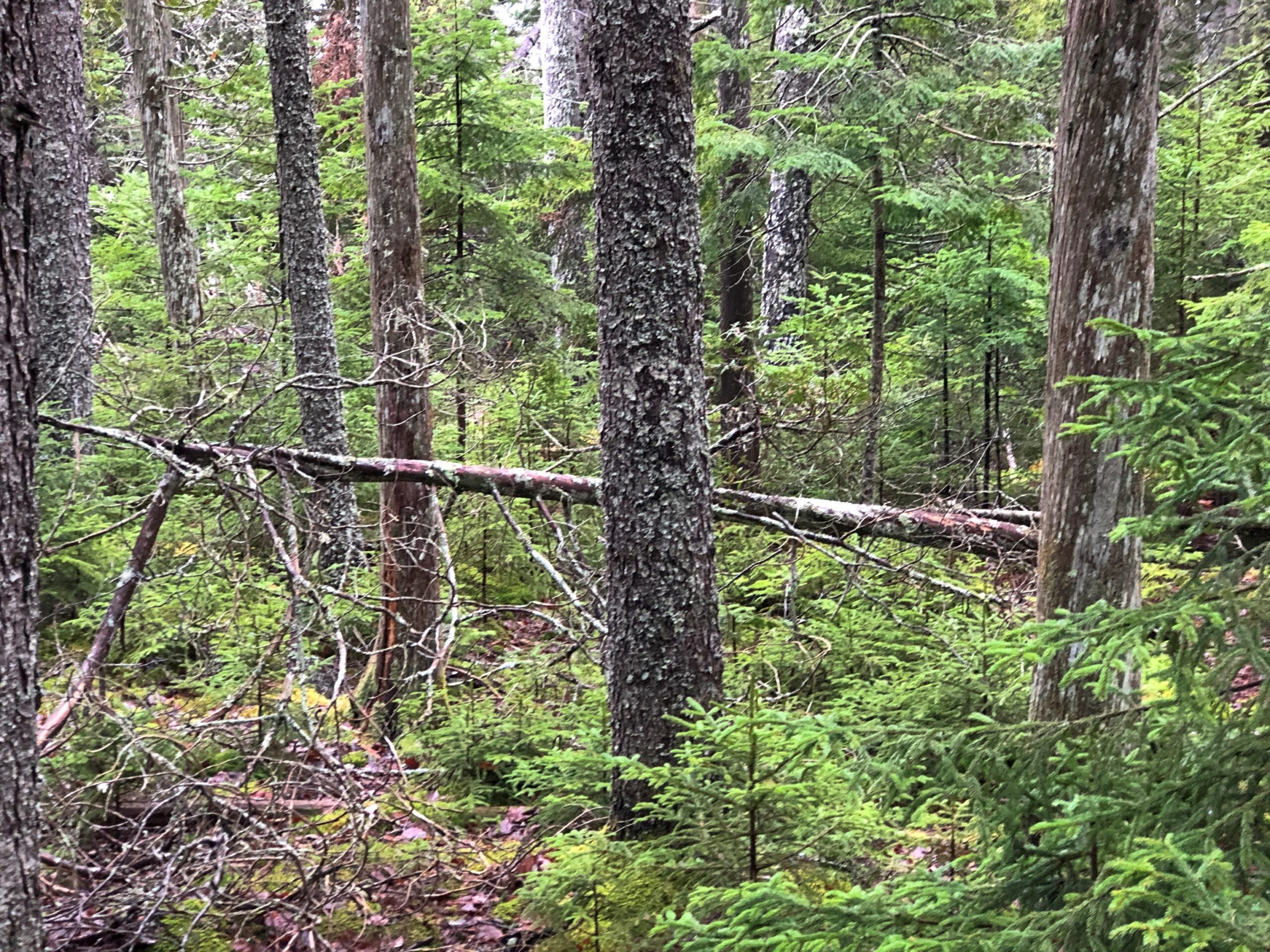
The woods alongside the road.
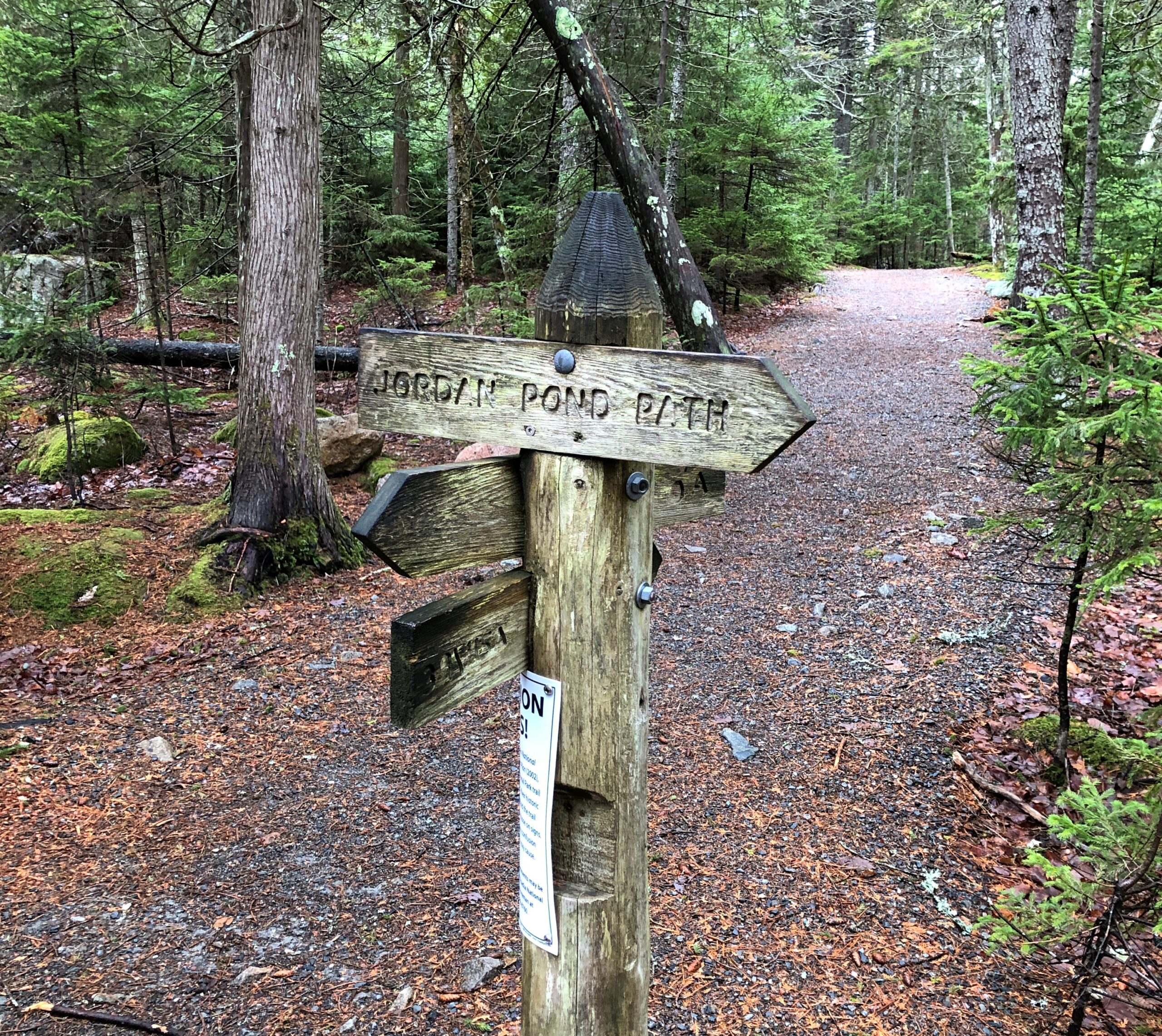
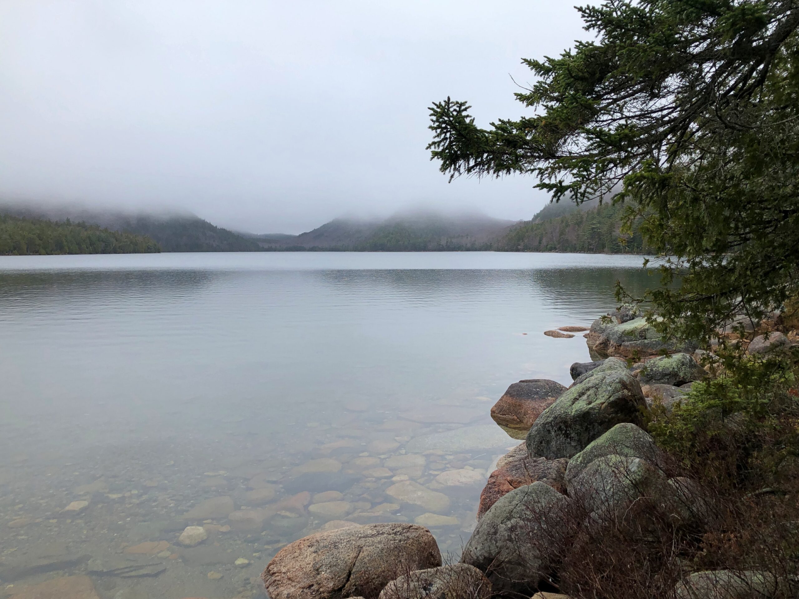
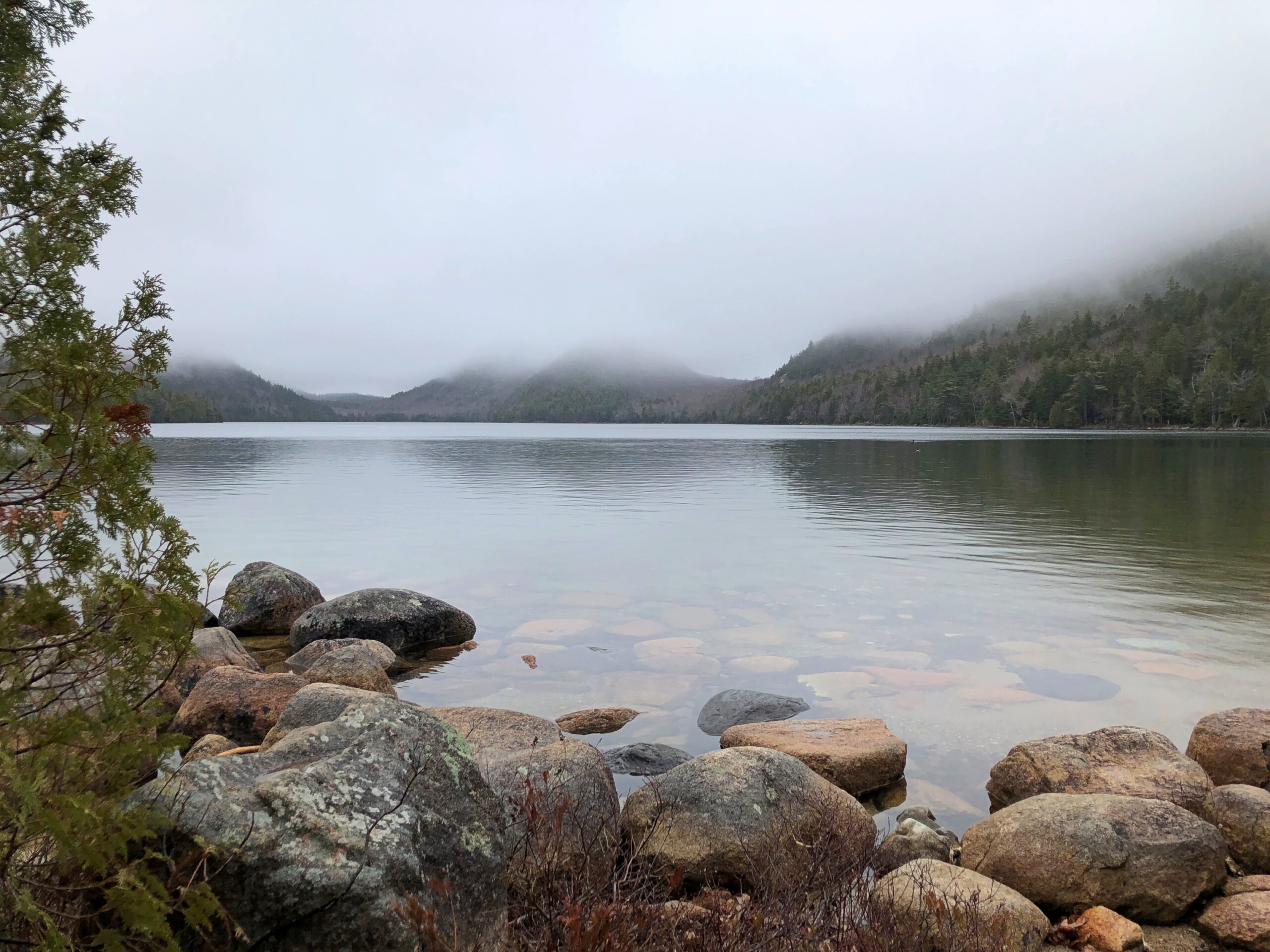
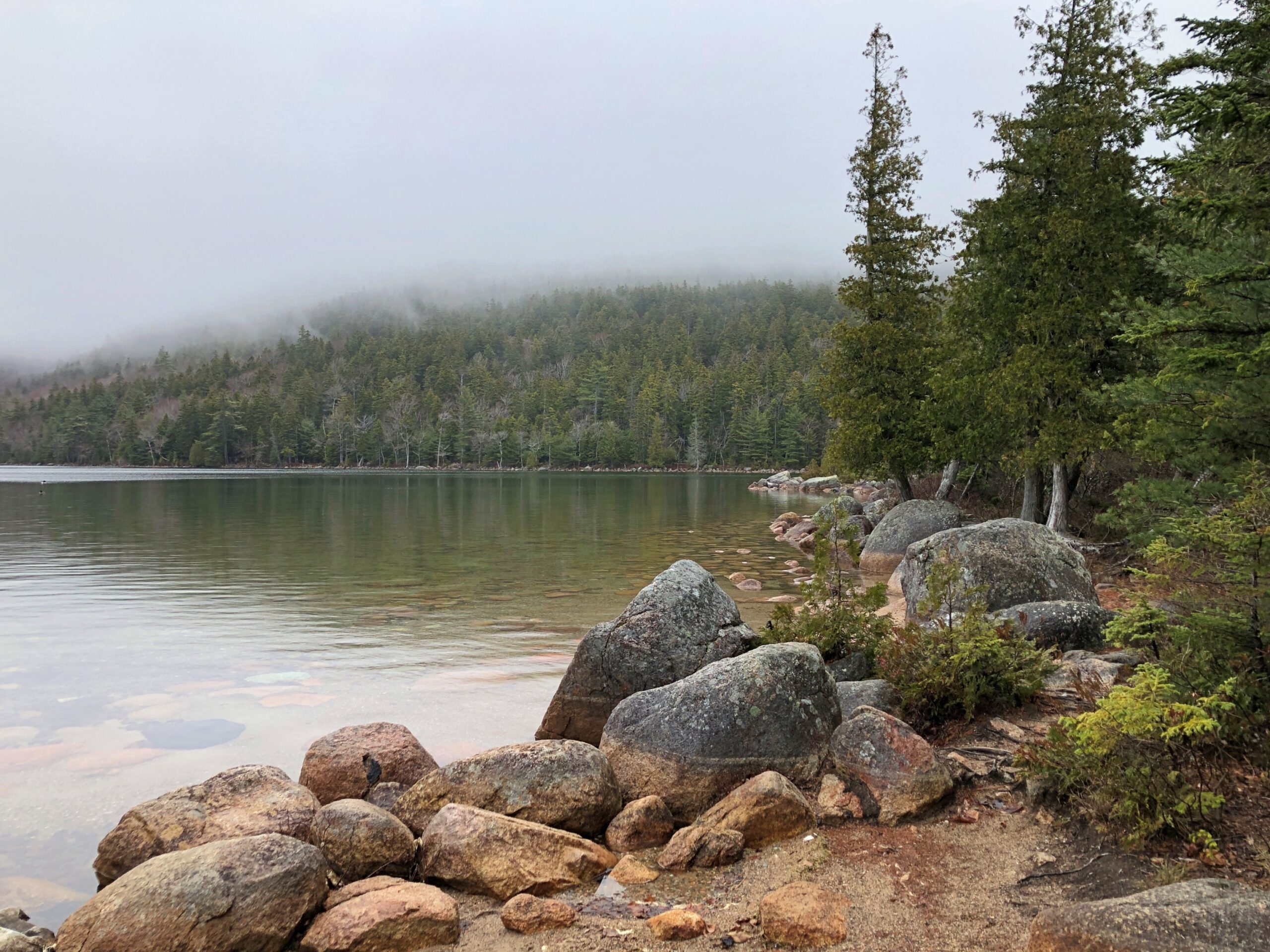
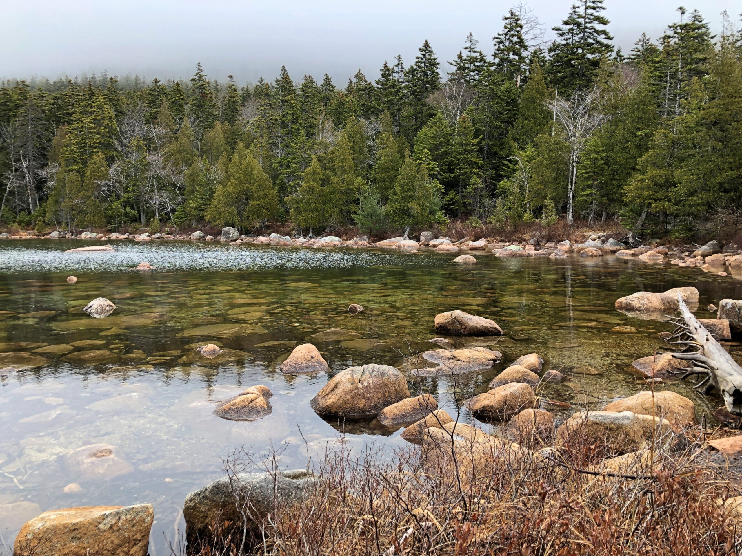
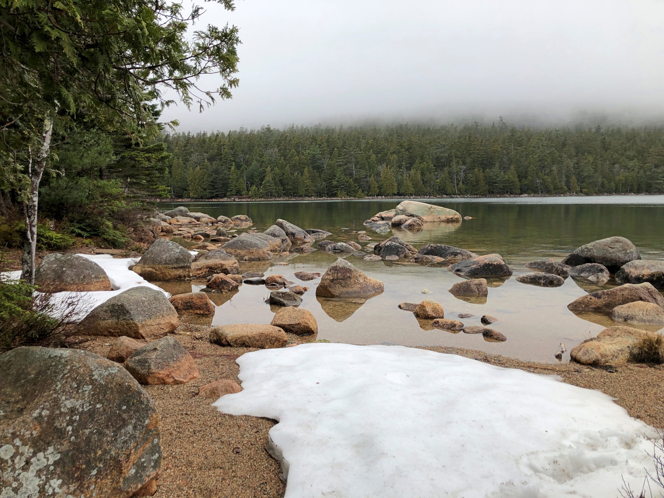
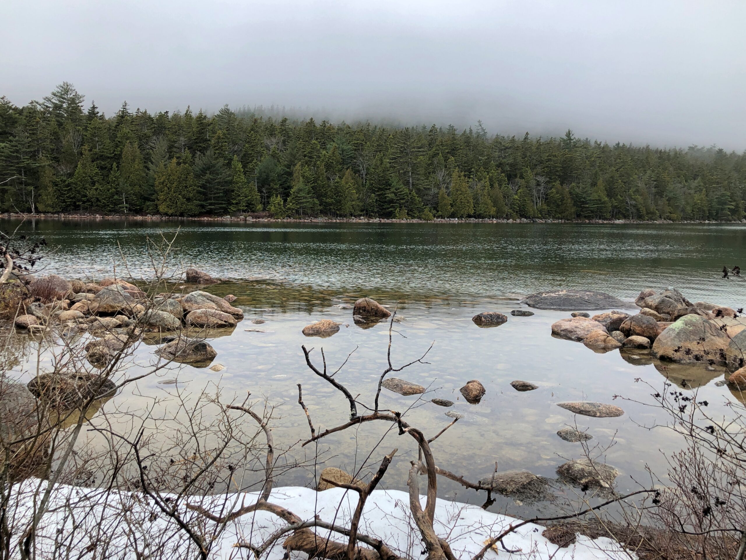
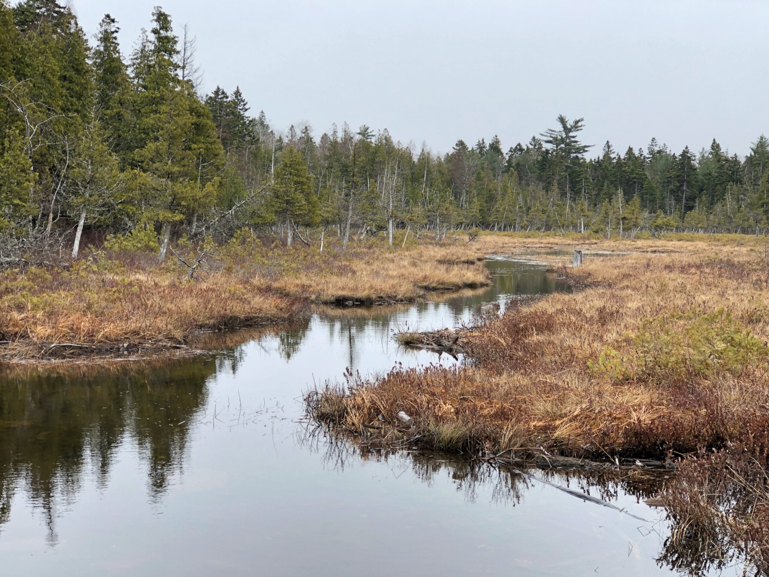
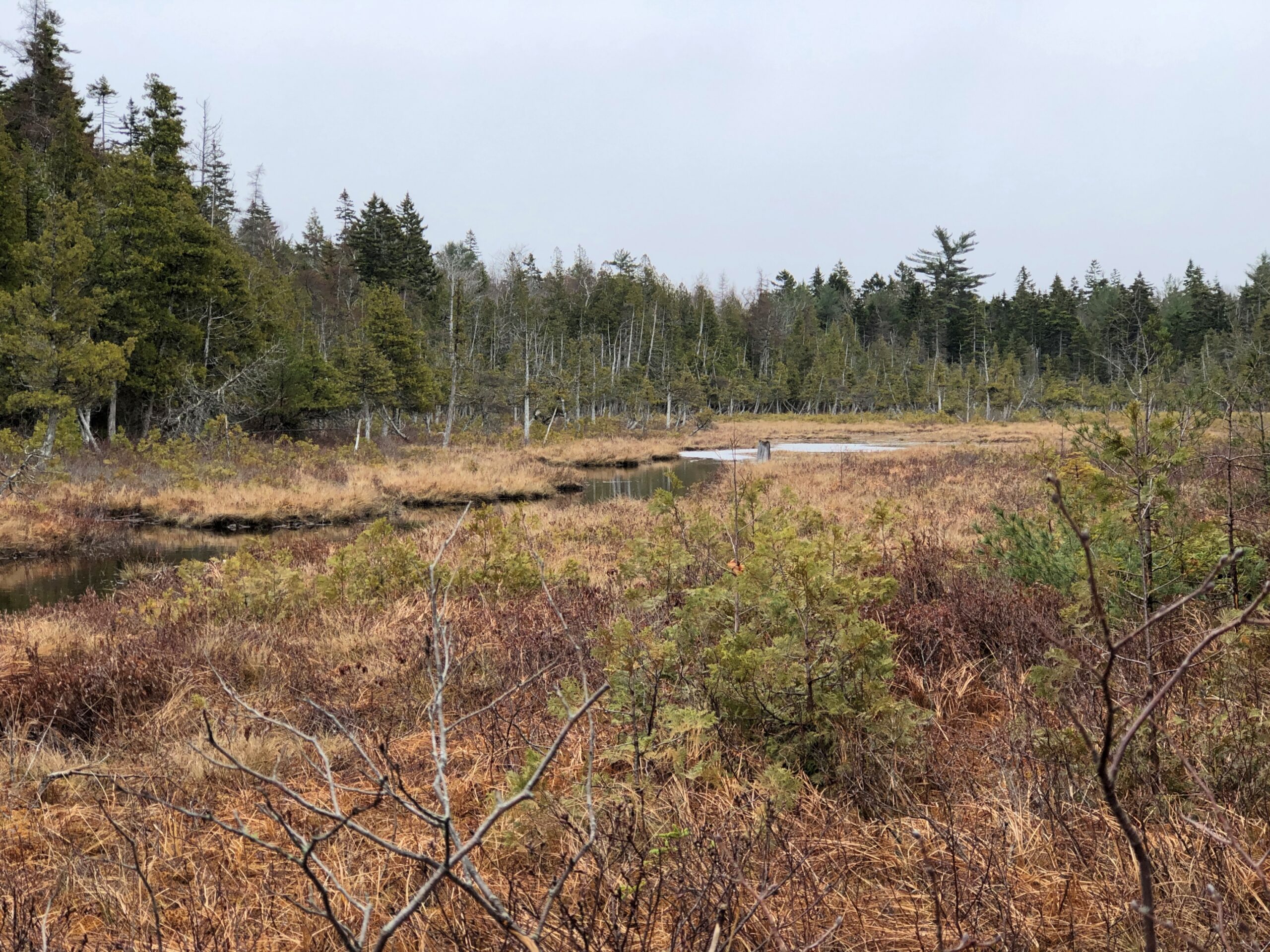
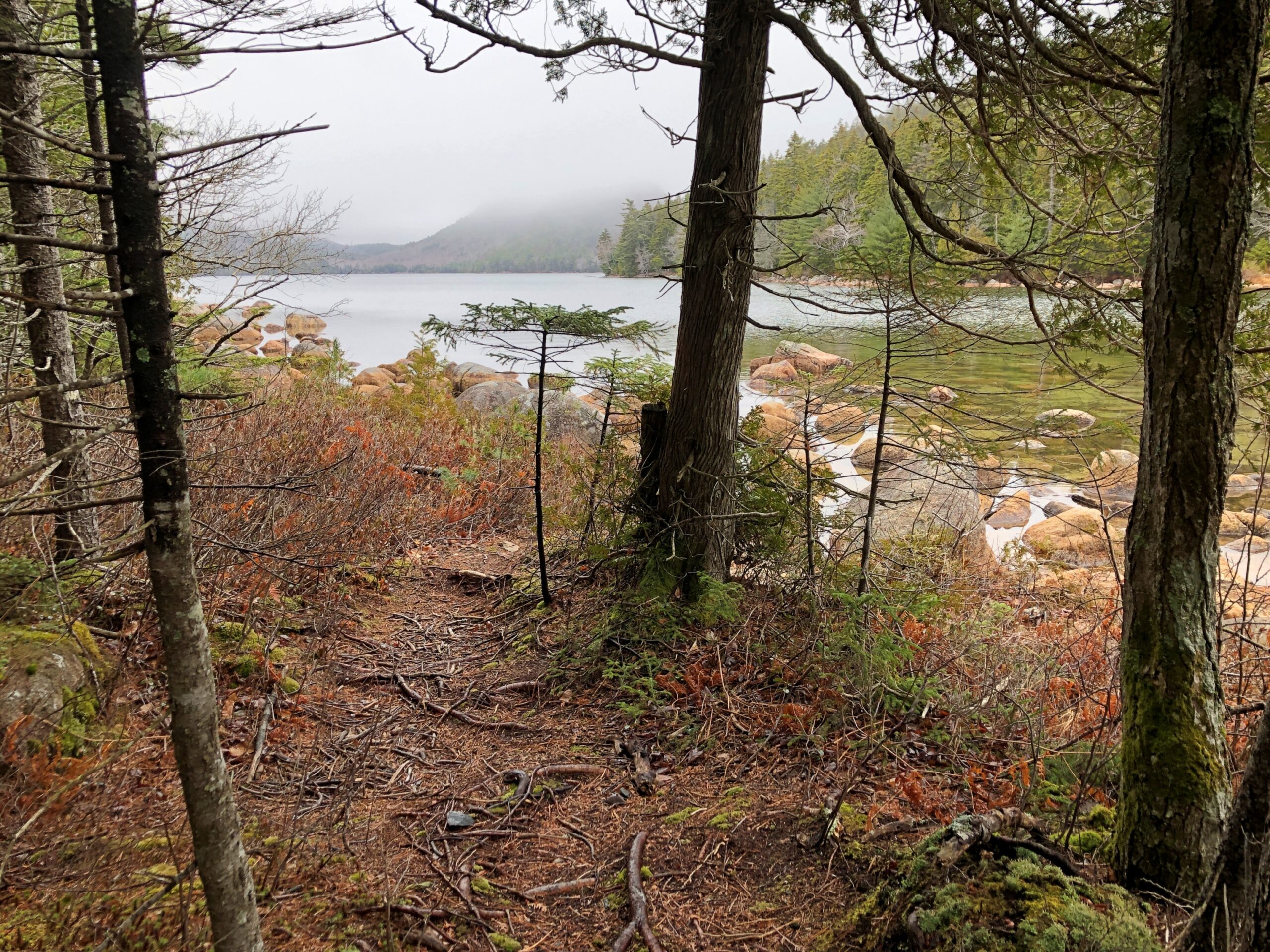
Driving is one thing, but I also wanted to walk. I found my way to Jordan Pond for that purpose.
“Oligotrophic lakes are most common in cold, sparsely developed regions that are underlain by crystalline igneous, granitic bedrock,” the entry says. “Due to their low algal production, these lakes consequently have very clear waters, with high drinking-water quality.”
No giardia in that lake? I didn’t want to find out. I carried my own drinking water as I walked the trails near the pond.
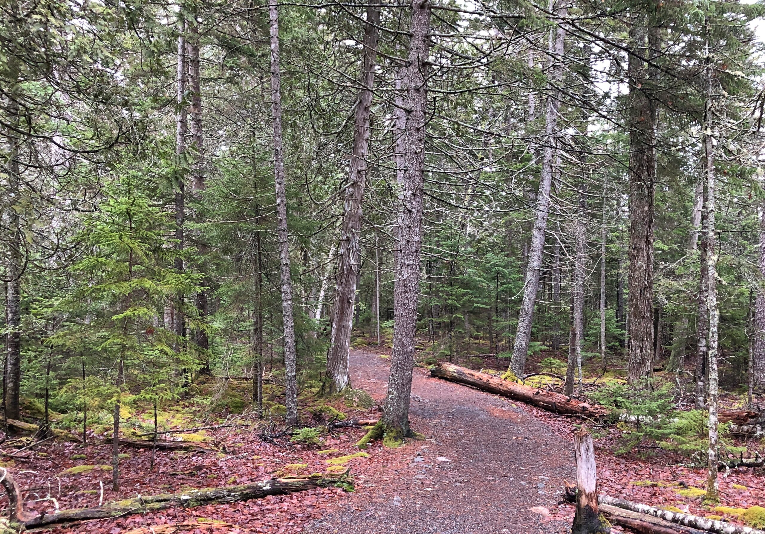
An easy trail. At one point, it crossed a creek feeding into the pond.
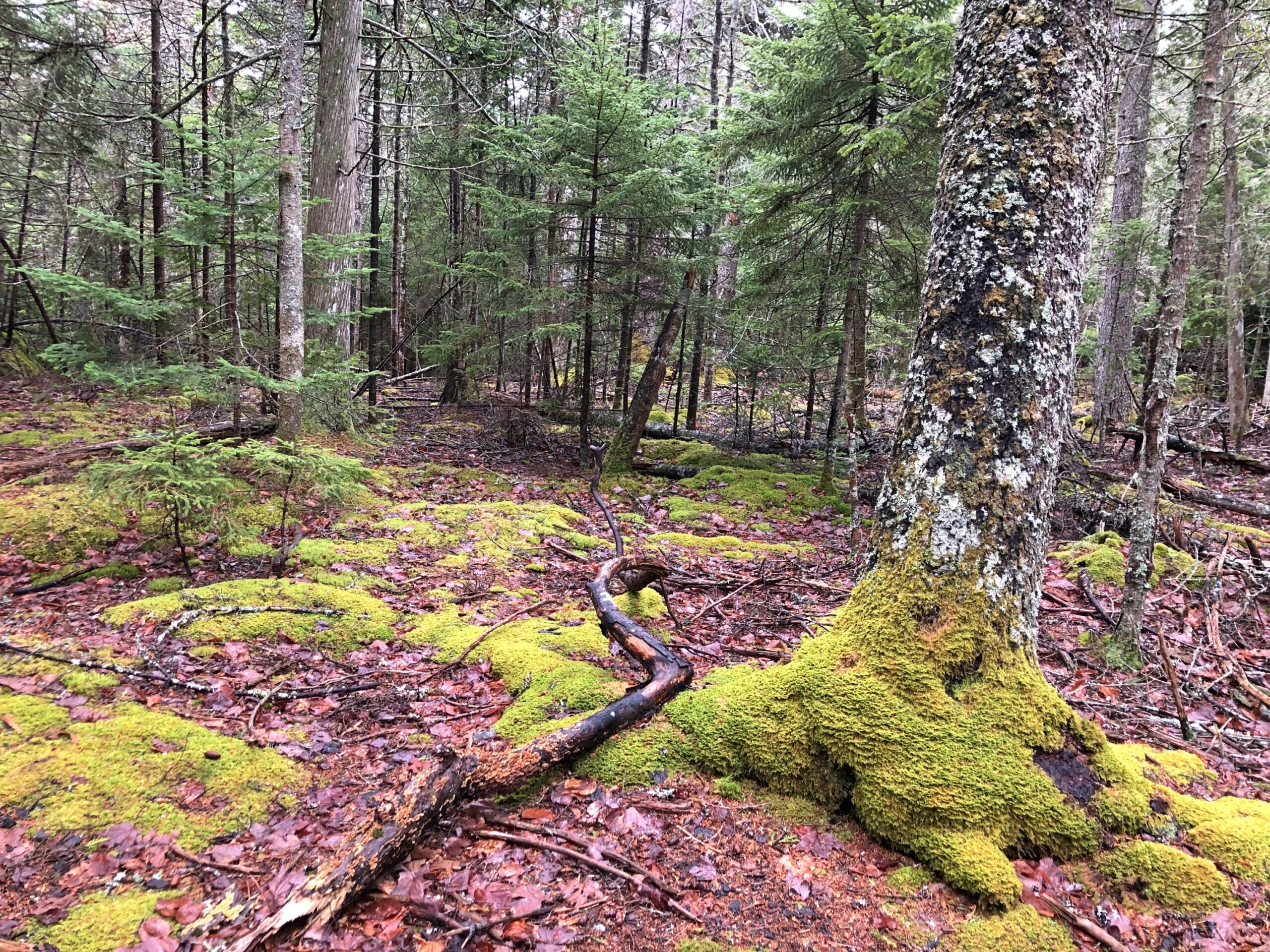
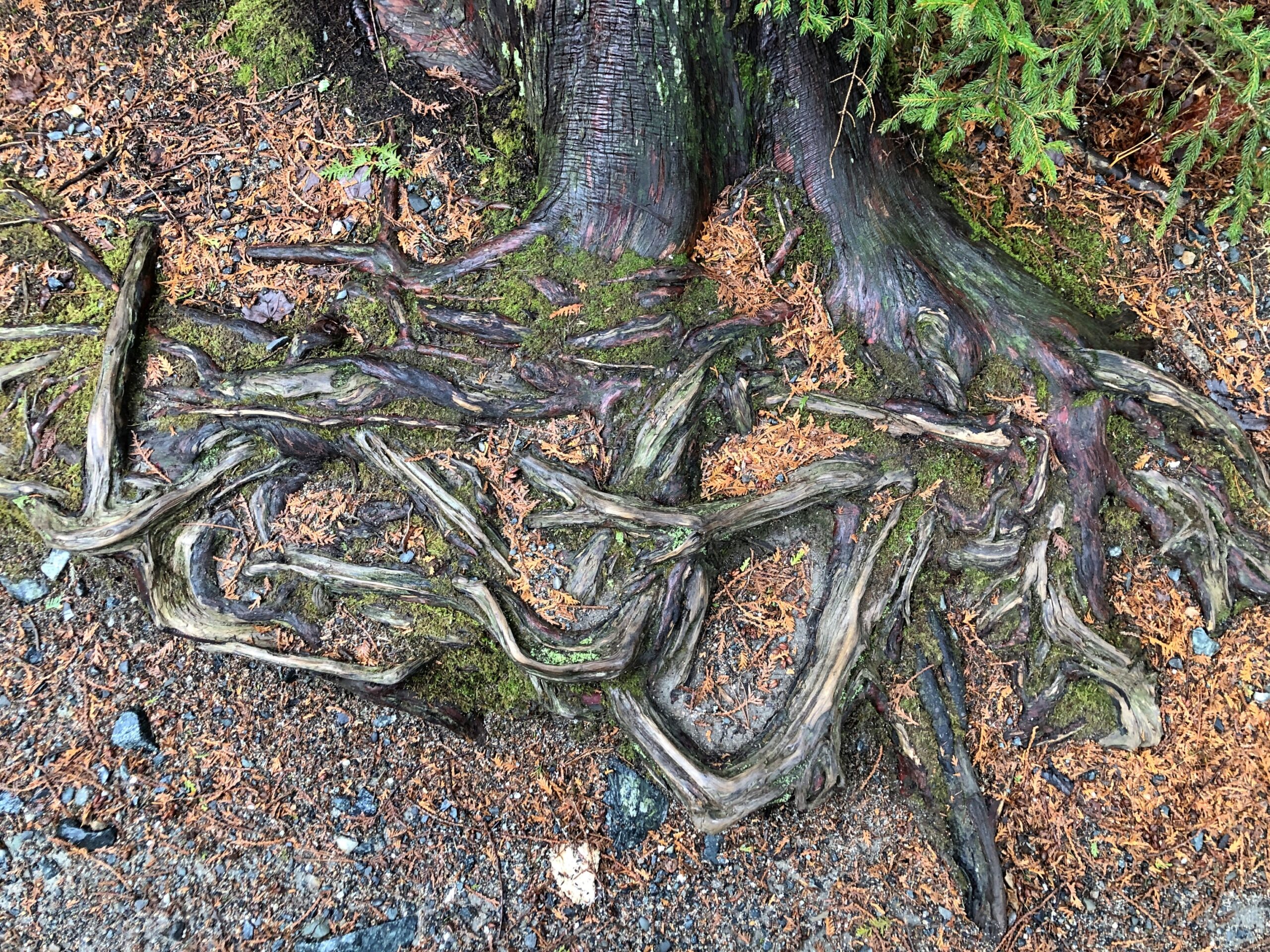
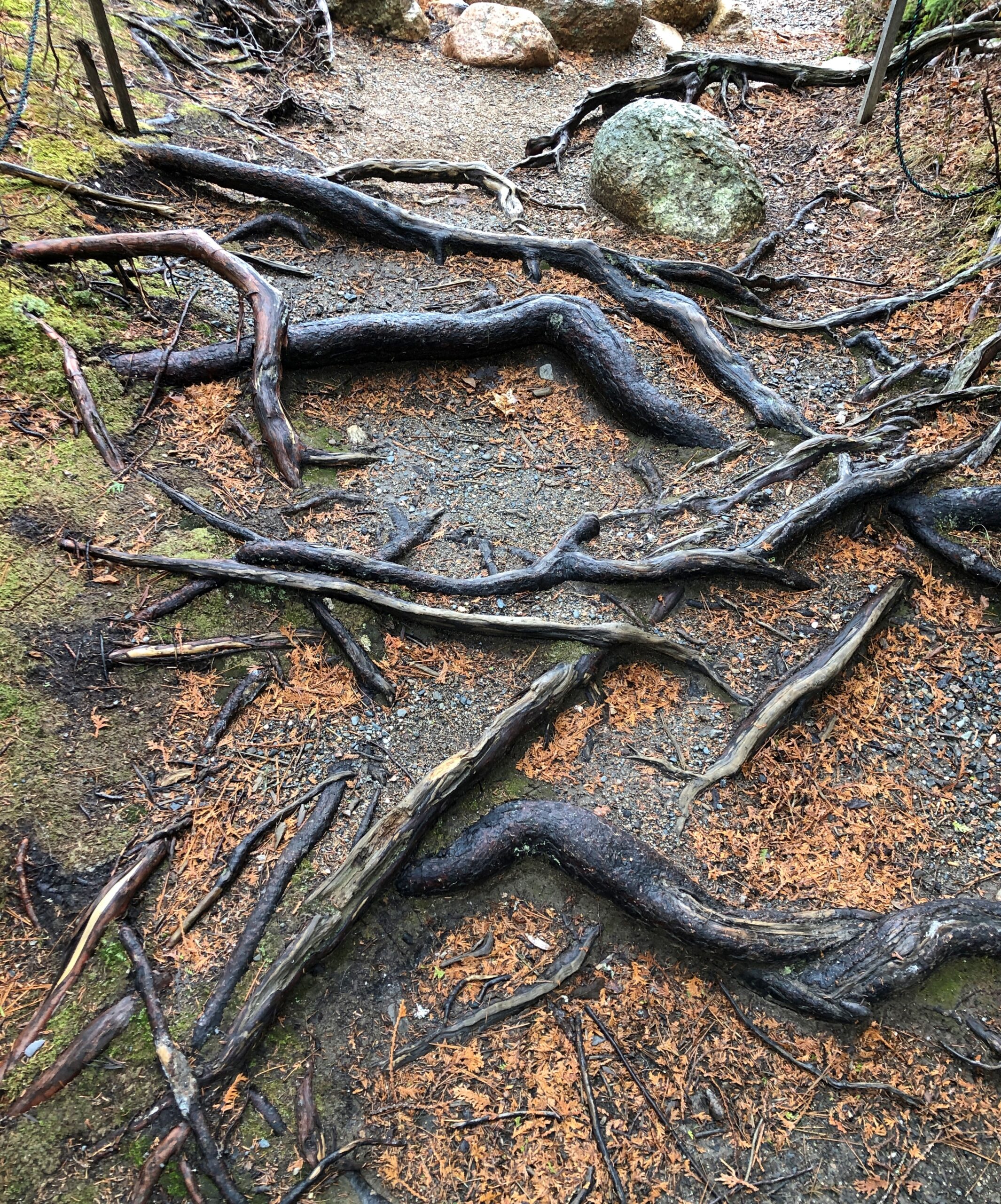
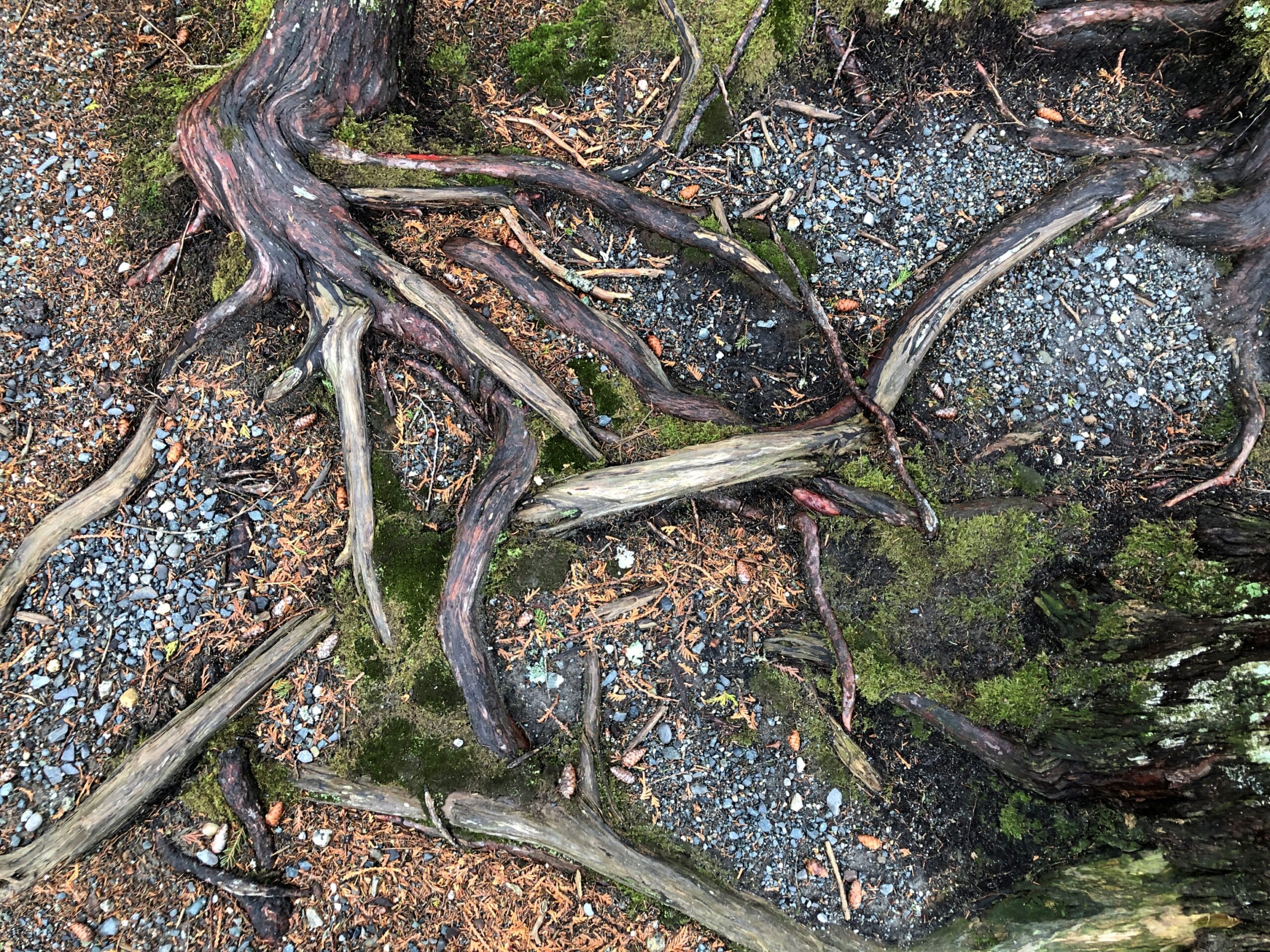
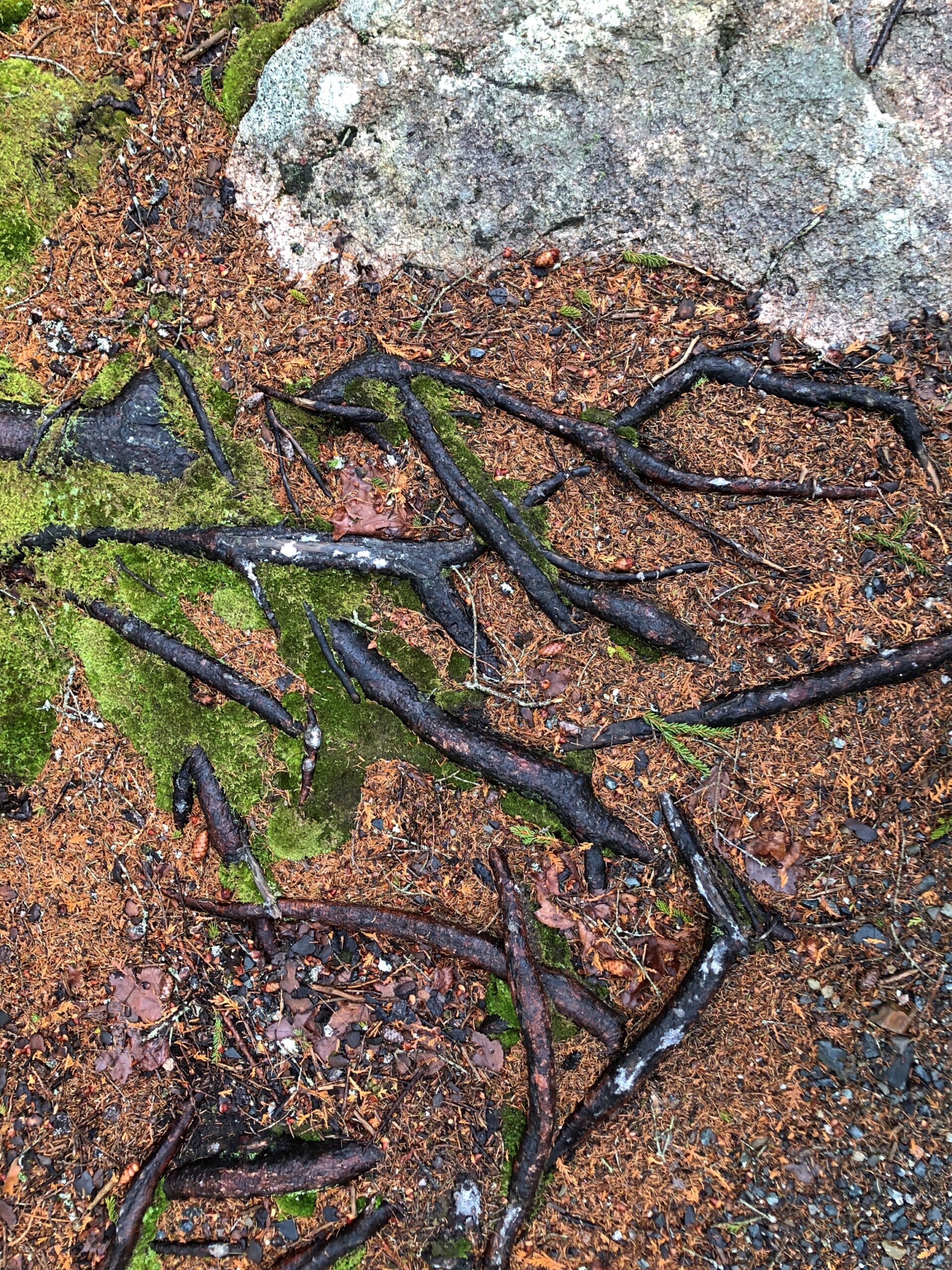
There were too many interesting tree roots to ignore them.
“Roots are typically at least half of a plant’s biomass, but you wouldn’t know it given how little scientific research has been devoted to these critical tendrils,” says the Smithsonian magazine. “Only recently have scientists given plant roots their day in the sun — in fields like collections research, climate science and microbiology.”
Or, in the case of the hardy trees of coastal Maine, their day in the fog.
We live on the crust of the Earth, and what do crusts do? Crumble. Especially when moving water has anything to do with it, as it does along the coast of Maine. Famously so.
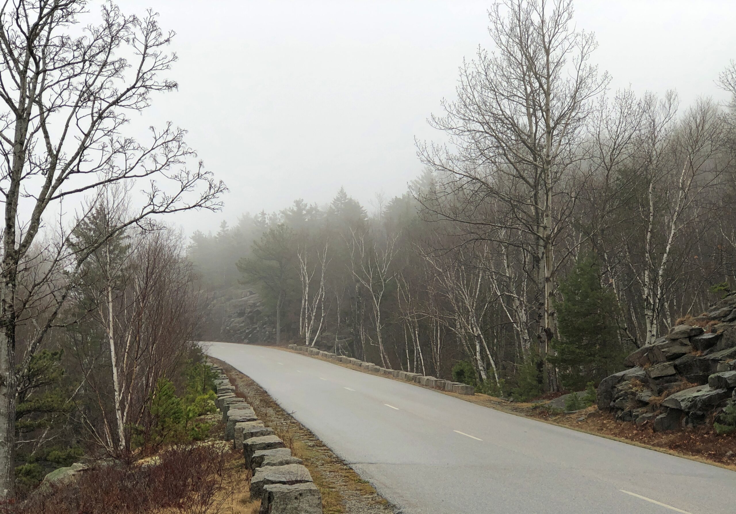
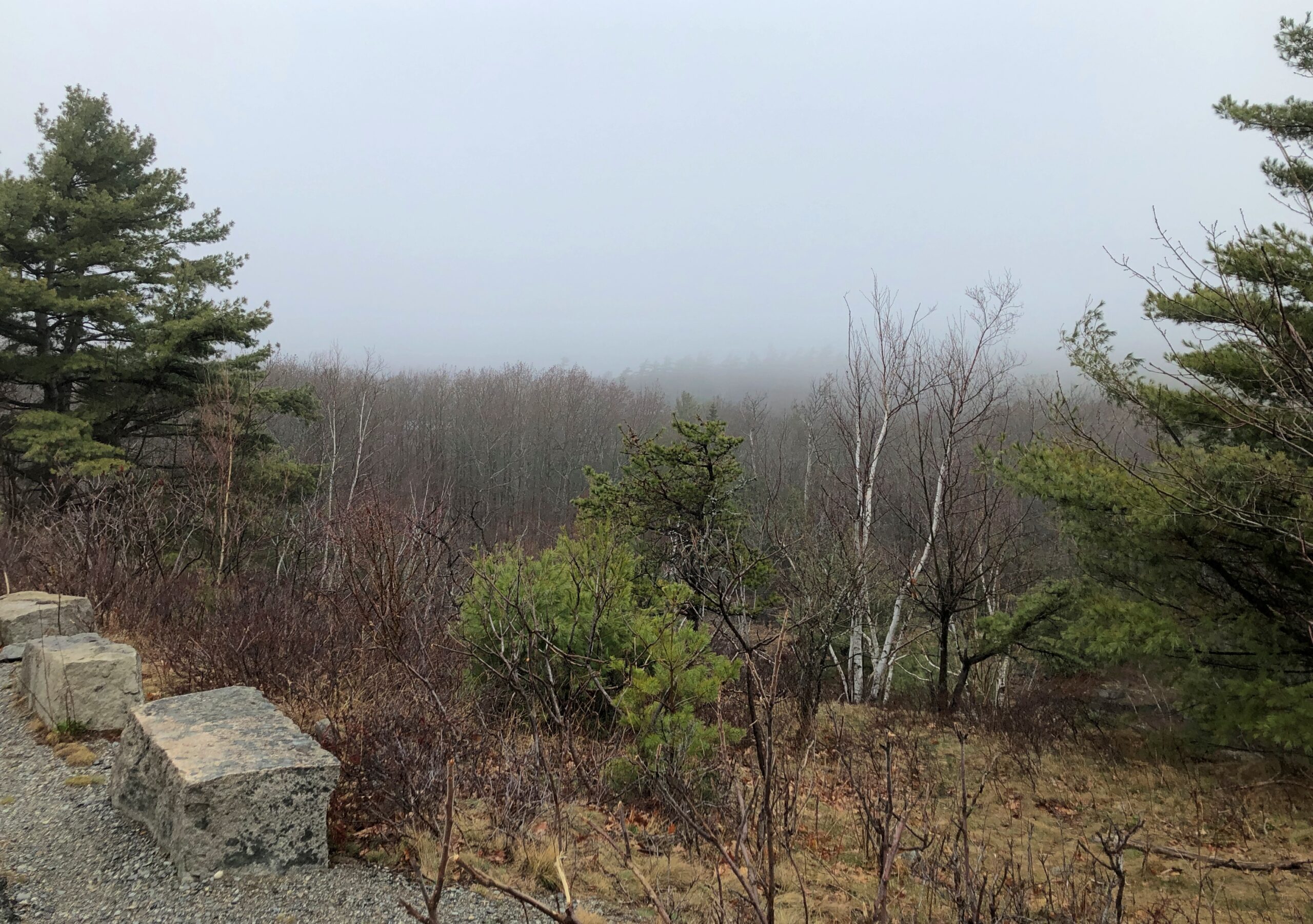
I arrived at the crumbly coastline of Acadia National Park on the morning of April 16. The date is important for only one reason: Park Loop Road, the main scenic drive through the park, opens for the season every year on April 15.
Acadia NP occupies about half of Mount Desert Island and some other nearby peninsula acreage and small islands. The morning of the 16th broke damp and foggy and chilly. From my lodging in the sizable town of Ellsworth, Maine, which is on the mainland near Mount Desert Island, I made my way to the island, then Bar Harbor, then the entrance to Park Loop Road, stopping only for a wonderful breakfast sandwich at one of the few places along the way that was open, Farmstand Coffee House.
The visitors center at the park entrance wasn’t open either. The NPS missed making a sale of post cards to me. By the time I got to the park, the weather was better: slightly less damp and slightly less foggy and slightly less chilly.
Such is Maine in spring. I didn’t mind. In fact, the damp chill meant few other people had come that day. Chilly but no ice underfoot. I like to think that it all melted by April 15. Or maybe on April 15.
I sent a few pictures to Tom in Austin taken while I visiting Acadia NP.
He answered: “Wow. Fabulous. Choosing to visit that national park before May is a bold decision. Looks like you got good weather, though.”
Bold? Maybe. To boldly go where many vacationers have gone before. And will again, real soon.
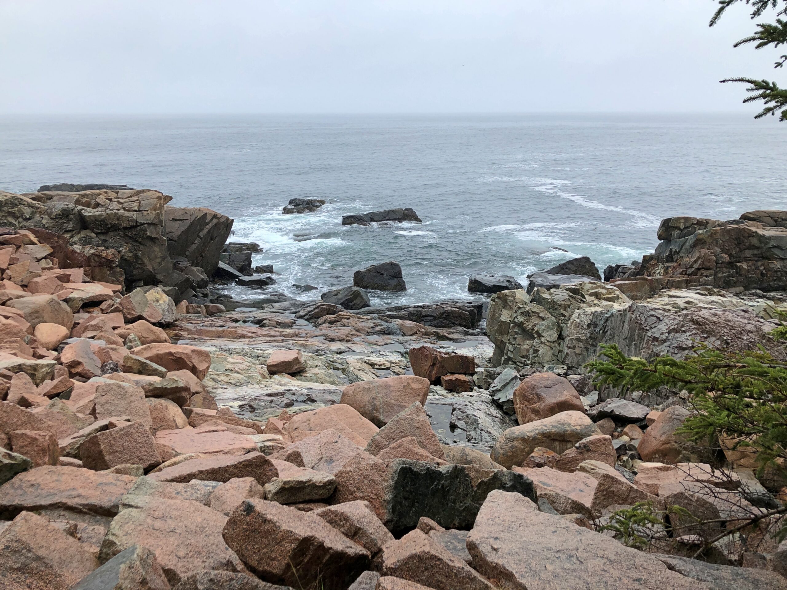
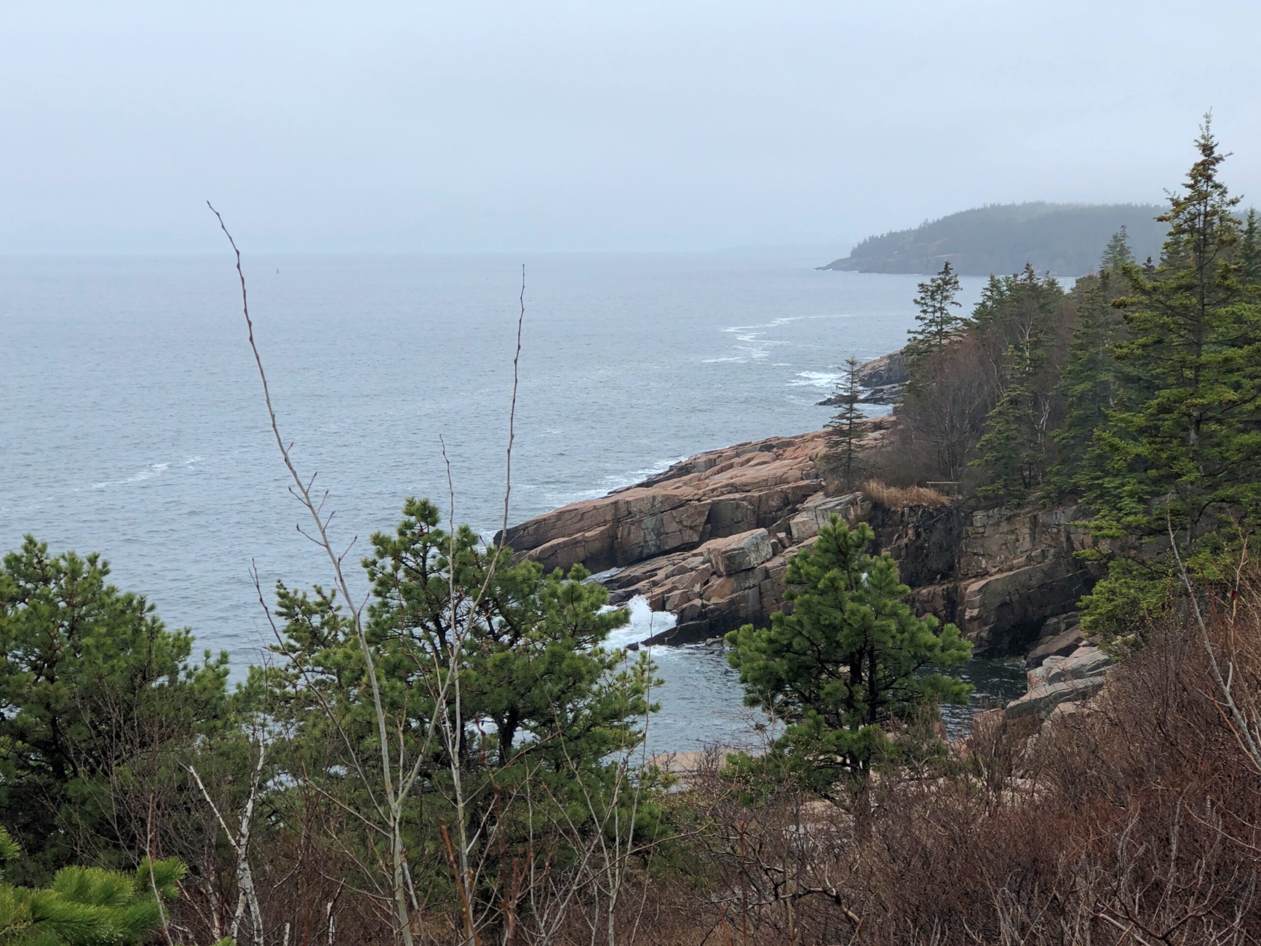
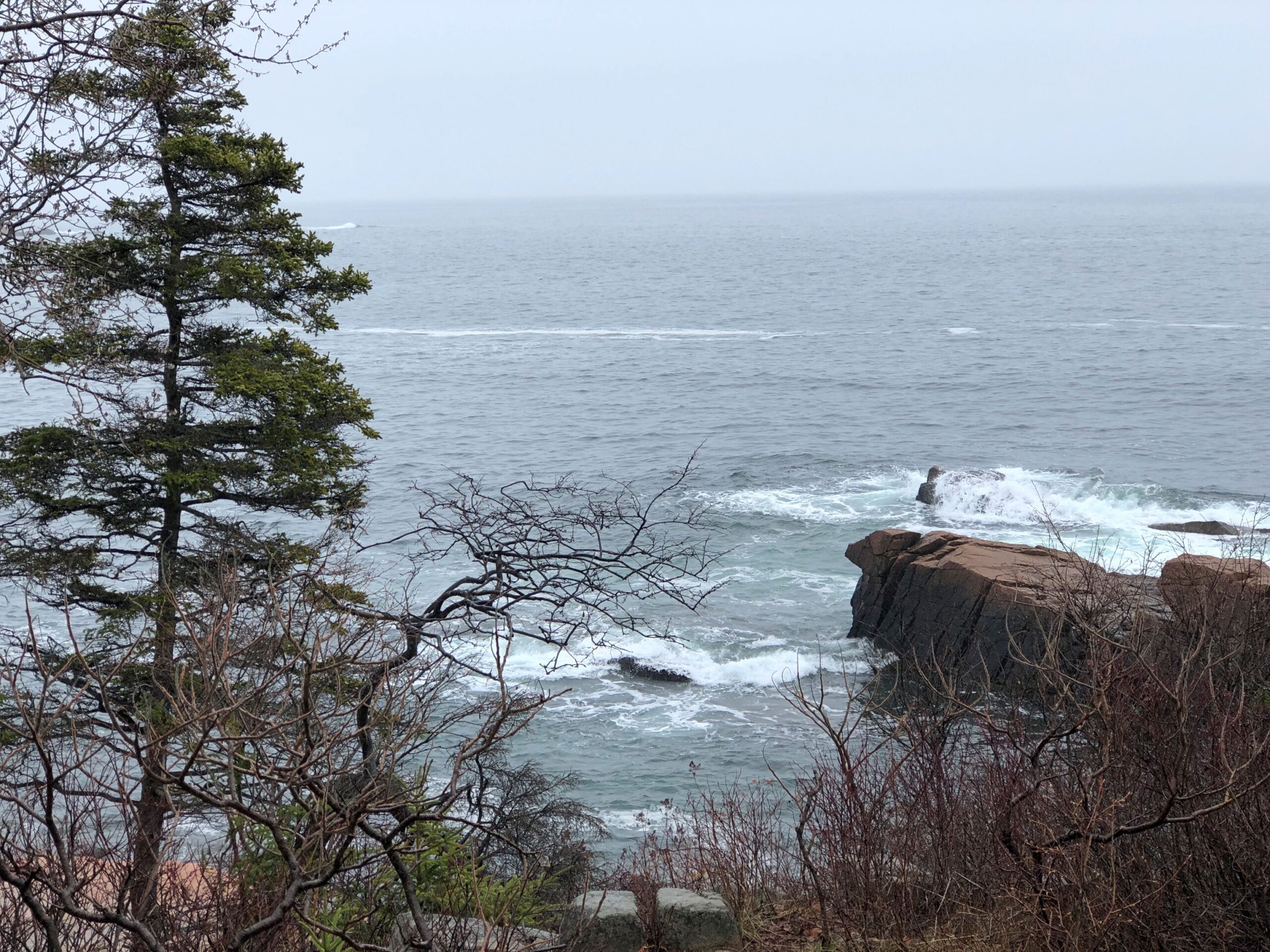
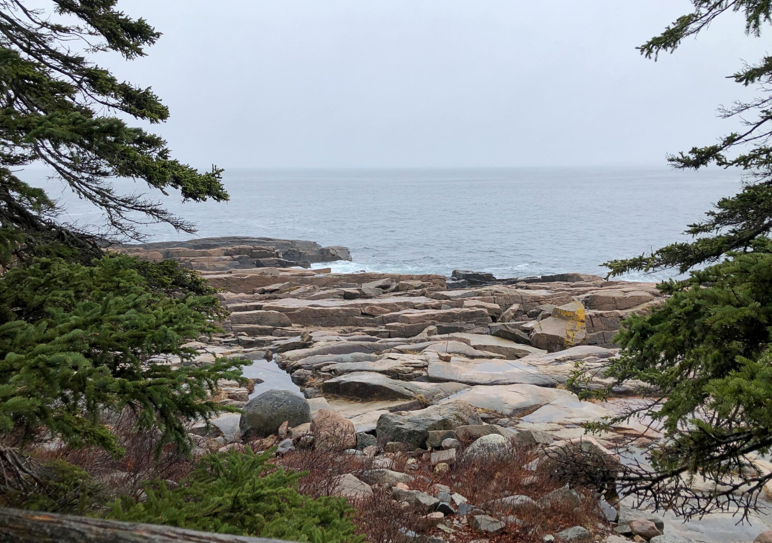
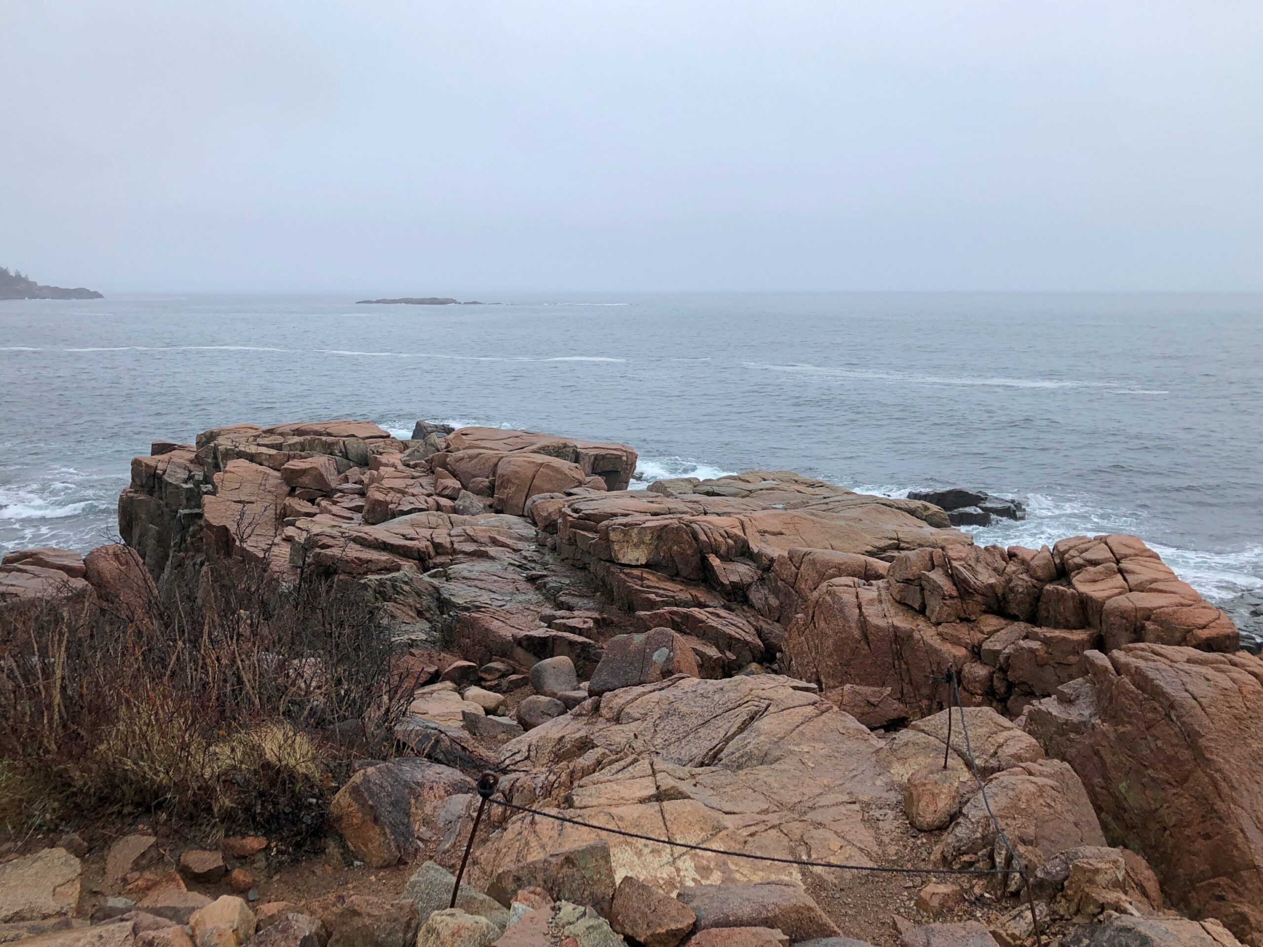
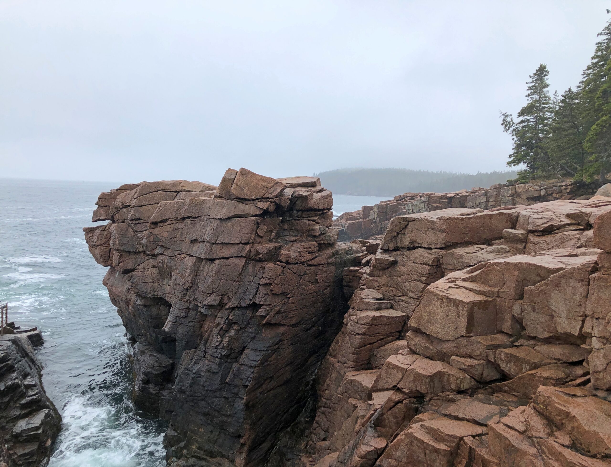
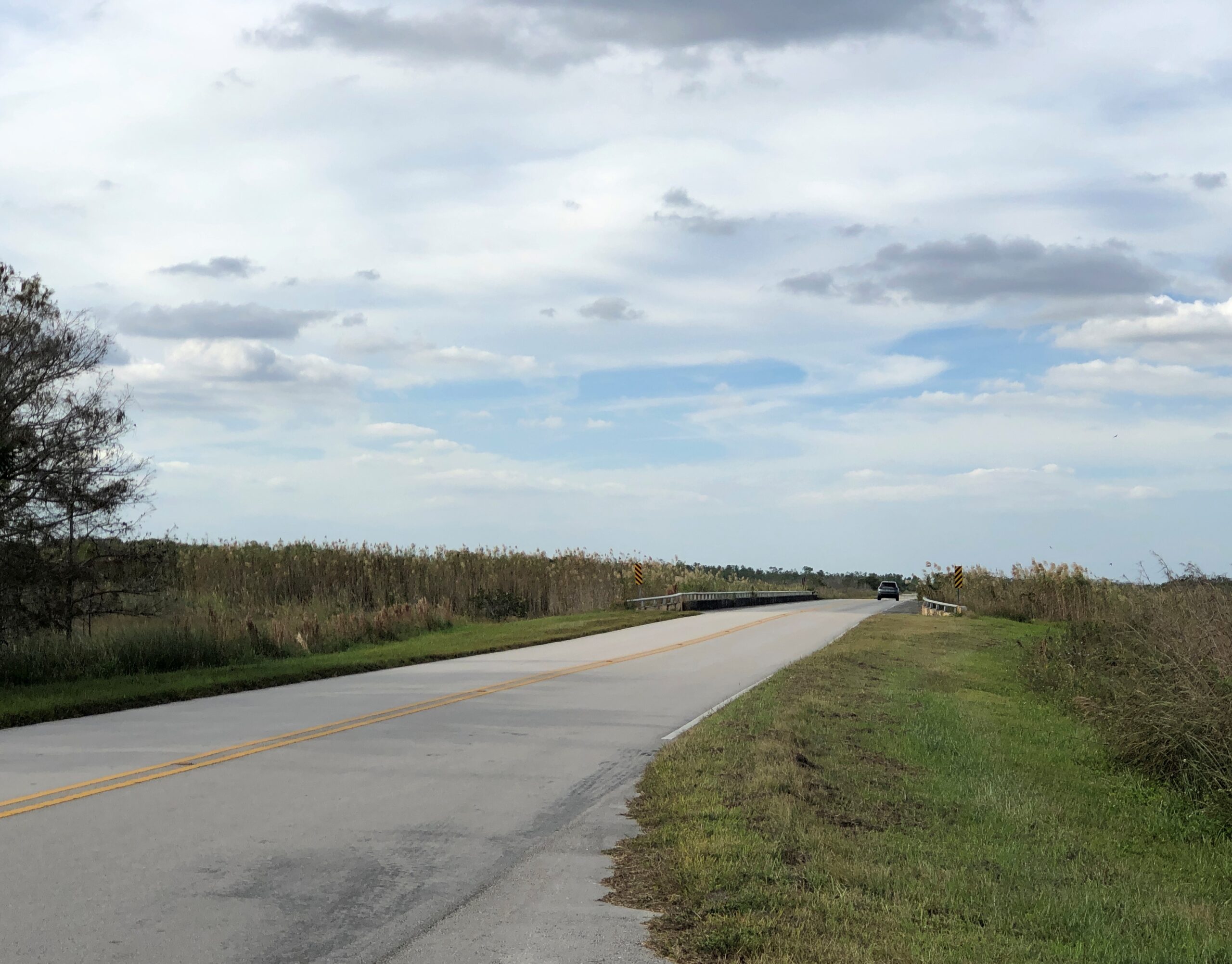
I didn’t drive particularly fast along Park Loop Road. Little traffic for one thing, too much of a risk of a car-on-tree encounter for another thing, so curvy is it. Gnarly, you could say. The drive, whose construction John D. Rockefeller Jr. facilitated, winds but does not climb much as it follows the curves of the shore. The scenic stops are close to each other, since in national park terms, Acadia is a touch on the small side. Despite that it hardly lacks variety.
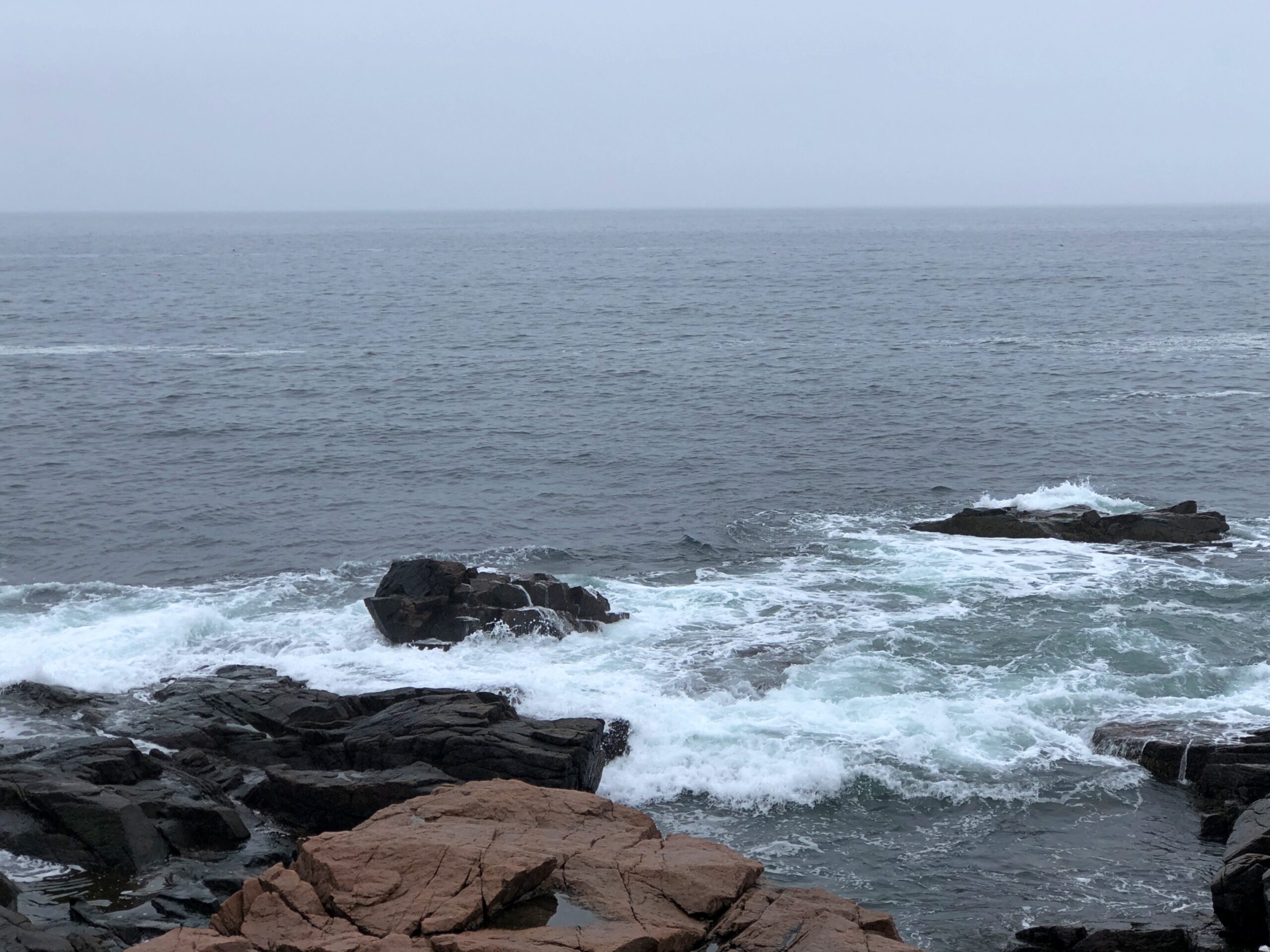
Beginning with the rocky shores you’d expect. The fog that day was a nice Maine touch. The foggy shores of Maine. There’s a song title for an AI song writing program: “The Foggy Shores of Maine.” Sad song about a solider dreaming of home on these shores? It worked for “Galveston.”
Boulders and sizable slabs, on their way to being pebbles and sand.
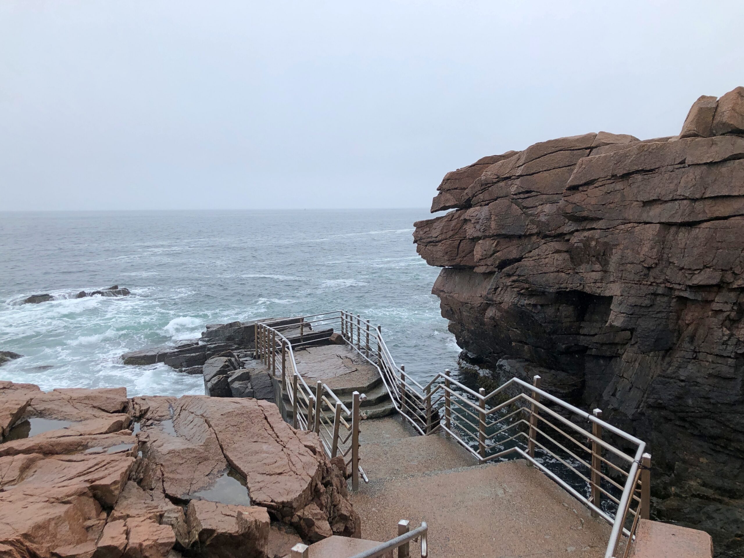
A feature that wears its name well: Thunder Hole.
A loud place, Thunder Hole, the waves bashing the rocks in crash-splashes, followed by the whistling, sucking whoosh as water pulls away from the rocks, followed by another bash against the rocks, all before you can count to three.
You can get closer to Thunder Hole behind the (relative) safety of rails, but that won’t keep you from a good drenching. Not that day, anyway. I kept my distance, and let the sound come to me in its noisy fury.
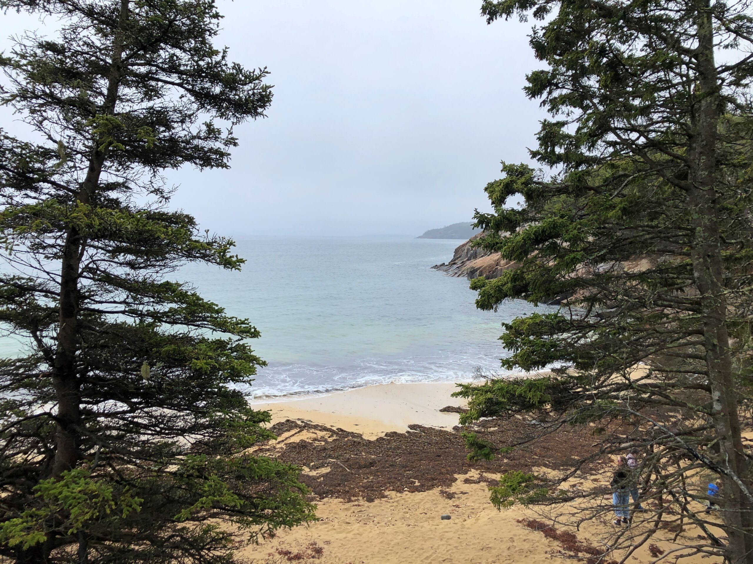
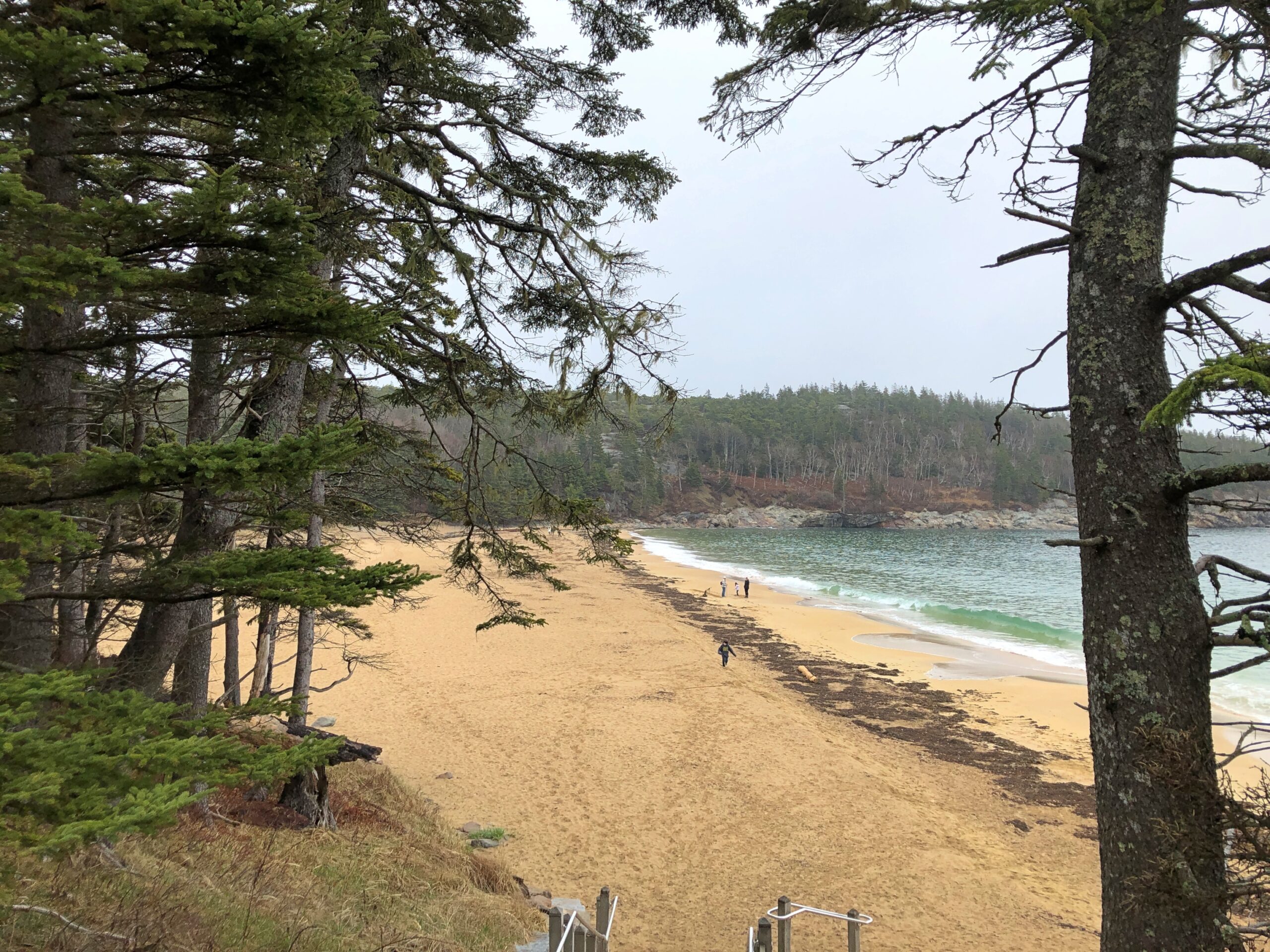
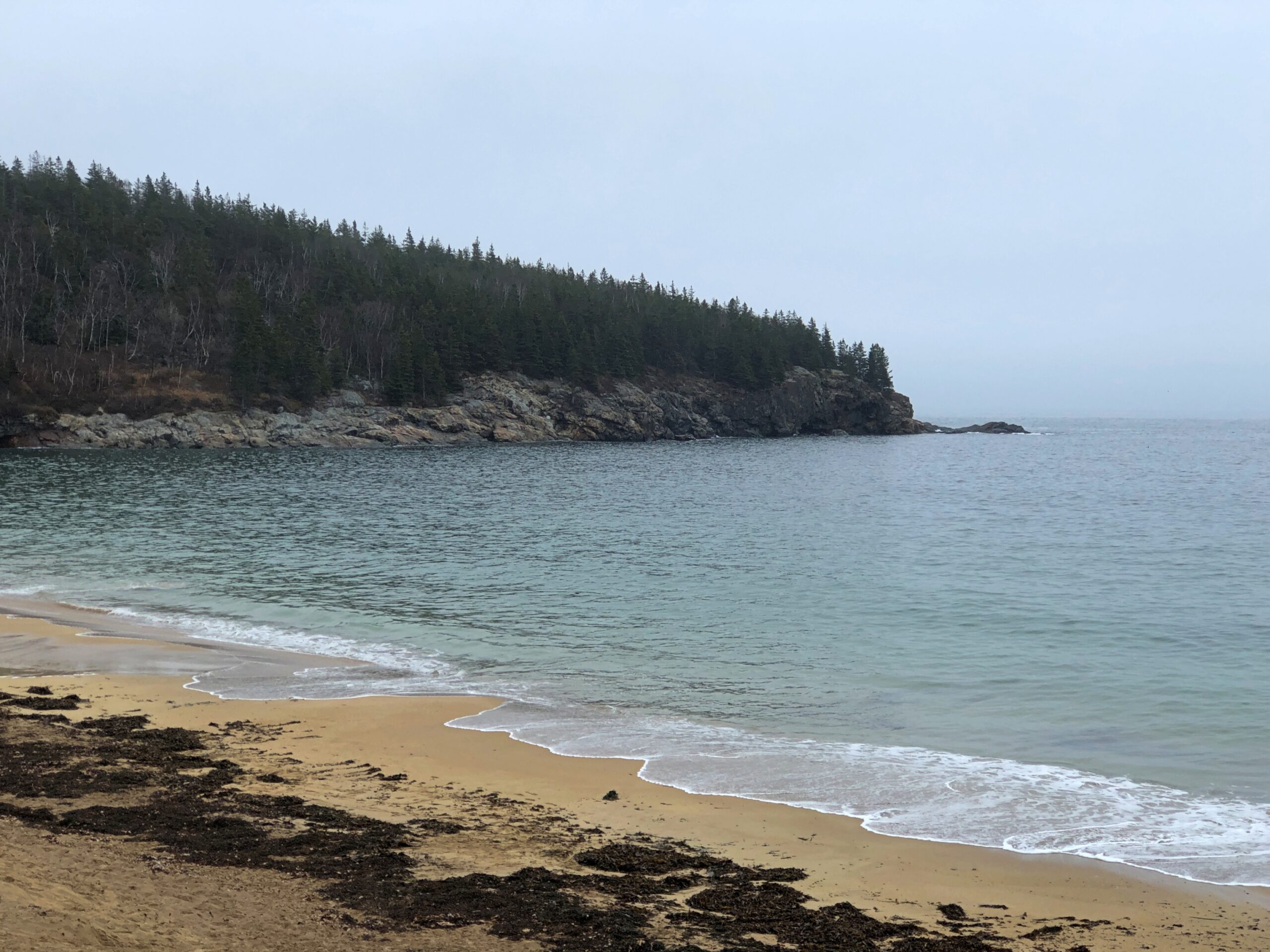
The park has a sand beach, called on the maps, Sand Beach.
I take that as an indication that most of the shore in these parts is topsy-turvy with boulders. I believe it.
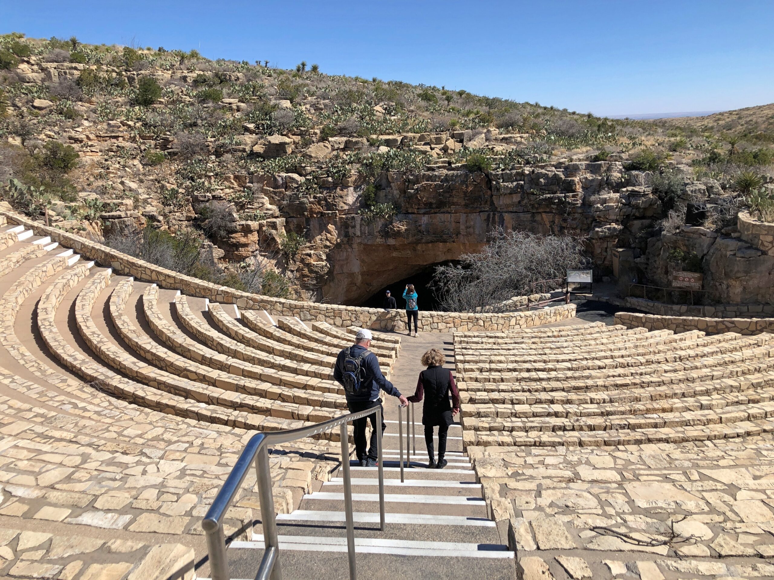
In August, you can gather at the natural entrance to Carlsbad Cavern at dusk, sit in a stone theater, and watch the bats fly out of the cave. After more than 50 years, I remember that.
A park ranger at the time mentioned that only once, in all his time watching the bats emerge, had one flown into a person – a woman with a beehive hairdo. That might have been a joke, but anyway all the bats flew away in a surging torrent, the crowd quiet with awe, but the flapping of thousands of wings making a curious whooshing. Then a trickle of straggler bats came out. None interacted with any of us humans. Clearly, bats have better sense than that.
A Greek-theater inspired structure. It must have been. More work of the everywhere-all-the-time (for a little while) CCC. In February, the bats do not emerge at dusk, so isn’t something you can sit for at Carlsbad Caverns National Park.
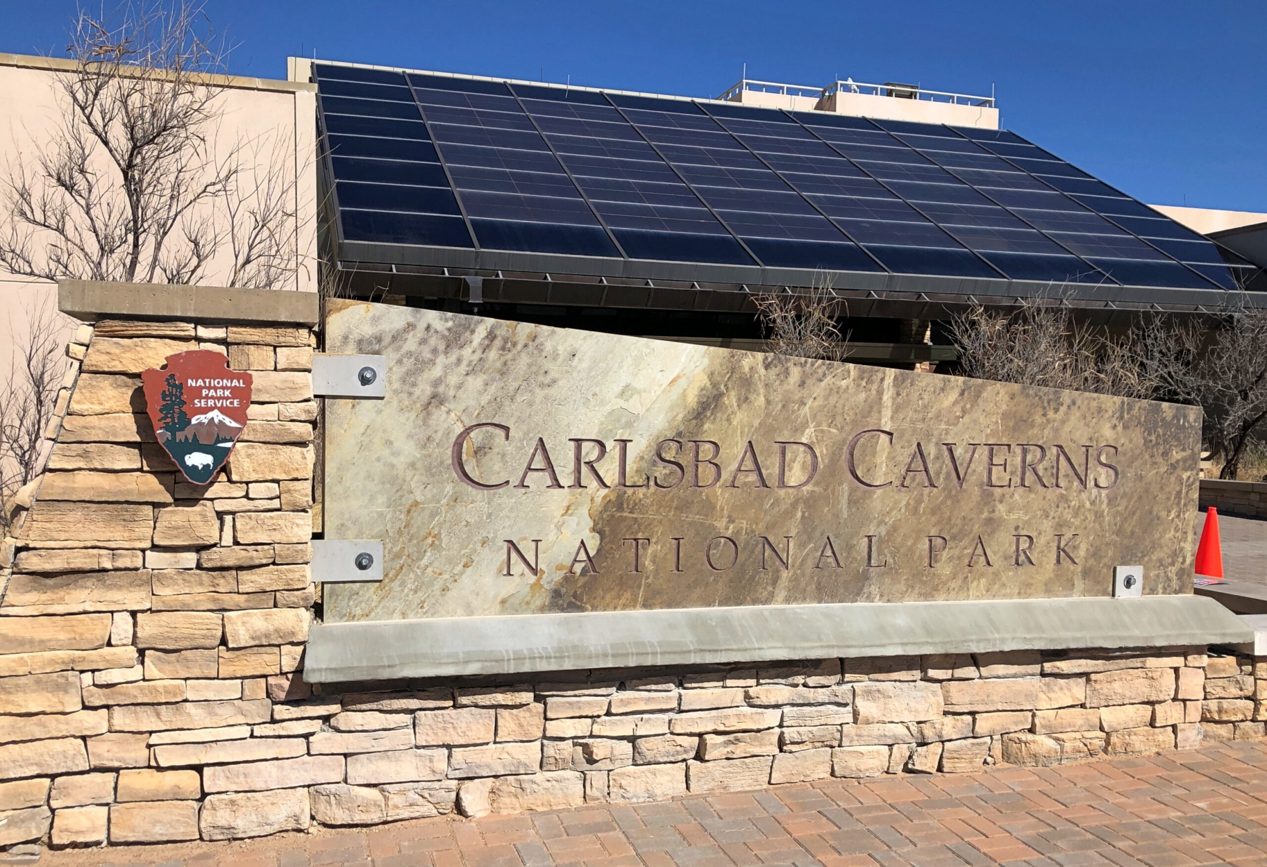
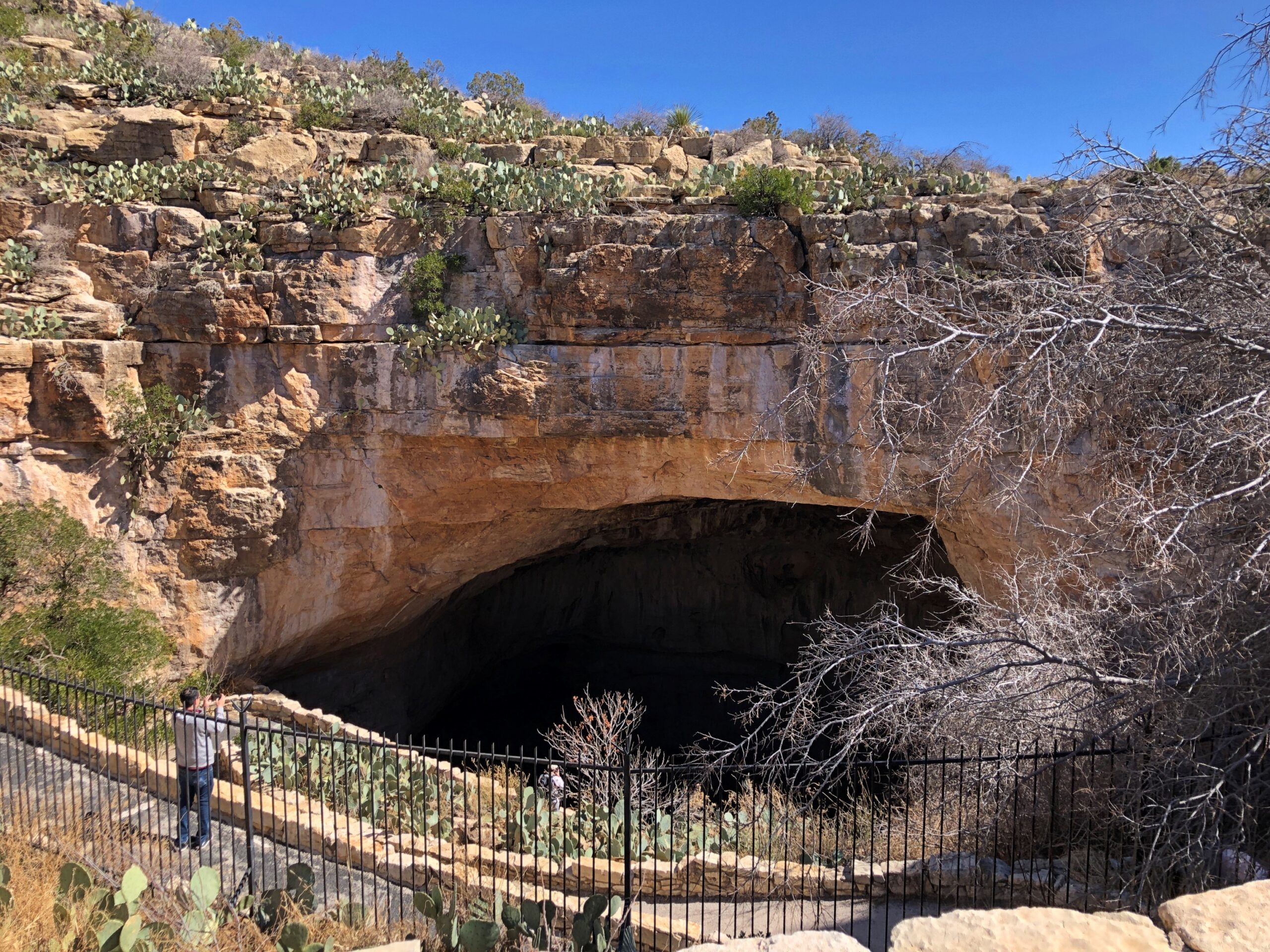
But you can walk into the natural entrance of the cave, as we did on February 19. I blew $2 on reserving an entrance time, but it was hardly necessary. A fair number of other people were there, but not enough to form a distracting crowd.
It’s an Empire State Building down, step by step. Even so, you’d think that going down wouldn’t be too difficult, since gravity is doing most of the work. Turns out, gravity is just a mite too enthusiastic when it comes to doing that work, so you struggle to keep a measured pace, full of the stress of knowing that a simple tumble might put you against hard rock in a hard hurry. So the trip down was exhausting.
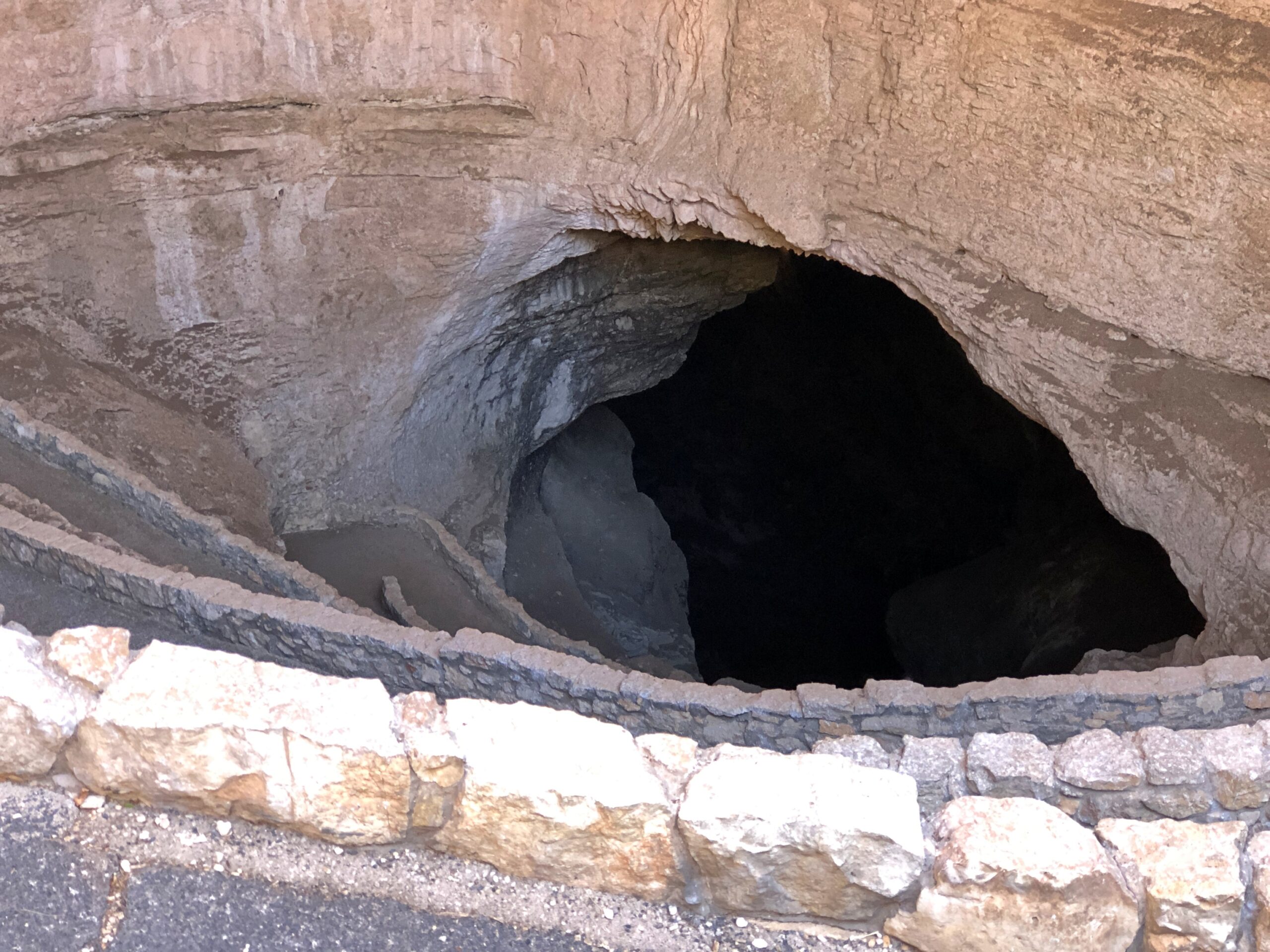
It doesn’t take long to get to the artificial light zone. Almost all of the void below, that is.
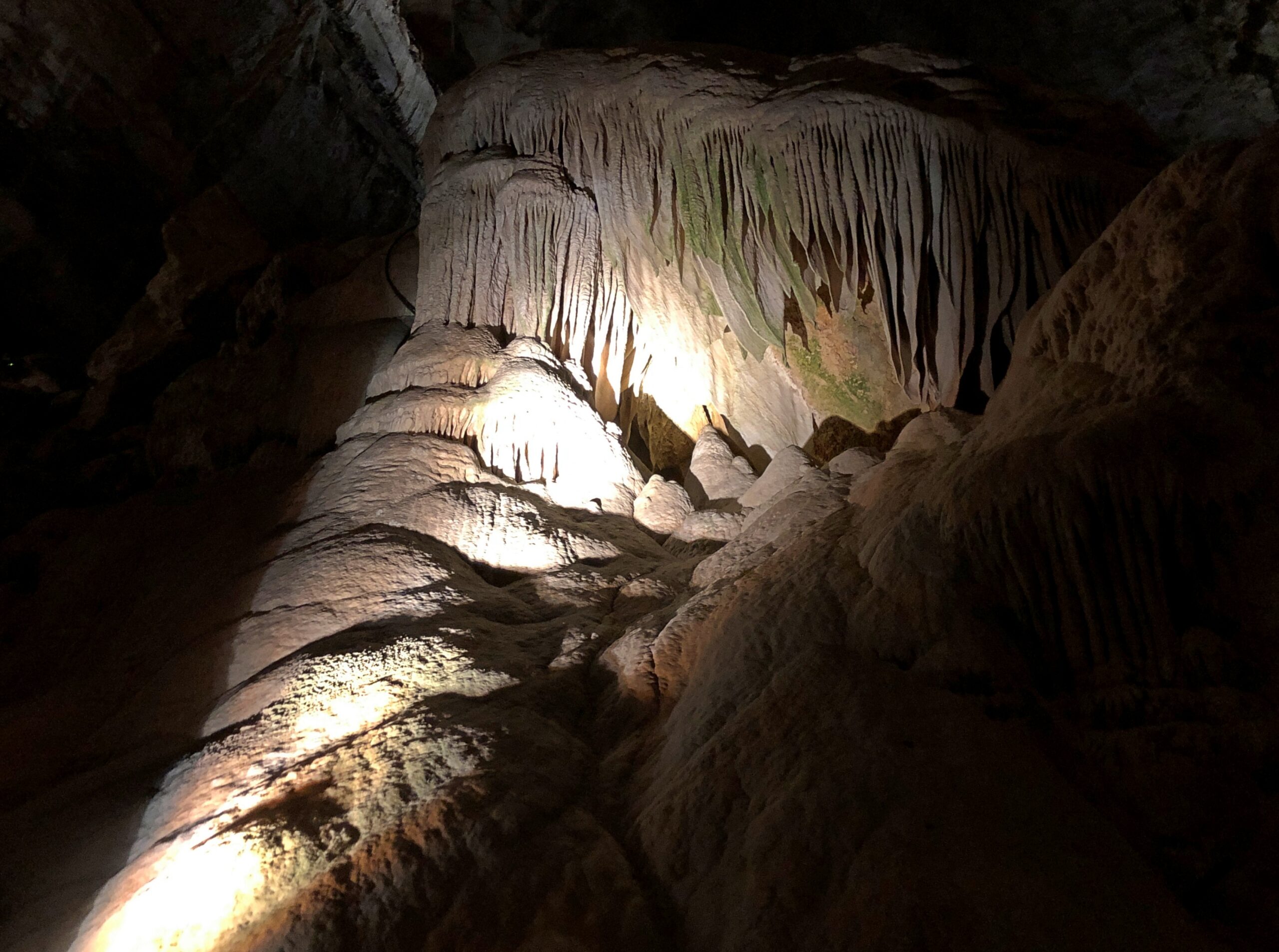
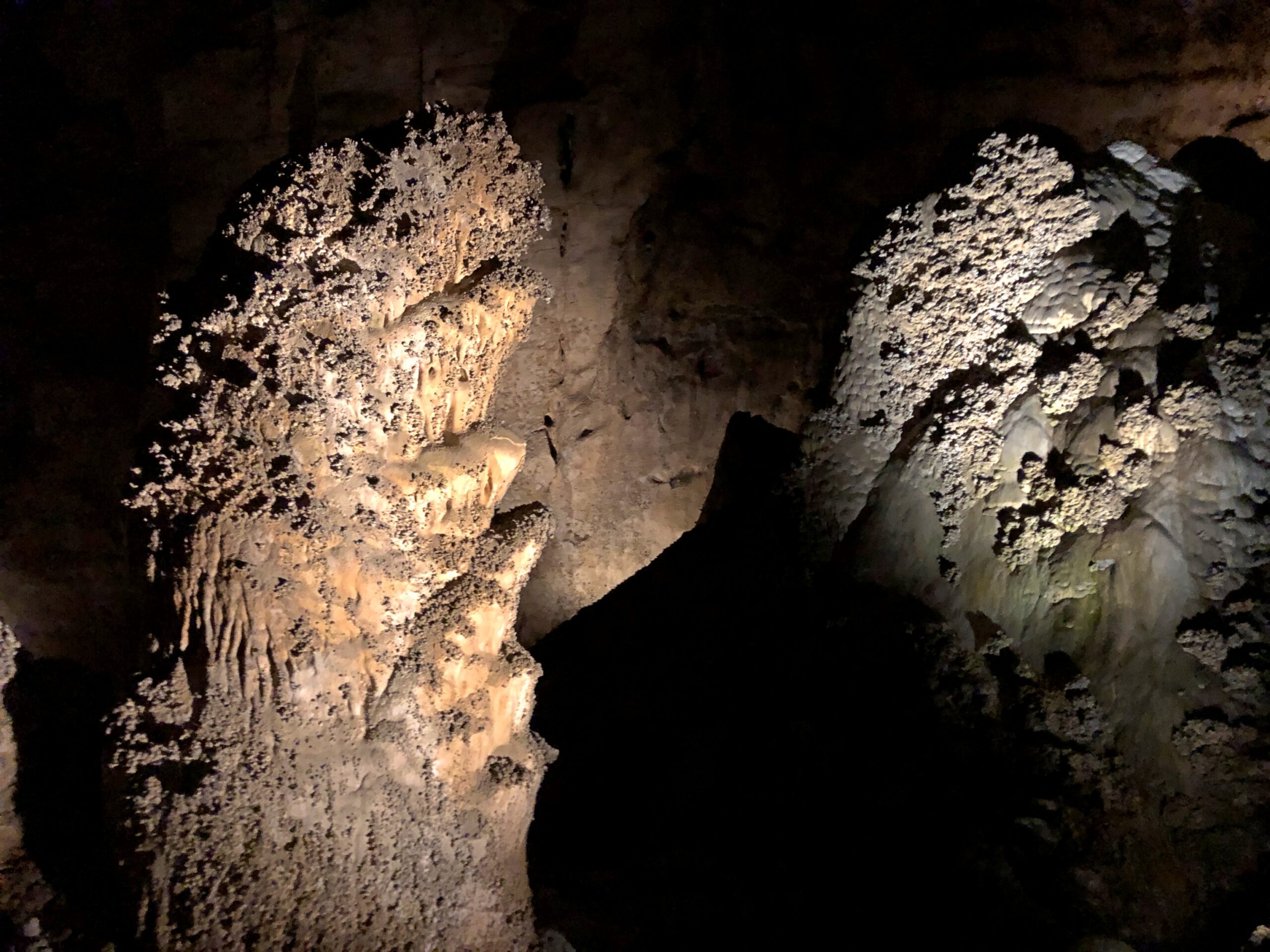
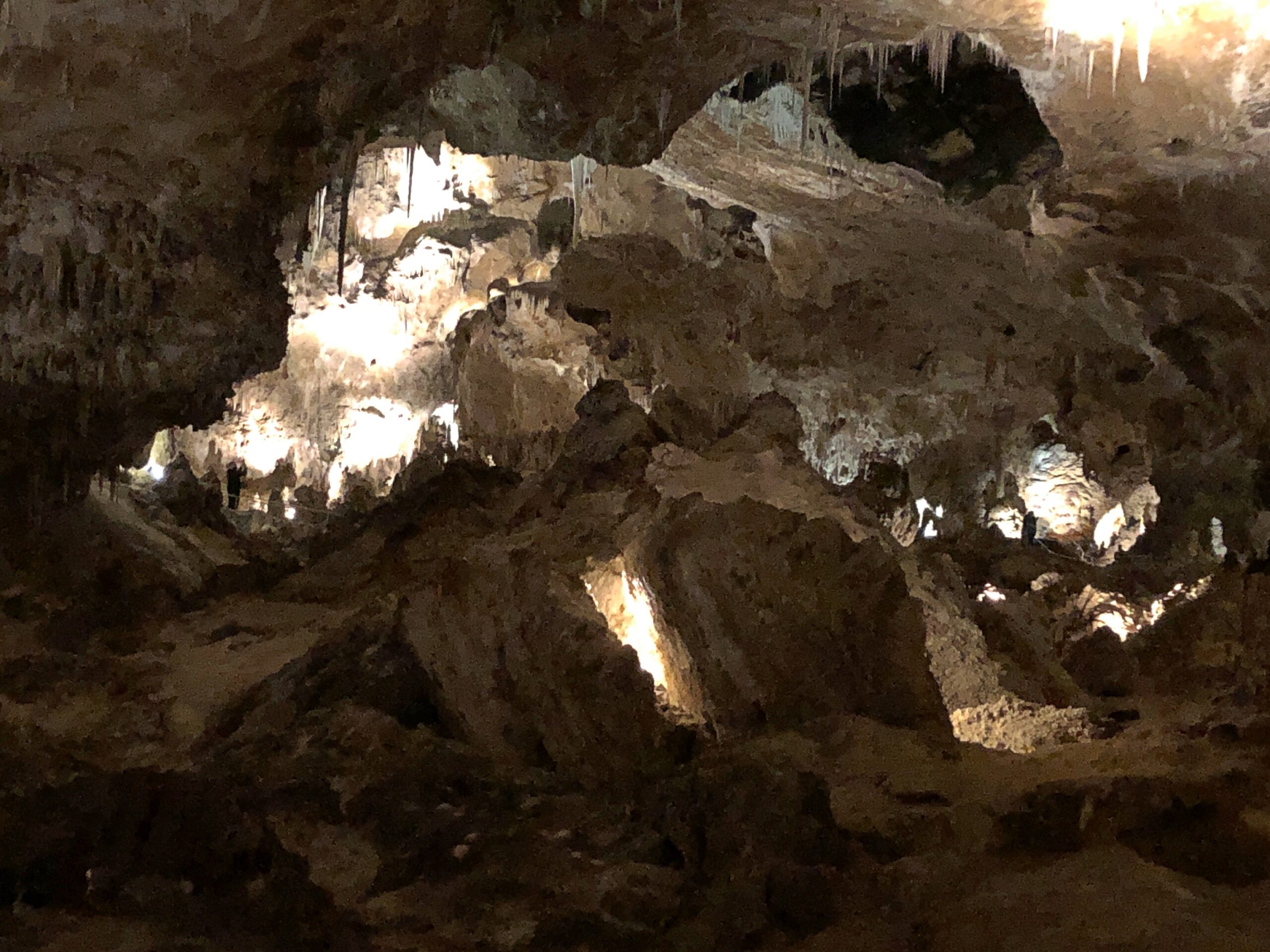
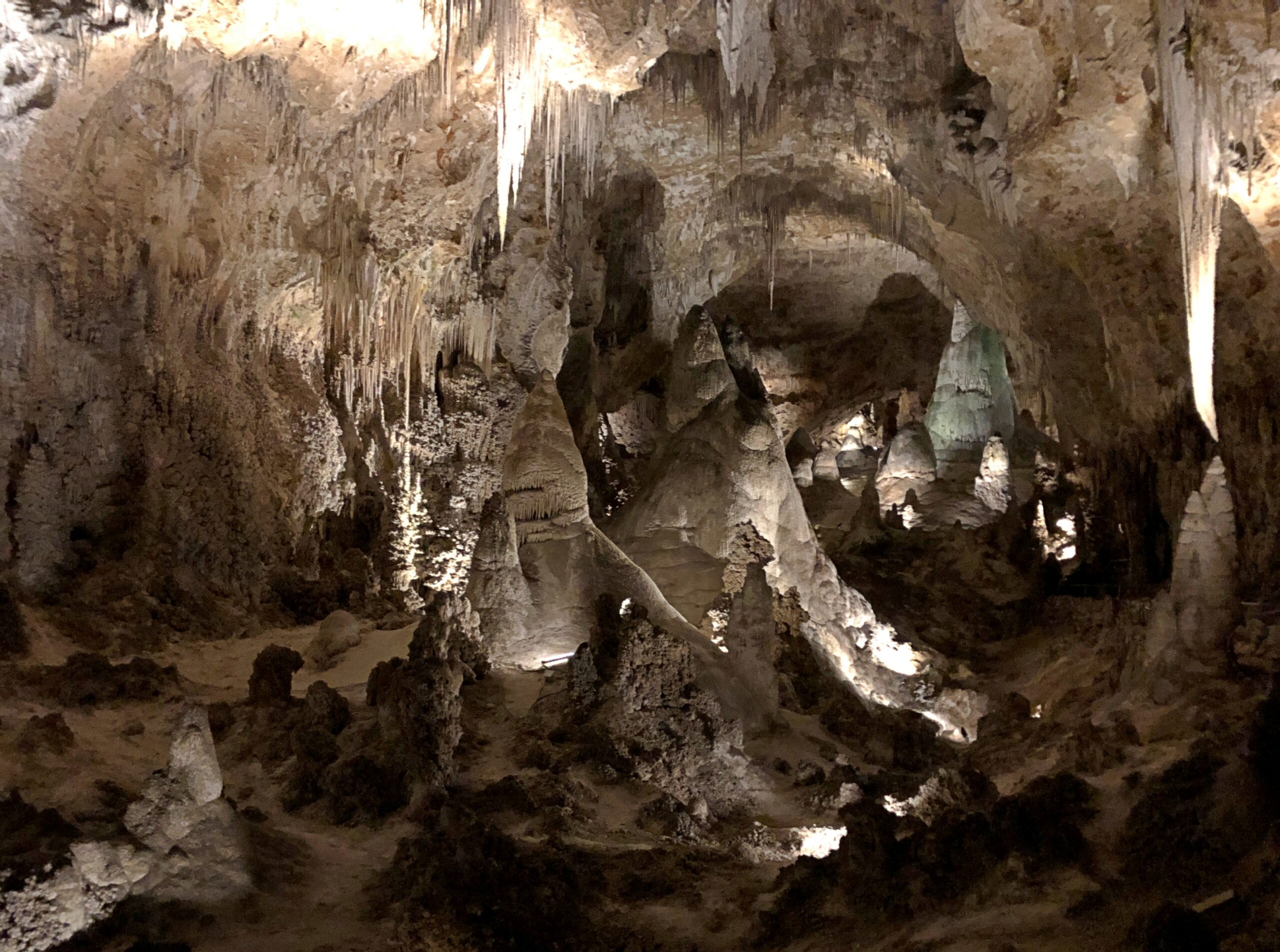
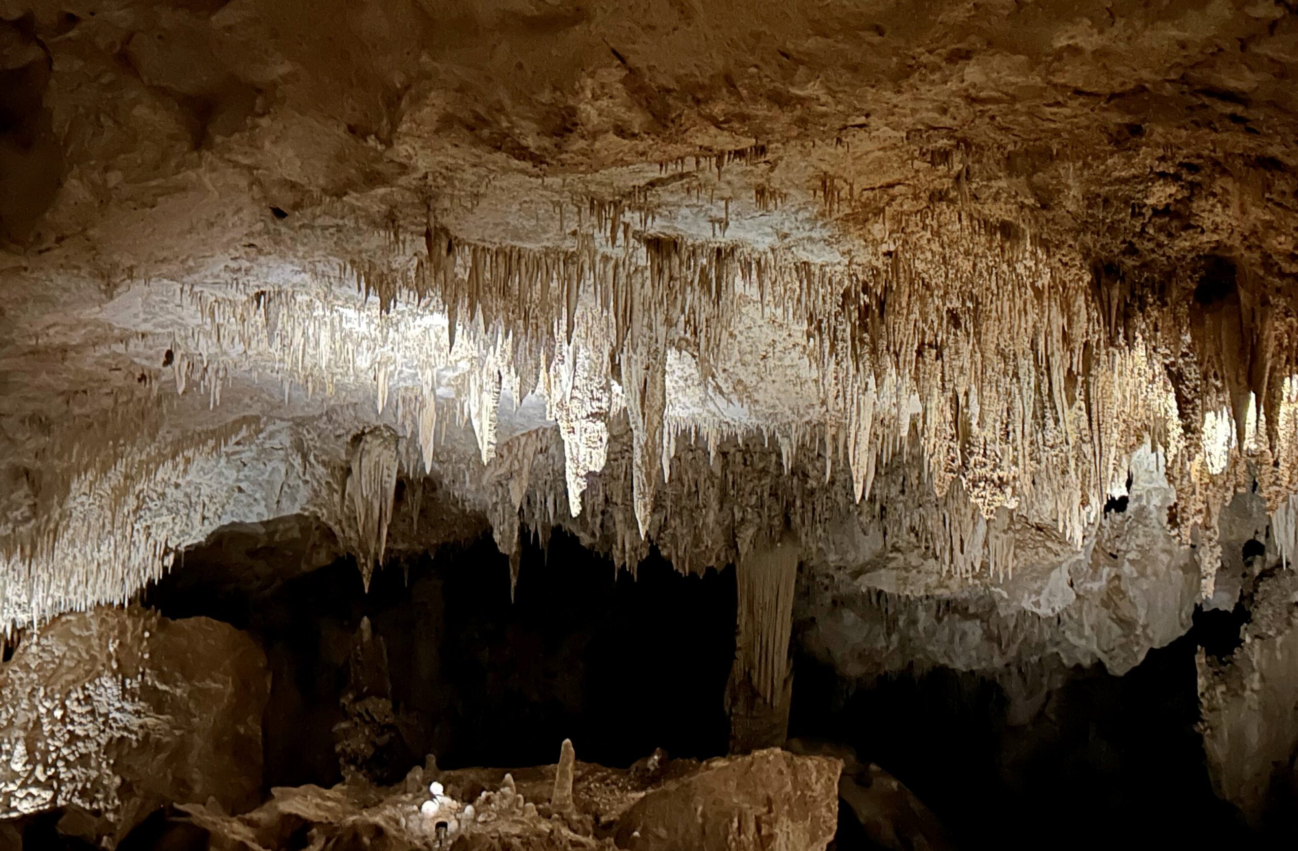
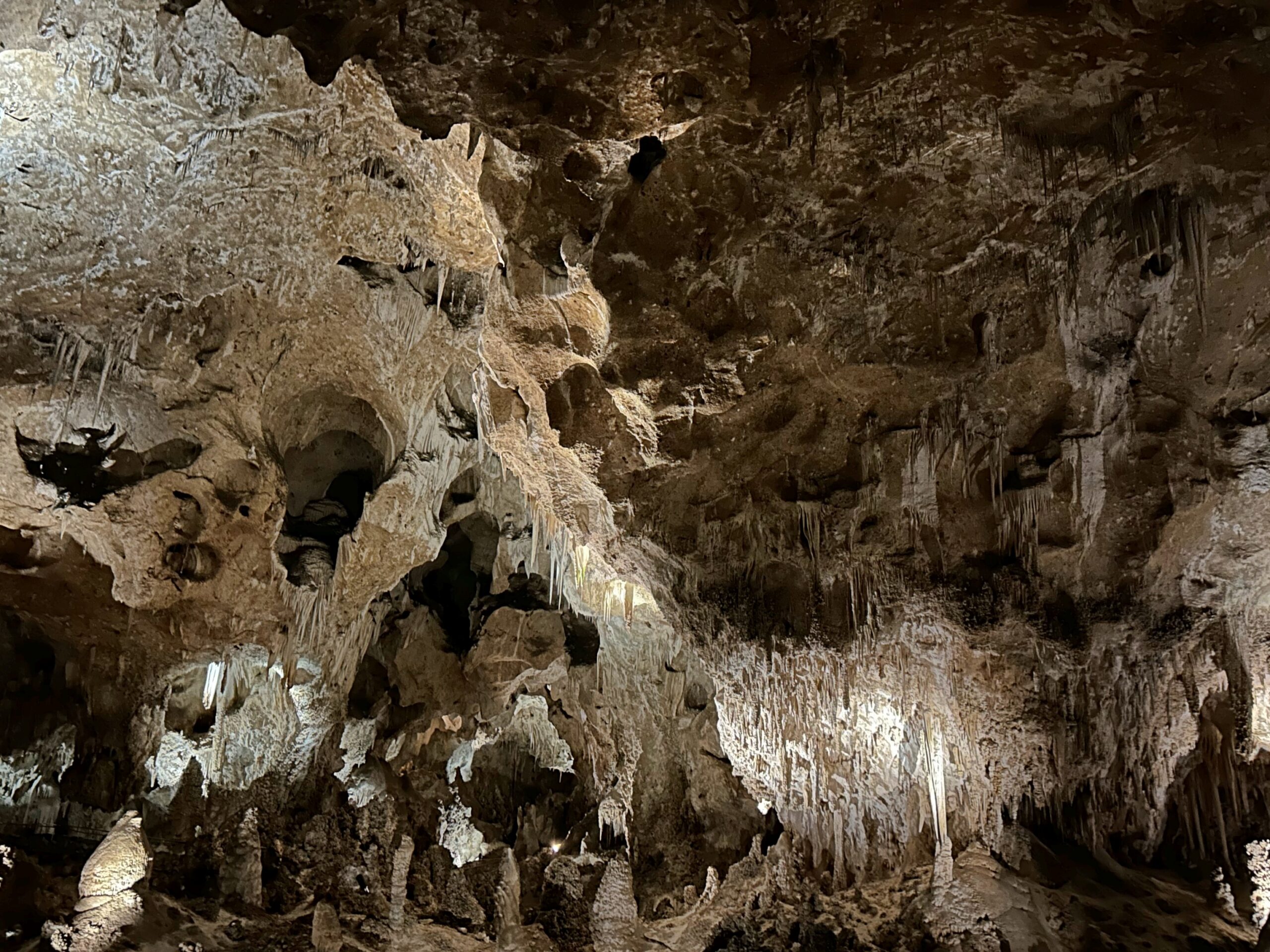
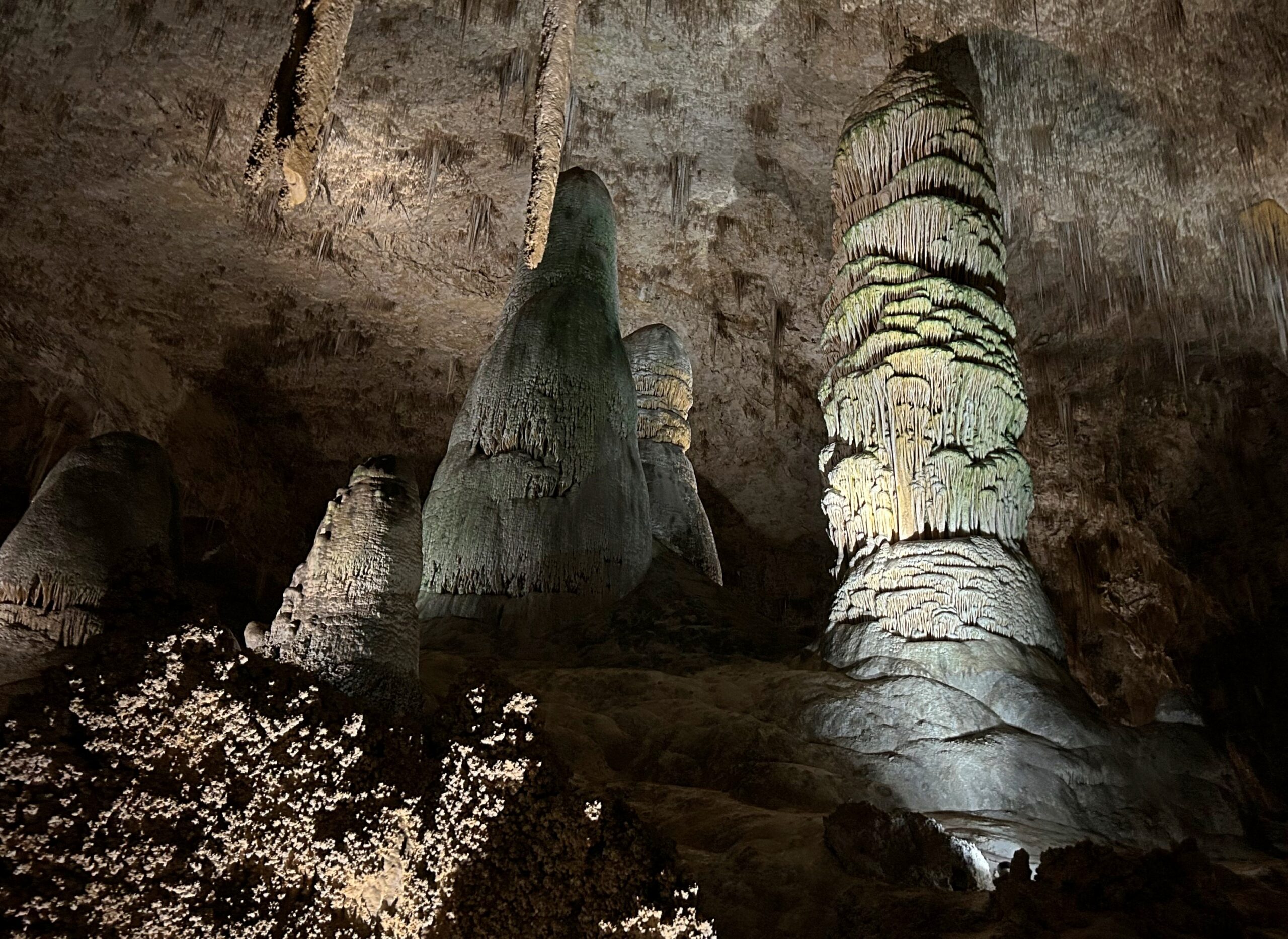
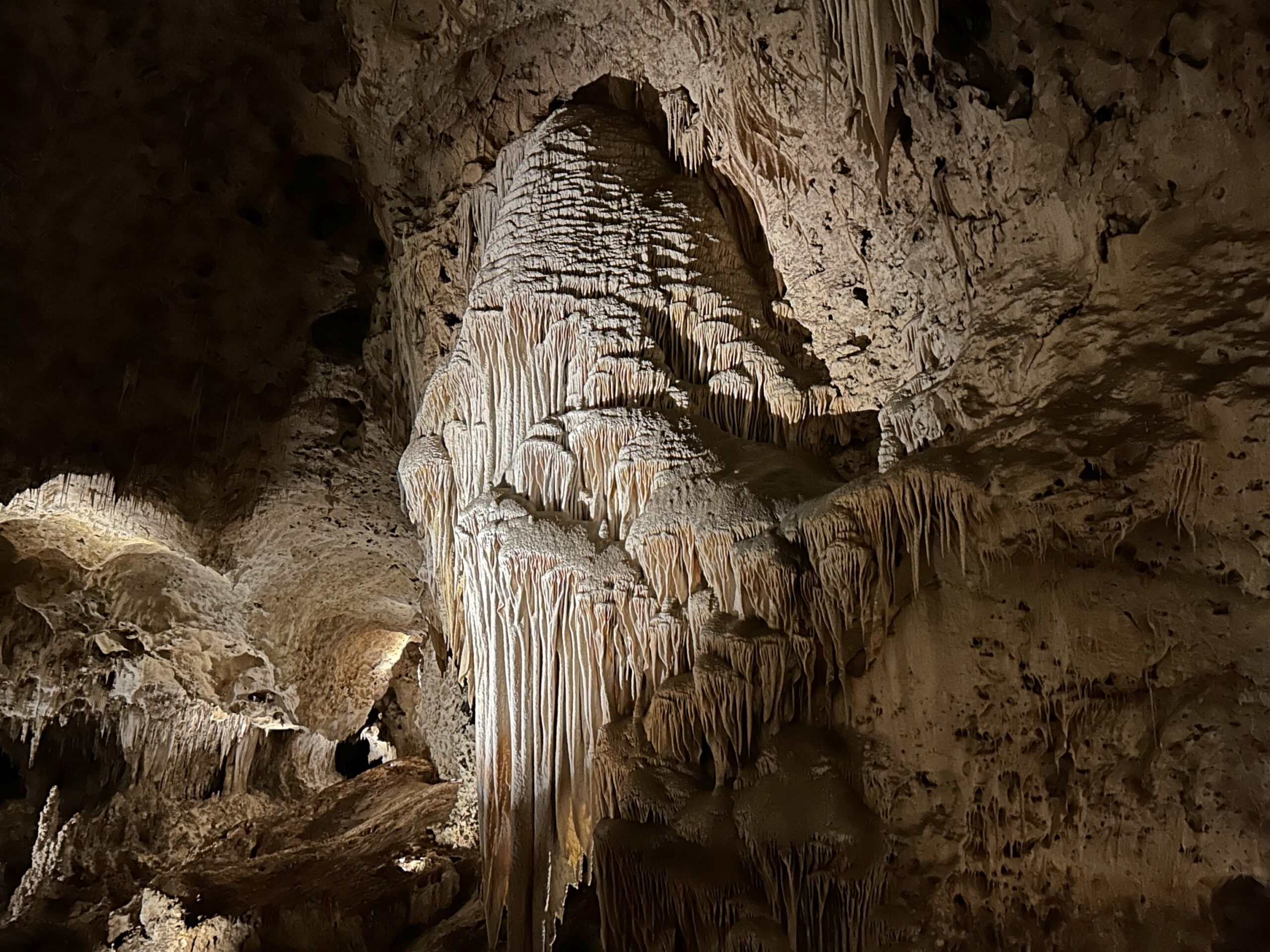
After a 30-minute downward walk, you arrive at the Big Room. “Within the Guadalupe Mountains there are more than 300 caves, and 119 known caves within Carlsbad Caverns National Park,” notes the USGS. “The Big Room in Carlsbad Cavern is the largest cave chamber in North America, with 8.2 acres of floor area.
A limestone phantasmagoria, to promote a word that not only fits, but needs to be used from time to time. The path through the Big Room takes about an hour. Towers such as these have names, but who could be bothered to remember them?
A parade of spectacular stalagmites and -tites and other unbelievably elaborate stone agglomerations, wet with millennia of cave building. In geological terms, about as permanent as an air bubble in a bank of mud, but for short-lived creatures with access to electric lights, a serious wow.
On the other hand, even a cave of superlatives such as Carlsbad begins — like fellow superlative attractions such as trails that wind endlessly through mountains or grand basilicas or giant art museums or even House on the Rock — to wear thin at the end. Wow, more spectacular stalagmites and -tites! More wet agglomerations!
But I quibble. Awesome is awesome, and I say that with the stress on awe.
First things first, especially since I just spent a month in Texas: Remember the Alamo. One hundred ninety years now.
At dinner at our friend Judith’s home late during my visit, she served a delicious cobbler for dessert, and suggested ice cream with it. I was able to bring up that Bennett Cerf-worthy pun, remember the à la mode.
This handy list of U.S. national parks, ranked by number of visitors in 2024, tells me that if you can’t drive to the highlights of the park, people aren’t going to go. Or, if they’ve never heard of the place, they aren’t likely to go either. I can only speculate that that’s because most people spend shockingly little time poring over maps, paper or electronic.
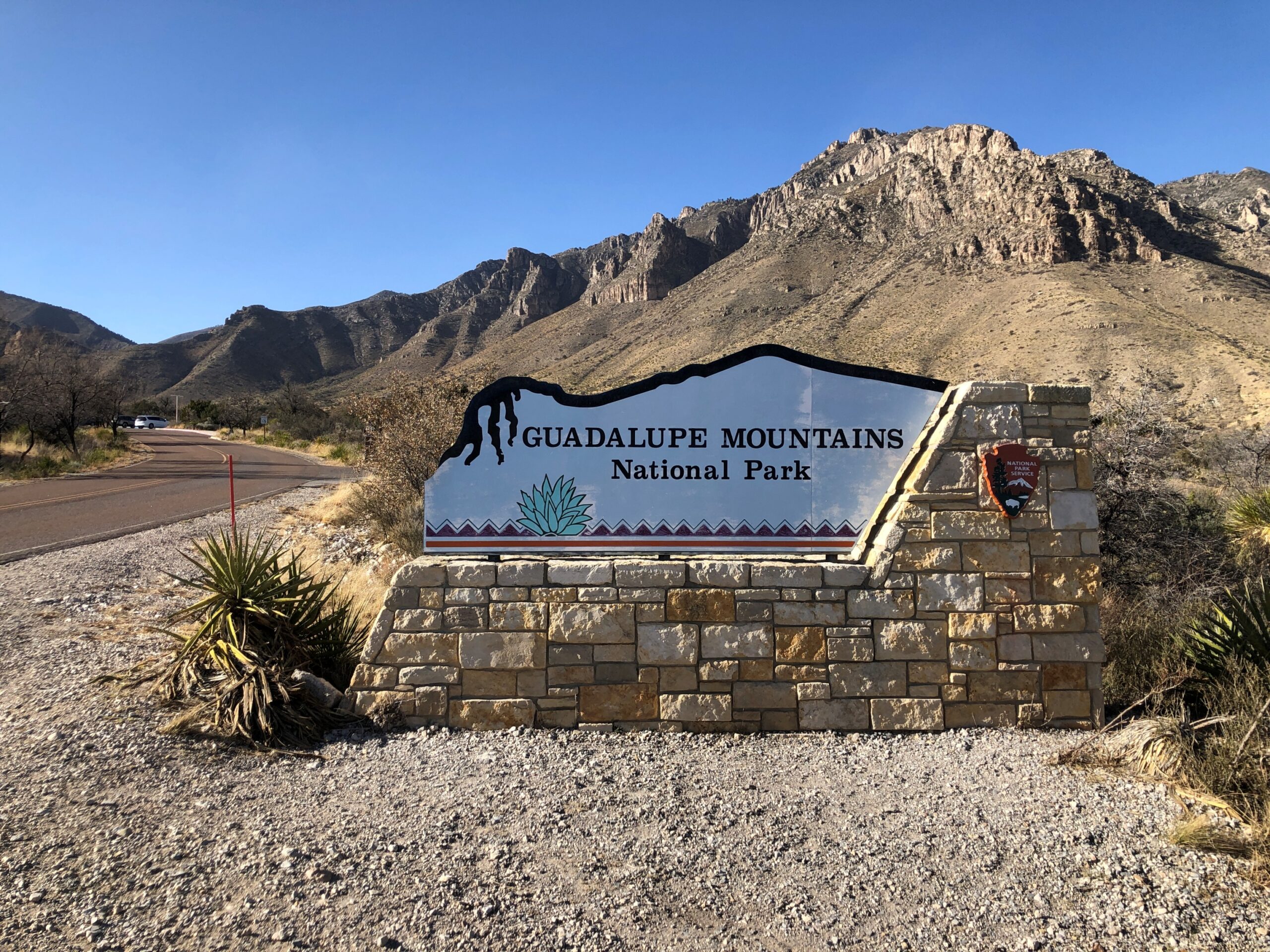
Speculation aside, Guadalupe Mountains National Park in West Texas is the 52nd most-visited park in the current count of 63 parks, which is to say, almost in the bottom 10 least-visited parks, just behind Congaree NP, but ahead of Voyageurs NP. There is a single road that goes to GMNP from the south: the two-lane, remote as can be Texas 54, which joins US 62/180 just south of the park. That’s the way we went on February 18, traveling from Marathon by way of Marfa and Van Horn.
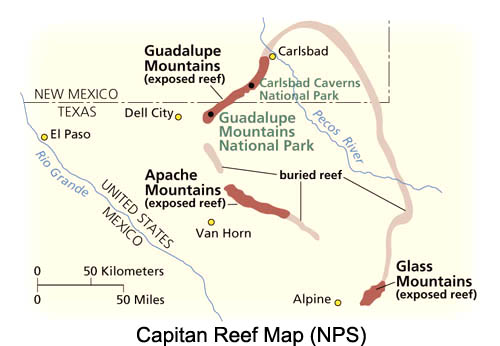
You can drive into the edge of the GMNP on US 62/180, stopping at Pine Springs Visitor Center. If you want to go further in, you walk, or ride a horse, I suppose. We spent a couple of hours in the park, taking short walks — totaling maybe a mile or so — near the visitors center. It was mid-afternoon when we arrived, and more importantly, we weren’t prepared for a long walk, or a horse ride either, especially on a very warm day.
But I did want to stop by, just to be sure that I’d really been to the park. That’s how I think. We might have stopped briefly in the area in August 1972 during our family cave vacation — I imagine there was a roadside stop to admire the Guadalupe Mts., at least — but maybe not. Also, a little reading tells me that the park itself didn’t formally exist in August of that year, when we went to Carlsbad Caverns, but came into being on September 30, 1972. So technically there was no park to visit at that moment. In any case, now I can say for sure that I’ve been to GMNP, as one of the 37 I’ve visited in the U.S.
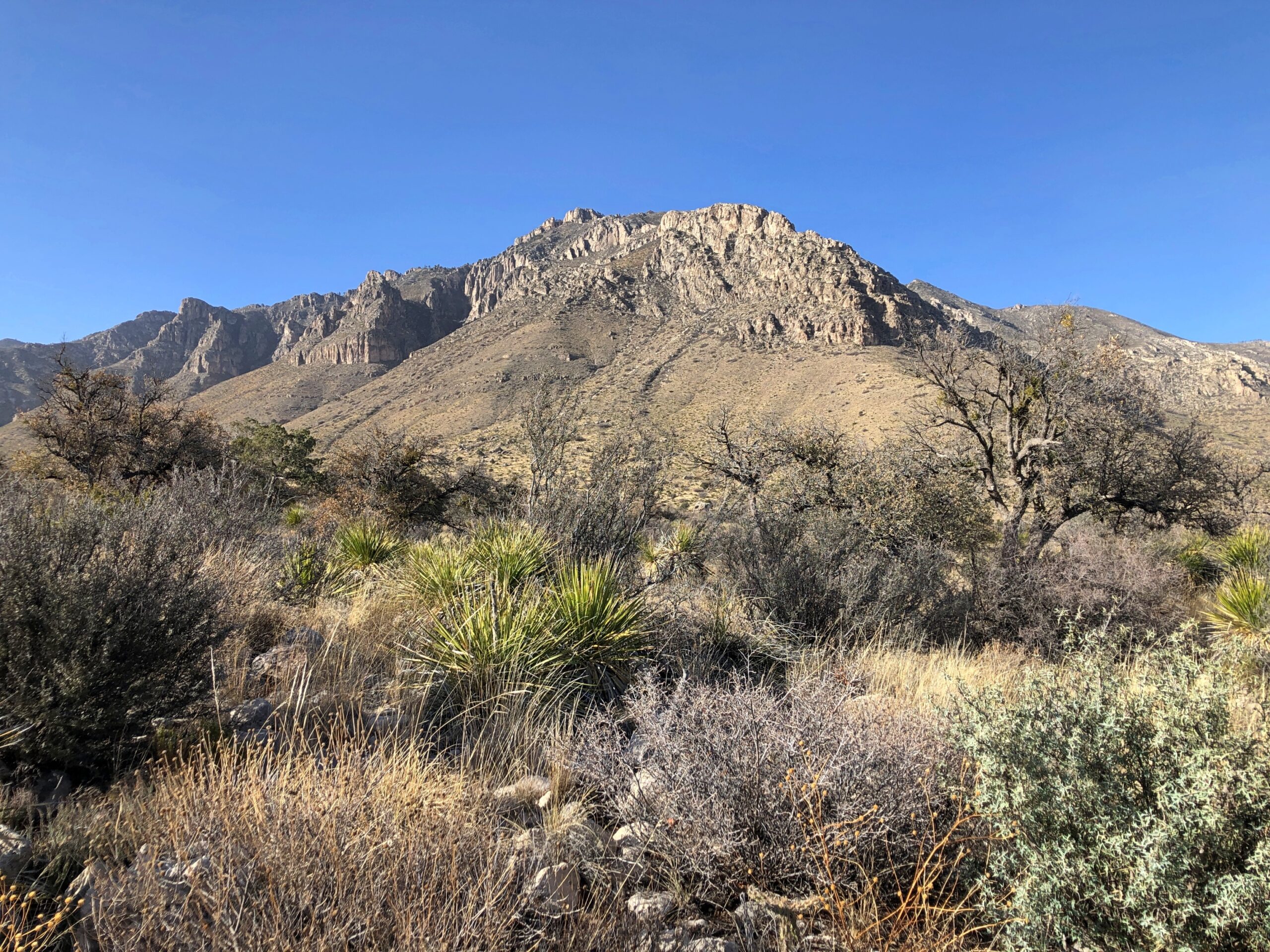
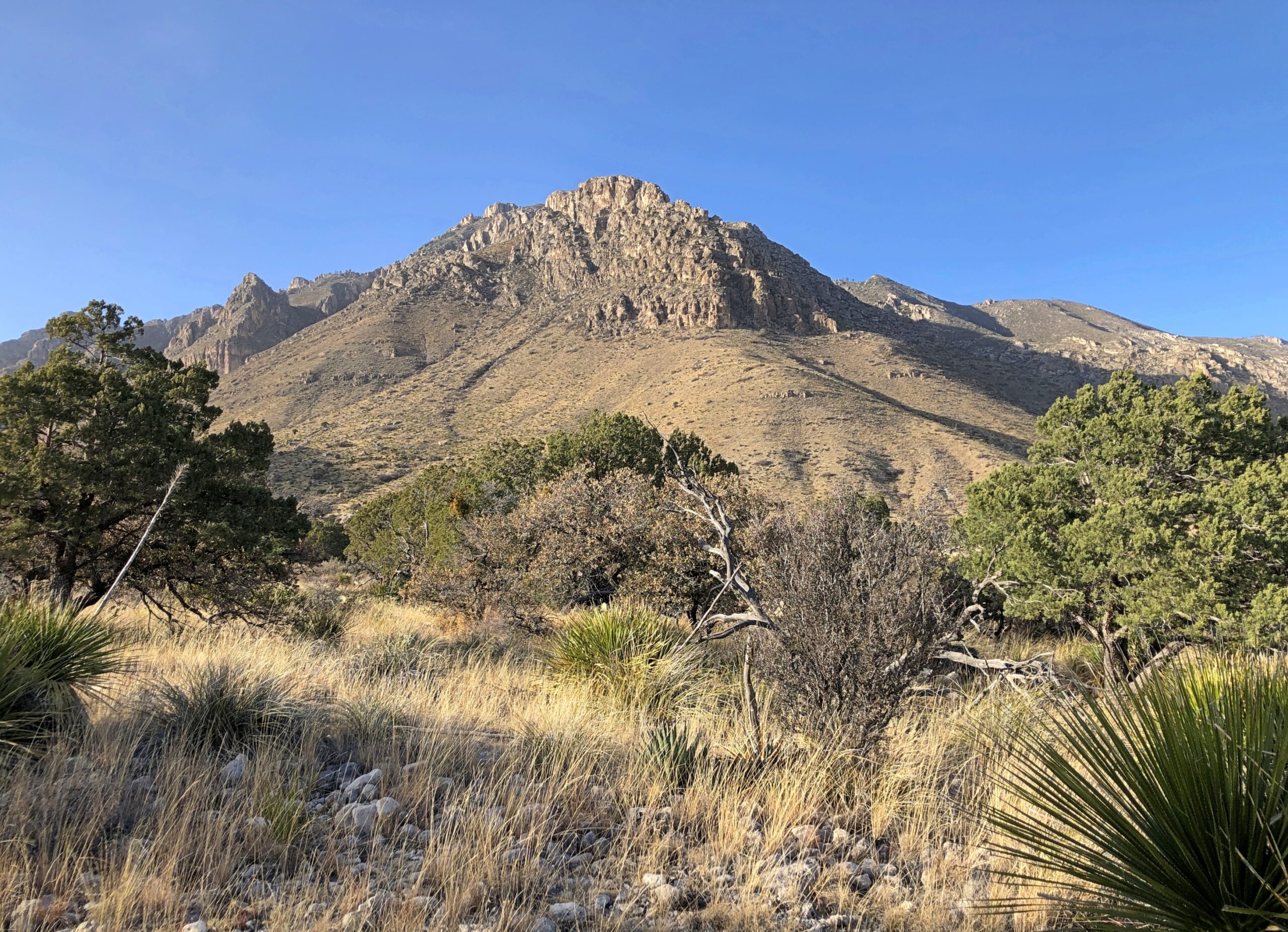
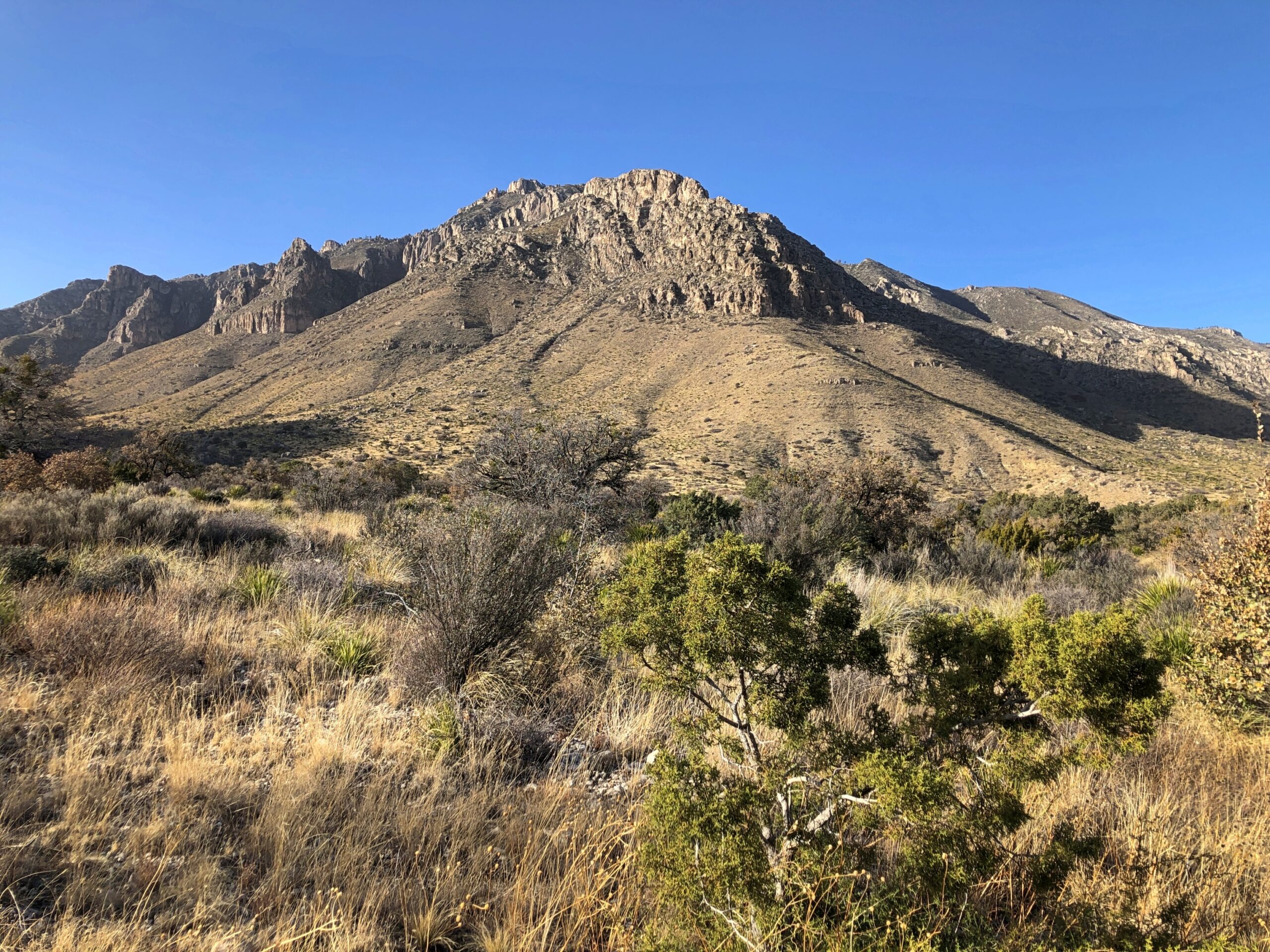
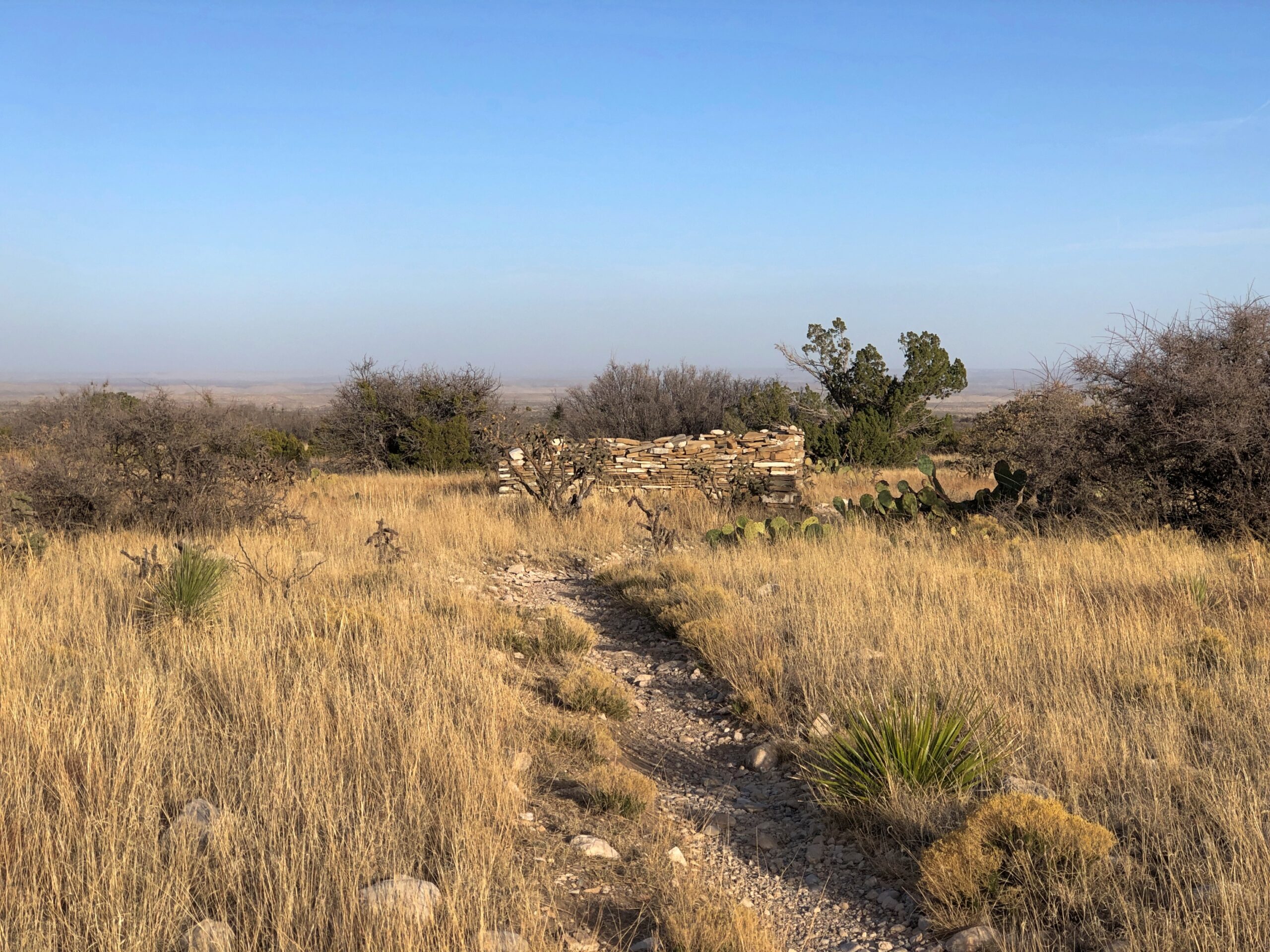
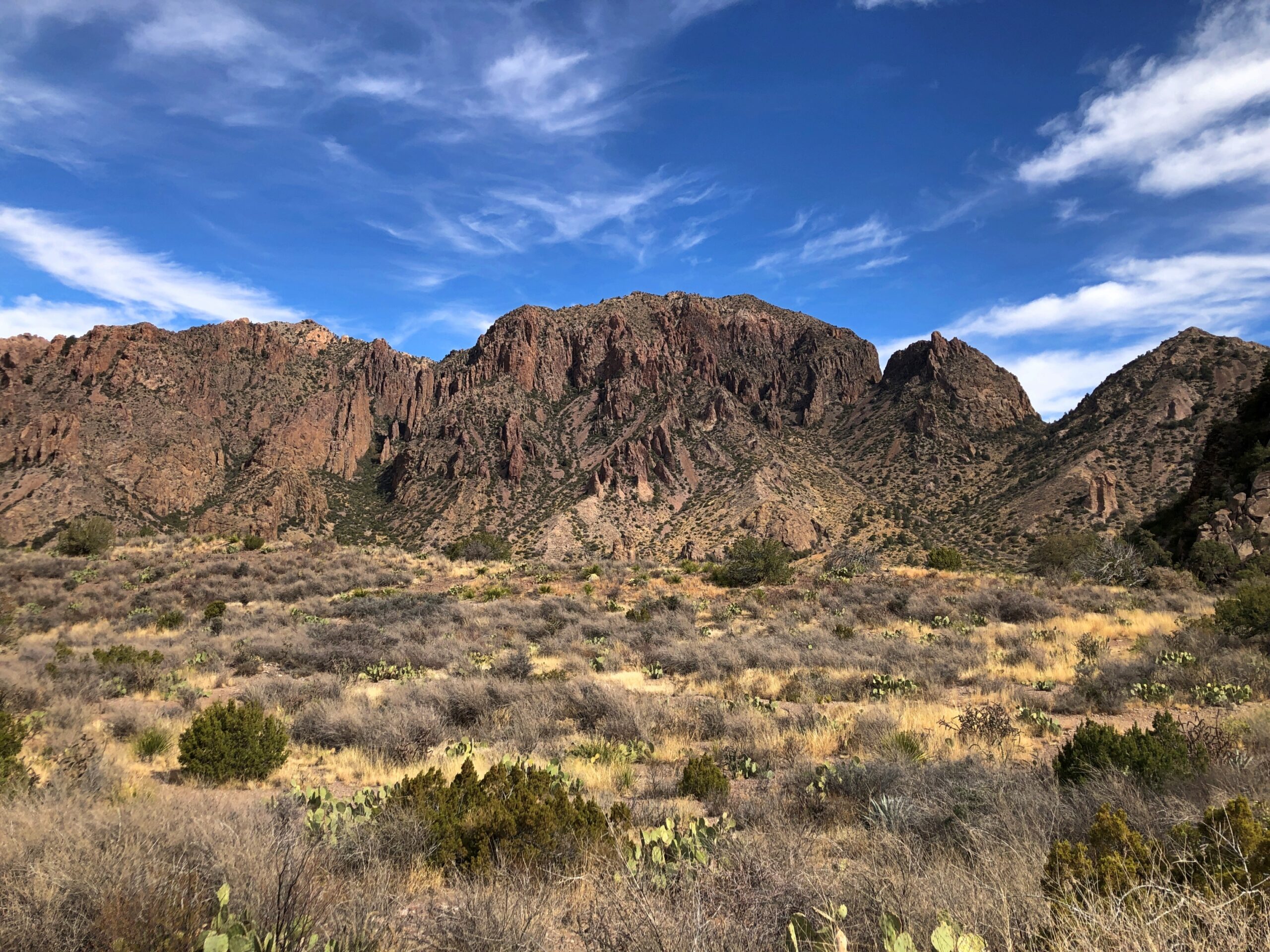
Even from the visitor center, the Guadalupe Mountains are close at hand.
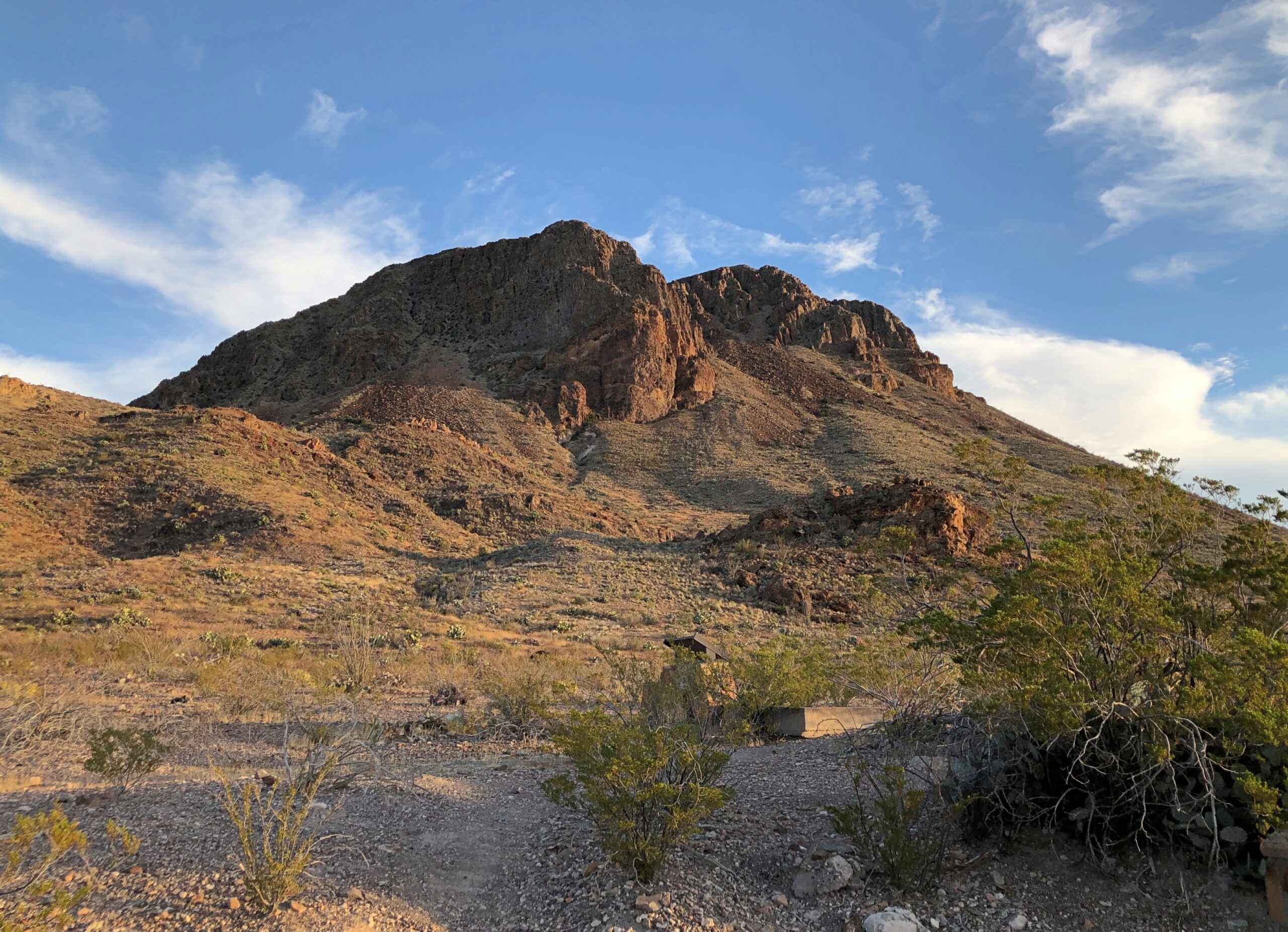
That is Hunter’s Peak, whose summit is 8,368 feet above sea level, and a fair ways above the visitors center, whose elevation is 5,734 feet. Not huge, but still a pretty photogenic uplift of the Earth’s crust, I’d say.
The sun was in a good position to light up that peak. Not so much for Guadalupe Peak (elev. 8,751), the highest elevation in Texas, at least from where we stood.
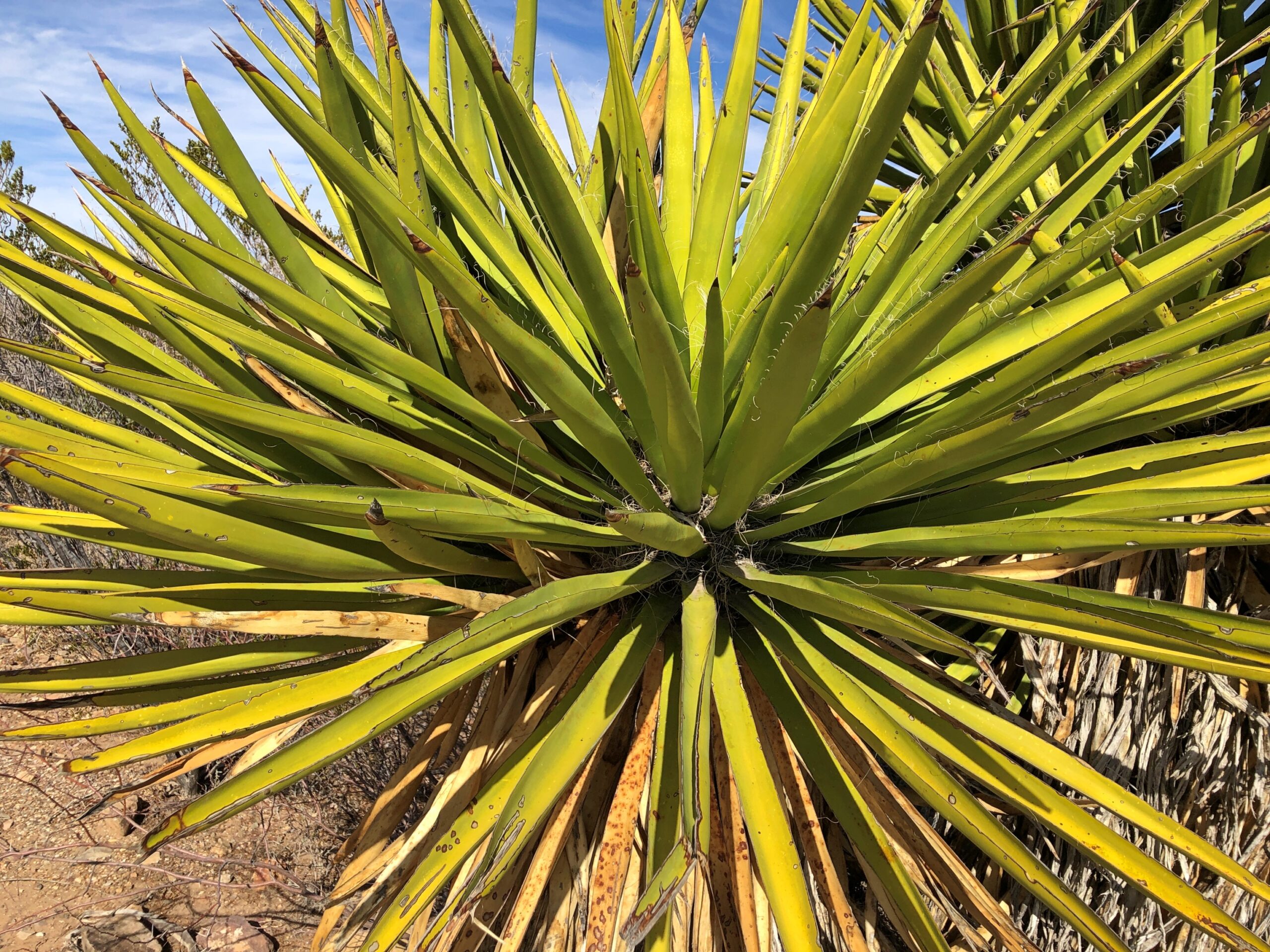
Flora along the way. Fauna wasn’t to be seen, except for a few bugs. But they are out there. Maybe some feral pigs.
Speaking of map ignorance, how many people in the wider world realize Texas has mountains? I knew that, of course, but only vaguely that they are relics of an ancient reef, called Capitan Reef by us clever apes; one formed 260 to 270 million years ago – before dinosaurs, even – when the area was under a shallow tropical sea. Visiting the park schools you a little on that hard-to-imagine mountain formation process, in which a thousand thousand years is a small turn of the wheel.
Guadalupe Mountains National Park
“Over millions of years calcareous sponges, algae and other lime-secreting marine organisms precipitated from the seawater,” notes the NPS. “Along with lime, they built to form the 400-mile-long, horseshoe shaped Capitan Reef. Eventually the sea evaporated… the reef was entombed for millions of years until a mountain-building uplift exposed part of it.”
Much more recent chemical reactions created the dazzling void we call Carlsbad Cavern inside the uplifted reef, but that’s a story for another day.
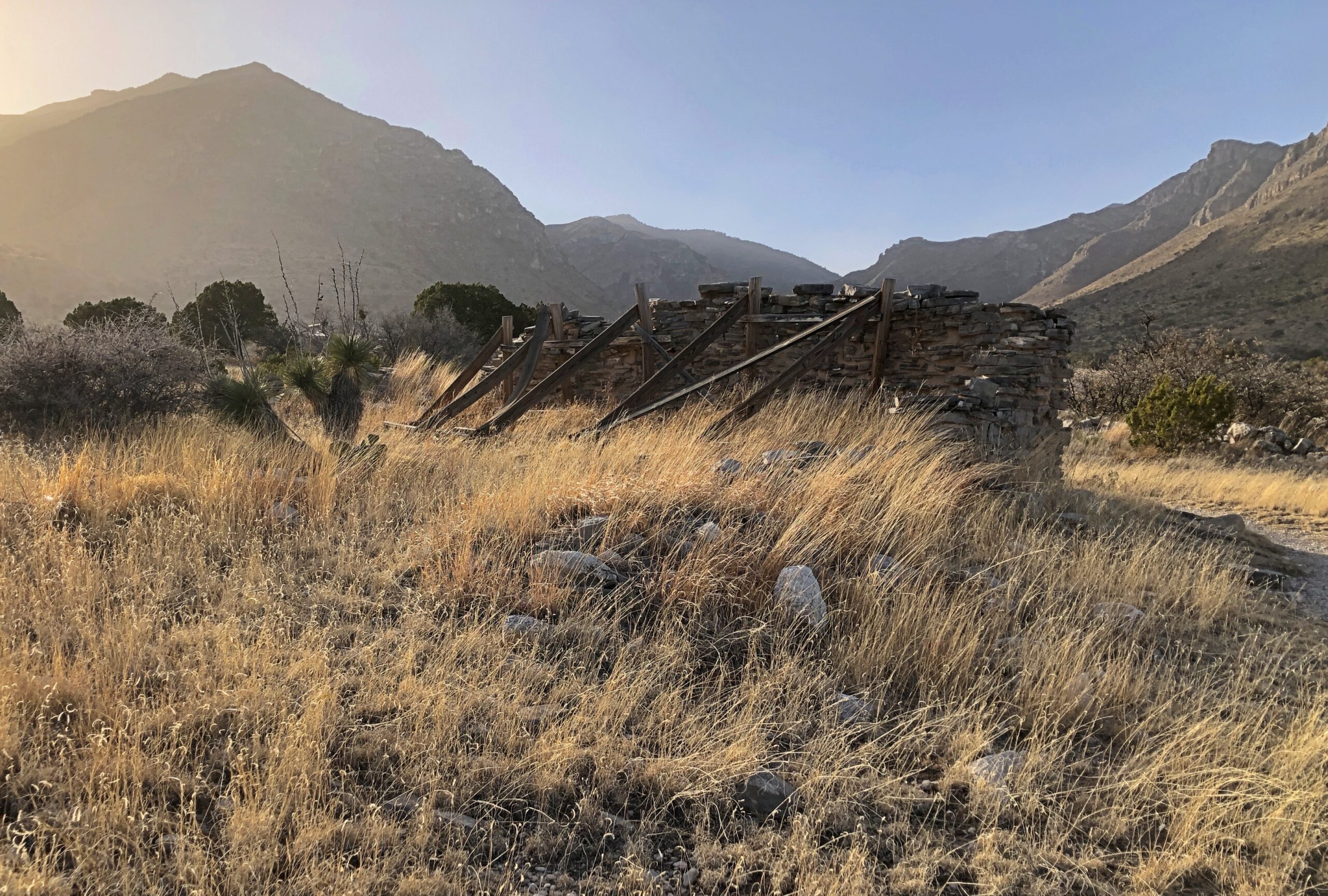
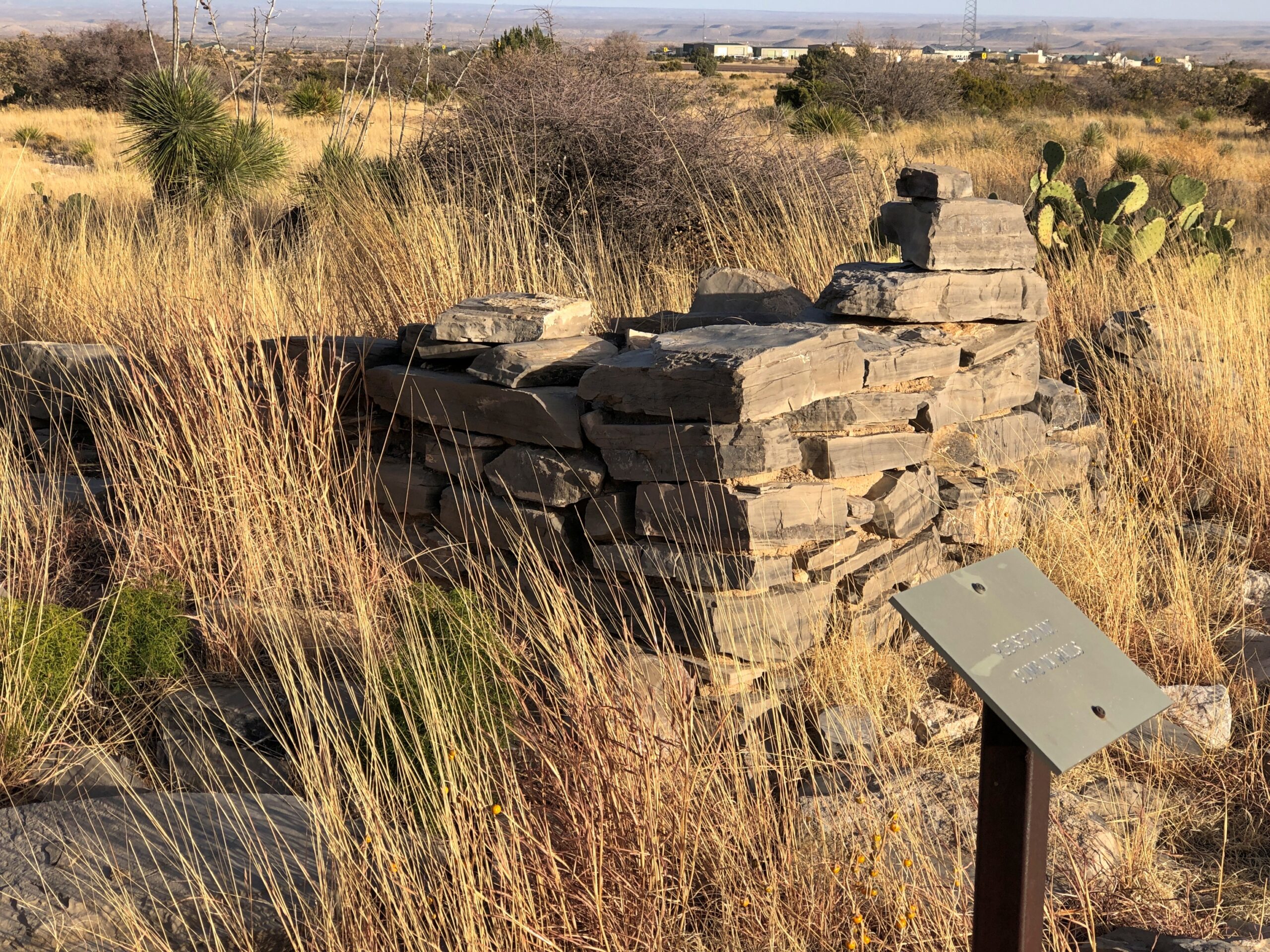
One trail from the visitor center leads to the ruins of a way station on the Butterfield stagecoach route.
Or more exactly, the epic plains and desert route used by the Overland Mail Company, whose stages did mail runs from St. Louis and Memphis to San Francisco from 1858 to 1861. Upstate New Yorker John Butterfield, a stage operator of great experience, was president of the Overland Mail Company and — incidentally — founder of American Express. Quite the story, depicted in movies of earlier times and for all I know, dime novels, though not so much any more.
That stage took passengers, too. Those who gripe about the minor discomforts of modern air travel would be advised to ponder the extreme discomforts of such a journey.
Per Wiki: “A correspondent for the New York Herald, Waterman L. Ormsby, remarked after his 2,812-mile (4,525 km) trek through the western US to San Francisco on a Butterfield Stagecoach thus: ‘Had I not just come out over the route, I would be perfectly willing to go back, but I now know what Hell is like. I’ve just had 24 days of it.’ “
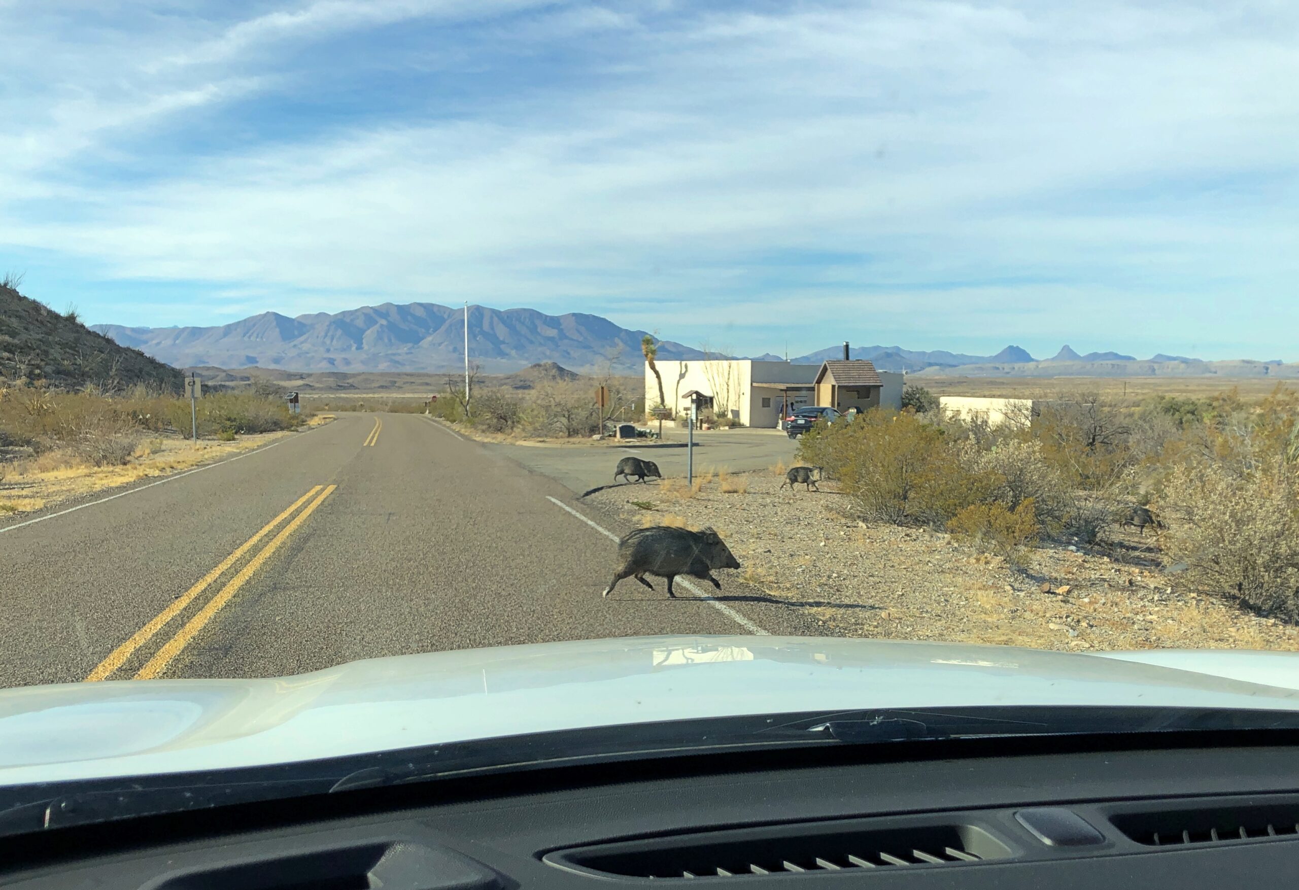
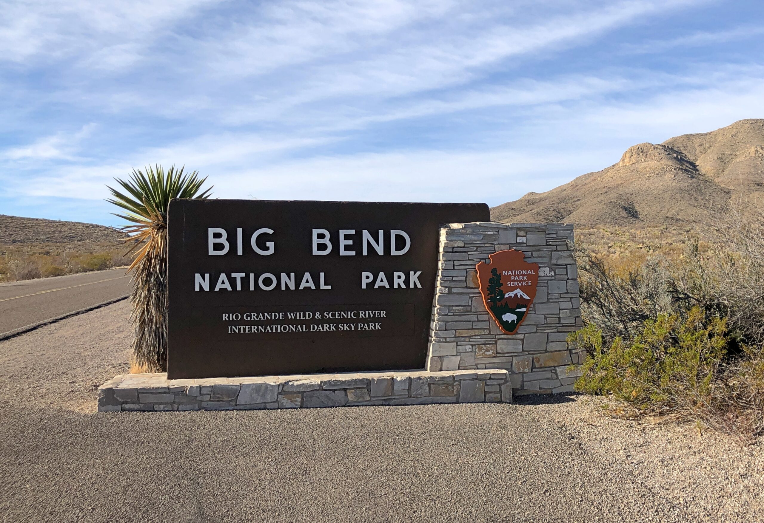
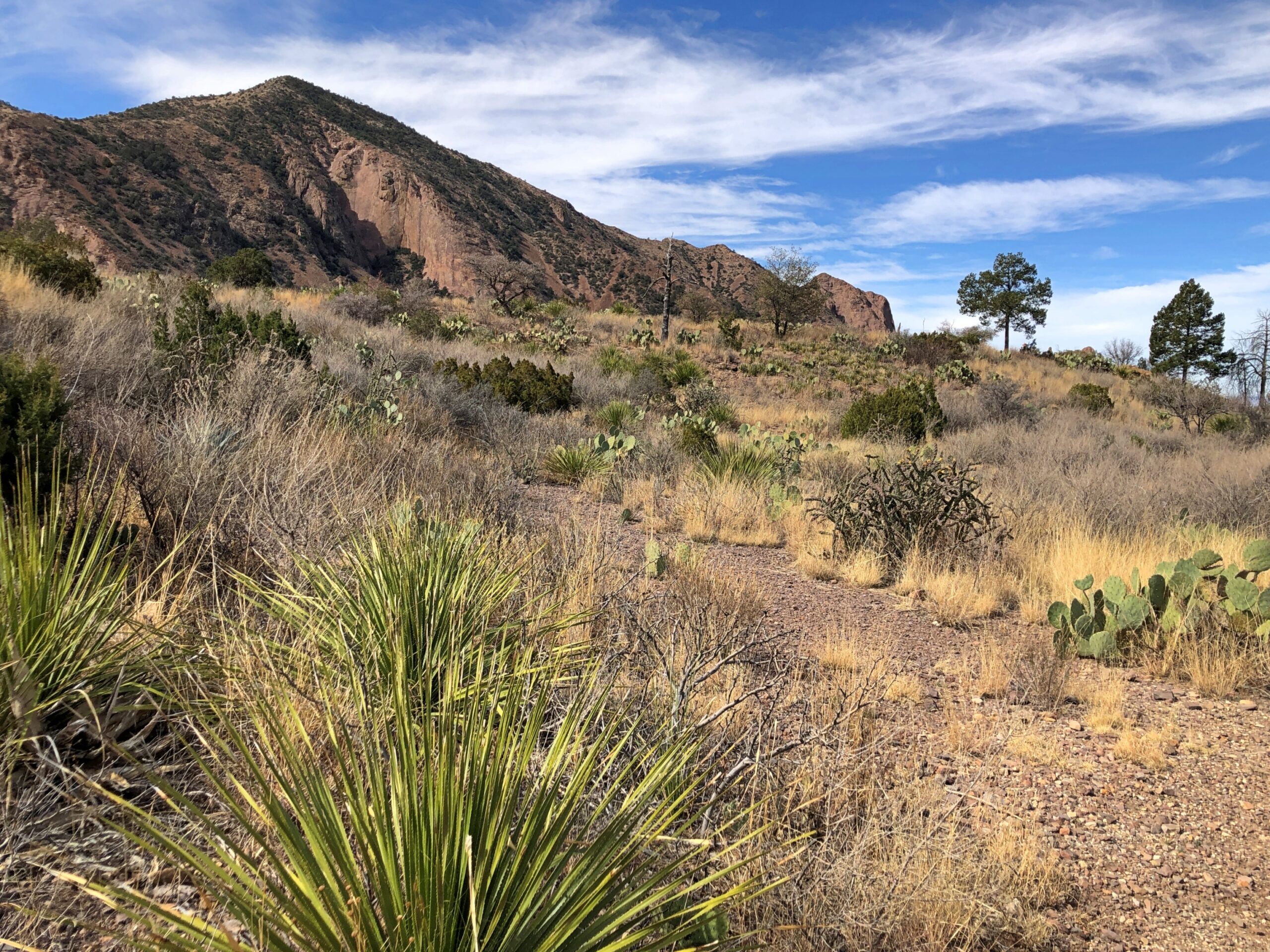
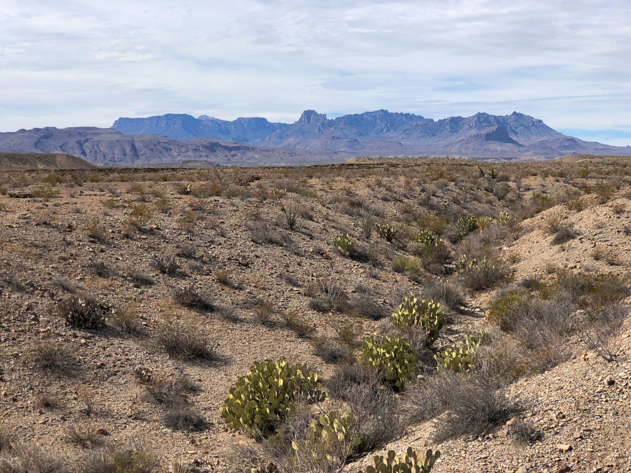
Texas has a feral hog problem. Driving at night on Texas 130 east of Austin, where the speed limit is 85 mph – the highest posted limit in the Western Hemisphere, according to Wiki – car-hits-hog is no idle scenario. Busted hog, busted machine. So I drove with care when I spotted what I took to be wild hogs on the remote main road into Big Bend National Park.
Took me a minute to work out that they weren’t quite pigs, though clearly evolutionary cousins: javelinas. Also known as peccaries. One of the many creatures living in the desert reaches of Big Bend.
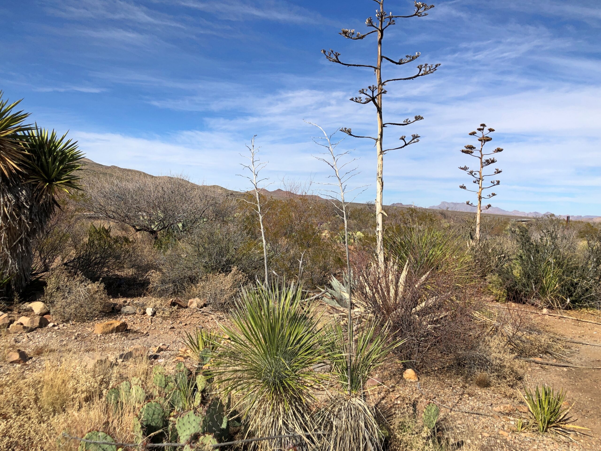
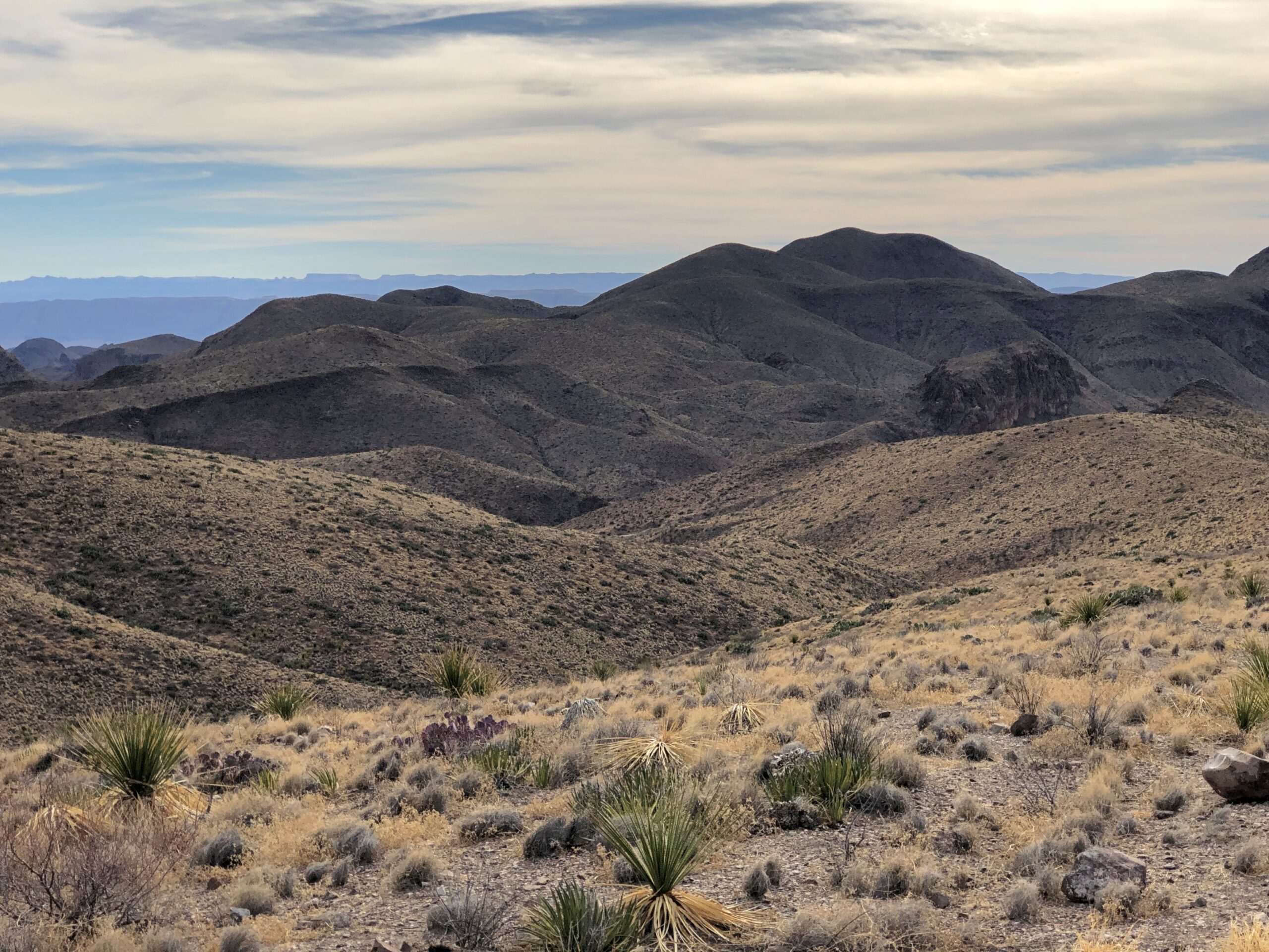
We’d come on February 17 for Yuriko’s first visit to the park, but not mine. Not an issue, since no two visits are ever alike in such an epic desert. First stop, a trail near the visitor center, for a closeup look at some flora, and signs describing them.
We drove where it was possible to drive in the park, such as Chisos Basin, and did some walking where it was possible to walk. But not long walks, since temps were touching 90 F.
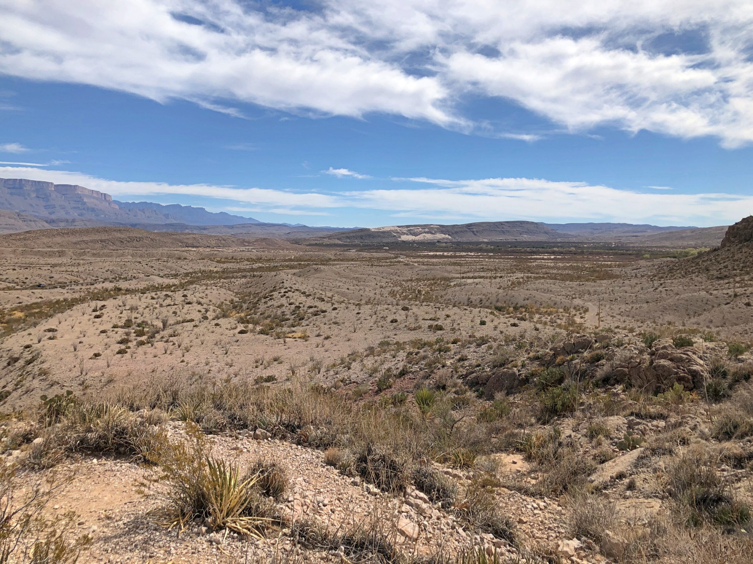
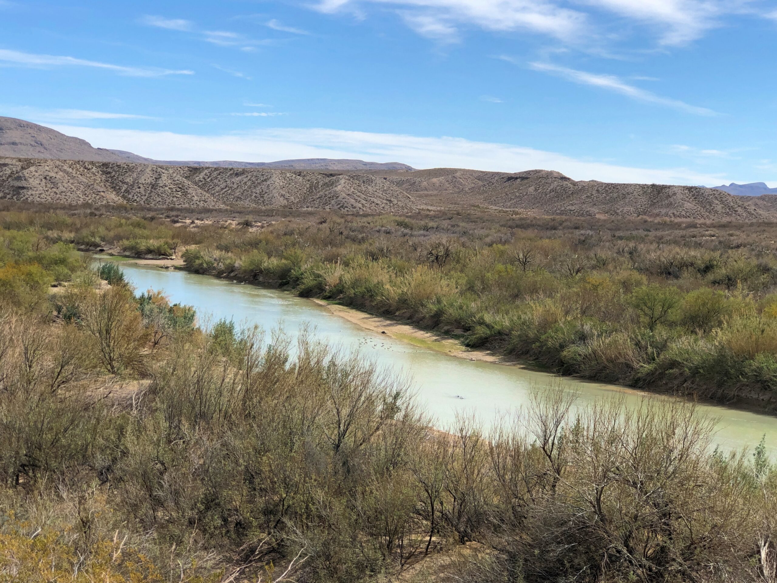
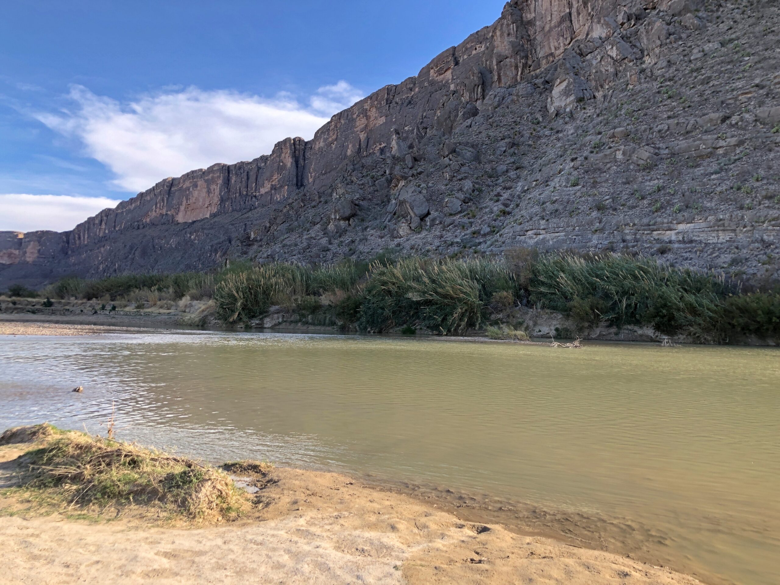
Toward the east end of the park is a spot off the road labeled “Rio Grande View” on the map.
Good view, including some of the Sierra del Carmen, but you have to squint to see the Rio Grande. There it is, I said, spotting a narrow ribbon of greenery off in the distance that might have been the river. Yuriko wasn’t sure she could see it.
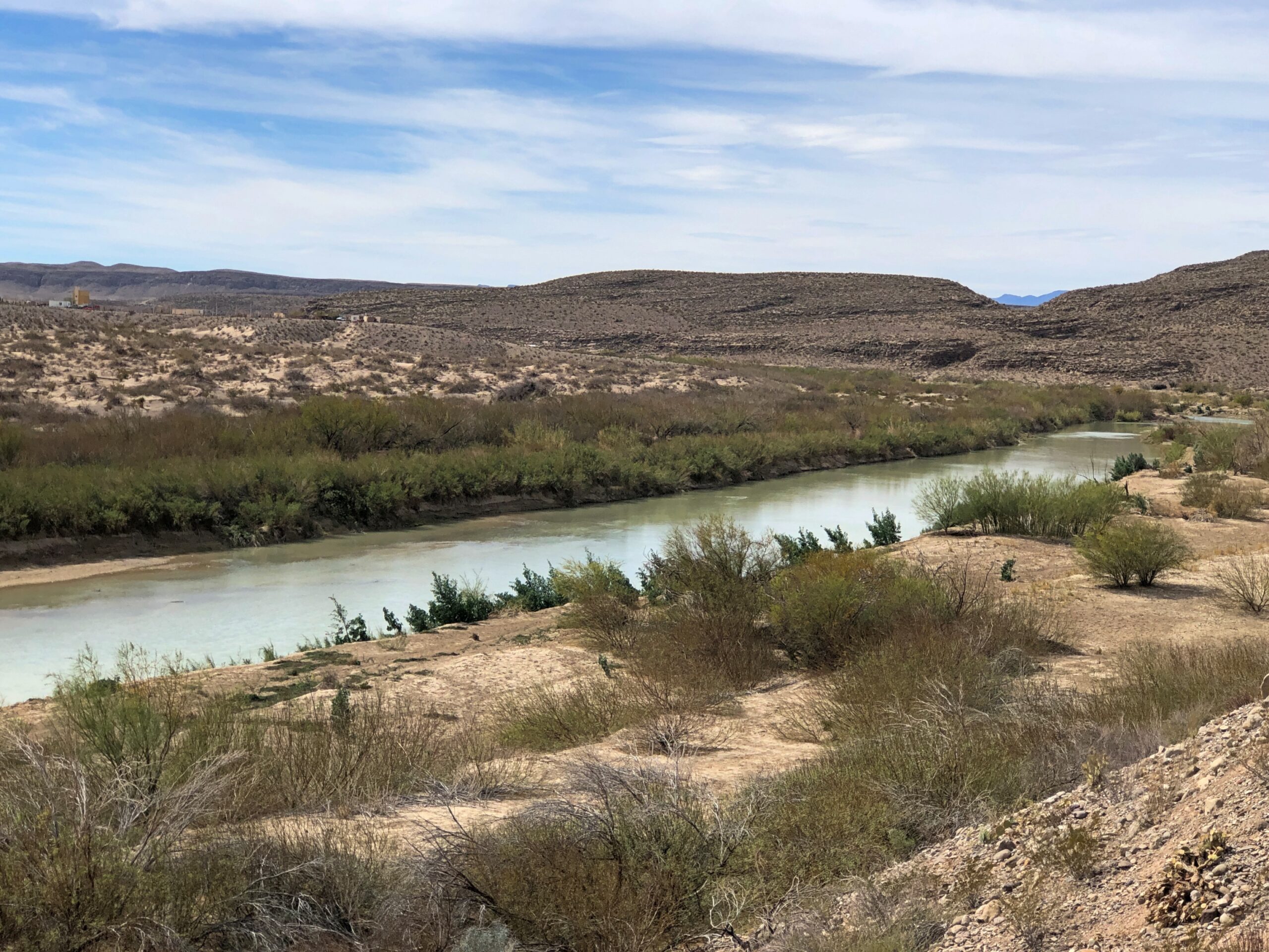
A few miles further east, the riverine border is very much visible from a bluff atop the U.S. side, the Boquillas Canyon Overlook.
We’d come to the eastern part of the park for the Hot Spring — the ruins of a bathhouse, these days — but flooding last year made the unpaved road leading that way impassable to vehicles. It was possible to walk there two miles or so along the ruined road, treating it as a track, but we opted out of that, taking the formula Heat + Age + Long Walks = Trouble seriously.
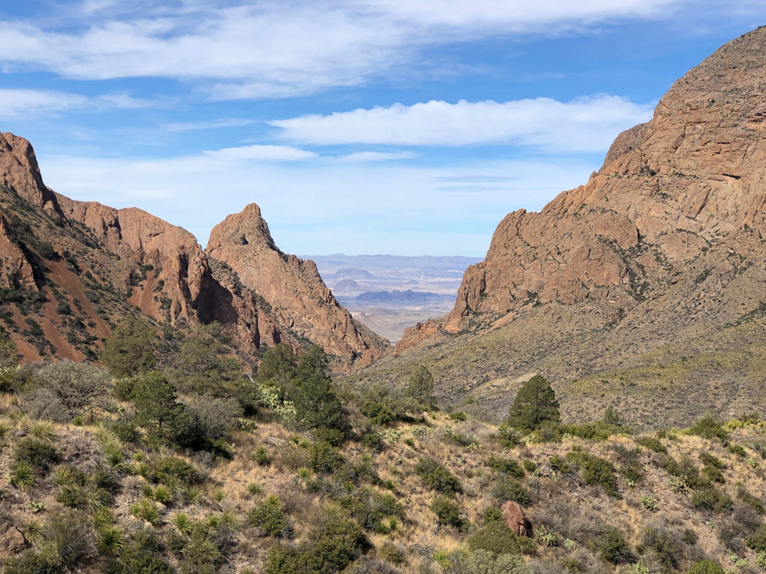
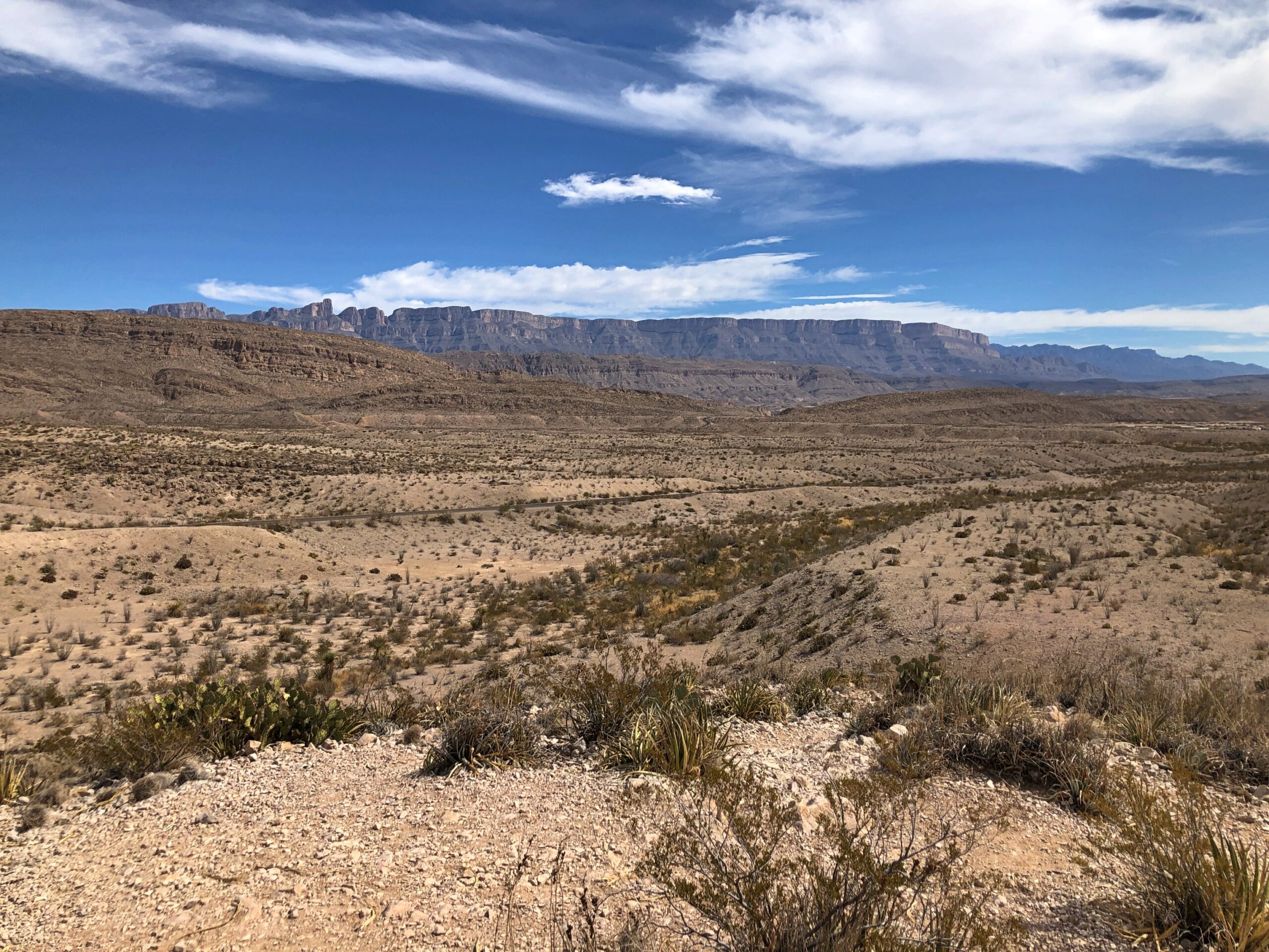
No matter, we backtracked and went to the Ross Maxwell Scenic Drive, a road I’d thoroughly enjoyed in 2018, and I did again.
An overlook on that road shows you how little territory a road actually occupies. A ribbon crossing a vast expanse.
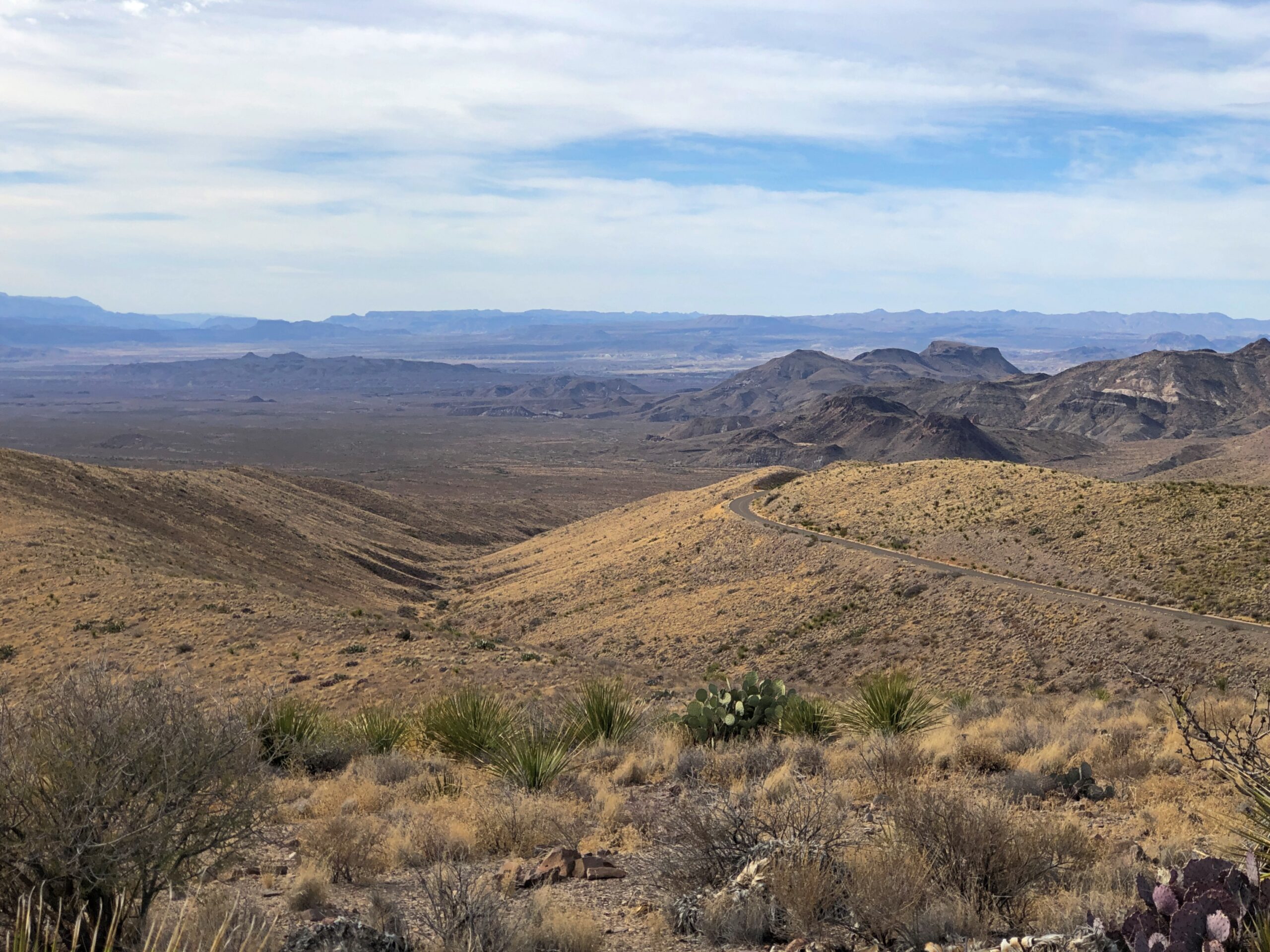
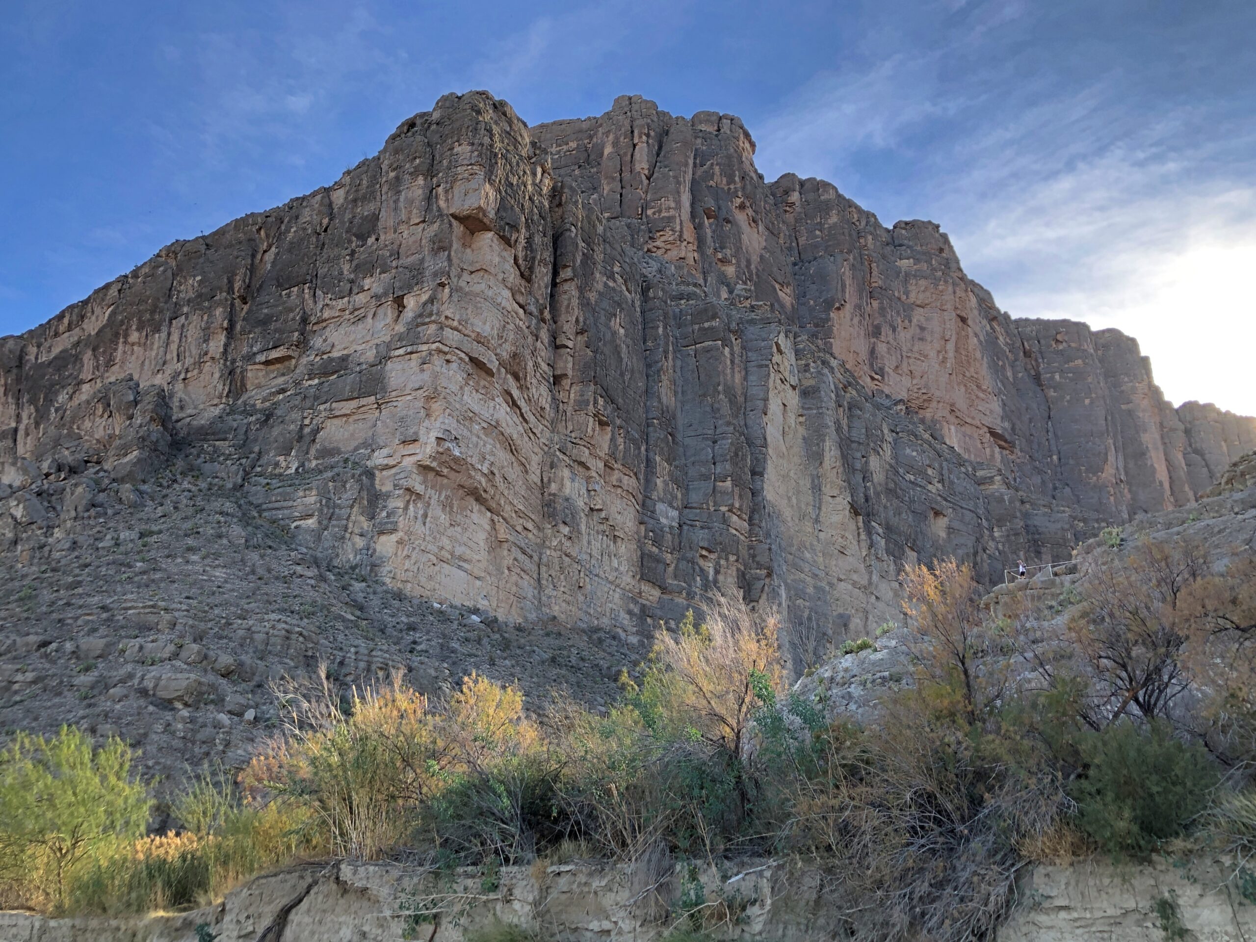
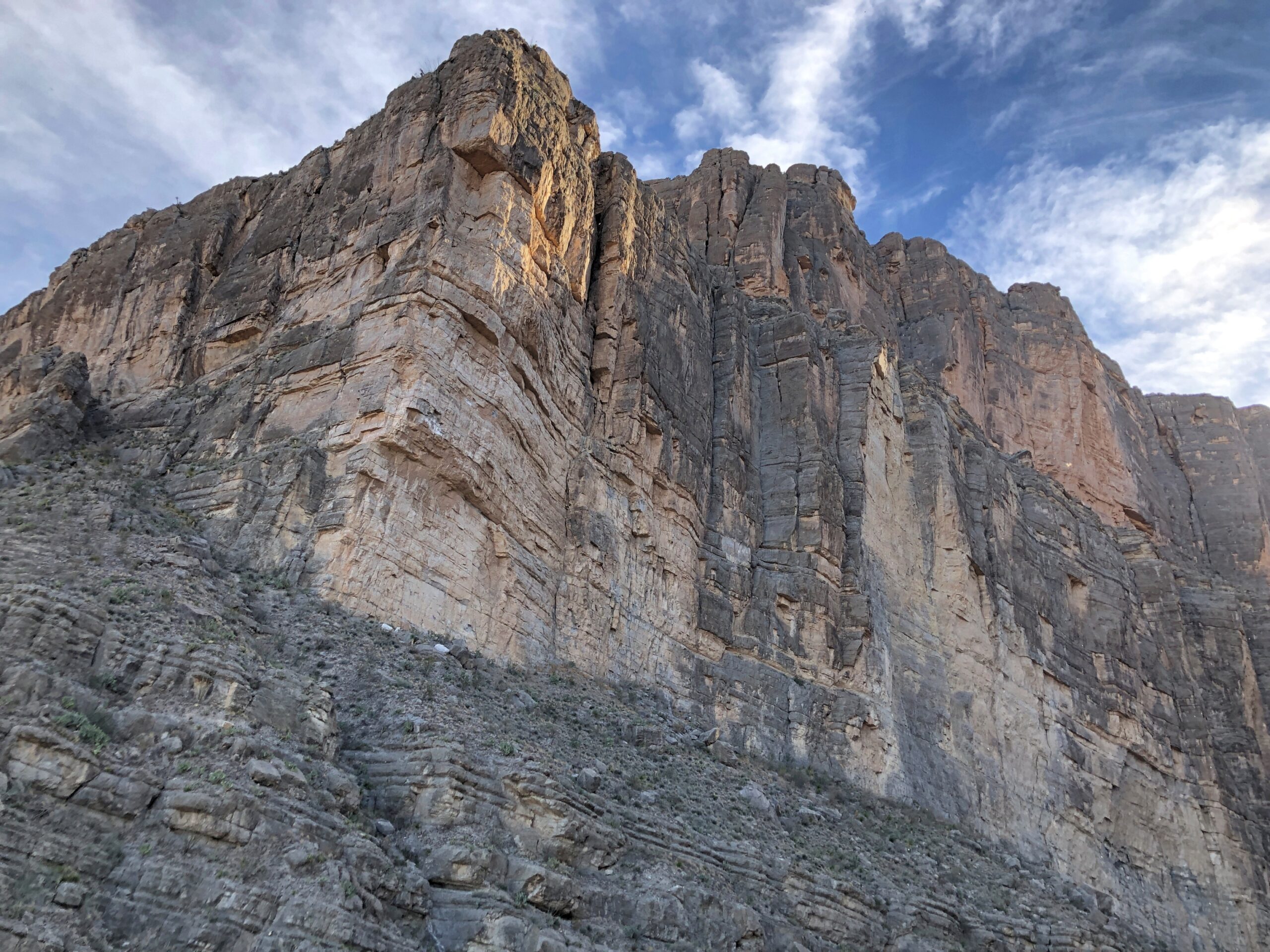
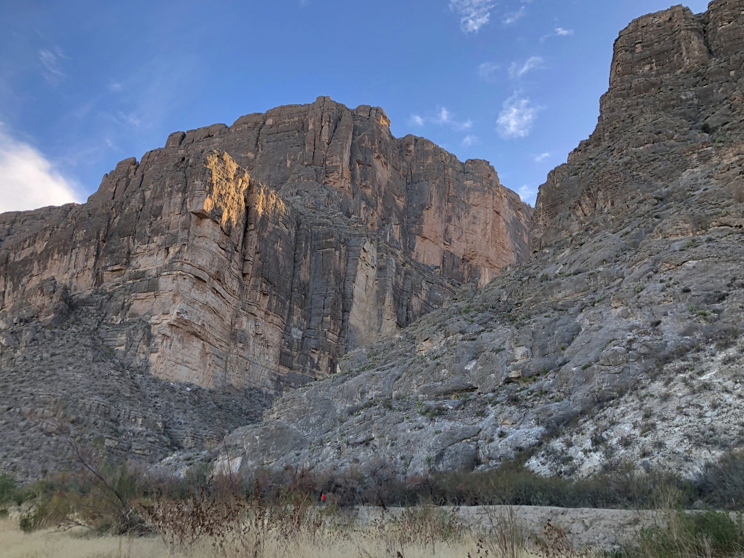
My own favorite part of the park: Santa Elena Canyon.
The high bluffs are in Mexico, on the other side of the Rio Grande. ‘
Never cared much for the term snowbird, with its connotations of getting up every morning to play golf during winter in some arid place, or spending the evenings with members of your cohort in some gated community, maybe drinking but definitely grousing about the state of the world. Still, considering that in the winter of 25/26, I’ve spent two out of the last three months – the hard winter months, up Illinois way – in warmer places, it would be churlish to cast shade on fellow old people who happen to enjoy golf or grousing.
On the other hand, I’m not about to claim snowbird as descriptive for myself. I just happen to be able to take long trips during the cold months (along with my laptop, for work). In December, Florida. In February, Texas.
Back on February 3, I got on a plane and flew to Austin. I flew home from Dallas on March 3. In between, I spent time – and Yuriko joined me for a while – traversing the state of Texas, going so far west at one point that we ended up in New Mexico. By traversing, I mean long drives, in a rental car part of the time, and in my brother Jay’s car as well, a blue Subaru known as the Blubaru.
I drove from Austin east to Houston, mostly on US 290; from Houston to Nacogdoches, mostly on US 59; then to Dallas on various state highways, such as Texas 21 and 19; and from Dallas to San Angelo to Marathon, Texas, on US 67 and on the grandly remote US 385, which will also take you to the desert reaches of the Big Bend.
From Marathon, Texas, across to Carlsbad, NM, our route took us along US 90, then Texas 56, then US 62/180. Later, US 62/180 took us from Carlsbad part way back to Dallas — to Sweetwater, Texas — but mostly we went on the faster but less interesting I-20. Dallas to San Antonio was partly I-35, but also US 281, which takes you around the perma-gridlock that is Austin.
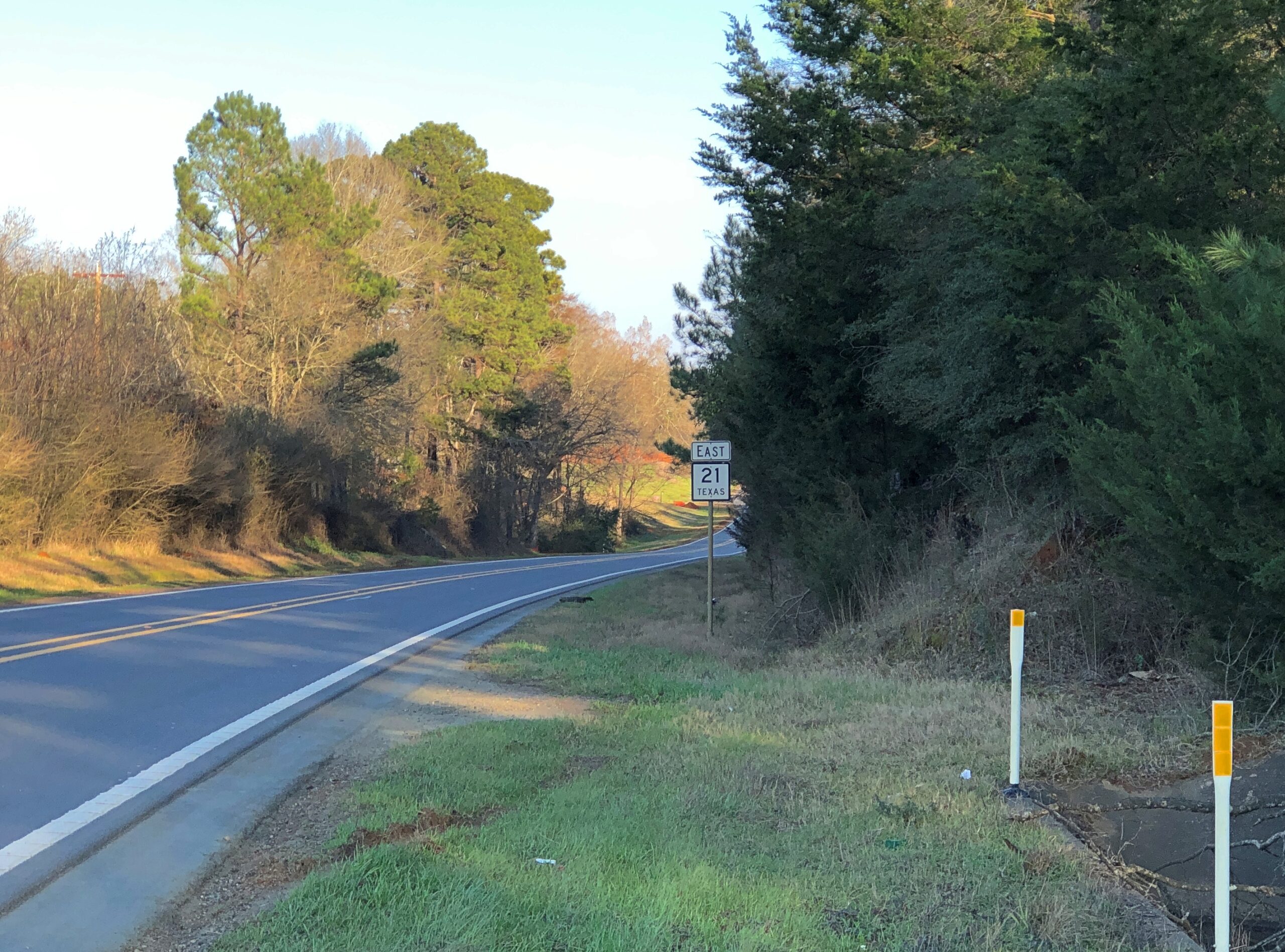
Of all those, the road between Nacogdoches and San Augustine on a day trip, Texas 21 heading east, winding through greenish (for February) rolling hills, was a favorite.
The towns listed above were just the places I spent the night, alone or with Yuriko or with my brothers. In between were such places as Bastrop, these days a day-trip from Austin, with the requisite boutiques and restaurants; Huntsville, home of Sam Houston and memorials to the first president of Texas; San Augustine, rival with Nacogdoches in claiming to be the oldest town in Texas; Stephenville and Ballinger, geographically about as deep in the heart of Texas as you can be; the West Texas art town of Marfa and the way station of Van Horn; a string of oil patch towns such as Hobbs, NM, and Seminole, Lamesa, Snyder, and Sweetwater, back in Texas. Later, traversing north to south and back again, I stopped in Hillsboro and Belton, along the I-35 axis; and Lockhart, which has claimed for itself barbecue capital of the state.
Along the way, oddities were encountered. Otherwise, why drive on smaller roads?
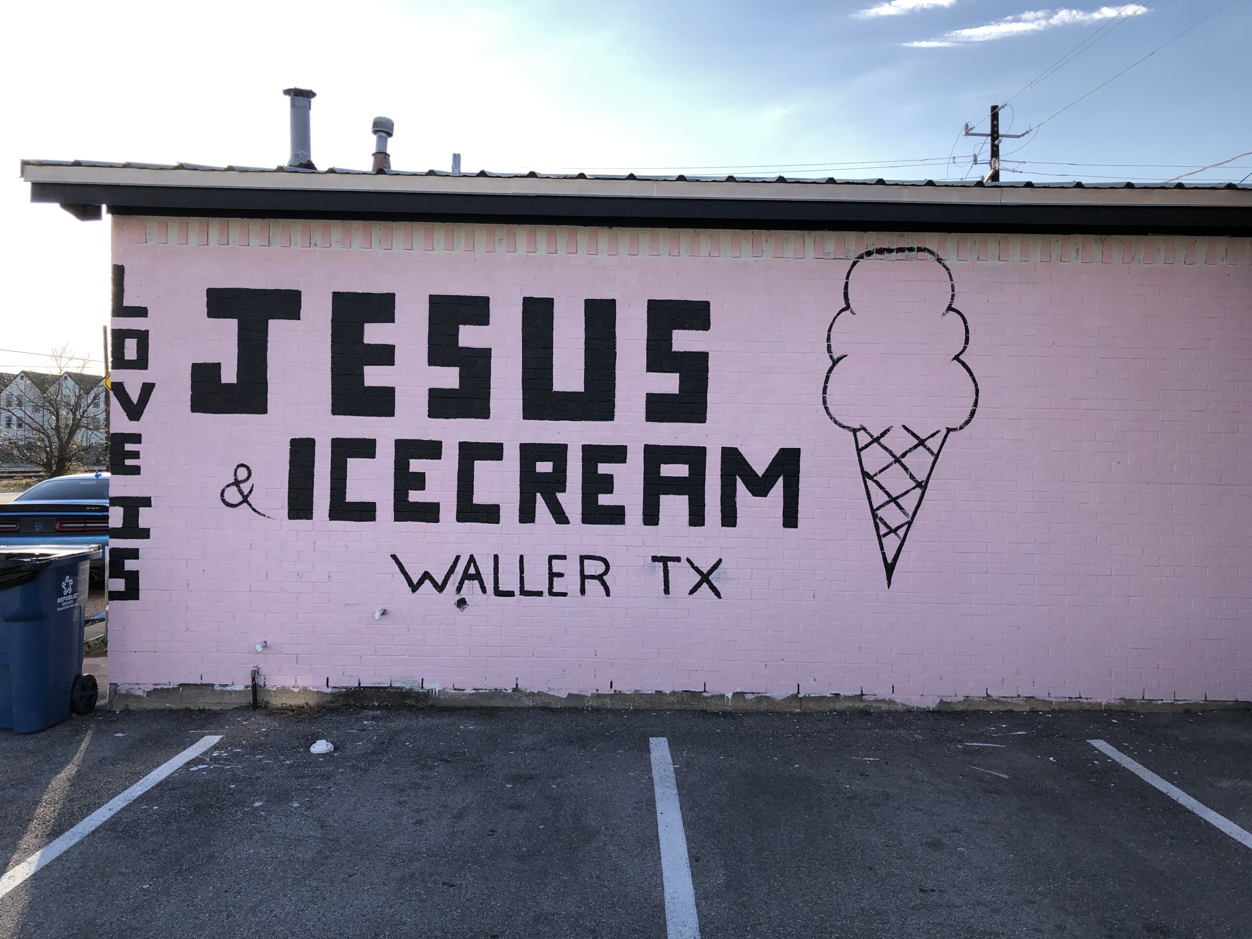
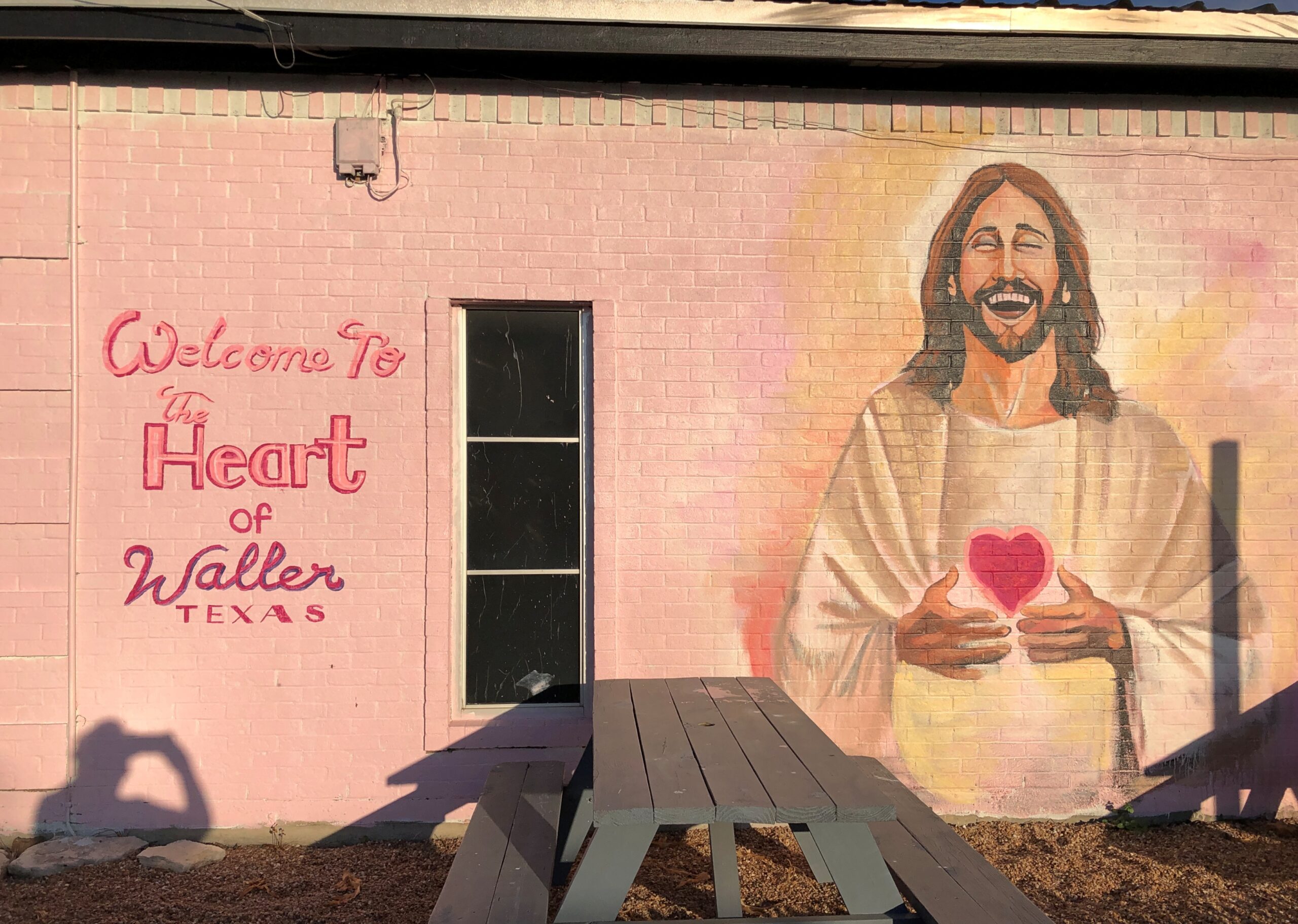
Such as an ice cream shop in Waller, Texas.
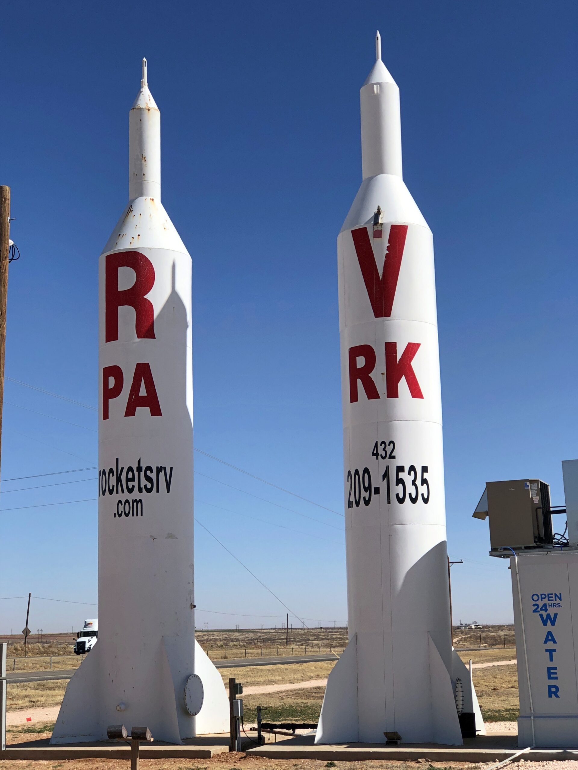
Or a highly visible ad for Rockets RV Park in Gaines County, Texas, not far east of the border with New Mexico.
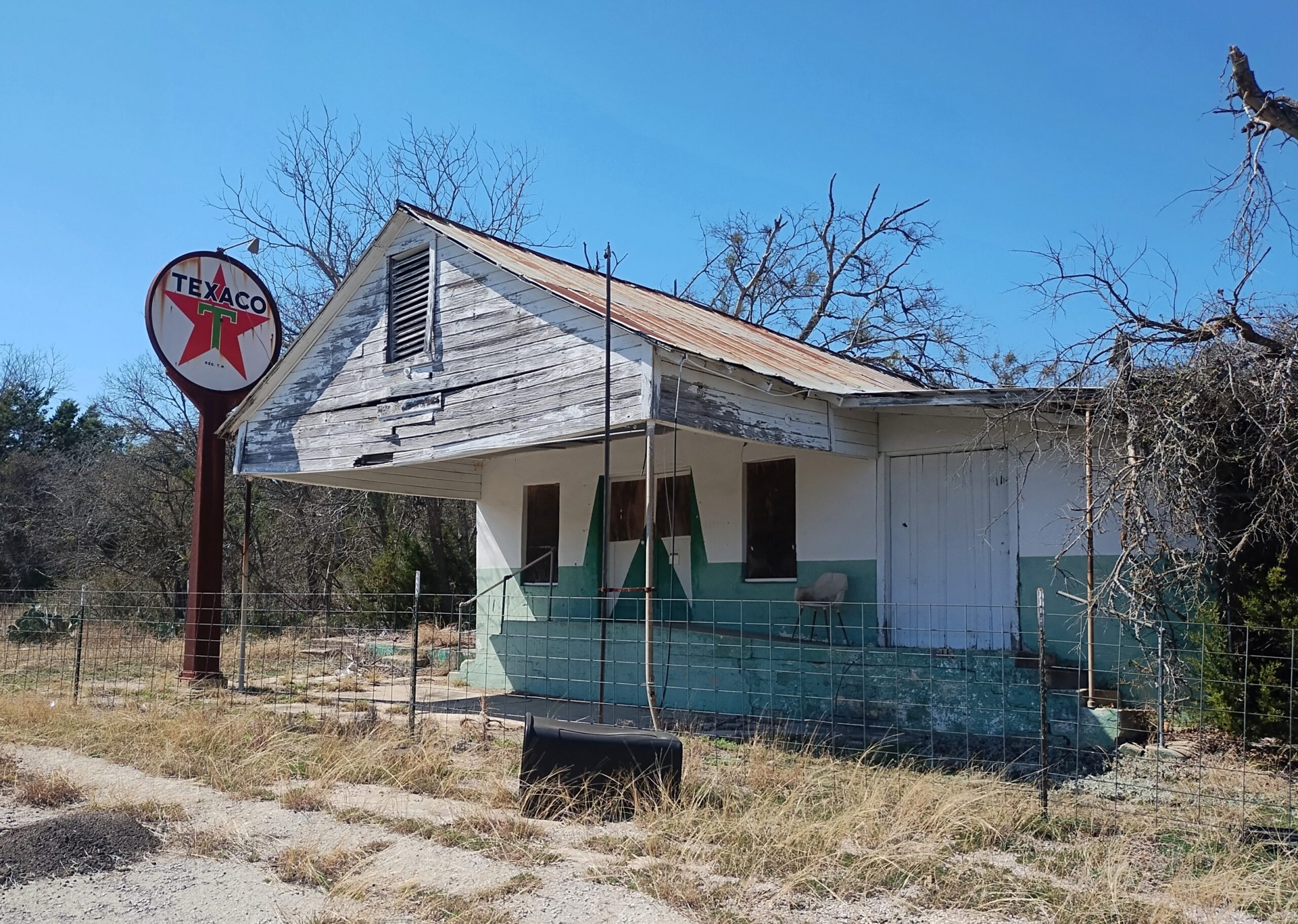
A former Texaco station on an obscure Texas highway (Farm-to-Market 1690).
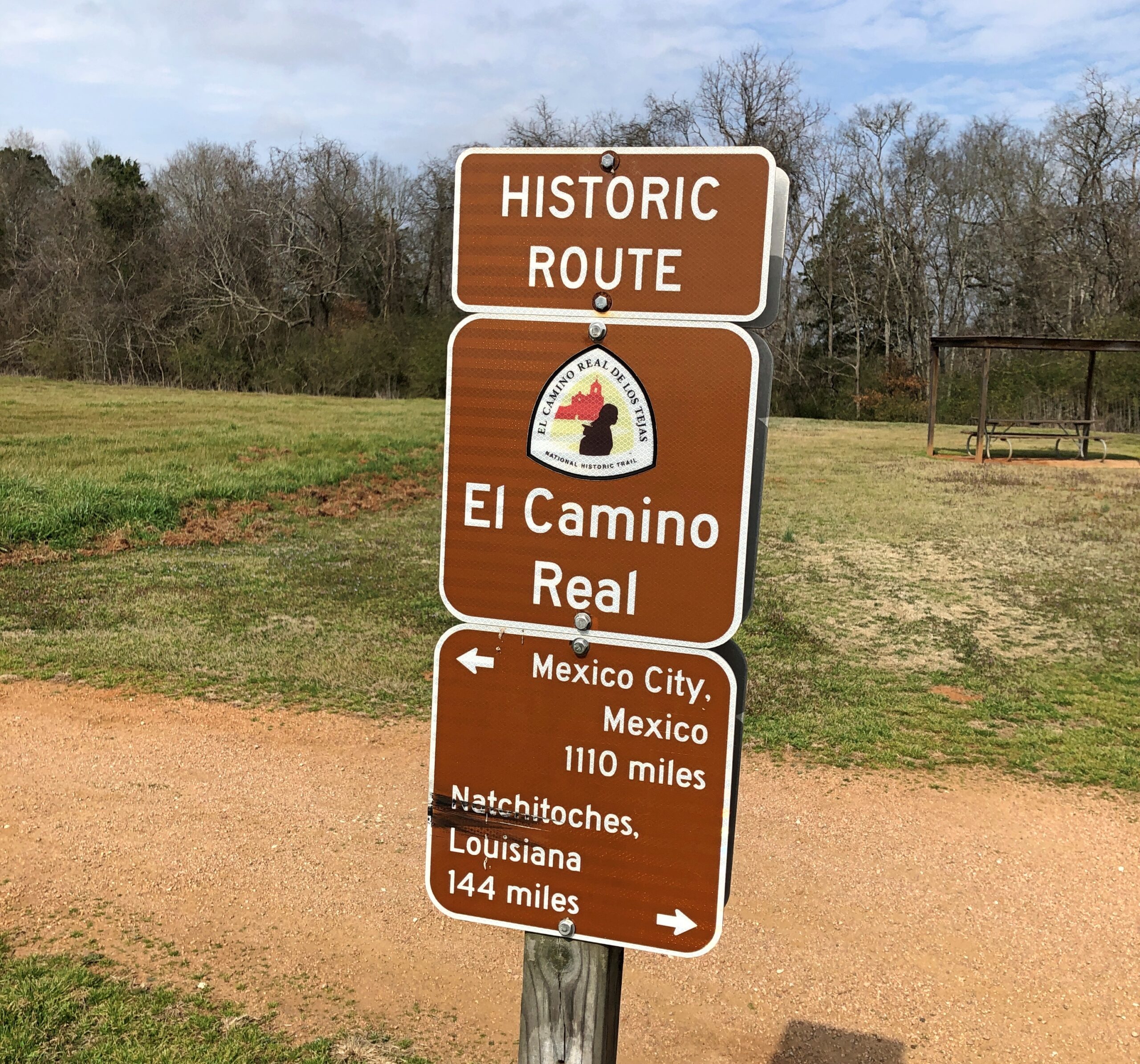
Had various encounters with the historic El Camino Real, whose various tendrils crossed a large slice of the future state of Texas, once upon a time.
Yuriko and I visited Big Bend National Park, Guadalupe Mountains National Park and Carlsbad Caverns National Park. I saw the National Museum of Funeral History in the city of Houston and the museum devoted to Houston (the man) in Huntsville. Also, Roadside America in Hillsboro, an eccentric collection of American commercial art, complete with a personal tour by the proprietor, and the outdoor art at the Chinati Foundation in Marfa, that is, brutalist concrete structures in the brutal desert environment. I became acquainted with the splendid Glenwood Cemetery in Houston and the smaller and more ragged, but no less interesting city cemeteries in Huntsville and Nacogdoches and Palestine. I stopped and looked at about a dozen county courthouses, of which Texas has many.
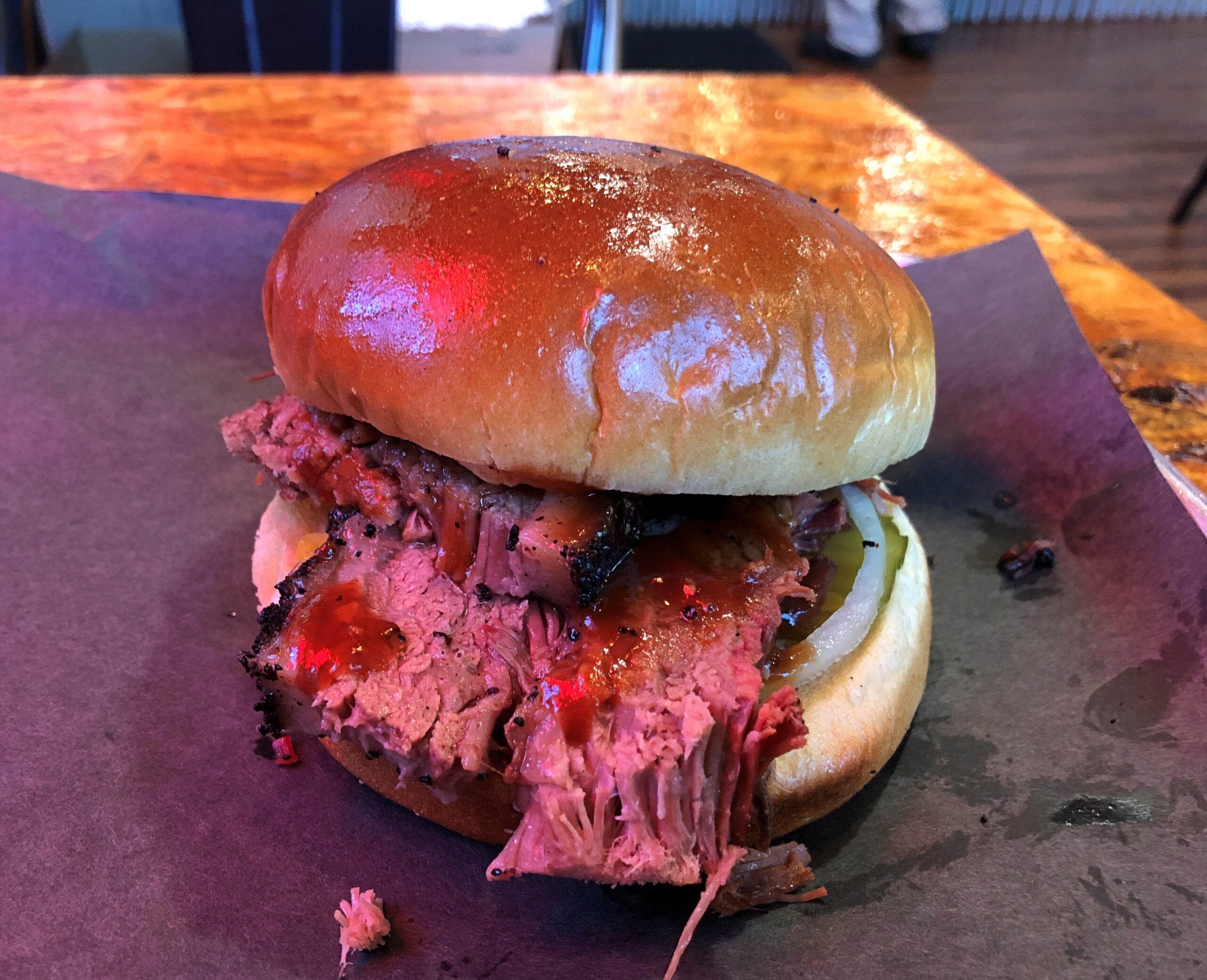
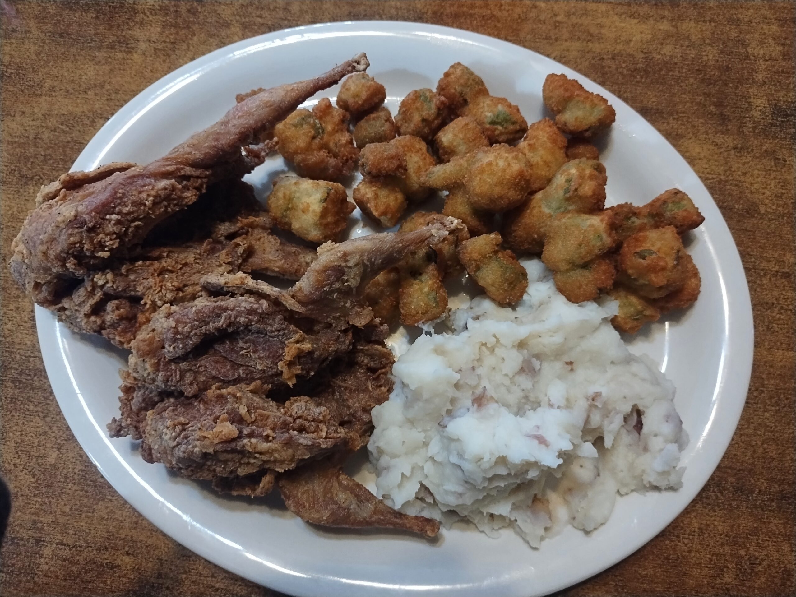
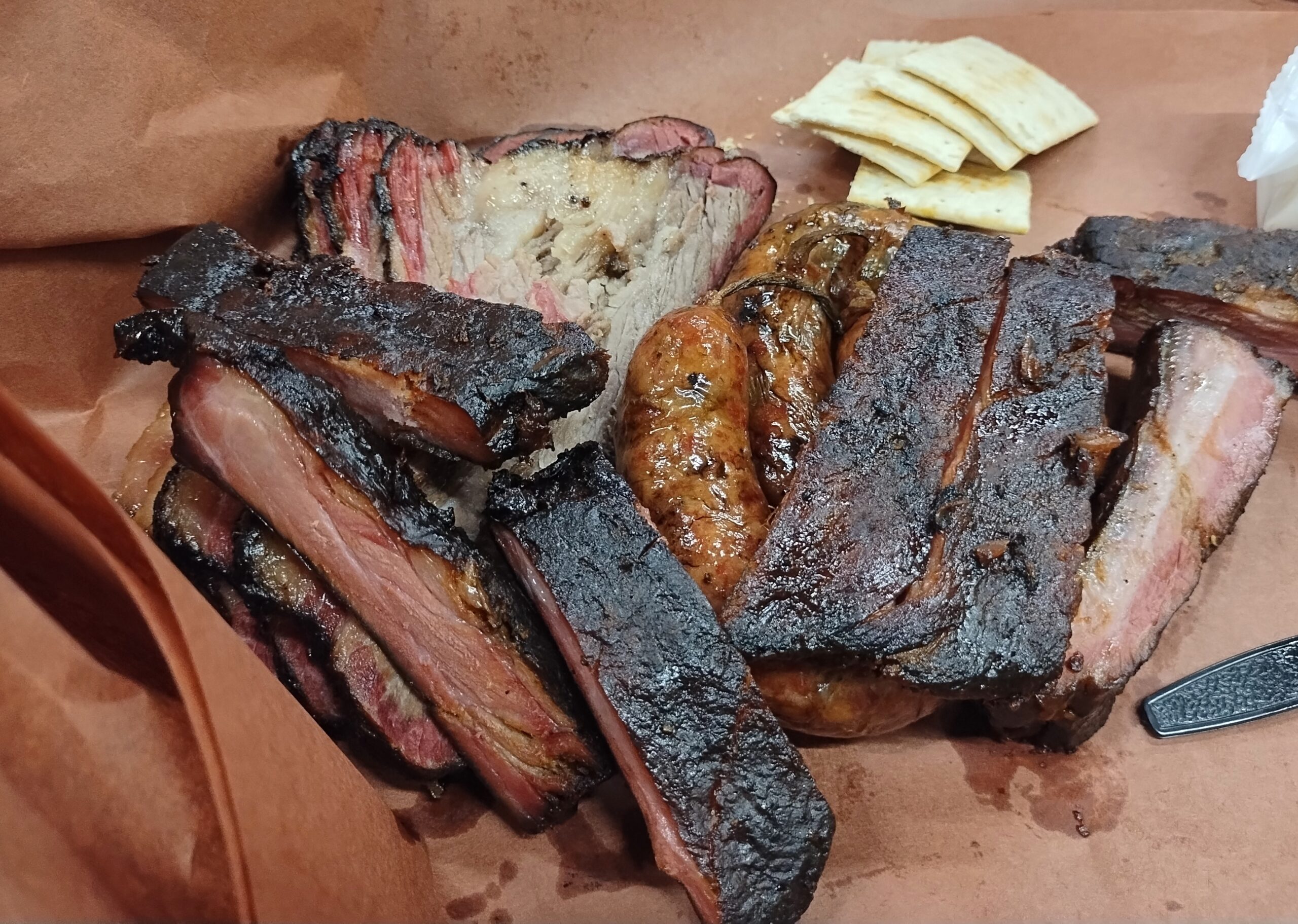
We ate a lot of meat along the way. As one does in Texas.
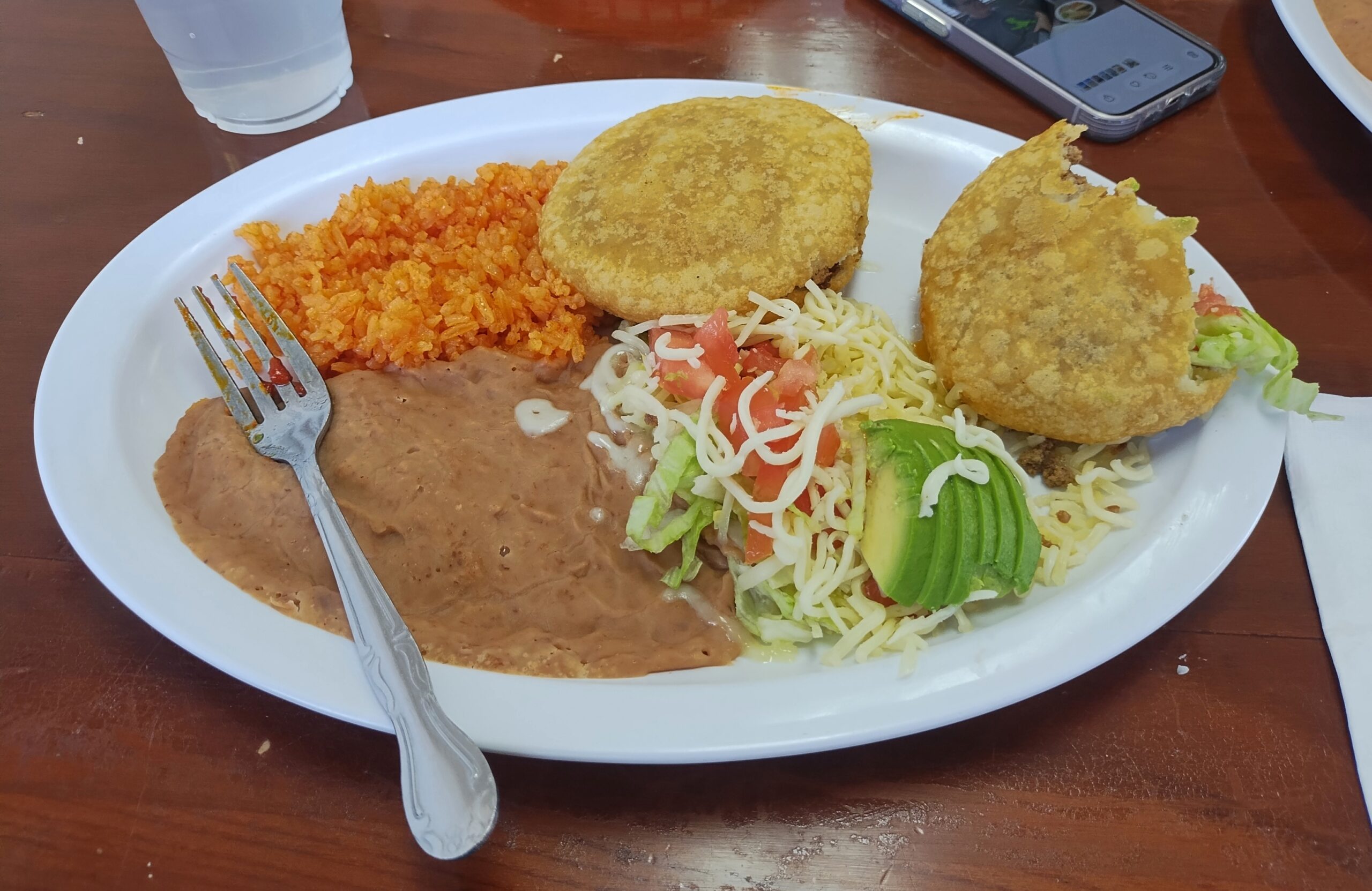
Also, Mexican food.
Eat like that and you’d better do some walking, and I did: various places in Austin and Houston and Dallas, in all three national parks, around downtowns and courthouse squares in a number of small towns, and a handful of local parks.
All that was good, but of course best of all, I had time to visit friends and relatives, of whom there are many in Texas: Tom and Nancy in Austin, Kirk and Lisa in Nacogdoches, another Tom and Steve and Ron and Greg and Judith in San Antonio, to list the friends; both brothers, two out of three nephews and their wives and all four of their children, to list relatives, along with the mother of one nephew’s wife (niece-in-law sounds peculiar, but that fits too). Also, I met for the first time two good friends of Tom’s in Austin, and one of Kirk and Lisa’s granddaughters.
I’d set out to do four long drives when I was 64, but this makes five. Guess I’m an overachiever about driving, anyway.
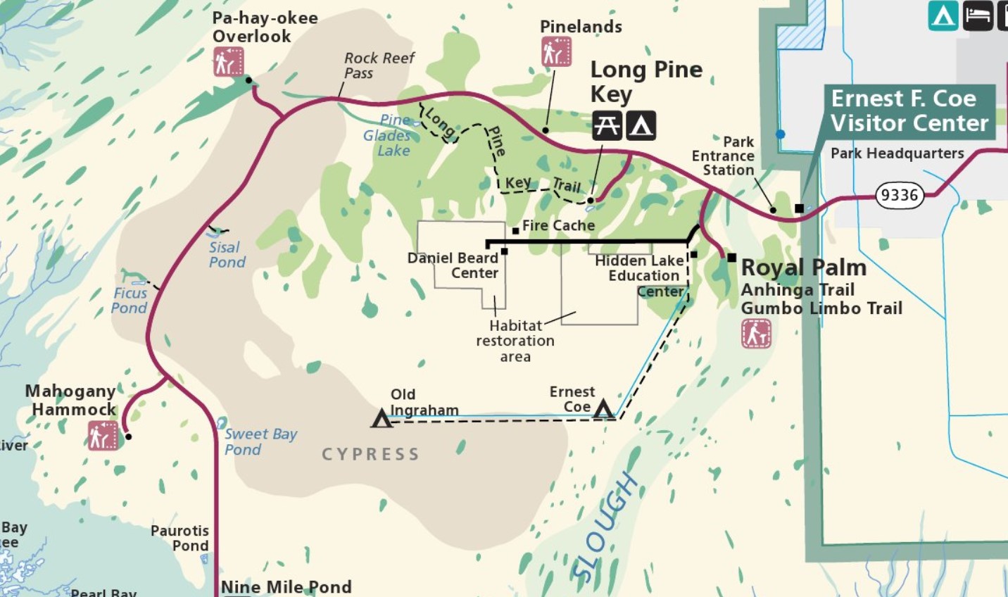
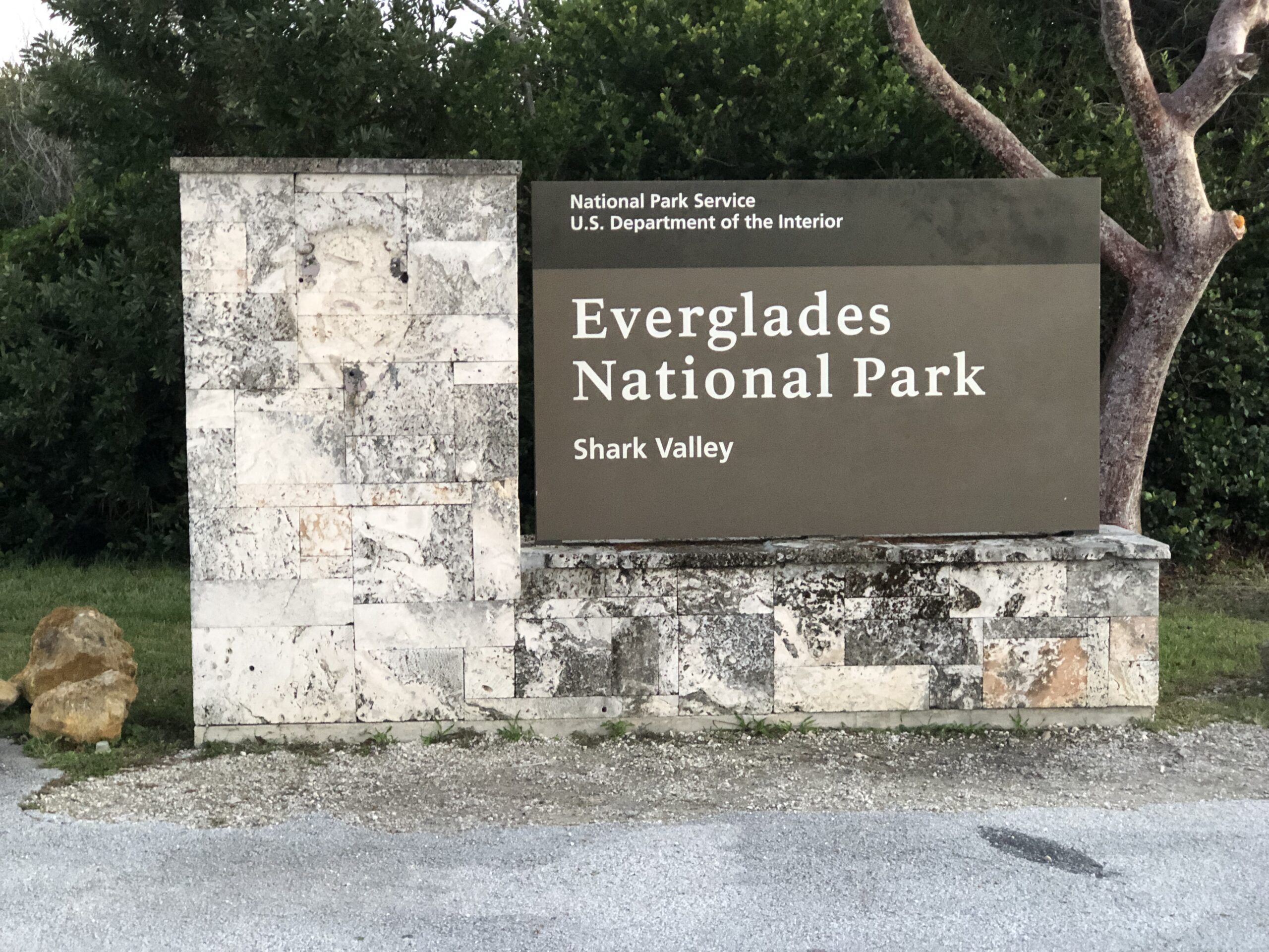
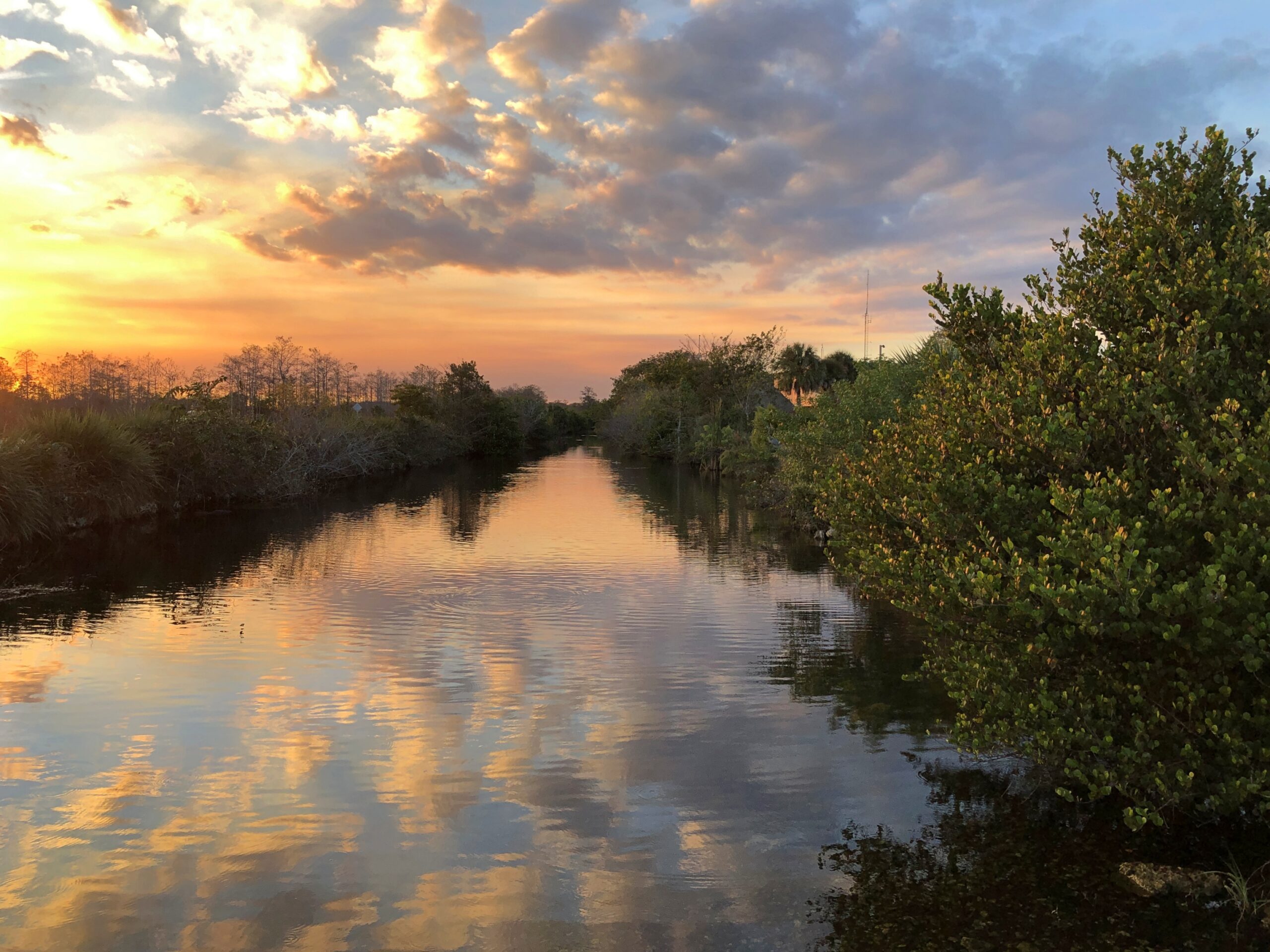
I’ve seen maps of Everglades National Park for years, and noted with great interest the main road snaking through the park, from the southern part of greater Miami to a point on the peninsula’s south coast. It was a road I’d long wanted to drive (in red, below), and on the afternoon of December 12, that’s what we did. Only about 40 miles each way in the park, so not too long a drive.
We stayed in Homestead, as far south as metro Miami goes, for the purpose of visiting the Everglades. Outside the park, the road is Florida 9336. Inside the park, it’s the less interestingly named Main Park Road. Odd, considering that some examples of nearby features are named Gumbo Limbo Trail, Hells Bay Canoe Trail, Alligator Creek, Snake Bight Trail and Coot Bay and Coot Bay Pond.
Almost no one else was around, which is the secret sauce for most enjoyable drives. My only minor complaint is that Pa-hay-okee Overlook, at the edge of a cypress zone, was closed. Considering how flat the terrain is, that view would have been expansive.
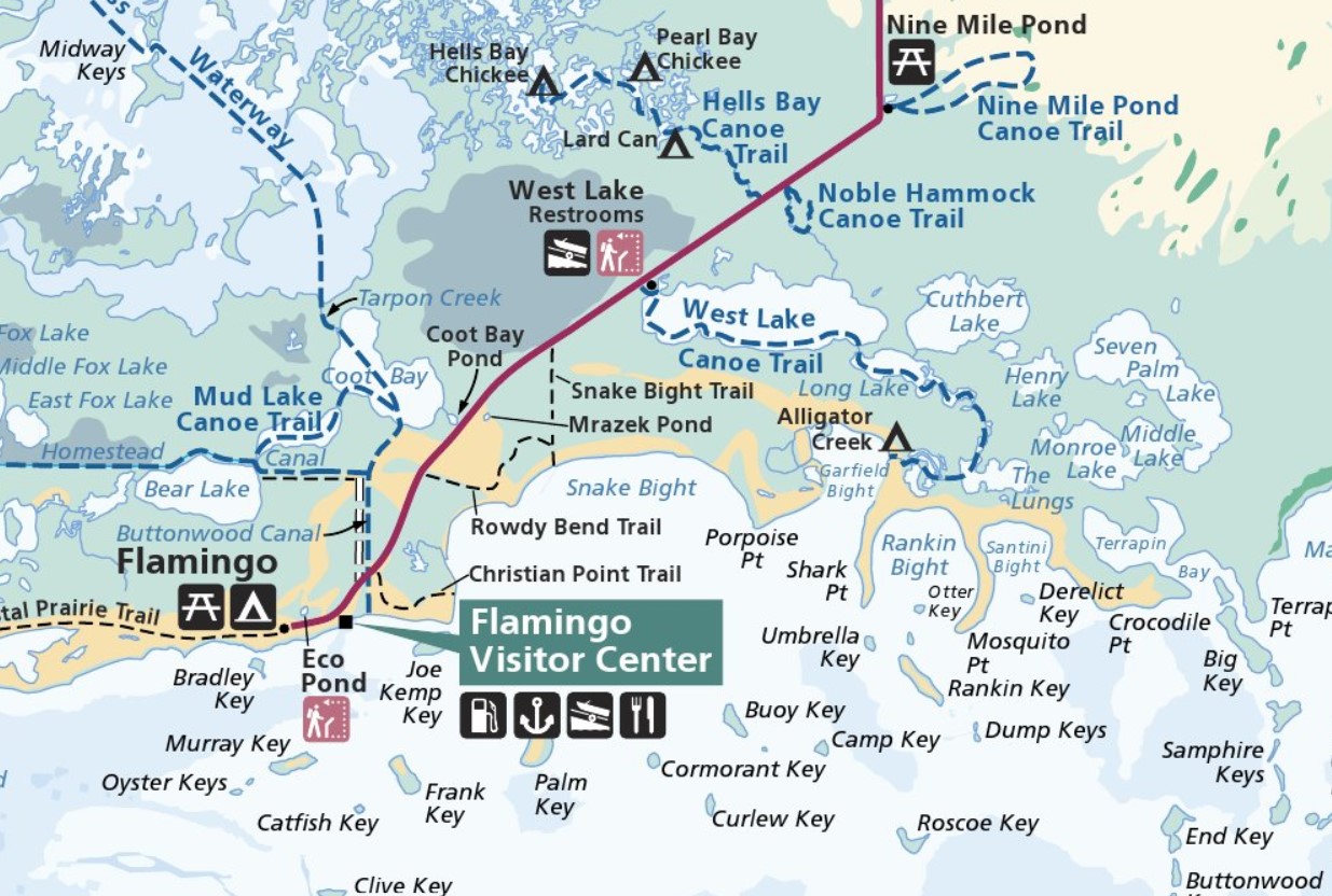
The park road takes you to Flamingo, Florida, which has no current human population unless you count park staff, who must stay nearby somewhere at least sometimes. Flamingo has no flamingos, according to a park ranger we met, whom I’ll call Bobbie. There seem to have been some of the birds in the late 19th century, she said, but they moved on when hunters showed up, looking for a source of colorful feathers for women’s hats fashionable at the time.
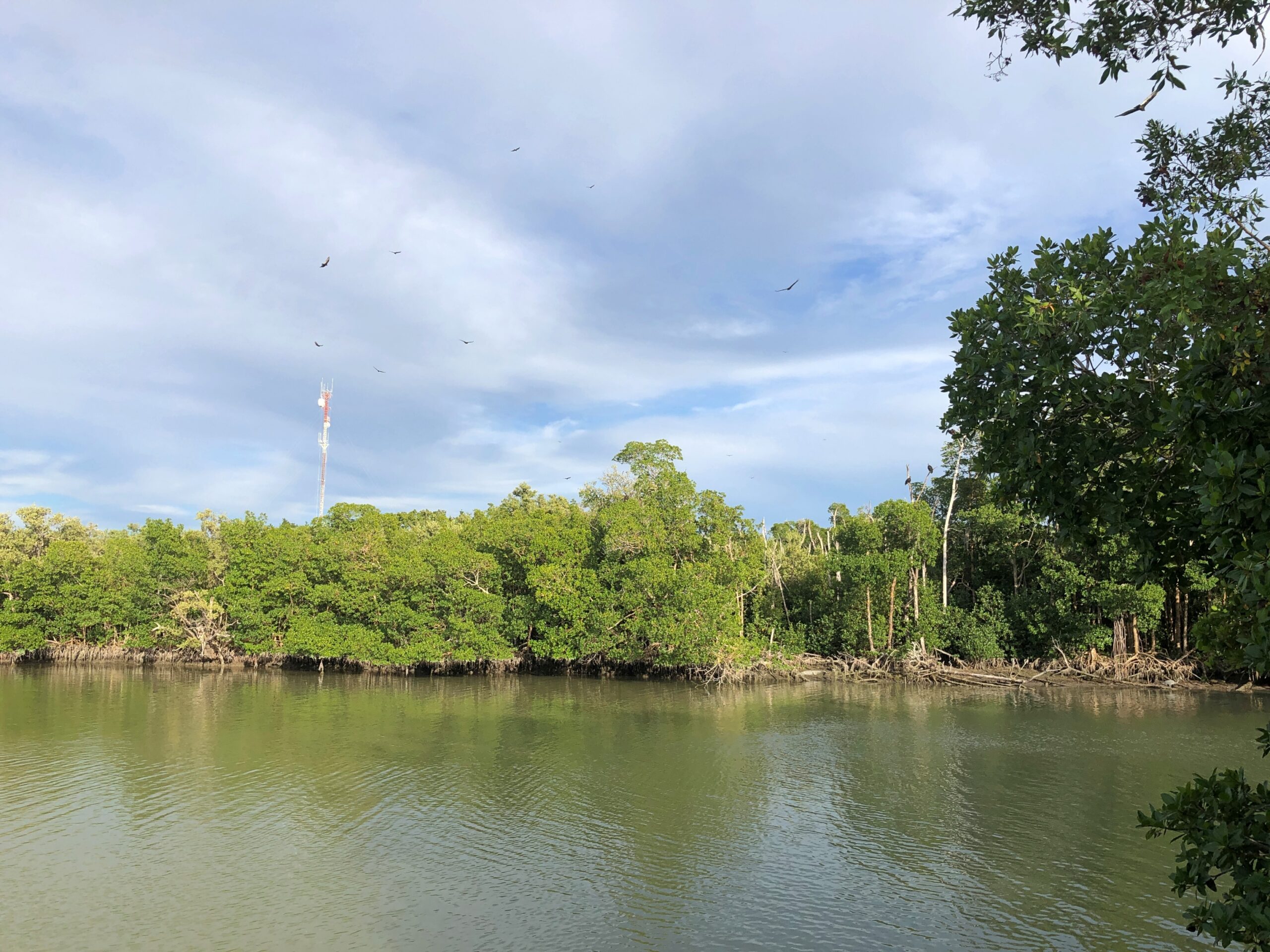
Plenty of other birds are still around, looking for a meal. Hadn’t seen that many circling birds since we were in north-central India.
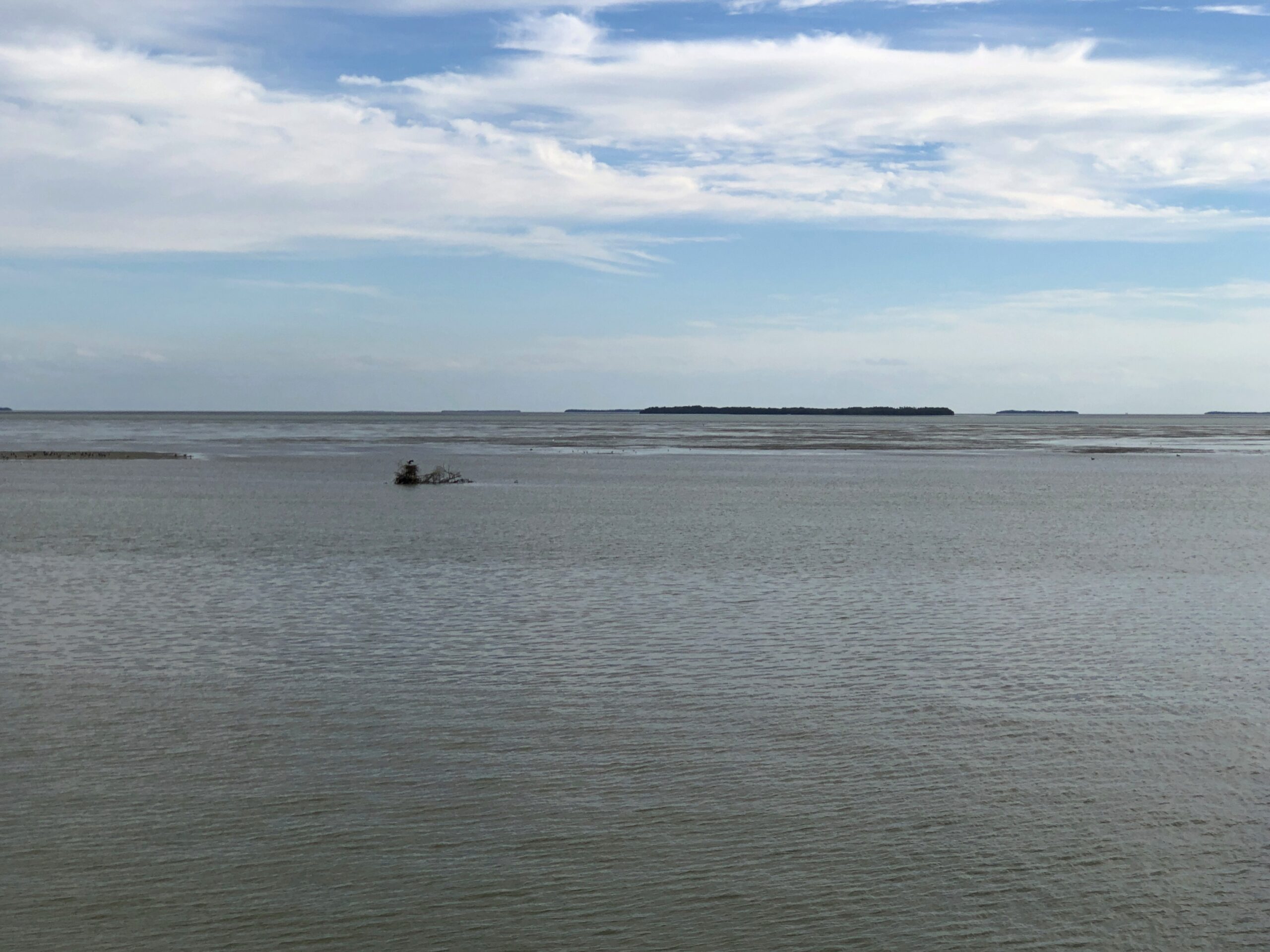
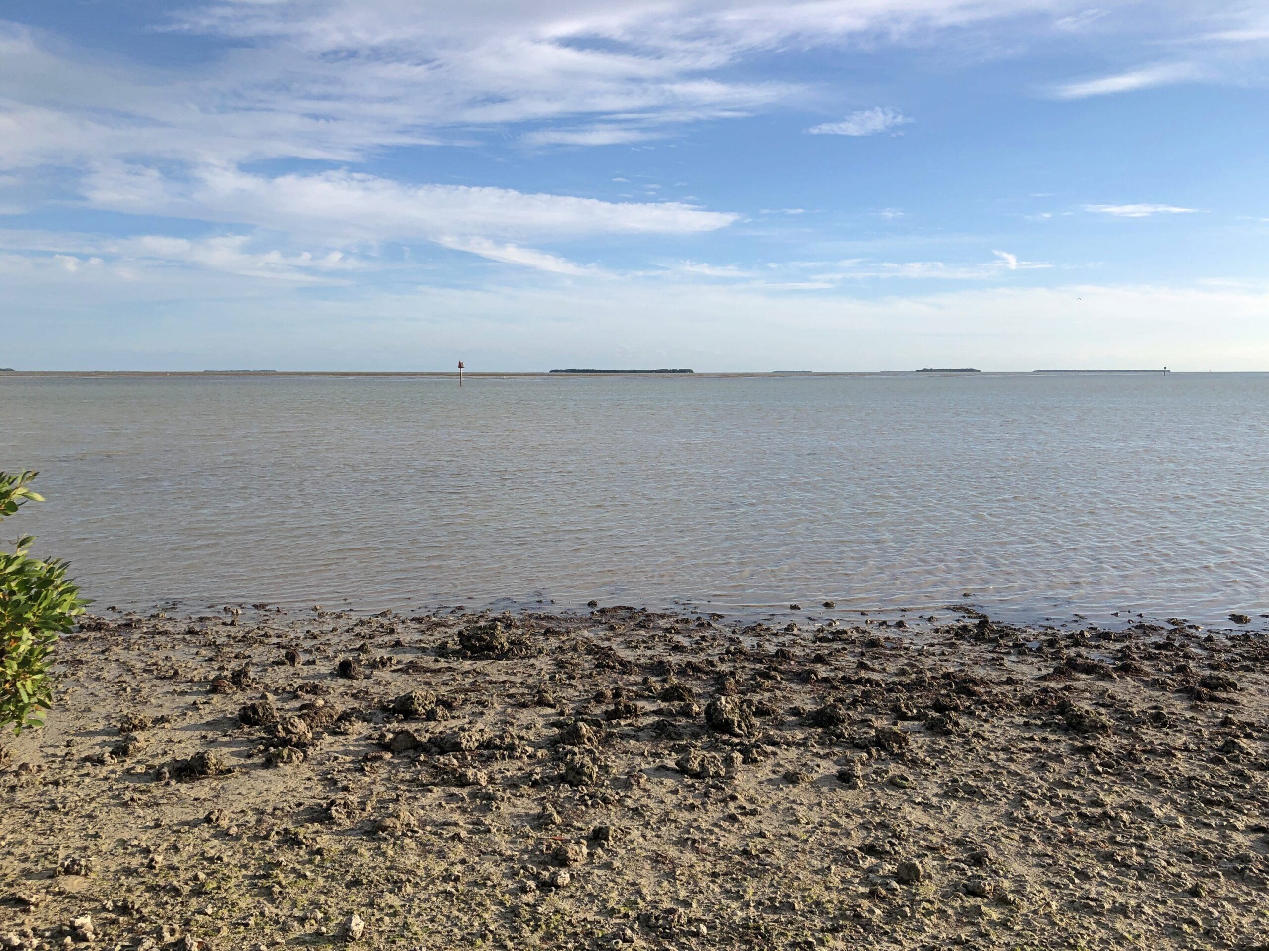
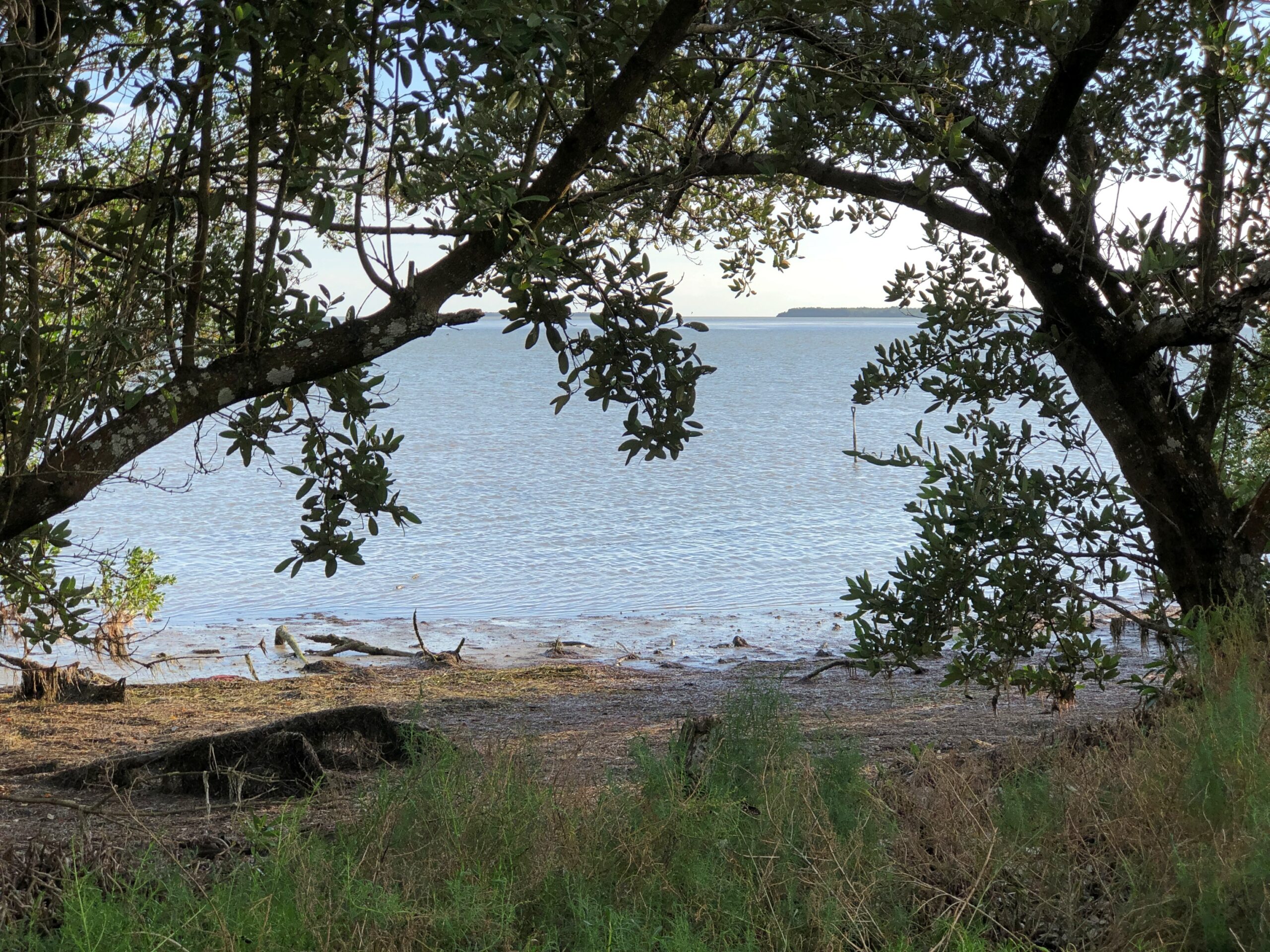
Flamingo, which is mostly the visitors center, lodging and campgrounds, offered views of Florida Bay and a few of its many keys, a term not limited to the chain of islands connected by the Overseas Highway.
We saw a manatee. Or at least a manatee nose poking out of the water near one of the docks at the park, then ducking underwater with an occasional small splash. The barest outline of its bulk was visible below.
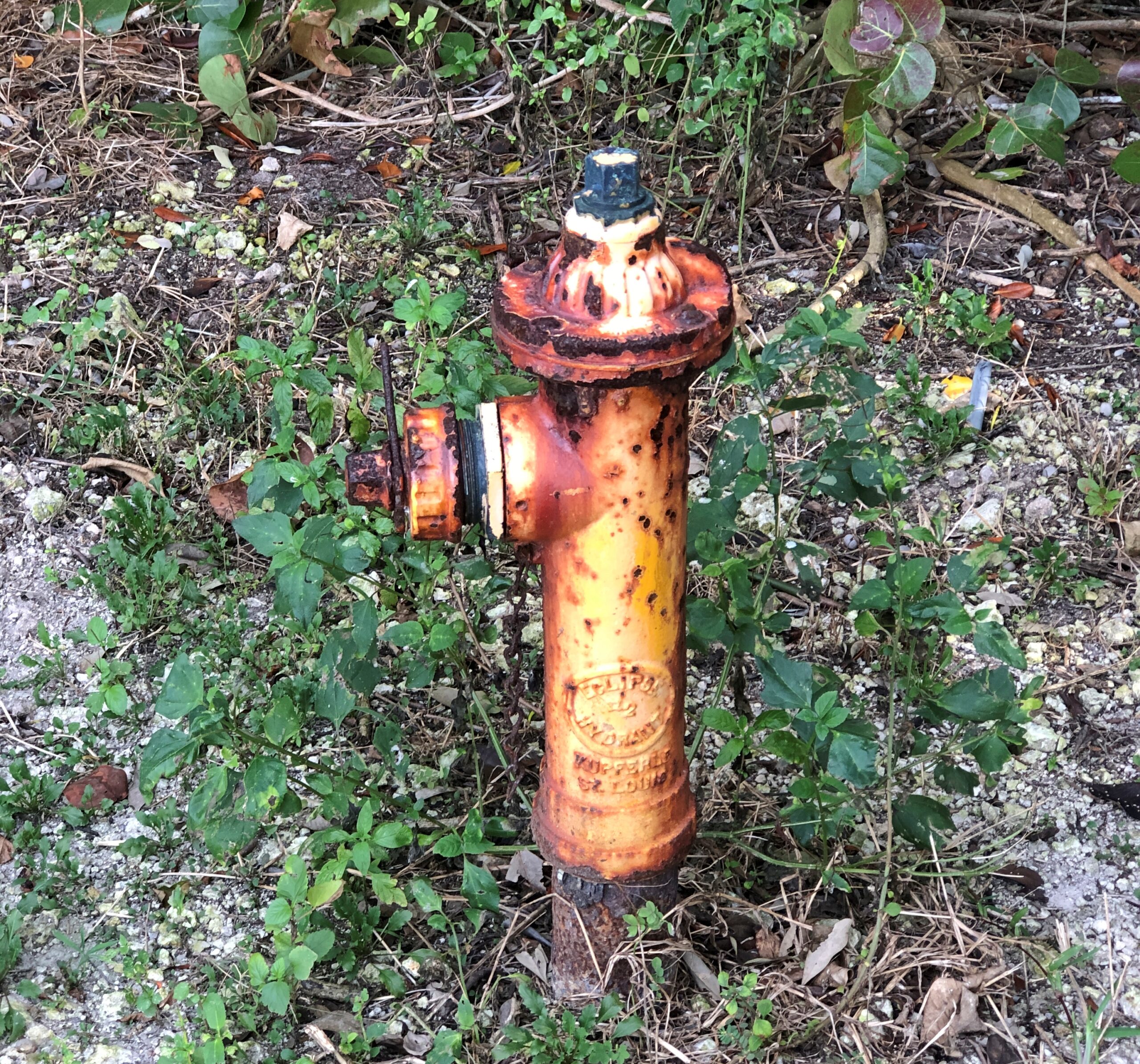
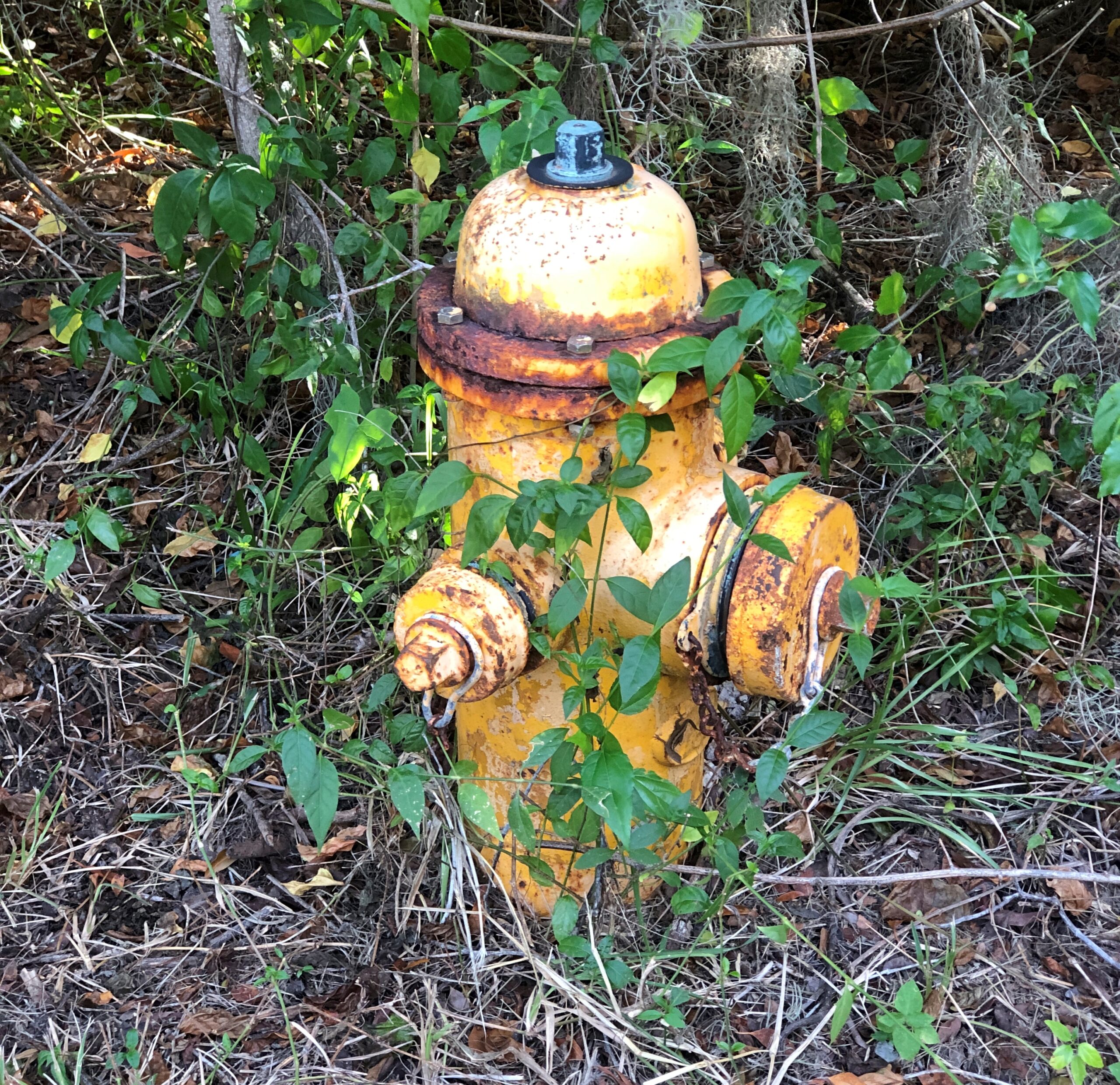
For some reason, the rusty fire hydrants on the park service property caught my attention.
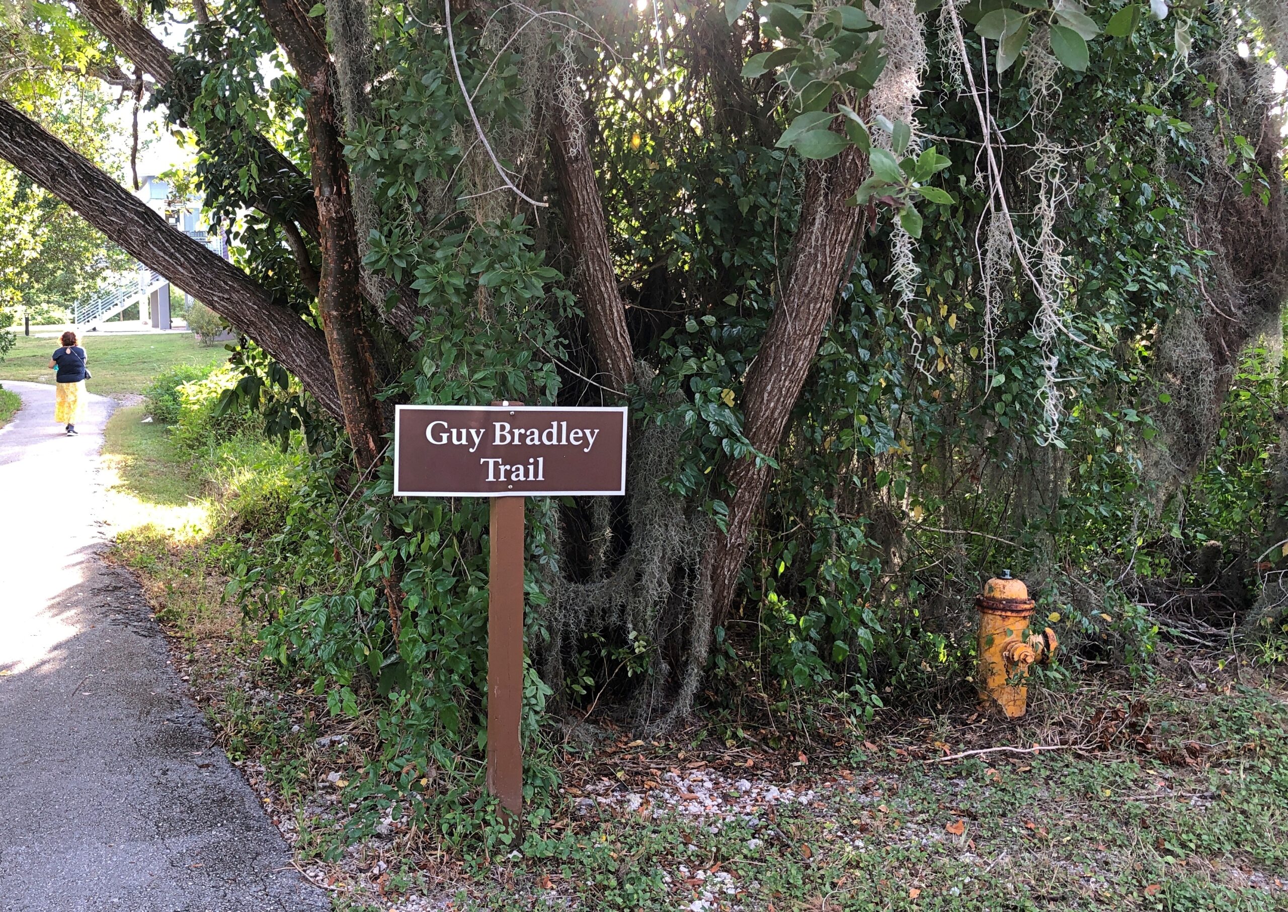
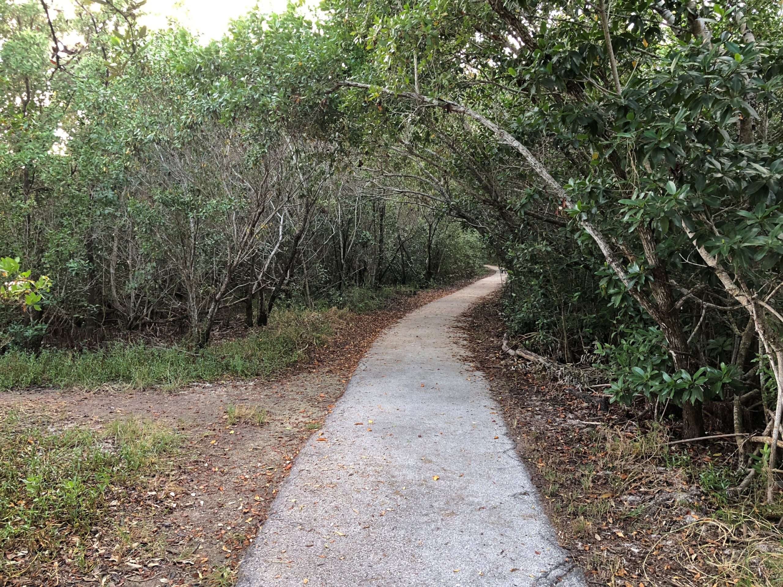
We walked the Guy Bradley Trail. The Flamingo visitors center is also named for Bradley, an early game warden in the area who died in 1905 at the hands of poachers.
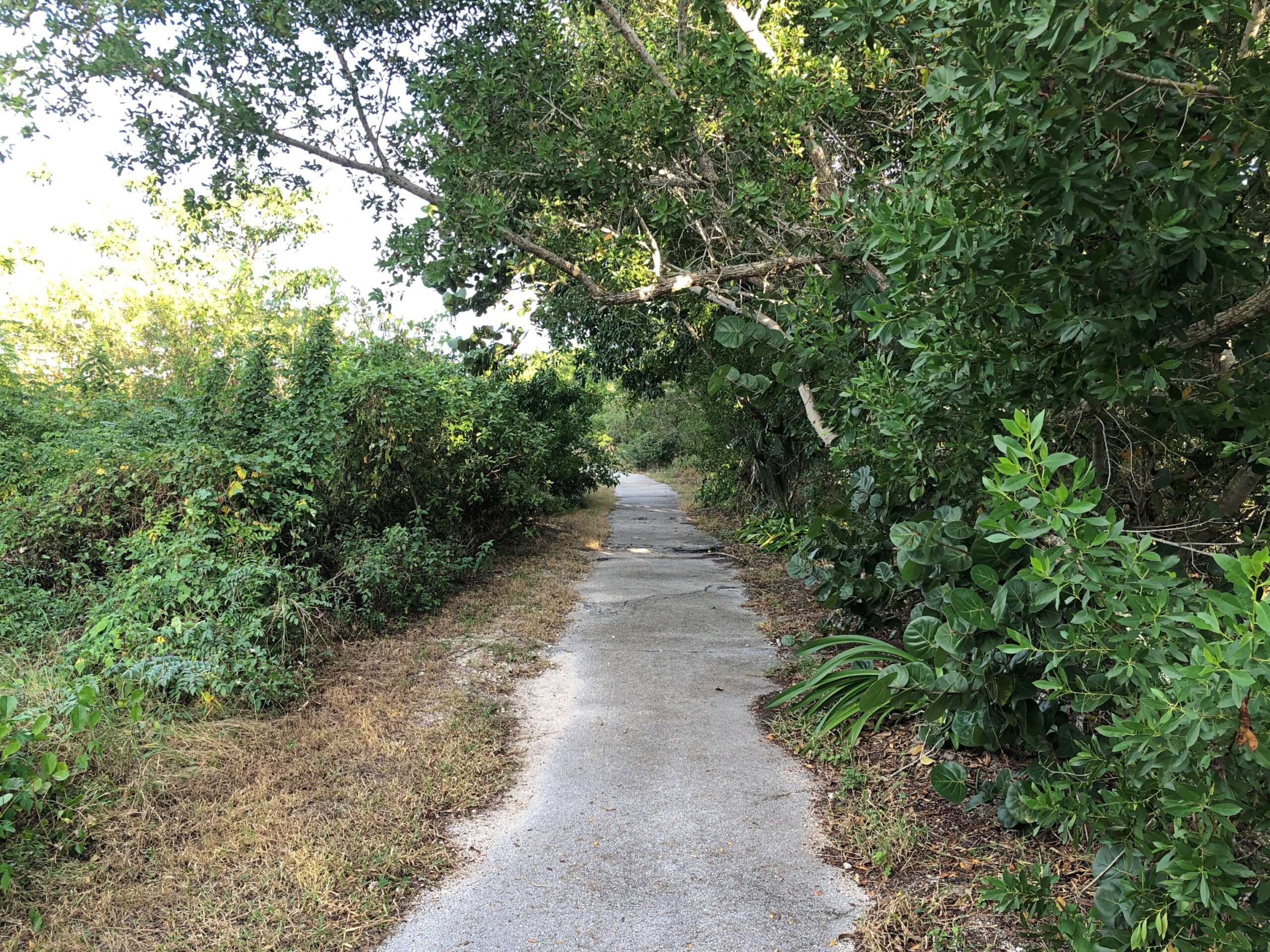
The trail, paved and mostly in good shape, was an easy one.
With some views of its own, including the ocean and not including the ocean.
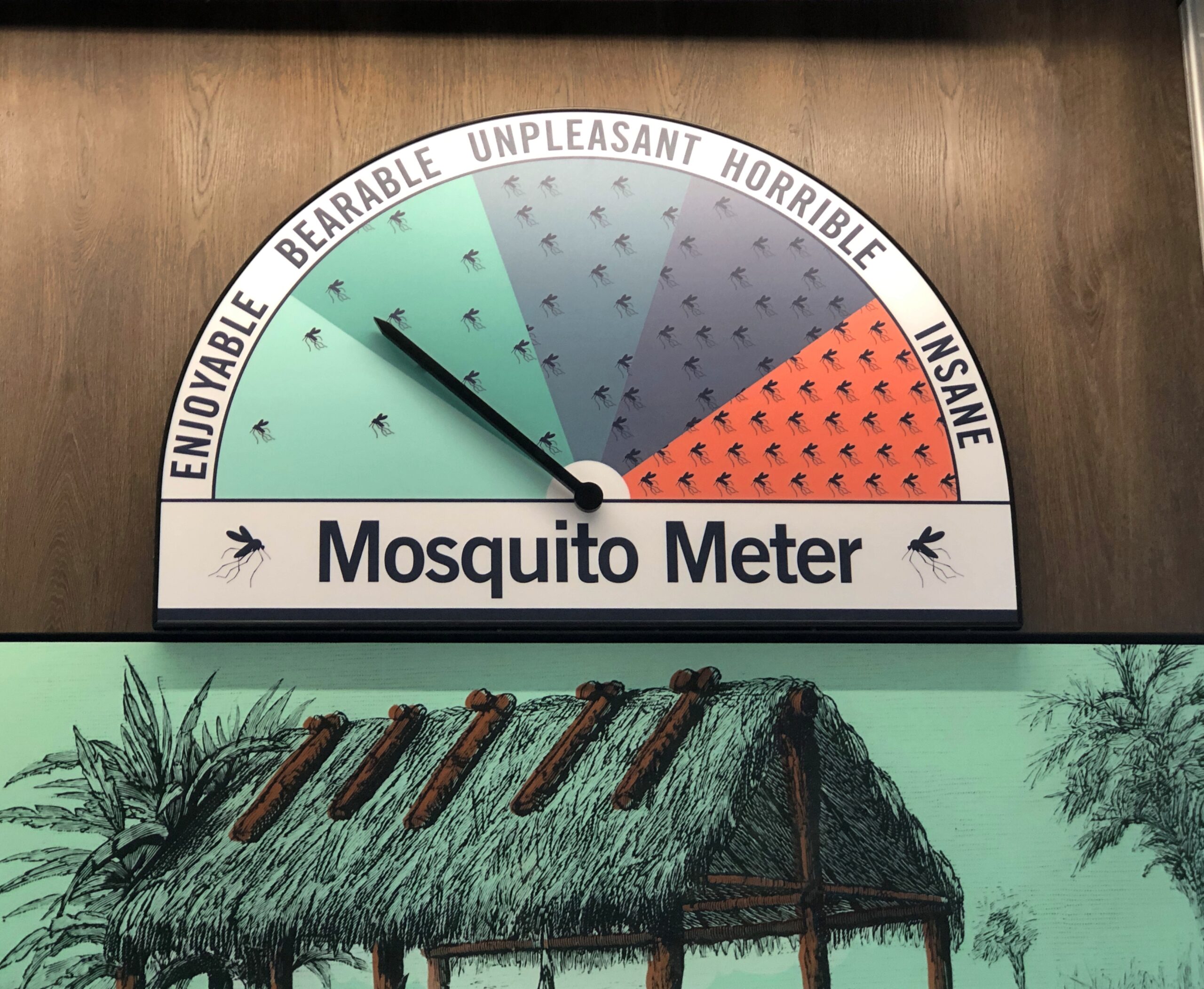
One reason to visit the Everglades during the winter months, maybe the number-two reason right after the absence of searing heat, is the absence of mosquitoes. Make that the relative absence of mosquitoes. During our walk through the greenery around Guy Bradley Trail, a small number of winter mosquitoes were there to greet us.
Even in an age of DEET and whatever has mostly replaced DDT, you will find mosquitoes and more importantly, they will find you. That’s my experience over the years.
I close my eyes and I can recall those Pusan nights in ’90 in my non-climate controlled room, drinking the tea available in pots just outside everyone’s door, swatting mosquitoes that had clearly feasted on me moments before they died, and listening to the irregular beep-BEEP-beep-beeps of auto horns wafting in through the damaged window screens, along with more mosquitoes.
The only creature I run into regularly while camping is one or another kind of mosquito. The weather had been dryish in Jasper NP, so there weren’t that many there. Things had been even drier at Theodore Roosevelt NP, and we encountered only a very few hardy mosquitoes who managed to survive wrigglerhood in the risk-of-wildfire badlands this summer.
The plains near Regina, Saskatchewan, were another story. On the evening of July 3, we found a private campground a few miles east of Regina for a reasonable C$14. The place was sparse with people, probably since the Canada Day long weekend was winding down, but well populated with blood-drinking vermin. Their main diet likely came from the livestock on the surrounding ranches, but they weren’t above snacking on human beings. Once a cloud of them followed me, so I had to zig-zag back to our camp to lose them. Others buzzed intensely around the tent door until I sprayed it with Off.
I got out of my car to look around. The forest seemed even more oppressively dense with rain clouds gathering overhead. The air was warm and a little steamy. All I heard was the crunching of my footsteps, the mild rush of the wind, the twitter of birds and, suddenly, the buzz of mosquitoes. Mammals as large as human beings must be a tasty treat for the mosquitoes of the Apalachicola River Basin, because they attacked with terrific speed and in increasing numbers. For all I know, there are a dozen kinds, part of the wonderful biodiversity of the area. I had no chemical protection. I’d forgotten to pack anything with DEET in it, and the TSA might have taken it away anyway.
I took a short look at an interpretive kiosk that had some artifacts behind glass, and another look at the Milly Francis marker, but within a few minutes I retreated to the car. A couple of the mozzies followed me in, but I managed to dispatch the bastards in a pop of my blood.
Other national parks have majestic mountains or picturesque glaciers or striking deserts or epic coastlines or an important history of human activity. They have high-profile wildlife and ecosystems unique in the world. Congaree does count as a special place, preserving a tiny fraction of the floodplain forests that used to cover much of the Southeast, but that’s a little hard to appreciate on the ground, especially as the target of its high-profile wildlife, mosquitoes.
Text to a friend, along with the image: Now, what’s the bump in the water? Ah, it’s an alli AHHHGH
Reply from friend: Ha. Ha.
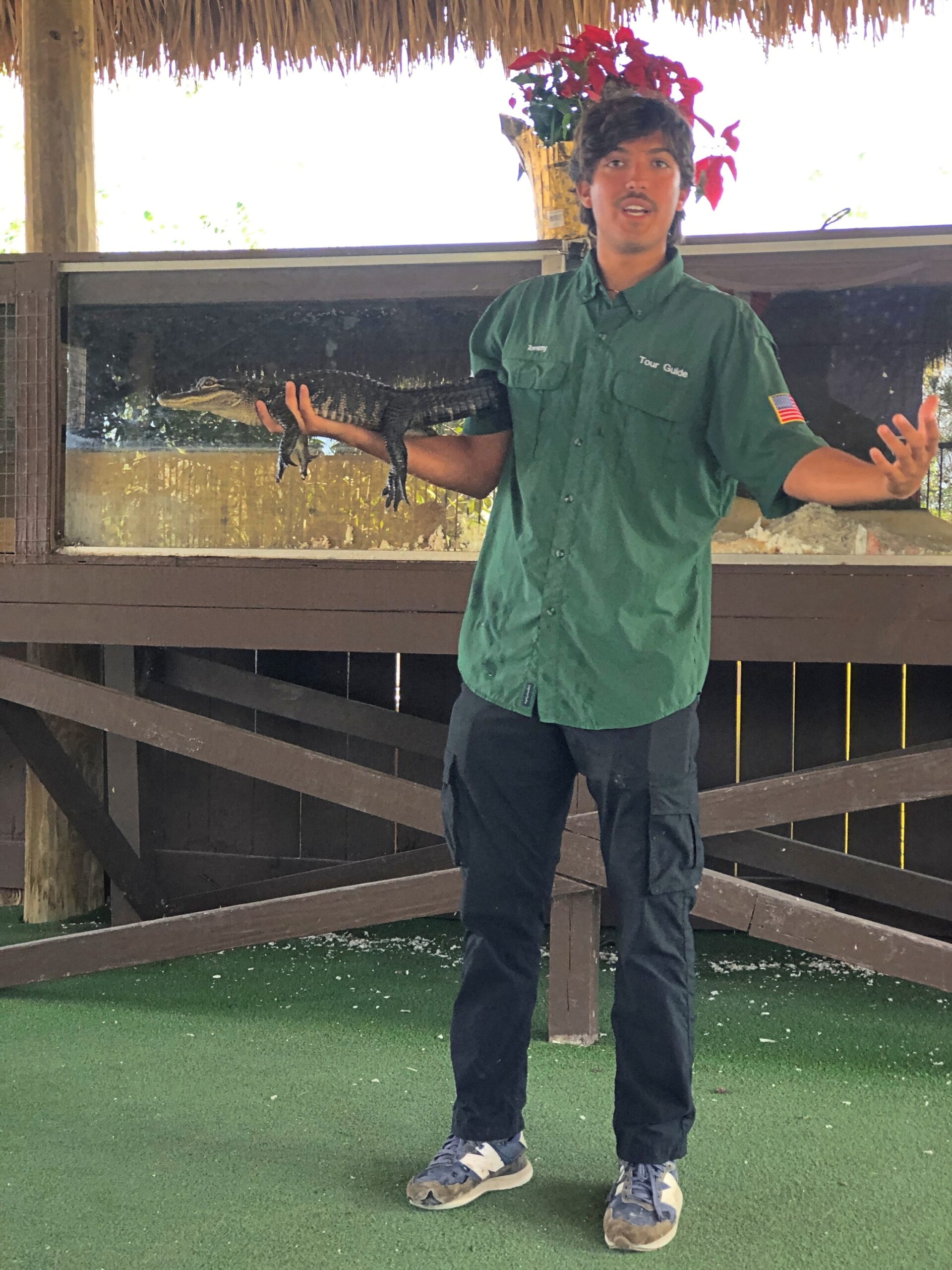
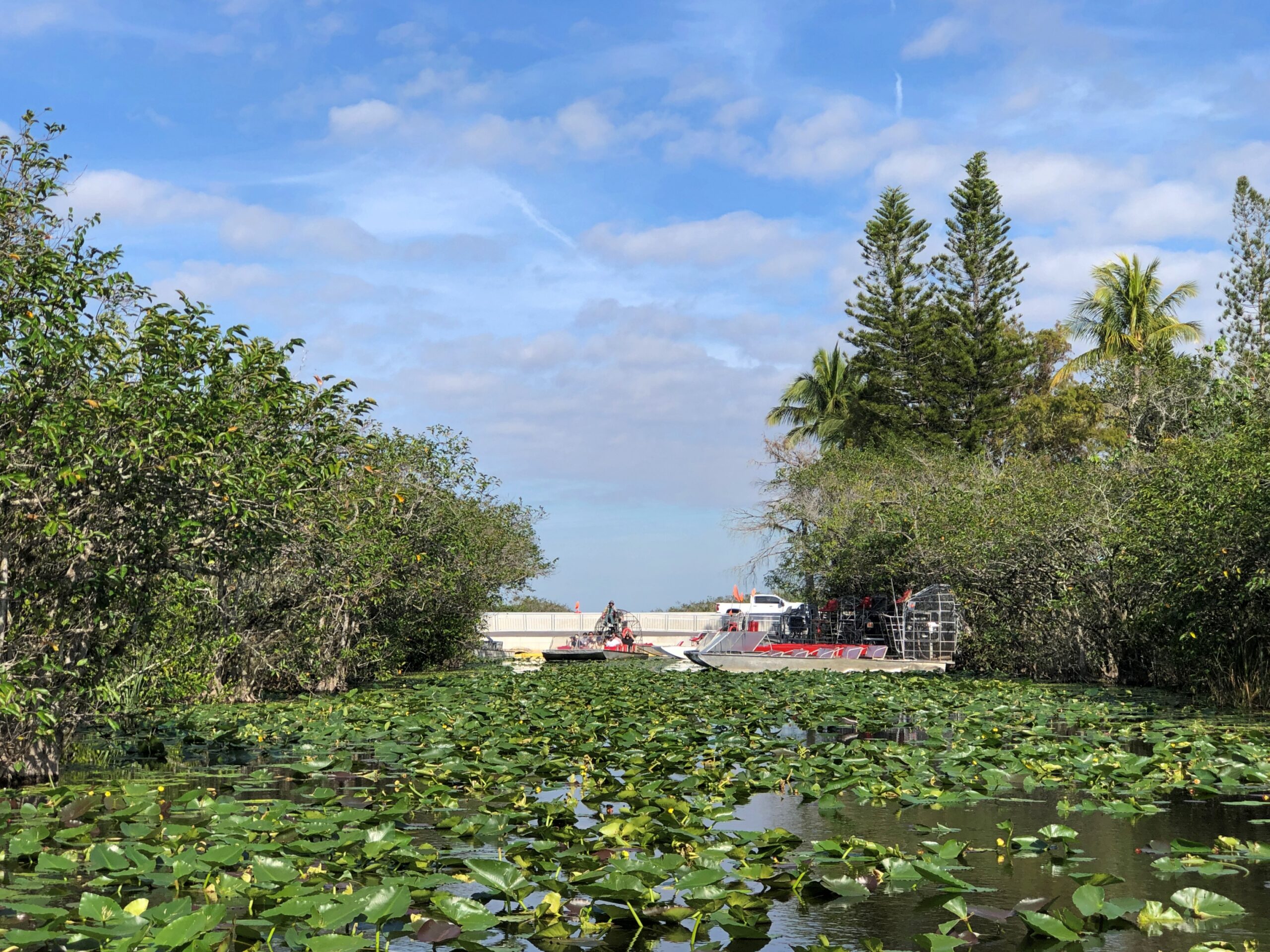
I thought it was funny, even though the joke depends on an alligator canard. As Bob the alligator wrangler told us the next day after our boat tour of the northern reaches of Everglades National Park, the creatures are actually “pretty chill.”
It’s those lowlife crocs that will attack you for no good reason and, I have to report, south Florida is one of the few places where alligators and crocodiles share a habitat. Of course it is. Bob worked for Coopertown Airboats, which is on US 41 and whose tours ply the nearby sawgrass waters, and have since 1945.
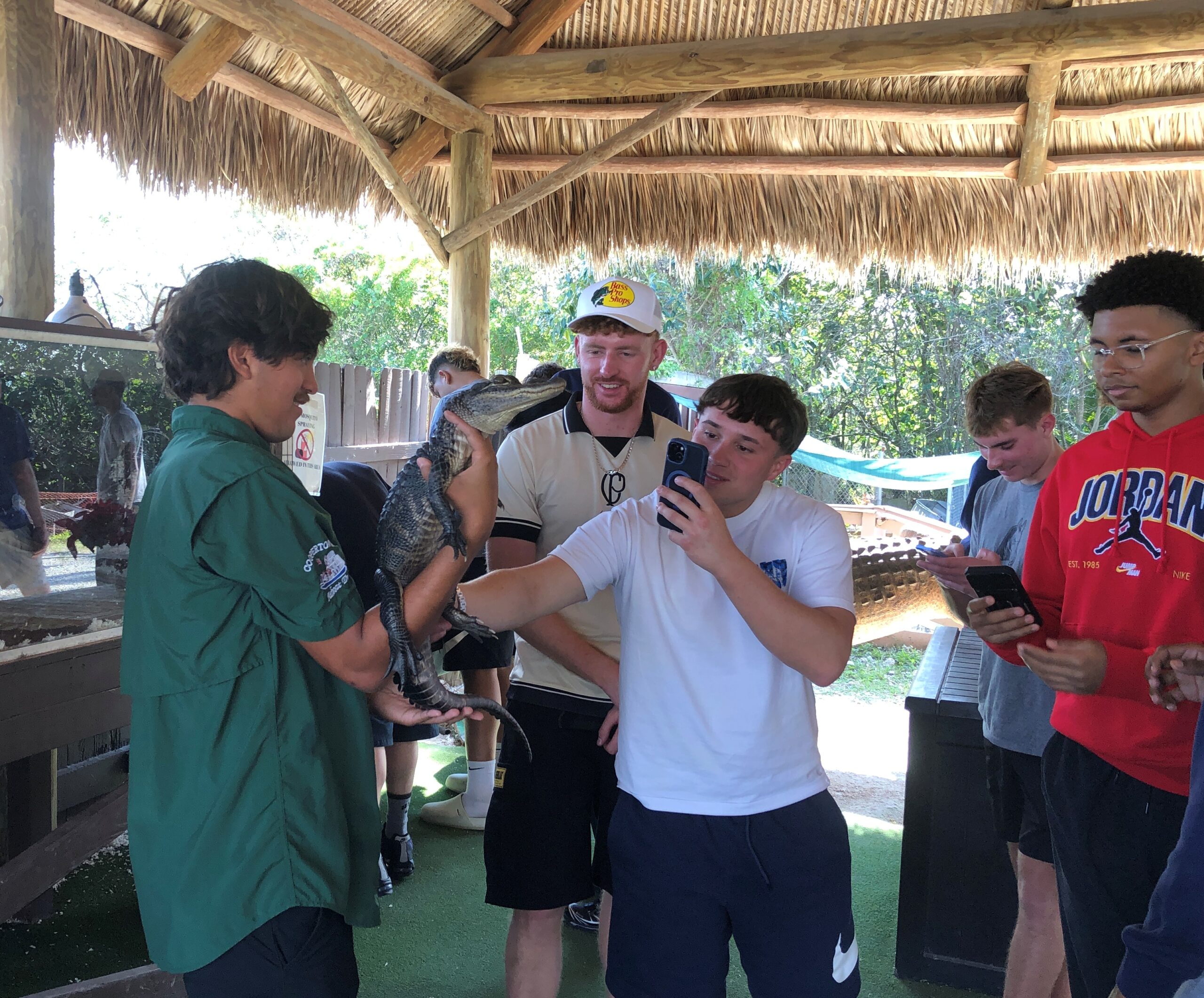
The company also has a few alligators lounging around the grounds in cement ponds, and some baby gators, one of which Bob handled with no problem. “Just keep you fingers away from his mouth,” he said, inviting us to touch the alligator. I don’t know why I was surprised to find that a living alligator’s skin feels pretty much like an alligator skin purse or wallet.
Behind glass at Coopertown was the Everglades’ real menace, anyway, a fat, pale ugly-as-can-be python, an inert reptilian Sydney Greenstreet whose countless cousins have claimed much of the biomass of the Everglades as their own, one nightmarish swallow at a time. The python is king of invasive species in Florida, which is saying quite a lot.
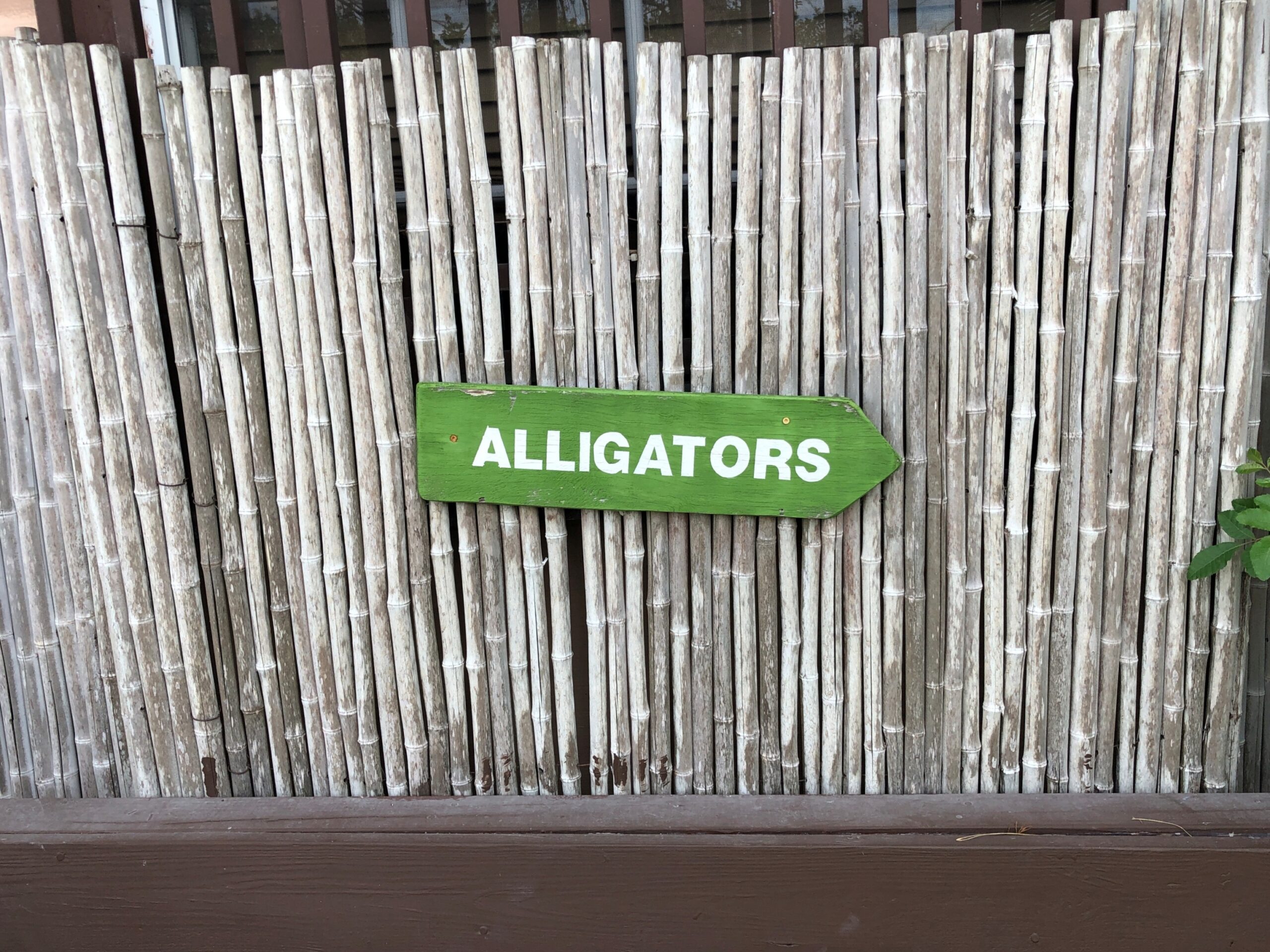
The Coopertown gators weren’t hard to find.
Neither were the boats. Nice, simple wayfinding.
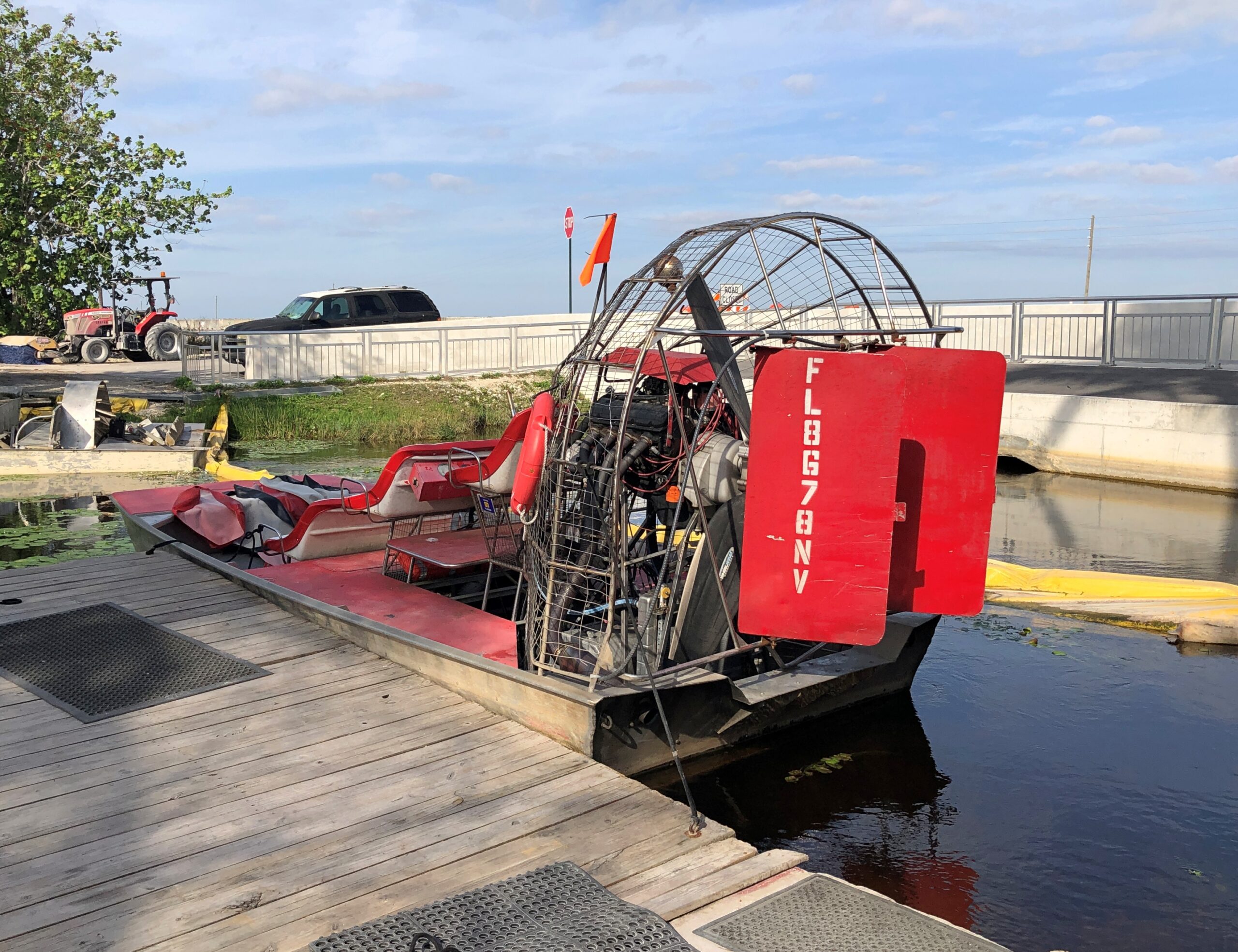
I expected the tour boat to look something like this, which was tied up at one of the docks.
The kind you see, or used to see, on TV. The sawgrass and alligator encounters made me think (a few days later) of Flipper for the first time in many long decades. It wasn’t a show we watched much in our house in the mid-60s, but I have a very vague memory of it, maybe from repeats but also reinforced by the saccharine theme song as included on one of the TV Toons records I owned in the ’80s. Reading about the show, I found that it was set in the Keys and not the Everglades, and the characters tooled around in a more standard motorboat. Still, it might have been the first time I ever heard about the Keys.
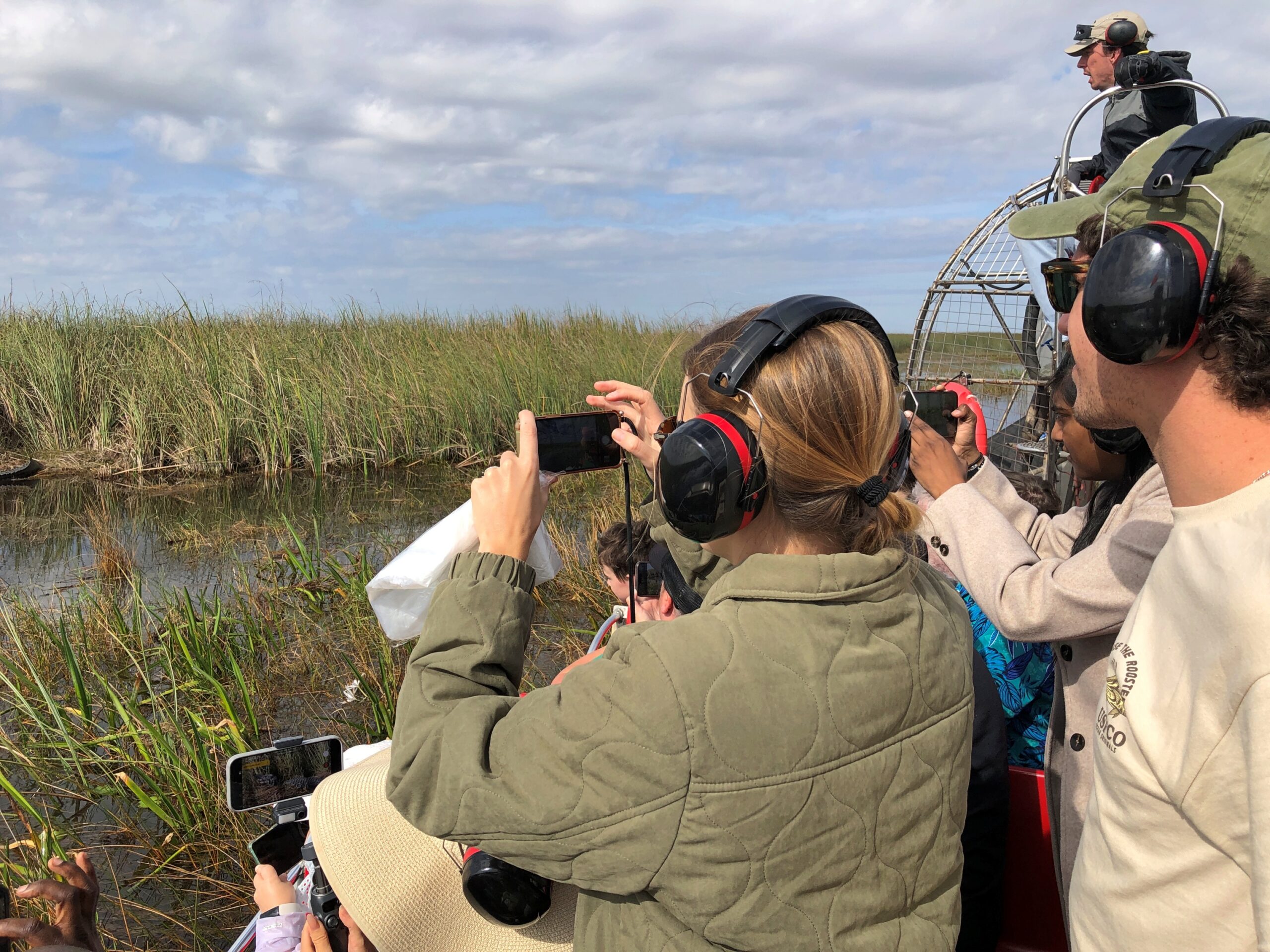
Those spiffy airboats are for the more expensive tours, I think. Ours was a larger flatbottom with a few rows of metal benches for regular tourists.
But it was pretty good seating for the half hour or so, especially since we got the front row.
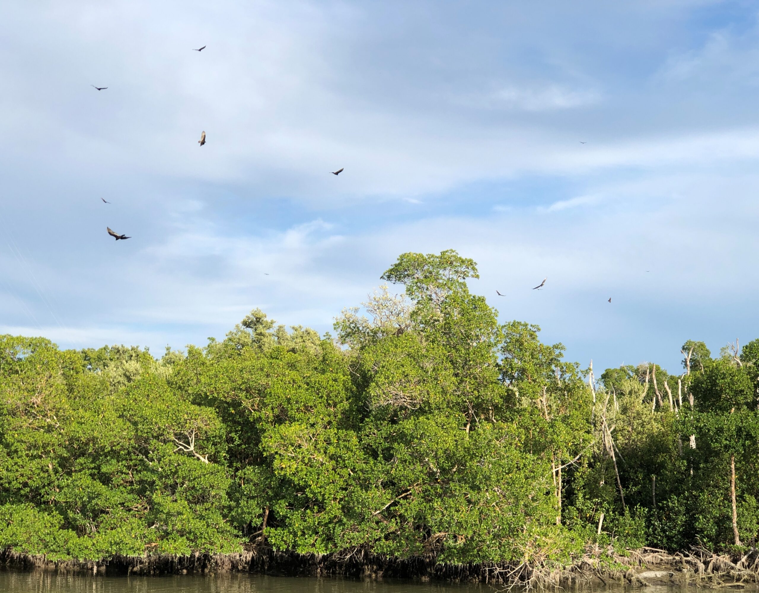
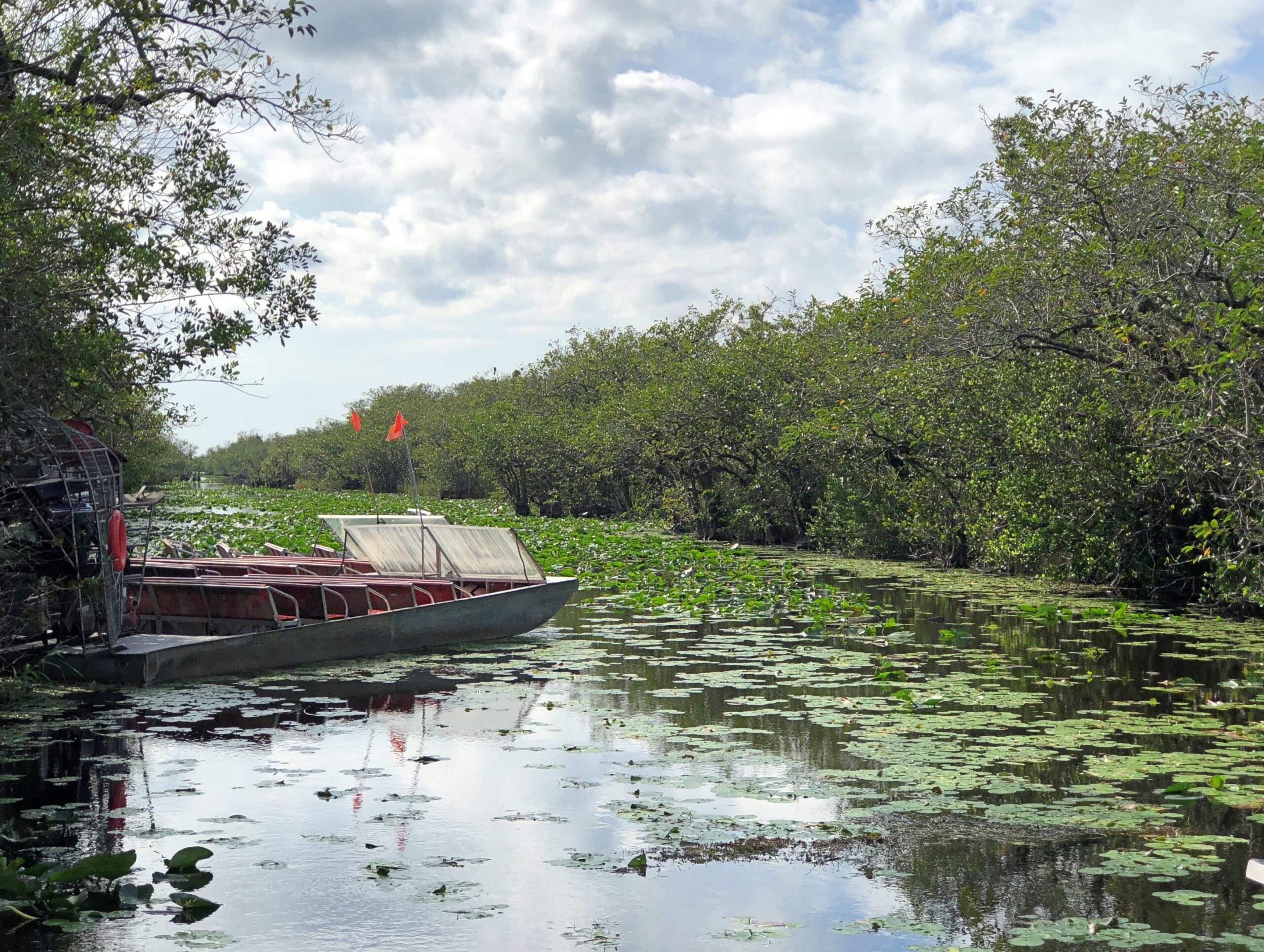
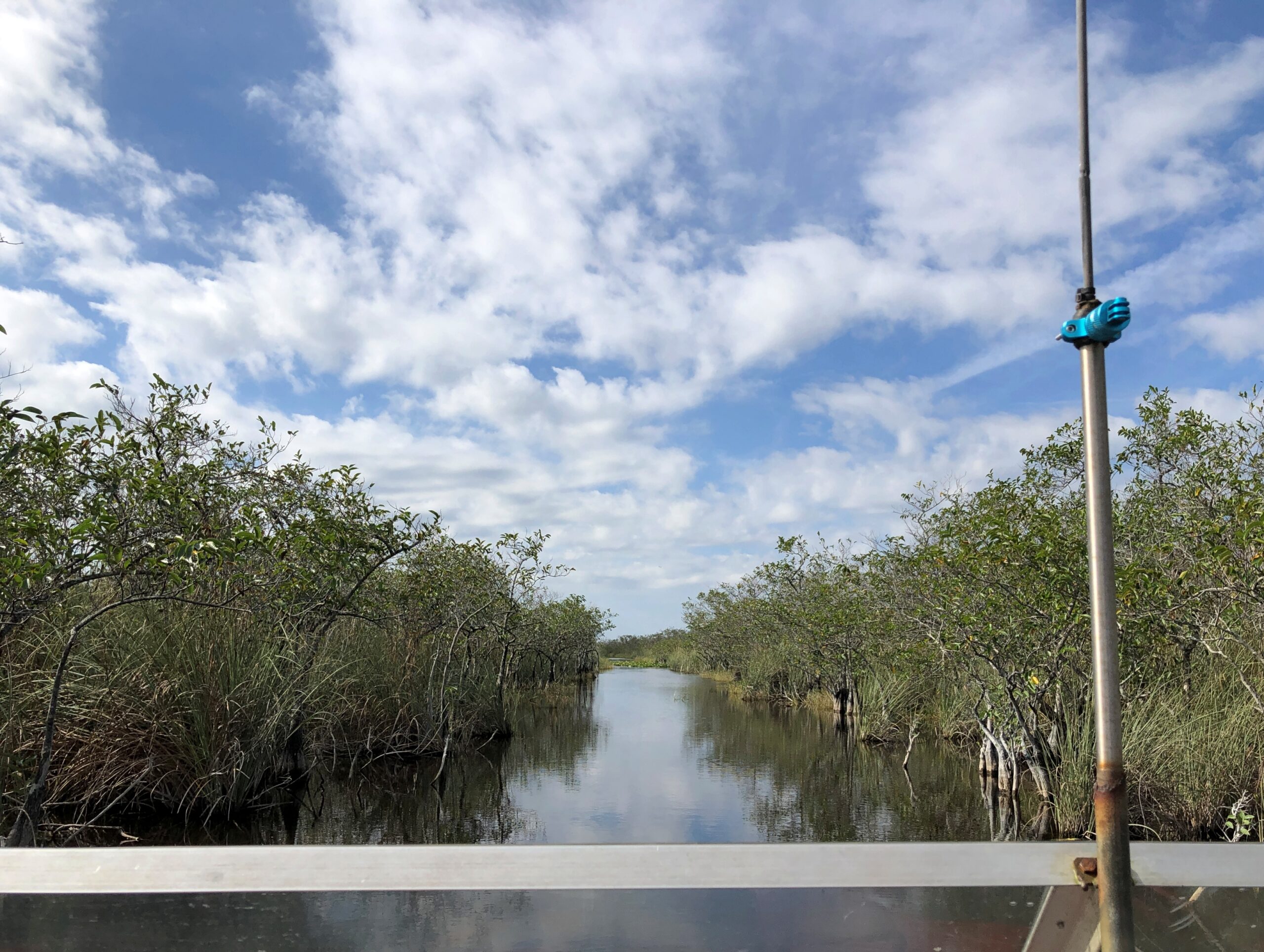
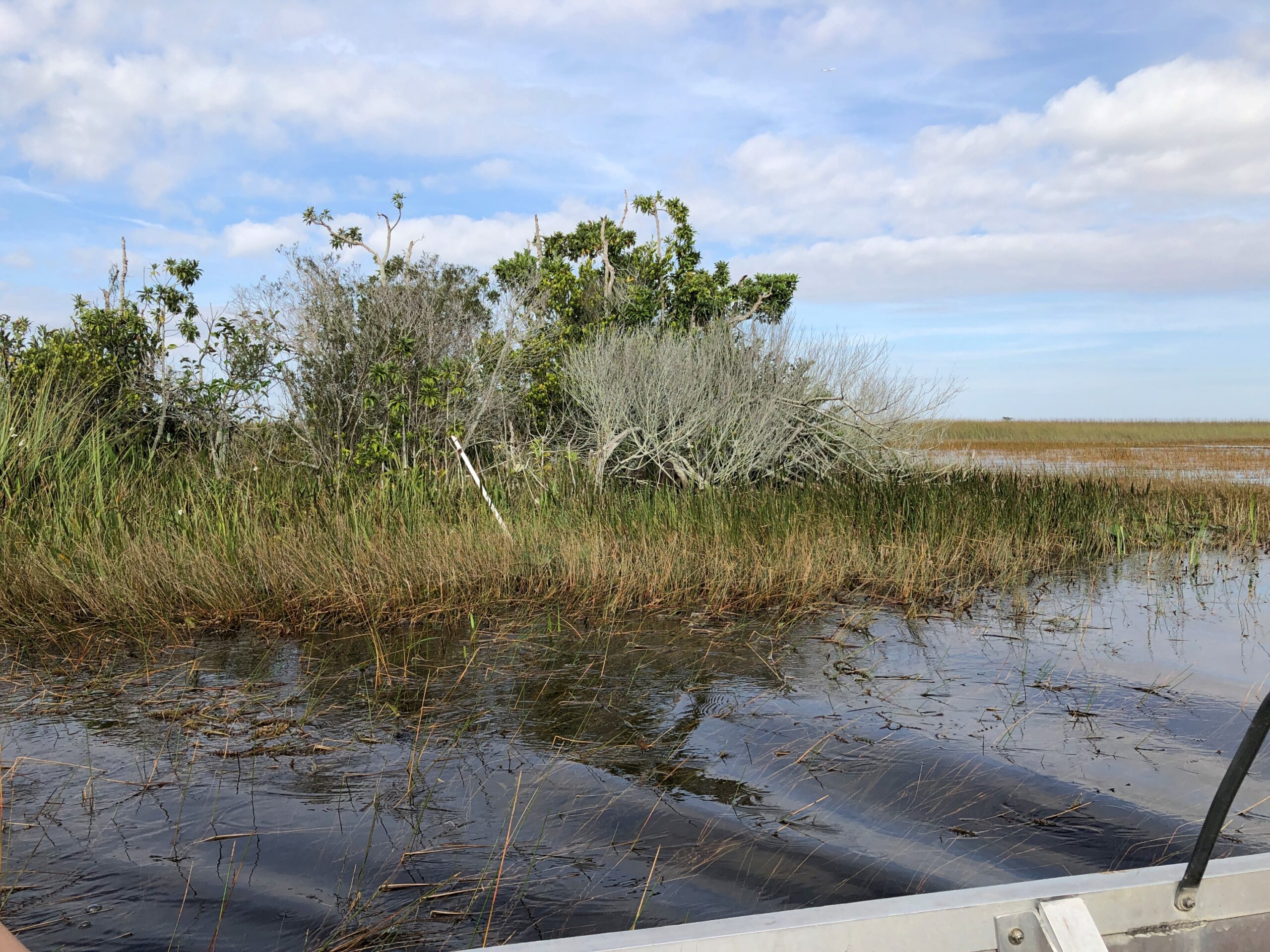
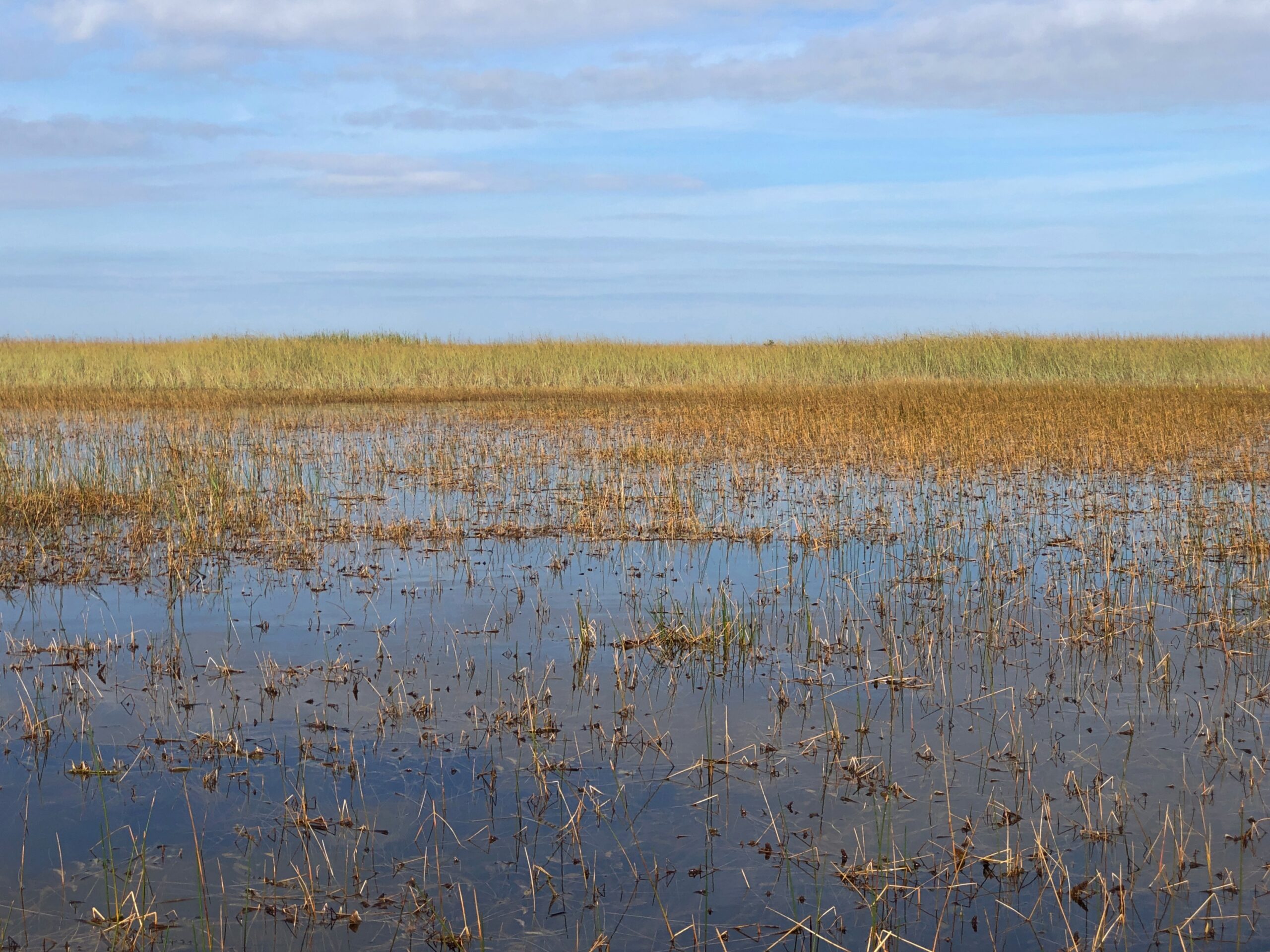
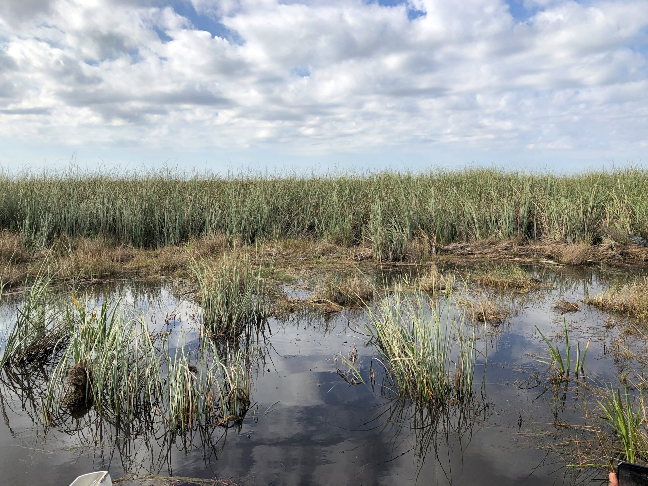
Off we went into the grassy water, dotted by quasi-islands sprouting trees. Soon the scenery looked like this.
And this.
Leaving me to wonder, I’m glad the guide knows his way around, because I’d be lost instantly. The boat guide wasn’t Gator Bob, incidentally, but an older fellow perched in the pilot’s cage.
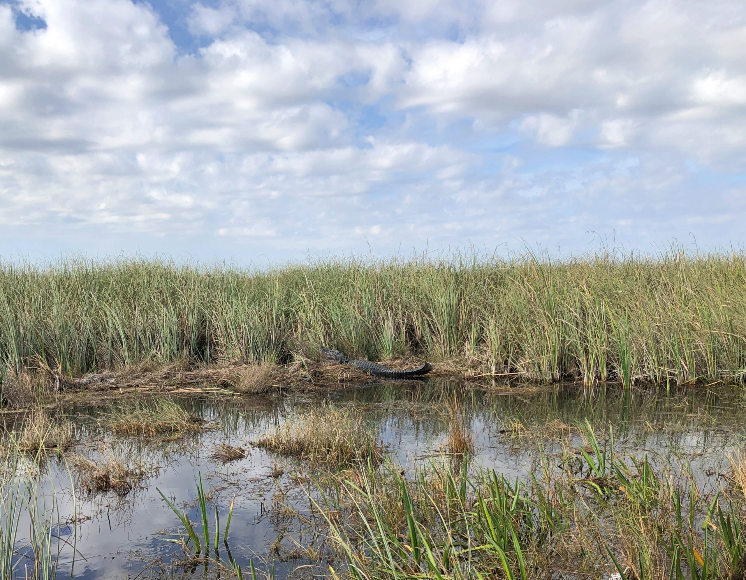
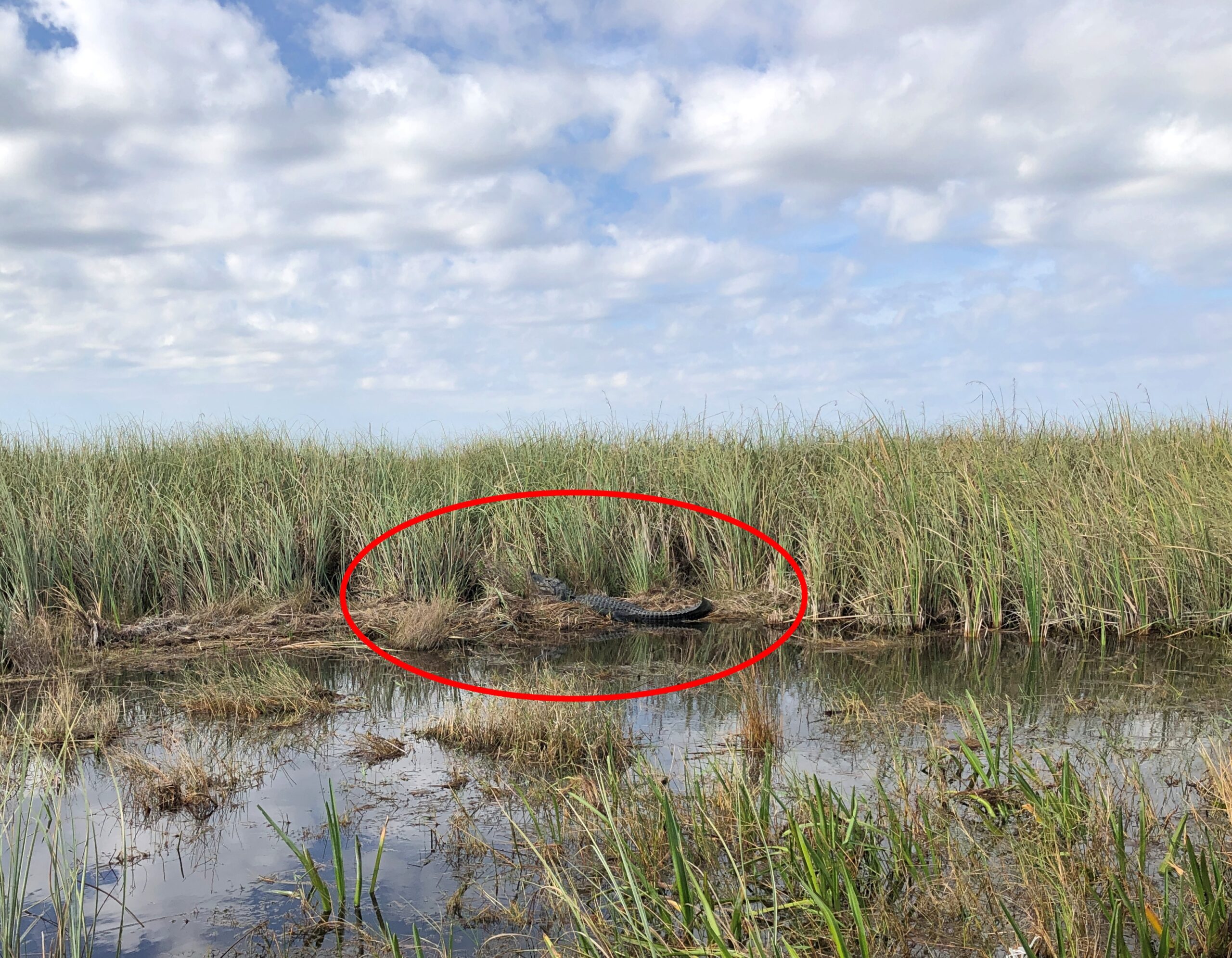
Before long, we found a lounging alligator in the wild.
December is part of the sluggish season for local reptiles, the guide explained. Not too cold for alligators, naturally, but cool enough that lying around in the sun is a good option for them. Regardless, the gator – let’s call him Bob – had his own paparazzi for a few moments.
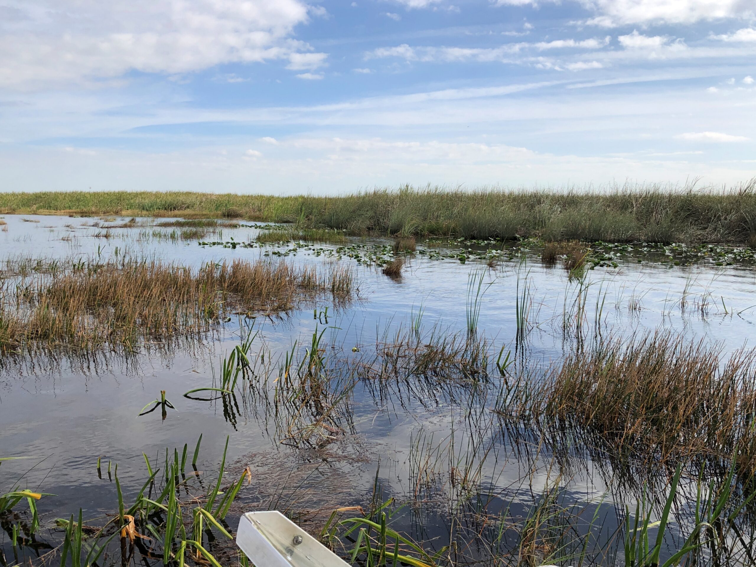
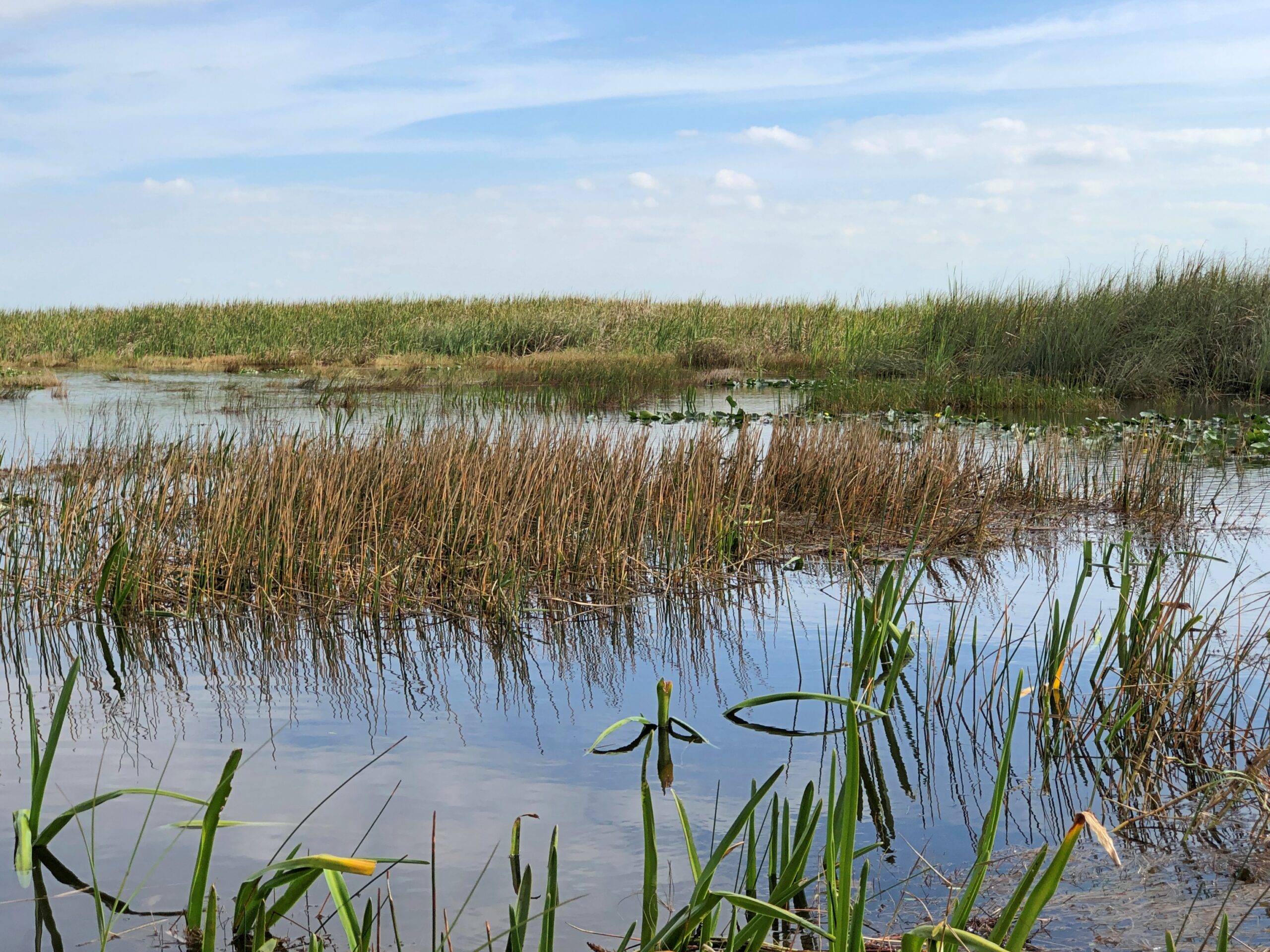
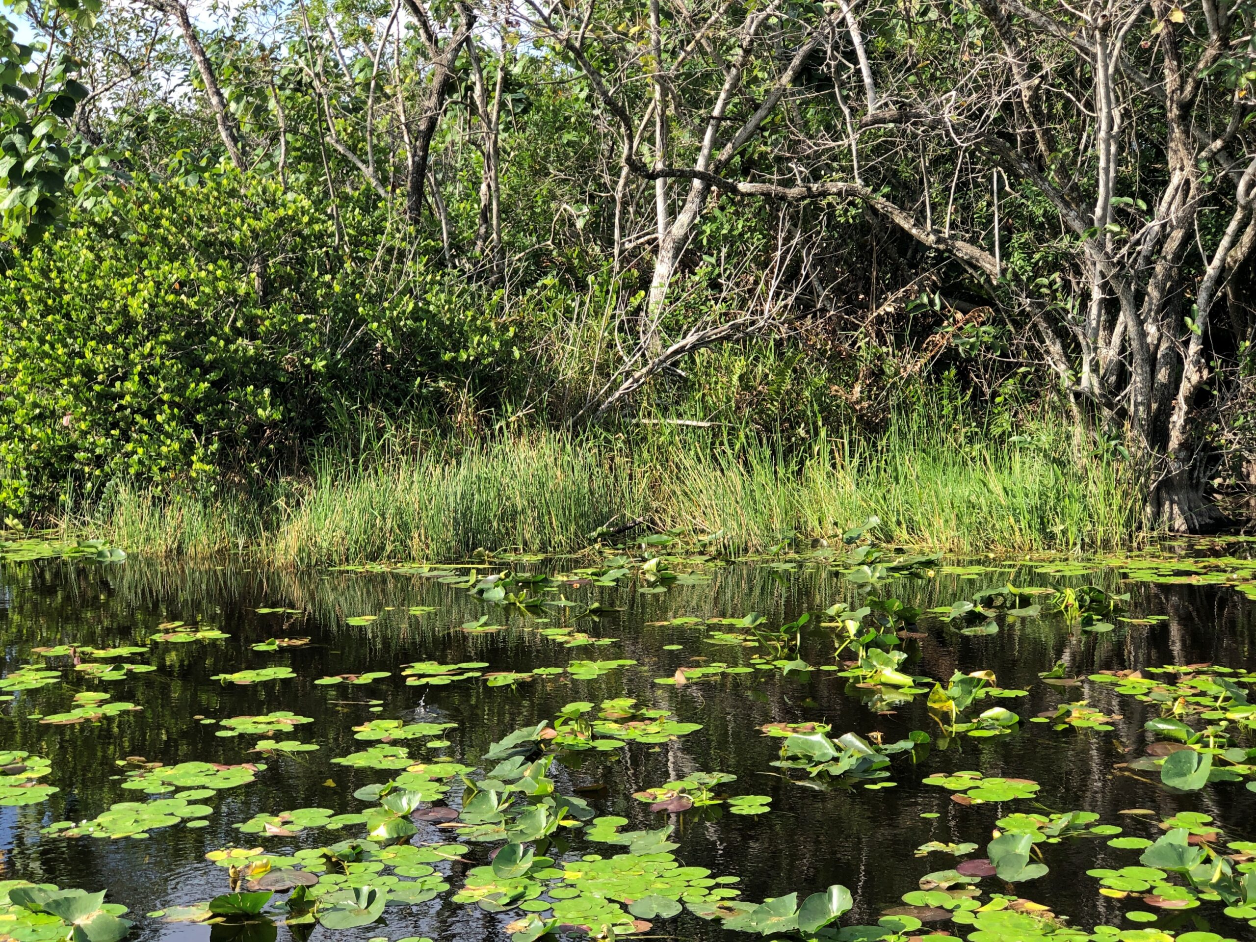
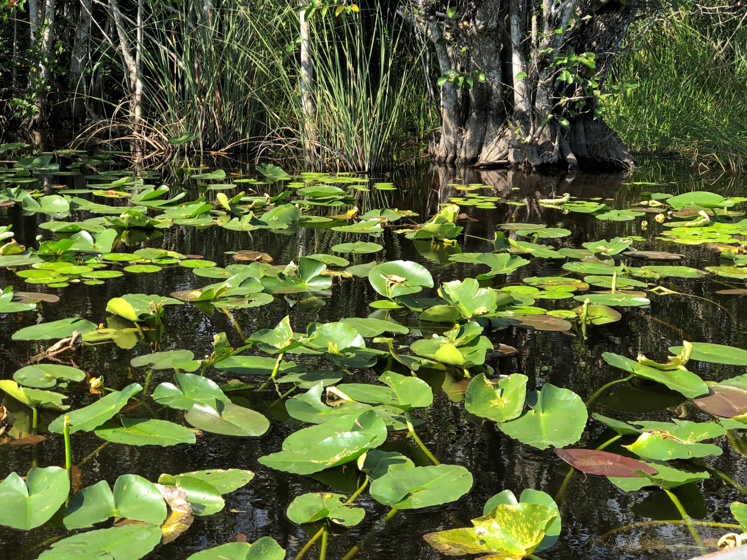
Our return took us through thick patches of lily pads. They moved aside without tangling or anything complicating that would happen if I were piloting the boat.
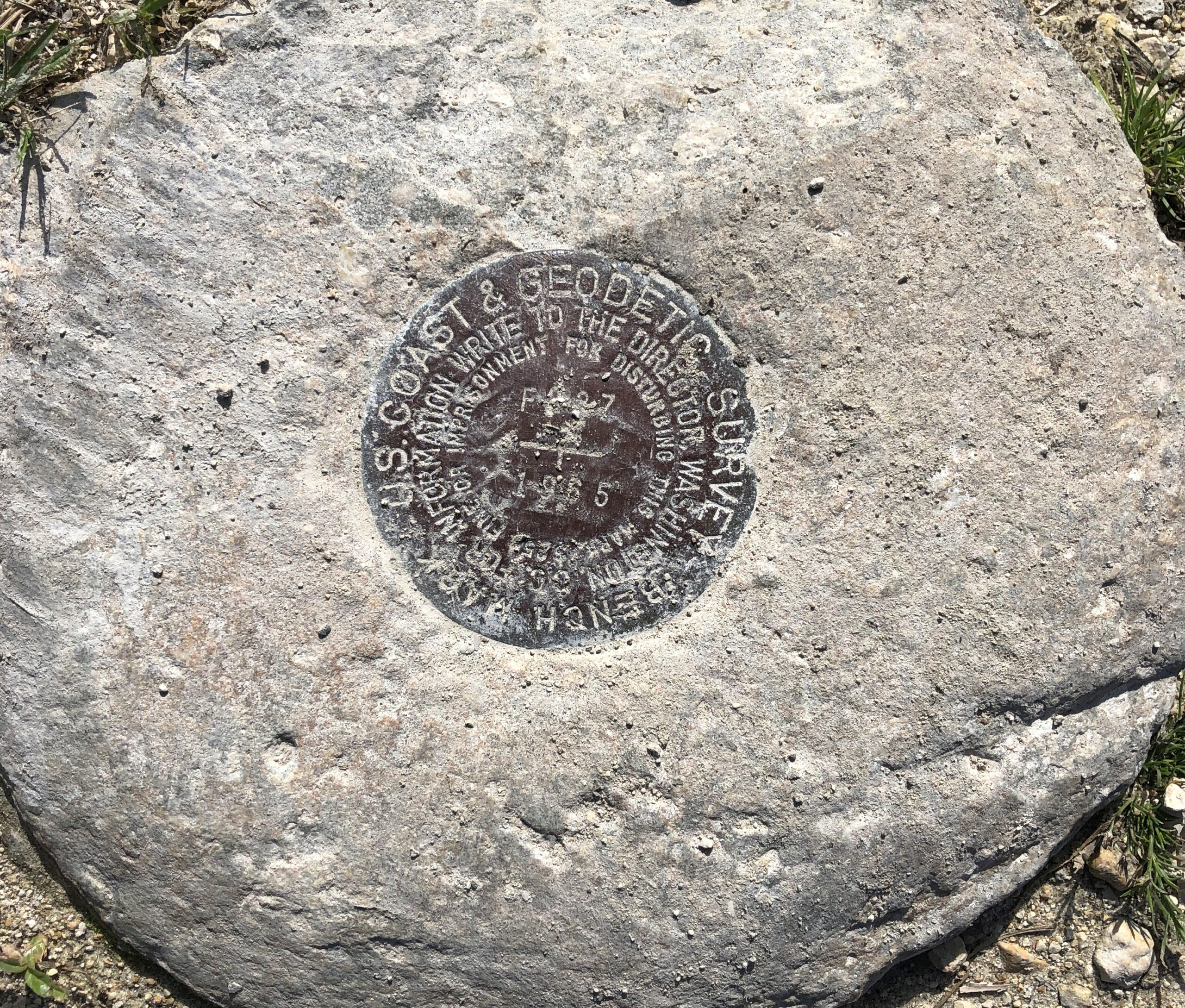
Bonus at Cooperville, out near the parking lot. A US Coast & Geodetic Survey Bench Mark, dating from 1965 if I read that right.
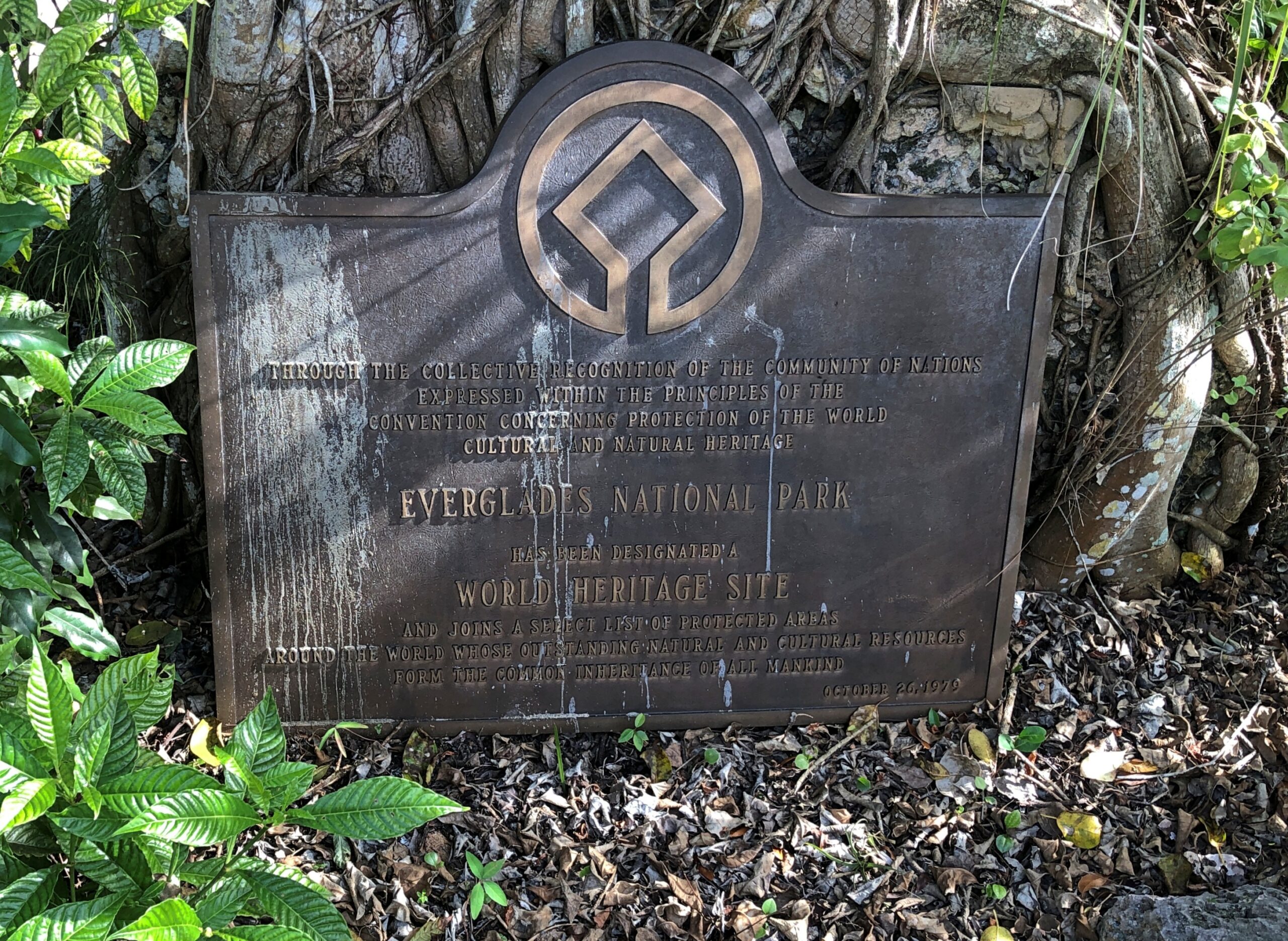
Another bonus: A World Heritage Site plaque, complete with comments by birds.
“Everglades National Park is the largest designated sub-tropical wilderness reserve on the North American continent,” UNESCO says. “Its juncture at the interface of temperate and sub-tropical America, fresh and brackish water, shallow bays and deeper coastal waters creates a complex of habitats supporting a high diversity of flora and fauna. It contains the largest mangrove ecosystem in the Western Hemisphere, the largest continuous stand of sawgrass prairie and the most significant breeding ground for wading birds in North America.”
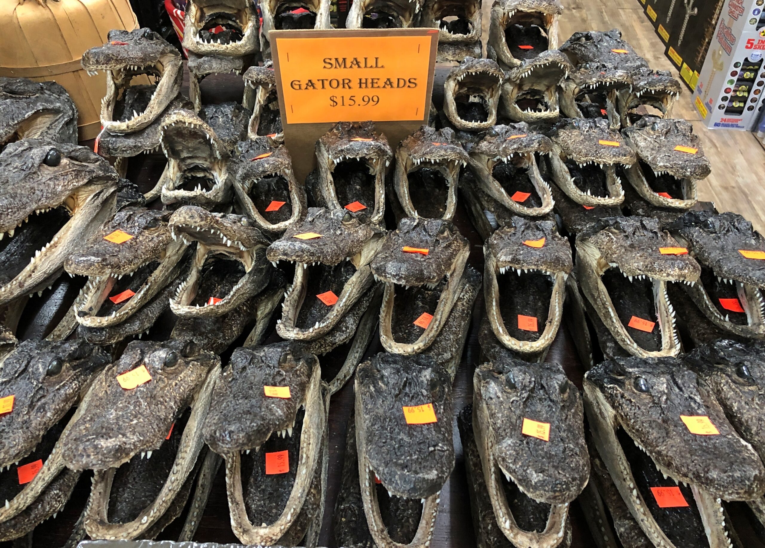
Good old wading birds. Still, that isn’t what people come to see. That would be gators. How do I know this? Consider a scene from a souvenir shop I visited later in our trip.
Americans know their national parks – the famous ones, anyway – but how about their national preserves? A similar, yet different sort of designation by Congress. I don’t know all the details myself, but one thing is that resource extraction seems to be possible in limited ways at least some of the 21 preserves, but not at all (?) in the 63 parks. Regardless, preserves are different places on the maps, though they are often adjacent to parks.
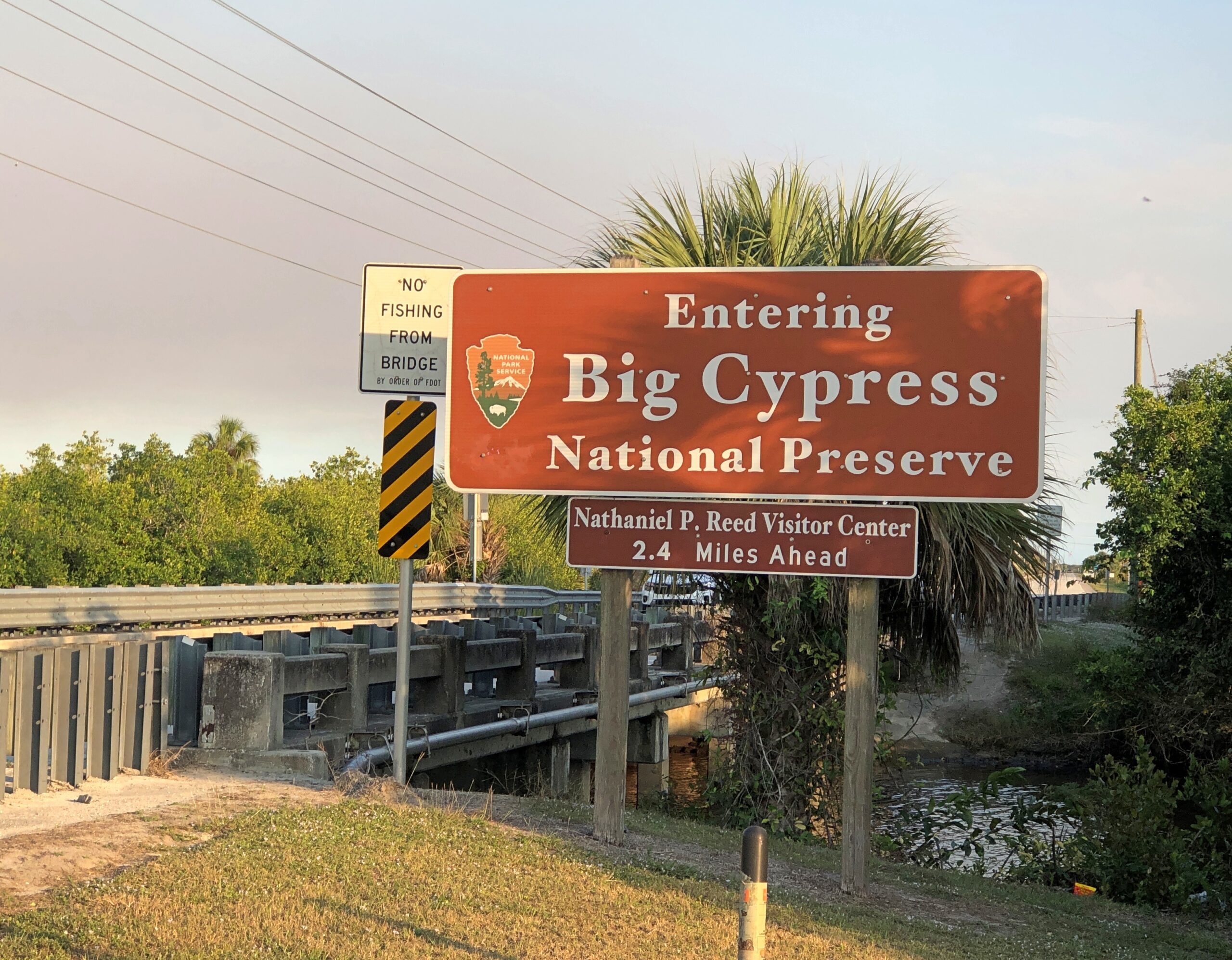
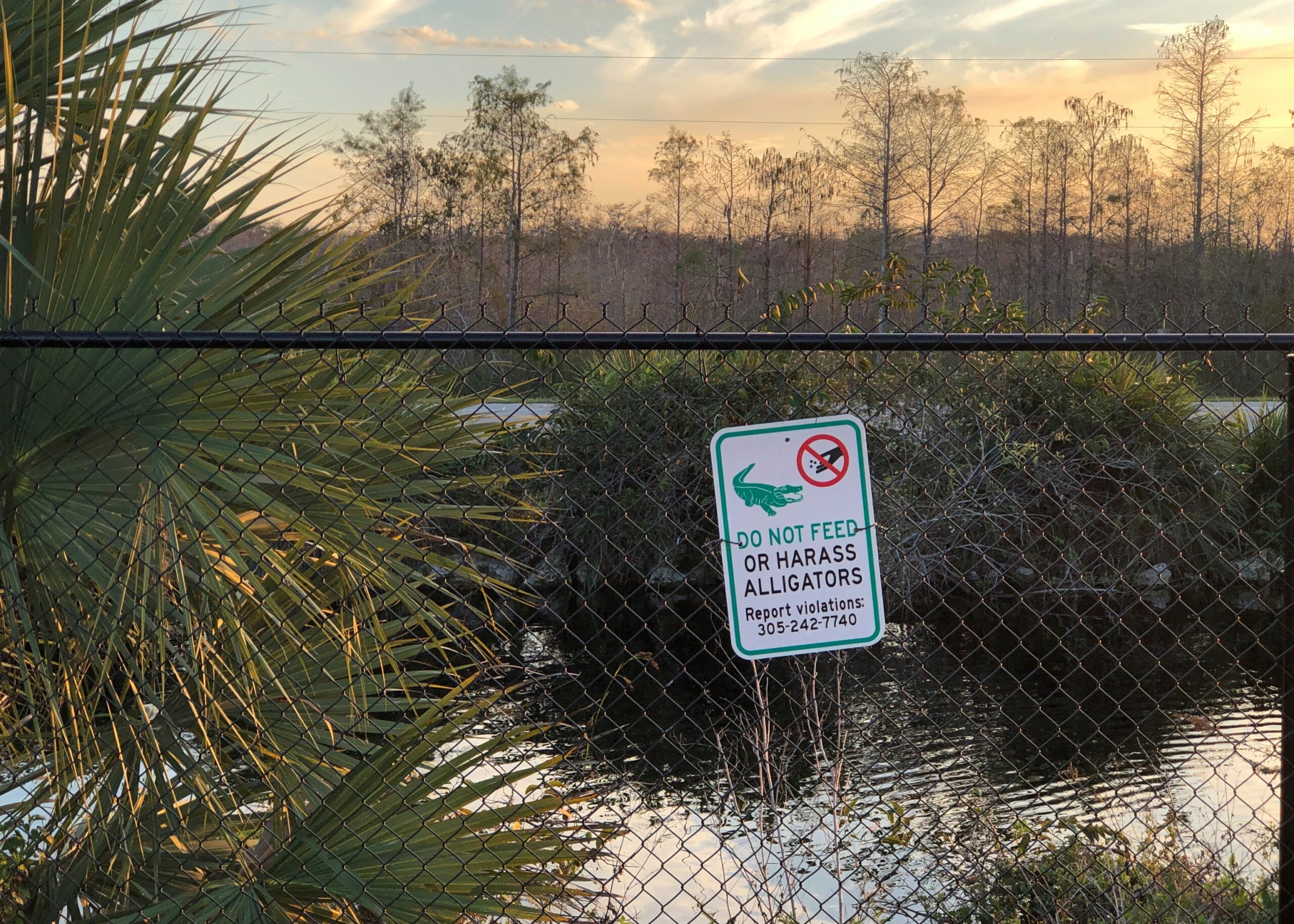
Such as Big Cypress National Preserve, which is a large chunk of Florida next to Everglades NP.
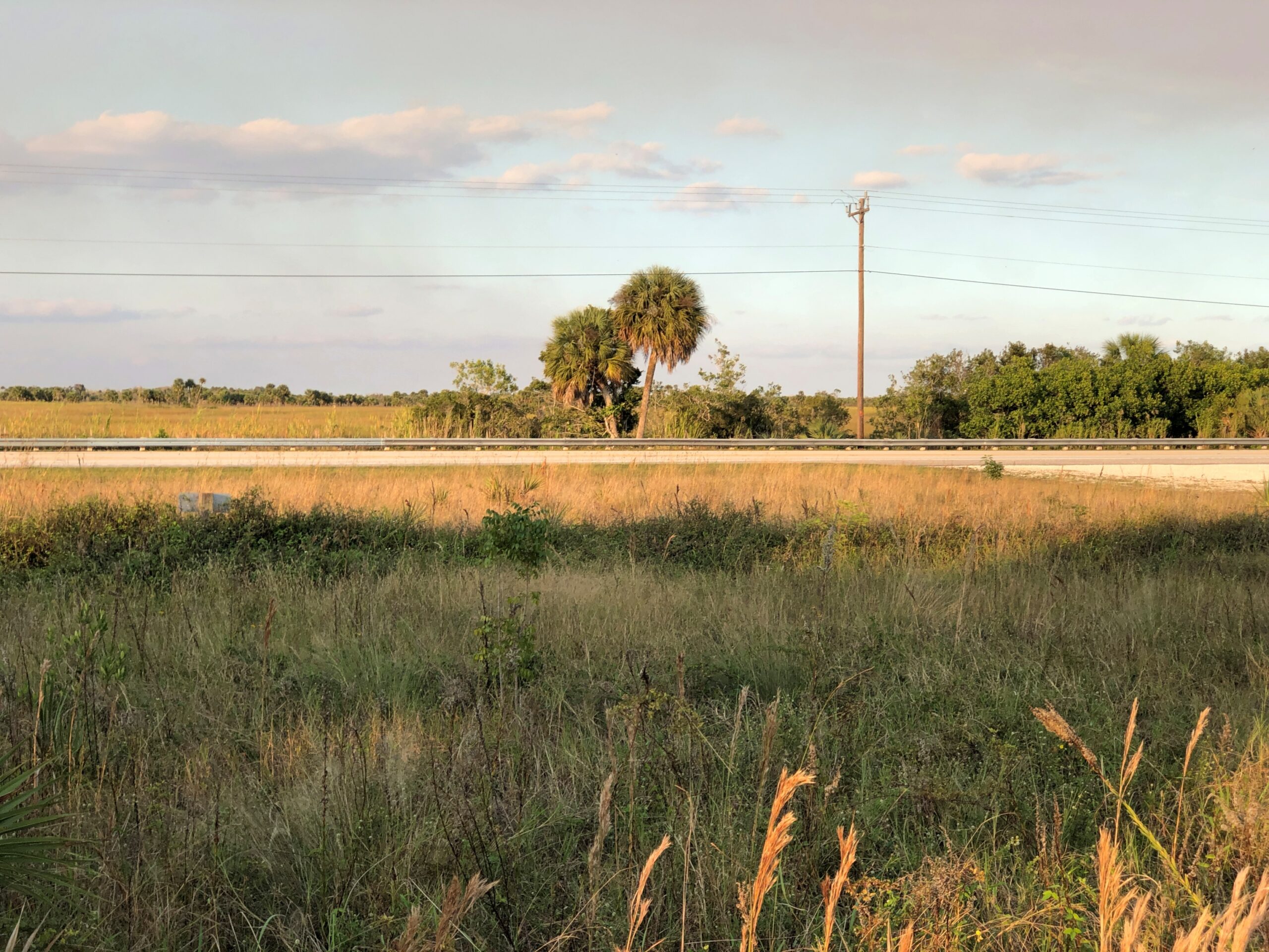
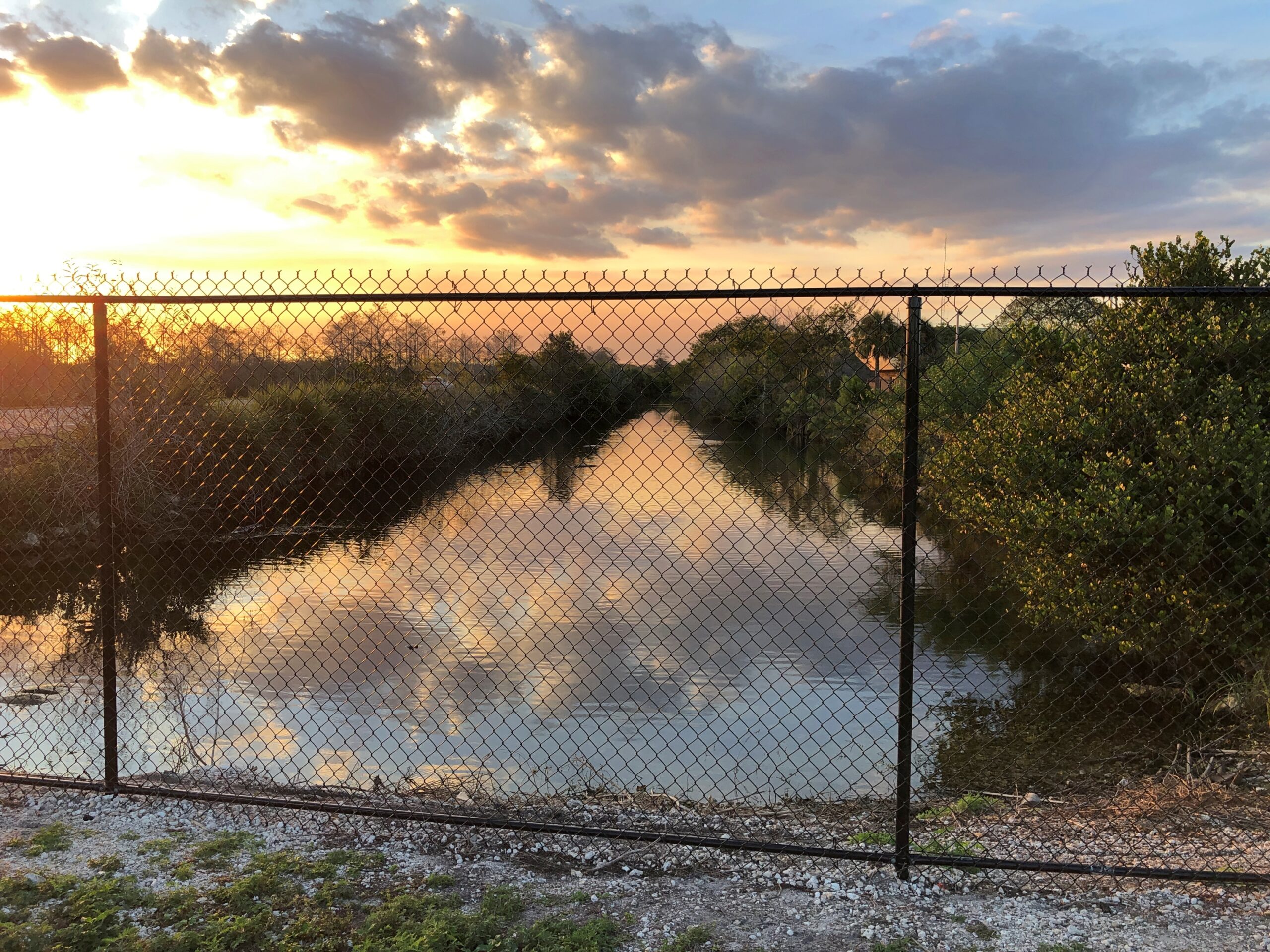
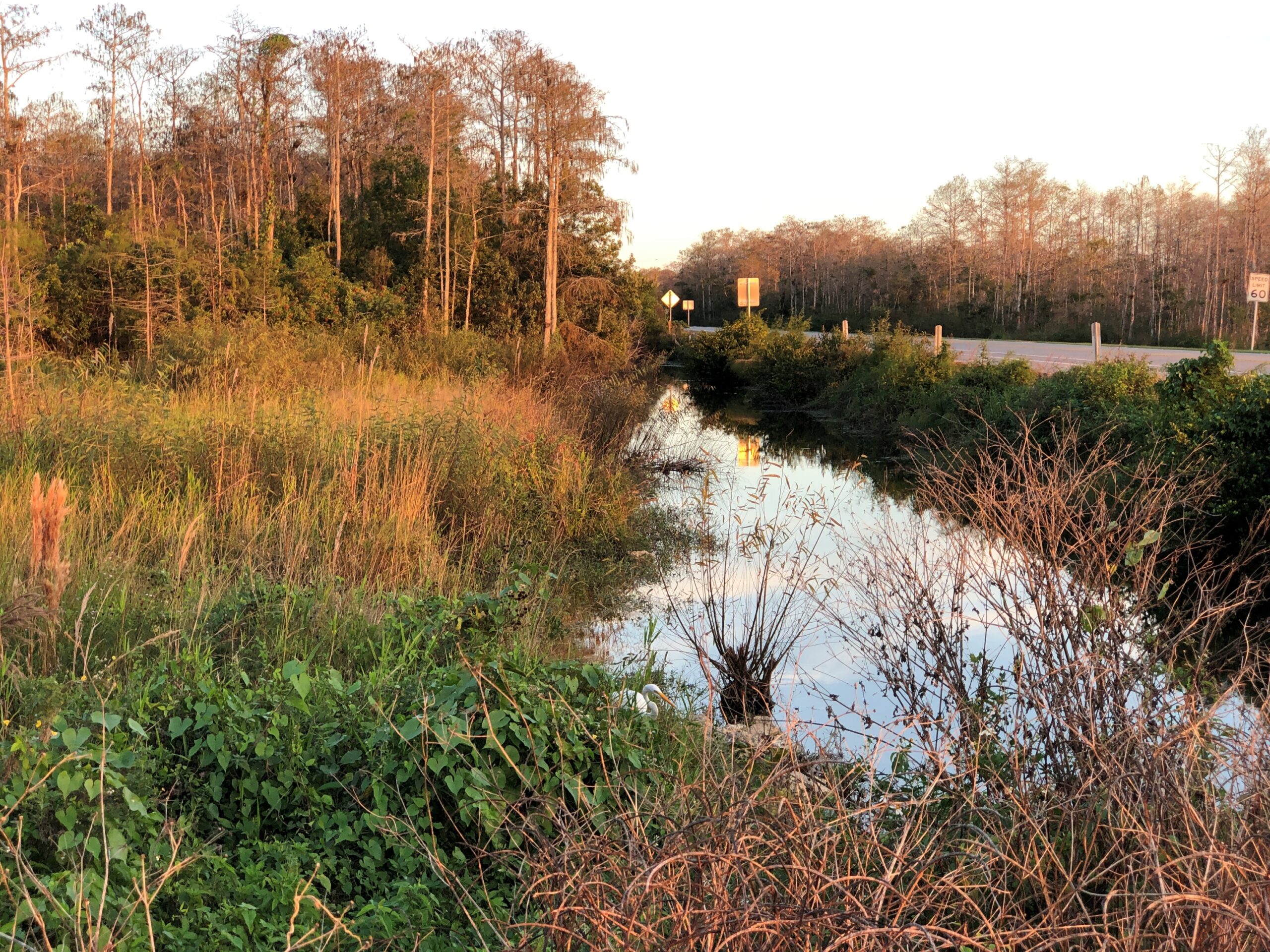
Head south from metro Orlando on US 27 and eventually – and it takes a while – the suburban aspects peter out and give way to agriculture, especially citrus and sugarcane. At a hamlet called Palmdale, the highway Florida 29 continues the trek south, meeting both I-75 (Everglades Parkway, Alligator Alley) and US 41. By that time, agriculture has given away to (mostly) undeveloped wetlands. Swamp, in the old days, but in fact the preserve and the park don’t qualify as such. We picked US 41 and headed east, into the thick in the Big Cypress.
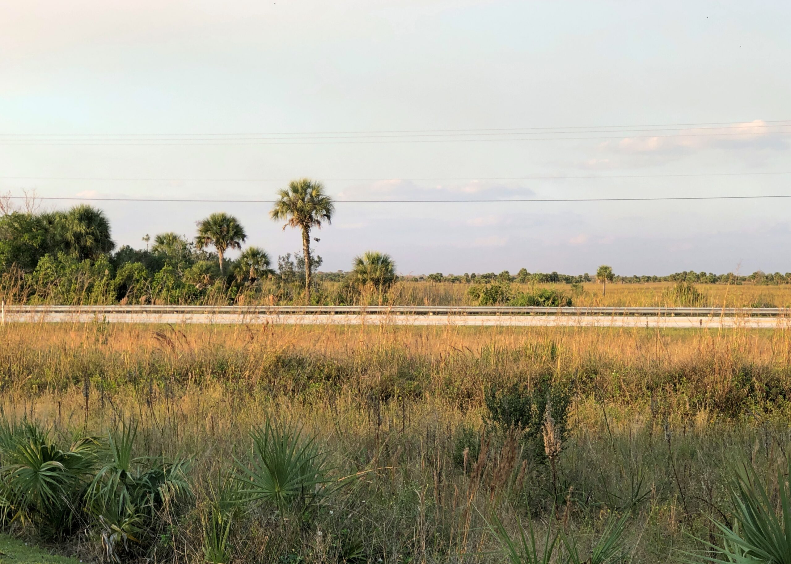
Daylight is short in December, even in southern Florida, so we barely had time to traverse US 41 before losing the light. But we managed a few stops.
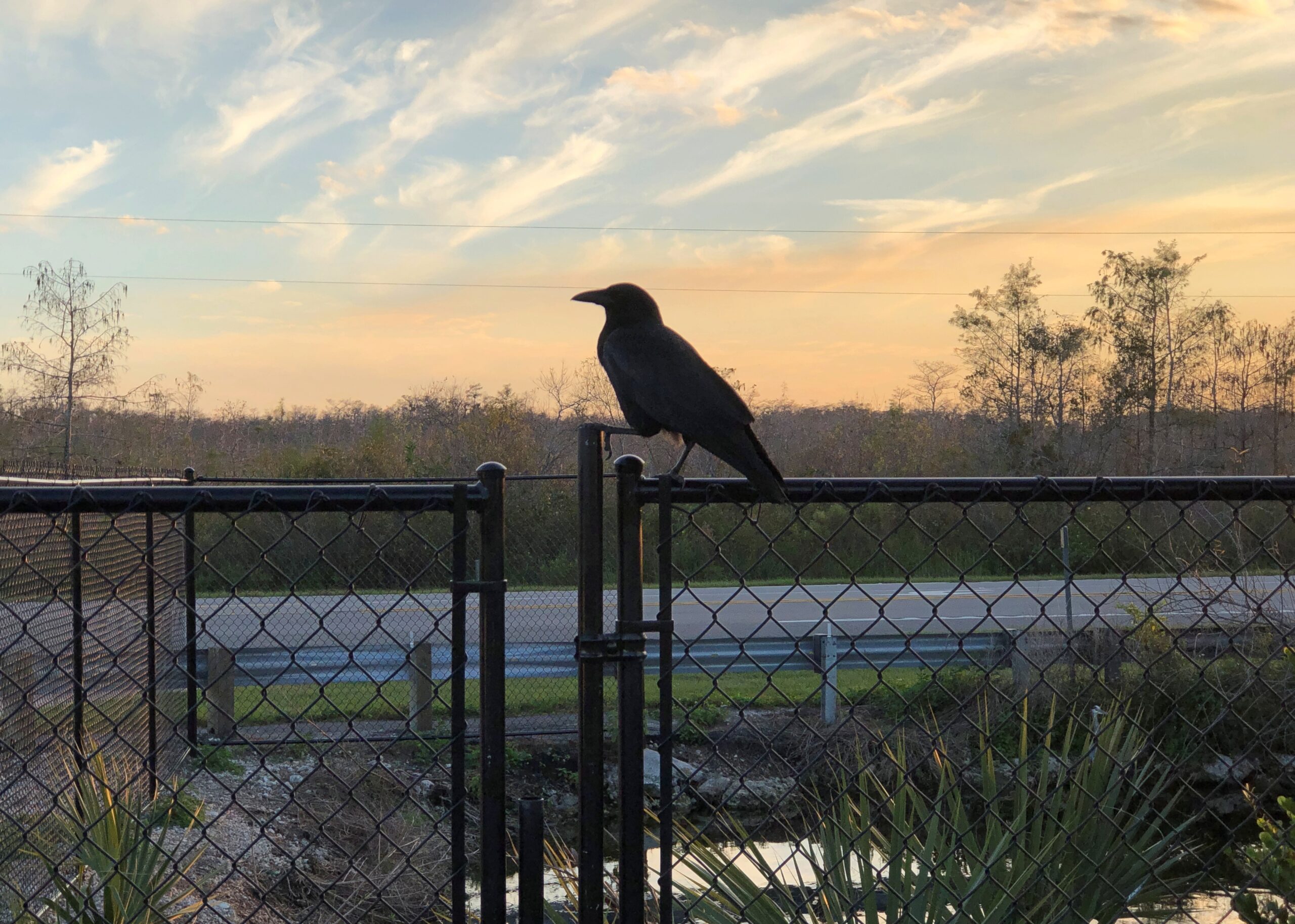
The territory was behind fences in some spots.
Mostly not.
By dark, we’d passed out of the preserve and on to the edge of the national park. Much of US 41 – known as the Tamiami Trail in part of Florida according to various sources, but not on any signs that I saw – is under construction toward its eastern end, meaning a tight drive through concrete barricades, everyone’s least favorite kind of driving. Under reconstruction, that is, and for good reason.
“The Tamiami Trail (U.S. Highway 41) has long been recognized as one of the primary barriers to flow of water through the ecosystem,” the NPS notes. “The need to eliminate barriers to overland flow of water in the Everglades is considered one of the indisputable tenets of restoration. Much scientific information amassed in recent decades reinforces the importance of removing these barriers to water flow in order to restore natural marsh connectivity.
“In 2009, Congress authorized implementation of the plan selected in the 2008 Modified Water Deliveries to Everglades National Park, Tamiami Trail Modifications, Limited Reevaluation Report (LRR) … The LRR plan would improve potential marsh connectivity, reduce sharp changes in water velocity, and improve rainy season depths and durations. In addition, these modifications will improve the ridge and slough landscape and fish productivity, which could result in increased foraging success for wading birds.”
It makes for a temporarily unpleasant drive, but I think we can all get behind increased foraging success for wading birds and other worthwhile eco-goals for the much abused Everglades. Now only if the plan could do something about Everglades pythons.
Decorating for Christmas this year meant a rapid set-up. We spent a fair number of hours on the 23rd making the living room ready for a tree – moving clutter, mostly. On Christmas Eve, I brought the tree in from the garage, and Ann mostly decorated it. Finishing touches, by me, were in progress even on the morning of Christmas Day, but since that moment in the life of our family doesn’t involve an early-morning rush downstairs by children anticipating Santa’s bounty any more, that was doable.
Ann did a fine job of decorating, in the style of our family: fill up the tree with a wide variety of glowing and glinting objects accumulated across the decades.
We got a late start on decorating for Christmas, though when I think about, decorating after the Solstice discourages the sort of front-loading of Christmas that a lot of people complain about, but which they do anyway.
We had a good reason for the late start: a drive to Florida and back, beginning on December 4 and ending on the 22nd. Not just to Florida, but as far as you can go in that state, at least by car, namely to Key West and back. Early to mid-December seemed like a good time to do such a thing, after any traveling people do for Thanksgiving but before the worst of the Christmas-New Year’s rush. A short shoulder season in other words, but a good one, with room rates not quite subject to surge pricing, and crowds thick in some high-volume tourist destinations, but not impossible.
Also, Florida has few mosquitoes this time of year. Not no mosquitoes, as we found out one day in the southern reaches of the peninsula, just a “bearable” number.
Sometime earlier this year, I got the idea that I wanted to take four long drives after turning 64. Four for 64, you could say. Doing so by the end of 2025 wasn’t part of the idea, but that’s how things worked out. The drive to Florida and back, by way of such places as Indianapolis, Louisville, Chattanooga and Atlanta, totaled 3,682 miles. For all four trips since June, the total is about 14,300 miles.
That could be made to sound impressive, but in fact American men my age average more than that every year, about 15,000 miles, at least according to this source, which cites US DOT data. Younger men drive even more annually. Most of that is commuting, however. My commuting mileage by car has been exactly zero this year, and while I drive locally to stores and such, it couldn’t be more than a few thousand miles. So it seems clear that, as an American man, it was my duty to get out and drive.
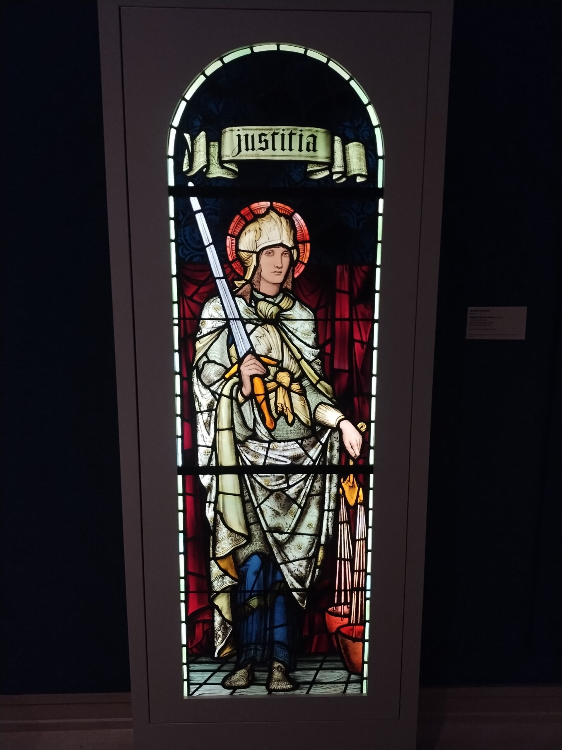
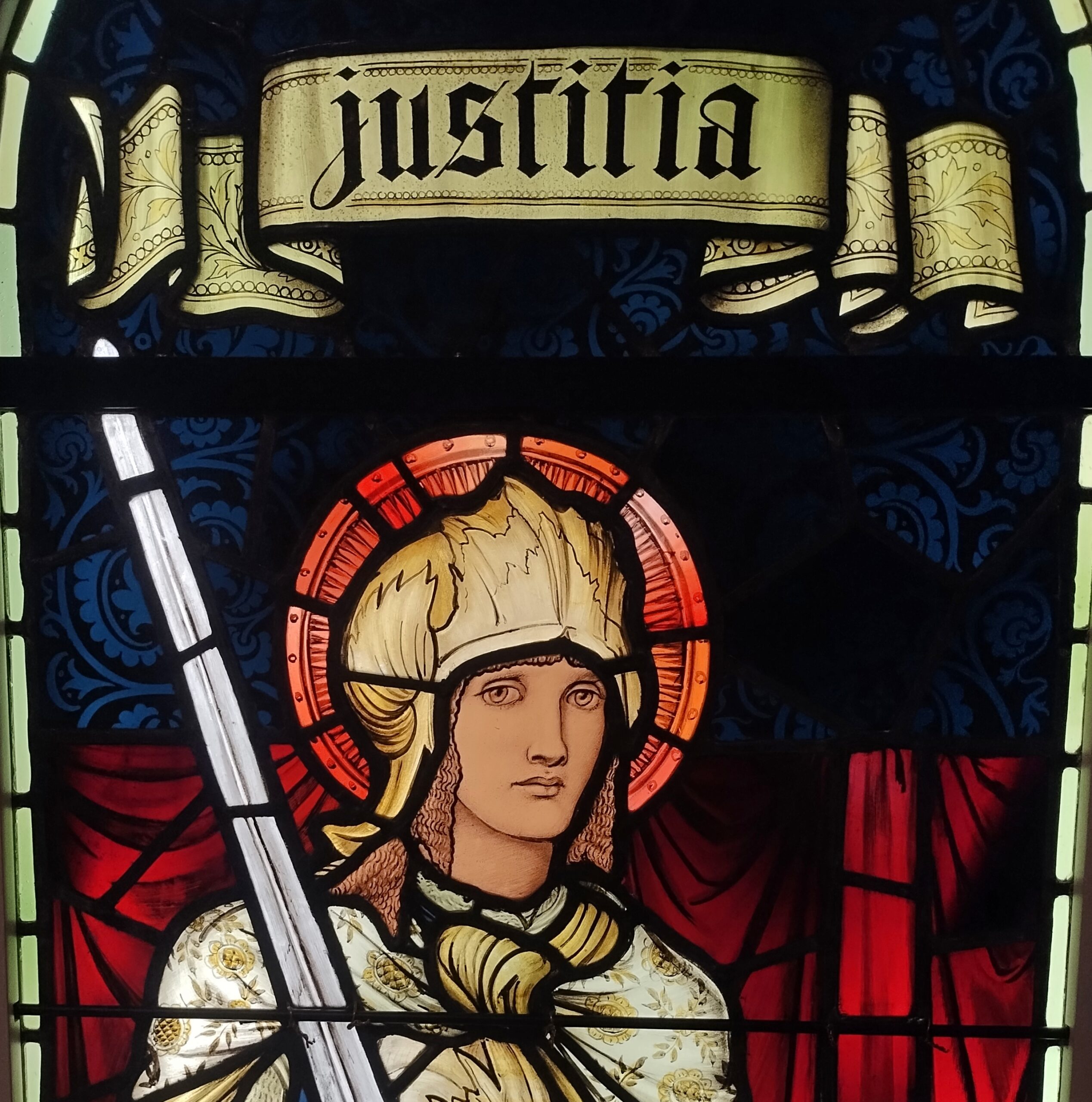
When we headed south in early December, snow covered the ground all the way past Indianapolis, where we stopped for a few hours at the Indianapolis Museum of Art, which is part of a larger campus called Newfields – and better examined in summer, I think. But the museum is a good one, with a solid collection, especially 19th-century American and European works. Such as “Justitia,” a Morris & Co. work from the 1890s.
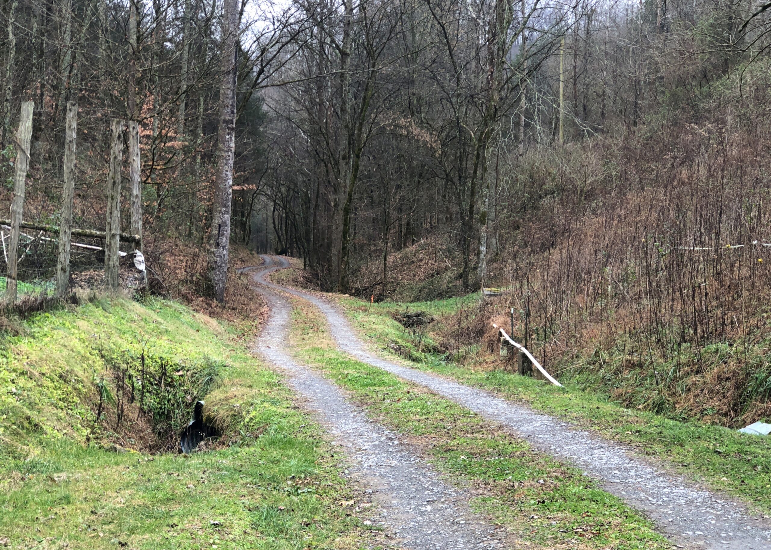
After overnighting south of Louisville, we diverted from I-65 and took smaller roads through southern Kentucky and into Tennessee to a holler in Jackson County, where we were the guests of dear friends. Tennessee musicians from those parts — some professional, others skilled amateurs — gathered on the the evening of Saturday the 6th, for one of the periodic jams in our friends’ barn, which houses no animals these days, but a small stage and some sound equipment and a fair number of folding chairs. A joyful jam it was. Food was potluck. I like to think we went to a hootenanny.
The road through the holler. By this point, no snow. We were trading cold for warmth. That was one of the goals of the trip. Maybe the main one.
From there it was mostly a straight shot down through Georgia on I-75 to Florida, and eventually US 27 to Orlando by way of non-coastal Florida places like Gainesville, Ocala and Lady Lake, a string of settlement less agricultural and less pastoral now than ever, more like an endless outer suburb. Heavy traffic is an invasive species in this part of Florida, surely as pythons are in damper parts of the state. Not just masses of cars and trucks, either, but also golf carts. We passed close enough to The Villages to see billboards advertising legal representation in the event of golf cart accidents. Carts, I’ve heard, provide transport in great numbers in that sprawl of a settlement.
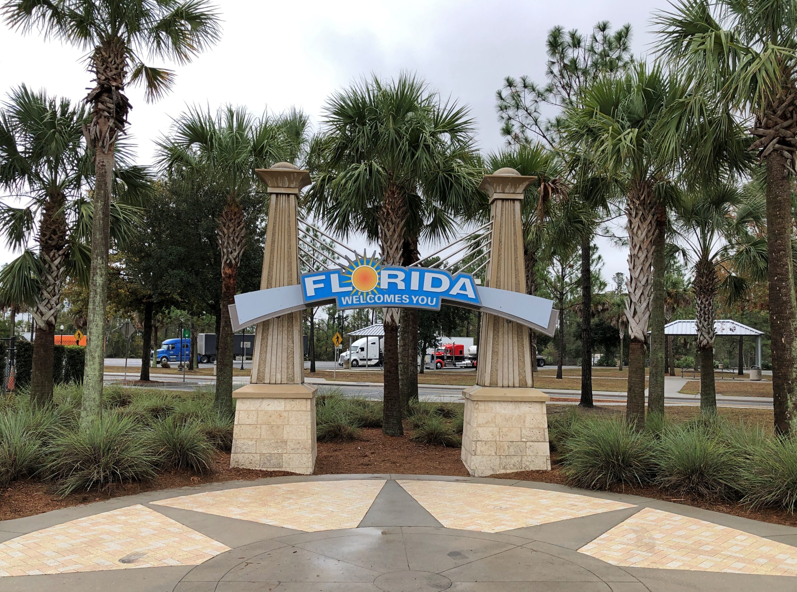
The drive to and in Florida involved the usual North American mix of large and small roads, smooth and ragged, grid-like and irregular, though Florida cities tended toward the irregular (except for Key West), and as crowded as can be and as empty as can be. Snow lined the way up north, thinning out the further south we went, giving way to brown landscapes and bare trees. Then we came into greenery – evergreens and palms and even deciduous species turning color. We crossed mighty bridges over mighty rivers, small culverts over alligator haunts, and the string of bridges that make up the civil engineering marvel known as the Overseas Highway (US 1). We crossed barely acknowledged borders and signs at the Florida visitor center on I-75 proclaiming The Free State of Florida.
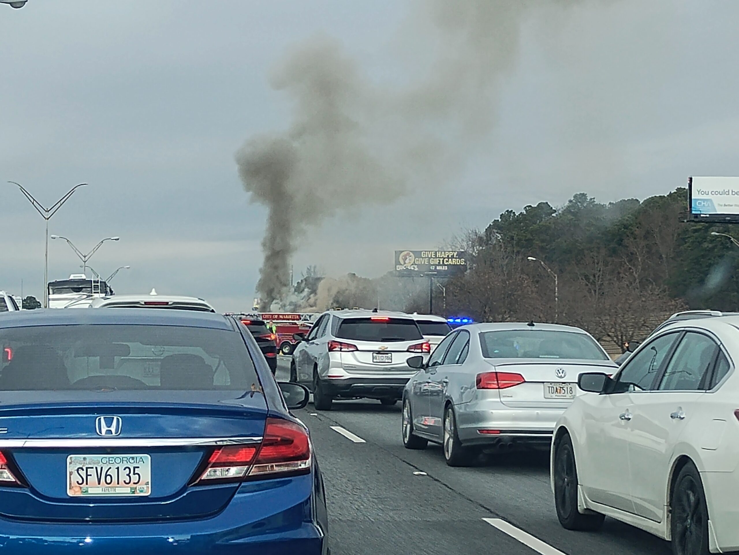
Florida Man was out and about, weaving in and out of high-speed traffic, pushing 100 and pretty sure that physics doesn’t apply to him, though I have to admit that Florida isn’t different from any other state in that way. Traffic stopped cold more than once: for a banged up, upside-down SUV; for a raging RV fire, attended by a half-dozen firemen; for a serious two- or maybe three-car wreck on the other side of a divided highway; for construction, usually without any workers in sight; and once for no reason that we could tell at all.
In Orlando, we spent all December 9 at Universal Epic Universe, a theme park that only opened in May. Ann flew in the day before we went to the park and flew home the day afterward, taking advantage of the low prices that discount airlines offer to high-volume places in a shoulder season, if you take no bags and buy nothing to eat or drink at sky-high prices, literally and figuratively. A small bag of hers had been stowed in our car for the visit.
A theme park is one thing, but I wanted a look at Orlando, at least a sliver of it, the next day. Ann’s flight was fairly late that day, so we were able to spend part of it in posh Winter Park, including a tour boat ride through the town’s small lakes, lush with greenery and expensive houses on their banks, and connected by canals.
A drive that included the stretch of US 41 that passes through the Everglades took us to Homestead, Florida, and the mid-century charms of The Floridian motel. A day in Everglades NP followed, including an airboat tour and a drive to the coast at Florida Bay. The next day, before leaving Homestead for a drive in the rain across the Overseas Highway to Key West and while the sun still shined, we toured the Coral Castle, a one-man construction project using 1,000 tons of oolite to make walls, carvings, stone furniture, and a castle tower.
Key West was a two-day, three-night mid-December ramble on the busy and less busy streets of Old Town, including humans but also chickens, taking in the likes of the Hemingway House, the Little White House, Mallory Square, the San Carlos Institute, the Key West Aquarium, and the Key West Cemetery. Also, tourist shops, boutiques and the building where Pan-Am was founded. We ate and drank, though as our wont, nothing alcoholic. Key West was decked out for the holidays but not over the top. We walked and walked some more. It felt like a couple of pleasant summer days.
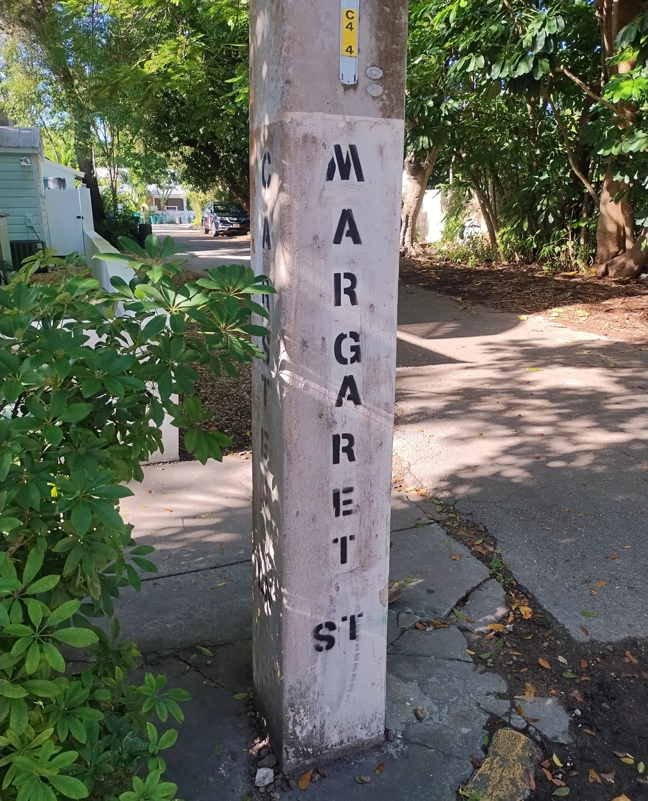
From my 2014 visit, I knew that on the back streets near the little-visited cemetery, parking was possible on an otherwise cramped island. So it was. On Margaret Street, within sight of the cemetery.
The return drive took us up the eastern coast of Florida, but avoiding the worst traffic in Miami-Dade by taking Florida’s Turnpike. By December 17, we’d arrived in Orange Park, a large suburb of Jacksonville, for a stay with two other dear friends, former Austinites now in northern Florida. Part of the next day was in and near downtown Jacksonville, one of the larger U.S. cities I’d never visited before (I believe San Jose is now the largest on that list). During our downtown stroll, we encountered the coolest building in Jacksonville and certainly one of the coolest in Florida.
We quit Florida on the 19th, but weren’t quite done with the trip. Yuriko had never been to Atlanta and wanted to go. Though I’d been however many times since 1982, I was happy to oblige, so we spent two nights and a day there, using the day to see the astonishing Georgia Aquarium and the impressive but somewhat overpriced World of Coca-Cola.
The last legs of the trip were long drives: Atlanta to Elizabethtown, Kentucky; and from there to home the next day. I wasn’t about to let them be completely dull drives, so we stopped on the second-to-last day in Chattanooga, to see the conveniently located, blocks-from-the-highway Chattanooga Choo-Choo redevelopment. On the last day of the trip, we stopped in Jeffersonville, Indiana, and walked across the Big Four Bridge, a former RR bridge across the wide Ohio, now serving pedestrians and bicyclists.
Home and then — Christmas, when things slow down for a week or so. Good timing.