It occurred to me over the Independence Day weekend that I’ve experienced roughly a quarter – 25% – of the entire history of the United States, accepting the commonly held age for the nation of 250 years. Anyone my age or older has, that is. One-quarter of a 250-year span is 62.5 years. At the age of 65, I can’t really claim to remember those first two and a half years, but the furthest reaches of my memory run back to the mid-1960s, so close enough.
And I have to add that if you’re Mel Brooks, you’ve lived 40% of the nation’s history.
Fifty years ago, on the much ballyhooed Bicentennial, it rained in San Antonio, where I was. We stayed home. On Saturday, on the much less ballyhooed 250th, it rained in metro Chicago, where I was. We stayed home. Coincidence? Well, yes.
Been home for a few months now, witnessing a wet and cool spring edge into a wet and warm summer in northern Illinois, and temps finally popped up into the 90s ahead of July 3. The heat was ended by rain and more rain. A pretty typical Northern summertime pattern.
Fireflies have made their appearance, though a meager number, and just today, this afternoon, I heard cicadas bleating ahead of dusk, though no cricketsong came afterward. Could be the Brotherhood of Orthopteran Insects is still negotiating a new contract for this year, and I won’t pretend I didn’t have to look up orthopteran. Mosquitoes are out looking for mammal blood, though considering the temporary wetlands that are our suburban lawns, not as many as you’d expect. Lit up the mosquito coils on my deck table this evening, and it seemed to work.
Old friends Neal and Michele visited from Chicago for the Fourth – a smaller version of the Gabfest, and indoors because of the rain. A delight all the same. They left before dark, after the rain had stopped. A little wet ground wasn’t going to keep the suburban populace from flouting Illinois’ nanny-state fireworks ban, one of the two nights of the year when the pop-pop-BOOM-pop-boom-fssst goes on for a few hours (the other is New Year’s Eve). In recent years I’ve repaired to the garage to listen to the July 4 explosions. The explosion acoustics are good in that cluttered enclosure.
I’ll be home for a few more months. 2026: Summer of Here. People pay money – I’ve paid money – to enjoy warm weather like this, but we’re getting it no extra charge. Also, even I’ve gotten a little tired of the pace of my driving lately.
No long drives this summer. But that doesn’t mean no drives. Back during the pandemic, my thinking was, if you can’t go far, go near, and that kind of thinking took us to new parts of Wisconsin and Illinois. No pandemic this year, fortunately, but the idea is a good one anyway.
The run of days from Juneteenth to July 4 at least, and even better to Nunavut Day (July 9), would be a fine time to slow down, like between Christmas and New Year’s Day, only warmer and without the mad runup to December 25. Back to posting around July 6.
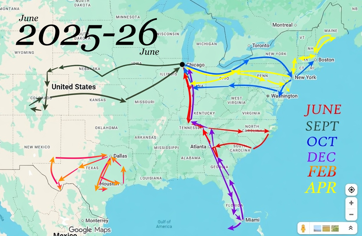
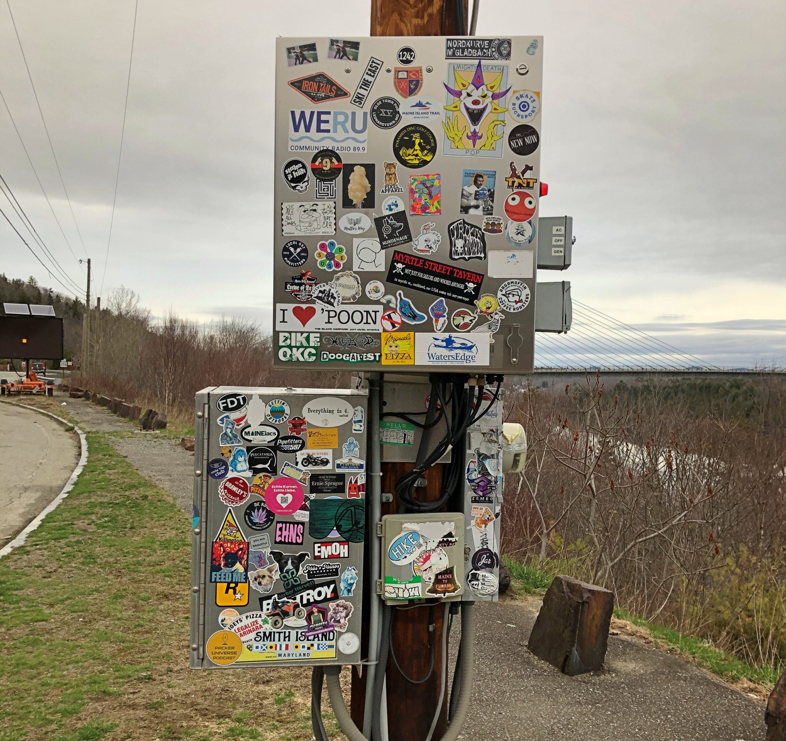
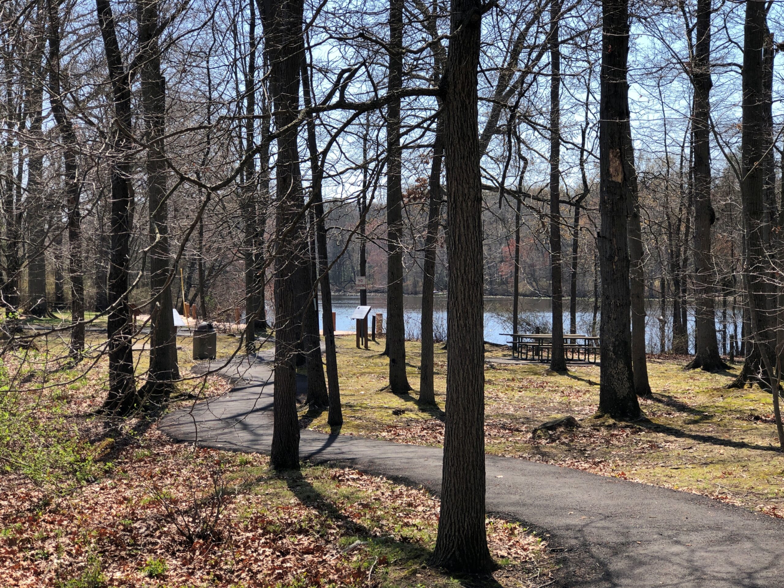
Thousands of impressions flitter by on the road, most instantly forgotten when literally on the road – driving, you need to be in the moment, or else – or quickly forgotten, when “on the road” means you’re out and about somewhere that isn’t home. Still, a handful of details stick, even without photos. But photos help.
Maine
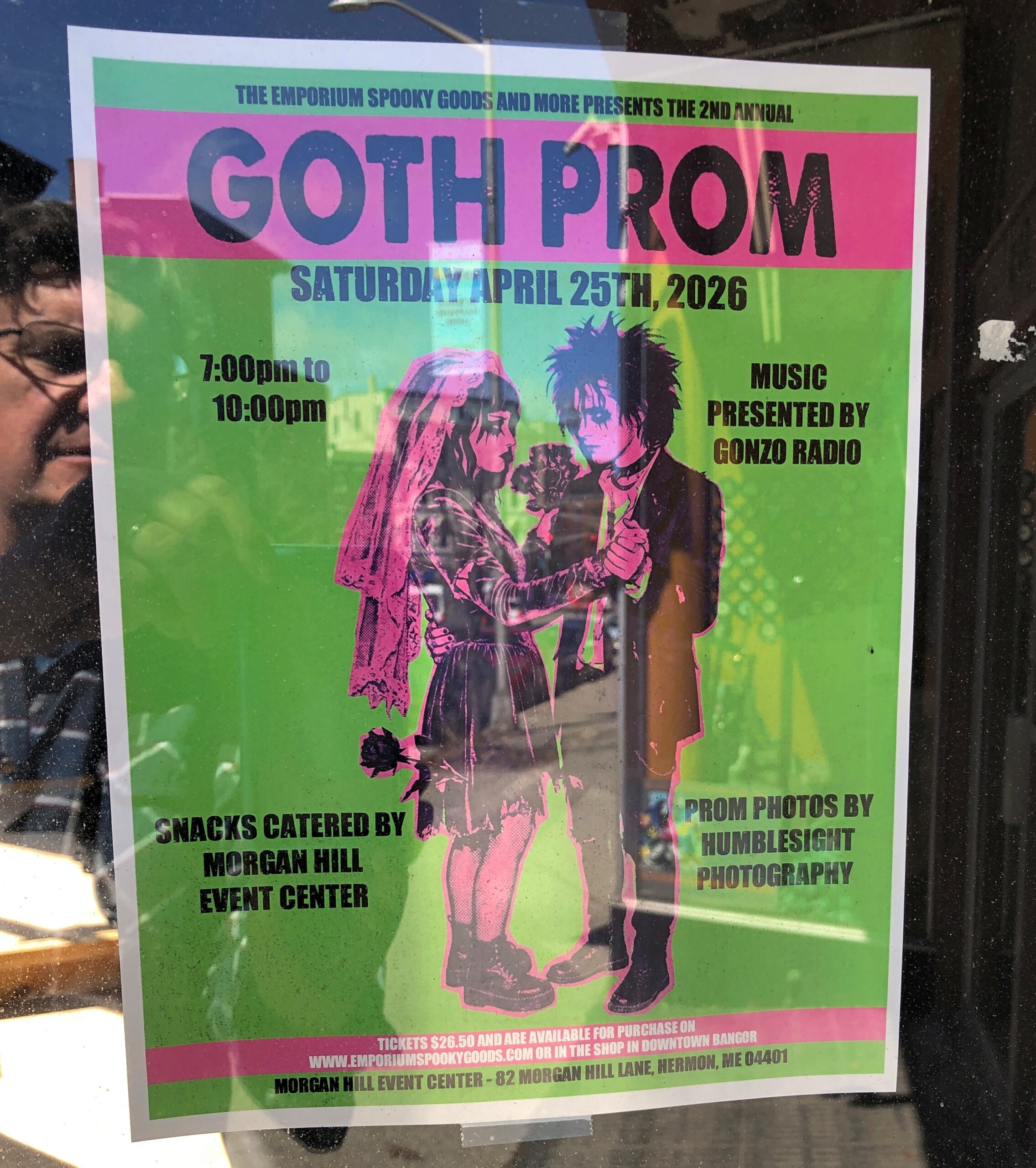
I call it “Self-portrait with Goth Prom.” Poster spotted in downtown Bangor.
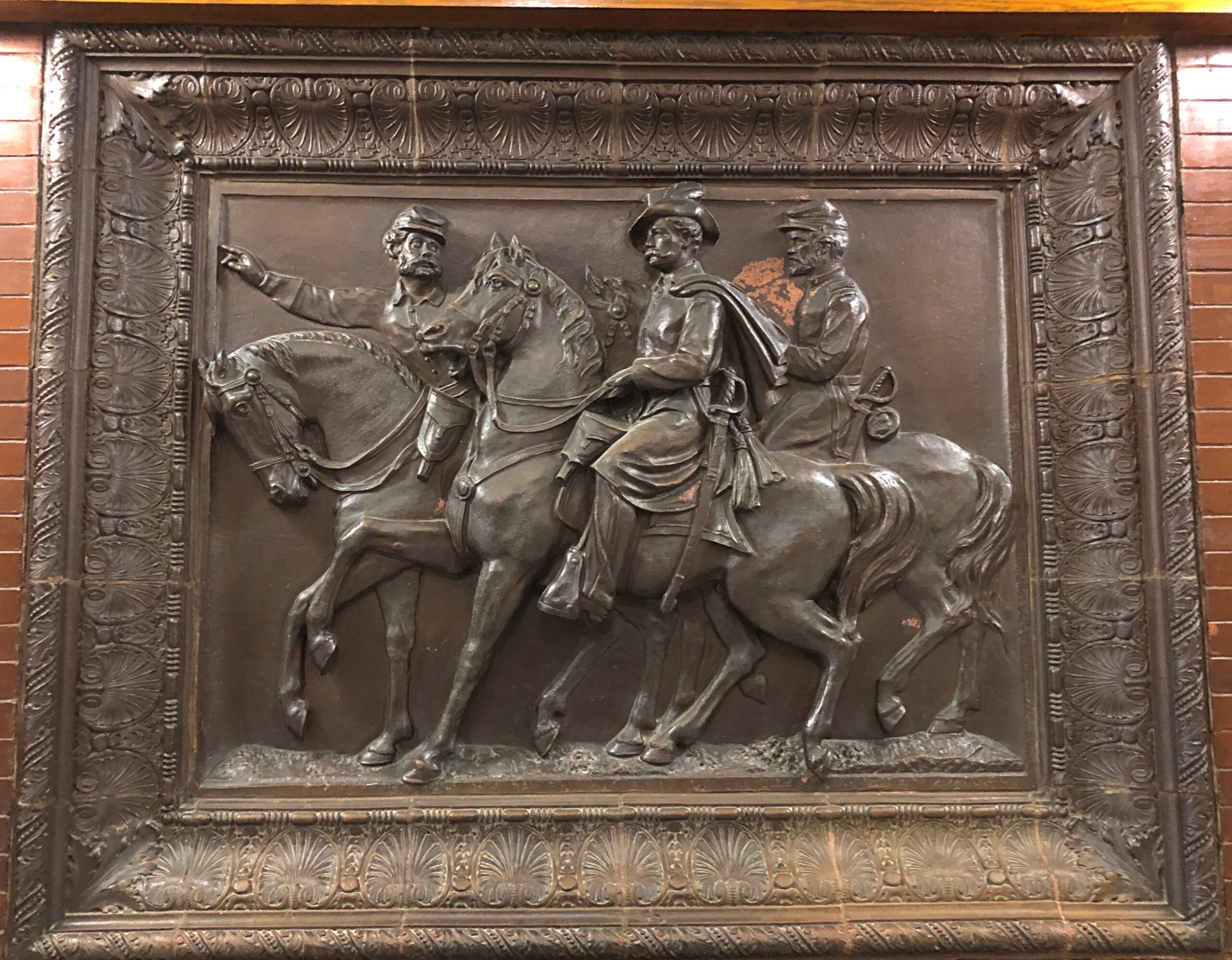
In the Maine Statehouse, a flat-ish object of a different kind.
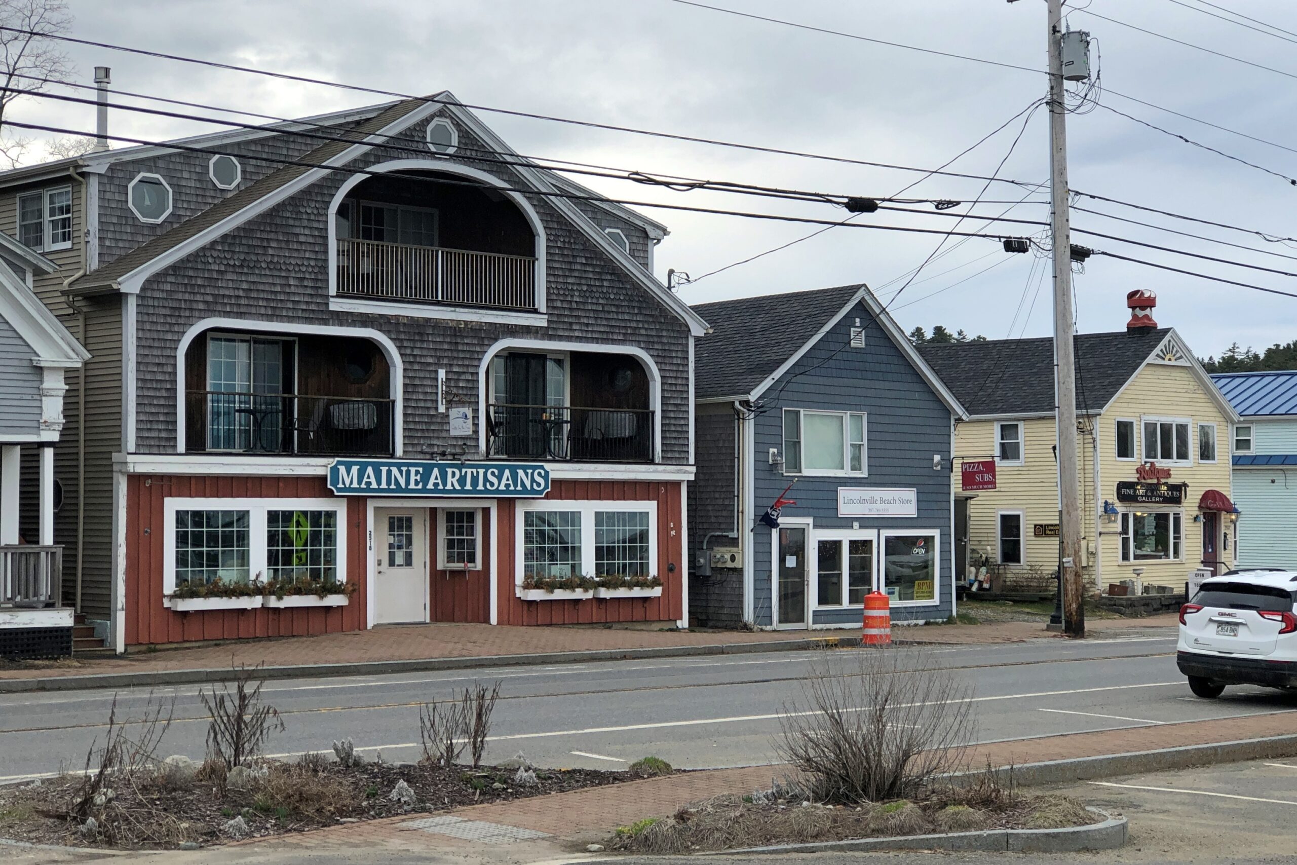
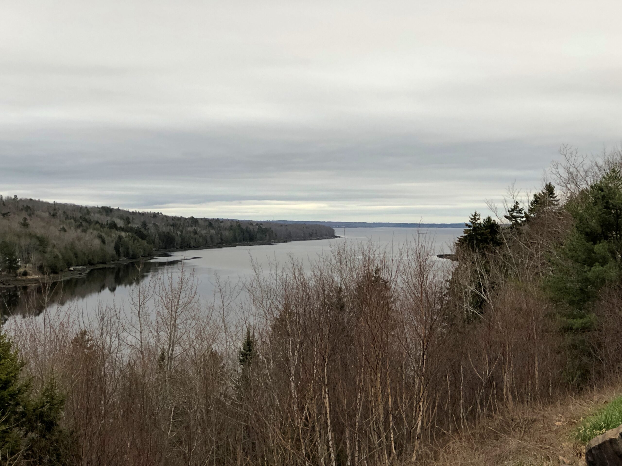
Lincolnville, on the coast of not far from Belfast.
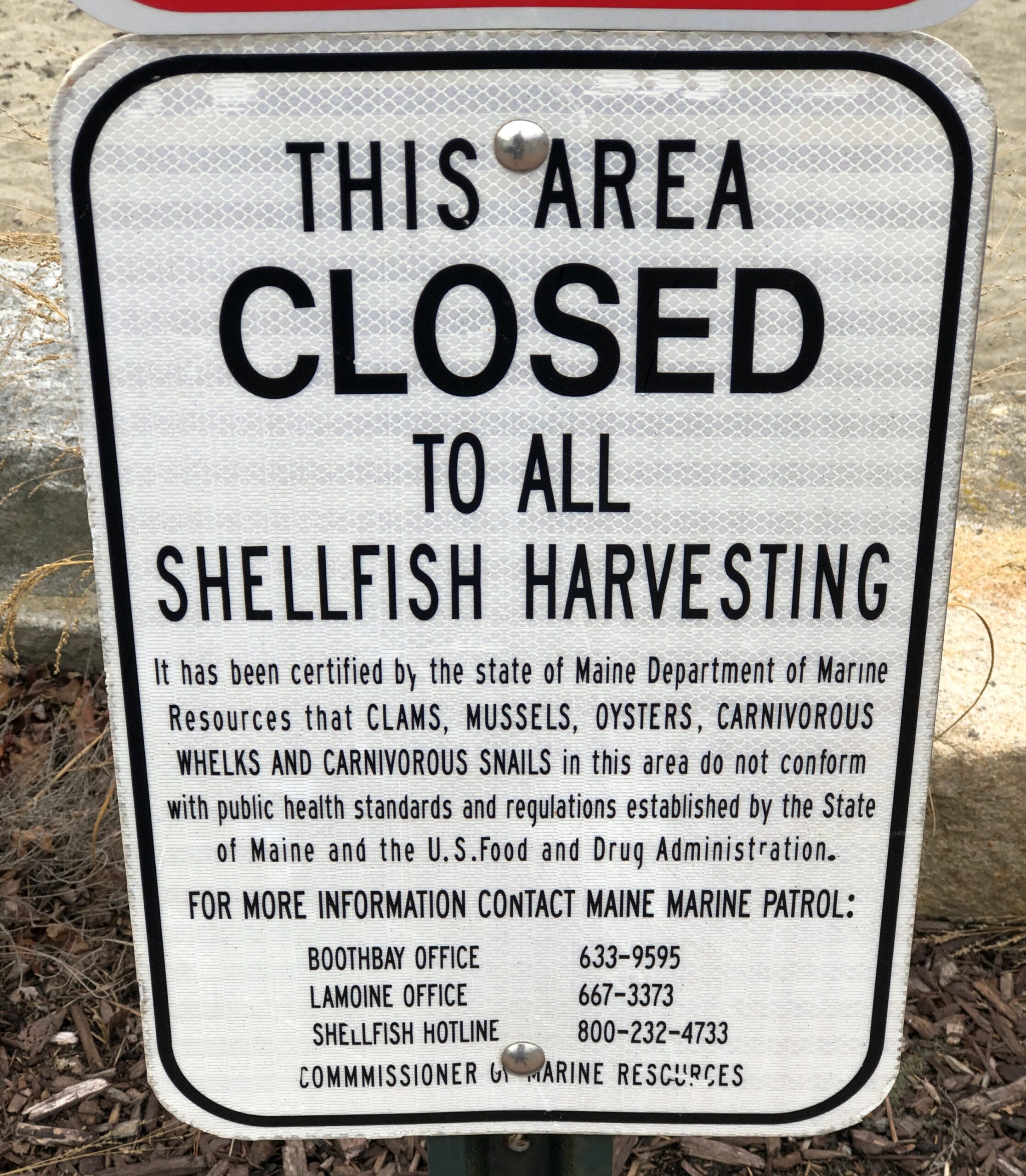
Carnivorous whelks. I was frankly ignorant about carnivorous whelks, and glad to learn a little about them. Because what a great name for a snail.
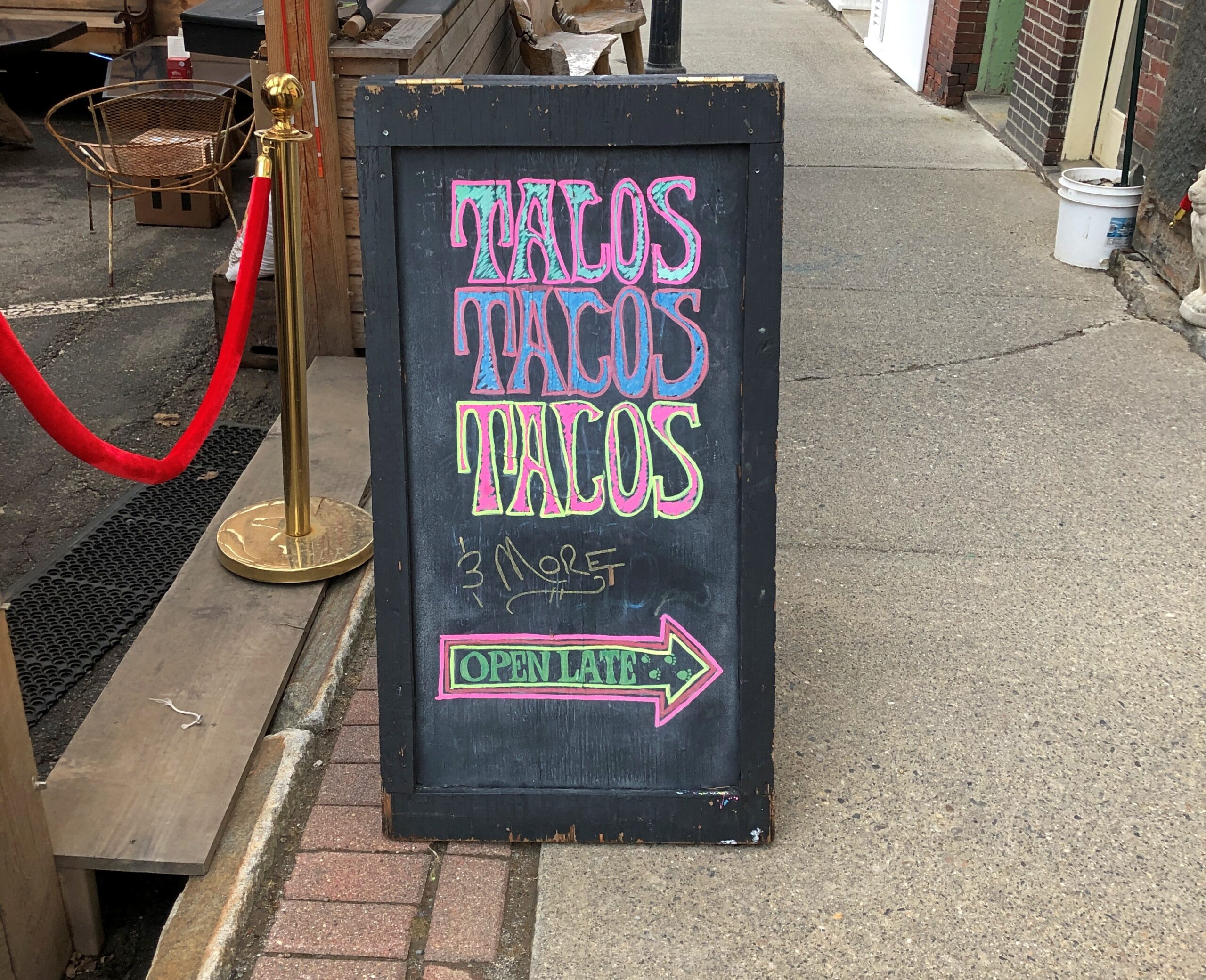
Too bad I wasn’t hungry in Belfast. I’d have had tacos.
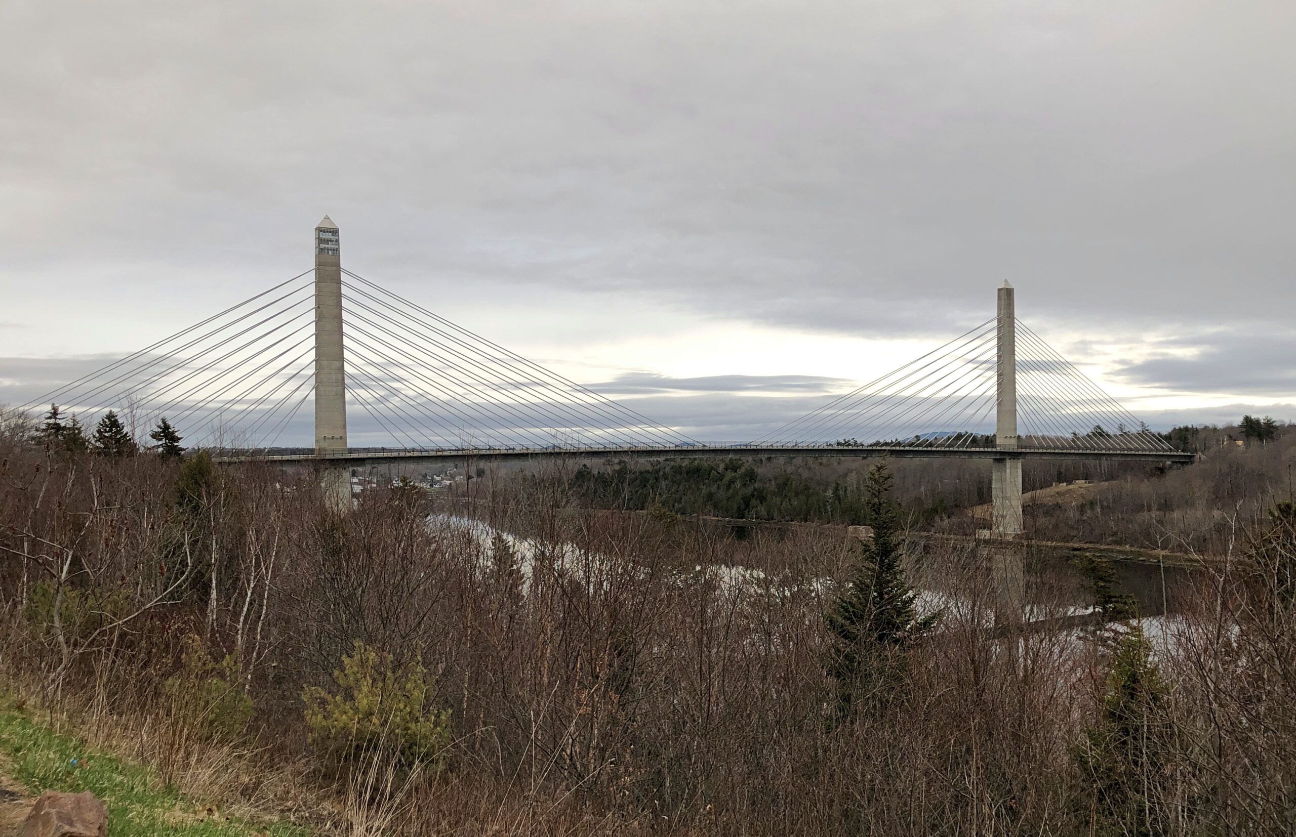
The Penobscot River and the Penobscot Narrows Bridge. A literal and scenic highpoint on that part of US 1 as it winds through near-coastal Maine. The bridge includes an observatory, unfortunately not open in April. Driving over the bridge itself was another pleasure of coastal Maine.
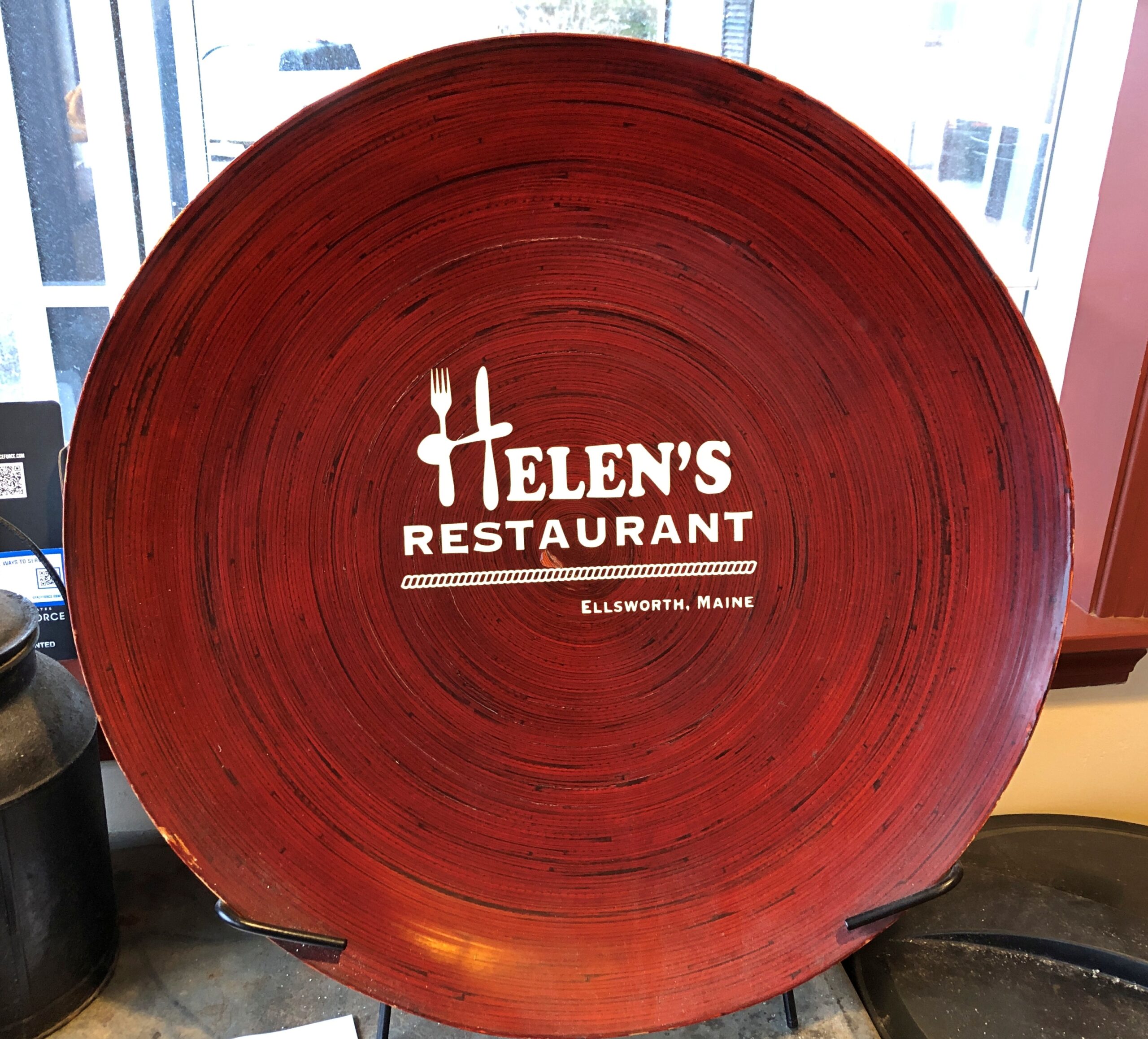
Helen’s Restaurant in Ellsworth. Tasty fish and chips. Haddock, specifically. What do you take for a haddock? “Well, sometimes I take-a aspirin, sometimes I take-a calomel.” It was some years before I learned that calomel was something I’d never take in a million years.
Massachusetts
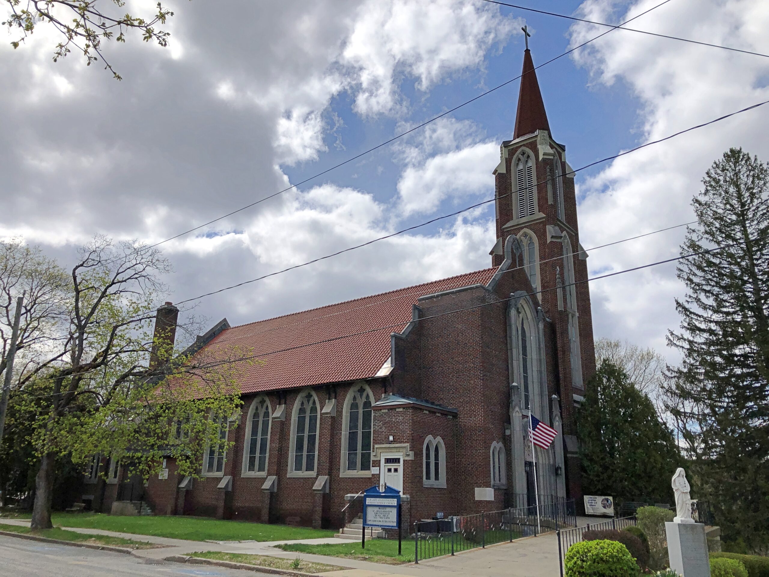
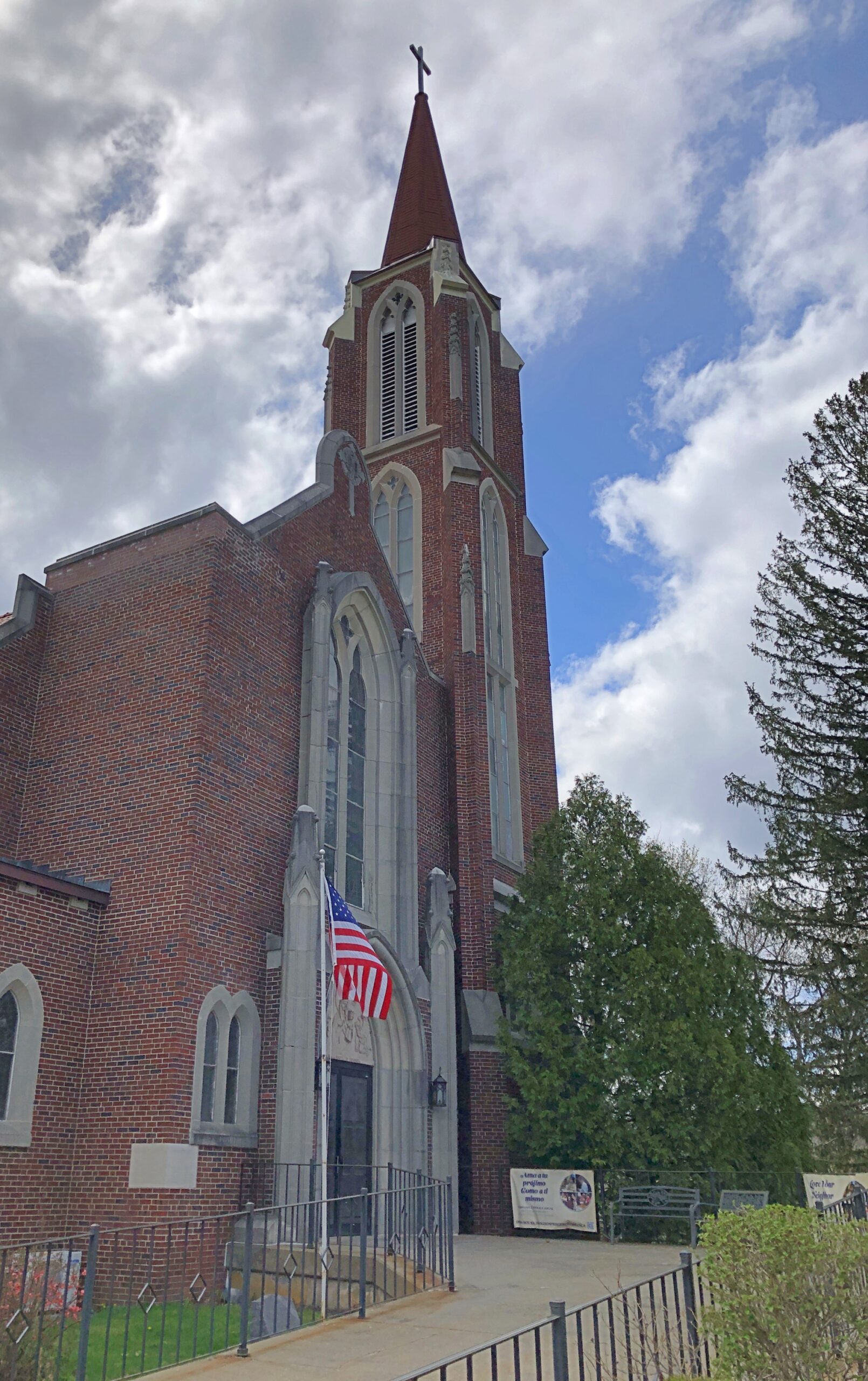
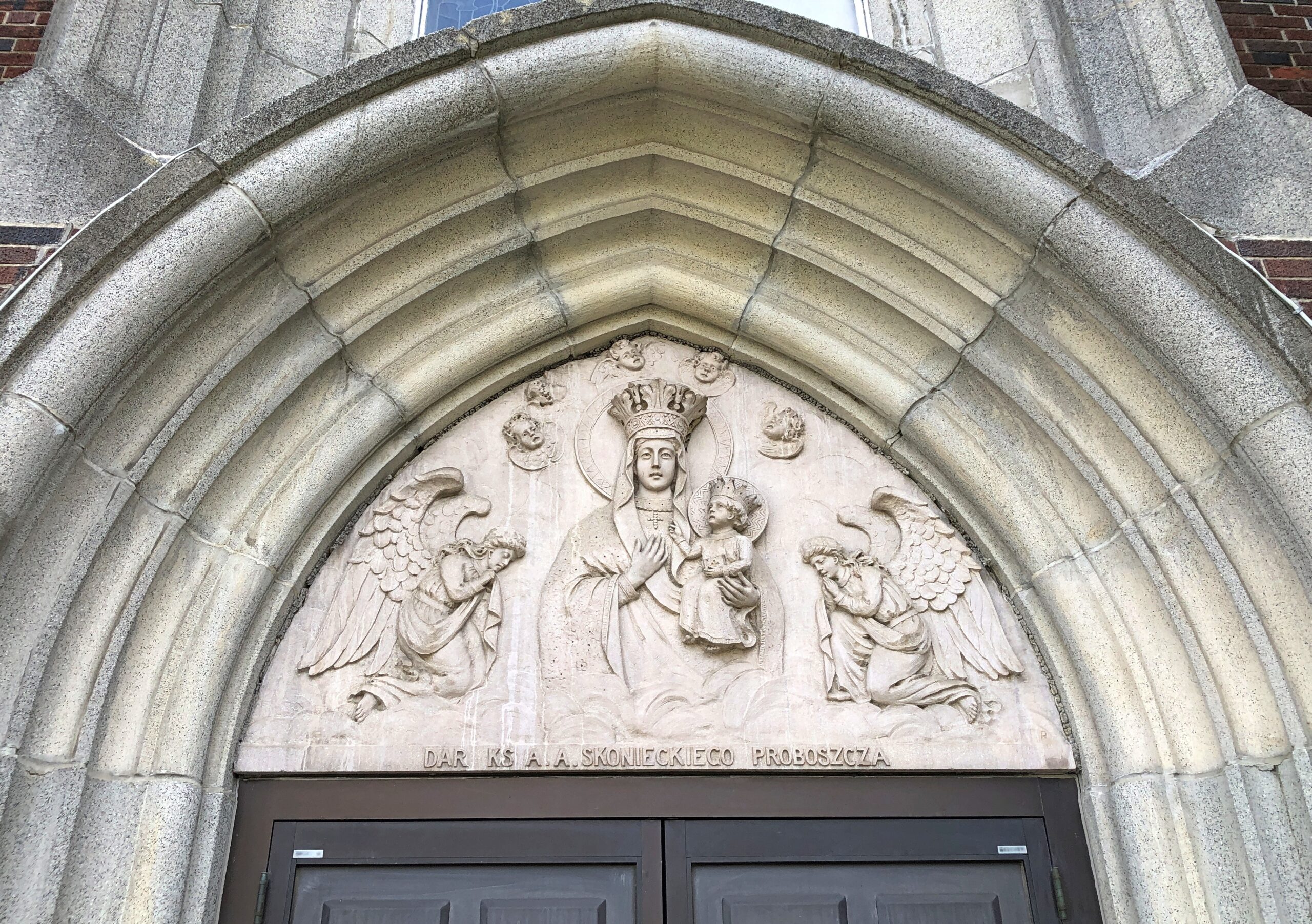
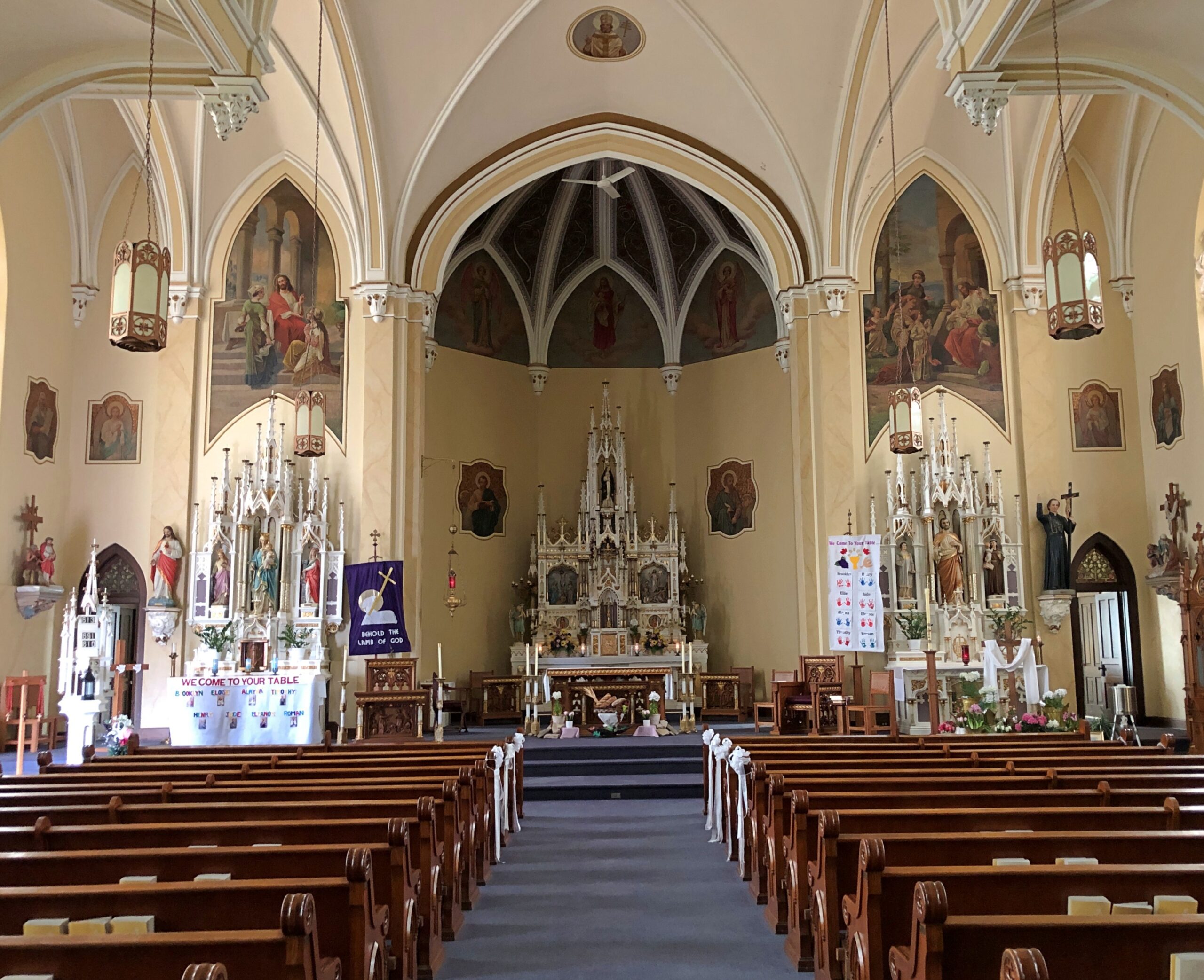
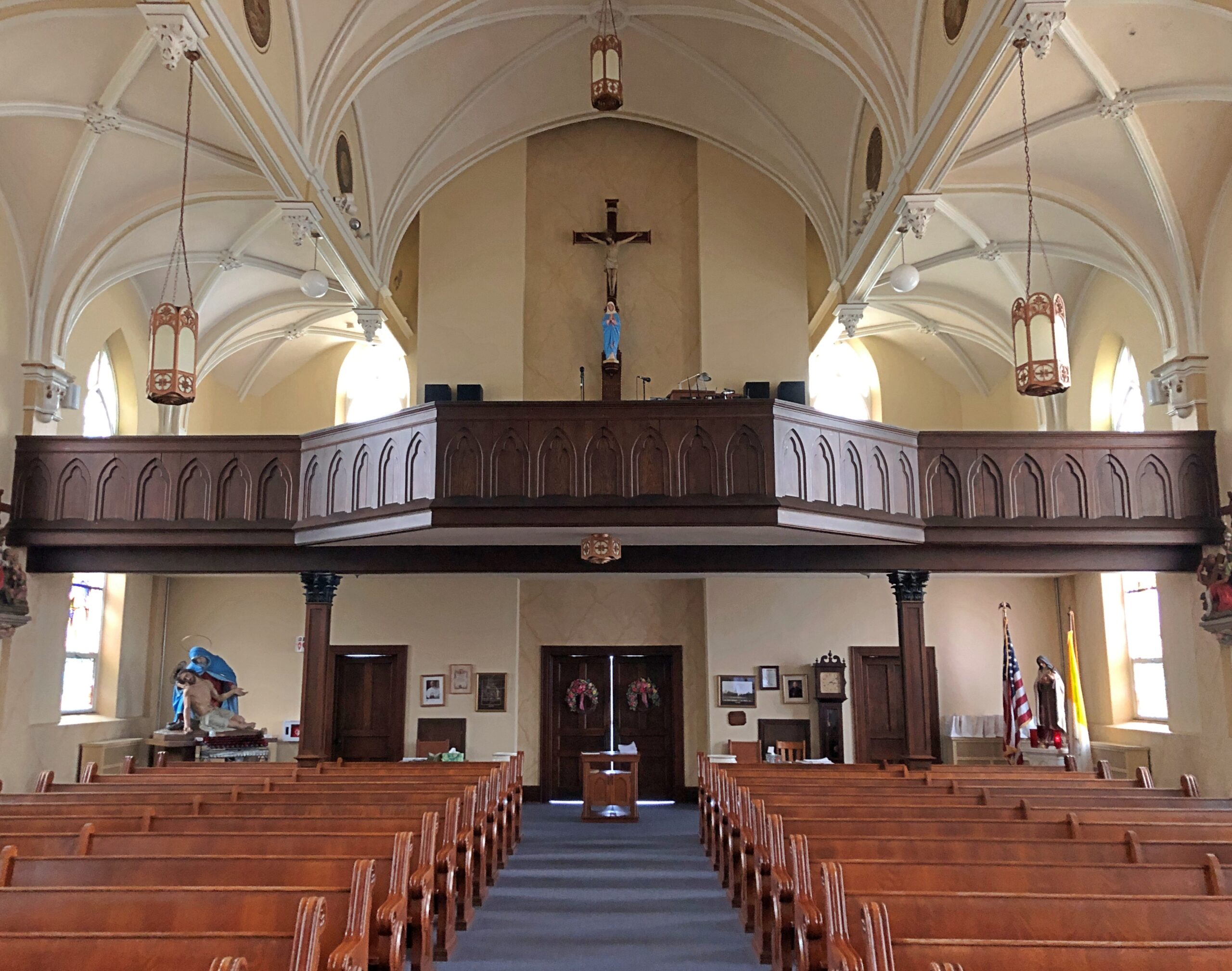
Our Lady of Czestochowa Parish, Turners Falls.
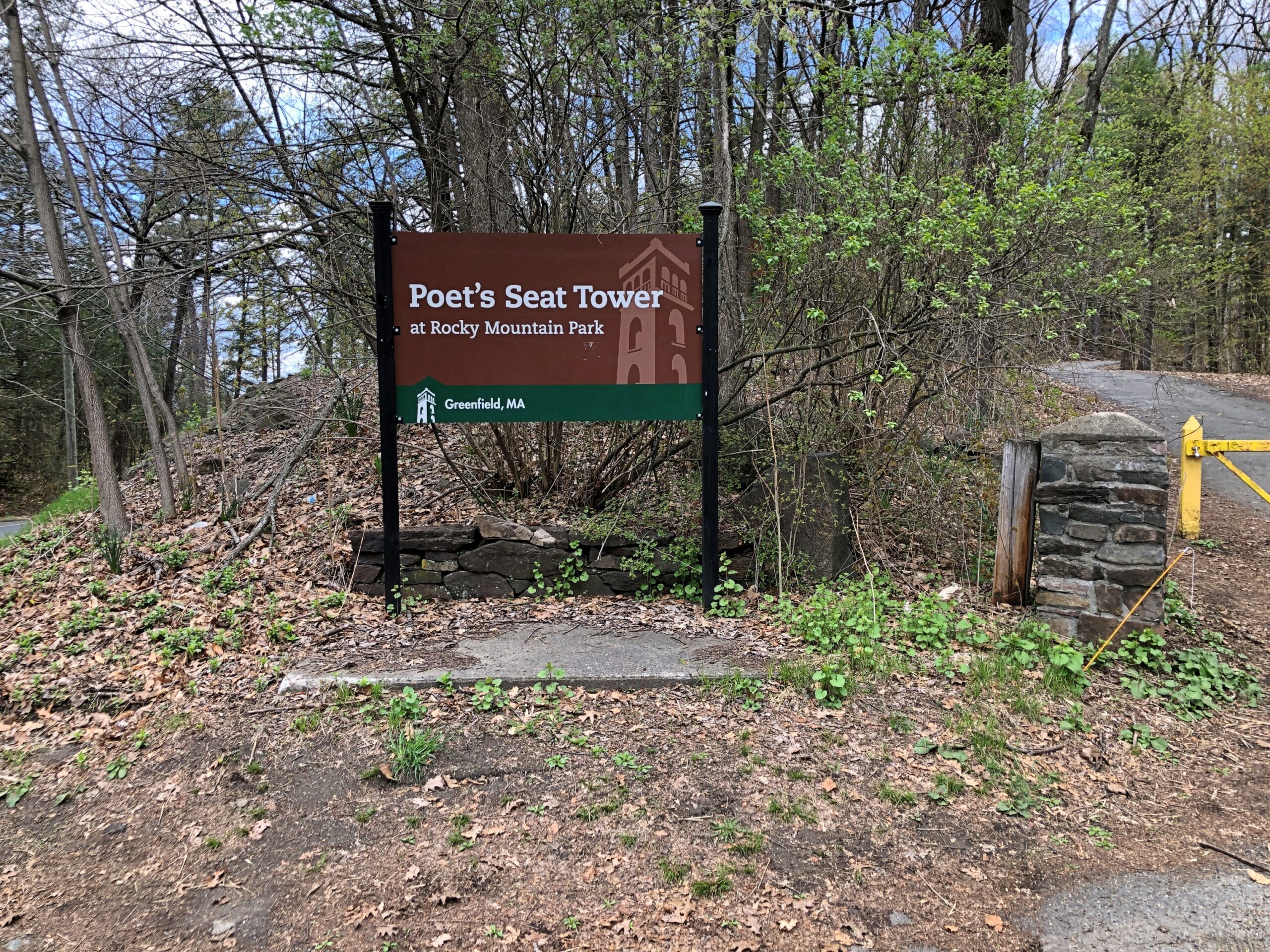
The church was closed. So was Poet’s Seat Tower.
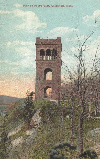
As the tower appeared more than 100 years ago.
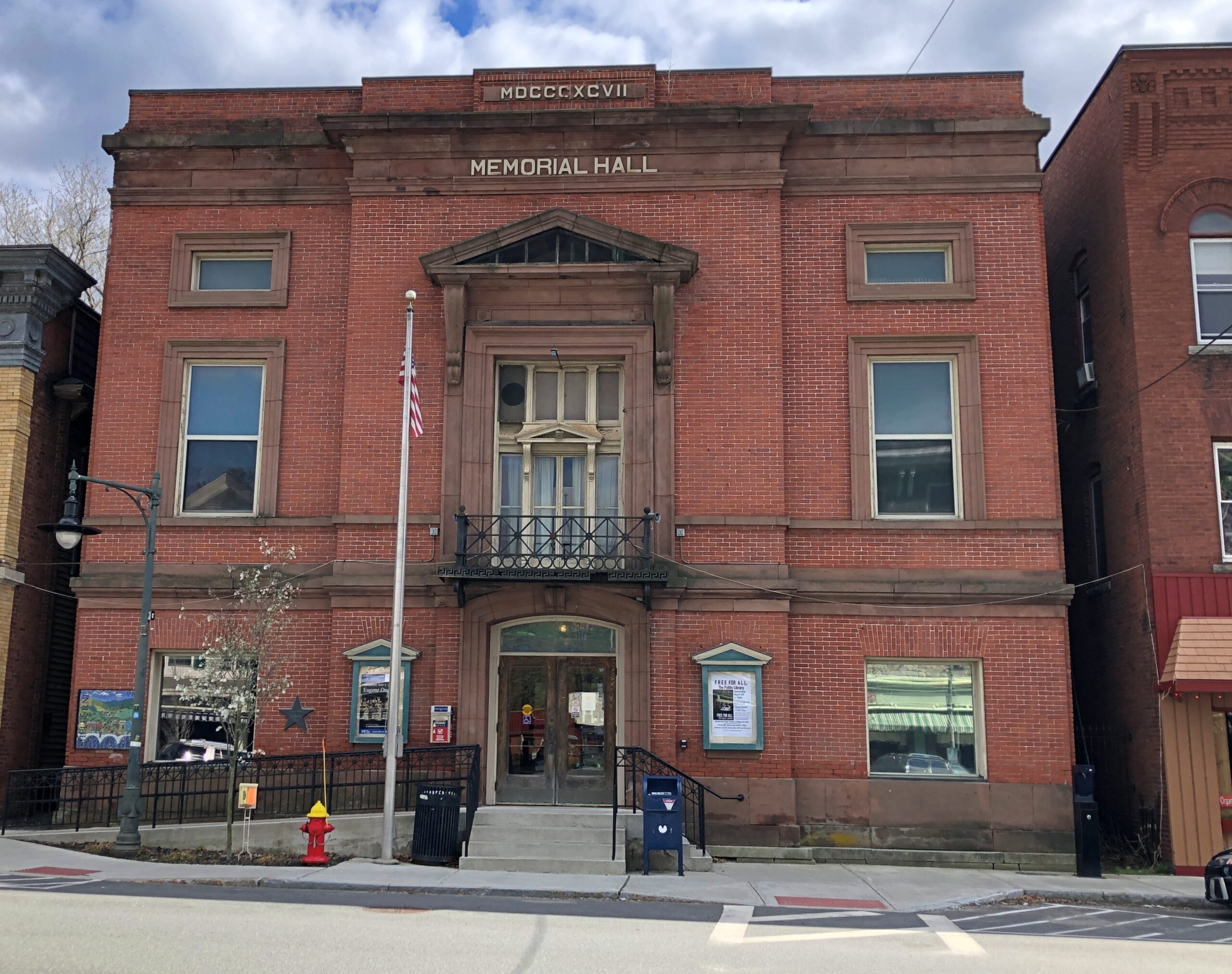
Shelburne.
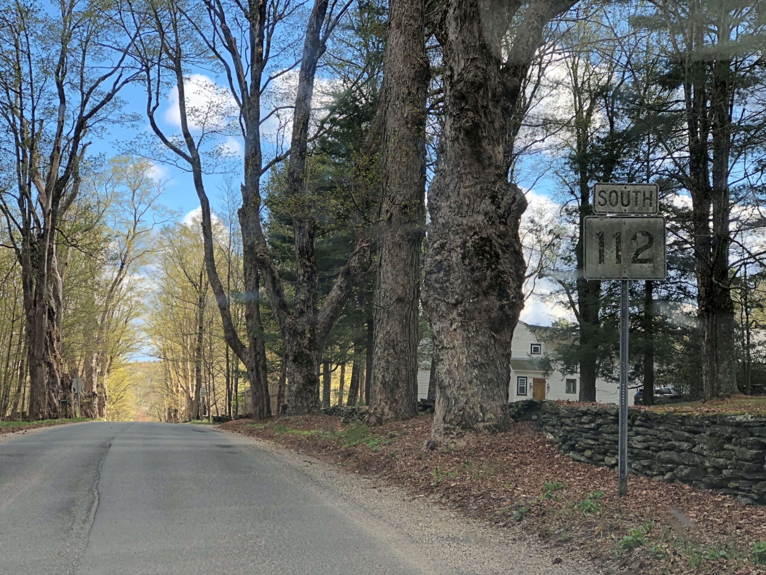
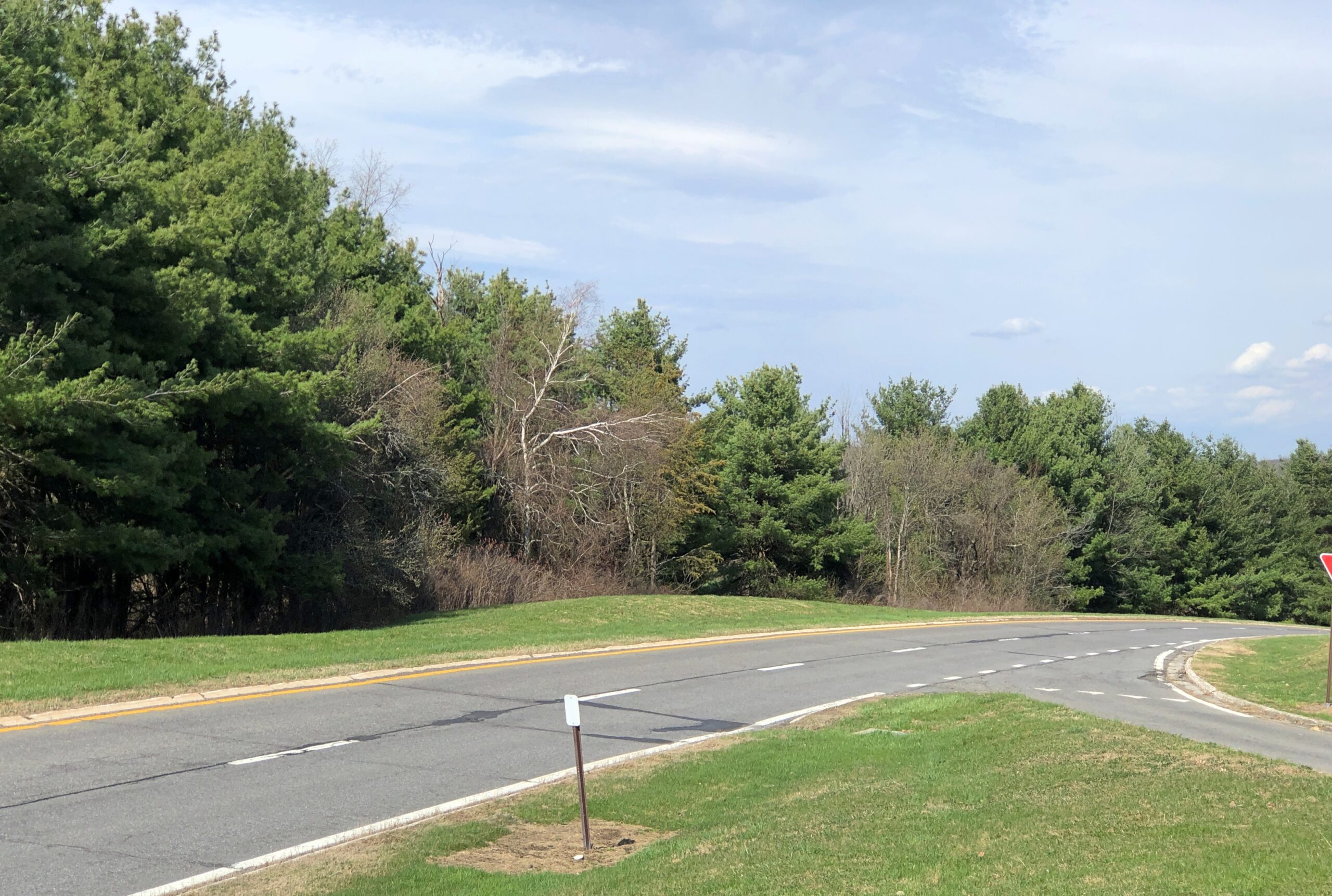
Massachusetts 112 (Route 112) in Hamilton County. Car commercial driving.
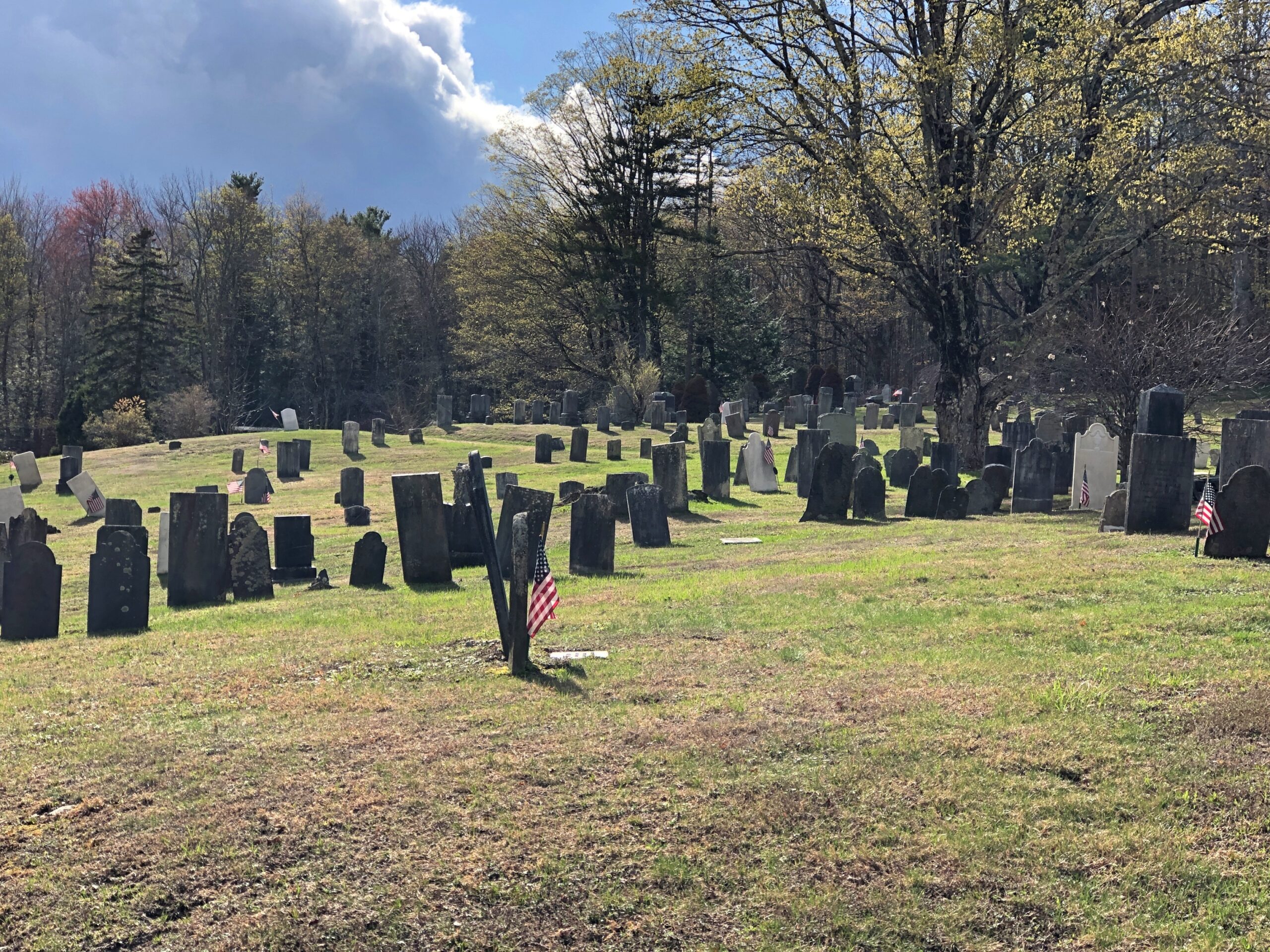
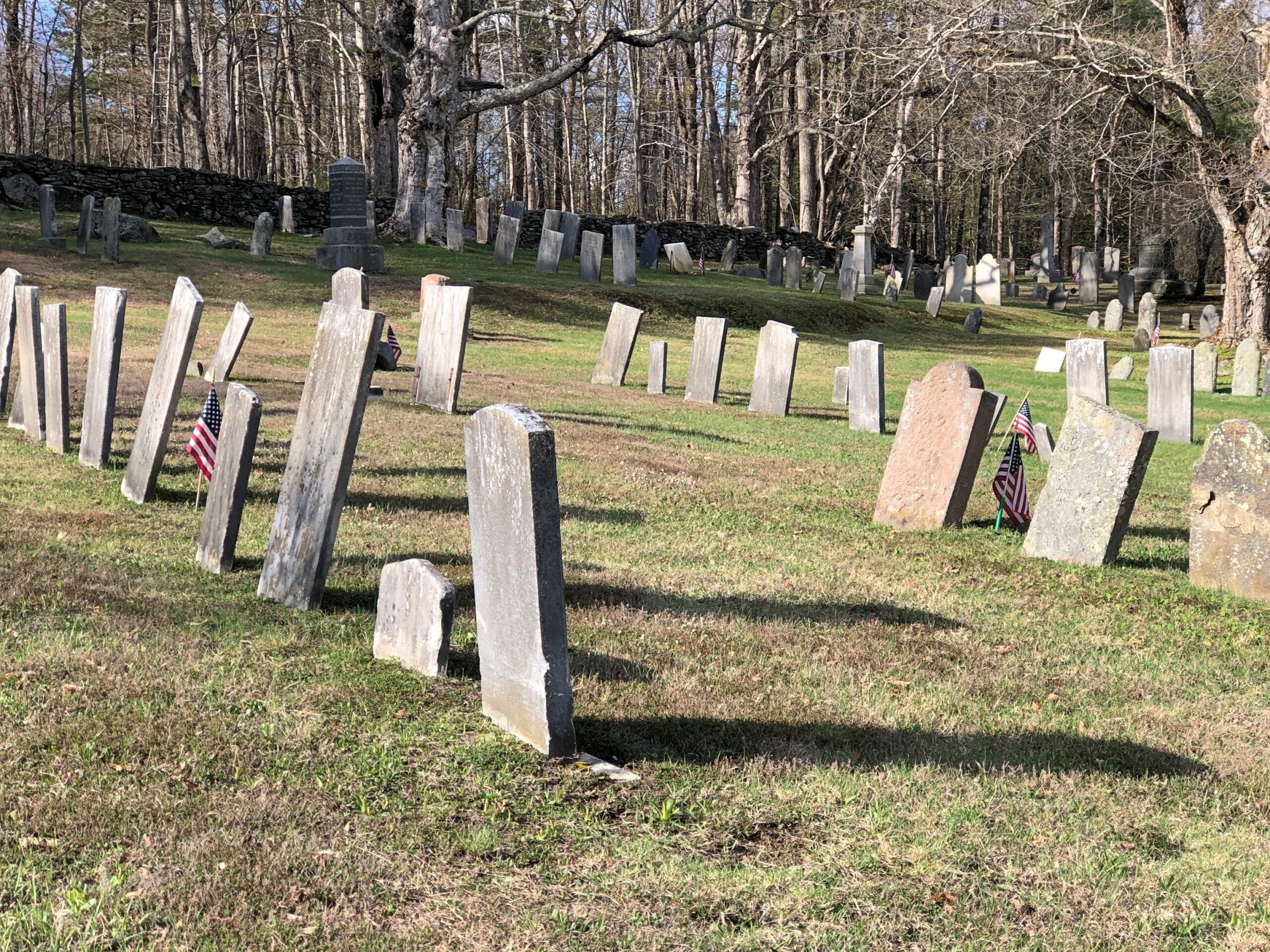
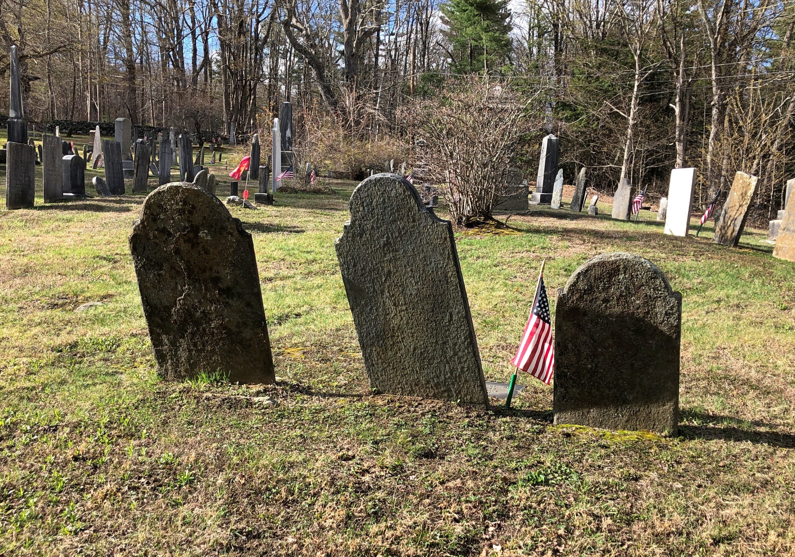
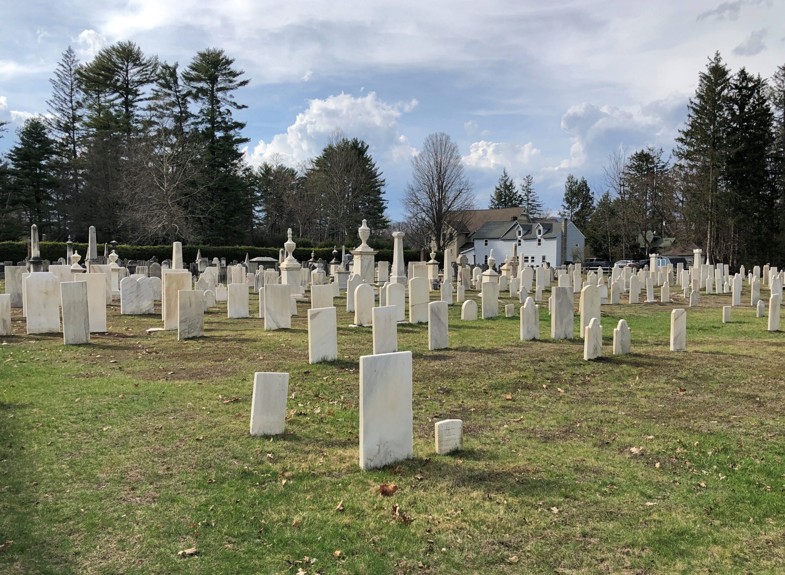
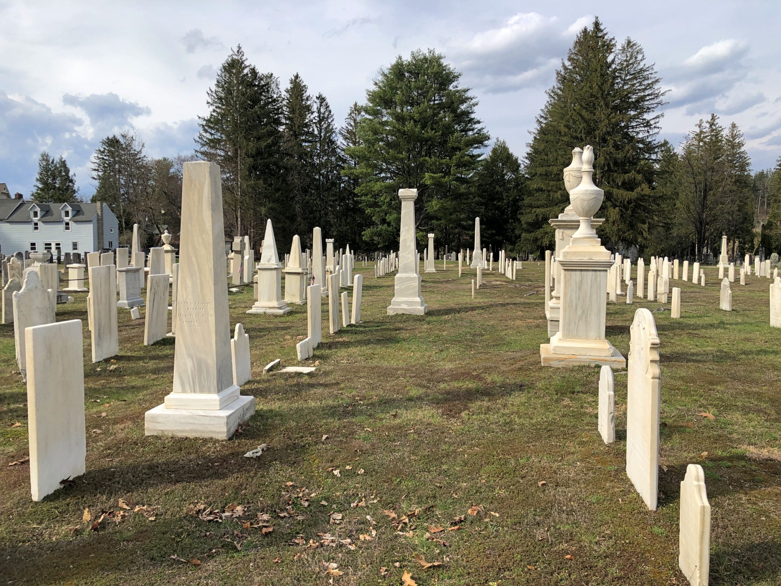
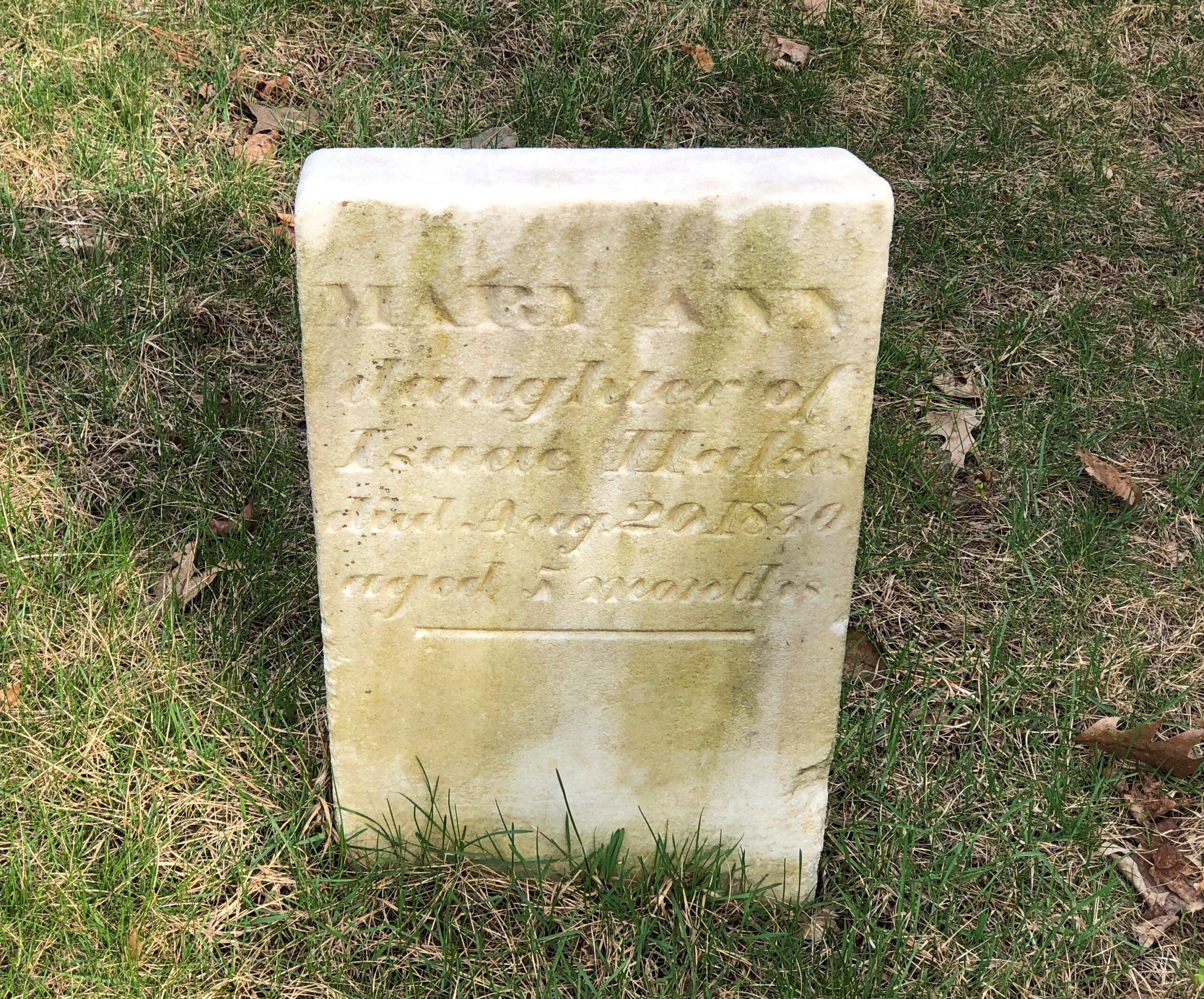
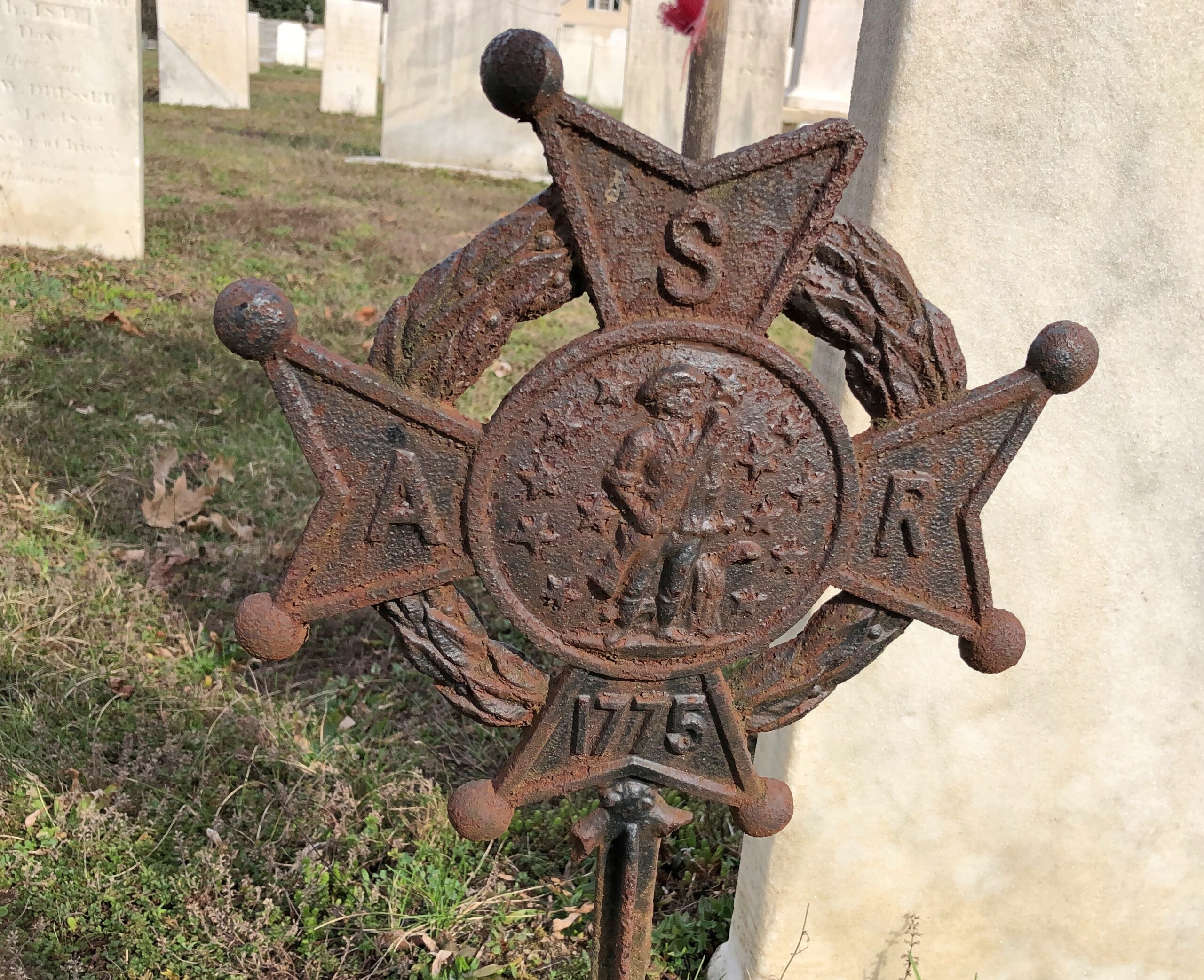
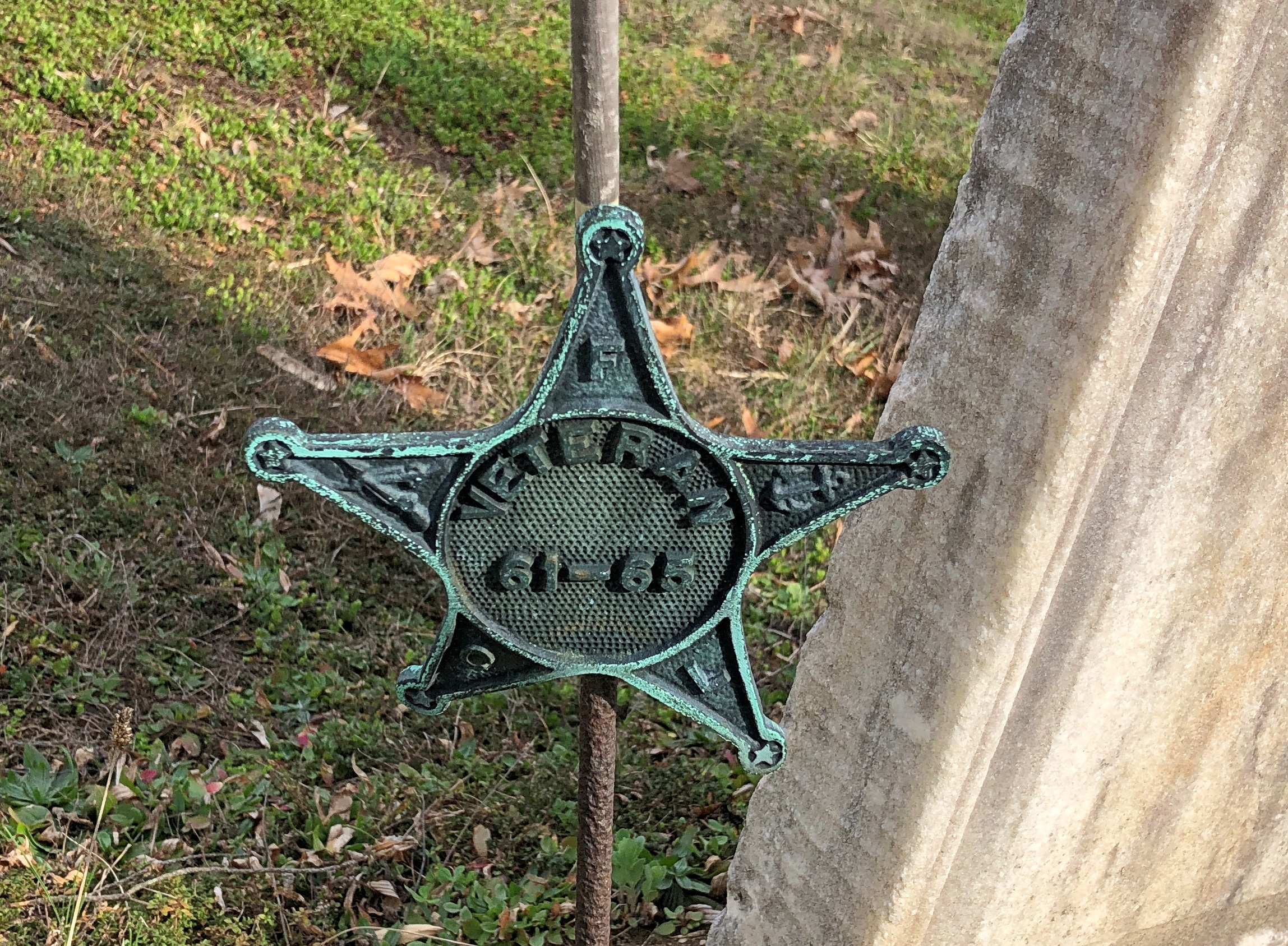
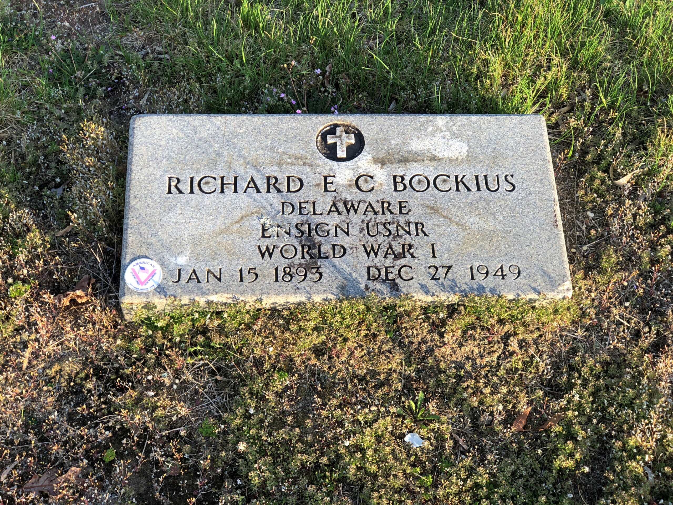
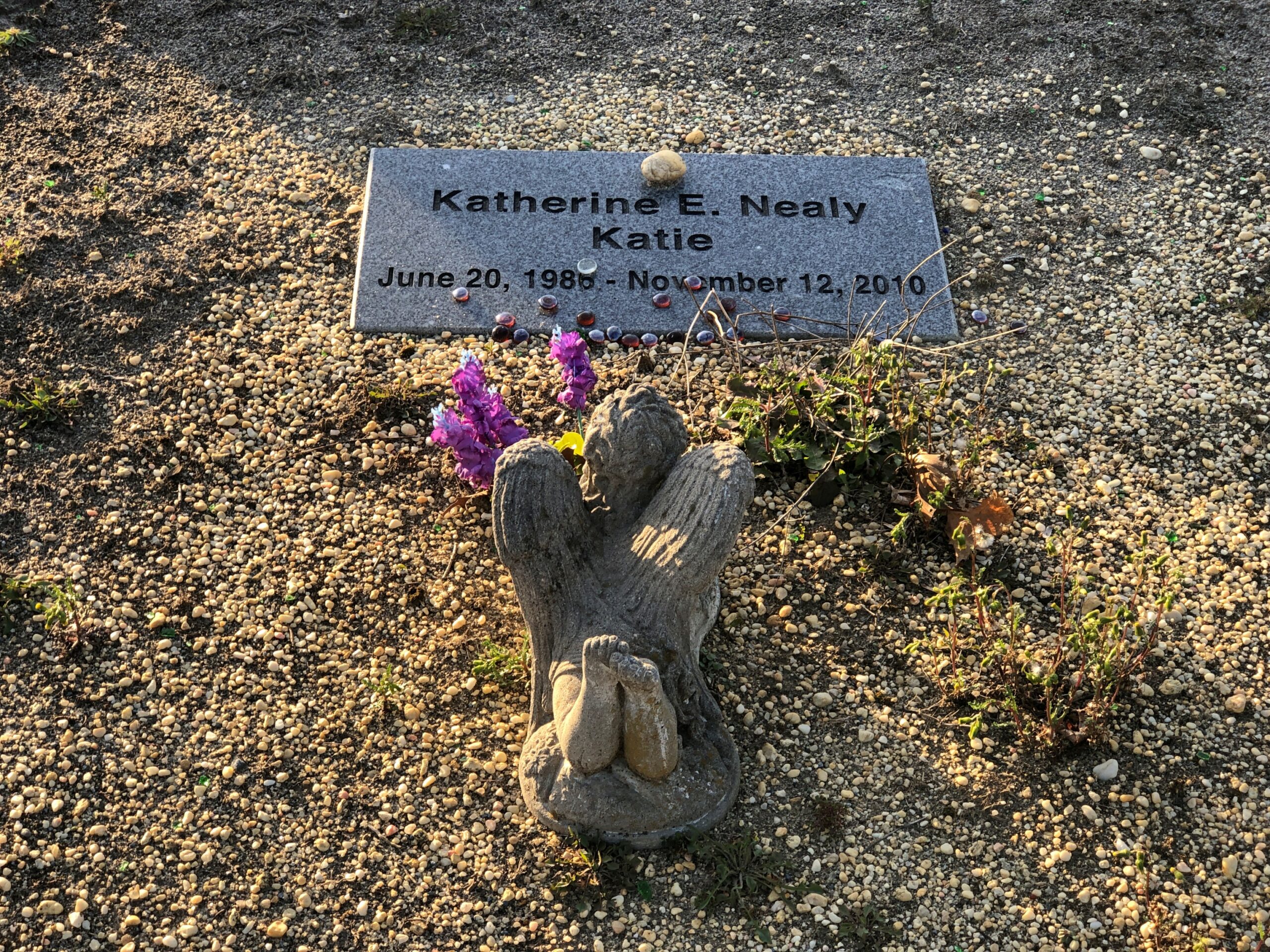
Goshen Cemetery, just off Route 112.
Ohio
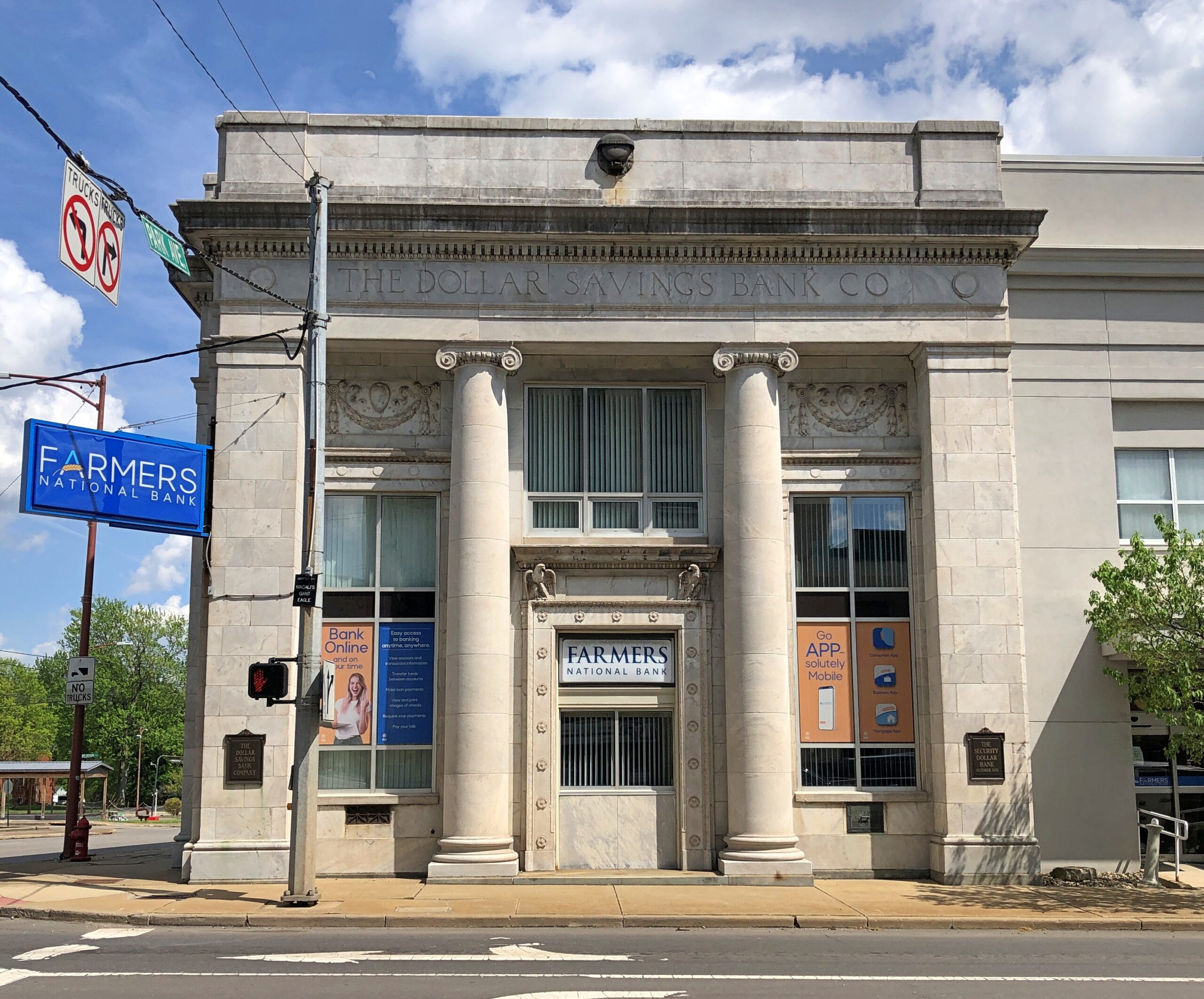
A solid bank building in Niles, across the street from where William McKinley was born. The Dollar Savings Bank Co. sounds like the kind of place that George Babbitt would mention, but distain in favor of a bank with longstanding ties to the best business men in Zenith.
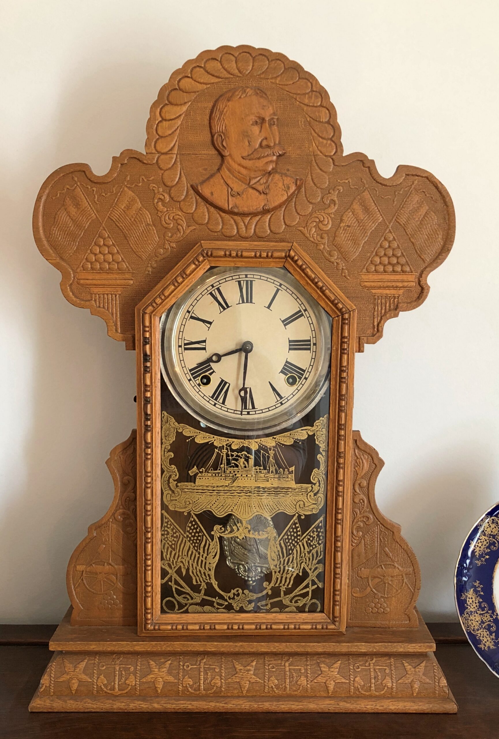
An Admiral Dewey clock at the McKinley Birthplace Museum. A textbook case, that Dewey, of how fleeting fame usually is.
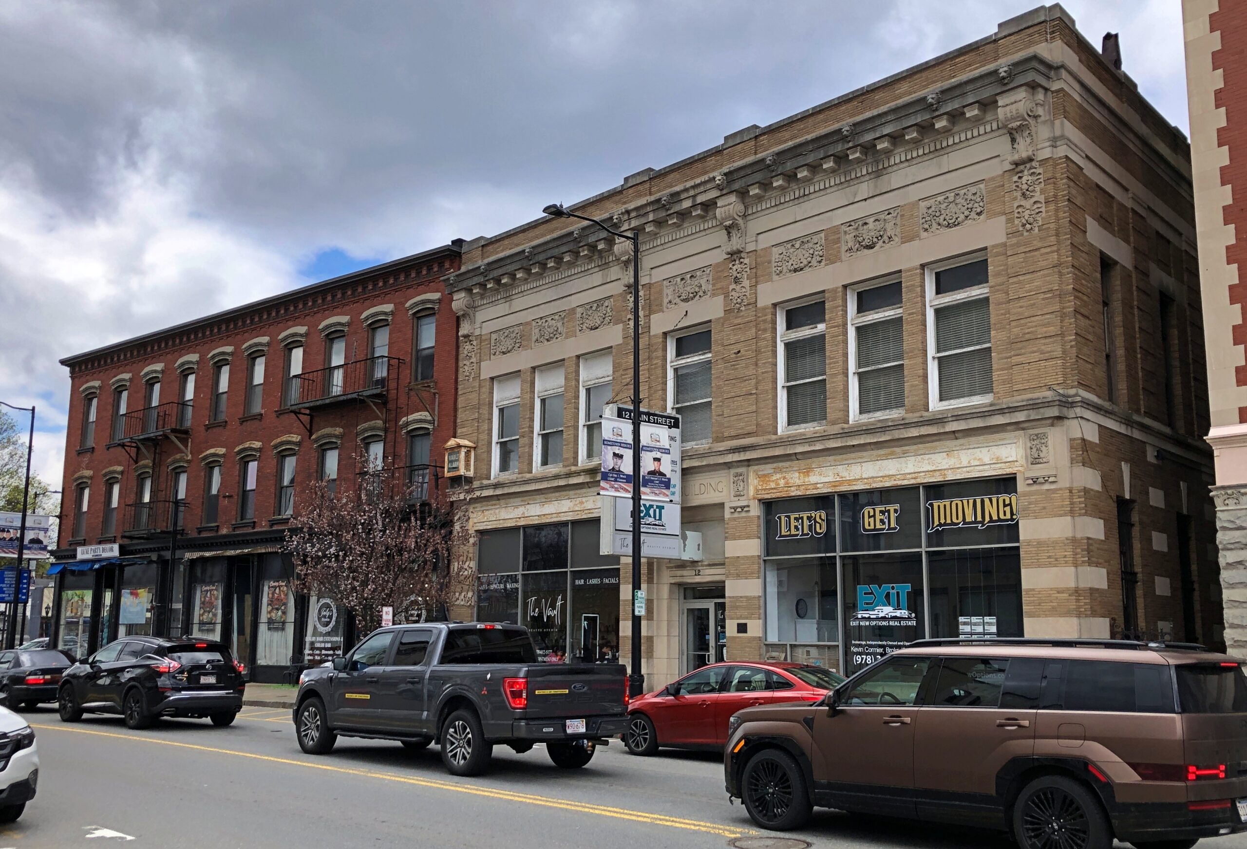
Passing through northeast Ohio intrigued me greatly about that part of the state. Akron, Canton, Youngstown, Austintown — all places I can imagine going, and enjoying the visits. See ’em before the reverse migration really gets underway.
Further west, the drive on the Lincoln Highway (US 30) was a pleasure: mostly four lanes, rarely crowded. The flat farmlands don’t qualify as conventionally scenic, but the budding springtime fecundity has a lot to recommend it, even as a strictly visual pleasure: the bright greens of new leaves, the brown and grays of the fields recently plowed, small roads heading off usually at right angles to the main road, a run between Upper Sandusky and I-75 near Lima with few buildings of any kind, except distant farm structures.
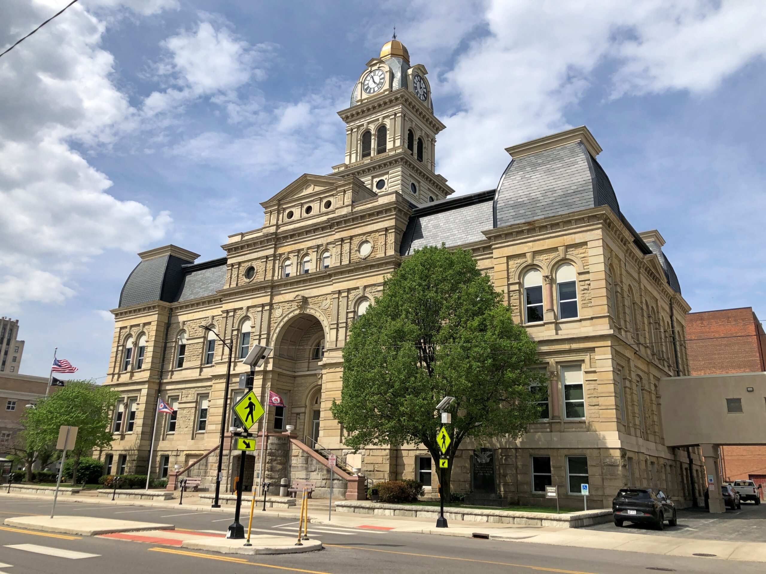
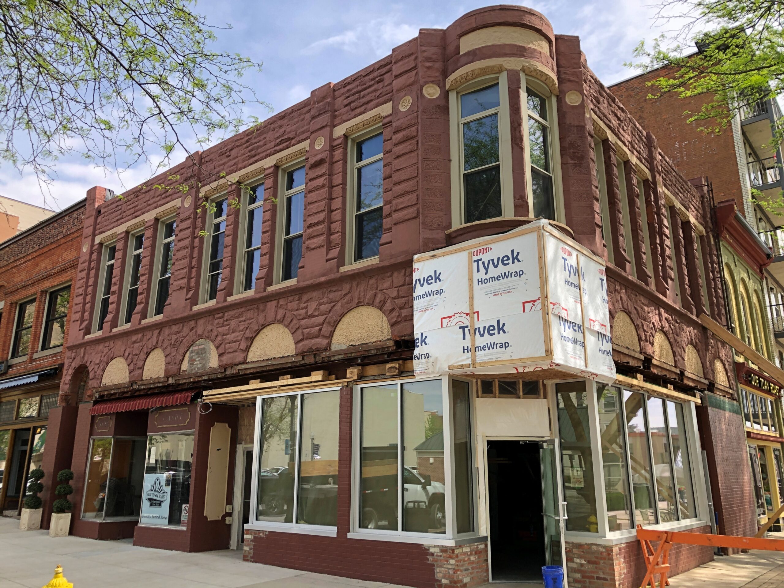
Downtown Lima: the Allen County courthouse, seen from North St.
Looks like my kind of breakfast place. Closed on Sunday anyway.
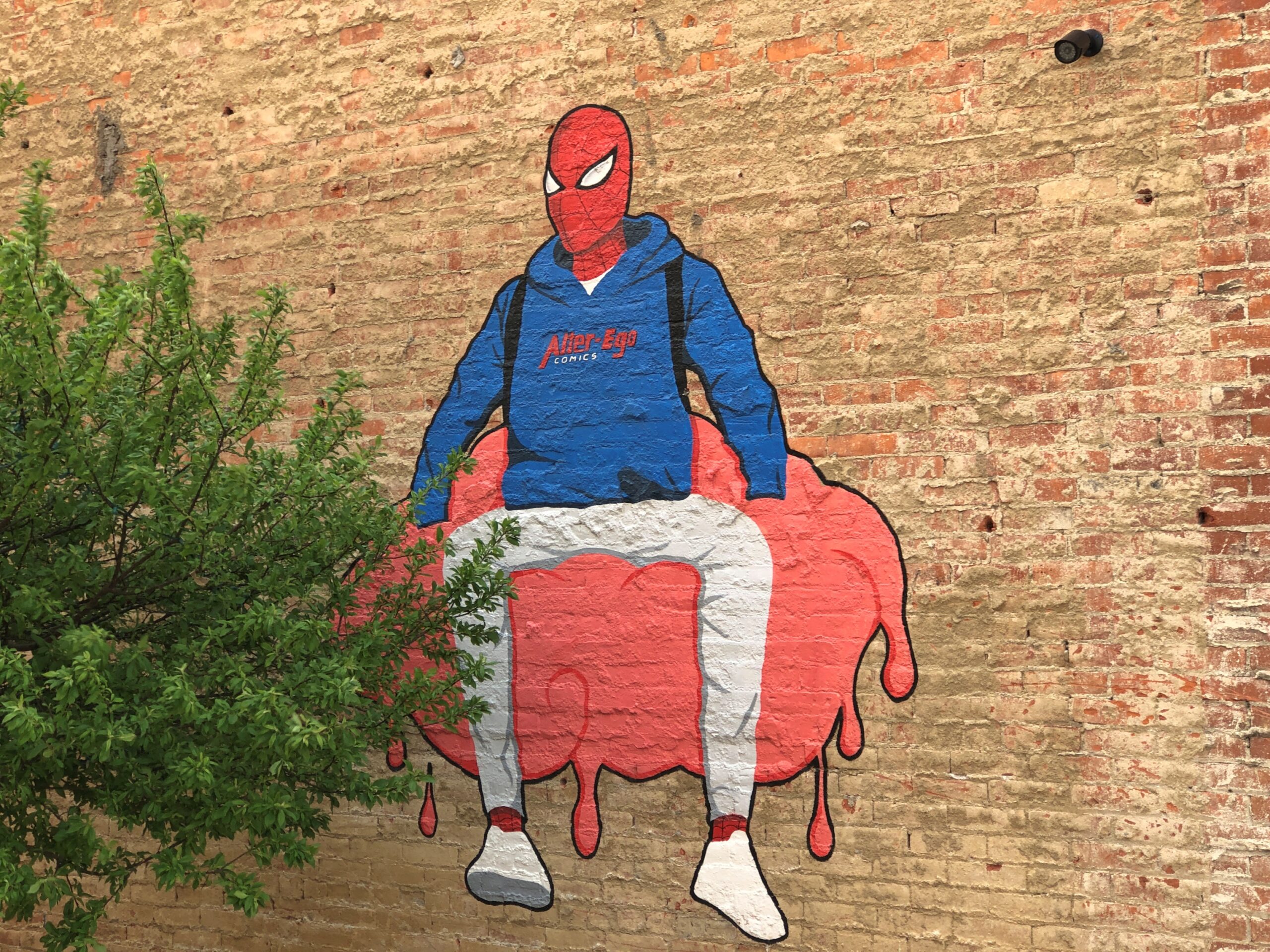
Another North St. detail. Spiderman sitting on — something. A large scoop of strawberry ice cream?
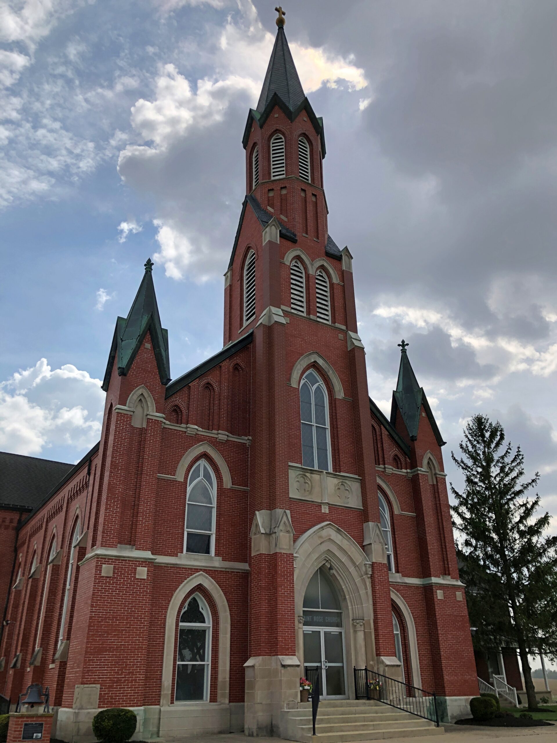
Saint Rose Church in the hamlet of Saint Rose, not far east of the Ohio-Indiana line. A Cross-Tipped Church.
Pennsylvania
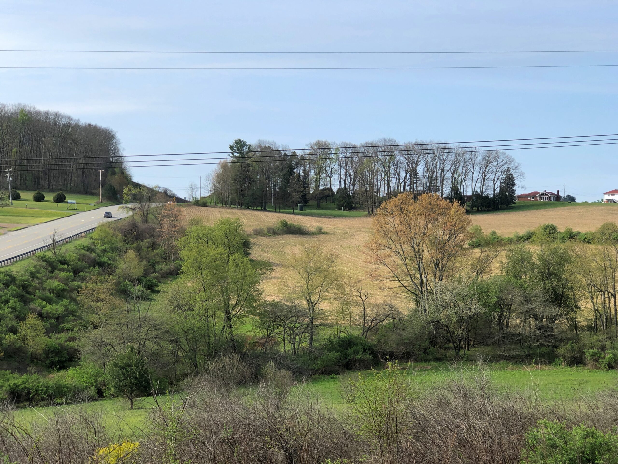
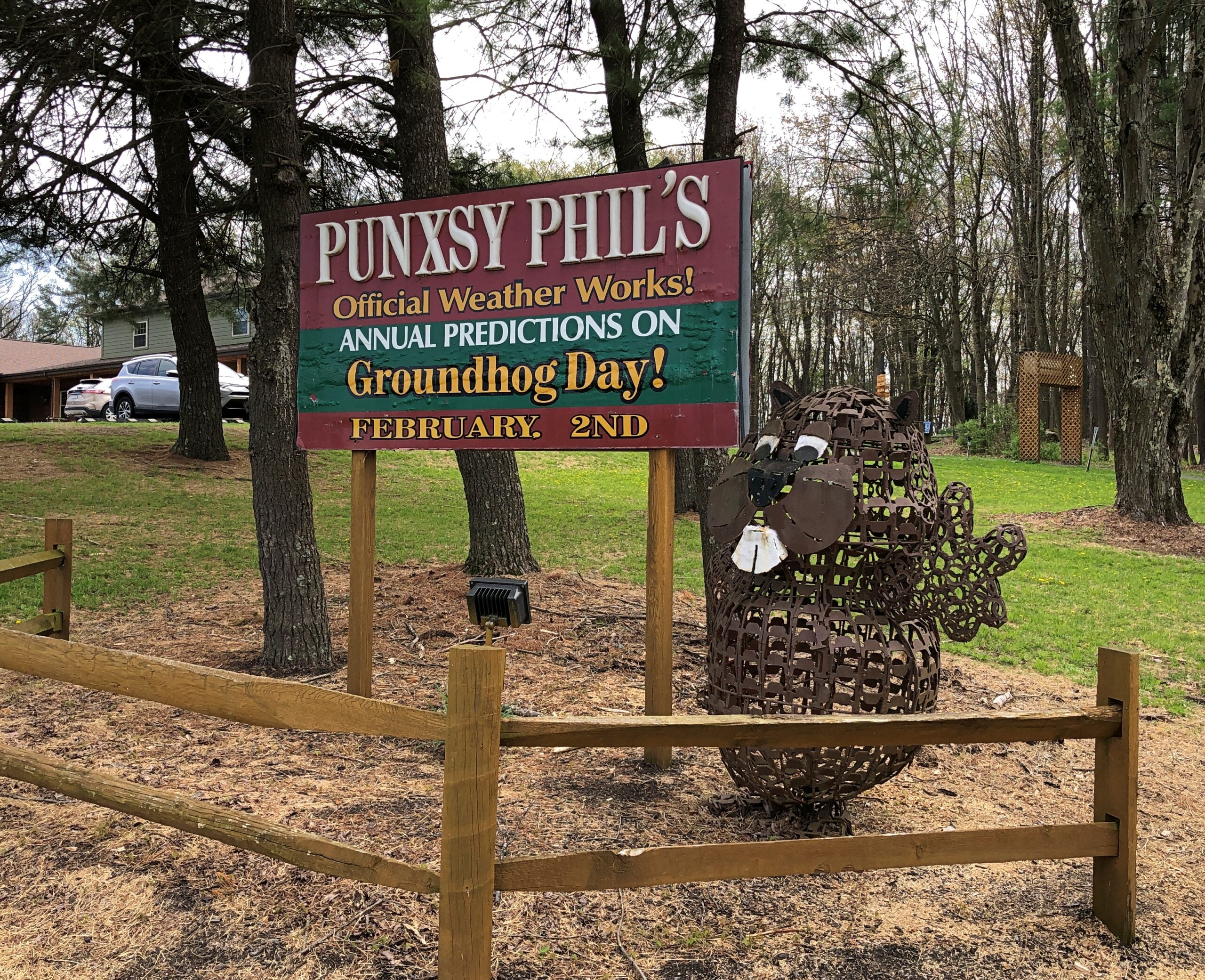
The hills at the edge of Punxsutanwney.
The drive west across Pennsylvania began across the Delaware River from Port Jervis, NY, taking US 209 southwest through part of Delaware Water Gap National Recreation Area. Bet the straight-ish, two-lane road is busier in peak recreation season in the Recreation Area, but in April, I booked along without encountering much in the way of traffic. Trees were still budding, but it wouldn’t be long before some stretches of the highway would pass through green tunnels. The sunlight was already casting green leaf shadows on the road.
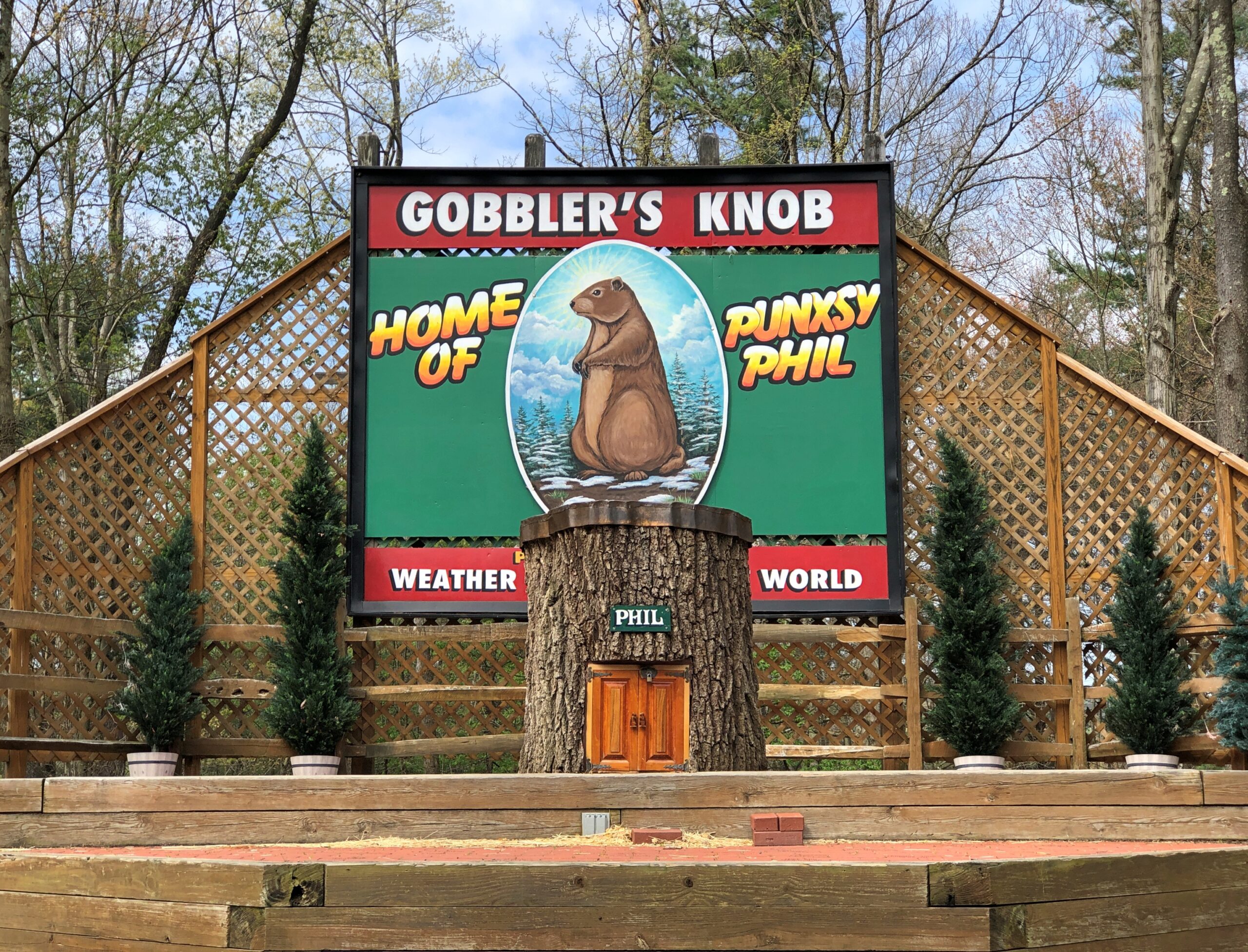
Watch Groundhog Day, and the impression is that the festivities are held in the center of town — which they are, in the Punxsutanwney stand-in of Woodstock, Illinois. Go to Punxsutanwney itself and learn that the February 2 fest is a few miles from town in a place called Gobbler’s Knob.
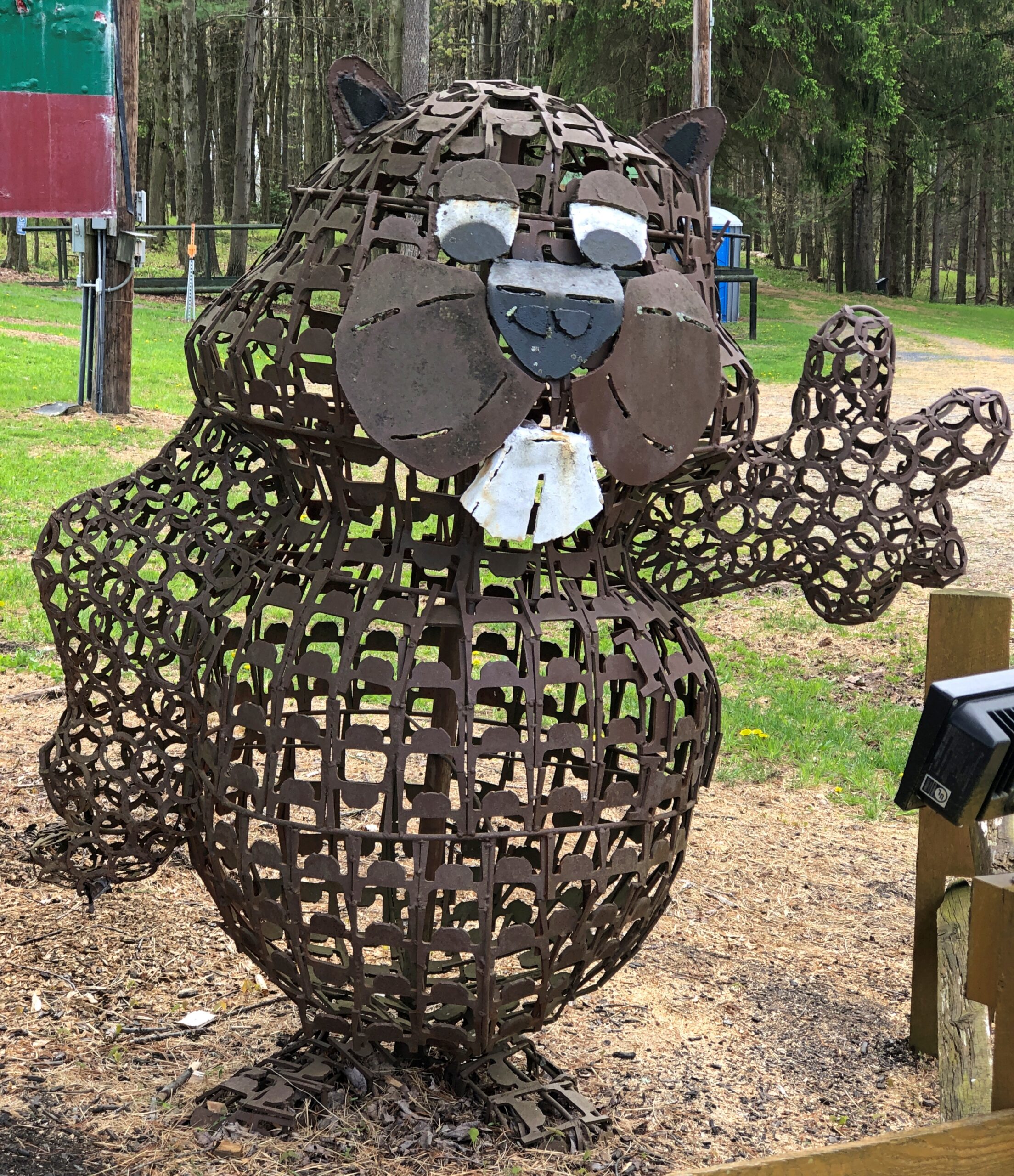
One more Phil. Iron Phil.
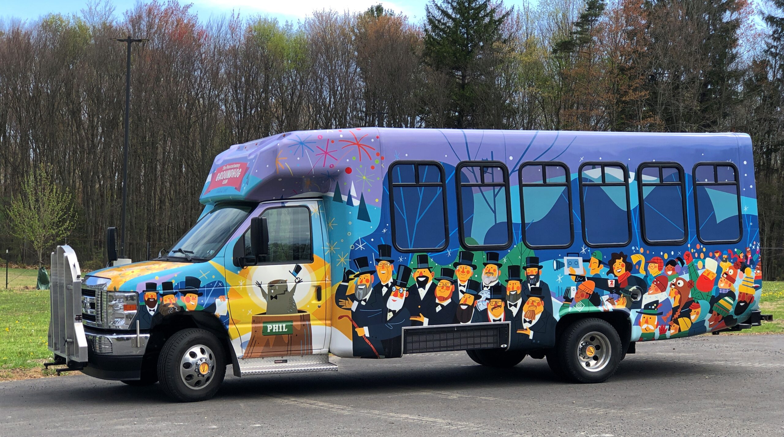
The clerk at the Gobbler’s Knob gift shop took pains to let me know that the site, and the festivities, were overseen by a nonprofit, not the commonwealth. Outside is the nonprofit’s bus, or at least I assume that, probably used to ferry people from town to GK and vice-versa, to help deal with the popularity of the event.
I like a good local festival as much as anyone, but February 2 is a deal-breaker. Can’t Phil come out again on August 2 to predict how much longer summer is going to last?
One More (Indiana)
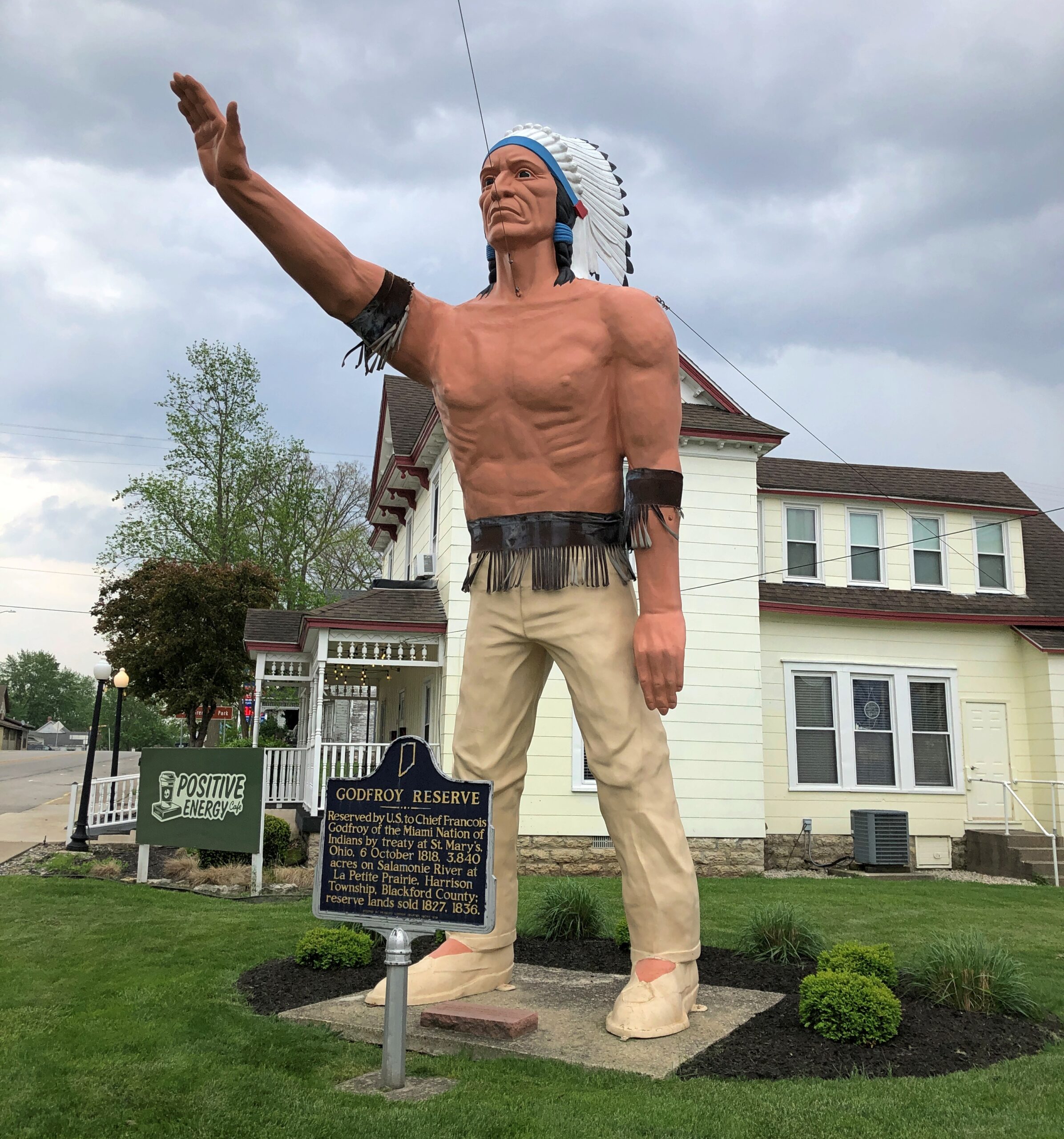
Miami Chief Francois Godfroy stands at the corner of Main Street and Huntington Street/Indiana 18 in Montpelier. Well, maybe it’s supposed to remind passersby of the chief more than actually depict him.
A Daughters of the American Revolution historical marker says: Reserved by U.S. to Chief Francois Godfroy of the Miami Nation of Indians by treaty at St. Mary’s, Ohio, 6 October 1818. 3,849 acres on Salamonie River at La Petite Prairie, Harrison Township, Blackford County: reserve lands sold 1827, 1836.
Waymarking says: “The statue was made in Venice, CA in 1960 for the Tom Wood Pontiac dealership in Indianapolis. Later it was in front of the Indian Museum at Eagle Creek Park In Indianapolis. After the museum closed, the statue (of more a plains Indian than a NE Indiana tribe) was obtained by Chief Larry Godfroy — a descendant who presented it to the City of Montpelier and they erected it as a monument in 1984.”
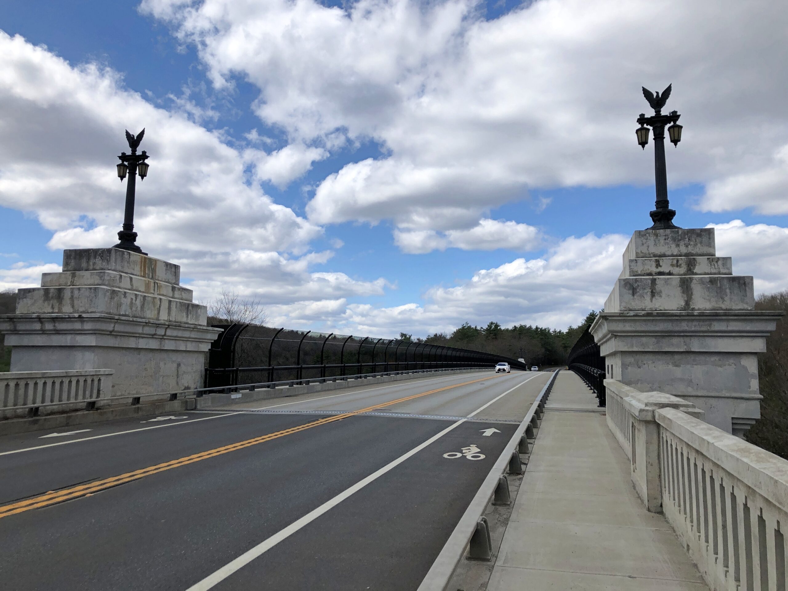
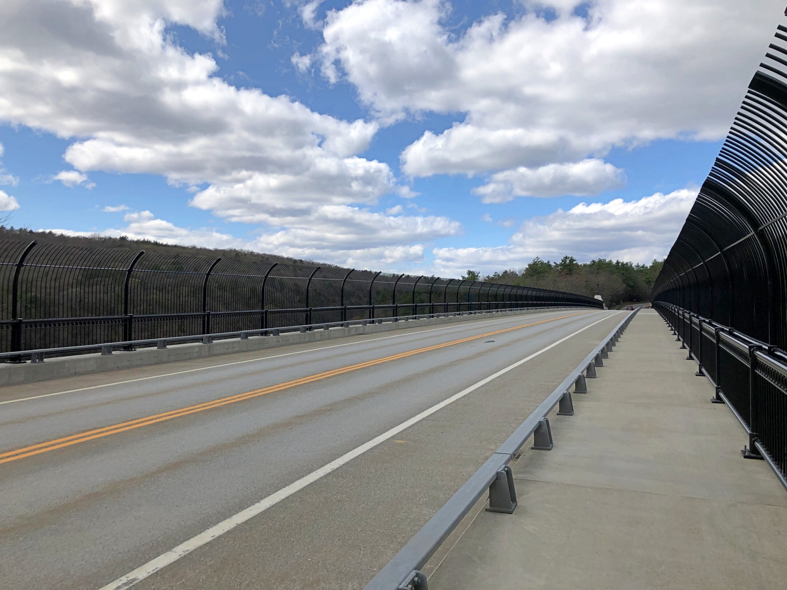
In my experience, a bridge with a name is usually worth a look. So it was with the French King Bridge, which crosses the Connecticut River in Franklin County, Massachusetts. There was even a wide place in the road (Route 2) to park, so that accessing the pedestrian experience was easy.
Just to judge by the walkway, a middling pedestrian experience. There are worse, especially bridges with high traffic volumes, but also many more walkable ones.
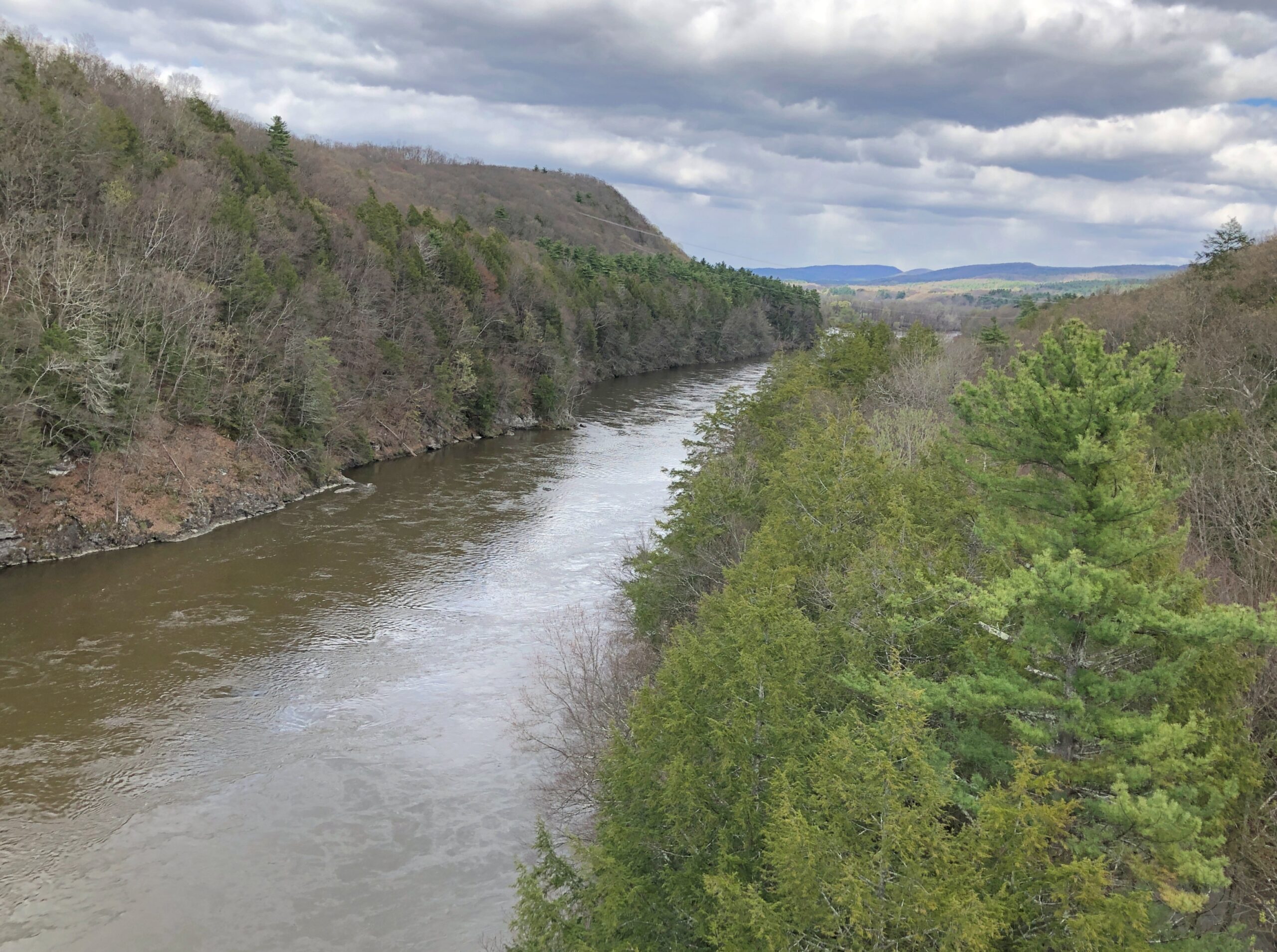
Then there’s the view from French King. That’s worth the stop and then some.
Looking upstream, or generally north. The Connecticut rises in New Hampshire very near the Canadian border and reaches Long Island Sound near Old Lyme, Connecticut. People have been living in the Connecticut River Valley for at least 6,000 years.
French King is an arch (see image from below here), like the New River Gorge Bridge in West Virginia, only a lot smaller and not nearly as high. But high enough: seems that MassDOT recently installed the cage-like bar structure at each edge of the walkways across the bridge because of people’s occasional but unfortunate habit of pitching themselves into the river, almost always fatally.
I know suicide ideation is a worrisome thing for those plagued with it, and I’m glad I’m not. But I believe most of us have anti-suicide ideations, as in, jumping off a bridge is not the way I would do myself in. Of course, I’ve ruled out all the other common methods as well.
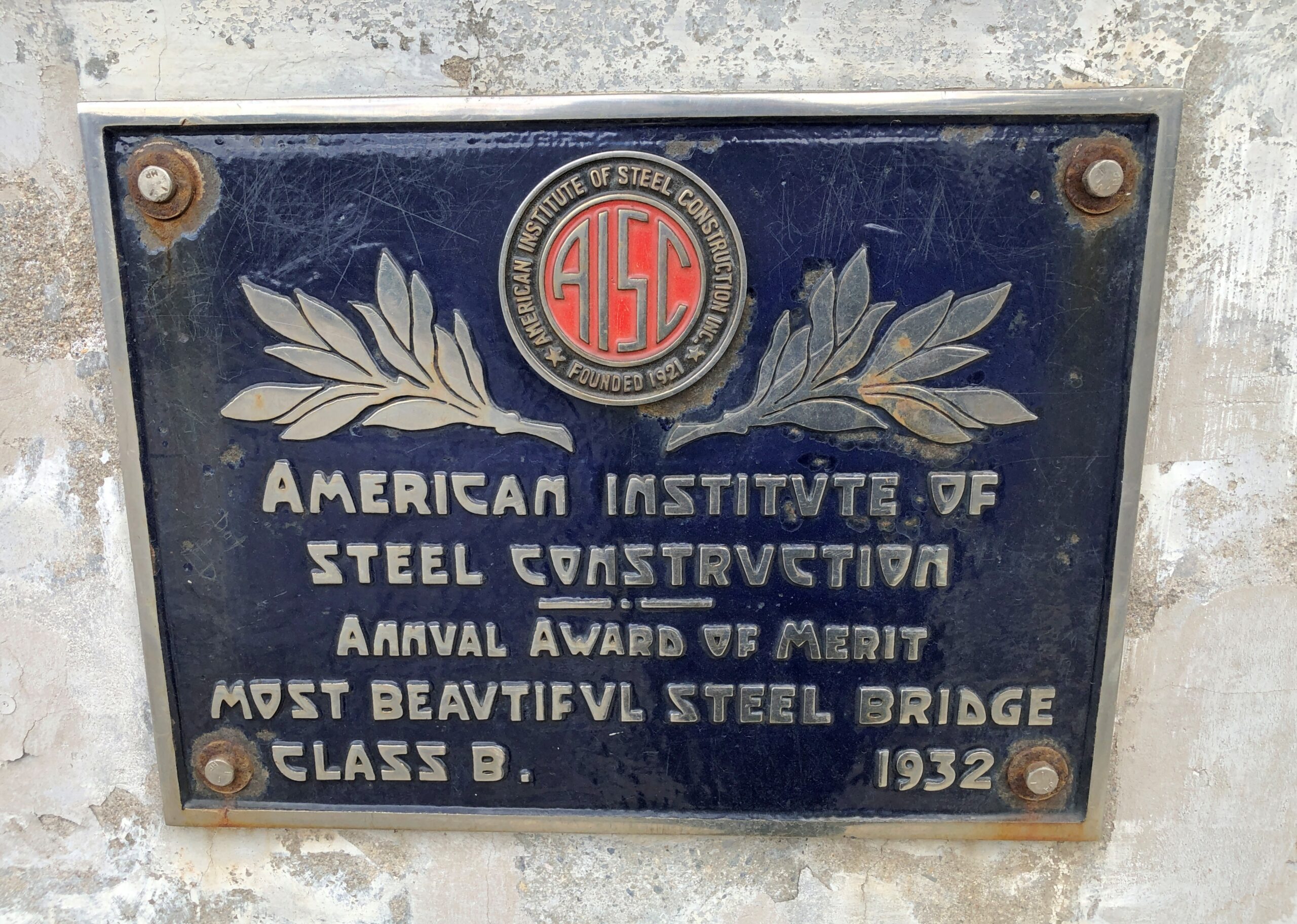
Engineers at the time of the bridge’s construction thought highly of the design.
One thing leads to another online, and pretty soon I was leafing through web pages at the American Institute of Steel Construction. Such as this page – Featured Projects – by the National Steel Bridge Alliance, showcasing some cool-looking steel bridges: Lake Bridges over Kentucky Lake and Lake Barkley; Lake Champlain (Crown Point) Bridge; Homestead Grays Bridge (Pittsburgh); Hope Memorial (Lorain-Carnegie) Bridge (Cleveland).
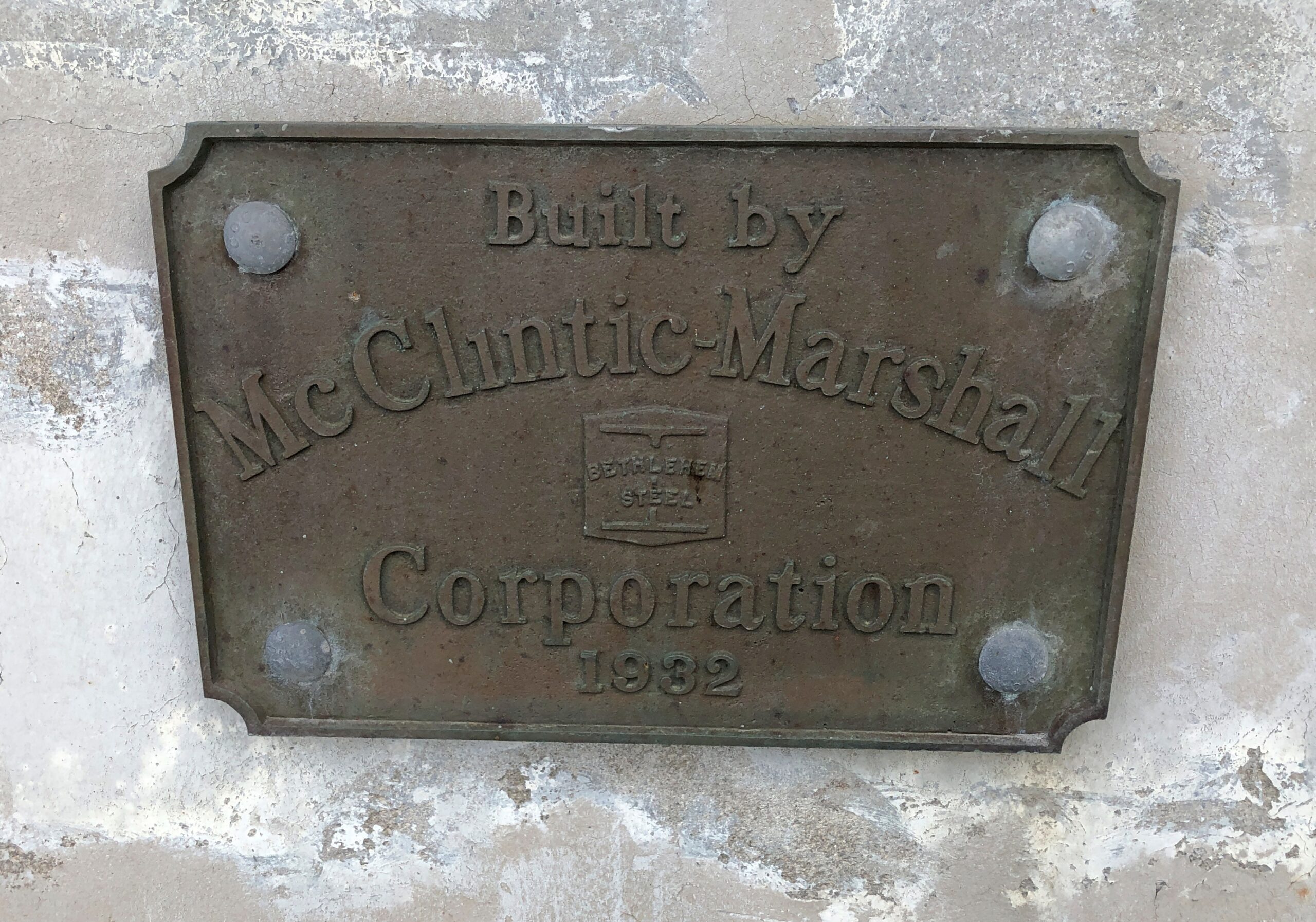
Bridge builders.
McClintic-Marshall was just warming up with the French King Bridge. Not long after, the company won a contract for the superstructure of the Golden Gate Bridge.
“The McClintic-Marshall Co., a subsidiary of Bethlehem Steel Corp., bid $10,494,000 for the contract to build the steel superstructure,” notes the Pottstown Historic Society. “Of course, because McClintic-Marshall was located in Pottstown, the outcome of this bid was of enormous importance for the entire area… On Jan. 12, 1933, anxiety gave way to joy as The Pottstown Mercury announced “M’CLINTIC’S BIG CONTRACT TO BE SIGNED TODAY.”
Finally, the name. French King after a nearby large rock in the middle of the river of that name. Before the river was dammed, it rose prominently out of the water. That naming is vaguely attributed to passing Frenchmen but more seems like one of those go figure origins common enough in place names. Maps wouldn’t be quite as interesting without them.
The highway Massachusetts 2 – locally called Route 2 – traverses the northern reaches of the commonwealth, from the Boston Common to the border with New York more than 140 miles away, or vice versa. I went west, fortunately not starting in Boston itself, but still slightly inside Route 128.
Once you leave the thickest of metro Boston headed westward, the route becomes more casually picturesque, mildly winding through mildly hilly territory, providing access to Massachusetts towns more and less pleasant, depending I suppose on the vagaries of their economic history. Not an epic drive of the kind you encounter high in some mountains or across wide bodies of water, but a satisfying one all the same.
Eventually you come to the western part of the state, as mountainous as it gets, and the road acquires appropriate twists and vistas. My favorite moment on the road was when I first drove it in 1989. I took one of those twists, and saw a suddenly appearing sign that said Entering Florida. Of course someone has posted a picture.
Florida, Massachusetts, that is, a town (pop. 671) in the Berkshires.
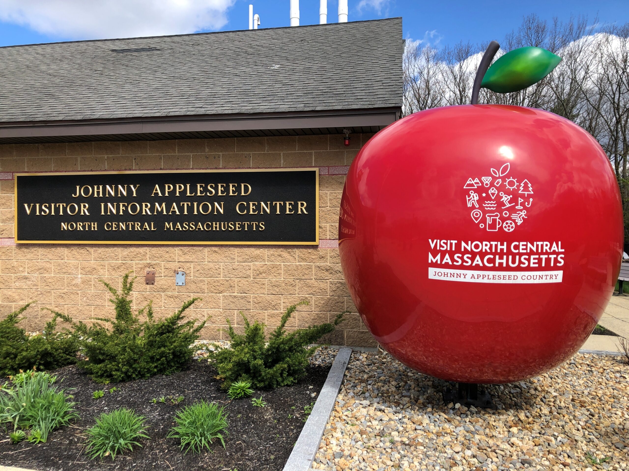
That was another drive. In April I traveled on Route 2 as far west as Shelburne Falls, but I’m getting ahead of myself. First I stopped at a rest stop on the way that reminds us that Johnny Appleseed hailed from these parts.
Indeed, John Chapman was born in Leominster, Massachusetts before the Revolution, though he came to fame in the wild-and-woolly Northwest Territory (and its spanking-new states) and now reposes in Fort Wayne, Indiana under some apple trees.
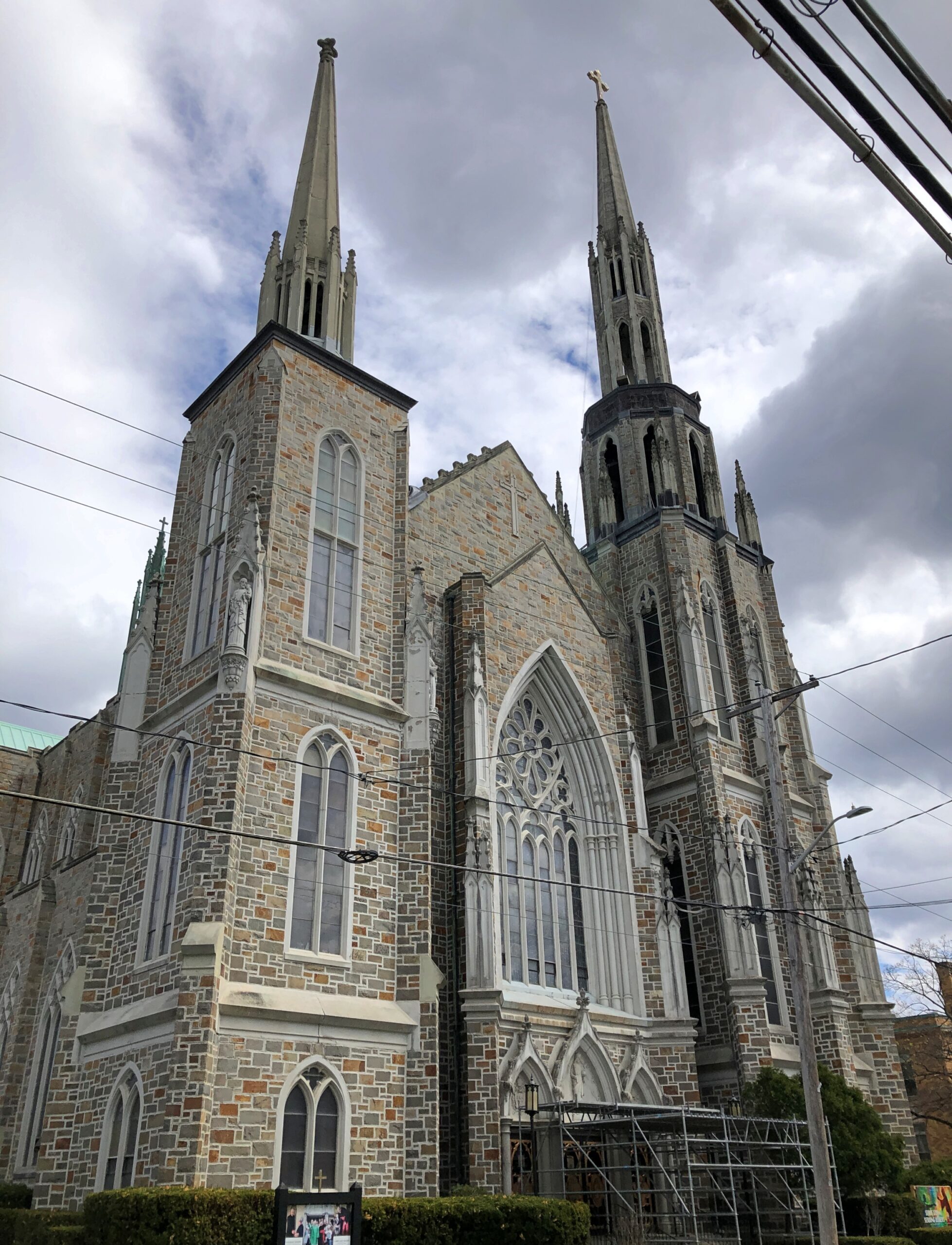
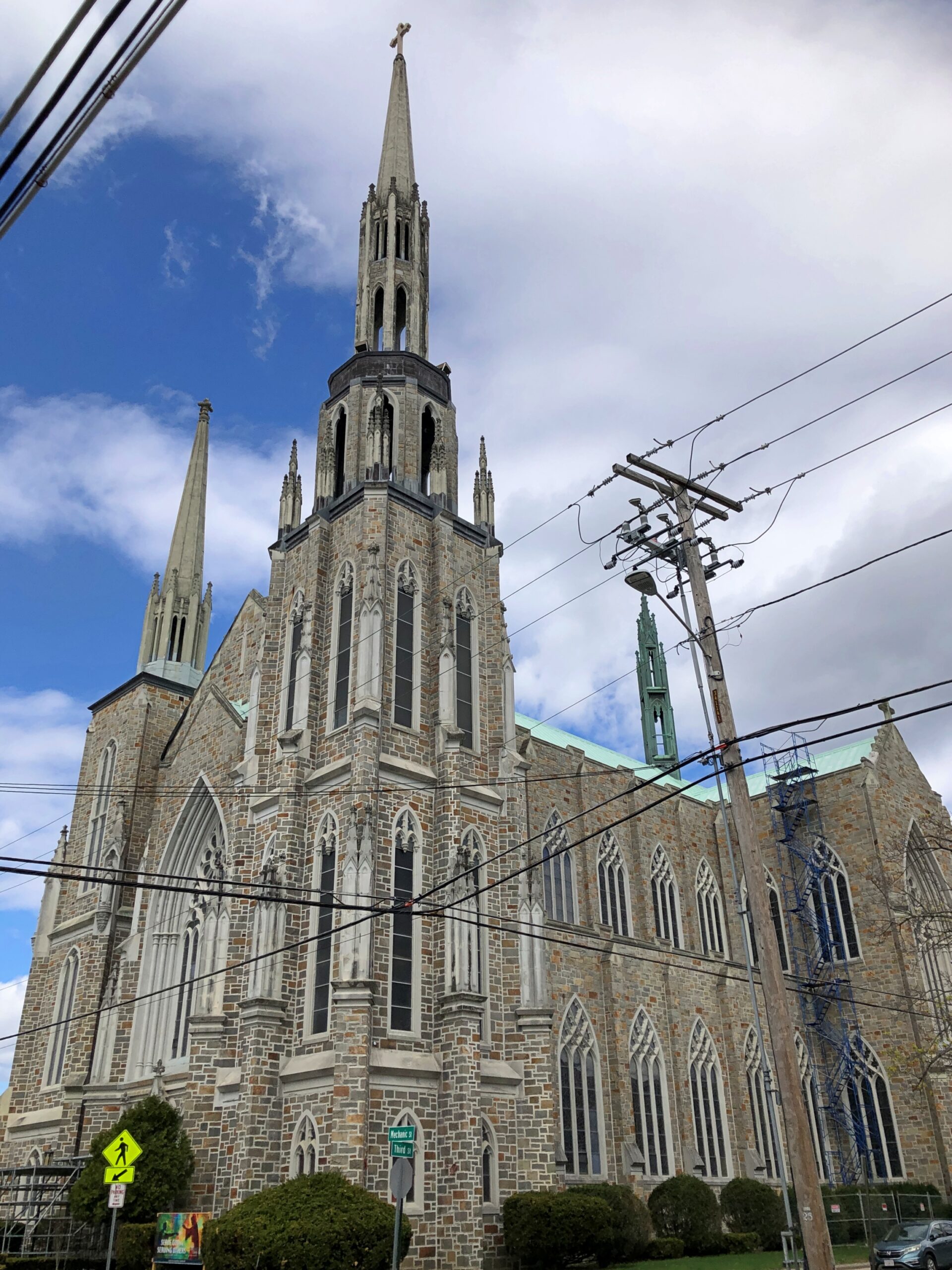
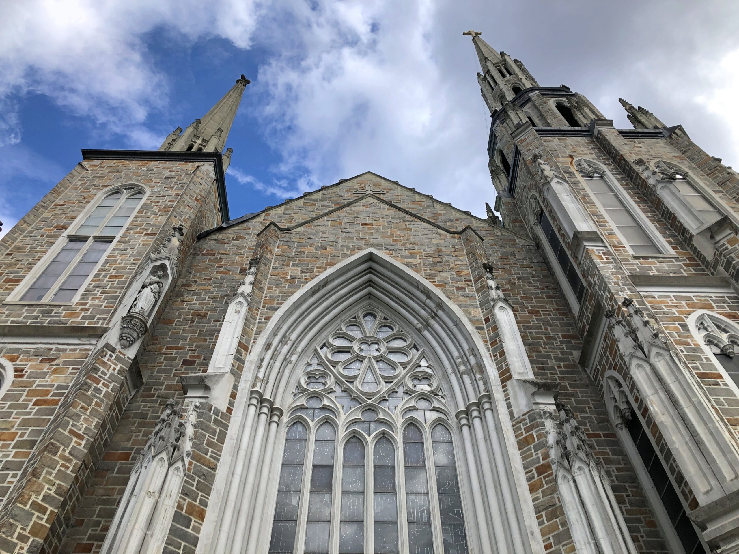
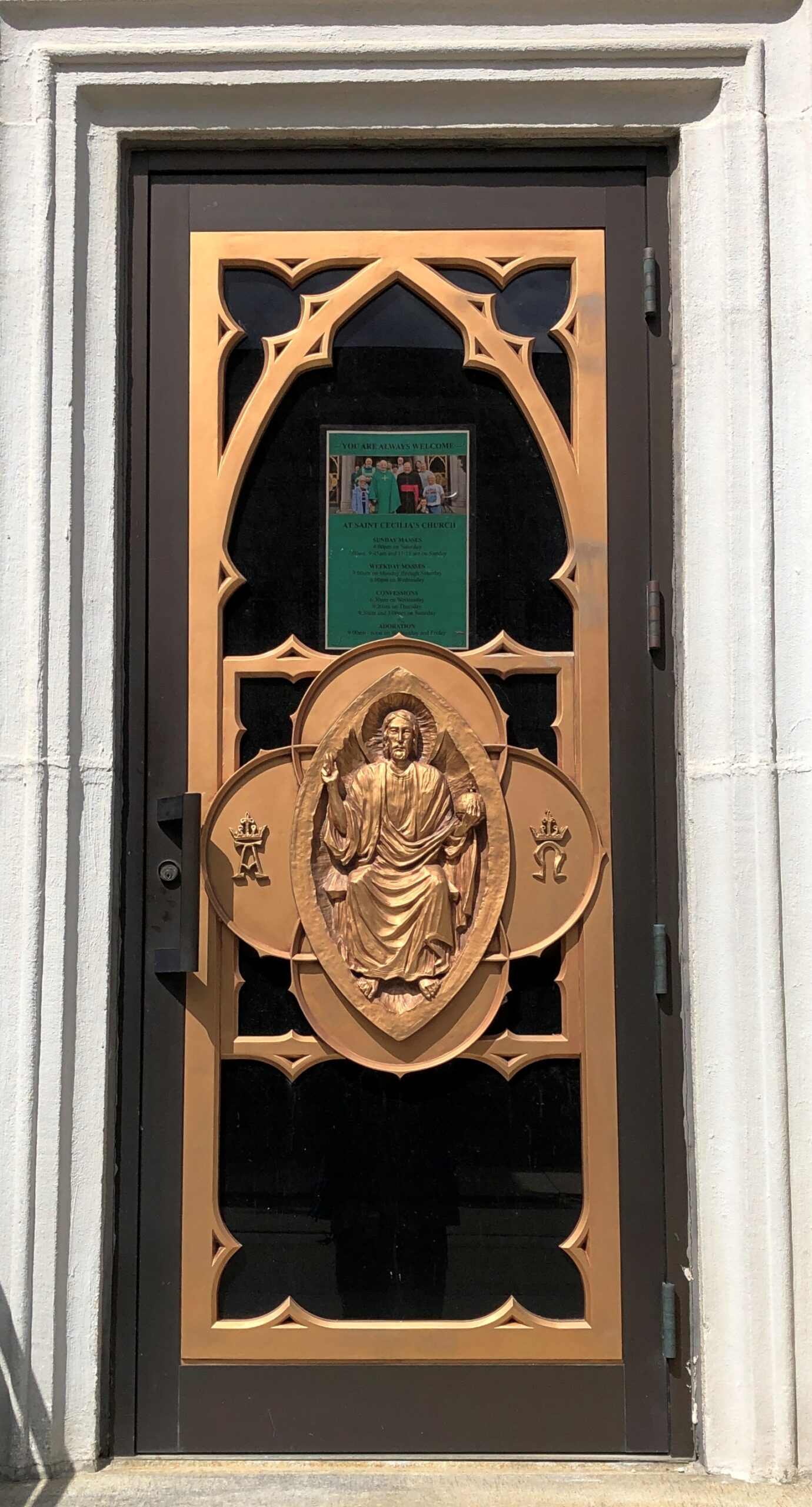
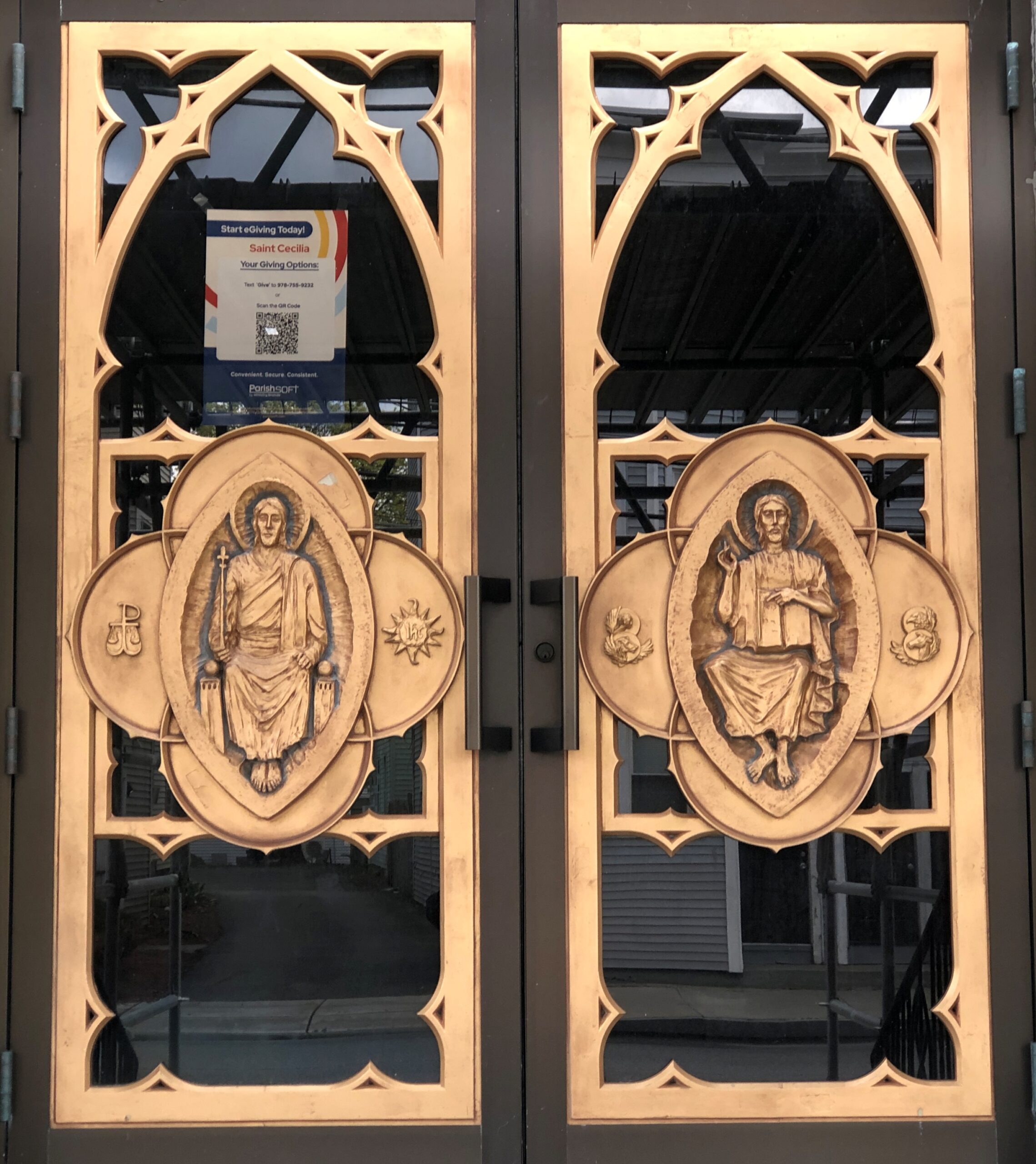
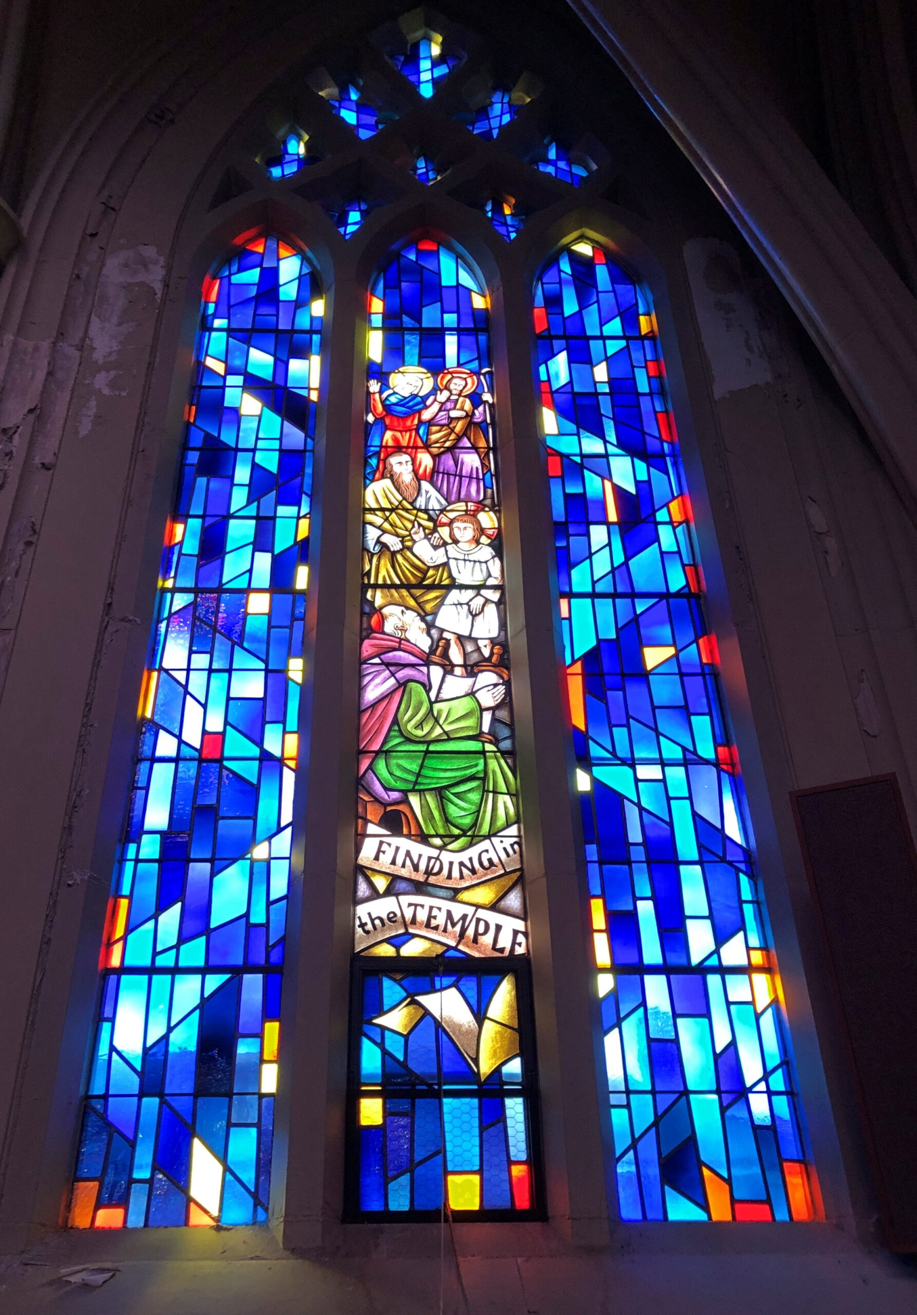
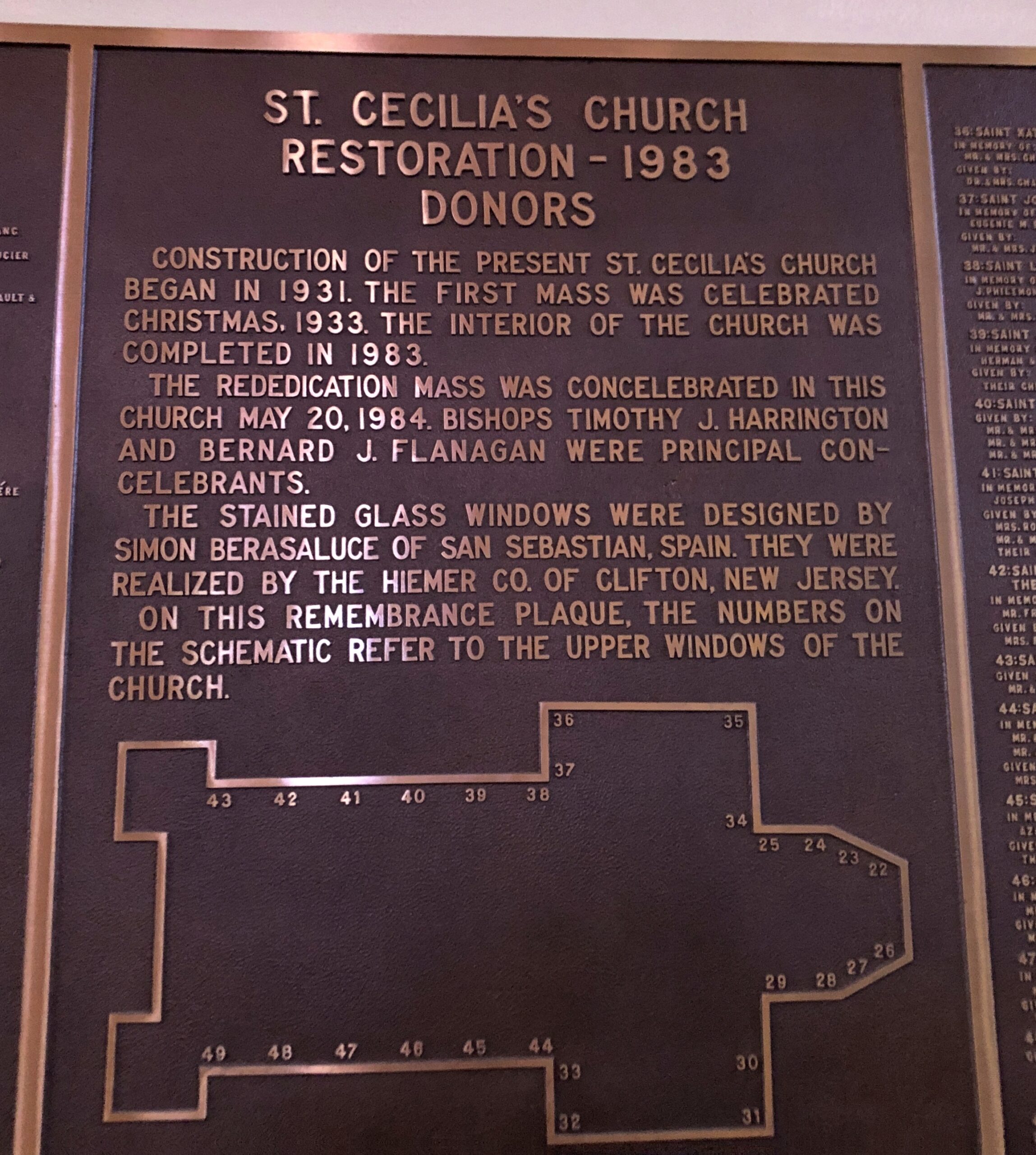
I was inspired to stop in Leominster (pop. 43,800). First stop, St. Cecelia’s Church, whose construction began in 1931 and which was restored in 1983.
Good to see a church of that name; reminds me of Santa Cecilia in Trastevere, a favorite part of Rome for me (40+ years ago), though the Massachusetts church itself is rather different.
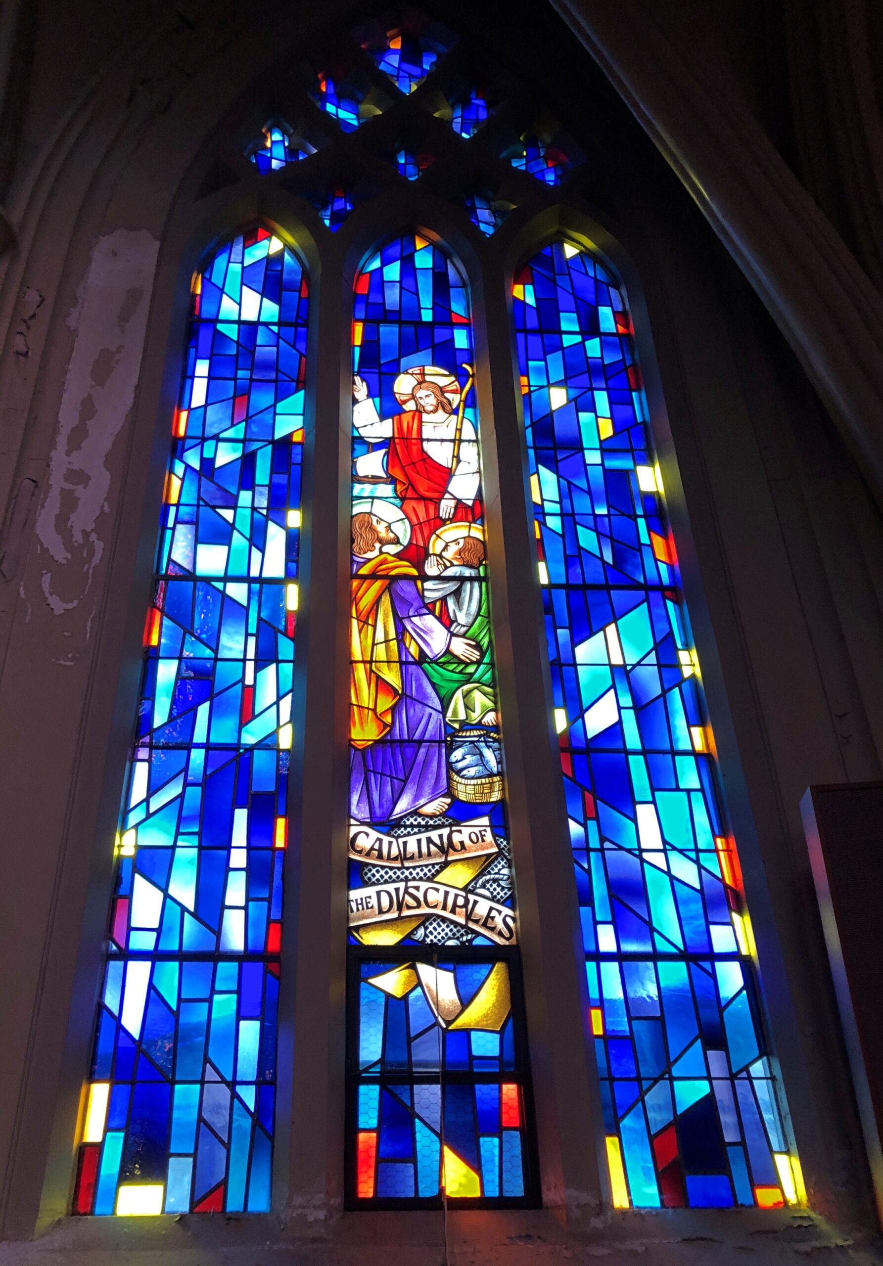
Some fine stained glass, designed in Spain, created in New Jersey.
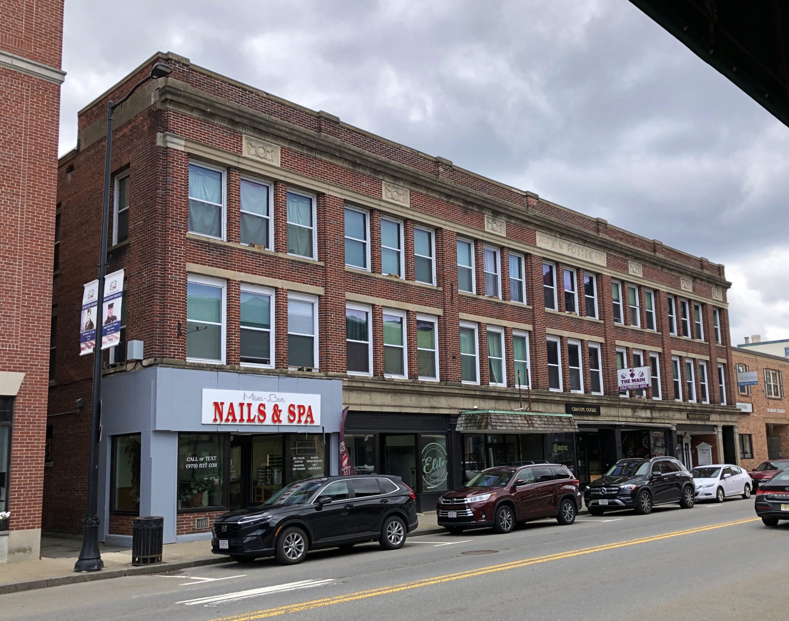
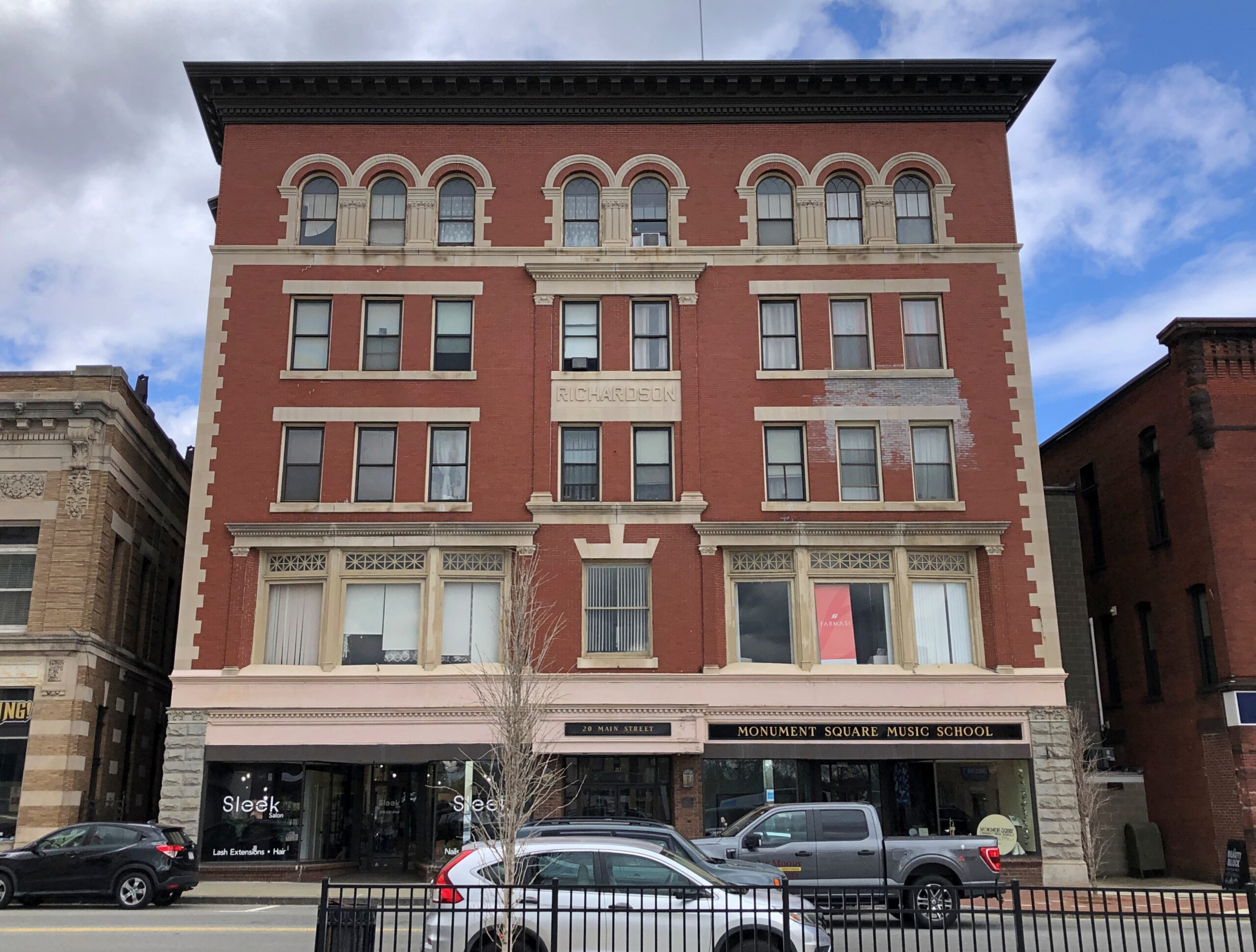
Leominster has the sort of long economic arc (for America) one finds in the Northeast: agriculture to manufacturing to services, though those first two economic activities are to some degree ongoing even now. The town is prosperous enough to support well-kept and still-used downtown buildings.
I liked the handsome former train station, now retail.
Another church.
Not as vaulting as the Catholic church down the road, but still a handsome brick structure. I had to look into it: this church is affiliated with the Assemblies of God, the largest Pentecostal association in the U.S.
Manufacturing in the case of Leominster meant a remarkable specialty in the 19th century and into the 20th: combs. Even more remarkable, a history of American comb making, published in 1925, is posted online, namely Comb Making in America, “An Account of the Origin and Development of the Industry for which Leominster has Become Famous to which are added Pictures of Many of the Early Comb Makers and Views of the Old Time Comb Shops.”
That publication date puts it in the public domain. Ah, there’s another setting for a streaming service limited series costume drama — among the cutthroat world of comb making in 19th-century Leominster. I don’t know that “cutthroat” is accurate at all, but who cares. Maybe two brothers fighting for control of their dying father’s comb empire, and their love for the same upper-class woman (who is anachronistically feisty), amid a backdrop of bitter labor agitation, with two labor leaders pushing for unionization, and their love for the same woman (a different woman, that is, one of the comb makers, but also feisty.). See, that wasn’t hard at all. Who needs AI to come up with ridiculous ideas?
The Forward of Comb Making in America calls Leominster the “present seat” of the industry in America: “The industry has changed this thriving town, which is about fifteen miles from Worchester and forty-five miles from Boston, from a small agricultural hamlet into an industrial center of more than twenty thousand people whose products are known throughout the world.”
In the early days, of course, making combs from animal horn and the like was a labor-intensive effort. A more modern industry arose with the invention of celluloid. Later came more sophisticated plastics and molding tech, and the expansion of the industry into other molded items. Such as Foster Grants and Tupperware, both of which originated in Leominster. A simple Google search reveals that there is still a plastics industry in Leominster.
I didn’t spend a lot of time in Leominster, so maybe I missed it. But where’s the giant comb or Foster Grant or Tupperware container in a prominent public place? Leominster officials and private boosters, get on it. Or at least invite the Wall Dogs to town to whip up some local history murals.
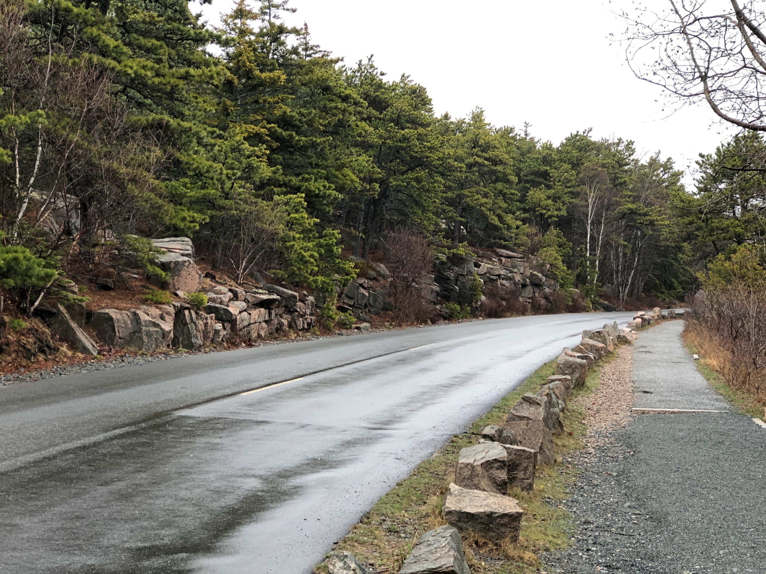
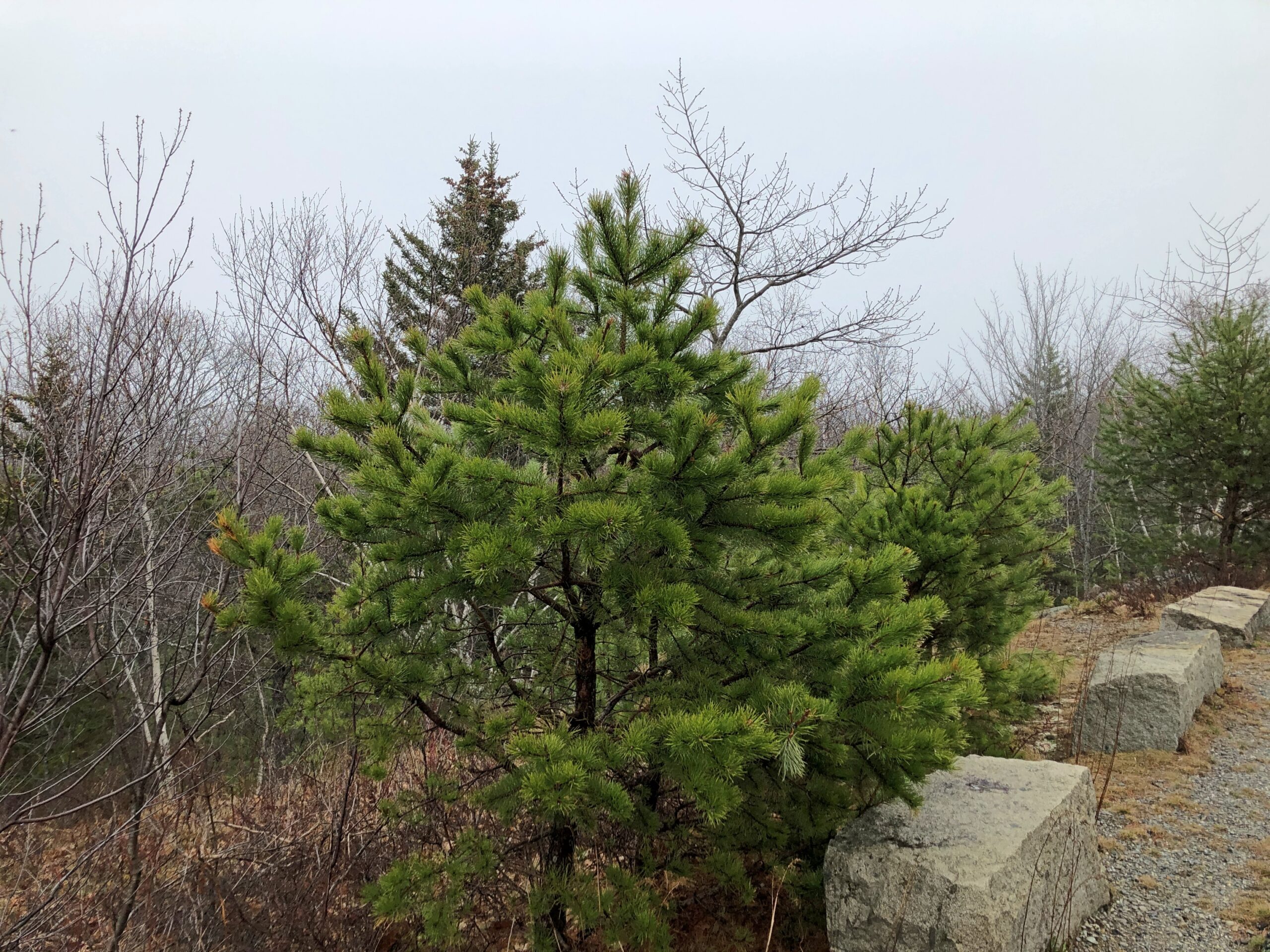
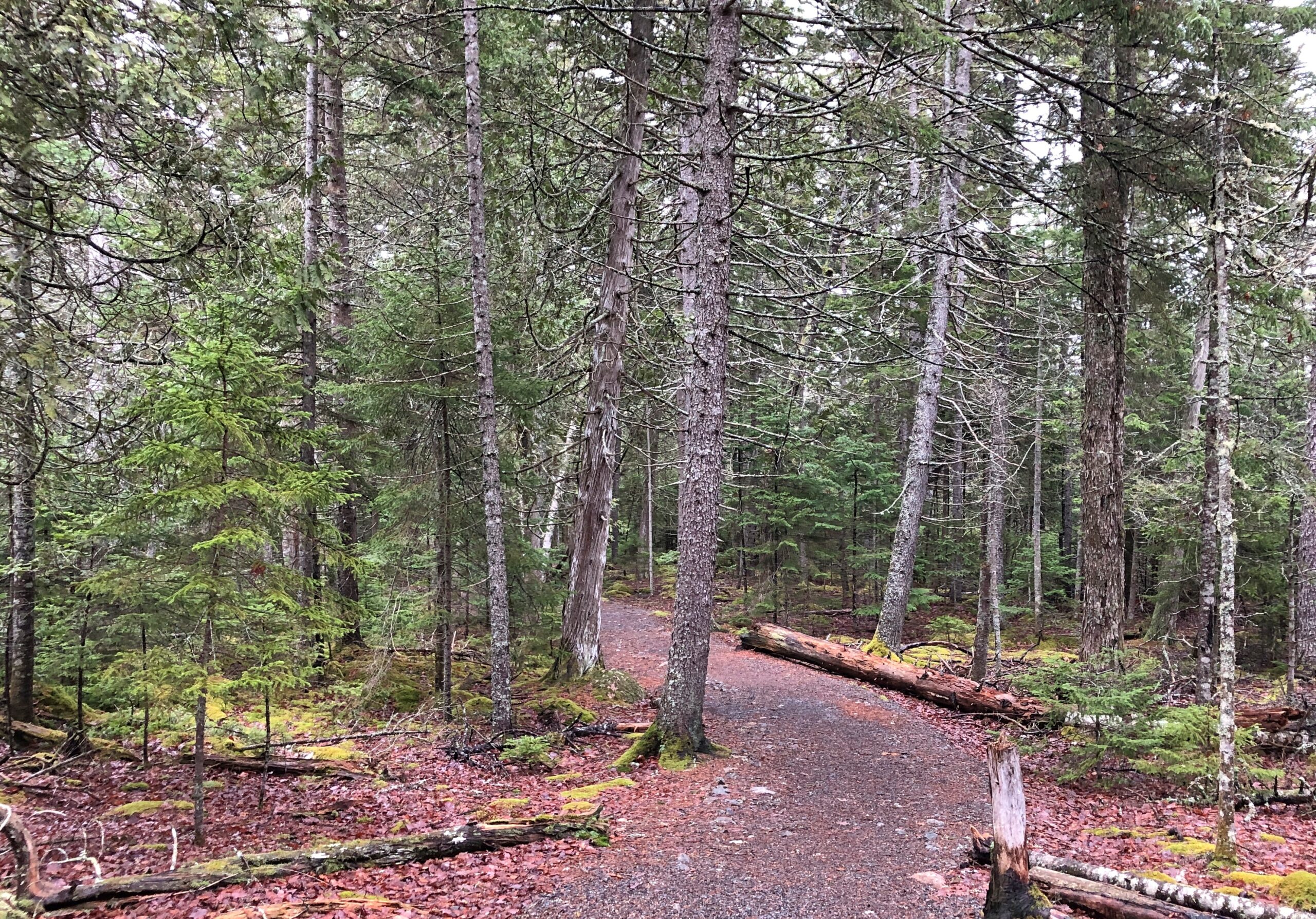
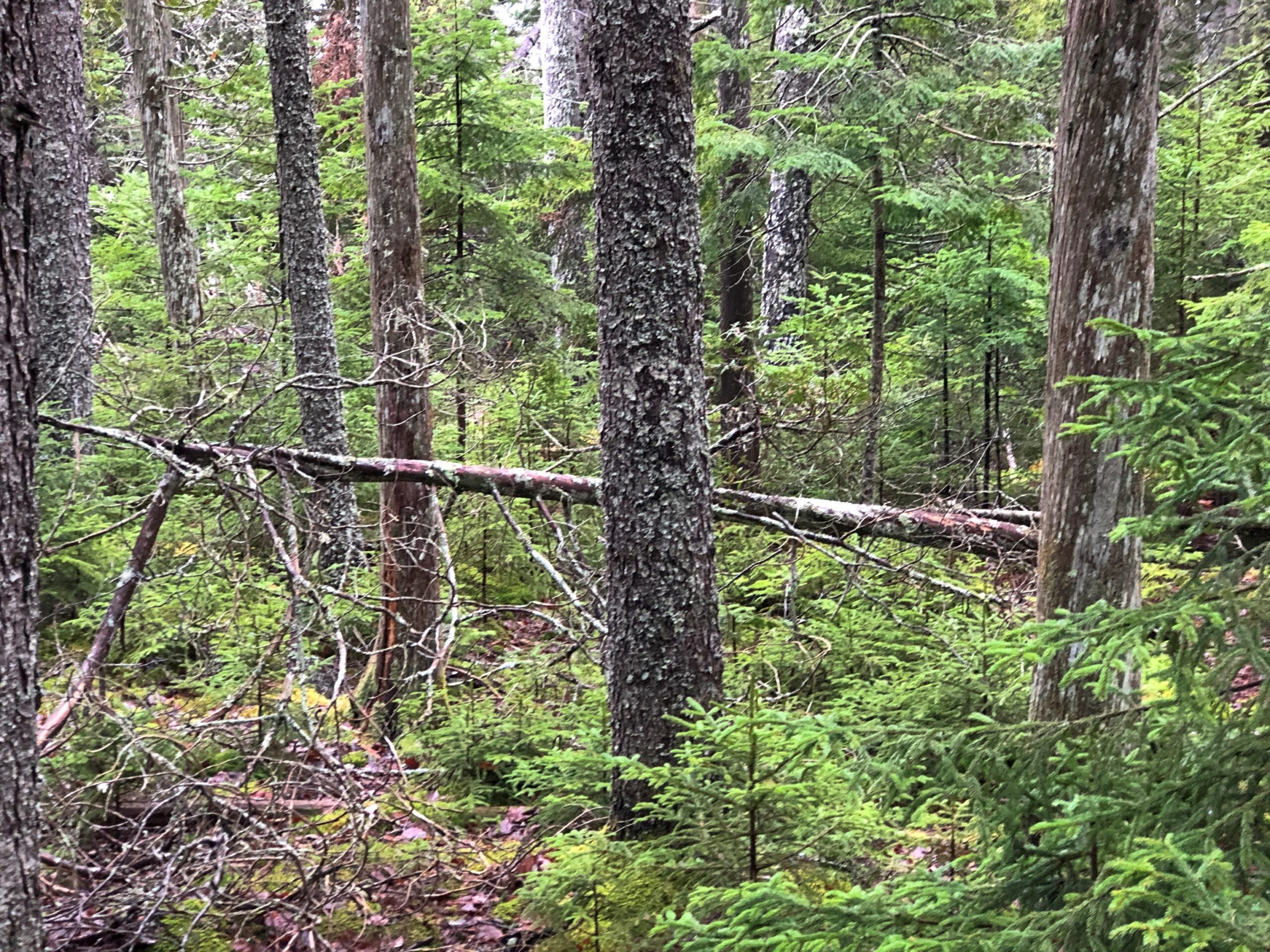
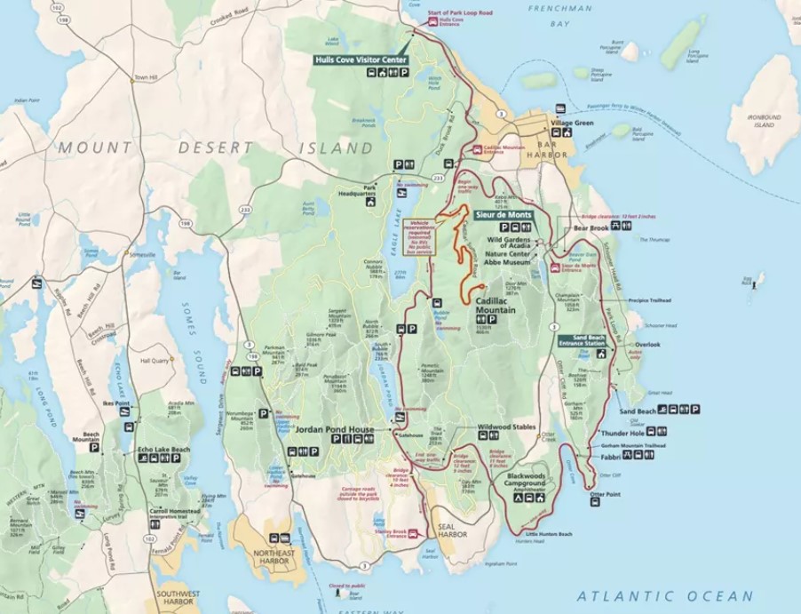
The Park Loop Road in Acadia NP is a fine drive (1) if there aren’t many other cars and (2) you take it easy around those curves. In that, it’s no different than a lot of rural roads. But there’s also the bonus of passing through thick Maine woods. There are brief views of the ocean from the road, but mostly you’re tooling through evergreens.
Through patches of deciduous trees as well.
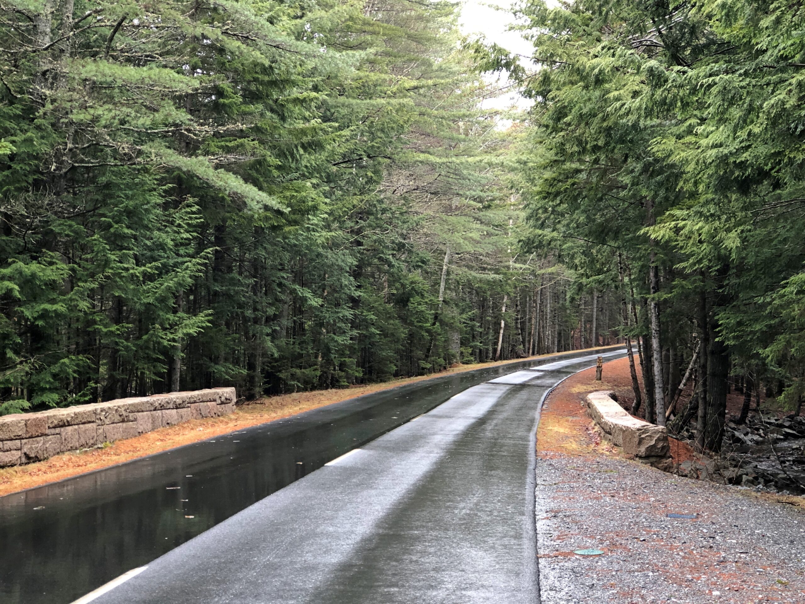
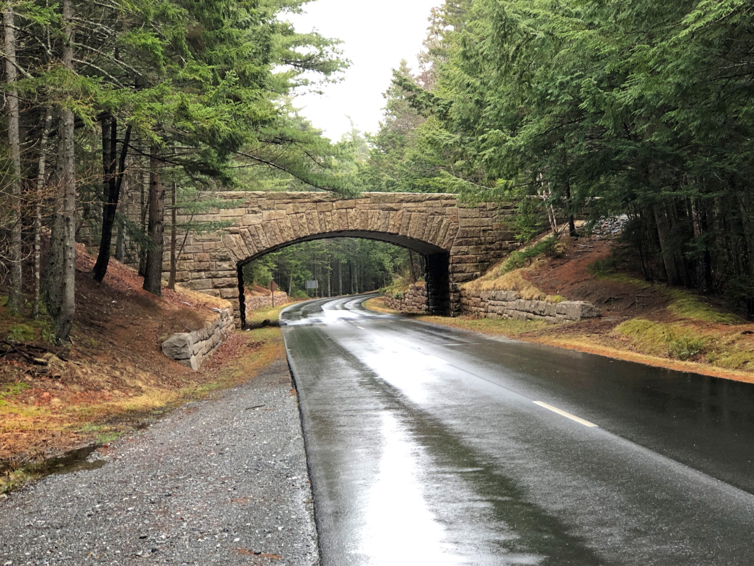
Periodically, the road crosses under handsome bridges.
This made me wonder: bridges for what? Soon I learned that the park not only has a hard-surface road snaking through, but also a network of carriage trails. A lot of them. The bridges are for them.
“Forty-five miles of rustic carriage roads, the gift of philanthropist John D. Rockefeller Jr. and family, weave around the mountains and valleys of Acadia National Park,” says the NPS. “Rockefeller, a skilled horseman, wanted to travel on motor-free byways via horse and carriage into the heart of Mount Desert Island. His construction efforts from 1913 to 1940 resulted in roads with sweeping vistas and close-up views of the landscape.”
It was barely the season for the paved road, and I suspect few visitors were on the carriage roads either. I noticed that the entrance to the Wildwood Stables, a facility that supports carriage riding, and which can be glimpsed from the road, was still closed. A carriage ride through Arcadia NP might be an grand experience, but maybe not in April.
The woods alongside the road.
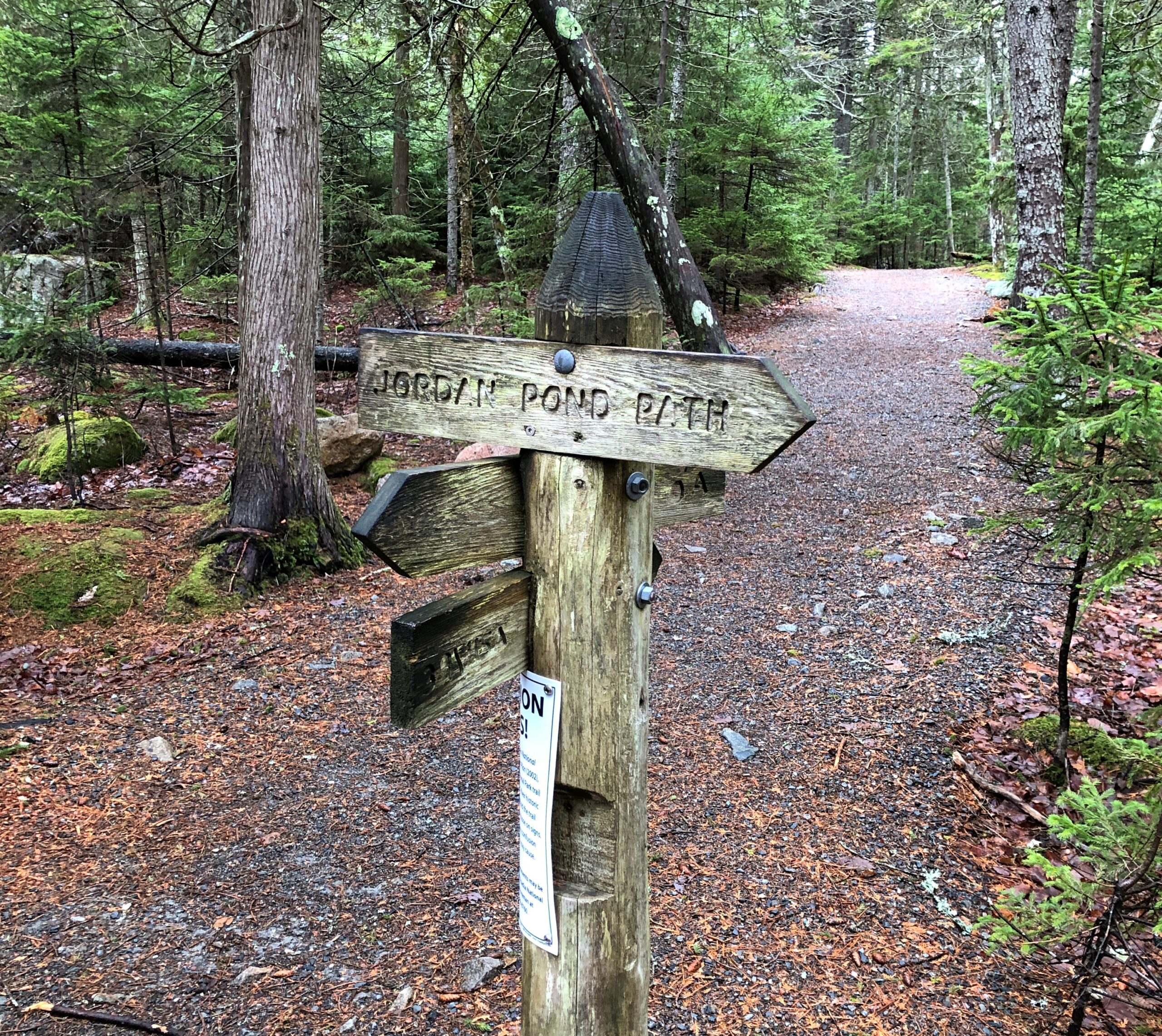
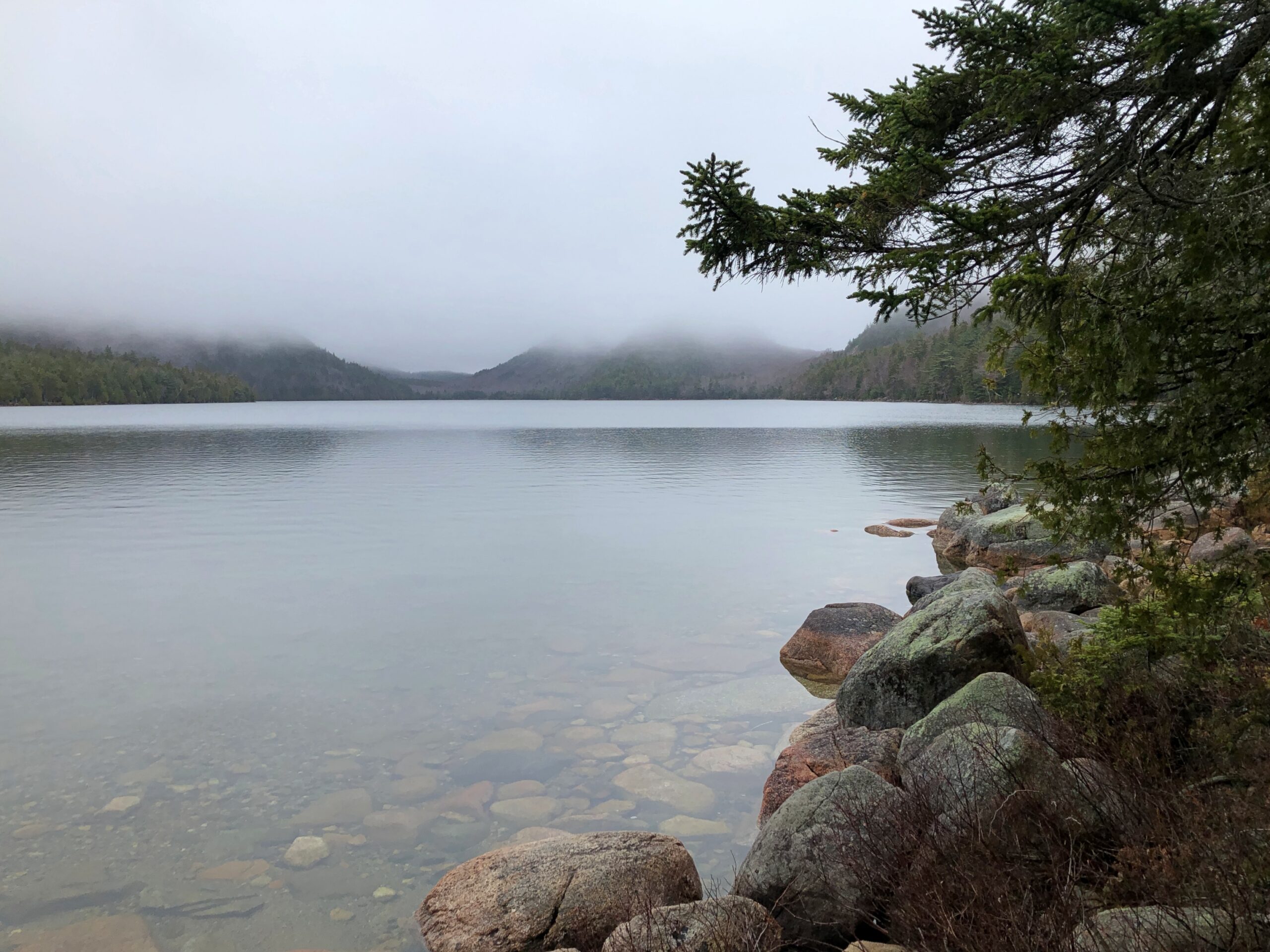
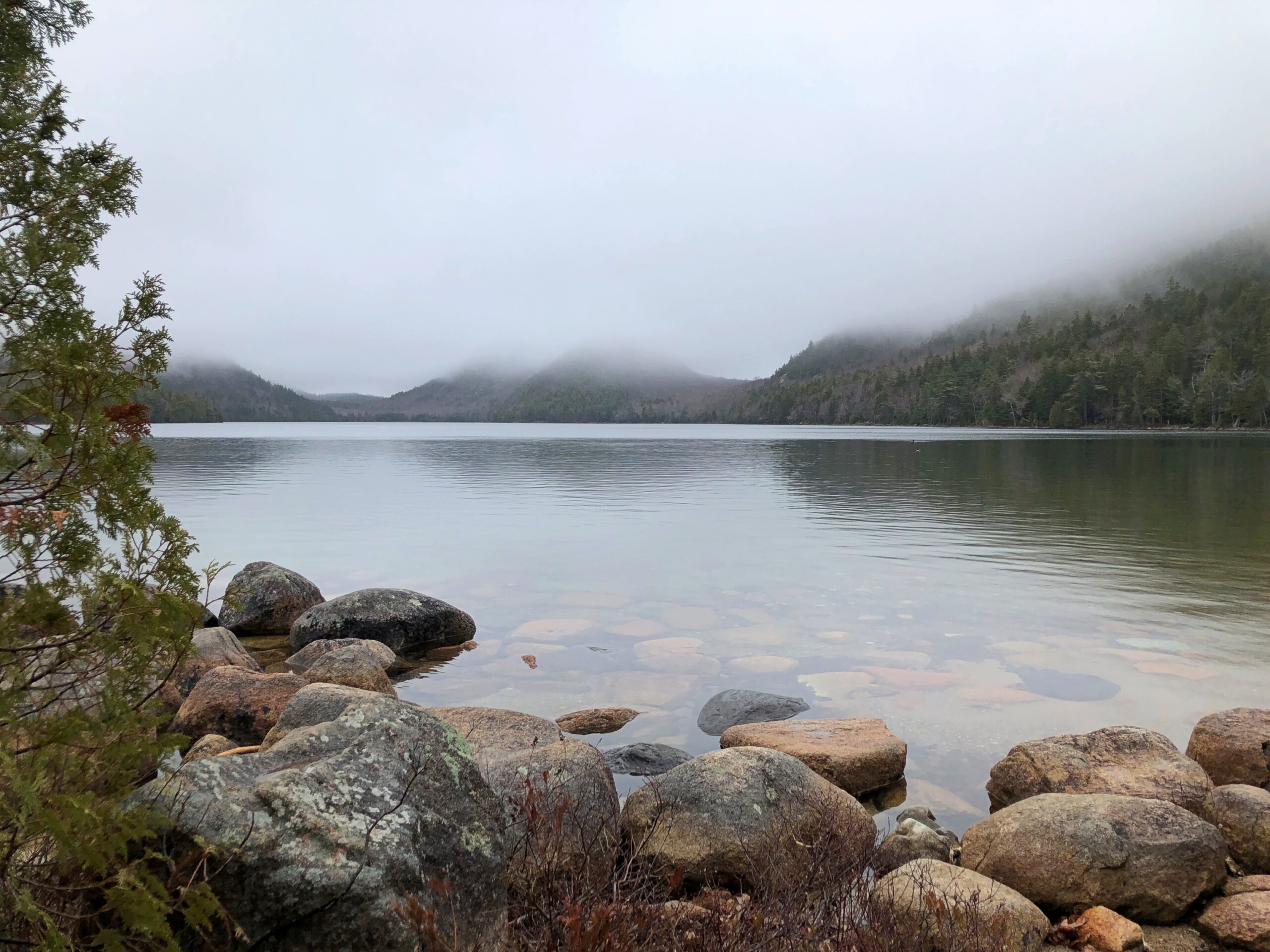
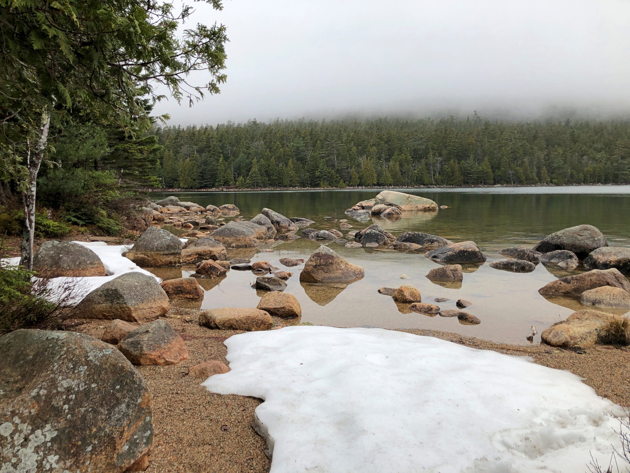
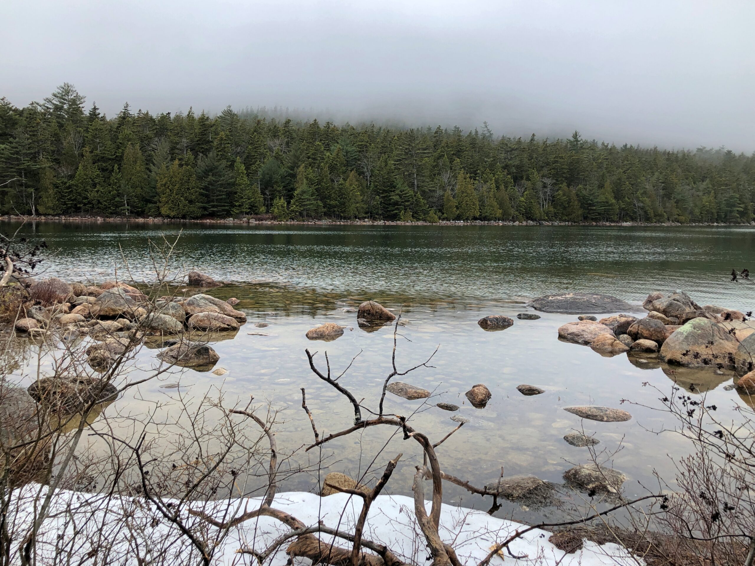
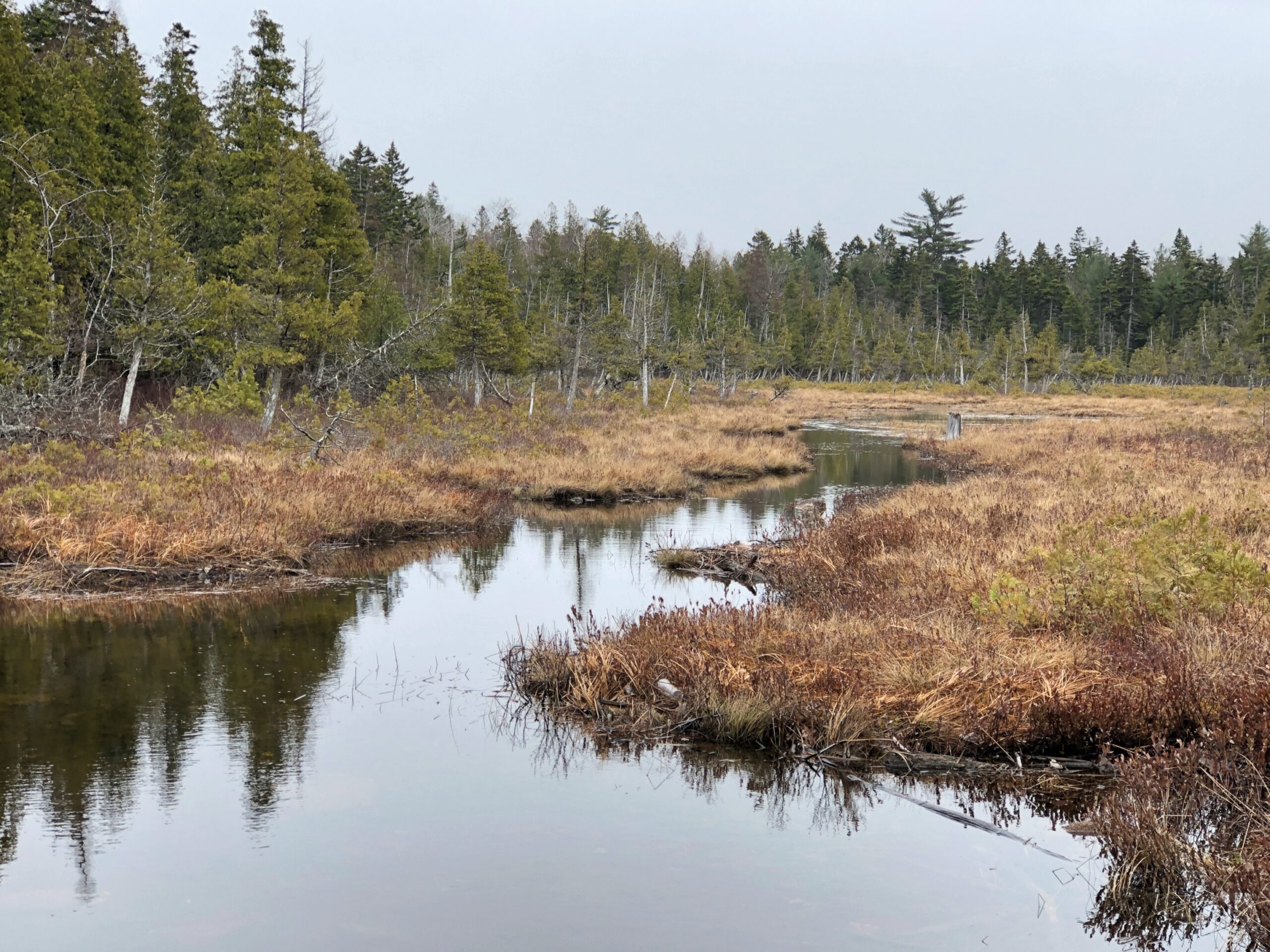
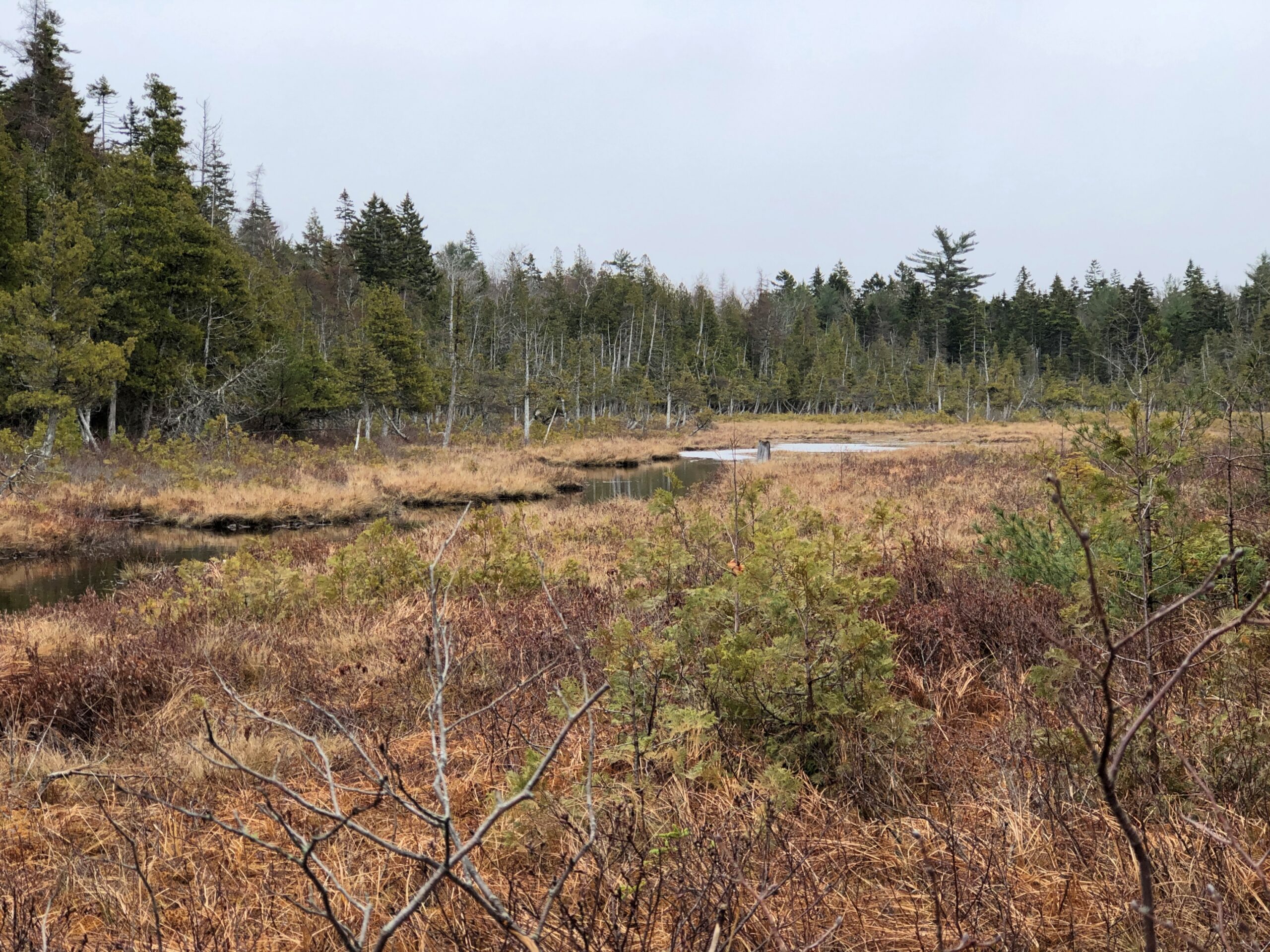
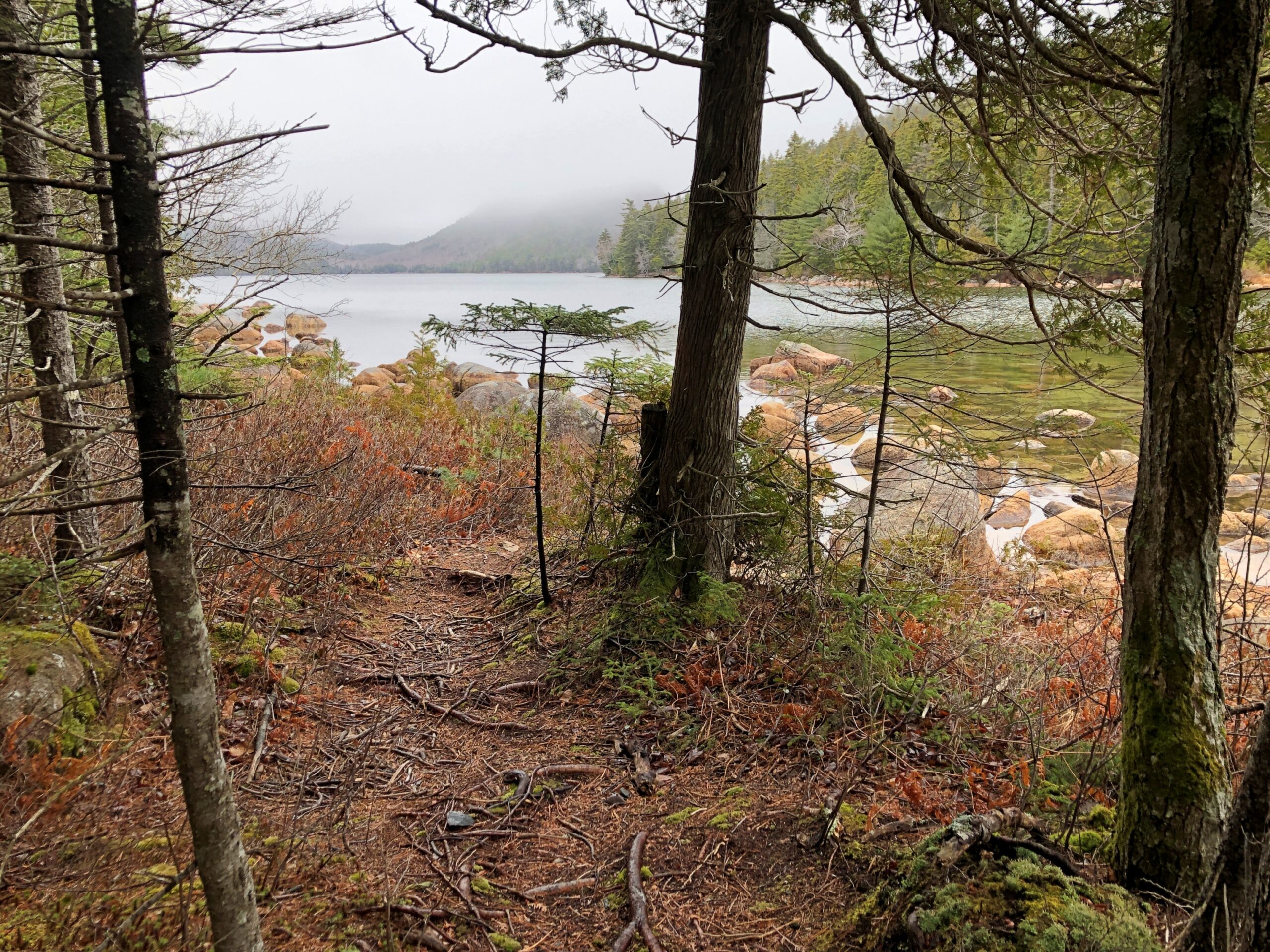
Driving is one thing, but I also wanted to walk. I found my way to Jordan Pond for that purpose.
“Oligotrophic lakes are most common in cold, sparsely developed regions that are underlain by crystalline igneous, granitic bedrock,” the entry says. “Due to their low algal production, these lakes consequently have very clear waters, with high drinking-water quality.”
No giardia in that lake? I didn’t want to find out. I carried my own drinking water as I walked the trails near the pond.
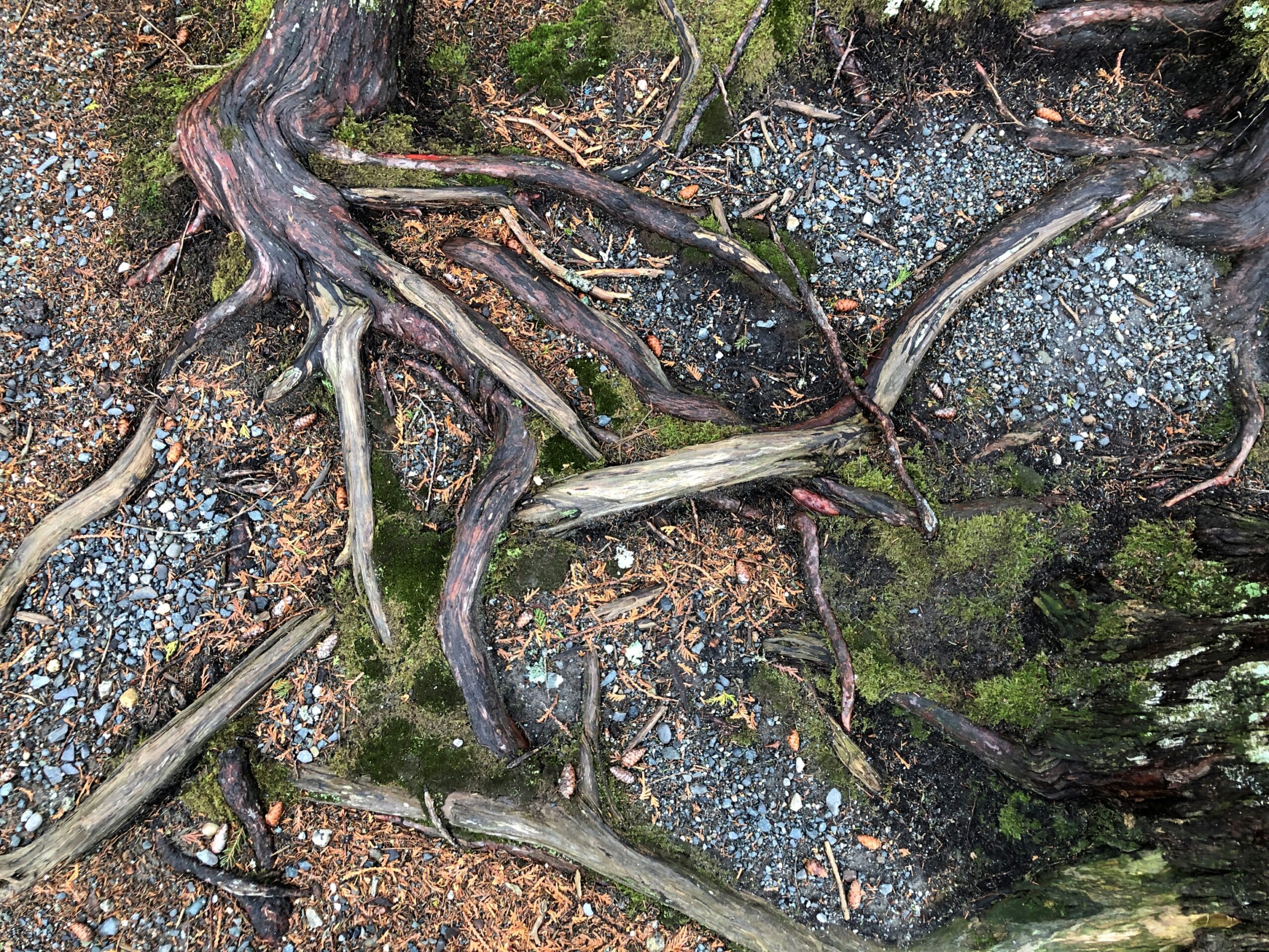
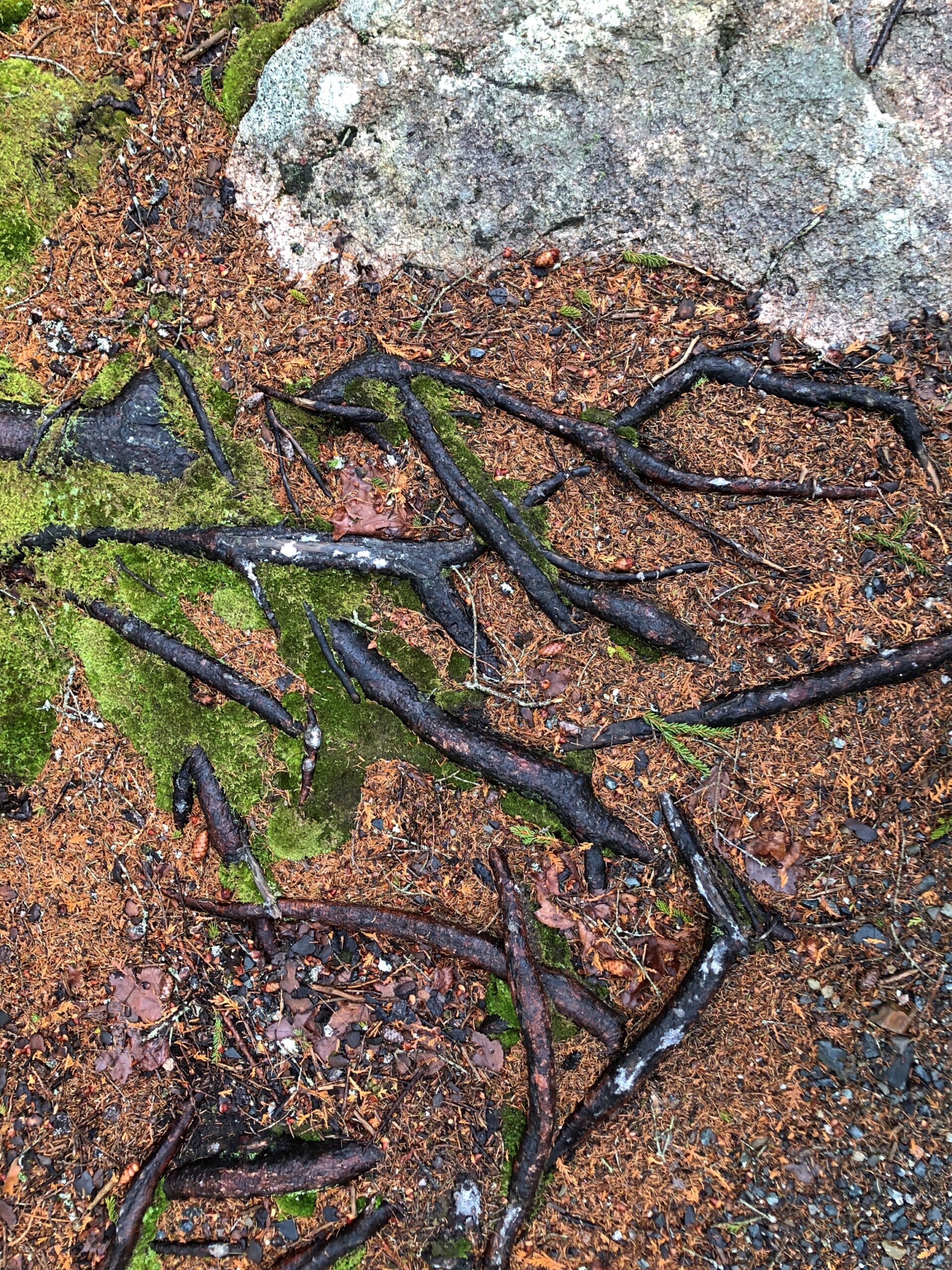
An easy trail. At one point, it crossed a creek feeding into the pond.
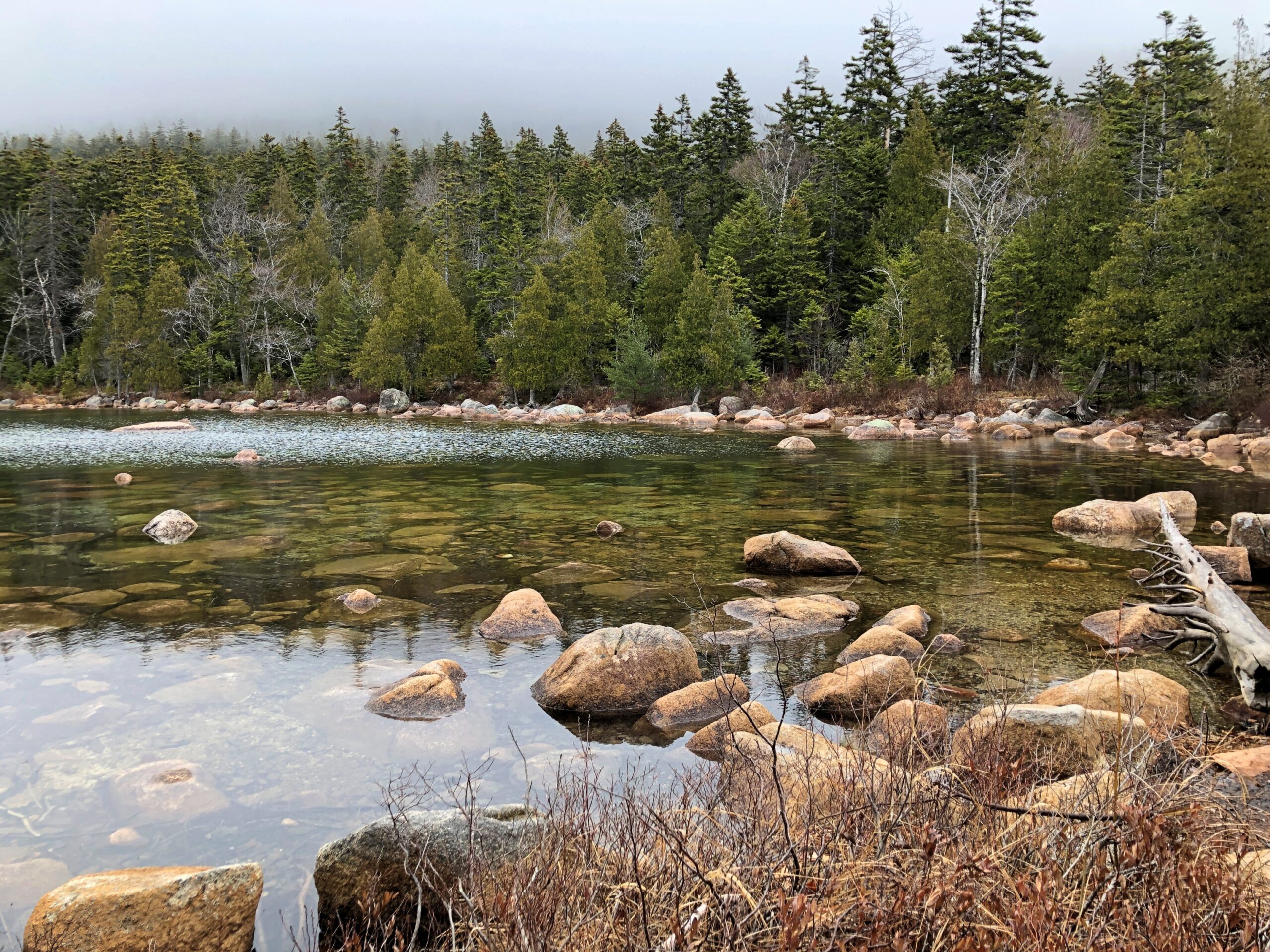
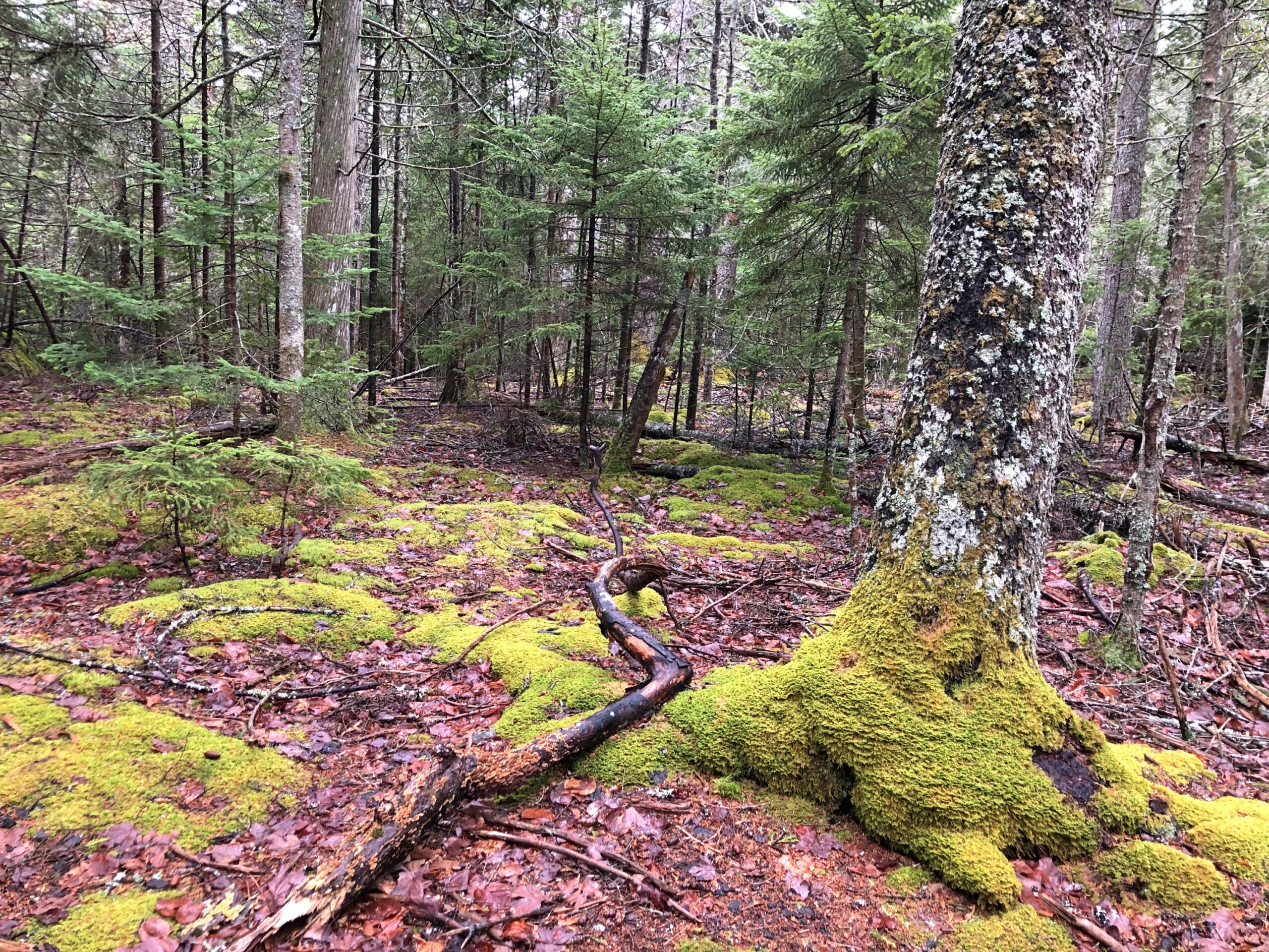
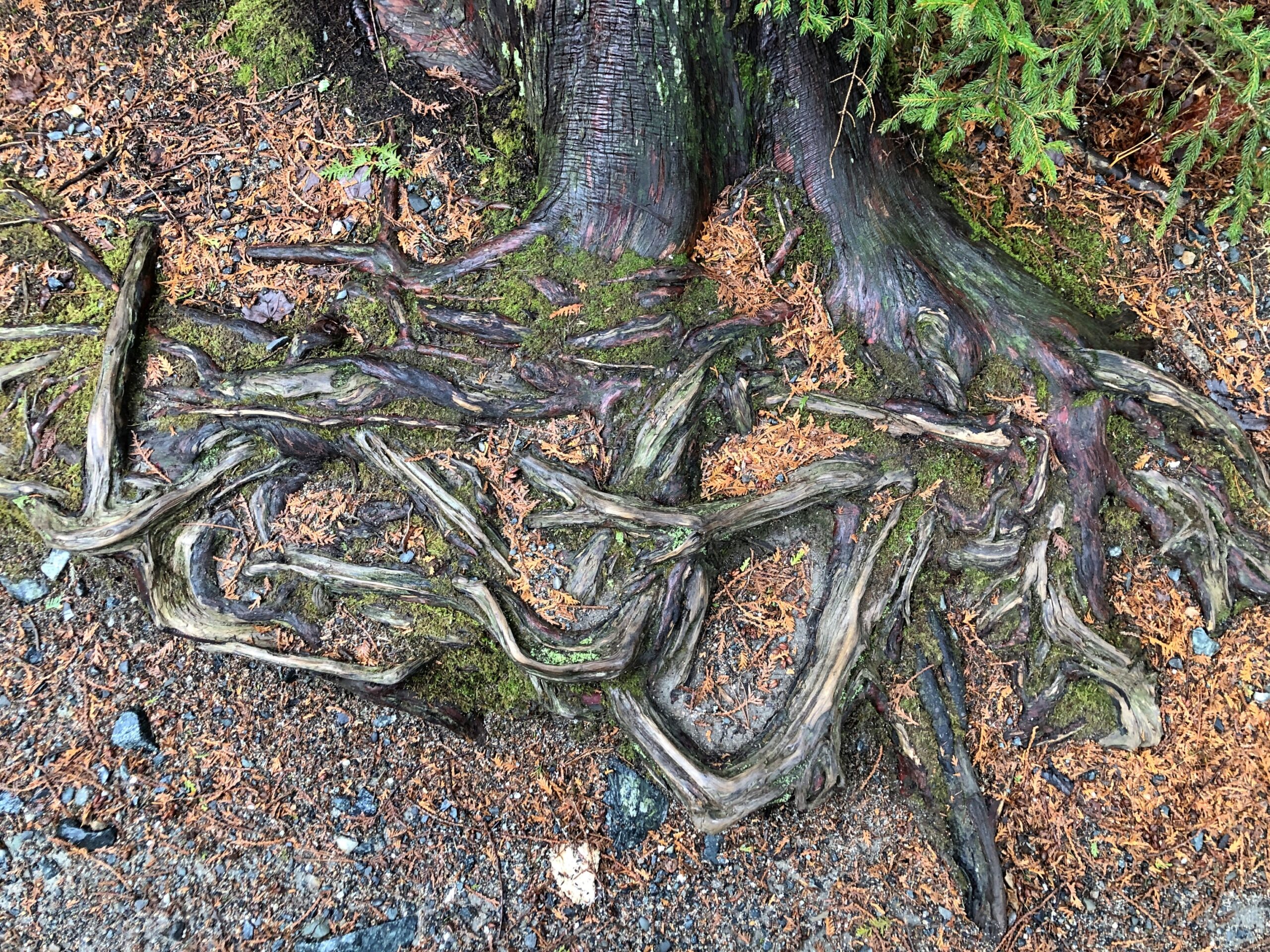
There were too many interesting tree roots to ignore them.
“Roots are typically at least half of a plant’s biomass, but you wouldn’t know it given how little scientific research has been devoted to these critical tendrils,” says the Smithsonian magazine. “Only recently have scientists given plant roots their day in the sun — in fields like collections research, climate science and microbiology.”
Or, in the case of the hardy trees of coastal Maine, their day in the fog.
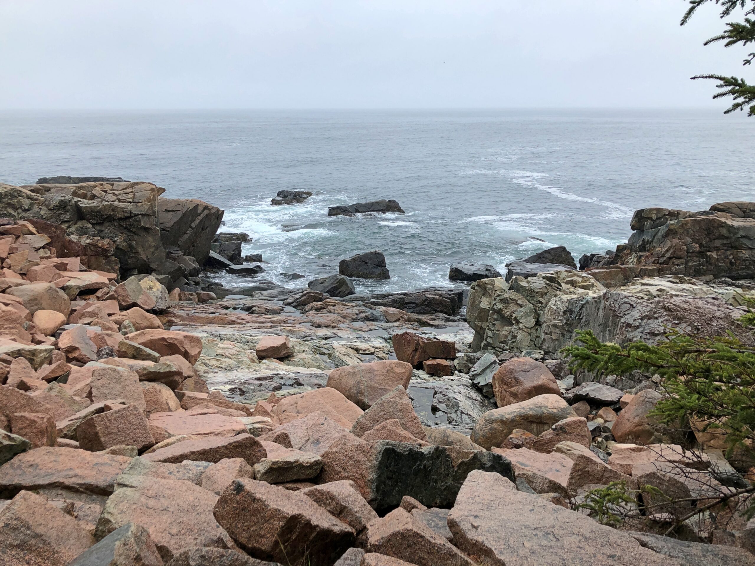
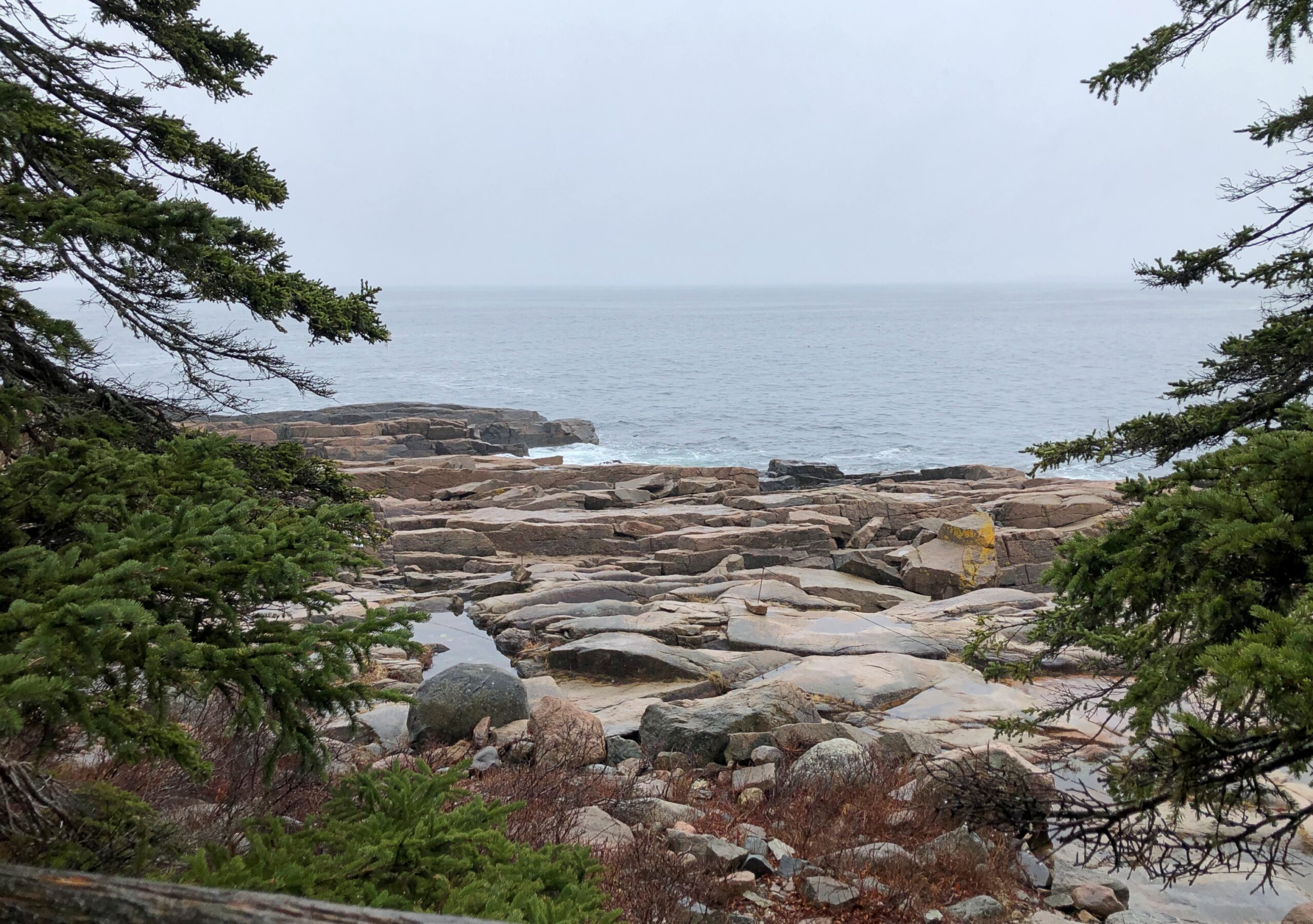
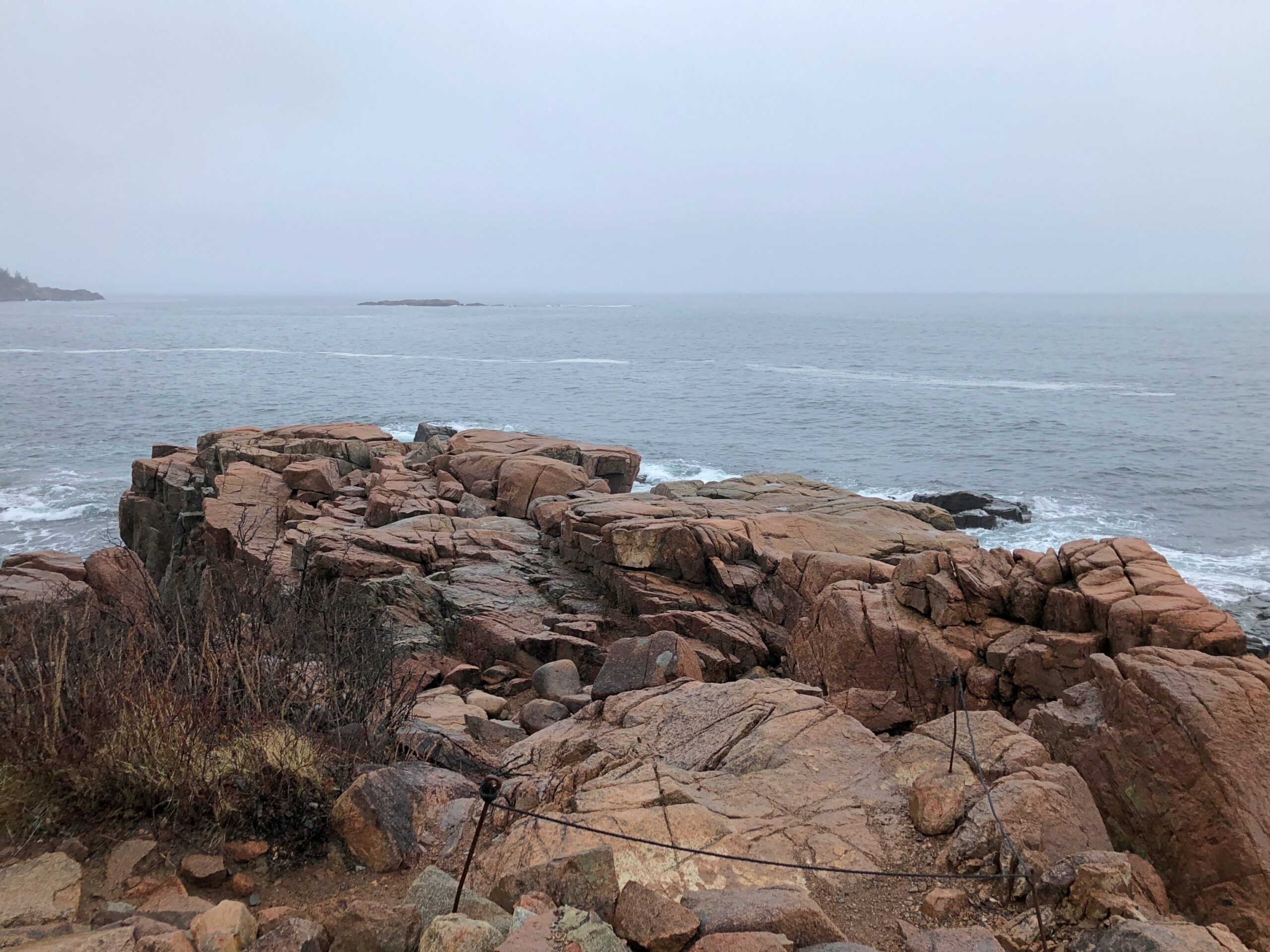
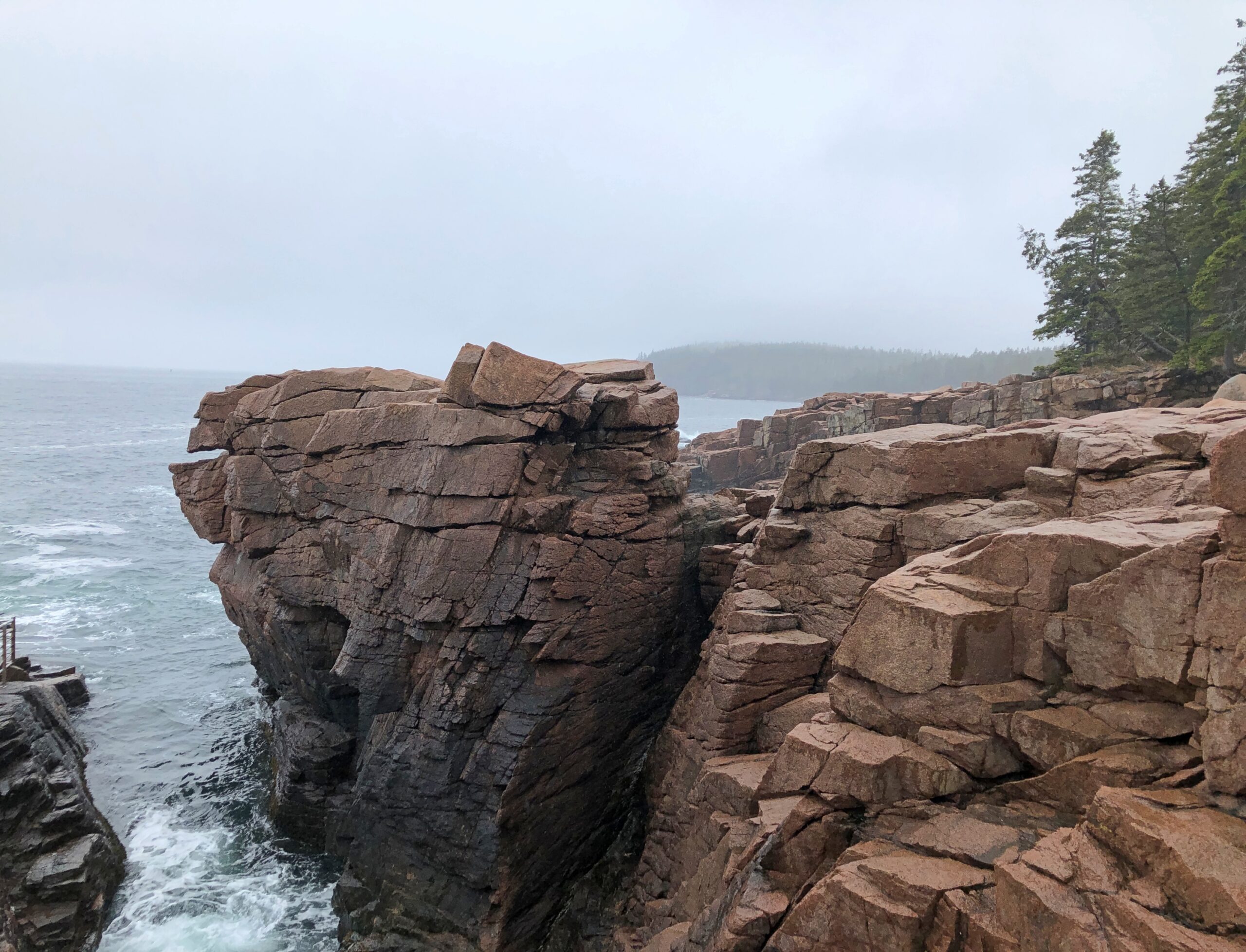
We live on the crust of the Earth, and what do crusts do? Crumble. Especially when moving water has anything to do with it, as it does along the coast of Maine. Famously so.
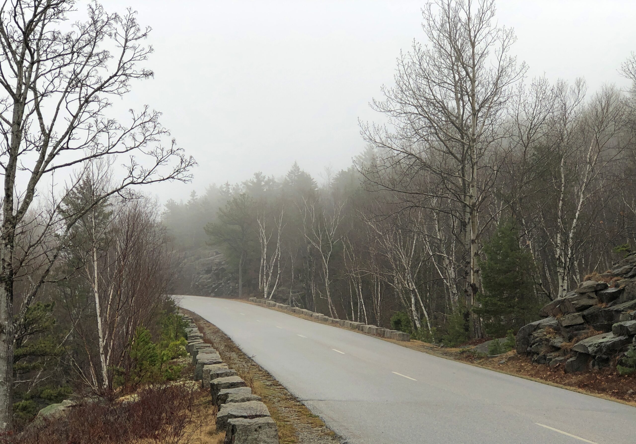
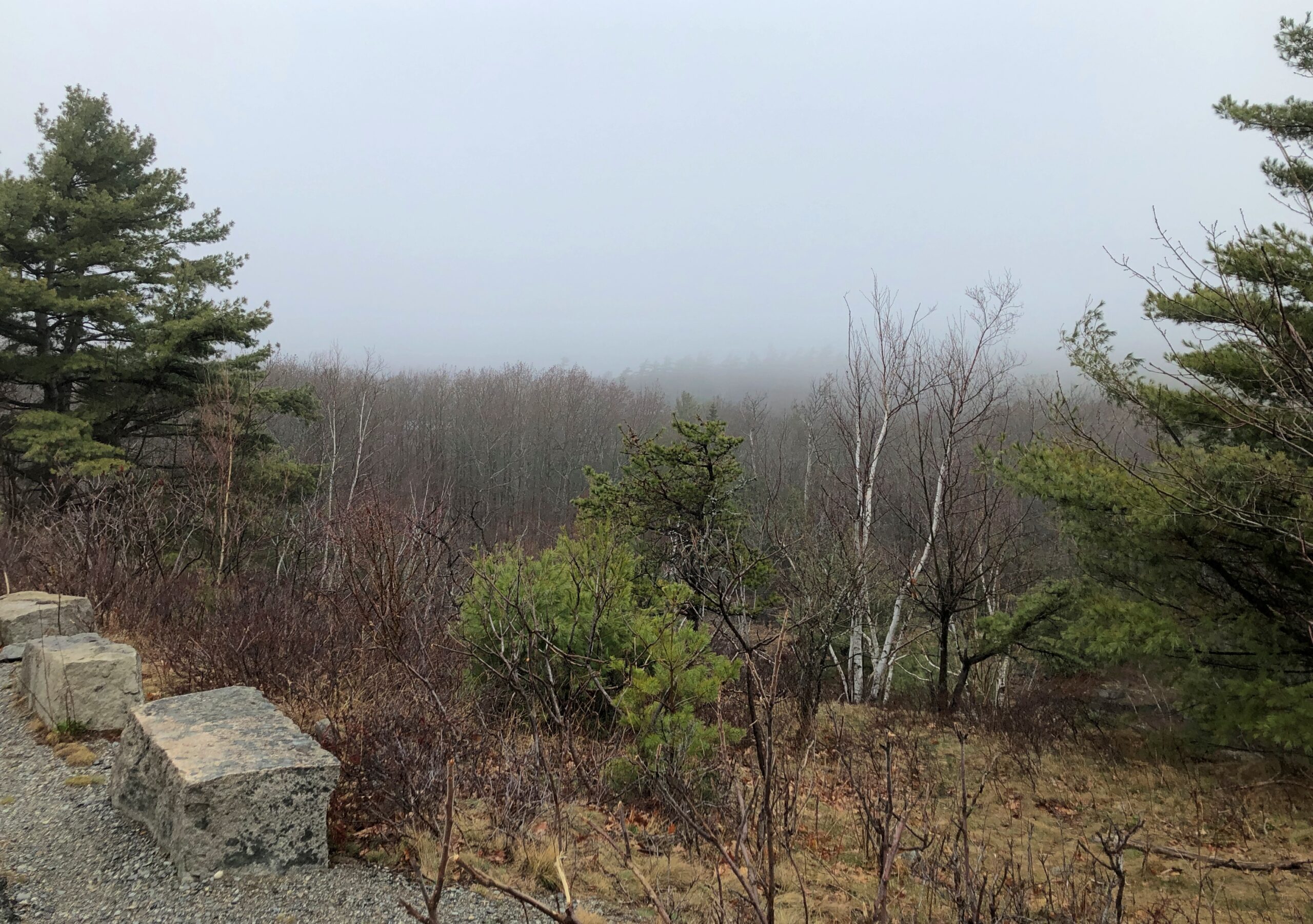
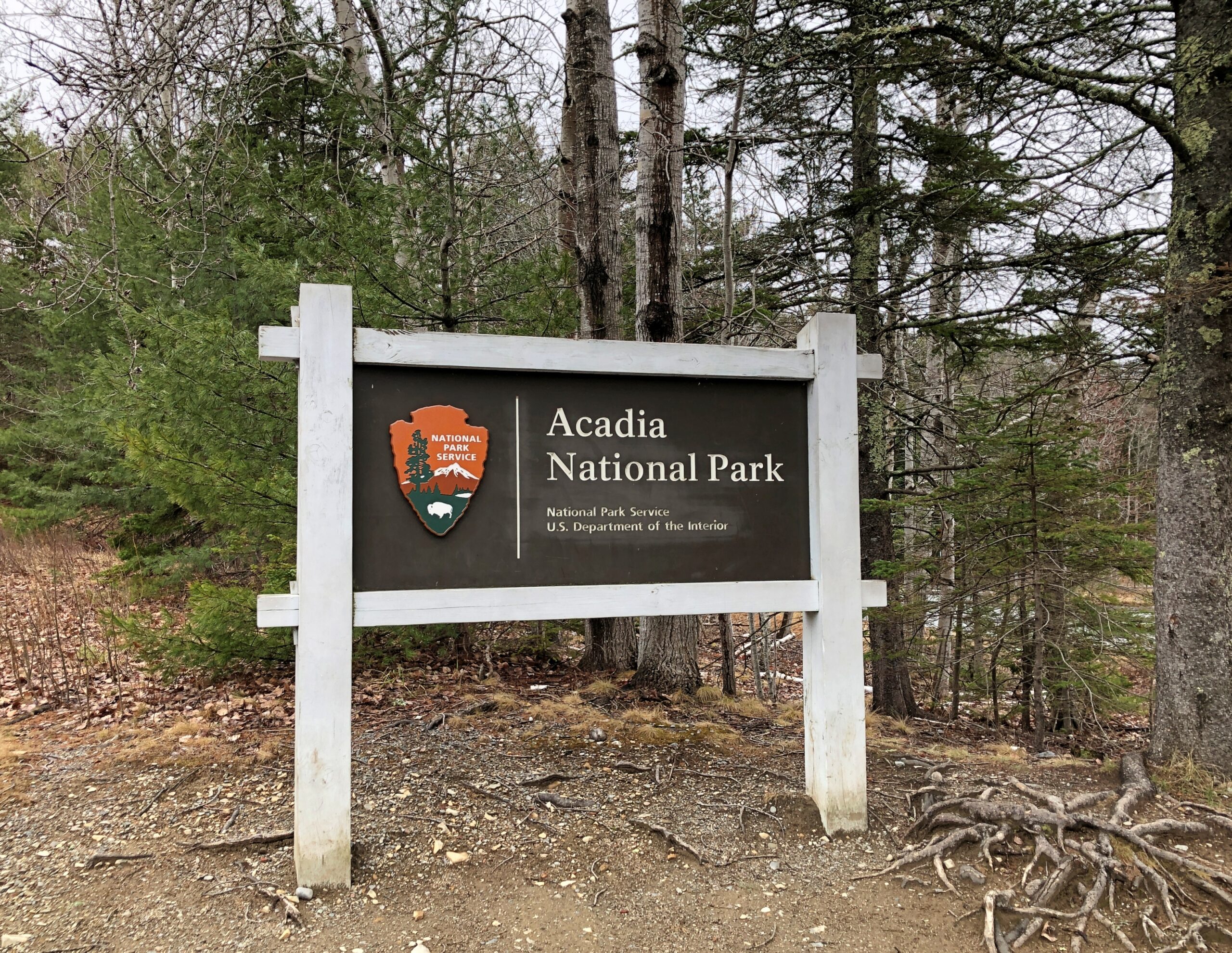
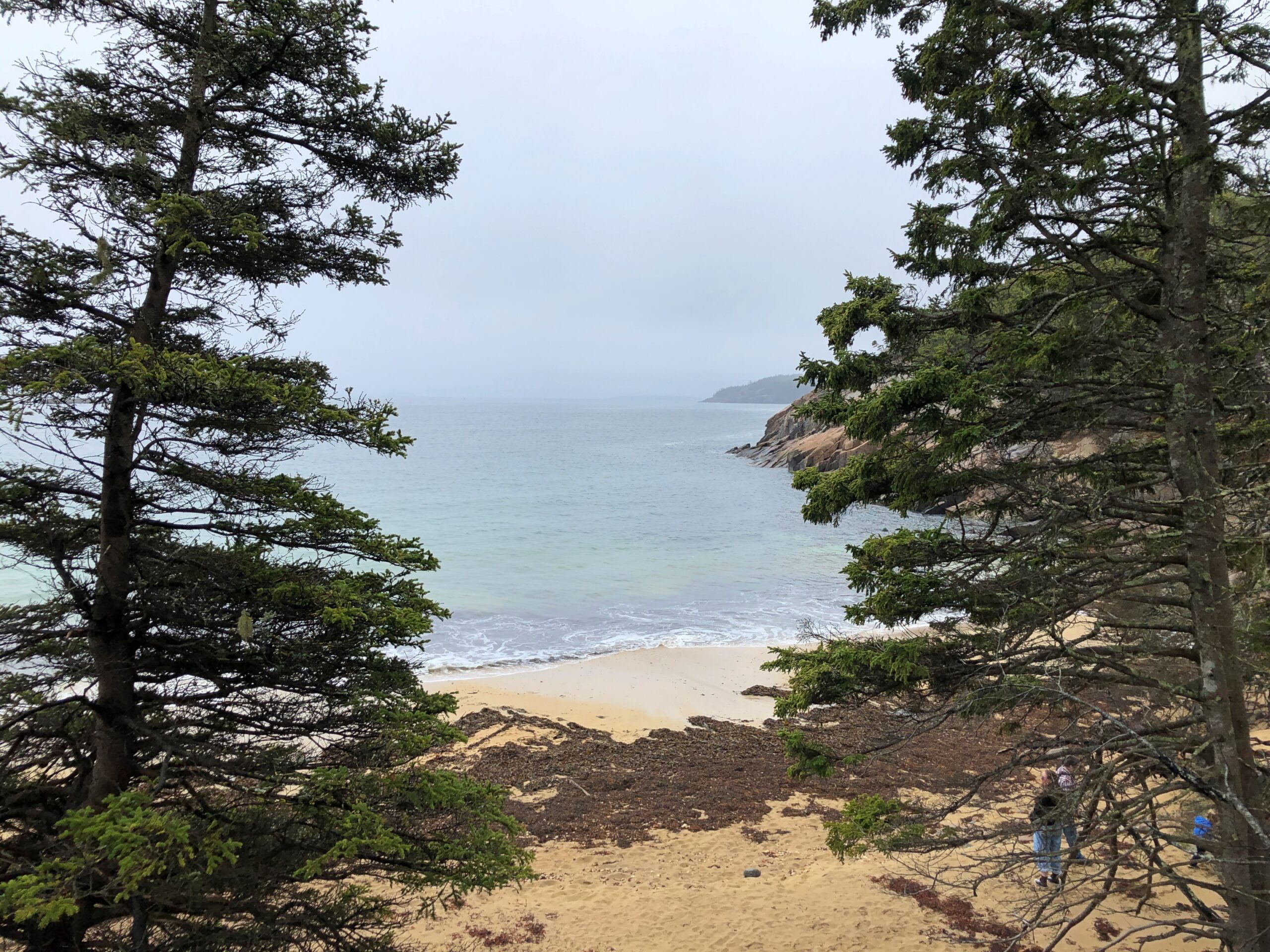
I arrived at the crumbly coastline of Acadia National Park on the morning of April 16. The date is important for only one reason: Park Loop Road, the main scenic drive through the park, opens for the season every year on April 15.
Acadia NP occupies about half of Mount Desert Island and some other nearby peninsula acreage and small islands. The morning of the 16th broke damp and foggy and chilly. From my lodging in the sizable town of Ellsworth, Maine, which is on the mainland near Mount Desert Island, I made my way to the island, then Bar Harbor, then the entrance to Park Loop Road, stopping only for a wonderful breakfast sandwich at one of the few places along the way that was open, Farmstand Coffee House.
The visitors center at the park entrance wasn’t open either. The NPS missed making a sale of post cards to me. By the time I got to the park, the weather was better: slightly less damp and slightly less foggy and slightly less chilly.
Such is Maine in spring. I didn’t mind. In fact, the damp chill meant few other people had come that day. Chilly but no ice underfoot. I like to think that it all melted by April 15. Or maybe on April 15.
I sent a few pictures to Tom in Austin taken while I visiting Acadia NP.
He answered: “Wow. Fabulous. Choosing to visit that national park before May is a bold decision. Looks like you got good weather, though.”
Bold? Maybe. To boldly go where many vacationers have gone before. And will again, real soon.
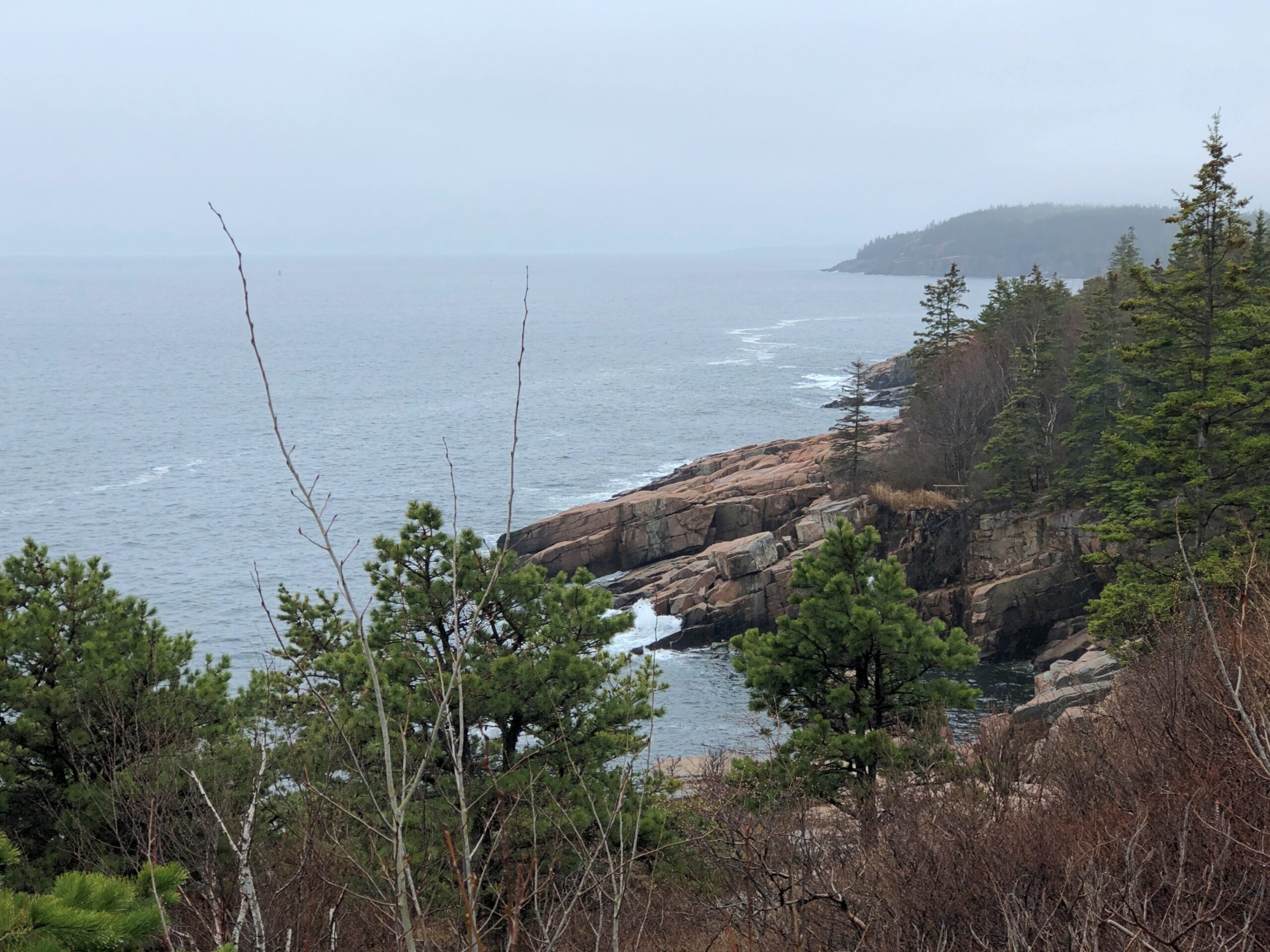
I didn’t drive particularly fast along Park Loop Road. Little traffic for one thing, too much of a risk of a car-on-tree encounter for another thing, so curvy is it. Gnarly, you could say. The drive, whose construction John D. Rockefeller Jr. facilitated, winds but does not climb much as it follows the curves of the shore. The scenic stops are close to each other, since in national park terms, Acadia is a touch on the small side. Despite that it hardly lacks variety.
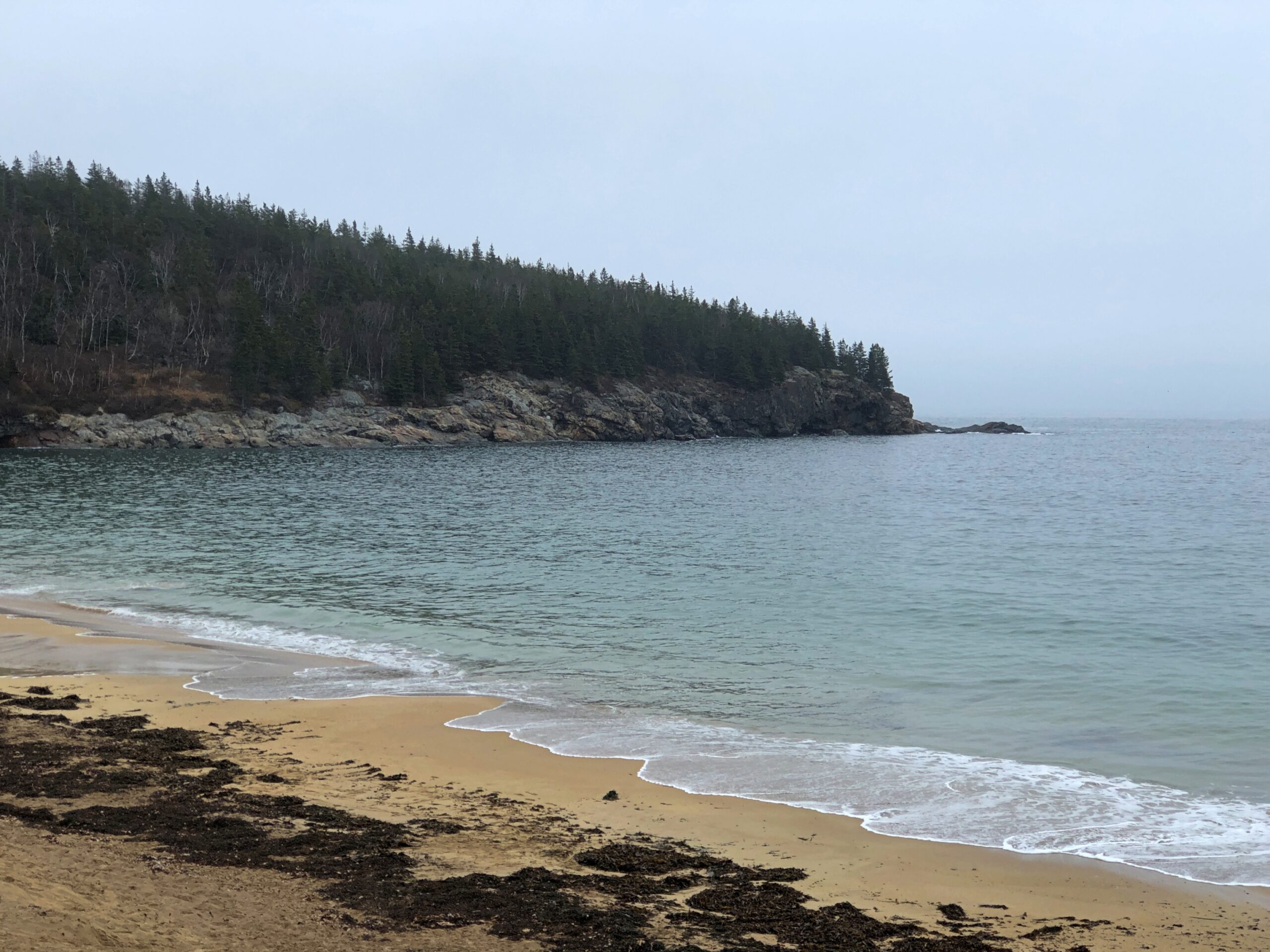
Beginning with the rocky shores you’d expect. The fog that day was a nice Maine touch. The foggy shores of Maine. There’s a song title for an AI song writing program: “The Foggy Shores of Maine.” Sad song about a solider dreaming of home on these shores? It worked for “Galveston.”
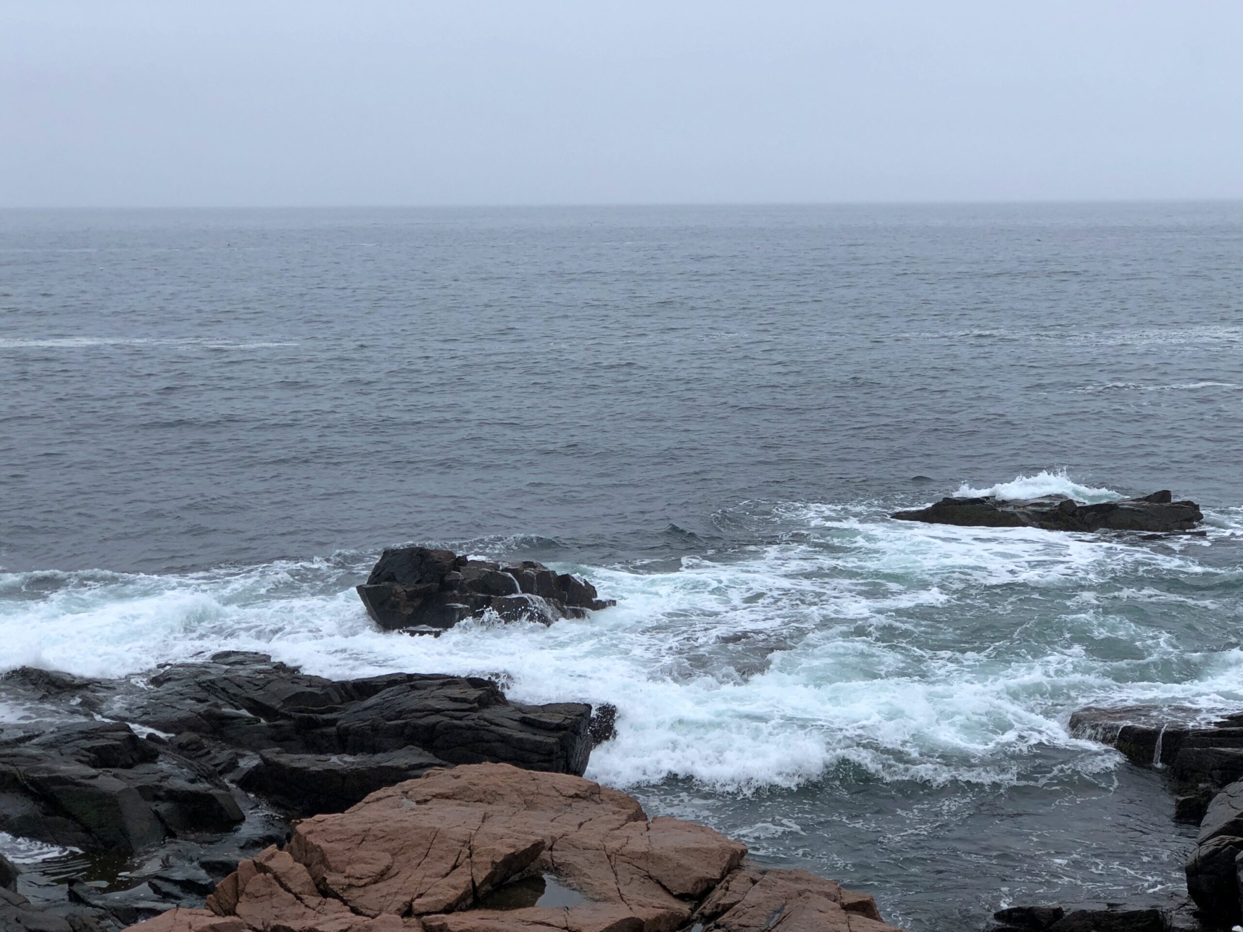
Boulders and sizable slabs, on their way to being pebbles and sand.
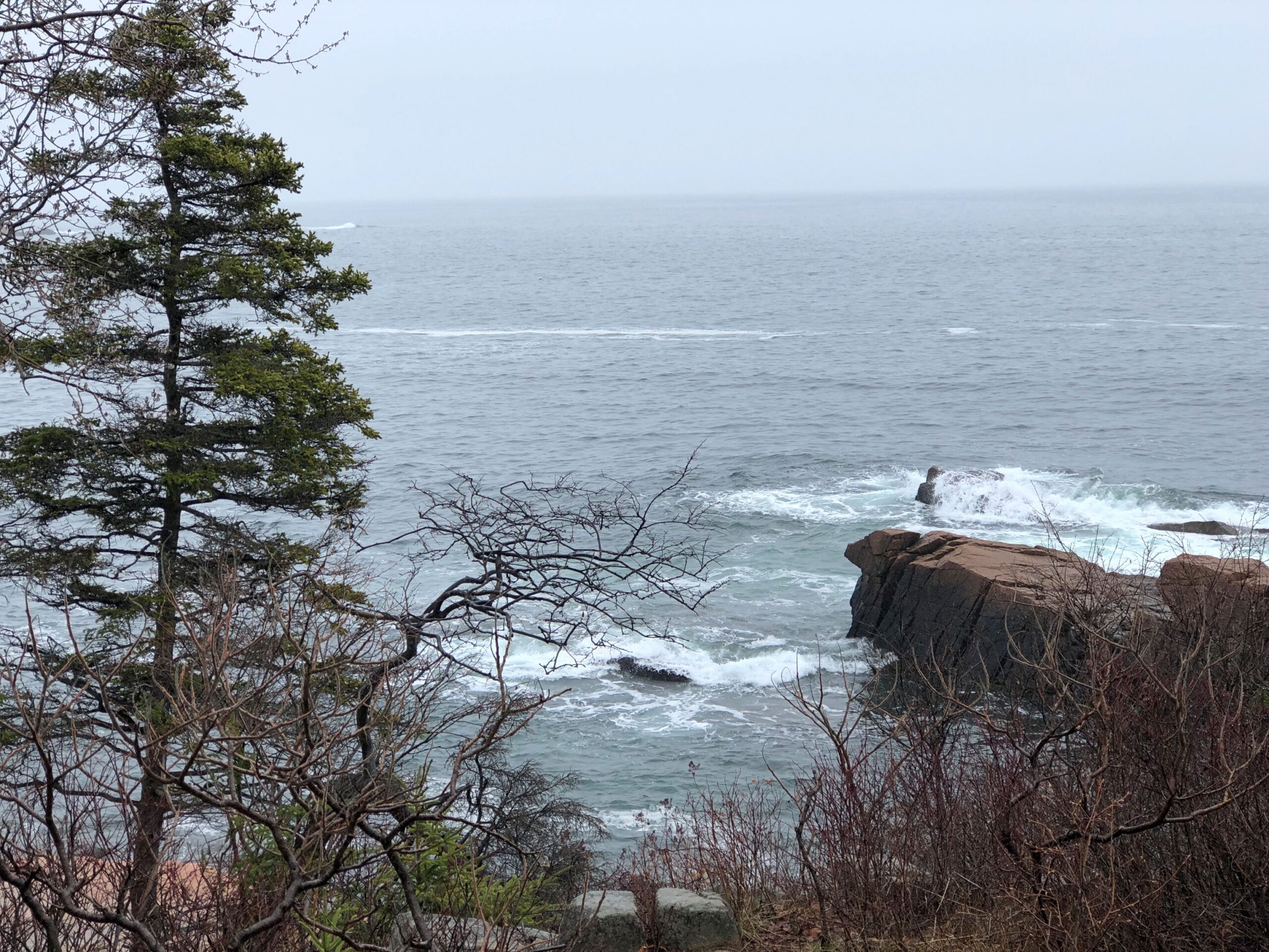
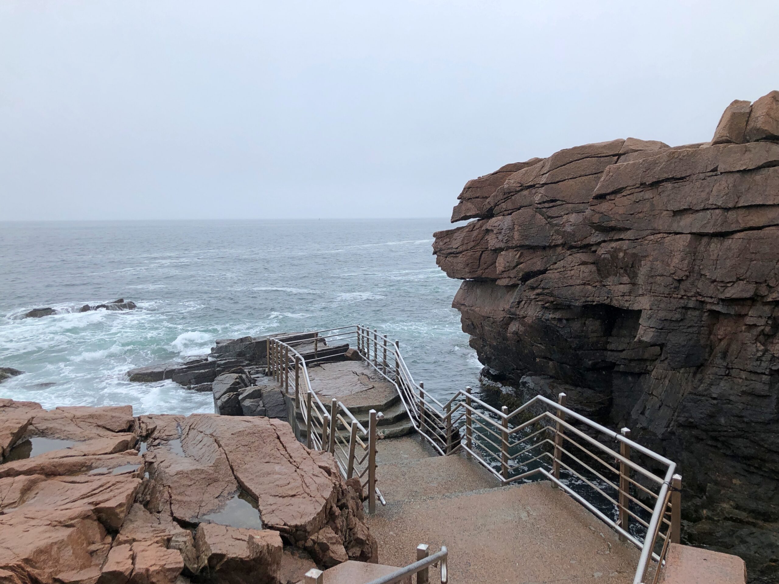
A feature that wears its name well: Thunder Hole.
A loud place, Thunder Hole, the waves bashing the rocks in crash-splashes, followed by the whistling, sucking whoosh as water pulls away from the rocks, followed by another bash against the rocks, all before you can count to three.
You can get closer to Thunder Hole behind the (relative) safety of rails, but that won’t keep you from a good drenching. Not that day, anyway. I kept my distance, and let the sound come to me in its noisy fury.
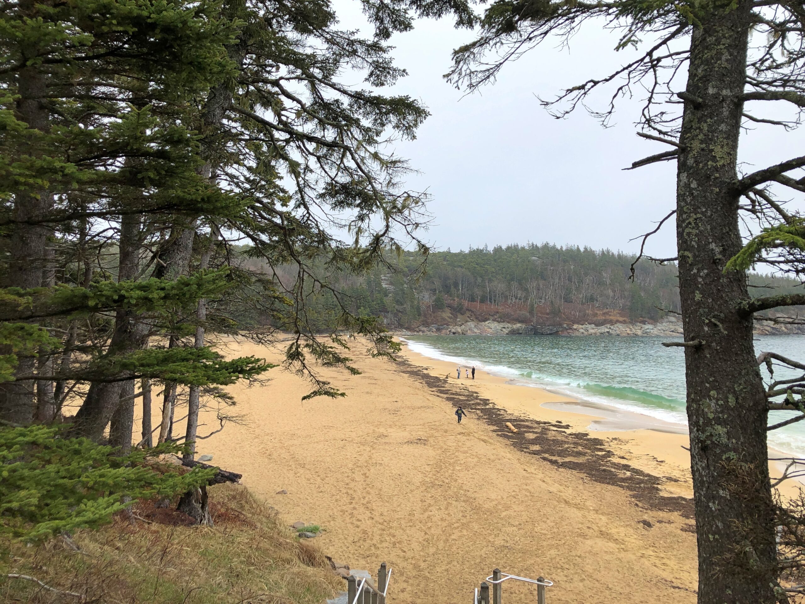
The park has a sand beach, called on the maps, Sand Beach.
I take that as an indication that most of the shore in these parts is topsy-turvy with boulders. I believe it.
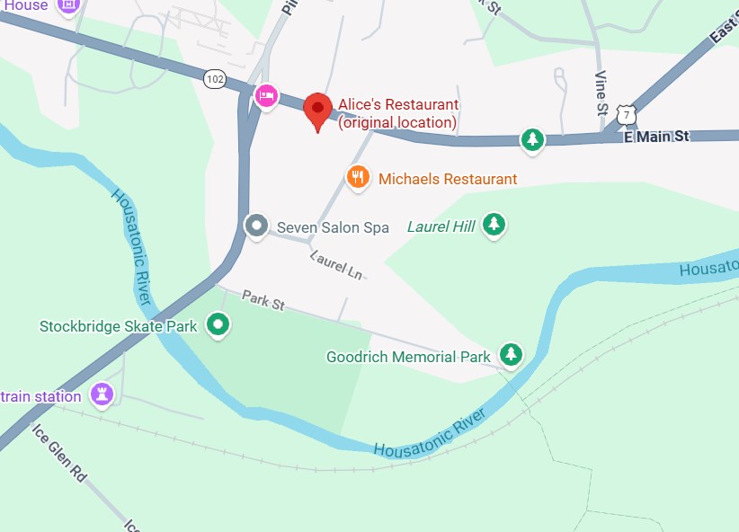
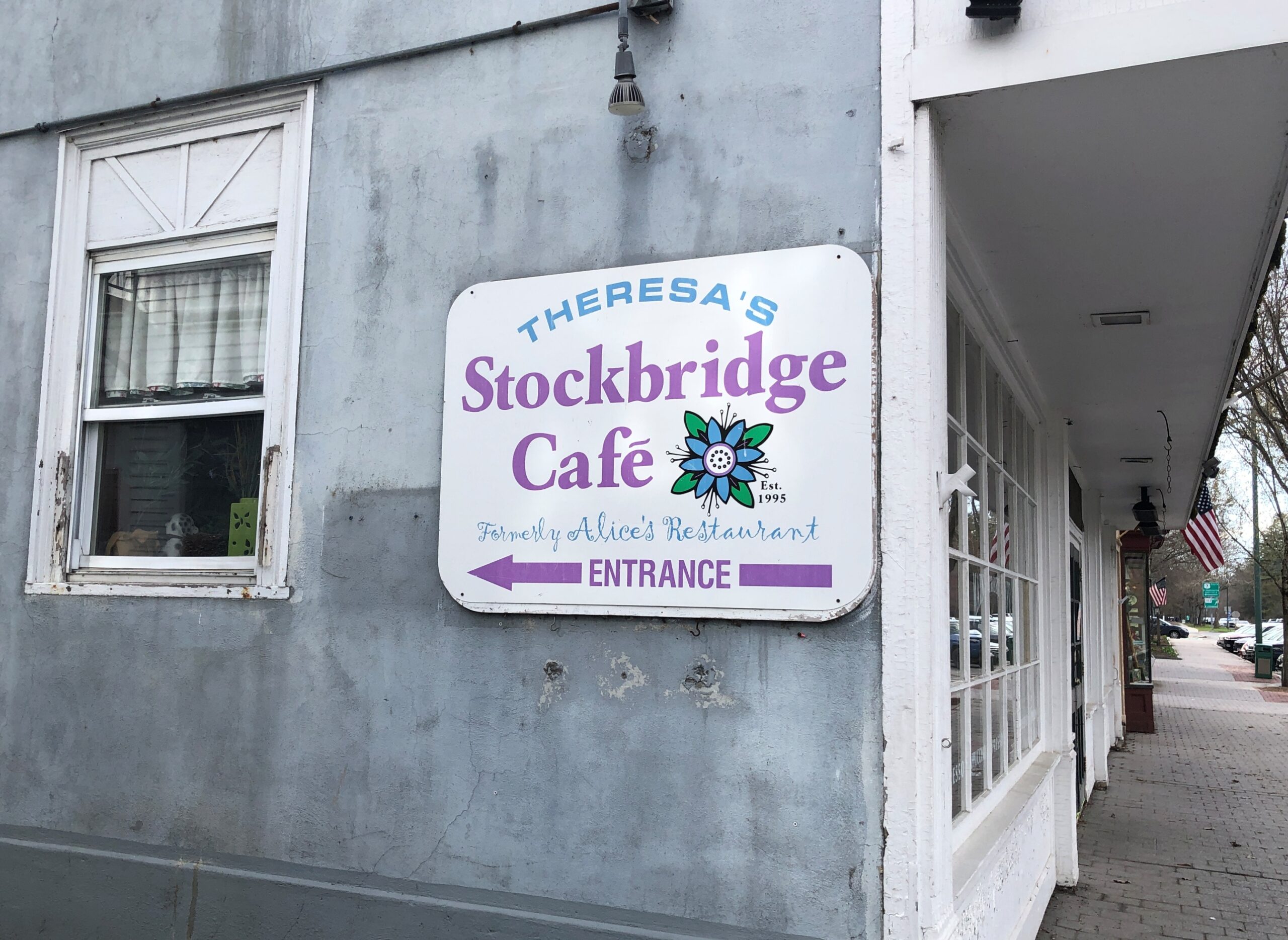
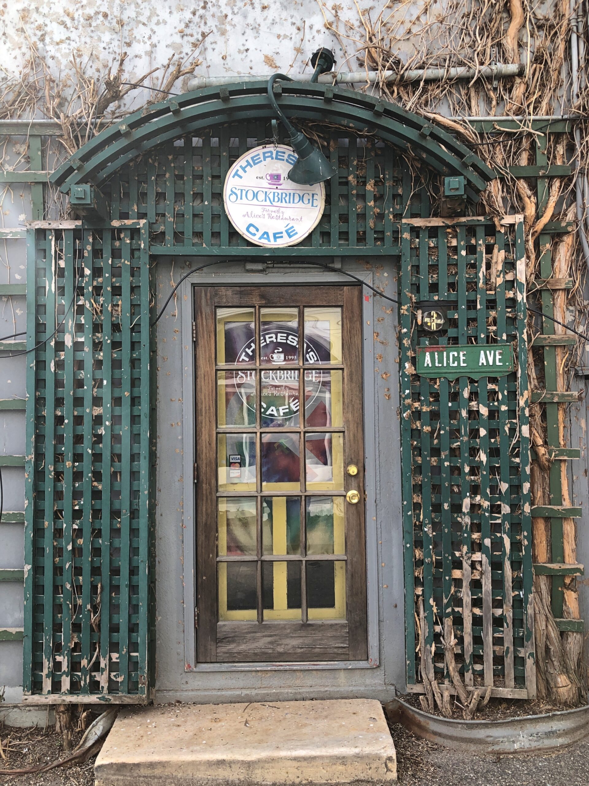
Not long ago, I wondered how accurate the lyrics of “Alice’s Restaurant Massacre” were on one specific point. I had my reasons.
You can get anything you want at Alice’s Restaurant Walk right in, it’s around the back Just a half a mile from the railroad track
Seems like a convenient rhyme, but that’s not all. Google Maps tells me that the site of Alice’s Restaurant is about a half a mile from a railroad track. I didn’t save the scale on this map, but the distanceis correct. This is mildly amazing. Who expects geographical accuracy from a song lyric?
That morning, April 14, I’d extracted myself from Midtown Manhattan via various sorts of transport, retrieving my car at long-term parking at Newark International, and planned to spend the night in Portsmouth, New Hampshire. Though New England isn’t large, it is molasses when it comes to driving through its densely settled areas, and first I had to get out of New Jersey and New York, then cross Massachusetts. All that meant an all-day drive. Stockbridge, Massachusetts, former home of Alice’s Restaurant, was a stop along the way.
Near the eastern edge of New York state, I cruised north on the Taconic State Parkway.
That sounded good, I thought when I noted the name on a map. It was. Budding greenery, smooth driving, no trucks. Or that many other cars, the further north you go. Construction started about 100 years ago, at the urging of then private citizen Franklin D. Roosevelt. The parkway is in the same league as the Natchez Trace Parkway or the Blue Ridge Parkway, though only about a quarter as long as either.
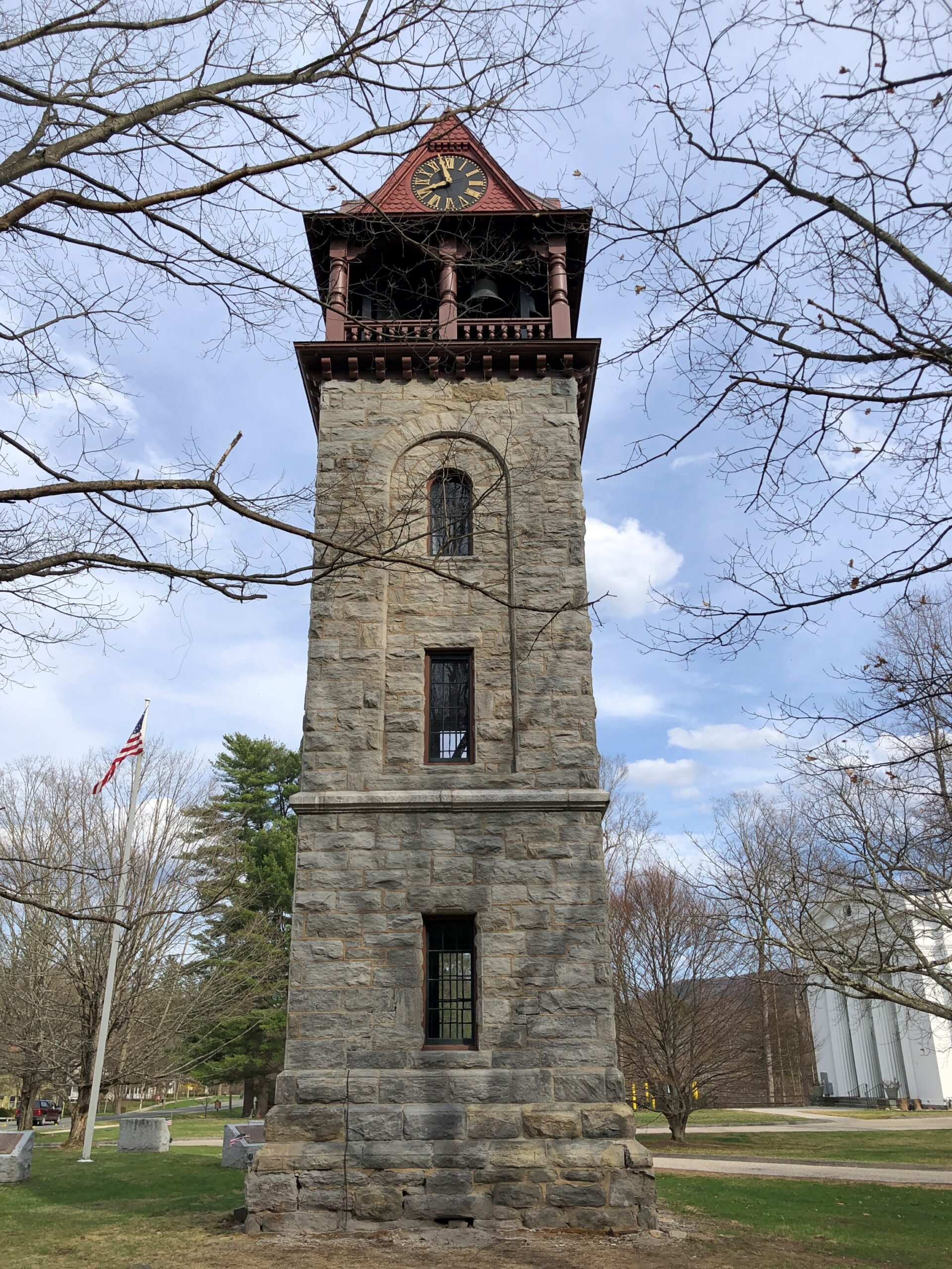
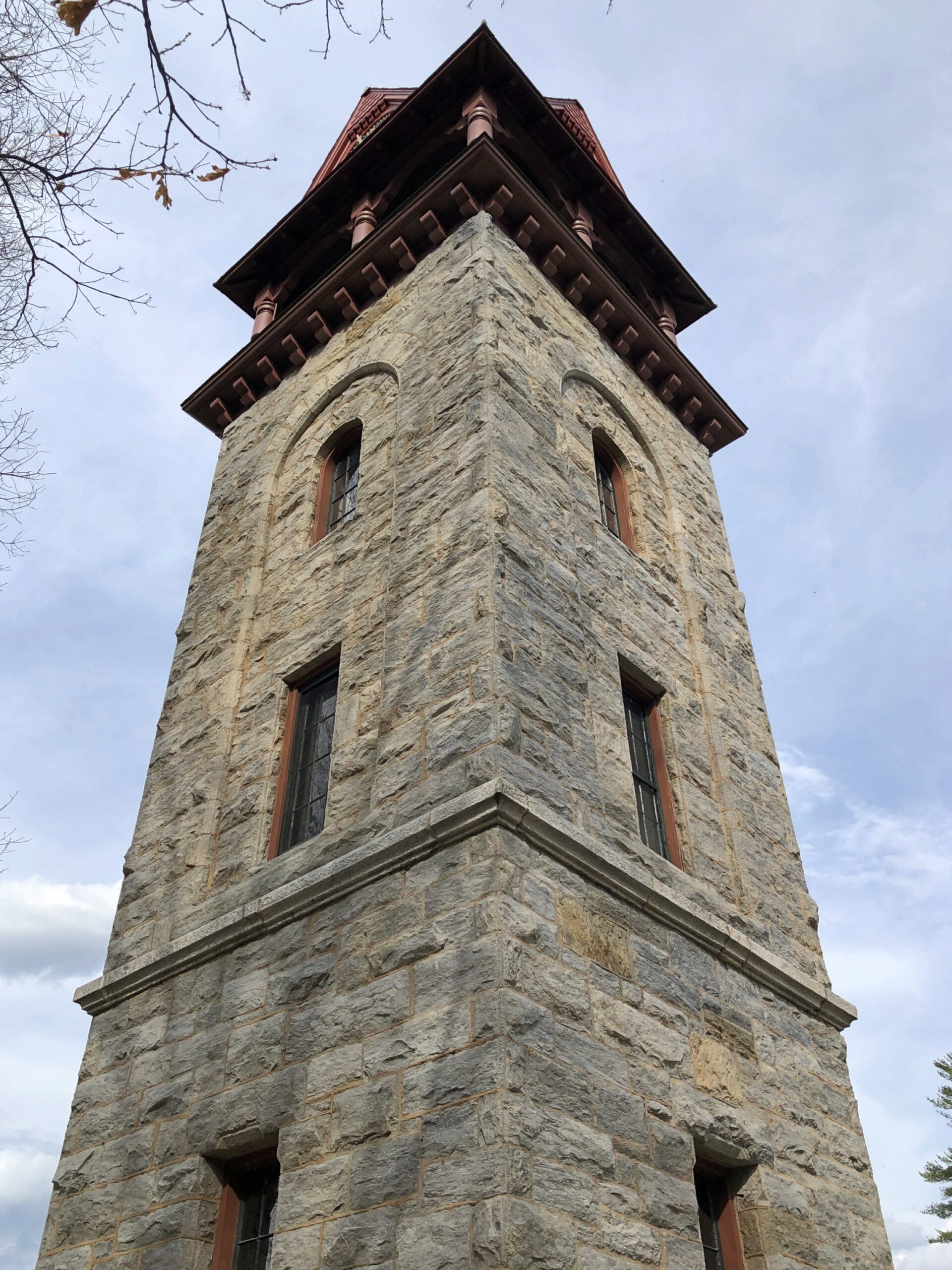
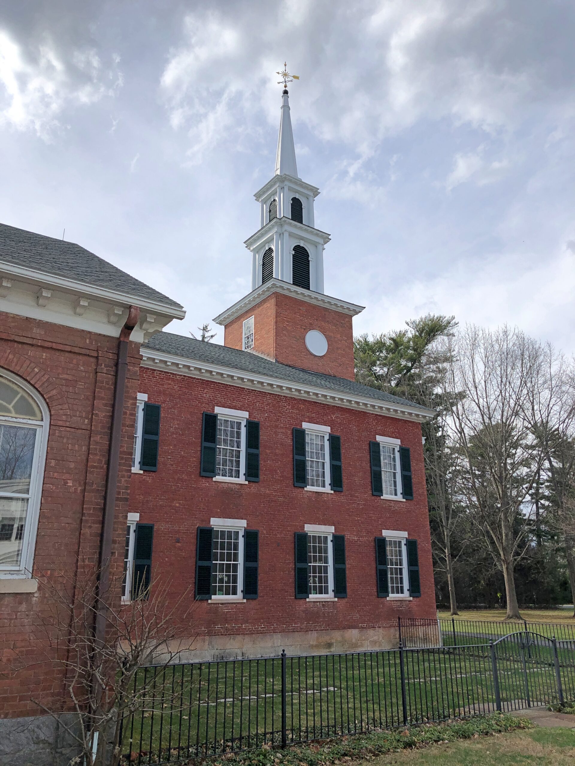
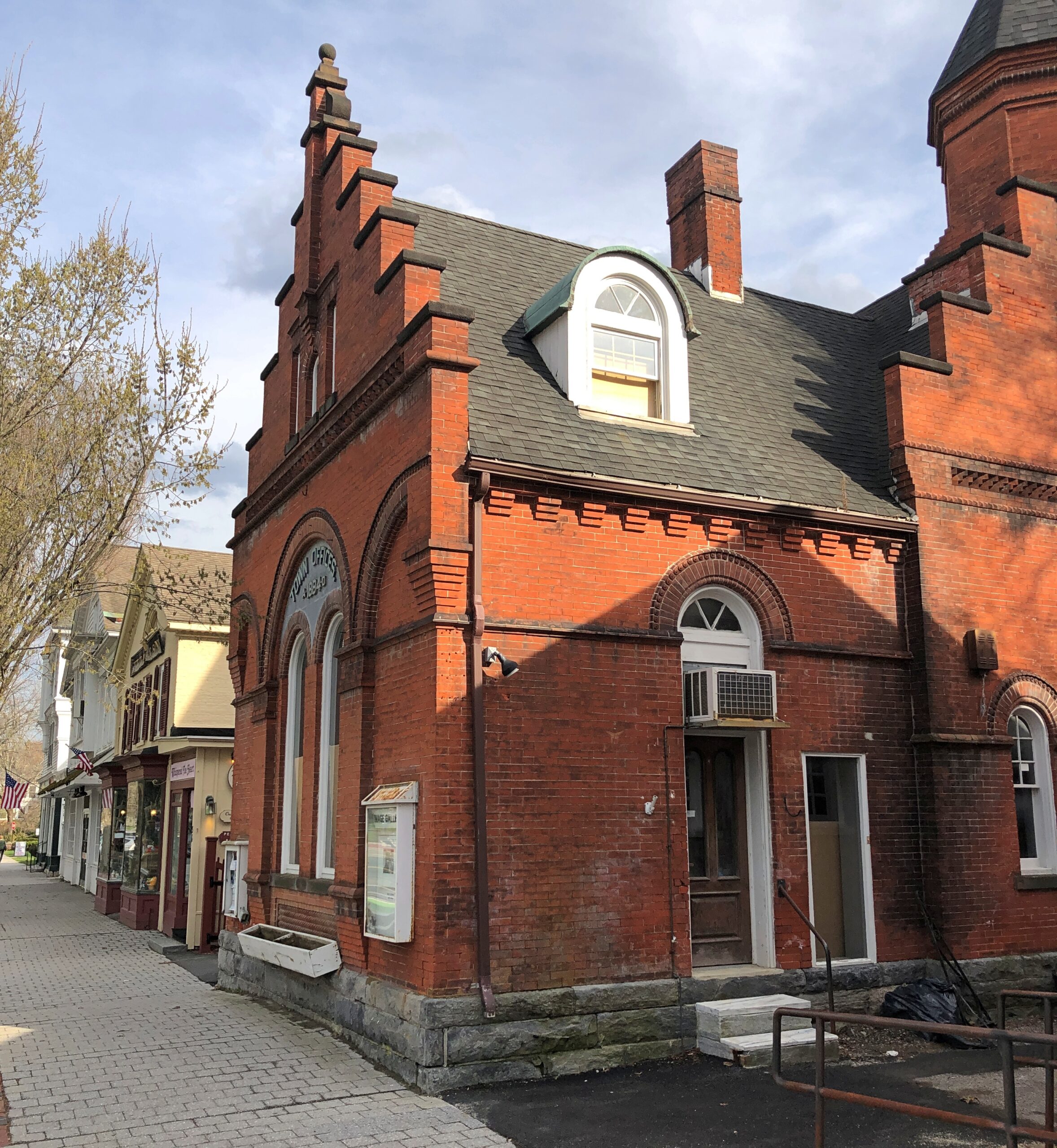
Once I’d gone far enough north, I took connecting roads to the Massachusetts Turnpike. Stockbridge, which is slightly south of the turnpike, counted more-or-less as a midway point on my day’s drive. As I entered town via Massachusetts 102, I noticed a tower. A stone tower, exuding 19th-century New England sturdiness. Its clock was wrong.
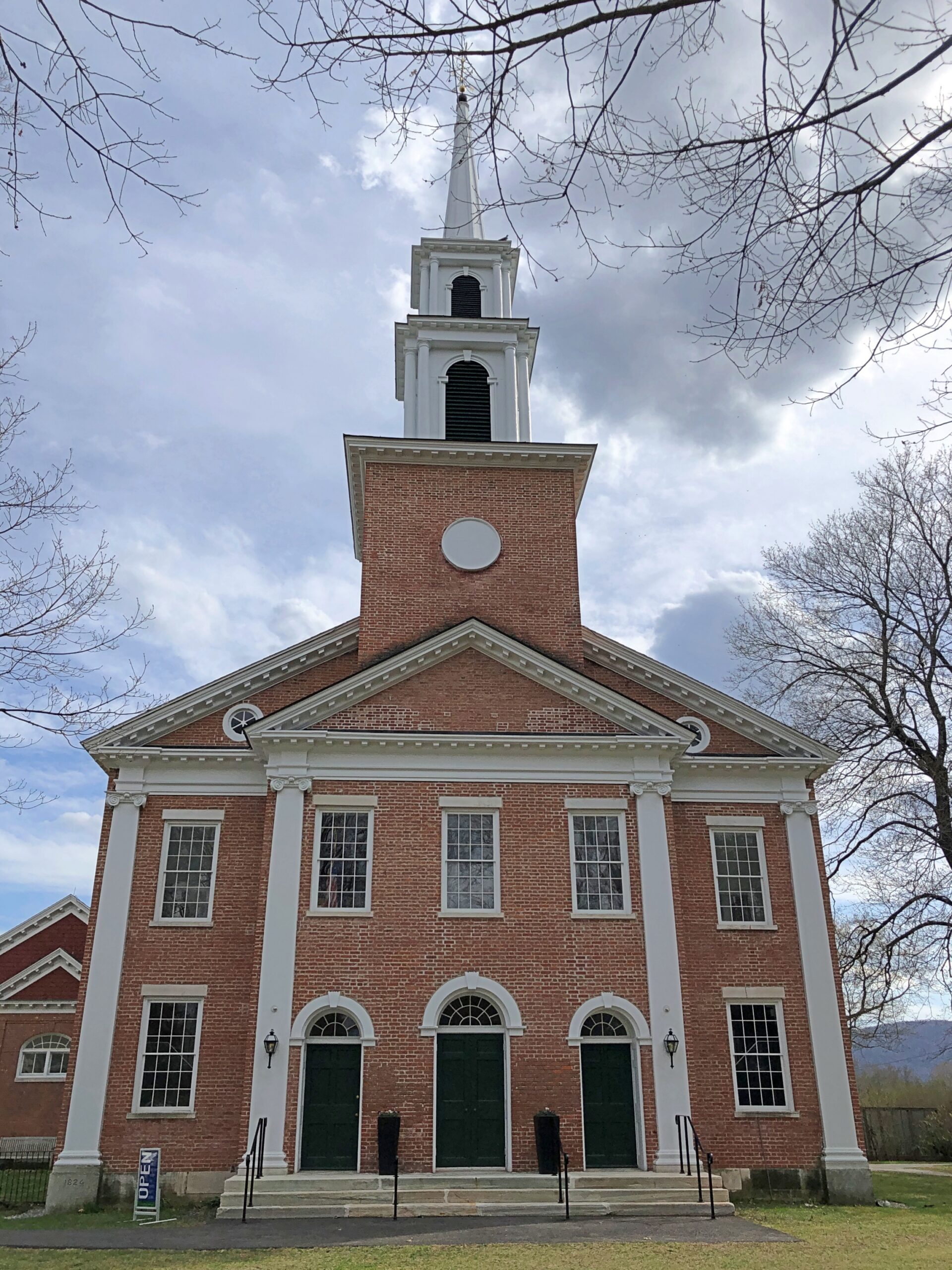
The Children’s Chimes Tower, a 19th-century bell tower built on the site of the town’s original church. A 19th-century replacement for that church stands near the bell tower, looking as New England as can be.
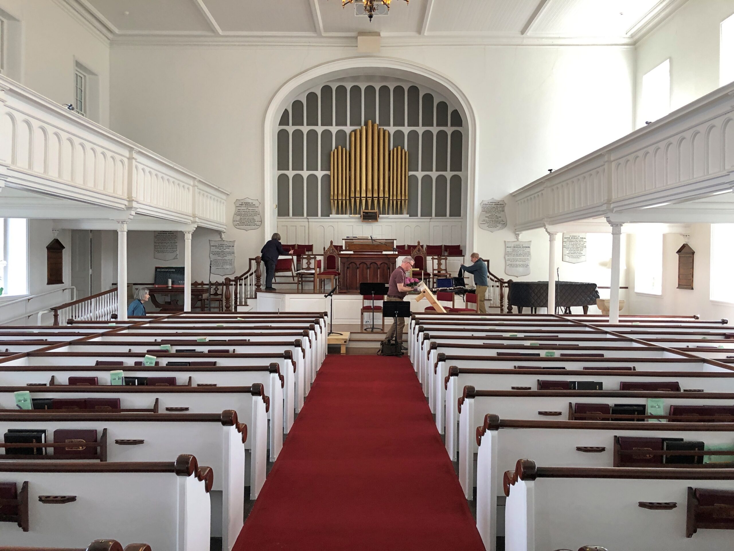
The First Congregational Church UCC. Remarkably, it was open.
Musicians were practicing, or rather seemed to be wrapping up a practice. They paid no attention to me as I looked around.
Jonathan Edwards was the church’s second pastor. “Sinners in the Hands of an Angry God” Jonathan Edwards? Yes.
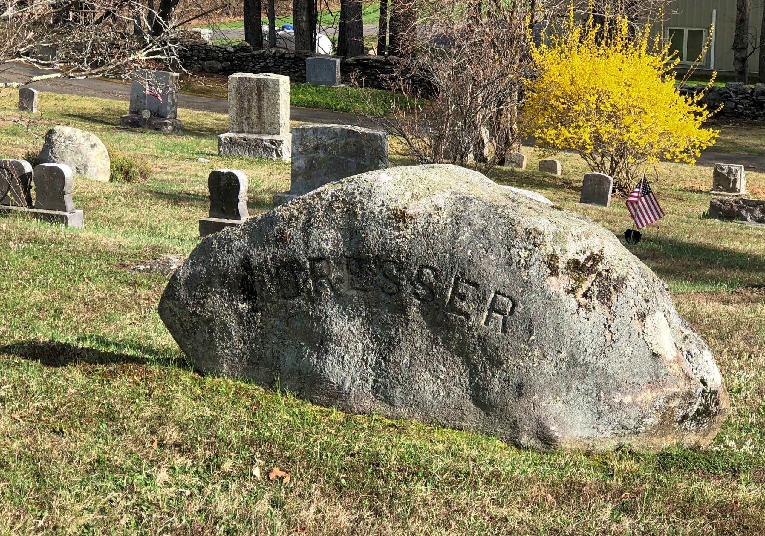
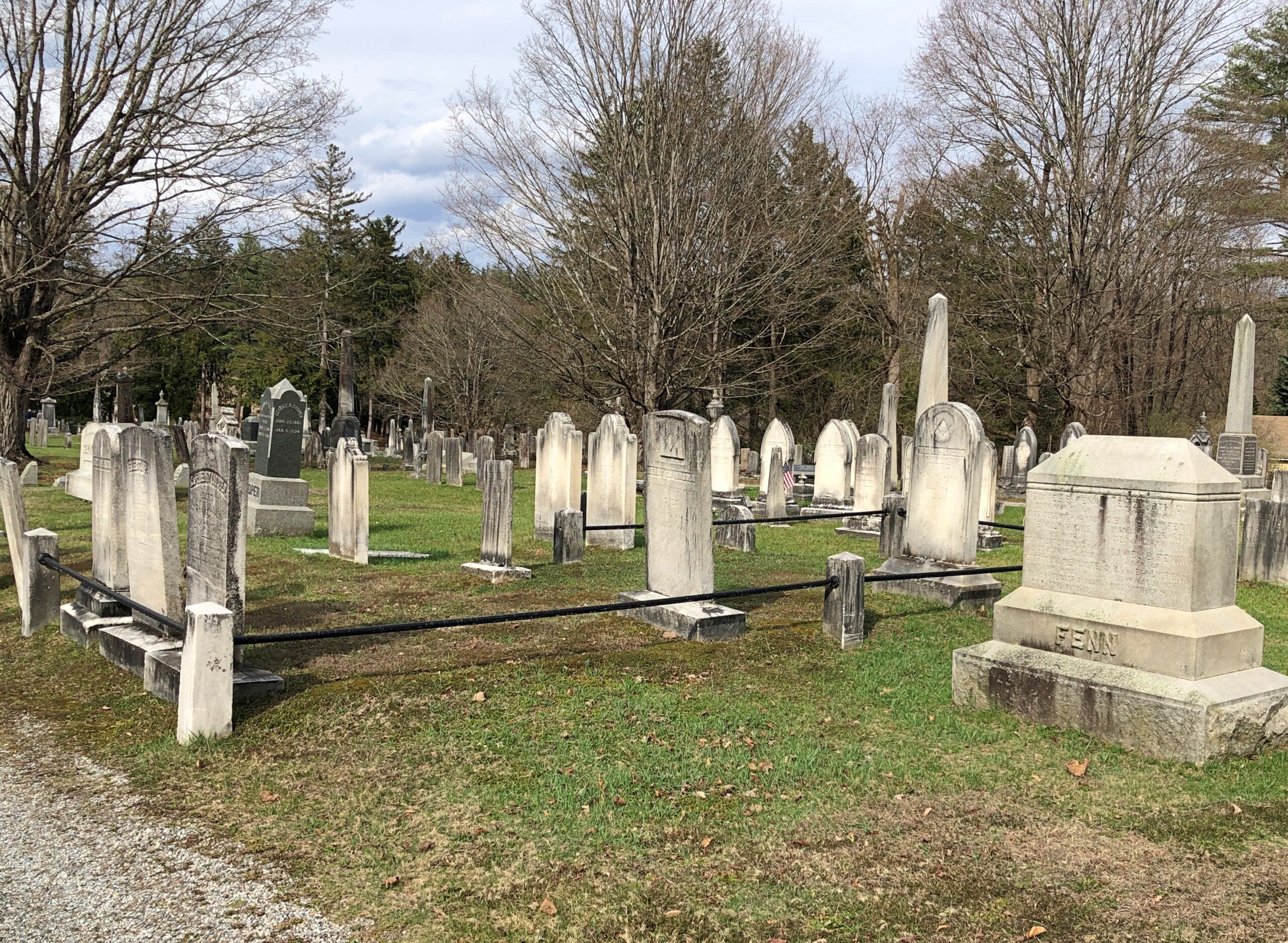
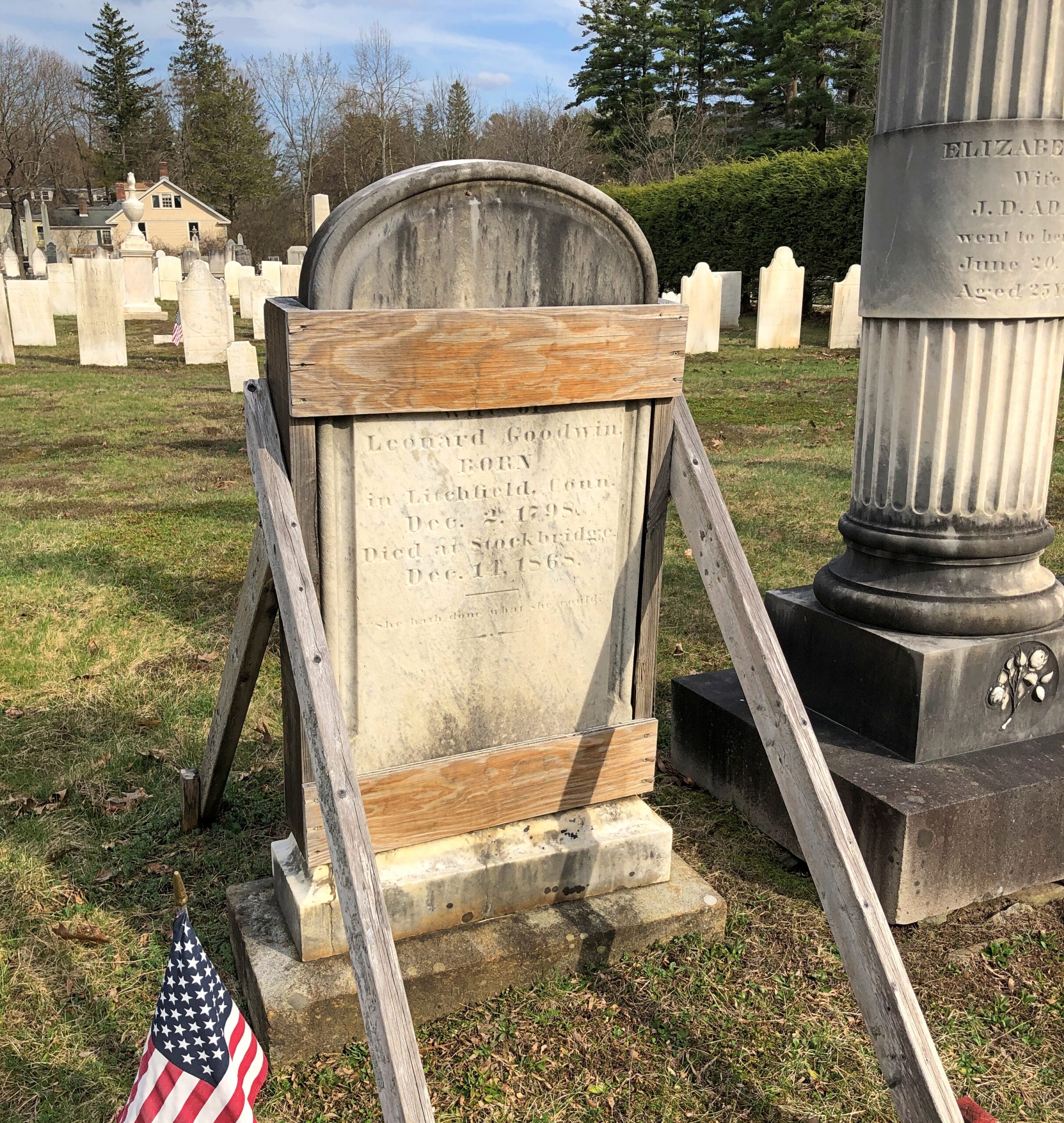
Across the road from the church and freestanding bell tower – which doesn’t chime, except in the summer – is the town cemetery.
“One of the earliest burials was the first minister, John Sergeant, who died in 1749,” says the Stockbridge Library. “Members of the Mohican tribe who joined the church also were buried here. Twenty years later, discussions began about ways to enclose the burial area to keep out cattle, horses, and pigs. It wasn’t until 1853, however, that a new organization in town, the Laurel Hill Association, took on the responsibility to clean and protect the area.”
Route 102 turns into Main Street, with its shops, hotels, and other establishiments.
And, around the back (off Main St., that is), just a half a mile from the railroad track, is Theresa’s Stockbridge Café.
Driving the entire length of US 1 is more logistics that I want to take on at the moment, or maybe ever, but I figure I get a little of the same satisfaction doing it in sections. US 1 from Trenton to Newark, which I drove the afternoon of April 10, isn’t what anyone would call a scenic road, but that I’d say it’s better than the New Jersey Turnpike, whose main scenery is tail lights of other cars.
US 1 in New Jersey is four or six lanes most of the way through, generally is a divided highway, passing large cross streets, retail agglomerations, railroad tracks paralleling for a time, car dealerships, sporadic stretches of forested or other undeveloped land, thick traffic through New Brunswick especially, more than a few Jersey lefts and an uptick in spaghetti interchanges the closer you are to Newark. Stops were for traffic lights, but not too much for simple congestion. Take that, New Jersey Turnpike.
During the drive, I chanced on a radio call-in show that asked callers for stories about crashing wedding receptions, sneaking into off-limits places or other common enough rule infractions, such as taking food into movie theaters. One man claimed to have crashed a reception with a couple of friends, none dressed for the occasion; the father of the bride took a cotton to them and made sure they were well fed and good and drunk before long. One woman claimed to take entire meals to the movies and eat them there, and never being asked to leave. Now this was local radio, a real New Jersey thing to talk about.
Jan had told him many times, “It was you to me who taught: In Jersey, anything’s legal as long as you don’t get caught.”
“Tweeter and the Monkey Man”, a group effort but clearly a Dylan song, is a brilliant example of a pseudo-ballad. A ballad tells a story, right? A pseudo-ballad seems to tell a story, but at some point near the end of the song, you wonder just what happened. Lyrically, not all of the pieces of the puzzle are available. “Crime and other weird behavior in New Jersey” is about a specific as you can get in this case.
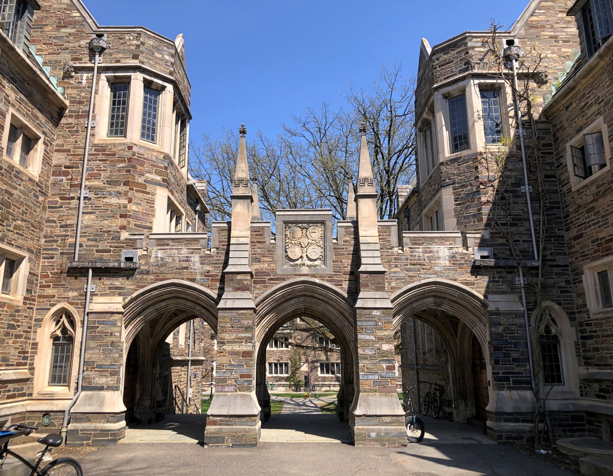
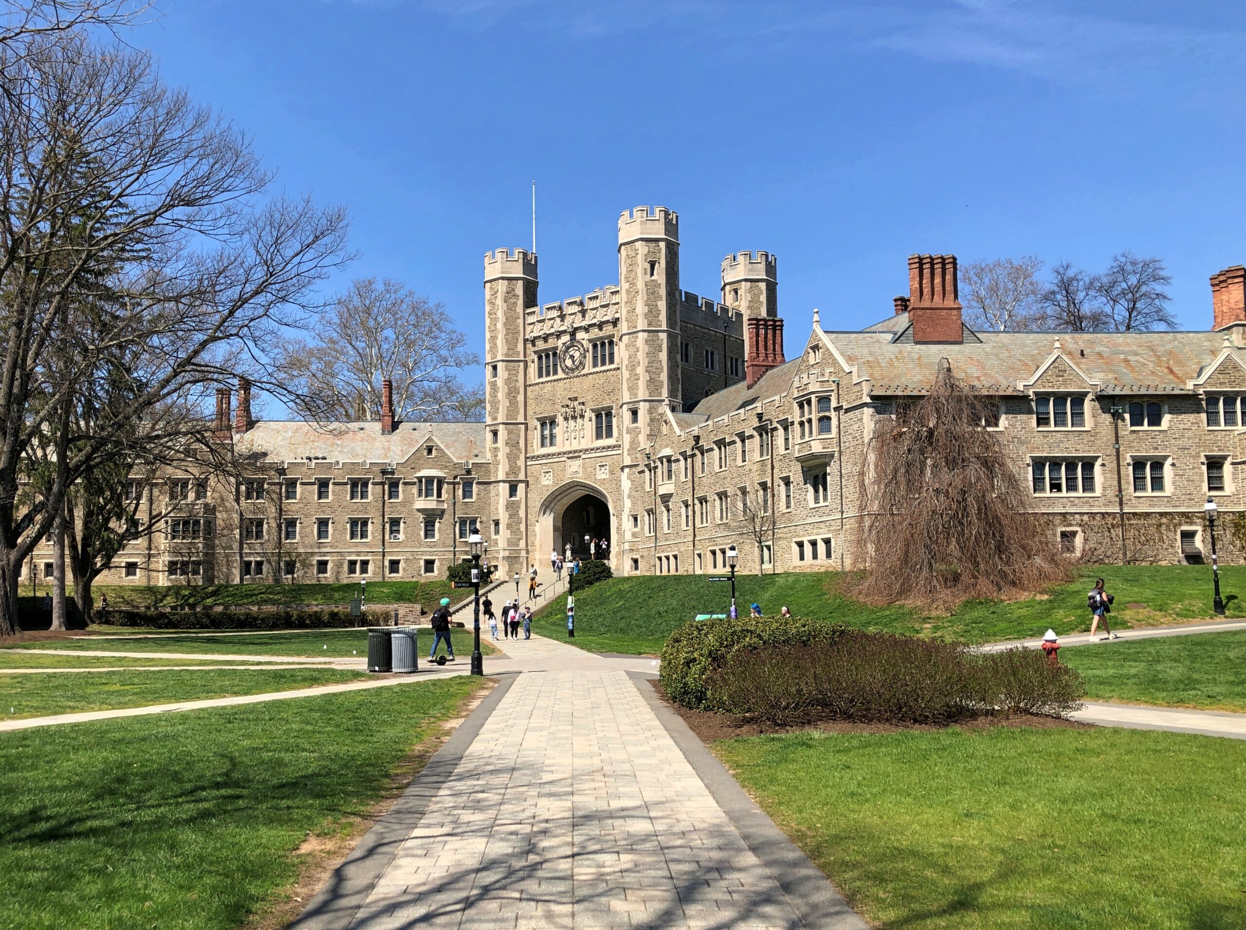
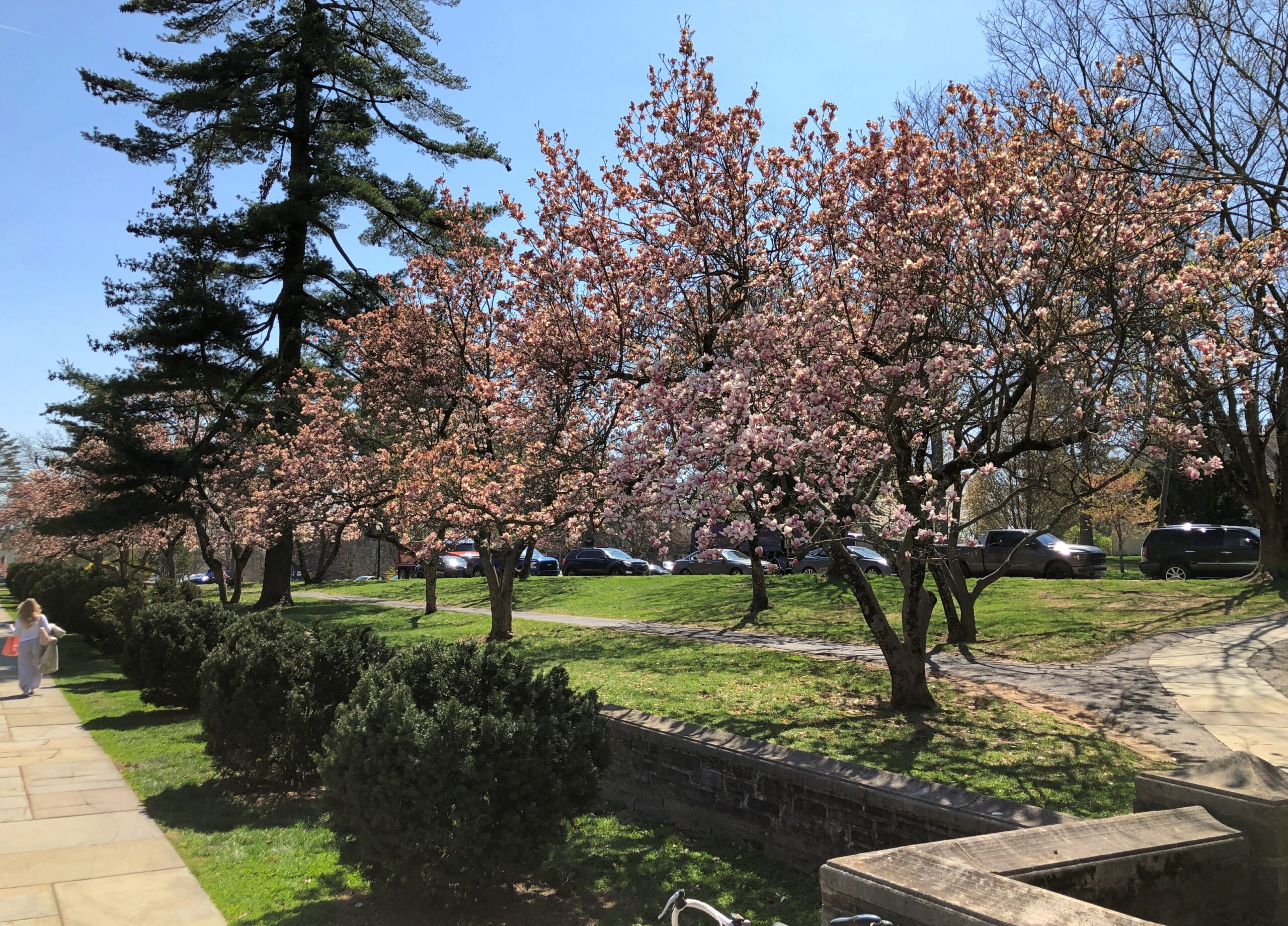
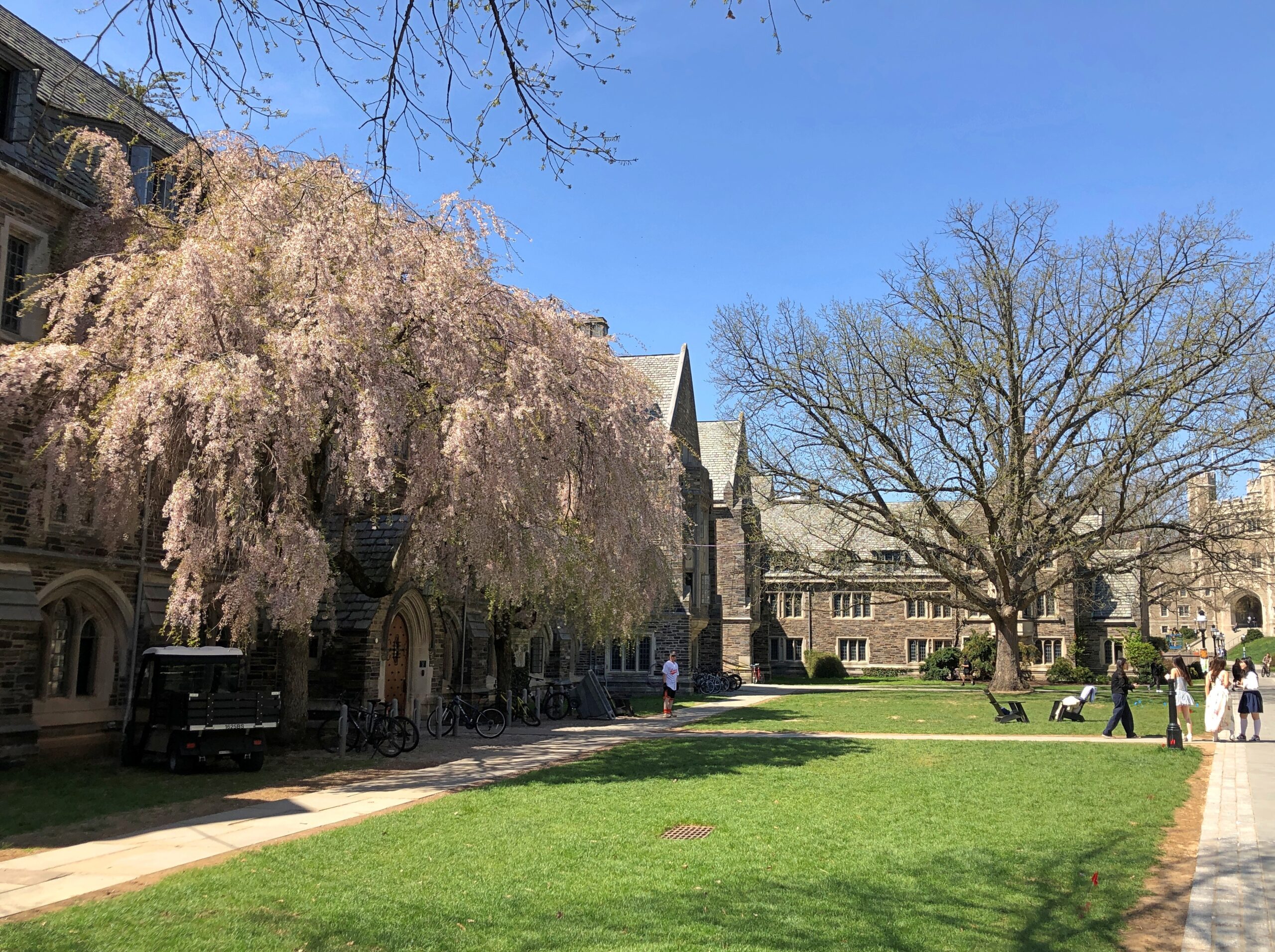
In October, I’d spent a few hours wandering Yale’s stately lawns and buildings and the nearby cemetery. So it only stands to reason – if I’m the one doing the reasoning – that I also visit Princeton, a short way off US 1 not far from Trenton.
Stately buildings.
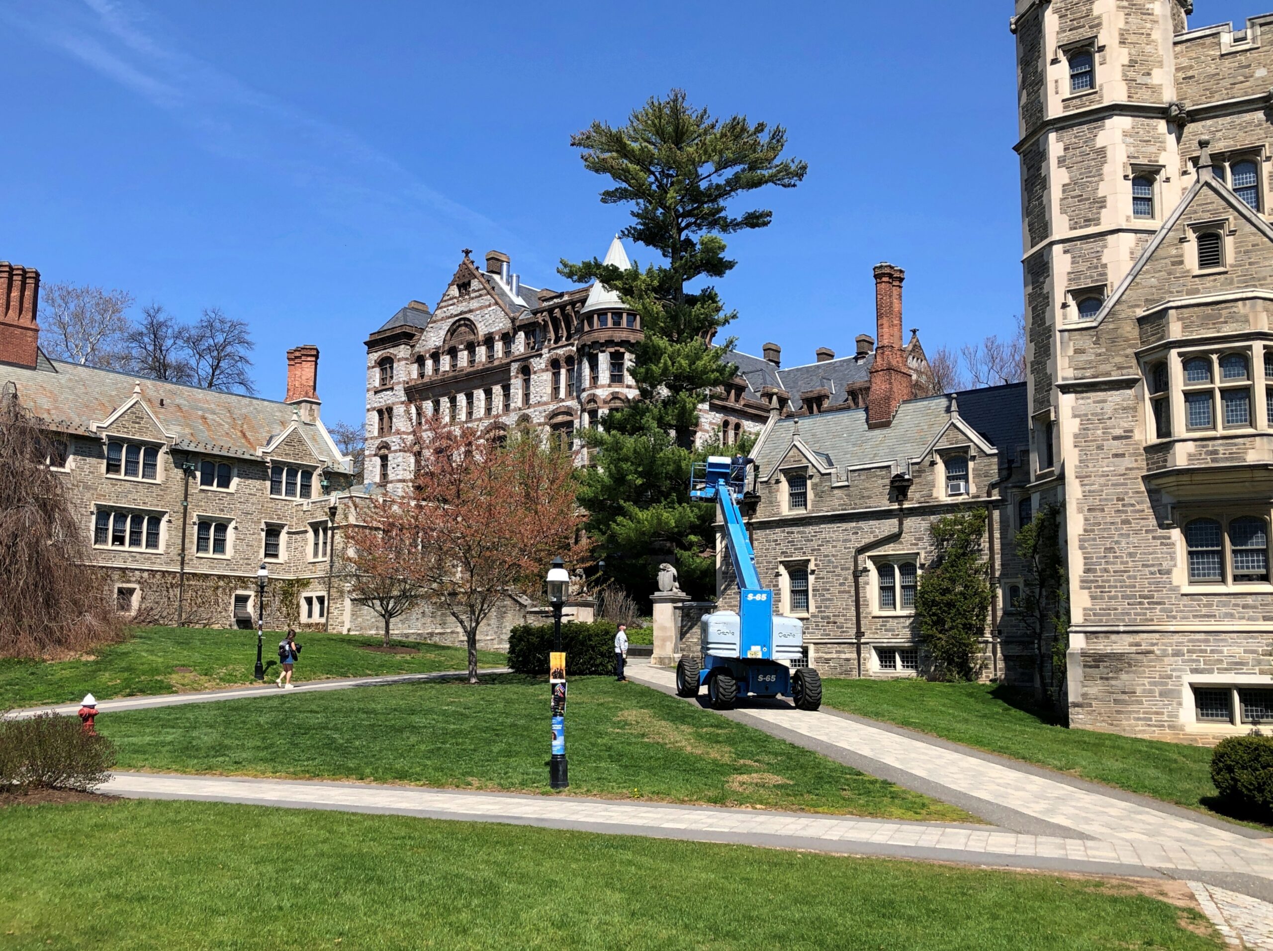
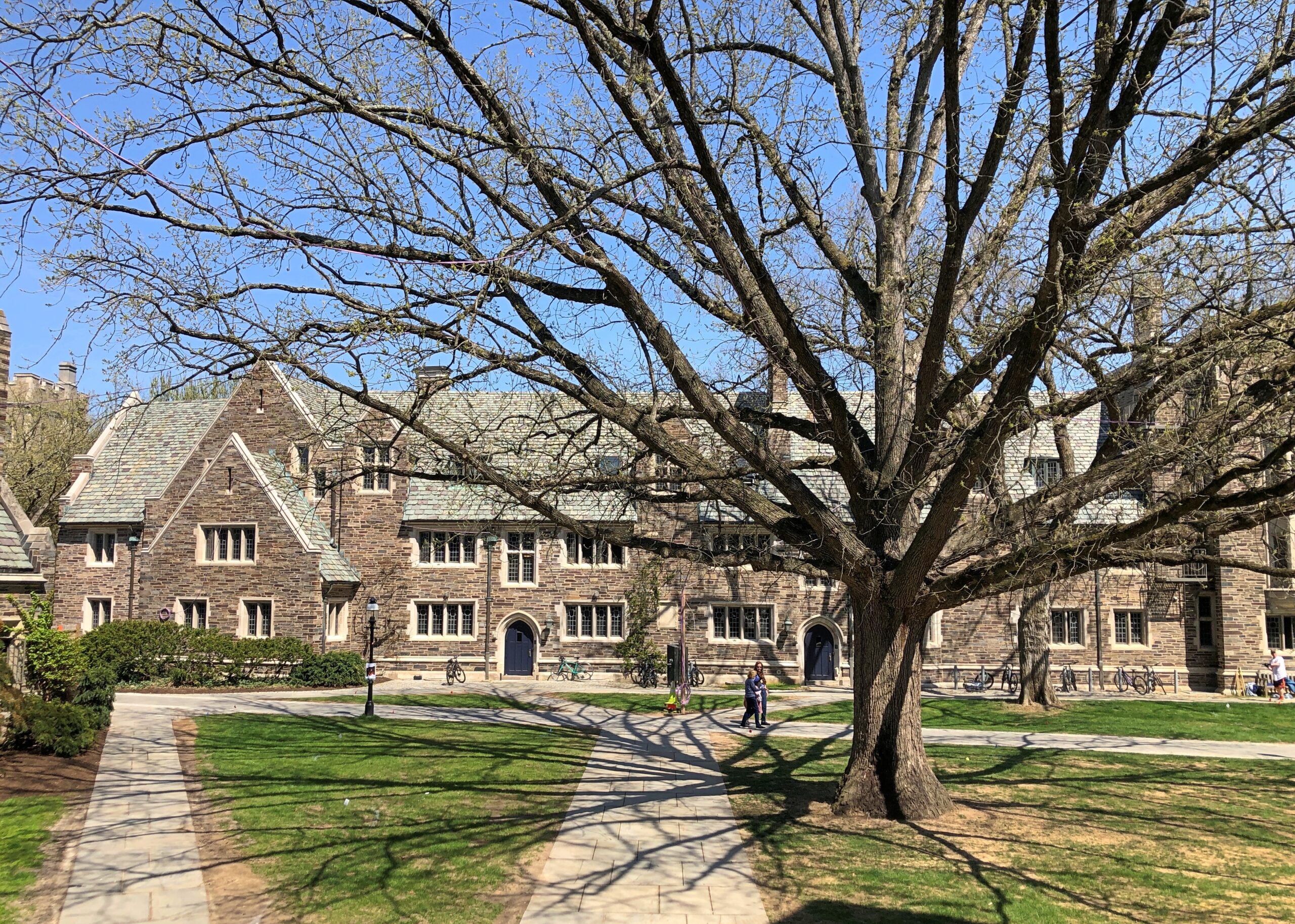
Early spring on the stately lawns.
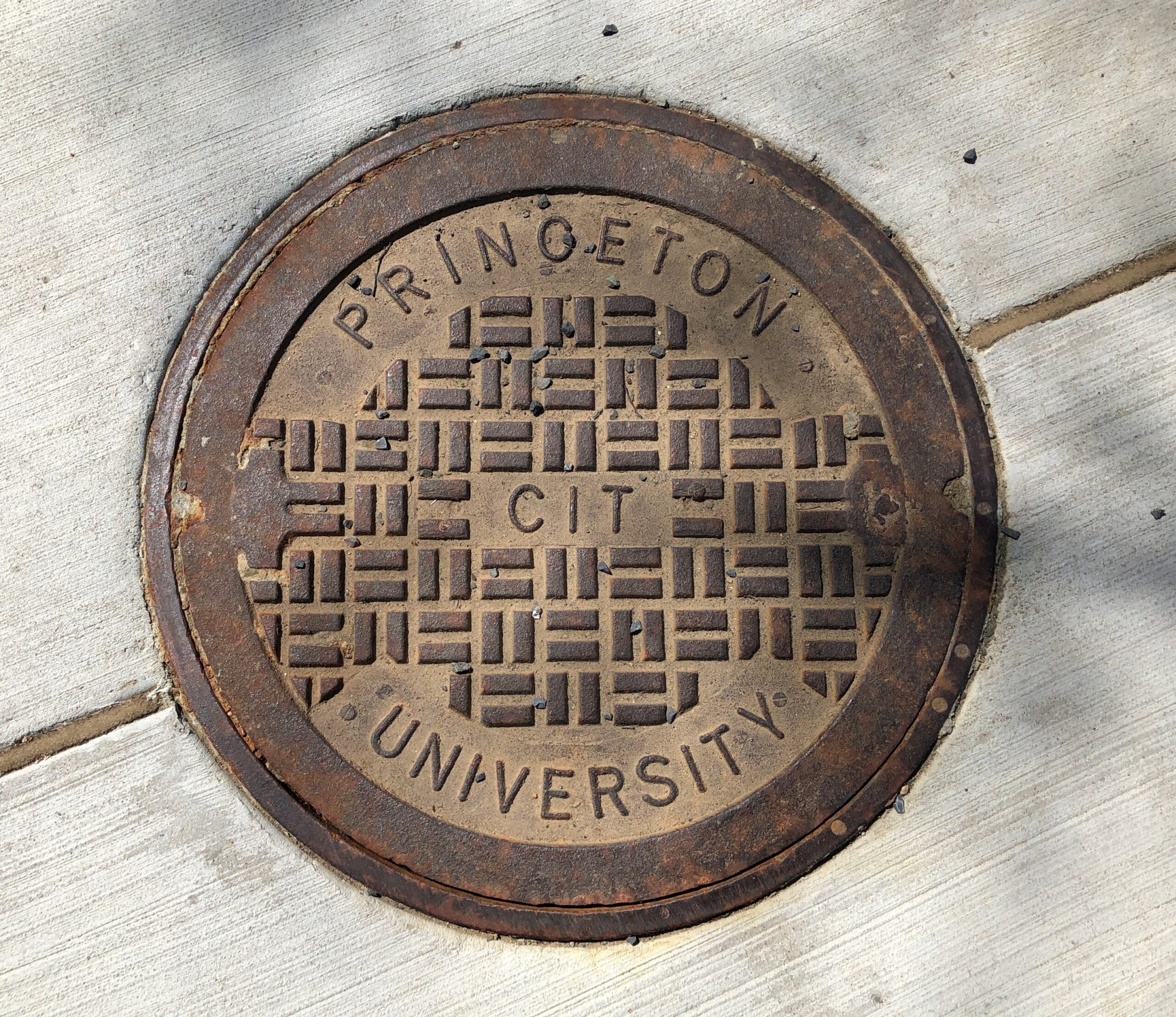
Not the best collegiate manhole cover I’ve seen – that would be at Olivet Nazarene University in Bourbonnais, Illinois – but not bad.
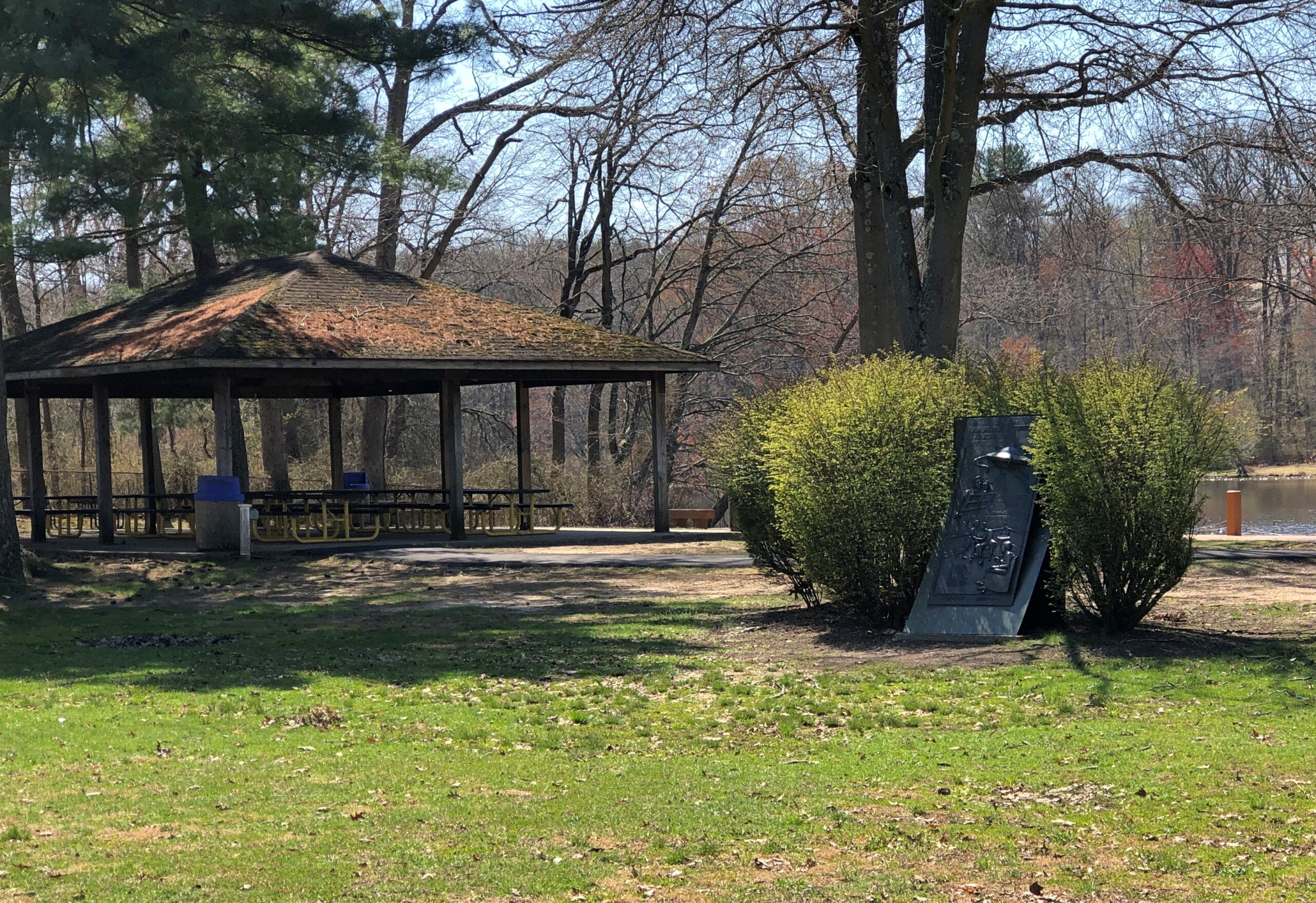
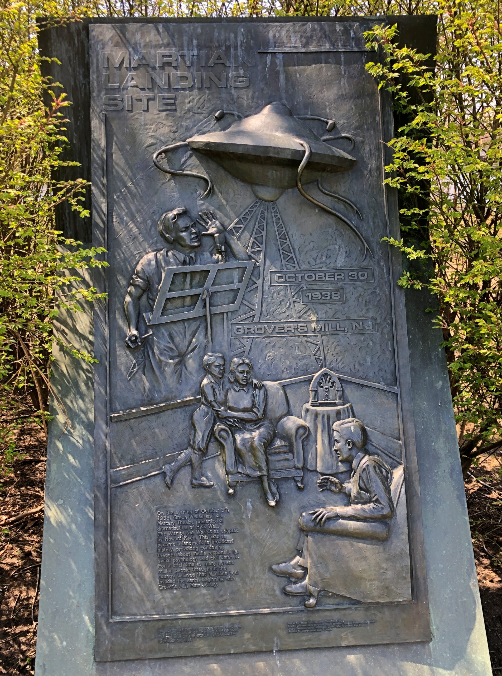
Princeton is west of US 1; Grovers Mill, New Jersey is to the east, also not far. I had to go there, too. Specifically, to a small park on a small lake in the unincorporated Grovers Mill. A short park trail includes information about Grovers Mills’ claim to fame: in Orson Welles’ version of War of the Worlds, it was the first place the Martians landed.
There’s a sizable plaque, a little bit hidden away, but I found it.
The township of West Windsor, in an unusual display of municipal imagination, erected the memorial in 1988, on the occasion of the 50th anniversary of the broadcast. Sculptor Thomas Jay Warren did the relief.
Ladies and gentlemen, I have a grave announcement to make. Incredible as it may seem, both the observations of science and the evidence of our eyes lead to the inescapable assumption that those strange beings who landed in the Jersey farmlands tonight are the vanguard of an invading army from the planet Mars. The battle which took place tonight at Grovers Mill has ended in one of the most startling defeats ever suffered by any army in modern times; seven thousand men armed with rifles and machine guns pitted against a single fighting machine of the invaders from Mars. One hundred and twenty known survivors. The rest strewn over the battle area from Grovers Mill to Plainsboro, crushed and trampled to death under the metal feet of the monster, or burned to cinders by its heat ray. The monster is now in control of the middle section of New Jersey.
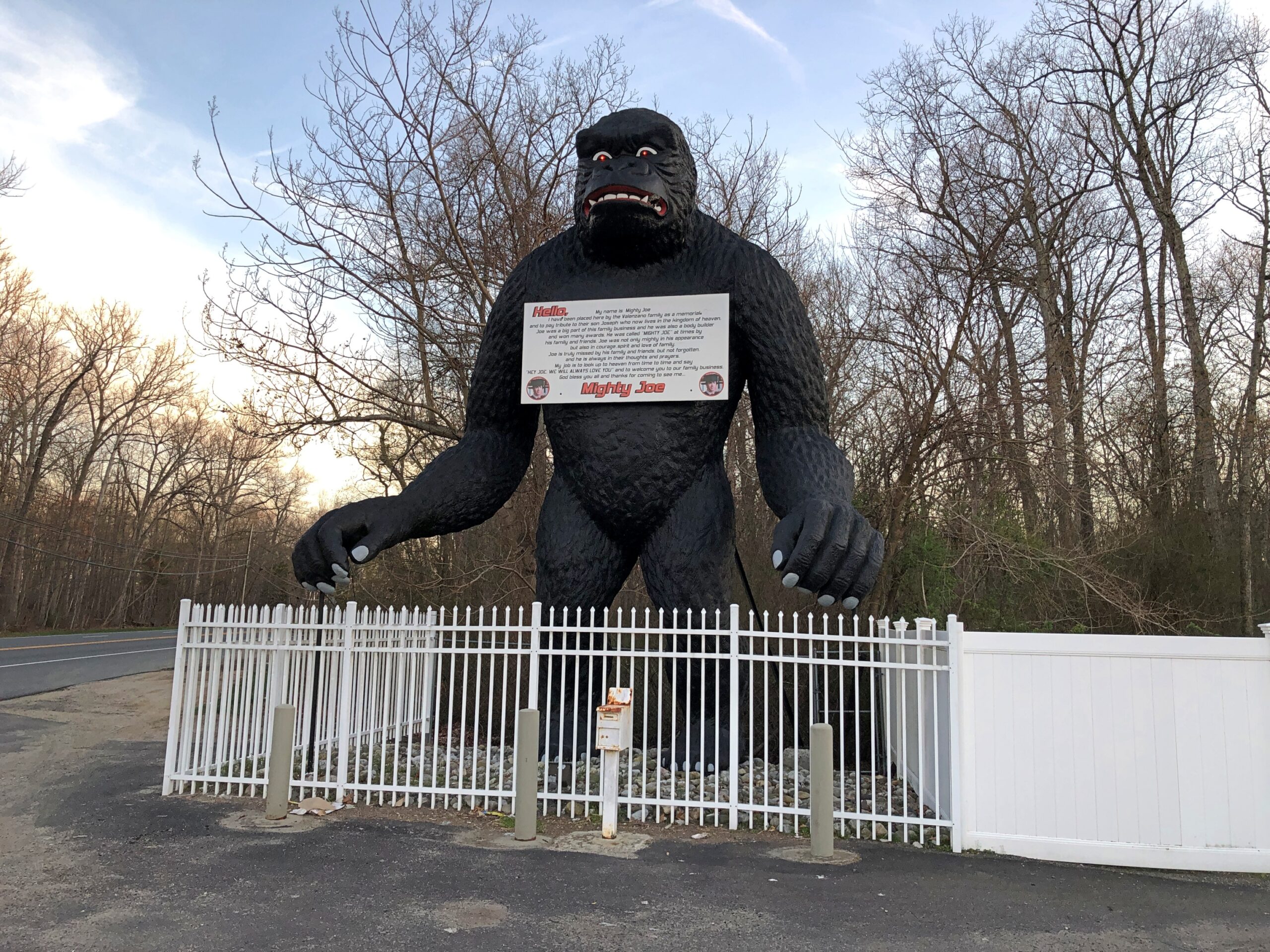
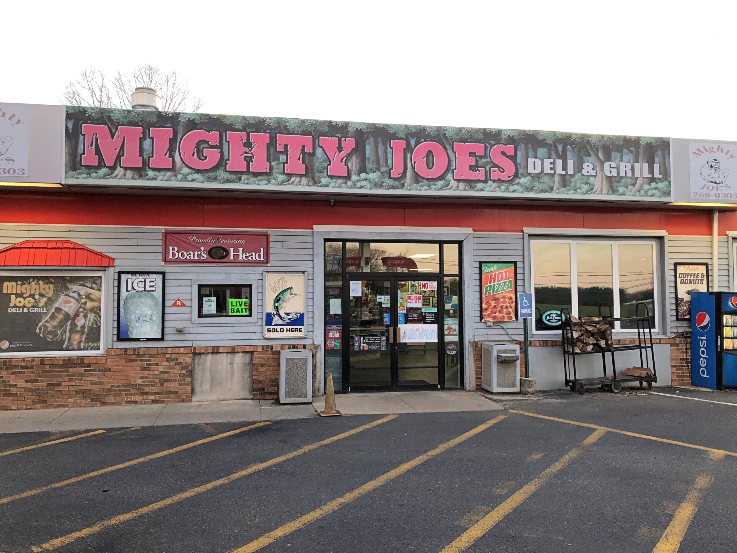
Down in South Jersey earlier this month, I didn’t see the Jersey Devil. I did see Mighty Joe.
He counted as my introduction to the Pine Barrens, standing at a convenience store on US 206 in Indian Mills, Shamong Township, New Jersey. His story, which Roadside America tells well, began in Spain – really? – though immigrant Mighty Joe apparently has spent most of his existence in New Jersey as a commercial mascot of one kind or another. He’s still that, but also a memorial to the son of the store’s owner, Larry Valenzano, according to the sign on the gorilla’s chest. The younger Valenzano, a body builder nicknamed Mighty Joe, died of cancer in 1999.
I didn’t stop for Joe heading south on US 206. Can’t stop for everything. I figured I wouldn’t see him on my return to Trenton either, since I was planning to return on smaller roads through the heart of the Pine Barrens, after visiting Atlantic City. All went according to plan, until I actually got into the heart of the Pine Barrens fairly late in the afternoon of April 9.
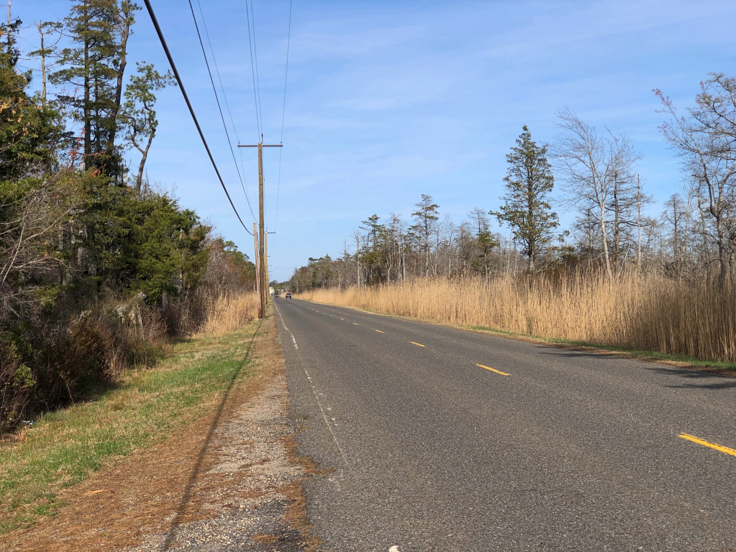
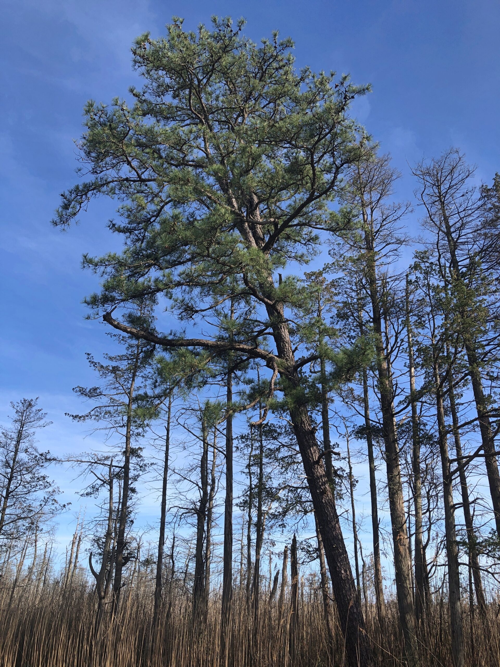
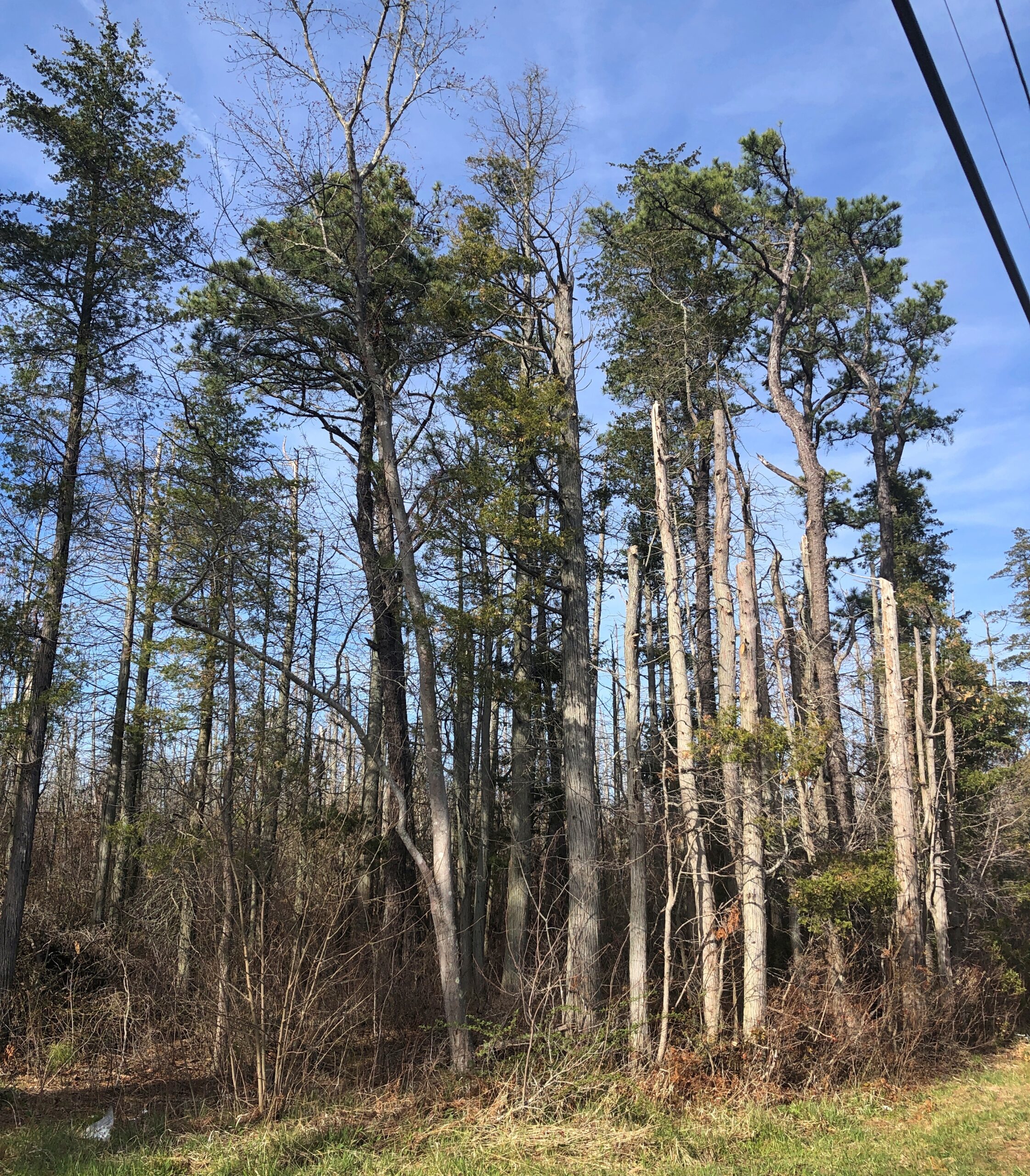
Considering how close you are to Philadelphia and New York, it’s remarkable how remote the Pine Barrens feel. The region, I understand, is the largest surviving forest on the Eastern Seaboard south of Maine’s North Woods, totaling over 800,000 acres.
The region is also called the Pinelands. It certainly fits.
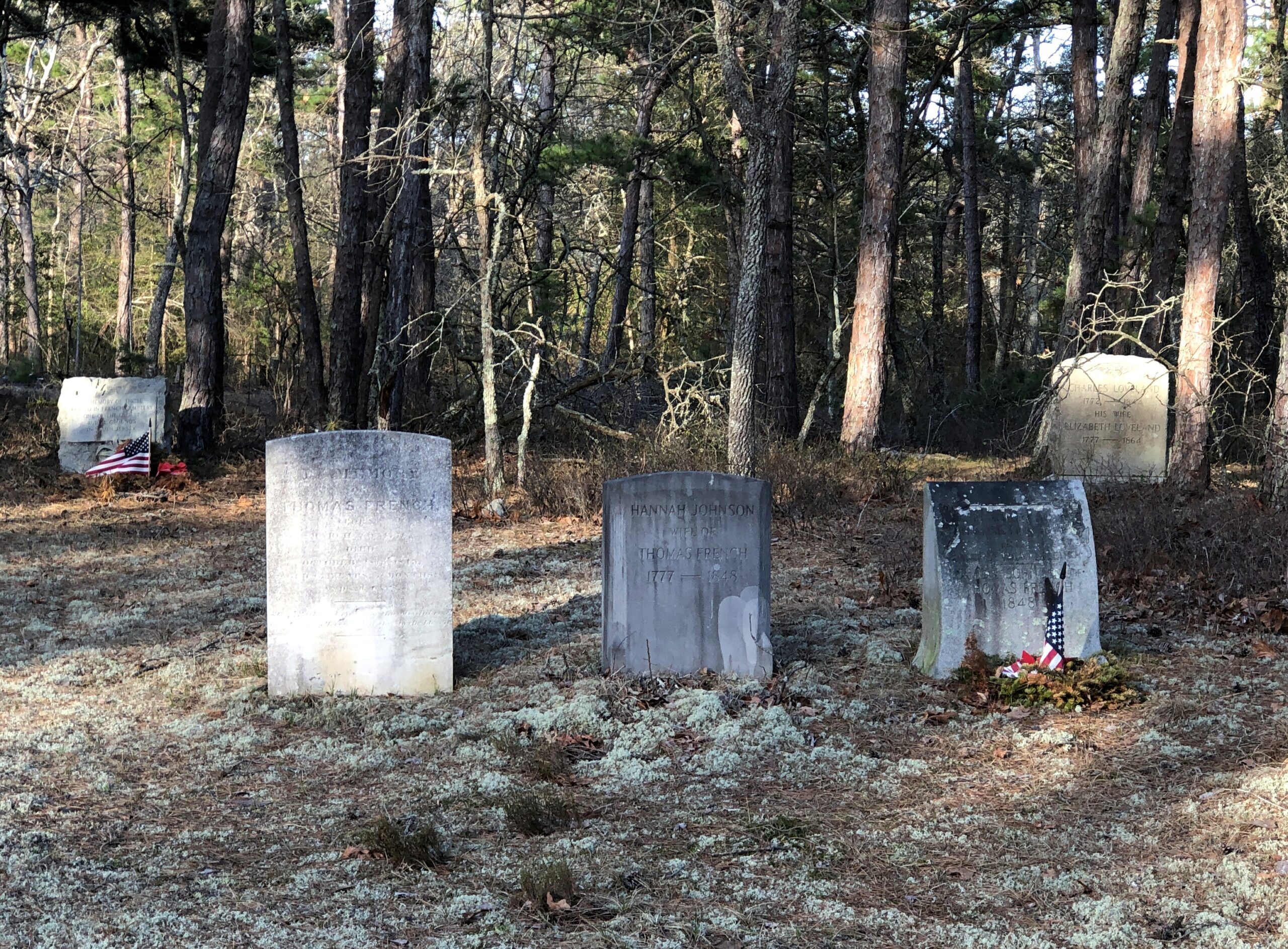
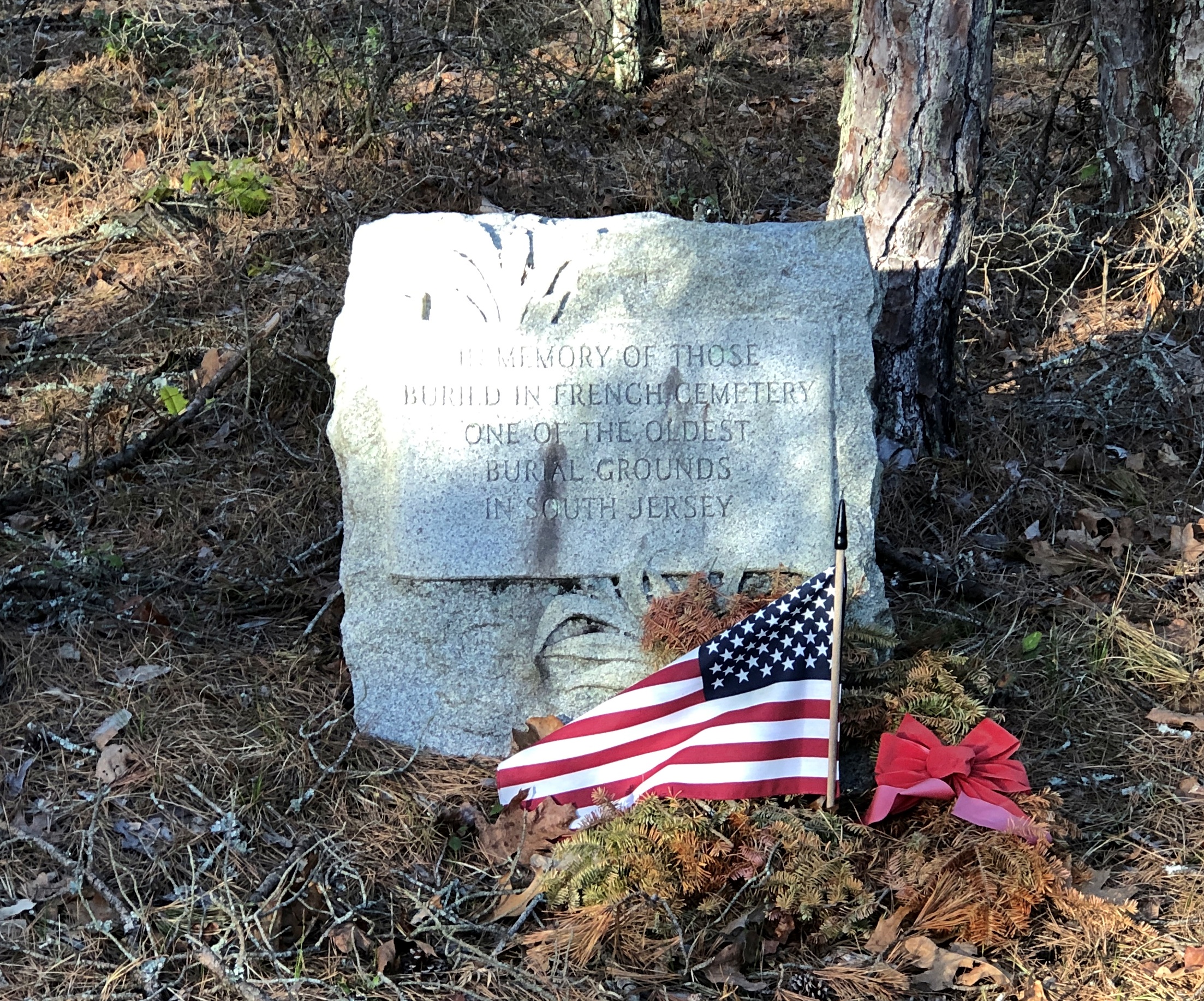
Remote, maybe, but still plenty of signs of human habitation, past and present. I stopped to take my bearings at a wide place in the road, and noticed gravestones.
French Cemetery, named for a number of people buried named French, not for their nationality. “One of the oldest burial grounds in South Jersey,” the stone asserts. Could be, but I have no way to check that.
Interesting little spot anyway, northeast from Egg Harbor City and past the Mullica River and near the Wading River. Or was that the actual location? I was traveling on marked county roads, but pretty soon I started seeing county road signs covered with black plastic bags, next to newer signs. I can only guess, but I think that meant a recent change in the numbering of the county roads.
That further meant that both my paper and electronic maps were wrong – in as much detail as they had anyway, which wasn’t a lot. “Lost” is too strong a word, but I’d say I was disoriented in a web of meandering, ill-marked roads. I stopped more than once among the pines of the Pinelands to try to figure out a better course.
Then it occurred to me: I remembered seeing some of the exit numbers on highways near Trenton had been changed, too. I’m speculating, but I think that had something to do with my GPS going just a little funny in the head the night before. Damn it, New Jersey.
Eventually I worked my way back toward Egg Harbor City, a sizable town on US 30, which connects with US 280, which goes straight back to Trenton; the way I’d come. That’s how I was able to stop to see Mighty Joe.
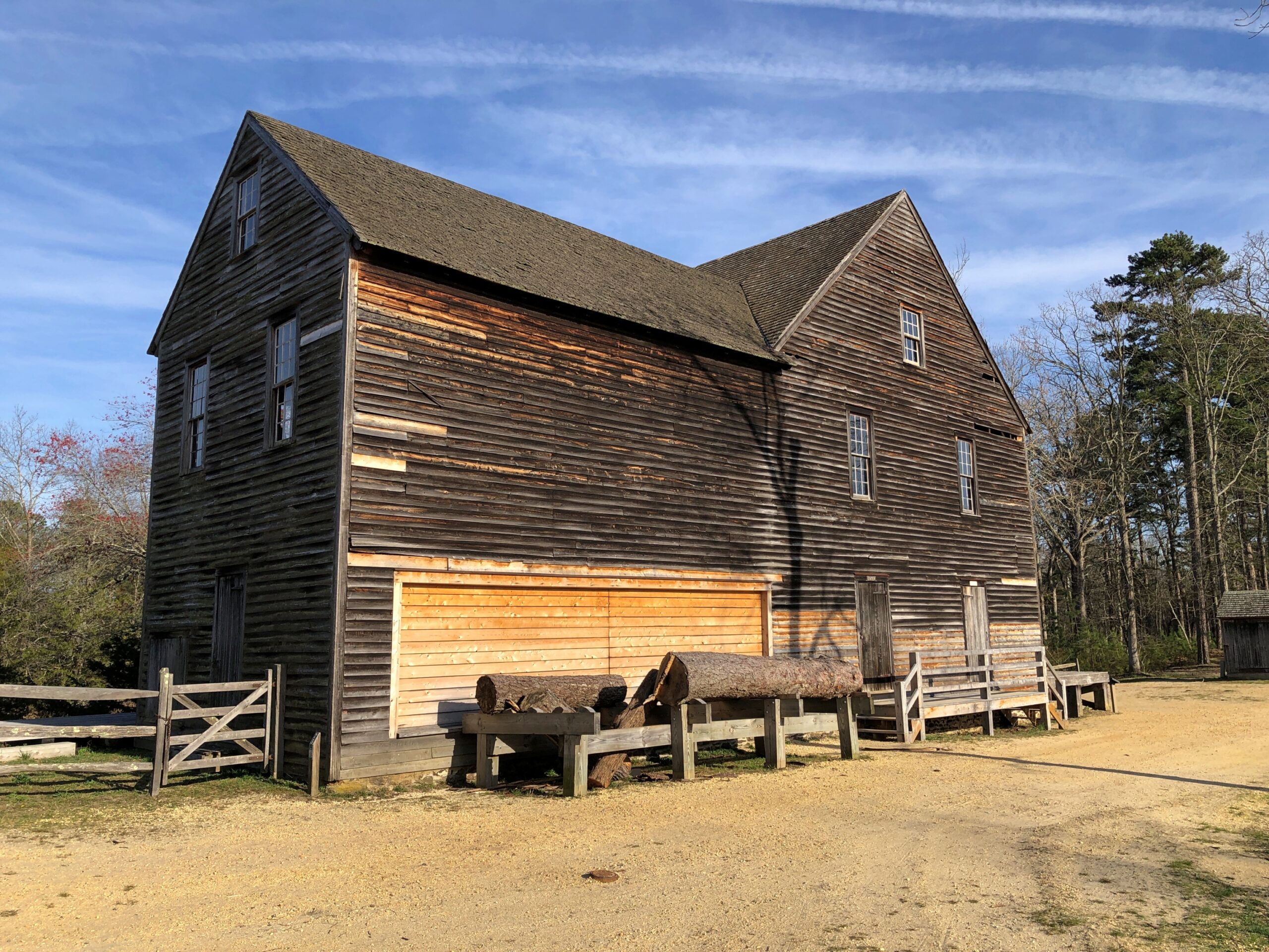
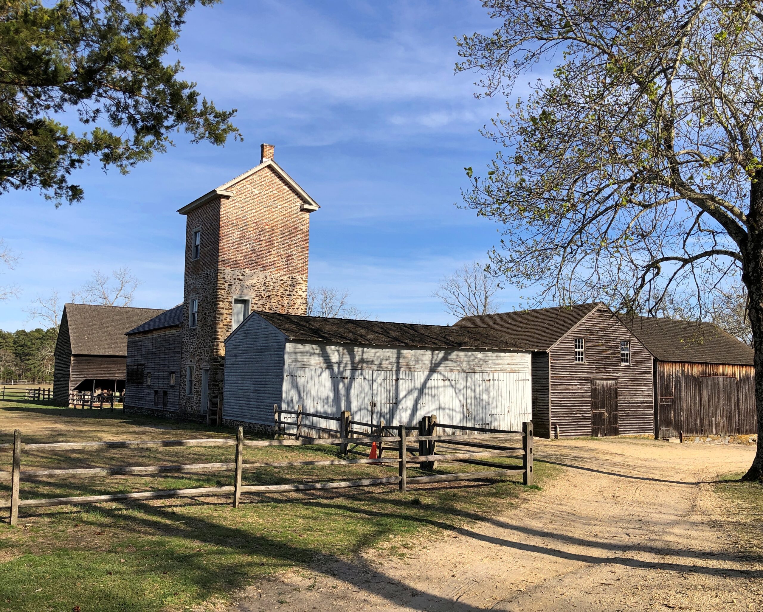
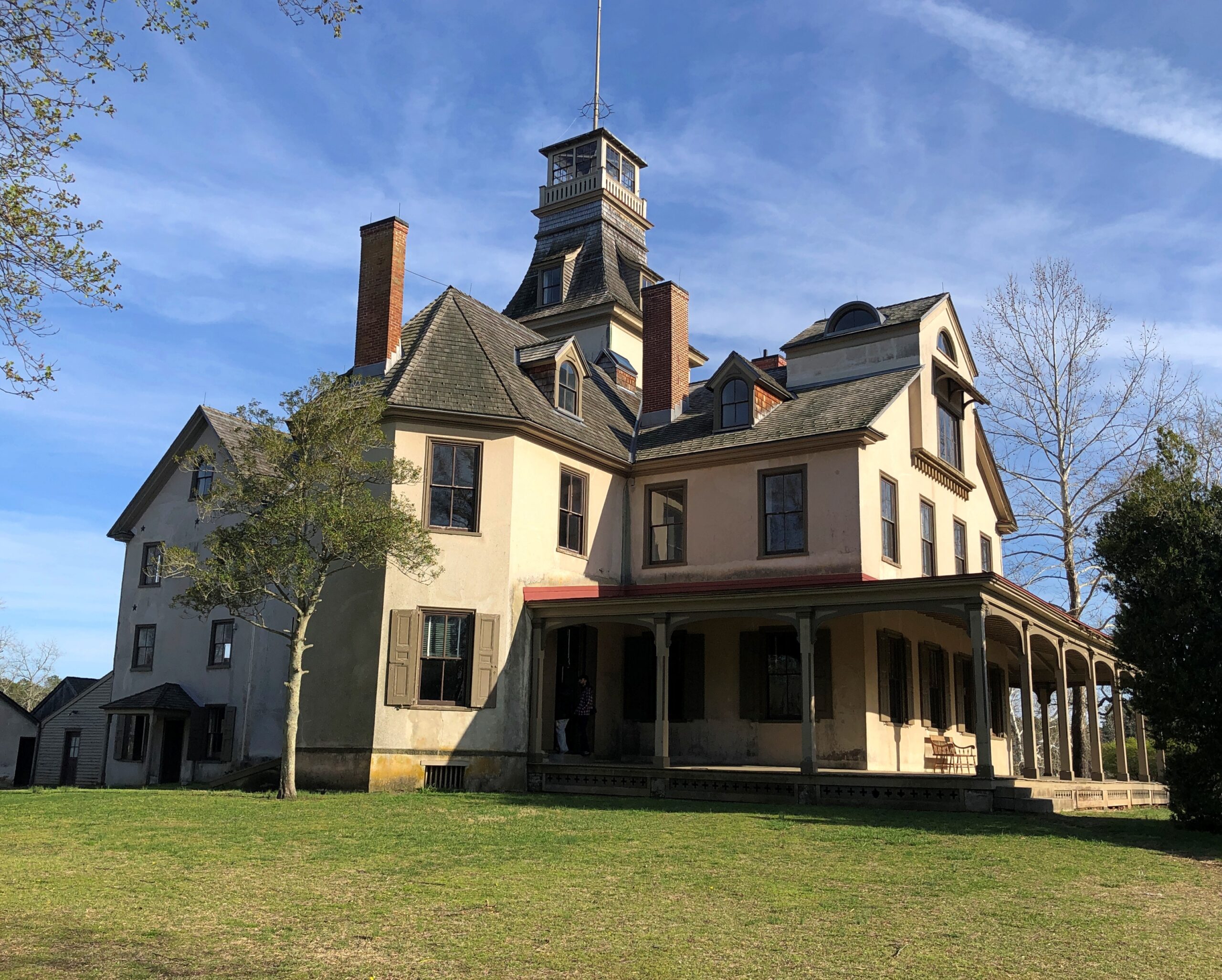
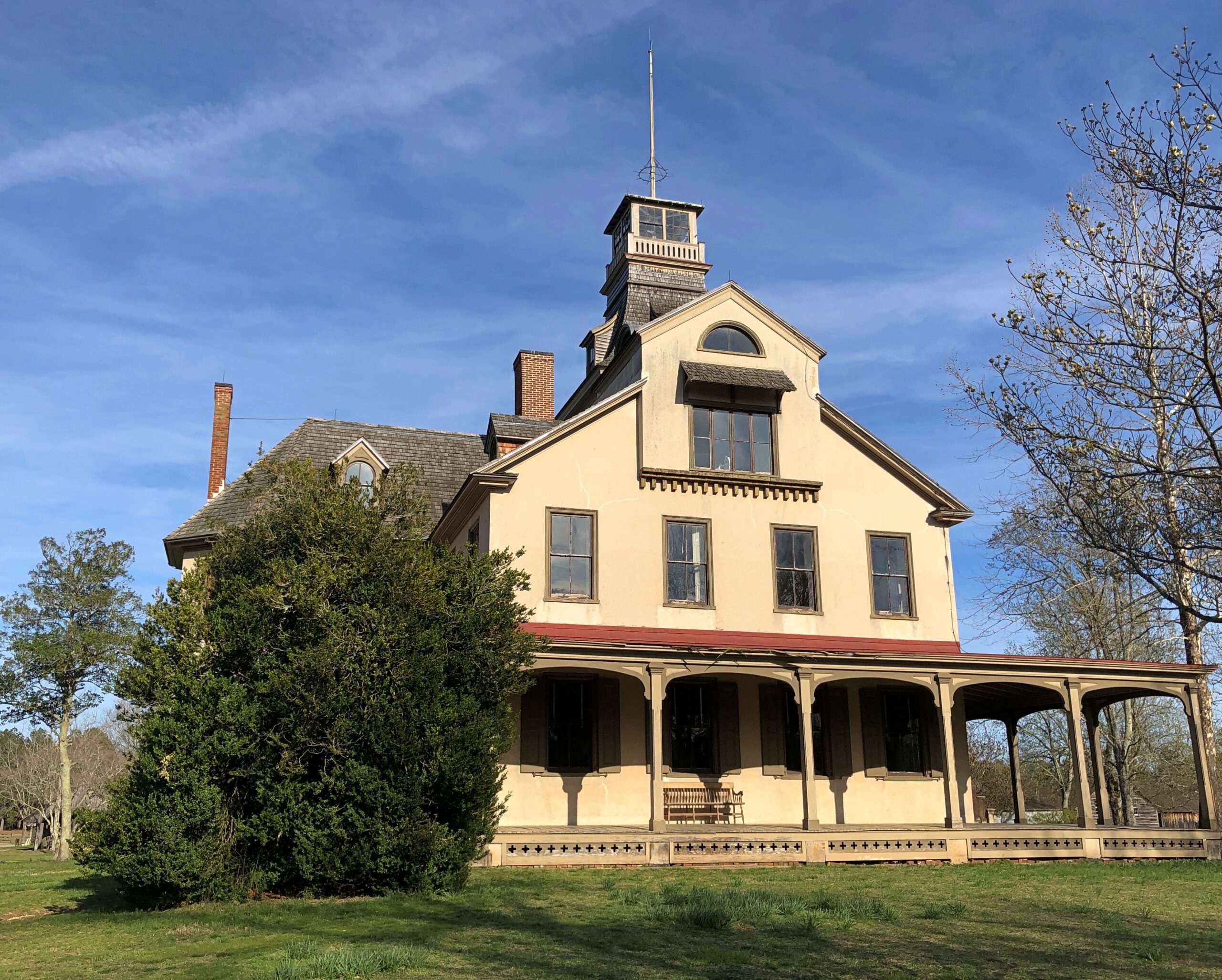
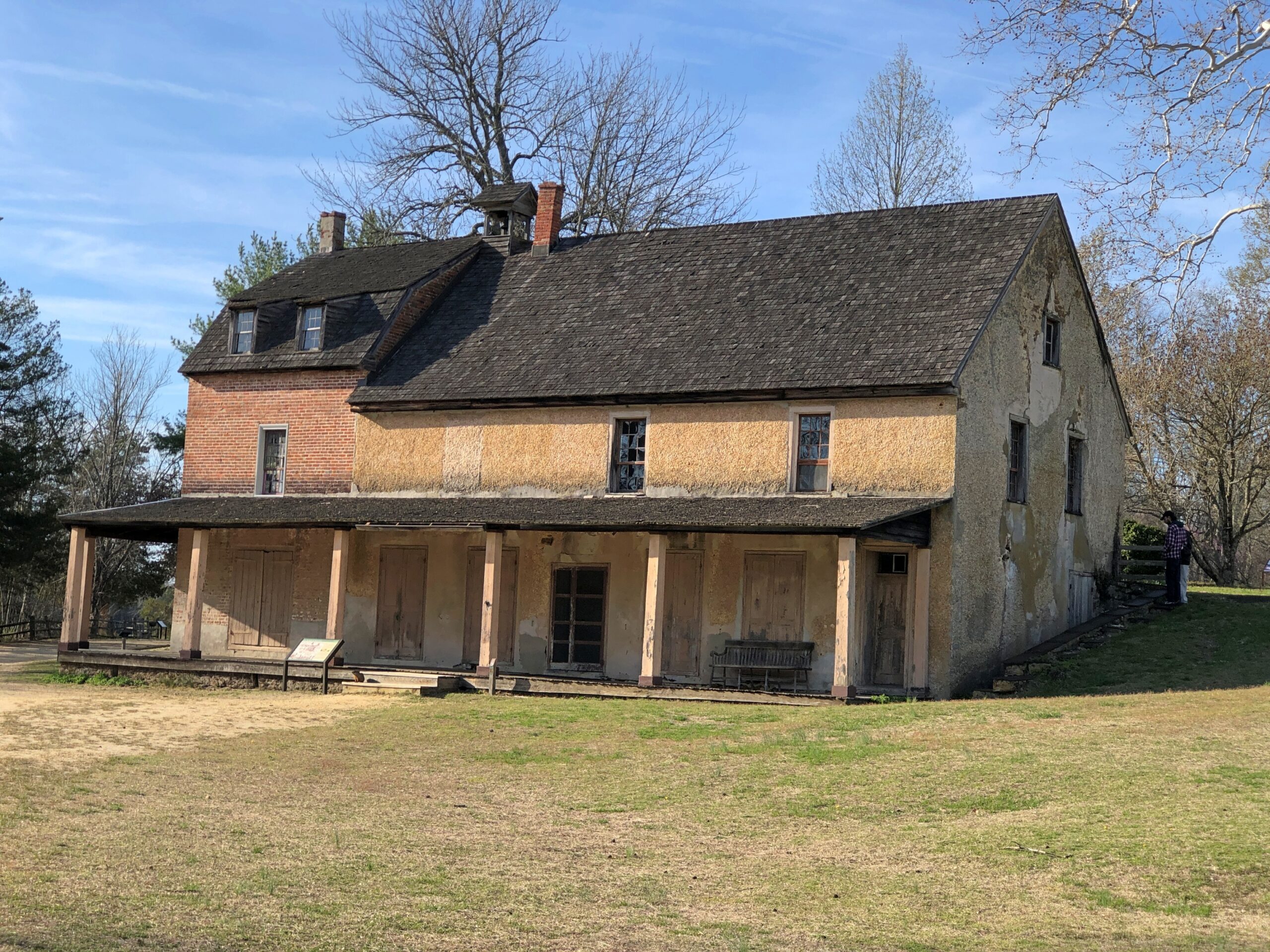
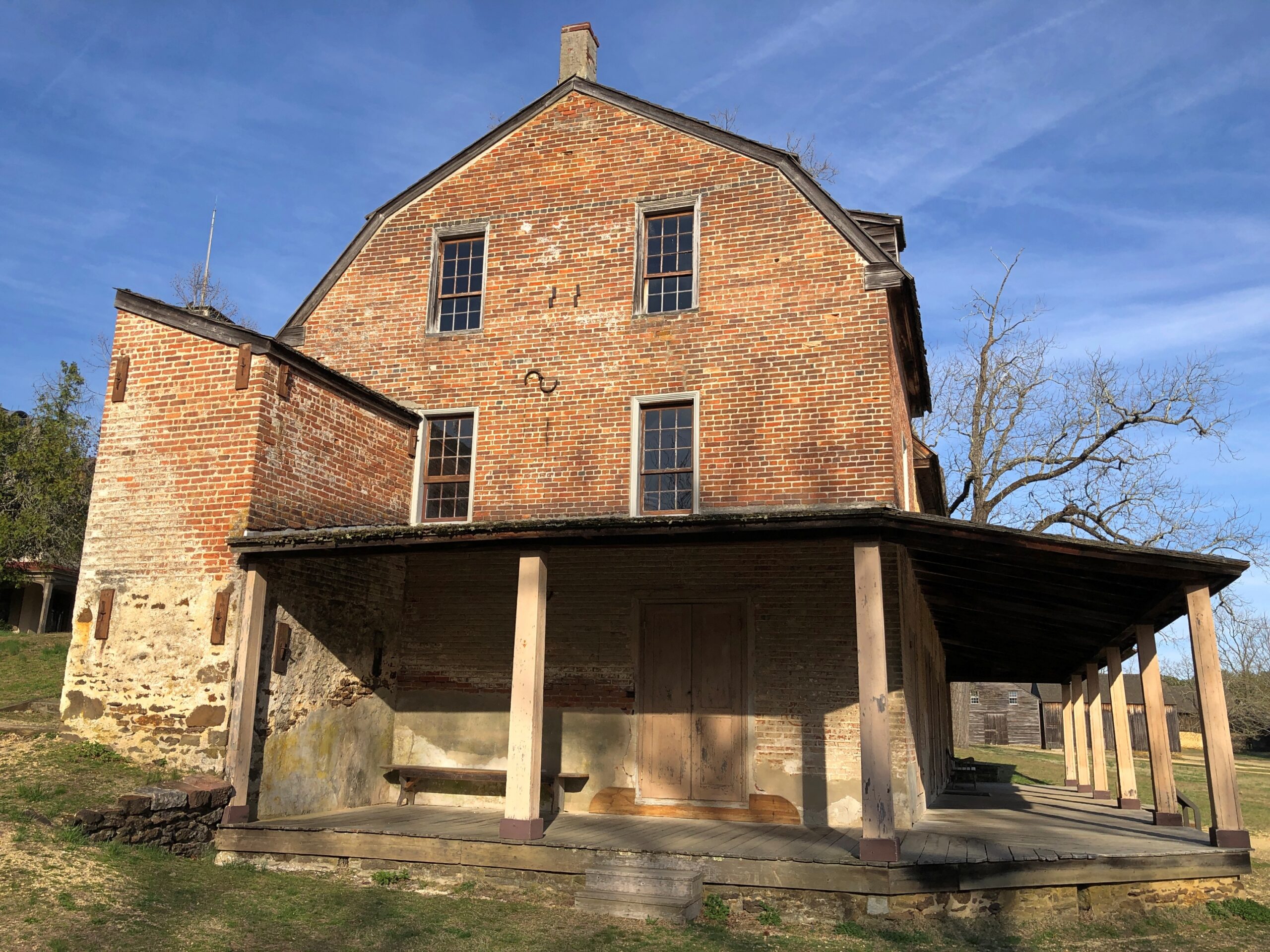
Even so, I happened across a few places in the Pinelands to stop, especially Batsto Village, site of the former Batsto Iron Works.
Most of the open-air museum buildings are 19th century, but the Batsto Iron Works had roots that went back to Colonial times. Some enterprising early NJ settlers found bog iron in the area. By the 19th century, the iron smelting was doing well enough to support a company town, including of course the boss’s house.
The company store.
The company paid in script until the workers were organized enough to demand legal tender for their labor. Unlike at Fayette Historic State Park in Michigan, the actual industrial facility, the 19th-century blast furnace, is long gone. The place has a good-looking lake, however. Created by a small dam on Batsto River to harness the water for the sawmill.
A vista that says New Jersey? Yes, but not the New Jersey of song and story.
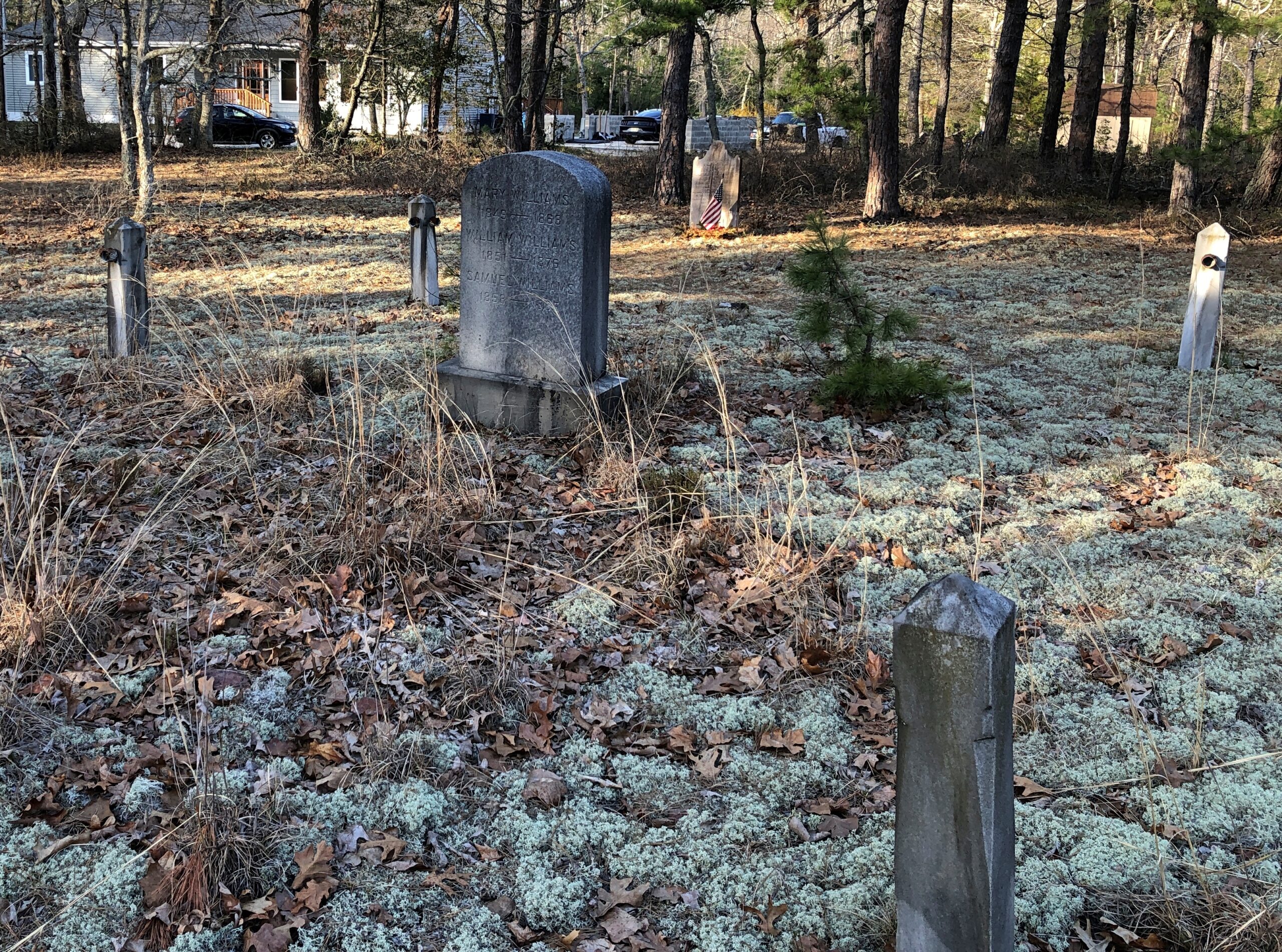
Back in Egg Harbor City (pop. 4,442), I chanced across the Egg Harbor City Cemetery – another reason to leave the GPS inactive most of the time. If the box tells you where to go, you’ll miss minor misdirections that take you to unexpected places.
I’ve come up with my next approach to traversing the Pine Barrens. There will be a next time, provided my health holds out. That’s always a contingency these days, but anyway the approach can’t be as rational as trying to plot oneself on a map, or even follow the directions from a machine.
The region isn’t that large. That is, provided your car is gassed and in good running condition, since walking out of the Pine Barrels, even following surfaced roads, seems like a bad idea unless you’ve prepared yourself to do so. Assuming you drive, pick a direction – say east, toward the morning sun – and head that way, hewing to the direction as much as possible. It won’t be too long before you come to a reliably numbered state or US highway. Or in that case, the Garden State Parkway.
Sounds doable. Unless you encounter the Jersey Devil.
New Jersey flummoxed the GPS system I use occasionally in my car. Twice.
And I mean occasionally: only twice on this trip of nearly 3,500 miles through nine states, both times in New Jersey, and both times the Garden State proved too much for mere trilateration to distant satellites. Later, during a disorientation in Poughkeepsie, NY, I would have done well to use the system, but was too hardheaded for it by that point.
Most of the time, I don’t need it. My alternating use of paper and electronic maps is generally enough. However, GPS can simplify the task of trying to find a specific place – a motel, usually – in an unfamiliar urban area after dark. Provided, it seems, you’re not in New Jersey.
Approaching Trenton on the evening of April 8, I figured that would be the time to turn over navigation to the system. For a while, it seemed to give good directions. Then it told me to enter one of the local expressways, which I did at the point indicated. A few seconds later, the machine gave directions that absolutely made no sense: turn left at the next light. What? I was on an entry ramp of a limited-access expressway. A few more directions bore no relation to reality on the road, so I switched it off, went to the next exit, and found a place to stop and consult Google Maps. I’d been sent away from Trenton.
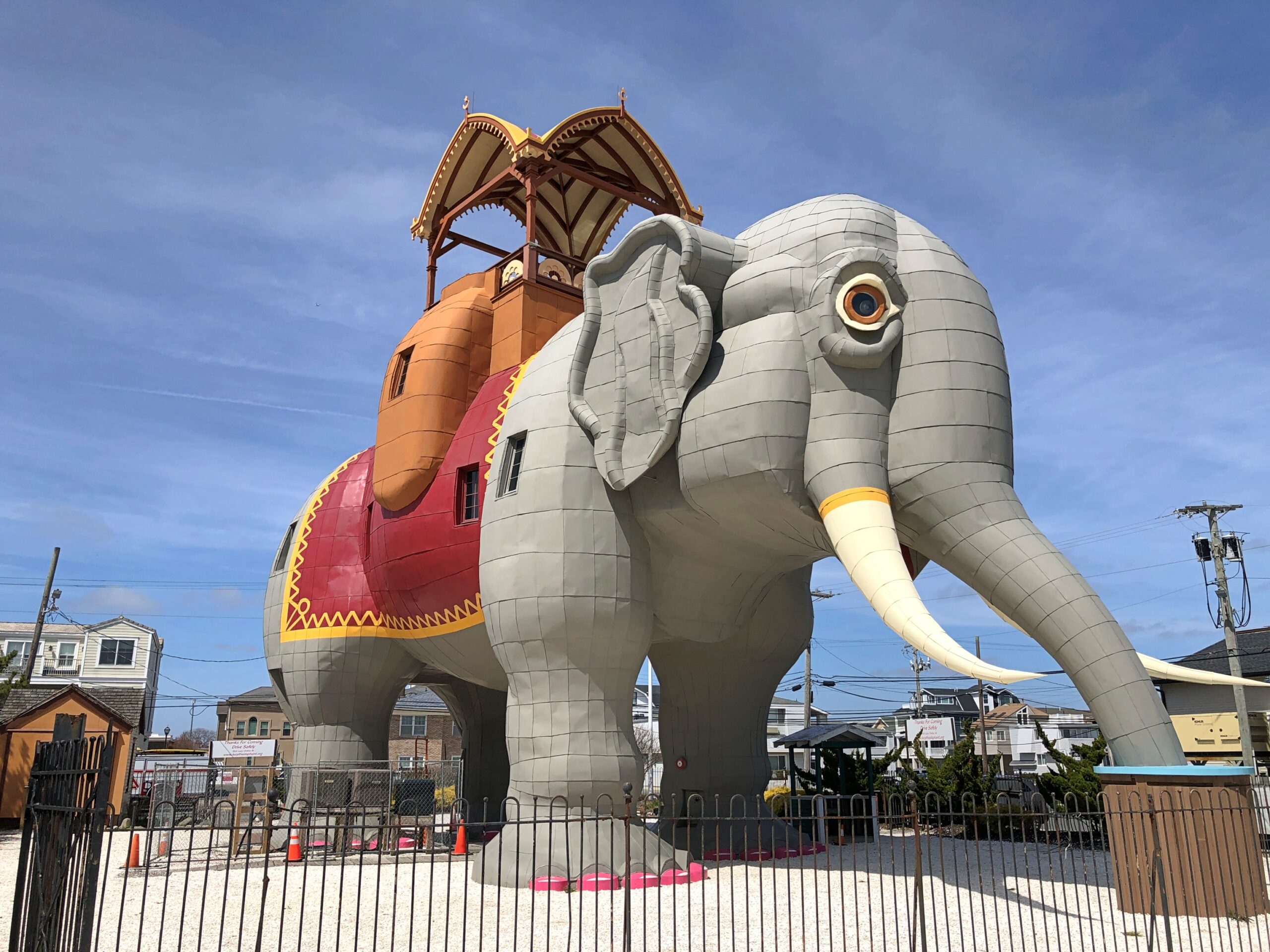
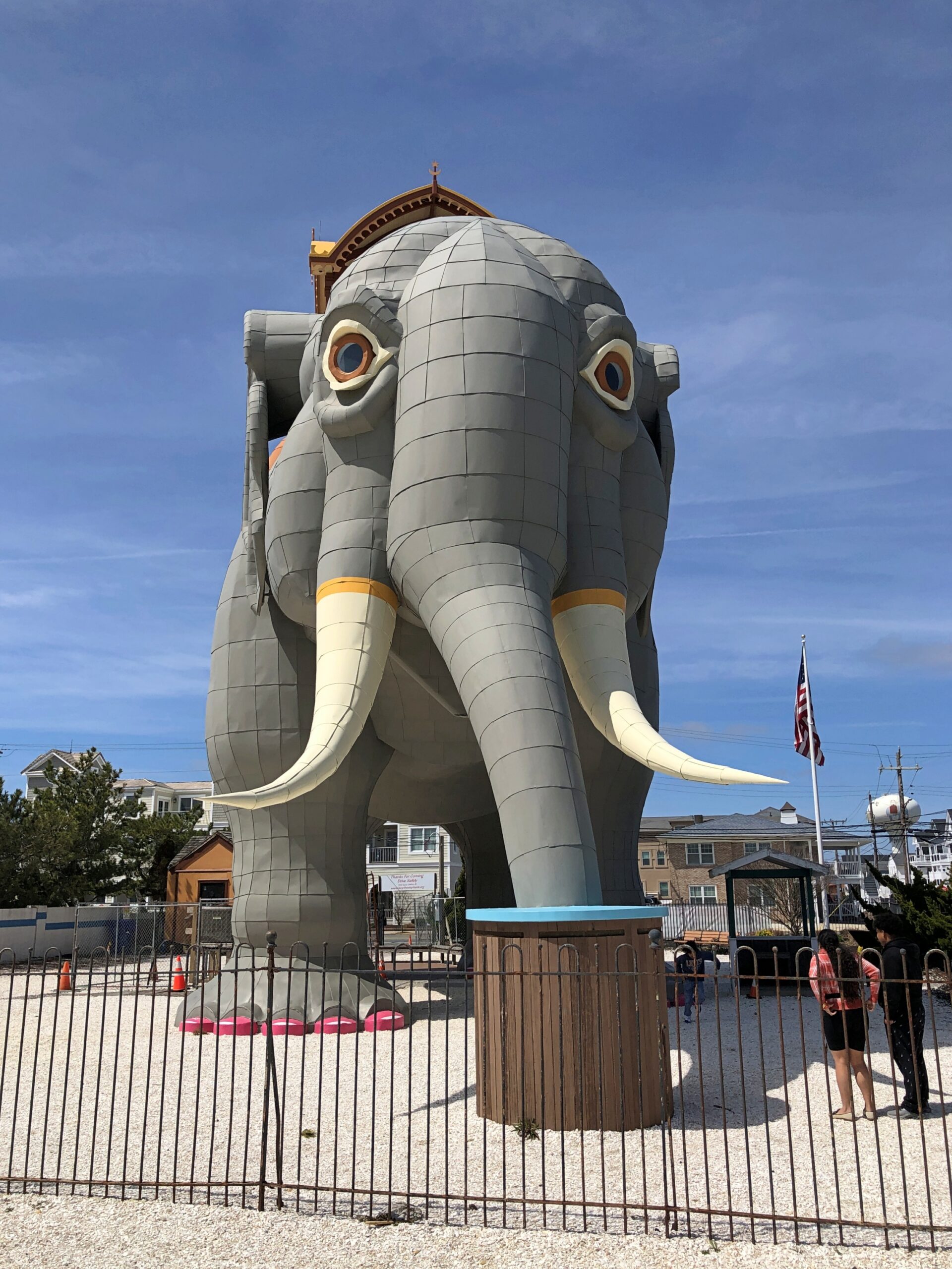
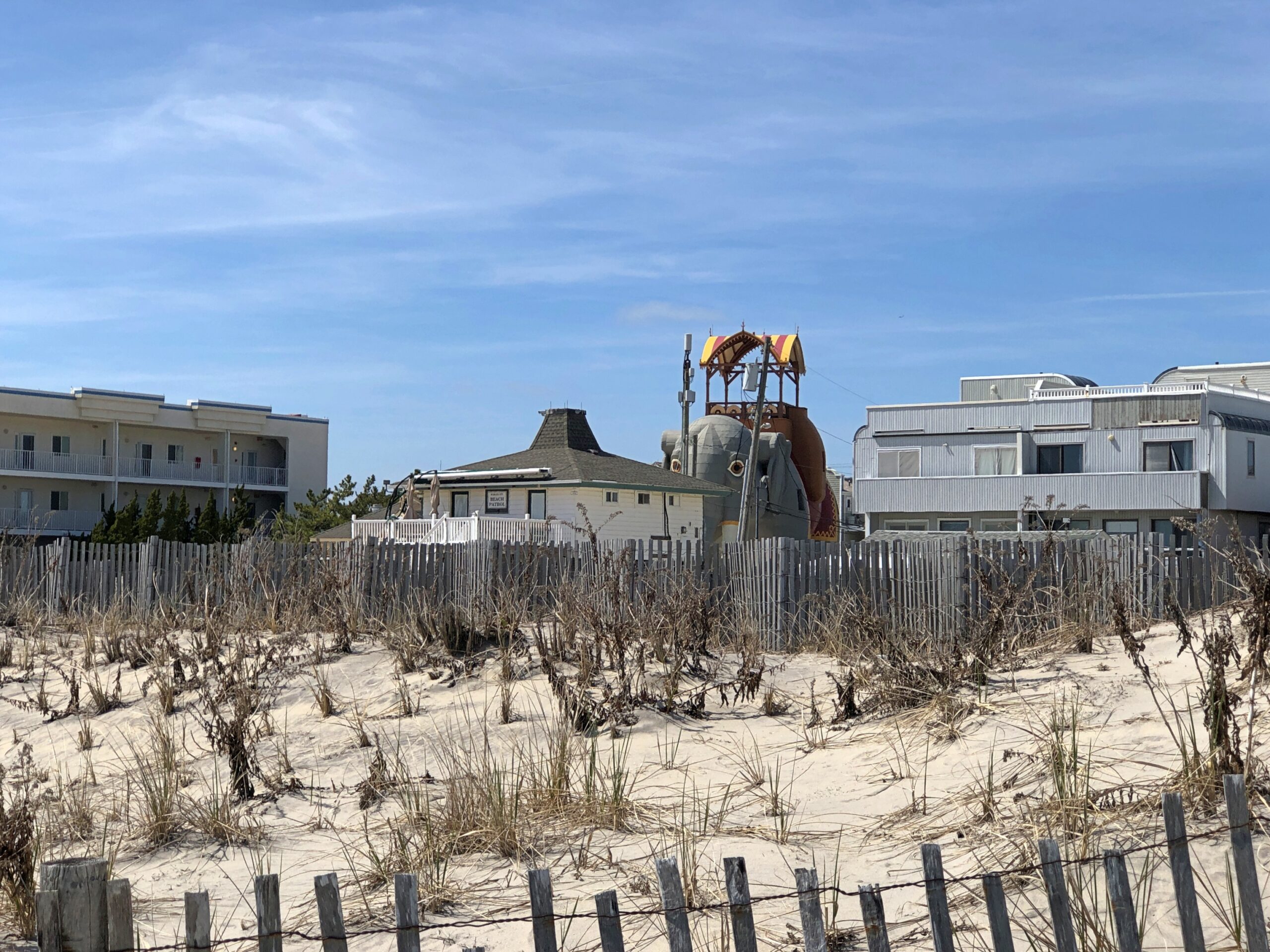
All that was just an unpleasant memory on the morning of the 9th, as I made my way using paper and electronic maps to the Jersey Shore. It wasn’t until later, during another misdirection in New Jersey, that I got an inkling of what might have happened. Never mind that for now. Eventually – and not too long, New Jersey isn’t that big – I passed through Atlantic City and headed south to my first destination that day: Lucy the Elephant.
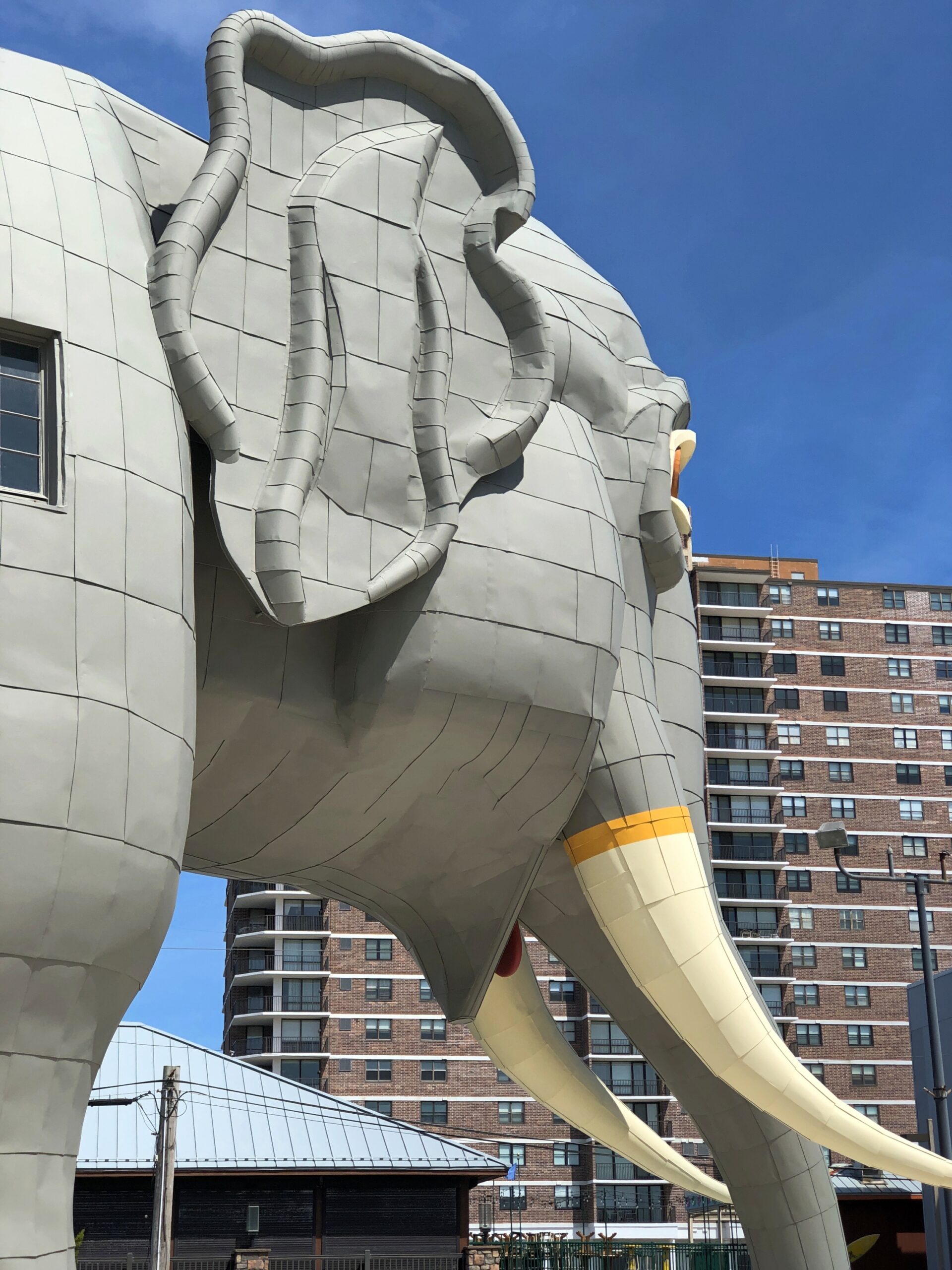
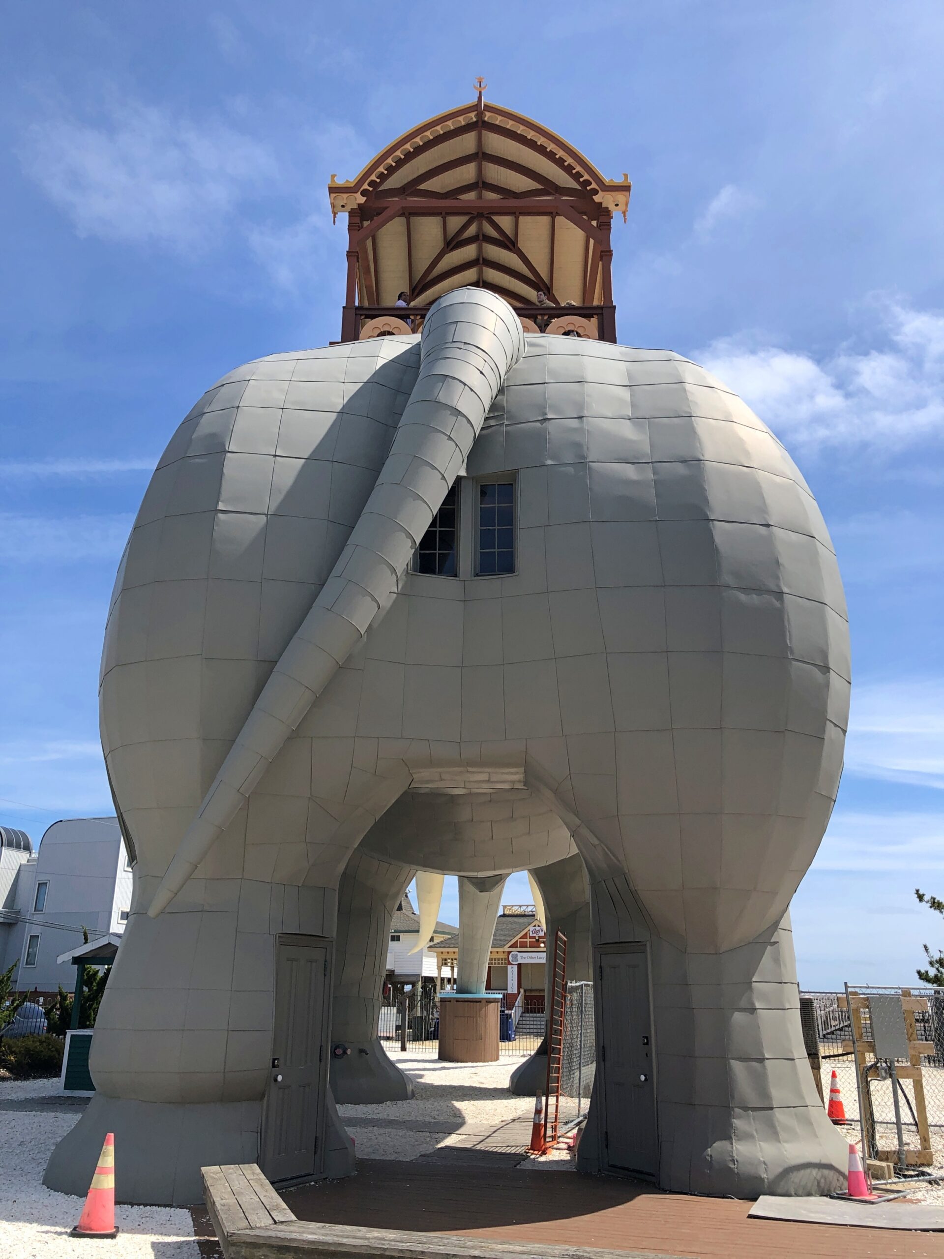
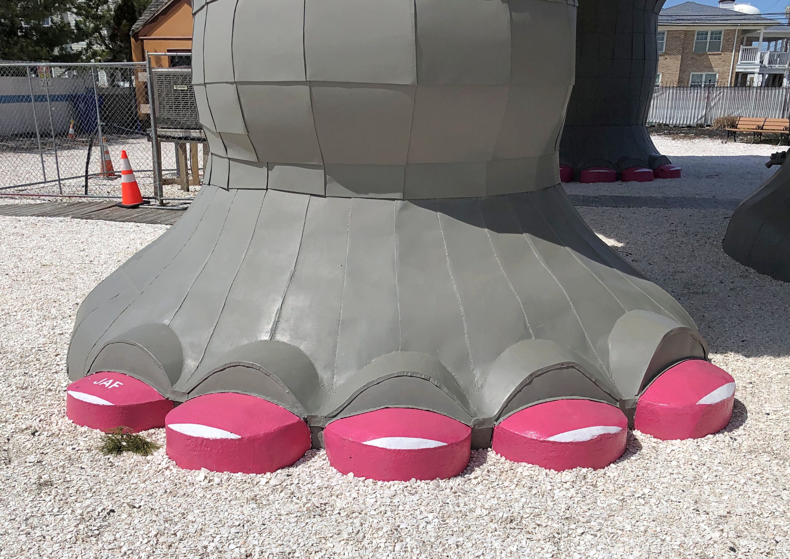
“Built of tin and wood in 1882 by James V. Lafferty as a publicity stunt, Lucy was modeled after Jumbo, P.T. Barnum’s real life ‘Largest Elephant on Earth,’ ” notes Atlas Obscura. “Lucy is much larger than Jumbo was, and stands 65 feet high, 60 feet long, 18 feet wide, is made of nearly one million pieces of wood, and weighs about 90 tons.”
Not just a publicity stunt, but a seminal one by a real estate developer, so much so that he was awarded a patent for the structure. “Land speculator” is perhaps more descriptive, but anyway Lafferty had a chunk of ocean-adjacent property he was looking to peddle south of Atlantic City, itself only a pup of a resort at the time, but certainly an up-and-comer.
Never mind real estate, Lafferty is pretty much remembered for the marvel that is Lucy. As he should be.
“Most of South Atlantic City at that time was a combination of scrub pine, dune grass, bayberry bushes and a few wooden fishing shacks,” says the Lucy web site. “Once Lafferty hit upon the Elephant idea he enlisted the aid of a Philadelphia architect named William Free to design this unusual structure he felt would attract visitors and property buyers to his holdings… Lafferty always claimed that before the work was finished the cost skyrocketed to $38,000.
“By 1881 Lafferty was placing advertisements in area and Philadelphia newspapers offering building lots in ‘fast booming South Atlantic City.’ Lafferty eventually extended himself too far in his land deals both at the Jersey Shore and in New York and by 1887 sought to unload his South Atlantic City holdings. He offered the Elephant and other property for sale and found a willing buyer in Anton Gertzen of Philadelphia.”
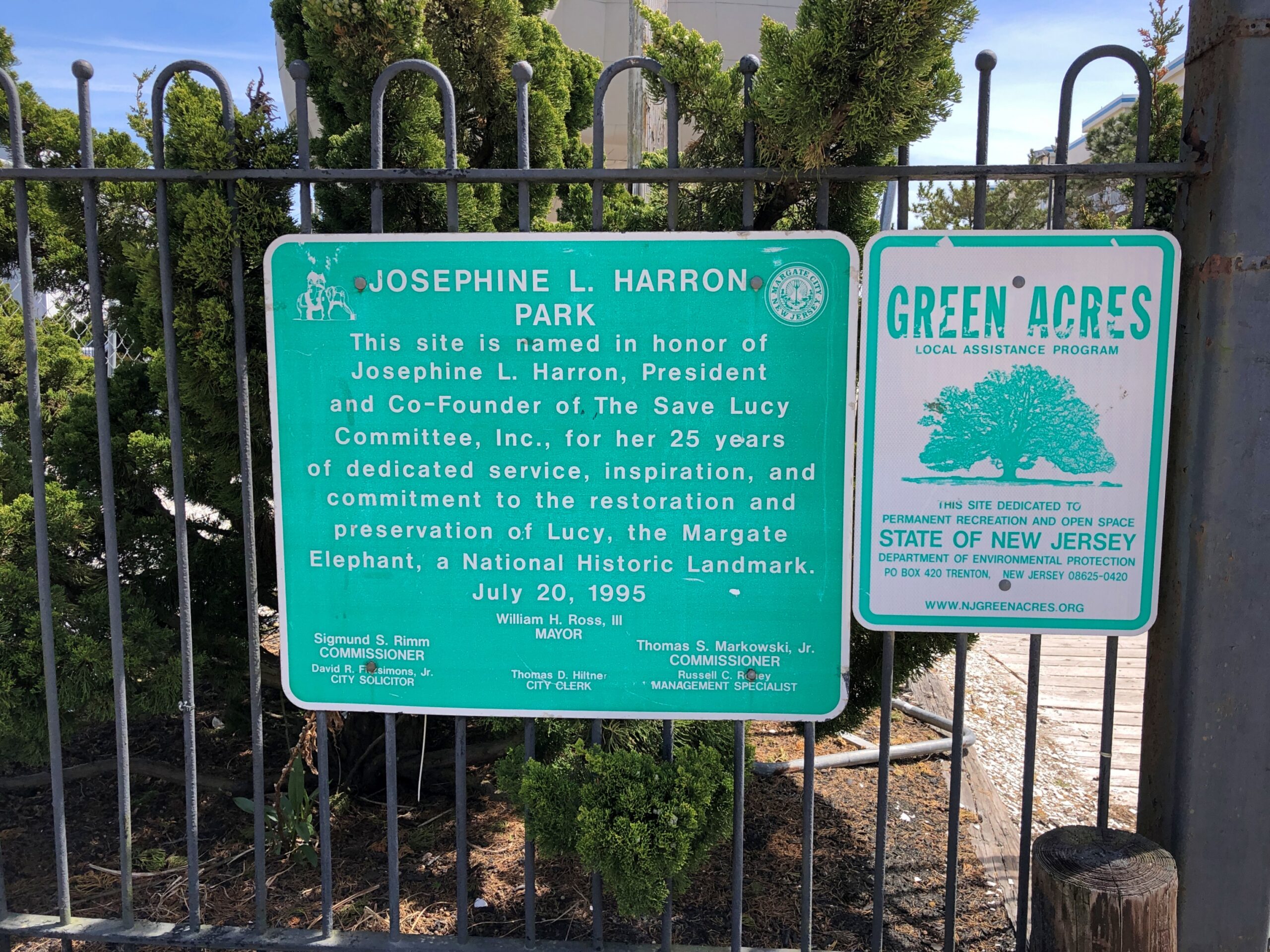
Lucy wasn’t the only elephant for Lafferty: he had others, even larger, built for Coney Island and Cape May, but they didn’t survive, and one proposed for the Columbian Exhibition in 1893 that was never built. Lucy almost didn’t survive to our time either, following a familiar arc of survival to the mid-20th century in an increasingly dilapidated state, then facing demolition. Citizen activism saved Lucy, setting up a nonprofit and finding the money for restoration, and now she attracts roughly 40,000 visitors a year.
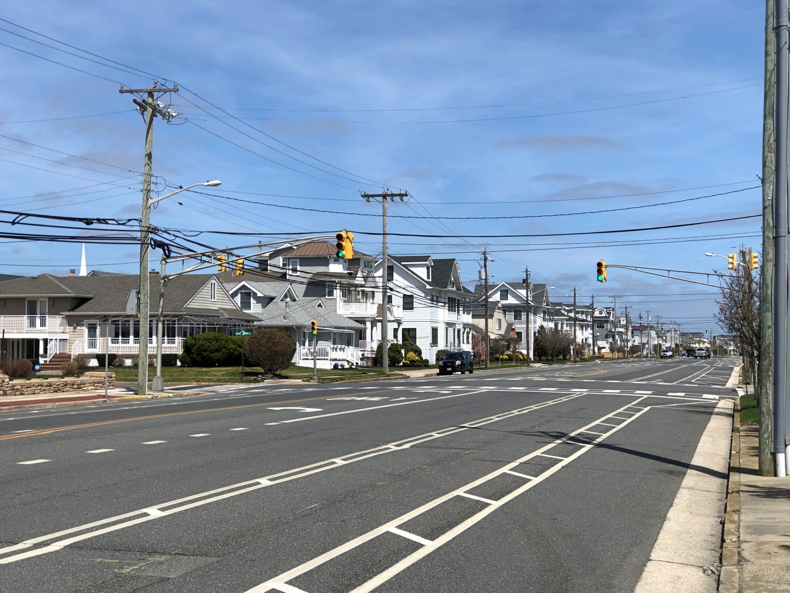
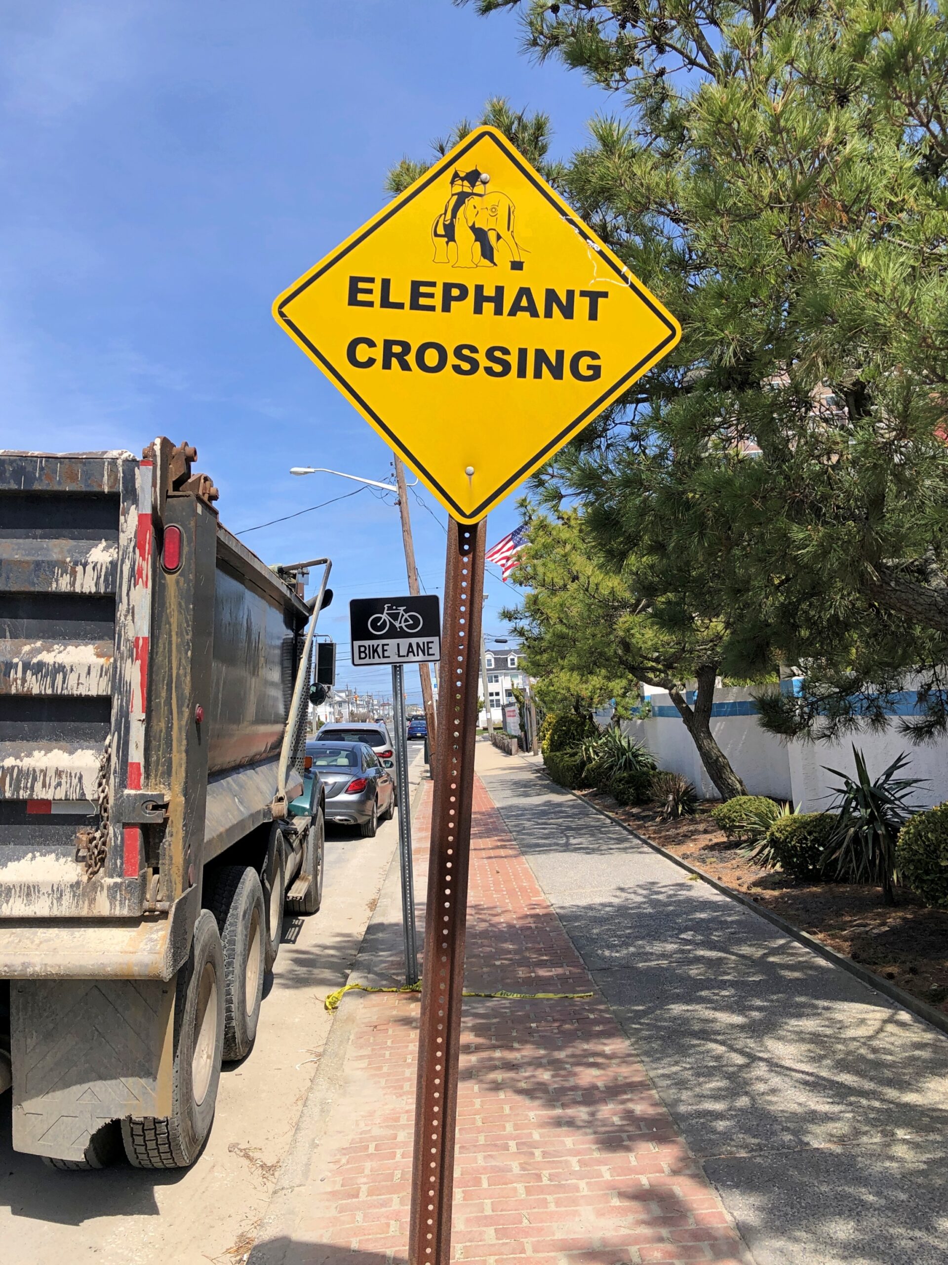
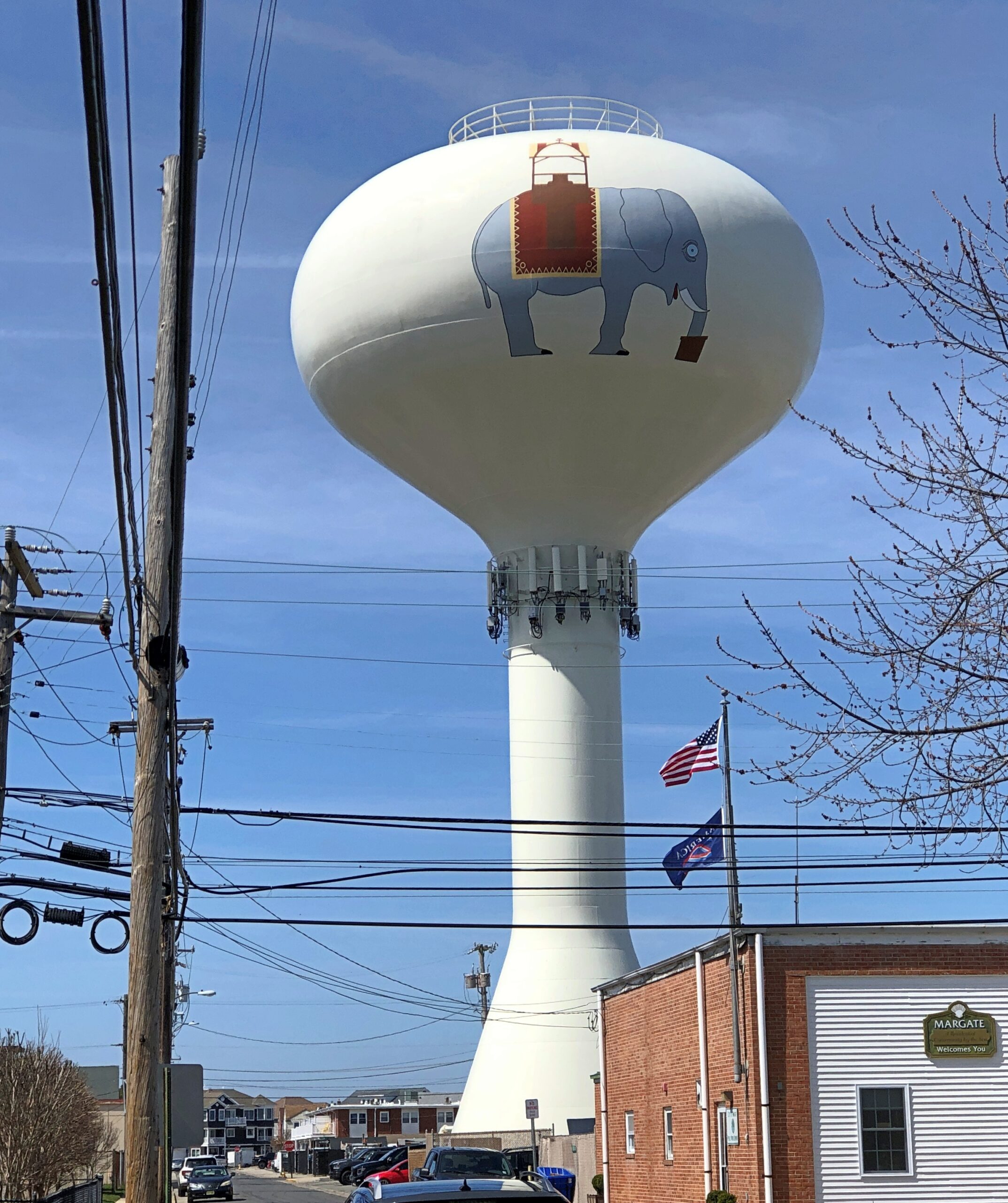
She stands on Atlantic Ave. in Margate City, NJ. A fairly ordinary street but for a few details.
Looks, I’m glad to report, are free from the street and from the grounds. An interior visit at Lucy has an admission. While I didn’t do that, I supported Lucy through the purchase of postcards and a magnet across the street in the gift shop.
Margate seems happy these days to have Lucy around.
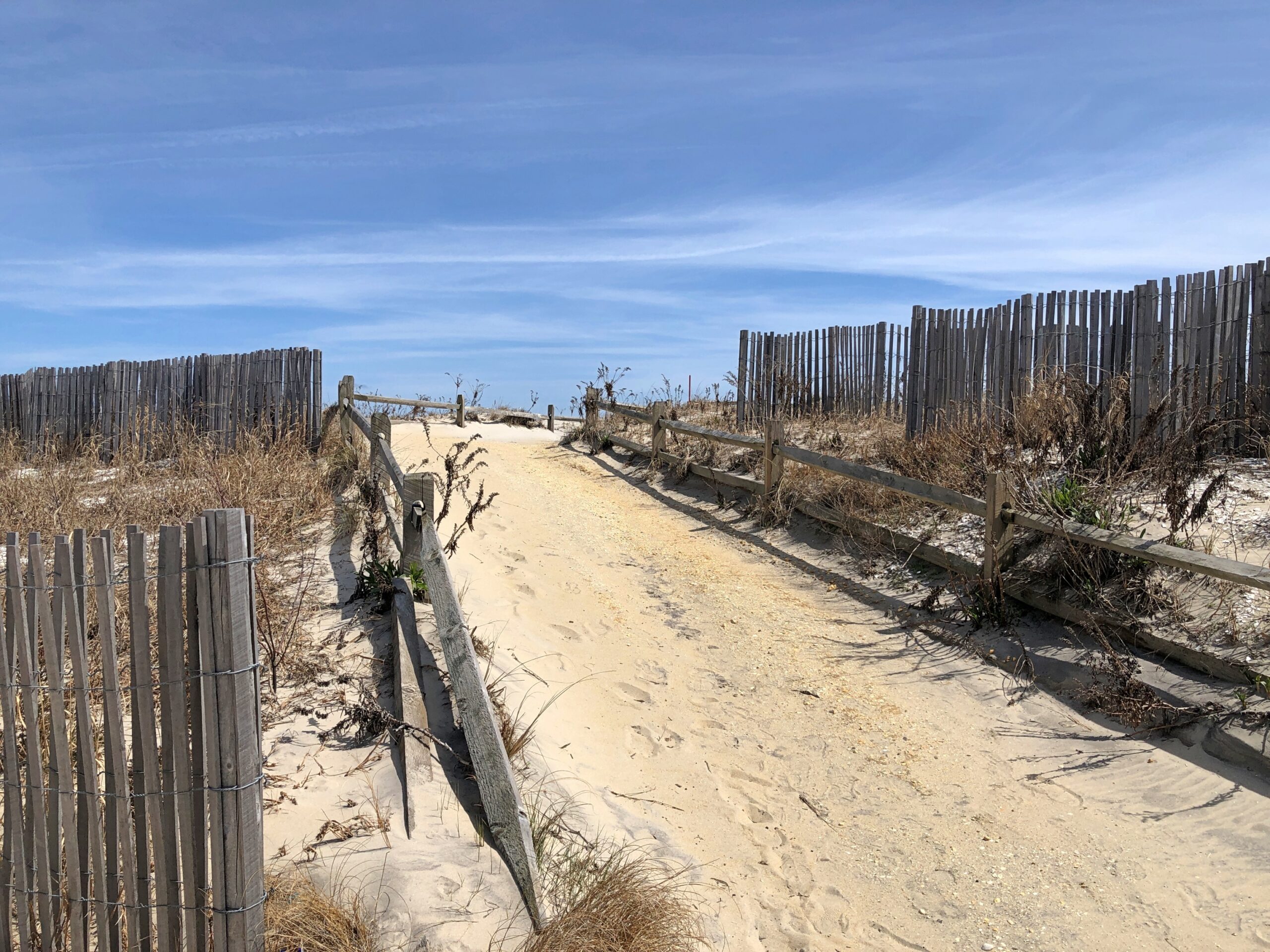
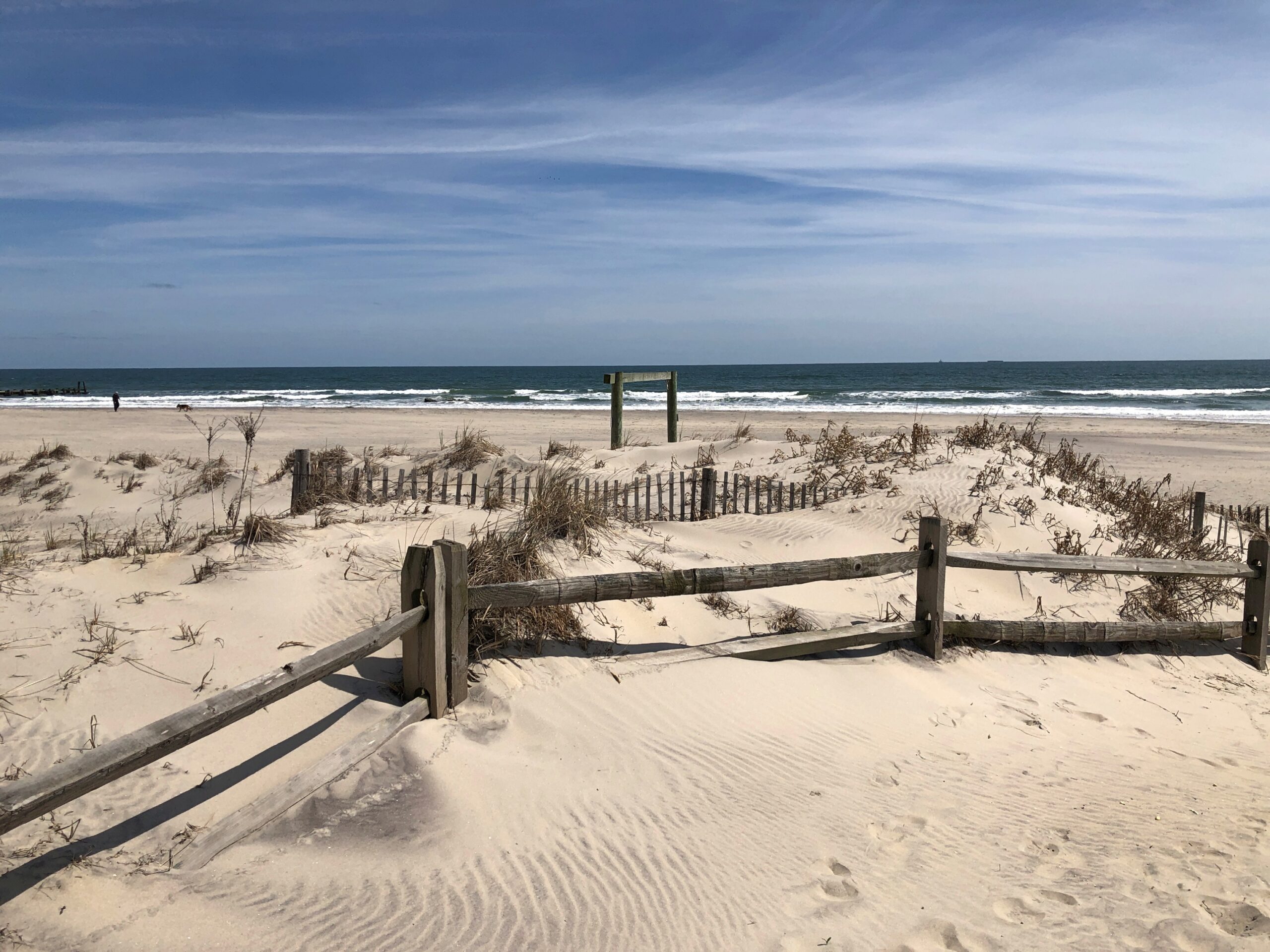
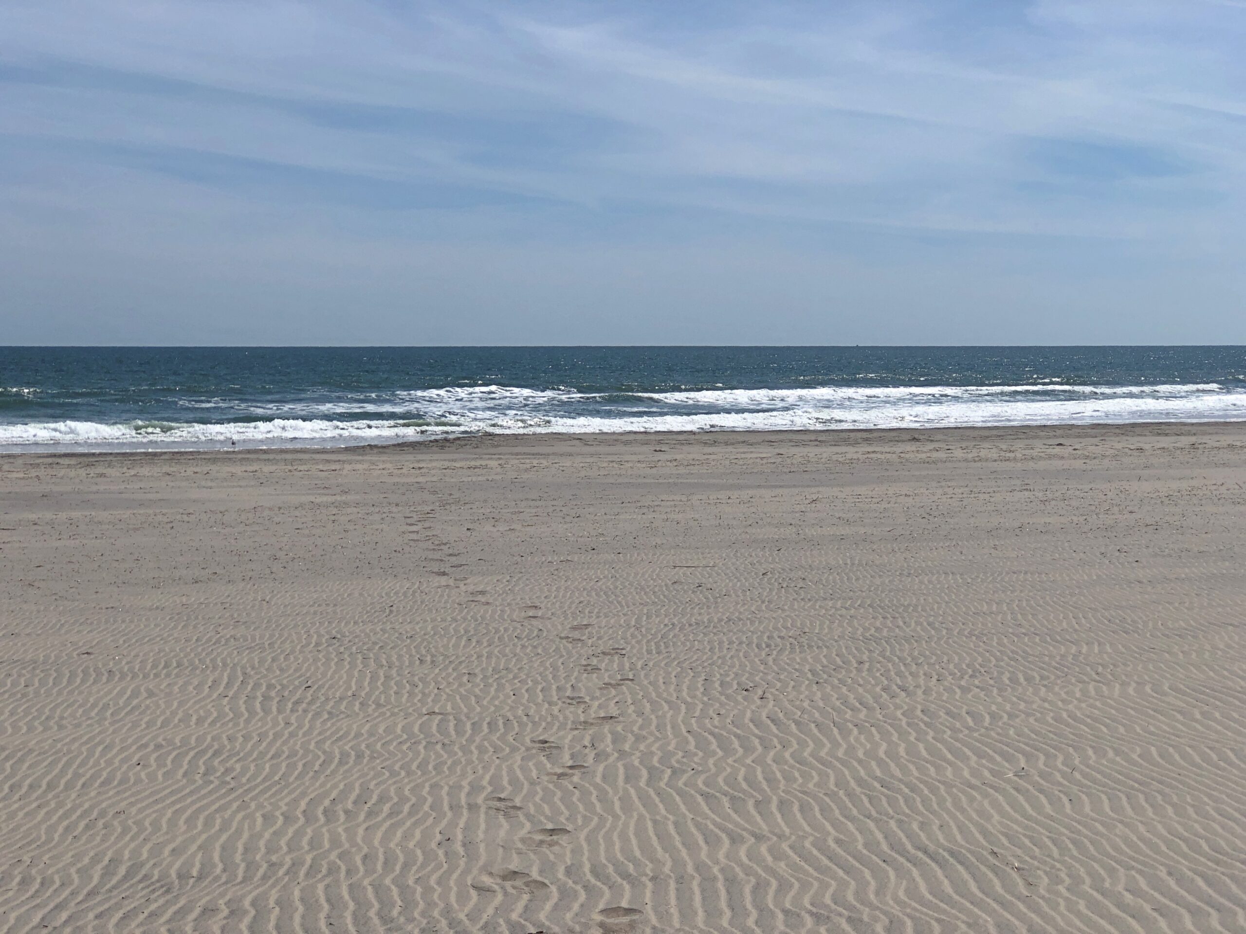
Lucy is a stone’s throw from a pretty nice beach.
Sunny that day, but a mite chilly. So I had the place practically to myself on a Thursday. Once upon a time, I understand that Margate had a boardwalk, like Atlantic City and a lot of other Jersey Shore towns, but the Great Atlantic Hurricane of 1944 destroyed most of it, and Ash Wednesday Storm of 1962 finished it off.