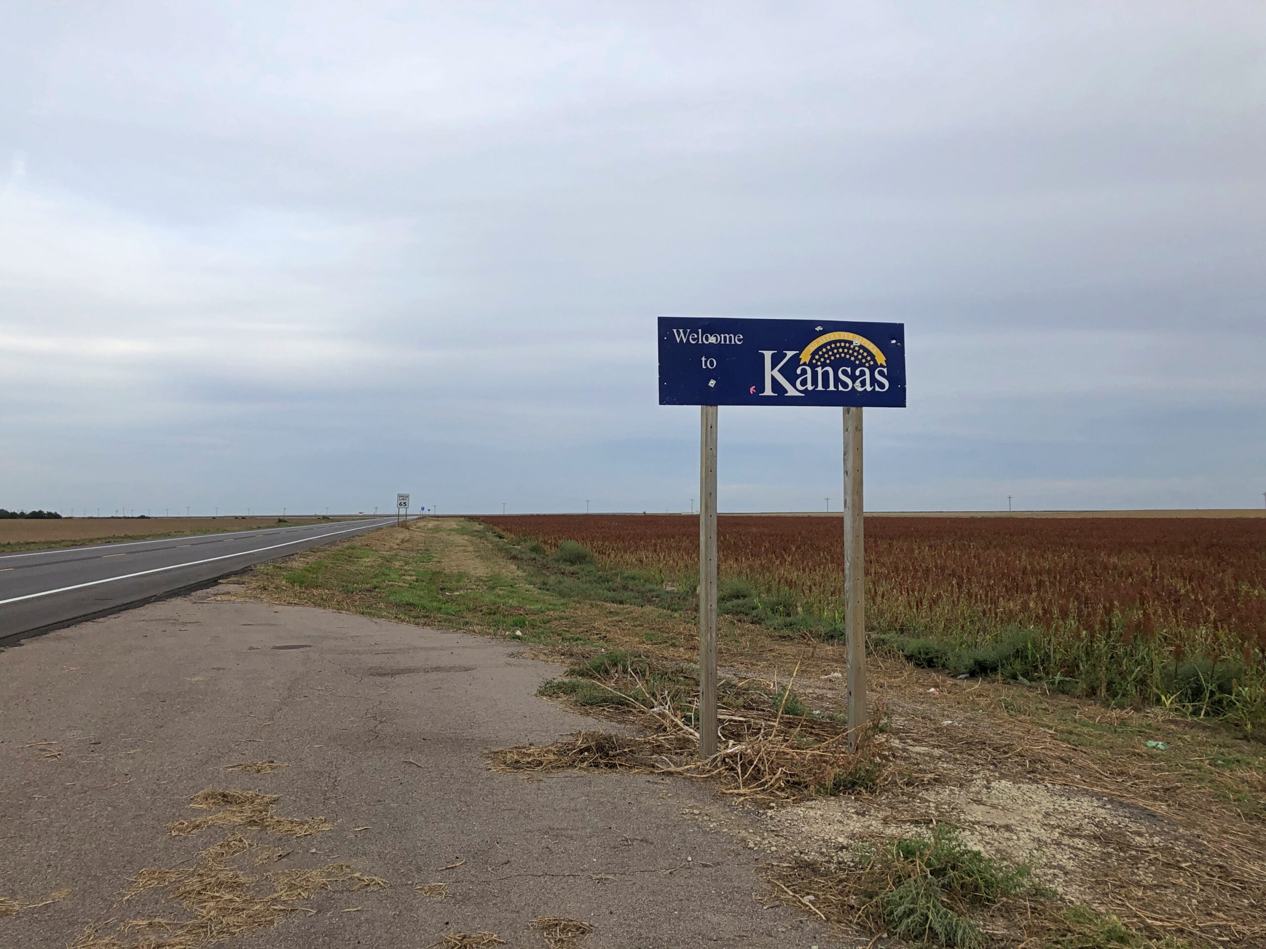
I returned home from Colorado via Kansas, heading eastward from Colorado Springs on September 22. I took this is a sign that day that I had, in fact, reached the western border of Kansas, created at the time of statehood in 1861.
An 1855 map of “Kanzas” and Nebraska.
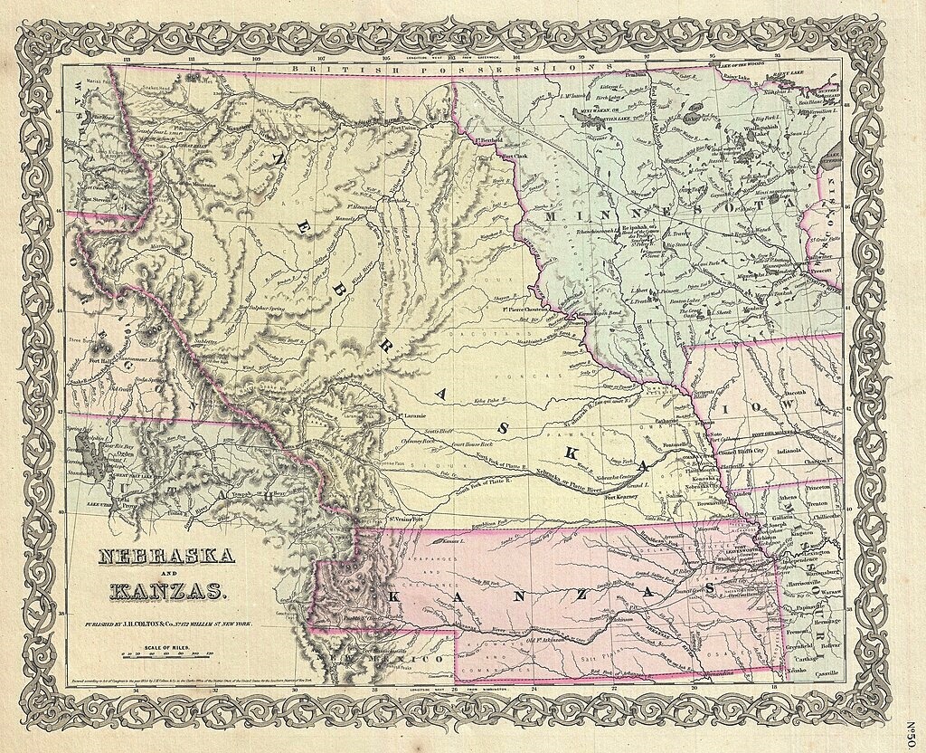
It would be cool if the spelling Kanzas had caught on. As it stands, “z” is used only once in all the state names, in Arizona.
The current Colorado-Kansas border is fairly close to 102 degrees West of the prime meridian, but actually follows 25 degrees West of the meridian that once cut through the Old Naval Observatory in Washington, DC, as fixed in 1850, assuming the initial surveys out in remote Kansas-Nebraska were accurate. Until later in the 19th century, and not officially until 1912, it seems the U.S. wasn’t having that limey prime meridian; or the froggy one through Paris. (And I was amused to read that for a long time the French referred to Greenwich Mean Time as “Paris mean time, retarded by 9 minutes and 21 seconds.”)
I spent my first full day in Kansas seeking out obscure sights. In western Kansas, there really aren’t any other kind.
Site of the Battle of Punished Woman’s Fork (Battle Canyon)
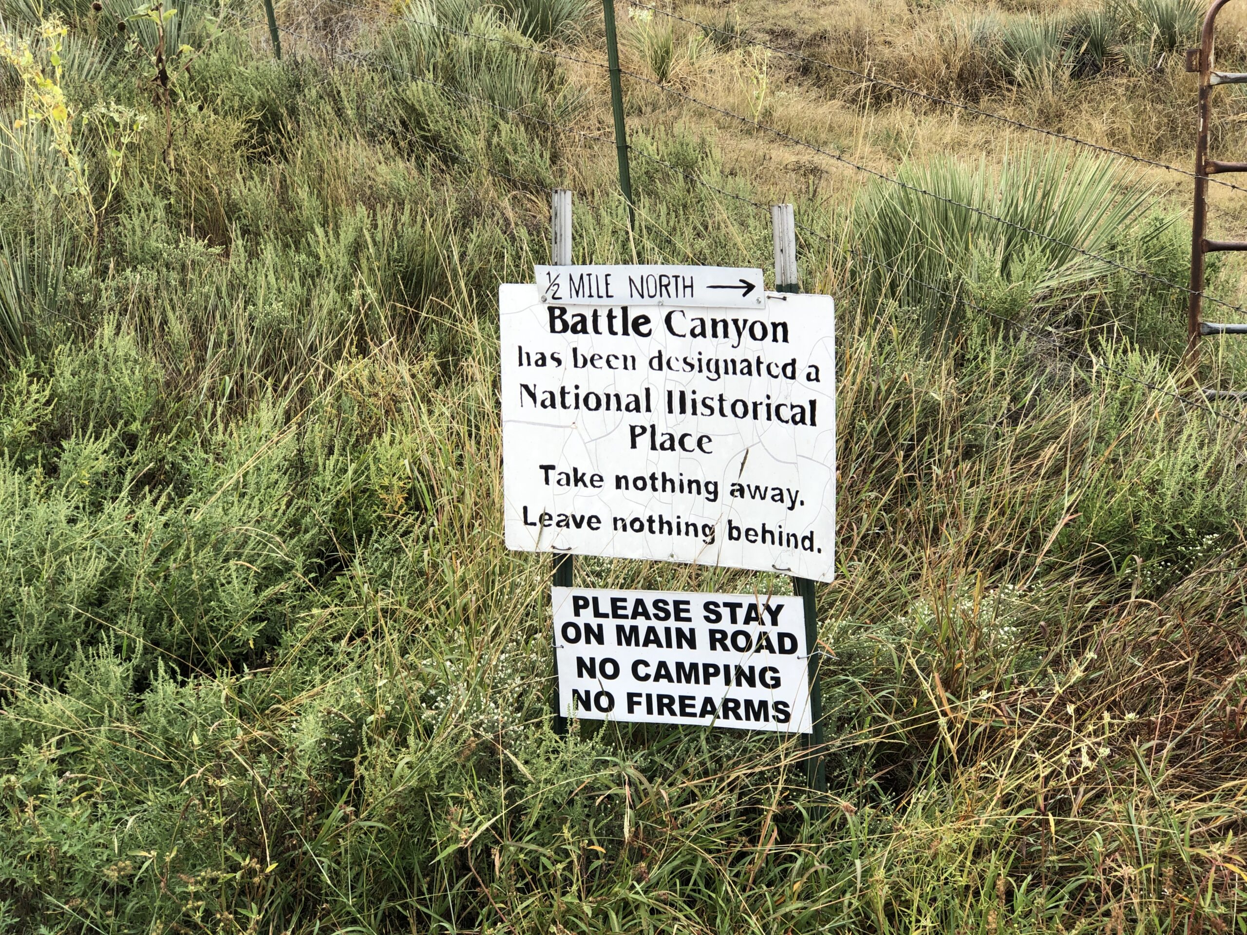
Serendipity on the road is your friend, if you let it be. That is, pay attention to signs. Driving north on the 23rd from Scott City, Kansas, on the highway US 83 – on which you could drive to Brownsville, Texas, if you had a mind to – I saw a small sign directing me to a battlefield of the Indian Wars, in this case the last skirmish between Natives and the U.S. Army within the borders of Kansas: the Battle of Punished Woman’s Fork.
This isn’t the sign I saw, but rather another one at a fork in the road, pointing the way to the battlefield, down an unpaved road.
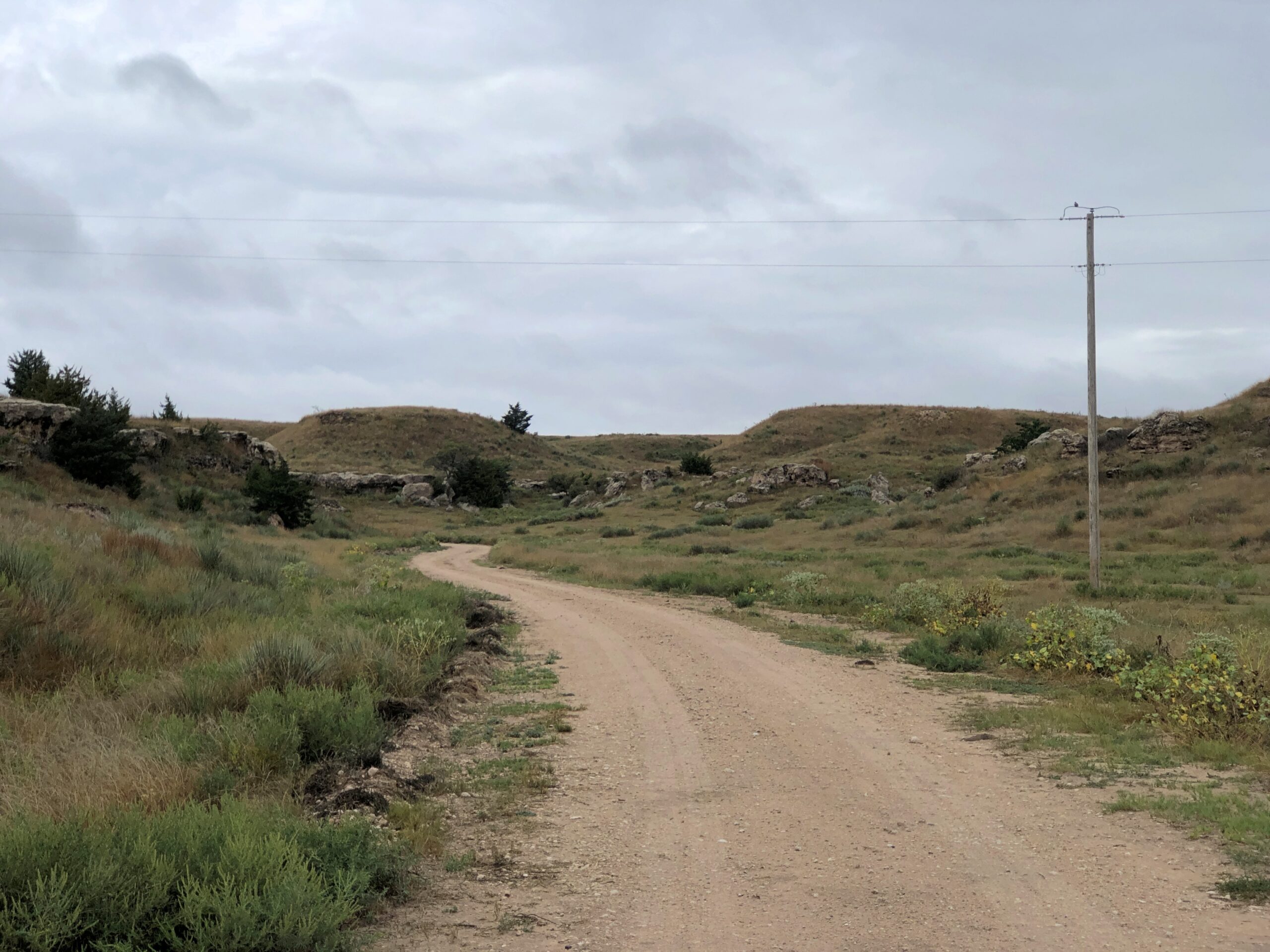
Unhappy at being forced to live in Oklahoma, 350 or so Cheyenne headed north toward Montana in 1878. The U.S. Army gave pursuit and the two sides fought inconclusively at a lonely spot in Scott County. Lonely then, lonely now.
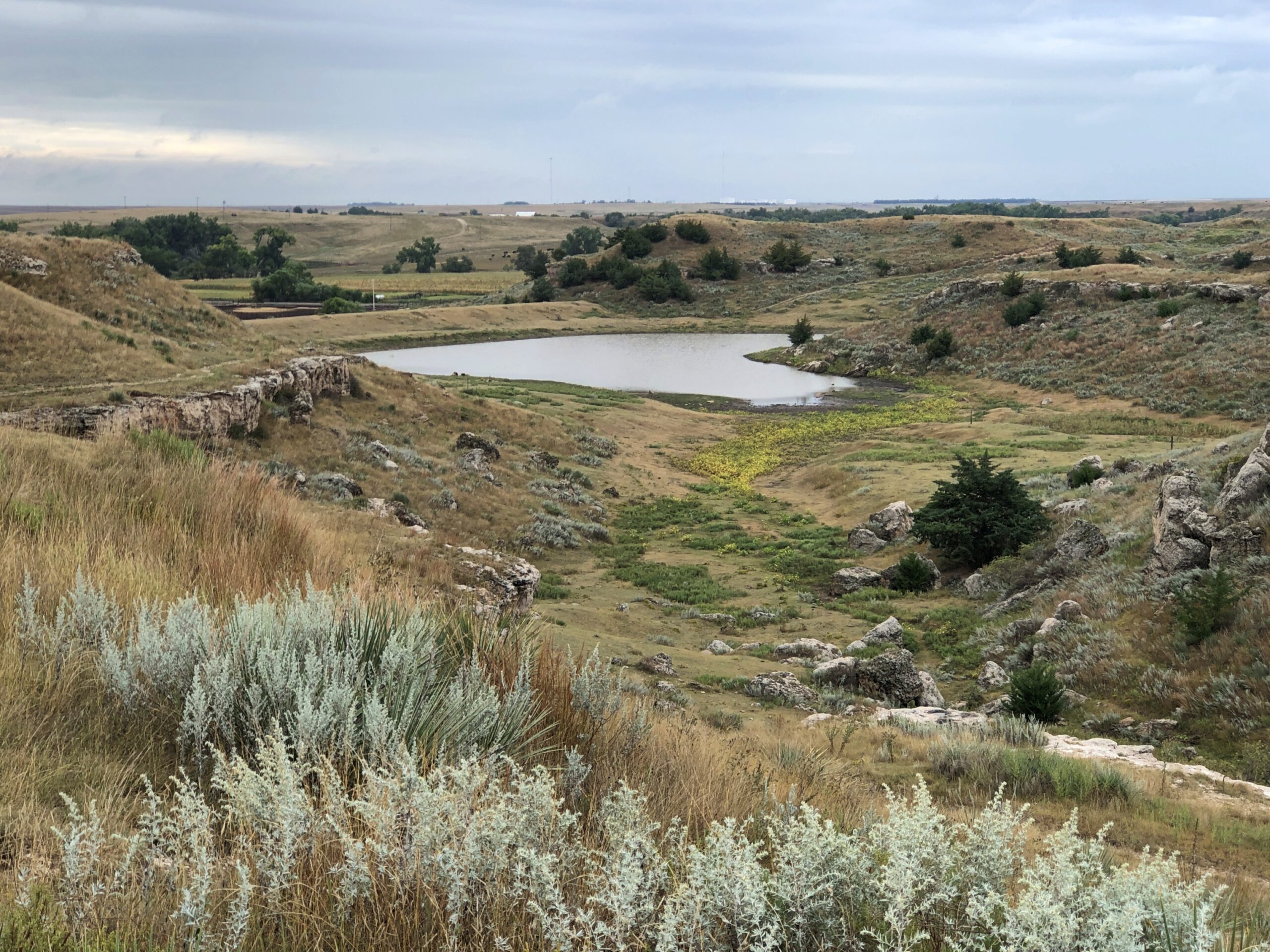
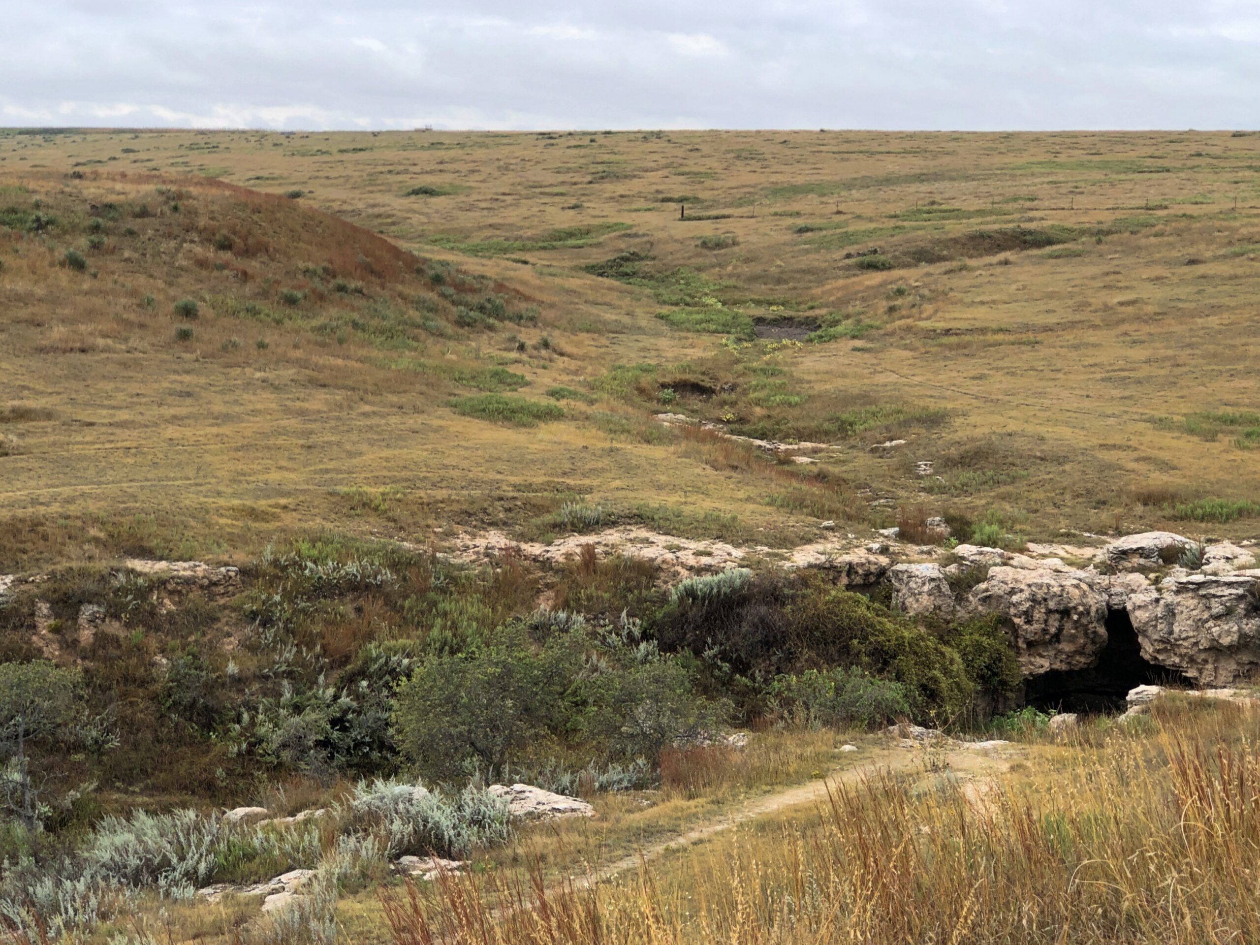
But not so remote that there isn’t a monument, with exposition.
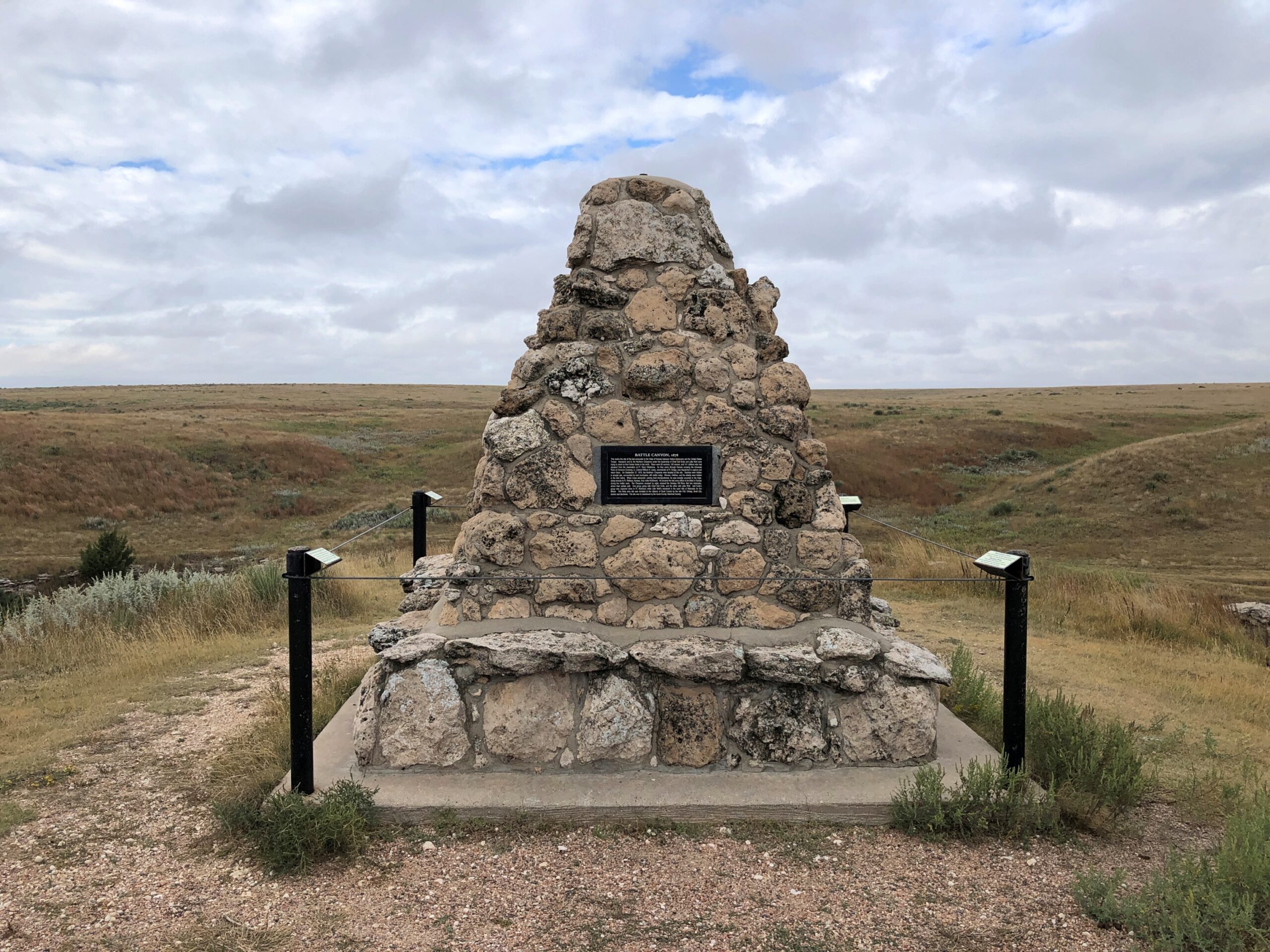
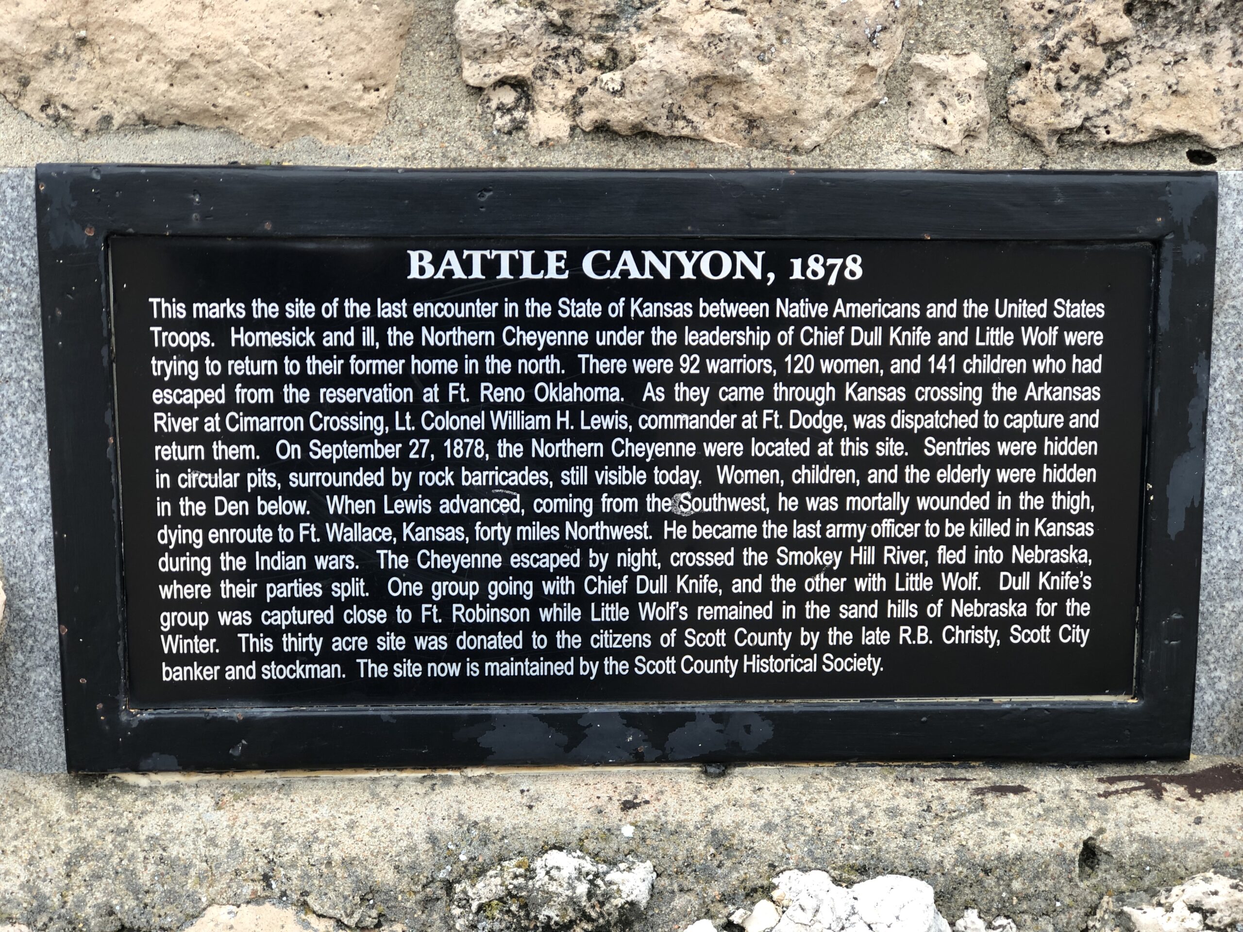
The Cheyenne acquitted themselves well in the skirmish, and while they lost horses and food, were able to escape northward. Eventually some of the group – but not all – did indeed make it to Montana, and were able to stay. The incident is known as the Northern Cheyenne Exodus.
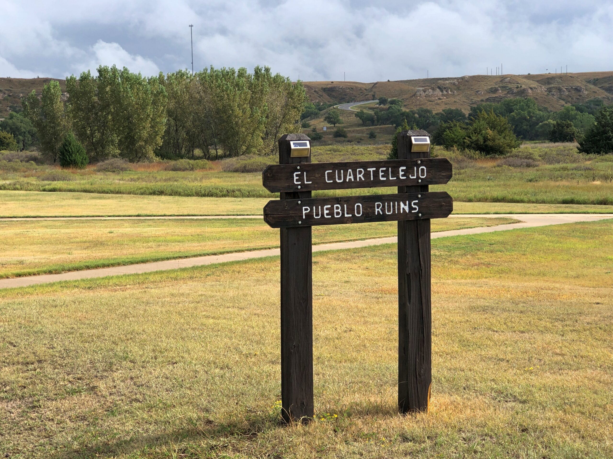
El Cuartelejo
I quote the following at length, because it’s well written, and also happens to be public domain material, published by the National Park Service. Read it while it’s still posted.
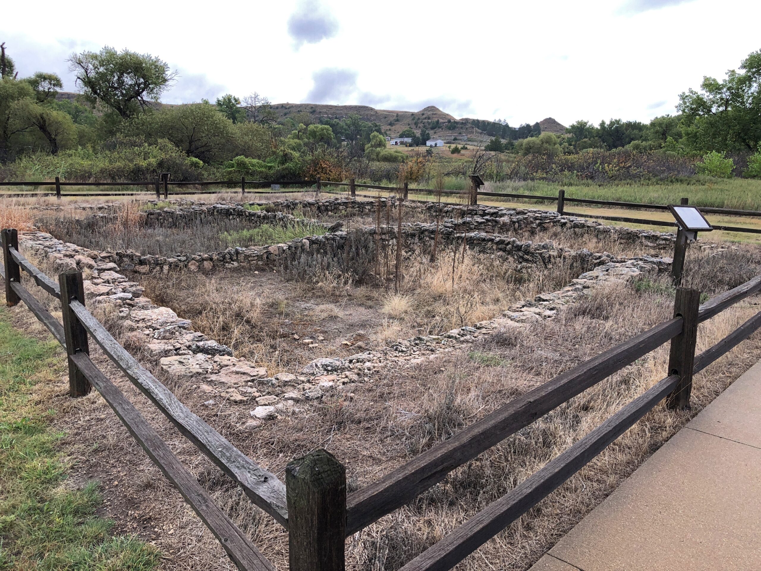
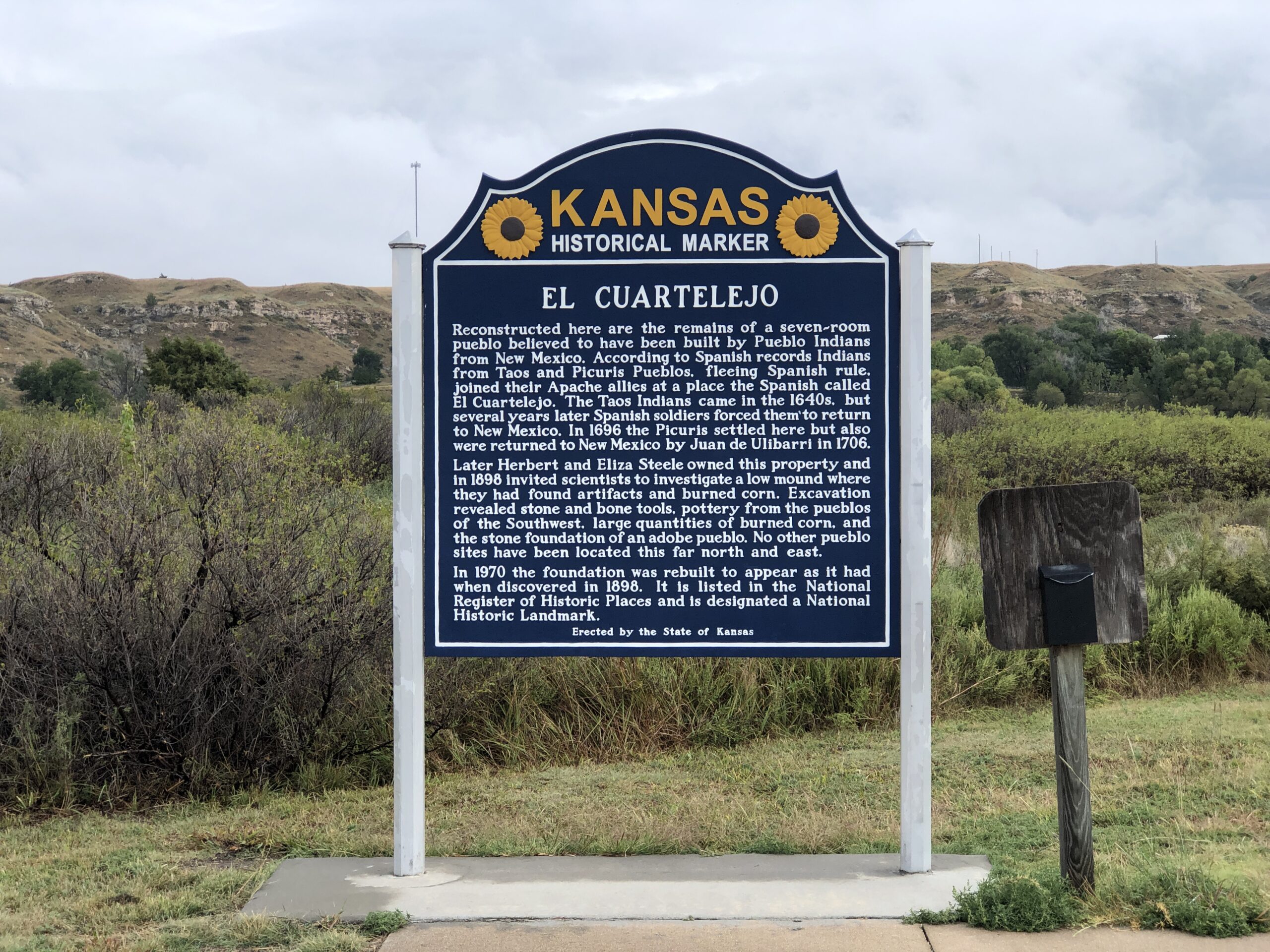
[El Cuartelejo] is one of the key sites indicating the far-reaching expansion of Spain beyond New Mexico and her interest in the Great Plains. It consists of the ruins of a seven-room, stone Puebloan structure, probably built by a group of Picuris Indians who in 1696 emigrated from New Mexico to live with the Cuartelejo Apaches. As early as the 1660s, friction between the Pueblo Indians of New Mexico and the Spanish rulers and priests had caused groups of Indians to migrate to El Cuartelejo.
Spanish expeditions under Archuleta (pre-1680 Pueblo Revolt) and Ulibarri (1706) probably came to El Cuartelejo to return groups of Indians to New Mexico. In 1719, Governor Valverde led an expedition northeast from Santa Fe, visited the Cuartelejo Apaches, and learned from them of French penetration into the Plains. As a result, in 1720, the Spanish sent out the Villasur expedition, which passed through El Cuartelejo but was destroyed later by the Pawnees in Nebraska.
Archeological excavation of the site has produced only a few artifacts of Southwestern origin. The pueblo ruin and its typically Southwestern appurtenances — slab-lined hearths, grinding trough, oven, and the like — were directly associated with a material culture complex that was almost entirely Plains Apache. Either the Puebloans stayed in the area only a short time, or they readily adapted themselves to the everyday implements and utensils of the local residents.
I didn’t know all that detail when I decided to go to El Cuartelego. Just that it was the northern- and eastern-most pueblo, which was enough.
The site is within Lake Scott State Park, where I had considered camping the night before. My earlier camping experience on the trip, in Nebraska, while not terrible, was exhausting enough to put me off the idea. No more camping, I think, where I have to do absolutely everything myself. In any case, it was a good decision, since on the night of the 22nd, a sizable rainstorm blew through Scott County. I listened to the storm with some satisfaction in my rented room in Scott City.
The ruins.
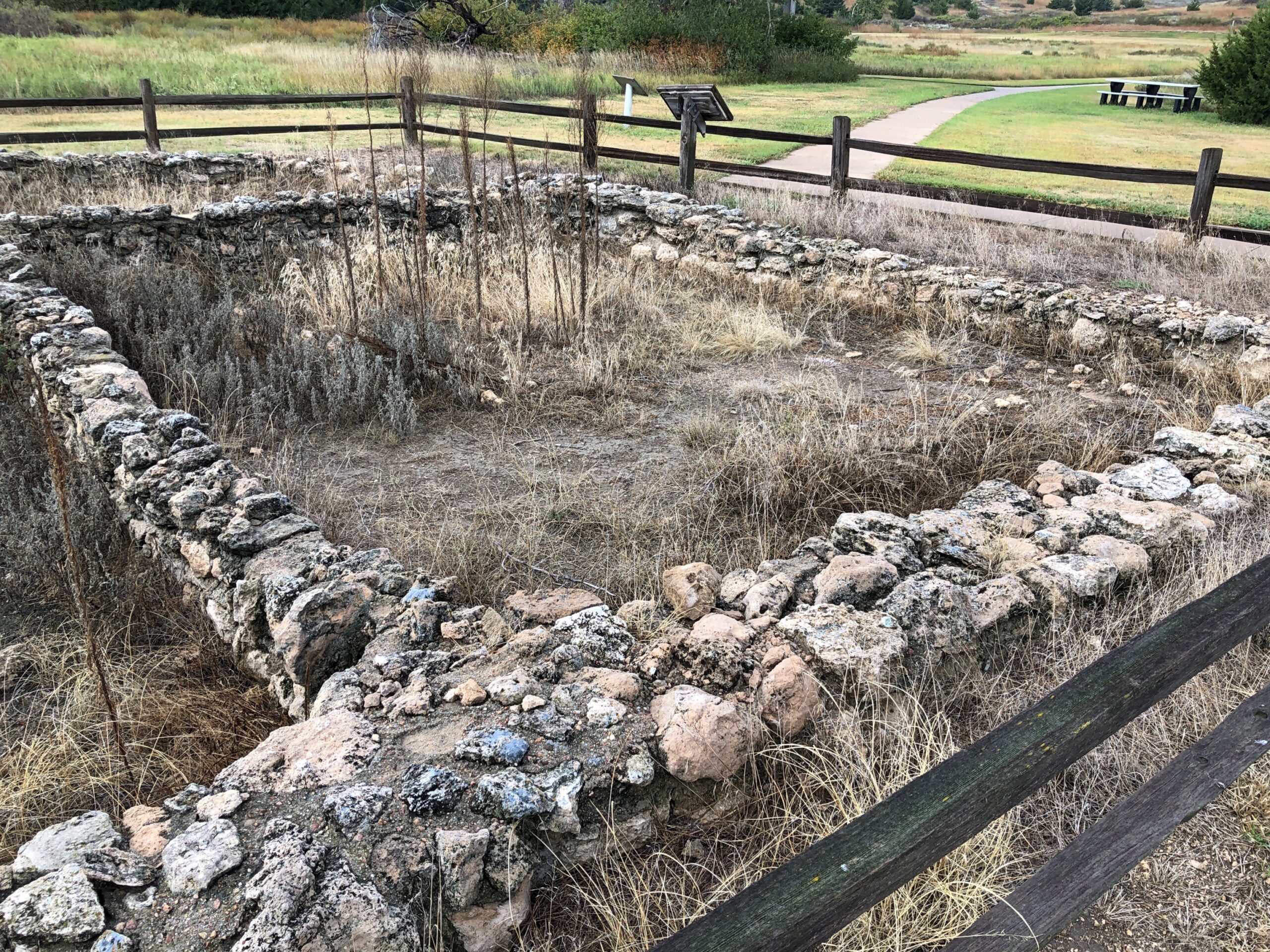
More exposition.
Like at the battlefield, I had the place to myself.
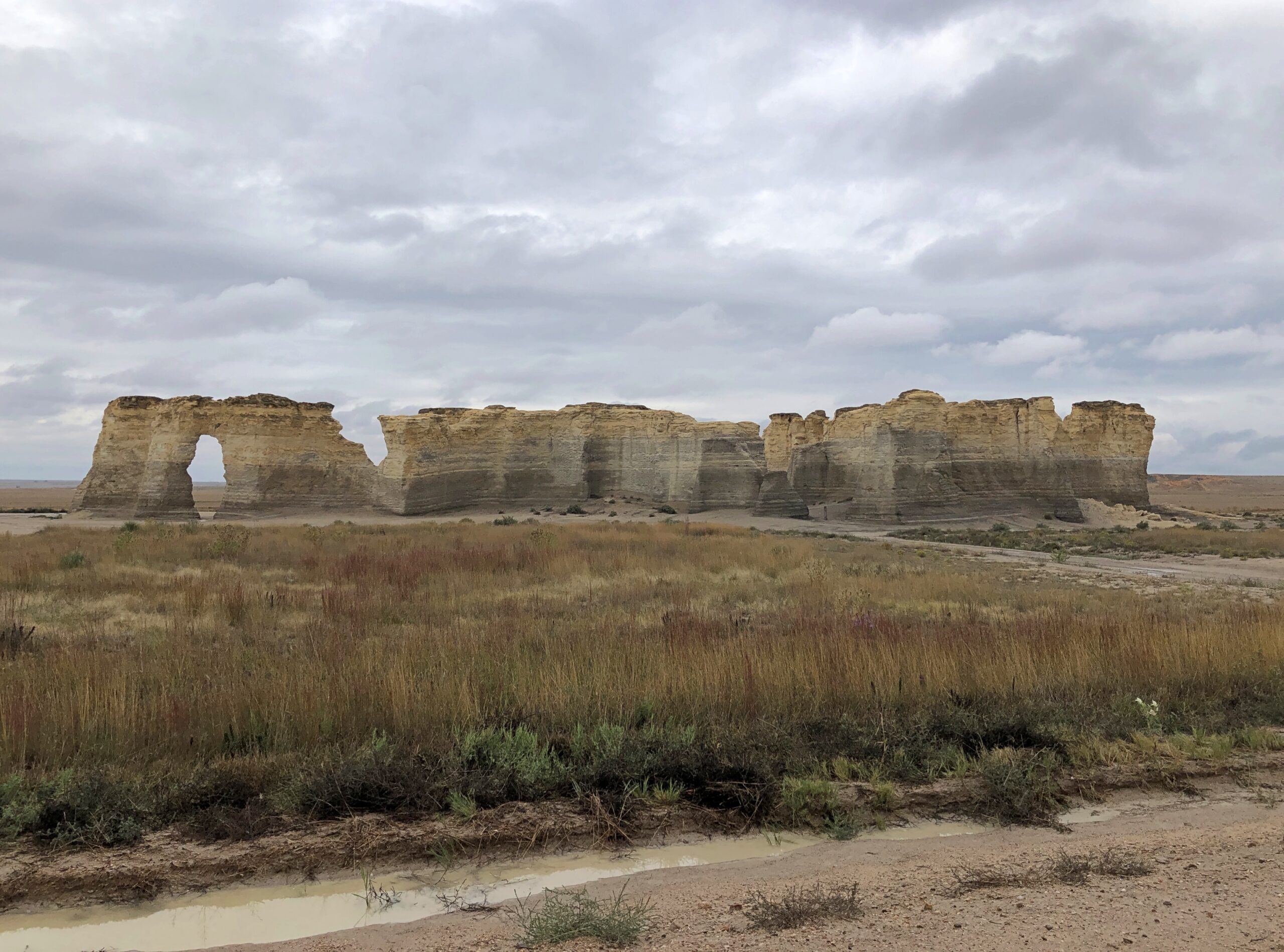
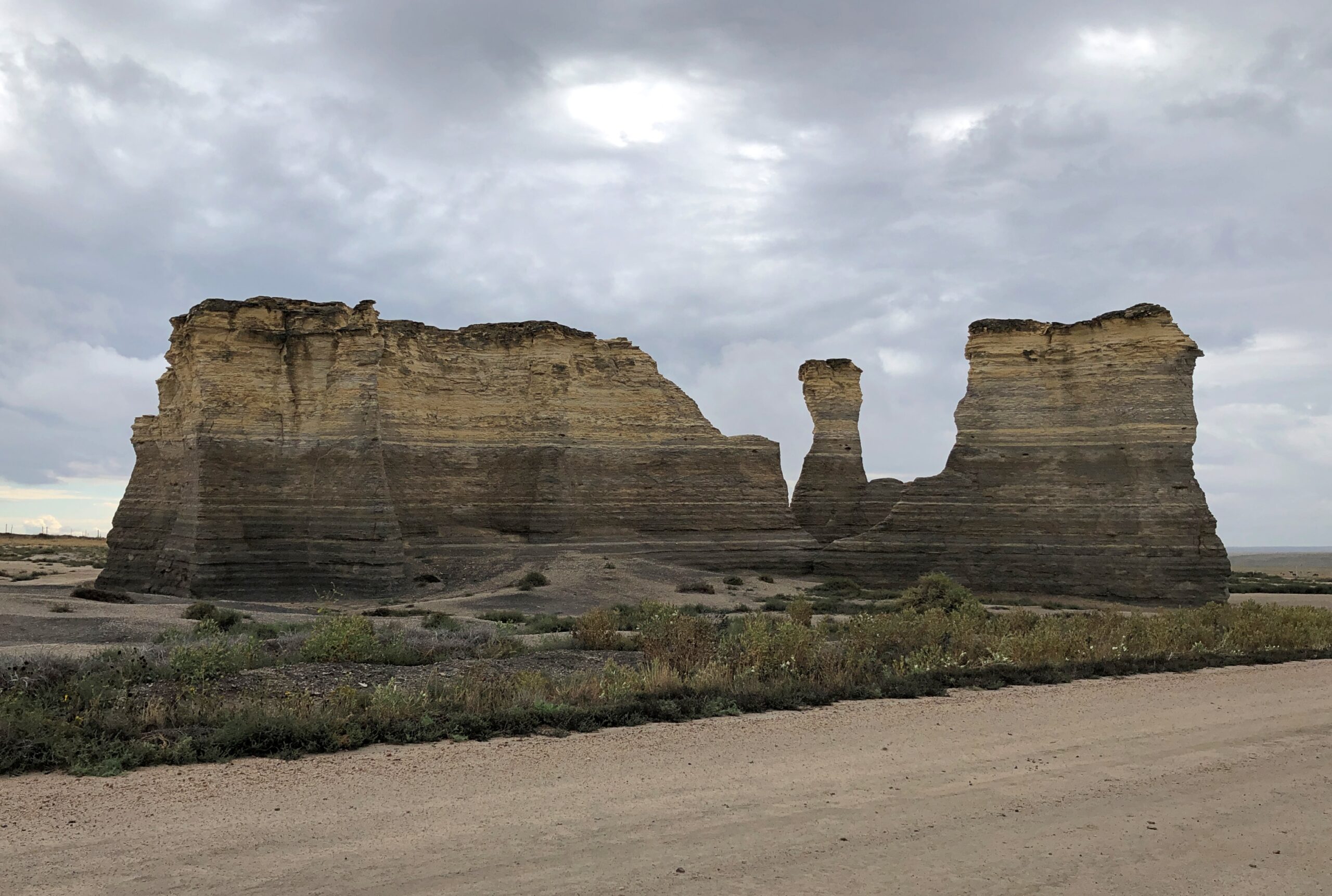
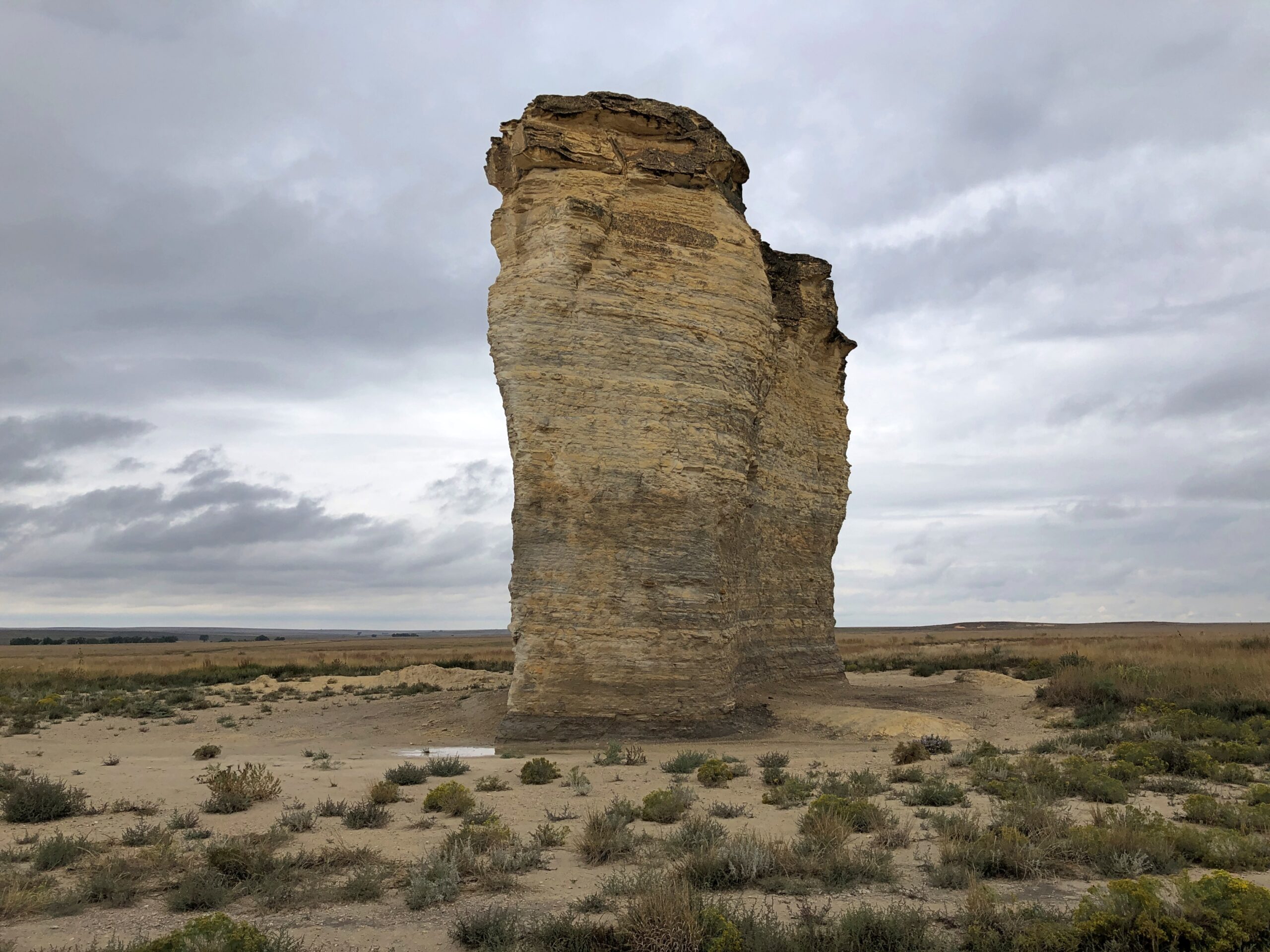
Monument Rocks
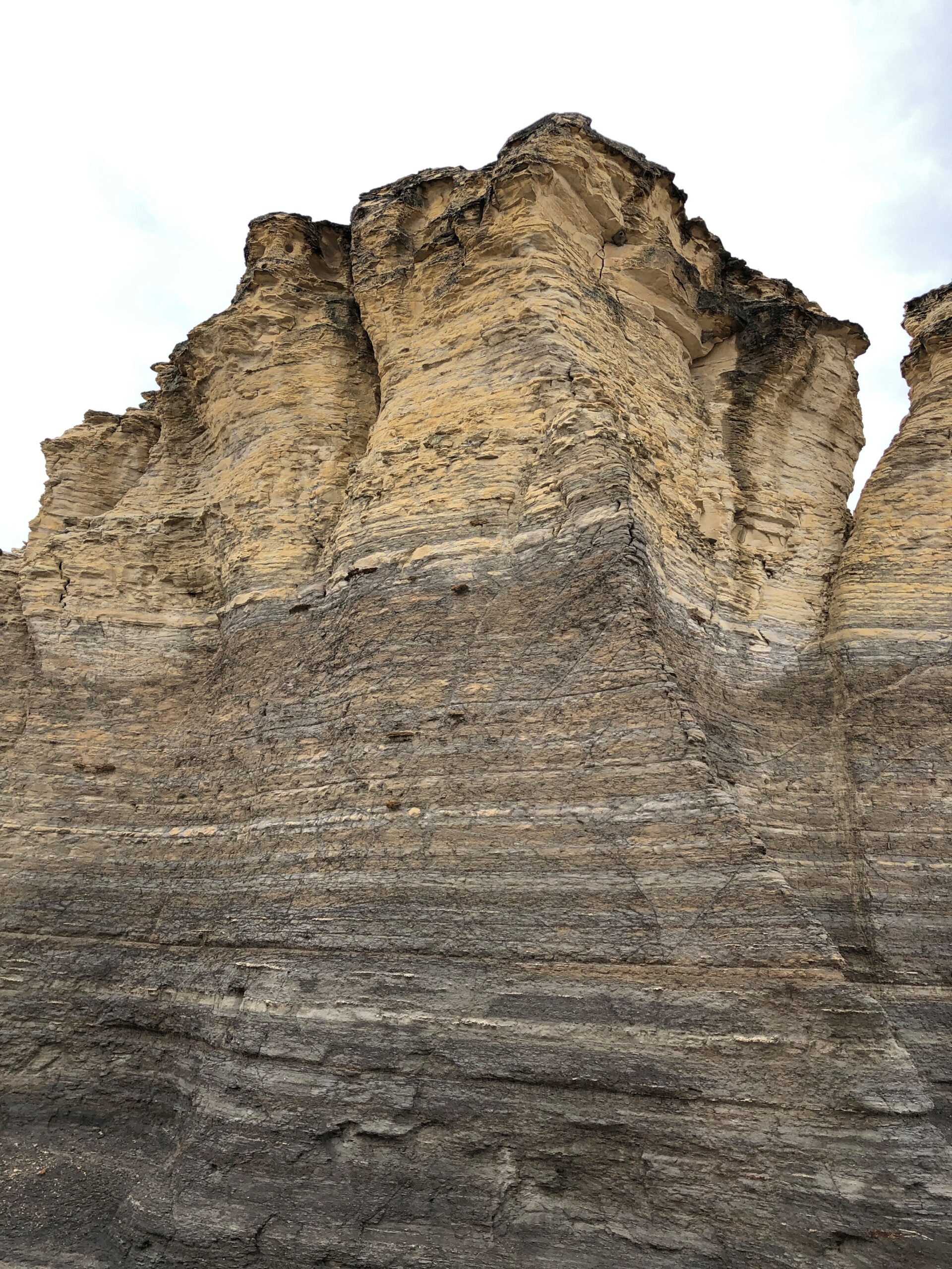
During the planning for the trip, which naturally meant quality time with maps, I spotted a point-of-interest for Monument Rocks in western Kansas. Sounded interesting, and on September 23 I made the trip, again on unpaved roads. The rain the night before made the driving surface a little dodgy, but the roads, layered with gravel, were generally up to the task. I was rewarded with the sight of rocks that are, in fact, pretty monumental.
I didn’t quite have the place to myself. When I arrived, another car was there, occupied by an older couple. They left, and soon after that, two young men appeared in an SUV. But that was all.
Washburn U. in Topeka tells us: West of Castle Rock area in Gove County, Kansas, erosion has carved these chalk pyramids from what was once the floor of a vast inland sea. Also called Monument Rocks, this site is the first natural landmark chosen by the US Dept. of the Interior as a National Natural Landmark. This landmark in on private land. The owners are generous to share this site with the public. Treat it with respect.
This limestone was once the floor of a great inland sea, existing some 80 million years ago. The sea dried away over time and the rock was carved by elements of nature to create these formations, which now stretch up to 70 feet in height.
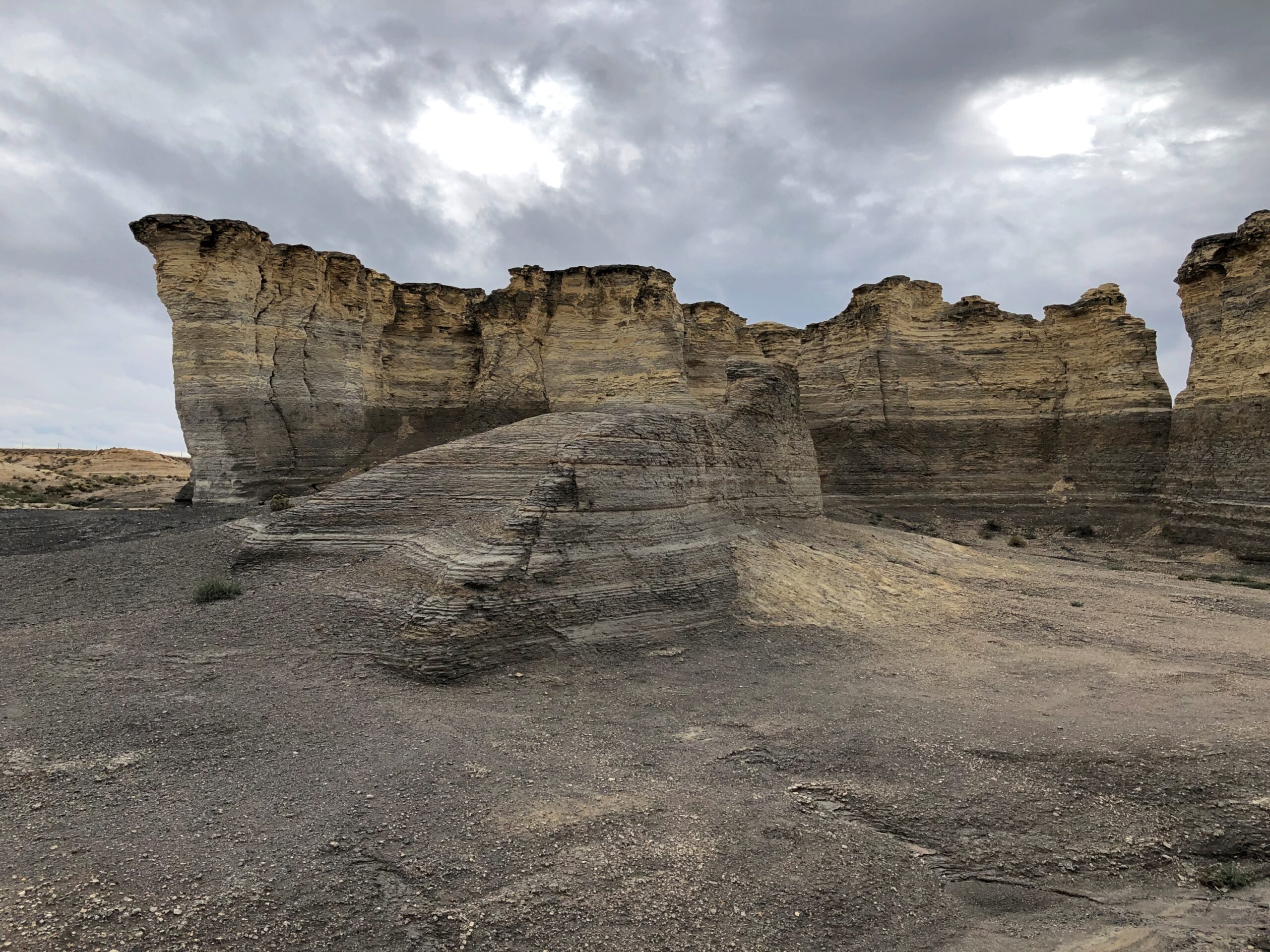
The rain the night before had also made mud all around the rocks. I should have taken the time to put on my better shoes for a walk near the rocks, but no. While making my way through the muck, I lost traction, and down I went, on my butt. Luckily, the soft mud cushioned the fall, which was more of a slide anyway, so I wasn’t even bruised.
The back of my pants were, however, coated with sticky, yellowish Kansas mud. So standing outside my car, I changed my pants. The two other visitors were in another part of the site by that time, so no one was around for the unwelcome spectacle. My shoes were covered with mud too, so much so that even a good soaking when I got home didn’t get it all off. When I wear those shoes now, I take a bit of Kansas with me.