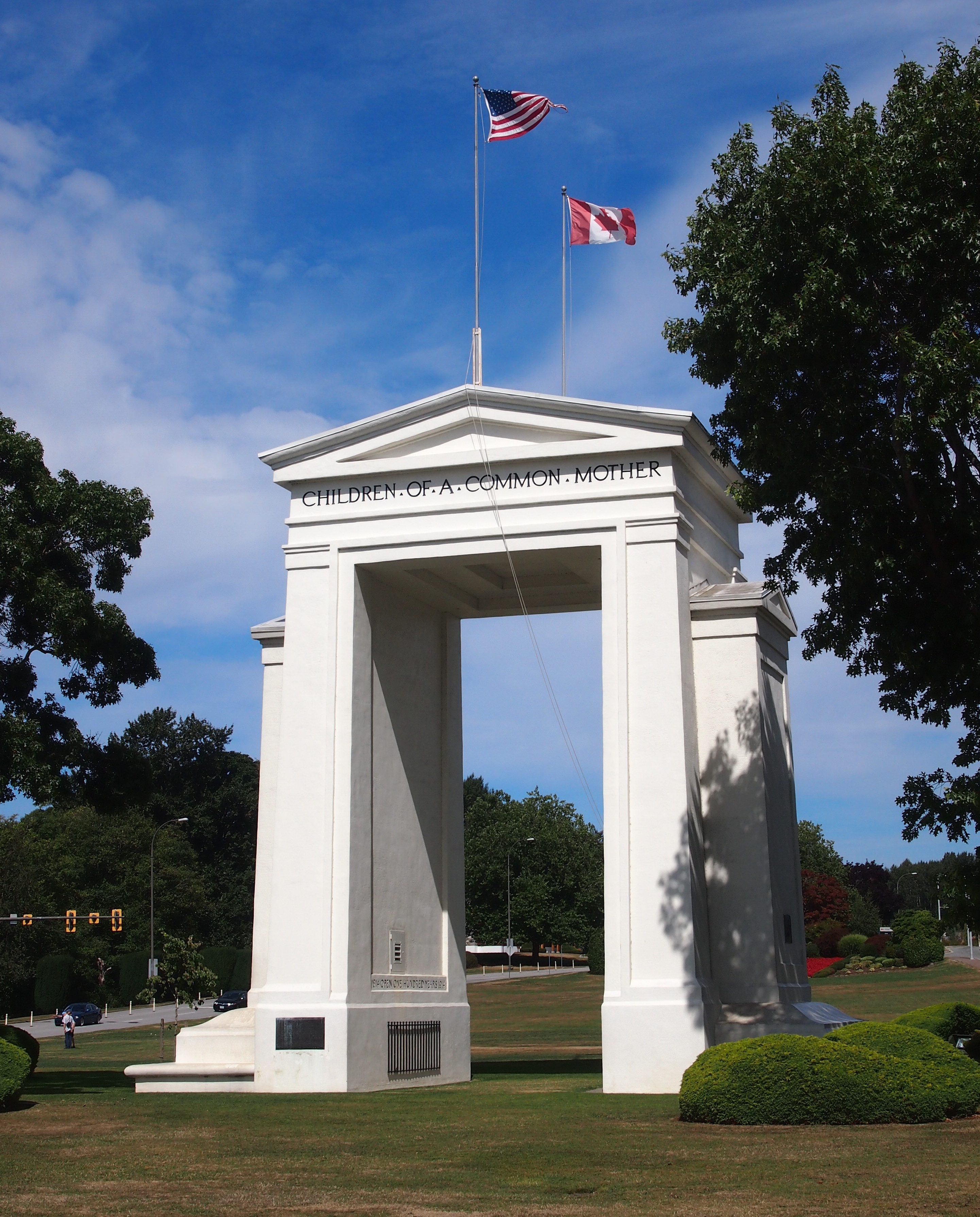
One thing to think about at Peace Arch Historical State Park in extreme northwestern Washington state is the last time the United States invaded Canada, namely the bungled campaigns of 1812 and ’13. Bungled from the U.S. point of view, that is, though of course there were some successes, such the battles of the Thames and Lake Eire (“We have met the enemy and they are ours.”).
The War of 1812 was the last bit of fighting along the U.S.-Canada border, not counting spats over fishing, so it’s reasonable that a bi-national park on the border commemorates the long peace. Peace Arch Park is that place, 22 acres south of the border (Peace Arch Historical State Park) and nine hectares north of the border (Peace Arch Provincial Park).
I arrived around noon on August 25, driving up from Bellingham, Wash. You take the last U.S. exit on I-5 (or maybe it’s the first exit) and park nearby, just south of the border, and then walk to the Peace Arch, which is slap on the border, meaning it’s also exactly 49 degrees North, as well as in the grass median between the northbound and southbound lanes of the highway (the meeting of I-5 and BC 99). Since traffic stops on each side of the border, crossing the road on foot there isn’t very risky.
 On the U.S. side, the Arch is 67 feet tall; on the Canadian side, 20.5 meters. It’s been standing for there for 94 years, built at the behest of Pacific Northwest business tycoon Sam Hill (1857-1931), who also had a replica of Stonehenge built in another part of Washington state, and who was an avid advocate of road improvement. (“Good roads are more than my hobby; they are my religion.”) Presumably Hill would have been happy that a major road linking the two nations passes around the Arch.
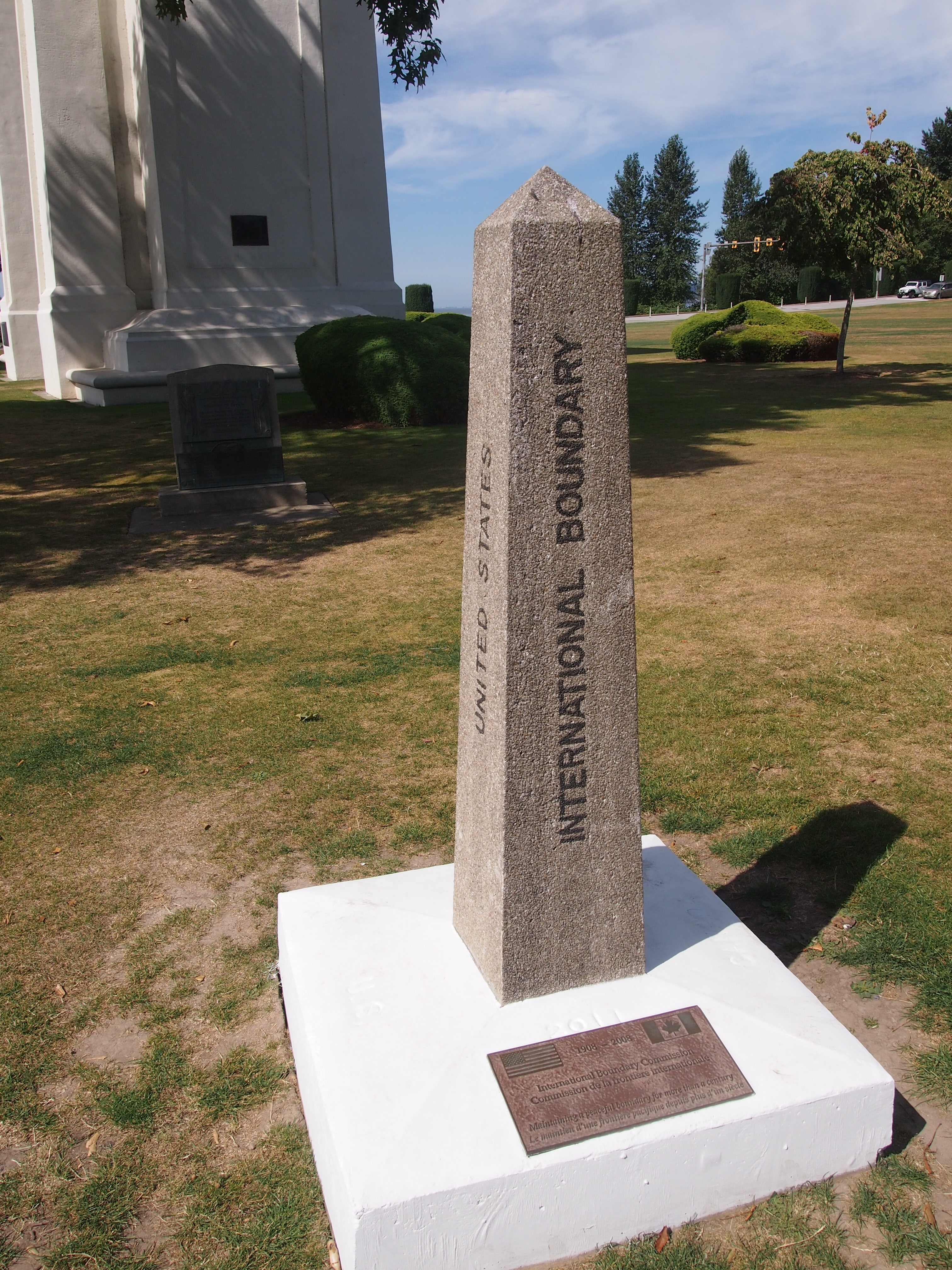
The border’s also marked by a number of concrete posts.
 The International Boundary Commission (Commission de la frontiere internationale) put the plaque at the bottom of the post on the occasion of its centennial in 2008. I figure most Americans, and most Canadians, have never heard of the commission. I barely remember reading about it some years ago in the context of the Alaska-Yukon border.
According to the commission’s web site, “Officially, the Commission’s work is described as maintaining the [U.S.-Canada] boundary in an effective state of demarcation. This is done by inspecting it regularly; repairing, relocating or rebuilding damaged monuments or buoys; keeping the vista cleared, and erecting new boundary markers at such locations as new road crossings.”
My italics. This is the body that’s responsible for clear-cutting the border between Alaska and Yukon — a 20-foot (six-meter) swath all the way along the 141st meridian. Since I read about that some years ago, I’ve since pondered the usefulness of doing such a thing. The commission asserts that “the boundary vista must be entirely free of obstruction and plainly marked for the proper enforcement of customs, immigration, fishing and other laws of the two nations.” I’m not quite persuaded, but anyway, more about the line is here.
The border posts have four sides: UNITED STATES on the south face (visible in my picture), CANADA on the north face, and INTERNATIONAL BOUNDARY and TREATY 1925 on the other two. I wondered about that. The commission references it too.
The treaty’s formal name is: “Treaty Between the United States of America and His Britannic Majesty, in Respect of the Dominion of Canada, to Define More Accurately at Certain Points and to Complete the International Boundary Between the United States and Canada and to Maintain the Demarcation of that Boundary, Signed at Washington, February 24, 1925.”
I made a point of crossing and recrossing the border a number of times near the posts. Now I can accurately say I’ve been to Canada more than a dozen times, including the six regular check-your-passport visits, plus the half-dozen (maybe more) crossings at the Peace Arch.