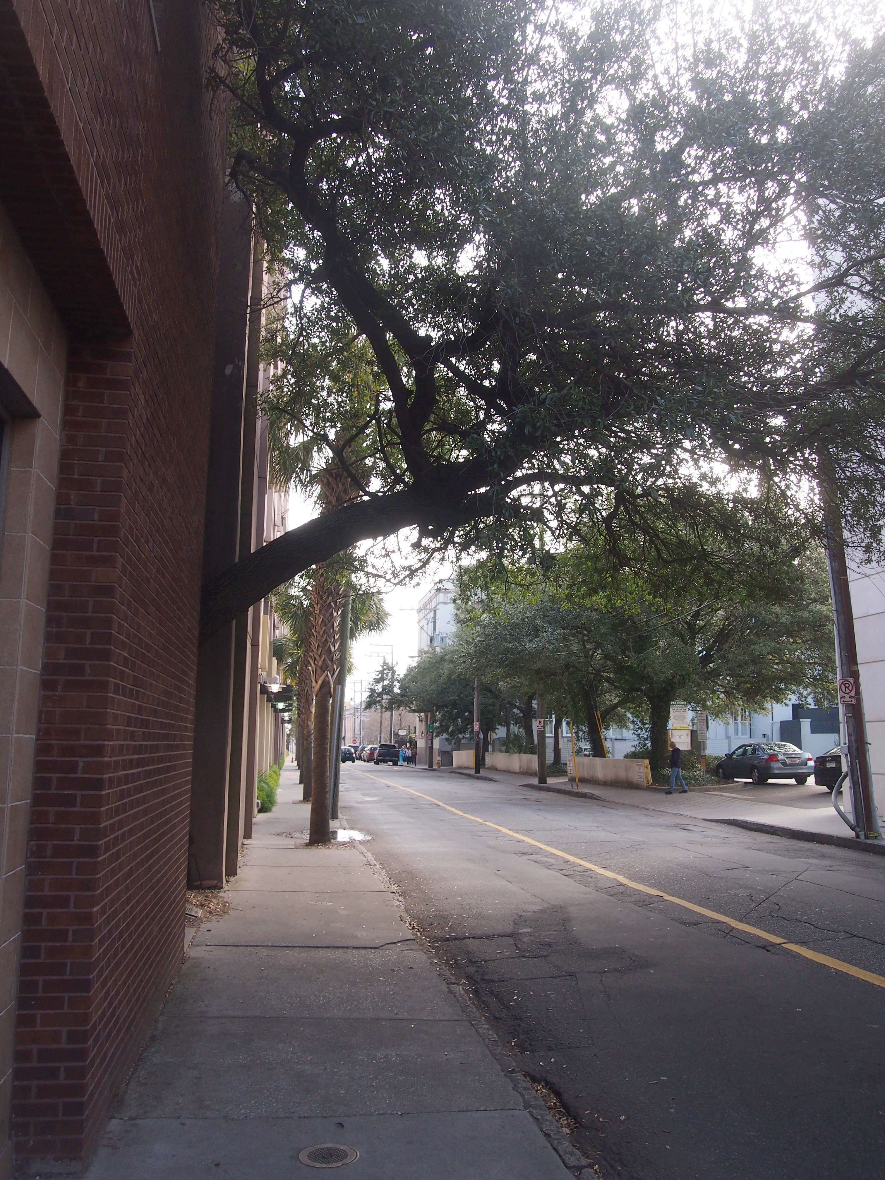
Here’s something I learned about the oldest part of Charleston, SC, when I visited recently: good to walk through, not so much to drive through. I could have guessed that anyway. Small streets, many cars, extremely restricted parking.
But early Saturday morning, when the cars roaming the streets were still few, wasn’t a bad time to come to town by car. I arrived and found a parking garage as soon as I could. On foot from there, on Cumberland St., I encountered traces of historic Charleston almost immediately in the form of the city’s most obscure plaque (maybe), fixed to the ground just north of the sidewalk on the north side of that street, between Meeting St. and Church St.
This Oak Was Planted In Celebration Of
ARBOR DAY 1984
It stands above a portion of the fortification wall that once protected the early Charleston settlement. The wall has been destroyed through time as the city spread beyond it’s [sic] original boundaries. The only visibly [sic] portion of the original fortification is the half moon battery, located in the basement of the Exchange Building.
Dedicated by the City of Charleston
Joseph B. Riley Jr., Mayor
Mr. Mayor, you could have ponied up a bit for a proofreader, considering that the text is in bronze. Anyway, the tree isn’t in the most picturesque part of Charleston.
Soon I moved on to better-looking urban core scenes. The city even has aesthetic water meter covers.
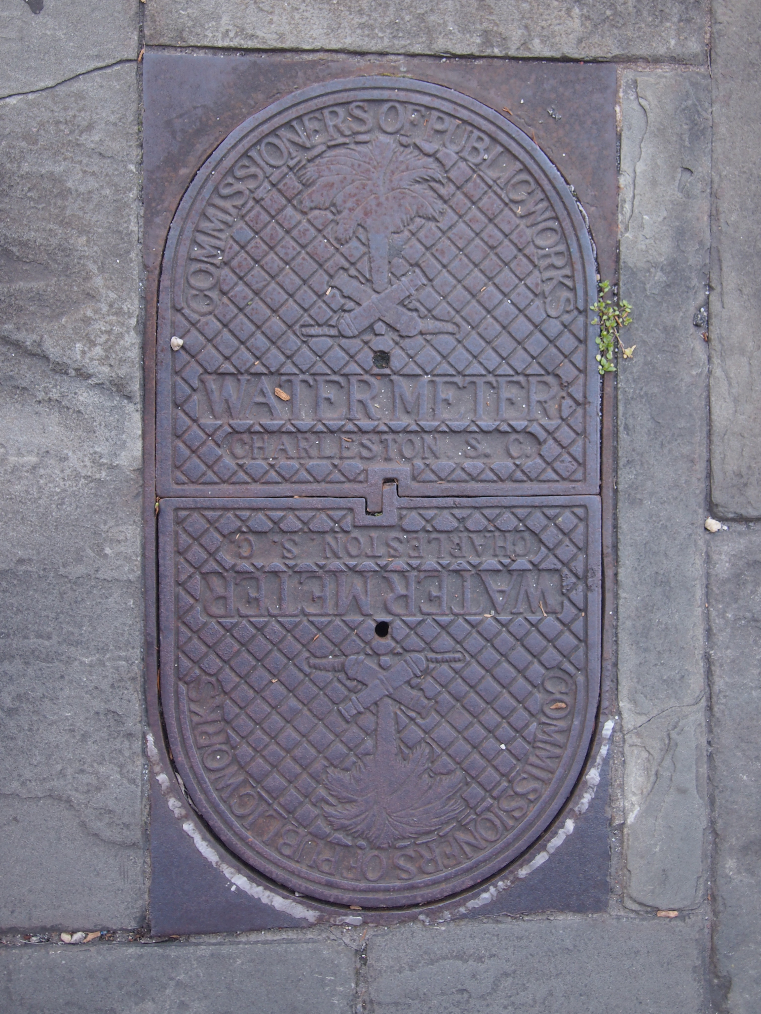 The palmetto is easy enough to figure out, but the cannons? According to one source (which says it’s “probably true”), the cannons refer to Col. William Moultrie’s victory over the British attack on Sullivan’s Island in 1776. Palmetto logs, which had some ability to absorb cannon fire, were used to reinforce the earthenwork defense.
St. Philip’s, an Episcopal church, stands fittingly on Church St. between Cumberland St. and Queen St.
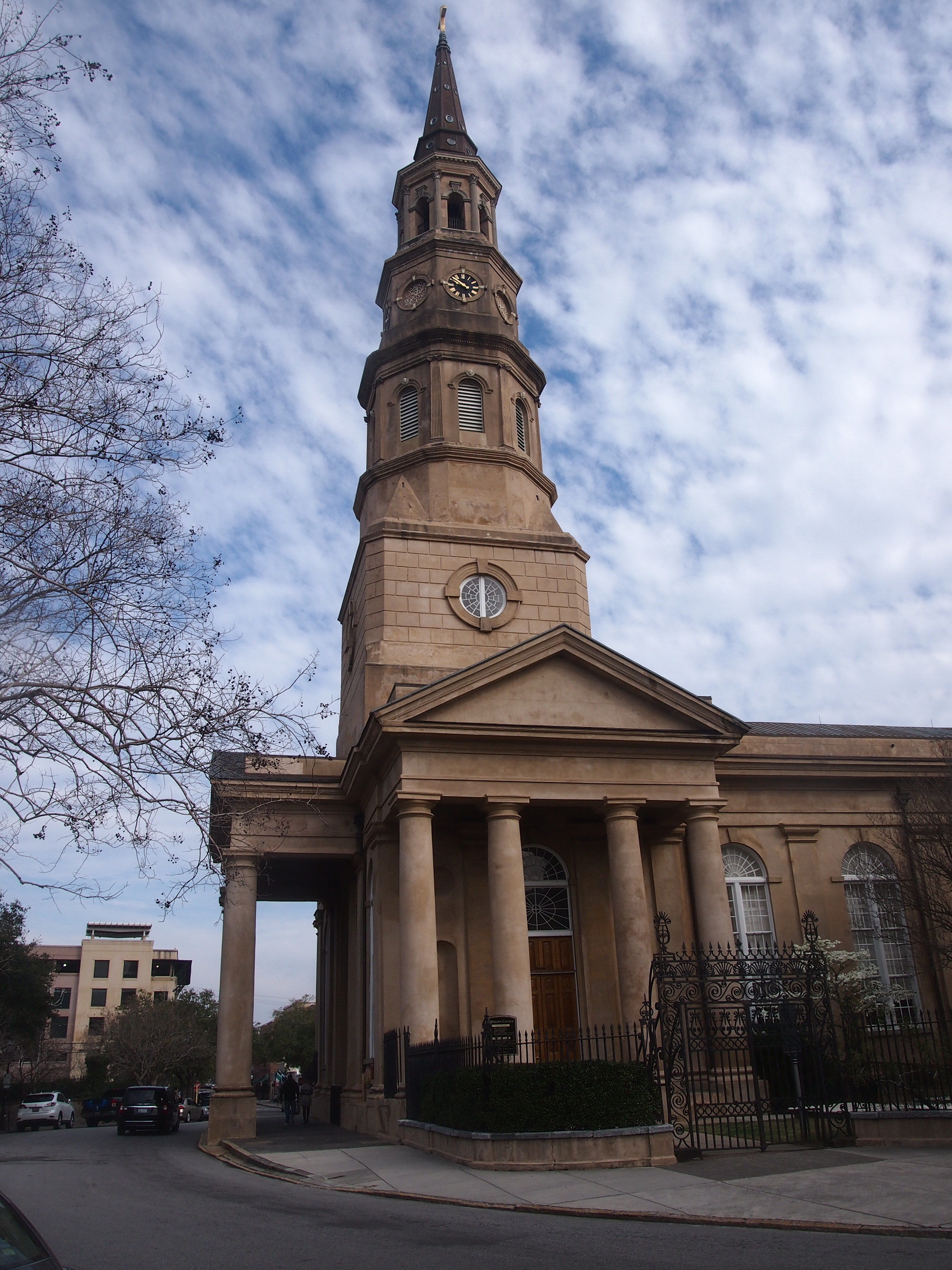 The church, the third for this congregation and the second on this site, dates from 1838. The early history of the church, and Charles Towne for that matter, was one damn thing after another. From a short history of St. Philip’s on its web site:
1728-40: Fires, hurricane, epidemics of smallpox, yellow fever, slave uprisings, Indian attacks, threats of war from the Spanish occurred.
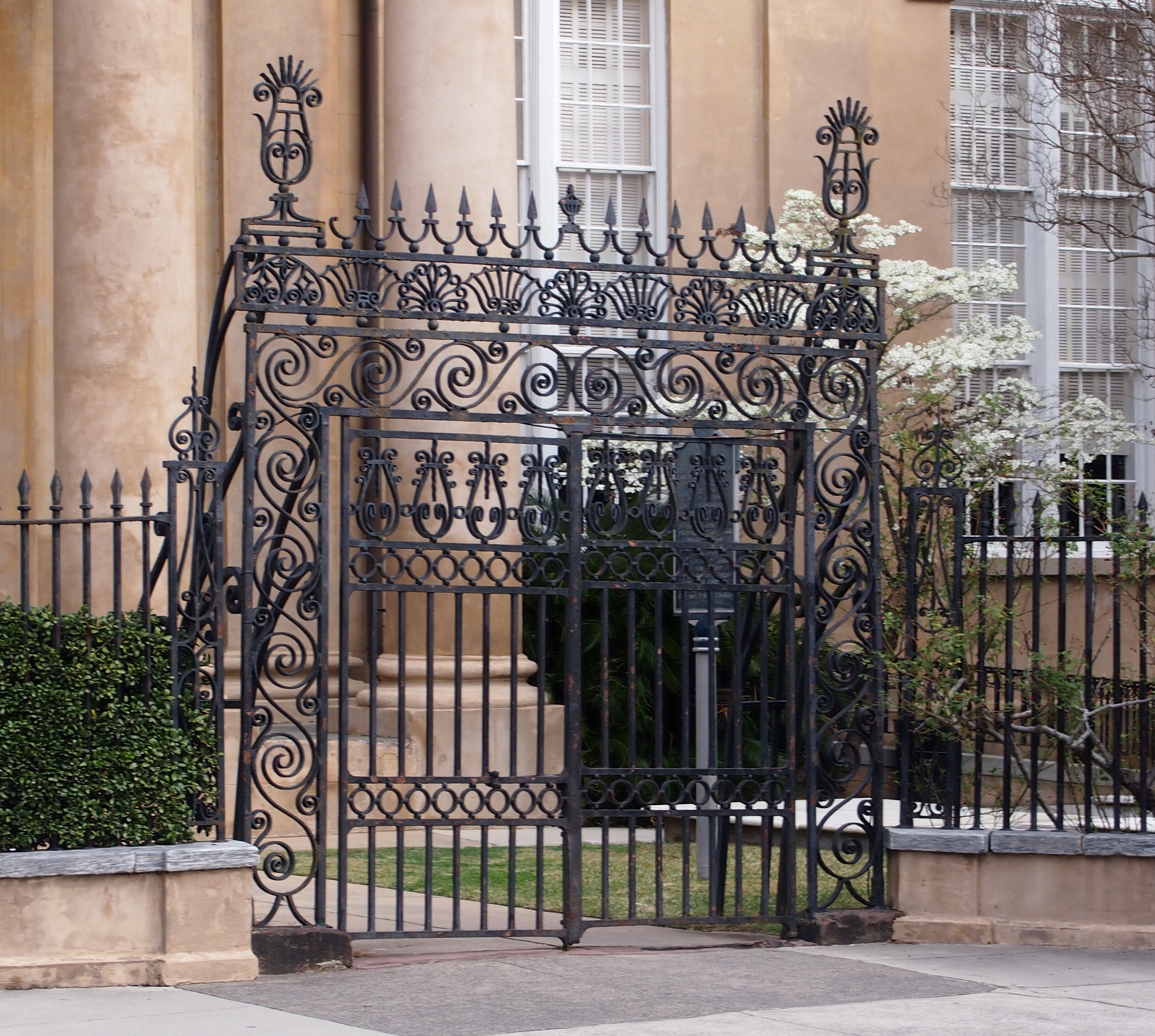
Ah, but Charleston flourished. Slave-cultivated rice, indigo and then cotton from the Carolinas did the trick (part of the bondsman’s two hundred and fifty years of unrequited toil). Highly skilled slaves, I understand, were involved in the wrought iron gates around St. Philip’s, which are a marvel by themselves.
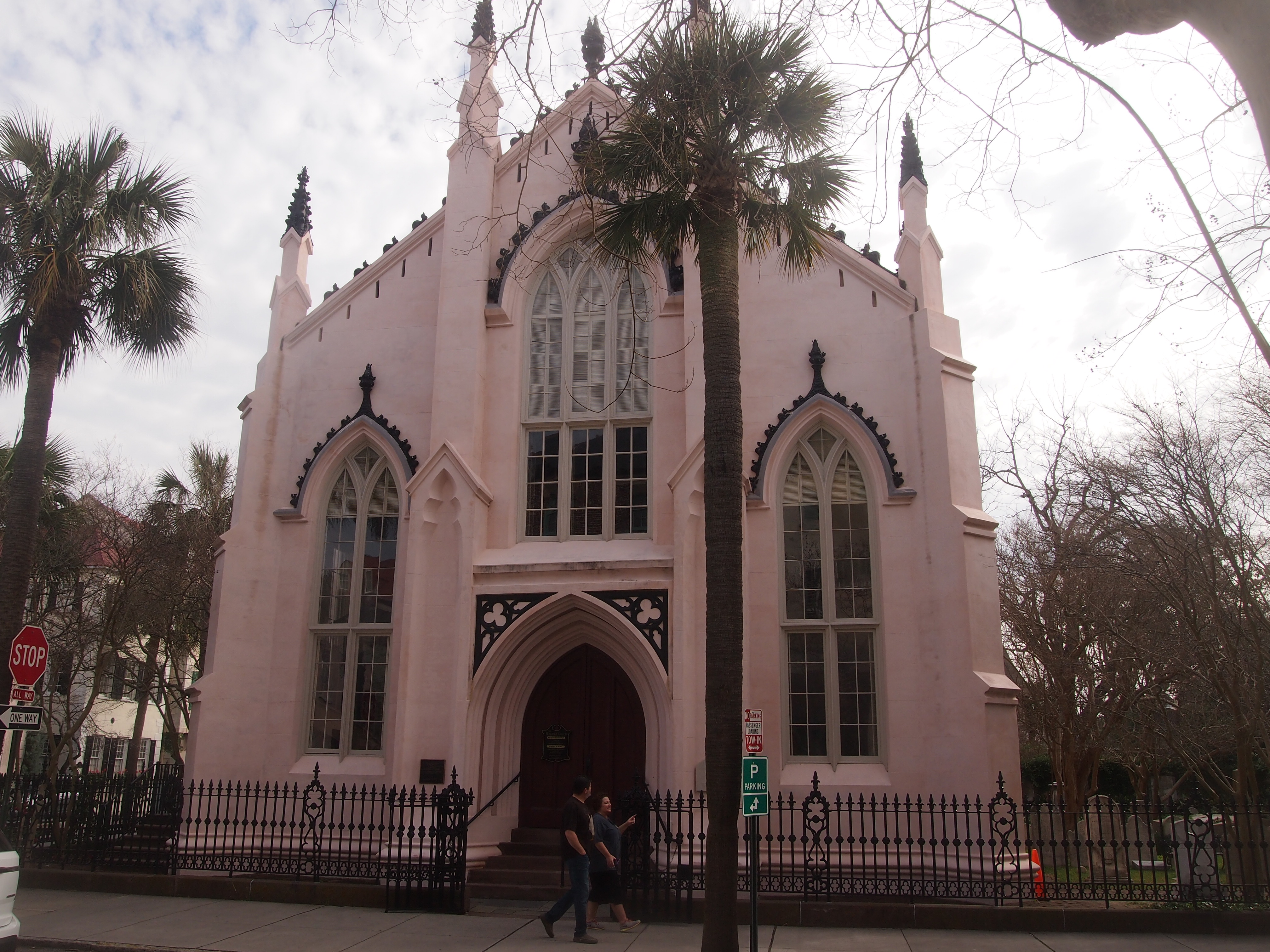
 Nearby is the light pink Huguenot Church, dating from 1844, at the corner of Church and Queen. It was the first independent Huguenot congregation in America (more-or-less Calvinist, starting in the 1680s) and now the last one.
 Rainbow Row, the nickname for a stretch of East Bay St., features colorful row houses, 13 in all, mostly dating from the late 18th century.
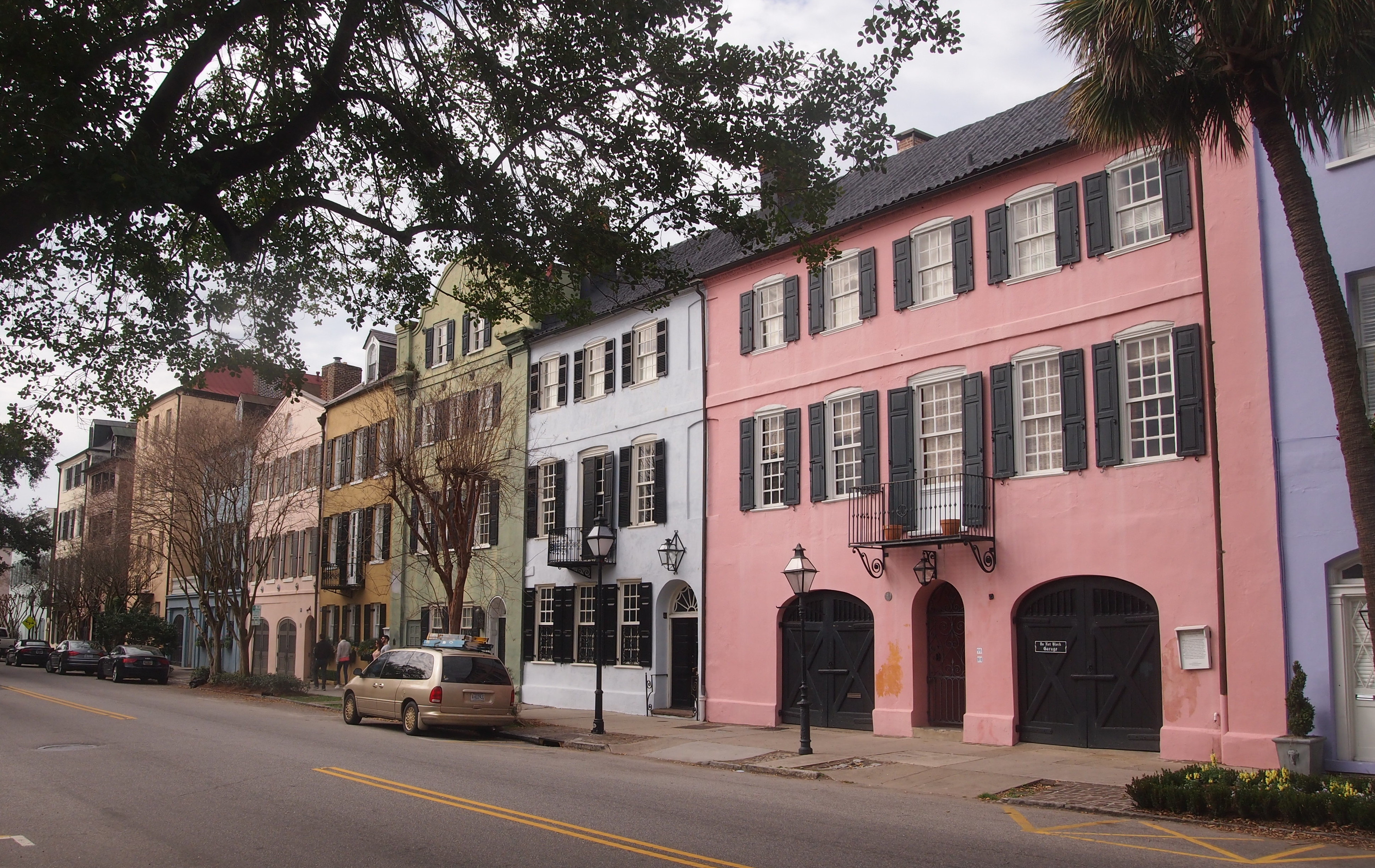 They’re in a tightly controlled historic preservation district, except for one thing: the owners get to choose the colors. The pastels were originally put on in the 1920s and occasionally change.
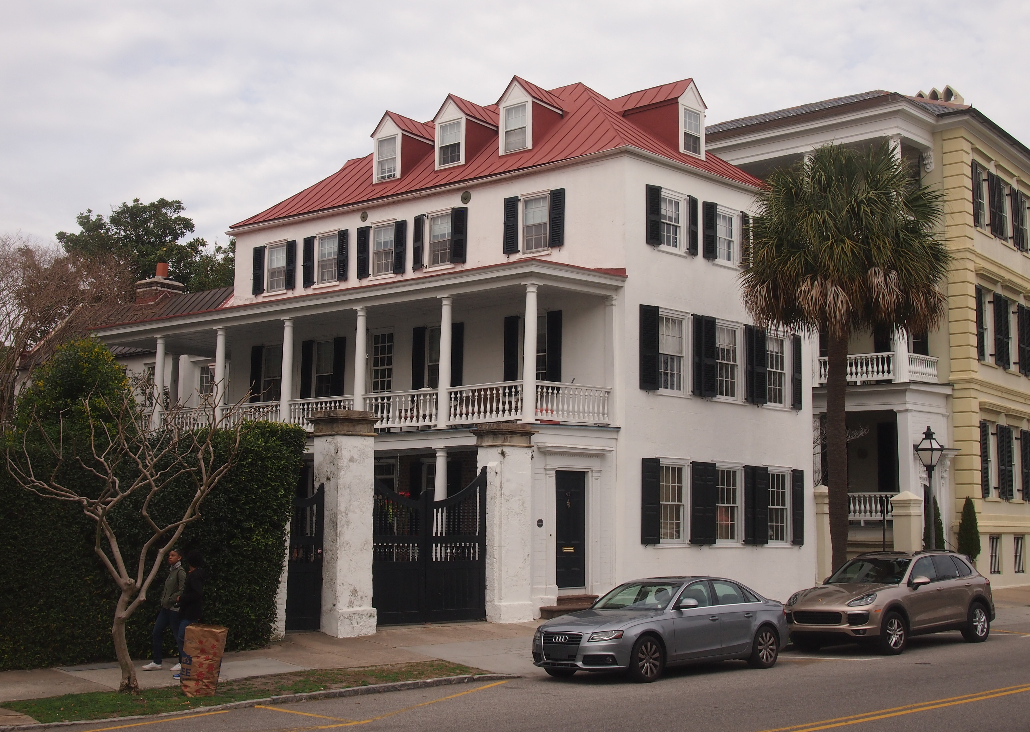
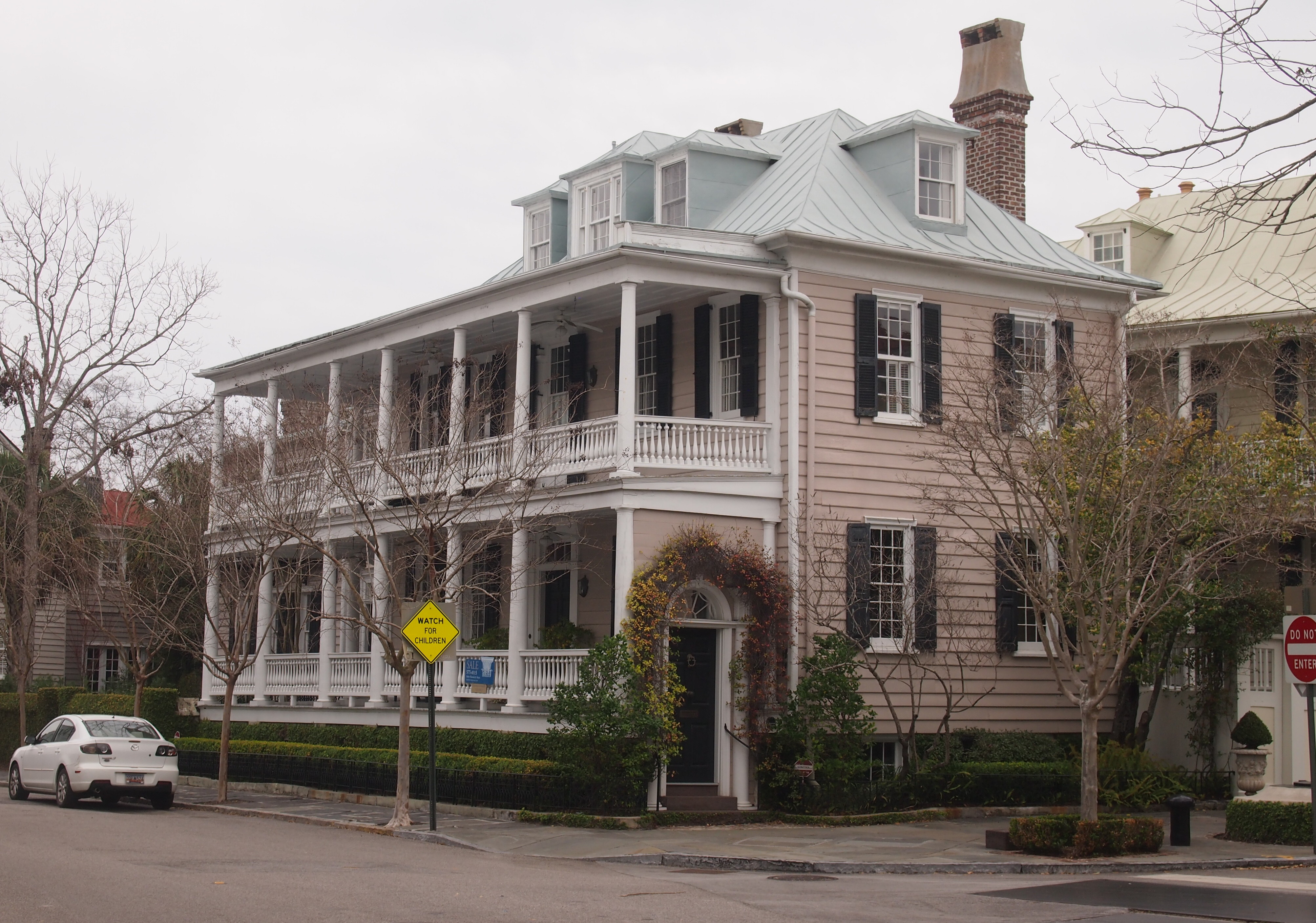
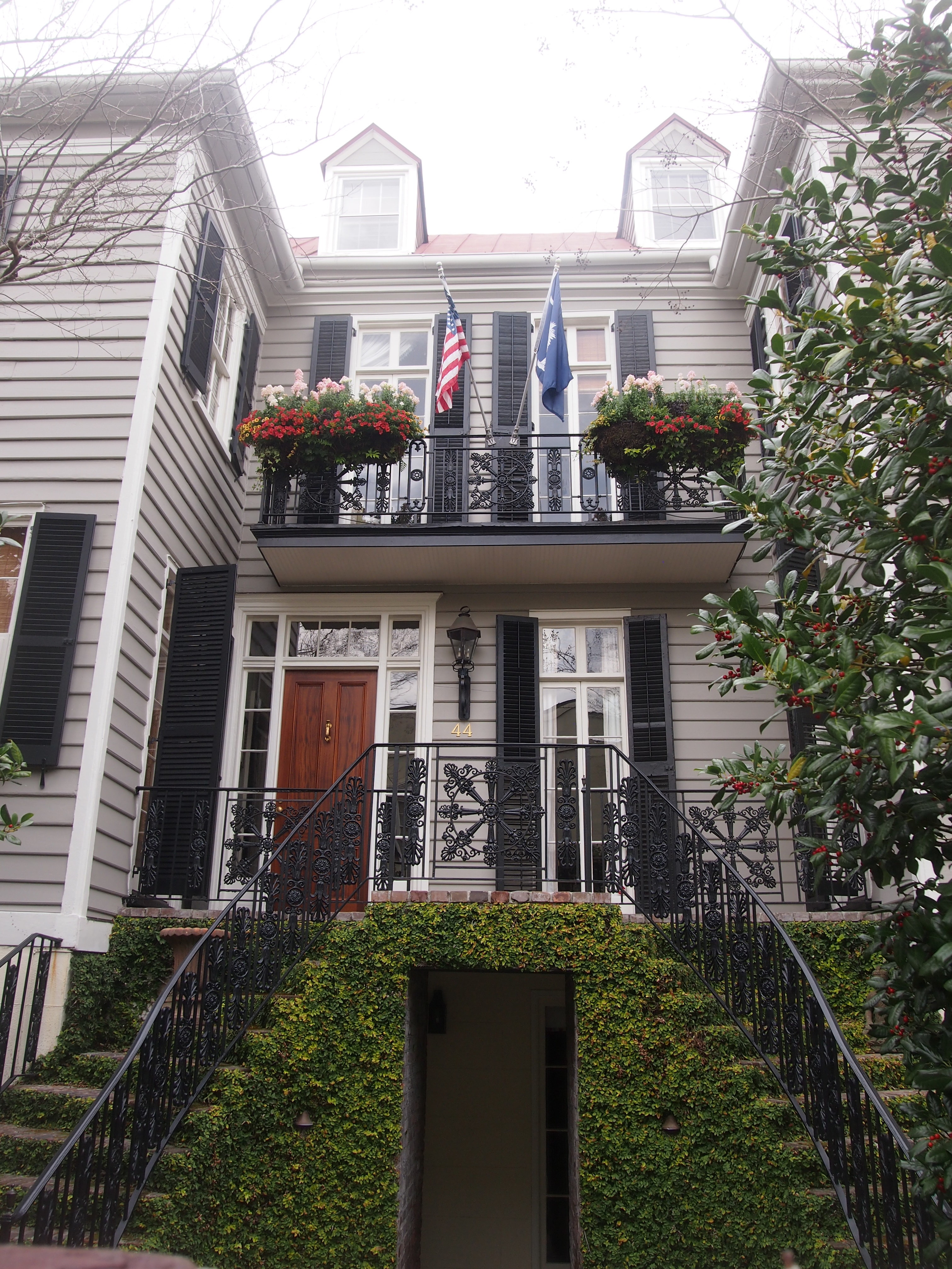
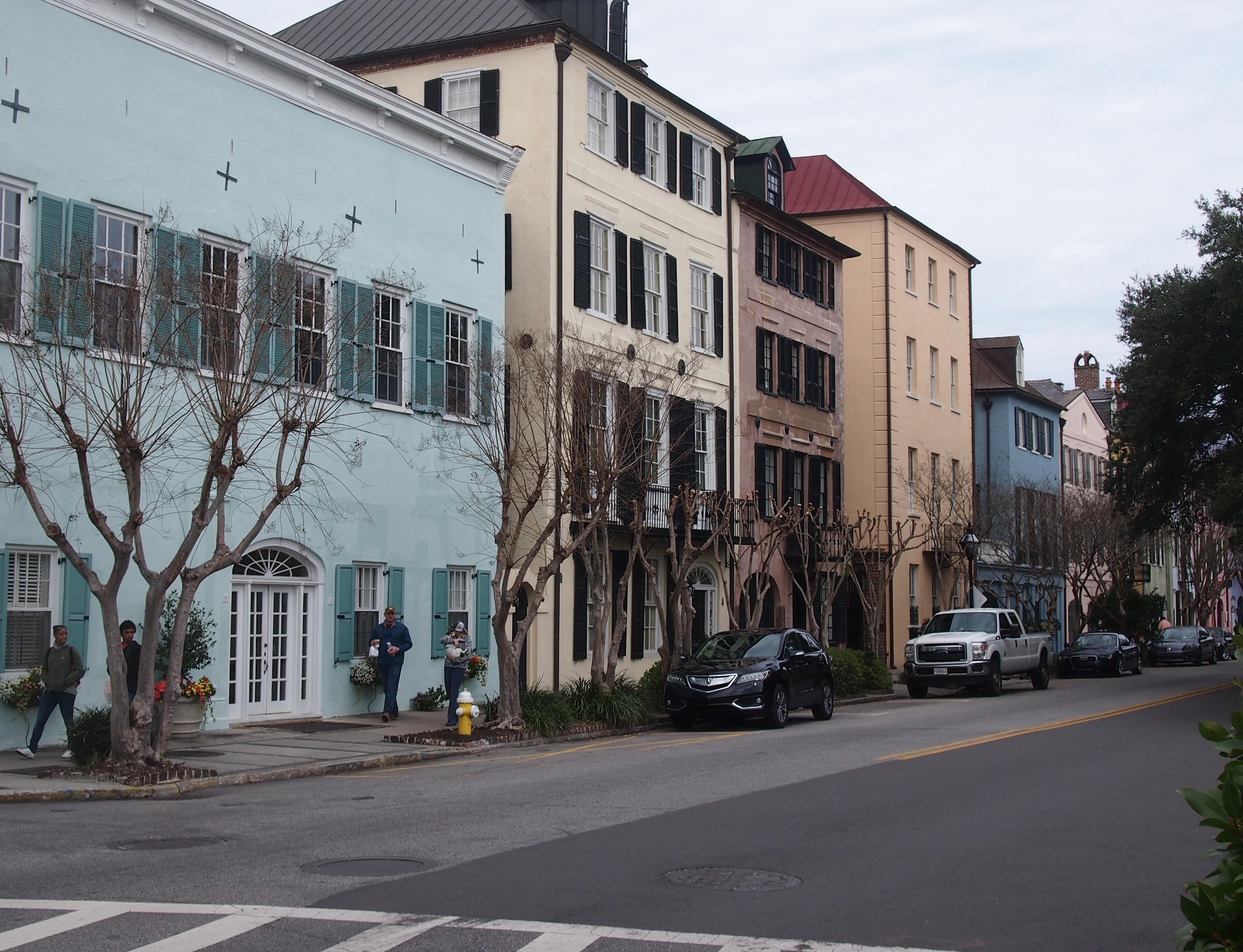 There are plenty of other handsome houses in that part of Charleston as well. Reminded me a bit of the East End of Galveston.
 All in all, a good place to see on foot, provided it isn’t summer.