I have a certain fascination with borders, probably dating back as long as I’ve been looking at maps just for fun, which is a long time now. I seem to have written about them a lot as well, something I didn’t realize until I checked.
Such as the posting about the meeting of British Columbia and Alberta; of Banff National Park and Kootenay National Park; and on the Continental Divide. Or the U.S. Canadian border just south of Vancouver. Or the borders we crossed in 2005 and 2006 and another posting about them again. Or the Tennessee-North Carolina border. Or Missouri-Kansas. Or Texas-Louisiana.
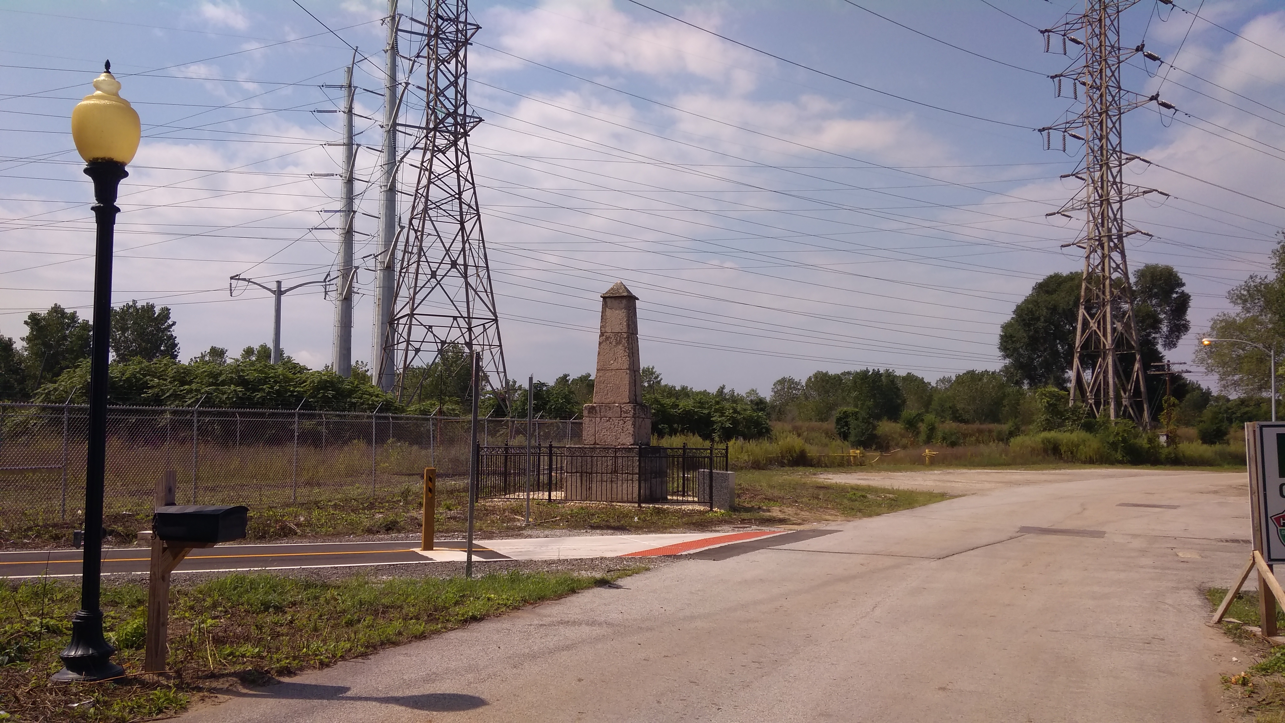
Not long ago, I had an encounter with a closer border: Illinois-Indiana. But not just any point on that long line — as far northwest as you can go in Indiana and still be on land, because the NW corner of the state is actually a point in Lake Michigan.
This is what you see at the Illinois-Indiana line just a few feet from Lake Michigan, while you are standing in Indiana.
 A weatherworn, graffiti-scarred limestone obelisk. This is a closer view.
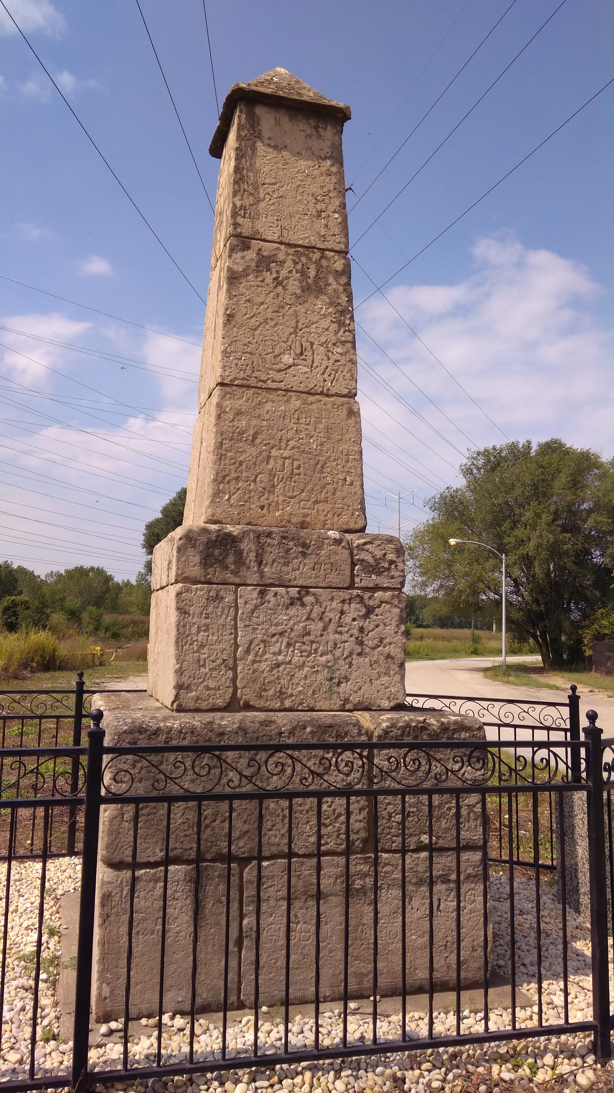 “In 1833, as Chicago and the Midwest were starting to grow, Congress ordered a new survey of the boundary between Illinois and Indiana,” says Chicago History Today, which asserts that the obelisk is the oldest public monument in Chicago. “When the survey was completed, a 15-foot high limestone obelisk was put in place on the shore of Lake Michigan, straddling the state line.
“By the 1980s the marker was isolated and neglected among the rail yards. Allen J. Benson, a ComEd executive, convinced the company to sponsor its restoration, in conjunction with the East Side Historical Society and other interested groups. In 1988 the marker was moved 190 feet north to its present location, just outside the [ComEd coal-fired power plant] gate. A new base was added at that time.”
Though moved into an area created by landfill, I understand that the obelisk still straddles the north-south Illinois-Indiana border, which a few feet further north heads out into Lake Michigan. It’s also the border between the city of Chicago and the city of Hammond. (Chicago extended out this far in massive 1889 annexation, which is yellow on the map.)
There’s a plaque near the obelisk that says the small area (maybe inside the fence) is Allen J. Benson Park to honor the exec, who has since died. The power plant closed in 2012, and its former site, a brownfield on the Indiana side of the line, is being redeveloped to be home to a data center.
When the plant was up and running, the marker didn’t look quite so forlorn: in the 2011, according to a Wikimedia image, three flagpoles and some trees were in the vicinity — but no metal fence — and there were plaques on the side of the obelisk with the state names. Guess they were stolen. Such is life in the big city, but I’m glad this curiosity from the 19th century still stands.