Jerome Huppert Woods

As forecast, temps didn’t break 80 degrees F. on Saturday. A good day to hit the trail.Jerome Hubbert Woods

A trail, anyway. The one we hit happened to be the Des Plaines River Trail, which parallels the river of that name, on a short section through Jerome Huppert Woods. The place might be named for this man, a casualty of WWII. How many Jerome Hupperts have there been? He was from Wisconsin, so that would be a little unusual, but hardly impossible.

The woods are a small slice of undeveloped land along the river. My guess would be that the Cook County Forest Preserve District was able to acquire most of the land along the Des Plaines because it is prone to flooding. A little further from the forest preserve land at that point, the suburb of River Grove surrounds the area, and it’s fully developed.

The reach the trail proper, you go along a connecting trail from a parking lot and recreation field to a short, graffiti’d tunnel under a road. Jerome Hubbert Woods

There’s enough undeveloped land in the area to support some large fauna, looks like.Jerome Hubbert Woods

I don’t look at the creature and think Bambi. Rather, I think, deer ticks, vector of Lyme disease. Best to keep your distance. Still, it was nice to see.

Recent rains seem to have created, or at least enlarged, a stagnant pond that isn’t visibly connected to the river.Jerome Hubbert Woods

Otherwise, lots of green. Lots of flowers. Lots of trees.Jerome Hubbert Woods Jerome Hubbert Woods Jerome Hubbert Woods

With views of the Des Plaines from time to time.Jerome Hubbert Woods - Des Plaines River

Along with abandoned structures.Jerome Hubbert Woods

Eventually, we came to River Grove’s River Front Park, where we turned around. Not before resting a few minutes in the park gazebo, though.Jerome Hubbert Woods

As always, nice to find a gazebo. Obscure suburban parks are better for them.

Monument Valley Navajo Tribal Park

Back to posting on the last day of May. Memorial Day and Decoration Day coincide this year, which won’t happen again until 2033.

“Throughout the 19th century, white settlers considered the Monument Valley region — like the desert terrain of the Southwest in general — to be hostile and ugly,” notes Smithsonian magazine. “The first U.S. soldiers to explore the area called ‘as desolate and repulsive looking a country as can be imagined,’ as Capt. John G. Walker put it in 1849, the year after the area was annexed from Mexico in the Mexican-American War. ‘As far as the eye can reach… is a mass of sand stone hills without any covering or vegetation except a scanty growth of cedar.’ ”

Tastes change. I imagine Capt. Walker’s reaction was entirely reasonable for his time, considering he and his men came by horse and mule, carrying everything they needed, living meagerly and fully aware that their surroundings could kill them all too easily, or at least make for days of uncomfortable misery, whatever season it was. Monument Valley was a vivid ordeal for them, not a notion fostered by cinematic entertainment.

We have it a good deal easier here in the 21st century, and am I glad. All it took for us to reach Monument Valley Navajo Tribal Park on May 18 was a roughly two-hour drive from Page, Arizona, by Toyota horseless carriage along paved two-lane roads through the Navajo Nation.

My main concern that morning — and we got up fairly early — was that I didn’t know for sure we’d get in. The park’s policy for visitors is, first come, first served, and there’s a limit to the number of people who can enter each day. Even on a weekday, I imagined joining a long line of cars waiting, only to be turned away.

Nothing of the kind happened. We got to the entrance booth with no one ahead, paid $8 a head, and got in to the place known as Tse’Bii’Ndzisgaii in Navajo. First stop, a fully modern visitor center.Monument Valley Navajo Tribal Park

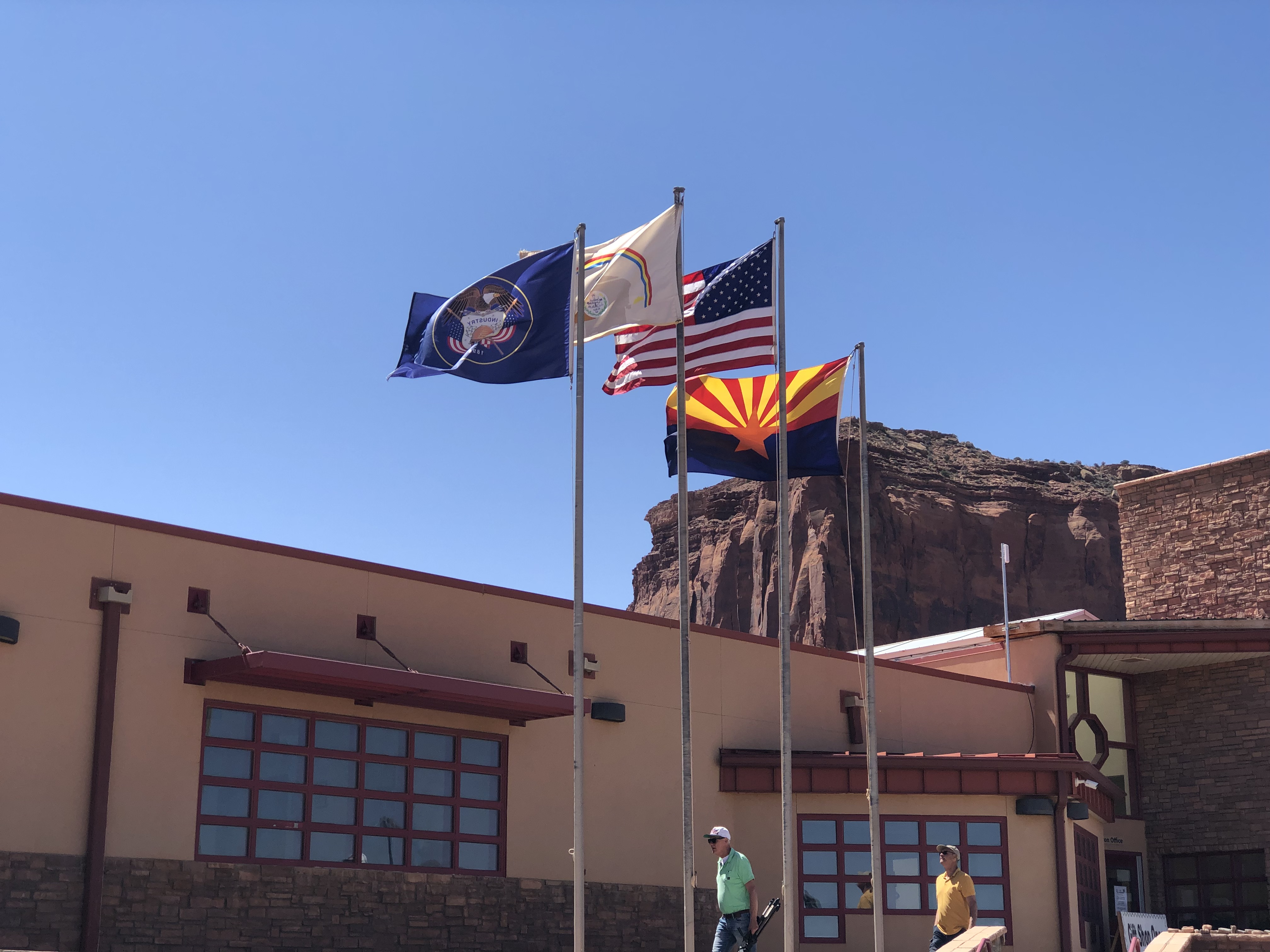
The wind whipped the four flags in full motion: Utah, the Navajo Nation, the United States and Arizona. I wasn’t familiar with the Navajo flag, but I am now.

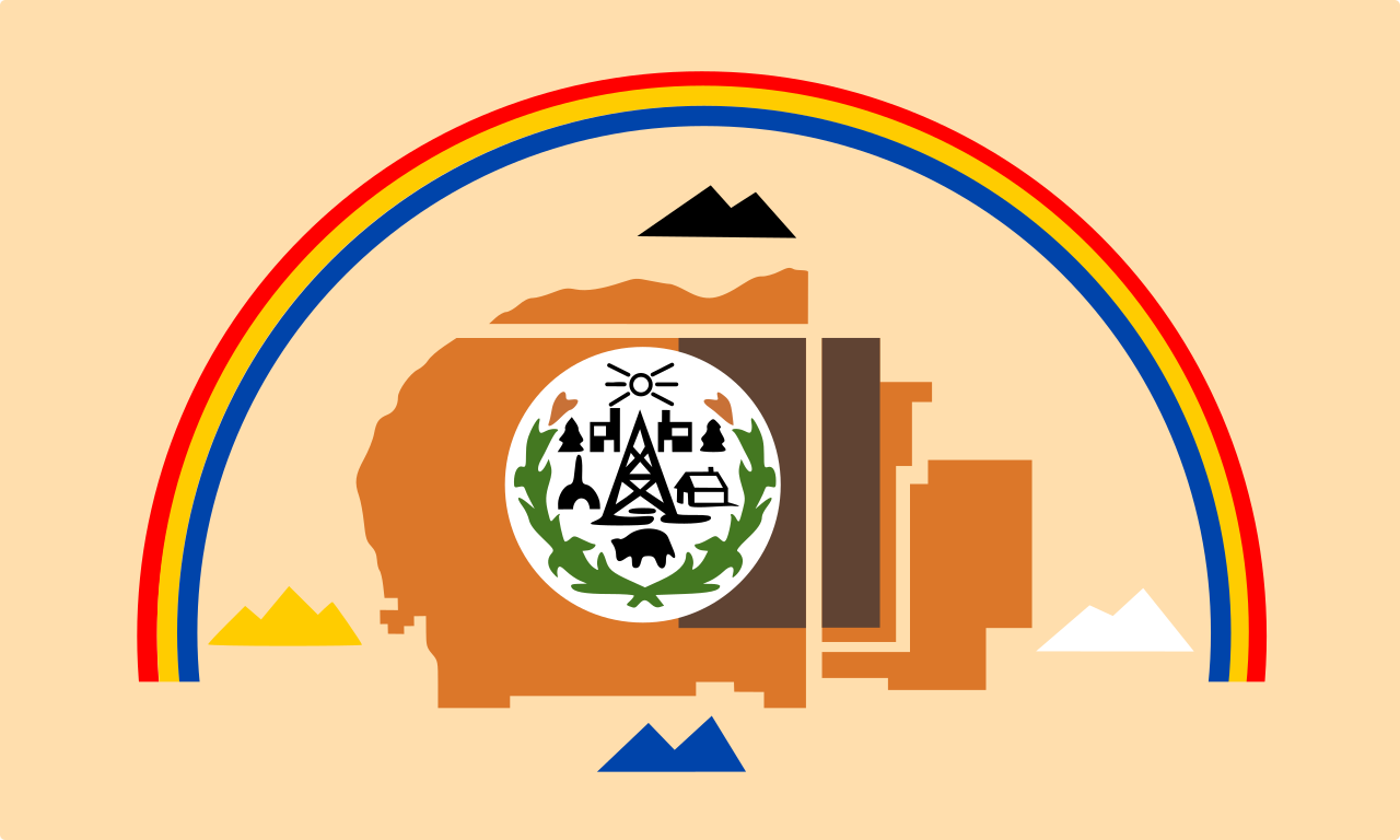
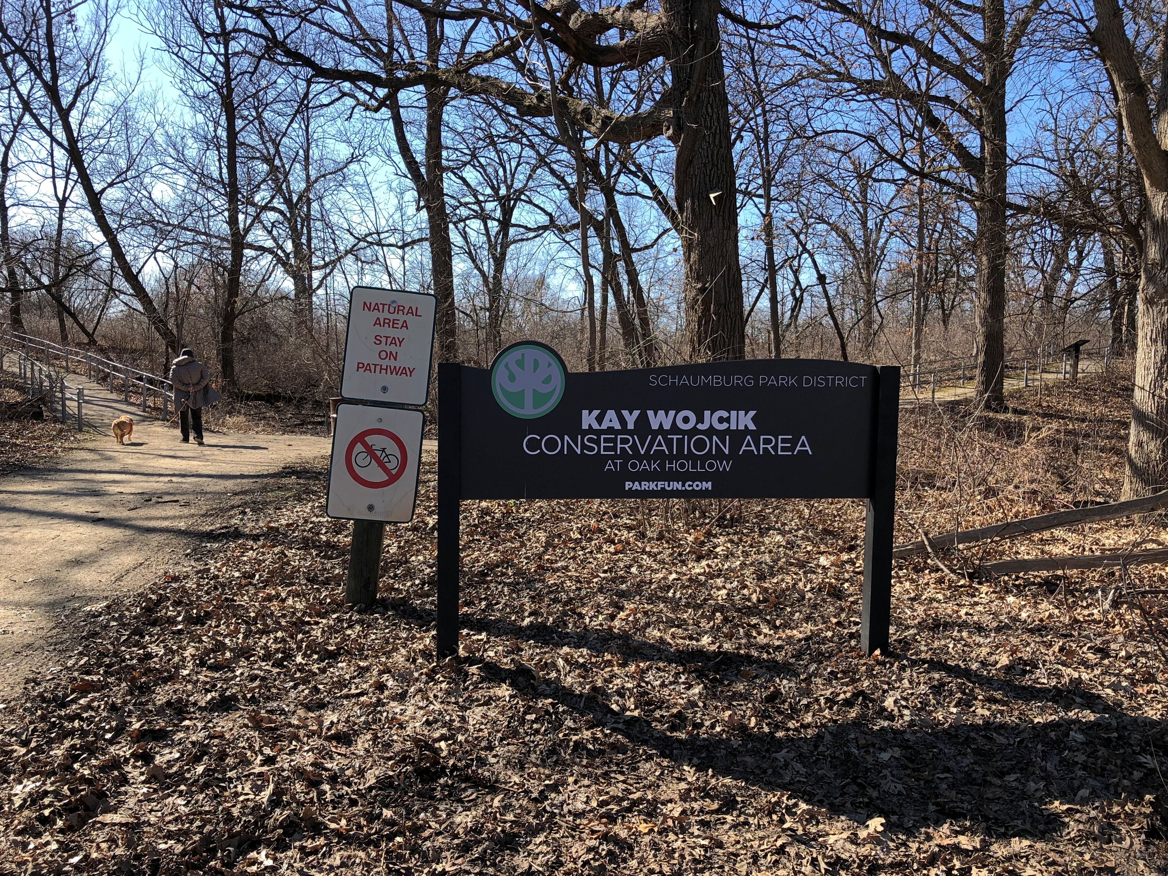
Something I didn’t know until we entered the park and saw a number of private roads leading off to residences in the distance: people live in Monument Valley, unlike in a national park or monument. I expect ranching and running tours are their main occupations, along with selling the products of Navajo craftsmanship to visitors.

For $8 a head — an absolute bargain, if you asked me — you get to drive around a 17-mile unpaved loop road in the park, dusty and red as Mars, but only occasionally bumpy. The road doesn’t venture that deep into the park, which measures nearly 91,700 acres. Longer treks by foot or horse or jeep are possible, available only with Navajo guides, and no doubt offer rich rewards to those undertake them.

Even so, the drive is incredible, passing formations of astounding size and shape and contour and color. It’s easy to see what enamored John Ford about the place.
Speaking of the director, the park honors him with a spot called John Ford Point.

As well it should, since he put Monument Valley on the map, as far as the more receptive imagination of the 20th century was concerned, though naturally he wasn’t the first outsider of that period to visit — the likes of Zane Grey and (of course) Theodore Roosevelt came earlier. Harsh terrain, still, but the material progress of later years allowed later visitors the leisure to appreciate the place in a way that Capt. Walker could not.

Ford must have known he had a cinematic treasure in view when he had the cameras first deployed here for Stagecoach. The world clearly agreed.

Of Ford’s many forays into the valley, Smithsonian has this to say: “The shoots were usually festive, with hundreds of Navajo gathering in tents… singing, watching stuntmen perform tricks and playing cards late into the night. Ford, often called ‘One Eye’ because of his patch, was accepted by the Navajo, and he returned the favor: after heavy snows cut off many families in the valley in 1949, he arranged for food and supplies to be parachuted to them.”

Though it wasn’t the first place we visited on the drive — in fact, it was nearly the last — the instantly recognizable view from John Ford Point is going to go first here.Monument Valley Navajo Tribal Park Monument Valley Navajo Tribal Park Monument Valley Navajo Tribal Park

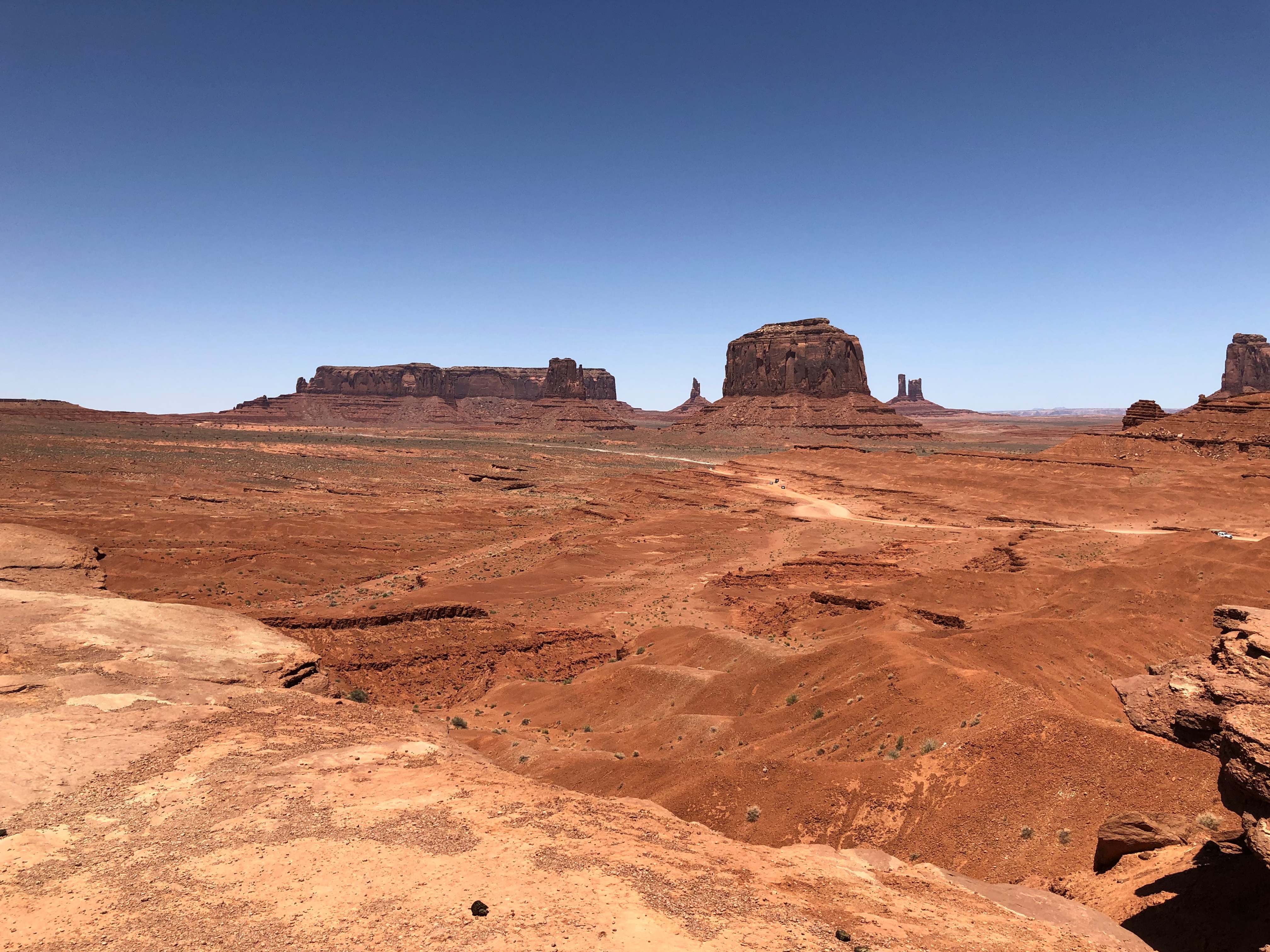
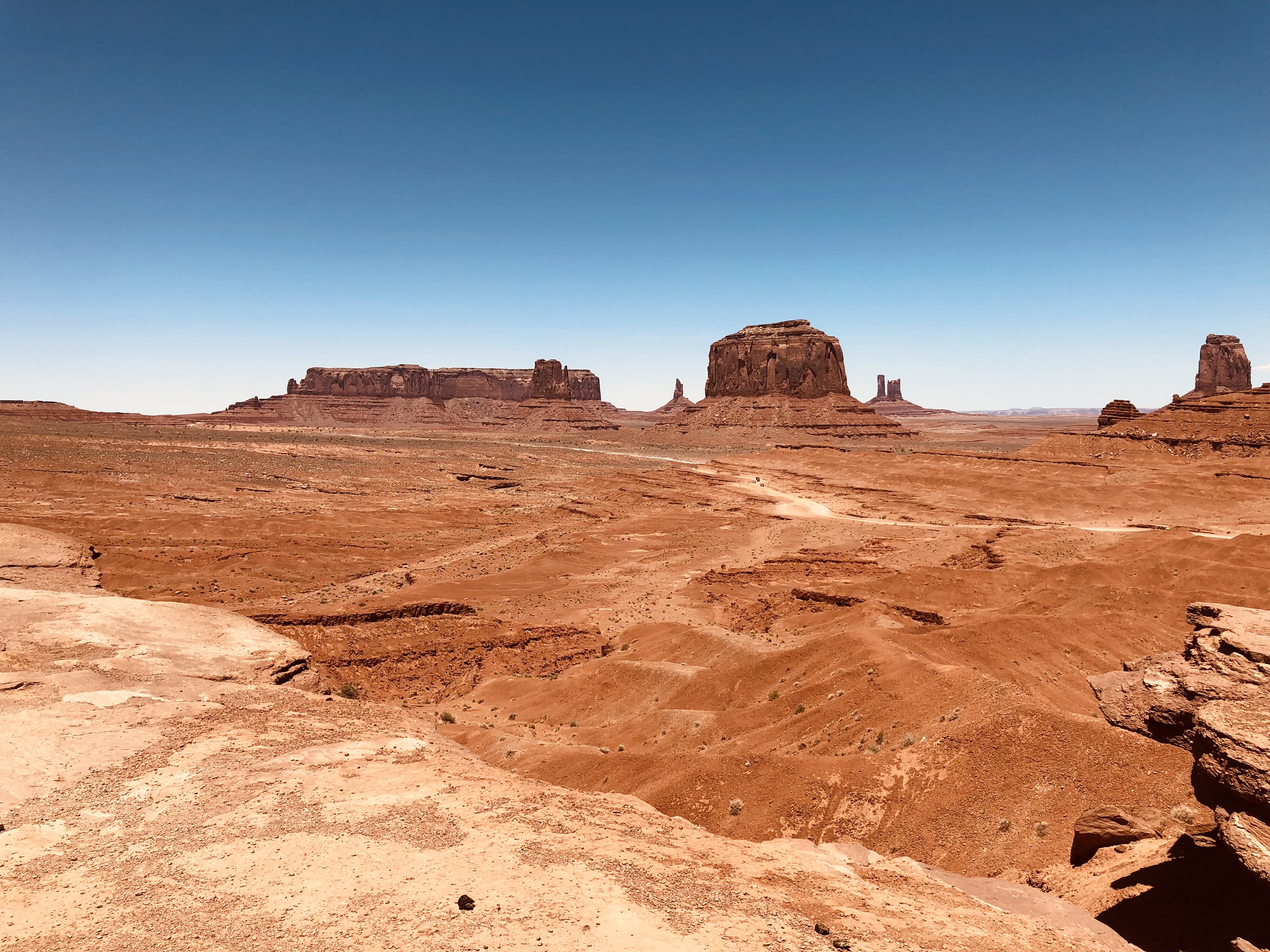
Because later movies and commercials returned to this particular view so often, the other marvels on the road aren’t as famed or recognizable. But they’re equally worth a good look. Just a sampling below; there was something remarkable just about everywhere you look.Monument Valley Navajo Tribal Park
Monument Valley Navajo Tribal Park Monument Valley Navajo Tribal Park Monument Valley Navajo Tribal Park

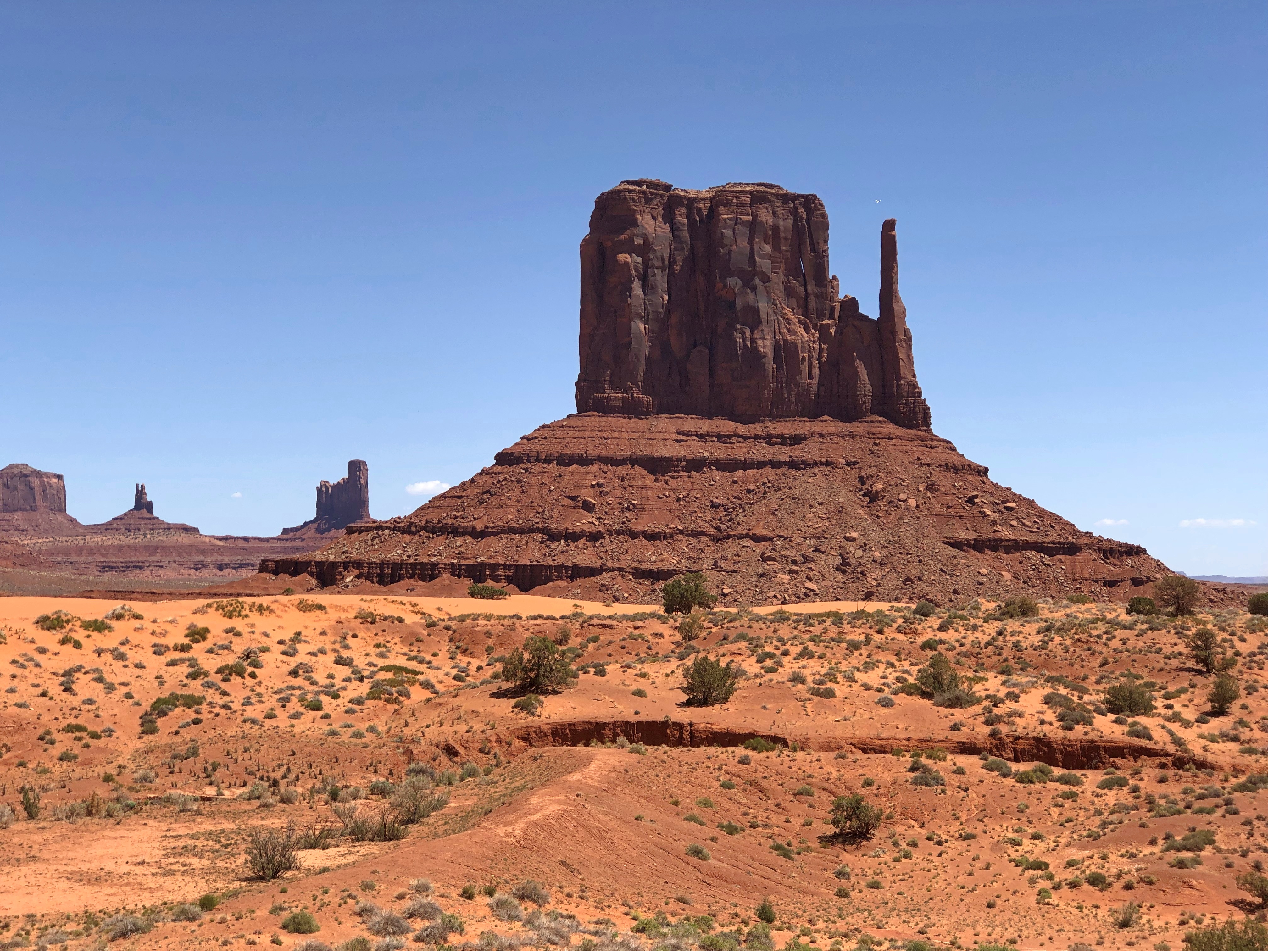
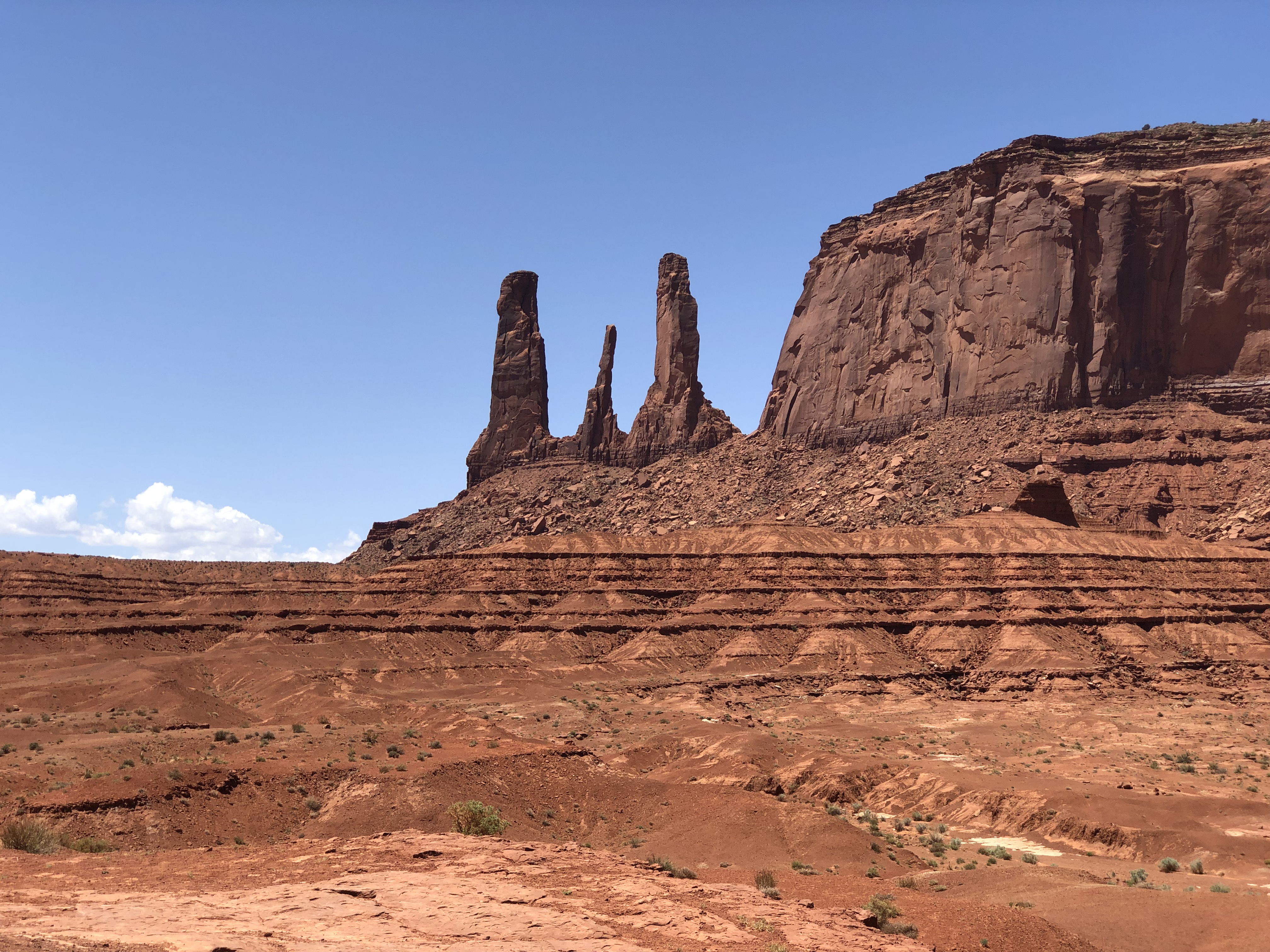
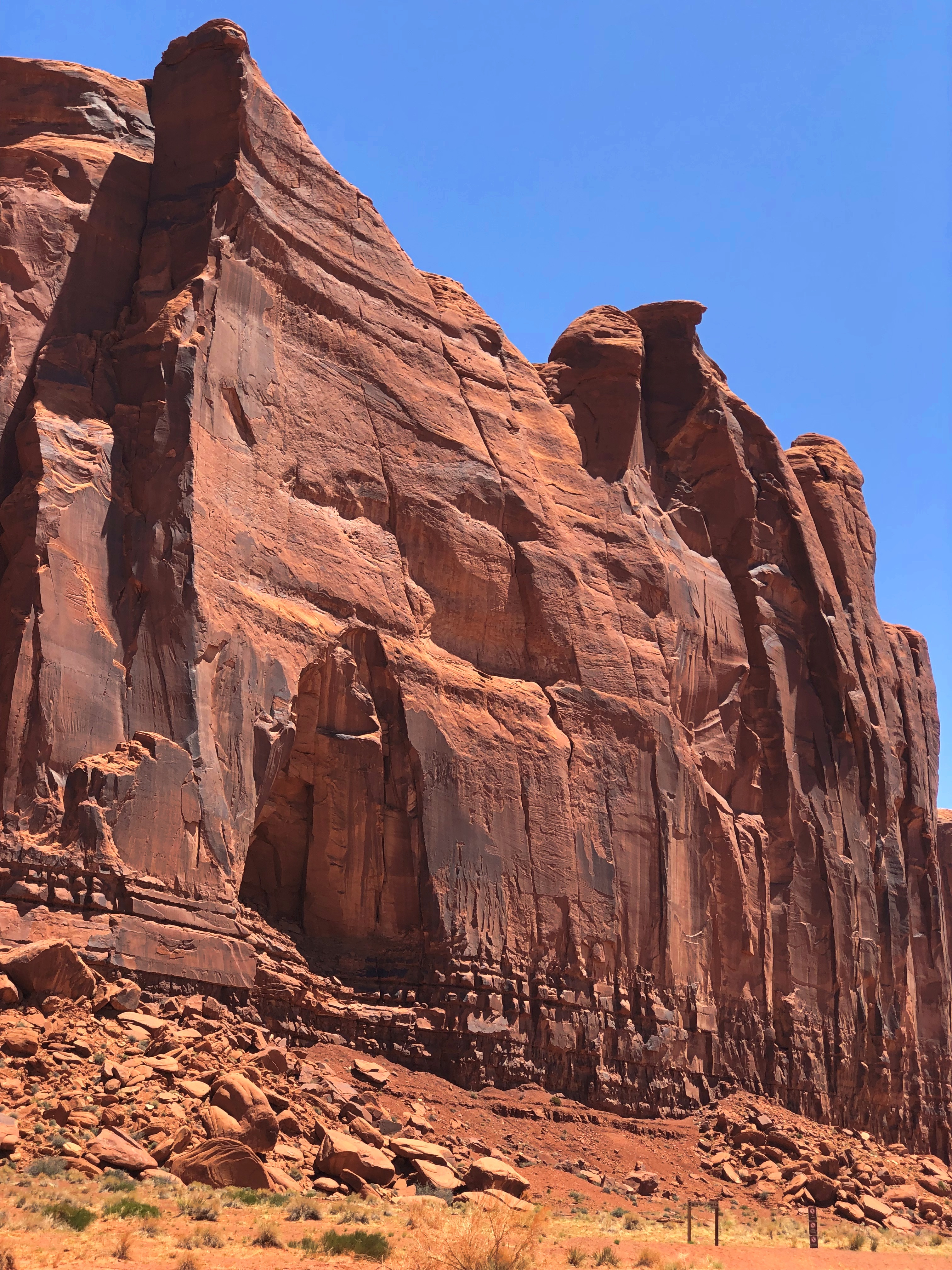
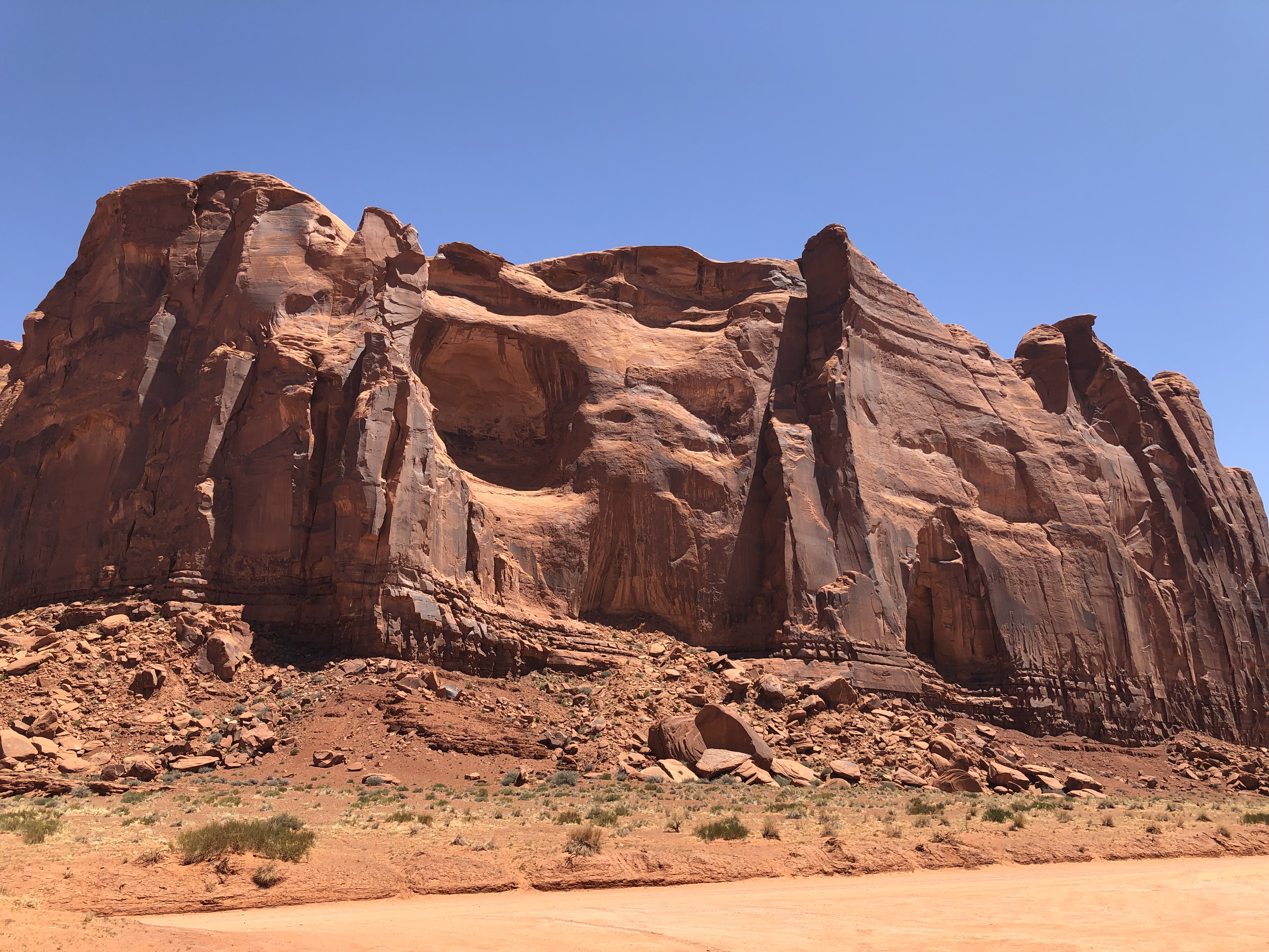
Aside from the rock giants, the terrain itself fascinates, its colors so unusual to those of us from greener places.Monument Valley Navajo Tribal Park Monument Valley Navajo Tribal Park

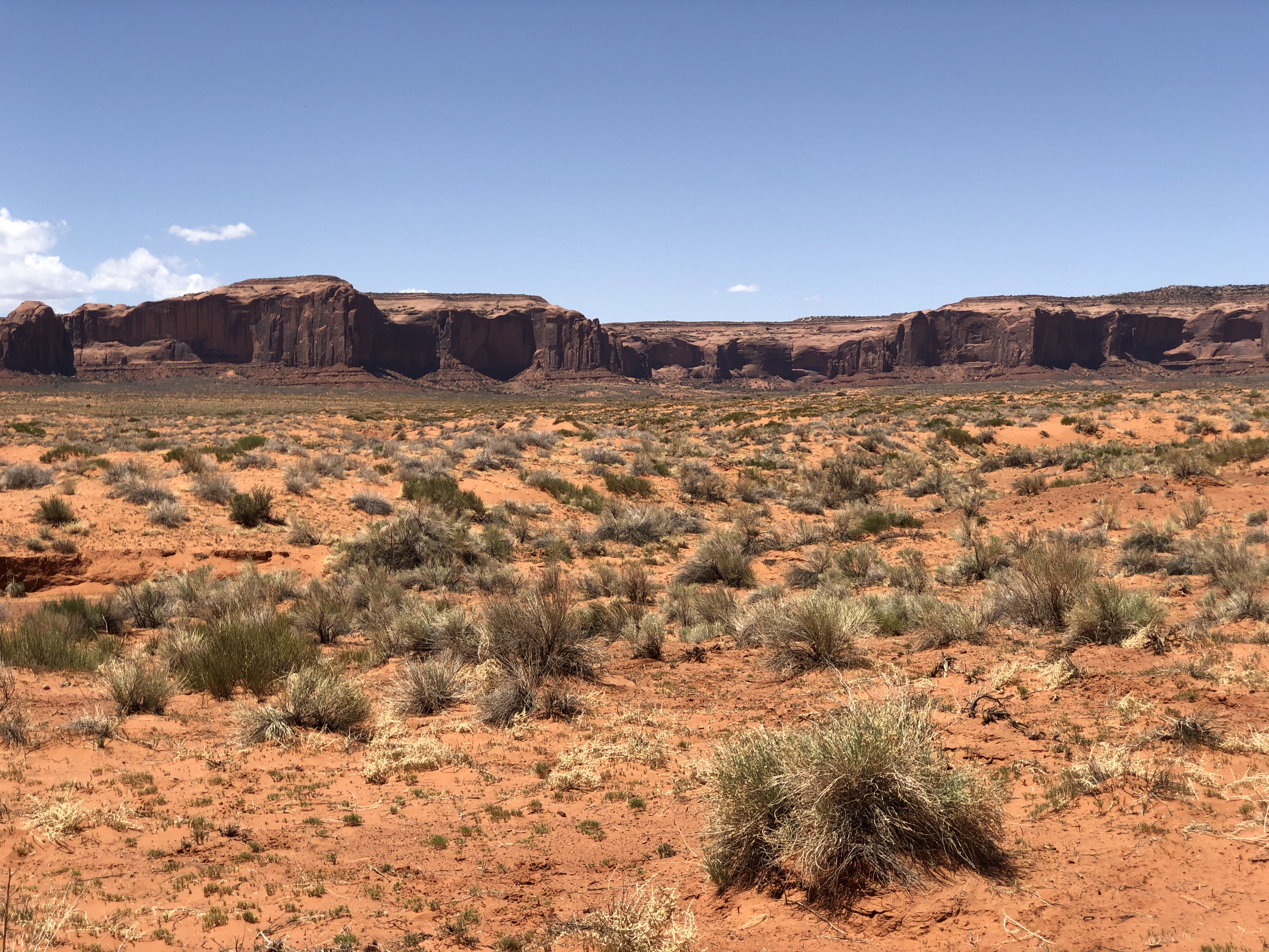
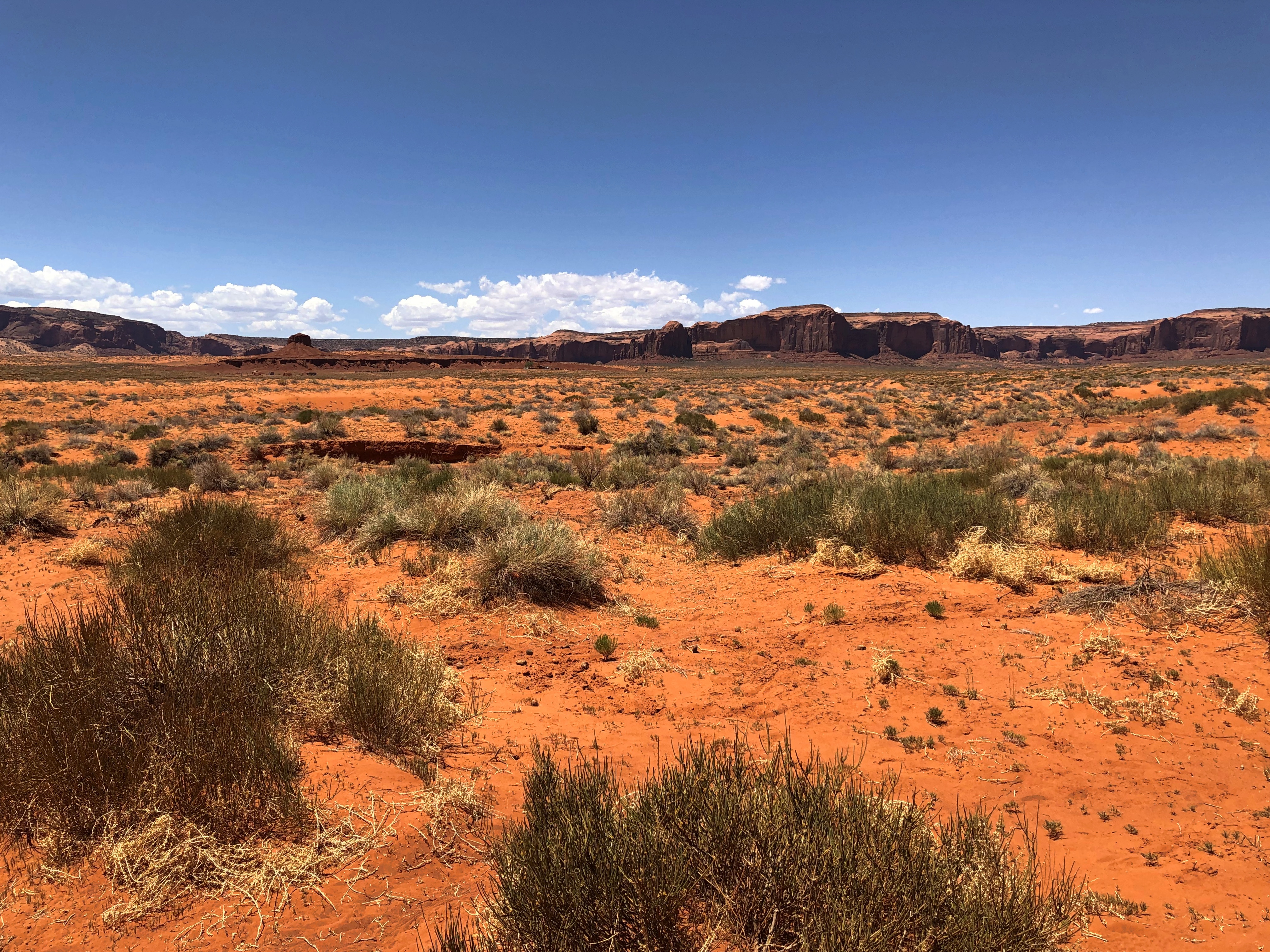
Color that the road itself shares.Monument Valley Navajo Tribal Park

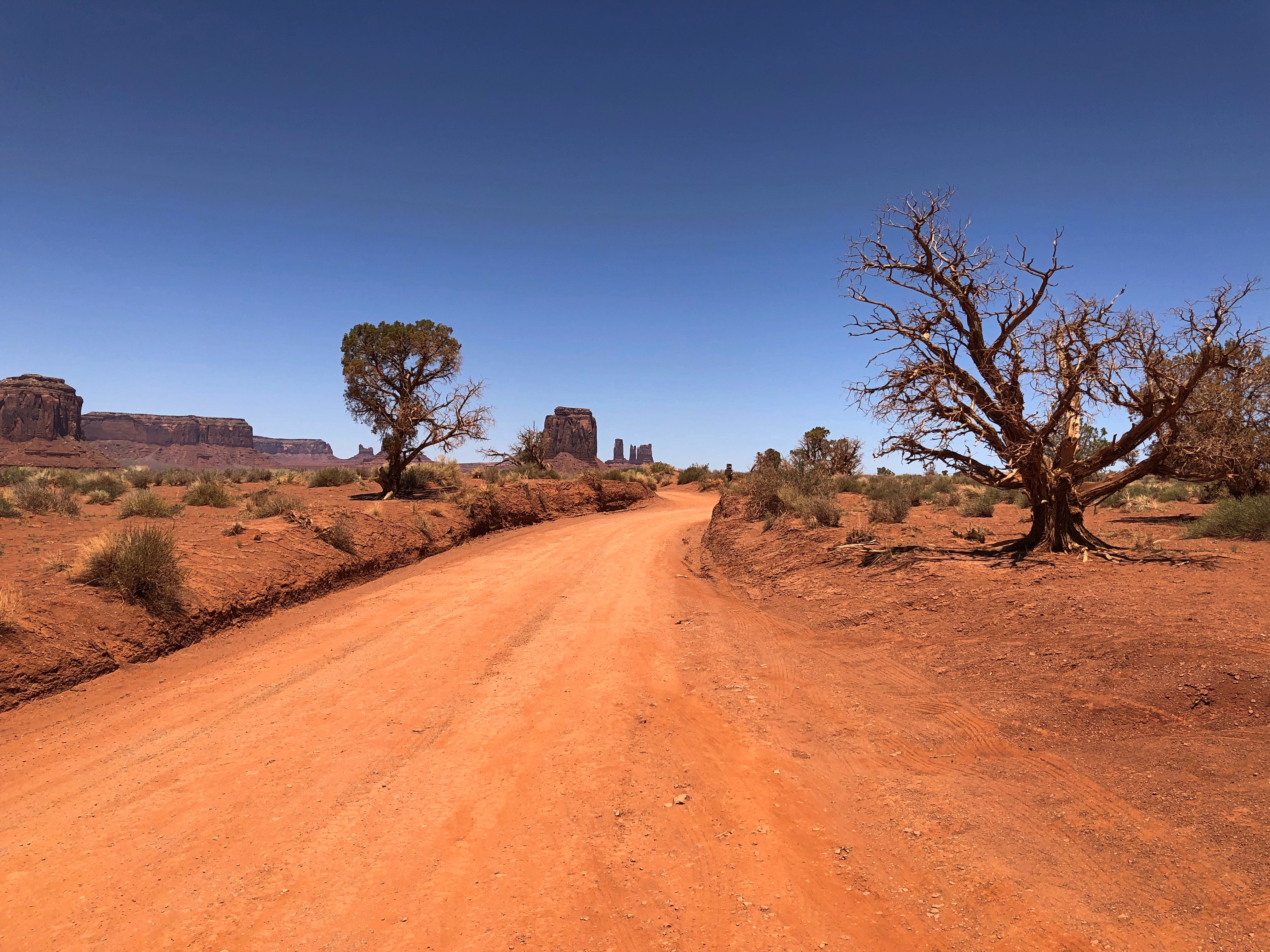
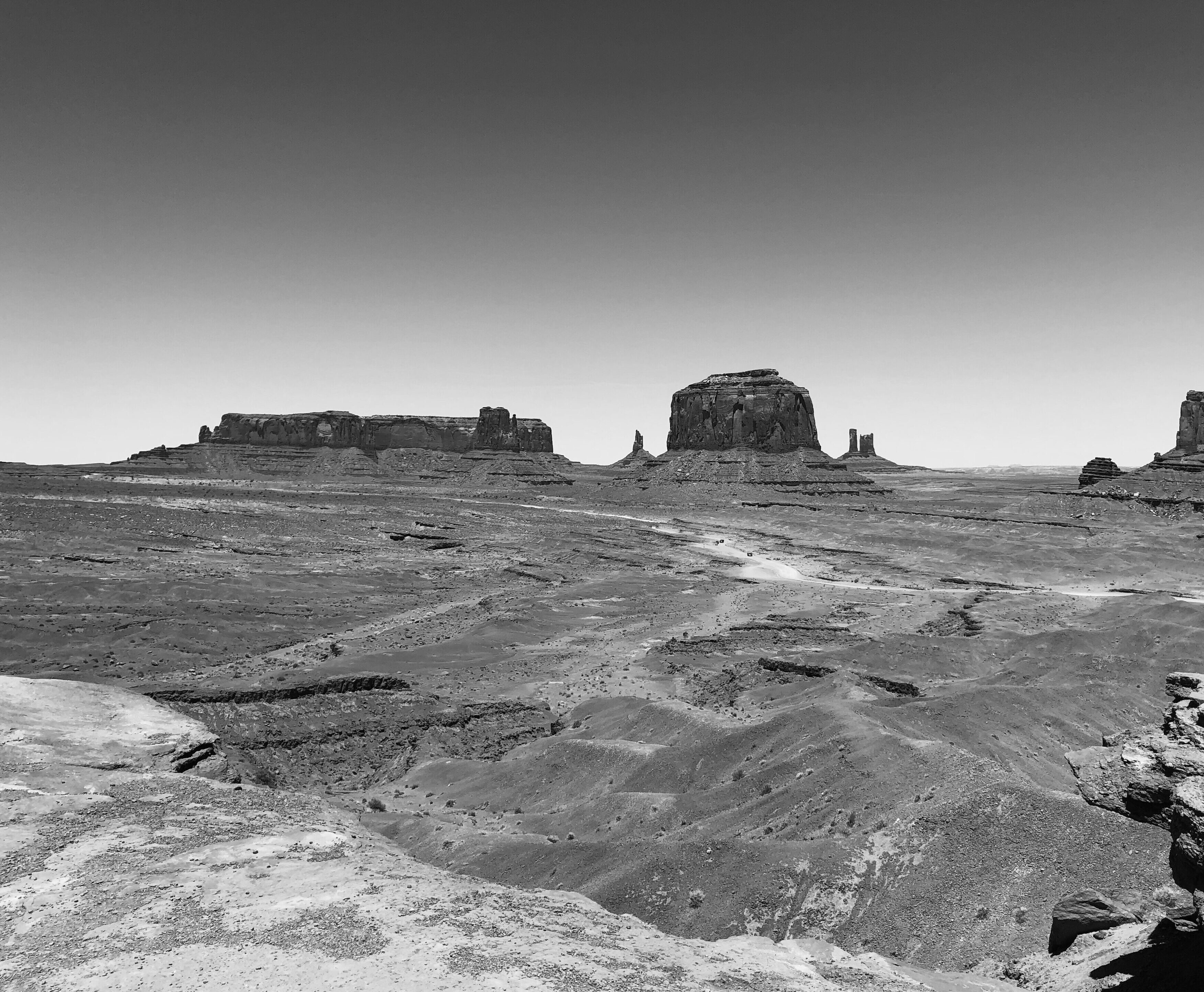
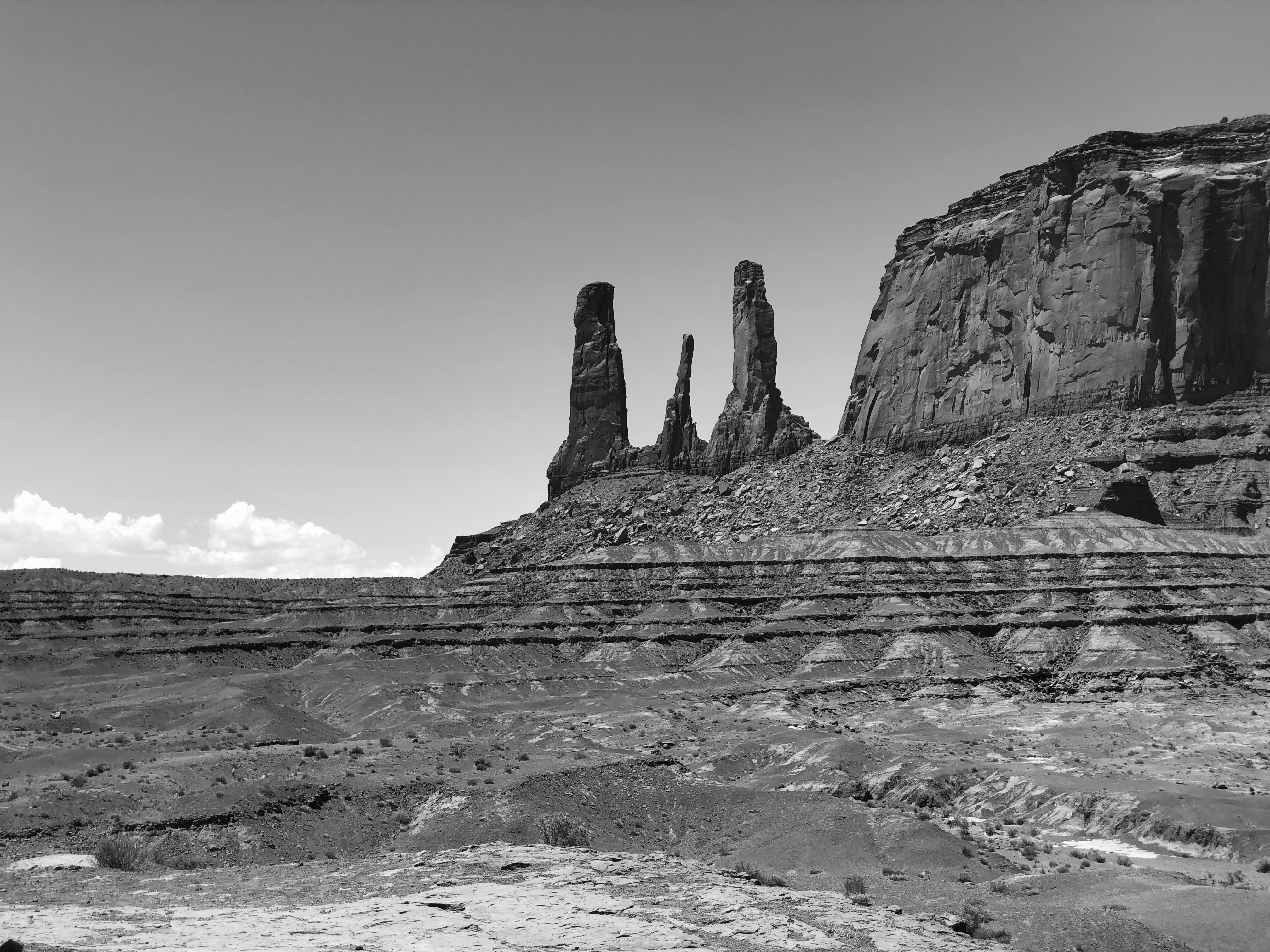
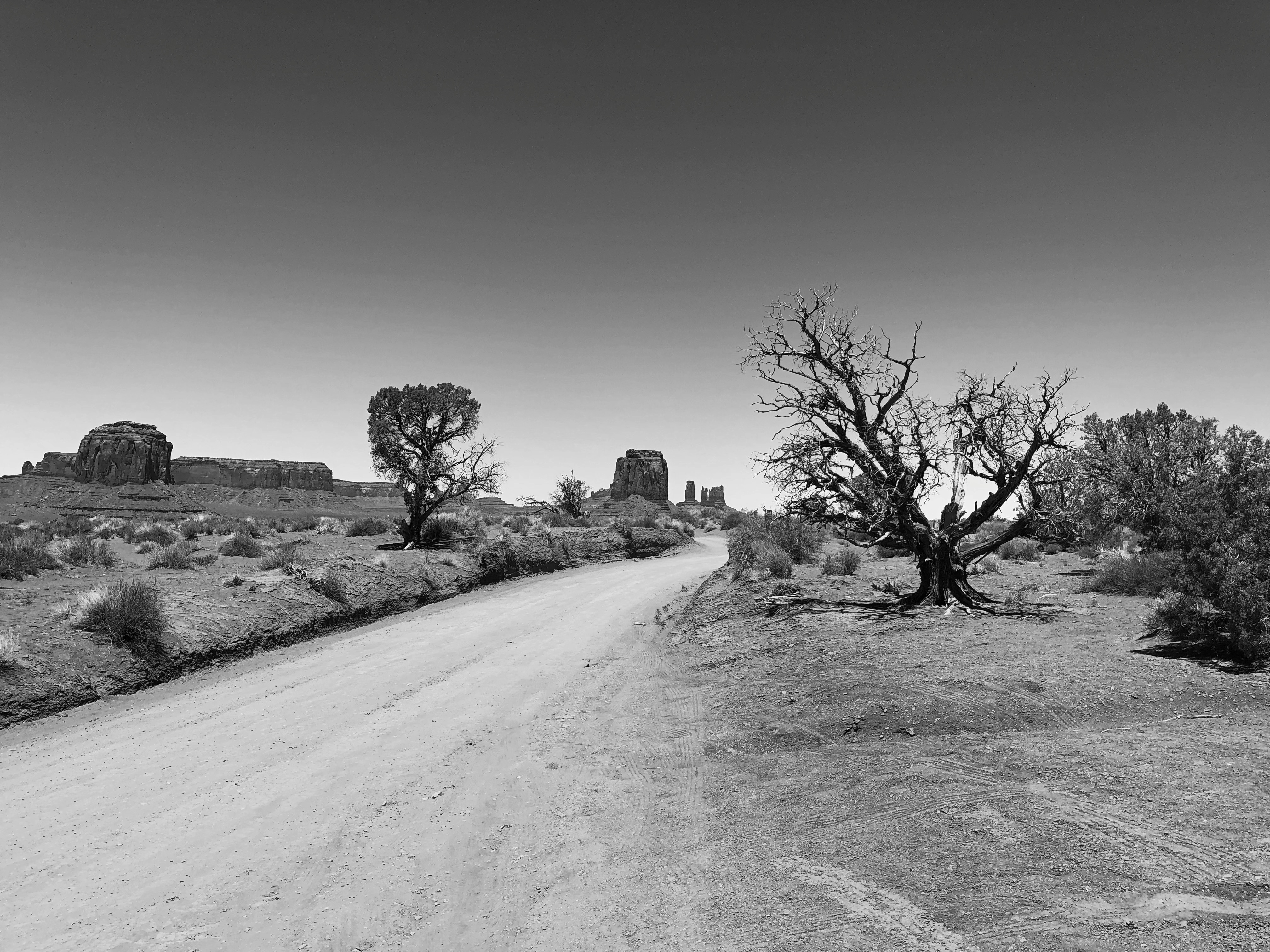
Without color, the contours emerge vividly; Ford must have appreciated that, too.Monument Valley Navajo Tribal Park
Monument Valley Navajo Tribal Park

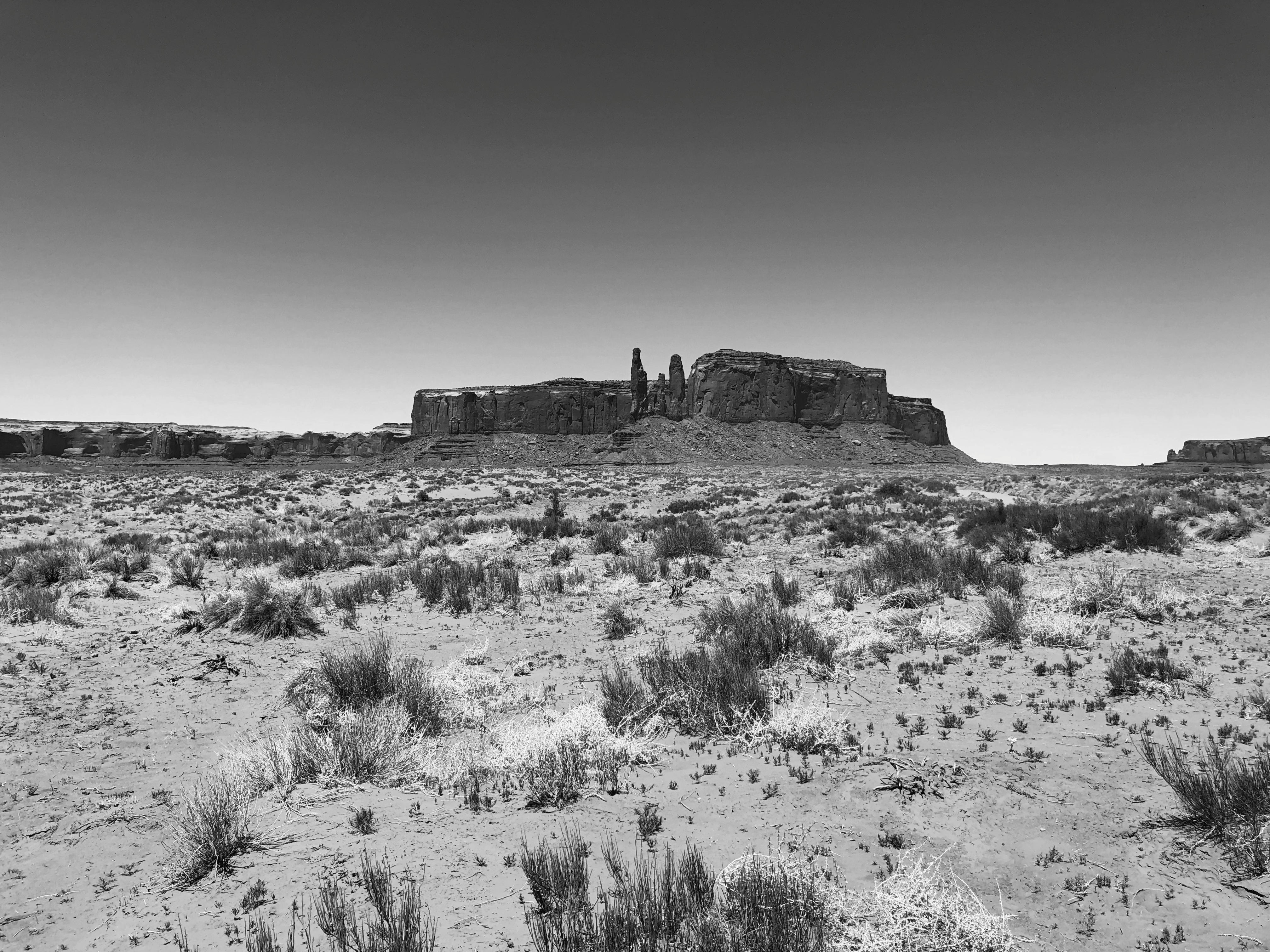
We left the park that afternoon, but even as you drive north from Monument Valley on U.S. 163, it has one more gift to give, if you’re paying attention. I almost wasn’t. As we drove along, we noticed people ahead, standing in the road, taking pictures. They got out of the way before we reached them, but I wondered, what are they doing there?

Then it hit me, and we stopped at the next pullout in the road, maybe a fifth of a mile away, and looked back. A view almost as famed as that at John Ford Point, and certainly as arresting.Monument Valley Navajo Tribal Park

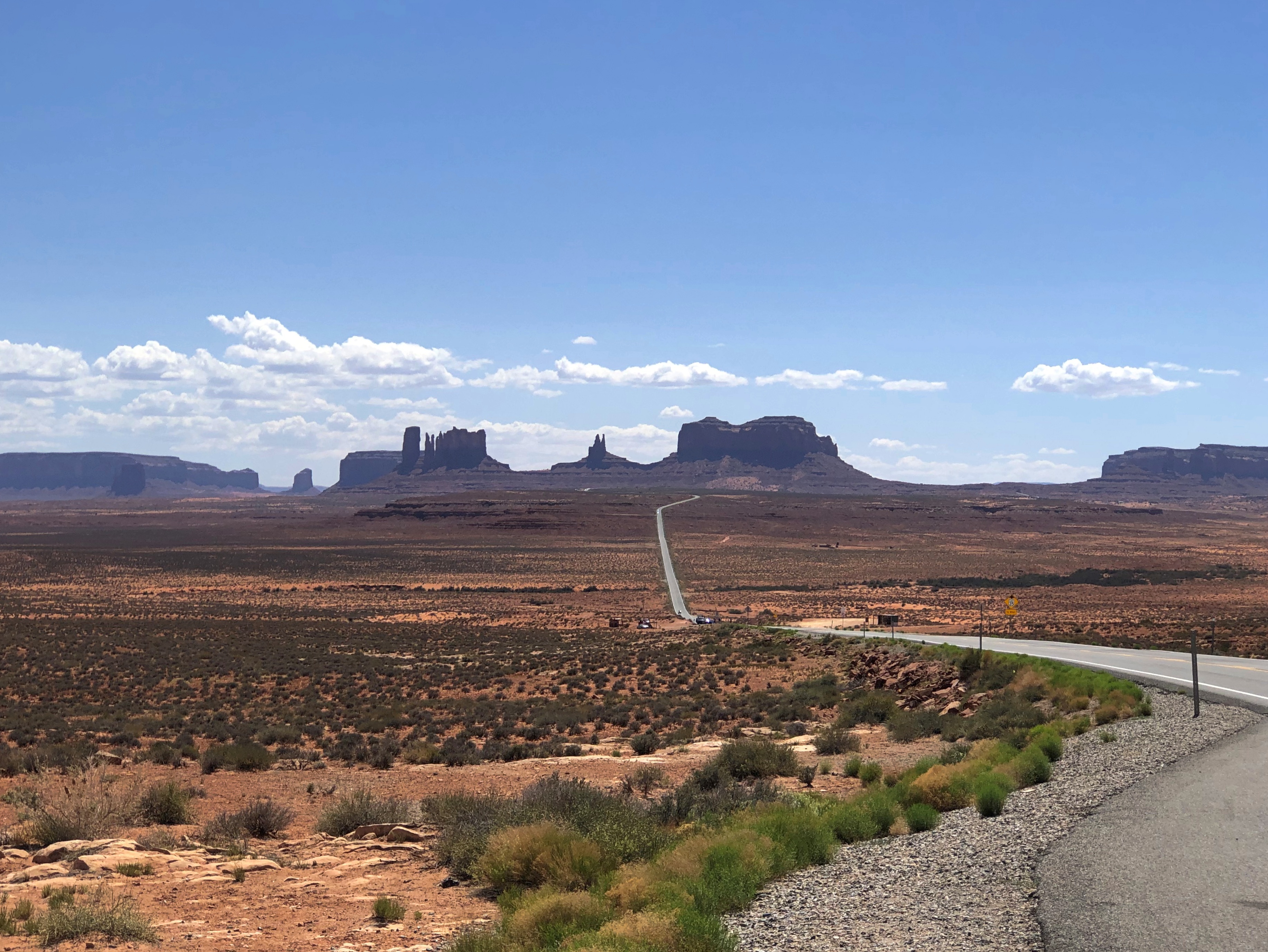
That isn’t quite the “Forrest Gump Stopped Here” place, but I wasn’t about to go back where those yahoos had been standing in the road just for that (unlike Stagecoach, it isn’t a movie I like very much). In fact, I wouldn’t have remembered the view was made famous in that movie, either, but some other people had stopped where we were, and I overheard them talking in German about Forrest Gump.

Birchwood South Park

Finally a warm day on Saturday — after a miserable, wet Friday — then cool on Sunday, but warm again on Monday. So warm today, in fact, that the ground was dry enough for me to mow the lawn for the first time this year, and grill brats in the back yard, despite gusting winds.

Bonus: Even after dark this evening, I could sit around the deck comfortably in a t-shirt. So I spent some time outside reading about G-men trying to track down the loose 1933 Double Eagles, as mentioned before.

Last week, before the warm up, it was still pleasant enough on Wednesday to seek out a new place to walk: Birchwood South Park in Palatine.Birchwood Park South

A good place to see the spring greening.
Birchwood South Park

It took a while, but eventually we realized that the water in the middle of the park wasn’t a permanent feature, but the result of the many recent rains.Birchwood South Park Birchwood South Park

Including a flooded baseball/softball field.
Birchwood South Park

This year’s rainy spring is more than just an impression.

“This spring has seen more rainy days than any other spring in the past 63 years,” NBC Chicago reports.

“While a rainy springtime in the city isn’t anything new, this year has seen more perception than average, according to the National Weather Service, the average precipitation in Chicago from March to May is 6.93 inches. This year, we’ve seen 10.31 inches.”

Mishawaka Walks

Worth noting: U.S. Grant was born 200 years ago today in Point Pleasant, Ohio. There hasn’t been a presidential birth bicentennial since Lincoln’s in early 2009, which came on the heels of Andrew Johnson’s in late 2008.

Later this year, there will be another one: Rutherford B. Hayes, born in Delaware, Ohio on October 4, 1822. One cold day in the mid-1990s, I dropped by the Hayes home museum in Fremont, Ohio, sparking an interest in presidential sites that hasn’t abated. Good old RBH. President most likely to be mistaken for Benjamin Harrison in a lineup. After his bicentennial, it won’t happen again till Chet Arthur has his day in 2029.

The St. Joseph River flows mostly westward through Michigan and into Lake Michigan, but it bends into Indiana at South Bend and its twin town, Mishawaka. Until recently I gave little thought to Mishawaka as a destination, but then I learned about its riverwalks. We arrived late in the morning on Sunday to sample one of them, the walk along the budding-verdant Kamm Island Park.

Downtown Mishawaka seemed fairly pleasant as well. It reminded me of some of the towns along the Fox River in Illinois — Aurora, say, or St. Charles, both of which hug a mid-sized river and consider it an amenity.

As well they should. Some views of Kamm Island Park.Kamm Island Park Kamm Island Park
Kamm Island Park

New development has come to the area. Not sure I’d want to live there, but I’d probably get a kick out of renting one of the units for a few days.Kamm Island Park

One curiosity on Kamm Island that I didn’t think to take pictures of: the fact that small, colorful figurines and other items, plastic and ceramic, stand at the base of many of its trees. No group is the same. A planned art project or spontaneous whimsy? Homage to elves or the work of elves?

Across the river at Kamm Island is Battell Park, the city’s oldest park, which has its own trail and some features not found elsewhere, namely a rock garden built by the WPA. This is the view of the lower level of the rock structure.Battell Park

After lunch, which consisted of takeout Chinese from a storefront near UI South Bend eaten at the picnic shelter of a windy park near the Potawatomi Zoo, we stopped at Battell Park for a look at the upper level of the rock garden. Water must flow through its channels some of the year, down to the river, but looks like it hasn’t started for the season quite yet. Still, it’s an impressive work.Battell Park

As much as I laud the CCC — whose works I keep encountering, some stunning — I have to put in a word for the WPA and its wide legacy too. I grew up with one of its finest projects — the San Antonio Riverwalk — as well as our high school stadium, which once upon a time had a plaque denoting it as a WPA project. This is an excellent site for browsing its projects, along with the rest of the visible New Deal.

Upstream a mile or so from Battell is Merrifield Park, also in Mishawaka. That was the last place we visited in town before heading home, because we wanted to see one of the park’s smaller features, Shiojiri Garden (Shiojiri Niwa), dedicated in 1987. Small but enchanting.

“This garden was a gift to the city of Mishawaka from its sister city, Shiojiri (Nagano Prefecture, Japan),” Atlas Obscura notes. “The designer was Shoji Kanaoka, the same man who planned the Japanese gardens at the Epcot Center in Florida. It features a multitude of trees and flowers, including a grove of cherry trees. There are also two snow lanterns, four bridges, and a teahouse pavilion built in the traditional Japanese style.”Shiojiri Niwa Shiojiri Niwa Shiojiri Niwa

Nice. You might call it a pocket Japanese garden, and Mishawaka — and the world — are better for it.

Ruth Macintyre Conservation Area

Fell asleep to light rain last night. I could open the window a crack to listen to it, for the first time this year. Today was merely cloudy, and yesterday’s warmth has mostly ebbed away.

Walked another northwest suburban conservation area recently, which is called the Ruth Macintyre Neighborhood Conservation Center on the entry sign.Ruth Macintyre Conservation Area

In the park district materials, the place is known as the Ruth Macintyre Conservation Area. That matches the nomenclature of the other three such areas in the district, so I’ll go with it. This area is less wooded than Kay Wojcik, but worth the walk all the same.

Hard to believe these tall grasses and cattails will be green in a matter of weeks, certainly by May. Plenty of birdsong about now, but we didn’t hear any throaty frogs looking to mate, as we have in some other wetlands lately.Ruth Macintyre Conservation Area

The trail was muddy in places. I hadn’t worn my best shoes for that, so it slowed me down. Good thing we weren’t in a hurry.Ruth Macintyre Conservation Area

Ruth Macintyre is a total of 36 acres, the park district says, including a five-acre pond.Ruth Macintyre Conservation Area

“Named for the longtime 8th grade science teacher at Frost Junior High who was active in environmental and conservation concerns and created a 13-acre sanctuary adjacent to the school that ballooned to the 36-acre conservation area,” according to the History of Schaumburg Township blog. “She taught in District 54 schools from 1956-1979. Rededicated on September 24, 1994 from Munao Park to the above-named conservation area.”

Kay Wojcik Conservation Area

Not every recent day has been wet and chilly here in the northwest suburbs. A few have been dry and chilly. But not so cold that we can’t take walks in places like the Kay Wojcik Conservation Area.Kay Wojcik Conservation Area at Oak Hollow

In full, it’s the Kay Wojcik Conservation Area at Oak Hollow, which sounds like a compromise renaming to avoid getting rid of the old name (it was just Oak Hollow CA before 2009). Whatever the name, it’s a pleasant place for a stroll, and one of those parks tucked deep in the suburban fabric, so that few outside the immediate area probably know about it.Kay Wojcik Conservation Area at Oak Hollow Kay Wojcik Conservation Area at Oak Hollow

Part of the conservation area is a pond.
Kay Wojcik Conservation Area at Oak Hollow

The park is a 17½-acre remnant of the pre-settlement oak grove, marked by a small network of trails. How it didn’t become farm land and then suburban housing, the park district doesn’t say, but perhaps it was a bit marshy for either of those uses.Kay Wojcik Conservation Area at Oak Hollow

After getting home from our walk, I looked up Kathleen “Kay” Wojcik. Now retired, she was a Schaumburg Township clerk and later a member of the Illinois House of Representatives, from 1983 to 2003, and in the Illinois Senate from 2003 to 2005. Hope she’s able to stroll in her namesake park from time to time.

Frog in the Snow & Other February Sights

Here we are, partway through paradoxical February, which is the shortest and yet the longest month.

Much of the snow has melted, but it will be back. Out in the front yard, near the front door, our metal frog peeps further out of the snow cover.frog in the snow

Elsewhere in the northwest suburbs, machines stand ready to deal with more frozen precipitation.snow plow

I’ve seen flags to warn, or assure, passersby about the solidity of ice, usually green or red for go or no go. But I’ve never seen one that hedges its bets. Red = no ice use. Yellow = own risk.hoffman estates

It’s theoretical for me anyway. I’m not about to walk out on any ice.

February Stroll

Sunday afternoon temps were just a little below freezing, so the snow cover didn’t melt. There wasn’t much ice underfoot either. We went to the partly trod trail behind the Robert O. Atcher Municipal Center.Chicago Athenaeum International Sculpture Park

Dog included.
Chicago Athenaeum International Sculpture Park

The path runs through an open field to a small patch of wooded land.Chicago Athenaeum International Sculpture Park Chicago Athenaeum International Sculpture Park

The path also meanders through the Chicago Athenaeum International Sculpture Park, which Google Maps simply calls The Sculpture Park.Chicago Athenaeum International Sculpture Park

The park’s most recent bit of work, Thiruvalluvar, has been adorned recently.Thiruvalluvar Schaumburg

Not a bad day for a walk, but the conditions that made it so lasted only a few hours. The Romans had a right idea about February: make it the shortest month.

Stillman Park

Stillman Park in South Barrington, Illinois, has a few features that sound like they were borrowed from Beatrix Potter: Rabbit Hill, Cattail Marsh, Owl Loop and Goldfinch Trail. It also has an unnamed parking lot, but at least it’s off Penny Road.

We arrived for a walk on Boxing Day afternoon — as far as we got from home over the holidays, which wasn’t far at all. Conditions were still dry and not that cold, which made for a good walk.

There were trails to follow.Stillman Park in South Barrington
Stillman Park in South Barrington

Places to pass through (or by).Stillman Park in South Barrington
Stillman Park in South Barrington

We toyed with the idea of further destinations this year, but cold rain and warm inertia persuaded us otherwise.

Little Island

We arrived footsore at Little Island late on Saturday morning. Or at least my feet were a little sore and warmer than usual, since Geof walks a good deal more than I do, and faster as well. Along the greenway on the Hudson that morning, he modulated his pace, partly because he wanted to see certain things himself, but also to accommodate my slower gait — but not too slow. I can still walk three miles without serious difficulty.Little Island NYC

Little Island is in fact an island, an artificial one built on the ruins of Pier 55 (in full, the place’s name is Little Island @Pier 55). Even before Hurricane Sandy slapped the pier, it was in poor shape, and the blow brought complete ruin. Redevelopment took years, as it does in Manhattan sometimes, with one plan sinking into a legal quagmire.

A second plan finally came to fruition with the opening of Little Island, managed by a nonprofit, in the spring of this year.Little Island NYC Little Island NYC

We entered at the south entrance bridge.Little Island NYC

The 132 concrete structures supporting the park are called “tulips,” and I guess that’s a reasonable description. Tint them green and they could form the supports for Marvin the Martian’s summer home, but in any case, they’re big and heavy: each weighing as much as 68 tons and measuring from 16 feet to 52 feet high.Little Island NYC

The British architectural firm Heatherwick Studio (designers of the Tower of Silence in India) and the New York-based landscape architecture firm MNLA collaborated on designing Little Island. I’ve read, and Geof confirmed to me — he has made a good many visits or at least walk-bys of the park this year — that the place is a hit. During the warmer months, you have to register for a specific time to get in, though at no charge. This time of the year, you can just wander in.

Good to hear that a new public space is popular with the public. I can understand that. Even in winter, it’s a pleasant place to wander around. Little Island NYC Little Island NYC
Little Island NYC

It’s lush too, at least this mild December.Little Island NYC Little Island NYC Little Island NYC

With views of the city. In the foreground is the construction site on another old pier, which will be an extension of the Whitney Museum. Little Island NYC
Little Island NYC

I took these to be homages to The Time Tunnel.Little Island NYC Little Island NYC

I might be one of the few to think of that, since you have to be of a certain age to do so, besides mildly eccentric.