St. Mary of Perpetual Help

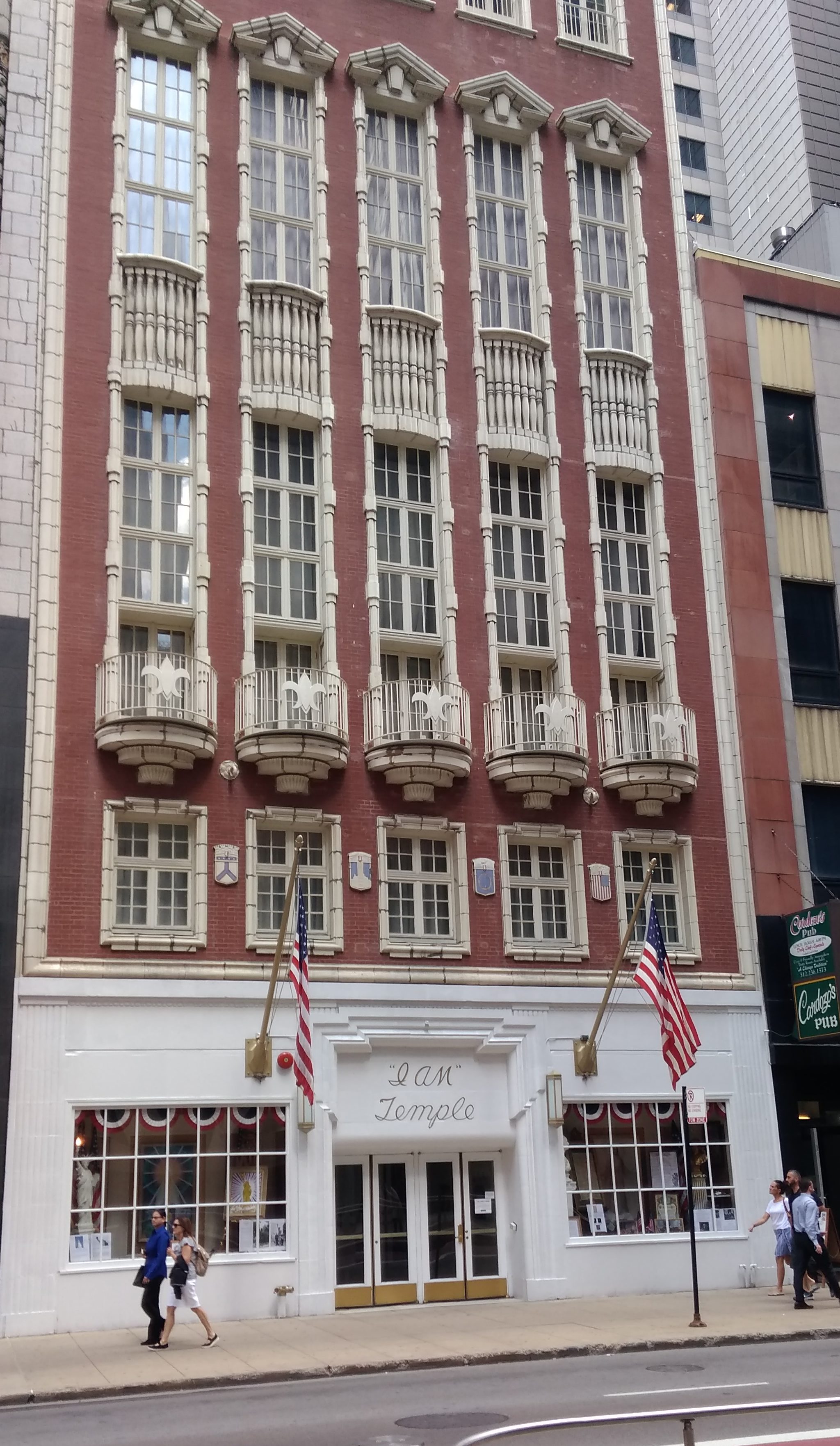
It’s been a few years since we took a church bus tour — 2014 and ’15, as it happens — so a while ago I looked into this year’s offerings from the newly renamed and relocated Chicago Architecture Center on E. Wacker Dr.

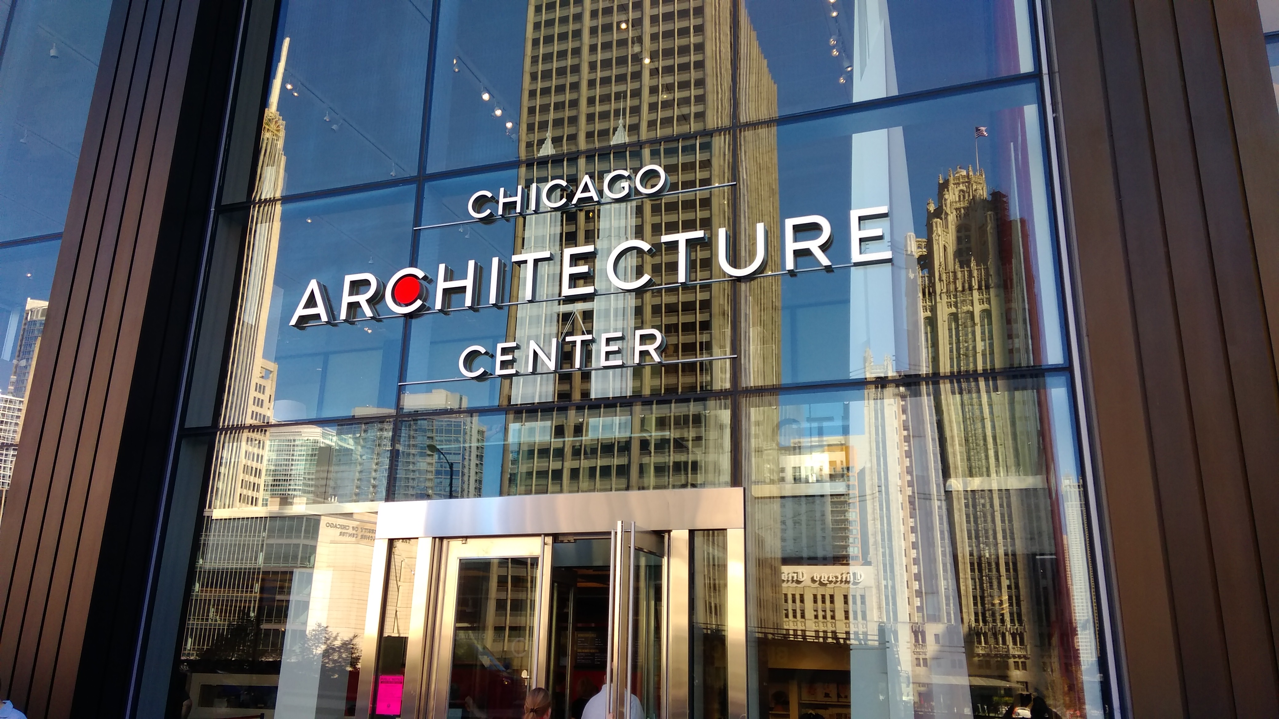
Formerly, Chicago Architecture Foundation. Why did the organization give up the solidity of foundation for the generic center?

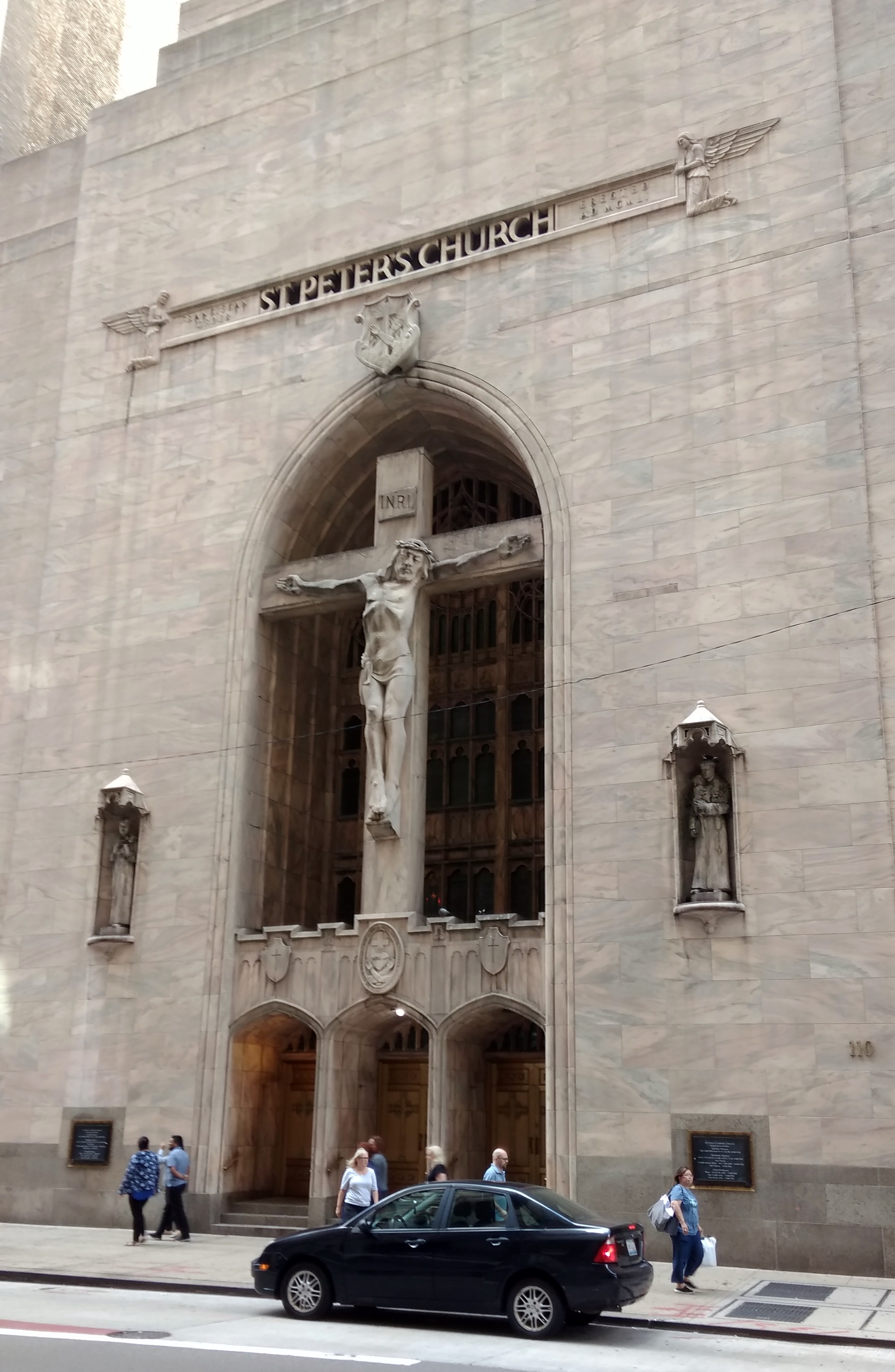
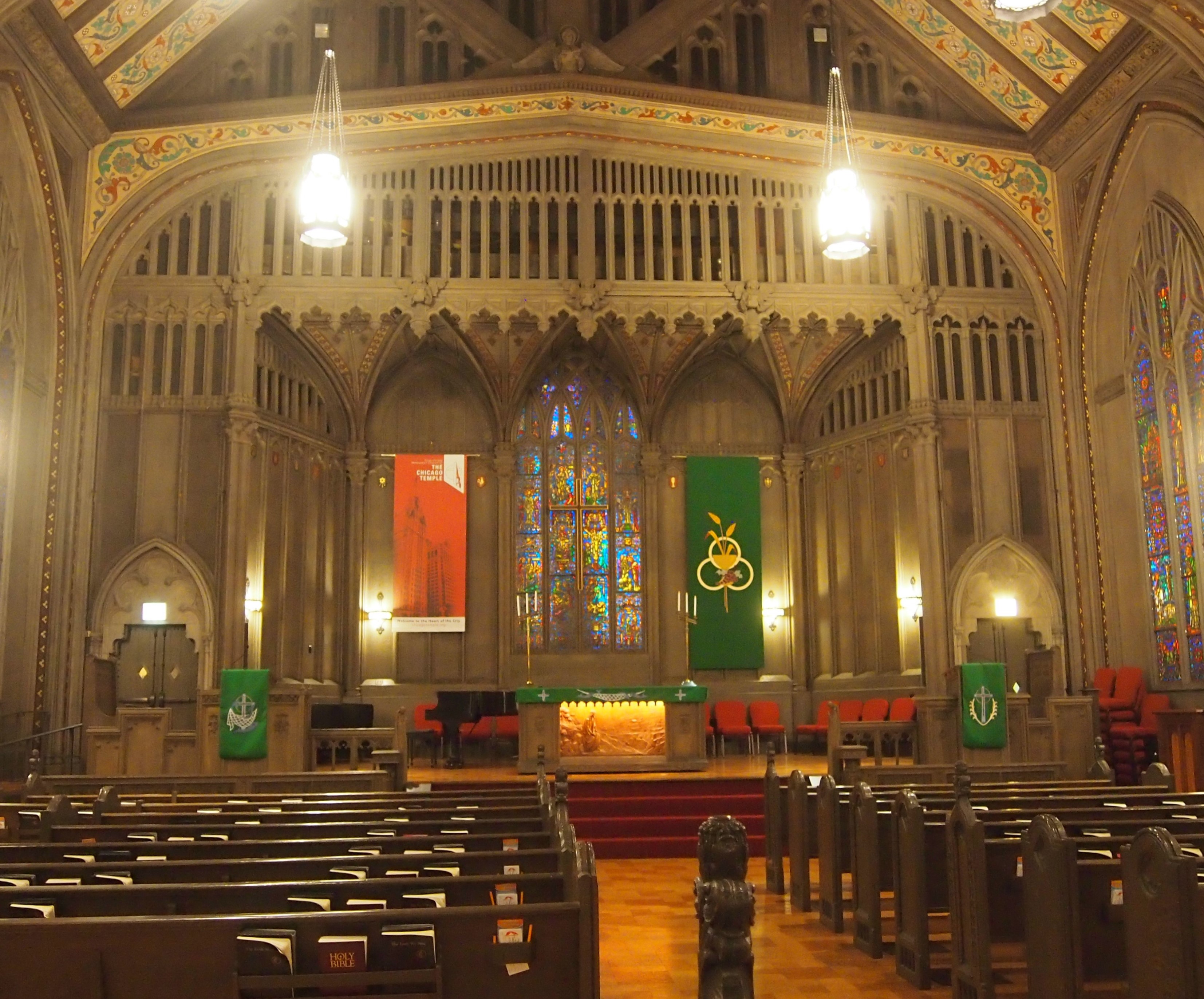
Never mind, the tours look as good as ever. The church bus tour selection this year was a cluster of churches in the Bridgeport neighborhood of Chicago. Actually, four Christian churches, one monastery, and one Buddhist temple in a building that used to be a church, but has been modified to meet the needs of the Chinese-American population moving into Bridgeport from nearby Chinatown.

Even now, Bridgeport evokes the Irish. After all, that’s the neighborhood that gave Chicago the Daleys and, going back a little further, Mr. Dooley. Of course in our time, other ethnicities are in the mix, such as the aforementioned Chinese, but also an Hispanic population. As far as I can tell, Bridgeport never really was home to just one group, because even in the early days there were Irish, but also Germans, Poles, Lithuanians, Italians and Bohemians.

It hasn’t always been a peaceful place. “Bridgeport once stood as a bastion of white ethnic communities,” the Encyclopedia of Chicago says. “Racial and ethnic strife has always been part of its history. An almost legendary clash between the Germans and the Irish occurred in 1856. During the Civil War pro-Confederate rallies were held in the neighborhood. In the twentieth century Polish and Lithuanian gangs often clashed along Morgan Street.”

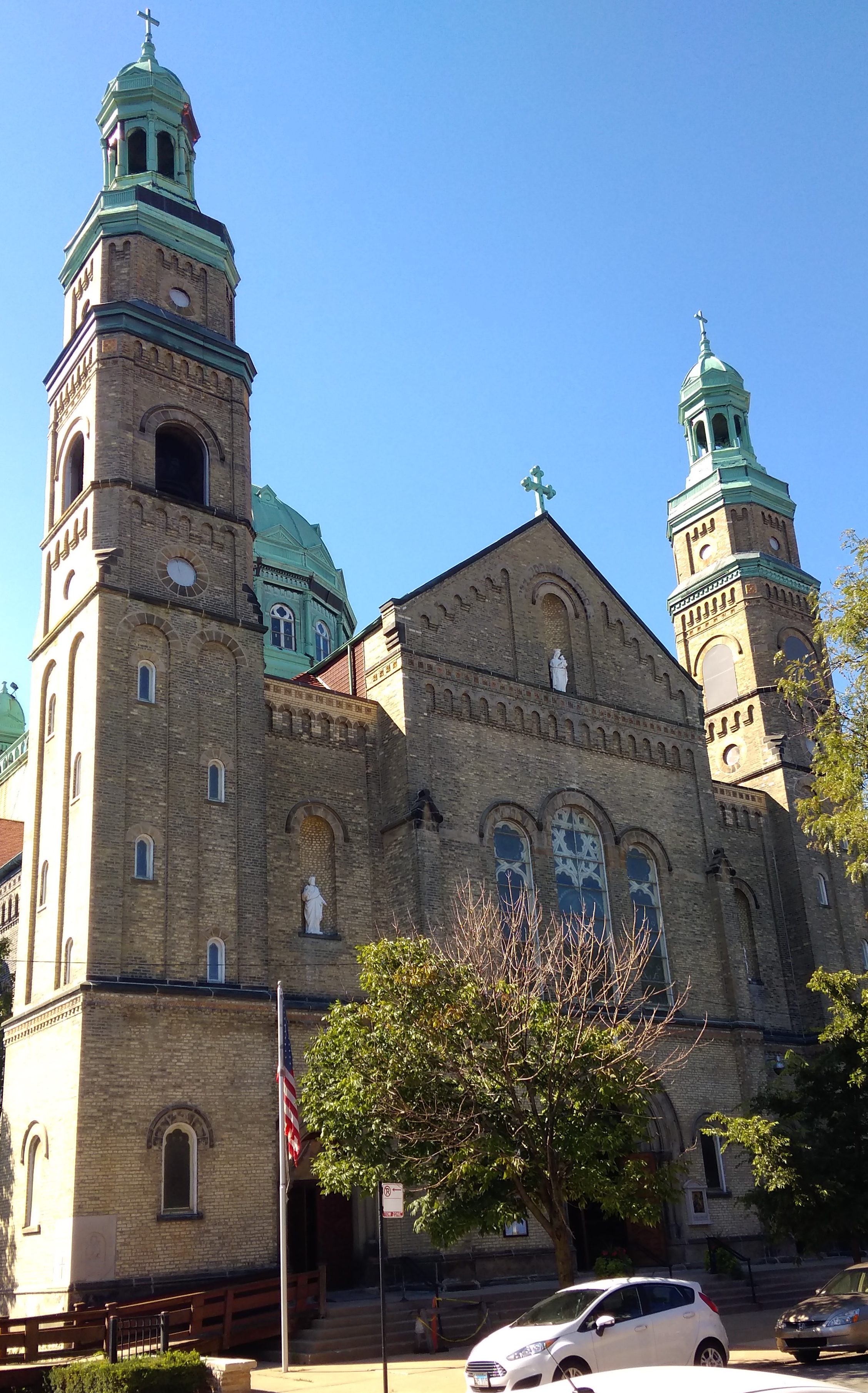
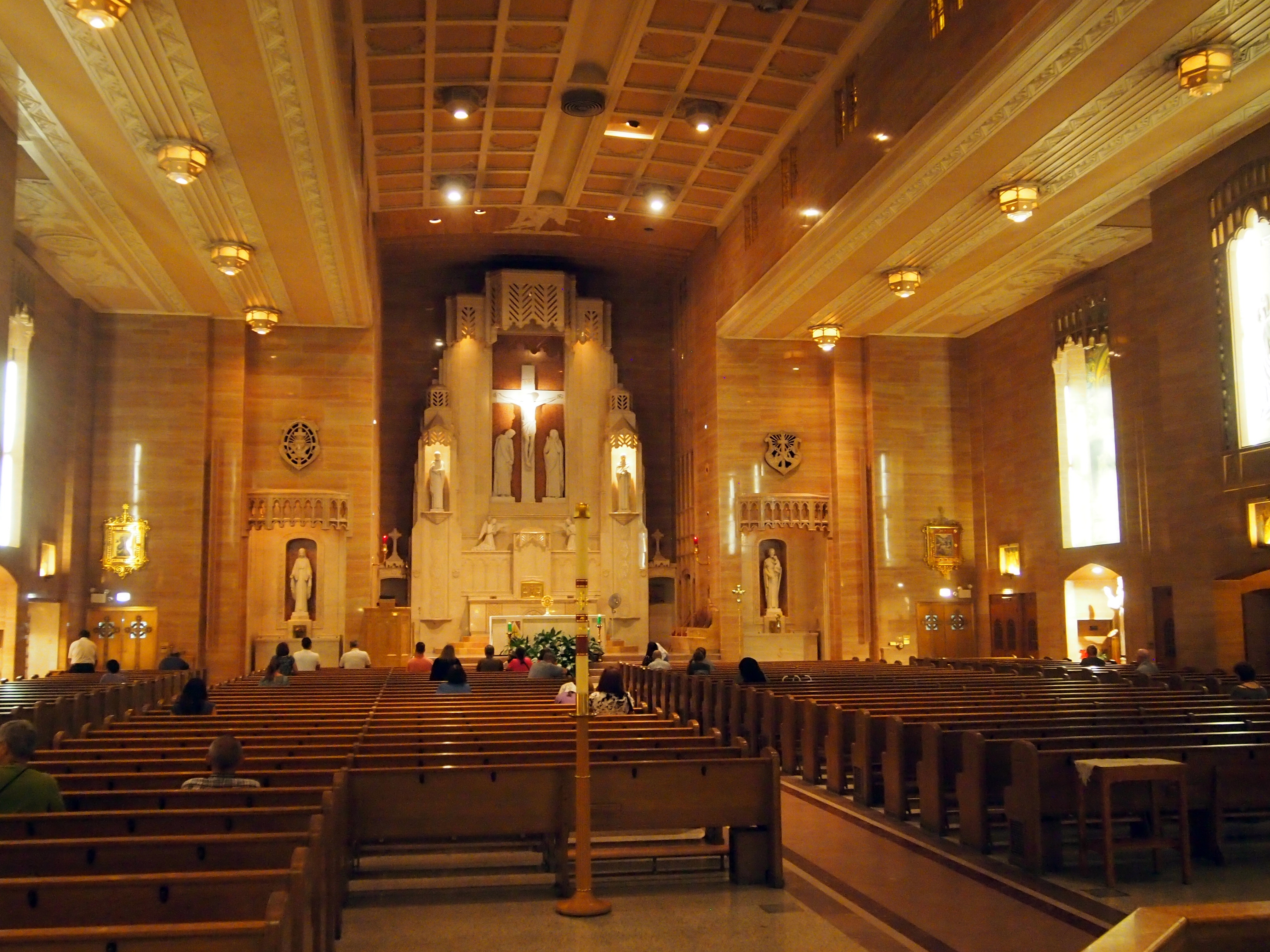
St. Mary of Perpetual Help, tucked away on W. 32nd St. in Bridgeport, originally had a Polish congregation. It’s a magnificent blend of styles, with Romanesque on the outside.
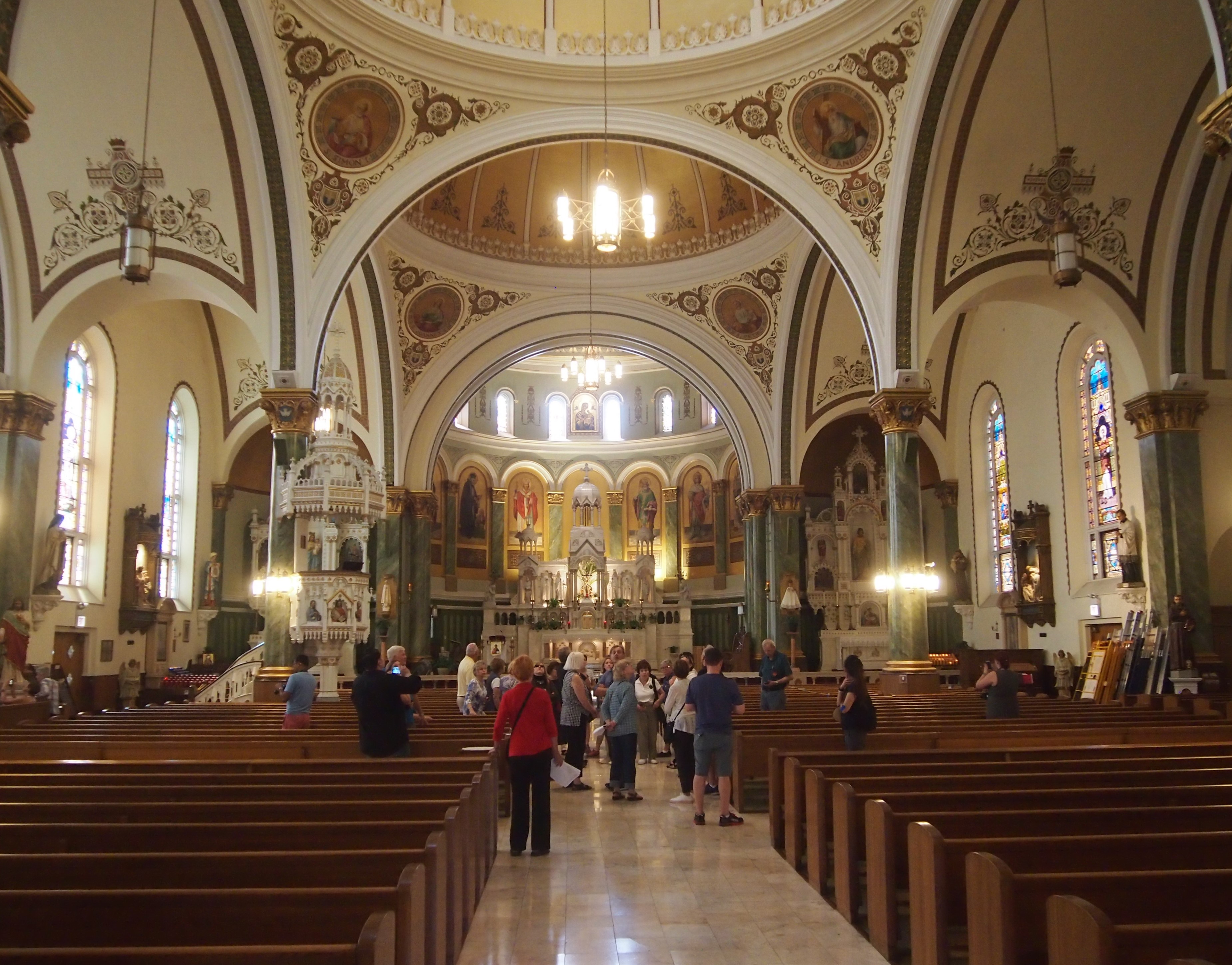
Inside, a handsome Byzantine style.

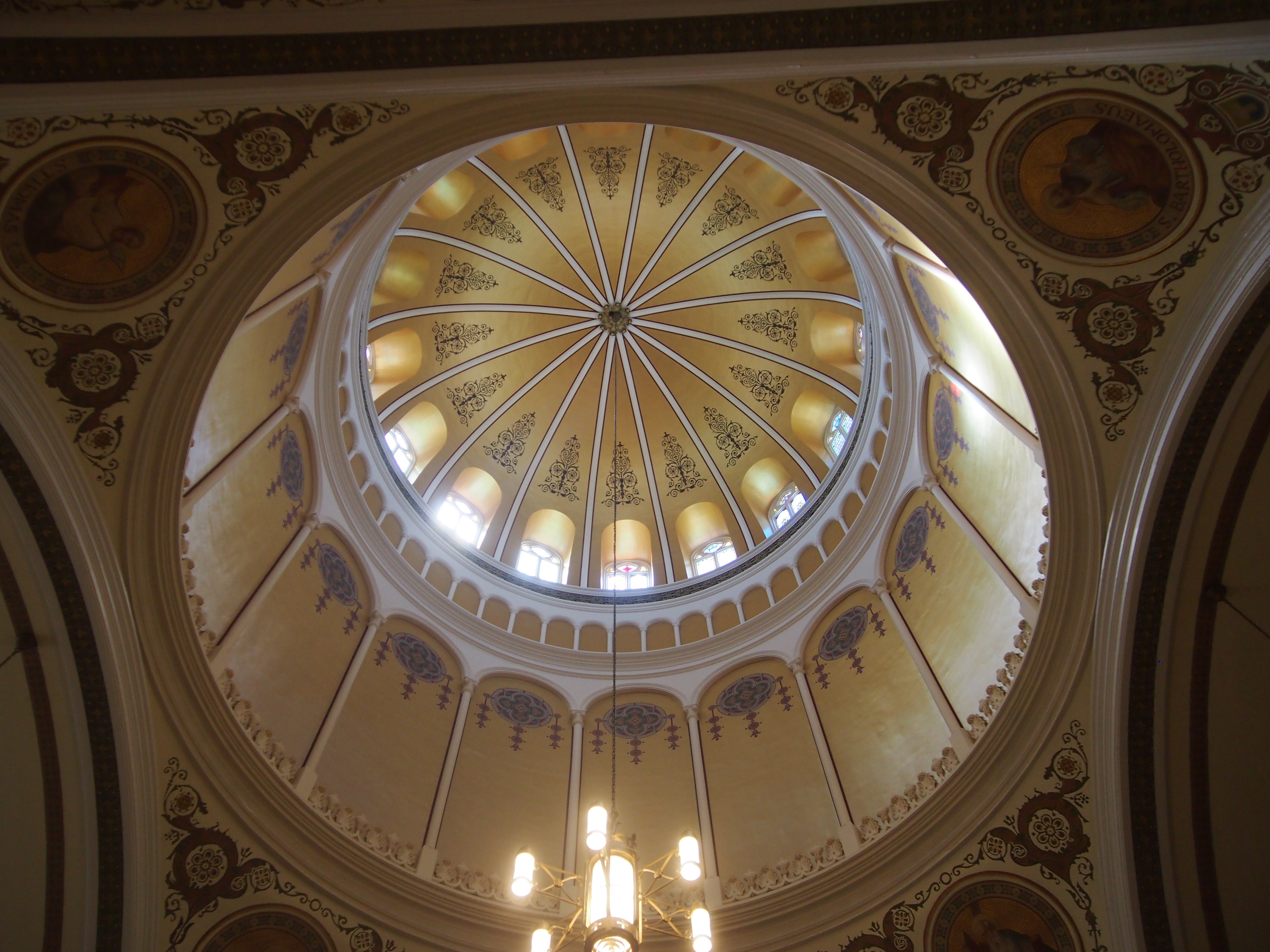
With impressive domes, though I didn’t manage a good shot of any of their exteriors.
Henry Engelbert designed the church, which was completed in 1892. He’s listed as one of the designers of Our Lady of Sorrows Basilica in Chicago, but he’s better known for his work in New York City. St. Mary of Perpetual Help’s interior was by John A. Mallin, who did the interiors of a lot of churches in his long career.

Here’s the resplendent altar.

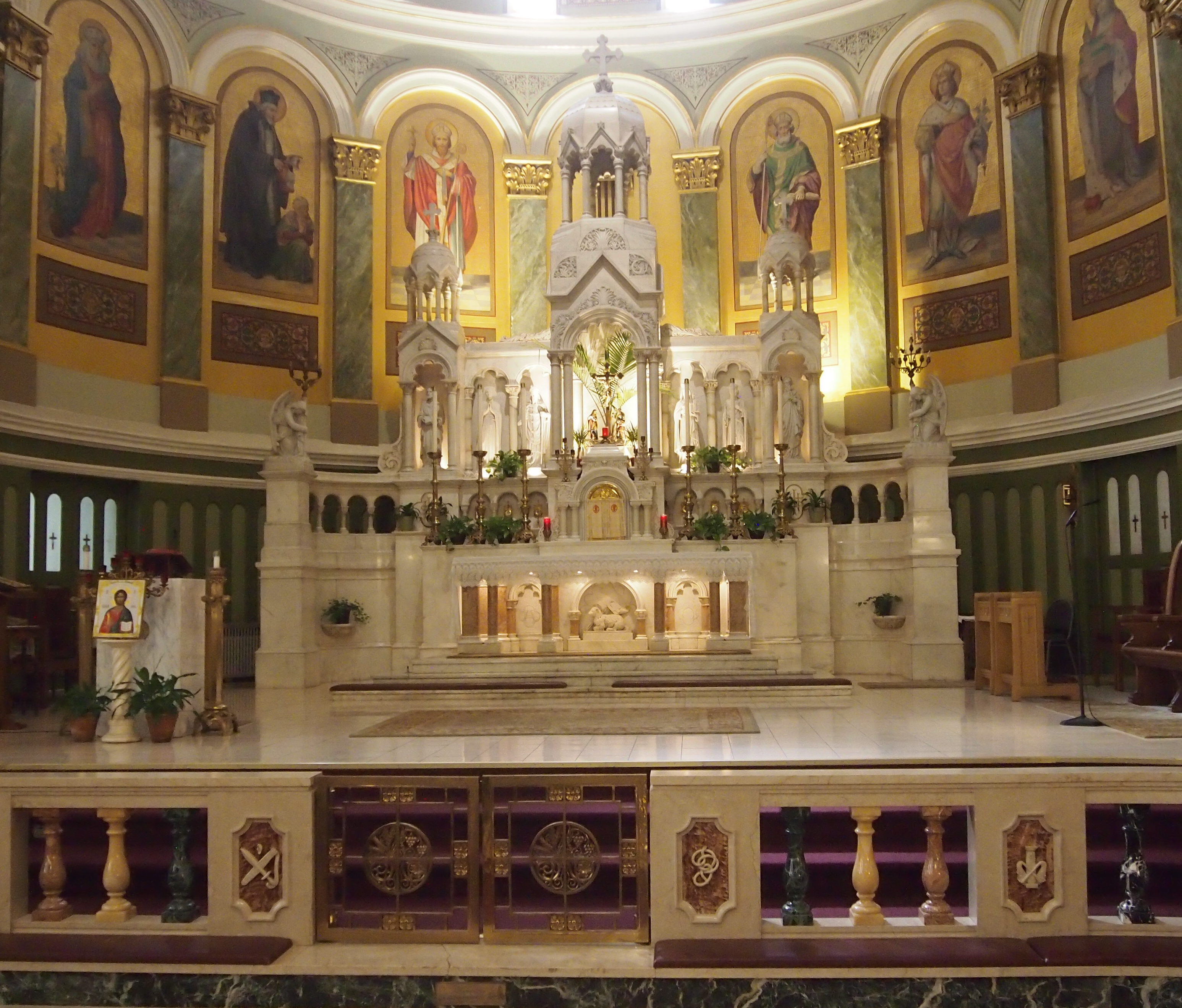
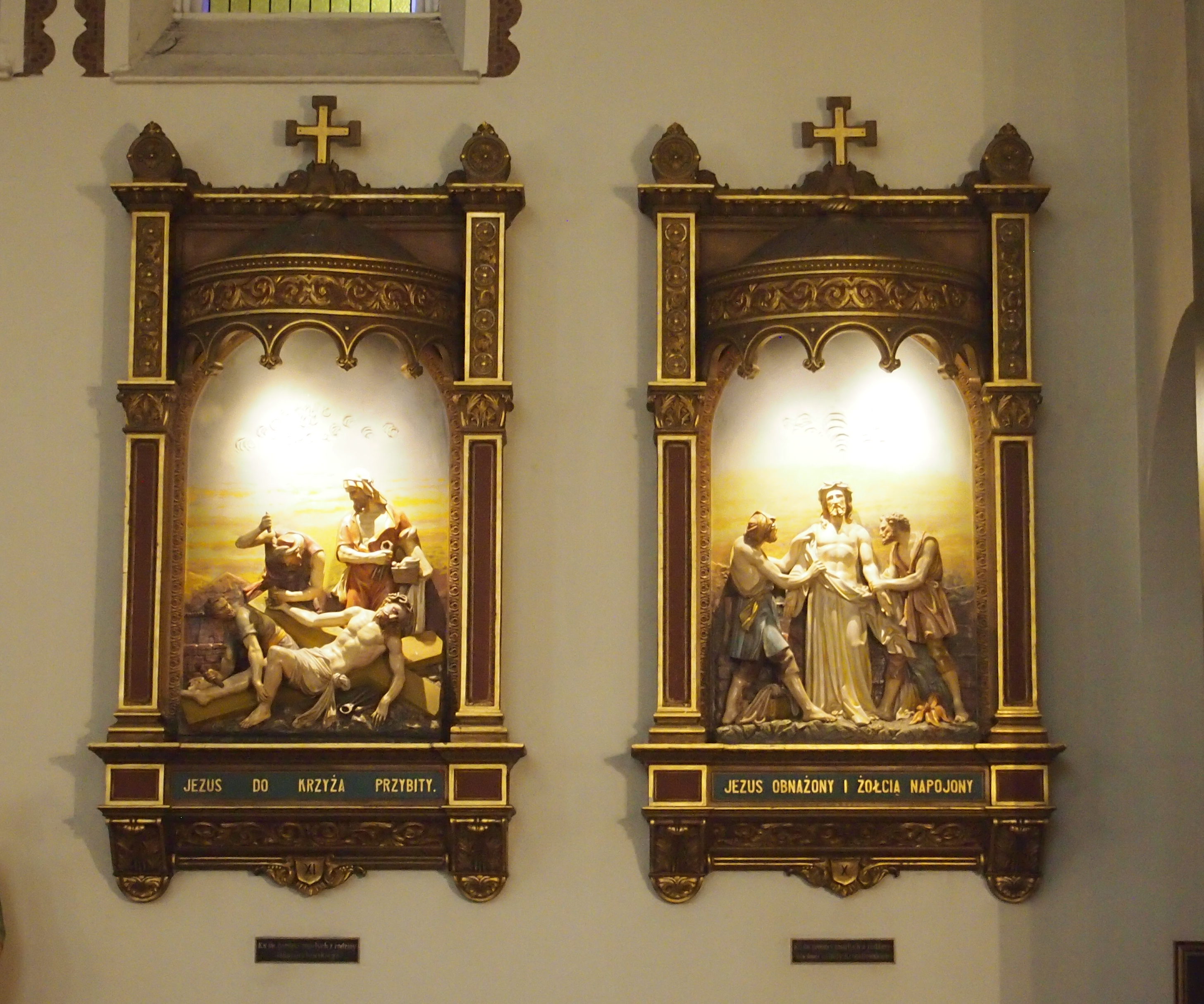
Stations of the Cross, with original Polish.

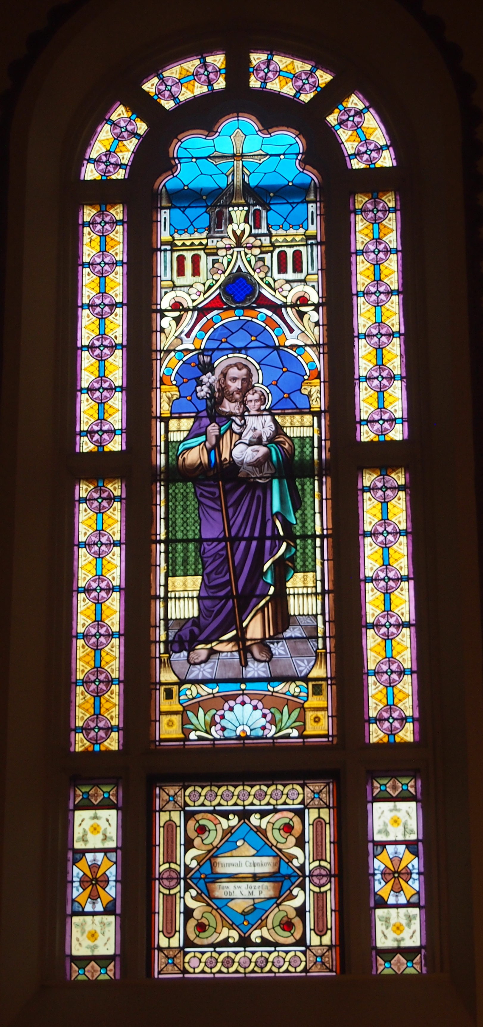
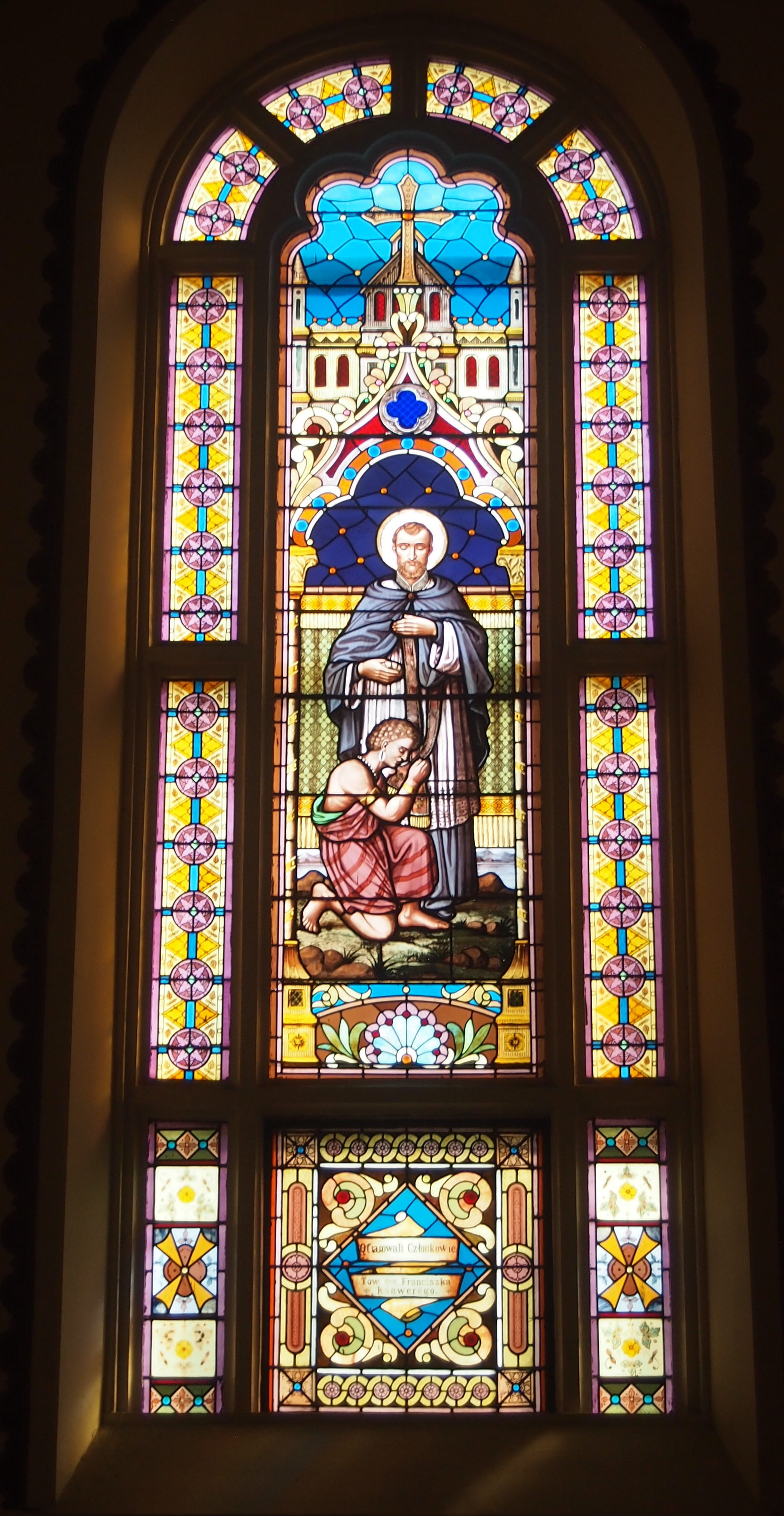
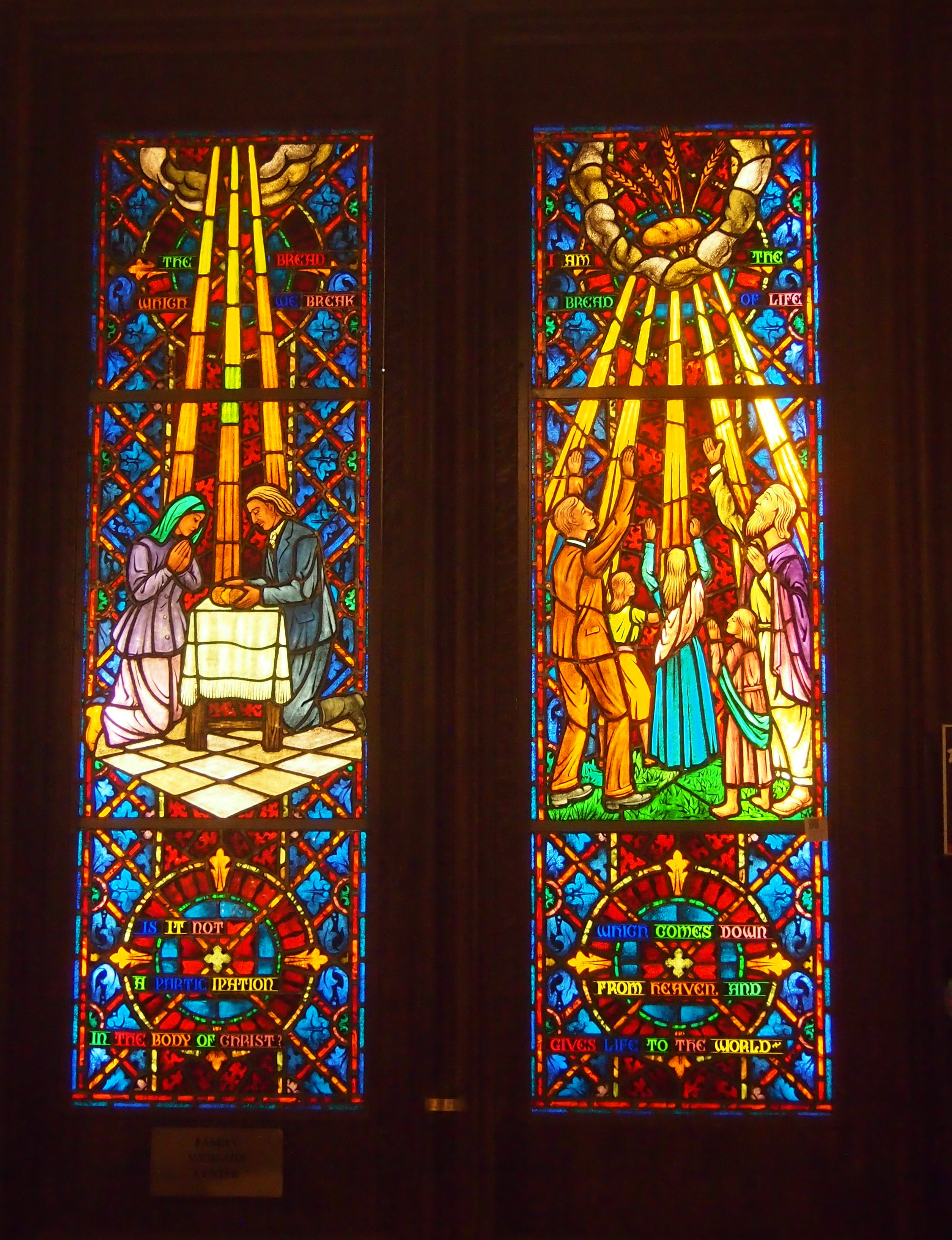
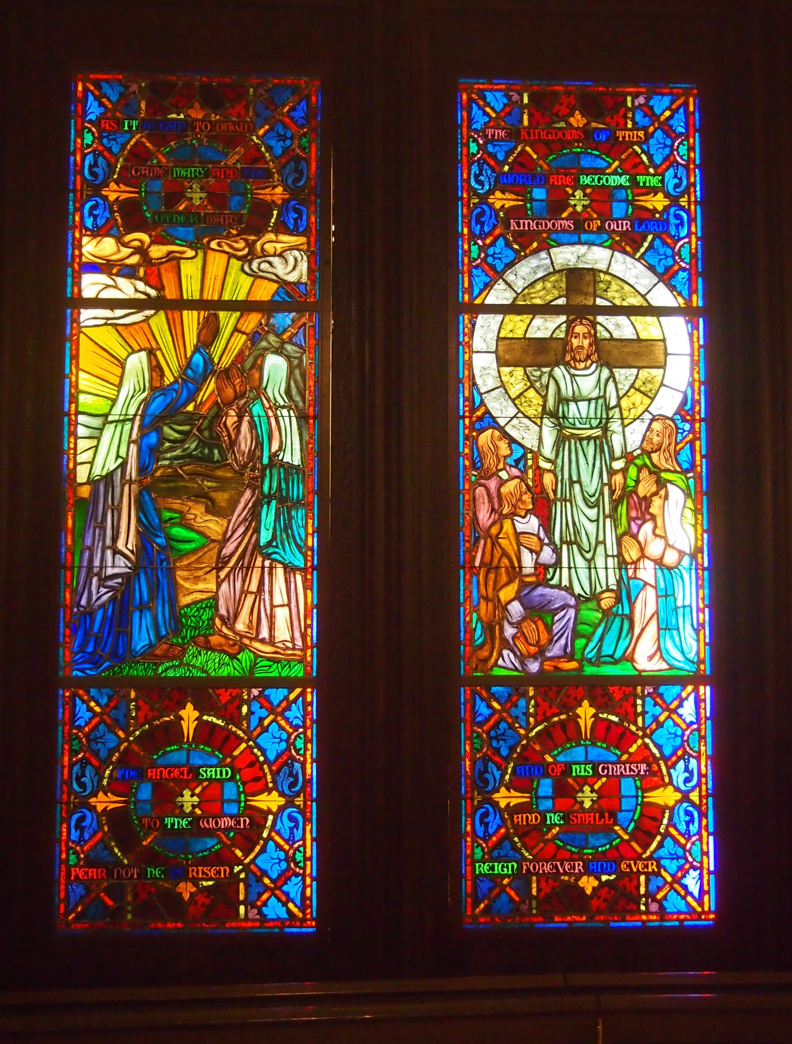
First-rate stained glass, as you’d expect.

Everything looks impressively new, but that’s because during the decades of the 21st century so far, the parish has undertaken major restoration work both exterior and interior. Being able to raise that kind of money must count as a minor miracle, though probably not in the theological sense.

I Am What I Am, Even on Thursdays

Something else I snapped while on foot downtown Chicago last week: the front of the I AM Temple on W. Washington St.

I didn’t go in. A sign on the door says ring bell and wait for someone. I prefer my religious sites to be self-service.

The organization’s HQ happens to be in the northwest suburbs, not downtown. Without digressing into detail — a foray into the rabbit hole, that is — it’s enough to say that, according to Britannica, “I AM movement, theosophical movement founded in Chicago in the early 1930s by Guy W. Ballard (1878–1939), a mining engineer, and his wife, Edna W. Ballard (1886–1971)…. Ballard claimed that in 1930 during a visit to Mount Shasta (a dormant volcano in northern California), he was contacted by St. Germain, one of the Ascended Masters of the Great White Brotherhood.”

Is it possible that Popeye is a prophet of this movement? After all, he appeared ca. 1930 and was known to say, “I yam what I yam.”

Also, why are rabbit holes a metaphor for endless, bewildering complications? Are rabbit holes that complex? Maybe warrens are, but that isn’t the way the saying goes. Wouldn’t ant nests or prairie dog towns be more suitable?

Another day, another stash of Roman coins dug up in Italy. Late Roman imperial era, the article says.

Bonus: they were gold coins. That’s something I’d like to find in the basement, though strictly speaking, we don’t have a basement. Roman gold-coin hordes must be pretty scarce in the New World, anyway.

Late Roman imperial era, eh? I can imagine it: “Quick, find a place to bury the gold! The Visigoths are coming! We’ll come back for it later.”

The event probably wasn’t that dramatic, but someone put the horde there, presumably not to lose track of it — but they did, for 1,500 or more years. Distant posterity is the beneficiary.

Strictly by coincidence, Ann and I watched the first episode of I, Claudius last weekend, which is available on disk (but not on demand: what kind of world is this?). Been a long time since I’ve seen it. Early ’90s, I think, as it was available in Japan on VHS. I also saw it when I was roughly Ann’s age, on PBS when it was pretty new.

The other day I used bifurcation in an article. That’s more common in business writing than one might think, since it’s sometimes used to describe markets dividing in some way or other (often, winners and losers). It’s also I word I can never remember how to spell, so I always look it up.

Google has replaced a trip to a dictionary as the default for spelling. Sad to say, since the possibility of lateral learning is rife while thumbing through a dictionary. Many times in earlier years I spied an entry, not the one I was looking for, and thought, I didn’t know that word.

Then again, there can be sideways learning with Google. If you let it. Not satisfied with mere spelling, I fed “bifurcation” into Google News to see what would happen. Every single hit on the first page linked to items in the Indian English-language media.

From the Times of India:

GMDA can’t plan drain bifurcation now, say greens

Bifurcate HC too: Centre backs Telangana’s petition in SC

Bifurcation of Badshapur drain on cards to avert flooding in Hero …

From The Hindu:

‘Telangana drawing water from NSP without KRMB approval’

Demand for bifurcation of municipal corporation getting stronger

From the New Indian Express:

Centre to expedite High Court bifurcation: Vinod Kumar

Clearly, the word gets more mileage on the Subcontinent than in this country.

Two Downtown Chicago Churches

Yesterday evening at about 8:15 I was out walking the dog — sometimes it’s an after-dark activity now that there’s more darkness — and I spotted a pale yellow slender crescent moon hanging just over the western horizon. Low enough to appear luminously large. Quite a sight.

Just after the new moon signifying Rosh Hashanah, I realized. I couldn’t remember the year’s number, so I looked that up: 5779.

While downtown last week, on the way back to Union Station to return home, I ducked briefly into two churches. I’d been in them before, but they’re always good for a look.
One was St. Peter’s in the Loop, a Catholic church on W. Madison St.
The enormous crucifix is by Latvian artist Arvid Strauss. The building dates from 1953. According to Heavenly City: The Architectural Tradition of Catholic Chicago by Denis McNamara, “the stepped-back roof profile of the exterior recalls the Art Deco skyscapers [architects Vitzthum and Burns] had designed and gave the church a modern sensibility, but the facade retained the sign value of churchliness with Gothic decorative elements, pink Georgia marble, and [the] monumental exterior cruxifix…”

The interior. Sacred deco, you might call it.
The building is more just the sanctuary. Tucked away in the structure, hidden from casual visitors like me, are an auditorium, library, offices, meeting rooms and friary completed with living quarters, kitchen and a chapel for the Franciscans who run the place.

Not far away is the First United Methodist Church at the Chicago Temple, an unusual arrangement for a church. It’s at the base and top floors of a 568-foot skyscraper on W. Washington St. I didn’t take any exteriors, but this is what it looks like. A Holabird & Roche design from the 1920s.

It features another handsome interior.
With fine stained glass.

I had no time to tour the Sky Chapel again — I visited ca. 2002 — which is at top of the building and open every day at 2 p.m. It’s a sacred space unlike any other I know.

Views From 151 N. Franklin St.

Last week I attended an event on the top floor of 151 N. Franklin St., a new office building in downtown Chicago. I had a few moments to admire the excellent views.

Looking slightly to east-northeast, roughly. In a gap far to the right is a slice of Lake Michigan.

To the south-southwest, roughly. The tower formerly known as Sears rises above all, including annoying reflections.

Straight north.

The building with the four roof features — maybe those count as cupolas — is 225 W. Wacker Dr., a 30-story late ’80s development designed by Kohn Pedersen Fox. A vertical shot of that building.
Behind it, or rather to the north, across the Chicago River, is the much more horizontal Merchandise Mart.

More about the 35-story 151 N. Franklin is here, including a mention of the views from the top. Here’s the thing that struck me: the building was just completed. That means these are spanking-new views of Chicago.

The Ellwood House Museum

Every junior high student in Texas takes, or used to take, a class in Texas history. My teacher 45 years ago was the no-nonsense Mrs. Carrico, whose first name I do not remember. She told some Texas history stories that I do remember, including one I thought of not long ago when we visited the Ellwood House Museum in DeKalb, Illinois.

The story was about the popularization of barbed wire in Texas, specifically a demonstration of wire in 1876 in San Antonio organized by salesmen from up north. As the Texas State Historical Association puts it:

“In 1876 salesman Pete McManus with his partner John Warne (Bet-a-Million) Gates conducted a famous demonstration on Alamo Plaza [other sources say Military Plaza, including the TSHA] in San Antonio in which a fence of… wire restrained a herd of longhorn cattle. Gates reportedly touted the product as ‘light as air, stronger than whiskey, and cheap as dirt.’ Sales grew quickly thereafter, and barbed wire permanently changed land uses and land values in Texas.”

I’d heard of steel and oil magnate John Bet-a-Million Gates before, but until I visited the Ellwood I hadn’t connected him with this incident. It was early in his career and before he was renowned as a gambler.

At the time, Gates was working for Isaac Ellwood, barbed wire manufacturer of DeKalb. Later Ellwood owned a major ranch in Texas, and built a “Pompeiian Villa” in Port Arthur, but it’s his Illinois manse that concerns me here.It’s a handsome Victorian house, originally dating from 1879, and designed by a Chicago architect named George O. Garnsey, with later modifications by others.

The museum web site says: “The museum campus consists of seven historic structures (including the 1879 Ellwood Mansion and 1899 Ellwood-Nehring House), four gardens, and 6,000 square feet of exhibit space in the Patience Ellwood Towle Visitor Center, a converted and expanded 1912 multi-car garage.

“Originally built for barbed wire entrepreneur Isaac Ellwood, the Mansion was home to three generations of the Ellwood family from 1879 to 1965. In 1965, the Ellwood Mansion was given to the DeKalb Park District by Mrs. May Ellwood and her three children.”

No pics allowed inside, but be assured that it’s lavishly decorated and includes a lot of the furniture that the Ellwoods owned. No barbed wire, though: that’s on exhibit at the visitors center.

Pictured Rocks National Lakeshore: Miners Castle, 1989

In early September 1989, I visited the Upper Peninsula for the first time, and Lake Superior as well, including a boat ride on the lake at Pictured Rocks National Lakeshore. Its rocky cliffs were famed long before the federal government made the area the first of nation’s four national lakeshores in 1966, the others being Indiana Dunes, Apostle Islands, and Sleeping Bear Dunes.

I also did some walking. I’m pretty sure I passed by this sandstone formation on foot and took a picture of it looking out toward the lake, though the boat would have passed by it as well (I think). It’s one of those formations that has a name: Miners Castle. This is how it looked in 1989.

In the spring of 2006, the right turret (from this perspective) fell into the lake. According to the NPS, “While the rockfall at Miners Castle on April 13 was startling, such events are not rare along the Pictured Rocks escarpment. At least five major falls have occurred over the past dozen years…

“All the rockfalls involved the same rock unit, the Miners Castle Member of the Munising Formation. Rock units are named for places where they were first technically described. The Miners Castle Member consists of crumbly cross-bedded sandstone that is poorly cemented by secondary quartz, according to U.S. Geological Survey Research Ecologist Walter Loope.”

Pictured Rocks isn’t the only place I’ve seen a noted rock formation later altered by erosion. In 1995, Yuriko and I stopped at a roadside in New Hampshire to see the Old Man of the Mountain. By 2003, it was gone.

The Henry C. Palmisano Nature Park (Mount Bridgeport)

Not long ago, I found myself looking up this hill.

I climbed the steps, since I still have the energy for that kind of thing sometimes, and at the top of the hill is this vista.
That only goes to show how easy it is for an image to mislead. How would someone merely looking at the first image know that the hilltop has a fine view of downtown Chicago from the southwest?

Anyway, I was at the Henry C. Palmisano Nature Park, though I have a good source that tells me its informal name is Mount Bridgeport, after the surrounding neighborhood, and it rises 33 feet above street level.

“In the late 1830s, the land was purchased by the Illinois Stone and Lime Company which began quarry operations,” says the Chicago Park District. “Within a short time, one of its partners, Marcus Cicero Stearns, took over and renamed the quarry. Stearns was an early Chicago settler who got his start by opening a supply store for workmen who blasted out rock to build the Illinois and Michigan Canal.

“Even after Stearns died in 1890, the quarry continued operating under his name until 1970. For the next few decades, the site was used as a landfill for clean construction debris. After the dumping ended, the idea of transforming the site into a new park emerged.”

The transformation took some time, but a park finally opened on the site in 2009, named for a man who died in 2006. It’s more than a grassy hill with a view, though that’s a standout feature in flatland like Illinois.

The path goes off in other directions.
Other parts of the city are visible from the hill.
Part of the old quarry hole is now a pond, available for catch-and-release fishing, according to a nearby sign.
This may be the closest waterfall to downtown Chicago. Modest, but nice to look at. The stream goes to the quarry-pond.
“This is a dynamic park, with a fishing pond, interpretive wetlands, preserved quarry walls, trails, an athletic field, a running track, and a hill that offers dramatic views,” the Park District notes. “Over 1.7 miles of paths, including recycled timber boardwalks, concrete walks, a crushed stone running path, and metal grating walkways traverse the park.”

The Stevenson Expressway is visible, and very much audible, from the park. How many of the many drivers on that highway have any notion of such an excellent park nearby?

I never did for some years. “What’s that park?” I wondered some time ago while looking at a map of Chicago, making a mental note to visit when I would be nearby, which happened to be just before Labor Day. Being a map enthusiast has its rewards.

Allen J. Benson Park. Or, the Illinois-Indiana Border Obelisk.

I have a certain fascination with borders, probably dating back as long as I’ve been looking at maps just for fun, which is a long time now. I seem to have written about them a lot as well, something I didn’t realize until I checked.

Such as the posting about the meeting of British Columbia and Alberta; of Banff National Park and Kootenay National Park; and on the Continental Divide. Or the U.S. Canadian border just south of Vancouver. Or the borders we crossed in 2005 and 2006 and another posting about them again. Or the Tennessee-North Carolina border. Or Missouri-Kansas. Or Texas-Louisiana.

Not long ago, I had an encounter with a closer border: Illinois-Indiana. But not just any point on that long line — as far northwest as you can go in Indiana and still be on land, because the NW corner of the state is actually a point in Lake Michigan.

This is what you see at the Illinois-Indiana line just a few feet from Lake Michigan, while you are standing in Indiana.
A weatherworn, graffiti-scarred limestone obelisk. This is a closer view.
“In 1833, as Chicago and the Midwest were starting to grow, Congress ordered a new survey of the boundary between Illinois and Indiana,” says Chicago History Today, which asserts that the obelisk is the oldest public monument in Chicago. “When the survey was completed, a 15-foot high limestone obelisk was put in place on the shore of Lake Michigan, straddling the state line.

“By the 1980s the marker was isolated and neglected among the rail yards. Allen J. Benson, a ComEd executive, convinced the company to sponsor its restoration, in conjunction with the East Side Historical Society and other interested groups. In 1988 the marker was moved 190 feet north to its present location, just outside the [ComEd coal-fired power plant] gate. A new base was added at that time.”

Though moved into an area created by landfill, I understand that the obelisk still straddles the north-south Illinois-Indiana border, which a few feet further north heads out into Lake Michigan. It’s also the border between the city of Chicago and the city of Hammond. (Chicago extended out this far in massive 1889 annexation, which is yellow on the map.)

There’s a plaque near the obelisk that says the small area (maybe inside the fence) is Allen J. Benson Park to honor the exec, who has since died. The power plant closed in 2012, and its former site, a brownfield on the Indiana side of the line, is being redeveloped to be home to a data center.

When the plant was up and running, the marker didn’t look quite so forlorn: in the 2011, according to a Wikimedia image, three flagpoles and some trees were in the vicinity — but no metal fence — and there were plaques on the side of the obelisk with the state names. Guess they were stolen. Such is life in the big city, but I’m glad this curiosity from the 19th century still stands.

The Schaumburg Labor Day Parade

This year I decided to watch the Schaumburg Labor Day Parade, whose name pretty much sums up the time and place (no one else in my family was interested). Luck was with the parade and parade-goers this year. The parade was held in the morning, under partly cloudy skies and in only somewhat hot and humid conditions. A few hours later, intense thunderstorms rolled through.

The parade featured a thin selection of local politicos — I expect state reps and senators and such had union picnics or rallies to go to — public service equipment, local businesses, veterans, nonprofits, clubs and two high school marching bands. None of the floats were that elaborate and sometimes there were minutes-long gaps in the movement of the parade. Ah, well. The bar’s a little lower on free entertainment.

The mayor of Schaumburg (actually village president) and some trustees came by first in golf cards, and a while later came the fire equipment.
Both the Schaumburg and Hoffman Estates FDs were represented.

An organization I knew nothing about.
Instead of forays into the wilderness, Sea Scouts take forays onto the water. A different kind of wilderness, I suppose. These days, co-ed.

The odd float of the Volkening Heritage Farm at Spring Valley. Complete with plants and an oom-pah band to celebrate Schaumburg’s German past.

Flag girls. They heralded the approach of the Schaumburg High School marching band.

A different sort of band.
The Memories Entertainment float. According to their sign, the band features Buck-A-Roo & the Fabulous Memories. For this parade, they were dressed as clowns and playing ’70s rock standards.

More flag girls.
This time, ahead of the Conant High School marching band.
When the band paused for a moment near me, I noticed a number of adults moving up and down the lines with squirt bottles, squirting liquid into the mouths of the band members. Water, I assume. I also saw one fellow squirt water on the back of the neck of a band member.
That struck me as odd. Forty years ago, I was in a marching band and we marched in a parade every year in April in San Antonio. Not terrifically hot, but always warm enough, and no one gave us water. I feel a curmudgeonly moment coming on. We marched in the heat and we got dehydrated and we liked it.