Denali National Park and Preserve

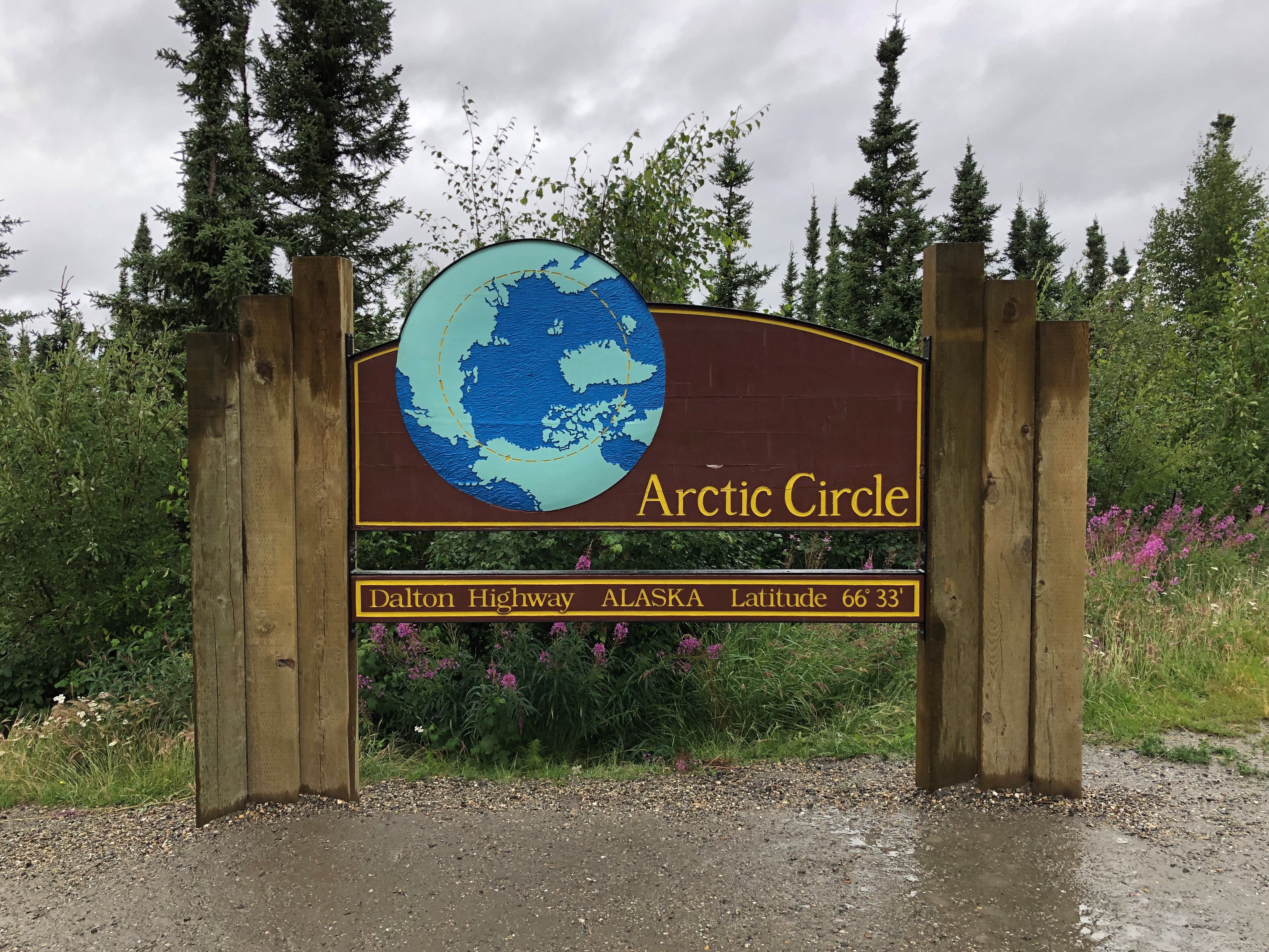
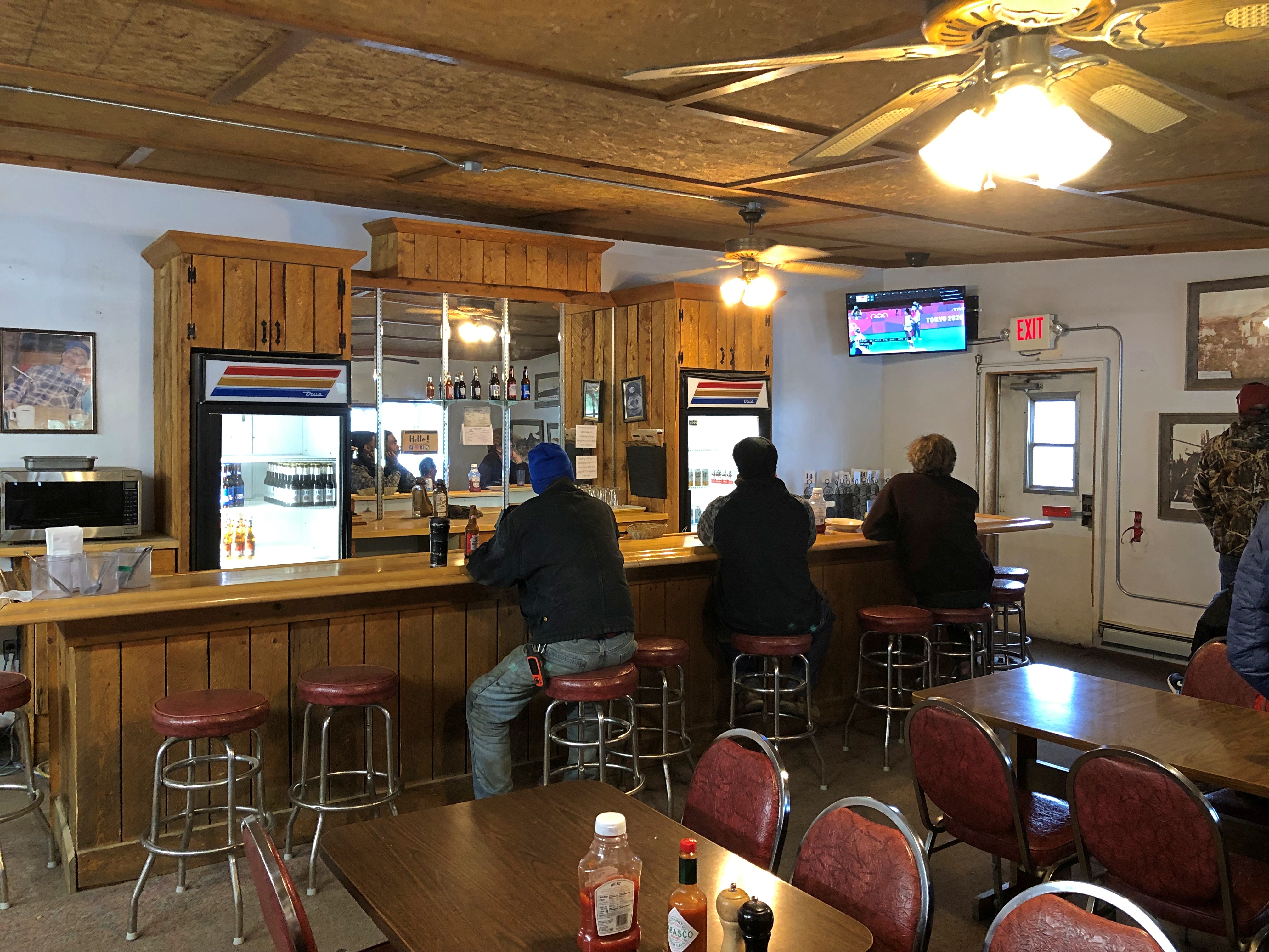
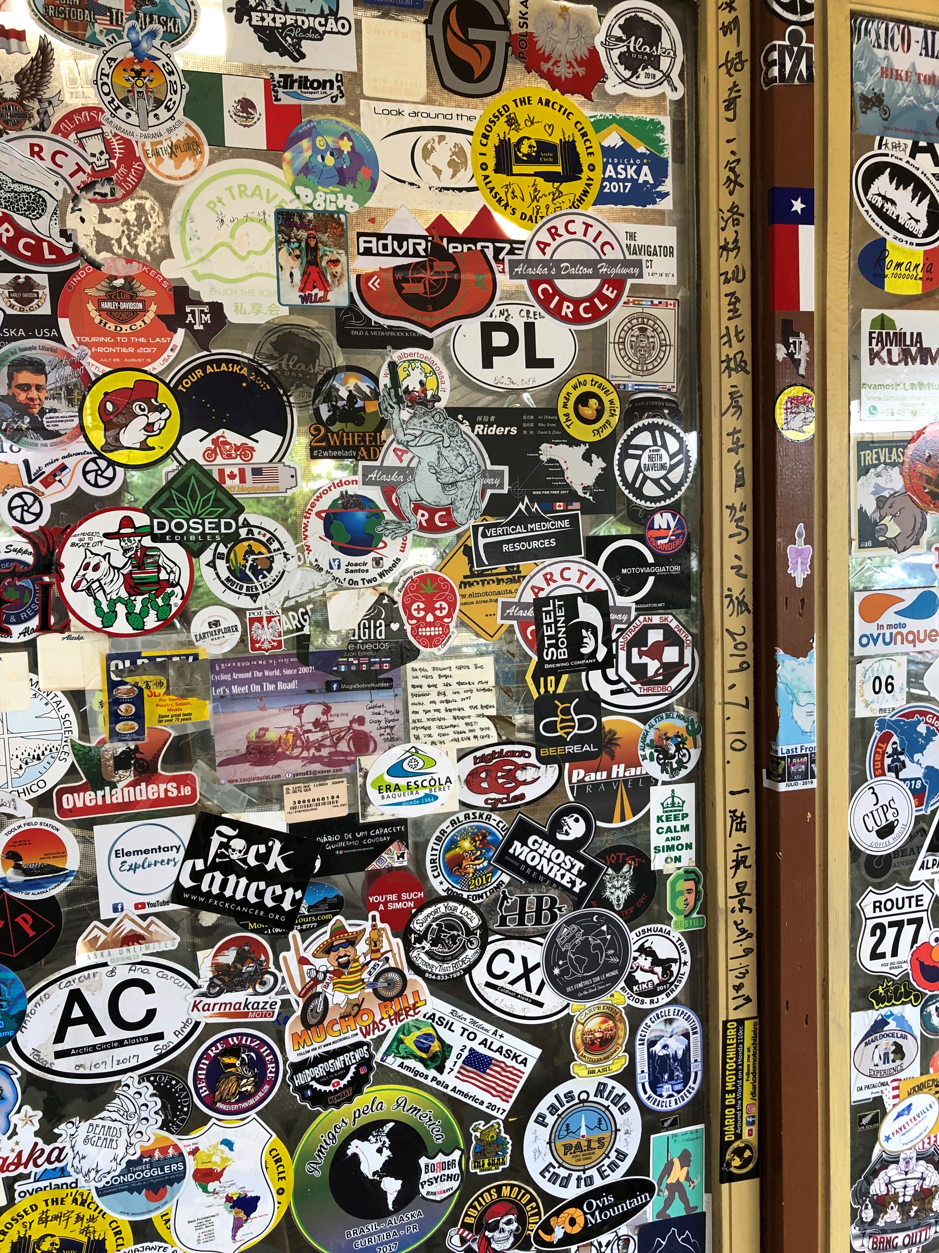
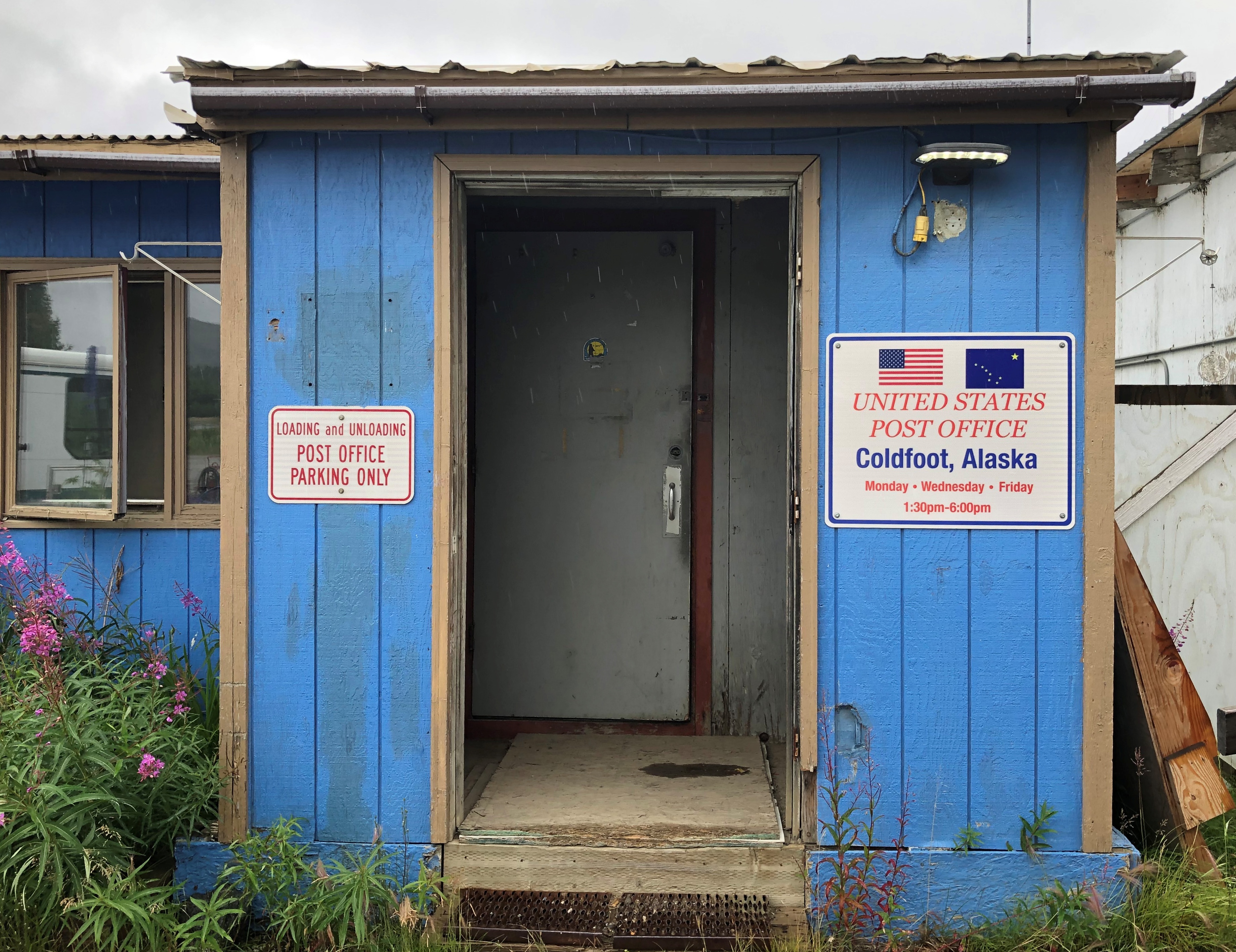
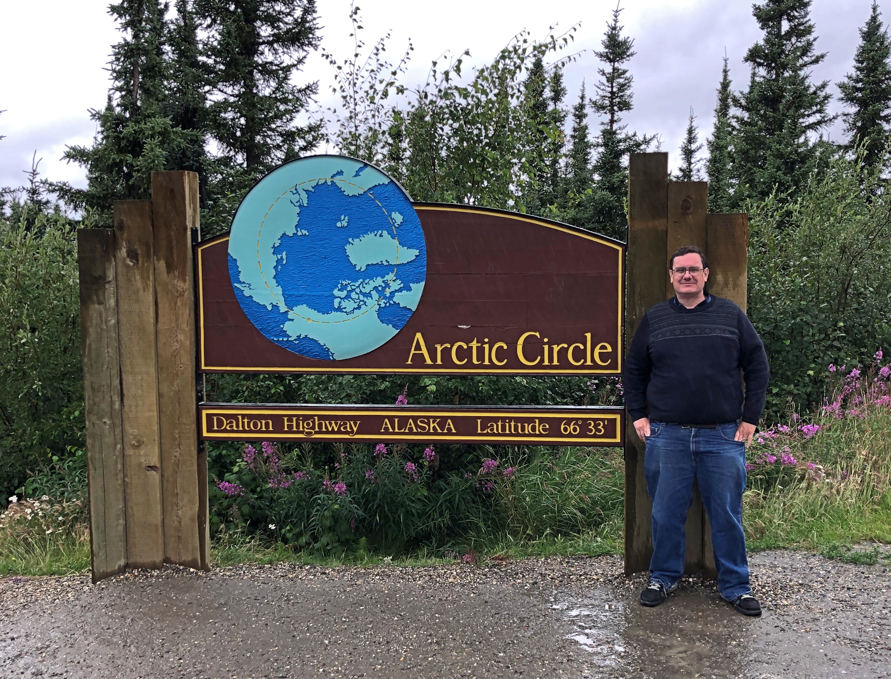
Up in Coldfoot, we were within Alaskan spitting distance of Gates of the Arctic National Park and Preserve, maybe ten miles on foot to the park’s invisible demarcation line. Gates of the Arctic, which is about the size of Maryland or Belgium, has no human infrastructure or services of any kind.

That’s an evocative national park name if there ever was one, summoning dreams of primeval remoteness. Only about 10,500 people ventured there in 2019, making it the least-visited U.S. national park even in an ordinary year, since the logistics of a visit are quite involved. I was no more prepared to visit Gates of the Arctic last week than to go to the Moon, so it was close but no cigar.

Denali National Park and Preserve is another story. It’s easily accessible to everyday folk, at least those willing to spend the time and money to go to Alaska, and willing to forgo private-car travel into the park. I was all in.

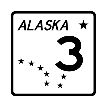
Chronologically, the sign was the last picture I took at Denali, but never mind. It marks the entrance off the highway Alaska 3.Denali NP

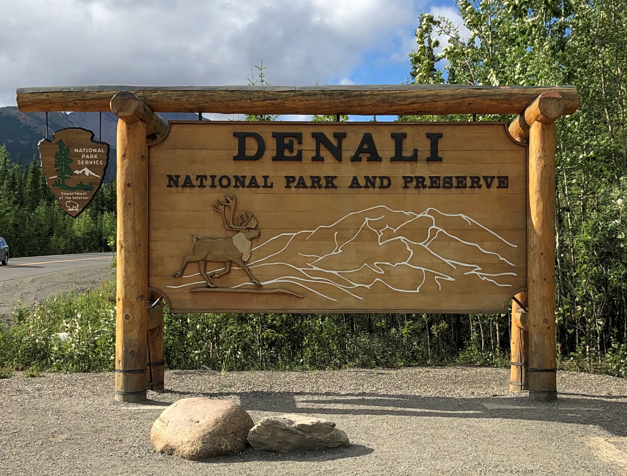
This image is also out of order, strictly speaking, since it was taken mid-tour. Our bus was the one on the left.
Denali NP buses

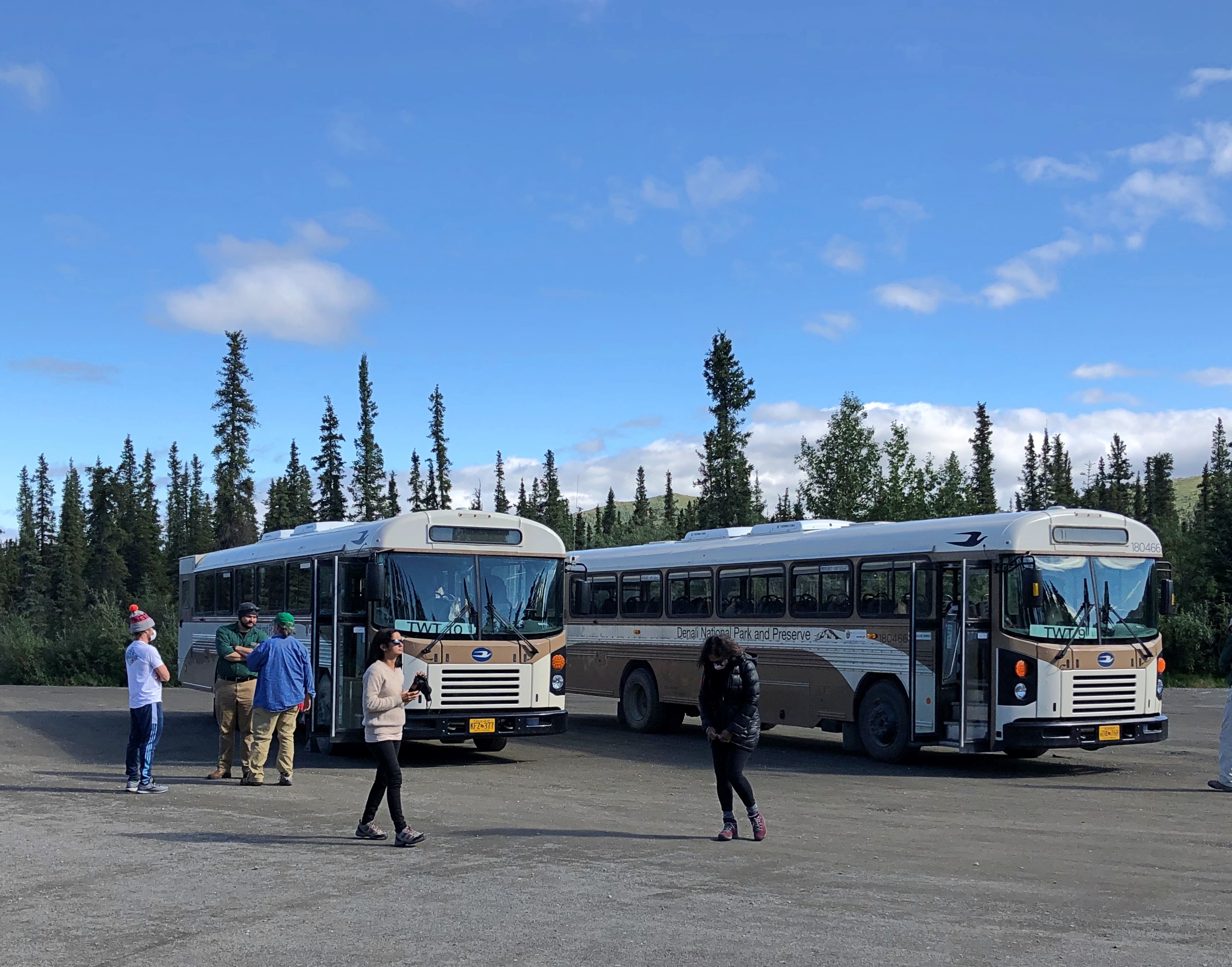
The bus traversed part of the 92-mile Denali Park Road, which roughly parallels the Alaska Range. The tour took us to Mile 53, a spot called the Toklat River Rest Stop.
Denali Park-Road-Map_5

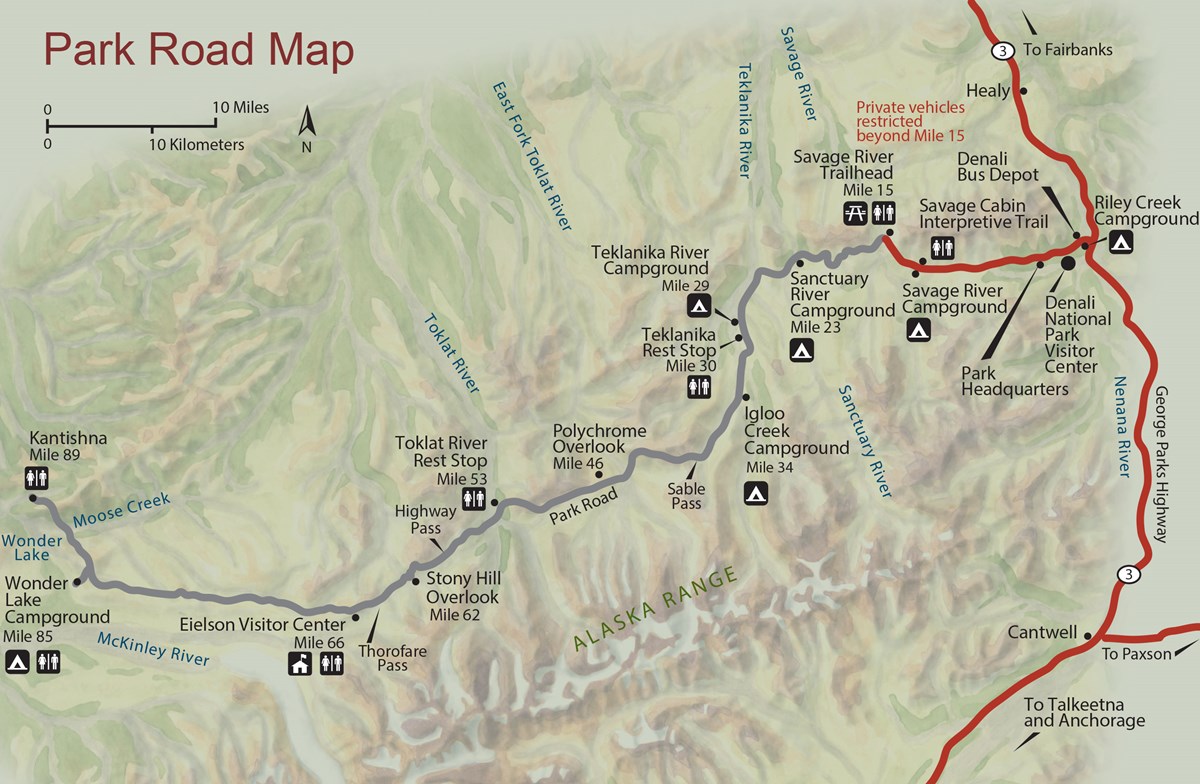
“During summer, roughly late May through early September, private vehicles may drive the first fifteen miles of this road, to a place called Savage River,” the National Park Service says. “The road to Savage River is paved, and features numerous pull-outs for folks to stop and snap some scenic photos. ‘The Mountain’ can be seen as early as Mile 9, if the day isn’t too overcast, and animals of all sorts can sometimes be seen on this stretch of road — although chances to see wildlife increase greatly with a bus trip farther down the Park Road.”

Lest anyone think that mandated bus transportation is some new innovation by the feds to restrict freedom of movement, the NPS points out that banning private cars on most of the road goes back almost 50 years.

“Prior to the 1972 completion of the George Parks Highway (Alaska Route 3), which is the main travel artery into interior Alaska, visitation to Denali National Park and Preserve was fairly low. Anticipation of major increases in traffic resulting from a direct route to the park prompted park officials to implement a mass transit system beyond Mile 15 on the Denali Park Road.”

Good thing, I believe. It’s a narrow, mostly gravel road after that point. Even a few dozen cars at a time could easily jam the thing up, and fools would sometimes (often?) get stuck. Occasional unlucky souls would be in cars that pitch over the edge of some pretty steep slopes without guardrails.

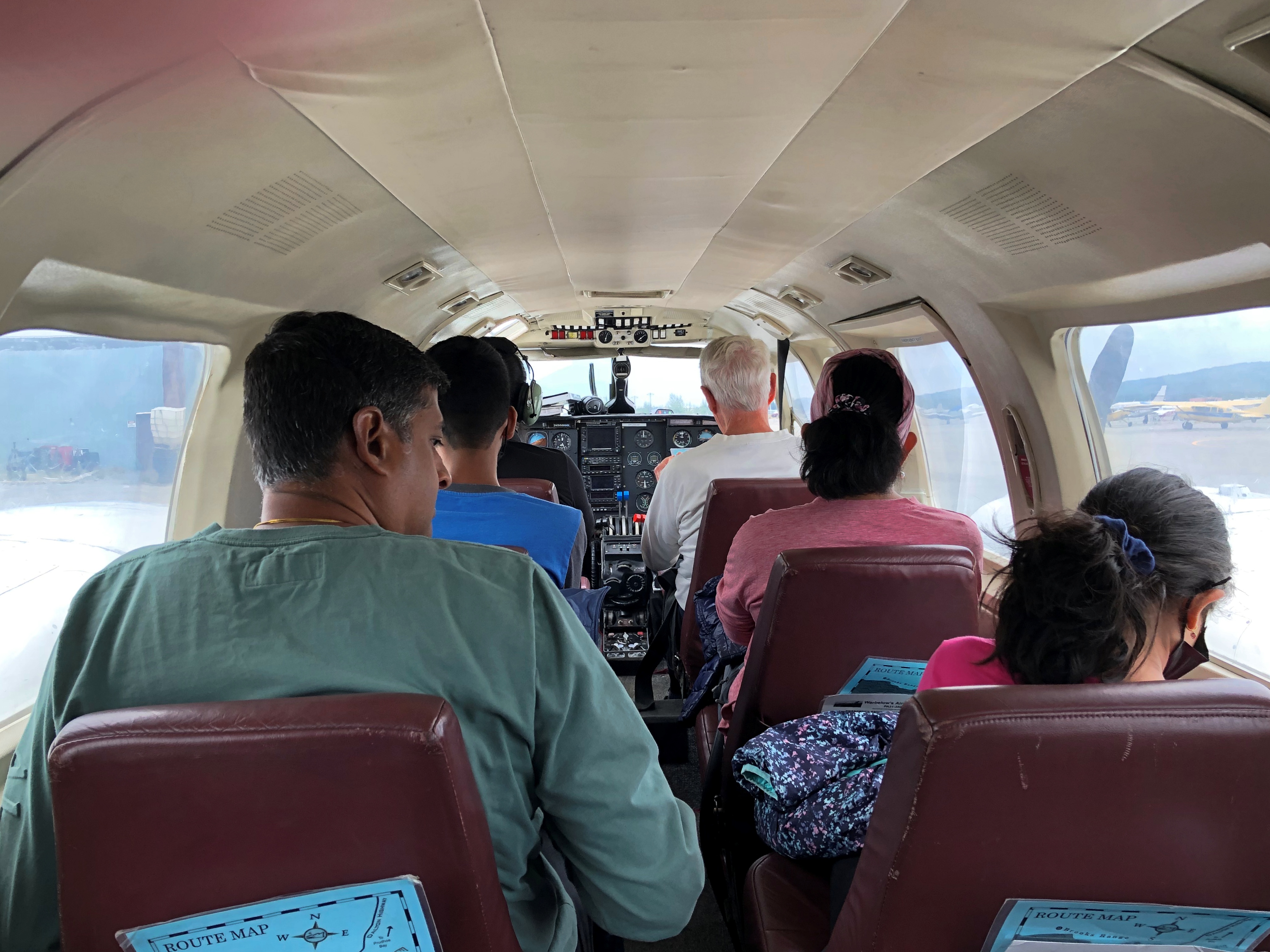
So at about 9:30 on the morning of July 29, I boarded a Bus #10 outside the park and spent the day in my 24th or 25th U.S. national park (I’m never sure whether to count Guadalupe Mountains NP). One of the most magnificent so far, too.

The magnificence started early in the drive. Even before Mile 15, we could see a mostly cloudless Mount Denali, the peak I probably learned as McKinley poring over maps in elementary school, the tallest in North America. Actually there are twin summits.Mt Denali
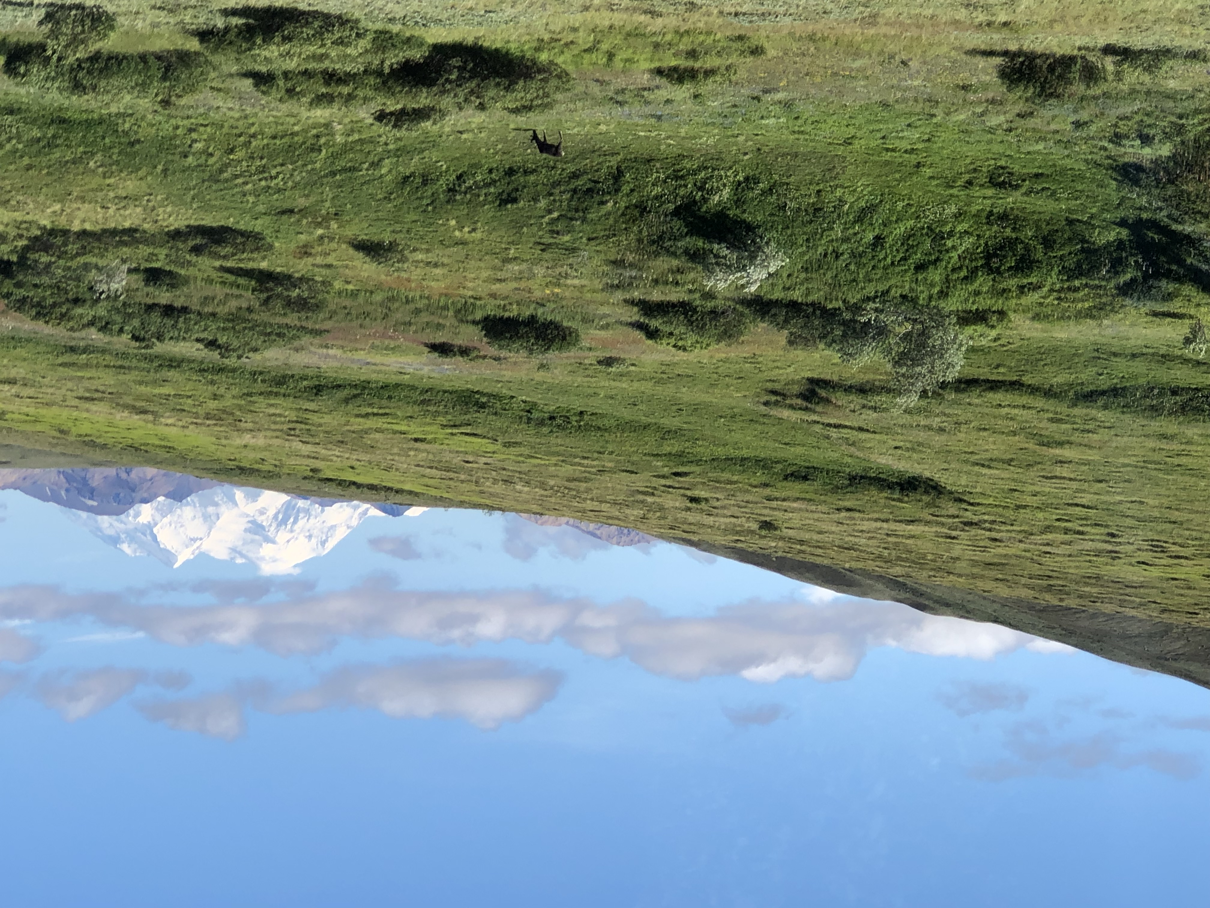
Tour guide, bus driver and all-around effusive fellow Brian told us that maybe three out of 10 visitors to the park actually get to see Mount Denali. Like Fuji and some other mountains of renown, clouds often cloak it. Later in the tour, when we were closer to the mountain, it was invisible. Throughout the day, in fact, clouds came and went with rapidity over our entire field of view.

At Mile 15 is the wide view of the Savage River.Teklanika River
Teklanika River
Teklanika River

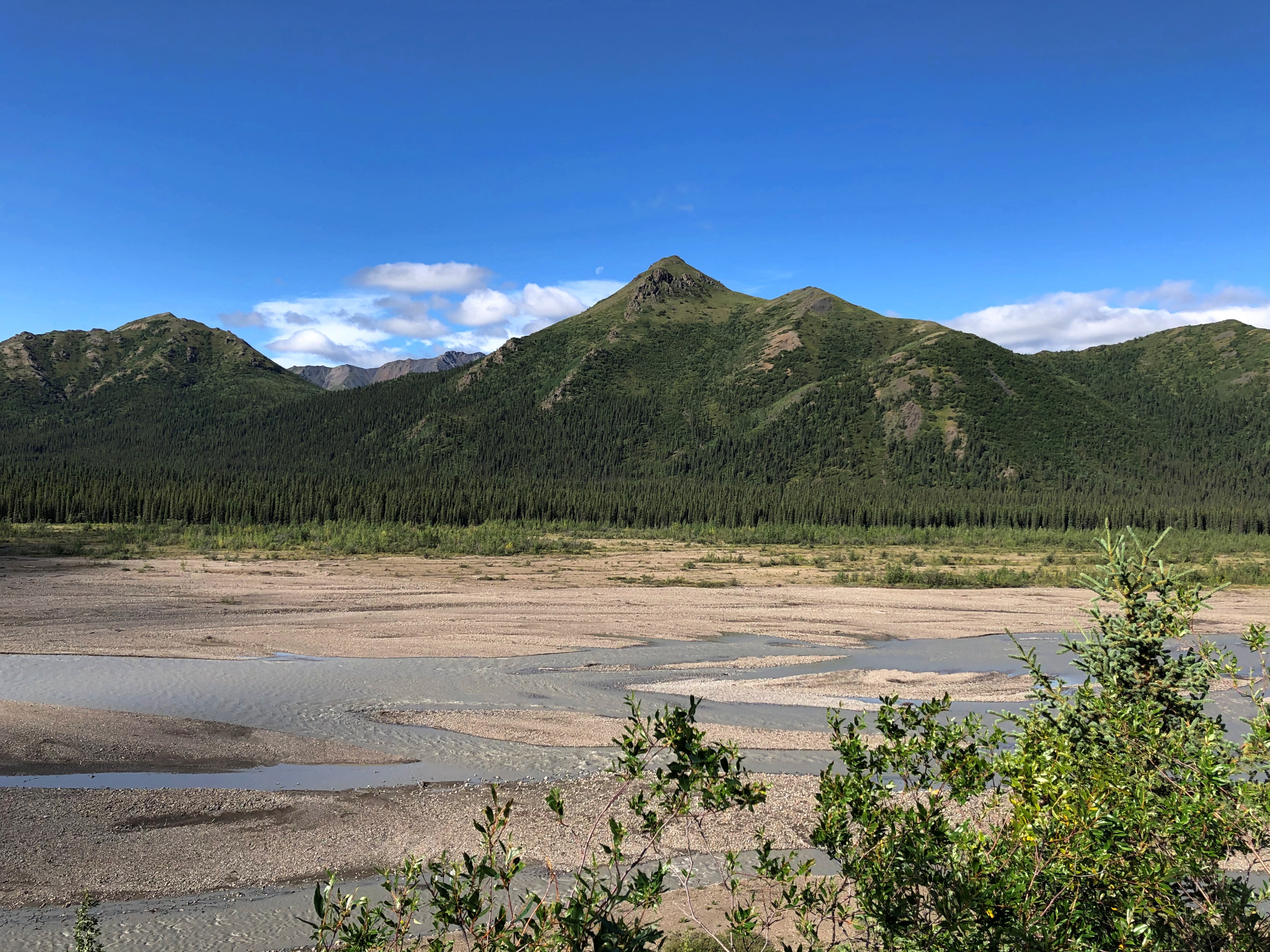
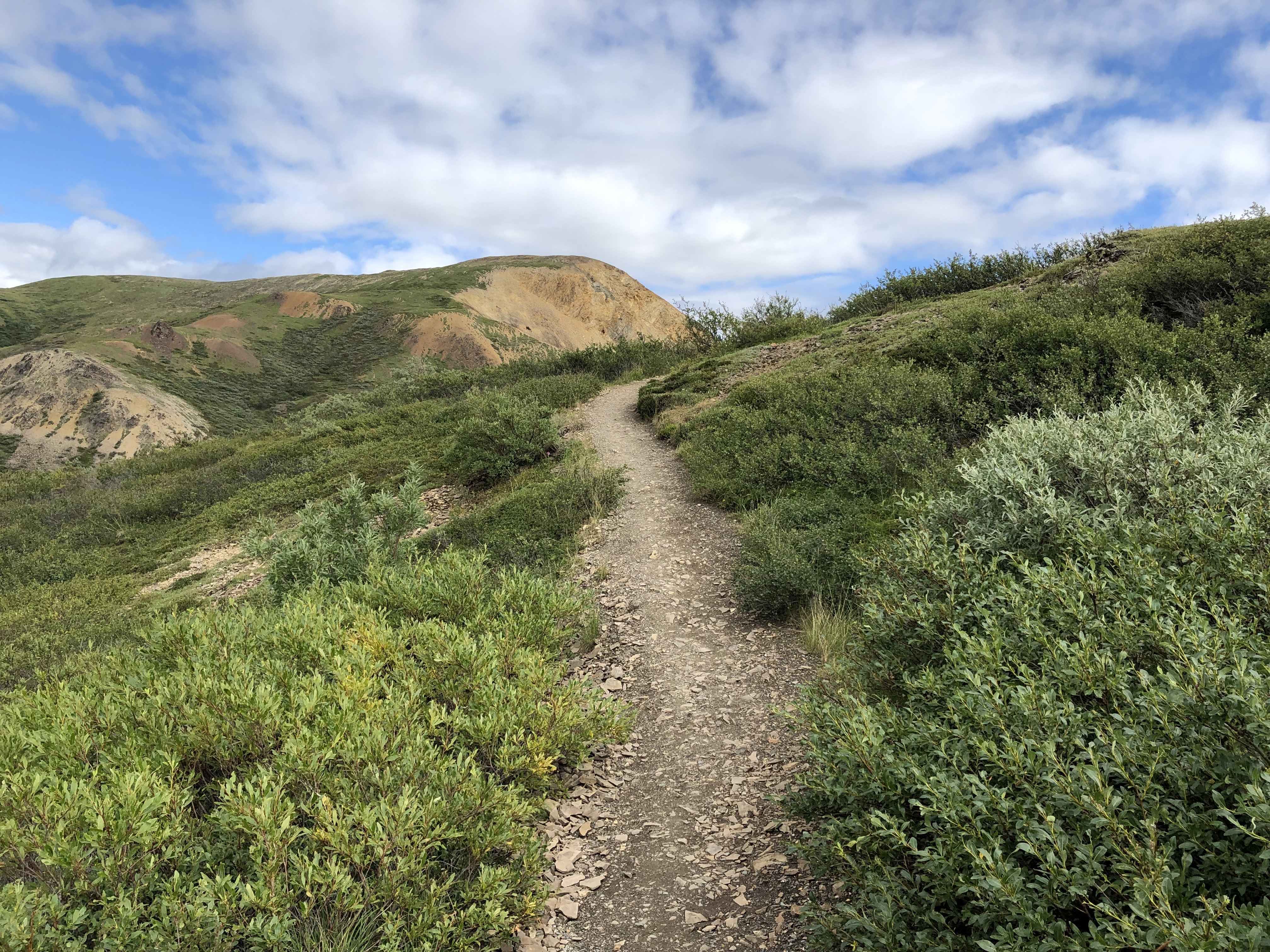
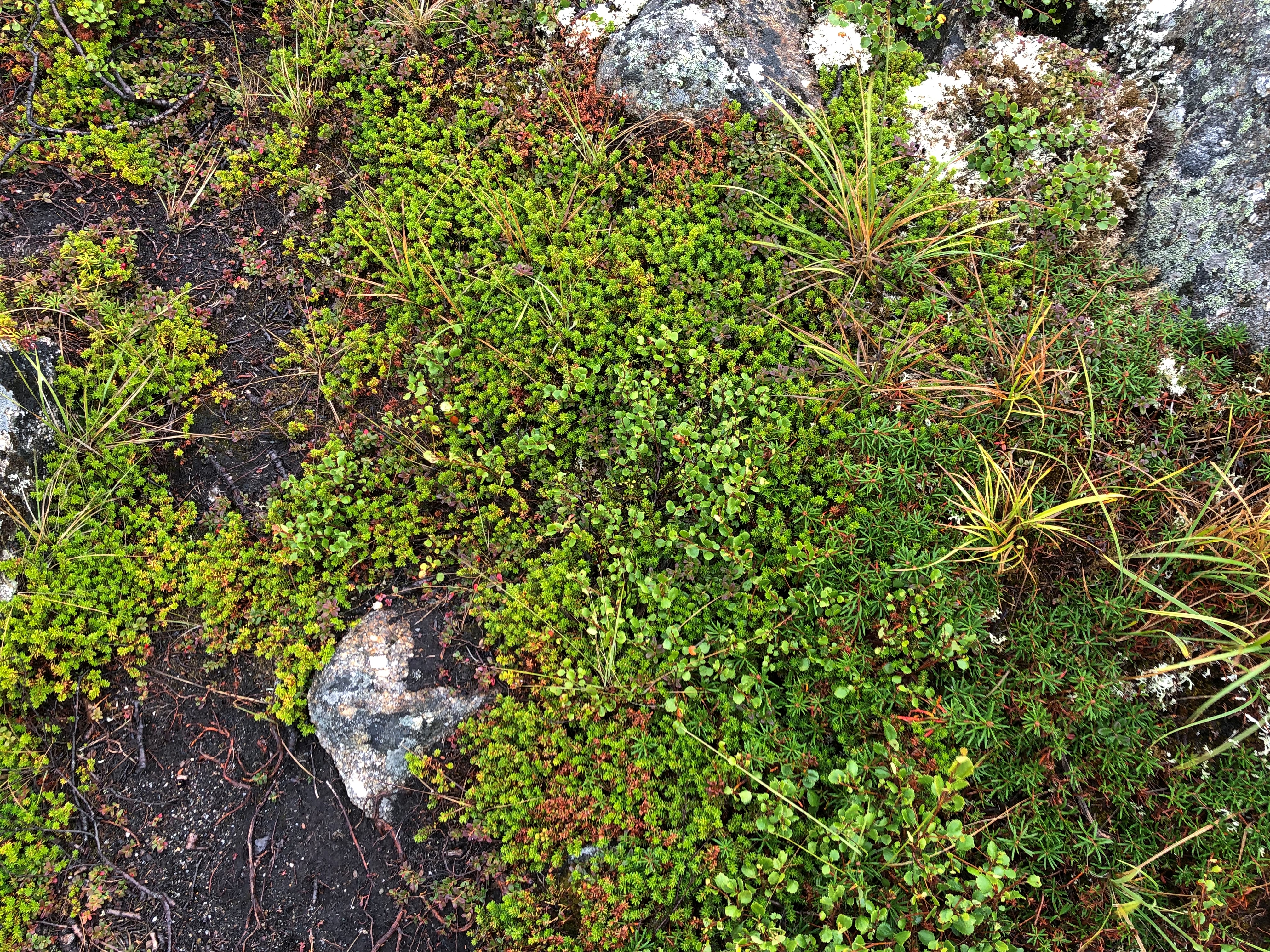
Further along the road, an illustration of how far greenery can reach up mountainsides.
Denali NP

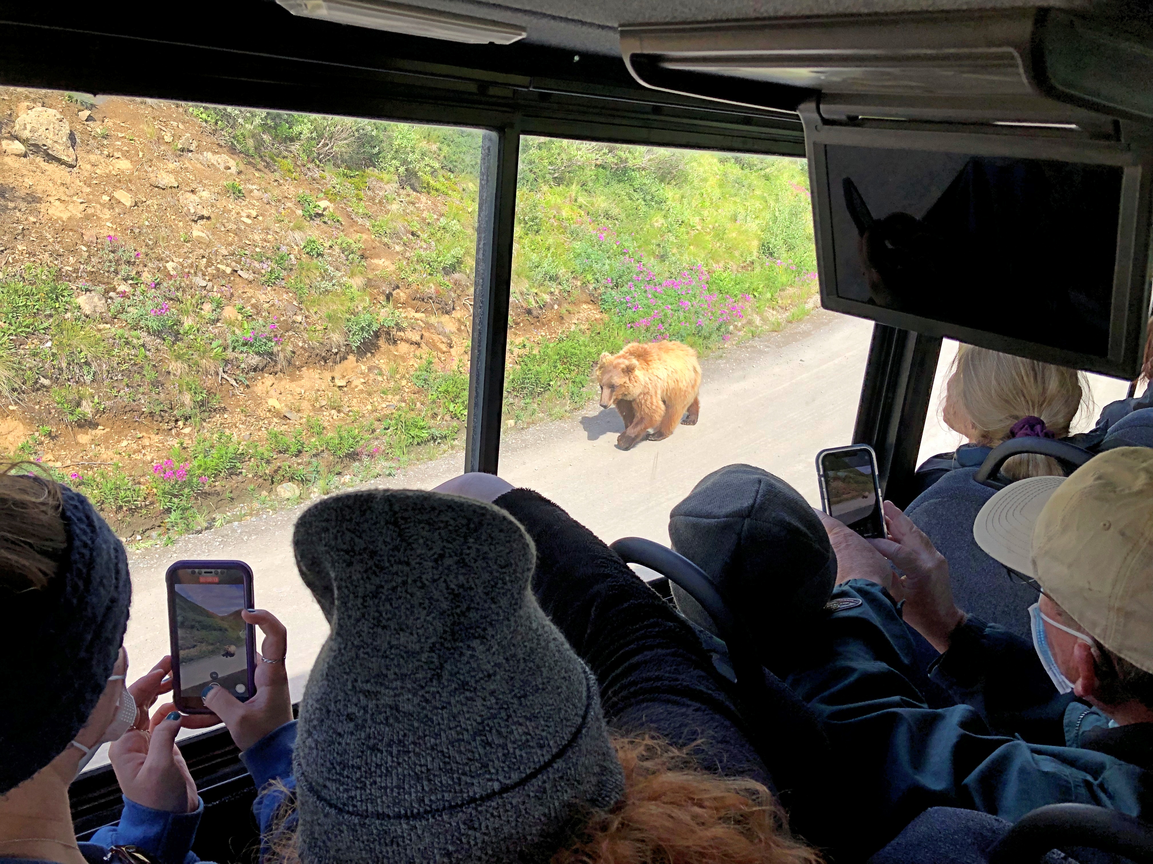
Around there, we spotted a bear. Brian stopped the bus for a few minutes for us to watch. It wouldn’t be the last time he did so.
Denali NP bears

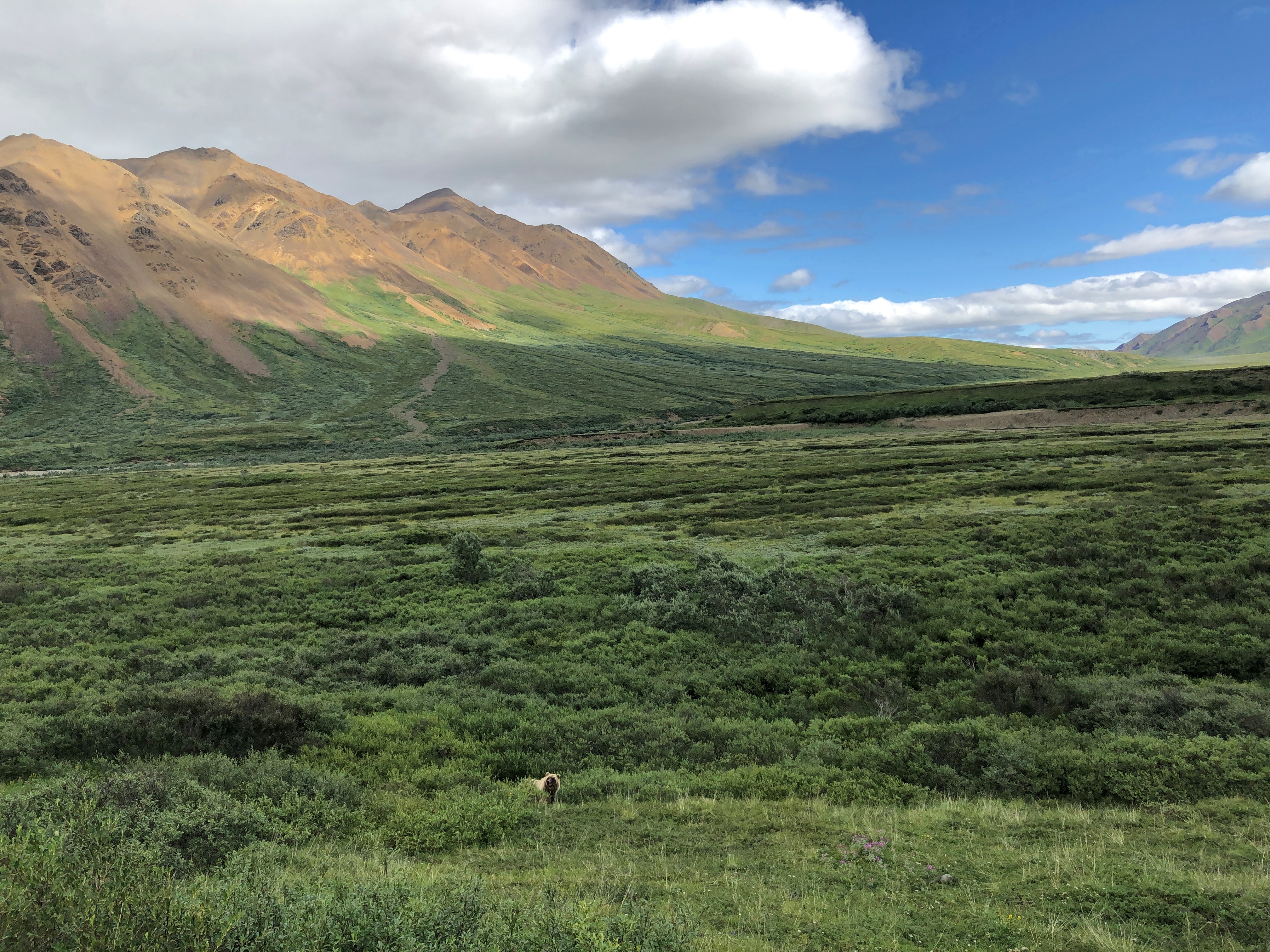
Make that two bears.
Denali NP bears

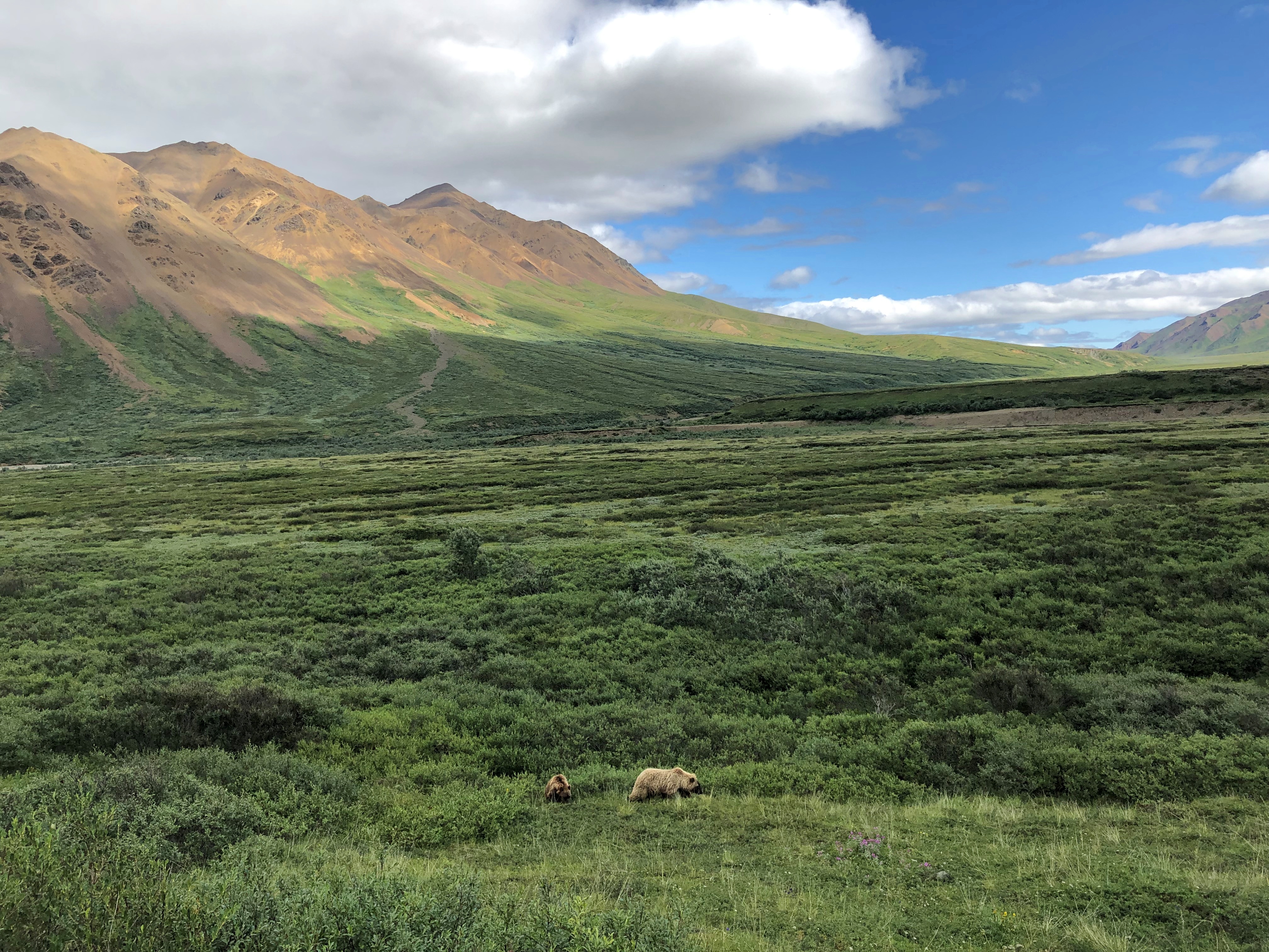
In the fullness of the day, we spotted a total of five brown bears, some of whose coats were actually blondish. Brian noted that an estimated 300 bears live in the park, and if so, we saw nearly 2 percent of them. He further said that often enough tours buses see no bears at all, the creatures being as elusive as Mount Denali. So we were a charmed bus almost from the get-go.Denali NP bears
Denali NP bears

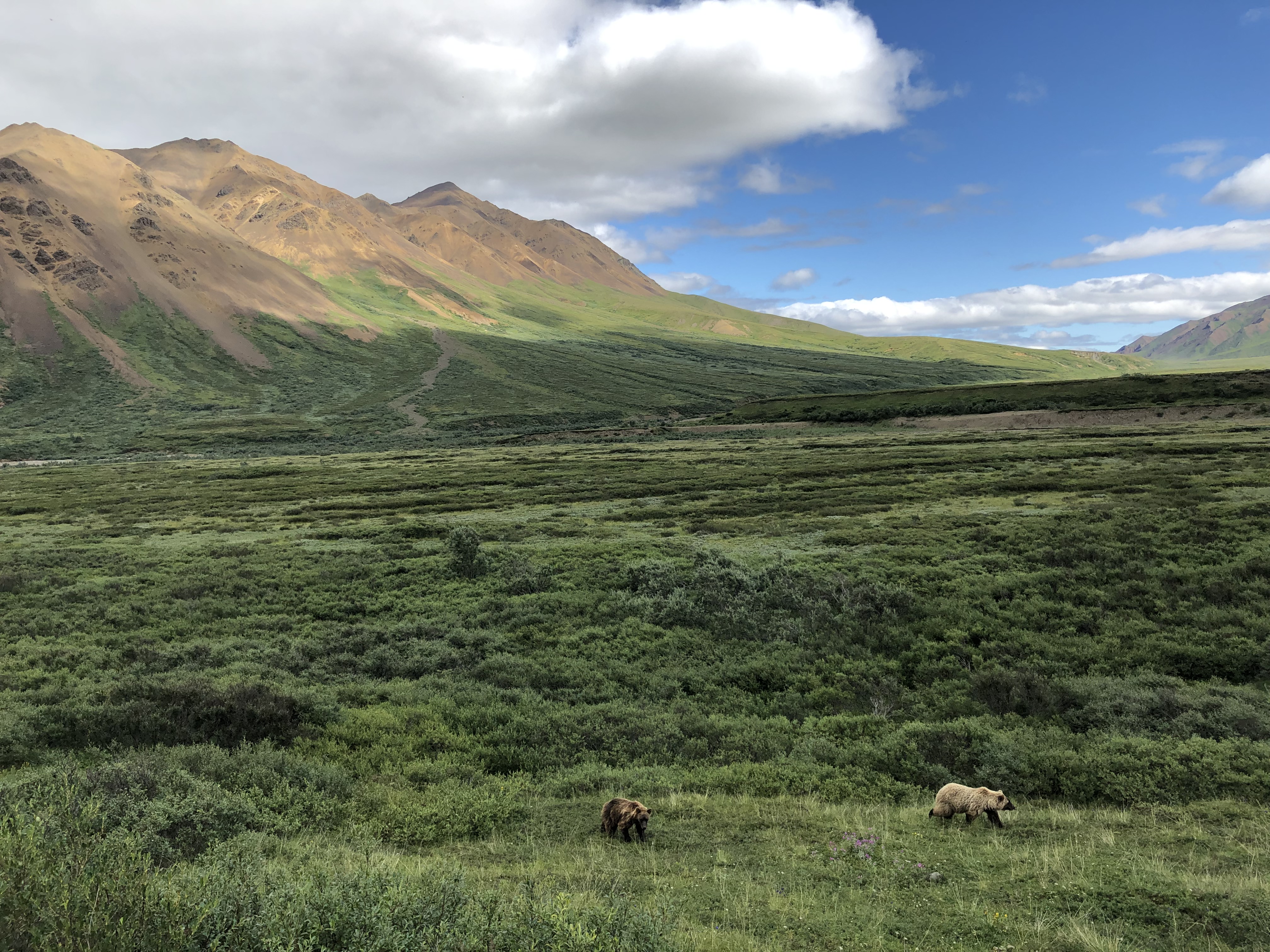
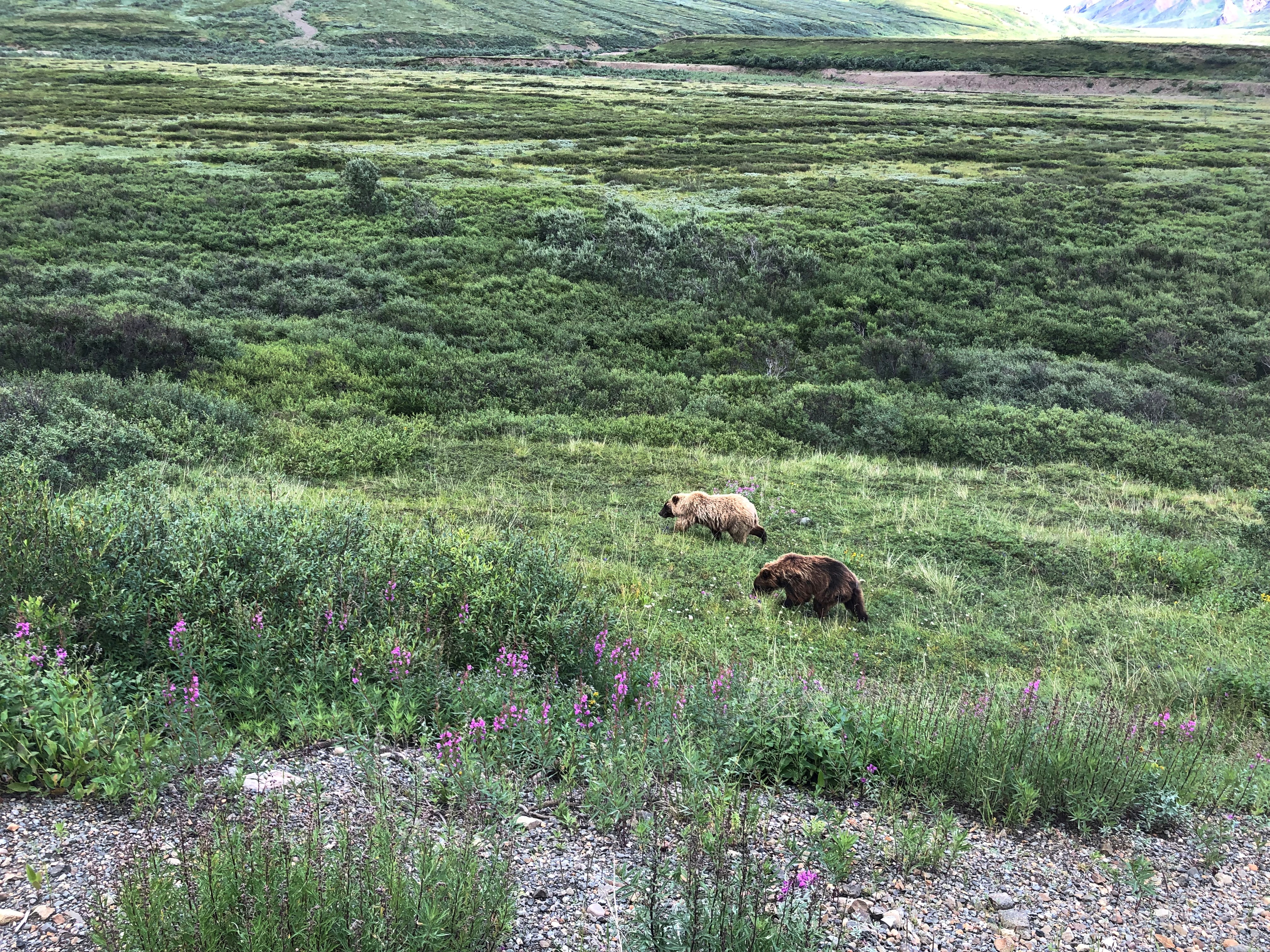
One of the bears took a stroll on the road. Why not? For all we know, the bear considered the bus just a big lumbering animal that posed no harm, and could not be eaten, and so deserved no further consideration.
Denali NP bear

Caribou probably felt the same way.
Denali NP caribou

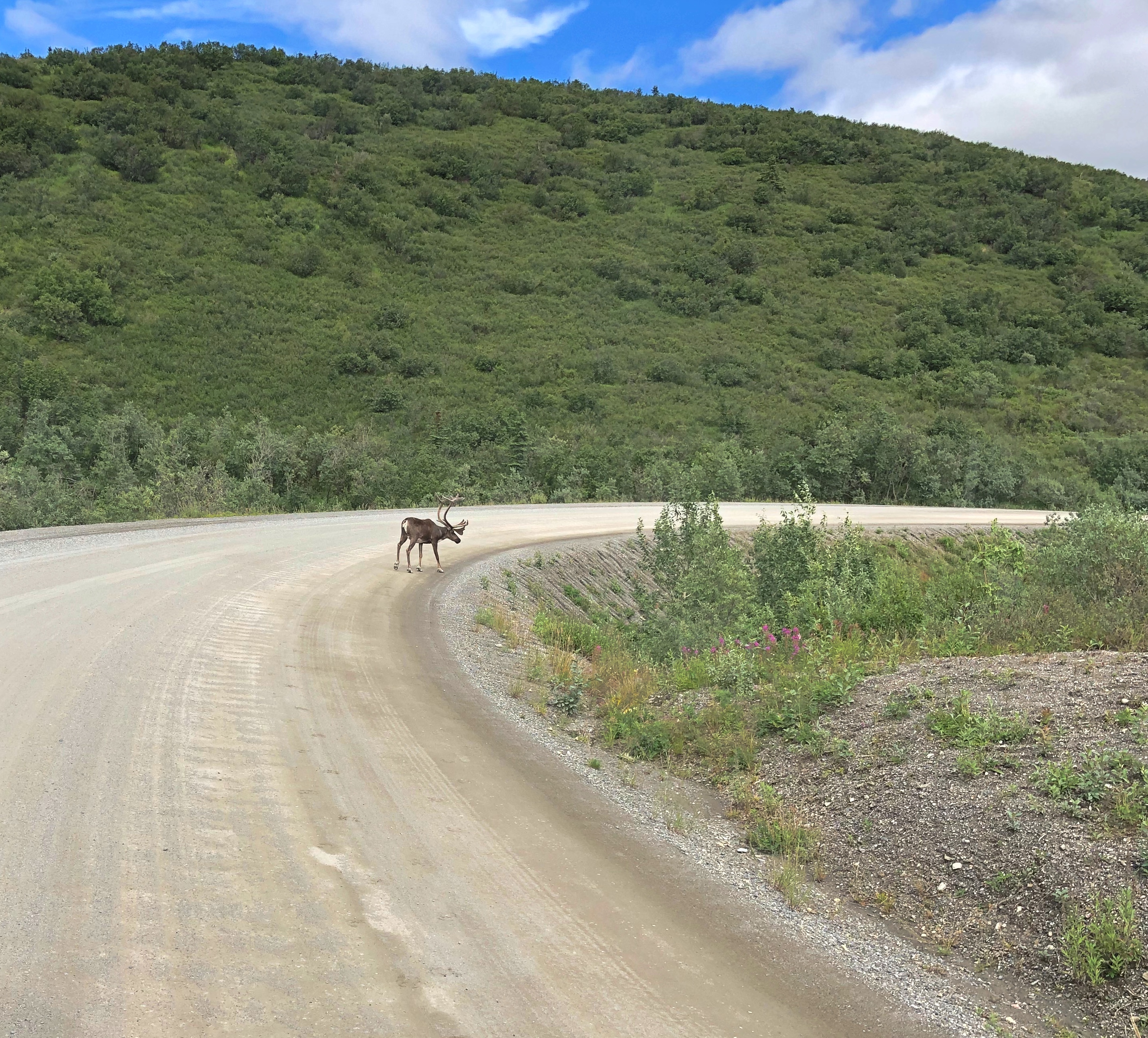
We also managed to see, as the day went on, Dall sheep, moose, and a lynx — another animal the guide said was rarely seen on a tour. As for the Dall sheep, they were white spots way up a mountainside, walking where I thought no animal ought to be able to walk. That only reflected my ignorance of all things Dall.

The conservation of Dall sheep was the original motive for creating Mount McKinley NP, as it was known when established in 1917. One Charles Sheldon, who made a fortune in mining and retired young to the life of a naturalist, successfully advocated for the creation of the park in the early 20th century to keep Dall from being wiped out by hunting.

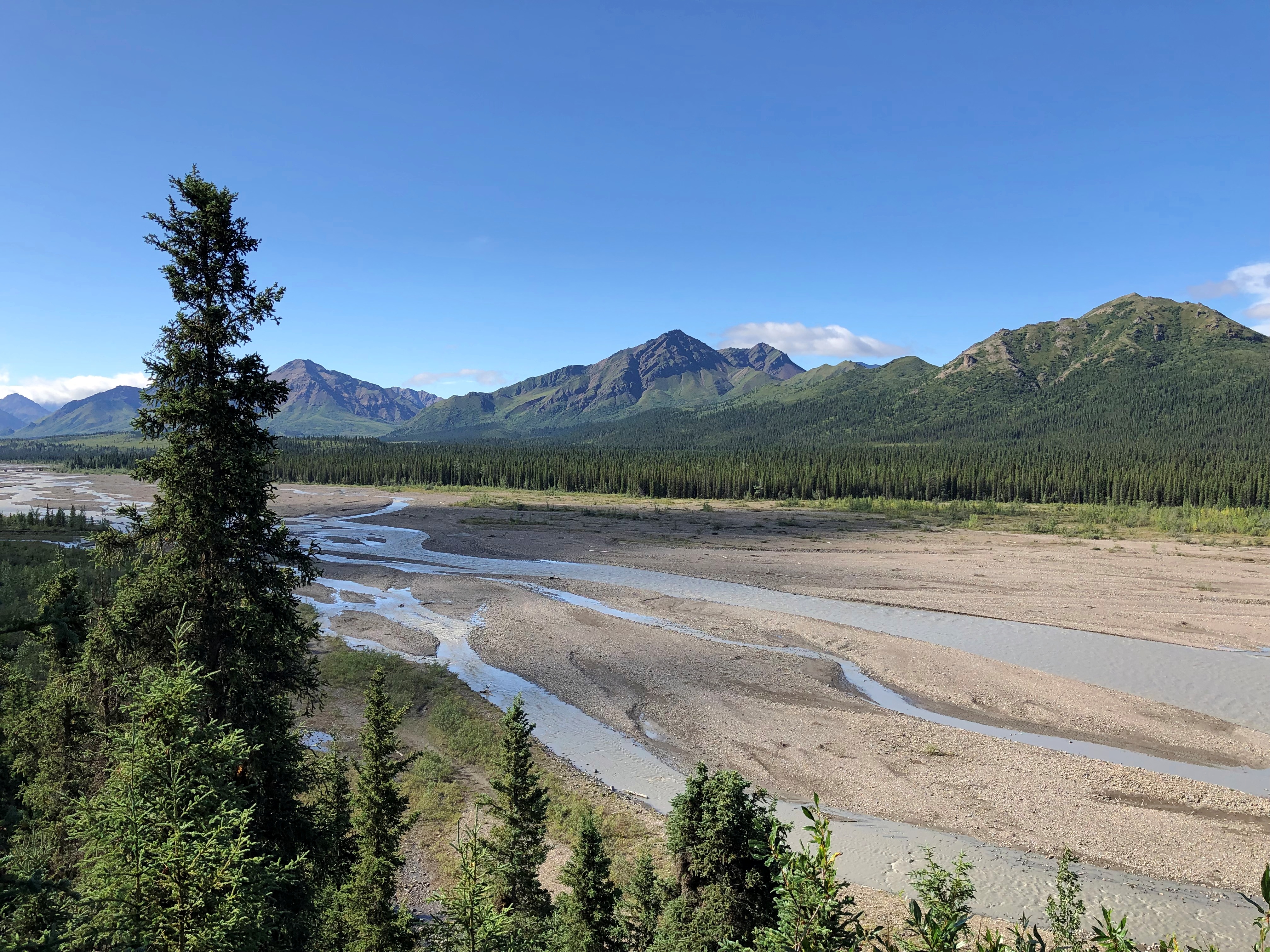
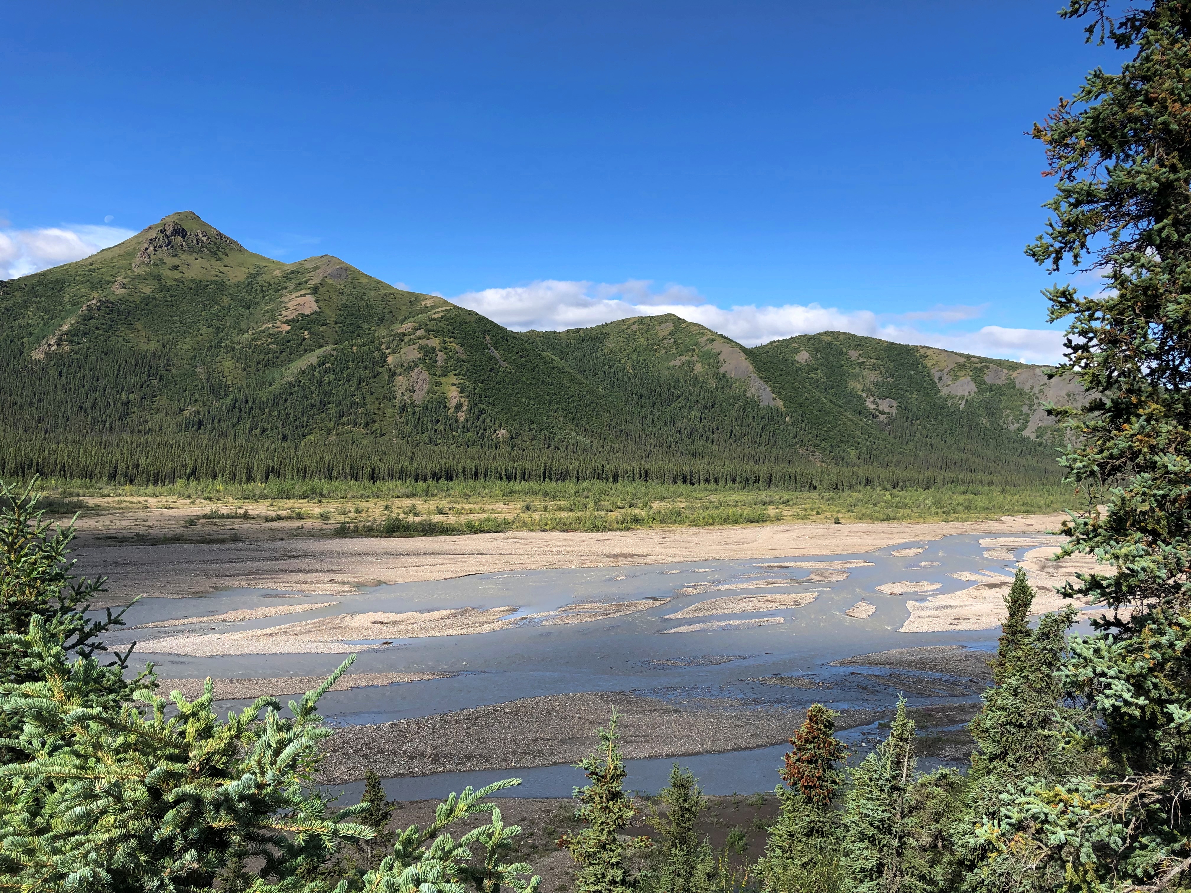
At Mile 30, the rocky Teklanika River.Denali NP

Denali NP

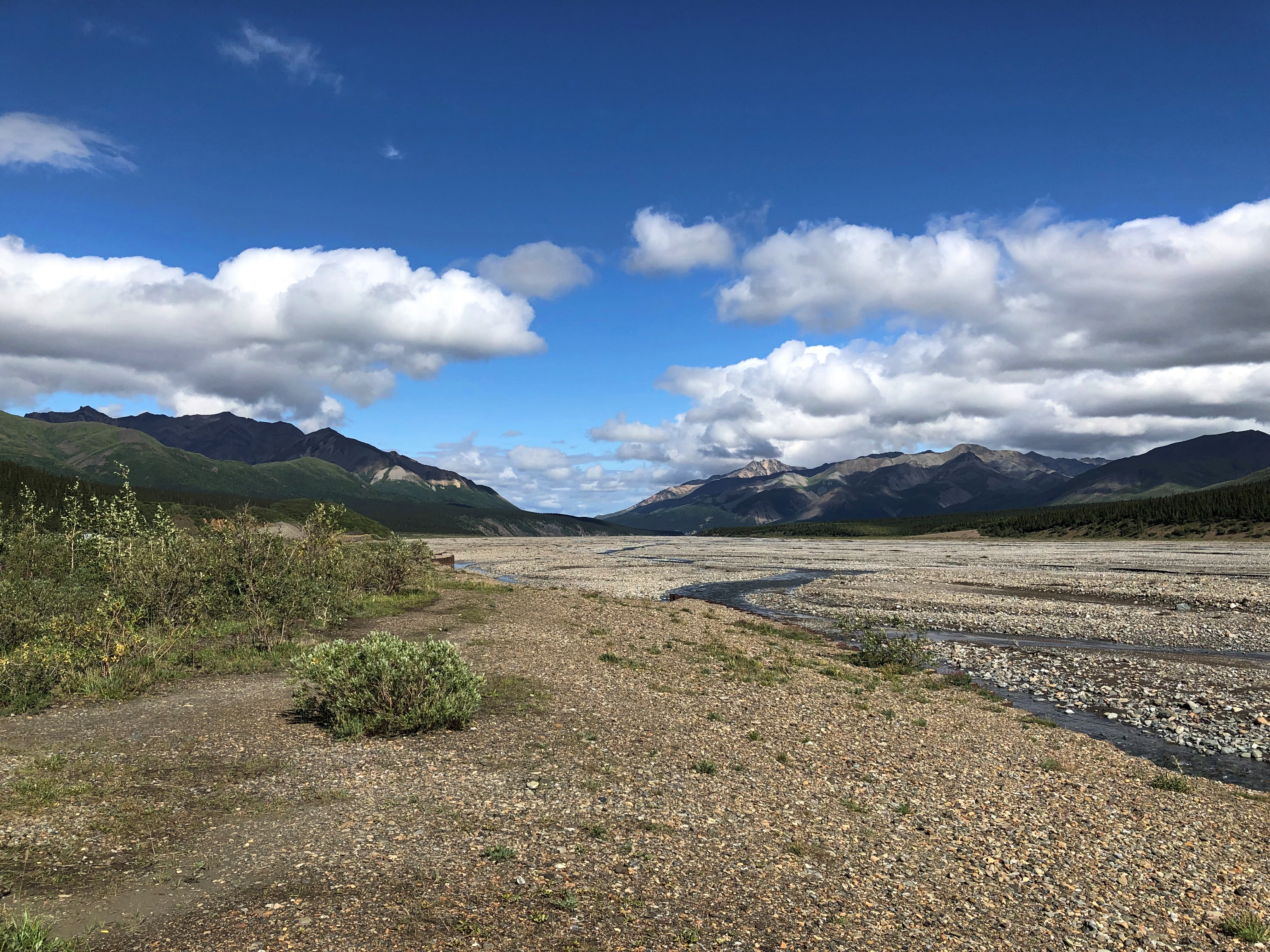
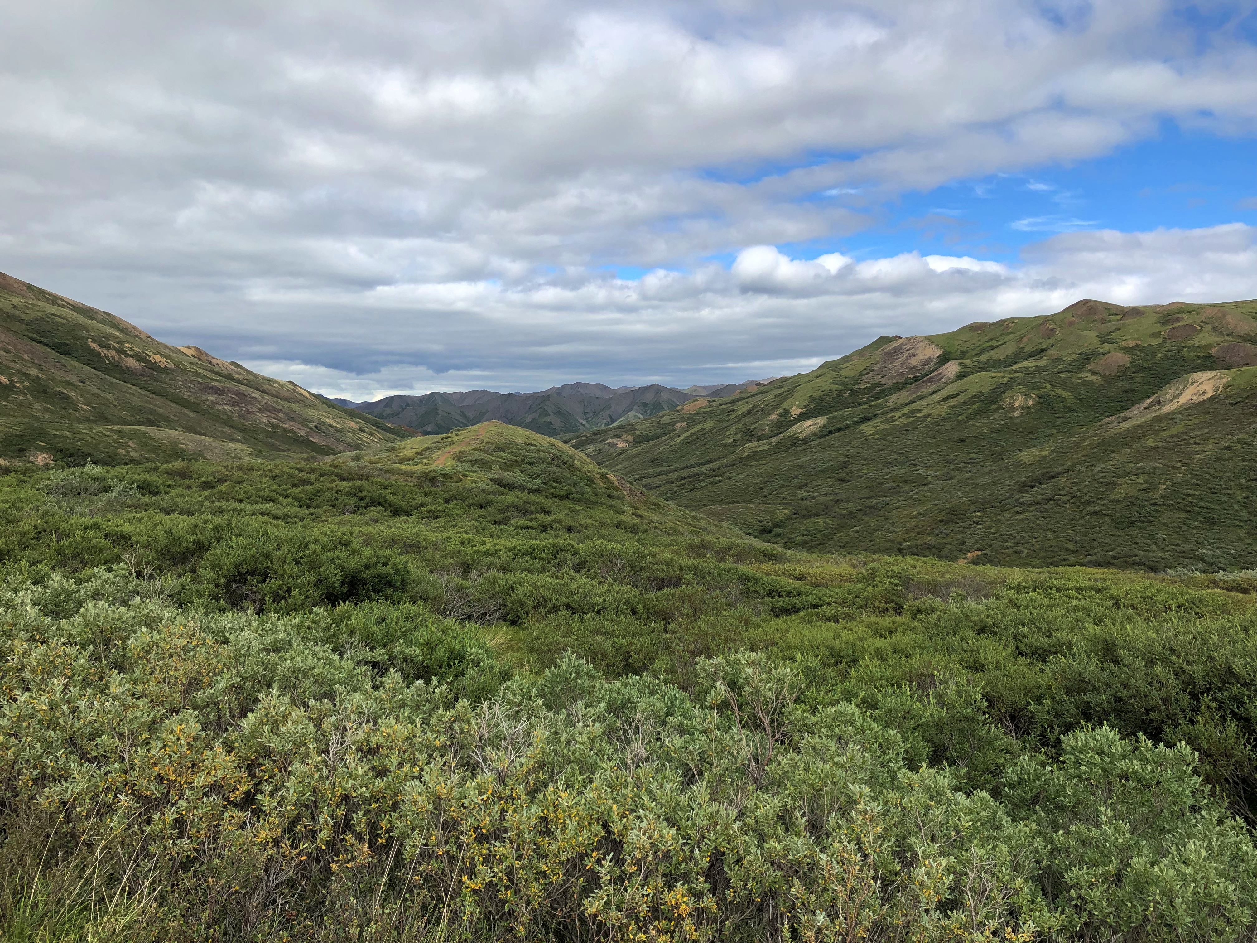
Further in: more views of the road, which winds around. The second image looks like another road branches off, but there’s only one road in all of Denali NP.Denali NP road
Denali NP road

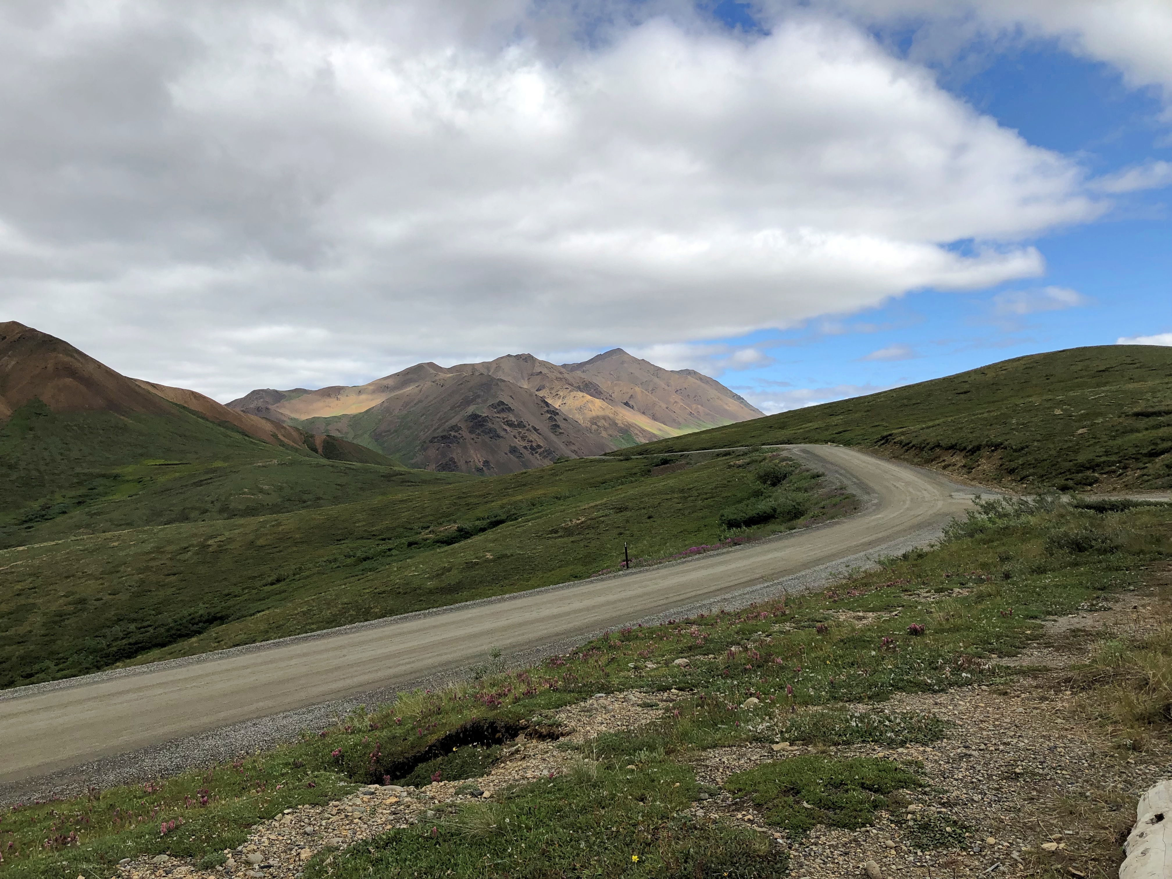
The purest of the purists might object to this work of man in the park, but it’s the thinnest of ribbons in a vast wilderness, built from 1923 to 1938. Since Alaska 3 didn’t exist until 1972, visitors who wanted to travel the park road before then came up by railroad to the entrance of the park.

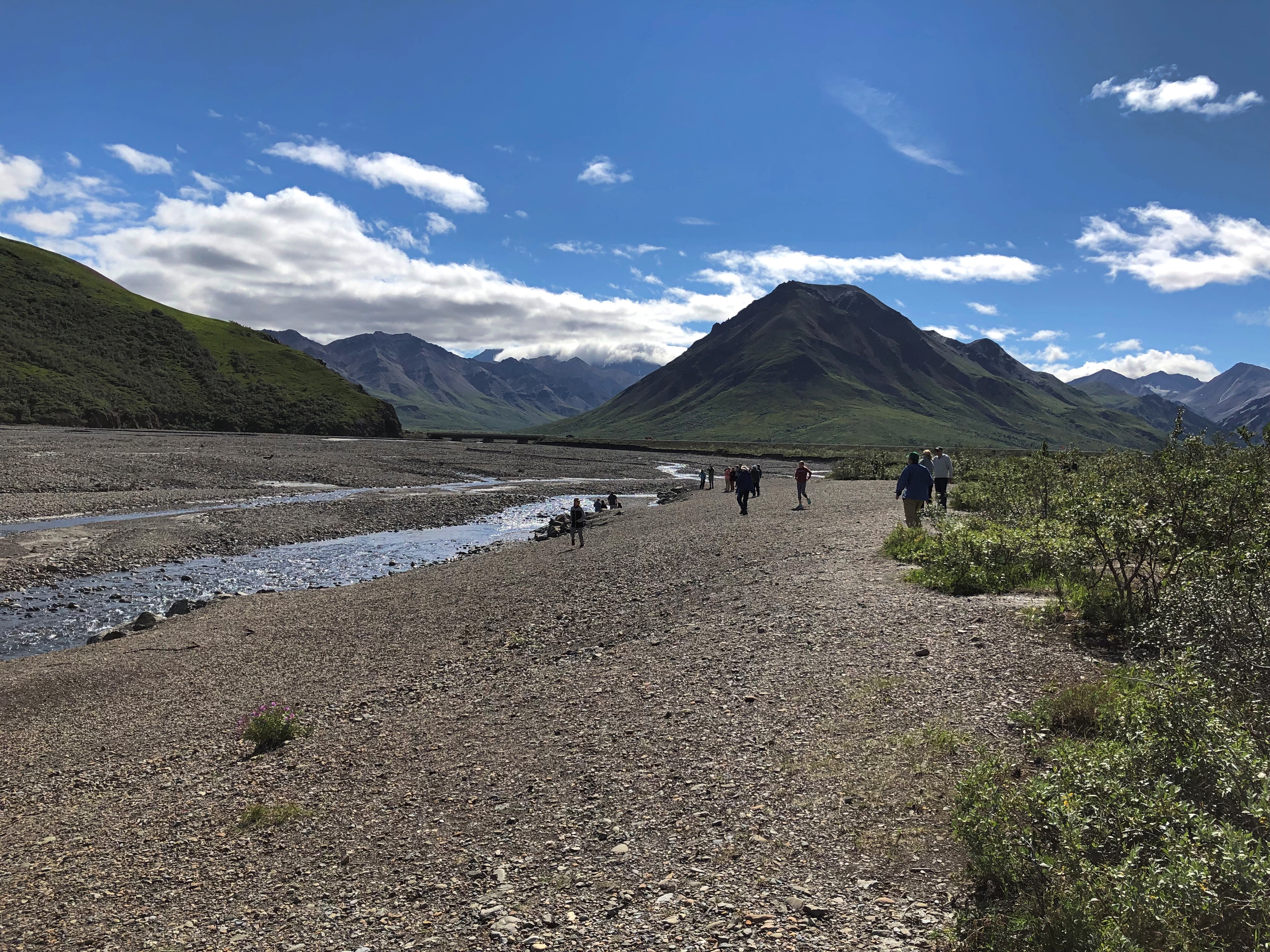
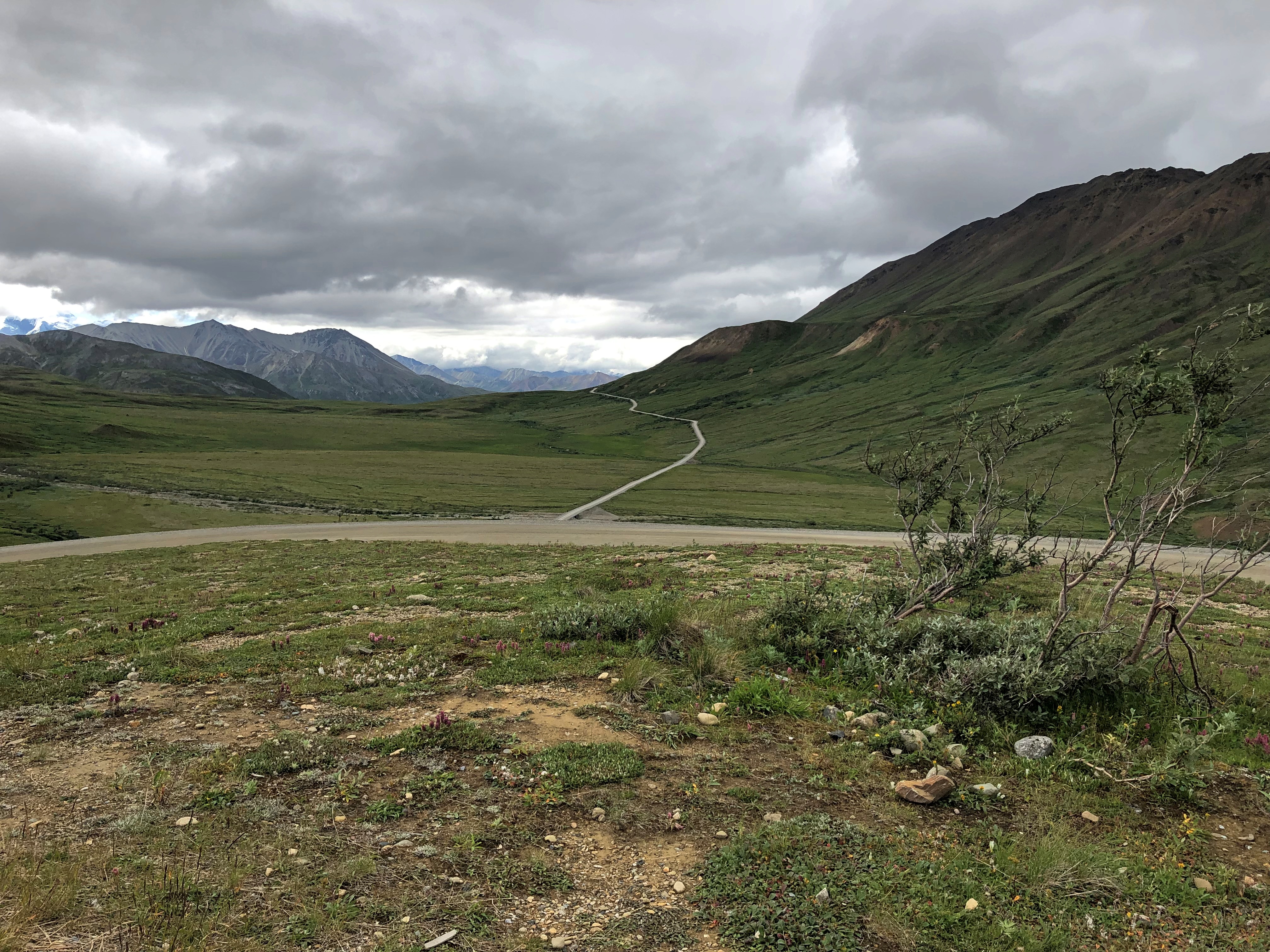
The road went on, but our tour made its turnaround at the Toklat River Rest Stop, Mile 53.

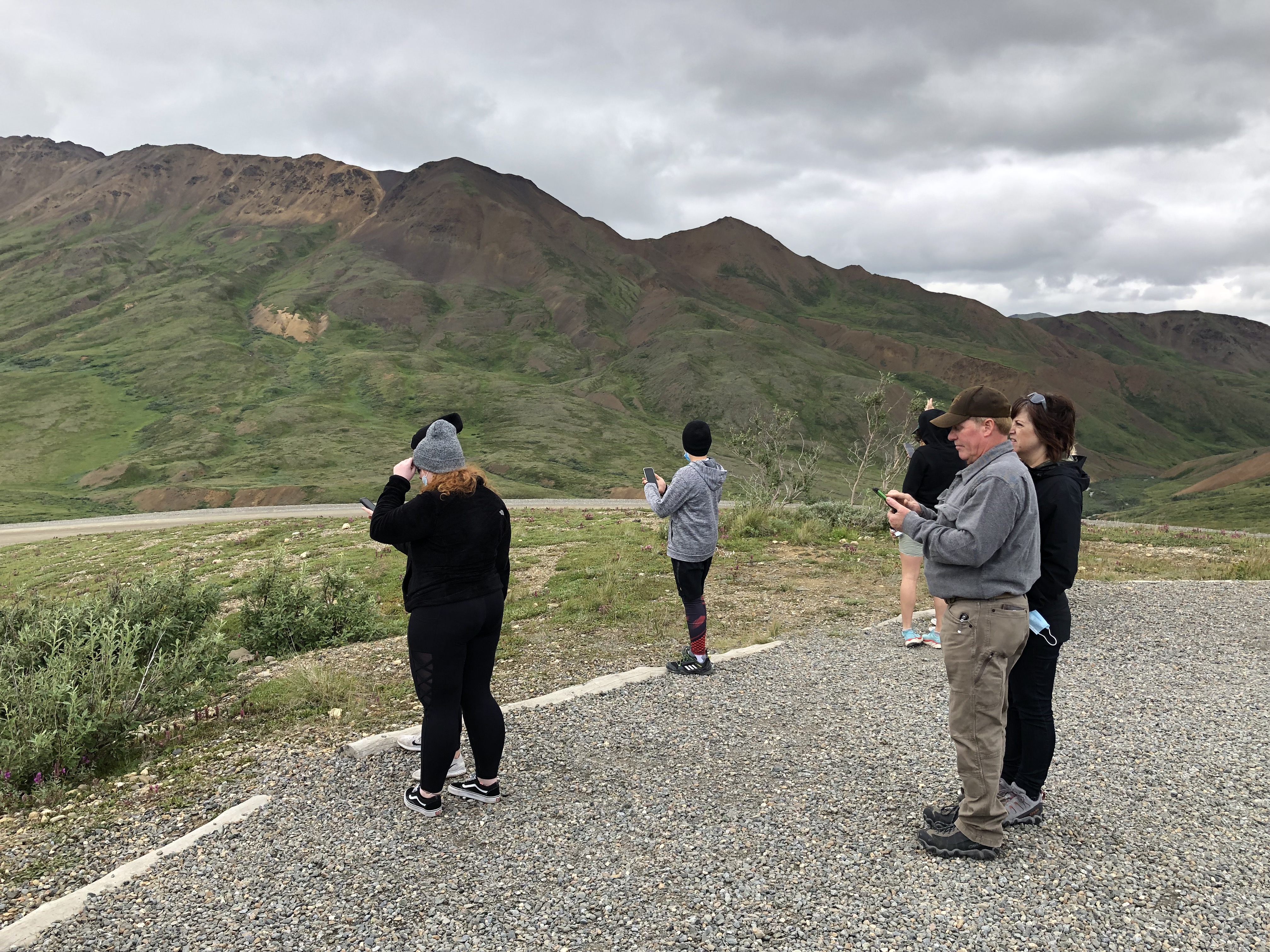
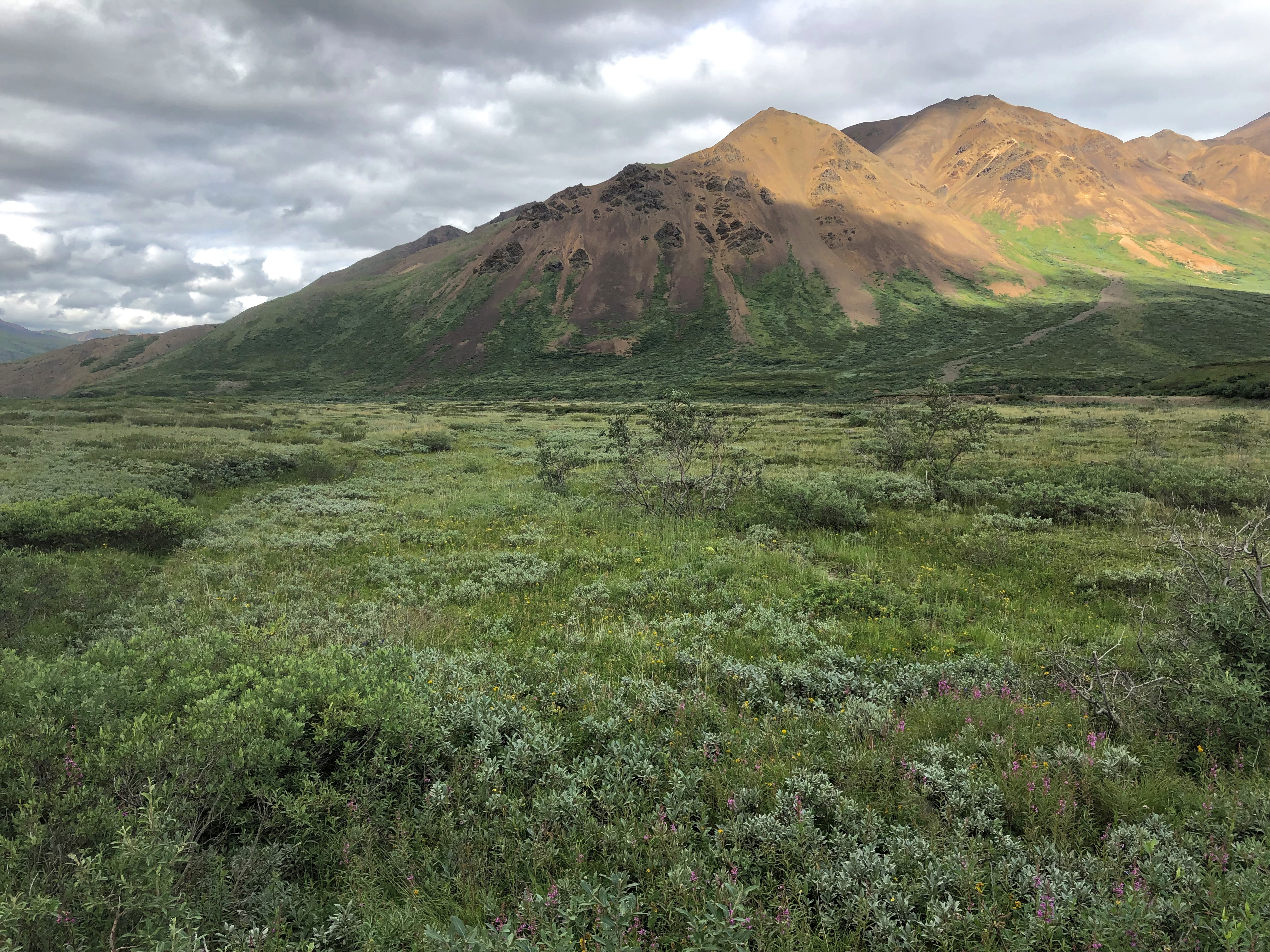
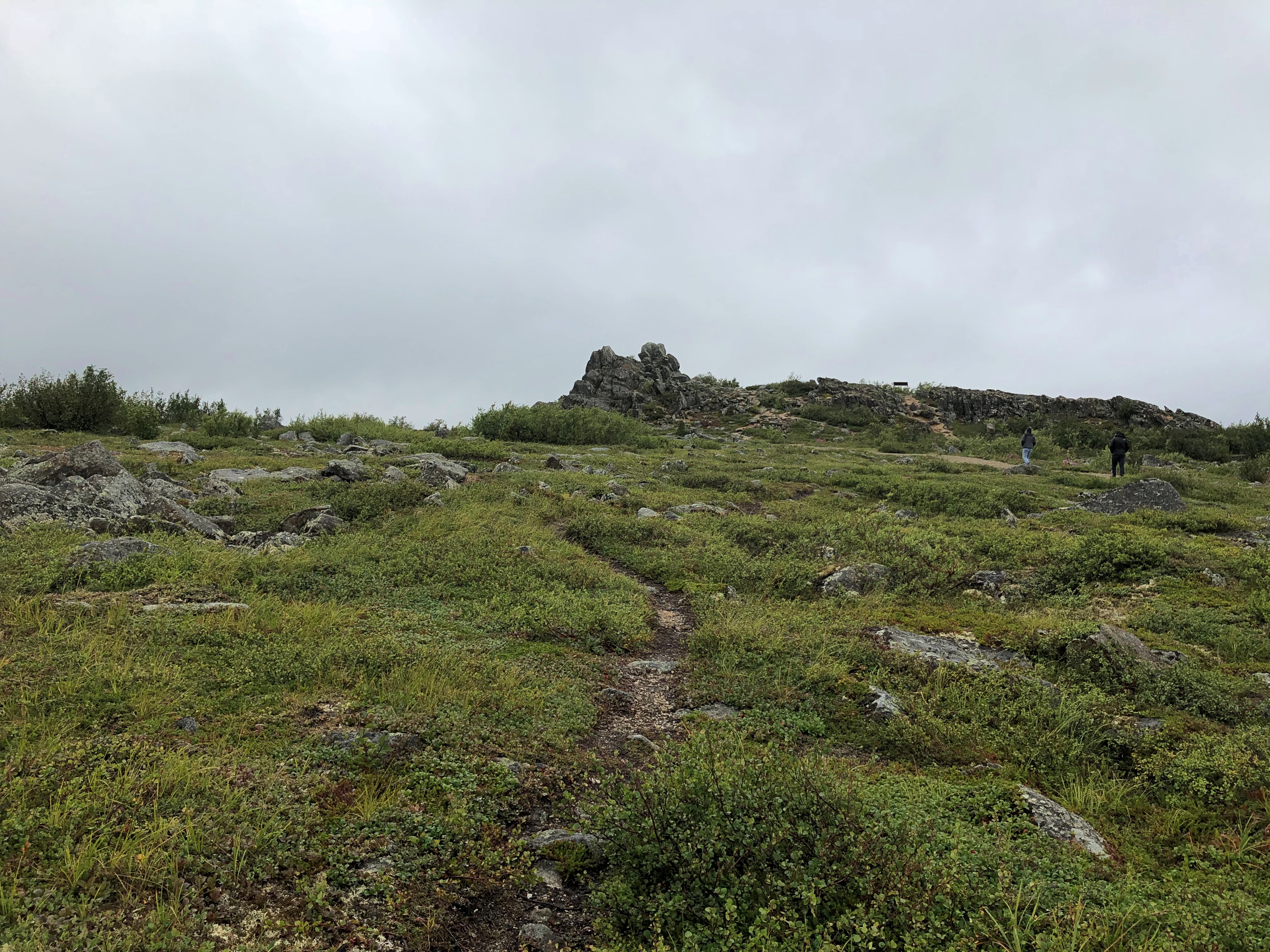
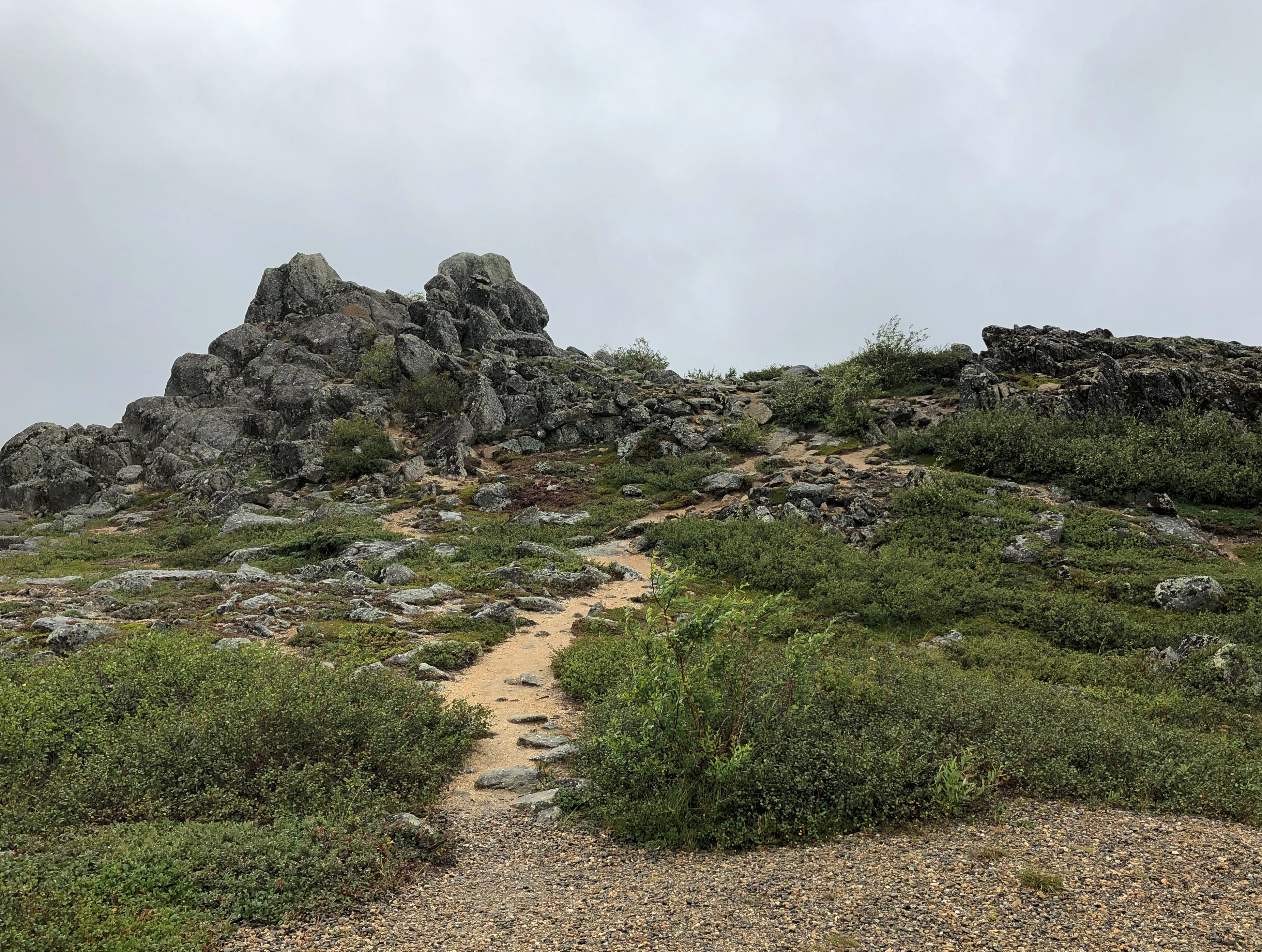
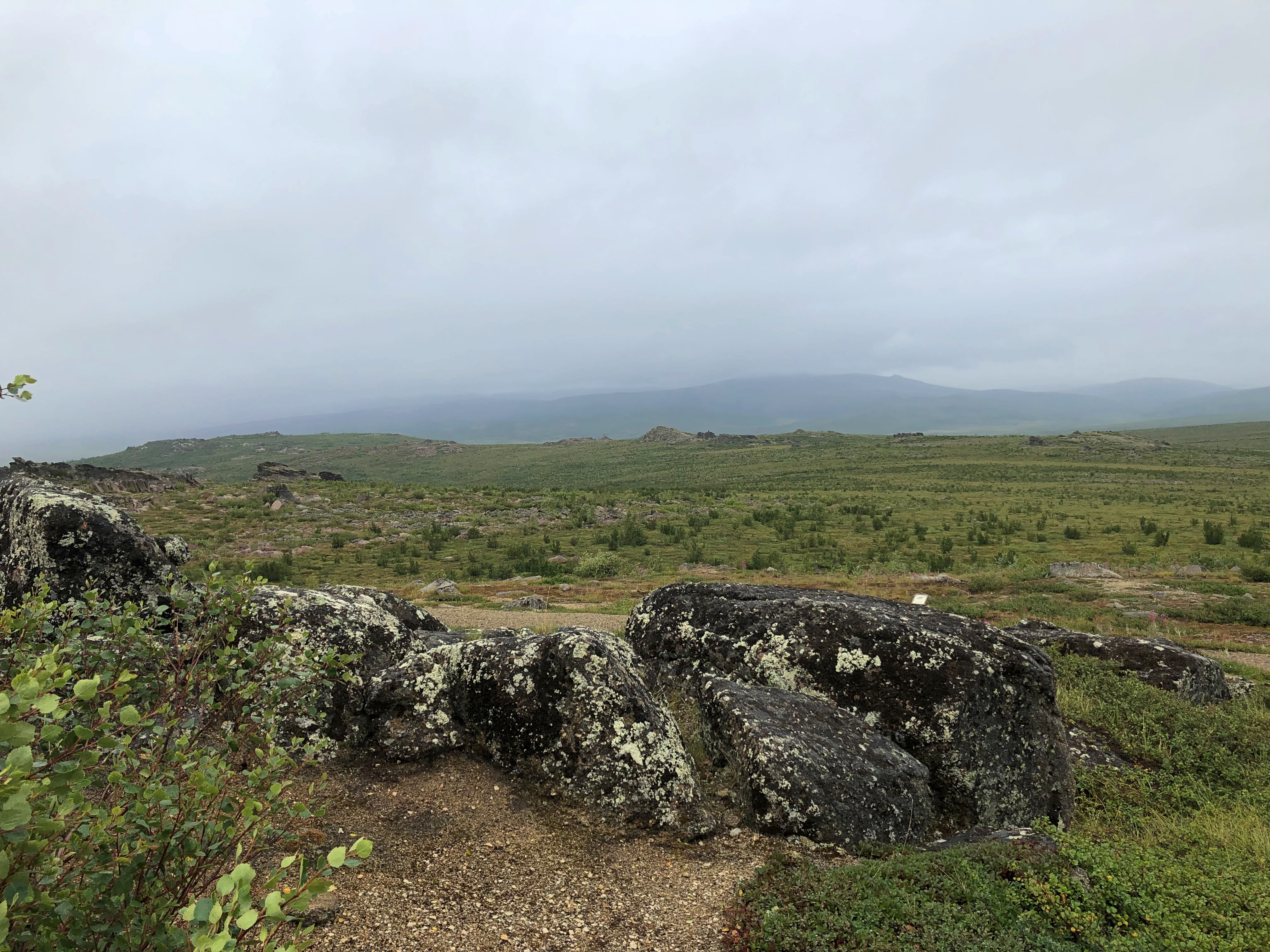
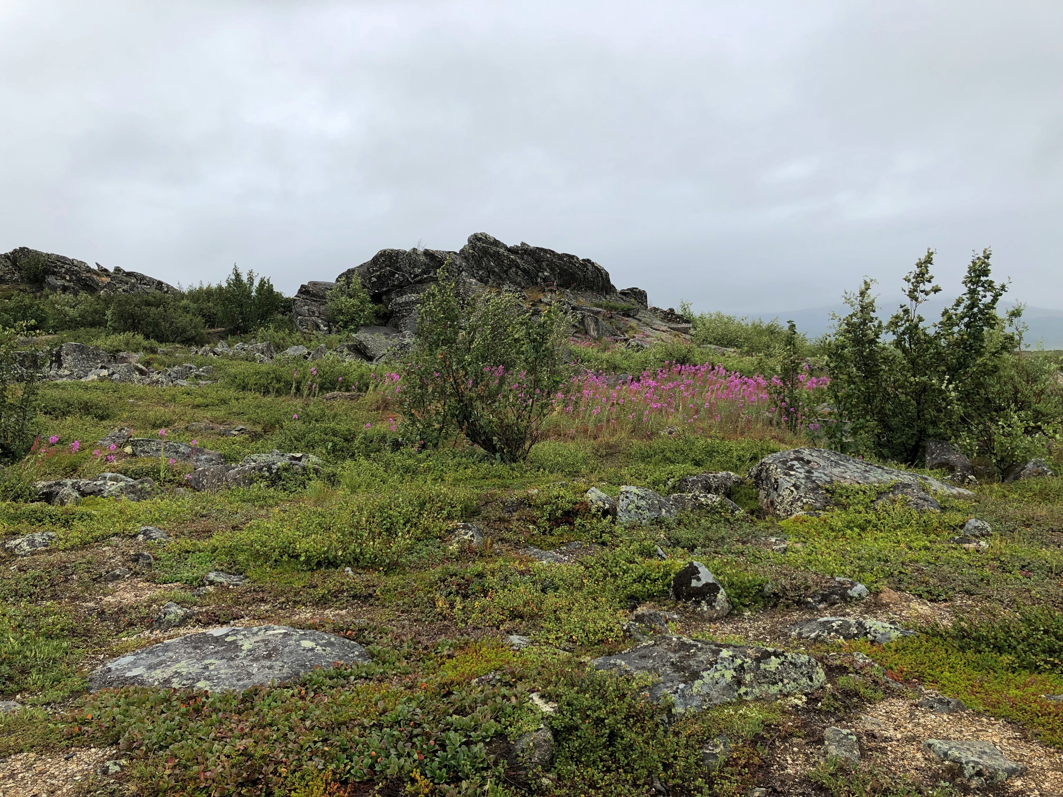
On our return, we stopped at a place that we had bypassed earlier, Polychrome Pass, at Mile 46.Denali NP Polychrome Pass

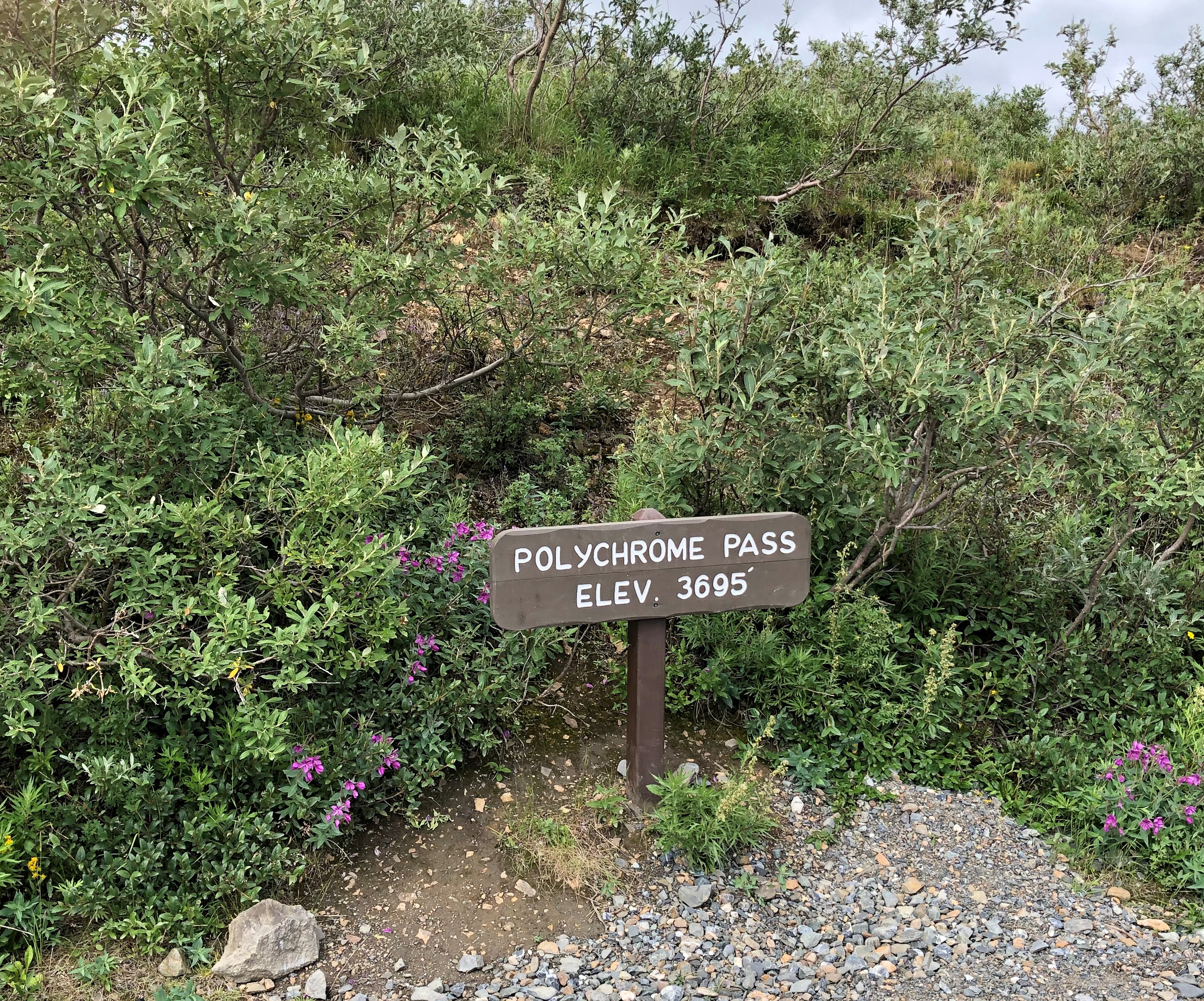
Most of us climbed the hill next to the road.
Denali NP Polychrome Pass

The view more-or-less north, into what are known as the Wyoming Hills, was nice.
Denali NP Polychrome Pass

The view to the south proved to be my favorite in Denali NP, and in fact my favorite of the small slice of Alaska I got to see last week. Colorful, as the name implies, but much more than that. The cool brisk wind in otherwise absolute quiet added to the impression, but it was more than that too.

I will publish pictures here, but even more than all the others, they’re poor substitutes for the way the sweeping vista impressed my eyes. The view toward the Alaska Range at Polychrome Pass is, I believe, the grandest vista I’ve ever seen.Denali NP Polychrome Pass

Denali NP Polychrome Pass

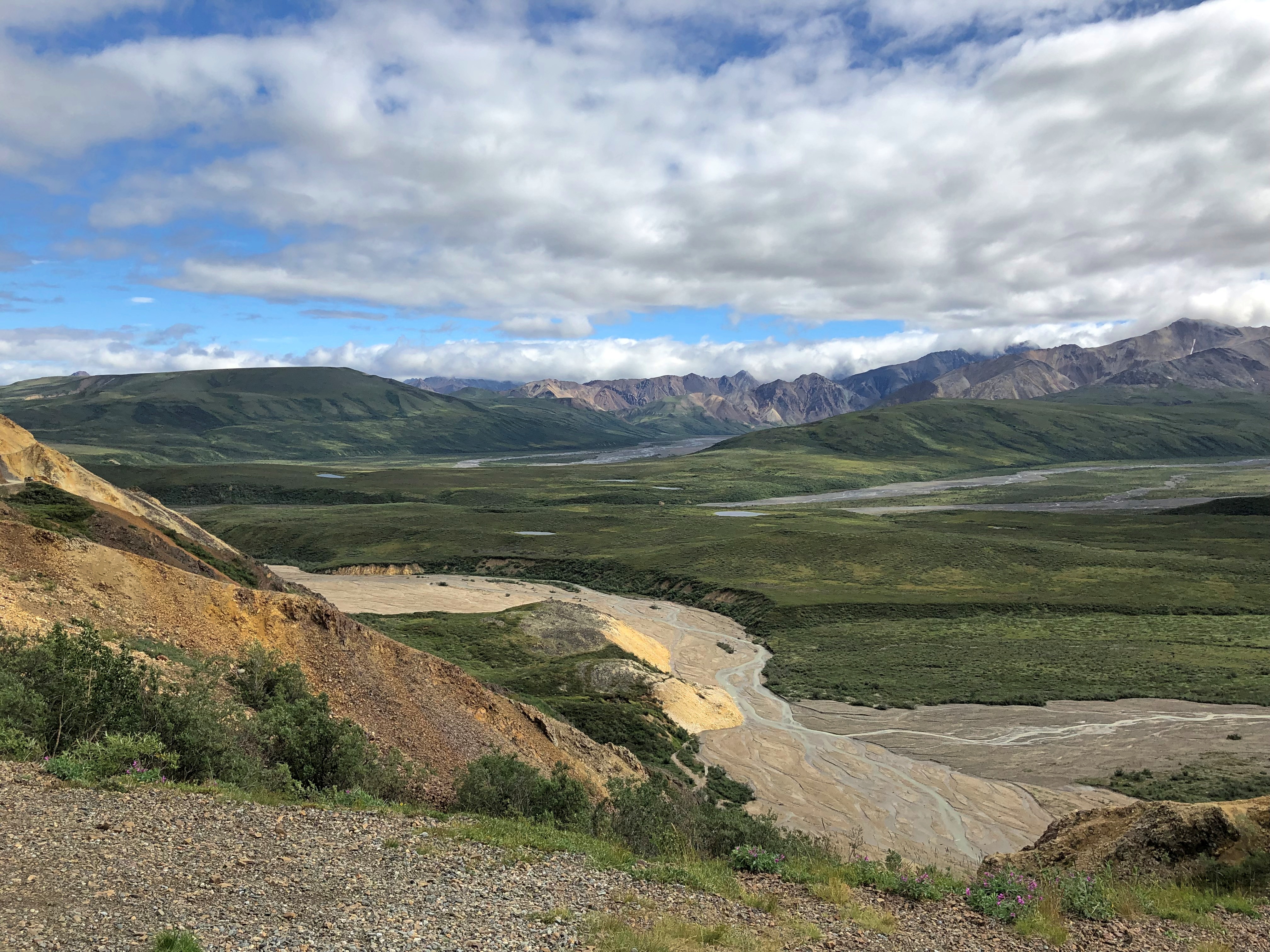
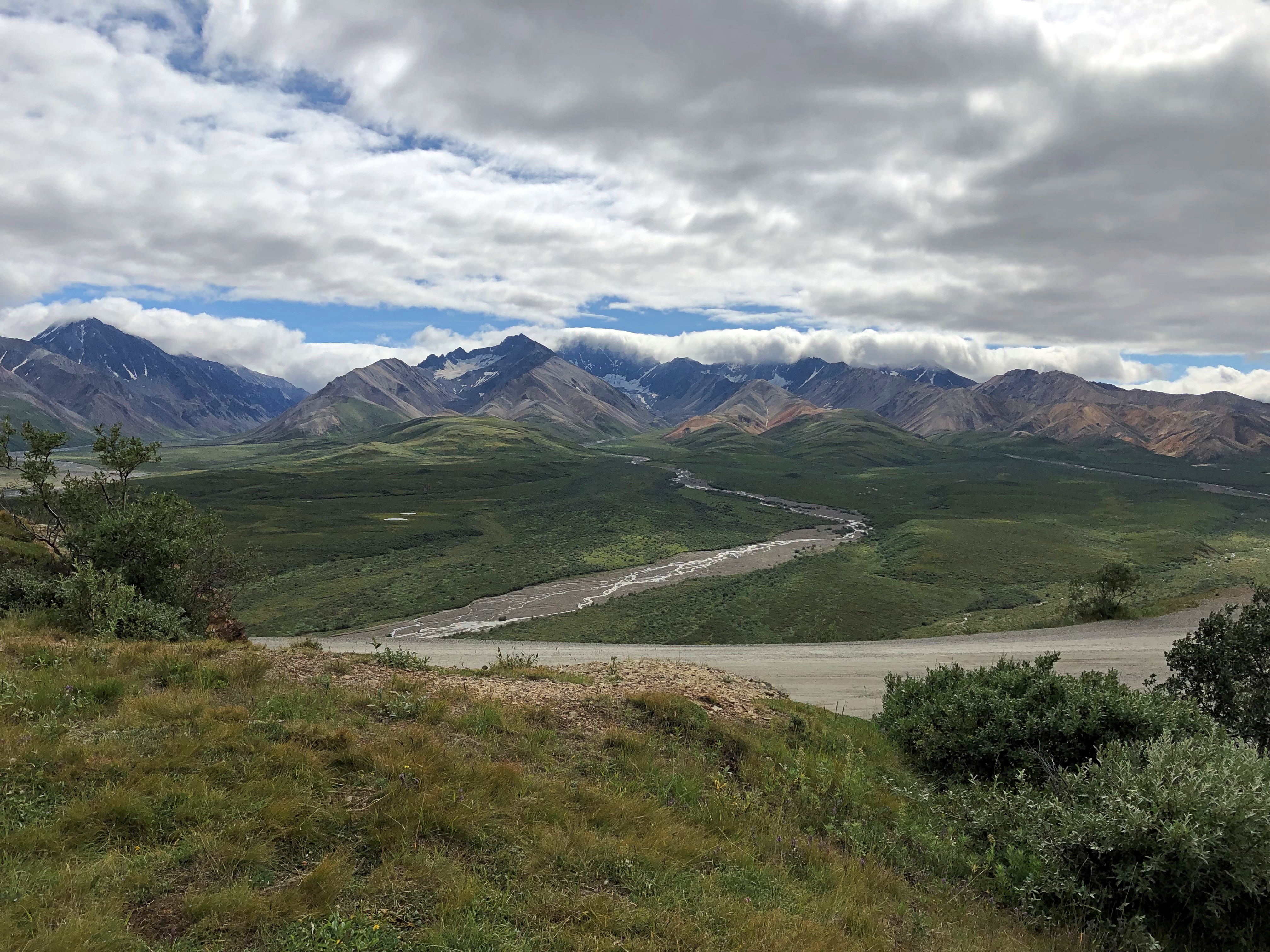
How so? Even now, a week later, the enormity of the scene staggers me. It isn’t obvious from the image, but the mountains are at least 10 miles away, leaving me the impression of the largest valley, the longest sweep of vision over a wild plain, that I’d ever encountered.

Maybe that’s the conditioning of Romantic ideas about nature, echoing down the last few centuries and taking the form of TV specials, coffee table books and a tourist industry that takes people to such vistas for a fee. Maybe God speaks through the grandeur of a place like Denali NP. Maybe I have wholly idiosyncratic ideas of worthwhile vistas, because to me the view from Victoria Peak over the nighttime illuminated urban canyons of Hong Kong was almost as grand. Maybe I don’t really care about any of those ruminations. All I know is I was exceptionally glad to be there in Denali NP and see that.

Southward on the Dalton Highway

Gravel makes better roads when crossing land with underlying permafrost. That isn’t a new idea.

“The primary benefit to gravel roads is that they are relatively immune from frost heaving and have less of a tendency to thaw underlying permafrost,” an Alaskan scientist named Larry Gedney wrote in 1983. “Studies showed that on very poor foundation material, such as thawing permafrost, the patching, pothole filling and repaving required by paved roads resulted in maintenance costs more than twice that for a good gravel surface.”

Thus most of the Dalton Highway, which runs for 414 miles, is gravel covered, though short stretches are paved, presumably not on top of permafrost. Making sure that no trucks were headed my way, I took some pictures standing in the gravel road. It makes a satisfying crunch under your shoes. The sound of somewhere remote, in this case.Dalton Highway July 2021

Trucks pass by with some regularity, though I understand winter is really the busy season.
Dalton Highway July 2021

We left Coldfoot, Alaska, last Tuesday in the afternoon on a small bus driven by a guide named Steve. His job was to drive us back south, but also to talk about the Alaskan wilderness, the Alaska Pipeline and the road itself, which he did with expert knowledge, as far as I could tell.

Not following things Alaskan in much detail, there was much that he said that I didn’t know, such as about the composition of boreal forests in this part of the world — only six kinds of trees, two of which are kinds of spruces, highly visible out my window and odd-looking in the case of pencil-thin-looking trees with clutches of cones on top.

The tour stopped at a number of spots en route, either to use outhouses — one bank of which actually featured crescent moons in the door — or at points of interest. The first stop, still north of the Arctic Circle, was for a look at the Alaska Pipeline (formally the Trans-Alaska Pipeline System).Dalton Highway July 2021
Dalton Highway July 2021

The pipeline wasn’t exactly a hidden presence. The road was built to service the pipeline, after all, which got its impetus from the energy panic of the 1970s. Long stretches of the pipeline were built above ground, because permafrost is a lousy place for underground pipes, and so the it was easy to see most of the time from the bus window as we rolled by, a thin white snake taut across the green backdrop.

Next stop, the Arctic Circle sign.
Arctic Circle sign July 2021

We weren’t the only ones there. Another bus pulled up, and so did a couple of private cars, including a small sedan I don’t believe I’d drive on the Dalton. Then again, it had some extra tires and gas cans lashed to the roof — at least I hope they were tied down — so maybe they were ready.

I happened to see the back of the sign. That side featured a number of stickers, including him again.Arctic Circle sign July 2021 Buc'ees

South from that point is Finger Mountain. Not actually a mountain, just a large hill with a granite tor off in the distance. We stopped long enough for us to scramble to the top of the hill, which is about 17 miles south of the Arctic Circle.Finger Mountain July 2021
Finger Mountain July 2021

Distant fog obscured the distant mountains, but they were visible.
Finger Mountain July 2021

I was reminded of the alpine tundra I saw on the mountainsides of Alberta. Yes, this counts as alpine tundra, Steve the guide agreed.Finger Mountain July 2021
Finger Mountain July 2021

Further south we stopped at the Yukon River Camp.
Dalton Highway Yukon Camp

Some of its buildings had that abandoned look. Wonder when the last time there was an artist in residence here, across the parking lot from the camp’s main building, and nearer to the highway.
Dalton Highway Yukon Camp

Not far from the buildings is the mighty Yukon River, third-longest in North America. It was good to stand on the banks of such a river.Dalton Highway Yukon River

The 2,295-foot Yukon River Bridge, formally the E. L. Patton Bridge, carries the Dalton Highway, along with the Alaska Pipeline, across the river. It’s only one of four bridges on the Yukon, despite the river being nearly 3,200 miles long.
Dalton Highway Yukon River Bridge

Near the bridge, I got a better look at the pipeline. I could stand under it.Dalton Highway Yukon River Pipeline Dalton Highway Yukon River Pipeline

Though it wasn’t the end of our drive, the last stop (except for an outhouse break) was at the entrance to the Dalton Highway. A sign marks the spot.
Dalton Highway Yukon River Pipeline

“At first, the highway was called the Haul Road because almost everything supporting oil development was ‘hauled’ on tractor-trailer rigs to its final destination,” notes the Bureau of Land Management. “In 1981, the State of Alaska named the highway after James B. Dalton, a lifelong Alaskan and expert in arctic engineering who was involved in early oil exploration efforts on the North Slope.

“The highway was open only to commercial traffic until 1981, when the state allowed public access to Disaster Creek at milepost 211. In 1994, public access was allowed all the way to Deadhorse for the first time.”

Up to Coldfoot

Turns out that a lot of information about an airplane is readily available via its registration number, typically found on the fin. If I’d thought about it, I probably would have realized that before, but it isn’t something I ever had much interest in, until I decided to look up the number on this aircraft.

Arctic Air

N3589B tells me that it’s a Piper PA-31 Navajo Chieftain manufactured in 1980 and owned by tour operator Air Arctic since 2007, with 310-horsepower Lycoming TIO-540 engines.

“Stretched version of the Navajo with more powerful 350-hp (261-kW) counter-rotating engines (a Lycoming TIO-540 and a Lycoming LTIO-540) to eliminate critical engine issues,” Wiki says.

Italics mine, since critical engine issues were the last thing I’d have wanted during my flight from Fairbanks to Coldfoot, Alaska (pop. 10), last Tuesday. Of course nothing untoward happened. There wasn’t even that much turbulence.

There was a chance that we might not have made it to Coldfoot, however. Not long before boarding the plane, a tour company employee told us that visibility was poor in Coldfoot, with low clouds and rain. If those conditions persisted, landing in Coldfoot might be impossible, since the place only had a simple airstrip with no instruments. Such are the vagaries of an Alaskan summer.

In that case, our flight would be diverted to Bettles, where an instrument landing would be possible. Bettles (pop. 12), founded during the 1898 Alaska gold rush and currently location of a lodge devoted to Arctic tourism, is also above the Arctic Circle, but not on the Dalton Highway, so we would have to return by air rather than tour bus.

We all said that we understood this was possible, and agreed to proceed.

The pilot was this fellow, Steve. He posed for pictures after the flight with all of the groups on board: a couple, a family of four and me. He has some years on me, which I counted as a good thing. You know what they say about old pilots and bold pilots.

Arctic Air pilot Steve

I sat in the back of the plane. When I called for a reservation about a month earlier, the woman taking my information asked me my weight. I gave as honest answer as I could, considering I don’t weigh myself regularly. I suspect I earned by position in back by being the fattest of the passengers, but I didn’t ask.
flight to Coldfoot, Alaska

That was before we all put on earphones, so we could hear the pilot talking to us, and not hear the roar of the engines. I listened to the engines for a few seconds, and they did roar — too much to put up with for the full hour and ten minutes of the flight.

Off we went.
flight to Coldfoot, Alaska

Because I was by myself in the back, with the seat next to me empty, I could look out of both windows. For a while out of Fairbanks, the view was pretty good. Such as of the expansive Tanana River, south of town.
flight to Coldfoot, Alaska

The pilot mentioned the name of this place, but I’ve forgotten it.
flight to Coldfoot, Alaska

We also had a view of the Alaska Pipeline for a while, but soon everything clouded over, and the views looked like this for a time.
flight to Coldfoot, Alaska

No matter. The thrill was still there. We spent much of the flight at 6,000 or 8,000 feet, above the clouds. Air-traffic control chatter was audible through the earphones, and I could see the altimeter clear enough all the way in the back. Guess that’s something that really needs to be visible. There was a fair amount of air traffic over the Alaskan bush, including a medevac in progress, though I couldn’t make out from where to where. Guess bush planes are the main way to get around this wilderness.

Most of the way into the flight, the pilot pointed to a display on the control panel — that I couldn’t see much from back in the back — that told us we were flying over the Arctic Circle. We were still over cloud cover. “It isn’t like you’d see a line on the ground anyway,” he said.

We flew near Bettles, within sight of the airstrip, in case we needed to land there. But pilot Steve reported good visibility ahead, and the ground at Coldfoot confirmed tolerable weather, so on we went for a landing. The landing strip was wet with recent rain, with temps in the 50s F.

In full, the place is Coldfoot Camp, at Mile 175 on the Dalton Highway, and roughly 55 miles above the Arctic Circle. It too was originally an ephemeral gold rush camp, much later (1970) repurposed as a camp for the construction of the Alaska Pipeline. Later still (as it is now) it’s a truck stop for the traffic on the Dalton, founded by Iditarod champion Dick Mackey. Last gas for 240 miles.

Coldfoot, Alaska

For me, and of interest to no one else, Coldfoot now marks the furthest north I’ve ever been, besting Vyborg, Russia, where we stopped briefly in 1994. Coldfoot is at 67°15′ 5″ N, 150°10′ 34″ W. Actually, the day before, Fairbanks bested Vyborg, but never mind.

Coldfoot is a utilitarian place.Coldfoot, Alaska

Coldfoot, Alaska
Boasting the northernmost bar in the USA, at least according to our guide (not the pilot, but someone also named Steve, who later drove our bus south).
Coldfoot, Alaska

It’s a claim I haven’t checked thoroughly, except to note that it would be unwise to have a bar up near Prudhoe Bay among the oilfield workers, and in fact Deadhorse is a dry town. Barrow (Utqiaġvik) is what the Alaskans call a “damp” town. No alcohol for sale, but you can bring your own. This map seems to confirm Coldfoot’s northernmost-bar status, though it doesn’t seem to be up-to-date about Barrow.

We ate lunch in the barroom, meals we’d ordered back in Fairbanks and which the tour operator faxed to Coldfoot. I had a decent fish sandwich and fries. Elsewhere in the complex was a dining room occupied mostly by truckers, a kitchen, a snack counter and a gift shop, and outbuildings that seemed devoted to truck and aircraft maintenance (Alaska DOT has a facility there). I understand that spartan rooms are available for rent in Coldfoot as well.

One wall included a place for stickers. People come from all over to visit Coldfoot, just like I did. Note that Buc-ee’s is in Alaska, in spirit anyway.
Coldfoot, Alaska

There’s also a post office, adjacent to the main complex, open three days a week — not the day I was there.
Coldfoot, Alaska

Still, the slot is always open, and I dropped in eight cards that I’d written earlier while waiting for the plane: two to Illinois, two to Texas, two to Tennessee and one each to Massachusetts and New York, with the promise they would be picked up the next day. We shall see how long delivery takes.

North to Alaska

Last week, I found myself at the Arctic Circle. Or so the sign said. I didn’t bother to check with GPS, since I knew it was close enough, like the Prime Meridian line in Greenwich, England. I posed with it. That’s the tourist thing to do, especially when you’ve come a long way.Arctic Circle Sign, Alaska July 2021

A fleeting but memorable moment there at 66 degrees, 33 minutes North, early during my recent visit to Alaska, which ran from July 26 to July 31. Before that, I flew to Seattle to spent a long weekend with Lilly, who has established a life in that city. I also visited some of my old friends — stretching back to college and high school — now resident in that part of the country.

On the first day in Seattle, July 23, Lilly and I walked from her apartment in the Wallingford neighborhood (near Fremont) over to Gas Works Park under a warm summer sun. That was one of the first places I ever visited in Seattle in ’85, long before the notion of walking anywhere with a grown daughter. After an afternoon nap (for me), we had a delightful take-out dinner at Bill and Gillian’s back yard in Edmonds, with another friend, Matt, joining us.

On Saturday the 24th, I had breakfast up the street from Lilly’s with a high school friend, Louis, whom I hadn’t seen in… 40 years? Late in the morning, Lilly and I went to the Seattle Art Museum, which has quite the collection, arrayed in galleries each featuring a certain genre or artistic theme – usually a radically different one from the neighboring galleries. Out to smash that paradigm called “chronology” or “art history,” I suppose.

That afternoon, we went to the Ballard Locks, formally known as the Hiram M. Chittenden Locks, which connect Puget Sound with Lake Washington, a worthwhile suggestion of Jay’s. Not as impressive as the Panama Canal, Lilly said, but still a feat of 1910s engineering. That evening, old age rested (me) and youth went out (Lilly). That meant that the next morning, youth was a lot more tired than old age during the ferry ride and drive to spend the day at Olympic National Park, where we took a hike along Hurricane Ridge and then a walk to see Marymere Falls.

On July 26, I flew to Fairbanks, my base for the rest of the week. I didn’t have a rental car at first, so I got around via cabs and municipal buses in roughly equal measure – the former being infinitely more expensive than the latter, since the buses have been free since the pandemic hit. I took in the excellent Museum of the North on the sprawling campus of the University of Alaska Fairbanks and visited downtown Fairbanks long enough to get dinner.

The next day, I made my way to a general aviation runway near the airport and took a tour that involved flying in a small plane to Coldfoot, Alaska, which isn’t even a town, but rather a camp on the Dalton Highway, about 250 miles north of Fairbanks. North of Coldfoot, there are no services for 240 miles, until Deadhorse.

We didn’t continue further north. The tour then headed southward by bus on the gravel road that is the Dalton, stopping at a few places, including the Arctic Circle sign.

On July 28, I picked up a rental car and spent some time looking around Fairbanks, including the Birch Hill Cemetery on the outskirts of town, and then suburban North Pole, Alaska, for a look at the curiosities there. Mainly, the Santa Claus House. From there I headed south on Alaska 3, a two-lane road to Anchorage. I didn’t go to that city, but rather to a hotel near the entrance of Denali National Park, where I spent the night. Along that road, I unexpectedly found a presidential site.

The next day, I took a bus tour of the national park, which took us along the only road in the park to see magnificent vistas and animals along the way. We saw many of each. We also saw Denali itself for a short time without a shroud of clouds, gleaming white among the brown mountains. About 600,000 people visited Denali NP in 2019, a record, and I understand the attraction.

That evening, or rather during the long twilight afternoon, I drove back to Fairbanks, only about 90 miles. On the morning of July 30, I spent time futzing around downtown Fairbanks, this time using the rental car, occasionally marveling that I was in the furthest north U.S. city.
welcome to alaska

A heavy lunch made me tired, so I returned to my room and napped and read and wrote postcards and watched YouTube and regular TV. Even tourists need time off. If the trip had ended then, I would have been more than satisfied, but I had scheduled one more day.

It was a good one. Better than I expected. I’d considered going to a hot spring about 60 miles from Fairbanks, but I’d had enough of long drives, so instead I visited another cemetery, some churches, a couple of neighborhoods and had a lighter lunch than the day before.

That meant I was ready for the Fountainhead Antique Auto Museum in the afternoon. I almost didn’t go. Two museums seemed like enough for this trip. But I figured I’d go look at some old cars for an hour or so, since I was nearby anyway. I was astonished at the place. Not only was it an excellent car museum, it was an excellent museum, period: an amazing collection expertly displayed and curated.

That wasn’t quite all. I spent a little more time before returning to the airport walking on the trails of Creamer’s Field Migratory Waterfowl Refuge, including its boreal forest trail, a term that evokes the trackless reaches not much further out of town. My July 31 flight from Fairbanks was a redeye, bringing me home early today.

My senses had to work overtime to take in all that I experienced. Alaskan vistas tend to be intense, in spots sweeping far to the distance; more expansive than I’d ever seen, besting even the Grand Canyon or the Canadian Rockies or the Gobi Desert. Roads took me through vast forested square miles without much human presence. On learning that there are really only six main species of trees in the Alaskan forests, and that one of them is the quaking aspen, I started noticing them everywhere. At one rest stop, I listened to the wind blow through a stand of maybe half a dozen quaking aspens, a distinctive rustle I’ve heard in my own back yard, only magnified.

Mostly the temps were in the 60s and 70s, and as high as 80, though a rainy cool day on the Dalton made the gravel crunch and the mud stick, and some of it yet remains dried on my hiking shoes. As the days passed, I started noticing the hours-long twilight and the never-quite dark of the night, strange to contemplate, if you’re not used to it. The signs and businesses and other details along the way in Fairbanks spoke to a strong regional identity, as much as in Texas.

At first, Fairbanks itself didn’t impress. The Lubbock of the far north, I thought. But the longer I stayed, the more I began to appreciate its light traffic, historic spots, and restaurants that wouldn’t be out of place in any much larger American city.

And its oddities. Perhaps none as odd as the green pyramid at the University of Alaska Fairbanks, in front of the engineering building.
Engineers Tradition Stone University of Alaska
The text is here.

The Alaska leg of the trip was a little expensive, at least after arrival, because the airfares to get there and away were the least expensive part of the trip. Everything else in Alaska is expensive. But I have to add: entirely worth it.

High Summer Debris

High summer is here — I’ve seen fireflies and we can buy Rainier cherries — and holidays are ahead, such as Canada Day, World UFO Day, Independence Day, X-Day, Nunavut Day. Back to posting on July 6.

A fine day to end June, warm and partly cloudy until a massive but short downpour in late afternoon. Dry days ahead, including the July 4 weekend. I’ve been nattering on about the excellence of summer lately, and while I realize a lot of places endure relentless heat during this time of the year, including places I used to live, I’m sticking with my sentiment. I’ve lived here enough winters to appreciate the summers. A Northern summer is much better than this:

Looking at a major news site yesterday, I saw this.

I hope visitors to Alaska or anywhere won’t see such a thing. No bad-taste Florida Man jokes for this, either. I refreshed the page and the picture changed to something fitting the headline.

Our last lunch in Detroit recently was at a Cuban restaurant, Vicente’s. The food was good, but the Cuban lemonade (limeade, really) was wonderful.

The restaurant is on Library Street, across from the Skillman Branch of the Detroit Public Library. On the other side of the library is the enormous Hudson’s Site development. Got a good look at its rising elevator shafts.

Hudson's Site under construction June 2021

The drive home from Detroit was fairly straightforward, but I did take one short detour to Ypsilanti, Michigan. I had to see the (sort of) famed Ypsilanti Water Tower, dating from 1890 and still used as part of the city’s water system.

Ypsilanti Water Tower

Wags call it the Brick Dick. There’s a bust of Demetrius Ypsilanti nearby, along with Greek and U.S. flags, but I didn’t care to cross the busy street for a closer look.

Winter ’20

Winter starts on December 1, as far as I’m concerned. Some past years, that day has obliged us with snow cover, or least snow flurries, such as in 2006 and 2008 and 2010.

Not this year. I had to be out early in the morning to be somewhere, but it was merely dry and below freezing.

Or maybe winter started the night about a week before Thanksgiving when I was out ’round midnight and spotted Orion riding high in the sky, trailed by the loyal Canis Major.


After I got home yesterday, I had a lot to do, and so didn’t spent much more time out in the early winter temps, or even thinking about them. Early in the evening, I looked up the local temperature. About as cold as I thought: 28.

Then I had a moment of idle curiosity. The Internet was made for just such moments, so I looked up what I wanted to know: how cold it was at that moment in Anchorage, Alaska: 37.

Not as cold as I thought. The kind of thing TV weather presenters occasionally yak about, though usually in January: Look, it’s colder in Illinois than Alaska! But according to the respective 10-day forecasts, it will soon be single-digits in Anchorage, but not here.

North to Alaska — Some Other Time

The other day I spent some time reading about the Alaska Marine Highway, which is a ferry service that ordinarily runs along the coast of that state. I’ve known about it for years, but it’s one of those things you look into now and then, to see if anything has changed. After all, time flies, and a lot of good things get lost or kicked around.

Naturally you can look up the schedule on system’s web site. I checked the sailings scheduled out of Bellingham, Wash.

Maybe not lost, but it looks like the system is getting kicked around these days. I picked Bellingham because it’s the southernmost port for the ferries, but also because I’ve been to the terminal. Ed suggested we look around there when I visited him in ’15. No sailing happened to be scheduled that day, so few other people were around. Now it’s like that for the unforeseeable future.