The National Shrine of St. Thérèse

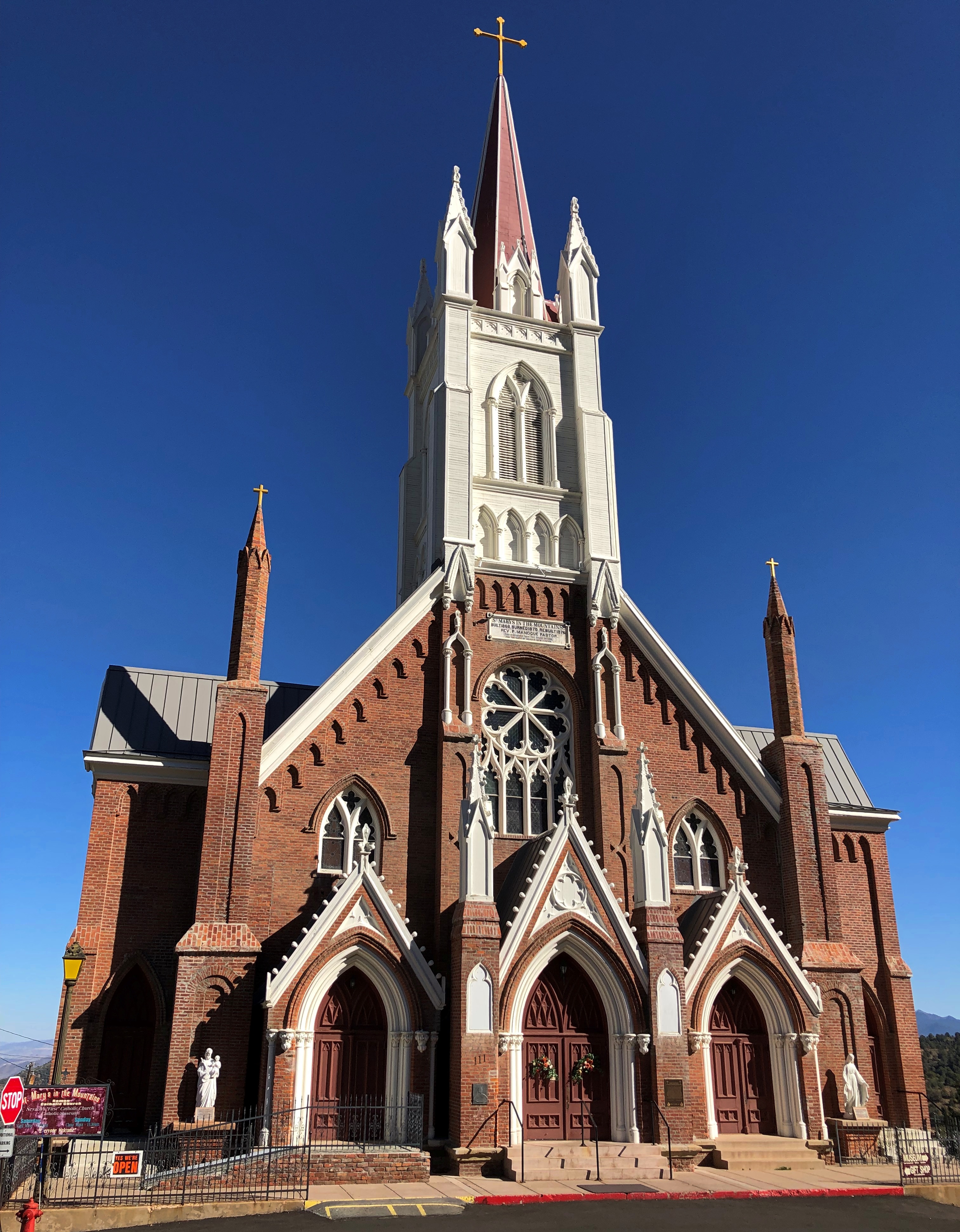
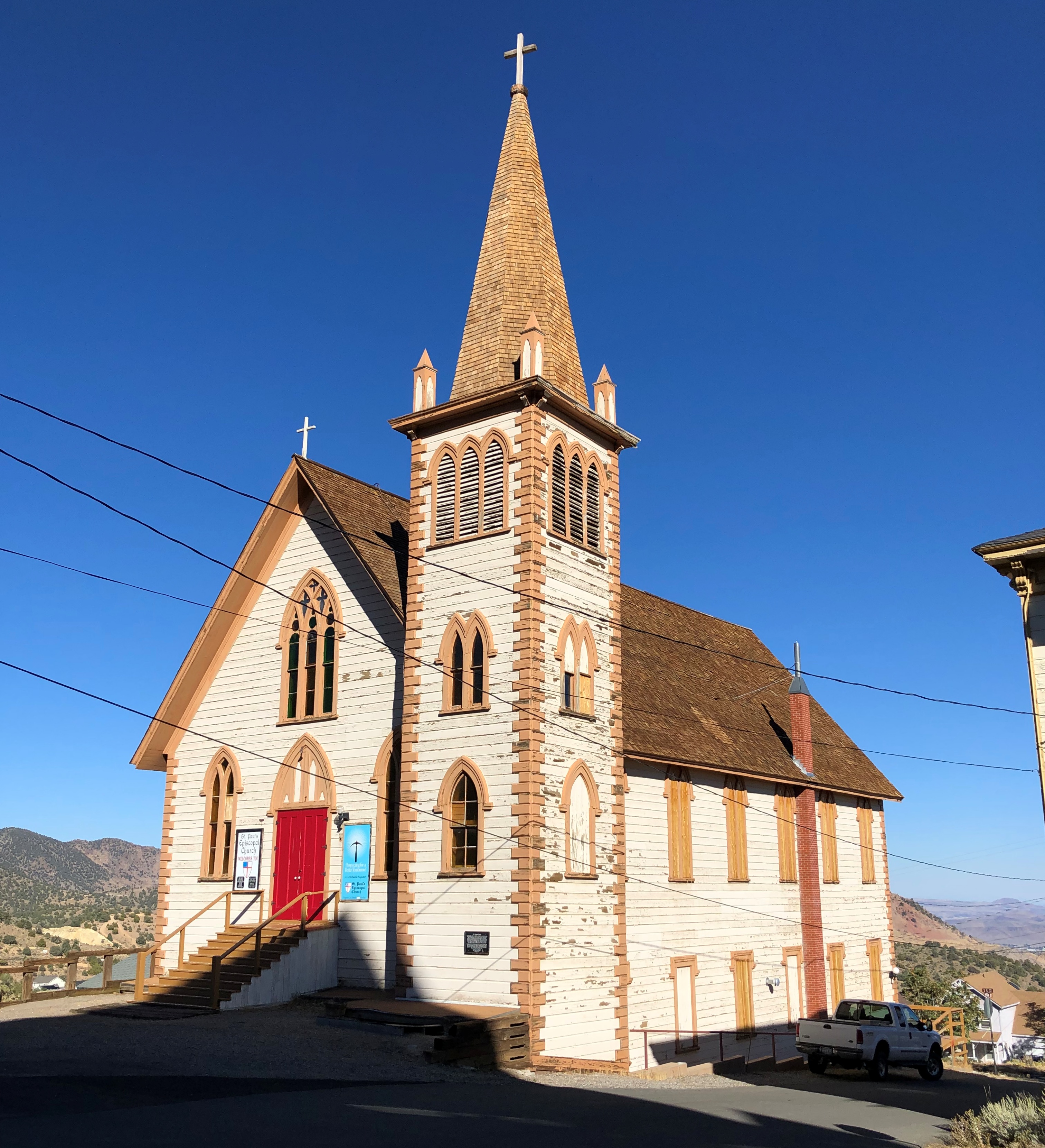
Well over a decade ago, during a summertime visit to San Antonio, I drove to the west side of the city to see the Basilica of the National Shrine of the Little Flower, which I’d never seen or even heard of before, despite growing up in that city. It was very hot that day, as it tends to be that time of the year, so I didn’t linger outside to take many pictures, though I snapped a few marginal ones.Basilica of the National Shrine of the Little Flower

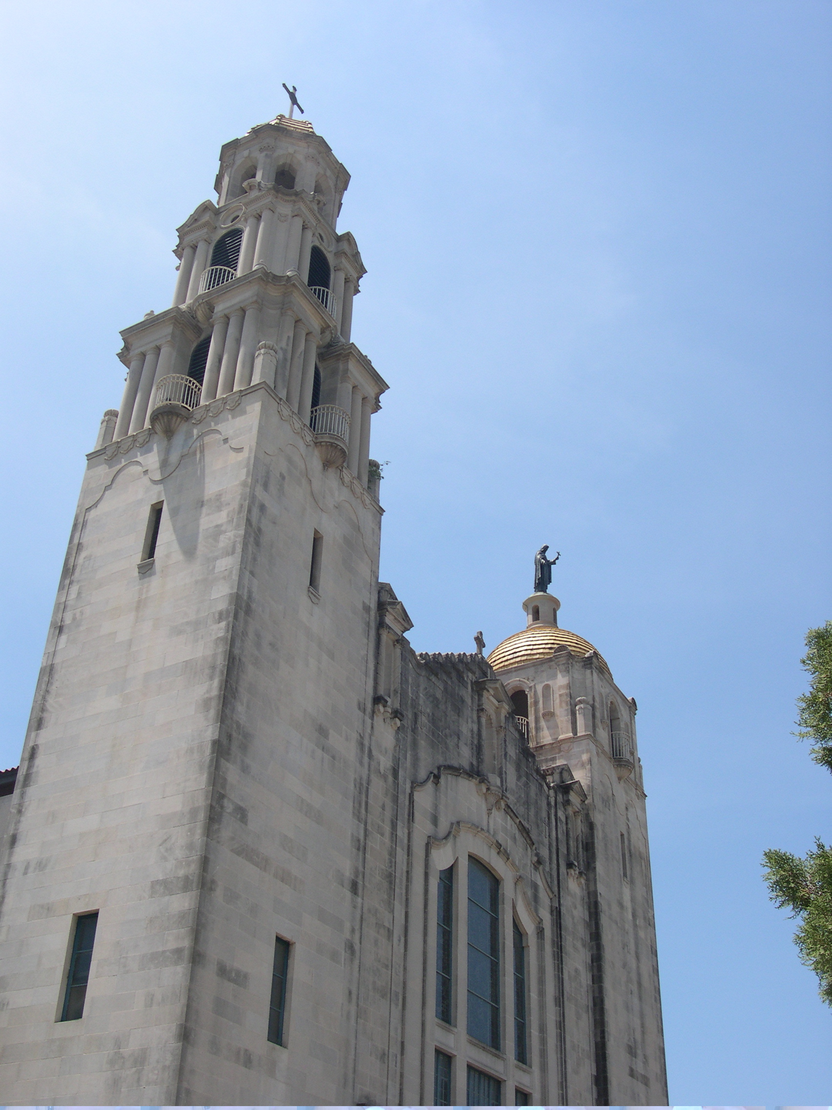
This is a better image. I’m not sure at what point I realized that the basilica in San Antonio and the National Shrine of St. Thérèse in Darien, Illinois, were dedicated to the same person, Thérèse de Lisieux, but I know now. And whatever else I know about St. Thérèse, I also have some sense of her immense popularity as a saint, inspiring edifices around the world in her honor.

We arrived at the Darien shrine just before noon on December 29, an overcast but not especially cold day. Above freezing, anyway. There it is, I told Yuriko.Shrine of St. Thérèse Museum

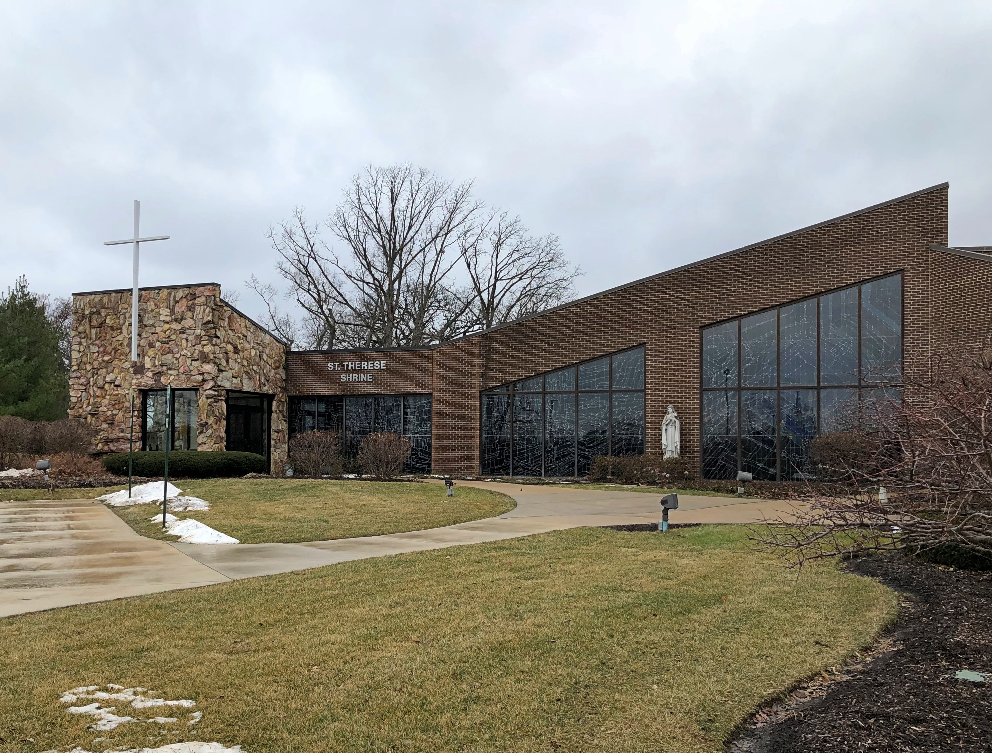
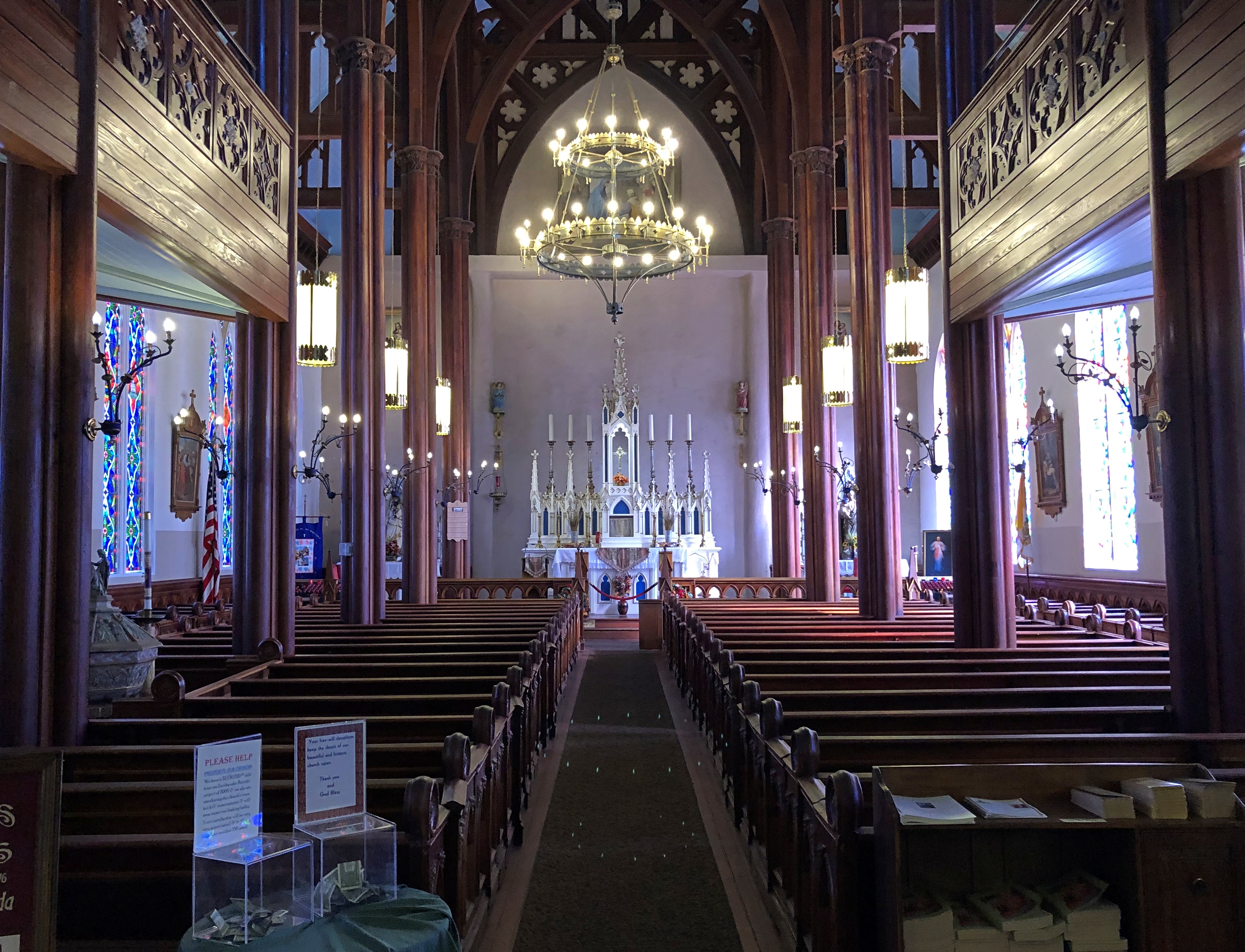
So we went in. A few minutes passed before I realized that we not in the shrine, but in the nearby museum building, which I believe was the shrine before a new one was completed a few years ago. The sign on this building makes me think that. If so, there needs to be a signage update.

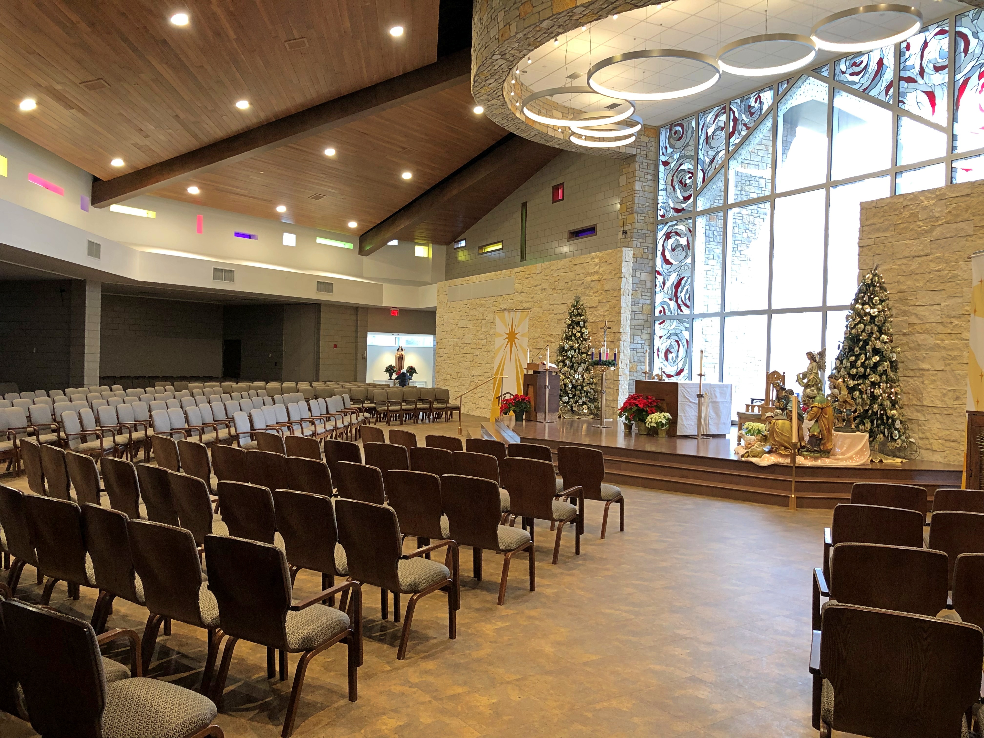
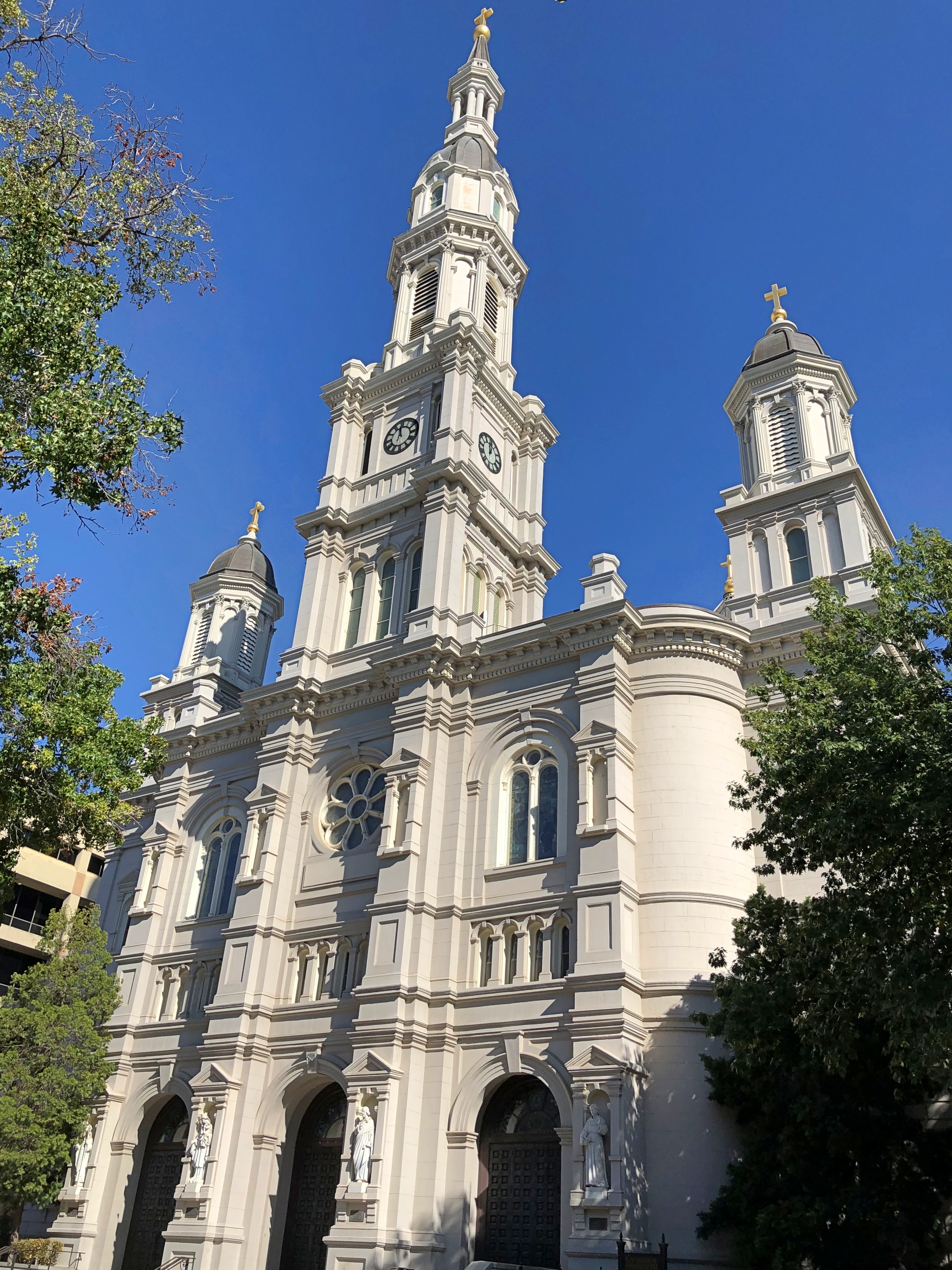
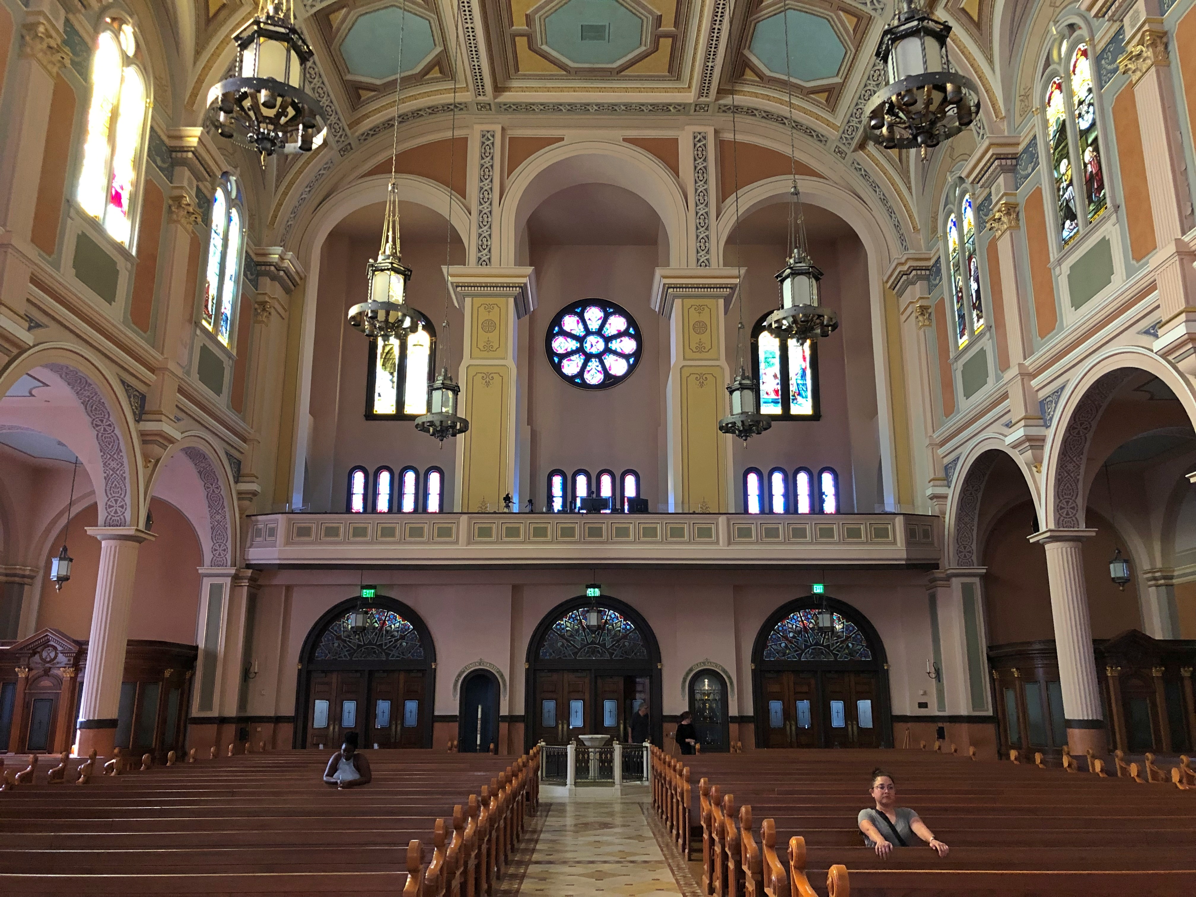
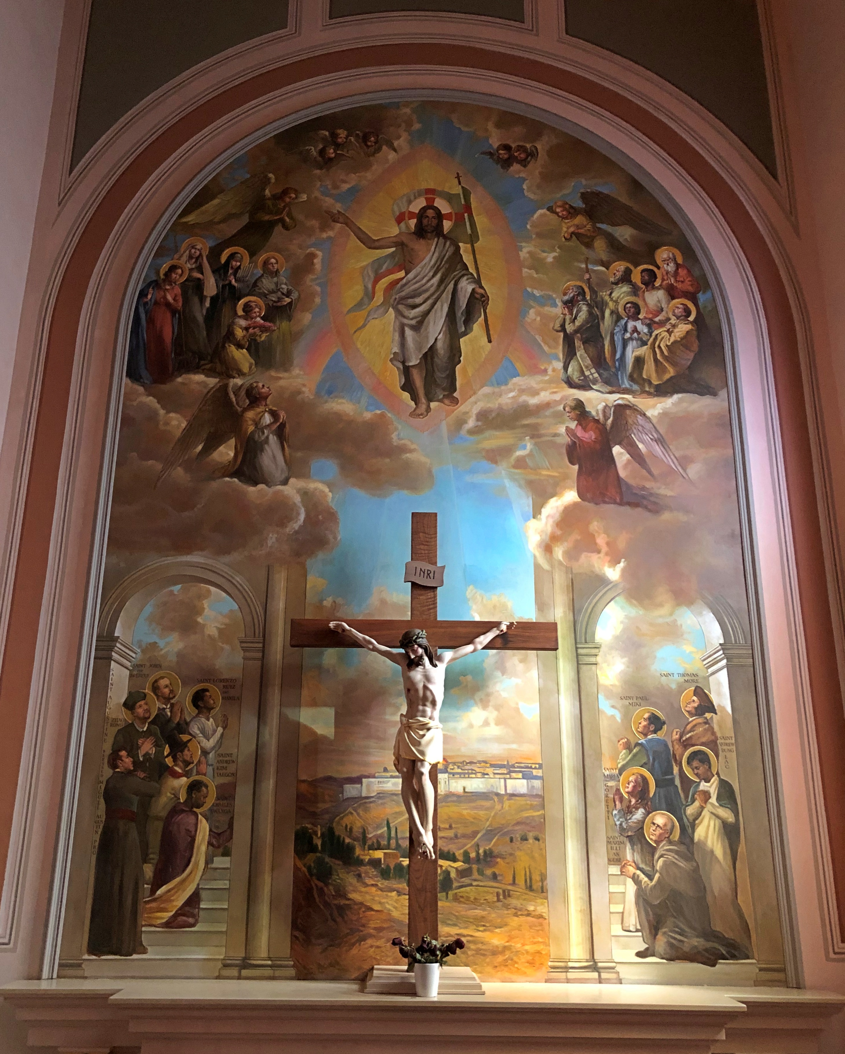
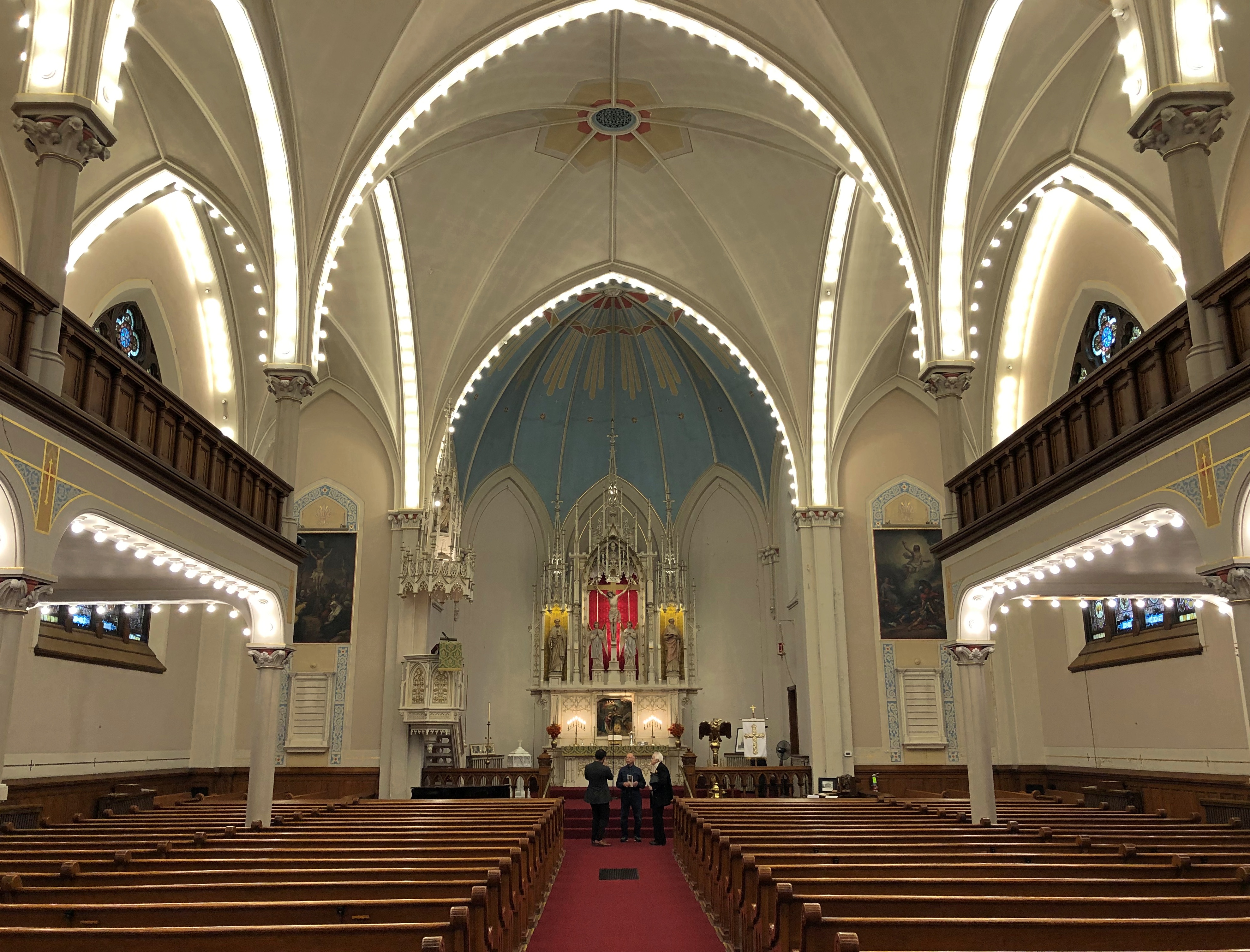
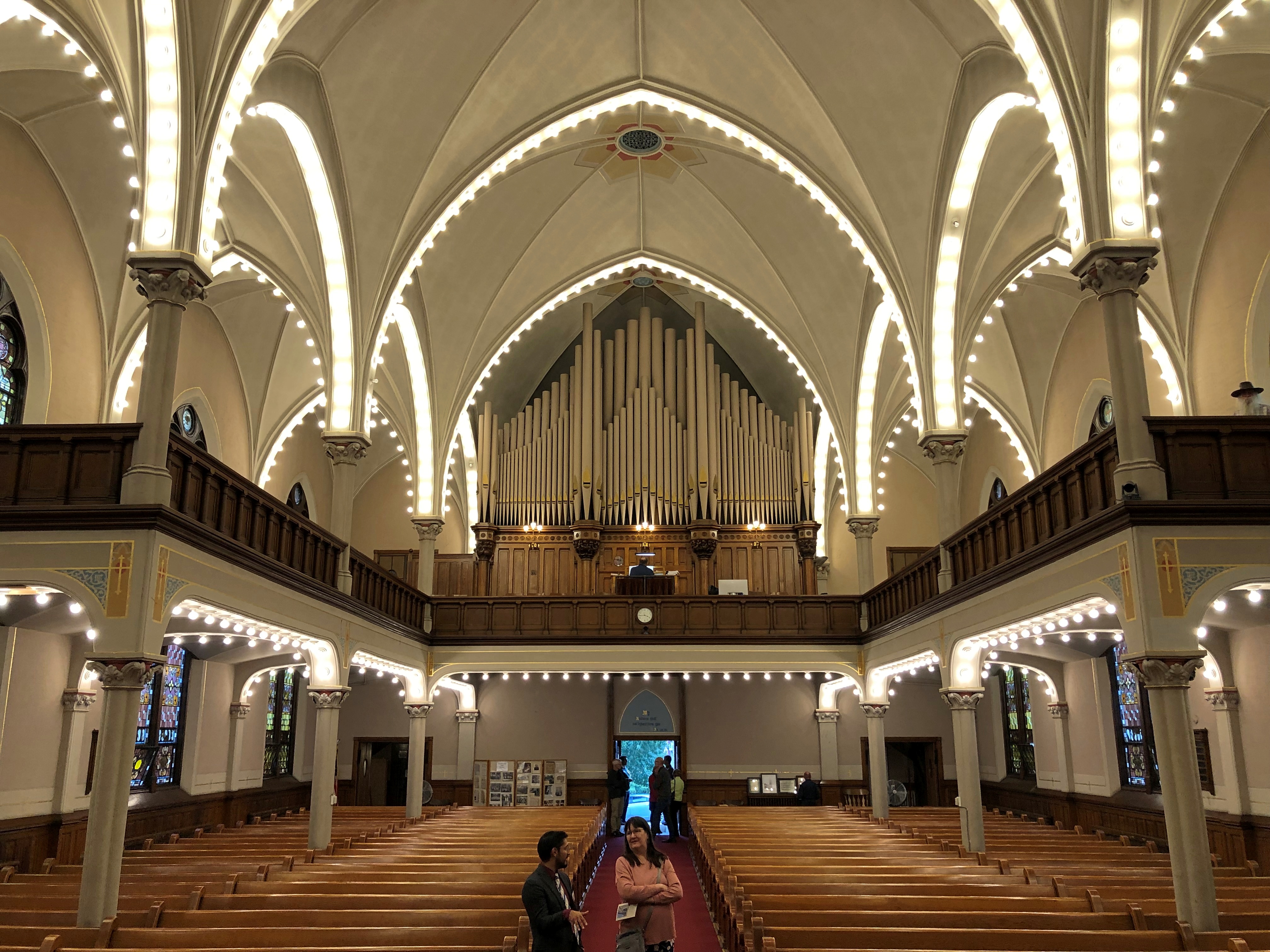
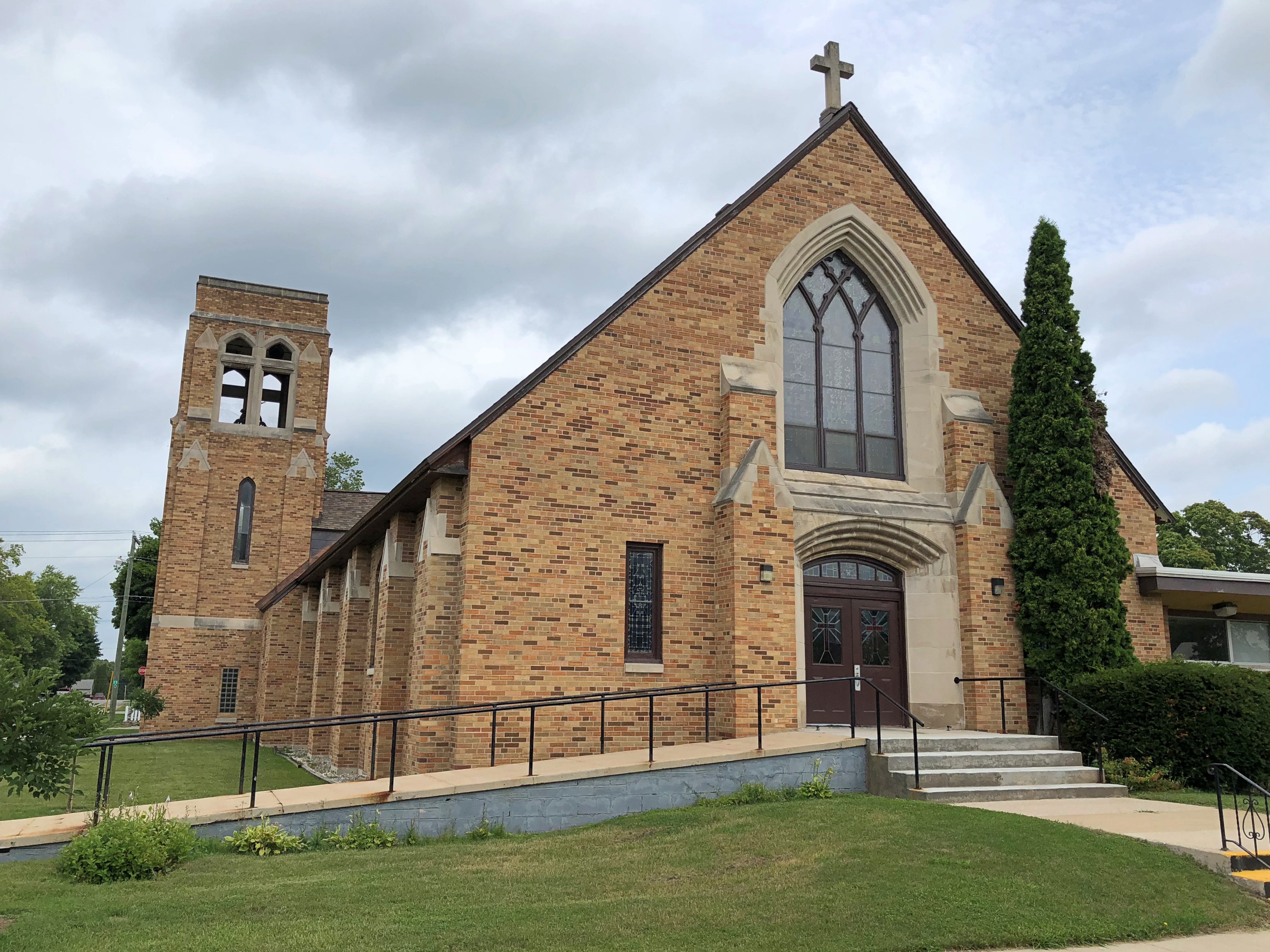
This is the current shrine.Shrine of St. Thérèse, Darien

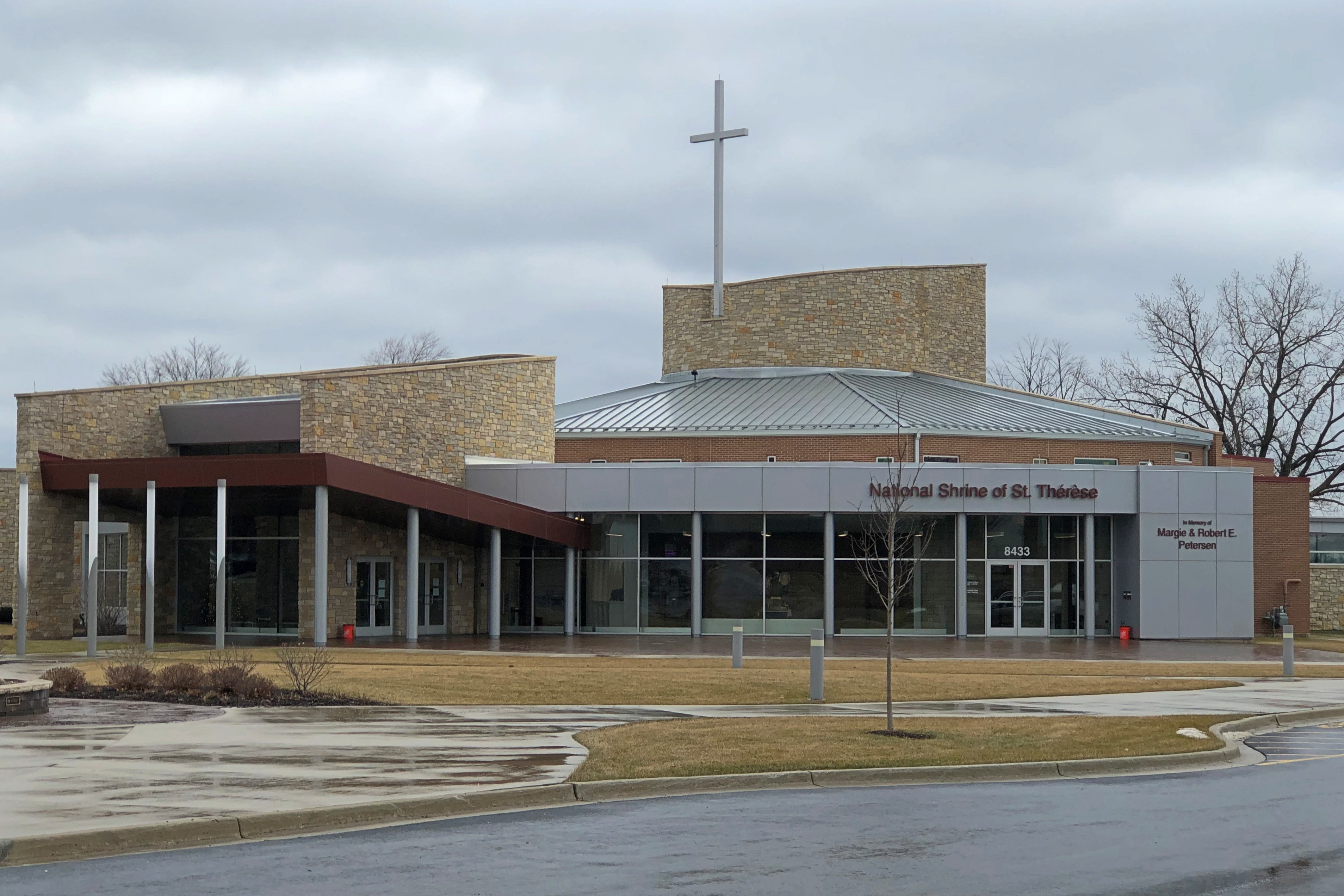
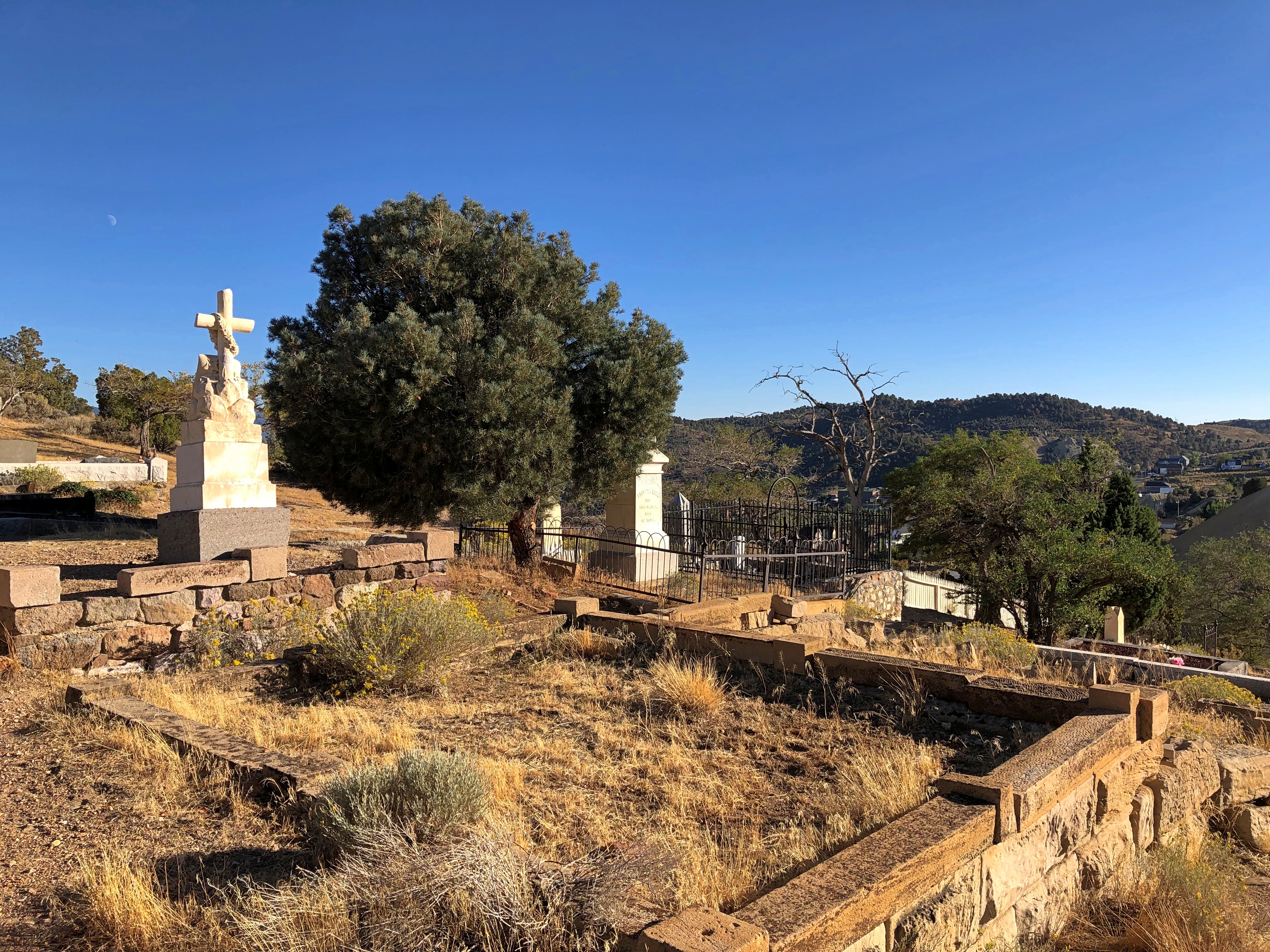
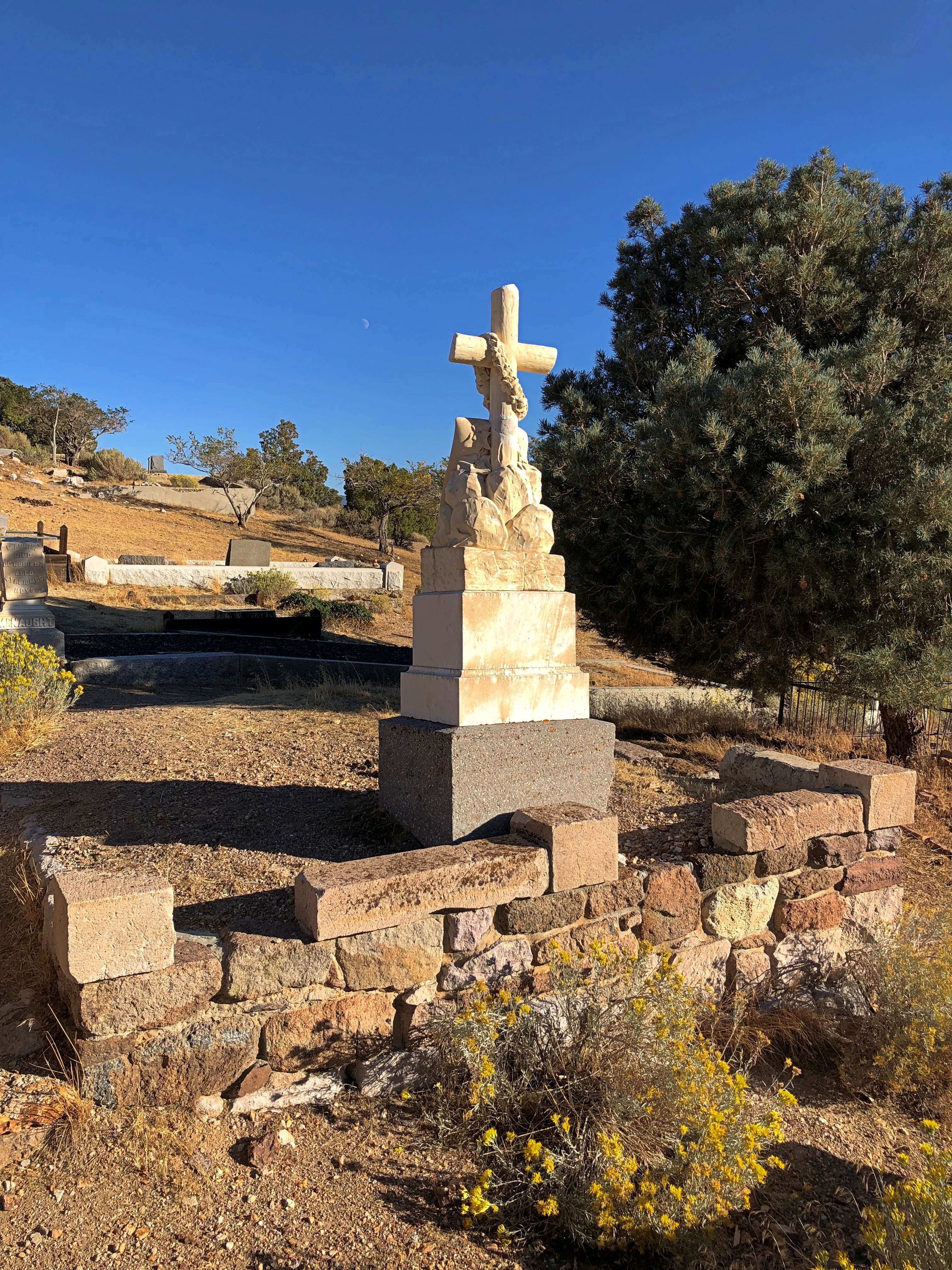
In effect, this is the fourth shrine to her that has existed in the Chicago area. The first two were in the city, a larger one succeeding the original as her popularity grew in the 1920s.

The church that housed the second shrine burned down nearly 50 years ago, but by the 1980s the Carmelites were able to find the scratch the build a third shrine out in the suburbs. The demographics were going that way anyway.

The Carmelites tasked Charles Vincent George Architects, based in nearby Naperville, to design the fourth and latest shrine, which was completed in 2018.Shrine of St. Thérèse, Darien Shrine of St. Thérèse, Darien

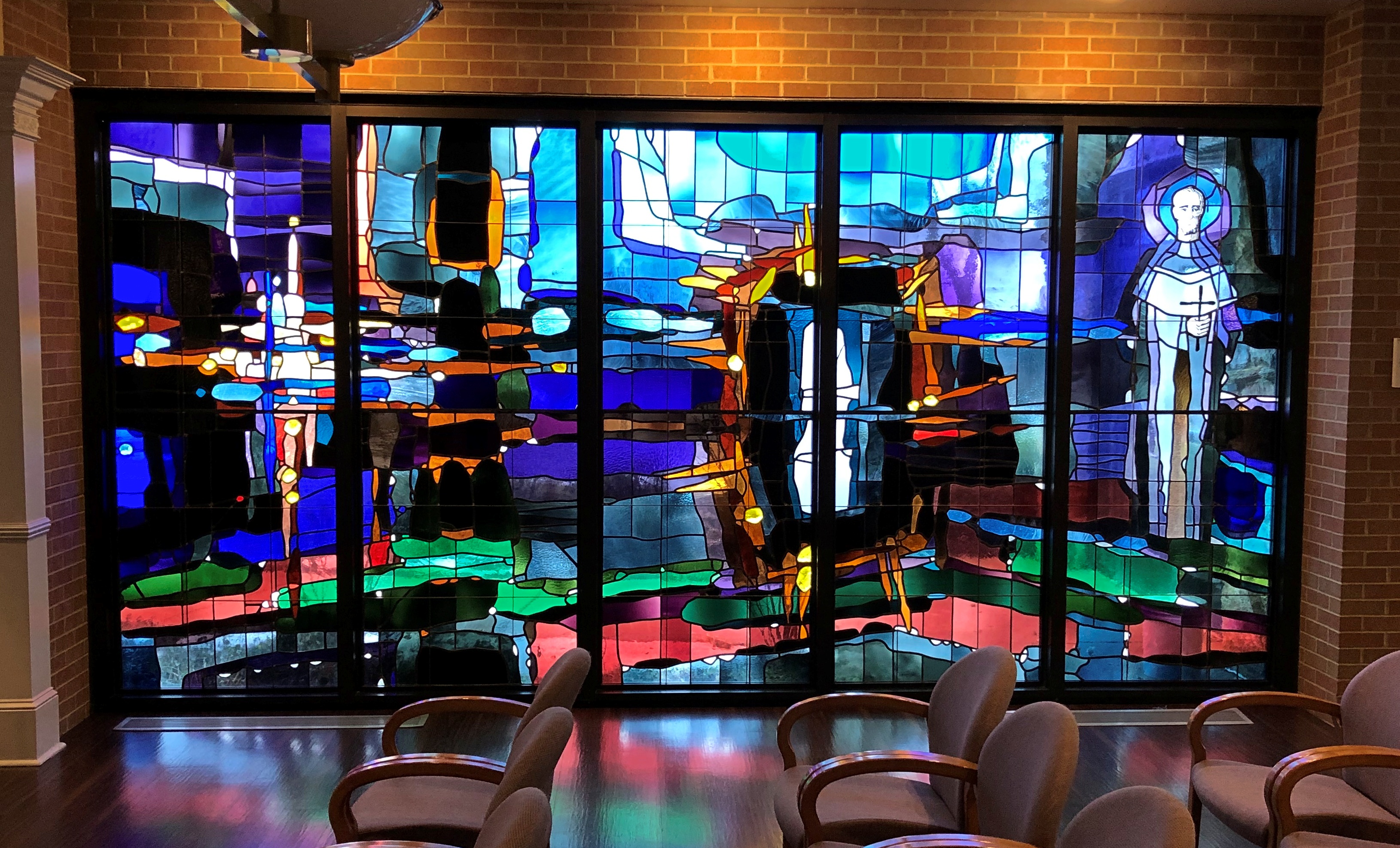
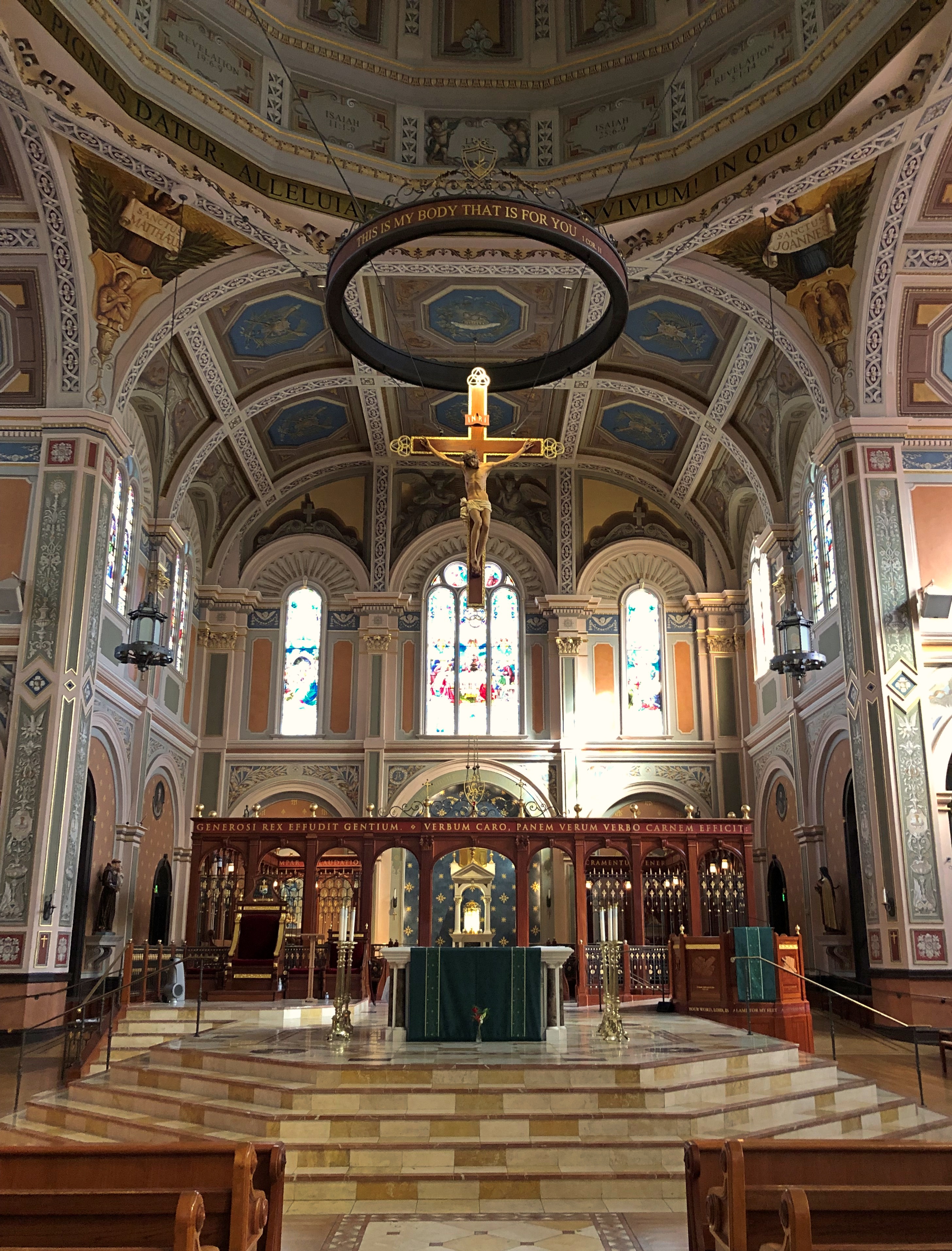
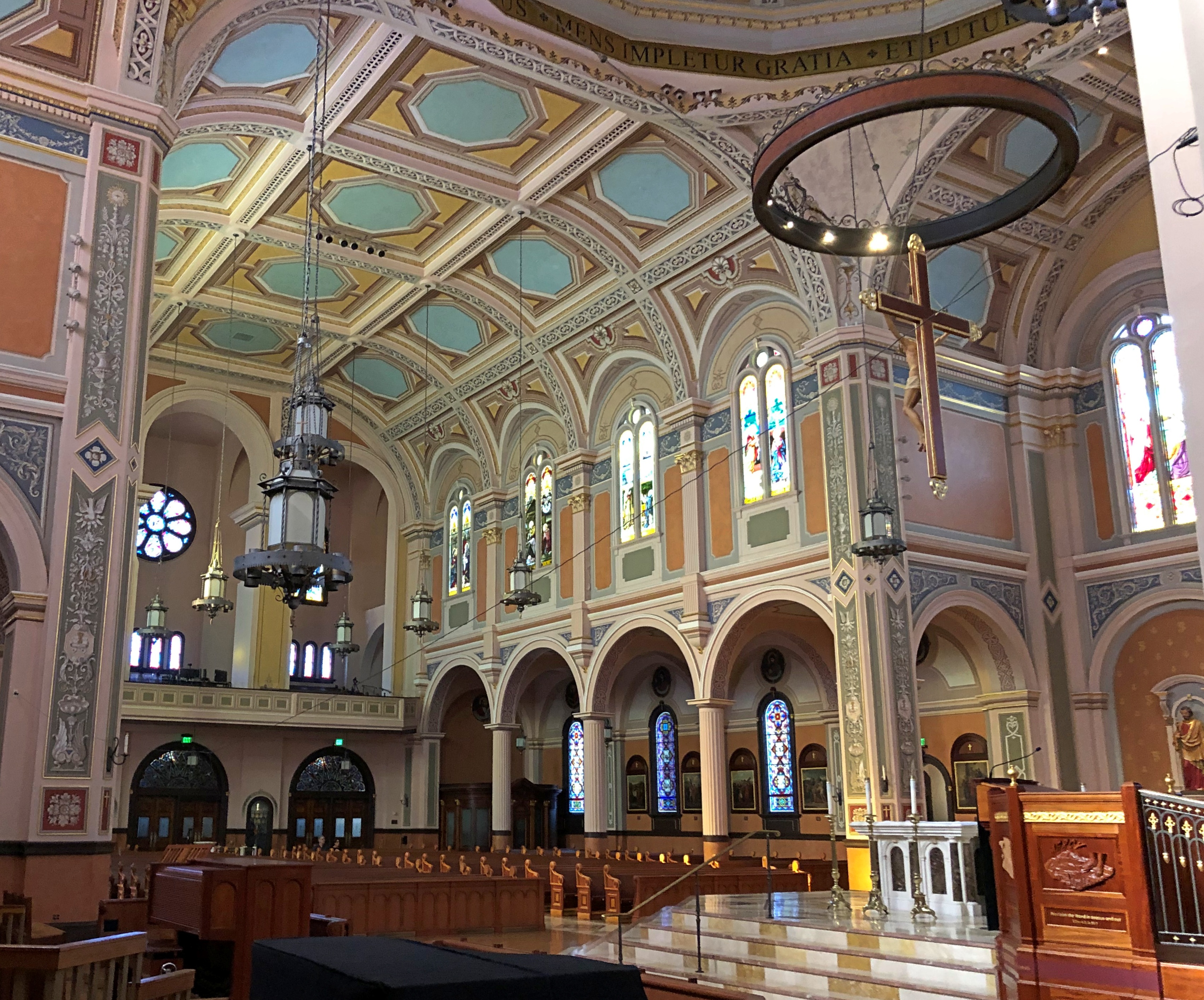
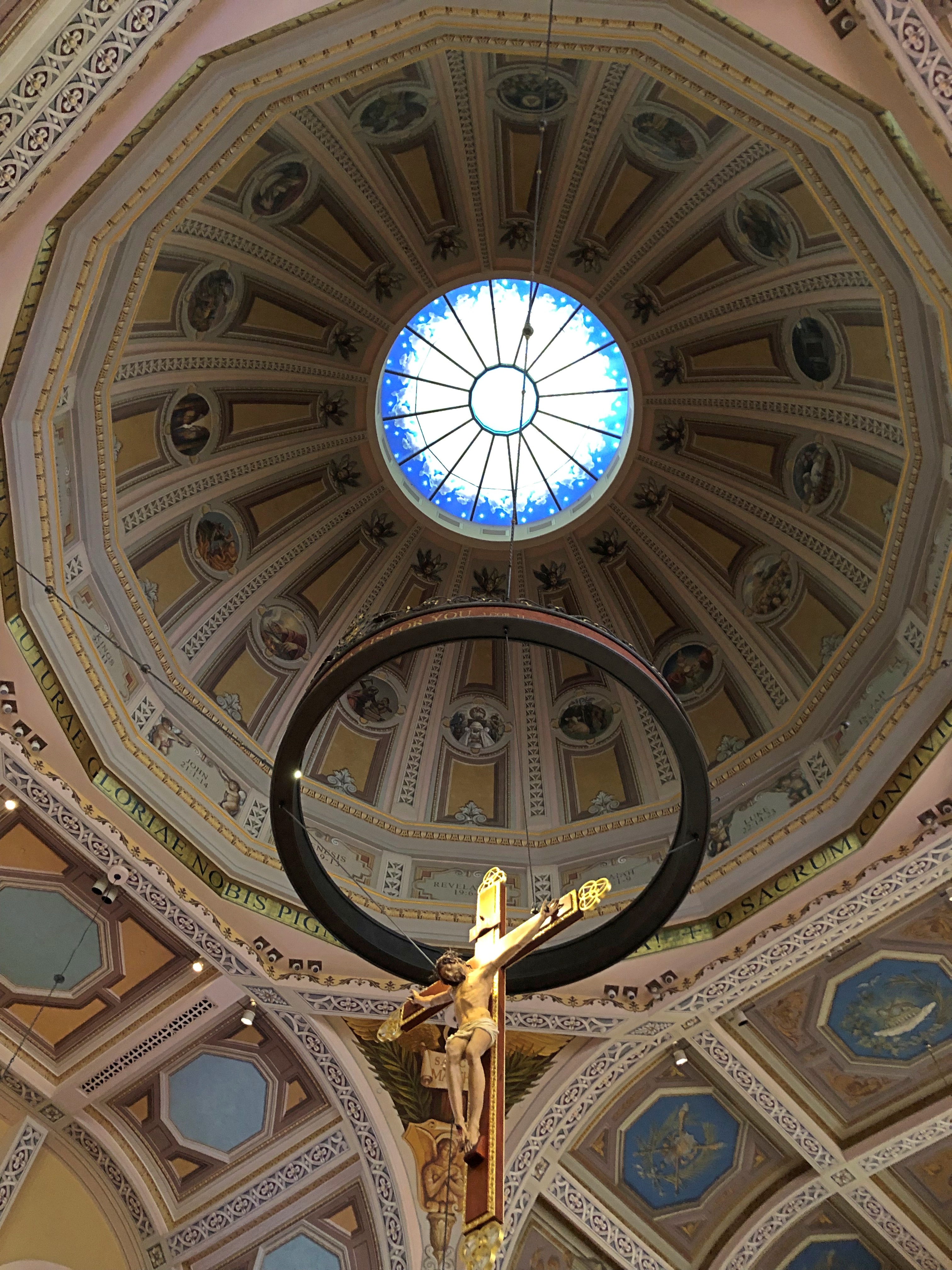
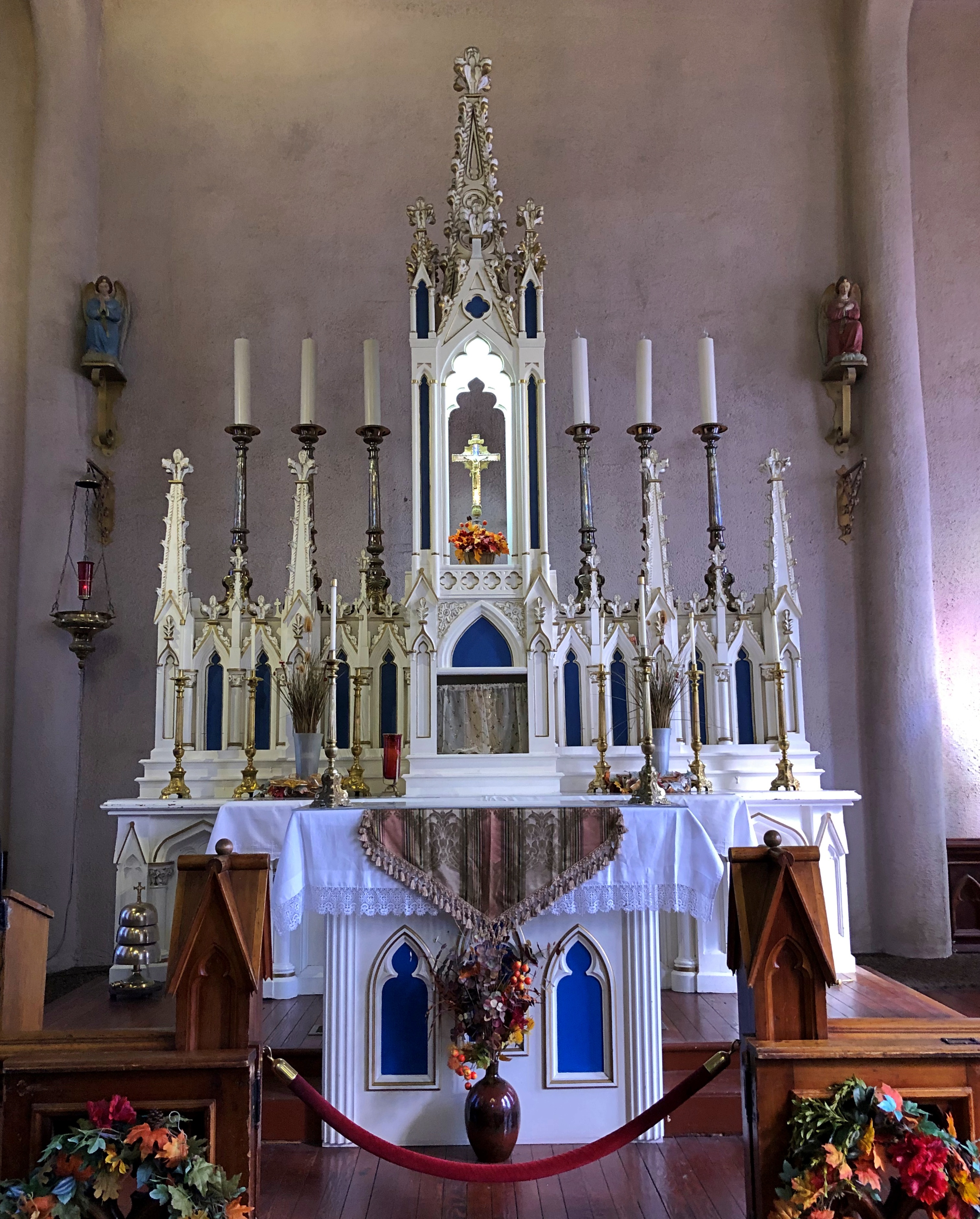
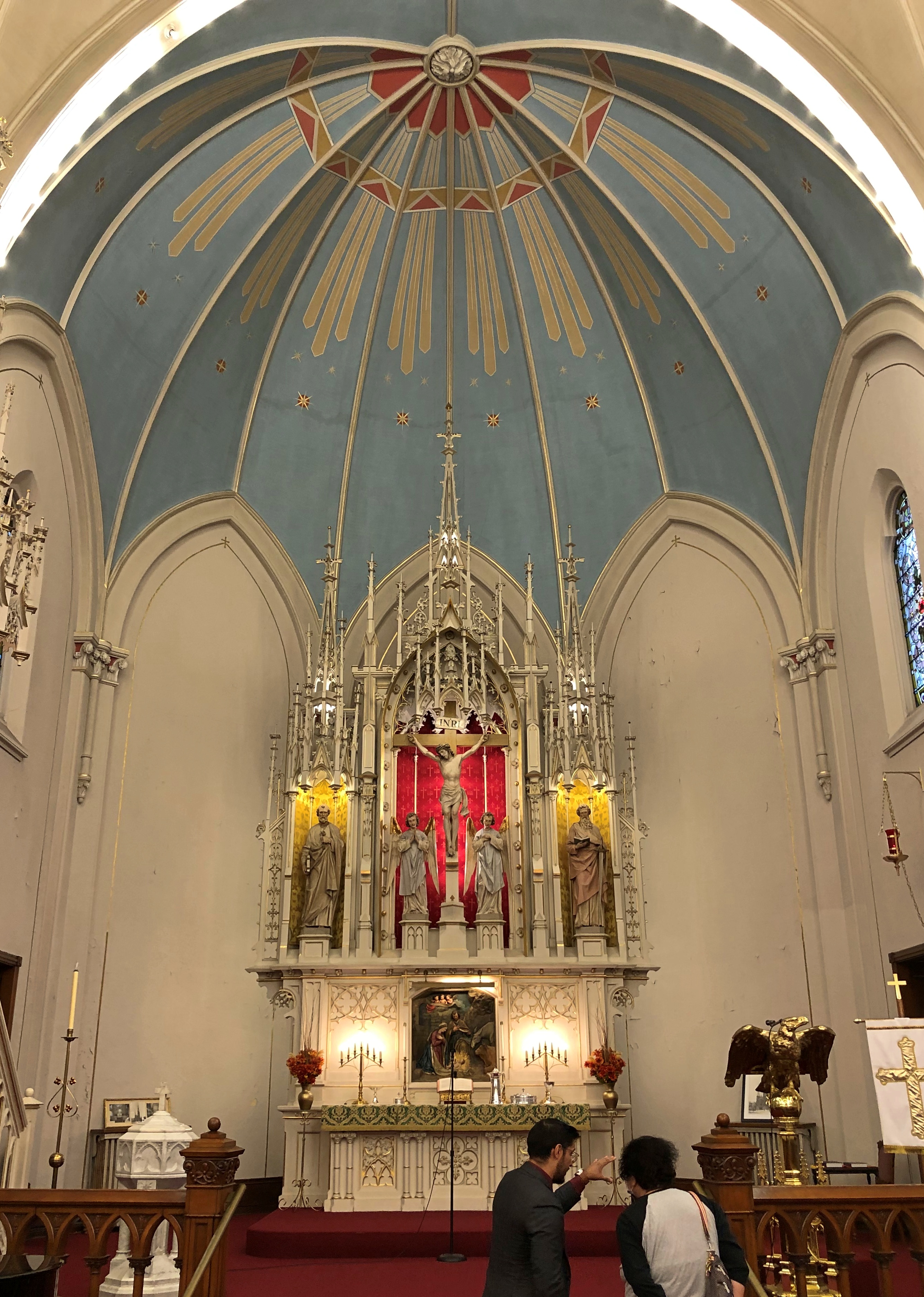
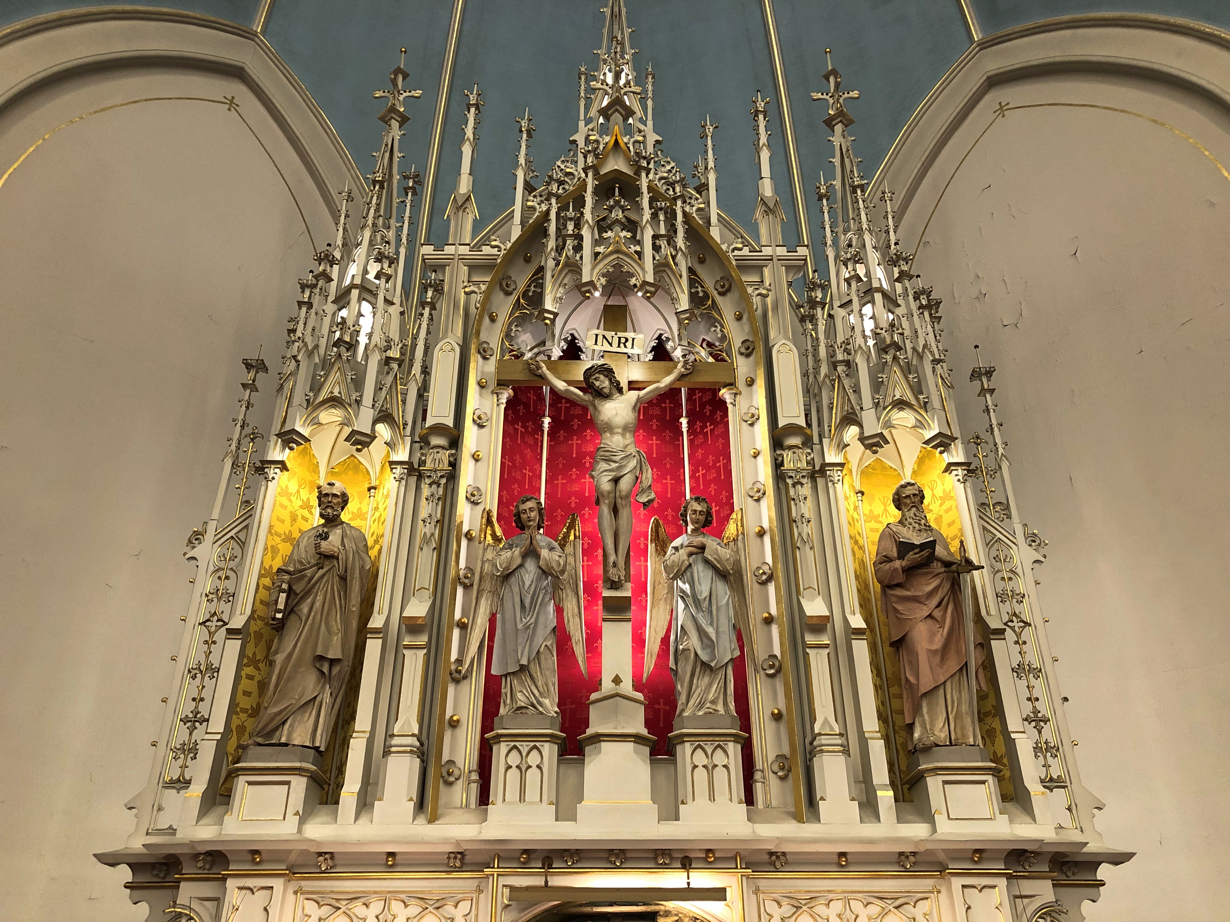
Behind the altar is St. Thérèse in glass.Shrine of St. Thérèse, Darien

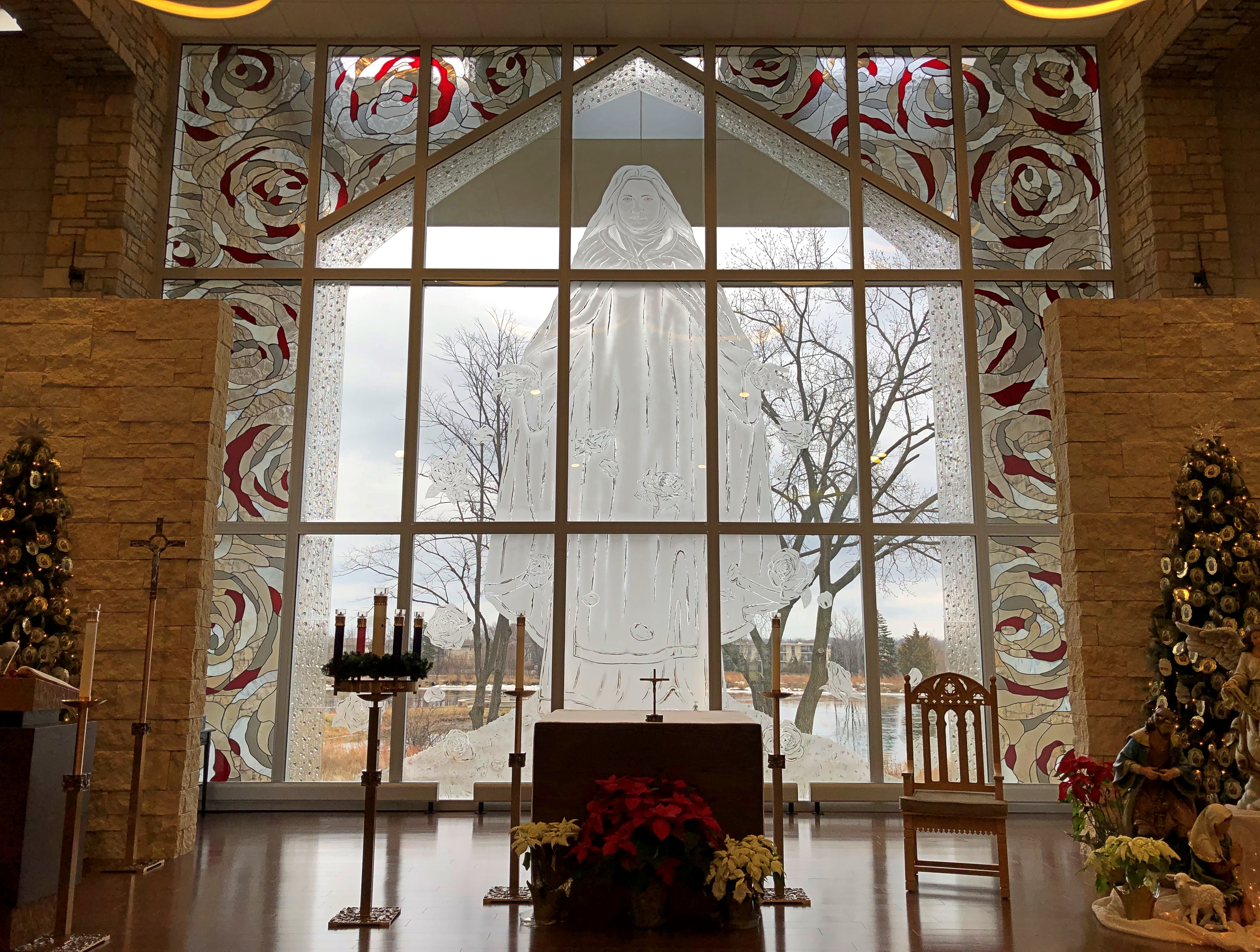
“The architectural solution pays homage to St. Therese throughout, from the main building’s shape, inspired by the unfolding petals of a flower, a nod to St. Therese’s nickname ‘Little Flower,’ to key structures, such as the plaza clock tower, reminding us of her clockmaker father, and the 24-column colonnade, serving as a symbol of St. Therese’s 24 years of life,” CVG notes.

“As St. Therese had humble beginnings, special attention was taken to provide simple building materials using stone, brick and the limited use of wood for construction materials. The entire building layout focuses on the center altar and image of St. Therese etched in the chancel glass wall, through which there are views of her statue built out into the lake behind the chapel.”

In December, St. Thérèse is the star of Christmas trees in the shrine.National Shrine of St. Thérèse

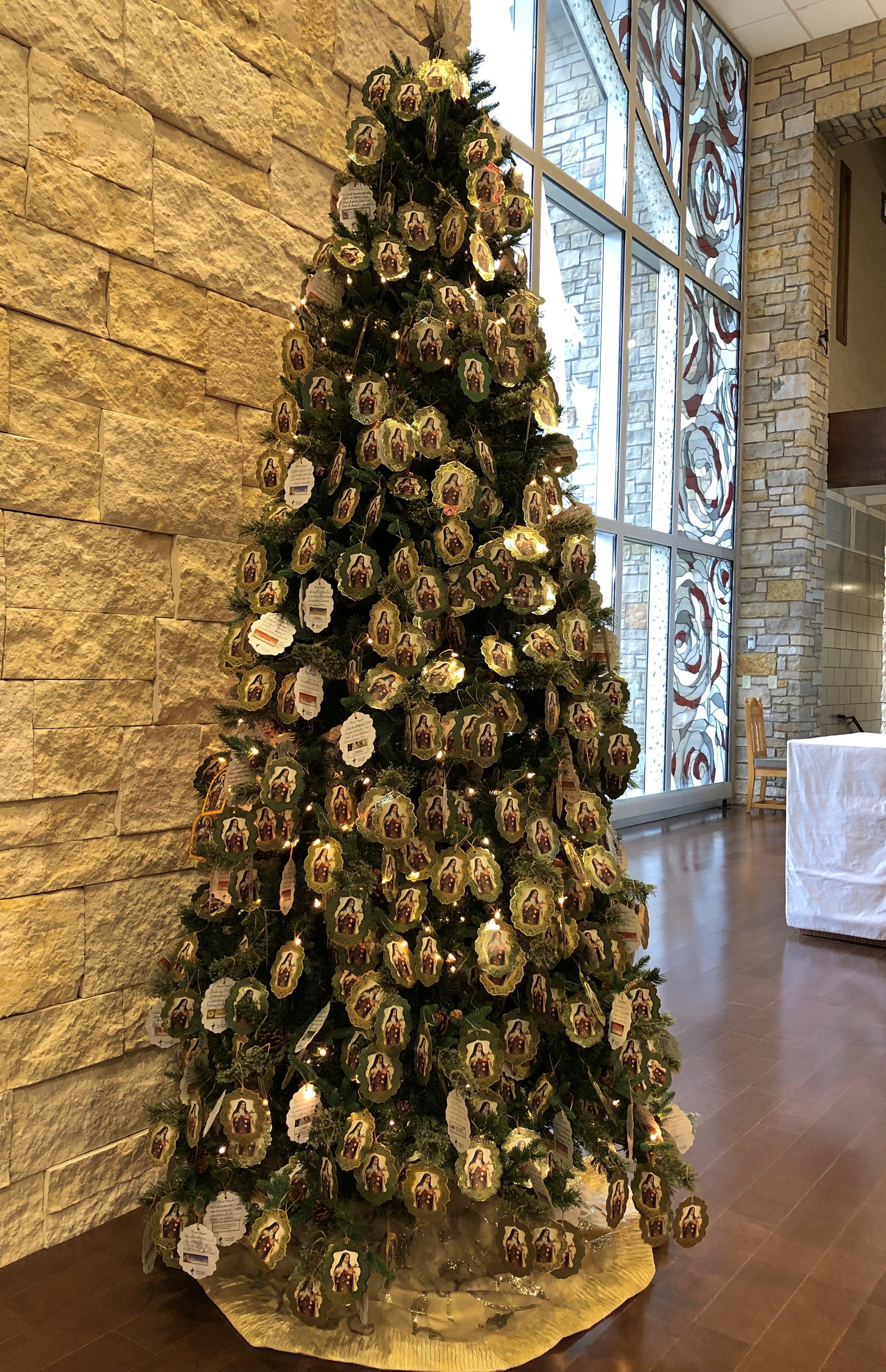
I don’t think I’ve ever seen a tree decorated with prayers before, but there it was. All of them to the saint.National Shrine of St. Thérèse

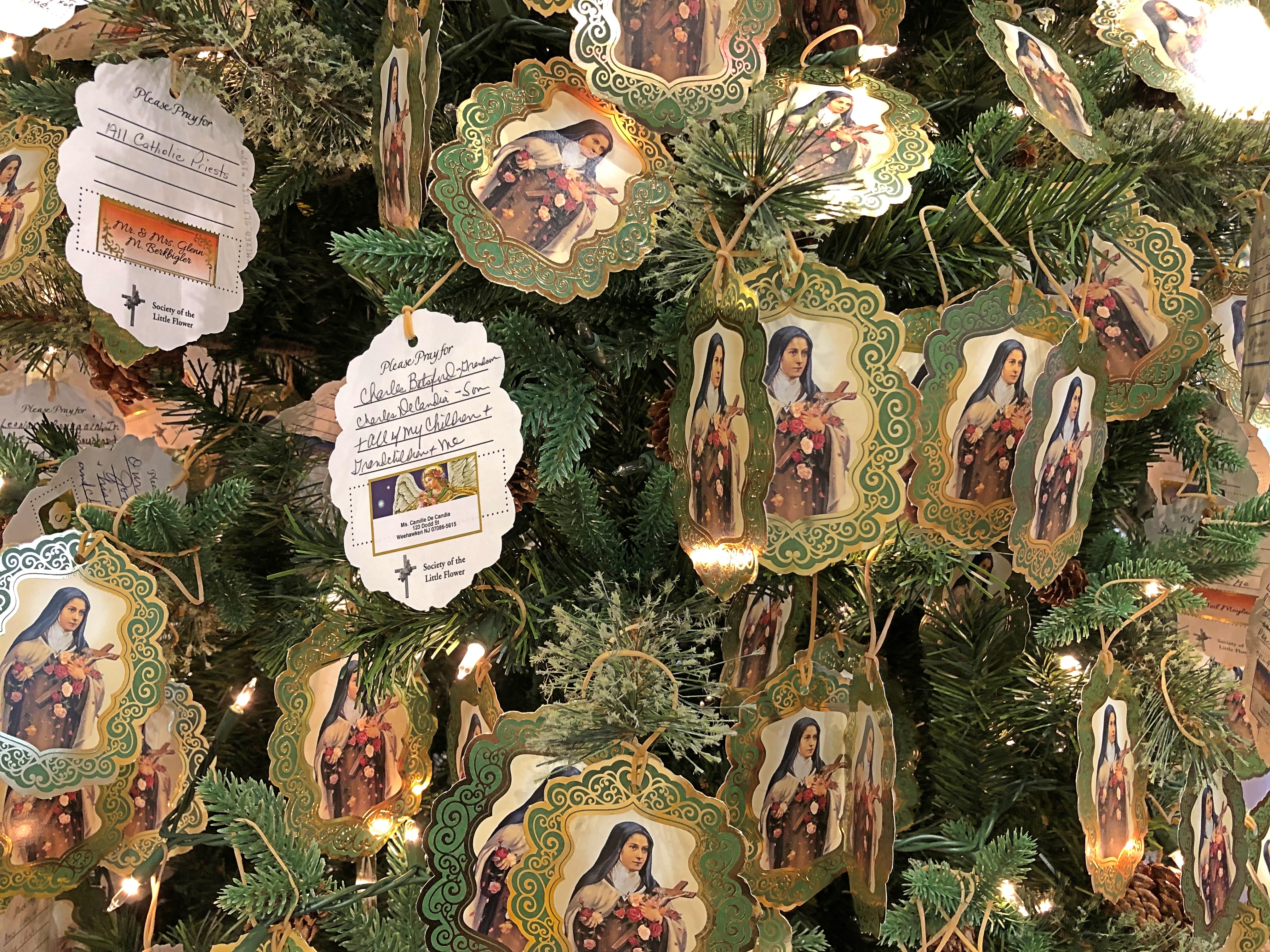
The museum included some seasonal features as well, such as a nativity under a more permanent woodwork depicting the saint.National Shrine of St. Thérèse (museum)

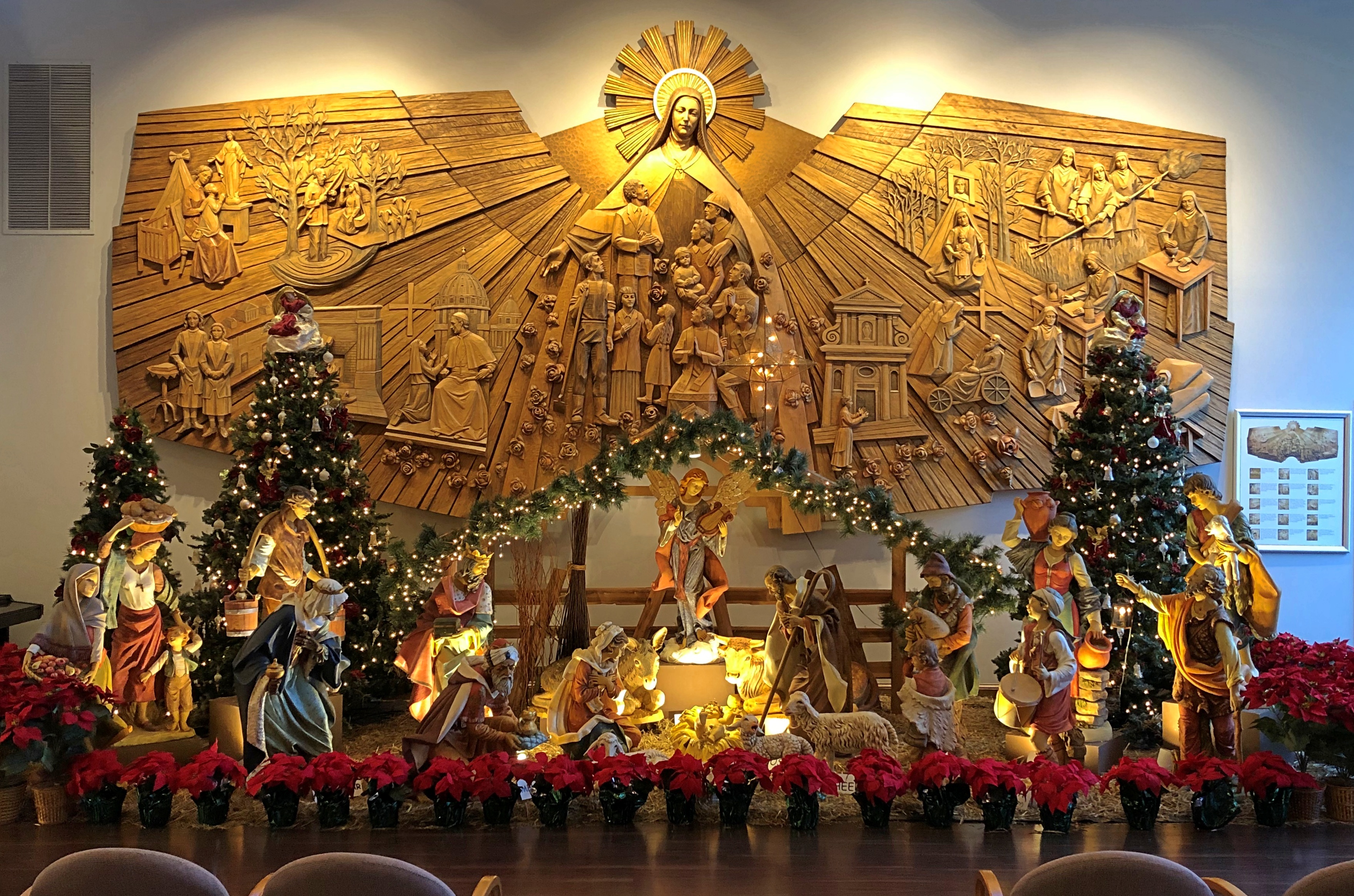
Just in case anyone is uncertain, labels come with the nativity scene. Guess that’s helpful for kids who have just learned to read, but I as far as can remember as a kid, the figures were something that everyone knew. Essential Christmas lore, even for public school children. Maybe that’s not true anymore.National Shrine of St. Thérèse (museum)

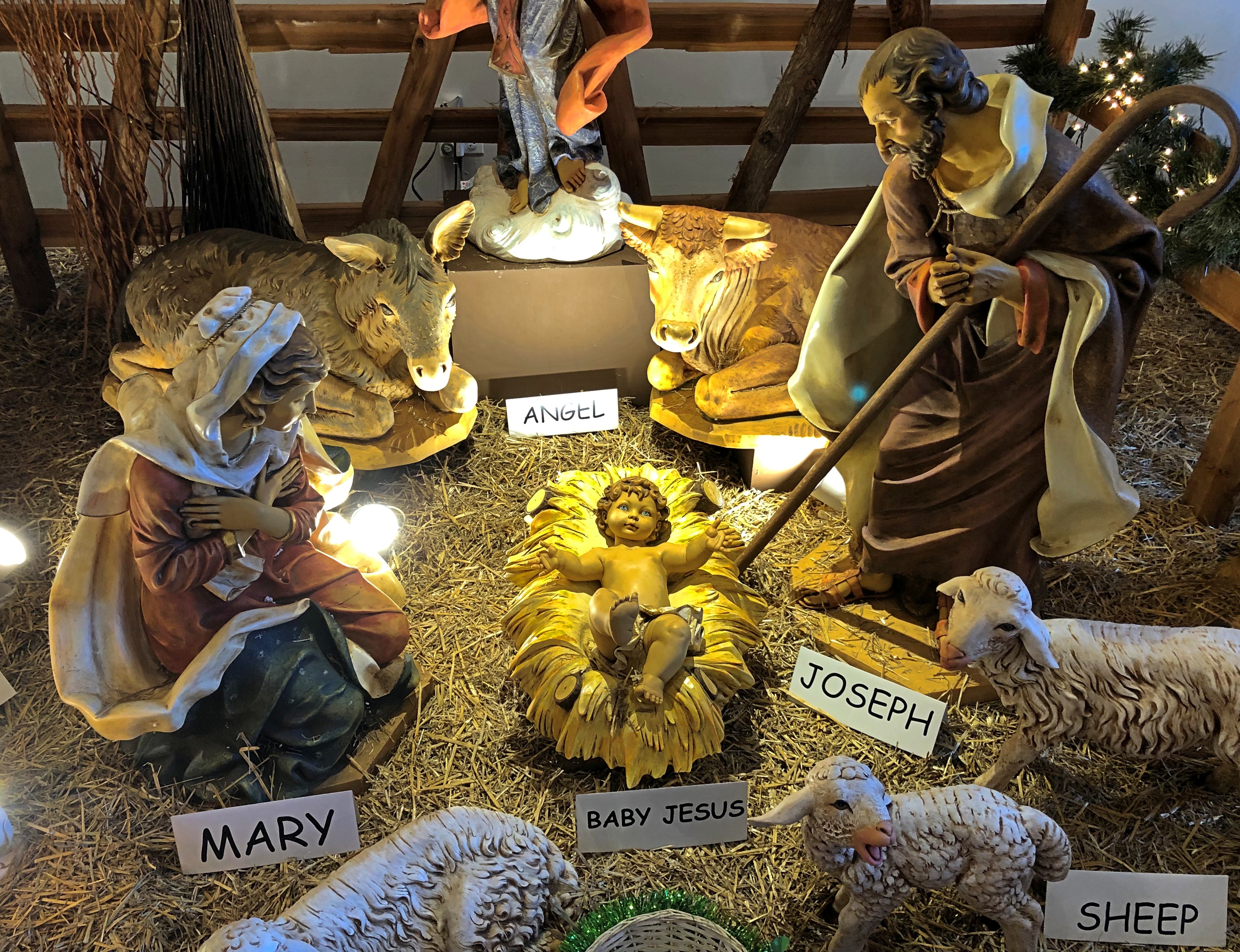
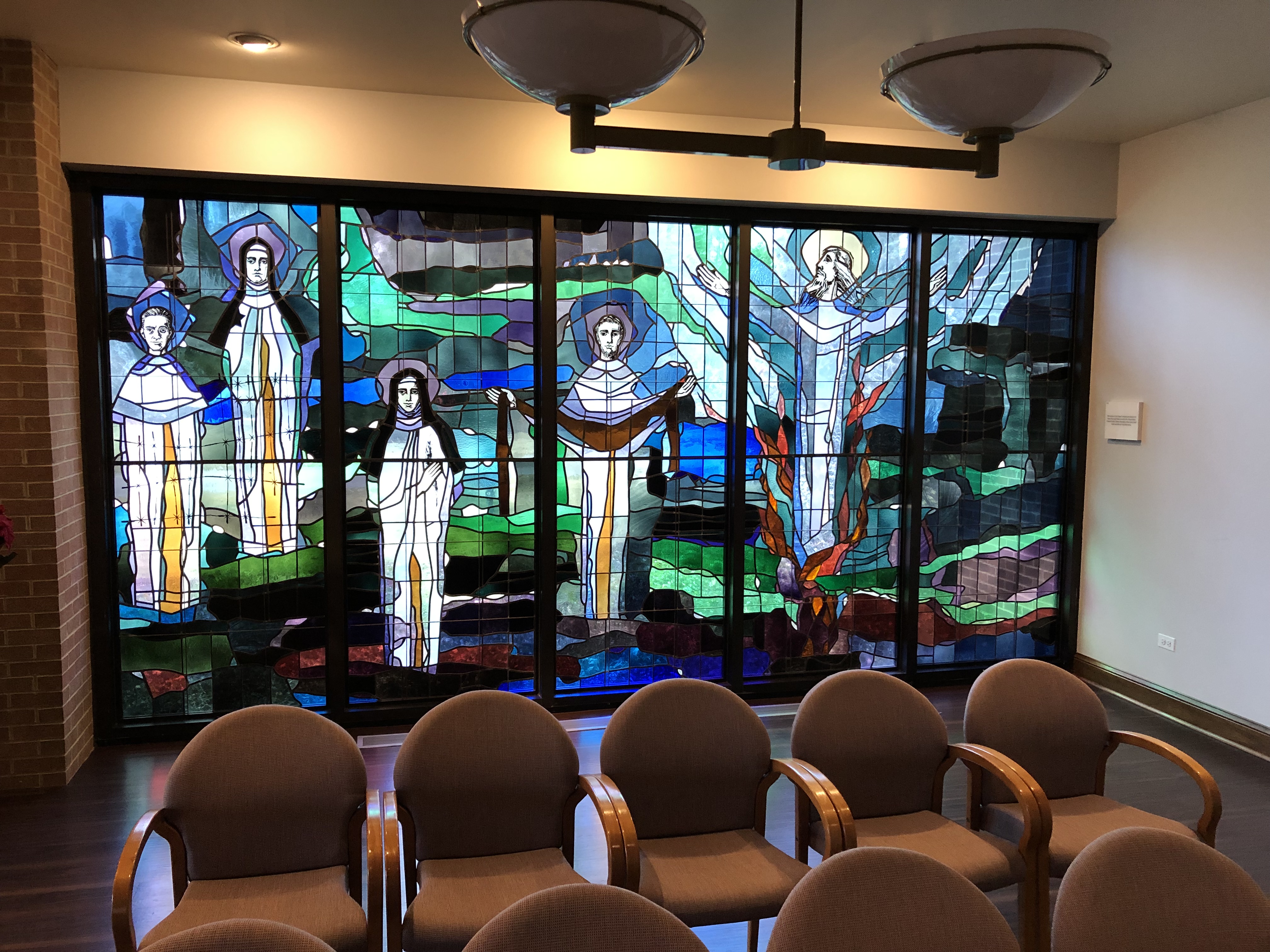
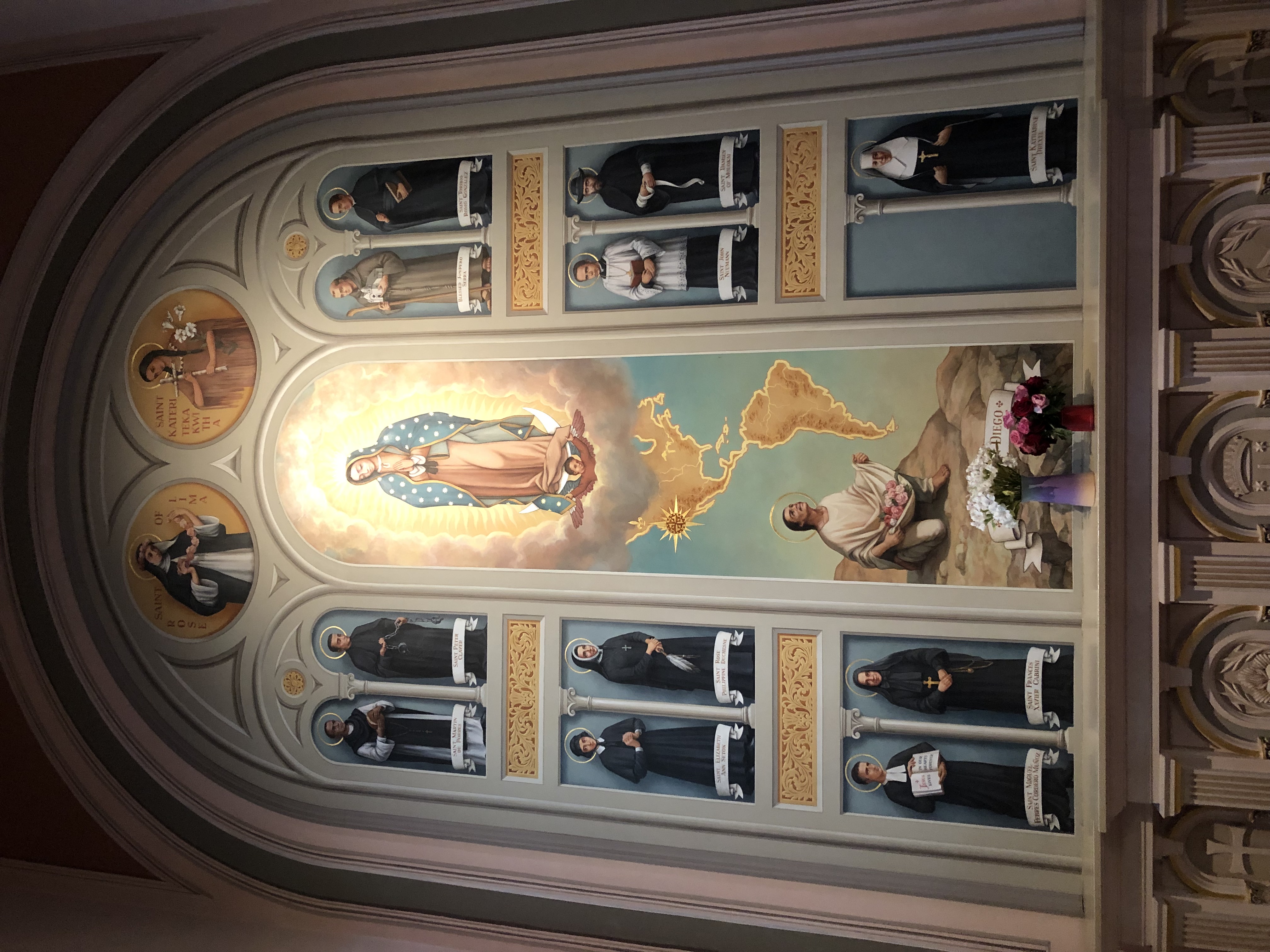
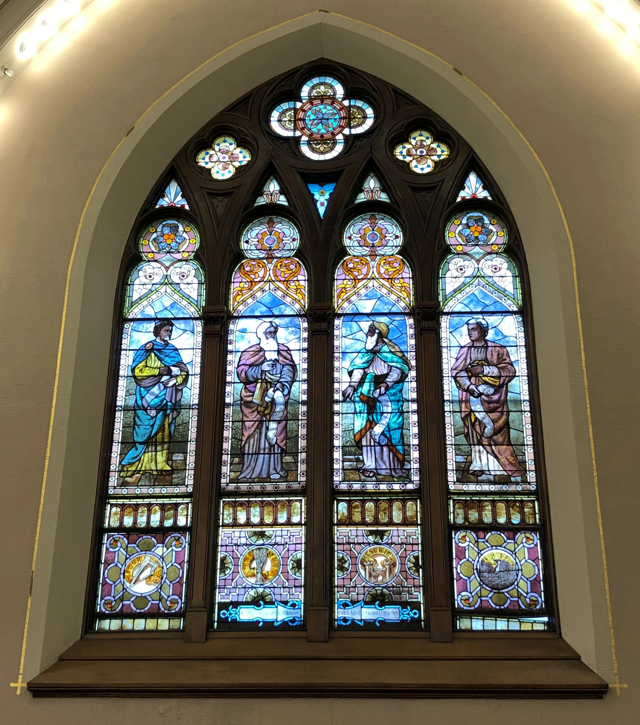
Modern stained glass. Some nice abstractions plus holy figures.National Shrine of St. Thérèse (museum) National Shrine of St. Thérèse (museum) National Shrine of St. Thérèse (museum)

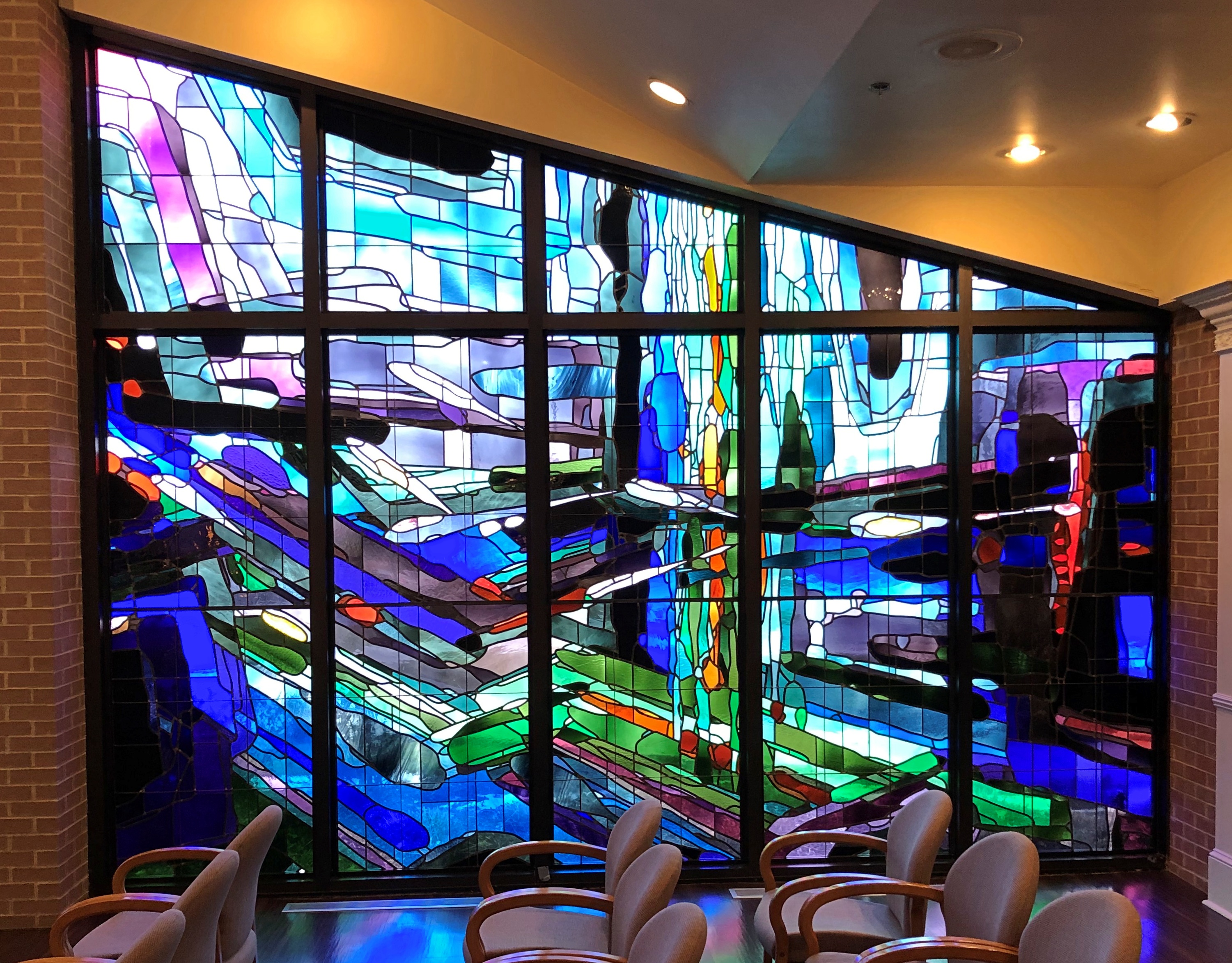
What would a saint’s shrine complex be without some relics?National Shrine of St. Thérèse (museum) National Shrine of St. Thérèse (museum)

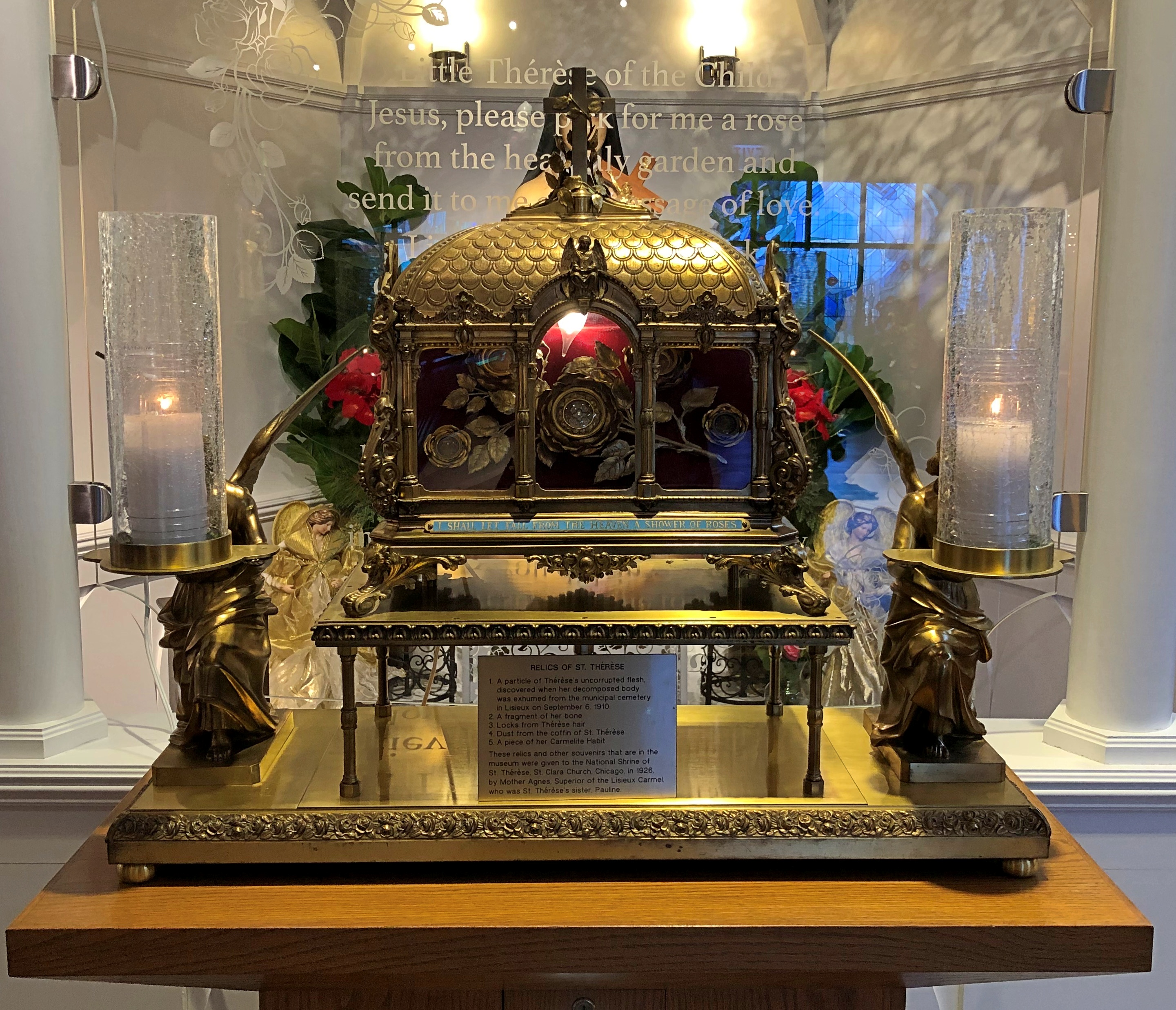
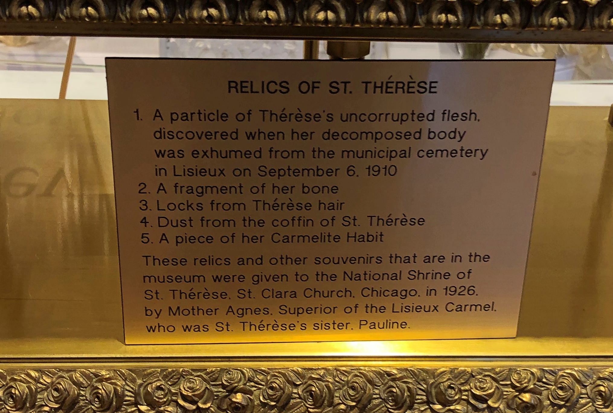
I didn’t know dust could count as a relic, but I’m not up on what can and can not constitute a relic. The museum also has a few relics of Thérèse’s parents, Louis and Zélie Martin, who happen to be saints as well.

“Louis had tried to become a monk, but was rejected because he could not master Latin,” a sign in the museum says. “Zélie Guérin tried to become a Sister of Charity, but was rejected due to poor health.”

They couldn’t take vows, but apparently did the next best thing: produce five daughters (the survivors of nine children), all of whom became nuns.

Plan B Travels at the End of ’22

Since Tucson was a no go, we decided to spend the same three days, December 29 to 31, visiting new sights close enough to home to be at home, come bedtime. A suite of day trips, that is. If you can’t go far, go near.

On the first day, we drove southward to near our old west suburban haunts, stopping first in Darien, Illinois, which is home to the National Shrine of St. Thérèse. I’d visited the shrine by myself at some point ca. 1999, but took no notes and made no photos, so I didn’t remember much. Besides, I’d read that a new shrine building was completed only in 2018, so it counted as a new place for me.

I’d also forgotten that Thérèse of Lisieux is also known as the Little Flower of Jesus. The entrance of the new shrine announces that, silently, as you enter.Little Flower of Jesus

Later that day, we made our way further south to the Midewin National Tallgrass Prairie. Strictly speaking, we’d been there before as well, all the way back in the summer of ’04. I told Yuriko we’d been there, but she didn’t remember. Maybe I remember because I spent a lot of time that day pushing Ann’s stroller along an uneven grass path under a hot sun. I seem to have left that part out of my posting about it, however.

On the other hand, Midewin is large, with about 13,000 acres and 30 miles of trails open to the public, so I’m sure we walked through an entirely different part this time – one with visible reminders of the area’s time as the site of an ammunition plant.

The sun wasn’t an issue this time.Midewin National Tallgrass Prairie

On December 30, we made our way to a different sort of human environment: downtown Chicago, by way of driving to near O’Hare, parking the car, and riding the El into town. Without planning to, we found something downtown we’d never seen before, an art exhibit in the underground Pedway.Chicago Pedway Dec 30, 2022

The Art of American Victorian Stained Glass, featuring well over a dozen windows from the late 19th century and early 20th. Wow. Well hidden and remarkable.

We also spent time in other parts of downtown, including a walkabout inside holiday- season Macy’s. I’ve been there any number of times, of course, but this time I appreciated the place with new eyes. One conclusion: it ain’t no Marshall Field.

Well, some things are the same. Macy’s still has the holiday horns hanging on State Street.State Street Dec 30, 2022

One of these days, I ought to give State Street the Wall Street or William Street treatment, but I’d have to be by myself to do so. State Street might not exactly be a great street, but it still has character.State Street Dec 30, 2022
State Street

By that, I mean skyscrapers from the early days of steel-reinforced buildings. Also, astonishingly intricate ironwork from a time when a department store (the vanished Carson Pirie Scott) could afford such things.Carson Pirie Scott Chicago ironwork
Carson Pirie Scott Chicago ironwork

Actually, the Louis Sullivan building at State and Madison — the (0 0) of the street numbering system in Chicago — was built in 1899 for the retail firm Schlesinger & Mayer; Carson Pirie Scott was a Johnny-come-lately when it bought Schlesinger in 1904. These days there’s a Target in the lower floor. Sic transit gloria tabernae, I guess.

On the last day of 2022, we headed away from metro Chicago again. We’d considered Starved Rock State Park as a destination, but I wanted something new, so we went to Buffalo Rock State Park, which is more-or-less across the Illinois River from Starved Rock. Nice little park.

Afterward, the weather was good enough, and the temps just warm enough, to allow us to eat Chinese takeout at a picnic table in Washington Park in Ottawa, Illinois, in our coats. The last time we were there, it was hot as blazes.

Didn’t look around too much this time, though someday I want a good look at the many churches along Lafayette St. in Ottawa. I did take a look at LaSalle County’s Civil War memorial.LaSalle County Illinois Civil War memorial

A closer look at the base –LaSalle County Illinois Civil War memorial

– reveals that even the names of the Honored Dead are no match for Time.

Martin Luther King, Jr. National Historical Park

Today was probably the last warm day of the year. For the next week and then some, at least, the chill will be on. Lunch and dinner were on our deck.

On the morning of October 15, a warm, clear Saturday in Atlanta, I got up early (for me) and walked from my short-term rental apartment in the Mechanicsville neighborhood to Garnett Station (on Marta’s Red and Gold Lines), mostly via Windsor Street, which was quiet and largely devoid of people.

From the station, I took the train to Peachtree Center, after which I spent time in Centennial Olympic Park.

The CNN Center is adjacent to the park, so I went there for a look too. Also, to find a bathroom, since the management of Centennial Olympic Park, in a gesture I take as hostile to the public at large, hasn’t bothered to re-open the park’s public bathrooms that closed during the pandemic emergency.

CNN employees can ride that tall escalator through a model Earth.CNN Center, Atlanta

Soon after, I went to catch a streetcar — called a tram on the maps — which stops just outside the park. But I had a little time before the next arrival, so I looked around. In the vicinity of the park, you can see this building, whose name or address I didn’t bother with. Its Pac-Man-ish features, which appear to be the profile of a bold bird, move.Downtown Atlanta Downtown Atlanta Downtown Atlanta

Then it changes its pattern, and they move some more.Downtown Atlanta Downtown Atlanta Downtown Atlanta

The Ferris wheel Skyview Atlanta, another feature of that part of downtown, wasn’t moving yet.Atlanta Ferris wheel

After a short ride, I arrived at the streetcar stop near the Martin Luther King, Jr. National Historical Park and Preservation District.

I have the MLK park service publication in front of me. Don’t let anyone tell you that QR codes are better, NPS. The paper pamphlet unfolds in a way a smart phone image cannot, and it allows things to jump out at you in a way they can’t.

As soon as I unfolded it completely, the beginning of a sentence jumped out at me.

“In the twelve or so years that Martin Luther King, Jr. led the American Civil Rights Movement…”

Twelve years. Making Martin Luther King Jr. a bright meteor in American history, an illumination of the better angels of our nature, that’s over and done all too soon. Except that his legacy, his ethical bequest to the nation and the world, is hardly over and done.

The park captures the geography of Dr. King’s early life: a line from his birthplace and boyhood home on Auburn Avenue to his church — the church of his father and grandfather — also on Auburn, only blocks away.

When the King family led Ebenezer Baptist Church, it met here, a building now known as Historic Ebenezer Baptist Church, Heritage Sanctuary. It was completed in the 1920s and restored in recent years to look like it did in the 1960s.Ebenezer Baptist Church, Atlanta

Not open. Some kind of maintenance going on, I think. I’d liked to have seen the inside.

This is the Horizon Sanctuary, a 1999 structure, where the church gathers now.Ebenezer Baptist Church, Atlanta

It isn’t part of the park, but on its border, next to the main visitor center and museum devoted to Dr. King and his times. The church isn’t a relic of the past either, its congregation robust these days. Its pastor, Sen. Raphael Warnock, is in the thick of trying to win a full term in the U.S. Senate.

Close to the historic church and also on Auburn, Dr. and Mrs. King repose in a tomb perched on a circular island, the focus of a deep blue reflecting pool running the length of a brick plaza. Promenade might be a better way to put it, considering that people were strolling the length of it.MLK tomb MLK tomb MLK tomb

An eternal flame on the grounds.MLK eternal flame MLK eternal flame

I spent some time in the museum. A fair amount to read and view, but the most poignant artifact was the wagon that carried his coffin.MLK funeral wagon
MLK funeral wagon

Outside the museum, there’s a garden with a mouthful of a name: The Martin Luther King, Jr. “I Have A Dream” World Peace Rose Garden.MLK rose garden MLK rose garden

Also on Auburn, his birth house.MLK Birthplace, Auburn Avenue, Atlanta

It’s on the left. On the right is a book store and the museum shop. Tours of the birth house were already booked for the day.

“Auburn Avenue was the commercial, cultural, and spiritual center of African American life in Atlanta prior to the civil rights movement,” says the New Georgia Encyclopedia.    ” ‘Sweet Auburn’ boasted a concentration of Black-owned businesses, entertainment venues, and churches that was unrivaled elsewhere in the South.”

The street had been renamed Auburn in 1893; originally it had been Wheat Street.

“During the next two decades, as restrictive Jim Crow legislation was codified into law, the city’s African American population became confined to the area between downtown and Atlanta University and to neighborhoods on the city’s east side, known today as the Old Fourth Ward,” the encyclopedia notes.

“It was during this period that Auburn Avenue first achieved prominence as a commercial corridor and became home to the city’s emerging Black middle class.

“Ironically, Auburn’s civic activism led to its undoing. As the NAACP and local voting-rights organizations, from their Sweet Auburn offices, lobbied state and local governments for an end to segregation, and as native son Martin Luther King Jr… led the crusade for civil rights before a national audience, the street began its steep decline. With the legal barriers to integration removed, many Auburn shopkeepers moved their businesses to other areas of the city, and residents began migrating to Atlanta’s west side.”

Historic No. 6 Fire Station, which is part of the park.Historic Firehouse, Auburn Avenue, Atlanta

The NPS says: Built in 1894 in Romanesque Revival style, the fire station stood guard over the city for nearly 100 years. In the 1960s, it became one of Atlanta’s first racially integrated firehouses. It closed in 1991.

So before the ’60s, Atlanta firehouses were segregated. How nuts is that?

Besides sites associated with Dr. King, Auburn still features some shotgun houses, which mostly aren’t part of the park.Auburn Avenue, Atlanta Auburn Avenue, Atlanta

Plus some larger houses. This one is home to the Historic District Development Corp.Auburn Avenue, Atlanta

Eventually, I wandered beyond Auburn to a parallel street, Edgewood Avenue. It’s an active commercial street in our time, with various establishments.Edgewood Avenue, Atlanta Edgewood Avenue, Atlanta Edgewood Avenue, Atlanta

Plus murals.Edgewood Avenue, Atlanta Edgewood Avenue, Atlanta Edgewood Avenue, Atlanta

I had a late lunch of breakfast food at Thumbs Up, a diner. Its outside wall.Thumbs Up, Atlanta

Eggs and pancakes, done up right. Worth the half-hour wait sitting outside.

Cathedral of the Blessed Sacrament, Sacramento

Urban churches are often locked when no service is imminent, but on the other hand, sometimes a side or rear door is open, while the main doors won’t budge. That was the case at the Cathedral of the Blessed Sacrament in Sacramento.Cathedral, Sacramento

A fuller view. The nicely written Wiki entry is worth quoting a bit:

“Among the first of thousands to seek his fortune in the Sacramento region during the California Gold Rush, Patrick Manogue had aspirations that differed from many of his fellow fortune seekers. His goal was to earn enough money to finance a trip to Paris, where he planned to enroll in seminary college and become a Roman Catholic priest.”

So he did, eventually becoming Sacramento’s first Catholic bishop in 1886.

“Inspired by churches he’d seen in European plazas, Manogue worked to secure property just one block away from the State Capitol, with a dream of building a cathedral in Sacramento. Manogue modeled the cathedral after L’Eglise de la Sainte-Trinite (The Church of the Holy Trinity) in Paris.”

The building, design attributed to Bryan J. Klinch, a San Francisco architect of Irish birth, was dedicated in 1889.Cathedral. San Francisco Cathedral. San Francisco

“Traditionally, cathedrals are built with the main altar on the east end, to reflect ‘Jesus coming like the rising sun in the east,’ ” the cathedral web site says. “While the exterior of the cathedral is Italian Renaissance, the interior was fashioned after the Victorian style of the day. Much of the decor was painted in a style called trompe l’oeil….”Cathedral of the Blessed Sacrament Cathedral of the Blessed Sacrament

Above the altar hangs a 13-foot crucifix with a crown overhead that is 14 feet in diameter, with a combined weight of almost a ton. They are held up by aircraft cables.

Side chapel art.Cathedral of the Blessed Sacrament Cathedral of the Blessed Sacrament

A little detail.Cathedral of the Blessed Sacrament

Gets right to the point, doesn’t it?

Virginia City

Bonanza started each week with a map on screen, and that was probably the best thing about that TV show. Not just any map, but an idiosyncratic depiction of the Cartwrights’ vast ranch Ponderosa, which straddled Lake Tahoe at some inexact moment in the 19th century.

Set illustrator Robert Temple Ayres (d. 2012) designed the original, “Map to Illustrate the Ponderosa in Nevada,” in 1959. I wasn’t a regular watcher of Bonanza, either in prime time or afternoon repeats, but I did know that map.

That show might have been the first time I ever heard of Virginia City, Nevada, which is featured prominently on the map, toward to top, because it is more-or-less oriented with the east to the top. Maybe Ayres was trying to tell us all something about the importance of Jerusalem. More likely, he needed to fit the map on horizontal TV screens.

Also, if I remember right, the Cartwrights were always going to town — to Virginia City — for one reason or another. After leaving Carson City on October 3 to return to Reno, I decided to go by way of Virginia City myself, which is on Nevada 341. The drive climbs into the Virginia Range, and the city sits on what used to be the Comstock Lode.Virginia City, Nevada Virginia City, Nevada

At less than 800 residents, the city is a town, nothing like its silver boom heyday in the 1870s, when there was a population of more than 25,000. The town you see now mostly dates from after 1875, when the original V. City burned down.

Local boosters haven’t forgotten that a young Samuel Clemens lived here for a while.Virginia City, Nevada

The main street is C Street.Virginia City, Nevada Virginia City, Nevada Virginia City, Nevada

You can stroll down C Street and visit the likes of the Fourth Ward School Museum, Cafe Del Rio, Virginia City Jerky, Wild Horse Gallery, Comstock Firemen’s Museum, Tahoe House (a hotel), Washoe Club Museum & Saloon, Garters and Bloomers, Grant’s General Store, Virginia City Mercantile, Red’s Old Fashioned Candies, Comstock Bandido (clothes), Palace Restaurant & Saloon, Silver Queen (another hotel), Bucket of Blood Saloon, Priscilla Pennyworth’s Emporium, Red Dog Saloon, The Way It Was Museum, Buzzard Creek Collectibles and much more.

The name of this place was particularly apt.Virginia City, Nevada

I hadn’t come to Virginia City to shop. Rather, I sought out St. Mary’s in the Mountains Catholic Church on E Street. Considering that the town is built on the side of a slope, it was a walk downhill to get there.St Mary's of the Mountain - Virginia City, Nevada
St Mary's of the Mountain - Virginia City, Nevada

Completed in 1870 and rebuilt after the fire in ’75. I was glad to find it still open for the day.St Mary's in the Mountains - Virginia City, Nevada St Mary's in the Mountains - Virginia City, Nevada St Mary's in the Mountains - Virginia City, Nevada

Nearby is the more modest St. Paul’s Episcopal Church. It wasn’t open.St. Paul's Episcopal Church Virginia City, Nevada

Nice view from next to the church, though. Note the gazebo. What was it Mark Twain said about gazebos? They’re the mark of civilization, even in rough-and-tumble Nevada? Well, maybe he didn’t say that.
St. Paul's Episcopal Church Virginia City, Nevada

Soon I visited Silver Terrace Cemetery, which is on the edge of town. You don’t have to go far to get there, but it is a bit of a walk once you’re at the entrance.Silver Terrace Cemetery, Virginia City. Nevada

Worth the effort. Finally, a cemetery with a distinctive local name. I’m glad its organizers didn’t pick Greenwood or Woodland or something else completely at odds with Nevada geography.Silver Terrace Cemetery, Virginia City. Nevada Silver Terrace Cemetery, Virginia City. Nevada

Not a lot of large memorials, or many trees, but the place has character. And some contour.Silver Terrace Cemetery, Virginia City. Nevada Silver Terrace Cemetery, Virginia City. Nevada Silver Terrace Cemetery, Virginia City. Nevada

“Very few of the adults entombed here are native to Nevada, which offers a window into the cultural melting pot that was drawn to the glamour of the largest silver strike in U.S. history,” Travel Nevada notes. Glamour? More likely, they wanted to get rich.

“Most of who worked the Comstock were immigrants… nobody famous is buried here, just those who devoted their lives to developing Comstock Lode.”

Marshall Gold Discovery State Historic Park

Drive east from Sacramento on U.S. 50, and you will find yourself in Placerville, California. In its early mining days, the town had a different name that the current, more tourist-oriented town doesn’t shy away from.Placerville, California Placerville, California

Due process was for fancy-pants Eastern lawyers, it seems. Still, when it all happened more than a century and a half ago, mob justice adds to the colorful history of a place.Placerville, California

NDGW and NSGW? Native Daughters and Sons of the Golden West, respectively. Sibling organizations known for memorializing and plaque-placing in the Golden State. This wouldn’t be the last time I encountered their work. Members need to be born in California, and have included such notables as Richard Nixon and Earl Warren over the years.

Whatever its history of frontier justice, Placerville offers a pleasant stroll in an upper-middle tourist street in our time. I spent a few glad minutes in the labyrinth of books. How could I pass that up?Placerville, California

Go further east from Placerville, and you’ll find Marshall Gold Discovery State Historic Park.Marshall Gold Discovery State Historic Park

The park occupies much of the town of Coloma, California. By the time I got there, just before noon on October 2, the air was dry, sky clear, and temps nearly hot. The terrain reminded me a good deal of the Texas Hill Country: scrubby and brown and hilly, but appealing all the same.Marshall Gold Discovery State Historic Park Marshall Gold Discovery State Historic Park

The park includes a reconstruction of the sawmill where James Marshall saw those golden flecks in the winter of 1848. The structure, anyway, since I don’t think including a 19th-century industrial saw (steam powered by this time?) was in the reconstruction budget.Marshall Gold Discovery State Historic Park Marshall Gold Discovery State Historic Park

There’s a stone-wall memorial on the actual site of the mill, not far away on the handsome American River.Marshall Gold Discovery State Historic Park Marshall Gold Discovery State Historic Park

I was surprised to learn that the river is only about 30 miles long, but enough to provide Sacramento with most of its drinking water, assuming enough snowmelt every spring.

James Marshall has a memorial in Coloma, but you have to climb a hill to reach it. Or drive a short, winding road that happens to be a very short California state highway.James Marshall Memorial

The work of the NSGW again. In fact, the first memorial the org ever erected, in 1890, when the memories of Forty-Nine were still living memories for many. Marshall wasn’t among them. The honor was posthumous for him, and he reposes underneath the structure.

Still, nice view he’s got of the rolling and formerly gold-laden territory.Marshall Gold Discovery State Historic Park

Not quite as far up the hill are a number of historic structures and an old cemetery. One is St. John’s, a Catholic church that held services until about 100 years ago, but where you can still get married.Marshall Gold Discovery State Historic Park - St John

John Marshall’s cabin.Marshall Gold Discovery State Historic Park - Marshall's Cabin

Even more interesting, I thought, was a more-or-less intact mining ditch, countless of miles of which were dug in the effort to tease yellow metal from the indifferent earth. Later, many were (or still are) used for irrigation. I don’t think this one is; it’s just a gash in the earth.Marshall Gold Discovery State Historic Park - Marshall's Cabin

The hillside cemetery.Marshall Gold Discovery State Historic Park - cemetery Marshall Gold Discovery State Historic Park - cemetery Marshall Gold Discovery State Historic Park - cemetery Marshall Gold Discovery State Historic Park - cemetery

Ashes to ashes, dust to dust, gold-bearing earth to gold-bearing earth.

St. John’s Lutheran Church, Milwaukee

What do we think of when we think of Milwaukee, the result of years of history but also modern lore, only a part of which involves anything as consciously planned as advertising? Beer.Former Pabst Brewery

Found on a wall at a food court at the former Pabst Brewery complex.

What do I think of? Beer, yes, but also the astonishing number of large churches for such a mid-sized city. Every time I go there now, I see at least one I hadn’t seen before, inside and out.

Such as St. John’s Lutheran Church, which has been a congregation since 1848. A year of mass movement of Germans out of Germany, for sure, though I imagine most of the original congregants were Germans already in Milwaukee. It was the last place in town that we saw as part of this year’s Doors Open event, arriving in the mid-afternoon on Sunday.St John's Lutheran Church, Milwaukee St John's Lutheran Church, Milwaukee St John's Lutheran Church, Milwaukee

The current church building dates from 1890, a design by Herman Schnetzky and Eugene Liebert, two German architects who came to Milwaukee in the late 19th century.

Inside, a curious feature: lights running along the ceiling arches, added in the early 20th century. Over 800 bulbs, I read. I don’t think I’ve ever seen that in a church. Adds more than a touch of luminosity to the place.St John's Lutheran Church, Milwaukee

The altar, hand-carved in Germany long ago.St John's Lutheran Church, Milwaukee St John's Lutheran Church, Milwaukee

Four prophets from the Old Testament: Isaiah, Jeremiah, Ezekiel and Daniel.St John's Lutheran Church, Milwaukee

Those were the west transept windows. The east windows featured Matthew, Mark, Luke and John.

An organist was practicing on the church’s sizable organ, a 2,500-pipe instrument. He had a nice touch.St John's Lutheran Church, Milwaukee St John's Lutheran Church, Milwaukee

The pastor was also around — a young man, maybe no more than 30, and not long out of seminary. Had a nice chat with him about the church and a bit about the various Lutheran groups, which I can never quite keep track of. A synod here and a synod there. He seemed like a personable fellow, which you really ought to be if you go into that line of work.

Back to Normal

Last Saturday, I drove Ann and some of her stuff back to Normal for her new school year as a sophomore. Her room is in this tower.Normal, Illinois

Which is next to this tower.Normal, Illinois

Nearby is basketball —Normal, Illinois

— and religion.Normal, Illinois

But not that much religion. According to a sign near the door, the building is occupied by the New Covenant Community (a “tri-union congregation”), the Judson Baptist Fellowship, the Lutheran Student Movement — and the Center for Mathematics, Science & Technology.

Maybe the landlord (ISU, I assume) considers scientism a religion, but more likely, a tenant is a tenant.

Around Lake Michigan Bits & Pieces

Here’s a set of facts that only I’m likely care about, but I find remarkable anyway.

My recent trip with friends to the UP and back began on July 30 and ended on August 7. Fifteen years earlier, in 2007, I took a trip with my immediate family to the UP and back, from July 30 to August 7. I didn’t know about the coincidence until I read a previous posting of mine. I wish I could say that I’d taken a July-30-to-August-7 trip 15 years before that, in 1992, but no: Singapore and Malaysia was June 29 to July 10 that year (I had to check.)

Both were counterclockwise around Lake Michigan, but such is the richness of worthwhile sights in that part of the country that the two trips touched only at one point: the Mackinac Bridge. And in the fact that we spent time in the UP.

Is it so different now than 15 years ago? Except for maybe better Internet connectivity (I hope so) and maybe a worse opioid problem (I hope not), not a lot seems to have changed.

The UP’s population in 2020, per the Census Bureau, was about 301,600, representing a decline from 311,300 in 2010 and 317,200 in 2000. Truth be told, however, the UP’s population has never been more than about 325,600, which it was in 1910. After a swelling in population in the 19th century, especially after the Civil War, numbers have held fairly steady, meaning an increasingly smaller percentage of Michiganders and Americans, for that matter, live in the UP.

A spiffy public domain map.

Of course, the trip started in metro Chicago, and our first destination was BAPS Shri Swaminarayan Mandir Chicago in Bartlett, Illinois. A striking piece of India within short driving distance of home, I once said, and I’m pretty sure my friends agreed with that assessment.

Next: Indiana Dunes National Park. I had in mind we’d walk along a trail I knew, and a beach I liked, but no parking was to be had on a Saturday in summer. We were able to stop at the the Century of Progress Architectural District for a few minutes, and amble down to the beach for a few more from there. They liked that, too, and I’m sure had never heard of that corner of Indiana.

Across the line in Michigan, we went to Redamak’s in New Buffalo. Crowded, but it was then that we collectively decided, though it was unspoken, that good food in a restaurant setting was worth the risk of the BA.5 variant. I’m glad to report that none of us had any Covid-like symptoms during the entire run of the trip.

Those were my first-day suggestions. Now my friends had one: Saugatuck, Michigan, which is actually two small towns, the other being named Douglas. I’d seen it on maps, but that was the extent of my awareness. Turns out it’s a popular place on a summer Saturday, too. Especially on the main streets.Saugatuck, Michigan Saugatuck, Michigan Saugatuck, Michigan

Once we found parking, the place got a lot more pleasant. We wandered around, looking at a few shops and buying ice cream for a short sit down.

A small selection of Saugatuck businesses vying for those visitor dollars (no special order): Uncommon Coffee Roasters, Glik’s clothing store, Kilwin’s Chocolate, Sand Bar Saloon, Country Store Antiques, Bella Vita Spa + Suites, Tree of Life Juice, the Owl House (“gifts for the wise and the whimsical”), LUXE Saugatuck, Santa Fe Trading Co., Marie’s Green Apothecary (“all things plant made”), Mother Moon book store, and Amazwi Contemporary Art, just to list only a fraction of the businesses.

Not a lot of neon, but there was this.Saugatuck, Michigan

I liked the little public garden. Rose Garden, at least according to Google Maps.Saugatuck, Michigan

And its sculpture, “Cyclists,” by William Tye (2003).
Saugatuck, Michigan

At the Frederik Meijer Park & Sculpture Garden, we encountered a flock of what looked like wild turkeys.Frederik Meijer Sculpture Garden turkeys Frederik Meijer Sculpture Garden turkeys

The marina at Mackinaw City, from which boats to Mackinac Island depart, and a highly visible structure nearby.Mackinac City, Michigan Mackinac City, Michigan

You can be sure that we spent that afternoon on Mackinac Island.Mackinac Island

Besides the Mackinac Island Ramble (that’s what I’m calling our walk there), we took a number of other good walks on the trip.

One was at the 390-acre Offield Family Working Forest Reserve, near Harbor Springs, Michigan. Its excellent wayfinding — clear and immediately useful signs and maps — helped us through its mildly labyrinthine paths that curve through a lush forest with no major water features, including parts that had clearly been used as a pine plantation.

Clouds threatened rain but only produced mist in the cool air. Wildflowers might have been a little past peak, but there was a profusion, and a rainy spring and early summer put them in robust clusters of red and blue and gold and white, near and far from our path. Everywhere a damp forest scent, wonderful and off-putting at the same time.

On August 5, our last full day in the UP, we had lunch in the small town of Grand Marais, on the shores of Lake Superior. As tourist towns go, it’s minor league, but all the more pleasant for it. The extent of souvenir stands at the main crossroads was a single enclosed booth, staffed by a young college woman who was maybe a relative of the owner. The selection of postcards was limited, but I got a few.

Right there on the main street of Grand Marais is the Pickle Barrel House. You can’t miss it. We didn’t.

Afterward, we found our way to the eastern reaches of Pictured Rocks National Lakeshore, since the town is considered the eastern gateway to the lakeshore. That end of the lakeshore doesn’t have the pictured rocks, but there’s a lot else.

One trail on lakeshore land took us down to a beach on the south shore of Lake Superior. Sabel Beach, by name. You climb down a couple of hundred stairs to get there, but see the vigorous Sable Falls on the way. The way wasn’t empty, but not nearly the mob city on the southern shore of Lake Michigan or the waterfront at Mackinac Island.

Another lakeshore trail took us along Sable Dunes, which only involved a modest amount of climbing — not nearly as much as the Dune Climb at Sleeping Bear Dunes National Lakeshore — though sometimes the path underfoot was sand without vegetation. On the whole, the dunes support a full collection of the sort of hardy yellow-green grasses and bushes and gnarled trees you see near a beach. For human hikers, the dunes eventually provide a more elevated vista of the lake, which reminded me of the look over Green Bay last year.

We spent two nights in Newberry, Michigan. Still no more signs of møøse than the last time I was there. I did have the opportunity to take a short walk around town. This is the Luce County Historical Museum (closed at that moment), which was once the county jail and sheriff’s residence. It’s complete with a time capsule on the grounds for the Newberry centennial in 1982. Planned re-opening: 2082. That’s optimism.Newberry, Michigan

A few other nearby buildings.Newberry, Michigan Newberry, Michigan

Saint Gregory’s Catholic Church.Saint Gregory's Catholic Church

We encountered rain much of the last day of the trip, August 7, so mostly it was a drive from our lakeside rental near Green Bay (the water feature) in Wisconsin home to the northwest suburbs. We didn’t stop in Milwaukee, though we buzzed through downtown on I-94, which offers a closeup of the skyline.

We did stop at Mars Cheese Castle before we left Wisconsin. How could we not do that?

Mackinac Island Walkabout, Part 1

Things to know about Mackinac Island, Michigan.

  • It really is an island, about 4.3 square miles in Lake Huron, and not far from both the Lower and Upper Peninsulas of Michigan.
  • Most of the island is Mackinac Island State Park, but there is a town, and 470 or so people live there full time.
  • Mackinac is famed for allowing no motorized vehicles on its streets, except for a handful of emergency vehicles.
  • Regular passenger ferry services connect the island with the mainland; the ride takes about 20 minutes. The view of the Mackinac Bridge from the ferry is terrific.

Mackinaw Bridge

The ferries from the mainland dock at the aptly named Main Street. The closer you are to Main Street on Mackinac Island, the more people there are. Even on a weekday. We arrived early in the afternoon of Tuesday, August 2. The day was sunny and warm.Mackinac Bridge Mackinac Bridge

Restaurants, retailers and hotels line Main Street, packing ’em in. No cars, but plenty of bicycles and some horse-drawn wagons ply the street, so best to walk on the sometimes shaded sidewalk.

Mackinac Island is a major tourist draw in our time, but that’s hardly new. People have been visiting for pleasure since the late 19th century. Just another thing Victorians started, among many.

At one end of the commercial strip is an entrance to Mackinac Island State Park. Atop the hill at that point is Fort Mackinac, relic of the moment in the late 18th century when sovereignty over the island wasn’t a settled matter.Mackinac Island State Park

Immediately under the fort is a grassy slope.Mackinac Island State Park Mackinac Island State Park

Popular, but not as crowded as Main Street. The view toward the water.Mackinac Island State Park

A bronze Marquette overlooks the slope.Mackinac Island State Park Mackinac Island State Park

So does Trinity Episcopal Church, built in 1882.Trinity Episcopal Church Mackinac Island Trinity Episcopal Church Mackinac Island

We’d toyed with the idea of renting bicycles to get around the island, but the climb up the hill toward the fort, a fairly steep bit of hoofing, put that idea to rest.

Much later in the day, we came to realize that the thing to do with a bicycle is to ride the eight miles or so of Michigan 185, the only road in the state system without motorized transport, and which runs around the edge of the island. Something to do if I ever come back, and am healthy enough for it.

Or you could walk your bike up to the top of the hill, and ride around up there on some flat paths. By the time you get to this part of Mackinac — not really that far from Main Street — the crowds have thinned out.Mackinac Island State Park

We walked a few of the paths, including one that our map said would take us to “historic cemeteries.” Right up my alley. We passed through one of them, St. Ann’s Cemetery. Burials have taken place there since the mid-19th century, as a Catholic cemetery that replaced one closer to the shore.Mackinac Island State Park - St Ann's Cemetery Mackinac Island State Park - St Ann's Cemetery Mackinac Island State Park - St Ann's Cemetery Mackinac Island State Park - St Ann's Cemetery

By this time, we were the only (living) people around. Cemeteries seem to have that effect, even near popular tourist destinations.