Sue and Ken, 1960

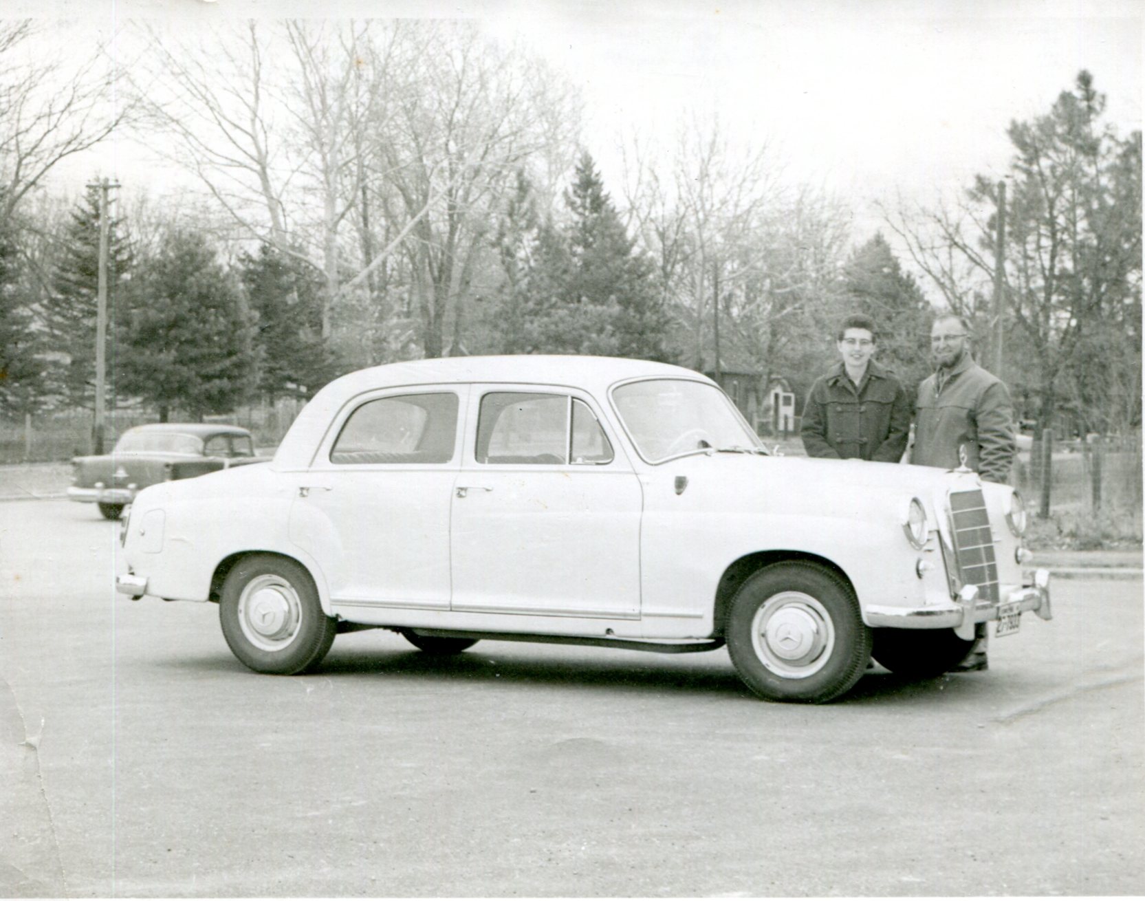
I was moving a random collection of maps — the only kind I have — from one place to another in my house the other day, and this photo dropped out of the folds of one of them.

An unretouched image of Aunt Sue and Uncle Ken, with their Mercedes-Benz 190D. According to the writing on the back, taken in South Dakota, where they lived at the time. The time being November 7, 1960, also written on the back.

I found the picture in San Antonio a few years ago, tucked among others my mother had, and decided to take it home for scanning. Then it vanished. I assumed I misplaced it at my mother’s house, but instead it hitched a ride among some maps I must have brought back.

The 190D was sold from 1958 to 1961. What they went through to bring one to South Dakota, I don’t know.

The date also fascinates. Exactly one day before the 1960 election. The next day Nixon carried South Dakota handily, 55.4% to 44.5%, but I have no doubt they voted for Kennedy, and we know how the larger election turned out. But all that was still in the future for them at the moment.

Two Illinois Points of Interest

For years, I’ve seen the following two points of interest routinely included on road maps of Illinois. At least, on Rand McNally and Michelin: the Norwegian Settlers State Memorial and the Wild Bill Hickok State Memorial.

When it comes to points of interest on commonly available road maps, there must be just a touch of the arbitrary in their selection. Just a touch, because certainly mapmakers have their editorial standards. Still, I see those (typically) red dots and wonder not only what it is, but also why is that on the map and not something else?
Guess being a state memorial or monument helps land a place on maps. (That link is part of a larger list.)

One goal of our recent trip was to avoid large highways, which we mostly did until we headed for home, when we wanted a more speedy return. When heading out, we kept to smaller roads. One of these was Illinois 71, which passes through the unincorporated community of Norway.

Not far from Norway is the the Norwegian Settlers State Memorial. It’s an example of the plaques-on-rocks school of memorial design, along with a wooden structure, and U.S. and Norwegian flags.
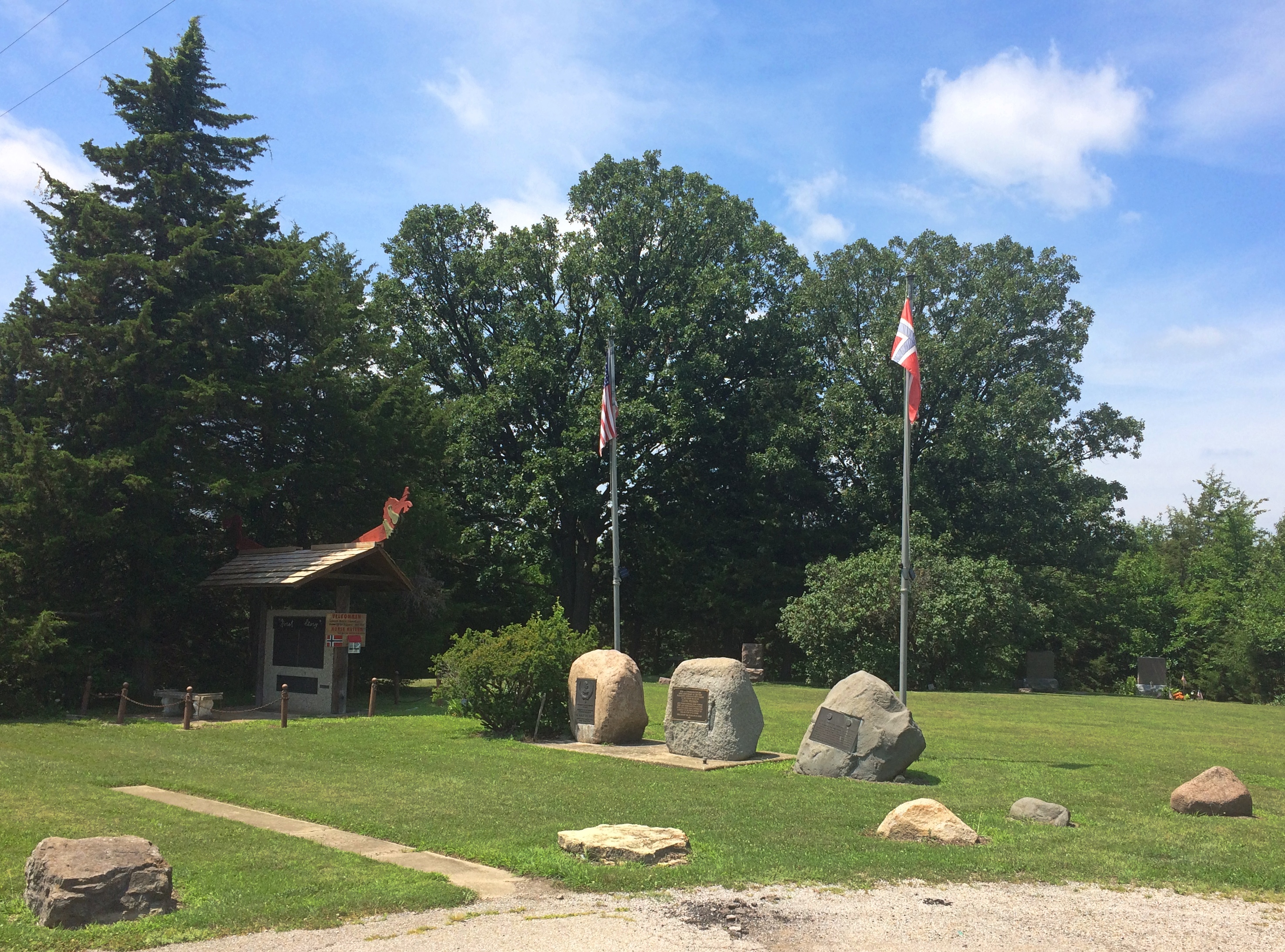
Norwegian Settlers State Memorial “This Memorial commemorates the 1834 settlement at Norway, Illinois — the first permanent Norwegian settlement in the Midwest,” says the State Historic Preservation Office. “A departure point for many Norwegians who settled other parts of the Midwest, Norway became known as the ‘mother settlement.’ The monument, dedicated in 1934, honors the community and its founder, Cleng Peerson (1783-1865).”

Peerson got around. Though he led immigrants to the New World, he didn’t seem to be interested in settling for more than a few years at a time himself. According to Wiki, he even spent time in Bishop Hill among its Swedish settlers. I guess he had no hard feelings against those oppressors of the Norwegian people. He ended up in Texas in the mid-19th century, as a lot of people did.

Why three stones? One from 1934 memorializes the 100th anniversary of the settlement of Norway, Illinois. Another from 1975 memorializes the 150th anniversary of Norwegians first coming to America en masse. The King of Norway came for that occasion. And yet another (also 1975) notes that part of Illinois 71 is the Cleng Peerson Memorial Highway.

That’s not all. The wooden structure — which I assume is an homage to Norwegian design — has text front and back. Three separate plaques on the front, dated 1980, tell the “Norsk Story,” that is, Norwegians coming to America.

Two more plaques on back (from 1982, bicentennial of Peerson’s birth) offer more detail about the memorial, including lines about Lester Severskie (1918-82) who was “dedicated to the preservation of the Norwegian heritage of Norway, Ill.”, a list of the Norwegian heritage organizations in the U.S. as of 1982 (I had no idea there were so many), and a few lines to thank Olav V, members of the Norwegian government, and so on and so forth.

This has to be the wordiest memorial I’ve ever encountered. It’s the memorial equivalent of a logorrheic movie star upon winning an Oscar. I usually enjoy reading obscure plaques, but these tried my patience, especially in the high heat of July. (The rest of my family was sitting in air-conditioned comfort in the car.)

Even so, I’m glad I stopped. Especially because I noticed that behind the memorial is a small cemetery. The Cleng Peerson Memorial Cemetery, according to one source (who spells cemetery wrong), though I didn’t see any signs or plaques at all about it, just the headstones. According to another source, it’s the Nelson Cemetery.
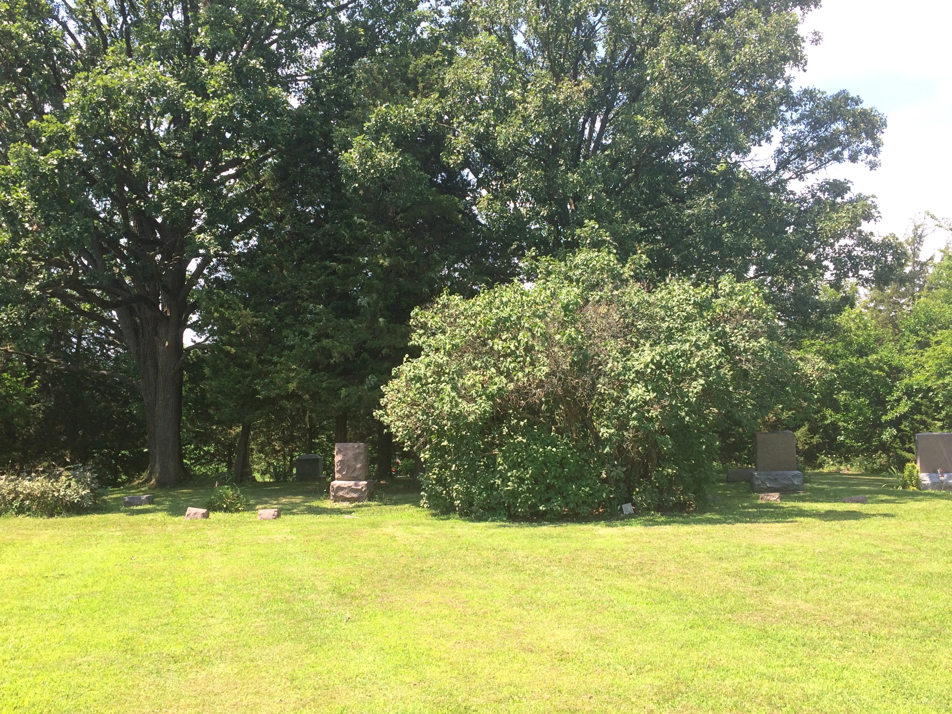
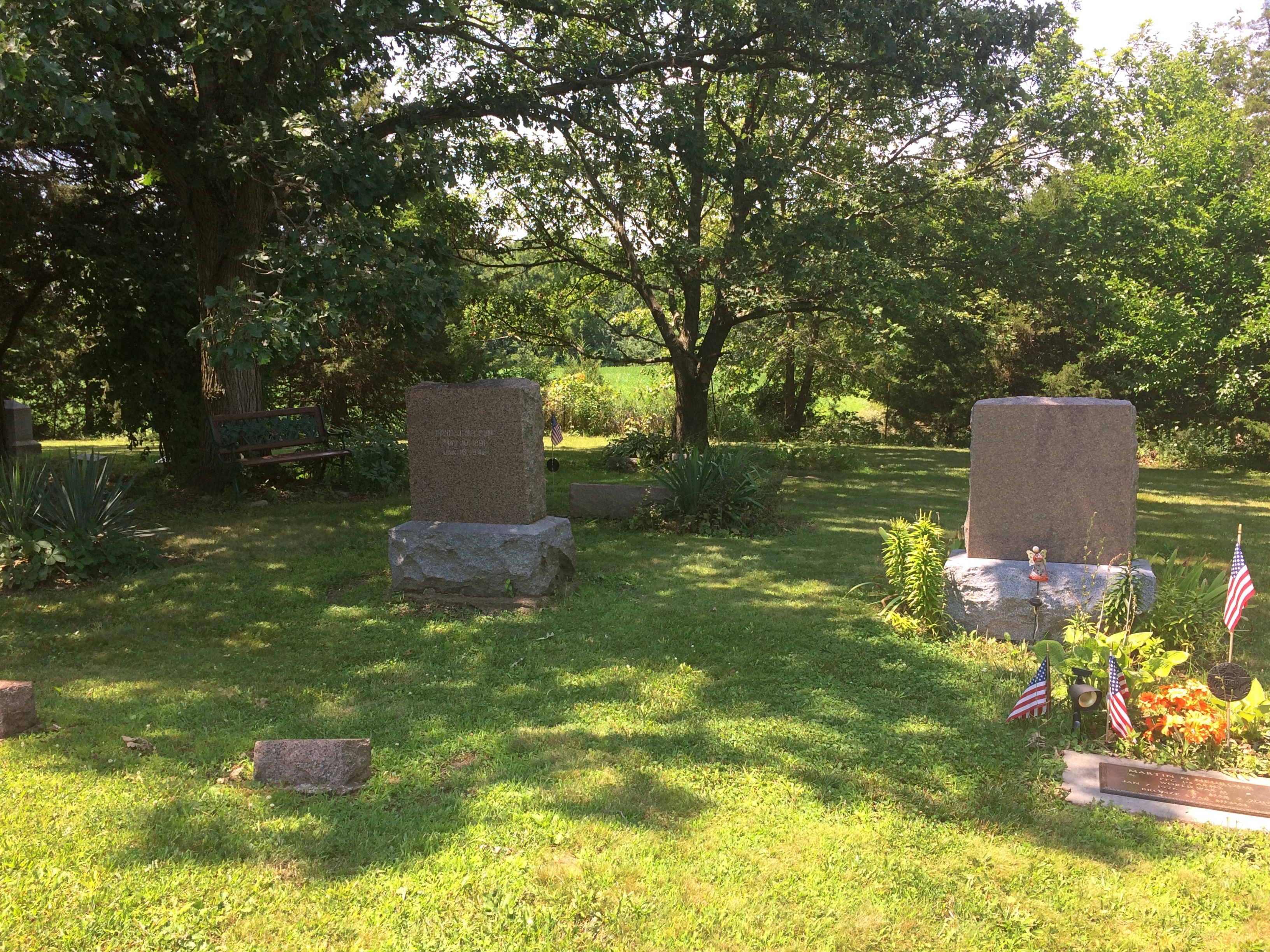
Norwegian Settlers State Memorial cemetery

Norwegian Settlers State Memorial cemeteryWhatever the name, it must be an active local cemetery. At least one burial was fairly recent.
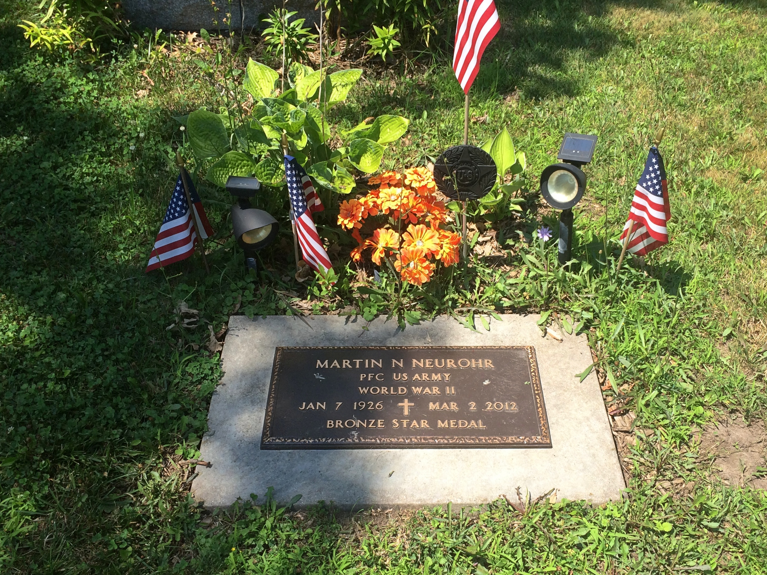
Norwegian Settlers State Memorial cemeteryPeerson himself isn’t there. He’s buried near Clifton, Texas.

In a different context, you might call Peerson an empresario, along the lines of Stephen F. Austin in Texas, except that he was merely a leader of immigrants, not someone who was granted land by an existing government. Except that in the end, he was granted land by Texas, but for services rendered in populating the state with hardy Norwegians, not as an incentive to bring them.

Returning from the Illinois River Valley on Sunday, I made a point of stopping at the Wild Bill Hickok State Memorial in Troy Grove, Illinois. Wild Bill isn’t buried there either. He died in Deadwood, after all, and he rests there in Boot Hill.

Rather, the memorial marks the birthplace of James Butler Hickok, scout, spy, lawman, soldier, marksman, gambler, showman, folk hero, and dime novel and movie and TV character. It’s at the center of an open patch of land where the Hickok family home once stood, and includes one plaque and one bust.
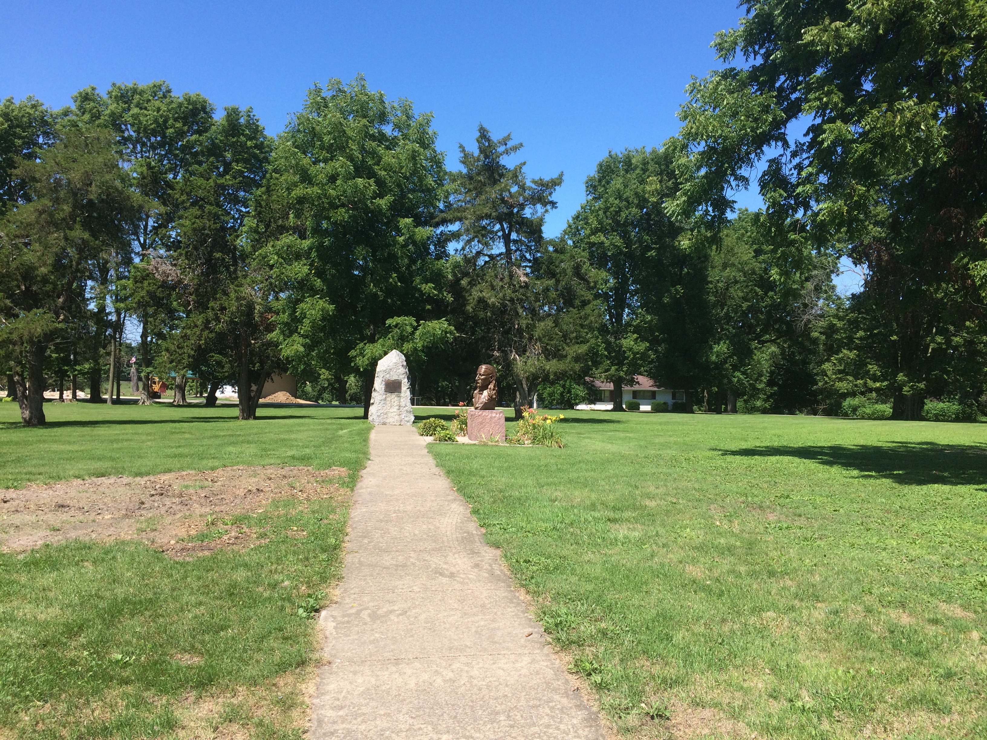
Wild Bill Hickok State MemorialThe state of Illinois erected the plaque in 1929, and it wasn’t shy about lionizing Wild Bill. It needed a proofreader, too.
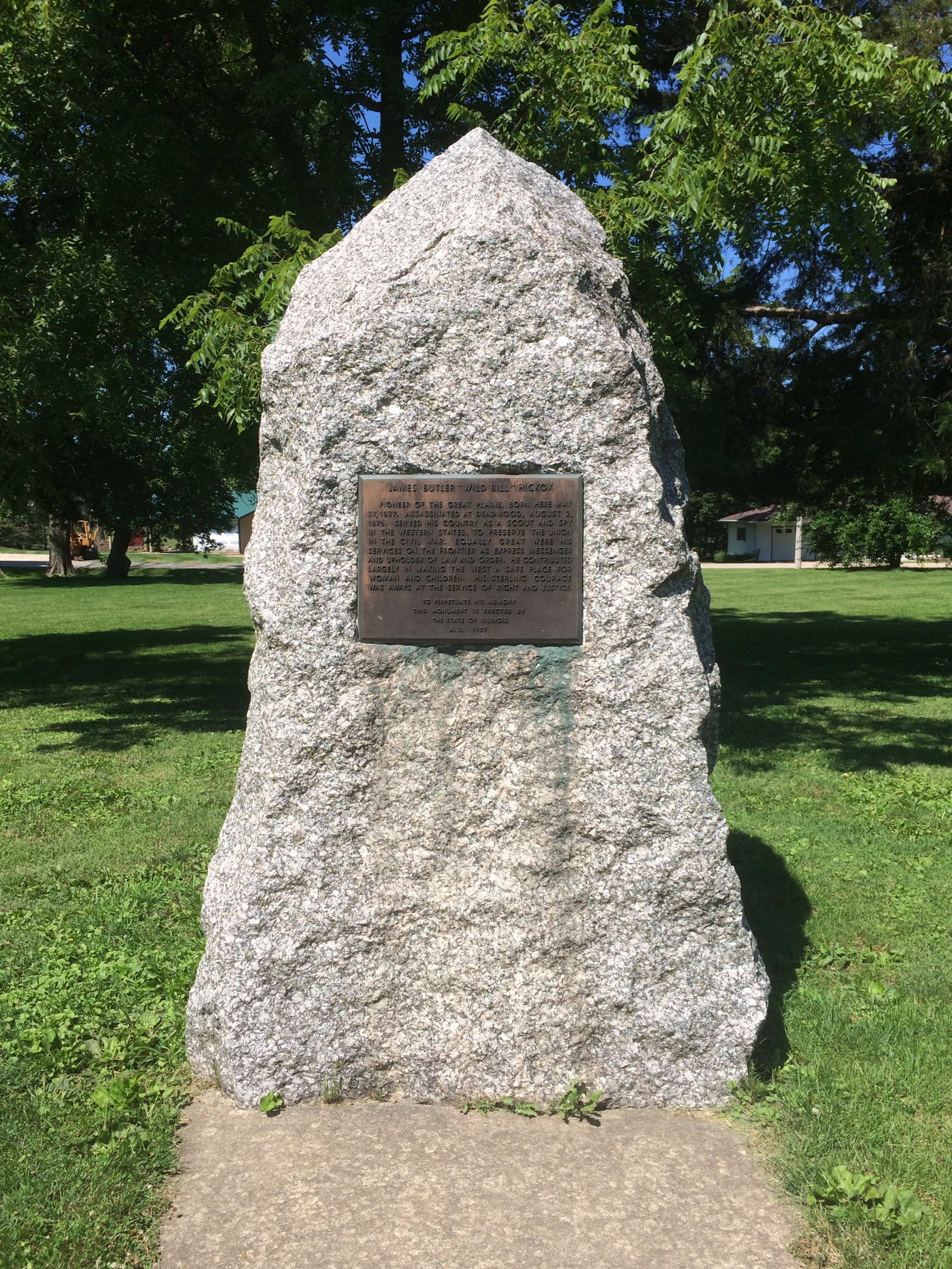
Wild Bill Hickok State Memorial“He contributed largely in making the West a safe place for woman [sic] and children,” the plaque says in part. “His sterling courage was aways [sic] at the service of right and justice.”

The bust is more recent. I had to look it up, because I couldn’t find anything on site — not a word — to say who created it or when.
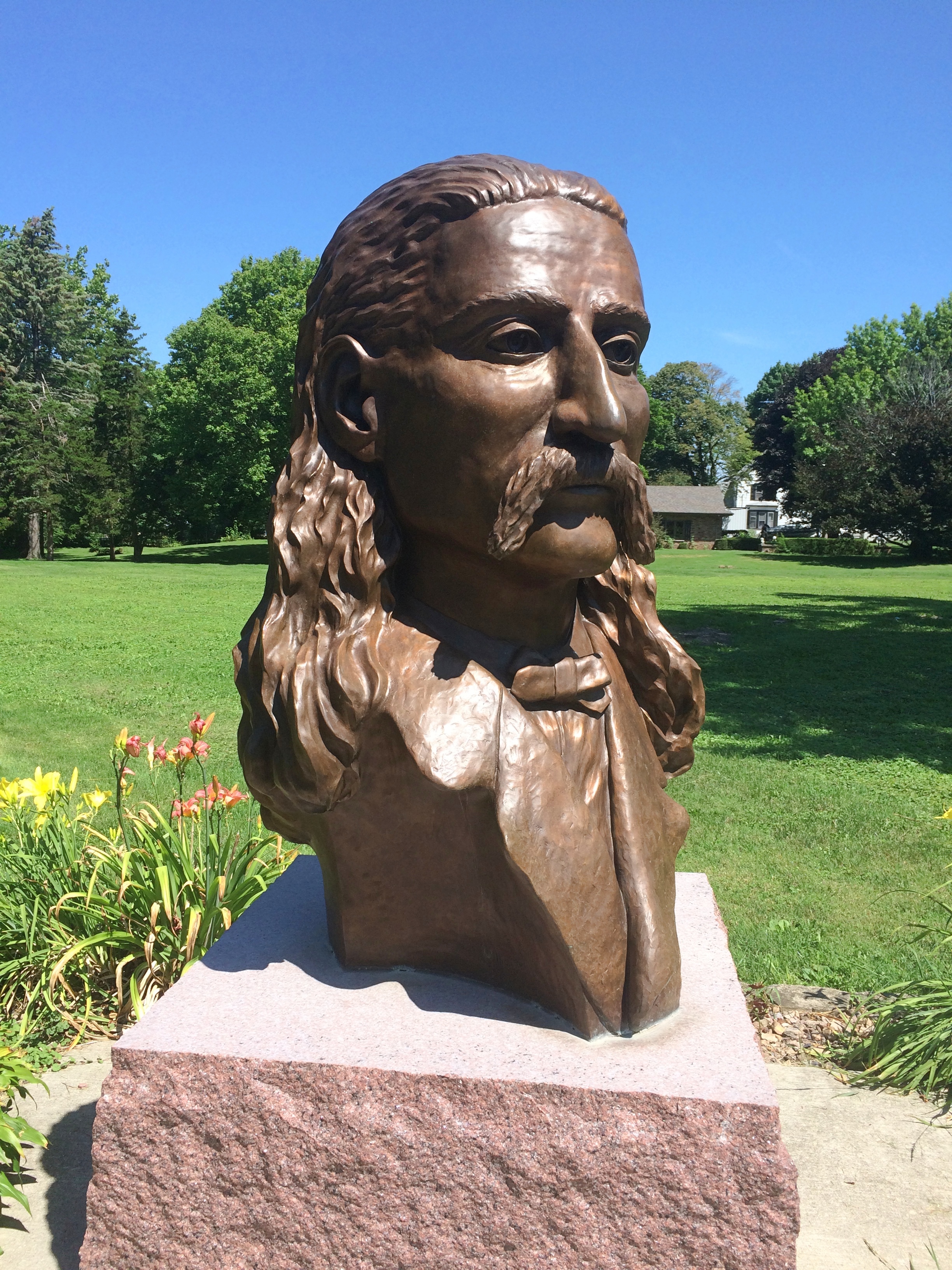
Wild Bill Hickok State MemorialThe state of Illinois says a “log-carved bust” of Hickok was added in 1999, but that’s no wooden bust. It took a little looking, but I found out that “in 2009, an attractive bronze bust of Hickok by artist William Piller was placed in the park. It replaced a carved wooden bust that had been in place 10 years but had severe weather damage,” according to the Danville, Illinois, Commercial-News.

Though it was a hot day, I wasn’t quite done with Troy Grove, pop. 230. A building near the memorial caught my eye. (The rest of my family was sitting in air-conditioned comfort in the car.)
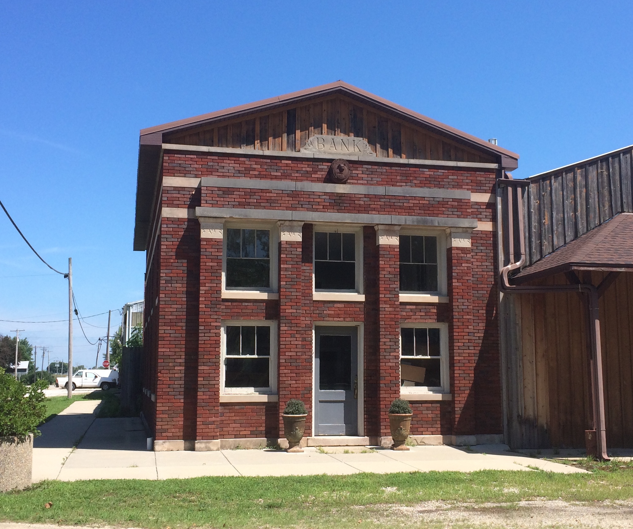
Former Bank, Troy Grove IllinoisBank, eh? Well, not any more. Still, it’s a handsome little building. A detail toward the top further got my attention.
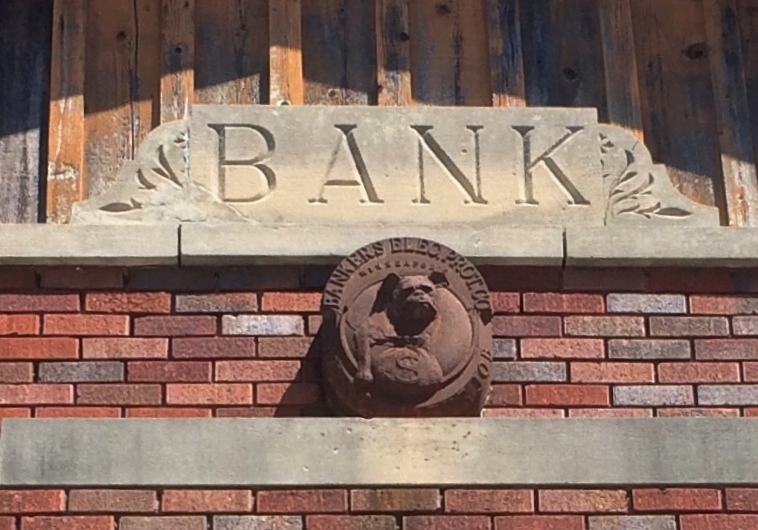
Bankers Electrical Protection Co. of Minneapolis

A logo marker apparently left by the Bankers Electrical Protection Co. of Minneapolis: a guard dog close to a money bag. The company seems to have specialized in bank vaults and other security features for banks of yore. You know, the sort of banks at risk from unauthorized withdrawals by the likes of the Cream Can Gang.

Besides a few images, I haven’t found out much else about BEPCo. (as it surely would be called now), mostly since I don’t feel like it. Enough to assume that it went out of business or was acquired by another security company long ago. Yet traces remain, in stone no less.
The Newberry Library Map Mural

I’ve read that the first floor of the Newberry Library on the Near North Side of Chicago is newly renovated, and it did have a newly polished look when Ann and I were there on Saturday. But it’s been a while since I’ve been inside the library, so I don’t really remember what it used to look like.

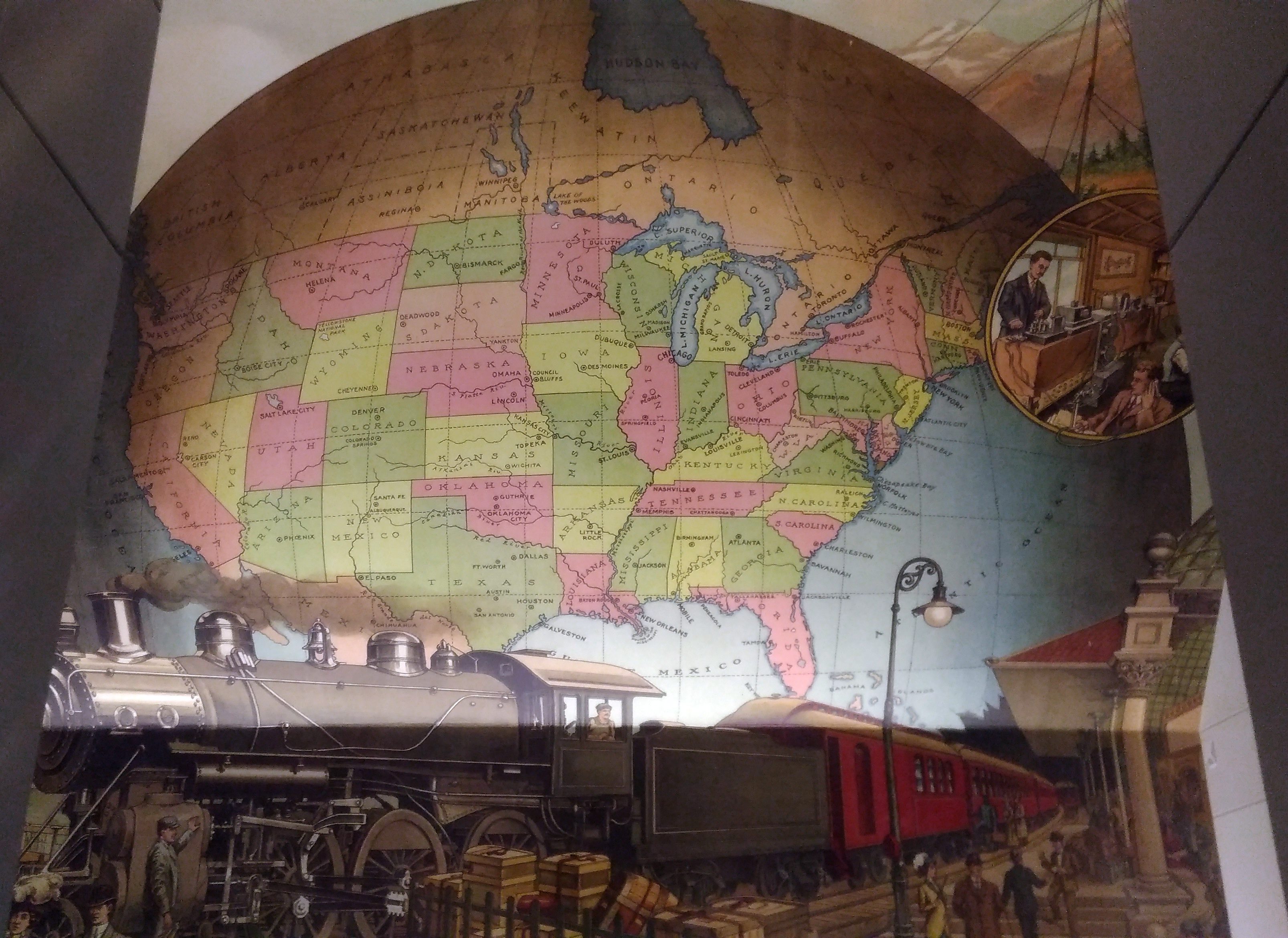
I’m sure that I’d never seen this intriguing mural before, which is above the landing between the first and second floors near a back entrance to the building.
A map mural. Even better, an historic map mural, along with a train at a station under the map and what looks like a telephone and telegraph office in a balloon off to the side.

The mural looks new, so either it is, or maybe an older image was expertly refurbished. I didn’t see any signs or plaques nearby to tell me which, or who the artist is, and the library web site doesn’t seem to say, so for now I’ll let the matter rest. It’s always good to find a map mural.

My guess is that the map depicts the nation ca. 1900 — united by rail, telegraph and the still fairly new telephone, with a new century of progress to look forward to. Or possibly 1887, when the Newberry was founded, or 1893, when the current building opened.

Though not cartographically precise (West Virginia looks especially mashed), the map’s close enough to evoke the United States of the period. One detail I noticed was that South Dakota’s towns were Deadwood and Yankton, even though the territorial capital moved to Bismarck in 1883 (presumably Al Swearengen would then refer to those “c—suckers from Bismarck” rather than Yankton).

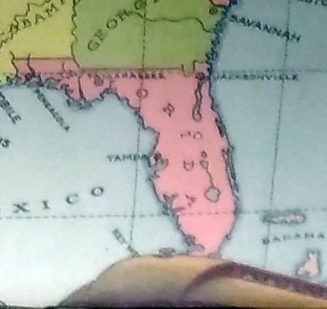
Also, note the pre-land boom, pre-drain the Everglades, pre-Disney, pre-Florida Man Florida.
A little fuzzy, but it’s clear that there’s no Miami and no Orlando.

Also, the states depicted were not quite all states at the beginning of the 20th century. Arizona, New Mexico and what became Oklahoma were still territories.

That would be my only quibble: before it became a state, Oklahoma was actually two territories, the Oklahoma Territory and the Indian Territory. The Indians of the Indian Territory wanted to be admitted as the state of Sequoyah, but Congress wasn’t having it, and so the two territories were joined to form the modern state in 1907.

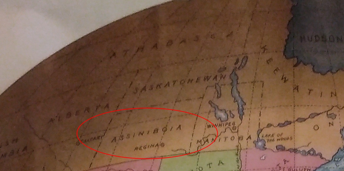
How do I know that the map doesn’t depict borders sometime after 1907? Because of the depiction of Canada.
The wonderfully named Assiniboia was a district of the NW Territories, as were Saskatchewan and Athabasca, all before 1905 (Keewatin was a separate territory before 1905, then became a district of the NWT). A major reorg of prairie Canada was done in ’05, making it look mostly like it does now.

So the map depicts pre-1905 Canada, but post-1907 Oklahoma. Ah, well. It’s small quibble about such a fine example of a mural.

Yellowstone, Badlands, Albert Lea, Etc. 2005

Part of a letter I wrote to Ed about 13 years ago, with a few relevant pictures and hindsight notes in brackets.

Aug 22, 2005

Time to start another letter, which I might as well subhead “Things About My Recent Travels That Didn’t Make It Into the Blog.” If letters had subheads, that is.

In some ways, I hope this is a pattern for future travels [mostly it wasn’t]. Of the nine nights we spent on the road, six were in a tent, three in a motel. Better still, of the six nights in a tent, four cost nothing. Call me a cheapskate, but it did me good to return every night to Yankee Jim Canyon about 15 miles north of Yellowstone, in Gallatin Nat’l Forest land, and crawl into the tent knowing that I paid nothing. Well, no extra charge, no insidious “user’s fee,” because some small bit of my taxes must go to support the Gallatin Nat’l Forest.

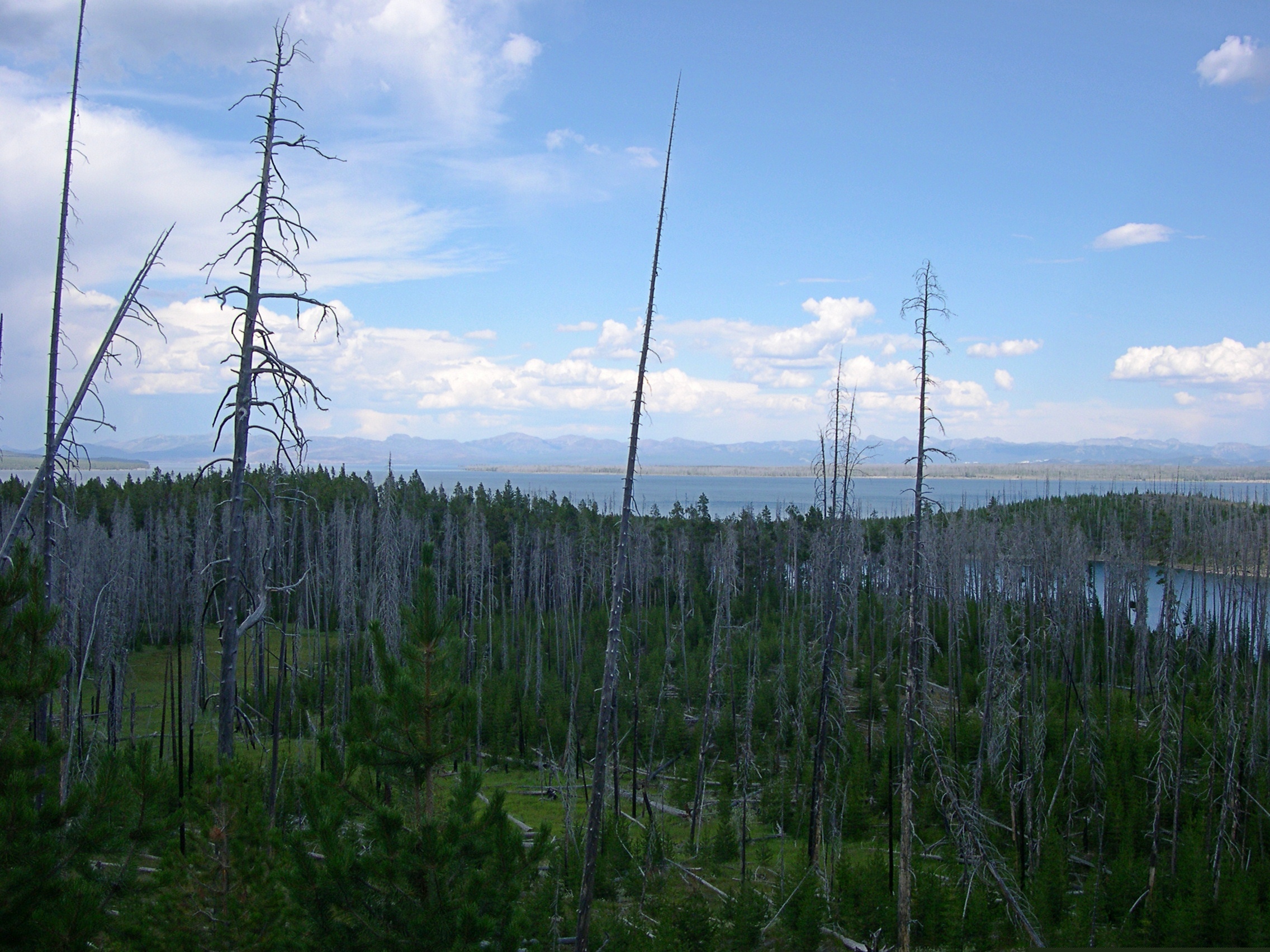
Some of the most striking things about the many striking things in Yellowstone were the places — whole mountainsides, in some cases — that had clearly burned down in 1988. Hundreds of grey-dead trunks, stripped of anything remotely alive, still stand, lording — if such be possible among trees — over forests of mid-sized pines, very much alive, the spawn of the great fire. In other places, hundreds of tree corpses have tumbled into random piles, also interlarded with young living trees. You can drive for miles and miles and see scene after scene like these. They say it was a hell of a fire, a complex of hell-fires, really, and I believe it.

[A post-fire landscape in Yellowstone in 2005, 17 years later.]Yellowstone 2005

I saw something in South Dakota that the rest of the nation can emulate: two kinds of X signs, marking traffic deaths I think. One says: “WHY DIE? Drive carefully.” And the other: “THINK: X marks the spot. Drive carefully.” For such a sparse population, South Dakotans seem to kill themselves often enough on the roads. Long winters, cheap booze, almost empty roads.

I recommend the drive along the Missouri River from I-90 to Pierre, SD — along state roads 50, 10, and mostly 1806, all of which also form a National Scenic Byway. Hilly, bleak territory largely given over to Indian reservations, though not quite as bleak-looking as Badlands NP.

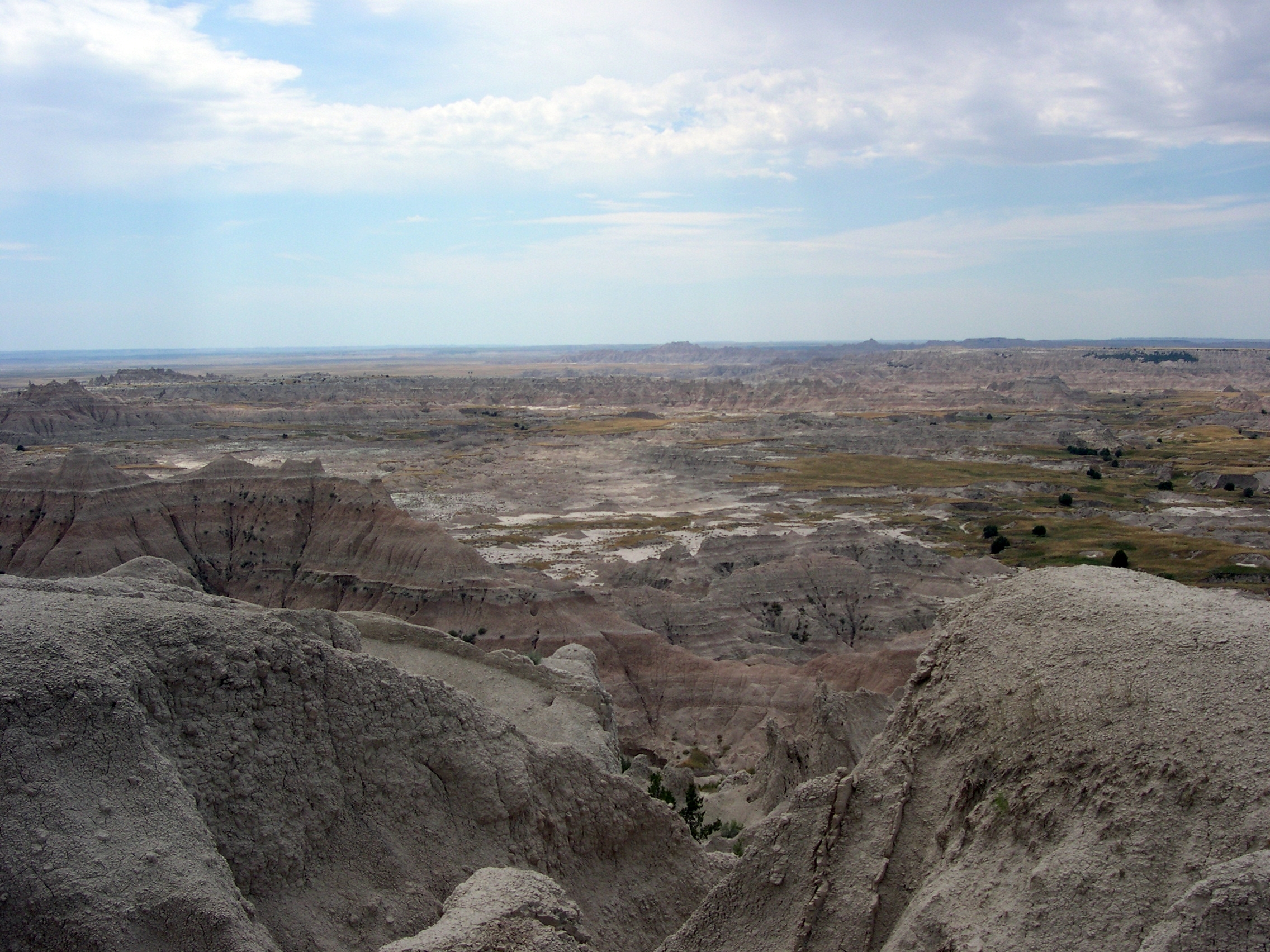
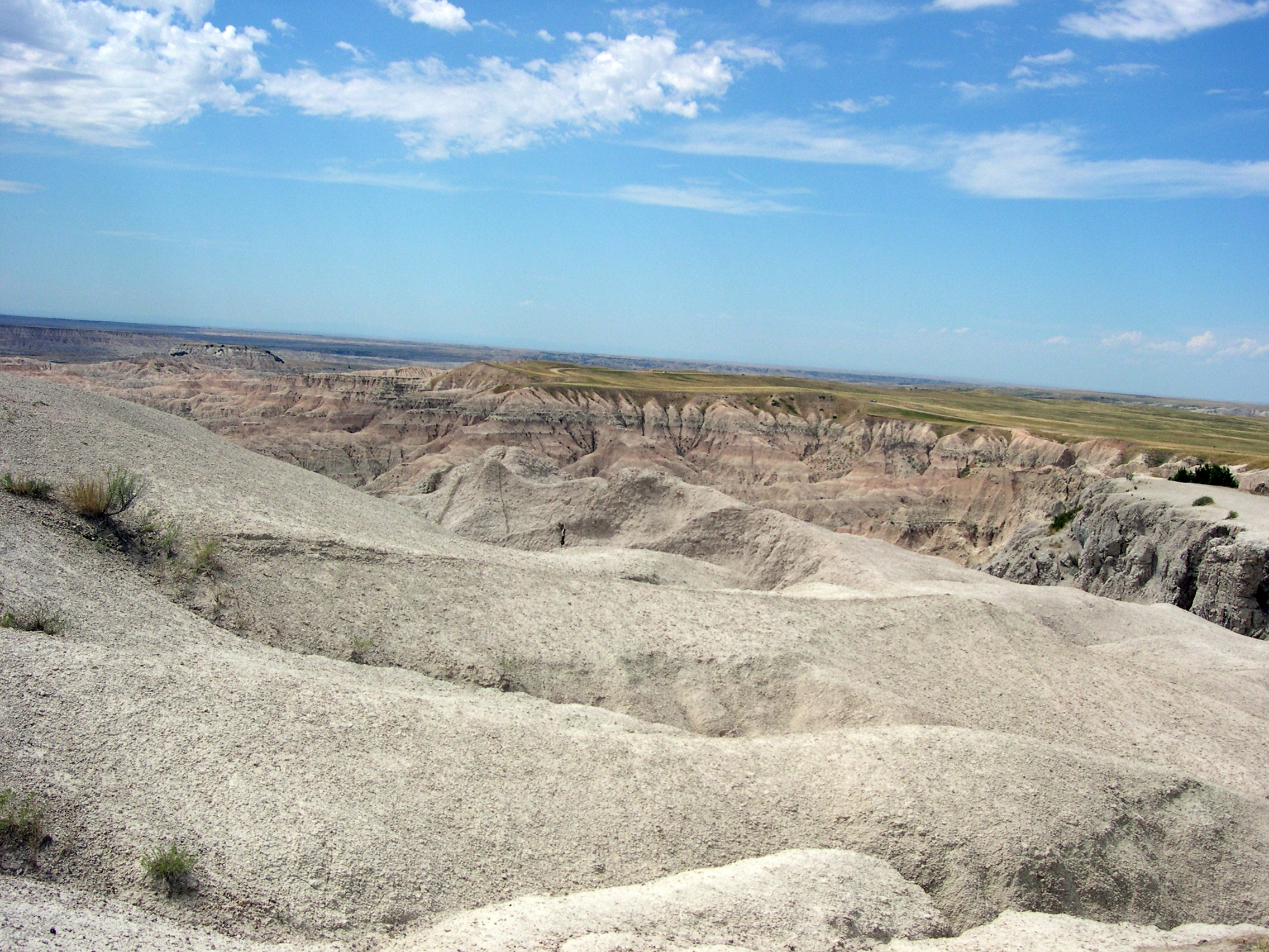
[Badlands NP, 2005]

In places, except for the road, it couldn’t have been that much different than what Lewis and Clark saw. I never can remember, without looking it up, which one probably blew his brains out a few years after co-leading the Corps of Discovery. [Lewis] Clinically depressed, before there were clinics worth visiting, and before melancholia became depression. Anyway, if I remember right, there’s a monument to him near where he died, on the Natchez Trace. I saw it years ago. A lonely place to die.

We spent the first night out at a campground near Albert Lea, Minnesota. According to me (and only me), Albert Lea is important for two things. One I just noticed: it’s the closest town to the junction of I-35, the U.S. branch of the Pan-American Highway, and I-90, the Boston-Seattle transcontinental epic of a highway. [I’ve since learned that no U.S. road is officially called the Pan-American; it’s just custom that attaches the name to I-35.]

The other thing is that I was visiting Albert Lea for the second time, after a span of 27 years. What was I, a south Texas lad of 17, doing in south Minnesota en route to Wisconsin one August day in 1978? Am I repeating myself here? Maybe I mentioned that epic bus trip before. It was an important one for me. No family, distant states — Wisconsin seemed wildly exotic. Christmas trees grew in people’s yards.

Anyway, in 1978 we stopped for lunch in Albert Lea. I went with the bus driver and some other kids to Godfather’s Pizza, a place I’d never heard of. After that, I walked around a little, relishing the remoteness of the place.

In 2005, we encountered wildlife at the campground near Albert Lea, namely mosquitoes in great numbers. The place was fairly green and lush, so I guess southern Minnesota hasn’t had the drought that Illinois has had this year. When we were leaving the next morning, we drove down the town’s main drag and there it was: Godfather’s Pizza, looking like not much maintenance had been done since the late 1970s, though of course I had no memory of how it looked then, just that I was there. [In Eau Claire this year, we ordered a pizza from a Godfather’s and ate it in our room. I ordered from there because of my experience 40 years earlier. And it was close.]

One other note, for now: Hot Springs, SD, is a lovely town. Near much of the main street flows a river, and alongside most of the main street across from the river are picturesque sandstone buildings, vintage pre-WWI. Evidently, it was locally inexpensive building material.

I left the family at a spring-fed swimming complex while I looked for a pay phone, since my cell phone refused to transcend the hilly surroundings. Argh, what an odyssey that was – “Yeah, we used to have a phone…” I’d foolishly agreed to do an interview that day, figuring I could use my cell. Anyway, after much to-do, I found a phone, did the interview, and then relaxed by the riverside, which has a sidewalk and a hot spring (Kidney Spring) under a gazebo. Free for all to drink, with a metal plaque describing its properties. Not bad. A little salty, but not bad, even on a hot day in South Dakota.