Burlington Cemetery

About a two-minute drive from downtown Burlington, Wisconsin is the Burlington Cemetery.Burlington Cemetery, Wisconsin

Showing brown patches a few weeks ago, signs of the dry spell still persistent in late June.Burlington Cemetery, Wisconsin Burlington Cemetery, Wisconsin Burlington Cemetery, Wisconsin

Still, it was pleasant that warm but not hot Sunday afternoon, with an assortment of stones standing mute — standing being an important aspect for an aesthetic cemetery.Burlington Cemetery, Wisconsin Burlington Cemetery, Wisconsin

Including a Woodman of the World memorial. Unless he was a freemason. Quite possibly both.Burlington Cemetery, Wisconsin

Something to know: “Effective June 1, 2015, Woodmen of the World Life Insurance Society adopted the service mark WoodmenLife in all 50 states and the District of Columbia,” a Woodmen of the World press release reported about eight years ago.

“The process began with the release of a 2011 nationwide survey by the American Fraternal Alliance and Frederick Polls, which showed that many people are unfamiliar with fraternal organizations and what they accomplish. Additional research found that a large portion of the United States was unfamiliar with Woodmen of the World.”

The only reason I know about them are the gravestones, which you see periodically if you visit enough cemeteries. The org clearly needs a catchy theme song. “The Lumberjack Song”?

At Burlington there are few large memorials, as is usual in small towns. The Civil War memorial is sizable and elegant, though. And ready for the Fourth of July.Burlington Cemetery, Wisconsin

As were more modest memorials.Burlington Cemetery, Wisconsin

There are GAR stars.Burlington Cemetery, Wisconsin Burlington Cemetery, Wisconsin

Something less often seen: a Woman’s Relief Corps star.Burlington Cemetery, Wisconsin

Unlike the GAR, the WRC is still around, even though it was originally formed as a woman’s auxiliary to the GAR. Its next national convention is on Saturday. I’m not going, but that’s good to know somehow.

Forest Lawn Memorial Park, Glendale, California

Not long ago, I refreshed my memory about what a hilly cemetery can look like.Dayton, Ohio Dayton, Ohio

Those are images of the Woodland Cemetery & Arboretum in Dayton, Ohio. Been a while since I was there (2016), but it’s still a favorite of mine.

I thought about Woodland and some of the other park-like cemeteries of the nation while on the slopes of Forest Lawn Memorial Park in Glendale, California last month. The Forest Lawn slopes are arrayed with stones flush to the ground, to facilitate lawn care.Forest Lawn, Glendale Forest Lawn, Glendale

Such beauty in its hills and landscape – and such a missed opportunity for a beautiful cemetery. There are spots of beauty, but still. Flush stones, with their numbing sameness, don’t enhance a hill the way a wide variety of standing stones do. Not at all. Not only that, traces of individuality are regularly removed, as a crew is doing in the second picture above.

Even so, Forest Lawn is an interesting place. For one thing, it’s the cemetery that inspired Evelyn Waugh to produce The Loved One, his sharp satire of the American way of death, or maybe just the California way of death. I read the book about 35 years ago, I think, and don’t remember much. I saw the awful movie based on it at some point, and am glad I don’t remember much about it except, vaguely, Jonathan Winters hamming it up, as he usually did.

Looking at the trailer, I realize now how solid the cast is. I’m surprised how much talent went to waste in that movie.

“When Evelyn Waugh came to Hollywood in 1947 to discuss the film rights for Brideshead Revisited, he visited a graveyard: Forest Lawn Memorial Park,” notes Crisis Magazine. “He had heard it praised as a place unsurpassed in beauty, taste, and sensitivity; a place where ‘faith and consolation, religion and art had been brought to their highest possible association.’ But Mr. Waugh found the cemetery dripping with saccharine sentimentality, edged with macabre memorials, and repellent with cuteness.”

I don’t know about all that; I might have a higher tolerance for sentimentality or the macabre or even cuteness than the author, though I have to say that Forest Lawn doesn’t really trade in the macabre, unless you consider cemeteries by definition macabre, which I do not. If anything, it could use just a touch of macabre to tone its memorial-park lightness down a notch.

The park is expansive, its map full of named places: Inspiration Slope, Garden of Ascension, Haven of Peace, Memory Slope, Triumphant Faith Gardens, Gardens of Remembrance, Columbarium of the Christus, Court of David, Court of Freedom, Garden of Honor, Garden of Everlasting Peace, Garden of the Mystery of Life, Gardens of Contemplation, Dawn of Tomorrow Wall Crypts, Vale of Faith, Resurrection Slope, Rest Haven, Graceland, Vesperland, Slumberland, Lullabyland and Babyland, among others.Forest Lawn, Glendale Forest Lawn, Glendale

One thing not on the map is any mention of any of the movie stars buried in the cemetery, or any hint about where they might be. There are many. That’s an odd lacuna, I think, considering this is southern California and that Hollywood Forever makes a point of highlighting the famous, and does it so well with a detailed map.

A handful of famed names appeared on Google Maps at specific points in the cemetery, including Humphrey Bogart. I wasn’t far away, so I went looking for him. I wanted to pay my respects to Bogart. (I’ve seen his hand- and footprints, too.)

Soon I determined that Bogie’s ashes are behind this door to the Columbarium of Eternal Light.Forest Lawn, Glendale Forest Lawn, Glendale

A locked door. No casual admission to see one of the great actors of his time. Or Bacall, who joined him not so long ago. “Golden Key of Memory”?

I had to content myself with stones and niches of random folk.Forest Lawn, Glendale Forest Lawn, Glendale

There’s also an art museum on the grounds, which was closed when I visited, so I had to content myself with some of the freestanding public art on the grounds. There’s quite a bit of that.

A version of the Christus.Forest Lawn, Glendale Forest Lawn, Glendale

The Court of Freedom, which has a patriotic theme, is ringed with artwork. Such as the Declaration of Independence mural.Forest Lawn, Glendale Forest Lawn, Glendale

George Washington.Forest Lawn, Glendale

The chain in front of him tells a story I’d never heard.Forest Lawn, Glendale

A version of “The Republic” by Daniel Chester French.Forest Lawn Glendale

I don’t count the statue of Washington as a presidential site for this trip, but there was one at the cemetery I did see: the Wee Kirk o’ the Heather, a lovely spot.Forest Lawn Glendale
Forest Lawn Glendale Forest Lawn Glendale Forest Lawn Glendale

Couples are frequently married at the Wee Kirk, as you’d image. In early 1940, Ronald Reagan and Jane Wyman were married there.

South Side Cemetery, Pontiac, Illinois

Across the Vermilion River from Chautauqua Park in Pontiac, Illinois, is South Side Cemetery, which predates the town’s Chautauqua activity by some decades, since its first burials were in 1856. At 24 acres, it’s still an active municipal burial ground. I saw at least two memorials with death dates in 2023.

Overall, a nice place for a stroll on a warm day in May, if you don’t mind being in a cemetery. I can’t say I ever have been.South Side Cemetery, Pontiac, Illinois South Side Cemetery, Pontiac, Illinois South Side Cemetery, Pontiac, Illinois

Some older stones, including a scattering of Civil War veterans.South Side Cemetery, Pontiac, Illinois South Side Cemetery, Pontiac, Illinois

As usual with small towns, not many mausoleums or large monuments, but there are a few.South Side Cemetery, Pontiac, Illinois

Lemuel G. Cairns fought for the Union, too, but has no ordinary soldier’s stone. According to Find a Grave, he achieved the rank of sergeant and after the war dealt in cattle in Texas, before moving to Illinois. I suspect he did well in that business in Texas, but maybe got tired of the heat.

The only sizable mausoleum I spotted.South Side Cemetery, Pontiac, Illinois

A number of Gaylords reside there, including this fellow, it seems, a doctor and Union veteran.

This is a surname you don’t see much: Hercules. Also, an unusual design for a stone.South Side Cemetery, Pontiac, Illinois South Side Cemetery, Pontiac, Illinois

Rare, but not unknown.

“Early examples of the surname recording taken from surviving church registers include those of William Hercules (also recorded as Herculus) at the church of St Margaret’s Westminster, on January 16th 1603, and in the Shetlands, William Herculason who married Christian Harryson at Delting, on January 24th 1752,” says the Internet Surname Database.

A prominent Pontiac family, no doubt. With a name like that, they’d better be. One of them – J.W. Hercules – is mentioned as the designer of the Pontiac Chautauqua pavilion.

More From the Commonwealth of Pennsylvania

Our most recent trip took us to fully 25% of the nation’s commonwealths, to celebrate a famed example of a distinction without a difference.

It wasn’t quite full spring in Pennsylvania last month, but warm enough most of time.

We drove the National Road (U.S. 40) in Pennsylvania, from where it crosses the border near Wheeling, through to Uniontown, and later drove the segment that goes into Maryland.

Didn’t quite make it to the eastern terminus, in Cumberland, Maryland. Once upon a time, maybe a small detour during a late ’90s return from Dallas, we saw the western terminus in Vandalia, Illinois.National Road National Road

One minor landmark along the way.National Road National Road

Searight’s Tollhouse, built in 1835 by the commonwealth of Pennsylvania to collect tolls, since the federal government had turned the road over to its various states that year. The structure, near Uniontown, is one of two surviving tollhouses, out of the six built. No tolls have been collected there since the 1870s.

The structure was built near the tavern of William Searight, the state commissioner in charge of the roadway, per Wiki.

Barman and toll collector. There’s an idea for a Western revival limited series on streaming: Will Searight, Frontier Toll Collector. I’m thinking a comedy, in the same Shakespearean writing style as Deadwood, but no one gets killed.

A church on the National Road, east of Uniontown: Mount Washington Presbyterian, founded in 1842.National Road

The church cemetery provides a view of the National Road.National Road

In Uniontown itself, I stopped by briefly at Oak Grove Cemetery, originally the Union Cemetery of Fayette County, which has been accepting permanent residents since 1867.Oak Grove, Uniontown
Oak Grove, Uniontown Oak Grove, Uniontown

Famed permanent residents? I checked with Find-A-Grave (just now), and the pickings are slim: mostly forgotten members of the U.S. Congress, though there is a Civil War officer, Silas Milton Bailey (d. 1900). I just made his acquaintance. Quite a story. Uniontown jeweler in civilian life; solider that didn’t let getting shot in the face keep him from action for long.

Fort Necessity is just off U.S. 40 and thus the National Road. Something I noticed there, featured on a park service educational sign. Of course. How could they not be involved?

The camp, Pennsylvania SP-12, existed from 1935 to ’37, with about 800 men, planting trees and laying out trails and roads. This is the first time I’ve seen the CCC seal depicted at any of its sites, though of course the men sometimes rate bronze recognition. There is evidence that the seal dates back to the active period of the corps.

Just as we left Pennsylvania for the last time, I was able to stop at the border with Maryland on U.S. 219, just south of Salisbury, Pa. Not just any border, but the Mason-Dixon Line. It’s one thing to cross it, as I have who knows how often. It’s another thing, according to my eccentric lights, to stand on it.Mason-Dixon Line

Yuriko had never heard of it. I explained a little about its history and its wider but not quite literal meaning as a line between free and slave, North and South, but she didn’t find it all that impressive.

Yosemite National Park

This kind of national park review ends up on humorous lists: “Trees block views and too many grey rocks.” So we can chuckle at the philistines. Ha, ha.

Today I spent some time with Yelp one-star reviews of Yosemite National Park, and while I’m sure somebody actually posted the above as a genuine review (philistines are out there), that’s not what most of the one-star reviews were about. Rather, people were bitching about the management of the park, and specifically admissions and backcountry permitting.

Nothing untoward happened to us during our early October visit to Yosemite because of entrance snafus. But many — most? — of the one-star complaints have a ring of truth to them. Yosemite began requiring timed entry last year and did so this year (but not after September 30), and to be charitable, it sounds like there are still a few bugs in the system, plus genuine issues with rude or indifferent customer service. The permit system to climb insanely high rocks seemed poorly run too.

We call all mock government incompetence, can’t we? Or is it hard to run a major national park when it’s starved for funding?

When you arrive at the park — and get in effortlessly — all such questions melt away. Lilly and I arrived on the morning of October 6, 2022, at the Arch Rock Entrance and from there drove the winding two-lane road to the valley.Yosemite National Park

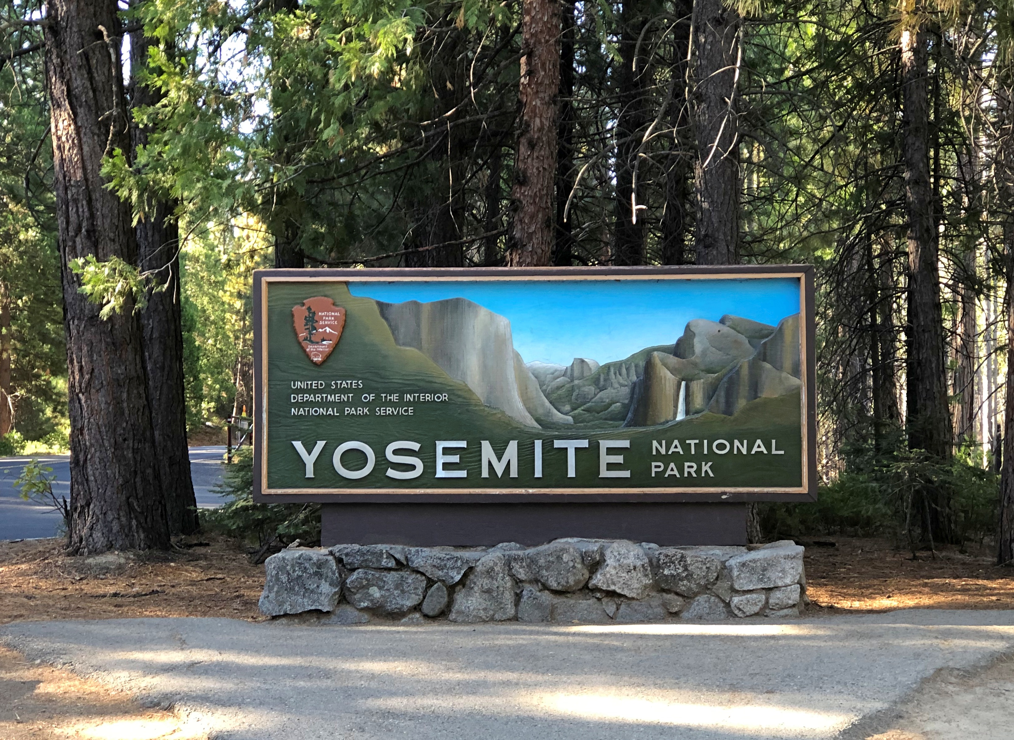
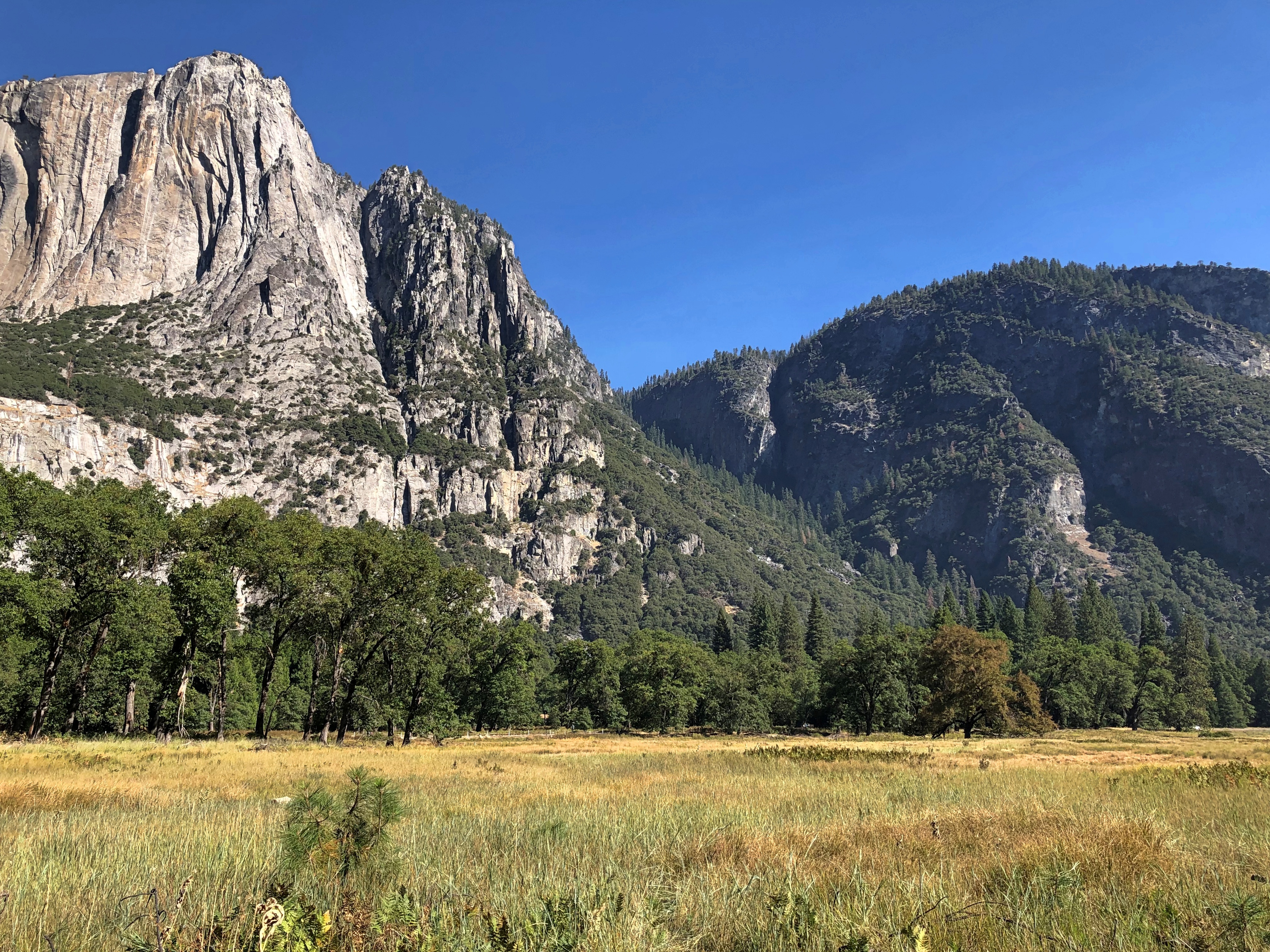
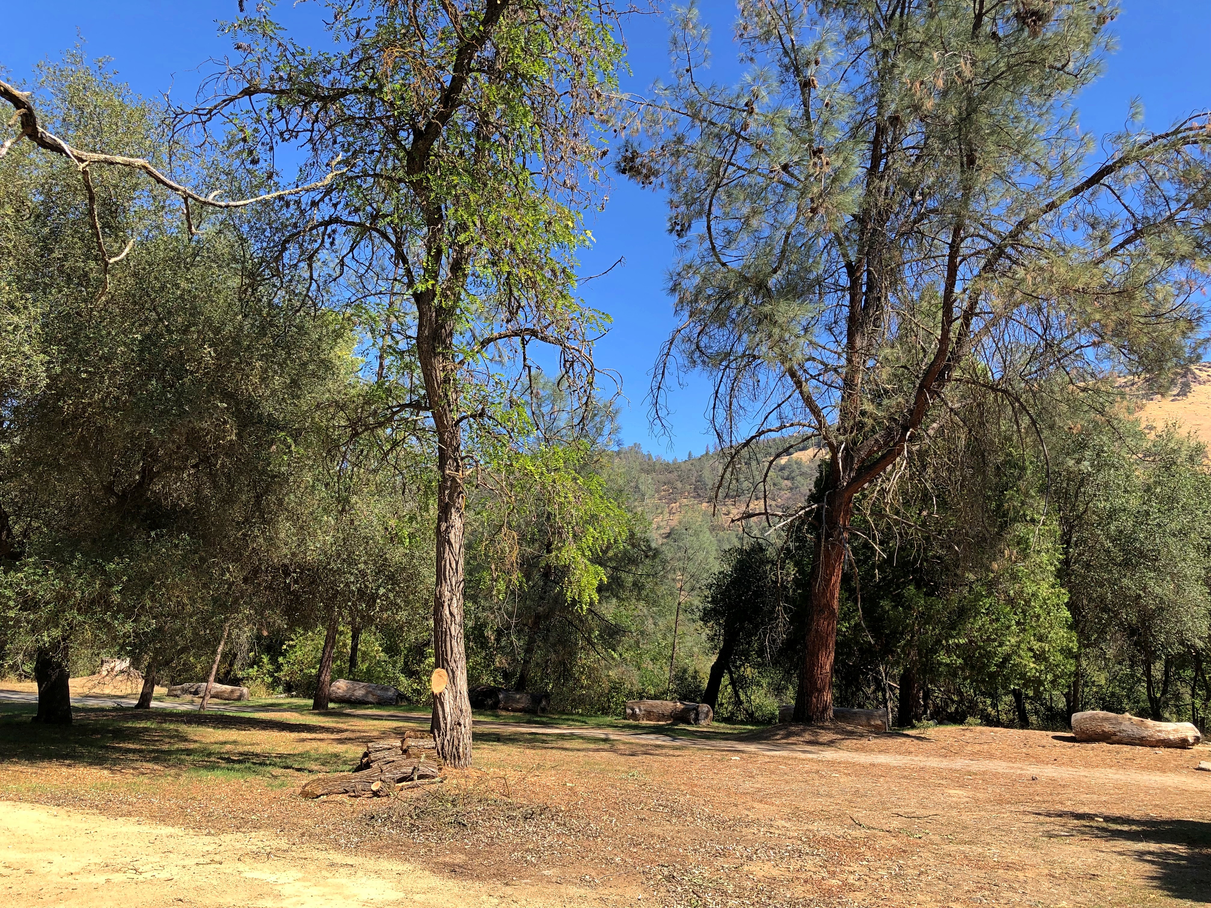
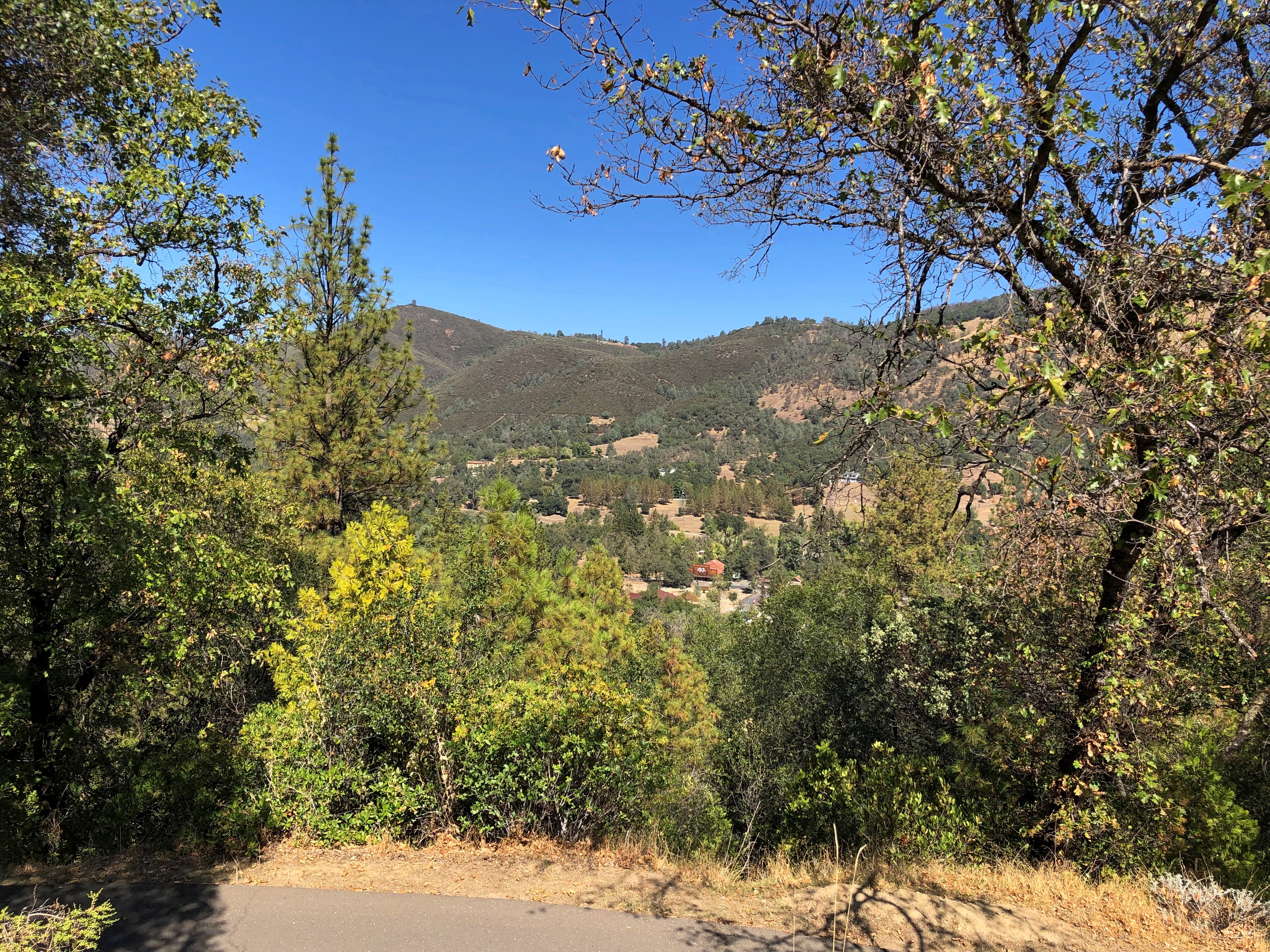
In the Yosemite Valley, it doesn’t take long to get to grandeur.Yosemite National Park Yosemite National Park

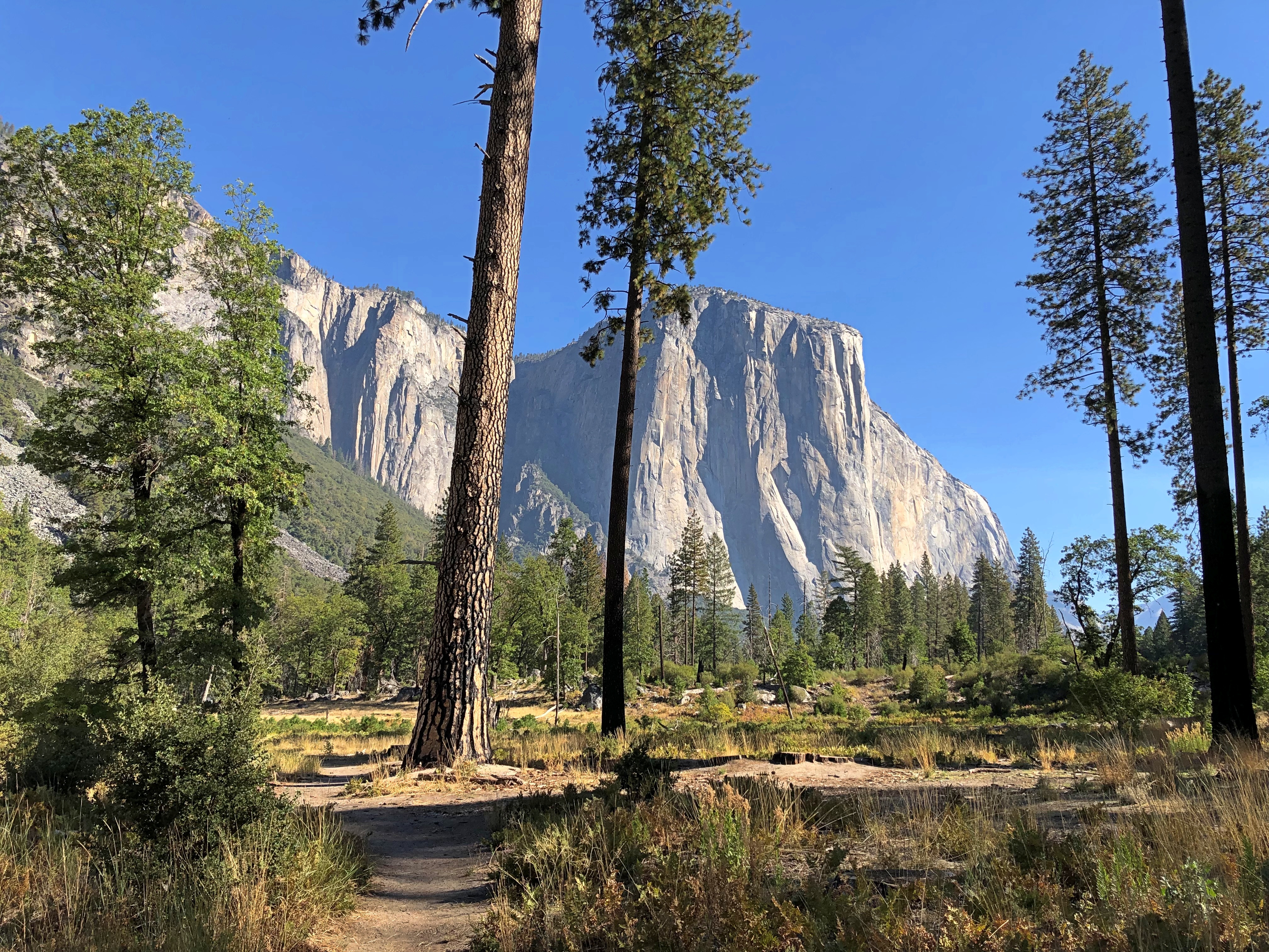
On the line separating the grass and the trees in this image, far to the right, are cars barely distinguishable as such. That’s where we parked. Grandeur wasn’t very far from there, either.Yosemite National Park

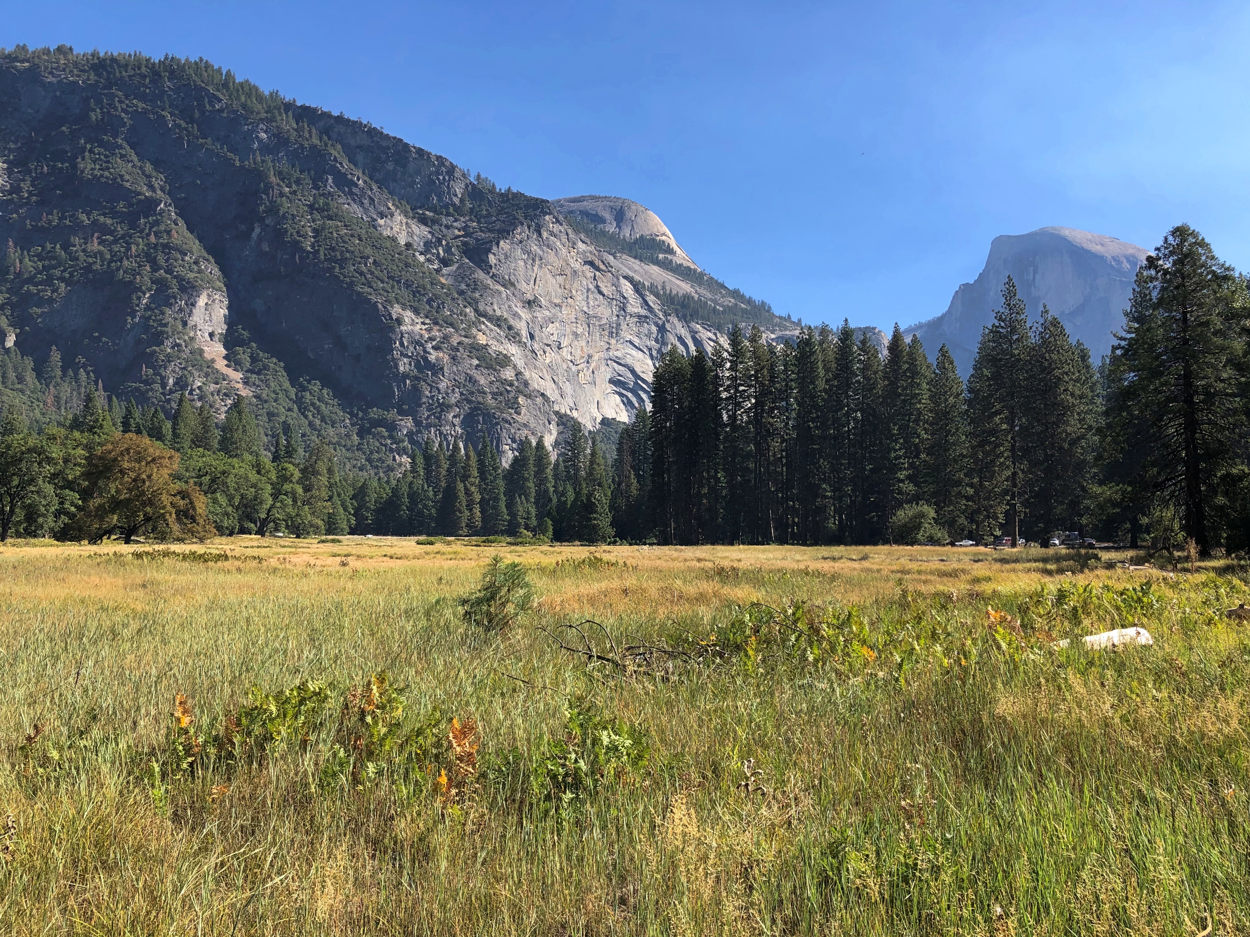
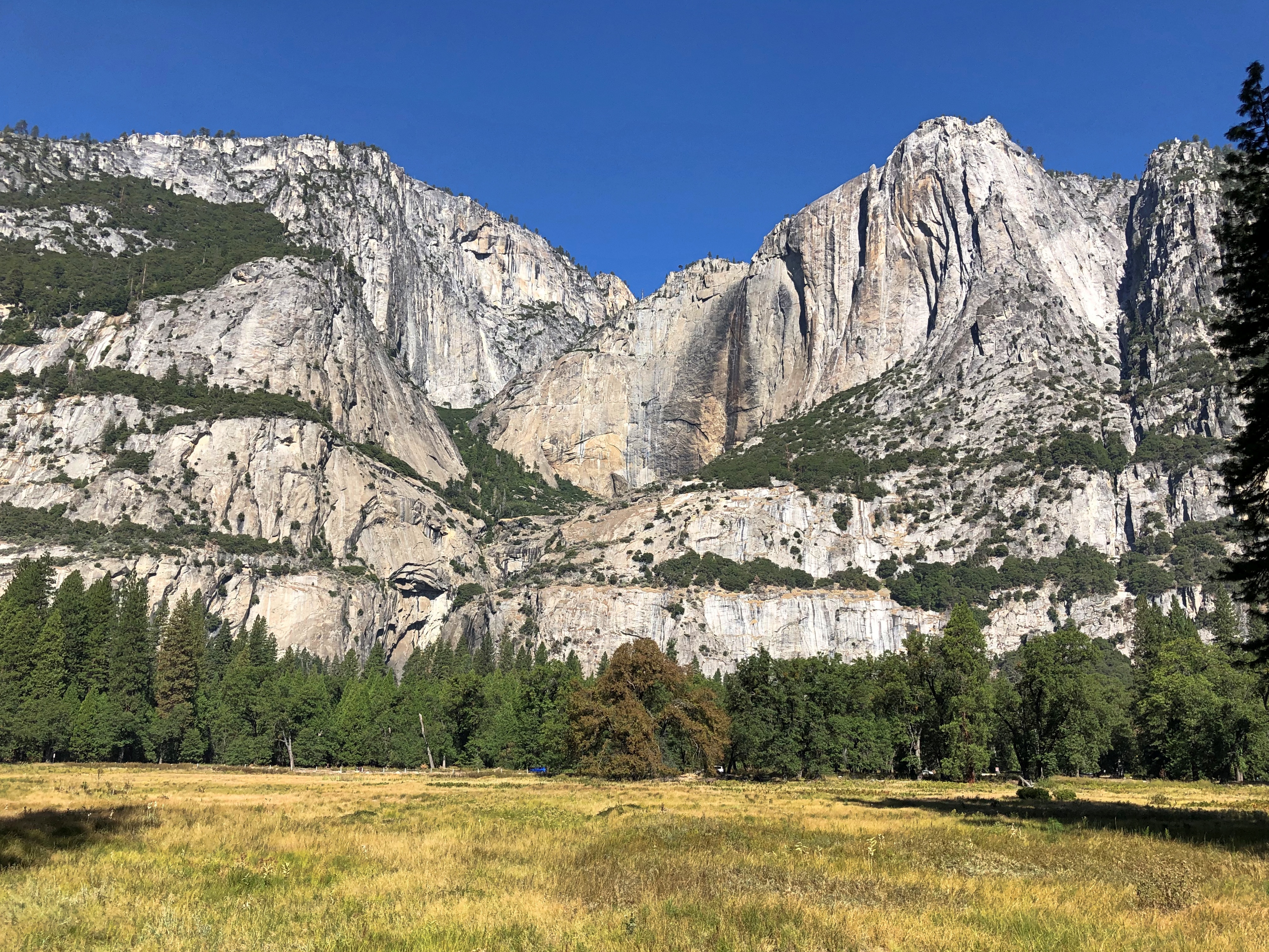
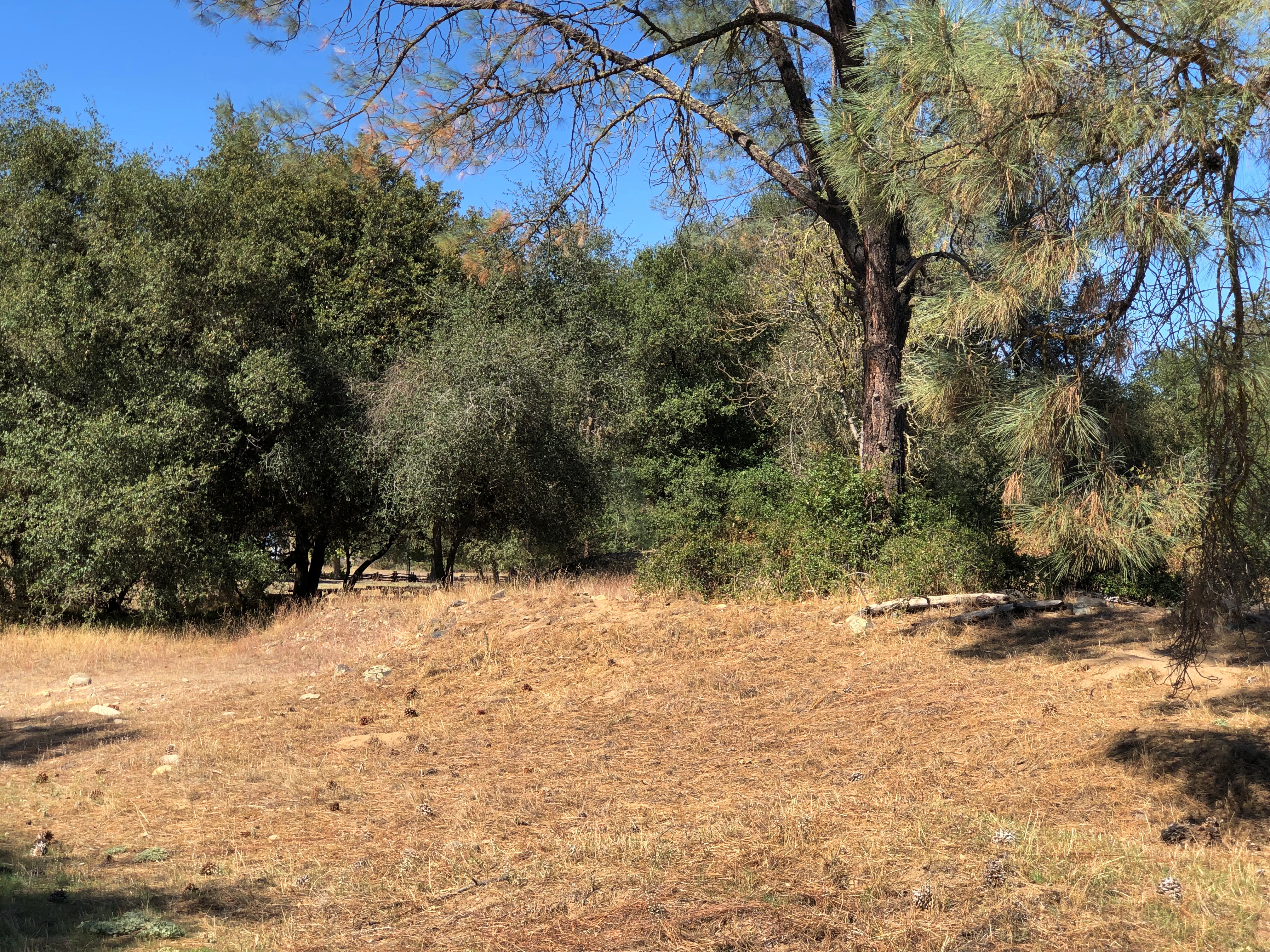
The path across the field, away from the parking lot, offered some more stunners.Yosemite National Park Yosemite National Park

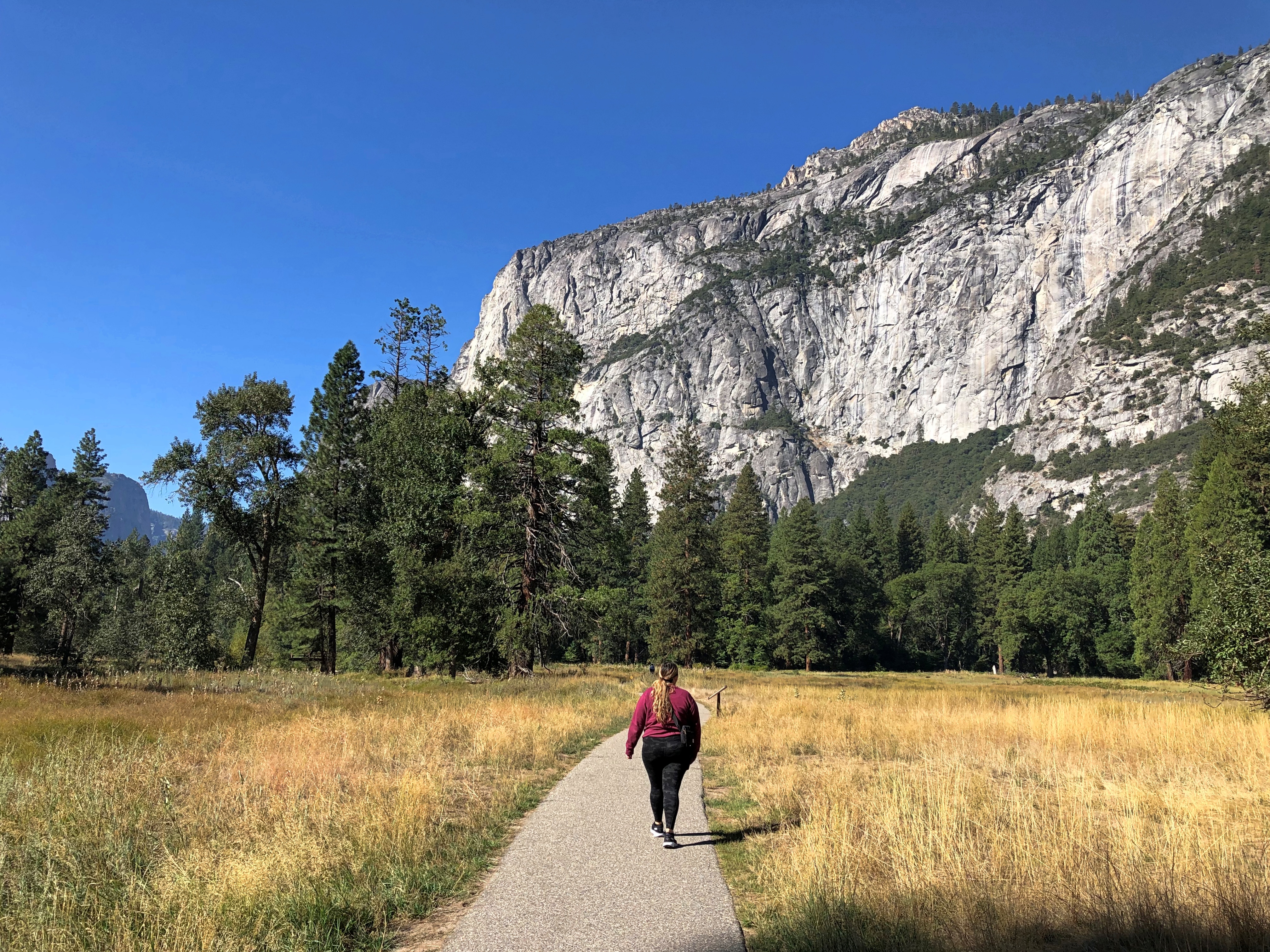
After crossing one of the valley’s twin roads (one goes each way), we headed for the Lower Yosemite Fall.Yosemite National Park

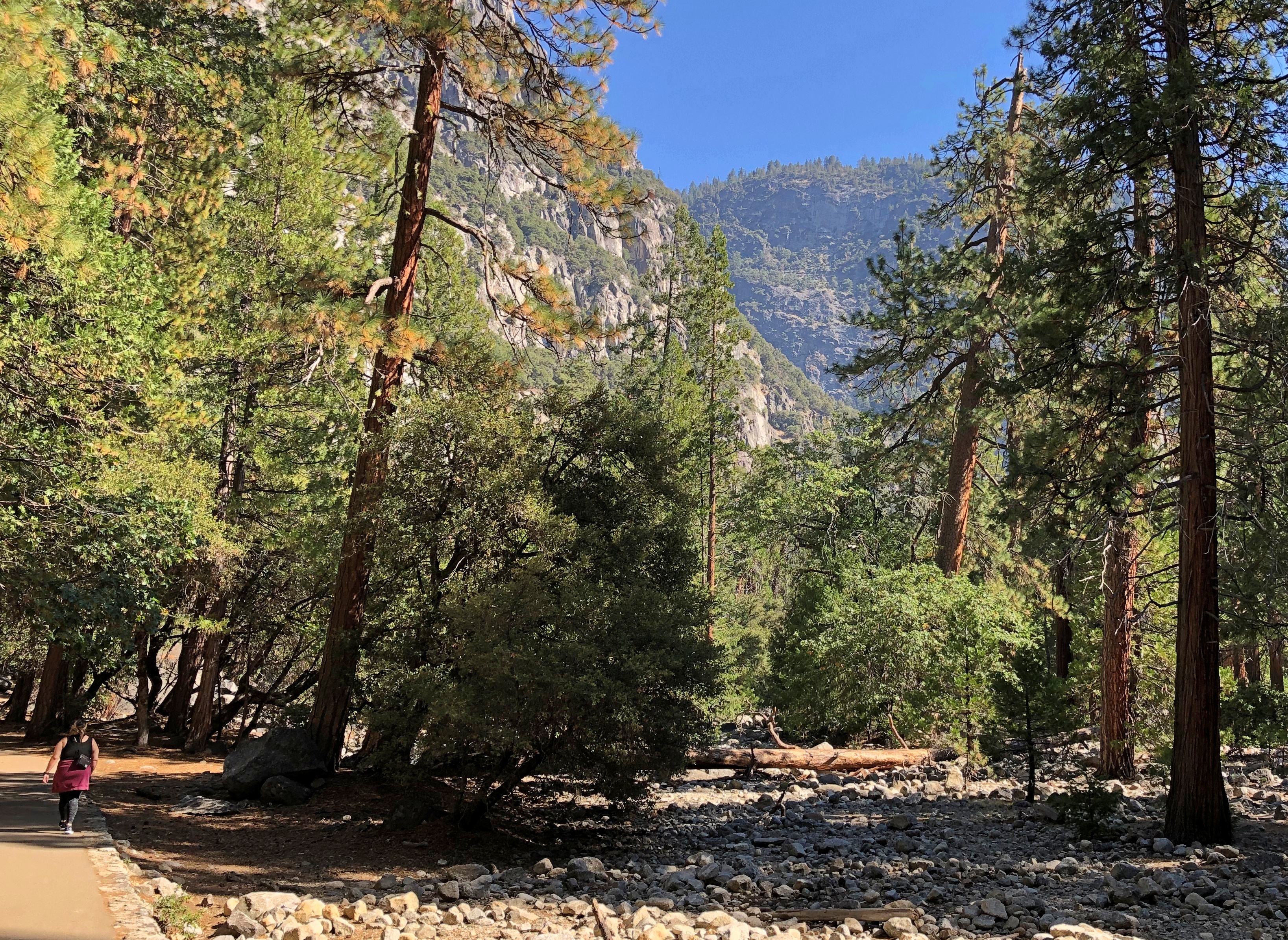
Big rocks make smaller ones.
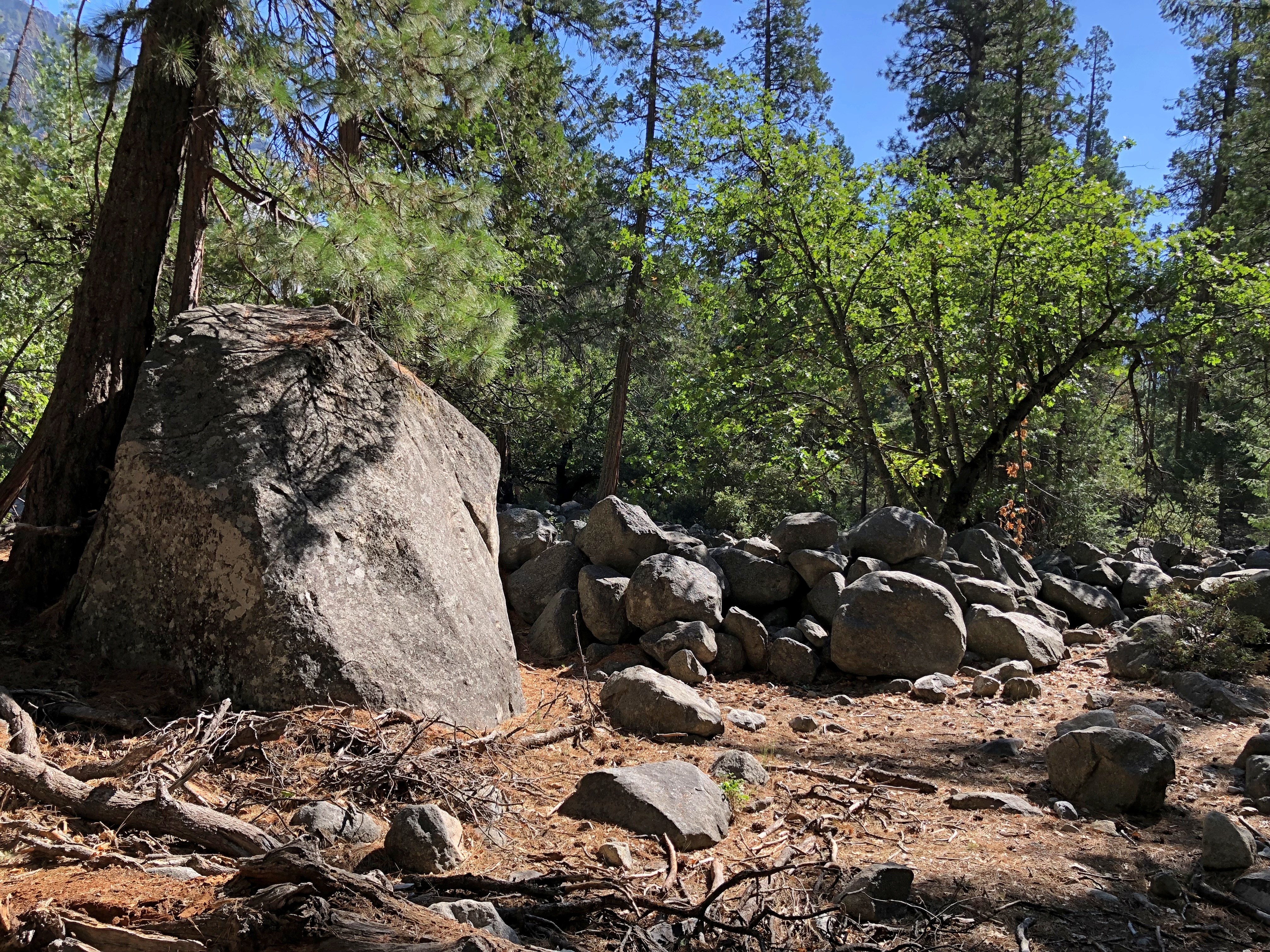
Yosemite National Park

The fall.Yosemite National Park

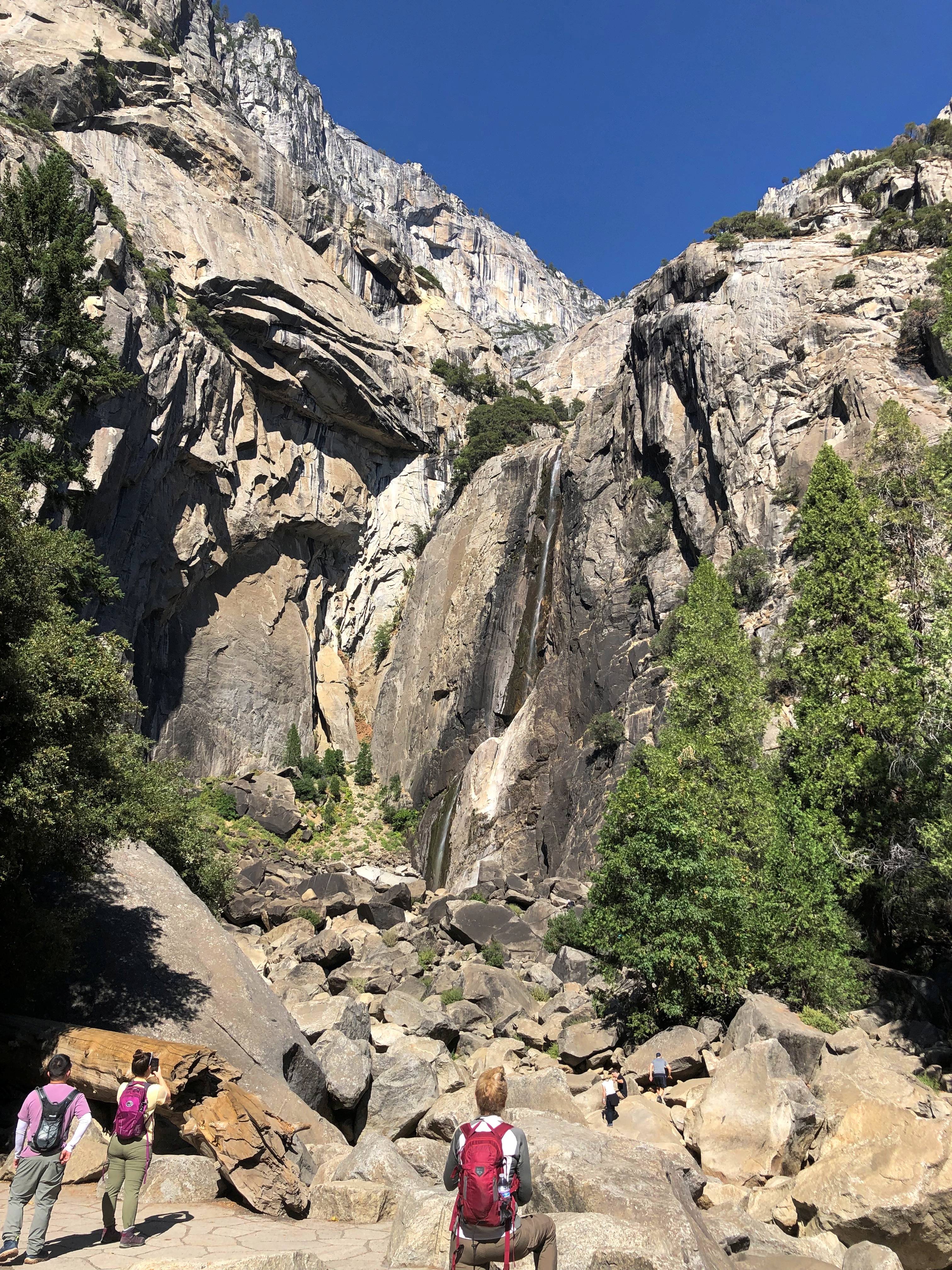
The image doesn’t capture it too well, but there was a ribbon of water or two coming down the side of the cliff. Autumn isn’t the season if you want majestic water volume. Spring has been the season for that for millennia, but maybe not as much in recent decades.

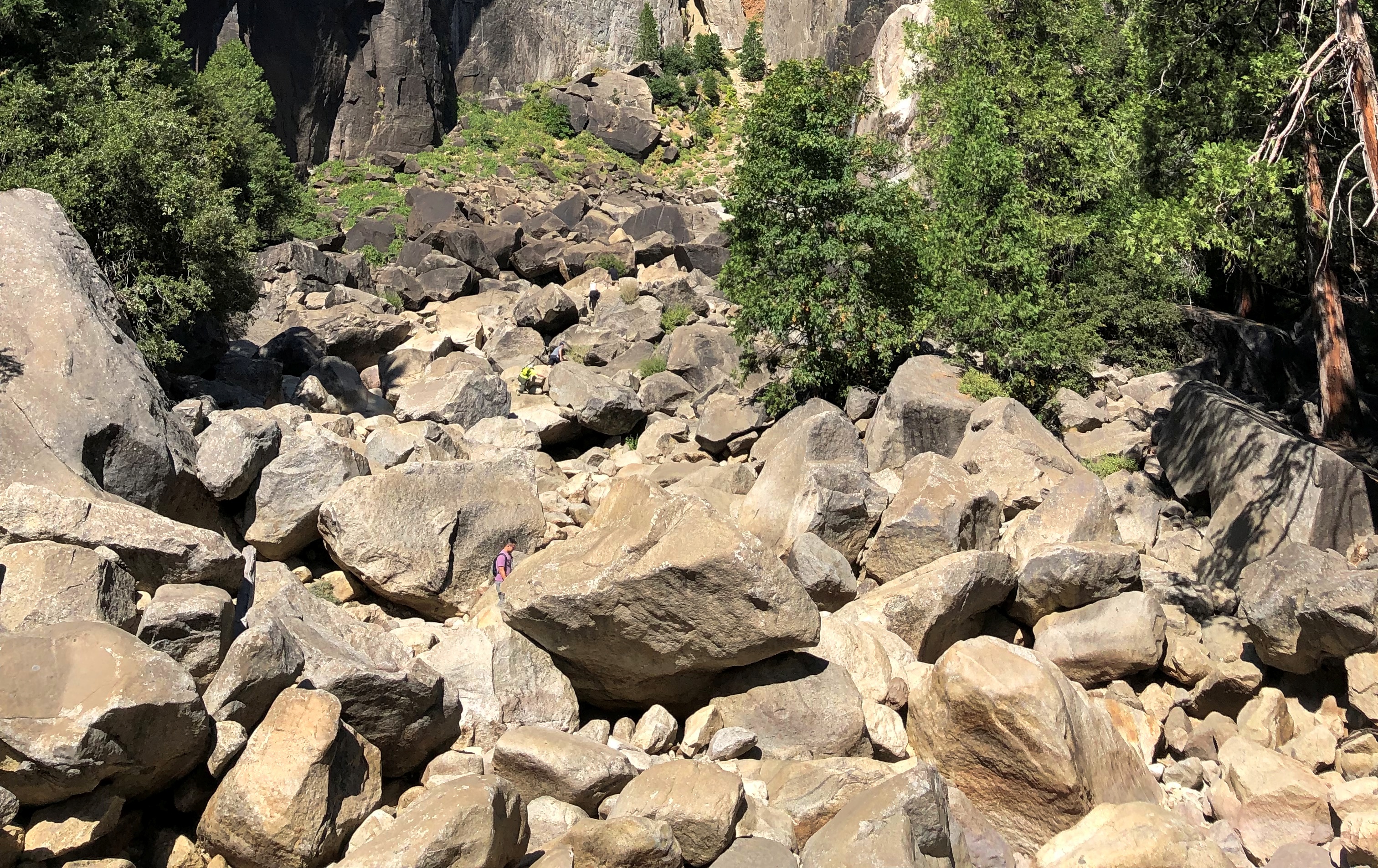
Rocks and more rocks. Erosion in action.Yosemite National Park
Yosemite National Park

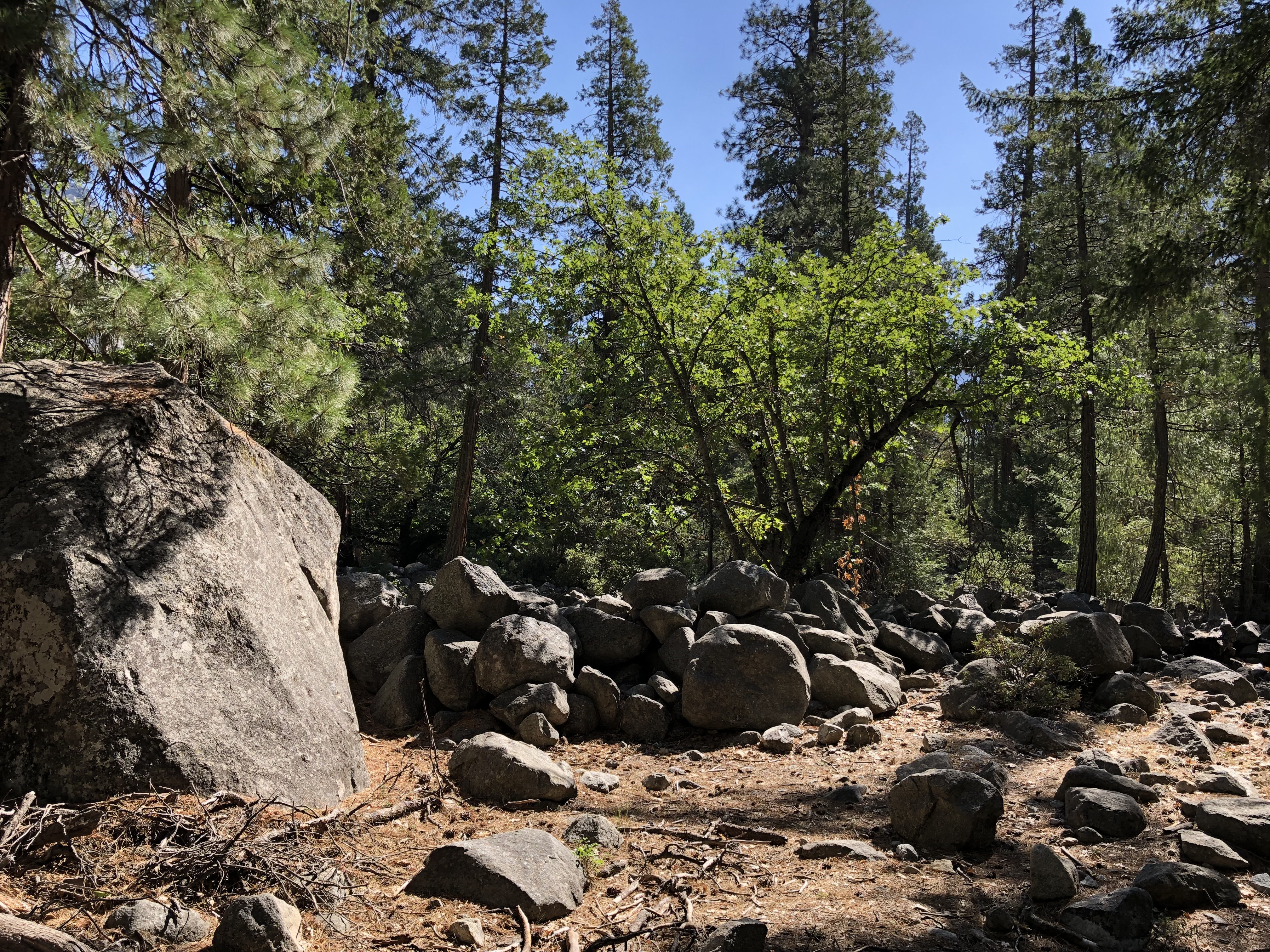
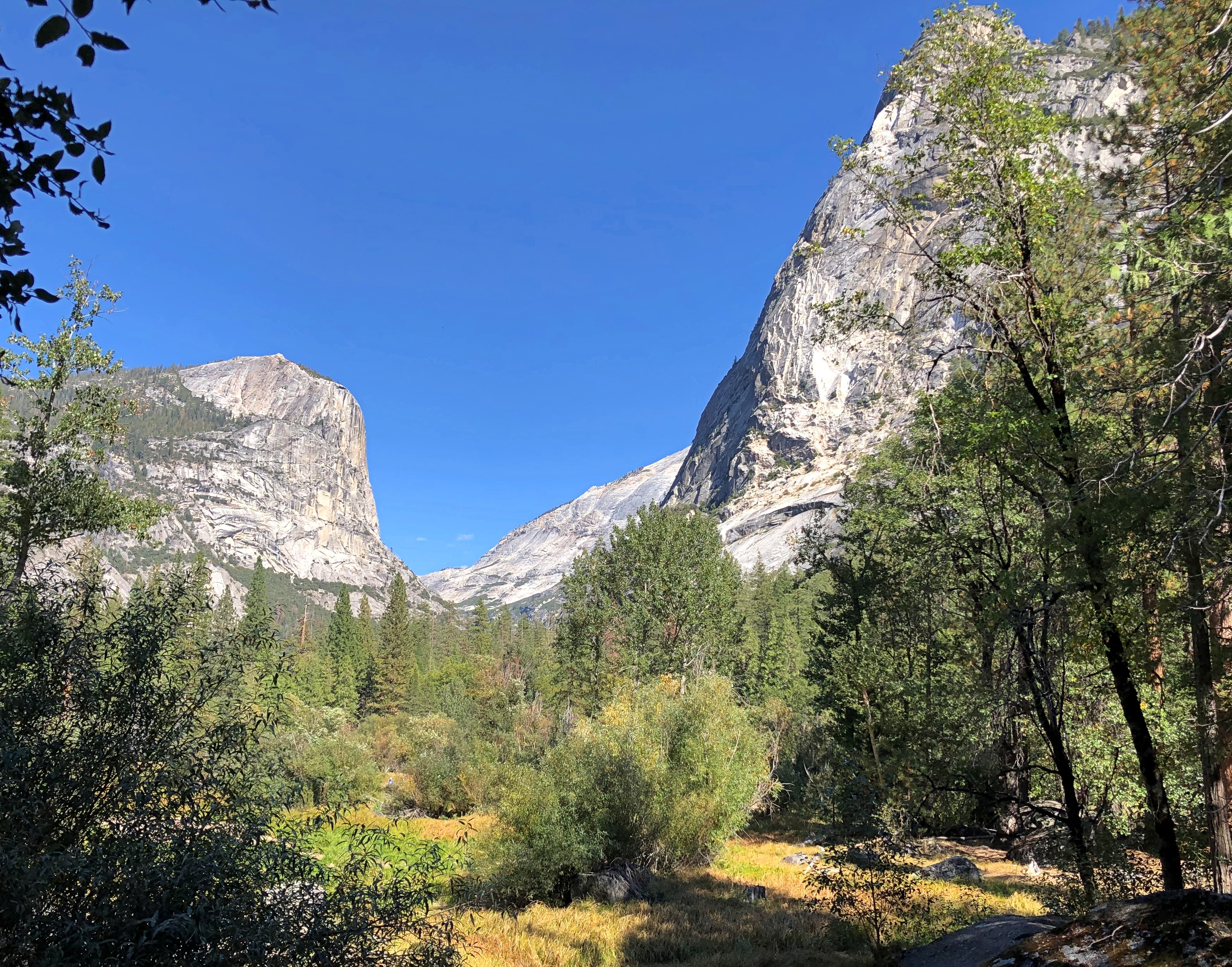
Mirror Lake sounded like another good destination, walkable from the valley floor. First, Tenaya Creek.Yosemite National Park

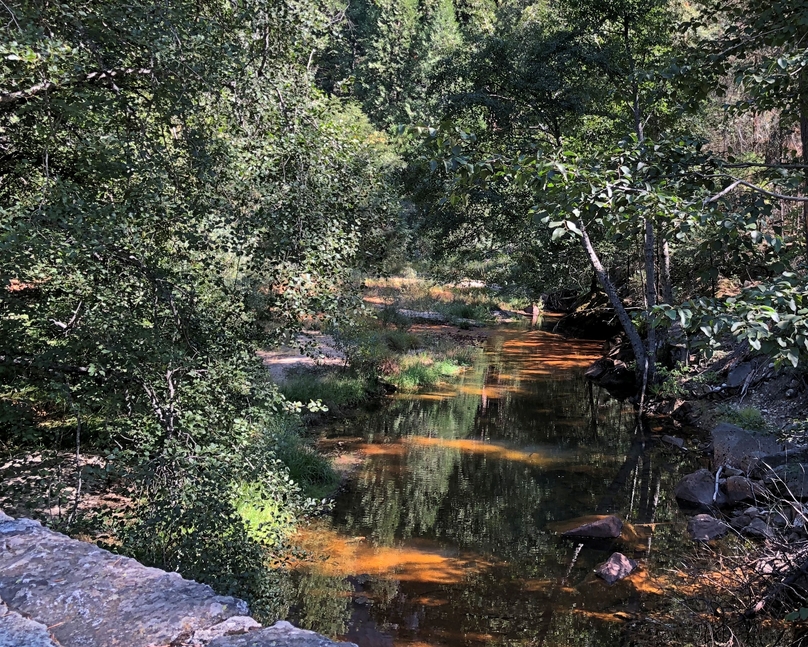
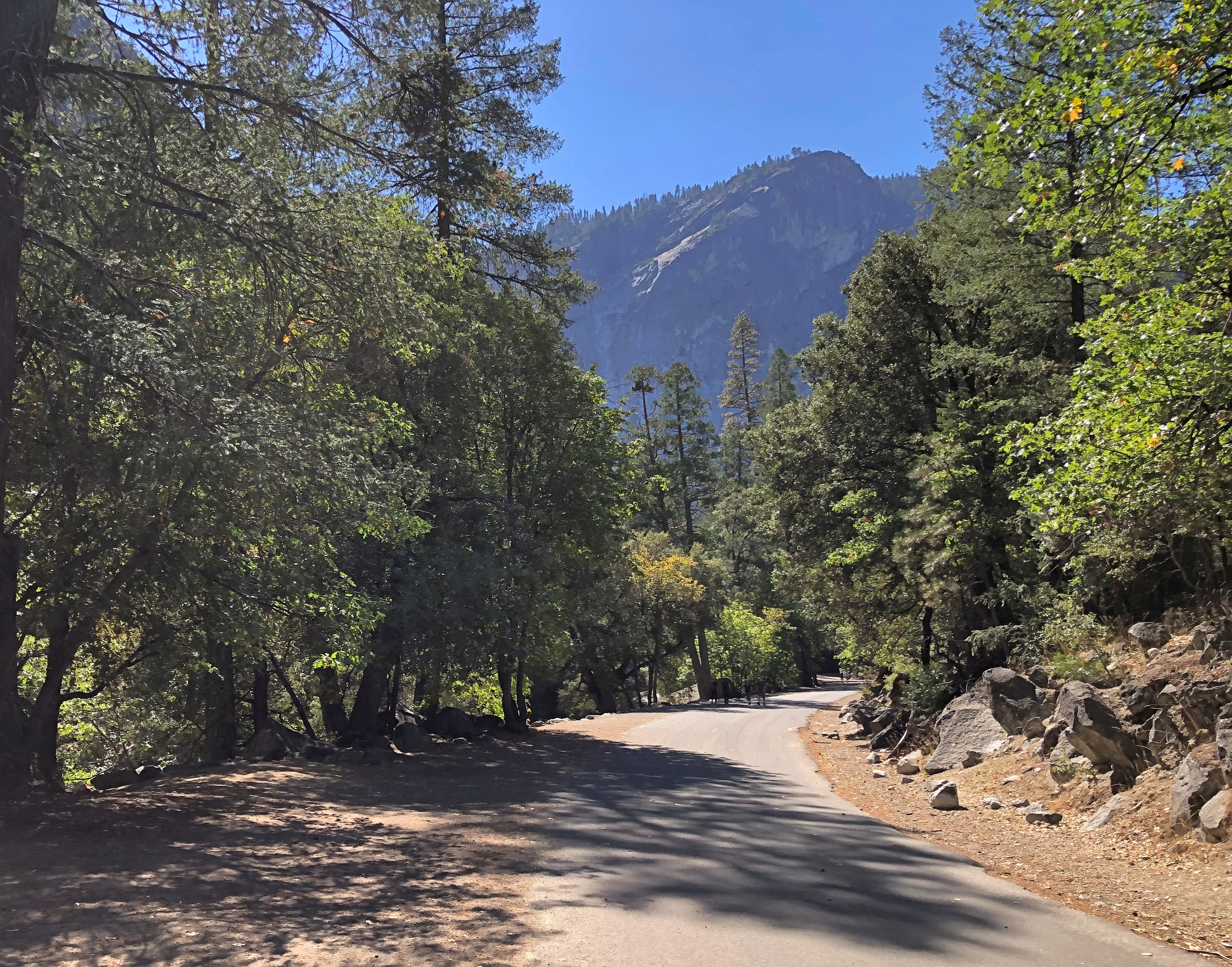
Along a road used as a walking path.Yosemite National Park Yosemite National Park Yosemite National Park

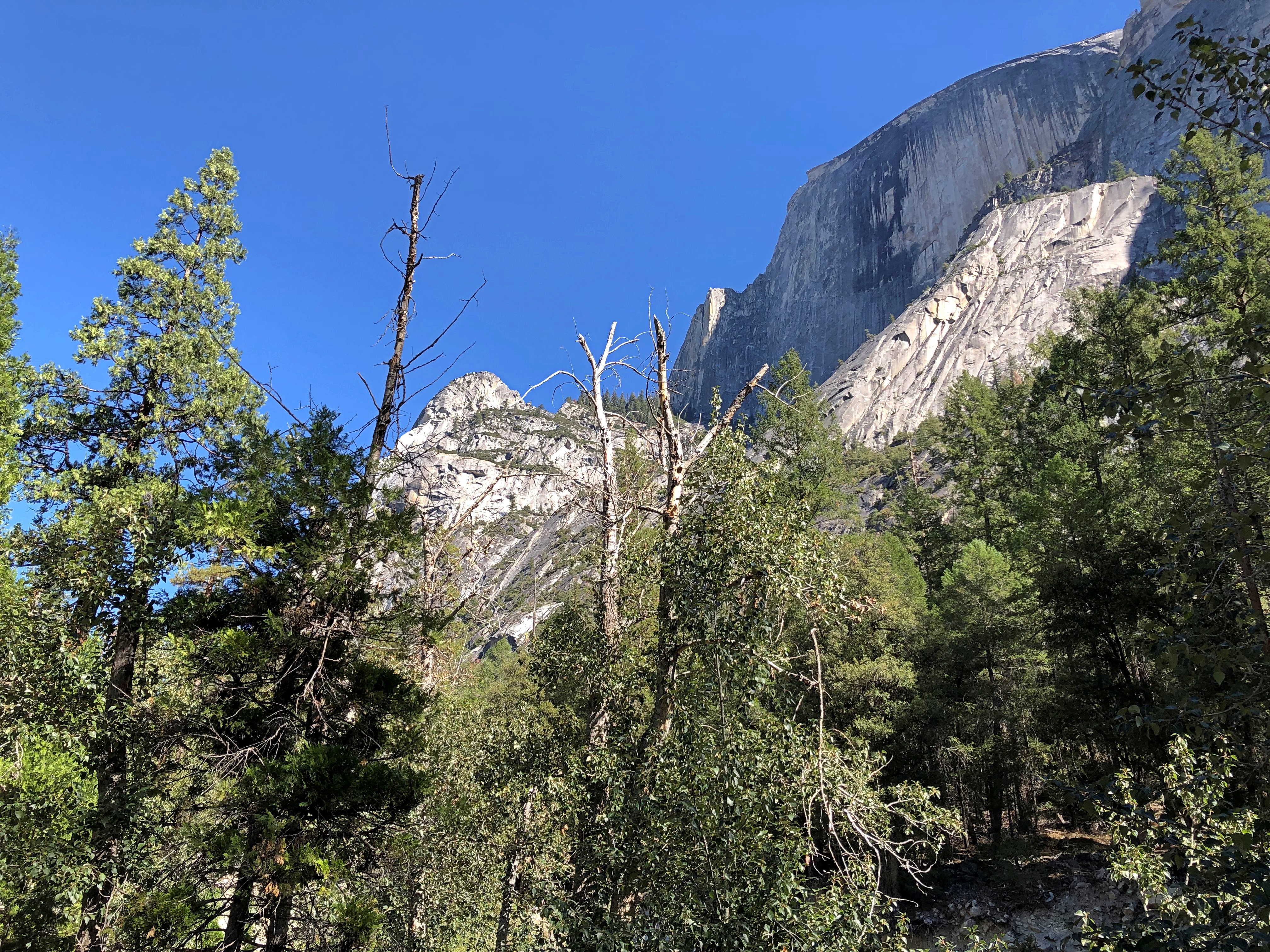
Just off the path further on — it was by now was a regular footpath — there’s a patch of cairns, if that term applies in America (and why not?). Temporary, human-arranged rock formations. But only a little more temporary than the rock and bolder piles calving from the surrounding cliffs.Yosemite National Park

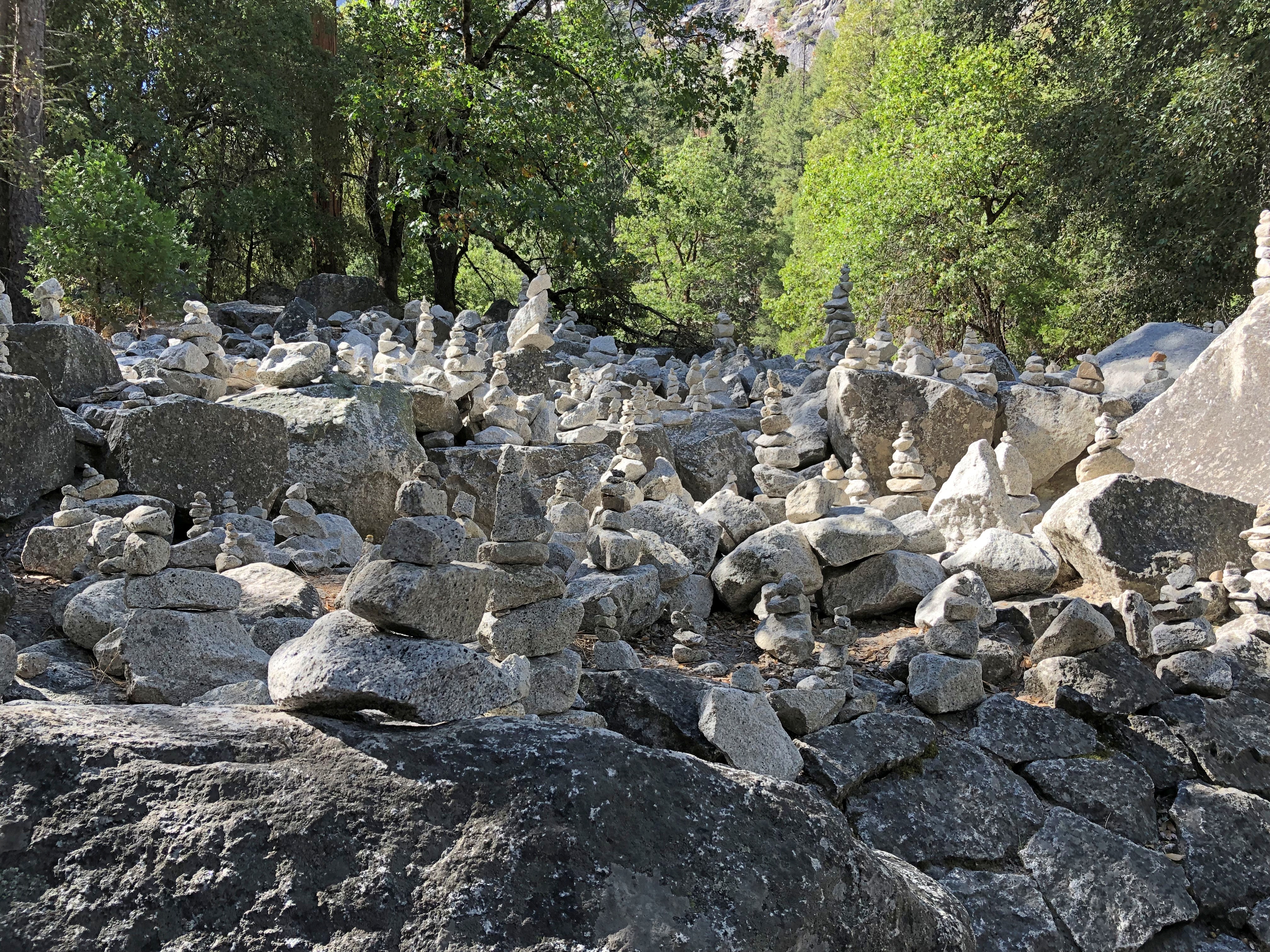
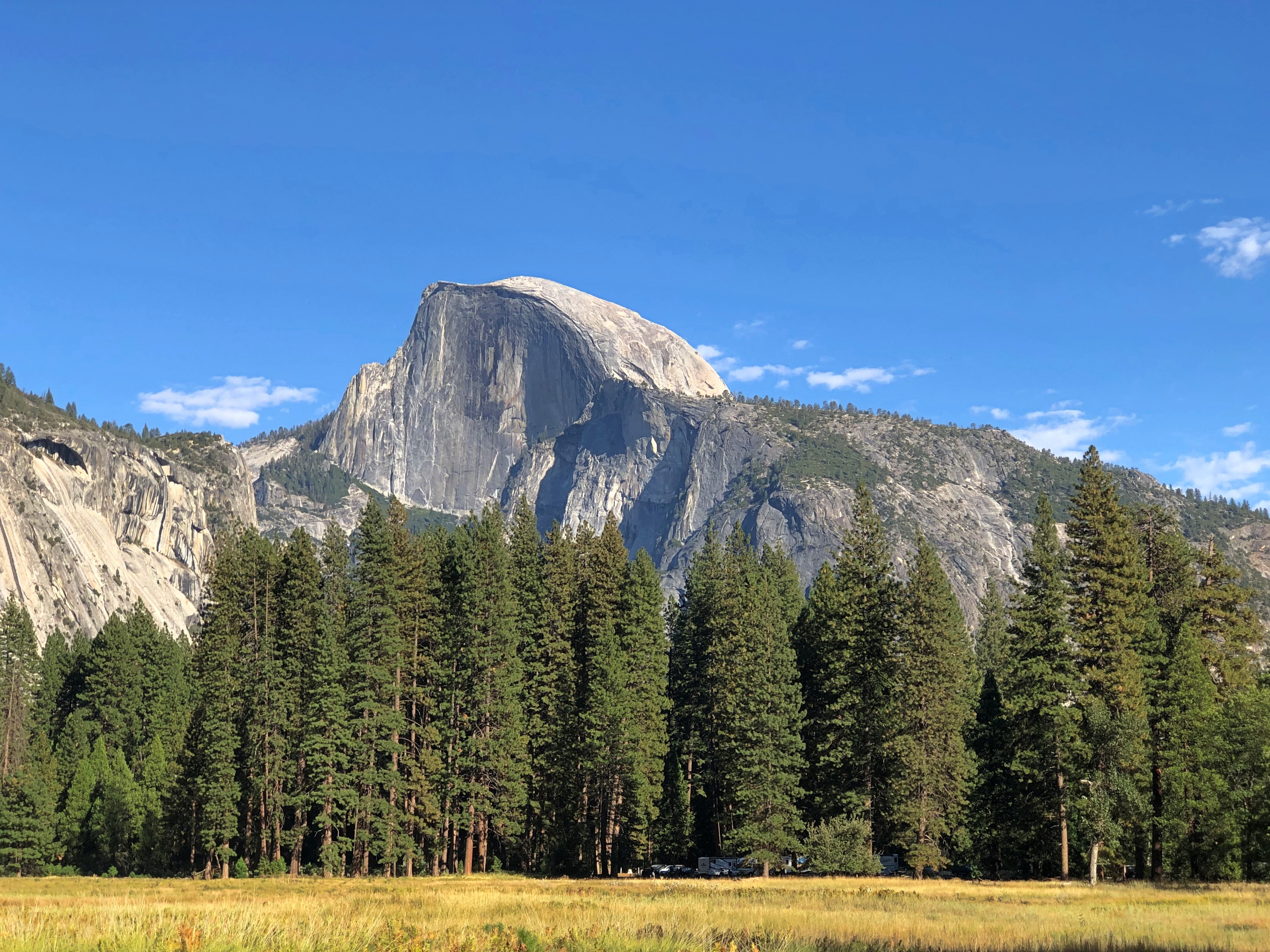
Half Dome. Famed in accounts of the people who have climbed, countless photos and a 2005 U.S. quarter dollar. Ansel Adams’ ashes were scattered up there.Half Dome

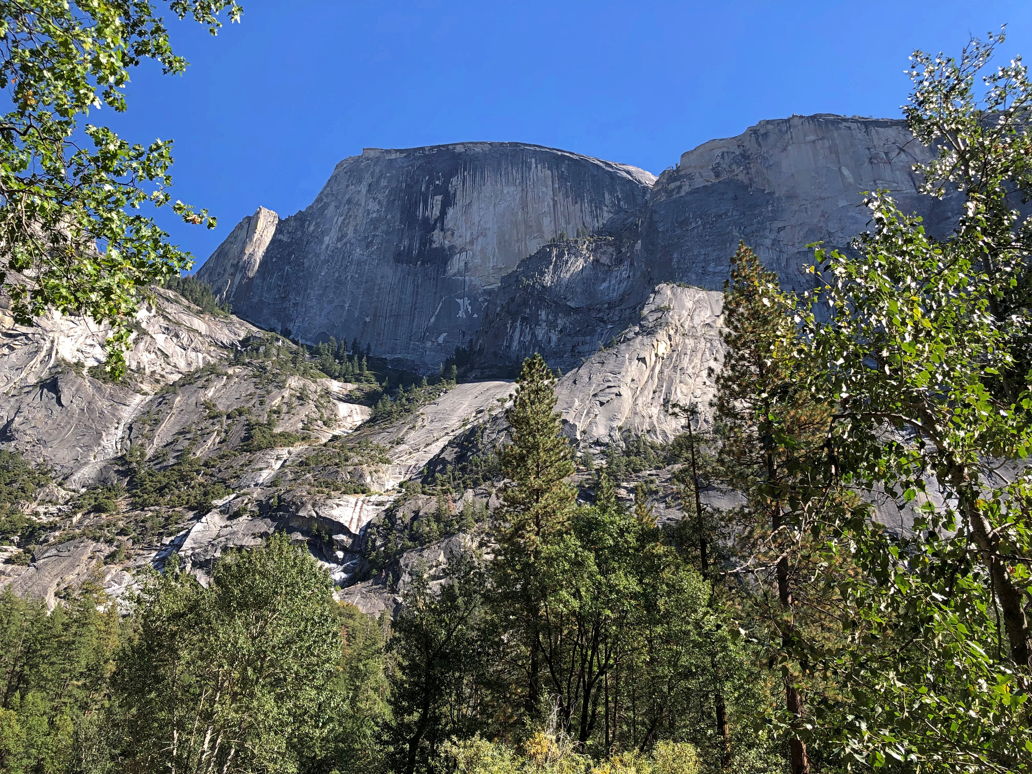
If Google Images is to be believed, that’s a slightly unusual angle, but only slightly. I saw the feature from a few other places, and its granite heft never disappointed.

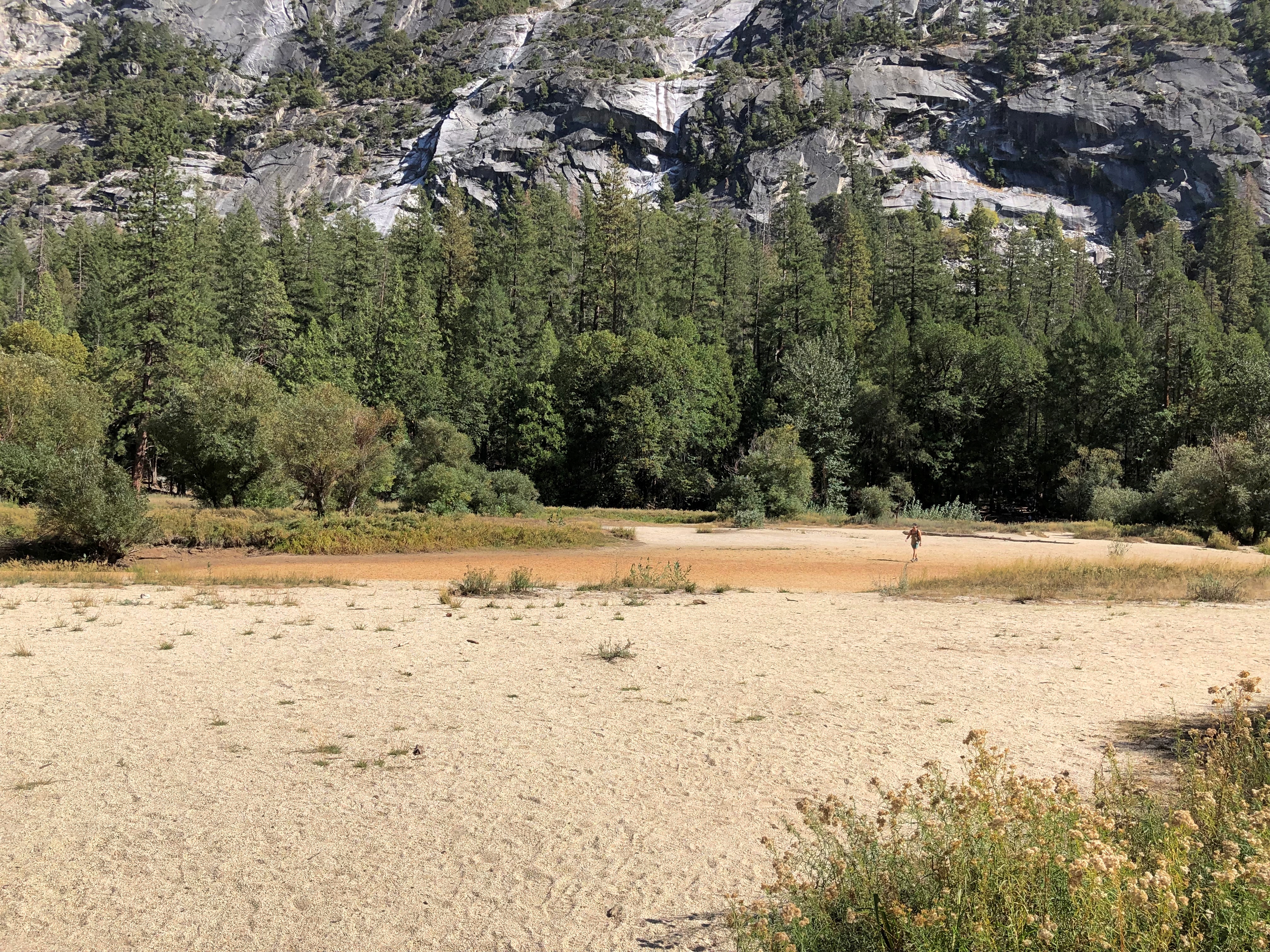
Mirror Lake, dead ahead.
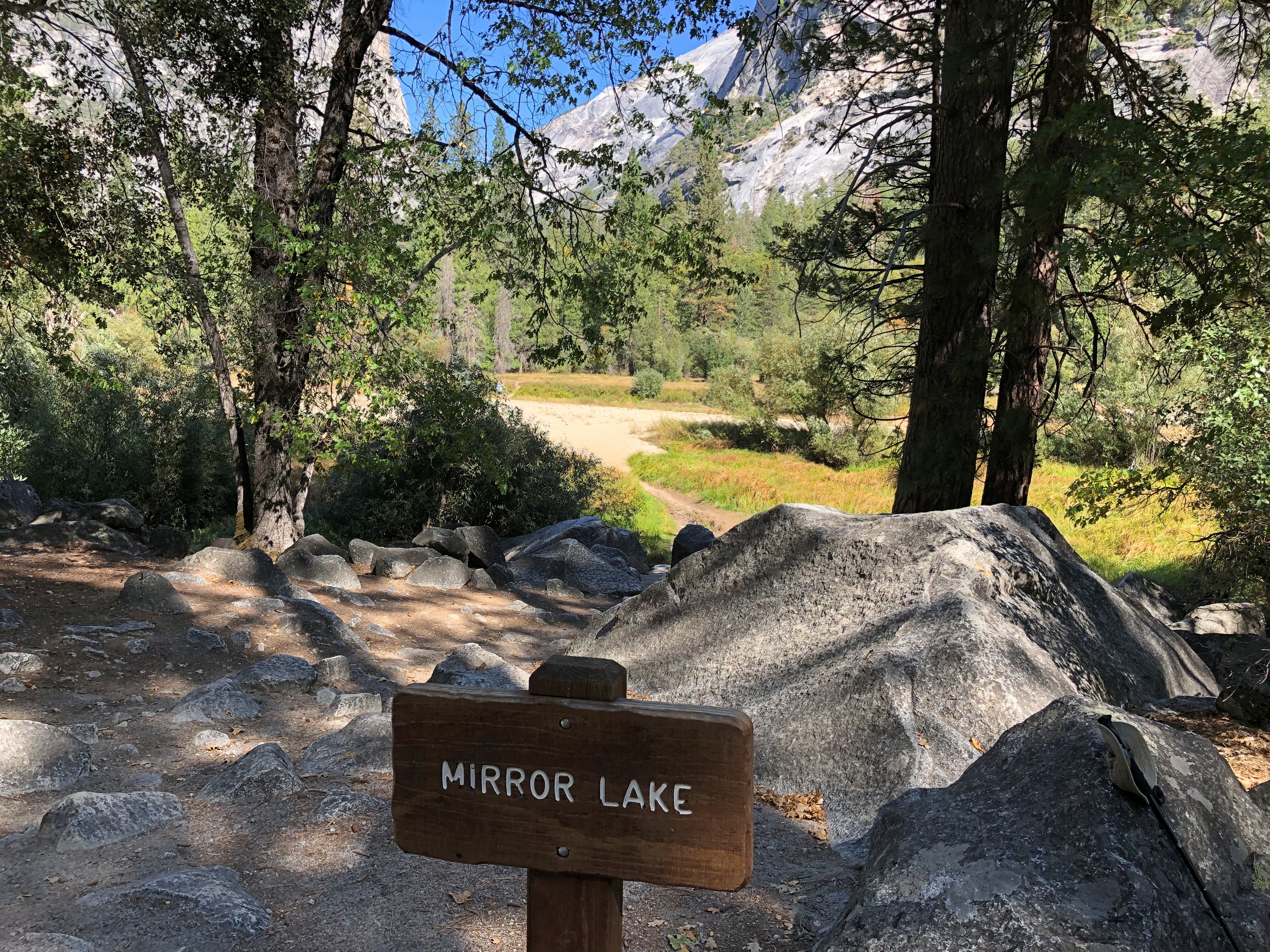
Mirror Lake, Yosemite

Dry.Mirror Lake, Yosemite Mirror Lake, Yosemite

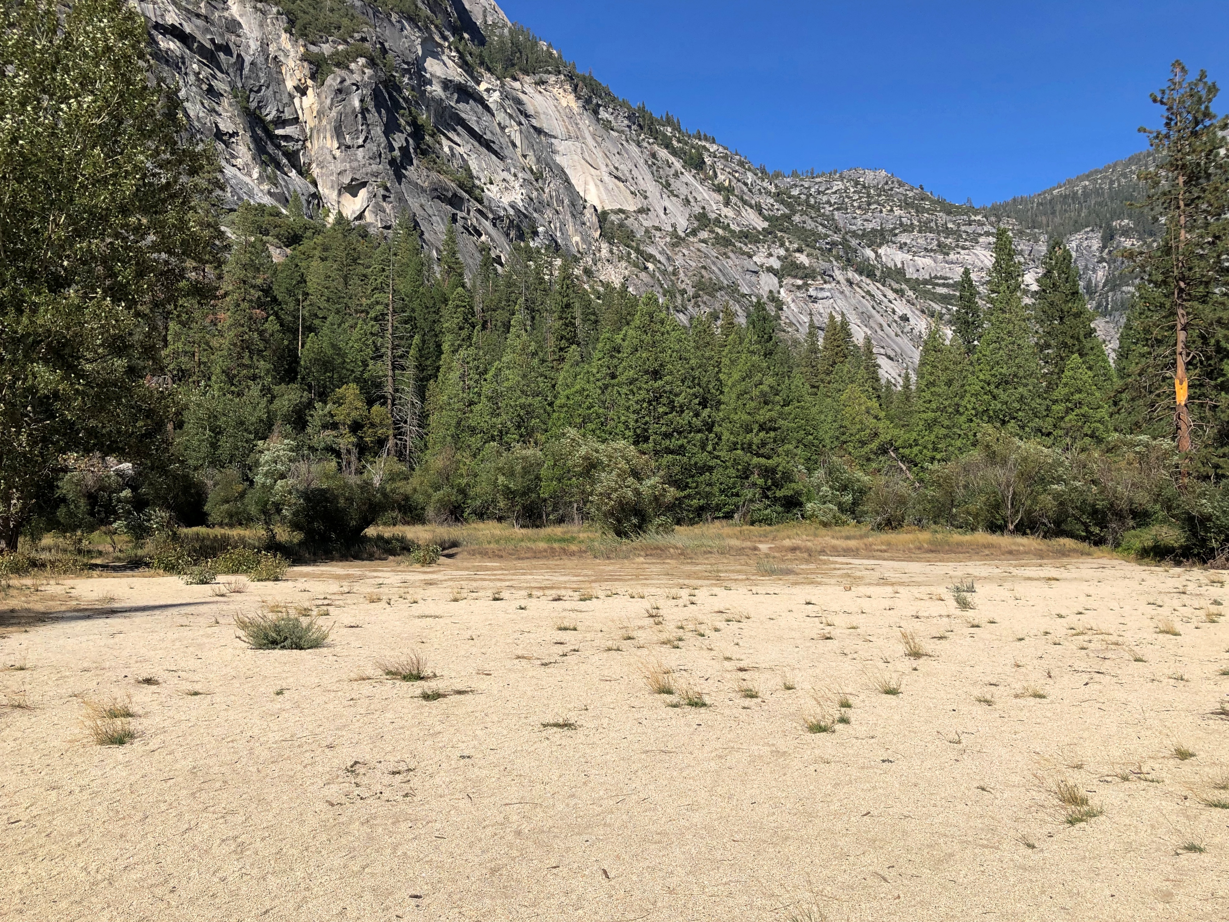
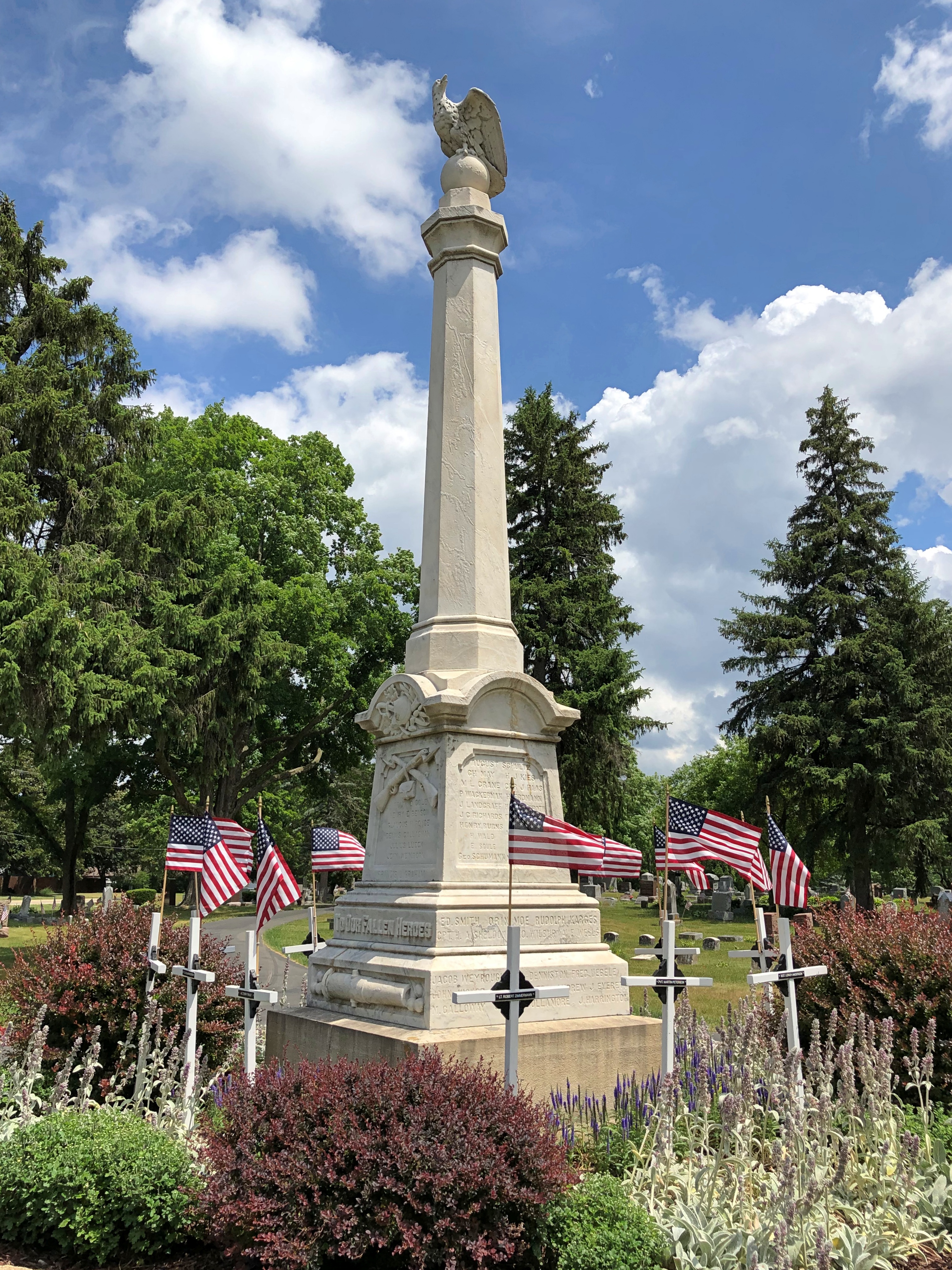
The park shuttle bus had taken us from Yosemite Village to the trailhead for Mirror Lake. We returned to the trailhead and took the bus back to Yosemite Village, which really is a village with a small population (about 330), a school, clinic and post office, but also a complex of hotel rooms and museums and NPS service buildings, including park HQ.

Those buildings were the only places in the Valley that day that sported genuine crowds. Other trails and sights were well populated, but not to the point of distraction.

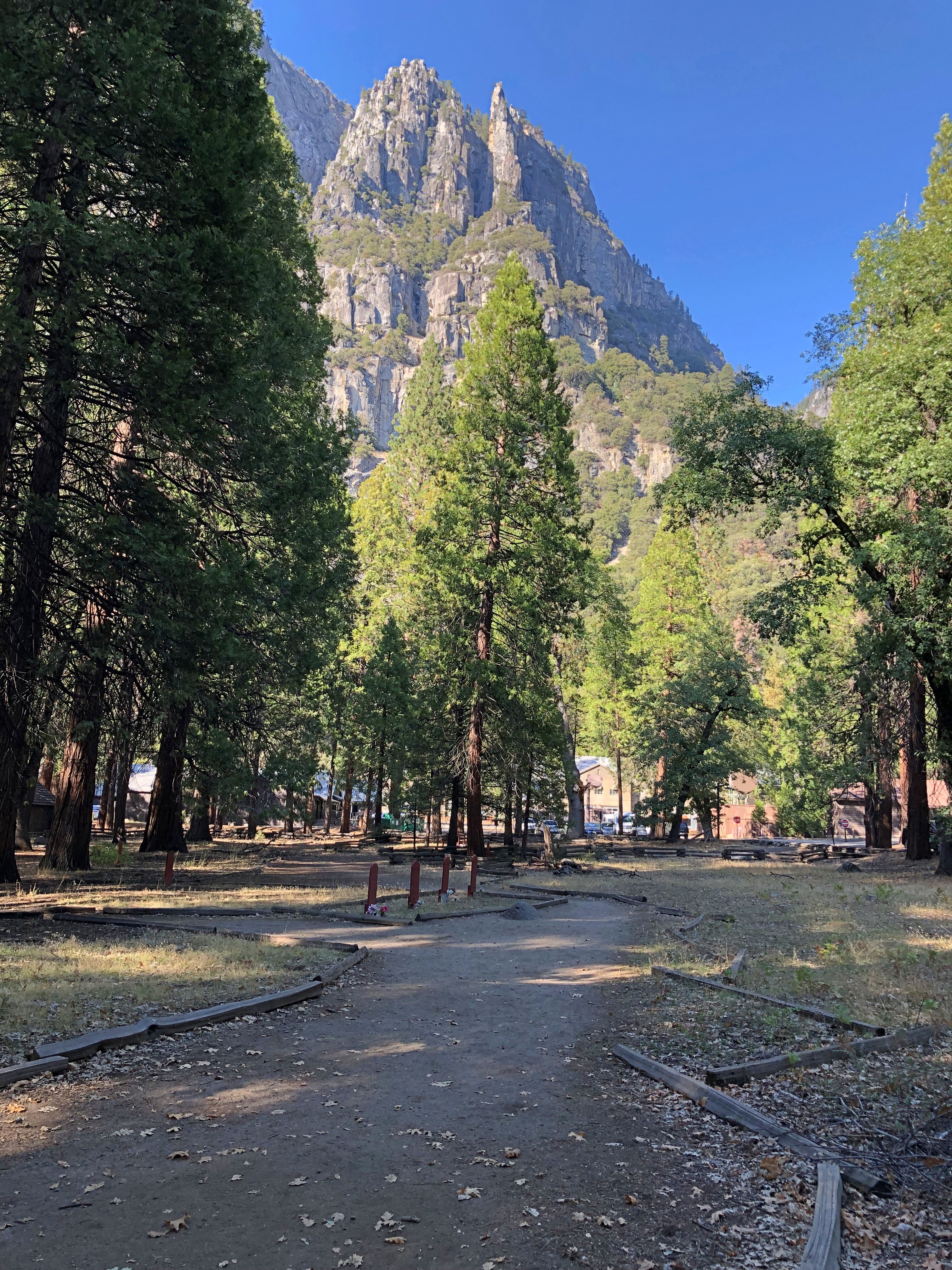
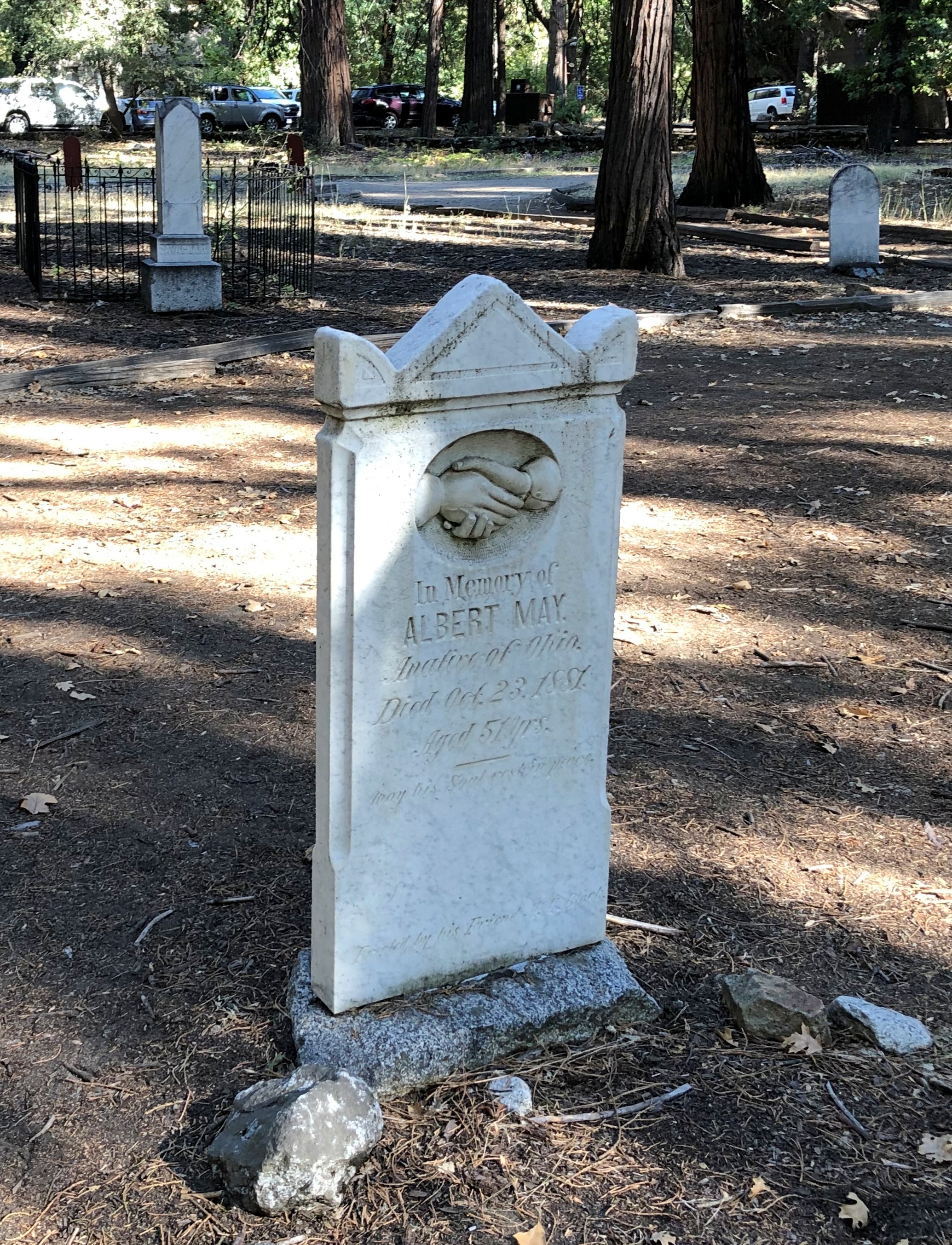
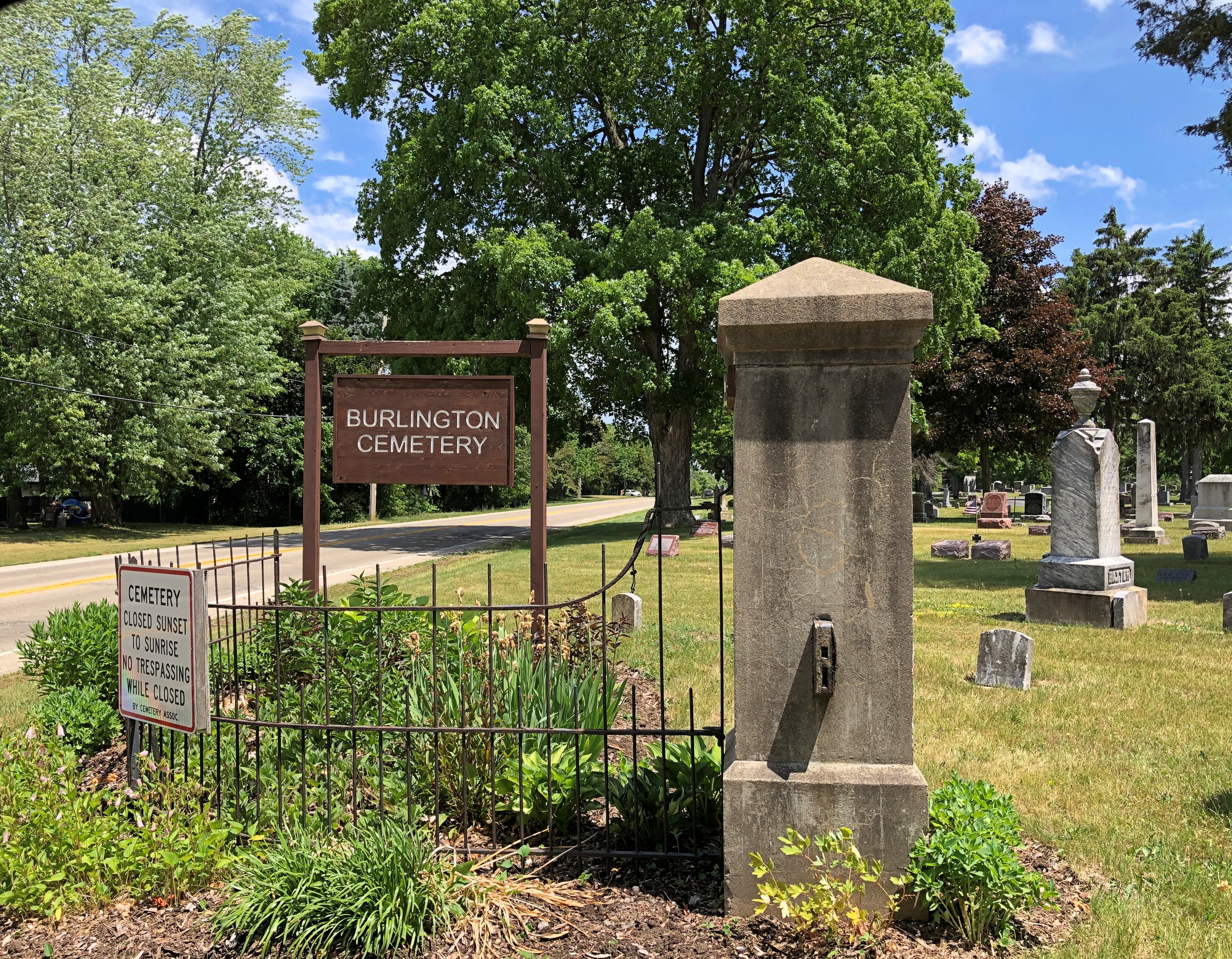
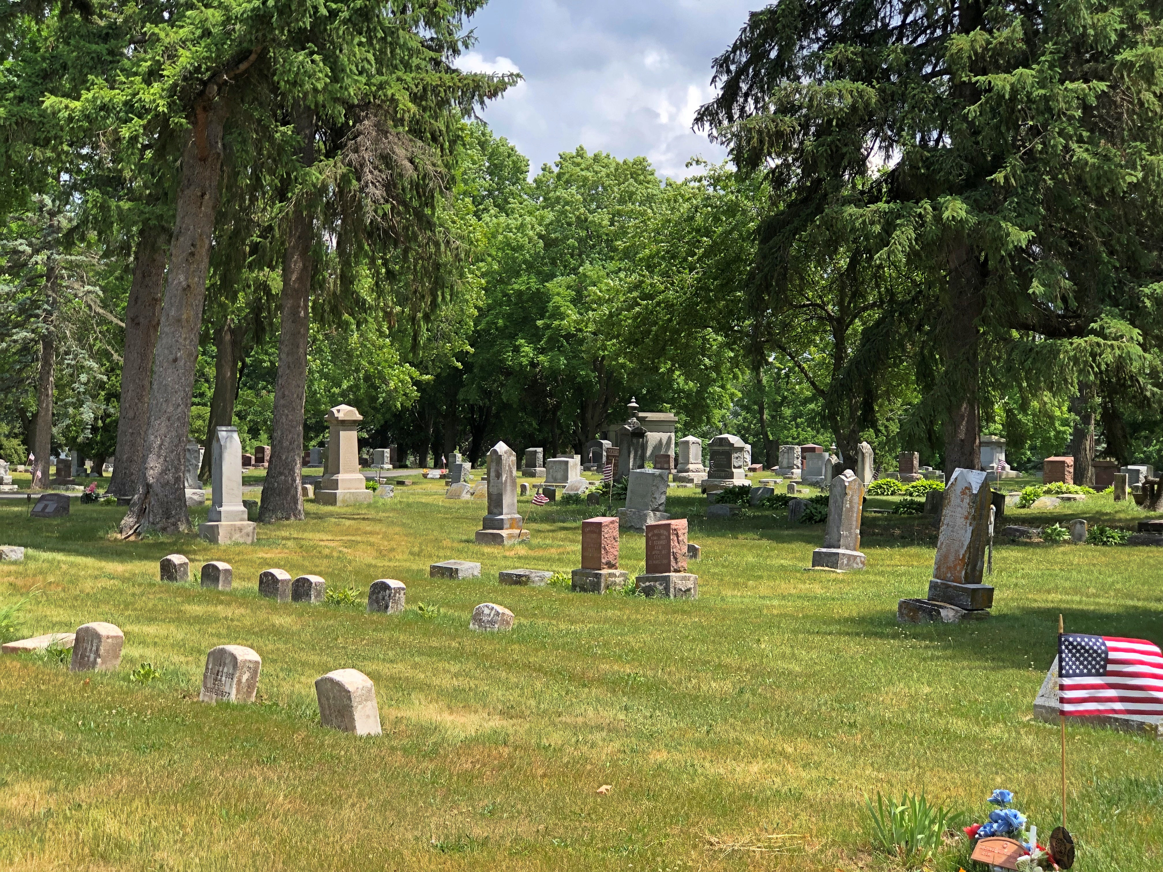
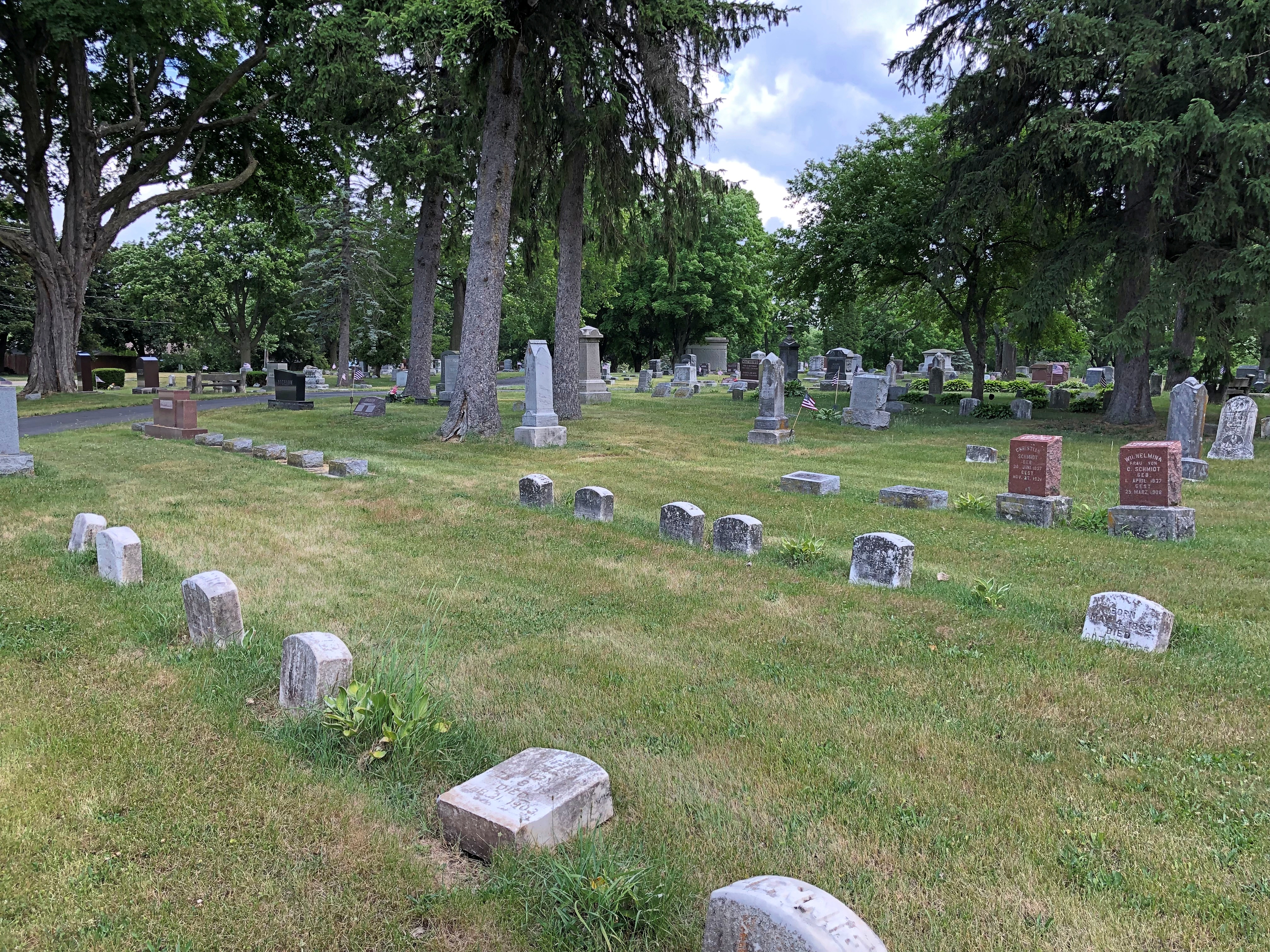
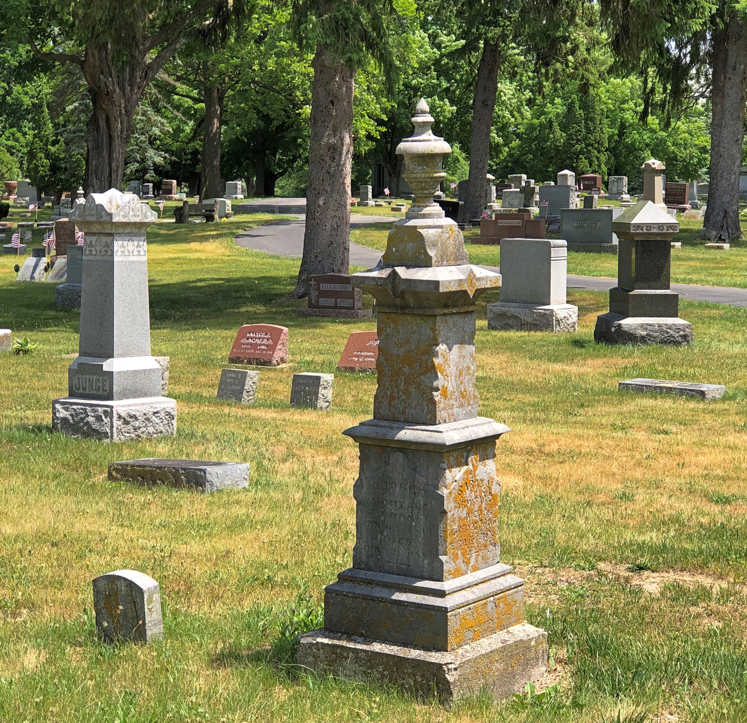
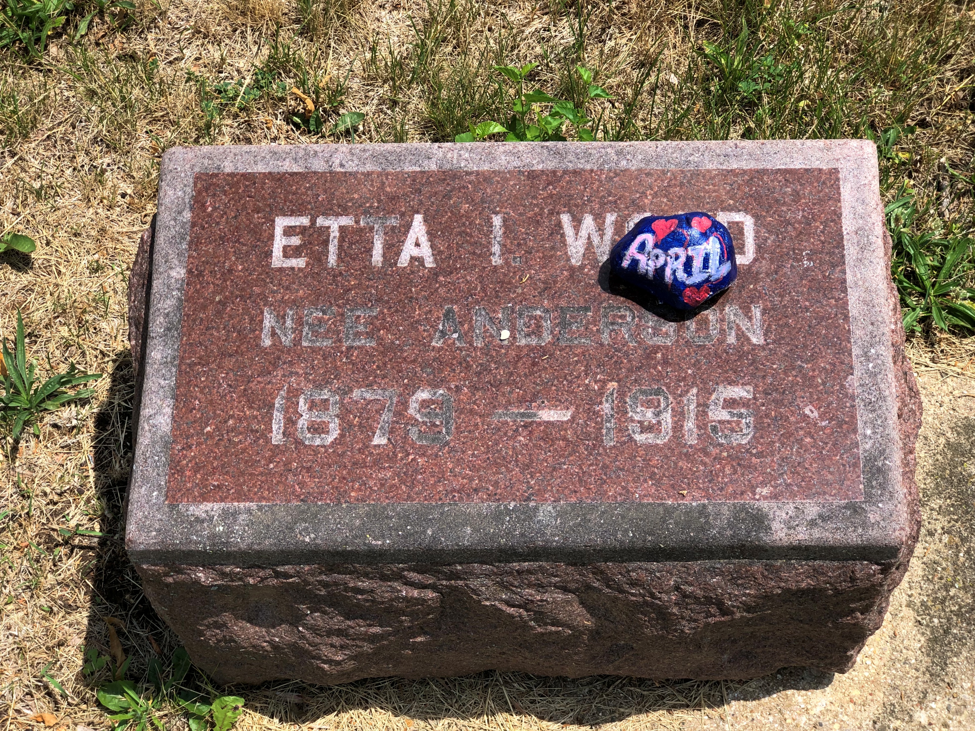
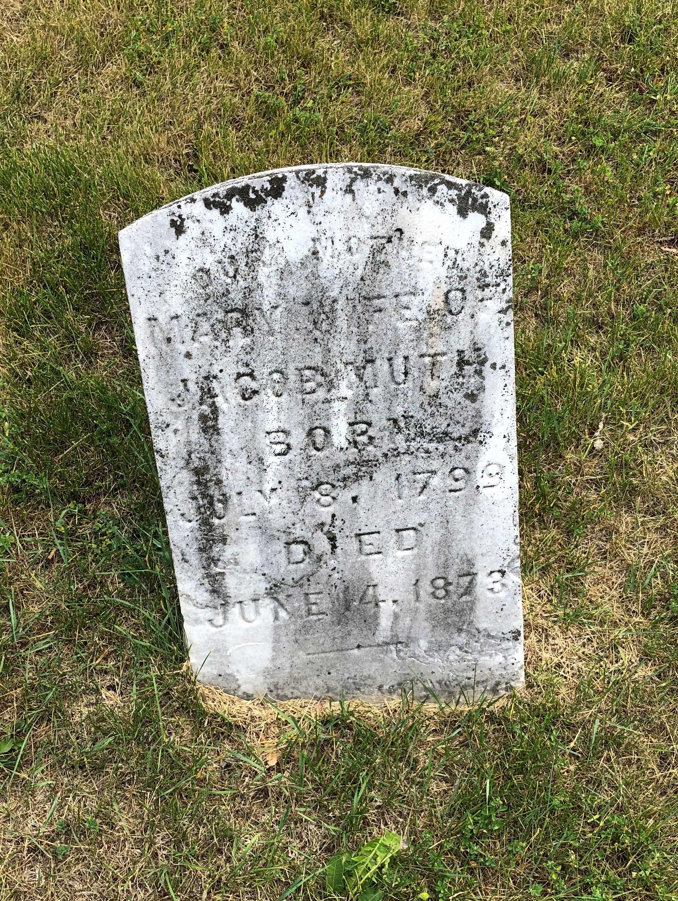
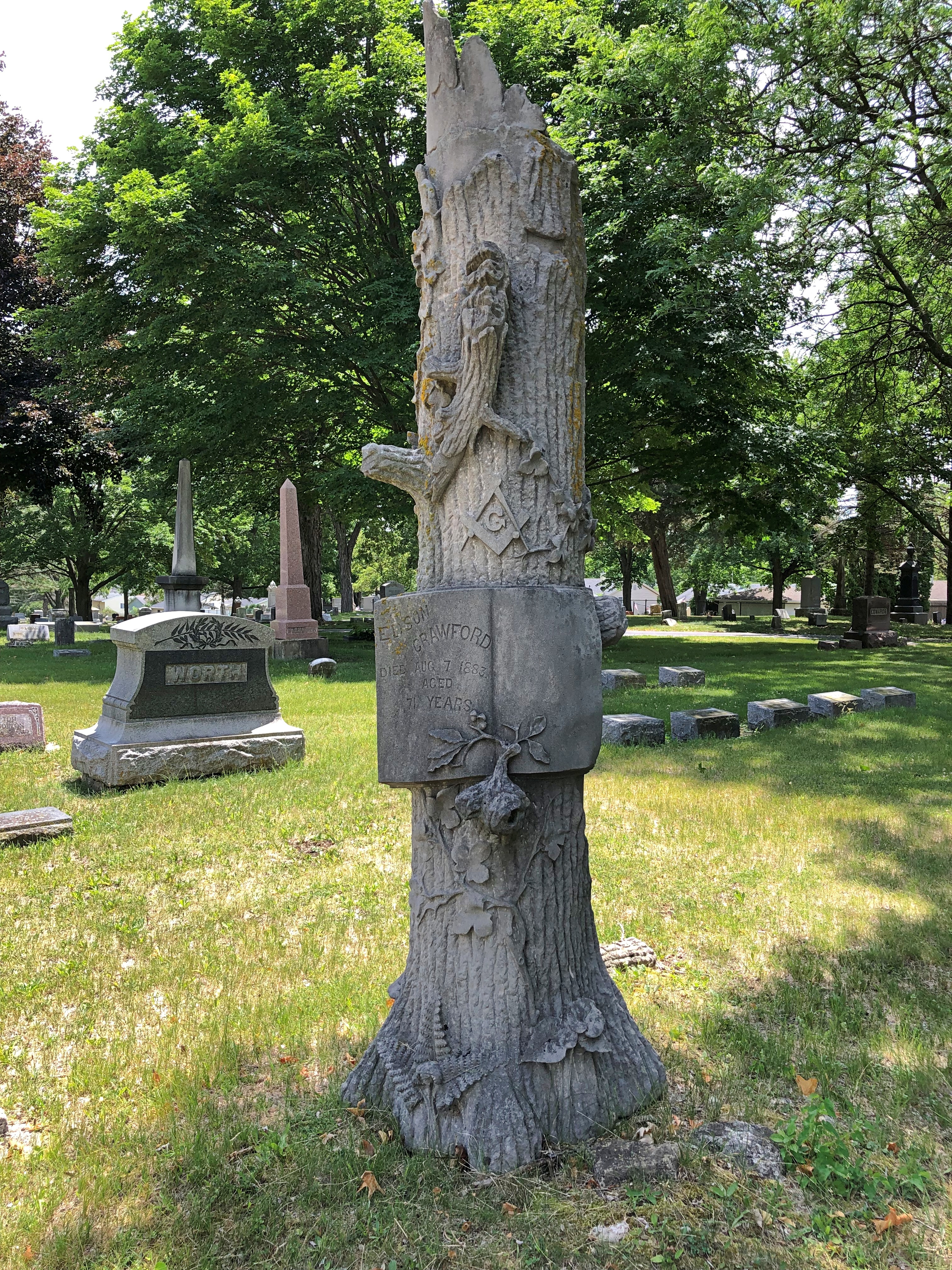
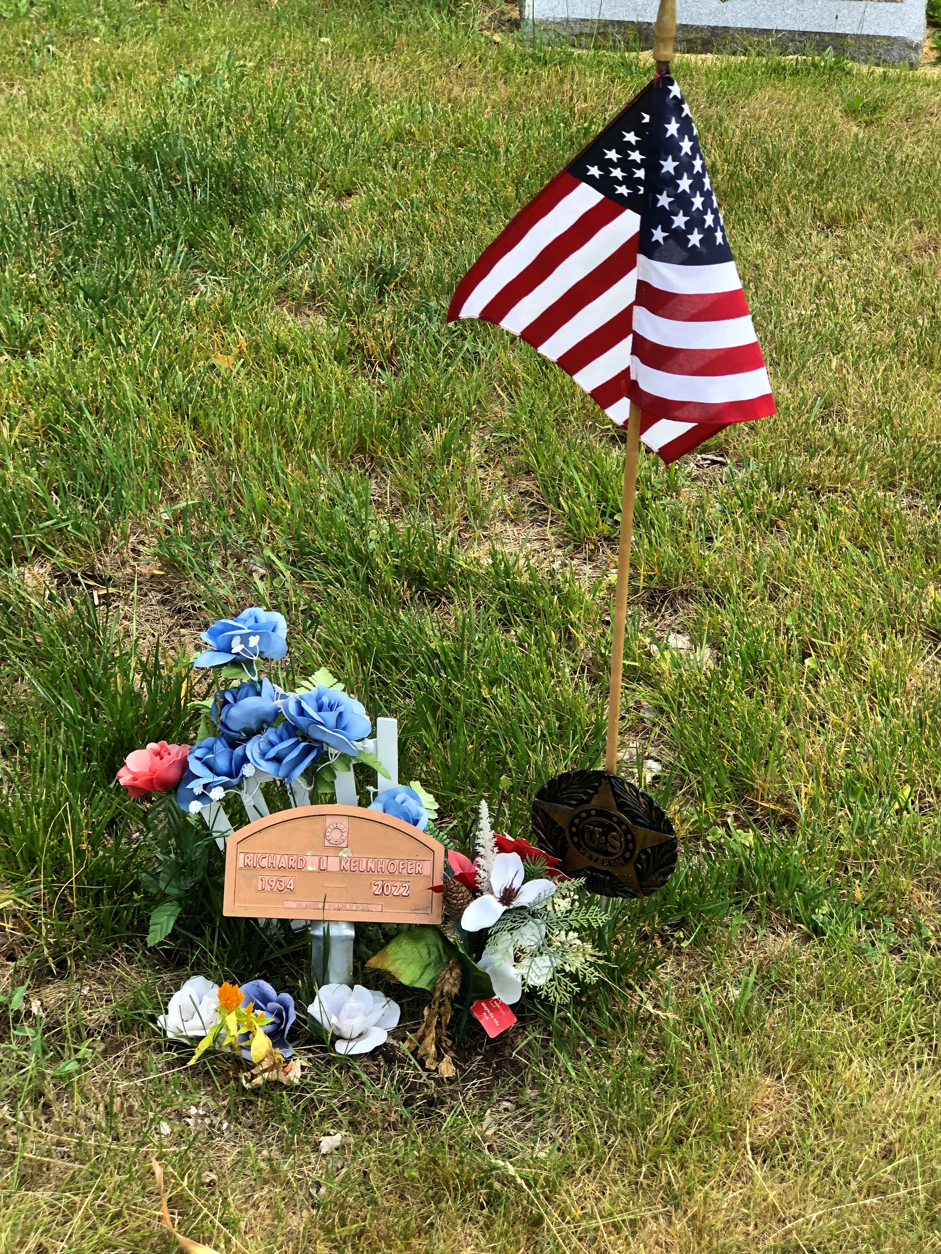
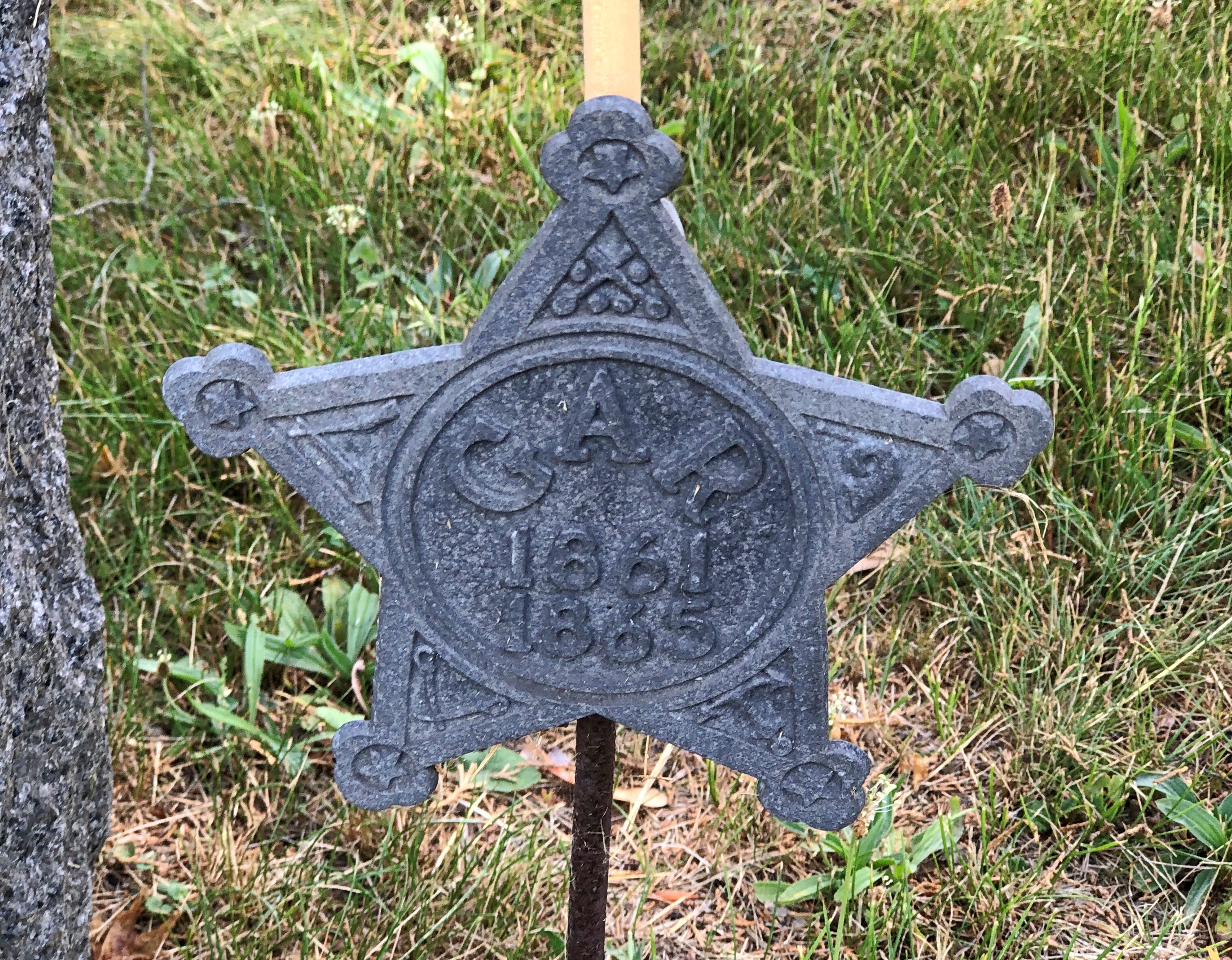
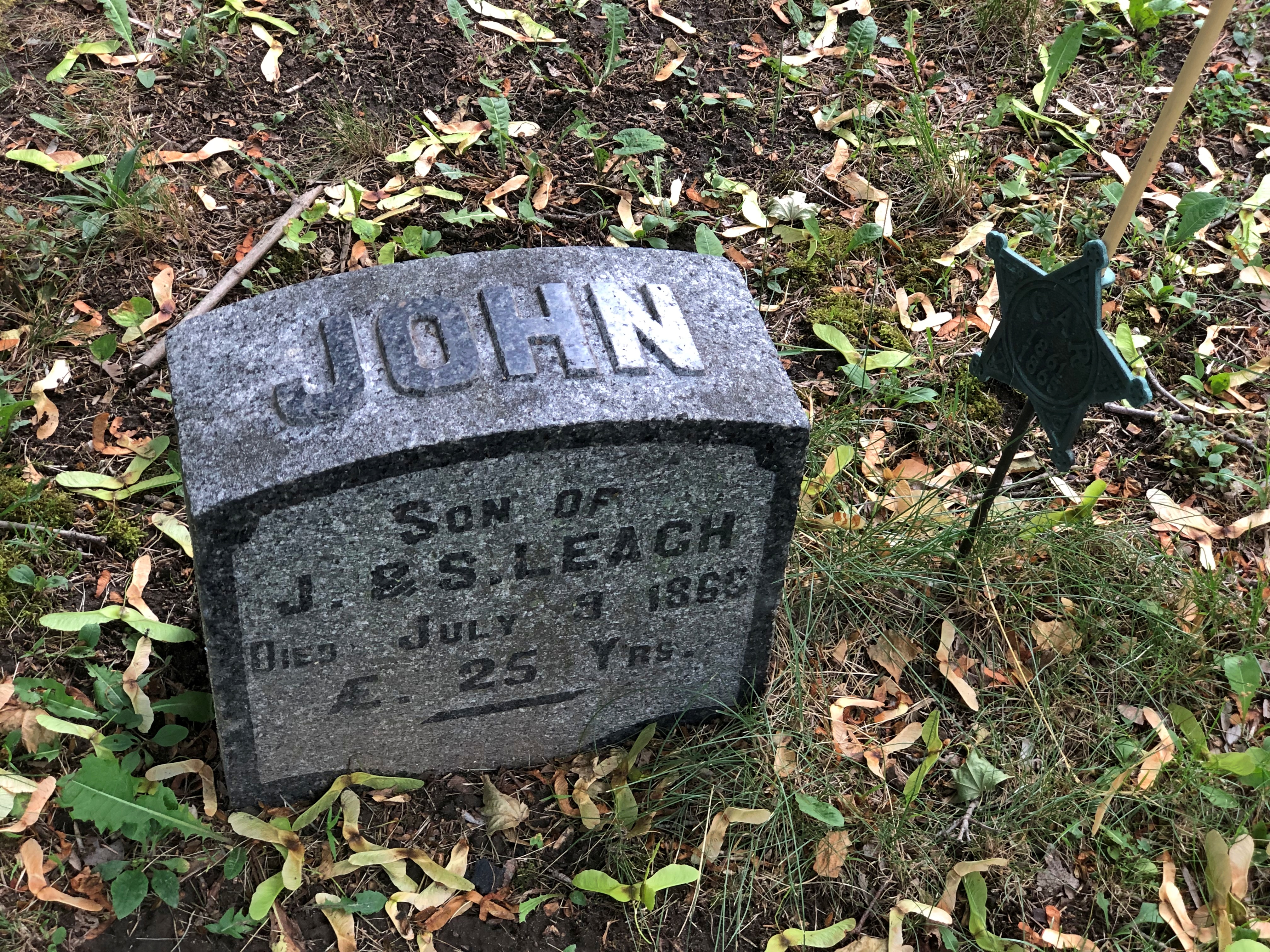
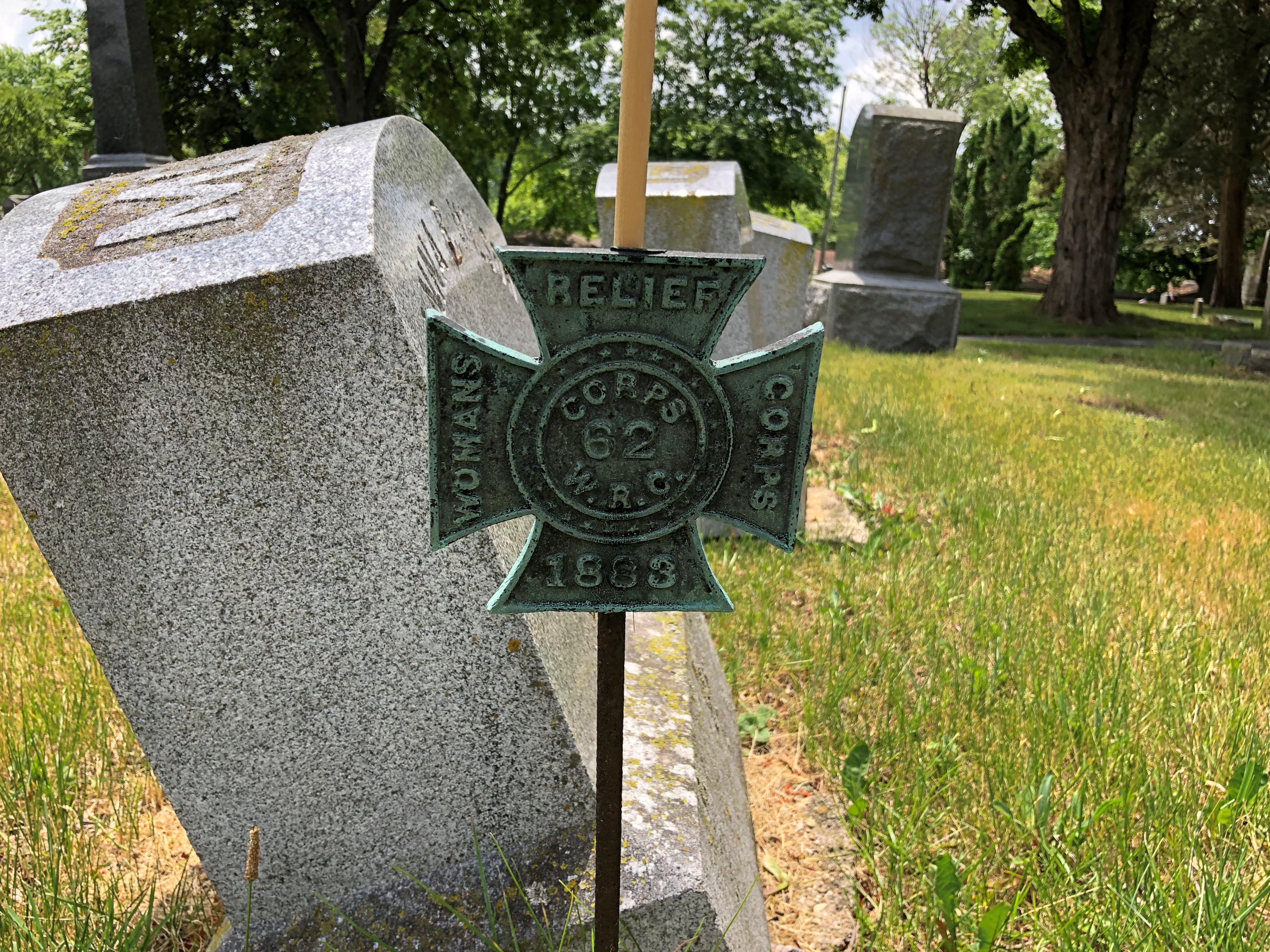
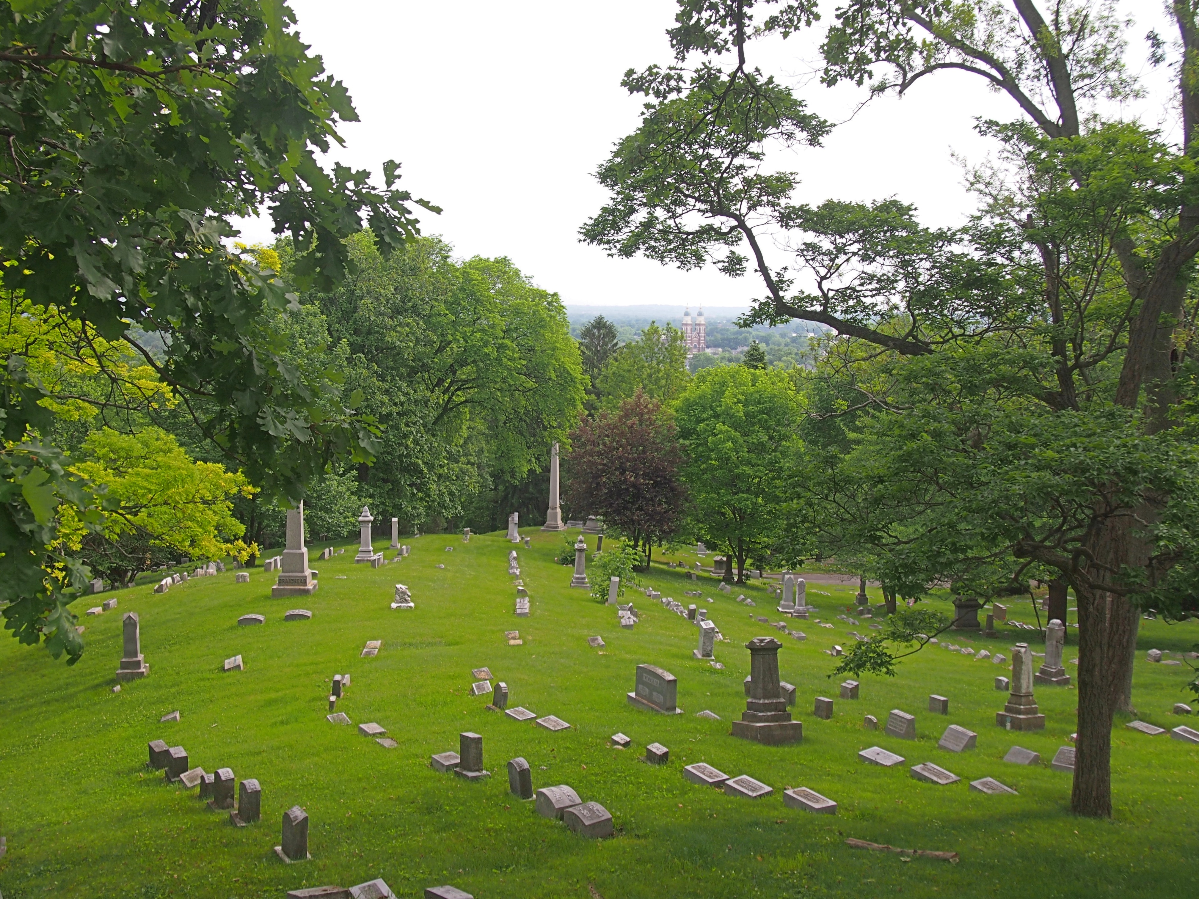
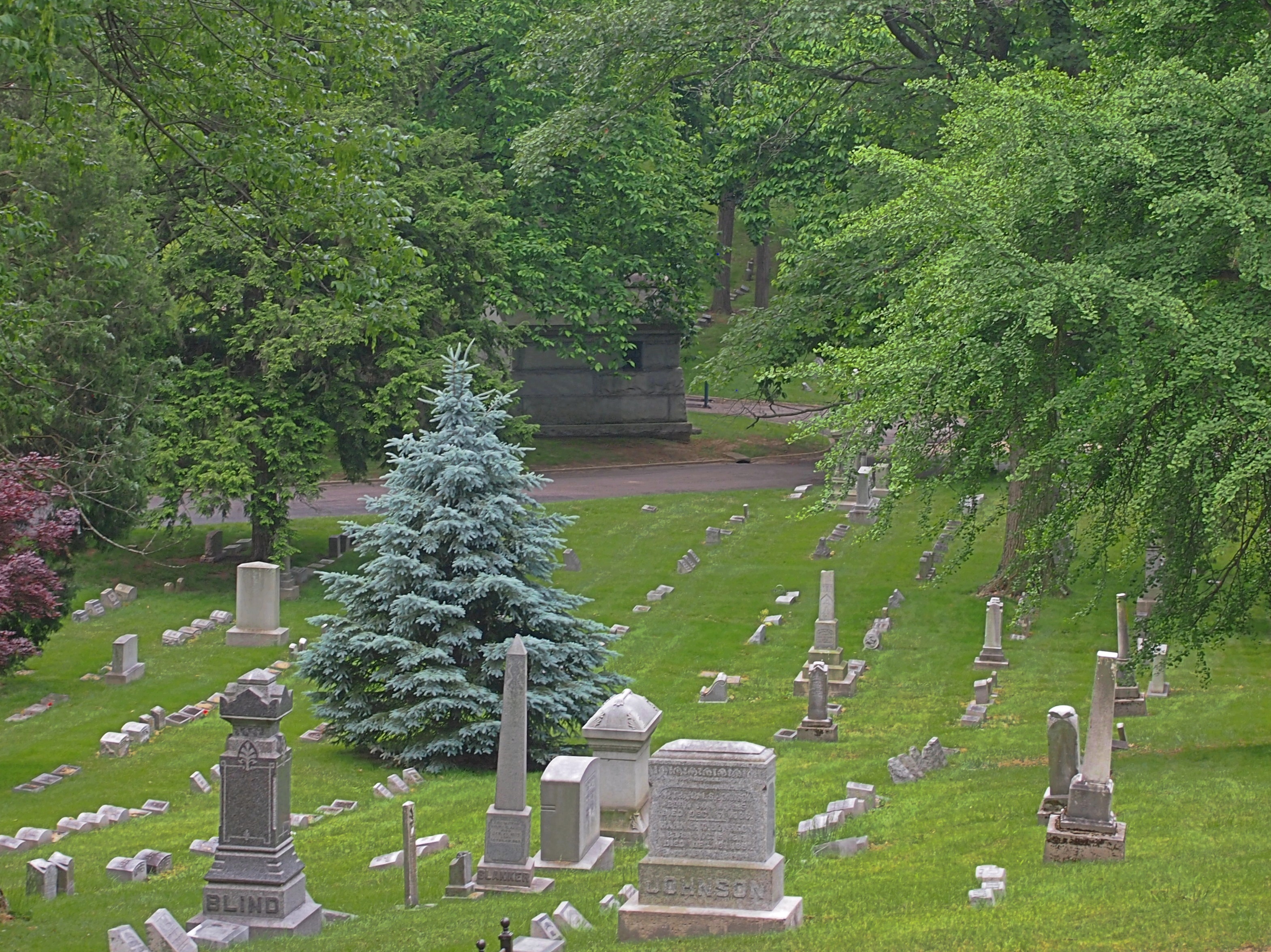
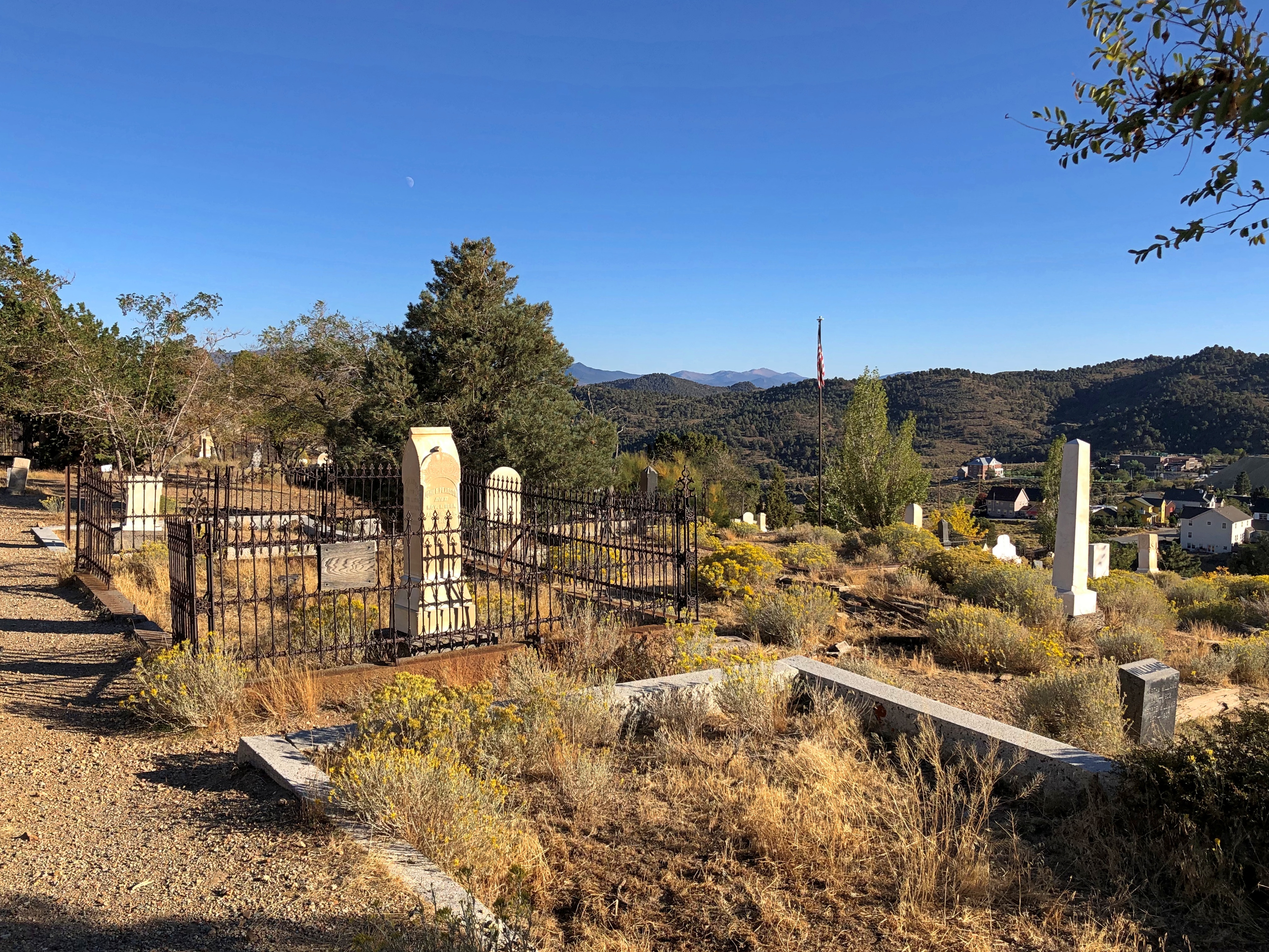
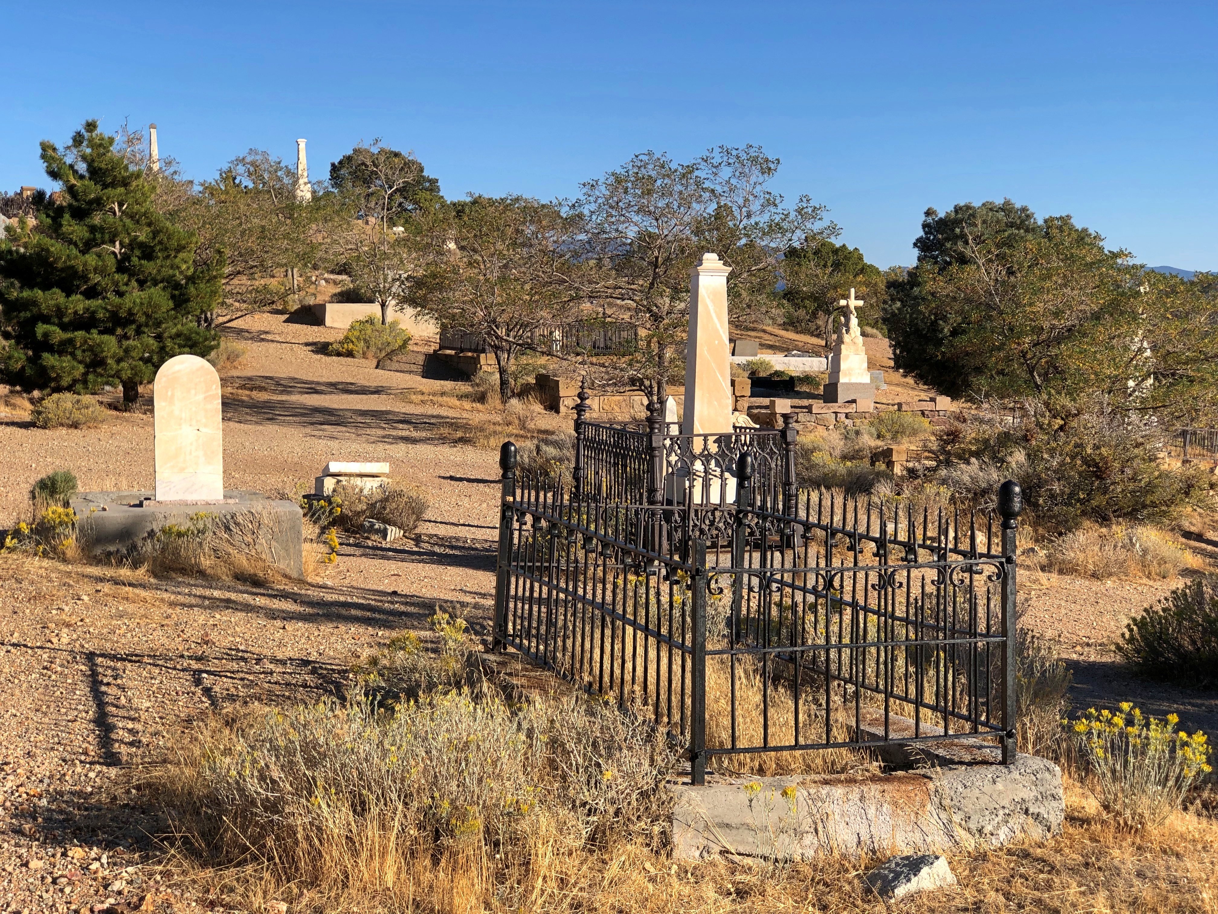
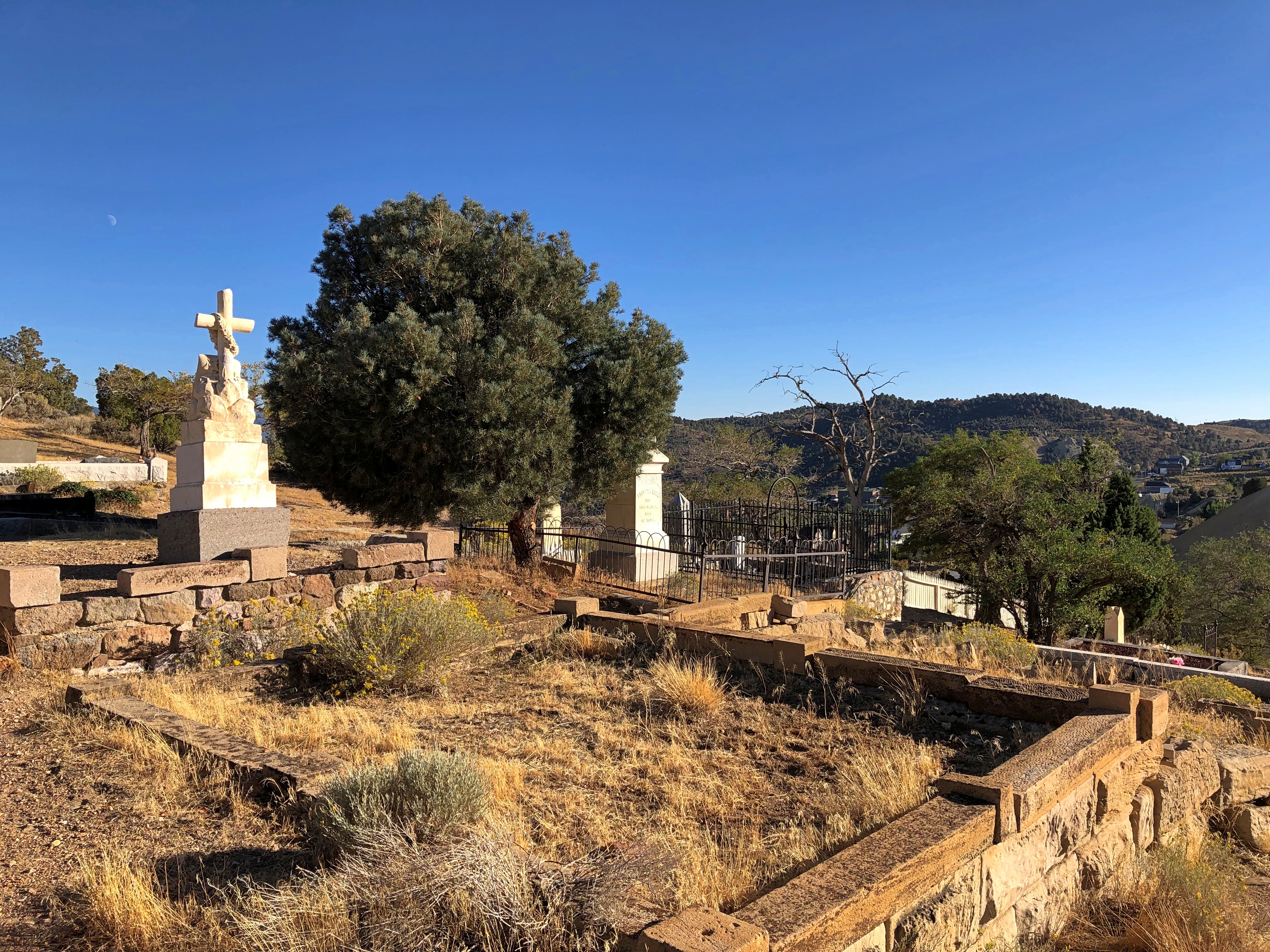
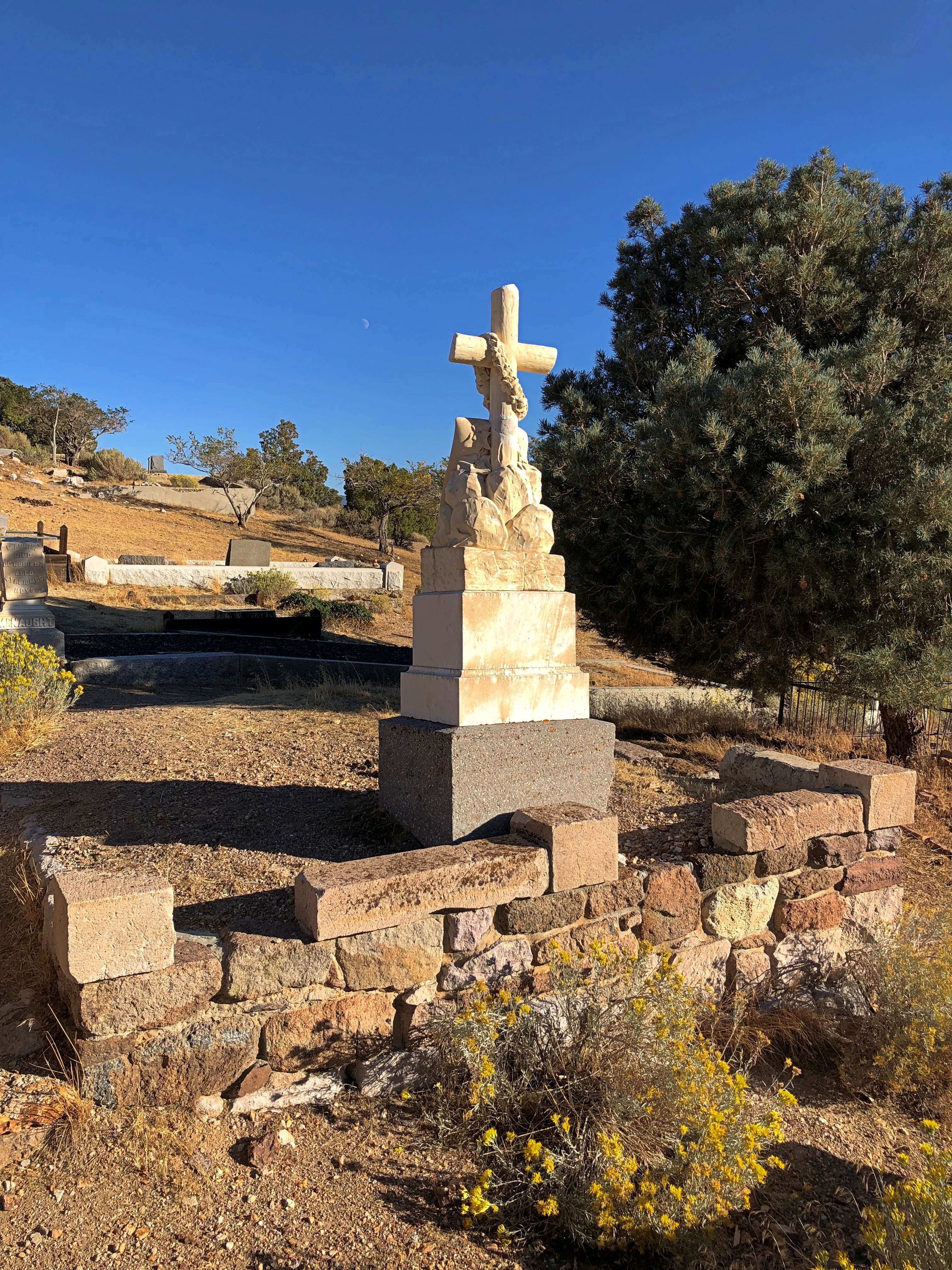
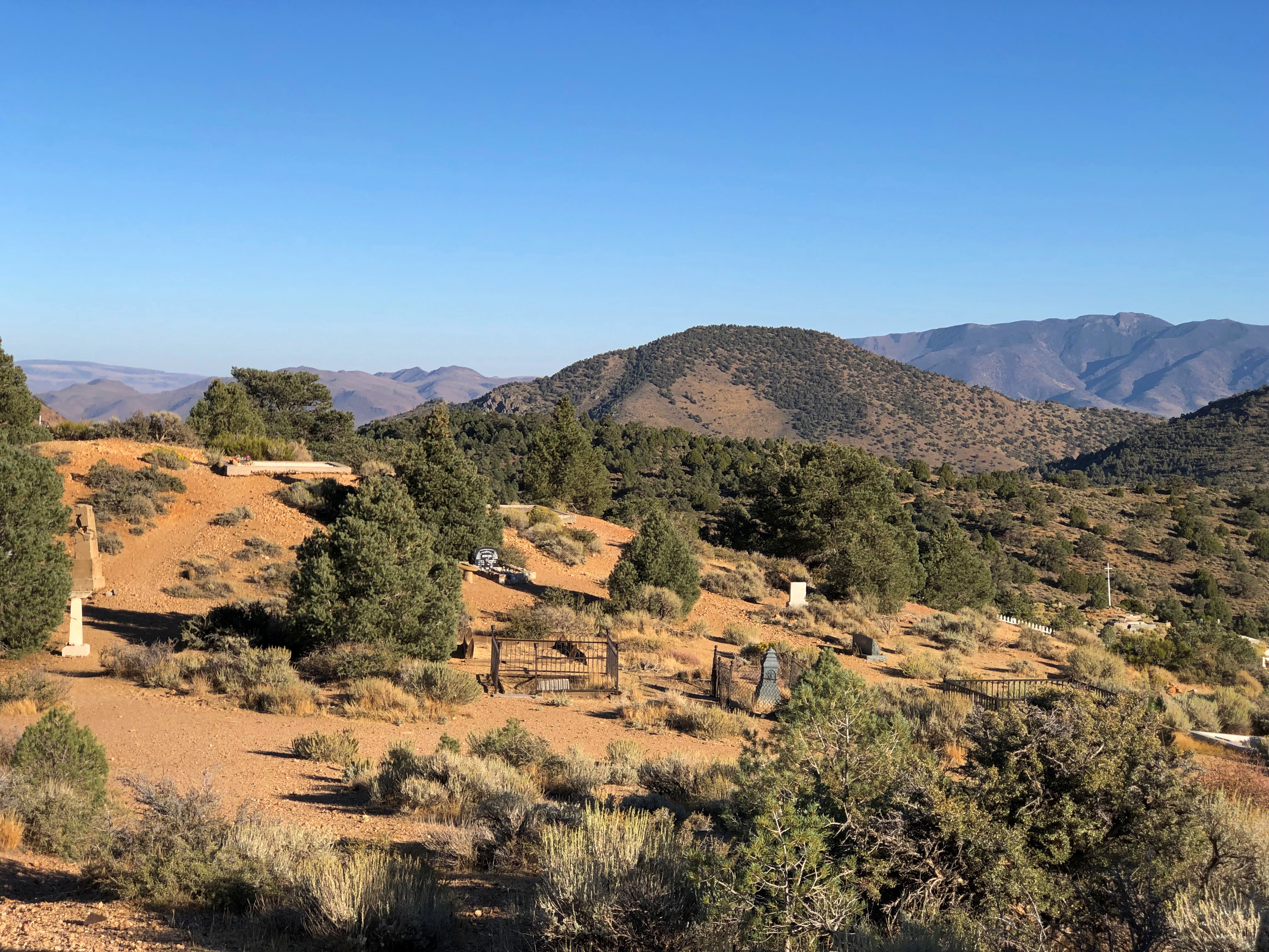
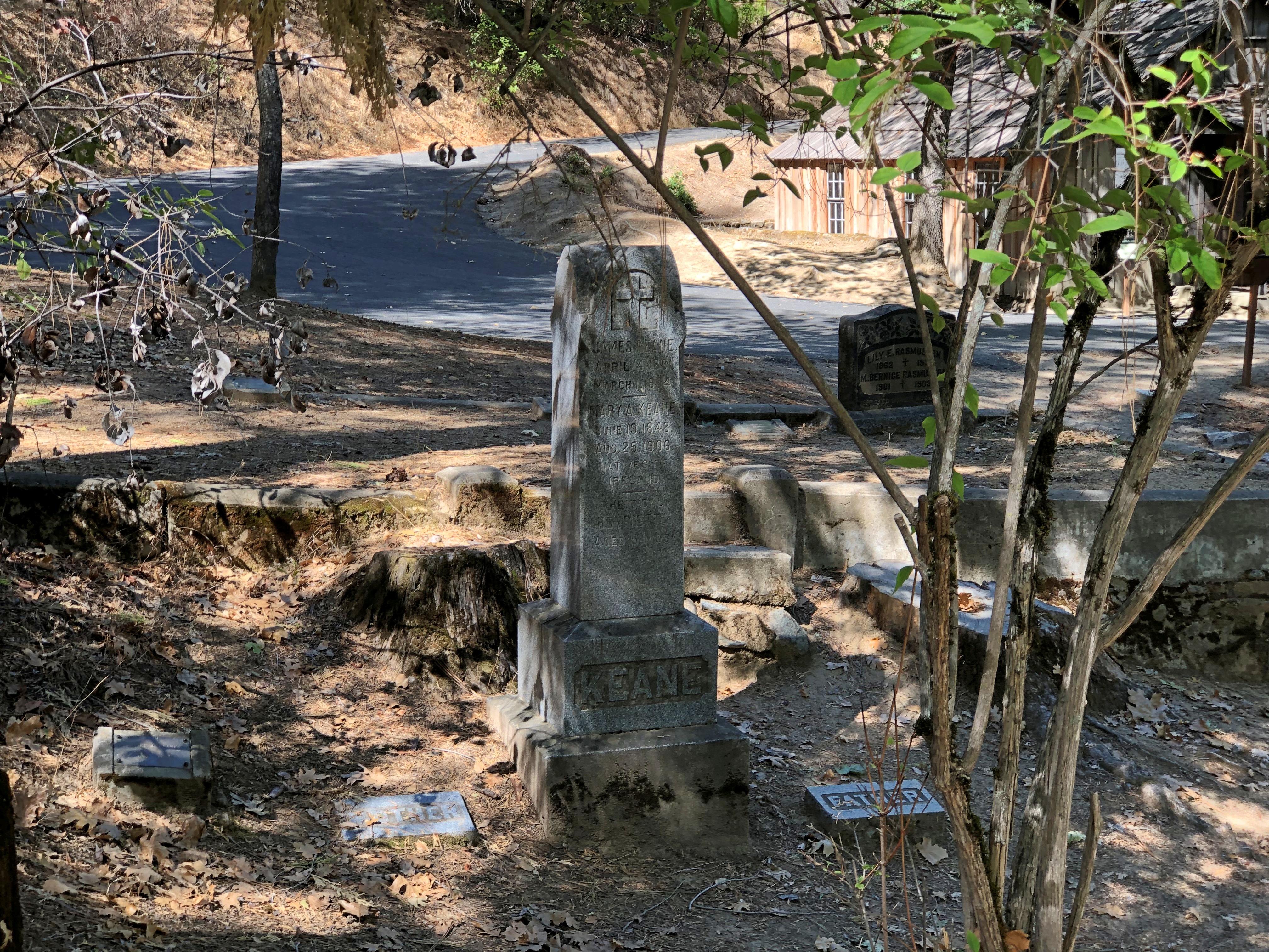
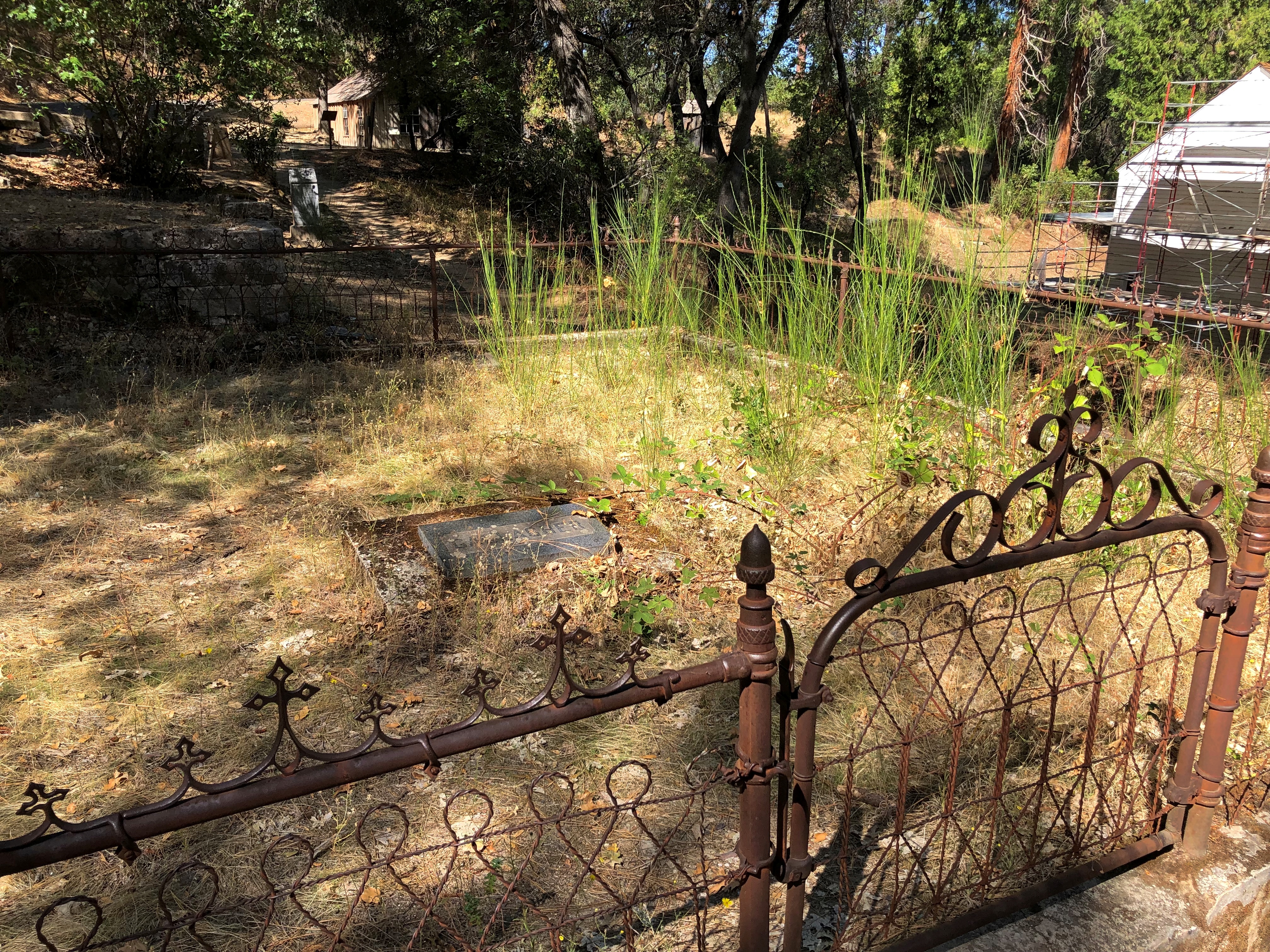
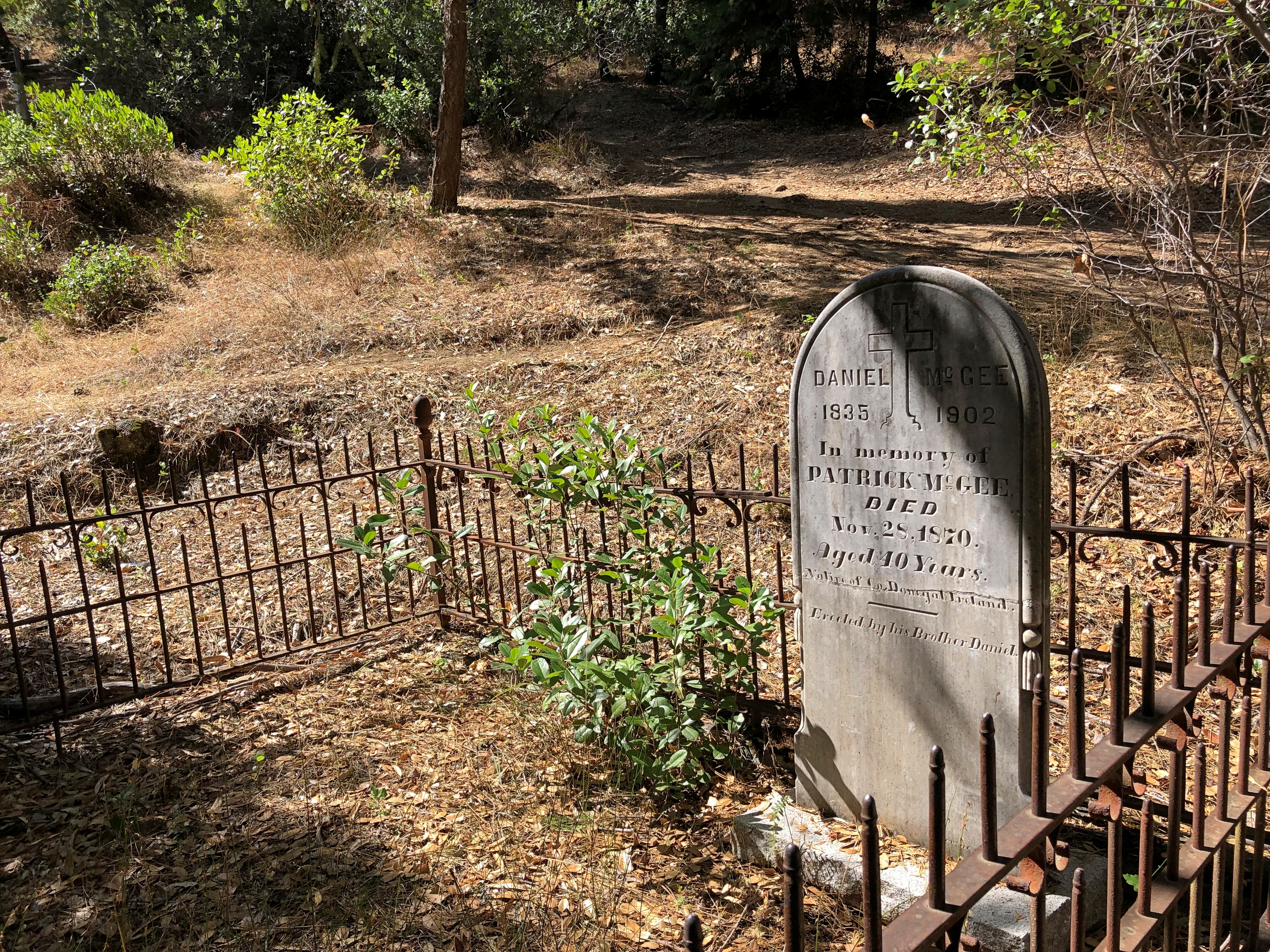
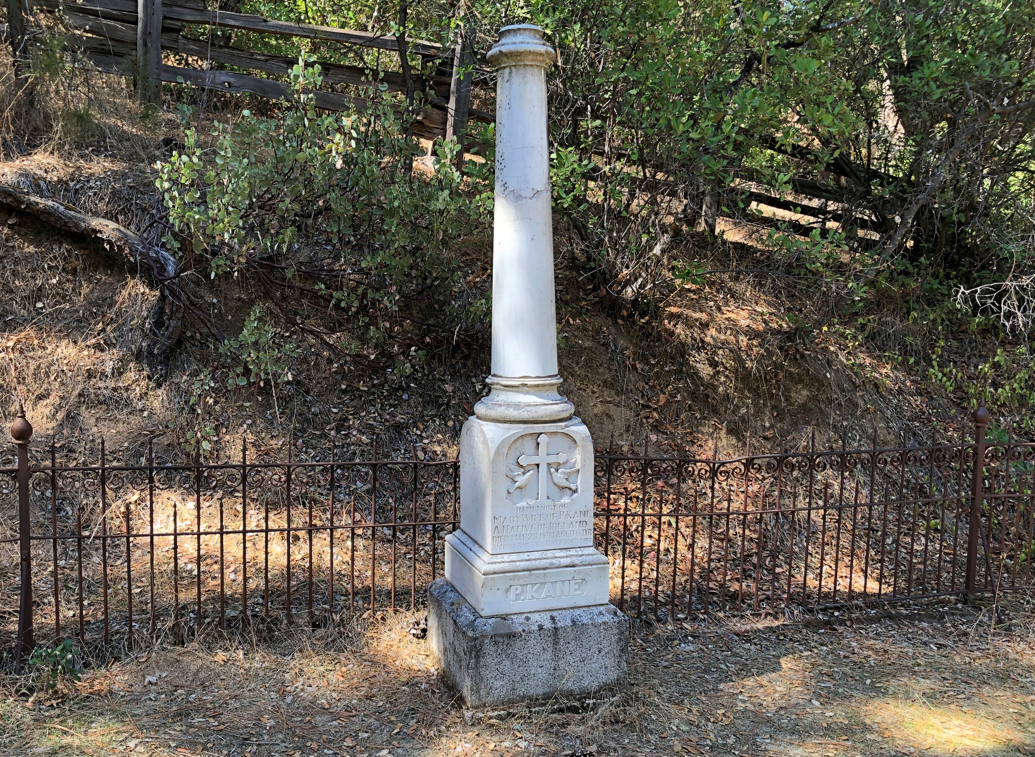
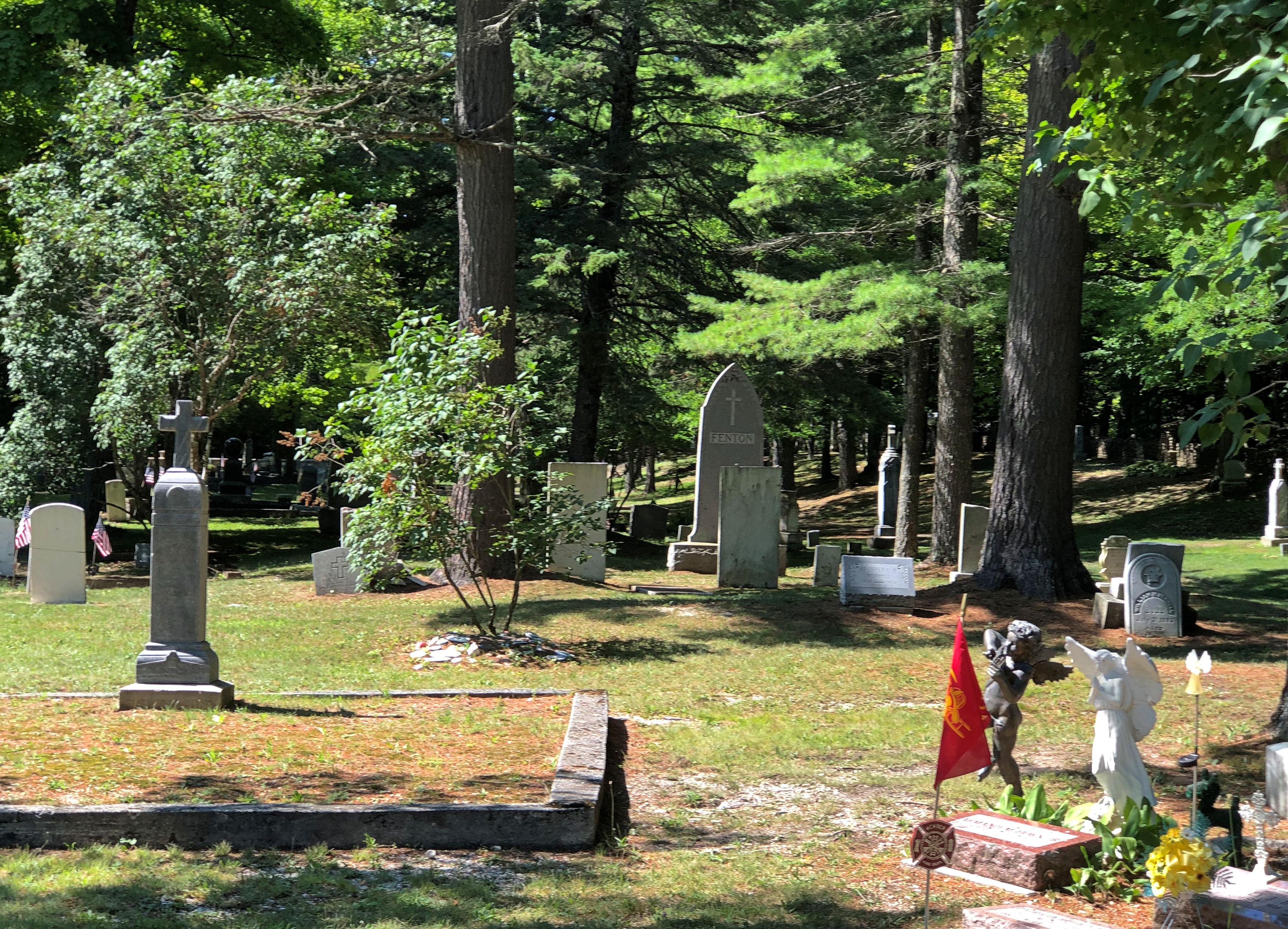
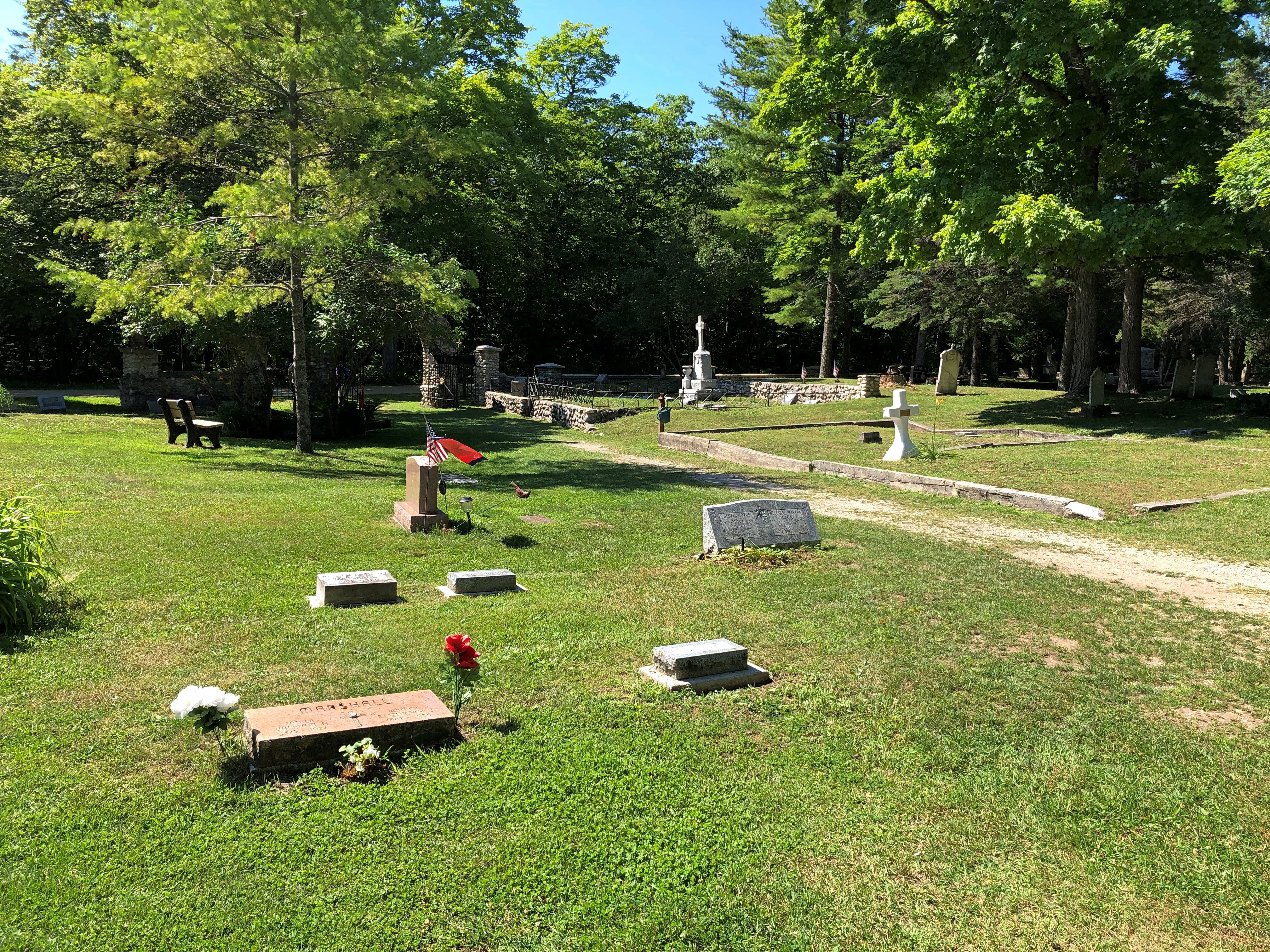
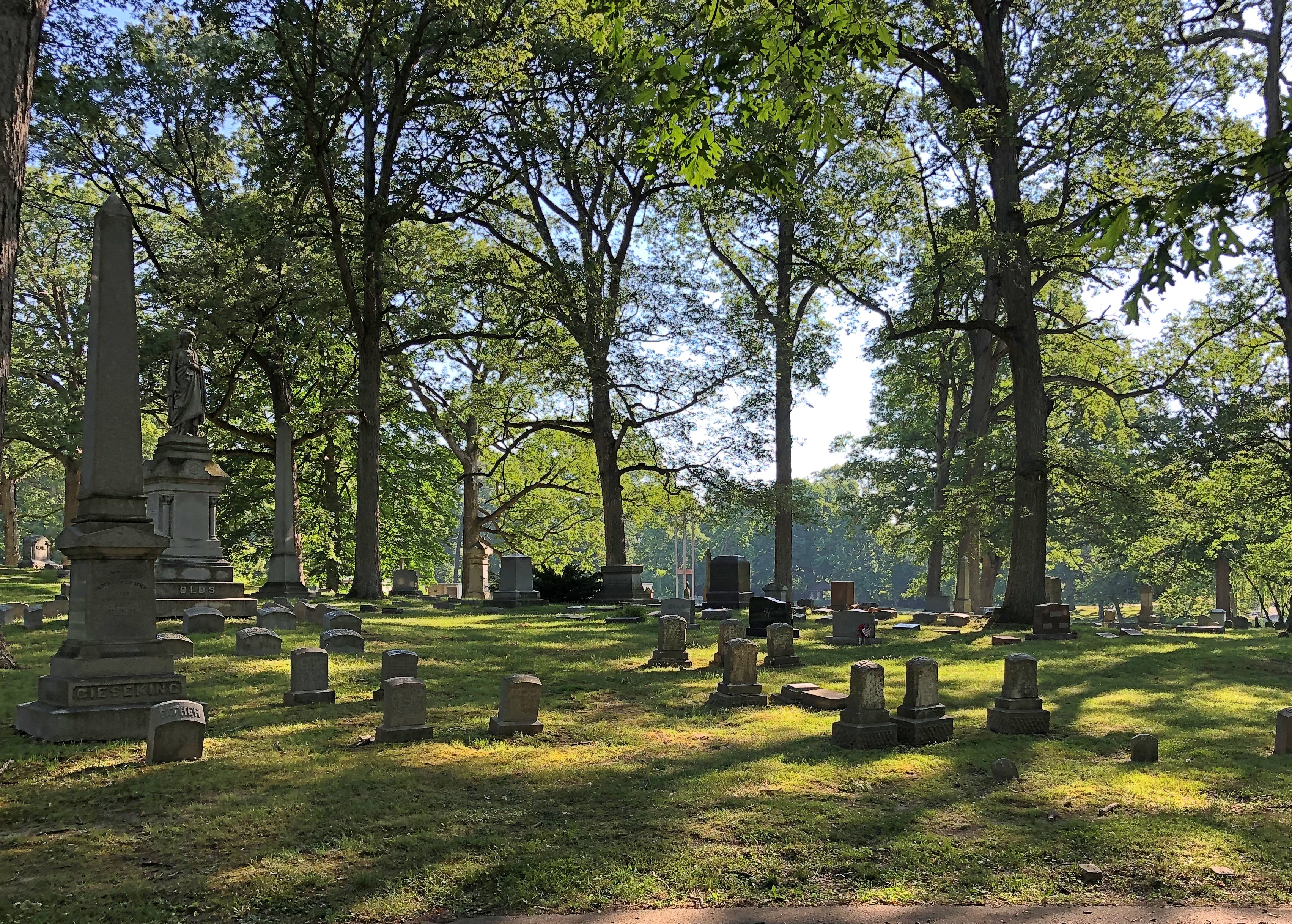
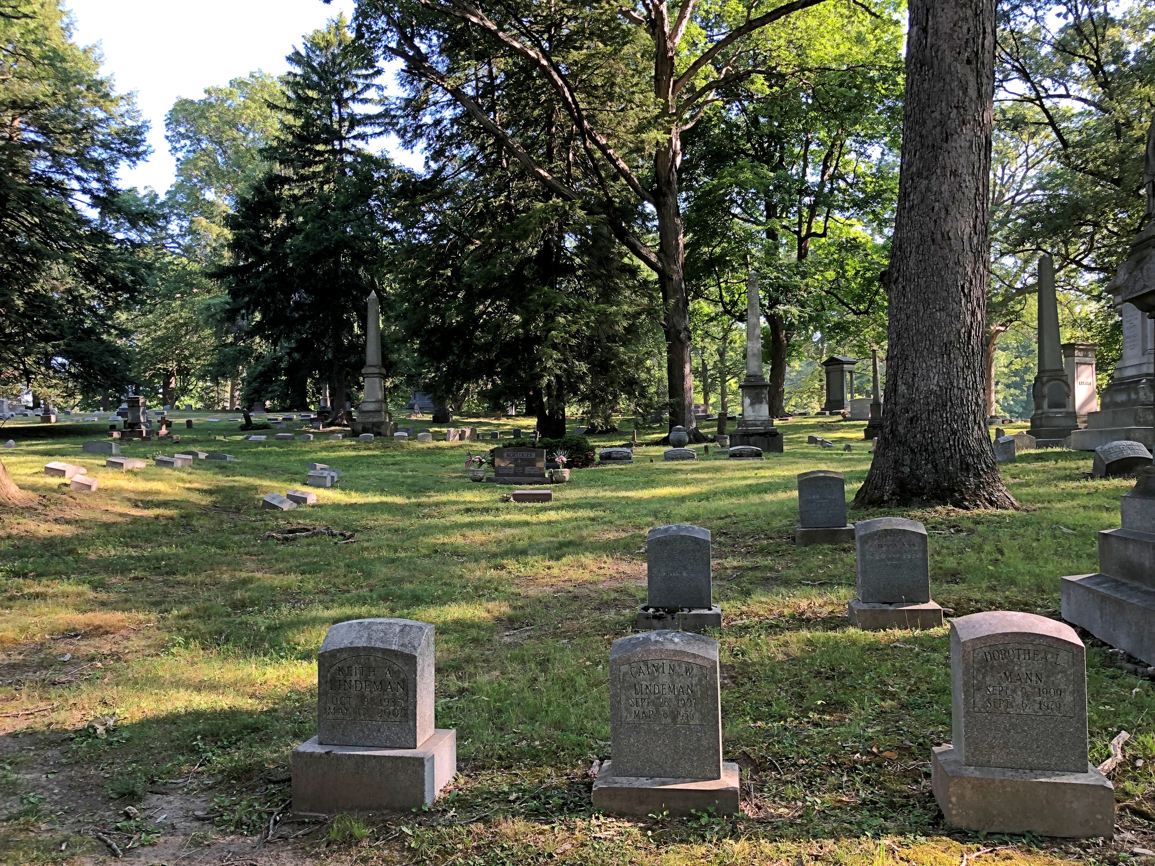
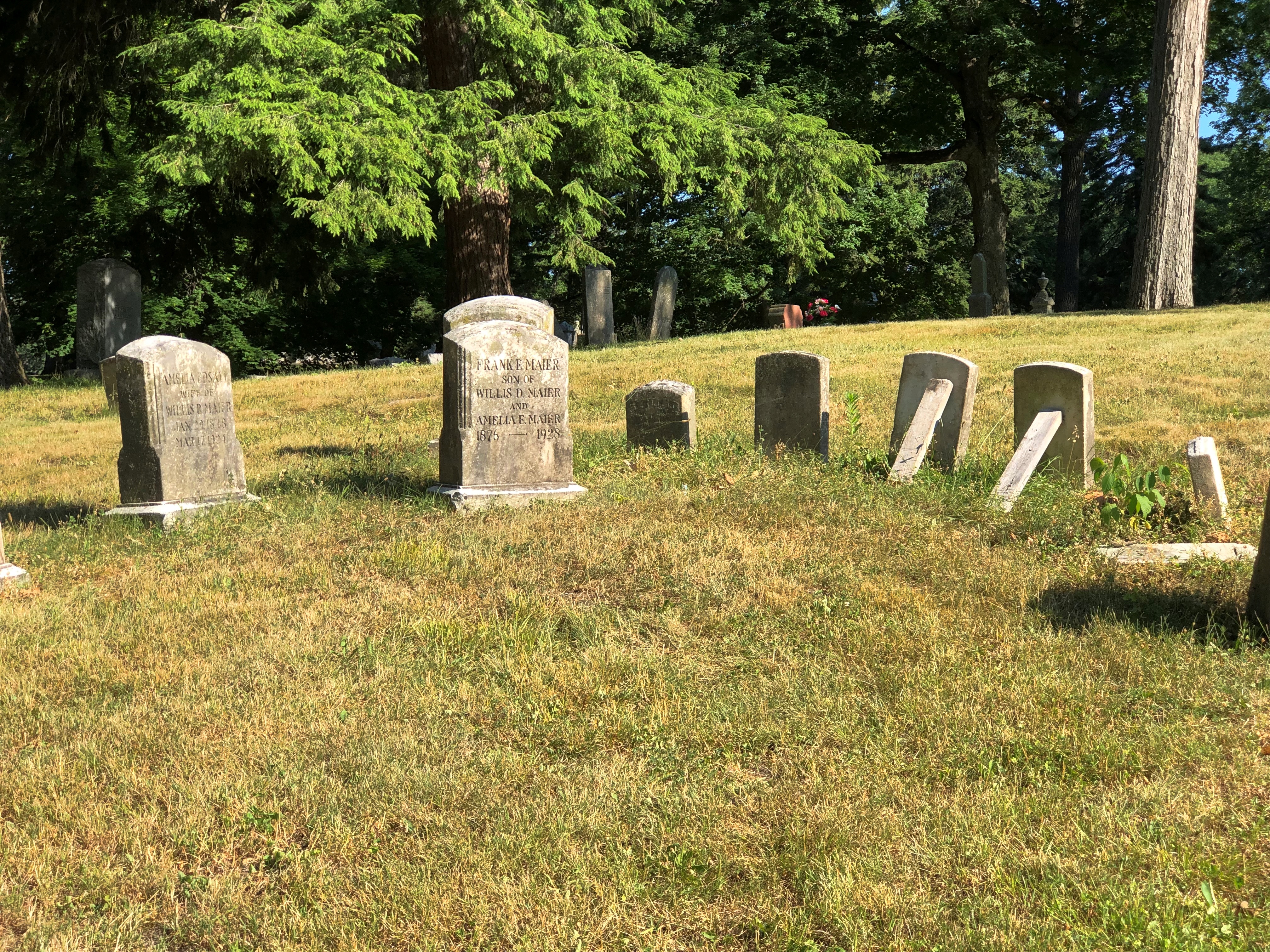
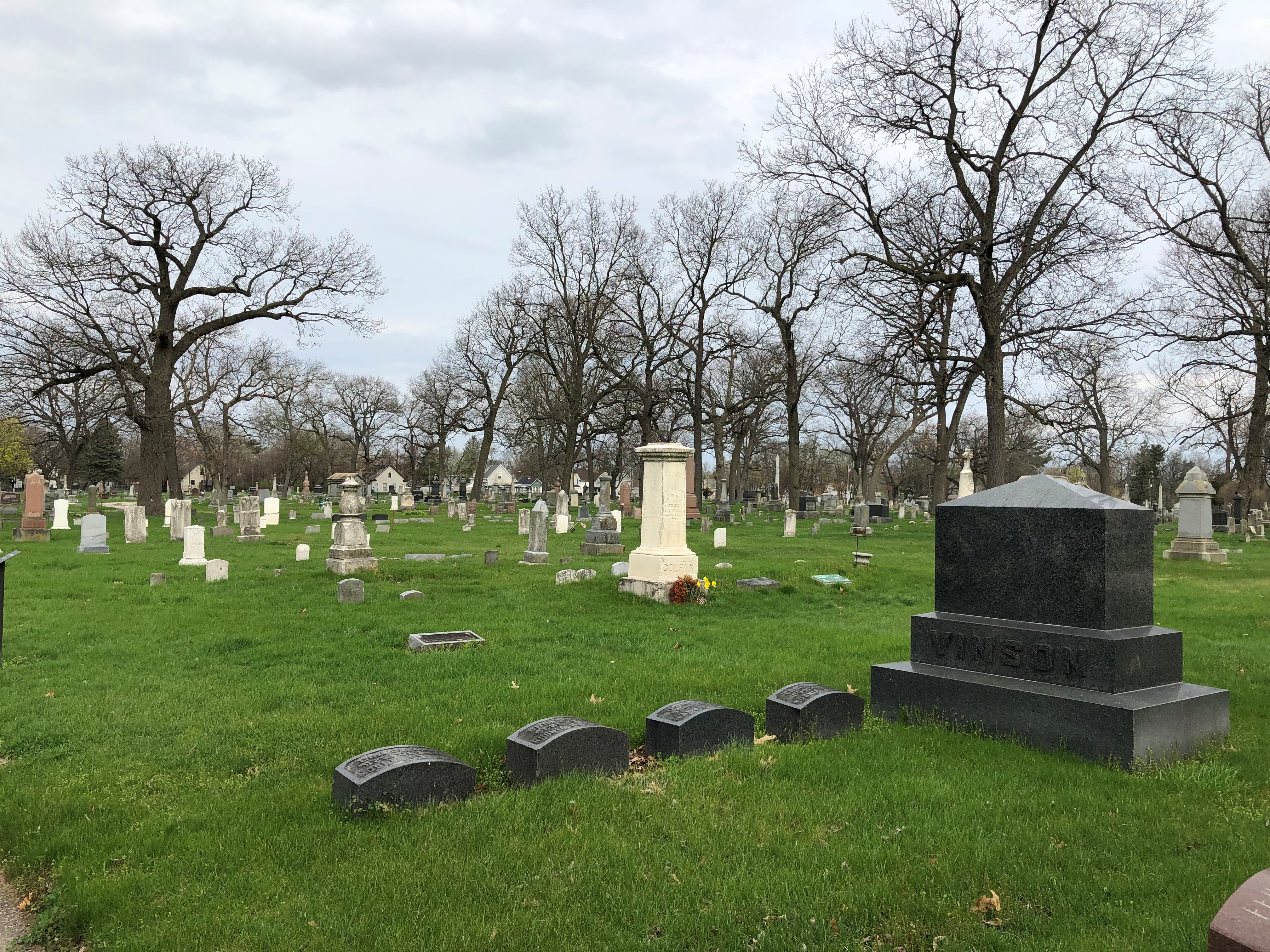
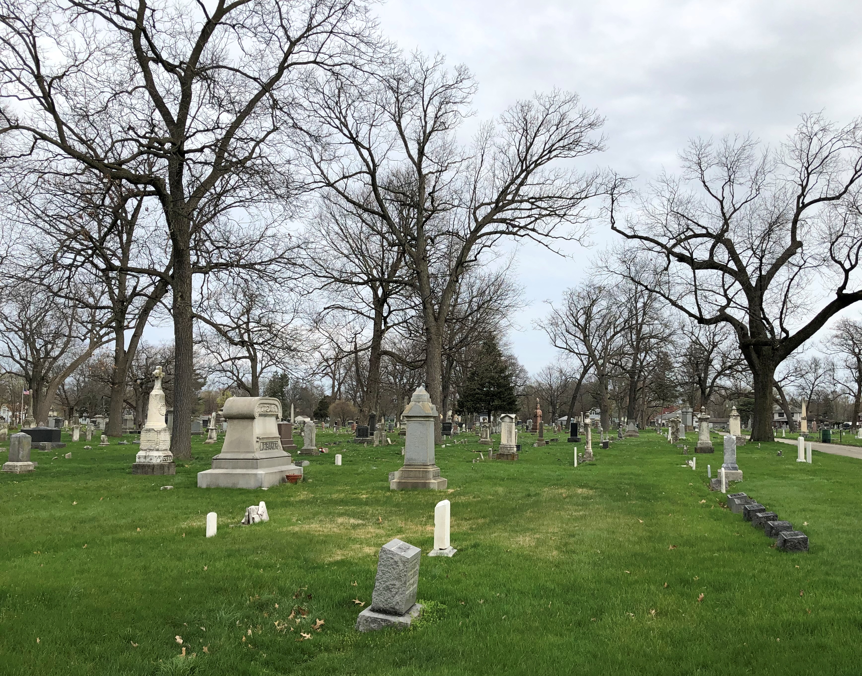
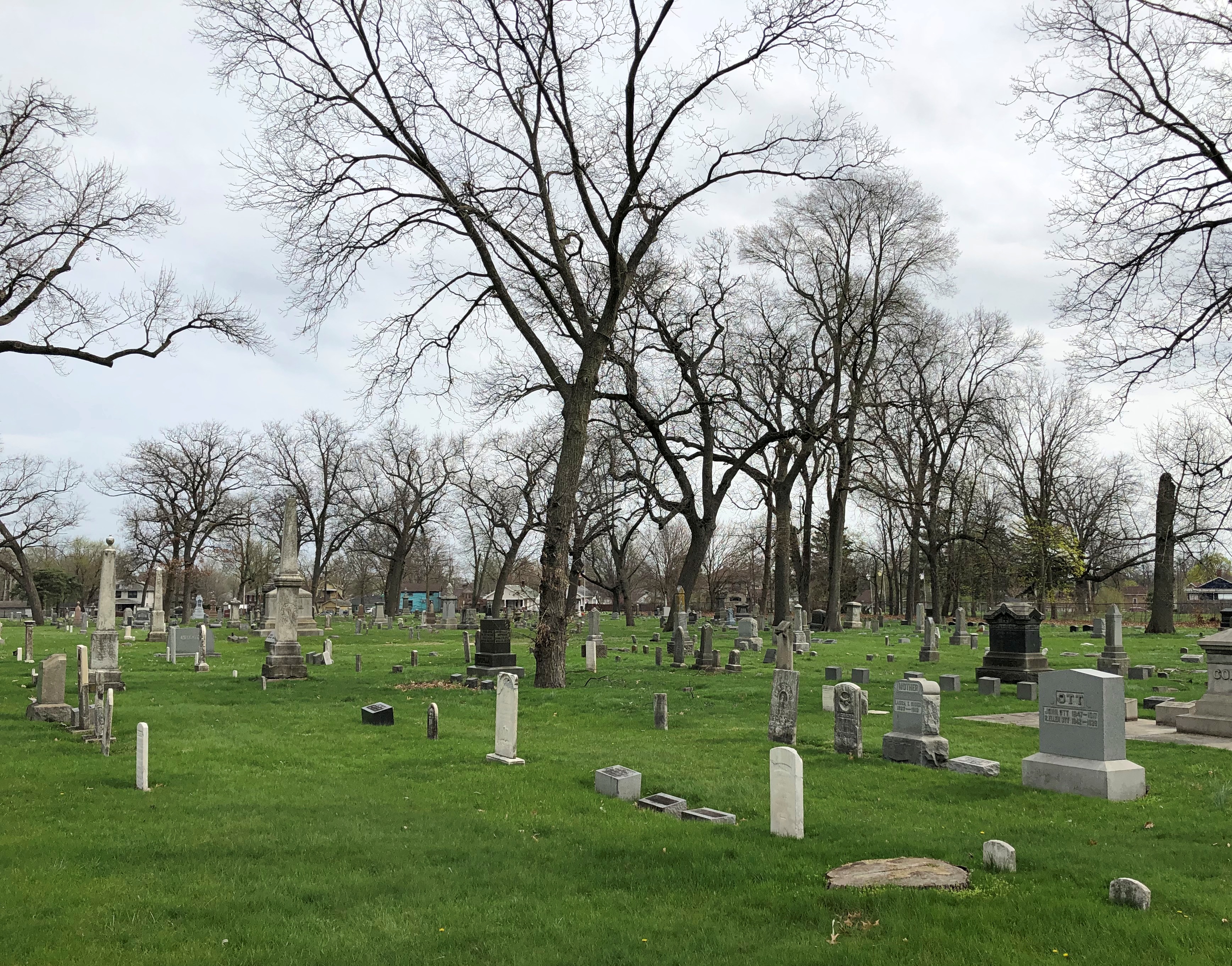
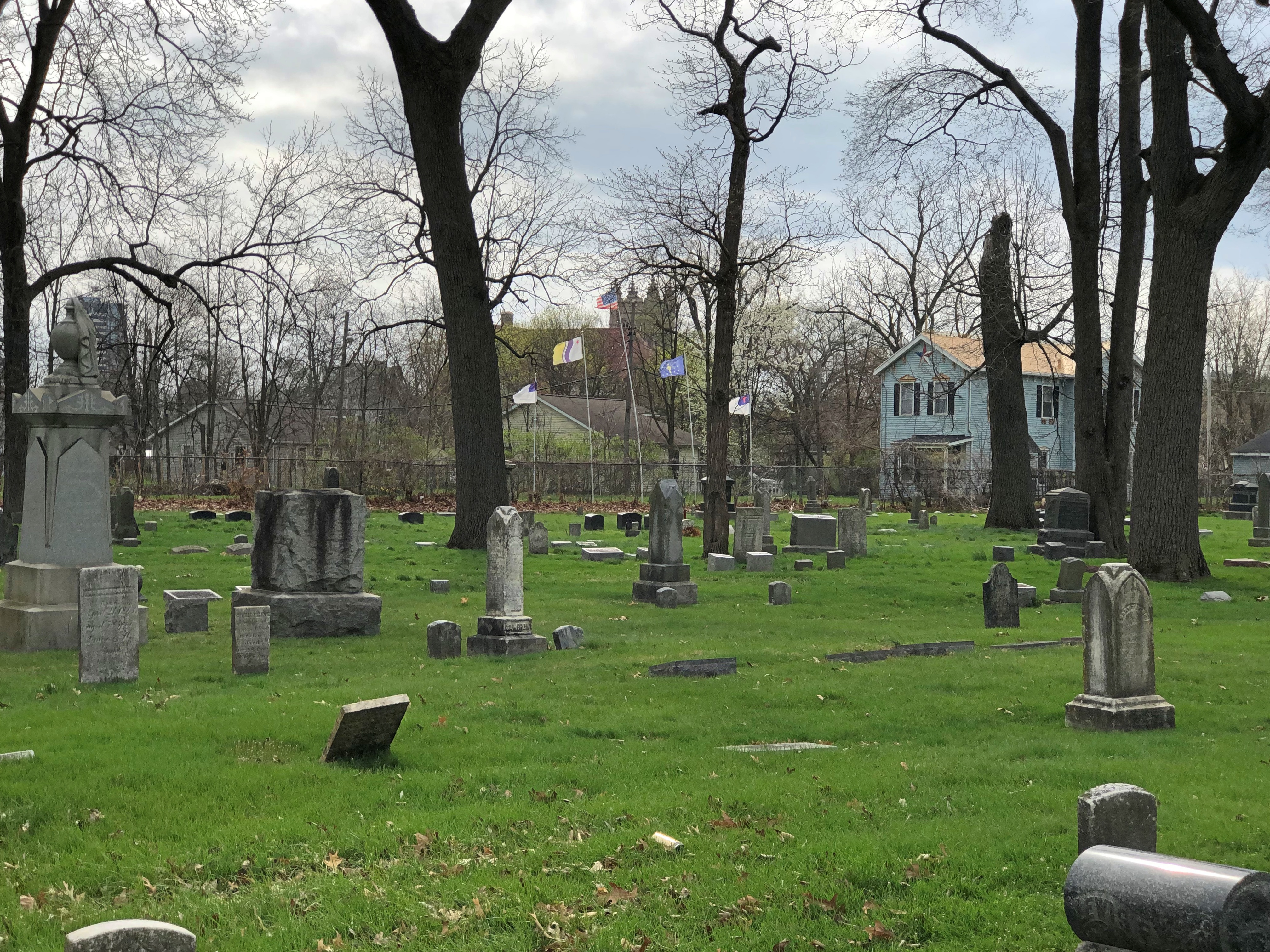
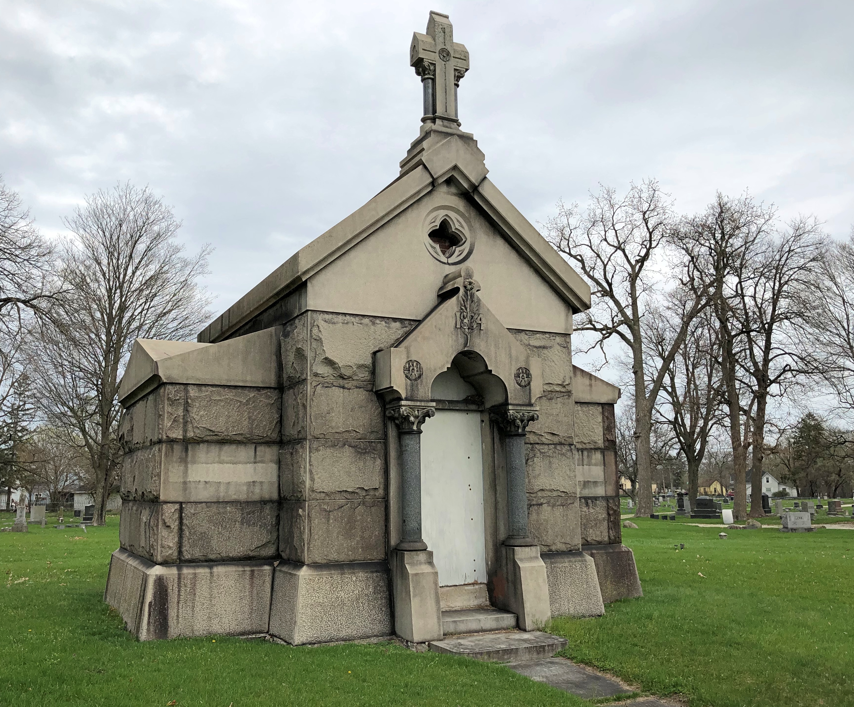
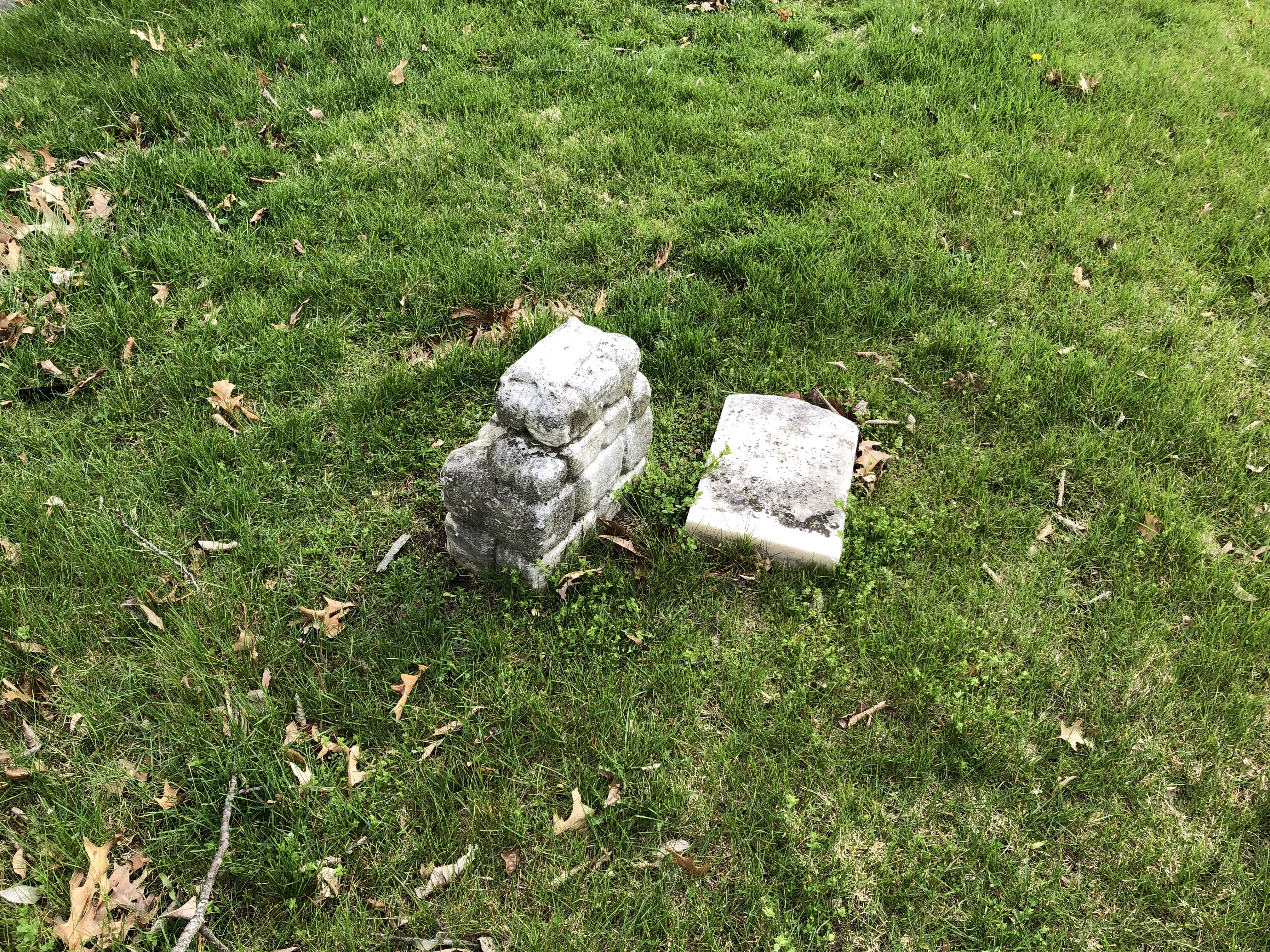
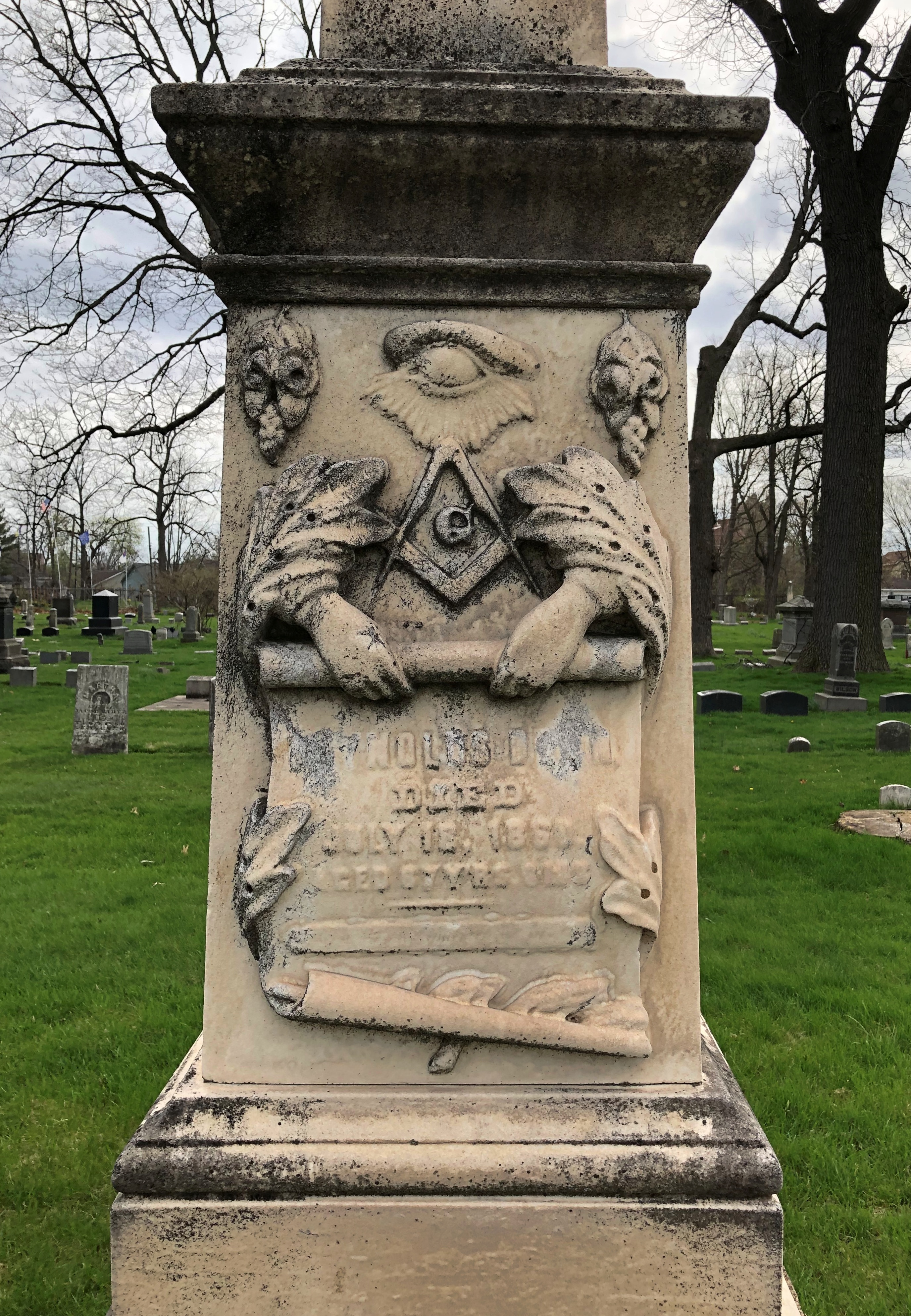
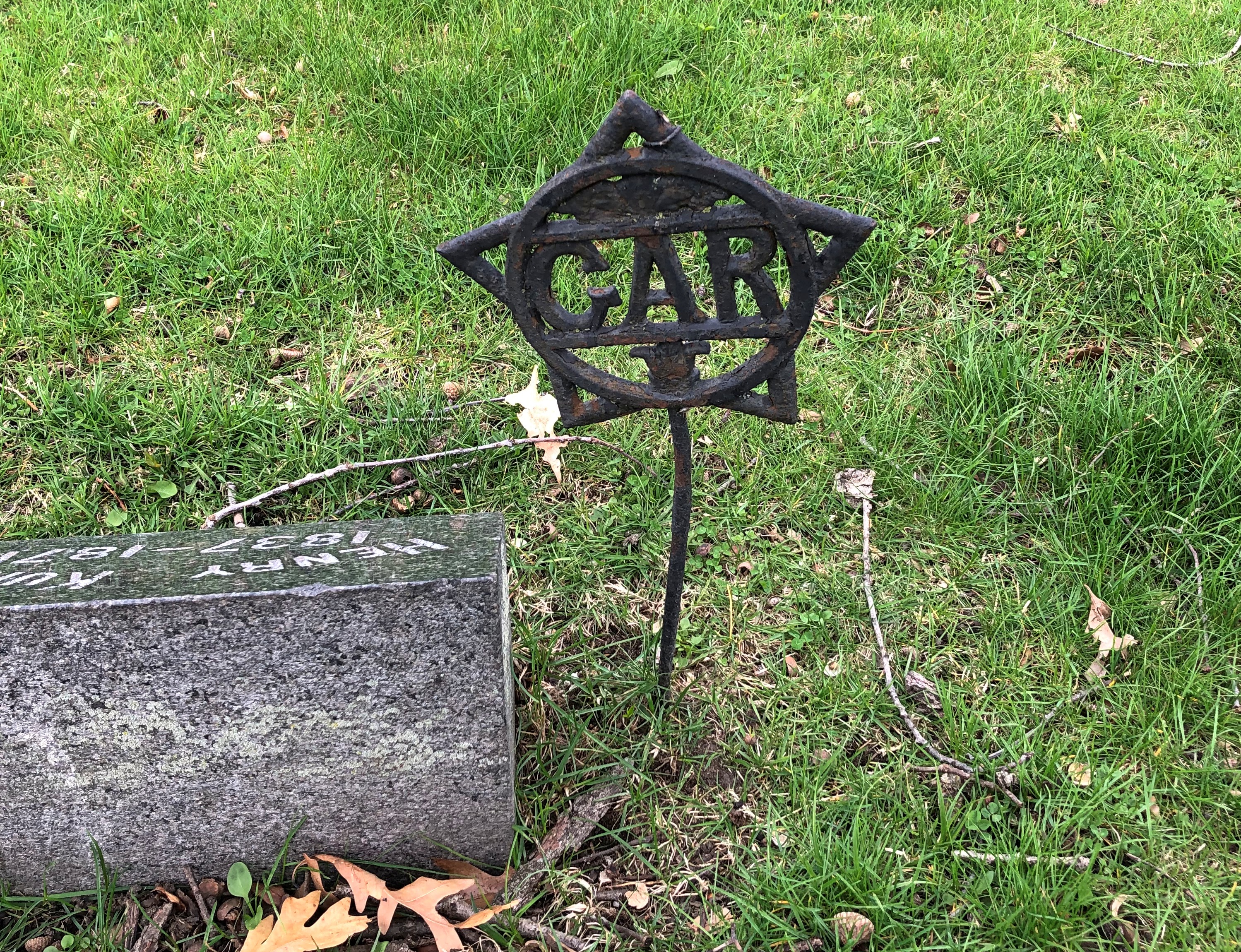
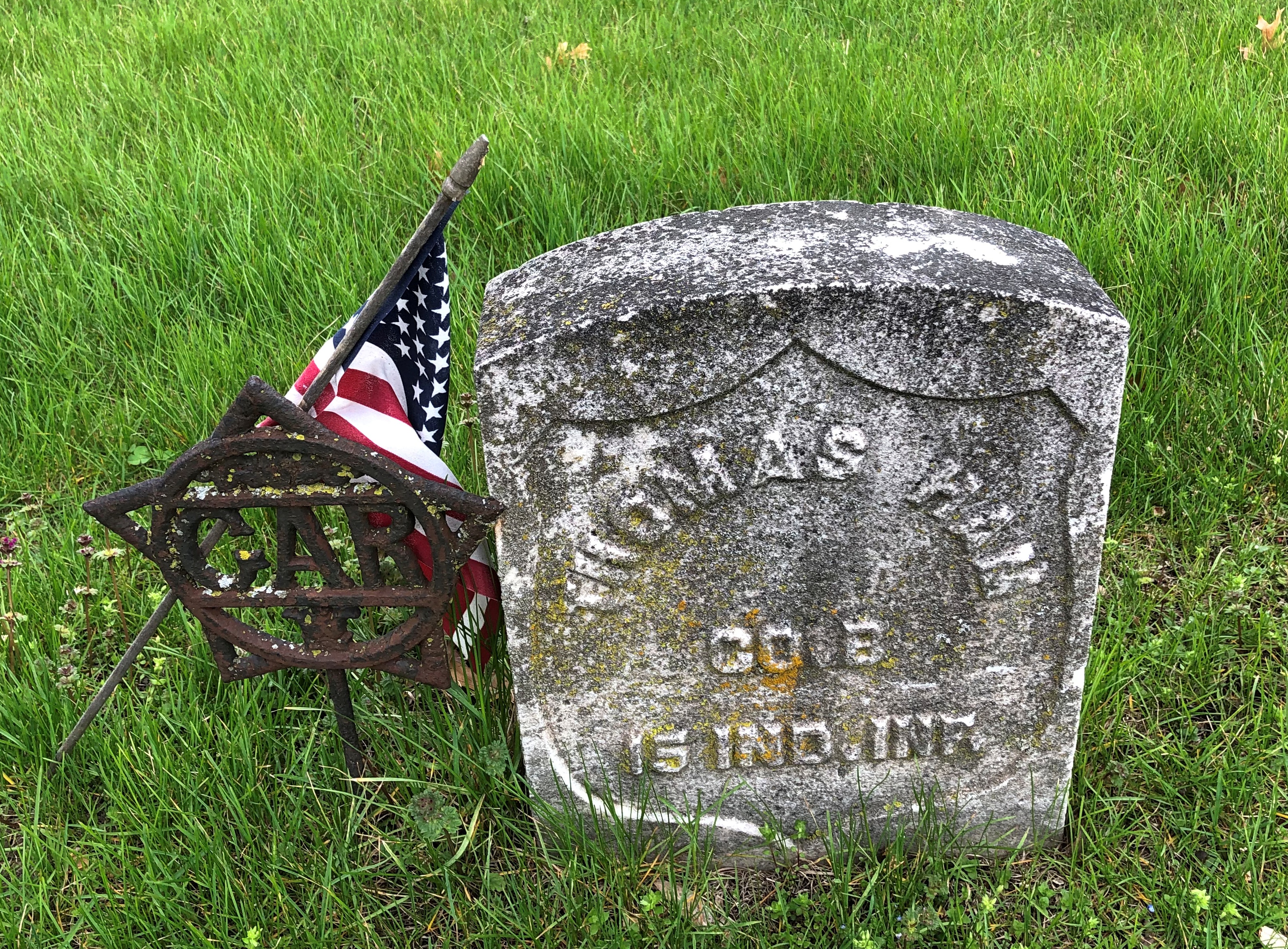
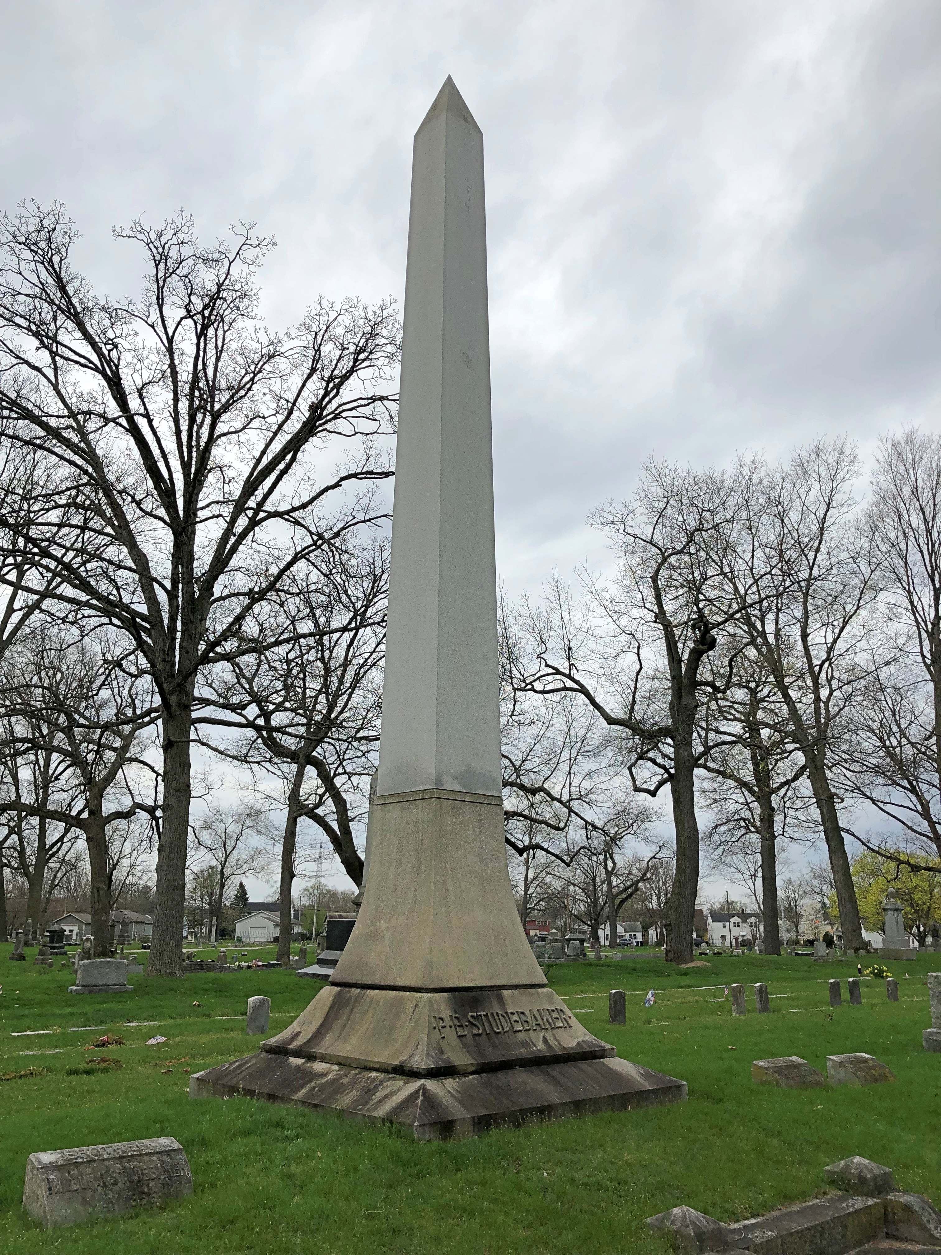
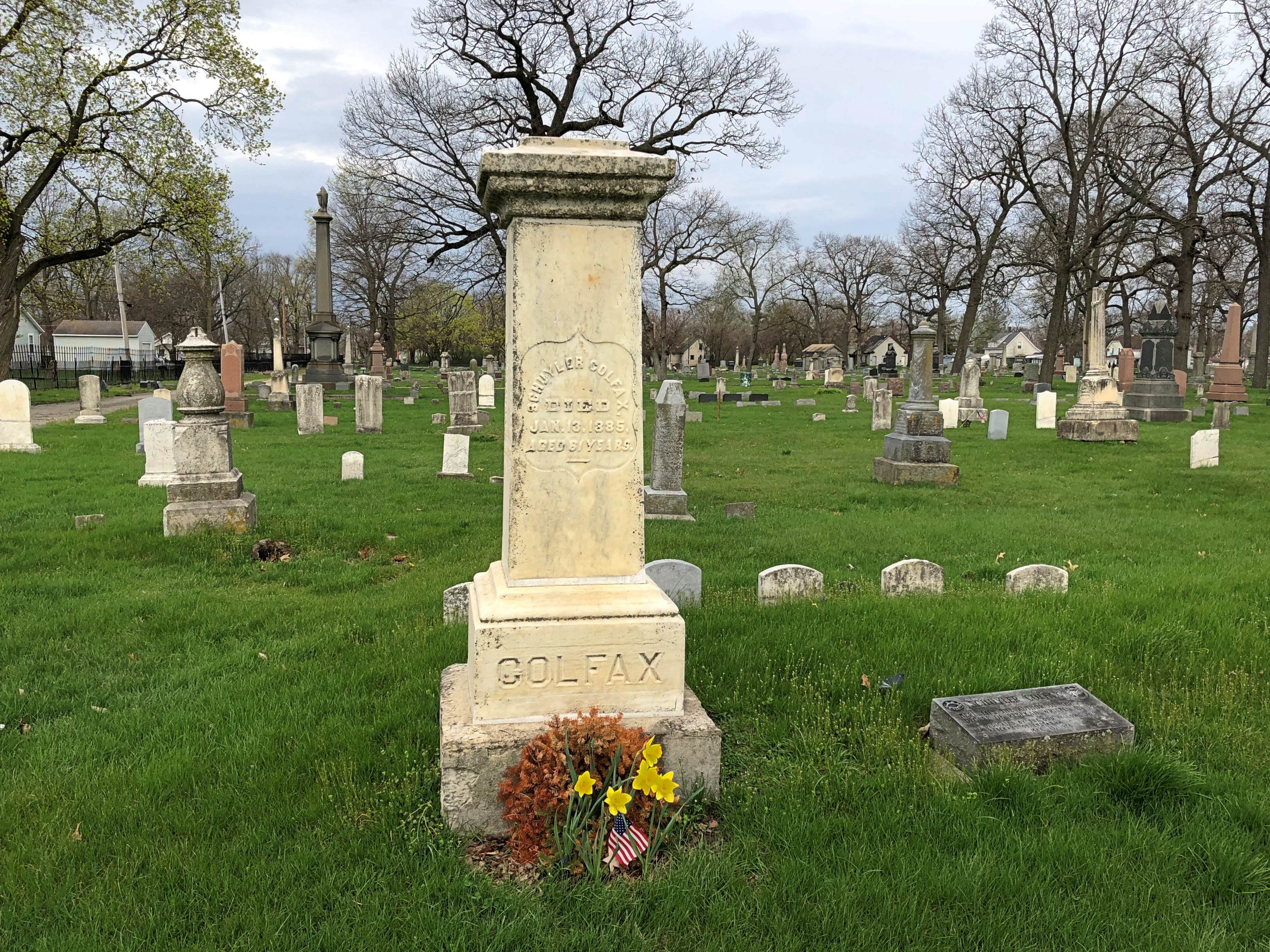
A handful of people, about 60, repose in Yosemite Cemetery, which is on the edge of the complex but has been a cemetery longer (since the 1870s) than any of the buildings in the village have been around.Yosemite Cemetery Yosemite Cemetery

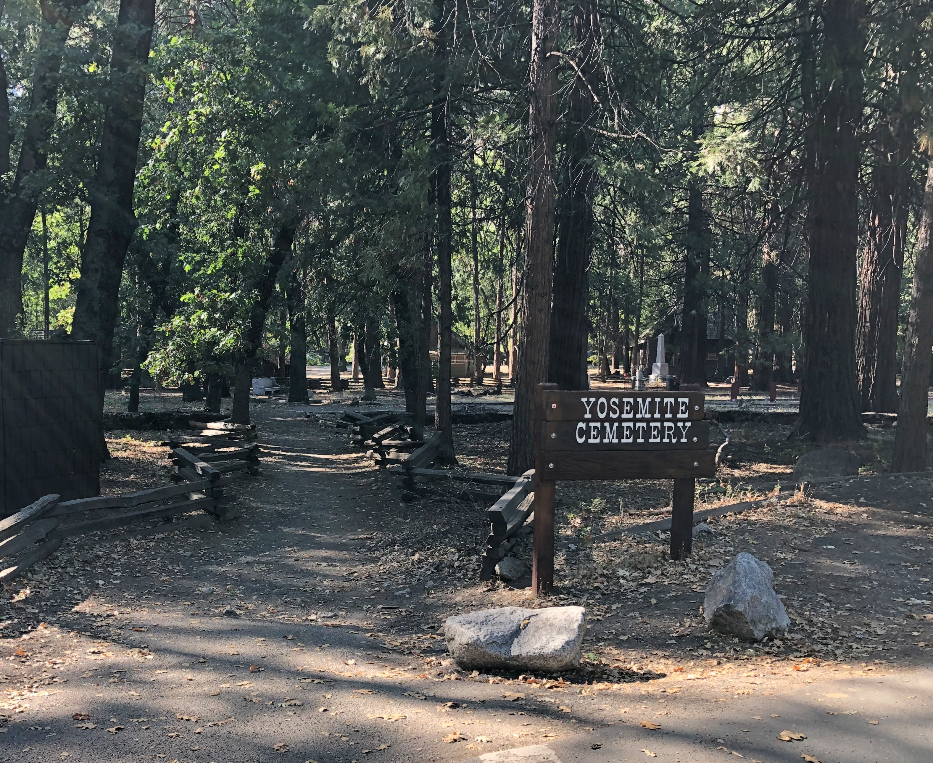
“Some of those laid to rest here are well-known figures in the history of the park,” says the NPS. “Some spent their entire lives in Yosemite and are now almost forgotten. Others were visitors about whom very little was known, even at their time of their deaths. There are people who died here while on vacation, early settlers and homesteaders, old timers and infants, hotel proprietors and common laborers…”

One resident is James Hutchings (d. 1902), businessman, Yosemite settler and publisher of Hutchings’ Illustrated California Magazine, which put the Yosemite Valley on the map, at least in the minds of 19th-century Americans. And that’s not all.

“James Mason Hutchings, the first to organize a tourist party to visit Yosemite in 1855. Hutchings unknowingly made an enormous contribution by hiring John Muir to work at his sawmill in 1869,” the NPS notes.

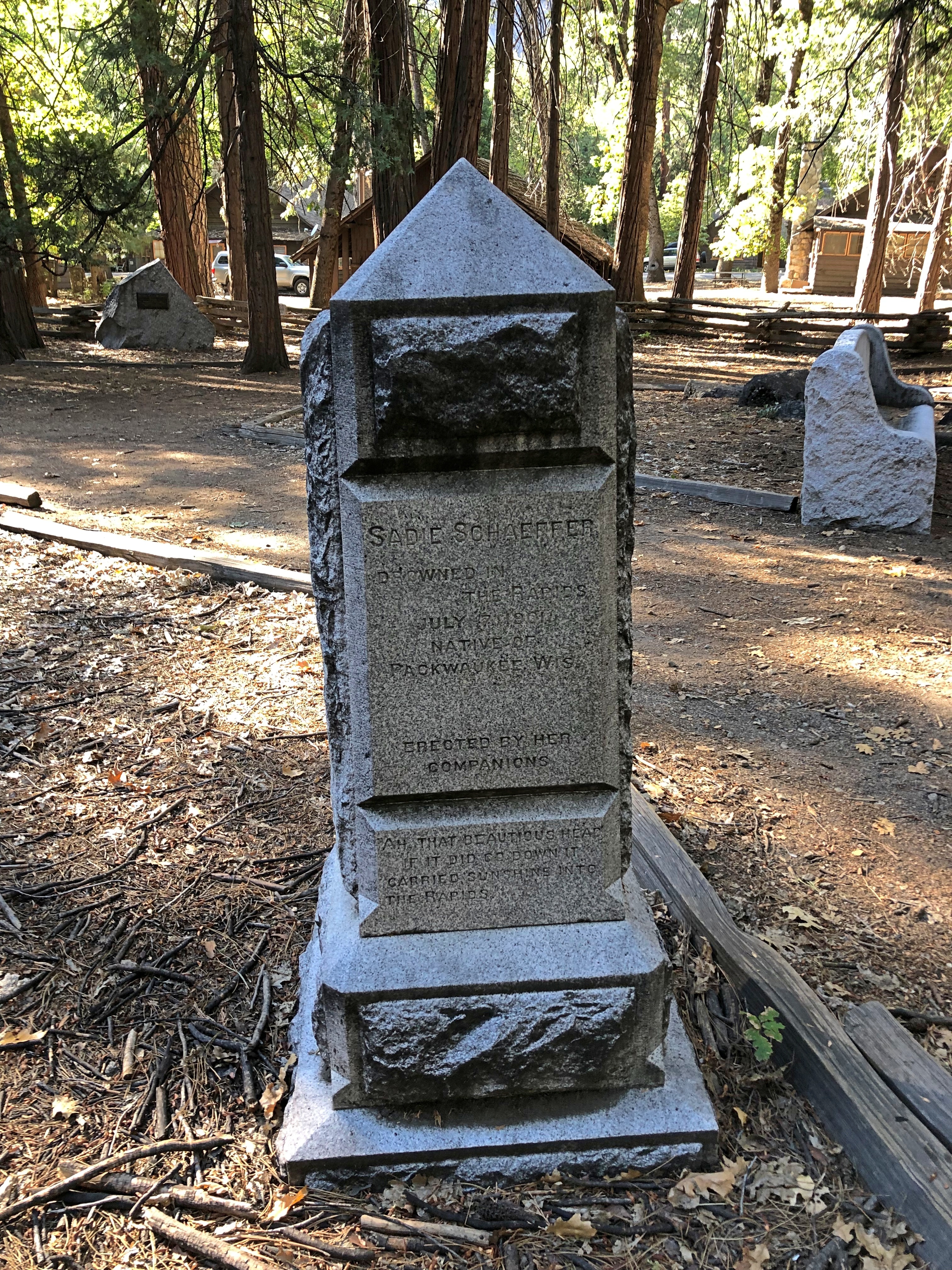
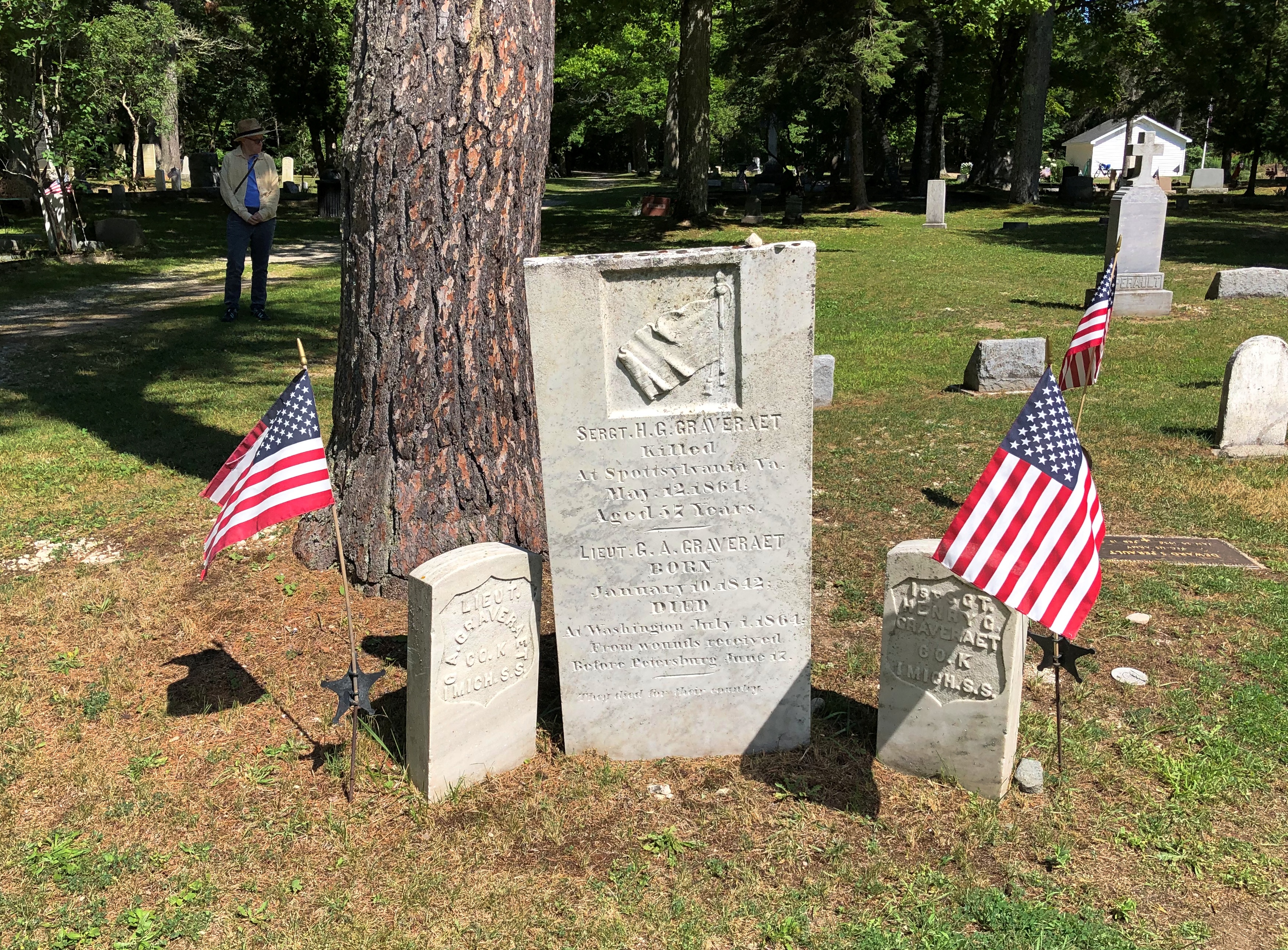
Sadie Schaeffer, drowned in the rapids in July 1900, it looks like.
Yosemite Cemetery

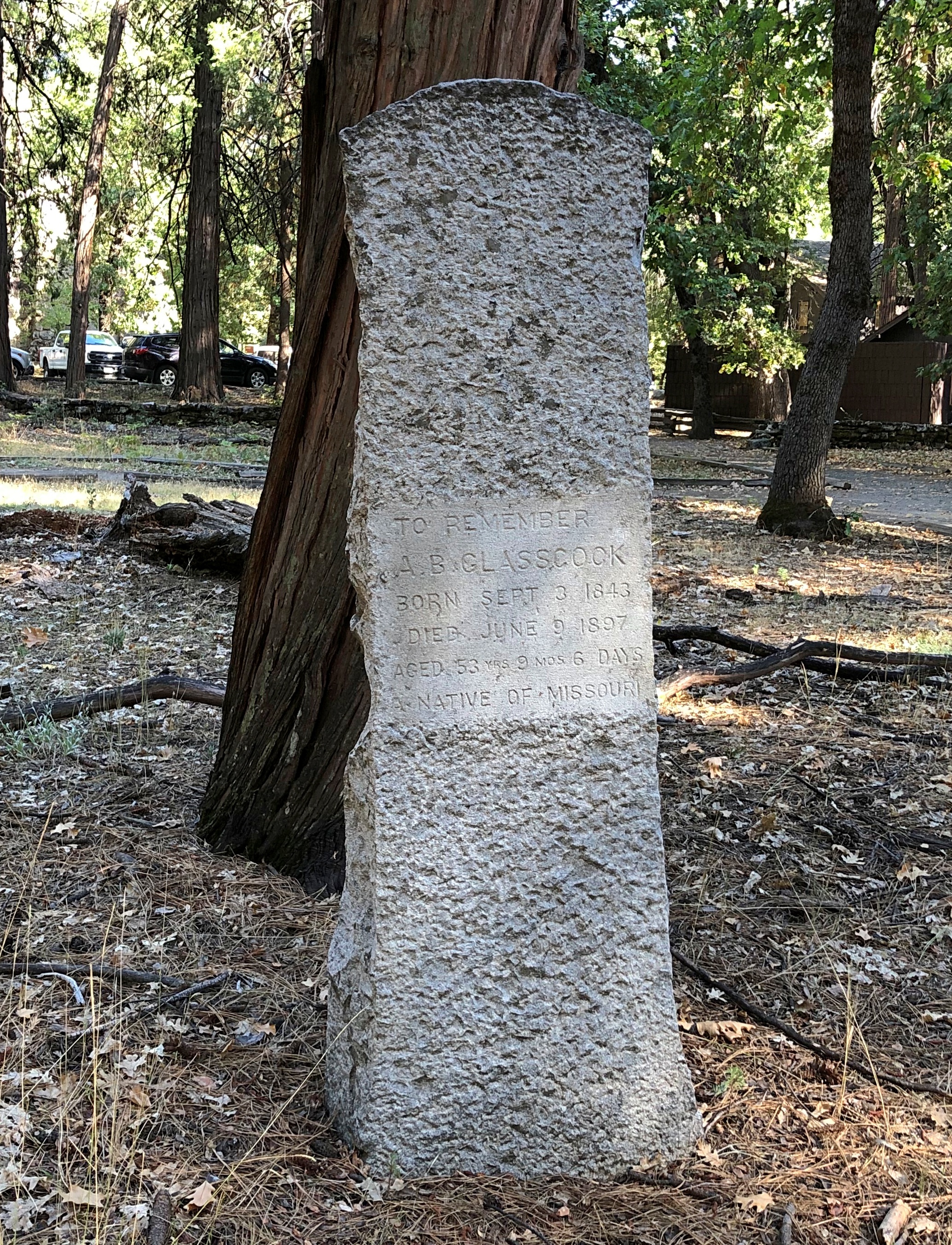
A.B. Glasscock, died 1897, aged 53.
A.B. Glasscock, died 1987, aged 53.

Albert May, died 1881, aged 51.
Albert May, died 1881, aged 51

Walk on. By this time, the valley is catching afternoon light.Yosemite National Park

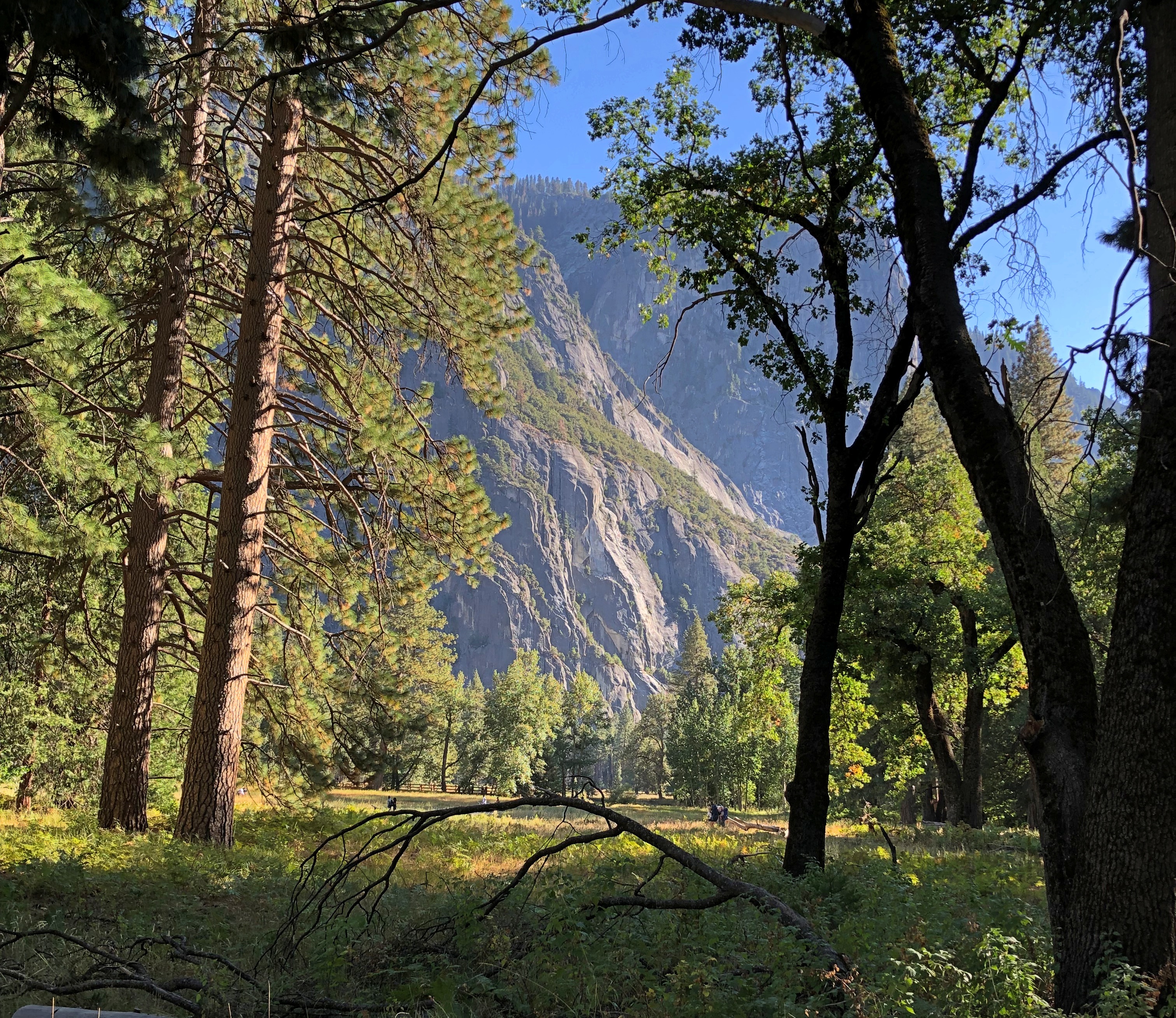
Yes indeed, we got a different view of Half Dome.Yosemite National Park
Yosemite National Park

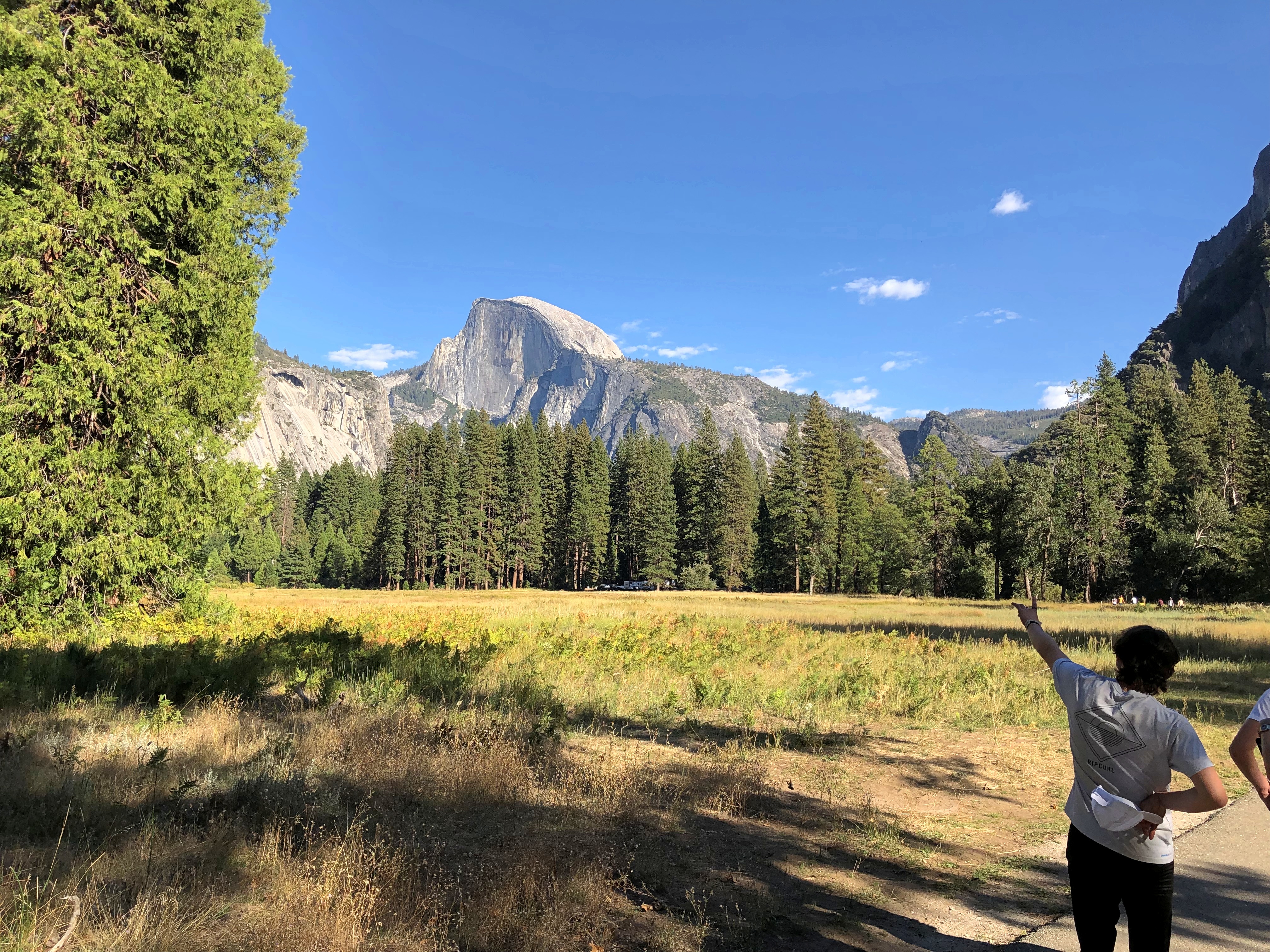
Dry now, but it does get really wet around here. At least it did in 1997.Yosemite National Park

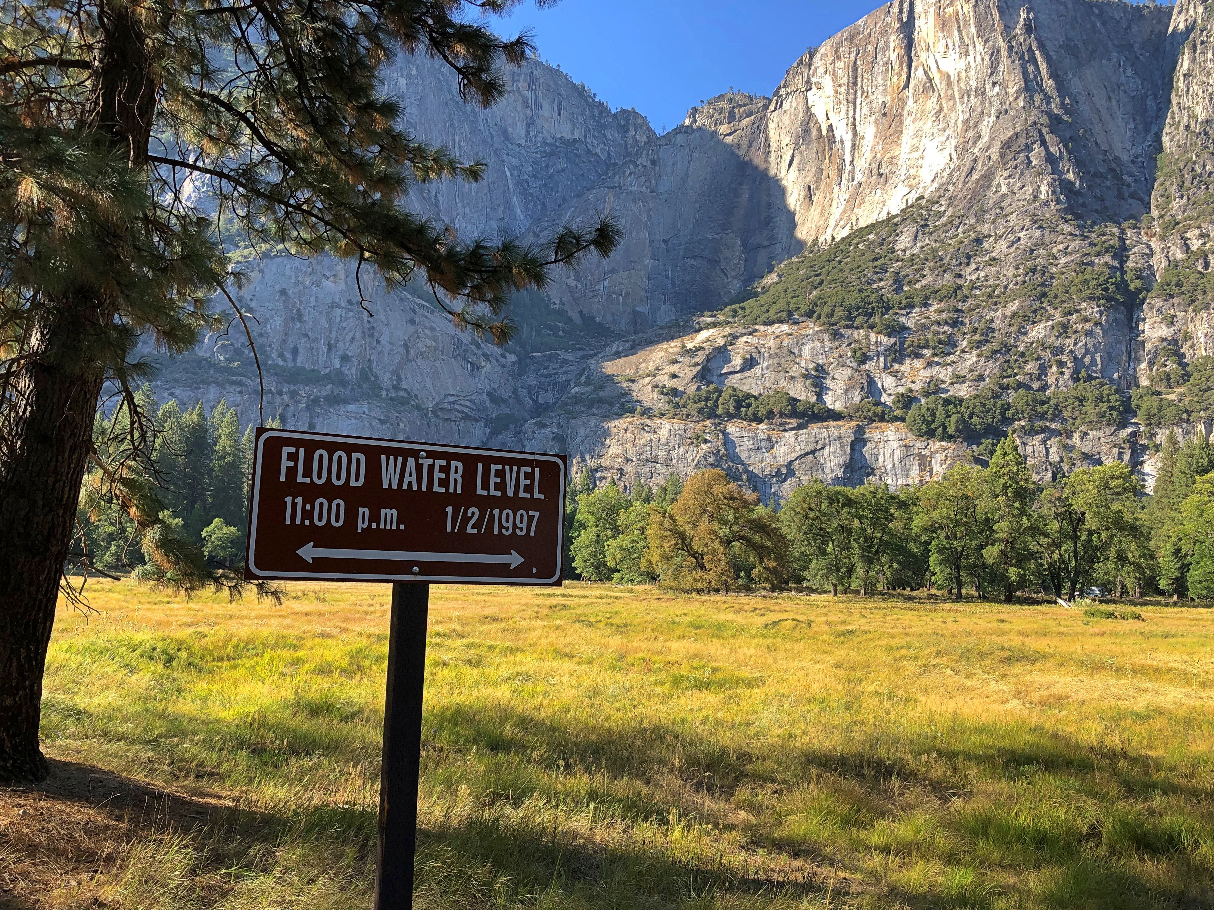
Late in the afternoon, we left by way of a roadside view of El Capitan. The road to the closest grove of the park’s giant trees had been closed, so big trees will have to wait in case I ever return. But I wasn’t going to miss the mass of El Capitan. The boss rock.

Not far from the road.
El Capitan

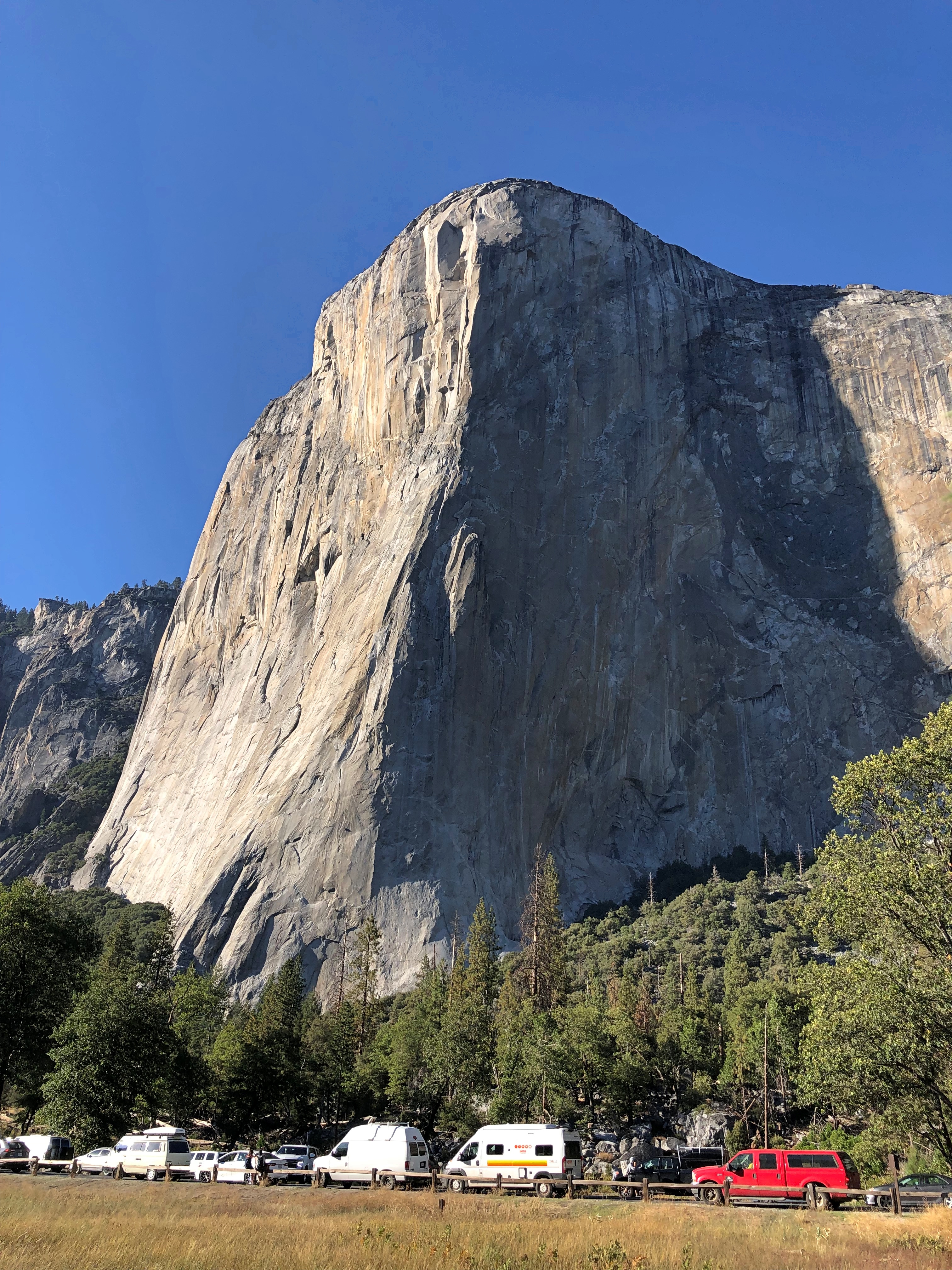
Further back. I walked about a quarter-mile and El Capitan still dominated the view.
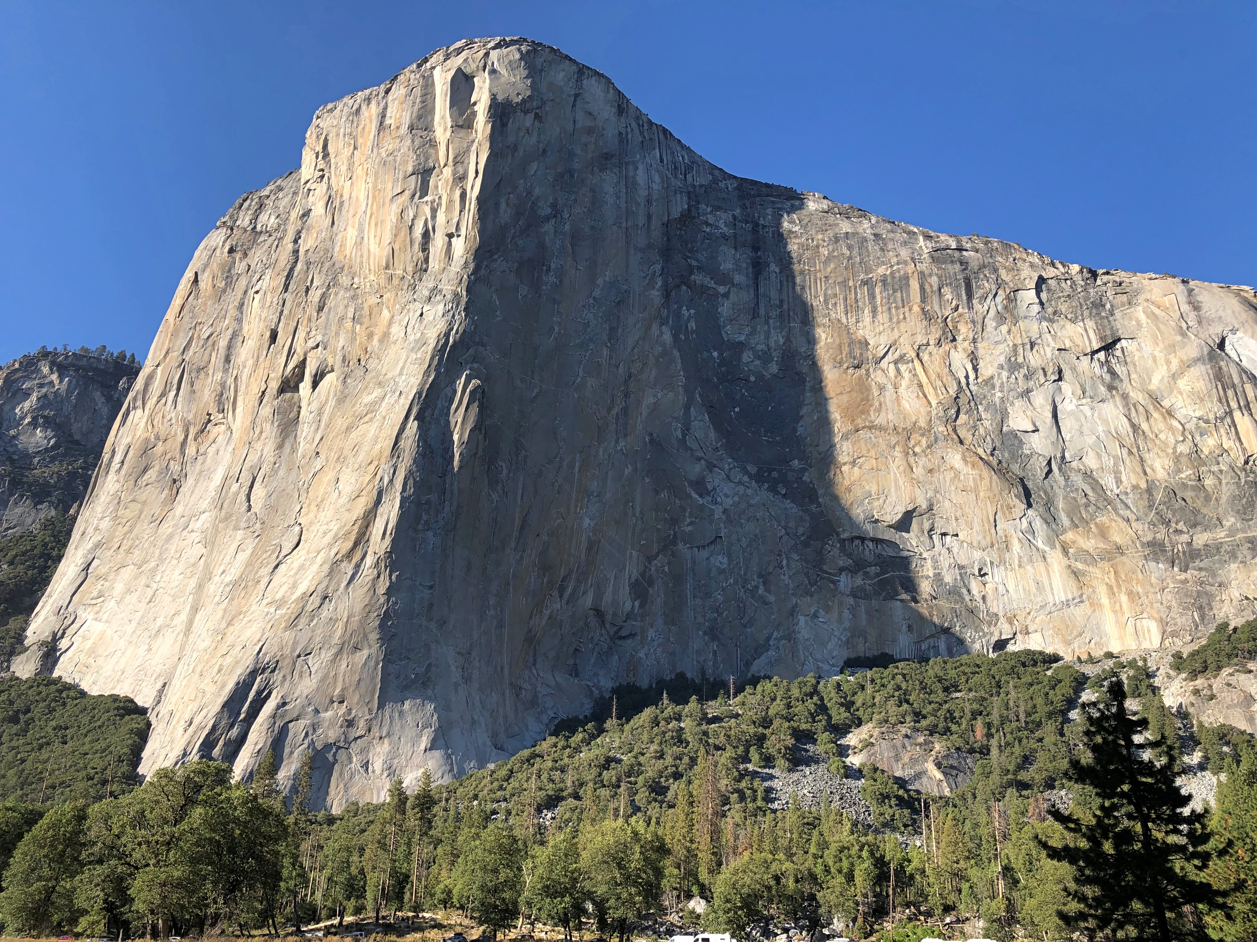
Yosemite National Park

Closer.
Yosemite National Park

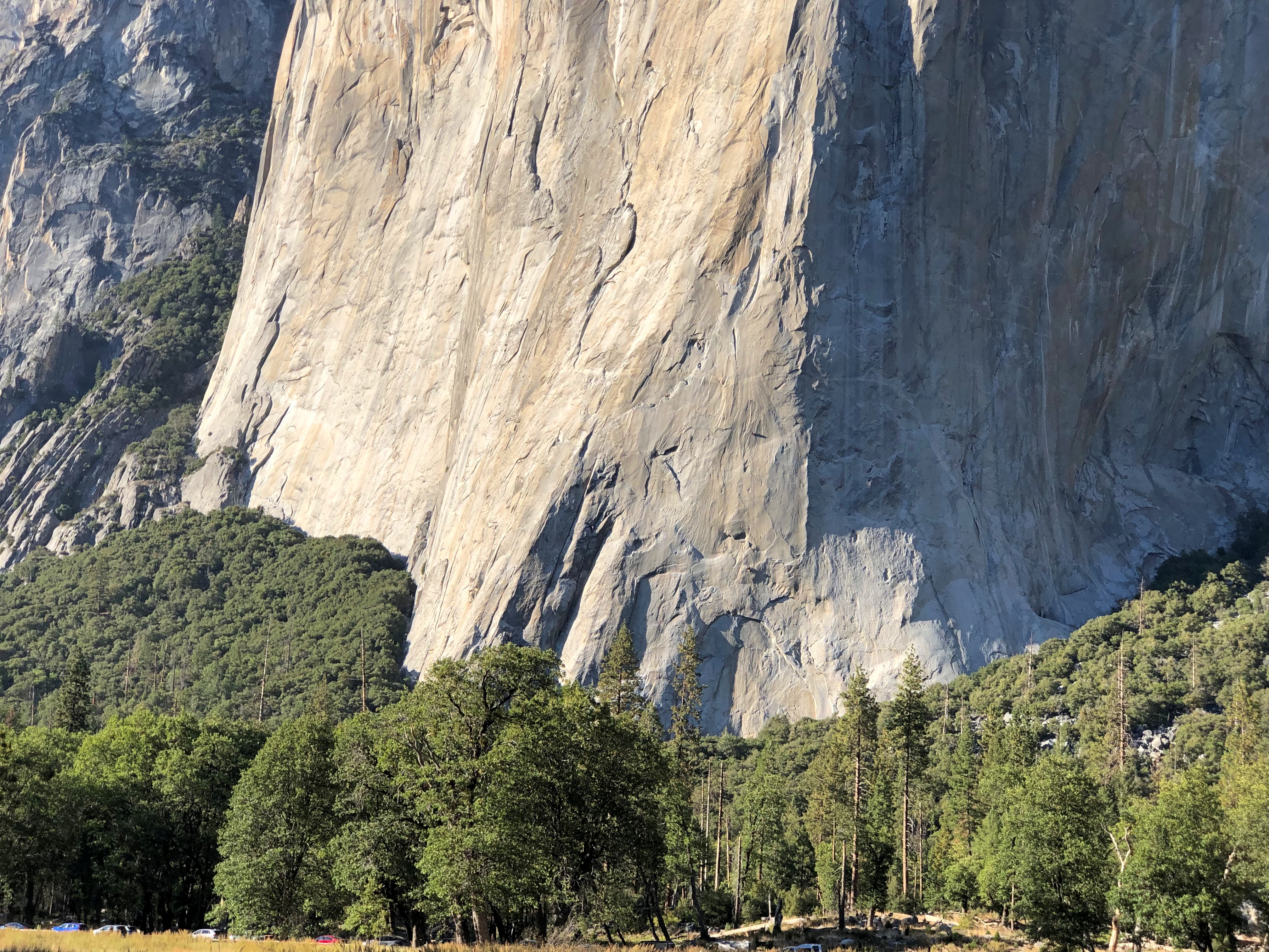
It’s virtually impossible to see them in the image, but there were climbers on the face of El Capitan. I watched for a few minutes, and they seemed to be on their way down. Bet that’s a good idea in the afternoon. Except, no. There are nighttime climbers.

Virginia City

Bonanza started each week with a map on screen, and that was probably the best thing about that TV show. Not just any map, but an idiosyncratic depiction of the Cartwrights’ vast ranch Ponderosa, which straddled Lake Tahoe at some inexact moment in the 19th century.

Set illustrator Robert Temple Ayres (d. 2012) designed the original, “Map to Illustrate the Ponderosa in Nevada,” in 1959. I wasn’t a regular watcher of Bonanza, either in prime time or afternoon repeats, but I did know that map.

That show might have been the first time I ever heard of Virginia City, Nevada, which is featured prominently on the map, toward to top, because it is more-or-less oriented with the east to the top. Maybe Ayres was trying to tell us all something about the importance of Jerusalem. More likely, he needed to fit the map on horizontal TV screens.

Also, if I remember right, the Cartwrights were always going to town — to Virginia City — for one reason or another. After leaving Carson City on October 3 to return to Reno, I decided to go by way of Virginia City myself, which is on Nevada 341. The drive climbs into the Virginia Range, and the city sits on what used to be the Comstock Lode.Virginia City, Nevada Virginia City, Nevada

At less than 800 residents, the city is a town, nothing like its silver boom heyday in the 1870s, when there was a population of more than 25,000. The town you see now mostly dates from after 1875, when the original V. City burned down.

Local boosters haven’t forgotten that a young Samuel Clemens lived here for a while.Virginia City, Nevada

The main street is C Street.Virginia City, Nevada Virginia City, Nevada Virginia City, Nevada

You can stroll down C Street and visit the likes of the Fourth Ward School Museum, Cafe Del Rio, Virginia City Jerky, Wild Horse Gallery, Comstock Firemen’s Museum, Tahoe House (a hotel), Washoe Club Museum & Saloon, Garters and Bloomers, Grant’s General Store, Virginia City Mercantile, Red’s Old Fashioned Candies, Comstock Bandido (clothes), Palace Restaurant & Saloon, Silver Queen (another hotel), Bucket of Blood Saloon, Priscilla Pennyworth’s Emporium, Red Dog Saloon, The Way It Was Museum, Buzzard Creek Collectibles and much more.

The name of this place was particularly apt.Virginia City, Nevada

I hadn’t come to Virginia City to shop. Rather, I sought out St. Mary’s in the Mountains Catholic Church on E Street. Considering that the town is built on the side of a slope, it was a walk downhill to get there.St Mary's of the Mountain - Virginia City, Nevada
St Mary's of the Mountain - Virginia City, Nevada

Completed in 1870 and rebuilt after the fire in ’75. I was glad to find it still open for the day.St Mary's in the Mountains - Virginia City, Nevada St Mary's in the Mountains - Virginia City, Nevada St Mary's in the Mountains - Virginia City, Nevada

Nearby is the more modest St. Paul’s Episcopal Church. It wasn’t open.St. Paul's Episcopal Church Virginia City, Nevada

Nice view from next to the church, though. Note the gazebo. What was it Mark Twain said about gazebos? They’re the mark of civilization, even in rough-and-tumble Nevada? Well, maybe he didn’t say that.
St. Paul's Episcopal Church Virginia City, Nevada

Soon I visited Silver Terrace Cemetery, which is on the edge of town. You don’t have to go far to get there, but it is a bit of a walk once you’re at the entrance.Silver Terrace Cemetery, Virginia City. Nevada

Worth the effort. Finally, a cemetery with a distinctive local name. I’m glad its organizers didn’t pick Greenwood or Woodland or something else completely at odds with Nevada geography.Silver Terrace Cemetery, Virginia City. Nevada Silver Terrace Cemetery, Virginia City. Nevada

Not a lot of large memorials, or many trees, but the place has character. And some contour.Silver Terrace Cemetery, Virginia City. Nevada Silver Terrace Cemetery, Virginia City. Nevada Silver Terrace Cemetery, Virginia City. Nevada

“Very few of the adults entombed here are native to Nevada, which offers a window into the cultural melting pot that was drawn to the glamour of the largest silver strike in U.S. history,” Travel Nevada notes. Glamour? More likely, they wanted to get rich.

“Most of who worked the Comstock were immigrants… nobody famous is buried here, just those who devoted their lives to developing Comstock Lode.”

Marshall Gold Discovery State Historic Park

Drive east from Sacramento on U.S. 50, and you will find yourself in Placerville, California. In its early mining days, the town had a different name that the current, more tourist-oriented town doesn’t shy away from.Placerville, California Placerville, California

Due process was for fancy-pants Eastern lawyers, it seems. Still, when it all happened more than a century and a half ago, mob justice adds to the colorful history of a place.Placerville, California

NDGW and NSGW? Native Daughters and Sons of the Golden West, respectively. Sibling organizations known for memorializing and plaque-placing in the Golden State. This wouldn’t be the last time I encountered their work. Members need to be born in California, and have included such notables as Richard Nixon and Earl Warren over the years.

Whatever its history of frontier justice, Placerville offers a pleasant stroll in an upper-middle tourist street in our time. I spent a few glad minutes in the labyrinth of books. How could I pass that up?Placerville, California

Go further east from Placerville, and you’ll find Marshall Gold Discovery State Historic Park.Marshall Gold Discovery State Historic Park

The park occupies much of the town of Coloma, California. By the time I got there, just before noon on October 2, the air was dry, sky clear, and temps nearly hot. The terrain reminded me a good deal of the Texas Hill Country: scrubby and brown and hilly, but appealing all the same.Marshall Gold Discovery State Historic Park Marshall Gold Discovery State Historic Park

The park includes a reconstruction of the sawmill where James Marshall saw those golden flecks in the winter of 1848. The structure, anyway, since I don’t think including a 19th-century industrial saw (steam powered by this time?) was in the reconstruction budget.Marshall Gold Discovery State Historic Park Marshall Gold Discovery State Historic Park

There’s a stone-wall memorial on the actual site of the mill, not far away on the handsome American River.Marshall Gold Discovery State Historic Park Marshall Gold Discovery State Historic Park

I was surprised to learn that the river is only about 30 miles long, but enough to provide Sacramento with most of its drinking water, assuming enough snowmelt every spring.

James Marshall has a memorial in Coloma, but you have to climb a hill to reach it. Or drive a short, winding road that happens to be a very short California state highway.James Marshall Memorial

The work of the NSGW again. In fact, the first memorial the org ever erected, in 1890, when the memories of Forty-Nine were still living memories for many. Marshall wasn’t among them. The honor was posthumous for him, and he reposes underneath the structure.

Still, nice view he’s got of the rolling and formerly gold-laden territory.Marshall Gold Discovery State Historic Park

Not quite as far up the hill are a number of historic structures and an old cemetery. One is St. John’s, a Catholic church that held services until about 100 years ago, but where you can still get married.Marshall Gold Discovery State Historic Park - St John

John Marshall’s cabin.Marshall Gold Discovery State Historic Park - Marshall's Cabin

Even more interesting, I thought, was a more-or-less intact mining ditch, countless of miles of which were dug in the effort to tease yellow metal from the indifferent earth. Later, many were (or still are) used for irrigation. I don’t think this one is; it’s just a gash in the earth.Marshall Gold Discovery State Historic Park - Marshall's Cabin

The hillside cemetery.Marshall Gold Discovery State Historic Park - cemetery Marshall Gold Discovery State Historic Park - cemetery Marshall Gold Discovery State Historic Park - cemetery Marshall Gold Discovery State Historic Park - cemetery

Ashes to ashes, dust to dust, gold-bearing earth to gold-bearing earth.

Mackinac Island Walkabout, Part 1

Things to know about Mackinac Island, Michigan.

  • It really is an island, about 4.3 square miles in Lake Huron, and not far from both the Lower and Upper Peninsulas of Michigan.
  • Most of the island is Mackinac Island State Park, but there is a town, and 470 or so people live there full time.
  • Mackinac is famed for allowing no motorized vehicles on its streets, except for a handful of emergency vehicles.
  • Regular passenger ferry services connect the island with the mainland; the ride takes about 20 minutes. The view of the Mackinac Bridge from the ferry is terrific.

Mackinaw Bridge

The ferries from the mainland dock at the aptly named Main Street. The closer you are to Main Street on Mackinac Island, the more people there are. Even on a weekday. We arrived early in the afternoon of Tuesday, August 2. The day was sunny and warm.Mackinac Bridge Mackinac Bridge

Restaurants, retailers and hotels line Main Street, packing ’em in. No cars, but plenty of bicycles and some horse-drawn wagons ply the street, so best to walk on the sometimes shaded sidewalk.

Mackinac Island is a major tourist draw in our time, but that’s hardly new. People have been visiting for pleasure since the late 19th century. Just another thing Victorians started, among many.

At one end of the commercial strip is an entrance to Mackinac Island State Park. Atop the hill at that point is Fort Mackinac, relic of the moment in the late 18th century when sovereignty over the island wasn’t a settled matter.Mackinac Island State Park

Immediately under the fort is a grassy slope.Mackinac Island State Park Mackinac Island State Park

Popular, but not as crowded as Main Street. The view toward the water.Mackinac Island State Park

A bronze Marquette overlooks the slope.Mackinac Island State Park Mackinac Island State Park

So does Trinity Episcopal Church, built in 1882.Trinity Episcopal Church Mackinac Island Trinity Episcopal Church Mackinac Island

We’d toyed with the idea of renting bicycles to get around the island, but the climb up the hill toward the fort, a fairly steep bit of hoofing, put that idea to rest.

Much later in the day, we came to realize that the thing to do with a bicycle is to ride the eight miles or so of Michigan 185, the only road in the state system without motorized transport, and which runs around the edge of the island. Something to do if I ever come back, and am healthy enough for it.

Or you could walk your bike up to the top of the hill, and ride around up there on some flat paths. By the time you get to this part of Mackinac — not really that far from Main Street — the crowds have thinned out.Mackinac Island State Park

We walked a few of the paths, including one that our map said would take us to “historic cemeteries.” Right up my alley. We passed through one of them, St. Ann’s Cemetery. Burials have taken place there since the mid-19th century, as a Catholic cemetery that replaced one closer to the shore.Mackinac Island State Park - St Ann's Cemetery Mackinac Island State Park - St Ann's Cemetery Mackinac Island State Park - St Ann's Cemetery Mackinac Island State Park - St Ann's Cemetery

By this time, we were the only (living) people around. Cemeteries seem to have that effect, even near popular tourist destinations.

Lindenwood Cemetery & Johnny Appleseed Park

I didn’t see the grave of Art Smith in Fort Wayne early this month. I wasn’t looking for it, because I’d never heard of Art Smith. Only after reading about Lindenwood Cemetery a few days ago, and some time after I visited there, did I find out about him.

Along with a fun pic.Art_Smith_(pilot)_1915

Art Smith, early aviator, Bird Boy of Fort Wayne. In 1915, he took Lincoln Beachey’s job as a exhibition pilot at the Panama-Pacific International Exposition, after Beachey carked it in San Francisco Bay. Smith himself had a date with aerial death, but that was later, while flying the mail in 1926. He’s been at Lindenwood ever since.

An aside to that aside. According to Wiki at least, Smith was one of only two men trained to fly the de Bothezat helicopter, also known as the Jerome-de Bothezat Flying Octopus, which was an experimental quadrotor helicopter.

That tells me that among those magnificent young men and their flying machines — you know, early aviators — Smith must have been especially crazy even in that fearless bunch, whatever his other skills as a pilot or virtues as a human being.

Lindenwood Cemetery dates from 1859, and is the Fort Wayne’s Victorian cemetery. It looks the part. All together about 69,000 people rest there, and at 175 acres, it’s one of the larger cemeteries in Indiana. As usual, I arrived in the mid-morning, by myself.

I did see one noteworthy burial soon after arrival. That is, the memorial itself seemed to make that claim. He founded two churches, so the claim seems to have some merit.Lindenwood Cemetery, Fort Wayne

It’s a forested area, as I’m sure was intended.Lindenwood Cemetery, Fort Wayne

With open spots.Lindenwood Cemetery, Fort Wayne Lindenwood Cemetery, Fort Wayne

A scattering of funerary art.Lindenwood Cemetery, Fort Wayne Lindenwood Cemetery, Fort Wayne

A chapel.Lindenwood Cemetery, Fort Wayne

An occasional mausoleum. I’ve never seen one quite like this one.
Lindenwood Cemetery, Fort Wayne

An apartment block necropolis? I hadn’t seen one quite like that, either. A more modestly priced option, probably, at least at one time.
Lindenwood Cemetery, Fort Wayne

Calvin Smith (1934-88) is remembered by someone. Someone who brings treats, including the North Carolina soda Cheerwine.Lindenwood Cemetery, Fort Wayne - Calvin Smith

Which brings me to Johnny Appleseed, promoter of cheer cider. Hard cider, that is, something elided over in school stories about the career of John Chapman, or at least the ones I heard.

A contemporary image.

He too is buried in Fort Wayne but not, befitting his reclusive reputation, among the crowds at Lindenwood. This is Johnny Appleseed we’re talking about. He has his own park.

When I realized I was driving near his grave on Saturday evening before sunset, I took a detour to Johnny Appleseed Park, most of which features standard-issue municipal facilities, such as ballfields and picnic tables and sheltered event spaces. But one section includes Johnny’s grave.Johnny Appleseed Grave

That’s not actually the gravesite, but rather a sign about Johnny Appleseed. The nurseryman reposes on top of the hill behind the sign.Johnny Appleseed Grave

I read the sign and learned a thing or two. I didn’t know, for instance, that Chapman was also a missionary for the Swedenborgians.Johnny Appleseed Grave

“Johnny

Appleseed”

John Chapman

He lived for others

Holy Bible

1774-1845

It took me a moment to notice the apples scattered around the stone. Then I noticed the apple trees planted around it. Nice touch.

South Bend City Cemetery

Oddly enough, our microtrip to South Bend last weekend wasn’t much of a trip to South Bend. Our motel was in the city, near the airport, and we drove through town a few times, but mostly we were in Norte Dame — which is a town besides being a university of that name — and Mishawaka.

Still, we had a few South Bend moments.South Bend for Pete mural

Also, on Sunday morning, I went by myself to the South Bend City Cemetery, because of course I did. On the way I took a short look at St. Paul’s Memorial Church (Episcopal), because of course I did.St Paul's Memorial Church, South Bend

With John 12:17 over one of the doors.St Paul's Memorial Church, South Bend

The cemetery is a few blocks away. Founded in 1832, with about 14,800 permanent residents, mostly from the 19th century, though I spotted a scattering of 20th-century burials.

An aside: I read this week that Kane Tanaka, regarded as the oldest living person, died at 119. Born in 1903. Though it’s clearly been true for a while, I just realized that means that no one who lived any time at all in the 19th century is still alive. No one whose age is verifiable, anyway.

Except in the sense that we still remember, personally, people who lived at least a little while in that century, such as my grandmother. Is someone not well and truly dead until everyone who remembers him or her is too?

South Bend City Cemetery, the entrance.St Paul's Memorial Church, South Bend

The cemetery office, I assume. Handsome little structure.South Bend City Cemetery 2022

Not too many large memorials or much funerary art, but well populated by a variety of weathered standing stones. As usual, I was the only living person around. Not even groundskeepers on Sunday.South Bend City Cemetery 2022 South Bend City Cemetery 2022 South Bend City Cemetery 2022

As I said, the cemetery’s pretty near St. Paul’s, which is in this image.South Bend City Cemetery 2022

A handful of mausoleums. No name on this one.South Bend City Cemetery 2022

A boarded-up mausoleum. Not something you see much. I like to believe that the cast-iron door that probably hung there went to a scrap drive and did its tiny part to defeat Hitler. But I also suspect that it might have been stolen one night instead.

Large to the small.
South Bend City Cemetery 2022

The worn, broken stone of Peter Roof, the first recorded burial. Roof, I understand, was a veteran of the Revolution.

There’s a poignancy in time eating away at memorials as surely as it did those memorialized. Worn lettering, old-time symbols, dark smudges of pollution and dirt.South Bend City Cemetery 2022

Rust, too. Such is the condition of the GAR stars I saw. This is the kind of cemetery that would have them. Rusty, but they endure as a faint echo of the camaraderie of men who fought and won the day for the Union.South Bend City Cemetery 2022 South Bend City Cemetery 2022

As you’d expect, at least one Studebaker has a sizable memorial. South Bend was their town.

The memorial has lasted much longer than the company of that name.South Bend City Cemetery 2022

I didn’t come looking for the car-making family. I had someone else in mind: Schuyler Colfax.South Bend City Cemetery - Vice President Schuyler Colfax grave

Good old Vice President Colfax of Grant’s first term, famed in — well, neither song nor story. Still, his contemporaries thought highly of him. They must have. Not only did he get the main stone, he got this.South Bend City Cemetery - Vice President Schuyler Colfax grave

And this — close to our time, in 1978.South Bend City Cemetery - Vice President Schuyler Colfax grave

Order of Rebekah? Now you know.

Leaving the cemetery, I was glad to see that it’s on Colfax Ave. It’s a more modest street than Colfax Ave. in Denver, but South Bend is a more modest town.