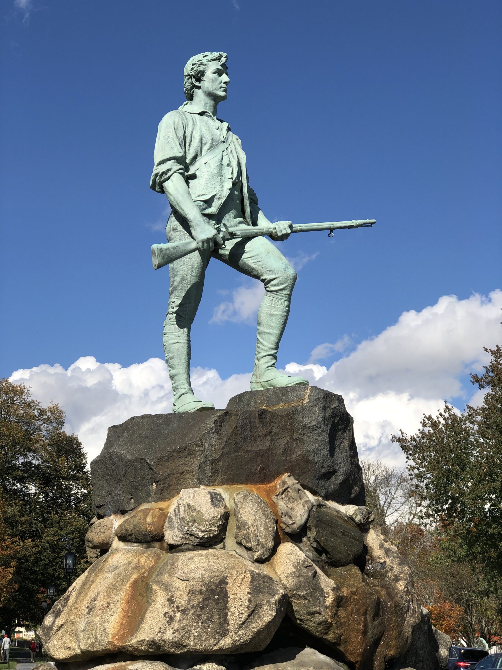
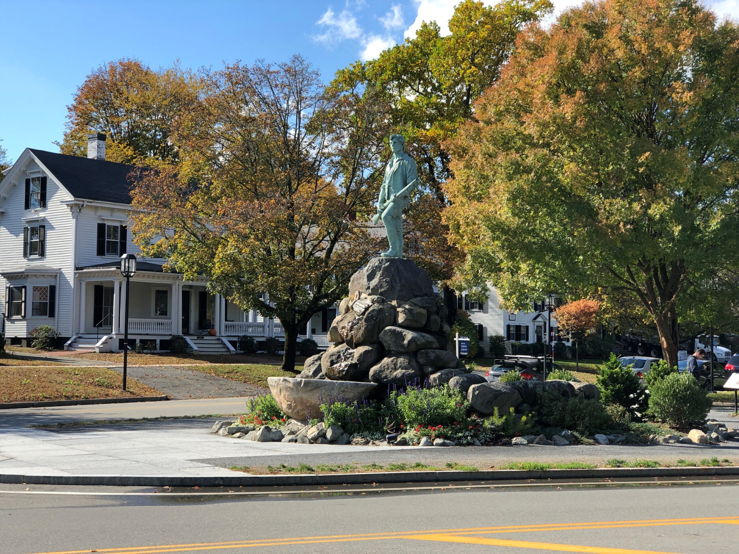
Too bad about iconic. If there ever were a time to use iconic to describe sometime distinctive and revered, John Parker in bronze would be it.
Icons are no accidents. The pose captures the Battle of Lexington as we, Americans, want to remember it: the resoluteness of an ordinary man in the face of the enemy. What the militiamen experienced that morning is partly enshrouded in mystery like a battlefield of the time might be with gun smoke. No one knows who fired the first shot, for instance, but that doesn’t keep the Shot Heard Around the World from having its own name during later generations — a remarkable thing for a simple firearm discharge to have.
Lore has encrusted the story. Even so, the Patriot soldiers in the Revolution, collectively, can’t be said to have lacked resoluteness over the long years of conflict.
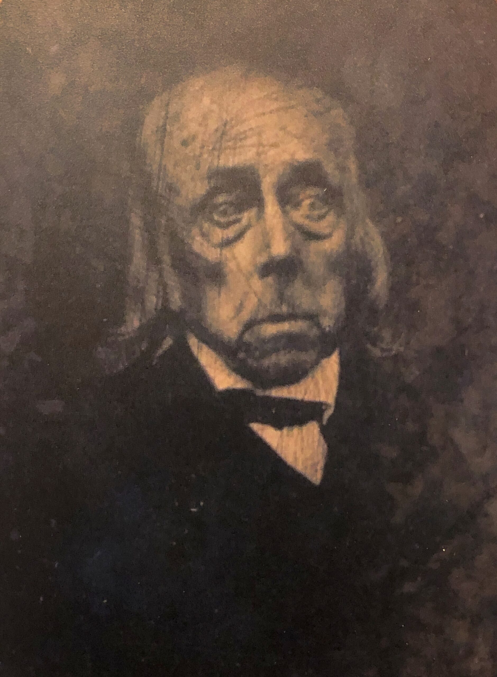
The Parker bronze stands on the edge of Battle Green in Lexington, Massachusetts, and across the street from Buckman Tavern, where the militiamen of the town waited the night before the battle. Among their number on April 19, 1775, was a young man named Jonathan Harrington, a fifer in the militia. About 75 years later, he’s thought to have posed for a photograph, now on display at Buckman Tavern.
Said to be the last survivor of the battle, and the only one to be photographed. The American Battlefield Trust cites a Harrington family history: He said he was aroused early that morning by a cry from his mother, who said: ‘Jonathan, get up, the regulars are coming, and something must be done.’ Jonathan was a fifer. He arose, went to the place where the patriots were gathering, and was with the company on the approach of the British.
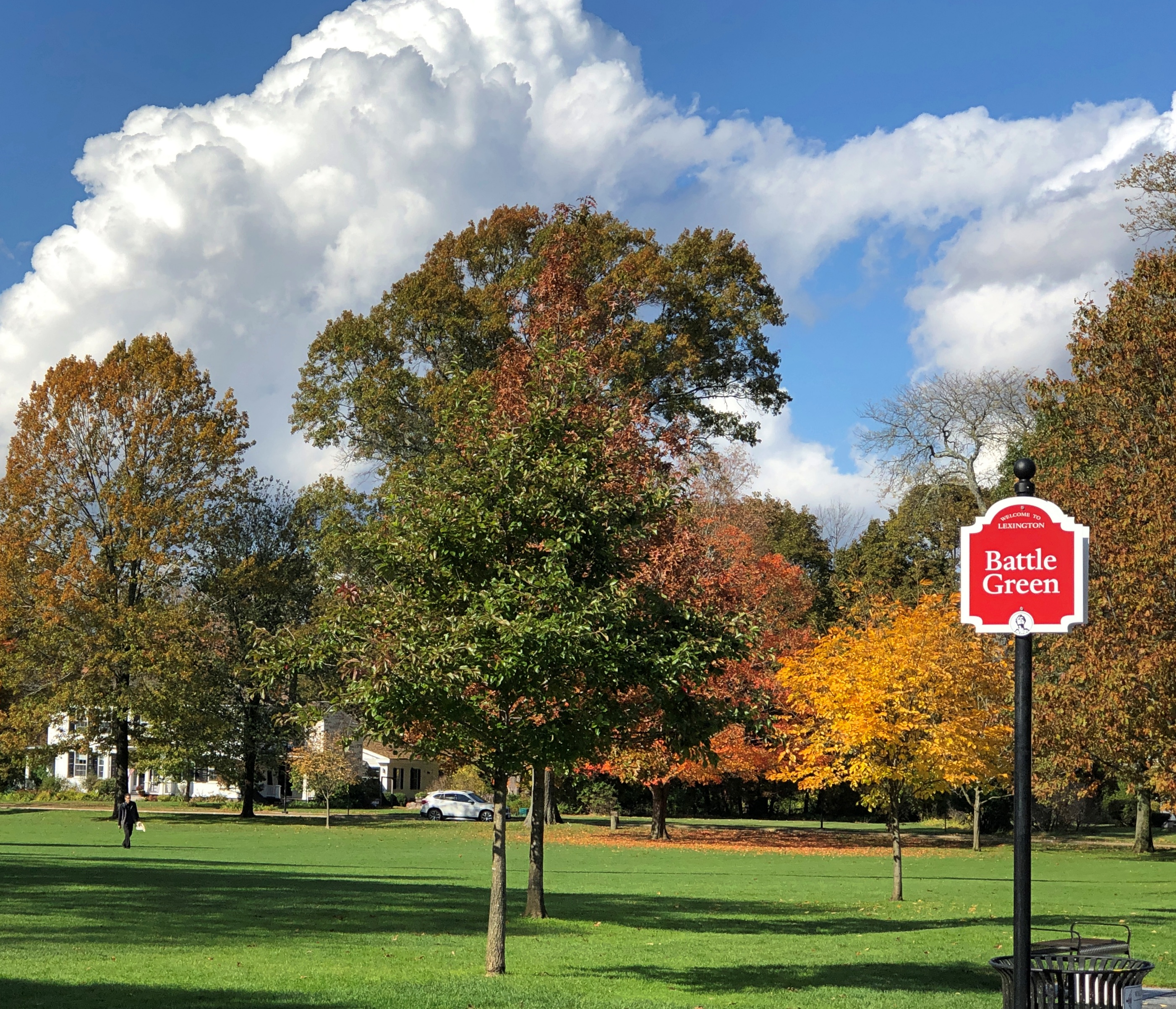
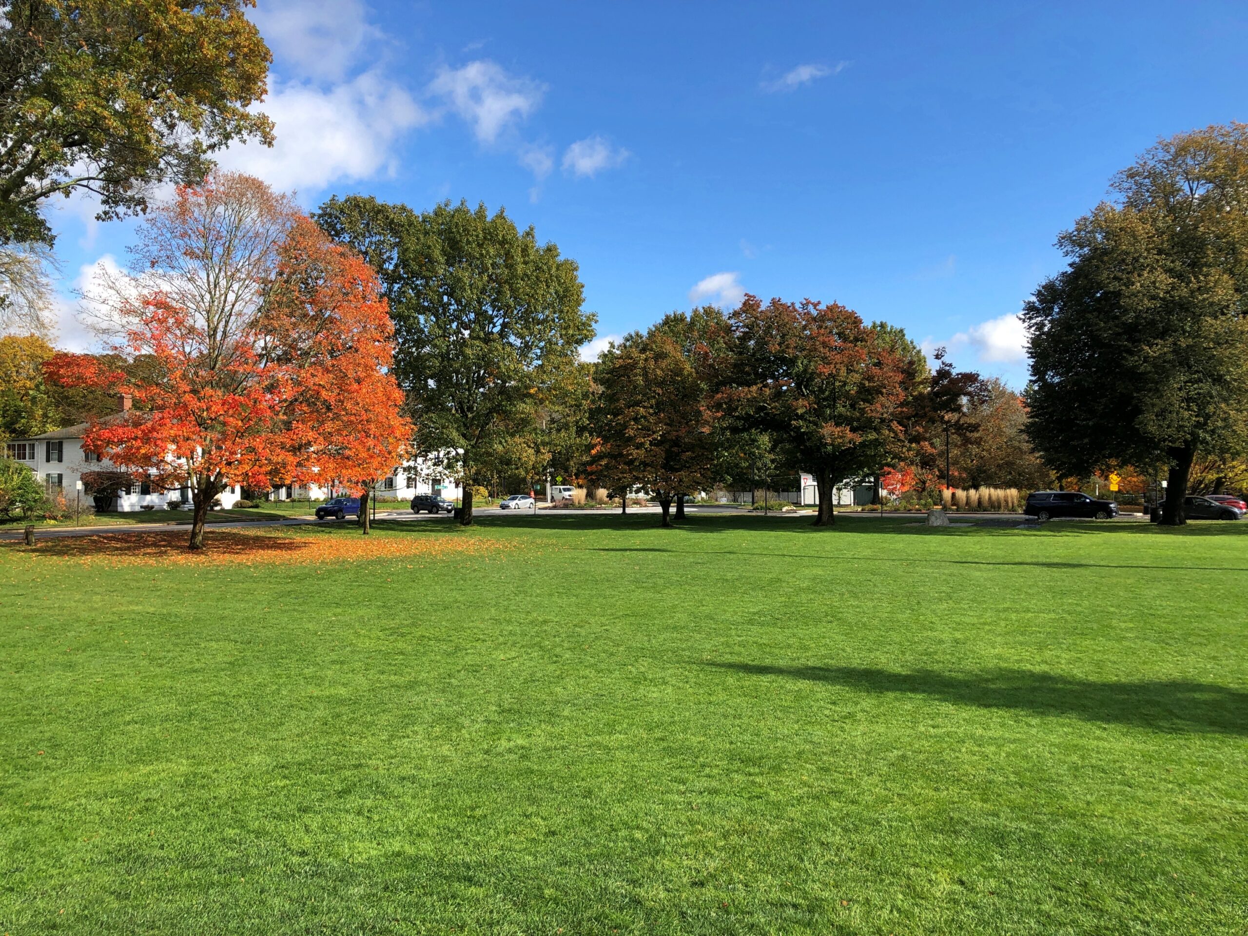
It had rained during the early hours of October 22, 2025 in Lexington, but by late morning the sun was out and only a scattering of puddles remained. Battle Green stretched out behind the bronze John Parker. For a time, I was the only person on the green, though a steady stream of car traffic was the be seen on the roads edging the grounds.
John Parker, originally “Minuteman Statue” by the prolific sculptor and public monument specialist Henry Hudson Kitson, is a latecomer to the green, erected in 1900.
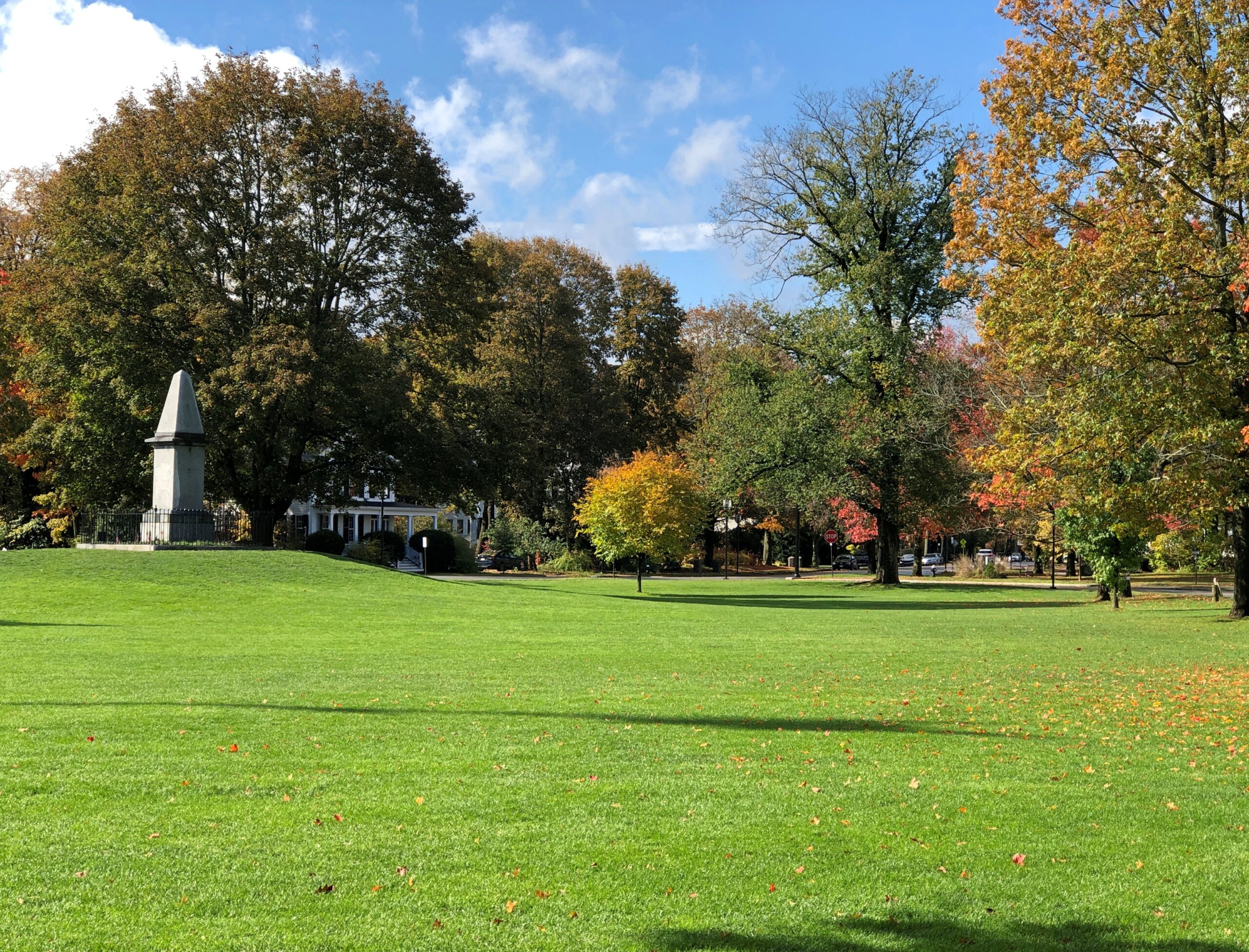
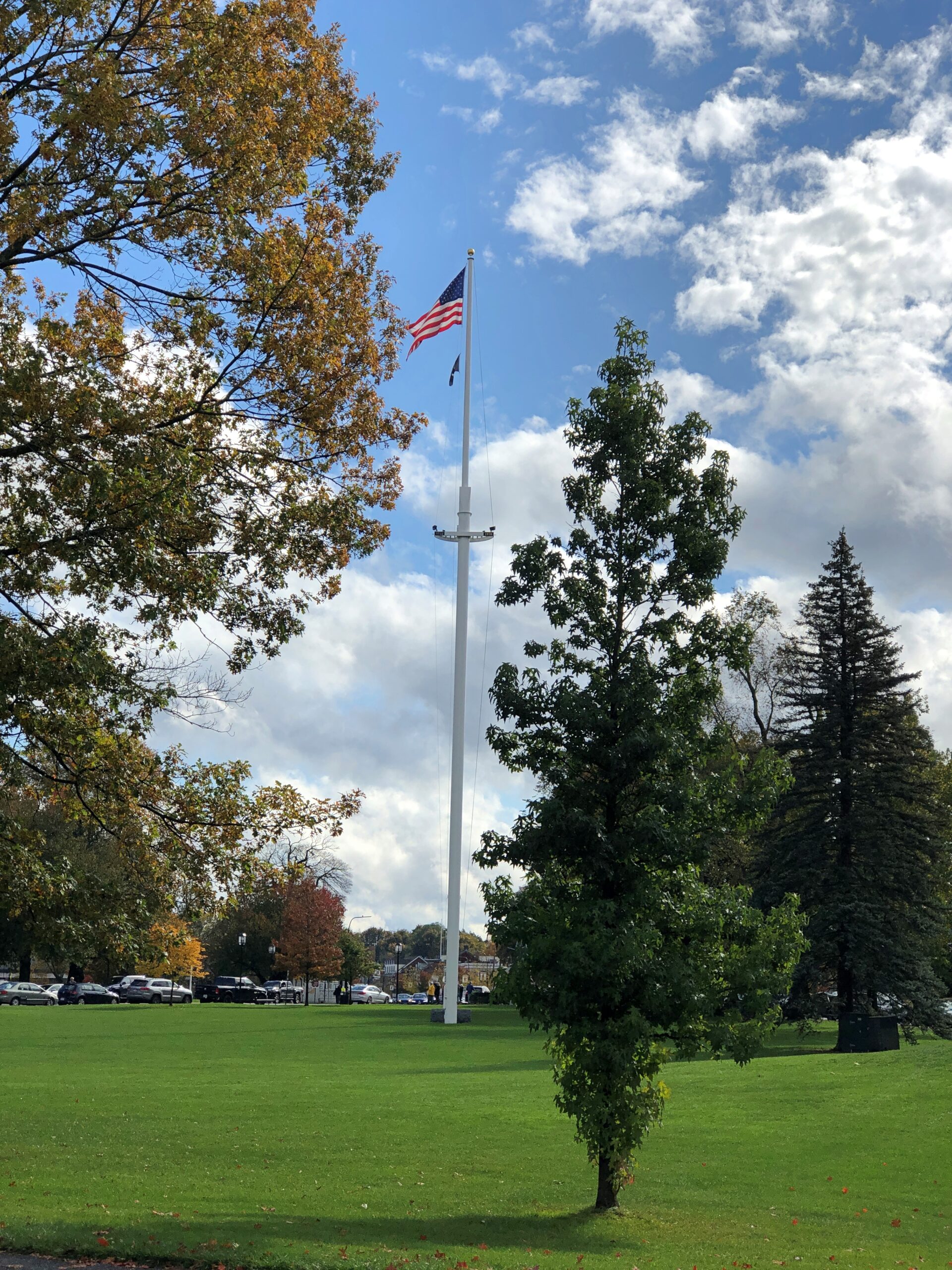
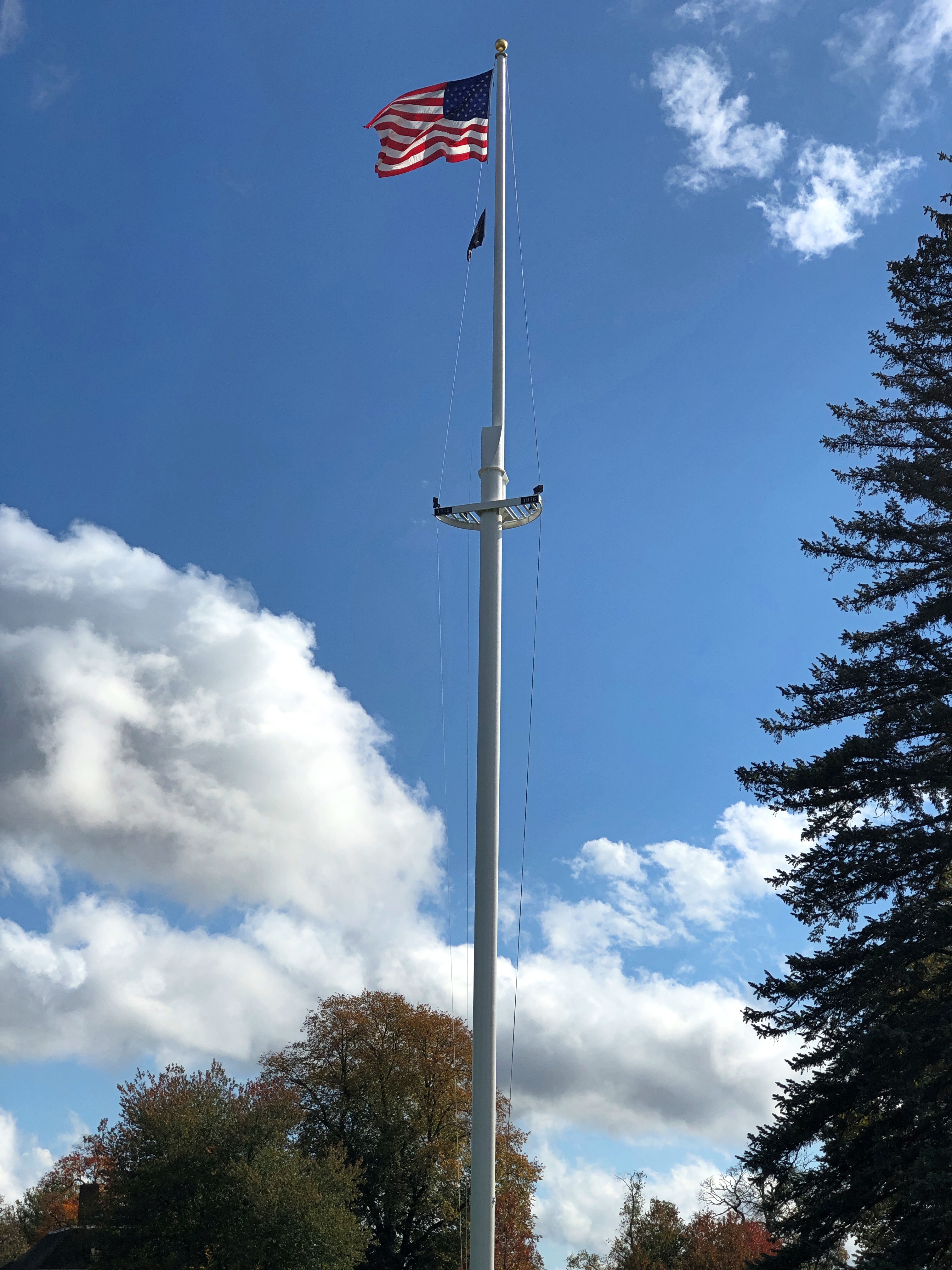
The Battle Green flagpole is newest of all, erected only in 1962. Even so, the pole is on the National Register of Historic Places, and an act of Congress specifies that a flag will always be flown there.
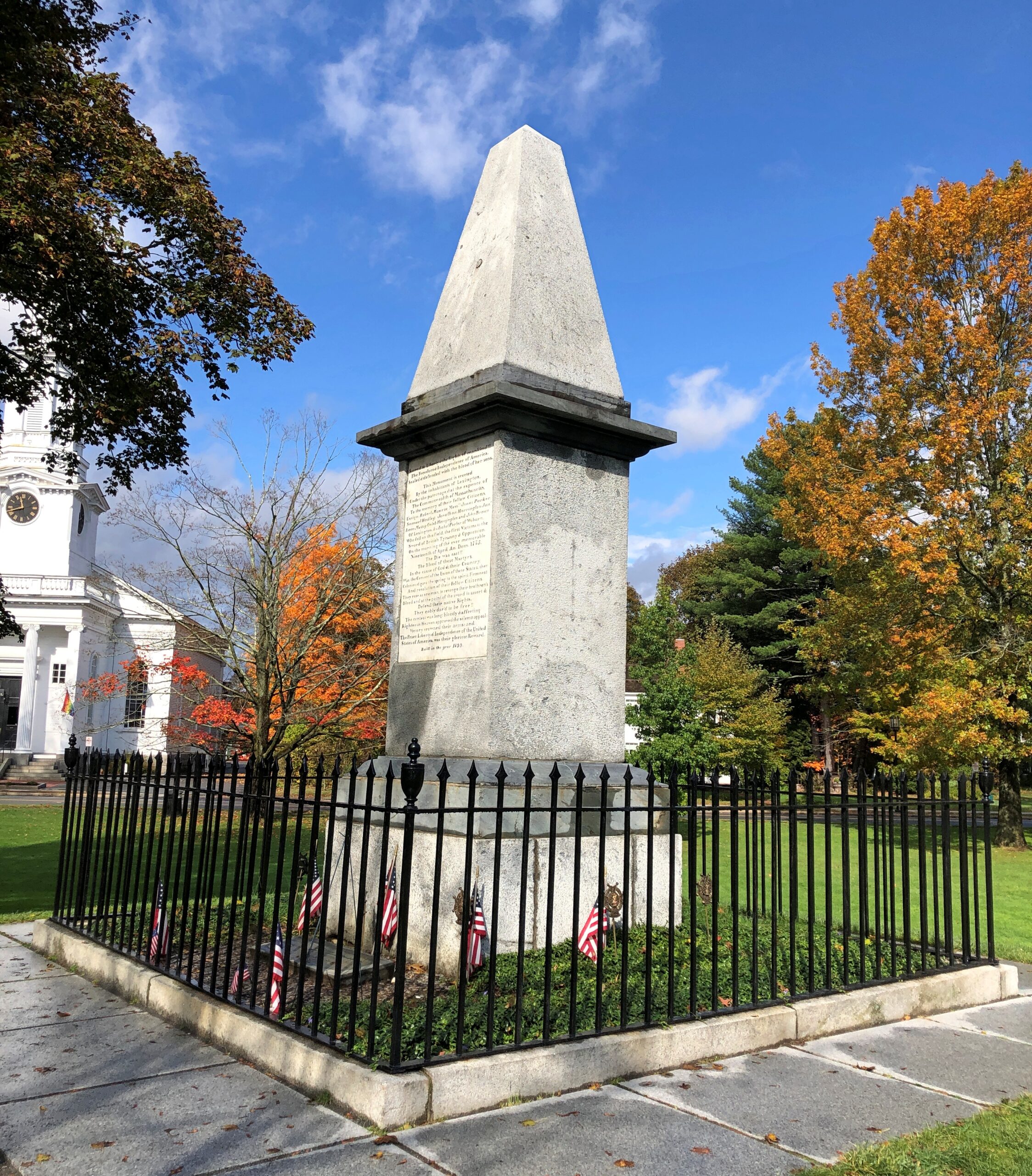
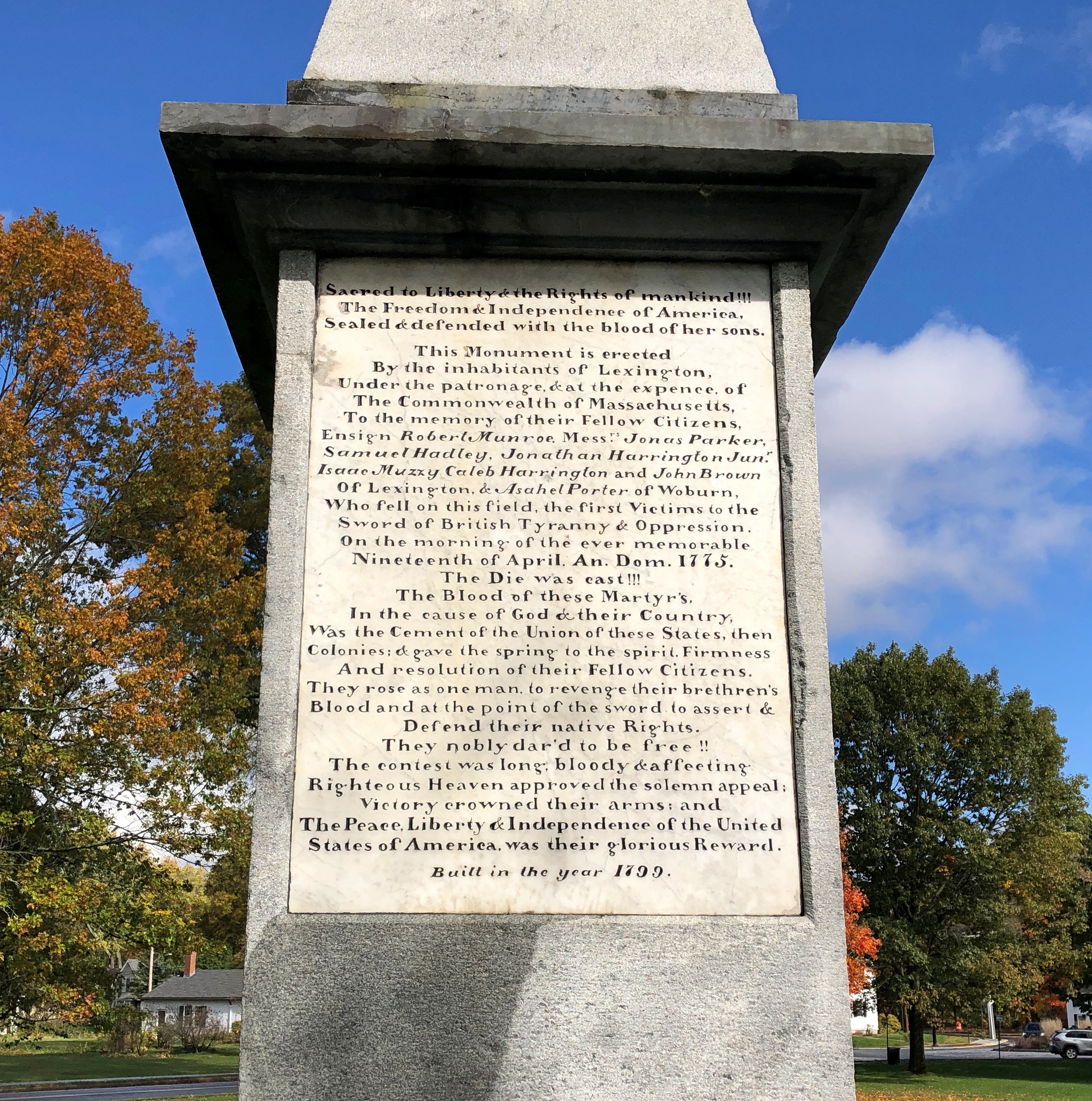
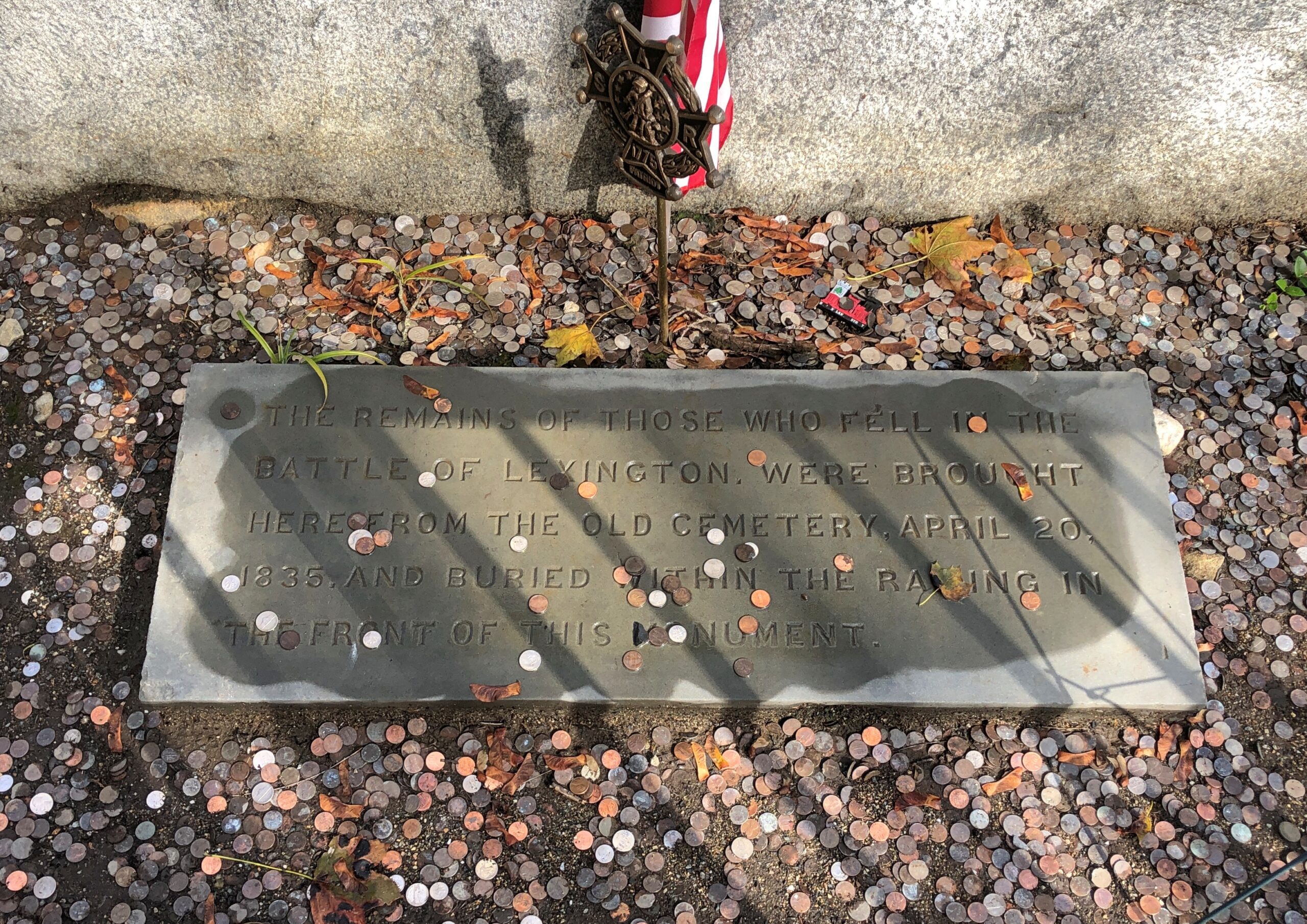
Well within living memory of the battle itself (1799), the town – fully aware of its role as spark of the Revolution – erected a memorial, and relocated the bones of the militiamen killed in the battle to a spot in front of it.
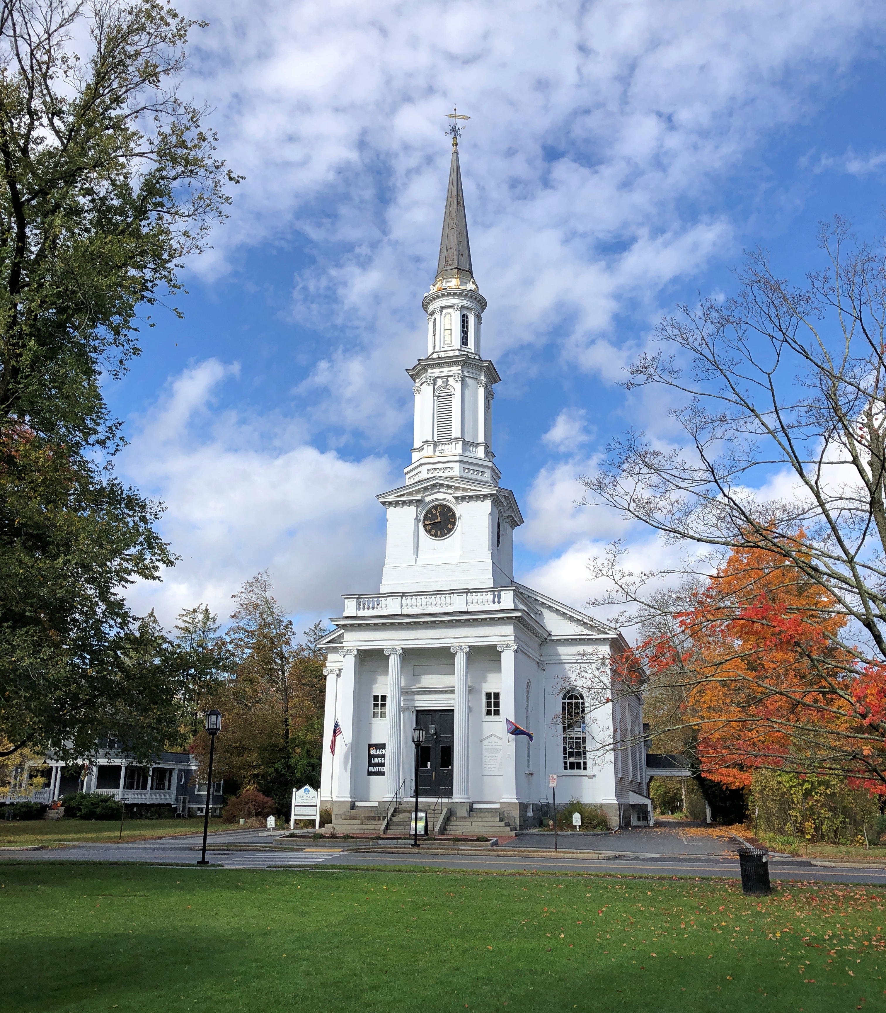
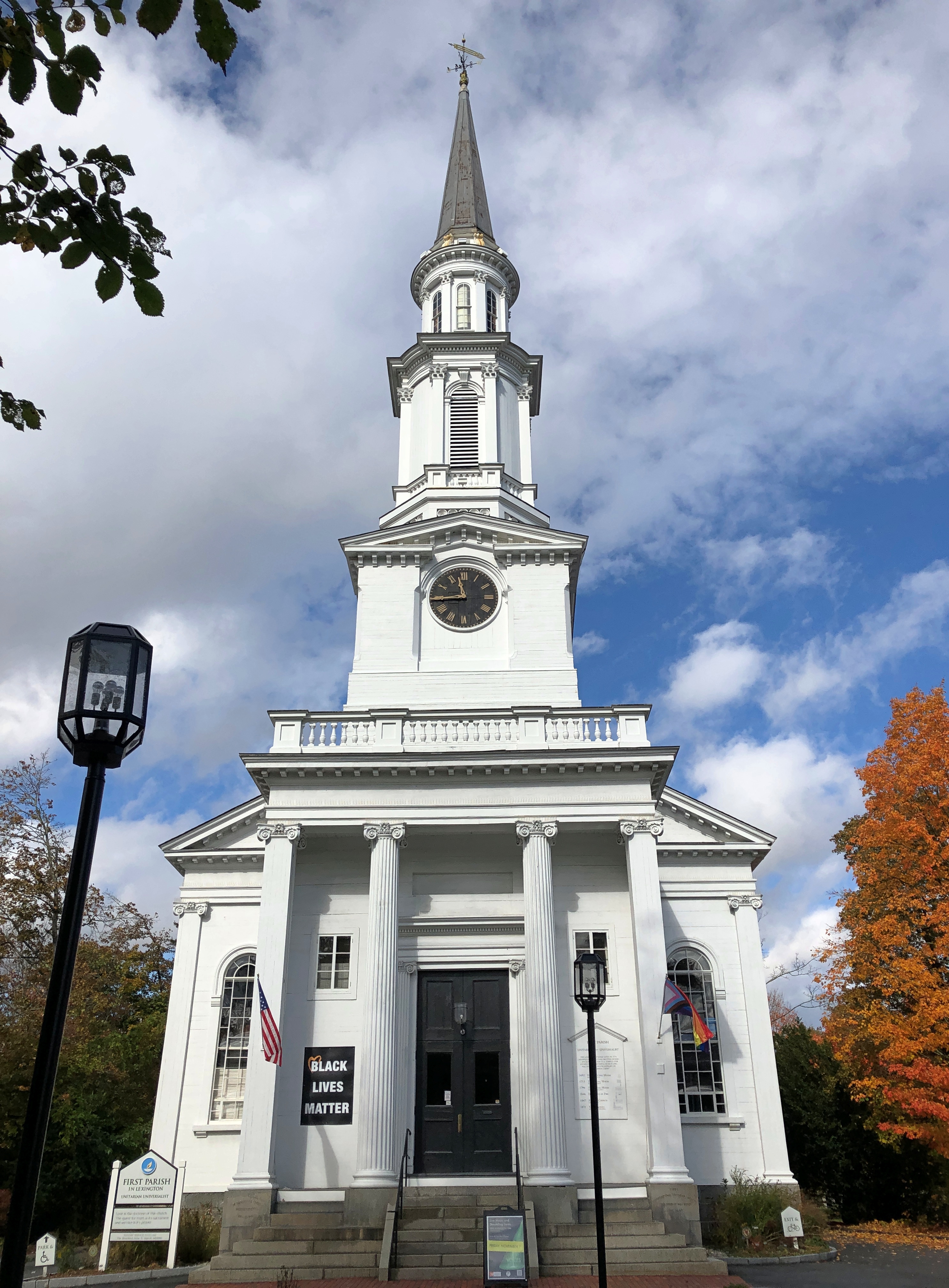
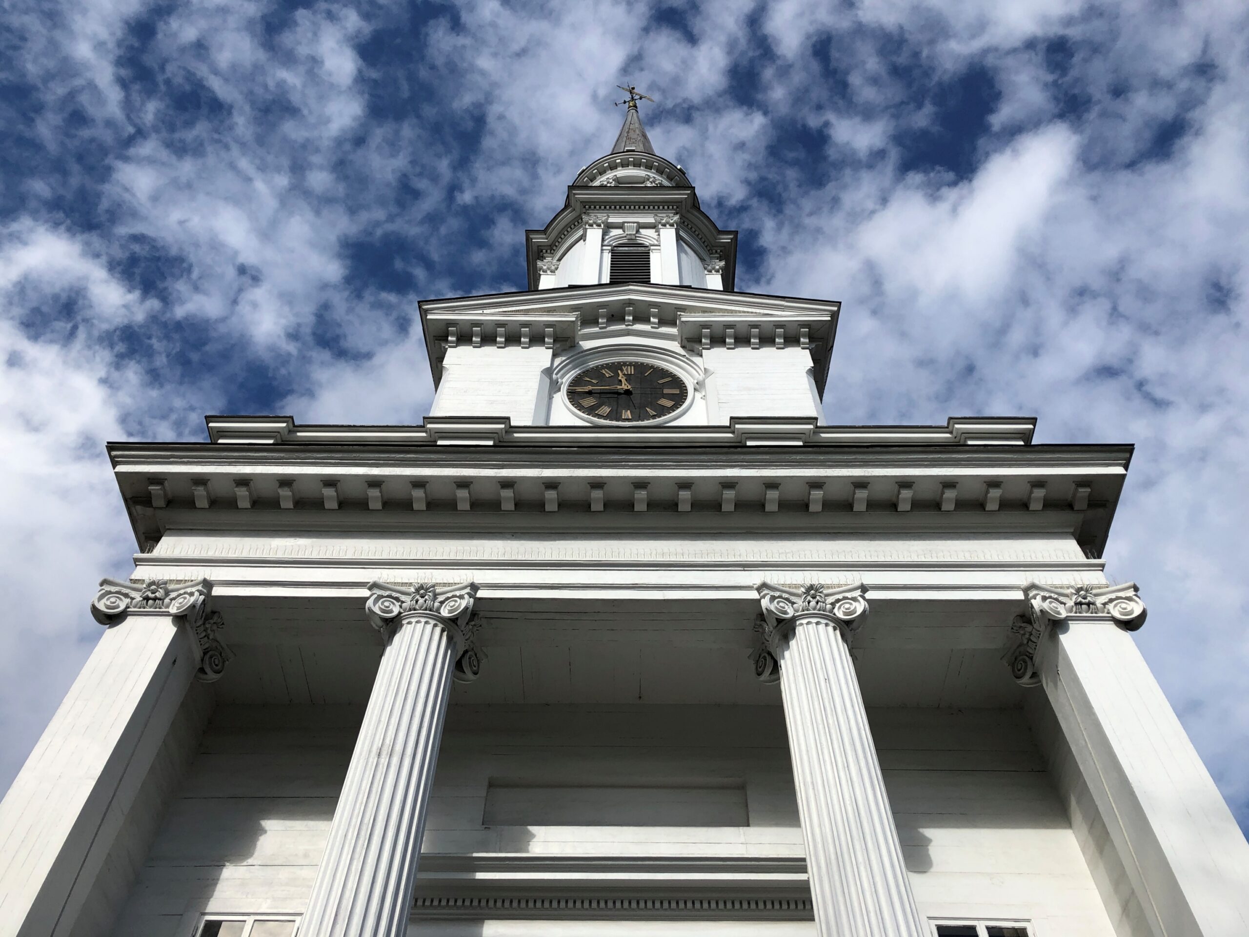
Though not formally part of the green, First Parish Unitarian-Universalist is distinctly part of the place, and looks about as New England as a church can.
It might as well be part of the green, considering the history of the congregation. The present church is a 19th-century structure near the site of Lexington’s only church in 1775, which was a hotbed of Revolutionary sentiment at the time.
Kids came in some numbers for Halloween here in the northwest suburbs yesterday, but I didn’t keep an exact count this year. The day was cool but not cold, without a hint of rain, so that might have encouraged turnout, like for voting. One time a passel of kids showed up, maybe a dozen or so, all under 10, with a smaller passel of parents off near the sidewalk.
We were giving away full-sized candy bars until they ran out, and the passel squealed with delight at receiving the various Hersey products. Even now, the costumes are a blur, maybe because I didn’t recognize a lot of the characters. Ones that I might have known weren’t familiar either. I asked the parents of a very small boy — ah, first-timers — what he was supposed to be. His shirt pattern reminded me of TMNT, but it was Hulk, they told me. “Hulk smash,” they said. “Hulk smash, all right,” I agreed.
All of the Halloween traffic, except for a handful of older kids, came before dark. My not-so-inner curmudgeon reacts: in my day, we trick-or-treated after dark, risking bodily injury on the streets, and we liked it.
But I am glad to report that the older kids – junior high and even high school – are far fewer than they were, say, 20 years ago. So it’s back to the way it should be. For older people, there are always such seasonal events as the Greenwich Village Halloween Parade. To this day, the ’06 iteration of that parade remains the only time I’ve encountered the band KISS live – they were the grand marshals (RIP, Ace Frehley). We also encountered Space Ghost then, or at least a fellow who was adamant about his Space Ghost identity.
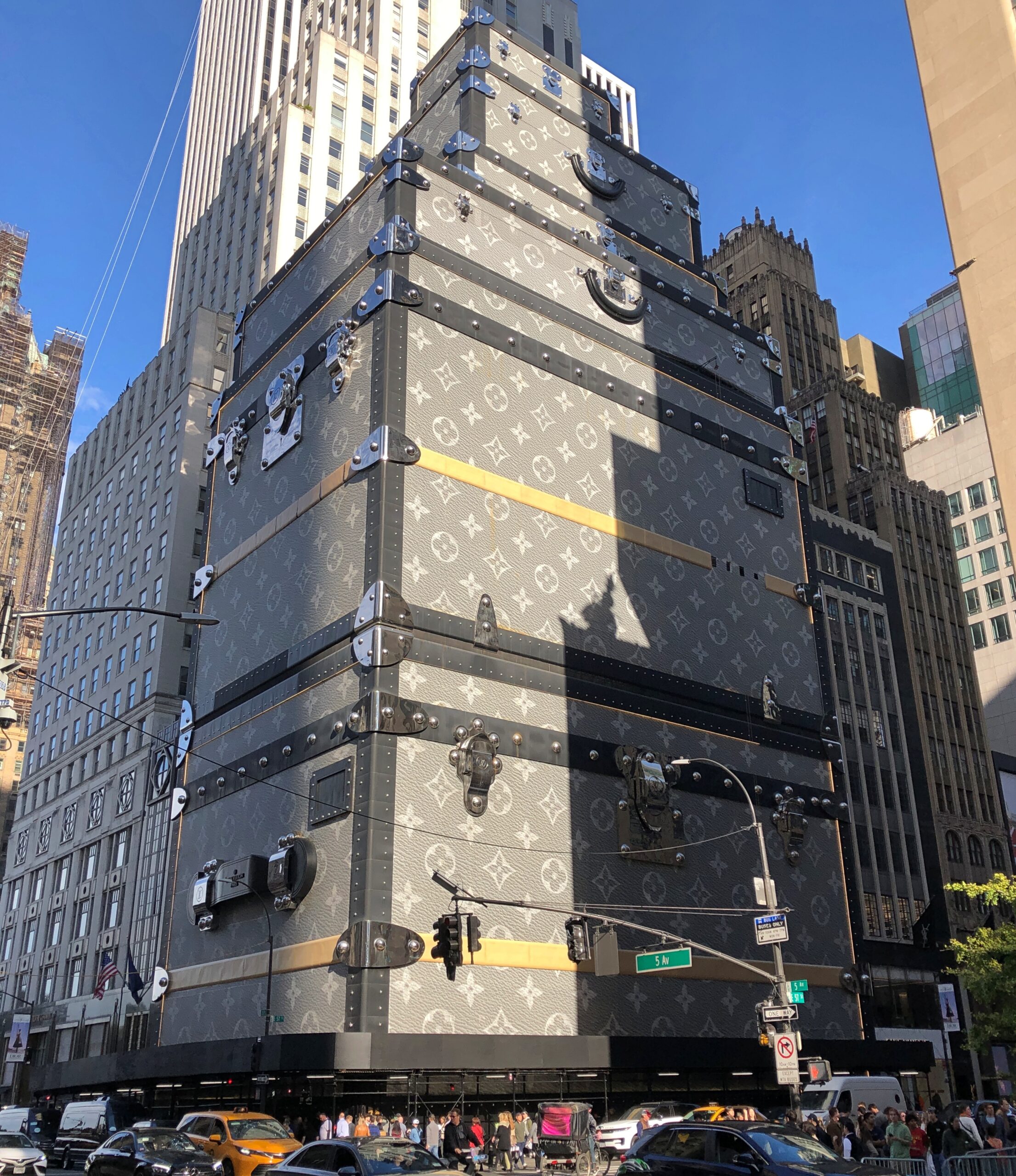
Near Central Park on Fifth Ave. is 1 East 57th Street. We walked by last month.
A few years ago, luxe retailer LVMH Moët Hennessy Louis Vuitton added a faux facade to its NY flagship store there on the avenue, one that evokes its signature luggage trunks in a highly visible way. Redevelopment plans for the building behind the trunks were unveiled not long ago, so I suspect the trunk-appearance doesn’t have much longer to look down on Billionaire’s Row and its strato-priced residential properties (whose high rents and sale prices don’t necessarily guarantee high-quality construction, apparently).
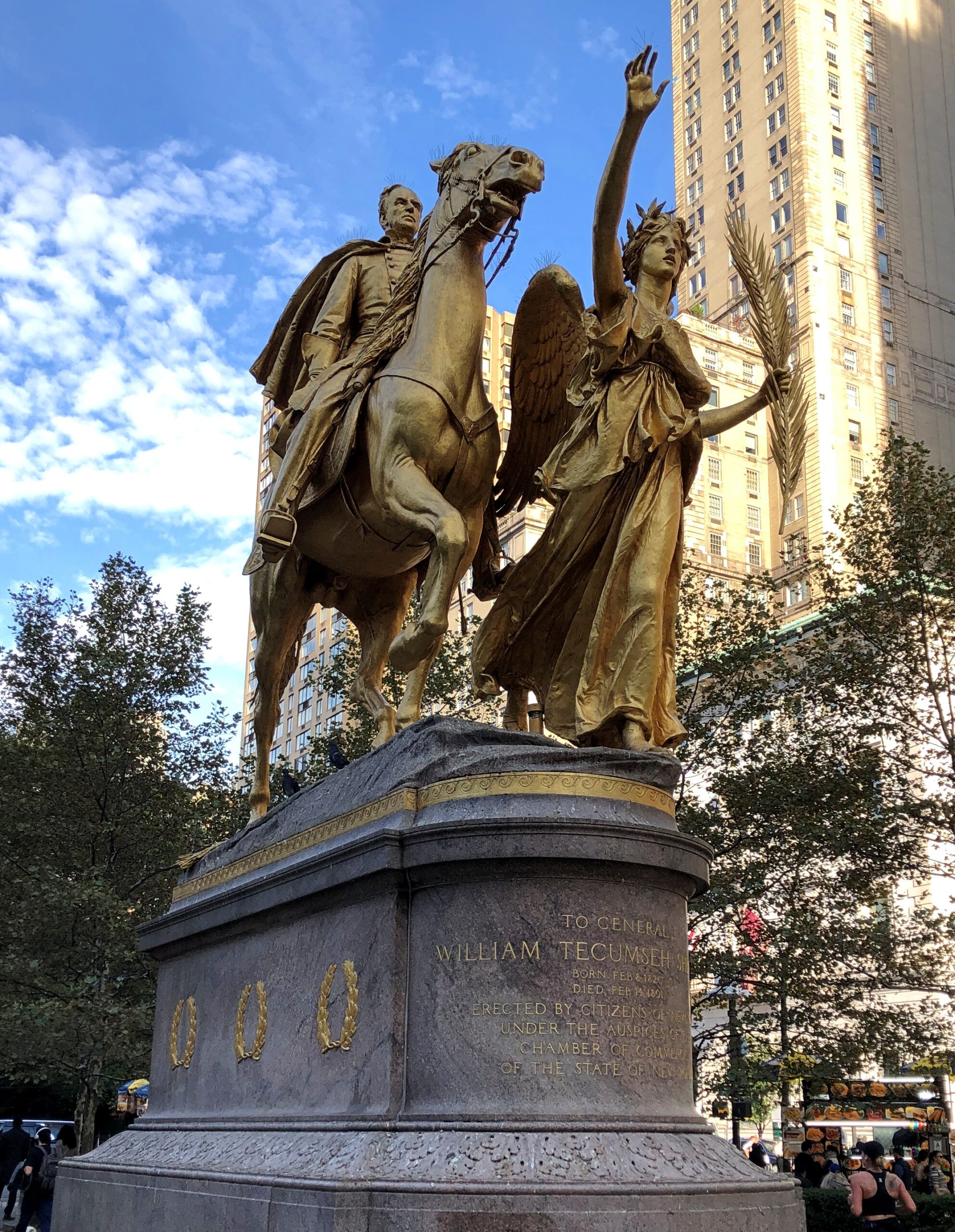
As we neared Central Park, we spent a little time at Augustus Saint-Gaudens’ statue of William Tecumseh Sherman (dedicated 1903) in Grand Army Plaza. Life’s too short not to look at some Saint-Gaudens from time to time.
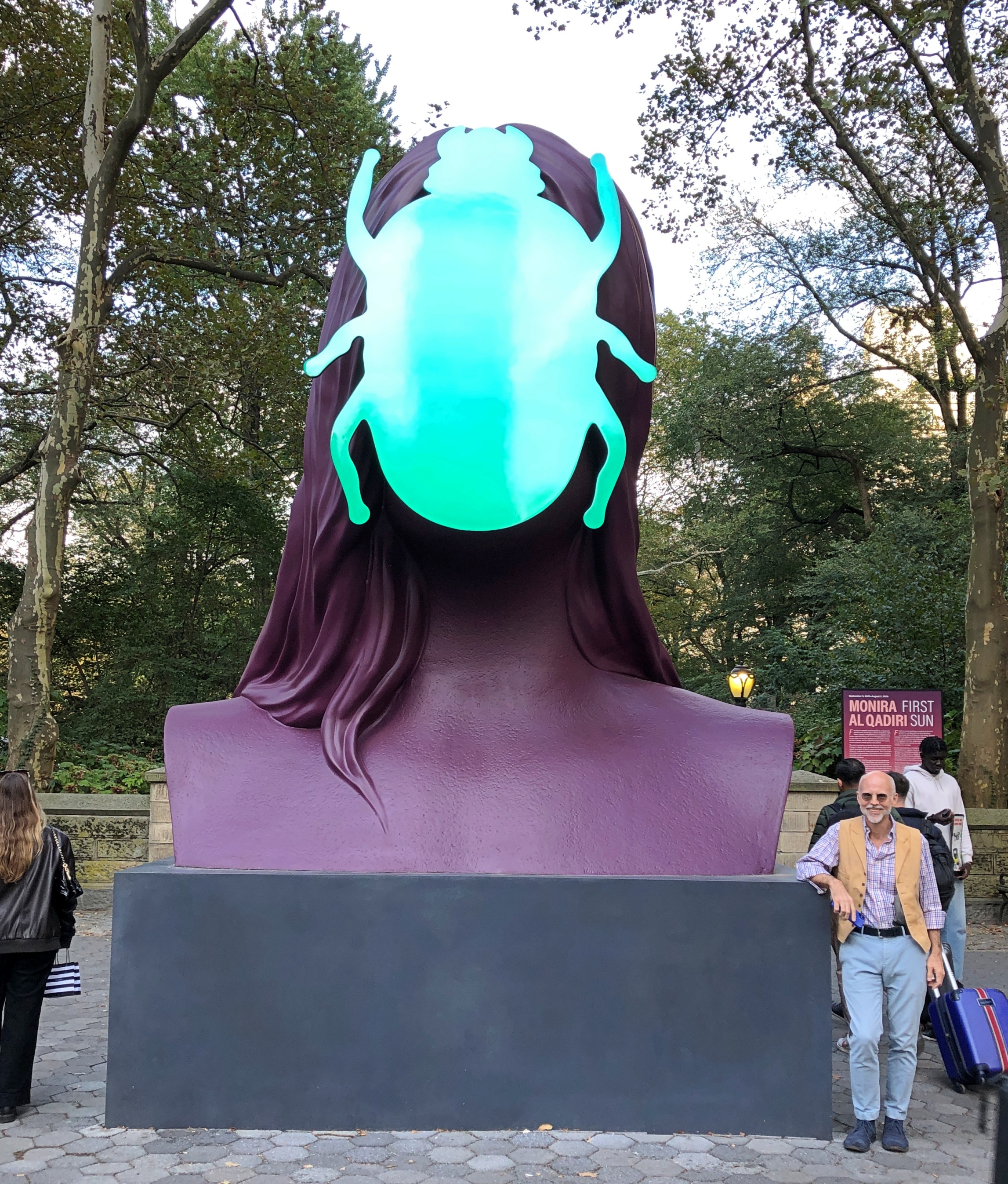
Not far away, something a little newer.
“First Sun,” a painted aluminum sculpture of a human-scarab figure by Senegalese artist Monira Al Qadiri, and slated to be in place until the end of next summer.
Visible from near the statues is the storied Plaza Hotel and an Apple Store, which is open 24 hours, Google Maps tells me. Storied in a different way.
I’m glad the Plaza acknowledges its fictional role in The Great Gatsby by featuring a lavish-beyond-the-dreams of Croesus Gatsby Suite. Of course. A smart hotel operator isn’t going to waste an opportunity like that. In this case, Fairmont Hotels and Resorts, a Canadian company, managing for owner Katara Hospitality – the large hotelier owned by the Qatari government. In the 21st century so far, the Plaza has been owned by an Israeli company and then an Indian one before Katara bought it. There’s something oddly American about an ownership trajectory like that.
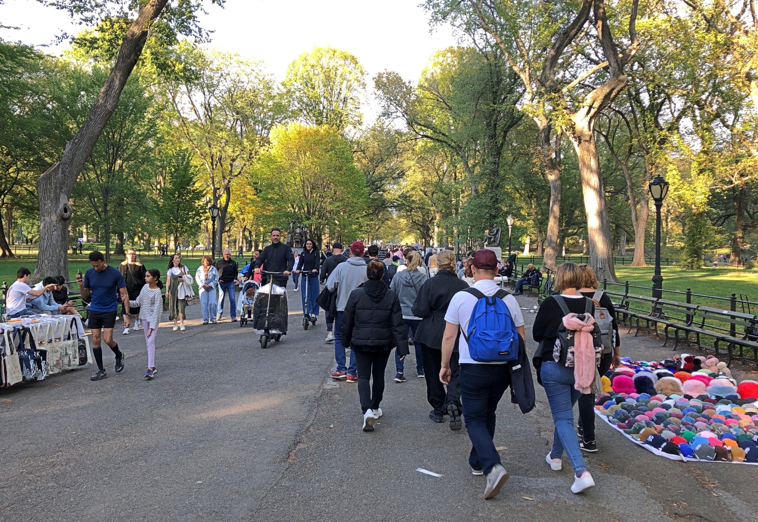
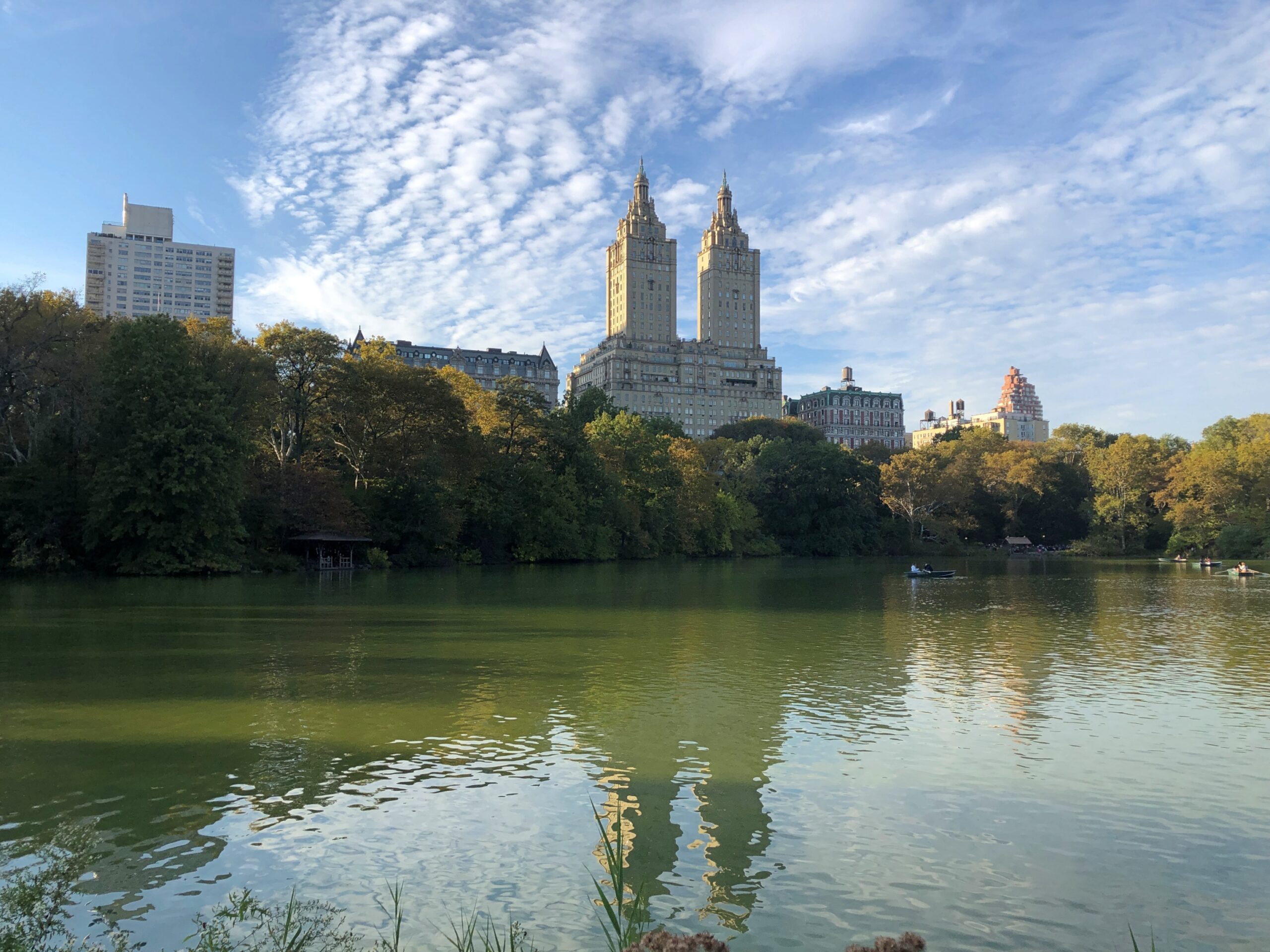
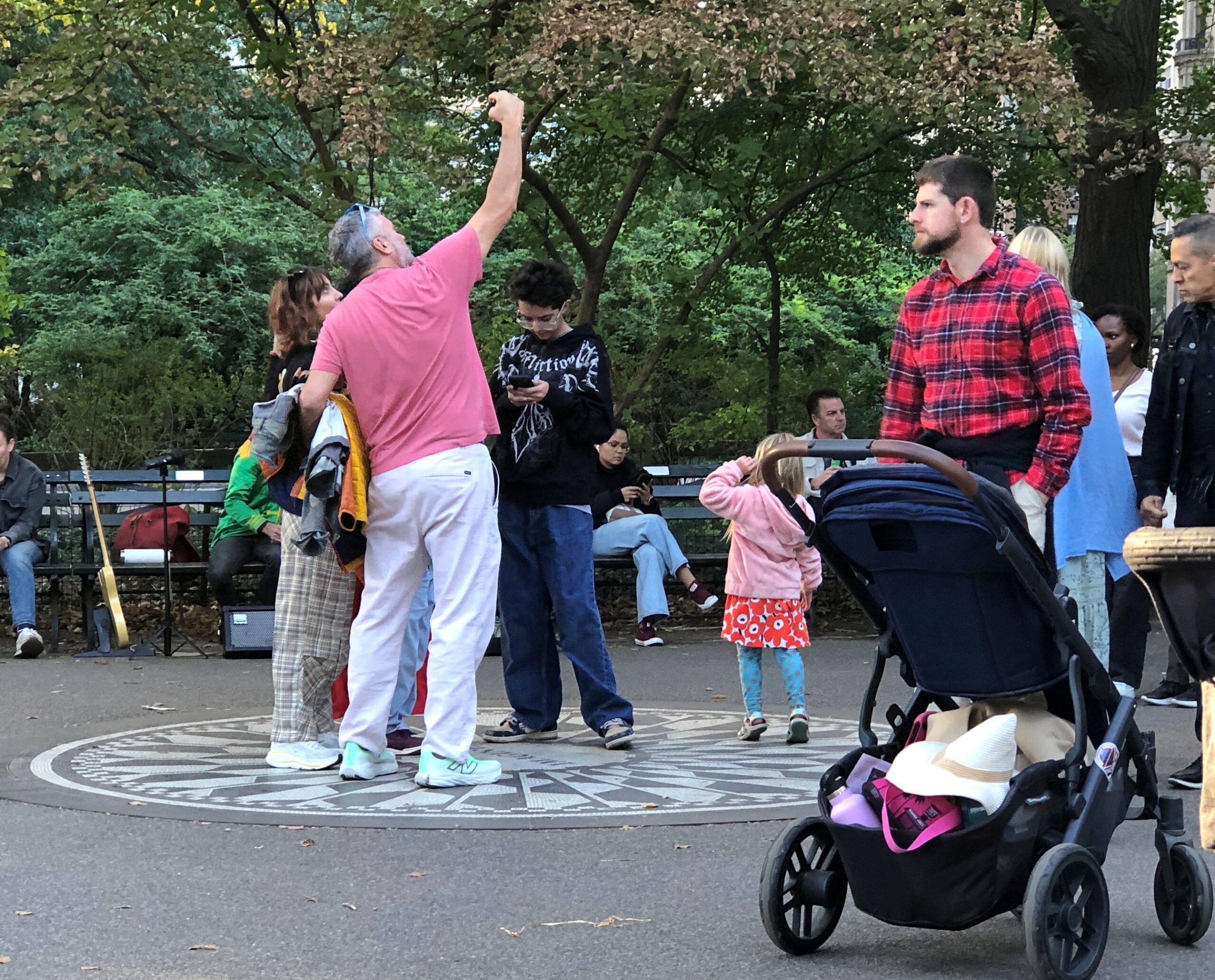
We – Robert, Geof, Yuriko and I – charted ourselves a simple walking path through some of the southern reaches of Central Park. Manhattanites and visitors to the borough were out in Saturday-afternoon force. Saturday, in the park/I think it was the 18th of October. No, that doesn’t scan. A fair number of pitch-a-blanket cap and souvenir salesmen were out, too, but not nearly as many buskers as a great city park like Central Park should attract.
There’s an editorial right there: why America needs more buskers, and why some American cities need to chill when it comes to suppressing buskers. Europeans might not be right about everything, but about allowing buskers? Yes.
The leaves weren’t at peak just yet, with the greens still hanging on more than not. I don’t remember which visit to Central Park it was, but one time I wandered the park during peak coloration, whipped into even greater yellow-and-red glory by a brisk October wind. Temporary clouds of leaves came and went, even as the wind shook more leaves from their branches. Color, but also motion.
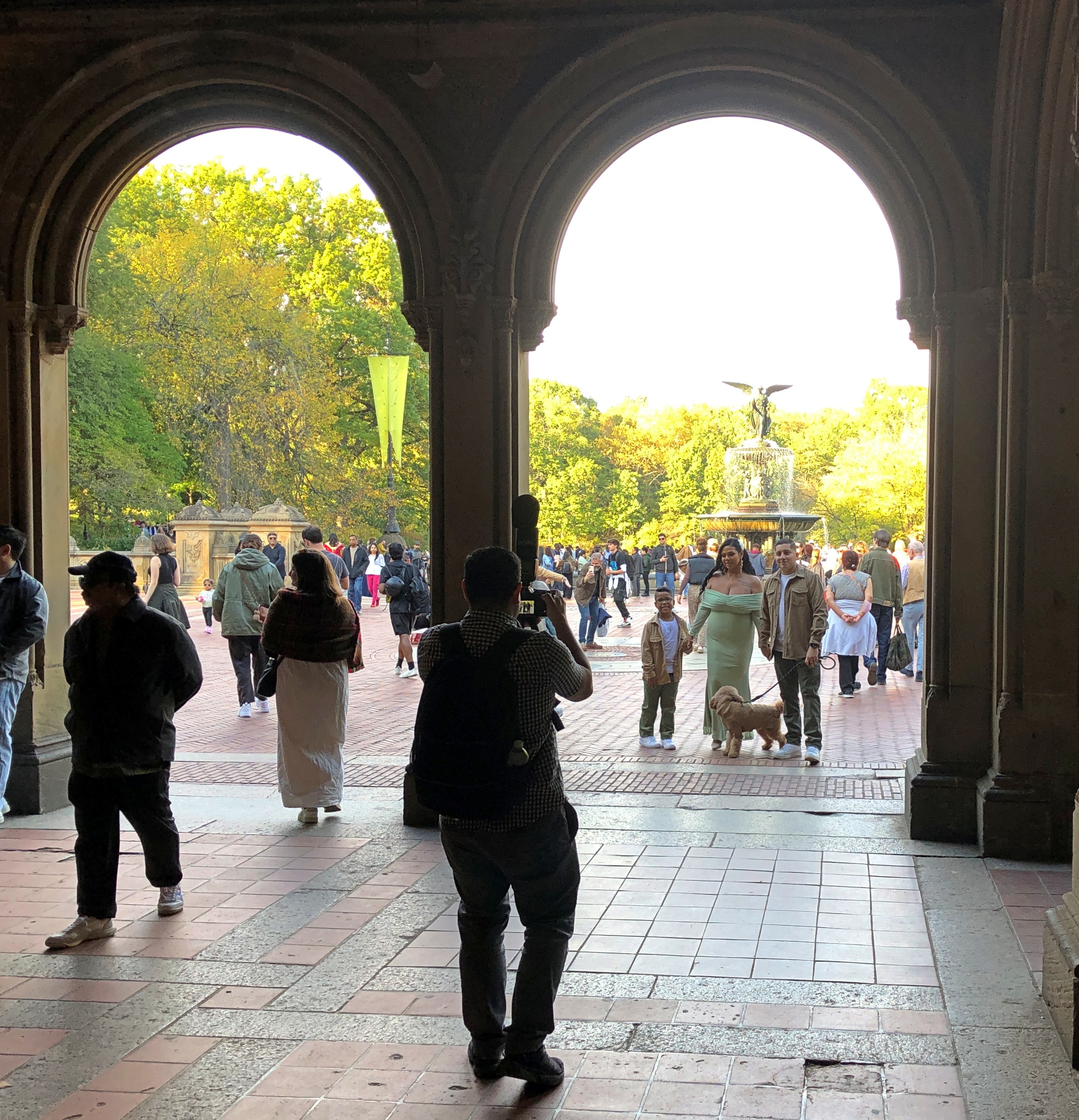
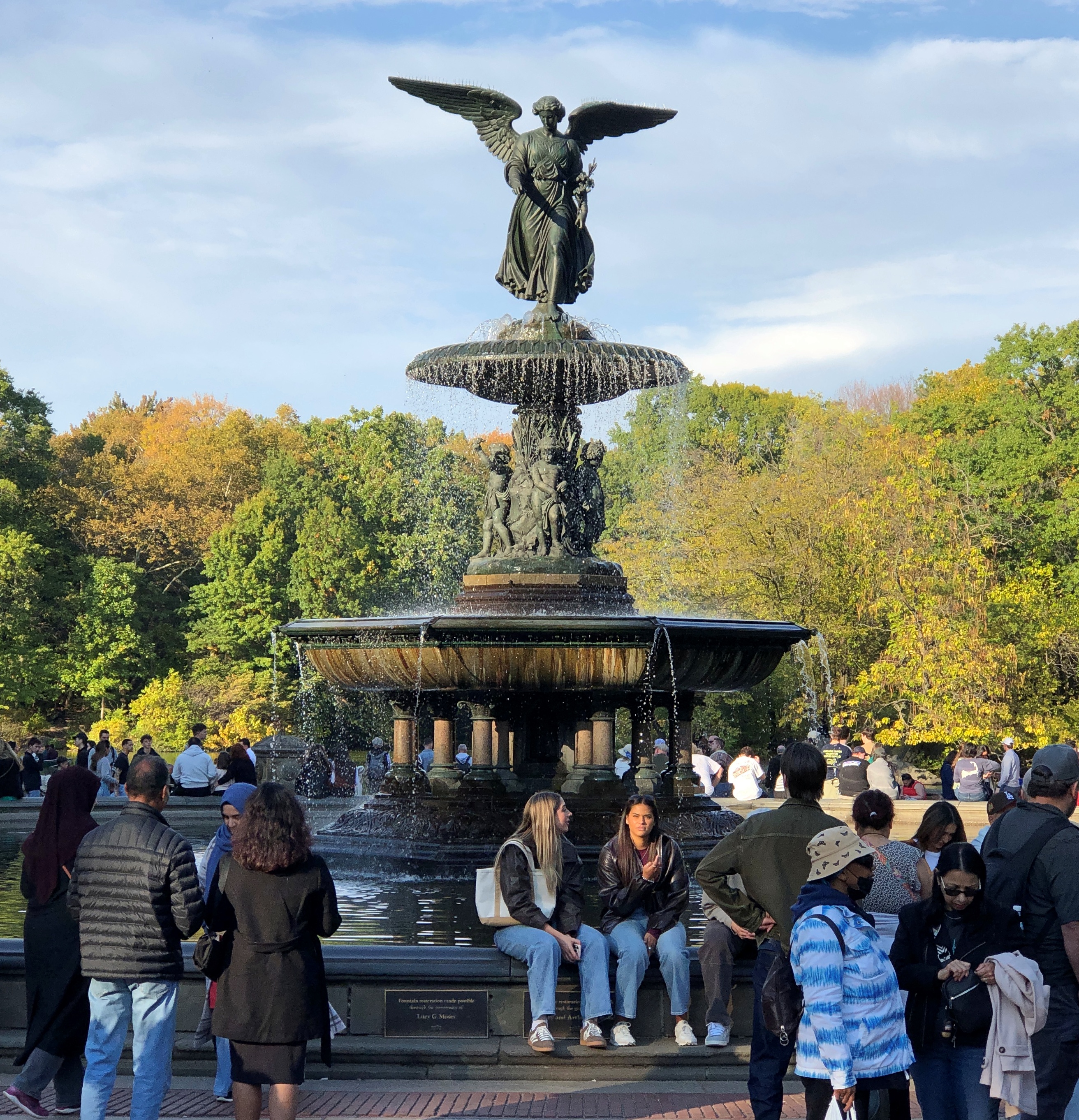
Eventually, we came to The Lake by way of Bethesda Terrace and Fountain.
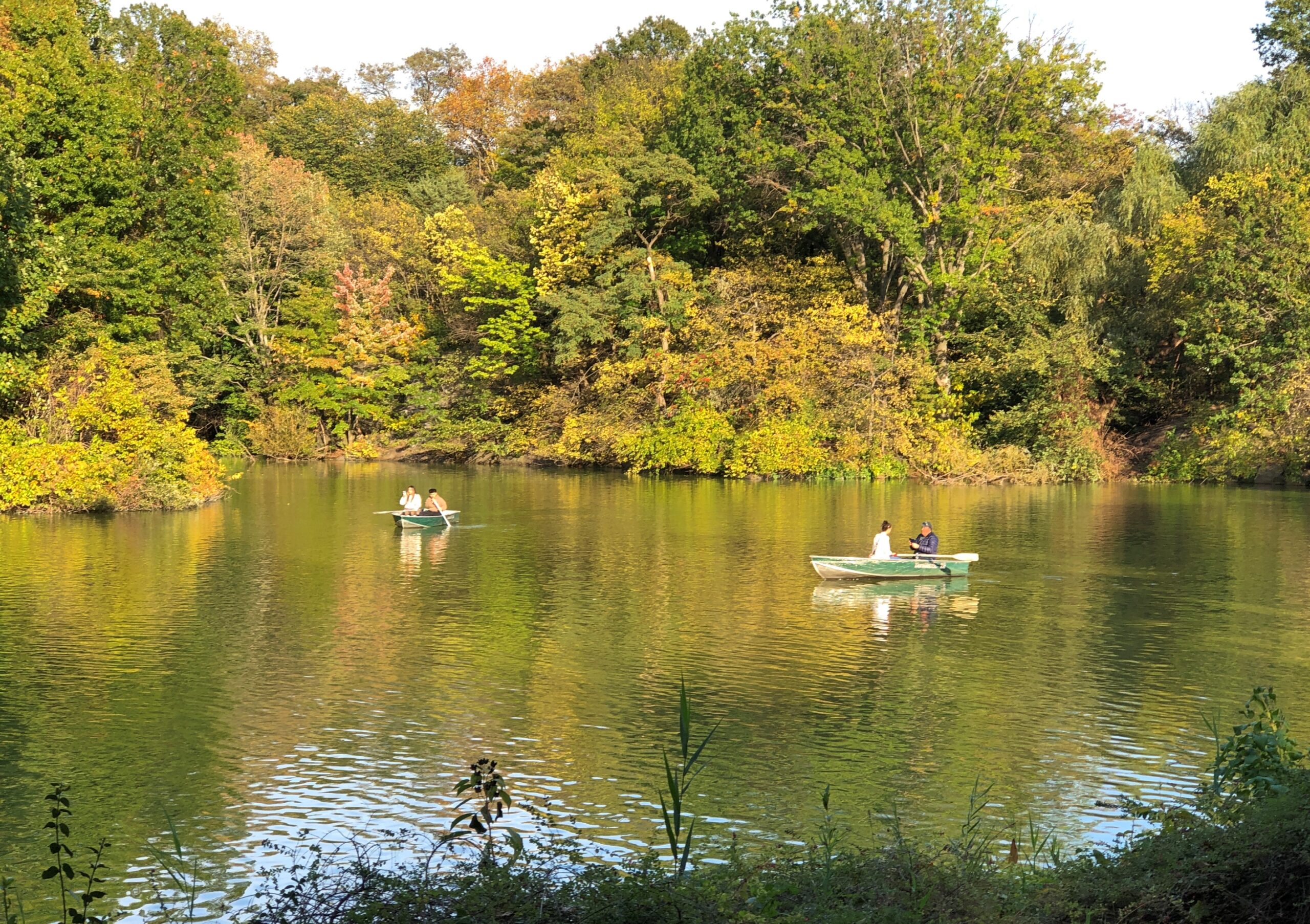
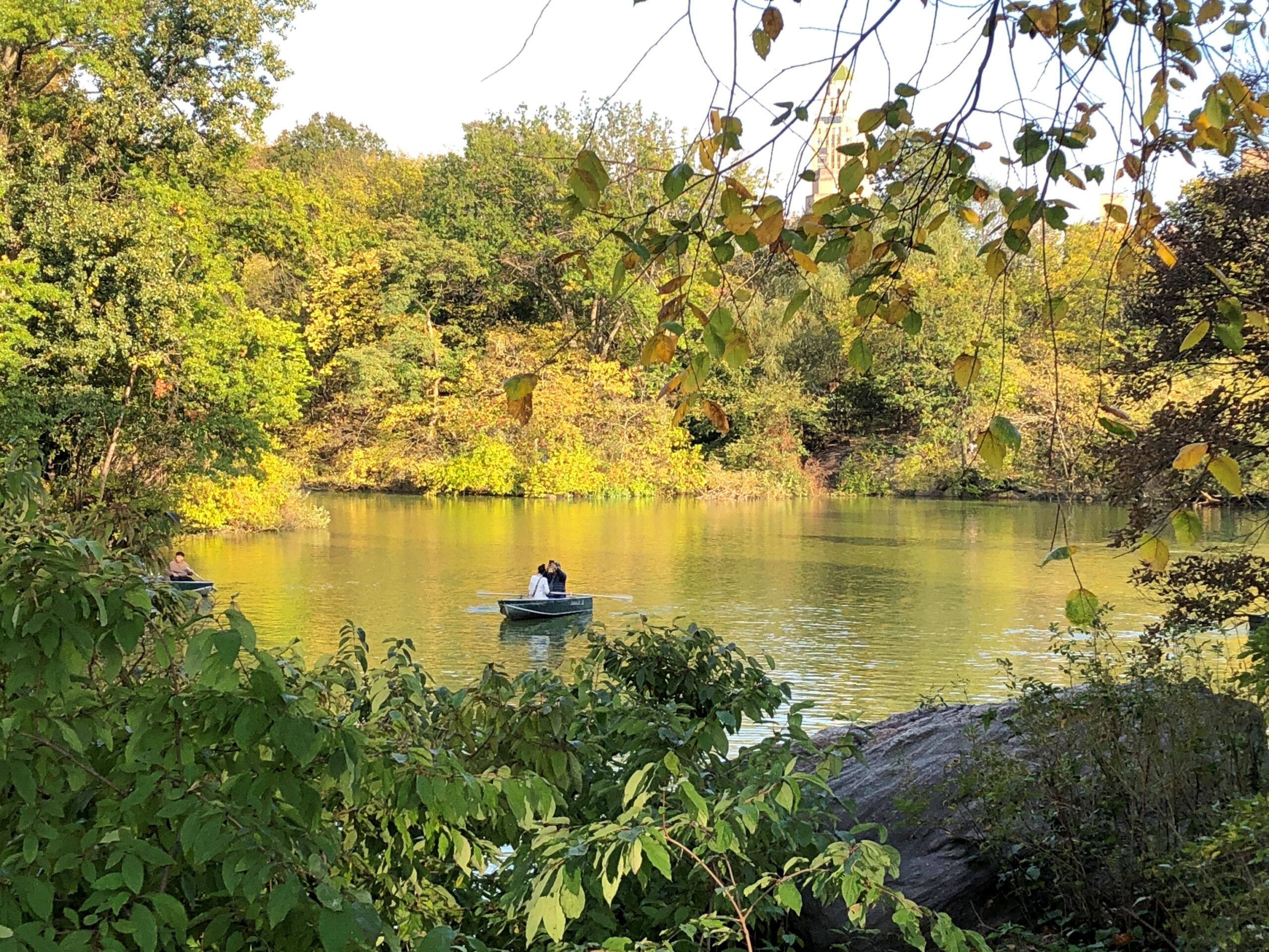
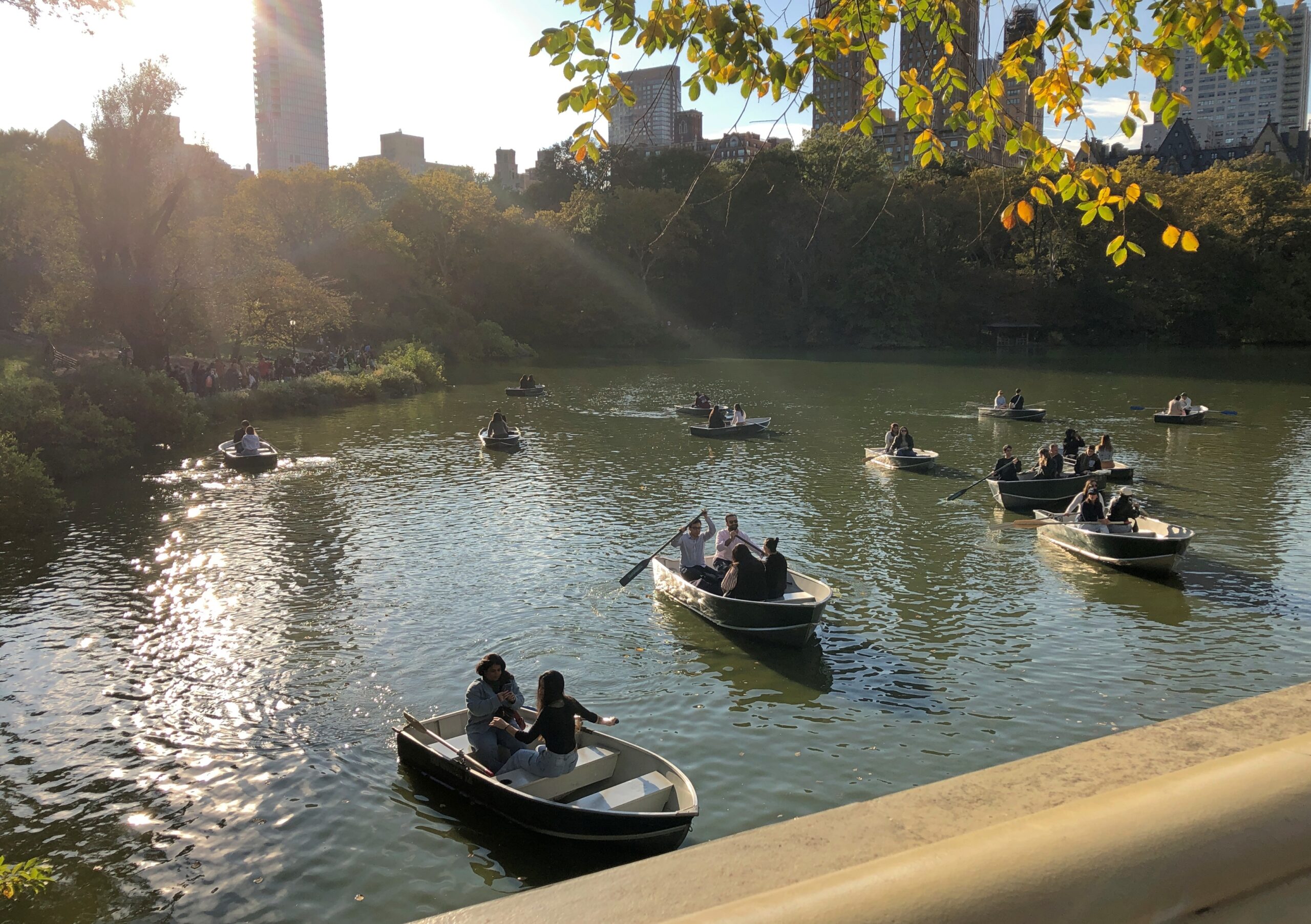
But not all the way across The Lake to The Ramble, whose Wiki description drily states that “historically, it has been frequented for both birdwatching and cruising,” with hyperlinks articles about both of those activities. What about cruising birdwatchers? There’s a Broadway musical in that concept somewhere.
The Lake was clearly a good time and place for casual boating.
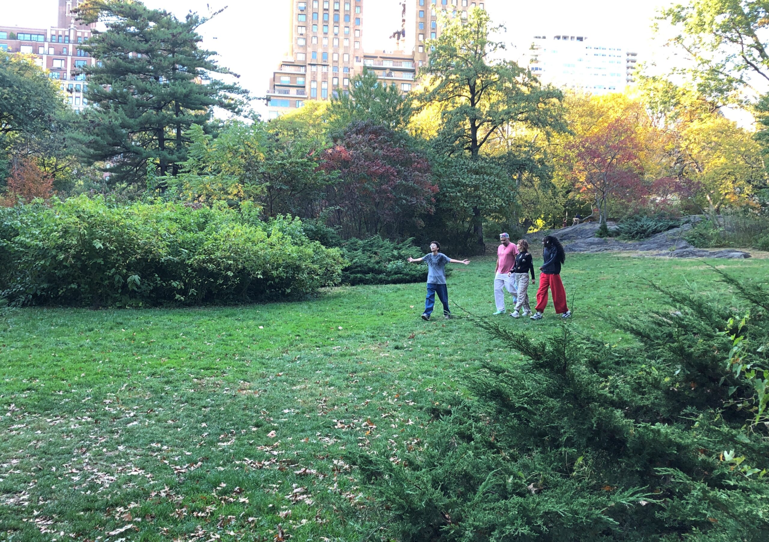
In that part of Central Park, it’s hard to miss Strawberry Fields. There is a fairly empty section.
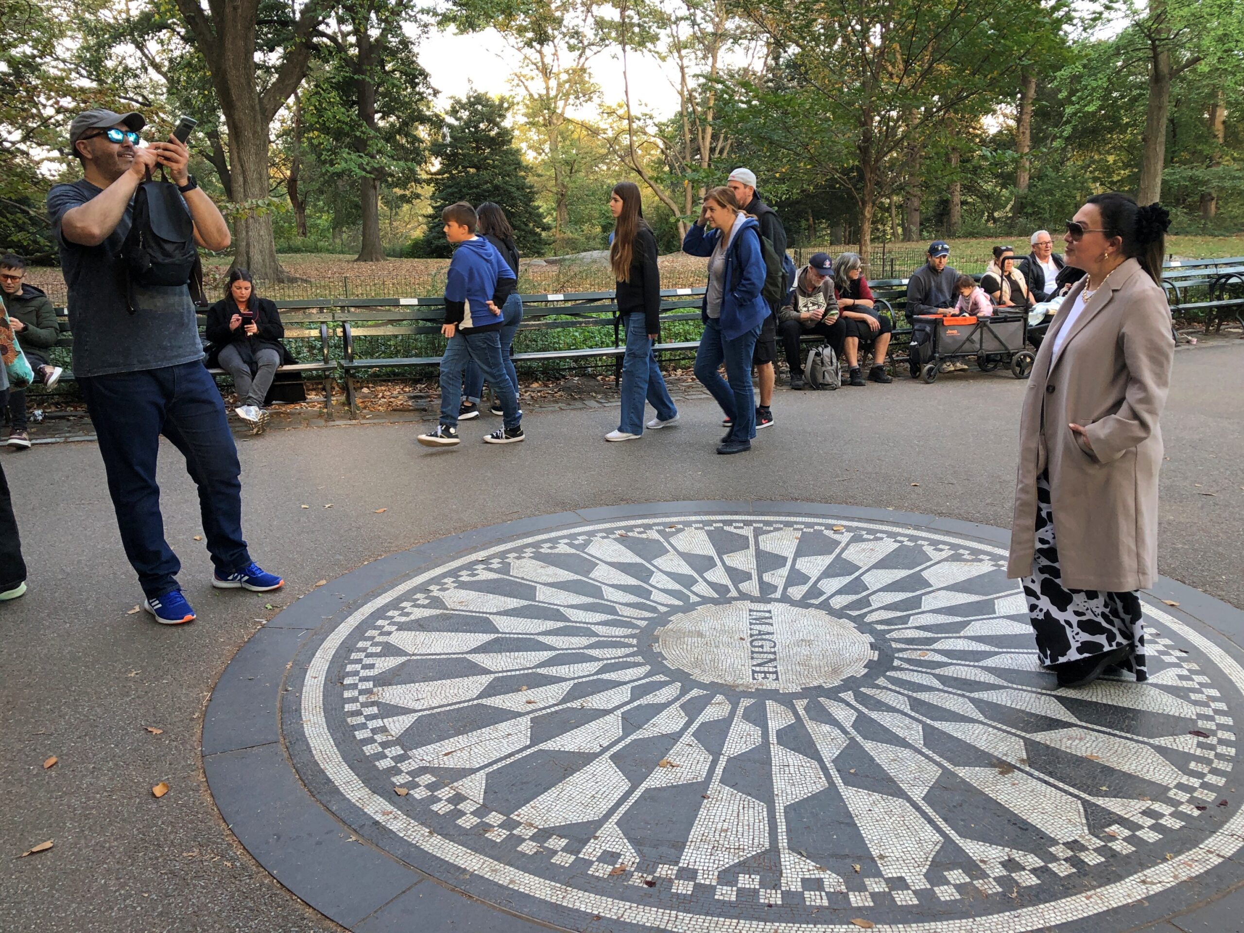
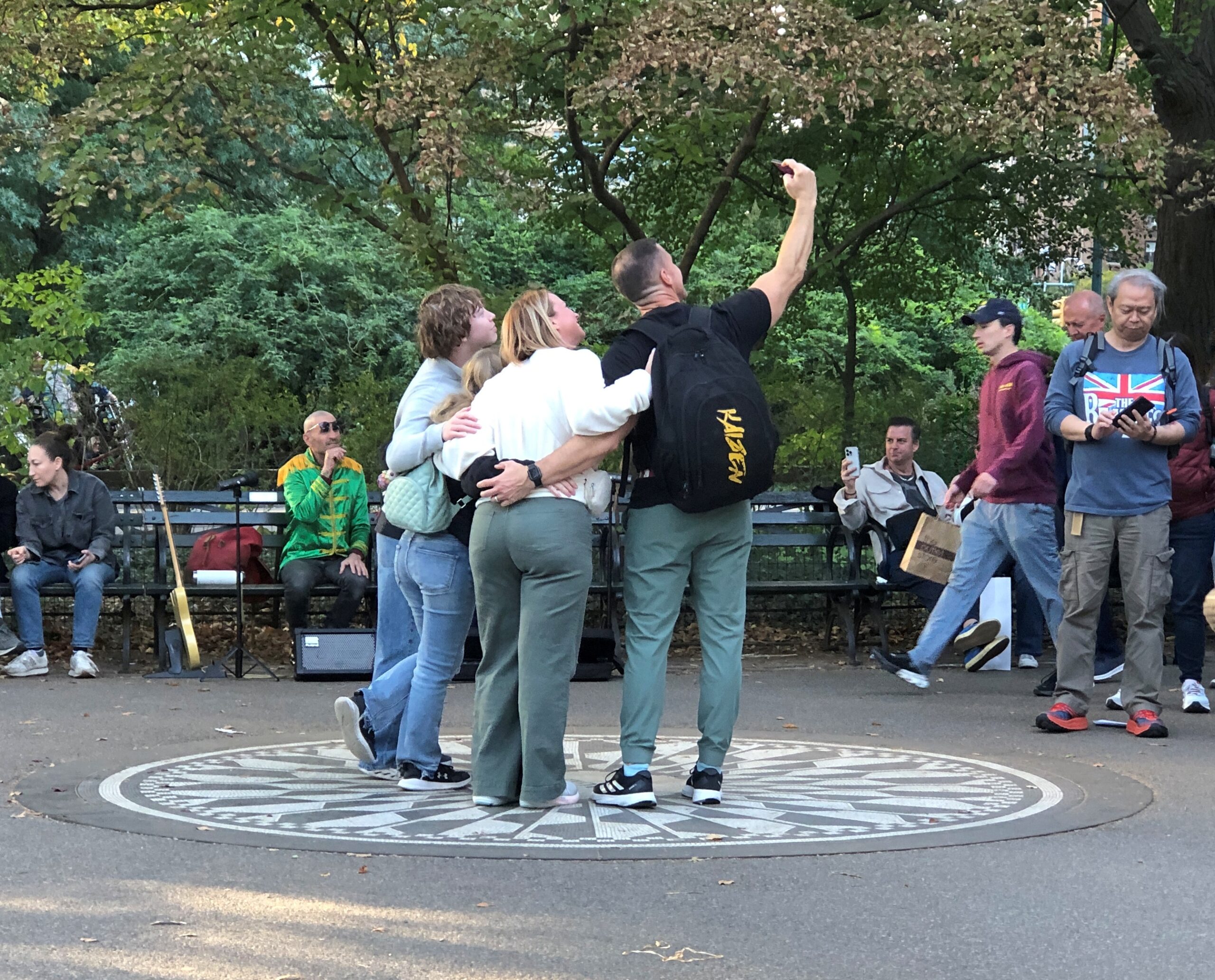
That’s not the case when you get to the Imagine memorial. Among the visitors, a guitarist was noodling out one of the more famous Lennon-McCartney tunes, but I forget which. One of the usual ones. Not “Dr. Robert,” say, or “Happiness is a Warm Gun.” So that was one busker anyway, since I think he had a guitar case open in front of him. All you need is love, sure, but bills are bills.
Gone these 45 years and still packing ‘em in. Good for you, Mr. Lennon. In another 45 years? It would be interesting to know, and I sure I won’t.
I’m afraid the history of memorials doesn’t bode well for the longevity of any memorial, even the kind that people line up to pose with. I didn’t know the man, but I suspect somehow that the thought of fading into obscurity wouldn’t have bothered John Lennon.
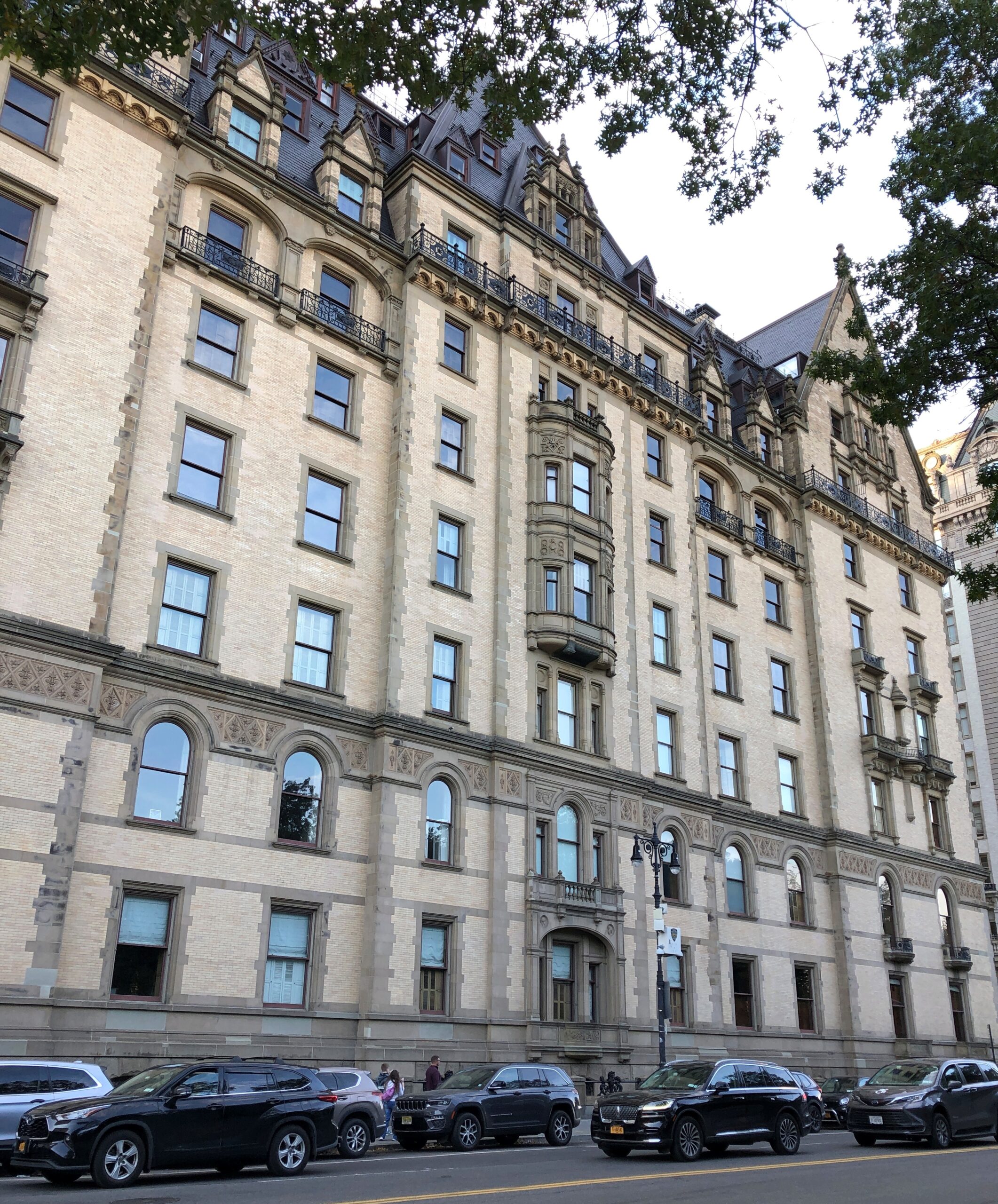
At that point, you emerge from the park and are practically face-to-face with the Dakota.
We headed east to a subway station, and happened to walk by the entrance of the Dakota. In its grim way, it’s a kind of memorial too. The signs make it known with no uncertainty that no one unauthorized is getting in.
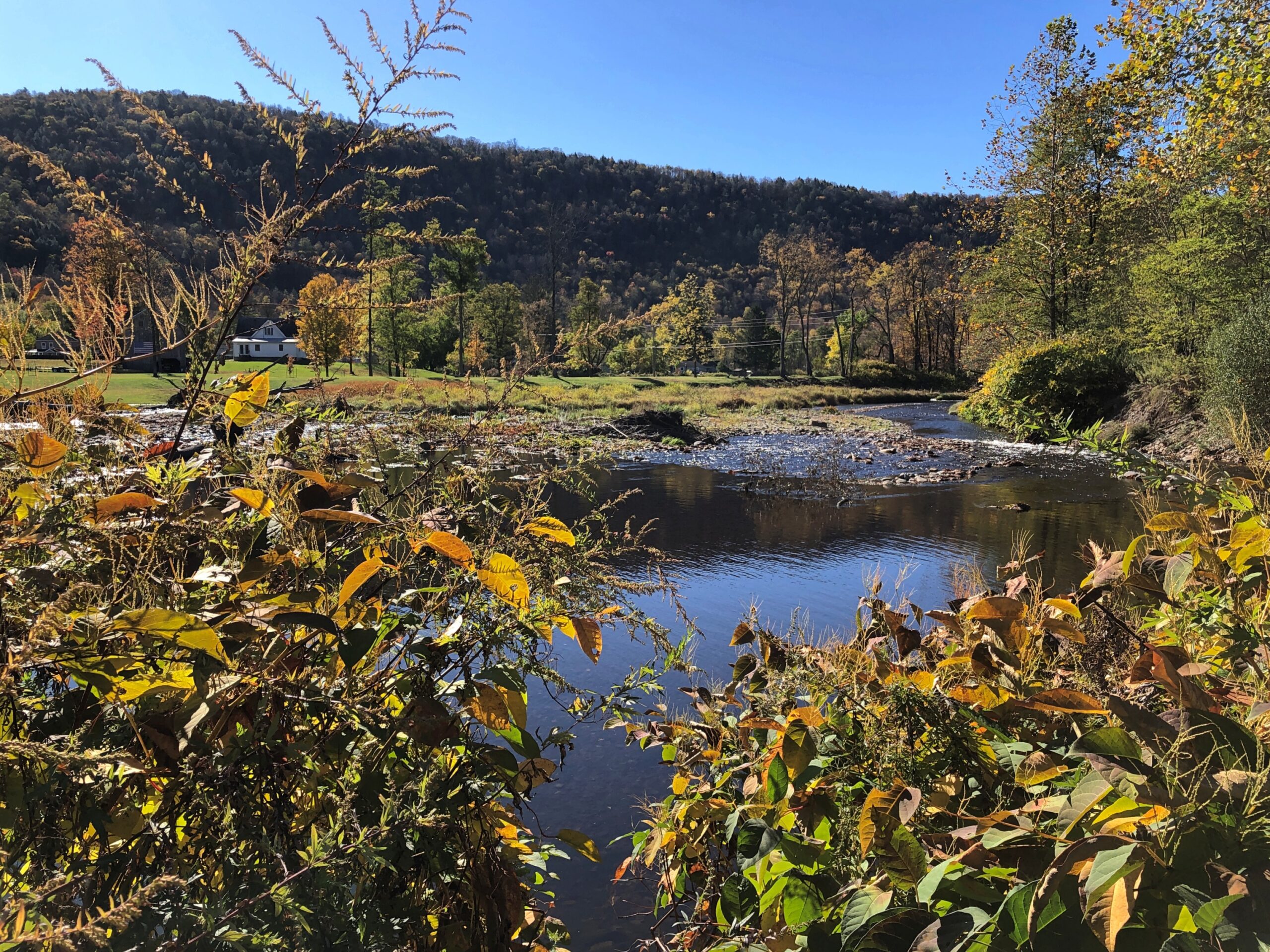
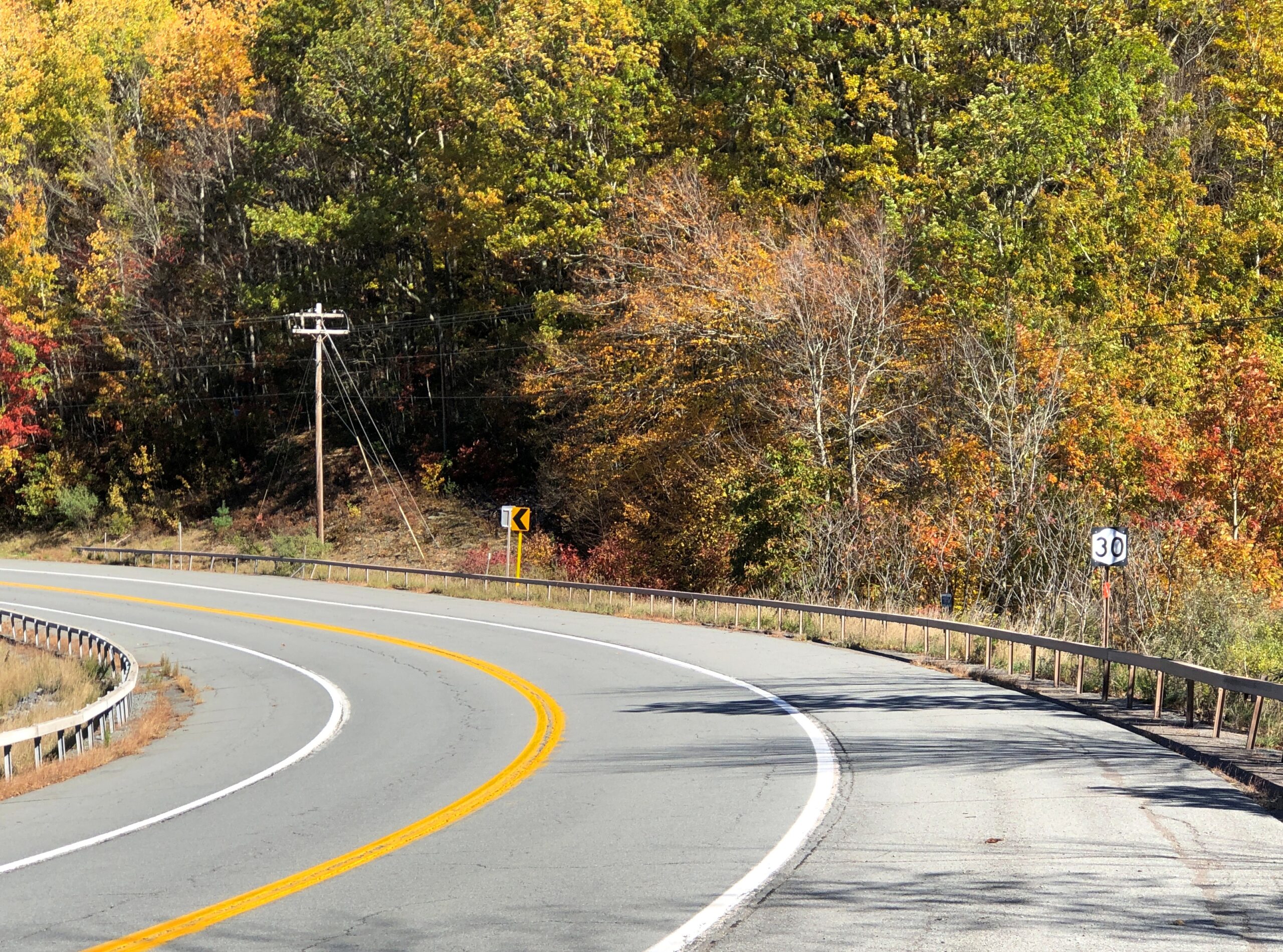
The highway New York 30 winds along the northwestern edge of Catskill Park because it follows the winding East Branch of the Delaware River, which would picturesquely come in and out of view as I drove that highway on the crisp late morning of October 16. I stopped at a place called Downsville. Wiki calls it “census-designated place, and former village in the town of Colchester, Delaware County, New York.”
This raises some questions. How is a village part of a town? (Colchester is marked on maps as not far away, but not on NY 30.) How does a place become a “former” village? People still clearly live there. Maybe I’ll investigate these questions sometime. Maybe not.
Village or former village, it’s at a pleasant spot on the East Branch.
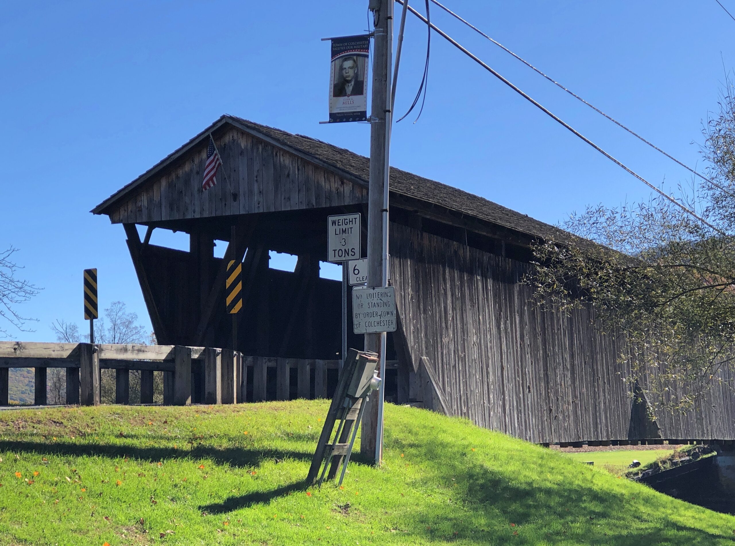
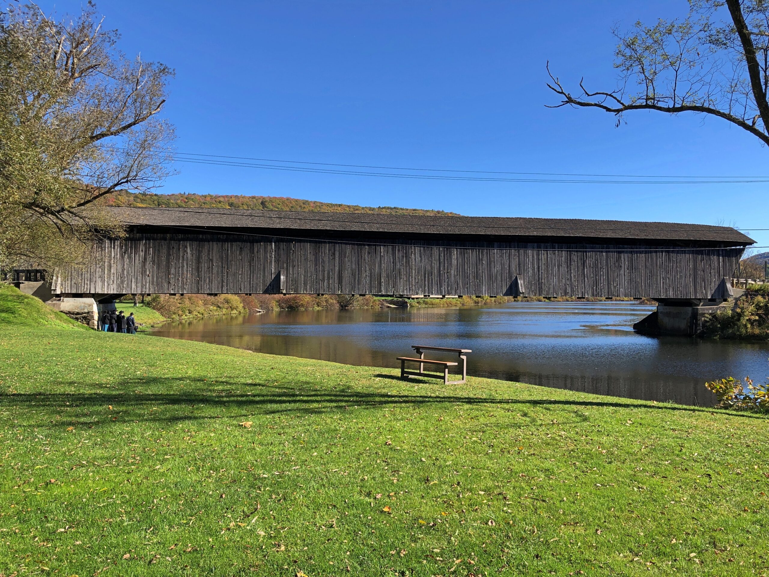
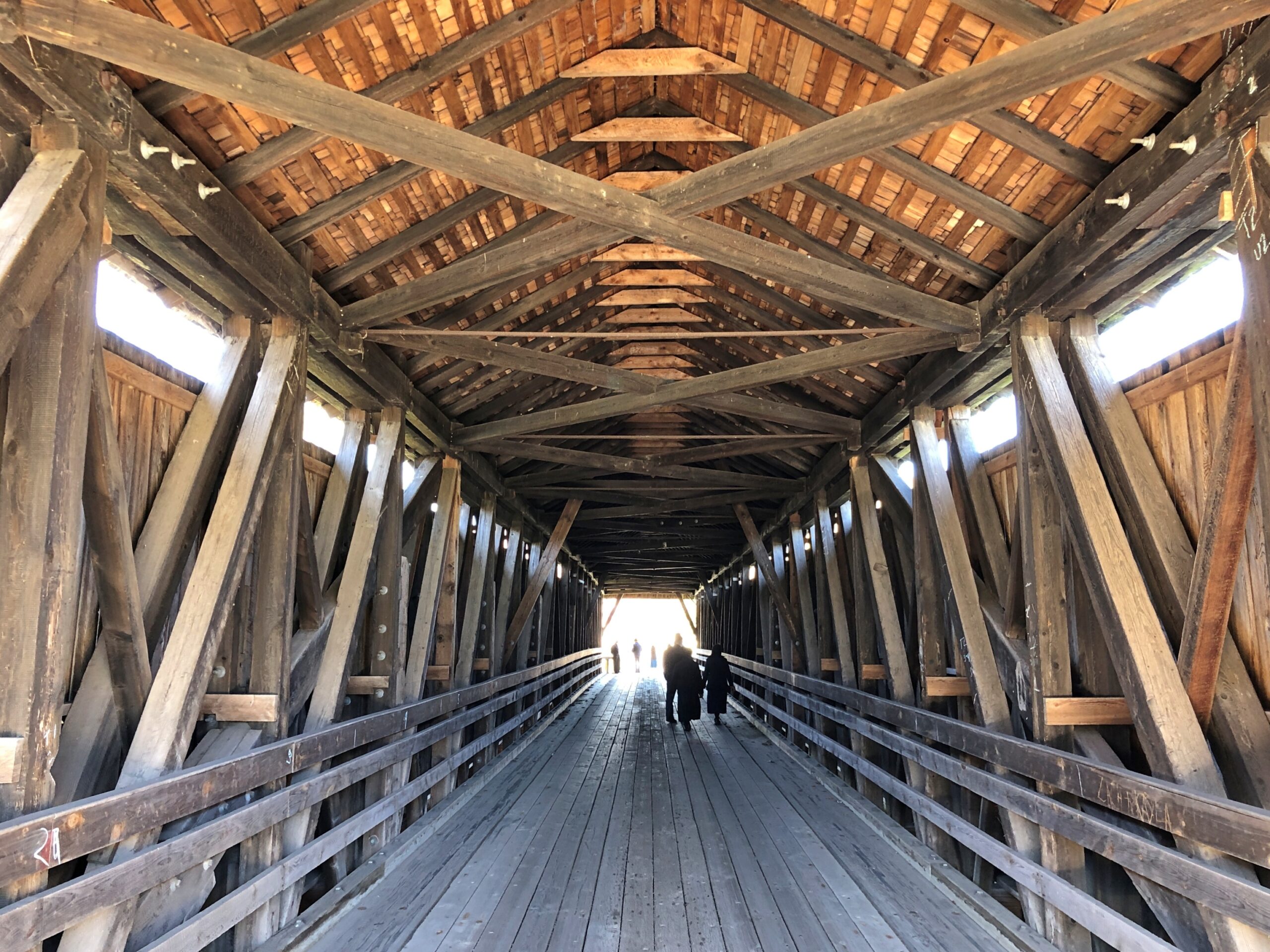
I stopped because a sign directed me to a covered wooden bridge, one that crosses the East Branch about a block away from NY 30.
“The Downsville Covered Bridge is one of six covered bridges still standing in Delaware County…” explains the New York State Covered Bridge Society. “Built by Robert Murray in 1854, this 174-foot-long, single span structure incorporates the Long truss design patented on March 6, 1830 by Lieutenant Colonel Stephen H. Long of Hopkinton, New Hampshire, with an added Queenpost truss. This truss design is rare to Northeastern covered bridges.”
Nice work, Mr. Murray, and the workers who have maintained it as a vehicular bridge down to the present day.
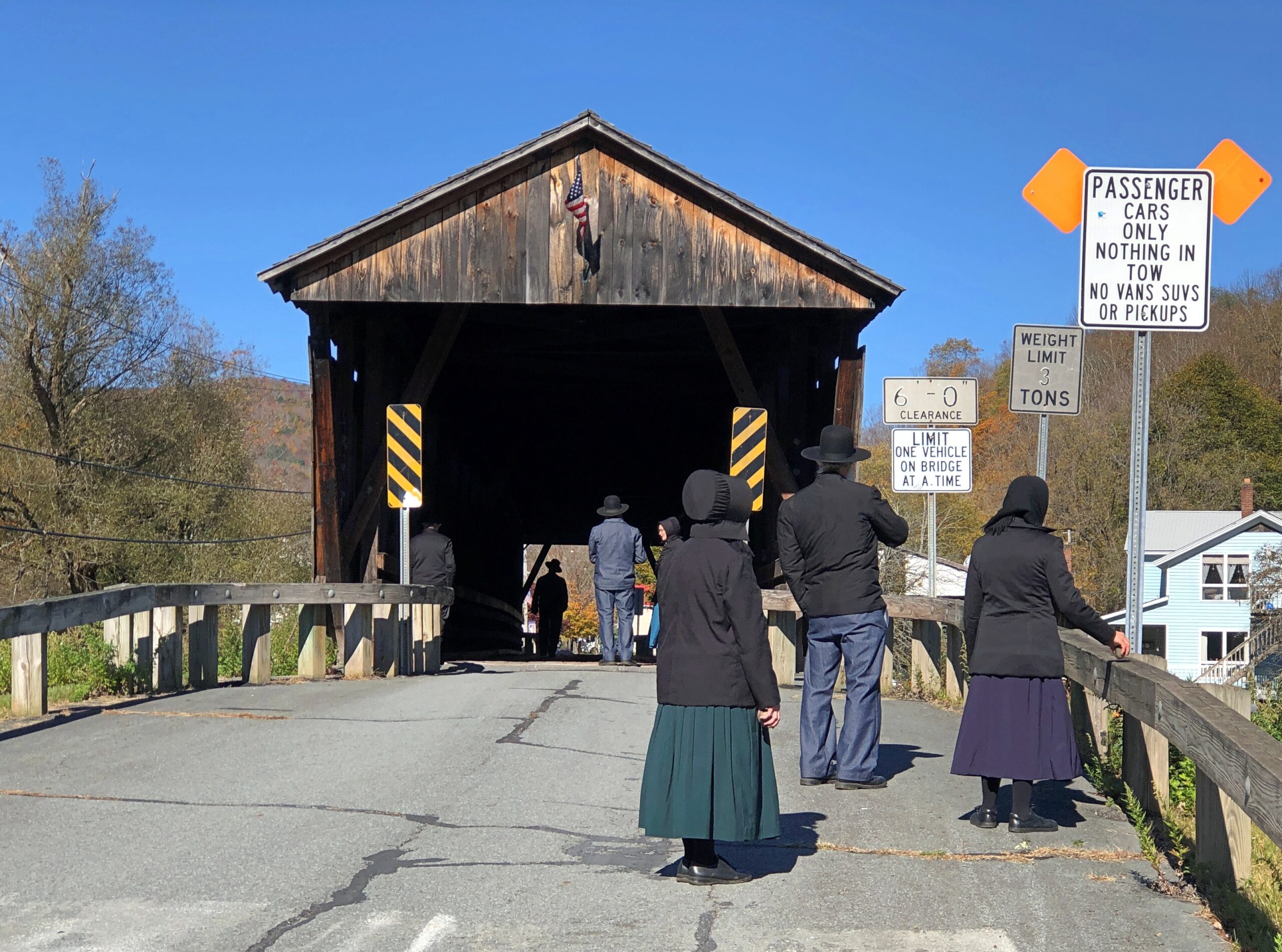
There’s a small park on the river next to the bridge, and a parking lot. Soon after I arrived for a look-see, a large van pulled up to the lot and about a half-dozen Plain People got out. They were there for a look-see too. So we were all on the bridge together.
I try not to do ethnic profiling, but I couldn’t help thinking that a top tourist sight for Plain People might well be a covered wooden bridge. Then I wondered, how is it they came in a van? As I was leaving, I noticed a non-Plain man waiting for them in the drivers seat. The Plain People equivalent of a Shabbos goy, I suppose. Except maybe that he can work any day except the Sabbath?
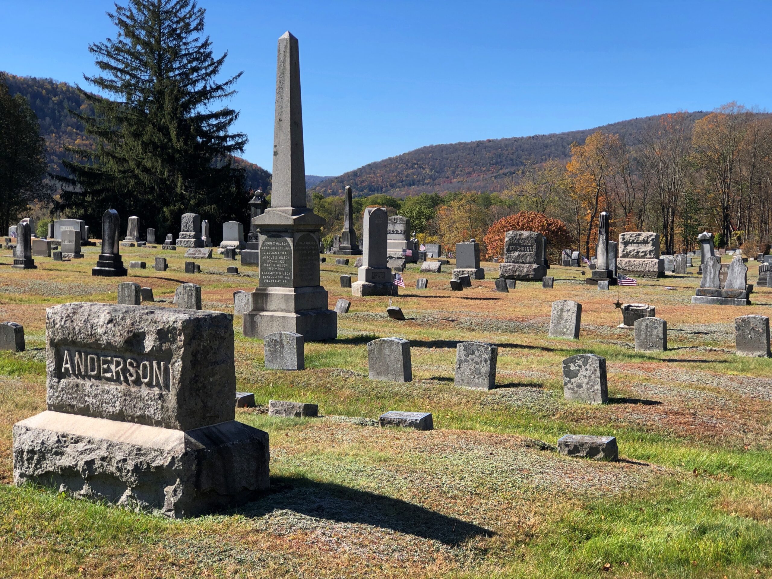
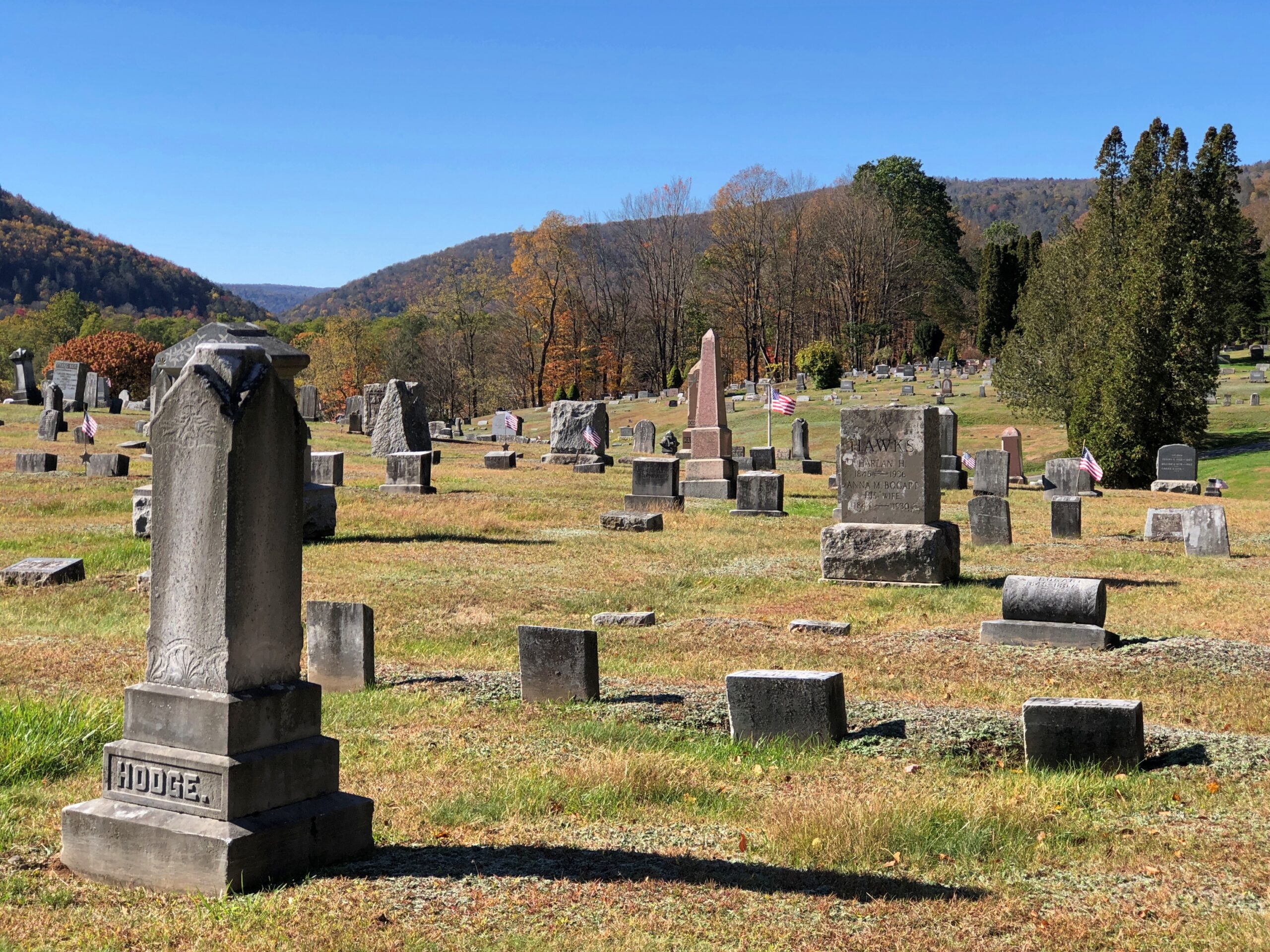
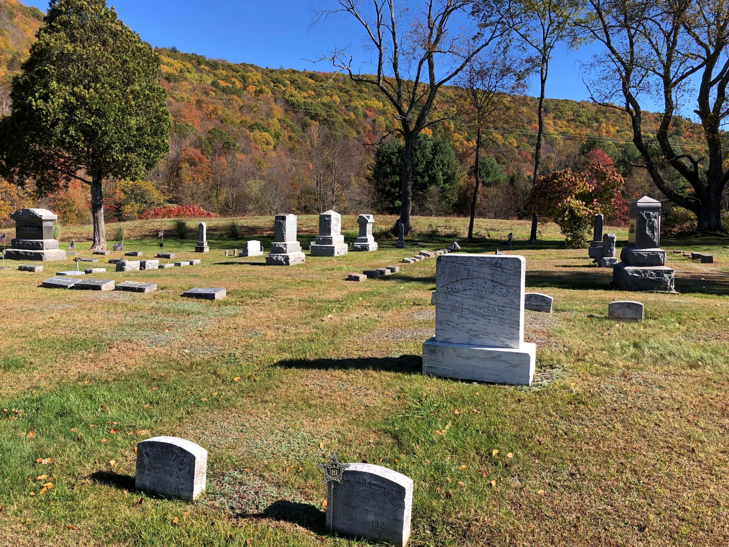
Not far away in Downsville is the Paige Cemetery. I had that to myself, as usual.
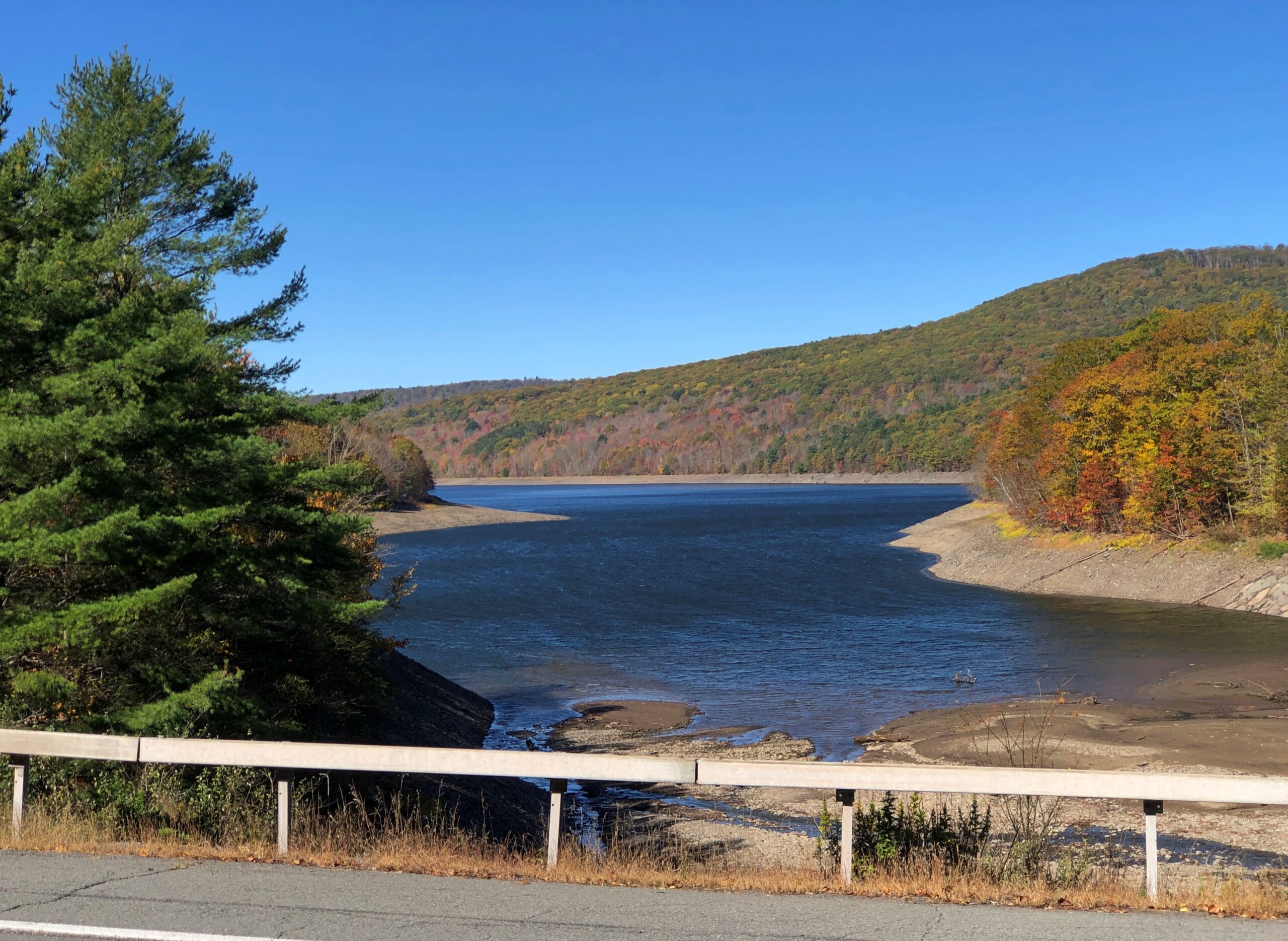
New York 30 continues a long way on the shores of the Pepacton Reservoir. Still car commercial driving.
The Pepacton Reservoir, seemingly so peaceful on a brilliant autumn day, has a hell of a back story.
“It is formed by the damming of the East Branch of the Delaware River, which continues west and joins the lower Delaware River,” says NYC Environmental Protection. “It consists of one basin, approximately 15 miles in length [that] holds 140.2 billion gallons at full capacity, making it the largest reservoir in the city system by volume. It was placed into service in 1955.
“Pepacton Reservoir is one of four reservoirs in the City’s Delaware Water Supply System. As the reservoir with the largest capacity, it normally contributes more than 25% of the total daily water flow into New York City.”
Italics added, because they needed adding.
Once I left NY 30 and headed east on NY 28, which put me on a path toward the Hudson River Valley and NYC and Long Island, traffic kicked up several notches. It was still mostly a pleasant drive.
Most of the traffic was headed west into the park, opposite of the way I was going; as only to be expected on a Thursday ahead of a colorful fall weekend. The Catskills are still a destination, if not quite the Catskills of yore. Some of the old story was told to the rest of the country through TV shows in previous decades, or even more recently: namely, The Marvelous Mrs. Maisel.
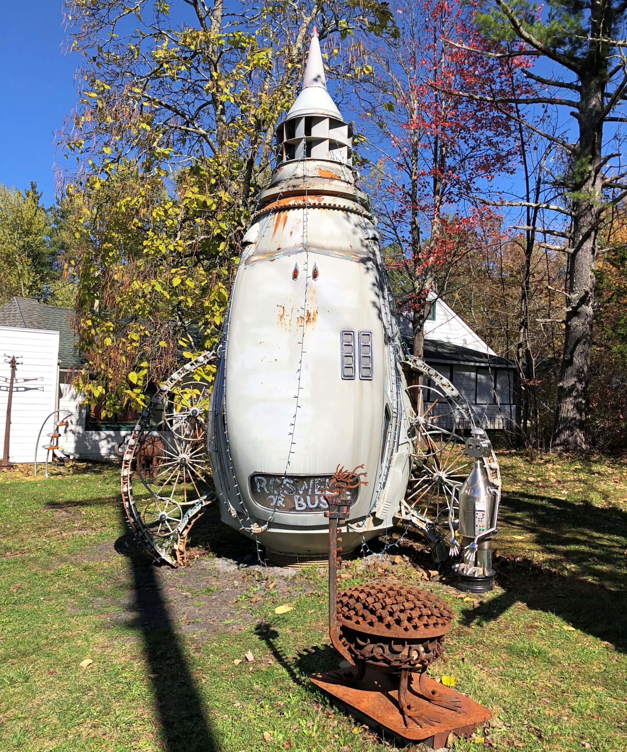
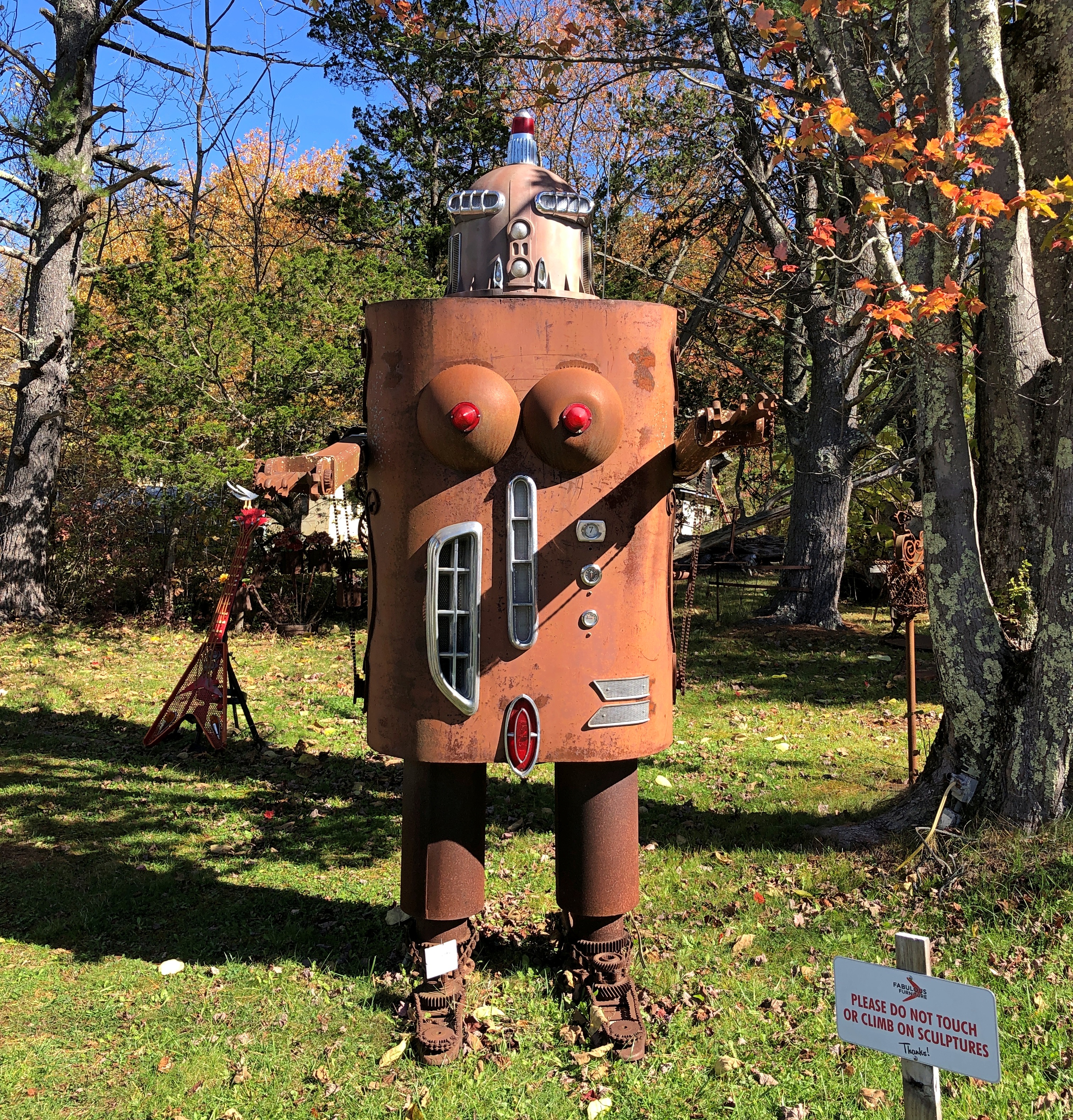
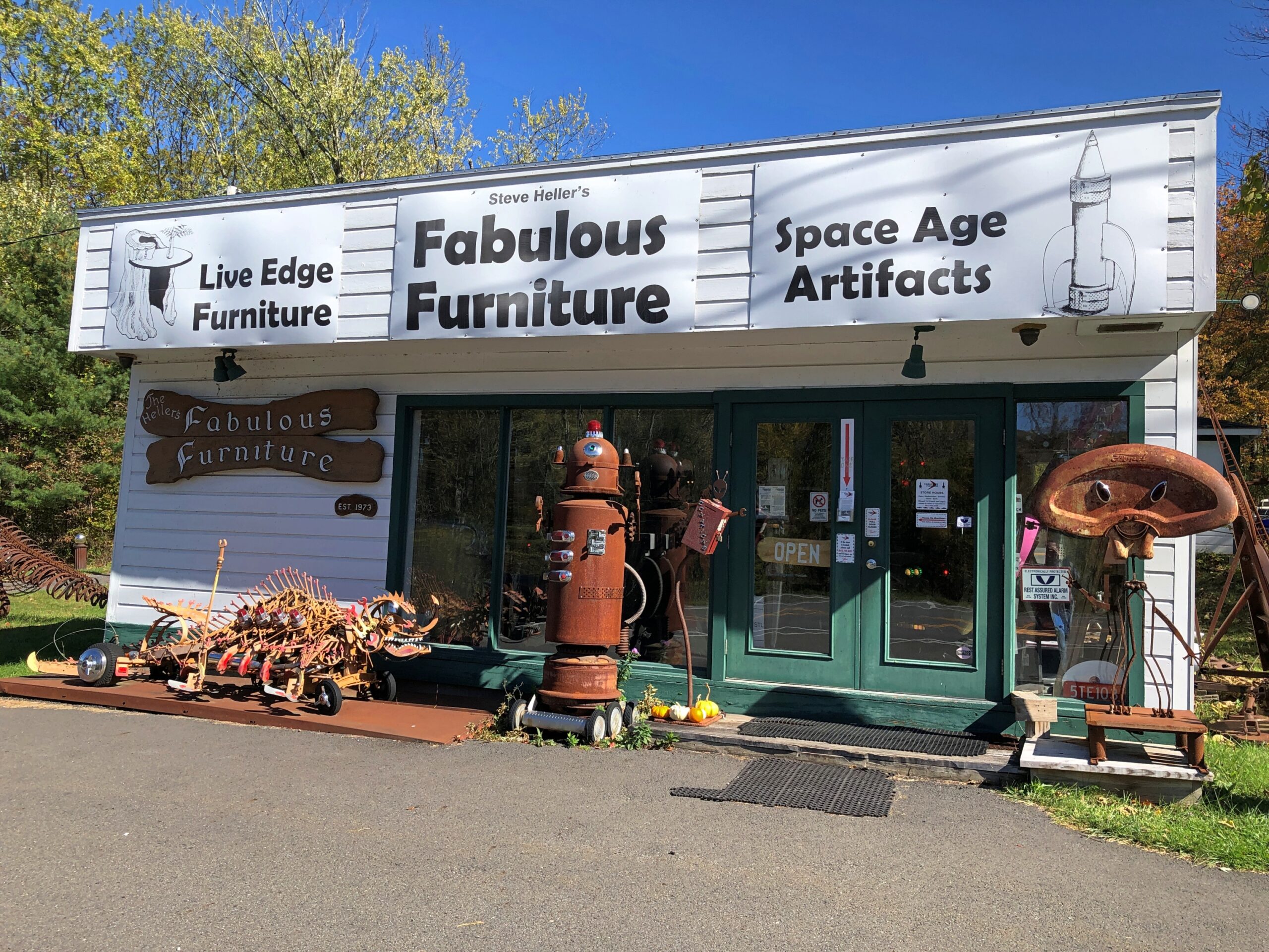
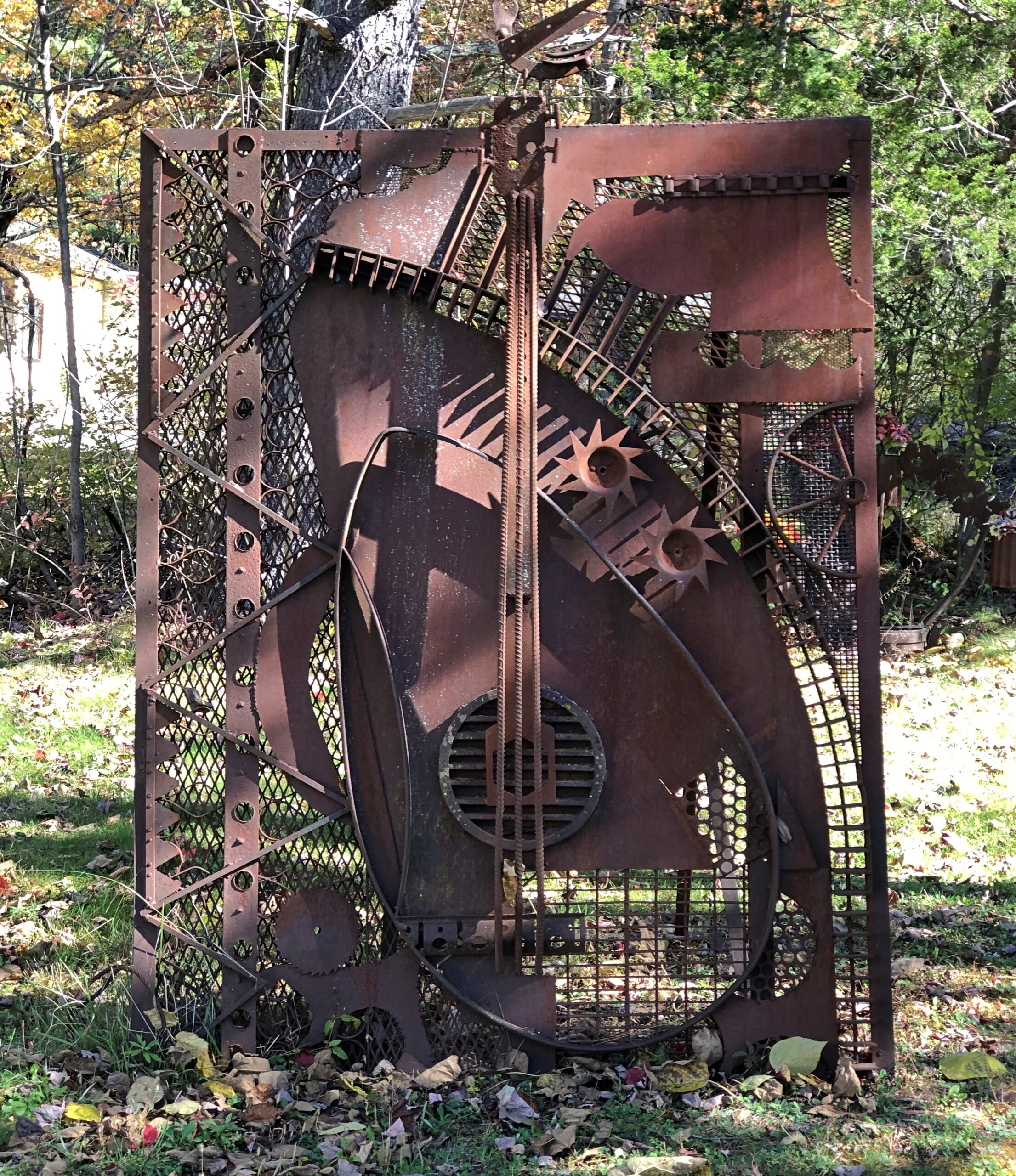
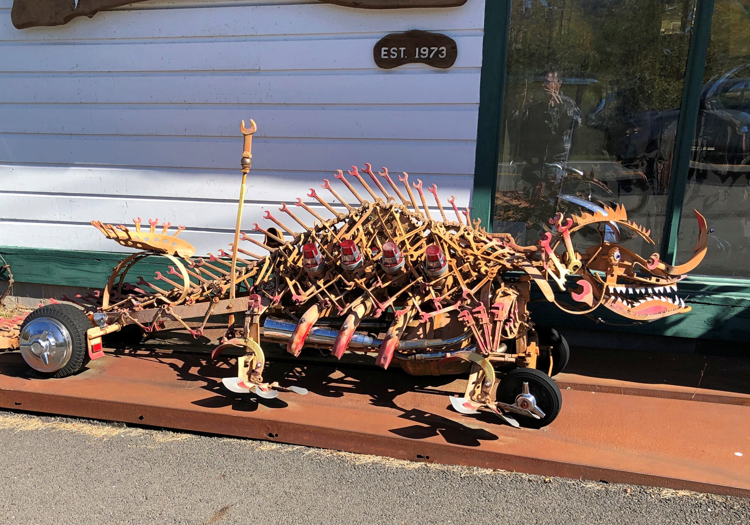
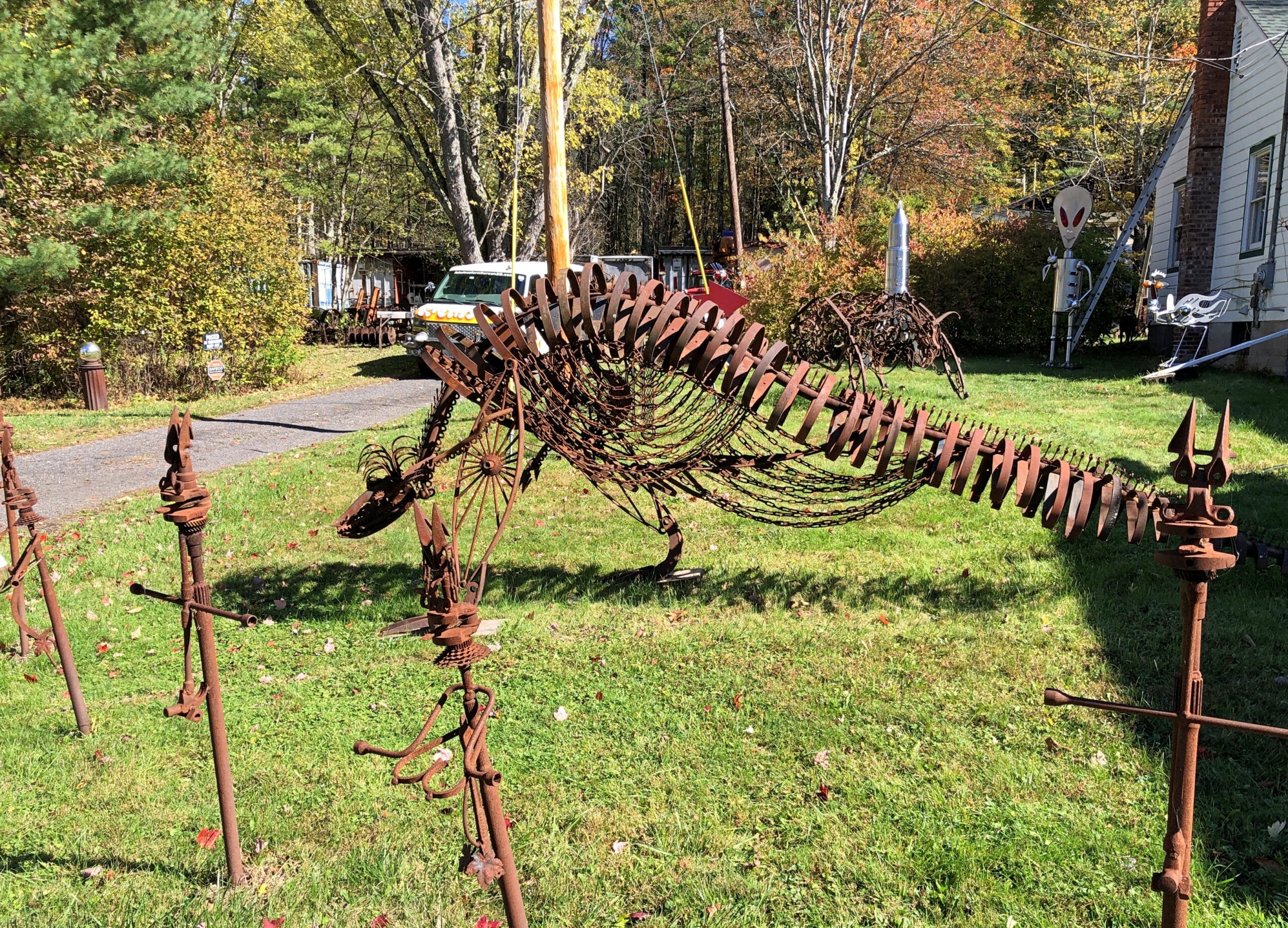
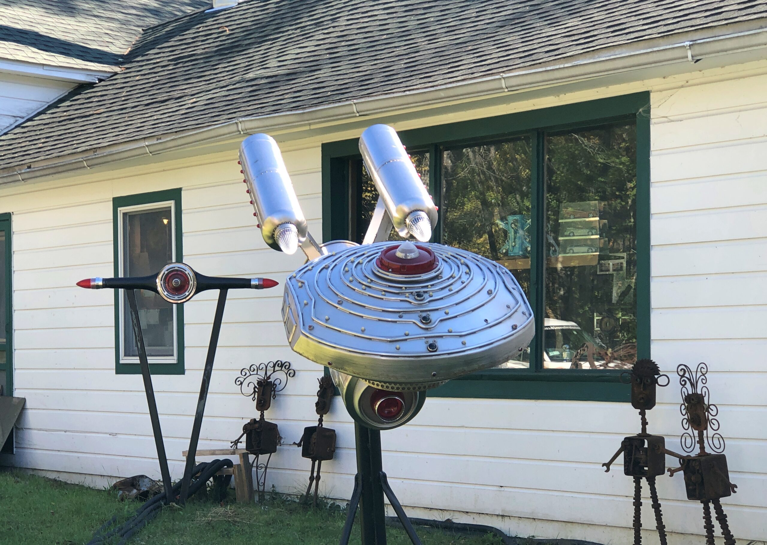
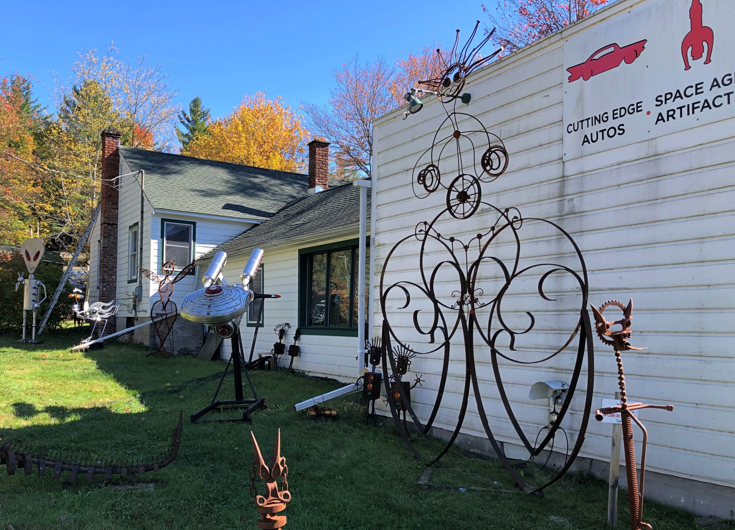
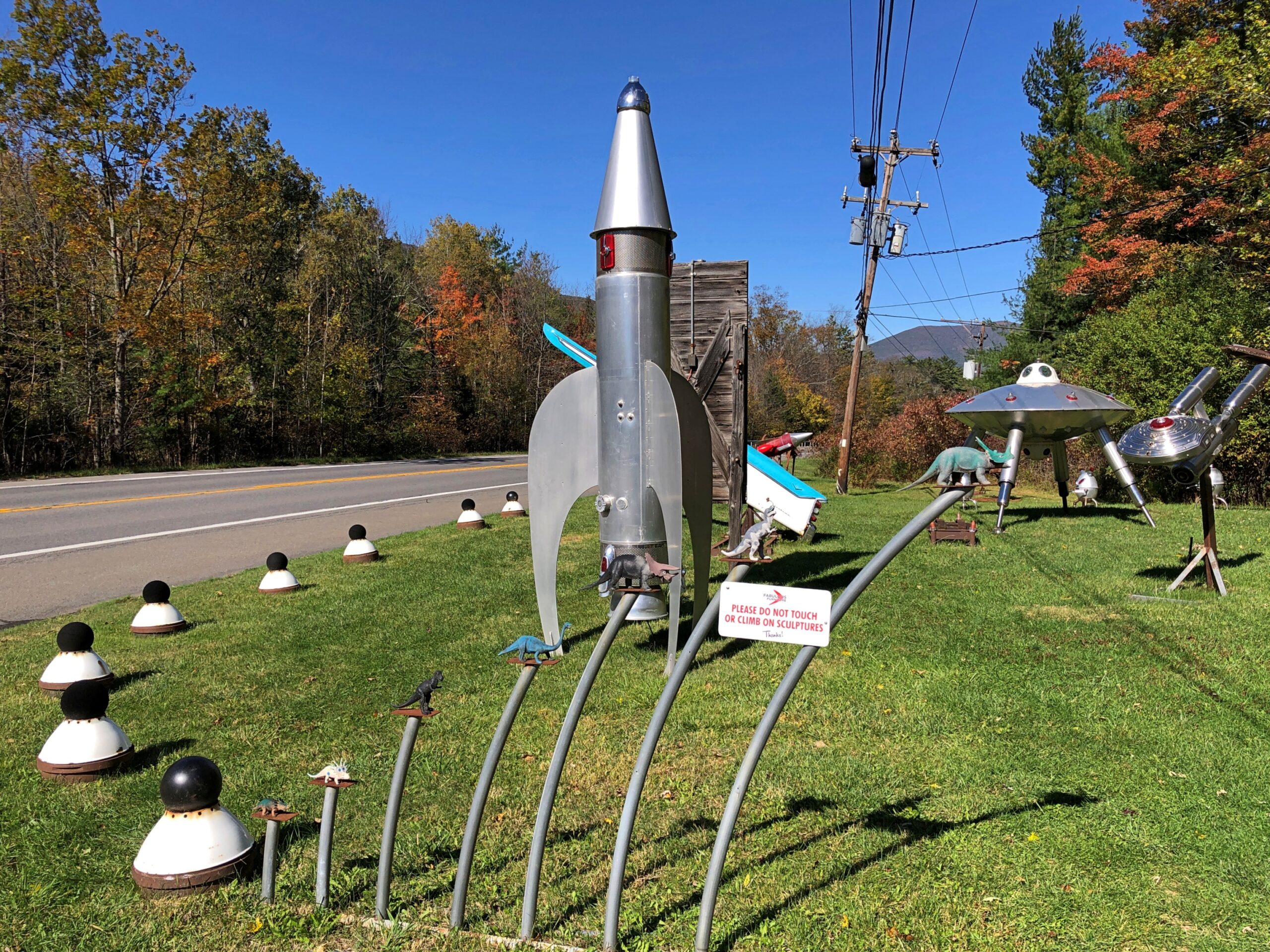
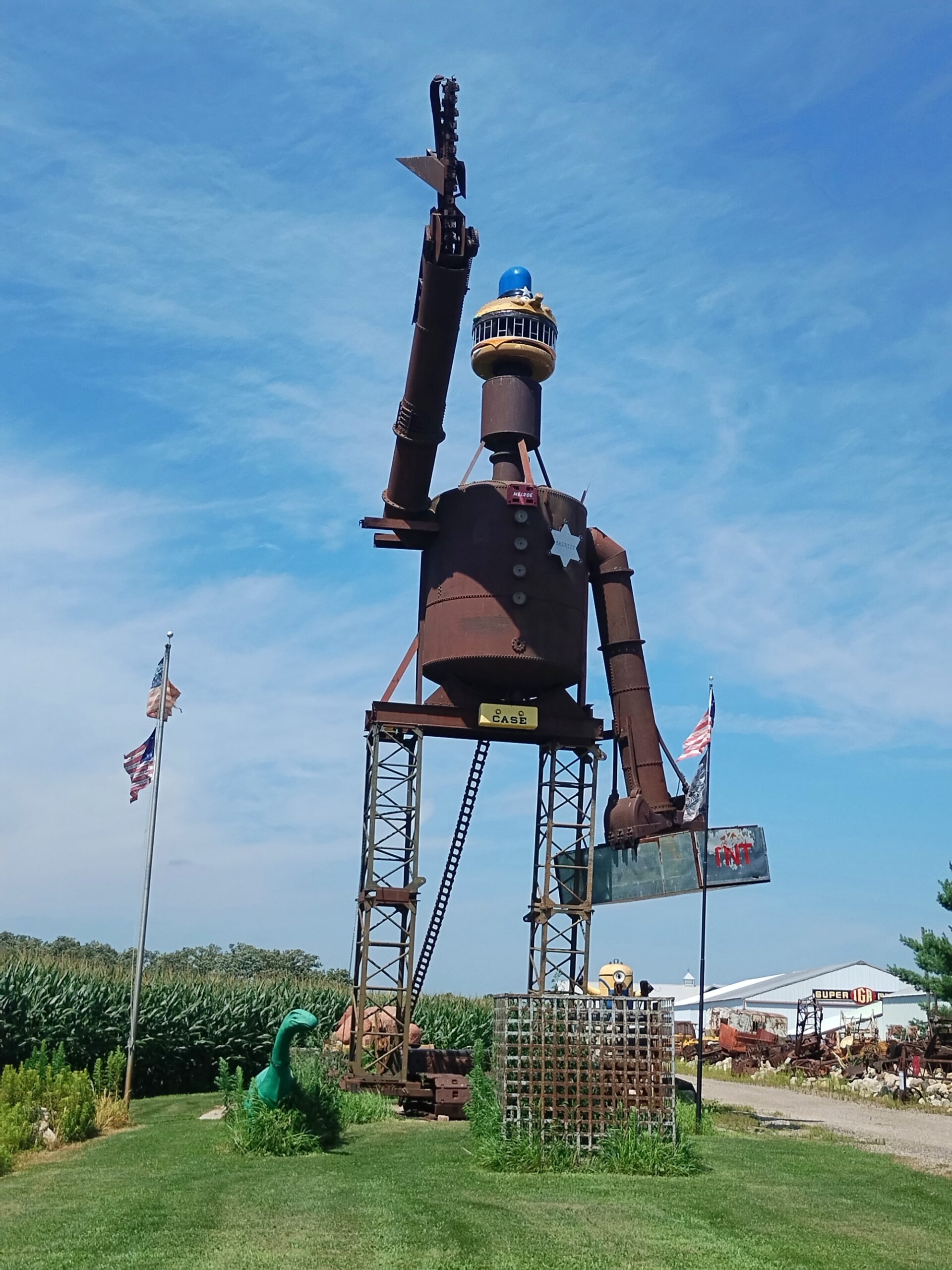
Metal spaceship and robot sculptures haven’t been part of the Catskills narrative that I know of. But there they were, right off NY 28.
As part of this place of business.
Some artful metal for sure.
More.
Fabulous work, Mr. Heller, but those Space Age artifacts are of a Space Age that never quite was. Too bad.
Early October this year was much like summer here in northern Illinois. Cooler now, but not even close to freezing just yet. Even the leaves seemed to be cooperating, delaying their colors a little longer than usual. As recently as tonight, some of the hardier crickets were still singing, or whatever you can call it.
Back to posting around October 26. Until then, stay curious.
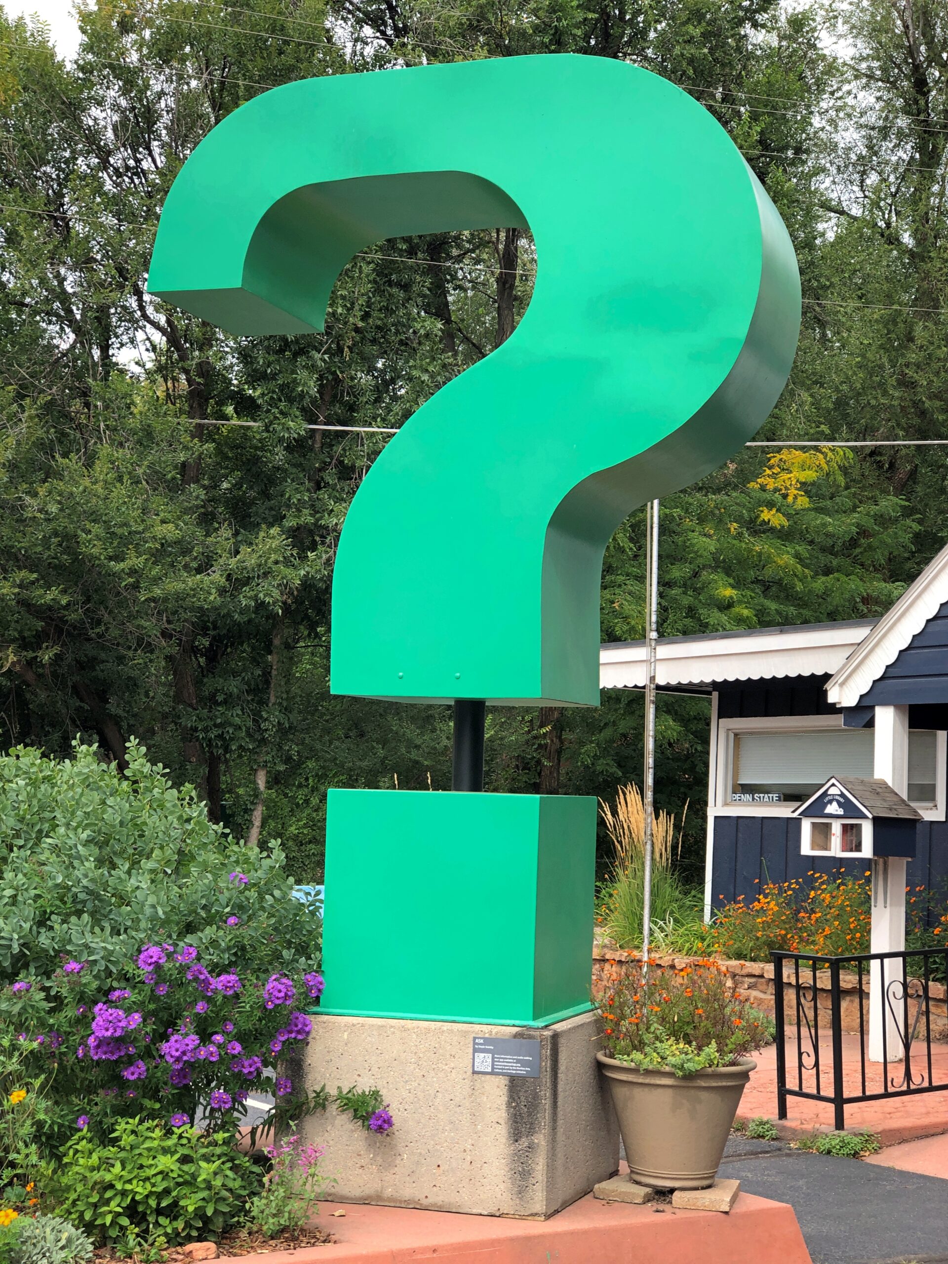
A little context. The question mark can be found in Manitou Springs, Colorado.
My question at that exact moment last month was: is there a public restroom on the grounds of the Manitou Springs C-of-C? I’m glad to say there was.
Today I let Google finish “Cathedral of the…” and got the following responses, top to bottom (capitalization sic): Sea, deep, Holy Angels, holy angels photos, forsaken, immaculate conception, incarnation, Madeleine, deep ds3, pines.
Cathedral of the Sea is La catedral del mar, a “Spanish drama series” that I’d never heard of, though I have been to Santa Maria del Mar. The Cathedral of the Deep and of the Forsaken appear to be aspects of electronic games, and the others are churches in various places.
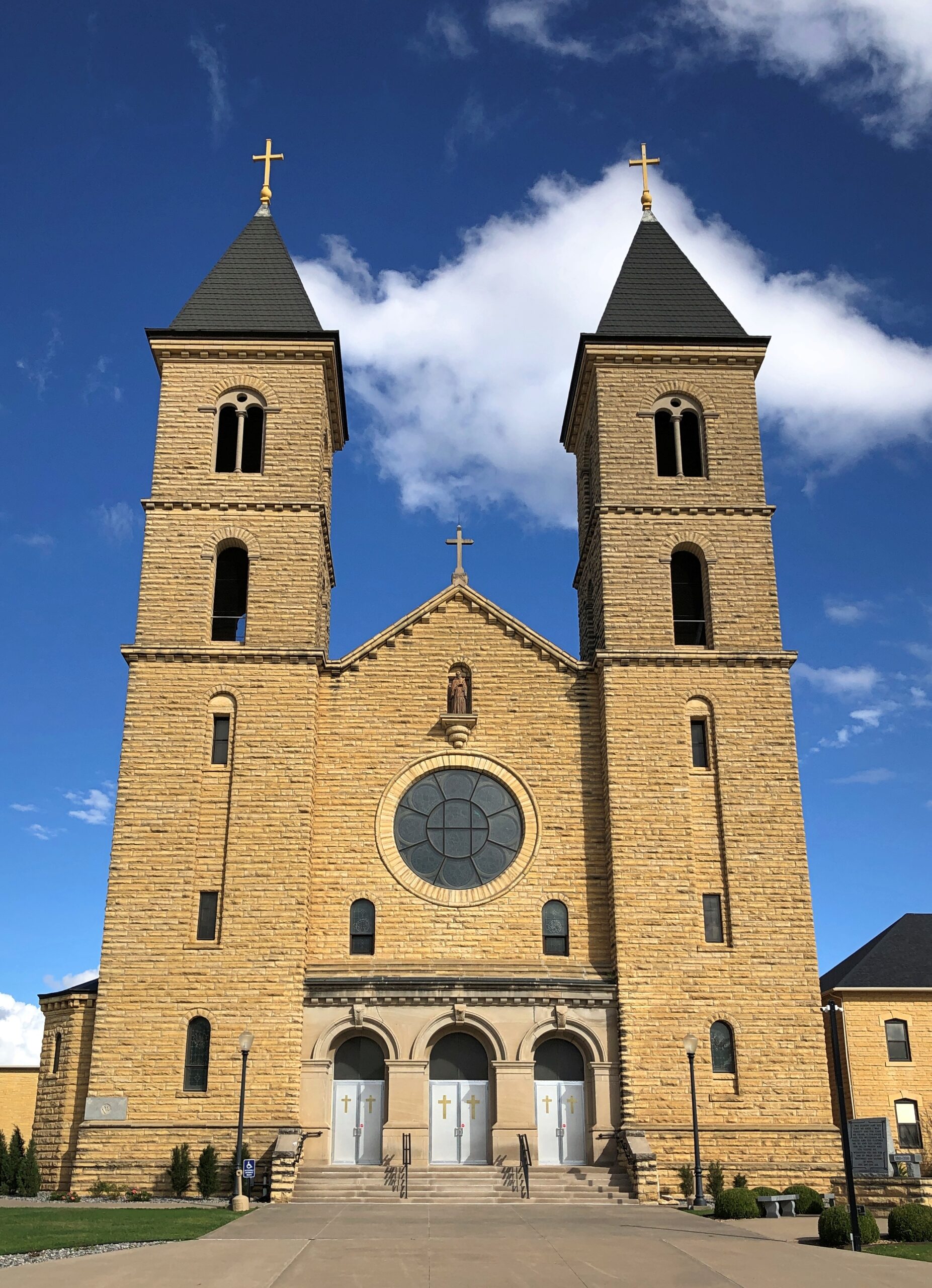
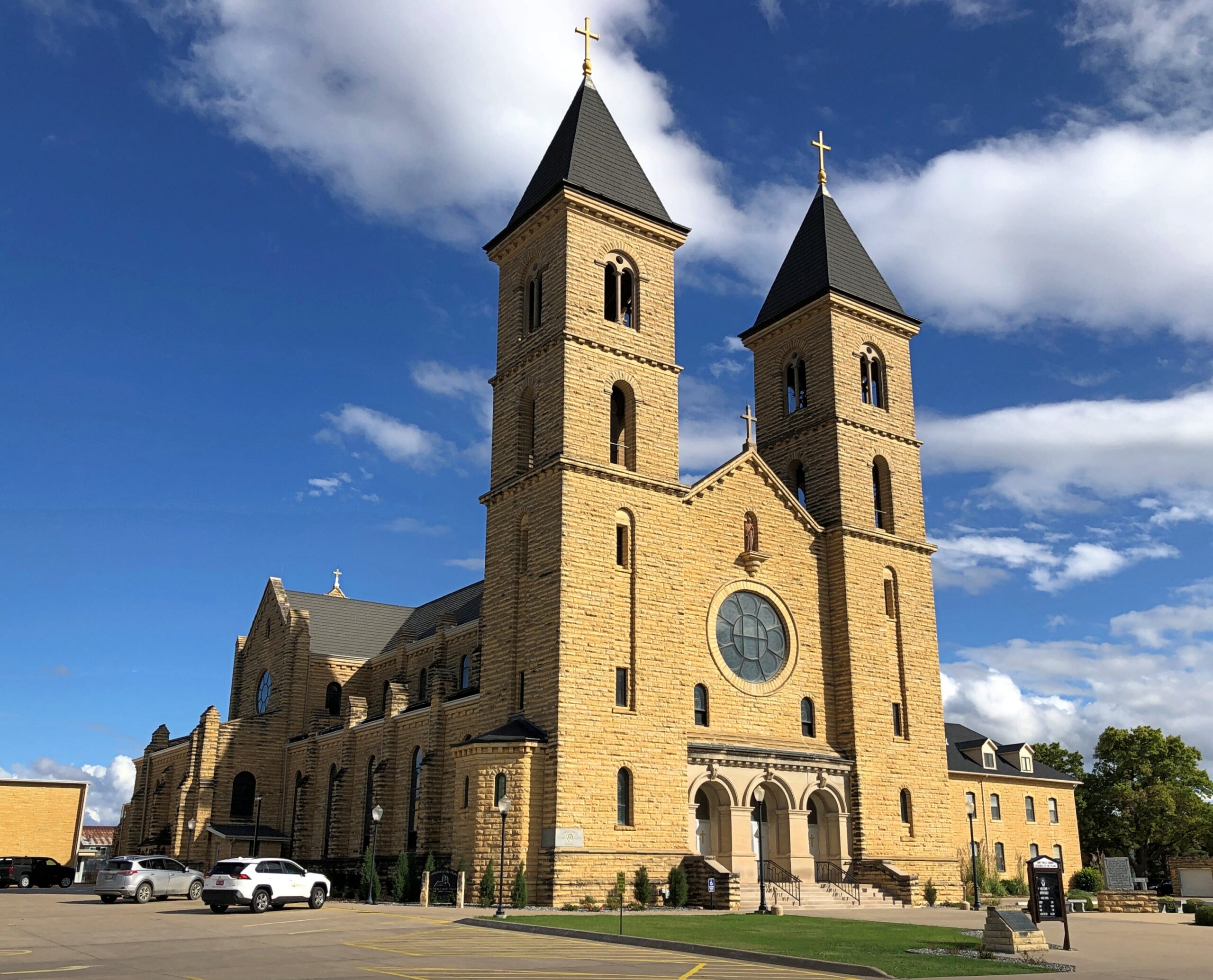
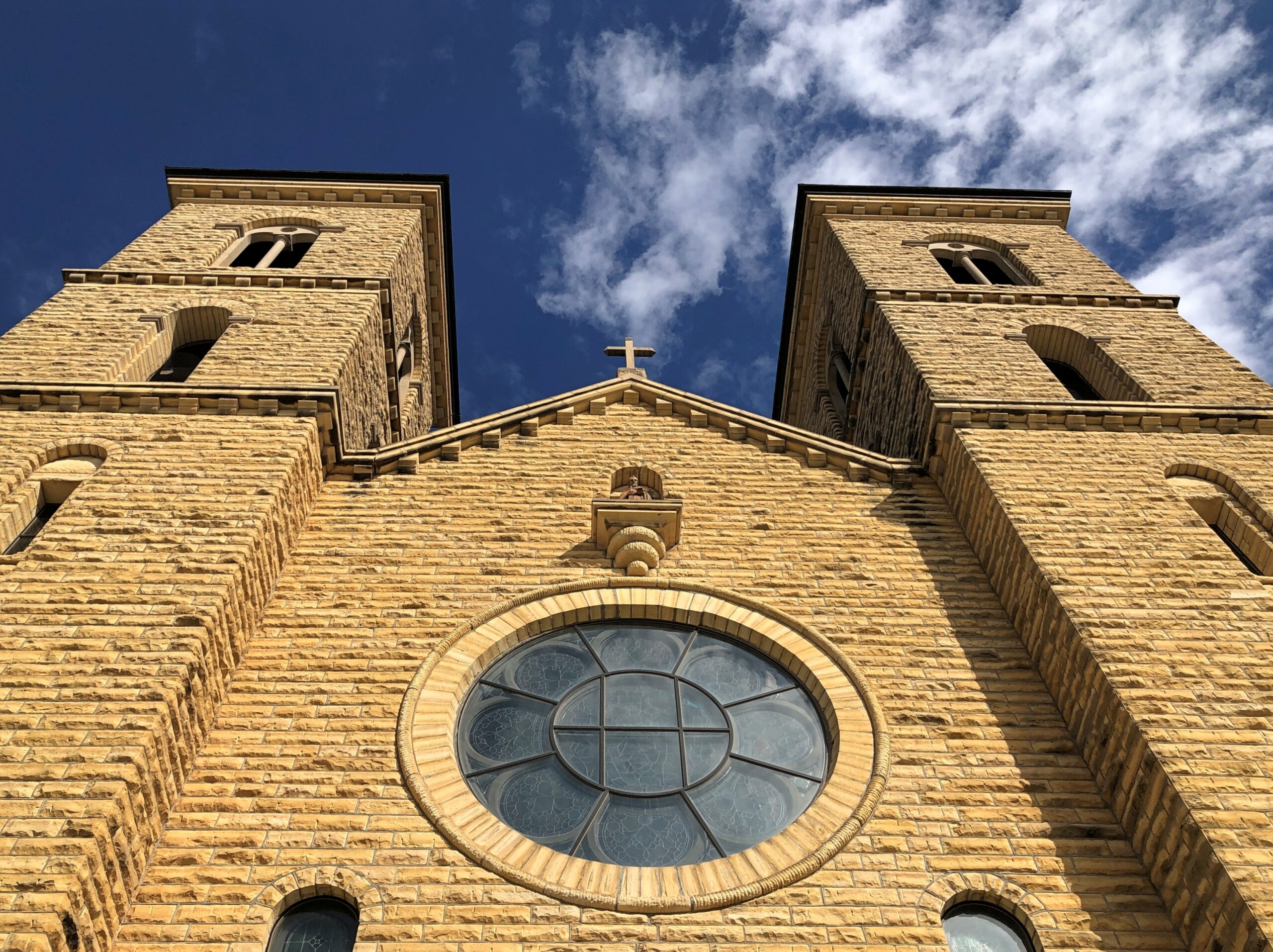
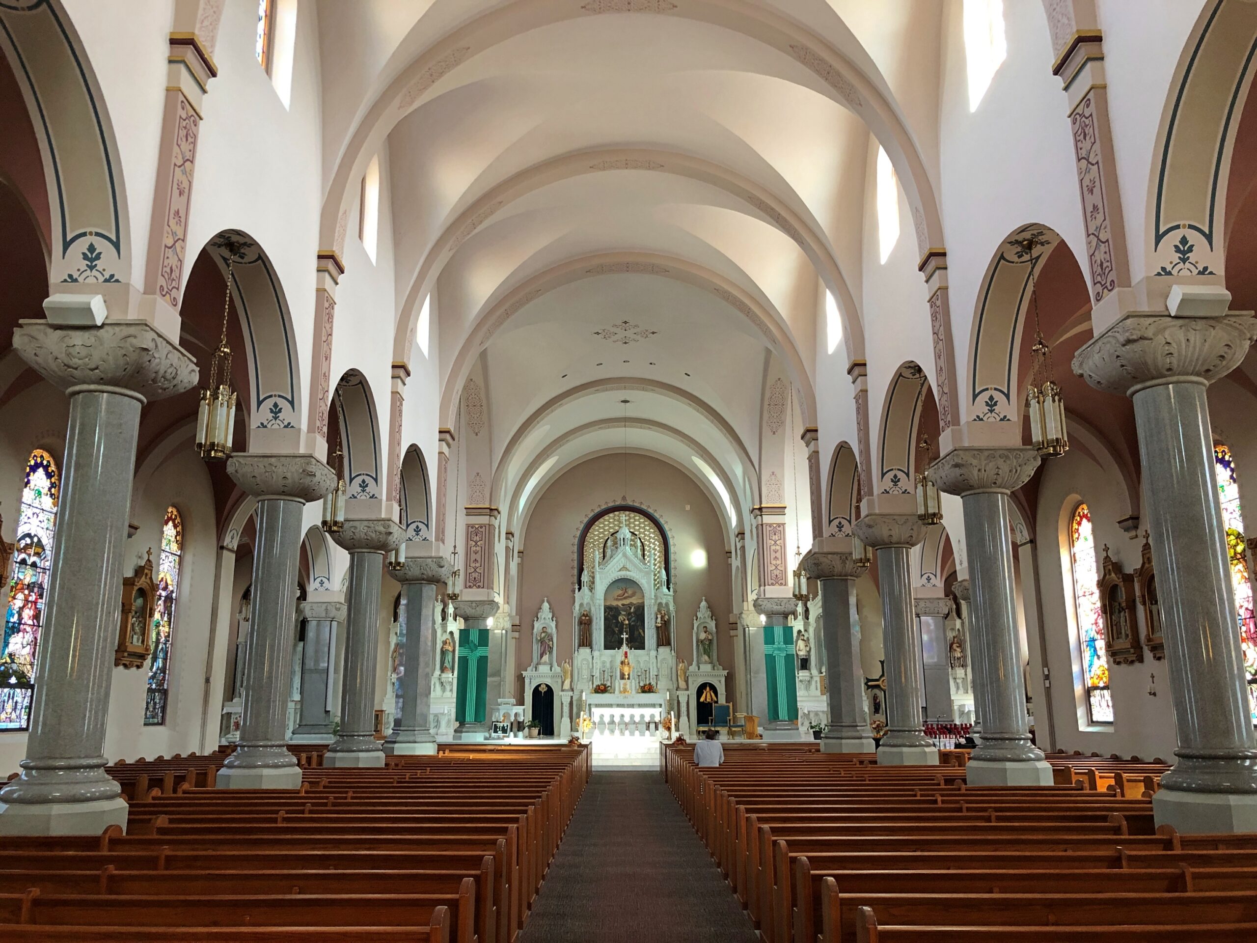
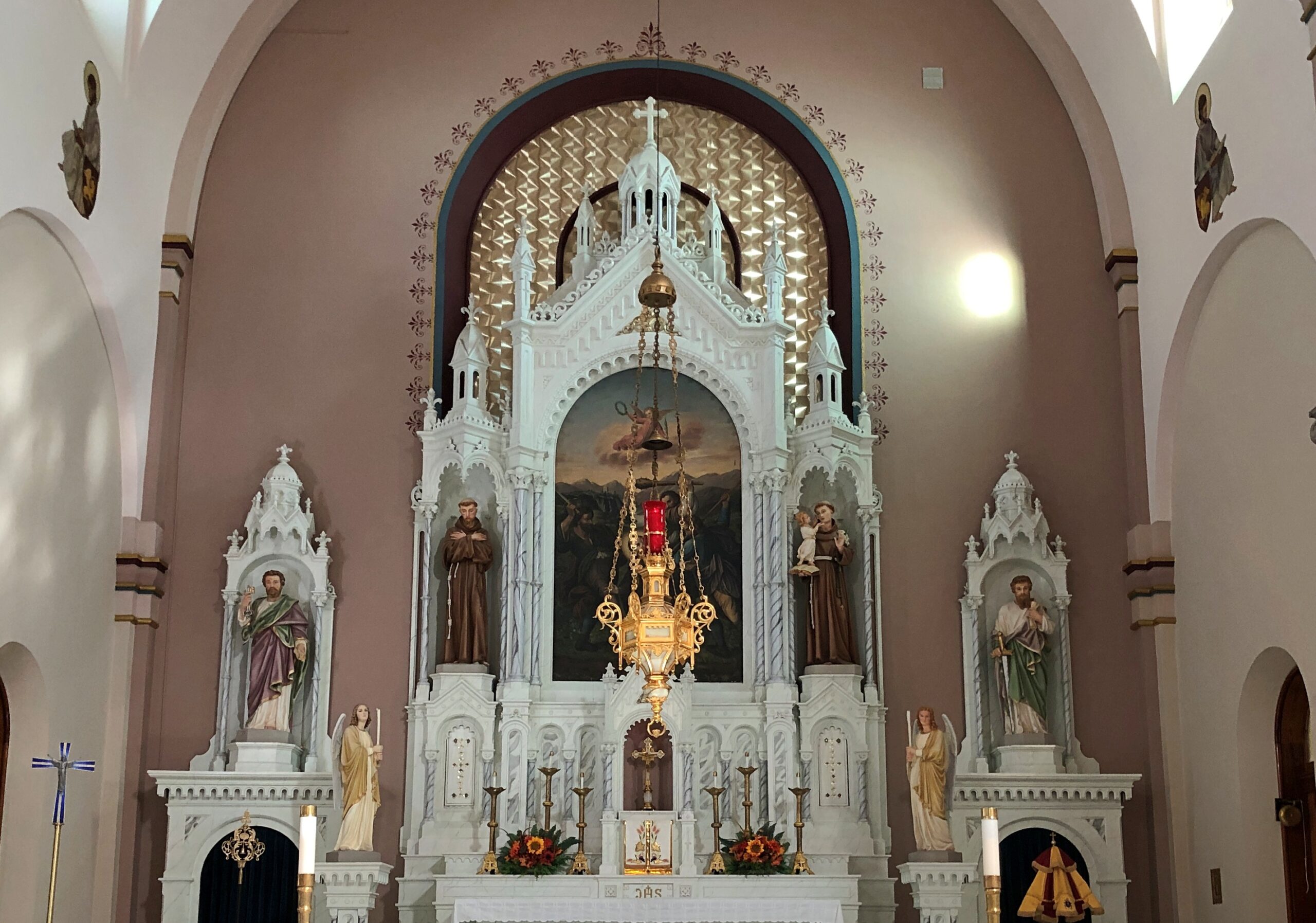
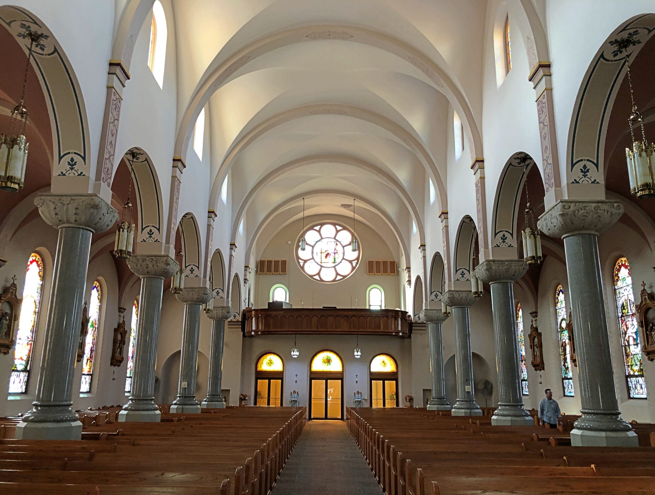
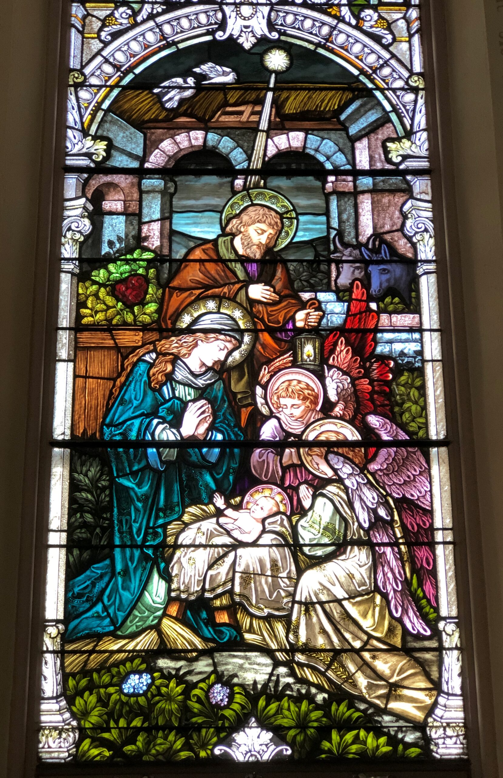
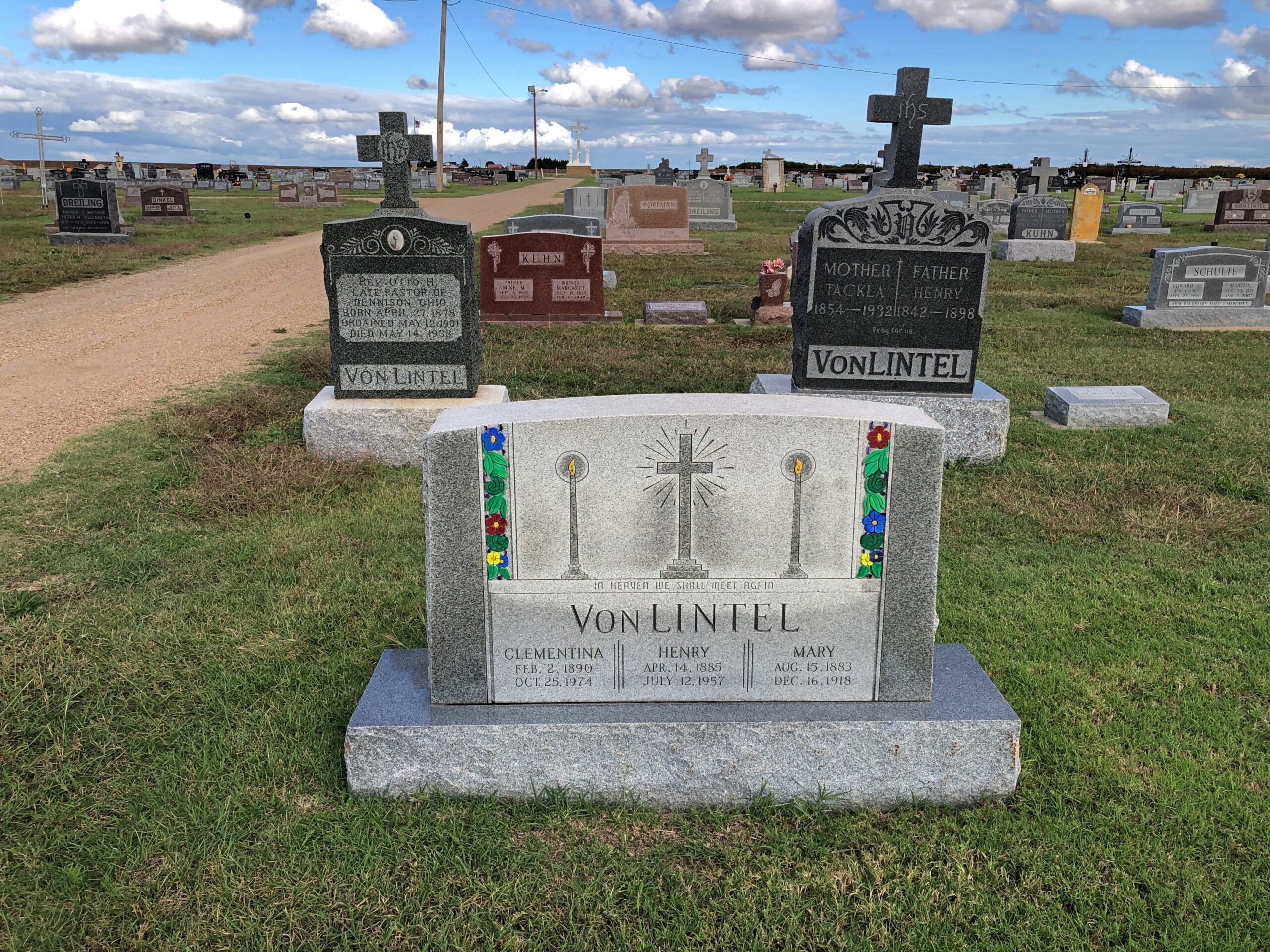
Not on the list is the Cathedral of the Plains. But it’s out there, in central Kansas.
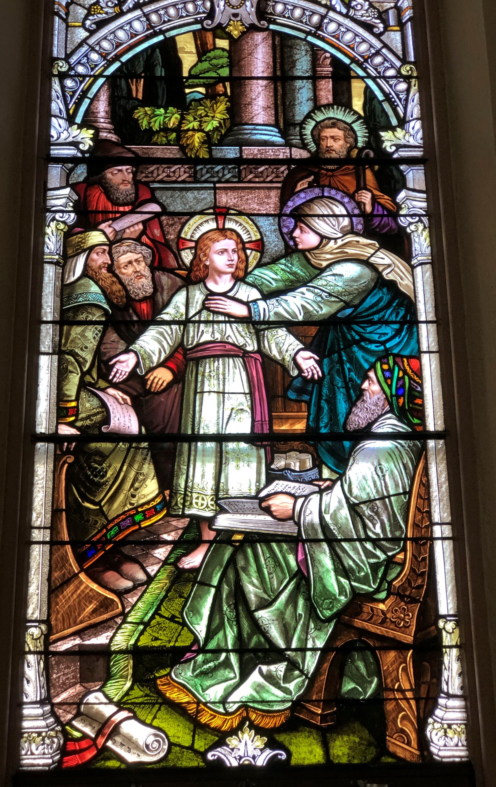
That’s a nickname, since the church isn’t actually a cathedral, but the wording does appear on its point-of-interest spot on road maps – and naturally that got my attention. Formally, the church is the Basilica of St. Fidelis, said to be the largest church west of the Mississippi by seating capacity (1,100) upon completion in 1911 in Victoria, Kansas. Conveniently (for me), some decades later I-70 was built not far away.
John T. Comès (d. 1922), a Pittsburgh architect, designed the church for a congregation of Volga German immigrants. Who had come to greater Victoria starting in the 1870s. Why Victoria? Why not? No doubt they looking for flat farmland.
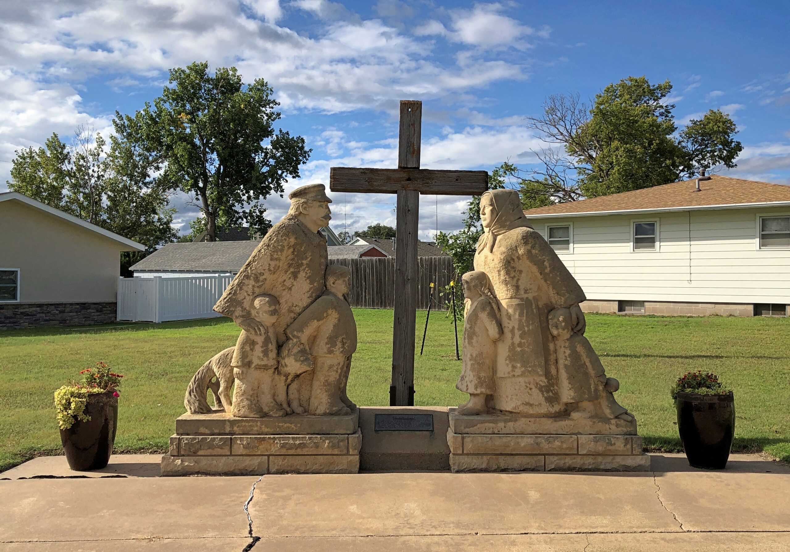
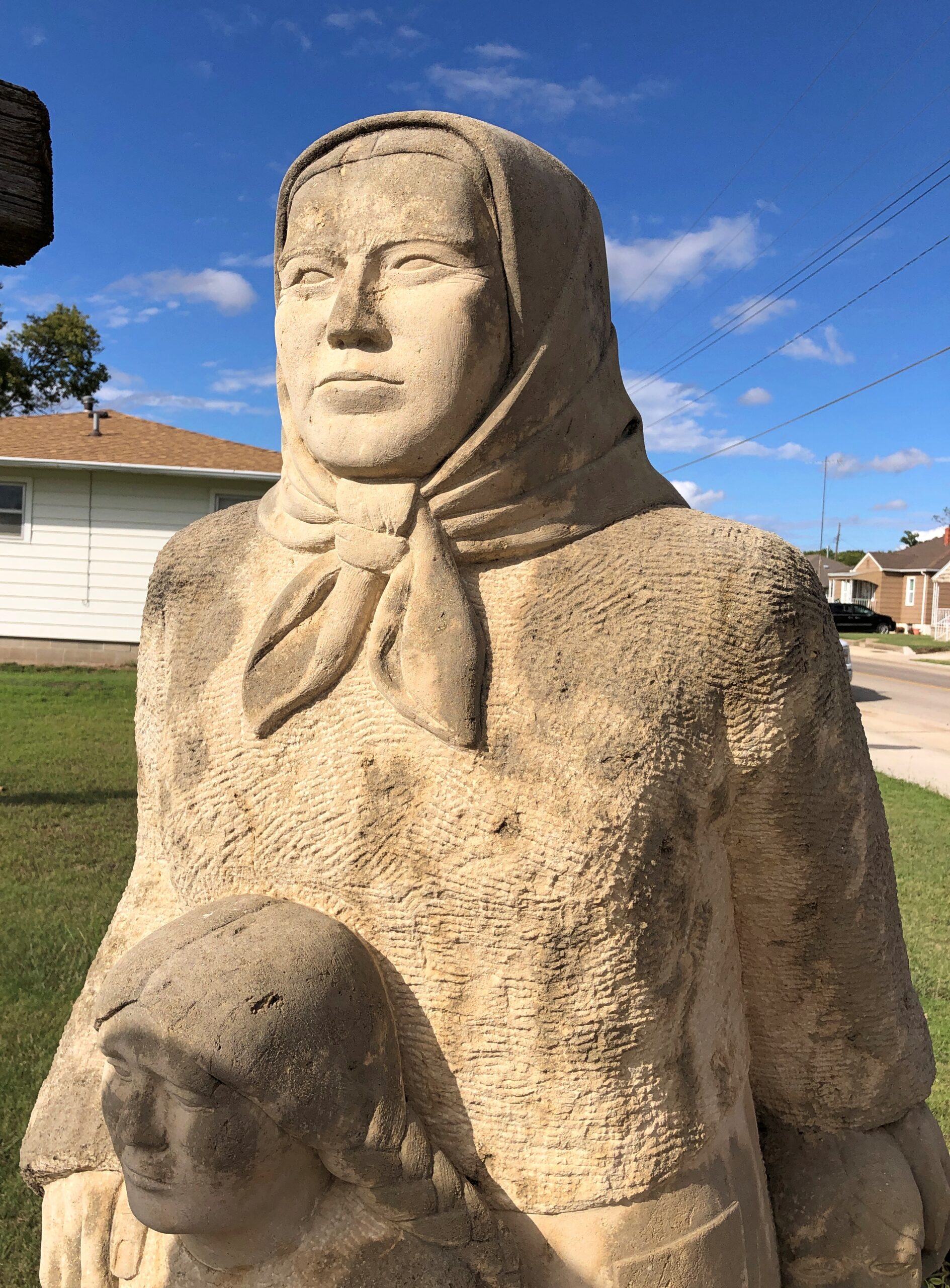
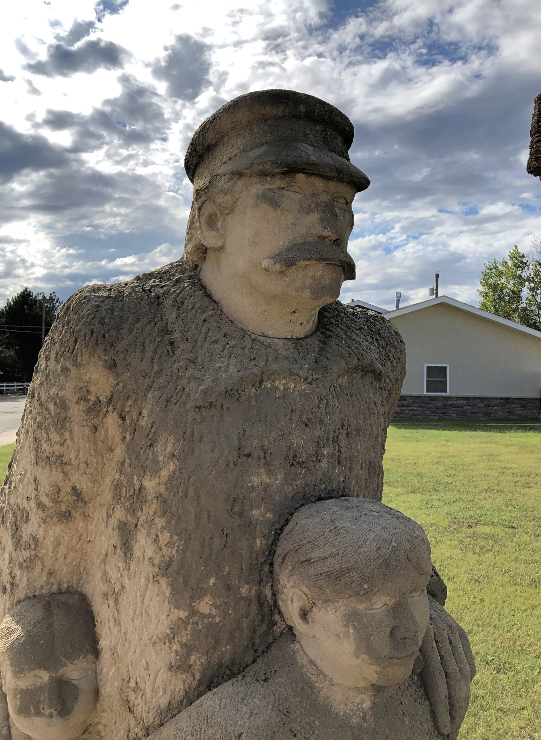
The Volga Germans aren’t forgotten. No doubt their descendants are all around this part of Kansas. In 1976, the townspeople erected a memorial to their immigrant ancestors, across the street from St. Fidelis. A work by Pete Felton, a “Kansan limestone carver,” according to this posting, which also mentions limestone fenceposts as important in Kansas — something else to look into sometime.
After nearly 50 years, the statues are looking a little weatherworn, but they abide.
The woman and daughters caught the light at that time of day, the afternoon of September 23.
The man and sons did not. Would sunlight have made him less – Stalinesque?
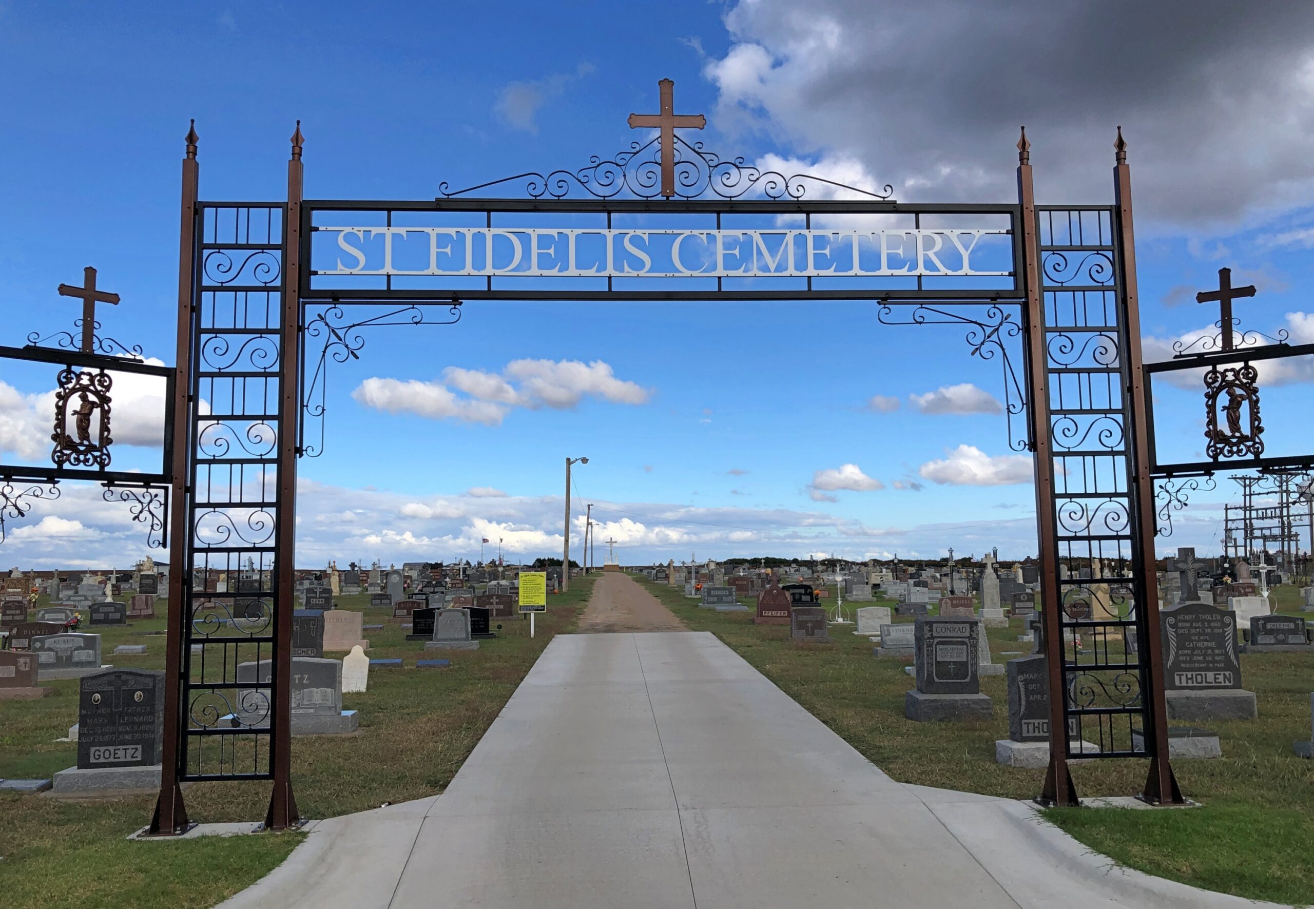
Never mind. St. Fidelis Cemetery isn’t far to the north of the basilica, and I stopped by.
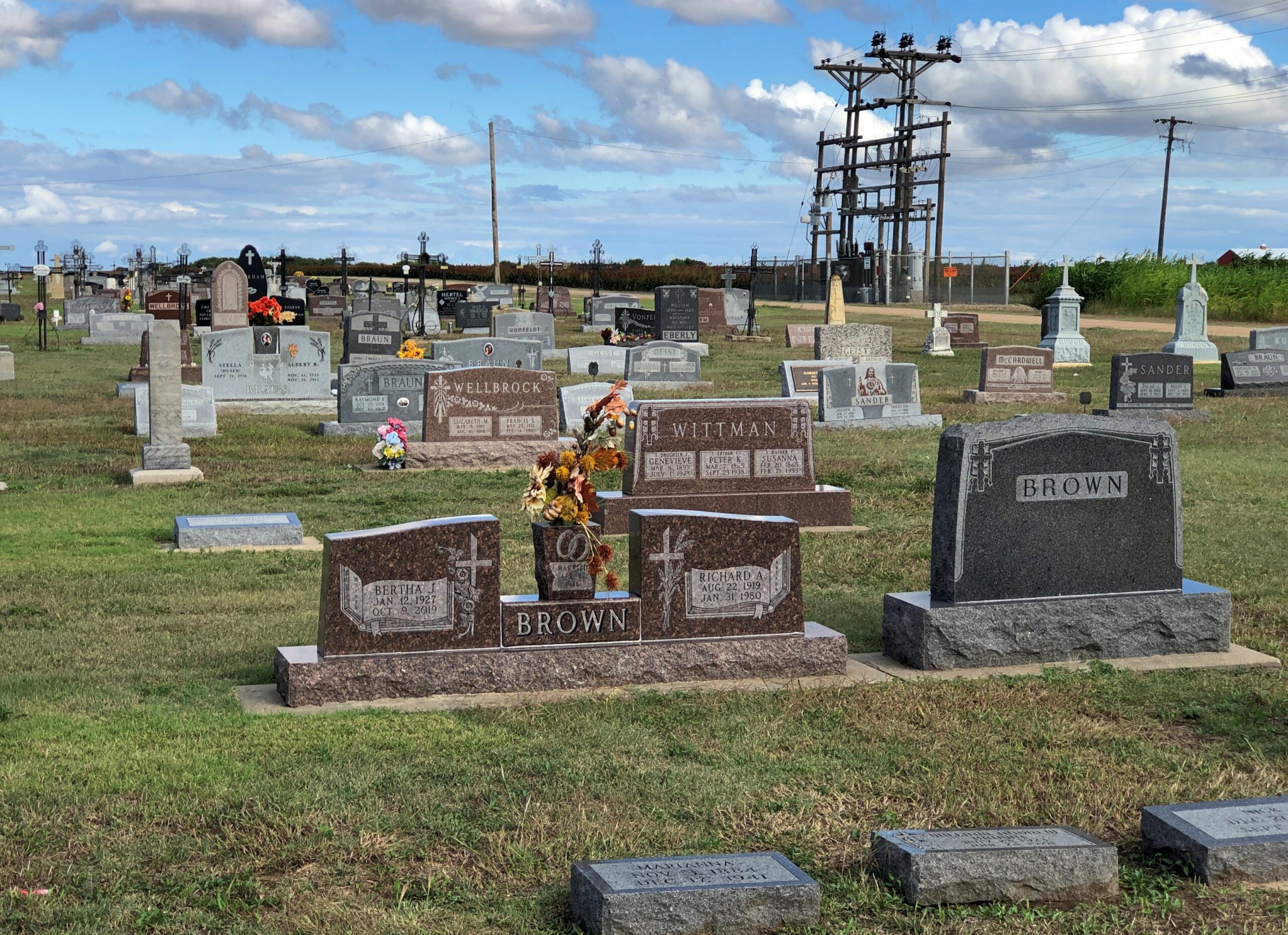
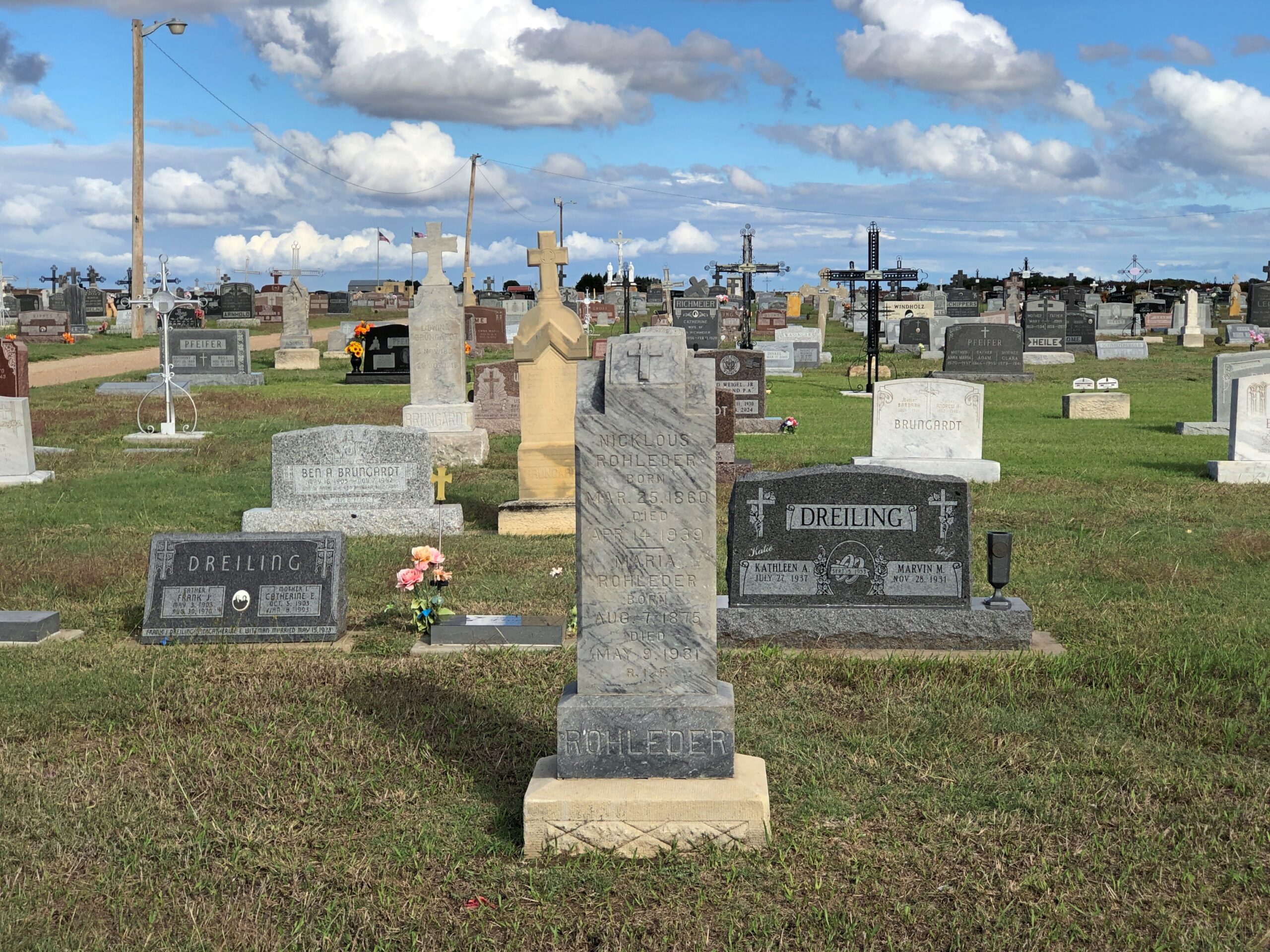
A good variety of memorials in a nice setting, even if the land lacks contour and there’s no flora beyond grass and cut flowers.
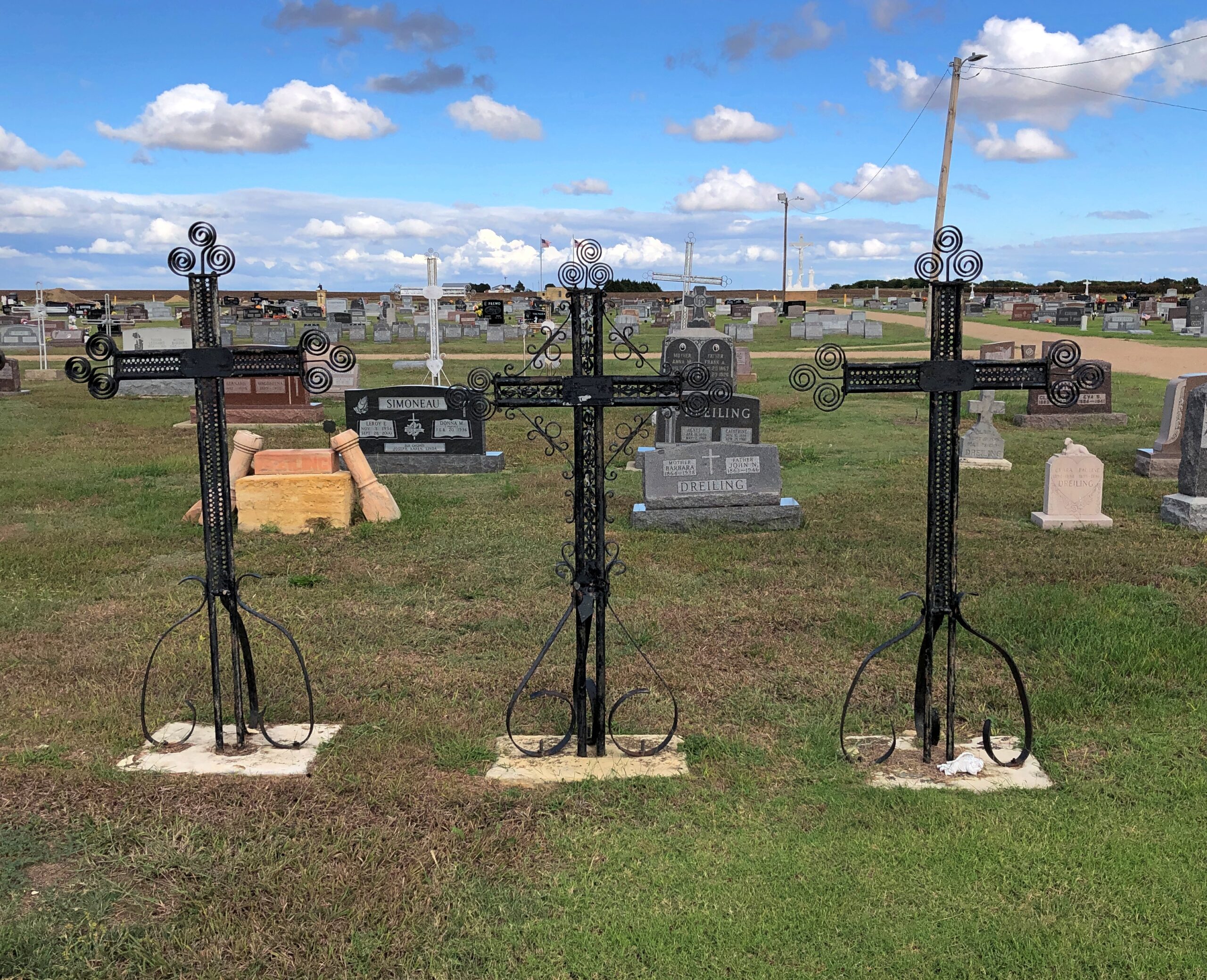
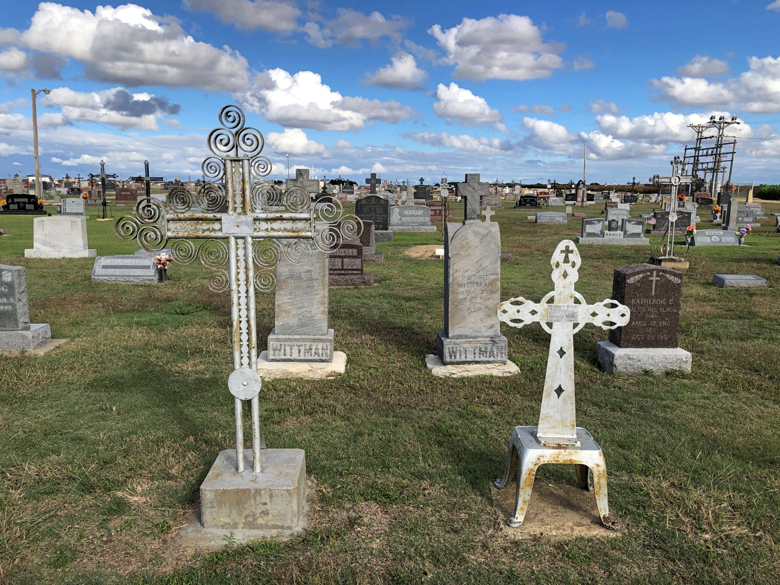
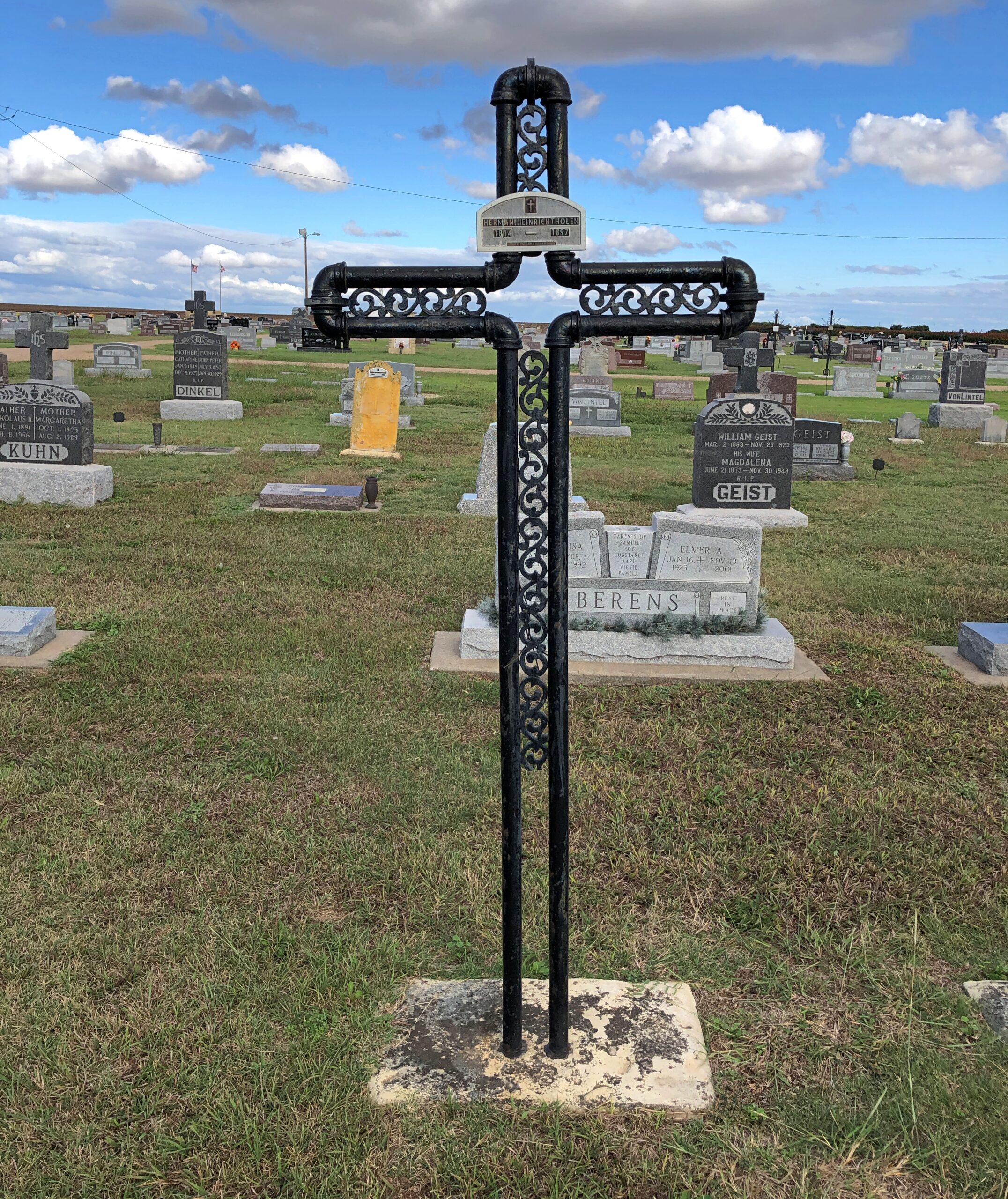
Then I started to notice iron crosses.
A lot of them. That called for further investigation, and it wasn’t long before I found out that Volga Germans were known for their wrought-iron crosses.
“German-Russian blacksmiths began making wrought-iron crosses in North Dakota as early as 1884,” says an article posted by North Dakota State University. “The hand-made crosses were most prevalent in central North Dakota from the late 1880s to about 1925, when marble and granite became more popular for grave marking. Most wrought-iron crosses appear in Catholic graveyards, although a few of these markers are also found in German-Russian Lutheran graveyards.”
The article talks of their crosses in North Dakota, but notes that they are also found in the “Northern Plains.” Such as Kansas, apparently.
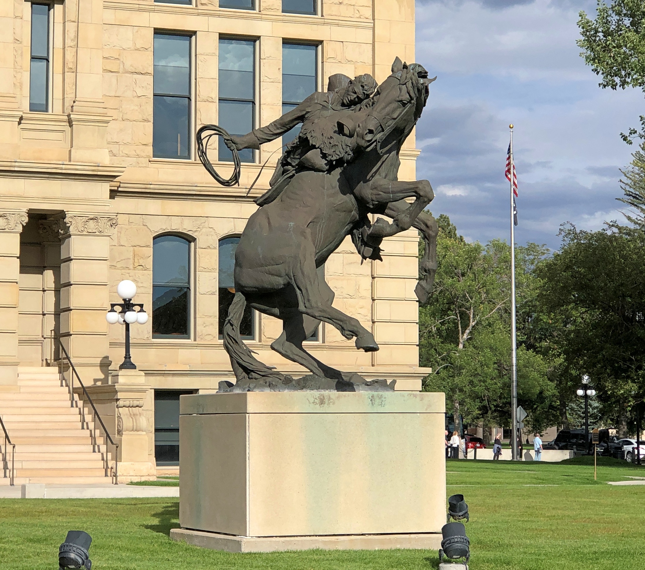
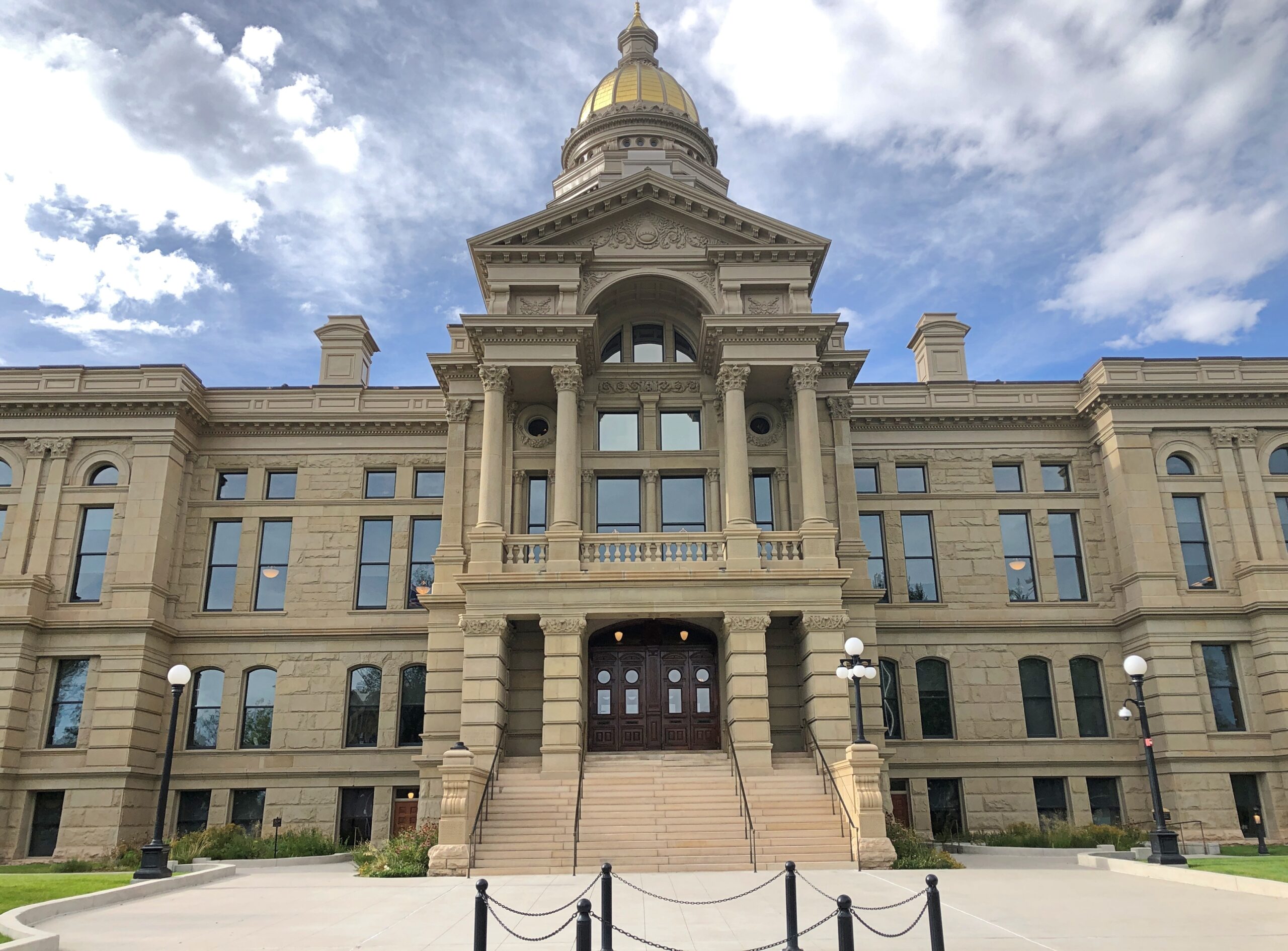
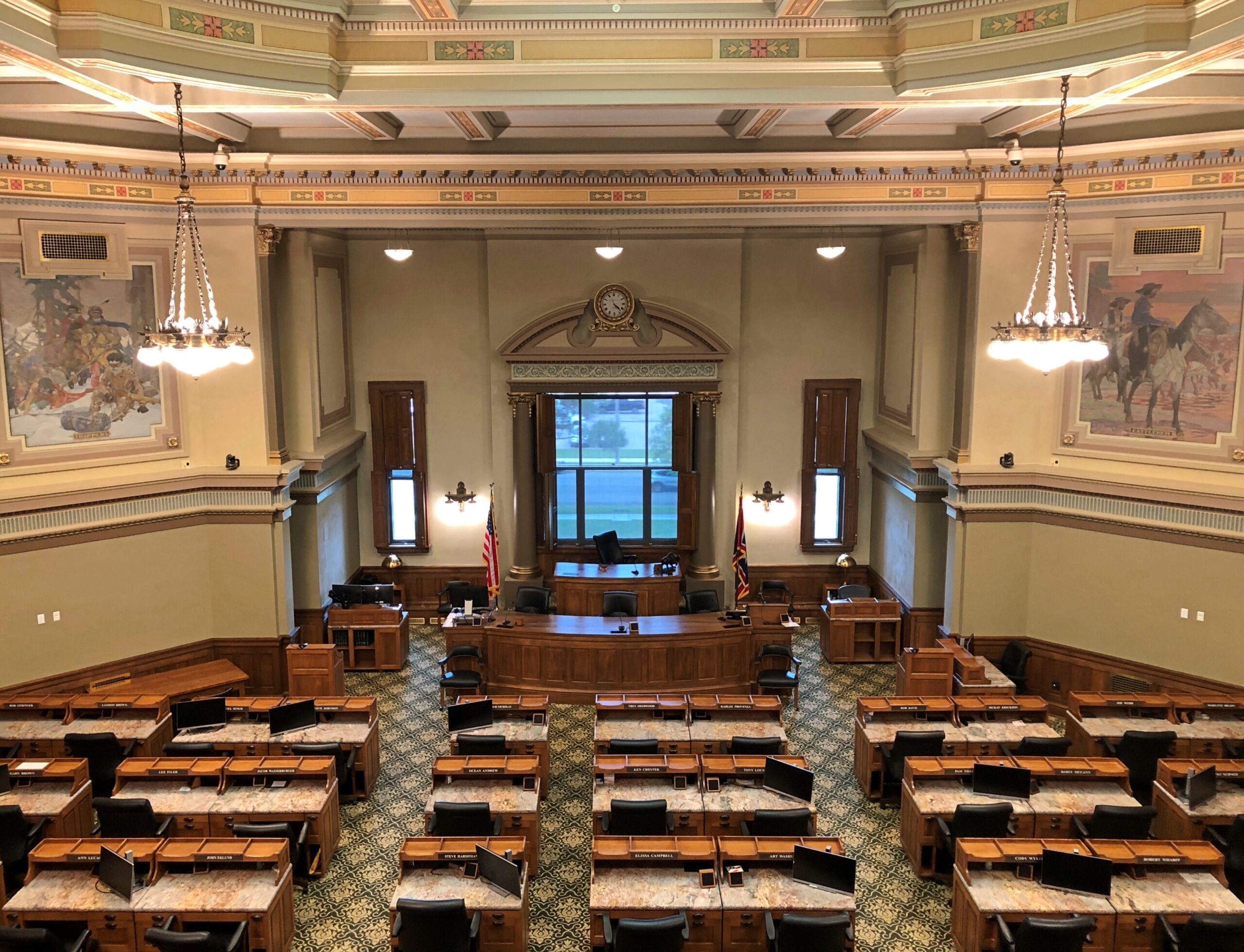
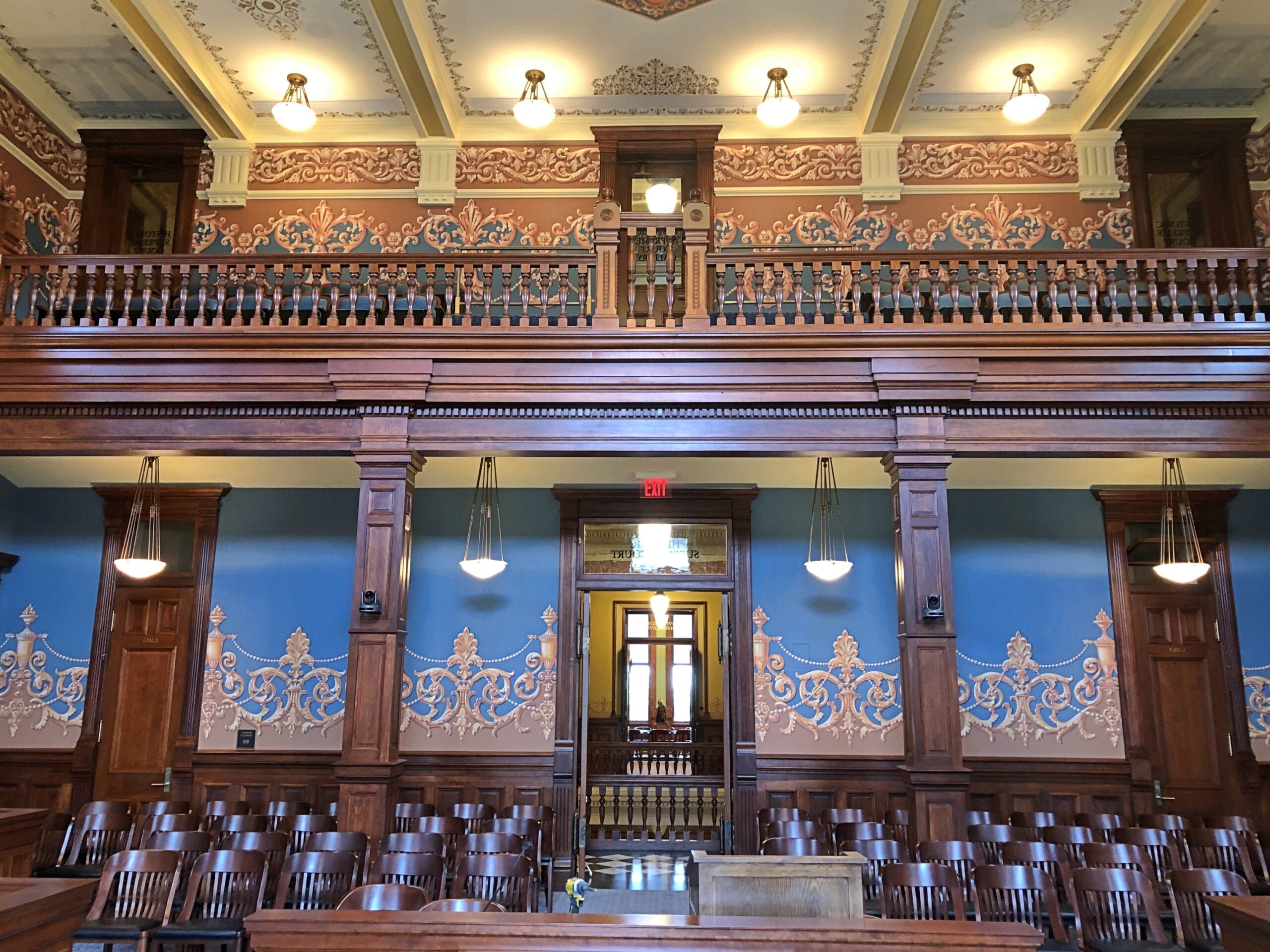
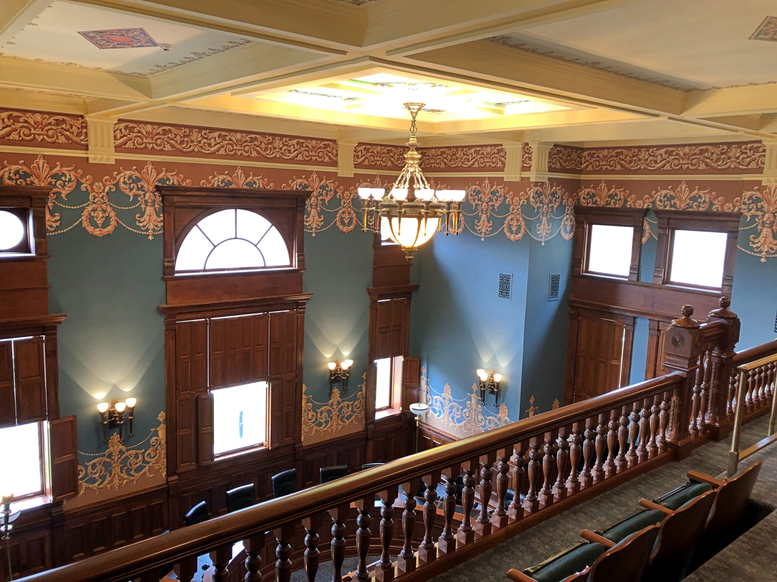
No skeletons were to be found at the Wyoming State Capitol last month, but you can hardly expect too many bone collections on display at state houses. The state of Wyoming does, however, want to remind visitors that they are in Wyoming.
The work is called “Spirit of Wyoming,” and it stands on the capitol grounds, created by artist Edward J. Fraughton (d. 2024). The more I look at it, the more there is to think about. Which I suppose is at least one indication of a good work of art. So the Spirit of Wyoming involves the immediate risk of catastrophic injury by being thrown from a horse? Probably not what the legislature had in mind.
Rather, it might be the determination to hang on, no matter how much or madly the horse bucks. Especially in territorial and early statehood days, that sort of determination applied to a lot of Wyomingites, whether they were cowboys or not.
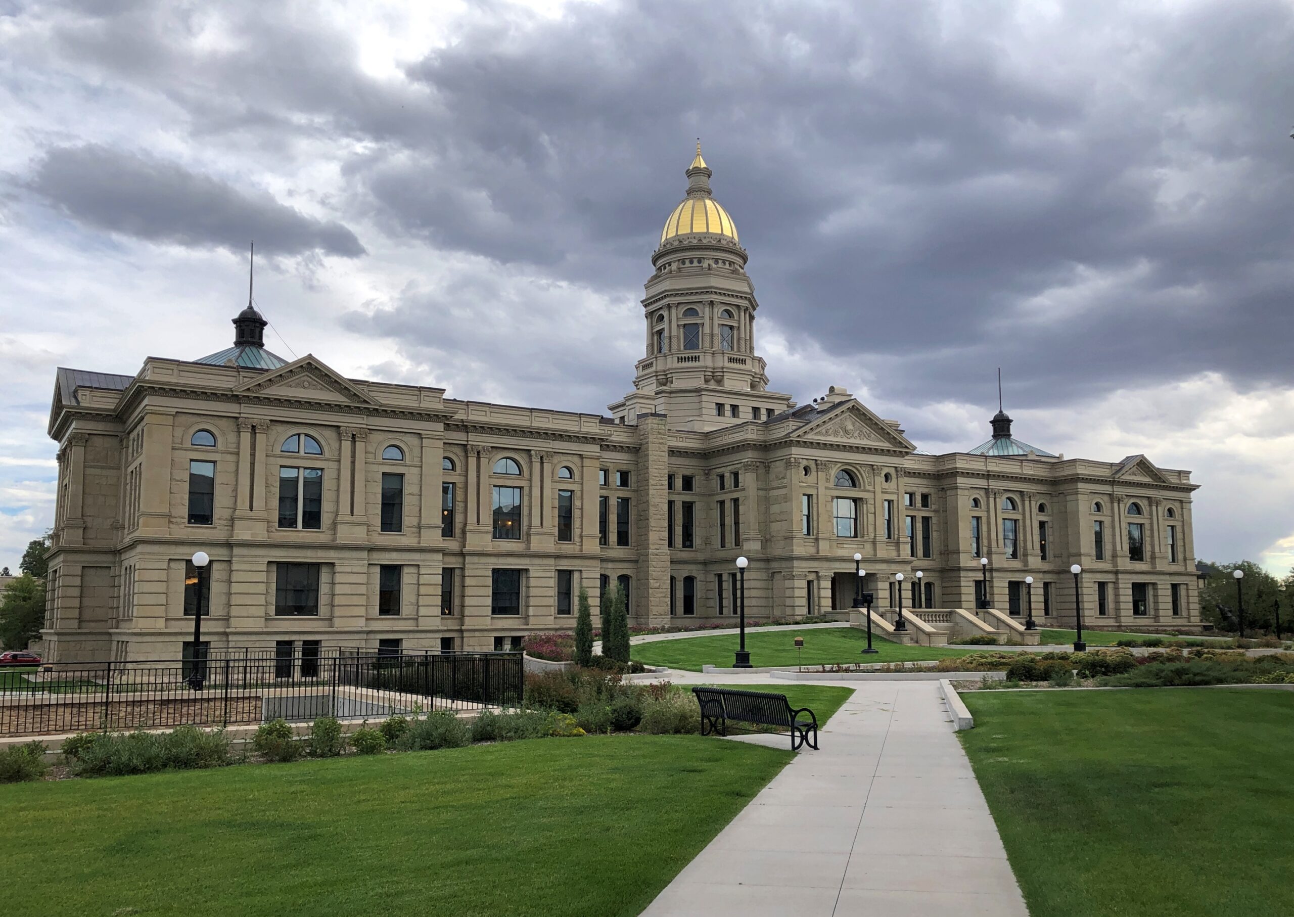
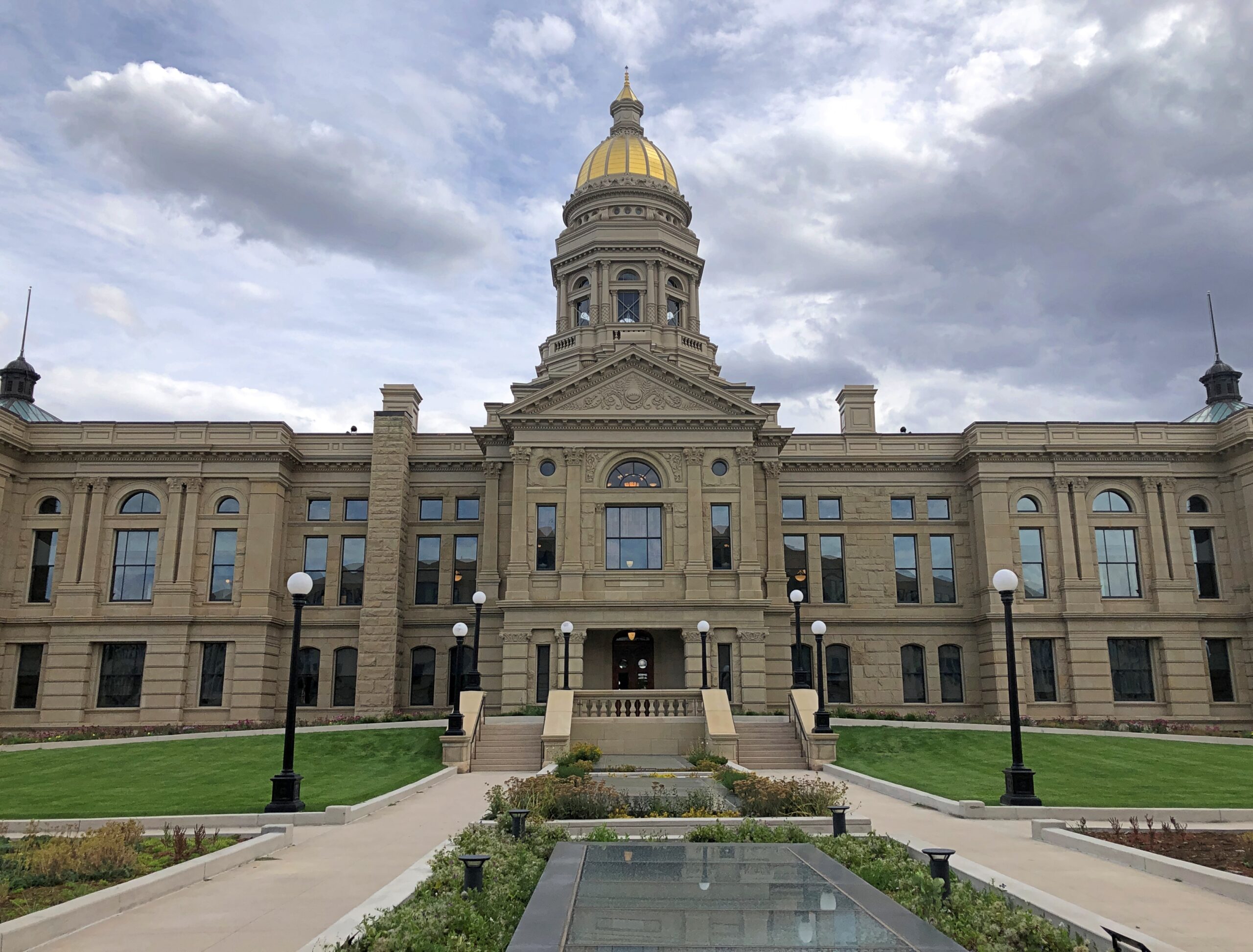
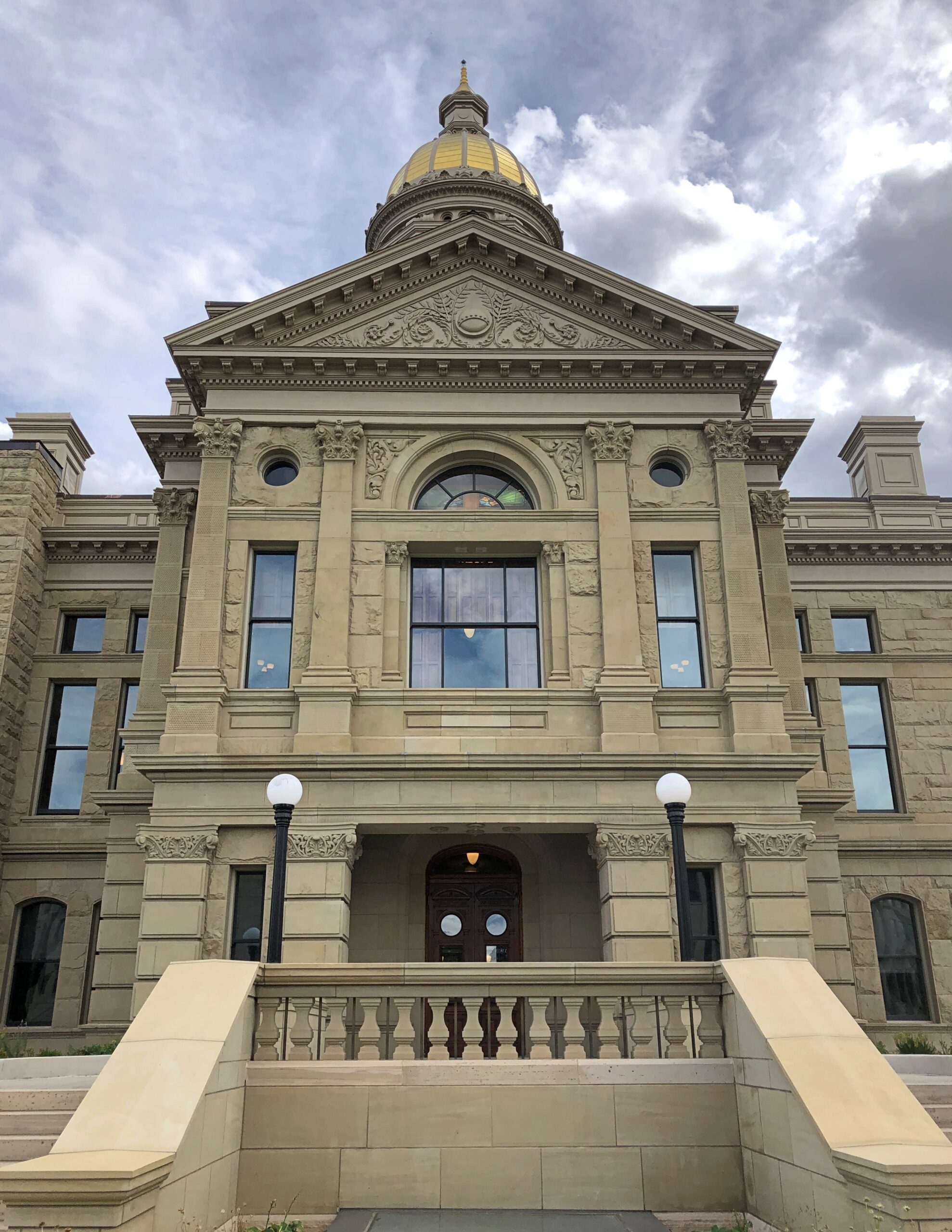
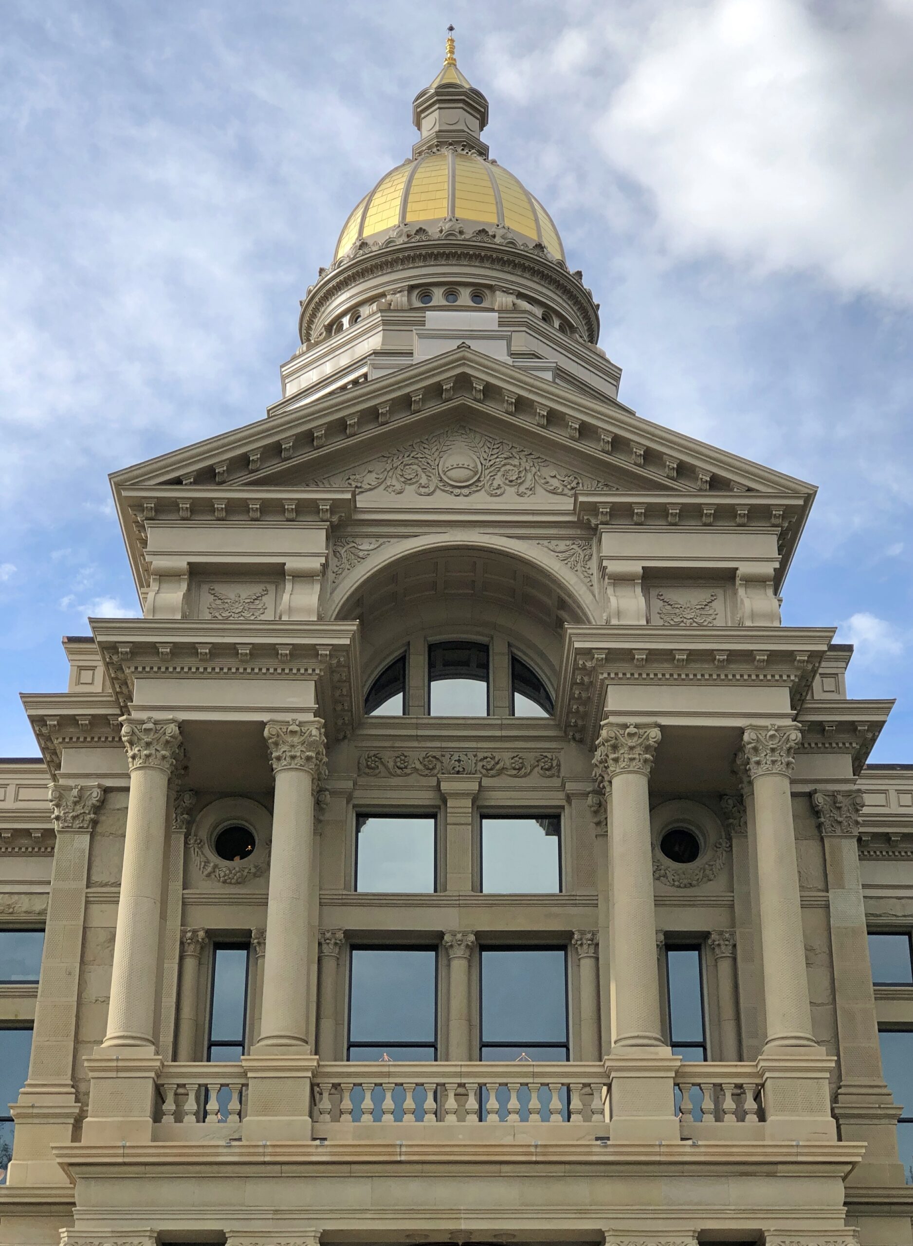
I had the opportunity to walk all the way around the capitol after arriving on the cloudy but warm afternoon of September 8.
Golf leaf on a copper dome. Gold probably because it’s gold, not because Wyoming has ever produced that much. As of 2025, the state isn’t even among the top 10 all-time U.S. state producers.
I think this was the front.
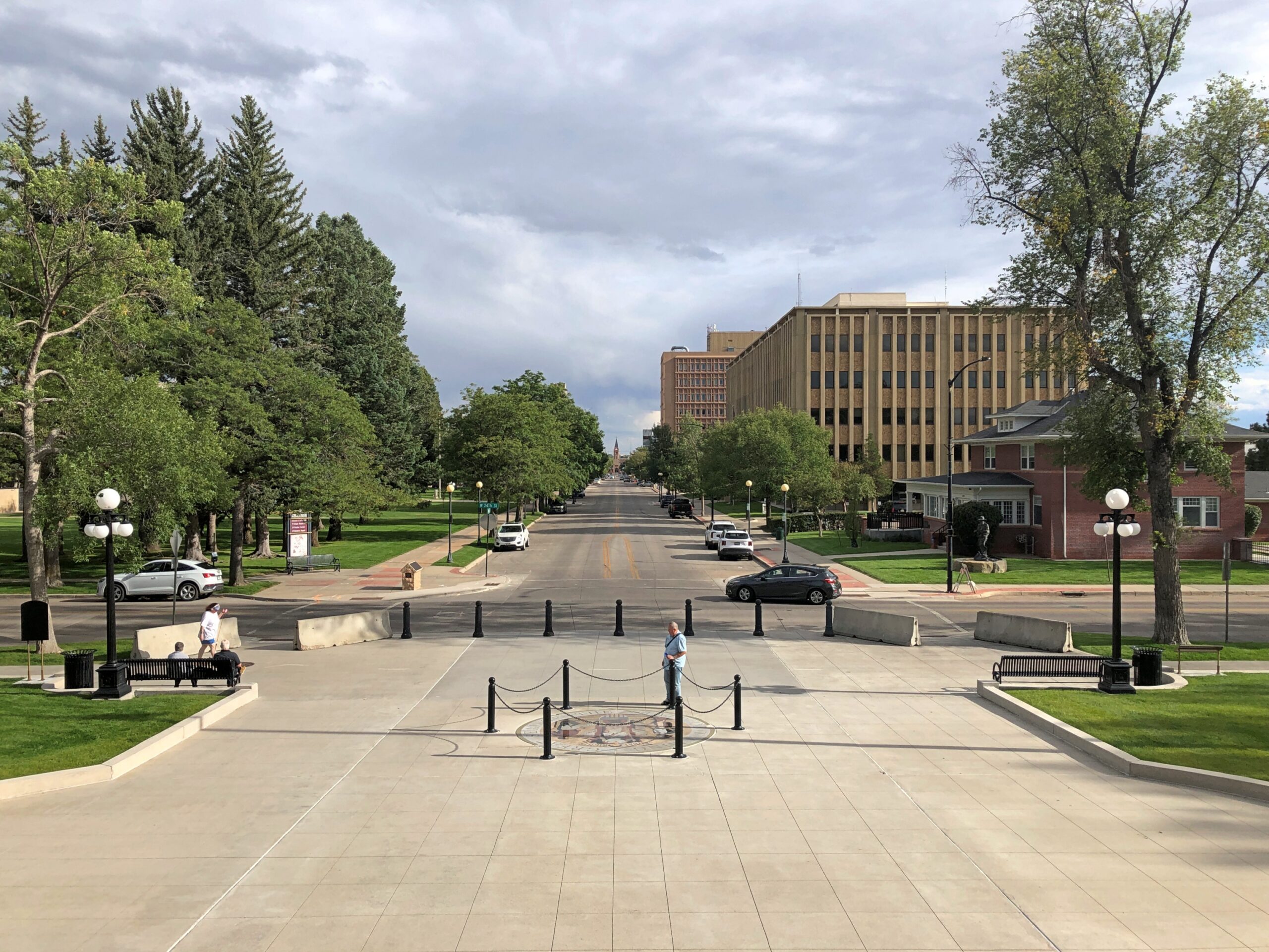
It faces a long avenue. It was a Monday. Cheyenne isn’t, just yet, cursed with heavy traffic.
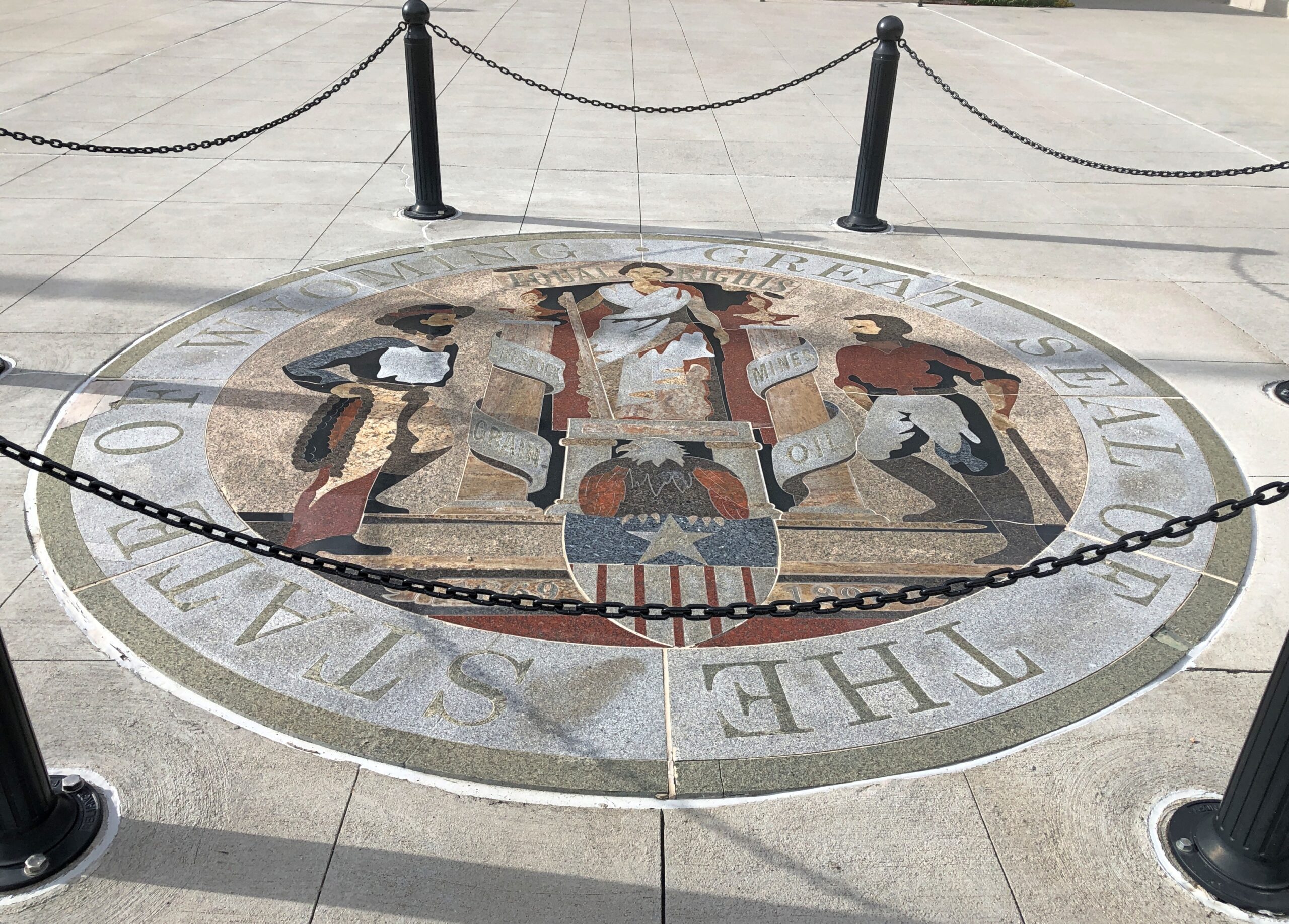
Also, the Wyoming state seal was to be found on that side of the building, in the sidewalk. Like in Virginia, except that you can walk on that one, like the slain tyrant it depicts. No treading on Wyoming.
Adopted in 1893, not long after statehood, and revised in 1921, the seal lists four sources of wealth and livelihoods, unusually (I think) for a state seal. They go with the cowboy and miner figures: livestock, grain, mines and oil. In our time, farming and mineral extraction, at least in terms of employment, are declining industries in Wyoming. Maybe the seal will be revised someday to include data centers, as they sprout in the Equality State.
On the other hand, Wyoming is still a major energy producer among the several states, especially when it comes to coal: 41.1 percent of the total nationwide (EIA stats), though national coal output is a much smaller pie – a dirty pie, to be sure – than it used to be. Also worth mentioning: a quarter of net electricity generation in the state is by renewables, roughly the same percentage as nationally. There is no nuclear power generation in Wyoming. When those data centers eventually get small modular reactors, that would change.
Another distinction of the Wyoming capitol is that work started on it before statehood, with ground broken in 1886. David Gibbs – later mayor of Oklahoma City, of all things – and the prolific William DuBois (a Chicago trained architect) did the design, one of restrained elegance.
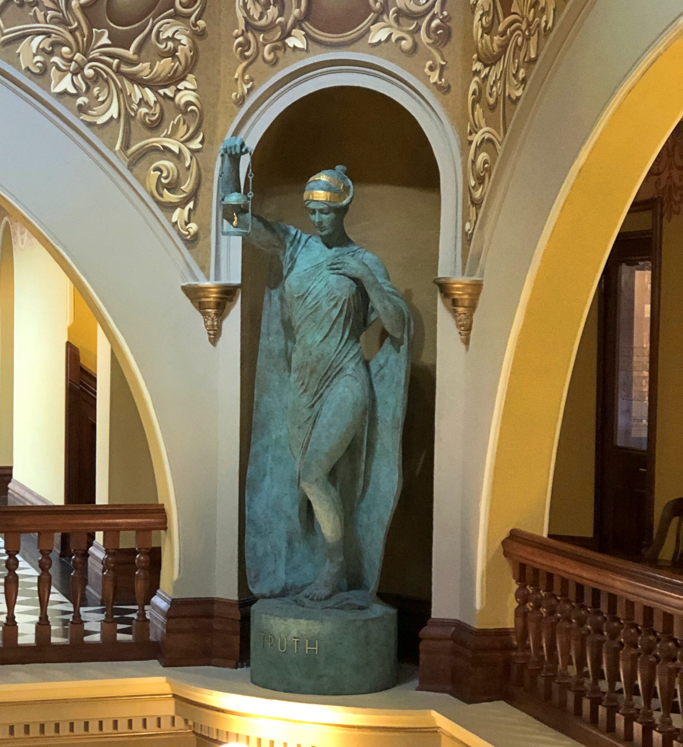
This is one of the four statues at the capitol known as the Four Sisters: Truth. The others are Justice, Courage and Hope.
Though they look vintage, their niches remained empty for 131 years “for reasons that remain unclear,” according to a sign in the capitol. In more recent times, the state tapped the mononymoussculptor Delissalde to fill the niches, and the works were unveiled only in 2019.
They’re way up there.
One more thing to note: a display in the capitol lauds the state – actually the territory – for its enfranchisement of women in 1869, the first place anywhere to do so. Why Wyoming? You could chalk it up to the toughness of frontier women, but certainly women in all the other 19th-century territories were plenty tough. The broader movement to expand the franchise was already underway, though early in the game – and from the sound of things in this article at least, the territory’s move was something of a retroactively happy result “for a large, strange mix of reasons.”
Just how many Stonehenges are there in North America? Or rather, Stonehenge-like structures, standing out in the open. For a question like that, consult the expertise of Roadside America. The answer turns out to be that there’s no definitive count – they keep “springing up,” as the web site says (and the article is worth reading in its entirety). A design borrowed from ancient Britain morphs into something distinctly American, again and again.
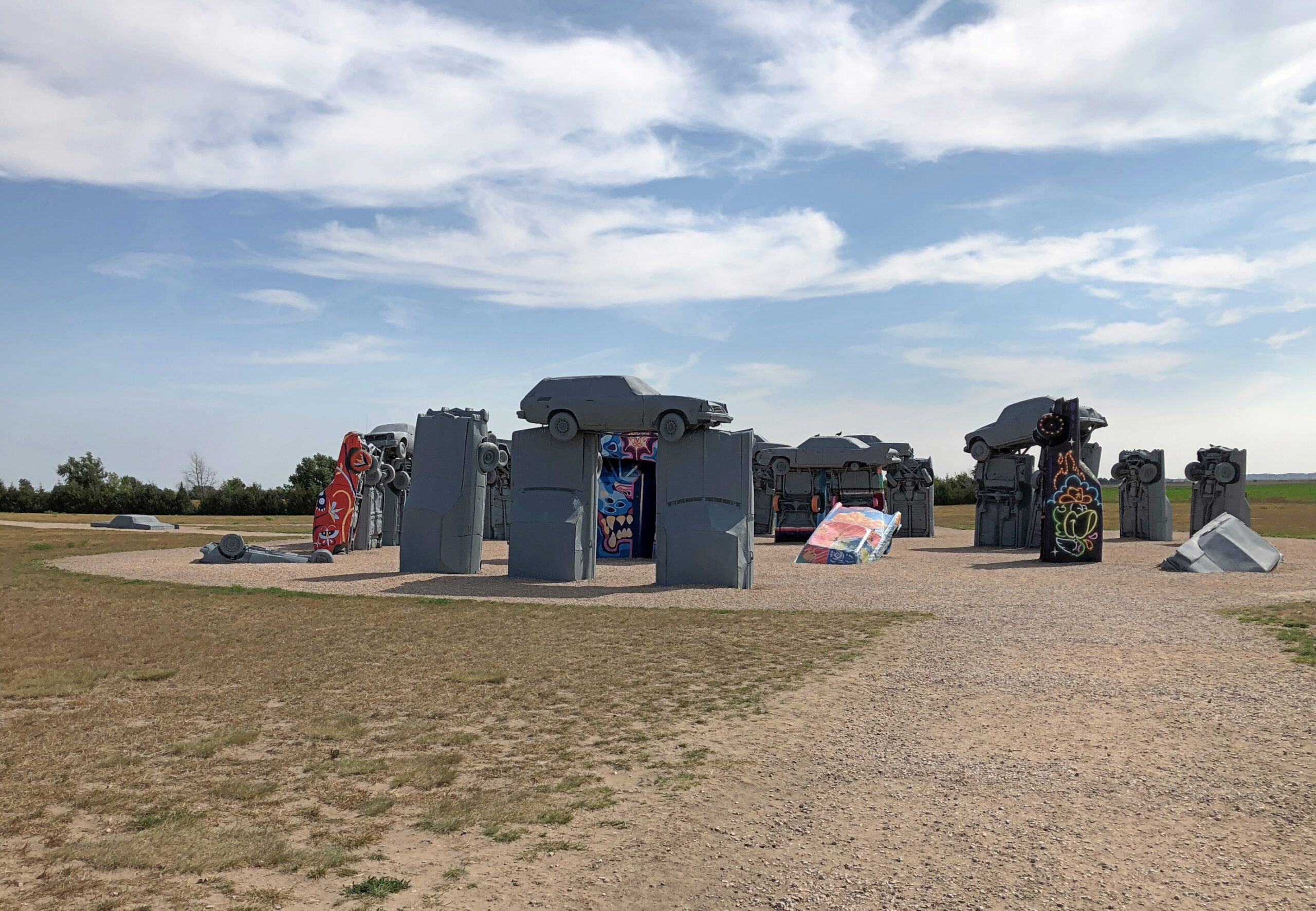
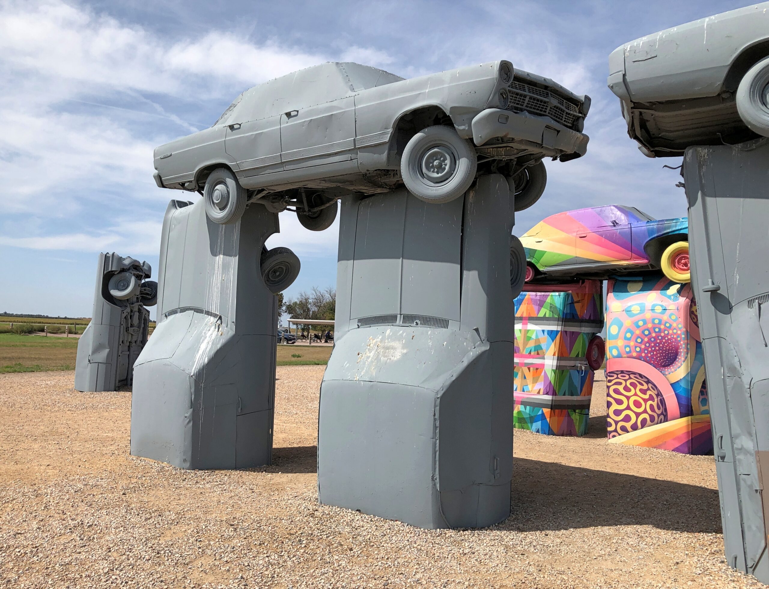
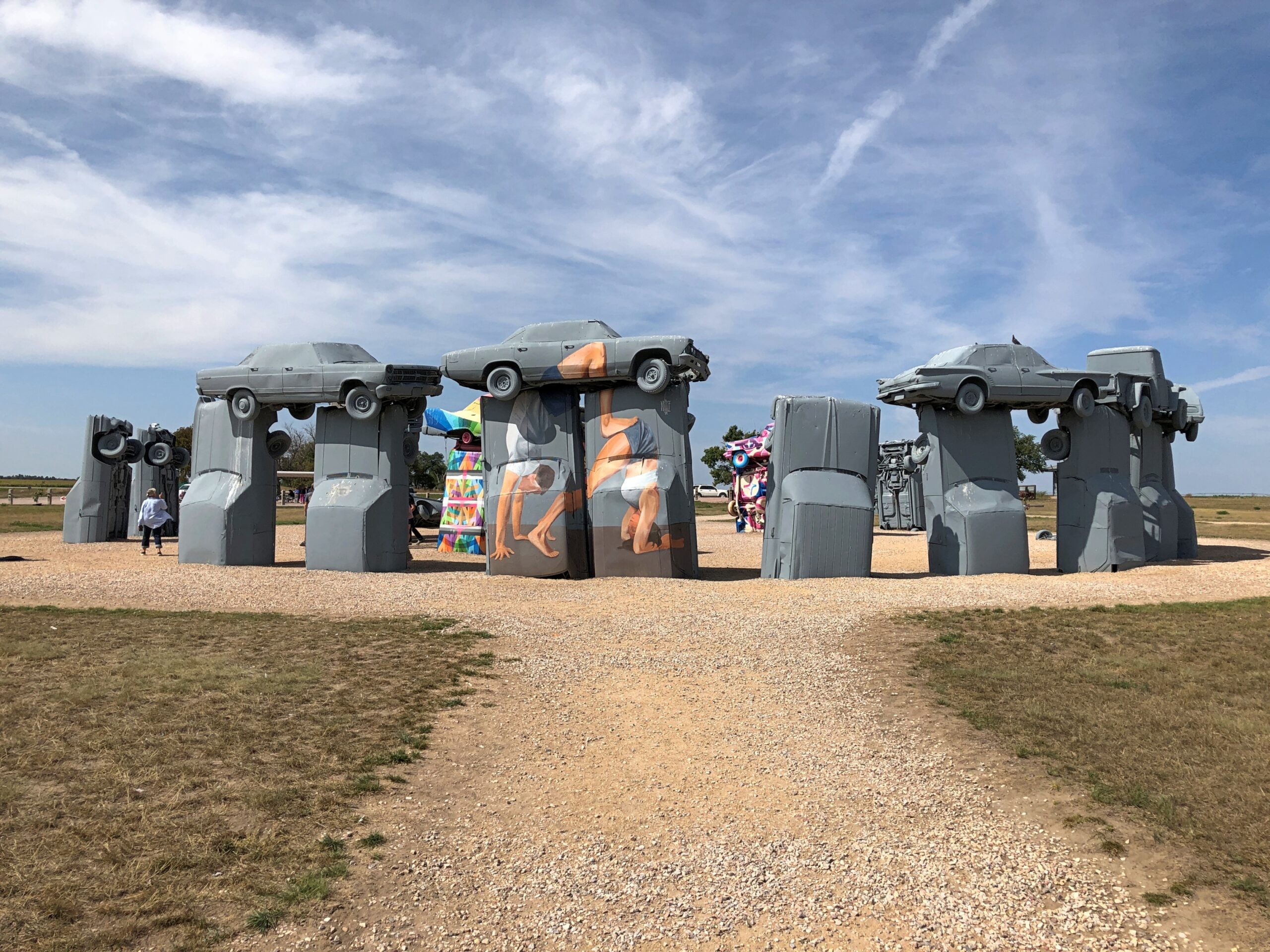
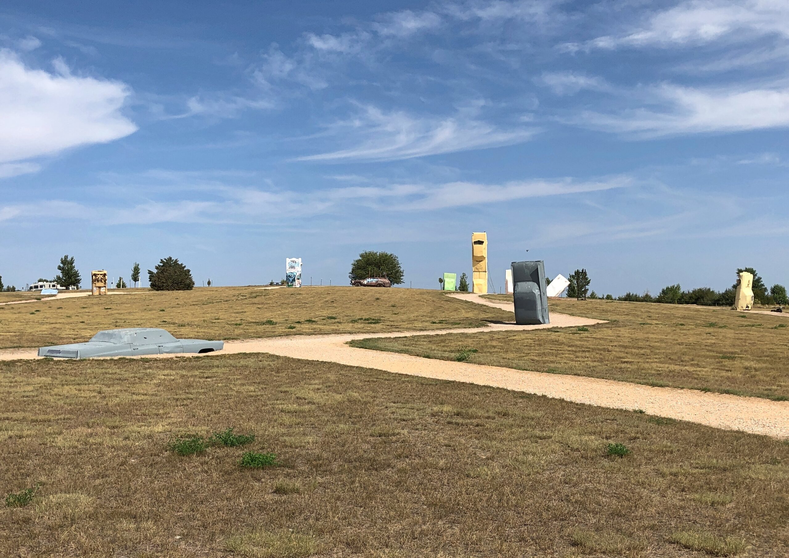
None is better known than Carhenge in western Nebraska, RA asserts, and I can go along with that. Its fame is international.
Though not a Stonehenge, I visited the Cadillac Ranch once upon a time, so it stands to reason that someday I’d have a strong hankering to see Carhenge. I arrived early in the afternoon of September 7, under partly cloudy and very warm skies.
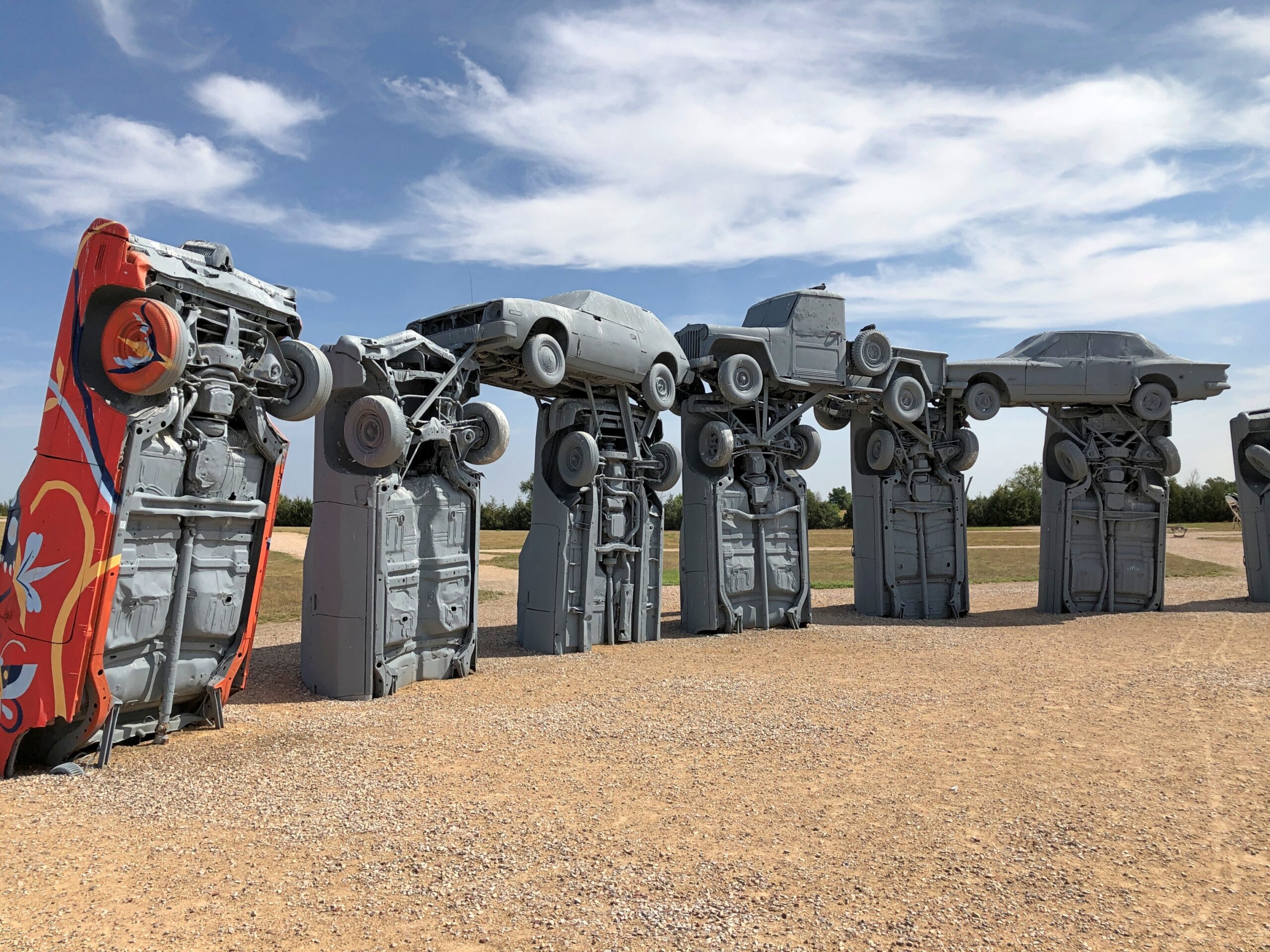
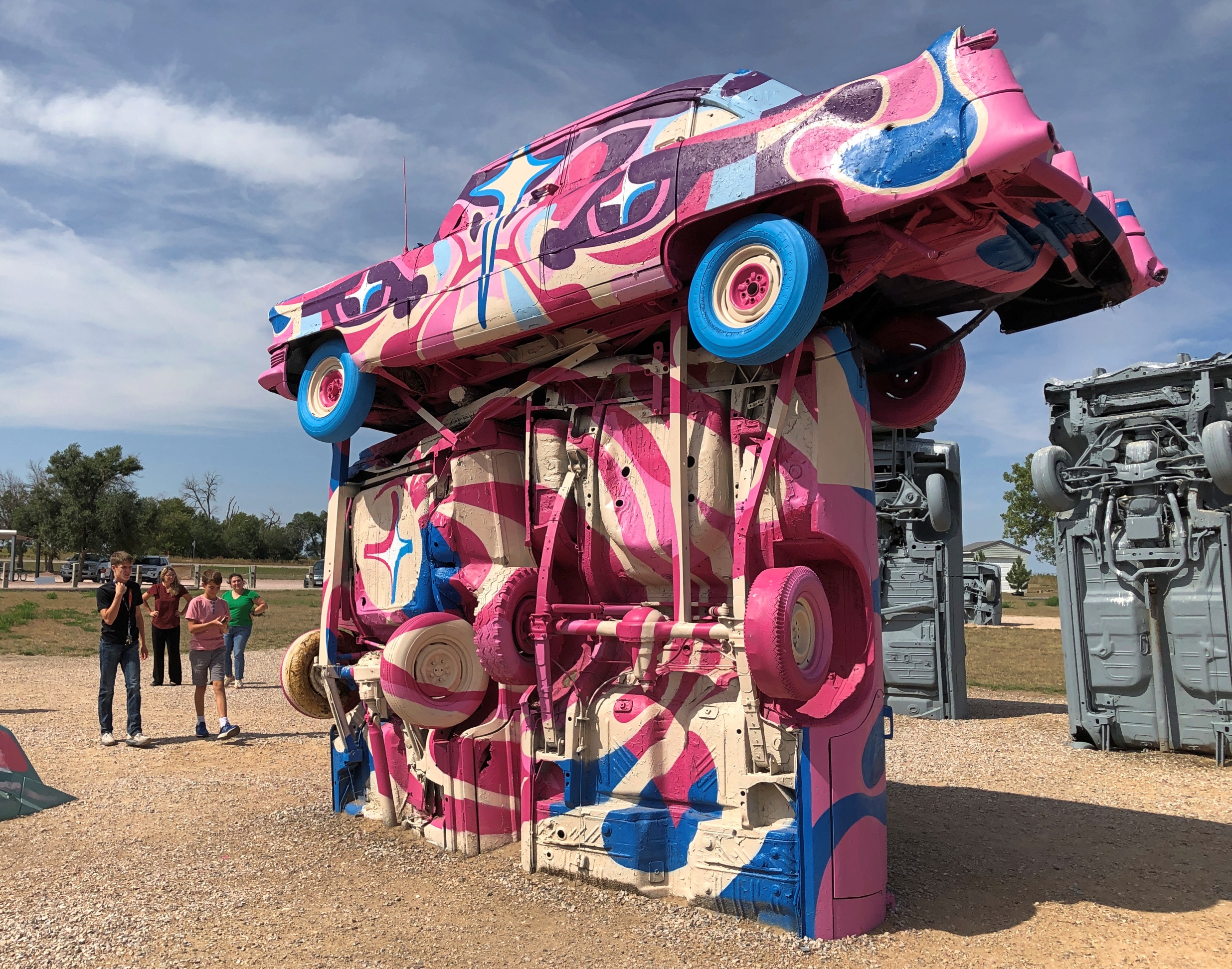
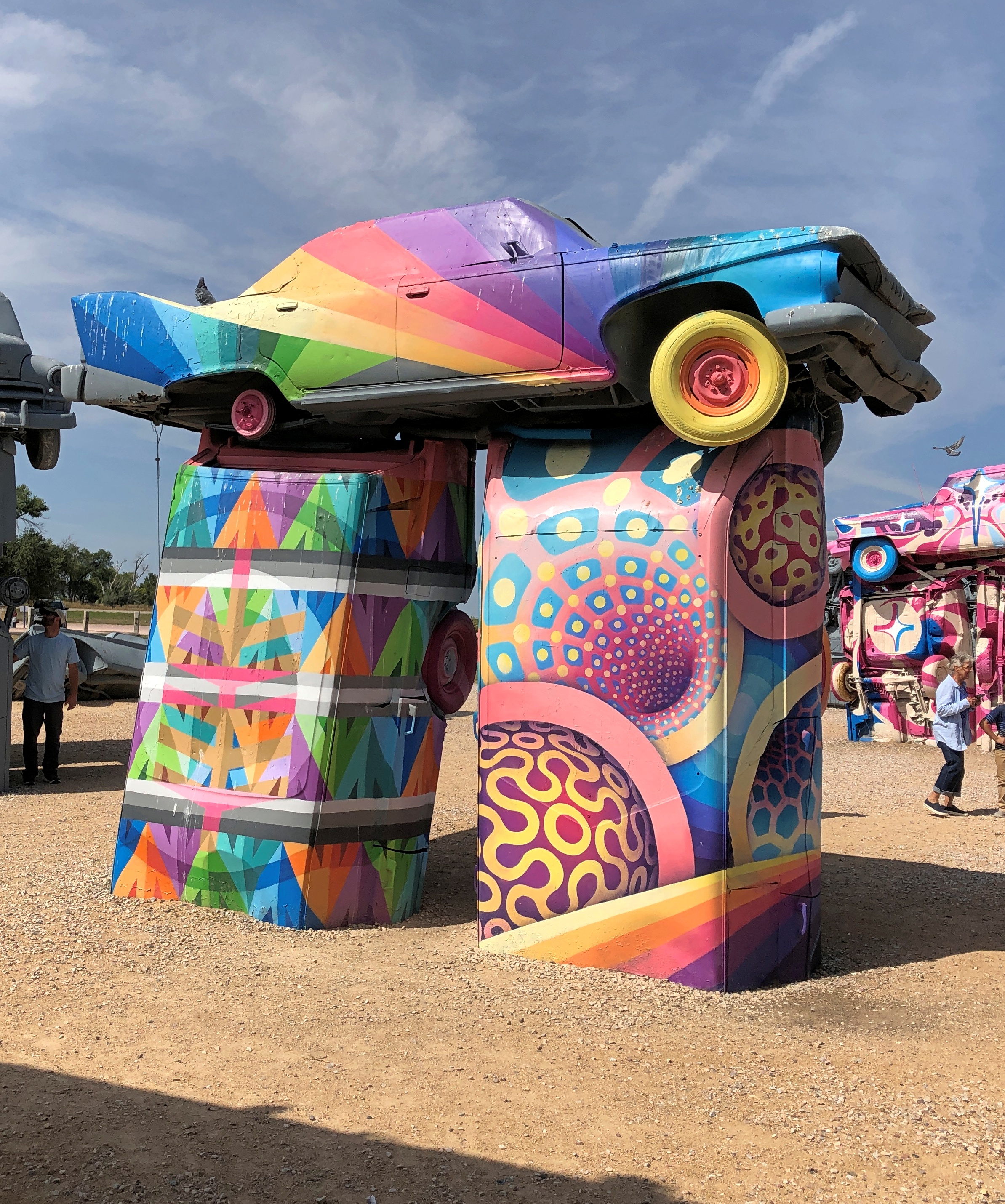
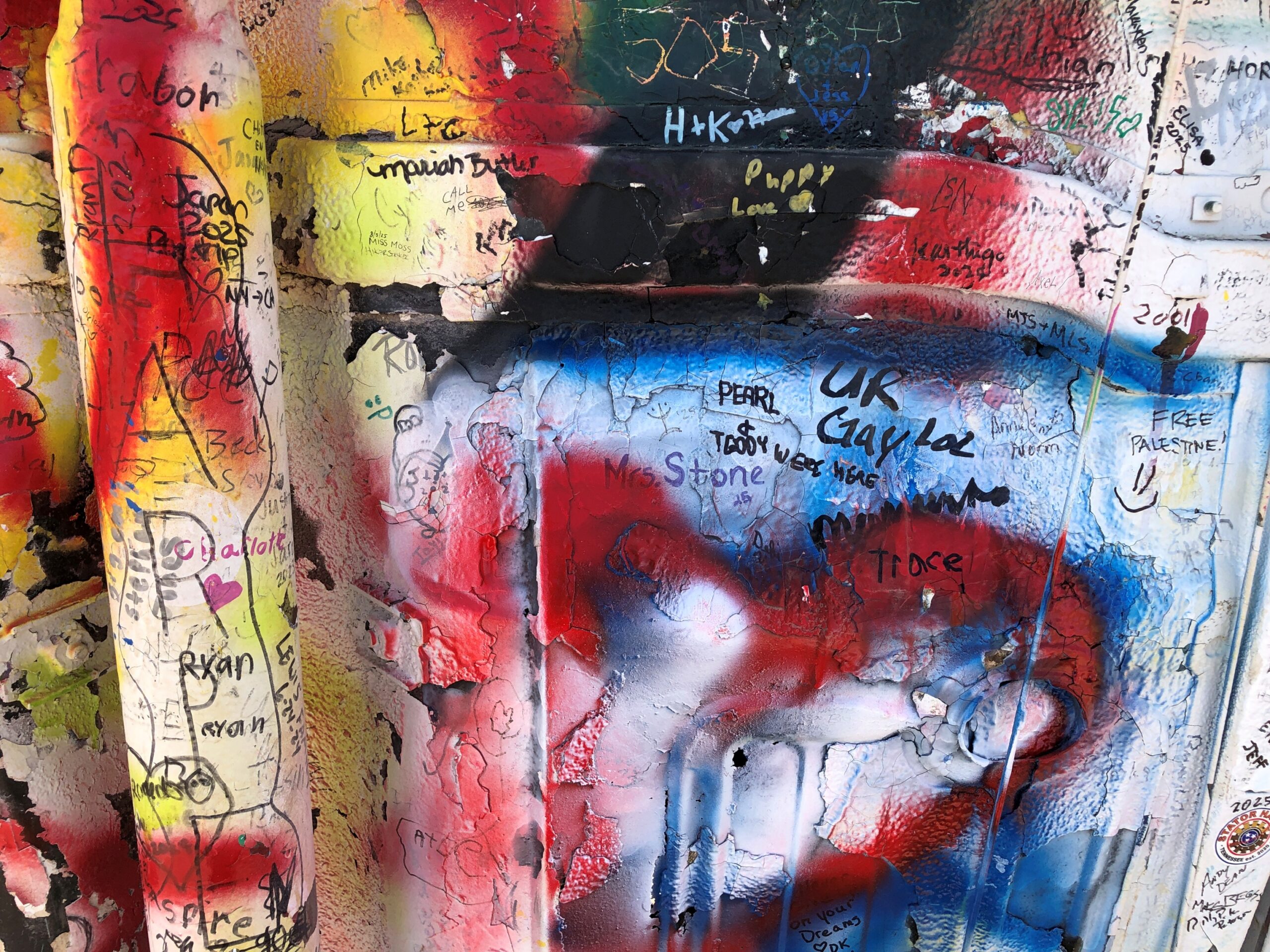
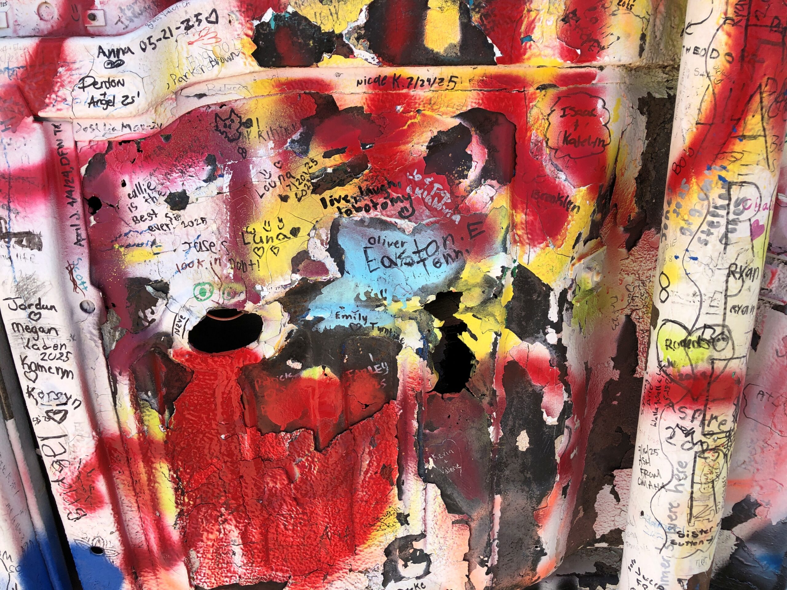
All the cars were painted gray at one time, but that has clearly given way to some being used as metal canvases.
The colorful cars are curated works, from the looks of them, to use that word in a literal and correct way.
RA: “[Carhenge] was built [in 1987] in a farm field north of Alliance, Nebraska, under the supervision of farmer (and engineer) Jim Reinders [d. 2021], who meant it as a memorial to his dad.
“What makes Carhenge special is that it’s made of cars, 38 of them, rescued from nearby farms and dumps. Reinders noticed that the monolithic dimensions of cars from the 1950s and ’60s nearly equaled the stones at Stonehenge, and he built his monument with a 96-foot diameter to match the proportions of the original.”
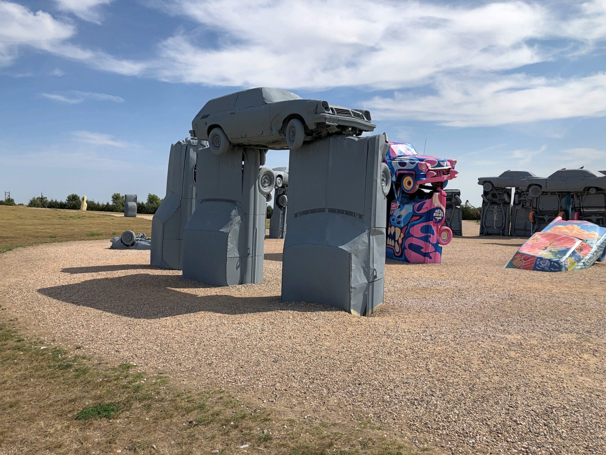
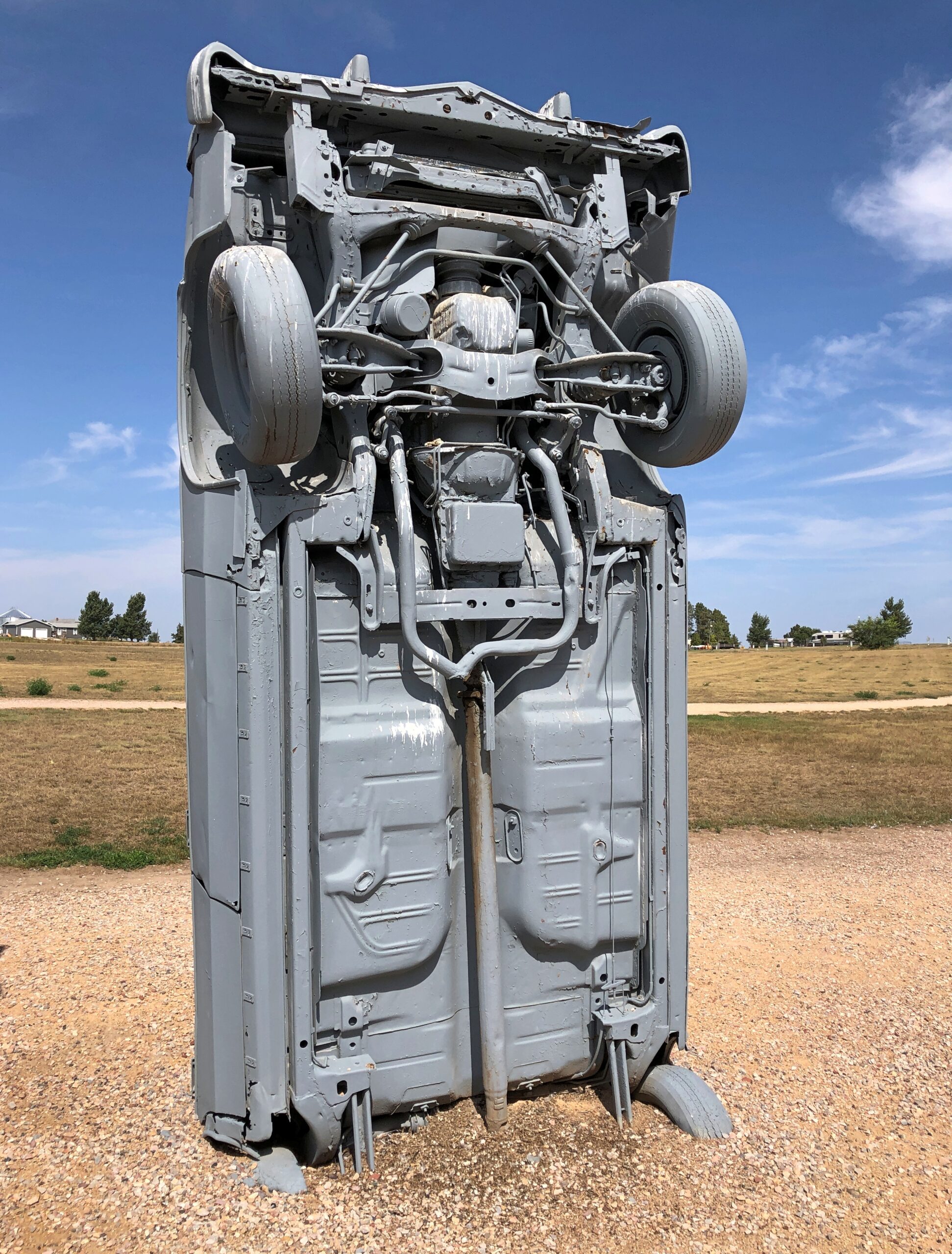
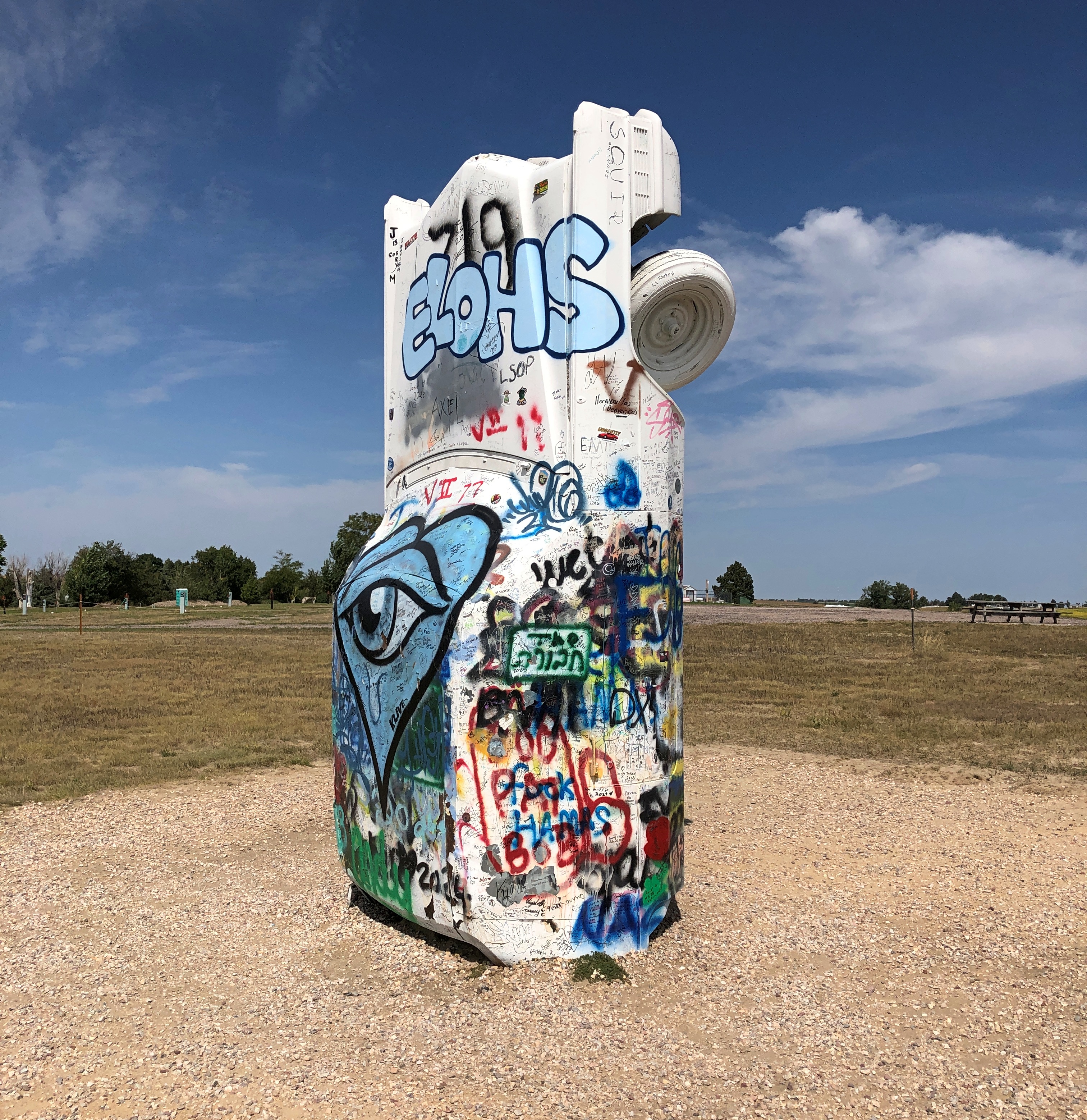
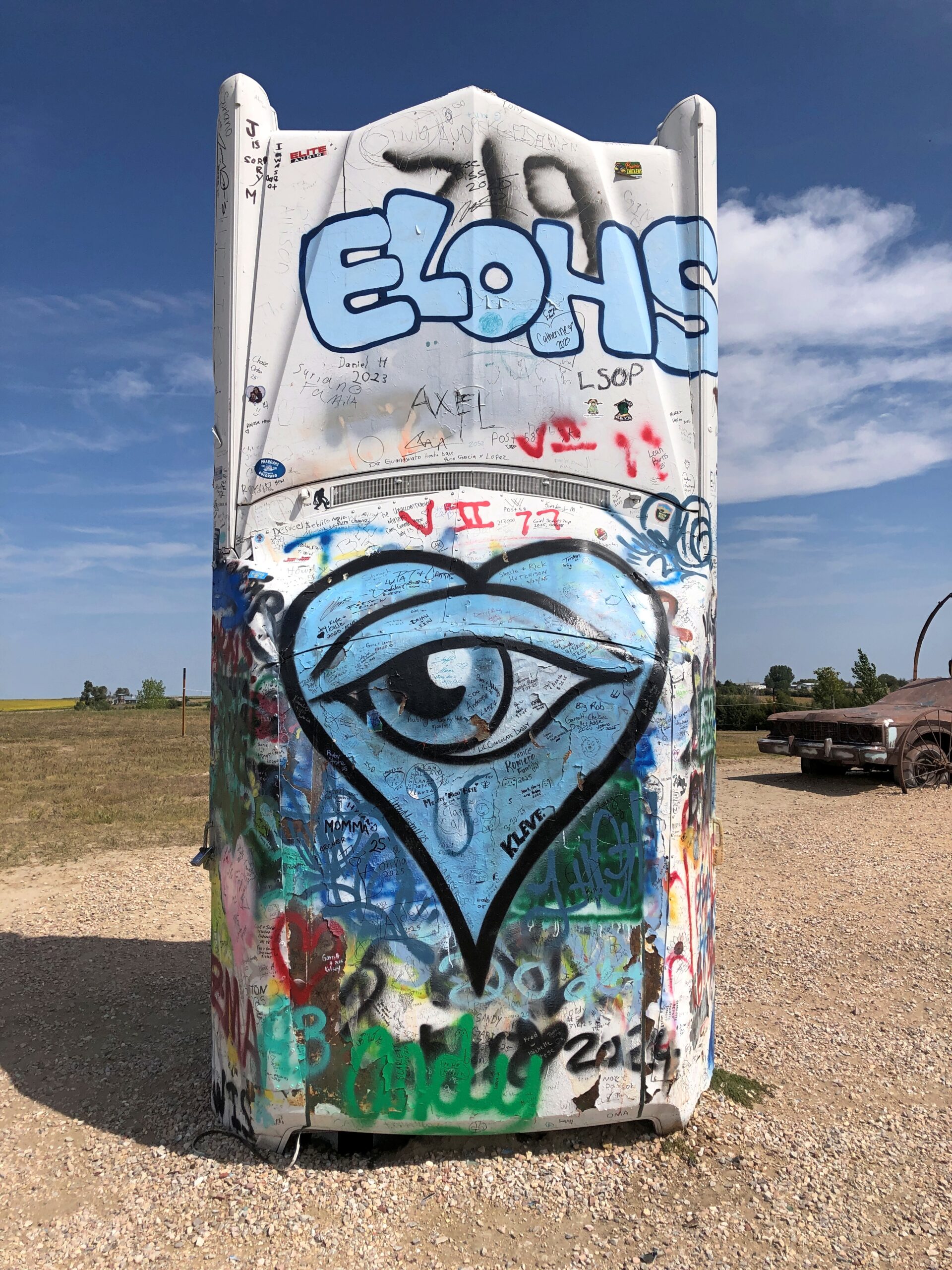
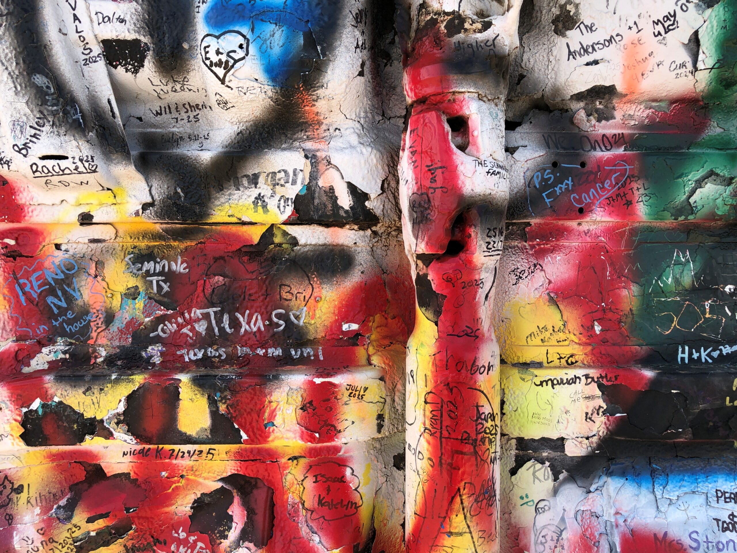
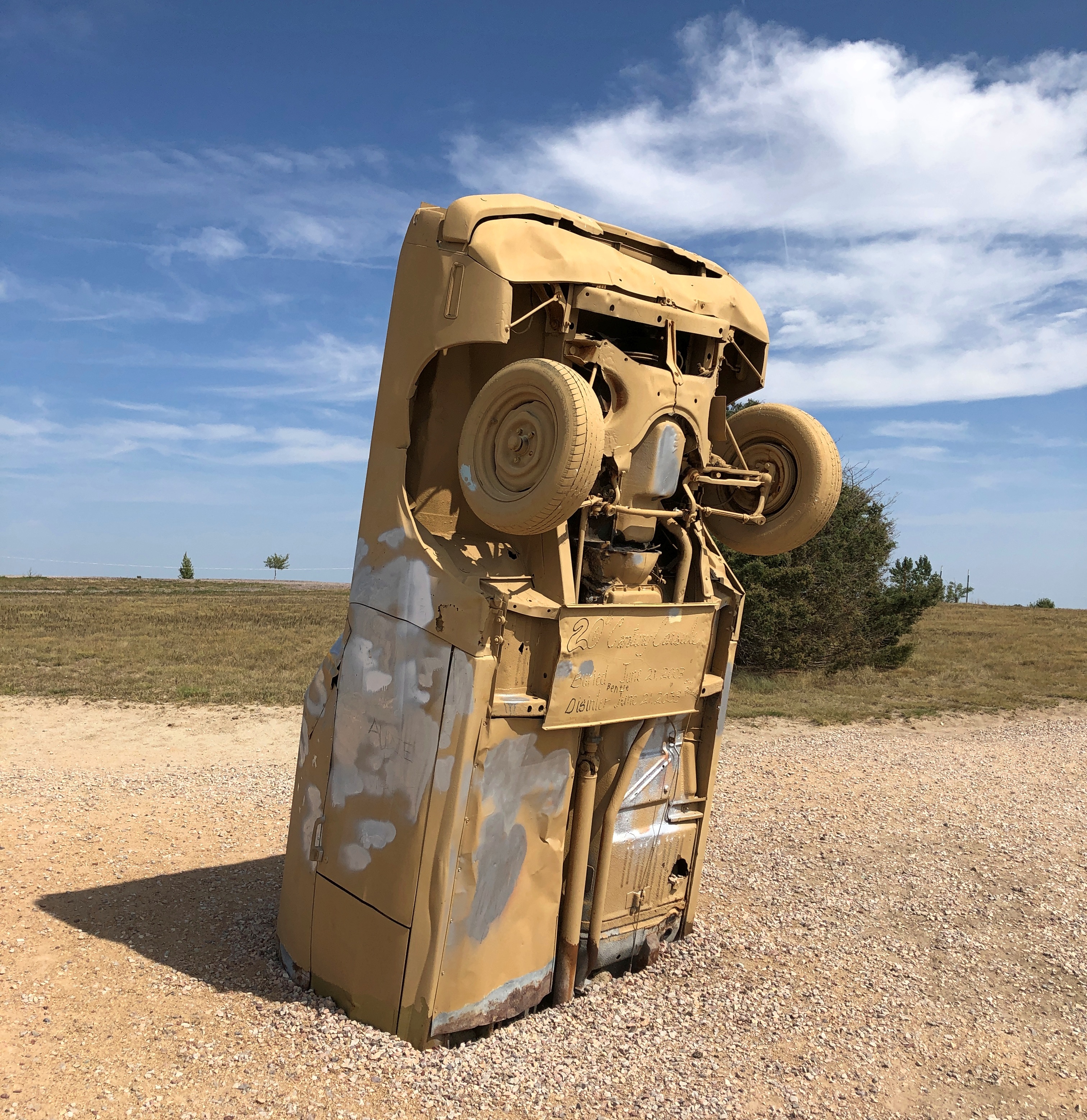
One outlying car seems to be reserved for spray painting for anyone who wants to, in the style of all the cars at the Cadillac Ranch.
The undercarriage is particularly vivid.
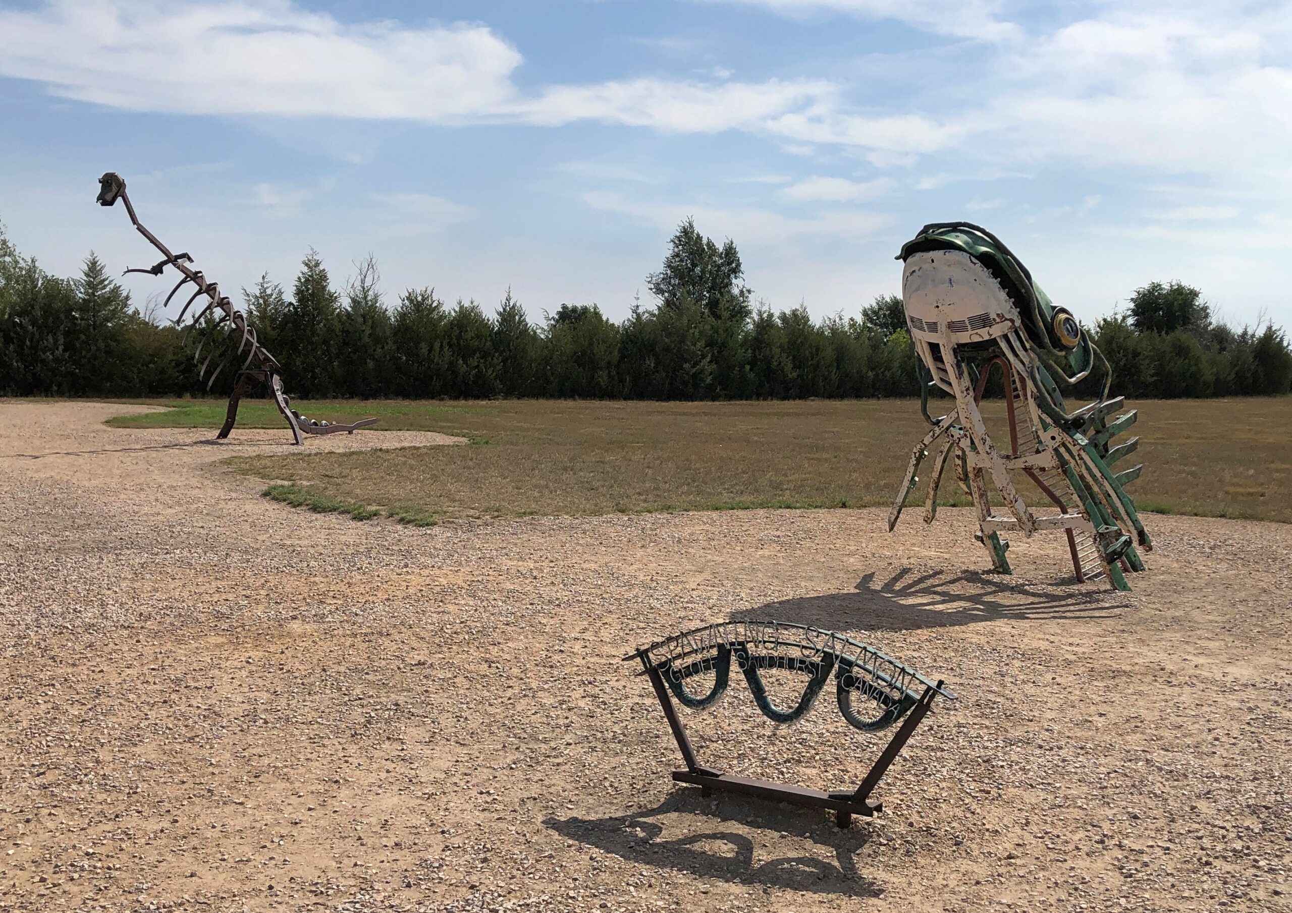
The graffiti car is apart from the Stonehenge-like array, along with other sculptures that have been added to the grounds in more recent years.
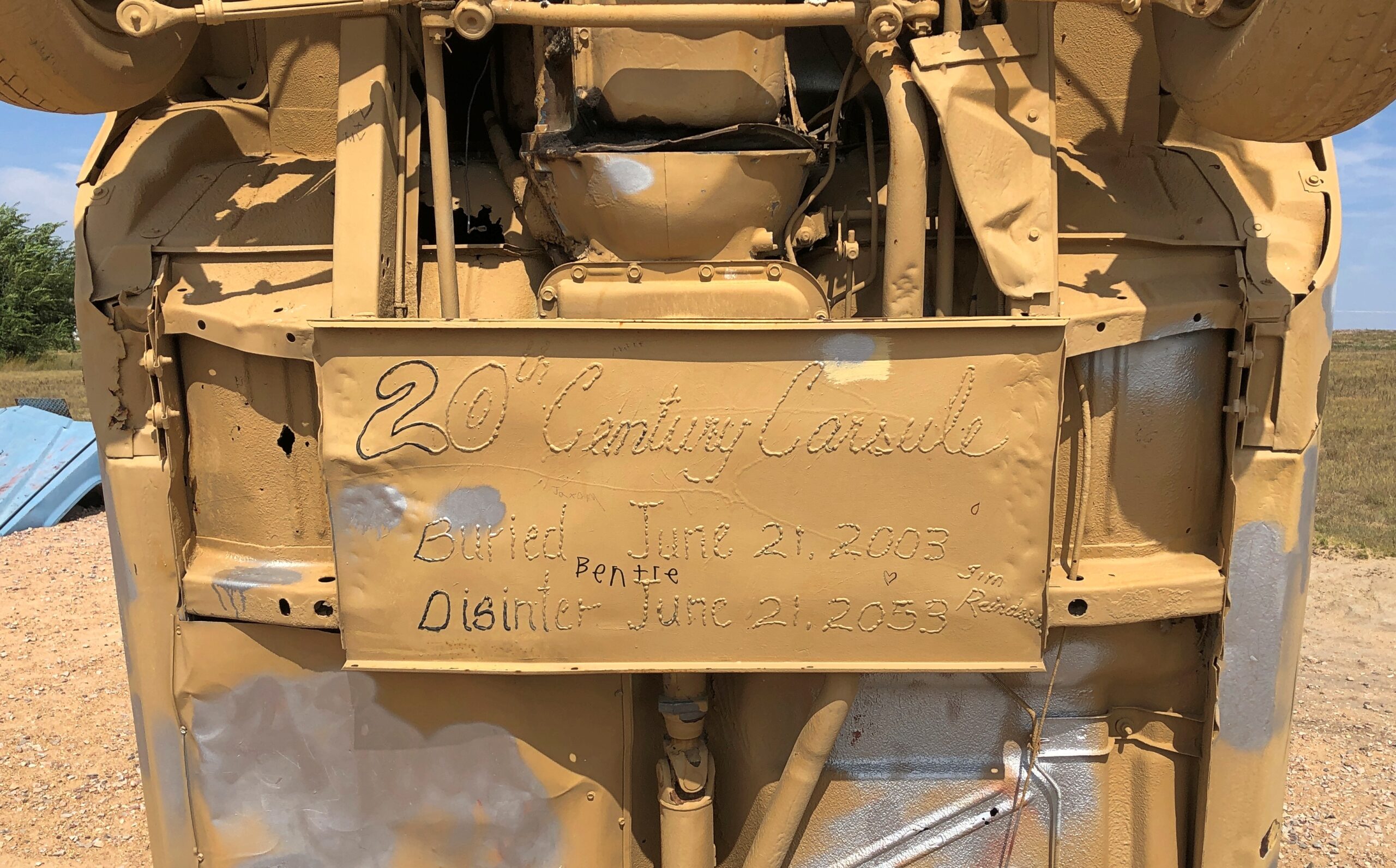
Not just an upright old car, but apparently a time capsule, closed in 2003, with a slated opening in 2053.
Word is that Carhenge wasn’t especially popular locally in its early years, including grunts of “eyesore” and threats to have it condemned and the like. But after a few decades, the townspeople came around, and the town of Alliance acquired the site in 2013, so now it counts as a public park. You go through an open gate, no admission is charged, and you’re free to wander around. Next to the parking lot, a gift shop stands, but visiting is optional. I supported the preservation of Carhenge in the form of a magnet- and postcard-centered purchase at the shop.
It may be September, but it’s still warm. Time to take advantage of the second shoulder season of the year in my own slightly demented way. Back to posting around September 28.
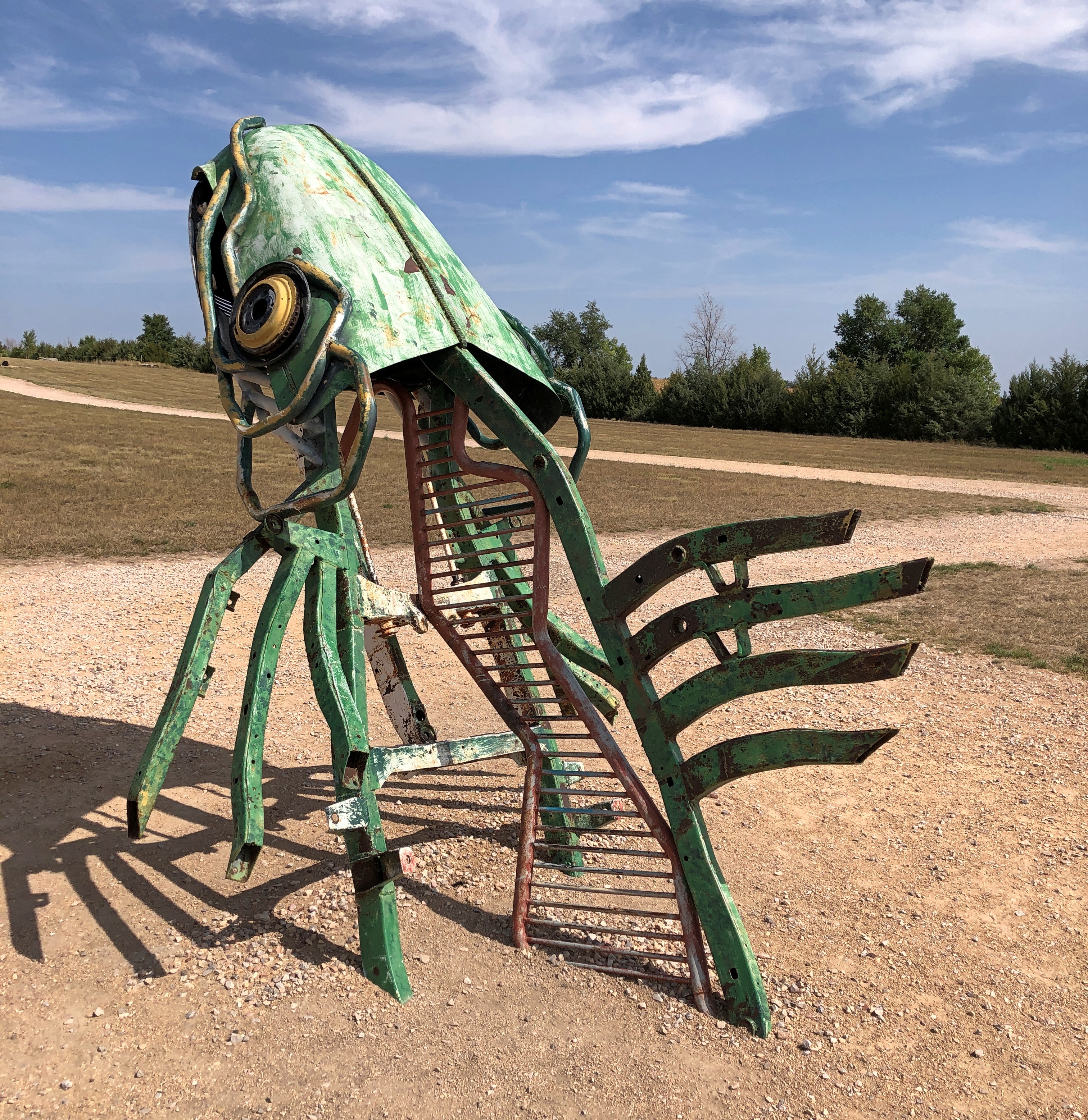
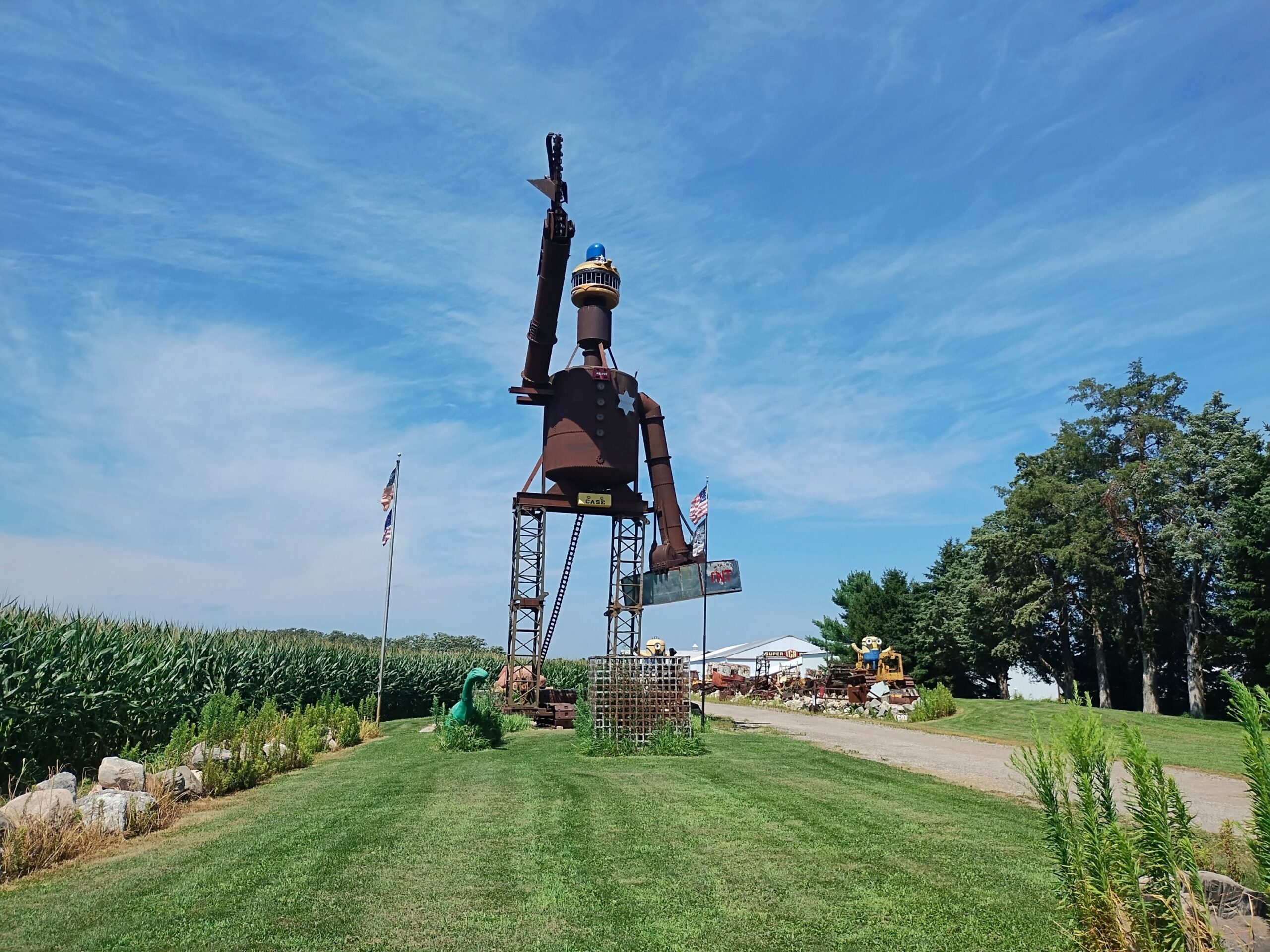
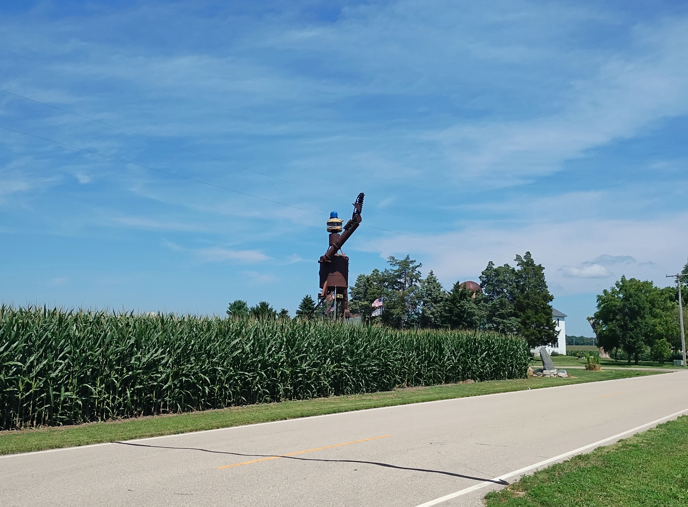
Last month I’d gotten a tip from one of the usual sources detailing roadside oddities, so there I was, tooling down a road in rural Walworth County, Wisconsin. The sun was hot and the corn was high. My tip was solid. I pulled off the road and walked a little ways for a good look at the oddity. It is larger than most.
It’s called “Tin Man,” according to published sources, rising 45 feet and weighing in at 20 tons. The creators were two local men entertaining themselves. Looks are free from the road. If that’s not an authentic roadside attraction, I don’t know what is. I was careful to stay off the property, however.
“That statue stands tall in Robert Stewart’s home near Lake Geneva. In fact, it can be seen from about a mile away. It took him and his friend Shane Pope two years to make it,” WTMJ-TV reported in early 2021.
“The statue was built primarily out of scrap metal that Robert was able to collect, which includes the legs, the arms, and body of the statue. The torso is an old water tank that was used in the Pabst Brewery. However, the most iconic piece of the statue might be its Officer Big Mac head.” (I can add that its legs are hay conveyors.)
I’d taken the head for Mayor McCheese – that would make sense in Wisconsin – but actually it’s the lesser-known Officer Big Mac, whom I suppose worked for McCheese until a falling out in the 1980s. Or actually did he answer to Ronald McDonald? Though Ronald had no official title, it was clear he was calling the shots in McDonaldland. Anyway, there the officer is, atop a scrap-metal creation.
Tin Man had been visible from a distance. That raised arm looks a little — odd. Let’s just say he’s waving at the occasional passersby on the road.
When I say rural, I mean rural.
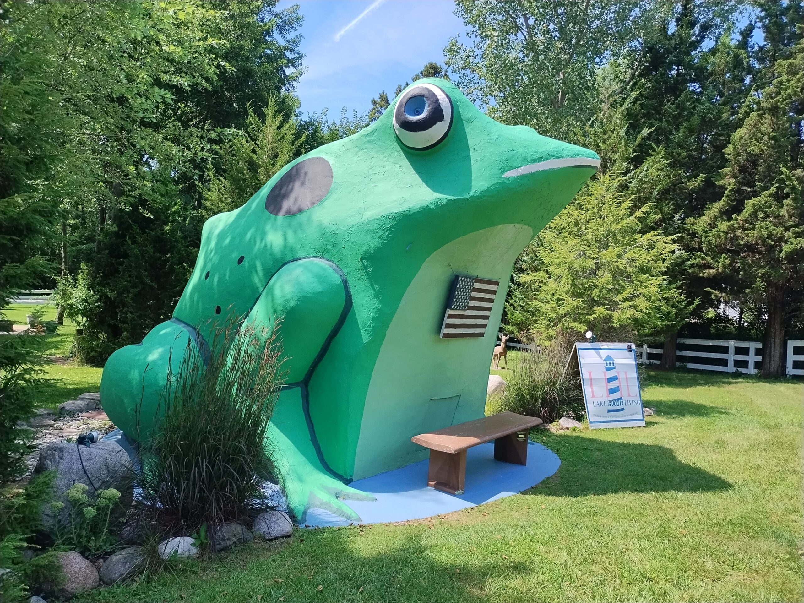
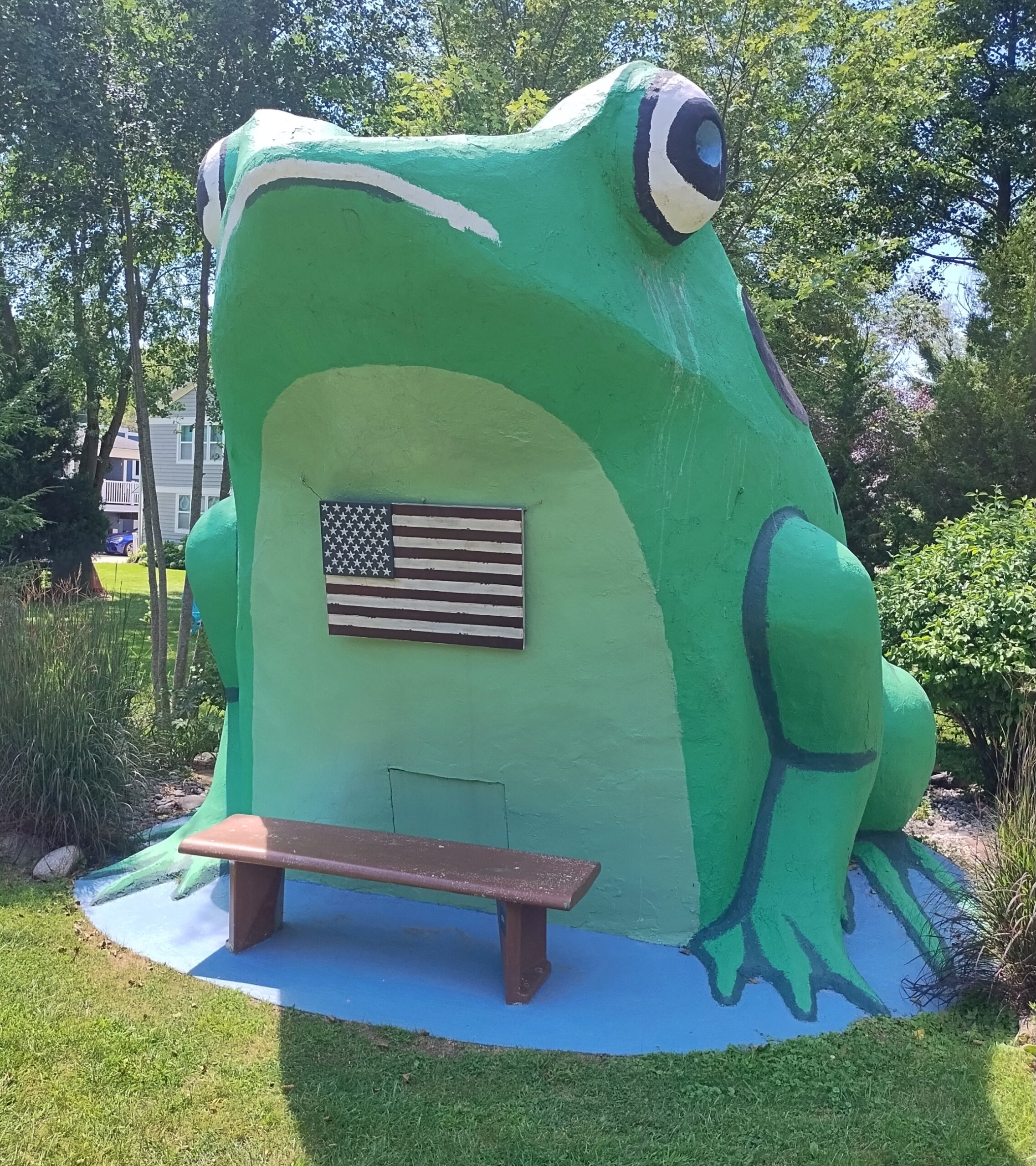
Closer to Lake Geneva, in fact in Fontana, Wisconsin, is the Fontana Frog. I saw it the same warm summer day as the Tin Man.
Labor Day weekend again? How does summer vanish so quickly? Back to posting on September 2.
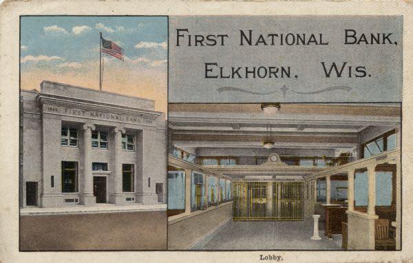
Once upon a time, one of the many First National Banks of the world stood in downtown Elkhorn, Wisconsin, complete with a sturdy bank interior common at the time. As seen in a postcard from the early 20th century.
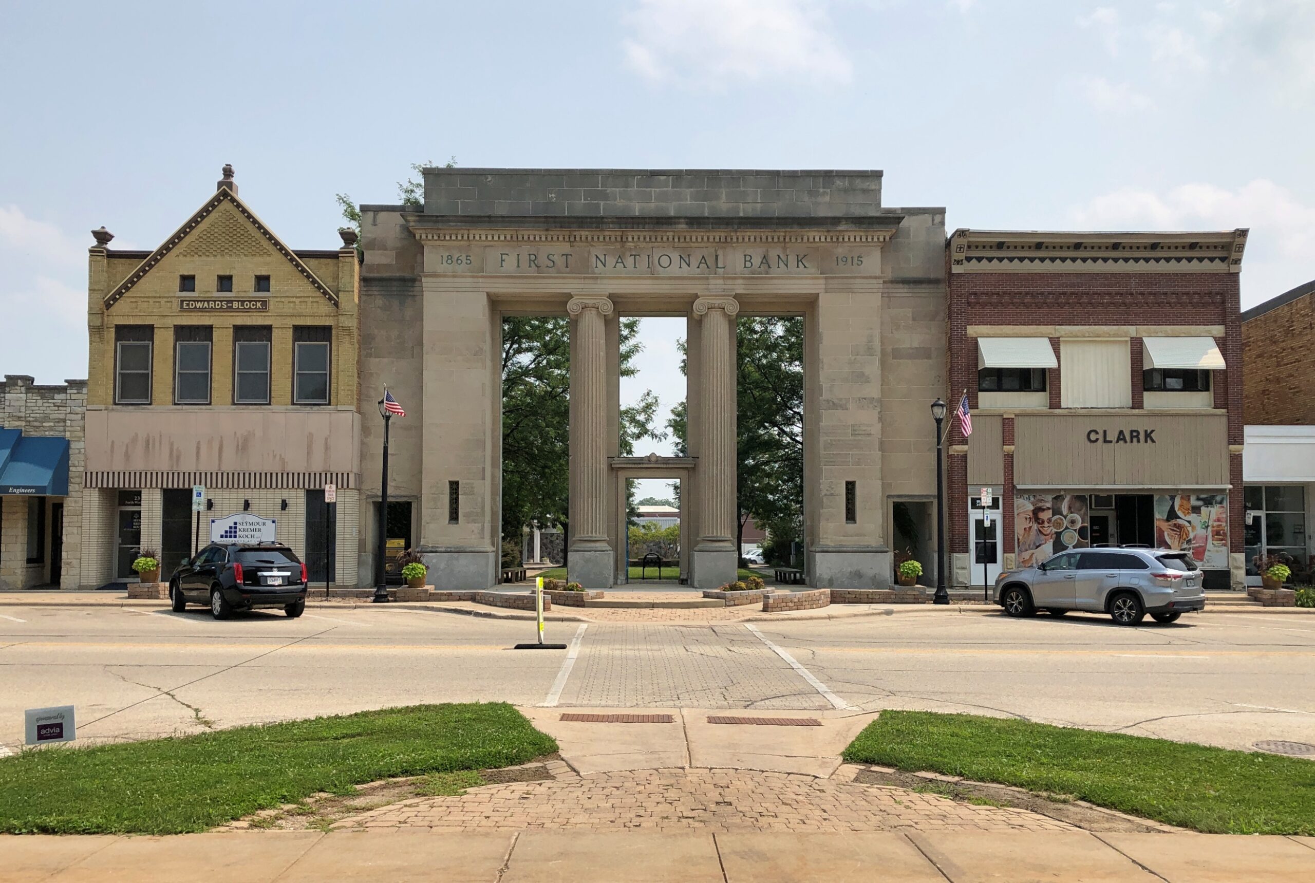
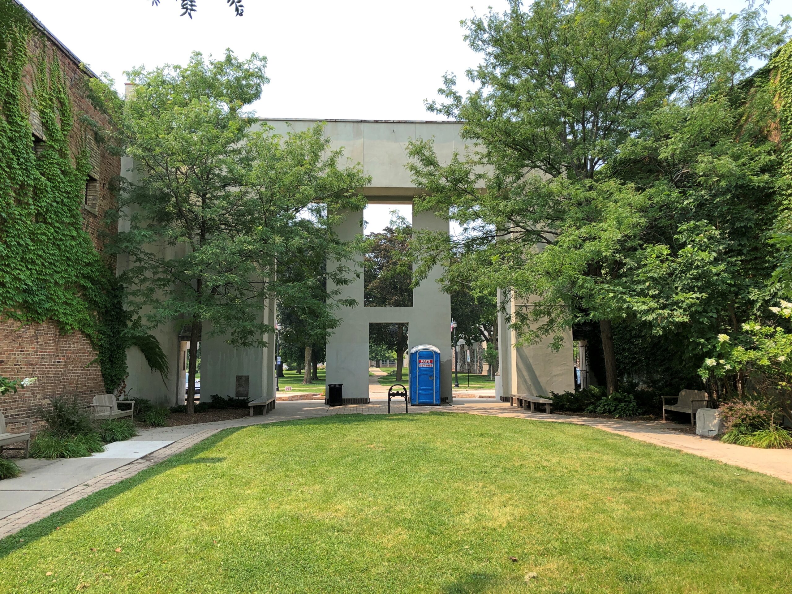
Go looking for the bank these days, and this is what you find.
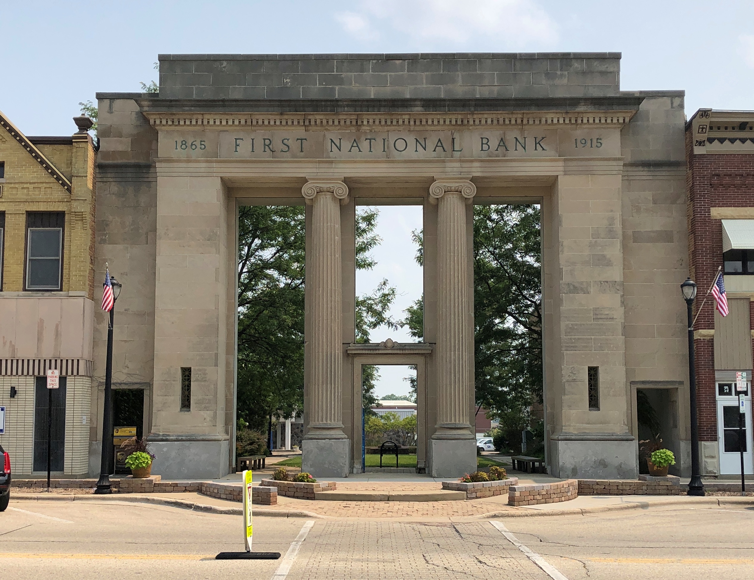
Once a bank, now a pocket park. The view from the inside, looking back at the facade.
There were no signs to indicate how the park came to be. A less imaginative act would simply have been to raze the old building in its entirety and leave a weedy gap in the downtown streetscape, hoping for redevelopment that might never come.
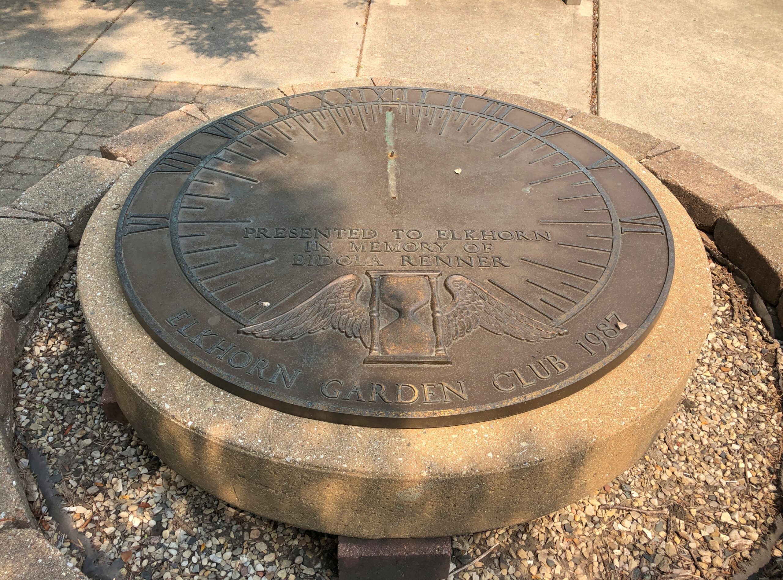
Inside the park is a sundial, dedicated to the memory of one Eidola Renner (d. 1983) of the Elkhorn Garden Club. Ah, garden clubs. The term makes me think of Khigh Dhiegh.
This must be her. The sundial – whose gnomon is missing, so it can’t function for telling time – has been there since 1987, so I assume the park has been there at least that long, if not longer.
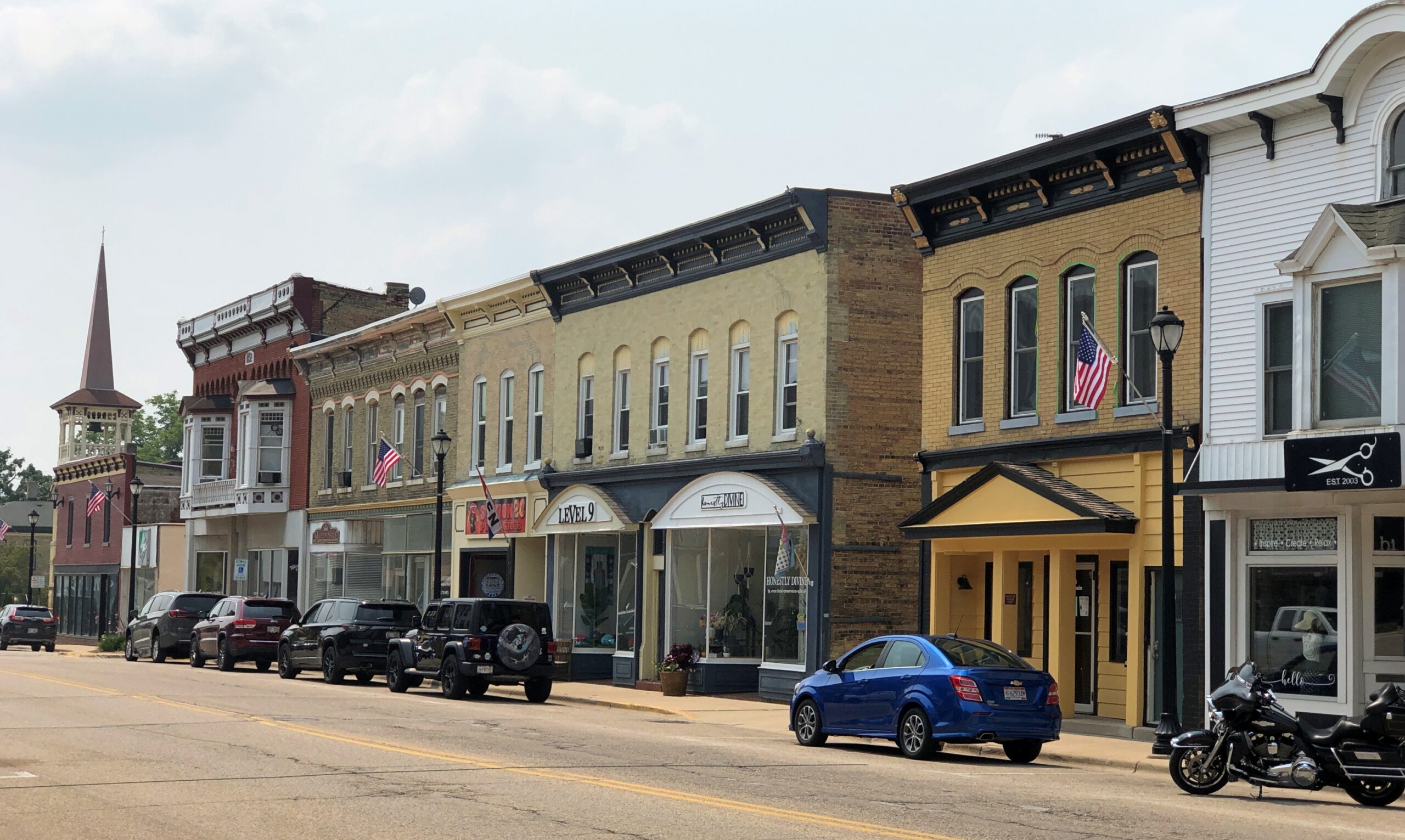
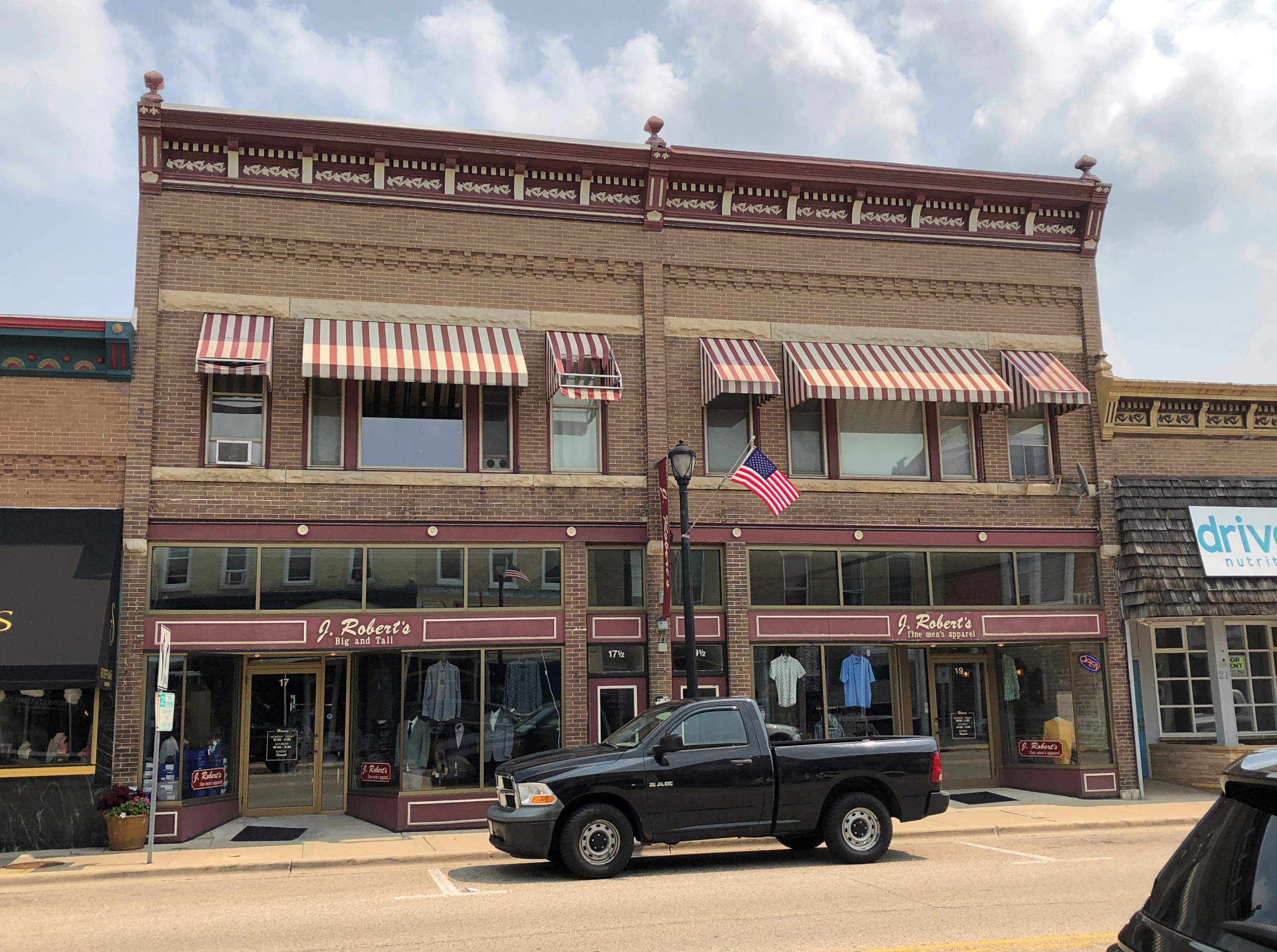
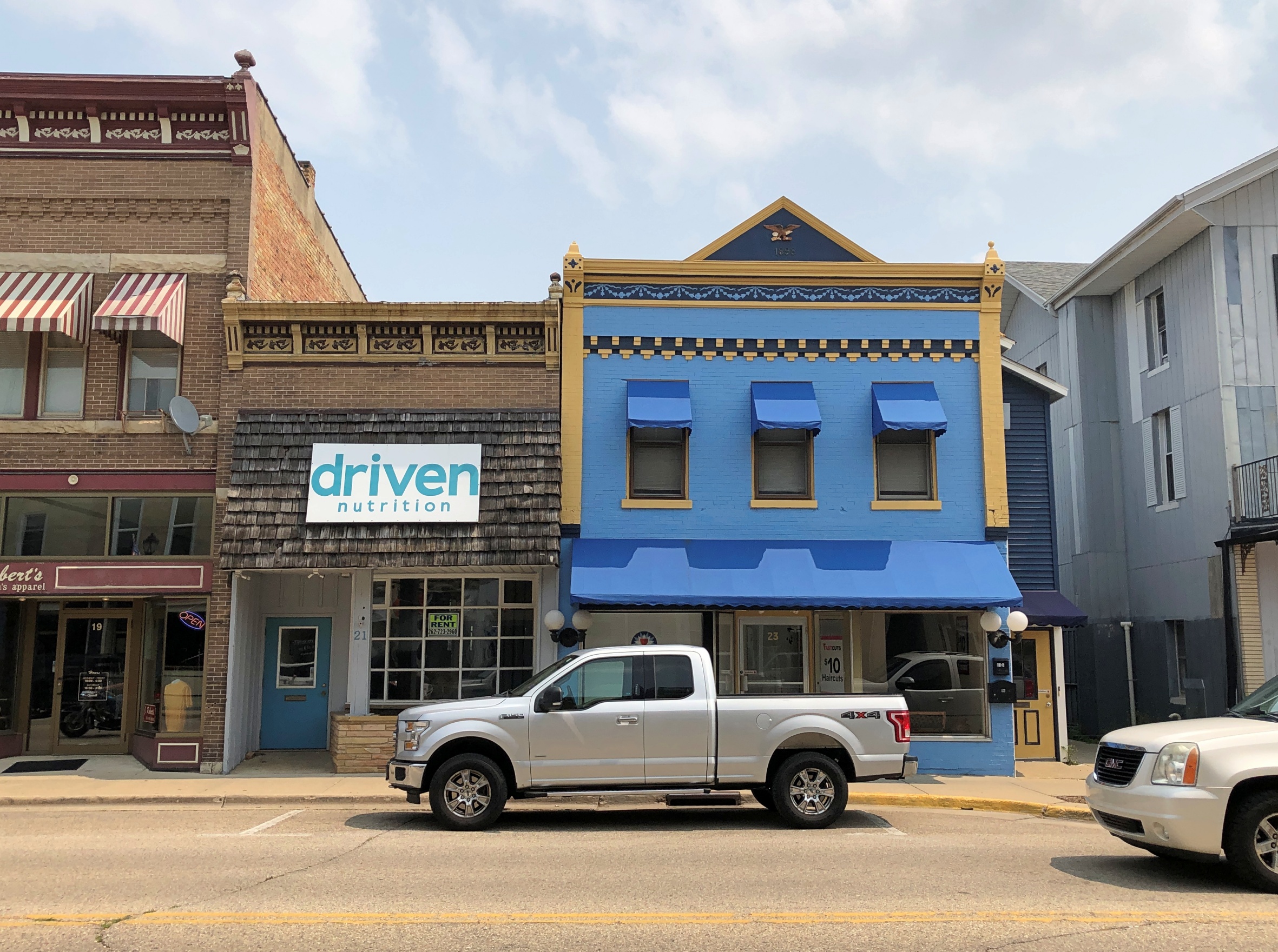
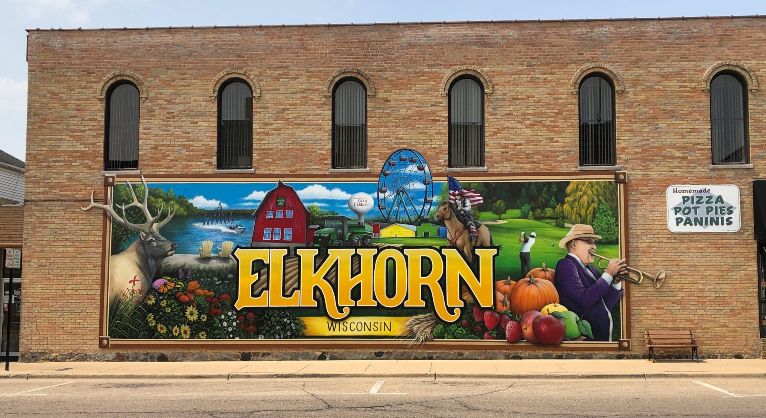
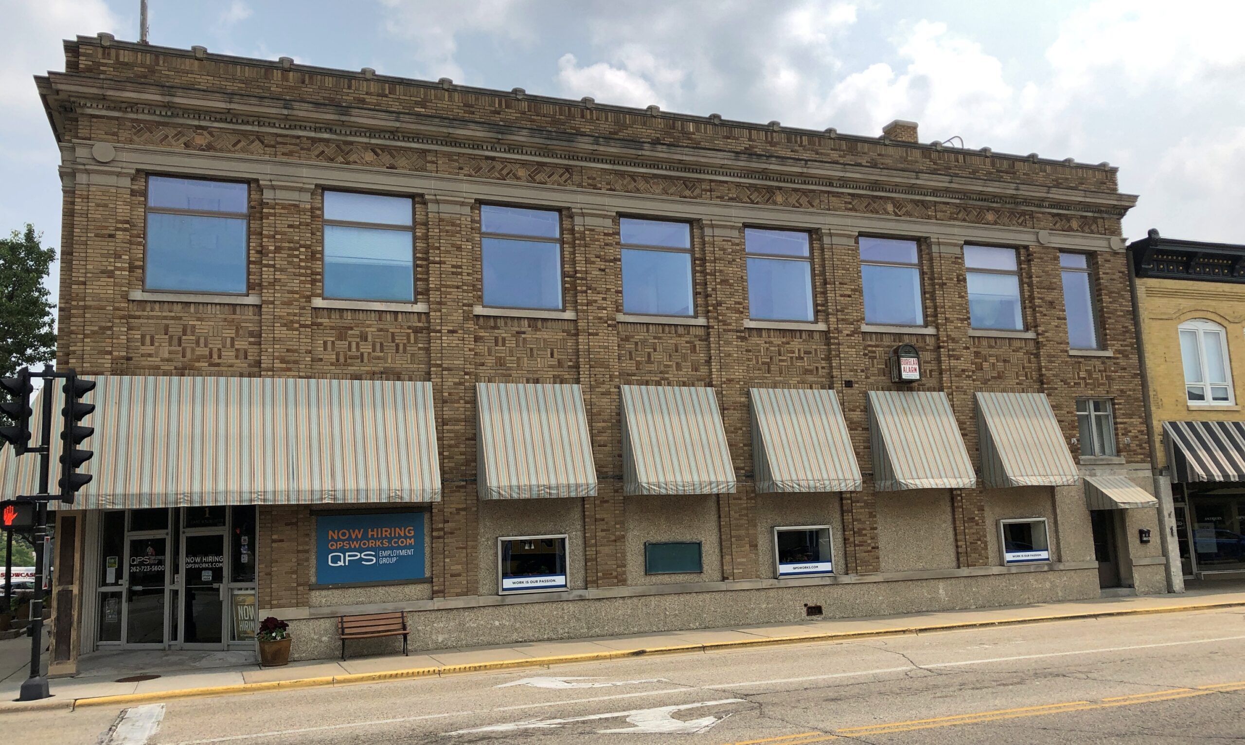
I arrived in Elkhorn on a warm day in early August, traveling by myself in southeastern Wisconsin. It wasn’t too hot for a stroll around the town’s municipal square, home to a “government center,” a mid-century box, but not the storied old courthouse that should be there.
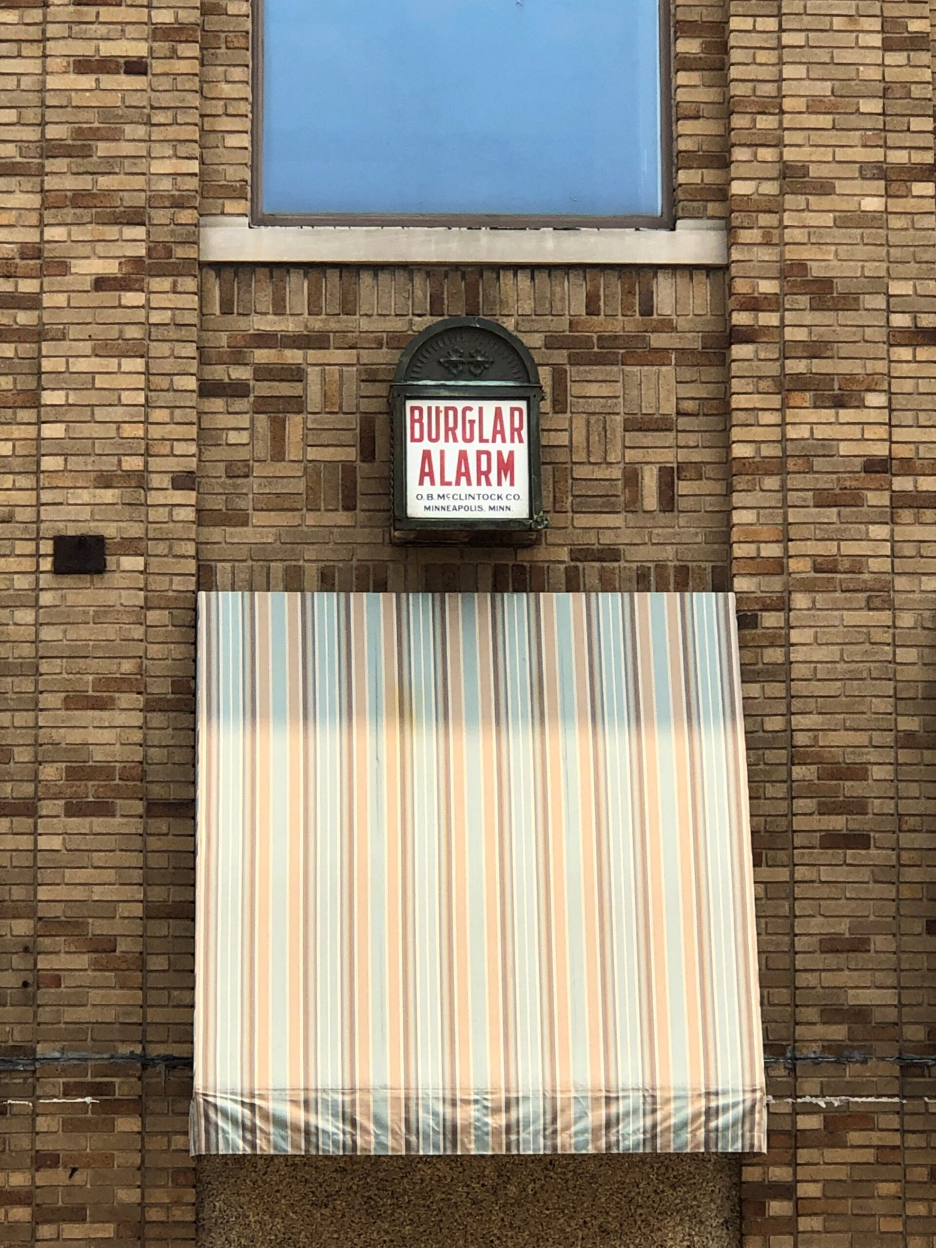
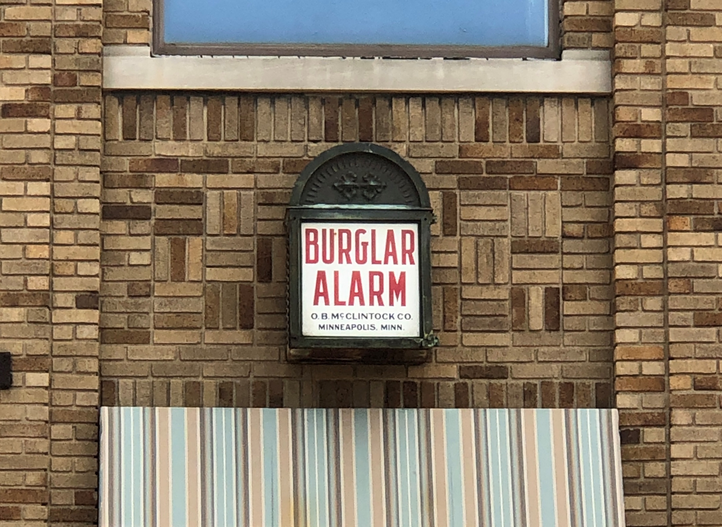
Public notice of an antique alarm system, that’s what.
Not the first one I’ve seen. This one was made by the O.B. McClintock Co. of Minneapolis. “In 1901 O.B. McClintock came to Minneapolis and founded the American Bank Protection Company, which produced burglar alarm systems,” explains a site called Lavilo. “After his resignation in 1908, he opened the O.B. McClintock Company to ‘manufacture electrical chime and clock systems,’ which he sold to financial institutions all across the United States.”
Banks began telling the public the time quite a while ago (McClintock surely wasn’t the first). I’m of course old enough to remember dialing time and temperature, though I can’t remember which financial institution sponsored the service in ’70s San Antonio.
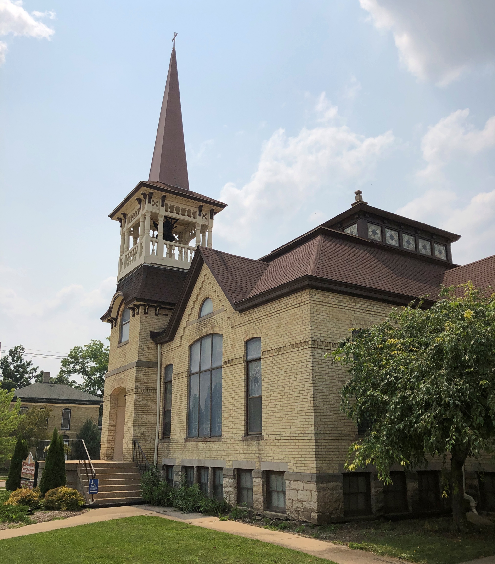
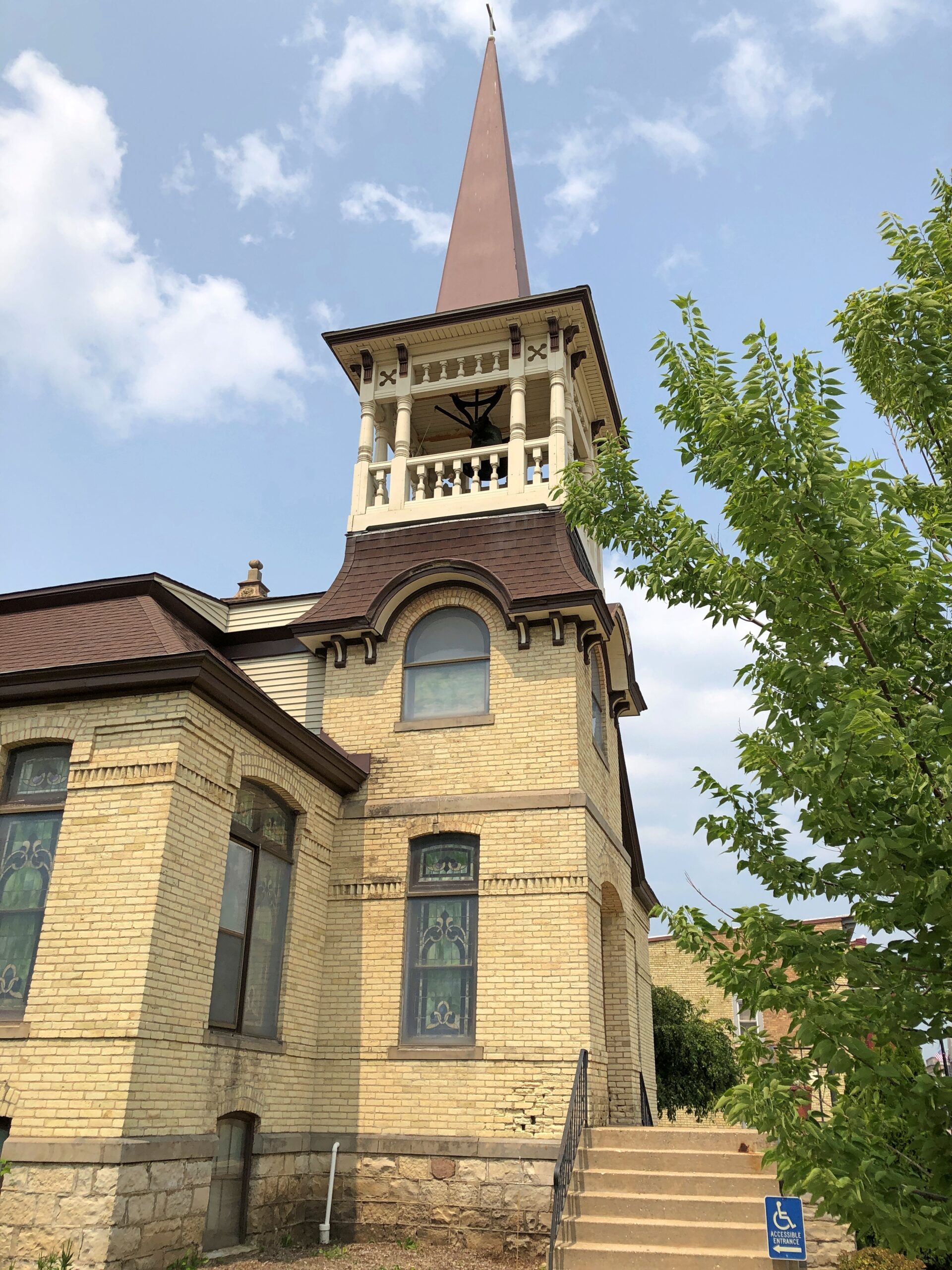
Elkhorn has a fine selection of downtown churches as well. Such as the First Congregational United Church of Christ.
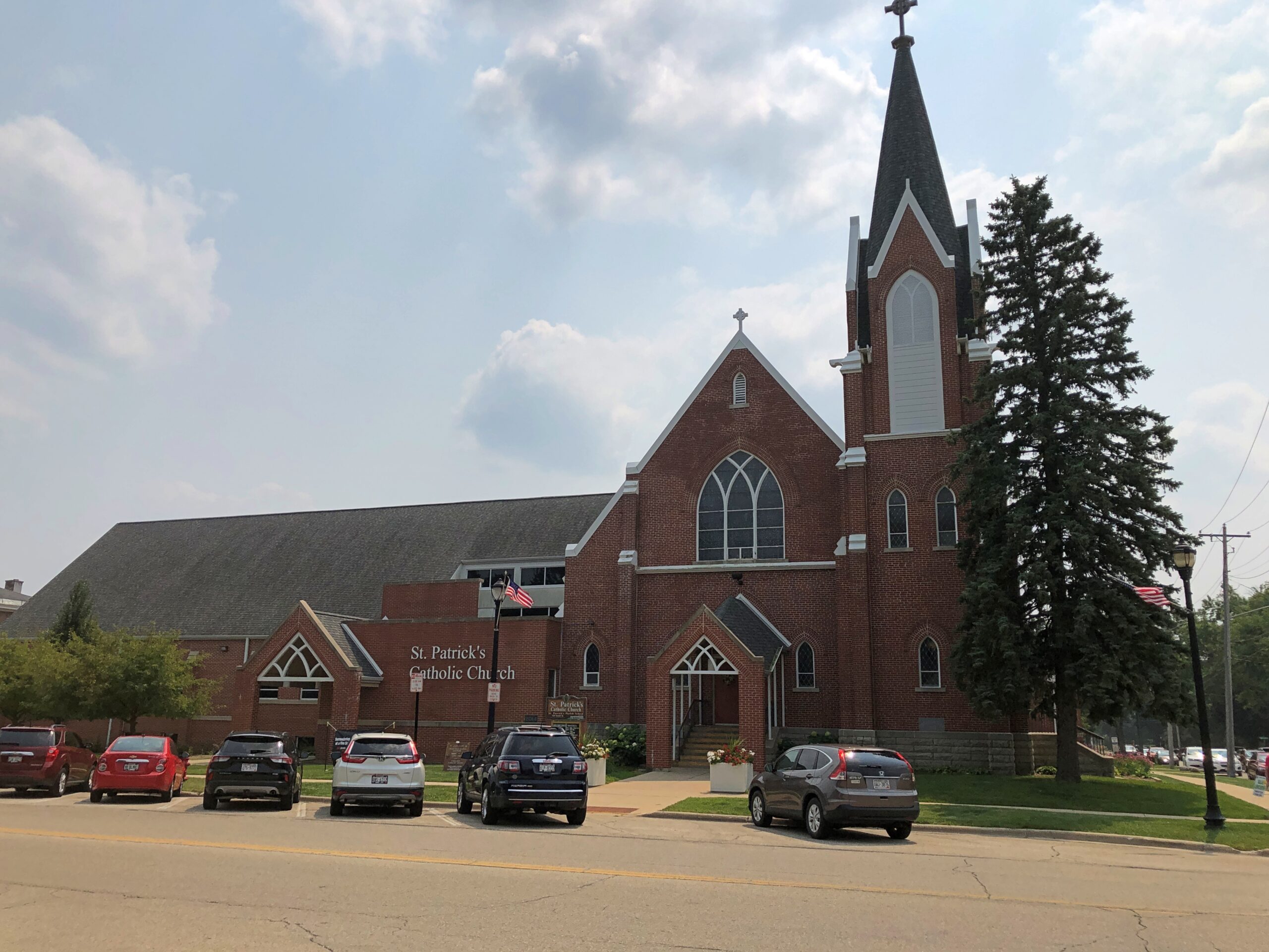
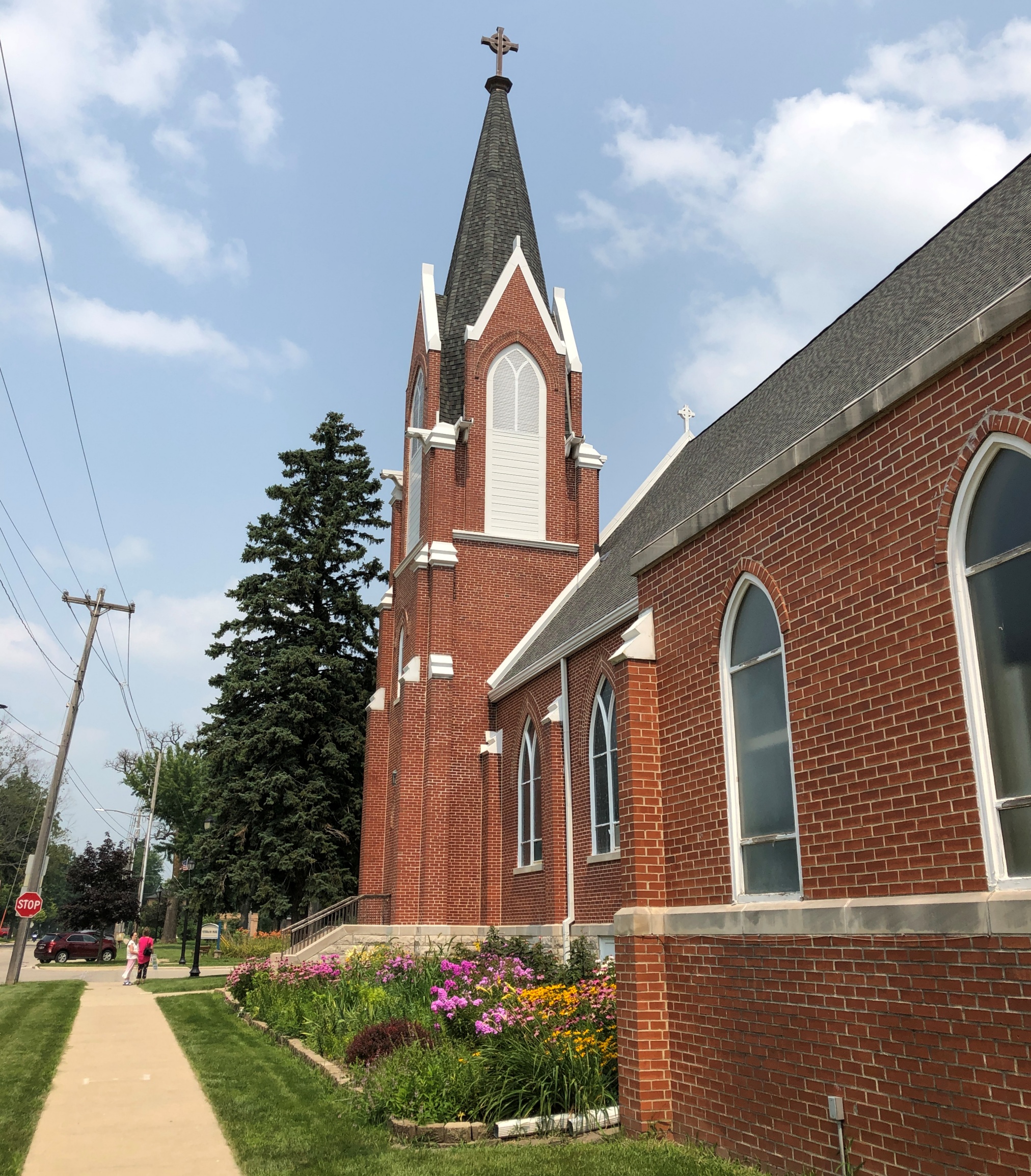
St. Patrick’s Catholic Church.
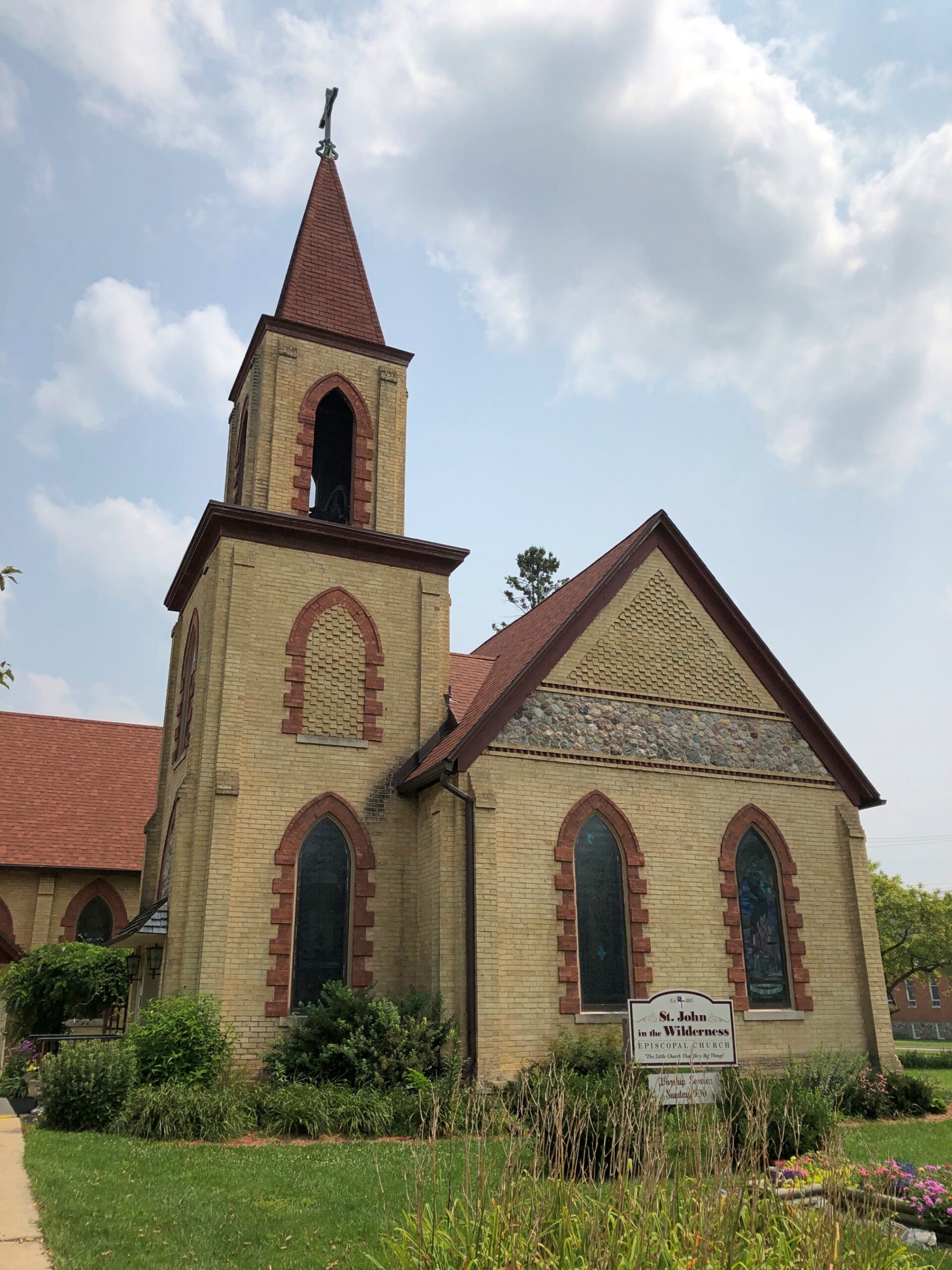
St. John in the Wilderness Episcopal Church.
Founded in 1841, back in Wisconsin Territory days, so “wilderness” was probably apt at the time.
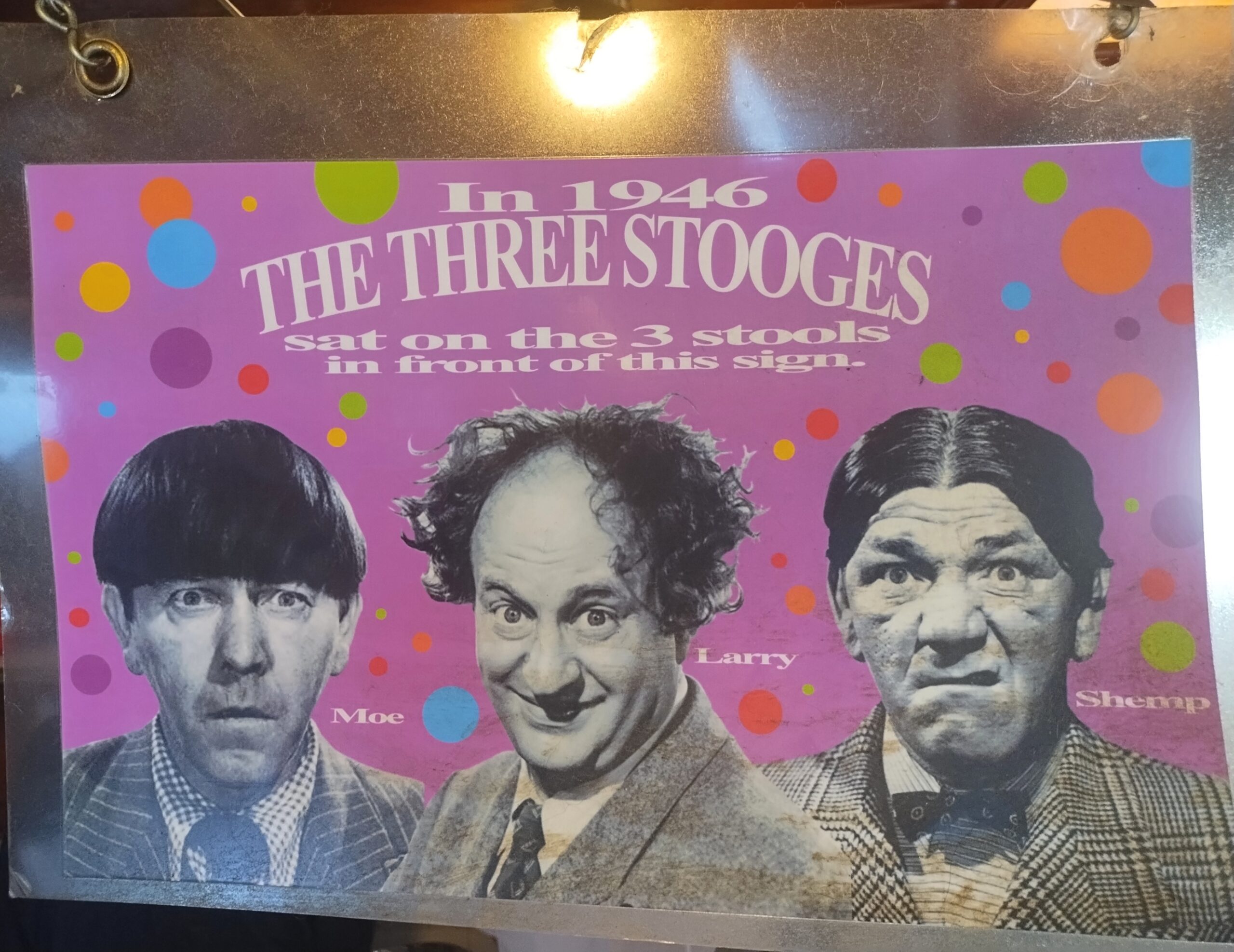
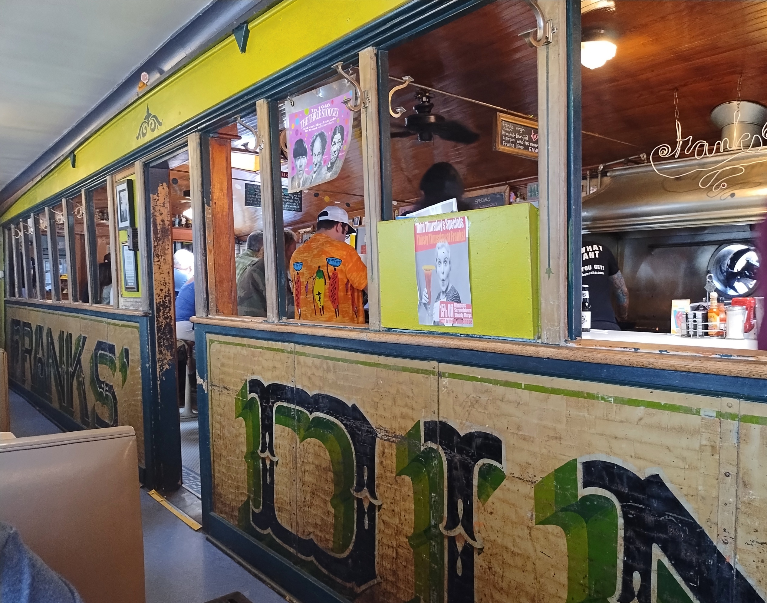
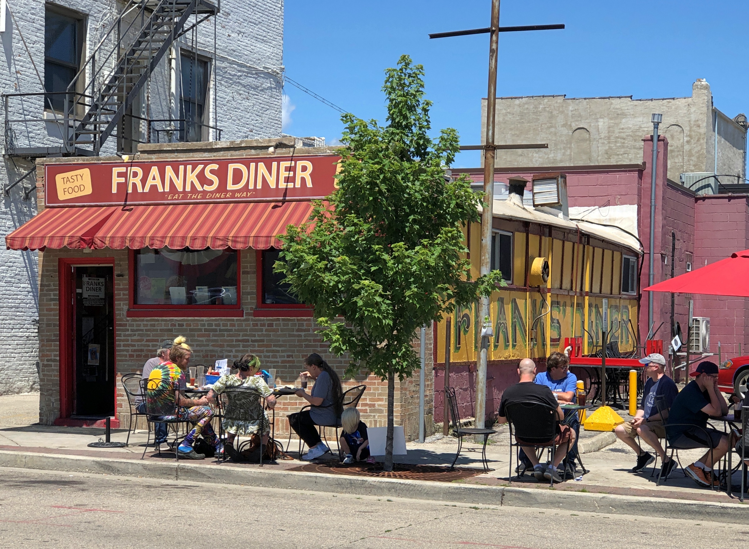
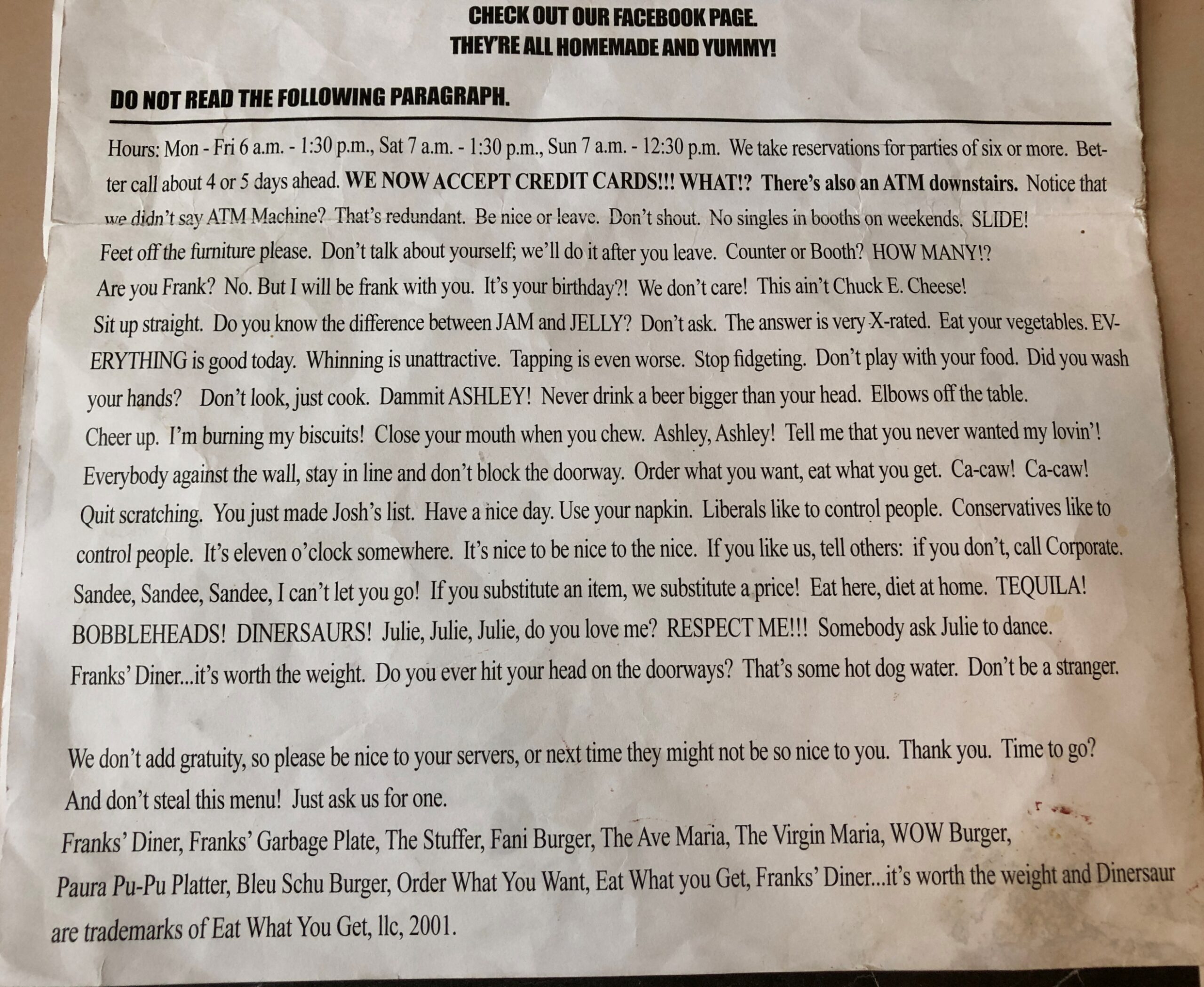
The poster is on a window at Franks’ Diner, formerly an exterior window, but with an expansion of the diner many years ago, now facing the added section, where Ann and I had lunch on a late July Friday. Kenosha, home of Franks’, was another stop in our recent rambles around southeastern Wisconsin.
Not only is the 99-year-old Franks’ still there, it’s still dishing up dandy diner fare at popular prices. Back then, I wrote:
The place had that diner smell: eggs and meats and hash browns and coffee. It also had that diner sound: the murmur of conversation, workers calling to each other, silverware scraping plates, metal clinking metal, the hiss of the griddle.
It was packed. A row of people sat at the counter, while others were at booths in the small room added to the counter room. A line of people waited for their seats in a long row behind the people at the counter.
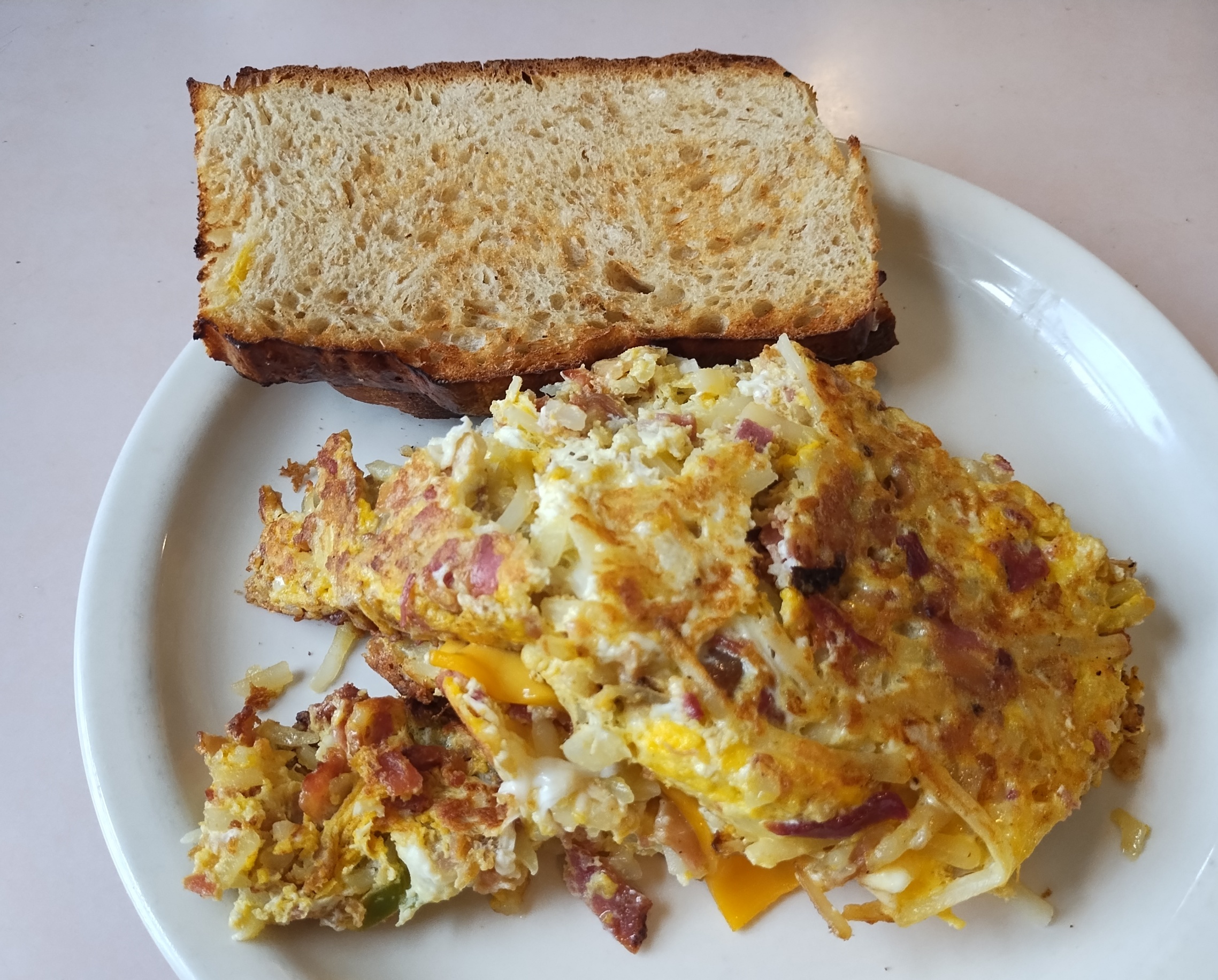
That’s exactly the same as our July visit, except that people waited outside, since it was summer instead of winter and (of course) prices were higher. Once seated, I had the Garbage Plate. I’d skipped it last time, and I wasn’t about to miss it this time around.
2012: The star of the show is its Garbage Plate, a concoction of hash-brown potatoes, eggs, green peppers, onions, jalapeños (if you want them), and a choice of three or fewer meats (or including no meat). The thing is seriously large. The standard Garbage Plate has five eggs.
The restaurant also supplies some reading material.
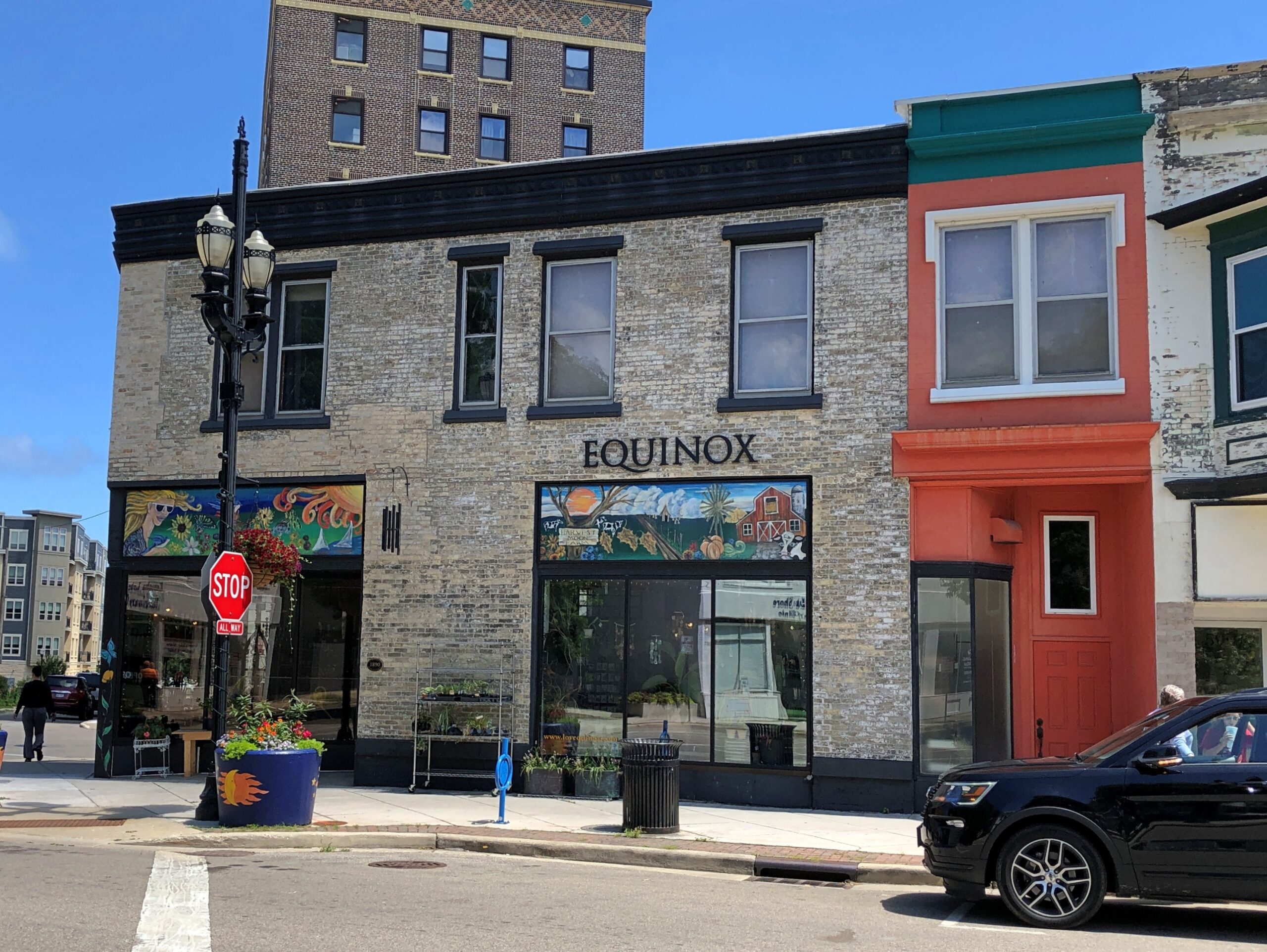
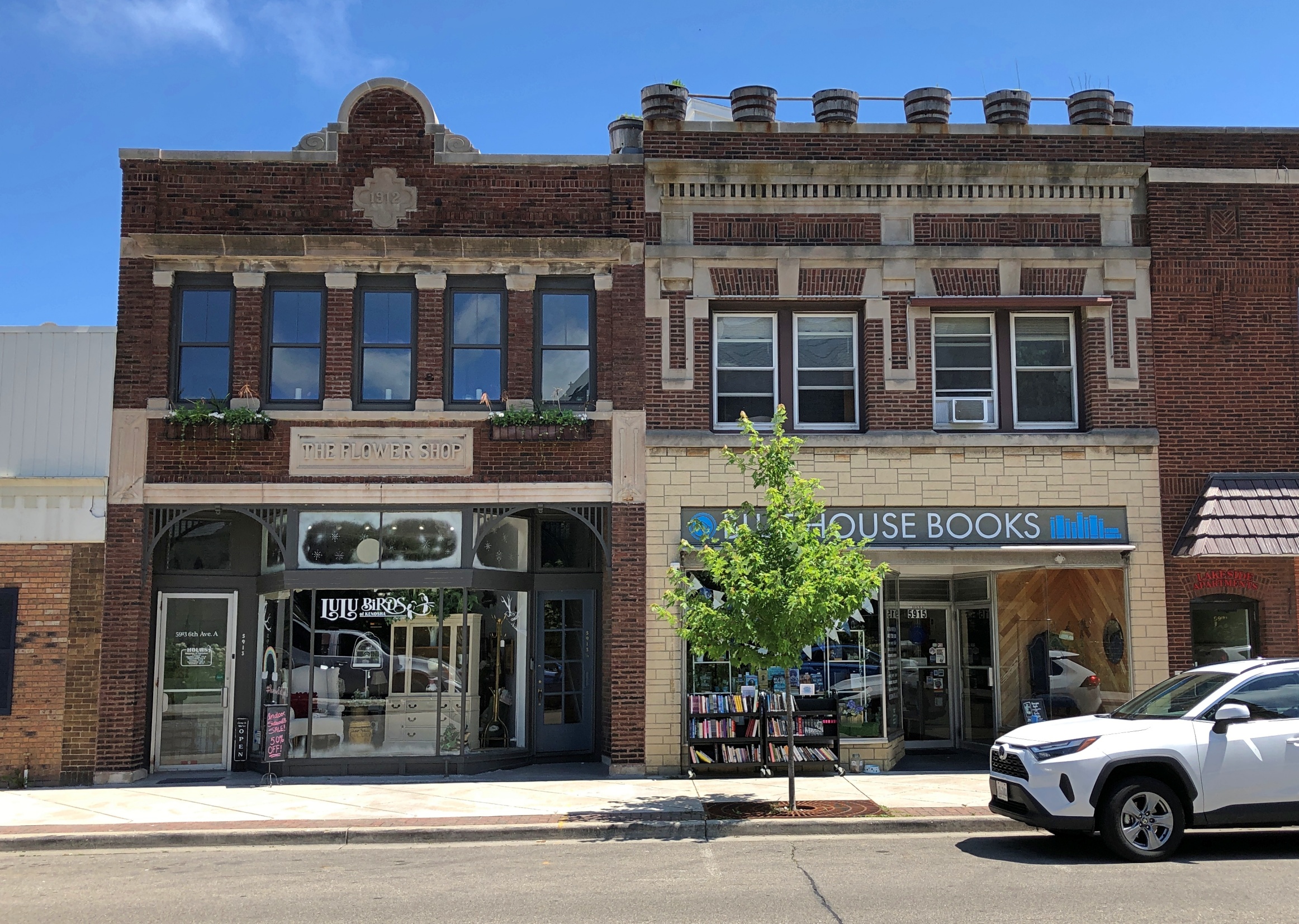
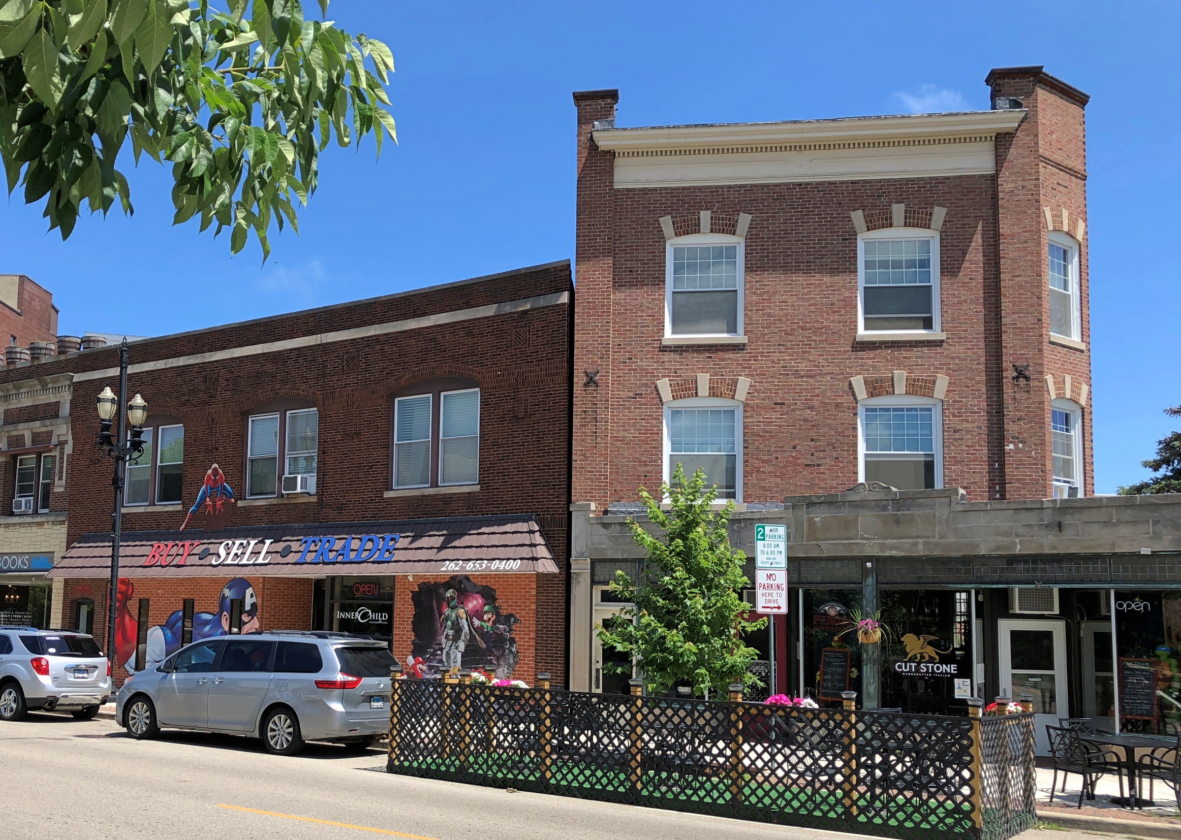
After lunch, we went a few blocks away and parked the car in the shade of large trees in Library Park. Ann waited in the car with the windows down – it was very warm, but not too warm for a few minutes of that – while I wandered around the immediate area, including a couple of streets of storefront retail in vintage structures.
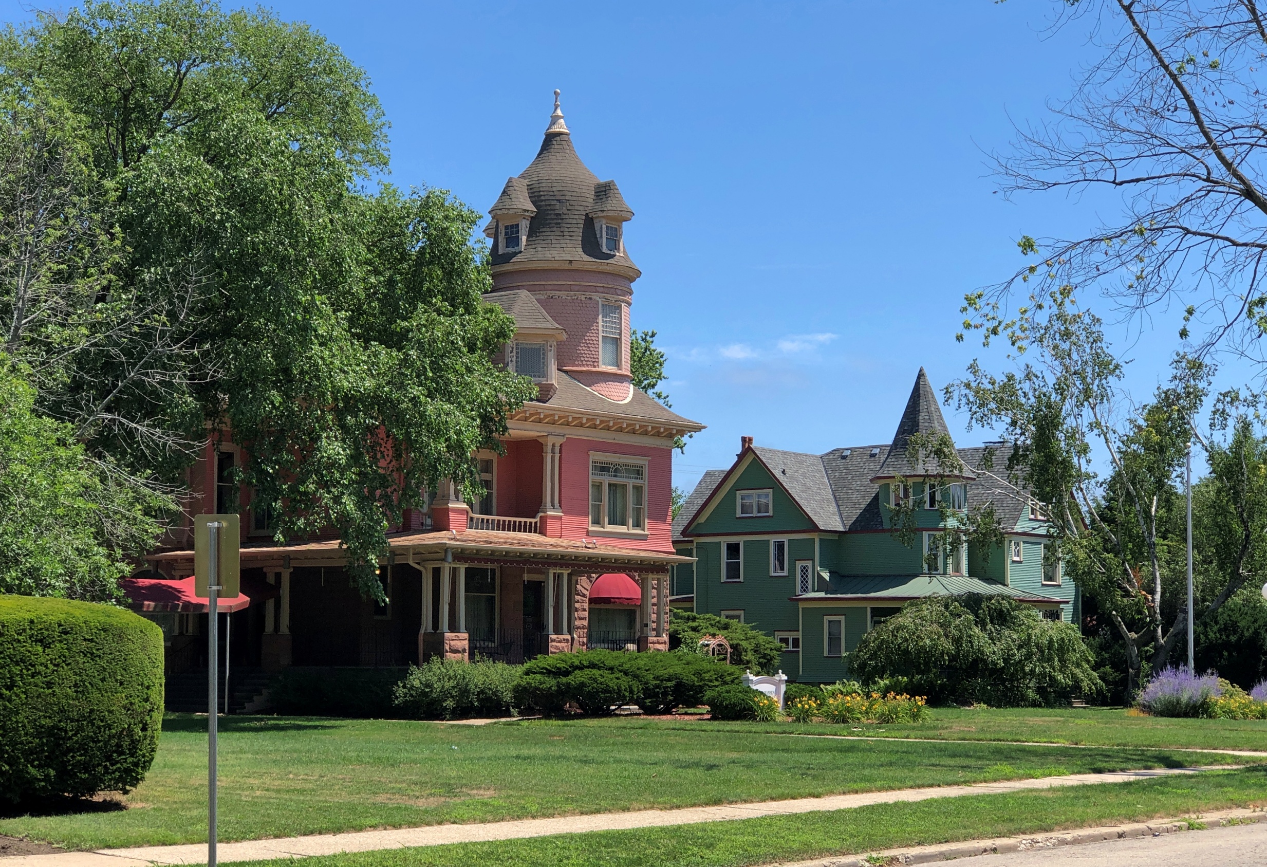
Houses across the street from where we parked.
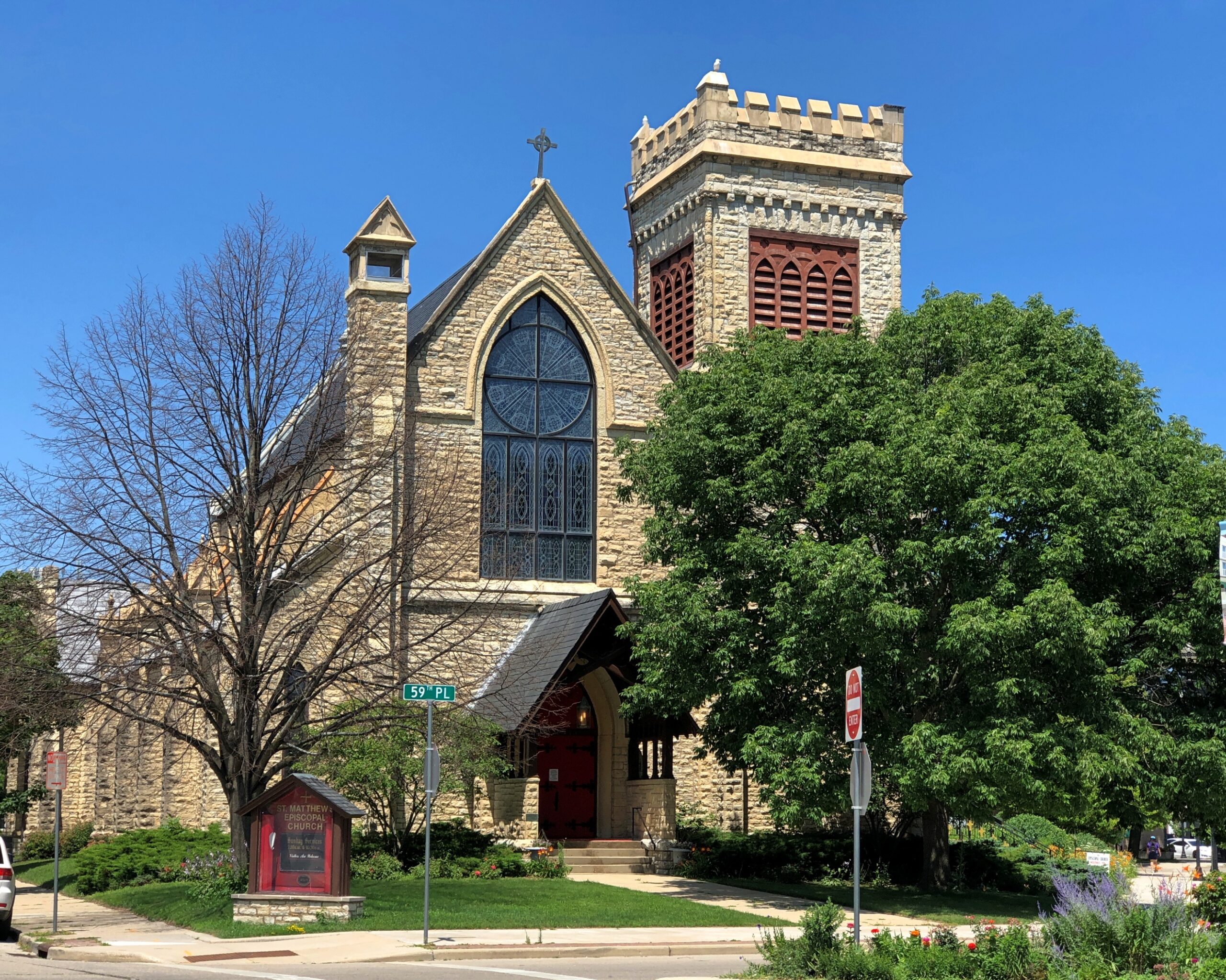
The nearby St. Matthews Episcopal Church.
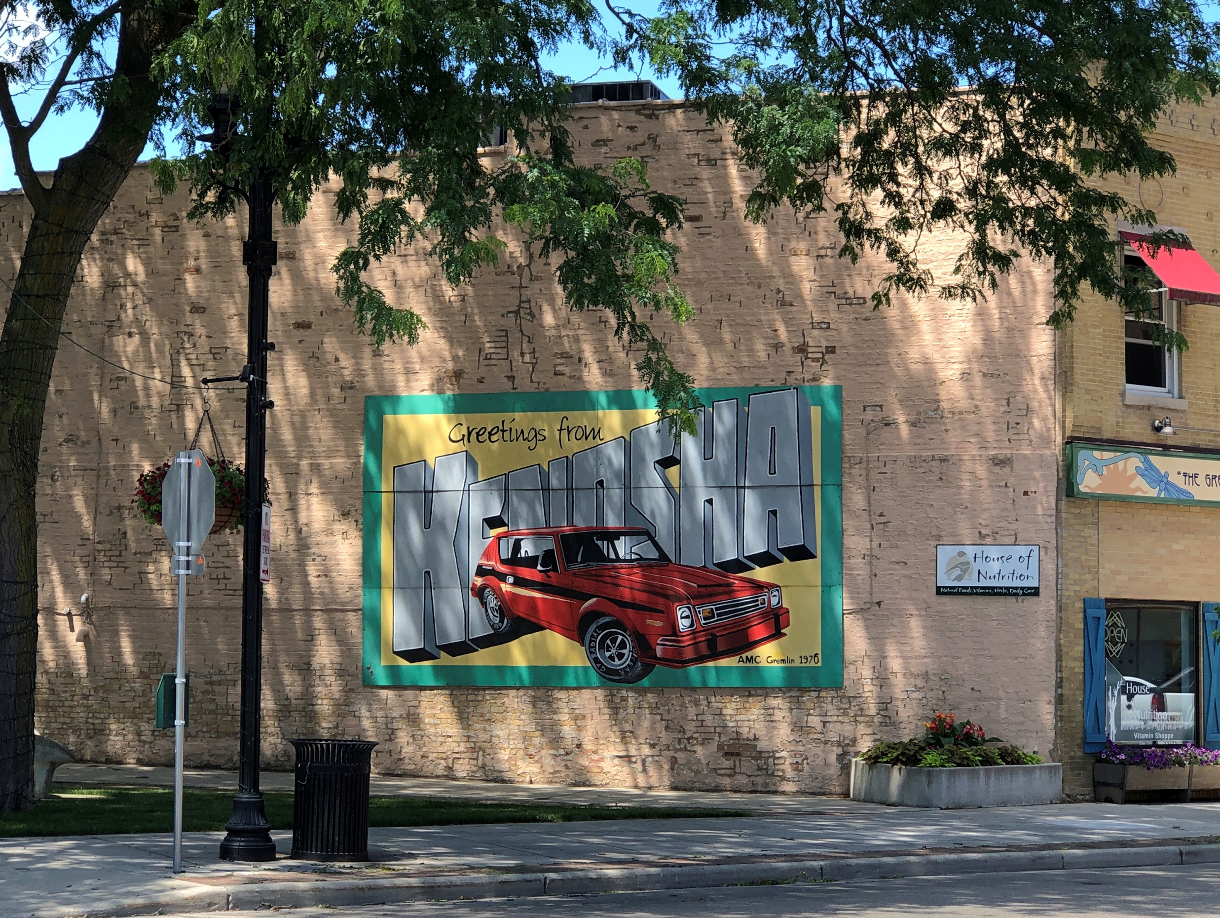
The inevitable welcome mural. The 1970 Gremlin is an unusual touch. But they were made in Kenosha, so not that unusual.
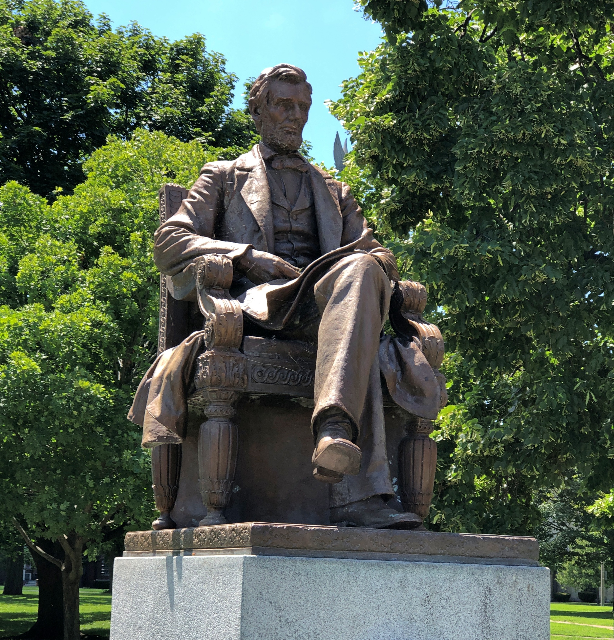
At the edge of the park, a seated Lincoln. Sculptor Charles Niehaus (d. 1935) did the work. Just one of many that he did all over the place. The president has been sitting there since 1909, centennial of his birth, with restoration work done in more recent decades.
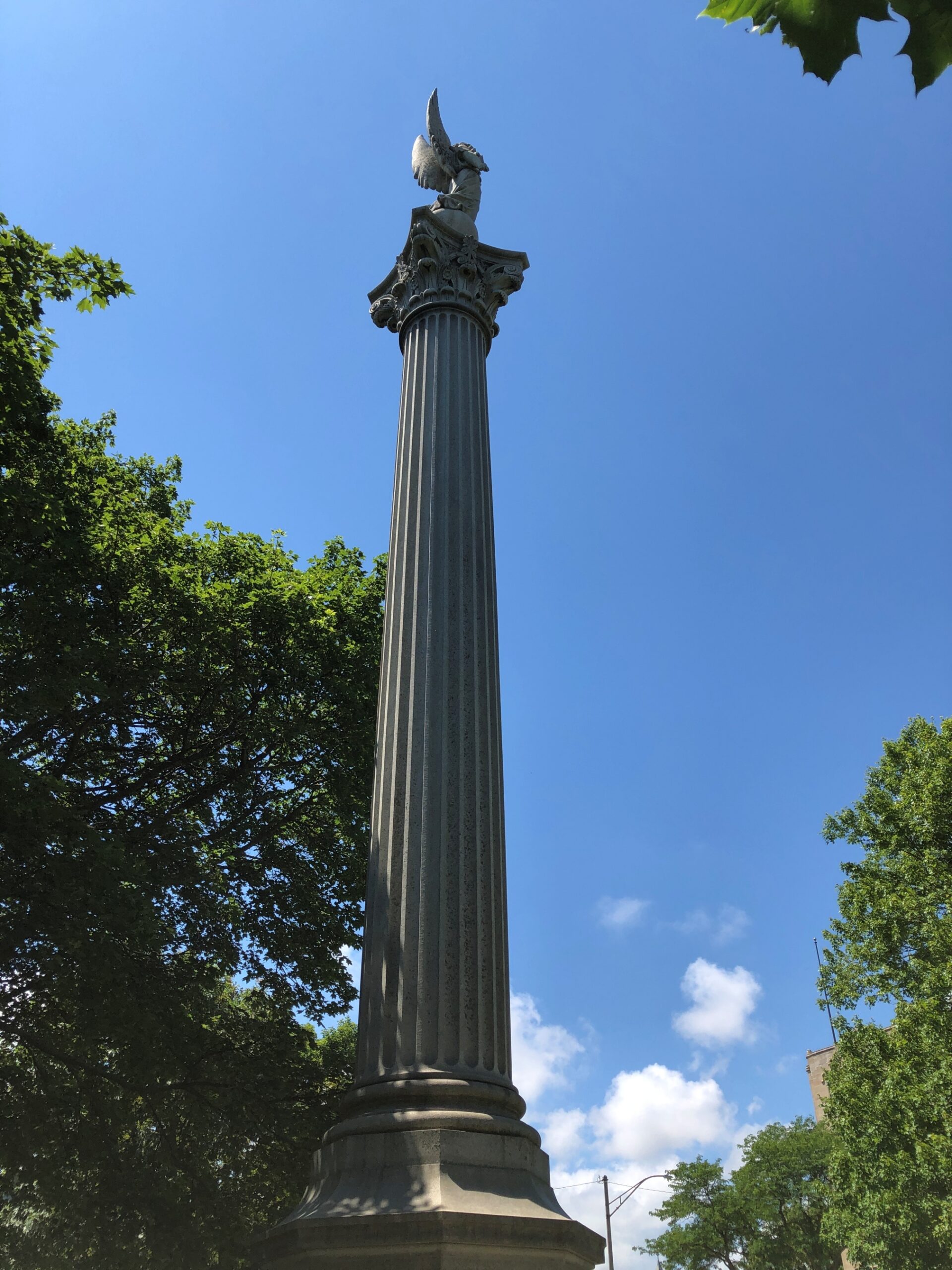
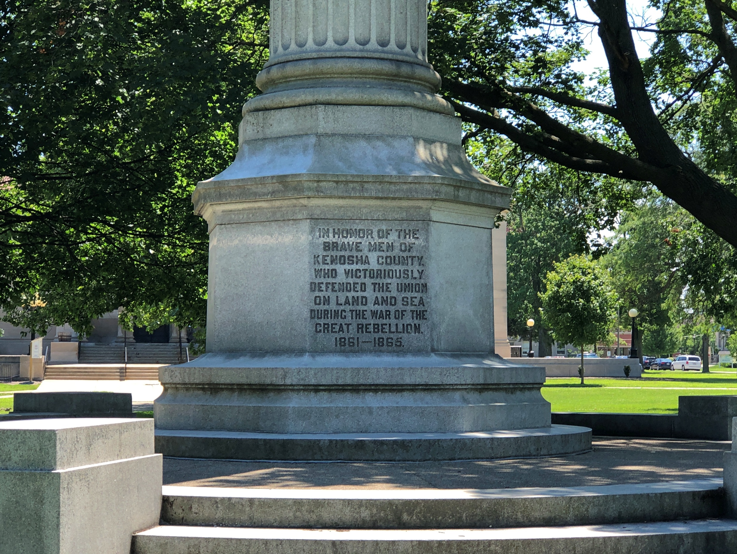
Nearby in the park, Kenosha’s Civil War memorial, called “Winged Victory” on electronic maps, a name that gets right to the point.
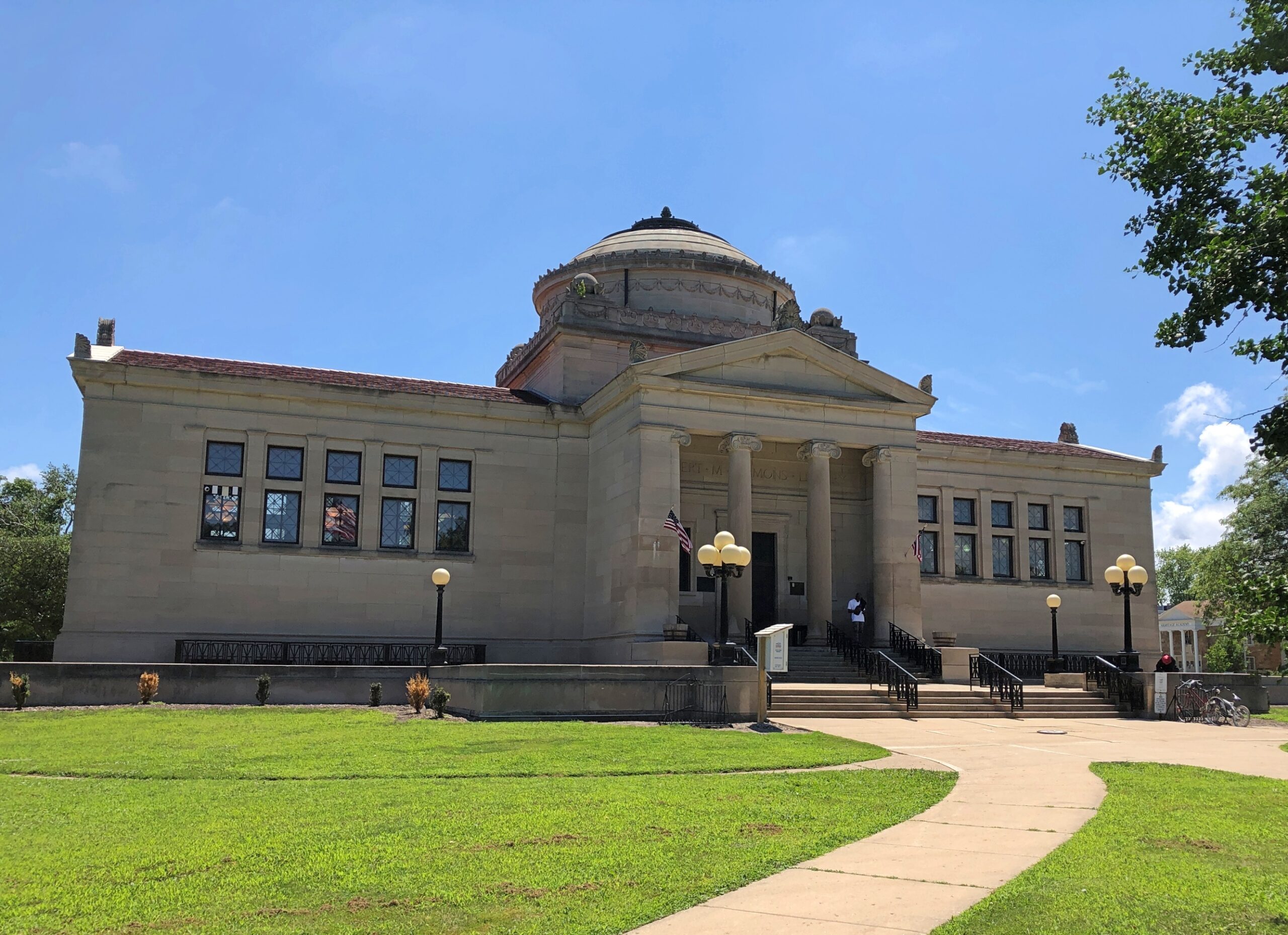
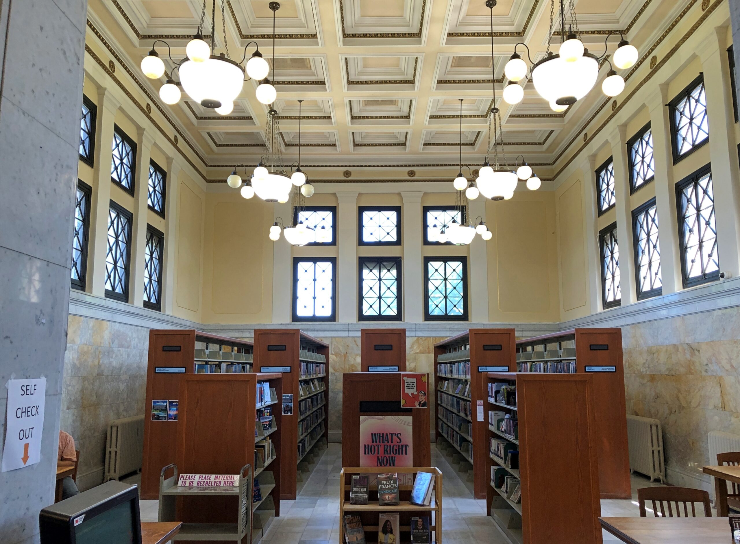
It’s Library Park because of the Gilbert M. Simmons Memorial Library, a branch of the Kenosha Public Library system, dominating its side of the park. It has a little more heft than most municipal branch libraries.
When it opened in 1900, the building formed Kenosha’s main library. Daniel Burnham designed it.
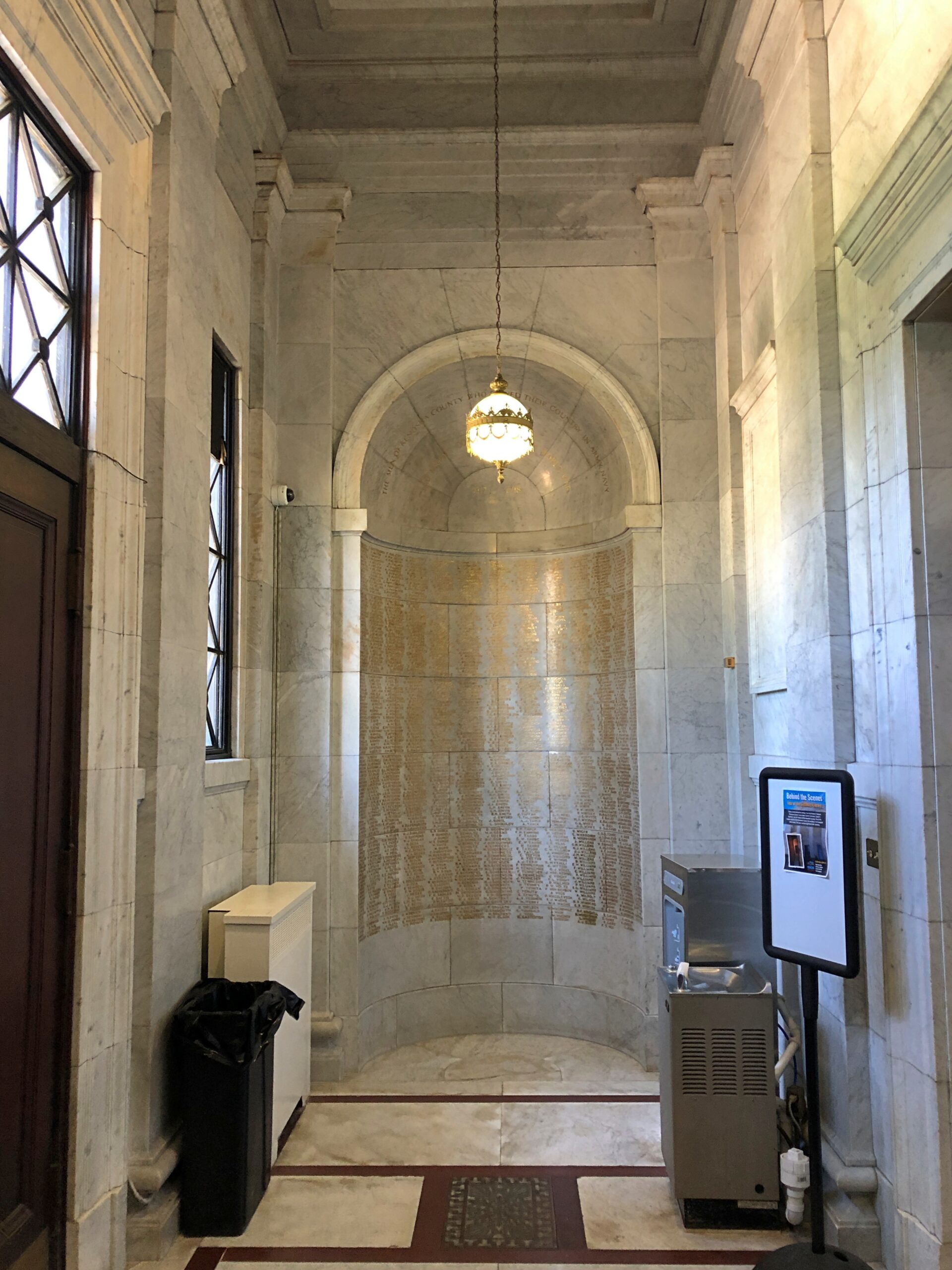
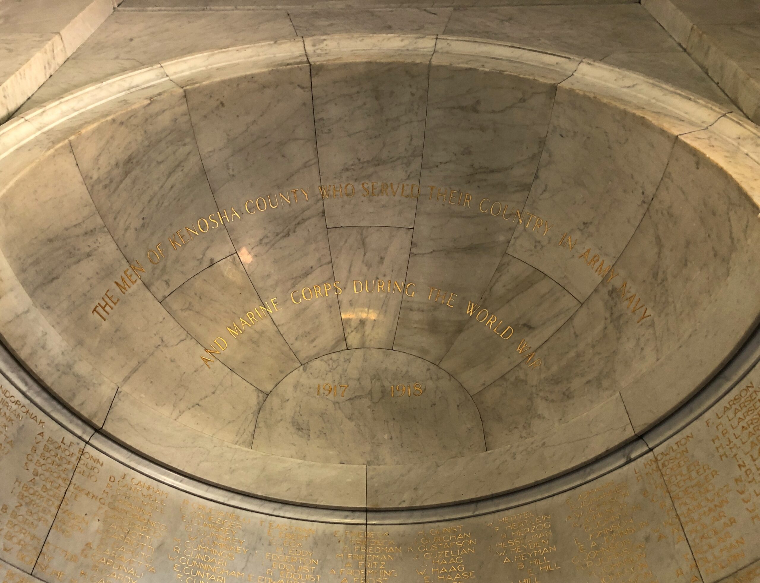
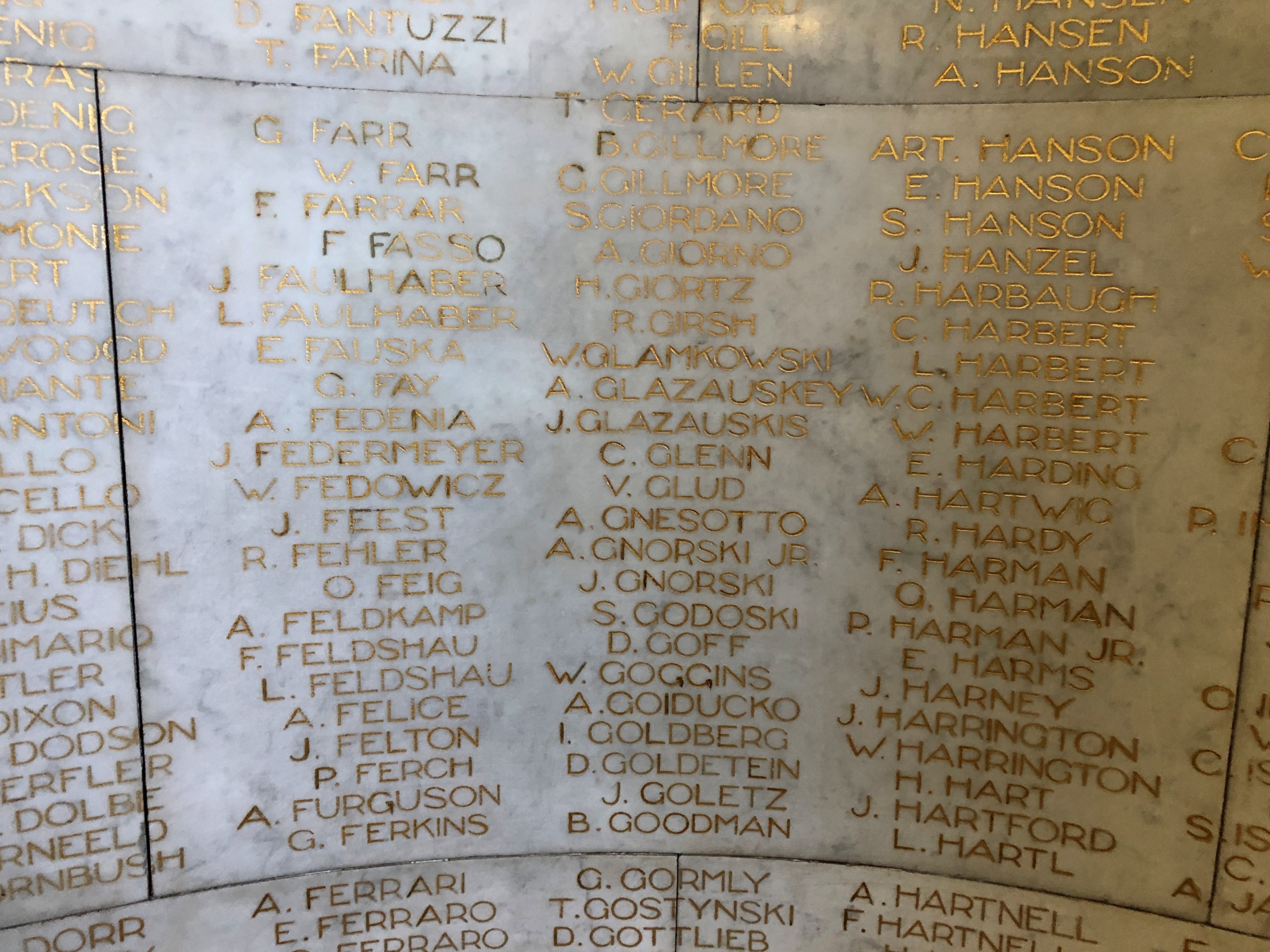
The Civil War veterans have their memorial outside. Great War vets are honored inside the library.
We’d happened on the Library Park Historic District, surrounding Library Park. The park itself goes back to the early years of Kenosha, when the land was a New England–style town commons. Forty-two properties, built from 1843 to 1930, form the district. A diner and an historic district: just the thing for a warm summer day stroll.
