A Slightly Less Gelid Day

Zero degrees Fahrenheit isn’t warm at all, unless compared with 20 degrees below that. I spent a few minutes out early this afternoon — with temps actually at 5 below or so — and it was tolerable for what I needed to do, which was make sure the garage door closed.

Very low temps cloud the electronic eye, I think. At least, rubbing the lens clear seems to help.

“Surfing” never seemed like the right verb for wandering around the Internet. Maybe that’s why you don’t hear it much anymore, 20 years after it was common. Wander, meander, ramble — these seem better. More descriptive of the way I approach the Internet anyway.

The polar vortex loose on the Upper Midwest naturally led me to read a bit about Antarctic exploration, some about Shackleton but also, in a classic online tangent, the ship Southern Cross, which sailed on the lesser-known British Antarctic Expedition (1898-1900), a.k.a. the Southern Cross Expedition (and not Kingsford Smith’s aircraft, which I heard about years ago in Australia).

The Southern Cross was mostly a sealing vessel and eventually she went down with all hands in the North Atlantic — 174 men — in the 1914 Newfoundland Sealing Disaster, an incident about which I knew nothing.

Reading about that led me to information of the Newfoundland sealing industry, something I also knew nothing about. Here’s a short item about that industry, with footage of Newfies bounding around on dangerous ice floes in the days before the Canadian equivalent of OSHA.

That naturally lead to other information about Newfoundland. Apparently there’s a Newfoundland tricolor, but it’s not the official flag. There’s a song about it anyway.

I looked up the official Newfoundland and Labrador flag. Not bad, exactly, just a little odd. Though it had one designer, it looks like a compromise between two factions of the same committee.

The Newberry Library Map Mural

I’ve read that the first floor of the Newberry Library on the Near North Side of Chicago is newly renovated, and it did have a newly polished look when Ann and I were there on Saturday. But it’s been a while since I’ve been inside the library, so I don’t really remember what it used to look like.

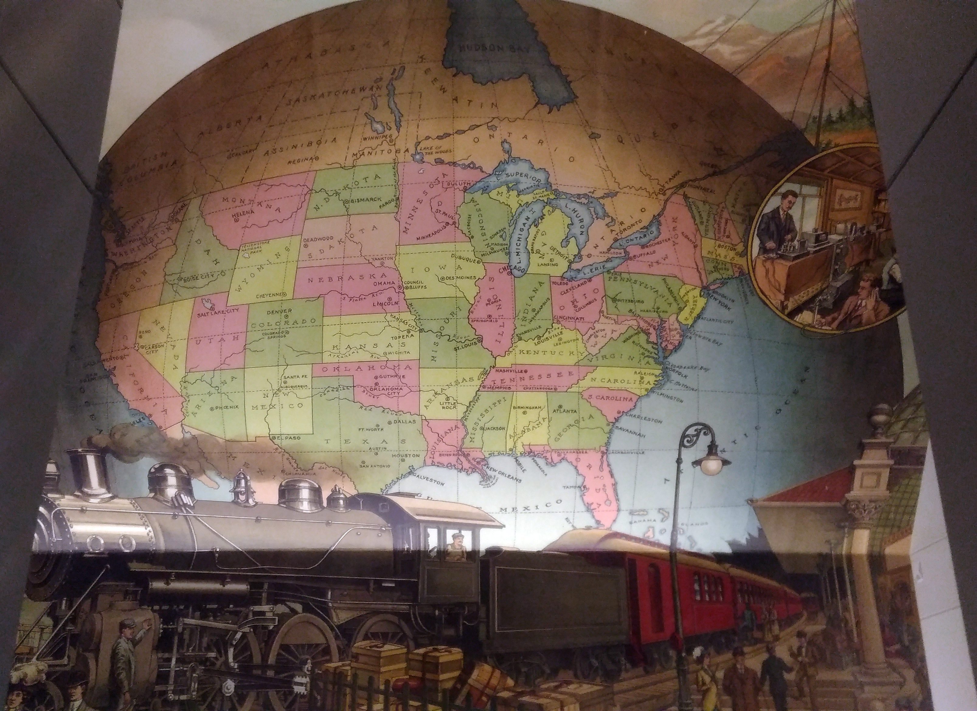
I’m sure that I’d never seen this intriguing mural before, which is above the landing between the first and second floors near a back entrance to the building.
A map mural. Even better, an historic map mural, along with a train at a station under the map and what looks like a telephone and telegraph office in a balloon off to the side.

The mural looks new, so either it is, or maybe an older image was expertly refurbished. I didn’t see any signs or plaques nearby to tell me which, or who the artist is, and the library web site doesn’t seem to say, so for now I’ll let the matter rest. It’s always good to find a map mural.

My guess is that the map depicts the nation ca. 1900 — united by rail, telegraph and the still fairly new telephone, with a new century of progress to look forward to. Or possibly 1887, when the Newberry was founded, or 1893, when the current building opened.

Though not cartographically precise (West Virginia looks especially mashed), the map’s close enough to evoke the United States of the period. One detail I noticed was that South Dakota’s towns were Deadwood and Yankton, even though the territorial capital moved to Bismarck in 1883 (presumably Al Swearengen would then refer to those “c—suckers from Bismarck” rather than Yankton).

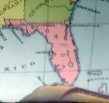
Also, note the pre-land boom, pre-drain the Everglades, pre-Disney, pre-Florida Man Florida.
A little fuzzy, but it’s clear that there’s no Miami and no Orlando.

Also, the states depicted were not quite all states at the beginning of the 20th century. Arizona, New Mexico and what became Oklahoma were still territories.

That would be my only quibble: before it became a state, Oklahoma was actually two territories, the Oklahoma Territory and the Indian Territory. The Indians of the Indian Territory wanted to be admitted as the state of Sequoyah, but Congress wasn’t having it, and so the two territories were joined to form the modern state in 1907.

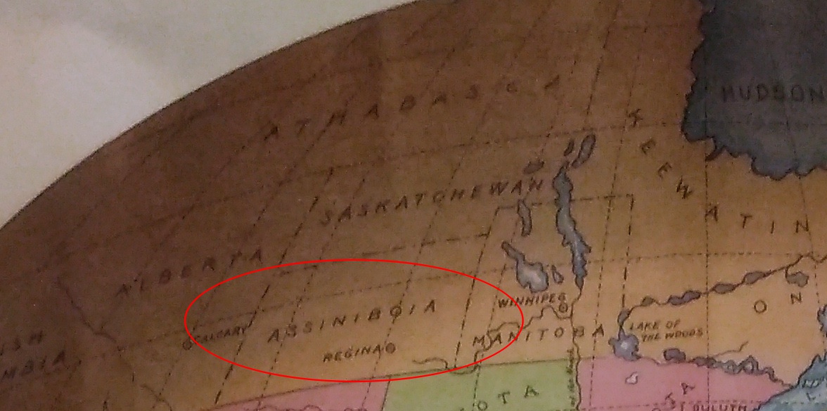
How do I know that the map doesn’t depict borders sometime after 1907? Because of the depiction of Canada.
The wonderfully named Assiniboia was a district of the NW Territories, as were Saskatchewan and Athabasca, all before 1905 (Keewatin was a separate territory before 1905, then became a district of the NWT). A major reorg of prairie Canada was done in ’05, making it look mostly like it does now.

So the map depicts pre-1905 Canada, but post-1907 Oklahoma. Ah, well. It’s small quibble about such a fine example of a mural.

Voyageurs National Park

What is it about national parks? The term is a charm, good juju, kotodama, perhaps to misuse all those expressions, that draws people to a place. People like me.

Had Voyageurs National Park, which is way up in northern Minnesota, merely been Voyageurs State Park — with the same lake-based natural sites and the same history stretching back to paleo-Indians — I doubt that I’d have made the effort to visit this time. I even picked it over a national monument about the same distance from Duluth, the similarly themed Grand Portage NM at the state’s northeast tip.
Recently I checked a list of U.S. national parks and discovered that Gateway Arch National Park in St. Louis was established earlier this year. I hadn’t heard that. The new designation was evidently something Congress could agree on, so now there are 60 national parks.

Including Gateway, because I’ve been there a few times, that’s a round 20 national parks I’ve visited, also including Voyageurs NP, which we went to on July 30.

Among the 60 U.S. national parks, Voyageurs NP is one of the least visited, in the bottom 15, with 237,250 recreational visitors in 2017. That’s many more than the likes of Gates of the Arctic (the least visited at just over 11,000 visitors last year) or the least-visited non-Alaska park, Isle Royale, at over 28,000. But not very many compared with the swarms at Great Smoky Mountains or the Grand Canyon or Zion, the top three 2017 tourist magnets among national parks.

The park is relatively new as well, something I hadn’t bothered to learn beforehand. Richard Nixon’s signature is on the 1971 bill creating Voyageurs NP, which was formally established in 1975.

Voyageurs NP is one of those parks designated for its natural beauty, but also its human history, with the name honoring the tough and probably randy Frenchmen who passed this way once upon a time, hauling pelts on journeys from the wilds of Canada toward the markets of Europe.

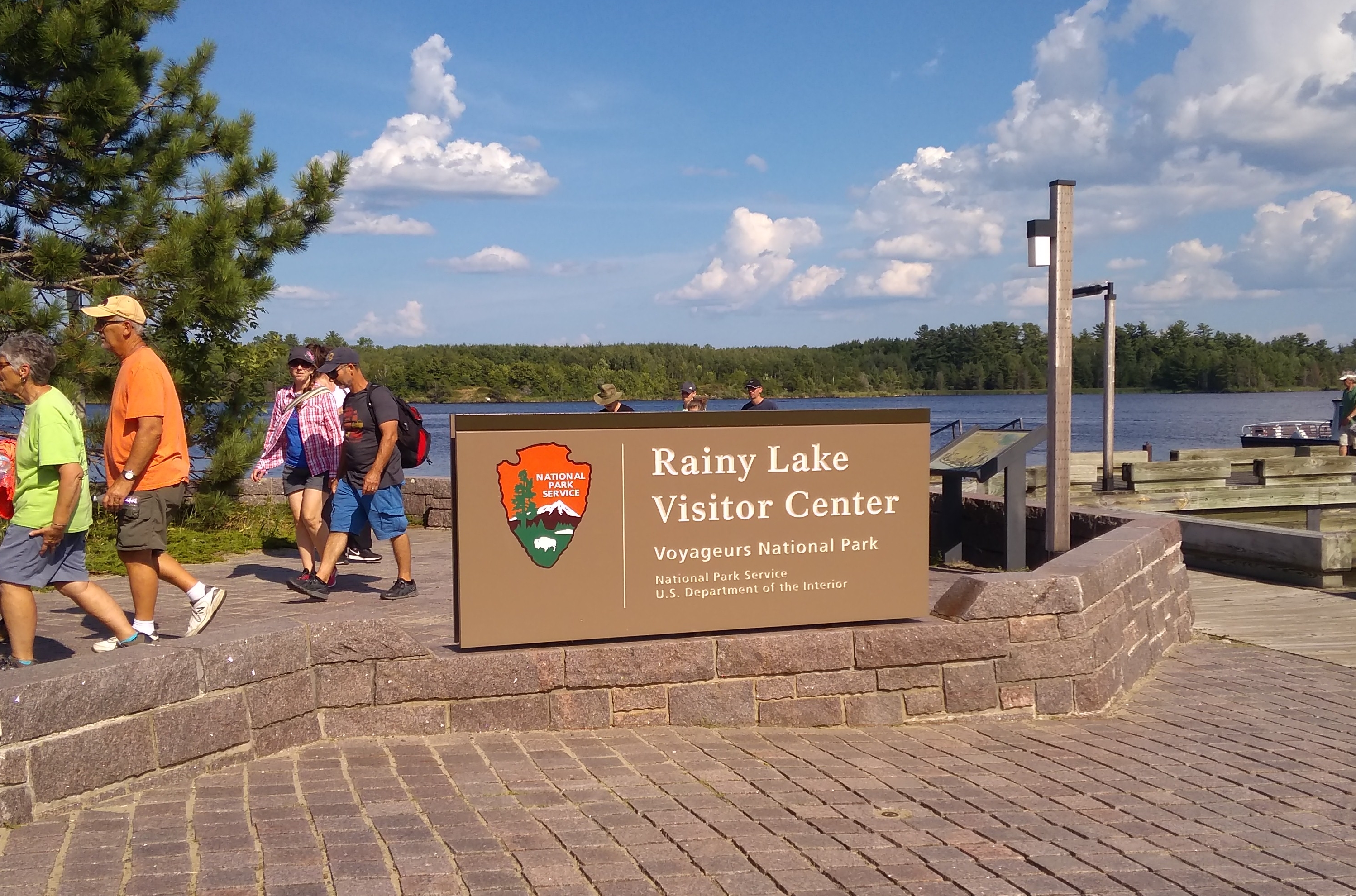
The park is a world of wooded islands and peninsulas but mostly lakes, including the sizable Rainy and Kabetogama lakes. So I figured only reasonable that the thing to do was take a boat tour.

The park itself offers a number of options, including one that’s six hours long, which didn’t interest me greatly, and one in small boats you paddle to evoke the transits of those hearty voyageurs of old, though I bet modern participants smell better than authentic voyageurs. That didn’t really pique my interest either.

So we took a two-and-a-half hour jaunt out on Rainy Lake, at the park’s western edge, accessed by driving a few miles east of the border town of International Falls, Minn. We boarded the good tourist ship Voyageur and off we went.
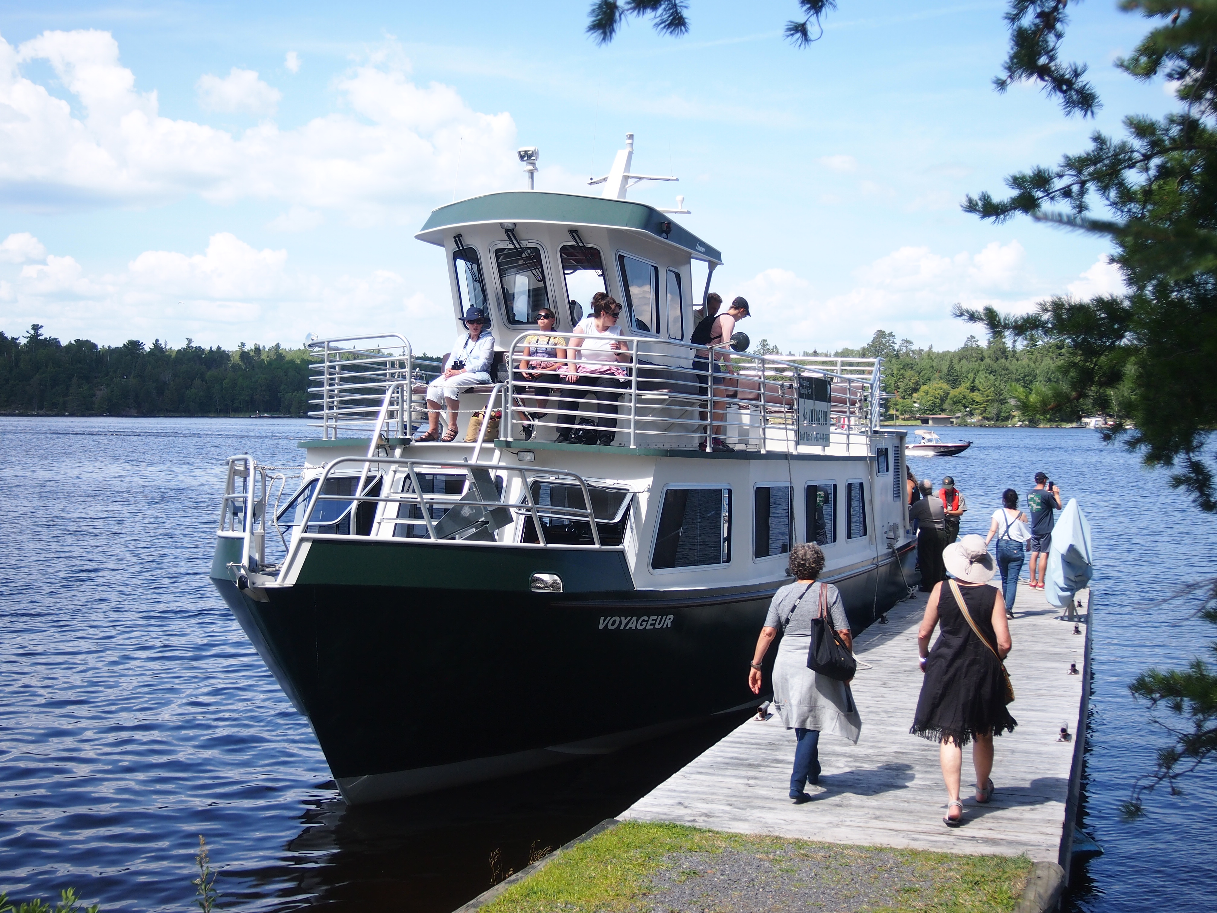
Along the way, our guide — Ranger Adam — pointed out various aspects of natural and human history in the land we cruised by, such as a number of eagles and eagle nests perched on tall trees, evidence of beavers at work, the sparse ruins of an 1890s settlement called Rainy Lake City, and a former fishing camp that petered out in the 1950s.
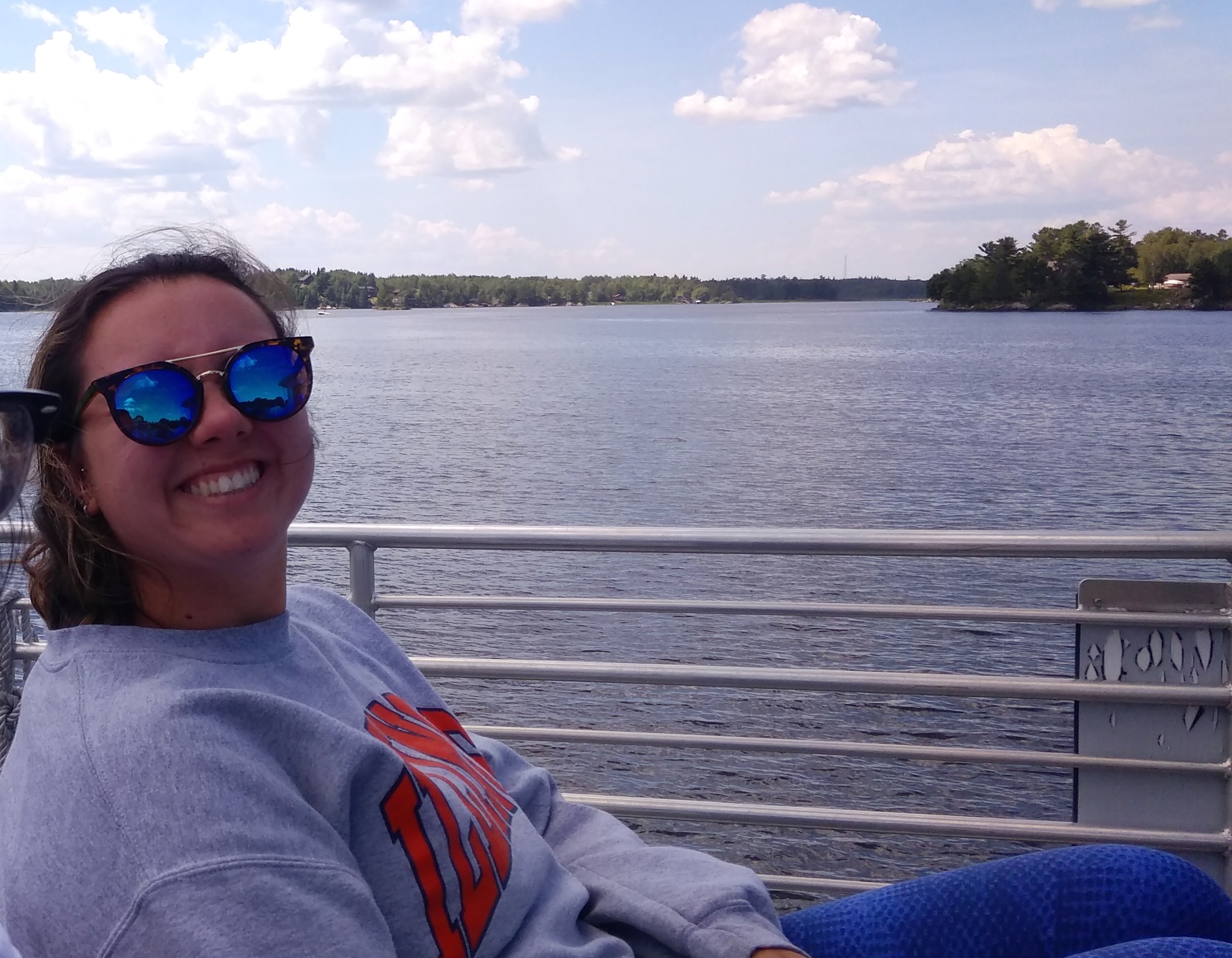
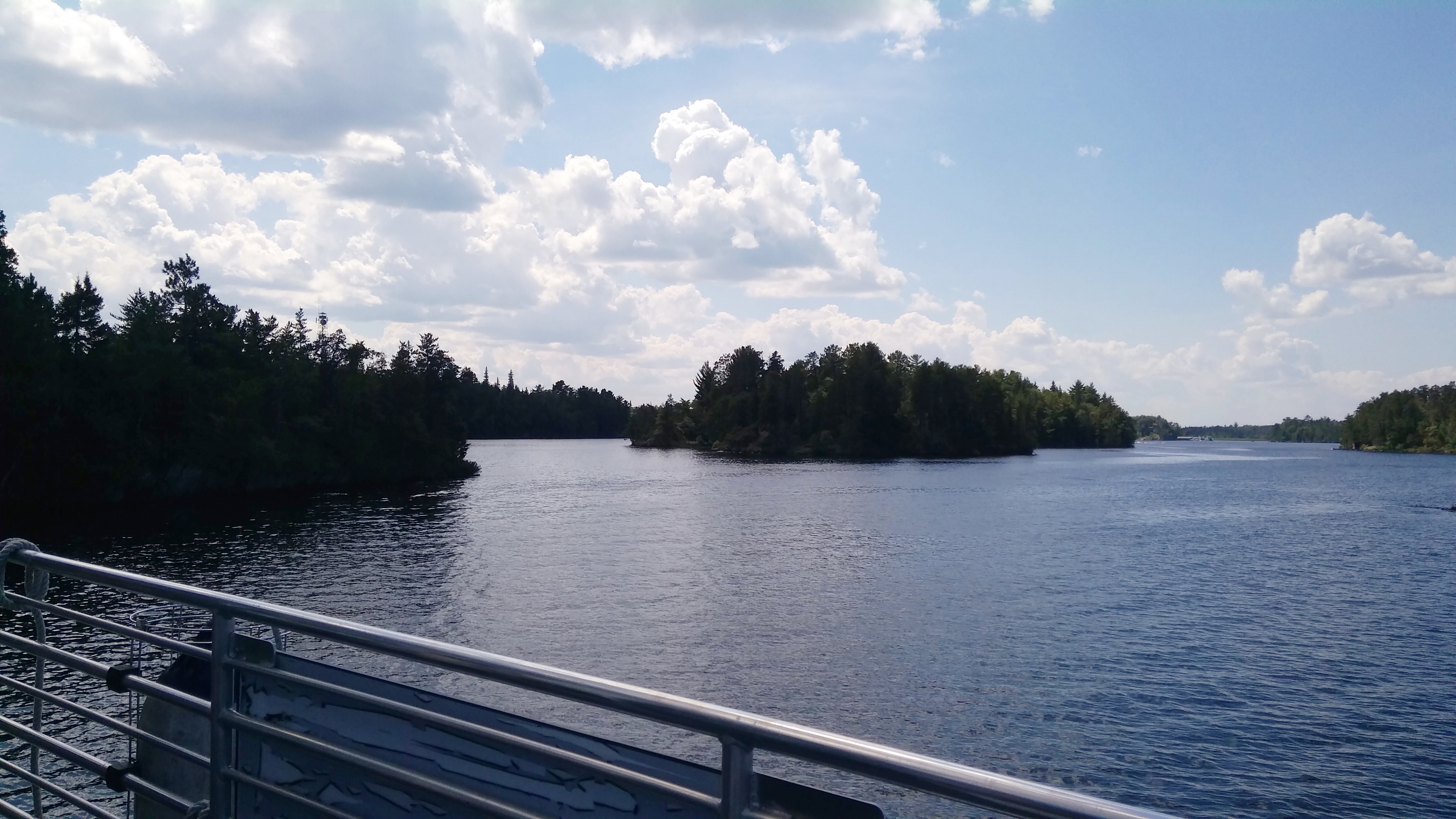
We stopped at one small island: Little American Island, which was added to the park only in 1989. Gold mining had occurred there briefly nearly 100 years earlier. These days, short footpaths take visitors to the few relics of the gold mining days.
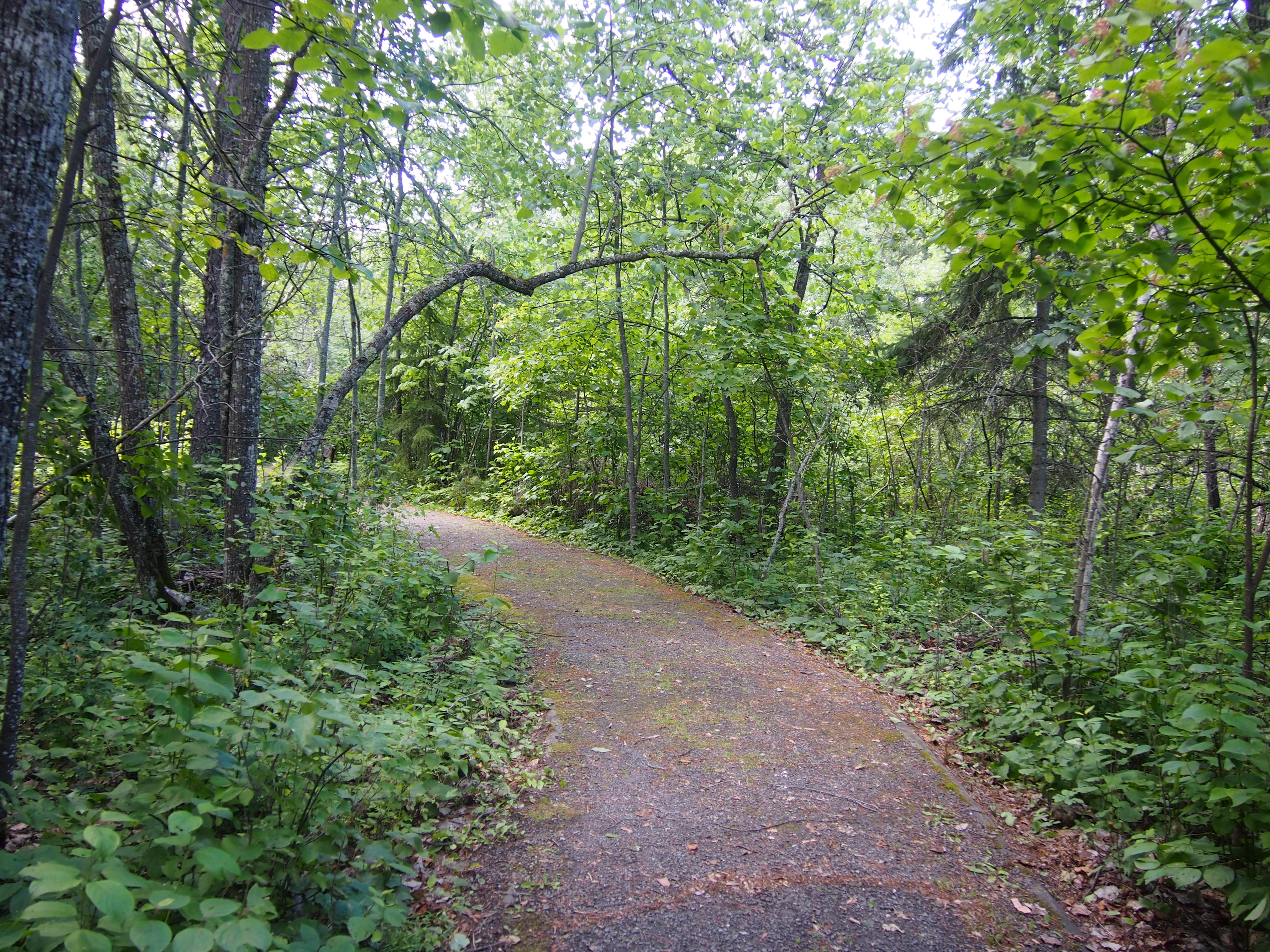
Ranger Adam went with us to explain things and point stuff out, such as the hole in the ground left over from the gold mine and a few rusty mining machine parts.
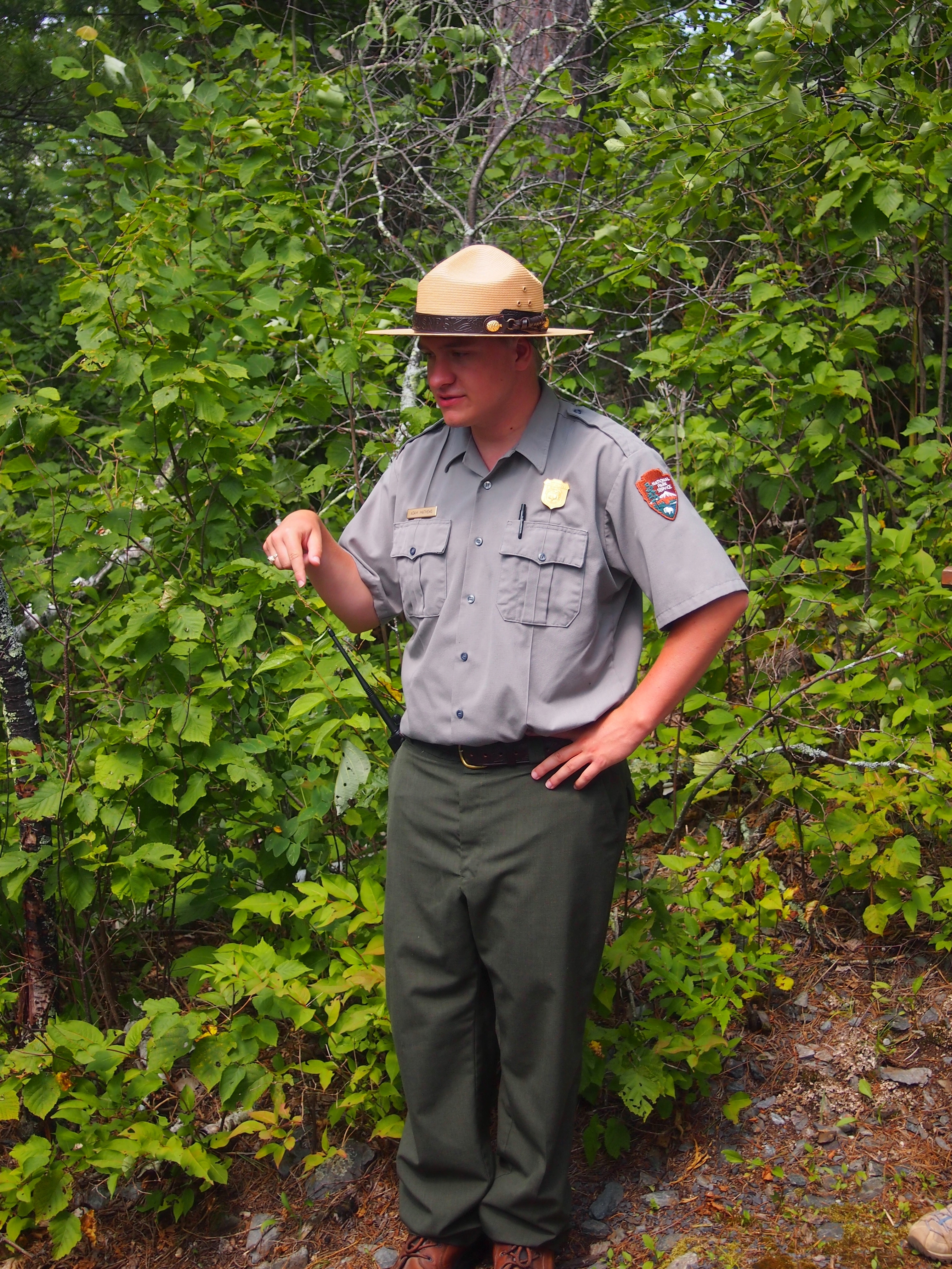
“The Little American Mine operated from 1893 to 1898,” says Forgotten Minnesota. “The average value of the gold extracted during that time was $30 per ton, which represented a profit of around $12 per ton.

“The Little American is the only gold mine in Minnesota known to have produced a profit. The impact of the mine was felt primarily in Rainy Lake City. After the mine closed, Rainy Lake City slowly disappeared and was considered a ghost town by 1901.

“Although the mine was productive, a large vein of rich gold was never found to kick off a gold rush to rival those in California. Oddly enough, the influence of the Little American Mine on the mining industry occurred in Canada, where the large veins of gold were finally found.

“Remnants of the mine can still be found under years of overgrown brush and pine trees. Two major excavations from the Little American Mine are still visible on the island: a vertical, cribbed shaft and an entrance to a horizontal shaft. Both are filled with debris and water.”

Little American Island aside, the tour was mostly a relaxing few hours on the water. Though it was fairly warm — maybe 85 F and partly cloudy — as we chugged along the breeze kept things fairly comfortable.
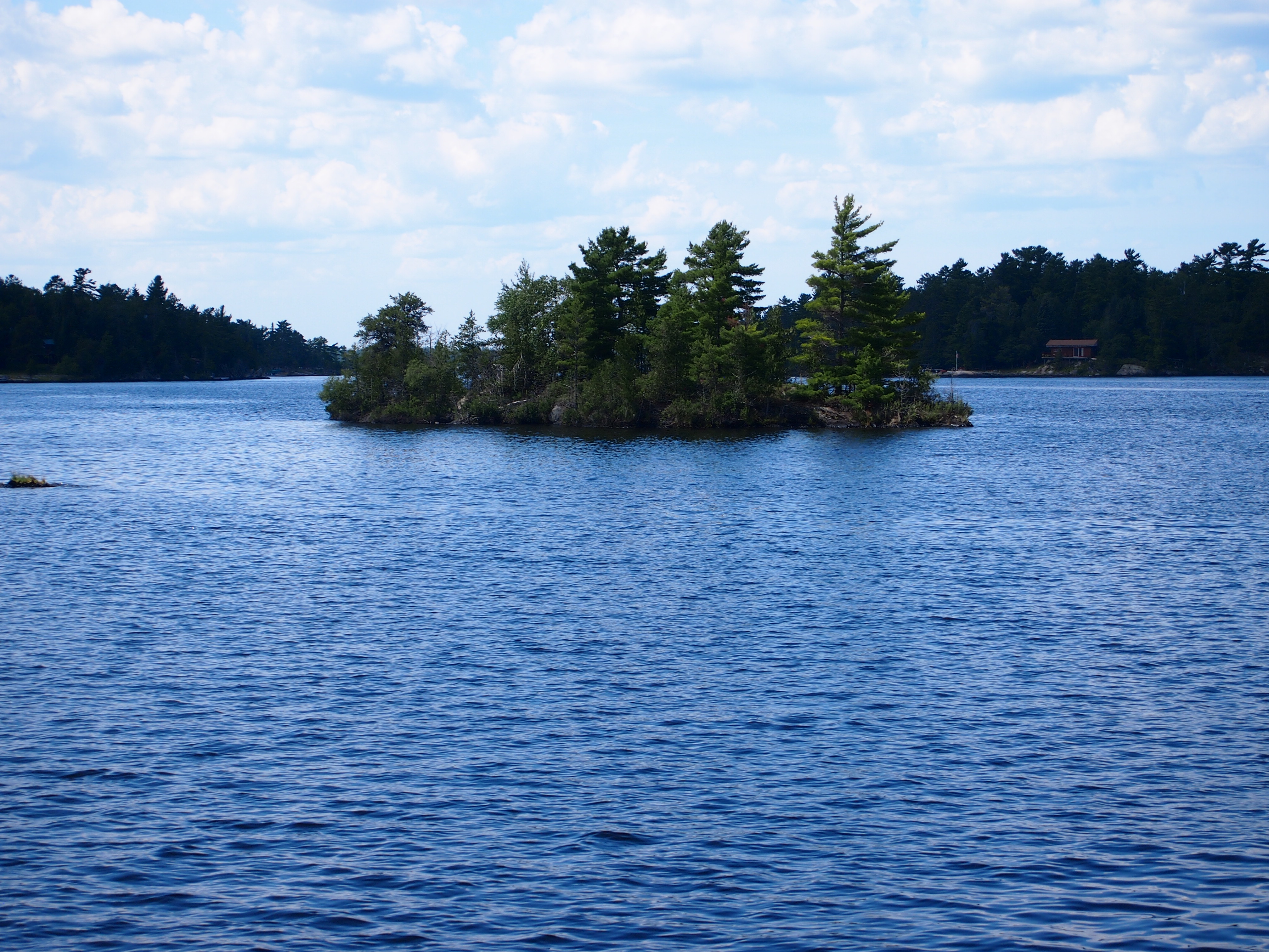
One oddity: out on the lake, I felt my phone buzz in my pocket. I didn’t really want to have anything to do with it while on the lake, but I was surprised there was service at all. I glanced at the phone and the screen said, Welcome to Canada! Then it offered details about how I needed pay extra to call from within Canada.

I’m pretty sure we hadn’t crossed into Canadian waters, since a NPS tour is probably going to be precise about that kind of thing. But we were close. The nearest cell tower must have been on private land in Canada, so the phone, dense device that it is, figured we were there.
Thursday Havering

A lot of the ads popping up lately on YouTube have been to promote Canadian tourism. Mostly the ads depict, in music video style, young people doing the kind of vigorous activities that (some) young people must imagine is the essence of traveling to exotic places like Saskatchewan. Actually, one today featured the Yukon.

I’m all for visiting Canada, and encouraging people to do so, but the ads don’t really speak to me. Besides, Canada’s not really top of my mind in November. Then again, it’s good to plan ahead, so you can visit Canada, and even the Yukon, during that short window of opportunity when the place is pleasantly warm.

I never knew until recently that The Proclaimers did a charming version of “King of the Road” back in 1990. No one does it like Roger Miller, but I smile when I hear lyrics like, “destination Bangor, Maine” in that burr of theirs.

“King of the Road,” in the way things go on the Internet, soon leads to a song stuck in mid-60s amber, “Queen of the House.” Even better, the song is done in a Scopitone.

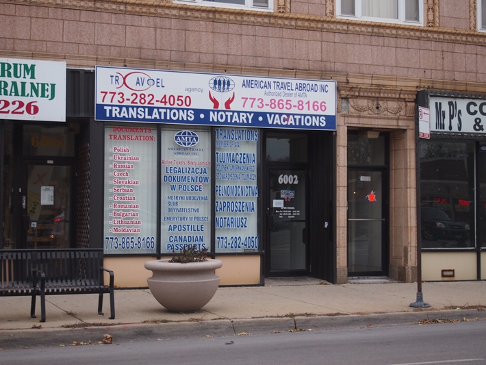
I was in the city not long ago with a camera in the front seat, so I took a few pictures while stopped at traffic lights. Such as this place. So very Chicago.
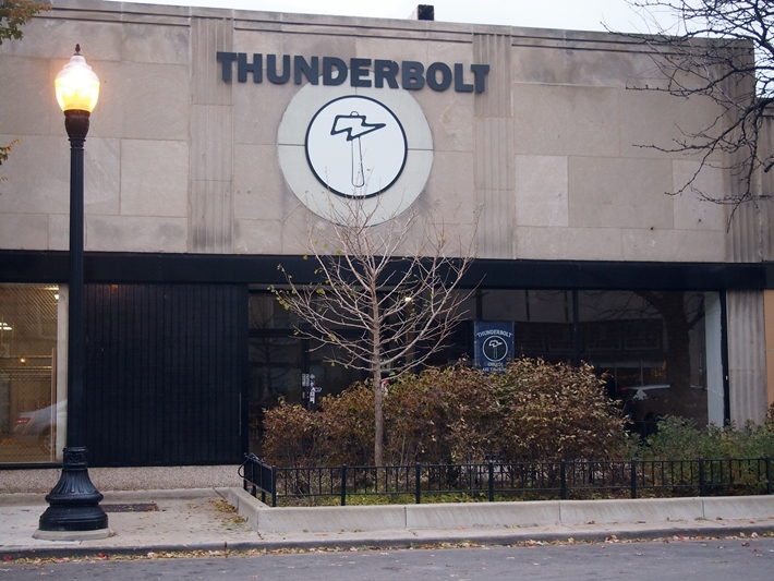
Then there was Thunderbolt.
It’s an ax throwing venue, only the second one in Chicago, according to the Tribune, opening this spring.

“Ax throwing — indoor or outdoor — is a skill-based sport; [owner Scott] Hollander likens it to pool or darts, where participants can take the competition as seriously or lackadaisically as they please,” the paper says.

“Easygoing ax throwers can book an hour at a lane for $15 per person Wednesdays and Thursdays, and for $20 per person Fridays, Saturdays and Sundays. Food and nonalcoholic drink is allowed and can be consumed at the plywood stands behind each pair of lanes or at the picnic tables in the building. Thunderbolt also is available for bachelor or bachelorette parties, birthday parties and corporate events.”

What do I think of when I hear about ax throwing? Ed Ames, naturally. Tomahawk, but close enough.

Captain Canuck & President Polk for Christmas

My last Christmas present came via UPS today. Lilly ordered it not long ago, some time after I assured her that a little while after Christmas is close enough. It’s an attitude that makes the holidays less stressful; more people should consider it.

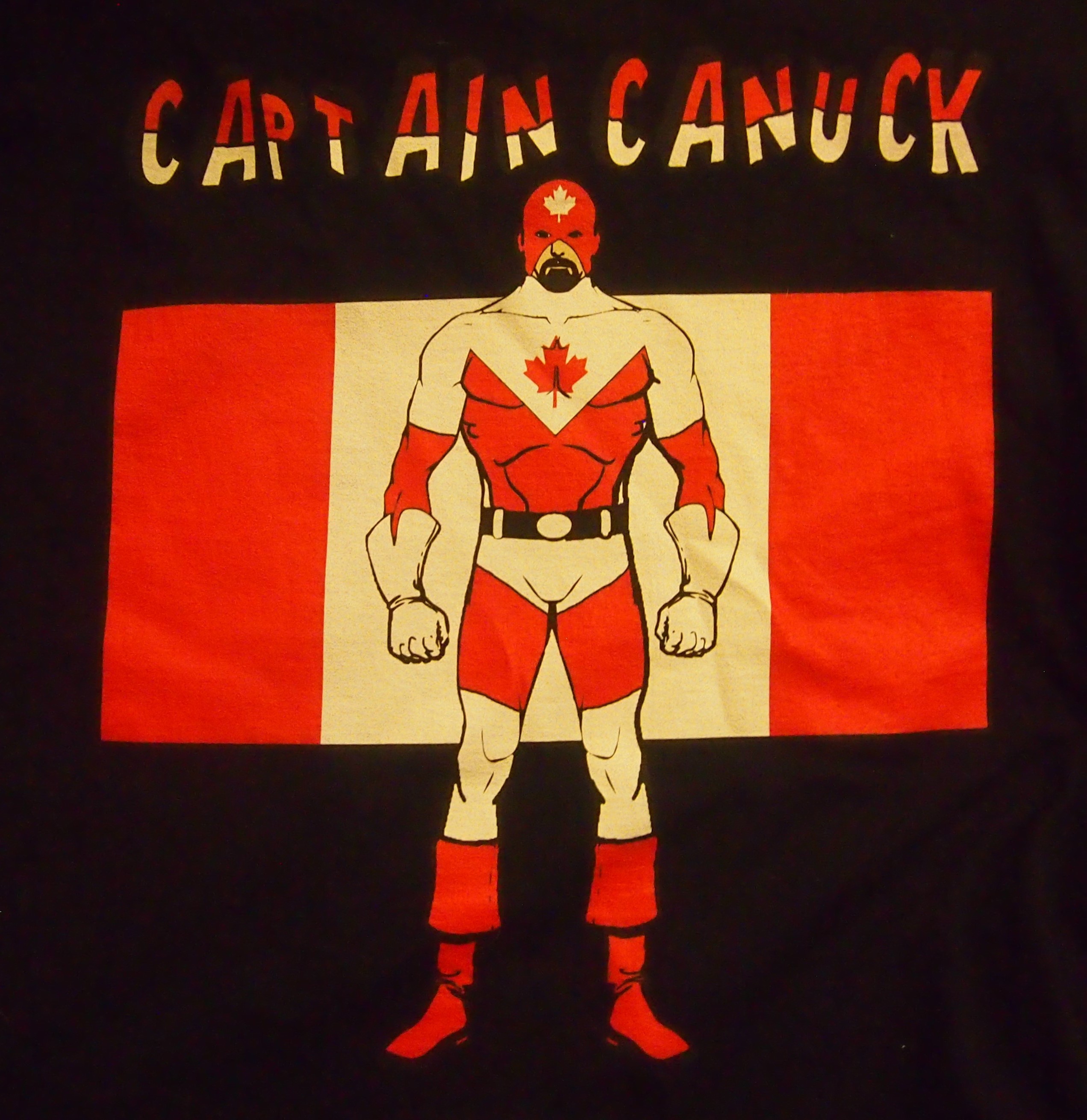
I’d suggested the item almost off-handedly. In our time, such whims are easily gratified online. It’s alarmingly easy. Here’s a closeup.

Captain Canuck!

It’s a Captain Canuck t-shirt, 100 percent cotton, made in Nicaragua. Accept no less.

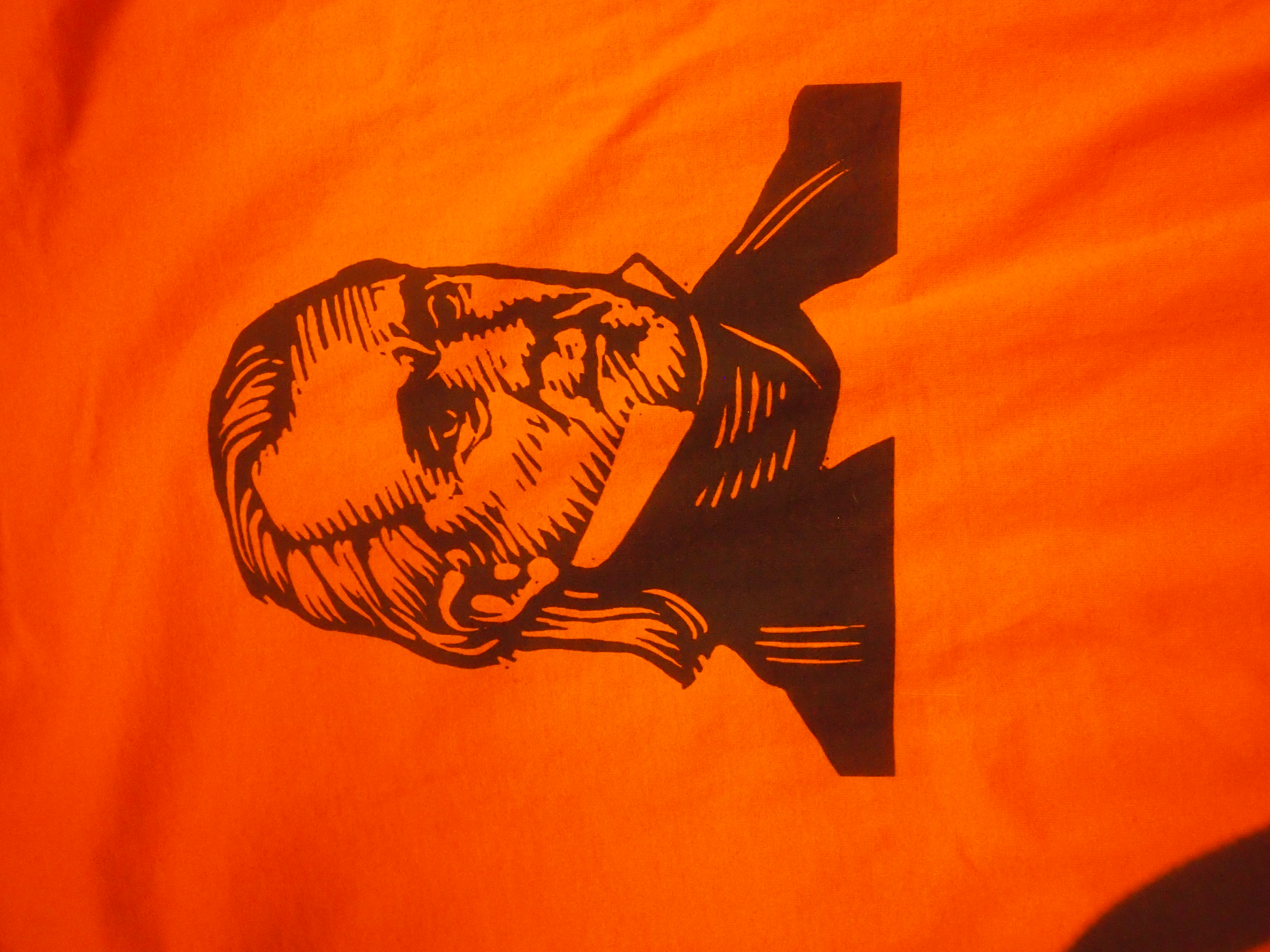
Also for Christmas this year, but some time earlier, Jay got me a t-shirt with another larger-than-life figure, though from the annals of U.S. history.

James K. Polk, Napoleon of the Stump

None other than James K. Polk, Napoleon of the Stump. Also all cotton, but made in Haiti. On the back it says POLK 11.

Map Hero’s Laminated Gitche Gumee

You never know what’s lurking in the fine print. Usually that’s taken to be a bad thing, but yesterday I took a look at a map I’ve owned for years and discovered a fine thing in the fine print.

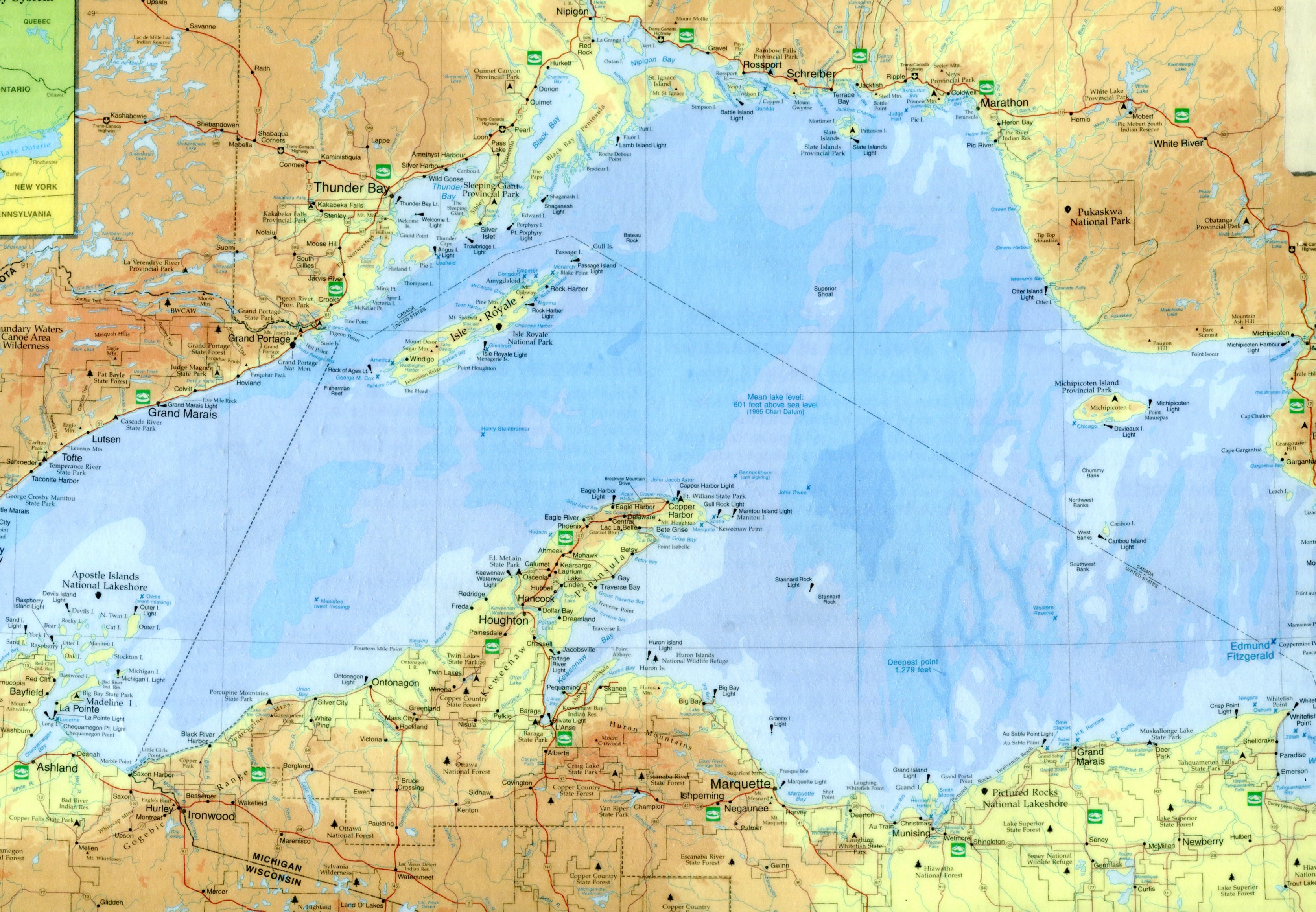
First, the map. It’s laminated, and so in excellent shape. I got it when we went up to northern Wisconsin in 2003. At 16¾ inches x 10⅝ inches, it’s beyond the capacity of my simple scanner, so here’s a large detail from the midsection of the map: instantly recognizable as the ice-water mansion Lake Superior.
LakeSuperiorLake Superior Port Cities Inc., publisher of Lake Superior Magazine, published the map in 2001. It’s a quietly gorgeous map whose shadings not only indicate elevation above and below the surface of the lake, but are pleasing to the eye. Besides towns and roads, it notes all of the various state forests and parks along the shores of Lake Superior, plus the national lakeshores and the single national monument, Grand Portage in Minnesota.

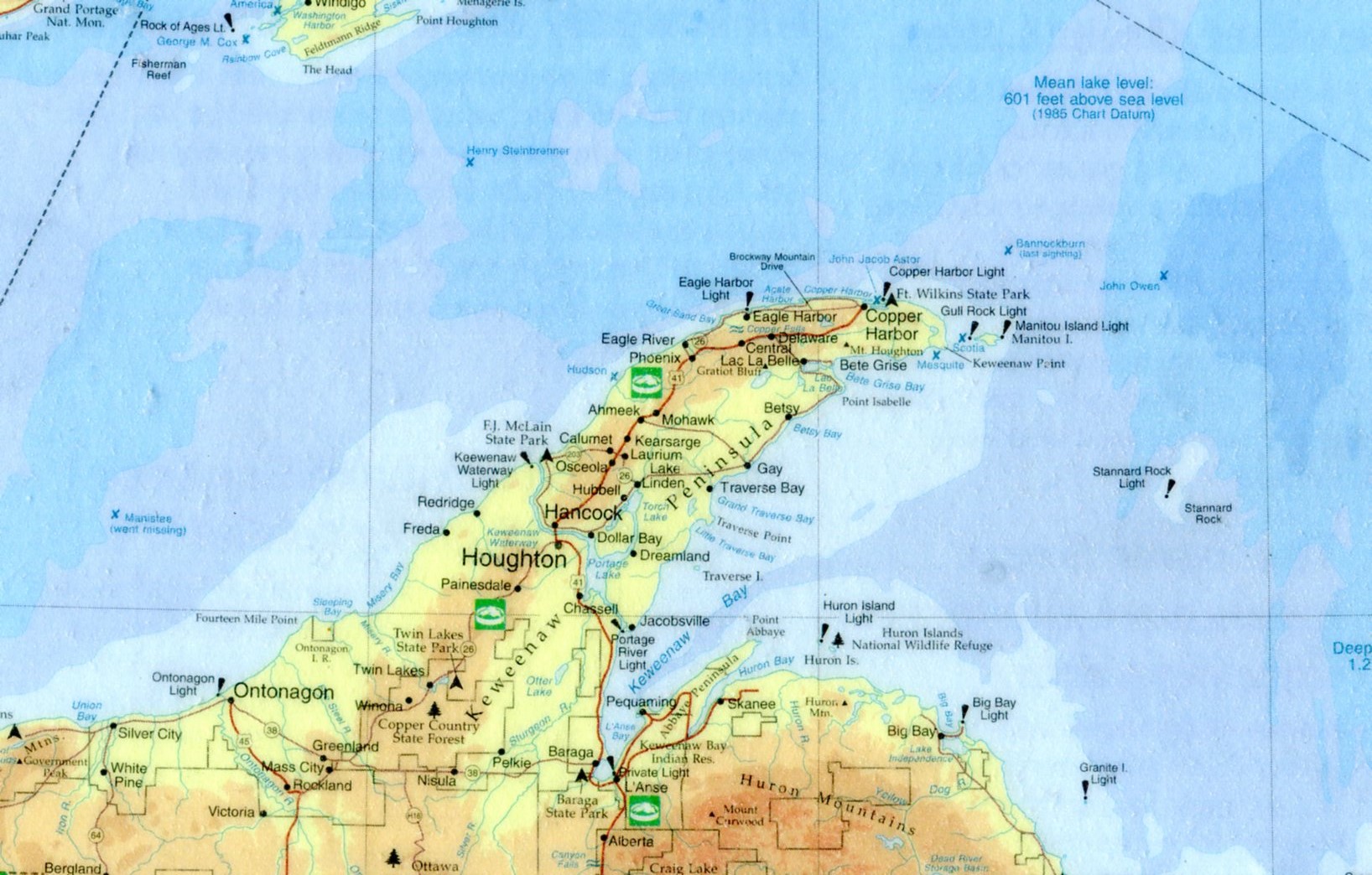
Here’s a closeup of Keweenaw Peninsula, the UP’s UP, and a place I surely must see.
KeweenawVery small versions of the Lake Superior Circle Tour sign mark a network of roads that circumscribe the lake. If I had the time, that’s a drive I wouldn’t hesitate to do. I remember the first time I visited Lake Superior — Labor Day weekend 1989 — I was driving between Munising and Marquette and I saw one of the signs. I hadn’t realized there was a Lake Superior version of the drive; the Lake Michigan Circle Tour signs can be seen even in the Chicago area and, in fact, I’ve done my own version of circum-driving that lake twice (once was that ’89 weekend).

Instantly I was taken with the notion of driving around Lake Superior. I was by myself and could have done it. I didn’t have my passport, but you didn’t need a passport to visit Canada in those days. I hadn’t planned to take any time off after Labor Day, but I could have called in sick for a few days, something I very rarely did. But no. I was entirely too responsible.

On the lake itself, the map also features lighthouses and the sites of notable shipwrecks. Some of the lighthouses are probably easy enough to see, but others are impossibly remote, such as the Stannard Rock Light, more than 20 nautical miles southeast of Keweenaw Point, slap in the middle of the lake.

As the for the wrecks, few will ever see them in the chilly Superior waters (average temp, 40 degrees F.). The most famed of them, naturally, is the Edmund Fitzgerald, but it has a lot of company, such as the Onoko, Henry Steinbrenner, John Owen, Western Reserve, Gale Staples, Niagara, Superior City and others.

A handful wrecks are marked but also noted “went missing,” such as the Owen and Manistee. To quote Wiki on that ship: “The Manistee was a packet steamship that went missing on Lake Superior on November 10, 1883. It was presumed to have sunk, with no surviving crew or passengers. The cause remains a mystery, and the wreckage was never discovered.” Sometimes Gitche Gumee just eats ships, it seems.

As for the fine print, way at the bottom right corner of the map, in about 3-point print, it says, “Design/Cartography by Matt Kania.” He’s easy enough to find: Map Hero, maker of custom maps. Looks like he’s done a lot of wonderful maps besides Superior. If I had any talent for it, I’d do the same.

The University of British Columbia Museum of Anthropology

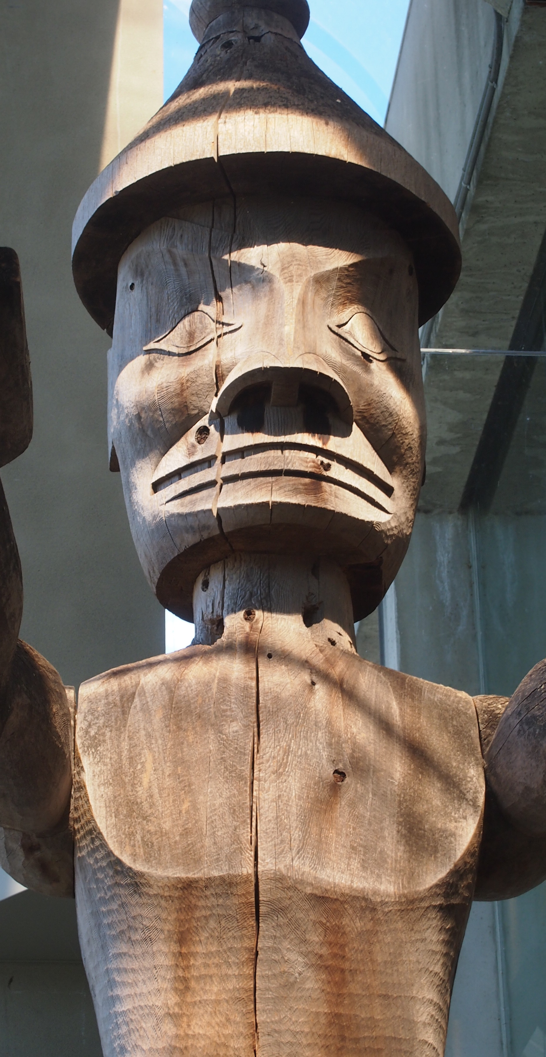
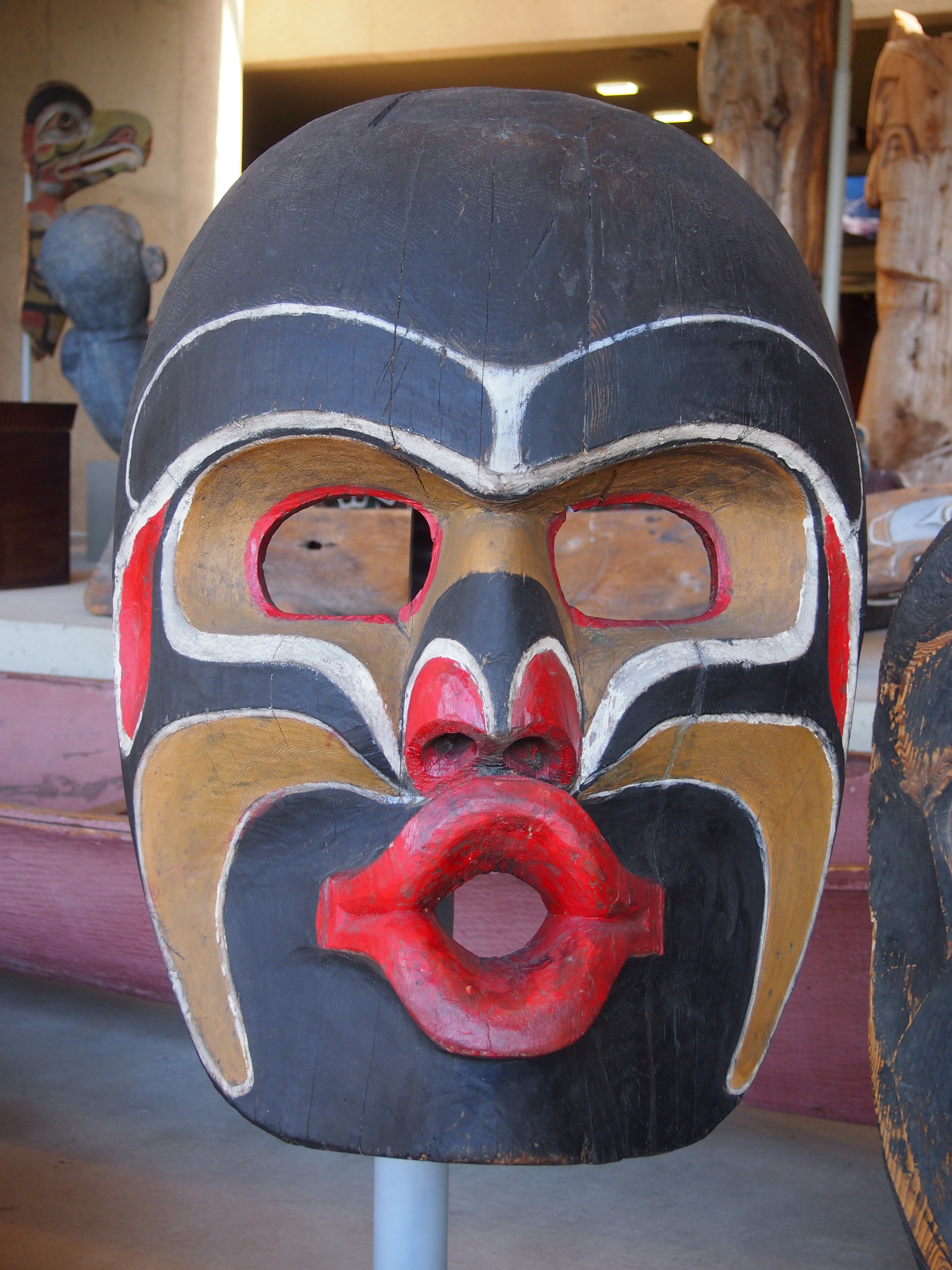
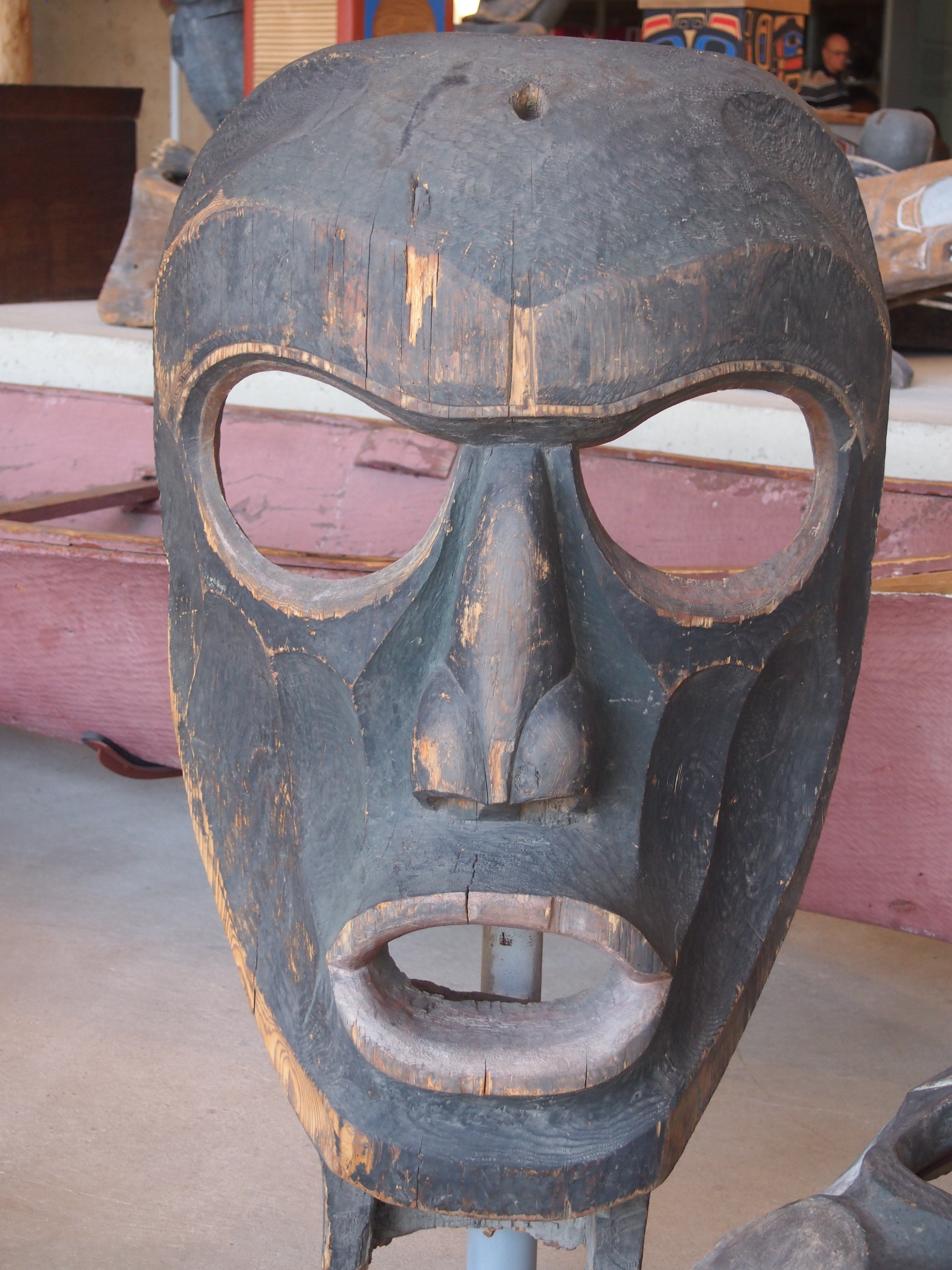
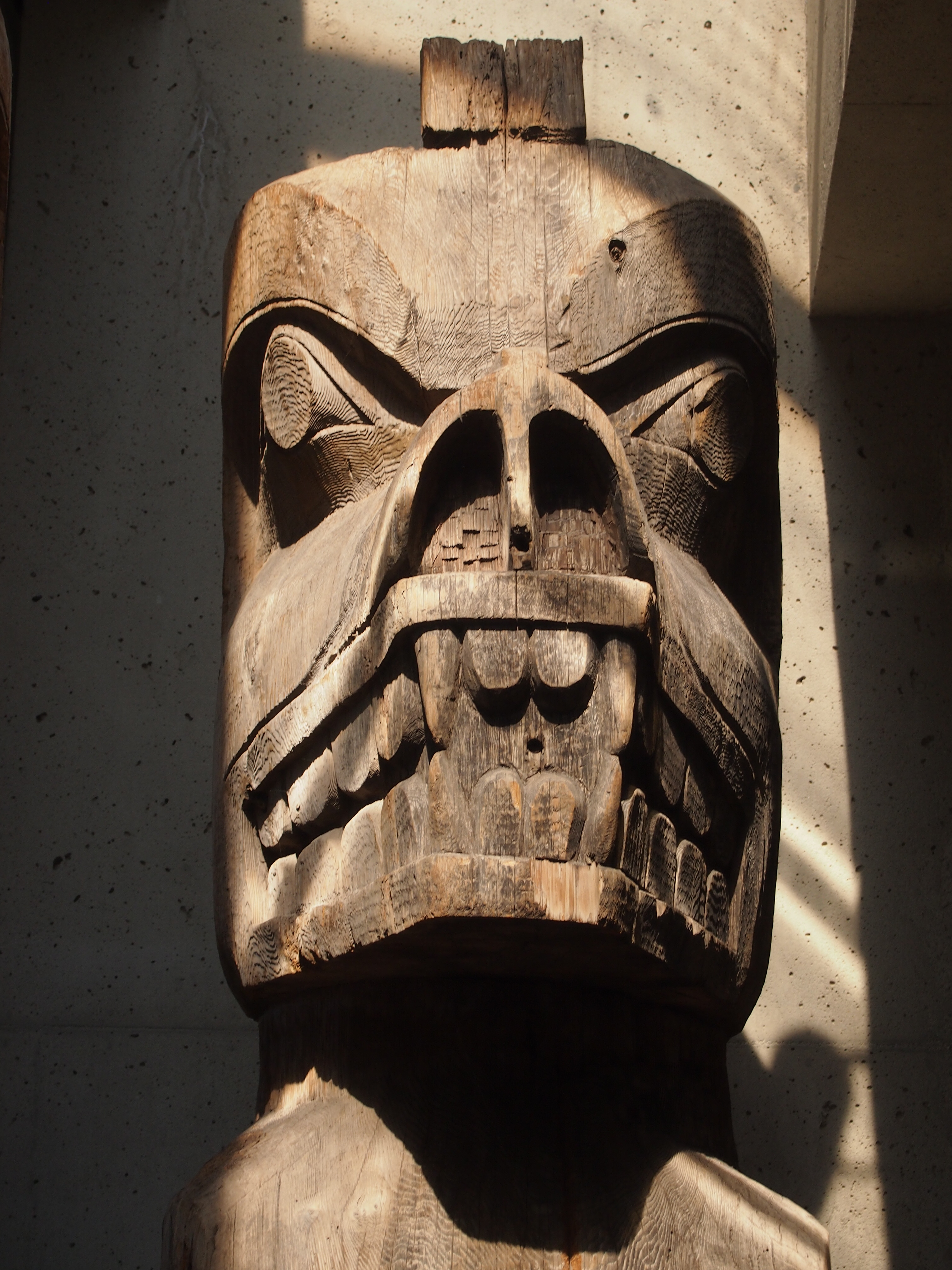
Visit the University of British Columbia Museum of Anthropology, as I did on the afternoon of August 25, and you’ll probably end up in awe of this fellow.Cedar ManIt’s the head and chest of Cedar Man, who stands about two stories tall in the museum’s Great Hall. He has arms and legs, but they were in shadow.

The museum says: “Carved welcome figures on the Northwest Coast have traditionally been raised on village beaches to greet visitors. Joe David carved this one for a different purpose: to protest logging operations on this birthplace of Meares Island, part of the ancestral territories of the Tla-o-qui-aht and Ahousaht peoples of the Nuu-chah-nulth First Nations.”

Meares Island is off the west coast of Vancouver Island in Clayoquot Sound. This was the first I’d heard of it. The protest was in 1984, and eventually the Indians won the day, and the ancient trees on the island still stand. The museum bought Cedar Man from Joe David in 1987.

All together the UBC Museum of Anthropology houses 38,000 ethnographic objects — which I suppose includes artwork like Cedar Man, made in living memory — plus 535,000 archaeological objects. The ethnological collections include over 15,000 objects from Asia, almost 12,000 from North America (including over 7,100 from B.C. First Nations), about 4,300 from South and Central America, 4,000 from the Pacific islands and over 2,300 from Africa.

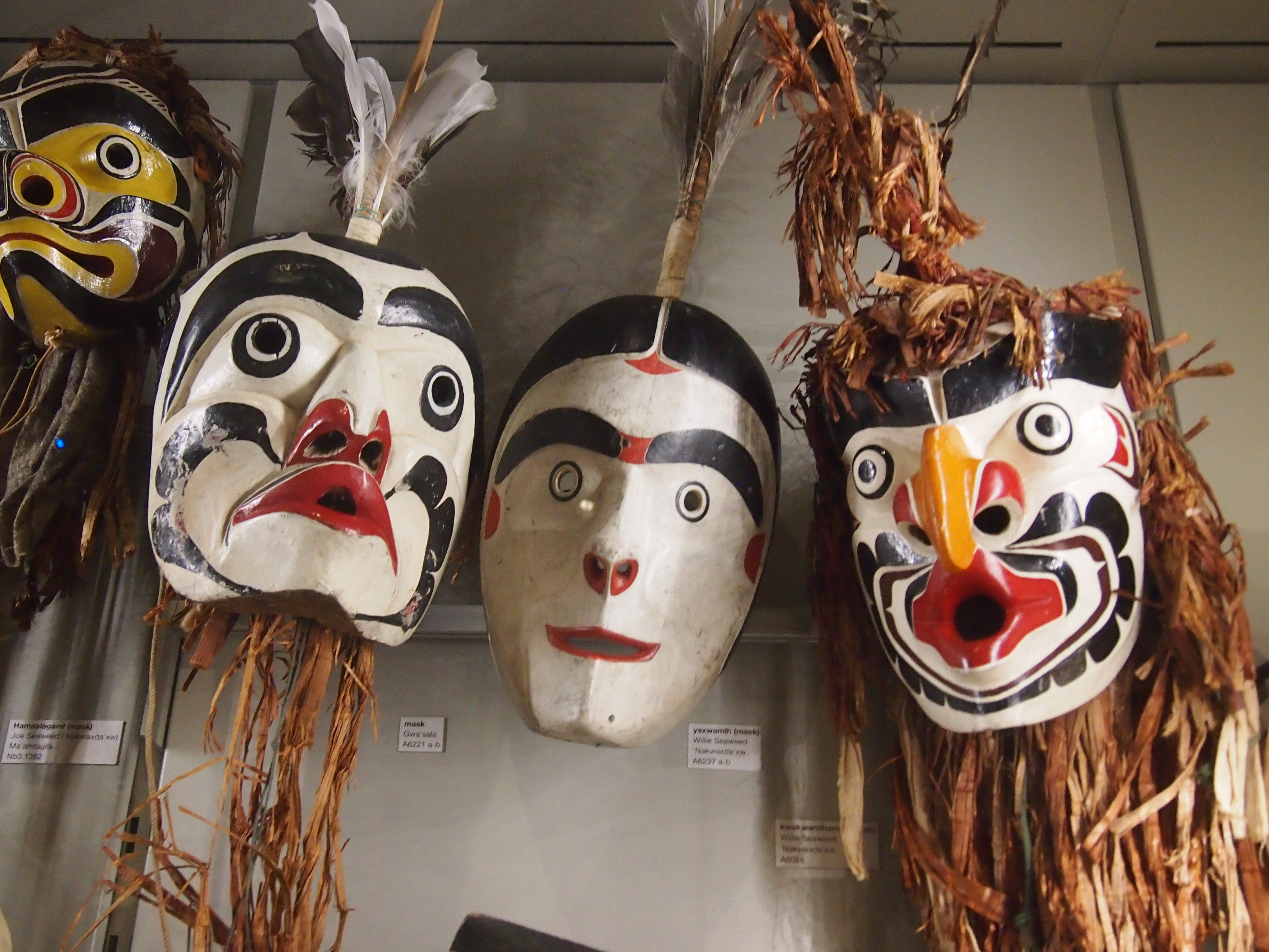
An overwhelming amount of stuff, in other words, and not just from the Pacific Northwest, though that’s a heavy emphasis. The mass of carvings in the Great Hall, which includes an array of other Northwest Coast totem poles, house poles (carved structural elements), masks, and more, is only the beginning.

The face is pretty much universal.

UBCUBCUBCThe museum goes off in a number of directions, branching into various displays. An entire room is devoted to a sculpture called “The Raven and the First Men” by Bill Reid, which used to be on the Canadian $20 bill.

In other galleries, all stuffed to the gills with items from around the world, I encountered the work of Kwakwaka’wakw carver Willie Seaweed (ca. 1873-1967), which the museum calls “one of the great 20th-century artists of the Northwest Coast.” Among other things, he made ritual items for potlatches while they were illegal in Canada (1884-1951).

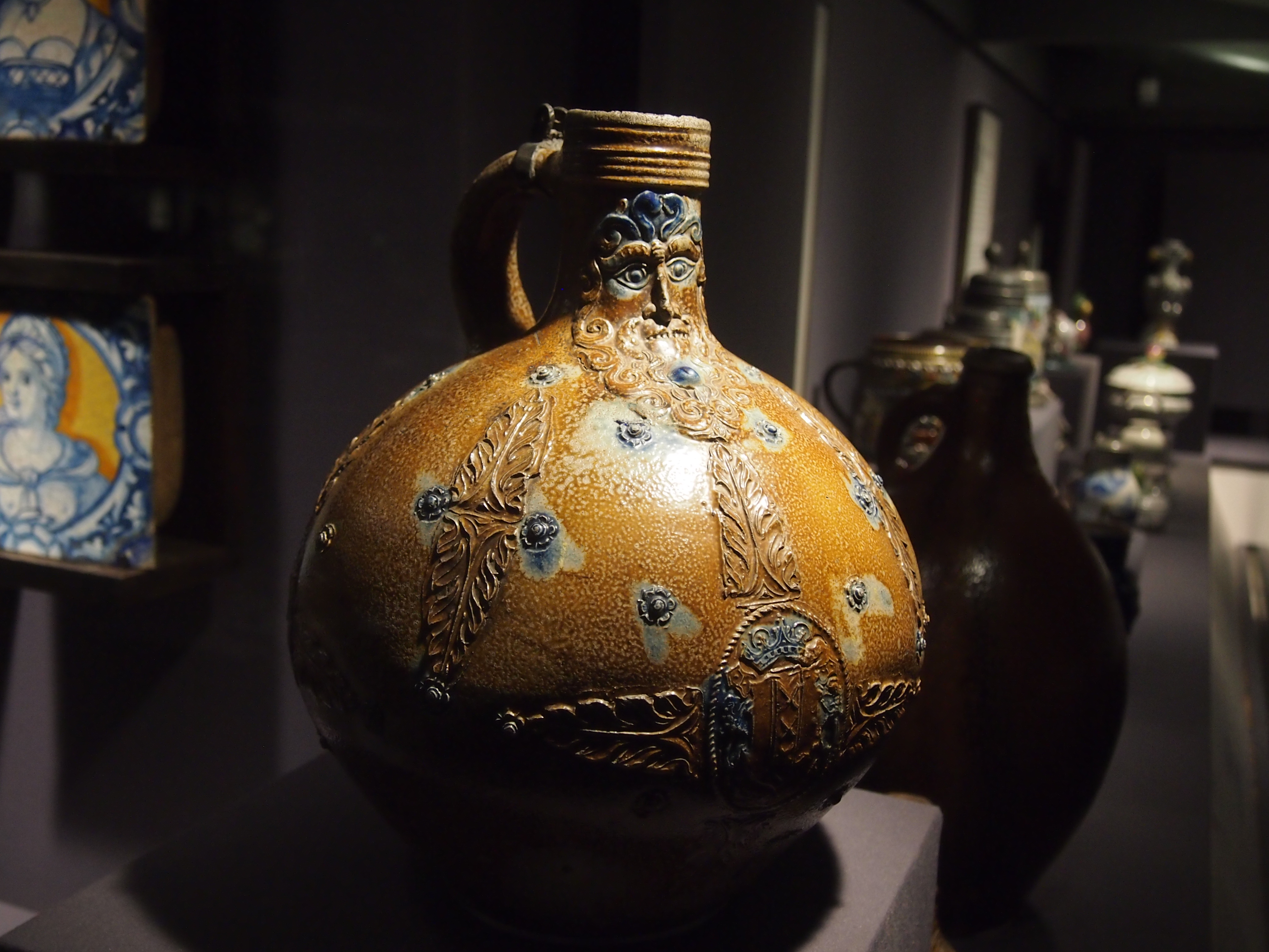
UBCI was surprised to find a room devoted to European ceramics, but there it was in the Koerner Ceramics Gallery. I’m not up on European ceramics, so I’d never heard of the likes of Bellarmine or Bartmann jugs, which have bearded faces at the base of the neck, and seemed to have been the last word in jugs in the 16th and 17th centuries, and mostly made in western Germany.
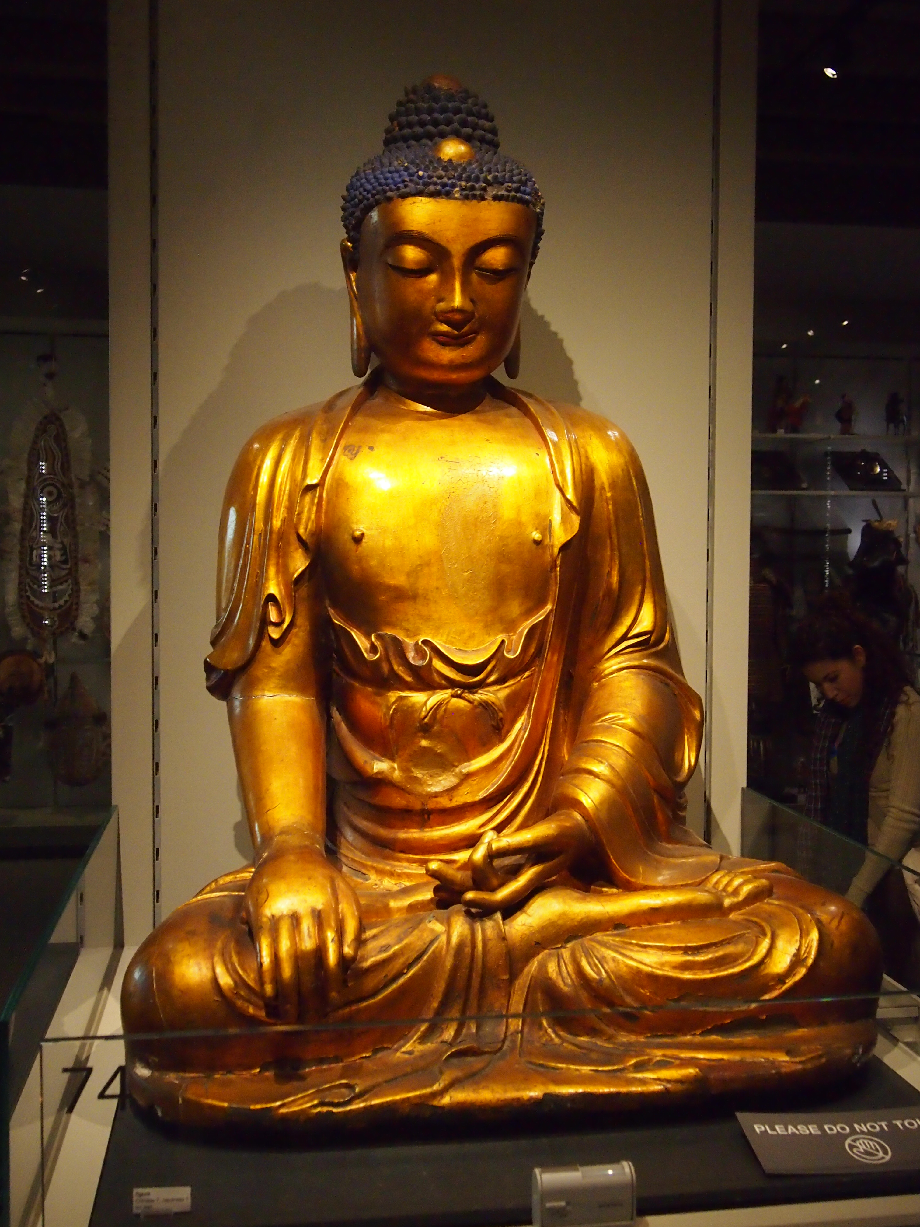
UBCOther galleries sported plenty of other things from around the world. Such as a familiar image of Buddha, though its origin is uncertain (either China or Japan).
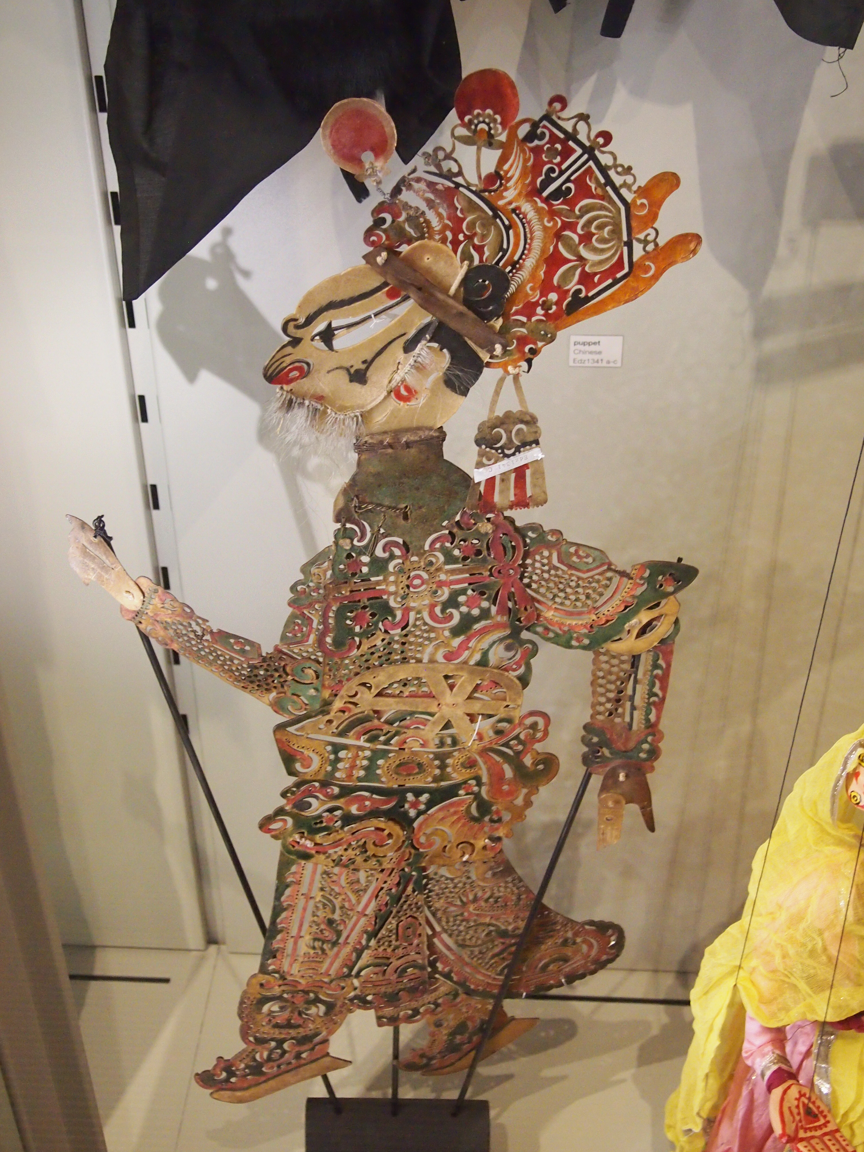
UBCA puppet from China, though it reminded me of the ones from the East Indies.
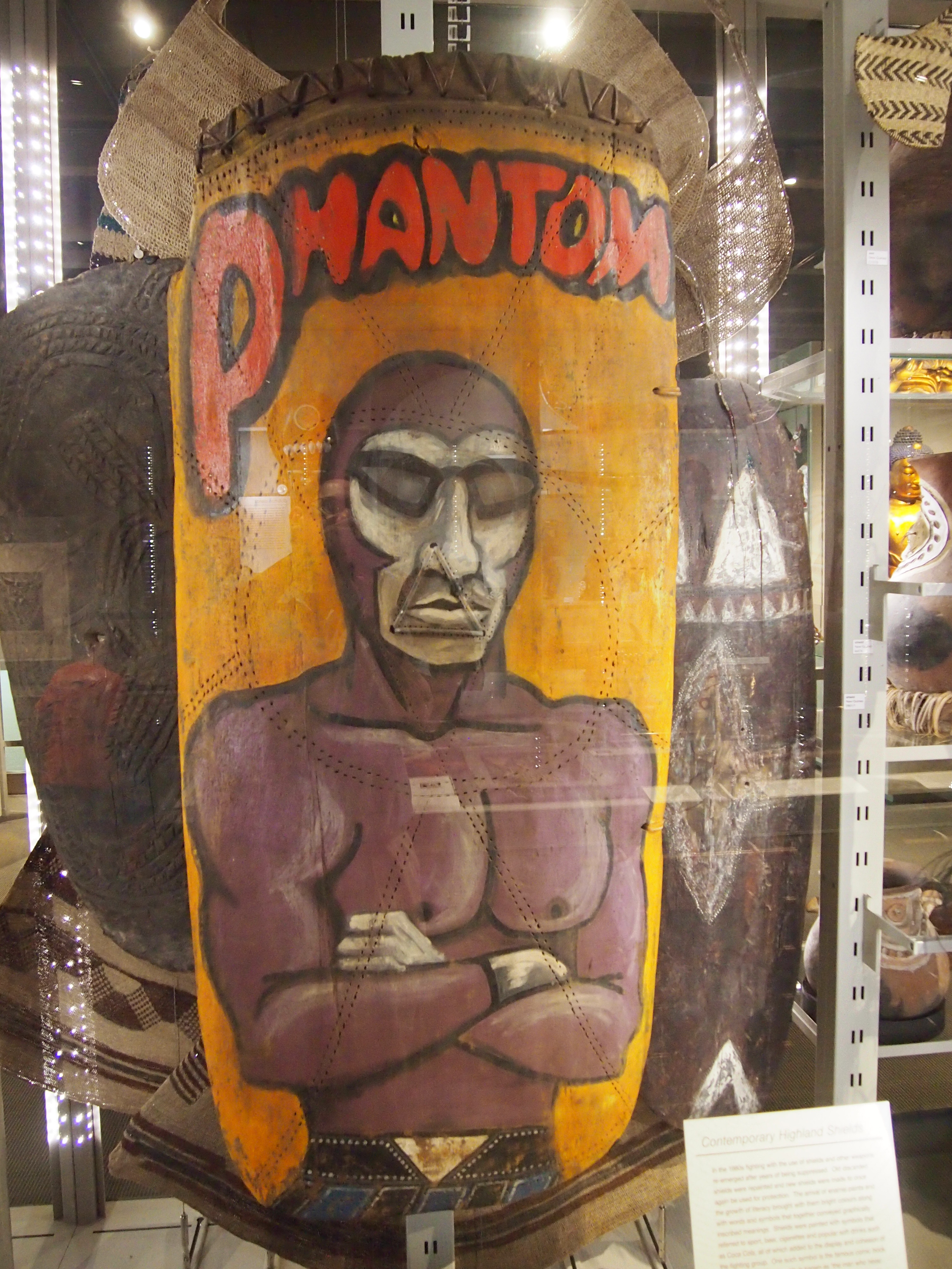
UBCHere’s my own favorite from the UBC, a recent work — the last 30 years or so — from Papua New Guinea, many of whose inhabitants are inordinately fond of The Phantom, who appears on their battle shields like this one.
The Phantom!A great example of cross-cultural WTF. More examples are here.

Peace Arch Park

One thing to think about at Peace Arch Historical State Park in extreme northwestern Washington state is the last time the United States invaded Canada, namely the bungled campaigns of 1812 and ’13. Bungled from the U.S. point of view, that is, though of course there were some successes, such the battles of the Thames and Lake Eire (“We have met the enemy and they are ours.”).

The War of 1812 was the last bit of fighting along the U.S.-Canada border, not counting spats over fishing, so it’s reasonable that a bi-national park on the border commemorates the long peace. Peace Arch Park is that place, 22 acres south of the border (Peace Arch Historical State Park) and nine hectares north of the border (Peace Arch Provincial Park).

I arrived around noon on August 25, driving up from Bellingham, Wash. You take the last U.S. exit on I-5 (or maybe it’s the first exit) and park nearby, just south of the border, and then walk to the Peace Arch, which is slap on the border, meaning it’s also exactly 49 degrees North, as well as in the grass median between the northbound and southbound lanes of the highway (the meeting of I-5 and BC 99). Since traffic stops on each side of the border, crossing the road on foot there isn’t very risky.

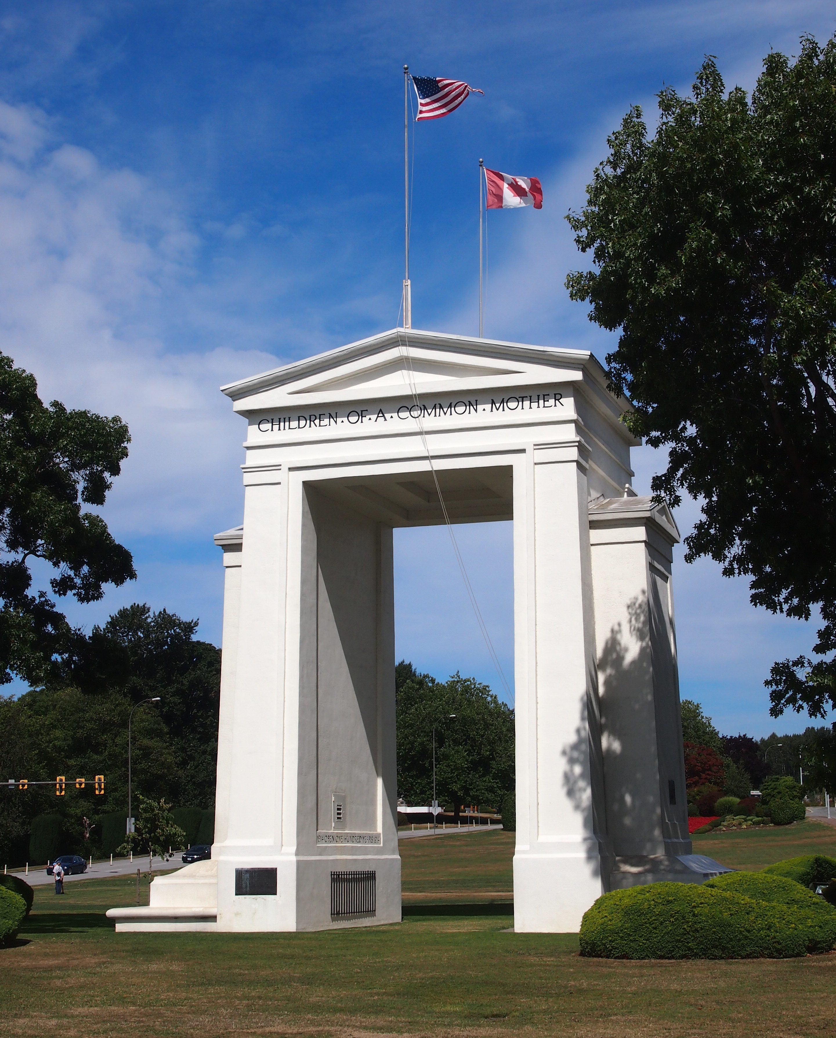
Peace Arch, August 25, 2015On the U.S. side, the Arch is 67 feet tall; on the Canadian side, 20.5 meters. It’s been standing for there for 94 years, built at the behest of Pacific Northwest business tycoon Sam Hill (1857-1931), who also had a replica of Stonehenge built in another part of Washington state, and who was an avid advocate of road improvement. (“Good roads are more than my hobby; they are my religion.”) Presumably Hill would have been happy that a major road linking the two nations passes around the Arch.

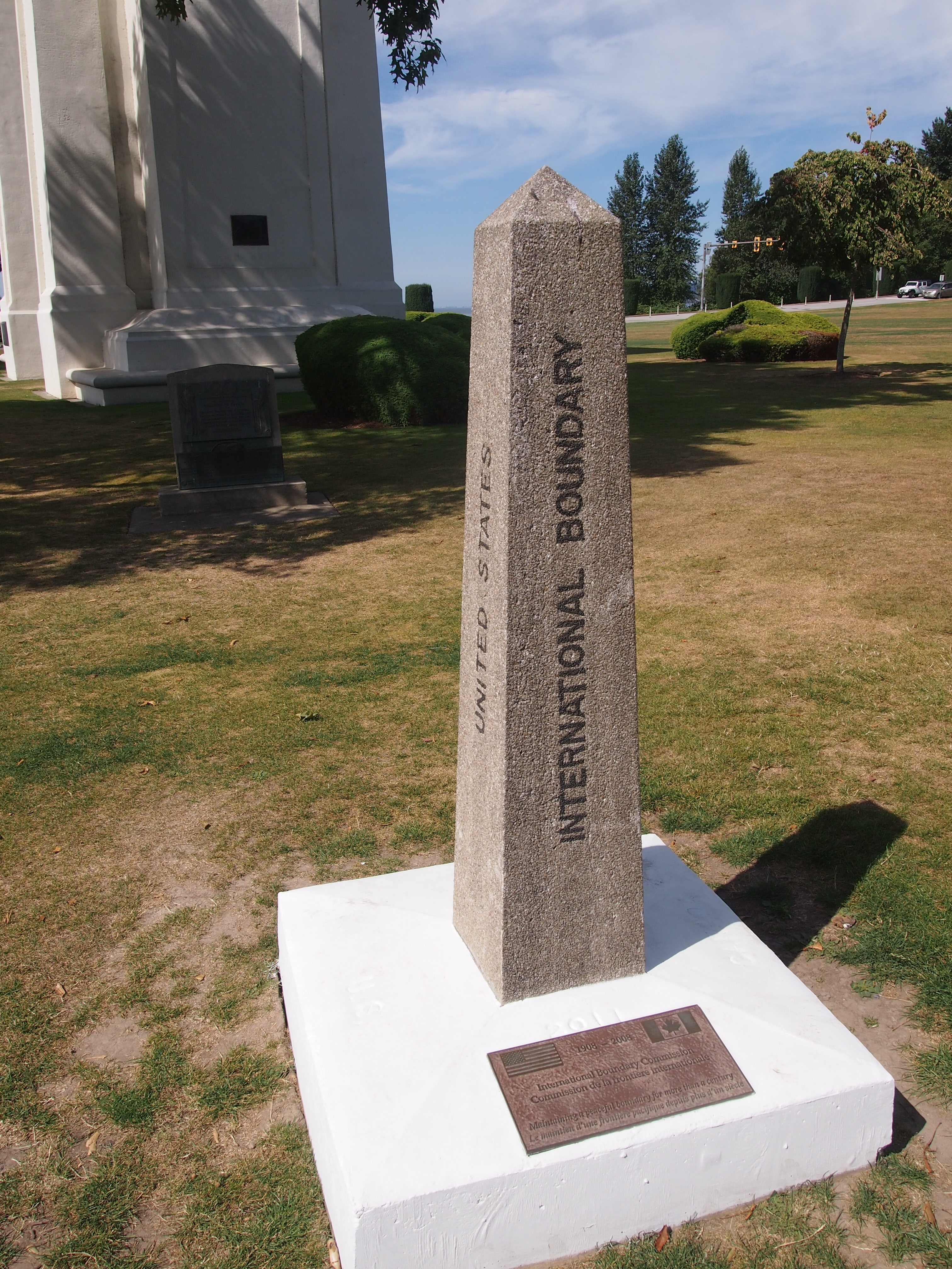
The border’s also marked by a number of concrete posts.
US-Canada borderThe International Boundary Commission (Commission de la frontiere internationale) put the plaque at the bottom of the post on the occasion of its centennial in 2008. I figure most Americans, and most Canadians, have never heard of the commission. I barely remember reading about it some years ago in the context of the Alaska-Yukon border.

According to the commission’s web site, “Officially, the Commission’s work is described as maintaining the [U.S.-Canada] boundary in an effective state of demarcation. This is done by inspecting it regularly; repairing, relocating or rebuilding damaged monuments or buoys; keeping the vista cleared, and erecting new boundary markers at such locations as new road crossings.”

My italics. This is the body that’s responsible for clear-cutting the border between Alaska and Yukon — a 20-foot (six-meter) swath all the way along the 141st meridian. Since I read about that some years ago, I’ve since pondered the usefulness of doing such a thing. The commission asserts that “the boundary vista must be entirely free of obstruction and plainly marked for the proper enforcement of customs, immigration, fishing and other laws of the two nations.” I’m not quite persuaded, but anyway, more about the line is here.

The border posts have four sides: UNITED STATES on the south face (visible in my picture), CANADA on the north face, and INTERNATIONAL BOUNDARY and TREATY 1925 on the other two. I wondered about that. The commission references it too.

The treaty’s formal name is: “Treaty Between the United States of America and His Britannic Majesty, in Respect of the Dominion of Canada, to Define More Accurately at Certain Points and to Complete the International Boundary Between the United States and Canada and to Maintain the Demarcation of that Boundary, Signed at Washington, February 24, 1925.”

I made a point of crossing and recrossing the border a number of times near the posts. Now I can accurately say I’ve been to Canada more than a dozen times, including the six regular check-your-passport visits, plus the half-dozen (maybe more) crossings at the Peace Arch.

Pacific Northwest ’15

I left for the Pacific Northwest on August 21 and returned home late yesterday. Imagine an axis that connects Portland, Seattle, Bellingham and Vancouver, which are all linked by I-5 (British Columbia 99 north of the border). That axis was the focus of the trip. I went to all of those cities and some points in between, some for a matter of hours, others for a few days. I spent time away from those cities as well, in hilly territory lorded over by towering pines and enchantingly quiet at night.

I drove a lot but also managed to spend a solid chunk of time walking and riding buses and light rail. The visit involved attending a conference, touring an exceptional building and seeing other fine ones, experiencing two large public markets, wandering through one of the largest book stores anywhere and a few other excellent ones, and seeing two museums and a Chinese garden very much like some of the wonderful ones in Suzhou. I ate food both awful and extraordinary, including things I’d never heard of before.

Going to another part of the country means doing new things, too. Or it should. Not necessarily life-changing experiences, but the sort of petite novelties that add up over time to make the fabric of one’s life better. Even before I got there, this was the first time I’d ever booked a rental car through Costco or a room through Airbnb. I attribute a less expensive trip, and a better one, to both. I visited a new city (Portland) in a new state (Oregon) and visited new parts of places I’d been (Vancouver in British Columbia, the Fremont neighborhood in Seattle). I witnessed a major forest fire from the air and smelled the result on the ground as the wind wafted west. Unexpectedly, according to the residents. I stood inside a building designed by Frank Gehry, rather than looking at its curious outside.

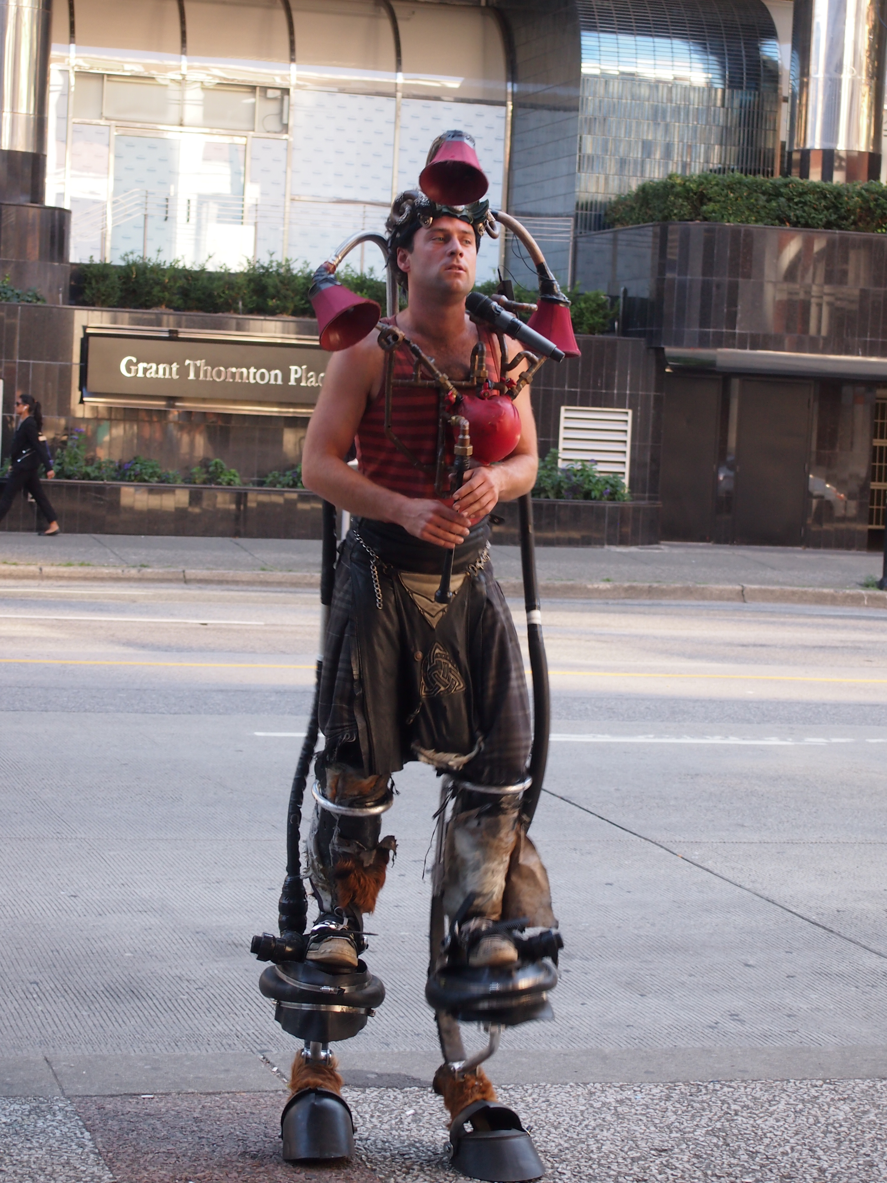
I saw a number of odd and interesting things, such as the street musician who’d modified a bagpipe and played it on stilts (Vancouver, just outside the Pacific Central Station). What to call it? Steampunk bagpiping?
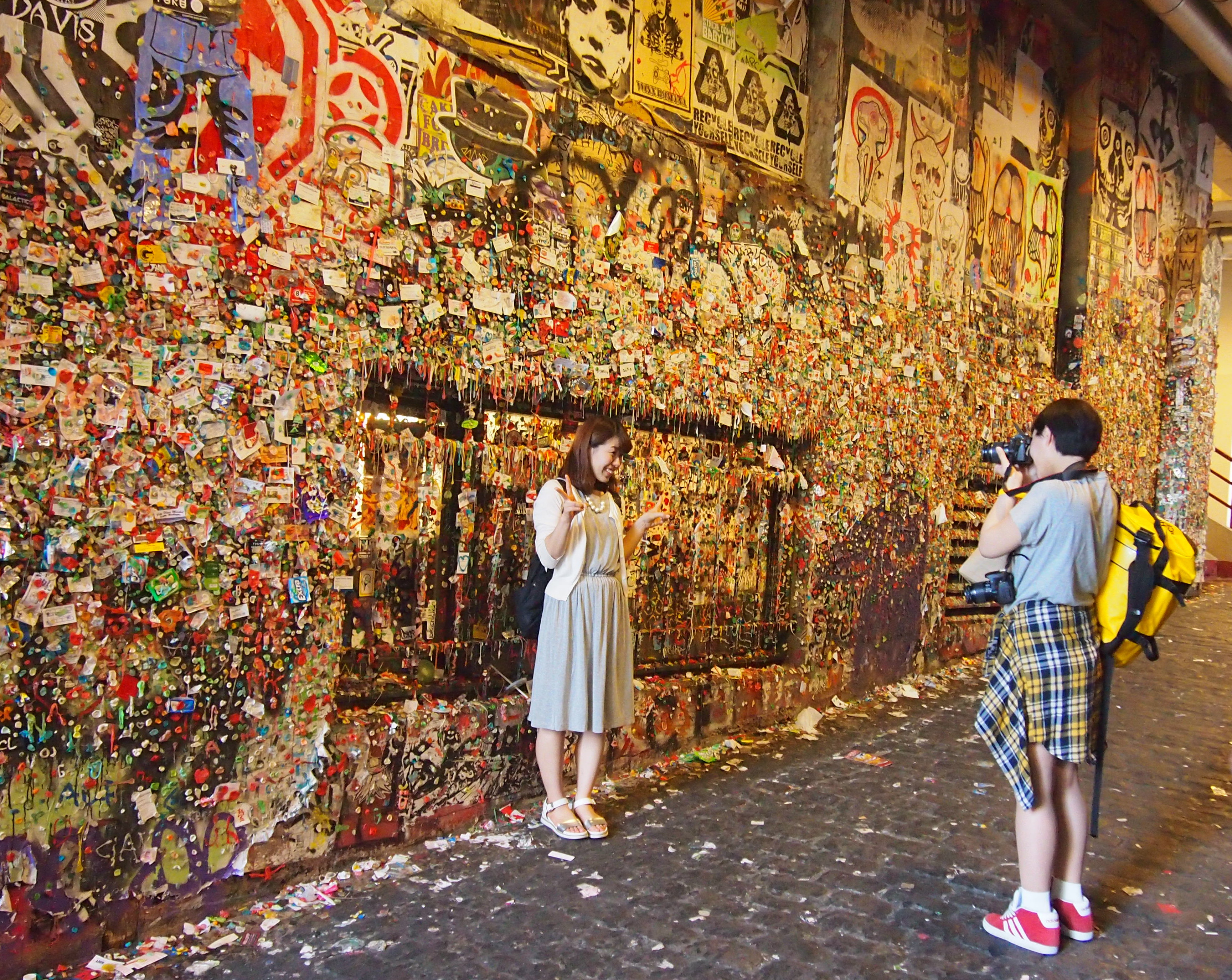
Vancouver, August 25, 2015Or the Gum Wall (Seattle, next to the Pike Place Market). Each of the those bits of color is ABC gum, often used to attach cards and small posters to an alley wall. Why? As near as I can tell, just because.

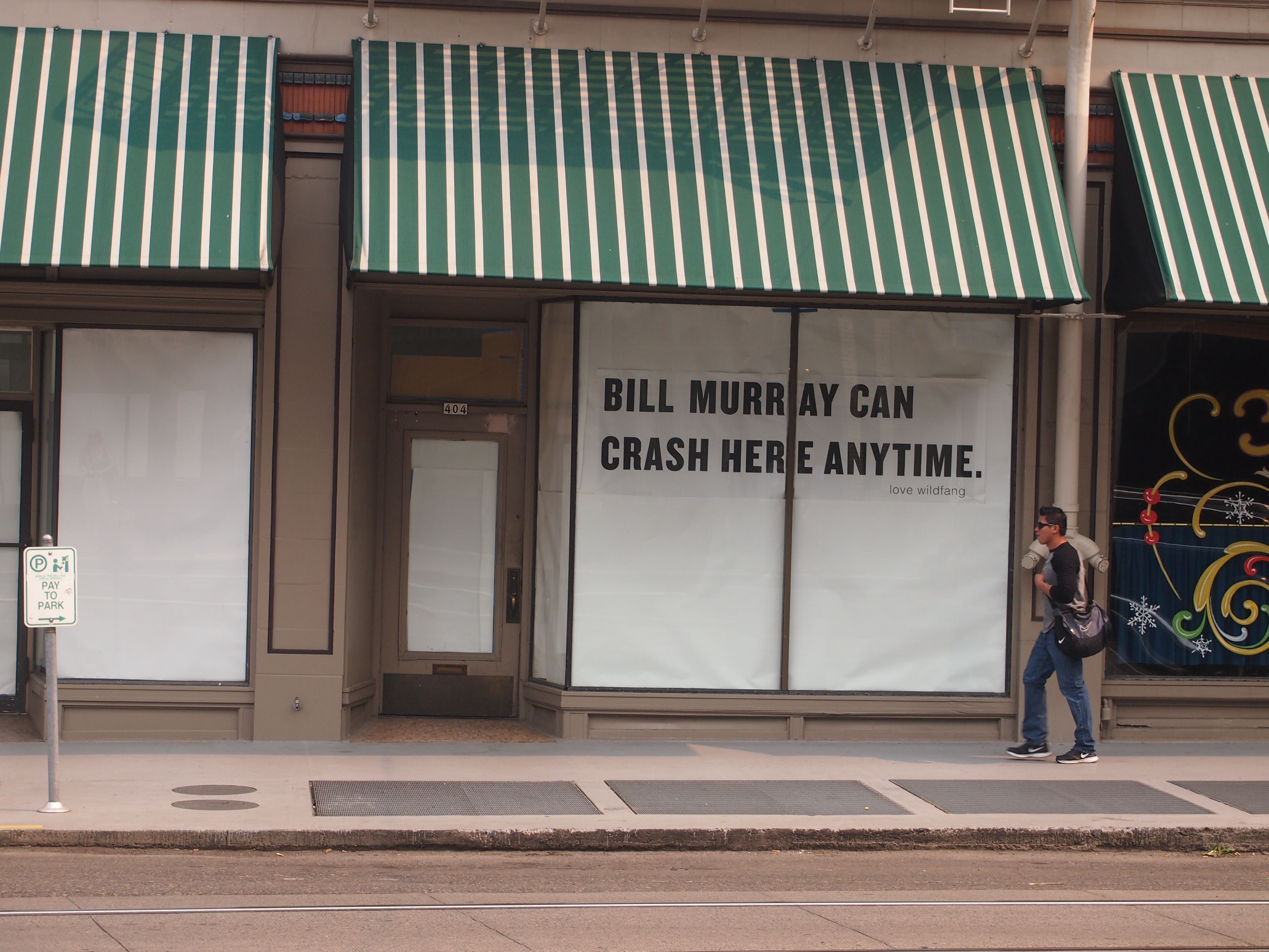
Gum Wall, Seattle, AugOr the echo of a celebrity event I’d missed when it happened, the Bill Murray Party Crashing Tour of 2012 (this sign was in Portland).

Portland, August 22, 2015I can think of a lot worse people to show up at one’s party uninvited; maybe he’s still doing it occasionally.

Most importantly, I reconnected with two dear old friends, one of whom I hadn’t seen in 18 years, another I hadn’t seen in 30 years, since my last visit to Seattle. Our friendships have been maintained over the years mostly through paper correspondence, with a more recent electronic component. But there’s no substitute for being there.
Coins from Way Down South

Hard to believe Canada Day’s rolled around again. Time to honor our neighbors up north by watching one of their major cultural achievements. Other episodes are also available on YouTube.

Lilly brought us souvenirs from her trip to Latin America — omiyagi, to use the Japanese term, which means souvenirs specially obtained for people who didn’t make the trip. It’s a custom we follow.

She got me three things, all showing that she knows her dad pretty well: coins, postcards and Ecuadorean chocolate. As it happens, both Ecuador and Panama are dollarized economies. No currency exchange was necessary; she took greenback cash and also withdrew funds, in dollars, from an ATM.

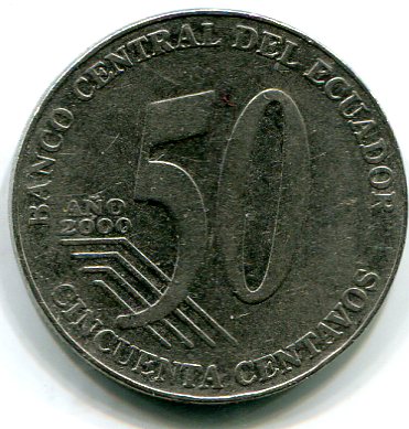
The small change is each country’s own. This is 50 centavos from Ecuador, obverse.

50 centavos, EcuadorIt features the face of one José Eloy Alfaro Delgado (1842-1912), who was president of Ecuador from 1895 to 1901 and from 1906 to 1911, and had the distinction of being assassinated by anti-secularizers, since he introduced the likes of civil marriage and divorce, and secular eduction, to his nation. He also oversaw the construction of the Ferrocarril Transandino (Trans-Andean Railroad) connecting Guayaquil and Quito.

The reserve.

50 centavos, EcuadorThe steel Ecuadorean coins are made at mints in Canada and Mexico. Other denominations include 25c, 10c, 5c, and (supposedly) 1c. Lilly brought back the first three of that list, and along with the 50c piece, I checked their sizes. They’re exactly the same size as their respective U.S. coins.

Apparently Ecuador doesn’t issue dollar coins. Lilly said that U.S. dollar coins are in circulation there much more than they are in the United States. If we’d known that, I’d have given her a roll or two of dollar coins to take with her.

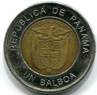
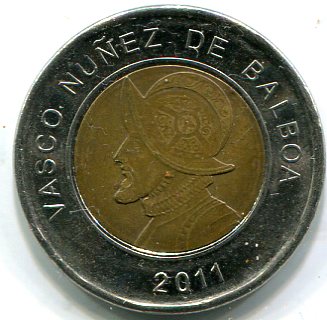
Panama, on the other hand, does have its own dollar-equivalent coin, the bimetallic balboa, which Lilly tells me circulates with U.S. dollar coins.

one balboaWho else to put on the balboa than Balboa? The man who lost his head over Panama. Here’s something I didn’t know: there’s a crater on the Moon named for him. He might have made it to the Pacific, but I’m pretty sure he didn’t get that far.

The reverse.

balboaIt’s hard to see, but the coat of arms of Panama includes a depiction of the isthmus, a sword, rifle, shovel, hoe, and more. The eagle is specifically — according to recent Panamanian law — a harpy eagle (Harpia harpyja), the national bird. The impossible-to-read motto is Pro Mundi Beneficio, for the benefit of the world.