Natchez &c.

When we left New Orleans to drive to Natchez, Mississippi, on May 15, the uninspired route would be have been I-10 to Baton Rouge and then north on US 61. Instead I wanted to drive across Lake Pontchartrain, because I’ve seen that crossing on maps for years. Better yet, it’s no extra charge, since the Lake Pontchartrain Causeway collects no toll northbound.

The morning was bright and traffic light on the causeway. It’s actually two bridges, one each way, so you don’t face miles and miles of unavoidable oncoming traffic mere feet away. An enjoyable stretch of road under those conditions. Uneventful enough driving to ponder the engineering marvel that’s the causeway while still on it.

Before going, I wondered if there would be a few minutes on the causeway when we would be out of sight of land. I’d read claims to that effect. But the answer is no, not that I saw. I spotted the north shore of the lake in the distance before the south shore had completely vanished from my rear-view mirror. Once you get to the other side of the lake, you’re in Mandeville, Louisiana. I-12 from there connects with US 61 in Baton Rouge.

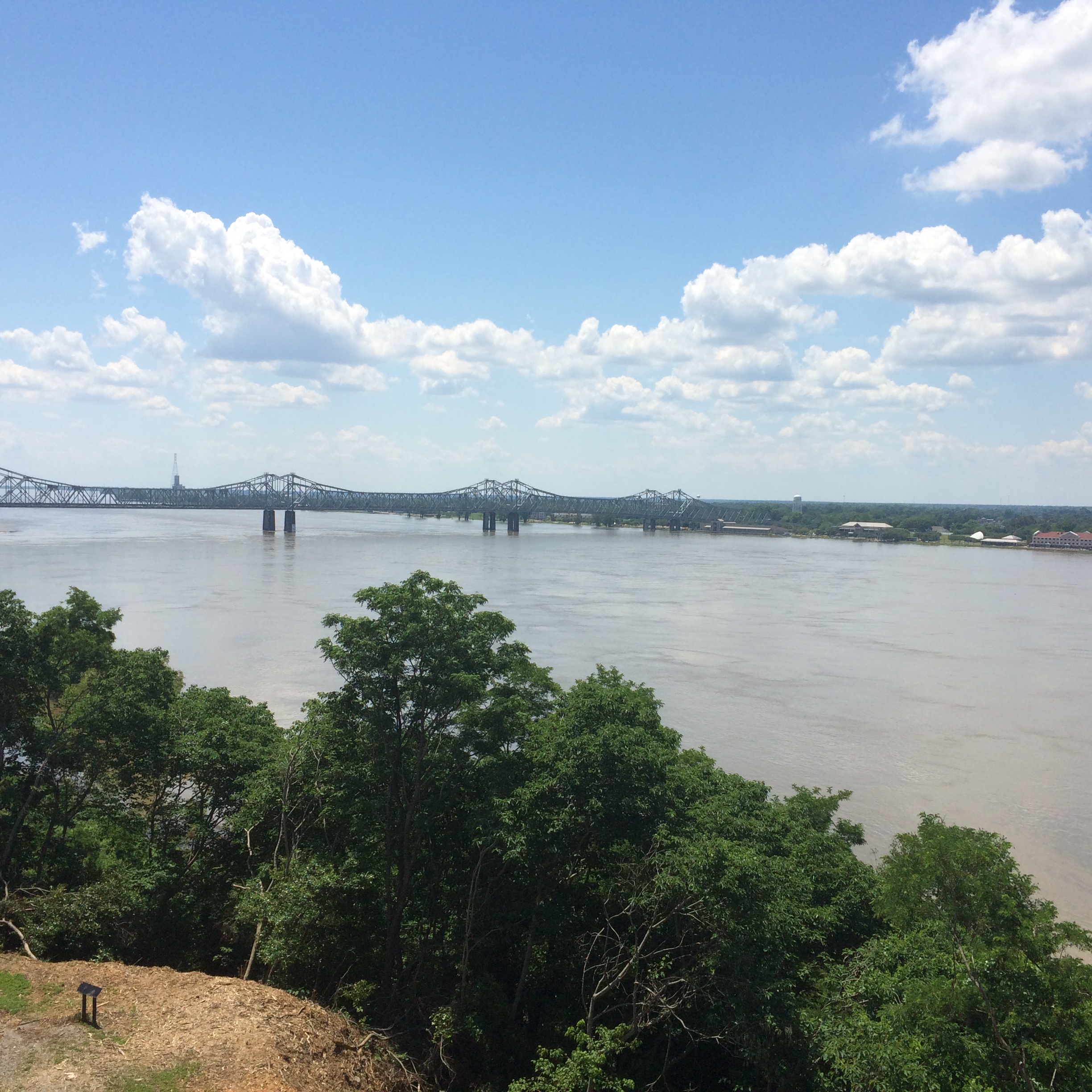
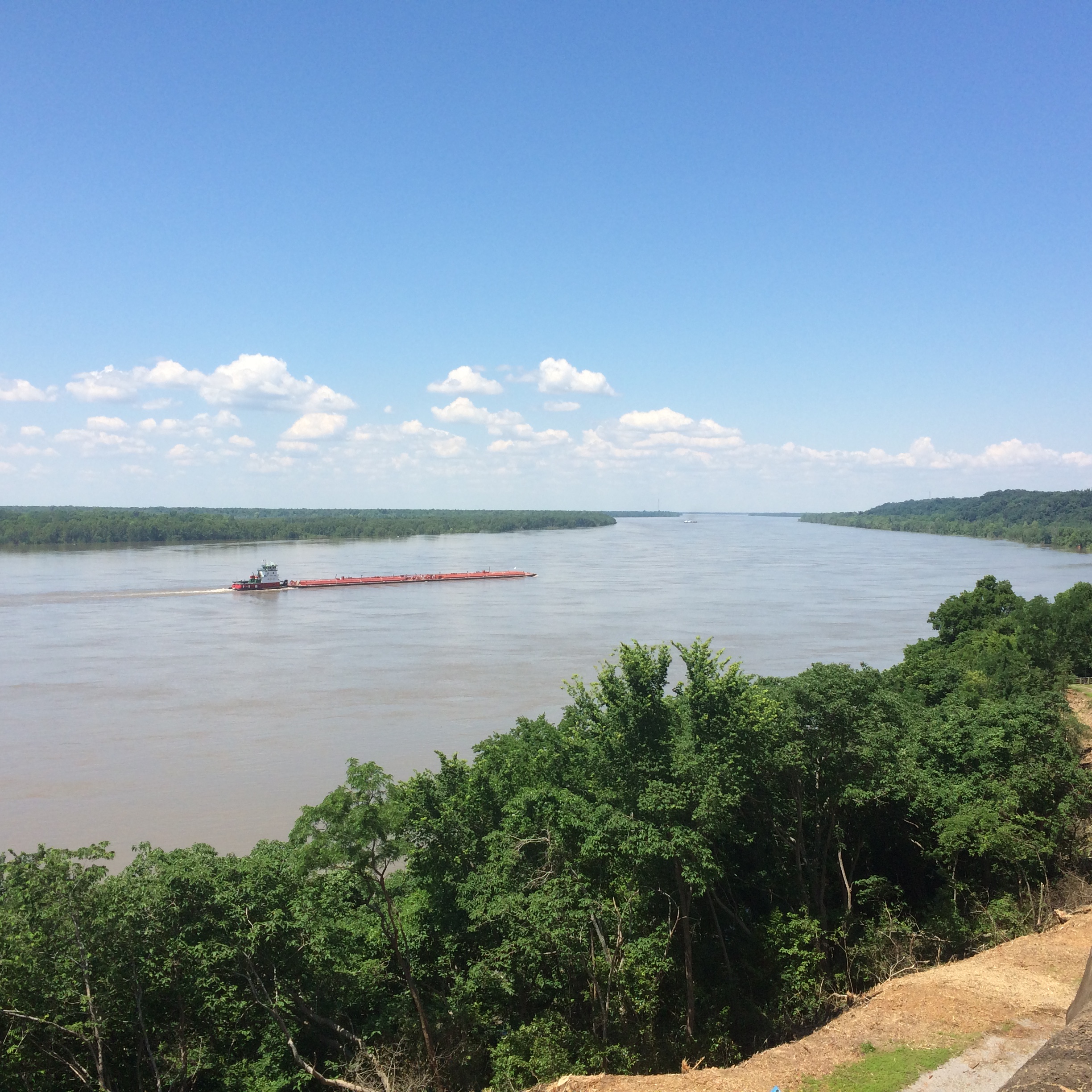
By early afternoon, we were in Natchez, Mississippi. The town has some good views of the Mississippi River from a park on the bluff.
The local gazebo.
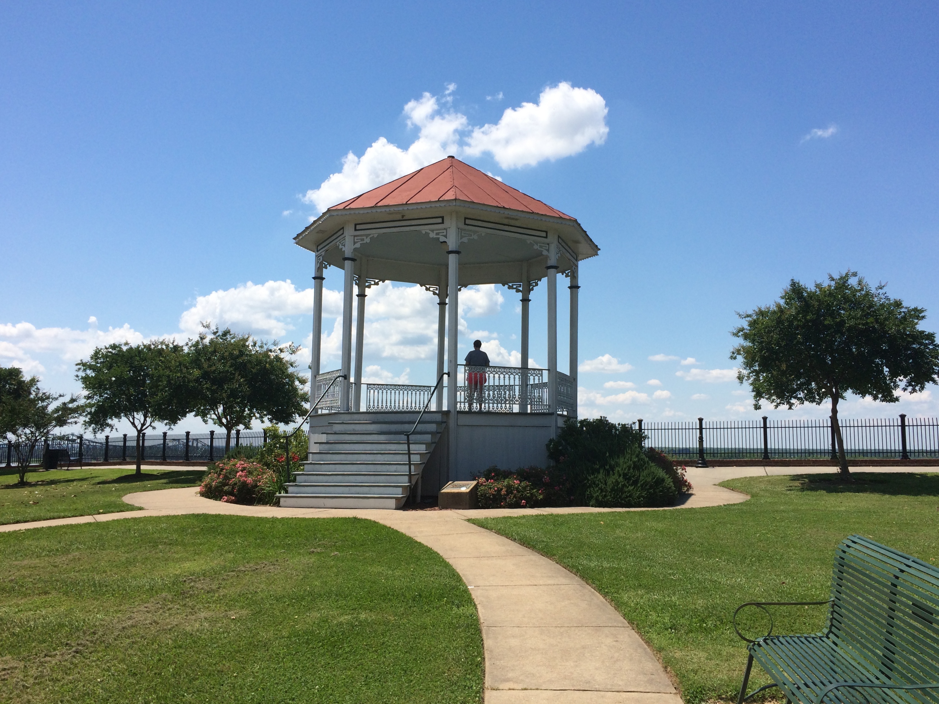
It was too hot to wander around in the noonday sun for long. We decided not to tour one of the local antebellum homes, but rather spend the afternoon heading further north on the Natchez Trace Parkway to seek out antebellum ruins instead.

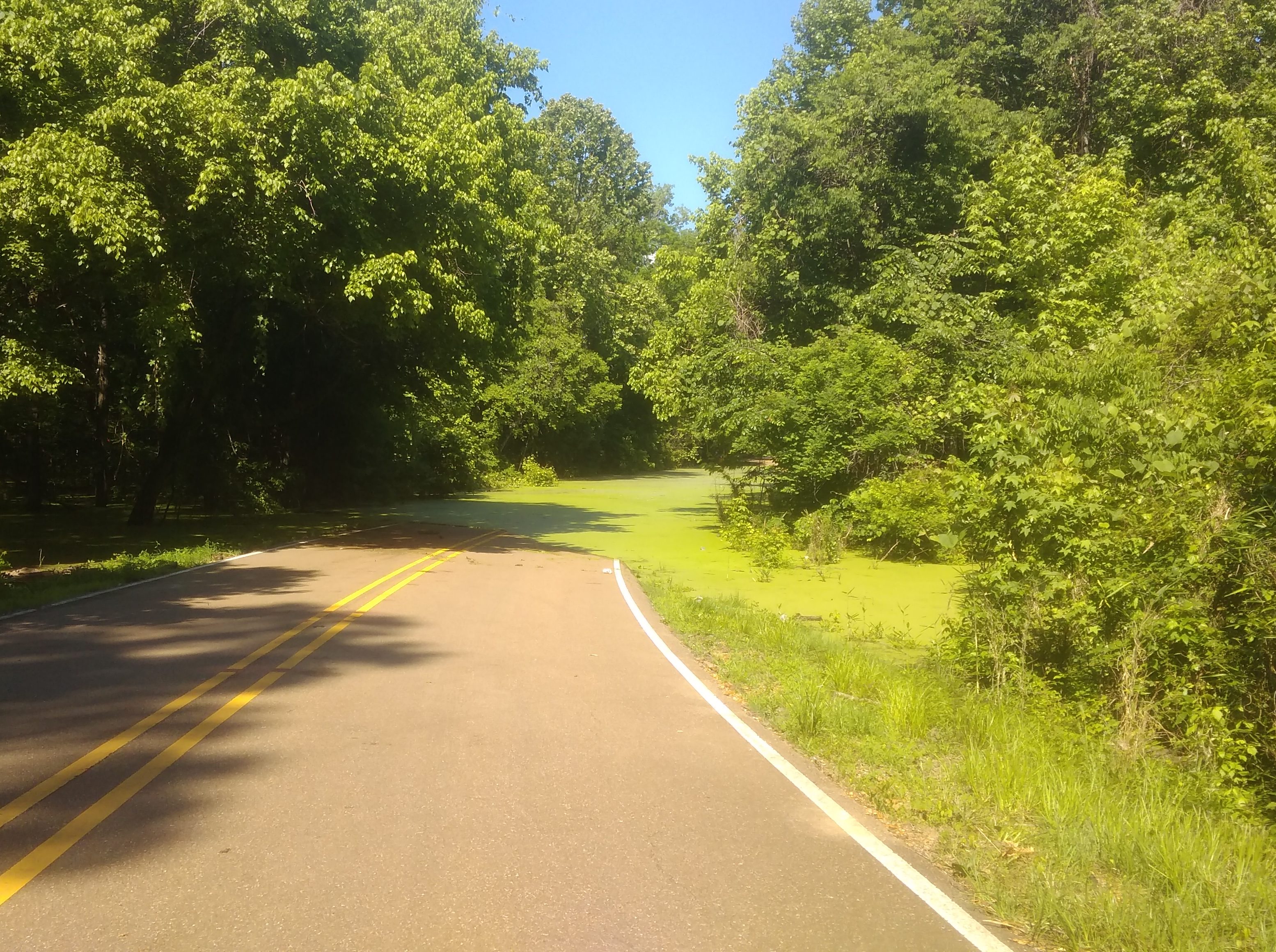
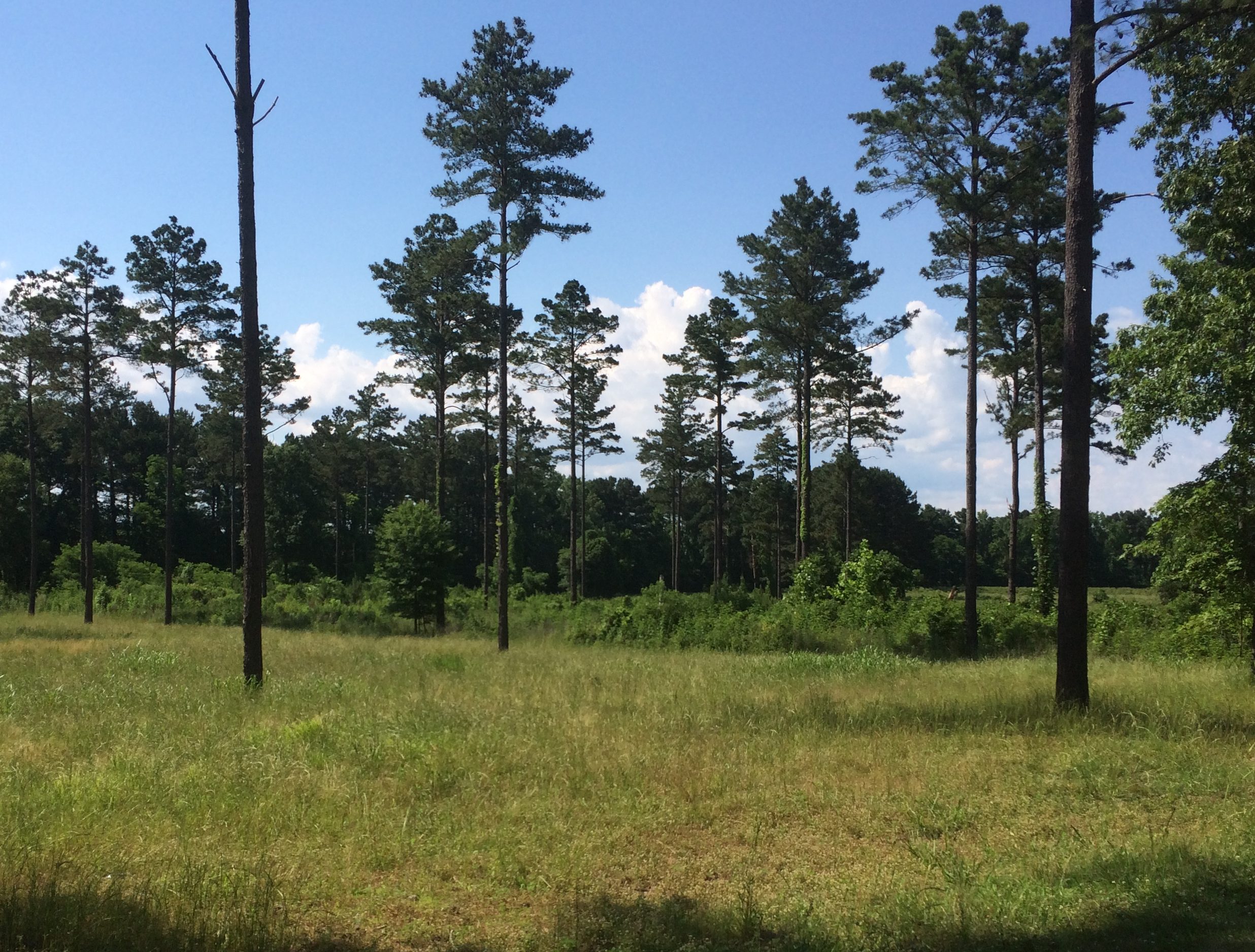
Lilly drove part of the way on the Trace and I played with my camera.

Others might find the driving dull, but I like driving the Trace for its lush greenery, and also its sparse traffic. No trucks at all.

We took a diversion off the Trace before going to Port Gibson and on to Jackson, along a winding country lane called Rodney Road. Go far enough on that road, and you’ll come to the Windsor Ruins.
I can’t remember where I read about the ruins, but the place has been filed under my Possible Minor Destinations for a good while. That’s such a sprawling, unorganized mental catalog of places that it’s a wonder that I ever remember to take the right detours at the right time.

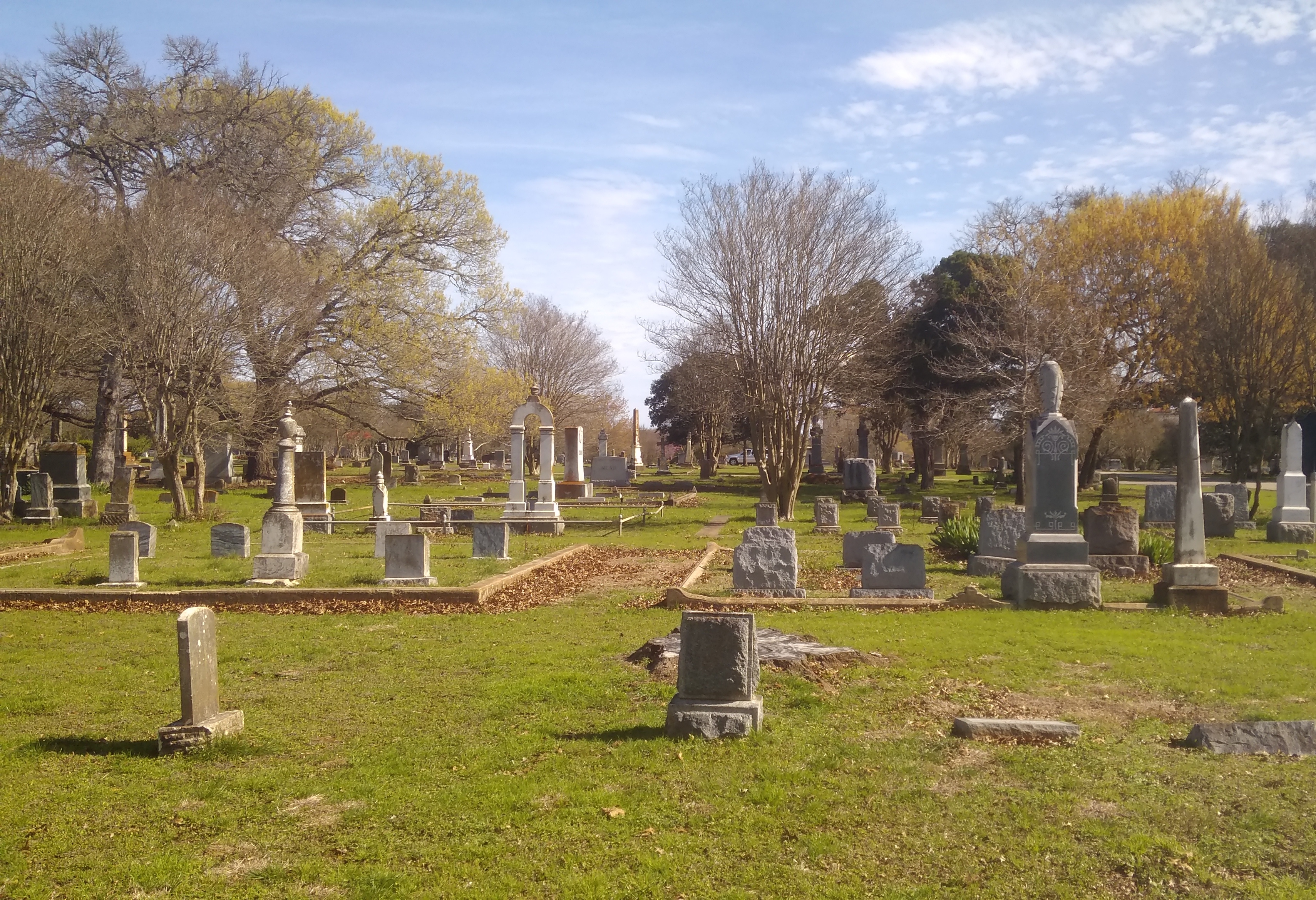
We were the only ones there once another car left a minute or two after we arrived. Considering that the ruins used to be the heart of an enormous plantation, it’s remarkable how lonely the spot now feels. History has passed it by.

The view from the ruins.
“Windsor, built between 1859 and 1861, was the home of Smith Coffee Daniell II, a wealthy planter who had extensive properties in the Delta and in Arkansas,” the NPS says. “Completed in 1861, the home was the largest house built at that time [in Mississippi], the plantation once covering over 2,600 acres.

Curiously, Daniell died on April 12, 1861. The mansion survived the war, probably because the Union army used it as soon as the area had been captured, but it burned down by accident in 1890.

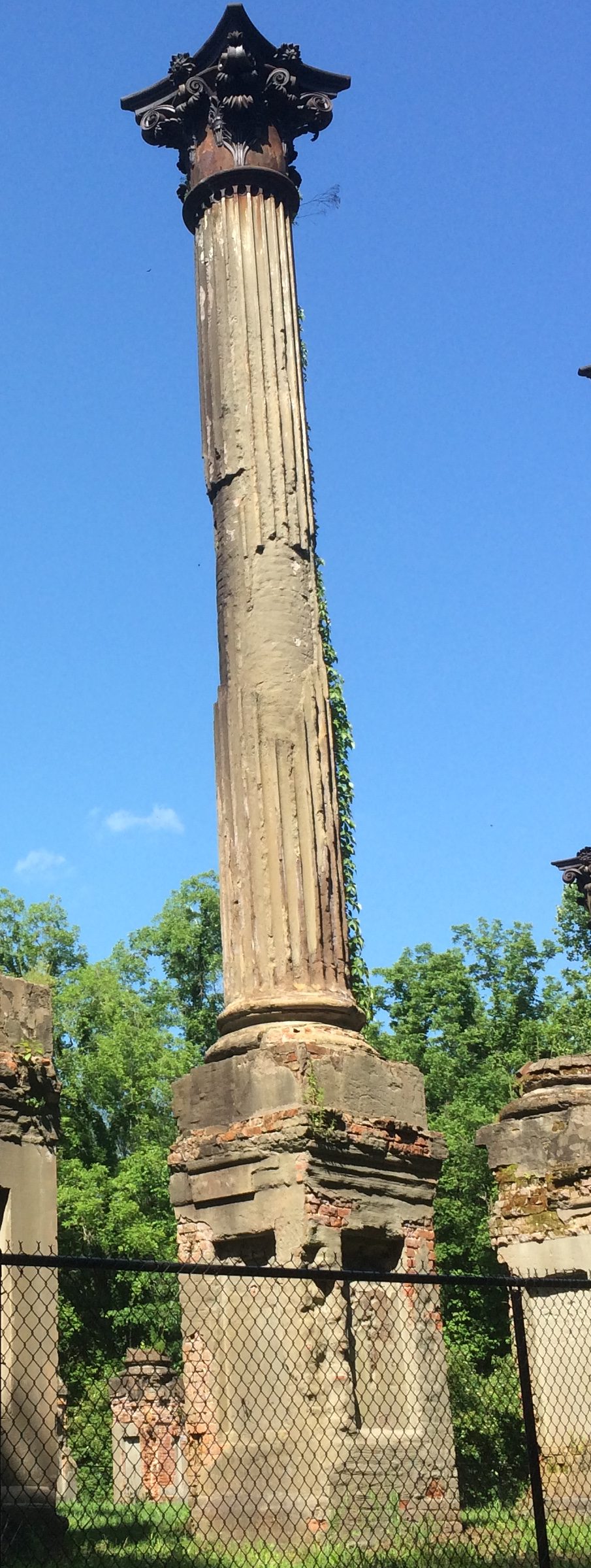
The fence is fairly new, added by the state, which now owns the site. Guess the state of Mississippi doesn’t want any of the 23 massive Corinthian columns coming down on any hapless visitors. They’re looking a little dodgy.

Southern Loop ’19

Just back from a driving trip whose mileage I didn’t bother to keep track of, but it was in the thousands. Actually, only part driving. Lilly and I flew separately from Chicago to Dallas earlier this month so she could take possession of her new car — an ’05 Mazda 3 that her uncle Jay gave her, provided we could drive it from north Texas to northern Illinois. The car rattled and occasionally made other odd noises, but soldiered on all the way.

The uninspired thing to do that would have been to drive straight through, which normally would take two days by breaking the trip in Missouri, such as at the Munger Moss.

Despite being a driving trip, that would be a pedestrian way to do it. Instead I took a week off so we could take a more interesting route. We left Dallas on May 11, heading south to the vicinity of Schulenburg, Texas, to visit some of the Painted Churches, which were built by late 19th-century German and Czech congregations who gave them richly artistic interiors — all the more interesting because much of it is vernacular art.

Rain came day most of that first day on the road, but we didn’t encounter any more until yesterday in Nashville. In between the days were sunny and often hot. Everyone we talked to about the weather reported a wet spring, however, and the Southern landscape looked lush, from Texas into the Deep South and up through Tennessee.

We spent the first night in Houston. I didn’t plan it this way, but our time in Houston focused on water features: the Waterwall near the Galleria Mall that first evening (the rain was over) and Buffalo Bayou and the Buffalo Bayou Park Cistern during the next morning.

The next day we drove to New Orleans, a city I haven’t visited in 30 years, and one new to Lilly, and spent two days and three nights.

We ate very well. We saw excellent live music. We rode streetcars and walked the streets of the French Quarter, Treme and the Garden District. We toured one cemetery formally and one informally, and we visited the National WW II Museum.

On May 15, we drove to suburban Jackson, Mississippi, by way of the city of Natchez and the Natchez Trace to visit our cousin Jay and his wife Kelly, who hospitably put us up for the night.

The next day we passed through Philadelphia, Mississippi, my father’s home town, stopping for a short visit — Lilly had never been there — and then went to Montgomery, Alabama, where we spent the night.

On the morning of May 17, we saw the Legacy Museum and the National Memorial for Peace and Justice, both only open since last year, and the very different Alabama State Capitol, because I visit capitols when I can.

Leaving Montgomery in the early afternoon, we had enough time to visit the Ave Marie Grotto, not far north of Birmingham, and then spent the night of May 17 in Decatur, Alabama. The next morning I took a short walkabout near the Tennessee River and along Bank St., named for a handsome bank building there dating from the 1830s.

By that afternoon, we were in Nashville to visit some of my dear old friends, including one I hadn’t seen or enjoyed the fine company of since 1990. Today we did the long drive from Nashville to greater Chicago — I used to do it fairly often — arriving this evening.

Mostly, things went smoothly. Even traffic wasn’t that bad most of the time in the cities we passed through.

But while driving along Rodney Road in rural Mississippi outside Port Gibson and not far from the mighty river of that name, we suddenly came to this.
That’s stagnant algae-filled water, completely covering the road. For as far as we could see into the distance. Who knows how deep it is. So we backtracked on Rodney to the main road at that point, which happened to be the Natchez Trace.

The San Marcos City Cemetery

San Antonio to Dallas is roughly a five-hour drive straight through, provided traffic isn’t gummed up somewhere along I-35, which it will be in Austin, so best to take Texas 130 around that city, even though it costs extra.

Also best to break the trip into smaller segments and take a look around an in-between place or two. My nephew Dees told me that Aquarena Springs, formerly a postwar tourist attraction — trap — of some renown in San Marcos, is a good thing to see. In recent years, Texas State University-San Marcos remade the place as the Meadows Center for Water and the Environment. Glass-bottom boat tours are star attraction now, rather than the “aquamaids” of yore.

Sounded like a diversion of more hours than we were willing to spare, so we skipped it this time. But we did stop in San Marcos.

First for a look at the Hays County Courthouse, which is a fine old building with a statue of John Coffee Hays outside, whom the Handbook of Texas Online calls a “Texas Ranger extraordinary.” South Texas sculptor Jason Scull did the bronze.
Hays Statue, Hays County CourthouseNot far away is the San Marcos City Cemetery. According to the Heritage Association of San Marcos, the cemetery replaced a smaller boneyard, with burials beginning in 1876. The city took ownership in the 20th century, as it retains today.

Though you climb a small hill at the entrance, most of the cemetery is level. Though not heavily wooded, the cemetery has trees to remind us that late February in central Texas is early spring.

San Marcos City CemeterySan Marcos City CemeterySan Marcos City CemeteryThere are some larger stones and some funerary art, but not a lot.
San Marcos City CemeteryAs Jay pointed out, ready money in 19th-century San Marcos — when such art was more likely to be erected — was in short supply, at least compared with a place like New York, home of Green-Wood and Woodlawn, or even old Charleston.

Still, there are some more ornate markers, such as the draped obelisk of Z. T. Cliett (1847-1892).
San Marcos City CemeteryOr the stone of Dr. P. C. Woods (1820-1898).
San Marcos City CemeteryA nearby Texas Historical Commission marker says that Dr. Woods came to Texas from Tennessee, as so many did (T for Texas, T for Tennessee). Commanding the 32nd Texas Cavalry Regiment during the war, he patrolled the border with Mexico and the Gulf coast against possible Union attack, and fought in Louisiana, where he “received an arm injury which impaired him for the rest of his life.” That didn’t keep him from being a farmer and doctor in postbellum Texas, however.

Thomas Reuben Fourqurean (1842-1925) (interesting name) had a metal marker to denote his service to the CSA, of the kind that’s easy to find in older Southern cemeteries.

San Marcos City CemeteryAnother marker — local, not state — tells the story of Ann B. Caldwell (1800-65), who was reinterred here in the 1870s from an earlier San Marcos cemetery.
San Marcos City CemeteryIn life, she had been among Stephen F. Austin’s colonists and then an early settler in Hays County.

The cemetery’s old enough to include weather-worn stones whose names have been lost to time.
San Marcos City CemeteryEveryone’s stones will eventually disappear in the fullness of deep time, of course. These stones simply have a head start on the others.

Yellowstone, Badlands, Albert Lea, Etc. 2005

Part of a letter I wrote to Ed about 13 years ago, with a few relevant pictures and hindsight notes in brackets.

Aug 22, 2005

Time to start another letter, which I might as well subhead “Things About My Recent Travels That Didn’t Make It Into the Blog.” If letters had subheads, that is.

In some ways, I hope this is a pattern for future travels [mostly it wasn’t]. Of the nine nights we spent on the road, six were in a tent, three in a motel. Better still, of the six nights in a tent, four cost nothing. Call me a cheapskate, but it did me good to return every night to Yankee Jim Canyon about 15 miles north of Yellowstone, in Gallatin Nat’l Forest land, and crawl into the tent knowing that I paid nothing. Well, no extra charge, no insidious “user’s fee,” because some small bit of my taxes must go to support the Gallatin Nat’l Forest.

Some of the most striking things about the many striking things in Yellowstone were the places — whole mountainsides, in some cases — that had clearly burned down in 1988. Hundreds of grey-dead trunks, stripped of anything remotely alive, still stand, lording — if such be possible among trees — over forests of mid-sized pines, very much alive, the spawn of the great fire. In other places, hundreds of tree corpses have tumbled into random piles, also interlarded with young living trees. You can drive for miles and miles and see scene after scene like these. They say it was a hell of a fire, a complex of hell-fires, really, and I believe it.

[A post-fire landscape in Yellowstone in 2005, 17 years later.]Yellowstone 2005

I saw something in South Dakota that the rest of the nation can emulate: two kinds of X signs, marking traffic deaths I think. One says: “WHY DIE? Drive carefully.” And the other: “THINK: X marks the spot. Drive carefully.” For such a sparse population, South Dakotans seem to kill themselves often enough on the roads. Long winters, cheap booze, almost empty roads.

I recommend the drive along the Missouri River from I-90 to Pierre, SD — along state roads 50, 10, and mostly 1806, all of which also form a National Scenic Byway. Hilly, bleak territory largely given over to Indian reservations, though not quite as bleak-looking as Badlands NP.

[Badlands NP, 2005]

In places, except for the road, it couldn’t have been that much different than what Lewis and Clark saw. I never can remember, without looking it up, which one probably blew his brains out a few years after co-leading the Corps of Discovery. [Lewis] Clinically depressed, before there were clinics worth visiting, and before melancholia became depression. Anyway, if I remember right, there’s a monument to him near where he died, on the Natchez Trace. I saw it years ago. A lonely place to die.

We spent the first night out at a campground near Albert Lea, Minnesota. According to me (and only me), Albert Lea is important for two things. One I just noticed: it’s the closest town to the junction of I-35, the U.S. branch of the Pan-American Highway, and I-90, the Boston-Seattle transcontinental epic of a highway. [I’ve since learned that no U.S. road is officially called the Pan-American; it’s just custom that attaches the name to I-35.]

The other thing is that I was visiting Albert Lea for the second time, after a span of 27 years. What was I, a south Texas lad of 17, doing in south Minnesota en route to Wisconsin one August day in 1978? Am I repeating myself here? Maybe I mentioned that epic bus trip before. It was an important one for me. No family, distant states — Wisconsin seemed wildly exotic. Christmas trees grew in people’s yards.

Anyway, in 1978 we stopped for lunch in Albert Lea. I went with the bus driver and some other kids to Godfather’s Pizza, a place I’d never heard of. After that, I walked around a little, relishing the remoteness of the place.

In 2005, we encountered wildlife at the campground near Albert Lea, namely mosquitoes in great numbers. The place was fairly green and lush, so I guess southern Minnesota hasn’t had the drought that Illinois has had this year. When we were leaving the next morning, we drove down the town’s main drag and there it was: Godfather’s Pizza, looking like not much maintenance had been done since the late 1970s, though of course I had no memory of how it looked then, just that I was there. [In Eau Claire this year, we ordered a pizza from a Godfather’s and ate it in our room. I ordered from there because of my experience 40 years earlier. And it was close.]

One other note, for now: Hot Springs, SD, is a lovely town. Near much of the main street flows a river, and alongside most of the main street across from the river are picturesque sandstone buildings, vintage pre-WWI. Evidently, it was locally inexpensive building material.

I left the family at a spring-fed swimming complex while I looked for a pay phone, since my cell phone refused to transcend the hilly surroundings. Argh, what an odyssey that was – “Yeah, we used to have a phone…” I’d foolishly agreed to do an interview that day, figuring I could use my cell. Anyway, after much to-do, I found a phone, did the interview, and then relaxed by the riverside, which has a sidewalk and a hot spring (Kidney Spring) under a gazebo. Free for all to drink, with a metal plaque describing its properties. Not bad. A little salty, but not bad, even on a hot day in South Dakota.

RIP, Amando Chavez

I didn’t know Amando Chavez. I only heard about him after he died a week ago Wednesday in a traffic accident on a road near where I live. A road I drive on frequently.

A small, informal memorial is at the site. I stopped by there this afternoon.

To give a little more context to that image, here’s a wider shot.
An ordinary suburban road. “Accident” isn’t quite the word, though, since by all appearances, a DUI driver was completely at fault. That road isn’t particularly busy at that time of the evening, so there’s even less excuse for what happened.

Looks like the driver at fault was one of those young fools who darts around other cars as fast as his engine will take him. Everyone’s seen that kind of ass, in a hurry to get to the next red light, as he weaves around you or around the cars ahead, with scant room for error — and error’s all too likely when DUI.

It’s the kind of accident that sets my teeth on edge. It didn’t have to be Mr. Chavez. It could have been me or anyone in my family. All the same, I’m not going to avoid that road.

Two Harbors and Gooseberry Falls State Park

It occurs to me that it’s been 40 years this week since I visited Wisconsin for the first time — and Minnesota for that matter, though I only passed through that state. I was on a bus full of other San Antonio high school kids on the way to the 1978 Mu Alpha Theta national meeting in Stevens Point, Wis.

So our recent trip up that way was a 40th anniversary tour for me. More or less. More less than more, since I didn’t go near Duluth in ’78, but never mind.

Northeast from Duluth, Minnesota 61 hugs the coast of Lake Superior, offering a number of sites to see. More than we had energy for, unfortunately, since a drive up 61 all the way to the Canadian border — all the way to Thunder Bay, though it’s Ontario 61 up that way — would make for an excellent few days, not an afternoon.

Still, on the afternoon of July 29, we made our way to the town of Two Harbors and Gooseberry Falls State Park. At Two Harbors, we spent time at the rocky shore.
3M was founded in Two Harbors. Unsurprisingly, the company has no presence there any more, though the corporate “birthplace” is a small museum that we didn’t visit.

Rather, we spent a few minutes at the Two Harbors Light Station. Or Light House, depending on the source.
Up the road from Two Harbors is Gooseberry Falls State Park, reportedly the most-visited state park in Minnesota, and I can see why. The place is drop-dead gorgeous even before you get to the falls.
As promised, the park sports plenty of falls as the Gooseberry River cascades toward Lake Superior. Here are the Upper Falls.
The Middle Falls.
The Lower Falls.
I understand that the flow of the falls depends entirely on runoff, since the relatively small Gooseberry has no headwaters. So I guess it’s been a rainy summer in this part of Minnesota.

Who developed much of the park infrastructure? Here’s a clue.
The lads of the CCC, of course.

Near the Upper Falls is an unusual, and sad, plaque. It’s both a warning and a memorial.
I looked up Richard Paul Luetmer, who has missed out on being alive these last 40 years. He went diving in the river and hit a submerged log. RIP, Richard, but I have an editor’s nit to pick with the plaque editor: In Memoriam, not In Memorium.

Trans-Pecos & Llano Estacado 3,600+ Mile Drive Tidbits

Along U.S. 90, not far west of the town of Comstock, Texas, the road crosses the Pecos River. The east end of the bridge has a place to stop and take in the view. This is looking upriver.

Downriver, toward the Pecos’ meeting with the Rio Grande.

Hard to believe there’s that much water in West Texas. Anyway, the river (of course) marks the beginning of the Trans-Pecos.

One of the grand hospitality properties of the Trans-Pecos is the Gage Hotel in Marathon, originally developed in 1927 by West Texas cattle baron Alfred Gage (born in Vermont), and designed by El Paso architect Henry Trost. Fifty years later, Houston businessman J.P. Bryan bought the rundown property and made it into a modern boutique hotel.

I didn’t stay at the Gage, though I had a good meal there and used its wifi. Instead, I stayed at the Marathon Motel & RV Park down the road. It has all the charms of a tourist court — separate cabin-like buildings of two or four units, even a bottle opener fixed to the wall — at a more modest price than the Gage.

There is an astronomy enthusiast at the Marathon Motel in the evenings, Bob, who sets up a couple of sophisticated telescopes a short walk outside the property and shows guests the night sky, which is pretty dark out in Marathon. I spent about an hour talking with Bob and looking his scopes the first night I was there.

Trouble was, the Moon was waxing gibbous, which made the sky a lot less dark. But we looked at some easy-to-find brighter objects, such as Jupiter and some of the Galilean moons, as well as Mizar and Alcor, and tried to spot the Orion Nebula. Orion was trending toward the horizon, about to bid adieu for the warm months.

Bob said the sky would be dark again a few hours before dawn, but I didn’t get up at that time until the last morning I was at the motel. At about 5 that morning, I woke (for the usual reason), but also got dressed and wandered outside for a few minutes. Bob was right. The Moon was gone, and there was what I wanted to see, no telescope necessary — the wispy, luminous edge of the Milky Way, billions and billions of stars at a glance. It was like seeing an old friend.

Speaking of nighttime spectres, not long after I left Marfa, I stopped along U.S. 67/90 at the Marfa Mystery Lights Viewing Center, which is essentially a rest stop with extra windows in the wall.

I wasn’t about to come that way at night and wait around for a glimpse of a desert will-o’-the-wisp, so I had to be satisfied with a daytime view of the direction of the Marfa lights. Eh.

While driving along I-20 in metro Midland-Odessa, I saw an official highway sign for the Midland International Air & Space Port. What? Space port? Seems a little optimistic on the part of the local airport authority.

Indeed, in 2014 the FAA approved the airport’s application to become first primary commercial service airport to be certified as a spaceport. XCOR Aerospace was due to start flying its Lynx spaceplane from Midland, but the company went bankrupt in 2017 before that ever happened. Oops. Maybe Fireball XL5 will start using Midland International soon. (That theme song has more traction than I realized. Even Neil Gaiman did a cover; once, anyway.)

In Amarillo, I saw another kind of sign. Fake street signs. I was driving along I forget which street, and saw a diamond-shaped sign, off to the side of the road but actually on private property, that said WE CALLED HIM COUNT DRACULA. It was a non-standard color, too: black with red letters.

Huh? But I had driving to do, and other cars not to hit, so the thought passed. Sometime later, I saw another sign — different color, similarly located — that said MINE BY RIGHT OF CONQUEST.

This got me to wondering, and I actually remembered to look into these odd signs. Doesn’t take long to find image collections of the signs, which are all over Amarillo, apparently.

According to Roadtrippers Chronicles — “The Raddest Stories From The Road” — “the strange signs are part of an art installation called The Dynamite Museum. Partially funded by oil heir and patron of offbeat art Stanley Marsh 3 (most famous for his work with Ant Farm on Cadillac Ranch), there are even a few in the nearby town of Adrian (it’s said that Marsh liked the idea of putting the signs in towns that started with the letter A).

“There was no rhyme or reason to the messages on the signs; the people behind the project would come up with ideas, or vote on suggestions sent in, and then install their favorites all over town.”

If I’d known that before I went to Amarillo, I would have looked for more.

The morning I left Amarillo, I had the radio to keep me company on the open road to Oklahoma City (I-40 in our time), and for a while I got a strong signal from Turkey, Texas, to the south. That day was Bob Wills Day in Turkey, and it sounded like a big to-do. The biggest shindig of the year for the town, probably. After all, Bob Wills is still the king.

I didn’t know until I looked it up that the King of Western Swing spent some of his youth on a farm near Turkey. The town of Turkey clearly remembers him. Sounded like fun, but it was too far out of the way. Just another thing missed because of scheduling.

The Trans-Pecos & Llano Estacado

Back on April 14, I headed for Texas by car. I spent most of following two weeks in that state, arriving home today. Along the way, I drove 3,691 miles and change.

The main event was the wedding of my nephew Dees and his betrothed Eden on April 21 at Hummingbird House, a gorgeous outdoor wedding venue just south of Austin in the full flush of a Texas spring. An actual warm and green spring, unlike the cold and still brown spring I left in Illinois.

Rain had been predicted for the day, as it often is this time of the year, and there was an indoor pavilion just for that circumstance, but the Texas spring accommodated the bride and groom and wedding party and all the guests by not raining. If fact, the sun came out just before the ceremony, which was picturesque as could be.

I was remiss in taking pictures of Dees and Eden or anyone else, except for a few shots of my family.

They’d flown to Austin the day before the wedding, in time for the rehearsal dinner, which was a pizza party in Dees and Eden’s back yard. The logistics of my family getting to Austin were a little involved, but everything worked out.

As for me, I’d spent most of the week before the wedding with my brother Jay in Dallas, arriving in Austin the Thursday before the wedding. The morning after the wedding, a week ago now, Yuriko, Lilly and Ann and I drove to San Antonio, where we all visited my mother and brother Jim. They flew back home that evening, leaving me to drive back to Illinois.

I wanted to return a different way than I’d came, especially since I had the week off from work (the week before the wedding was a work week). So I didn’t pick the most direct route home.

Namely, I drove west from San Antonio to Marathon, Texas, a town of a few hundred people in West Texas whose main distinction is its proximity to Big Bend National Park, which I visited last Tuesday. There are many impressive things to see there, but I was most astonished by the cliffs on the Rio Grande that form Santa Elena Canyon.

The next day I went to the Trans-Pecos towns of Alpine, Marfa and especially Fort Davis. Not far from Fort Davis is the McDonald Observatory, which I’ve had a mind to visit for years. It was cloudy and misty and a little cold when I got there, but that doesn’t matter when you’re looking at impressive telescopes. In Fort Davis itself, I visited the Fort Davis National Historic Site.

The next day, I drove north, through Midland-Odessa and Lubbock and finally to Amarillo, a shift in scenery from the dessert of the Trans-Pecos to the high plains of the Llano Estacado. Along the way I made a few stops: the Presidential Archives and Leadership Library in Midland and the Buddy Holly Center in Lubbock.

While in Amarillo, a city I had not seen since a brief visit in 1979, I took the opportunity on Friday to see Palo Duro Canyon State Park, which is about 30 minutes outside of town. It’s a great unknown among natural areas in Texas and, for that matter, the United States.

I had enough time that day after visiting Palo Duro — the days are getting longer — to drop by and see the Cadillac Ranch, famed oddball tourist attraction, which is on the western outskirts of town.

This weekend was a long drive home: Amarillo to Lebanon, Missouri, on Saturday (I’d stopped in Lebanon the first day out, on the way to Dallas), and Lebanon to home in metro Chicago today. Tiring, but I did squeeze in two more sites. In Claremore, Okla., on Saturday, I saw the Will Rogers Museum. Not bad for an entertainer who’s been dead more than 80 years.

Today I stopped just outside St. Louis and took a walk around the Cahokia Mounds State Historic Site. Not bad for a culture that’s been gone for about 800 years.

The Great American Traffic Jam

Back to posting on September 5. If you can’t take Labor Day off, when can you?

One more thing about the Great American Solar Eclipse. It was followed by the Great American Traffic Jam. Or, to hark back to an increasingly distant bit of history, the Mother of All Traffic Jams.

We left Paducah, Kentucky, at about 2 p.m. on August 21. It took us about 12 hours to get home. Twice as long as under normal conditions.

Since not a lot of people jammed into Paducah to see the eclipse, I-24 north from the town wasn’t bad at all. Even I-57 wasn’t too crowded at first, until around Marion, Illinois. Then traffic stopped dead.

So much so that I could take a picture of the road ahead, at my leisure, while in the driver’s seat. No one was moving.
Traffic Jam August 21, 2017A lot of people had gone to Carbondale, west of Marion, to see the eclipse. The road from Carbondale, Illinois 13, meets I-57 at Marion. Google Traffic showed red and worse for miles and miles north of there.

After a long time of not moving at all, punctuated by exciting periods of slowly crawling along, we were able to get off I-57 and take to smaller roads, such as Illinois 1 and 130 and others. We should have done that from the get-go, but I mistakenly thought traffic would only be heavy on I-57, not molasses.

The alternate routes didn’t entirely get us away from traffic, and at times we encountered slowdowns, such as when hit by a lot of rain. That was the weather system that clouded over the partial eclipse in the Chicago area, and which would have obscured totality for us had it arrived further south a day earlier. Sometimes you, and thousands of others, get lucky.

Our onboard navigation system wasn’t a lot of use. No matter where you were, or what the traffic conditions were, its suggestions to get home amounted to get on the nearest Interstate. If it were programmed to nag, it would have said, “Why aren’t you on the Interstate? You know that’s the best way to go. Get on the Interstate!” Robert Moses isn’t dead.

My old friend Tom was in Madisonville, Tenn., for the eclipse, reporting flawless weather for the event, as seen from Kefauver Park (as in, Estes). He also said getting back to Atlanta involved sticky traffic and a succession of small roads.

Enough about the traffic. It was merely an unpleasant coda to an otherwise remarkable experience. When we finally got home, exhausted, I asked a rhetorical question: Was it worth it? Was it ever.

UP ’17

For someone who grew up in Texas, I’m unaccountably fond of the Upper Peninsula. A little, probably, since I first saw as a lad its fine ragged outline on a map, and a lot more since my first visit, solo, in 1989. Maybe my appreciation came into full flower on H-13, a two-lane road through Hiawatha National Forest, as I drove north a little faster than strictly necessary, my cassette player playing a little louder than usual, zipping between walls of pines. It was a Be Here Now moment.

Also, I’ve never grown tired of gazing out into the vastness of Lake Superior, as I first did that year and most recently on July 1 at the mouth of Presque Isle River.

Lake Superior, Presque Isle RiverThe shore was rocky at that point, with smooth white driftwood beached on the shore. Not only that, people had built small cairns there, mostly on the wood, something I didn’t notice until I did. Then I started seeing them all around. I built one too, though not this one.
Lake Superior, Presque Isle River
We left the northwest Chicago suburbs late in the afternoon on June 29, spending the first night in Madison. From there, it’s a straight shot north through central Wisconsin, for much of the way on I-39 and then the slower but more interesting US 51. On the last day of June, we made our way north to the western reaches of the UP.

As I wrote 14 years ago: “At the northern end of I-39, which runs like a spine through most of central Wisconsin, US 51 takes over, though for a time it’s a divided highway of four lanes, and thus exactly like the Interstate. Just north of the wee resort town of Tomahawk… the road narrows. By this time, the driving visuals were compelling anyway, and all the narrowing of the road did was bring the scenery that much closer.”

Near Hurley, Wis., US 51 meets US 2. Unlike the 2003 trip, this time we headed east on US 2 into Michigan, into new territory for all of us — me, Yuriko and Ann. Staying at a modest but charming non-chain hotel in Wakefield, Mich., on the nights of the 30th and the 1st, the focus of the 2017 trip was the western UP, especially the Porcupine Mountains Wilderness State Park. We also visited the Keweenaw Peninsula, but time didn’t allow a fuller look at Keweenaw.

Evenings were cool and days in the 70s F. and partly cloudy most of the time. Weather forecasts had spoken of rain, but the closer we got to the trip, such forecasts were revised, downplaying the chance of rain. In the event, only a little fell on us on July 1 as we drove back toward Wakefield in the late afternoon. On the evening before, just before sunset, patches of thick fog clung to the Black River Road near Potawatomi and Gorge waterfalls. Ann commented on its eerieness.

Walking was an important part of the trip. Essential, as far as I’m concerned. On the first day of July, Yuriko thought to check the app on her phone that counts steps. We took over 14,000 steps that day. Many of the steps were on forest paths like this.

Porcupine Mountains Wilderness State Park

Or this.

Porcupine Mountains Wilderness State Park

A lot of the steps looked like this.

Porcupine Mountains Wilderness State Park

I felt my age. I usually brought up the rear, and took more breaks than I might have 10 or 20 years ago, but I got through.

Since time was short and distances, while not great, did involve miles to cover, driving was important, too. Also an essential experience on the trip, in my opinion. Tracing a course around the southern edge of the state park, the utilitarian-named South Boundary Road snaked through the intense summertime UP greenery, made all the more flush by a rainy spring, up and over hills, encountering few other cars. Light traffic on a two-lane road like that is the difference between an enjoyable time and constant white-knuckle dread. It was car-commercial driving. I got a kick out of that road.

Other roads in that part of the UP, routes through Ottawa National Forest and up into Keweenaw, were more developed and traveled, but had their attractions as drives and for their roadside sites. Though I know they represent a backstory of hardship — the UP must be a difficult place to make a living for a fair number of people — the area’s abandoned buildings were strangely fascinating. Such as a derelict store with gas pumps near (in?) Silver City.

Silver City, Michigan 2017

Detroit has no monopoly on abandoned Michigan structures. I suspect no root beer has been served at this former Wakefield drive-in in some time.

Family Root Beer Drive In, Wakefield, Mich 2017

In Wakefield, I made a point of taking a picture of a couple of Lake Superior Circle Tour signs.
Lake Superior Circle Tour signs, Wakefield, MichThe Circle Tours are networks of roads that, as the name implies, go all the way around each Great Lake, and in this case Superior. The idea was obviously hatched to promote tourism, and not that long ago, in the 1980s. To that I say, so what? The signs sit there quietly, but make a grand suggestion to passersby all the same.

I saw Lake Michigan Circle Tour signs in the late ’80s, as far south as Illinois, and on a sunny September day in ’89, on M-28 headed west to Marquette, I first saw a Lake Superior Circle Tour sign, which I hadn’t known existed. To me, the sign said — still says — Drop Everything and Drive Around the Lake. I’ve managed to drive around Lake Michigan, clockwise and counterclockwise. Lake Superior, no.