The 606 in ’16

On Saturday we went to the city for a few hours. Yuriko went to a cake-making class offered by a woman she knows who lives near Humboldt Park. I was the driver, since it’s complicated to get there by train and bus, and driving in the city unnerves her.

As it should, with cars everywhere, parked and in motion, operated by sometimes careless or aggressive drivers and often closer than you think; delivery trucks blocking the way; road construction crews doing likewise — though the rough surfaces and potholes never seem to go away; buses acting as if they own the road; bicyclists passing between you and parked cars suddenly and with inches to spare; random pedestrians all over the place, a few with no sense; people opening their car doors in front of you without warning, emerging onto the street (some with children in tow); large intersections without the benefit of turning signals; and stretches of street being resurfaced, but not completed just yet, which on a dry June day raises clouds of dust through which you must pass.

Then there’s the matter of parallel parking. Yuriko doesn’t care for it. A lot of people would say the same. I never knew how to do it until I moved to Chicago in the late ’80s. Then I learned it well. It’s an essential skill for owning a car in the city. I also learned what to expect driving in a place like Chicago. Or New York or Boston or Washington DC or Atlanta or Miami or Dallas or Los Angeles or Seattle — all harrowing in their own sweet ways.

I’ll say one good thing about driving in Chicago, though: it’s easy to know roughly where you are all the time. The streets mostly form a grid, with major streets at regular intervals, and just about every street, even the most minor, marked with an easy-to-see, well-placed and legible street sign. Not every city has such luxuries, and I mean you, Boston.

With Yuriko at her cake class, I had a couple of hours to kick around in the late morning. The Puerto Rican Festival in Humboldt Park, Fiestas Puertorriqueñas, was slated to start at noon, as evidenced by people carrying the commonwealth’s well designed flag into the park and the flag being flown by a lot of passing cars. Here’s a vendor selling some.Puerto Rican Day Chicago 2016
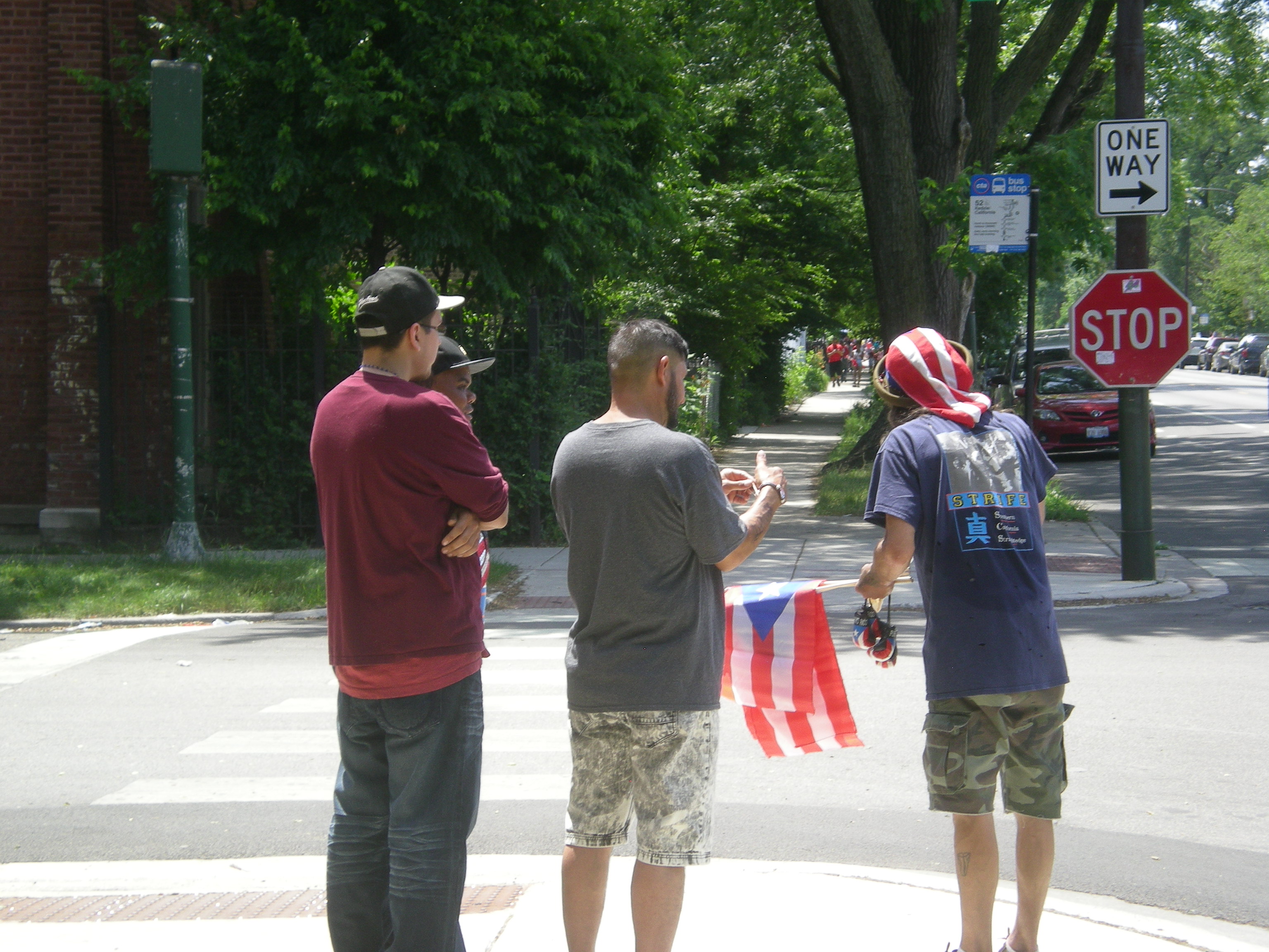
Since the event wasn’t actually under way, I went elsewhere. I visited St. Mary of the Angels church about 20 blocks to the east, taking a North Avenue bus, and then walking back, partly on the 606, the same linear park we visited on its opening day a little more than a year ago.

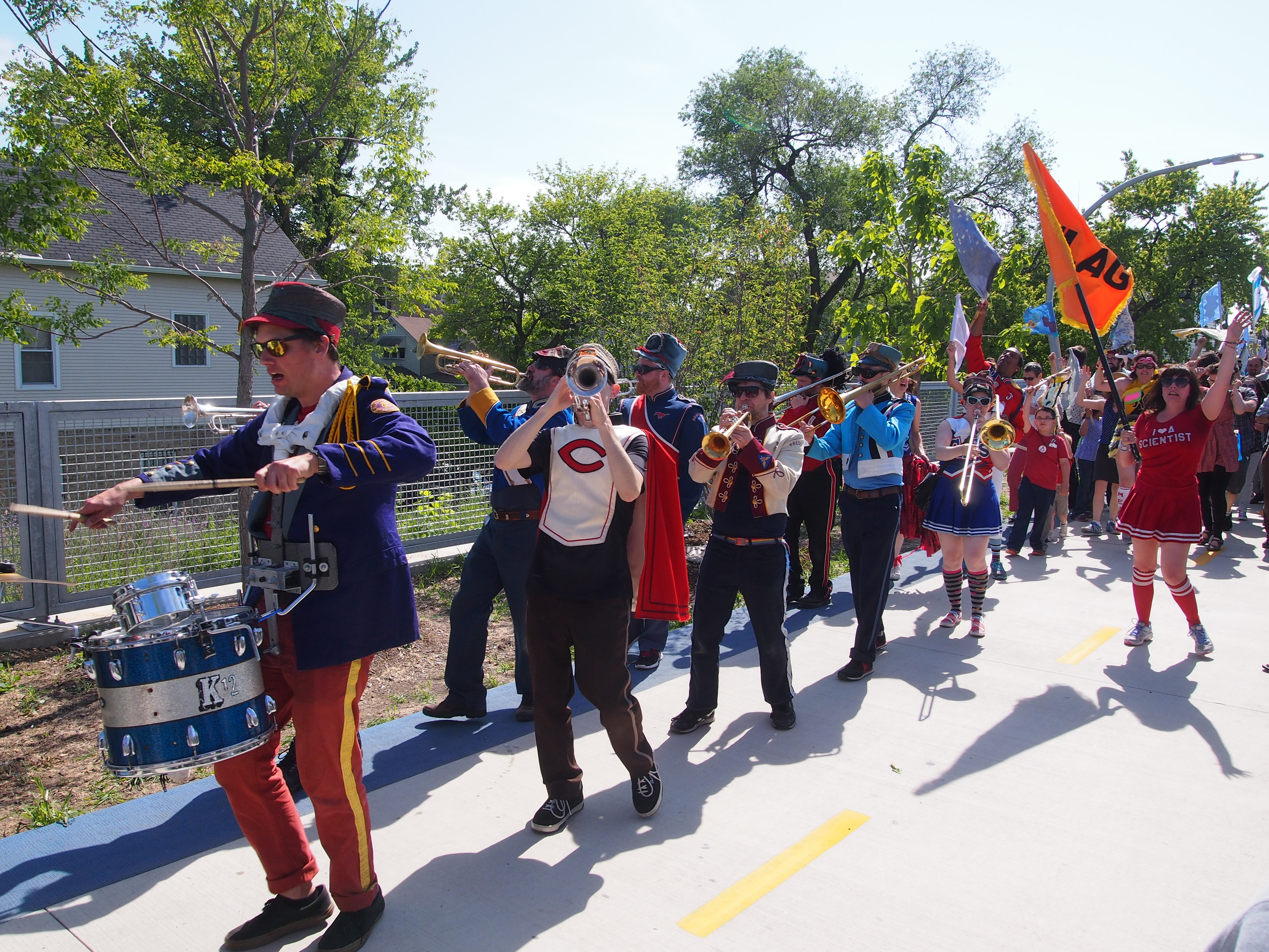
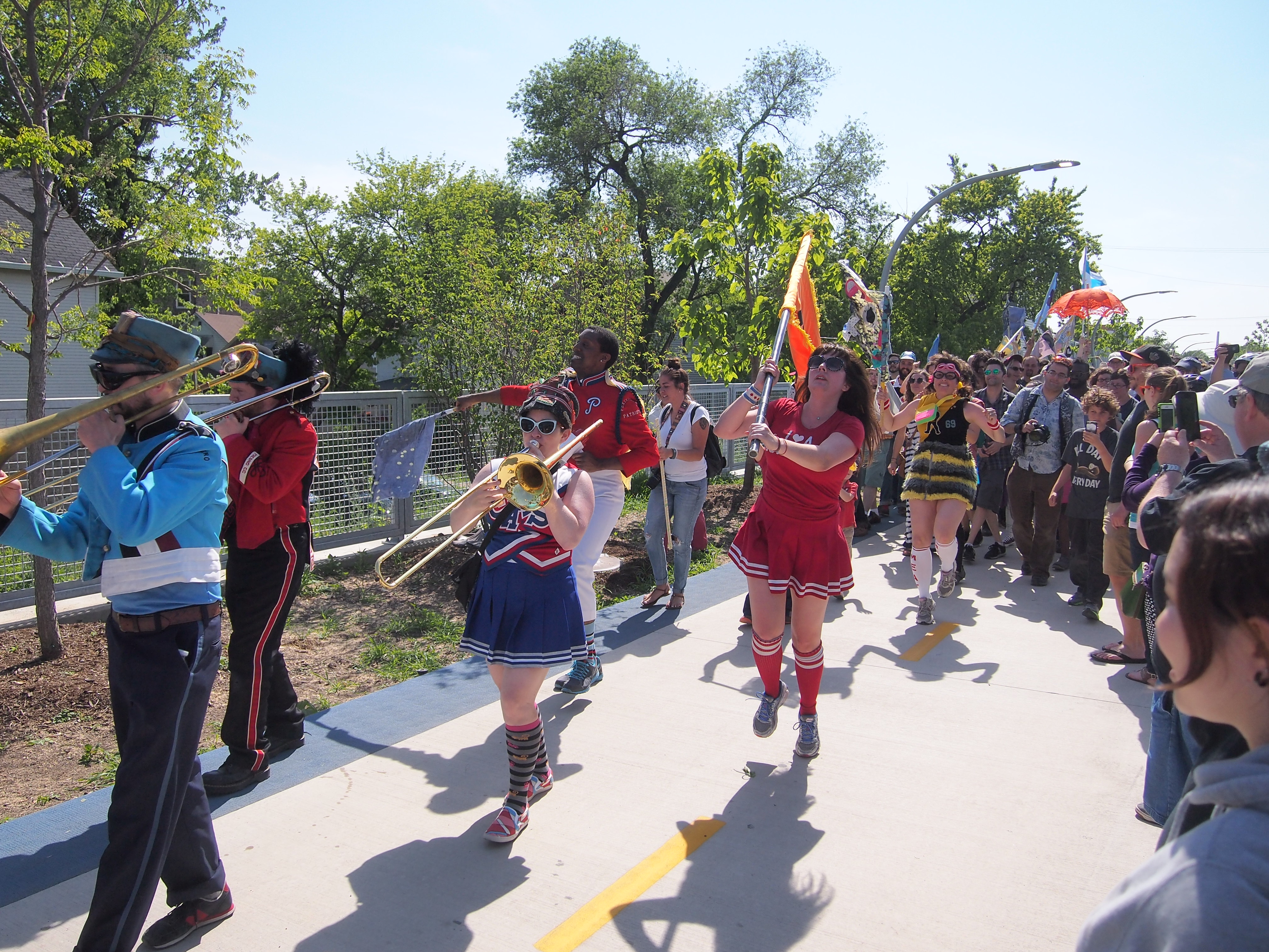
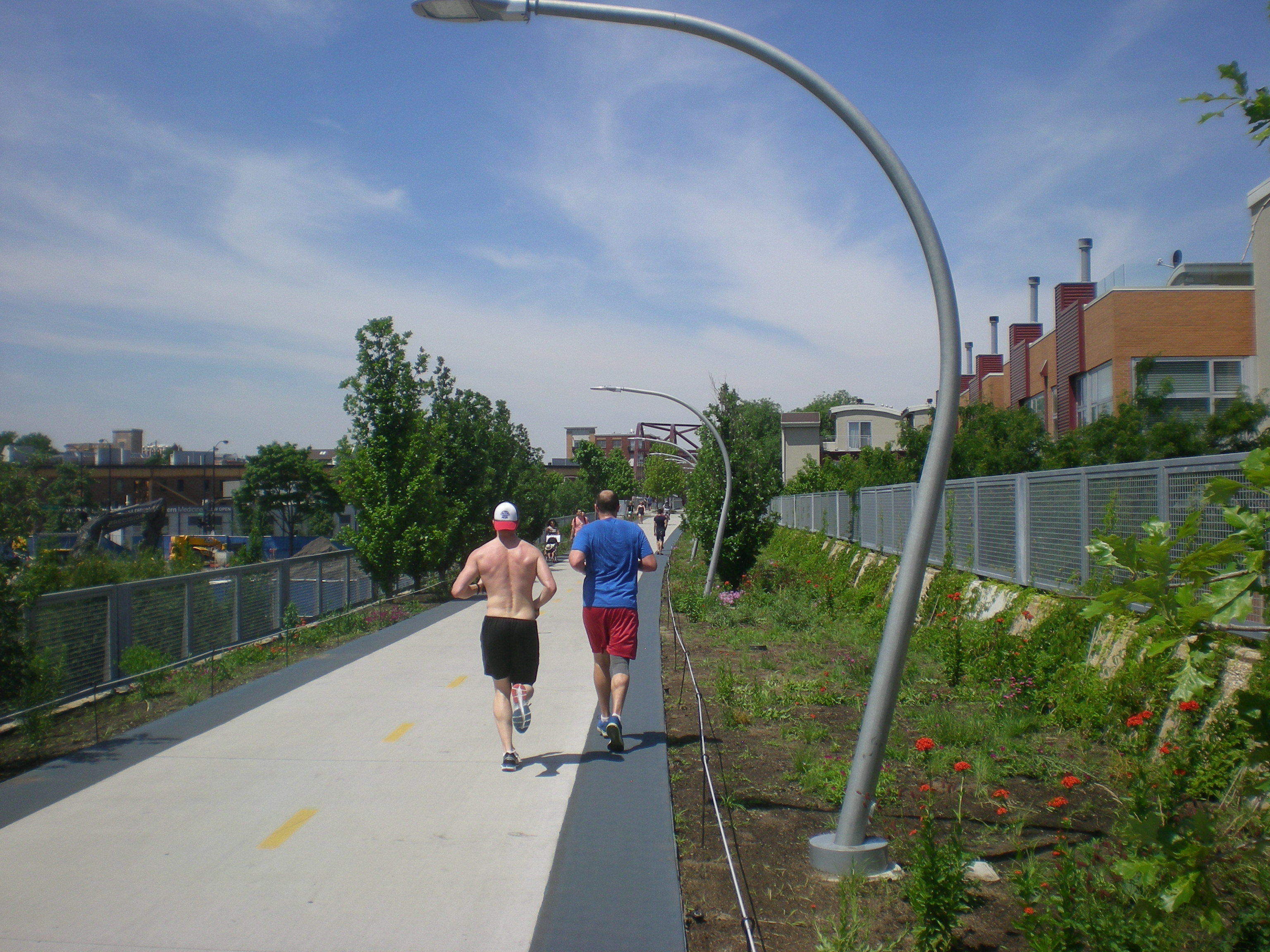
This time I saw a bit more of the trail’s eastern end, though not quite to the east terminus. At around 11 am in mid-June, the sun is high and the trail very warm. Temps were in the upper 80s F. That didn’t keep people away.
The 606 ChicagoI was glad to see that the landscaping on the edges is now more lush than a year ago. Also, development of the land nearby continues apace.606 Winchester Ave
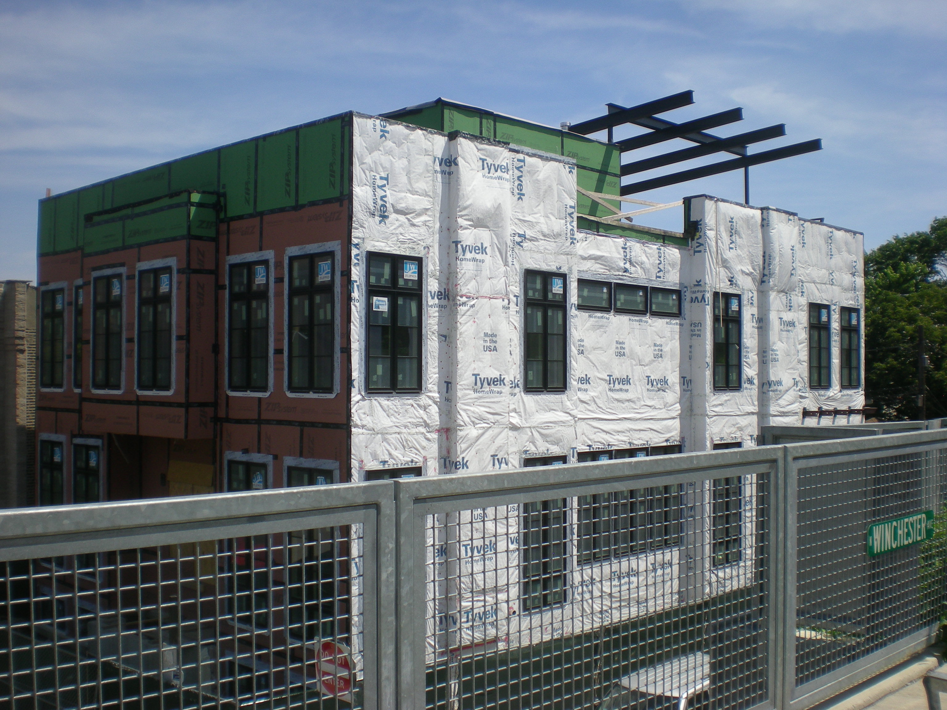
I also noticed that the trail is short on shade. Most of the year, that wouldn’t matter, but in summer it’s important. Even the trailside parks weren’t particularly shady. At Park 567, where the trail crosses over Milwaukee Ave., there were only three or four spots under trees offering any significant shade. I was lucky enough to be able to sit by myself in one sizable pool of shade, though I would have shared the space if anyone had asked.

I got a look at the trail’s first art installation, the serpentine “Brick House,” by a sculptor named Chakaia Booker.606 - Brick House scultpure
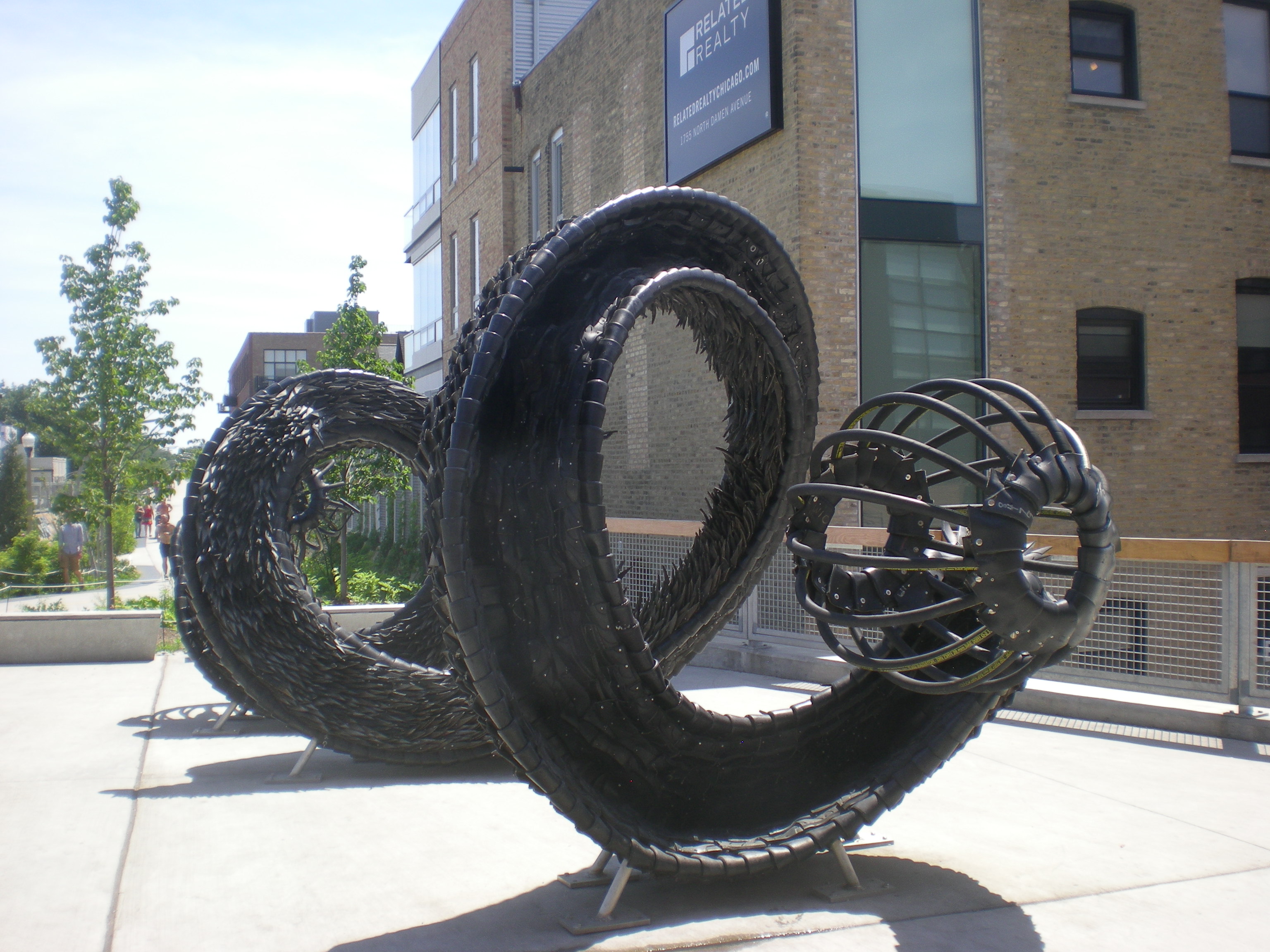
I’ll consider the title whimsical, since no bricks are involved, or any obvious connection to the song celebrating feminine pulchritude. It’s made of stainless steel and recycled tire rubber. Put in last fall, the piece attracts children, who instantly want to climb it.
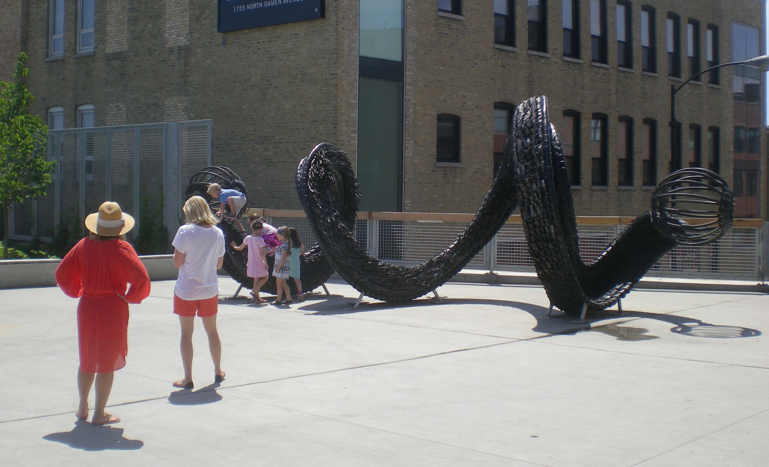
I would have spent more time on the trail, but I’d forgotten a hat (though not water). The shade, provided by mature trees, is better on many of Chicago’s neighborhood streets, so after about a half mile, I walked the rest of the way on small streets, as well as along North Ave., whose buildings also provided shade at that time of the day, at least on the south side of the street. I’m not the devil-may-care teen I used to be, who sometimes walked miles in clear 90-plus degree weather in San Antonio or Austin.

Dayton ’16

Not long before Memorial Day weekend this year, my professional duties took me to AAA’s web site, and a press release there told me that among American travelers, “the top destinations this Memorial Day weekend, based on AAA.com and AAA travel agency sales, are: Orlando, Myrtle Beach, Washington, DC, New York, Miami, San Francisco, Boston, Honolulu, Los Angeles and South Padre Island.”

We didn’t go to any of those destinations last weekend, as interesting as they all are. (I’ll bet Myrtle Beach has its charms; it’s the only one on the list I’ve never been to.) Instead, we went to Dayton as the primary destination, with shorter stops in Wapakoneta, also in Ohio, along with Indianapolis and Fort Wayne — the last two for meals. So it was a western Ohio trip.

Ohio, land of the curious swallowtail flag. The Ohio Burgee, it’s called.
Ohio BurgeeOr maybe we took an aerospace-themed trip, since we spent the better part of Saturday at the sprawling, extraordinary National Museum of the U.S. Air Force just outside of Dayton, on the grounds of the Wright-Patterson Air Force Base. It has a reputation as one of the best aviation museums in the country, often mentioned in the company of the Smithsonian Air & Space Museum. Now that I’ve been there, I can see why.

The Wright brothers were from Dayton, and the Wright sister too. Four boys and a girl survived to adulthood, and all but the eldest brother were ultimately involved in the business of flying machines. These days, the city features the Dayton Aviation Heritage National Historical Park. Part of the park includes a museum dedicated to the Wrights — and, curiously enough, to Ohioan poet Paul Laurence Dunbar, who did have a remarkable life. After lunch on Saturday, we took in the Wright-Dunbar exhibits, despite our tired feet.

On Sunday morning, as my family lolled in our room, I went to the Woodland Cemetery and Arboretum in Dayton. Covering 200 hilly, wooded acres, Woodland is a fitting name and most aesthetic burying ground I’ve seen since Green-Wood Cemetery in Brooklyn.

We came by way of I-65 to Indianapolis and then I-70 to Dayton. I didn’t want to return the same way, so we headed north on I-75 to Wapakoneta, boyhood home of Neil Armstrong, and current location of a spaceflight museum. From there, US 27/33 took us to Fort Wayne, a city I’d never visited, despite its relative proximity.

I also wanted to drive US 30 from Ft. Wayne across Indiana. It turned out to be a fairly fast way to traverse the state, something like the Trans-Canada Highway out in Saskatchewan or Manitoba; that is, as a divided highway, but not limited access one.

Maxine’s Chicken & Waffles in Indianapolis offered the best meal of the trip, so good and filling that we barely needed to eat the rest of the day after stopping there at about 4 EDT on Friday (but still 3 CDT according to our stomachs). Chicken and pancakes were on the menu, which I had this time around.

When we came out of Maxine’s, I saw something I’d only ever heard about: a Megabus.Megabus, Indianapolis 2016The bus on the Chicago-Indianapolis run. I suppose there on N. East St., toward the eastern edge of downtown, is where it picks up its budget-minded passengers. According to the web site, the price for Chicago-Indianapolis is “from $25.” I’m not sure how much that really would be, but at least the bus offers wifi. They know their market.

Scenes of Naniwa

In July 1991 at Kinokunya Books in Osaka, which had a nice selection of English-language titles, I chanced across a large paperback called Scenes of Naniwa, which seems to be subtitled, “Osaka Time Tunnel.” I’m really glad I forked over the ¥2060 to buy it (about $15 in those days), because I’ve never seen it for sale anywhere else, not even Amazon, though admittedly I only checked the English-language version of that site.

Scenes of NaniwaThe book has 40 short chapters, each well illustrated by black-and-white images, of Meiji- and Taisho- and early Showa-era Osaka, which is to say, the latter decades of the 19th century and the early decades of the 20th. In fact, the photographs are the genesis of the book.

It seems that one Teijiro Ueda (1860-1944), who owned a sizable camera shop in Osaka in the early years of the 20th century, also had a sizable collection of photographs of old Osaka. He apparently took some of them himself, though it isn’t always clear which ones. Some of them he probably collected from other photographers.

In the 1980s, with the assistance of Ueda’s elderly daughter-in-law, who had kept track of his 1,300 or so images in a dozen albums, the Yomiuri Shimbun (a daily paper) published the photos and articles to go with them in a serial format. Later the paper put the articles together in book form. A Belgian named J.V.D. Cammen took it upon himself to translate the book into English, and in 1987, Yomiuri published that too. That’s what I have.

I’m assuming that neither Japanese nor English were Cammen’s first language, and if so, he did a remarkable job. The prose isn’t quite as smooth as it might be, but on the whole it’s high-quality writing in English. Someone unfamiliar with Osaka might find the book a chore to read, but the more you know about that city, the more interesting the descriptions will be. You find yourself thinking, “That used to be there?”

It’s a time tunnel all right. The modern urban landscape of Osaka has mostly obliterated the places and sights that Scenes of Naniwa documents. (Naniwa is an older name for the city, and possibly even a poetic one in later times.) As the text notes, “In our time, with ferro-concrete buildings lining the streets, the appearance of Osaka has become almost the same everywhere, but there are plenty of photographs in the Ueda albums of the city before it received this uniformity.”

For example, the book tells of the Osaka Hotel, which used to be on Nakanoshima, a narrow island in Yoda River, which these days is a good place for strolling in fair weather. The book says that: “The hotel [had] arched windows resembling those of palaces in the West. It [had] turrets like castles in the Middle Ages, with dormer windows in the roofs, which [were] covered with asbestos slates, and the ridgepoles too [were] decorated with fine ironwork… The front part of the hotel [was] three-storied, but at the back [was] a basement with a veranda and even an anchorage for the private use of the hotel.”

The structure dated from 1900, but didn’t last long: it burned down in 1924. On the site now is the fine Museum of Oriental Ceramics, completed in 1982.

Then there’s the Tall Lantern (Taka-doro) in Sumiyoshi. I used to live in Sumiyoshi Ward, and south of my residence, about 20 minutes on foot, was Sumiyoshi Shrine (Sumiyoshi-jinja). Not far from there was the Tall Lantern, though not in its original position, as I learned from the book.

“… the Taka-doro was originally an offering made by fishermen to the Guardian Sea-god of the Sumiyoshi Shire at the end of the Kamakura period, but has become best known now for being the oldest lighthouse ever constructed in Japan… In 1950, the Stone Lantern was destroyed by Typhoon Jane, but it was reconstructed in its original form about 200 m farther east. Restored, it stands on its former foundation, is 21 m high, and has a tiled roof like that of a temple.”

Other chapters cover the Juso Ferry (Juso’s a neighborhood; I was married in a church there); the site of the Japanese Mint and its cherry blossoms; the earlier Osaka Stations, before the current and entirely utilitarian one; the site of the Industrial Expo of 1903; a ceremonial arch (long gone) built to commemorate the victory over Russia in 1905; the evolution of the Dotomburi district, which in the age of electric lights overwhelms the eye, but which used to be a home to many kabuki theaters; the earlier iterations of Namba Station and the Nankai Electric Railway; Shitennoji and environs, the clearest memory I have of which is one of the ponds at Shitennoji temple that was infested with an absurd number of frogs; and much more, such as an account of a fire on July 31, 1909, that burned more than 122 hectares of the city and 11,300 houses. Ueda apparently went to the roof of his camera store and took a picture that morning, which shows an enormous billow of black smoke about two kilometers away.

The book also taught me about the miotsukushi. I pulled this image of one, along with a sailboat, from a Japanese web site. The image is in the book, though cropped a bit differently, and dates from about 1877, which surely puts it in the public domain.
miotsukushi1877Scenes of Naniwa tells us that “the Osaka city symbol, the miotsukushi, originates from the stakes used as water route signals which up to the middle of the Meiji period stood planted in the Kizu and Aji Rivers, both debouching into Osaka Harbor. The depth of the water was difficult to judge because of the abundant bamboo reeds growing in the rivers… the miotsukushi planted along both sides of the rivers were signs showing that within those stakes the water was deep enough to sail through safely.”

Though gone by the end of the 19th century, the miotsukushi were well regarded enough to become the city symbol in 1894, and if you spend enough time in Osaka, you start noticing depictions of them in various places, something like the Chicago municipal device.

Before I left Japan in 1994, I went to a flag shop and, after some discussion, managed to order a miotsukushi flag as a souvenir of my time in the city. (I think they had a hard time believing a gaijin would have ever heard of it.) It was a little bigger than a 3 x 5-inch flag, and I had it until 2003, when it disappeared during the move to my current house.

Hall of State, Fair Park

At one end of the Fair Park Esplanade is the Hall of State, a stately hall indeed. “The Hall of State, a museum, archive, and reference library, was erected in 1936 at a cost of about $1.2 million by the state of Texas at Fair Park in Dallas to house the exhibits of the Texas Centennial Exposition and the Greater Texas and Pan-American Exposition of 1937,” explains the Texas State Historical Association.
Hall of State, Fair Park“The structure, designed by eleven Texas architects, is characterized as Art Deco… The front is 360 feet long, and the rear wing extends back 180 feet… The walls are surfaced with Texas limestone. A carved frieze memorializing names of historical importance encircles the building. Carvings on the frieze display Texas flora.”

I went inside for a look, and soon was face-to-face — or maybe face-to-plinth — with six statues of early Texas luminaries: Stephen F. Austin, Sam Houston, Mirabeau B. Lamar, James Fannin, Thomas J. Rusk, and William B. Travis. Here’s Lamar (1798-1859), second president of the Republic of Texas, among other things.
MB LamarPompeo Coppini did the sculptures. I’d run across his work before at the Texas State Cemetery in Austin. If it’s a monumental sculpture in Texas done in the early to mid-20th century, odds are he did it.

Then I entered Great Hall.
Hall of State, Great HallThe TSHA again: “The Great Hall, or the Hall of the Six Flags, in the central wing, has a forty-six-foot-high ceiling. Murals on the north and south walls depict the history of the state and its industrial, cultural, and agricultural progress. These were painted by Eugene Savage of New York.” I’d run across him before as well.

Great Hall, Hall of StateDuring my visit, the Great Hall happened to be sporting an exhibit about Texas musicians, and I will say that I learned that Meat Loaf was from Dallas, something I didn’t know. Actually I didn’t know much about many of the Texas musicians mentioned in the exhibit, such as various bluesmen and Western swing players and Tejano bands.

On the back wall of the Great Hall is a gold-leafed medallion with the Lone Star emblem of Texas surrounded by representations of the six nations whose flags have flown over the state.
Gold leaf!The United States and the Republic of Texas are at the top; the Confederacy and Mexico in the middle; and France and Spain on the bottom. The six together are a persistent theme in symbolic representations of modern Texas.

Parade on the 606

On our way back to Humboldt Ave., where we got on the spanking-new 606 linear park on the Northwest Side of Chicago, and where we planned to get off, we encountered a little parade. Looked like an impromptu to-do.

Parade on the 606, 06-06 Parade on the 606, 06-06Whatever uniforms and instruments you got, bring ’em!

Parade on the 606, 06-06Cheerleaders are OK, but flag girls are where it’s at. That’s how I felt in high school, anyway, and some opinions never quite go away. Incidentally, the flag the woman in red is carrying said “FLAG” (as seen in the previous picture). Her shirt said “I ♥ a Scientist.” And note the Chicago flag wristband; nice touch.

And speaking of flags, this is a variation of the Chicago flag I hadn’t seen before.

Chicago flag variationJust happy chance that we got to see the little parade go by. That, and we showed up at the 606 on opening day.

Treue der Union

The Texas State Historical Association says that “the Civil War skirmish known as the battle of the Nueces took place on the morning of August 10, 1862, when a force of Hill Country Unionists, encamped en route to Mexico on the west bank of the Nueces River about twenty miles from Fort Clark in present-day Kinney County, were attacked by mounted Confederate soldiers… Contentions over the event remained on both sides, with Confederates regarding it as a military action against insurrectionists while many German Hill Country residents viewed the event as a massacre.

“After the war the remains of the Unionists killed at the battle site were gathered and interred at Comfort, where a monument commemorates the Germans and one Hispanic killed in the battle and subsequent actions. The dedication of the Treue der Union monument occurred on August 10, 1866. To commemorate the 130th anniversary of the memorial, the monument was rededicated on August 10, 1996. It is the only German-language monument to the Union in the South where the remains of those killed in battle are buried, and where an 1866 thirty-six star American flag flies at half-staff.”

The memorial stands on High Street in Comfort, Texas, between 3rd and 4th Sts., next to a piece of undeveloped land and across the street from a church and a school.
Comfort, Texas Feb 2105With the names of the dead on the sides. These fell in a later event in October 1862, on the Rio Grande.

Comfort, Texas Feb 2015And a 36-star flag does indeed fly there.

Comfort, Texas Feb 2015Not something you see too often. That flag was only current for two years, between 1865 and 1867, or rather between the admission of Nevada and Nebraska.

Come and Take It

There probably aren’t too many Come and Take It flags flapping in the Illinois wind, but there’s one in my back yard. It’s along with a Stars and Stripes, one of many that a Realtor posted on our block – all near the street – for the Fourth of July this year.

Come and Take ItIt’s the flag I bought as a souvenir of my visit to Washington-on-the-Brazos State Historic Site in April. It was a little long to take in a suitcase on an airplane – and it’s a little pointy, just the kind of thing that might alarm a literal-minded TSA agent and who might indeed take it – so I left it at Jay’s house, intending to pick it up in July, when I could take it back in my car. Remarkably, I remembered to do just that, though it’s been in the car for a few weeks.

Nothing like an obscure historic flag of defiance to brighten up your deck. Unlike the Gadsden Flag, it hasn’t been co-oped by anti-government radicals (anti-government, except for their Social Security and Medicare).

Lights No, Flags Yes

While driving along this evening I saw two houses with Christmas lights. Christmas lights all aglow here in mid-November. No, no, no. I can understand putting up the lights during the relatively warm days of November – even though it’s been cold lately – but lighting them? Let November be November, not some run-up to December.

Another thing I saw in the neighborhood: a flagpole flying the Hawaiian state flag, right under the U.S. flag. I don’t think I’ve ever seen the Hawaiian flag around here before. It’s one of the cooler state flags, with its Union Jack canton and red, white and blue stripes supposedly symbolizing the major islands. I wonder what the occasion is; maybe the homeowners were there recently, and brought it back as a souvenir.

I also wonder whether they’ll fly the flag on Hawaiian holidays. According to the always interesting Flags of the World web site, whose Hawaii page includes such details as an 1896 variation on the flag, state occasions on which to fly the flag include Prince Jonah Kuhio Kalanianaole Day and King Kamehameha I Day, March 26 and June 11, respectively. Also, the third Friday in August is Statehood Day.

And, of course, not everyone is happy about the Hawaiian flag, even though it was used by the independent kingdom in the 19th century.

On the Borders

In July 2006 we found ourselves – because of much sustained effort, mostly in the form of driving long distances – at a triple border. I can’t think of anywhere else I’ve been quite like it. The spot is at the meeting of British Columbia and Alberta; of Banff National Park and Kootenay National Park; and on the Continental Divide. On one side of the road are three flagpoles, with the Maple Leaf flying between the provincial flags of British Columbia and Alberta.

On the other side of the road is a large wooden sign offering some geographic information (it says 5,382 ft). I wore my Route of Seeing cap, and a shirt acquired on a previous visit to Canada, for a snap with the three-year-old Ann. (Be sure to read about Ed and Haleakala and that thing called Death.)

Not too far away, or at least northward on the British Columbia-Alberta border, is a triple continental divide, the Snow Dome of the Columbia Icefield. Our guide on the Icefield pointed it out to us, but that’s as close as we got. At that point water drains either to the Atlantic, Pacific or Arctic oceans.