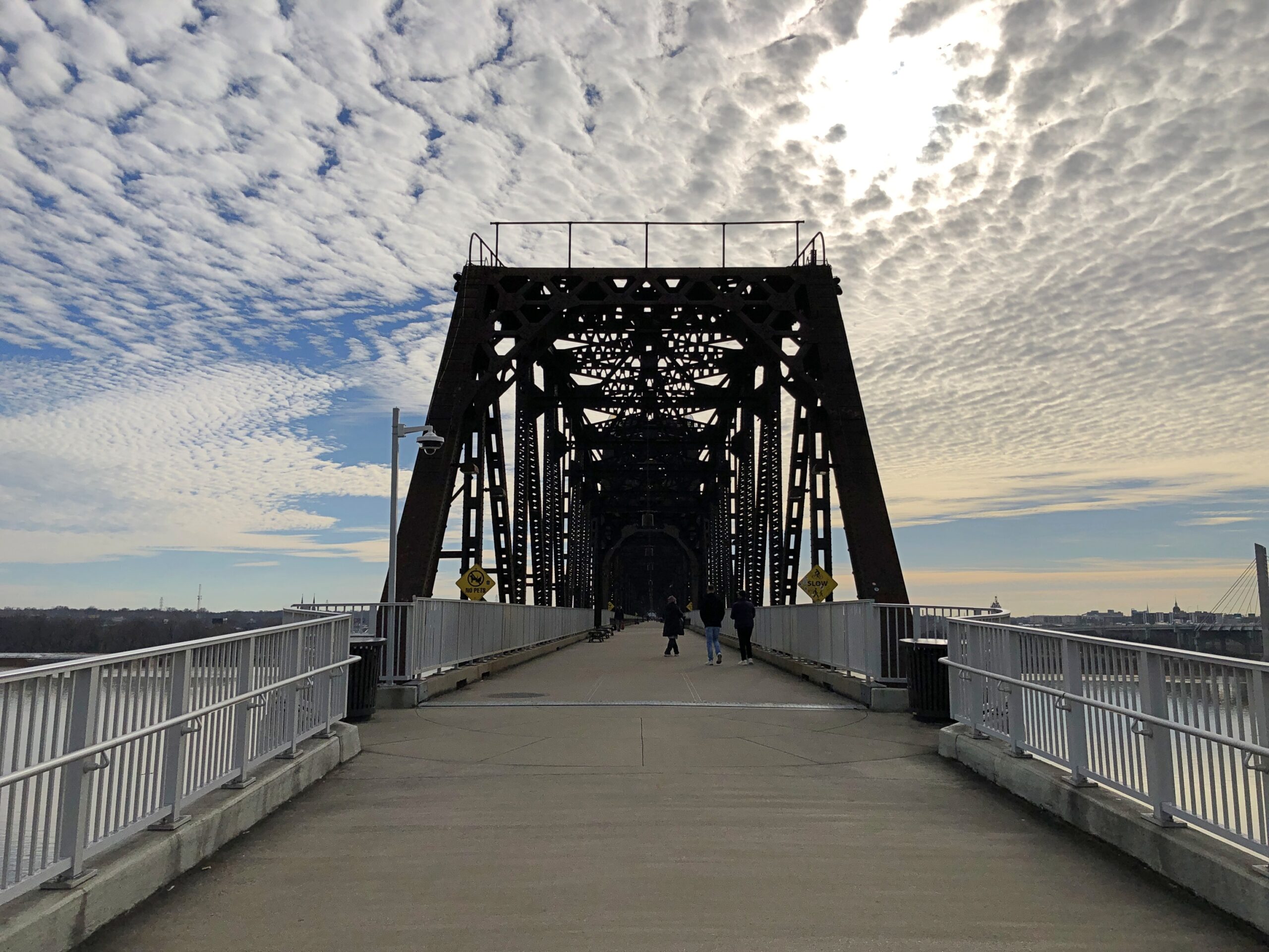
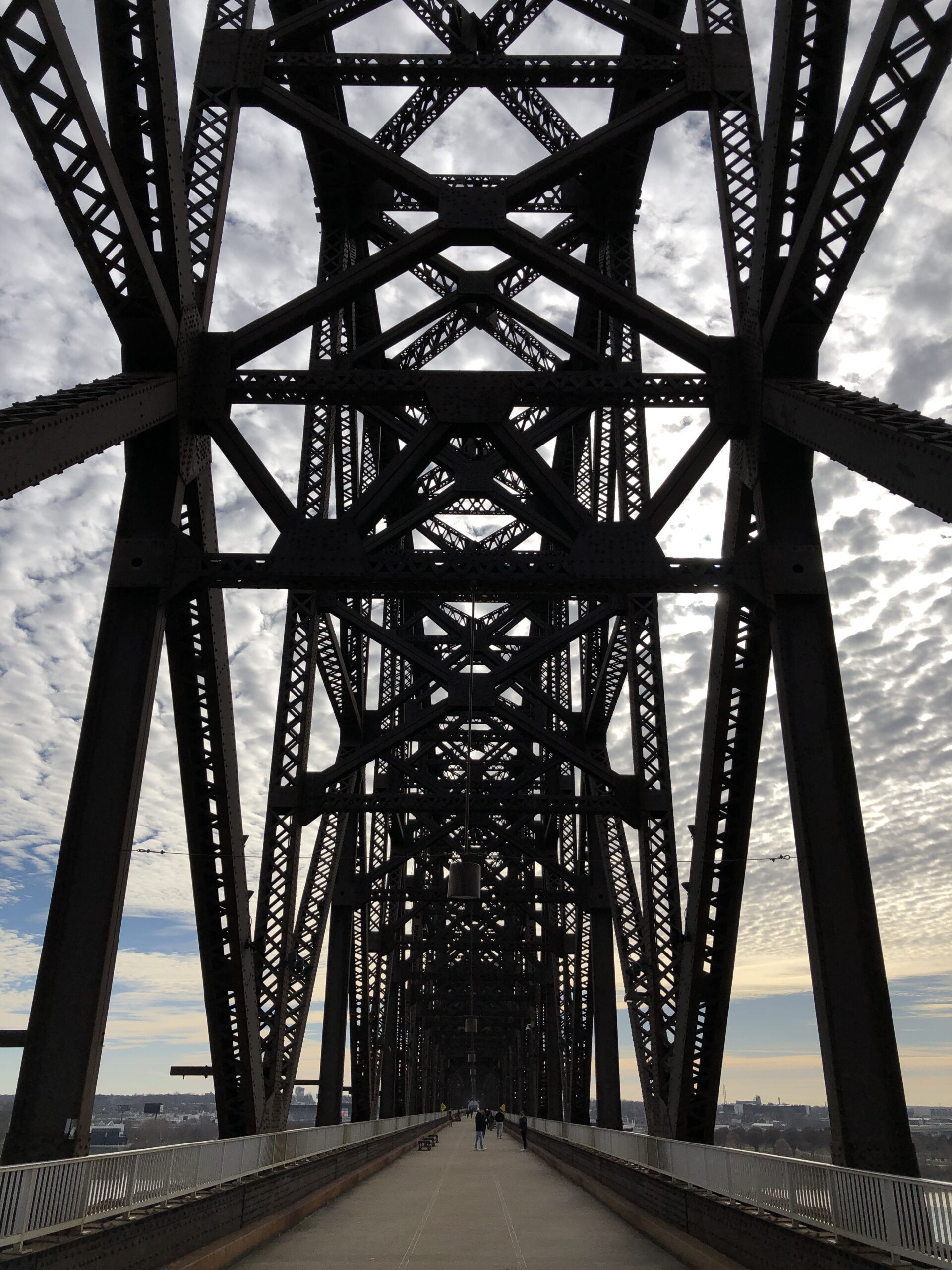
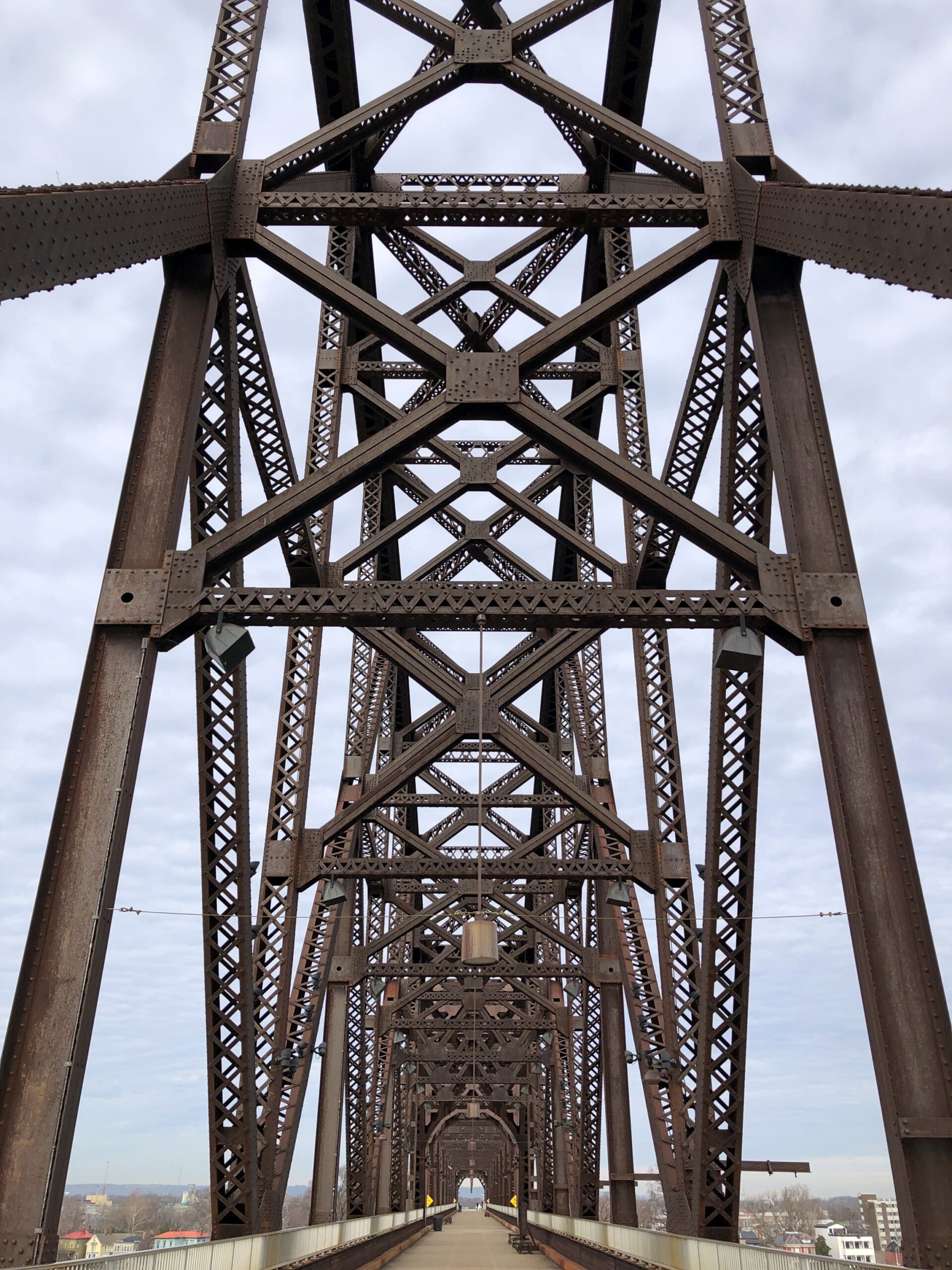
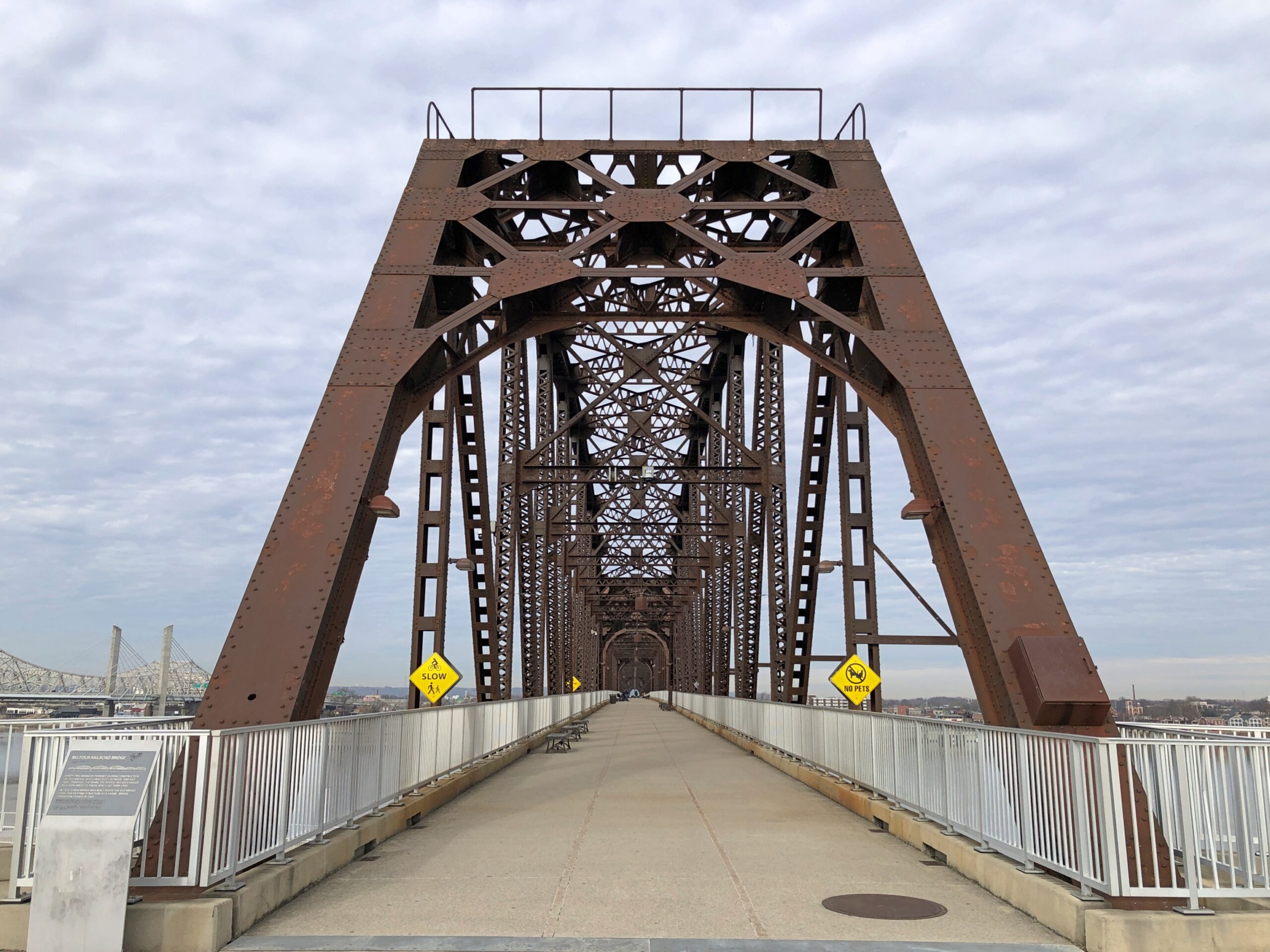
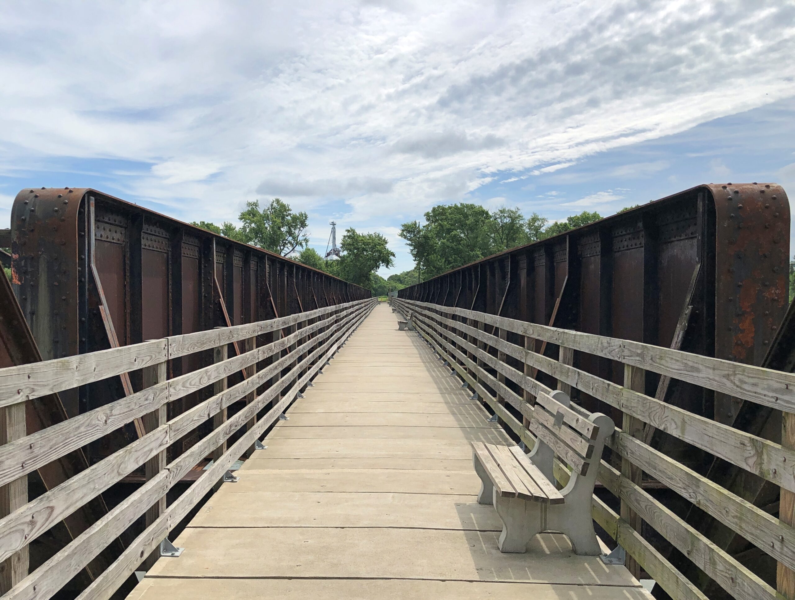
Even the last day of a long trip can include – should include – something to see. With that in mind on December 22, after we crossed the Ohio River from Louisville on the I-65 bridge, which I have done many times, we took the first exit to go to Jeffersonville, Indiana, which I have done only once, in 1990. Then we went back across the river to Louisville, this time on foot on a massive iron structure known as the Big Four Bridge.
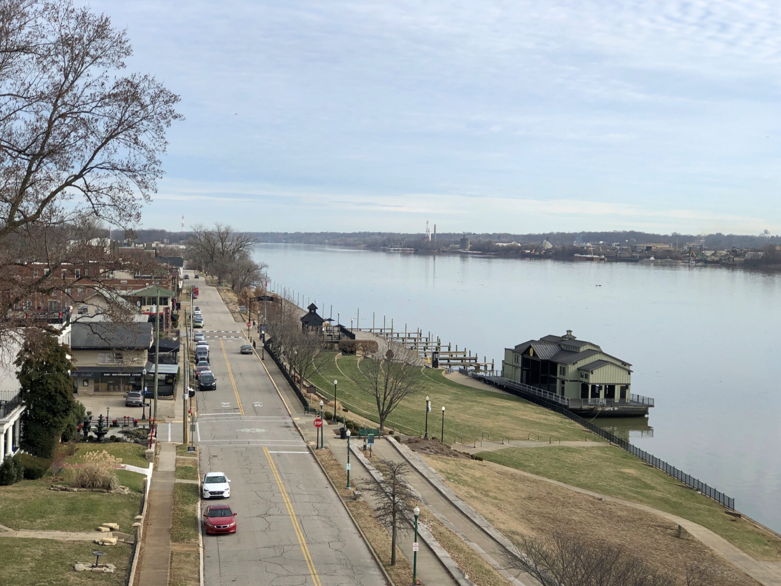
The Jeffersonville side of the bridge offers views of that town and its riverfront, where I took a wintertime stroll all those years ago. At that time, Big Four Bridge was a decaying relic, inaccessible to the public.
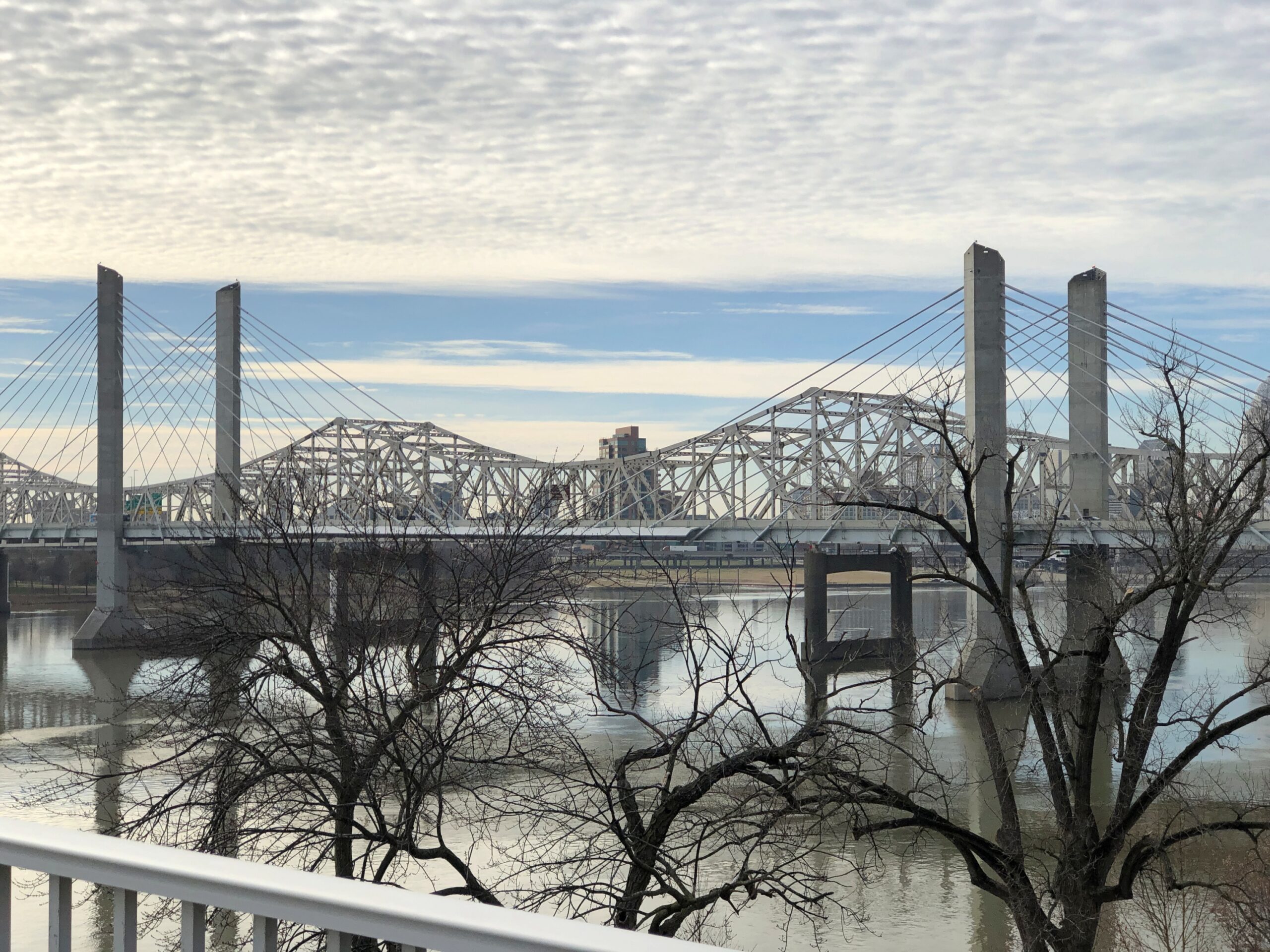
You can also see the I-65 bridge from that vantage. It too is an elegant design.
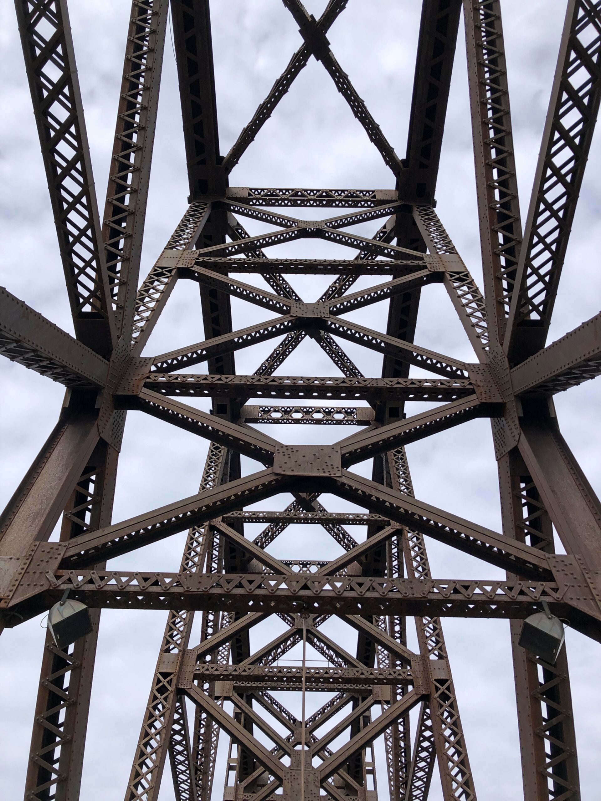
But not as impressive as the sweeping ironwork of Big Four Bridge.
The Ohio sweeps along as well.
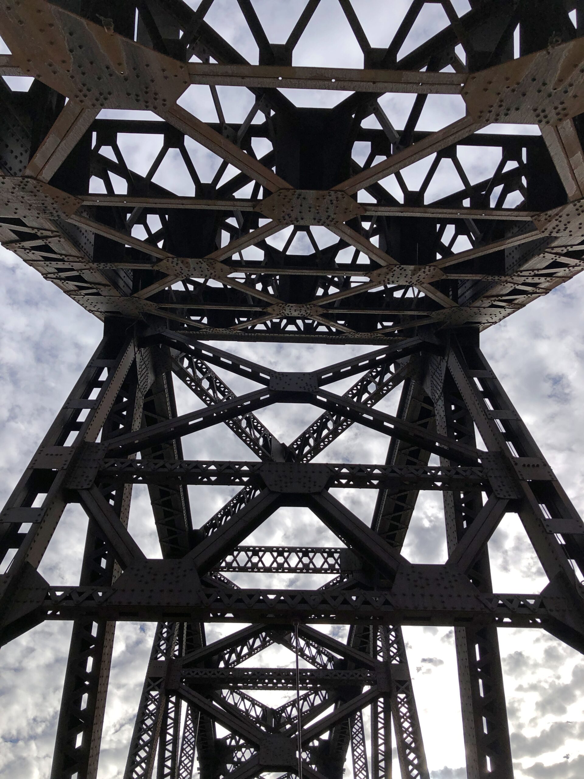
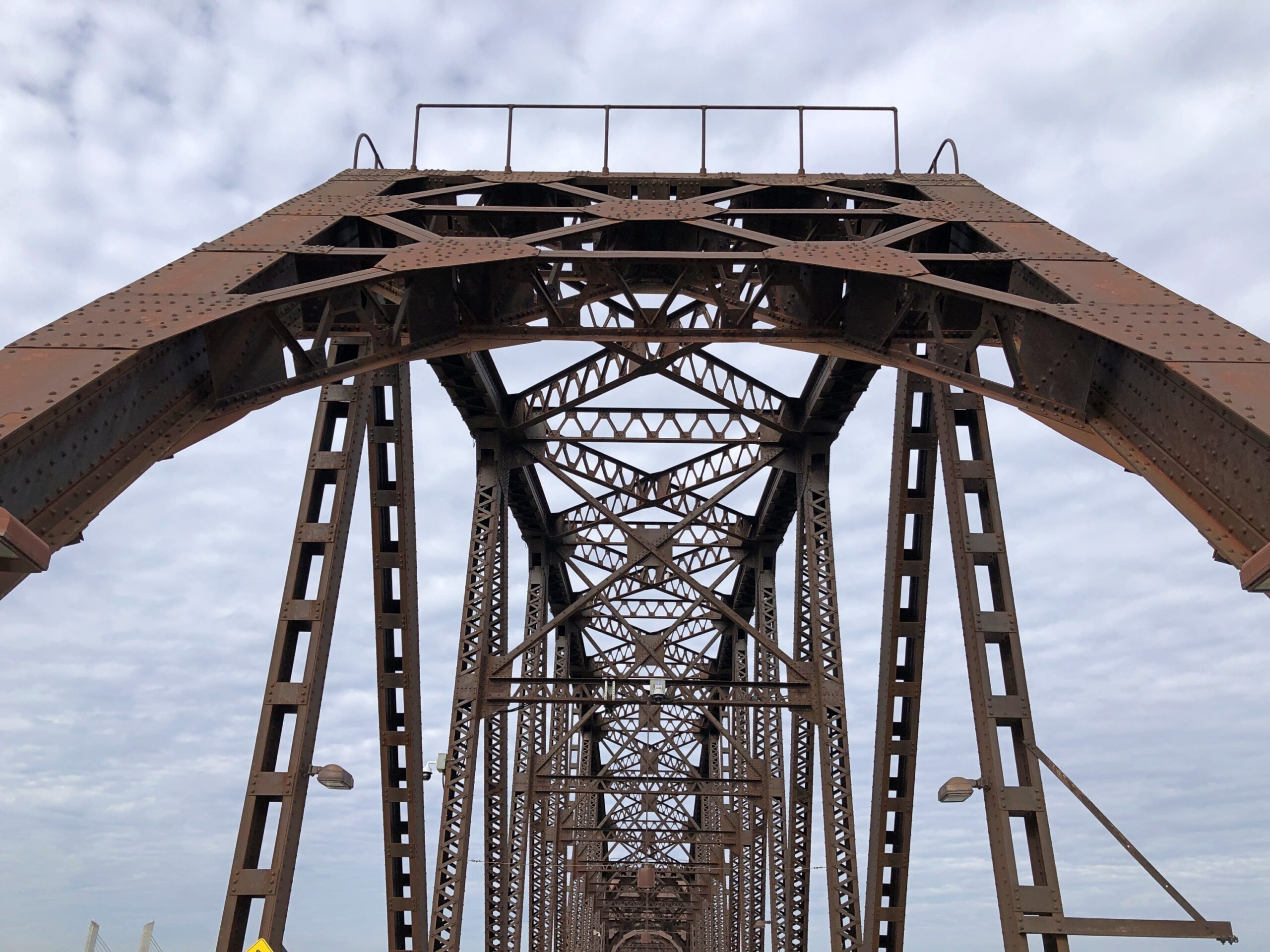
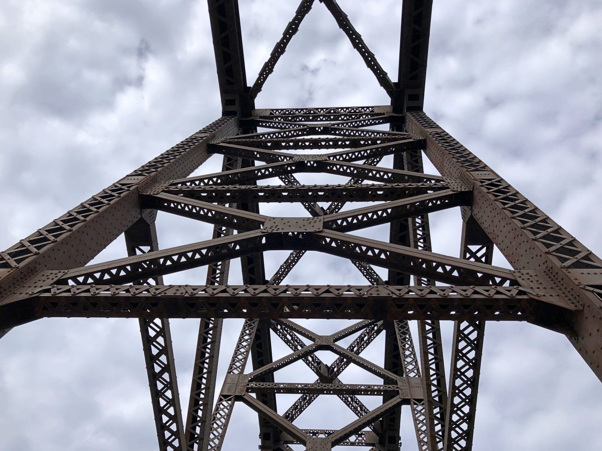
I couldn’t take enough pictures of Big Four.
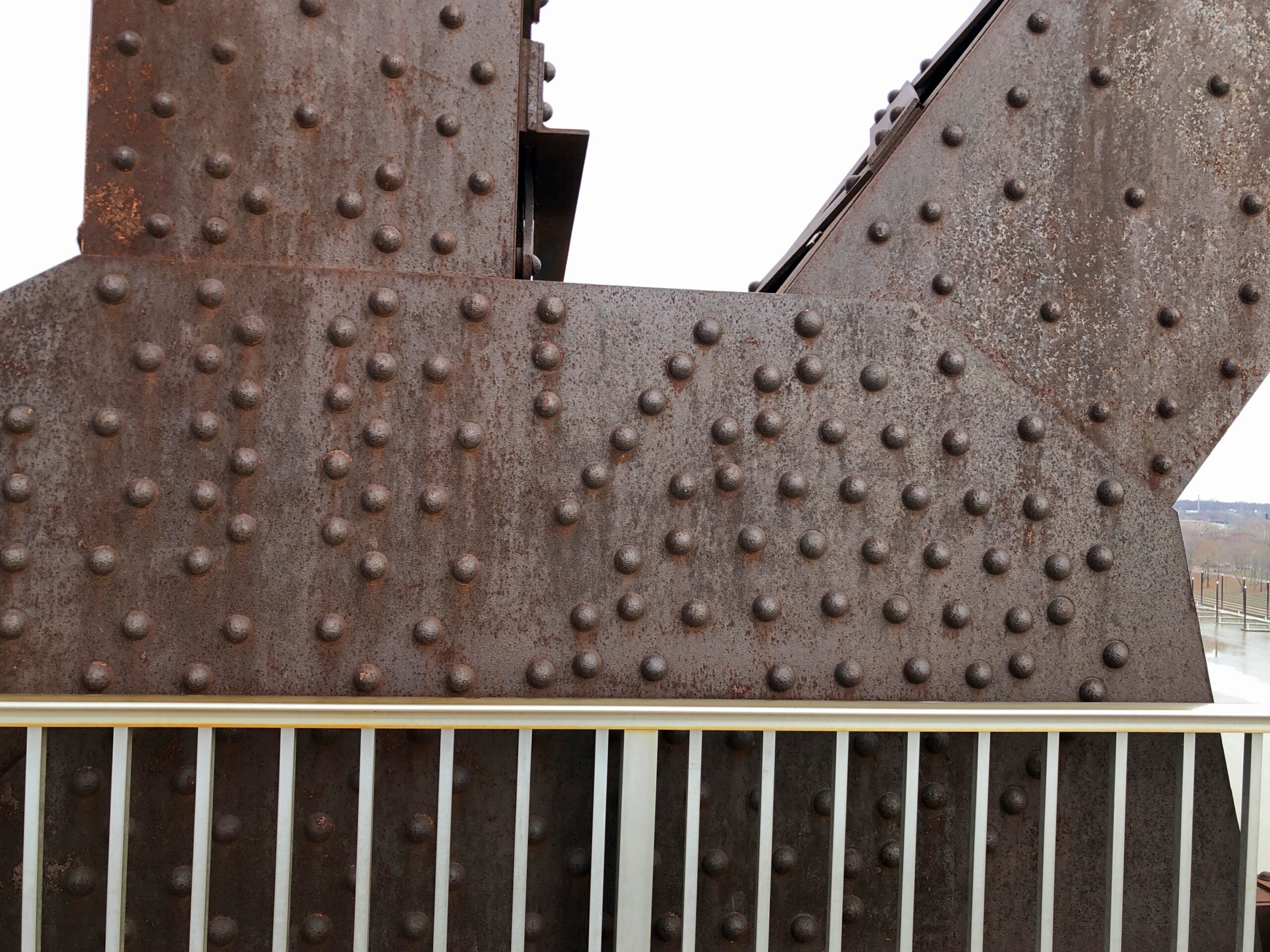
Once upon a time, Big Four carried the Cleveland, Cincinnati, Chicago and St. Louis Railway, also nicknamed the Big Four Railroad. The 2,525-foot span contains six trusses, beginning as a late 19th-century project, the sort of pre-OSHA work that killed dozens of workers during construction (so why not ghost stories?).
Completed in 1895, “The Big Four Bridge allowed freight traffic to dramatically increase in Louisville, and began carrying high-speed interurbans on September 12, 1905…” says Bridges & Tunnels. “Due to bigger and larger trains, not only in size, but in weight, contracts were let in June 1928 to build a larger Big Four Bridge. The new span, constructed by the Louisville & Jefferson Bridge Co., was built on the piers of the old bridge, while leaving the existing span intact while it was upgraded.”
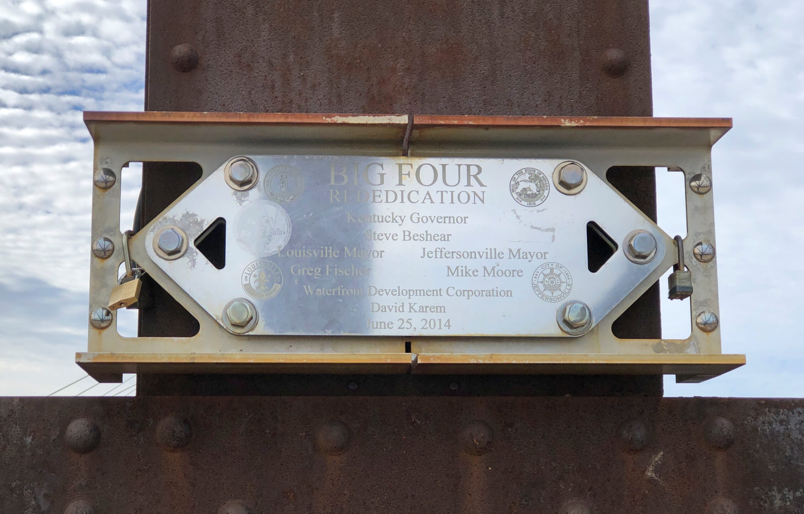
That is the structure we see today, except that in the early 21st century, it was redeveloped into a pedestrian/bicycle bridge.
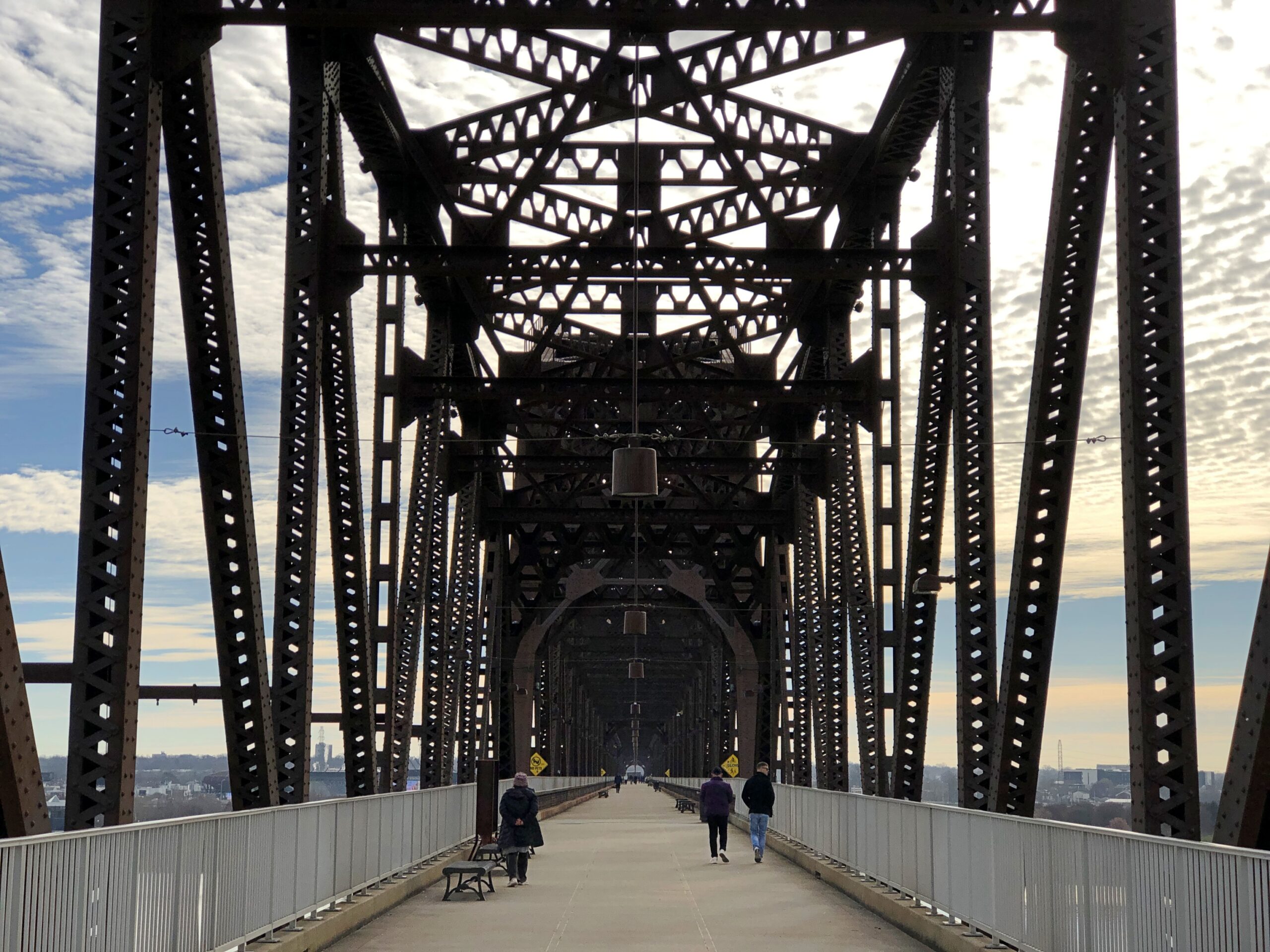
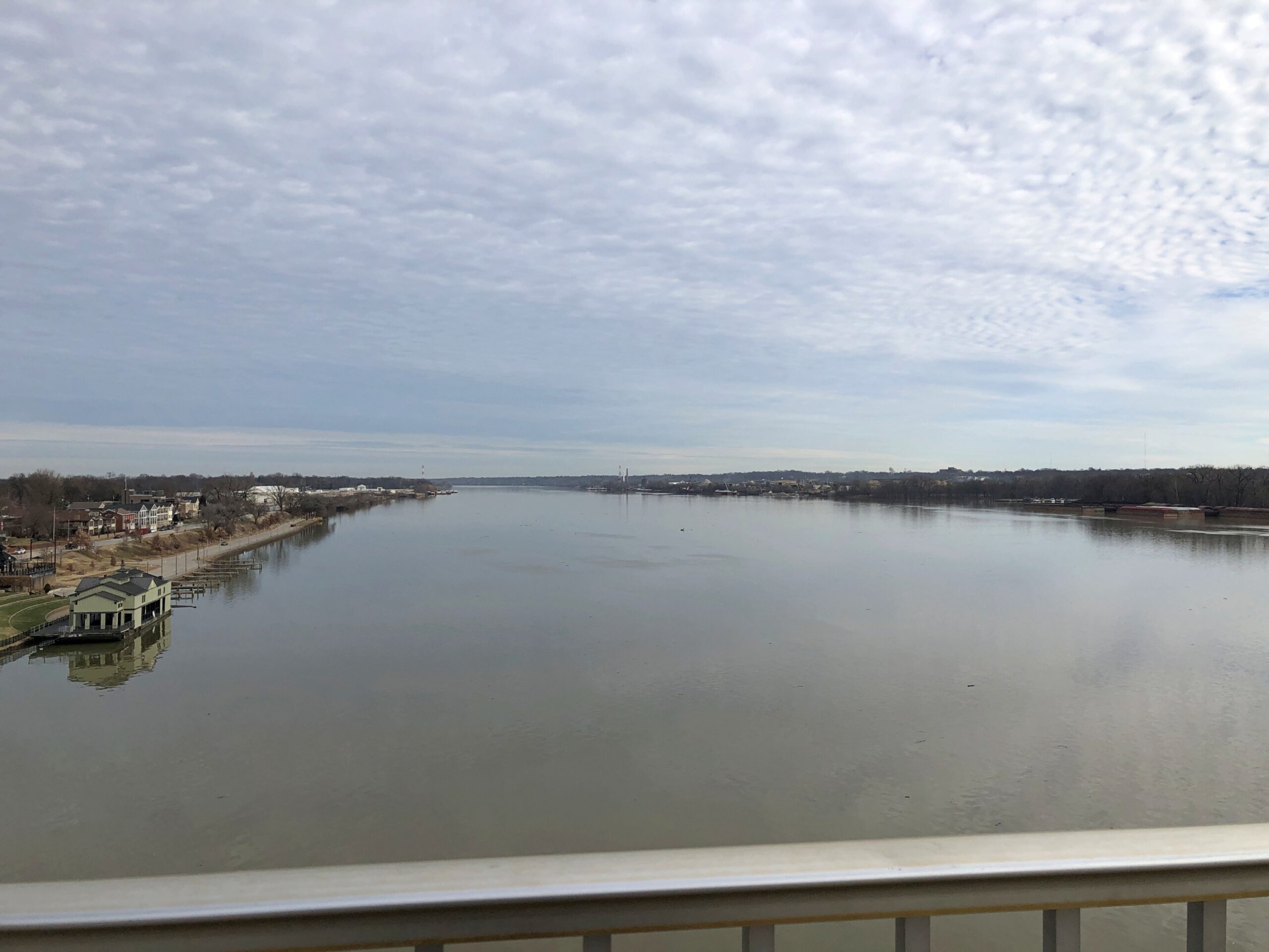
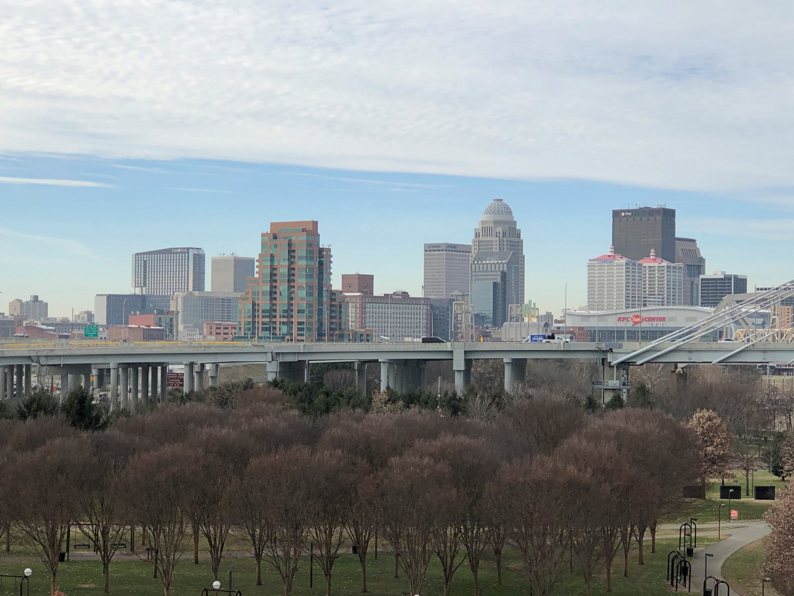
At the Louisville side of the bridge, views of the city.
And looking back at the bridge from the Kentucky (Louisville) side.
We saw the daytime bridge, of course. But “the Big Four Bridge has an LED lighting system that wraps the iron fretwork in vibrant colors,” says Our Waterfront. “The lights can be programmed to have a rainbow effect, highlighting the beauty and strength of the bridge structure. At night, the bridge becomes a colorful beacon in our city. Lights operate daily from twilight until 1 am.”
Another reason to come back to Louisville-Jeffersonville, obviously.
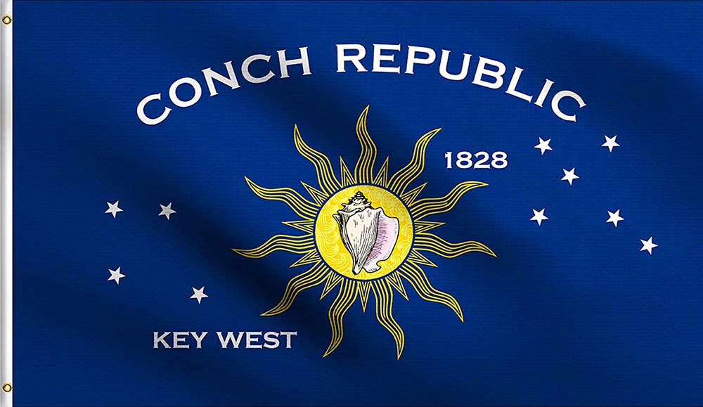
A few days ago, I sent the following email to the curator and historian at the Key West Art & Historical Society, Dr. Cori Convertito:
Dr. Convertito,
I recently visited Key West for another pleasant visit, and came away with a question I haven’t been able to answer, though perhaps I haven’t looked in the right places.
Who is credited with the creation of the Conch Republic flag? I understand that it appeared at the same time as the infamous roadblock and the “secession,” but detail on its creation is lacking. Do you happen to know that?
One reason to ask is that it’s a handsome design, though I’m not sure about the star pattern asterisms — is one or another supposed to be the Southern Cross?
Today she answered:
That’s a perceptive question, and a difficult one to answer definitively. The Conch Republic flag emerged alongside the 1982 ‘secession,’ but attribution is complicated by the fact that several individuals have, over the years, laid claim to the original iteration of the artwork, and reliable contemporary documentation is limited. As a result, it’s hard to credit a single creator with certainty.
What is clearer is the intent behind the design elements. In addition to the conch shell and sun, the star groupings are generally understood to represent two navigational asterisms: the Southern Cross and the Northern Cross (Cygnus). Their inclusion appears deliberate, reinforcing Key West’s maritime identity and its symbolic position between hemispheres.
I hope that helps clarify what is known, and what remains unresolved.
So the short answer is, like with a number of historical questions – even ones as recent as this – no one is sure. Good to know. Thanks, Dr. Convertito.
The Overseas Highway, from mainland Florida to Key West, or vice versa, is epic all around: an epic construction project once upon a time, and an epic drive in our time. Through the Upper Keys, the likes of Key Largo and Islamorada, the ocean isn’t usually visible, obscured behind thick development: commercial and residential buildings and omnipresent marinas. But it isn’t long before you’re skipping from key to key, some larger, some smaller, with water widely visible on both sides of the road.
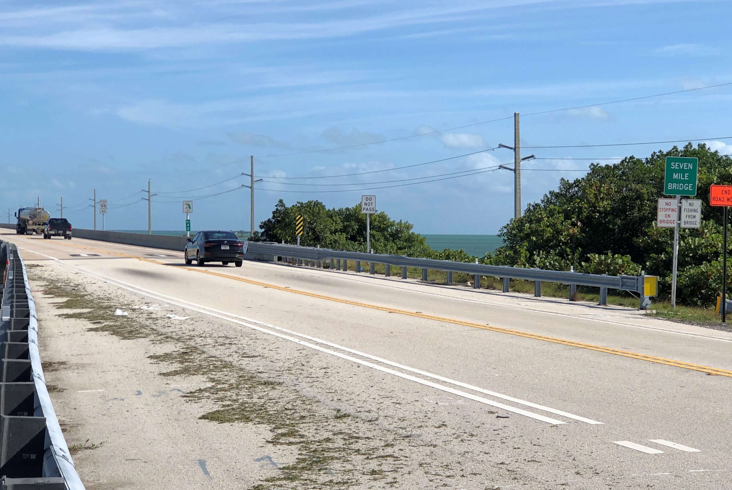
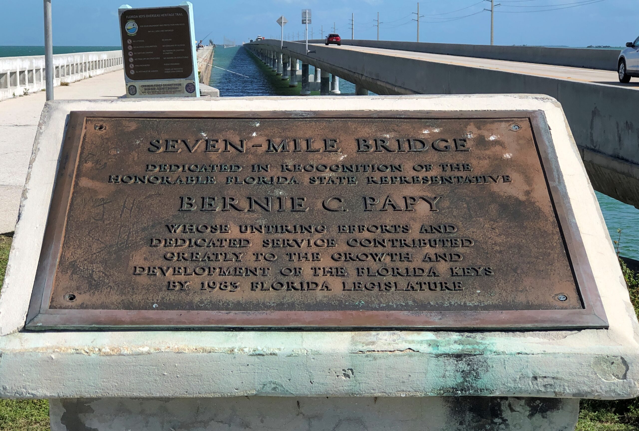
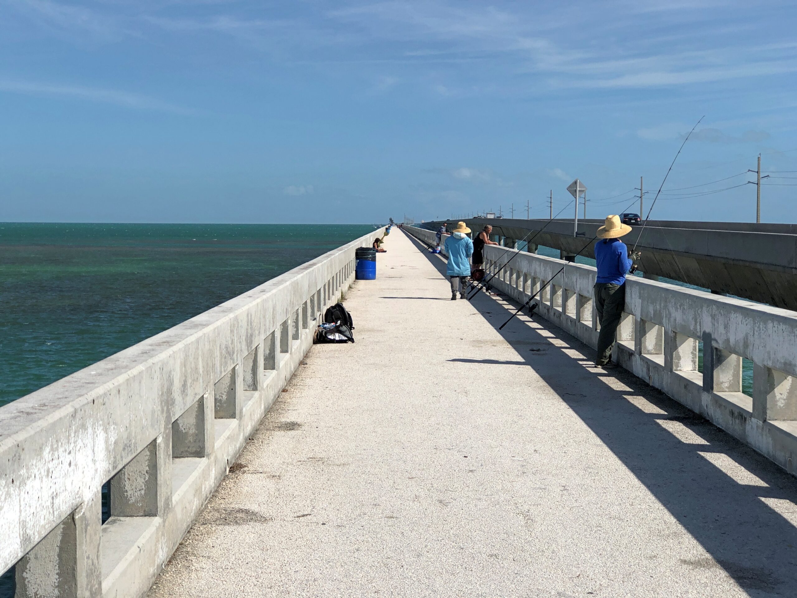
The most epic section of the crossing, as far as I’m concerned: Seven-Mile Bridge.
On an ordinary highway, seven miles isn’t much of a stretch at highway speeds. Listen to one song or another on the radio and you’re practically done with it. Those same minutes have a different quality over the wide water, glinting in the sun and spotted with boats and occasional small keys in the distance. There’s a sense of the mildly impossible. Of course it’s entirely possible, via a feat of 20th-century civil engineering, as is the 100-plus miles of the whole highway. I don’t believe my civil engineer grandfather ever drove the Overseas Highway, but I’ll bet he read about it with considerable satisfaction.
“The original 7 Mile Bridge, also known as the Knights Key-Pigeon Key-Moser Channel-Pacet Channel Bridge, was constructed in the early 1900s as part of Henry Flagler’s ambitious Overseas Railroad project,” notes the Key West Blog. “This railroad connected mainland Florida to Key West, revolutionizing transportation and trade in the region. However, after a devastating hurricane in 1935, the railroad was destroyed, and the bridge was converted into a highway.”
The history is a little more complicated than that, with the current bridge a 1980s work, leaving part of the original as a pedestrian and (especially) a fishing bridge. I’m no sport fisherman, but I understand tarpon, snook, snapper, grouper, bonefish and barracuda swim these waters.
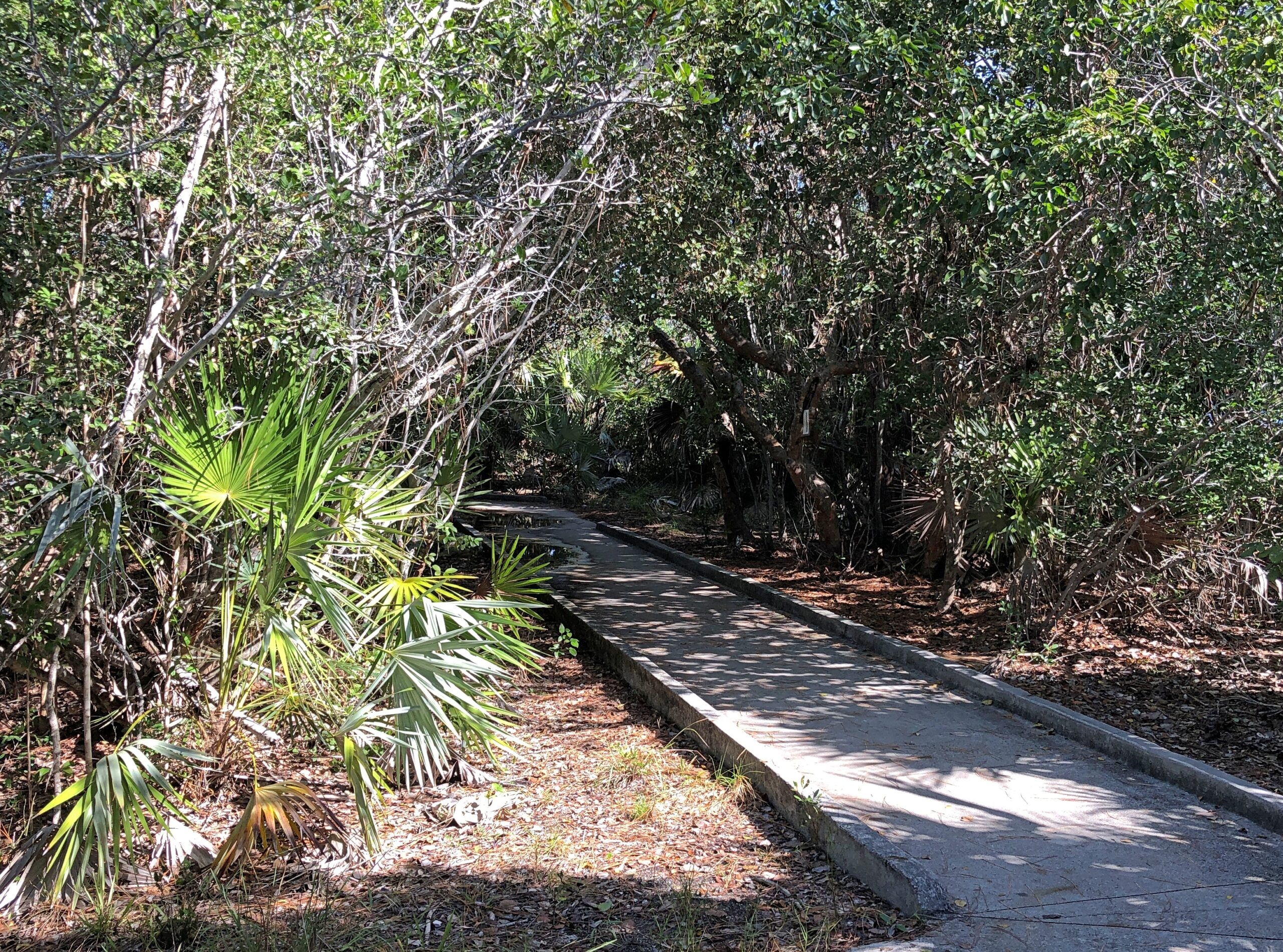
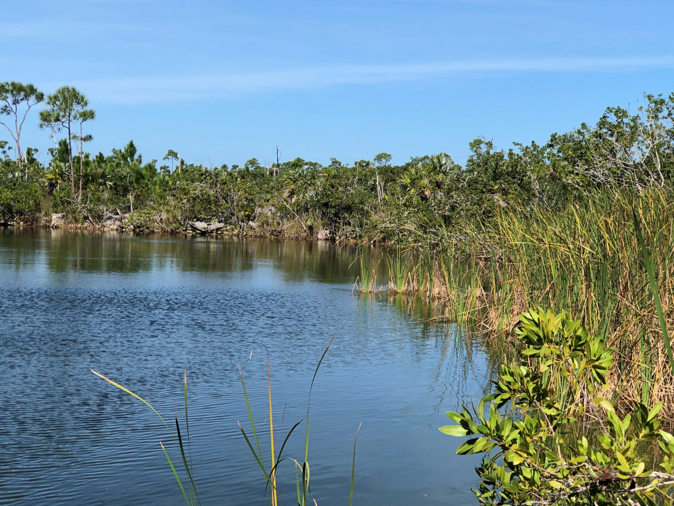
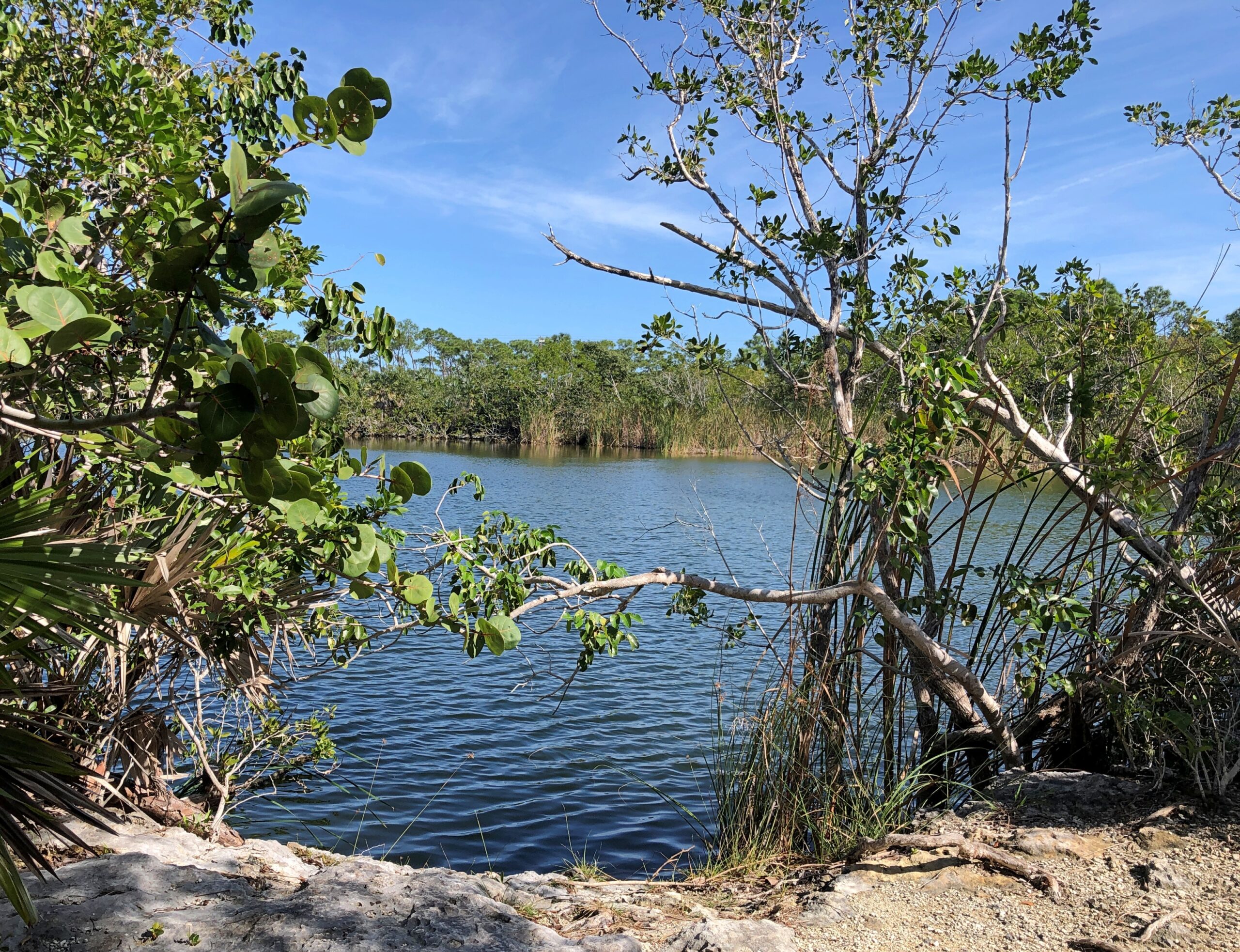
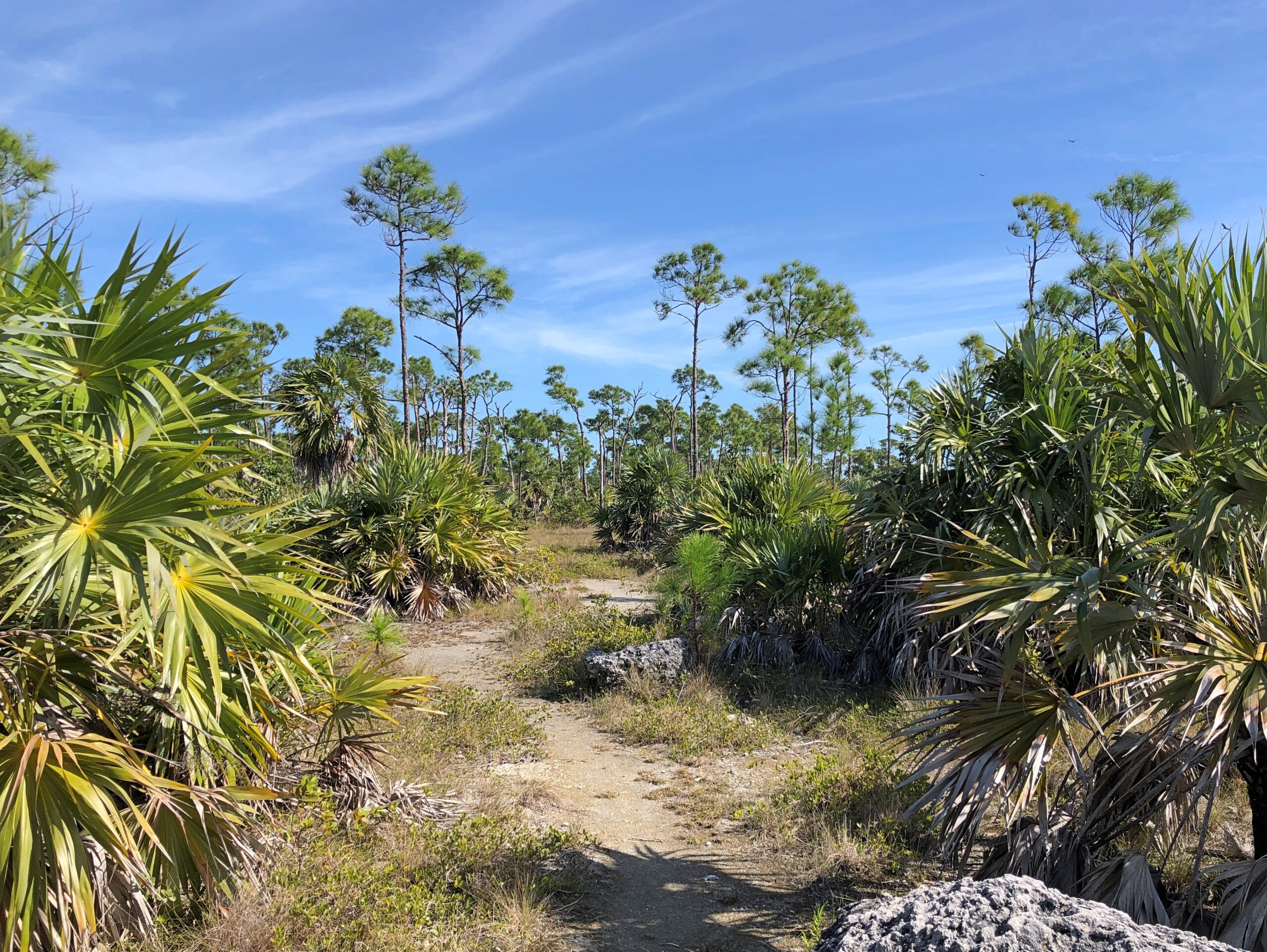
At Big Pine Key, we stopped for a visit to the National Key Deer Refuge, a place focused on giving key deer a place to live, as it says in the name. For human visitors, there is a trail.
It goes partly around a pond in the refuge. No deer were to be seen.
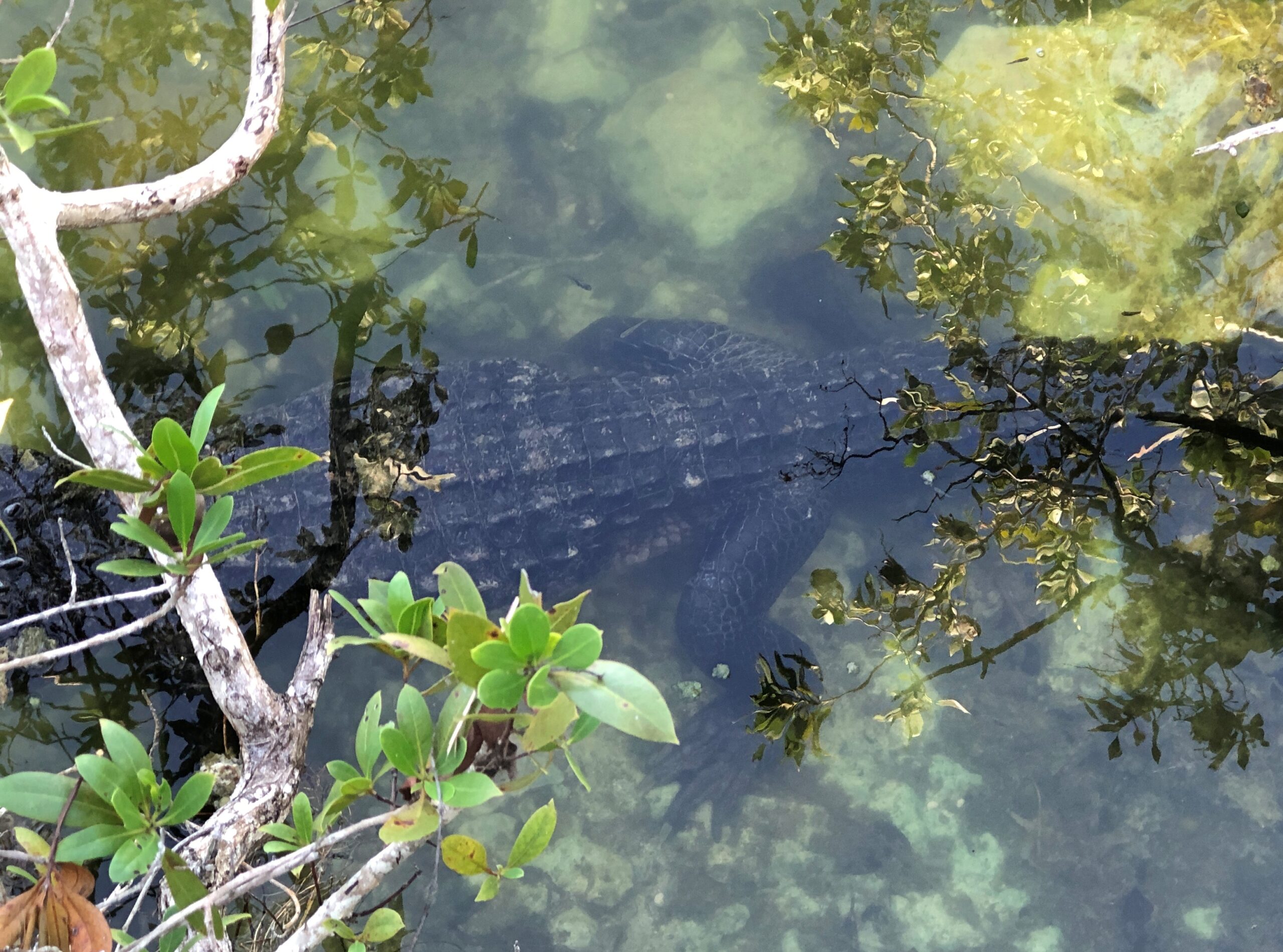
We did spot a gator, however. Or maybe a croc. Hard to tell at this angle. They both live in southern Florida.
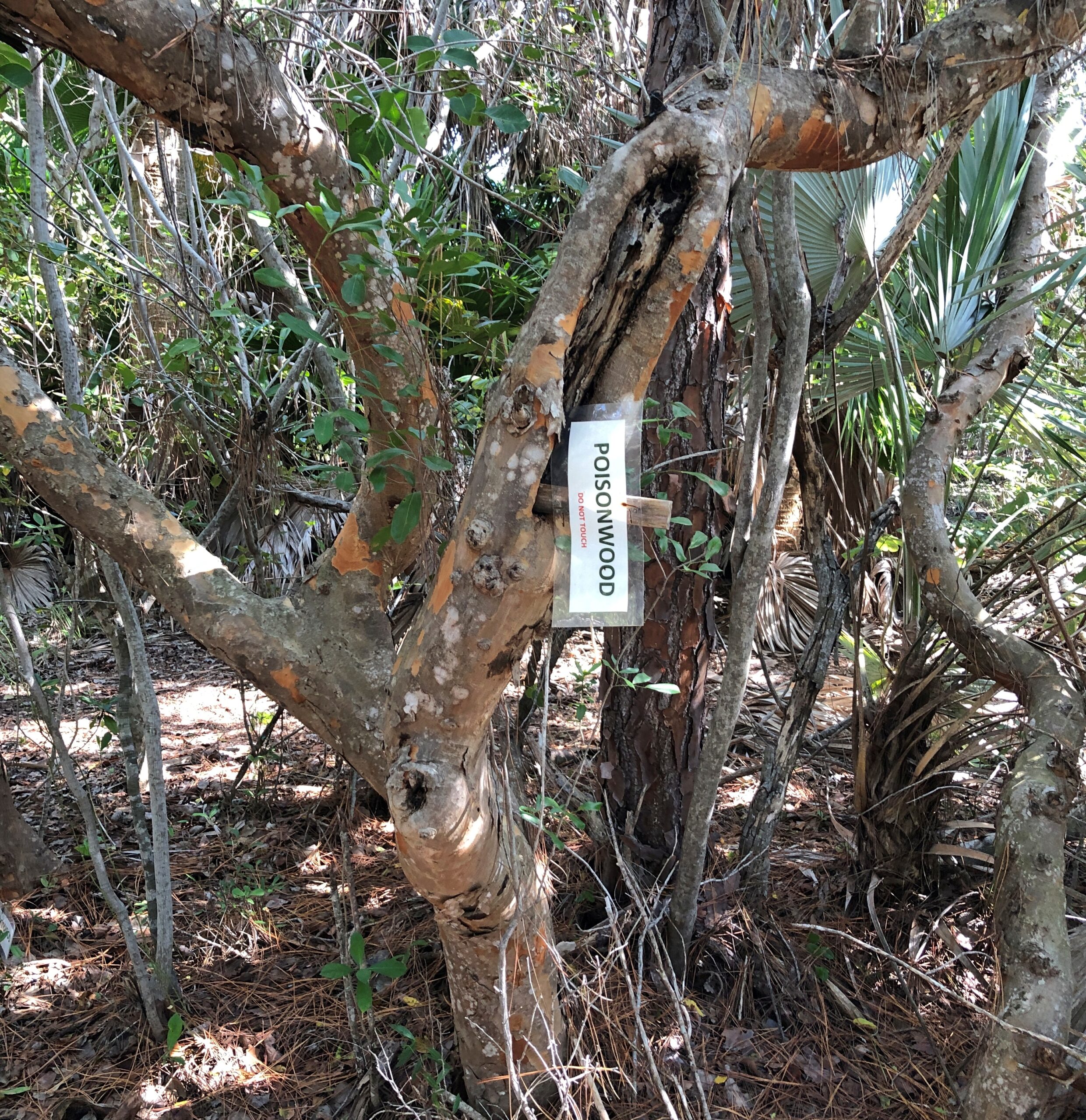
A sign on the trail warns visitors not about reptiles, but a nearby poisonwood tree.
Poisonwood? A native to the Keys. It sounds bad, and it is.
“Metopium Toxiferum [poisonwood] is related to poison oak, poison ivy, and poison sumac,” says the Tree Care Guide. “The tree produces the same irritant, urushiol, which causes an itchy, blistering rash. The oils from Metopium toxiferum cause dermatitis ranging in severity from a light red rash to intense skin blistering. Tea made from Metopium toxiferum leaves and twigs combined with bleach has been used to induce abortions but has also tended to kill the patient.”
Yikes. We took the advice of the sign and didn’t go near it.
Across the road from the refuge parking lot, some undeveloped key landscape. There couldn’t be that much of that, at least on the keys connected by the highway.
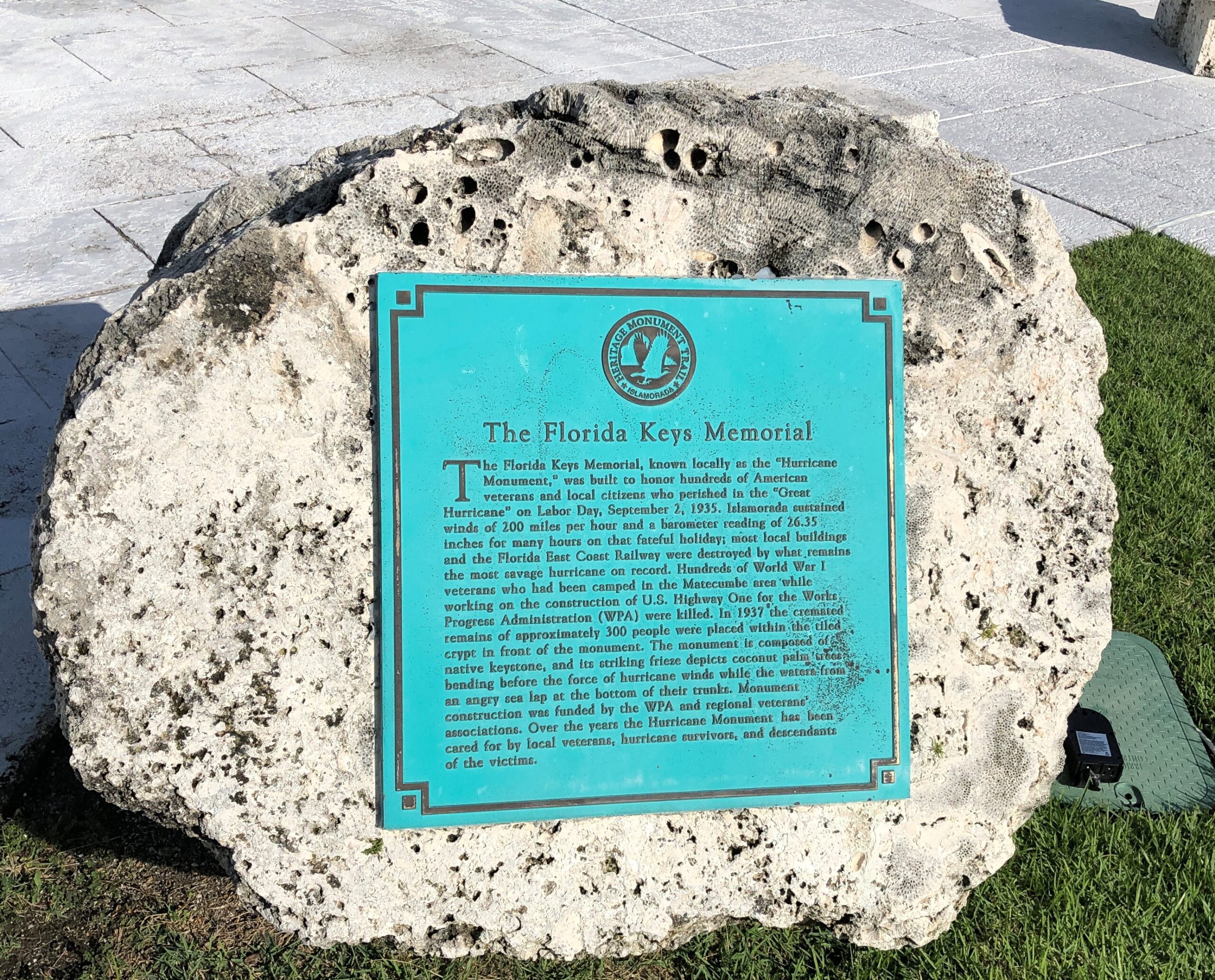
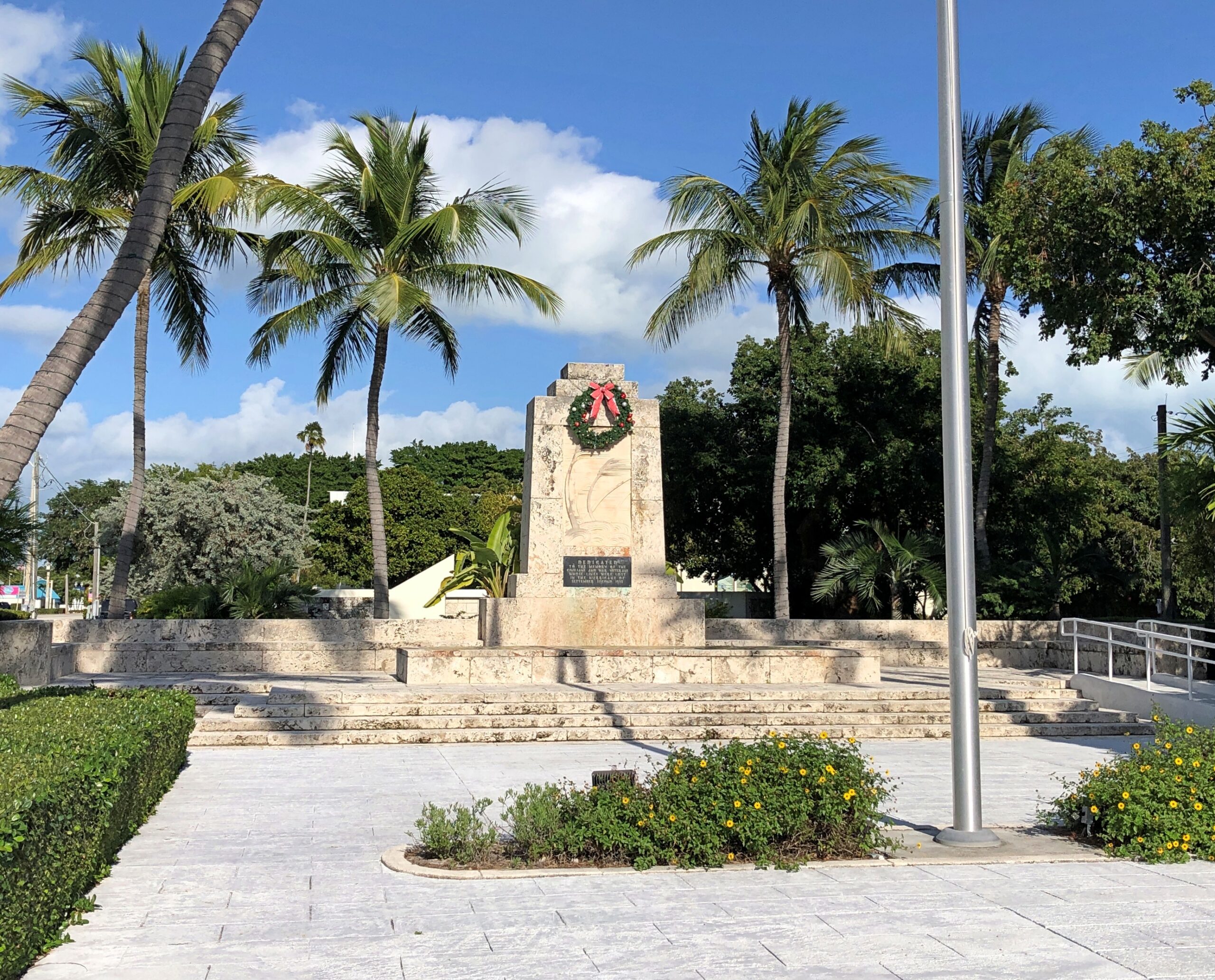
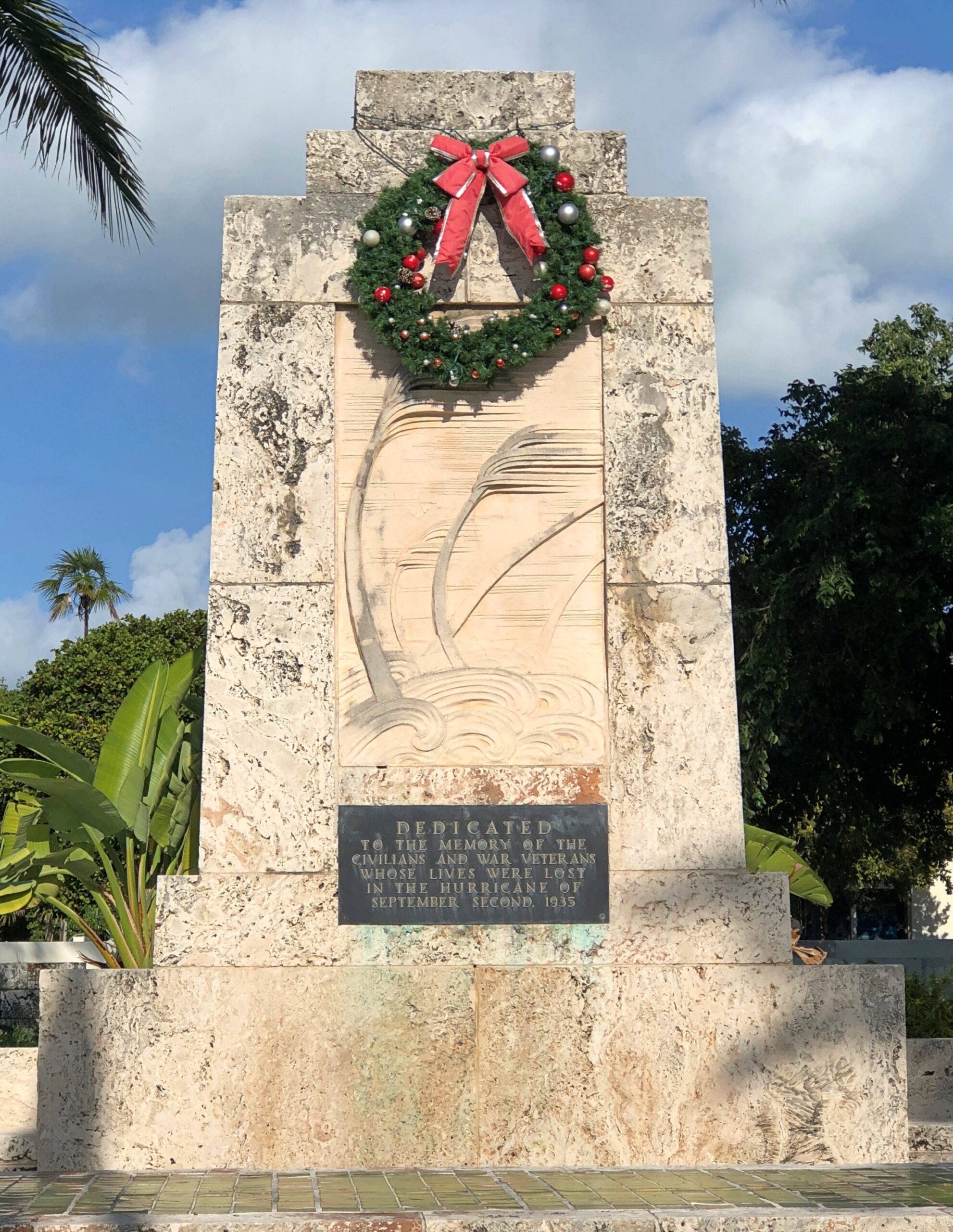
In Islamorada, which is spread across five small keys much closer to the mainland than either Key West or Big Pine Key, we stopped to pay our respects at the memorial to those who died in the 1935 hurricane.
Also in Islamorada, we drove past Betsy the Lobster, but sorry to say, didn’t stop for a closer look. What was I thinking?
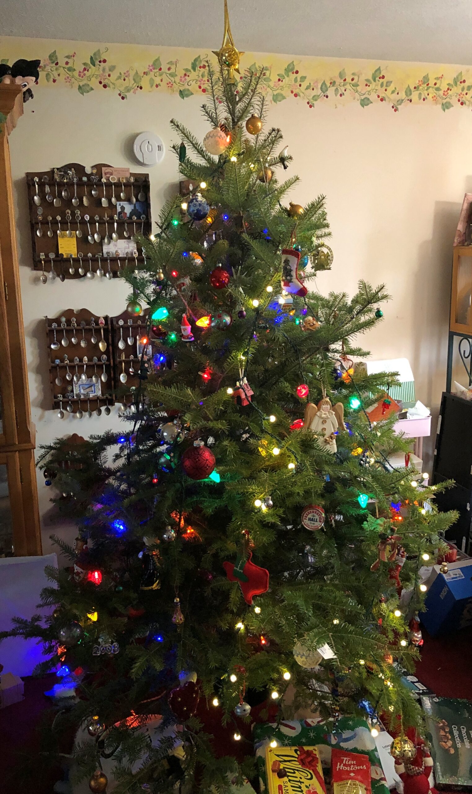
Decorating for Christmas this year meant a rapid set-up. We spent a fair number of hours on the 23rd making the living room ready for a tree – moving clutter, mostly. On Christmas Eve, I brought the tree in from the garage, and Ann mostly decorated it. Finishing touches, by me, were in progress even on the morning of Christmas Day, but since that moment in the life of our family doesn’t involve an early-morning rush downstairs by children anticipating Santa’s bounty any more, that was doable.
Ann did a fine job of decorating, in the style of our family: fill up the tree with a wide variety of glowing and glinting objects accumulated across the decades.
We got a late start on decorating for Christmas, though when I think about, decorating after the Solstice discourages the sort of front-loading of Christmas that a lot of people complain about, but which they do anyway.
We had a good reason for the late start: a drive to Florida and back, beginning on December 4 and ending on the 22nd. Not just to Florida, but as far as you can go in that state, at least by car, namely to Key West and back. Early to mid-December seemed like a good time to do such a thing, after any traveling people do for Thanksgiving but before the worst of the Christmas-New Year’s rush. A short shoulder season in other words, but a good one, with room rates not quite subject to surge pricing, and crowds thick in some high-volume tourist destinations, but not impossible.
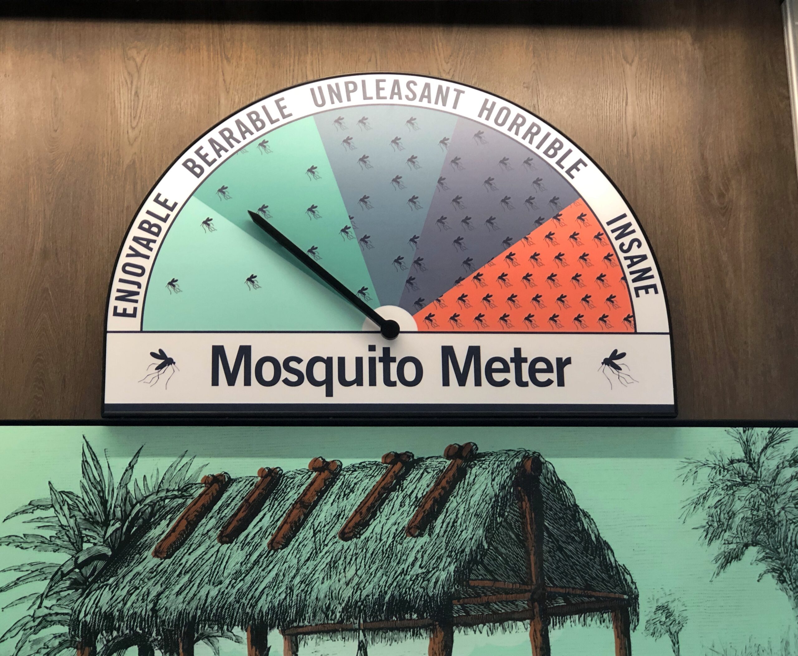
Also, Florida has few mosquitoes this time of year. Not no mosquitoes, as we found out one day in the southern reaches of the peninsula, just a “bearable” number.
Sometime earlier this year, I got the idea that I wanted to take four long drives after turning 64. Four for 64, you could say. Doing so by the end of 2025 wasn’t part of the idea, but that’s how things worked out. The drive to Florida and back, by way of such places as Indianapolis, Louisville, Chattanooga and Atlanta, totaled 3,682 miles. For all four trips since June, the total is about 14,300 miles.
That could be made to sound impressive, but in fact American men my age average more than that every year, about 15,000 miles, at least according to this source, which cites US DOT data. Younger men drive even more annually. Most of that is commuting, however. My commuting mileage by car has been exactly zero this year, and while I drive locally to stores and such, it couldn’t be more than a few thousand miles. So it seems clear that, as an American man, it was my duty to get out and drive.
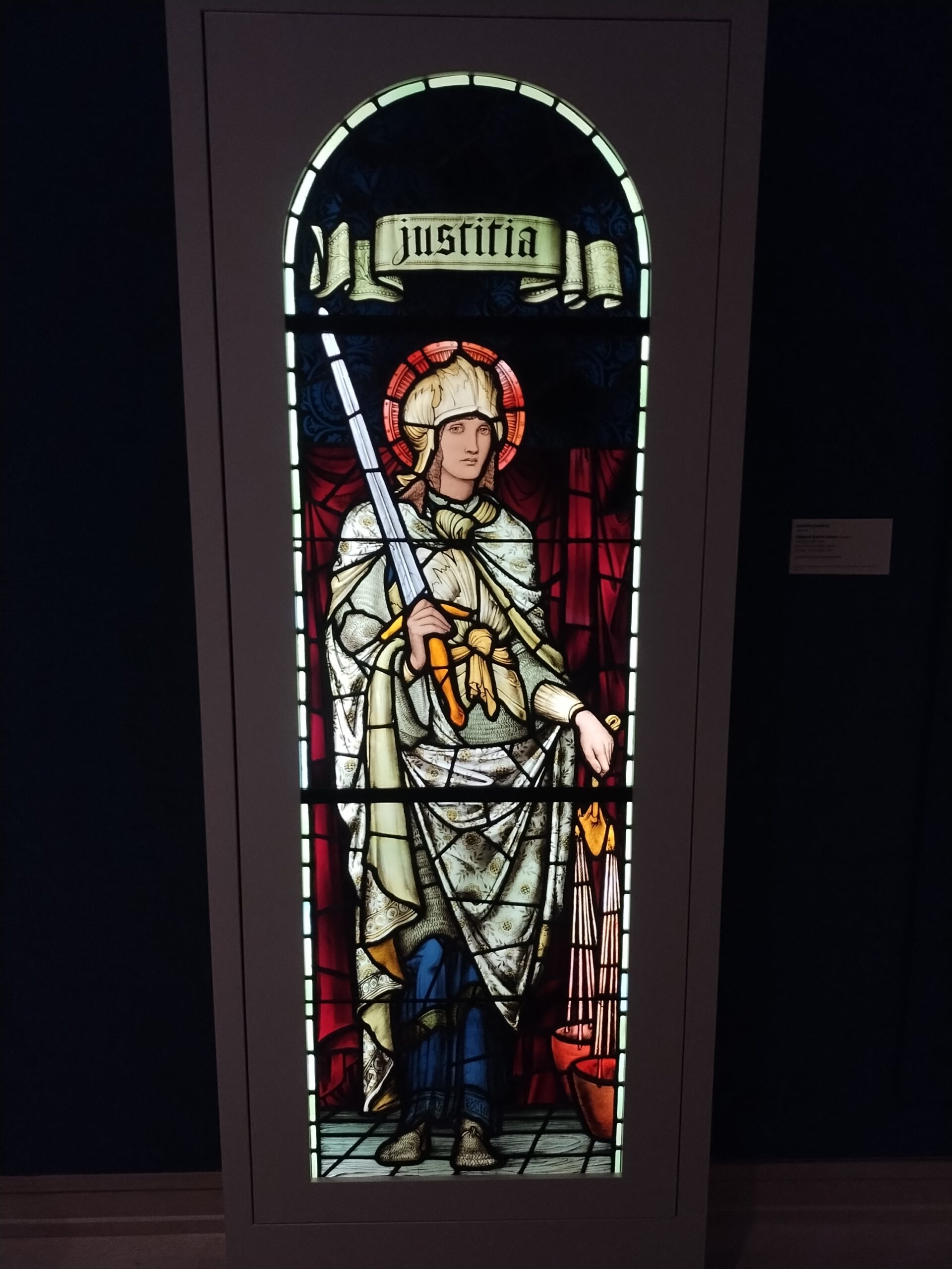
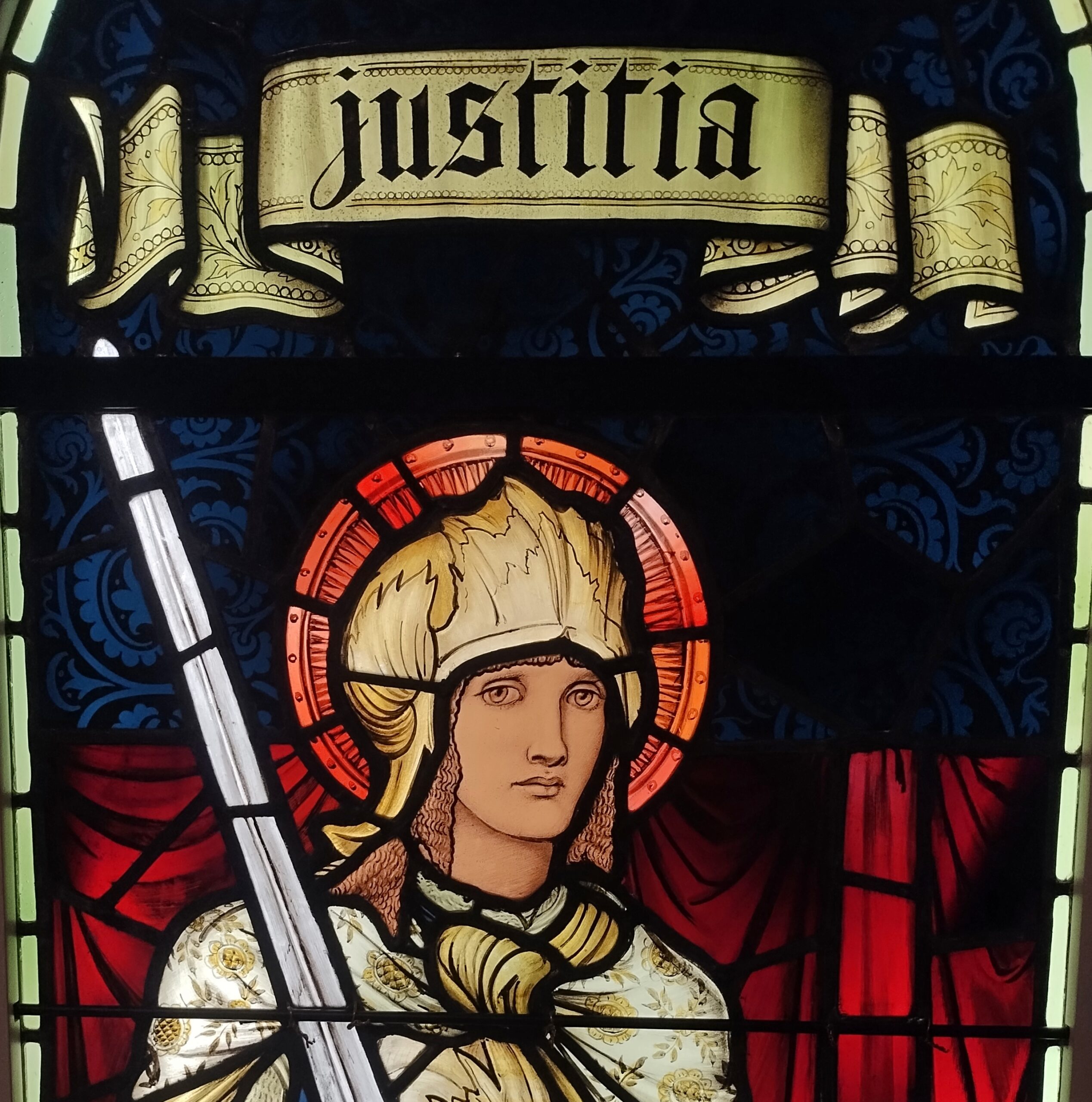
When we headed south in early December, snow covered the ground all the way past Indianapolis, where we stopped for a few hours at the Indianapolis Museum of Art, which is part of a larger campus called Newfields – and better examined in summer, I think. But the museum is a good one, with a solid collection, especially 19th-century American and European works. Such as “Justitia,” a Morris & Co. work from the 1890s.
After overnighting south of Louisville, we diverted from I-65 and took smaller roads through southern Kentucky and into Tennessee to a holler in Jackson County, where we were the guests of dear friends. Tennessee musicians from those parts — some professional, others skilled amateurs — gathered on the the evening of Saturday the 6th, for one of the periodic jams in our friends’ barn, which houses no animals these days, but a small stage and some sound equipment and a fair number of folding chairs. A joyful jam it was. Food was potluck. I like to think we went to a hootenanny.
The road through the holler. By this point, no snow. We were trading cold for warmth. That was one of the goals of the trip. Maybe the main one.
From there it was mostly a straight shot down through Georgia on I-75 to Florida, and eventually US 27 to Orlando by way of non-coastal Florida places like Gainesville, Ocala and Lady Lake, a string of settlement less agricultural and less pastoral now than ever, more like an endless outer suburb. Heavy traffic is an invasive species in this part of Florida, surely as pythons are in damper parts of the state. Not just masses of cars and trucks, either, but also golf carts. We passed close enough to The Villages to see billboards advertising legal representation in the event of golf cart accidents. Carts, I’ve heard, provide transport in great numbers in that sprawl of a settlement.
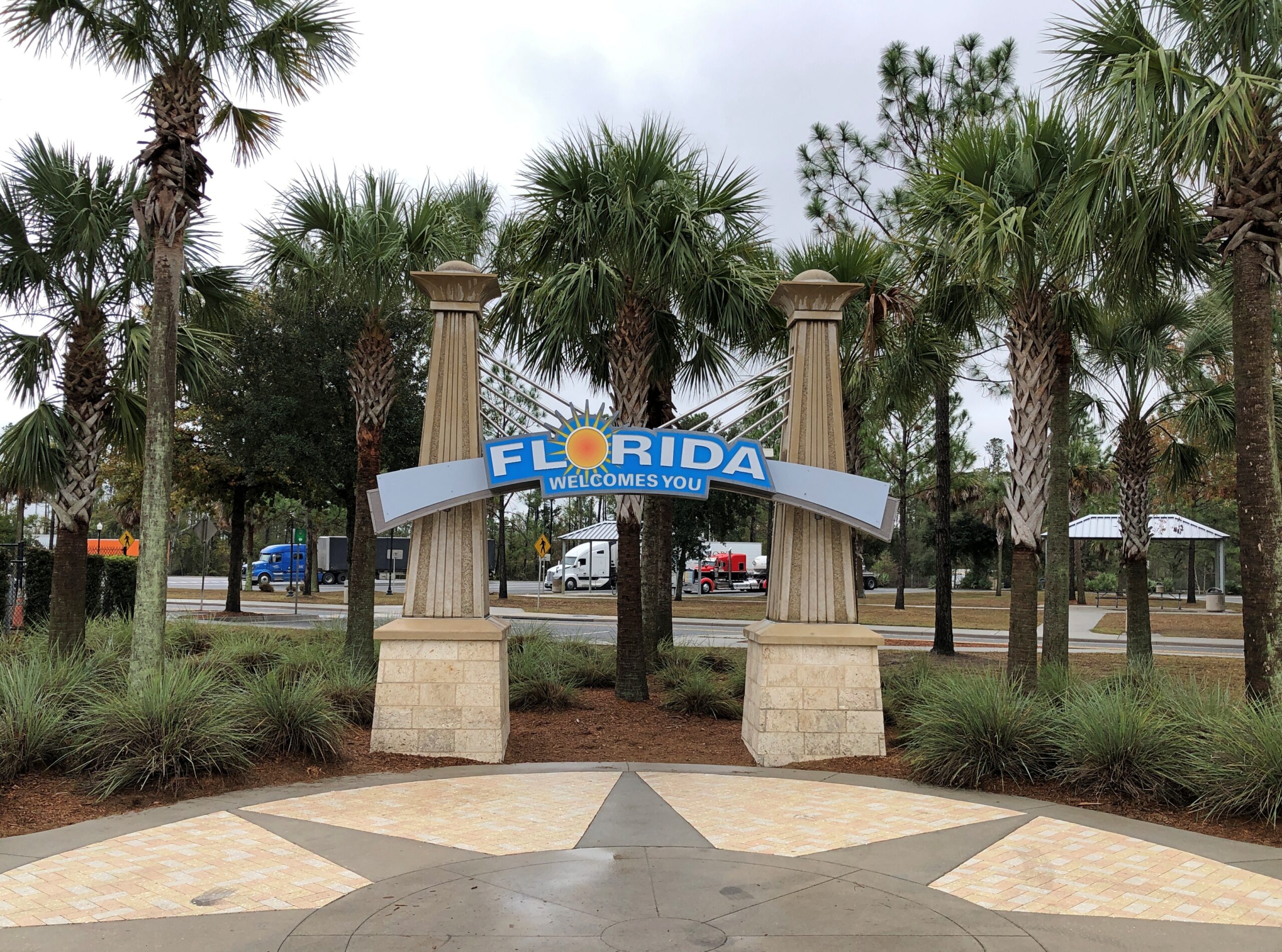
The drive to and in Florida involved the usual North American mix of large and small roads, smooth and ragged, grid-like and irregular, though Florida cities tended toward the irregular (except for Key West), and as crowded as can be and as empty as can be. Snow lined the way up north, thinning out the further south we went, giving way to brown landscapes and bare trees. Then we came into greenery – evergreens and palms and even deciduous species turning color. We crossed mighty bridges over mighty rivers, small culverts over alligator haunts, and the string of bridges that make up the civil engineering marvel known as the Overseas Highway (US 1). We crossed barely acknowledged borders and signs at the Florida visitor center on I-75 proclaiming The Free State of Florida.
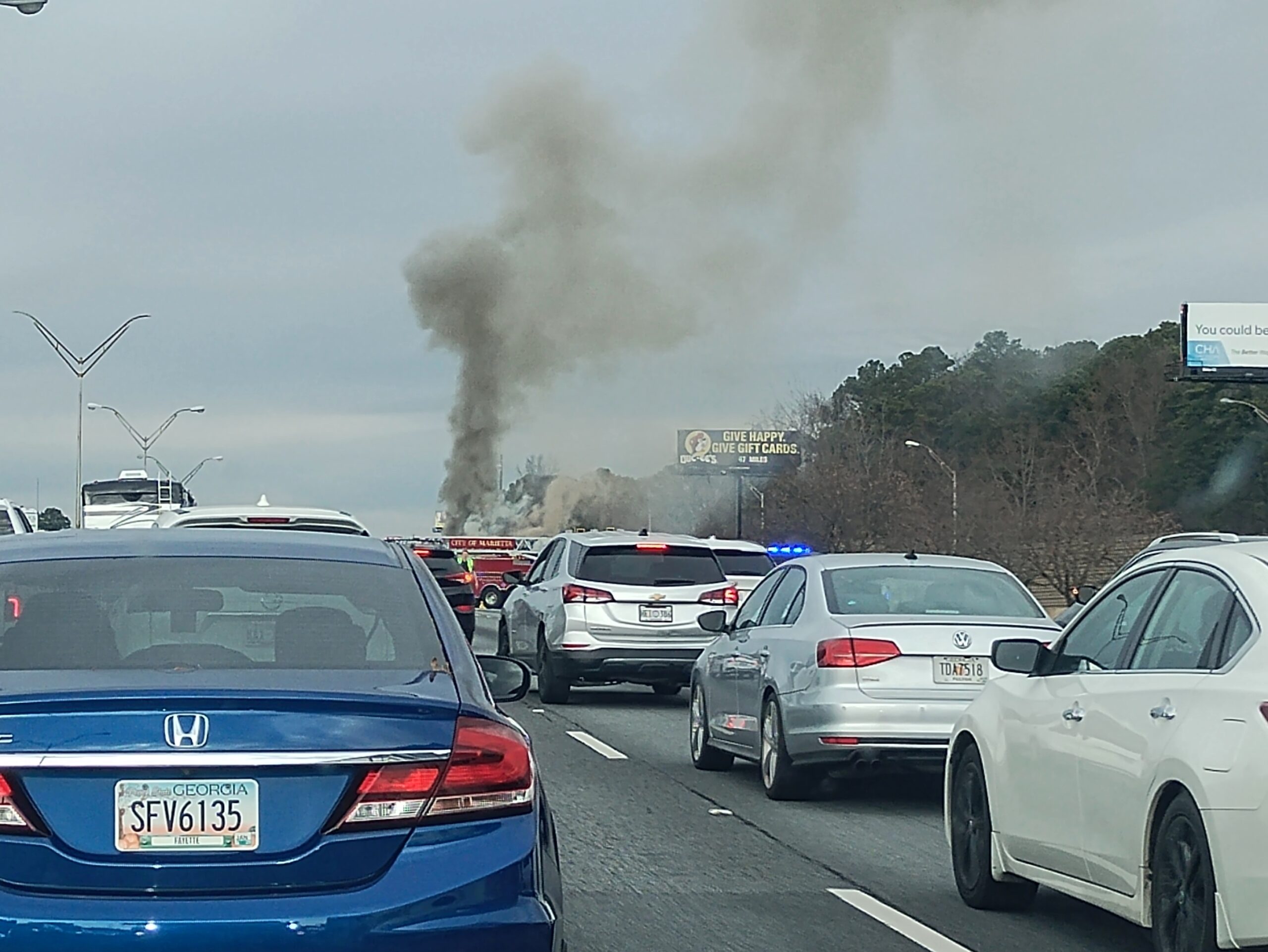
Florida Man was out and about, weaving in and out of high-speed traffic, pushing 100 and pretty sure that physics doesn’t apply to him, though I have to admit that Florida isn’t different from any other state in that way. Traffic stopped cold more than once: for a banged up, upside-down SUV; for a raging RV fire, attended by a half-dozen firemen; for a serious two- or maybe three-car wreck on the other side of a divided highway; for construction, usually without any workers in sight; and once for no reason that we could tell at all.
In Orlando, we spent all December 9 at Universal Epic Universe, a theme park that only opened in May. Ann flew in the day before we went to the park and flew home the day afterward, taking advantage of the low prices that discount airlines offer to high-volume places in a shoulder season, if you take no bags and buy nothing to eat or drink at sky-high prices, literally and figuratively. A small bag of hers had been stowed in our car for the visit.
A theme park is one thing, but I wanted a look at Orlando, at least a sliver of it, the next day. Ann’s flight was fairly late that day, so we were able to spend part of it in posh Winter Park, including a tour boat ride through the town’s small lakes, lush with greenery and expensive houses on their banks, and connected by canals.
A drive that included the stretch of US 41 that passes through the Everglades took us to Homestead, Florida, and the mid-century charms of The Floridian motel. A day in Everglades NP followed, including an airboat tour and a drive to the coast at Florida Bay. The next day, before leaving Homestead for a drive in the rain across the Overseas Highway to Key West and while the sun still shined, we toured the Coral Castle, a one-man construction project using 1,000 tons of oolite to make walls, carvings, stone furniture, and a castle tower.
Key West was a two-day, three-night mid-December ramble on the busy and less busy streets of Old Town, including humans but also chickens, taking in the likes of the Hemingway House, the Little White House, Mallory Square, the San Carlos Institute, the Key West Aquarium, and the Key West Cemetery. Also, tourist shops, boutiques and the building where Pan-Am was founded. We ate and drank, though as our wont, nothing alcoholic. Key West was decked out for the holidays but not over the top. We walked and walked some more. It felt like a couple of pleasant summer days.
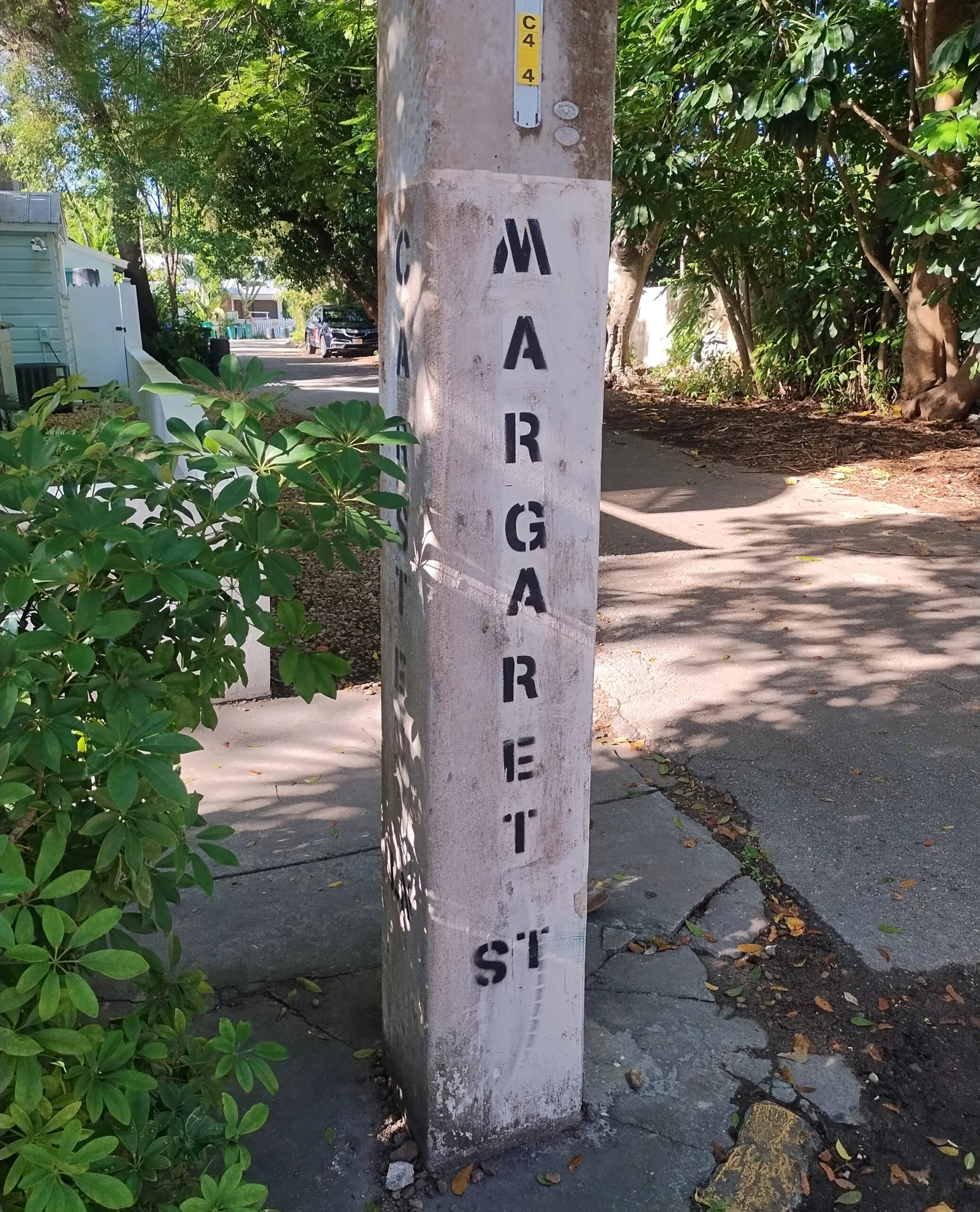
From my 2014 visit, I knew that on the back streets near the little-visited cemetery, parking was possible on an otherwise cramped island. So it was. On Margaret Street, within sight of the cemetery.
The return drive took us up the eastern coast of Florida, but avoiding the worst traffic in Miami-Dade by taking Florida’s Turnpike. By December 17, we’d arrived in Orange Park, a large suburb of Jacksonville, for a stay with two other dear friends, former Austinites now in northern Florida. Part of the next day was in and near downtown Jacksonville, one of the larger U.S. cities I’d never visited before (I believe San Jose is now the largest on that list). During our downtown stroll, we encountered the coolest building in Jacksonville and certainly one of the coolest in Florida.
We quit Florida on the 19th, but weren’t quite done with the trip. Yuriko had never been to Atlanta and wanted to go. Though I’d been however many times since 1982, I was happy to oblige, so we spent two nights and a day there, using the day to see the astonishing Georgia Aquarium and the impressive but somewhat overpriced World of Coca-Cola.
The last legs of the trip were long drives: Atlanta to Elizabethtown, Kentucky; and from there to home the next day. I wasn’t about to let them be completely dull drives, so we stopped on the second-to-last day in Chattanooga, to see the conveniently located, blocks-from-the-highway Chattanooga Choo-Choo redevelopment. On the last day of the trip, we stopped in Jeffersonville, Indiana, and walked across the Big Four Bridge, a former RR bridge across the wide Ohio, now serving pedestrians and bicyclists.
Home and then — Christmas, when things slow down for a week or so. Good timing.
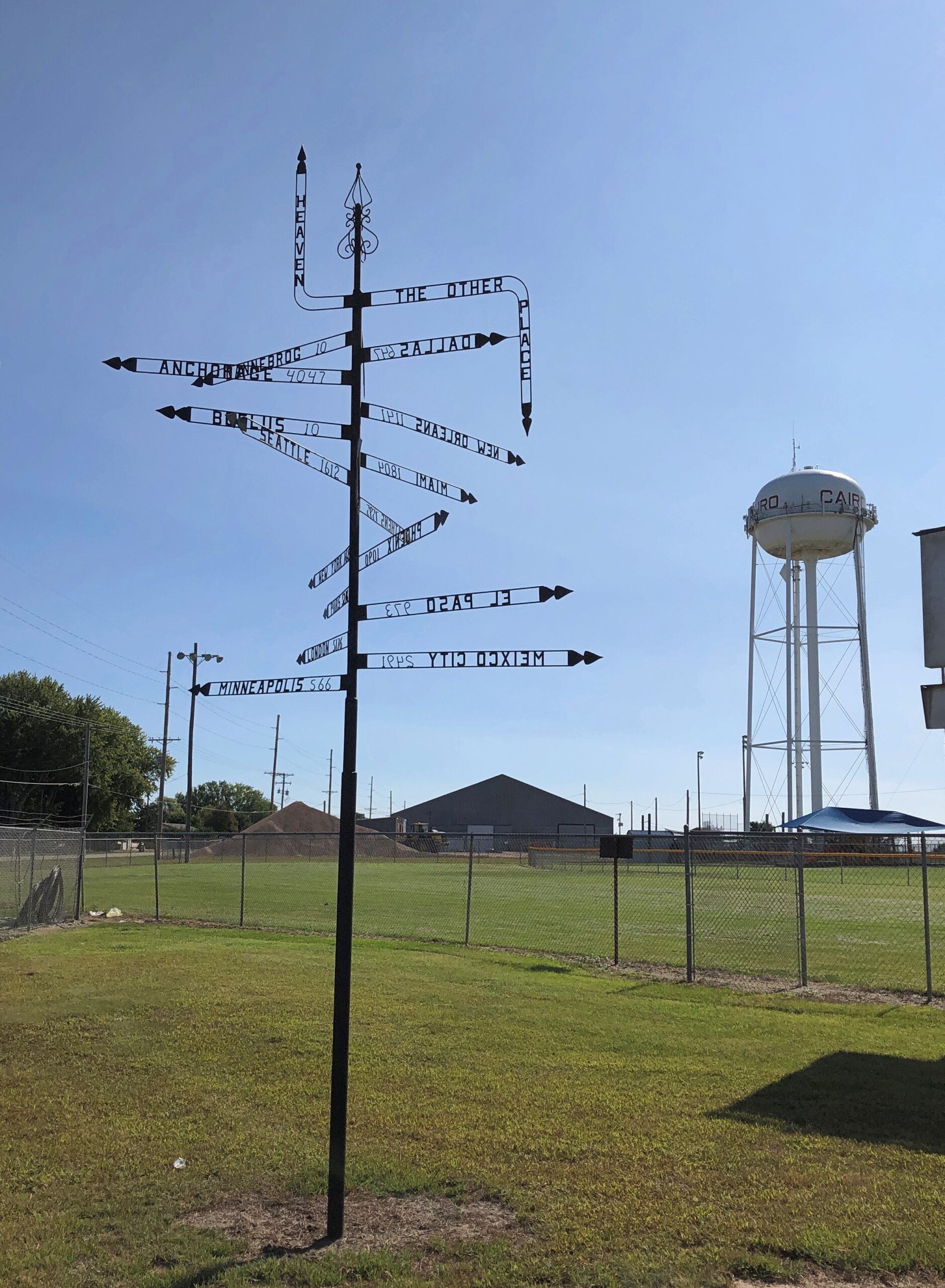
Which of these two destinations aren’t like the others?
That’s a beginner’s-level question. Better question: where can you find this pole, with mileages and – what units measure the distance to Heaven or Hell? – other signs?
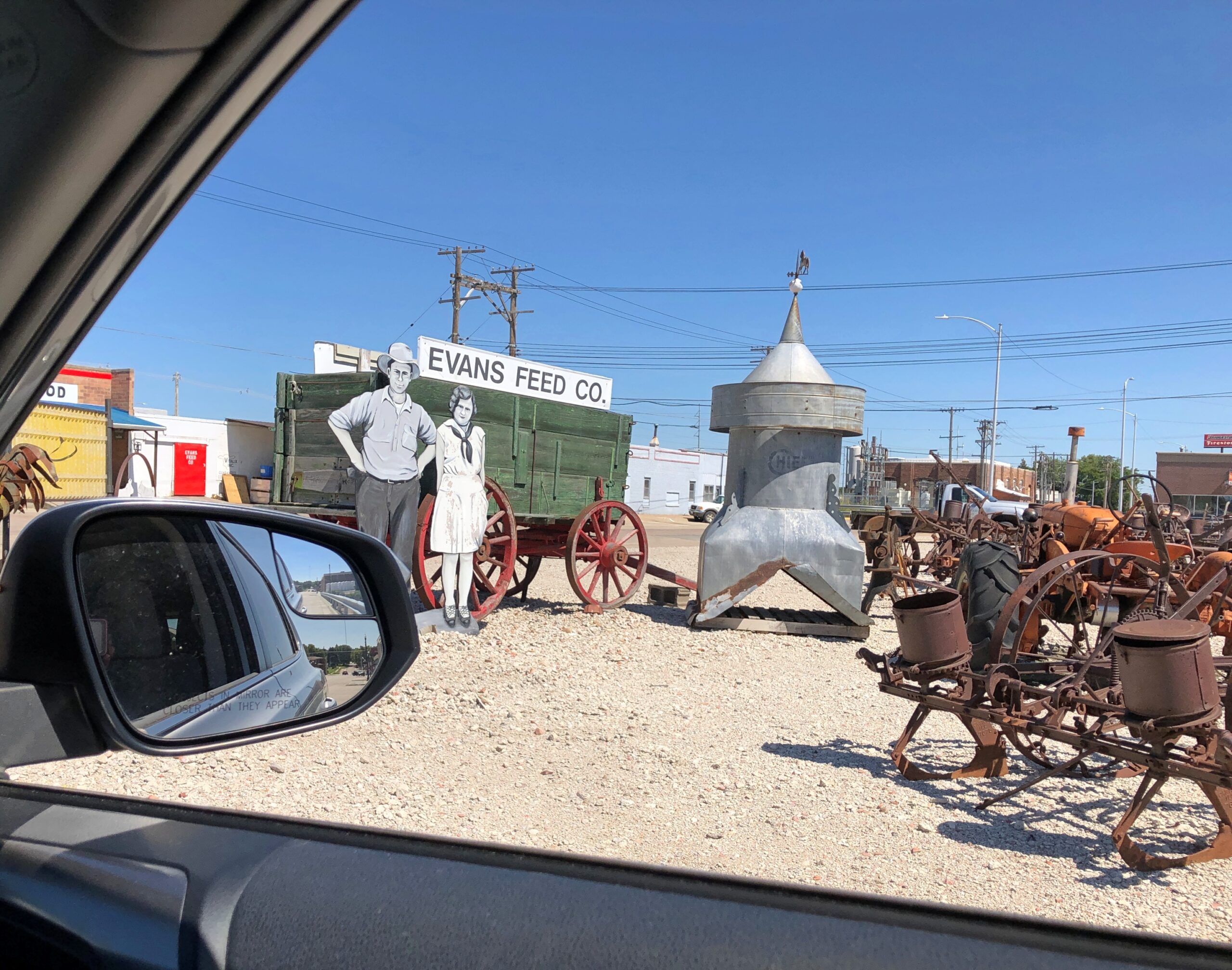
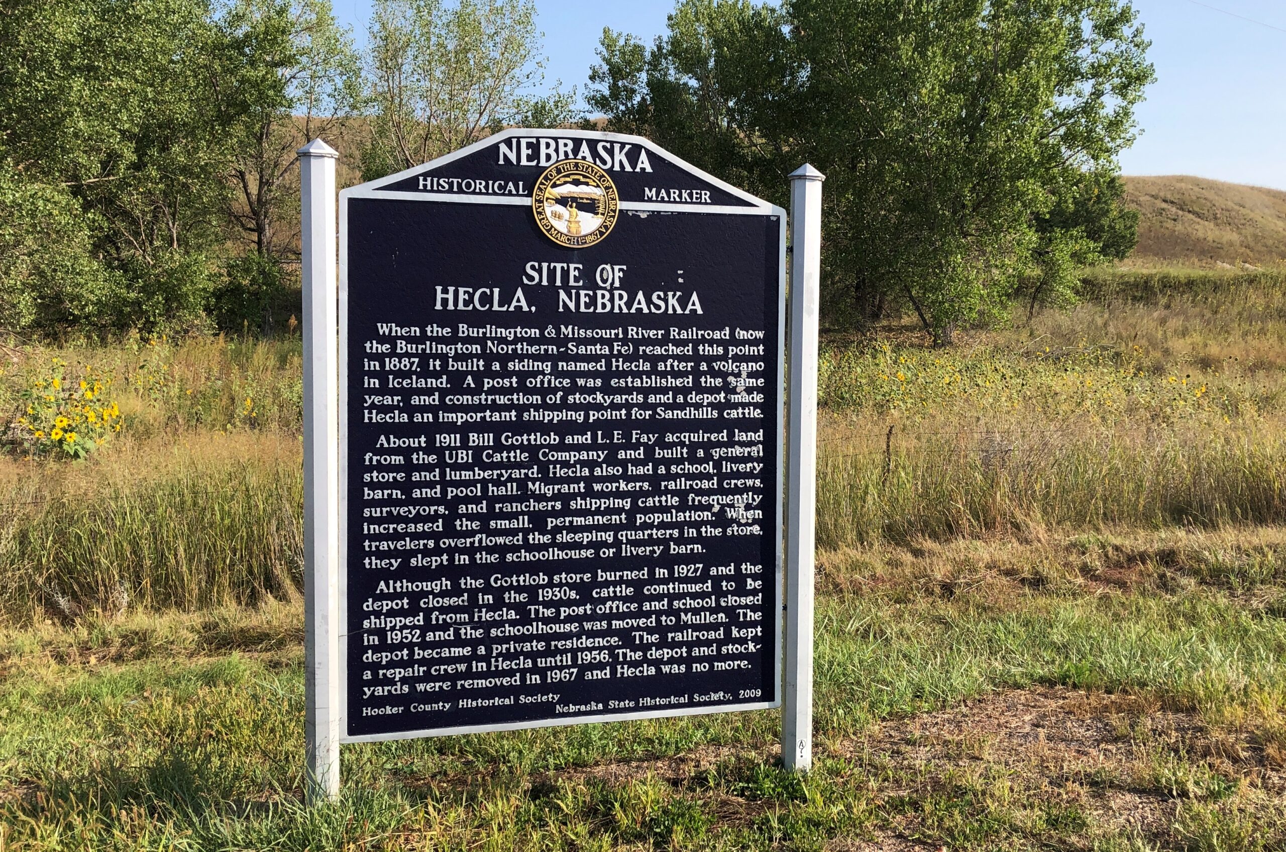
Answer: Cairo, Nebraska.
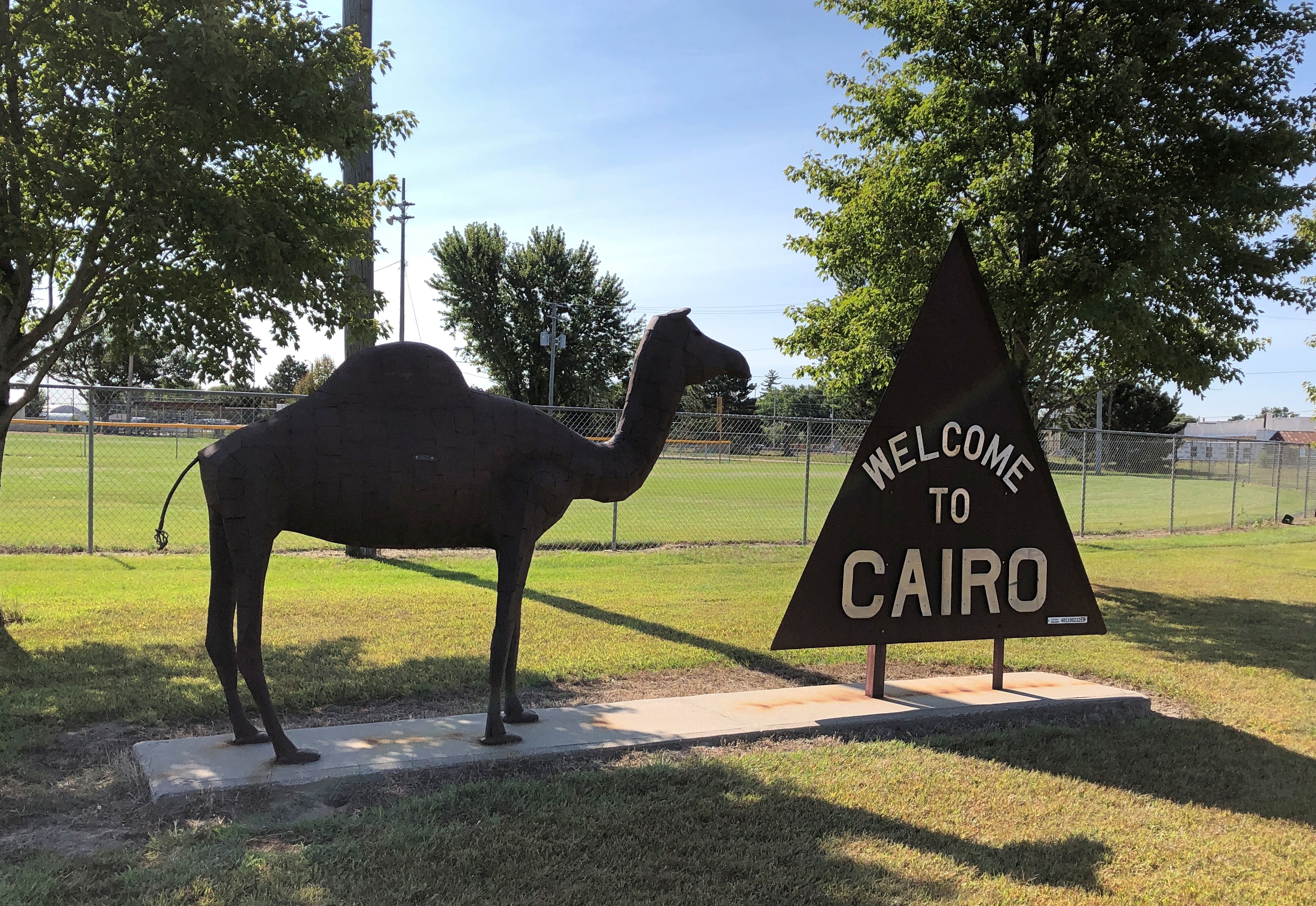
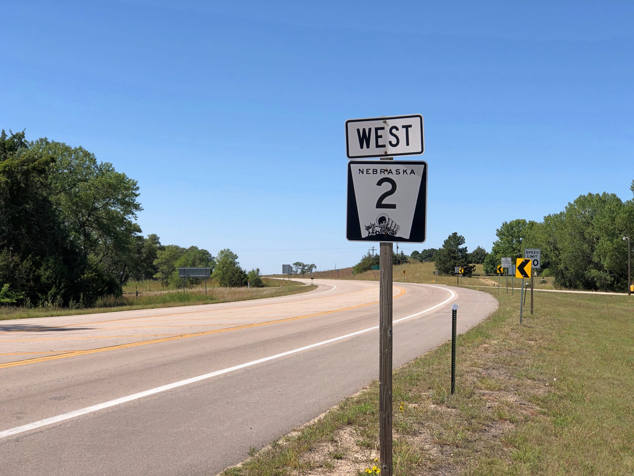
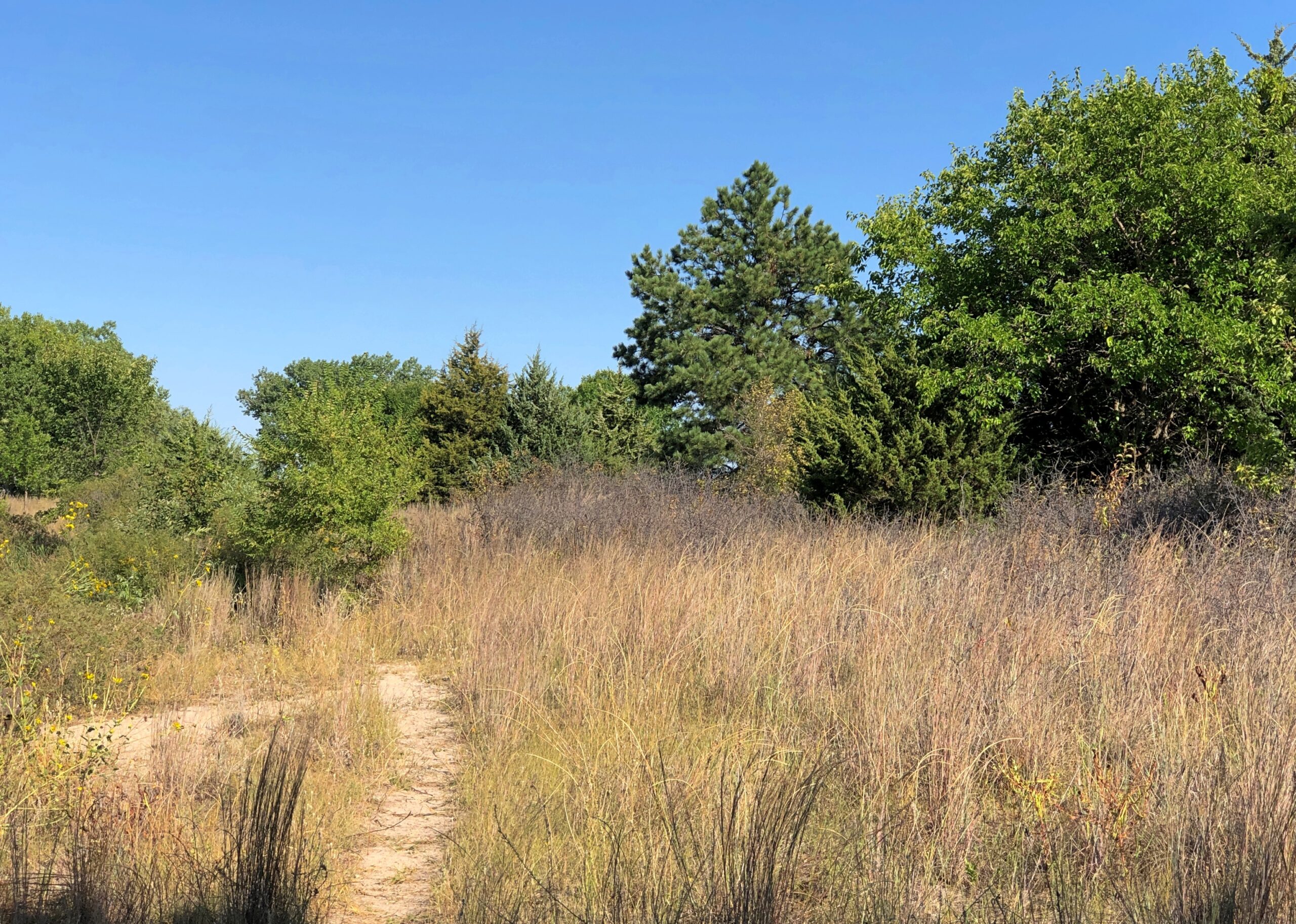
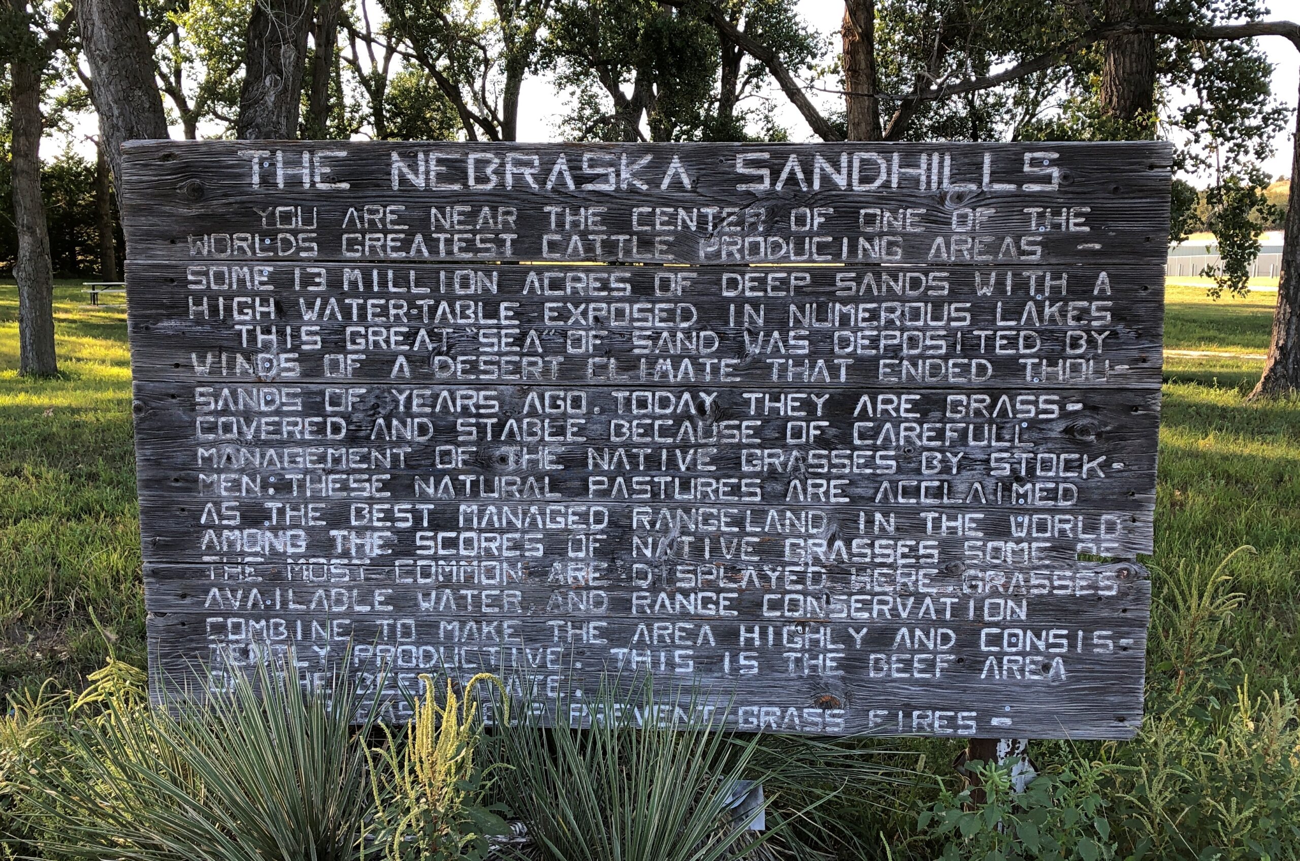
Maybe a palm tree was in the works, but the city decided not to spend any more money. Cairo (pop. 822) is one of the small chain of small towns on the eastern section of the highway Nebraska 2, which runs westward and north of Grand Island. Cairo is the first place I stopped on my way west on that highway in early September.
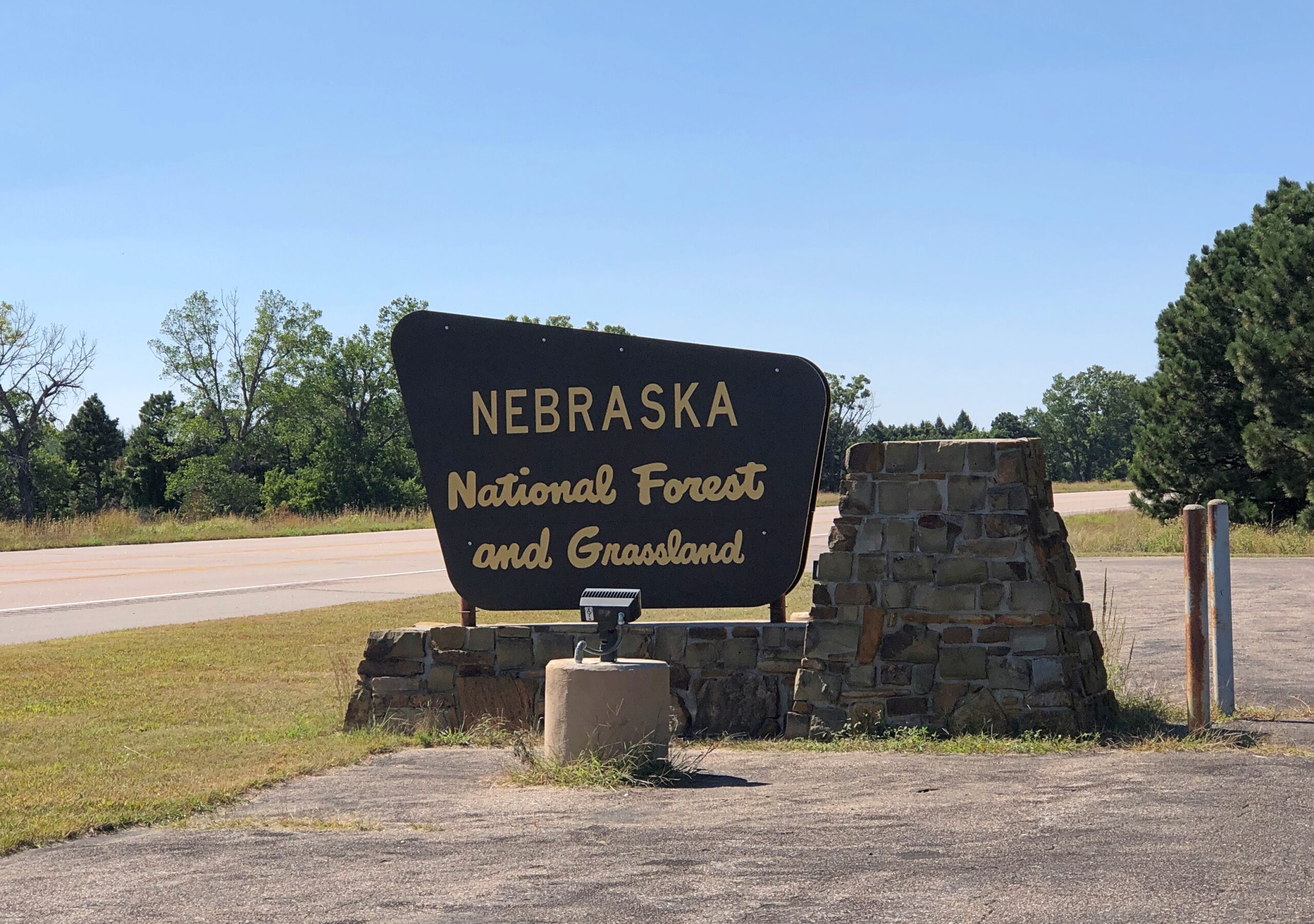
Eventually the highway reaches the Nebraska National Forestand Grassland, a patch of (partly) wooded land that inspires the question, there’s a national forest in Nebraska?
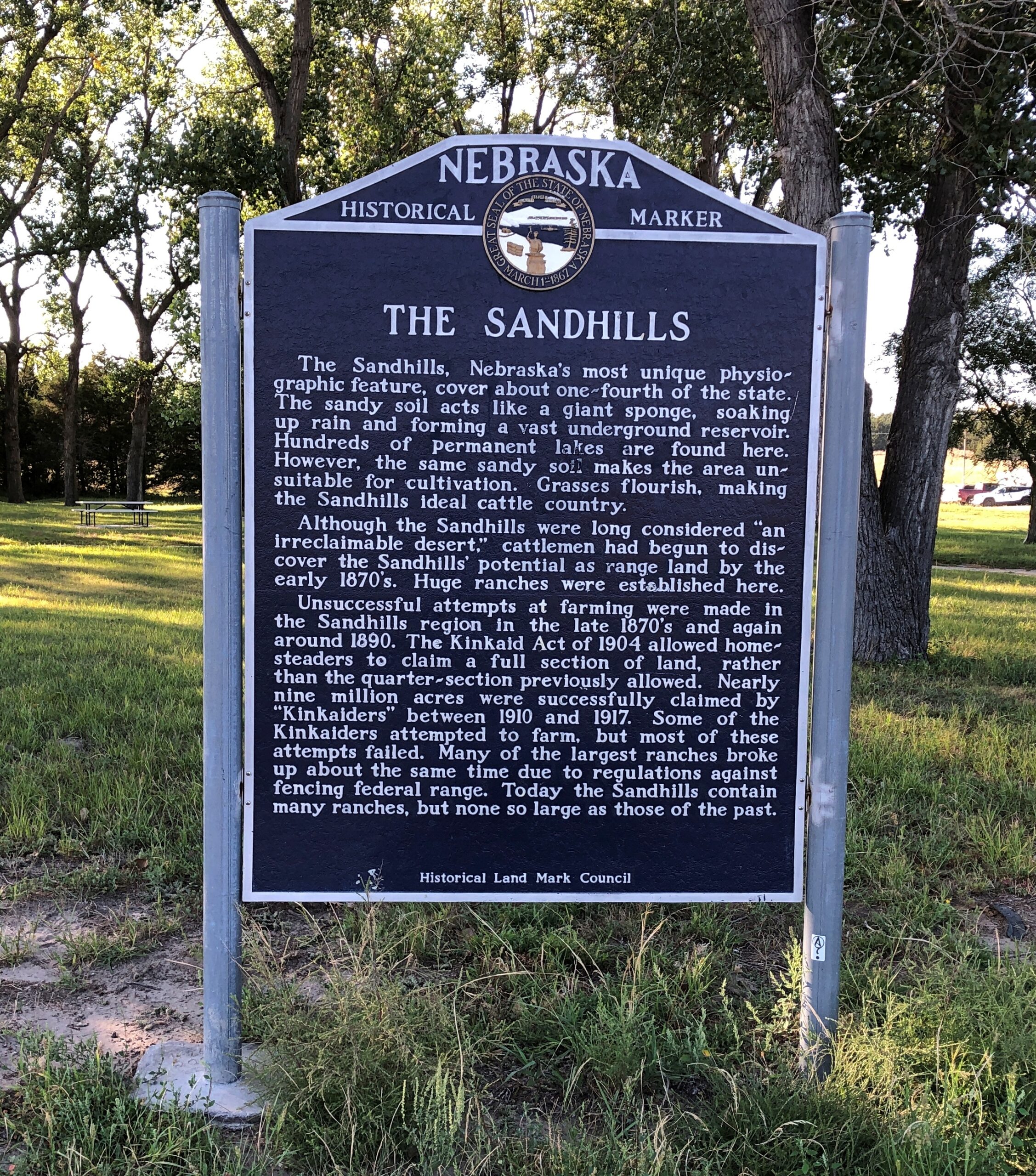
West from the forest, Nebraska 2 crosses the Sandhills, an unusual place here in North America, with the land morphing from cropland to ranch land on sandy steppes. The towns on the way are mere hamlets, and sometimes not even that. On the western edge of the Sandhills, one comes to the sizable town of Alliance, Nebraska, home of Carhenge and railroad staging area for coal trains headed east.
Before I did the drive, I was looking forward to it as much as any of the roads in Colorado. It lived up to expectations. Nice when that happens.
The Fence Postcites Charles Kuralt’s fondness for Nebraska 2: “Highway 2 is not just another highway that goes somewhere. Highway 2 is somewhere,” he’s known to have said. I’d say whatever else his failings, Kuralt had good taste in roads.
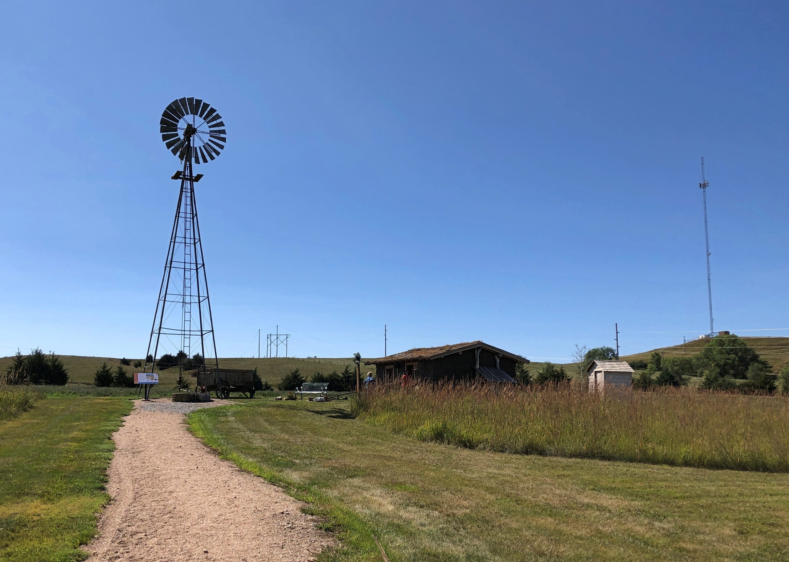
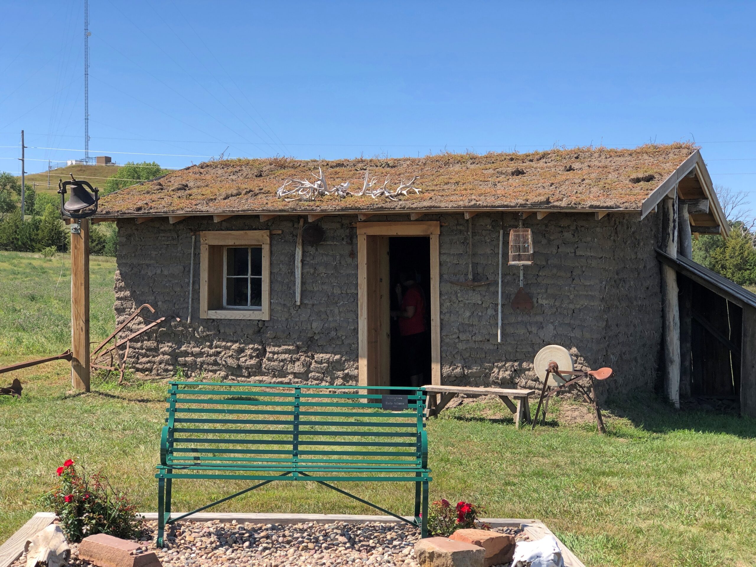
Just outside Broken Bow (pop. 3,491), seat of Custer County and pretty much the only town of any size in that county, the Sandhills Journey Scenic Byway Visitor Center offers a building with bathrooms and pamphlets and displays and, for my visit at least, a grandmotherly and talkative volunteer. Old enough, she said, to remember when the highway was just a road through the countryside that attracted no attention from the outside world. Not a scenic byway, and sand hill cranes were just flocking birds. Now a trickle of tourists and bikers and RVers come this way. She had some solid recommendations, especially a good diner for lunch.
The visitor center grounds include a relocated (or was that reconstructed?) Sandhills cabin. The residences of the farmers trying to scratch out a living in the Sandhills, and finding out that no amount of scratching would make decent crops grow consistently from the land.
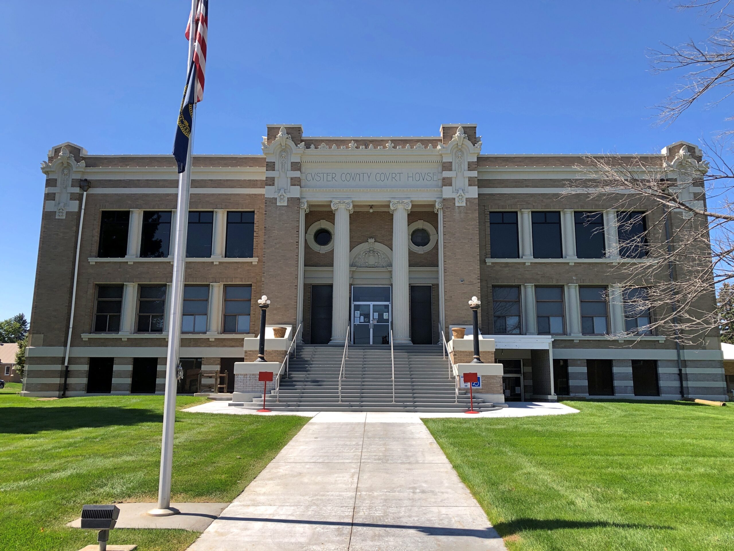
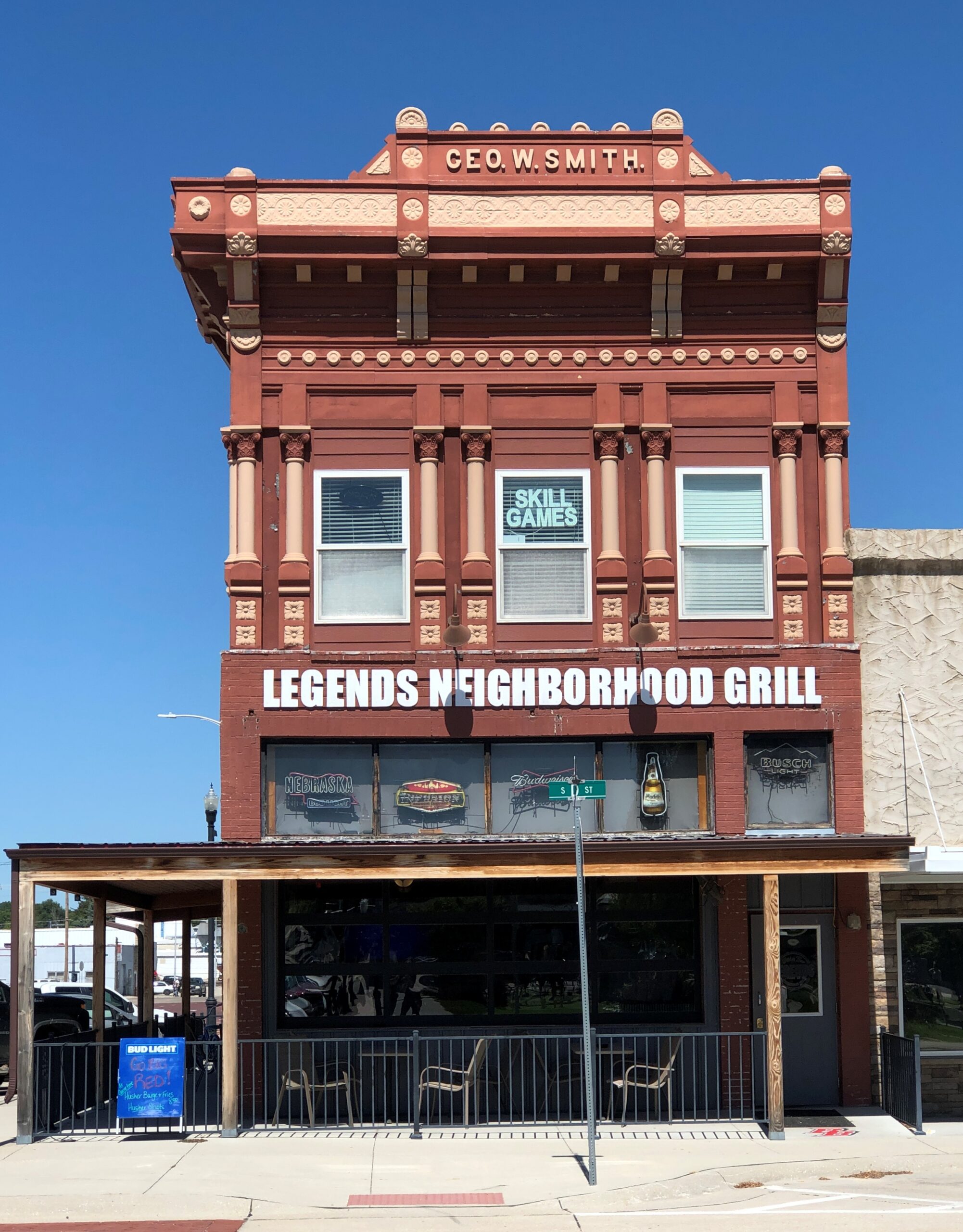
The Custer County Courthouse. Saturday, closed.
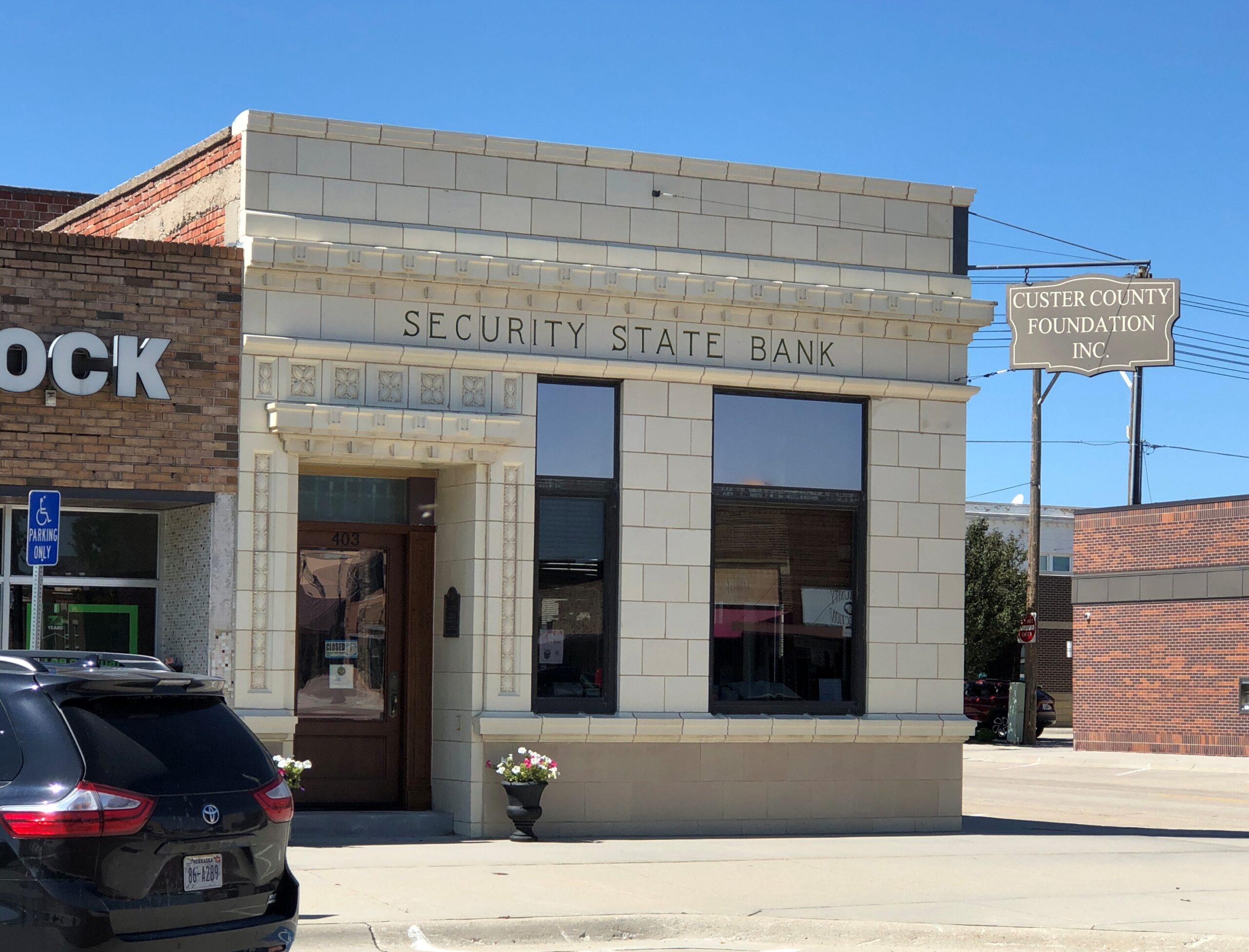
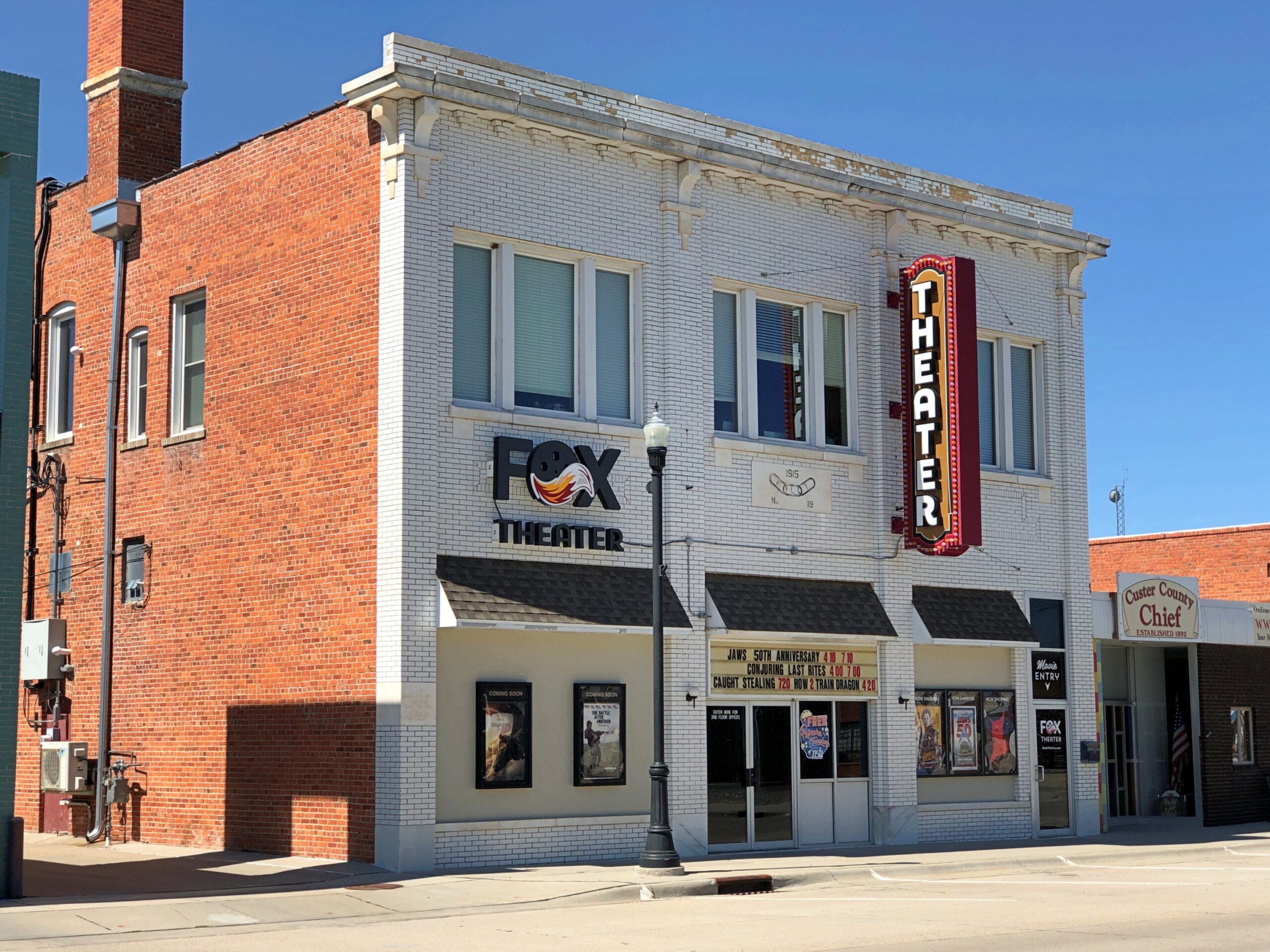
A block from the courthouse, some buildings around City Square Park.
City Square Park is a generic sort of name. Wonder whether there’s anyone from the town who can be honored by renaming the park? Looking at list of notables from Broken Bow, one instantly stands out.
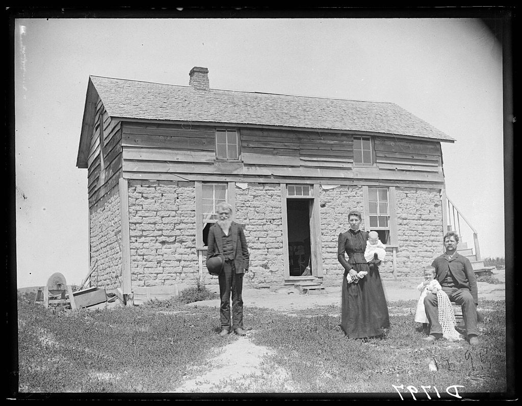
Wiki: “Solomon D. Butcher (January 24, 1856 – March 18, 1927) was an itinerant photographer who spent most of his life in central Nebraska, in the Great Plains region of the United States… he began in 1886 to produce a photographic record of the history of European settlement in the region. Over 3,000 of his negatives survive; more than 1,000 of these depict sod houses.”
Frederic Schreyer and family, Custer County, 1880s, by Solomon Butcher.
Definitely name the park after Butcher, Broken Bow.
One more in that town. I couldn’t be bothered to get out of the car.
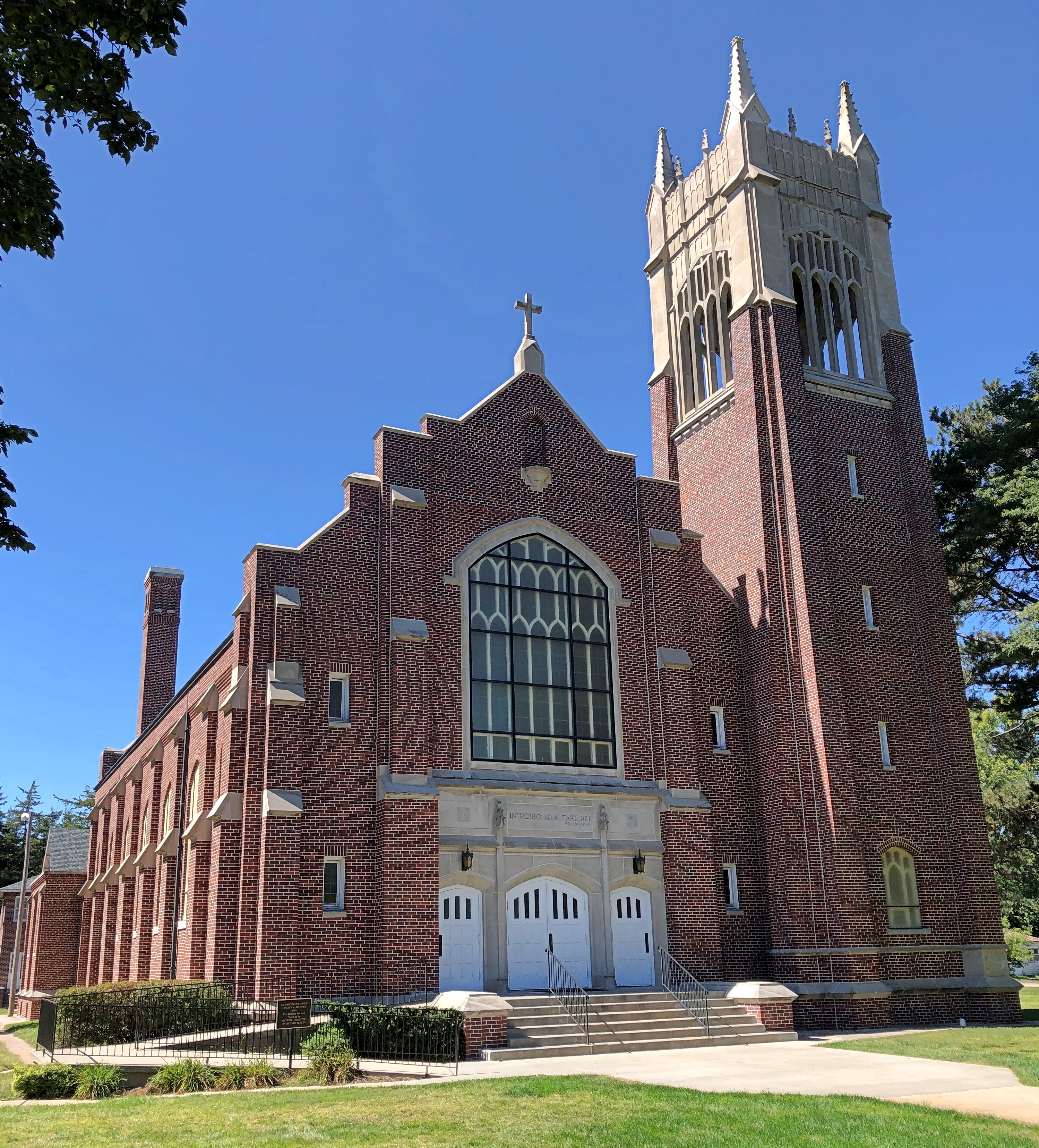
West of Broken Bow is Anselmo (pop. 145), home of this church, St. Anselms Catholic Church, nicknamed Cathedral of the Sandhills. Saturday, closed.
A more common sort of building, not far from the church.
Not the most imposing that I saw, but representative of the many structures like it. The grist of a photo collection. Of course it has been done. I’m pretty sure I saw a room of Bernd Becher’s photos of water towers at the Modern Art Museum of Fort Worth.
Nebraska National Forest and Grassland is in an unexpected place, slap in the middle of Nebraska, not due to a freak of nature, but the efforts of human beings. Specifically, mass plantings of trees by the federal government for more than 100 years, beginning (not a surprise) during the administration of Teddy Roosevelt.
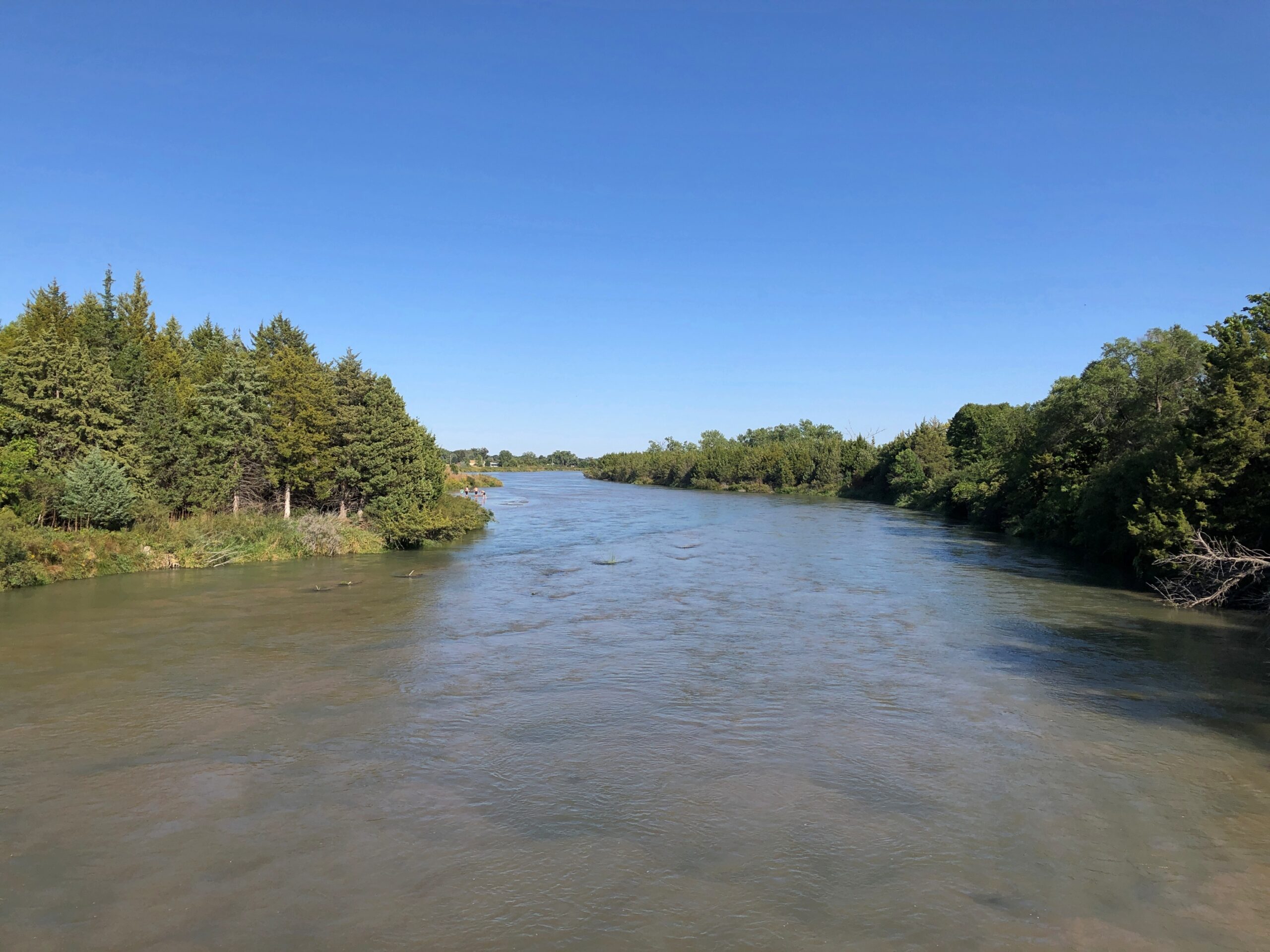
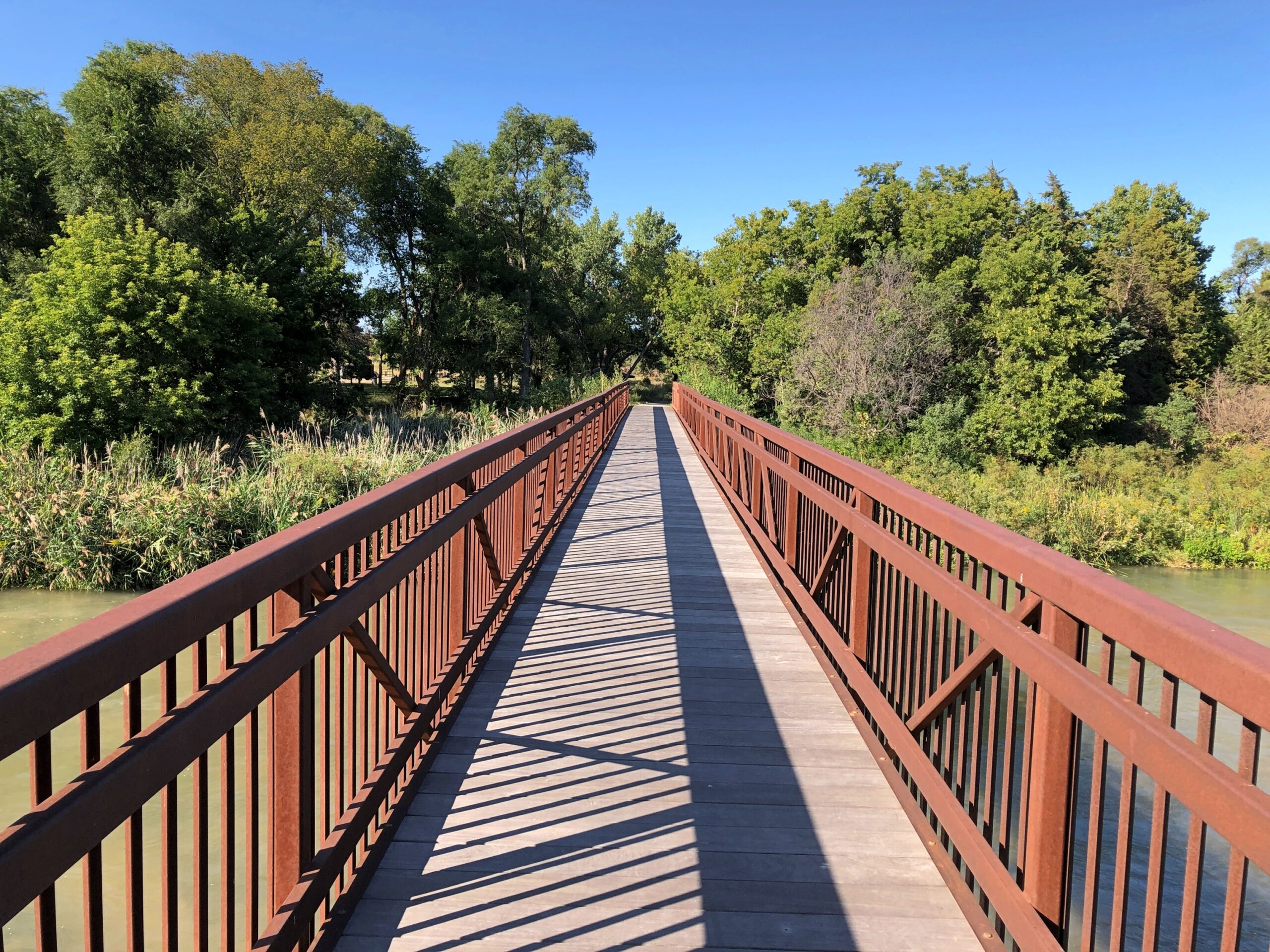
Near the national forest entrance is the Middle Loup River, broad but shallow, and crossable on a foot bridge.
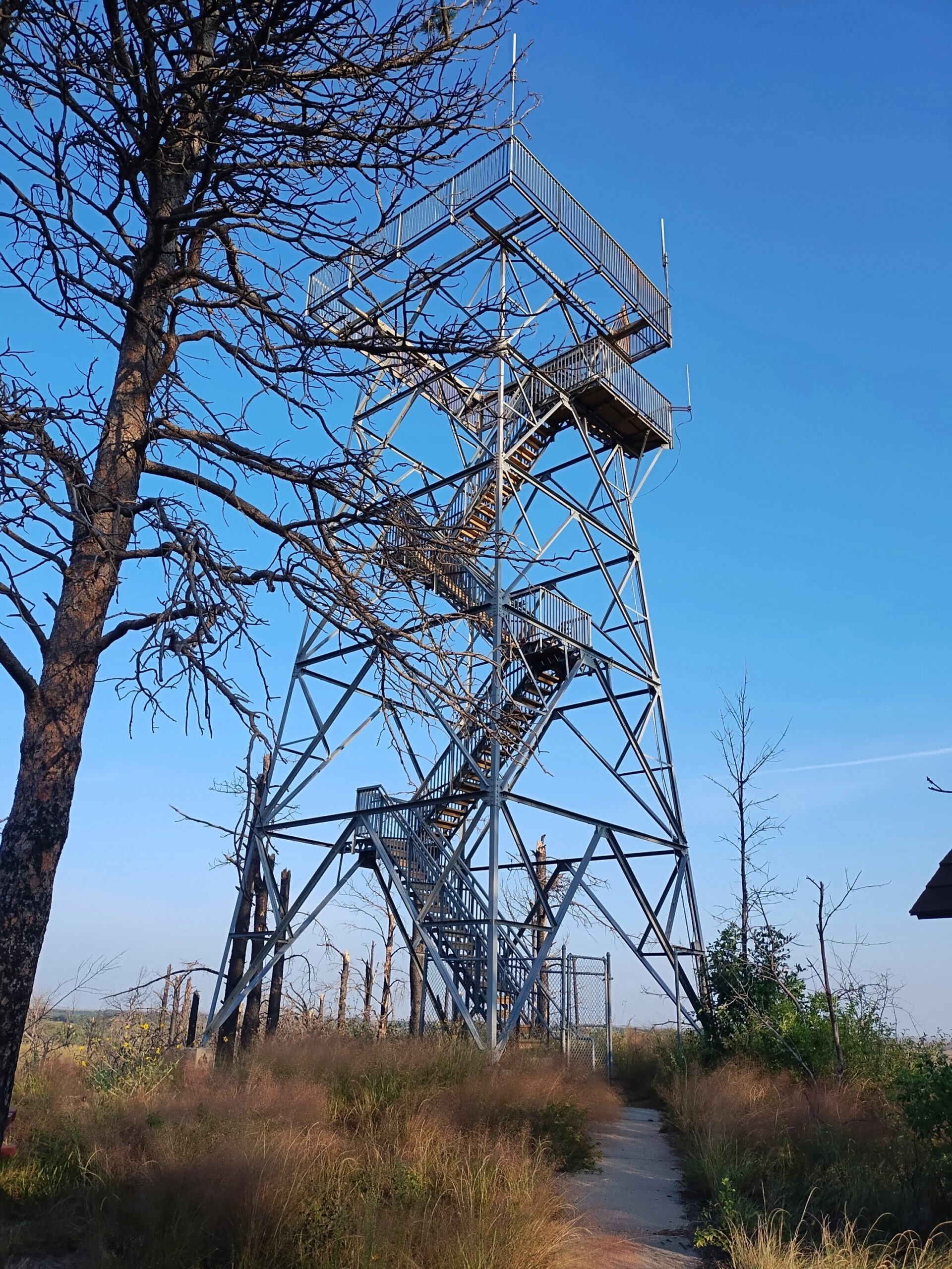
I camped in the national forest. The campgrounds weren’t completely full, but there were more people than I expected for a remote spot in Nebraska. Then again, it was a Saturday night, and soon enough I figured out what brought most of them: the ATV trails. Not long after dawn on Sunday, the campers across from me – a man and a small knot of teenage boys – roared away in a small caravan of ATVs crusted with dust from the day before.
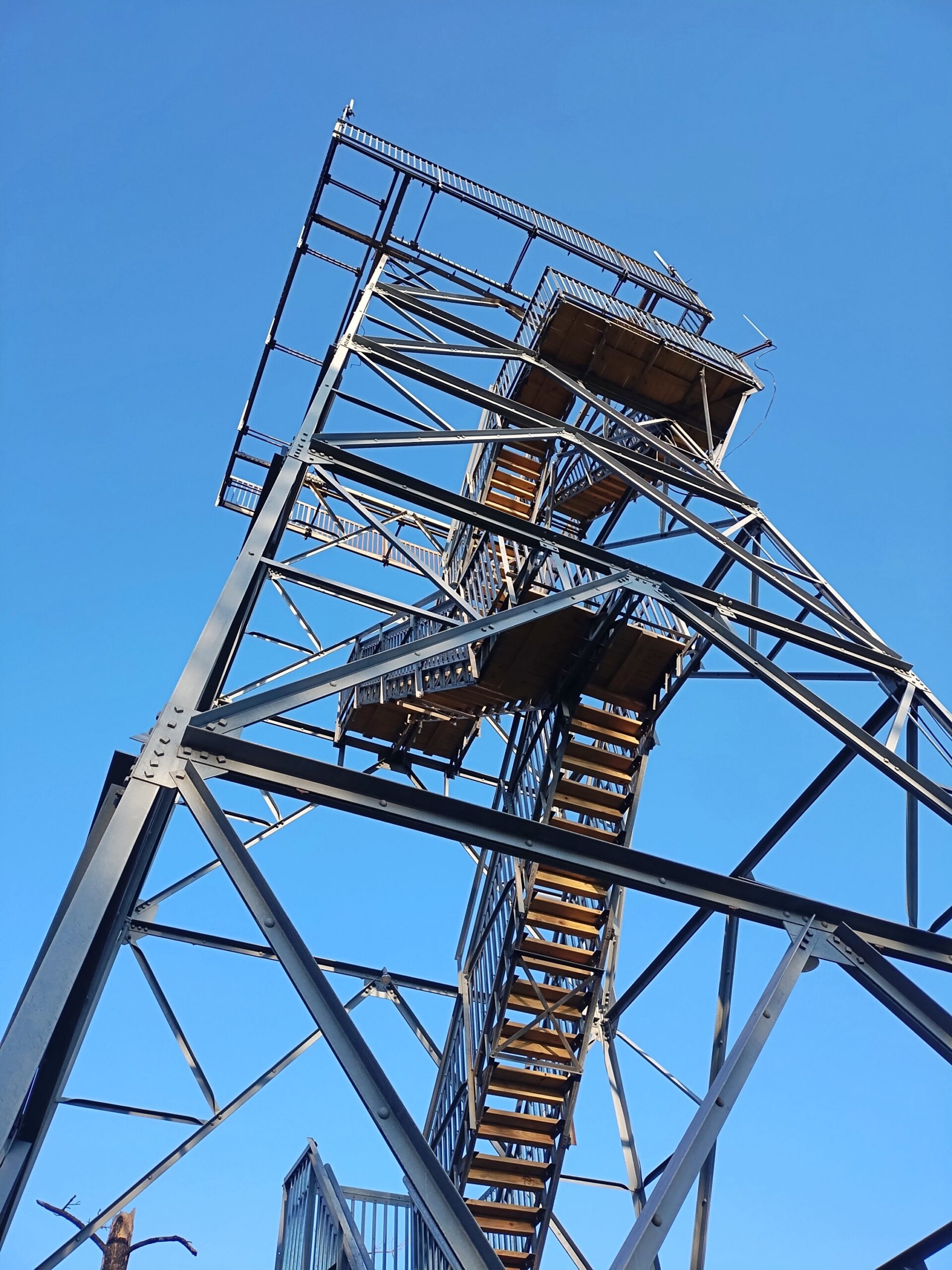
I packed up and sought out a quieter place. A national forest hill with a fire tower and some views. The tower was closed.
But the views were still pretty good.
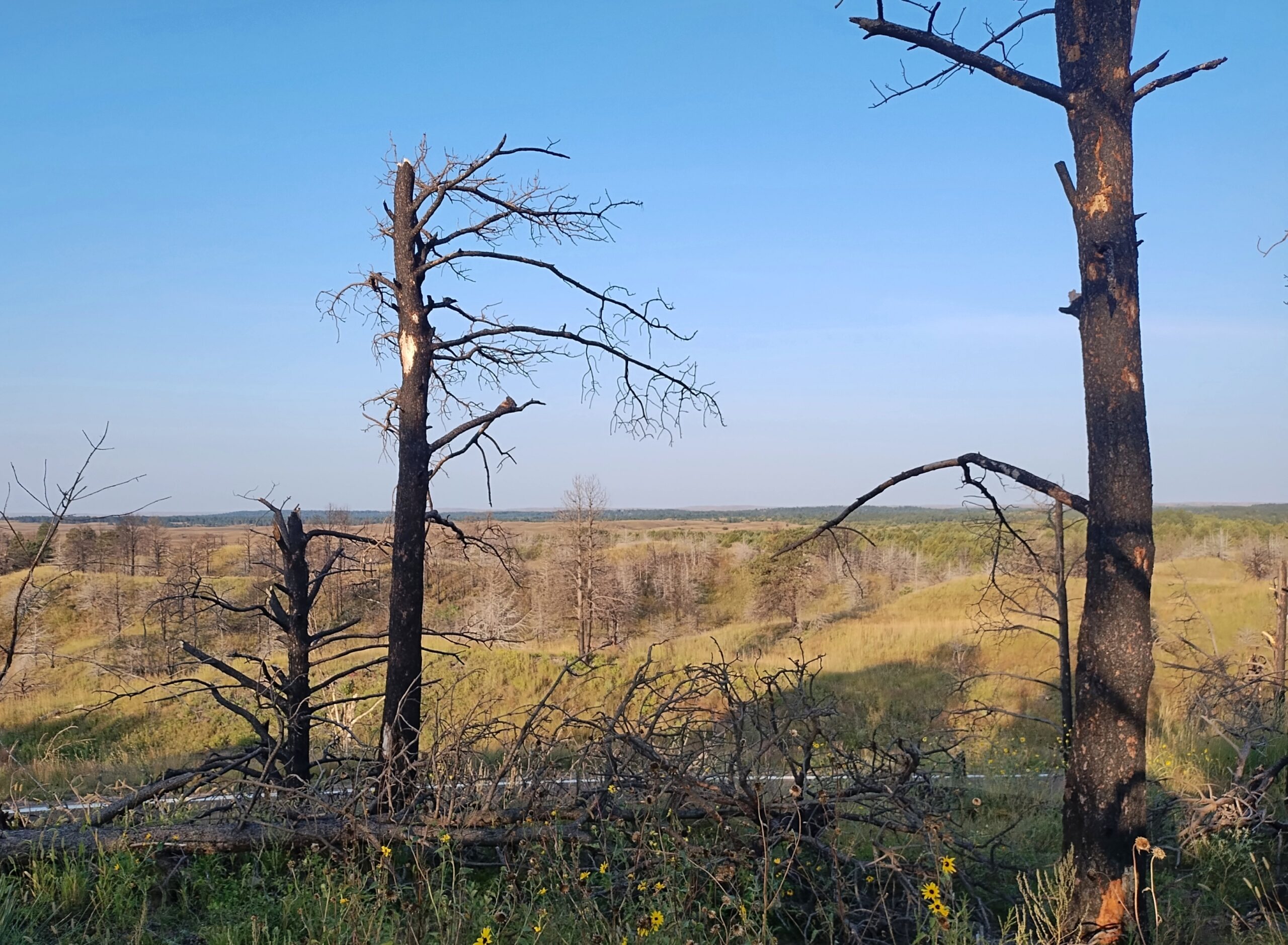
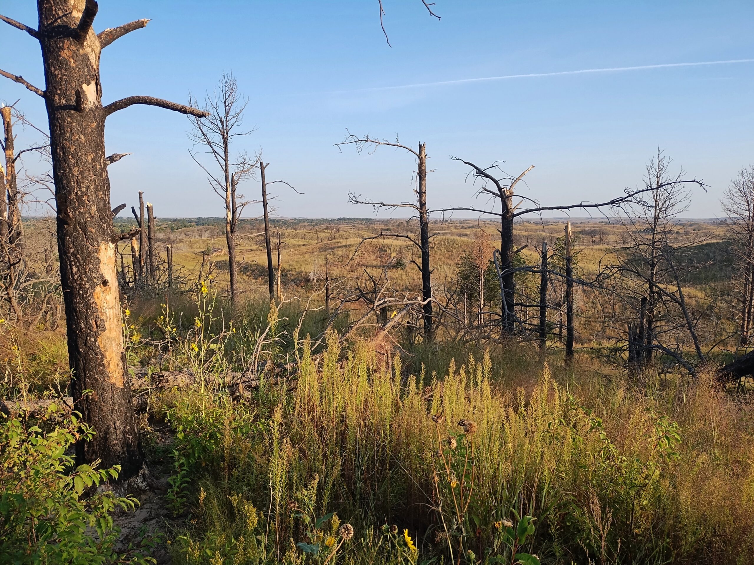
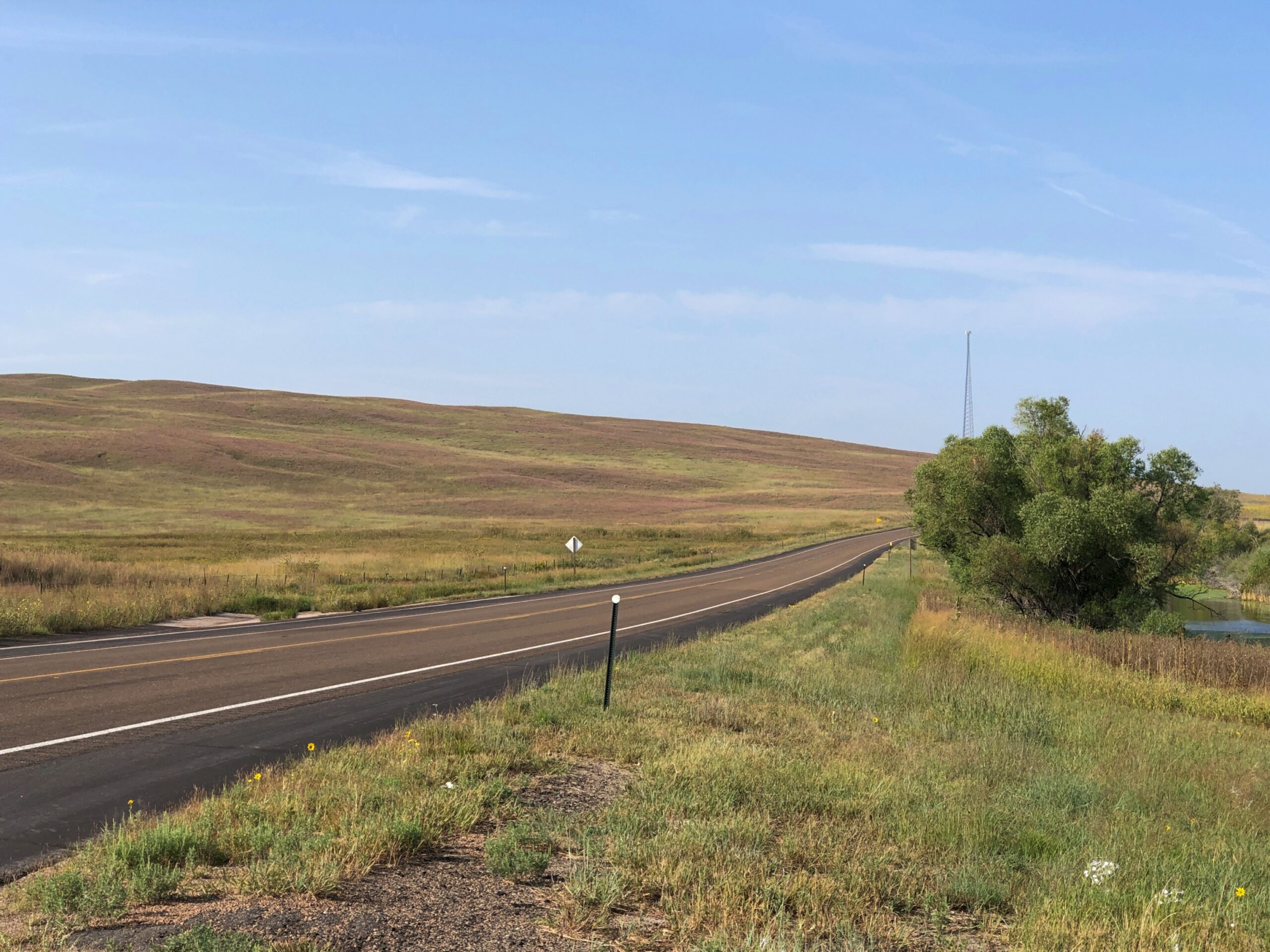
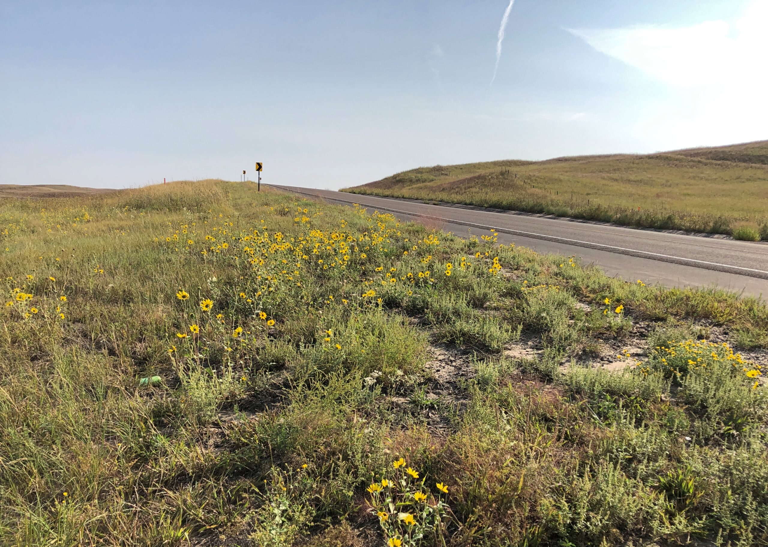
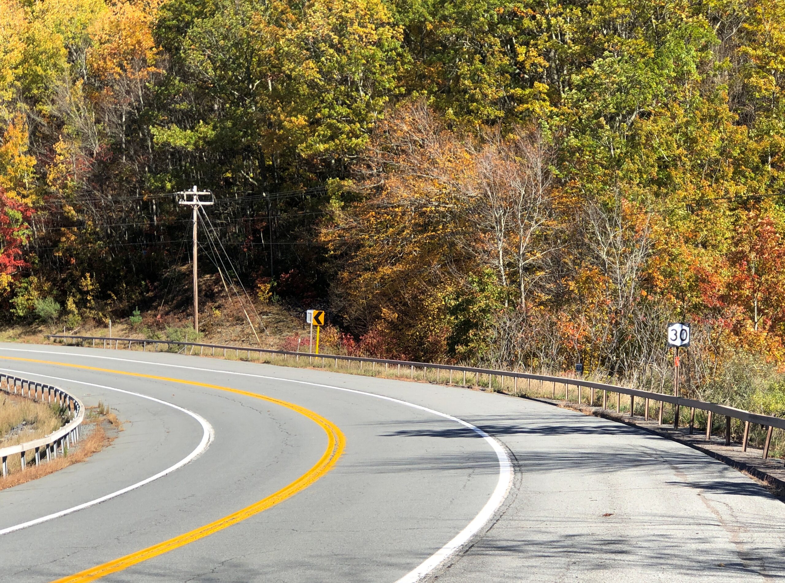
West from the national forest, Nebraska 2 heads into the rolling grassland of the Sandhills proper. In the village of Thedford (pop. 208), varied public interpretations of the Sandhills are available for reading.
The terrain along the highway Nebraska 2 might seem monotonous to some. Too bad for them. You’re driving across a kind of ocean, terrain all wavy, except that it’s solid ground, marked by occasional trees or manmade structures, and side roads — trails — wandering deeper into the hills.
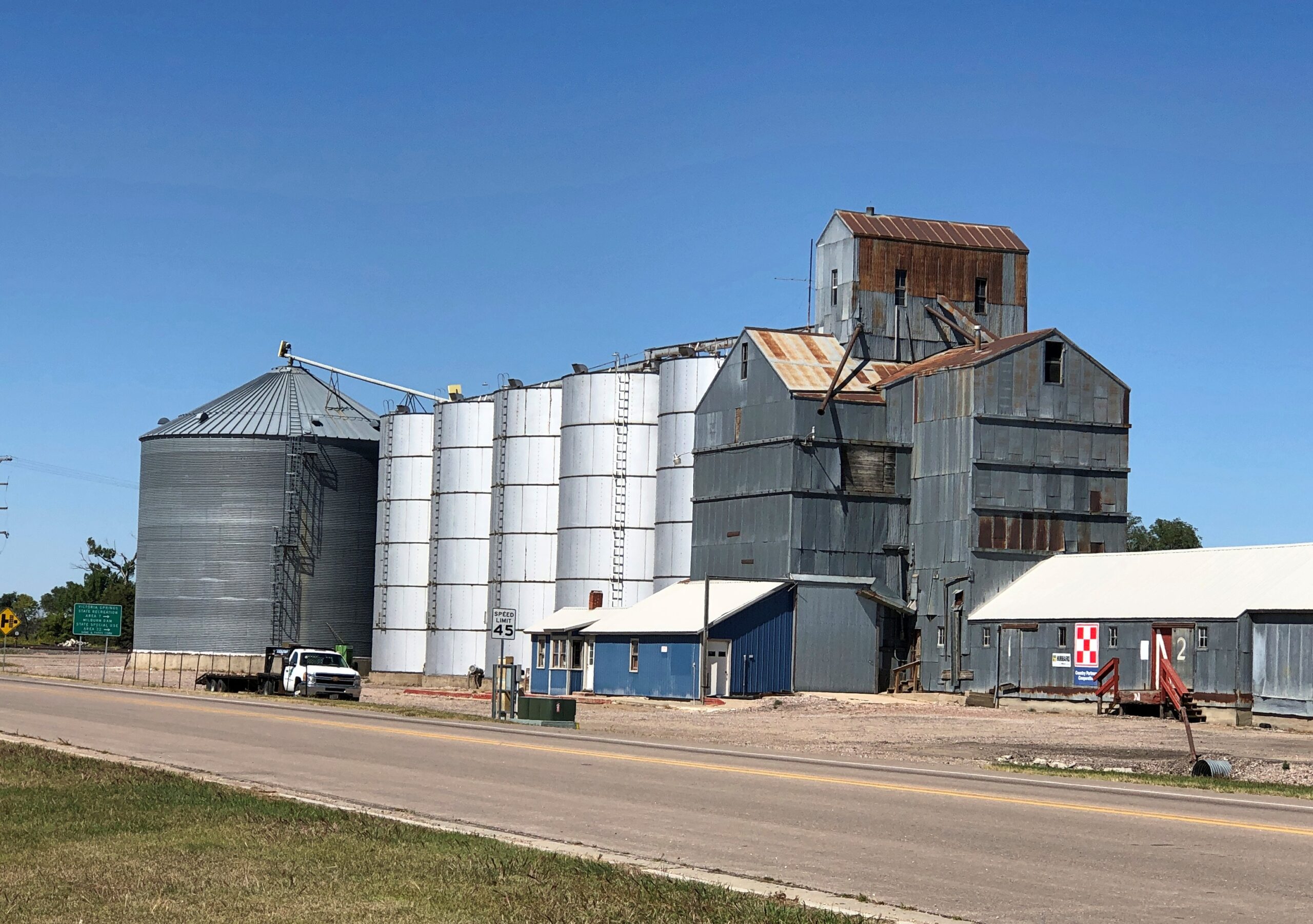
The handful of towns are really just wide places in the road. Sometimes, not even that.
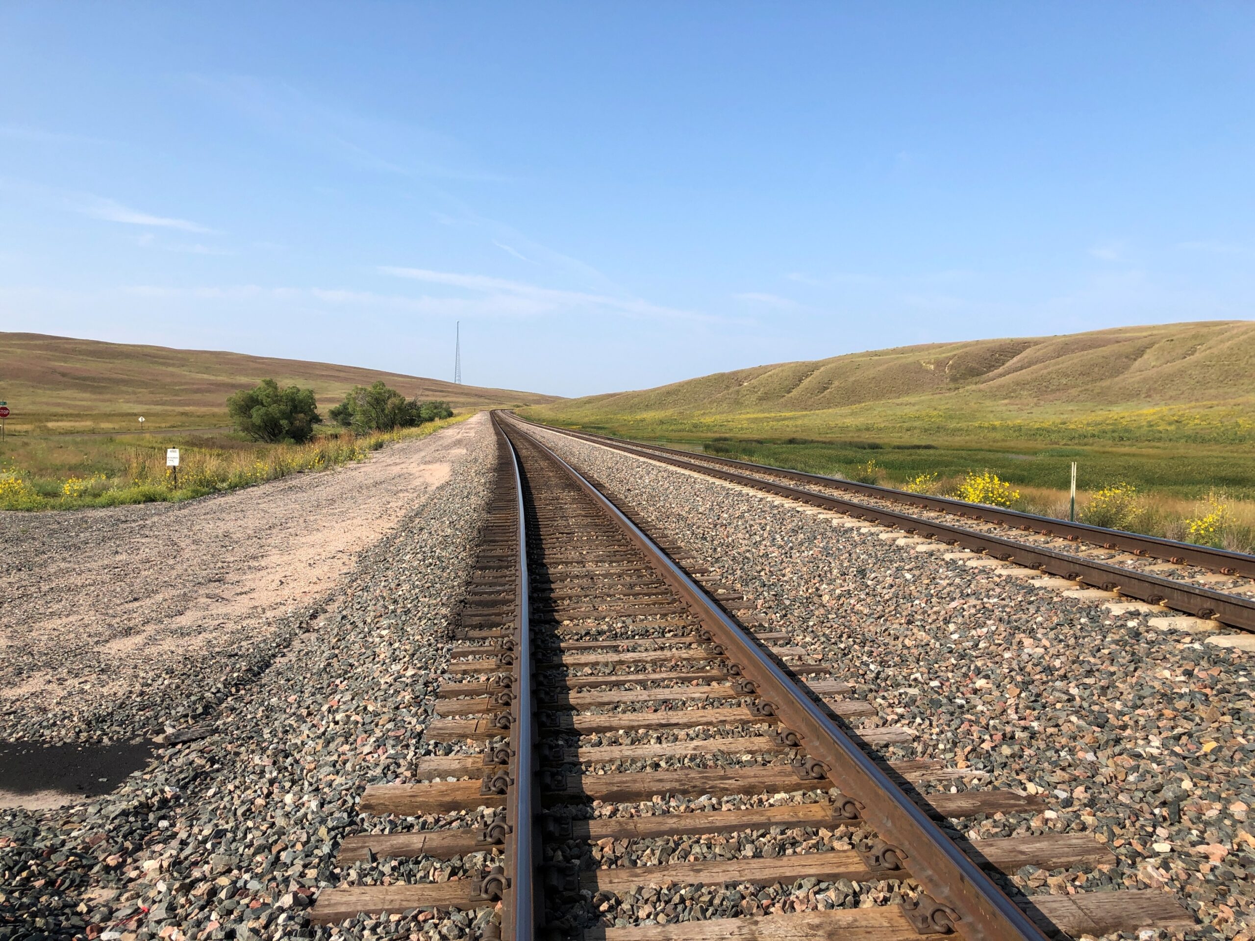
Nebraska 2 parallels the BNSF line, which came first.
Note: I was standing on a public side road to take that picture, as I do with all my RR shots.
Eventually, I took the road to Alliance. But that was merely incidental. Out this far, the road, as Kuralt said, is the destination.
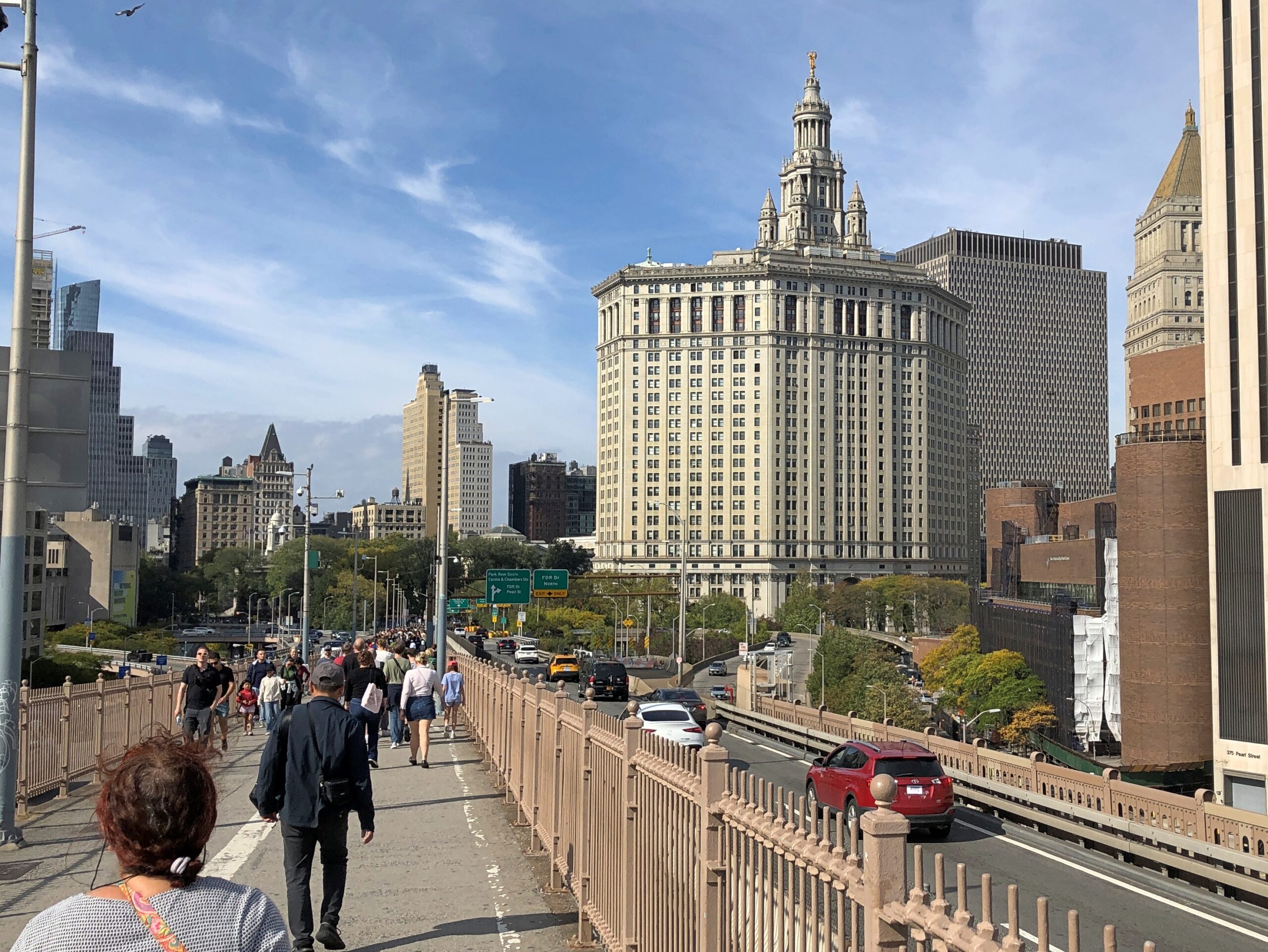
On May 24, 1983, I flew from San Antonio to New York City, since in those days the way to get to Europe was via NY. I remember only one thing about that flight, which I assume took me to LaGuardia. As we made our final approach, the plane banked over the East River and I happened to be on the correct side, in a window seat, for a terrific view of the Brooklyn Bridge.
The captain might have even mentioned the bridge, because it so happened that the Brooklyn Bridge was celebrating its centennial that very day. A hundred years earlier, on May 24, 1883, the bridge had opened with great festivities, including attendance by President Chester Arthur and NY Gov. Grover Cleveland.
I’d never seen the bridge with my own eyes before then, either, since my brief layover in the city a year earlier mostly involved time at the Port Authority Bus Terminal. Yet I recognized the bridge at once, from TV and movies. Such as the time, in one movie, when Tarzan (Johnny Weissmuller, accept no substitutes) went the Brooklyn Bridge, did a Brodie off of it, and of course survived, unlike some real divers.
One day in August ’83, having returned to New York and with more time on my hands, I decided to cross the Brooklyn Bridge on foot toward Brooklyn, to facilitate my first-ever visit to that borough. Except for that fact that it was blazing hot, it was a good idea. The bridge itself is a work of industrial beauty and the views are great.
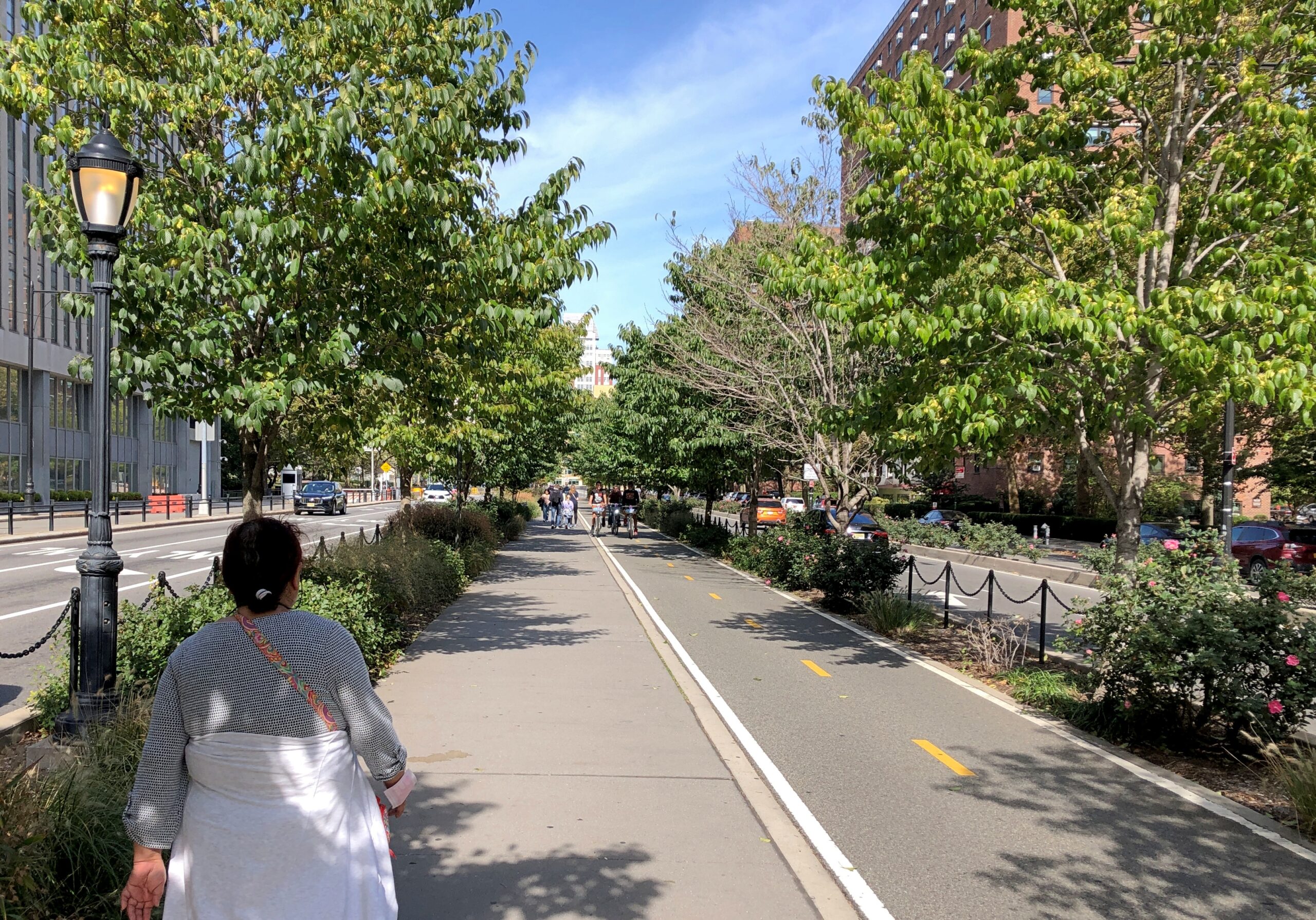
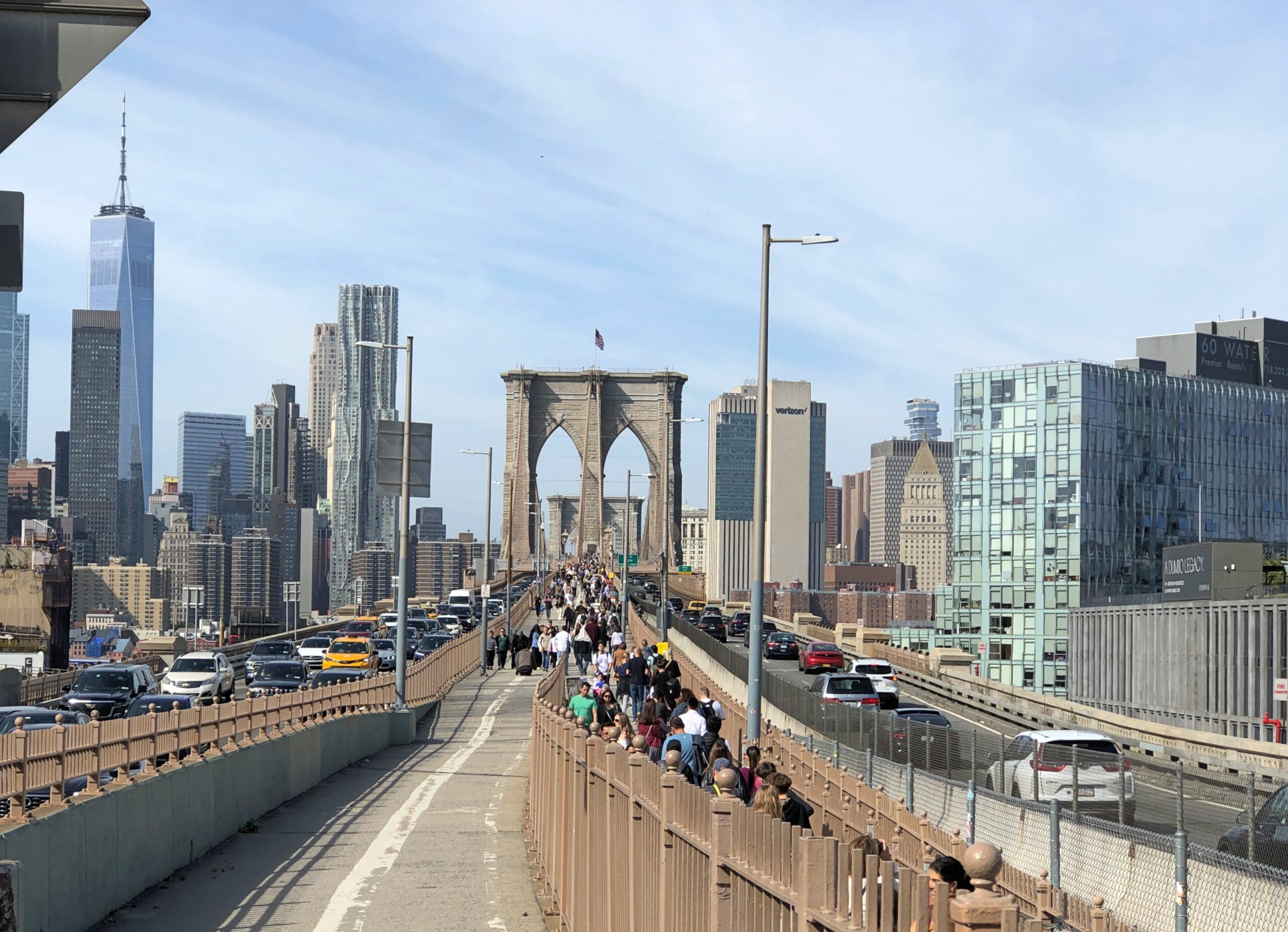
After leaving Fort Greene Park, Yuriko expressed the idea that she wanted to see the Brooklyn Bridge — which she hadn’t up close — and I couldn’t begrudge her a visit, especially since we weren’t far away. We walked from Myrtle Ave. to Flatbush Ave. (actually the “Flatbush Avenue Extension”) to Tillary St., where you can find the entrance to the Brooklyn Bridge Promenade. At that point, it’s both pedestrians and bicyclists.
I didn’t realize at first that the promenade leads directly to crossing the bridge, though it takes about 20 minutes to get there. I imagined, at first, that it would lead to Dumbo and a view below the bridge. An excellent spot, which I most recently visited in 2014.
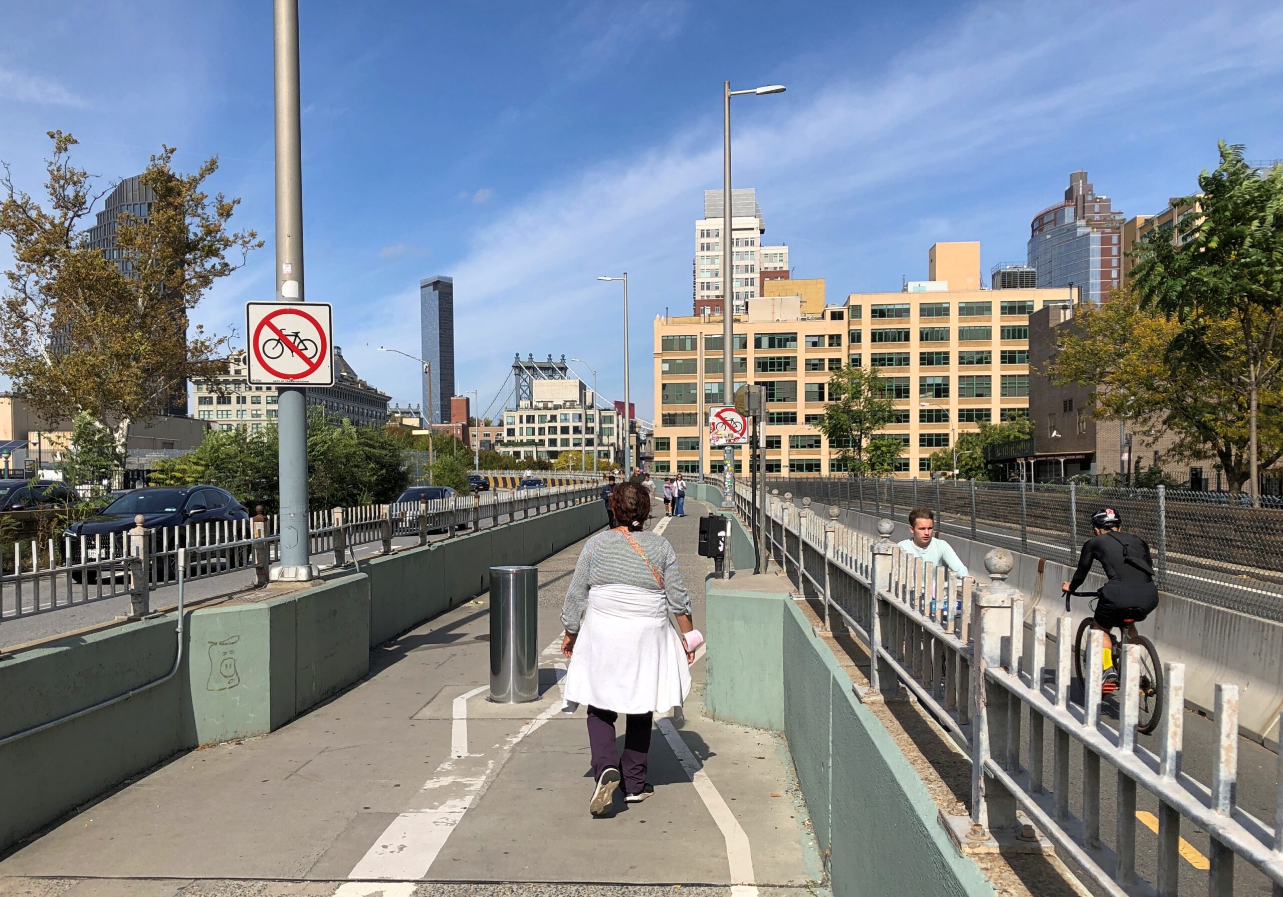
Soon I realized that we were headed for the bridge itself. Not only that, I saw that pedestrians were soon separated from bicyclists, beginning fairly far away from the bridge.
What an amazingly good idea, only done in 2021. Considering the crowds that the Brooklyn Bridge attracts, it probably should have been done years ago.
We walked from Tillary St., but the more popular Brooklyn-side pedestrian entrance is stairs at Washington Street and Prospect Street, seen below.
I didn’t remember the bridge being that crowded my first time, though at a remove of 40+ years, the details are a little hard to remember. It was hot, and probably a weekday, so that might have thinned out the pedestrian traffic.
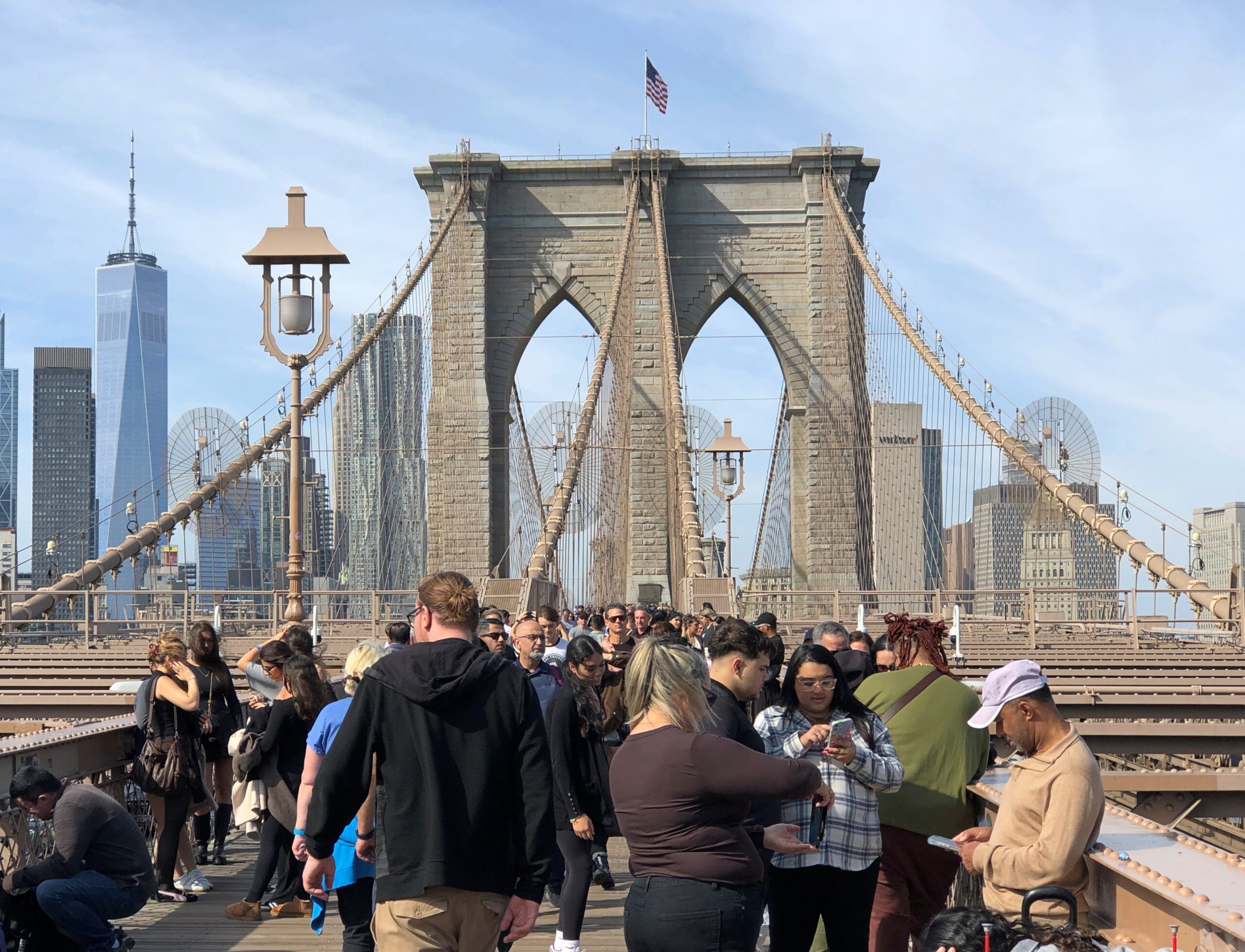
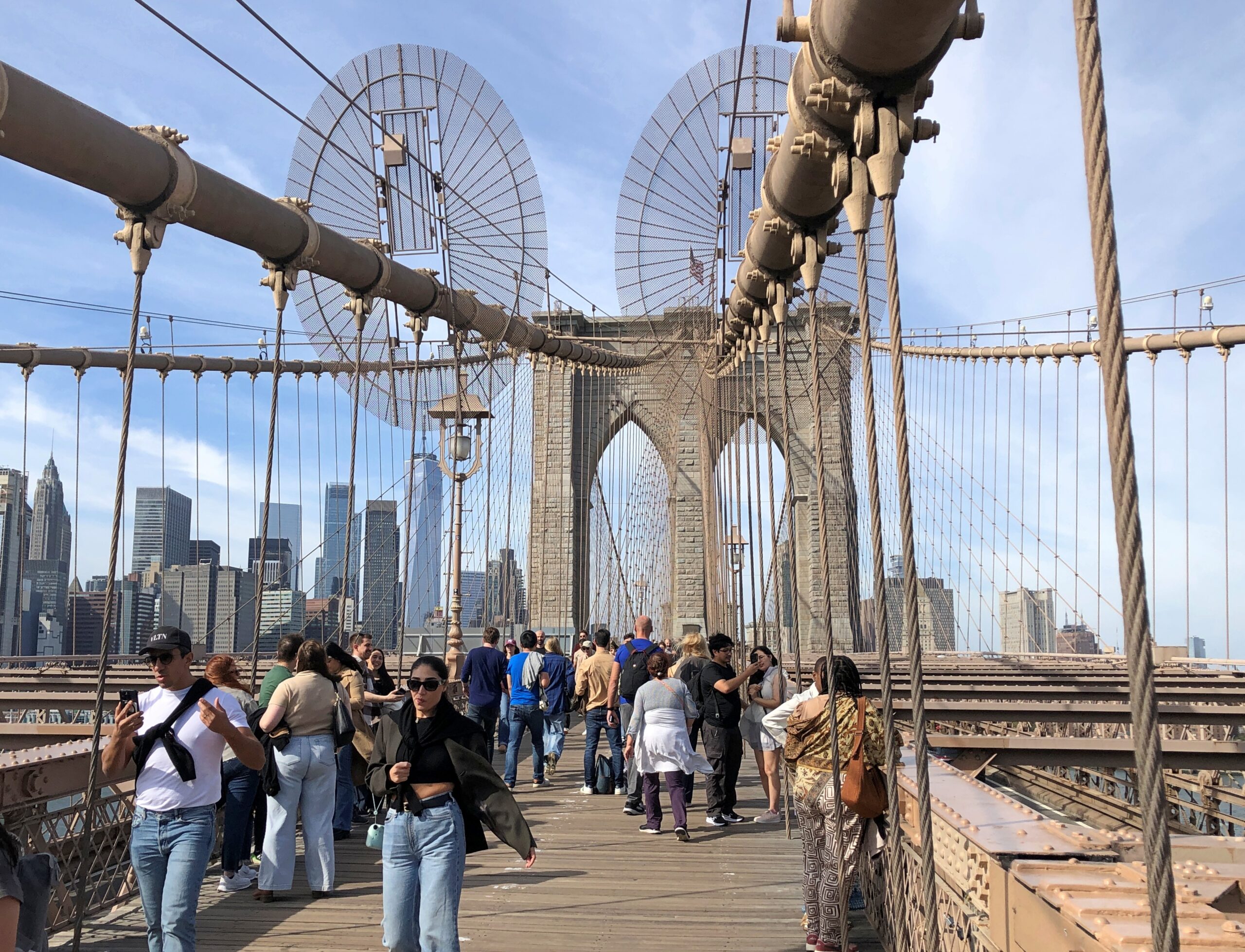
That wasn’t the case on a pleasant October Sunday. New Yorkers and tourists were out in force.
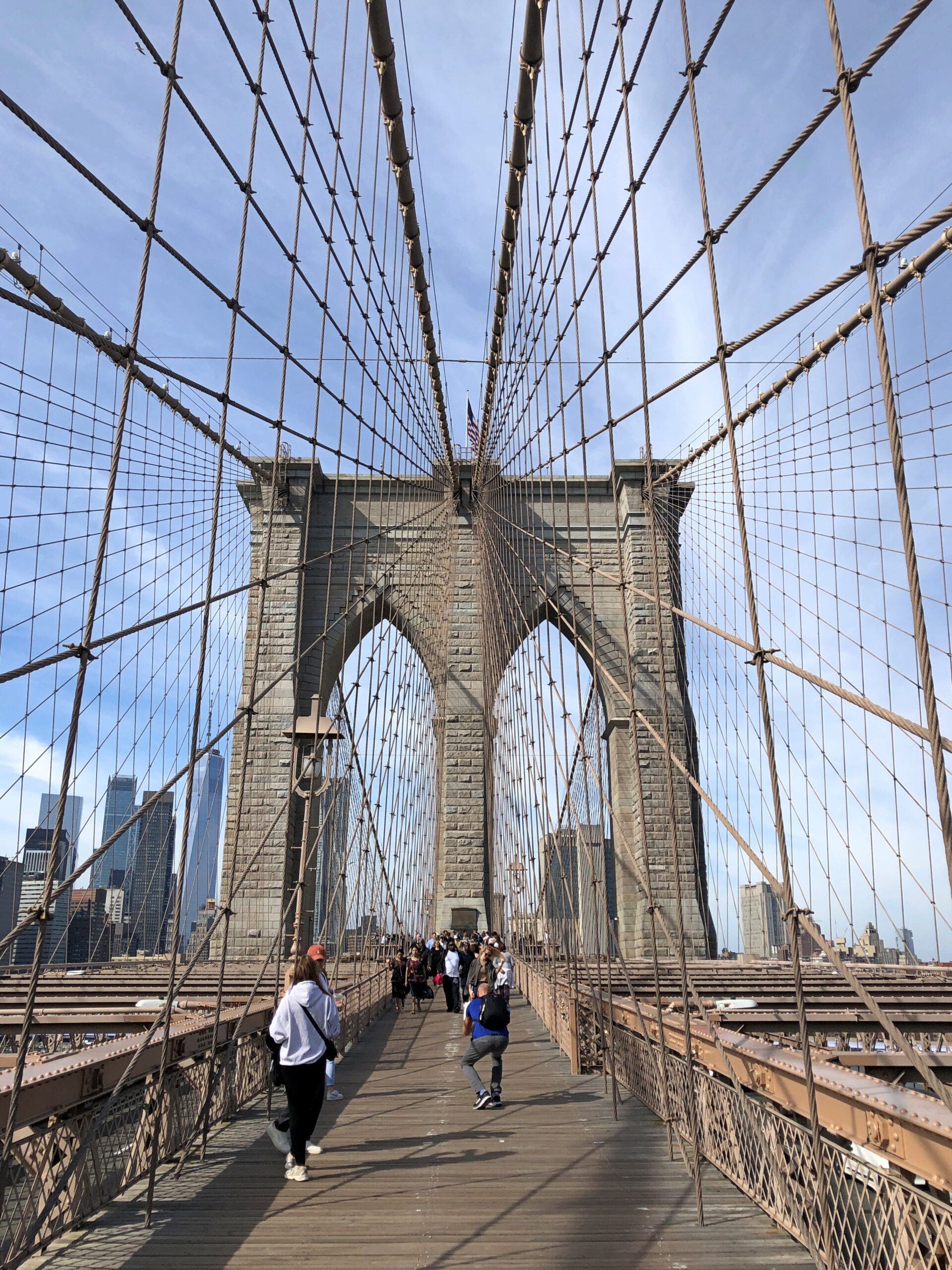
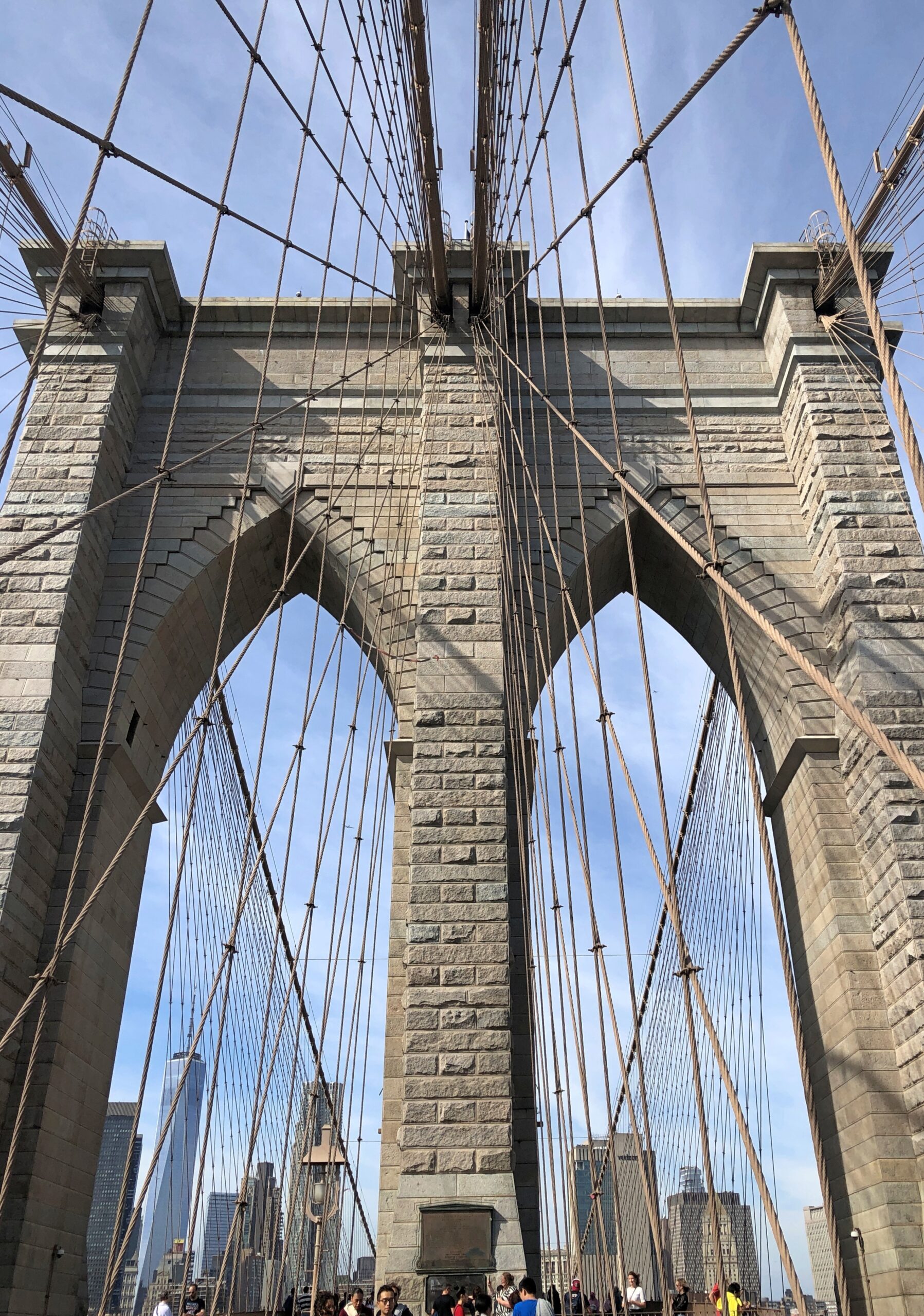
Mostly the bridge holds its crowds well. From the many wooden planks, you still get a closeup of the web-like intricacies and gray hulking towers created by the Roeblings and thousands of workmen.
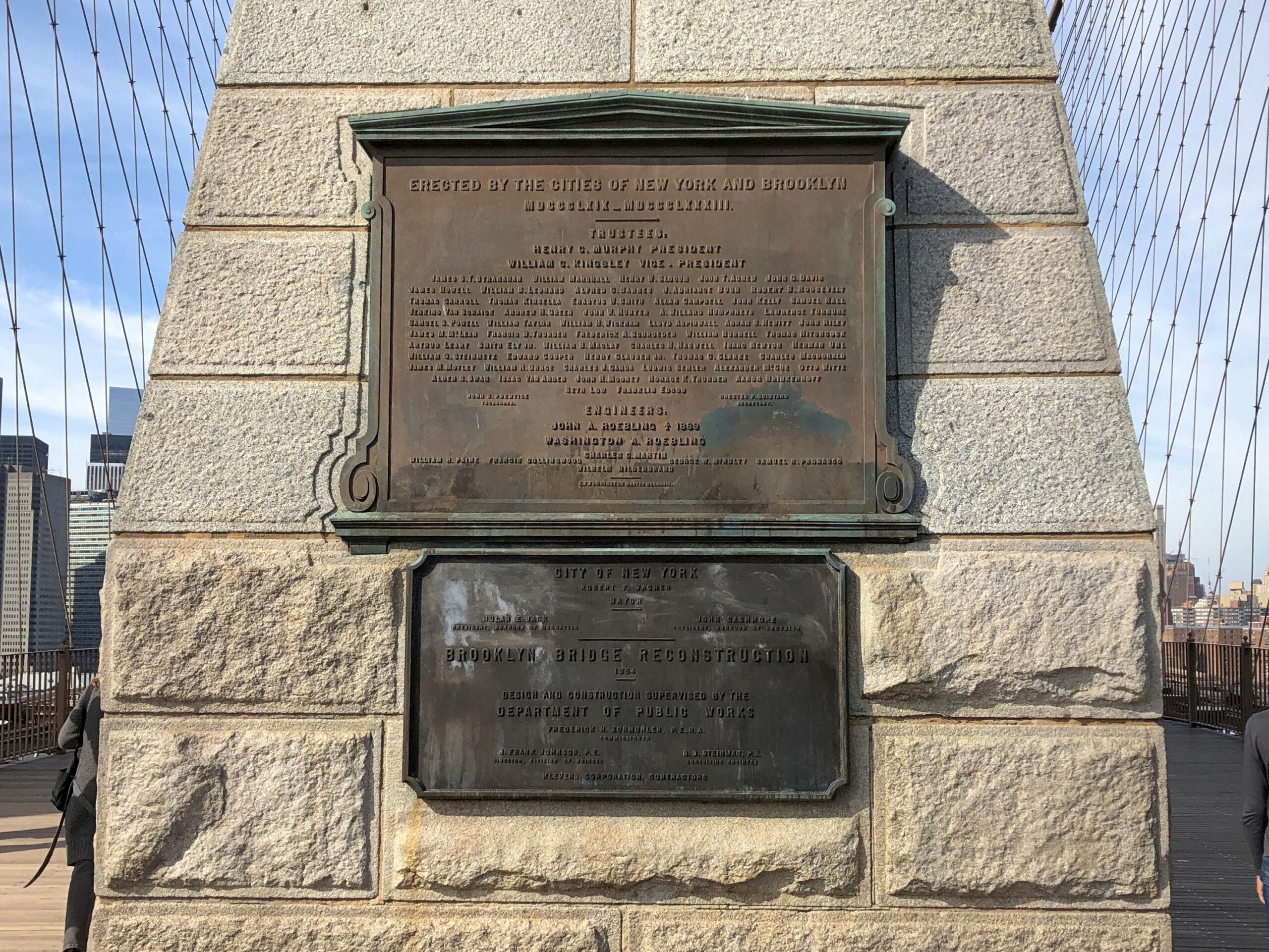
Credits.
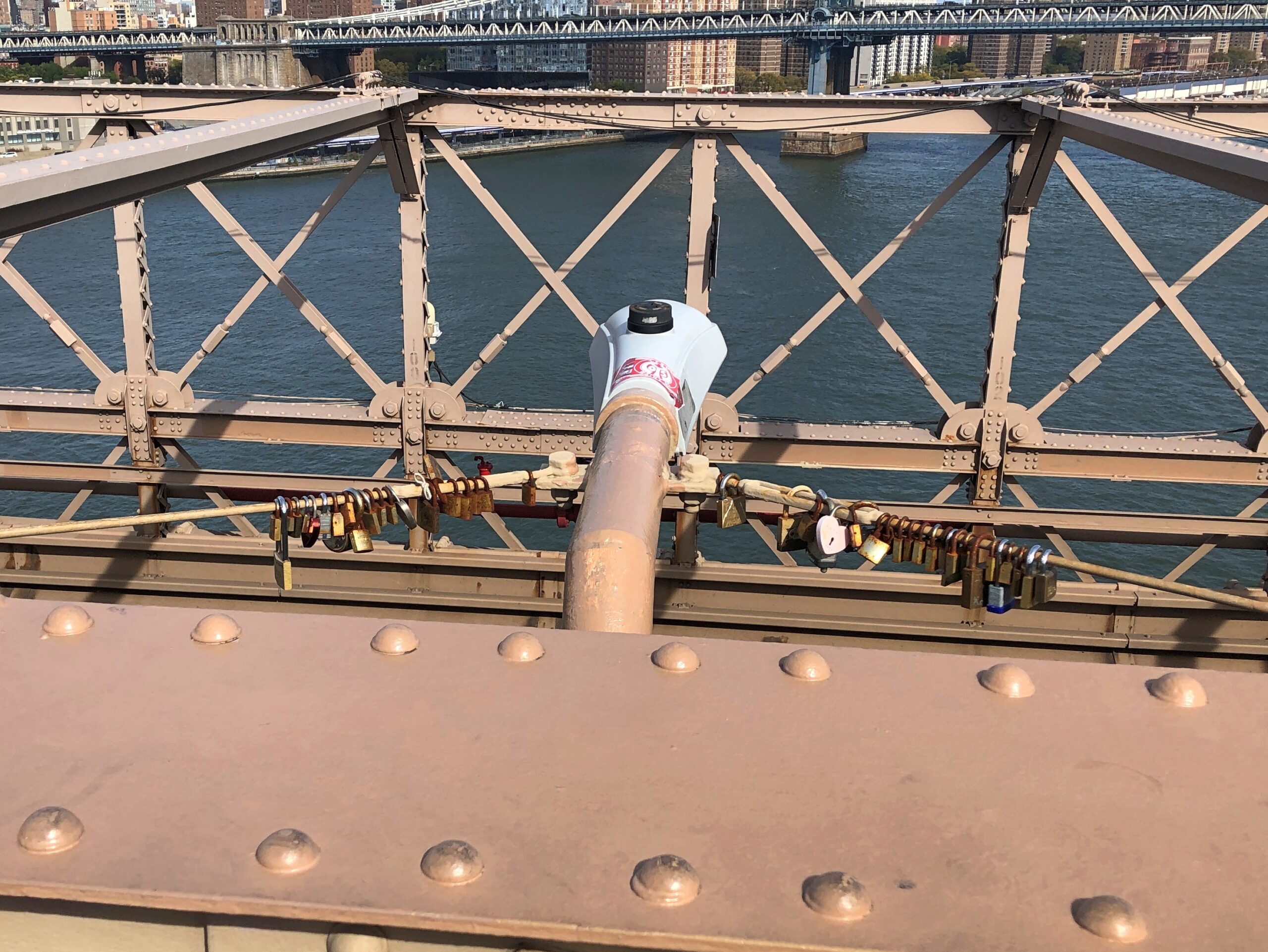
Love locks. I understand the city frowns on their attachment to critical infrastructure. That doesn’t change a thing.
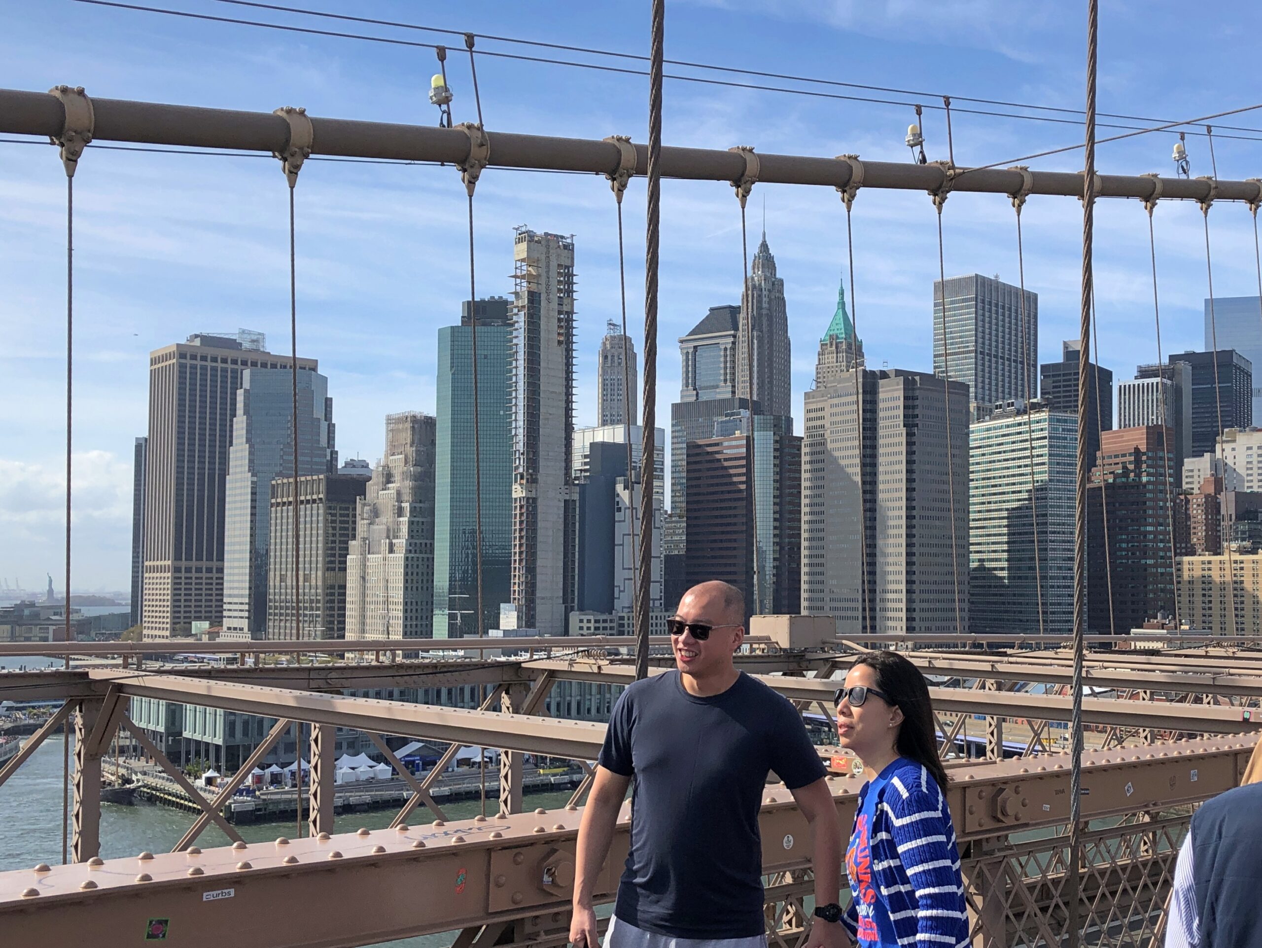
Provided you pay attention that there isn’t someone walking right behind you, it’s easy enough to stop to take in the famed views of Manhattan.
Soon enough you’re approaching Manhattan.
Yuriko had fulfilled her wish to walk the bridge, and it occurred to me that not only have I walked across the Brooklyn Bridge twice, I’ve done it once each way. Guess I need to visit San Francisco again and walk across to (near) Sausalito, then take a bus back, which would be the reverse of 1990. Or for that matter, visit the Ohio Bridge in Cincinnati again (another Roebling work), though I don’t remember which way I crossed it. Or visit the Roebling Museum. Ah, so many bridges to cross.
Kids came in some numbers for Halloween here in the northwest suburbs yesterday, but I didn’t keep an exact count this year. The day was cool but not cold, without a hint of rain, so that might have encouraged turnout, like for voting. One time a passel of kids showed up, maybe a dozen or so, all under 10, with a smaller passel of parents off near the sidewalk.
We were giving away full-sized candy bars until they ran out, and the passel squealed with delight at receiving the various Hersey products. Even now, the costumes are a blur, maybe because I didn’t recognize a lot of the characters. Ones that I might have known weren’t familiar either. I asked the parents of a very small boy — ah, first-timers — what he was supposed to be. His shirt pattern reminded me of TMNT, but it was Hulk, they told me. “Hulk smash,” they said. “Hulk smash, all right,” I agreed.
All of the Halloween traffic, except for a handful of older kids, came before dark. My not-so-inner curmudgeon reacts: in my day, we trick-or-treated after dark, risking bodily injury on the streets, and we liked it.
But I am glad to report that the older kids – junior high and even high school – are far fewer than they were, say, 20 years ago. So it’s back to the way it should be. For older people, there are always such seasonal events as the Greenwich Village Halloween Parade. To this day, the ’06 iteration of that parade remains the only time I’ve encountered the band KISS live – they were the grand marshals (RIP, Ace Frehley). We also encountered Space Ghost then, or at least a fellow who was adamant about his Space Ghost identity.
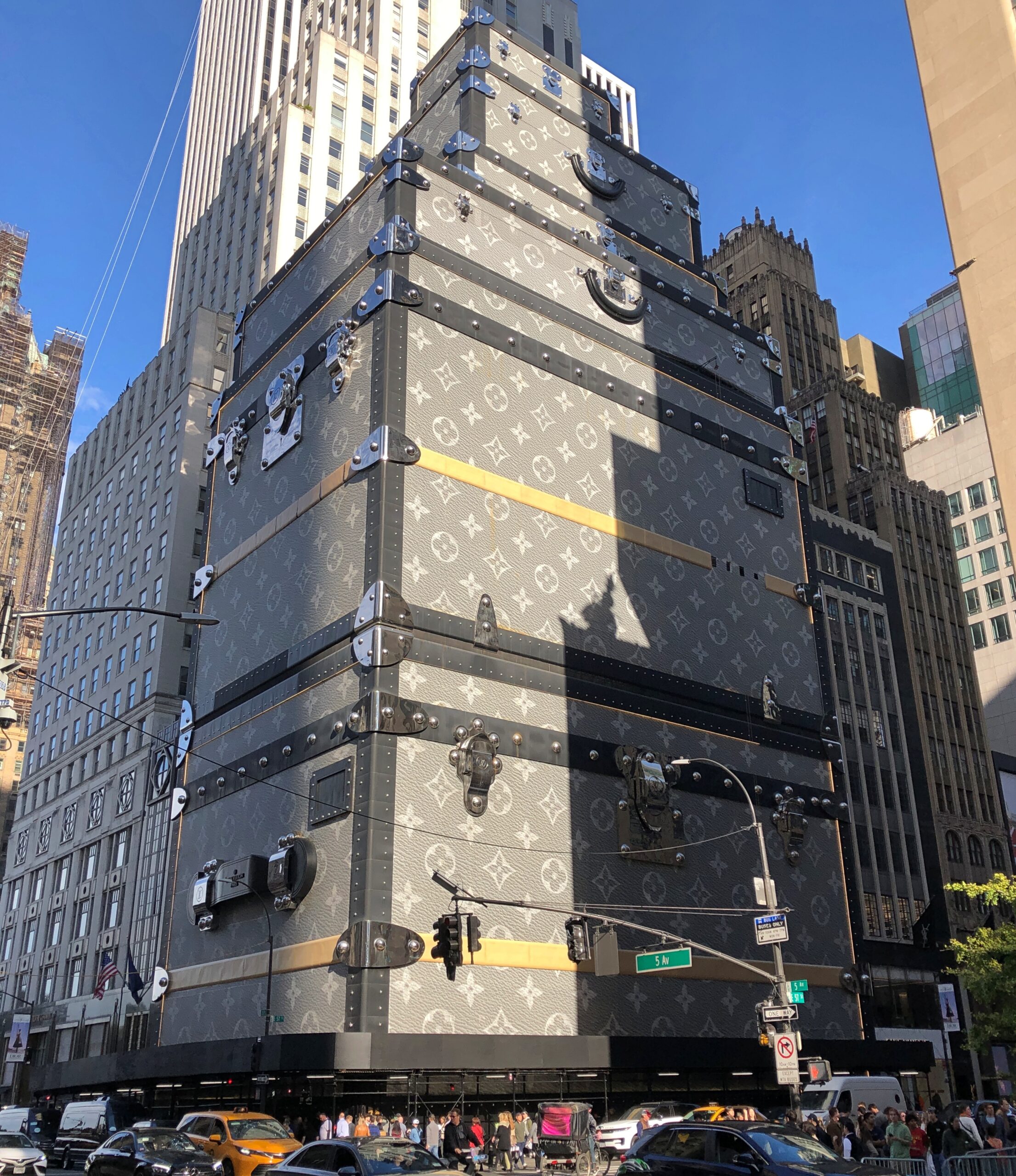
Near Central Park on Fifth Ave. is 1 East 57th Street. We walked by last month.
A few years ago, luxe retailer LVMH Moët Hennessy Louis Vuitton added a faux facade to its NY flagship store there on the avenue, one that evokes its signature luggage trunks in a highly visible way. Redevelopment plans for the building behind the trunks were unveiled not long ago, so I suspect the trunk-appearance doesn’t have much longer to look down on Billionaire’s Row and its strato-priced residential properties (whose high rents and sale prices don’t necessarily guarantee high-quality construction, apparently).
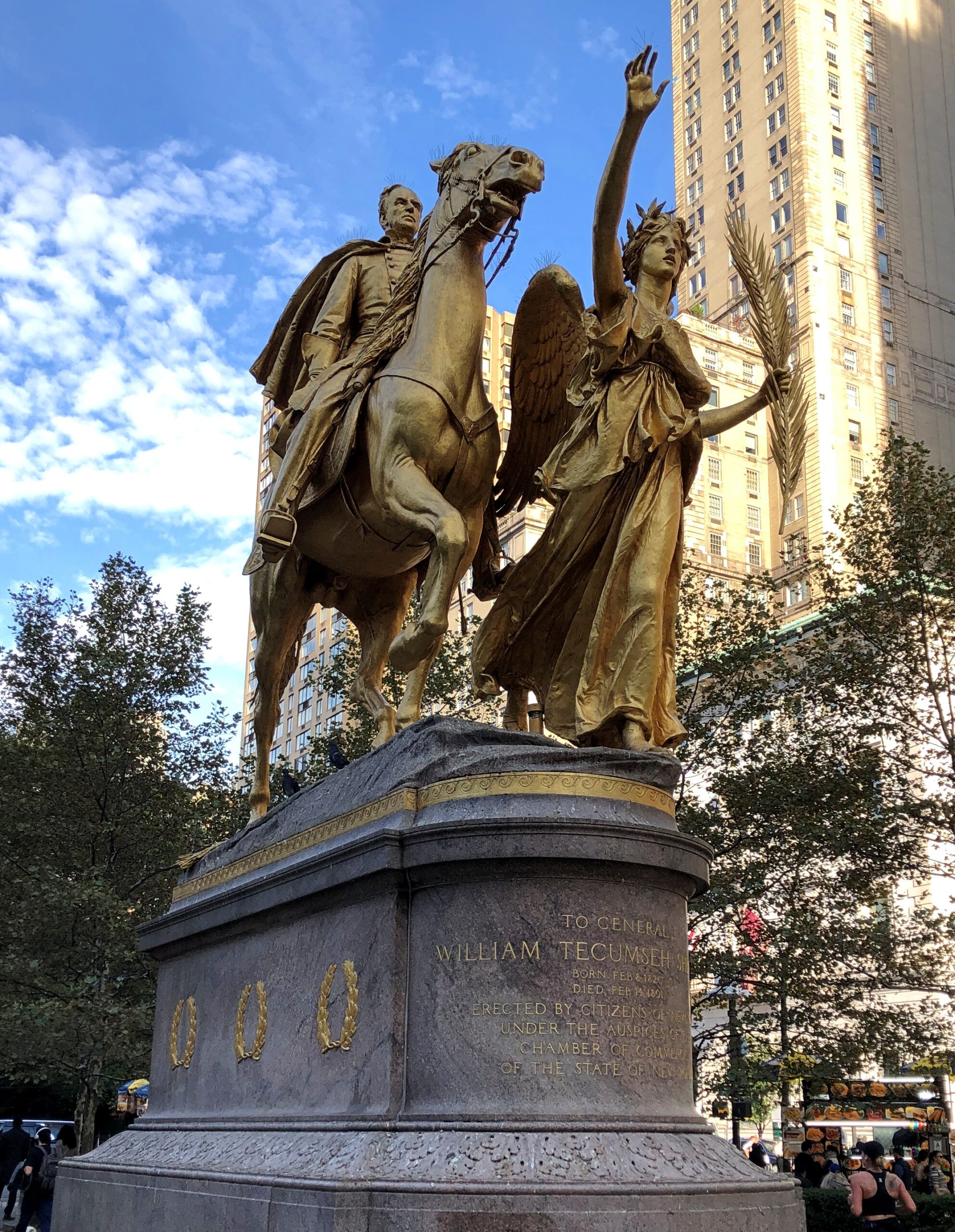
As we neared Central Park, we spent a little time at Augustus Saint-Gaudens’ statue of William Tecumseh Sherman (dedicated 1903) in Grand Army Plaza. Life’s too short not to look at some Saint-Gaudens from time to time.
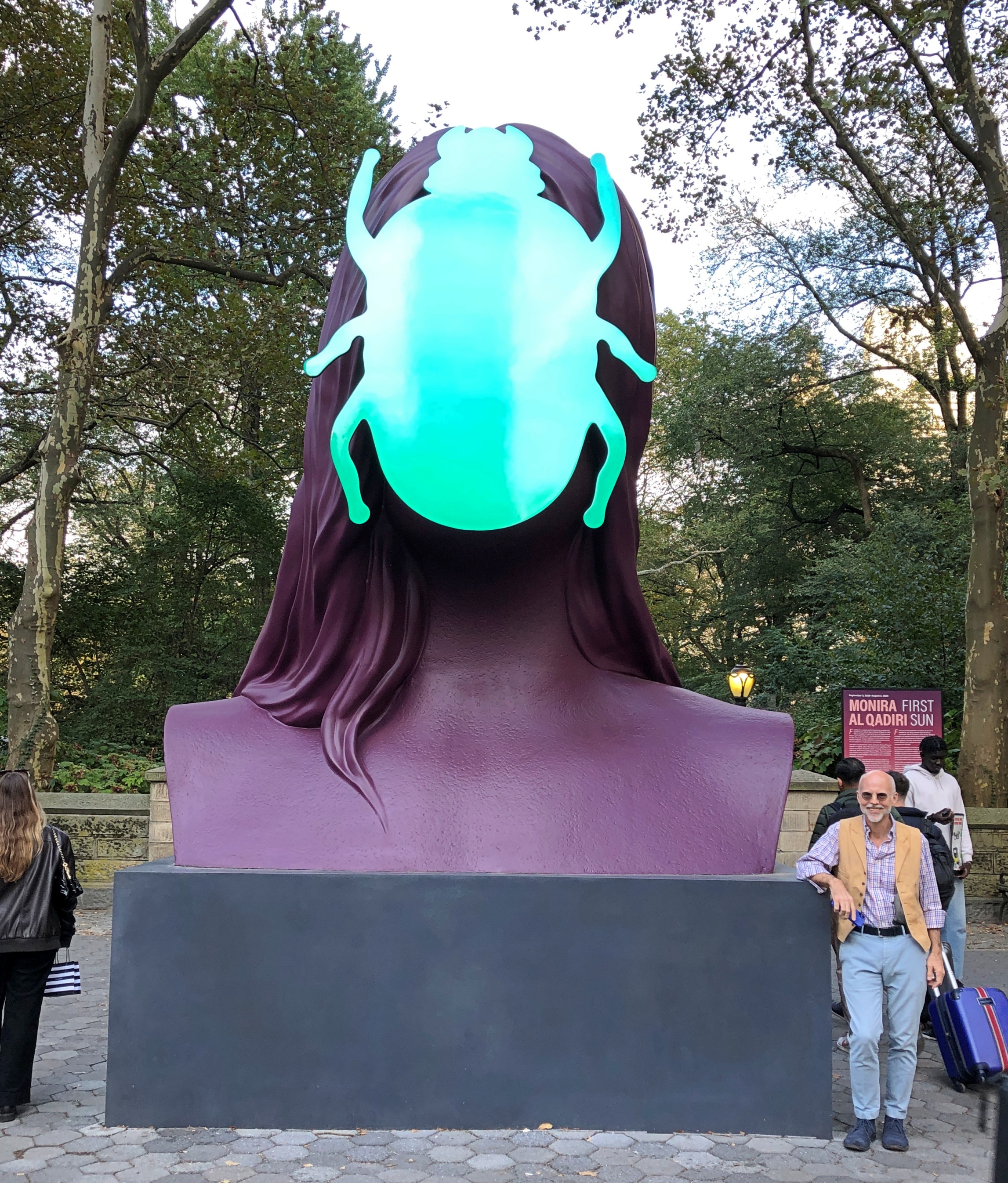
Not far away, something a little newer.
“First Sun,” a painted aluminum sculpture of a human-scarab figure by Senegalese artist Monira Al Qadiri, and slated to be in place until the end of next summer.
Visible from near the statues is the storied Plaza Hotel and an Apple Store, which is open 24 hours, Google Maps tells me. Storied in a different way.
I’m glad the Plaza acknowledges its fictional role in The Great Gatsby by featuring a lavish-beyond-the-dreams of Croesus Gatsby Suite. Of course. A smart hotel operator isn’t going to waste an opportunity like that. In this case, Fairmont Hotels and Resorts, a Canadian company, managing for owner Katara Hospitality – the large hotelier owned by the Qatari government. In the 21st century so far, the Plaza has been owned by an Israeli company and then an Indian one before Katara bought it. There’s something oddly American about an ownership trajectory like that.
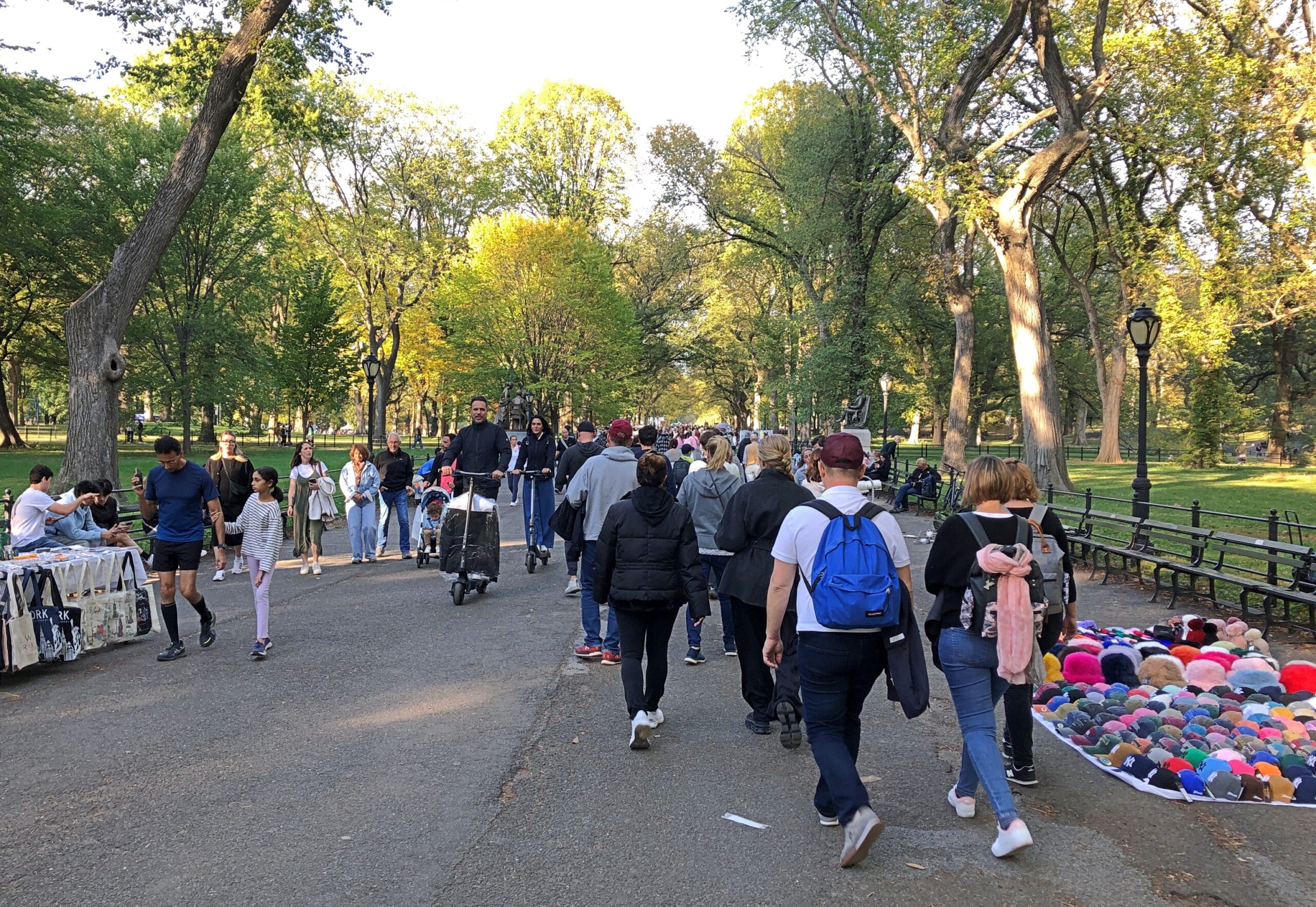
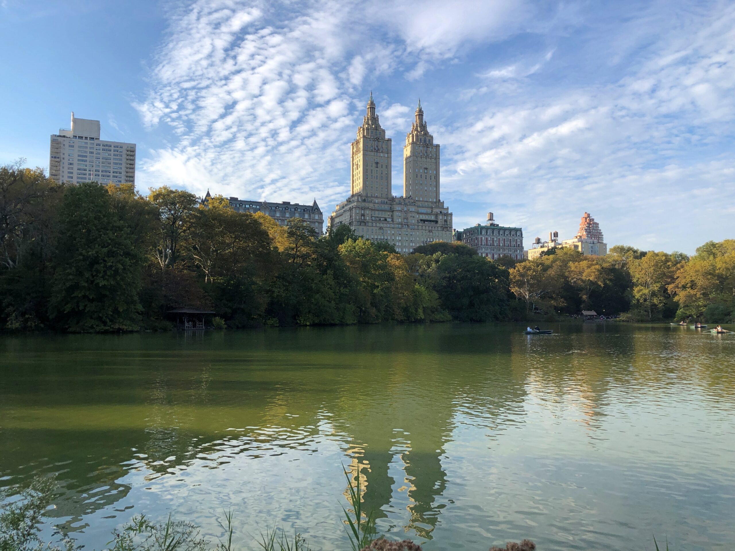
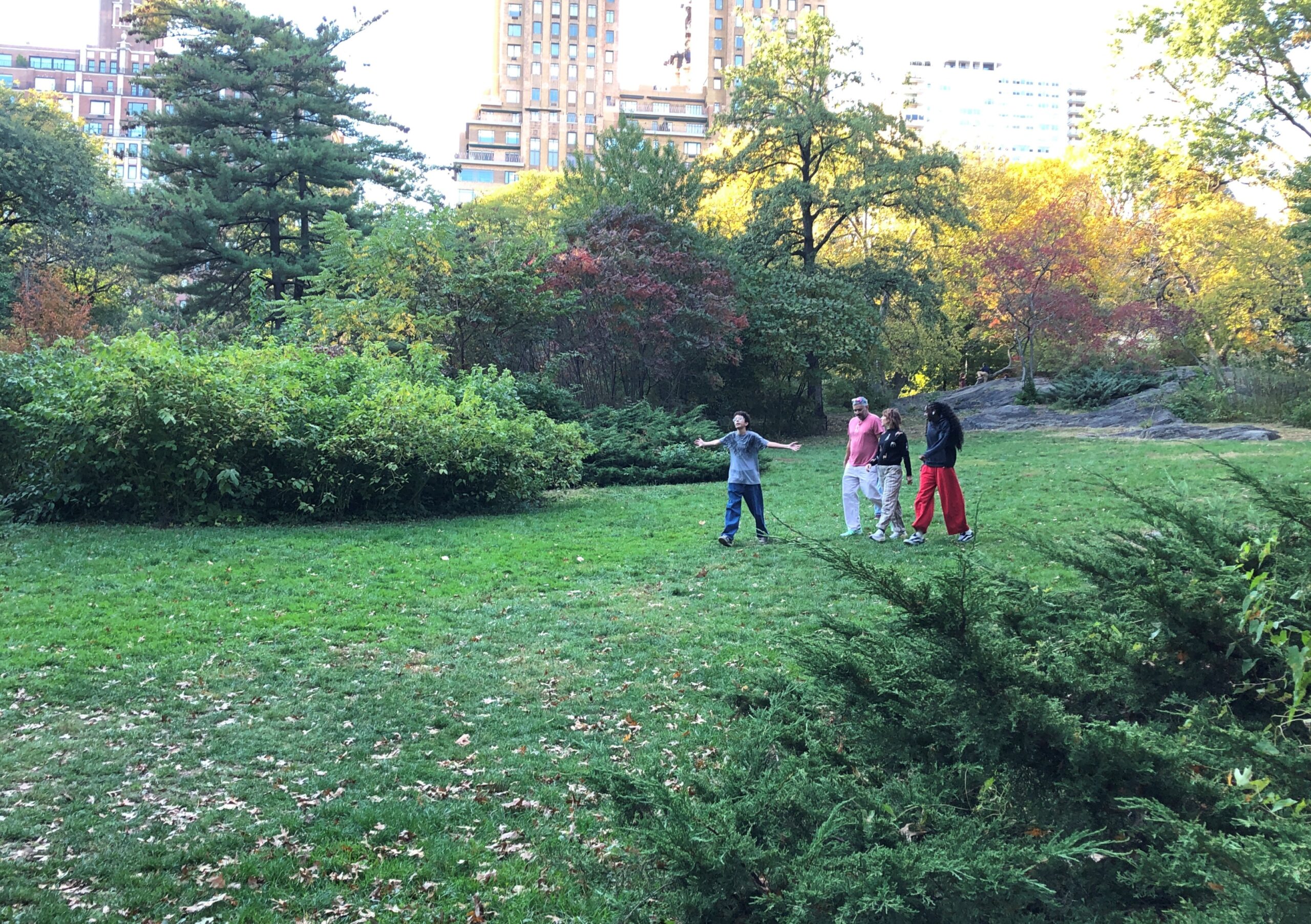
We – Robert, Geof, Yuriko and I – charted ourselves a simple walking path through some of the southern reaches of Central Park. Manhattanites and visitors to the borough were out in Saturday-afternoon force. Saturday, in the park/I think it was the 18th of October. No, that doesn’t scan. A fair number of pitch-a-blanket cap and souvenir salesmen were out, too, but not nearly as many buskers as a great city park like Central Park should attract.
There’s an editorial right there: why America needs more buskers, and why some American cities need to chill when it comes to suppressing buskers. Europeans might not be right about everything, but about allowing buskers? Yes.
The leaves weren’t at peak just yet, with the greens still hanging on more than not. I don’t remember which visit to Central Park it was, but one time I wandered the park during peak coloration, whipped into even greater yellow-and-red glory by a brisk October wind. Temporary clouds of leaves came and went, even as the wind shook more leaves from their branches. Color, but also motion.
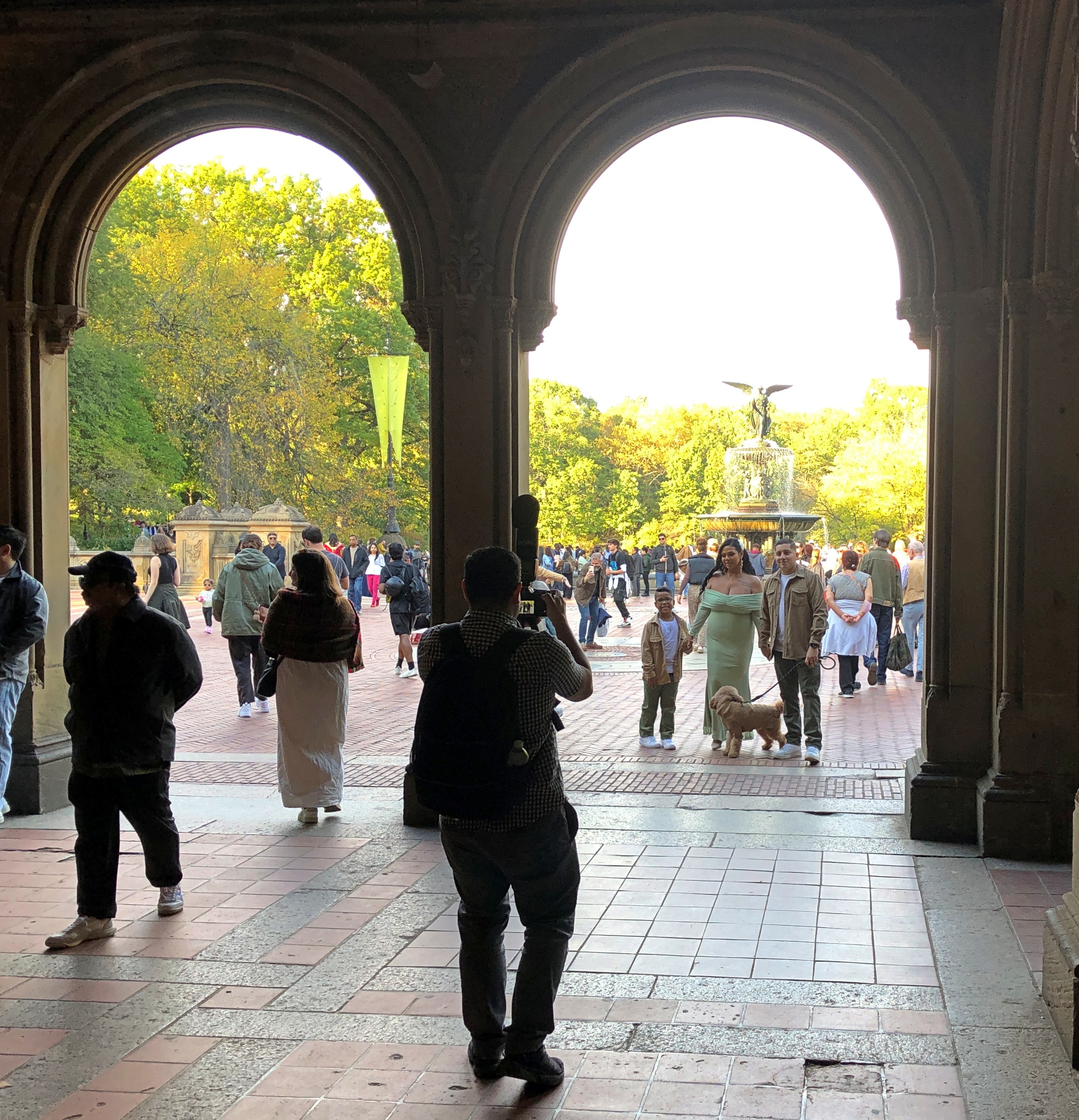
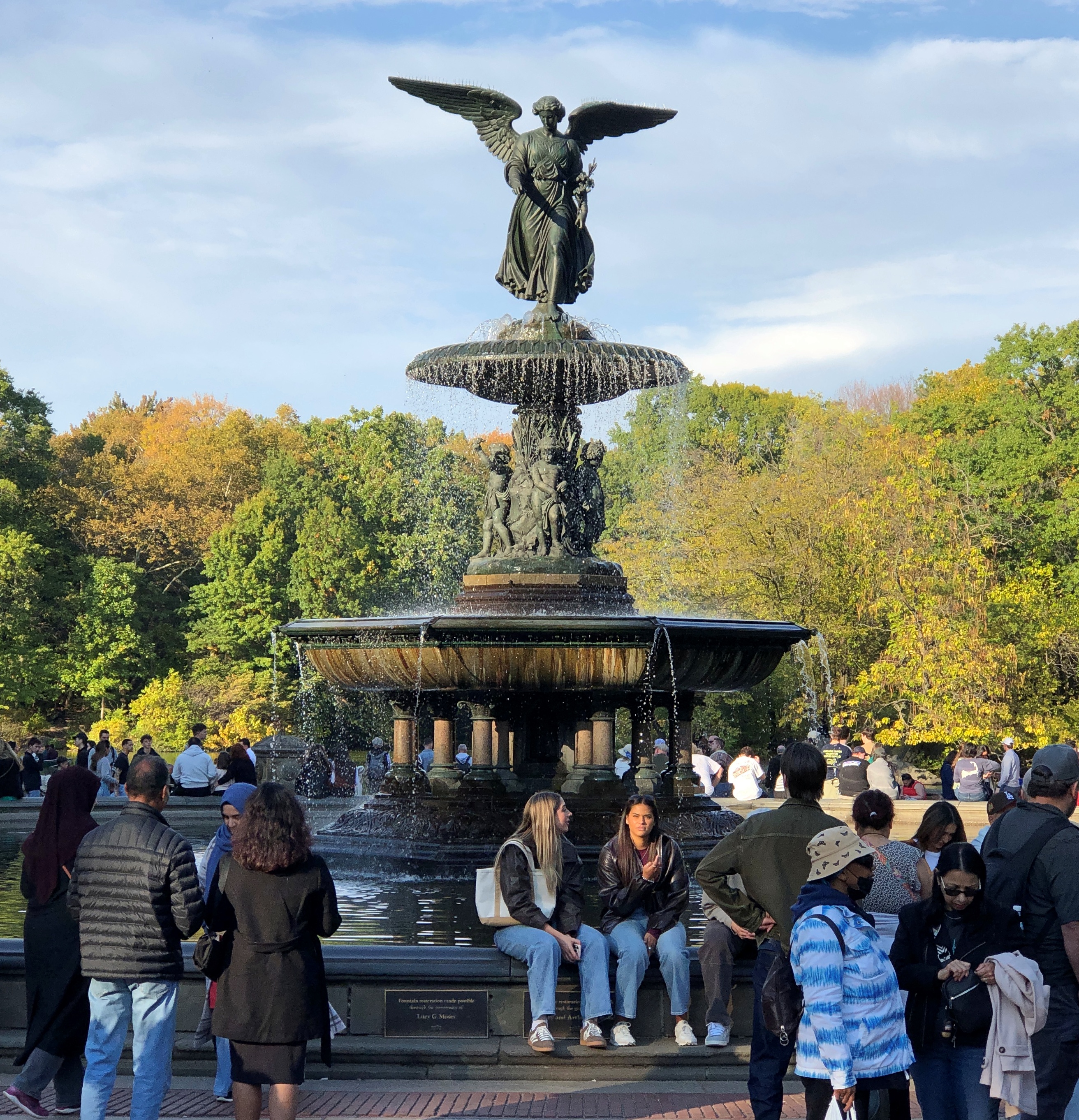
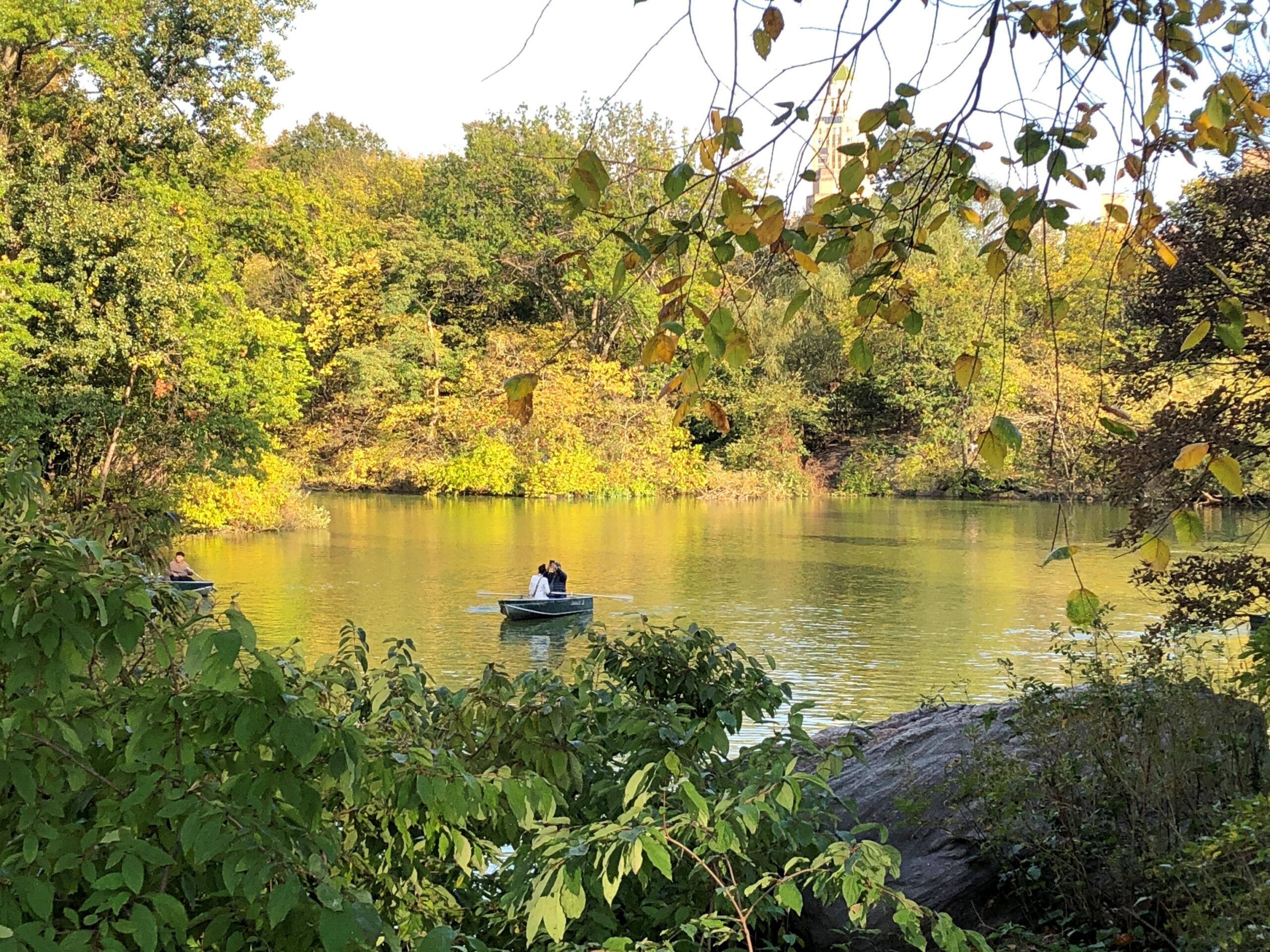
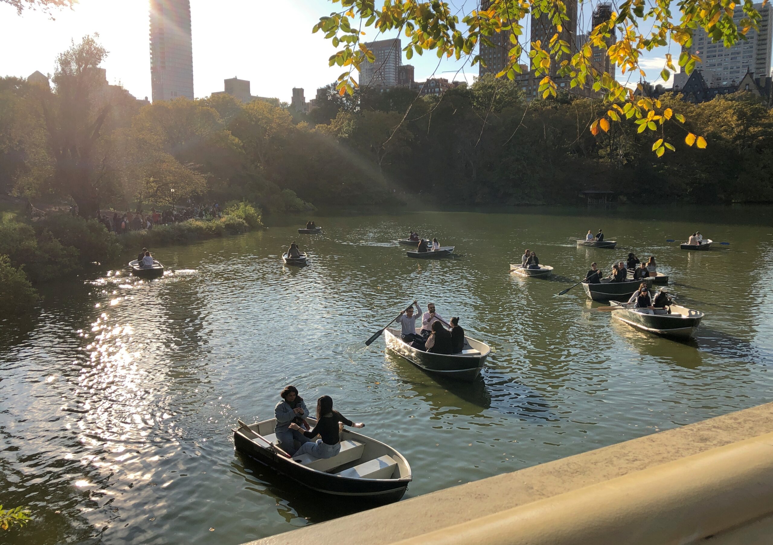
Eventually, we came to The Lake by way of Bethesda Terrace and Fountain.
But not all the way across The Lake to The Ramble, whose Wiki description drily states that “historically, it has been frequented for both birdwatching and cruising,” with hyperlinks articles about both of those activities. What about cruising birdwatchers? There’s a Broadway musical in that concept somewhere.
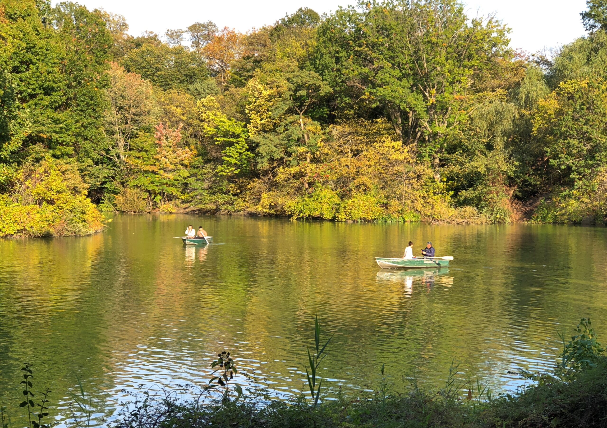
The Lake was clearly a good time and place for casual boating.
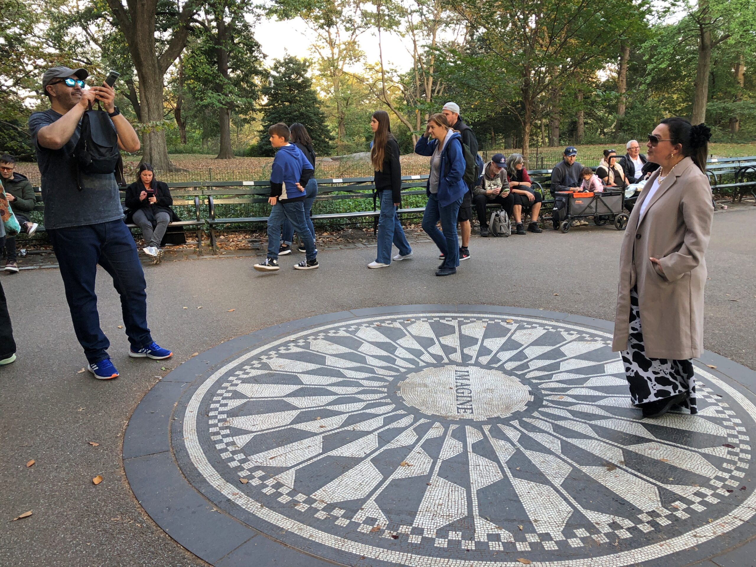
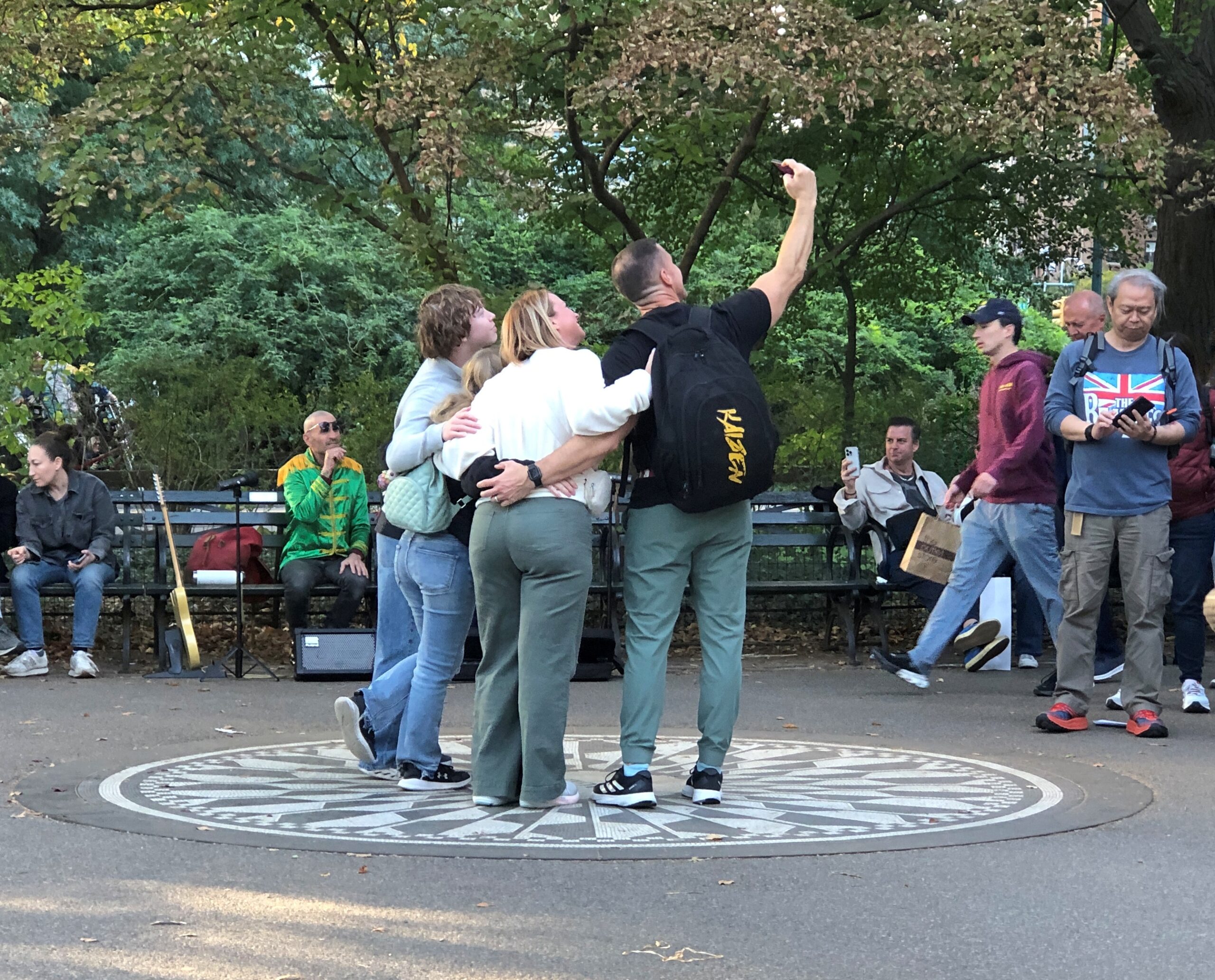
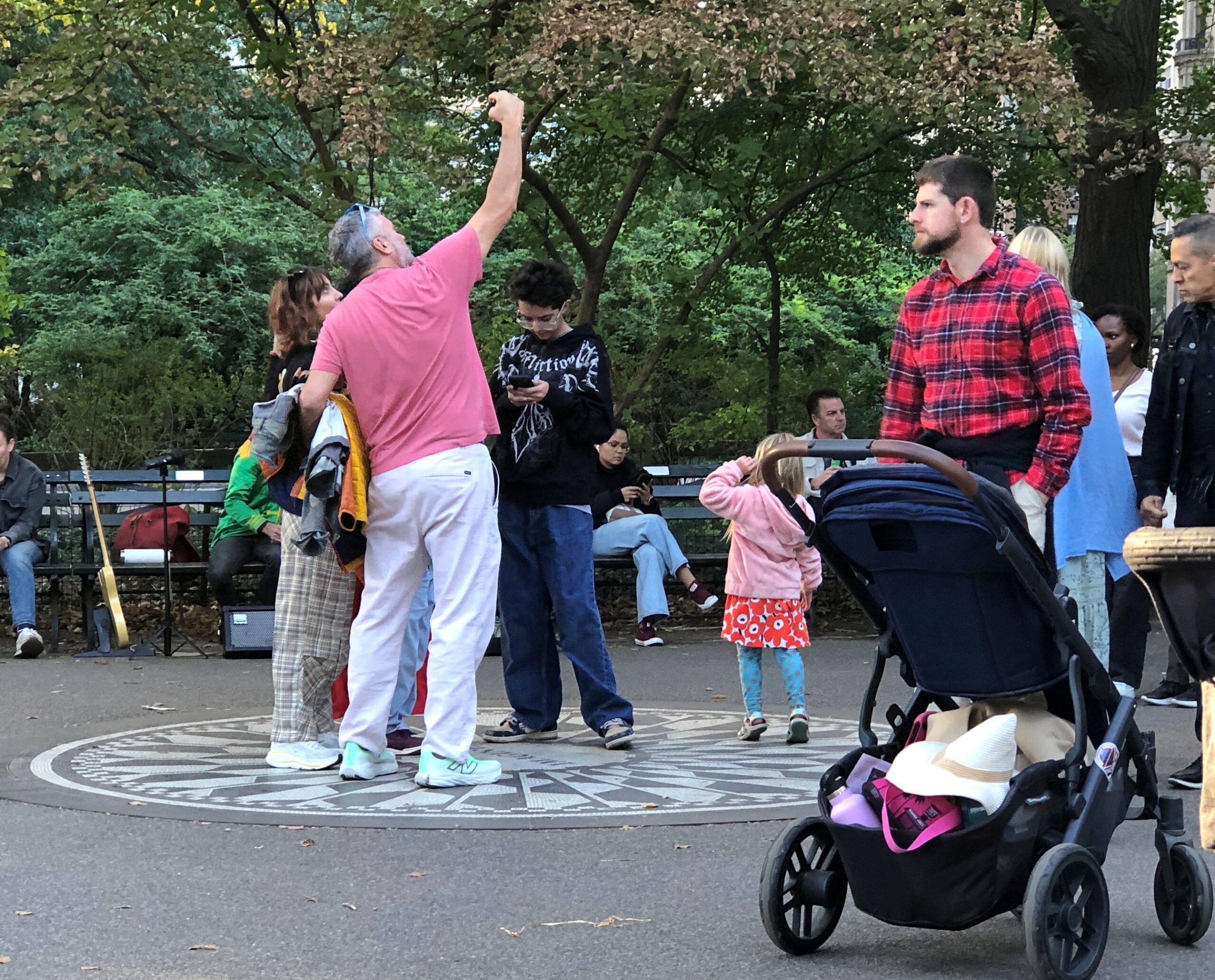
In that part of Central Park, it’s hard to miss Strawberry Fields. There is a fairly empty section.
That’s not the case when you get to the Imagine memorial. Among the visitors, a guitarist was noodling out one of the more famous Lennon-McCartney tunes, but I forget which. One of the usual ones. Not “Dr. Robert,” say, or “Happiness is a Warm Gun.” So that was one busker anyway, since I think he had a guitar case open in front of him. All you need is love, sure, but bills are bills.
Gone these 45 years and still packing ‘em in. Good for you, Mr. Lennon. In another 45 years? It would be interesting to know, and I sure I won’t.
I’m afraid the history of memorials doesn’t bode well for the longevity of any memorial, even the kind that people line up to pose with. I didn’t know the man, but I suspect somehow that the thought of fading into obscurity wouldn’t have bothered John Lennon.
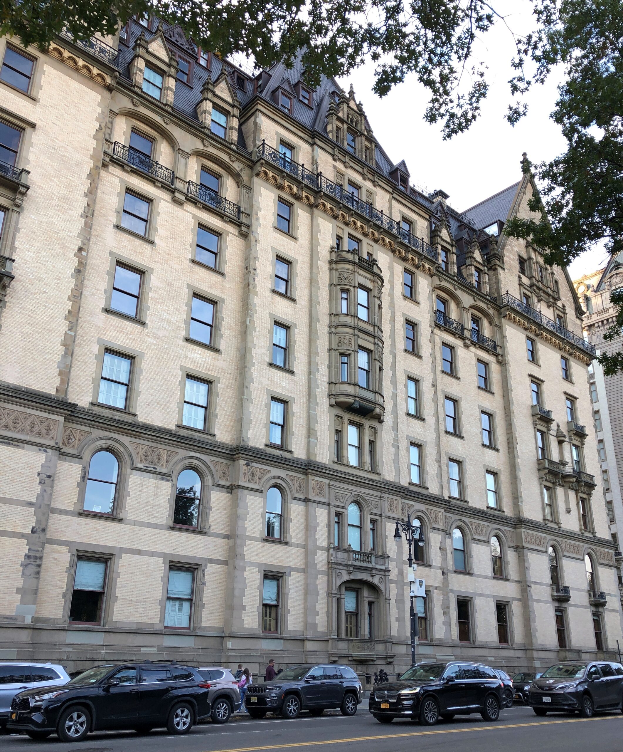
At that point, you emerge from the park and are practically face-to-face with the Dakota.
We headed east to a subway station, and happened to walk by the entrance of the Dakota. In its grim way, it’s a kind of memorial too. The signs make it known with no uncertainty that no one unauthorized is getting in.
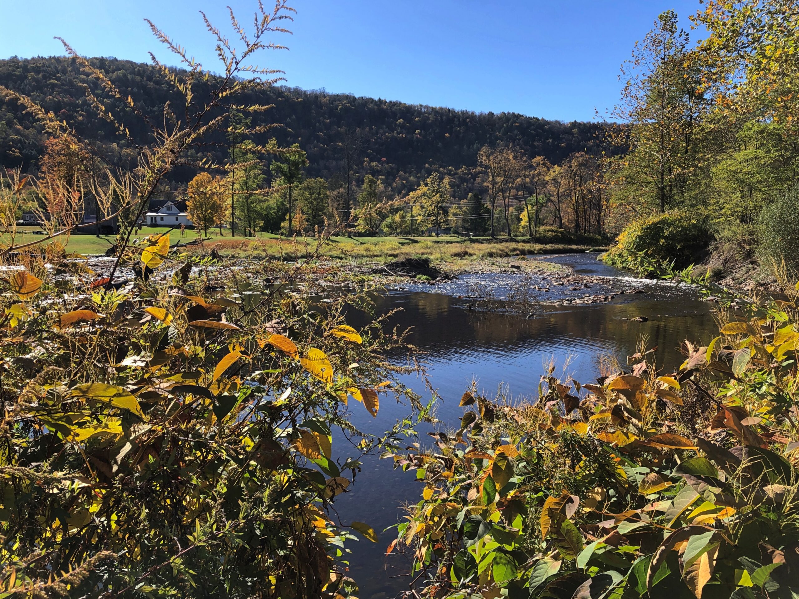
The highway New York 30 winds along the northwestern edge of Catskill Park because it follows the winding East Branch of the Delaware River, which would picturesquely come in and out of view as I drove that highway on the crisp late morning of October 16. I stopped at a place called Downsville. Wiki calls it “census-designated place, and former village in the town of Colchester, Delaware County, New York.”
This raises some questions. How is a village part of a town? (Colchester is marked on maps as not far away, but not on NY 30.) How does a place become a “former” village? People still clearly live there. Maybe I’ll investigate these questions sometime. Maybe not.
Village or former village, it’s at a pleasant spot on the East Branch.
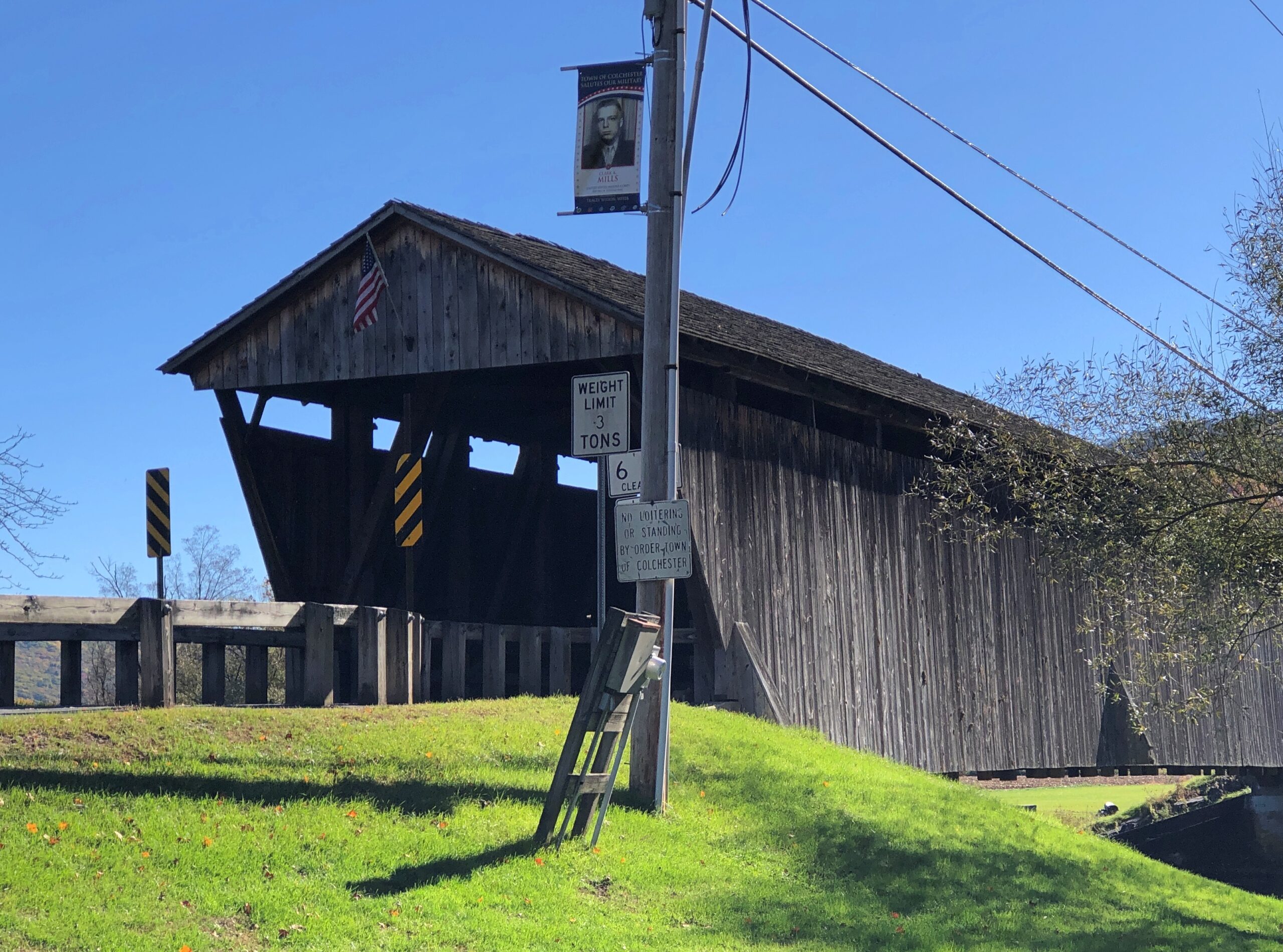
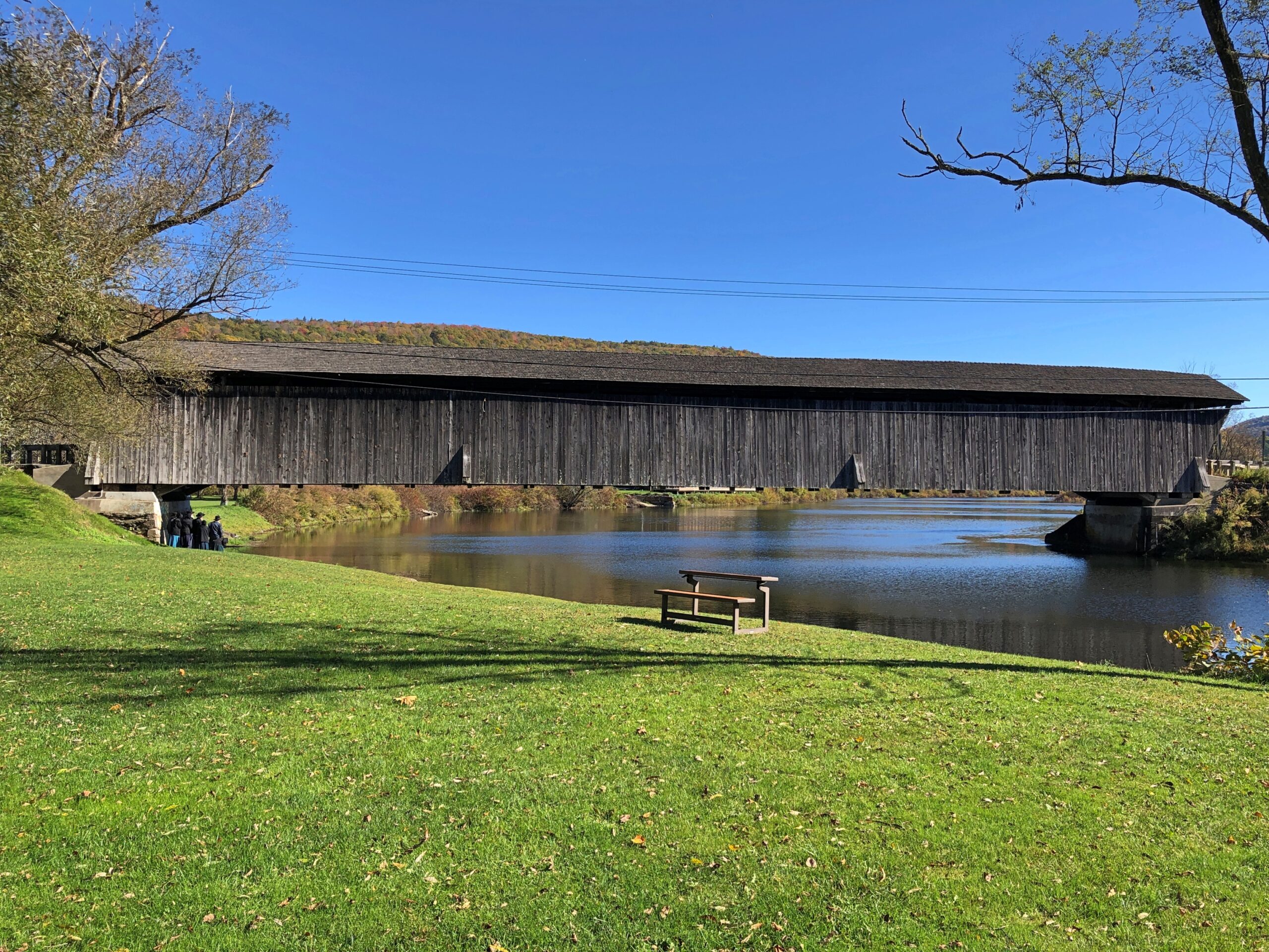
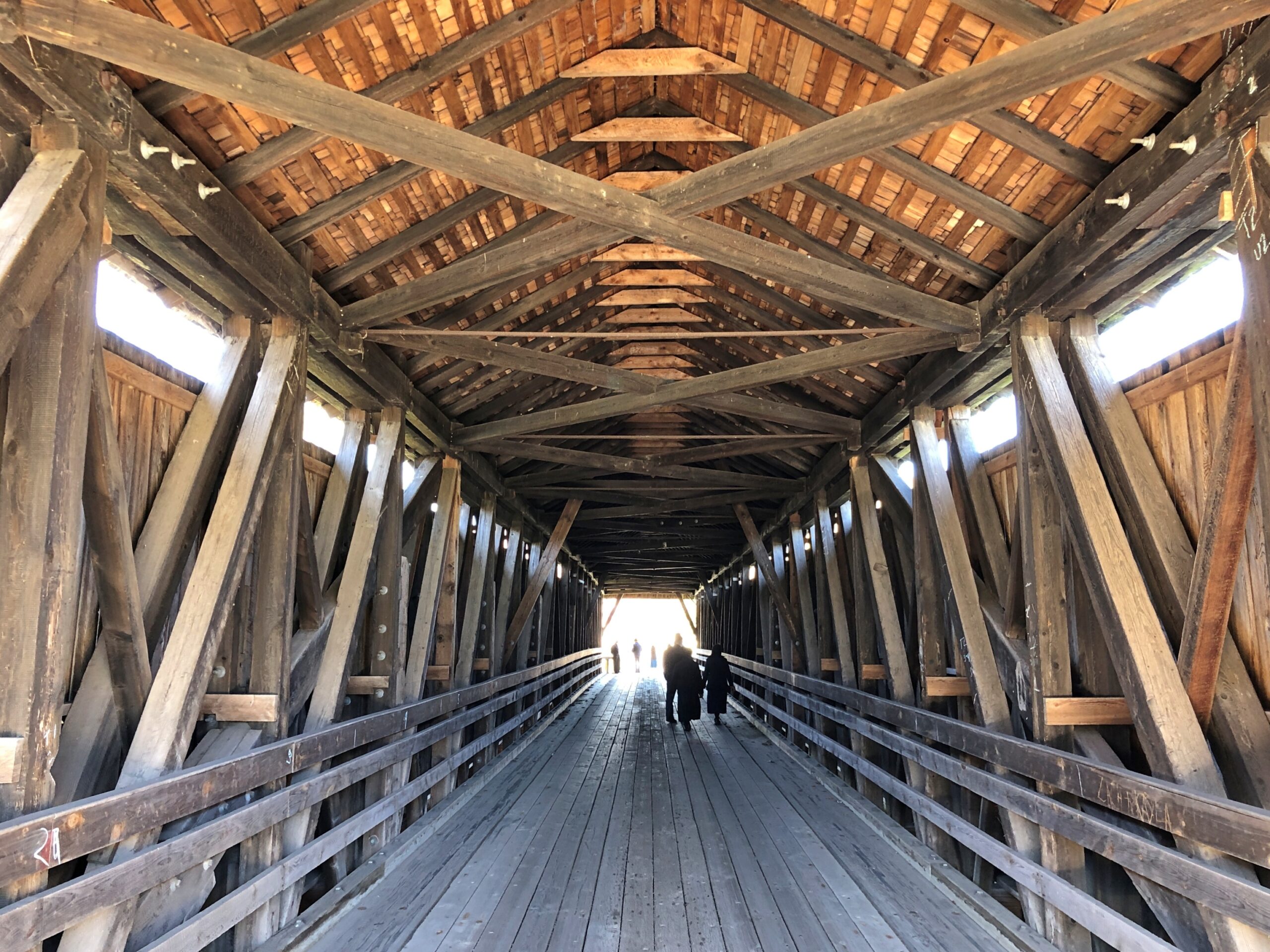
I stopped because a sign directed me to a covered wooden bridge, one that crosses the East Branch about a block away from NY 30.
“The Downsville Covered Bridge is one of six covered bridges still standing in Delaware County…” explains the New York State Covered Bridge Society. “Built by Robert Murray in 1854, this 174-foot-long, single span structure incorporates the Long truss design patented on March 6, 1830 by Lieutenant Colonel Stephen H. Long of Hopkinton, New Hampshire, with an added Queenpost truss. This truss design is rare to Northeastern covered bridges.”
Nice work, Mr. Murray, and the workers who have maintained it as a vehicular bridge down to the present day.
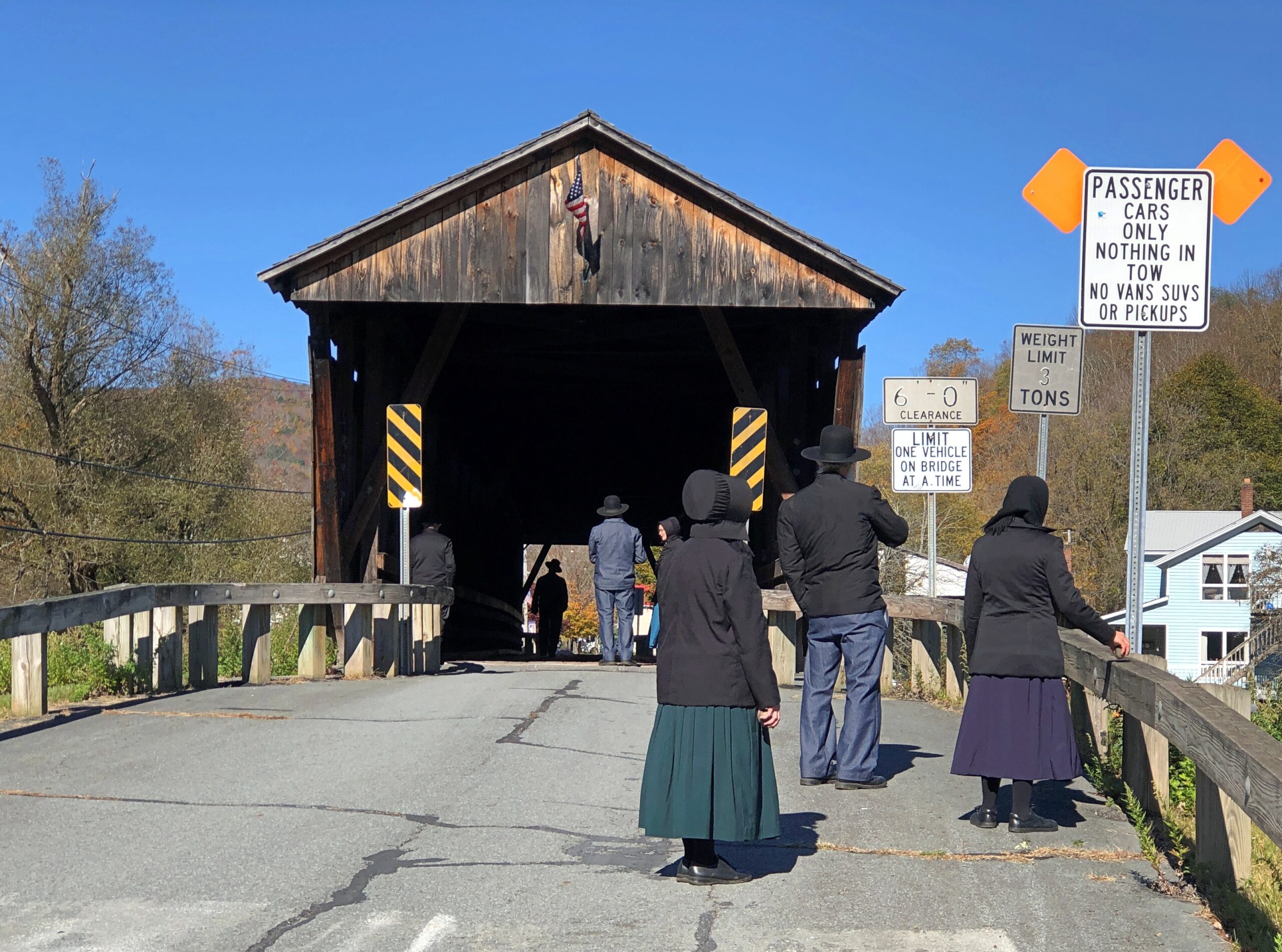
There’s a small park on the river next to the bridge, and a parking lot. Soon after I arrived for a look-see, a large van pulled up to the lot and about a half-dozen Plain People got out. They were there for a look-see too. So we were all on the bridge together.
I try not to do ethnic profiling, but I couldn’t help thinking that a top tourist sight for Plain People might well be a covered wooden bridge. Then I wondered, how is it they came in a van? As I was leaving, I noticed a non-Plain man waiting for them in the drivers seat. The Plain People equivalent of a Shabbos goy, I suppose. Except maybe that he can work any day except the Sabbath?
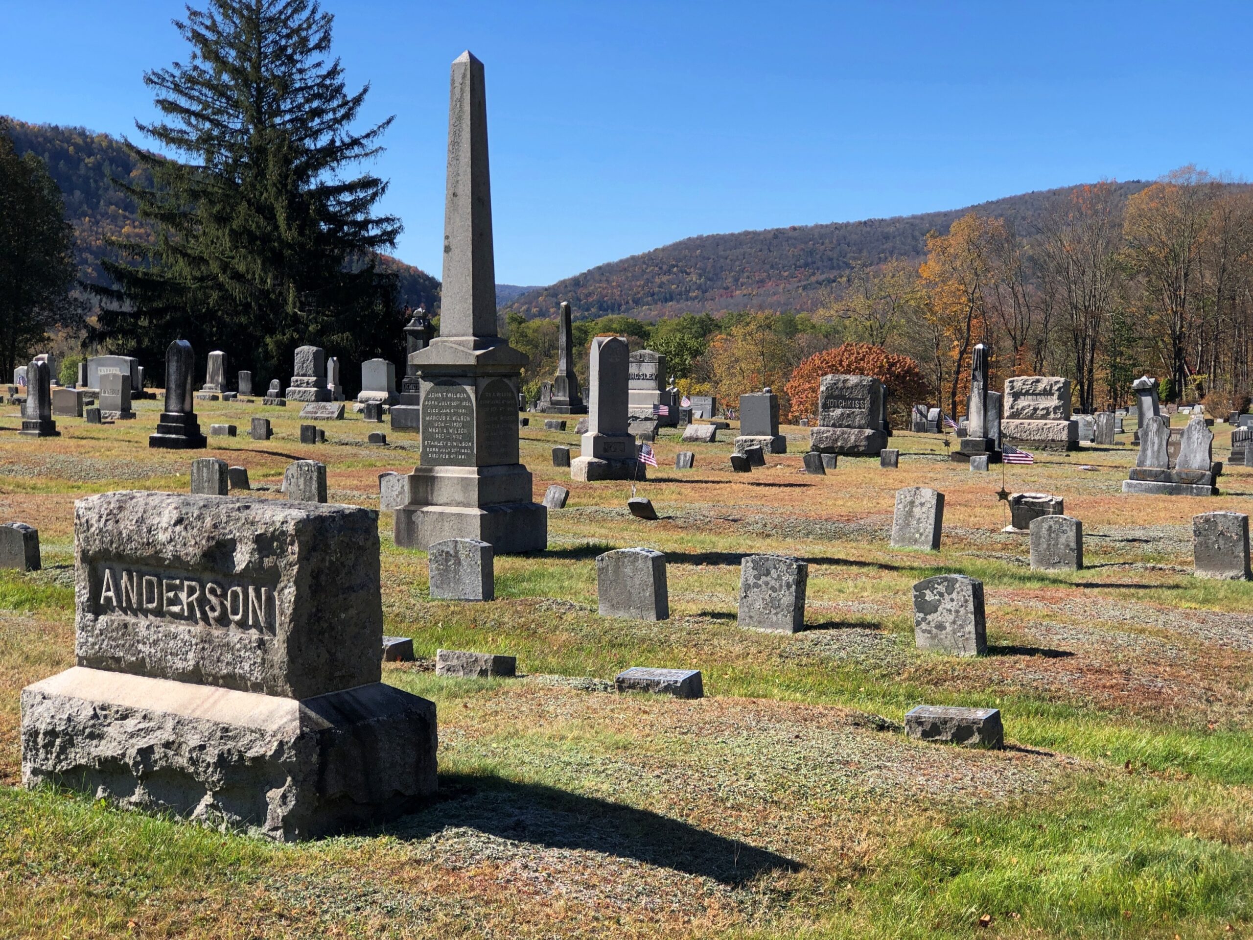
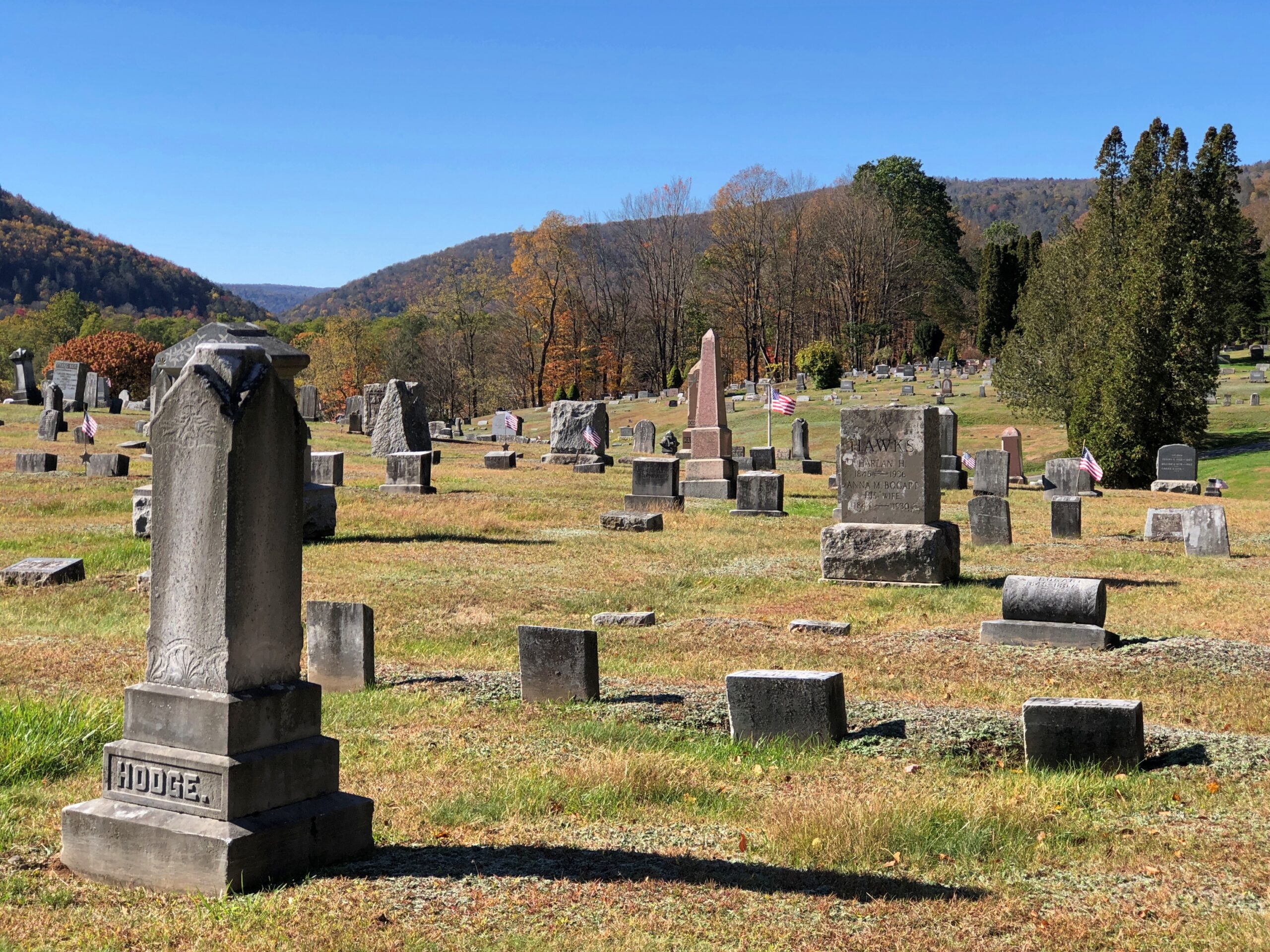
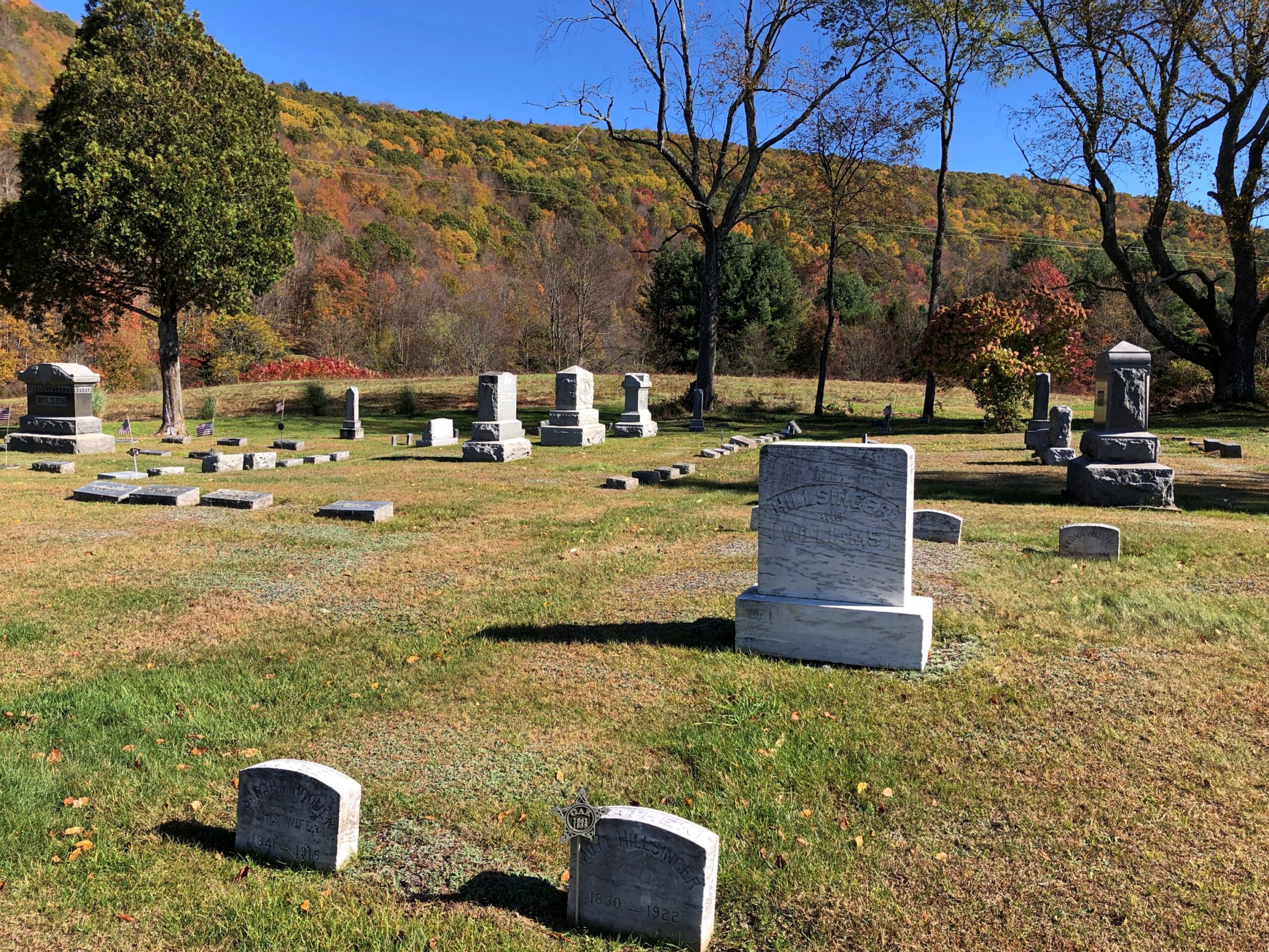
Not far away in Downsville is the Paige Cemetery. I had that to myself, as usual.
New York 30 continues a long way on the shores of the Pepacton Reservoir. Still car commercial driving.
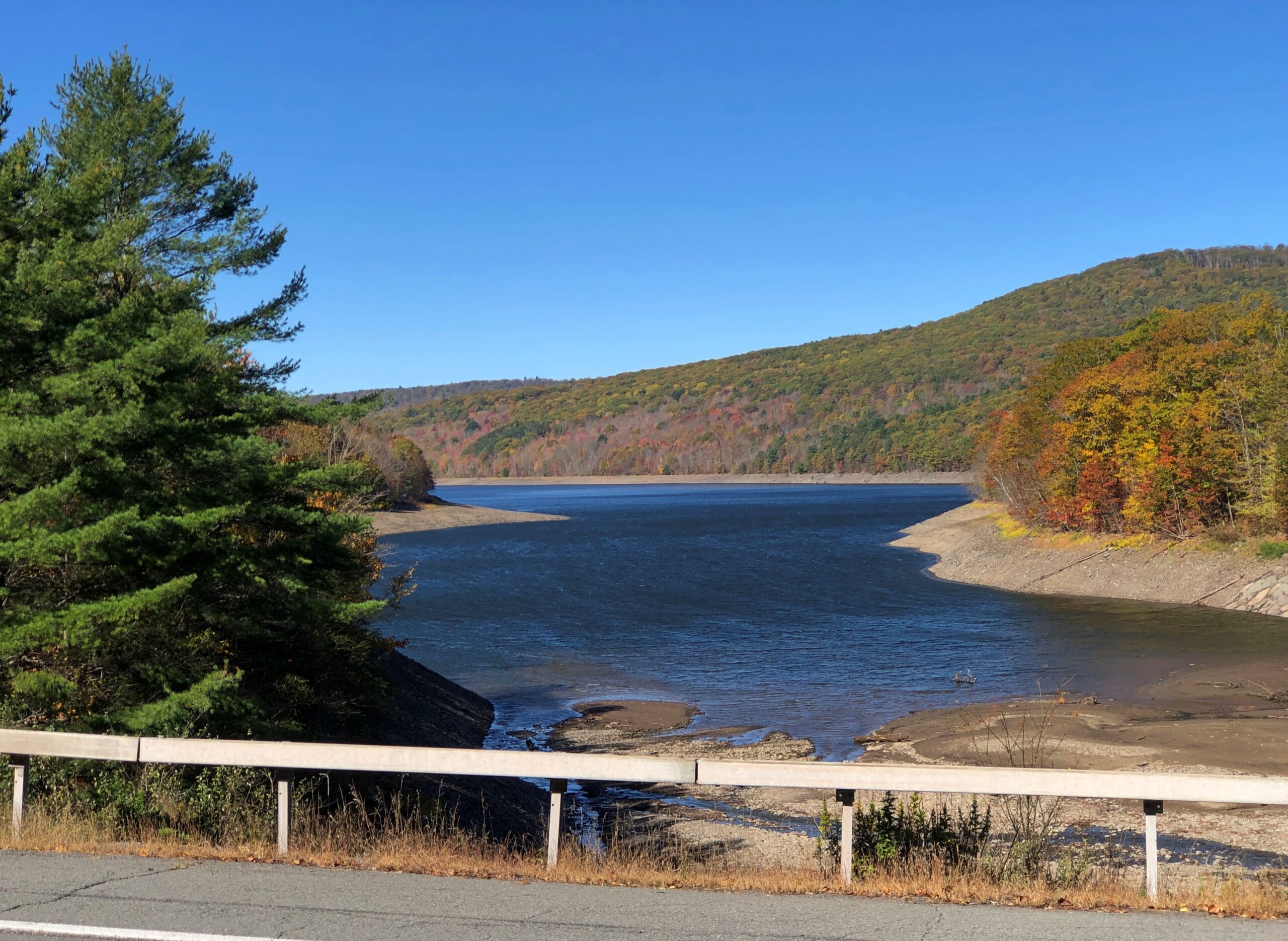
The Pepacton Reservoir, seemingly so peaceful on a brilliant autumn day, has a hell of a back story.
“It is formed by the damming of the East Branch of the Delaware River, which continues west and joins the lower Delaware River,” says NYC Environmental Protection. “It consists of one basin, approximately 15 miles in length [that] holds 140.2 billion gallons at full capacity, making it the largest reservoir in the city system by volume. It was placed into service in 1955.
“Pepacton Reservoir is one of four reservoirs in the City’s Delaware Water Supply System. As the reservoir with the largest capacity, it normally contributes more than 25% of the total daily water flow into New York City.”
Italics added, because they needed adding.
Once I left NY 30 and headed east on NY 28, which put me on a path toward the Hudson River Valley and NYC and Long Island, traffic kicked up several notches. It was still mostly a pleasant drive.
Most of the traffic was headed west into the park, opposite of the way I was going; as only to be expected on a Thursday ahead of a colorful fall weekend. The Catskills are still a destination, if not quite the Catskills of yore. Some of the old story was told to the rest of the country through TV shows in previous decades, or even more recently: namely, The Marvelous Mrs. Maisel.
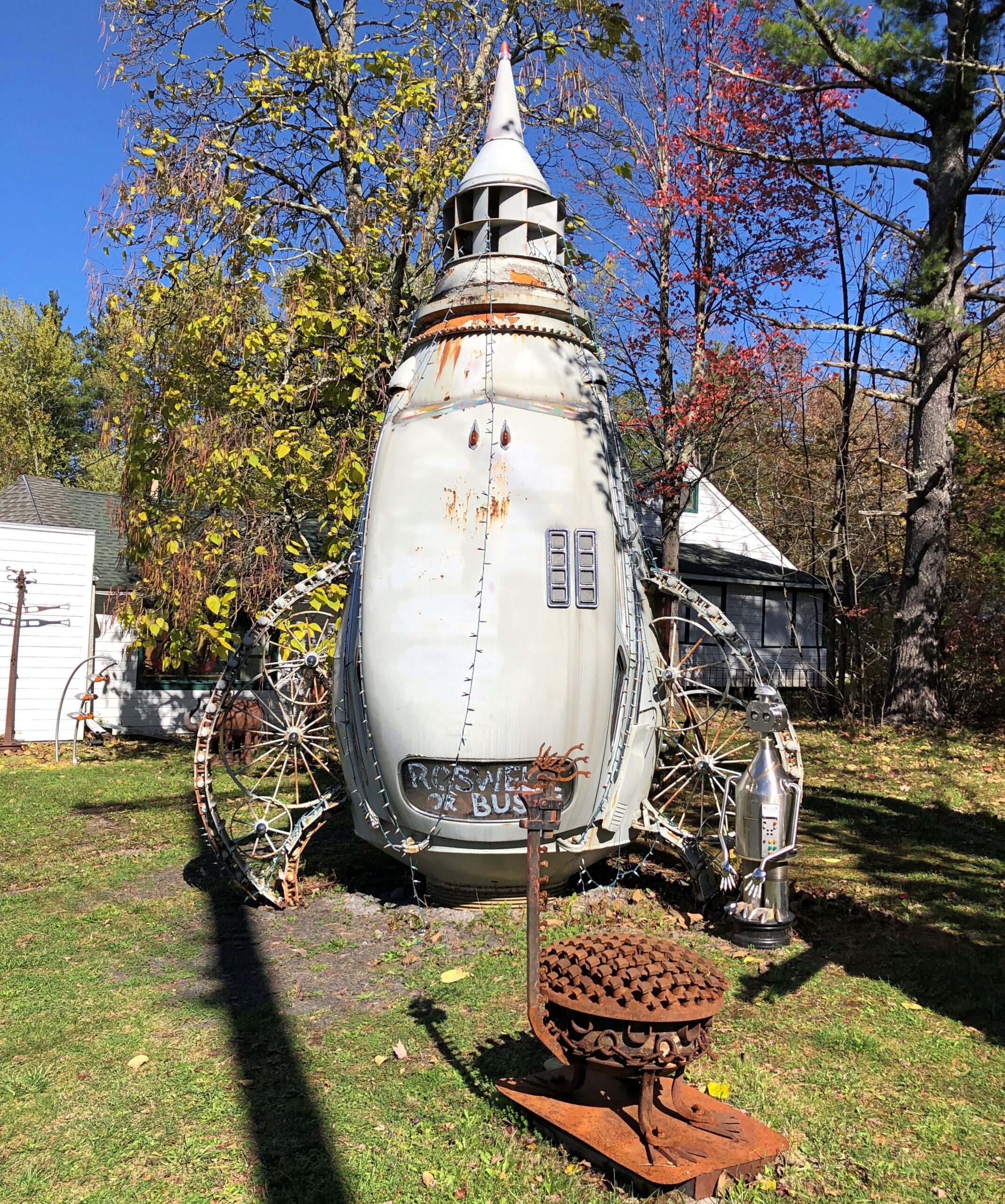
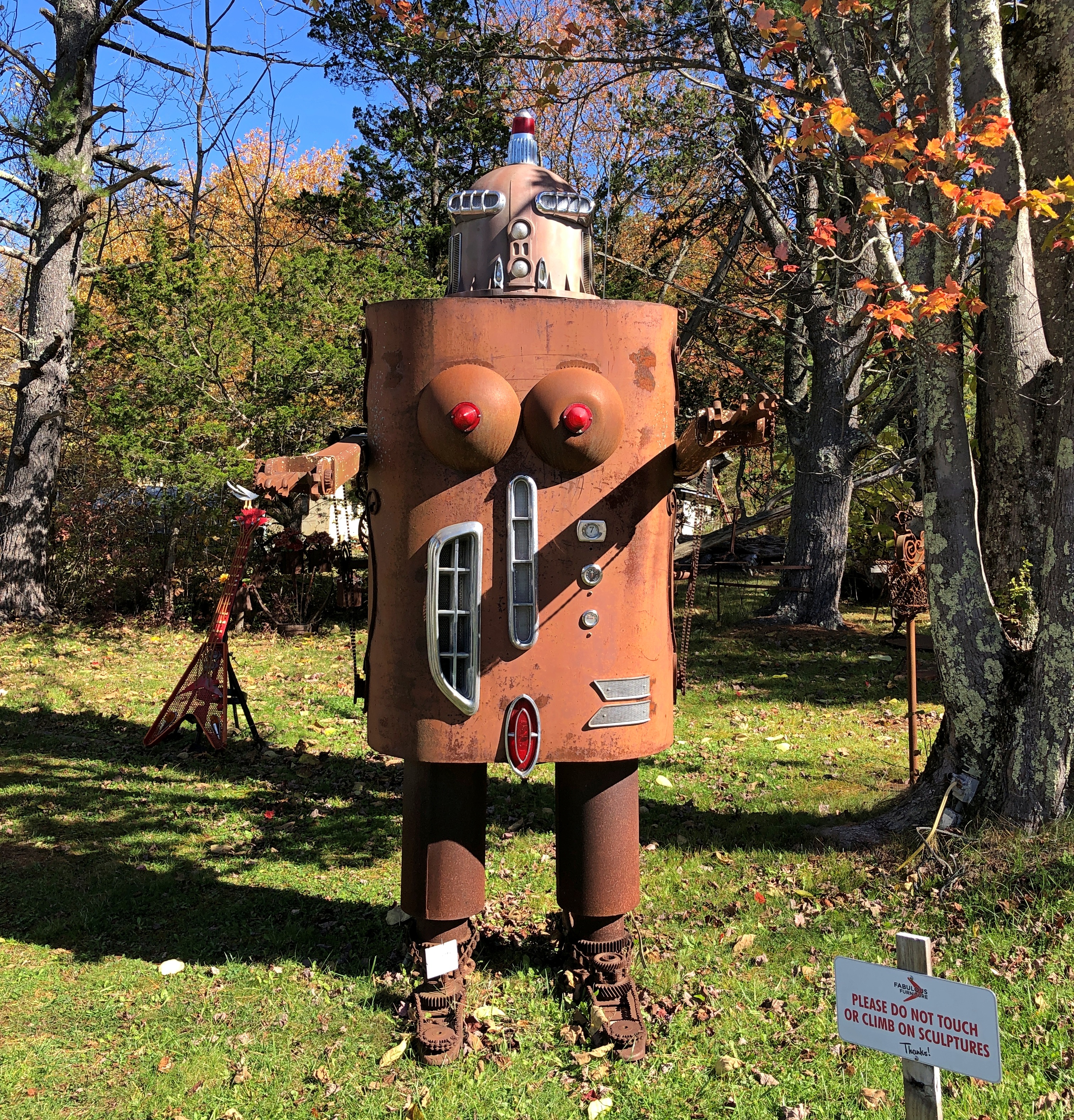
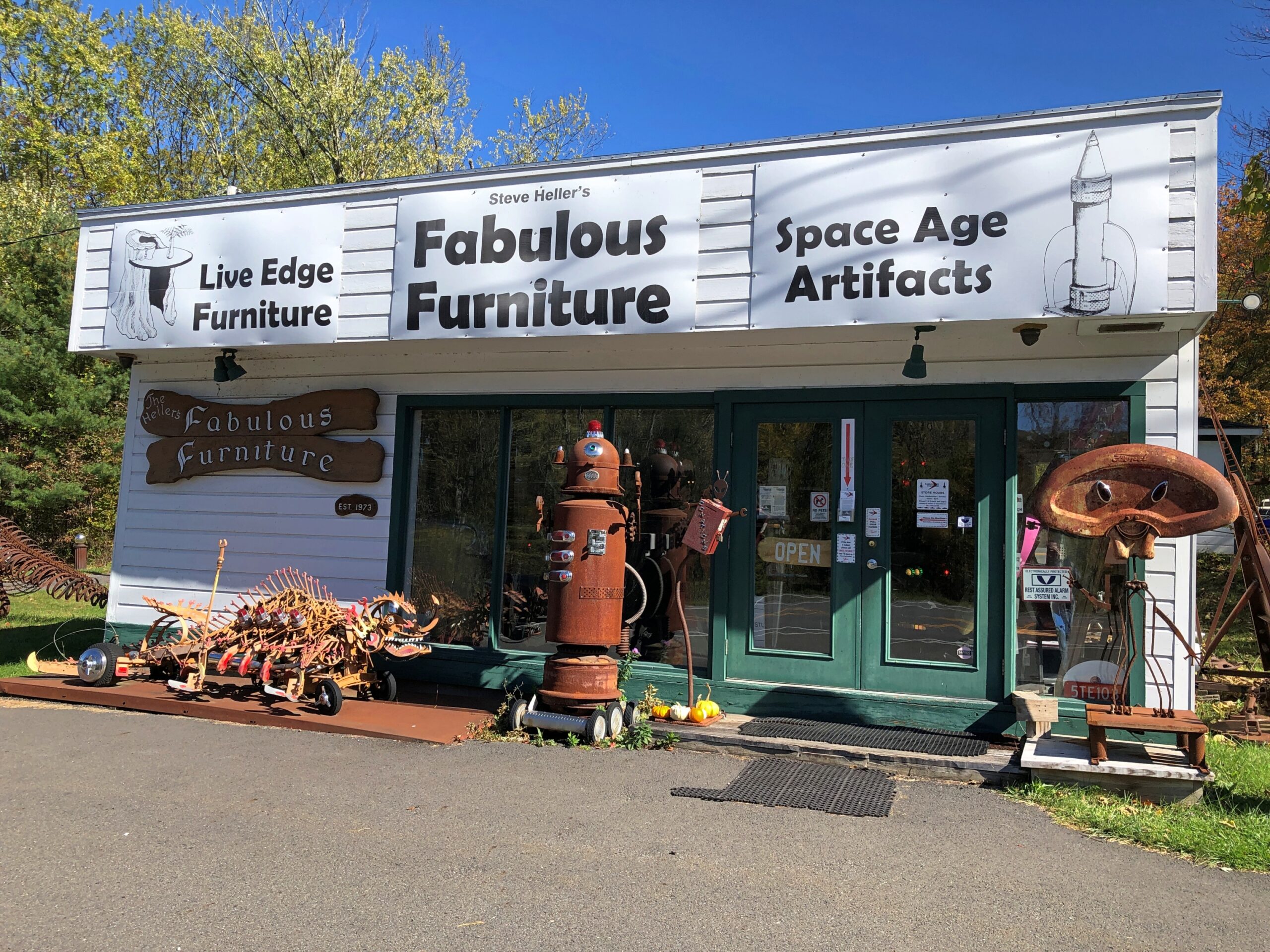
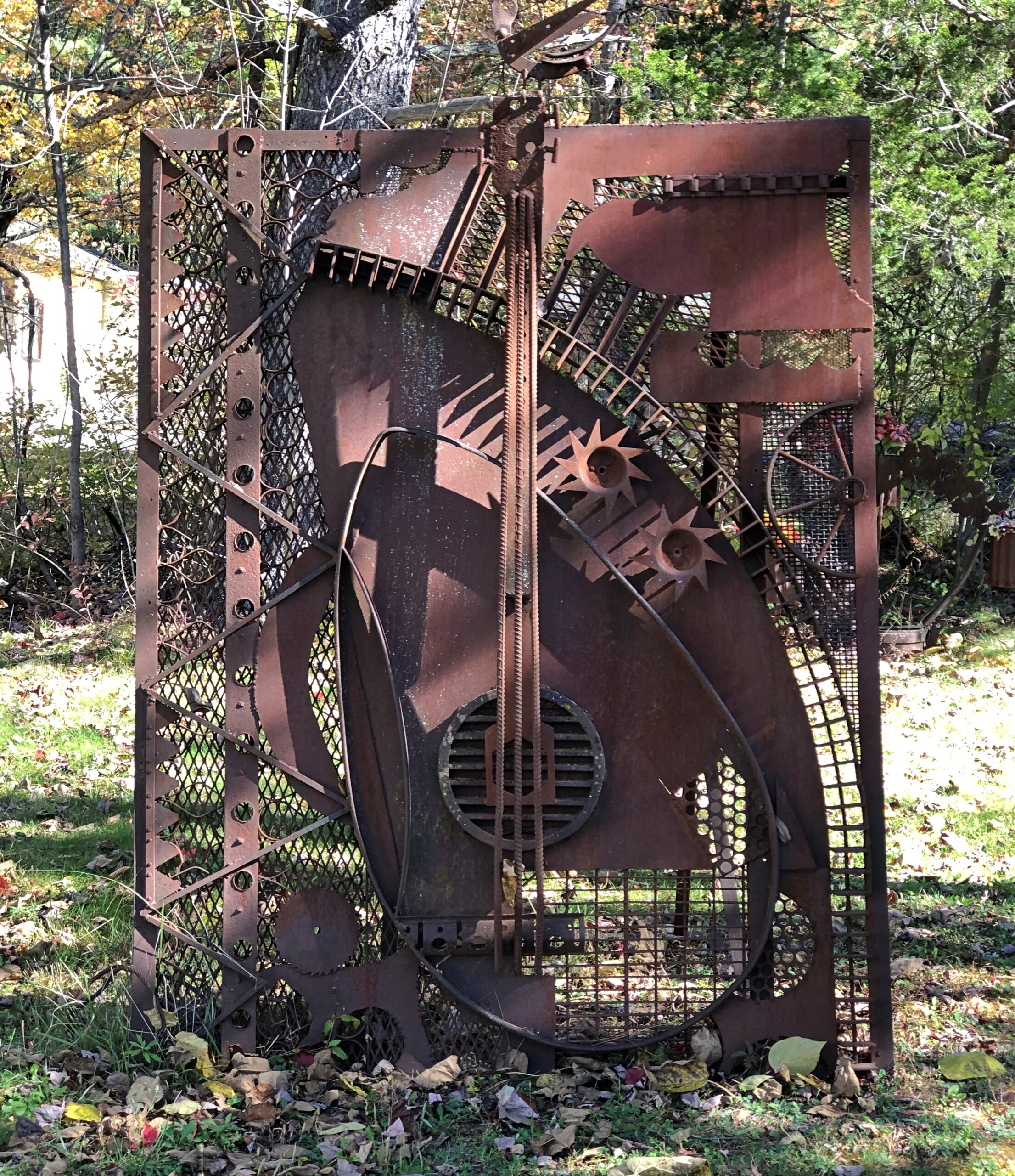
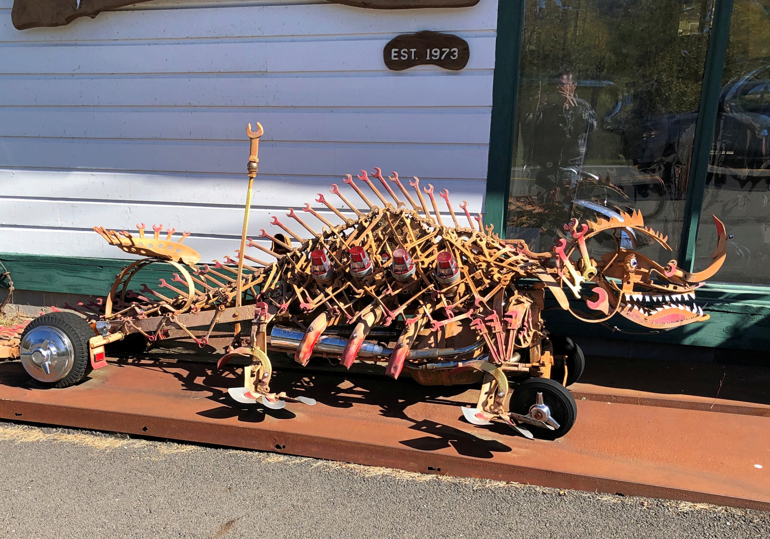
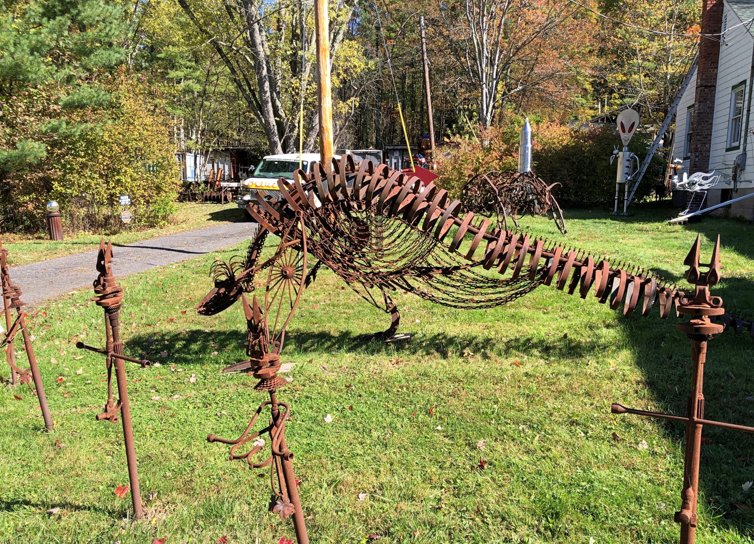
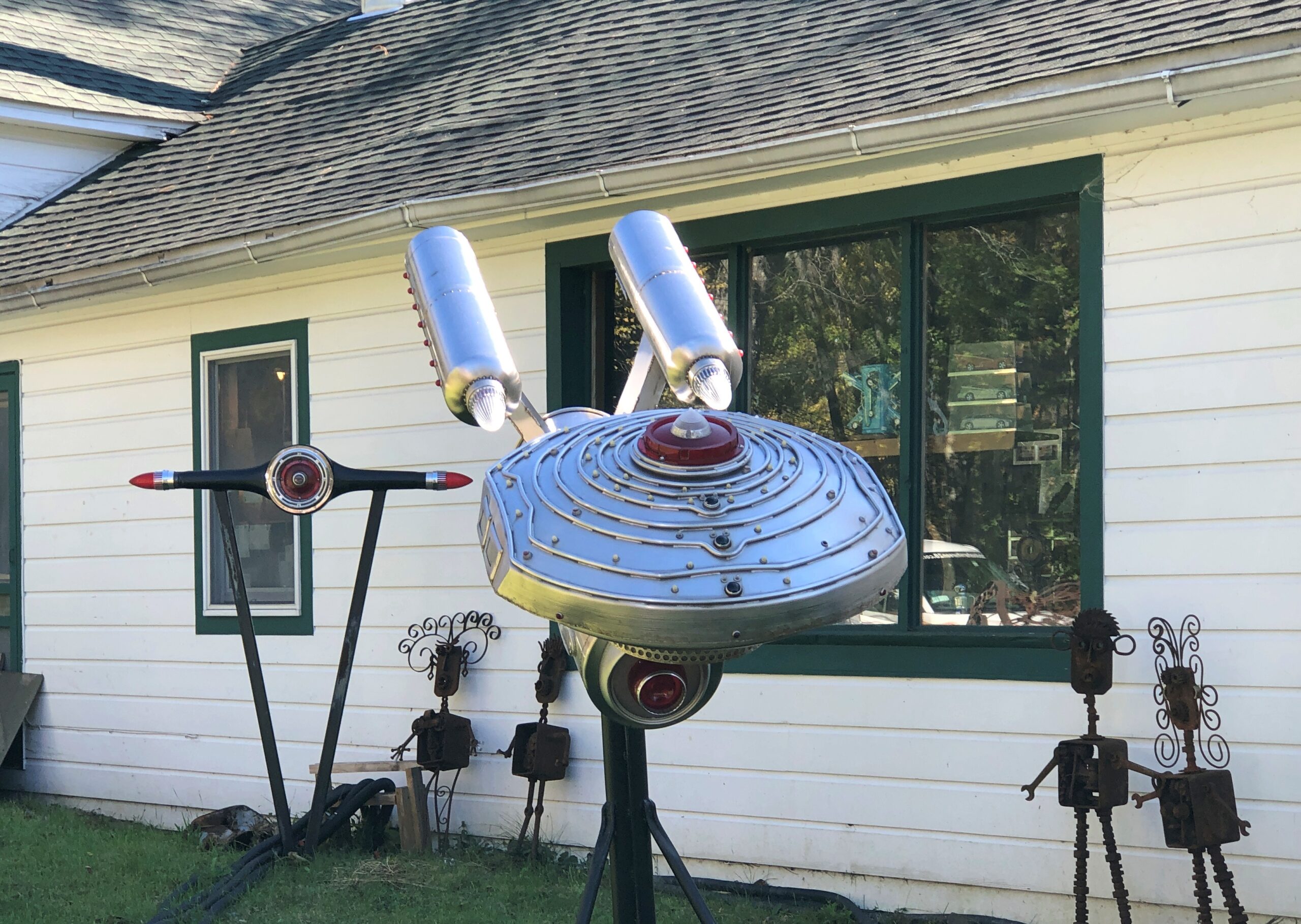
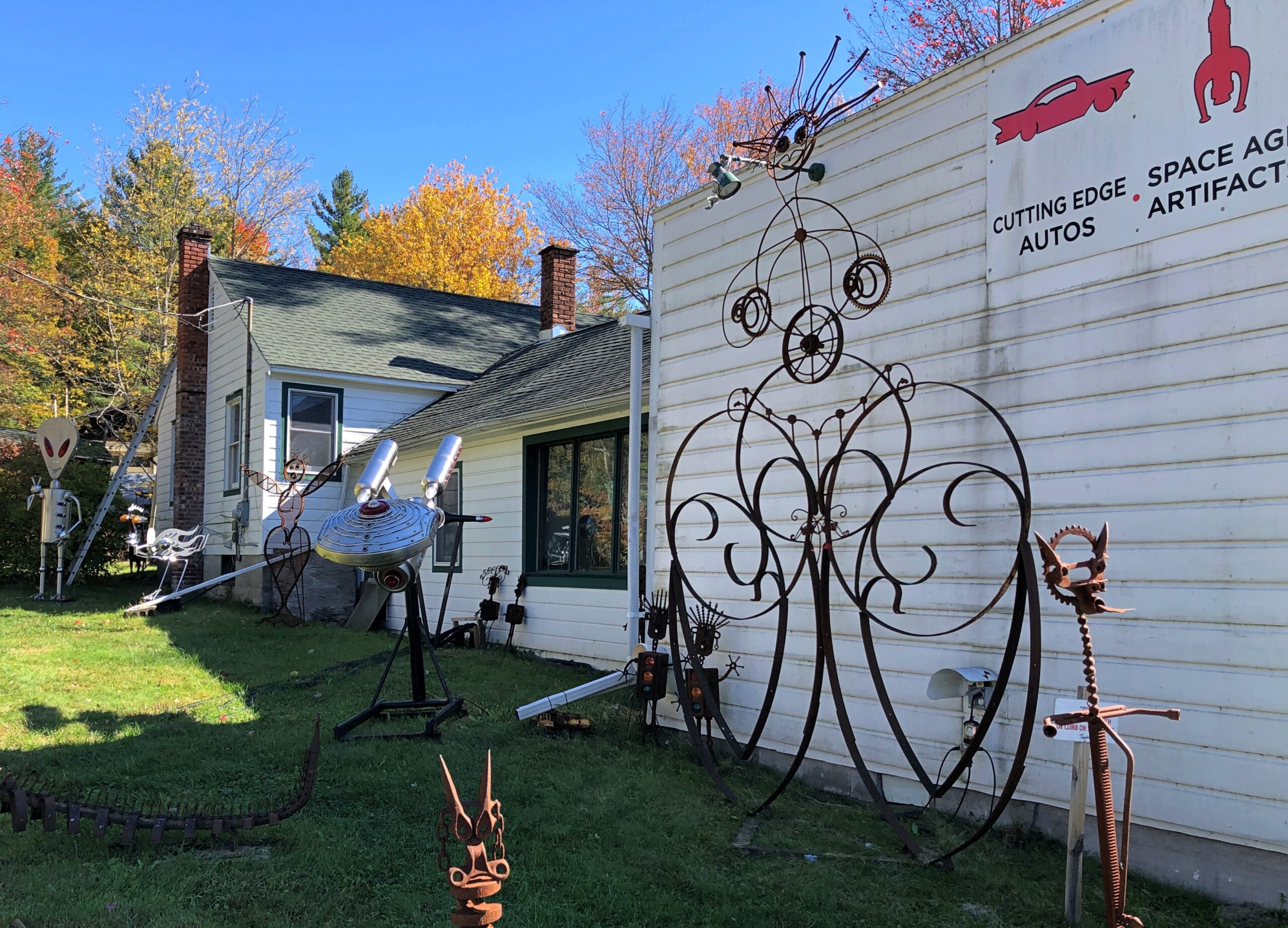
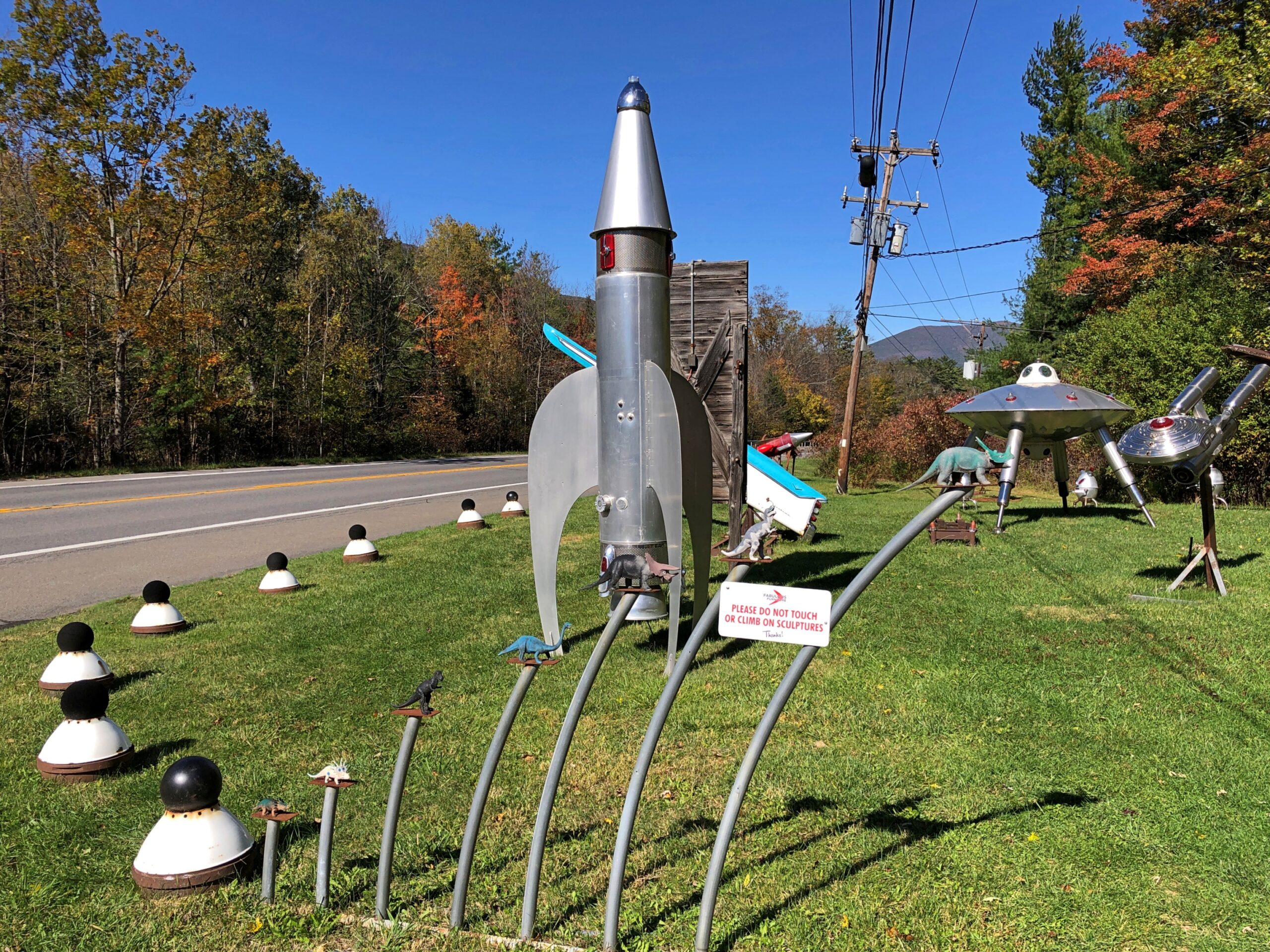
Metal spaceship and robot sculptures haven’t been part of the Catskills narrative that I know of. But there they were, right off NY 28.
As part of this place of business.
Some artful metal for sure.
More.
Fabulous work, Mr. Heller, but those Space Age artifacts are of a Space Age that never quite was. Too bad.
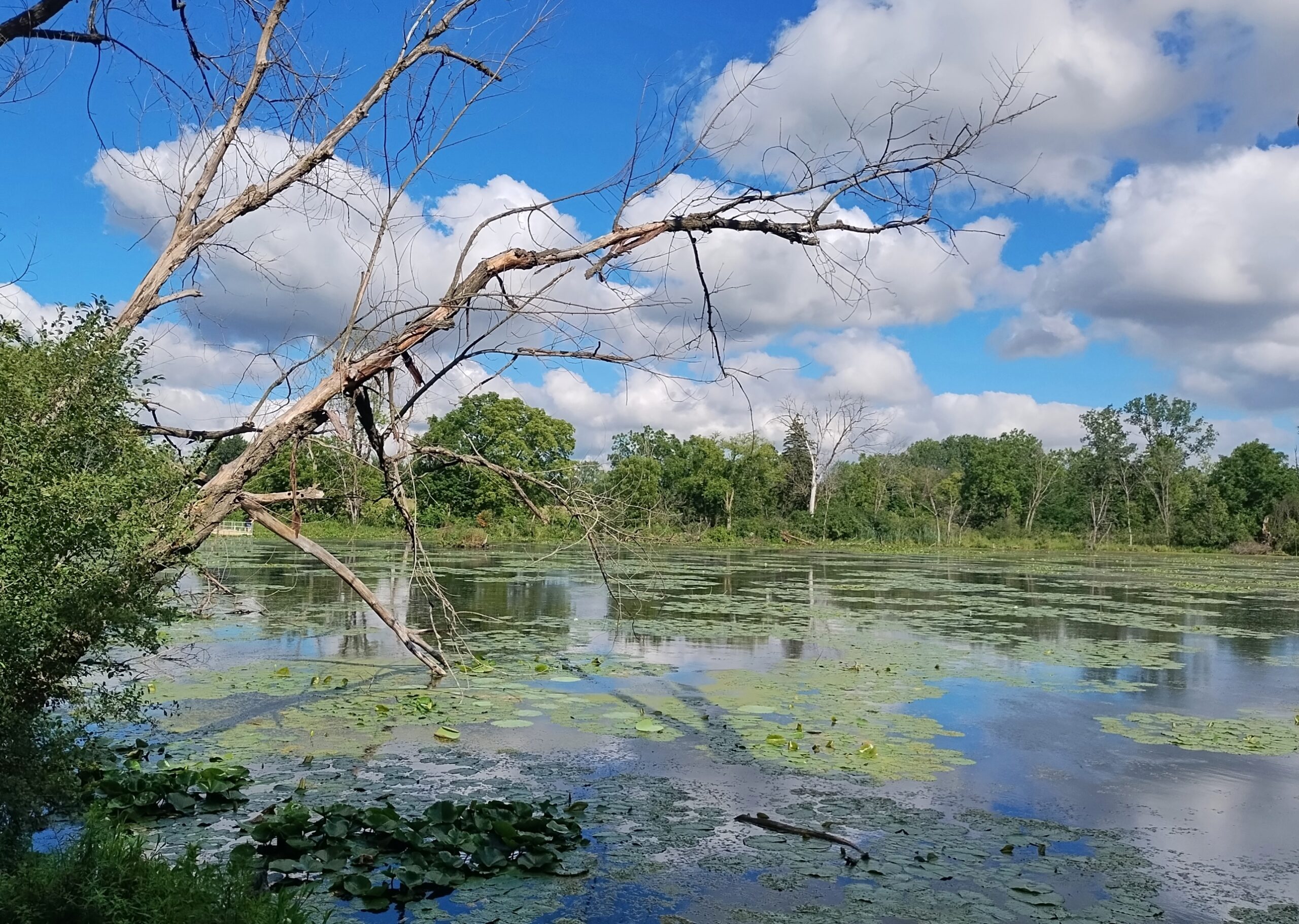
After being relatively wet, August in northern Illinois has turned relatively cool to end its days. A few days ago, we took a walk at the unusually green (for August) Spring Valley here in the northwest suburbs.
August flowers, Illinois edition.
Earlier this month, an enormous rainstorm blew through southern Wisconsin, doing damage in Milwaukee and elsewhere, including Waukesha County. Too much water too fast, and not nearly enough space in the Fox River channel that runs through the city and county of Waukesha. In the city, the river made a raging, dangerous rise not far from the picturesque downtown. If that area had flooded, that would have been in the news cycle for a little while anyway, but it looks like most of the damage was in more rural parts of the county. Regardless, it represents a lot of property damage.
“In Menomonee Falls, a crew was spotted pulling a car out of a massive sinkhole,” local TV News reported. “The once-raging waters this weekend washed away the road in an industrial area on Campbell Drive, leaving just a cliff. In the crater, the car had been trapped. The driver was fine. Inside the sinkhole, drainage pipes seemed to be tossed around like Lincoln Logs.”
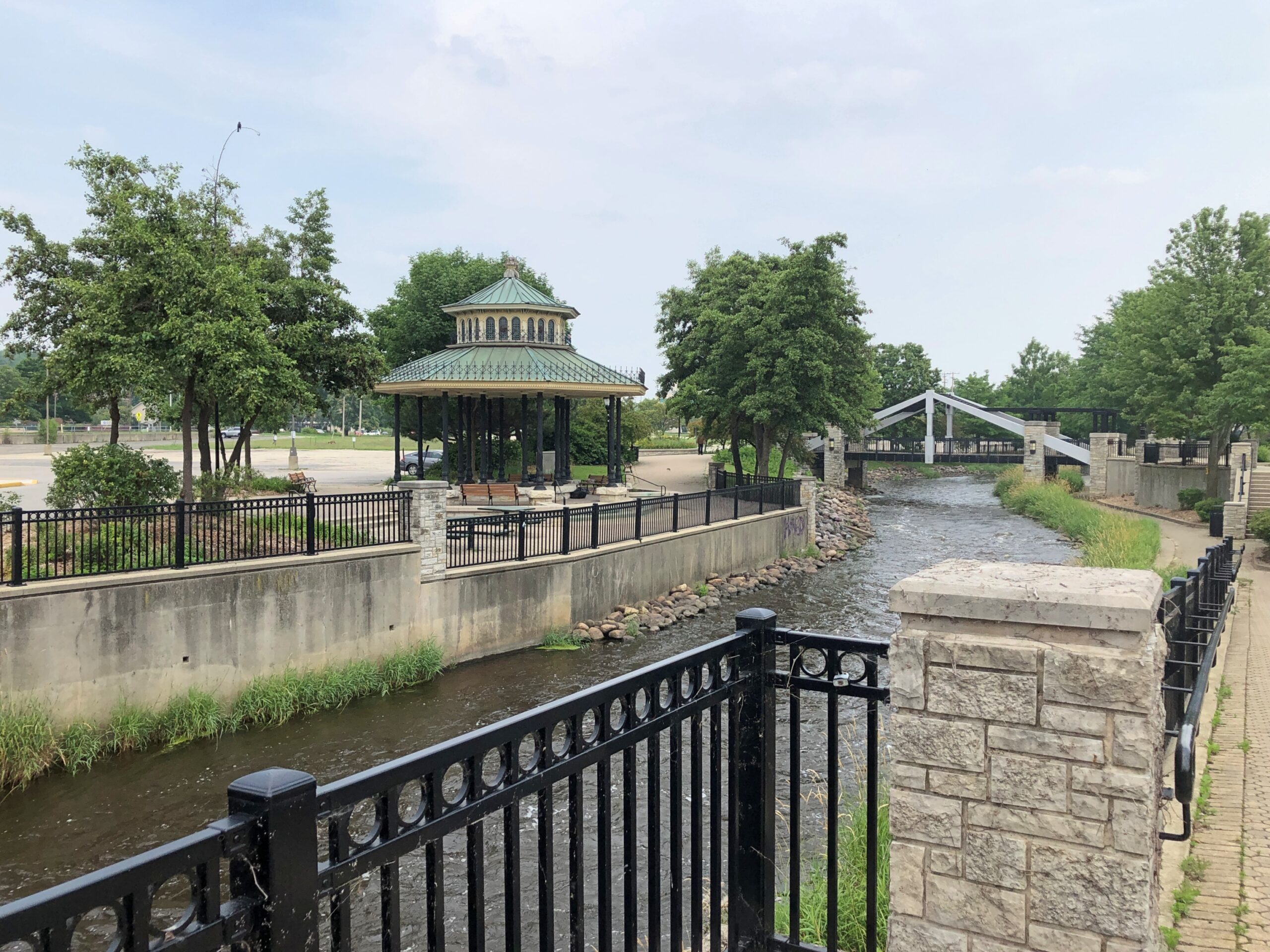
About two weeks earlier, on a nearly hot, clear day, we took a walk along the Fox, accessed a block or so away from downtown’s main streets. The river was flowing vigorously, but without a hint of the rampage to come (and why would there be?). This is the same Fox River that runs west of metro Chicago and to the Illinois River, and not the one that runs into Green Bay. Just to keep things interesting, there are apparently two other Fox Rivers in Illinois as well.
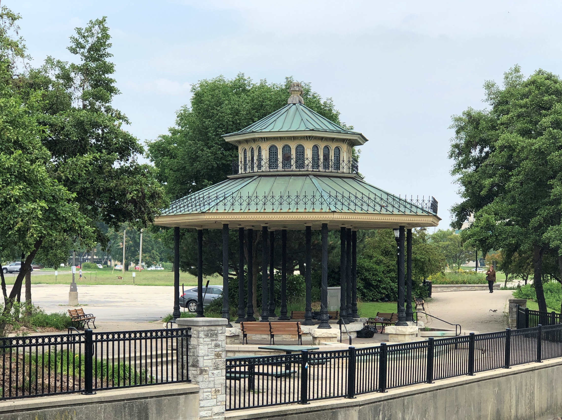
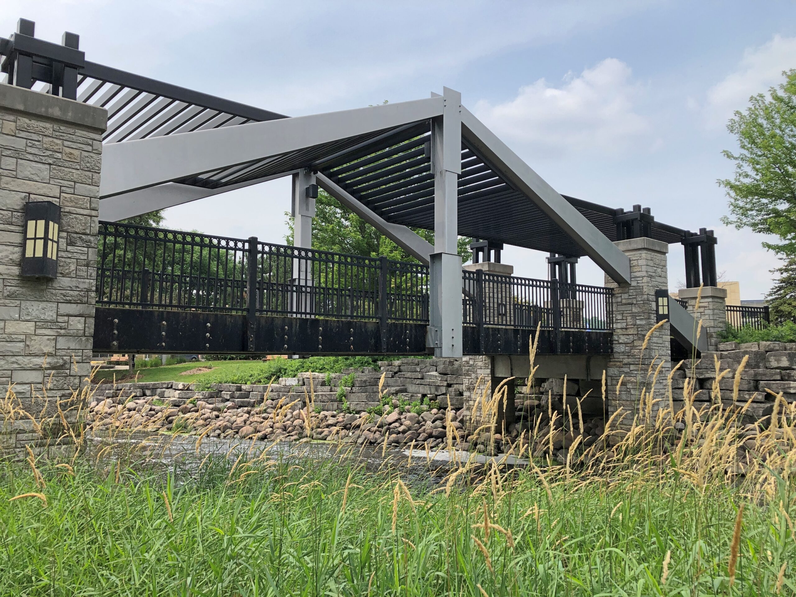
Across the way, a gazebo.
Every town over 5,000 has to have a gazebo, according to Wisconsin law. Wisconsin is almost alone in its gazebo mandates, with most other states having repealed theirs in the 1960s and ’70s – though some counties in other states still mandate the structures.
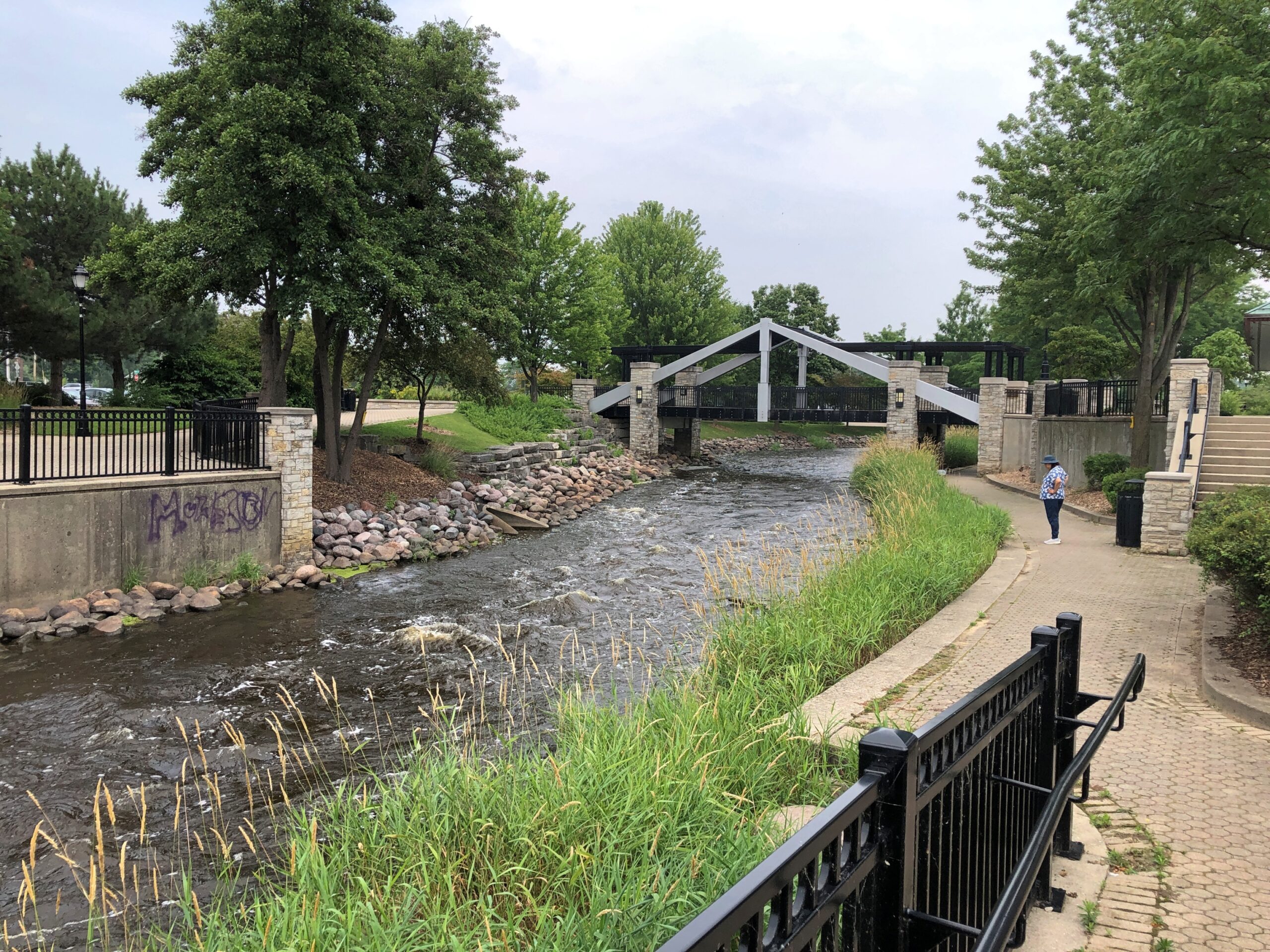
An artful pedestrian bridge.
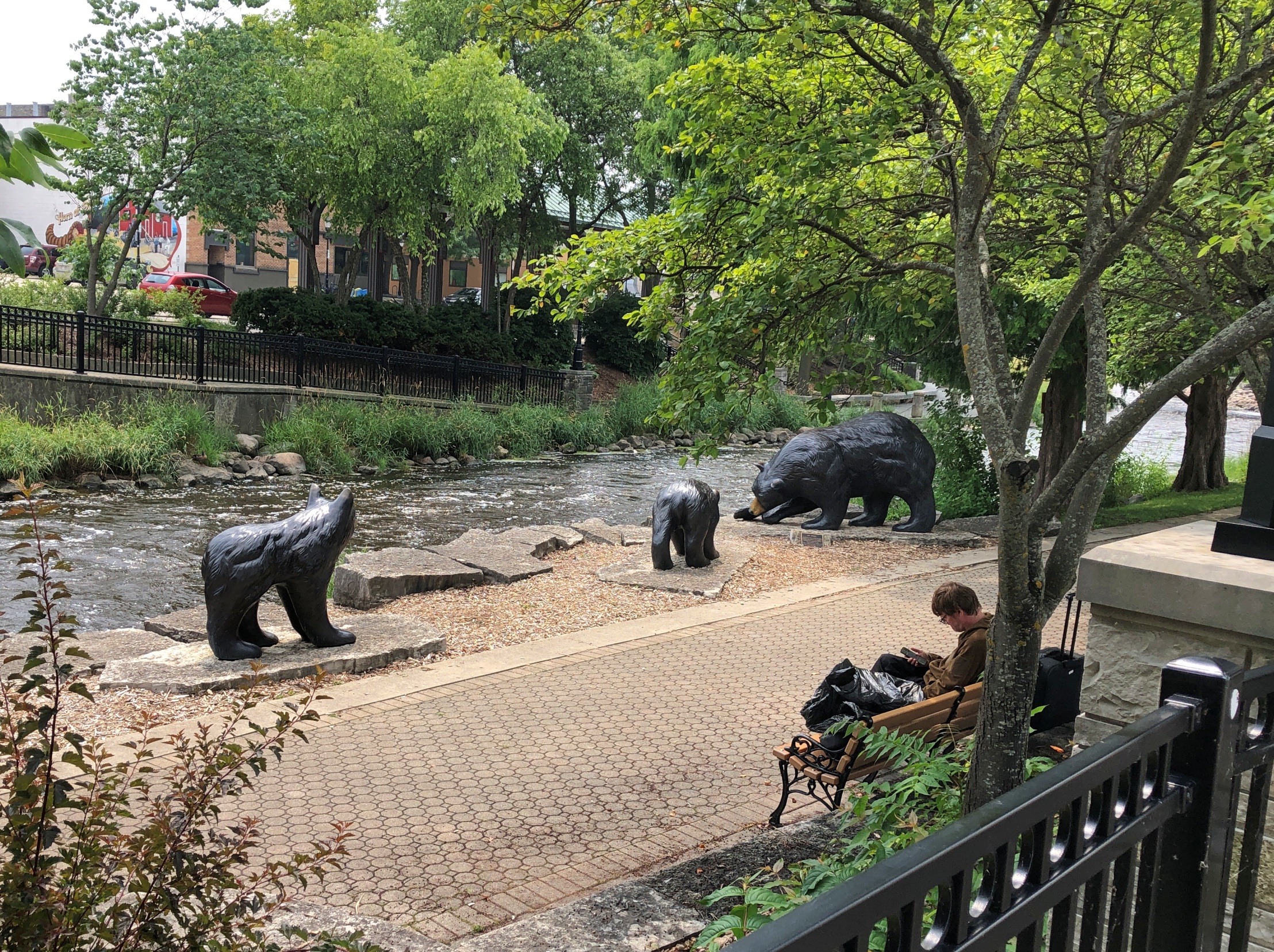
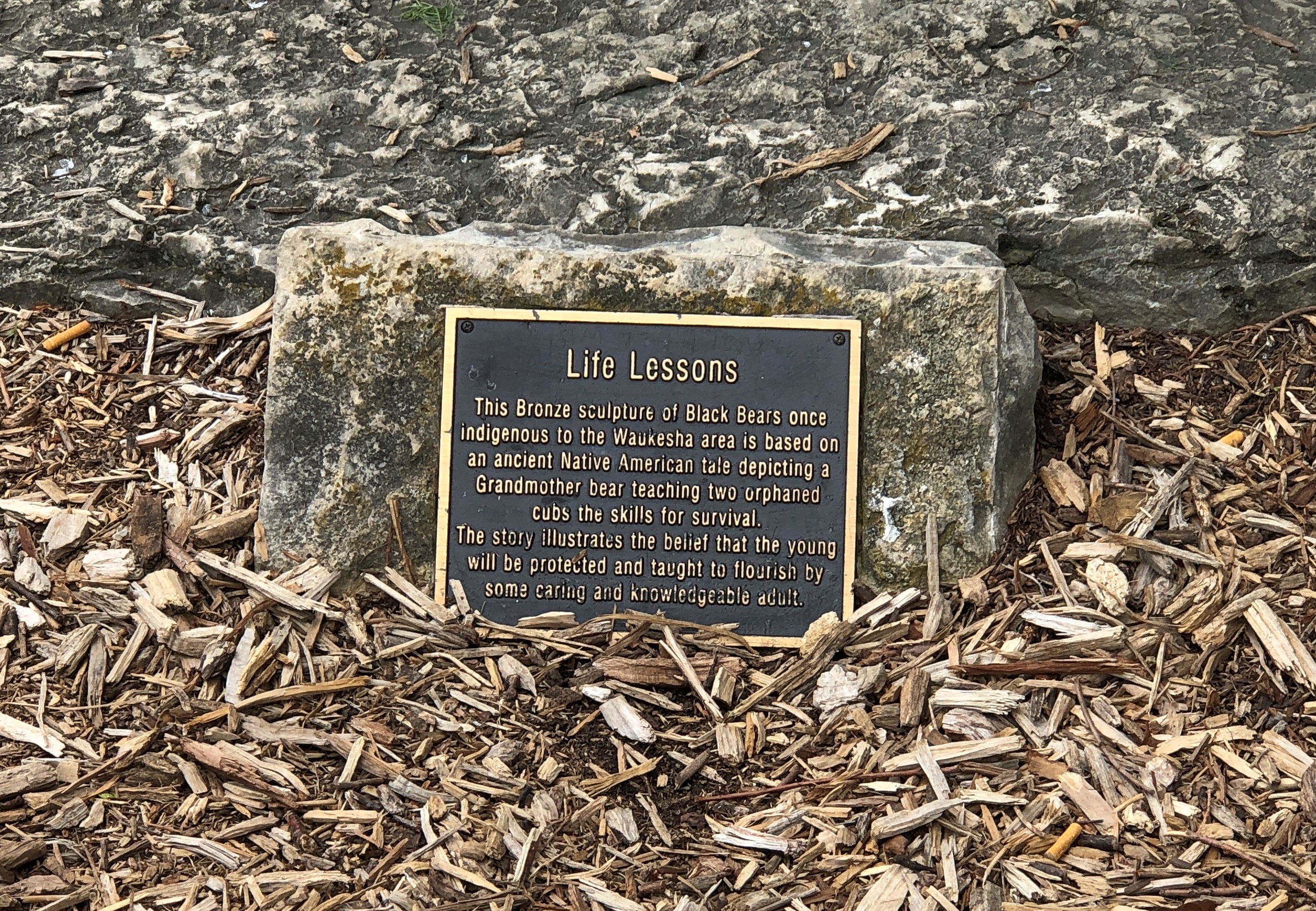
More river, and also bears. Bronze bears.
Hope the river didn’t take them away, but I’d think the figures would be anchored pretty well.
Just how many places in the United States are named after the Aztec emperor Moctezuma II, or as it’s spelled everywhere in América del Norte, Montezuma? Turning to the USGS, I find an answer: a lot. The survey lists 83 U.S. place names using the word Montezuma. There are cities, towns and populated places; water features like streams, creeks and bays; summits, peaks, ridges and a slough and a cliff and a cut-off; a county in Colorado and a mining district in Nevada; and much more. Included was the one we visited a few Sundays ago, Montezuma: Indiana.
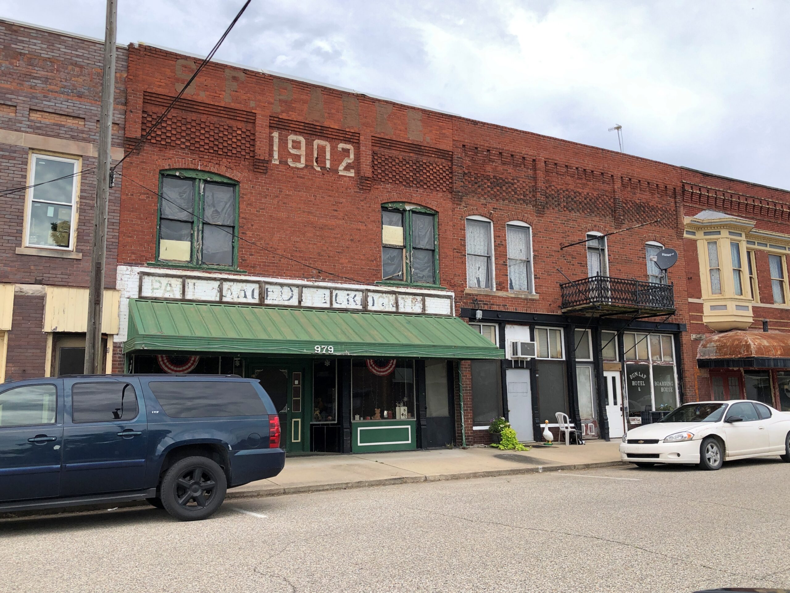
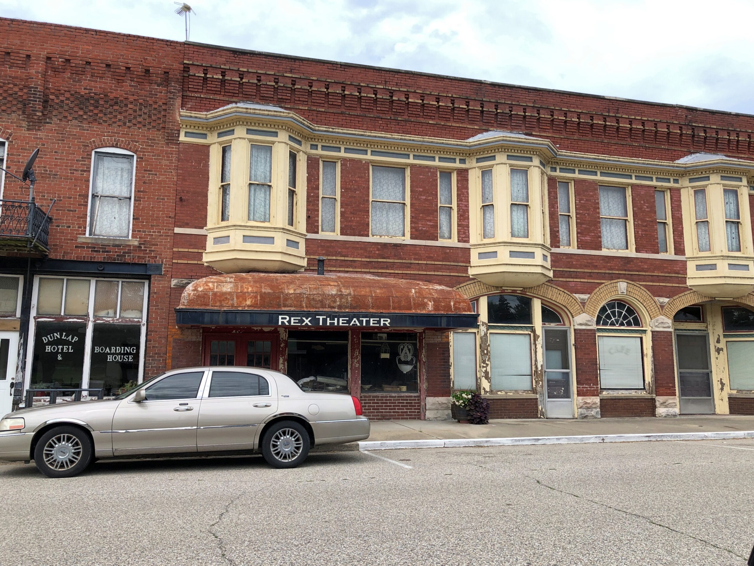
I was looking at a fine paper map, a guide to the county’s covered bridges and the routes necessary to see them, and I saw on it the town of Montezuma. With the name like that, who wouldn’t want to go for a look? Then I found that it had its own historic bridge, but not a covered one. So we made our way west from Rockville along the likes of Strawberry Road and US 36 to Montezuma.
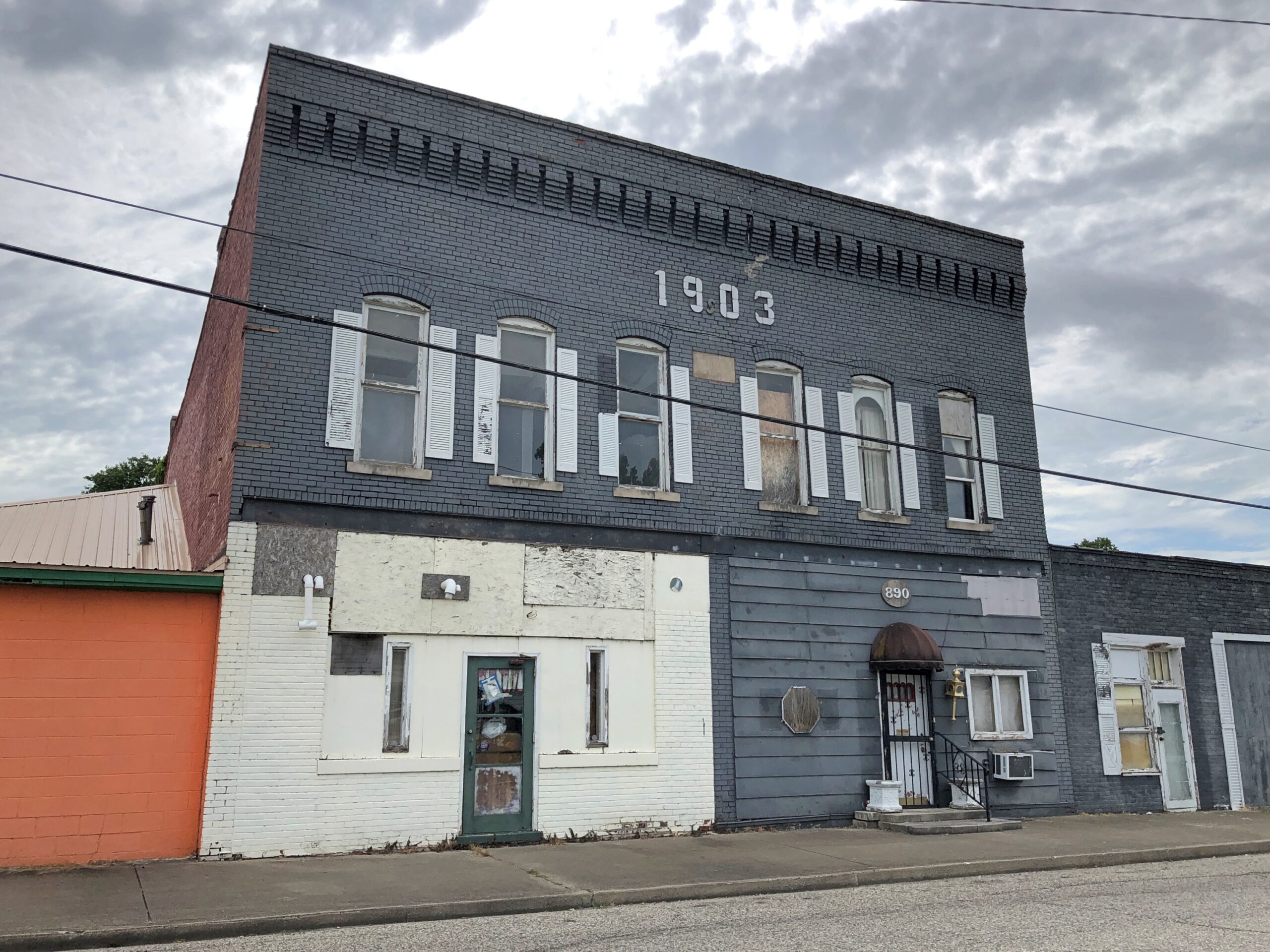
The town (pop. 1,000 or so) is at the western edge of Parke County, along the east bank of the Wabash River. It doesn’t look like downtown, deserted on a hot Sunday, has been discovered by tourists or hipsters yet.
Full of intriguing detail, these buildings, but none more than a sign for a hotel and boarding house. Along the classic model – people living in rooms upstairs, taking most meals in a room next to a kitchen? Or is it an SRO hotel (rare enough) with a vending machine in the lobby?
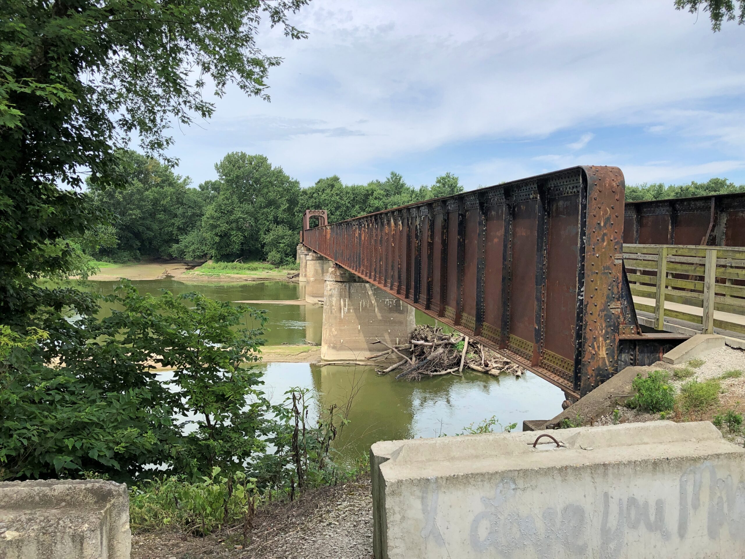
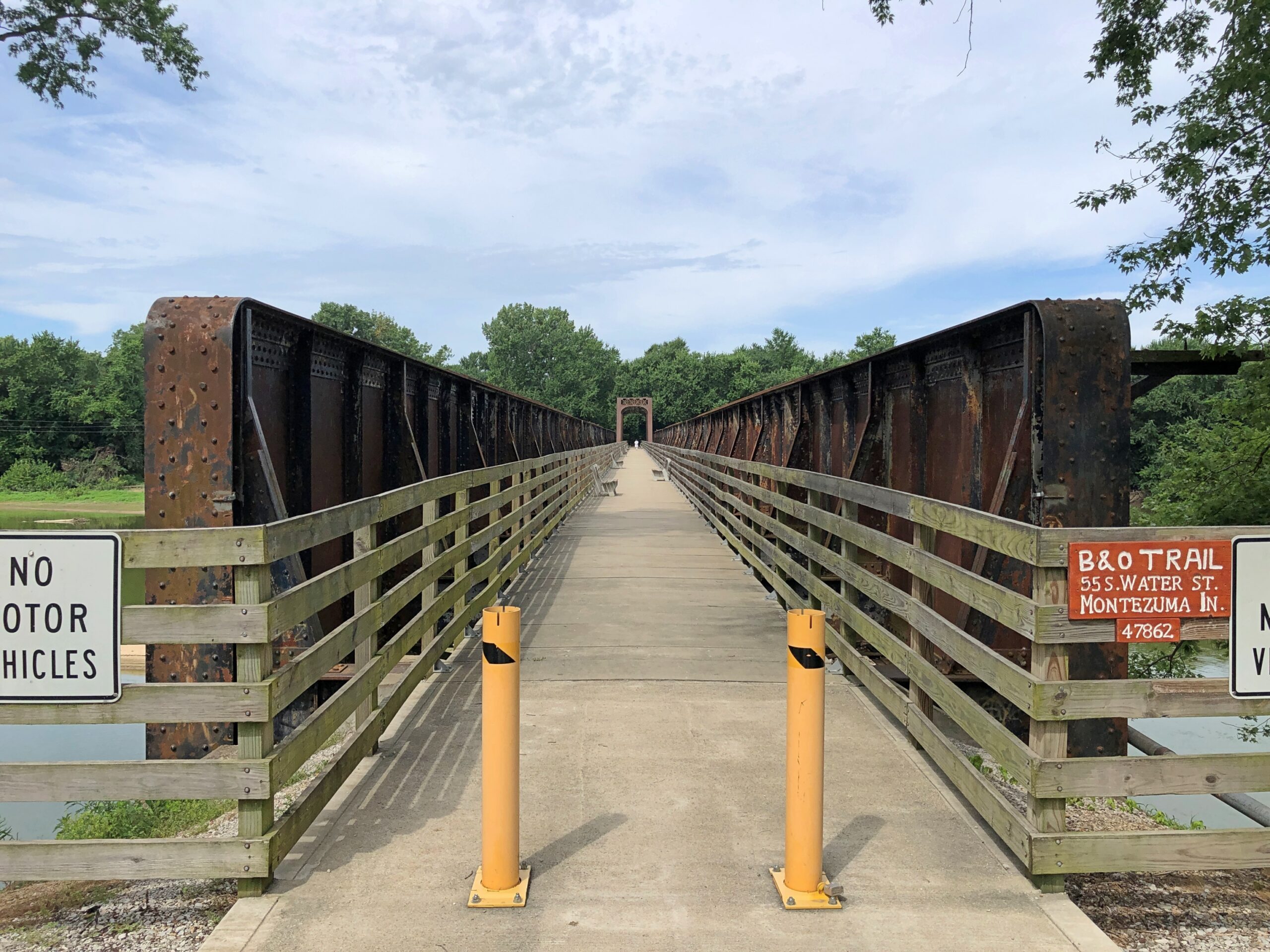
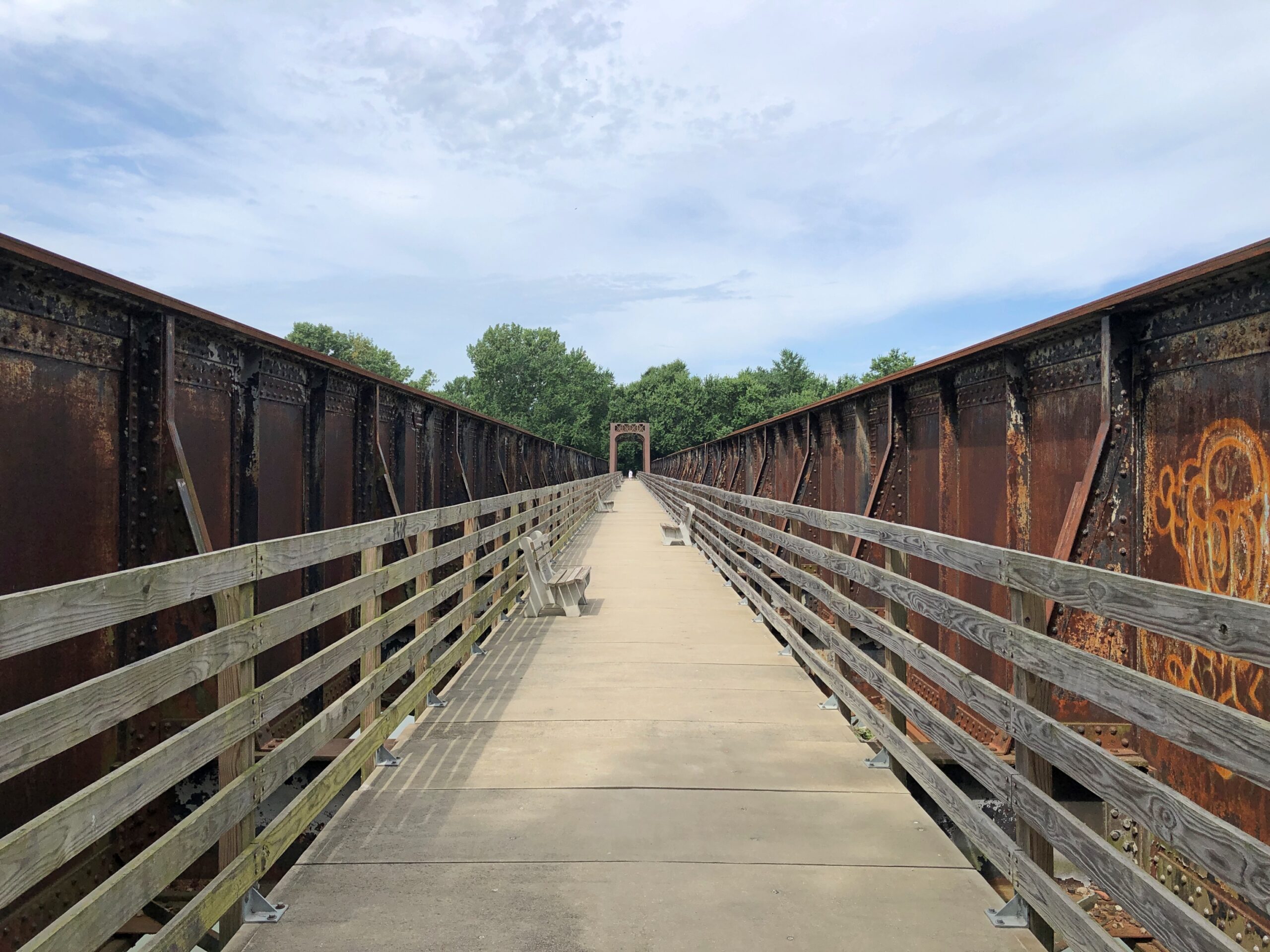
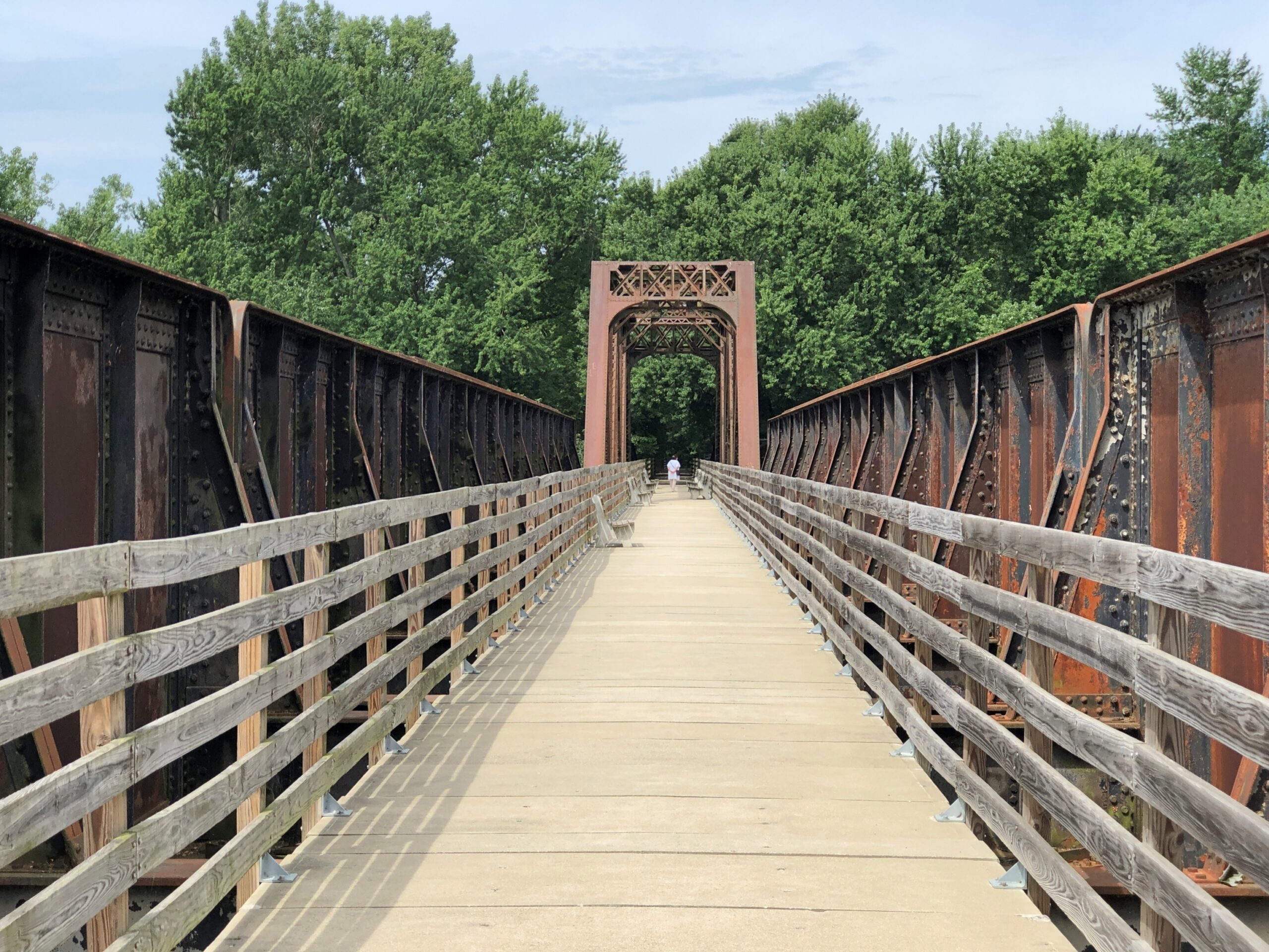
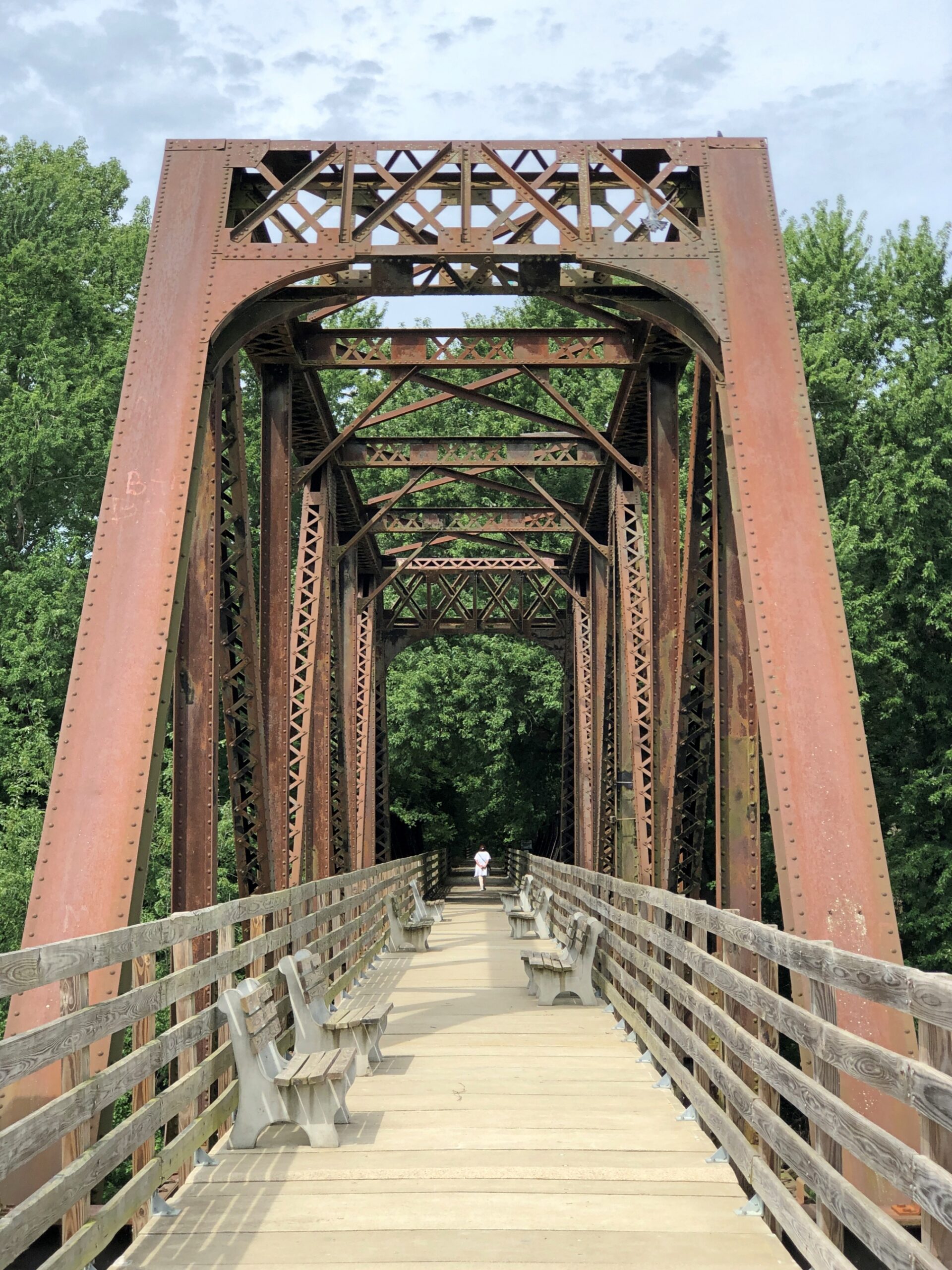
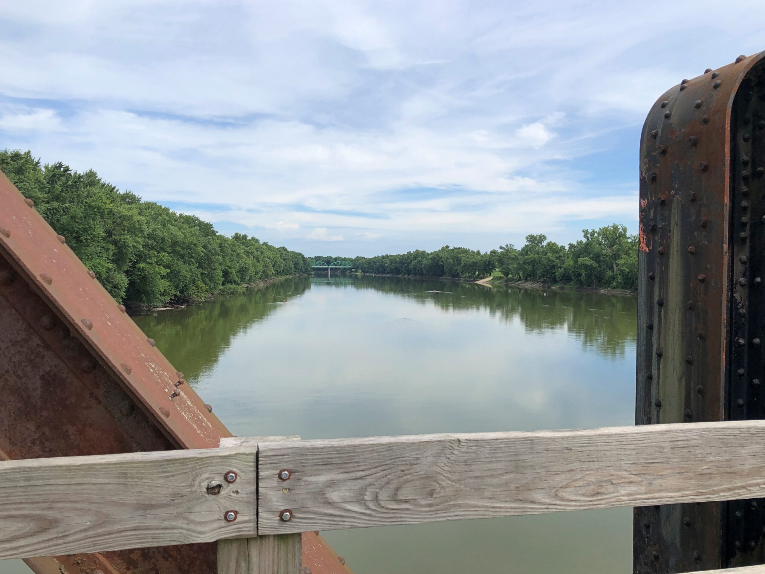
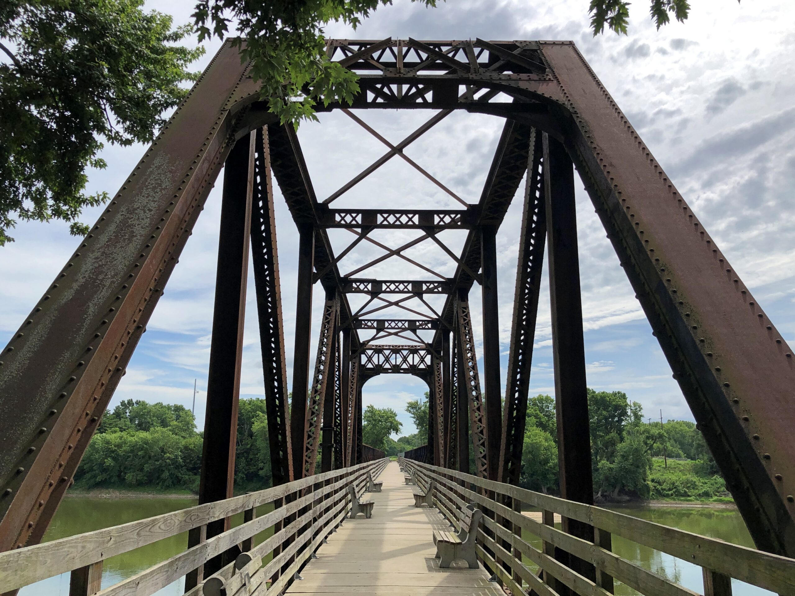
On the southern edge of town is a former B&O Railroad bridge, now a pedestrian and bicycle crossing.
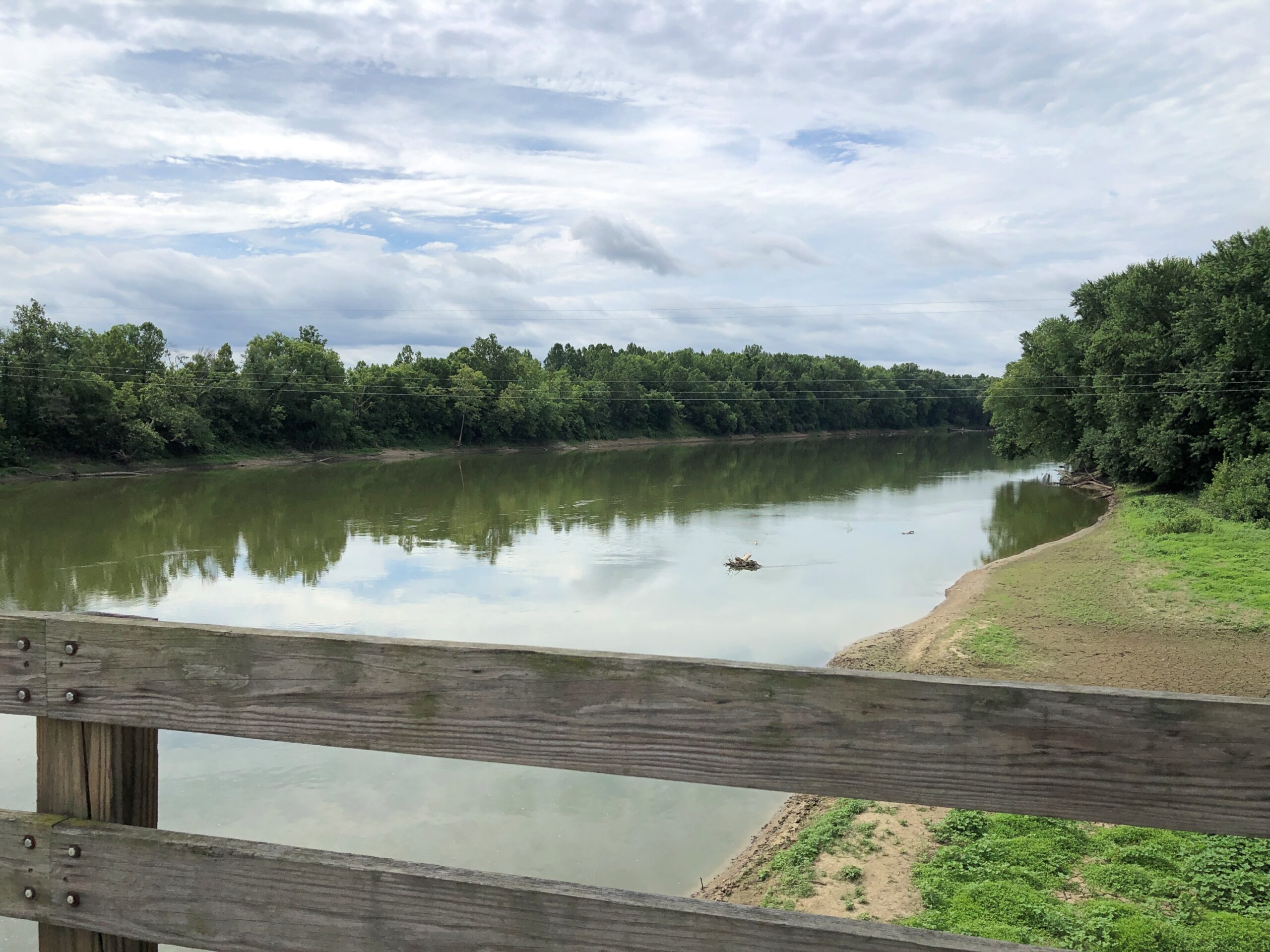
Crossing the Wabash River from Montezuma takes you to Vermillion County, Indiana, which hugs the left bank of the Wabash for a long way.
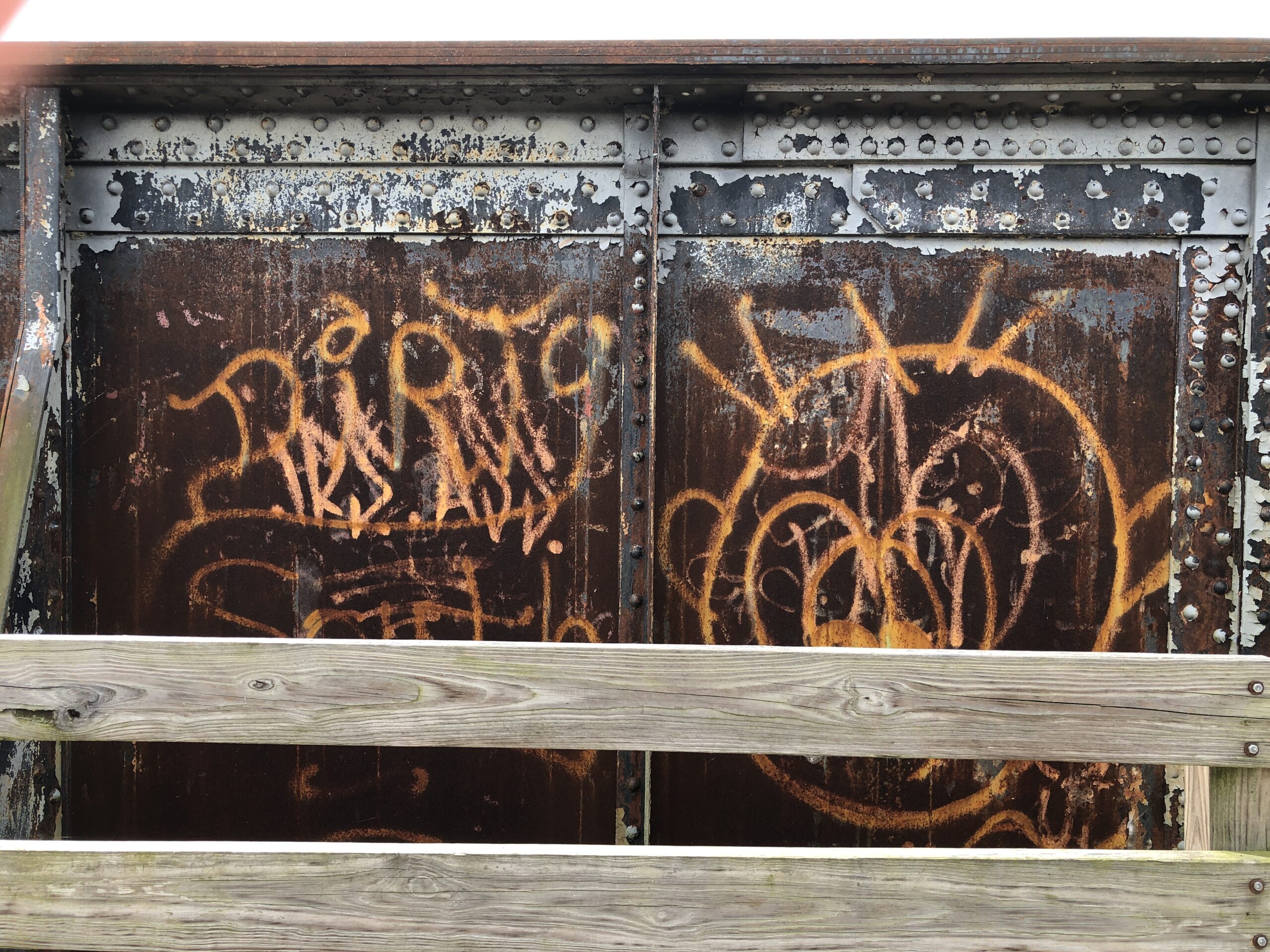
Graffiti on iron. Daring, or foolhardy, since there’s a gap — between the edge of the walking bridge and the iron support features of the bridge — large enough for a careless graffiti artist to take a quick plunge to the river below.
Looking out to the river.
Looking back at Montezuma.
The B&O is as storied a railroad in North America as you can get – a pioneering commercial line sprouting from Baltimore into the Midwestern interior, eventually. Host in 1828 to Charles Carroll of Carrollton, the only surviving signer of the Declaration of Independence, at the railroad’s groundbreaking ceremony. Critical infrastructure for the Union war effort some decades later. Powerful regional RR in the Gilded Age. Famed as one of the four Monopoly RRs.
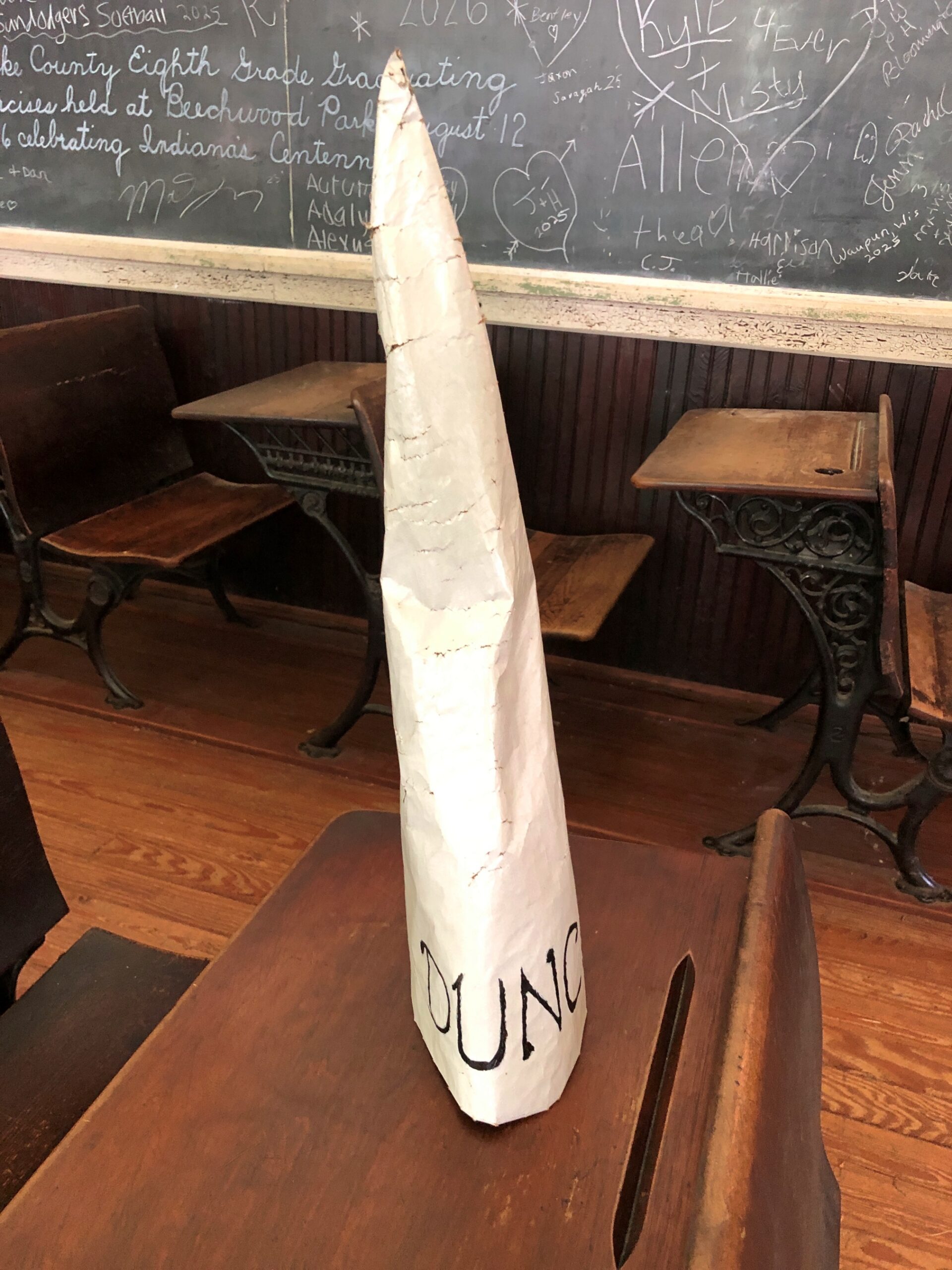
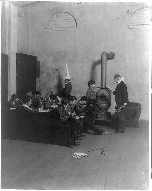
I don’t know whether it was a relic or a replica, but there it was, something we’ve all heard about, seen in drawings and as the stuff of metaphors: a dunce cap. I’d never actually seen one before that I remember, not as a physical object.
That is why you (I) visit such places as the open air museum Billie Creek Village in Parke County, Indiana. To be mildly surprised. Such as the time I encountered a can of White Star brand tomatoes with a hammer and sickle on it, or a Papua New Guinea battle shield sporting the Phantom, just to name two among many such little surprises.
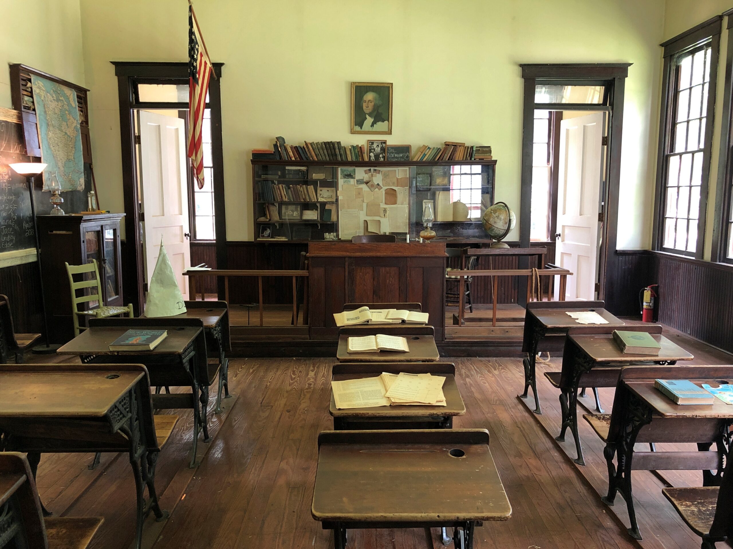
The dunce cap was on one of the desks at Billie Creek’s one-room school house, used until the early 20th century, as usual for that kind of school.
Good old dunce caps. Sure, they go against the grain of modern thinking, antiquated as a one-room school, but we all can remember a few goofballs from our school days who deserved one, can’t we? As seen in a pic from the Library of Congress, dated ca. 1905, but with no information about where it might have been. Just a small school in the years before self-esteem was discovered.
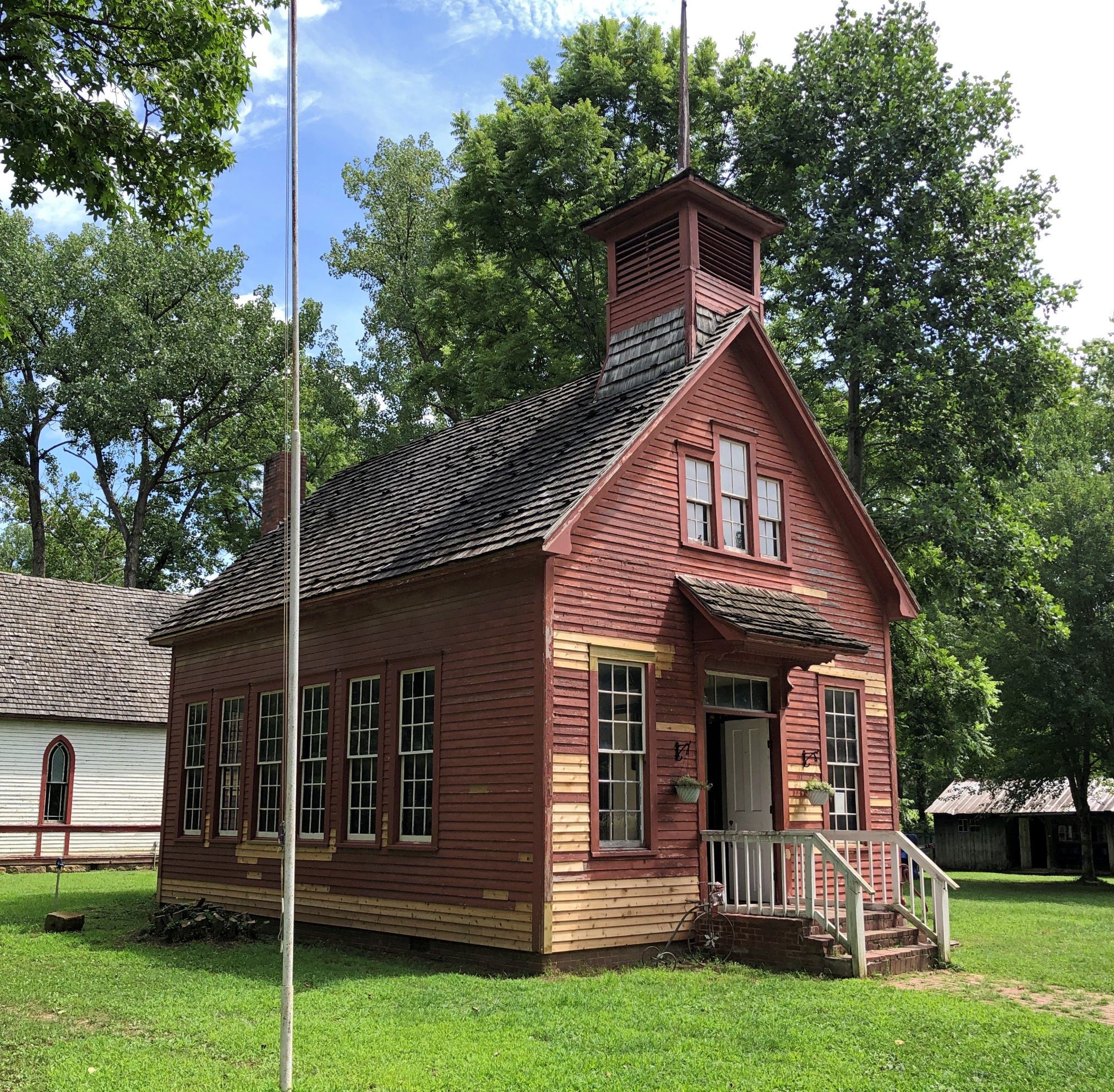
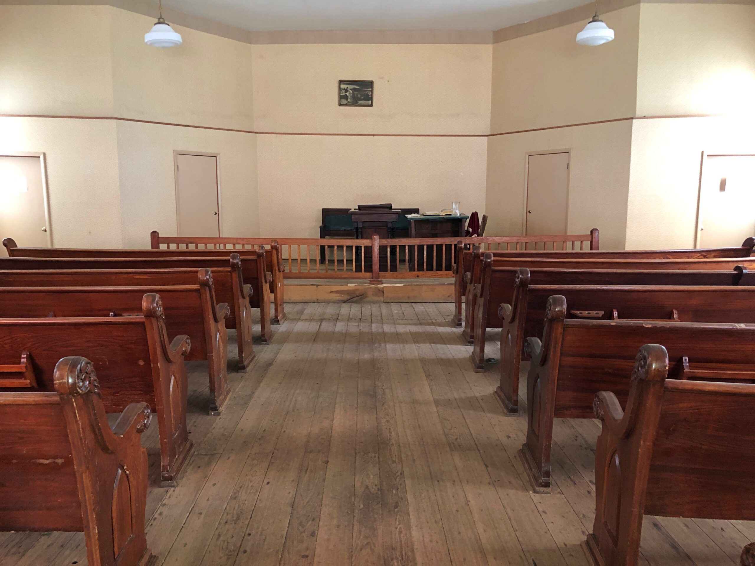
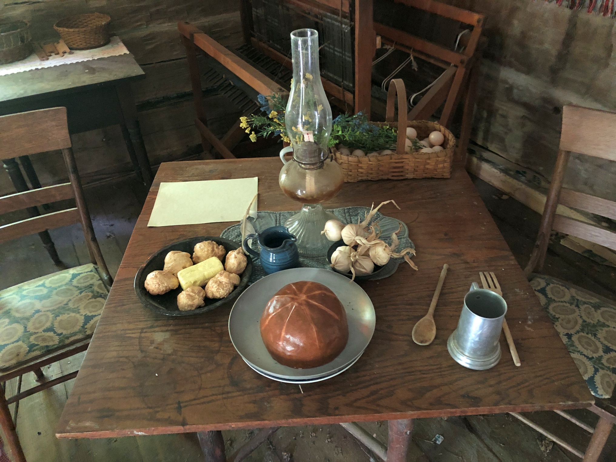
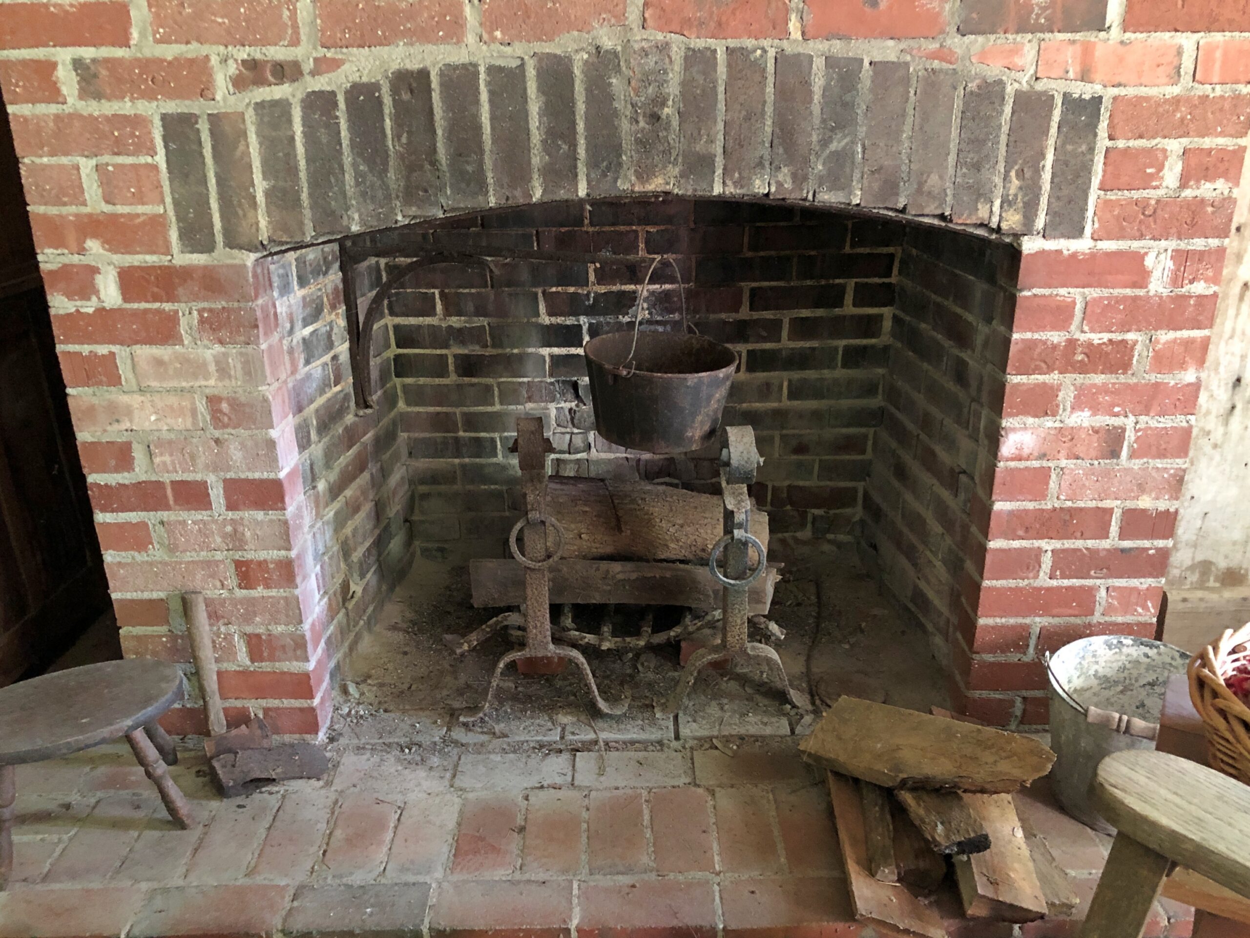
The old school house at Billie Creek is one of 38 historic structures relocated from various parts of Parke County, Indiana, to about 70 acres west of Rockville on US 36. Originally opened in 1969, the place has had a series of owners and been through periods of abandonment, but since 2022 has been under management that seems to know what its doing.
That’s my thinking, anyway, since its refreshing informality perfectly suits the place. You go, you park your car, you wander in. No irritating timed tickets, no gouging entrance fee, no expensive yet mindless luxury goods and experiences that could be pretty much anywhere. Yet there is an economic model: Billie Village hosts events – one was going on when we visited around mid-day on a Sunday – and some of the buildings are also shops, and do sell luxury goods, in the sense that such handcrafts aren’t found in modern grocery or drug stores.
We supported the place by buying a few things, including (yes!) postcards. A few dozen other people were doing so by attending the event. I watched part of some sort of award ceremony as it happened at the village gazebo, and even asked one of the bystanders about what was going on, but couldn’t quite get the gist of it. The meeting seemed to be one of those Society of Creative Anachronism sorts of things, though not that specifically. Attendees wore fantasy- and history-adjacent costumes, mostly with that homemade vibe. One of those outings for adults who didn’t get enough playing pretend when they were kids, I guess. All well and good.
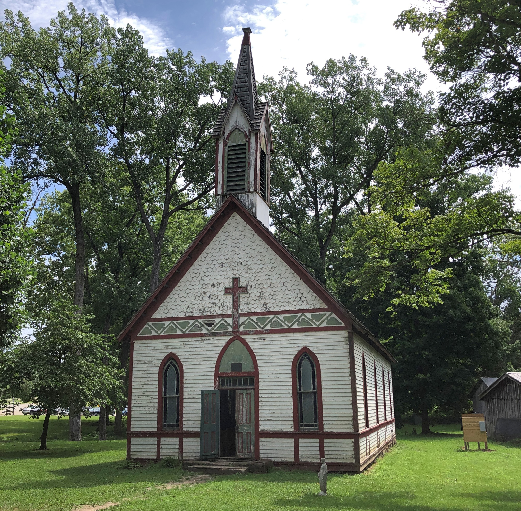
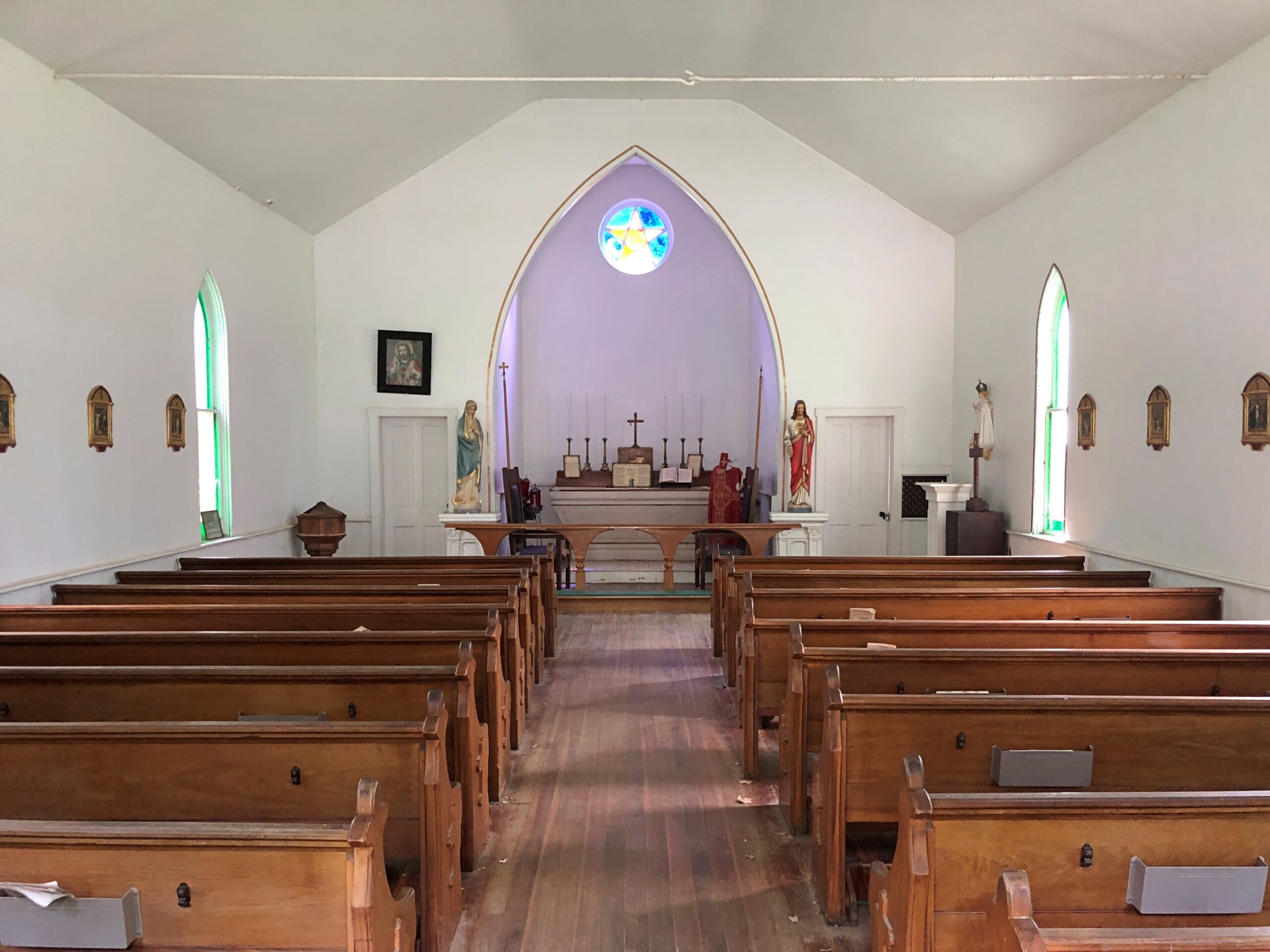
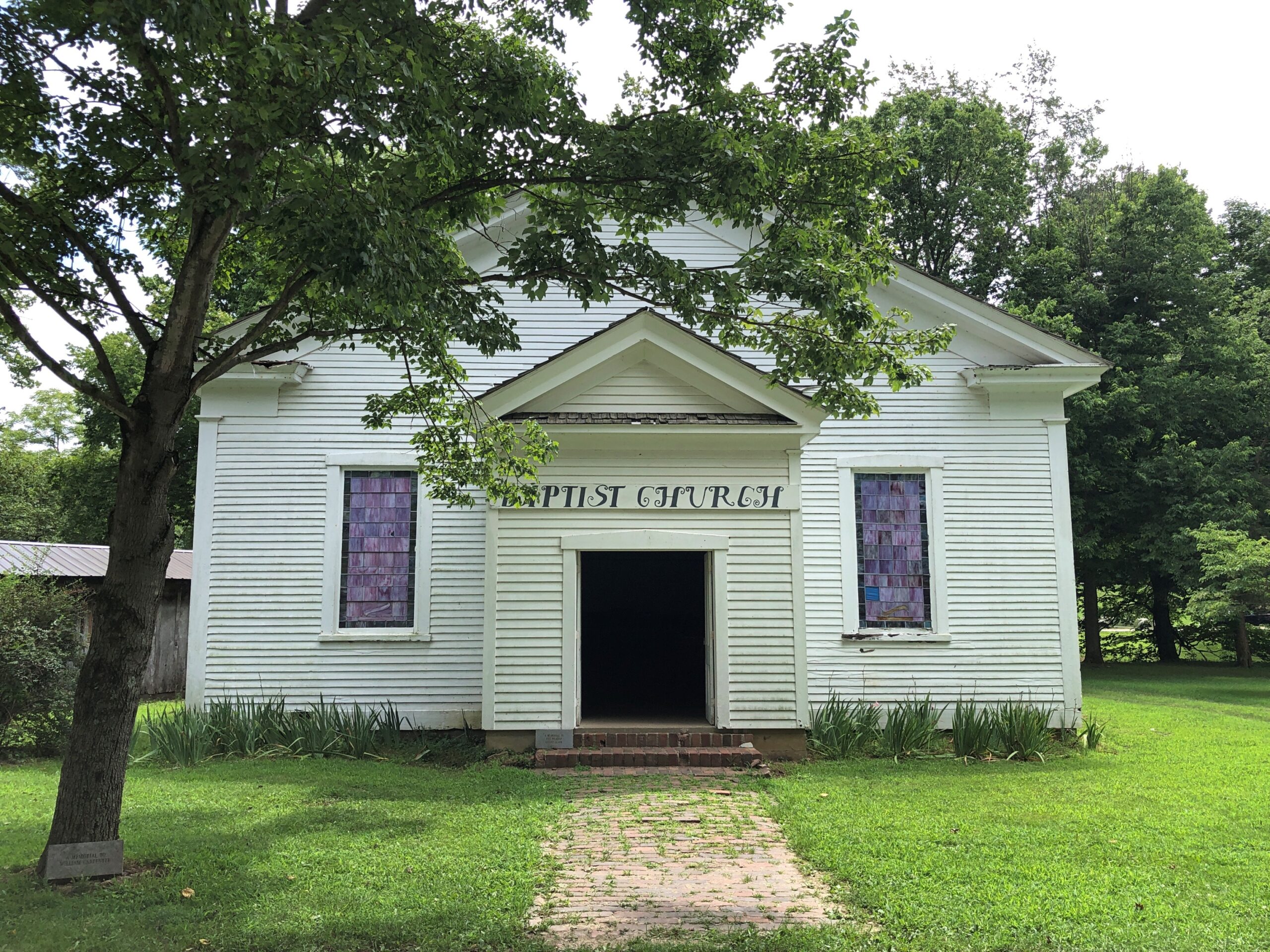
I hope that economic model keeps the place open, because one recipe for a good couple of hours on a hot weekend in July is visiting curious old buildings. Such as a couple of relocated churches.
One Catholic.
The other Baptist.
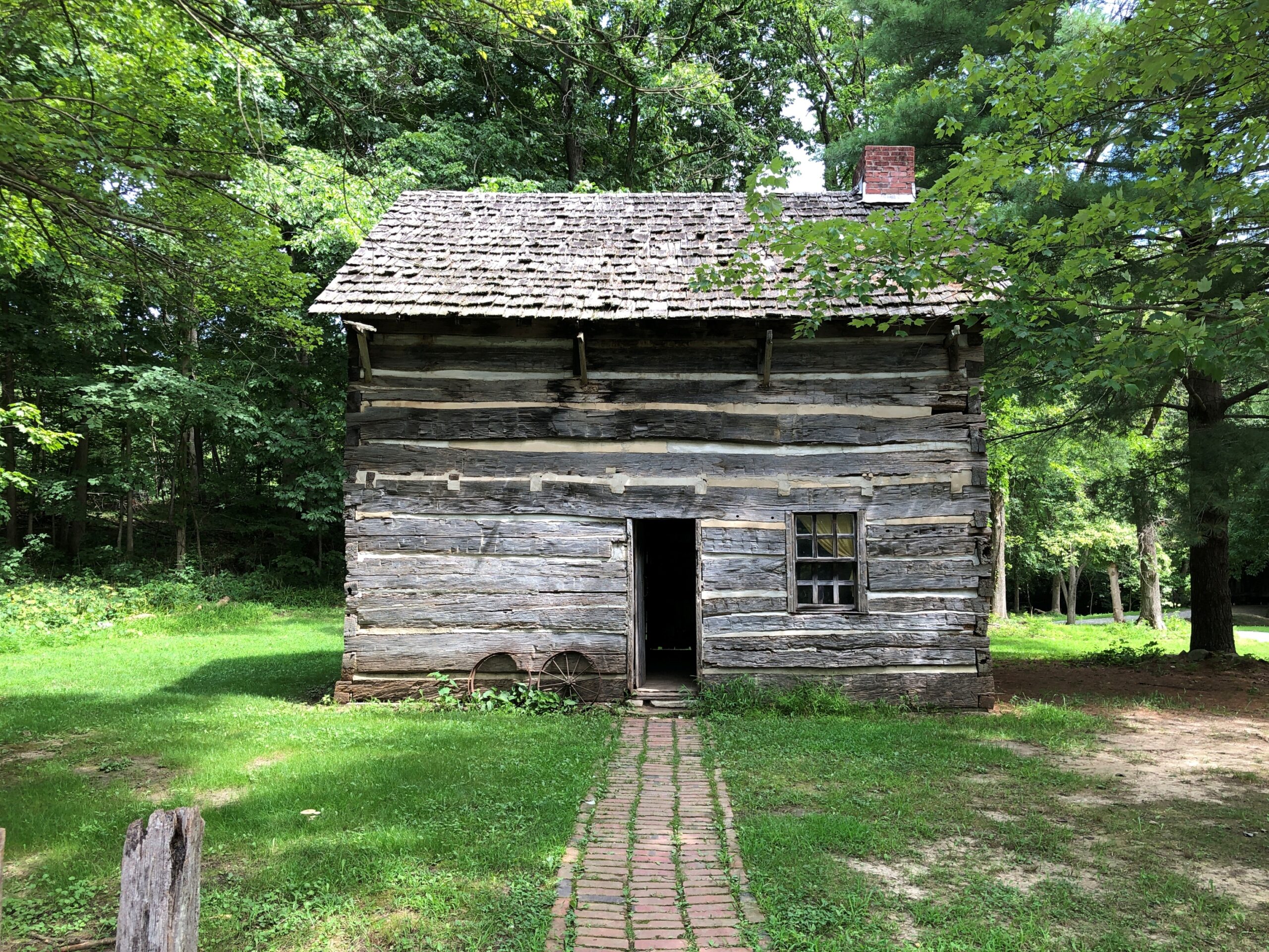
An early Parke County cabin.
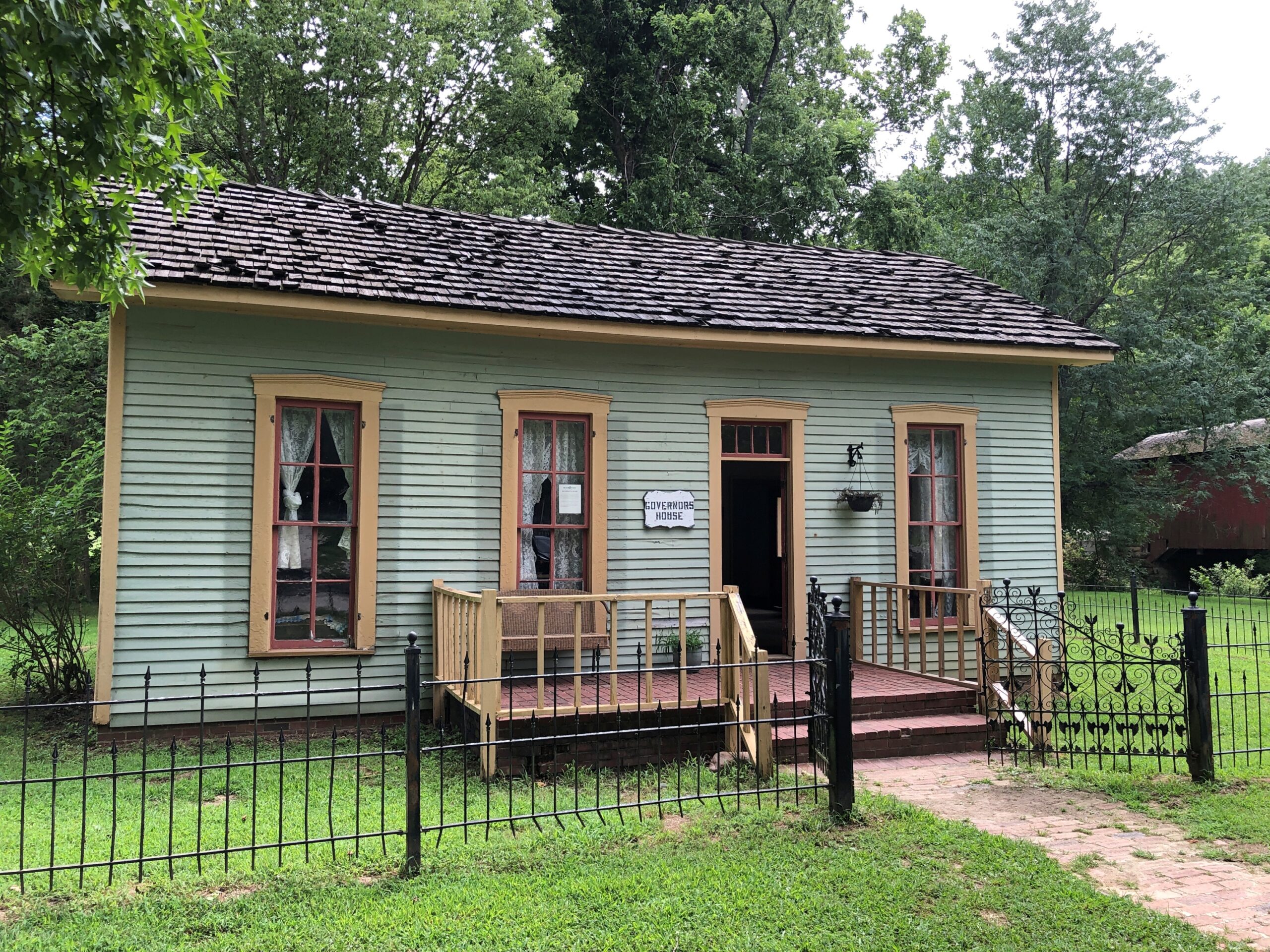
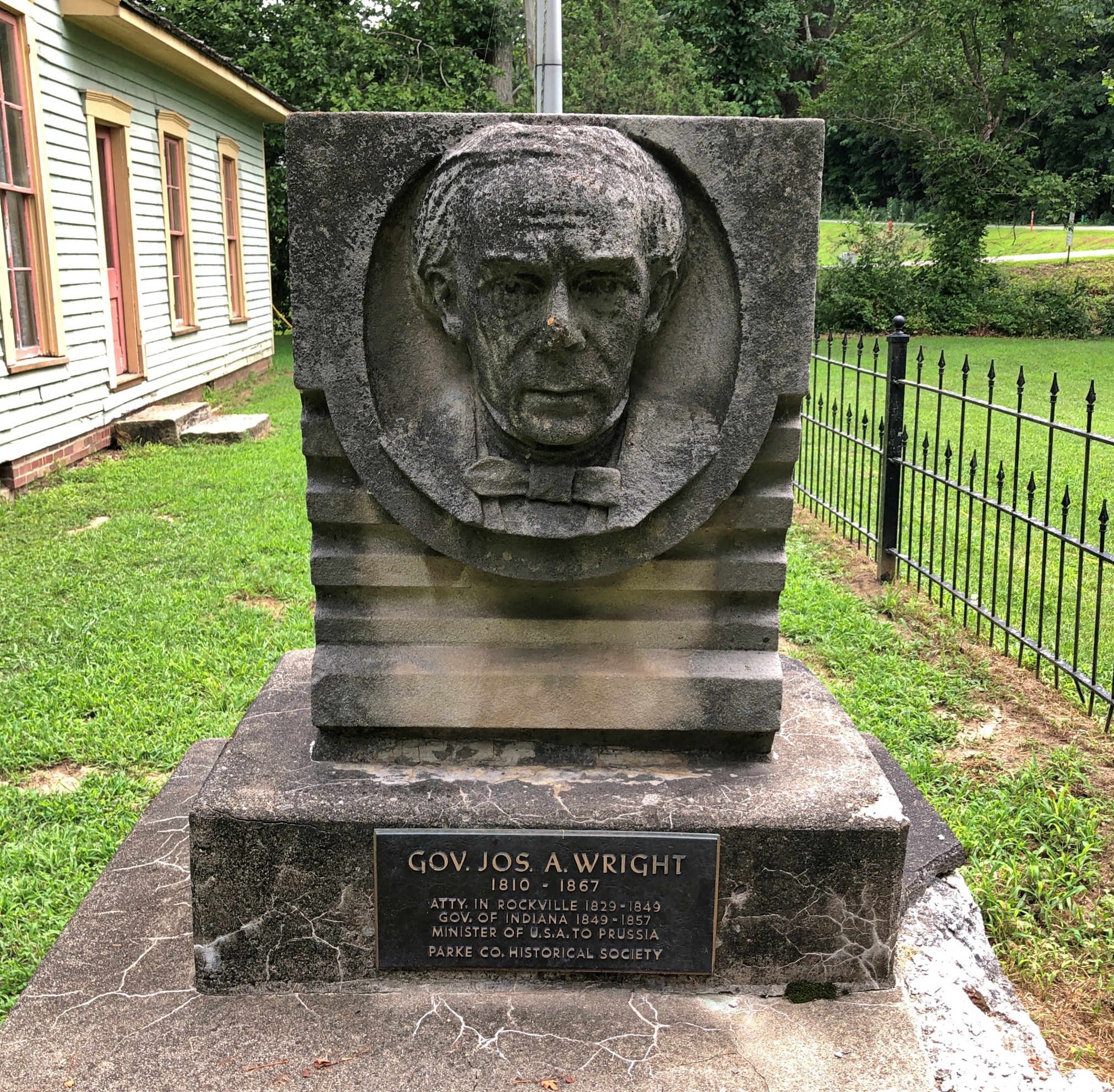
The home of an Indiana governor, one Joseph A. Wright (d. 1867), in office 1849-57. A Rockville native son.
Here he is, just outside his house, in dour Hoosier mode.
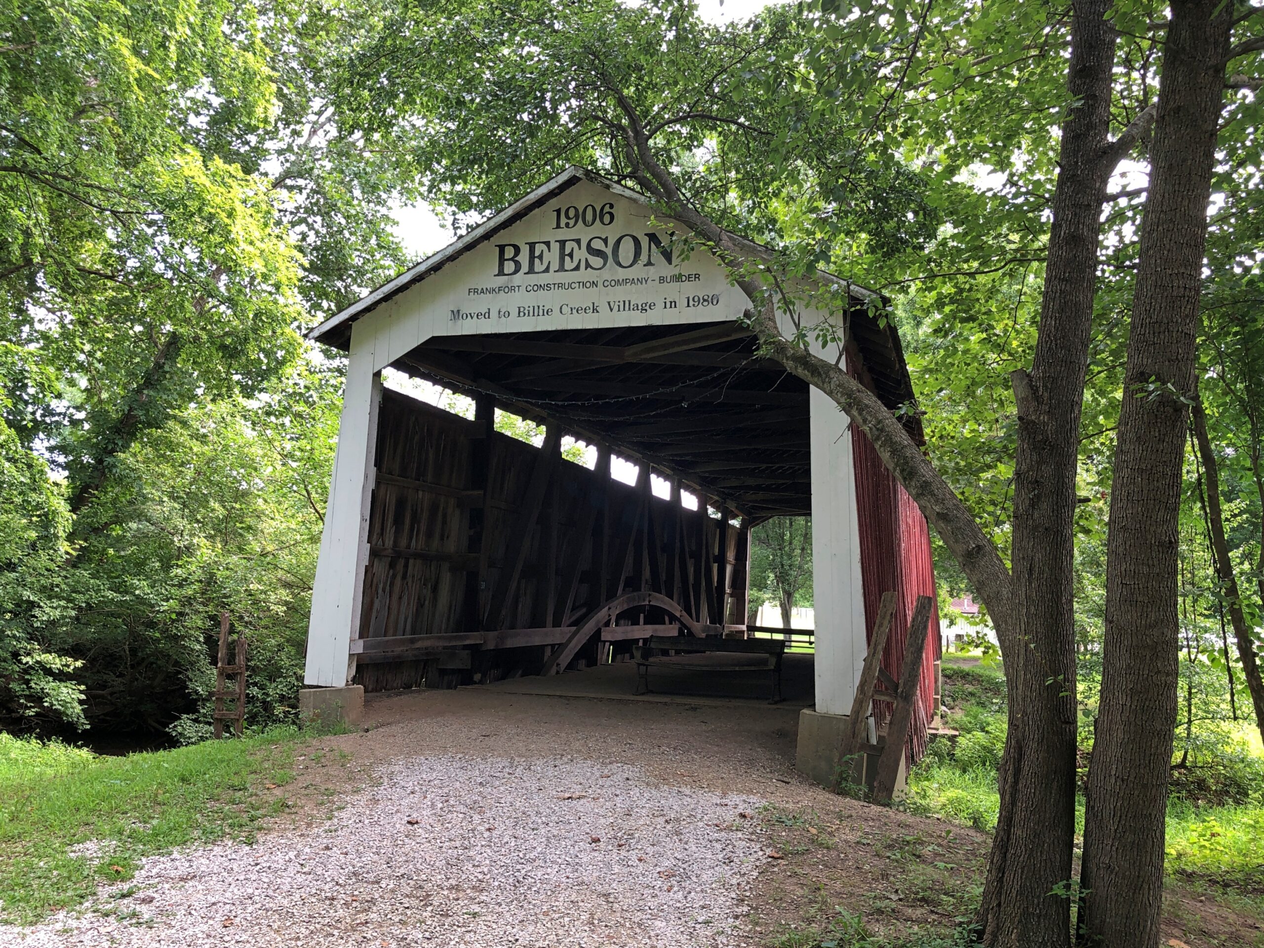
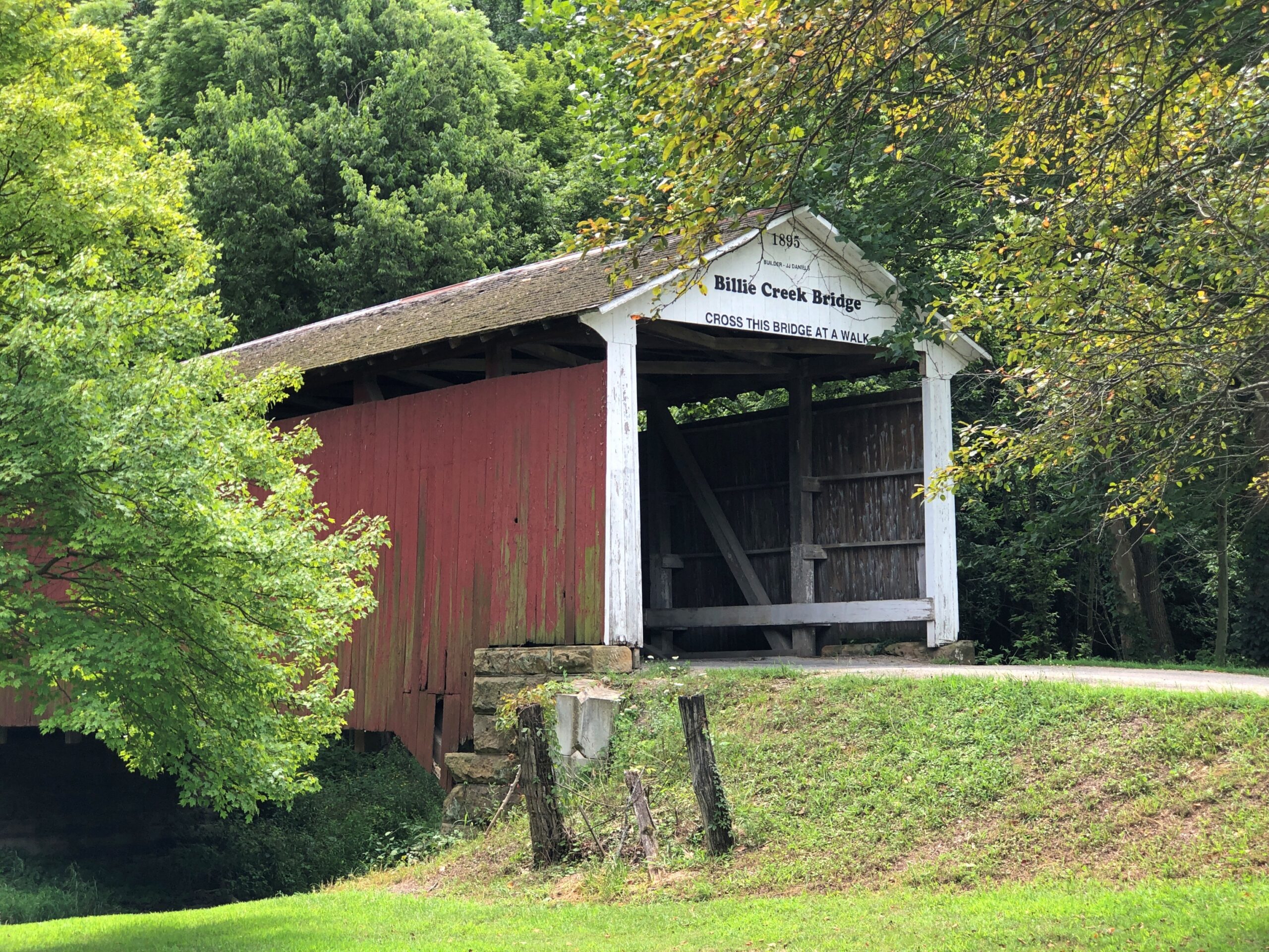
As the Covered Bridge Capital of the Galaxy (or some slogan like that for Parke County), it’s no surprise that covered bridges can also been seen at Billie Creek.
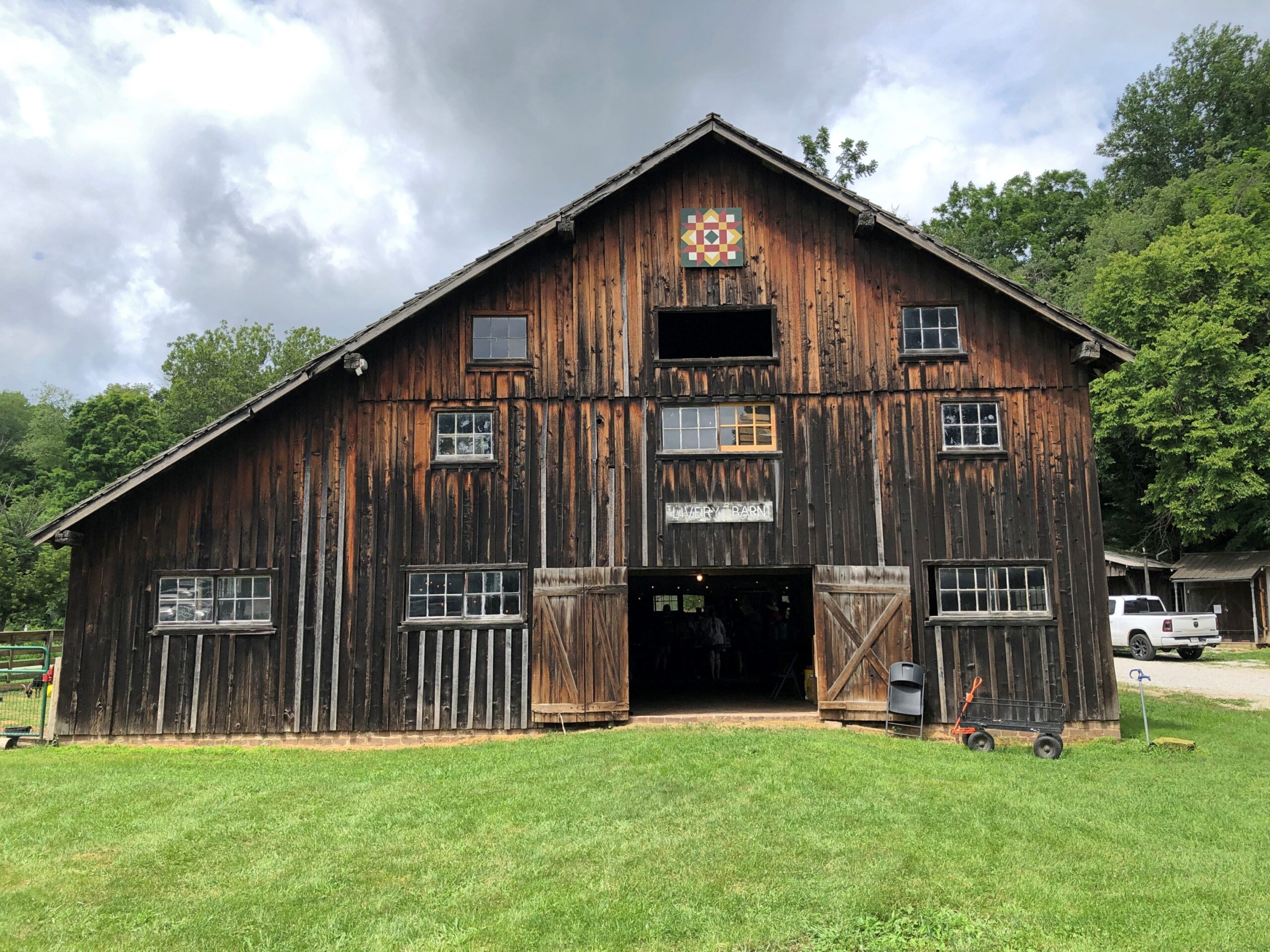
A barn, weathered yet handsome.
Craft goods were for sale inside. So were books by a local author who was there, hawking them. He told me about the books, some sort of fantasy series, and I was curious enough about them to listen to him, but not enough to buy one, which I think left him a bit miffed. Such is the writer’s lot.
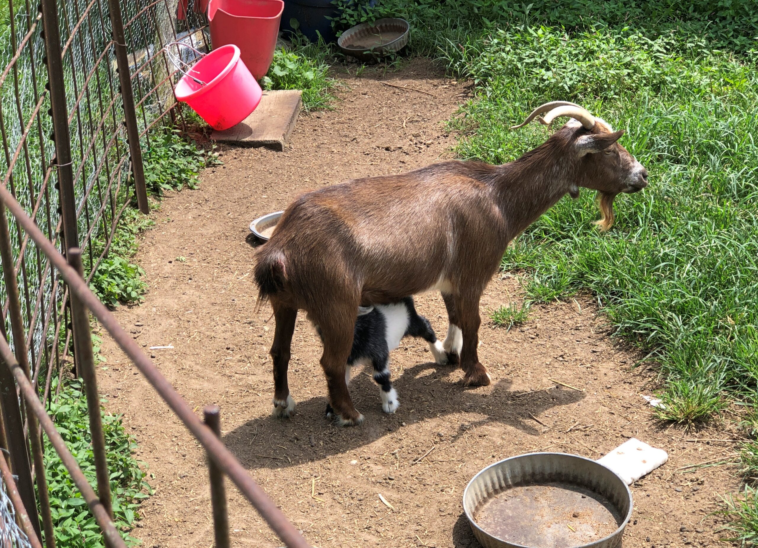
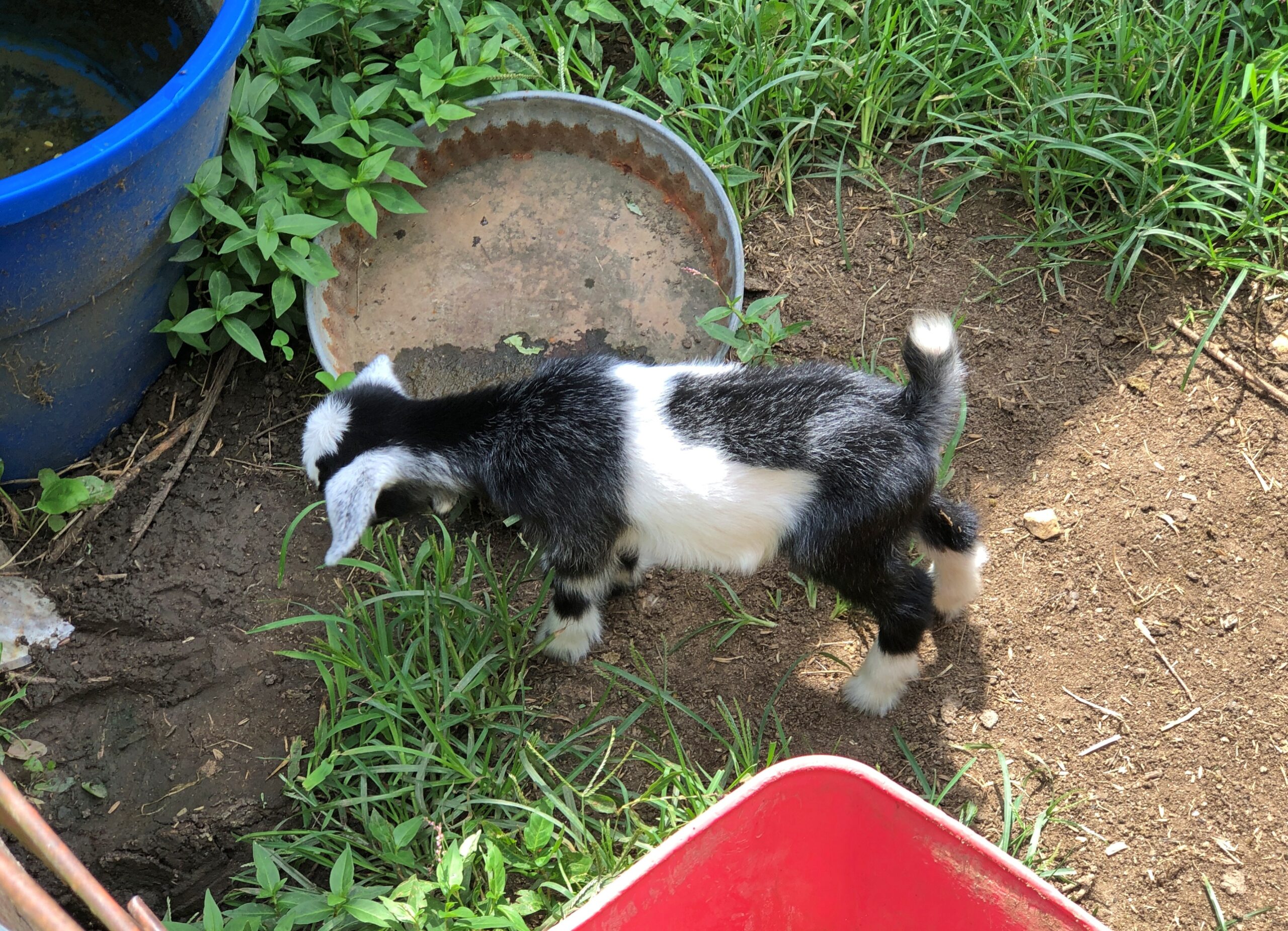
Behind the barn, goats.
I wasn’t able to test the notion that goats eat tin cans. But I already knew the answer: it’s a ridiculous myth, as this item in Goat Owner tells us.


