London Town

Things you can do in London: walk along the Thames; visit Covent Garden; and see St. Paul’s Cathedral. We did all of those things in the original London, once upon a time.

Earlier this month, we managed two out of three in London, Ontario. The cathedral was closed. Some other time, maybe, since you can drive from metro Chicago to the Canadian London in about six hours, provided traffic snarls on the highways just south of Lake Michigan aren’t any worse than usual and you don’t encounter a testy Canadian border guard, as I did on Canada Day all those years ago, for the most thorough border-crossing inspection I ever received, before or since.

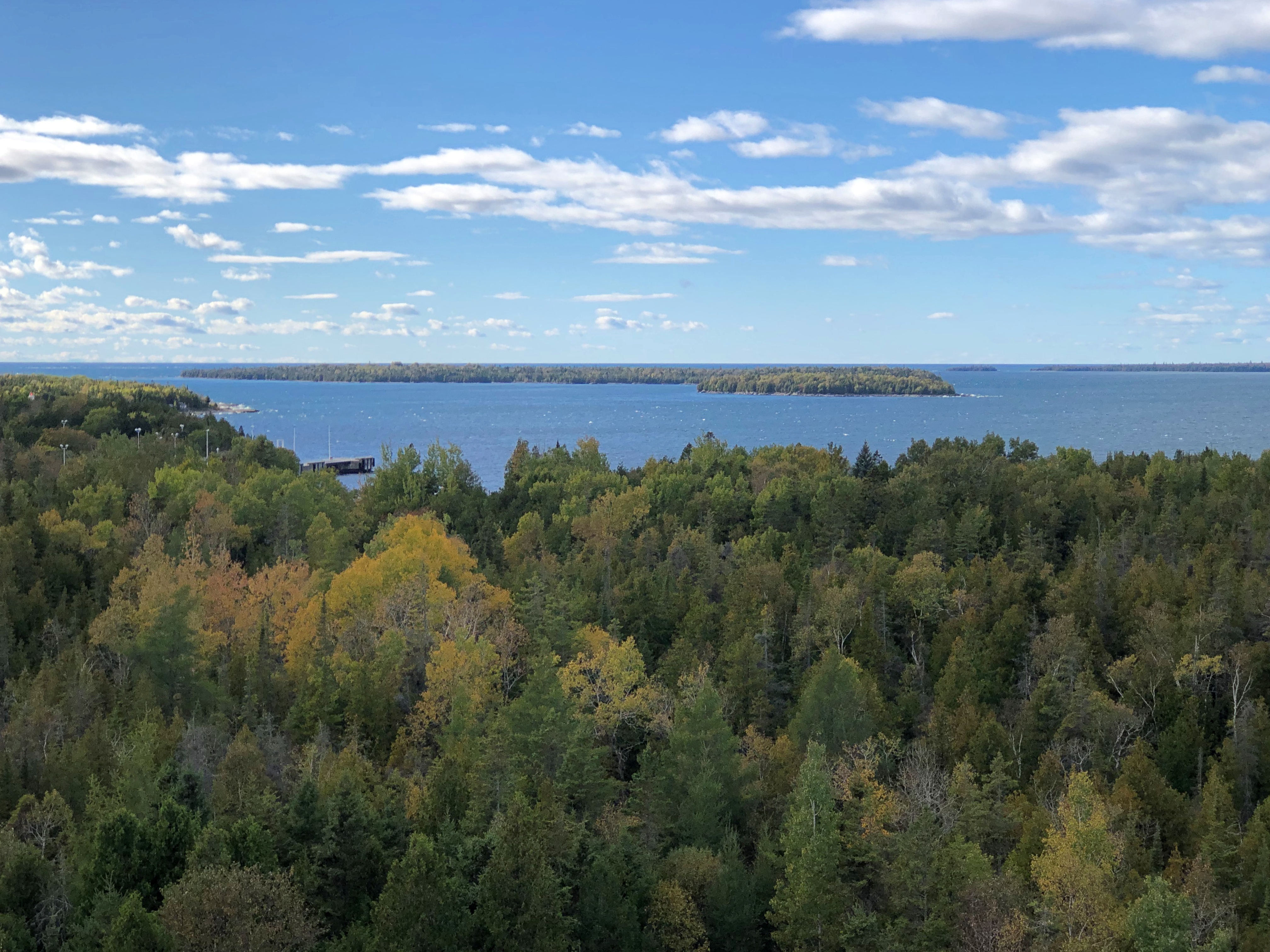
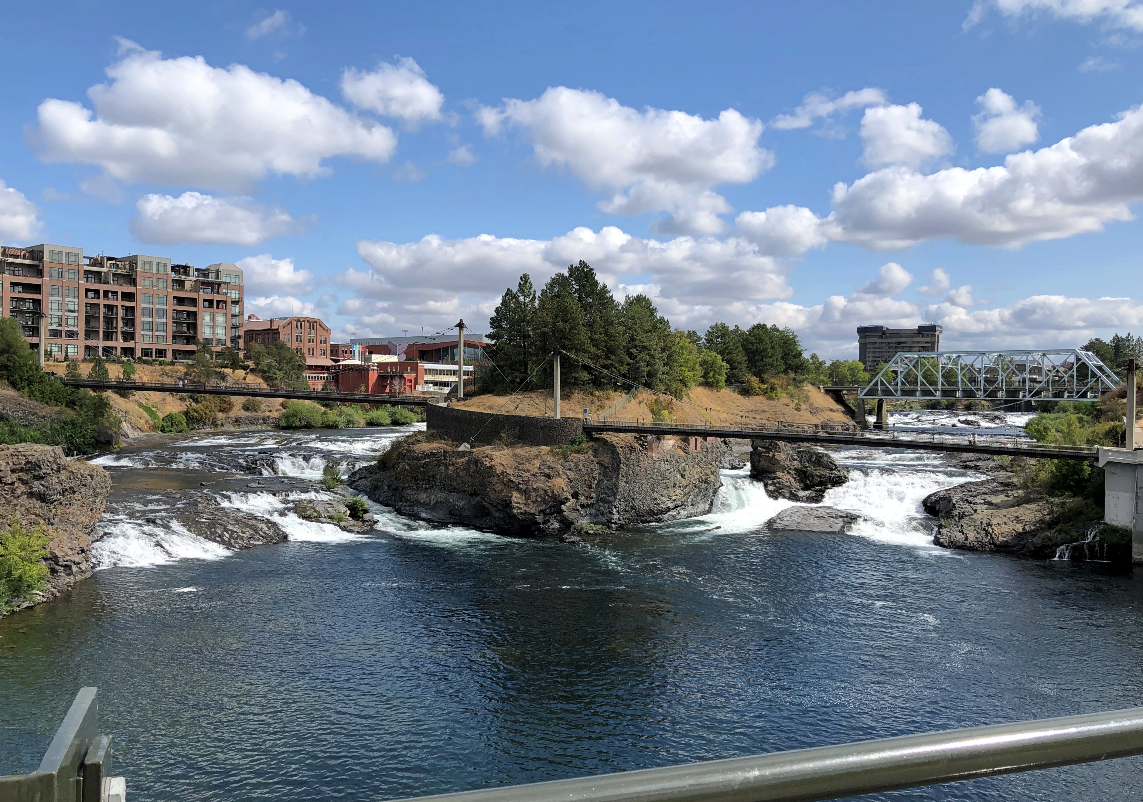
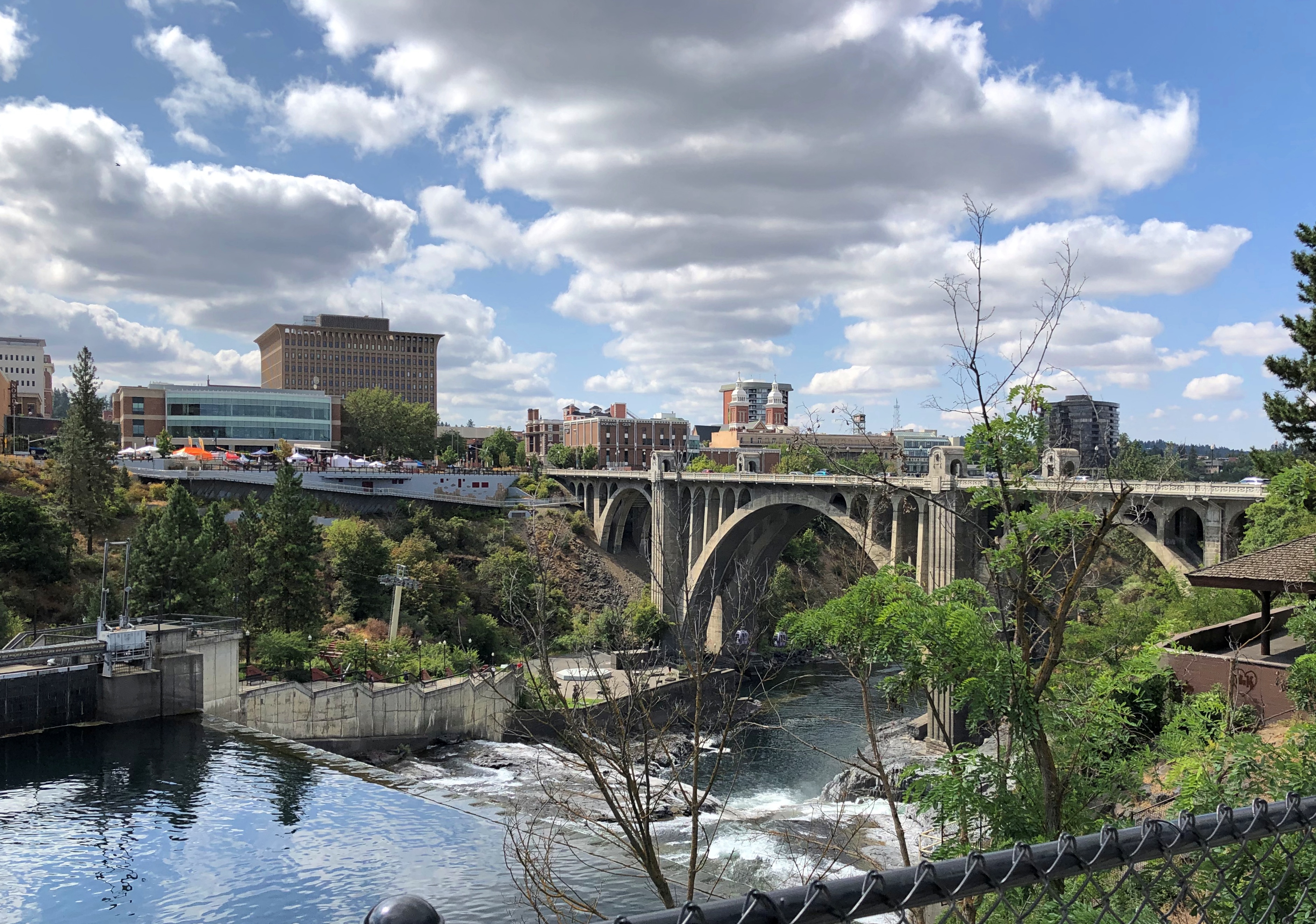
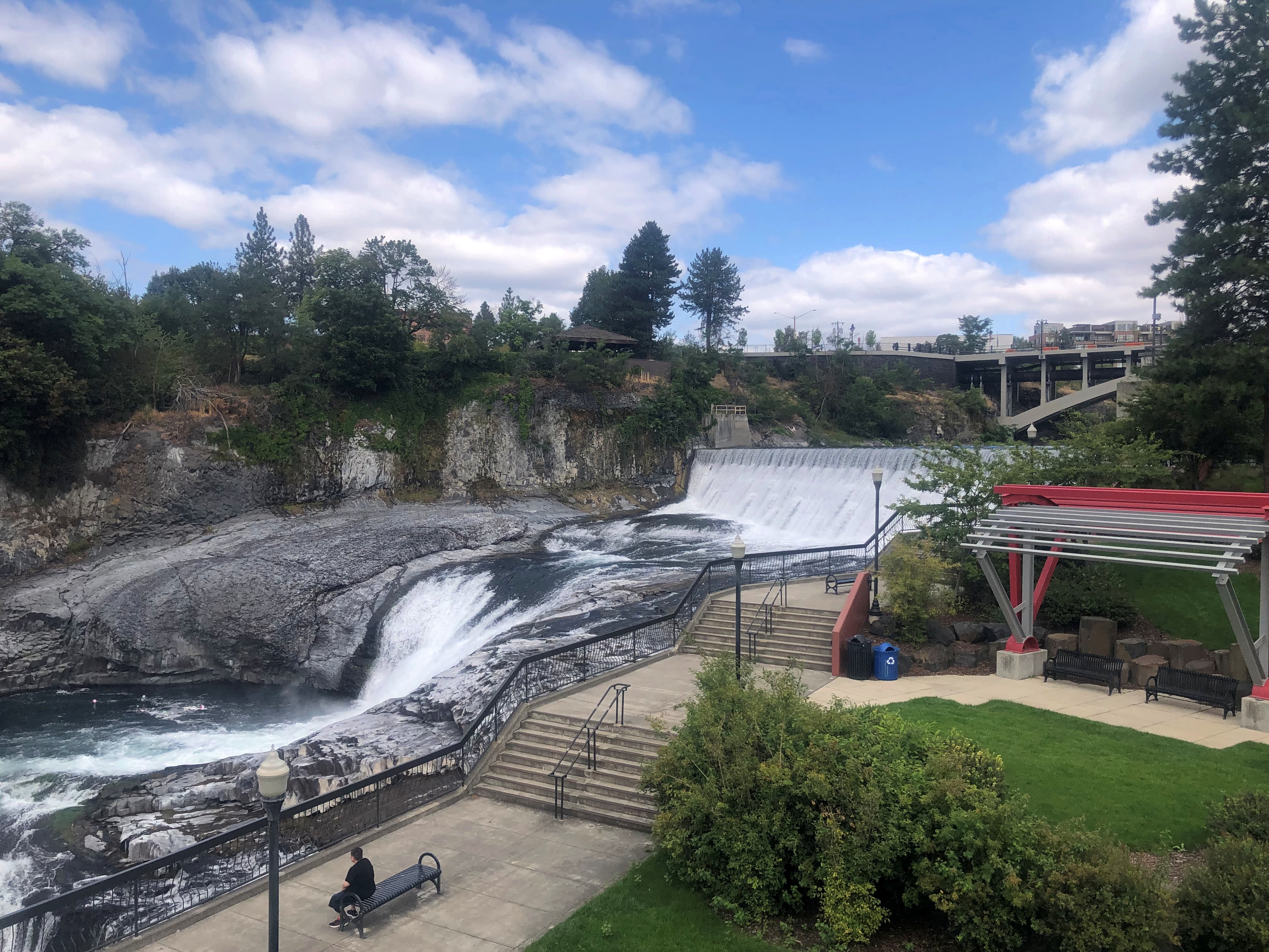
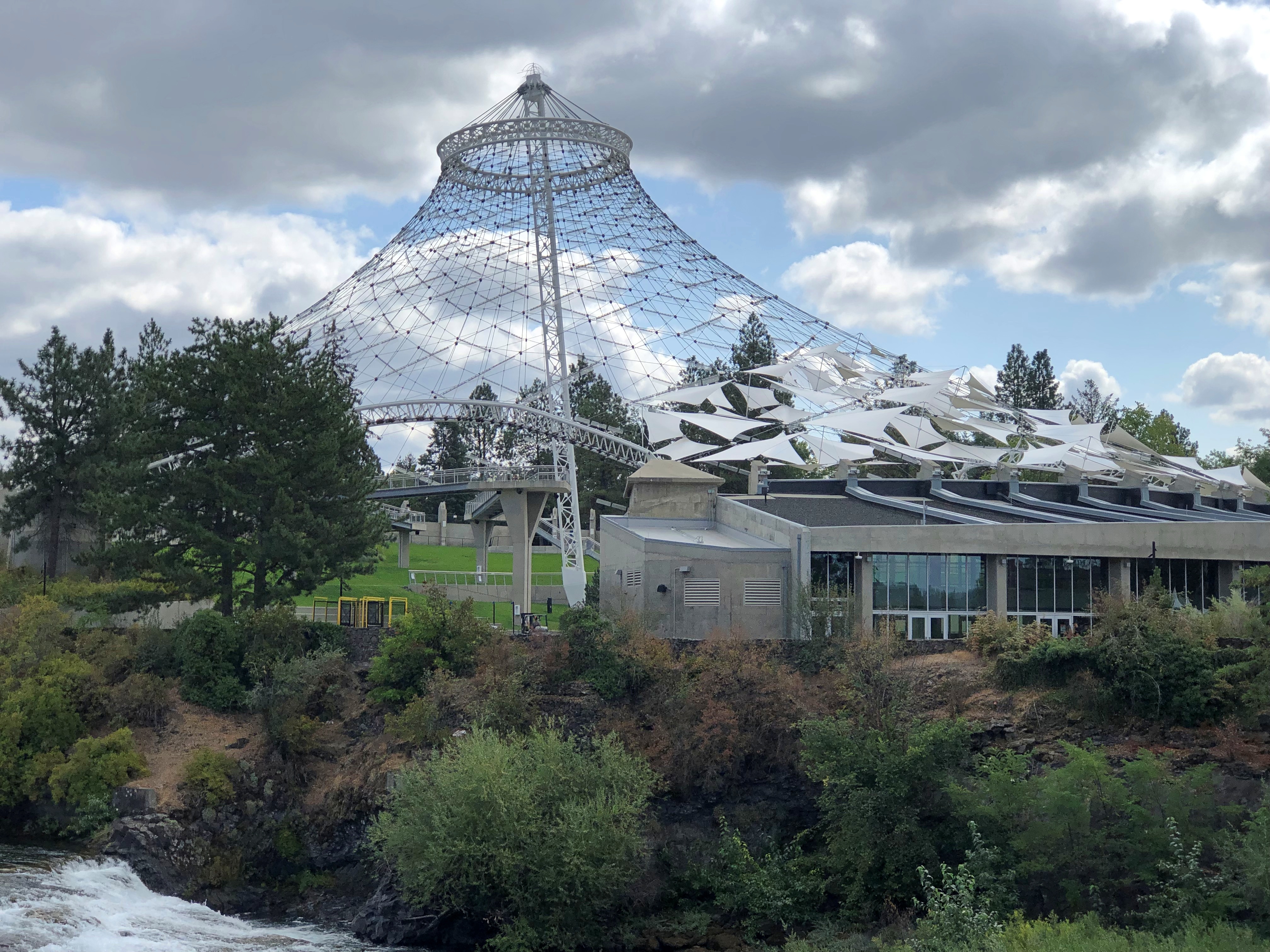
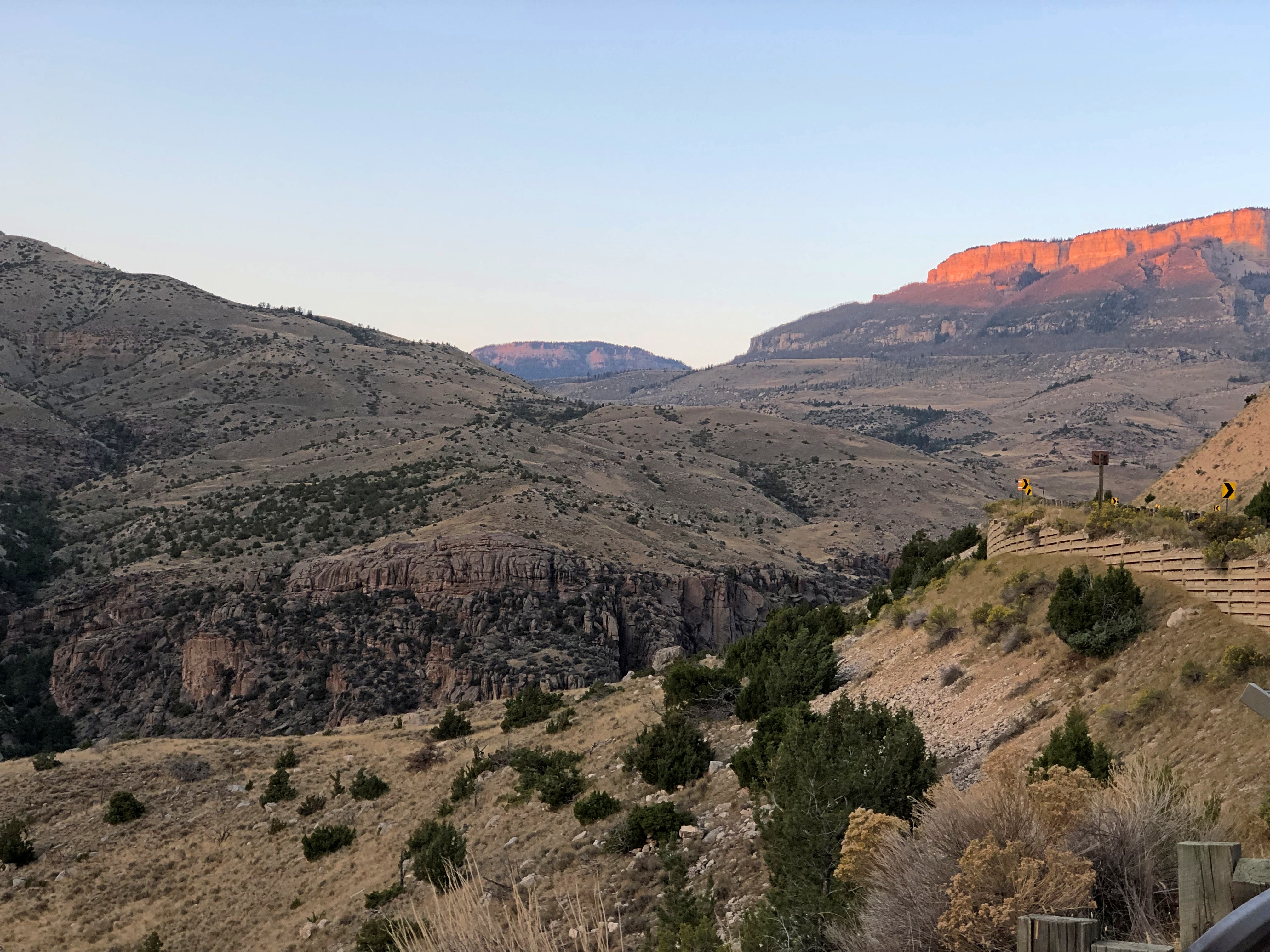
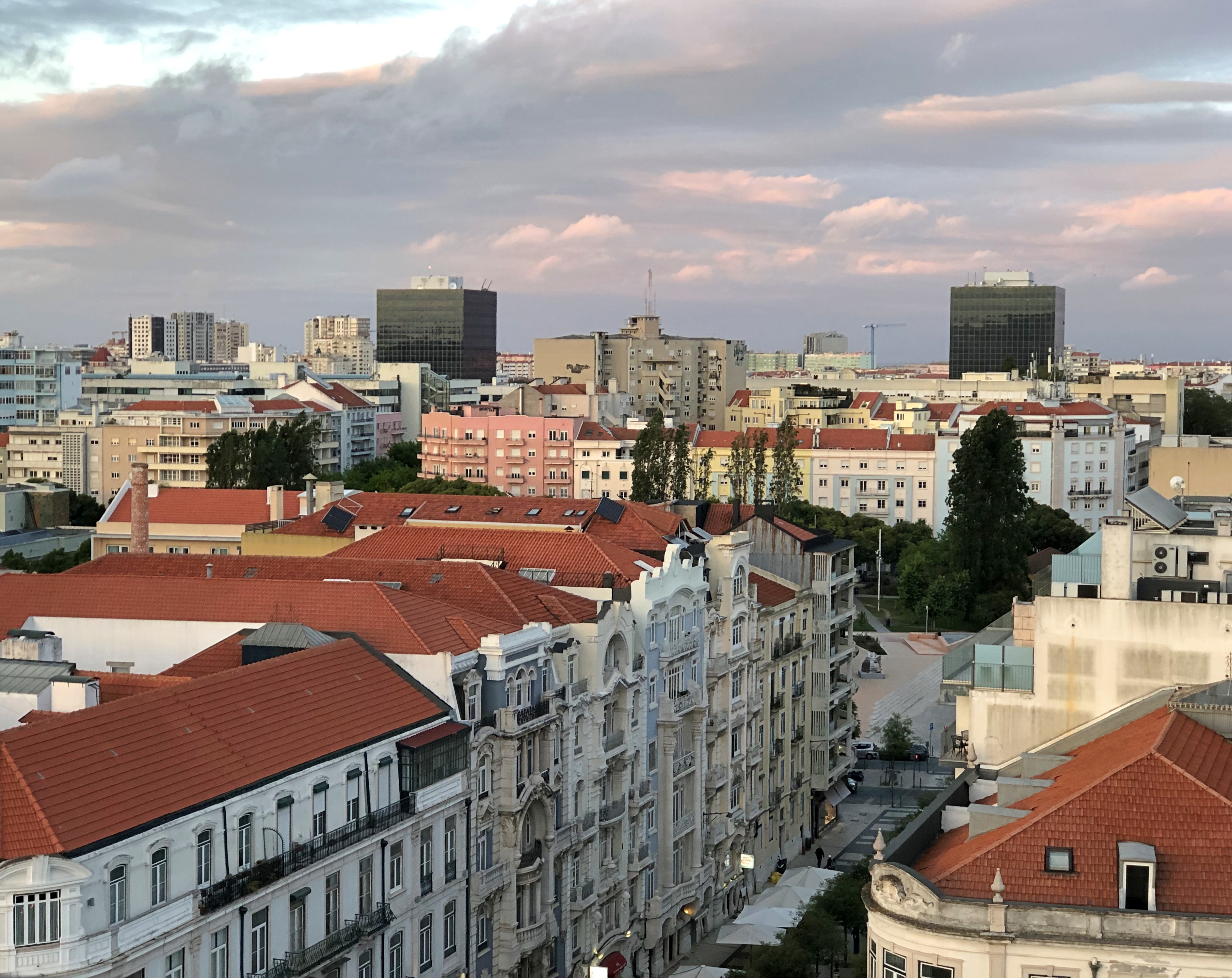
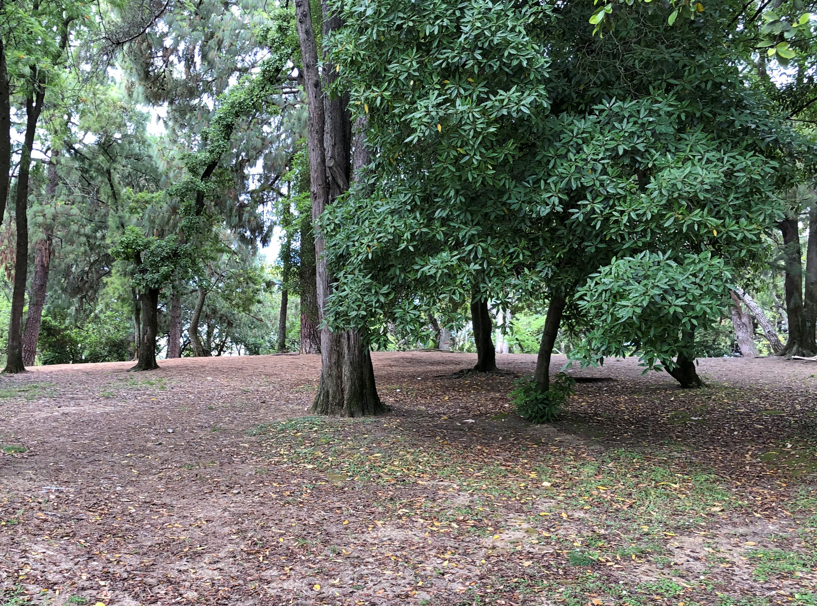
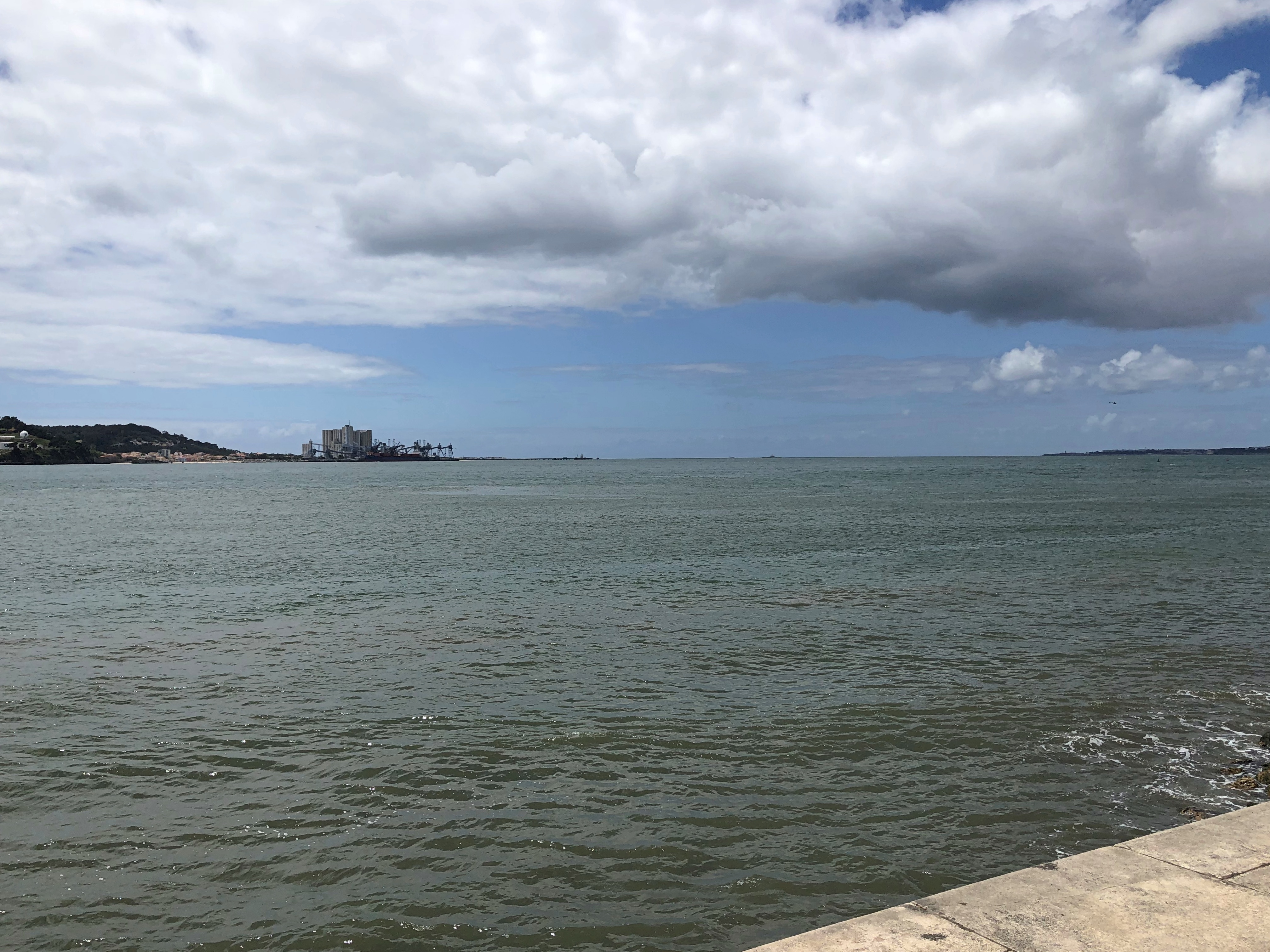
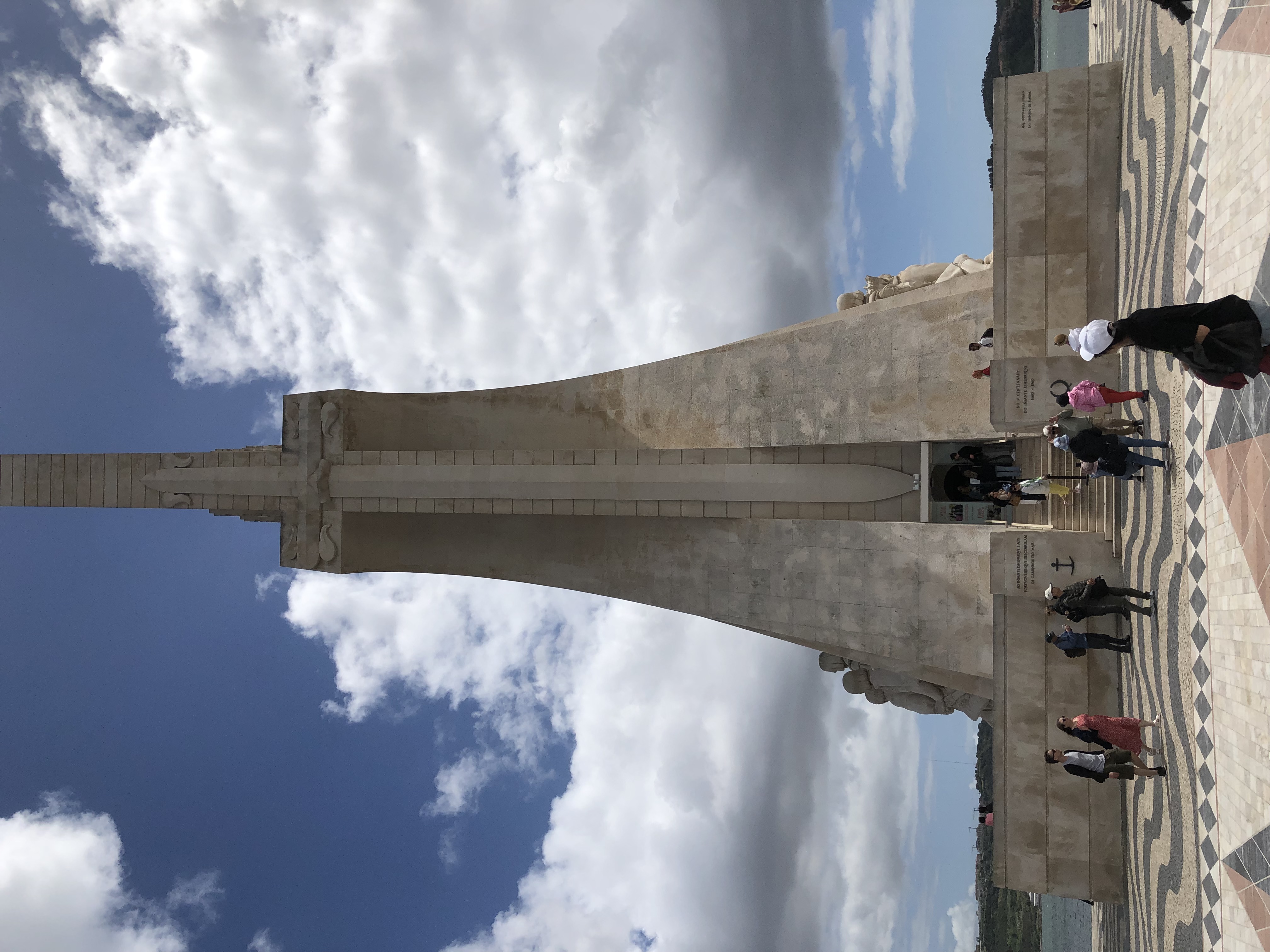
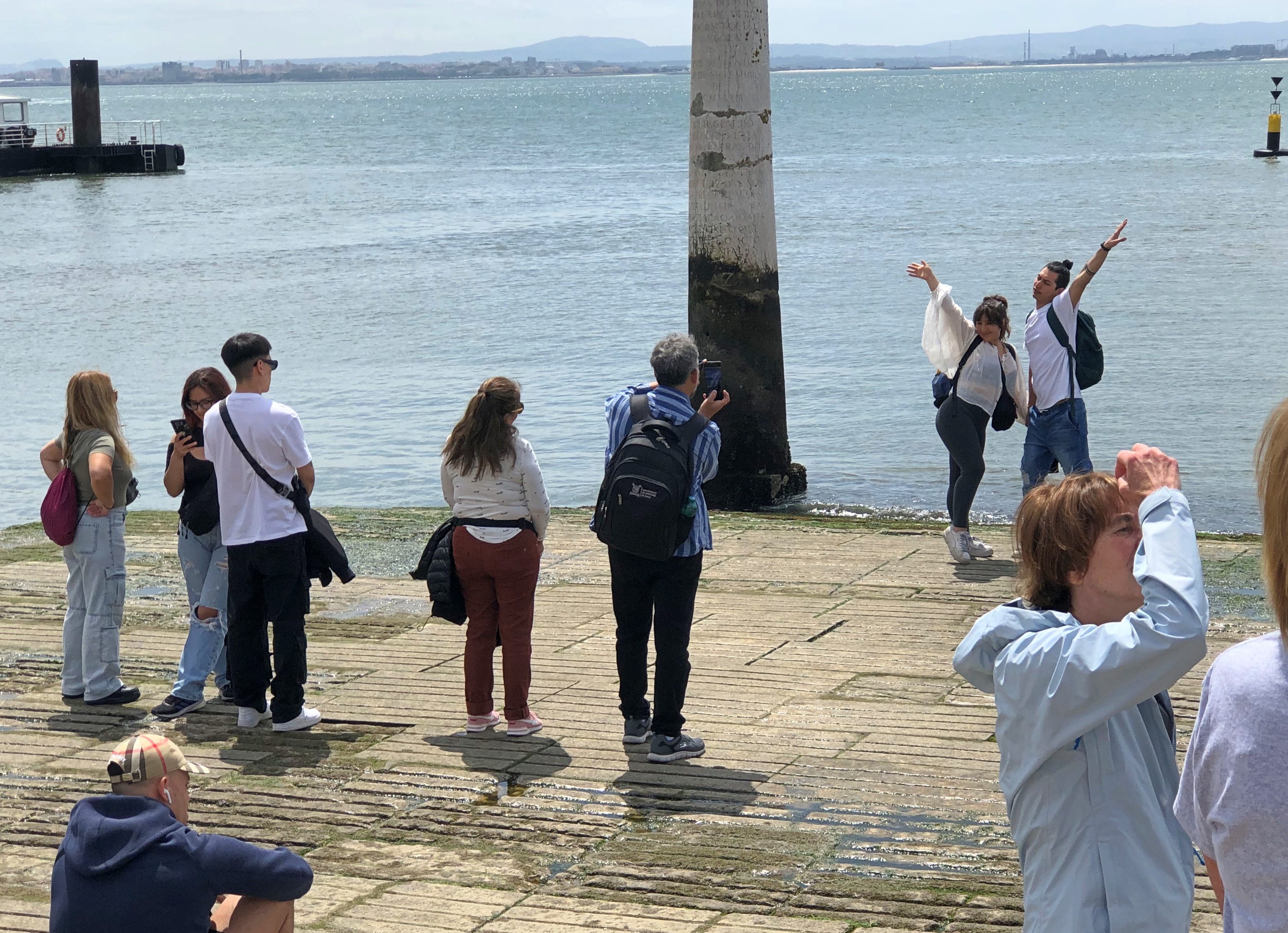
The Thames as it passes through downtown London. The banks are mostly parkland.London Ontario, Thames River London Ontario, Thames River

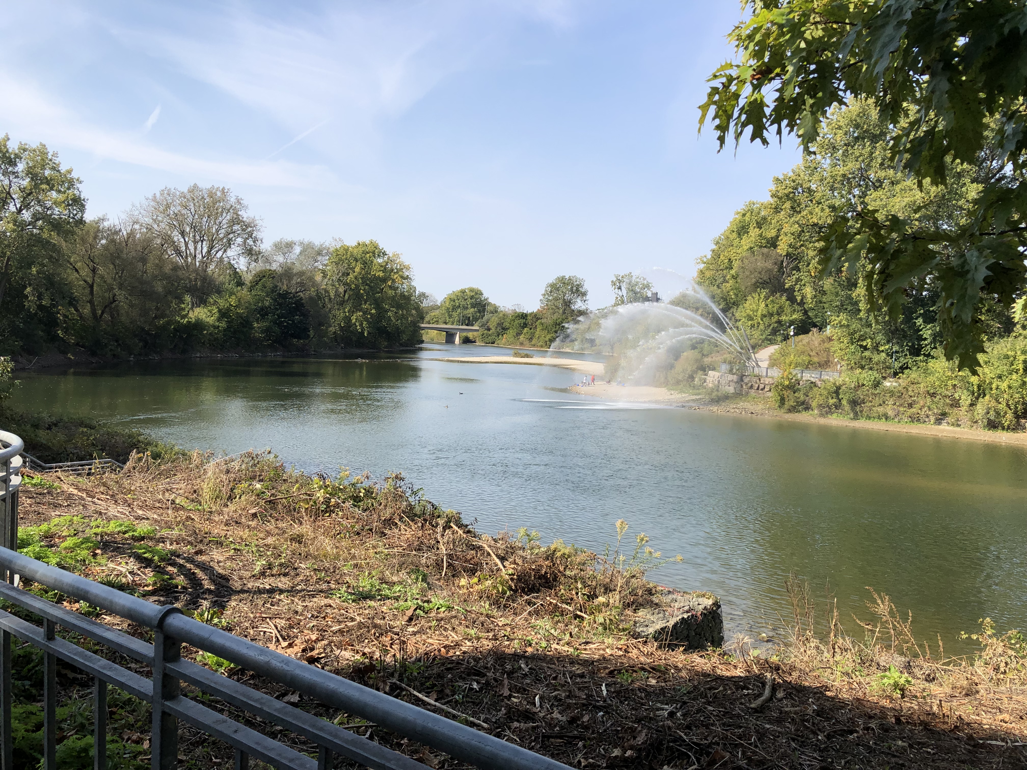
Actually, that point is the meeting of the North Thames and the Thames, locally known as the Folks. The river is called as La Tranche in French and Deshkaan-ziibi in Ojibwe, Antler River.

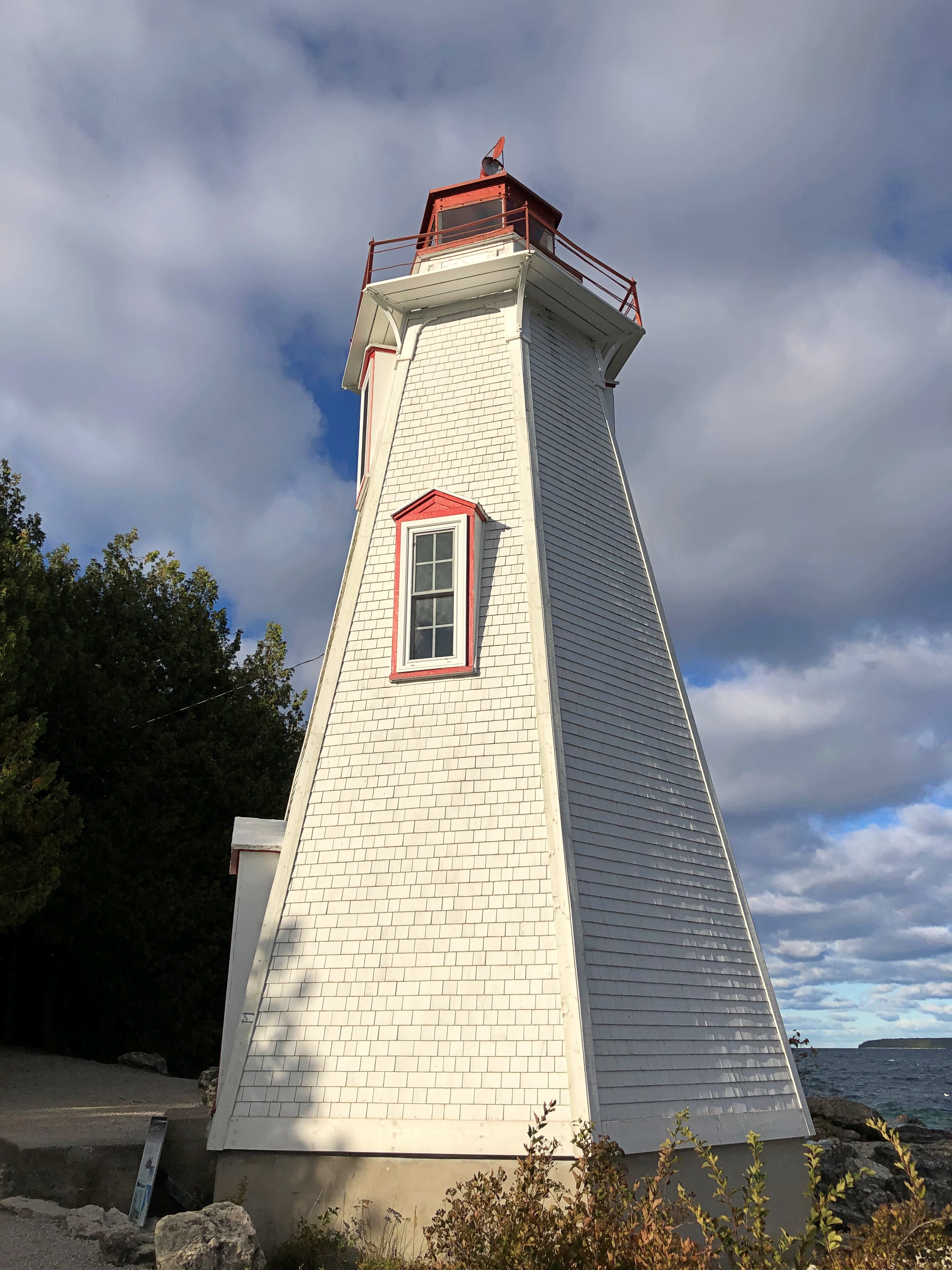
The King Street pedestrian bridge connecting the banks.London Ontario

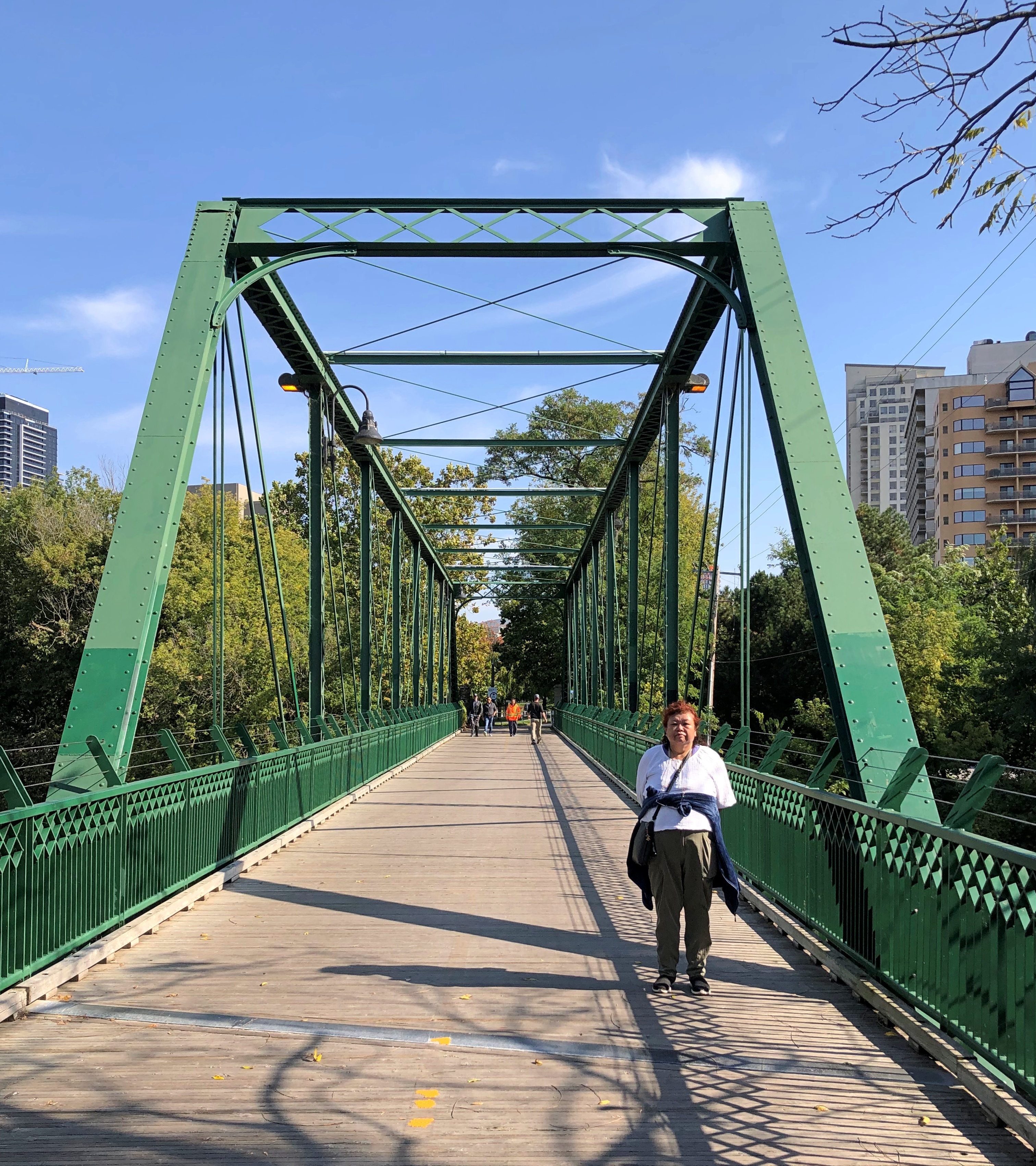
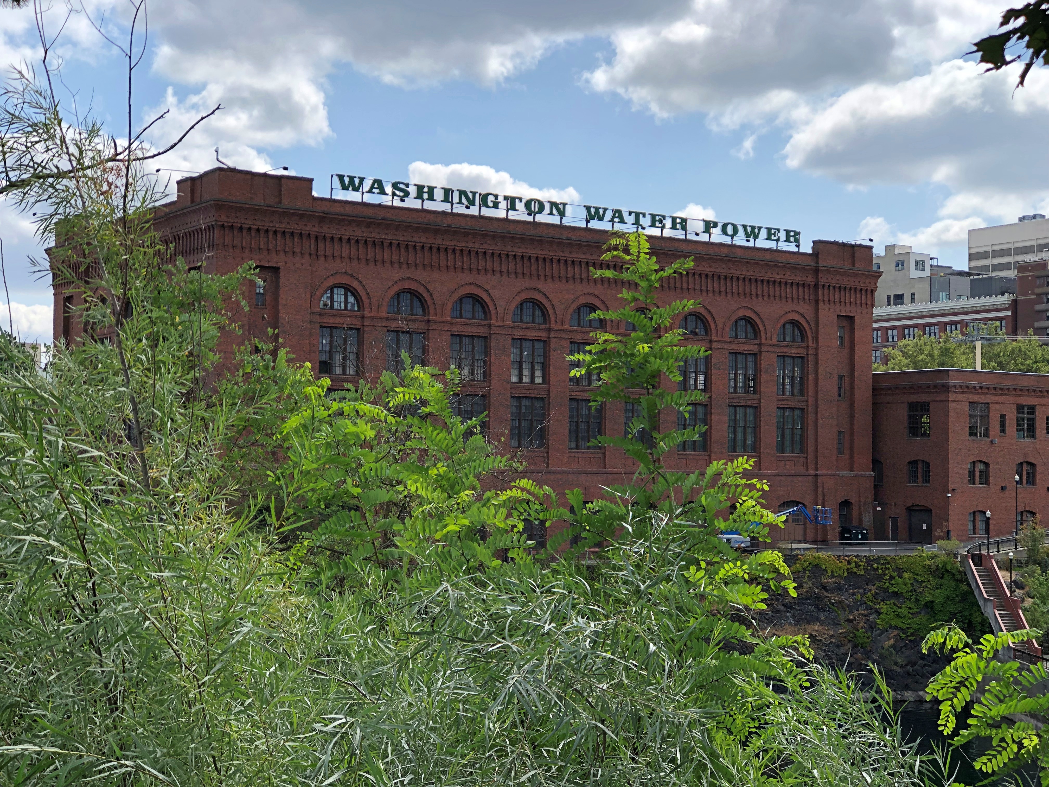
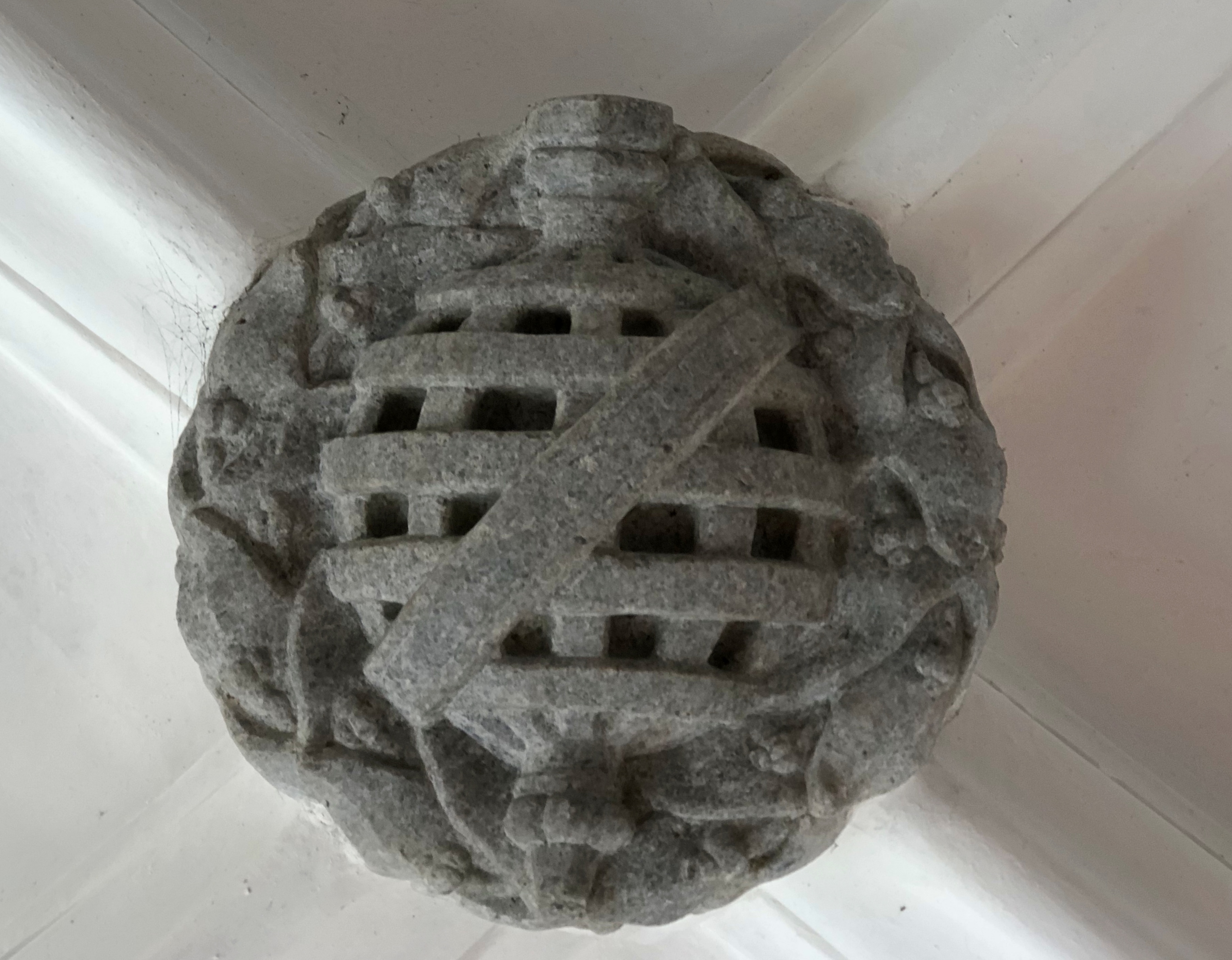
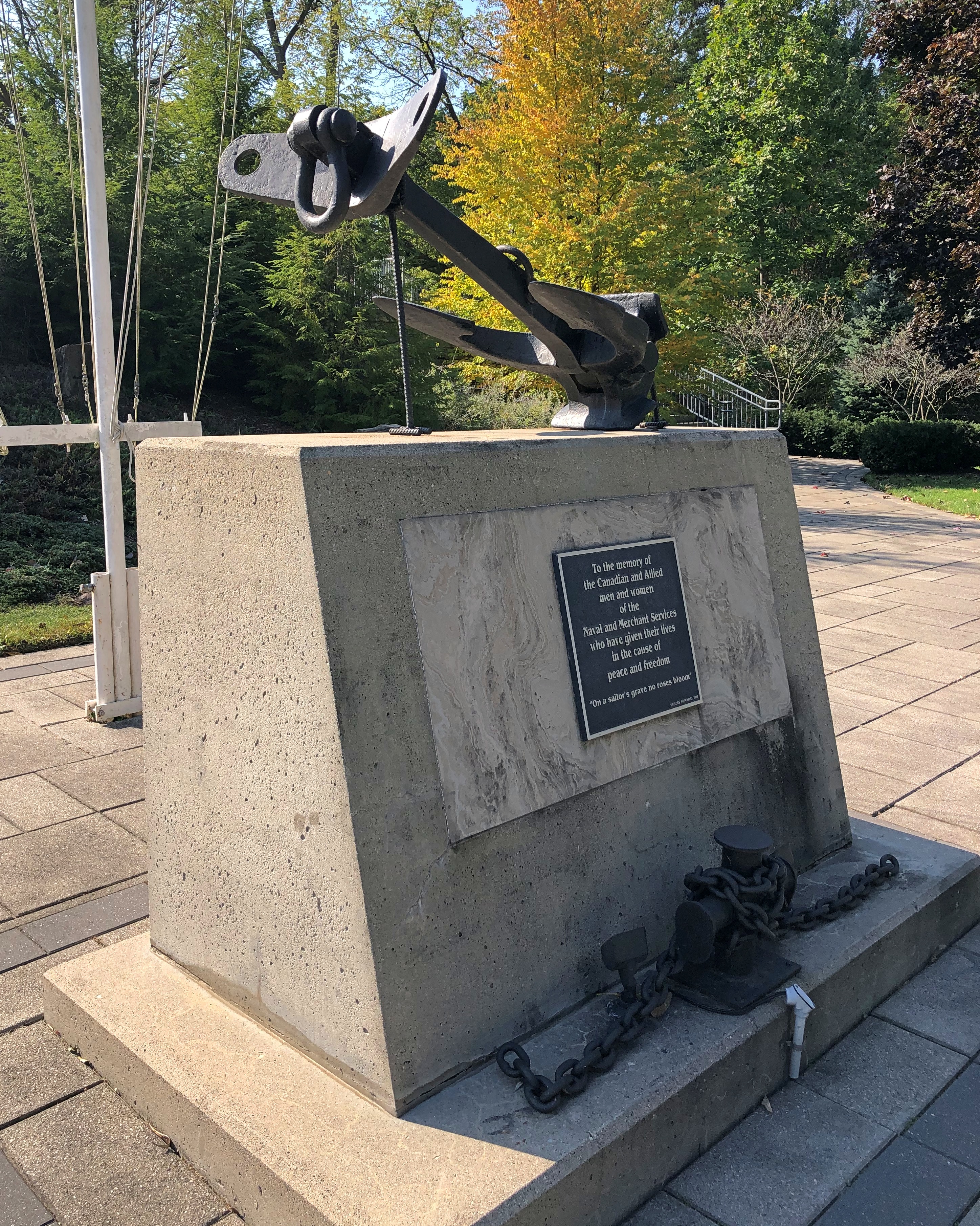
Near the Folks is the HMCS-NCSM Prevost, flying these colors – the Canadian Naval Ensign, if I understand correctly.London Ontario

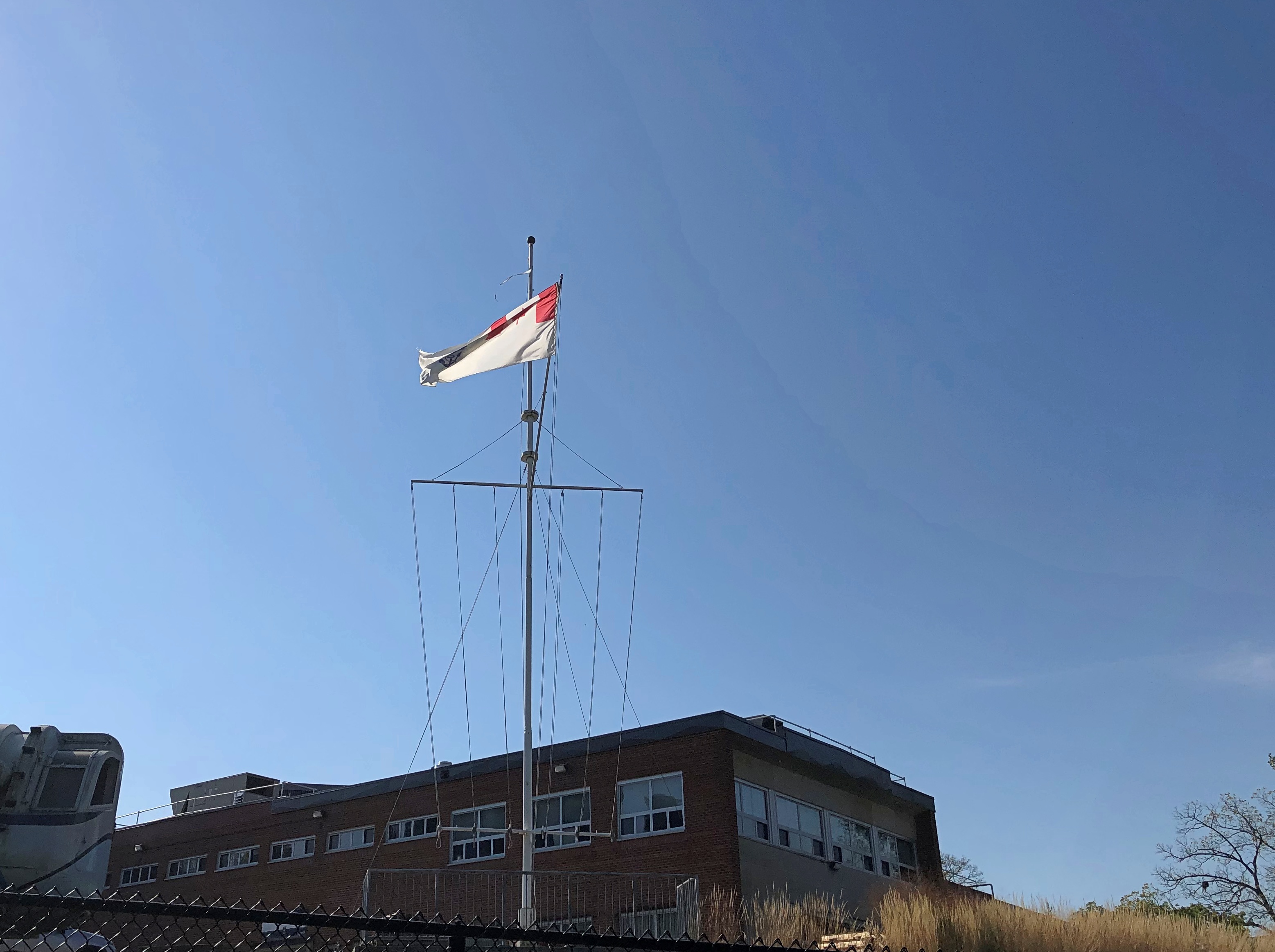
All that is a fair amount to unpack: the ensign is flying on land because the Prevost is a stone frigate, a naval facility on land. HMCS is His Majesty’s Canadian Ship, of course, but this being Canada, it is also NCSM, Navire canadien de Sa Majesté. The site is a training and recruiting center for the Canadian Navy, and also home to the Battle of the Atlantic Memorial. Another sign is in French, but I only made a picture of the English.London Ontario London Ontario

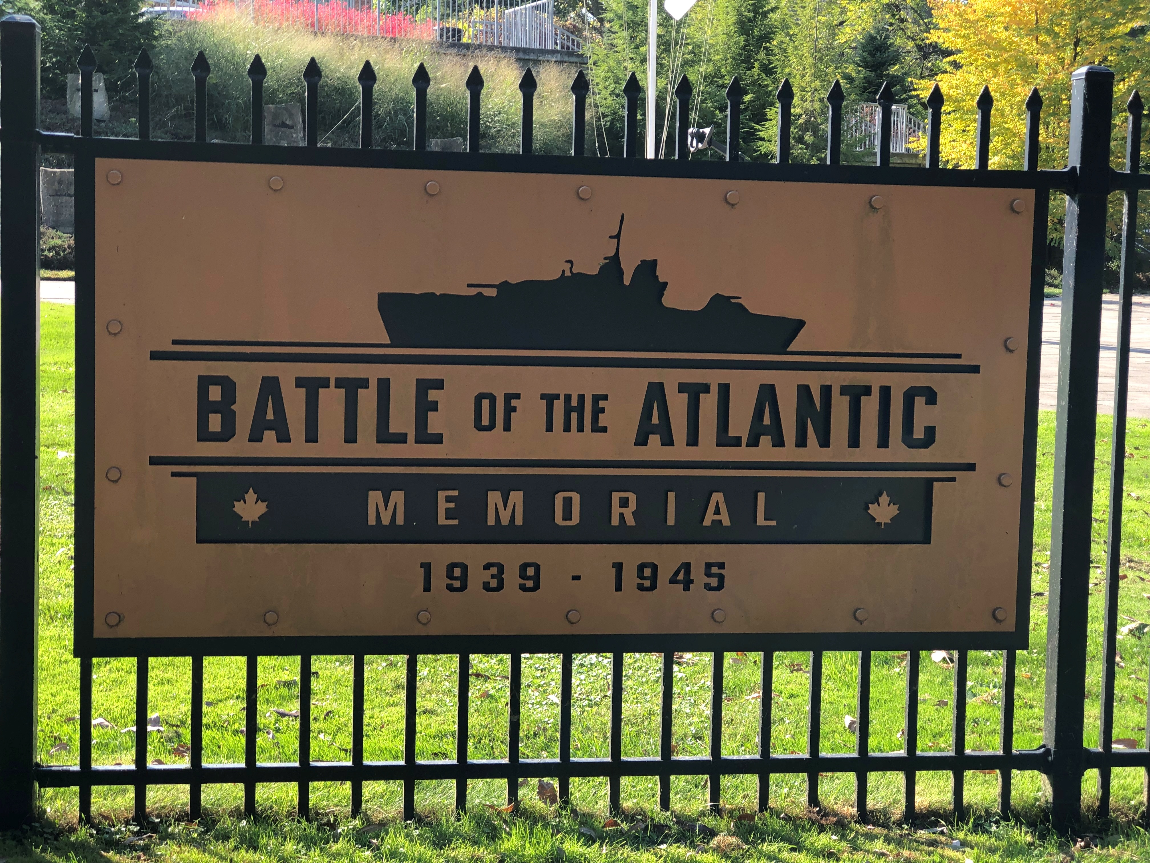
The memorial is still under construction, according to the London Free Press, and it looked like it, with memorial stones being put into place on a small slope. Dedication will be next May, on the 80th anniversary of the end of that battle, which lasted until the Germans surrendered.London Ontario

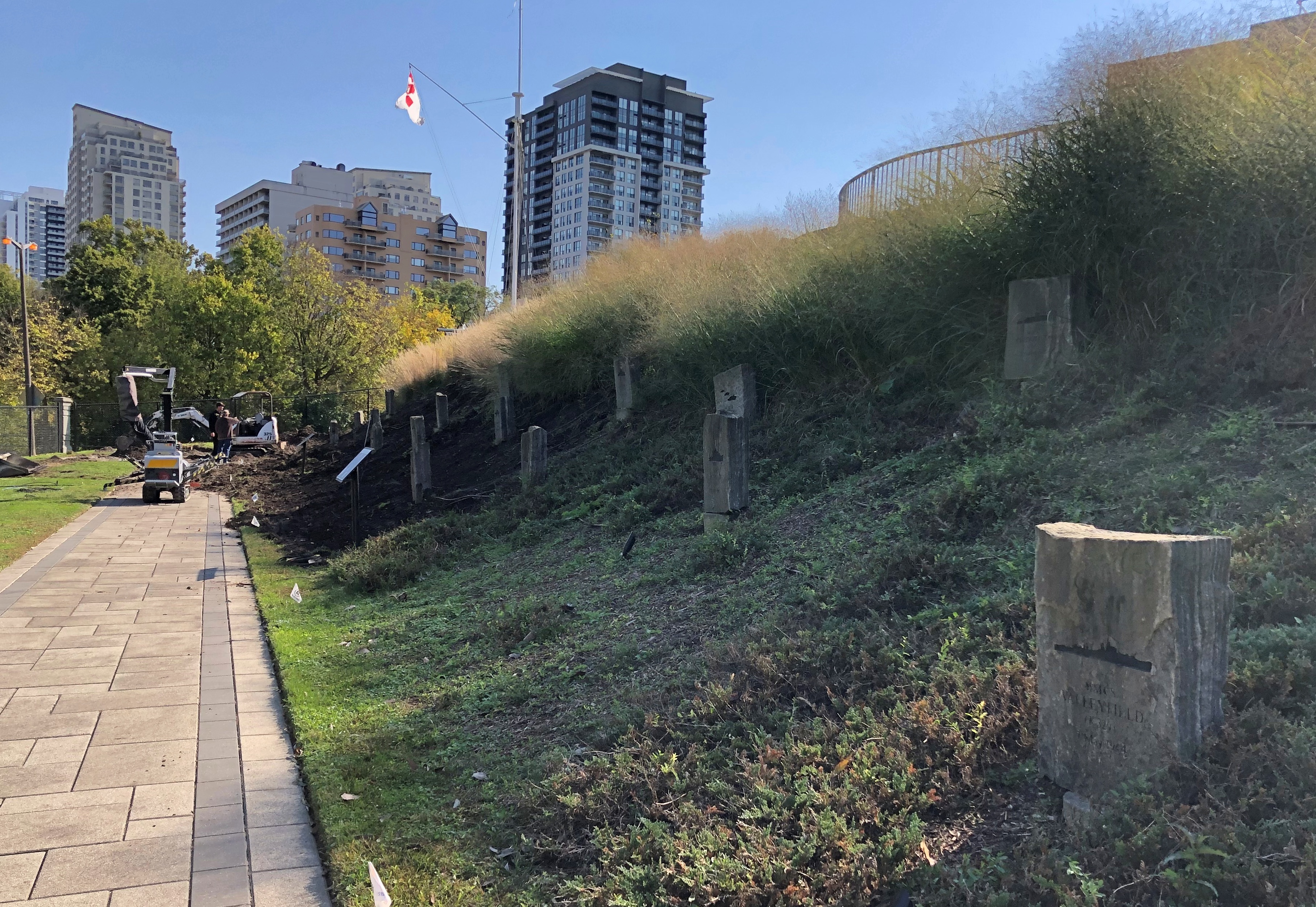
I decided to look up one of the ships memorialized: the HMCS Valleyfield.London Ontario

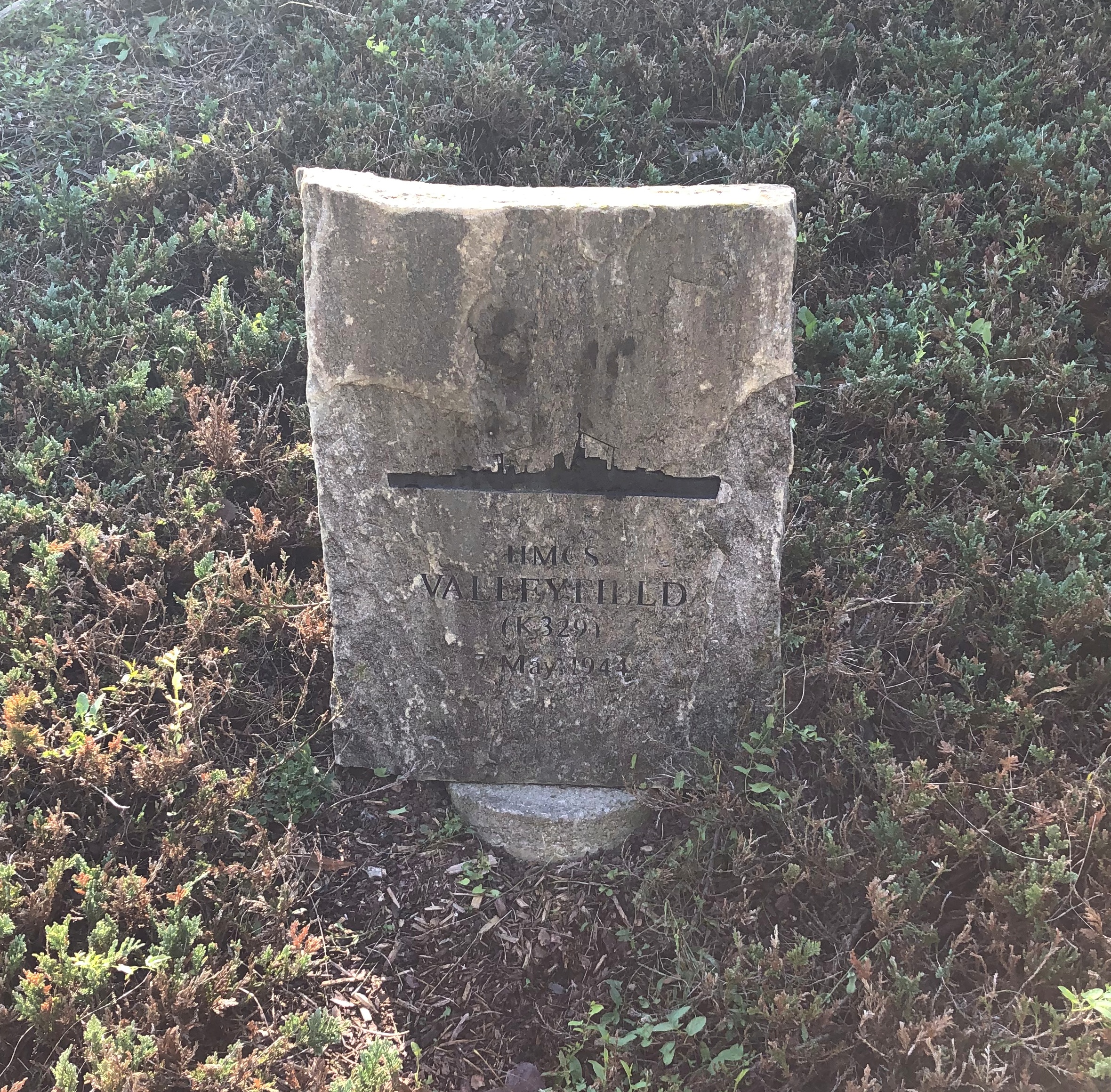
Commissioned in December 1943. Torpedoed and sunk May 7, 1944, with the loss of 125 Canadian sailors in the gelid North Atlantic.

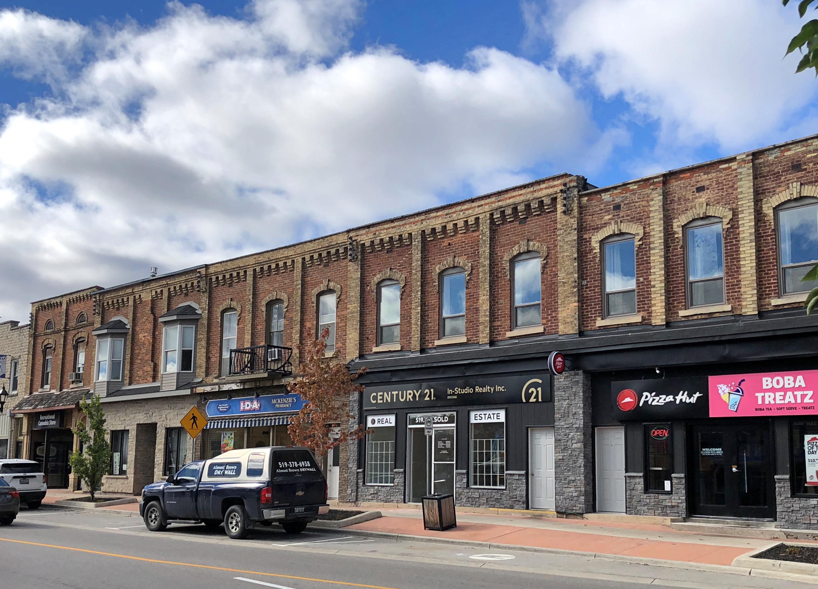
After the riverside, we took a short walk through downtown, especially Dundas St.London, Ontario London, Ontario London, Ontario

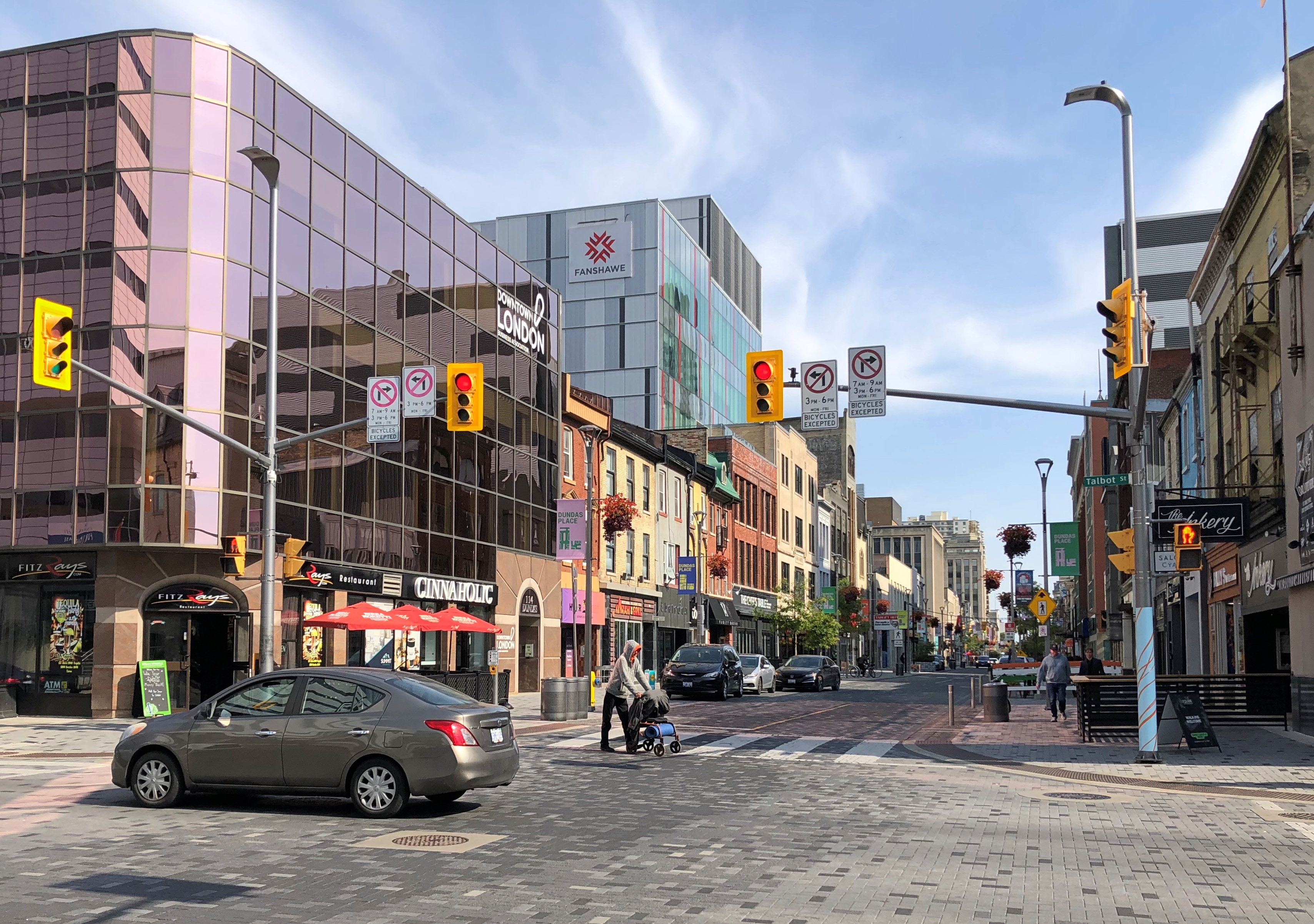
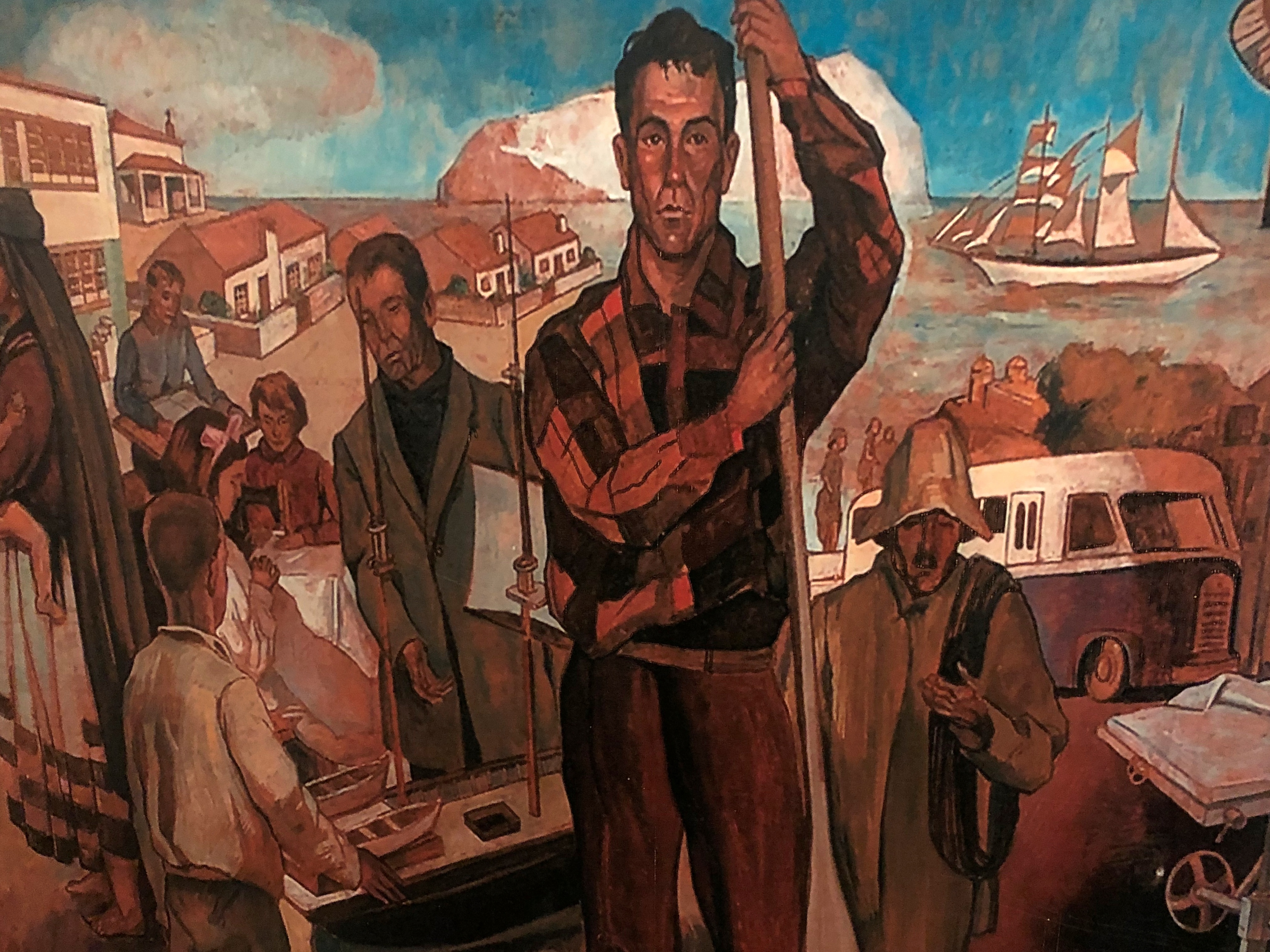
An unexpected mural on that street.Johnny and June, London, Ontario

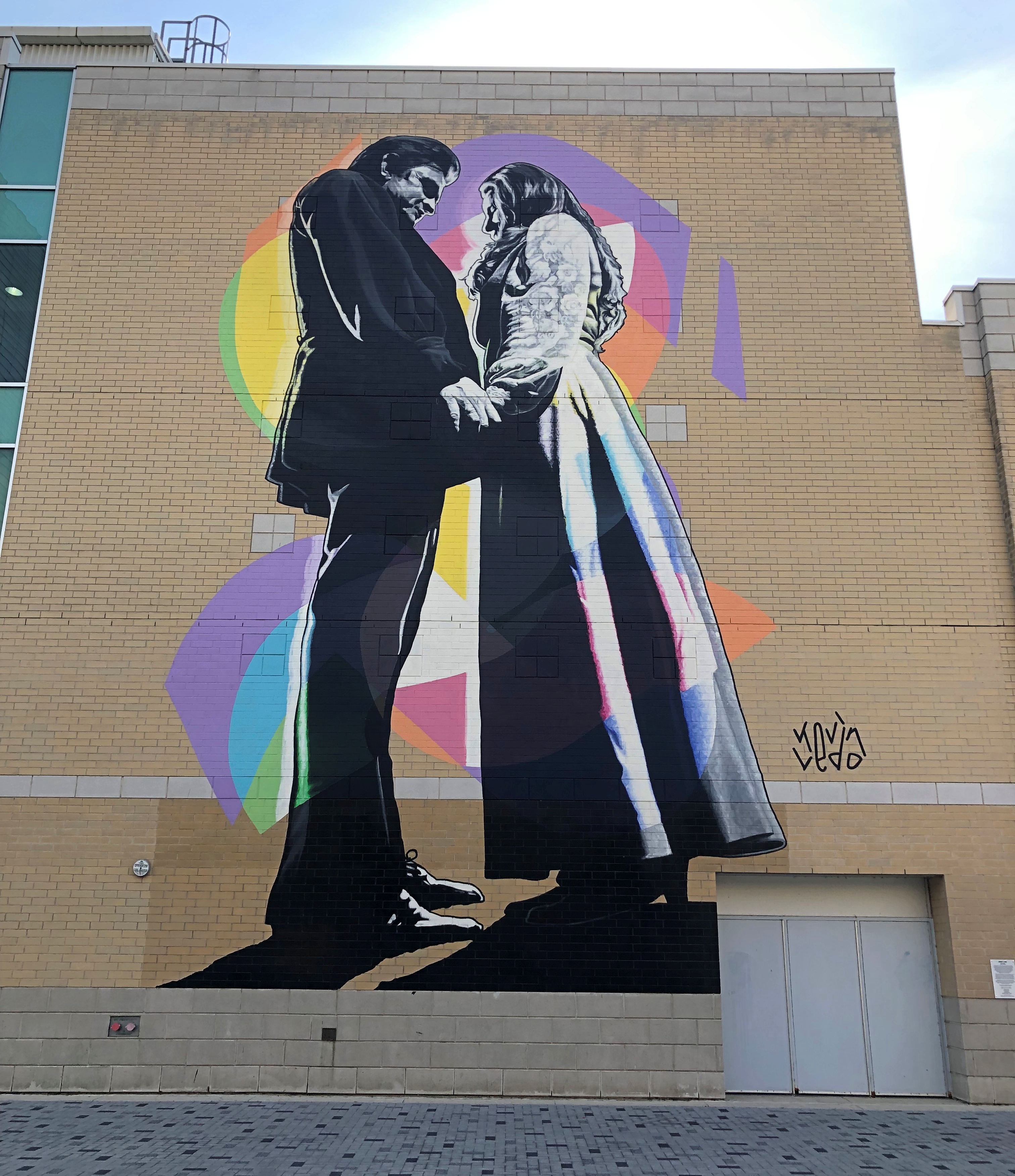
“Johnny and June” by Kevin Ledo, a Montreal artist, and completed only in 2023. (If you want to see a large Ledo mural depicting a young Alex Trebec, go to Sudbury, Ontario.)

The mural, on the side of London’s Budweiser Gardens sports-event venue, is impressively large, at 45 feet tall and 20 feet wide. Larger than life, certainly. A nearby sign says it commemorates the moment on February 22, 1968, when Johnny Cash proposed to June Carter on stage during a concert in London.

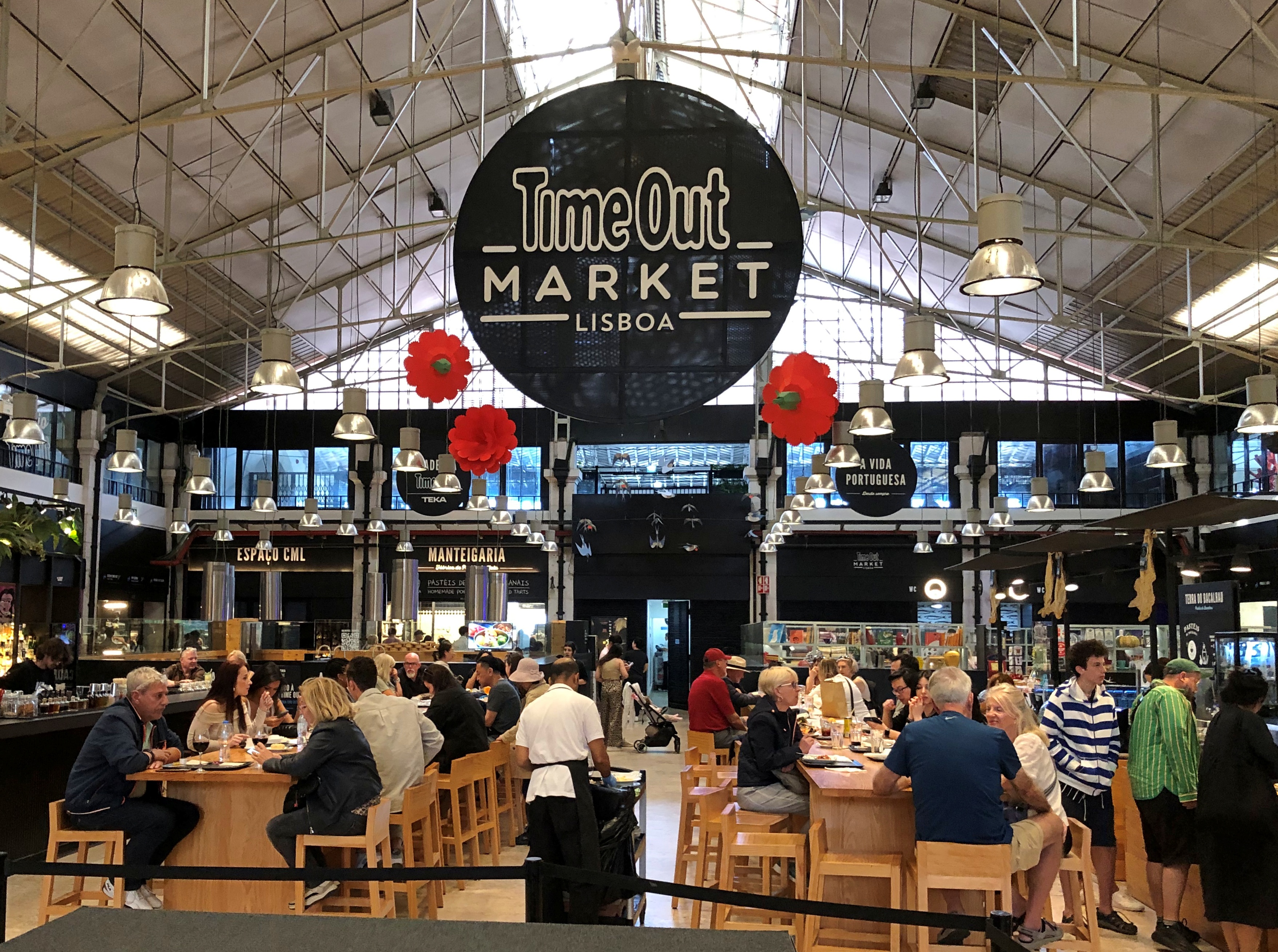
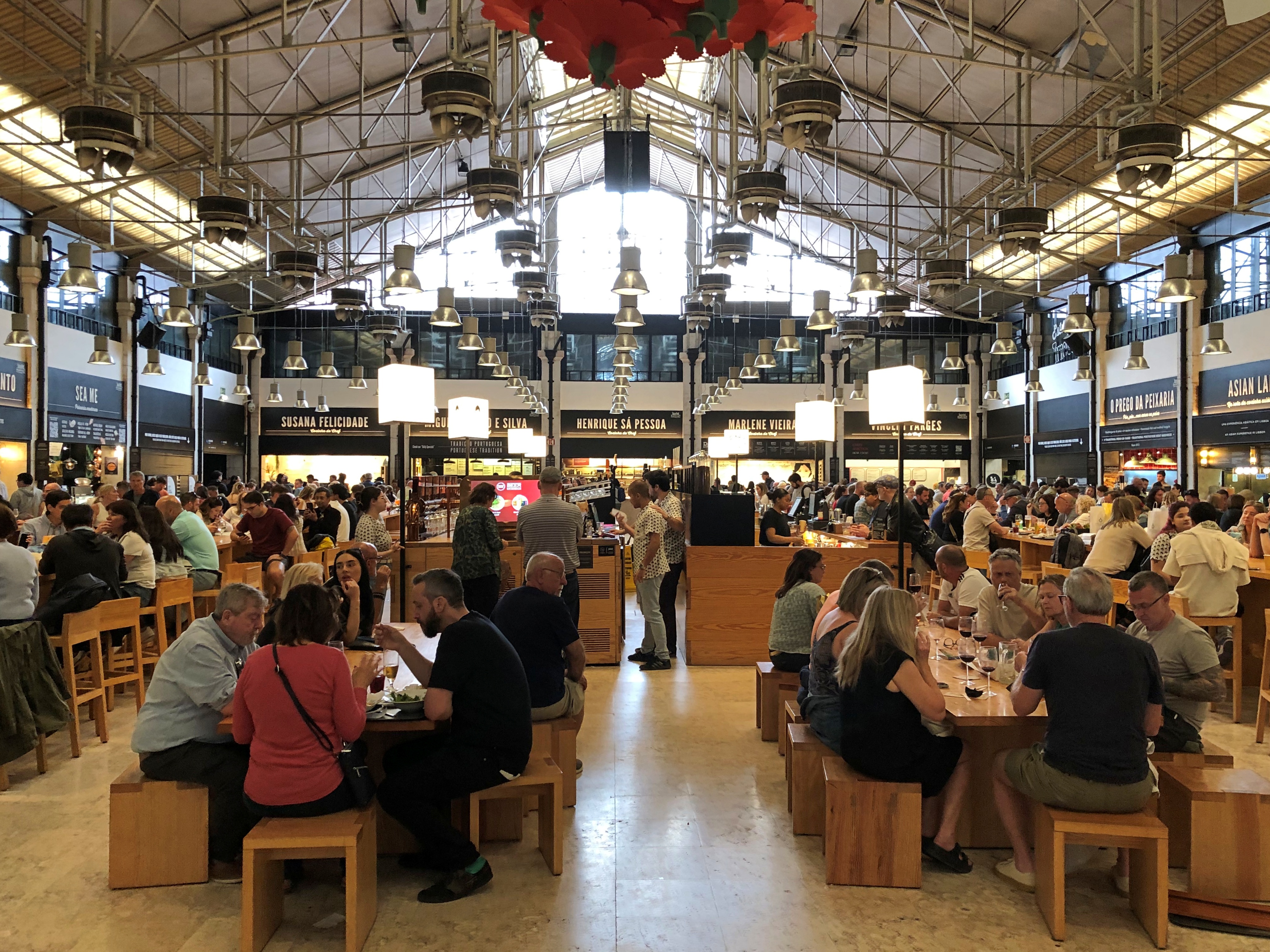
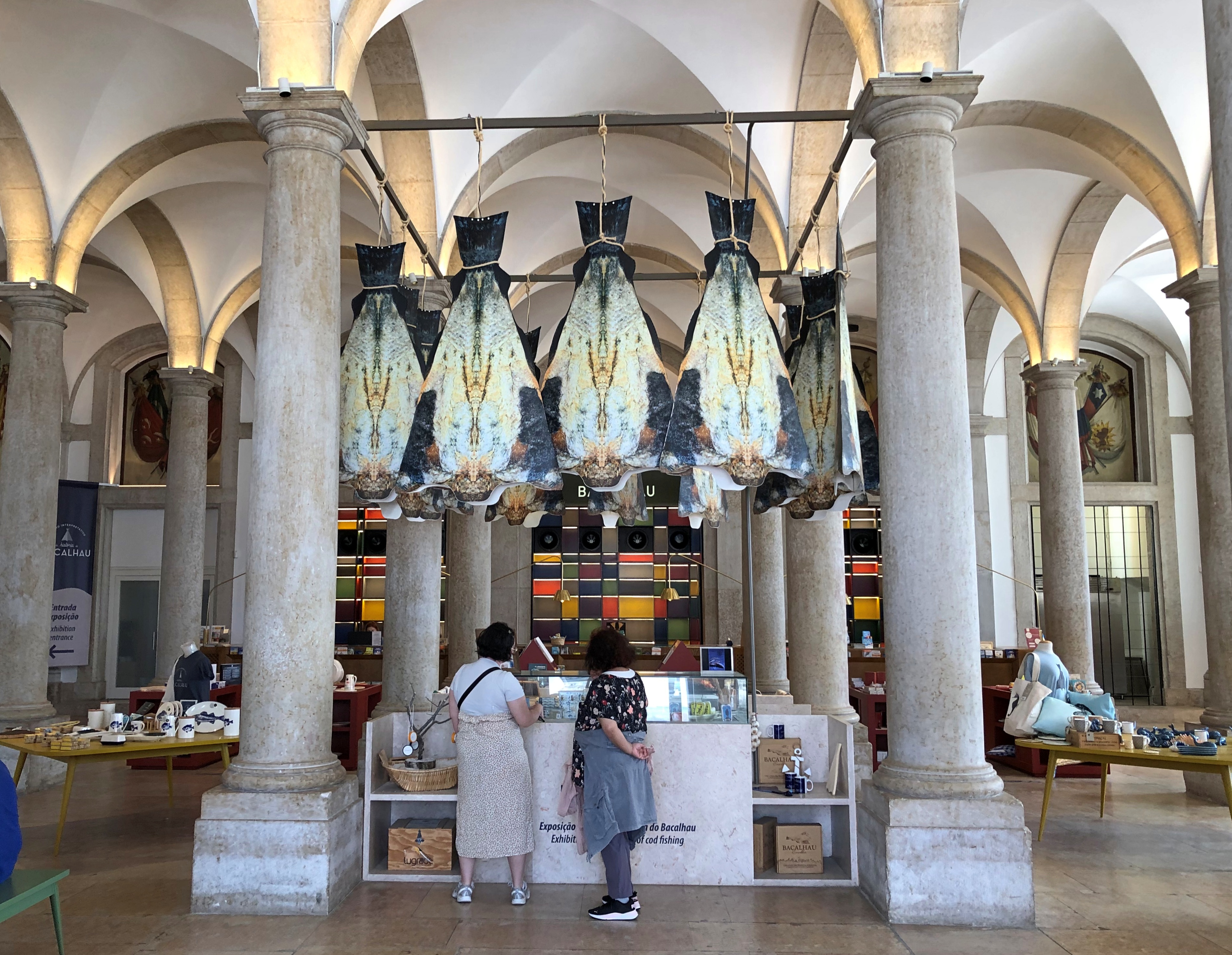
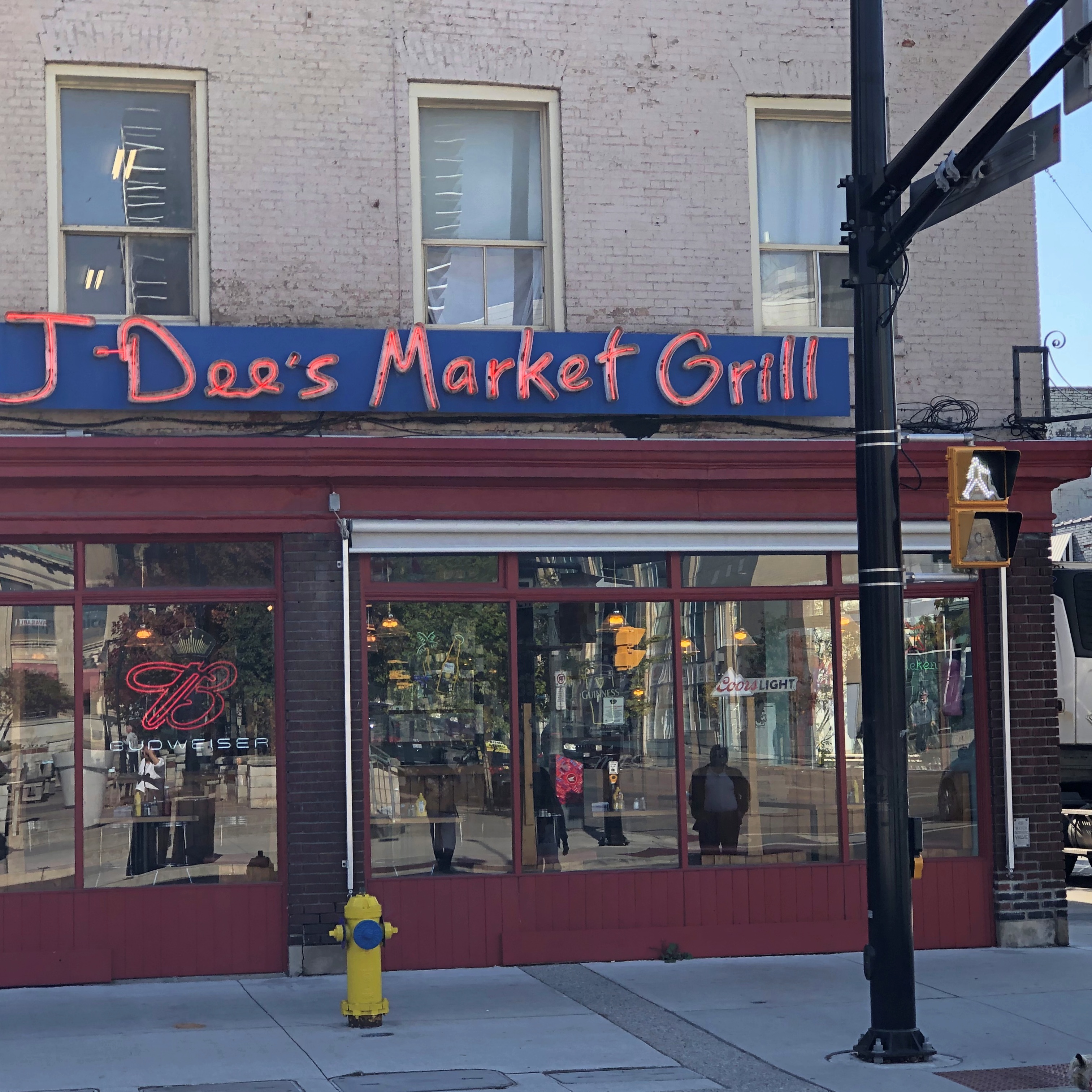
As for Covent Garden, that’s where we had lunch. Site of a public market since 1845, though I expect things have been cleaned up some since then.Covent Garden, London, Ontario Covent Garden, London, Ontario

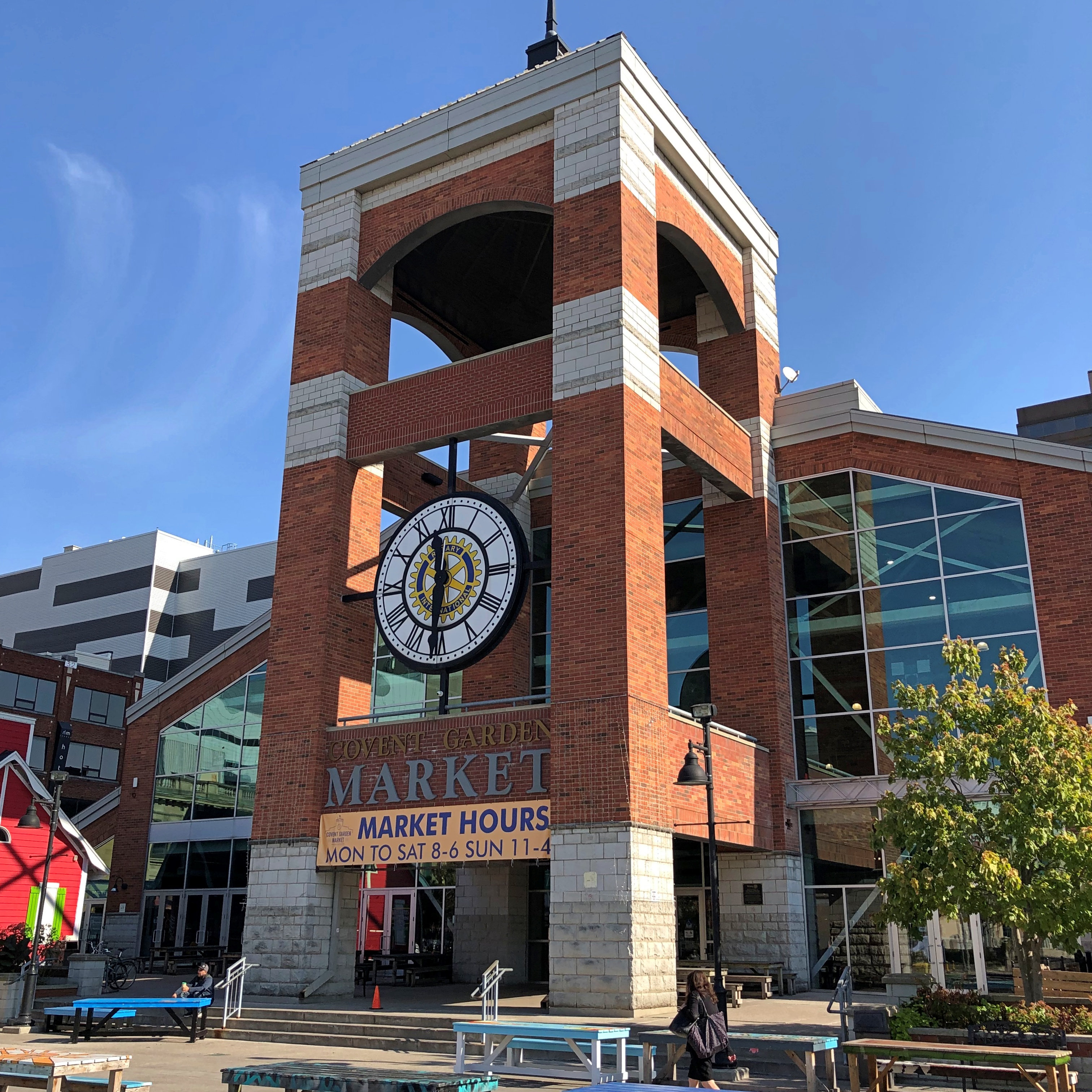
Not quite as grand as the one in the larger London, but well worth the stroll to look at the shops, and find an eatery. We ate at a Brazilian place. Don’t see too many of those in food halls. Most satisfying.Covent Garden, London, Ontario Covent Garden, London, Ontario Covent Garden, London, Ontario

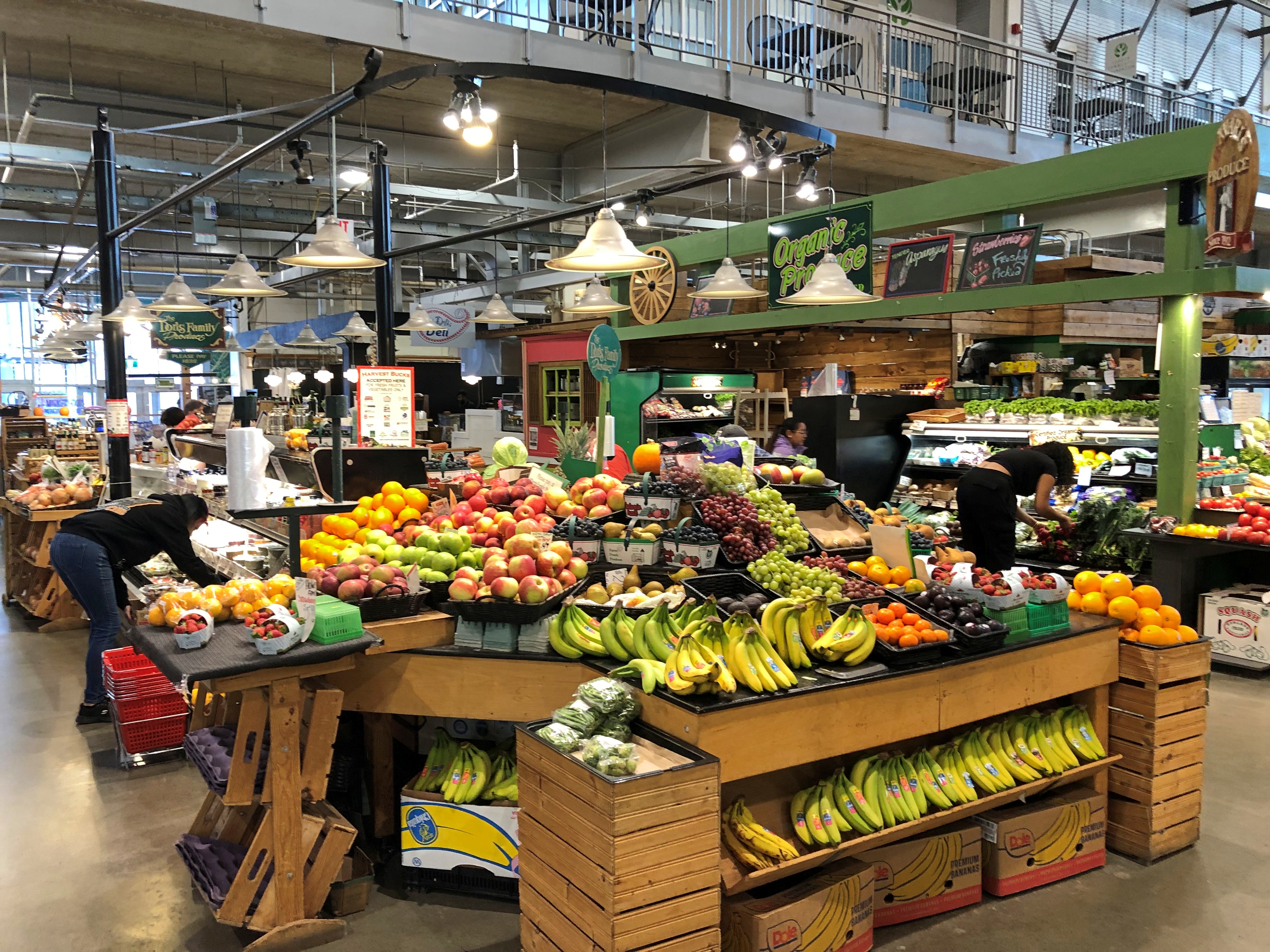
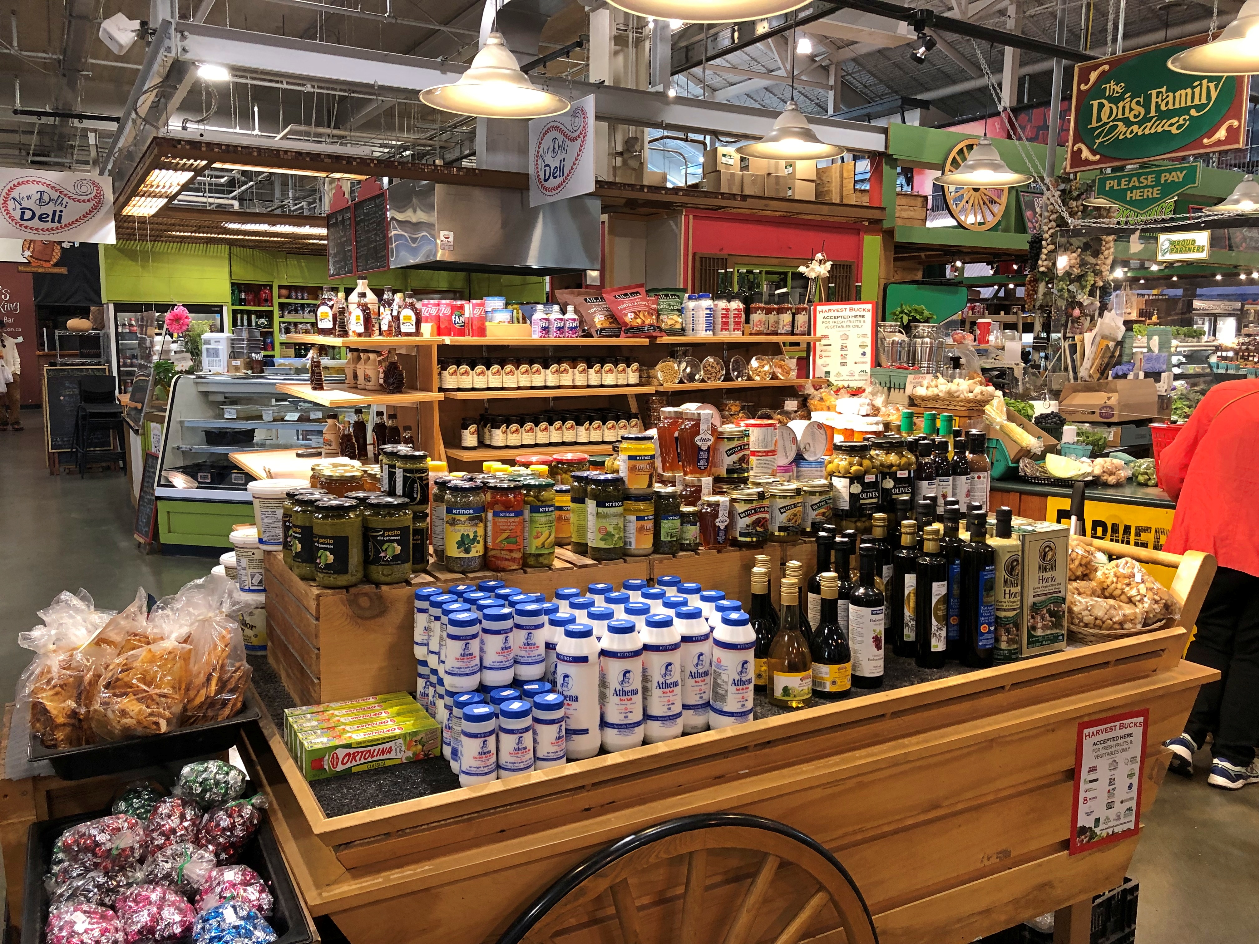
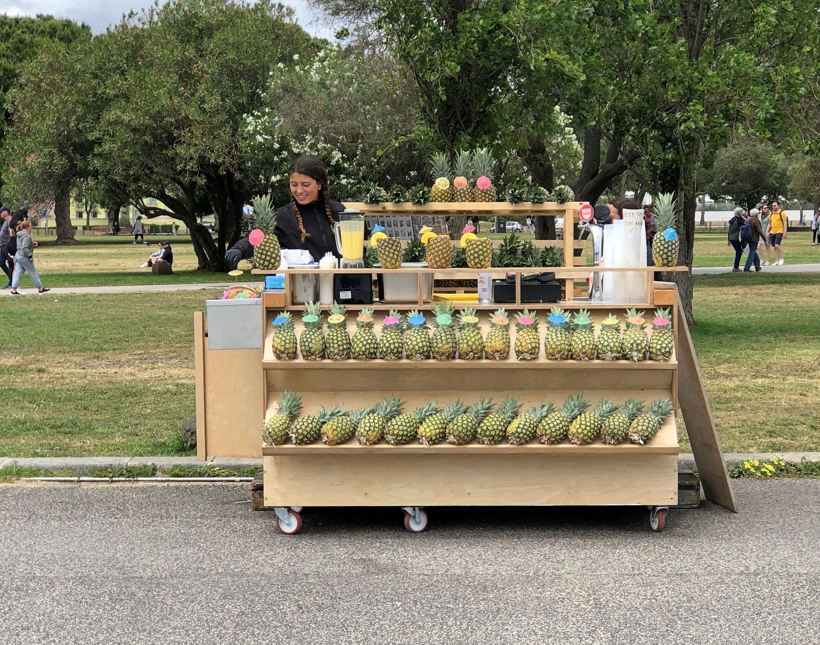
Lots of goods. Is there a Canadian content requirement?London, Ontario London, Ontario

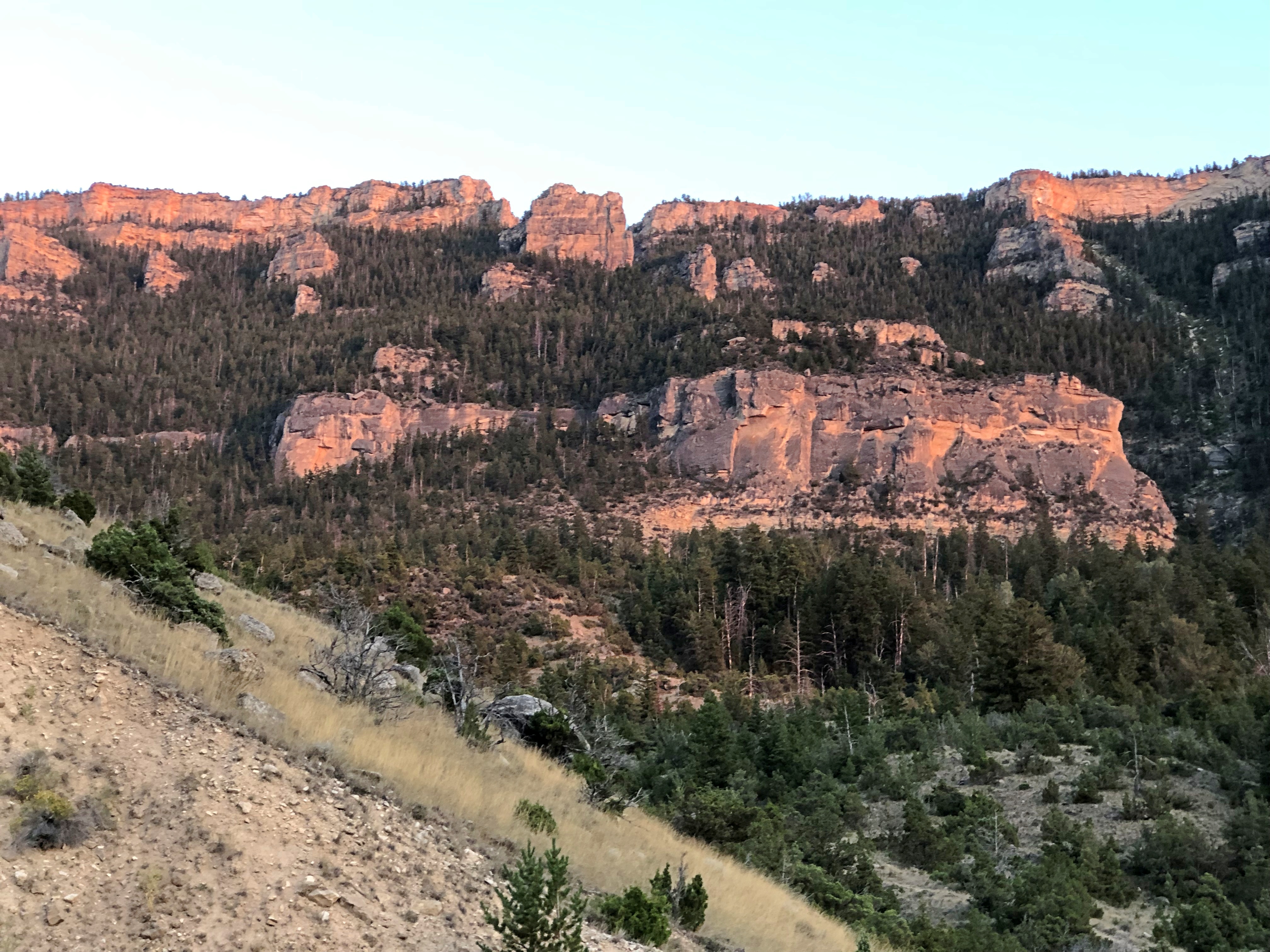
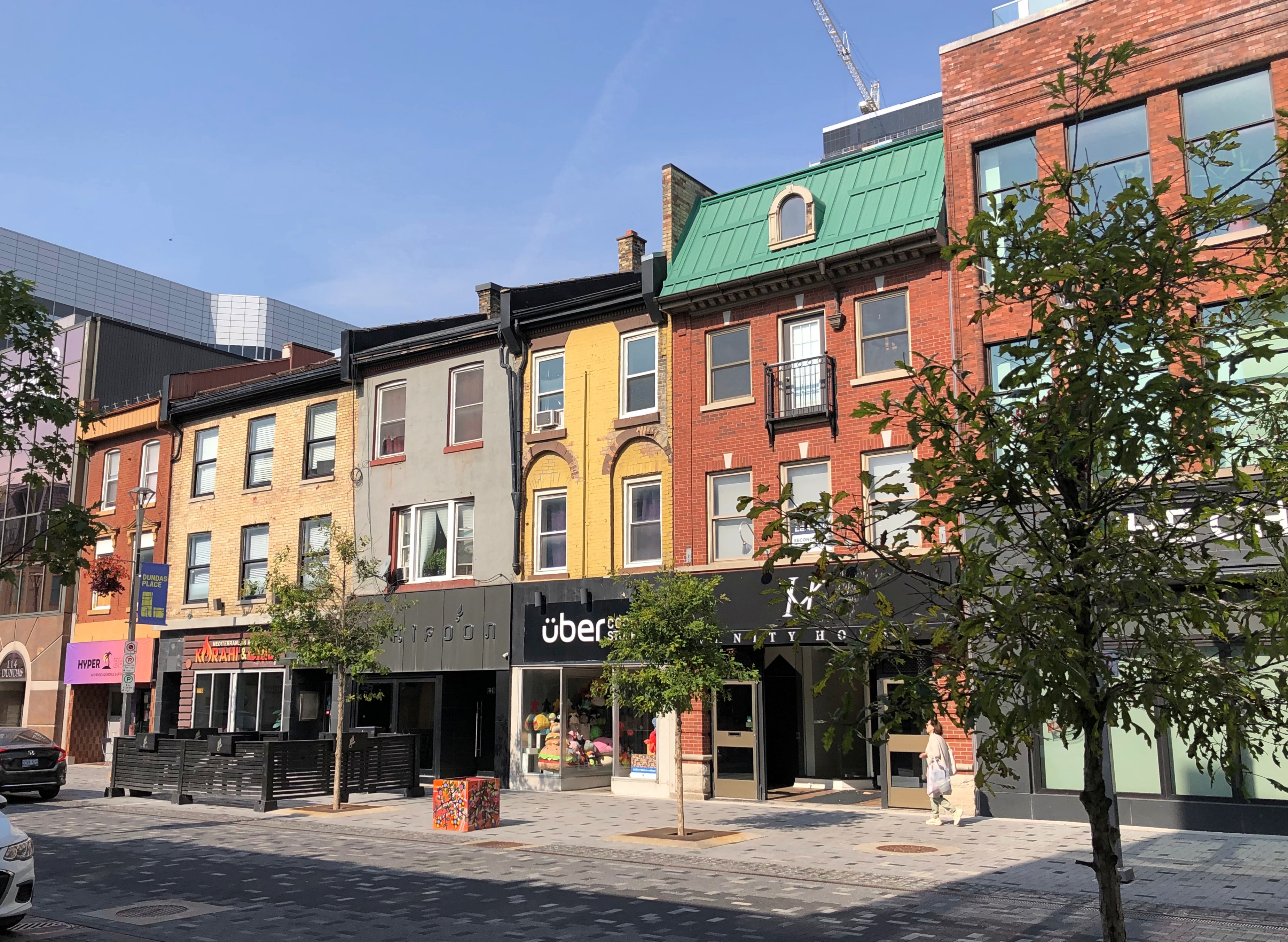
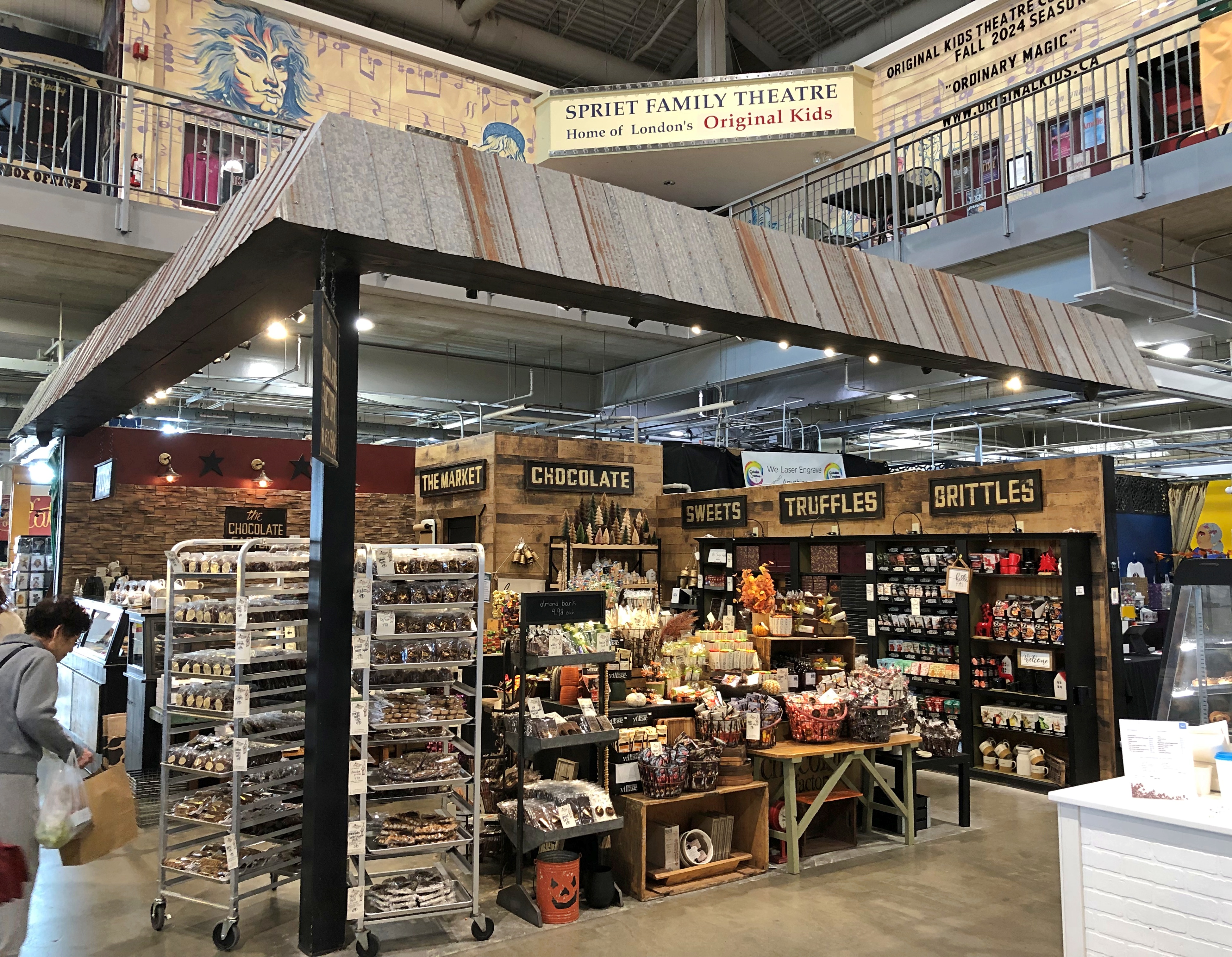
A few more London details, near Covent Garden. We didn’t see on foot the part of town I found more intriguing, which we drove through: the area around Western University (a.k.a., University of Western Ontario, enrollment more than 40,000). Might be a good place to look around if we ever take that trip to the Stratford Festival, which is practically down the road from London.London, Ontario London, Ontario London, Ontario

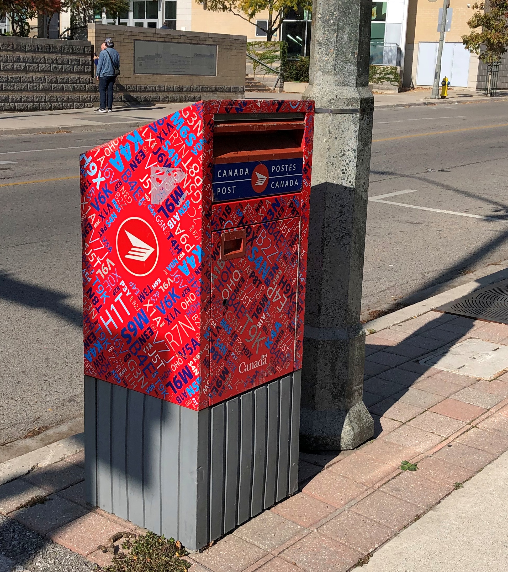
I have to like a place with a name like that.

Wiarton Willie and His Hometown

Look at that point-of-interest spot on the map, I said to no one in particular. I think Yuriko was in the bathroom right then. Wiarton Willie, I said. And that is?

I didn’t look it up. But I knew we were going that way, south from the tip of the Bruce Peninsula at Tobermory on the two-lane Ontario 6, so we could find out. The town of Wiarton, Ontario was our first stop, late on the crisp and clear morning of October 10.

Wiarton’s on the Georgian Bay side. Willie has a lake view in a municipal park, but he is positioned looking away.Wiarton, Ontario

The plaque says that Willie was carved from Adair Dolomtic Limestone by Dave Robinson, and erected in 1996 on the occasion of the 40th anniversary of Groundhog Weekend celebrations in Wiarton, Ontario, pop. about 2,000. He honors the live groundhogs used in the annual ceremonies. “Willie Rising” is the formal name of the work.

Punxsutawney might have the best-known Groundhog Day celebrations — and certainly be depicted (by Woodstock, Illinois) in the best movie ever likely to be made about the holiday — but it isn’t the only place that touts the predictive talents of a series of marmots during a wintertime festival. Wiarton does, too. At one time an albino groundhog served as the living centerpiece of the fest, though more standard groundhogs seem to be tasked with forecasting these days.

One year, the Willie of the time died just before the festival, so the organizers held a public funeral instead, putting a lookalike stuffed rodent in a tiny casket, since the recently passed Willie reportedly smelled too bad for the role. Apparently some of the festivalgoers were miffed, but if you asked me that shows some imagination on the part of somebody — an urge to do something just a little out of the ordinary. In the hands of a competent scriptwriter, there’s probably a pretty good Groundhog Day comedy in that story.Wiarton, Ontario

Here’s a rabbit hole: or rather, a groundhog burrow: The Adair in Adair Dolomtic Limestone is a trademark held by Arriscraft, which is a unit of the stone products group of General Shale, the North American subsidiary of the expansion-minded Wienerberger AG, a leading multinational manufacturer of brick, headquartered in Vienna. The stone itself was quarried locally, since there are quarries near Wiarton. But the ultimate bosses are shadowy German-speaking billionaires.

The shore at Wiarton.Wiarton, Ontario Wiarton, Ontario Wiarton, Ontario

Not far away is the main street, Berford Street (Ontario 6), and its collection of handsome buildings of a certain age.Wiarton, Ontario Wiarton, Ontario Wiarton, Ontario

The taller buildings came in at no more than three stories.Wiarton, Ontario Wiarton, Ontario Wiarton, Ontario

Most had stores on their first floors, and people were out and about on the sidewalks, going about their business at such places as Beer Store, Peninsula Imprint, Bluewater Dental, Sullivan’s Butcher Shop, Coral’s Caribbean Cuisine, KW Real Estate Centre, Lost Art Espresso, Sunshine Drugs, Wiarton Emporium (thrift store), Cannabis Grey, Royal Bank of Canada, Ashanti Cafe, and more – a mix of ordinary retail and some that probably depend more on day-trippers from larger cities.

An active, walkable town, in other words, the kind planners dream about, but which are hard to conjure up from a set of plans.Wiarton, Ontario

Canadian Thanksgiving weekend was about to start.Wiarton, Ontario

From what I saw and heard, mostly on the radio, turkey feasts and family gatherings are common aspects of the holiday. That’s all very well, but I think we have a better deal: three holidays, plus a de facto holiday thrown in to make four days, on the leading edge of Christmas. Thanksgiving is a three-day weekend in Canada, and that’s that.Wiarton, Ontario

Over the door of the Royal Canadian Legion in Wiarton. Memoriam eorum retinebimus, we will remember them.Wiarton Ontario

Nearby artwork in the town with the same message.Wiarton Ontario

We should remember them, too. We, as in Americans. Not only have there been no hostilities along the border since the War of 1812 (not counting fishing spats), we and the Canadians have been comrades in arms ever since, when the times call for it.

Bruce Peninsula National Park: The Sand

Clambering around on rocks, even the kind that don’t require any technical skills, takes energy, so lunch was the next order of business after our hike along the shore of Georgian Bay last Wednesday. We spotted a food truck outside the park, on Ontario 6, called the Hungry Hiker. That seemed fitting.Hungry Hiker, Tobermory

It had a Bigfoot theme. That seemed odd.Hungry Hiker, Tobermory

During our travels in the U.S. West, especially Montana-Idaho-Washington state, we noticed many roadside Bigfoot depictions, including this one in metro Seattle, in front of a place in Edmonds where we had lunch one day.Bigfoot, Edmunds, Wash.

The Hungry Hiker Bigfoot was the only one we saw in Canada. Whimsy on the part of the owner, maybe, which also included some of the menu items, such as the Sweaty Yeti, a chicken sandwich with a sweet glaze. We ordered one, but not The Big Foot, which was a foot-long hot dog. Sasquatch theme or not, the Hungry Hiker’s food was satisfying.

Next stop: Singing Sands Beach at Bruce Peninsula NP. The park includes more than one section, with the beach on the other side of the peninsula, facing Lake Huron proper.Singing Sands Beach, Bruce Peninsula NP

Nice. A big, almost empty beach. In mid-summer, it’s probably overrun. In October, there were only a few people and a frolicking dog.Singing Sands Beach, Bruce Peninsula NP

Behind the beach, a fen.Singing Sands Beach, Bruce Peninsula NP Singing Sands Beach, Bruce Peninsula NP

I don’t know a fen from a bog or a marsh, even though I’ve seen a fen, but that’s what the sign said. It also informed us that resident in the area is the Massasauga rattlesnake (Sistrurus catenatus), “Ontario’s only venomous snake.”

I didn’t know Ontario had any venomous snakes either, much less a rattler. We were further assured that they are small (not a good thing) and shy (better), so they are likely to avoid you. Also, they are endangered, so gardeners in, say, suburban Toronto aren’t at much risk. Canada ≠ Australia, despite some historic similarities. As we tromped along, none were to be heard.

A short trail wandered into the trees near the beach, past a couple of creeks meeting Lake Huron.Singing Sands Beach, Bruce Peninsula NP Singing Sands Beach, Bruce Peninsula NP

The trail was a loop, returning by way of grasslands and more beach, which was a little rocky at that point.Singing Sands Beach, Bruce Peninsula NP Singing Sands Beach, Bruce Peninsula NP Singing Sands Beach, Bruce Peninsula NP

We still had some afternoon left – a warmish day in October isn’t to be wasted – so we went to the BPNP visitor center, back on the Georgian Bay side, to climb the observation tower.Bruce Peninsula NP Bruce Peninsula NP

Nice views, though not as much fall color as we’d expected. I could feel the tower shake just a little in the wind, which wasn’t a pleasant sensation. I’m still up for climbing towers for the vistas, but find myself a bit more unnerved by the experience than I used to be.Bruce Peninsula NP Bruce Peninsula NP

We still weren’t quite done. We drove the short way to Big Tub Harbour, which isn’t part of the national park, but rather part of the town of Tobermory.Big Tub Harbour, Ontario

The thing to see there is the lighthouse.Big Tub Harbour, Ontario Big Tub Harbour, Ontario

Still a working light, so no climbing, unlike others. Not as storied as the Lighthouse of Alexandria or even the Eddystone Light, but good enough on a windy afternoon in Ontario.

Riverfront Park, Spokane

Until we took a stroll through Riverfront Park in Spokane, I’d forgotten about Expo ’74. Turns out the park is a legacy of that world’s fair.Riverfront Park, Spokane

I’ve enjoyed visiting world’s fair legacies over the years, beginning with the many times I visited Hemisfair Plaza in San Antonio, but also the Expo ’70 Commemorative Park in Osaka, the Biosphere in Montreal, the Unisphere in New York, the Space Needle in Seattle, the Palace of Fine Arts in San Francisco, Forest Park in St. Louis, the Parthenon in Nashville, the Museum of Science and Industry in Chicago, and even the Eiffel Tower, if you want to go back that far. If the Crystal Palace had been still standing, I’d have gone to see that.

I’m sure I heard about Expo ’74 at the time, but it was in distant Spokane, which I’d only ever seen on maps. With no likelihood of a visit, I probably didn’t give it much thought at 13. Or afterward. Not until 50 years after the event, on August 25, 2024, when we decided to spend a few hours in downtown Spokane before heading to Seattle.Riverfront Park, Spokane

A river runs through it. Namely, the Spokane River, which is a tributary of the mighty Columbia. (Every time I write about that river, I will use “mighty” just as “stately” always comes before Wayne Manor.) The Spokane roars around an island, formerly known as Canada Island, and still called that according to Google Maps, dividing the upper falls.Riverfront Park, Spokane

In 2017, the Spokane Parks Board decided that “snxw meneɂ” (sin-HOO-men-huh), a Salish word, would be a more fitting name. Salmon People, to render it in English. Once upon a time, the Salish caught salmon there.

The river travels over a small dam, then to the lower falls.Riverfront Park, Spokane Riverfront Park, Spokane Riverfront Park, Spokane

Back in the late 19th century, the area was industrial.

The location wasn’t quite as valuable for industry by the 1960s, so it was picked as the site for the world’s fair, whose formal name was the International Exposition on the Environment, Spokane 1974. Some 5.6 million people showed up for it, compared with 6.3 million for HemisFair in 1968 (and I was among those).

The legacy park.

A pleasant place to stroll on a summer Sunday. Lots to see, such as site of the former U.S. Pavilion.Riverfront Park, Spokane

The handsome Washington Water Power Co. building, dating from 1907. Not actually in the park, but highly visible from the park.Riverfront Park, Spokane

A reminder of long-ago native inhabitants of the area.Riverfront Park, Spokane

For even better views of the river, there’s a sky ride. Its course parallels the river near the lower falls, and then turns around and comes right back, taking 20 or so minutes.Riverfront Park, Spokane

We took a ride. Of course we did. That’s how I was able to take photos of the lower falls, posted above.

South Dakota Dash ’24

The first day of the trip was a slog from Illinois through Wisconsin and most of southern Minnesota. The second day, August 19, we woke up in Luverne, Minnesota and went to bed in Sundance, Wyoming. Less of a slog, mainly because we stopped a few places in South Dakota along I-90.South Dakota flag

First of all, Sioux Falls. How can you stop in Sioux Falls and not see the falls?Sioux Falls Falls Park Sioux Falls Falls Park

Hard to believe, if you crop things right, you’re in a city of around 200,000. Sioux quartzite, it’s called.Falls Park, Sioux Falls

Once a hub of water-power industries — the ruins of a mill are on the grounds — these days the falls travel through the municipal Falls Park. Sioux Falls has thoughtfully erected an observation tower on top of a rise in the park, for better views.Sioux Falls Falls Park

Naturally, we went to the top, for the view of the falls, downtown Sioux Falls, and – off in a different direction – a major Smithfield meat processing plant. Sioux Falls isn’t just about credit card HQs, the result of a race-to-the-bottom concerning usury laws. It still has industry, too.Sioux Falls Falls Park

Before leaving town, we sought out the Cathedral of St. Joseph, a work by Emmanuel Louis Masqueray (d. 1917), another of those famed architects mostly lost to time. Among other things, he was chief of design at the 1904 St. Louis world’s fair (one of the four fonts of the modern world).Sioux Falls Cathedral St. Joseph Sioux Falls Cathedral St. Joseph

It was open. Not all city churches can say that on a Monday.Sioux Falls Cathedral St. Joseph Sioux Falls Cathedral St. Joseph

Nice. Westward on I-90, at one of the rest stops, we found a much smaller religious structure, though elegant in its simplicity.wayside chapel, South Dakota wayside chapel, South Dakota


It too was open.wayside chapel, South Dakota

Lunch that day was in the burg of Kennebec, SD (pop. 281), which happened to have a place, Benji’s Diner, with a distinctive ag-town vibe, and serious meat on the menu.

It’s a little hard to tell, but there’s beef under that sea of gravy, and I found it mighty filling. Signs on the highway promote the SD beef industry and beef eating on principle, and they get no argument from me.

We took a look around town. When I saw this, I concluded that every town, no matter how small, has one of these murals as a little expression of civic pride. Seems that way, anyway.Kennebec, SD

Kennebec is the Lyman County seat. Lyman County Courthouse, Kennebec South Dakota Kennebec South Dakota Kennebec South Dakota

The built environment isn’t just buildings.Kennebec South Dakota Kennebec South Dakota

Despite our large lunch, we managed to stay awake for the drive to Wall, SD, stopping for a few minutes at Wall Drug and then Badlands National Park, where we spent a few hours. That decision factored heavily into what happened next in Wyoming, more about which later. Enough to say that by the end of the day, we were in Sundance, Wyo.

But we weren’t done with South Dakota. For reasons I won’t bore anyone with, especially myself, we had to backtrack the next day to take care of a minor issue with the car, so it wouldn’t be major later on. For that, we went to Rapid City, which we had bypassed the day before. I’m glad we got to go, because the mechanical issue didn’t actually take long to deal with, which left us with time to see a bronze James K. Polk.Rapid City presidents

Plus U.S. Grant, Franklin Roosevelt, and Calvin Coolidge, among other U.S. presidents at street corners in downtown Rapid City that I managed to see.Rapid City presidents Rapid City presidents Rapid City presidents

“When a local man noticed people interacting with a temporarily placed statue of President Lincoln outside the Hotel Alex Johnson [in downtown Rapid City], an idea sparked. This man was Don Perdue, and he came up with the idea to put a president on every corner in Downtown Rapid City,” explains Visit Rapid City.

“It took a lot of convincing, a lot of fundraising, and hours of research before it started. In 1999, Perdue proposed the idea to the city as a way to honor the legacy of the American Presidency. The project was approved and in 2000 the first four presidents were unveiled: George Washington, John Adams, Ronald Reagan and George H.W. Bush… Over the next ten years, a group of local artists worked to create and place all 40 of the remaining statues.”

I didn’t have time to see all of them. Or the inclination. It was in the low 90s F. that day, so I only wanted to spend a few minutes seeking them out, while Yuriko more rationally waited in our air conditioned car.

She was willing to get out and look at Rapid City’s older attraction a few minutes later, however: Dinosaur Park. I later checked with my brother Jim. He said he does indeed remember, a little, our family’s visit to the park in 1960, before I was born.Dinosaur Park, Rapid City

There’s a good view of Rapid City from atop the park’s hill.Dinosaur Park, Rapid City

But you’re up there to look at wire-mesh-frame dinosaurs with concrete skins, originally dating from the 1930s but obviously maintained into our time and (maybe?) tinkered with a little to more closely match current thinking about dinosaurs.Dinosaur Park, Rapid City Dinosaur Park, Rapid City Dinosaur Park, Rapid City

Even better, I learned that the park was originally a WPA project, consciously designed to draw tourists to Rapid City with something distinctive. Of all the various WPA projects one can encounter, this has to be unique among the lot.

US 14, Yellowstone to Sheridan, By Way of the Bighorn Mountains

I have no images made during the best drive of the trip, only a vivid memory of the ten minutes or so, after dark and after driving most of the day last Friday, that we traversed a part of US 14 not far west of Sheridan, Wyoming, in the Bighorn Mountains.

That’s only a small section of the road, and it isn’t even the highest point in the Bighorns. All those curves came as we headed down from Granite Pass, which is more than 9,000 feet above sea level.

I know that mountain driving isn’t for everyone (such as Yuriko). But talk about a way to be in the moment. If you aren’t in the moment, you have no business driving such a switchback-y route. There you are, applying just the right amount of pressure on the brakes, edging the wheel just in the right direction, as the winding track unfolds ahead, each moment unlike the last. It’s almost as if you aren’t pressing those brakes or tipping that wheel. You and the machine are.

For bonus points, flip off your brights just the instant you’re aware of an oncoming car, and back on again the instant it passes. I did that too, but only two or three times, since it wasn’t a crowded road. More traffic would have raised the stress level a lot and harshed this particular buzz for me.

One more detail, for most of the twists and turns, and unique to our transit of the mountains: “All I Wanna Do” was on the radio at that moment, coming in clear despite our location. Somehow, that added to the experience, though I can’t call it a driving song. Still, it’s one of best capture-a-moment songs I know of.

Earlier in the day, we headed east from Yellowstone on US 14/16/20 – as we went eastward, the other two higher numbers eventually disappeared – and found it to be more of a straight road. Sometimes the drive revealed scenery equal of anything in a national park, rolling through the Absaroka Range and Shoshone National Forest, and, after passing through Cody, Wyoming, the Bighorn Basin, as an approach to the Bighorn Mountains. Part of of road is the Buffalo Bill Cody Scenic Byway.

Browns and dry yellow predominated. Just east of Yellowstone, you’re among the impressive Absarokas. They lent their name to a lesser-known new state movement in the 1930s. Lesser-known to me, anyway.US 14 Bighorn Mountains US 14 Bighorn Mountains

The mountains receded and the road passes through a broad valley.
US 14 Wyoming

Wait, what was that?US 14 Big Boy US 14 Big Boy

The Wapiti Big Boy, the Cowboy State Daily calls it, after the valley, and the nearest town.

“ ‘Big Boy restaurants were everywhere (at one time), and I’ve always wanted to have a Big Boy and celebrate what’s great about the Big Boy,’ said James Geier, who owns the Wapiti Big Boy statue and the land it now calls home,” CSD reports.

“ ‘I’m a sculptor and have a design business,’ he said. ‘My art and the placement of Big Boy was really all about wanting the conversation to go on, whether you’re a tourist going through the world or a local.’ ”

The road then passes Buffalo Bill Reservoir. A manmade lake on the Shoshone River. Once upon a time, William Cody owned much of the land now covered by the lake.US 14 Buffalo Bill Cody Lake US 14 Buffalo Bill Cody Lake

Beyond that is the town of Cody, where we tarried to buy barbecue and eat it in the main city park for dinner. I can recommend Fat Racks BBQ. Its pulled pork, specifically.

Heading into the Bighorn Mountains east of Cody.US 14 Bighorn Mountains US 14 Bighorn Mountains

By that time, the light was fading, and soon enough we were driving in the dark, though the road was well marked by reflectors, and illuminated by our headlights. Once we emerged from the twists, the drive to the motel in Sheridan was only about 20 more minutes, so the downward grade on US 14 essentially capped off a capital day of driving.

Portuguese Mix

Early last year, I ordered a number of 4″ x 6″ tabletop flags from an online vendor that doesn’t happen to be Amazon. I have pocket change and postcards and tourist spoons and all kinds of bric-a-brac from the places I’ve been, so why not flags? One for each nation I’ve visited.

So I ordered a Portuguese flag last week, to add to the collection. While Macao was still administrated by Portugal when I visited in 1990, it was too much of a stretch to say I’d been to Portugal, until last month.

Something I never noticed on the flag – behind the shield of Portugal, which has a lore of its own – is an armillary sphere, a model of objects in the sky. A navigators’ tool, among other things, which fits Portuguese history nicely. A cool design element.

We saw other representations of the globe — terrestrial or celestial — at Pena Palace in Sintra.

This one at Jerónimos Monastery.

For sale at the Cod Museum, canned fish. At fancy prices.

For sale at a Portuguese grocery store, canned fish. At everyday prices.

In case you didn’t buy enough canned fish in the city, at the airport there’s a branch of Mundo Fantástico Da Sardinha Portuguesa, a sardine store on the Praça do Rossio.

For once, the Google Maps description is accurate: “Souvenir shop showcasing fancy tins of Portuguese sardines in a wacky, circuslike atmosphere.” You can even sit on a sardine throne.Mundo Fantástico Da Sardinha Portuguesa

The “Beer Museum” off Praça do Comércio seemed more like a restaurant and bar, but anyway you have to have a beer at a place like that, and I did. A Portuguese brew whose name I was too much on vacation to remember.Portuguese beer

I wasn’t awed by the beer, which was good enough, but I was awed by this display. That’s one artful wall of beer.Portuguese beer

We didn’t make it to the castle overlooking Lisbon (Castelo de São Jorge), so I can’t comment on the view from there. I will say that the roof of our hotel offered a pretty good one.Lisbon vista

Looking up at the city is another kind of vista. There’s a ferry port (and subway station) on the Tagus near Praça do Comércio. Step outside there, and some of the city is visible. The stone tower is part of Lisbon Cathedral.Lisbon vista

We emerged from the subway one morning and spotted this.

Monumento aos Mortos da Grande Guerra. I had to check, and found out that about 12,000 Portuguese soldiers died in WWI, including in France but also fighting the Germans in Africa. The memorial is on Av. Da Liberdade.

Europe, in my experience, is pretty good at putting together leafy boulevards.

That’s a tall order for a sandwich shop. We didn’t investigate the claim, either the number of steps, nor the state of mind.

At Basílica de Nossa Senhora dos Mártires, we encountered this fellow.

Rather Roman looking, and I mean the ancient Roman army, not “prays like a Roman with her eyes on fire.” At first I thought he might be Cornelius the Centurion, but the key clue is HODIE (“today”) written on the cross, meaning he’s Expeditus. I don’t ever remember seeing him depicted in a church. The patron of urgent causes, among other things.

We saw a flamenco show in Barcelona last year, but no fado in Lisbon. We did see a fado truck, however.FADO TRUCK, LISBON

We ate at the Time Out Market Lisboa twice.Time Out Lisboa Time Out Lisboa

There was a reason it was crowded. Everything was a little expensive, but really good. Such as this place, whose grub was like Shake Shack.Time Out Lisboa Time Out Lisboa

The last meal of the trip wasn’t at Time Out Lisboa, but a Vietnamese restaurant with room enough for about 20 people. It too was full.

Spotted at one of the subway stations we passed through more than once. Alice in Wonderland‘s fans are international in scope.Lisbon subway rabbit

On the whole, the Lisbon subways are efficient and inexpensive, and the lines go a lot of places. Even so, elevator maintenance did seem to be an issue. There were times when our tired feet would have appreciated an elevator, but no go.

Scenes from Parc Eduardo VII, which includes green space and gardens but also elegant buildings.Edward VII Park, Lisbon Edward VII Park, Lisbon Edward VII Park, Lisbon

There was an event there that day, at least according to those blue signs, that had something to do with the Portuguese Space Agency. I didn’t know there was such a thing. I’d have assumed Portugal would participate in the ESA, and leave it at that. But no, the Agência Espacial Portuguesa was founded in 2019, and is looking to create a space port in the Azores.

We didn’t investigate the event any further, but we did look at the tiles on the building. Nice.Edward VII Park, Lisbon Edward VII Park, Lisbon

Among the kings of Portugal, there was no Edward VII – only one Edward, who reigned from 1433 to 1438 – so when I saw it on the map, I figured it was for the British monarch of that regnal name. Yes, according to Wiki: “The park is named for King Edward VII of the United Kingdom, who visited Portugal in 1903 to strengthen relations between the two countries and reaffirm the Anglo-Portuguese Alliance.”

Lisbon manhole covers. Maybe not as artful as some of the other street details on Lisbon, but not bad.Lisbon manhole cover Lisbon manhole cover Lisbon manhole cover

I saw S.L.A.T. a fair amount. Later, I looked it up: Sinalização Luminosa Automática de Trânsito – Automatic Traffic Light Signaling.

Down in Belém, On the Shores of the Tagus

Even as the longest river on the Iberian Peninsula, the Tagus doesn’t come with much in the way of associations, at least in the English-speaking world, unlike the Thames or the Rhine or the Danube or even the Vistula or the quiet-flowing Don.

Still, when the River Tagus reaches Lisbon, and reaches the ocean, it has an impressive width. But there’s more to it than that. This was a disembarkation point for the wider world for the seafaring Portuguese, and did they ever disembark.Tagus River, Lisbon

The view is from the Belém district of Lisbon, at the western edge of the city. The Metro doesn’t go out that way; the mass transit option is a streetcar (tram), which we took early in the afternoon of May 15, riding out first to see Belém Tower (Torre de Belém).Belem Tower Belem Tower Belem Tower

A sturdy relic of the time when Portugal was out remaking the world, and from a time (the 16th century) when stone fortresses offered some protection against invasion by sea. An impressive work, and impressively popular.Belem Tower

So popular that we decided to take a stroll by the river rather than wait in that line.

Vendors set up shop near the tower, even if that only meant putting down a rug and one’s wares. If I’d been in the market for a hat, I might have bought one from her. The sun that might have inspired business for her was mostly behind clouds that day.Near Belem Tower

Other, more formally organized vendors, had vehicles or carts.Near Belem Tower Near Belem Tower Near Belem Tower

A few minutes’ walk east of the tower is the Monument of the Discoveries (Padrão dos Descobrimentos), which is a lot newer than the tower. In fact I’m almost as old as the monument, which was erected in 1960. So more a relic of the Salazar dictatorship than the far-flung Portuguese maritime empire. Still, as concrete (and rose-color stone) goes, it’s an impressive bit of work.Discoveries Discoveries Discoveries

Two rows of Portuguese notables from the Age of Discovery line either side of the monument, including some well-known figures, such as Afonso de Albuquerque, Bartolomeu Dias, Francis Xavier, Vasco da Gama, Ferdinand Magellan and Pedro Alvares Cabral. Others I had to look up: Pedro Nunes, for instance, a mathematician who worked on navigation, and who sounds like he ought to be better known outside the world of mathematics.

Who leads the line of statues looking out to sea? At 26 feet tall, Prince Henry the Navigator, of course.

Only the Fool in His Heart Says There is No Cod

One of the sweeping plazas in Lisbon is Praça do Comércio, with an entrance marked by a sizable arch populated by allegories and historic individuals, all in stone. The plaza’s centerpiece is an equestrian statue of King Joseph I of Portugal, the Reformer. Ringed on three sides by long structures, the praça otherwise stone-tiles its way down to the Tagus River.Praça do Comércio Praça do Comércio Praça do Comércio

Jose I (d. 1777) had the misfortune to be king when the 1755 earthquake struck. The plaza was once home to Ribeira Palace, residence of Portuguese kings since the early 16th century, but the earthquake and fire took it down, along with most of the rest of the city. The disaster reportedly spooked Jose so much that he preferred to live in large tents afterward, and for the rest of his life.

Terreiro do Paco 1662 by Dirk Stoop

Terreiro do Paco (Ribeira Palace Yard) by Dirk Stoop, 1662

In our time, the crowd makes it way to the riverfront. As we did last Monday. As well we should, to take in the views of the wide Tagus, along with buskers and other entertainment, such as a fellow building sand sculptures in a narrow strip just off the plaza stones.Praça do Comércio Praça do Comércio Praça do Comércio

After 1755, the plaza took its current form, with its ring of buildings sometimes occupied by government offices, but more recently restaurants and bars catering to tourists. And the Centro Interpretativo da Historia do Bacalhau.

That was a find. A museum devoted to codfish. We lucked into it.Cod museum, Lisbon

Above the ticket desk: depictions of drying cod. Life-sized? At first I thought no, but later saw photos of enormous cod filling small boats, so maybe so.Cod museum, Lisbon

The Portuguese love their codfish, have for centuries, and you should too, the museum insists in subtle ways. It didn’t take a lot of arm-twisting for us to agree that codfish were manna from the sea. At least it is in the hands of the Portuguese cooks whose fish we sampled during our time in Lisbon. Just a small sample, but a delicious one.

The place is part maritime museum, with models of the cod fleets and fishing tools; part cooking museum, with cod dishes illustrated and videos showing cod preparations; and part devoted to the geopolitics of countries along the Atlantic coast of Europe during the 16th and 17th centuries, as they affected the North Atlantic and its fisheries.Cod museum, Lisbon Cod museum, Lisbon

A detail from 20th century poster glorifying Portuguese fishermen hard at work feeding the nation. Apparently that notion was something the Salazar regime encouraged, even though the industry was diminished from its glory days a few centuries before.Cod museum, Lisbon

Cod isn’t just integral to Portuguese history or essential to its cuisine, the museum says.Cod museum, Lisbon Cod museum, Lisbon

It’s a fun fish, too.

Oakton College

We’re in that rarefied period when neither the heater nor the cooler kicks in much. You could say God is my HVAC. It won’t last.

How many community college campuses have enough outdoor sculpture to qualify as a sculpture garden? Say, a dozen pieces or more. It’s an odd question, but it occurred to me at Oakton College in Des Plaines as we walked around recently, taking in the fine spring day and an assortment of outdoor sculptures on that campus.

That online search didn’t take long. If you wanted to figure out which community colleges have sculpture gardens, looks like the International Directory of Sculpture Parks & Gardens would be your go-to source. For all its insanity, the Internet continues to amaze.

Copses of trees and bushes ring the college’s wide parking lots, giving its small cluster of buildings a semi-suburban feel. A small creek runs through campus, and signs next to a small bridge over it say Turtle Xing, with turtle silhouettes on the yellow traffic signs to remind us to watch out for shelled reptiles in easy-to-smash spots. Not sure I’d ever seen one of those kind of warnings before.

The sculpture isn’t off in some field. A representative is right there in your face at the edge of a parking lot.Oakton College

A little more subtle, but just as close to the parking lot.Oakton College

Closer to class buildings.Oakton College

“Pink Hydrant 15” by musician and sculptor Irwin Hepplewhite.Oakton College

Never mind, I made that up.

“Silver Oak” by Barry Tinsley (1983). A Chicago artist, still apparently active. Glad to hear it.http://dees2.blogspot.com/2009/05/irwin-hepplewhite-and-terrifying.html

I had to puzzle that for a moment. Chi-ca-guo. Oakton College

Of course, Chicago, “wild onion,” a version of an Algonquin word for the weedy onion marshes where the Chicago River met Lake Michigan, pre-Fort Dearborn.Oakton College

This was good to learn: a certified wildlife habitat.Oakton College Oakton College

I know there’s a nonprofit and good intentions behind that designation, but I can’t help but laugh a little. Where is this certificate posted, anyway? Can animals request a copy?

I know where it must be: in this building.Oakton College
Oakton College Oakton College

That’s a show-stopper: The Margaret Burke Lee Science and Health Careers Center, a 2010s addition to campus. Modernist glass blended with Prairie School (?) and I’m too dense to know what else, but there’s some exceptional design skill on display in the structure, which is perched next to the campus’ central pond. Maybe the other buildings, presentable enough but a little ordinary, envy Margaret for her green-tint good looks.

Design by Legat Architects, a regional practice. Nice work, Legat.