North Carolina, South Carolina

Maybe I should have looked at something like this before driving between Knoxville and Charlotte last month.

Note the array of Construction Zone markers along I-40. Turns out travelers are lucky to be able to drive the road at all, considering that Hurricane Helene last year did so much damage that the highway – an Interstate of considerable importance regionally – was closed for five months, only reopening on March 1.

Reopening as a two-lane road, with each lane bounded on the outside by those concrete barriers you never want to see when driving. Separating the lanes is what amounts to a curb, painted yellow. This goes on for about 12 miles, as reconstruction work goes on. That isn’t a long stretch of road under normal conditions, but when you’re between barriers, behind a truck and in front of a truck, with traffic (many trucks) coming the other way just on the other side of a yellow curb, and little margin for error on anyone’s part, your reaction as a driver is going to be: when will this end?

That was my reaction, anyway. Had some nice drives on this trip. Western North Carolina I-40 wasn’t one of them.

“The hurricane washed away about 3 million cubic yards of dirt, rock and material from the side of I-40,” NCDOT reported. I’m having trouble visualizing a million cubic yards, much less three, but I’m sure it was a staggering amount.

“The stabilization process involved driving steel rods into the bedrock, filling the rods with grout, applying a metal screen then sprayable concrete to the face of the walls. There were four different rigs operating at the same time.

“Crews installed 90,000 square feet of soil-nail walls across the 10 different damage locations in less than 130 days. They also drilled nearly 2,100 feet of nails and fortified 4 miles of the shoulder for truck traffic.”

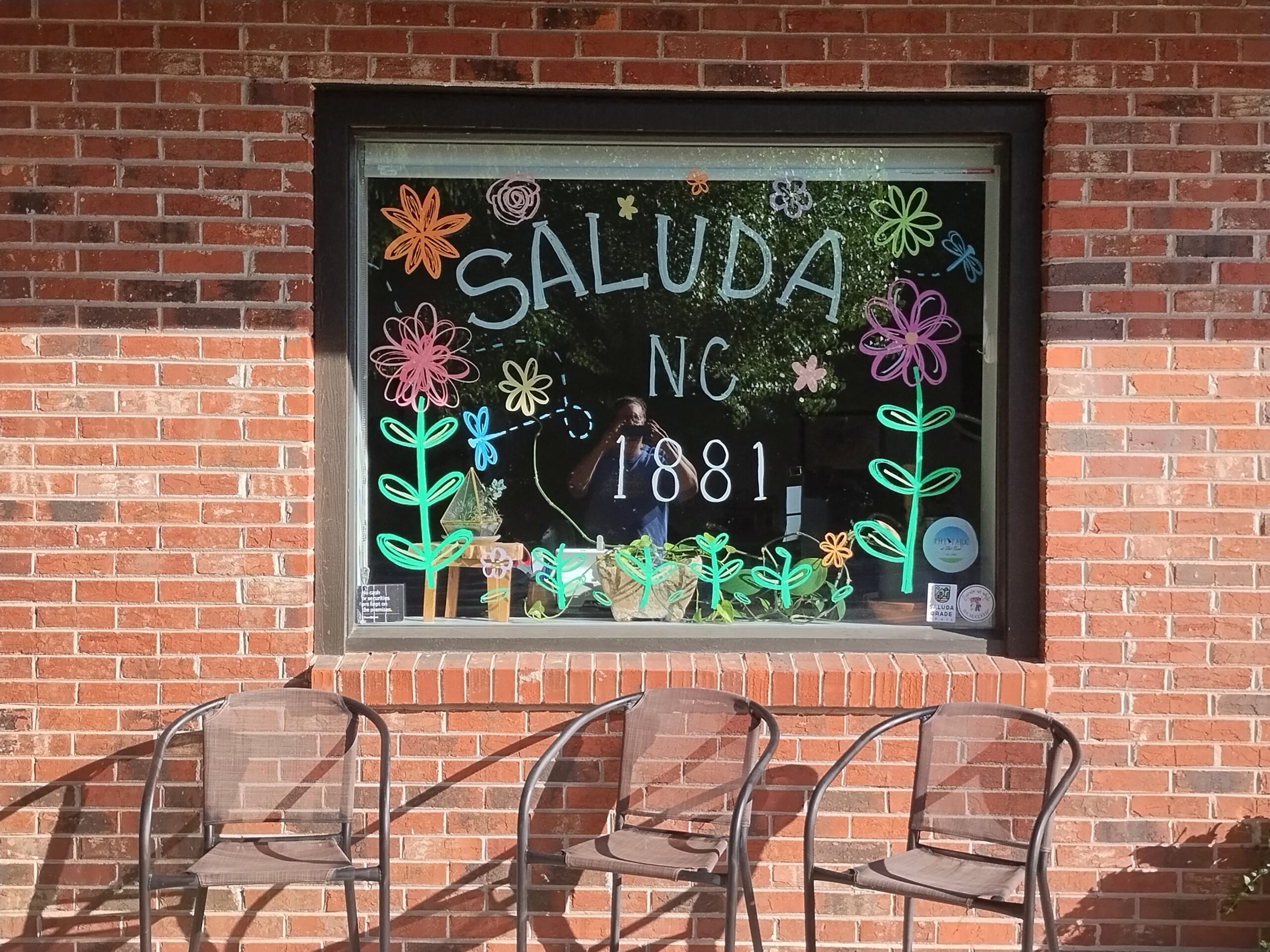
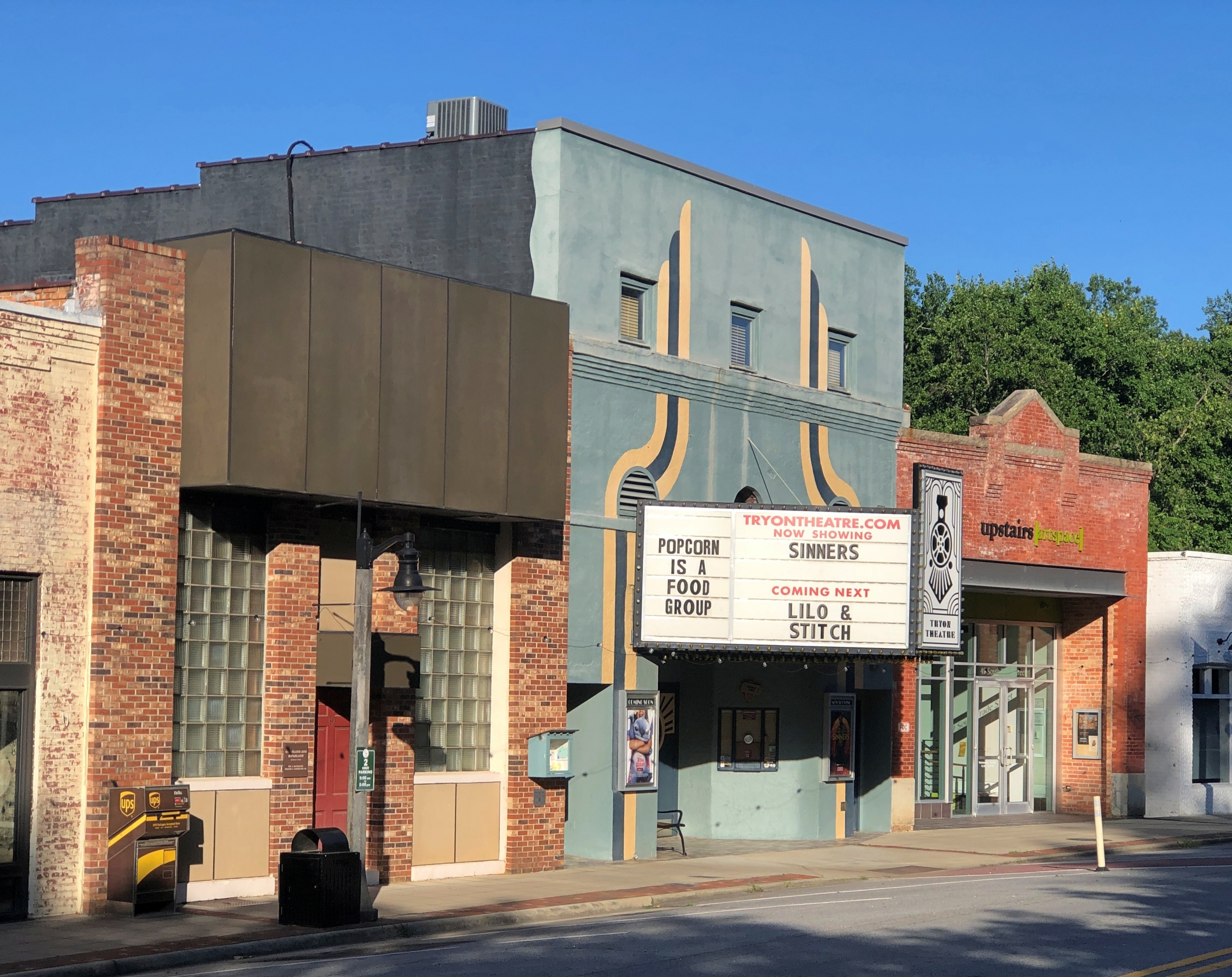
My goal for the afternoon had been to take I-40 from Knoxville to Asheville and then I-26 south to its junction with South Carolina 11, which is Cherokee Foothills Scenic Highway, and take that road east. I’d been advised that the town of Saluda, NC, on US 167, was a pleasant place to stop, and it was, though most of the shops were closed by the time I got there.

Saluda, NC

I had the idea that I would drive US 176 to the next town, Tryon, NC. Oops, no. Road closed. Maybe the hurricane did that as well.

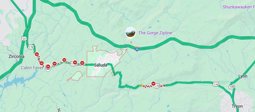
So I got back on I-26 and went to the Tryon exit. I didn’t have any idea what to expect in Tryon, certainly not the Tryon Horse, which is a large toy horse on wheels. It stands on US 176, known as South Trade St. at that point. This is the fifth iteration of the horse in nearly 100 years.

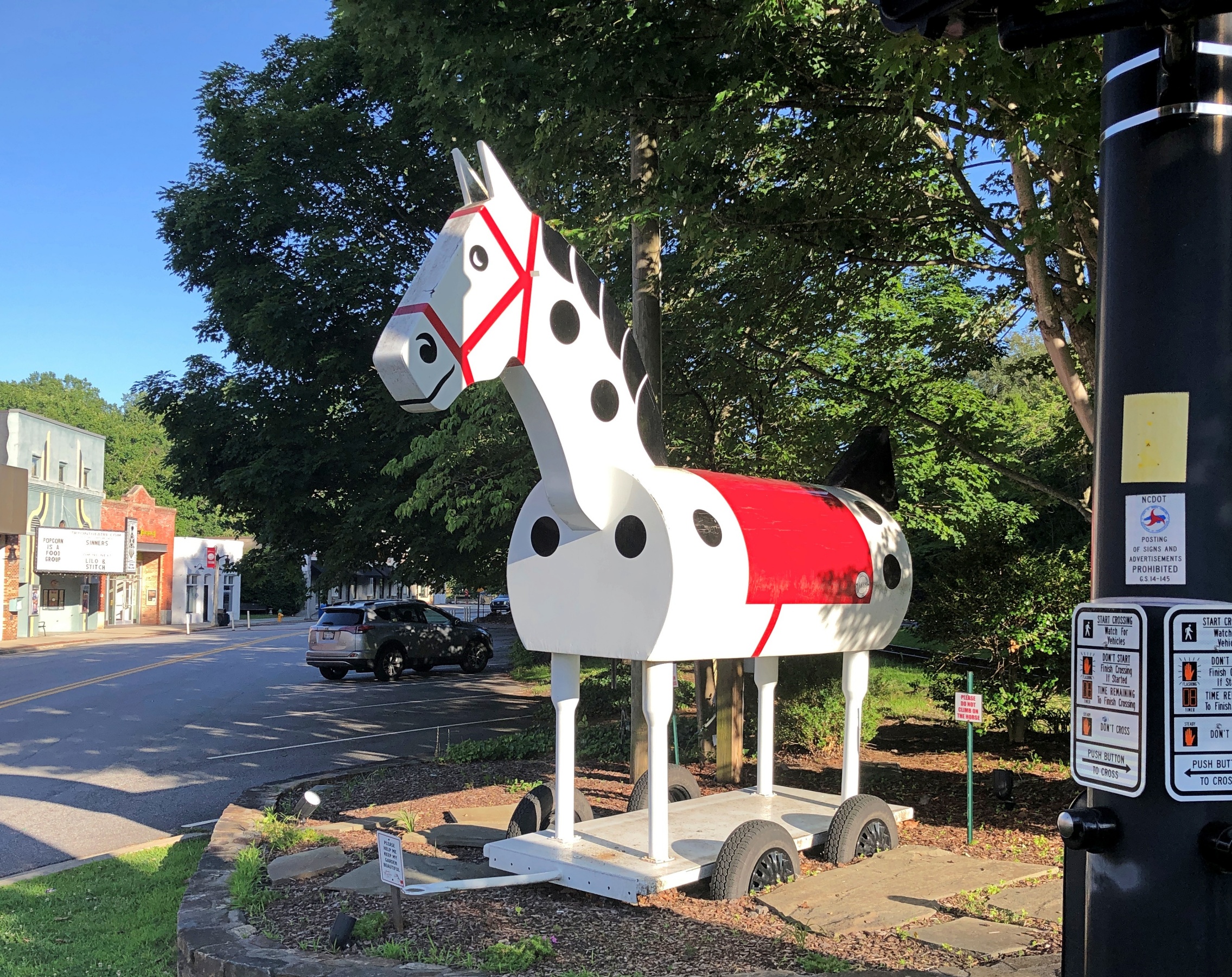
“[The first Tryon Horse] was originally designed as an advertisement for the first horse show held in Tryon at Harmon Field in 1928,” says the Tryon History Museum. “It came from a drawing done by Eleanor Vance, based on an idea from Romaine Stone, who was active in the Tryon Riding and Hunt Club, and from then seventeen-year-old master builder Meredith Lankford.

“The Tryon Horse was built in the basement of Miss Vance and Miss Yale’s house by Meredith Lankford and Odell Peeler and was assembled in the driveway… The Tryon Horse… was brought out for future horse shows and parades, and was stored in the Paper Box Factory located on Depot Street. Unfortunately, the first horse was destroyed when the factory burned in the 1930s.”

It was no accident that the talent was available locally in the 1920s to build such a thing. At the time, Tryon was noted for a company that made toys, especially high-end wooden toys.

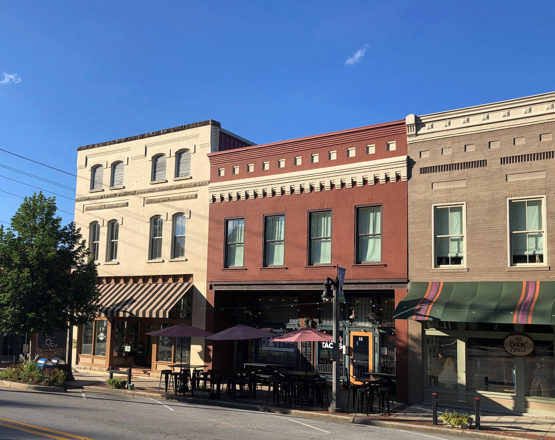
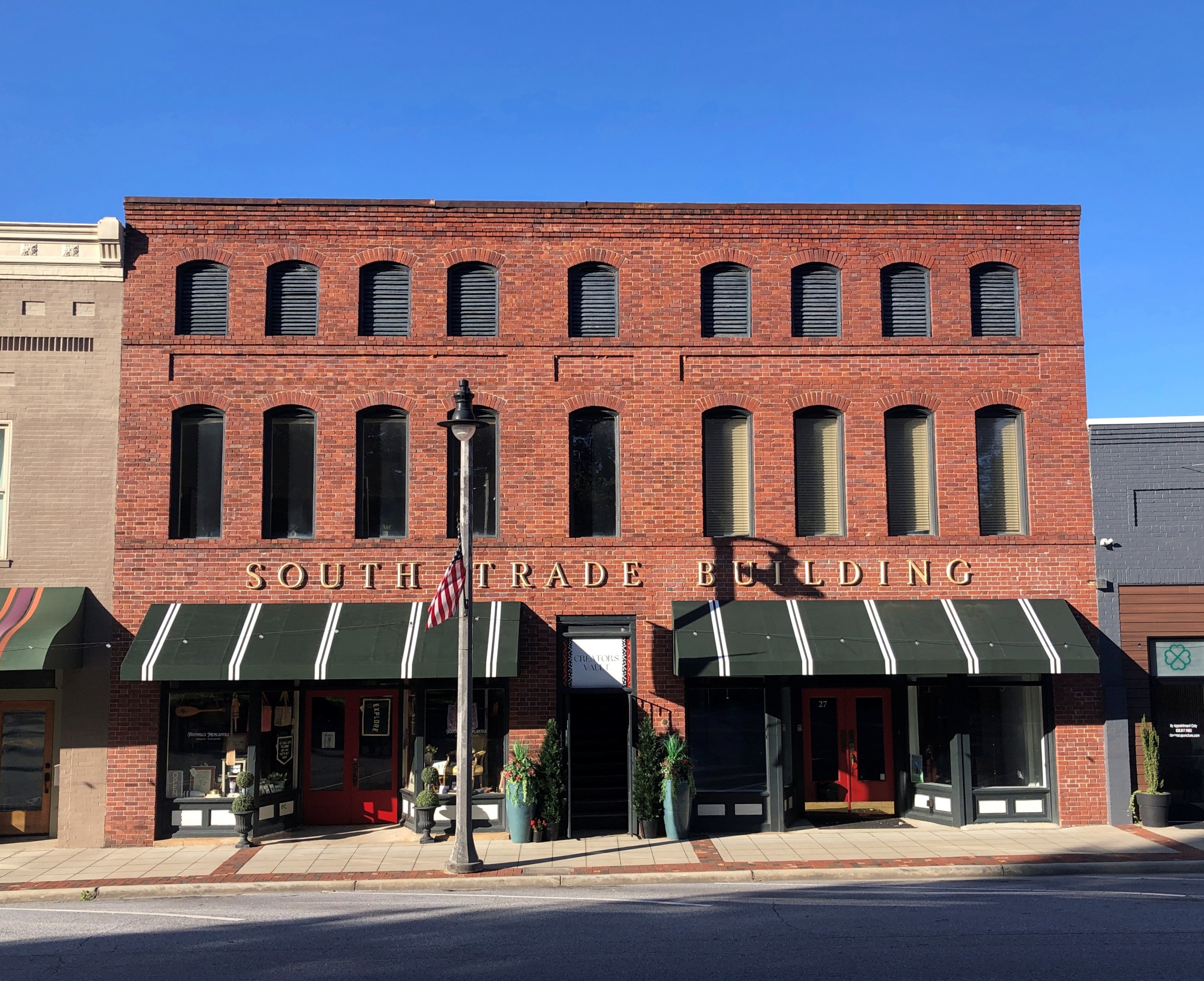
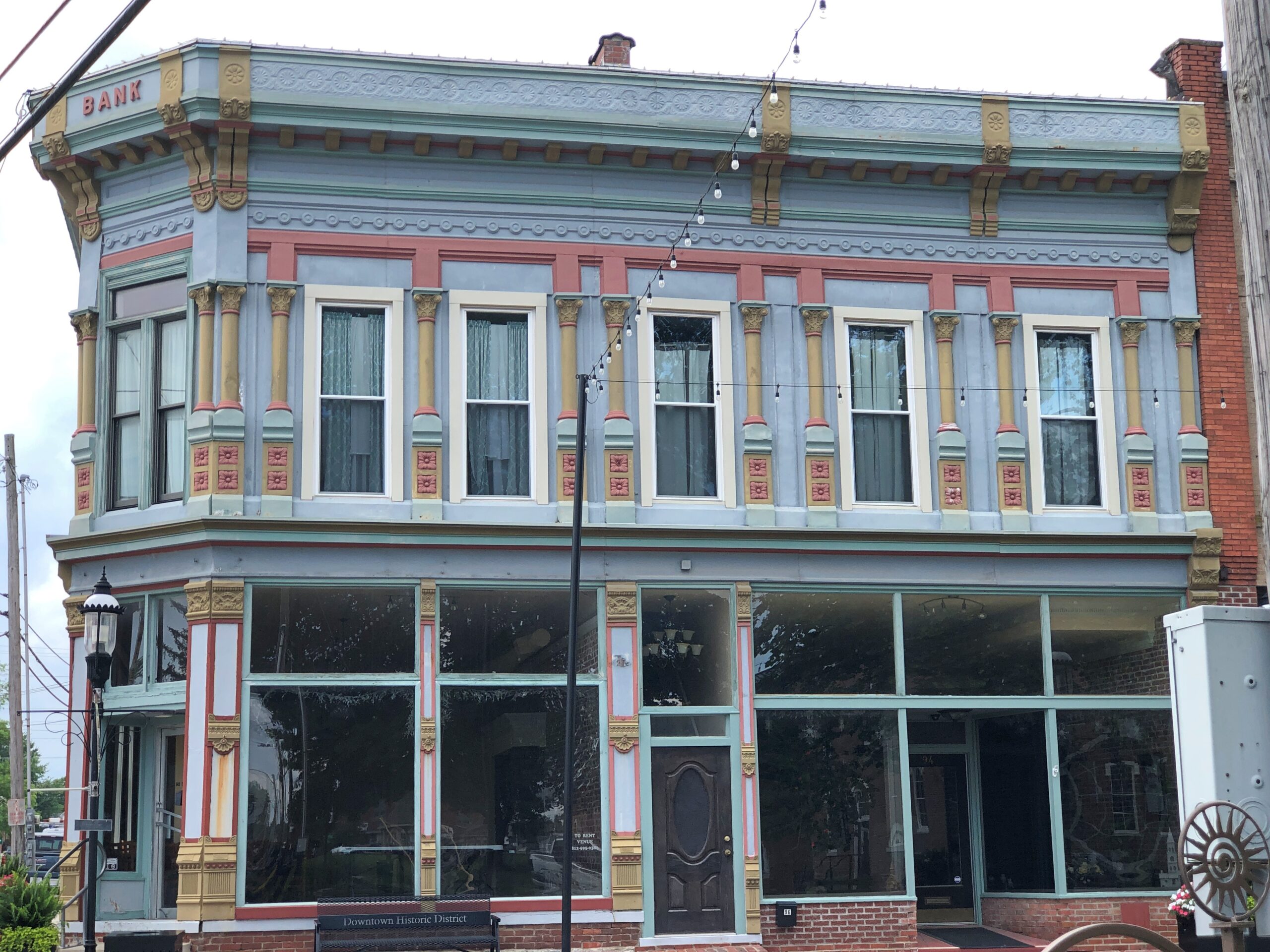
South Trade St. is a handsome thoroughfare, populated by older buildings developed to support trade.

Tryon NC
Tryon NC

Something else I didn’t expect on the street: Nina Simone Plaza.

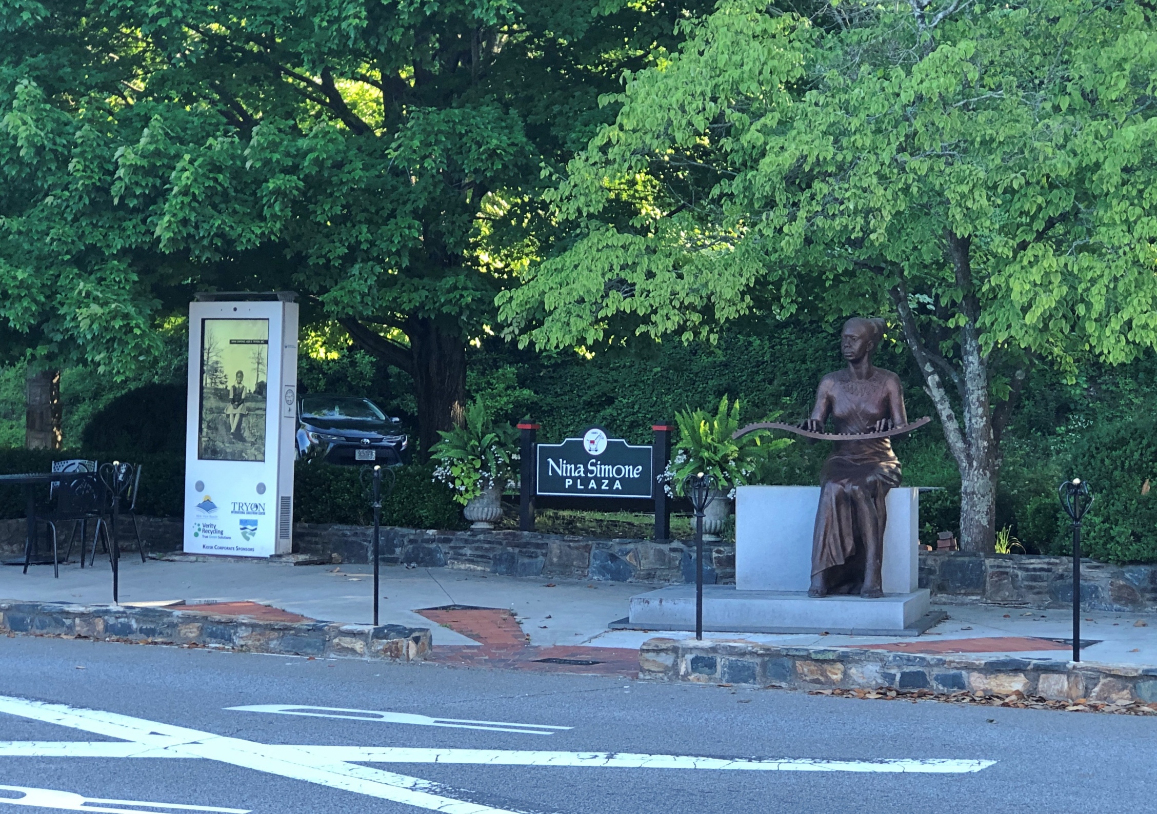
Complete with a bronze of the musician and activist, who grew up in Tryon, and who no doubt got out as soon as her talents allowed. She died in 2003; the statue was dedicated in 2017.

Nina Simon bronze, Tryon NC

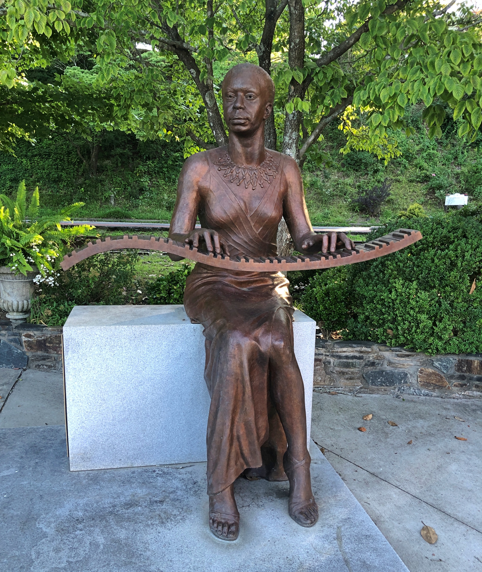
A remarkable detail (so I’m remarking on it): “The sculptor, Zenos Frudakis, included a bronze heart containing Simone’s ashes welded to the interior of the figure’s chest,” says the University of North Carolina. For his part, Frudakis has had quite a career.

Later in the day, I eventually made it to South Carolina 11 at Campobello, SC, and drove east to its end for 50 miles or so to Gaffney, SC. I’d intended to visit Cowpens National Battlefield along the way.

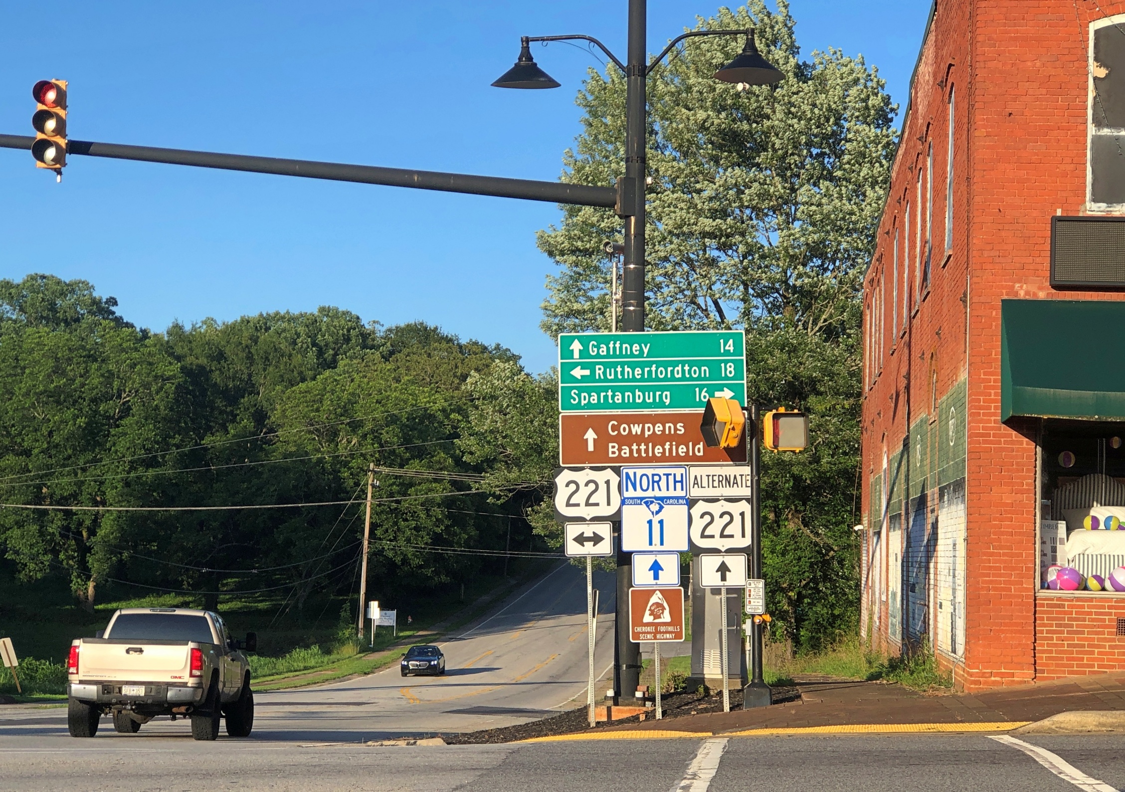
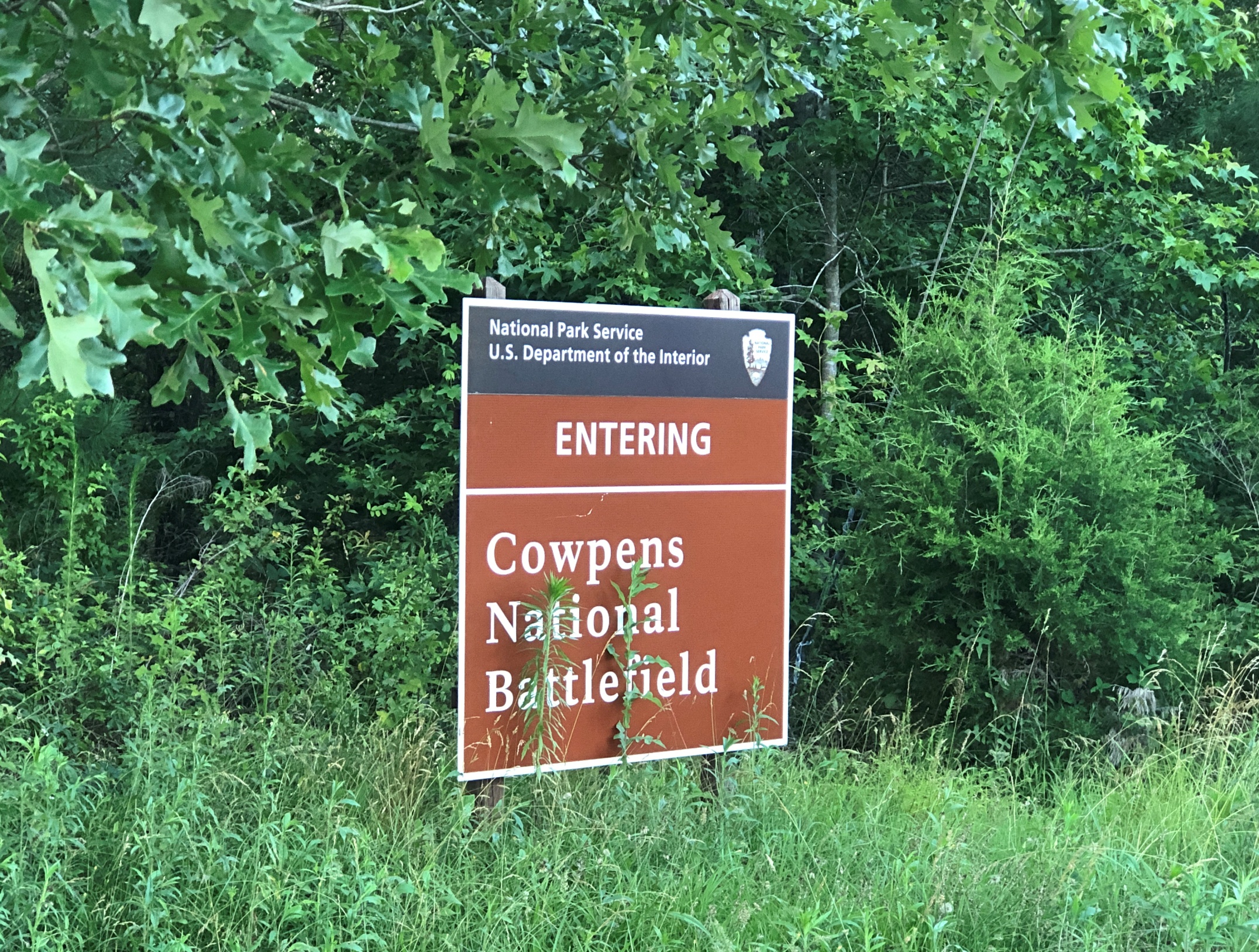
No dice. The main entrance to Cowpens was closed by the time I arrived. I understand closing the visitors center at the end of the day, but the entire place? A mile or so east on SC 11 was an alternate entrance, so I stopped there.

I walked down the path toward the battlefield, but thought better of it after about 10 minutes.

Cowpens National Battlefield

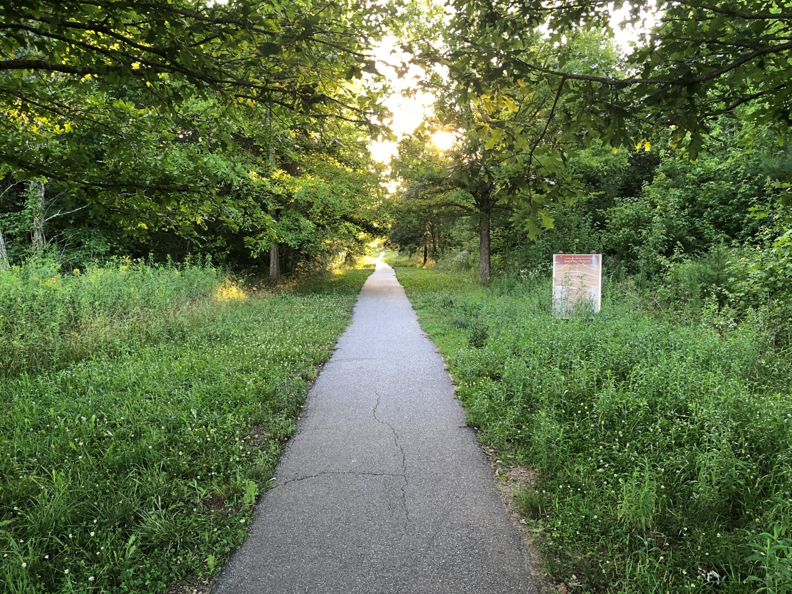
I wanted to get to Charlotte before the end of the day. Summer days are long, but not endless. Also, mosquitoes.

The Sunsphere

Something was fitting about visiting the Sunsphere on a hot day in June.

Sunsphere Knoxville

There might have been closer places to park near the structure, but I’m a rank novice when it comes to knowing my way around downtown Knoxville. Luckily, the streets weren’t densely packed with traffic, even on a mid-day weekday, so I made my way easily to surface parking about a quarter mile from the tower. Free parking, the best kind.

A quarter-mile isn’t too far to walk, fortunately. But high heat adds strain to the walk. It didn’t rise to the level of an ordeal, just discomfort, with my head toasty under a hat and my throat irrigated from time to time with bottled water. People might not believe it, but discomfort is an essential ingredient to a good trip. Not unremitting discomfort, just intermittent bursts.

From the parking lot, I followed a street to a corner, rounding to a view of the tower on the other side of the Henley Street Bridge. An ideal sort of bridge for pedestrians, actually, one that carries not only cars but has generous sidewalks, demarked by sizable planters.

Sunsphere Knoxville

The bridge from the other side, just under the Sunsphere. Good work. The colors are a nice touch.

A highly visible legacy of the Knoxville International Energy Exposition, that is, the 1982 World’s Fair, the Sunsphere abides as a goldish homage to Sun. At least, that was the idea that fair organizers (or their publicists) came up with. For an expo about energy, the centerpiece would be the source of all energy here on Earth, though not solar energy per se, certainly not in the early ’80s.

Why Knoxville? Why not? By then worlds fairs were passé anyway, and were regarded with indifference by most Americans. Such as my college-age self, and all my friends as well. More importantly for anyone thinking about organizing one, they tended to be money pits.

I’m of two minds about the decline of worlds fairs. One, tastes change, with information and experiences so widely available that a fair can’t compete, and so what? But I also think there’s much to be said for going places and seeing real physical things. Obviously I think that. Especially as opposed to losing yourself in a slender electronic box.

I’d come that day, passing through Knoxville from Nashville and en route to Charlotte, not just to see the Sunsphere exterior, but to ride the elevator to its observation deck and take in the view, roughly 300 feet up. I’d blown off seeing the fair 40+ years ago, but I wasn’t going to miss its shiny legacy on this trip if I could help it.

I’m glad to report that the interior of the Sunsphere is climate controlled. Also, admission is $10. If by magic the Sunsphere could relocate to any of the much larger U.S. metros, base admission might be three times that much, with a skip-the-line option for an extra fee. The structure is part of Knoxville’s World’s Fair Park, and I’d like to think that park authorities are holding the line on tourist inflation, but I’m sure it’s just what the market will bear.

A Knoxville architect named Don Shell, working for Community Tectonics in the early 1980s, led the design effort. “Much of the work involved structural engineering details, and Community Tectonics sought the consultation of Stan Lindsey and Associates in Nashville,” the Knoxville News Sentinel reported.

“Shell recalled that Lindsey used a new piece of equipment with which most architects at that time were unfamiliar — a computer. Problems were also encountered in trying to find gold-colored glass to represent the sun. In fact, the Rentenbach contracting firm checked with about 60 businesses before locating a company in New Jersey that would manufacture the pieces, Shell said.”

Actual gold is mixed in the glass, in what has to be minute amounts. Always useful, that element gold.

The observation deck is on the bottom half of the sphere, with 360-degree views of the terrain behind the gold-colored glass. In the images I made, that has the effect of bluing everything, creating the illusion that maybe the images are mid-century slides that have been tucked away unseen since then. Of course, these vistas didn’t exist in the mid-century, but never mind.

Sunsphere Knoxville Sunsphere Knoxville Sunsphere Knoxville Sunsphere Knoxville

Getting a look straight down was a little tricky, but doable. The first image is the Tennessee Amphitheater, the only other structure from the fair still standing besides the tower.

One more of the Henley Street Bridge.

Once you’ve seen enough of the vista from the sphere, back on ground level the Knoxville Convention Center, developed on the former site of the U.S. Pavilion next to the tower, is open and showing the World’s Largest Rubik’s Cube. It used to grace the Hungarian Pavilion. I had to look it up: Rubik is still alive at 81, living in Budapest.

As usual with this kind of thing, both the tower and the cube went through a period of neglect in the decades after the fair, though it seems the cube got the worst of it, according to Roadside America: ‘The Cube, ten feet high and 1,200 pounds, constantly changed its color patterns thanks to a complex set of internal motors. When the Fair closed no one in Knoxville knew what to do with the Cube, and it eventually wound up beneath a freeway overpass, abandoned. This dereliction of civic duty was exposed by the Knoxville News Sentinel, and the embarrassed city then had the Cube restored and moved into the city’s Convention Center for the Fair’s 25th anniversary in 2007.”

As for the Sunsphere, it was never neglected so much physically, but otherwise it seems not much attention was paid to it for years until the 2010s, when the observation deck was renovated, adding exhibits about the world’s fair.

I’d actually gone inside the Convention Center to use the restroom. Sunsphere visitors, take note. The recent renovation didn’t include public restrooms, because there are none.

Pigeon Roost State Historic Site

My stop in Scottsburg, Indiana, wasn’t entirely random. If you have a mind to visit Pigeon Roost State Historic Site, which is just south of town, you need to get off the Interstate and proceed to the site on US 31, and Scottsburg is a good place to do that.

As a point of interest red spot on highway maps, Pigeon Roost had intrigued me for years, but not enough to stop there. Unless I did sometime in the 1980s. Or maybe the ’90s. I’ve arrived at that point in life at which I can’t quite remember all the things I’ve seen, especially obscure memorials in obscure places. In a related trick of an aging memory, I sometimes have fairly distinct memories of places, but no memory of exactly where I was.

Pigeon Roost State Historic Site, Indiana Pigeon Roost State Historic Site, Indiana

There are at least two layers of history at work at a place like Pigeon Roost. One is the massacre itself, whose longstanding interpretation sees it as a bloody incident in the War of 1812, with the Indians taking the opportunity – and British weapons – to fight the tide of settlement in the Northwest Territory, though they were already doing that, ultimately in vain. There also seems to be a revisionist idea that the Indians were out to settle a score with a particular group of whites and didn’t give a fig about the geopolitics of the situation, which certainly sounds plausible.

The other layer is the fact that it wasn’t until 1904 that the state of Indiana dedicated a memorial to the victims of the massacre, including what must have been a tidy sum to pay for an obelisk. Somewhere in the minutes of the legislature, and maybe in letters or newspaper reports, or maybe in a local history archive, is some inkling of why that might be: why then and not some other time. But it seems unlikely that anyone will ever take such a granular interest in the subject. Certainly not me, so I’ll have to leave it at that.

These days, Pigeon Roost is quiet and, I suspect, rarely visited. I had the place all to myself.

Pigeon Roost State Historic Site, Indiana Pigeon Roost State Historic Site, Indiana

At some other point in the past, locals started burying their dead near the site.

Pigeon Roost Cemetery, Indiana Pigeon Roost Cemetery, Indiana Pigeon Roost Cemetery, Indiana

Google Maps calls it Pigeon Roost Cemetery, aka Sodom Cemetery. The latter seems like an odd choice, but a quick look reveals a few others of that name, in Georgia, Ohio and Minnesota.

Pigeon Roost Cemetery, Indiana Pigeon Roost Cemetery, Indiana

Google Local Guide Gary Collins has this to say about the place: This pioneer cemetery holds the remains of some of Southern Indiana’s earliest settlers, including some of the survivors of the infamous Pigeon Roost Massacre. At the time of the massacre, this cemetery had yet to be established, and some of the victim’s [sic] final resting places are unknown. It is generally well kept, and interments still occasionally take place.

What, no ghost stories about Pigeon Roost? Seems like perfect fodder for such tales: not only violent death, but the violent death of children and indeed entire families. There’s an opportunity here for making stuff up — I mean, paranormal investigations. What does Bachelor’s Grove Cemetery have that Pigeon Roost doesn’t?

Scottsburg, Indiana

Just the latest in bad news: the lodge on the North Rim of the Grand Canyon burned down due to wildfire. At least no one died in the incident, but it’s always unfortunate when a grand edifice meets its end. I wouldn’t bet on reconstruction, either.

The heat was already on by the time I arrived in Scottsburg, Indiana on the first day of the trip, June 16. But not enough to keep me from taking a stroll around the Scott County courthouse, where I found native son William H. English.

Scottsburg, Indiana Scottsburg, Indiana

After only a few hours on the road, by chance, I’d come across a presidential sight. Presidential adjacent, anyway, since English (d. 1896) is that most obscure of obscurities, someone who ran for vice president and lost – in 1880 in his case, on the Democratic ticket with Winfield Scott Hancock, who himself isn’t going to ring any bells outside presidential history buffs. The statue went up in 1908.

That was the election James Garfield won, which he no doubt regretted before long.

English, or his heirs, felt that a book he wrote, Conquest of the Country Northwest of the Ohio River 1778-1783, was worth a mention along with the offices he held or aspired to. The marvel here in the 21st century is that the work is just about instantly accessible (Vol. 1 and Vol. 2). An illustration facing the Vol. 1 title page (on the optitle page?) not only falls into the They Don’t Make ‘Em Like That Anymore category, it’s squarely in, No One Would Think of It territory. Just as well, I figure.

To get to Nashville from metro Chicago, the direct route is via I-65, which cuts across Indiana. Considering the importance of both of those cities to me, I’ve driven the route more times than I can count. But I have to report that it isn’t one of the more interesting drives in the nation, and at eight to nine hours drive time in the best of conditions, you feel it yawn beneath your wheels when you yourself yawn.

So the strategy over the years has been to break up the trip. Such as a place like Scottsburg, pop. 7,300. The town is close enough to Louisville to be its exurb – maybe. I haven’t spend enough time in Louisville, as interesting as it is, to have any sense of its greater co-prosperity sphere, or at what distance that might peter out.

Scottsburg has one thing a picturesque exurb needs: a picturesque courthouse square. Or at least elements of it.

Scottsburg, Indiana Scottsburg, Indiana

Downtown is in fact a national historic district: Scottsburg Courthouse Square Historic District. I get a kick out of discovering that kind of thing retroactively, which I did this time.

“The district is composed of one-, two-, two-and-a-half and three-story brick and stone commercial structures with zero setbacks, which form an essentially contiguous perimeter to the wooded courthouse lawn,” its registration form on file with the U.S. Interior Department says. “There are a total of 48 contributing buildings within the district. The character of the district is defined by late 19th and early 20th century commercial architecture with significant examples of the Italianate, so Richardsonian Romanesque, Renaissance Revival, Colonial Revival, and Art Moderne styles.

“The predominant building material is red brick, as evidenced by the courthouse and 29 commercial buildings within the district. Secondary materials include Indiana limestone and various shades of buff and yellow brick, decorative brick work, cast iron, ornamental pressed metal and glazed tile and Carrera glass…”

Scottsburg, Indiana Scottsburg, Indiana

In the heat of the moment (literally), I neglected to get a decent shot of the courthouse itself, but someone called Bedford thoughtfully put an image in the public domain.

Could it be a Carnegie Library?

Scottsburg, Indiana

Yes. Completed 1917, still a library. One of the more than 1,680 in the United States funded by the robber baron, many of which endure after a century plus.

Some courthouse square details.

Dirt Boys Vintage Collectibles joins the likes of city offices and law offices, but also Warriors Den coffee shop, Time Zone Pizza Arcade, Chicago City Pizza and Bootlegger’s Bar & Grill. Those not needing to eat can visit Wildflowers Boutique, Moxie Music Center or Working Class Tattoo Parlor, all there on the square.

So is a plaque to the memory of one Michael J. Collins (d. 1985).

Scottsburg, Indiana

A contemporary of mine who didn’t make it far out of the gate. RIP, Michael, whoever you were. Are.

Southern Loop ’25

Sometimes you’re driving along, minding your own business because your business at that moment is driving, and you see a two-story chicken near the road. Three stories if you count the iron weather vane perched atop the bird.

Chicken!
Chicken!
Chicken!

I had to stop to see that. More precisely, it’s a concrete chicken on a concrete egg, settling the question of which came first (the concrete did). The chicken, and the egg, are on property owned by the University of Georgia, used for the Athens-Clarke County Extension in Athens. Erected in 2022. More about the work, “Origins,” is here. All ag extensions should have just a little whimsy.

The chicken appeared roughly in the middle of the 3,285 miles I drove between June 16 and June 29, taking a lasso-shaped path from the Midwest across the Southeast, all the way to the ocean at Myrtle Beach, South Carolina: through Indiana, Kentucky, Tennessee, North Carolina, South Carolina, and Georgia, and back through Tennessee, Kentucky and Indiana.

The concrete hen took the cake for novelty, but along the way I saw a memorial to a mostly forgotten incident in the War of 1812, went into a mirrored tower built for a world’s fair, chanced on the spot where the mostly forgotten diplomat who brought the poinsettia to the U.S. is buried, and braved the tourist sprawl that is Mrytle Beach. I heard stories of Blackbeard while near the coast, near his hideouts. I strolled the genteel downtown of the second-oldest town in North Carolina, passing the notable spot where Pepsi-Cola was invented. We visited a three-story souvenir shop that has stood the test of time in Myrtle Beach, which I’m happy to report sells not just postcards, but vintage local postcards, at popular prices. One evening we wandered past sculptures and colored lights among the Spanish moss in South Carolina. For a moment I beheld a complete set of the U.S. gold coins minted in Dahlonega, Georgia.

I drove by houses, farms and fields, past small businesses open and defunct, and junkyards and billboards — an industry that would collapse without ambulance chasers, I believe — and factories and water towers and municipal buildings. That is to say, structures and greenery of all manor of use and upkeep, an inexhaustible variety of human and natural landscapes. Homogenization my foot. Except, of course, every burg with a zip code also has at least one dollar store.

We – my machine and I and sometimes Yuriko, who flew to Myrtle Beach to meet me for a weekend – experienced an incredibly lush Southeast not long after a rainy spring, on big roads and small, straight and curvy, all the while defying the heat. I heard it enough on the radio: a “heat dome” had settled over the eastern United States. It persisted from the first day in Indiana to the last day in Indiana, though it had moderated a bit by then. Temps were in the 90s most days, but nothing that’s going to faze a Texan with an air conditioned vehicle and bottled water.

We did adjust our schedule to mostly be out in the morning or evening, except at Myrtle Beach, where a walk in the heat that made me feel my age and maybe then some. A less hot but more humid walk in a mostly forgotten national park in South Carolina saw flights of mosquitoes barreling down on me. A few of them penetrated my DEET coverage.

I saw and did all that and much more, but that was only the bronze and silver of the trip. The gold was visiting old friends.

That was actually the priority this time around. Before the trip, one of the friends I planned to visit asked me via text: “What’s your trip about?”

My text answer: “Visit old friends, see new things & take long drives.”

In Nashville, Stephanie and Wendall.

In North Carolina, Dan and Pam. She had enough sense not to wander around in the heat with us.

In rural Tennessee, Margaret and Dave.

Separately in Georgia, Layne and Stuart. I was glad to see them all, and I think they were all glad to see me. Known most of ’em since the 1980s, and we had a time — then and now.