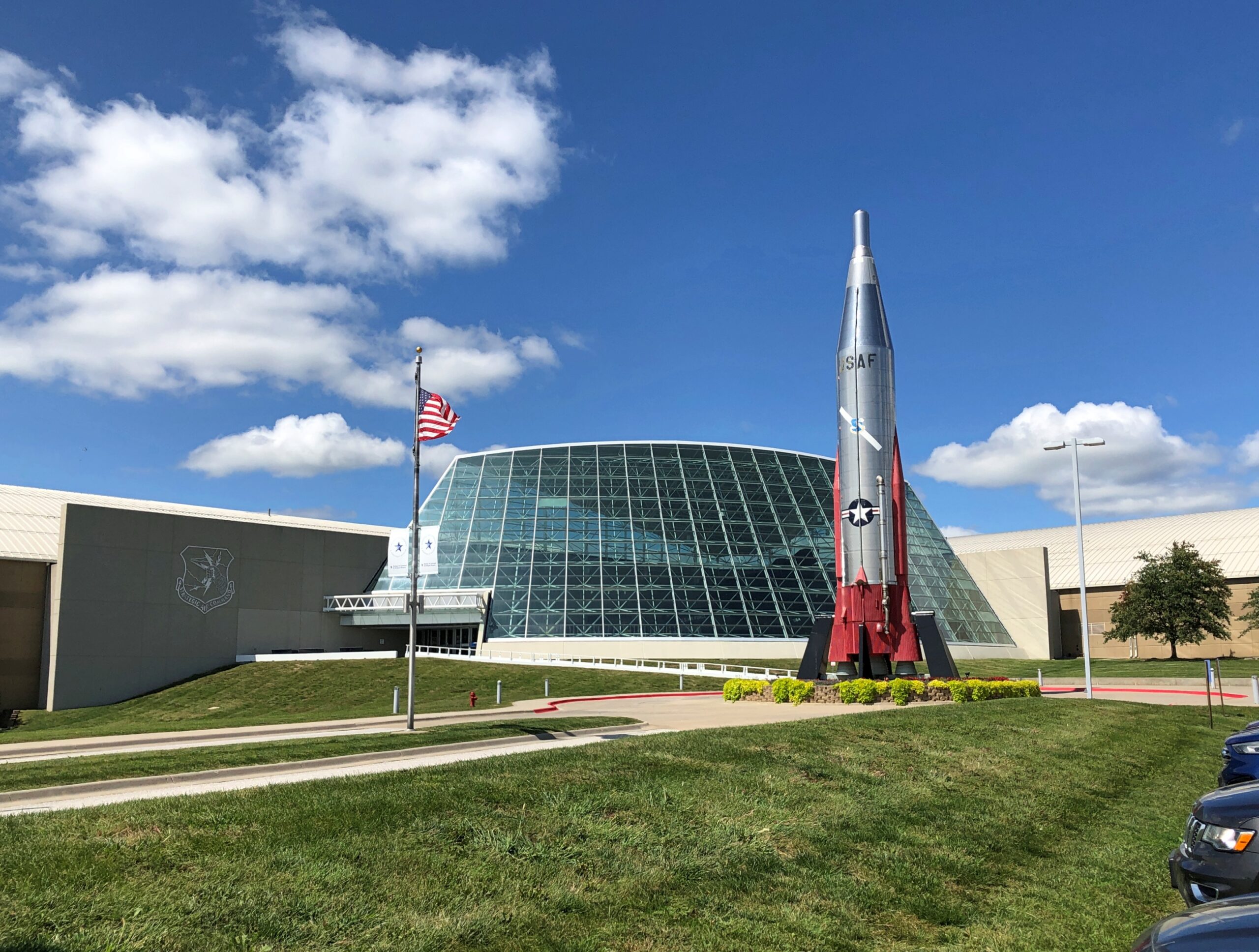
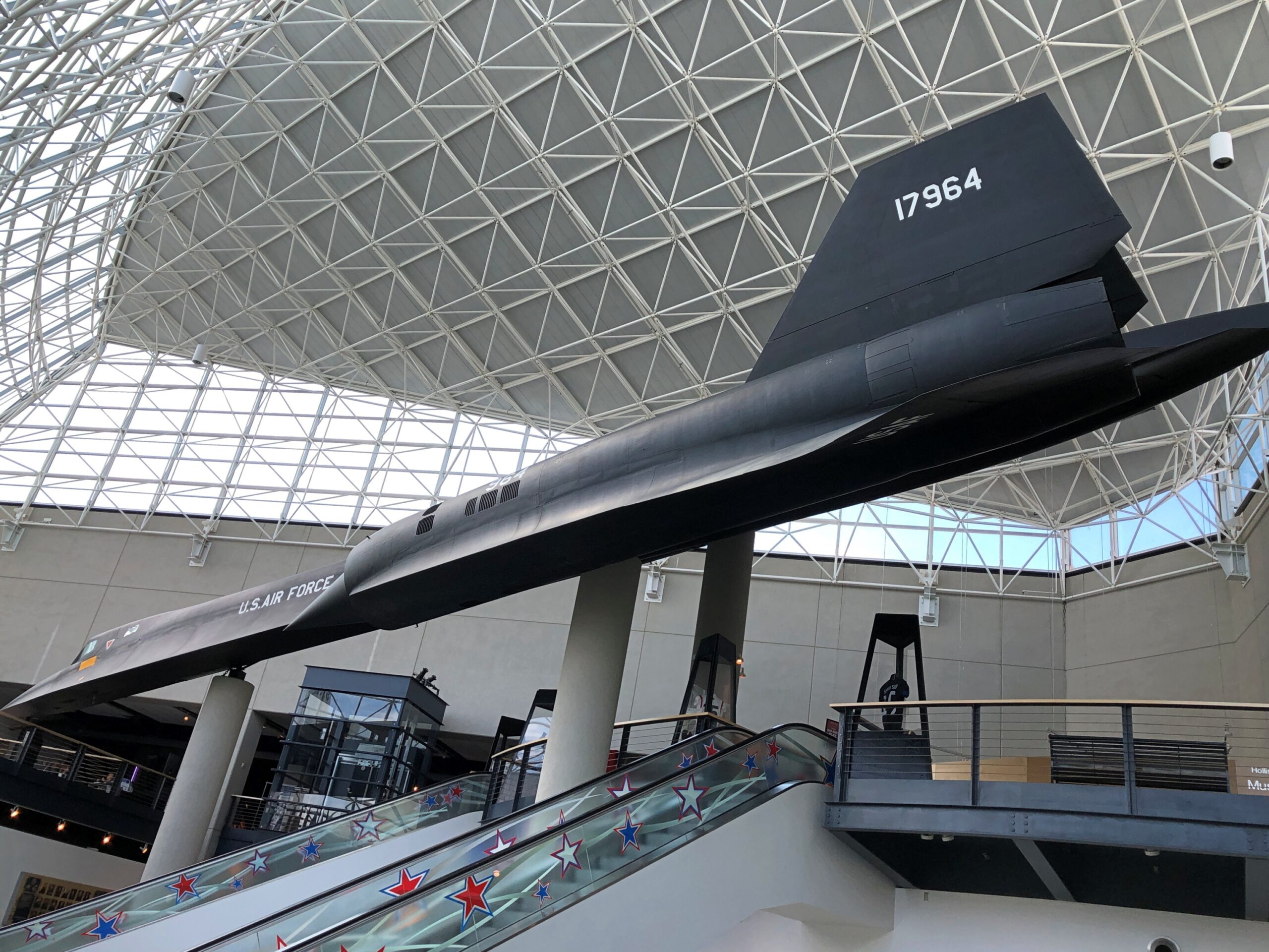
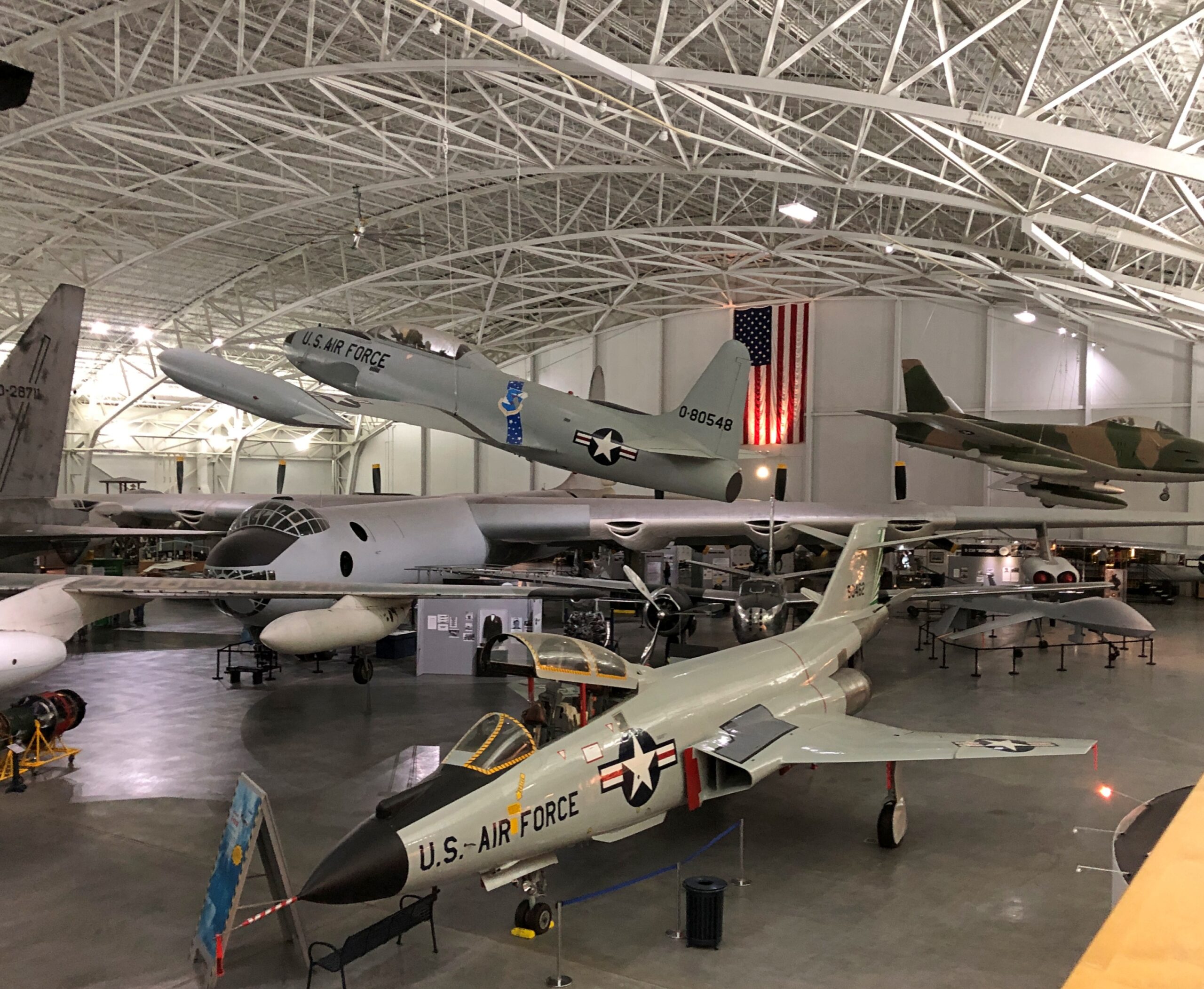
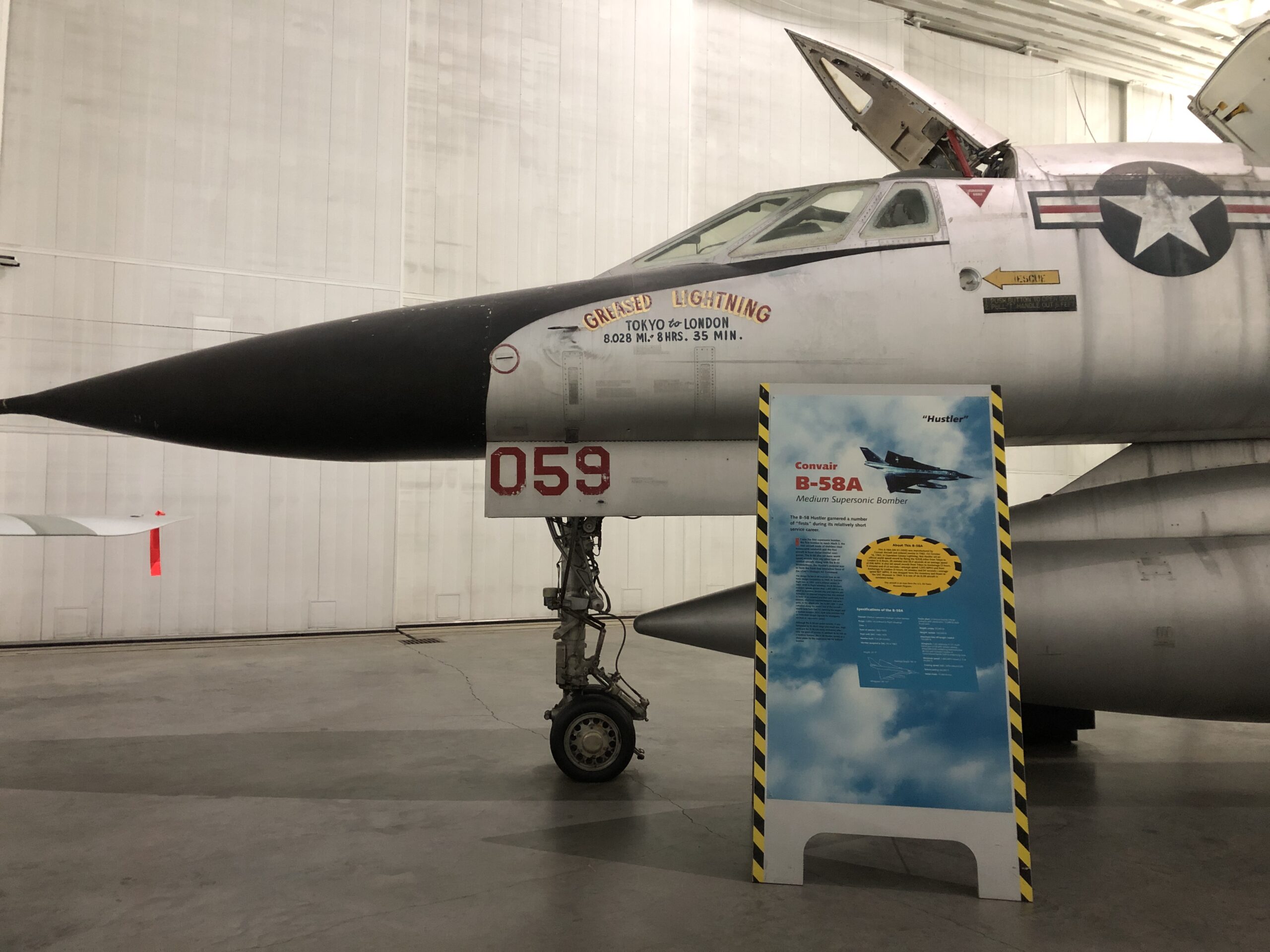
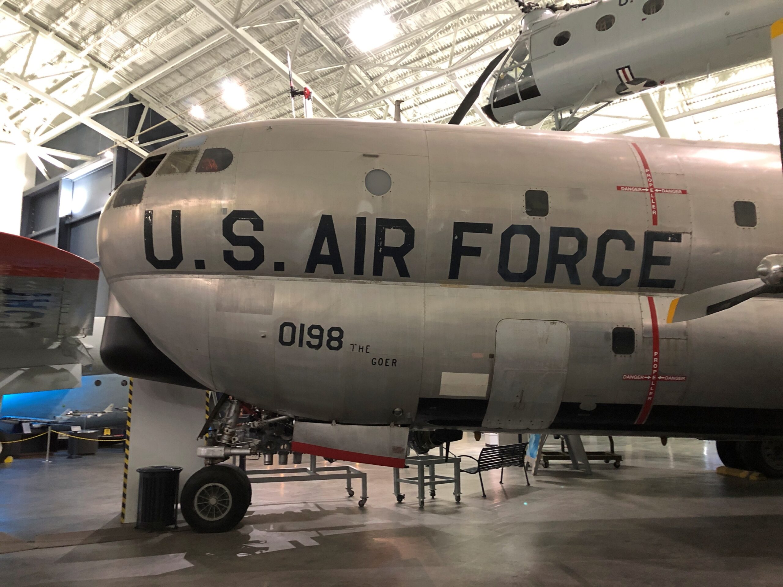
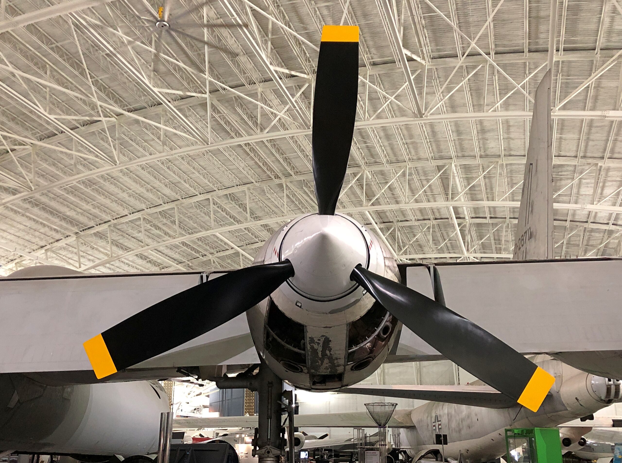
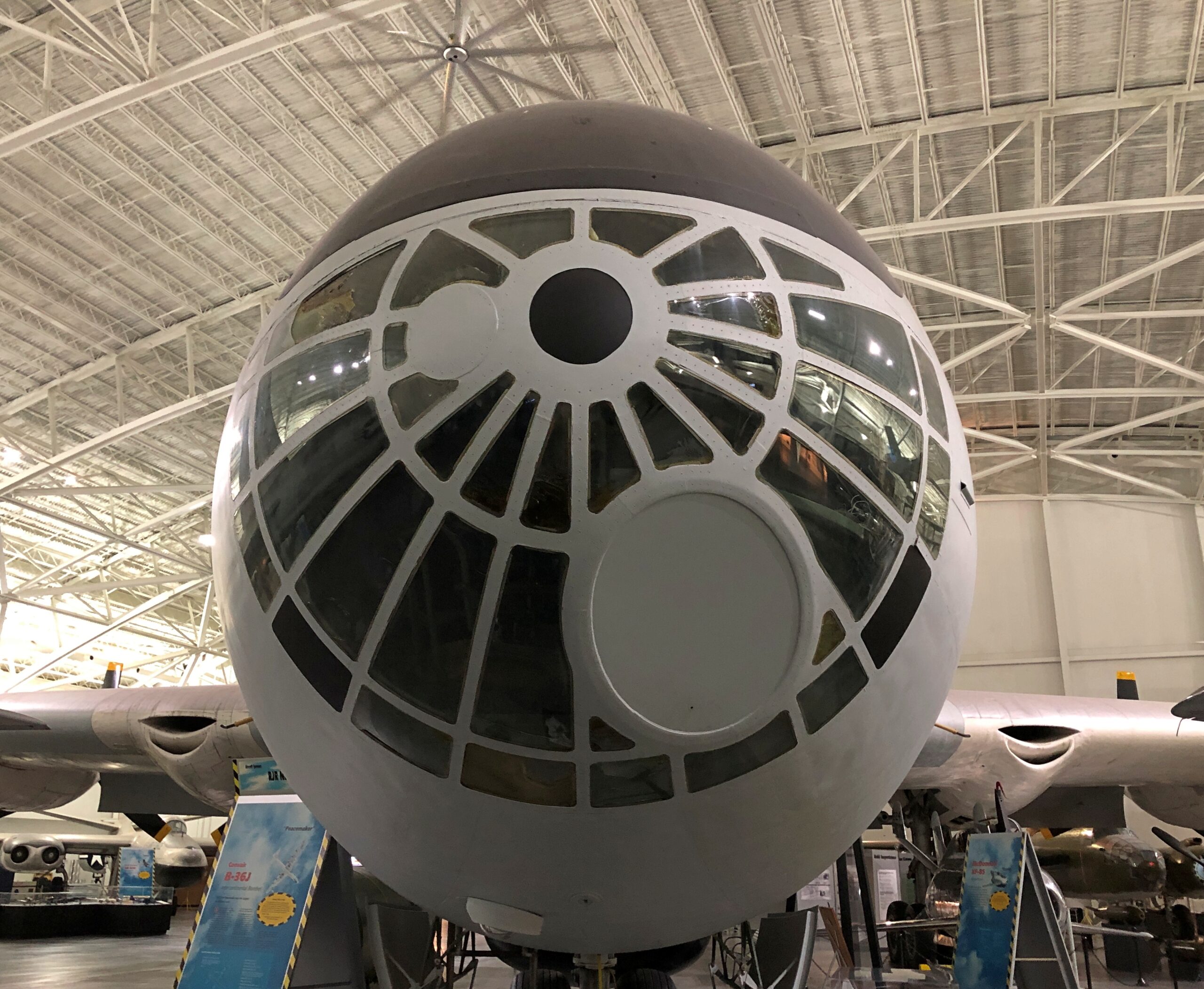
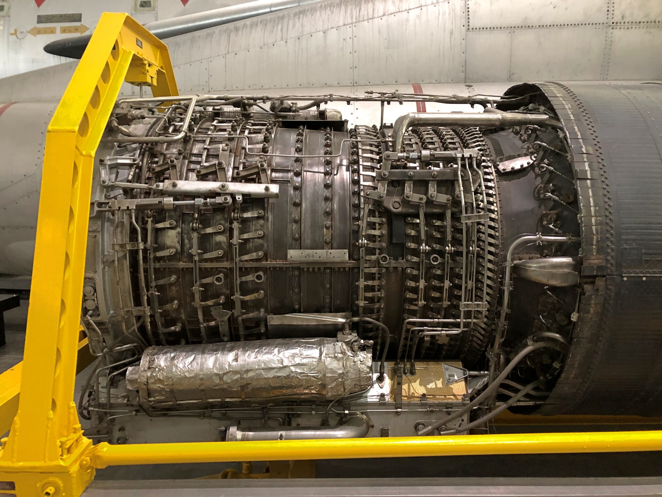
Not far outside Omaha, along I-80, it’s possible to stop and see, under two very large roofs, such marvels of aeronautical engineering as a B-17, B-29, B-36 and B-52, a Lockheed SR-71 Blackbird, a Douglas C-47 Skytrain and a Douglas C-54 Skymaster, a Convair F-102, and a Fairchild C-119 Flying Boxcar, among many others. Along side the airplanes are exhibits about the Tuskegee Airmen, Doolittle’s Raid, the Berlin Airlift and Francis Gary Powers.
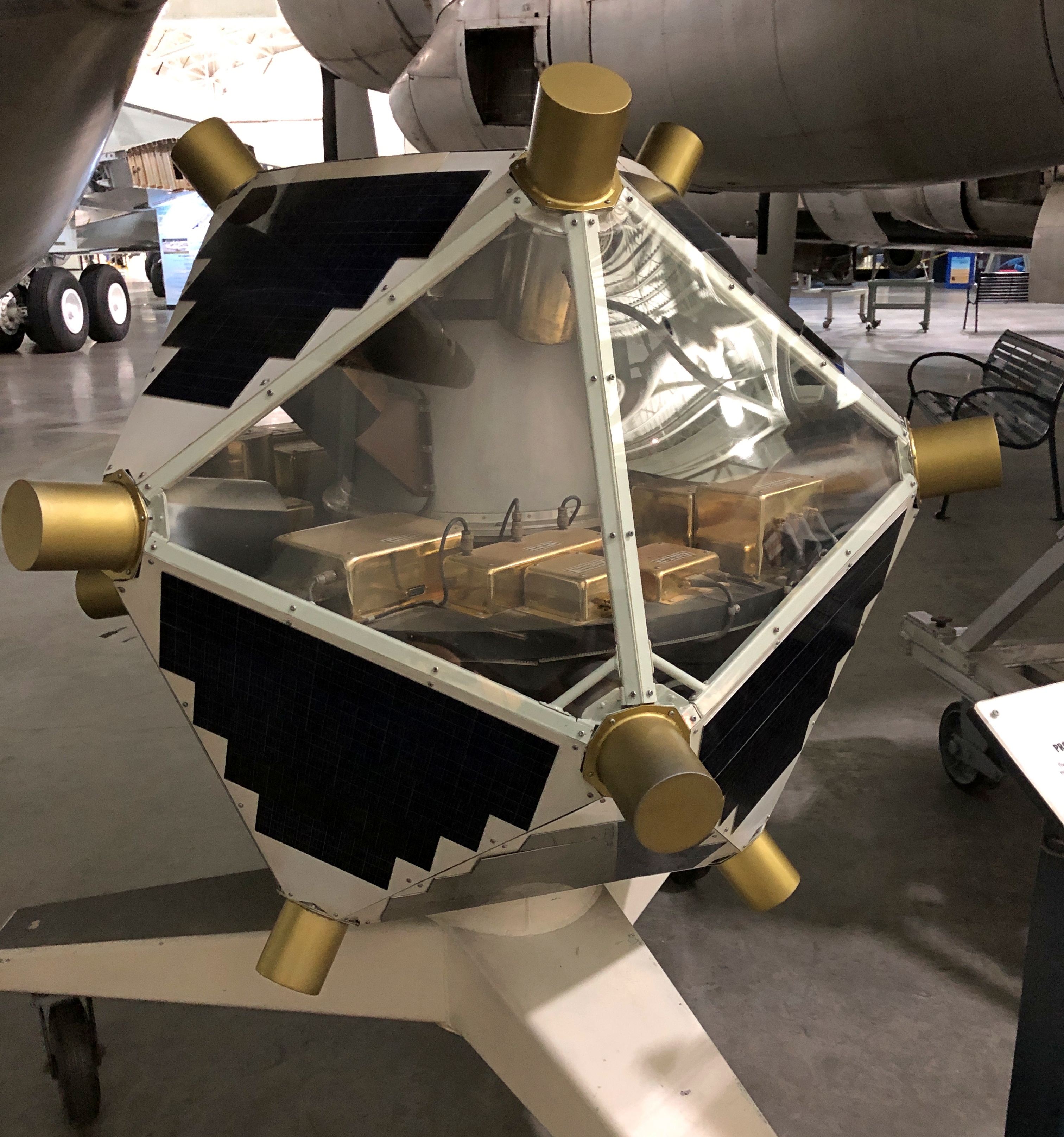
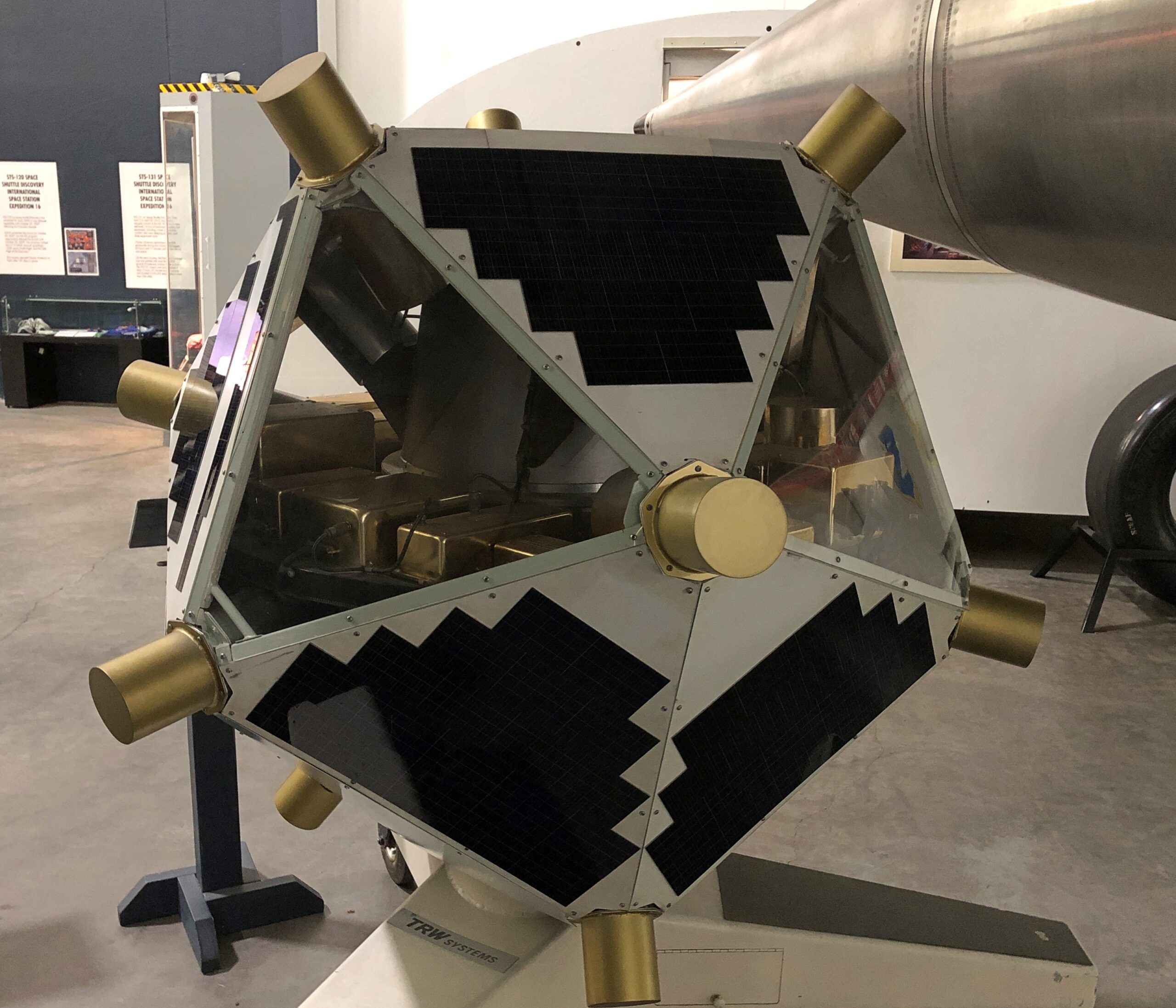
There are also space artifacts at the Strategic Air Command & Aerospace Museum, as the name says, but not that many. Still, my favorite artifact at that museum, the coolest bit of space hardware I’d seen since the Kansas Cosmosphere, was a Vela satellite.
Looks like something you’d see on the set of Space: 1999, but the Vela is more than just a curious glassy polyhedron. In September 1979, a Vela satellite noticed the characteristic flash – actually a double flash – of a nuclear explosion in the atmosphere, near the remote Price Edward Islands in the ocean south of Africa, roughly half way to Antarctica. It wasn’t long before the press got wind of the event, and I remember a widely held suspicion that Israel had tested a nuclear warhead, with the cooperation of South Africa, whose island it was. It seems likely that this was the case.
Besides that, “in 1967, the satellites were the first to detect extra-terrestrial gamma-ray bursts, thought to be the brightest and most energetic electromagnetic events in the universe,” the Space Force notes.
I arrived at the museum on September 5 heading westward, bypassing Omaha in favor of it.
Most of the artifacts are aircraft used in one way or another by SAC, on display under sprawling ceilings. Leo A. Daly, a longstanding Omaha architect, did the museum’s design, completed in 1998.
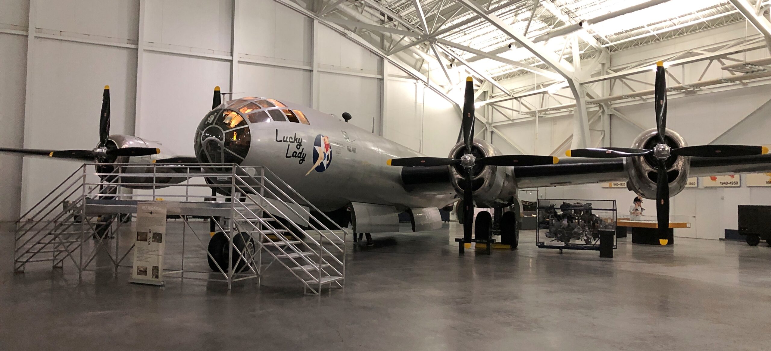
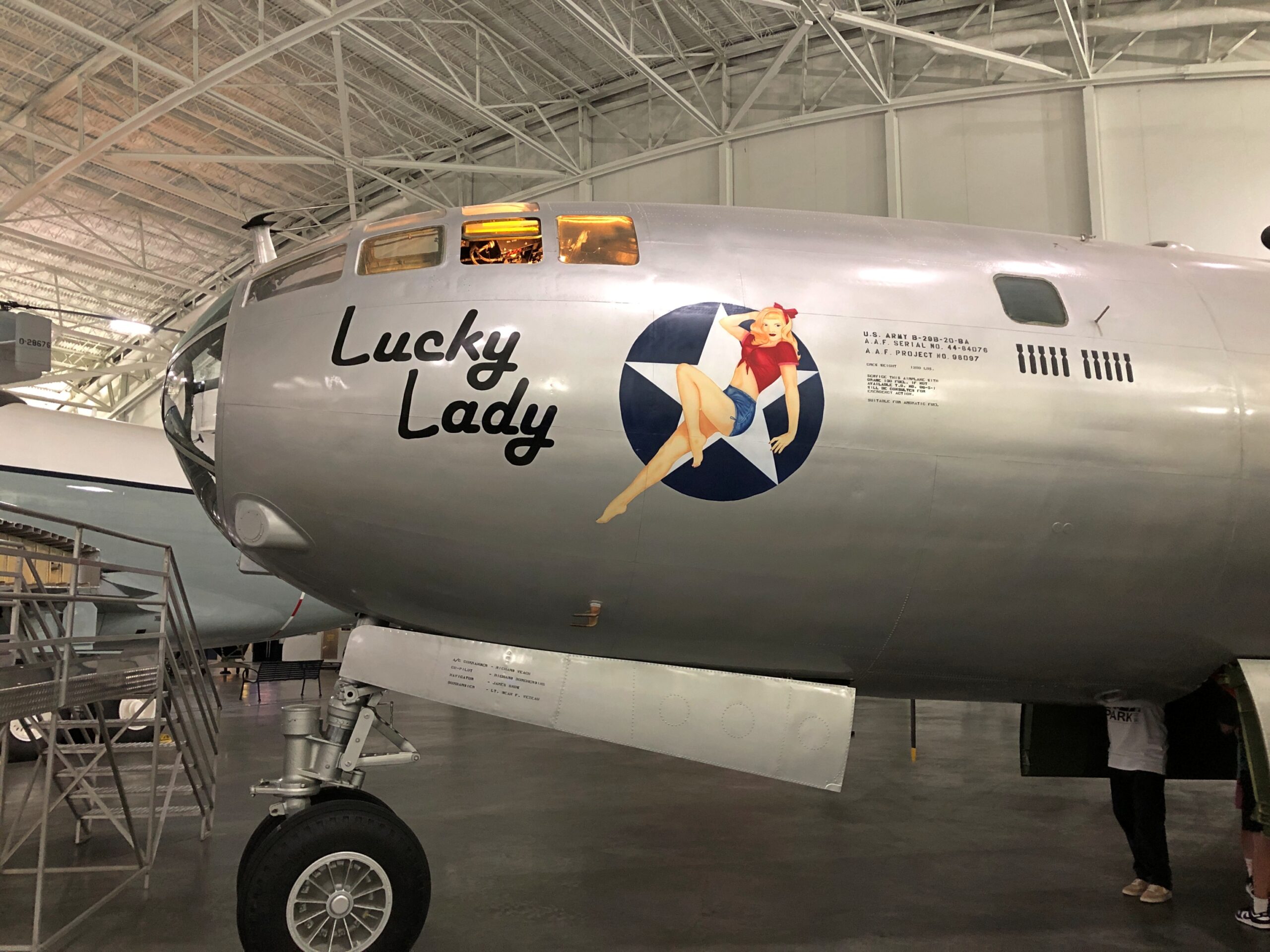
A named aircraft, the Lucky Lady, a B-29 Superfortress.
“The bomber was manufactured by Bell Aircraft, in Marietta, Georgia and delivered to the U.S. Army Air Force on August 4, 1945,” Airplanes Online says. “Its initial assignment was to Walker AAF (Second Air Force), Victoria, Kansas.” Lucky all right, as in manufactured too late in the war to get shot at, unless there’s something about 1940s Kansas I don’t know.
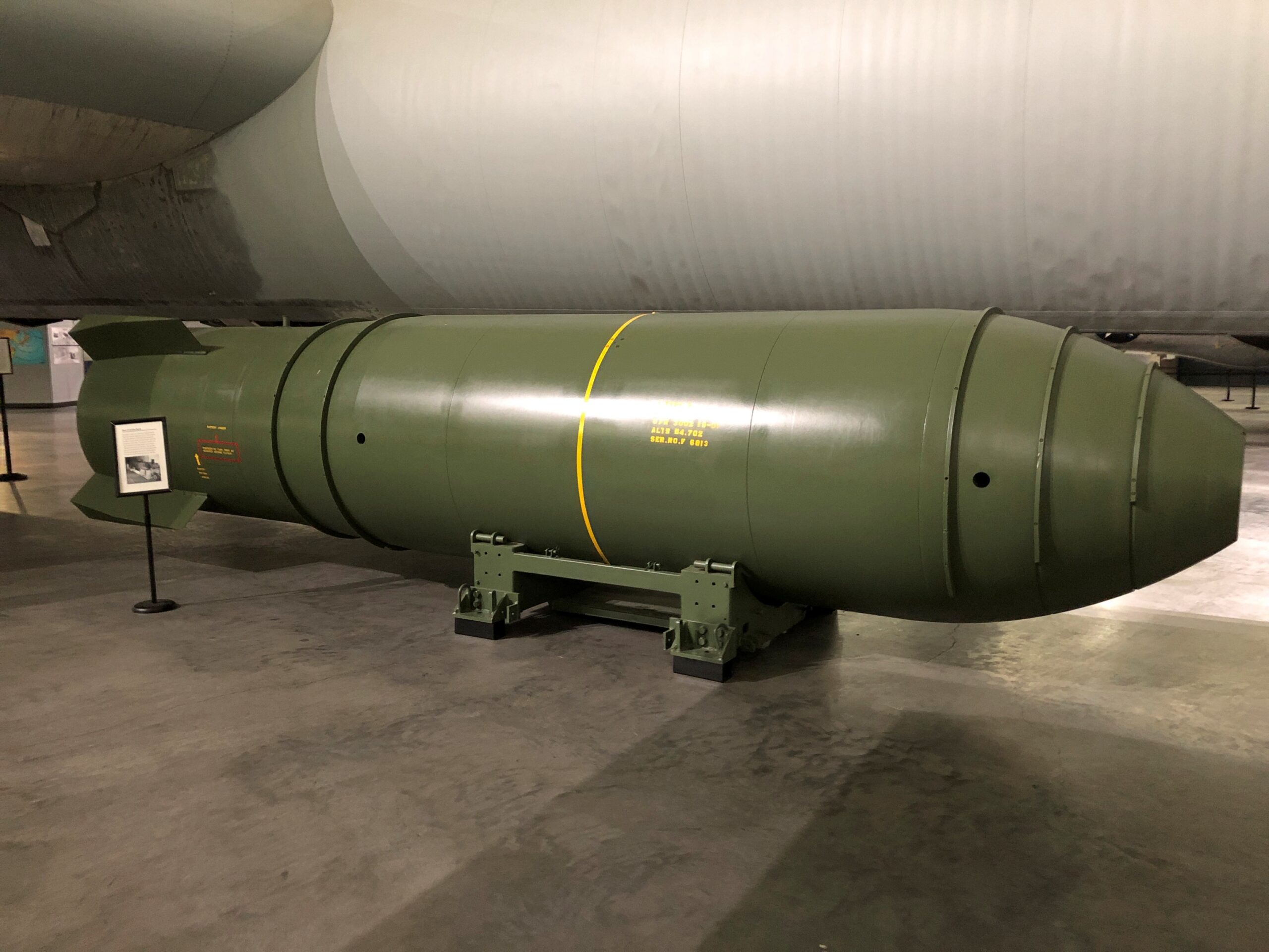
Smaller items, though not actually that small.
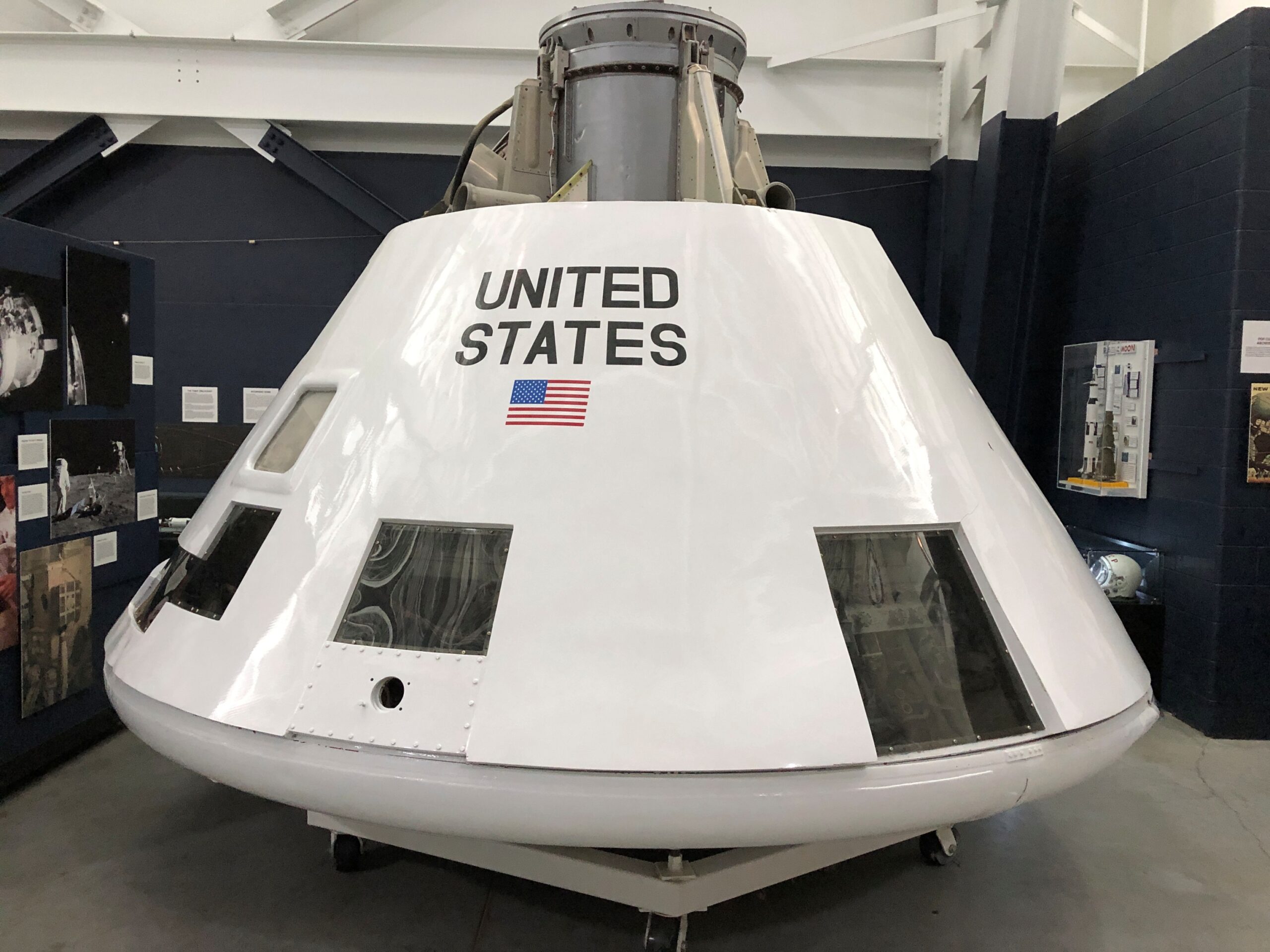
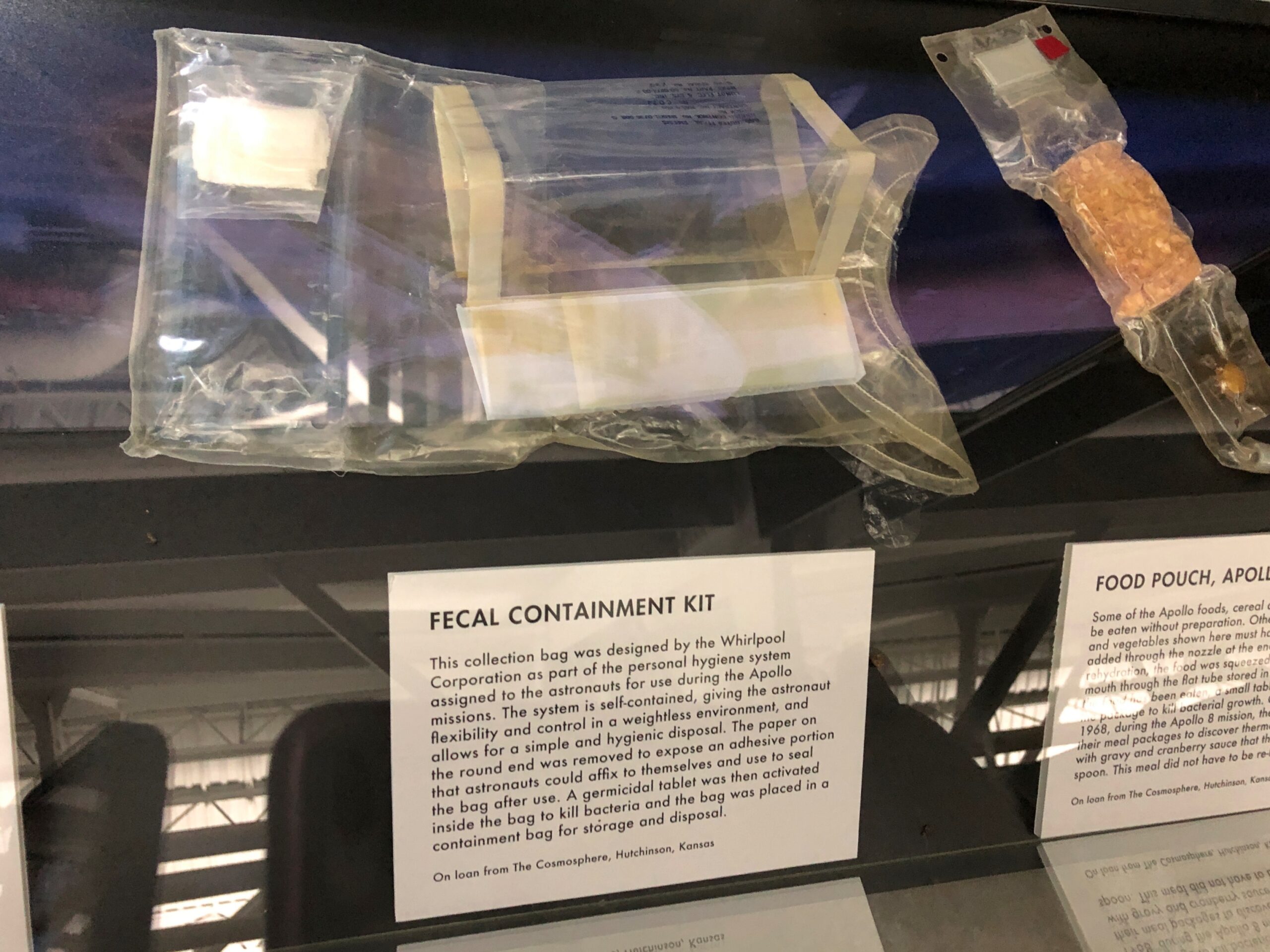
Besides the Vela satellite, other space items include spaceman gear and leftovers from the early days of manned space flight, such as a boilerplate Apollo, which wasn’t actually a capsule, but had the size, shape and mass of a command module, for testing.
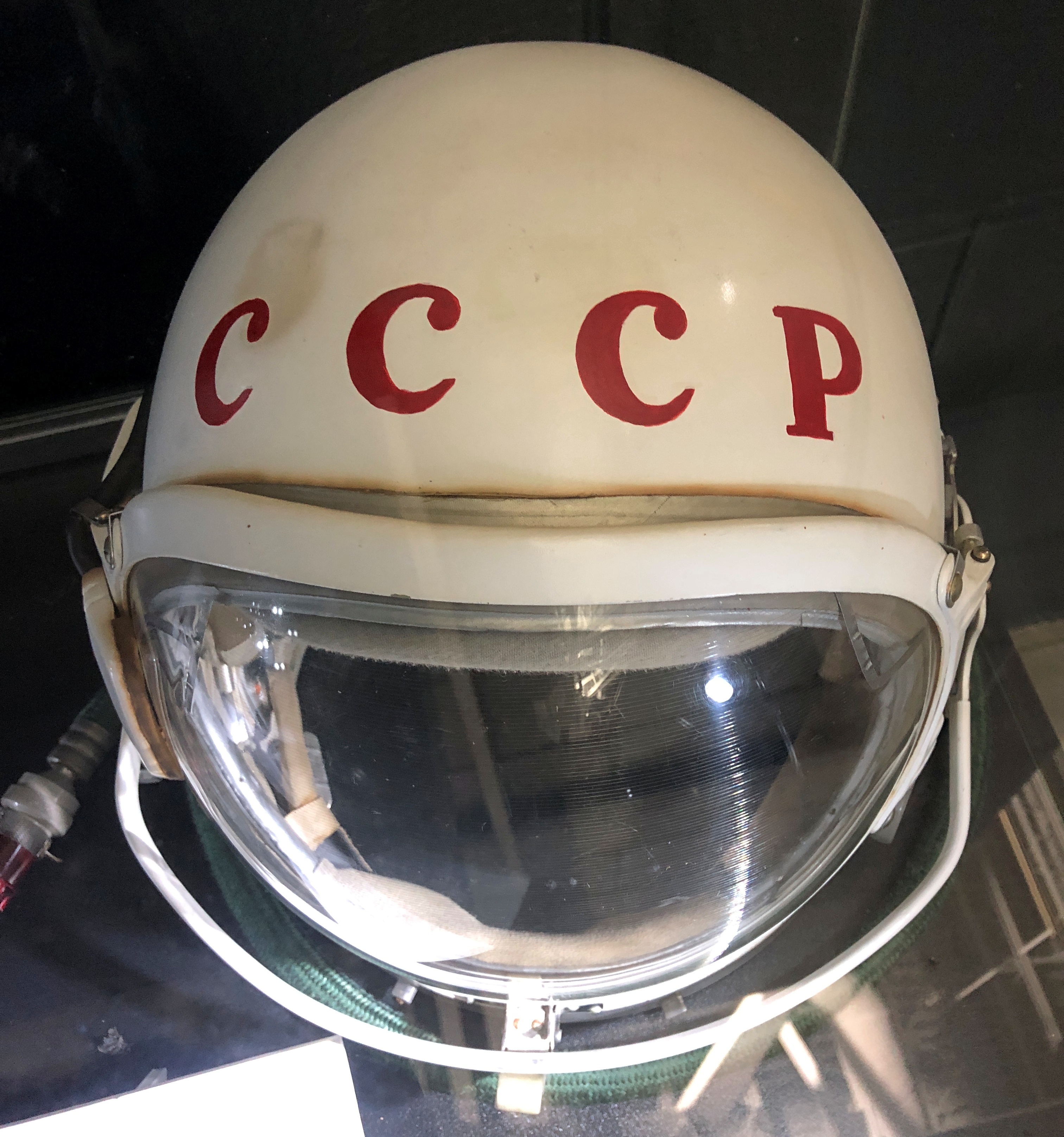
Picked up cheap after the dissolution of the Soviet Union?
Probably something non-astronauts wonder about a great deal.
Cold winds rolled through northern Illinois today. Seven inches of snow are forecast for Saturday. What? Right, it’s winter. The winter solstice is just the shortest day of the year.
Back to posting on Sunday. Regards for Thanksgiving.
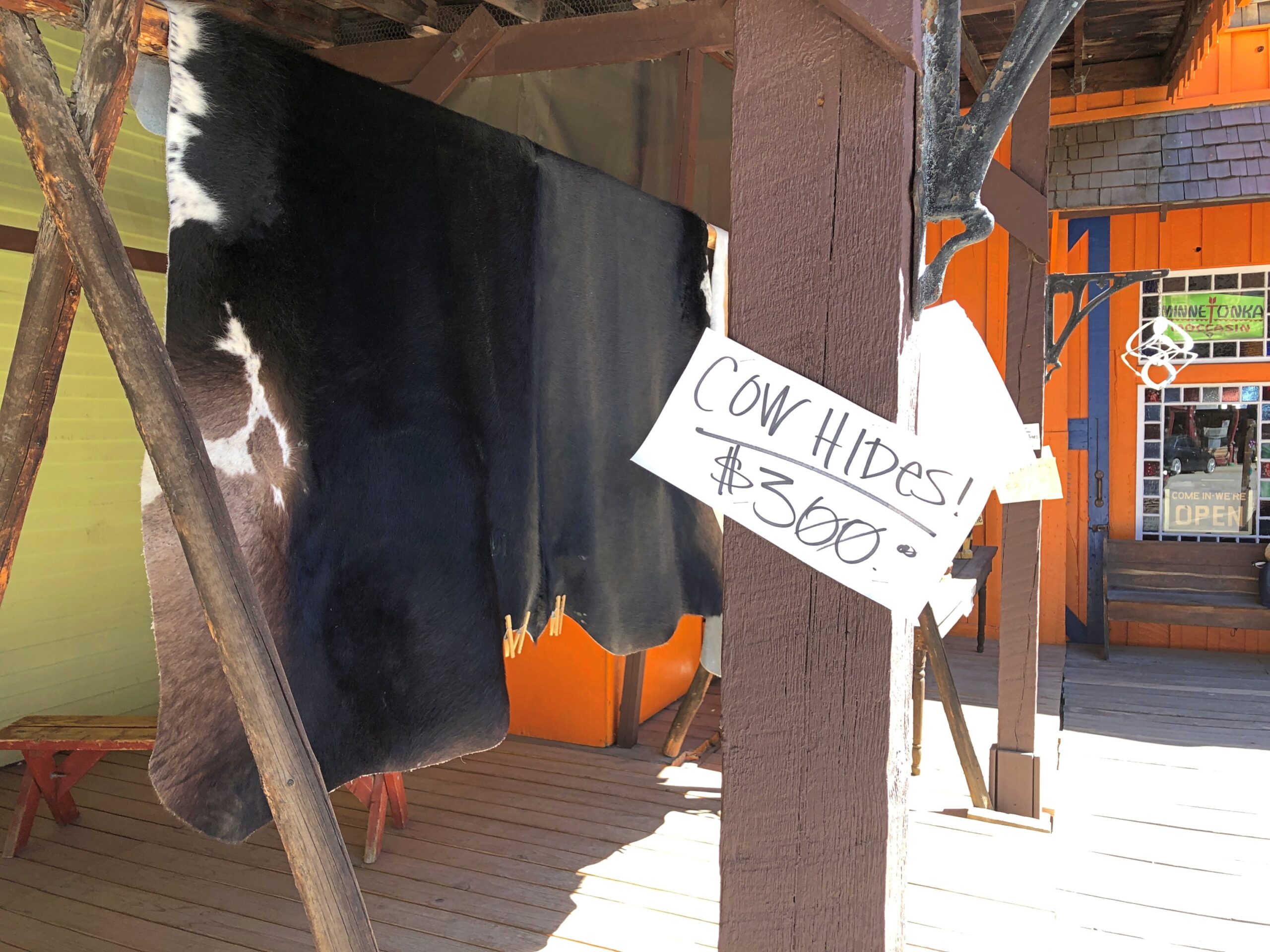
Something to upset PETA sympathizers.
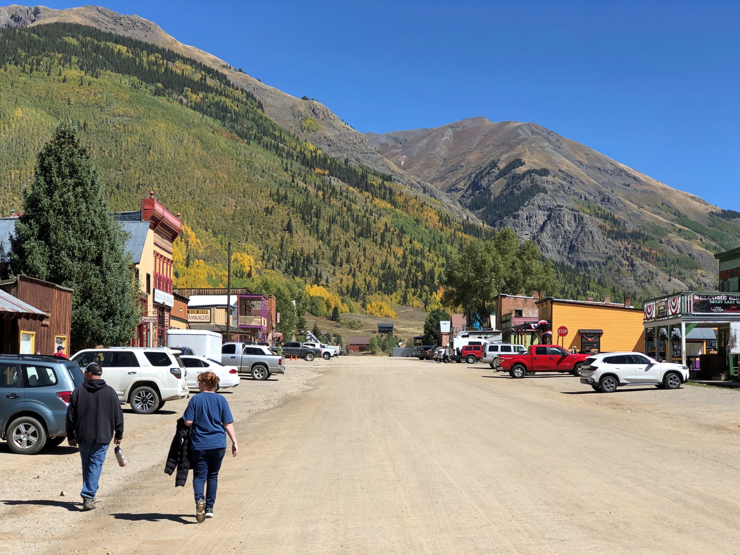
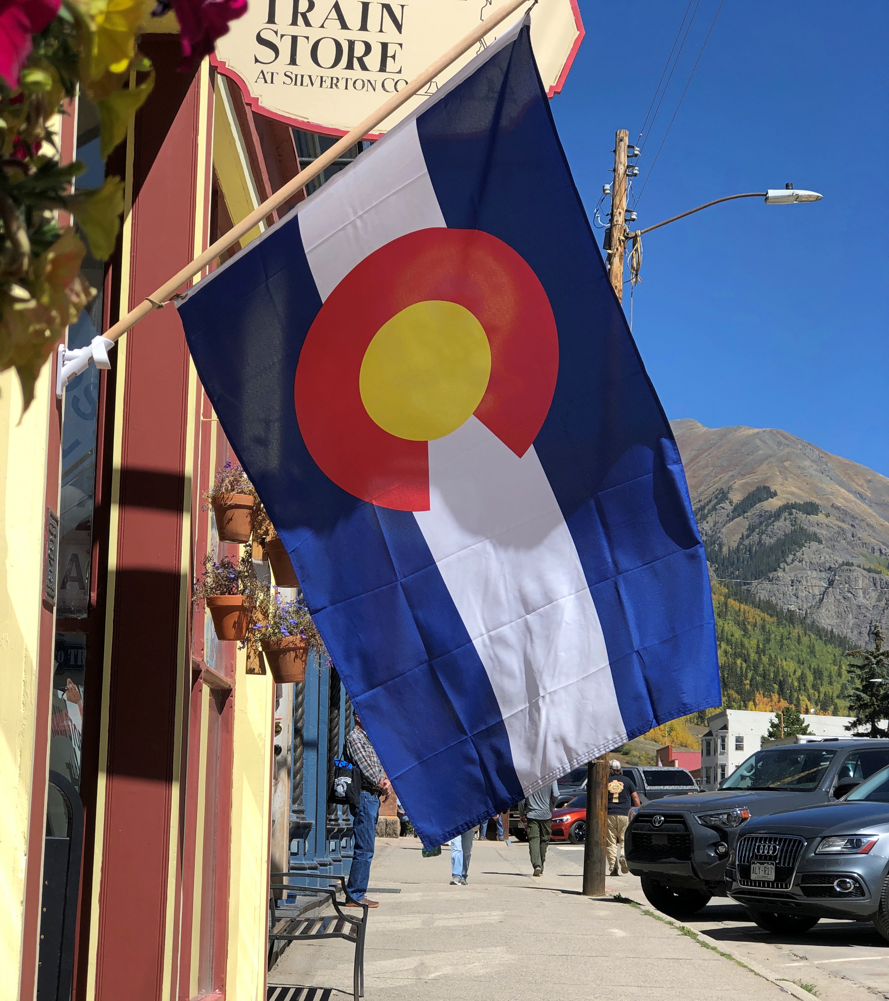
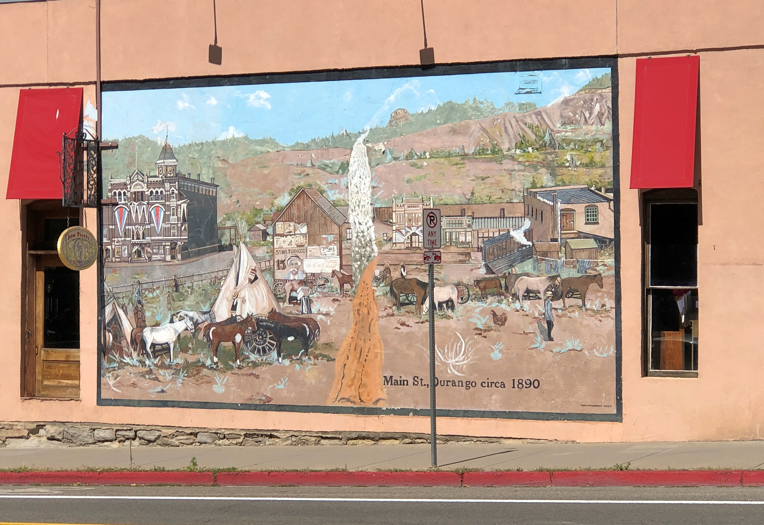
Stroll down Greene St. in the mountain town of Silverton, Colorado, at least in mid-September this year, and you’d have had the opportunity to buy a hide for $300. We did, but declined. Still, it wasn’t just a Colorado detail, but a Western one. The West, where men are men and cow hides hang in the sun. As far as I could tell, you couldn’t buy a hide with Bitcoin, but I suppose you’d have to ask the seller to be sure.
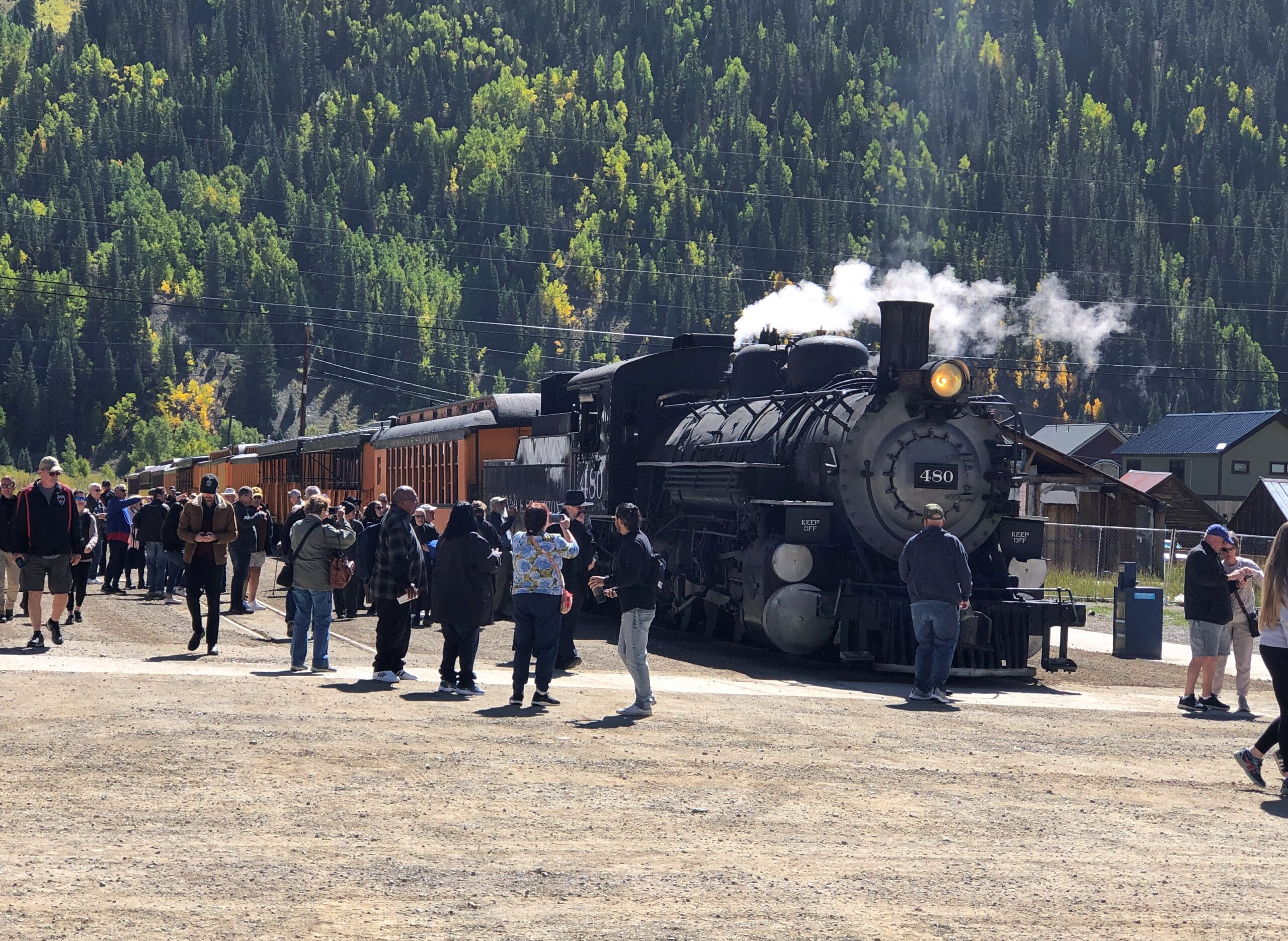
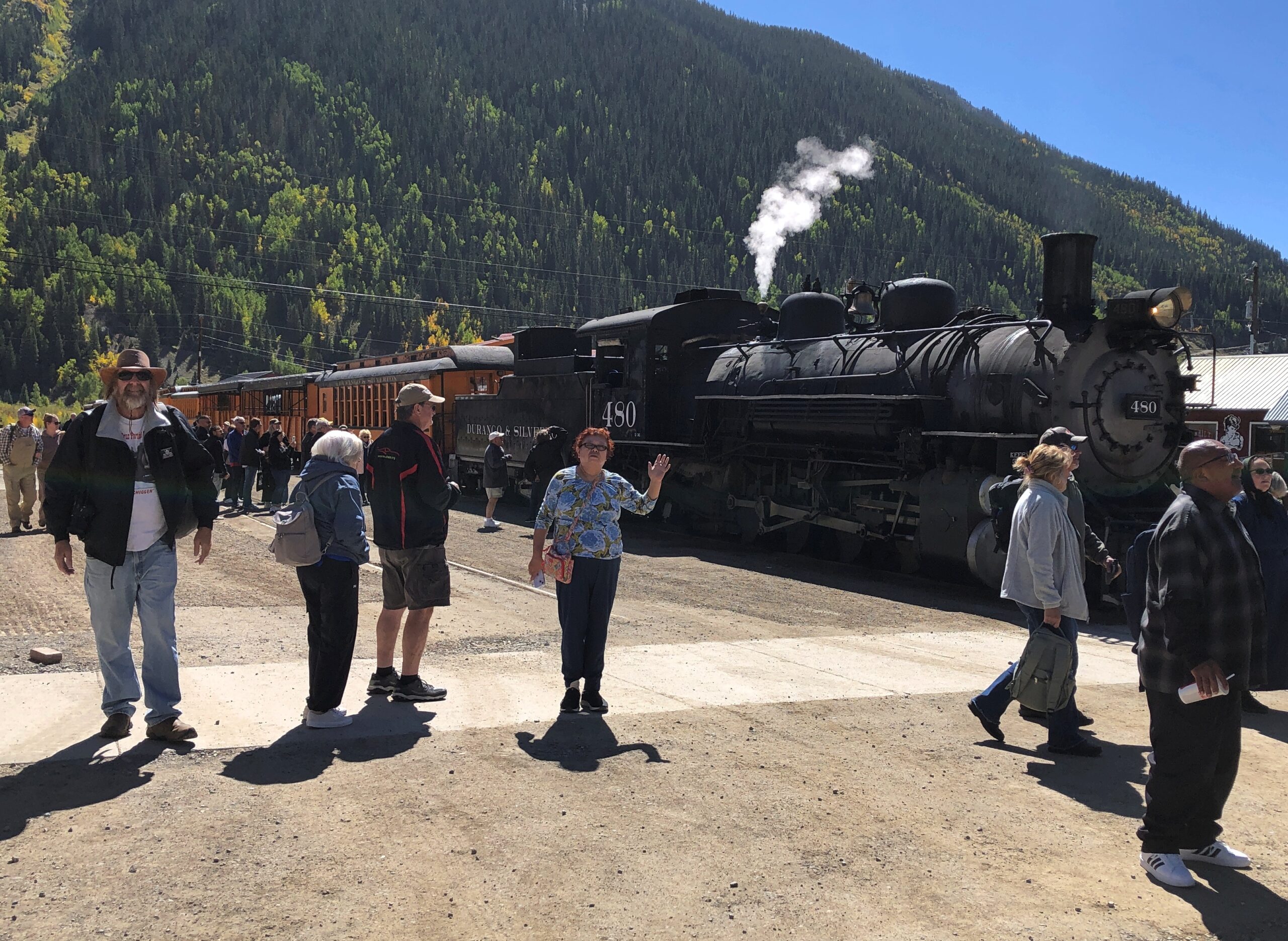
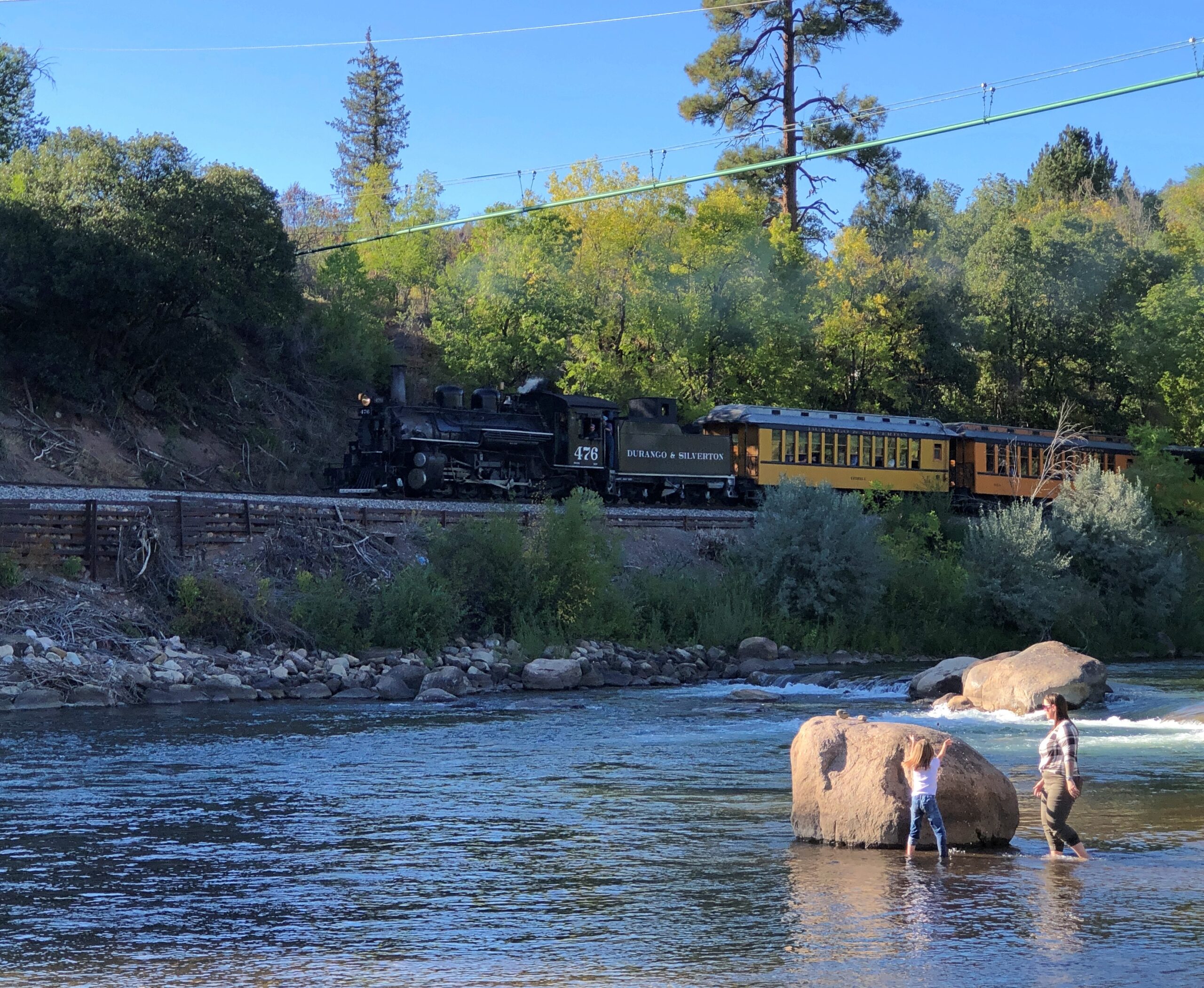
Not five minutes after we’d parked off the main thoroughfare of Greene Street in Silverton, on a large side street, a steam locomotive hauling a valuable cargo — tourists — pulled into town, a block from where we parked. The Durango & Silverton Narrow Gauge RR train from Durango had arrived. Instantly the streets around the train were thick with those same tourists who had paid roughly $100 a head for the scenic ride, though I suppose many, the majority maybe, had gotten a slight discount as seniors.
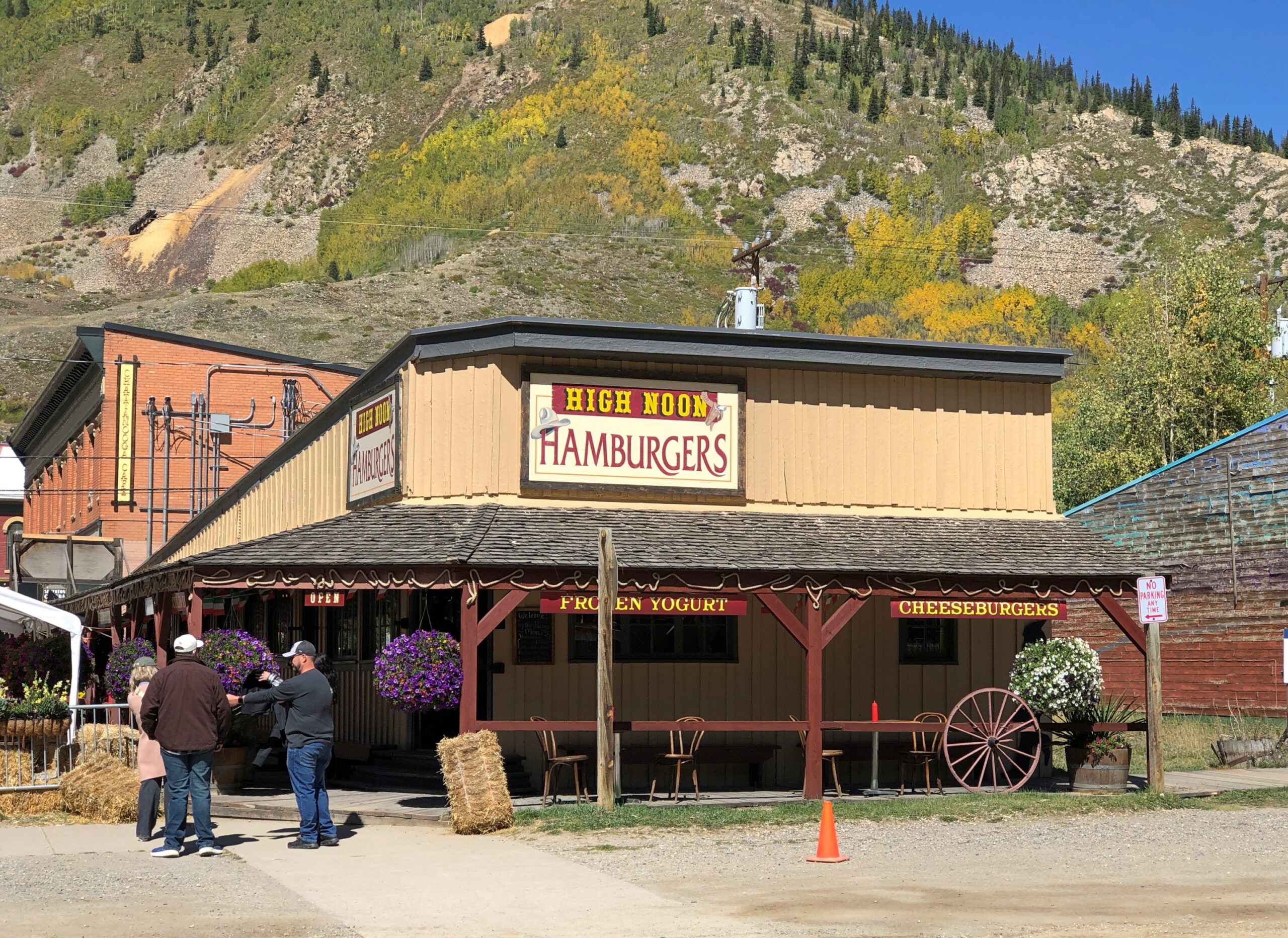
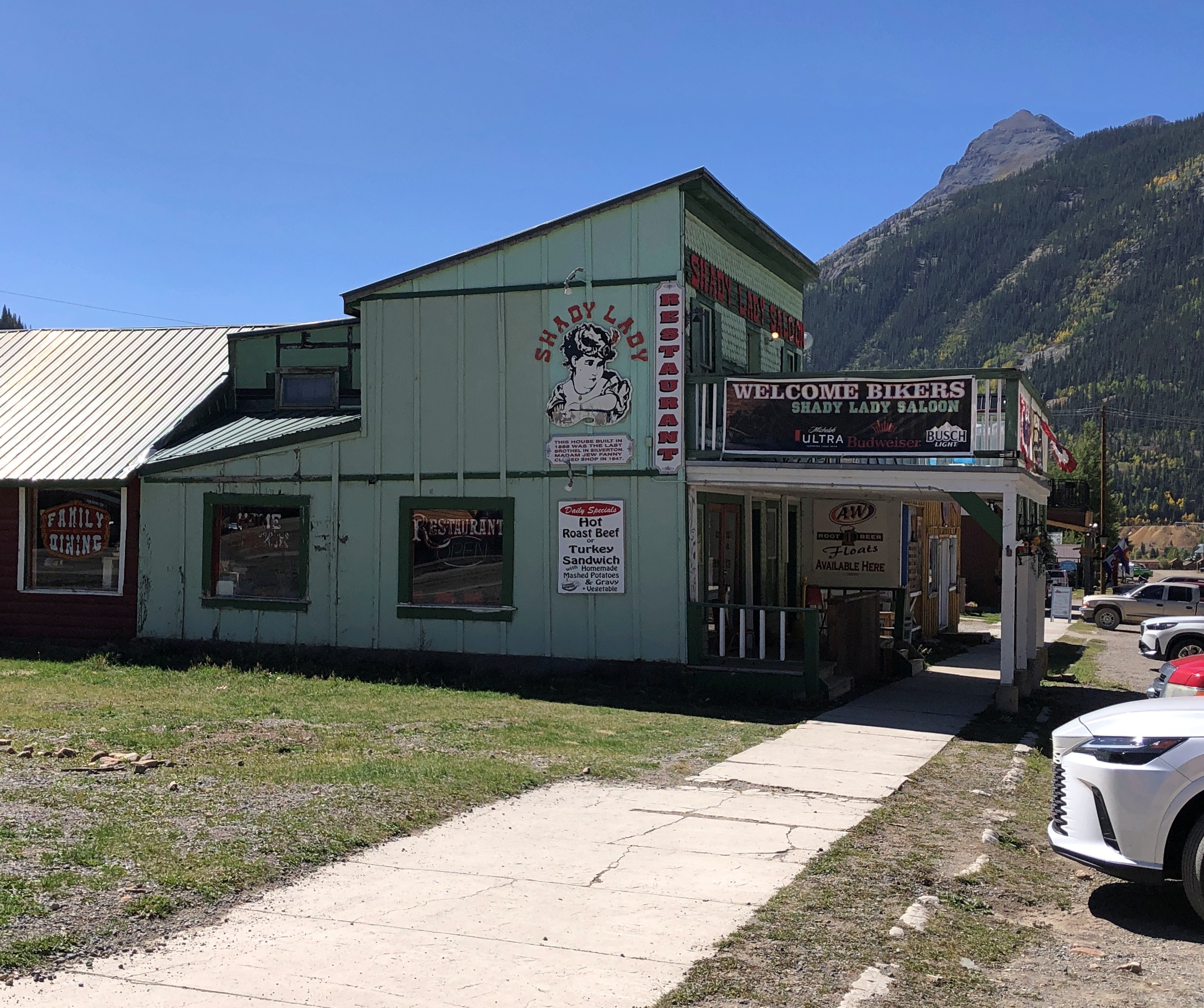
I assume the economy of 21st-century Silverton depends pretty heavily on these arrivals, at least in the warm months, as day after day the line disgorges its many passengers for their layover. No doubt the likes of High Noon Hamburgers or the Shady Lady or a lot of the other businesses in town wouldn’t be viable otherwise.
Blair St., paralleling Greene St. a block away. No need for pavement.
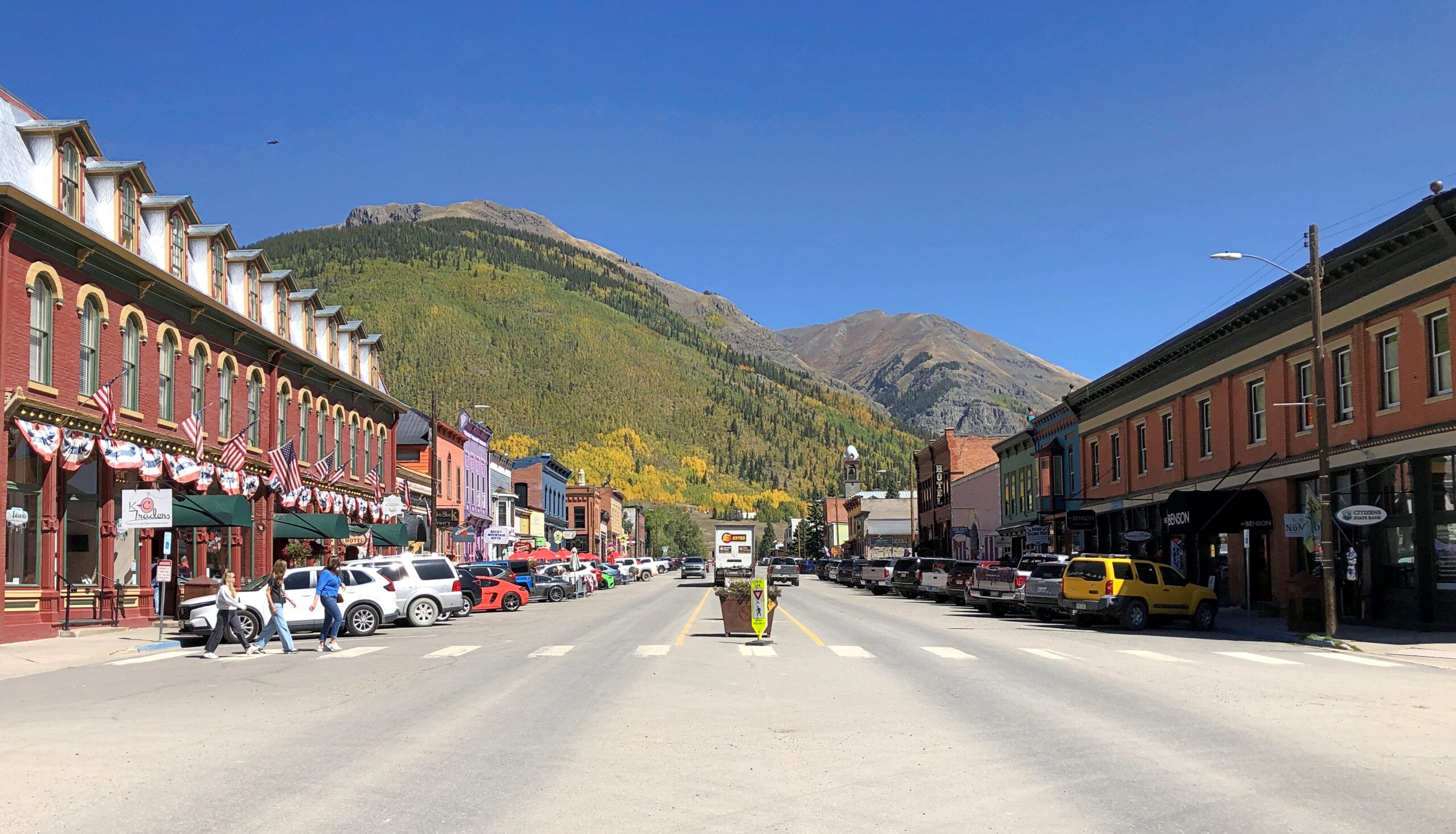
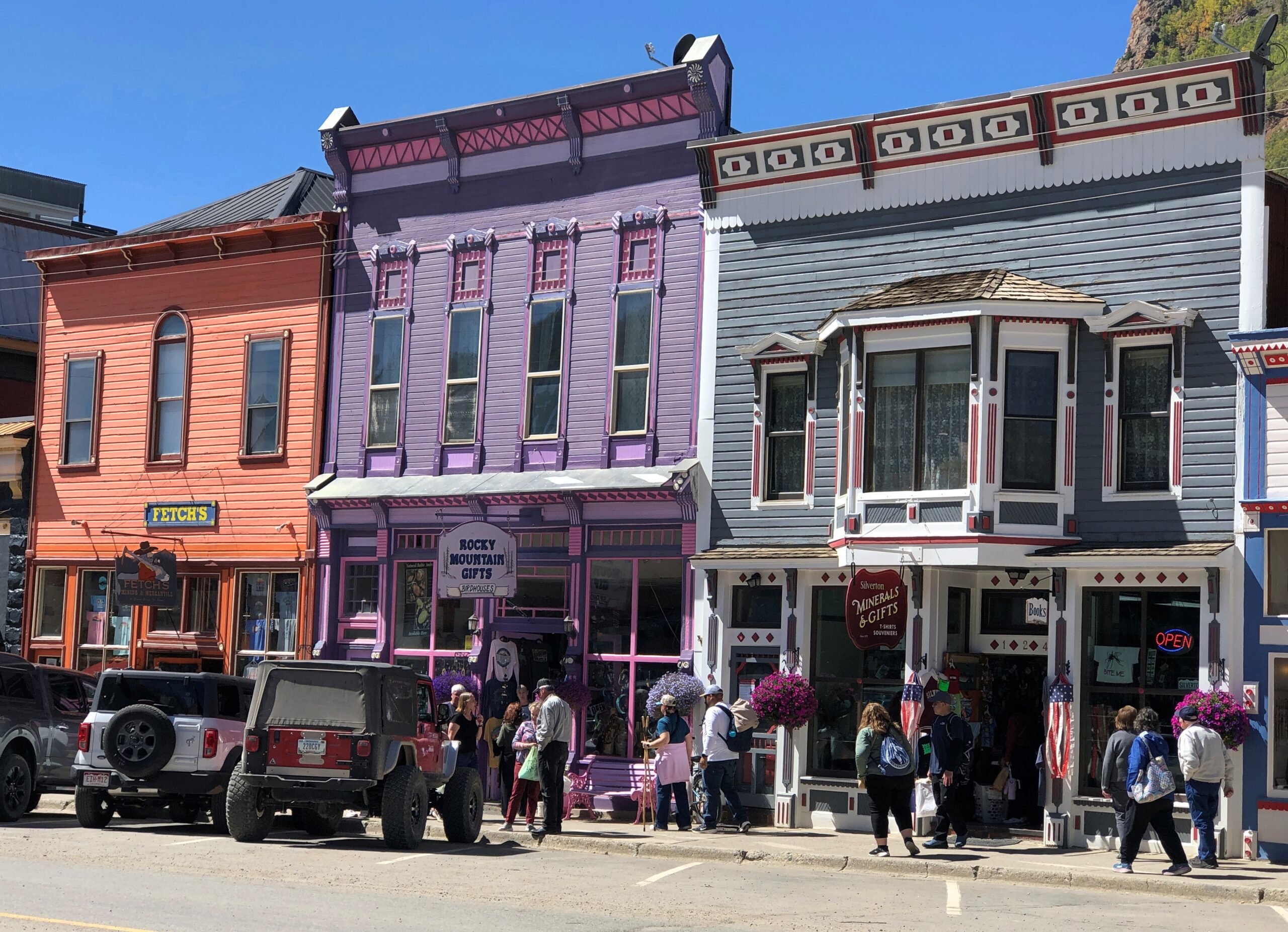
Greene St.
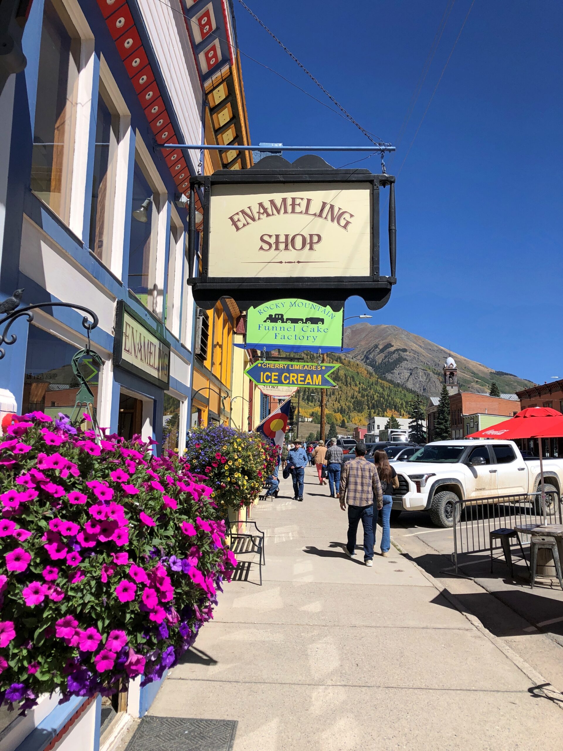
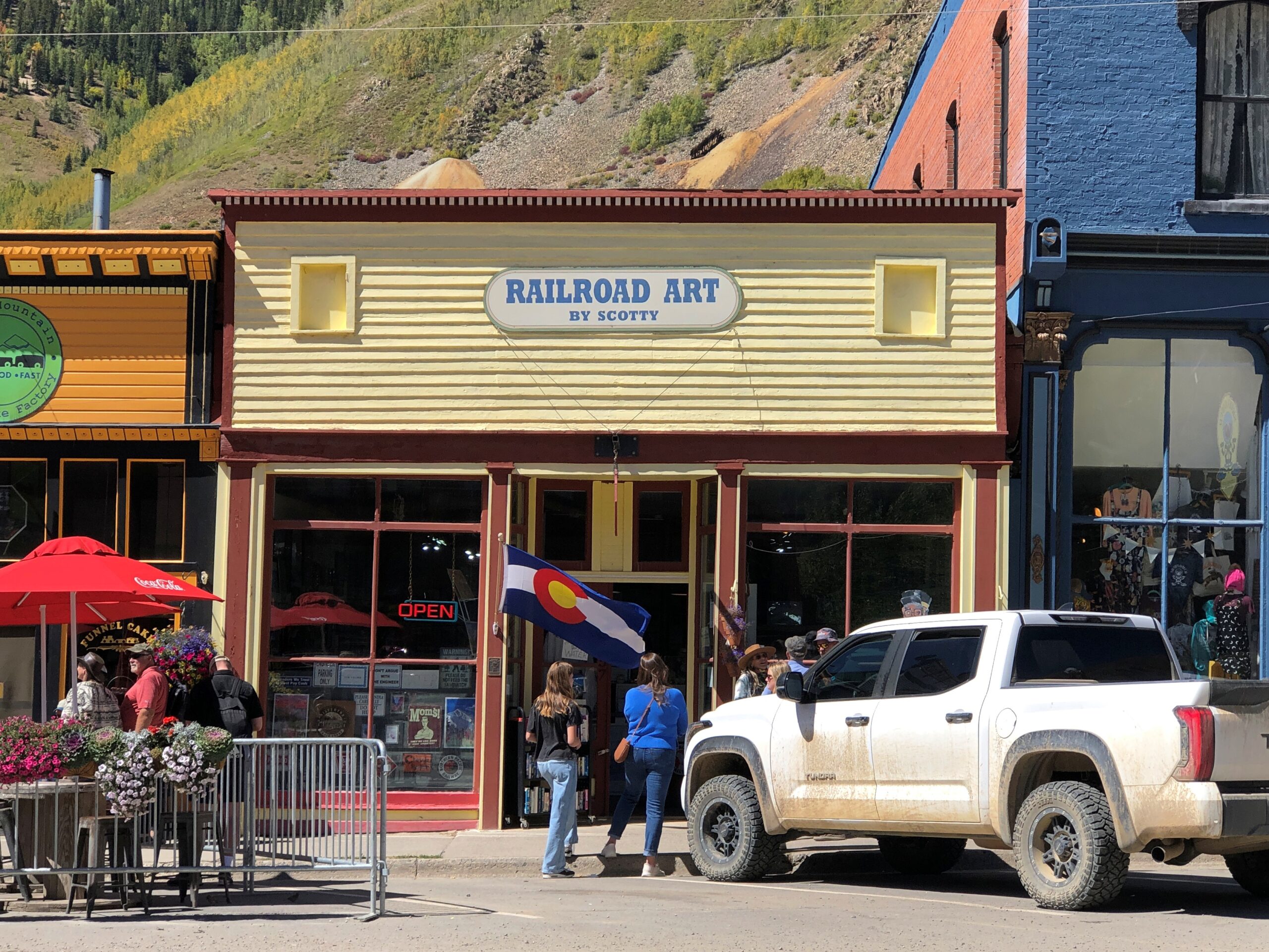
Lots to see on Greene.
Including the fine Colorado flag, flying at Railroad Art by Scotty, a seriously cool gallery.
“Railroad Art by Scotty presents the custom matted and framed collector Railroad Art Prints by renowned railroad artist H.L. Scott, III,” its web site says. “These are not photographs and they are not created on the computer. These are pen & ink drawings created by Scott using the technique known as STIPPELING or pointillism.”
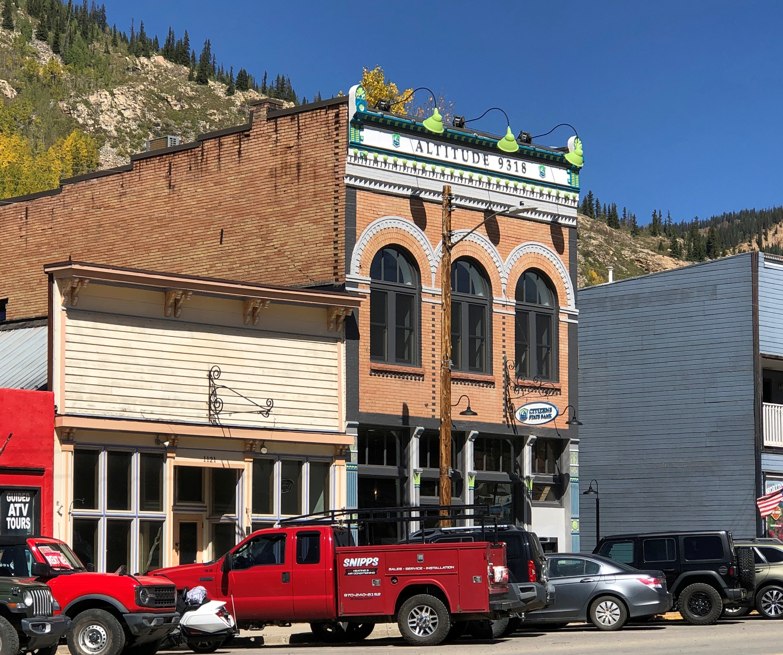
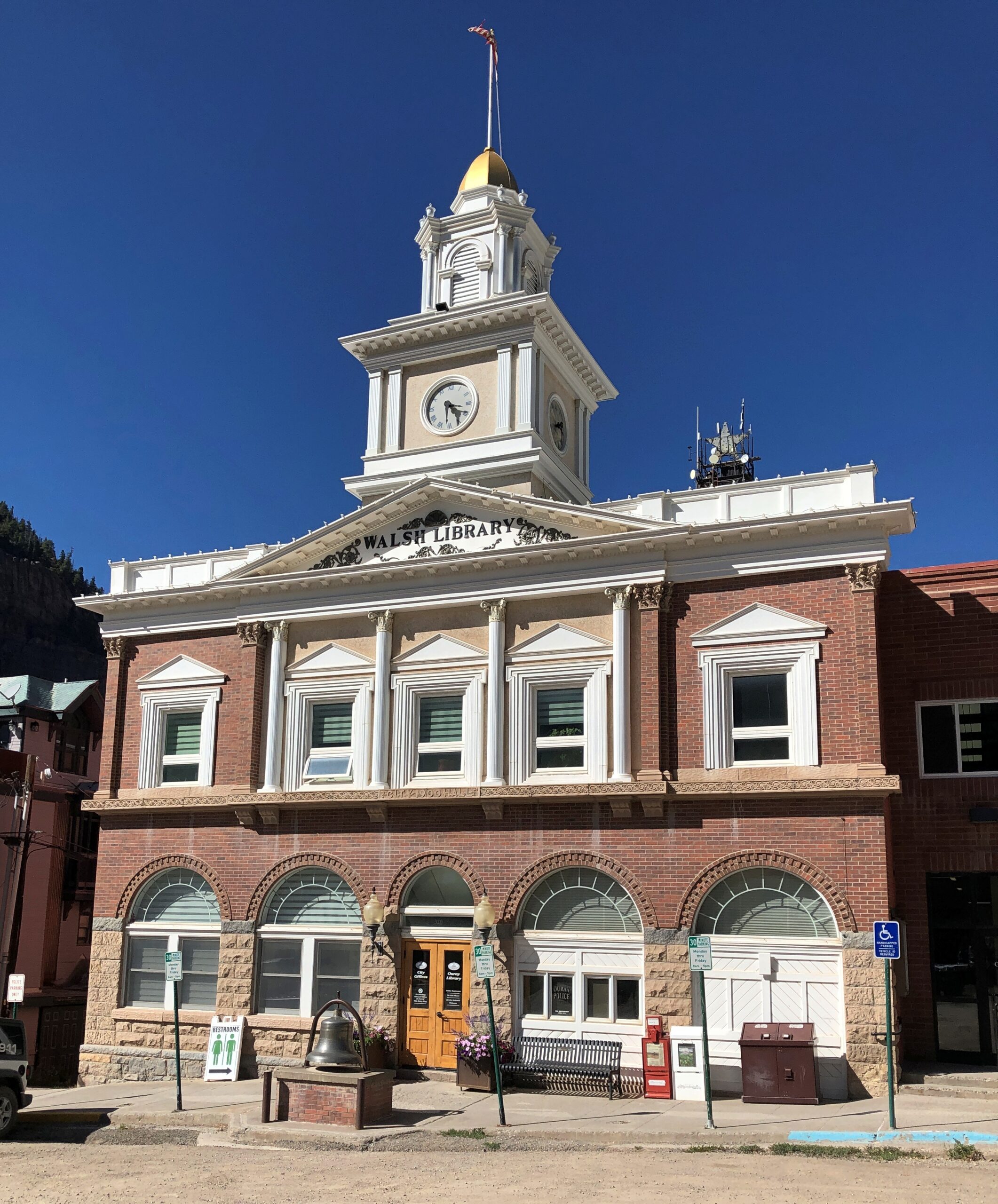
One of the few buildings I’ve seen that clearly states its elevation.
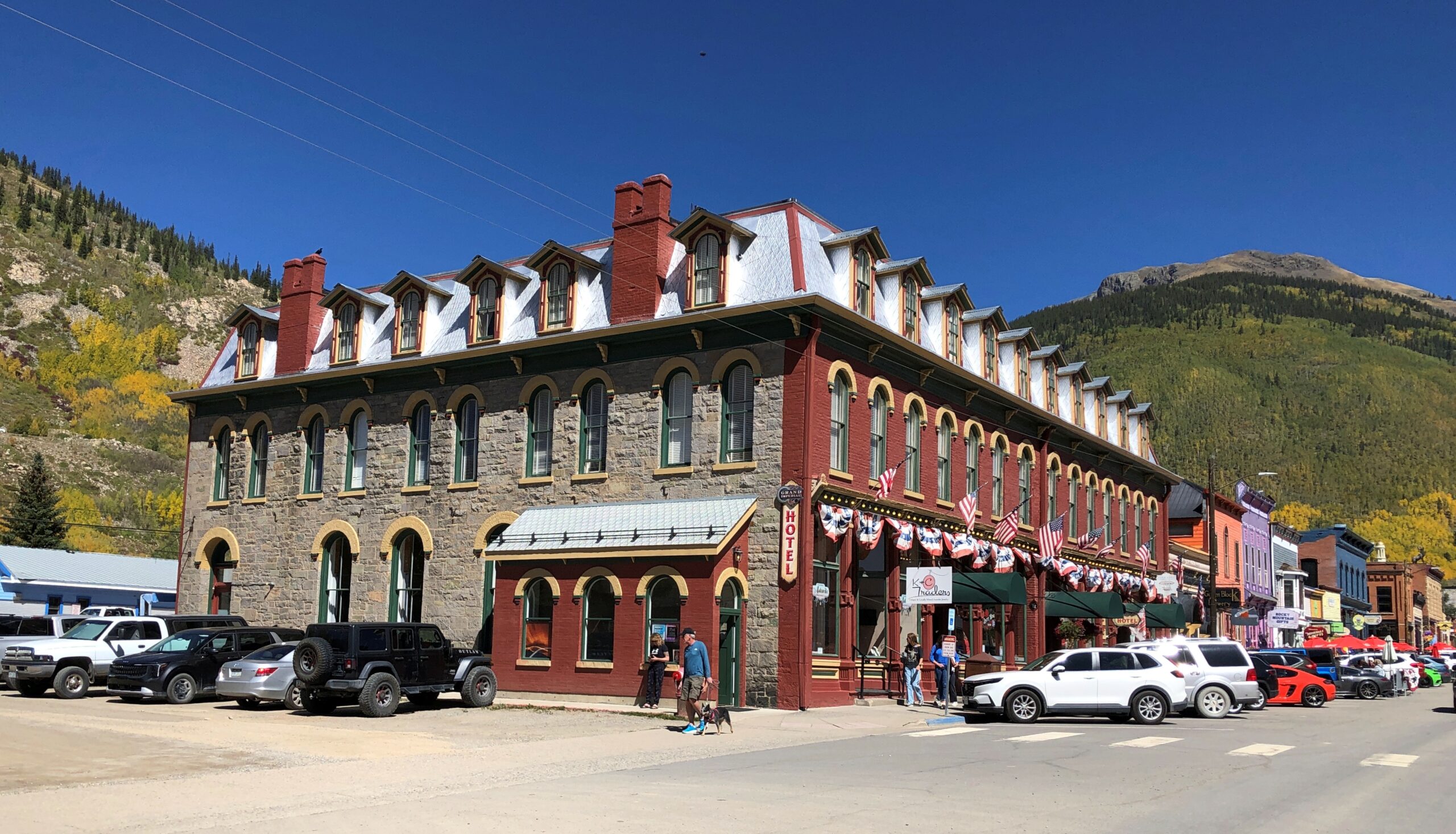
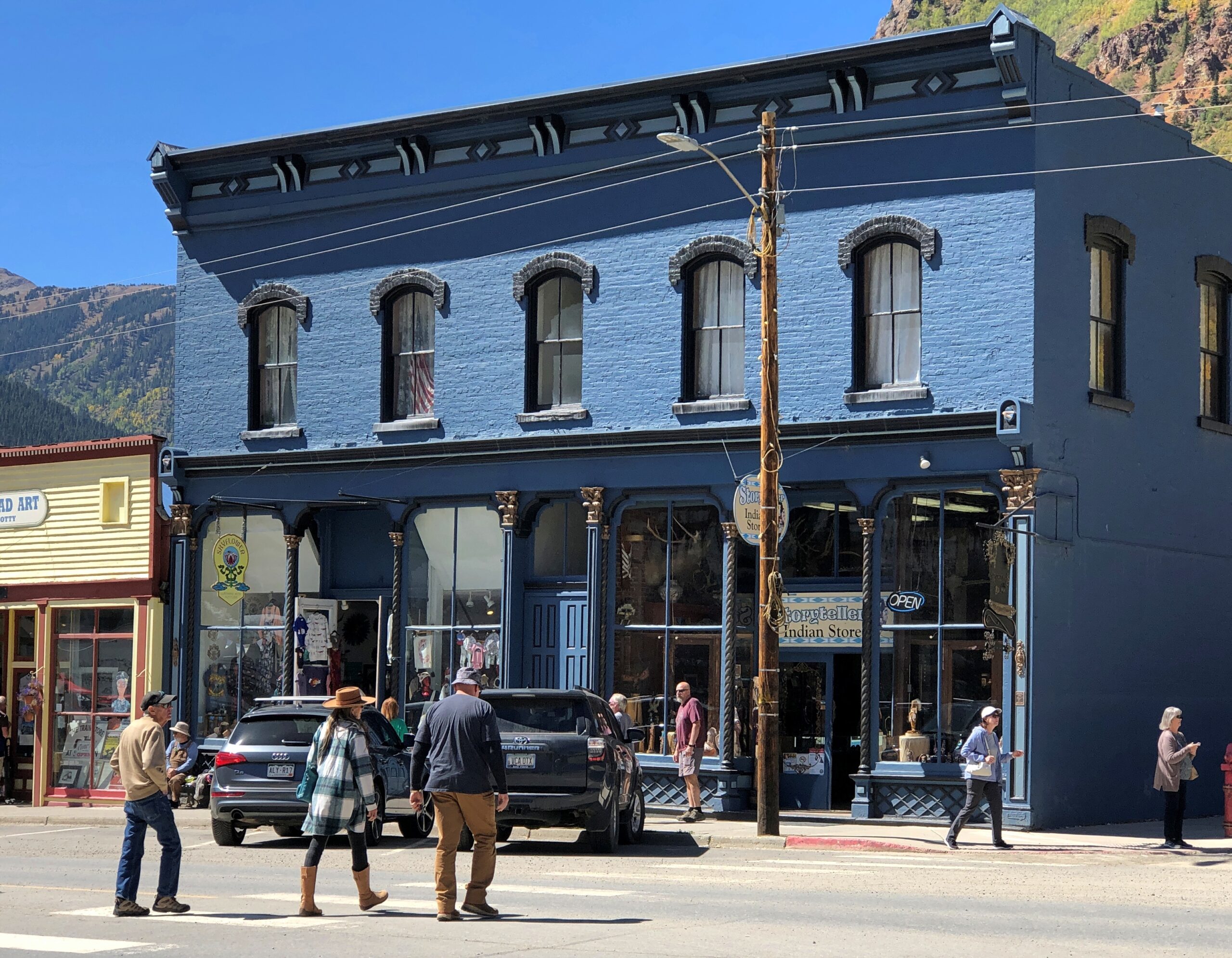
The Grand Imperial Hotel. A lofty name to live up to, but probably posh enough to do so.
Restored to its 1880s appearance in the 2010s, no doubt at considerable expense.
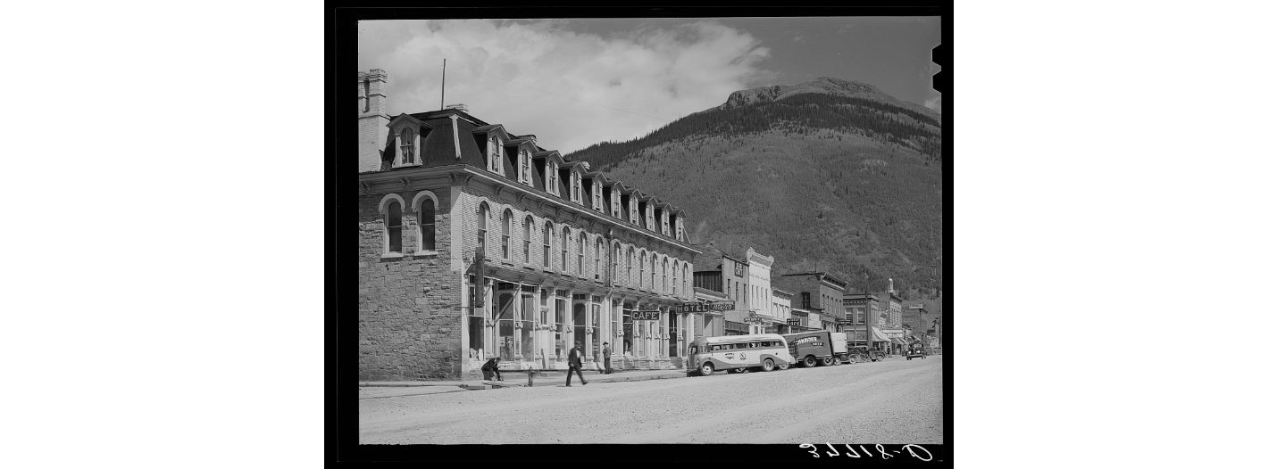
As it looked in 1940, a photo from the Library of Congress, Farm Security Administration-Office of War Information Photograph Collection.
More Greene St.
Greene is short, because Silverton isn’t very large, and so the street, now a road, soon heads for the hills.
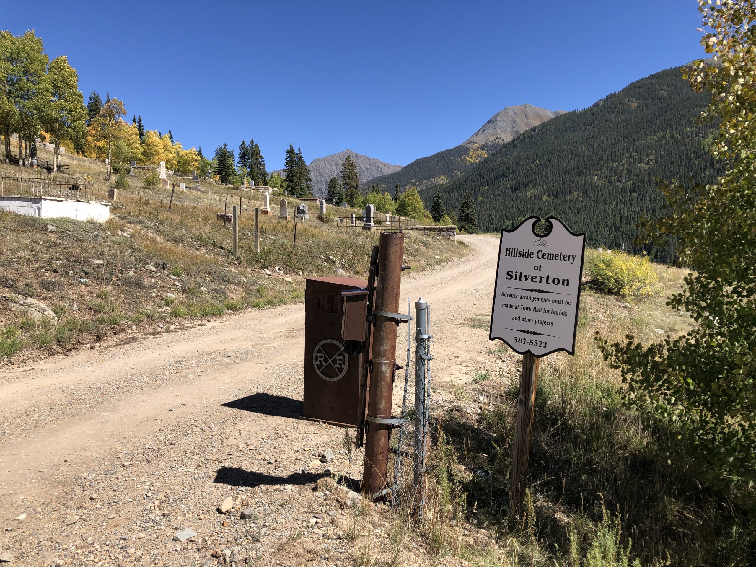
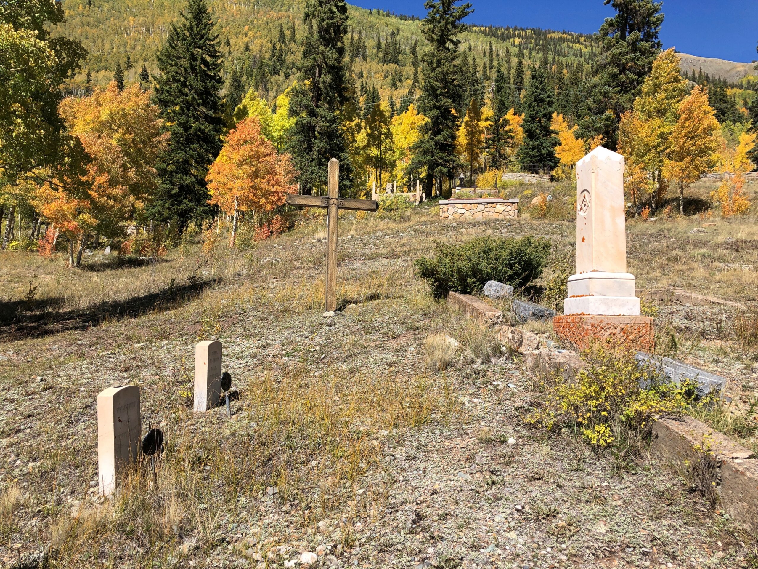
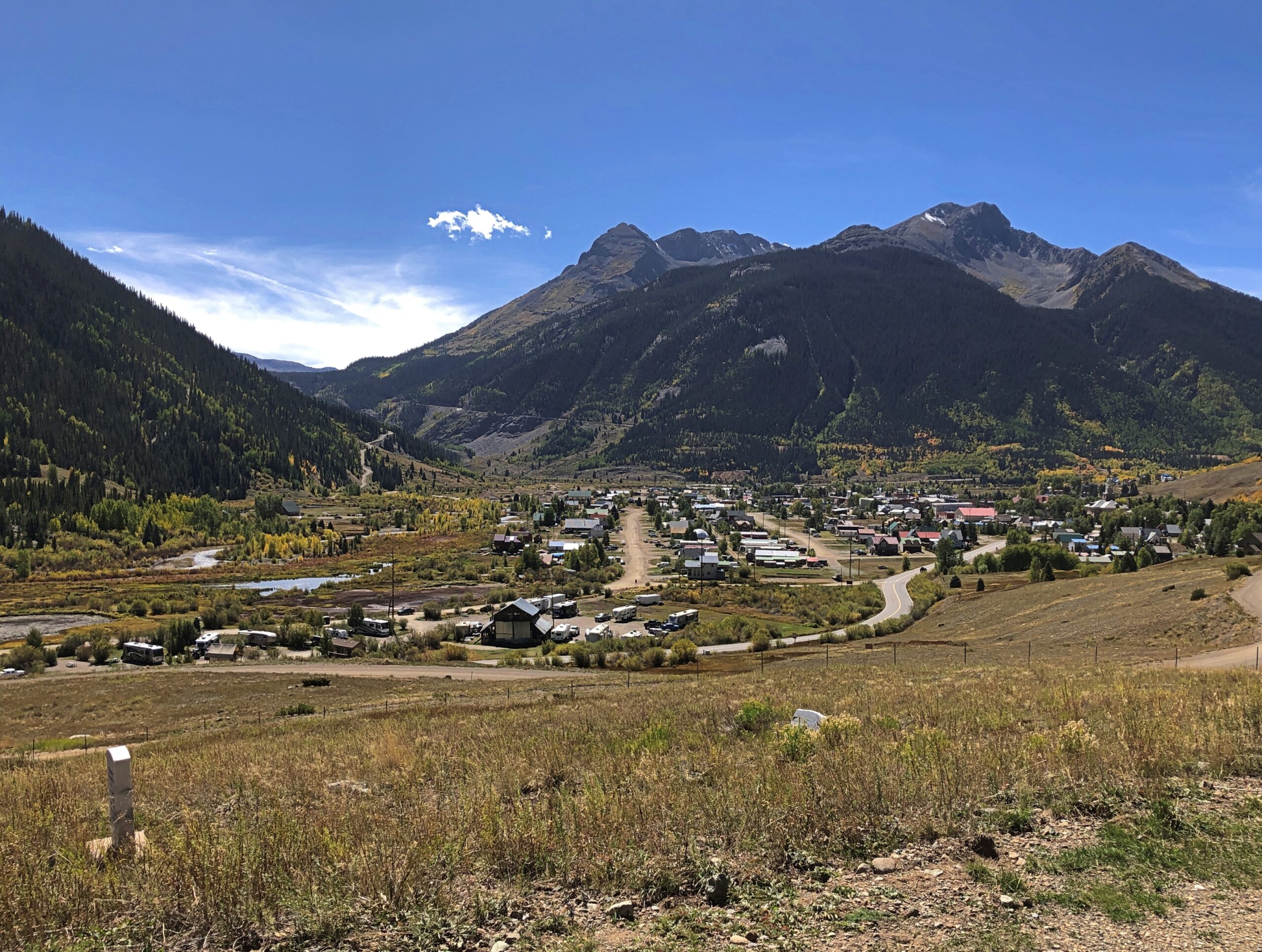
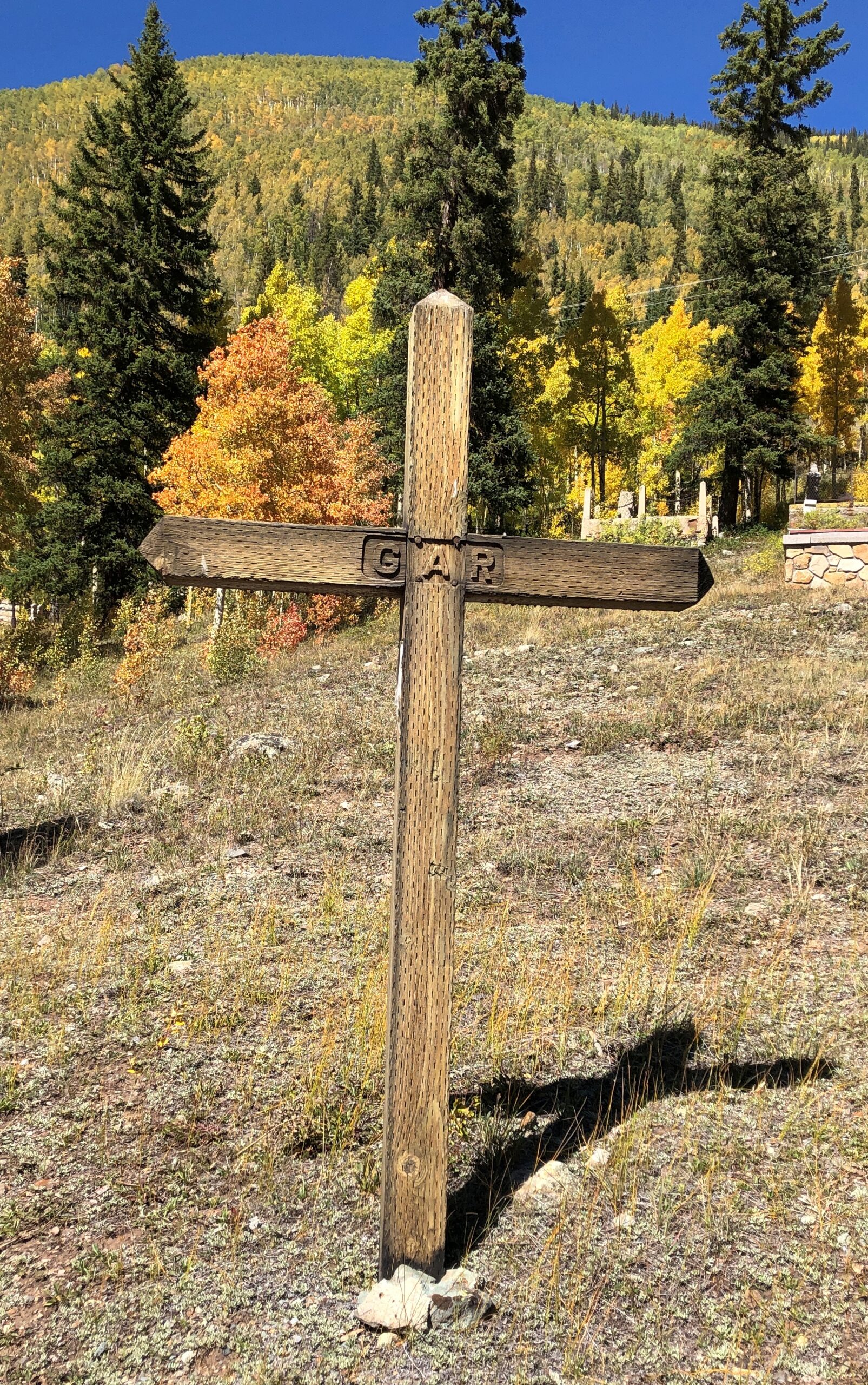
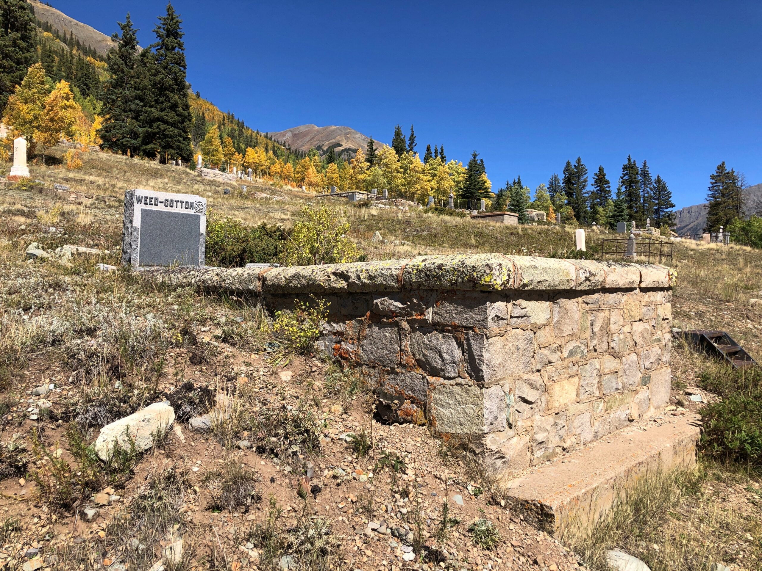
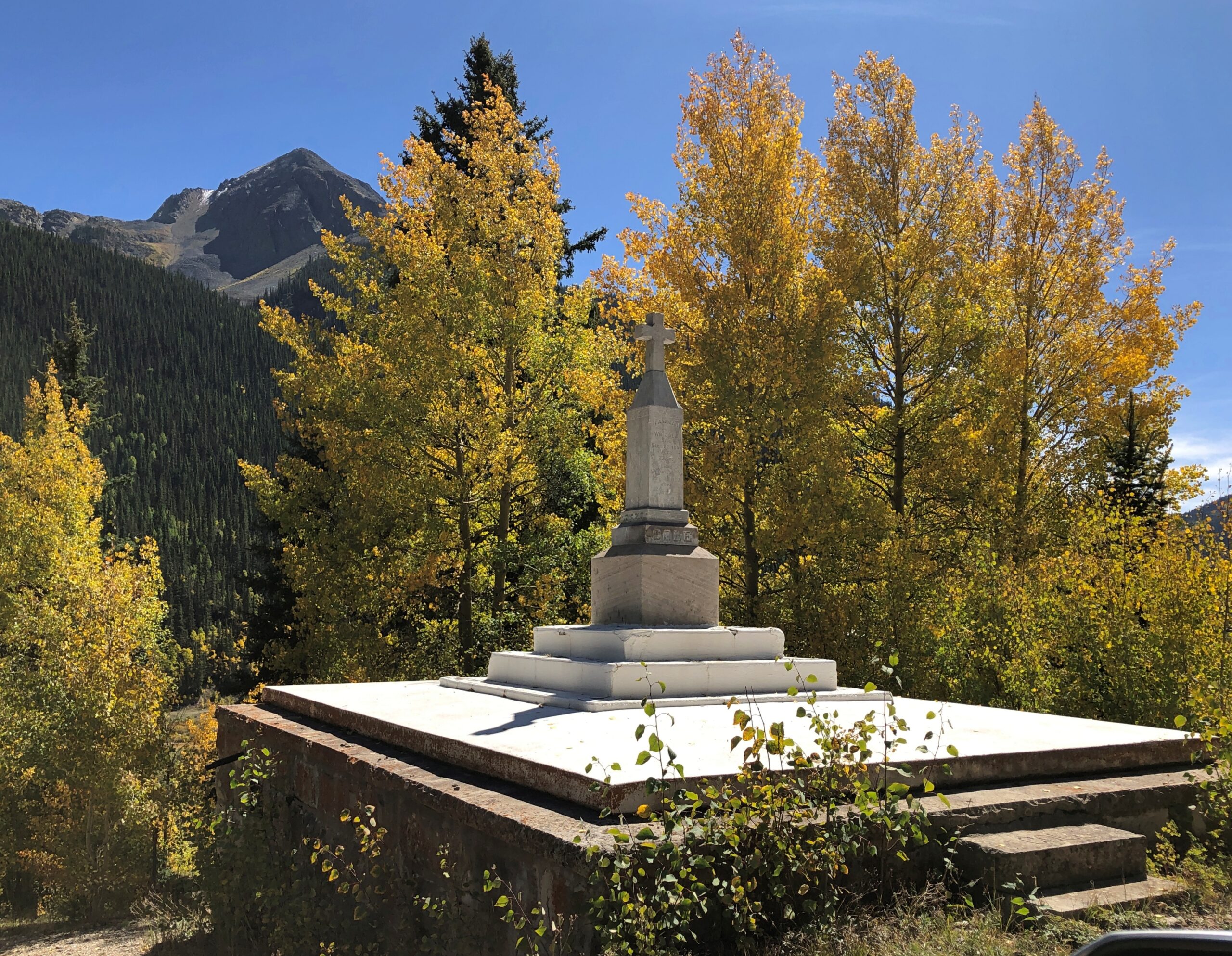
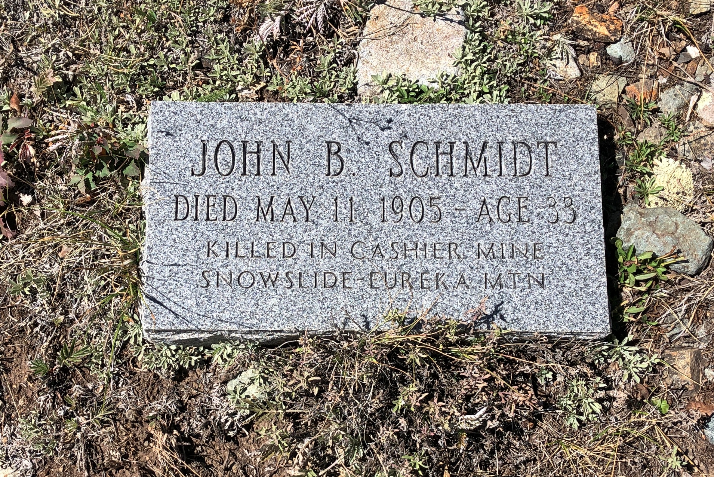
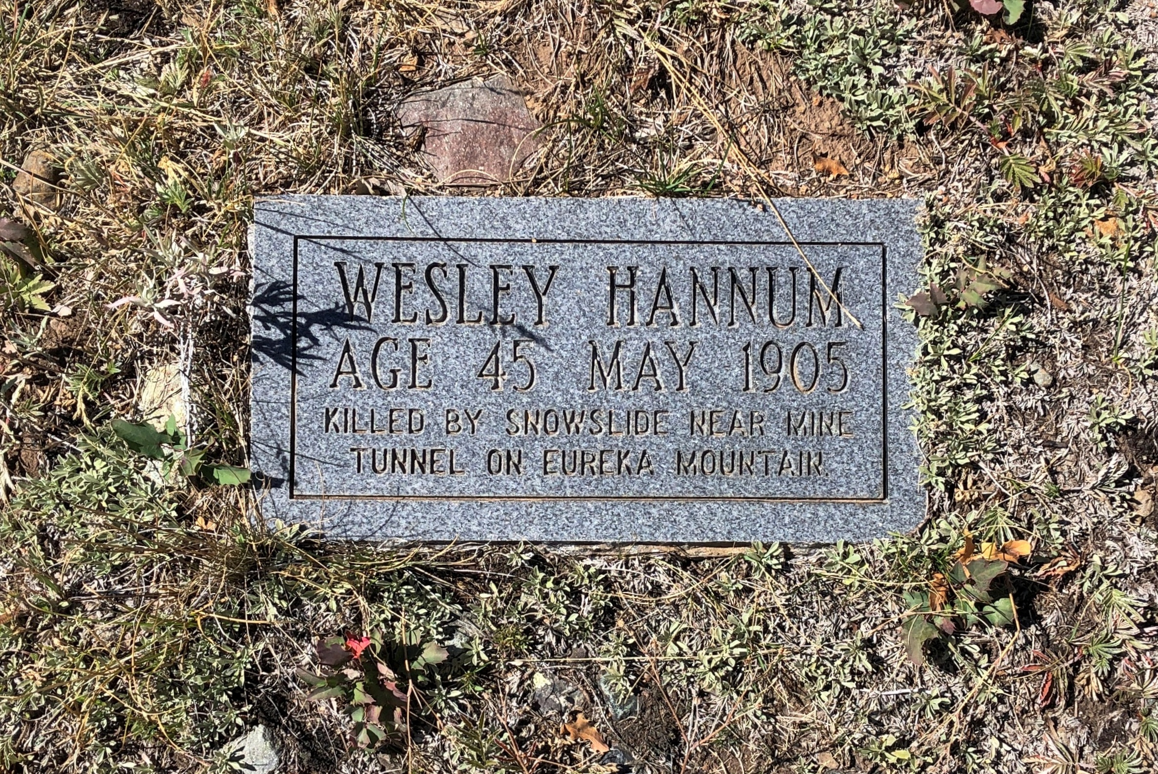
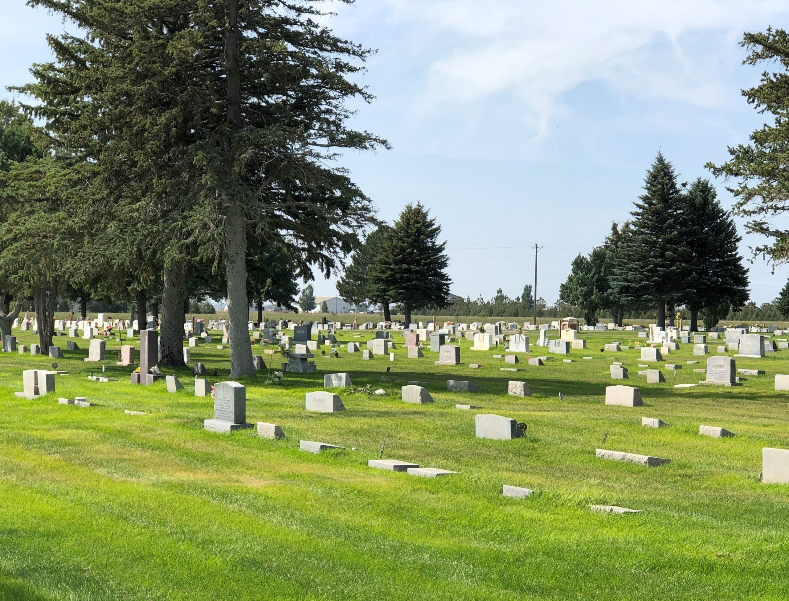
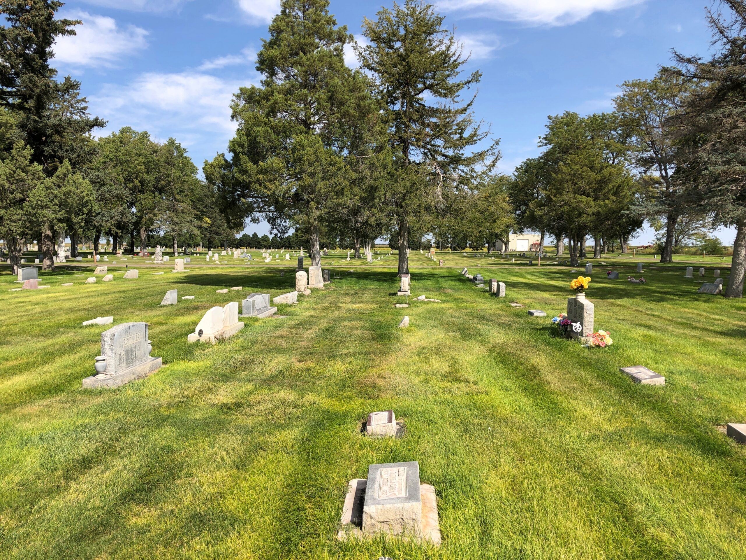
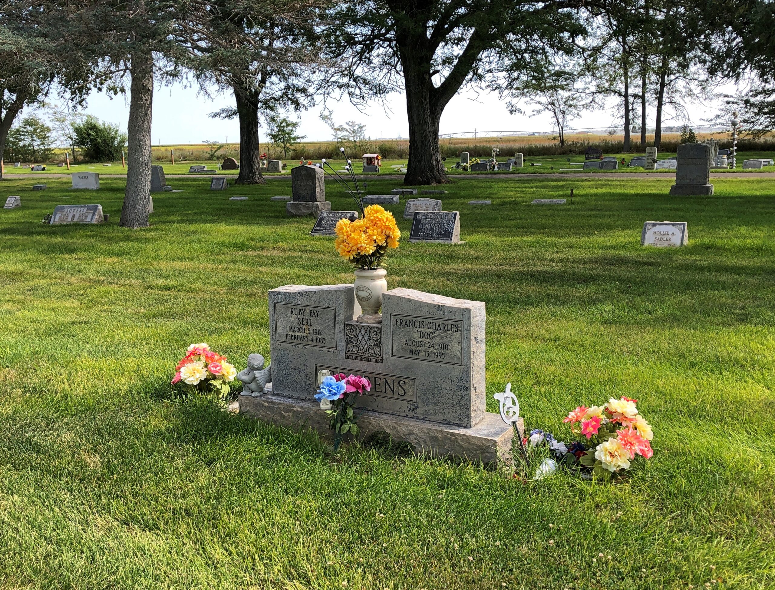
The Hillside Cemetery of Silverton.
An apt name.
With a good view of the town.
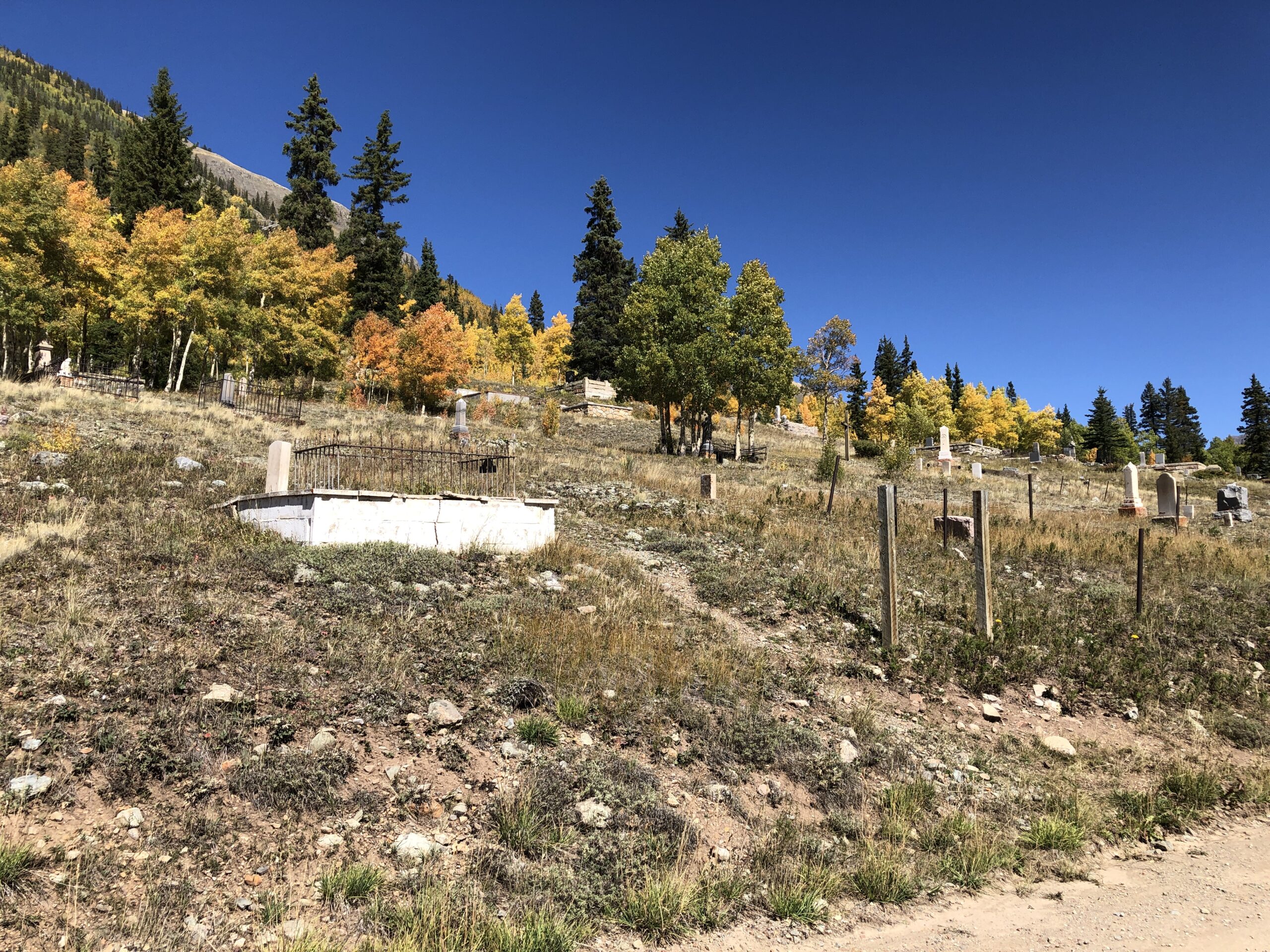
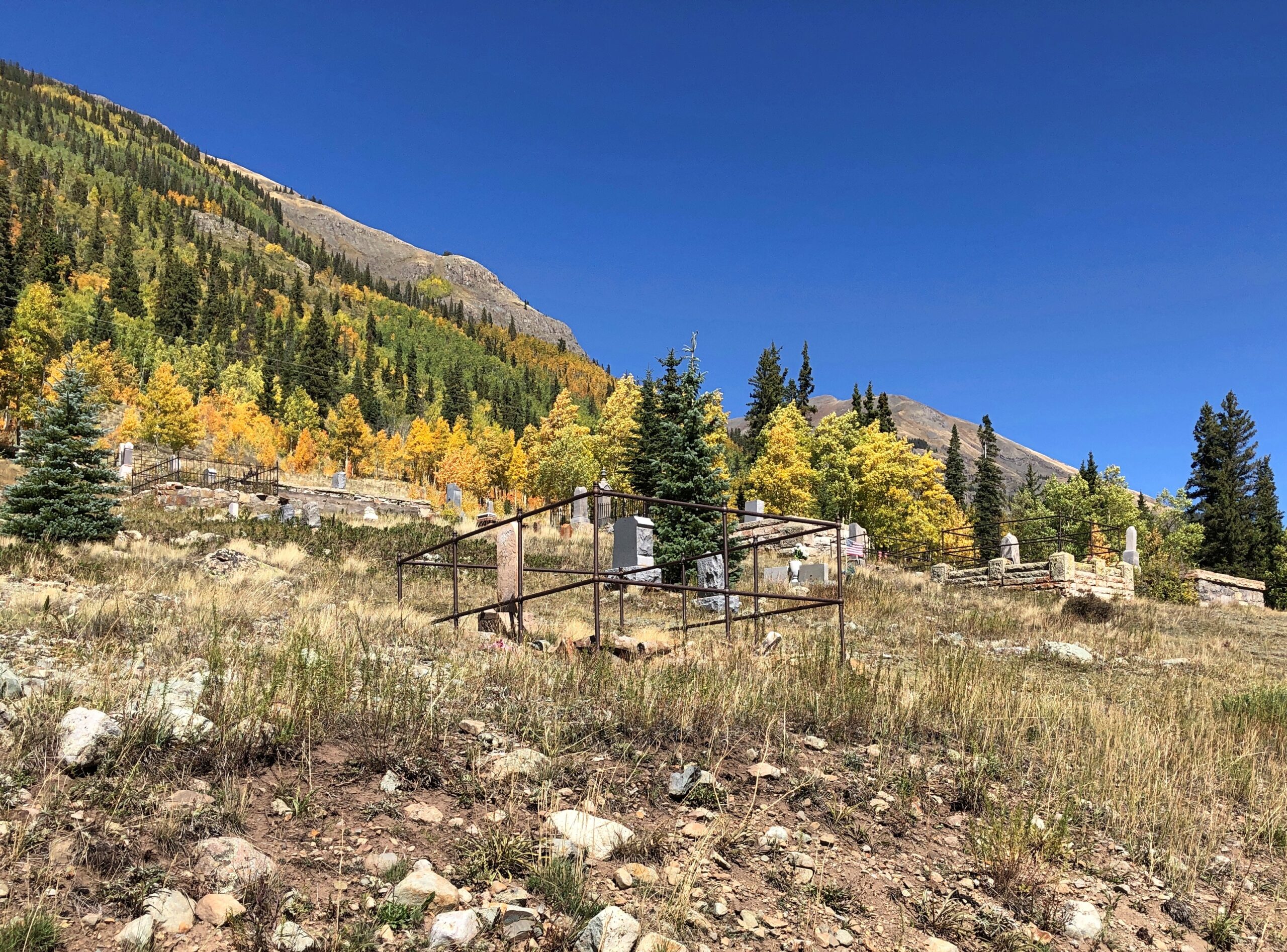
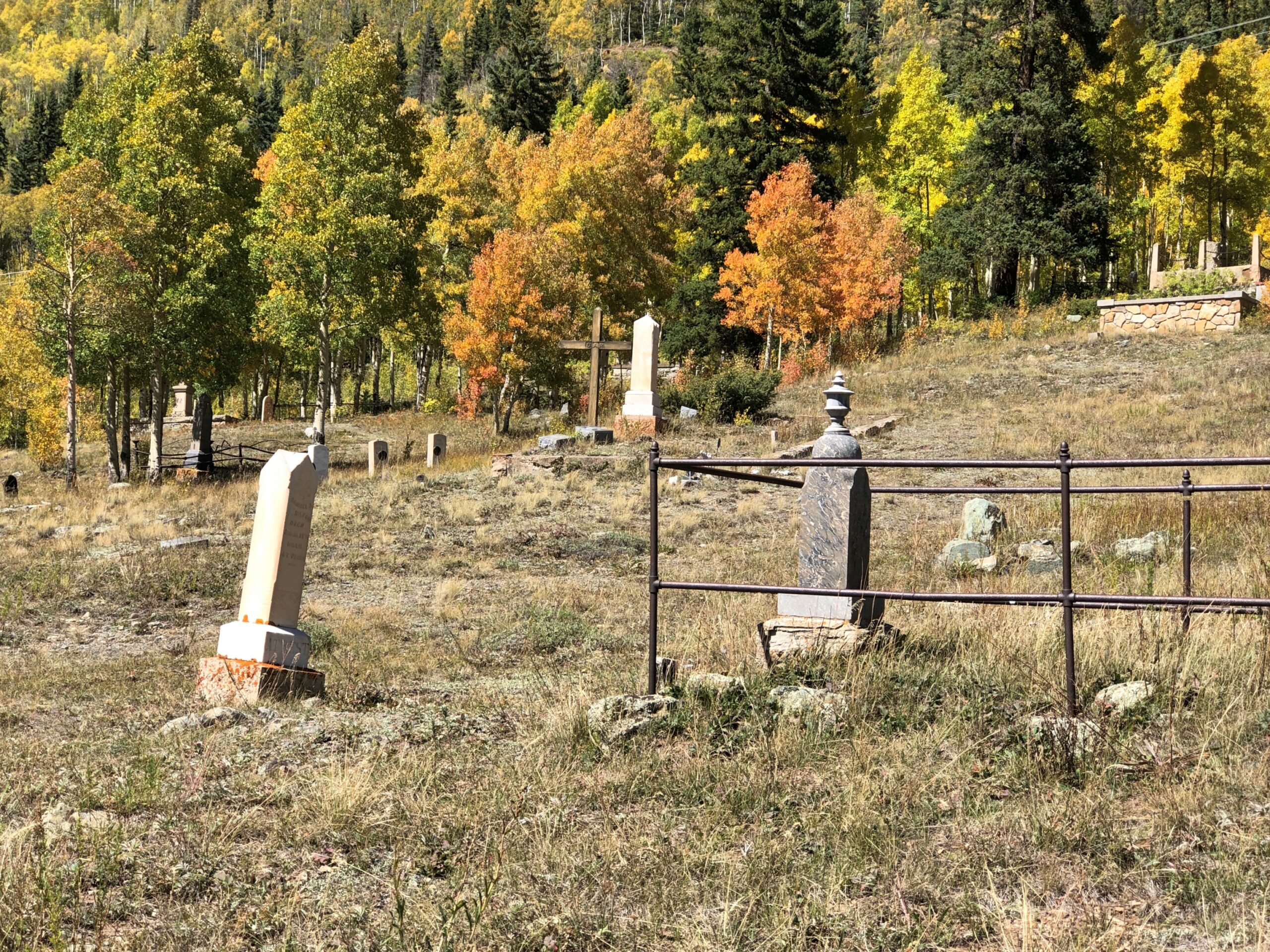
Some sizable memorials.
More modest ones.
Echoes of lost men from another time. Beyond the outstanding beauty of a hillside cemetery in the flush of autumn, reason enough to visit the cemetery.
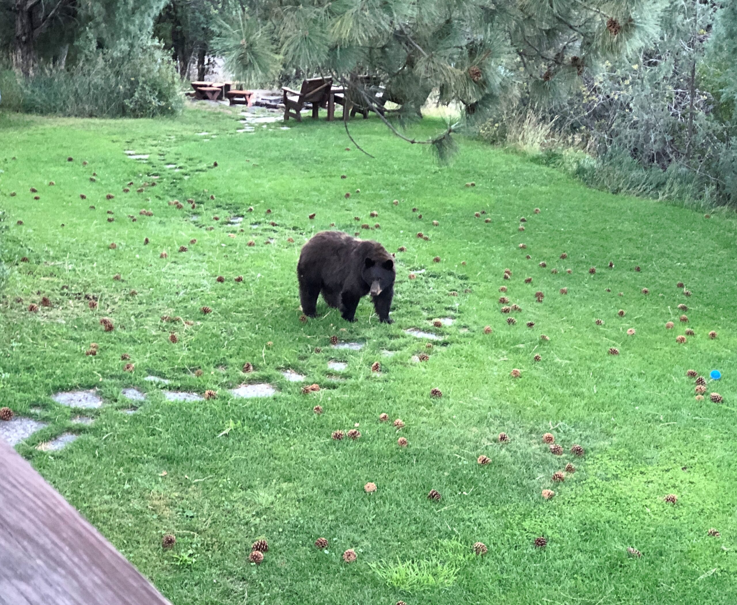
“Good morning,” Walter said in response to me, but in a hushed tone that somehow made his Austrian accent more distinct. “Do you want to see some bears?”
Yes. I followed him out to the large deck off the large common room of the Country Sunshine B&B. Outside we met with cool air, bright morning sun, and the strong smell of pine. The deck was a floor above the grassy ground, which sloped downward away from the bed and breakfast, shaded by a small copse of enormous pines.
We’d just spent the night at Country Sunshine B&B, the first of three for our visit to Durango, Colorado, a place I’d wanted to visit since the moment, years ago, when I heard Garrison Keillor describe the place in the engaging way that he had. I’d come out of our room – one of the three or four bedrooms off the common room – ahead of Yuriko, to examine the breakfast spread at the main table when Walter asked me about bears.
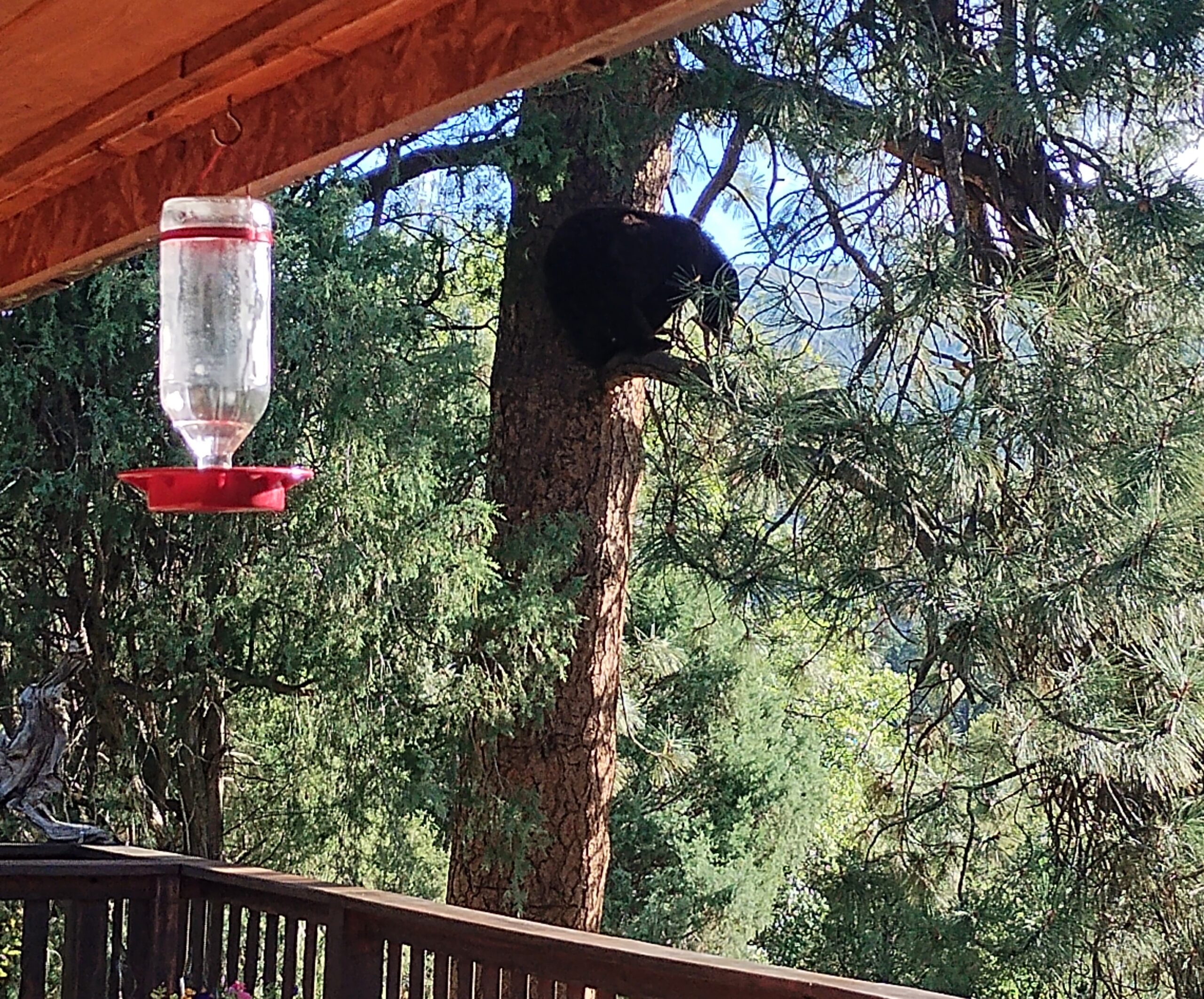
Under one of the tall pines, and among the many pine cones dotting the ground, was something dark and much larger: a bear.
“He isn’t the only one,” Walter said, pointed upward. Another sizable bear was perched part way up the largest pine. I didn’t say anything, or maybe I did. Something along the lines of, How about that. When I spend time on my deck, squirrels are about as large as the animals get, except occasional rabbits and raccoons.
“Look way up,” Walter said.
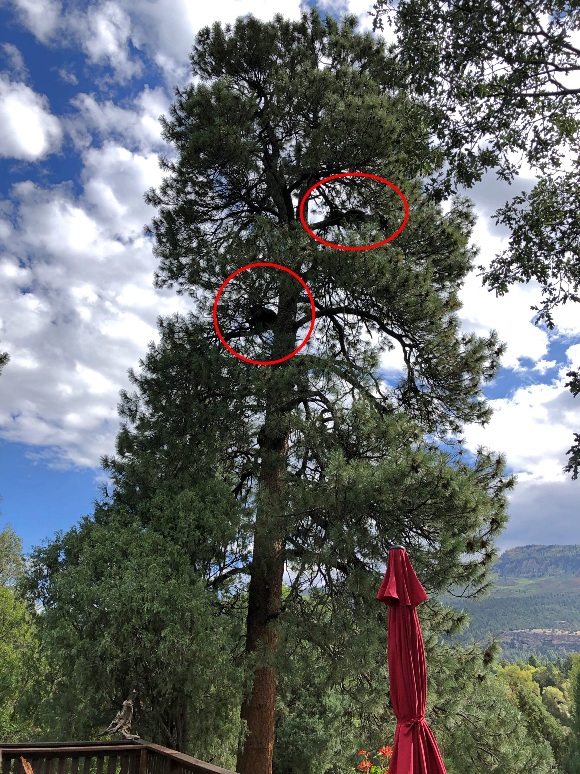
Two more bears – smaller bears, though I wouldn’t want to be face-to-face even with them – clung to the branches toward the top of the tree. They were hard to see, and my photos barely show them, but they were there, not moving a bit.
Soon Yuriko, and some other guests, had come to the deck to see the bears and take pictures. Every few minutes while we watched, the largest of the bears, the one on the ground, would start shimmying up the tree. The bear in the tree snarled at his approach, and, after pausing for a few moments, the first bear returned to the ground.
We were about 10 miles north of Durango, where the human settlement is fairly thin, and bears known to prowl the mountains on either side of the single road, US 550.
In the two decades of so that Walter and his wife Jodi have owned the B&B, he said bears had been sighted. Of course they had. Get careless with closing an outdoor garbage receptacle and bears will make an appearance in the neighborhood. During dry spells, they come for the creek waters near the property, and Walter pointed out that this summer had been fairly dry in the region.
But this was a first, Walter said: probably a male bear out to do harm to some cubs, a female bear standing in his way — a bear drama playing out in the tree near the B&B.
Late that afternoon, we returned to the B&B. Papa Bear, as everyone was calling him now, still lingered under the tree. Mama Bear still watched him from the lower branches, and the cubs still clung to the upper branches. Papa Bear had mostly quit trying to climb the tree, Walter said, but he was still waiting around.
The bears stayed in place through that evening, but when I went to the breakfast table the next morning to examine the bagels and spreads and fruit and hot drinks, the bears – I checked from the deck – they were not to be seen. After their one-day show (from a human point of view), they’d taken their drama somewhere else,
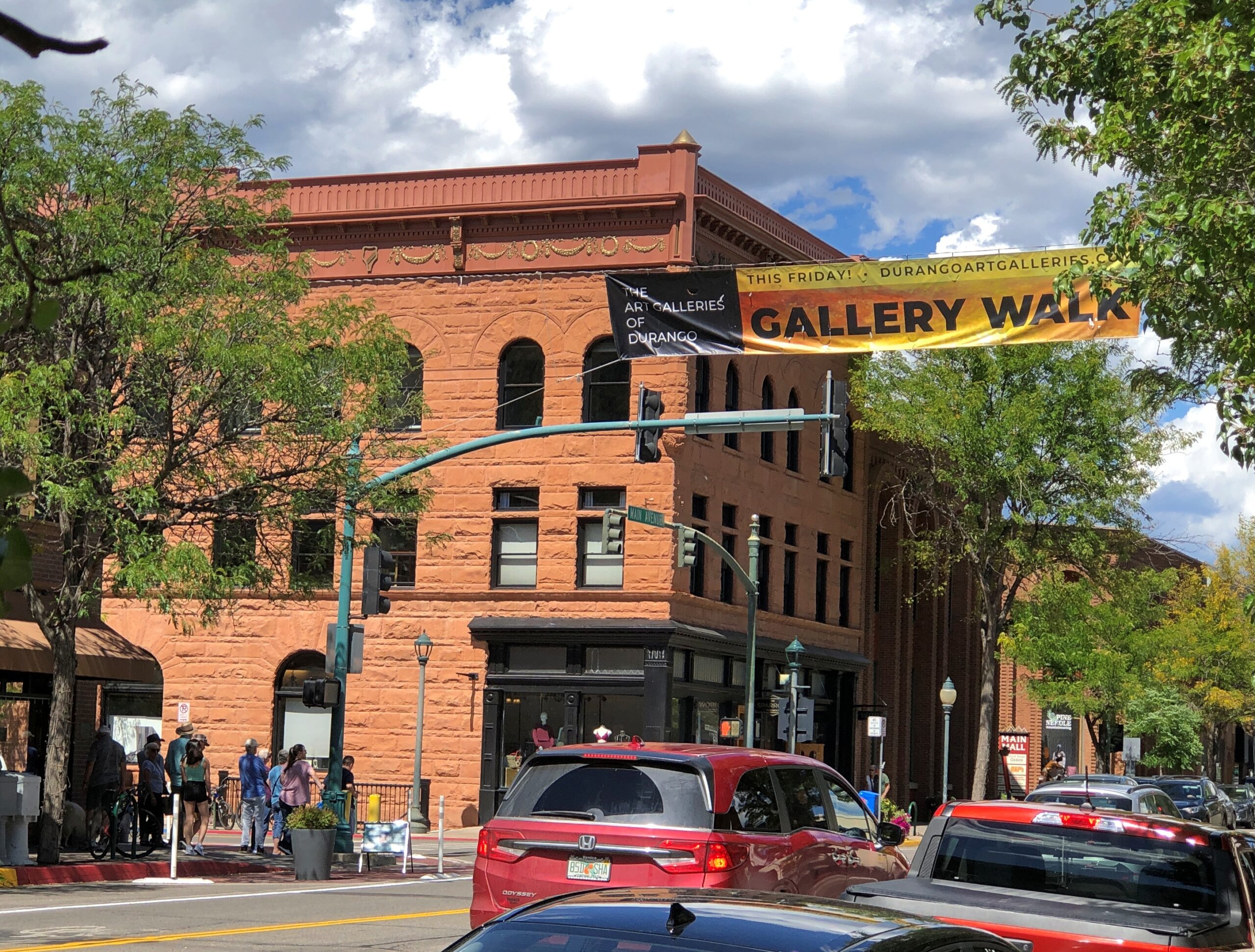
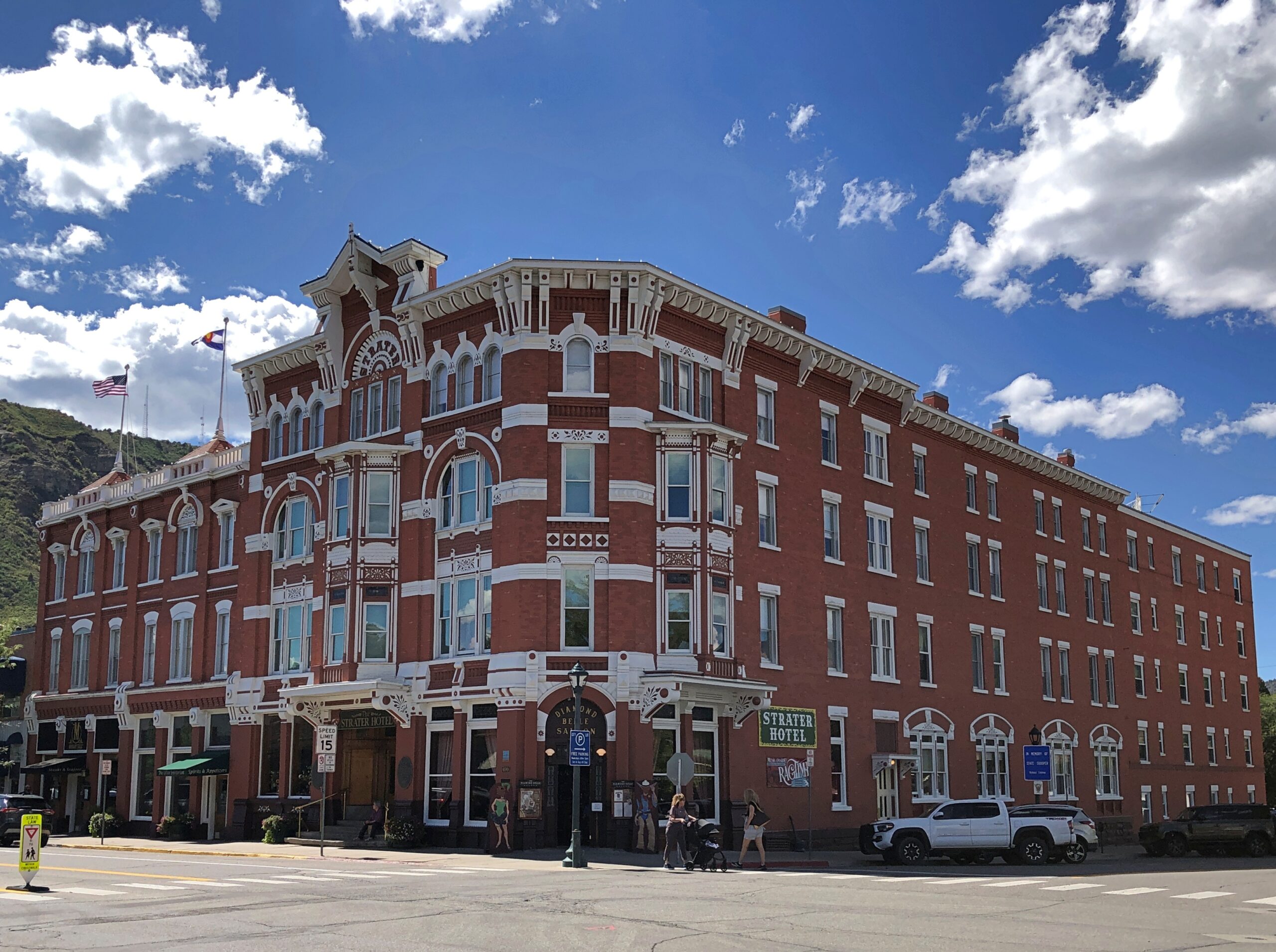
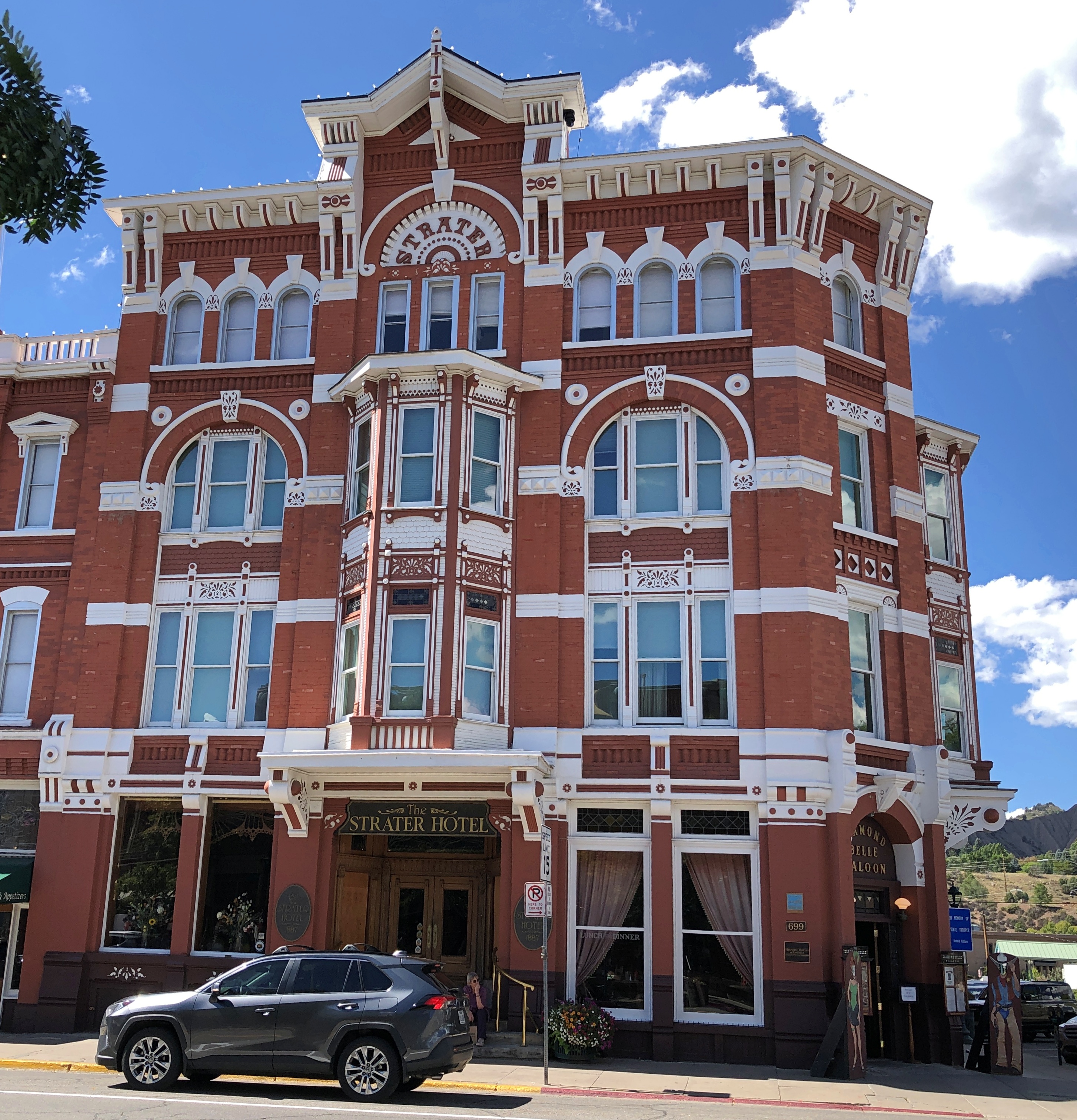
We spent that first day (September 16) wandering around town and nearby. In downtown Durango, small buildings that have endured for more than a century line Main Street.
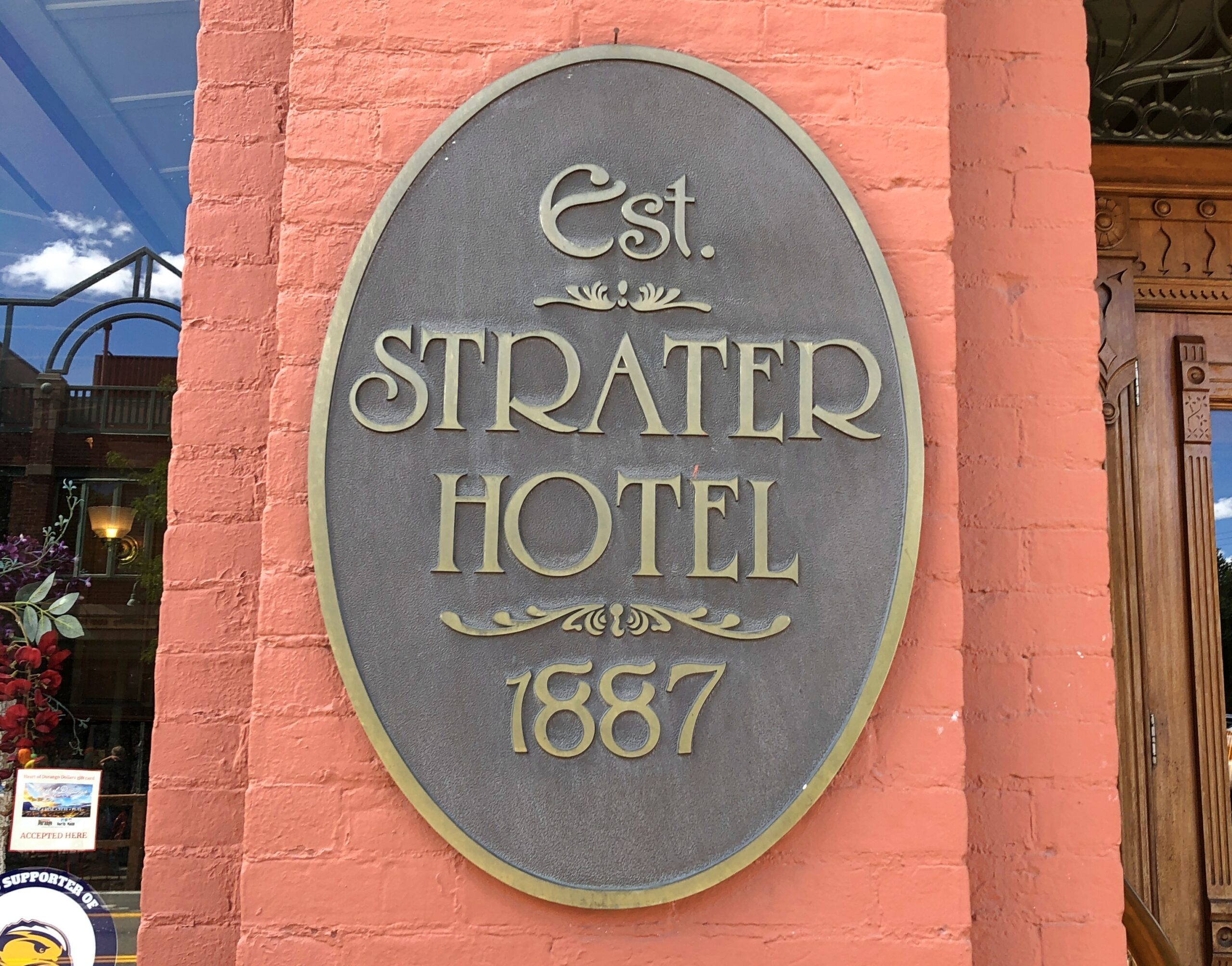
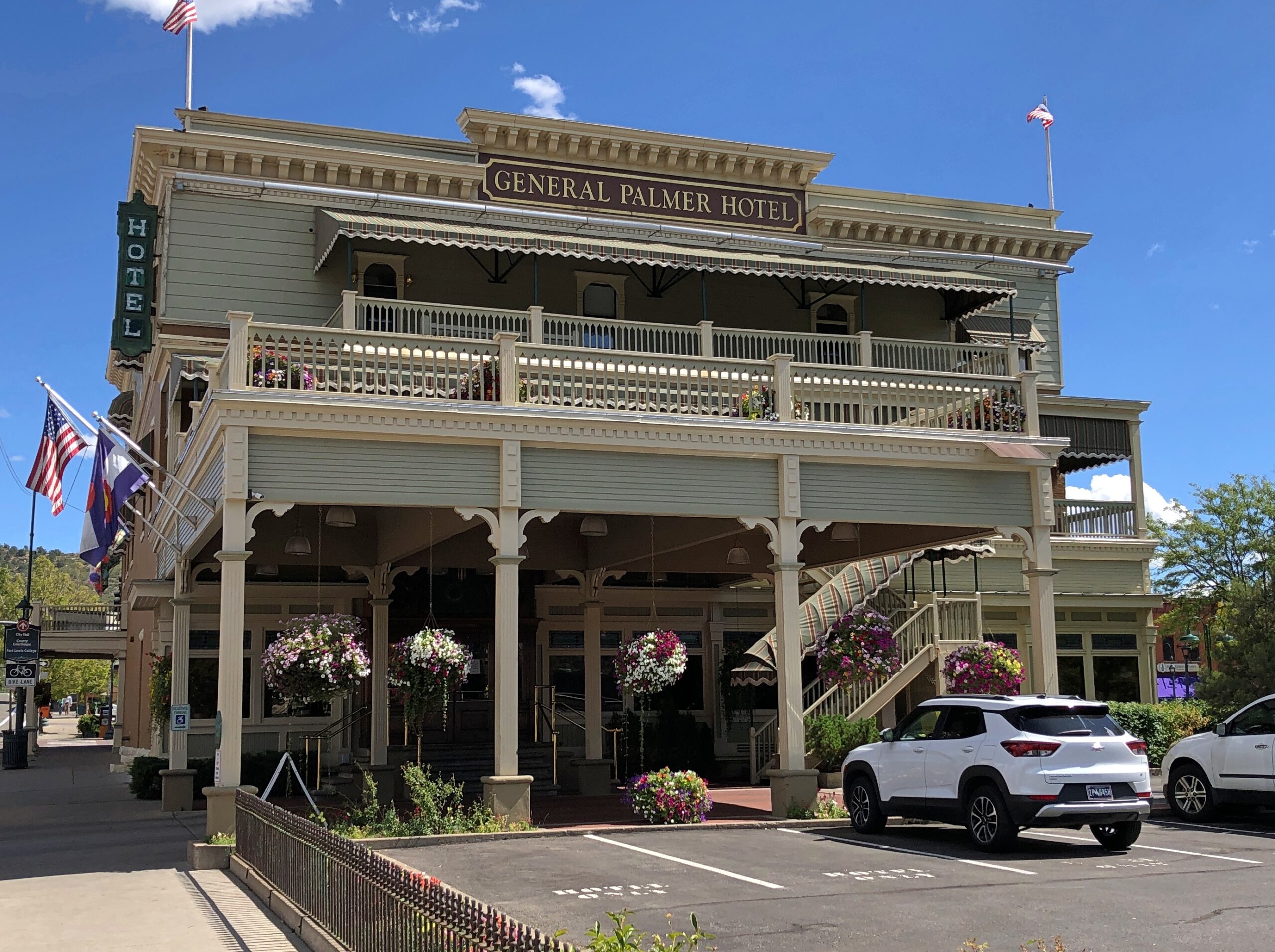
Or not so small. Such as the magnificent Strater Hotel, built in 1887.
The sort of place where presidents stay, or used to. Did any? The hotel web site doesn’t say. I’d ask ChatGPT, but it would probably tell me that FDR stayed there during his Grand Western States Whistle Stop Tour in 1939, a wholly fictional event. Wiki says Gerald Ford stayed there. Louis L’Amour did too, and now has a room named after him.
A competitor. Named for this fellow, Union (brevet) brigadier general and railroad man, who co-founded the Denver and Rio Grande RR.
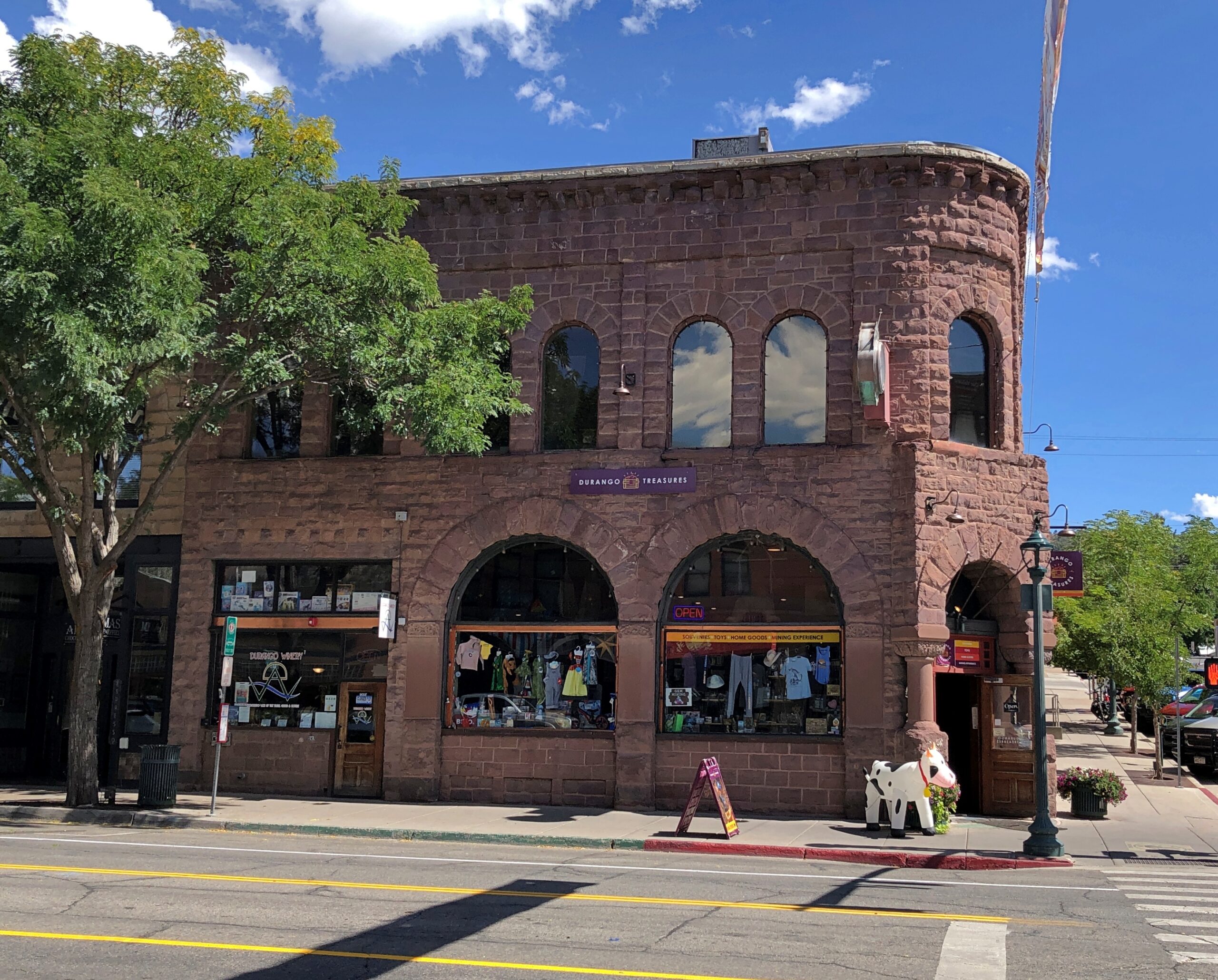
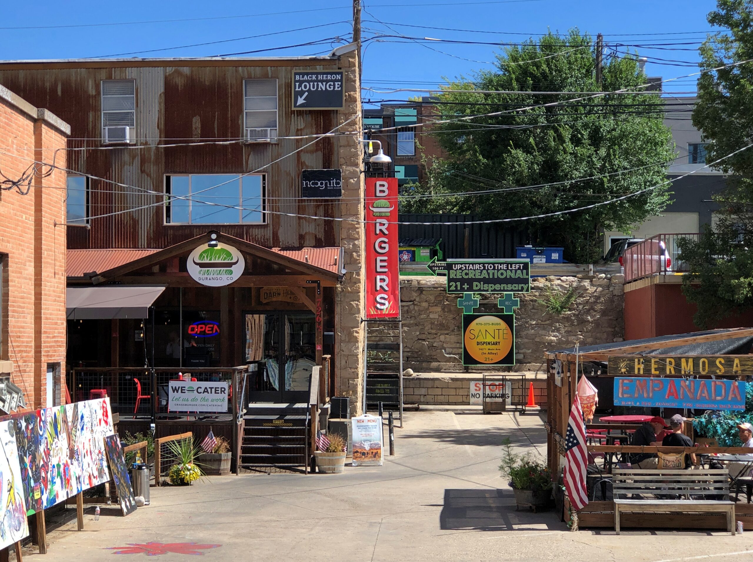
Downtown Durango is well supplied with retail.
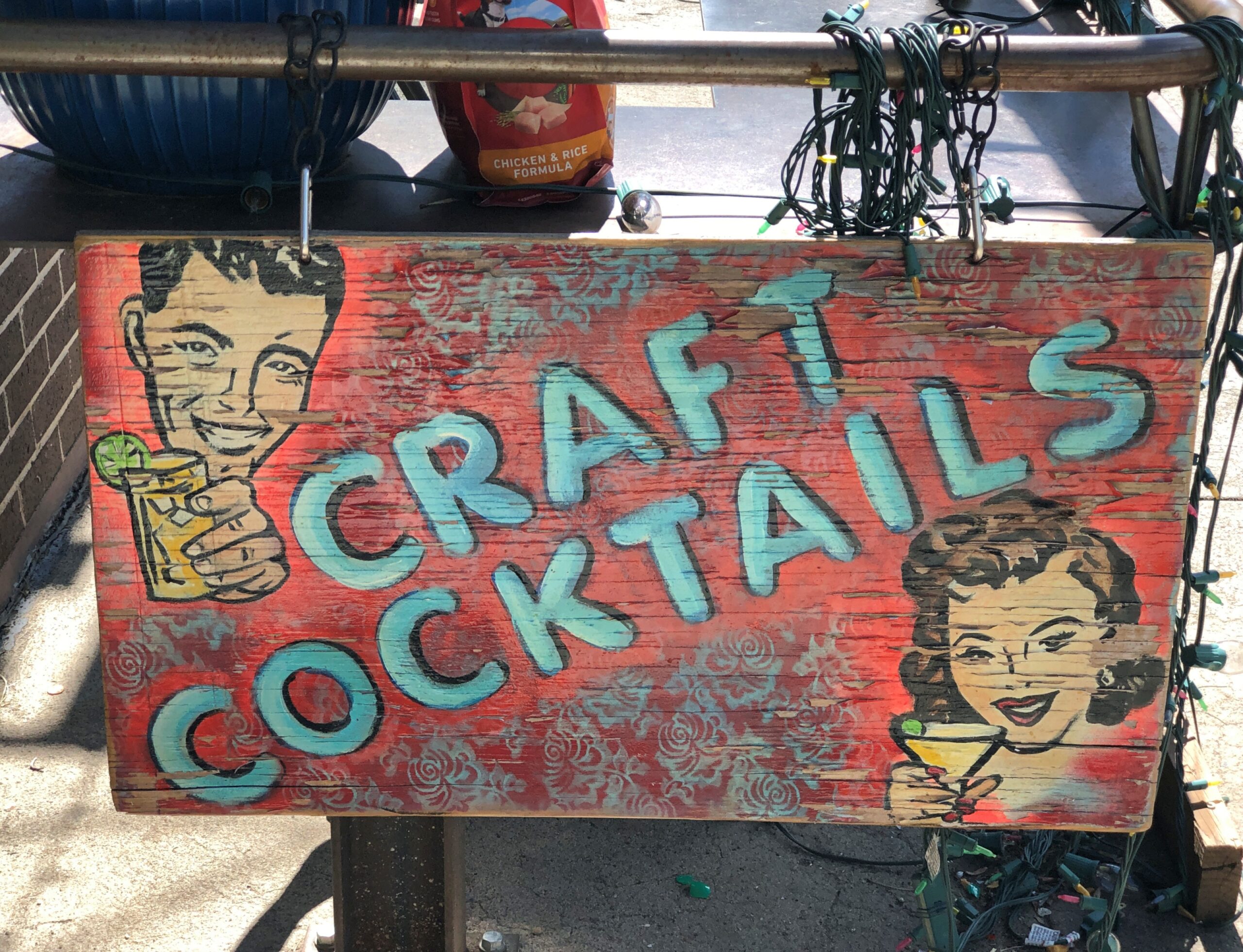
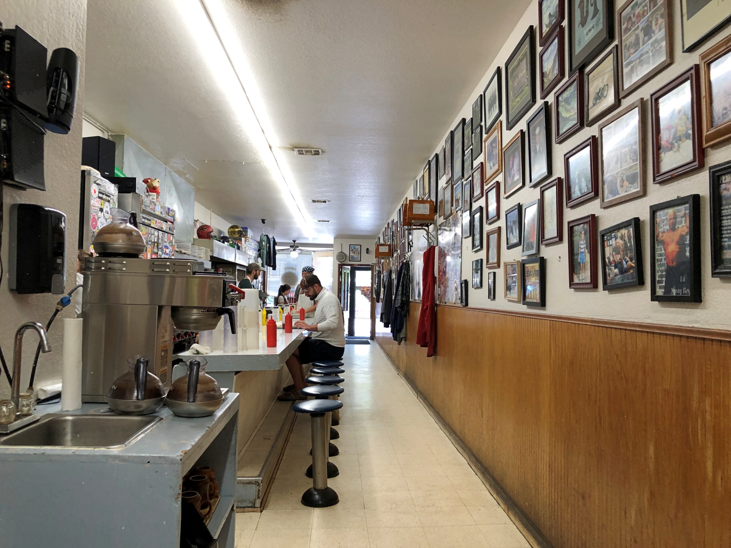
Lunch options, besides burgers and empanadas or a liquid lunch, included the likes of the Diamond Belle Saloon, Seasons of Durango, Chimayo Stone Fired Kitchen, Steamworks Brewing Company, and Eolus Bar & Dining. All very nice, I’m sure, but we chanced on something more to our tastes at that moment: the Durango Diner. In business for 60 years.
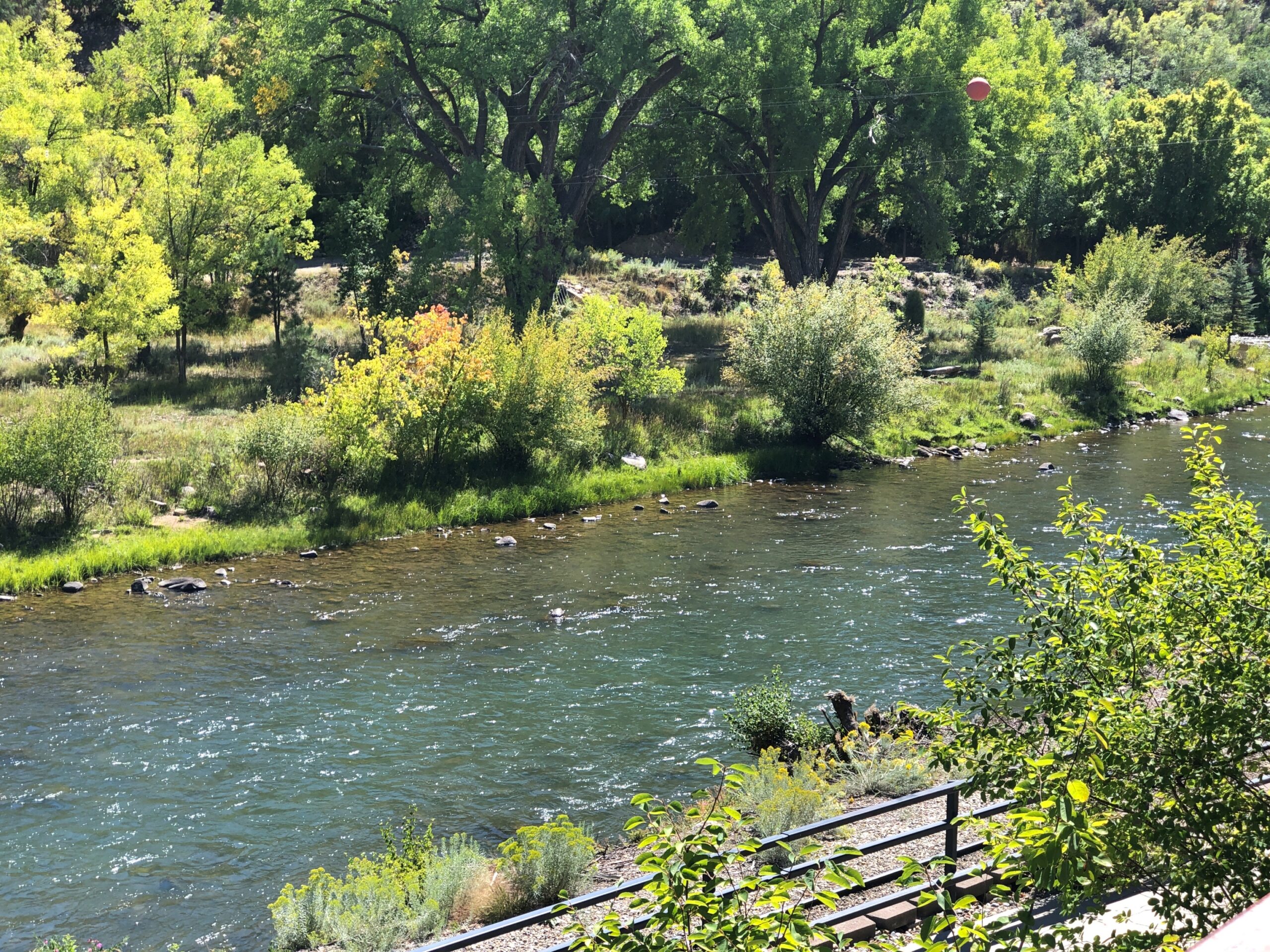
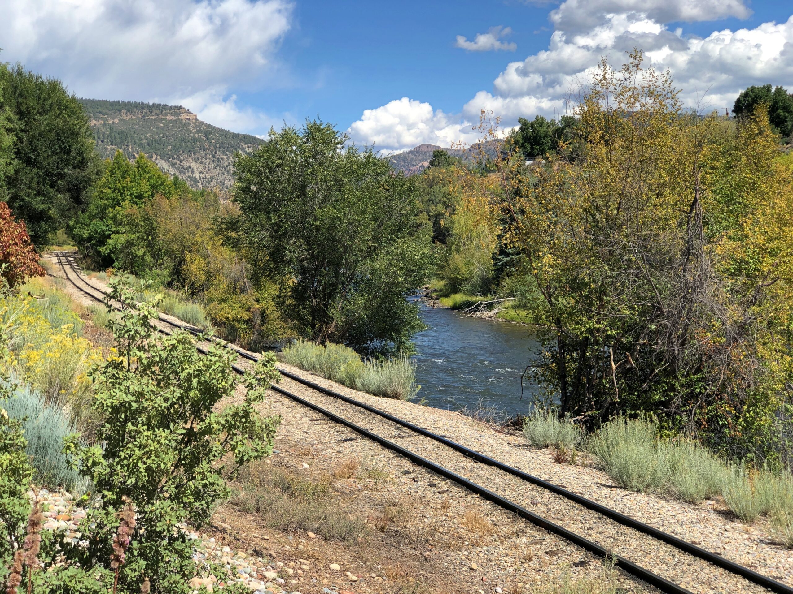
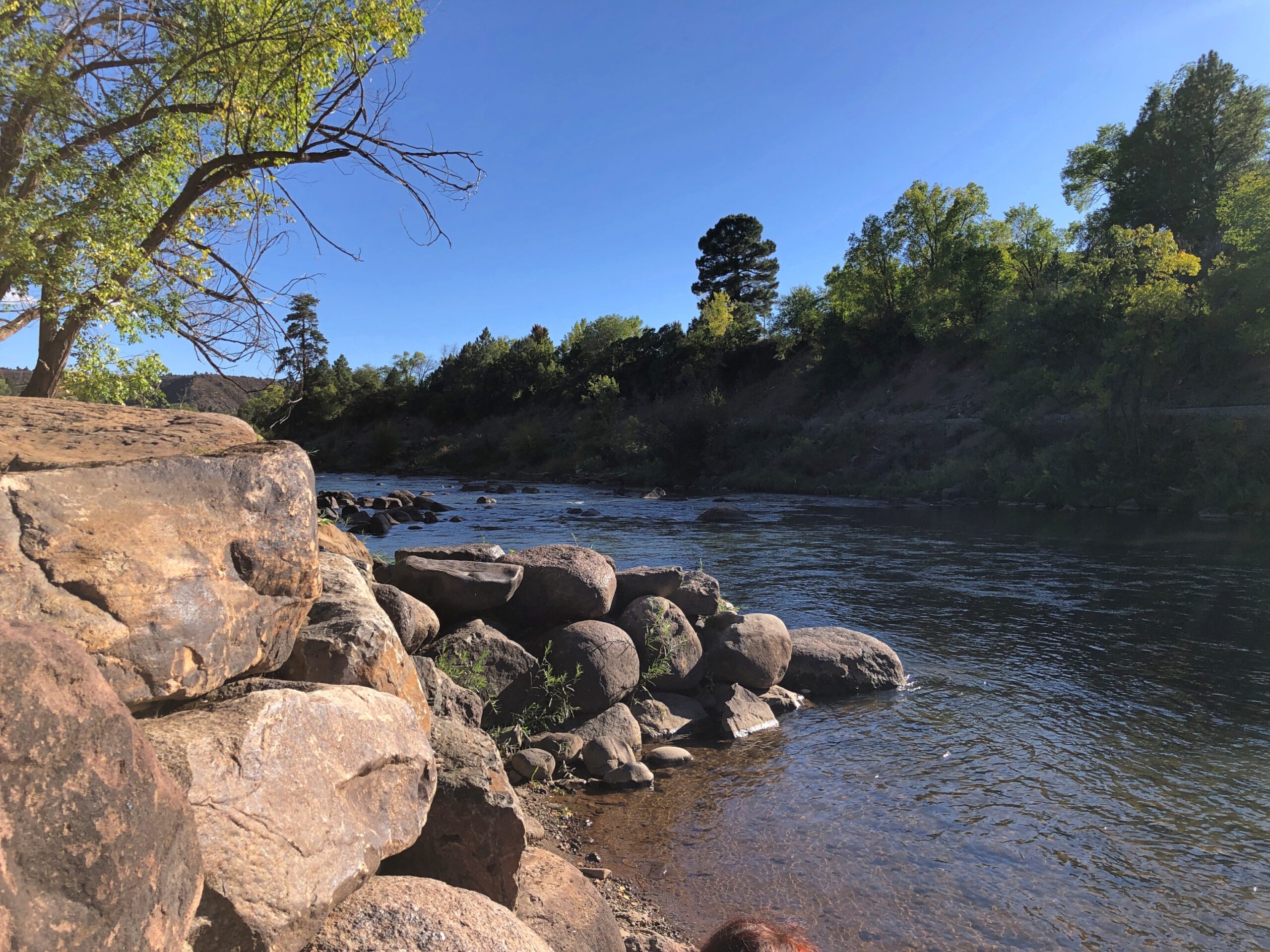
Durango started not so much as a mining town, but a railroad node that served the mines further up the line. Silverton, for instance. One reason Durango is where it is: the Animas River. These days, the river is accessible to pedestrians in a number of places in town. One was near the Durango Library, also the location of a shady sculpture garden.
At this place, the tracks of the Durango & Silverton Narrow Gauge RR run along the river.
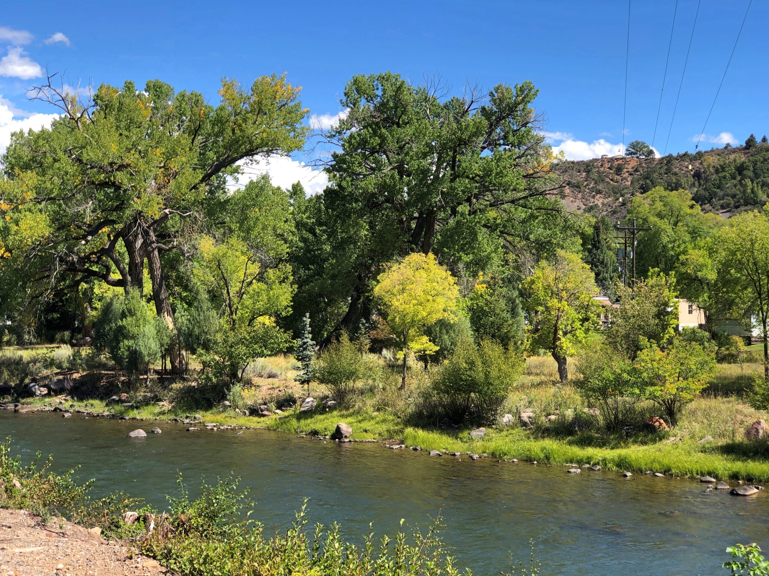
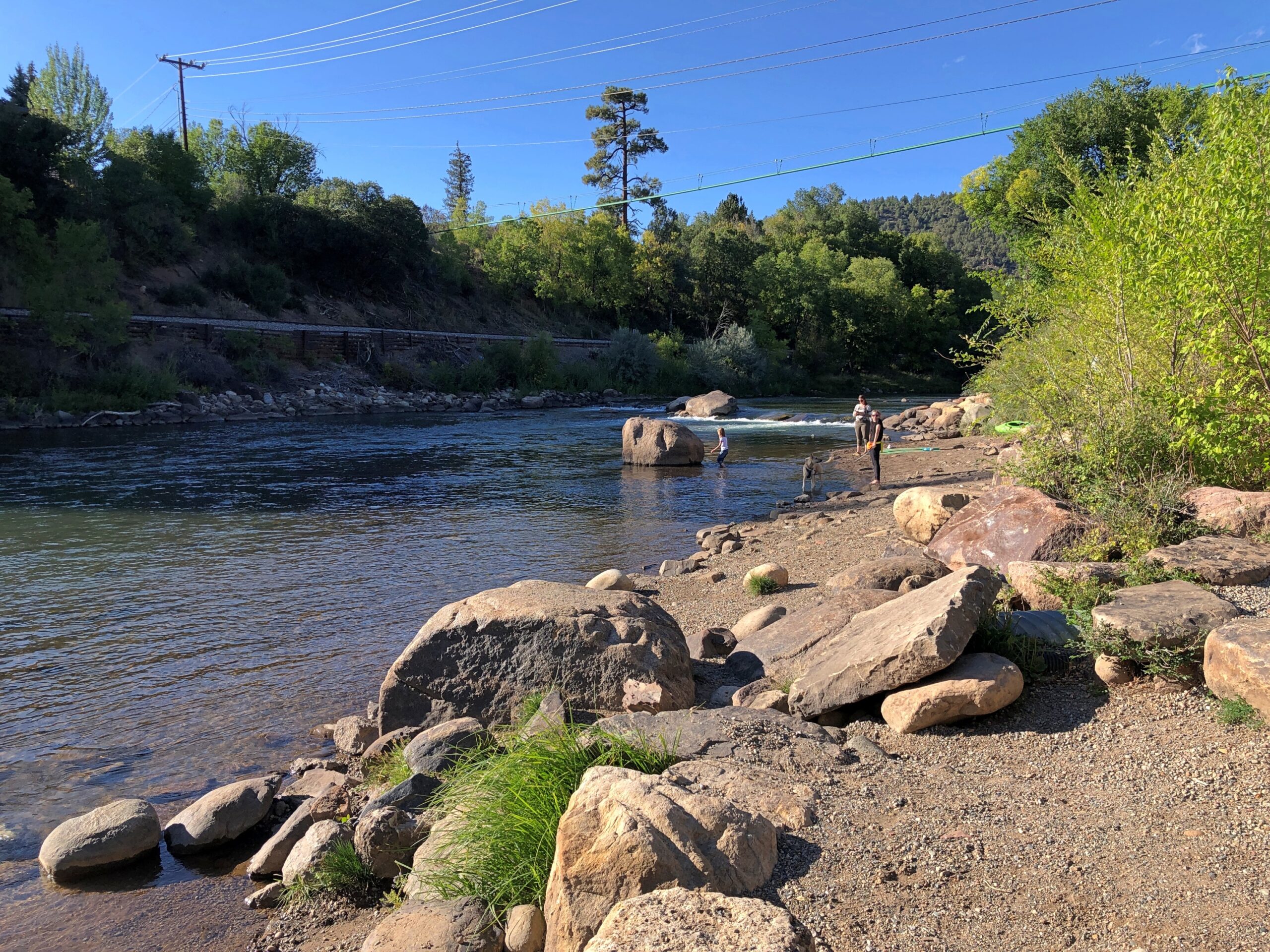
That was also true at the 29th Street Park, though the tracks were on the other side of the river.
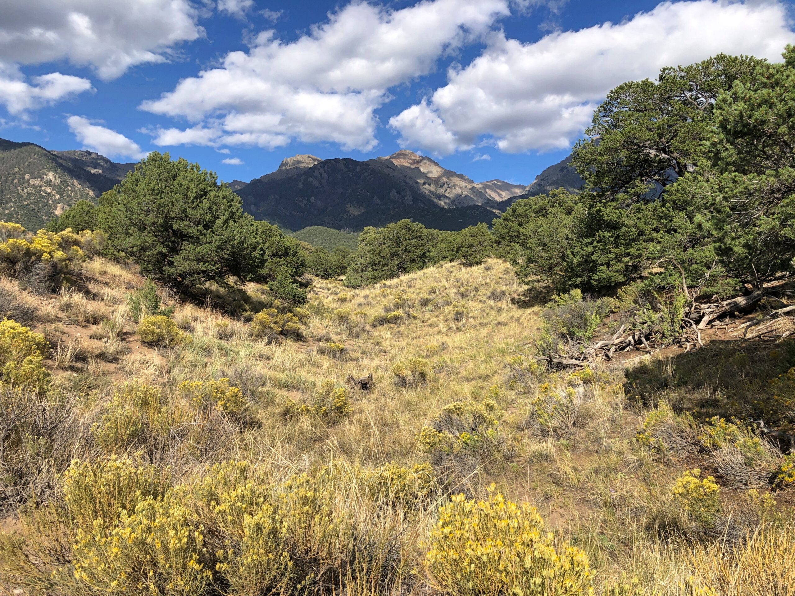
North America is vast and contains multitudes. There’s no doubt about it. How else to account for Crestone, Colorado?
Spiritual Travels tells the tale:At 7,500 feet in elevation and ringed on three sides by mountains, Crestone is both beautiful and isolated, subject to extremes of weather, wind, and temperature. It includes an amazing array of spiritual sites: more than two dozen ashrams, monasteries, temples, retreat centers, stupas, labyrinths, and other sacred landmarks. There’s even a ziggurat, a structure modeled on the temples of ancient Babylon.
Beautiful yes, but not so isolated these days: we drove in via two-lane, high-quality paved roads, Including, on the highway Colorado 17, past the UFO Watchtower, regrettably closed at that moment. I’d pay five bucks a head to take a look at that.
Crestone began as a mining town, as so many others did in Colorado. After the mines played out by the early 20th century, the area around the town was given over to ranching. That seems reasonable, considering its location in the sprawling San Luis Valley, though the town itself is hard up against the Sangre de Cristo Mountains.
Spiritual Travels continues: Maurice Strong, a Canadian businessman and United Nations diplomat, and his wife, Hanne Marstrand Strong, purchased a large tract of land in the Crestone area [in the 1970s]. It had been subdivided for use as a retirement community, but the Strongs changed their plans for it after a wandering mystic told them that the land had unique spiritual qualities (a message echoed later by Native American elders).
So the Strongs decided to give free land to religious groups that agreed to establish centers there.
Awandering mystic told them? That’s an incident that could use a little more elaboration. Visiting Mormons and Jehovah’s Witnesses and even a weirdly masked devotee of Dahn Yoga have all come to my door, but I’ve yet to have any wandering mystics show up, at least along the lines of a sadhu or a strannik or a sufi. That I know of. Maybe one of those home repair outfits who are “doing work in your neighborhood” are really mystics, offering soul remodels.
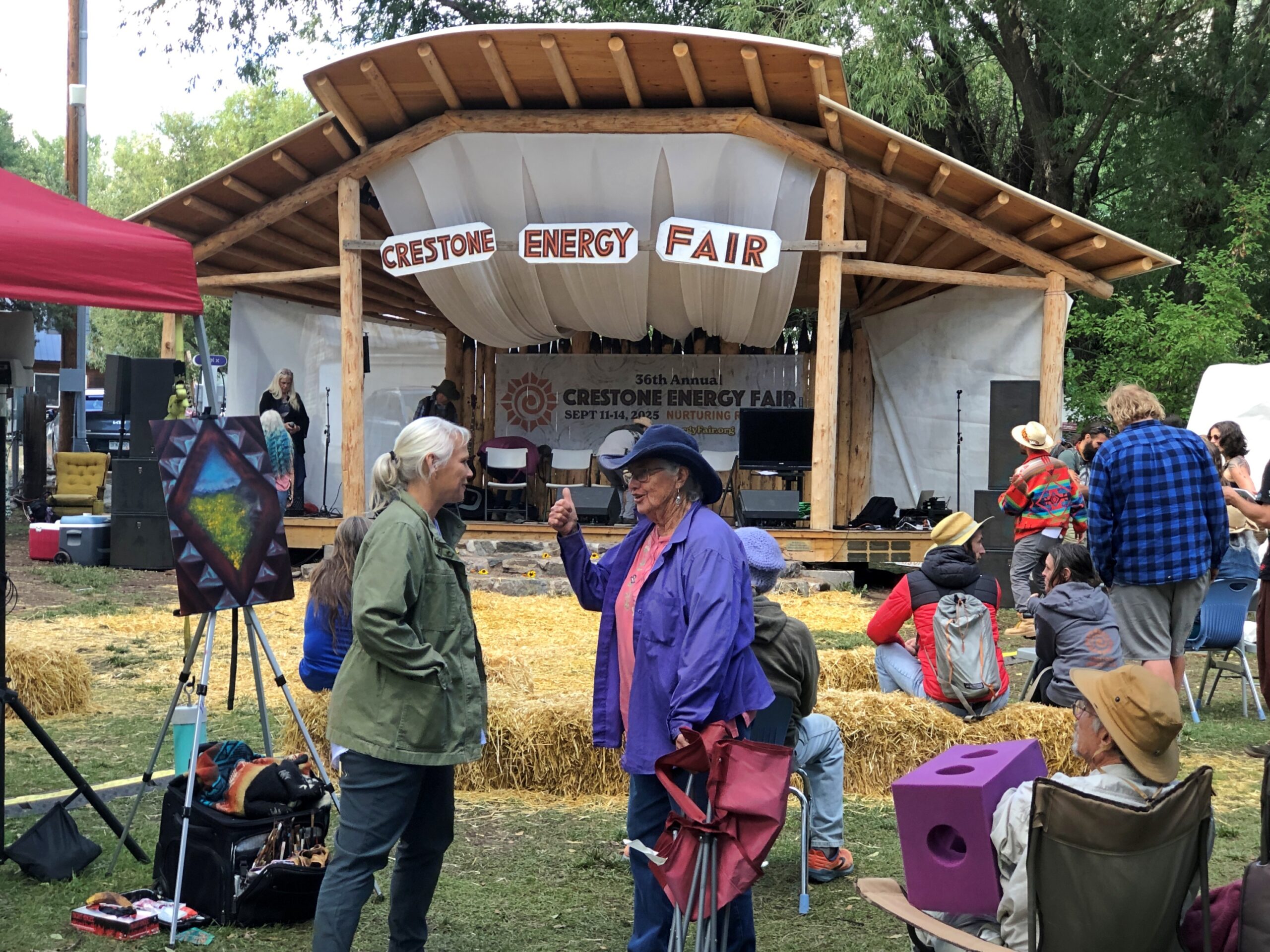
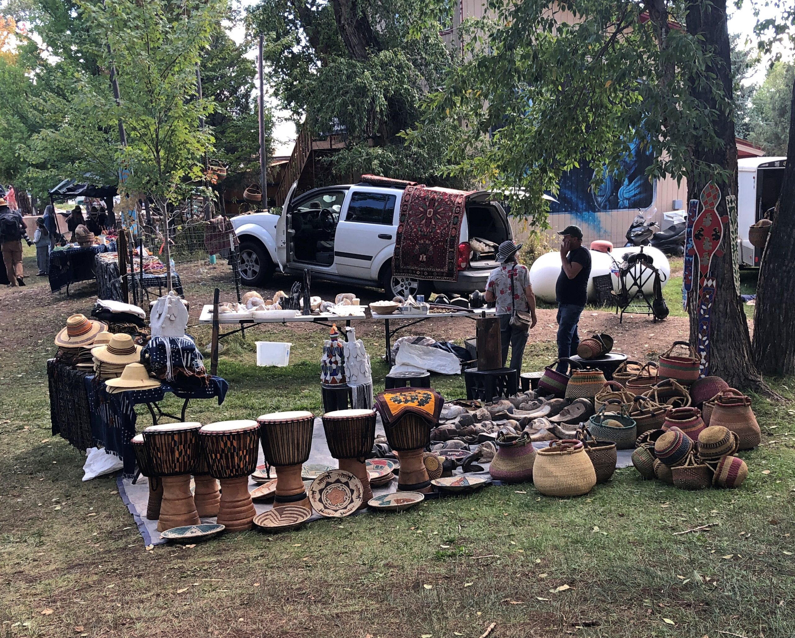
We arrived in Crestone on September 14 after our visit to Great Sand Dunes NP. Mystical insight is one thing, but we were looking for a late lunch. The town itself isn’t large, with a permanent population of 140 or so, but I’m sure it expands and contracts. Such as during events like the Crestone Energy Fair. We added ourselves temporarily to the population during the tail end of that event on that Sunday afternoon.
We bought a few things at the town’s grocery store, Elephant Cloud Market – small and aiming at what Whole Foods might have been in its earliest days – and I asked the checkout clerk about the Energy Fair. As in renewable energy?
He looked a little puzzled for a moment. “Sure. But it’s more about psychic energy.”
So, wind turbines of the soul, geothermal from the heart. But I’d guess mindful yet small modular reactors wouldn’t be part of the discussion. I didn’t say that any of that, of course. I just said, “Oh.”
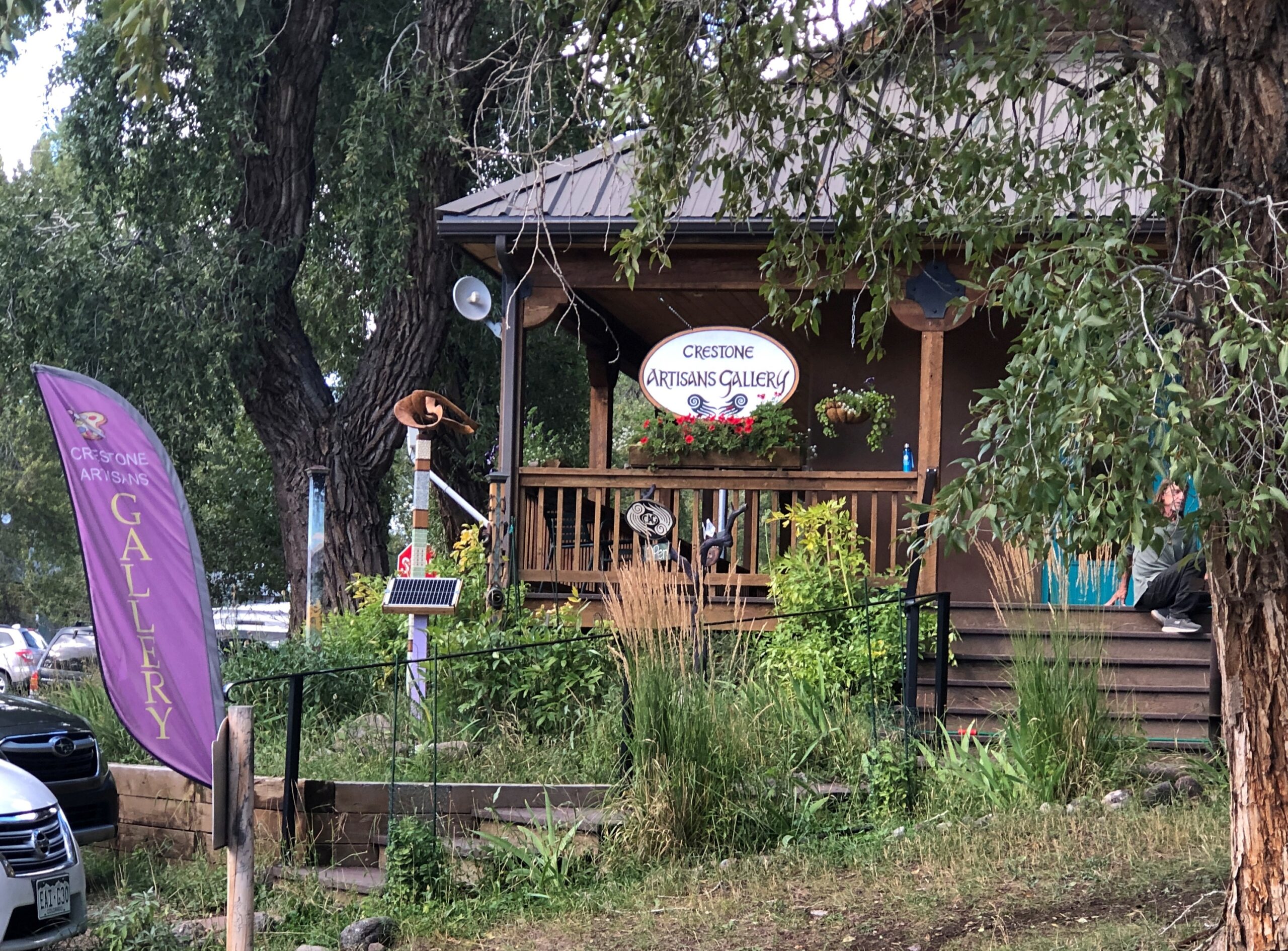
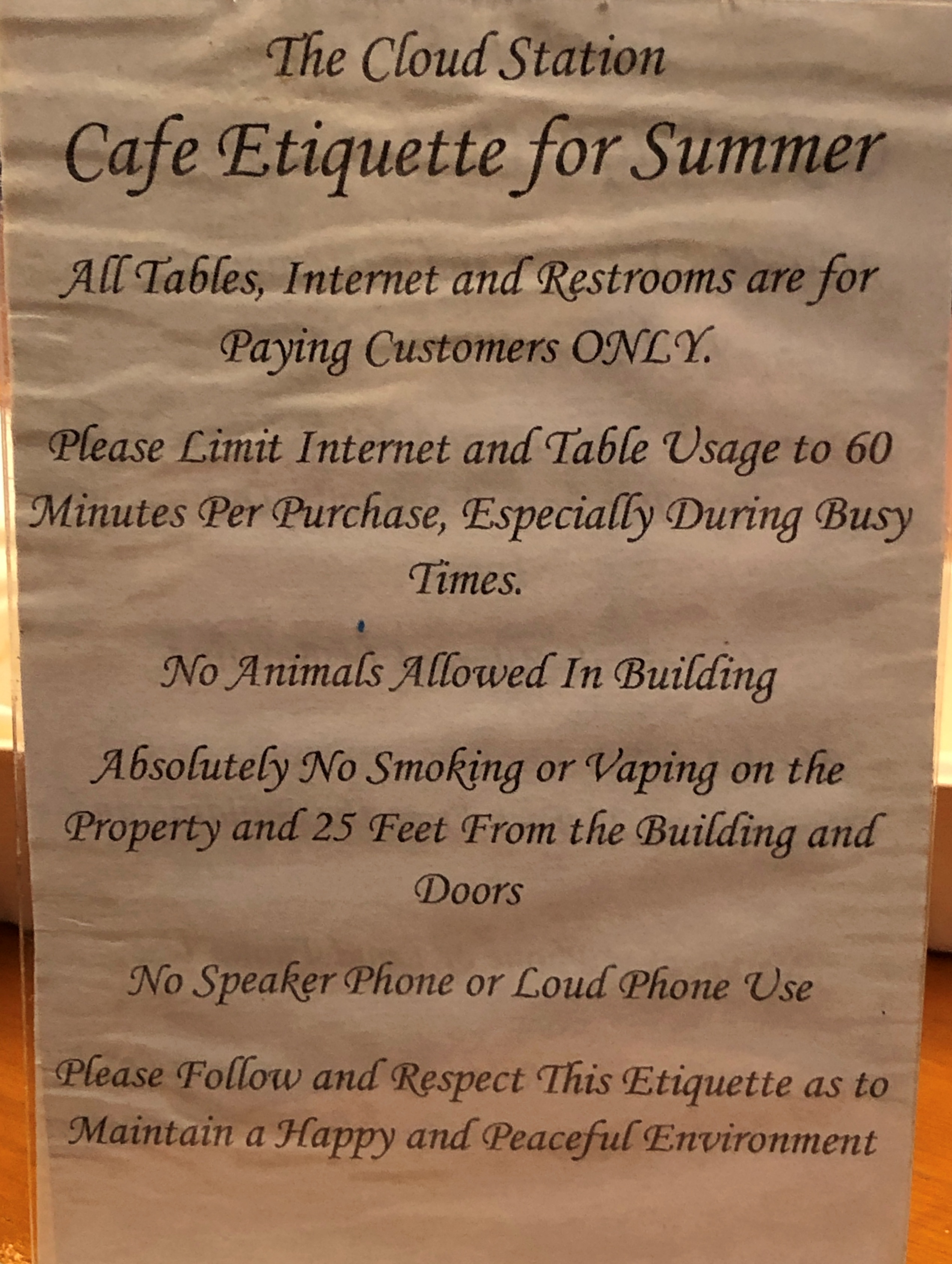
Next to the grocery store was a small eatery, the Cloud Station. We’d arrived just in time to order before closing: a couple of most delicious panini. While waiting for the order, I had time to study the rules.
Afterward, we spent time looking around the few streets of Crestone.
You never know what you’ll see. Enough reason to come.
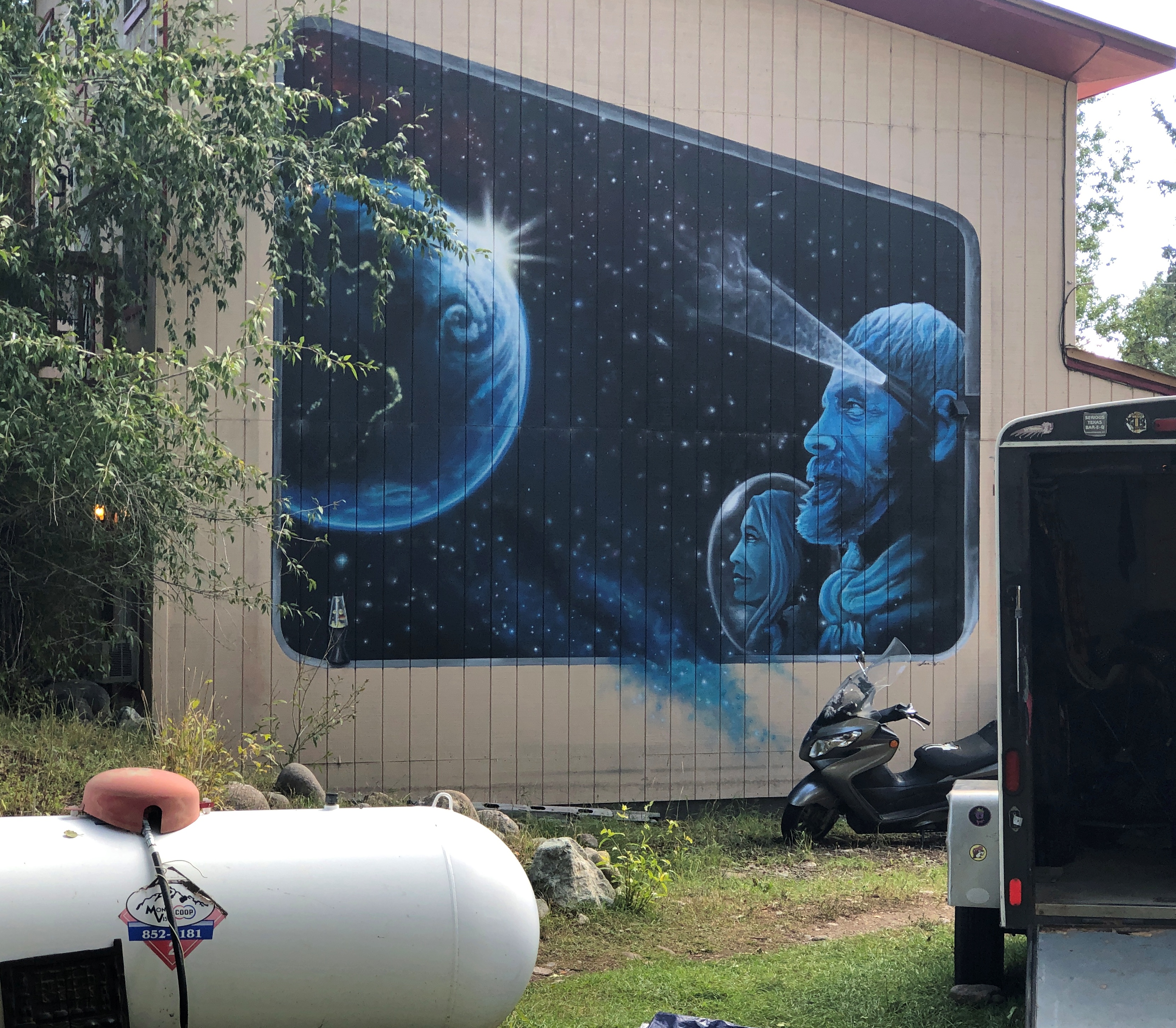
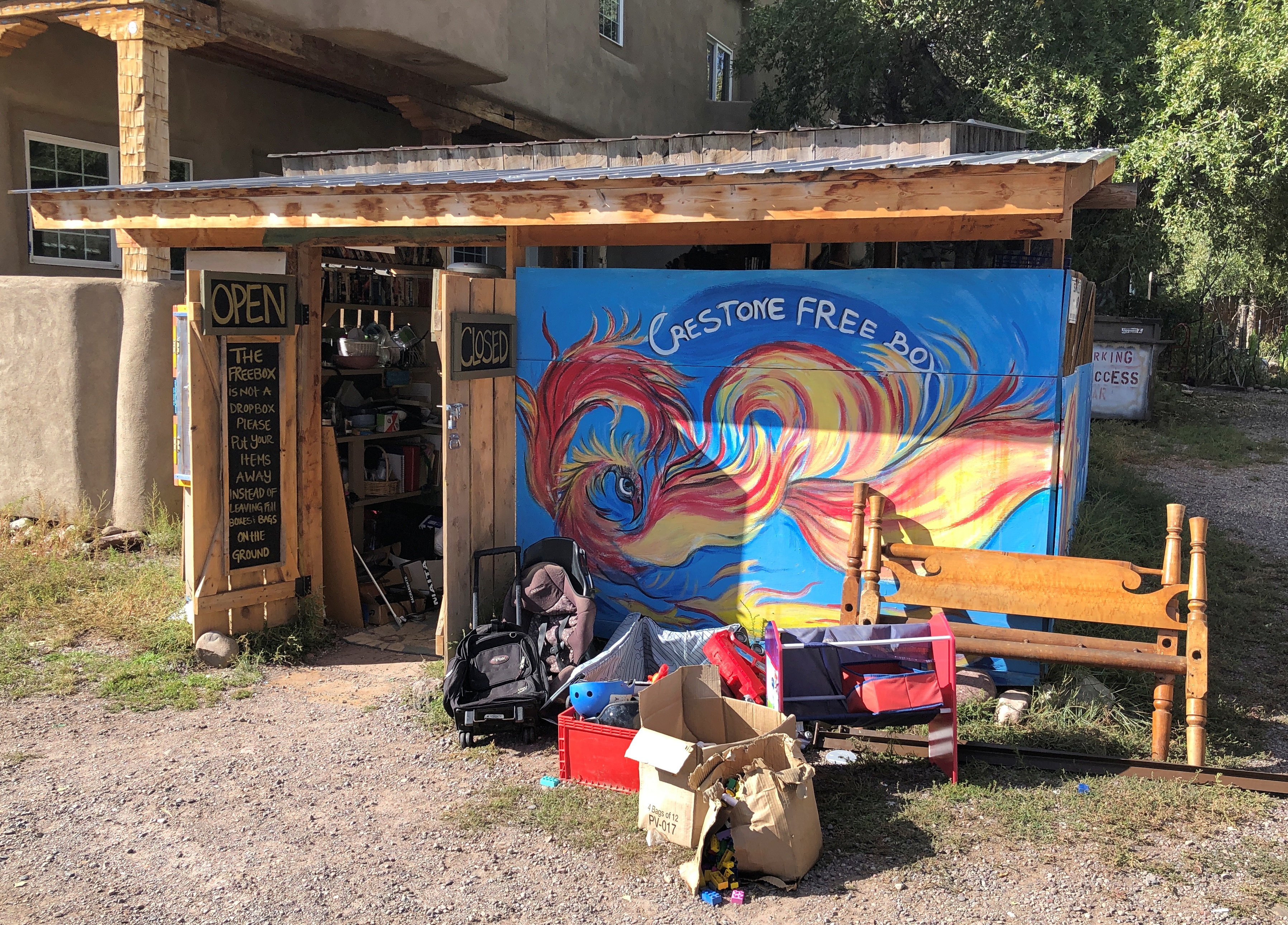
Something not mentioned in the tourist literature: the Crestone Free Box. Leave stuff, pick up stuff, no medium of exchange involved.
I’d argue that in the widest interpretation of spirituality, and Crestone is pretty wide in that regard, the Crestone Free Box counts as a spiritual site. It is, after all, about freely giving of yourself to the wider world. Squint hard enough, and that fits.
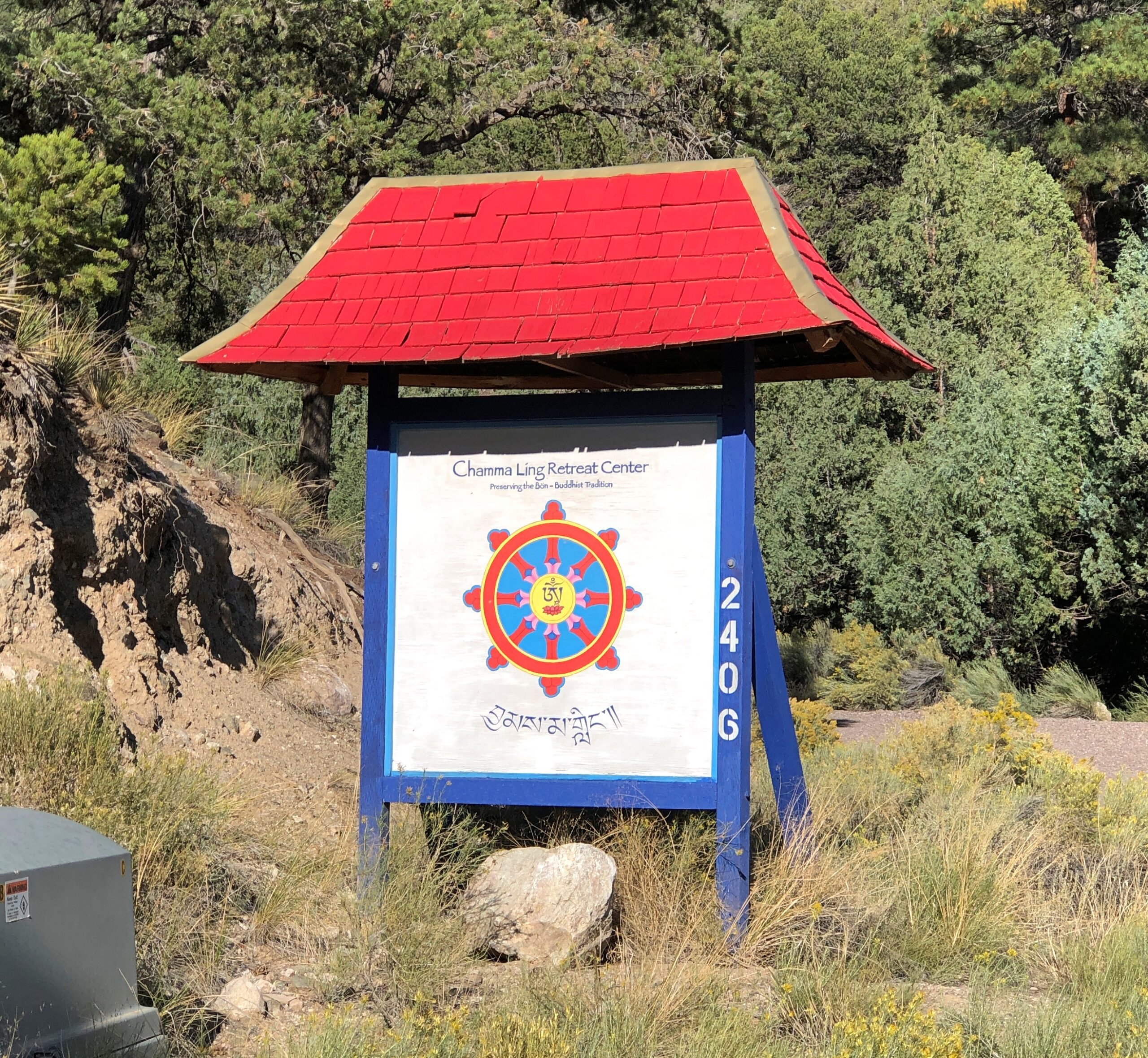
As for the other spiritual sites, except for a handful of mainline Christian churches, most of them are not in the town of Crestone proper. Rather, the land grants inspired by that wandering mystic sprawl to the south of the town’s small street grid, along a warren-like network of roads up and down the foothills of the Sangre de Cristo Range – mostly gravel roads, if our limited experience is any guide.
I had the idea that exurban Crestone was dotted with temples and shrines and other such places. But as we drove along, and especially as I studied the map, I came the realize that most of the establishments are retreats, such as Blazing Mountain Retreat Center, Chamma Ling, Crestone Mountain Zen Center, Crestone Retreat Center, Dharma Sangha, Dharma Ocean, Haidakhandi Universal Ashram, Shumei International Institute, Sri Aurobindo Learning Center, Vajra Vidya Retreat Center and Yeshe Khorlo USA. The sort of place that might briefly tolerate, but not really appreciate, casual visitors. More importantly for me, not the kind of religious – I mean, spiritual – sites that I tend to seek out.
I will say this for the area, facing as it does the Sangre de Cristo: wow. The Strongs picked a striking setting.
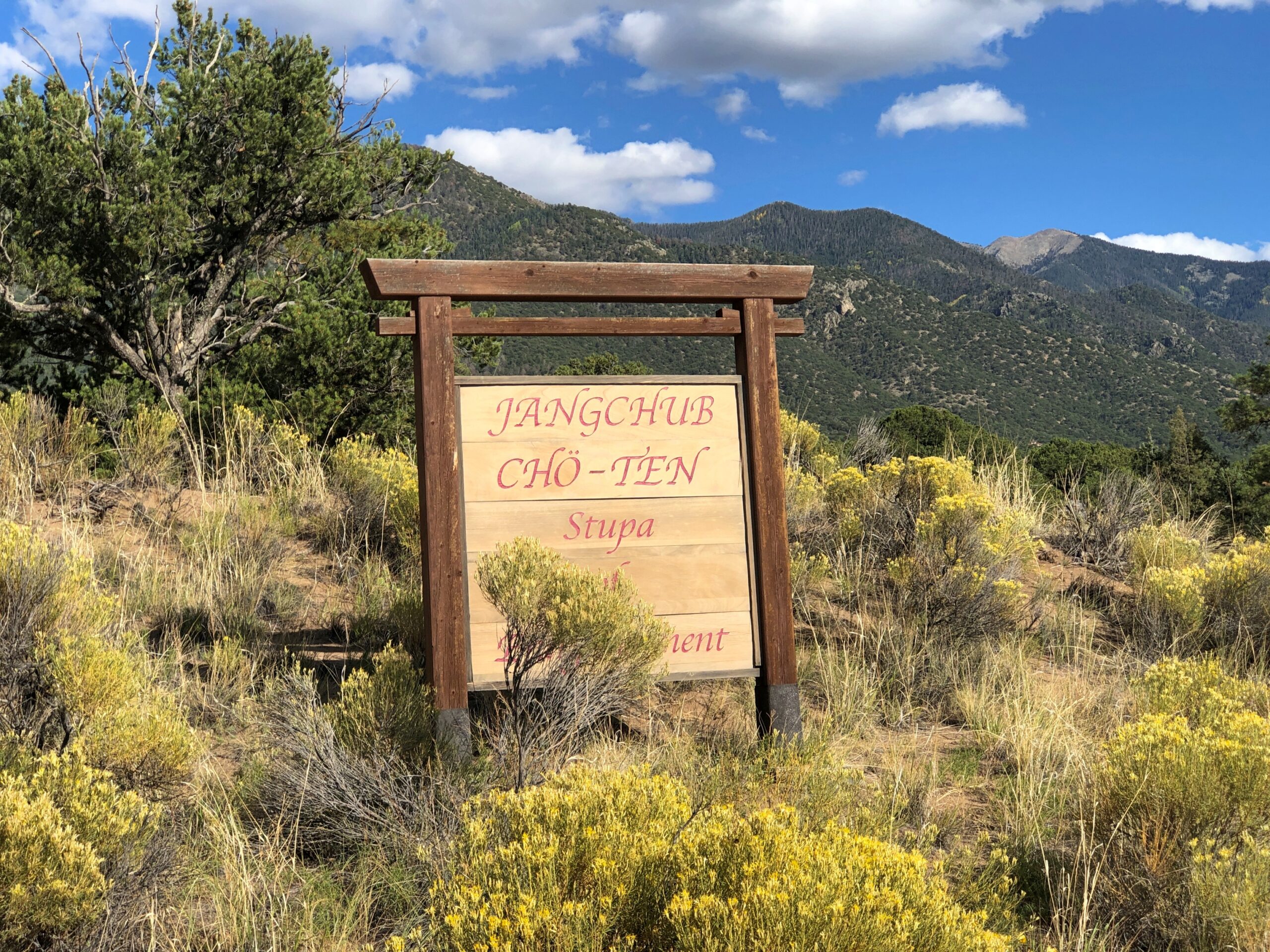
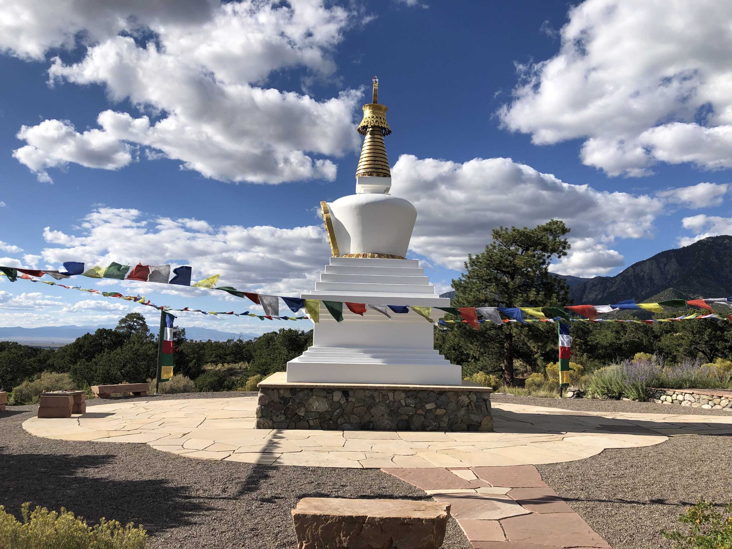
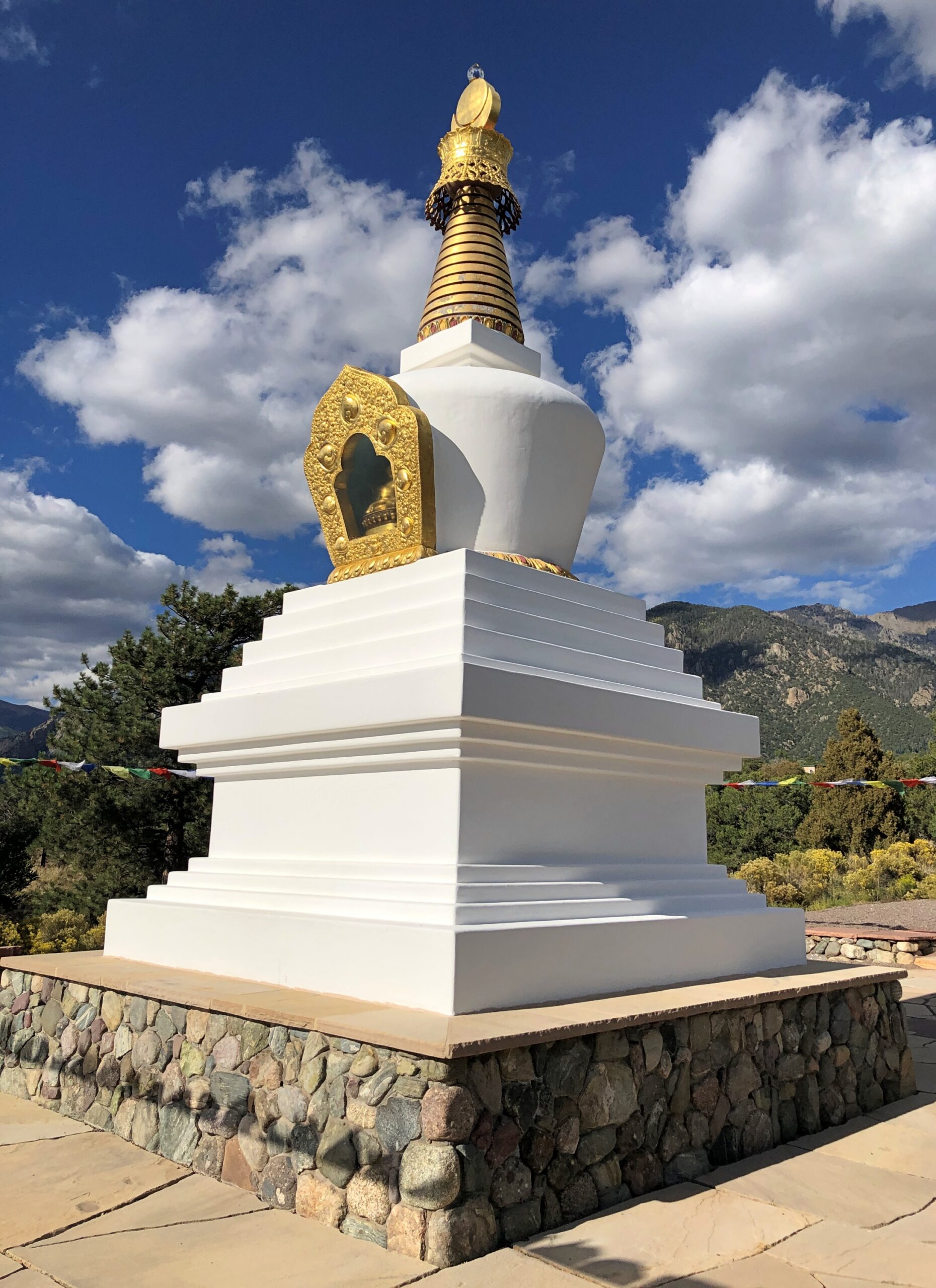
The Stupa of Enlightenment had the advantage of being not that far from town, besides not involving admission to a retreat.
I wanted to see the Crestone Ziggurat, deep in the warren. I like a good ziggurat as much as the next guy, and they’re hard to come by in North America. But as we drove along, and up and down the twists, the road crunching and pinging our undercarriage with little stones and kicking up dust, I lost my enthusiasm to find it.
Visible for miles, the Crestone Ziggurat rises from a rocky hill on the southeast edge of the Baca Grande, notes Atlas Obscura. After purchasing the land in 1978, American businessman and father of Queen Noor of Jordan, Najeeb Halaby, commissioned the ziggurat as a private place for prayer and meditation.
Today, the ziggurat is open to the public. Visitors can climb the spiral ramp to the top, which offers stunning views of the surrounding area, making it a perfect spot for reflection and quiet contemplation. Visitors are encouraged to arrange rocks in a personal design at its base as a form of meditation and intention setting.
Note also that the twisty roads also serve a residential population, living in homes suitable (I hope) for a semiarid climate, with many properties xeriscaped to emphasize the point.
The religious – I mean, spiritual – sites of Crestone would take a full day at least to examine, considering the ground you need to cover. Who knows, I might be back. For now, I stand in admiration of the place. It’s easy to make fun of some of the New Age pretentions of the town, and sometimes I give in to that urge (and occasionally, of course, out-and-out cultists show up nearby). But no: Crestone represents fine threads added to the tapestry that is North America and an inspired bit of placemaking.
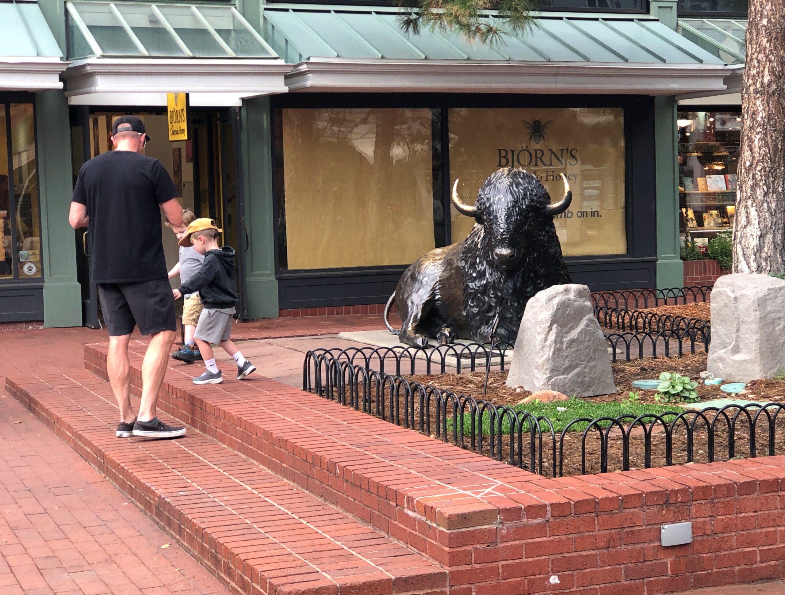
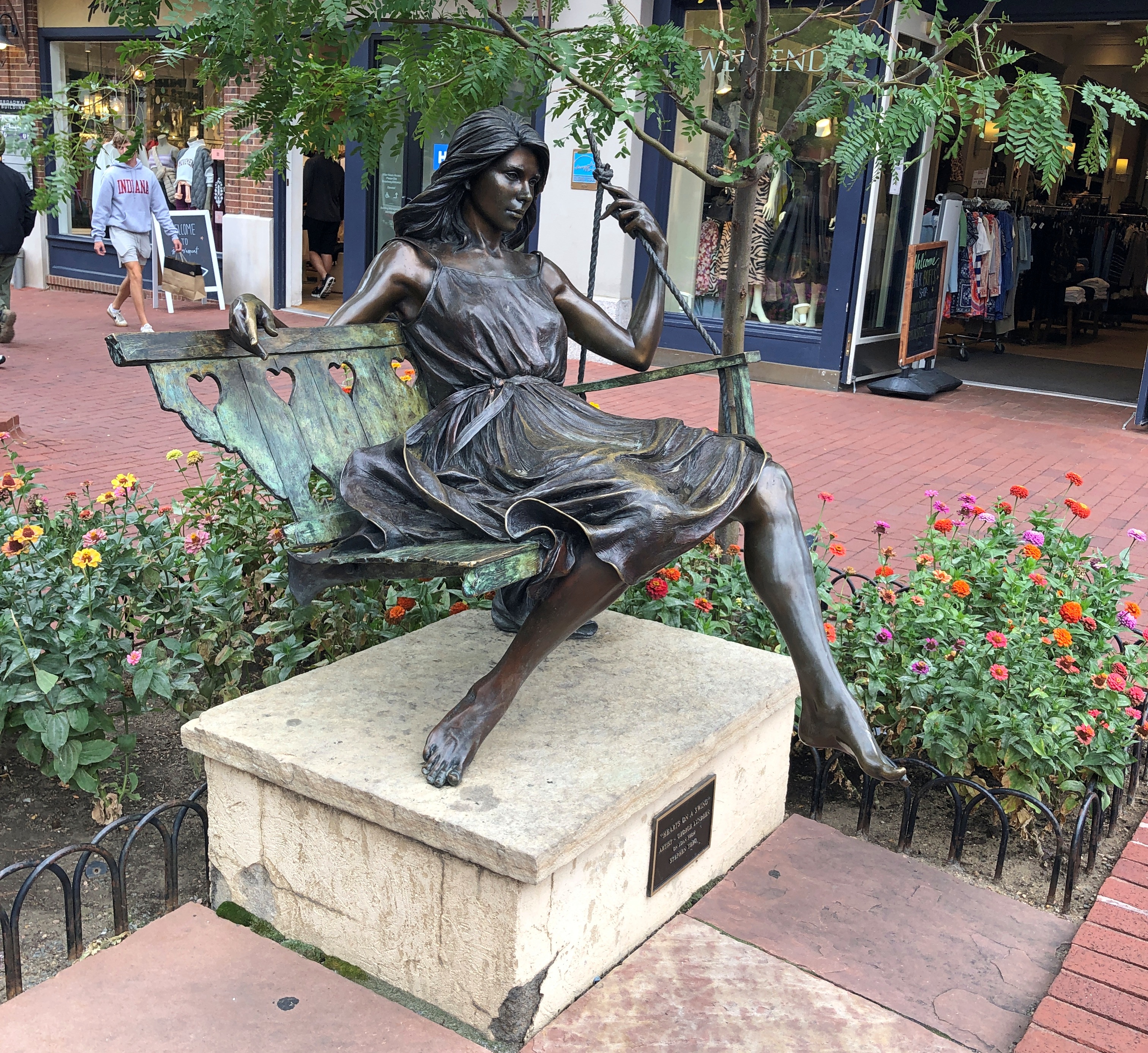
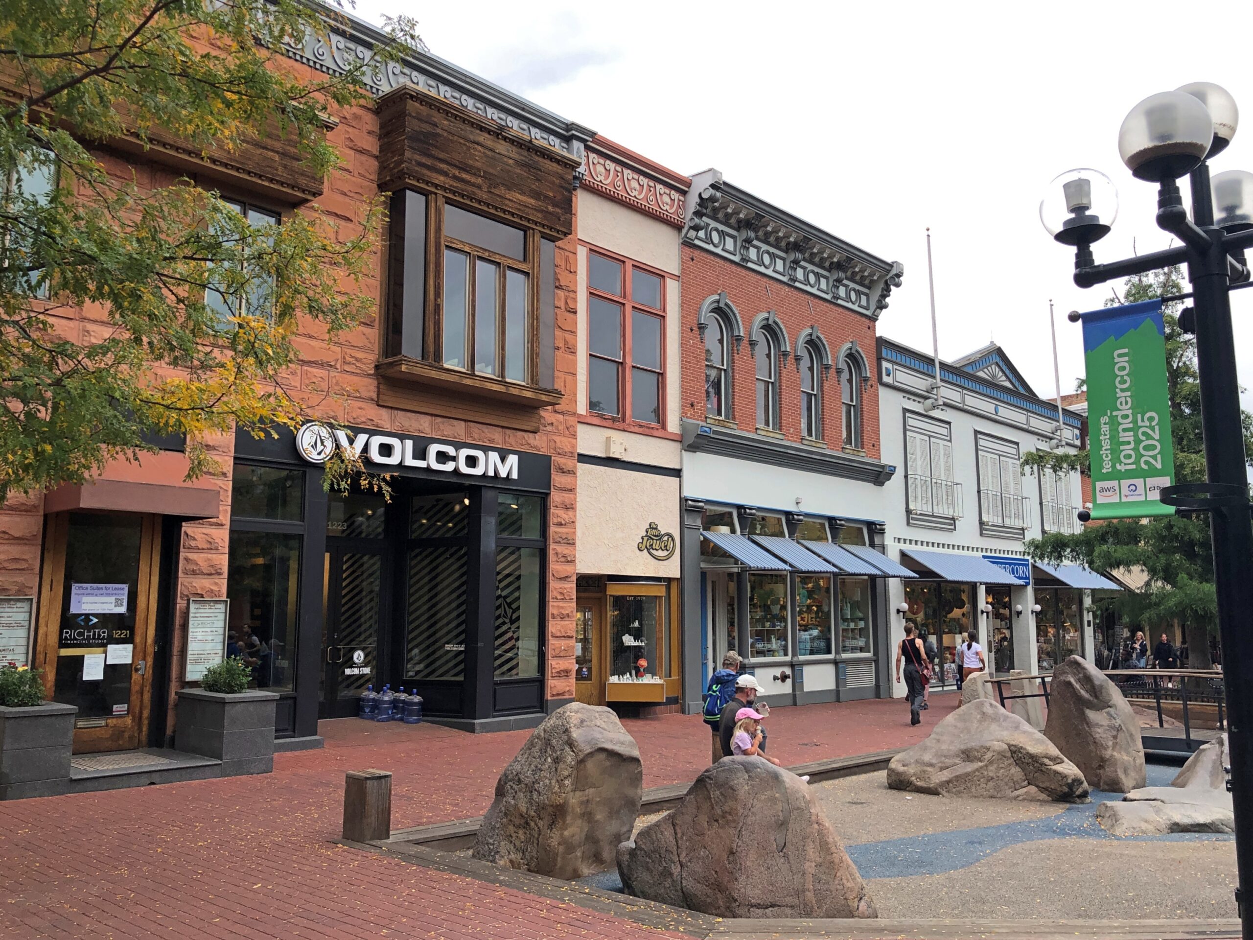
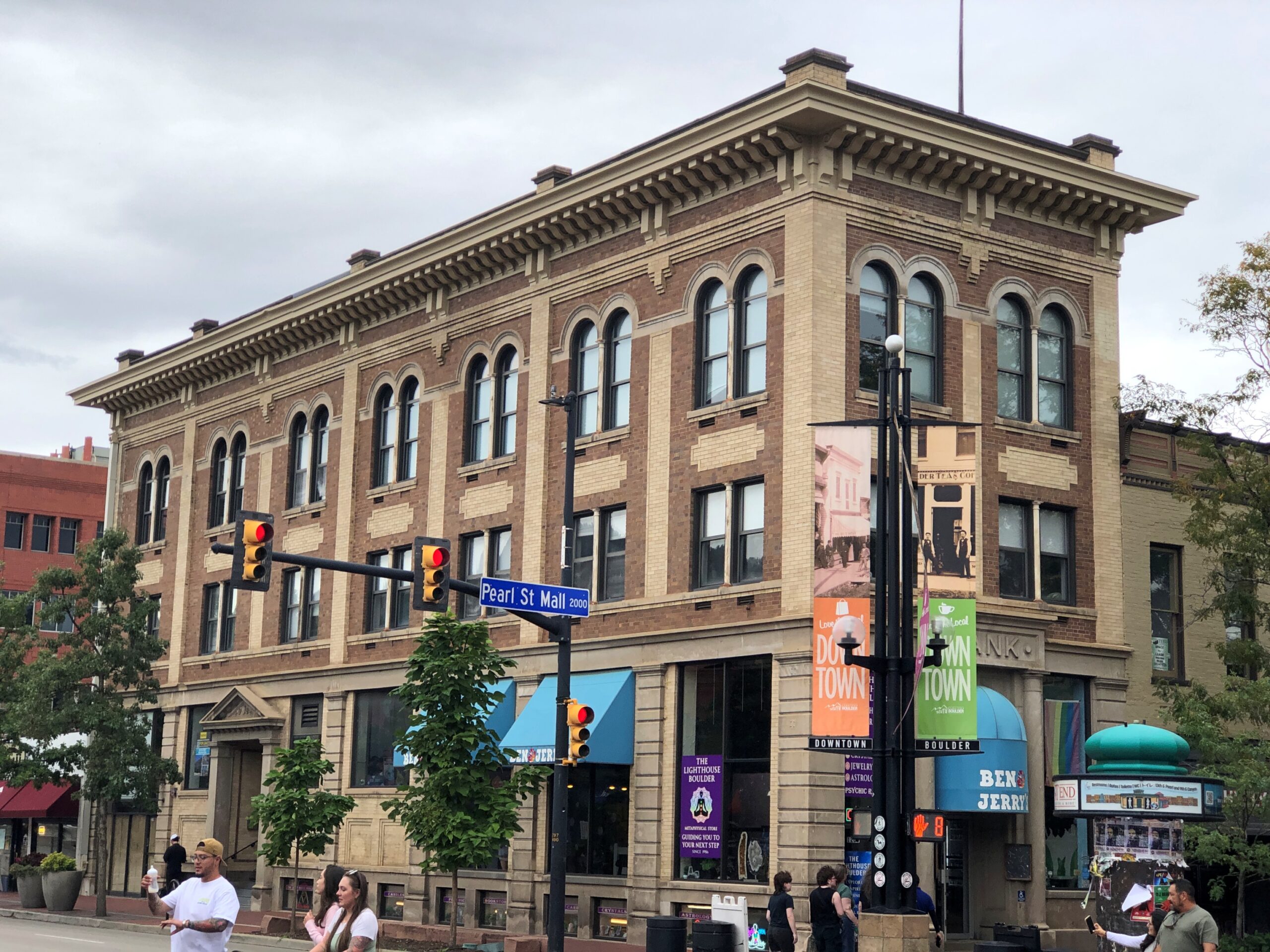
TV Land missed a bet when it didn’t commission a bronze of Mork from Ork for Boulder, Colorado. The place to put Robin Williams as Mork would be the Pearl Street Mall, the pedestrian shopping street in downtown Boulder. He’d jazz the place up a touch.
The street has some art. A buffalo with some heft and a swinging girl with lightness. Nice, but not zany Mork.
Also, there’s a boulder in Boulder. Not a bad idea.
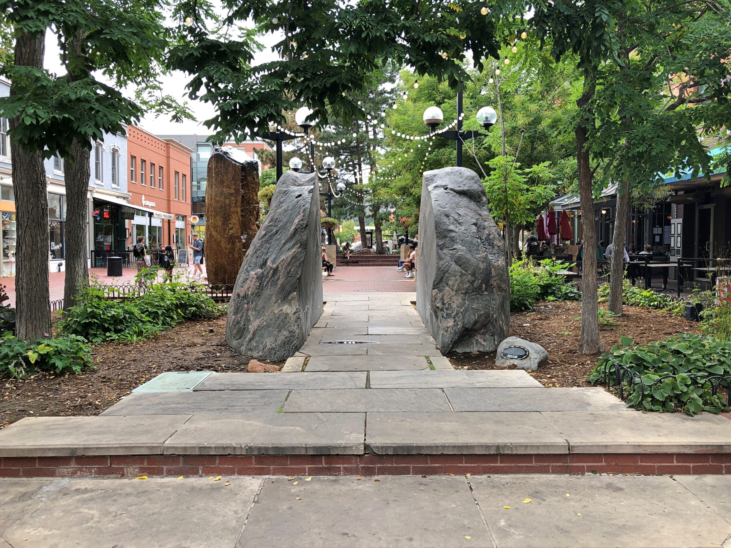
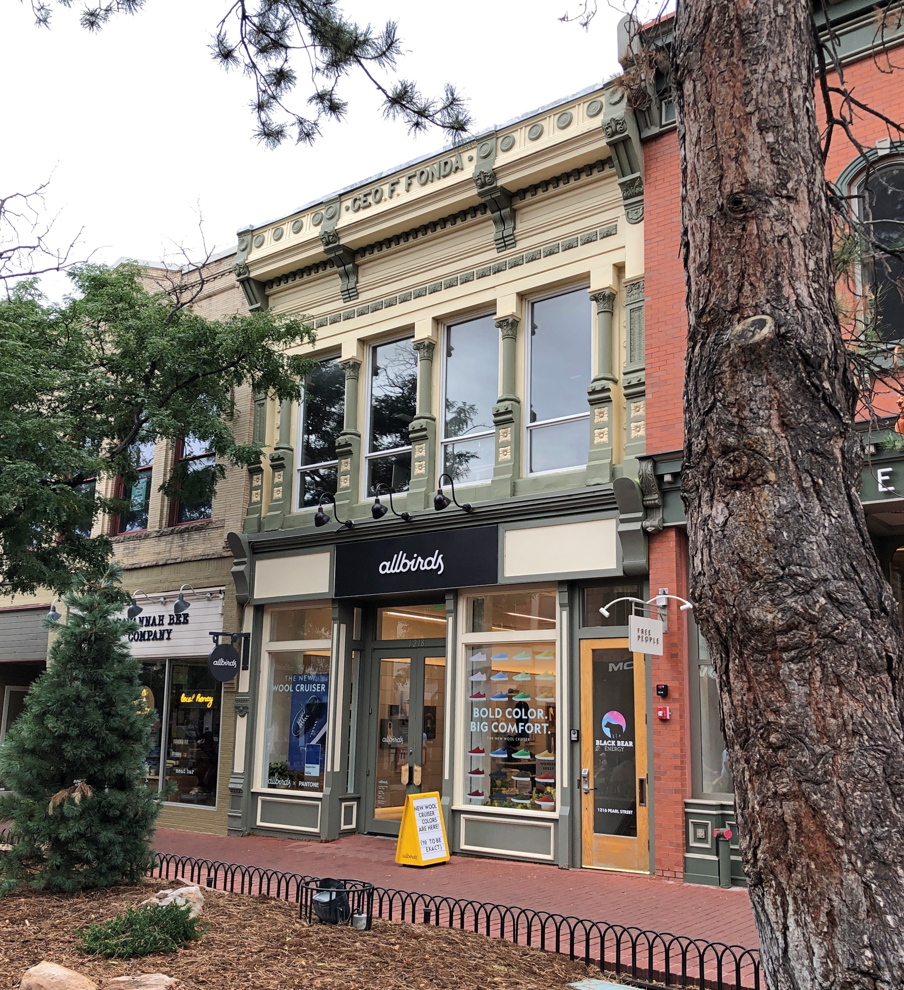
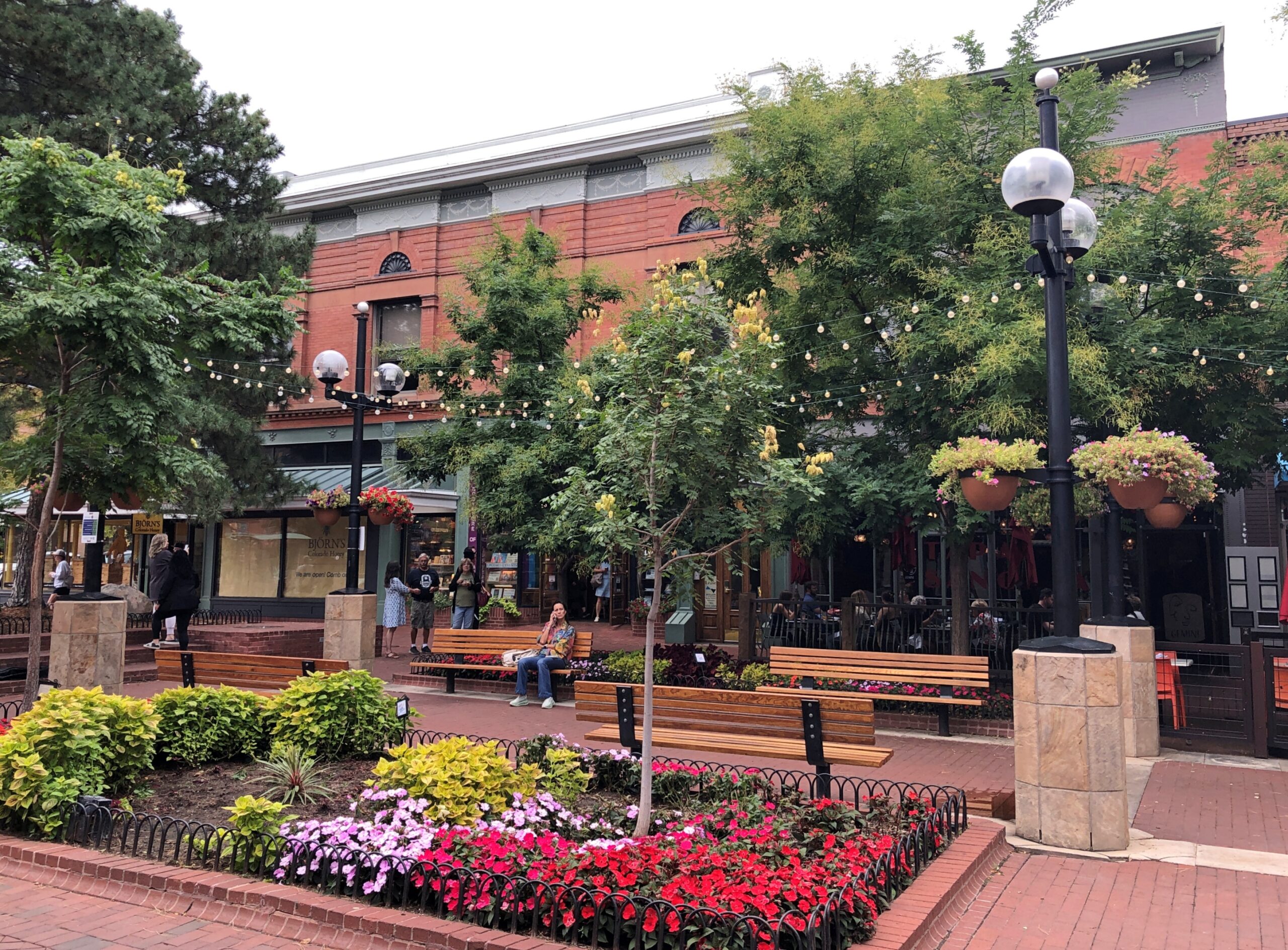
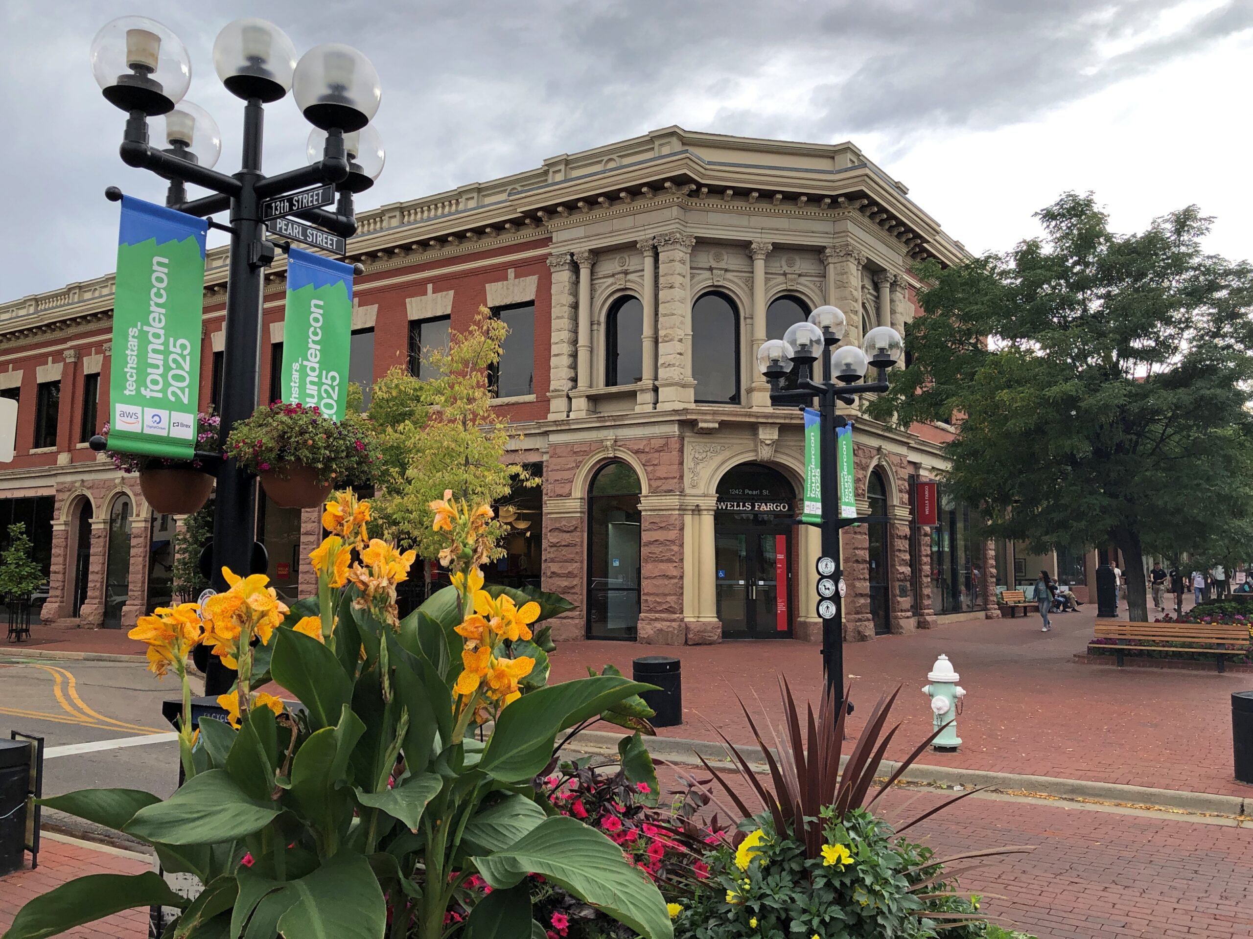
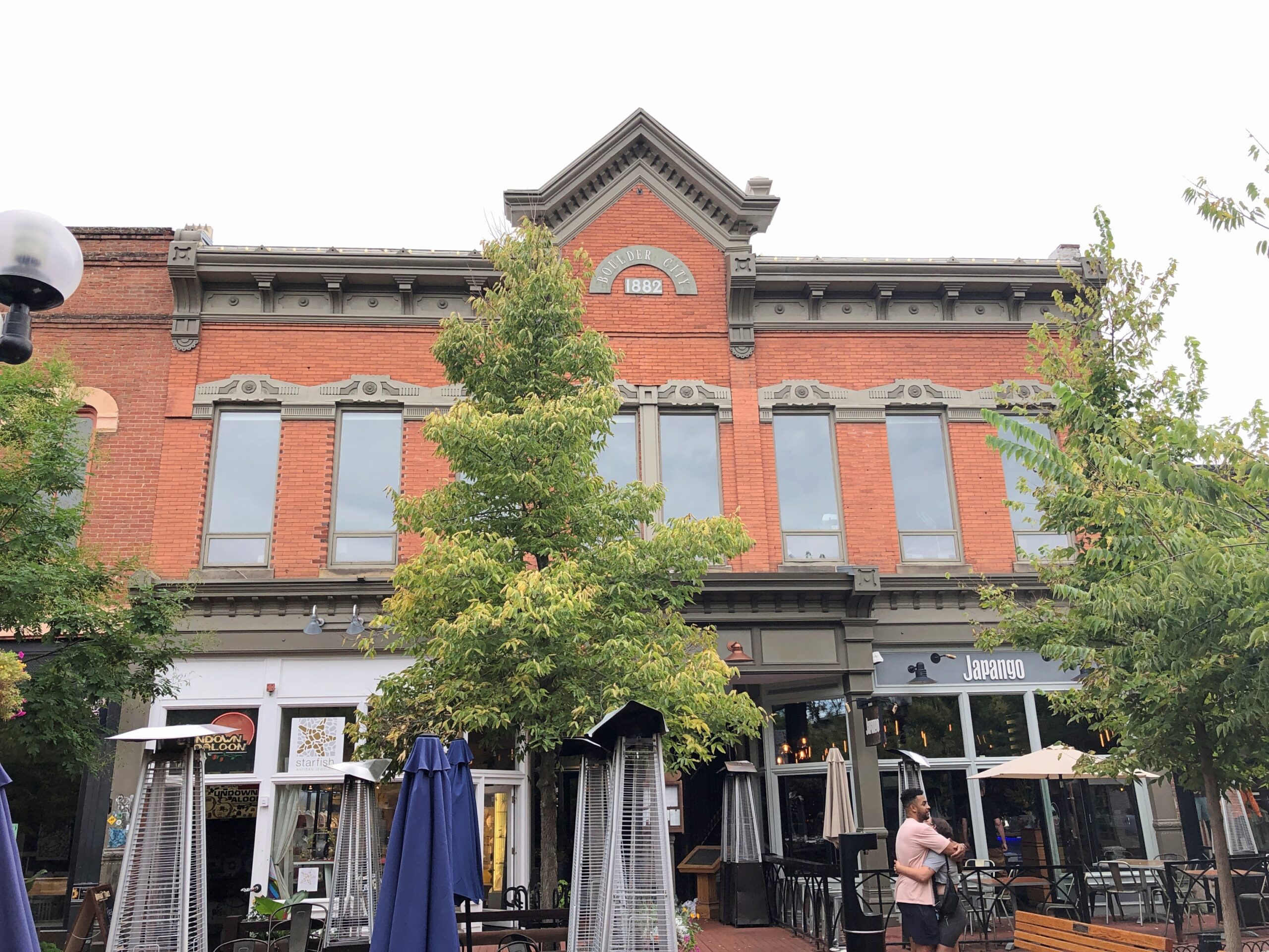
As a pedestrian street, Pearl Street has good bones. That is, picturesque old buildings that are well maintained.
All together, the mall stretches four blocks and has been around for almost 50 years, the result of a tax-funded effort to draw people back to downtown Boulder. I don’t know for a fact, but I suspect the street might have been a little run down by the early ’70s. Now it’s anything but. We arrived late in the afternoon of September 12, after spending most of the day at Rocky Mountain NP.
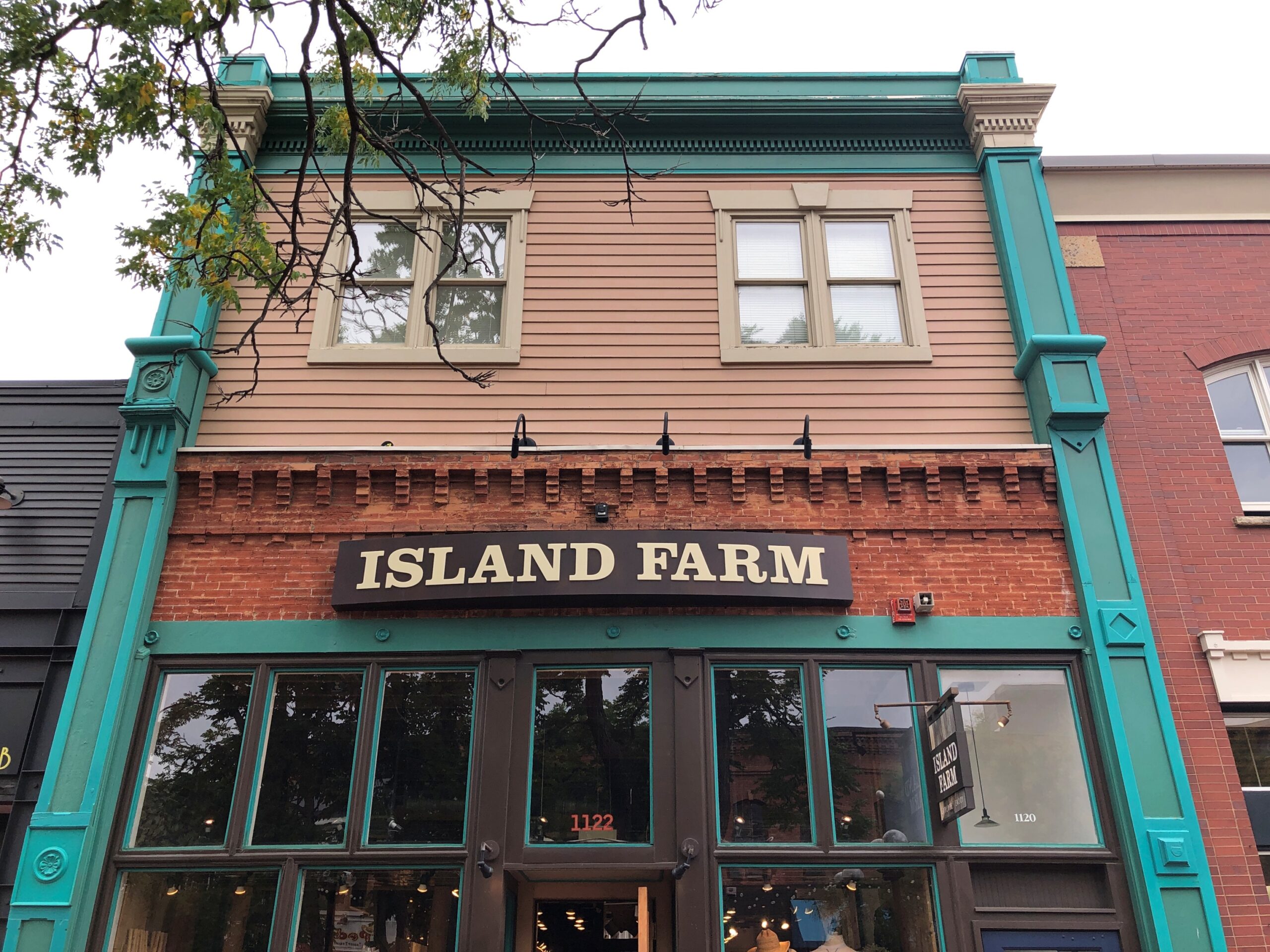
Most of the retail spaces are occupied, with the likes of the small-batch Björn’s Honey, SmithKlein Gallery, Japango sushi, Lindsay’s Boulder Deli @ Haagen Dazs, Ku Cha House of Tea, Lighthouse Bookstore, Peppercorn kitchen supply, Bramble & Hare Bistro, Into the Wind toy store, Boulder Spirits Tasting Room and much more. My own favorite sold antique maps, by themselves and mounted as art.
I didn’t go in Lighthouse Bookstore, but I took it for a Christian bookstore. Not quite, from its web site: At The Lighthouse Boulder, seekers discover many paths of wisdom for their spiritual discovery. With books to learn, spiritual tools to discover, and readings of all kinds to light the way – we’ve been serving the community since 1975.
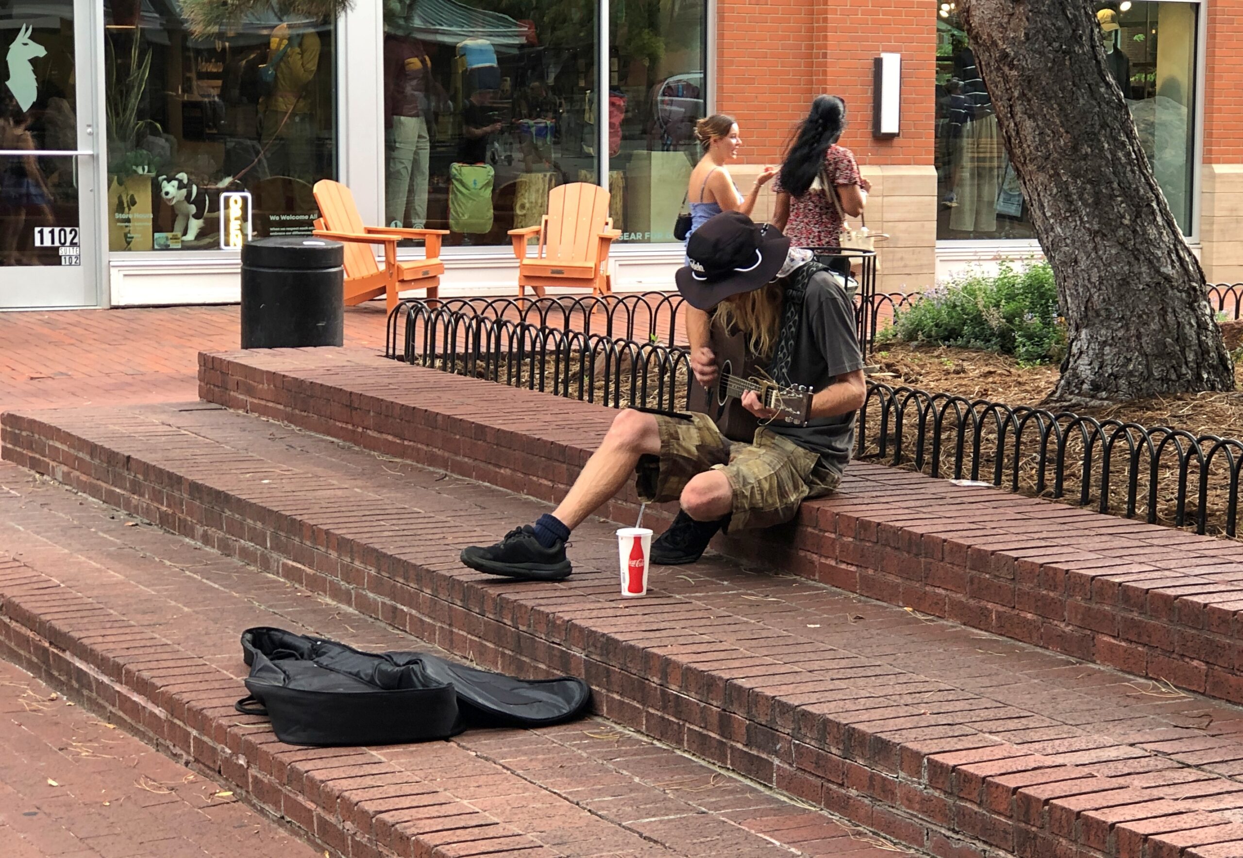
The street was fairly busy on a warm Friday afternoon. Not everyone was there to shop, however.
Wiki at least says the history of busking is robust at Pearl Street, including David Rosdeitcher, ZIP code man, who can name zip codes for places the crowd names, or name places for zip codes that they yell out. He wasn’t around the day we were. I’d have stayed for some of that act. He’s probably prepared even for someone who says, American Samoa! (Zip code: 96799) (That’s something I might pose to him). But would he know Kingman Reef? (96898). Exactly zero people live there, so why it needs a zip code is probably detailed in some memo at the USPS. Just being thorough, maybe.
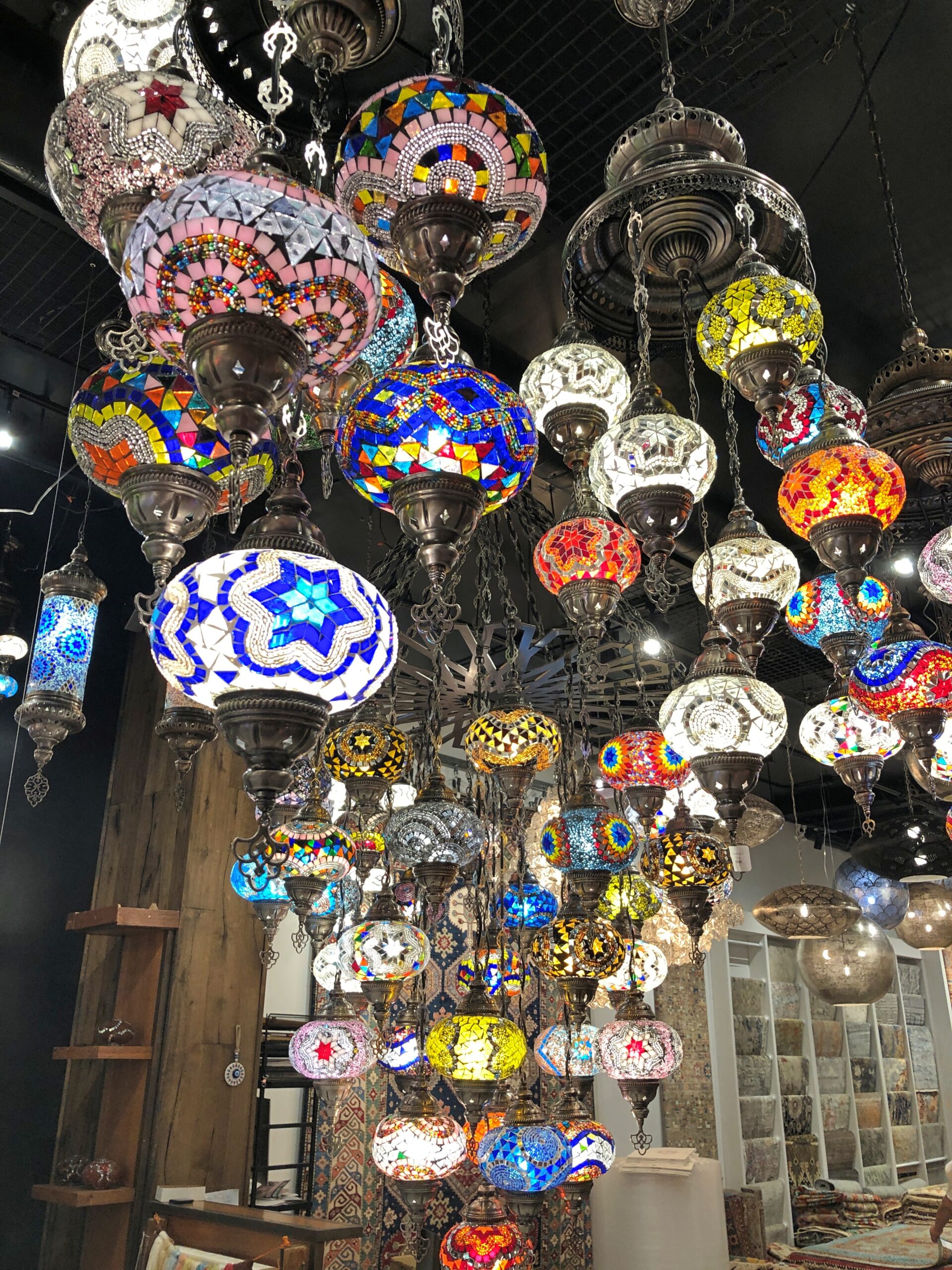
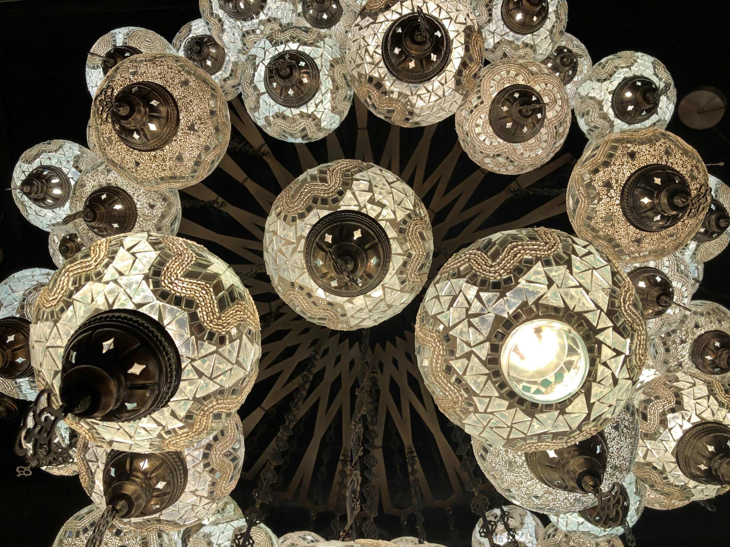
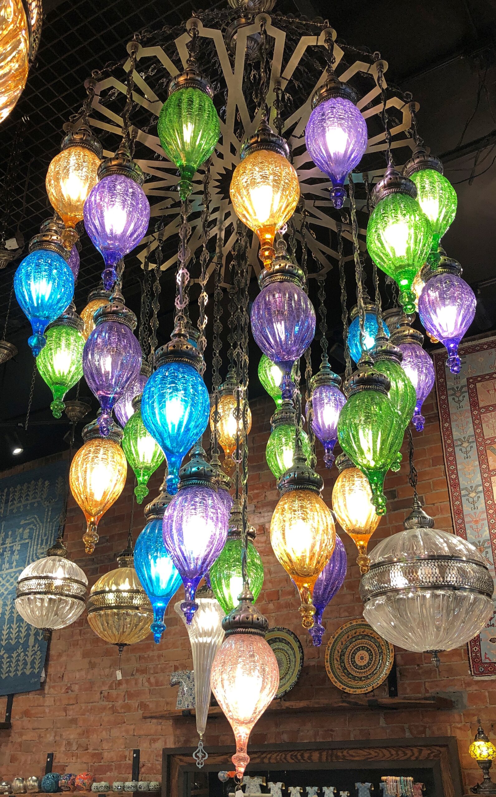
Another intriguing shop sells lamps. More than I’d care to pay, but still wonderful to look at.
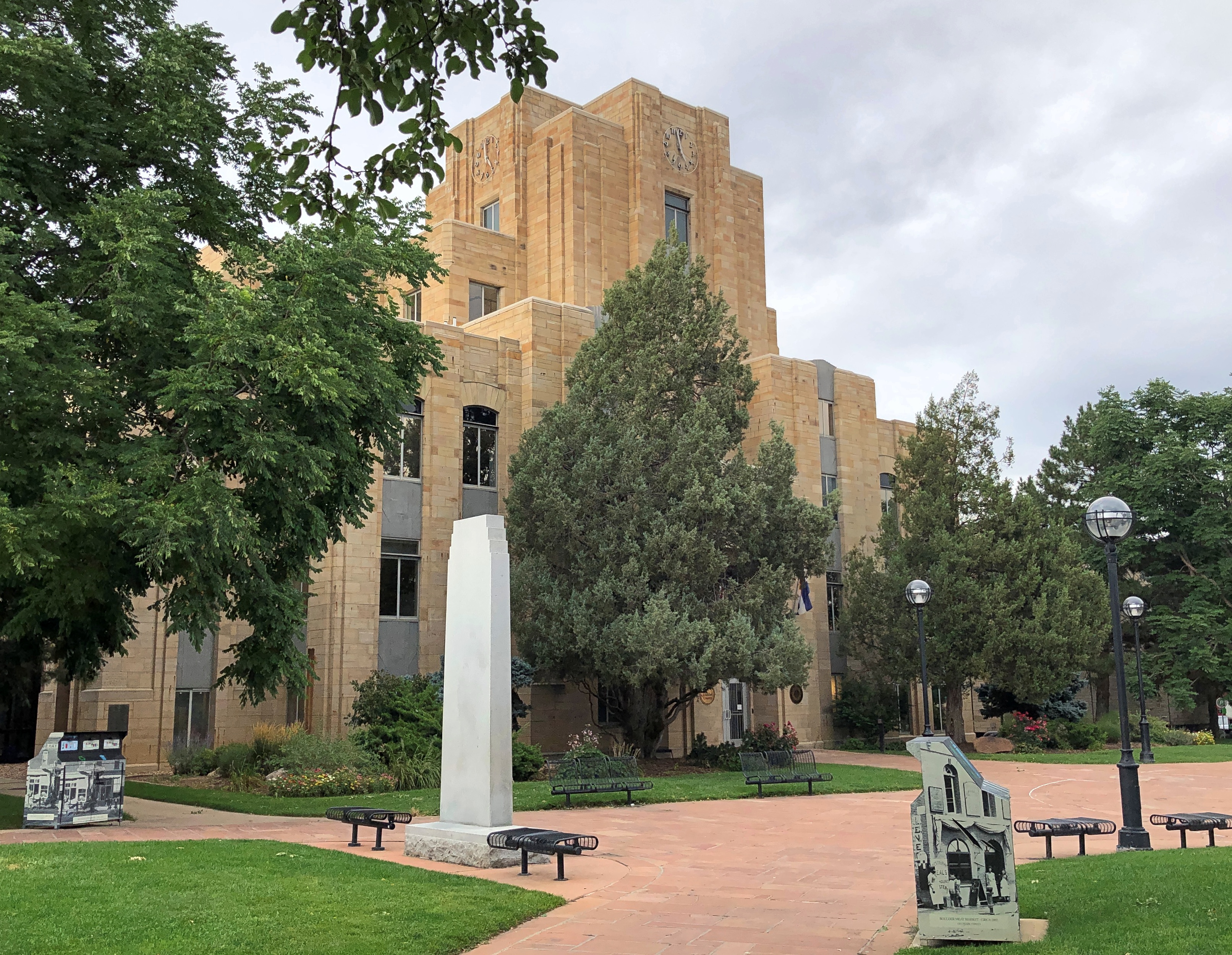
The Boulder County Courthouse is also on the street. Impressive art deco, or it might be called moderne. We walked past on our way out, to get to the car before the meter ran out, so I didn’t quite get to look as long as I wanted. There have to be studies somewhere that show that parking meters are counterproductive in generating foot traffic in such places as Boulder.
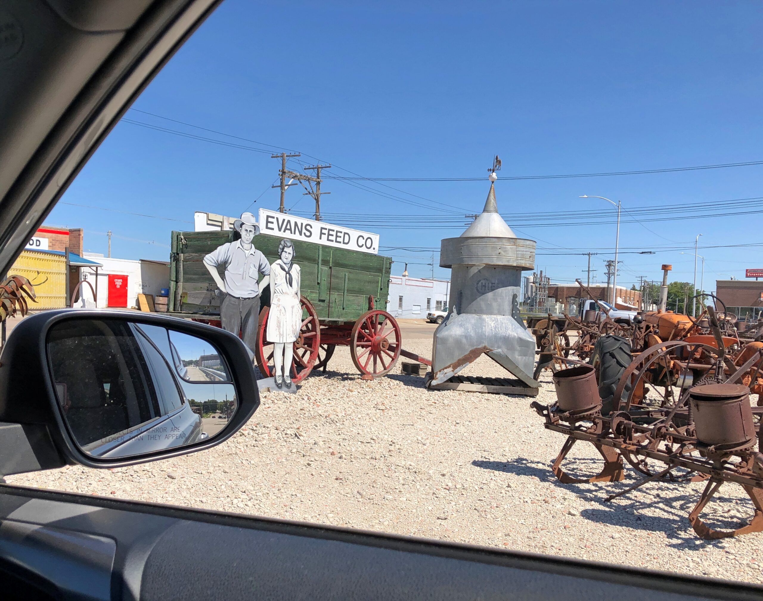
The highway Nebraska 2 passes through the town of Alliance, as do the BNSF railroad tracks paralleling the highway. During my drive across the Sandhills, I saw train after train headed east from Alliance. Long trains, the seemingly endless sort, even though they’re going the opposite direction you are, so they’re passing by at your speed plus their speed: well over 100 mph probably.
Every single one was a coal train. The industry isn’t what it used to be, but it isn’t dead, and much extraction takes place in the Powder River Basin, with rail from there converging in Alliance and then heading to the markets in the east. For a fairly small place, Alliance (pop. 8,150 or so) has a large rail yard.
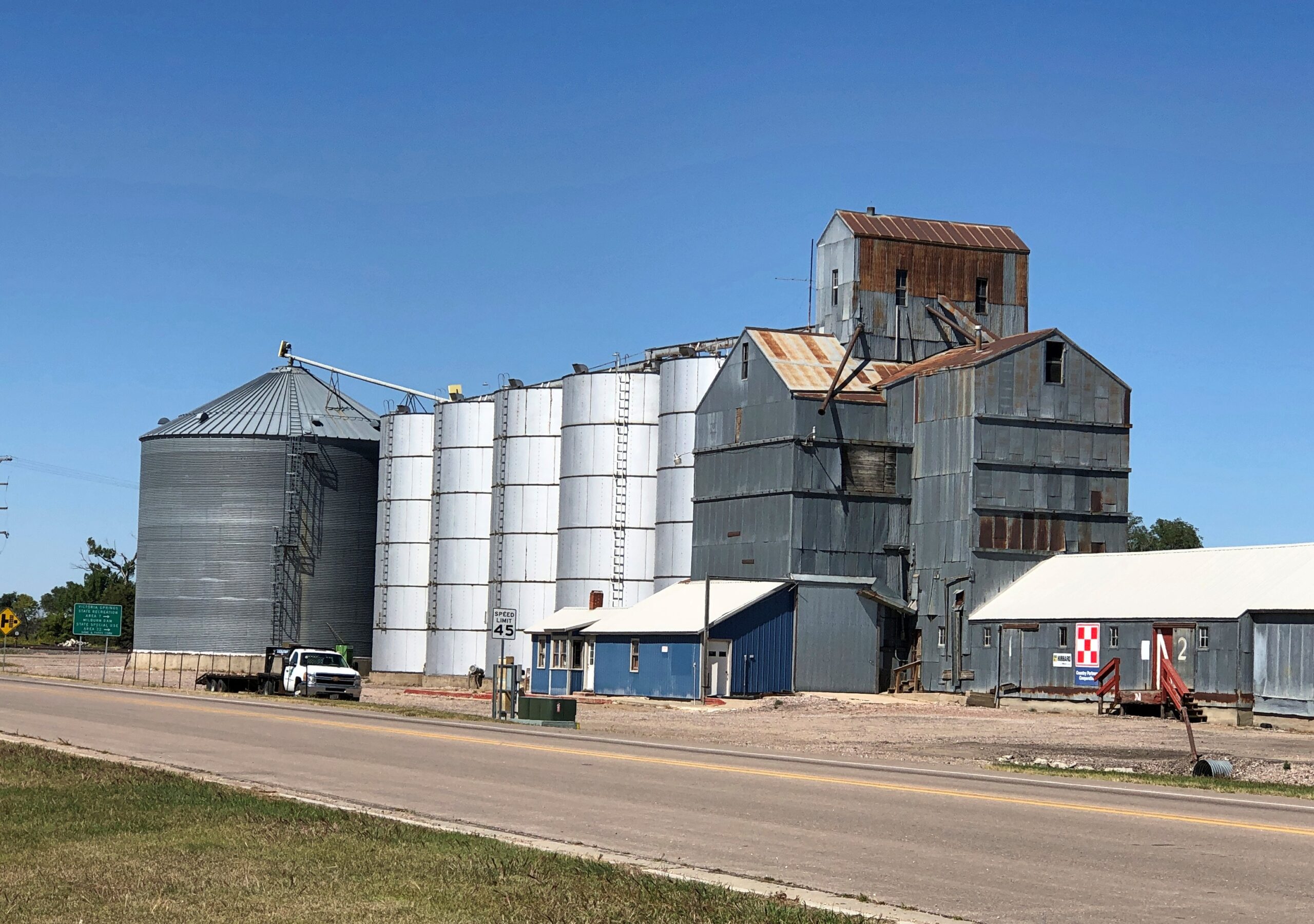
Back up a little further, and the region reveals clear signs of circle-pivot irrigation.
In ag terms, most production in Box Butte County – a favorite of mine among county names – is actually livestock, raised on non-irrigated grassland, which you can also see driving in. As for the irrigated places, that’s corn and wheat, with a smattering of alfalfa, beans, sunflowers and sugar beets. Somewhere up north is a rock formation called Box Butte, a name that I understand the railroads were using in promoting settlement this way, before it was ever official.
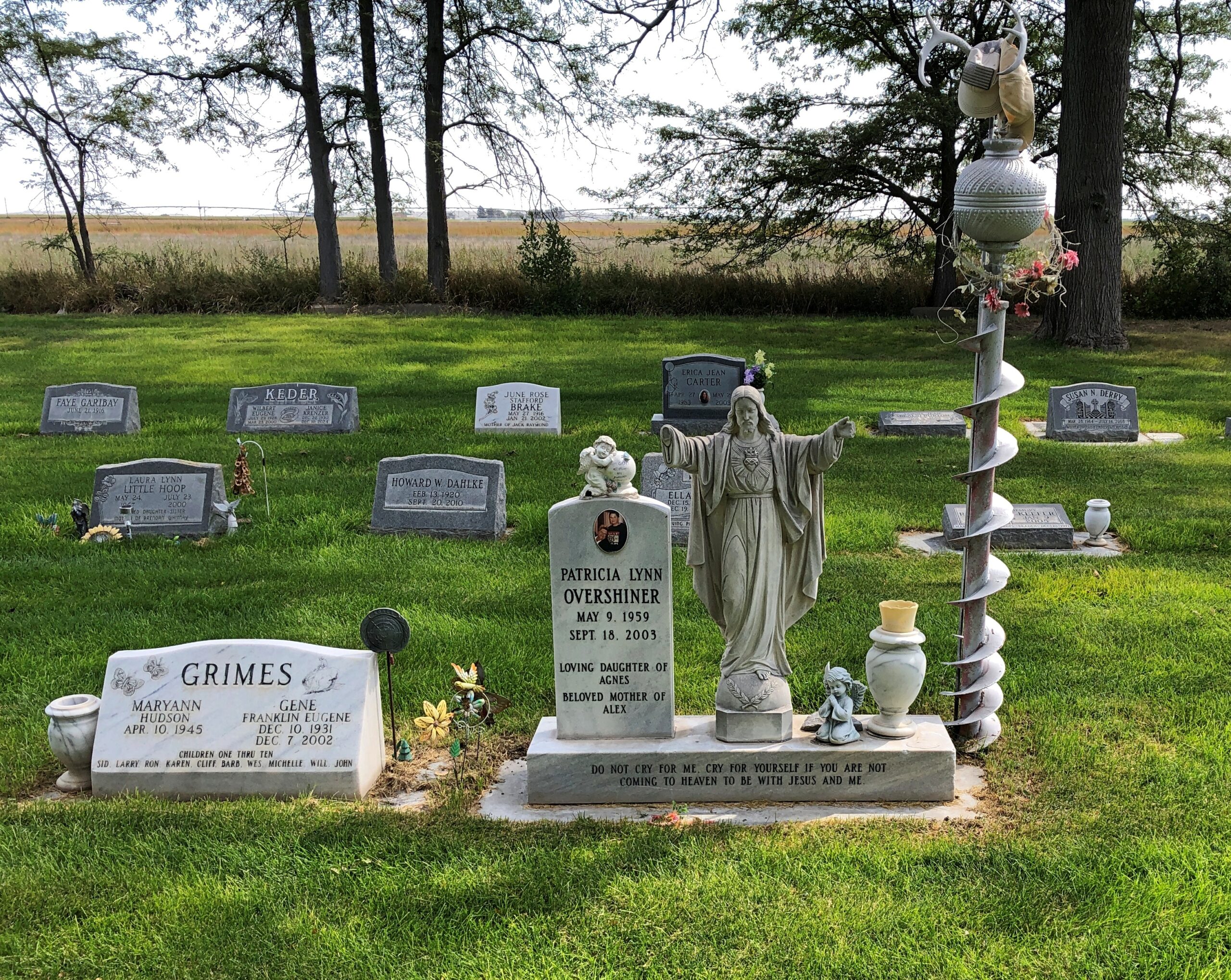
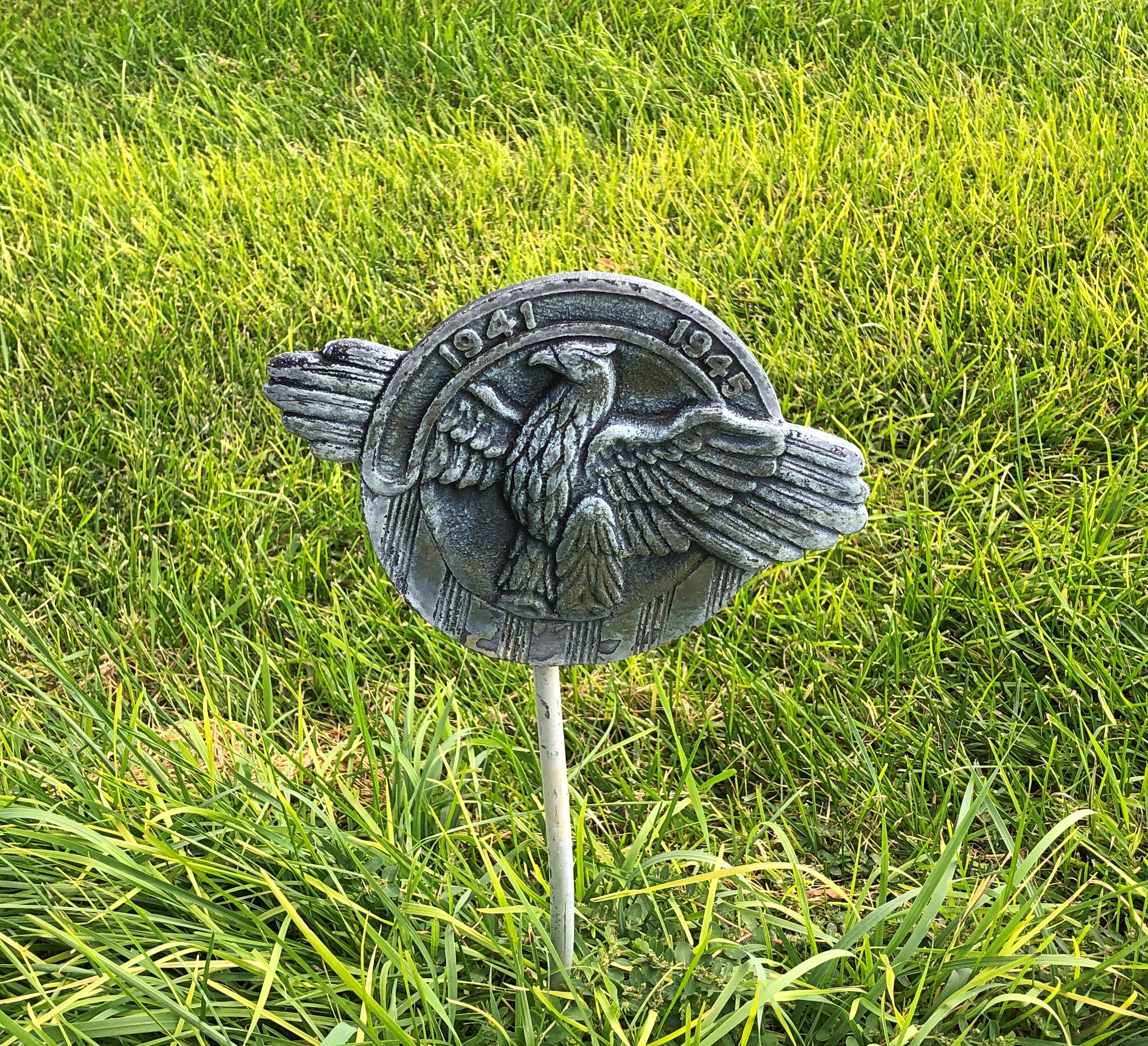
I didn’t come to town to learn all that, but I did later. Mainly I came to see Carhenge. The weather that day, September 7, was clear and very warm, which inspired some further looking around. First stop, Alliance Cemetery.
“Bury me in old Box Butte County.” There’s a western swing title in that.
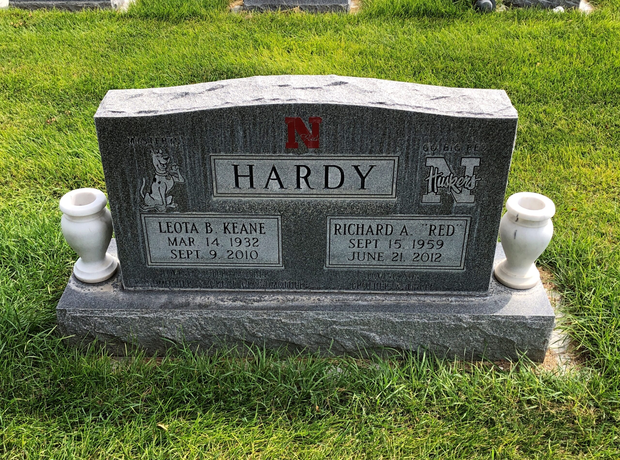
Something I’d never seen on a gravestone before: Scooby-Doo.
Go figure. Maybe Richard “Red” Hardy is the one who wanted it on the stone, since he would have been almost 10 when that cartoon premiered (September 13, 1969), and that’s about the right age to get hooked on such a thing. Then again, I was eight — saw the first episode myself — and yet somehow I’ve remained immune to its charms.
As for the Huskers, I saw them on some other stones in this cemetery. Hardly the only example of fandom from the grave.
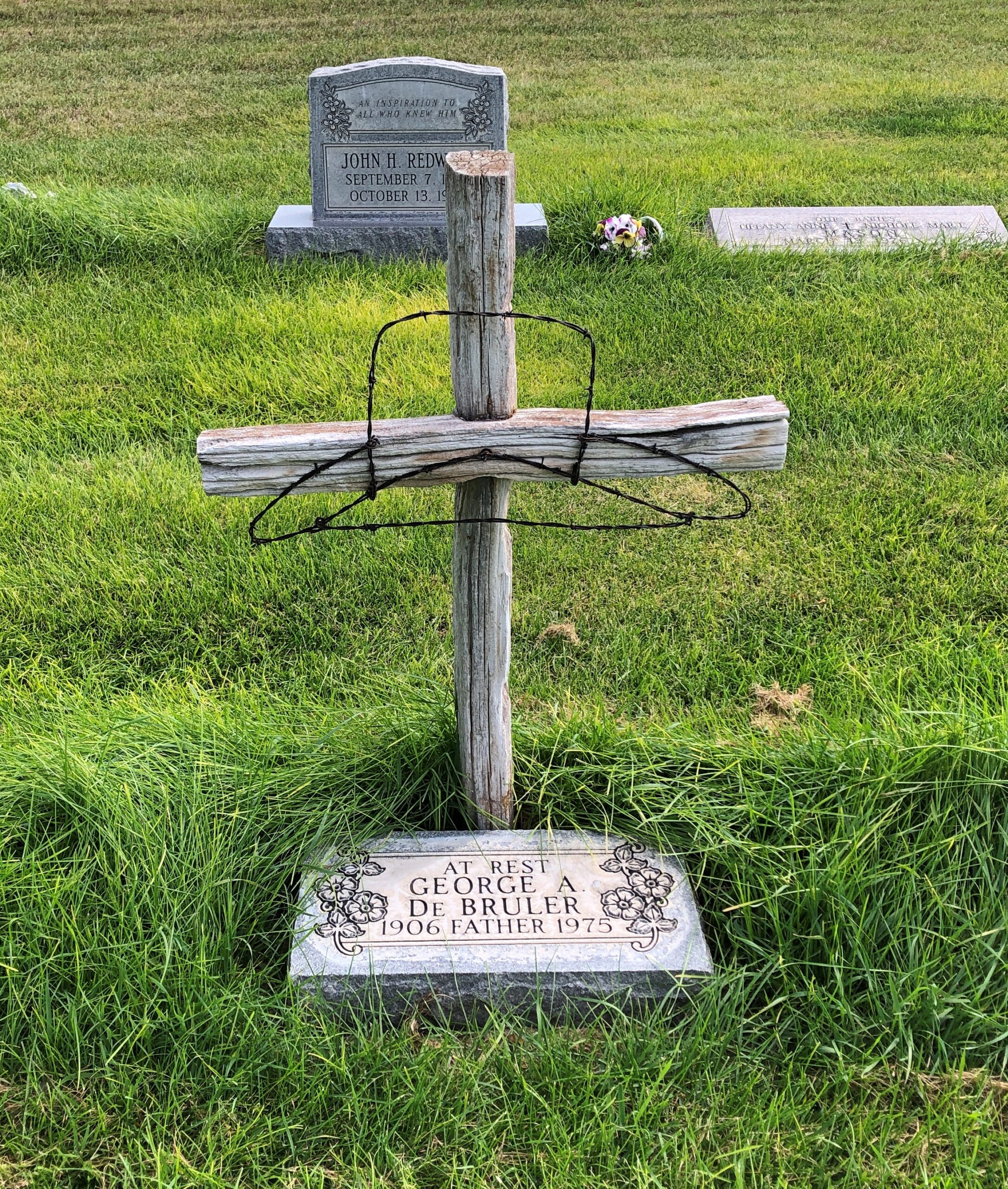
I’ve seen cowboy churches and I’ve seen cowboy graves.
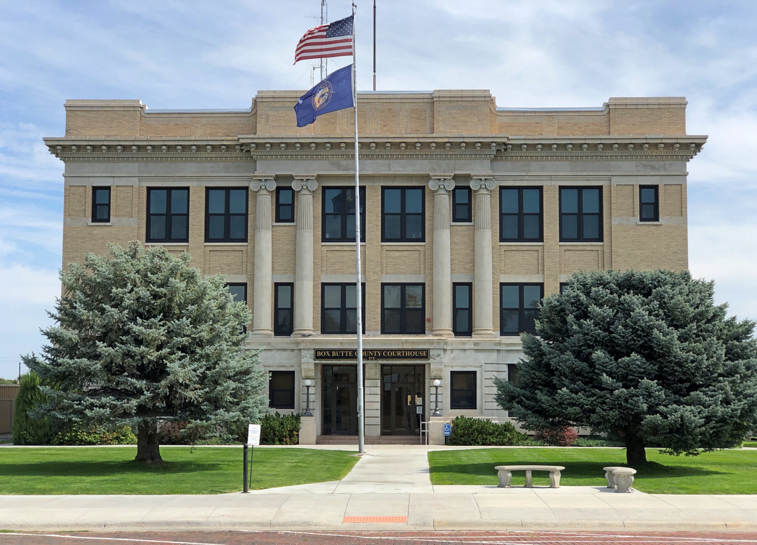
The cemetery is east of downtown Alliance, but not that far away. The Box Butte County Courthouse is on Box Butte Ave.
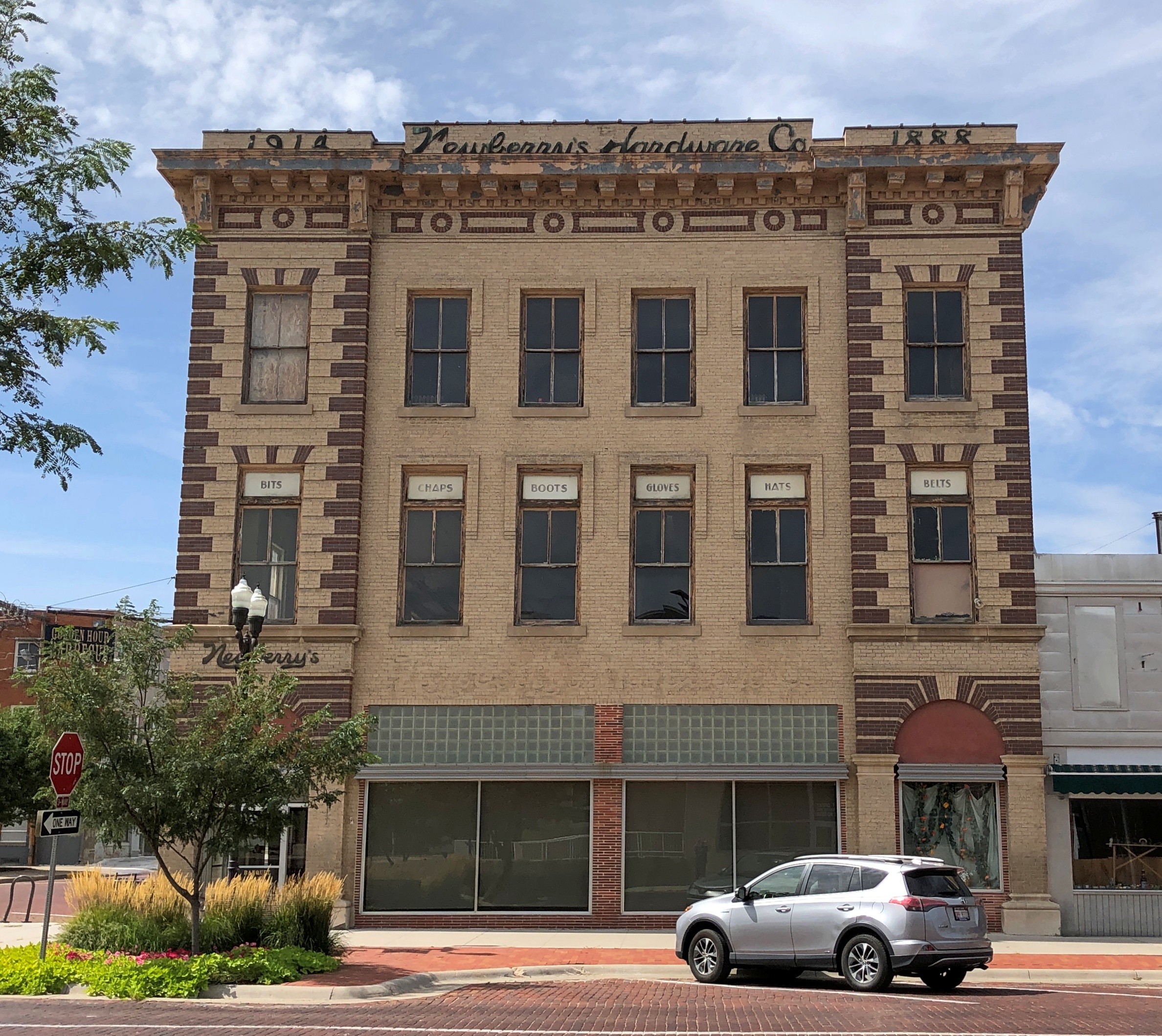
Along with a number of other vintage buildings. Newberry’s Hardware Co., once upon a time, which seems to be 1888 and then maybe an enlargement in 1914? Looks like it needs an occupant.
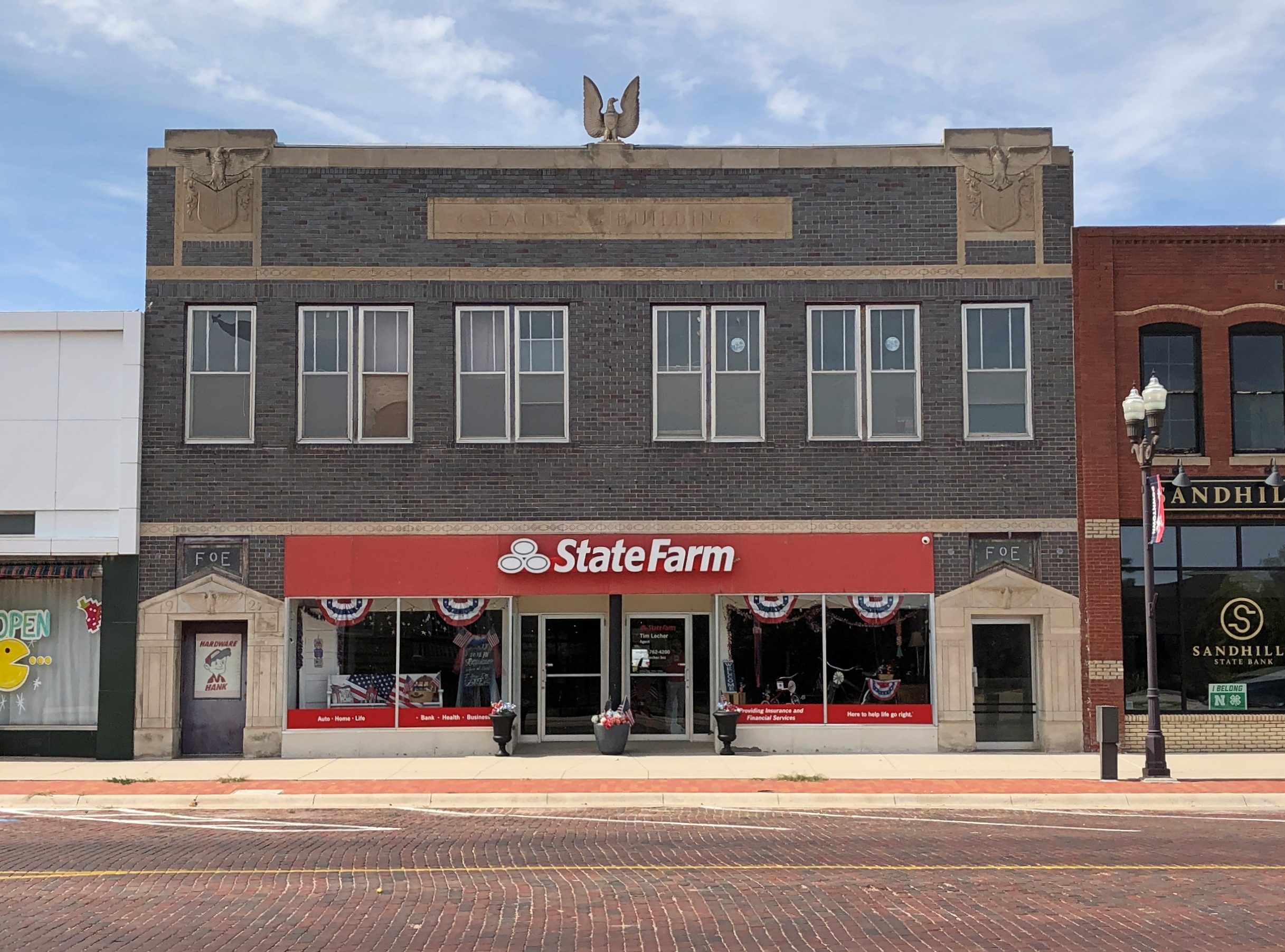
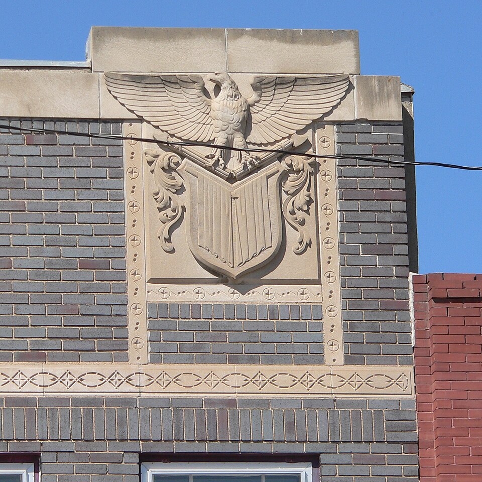
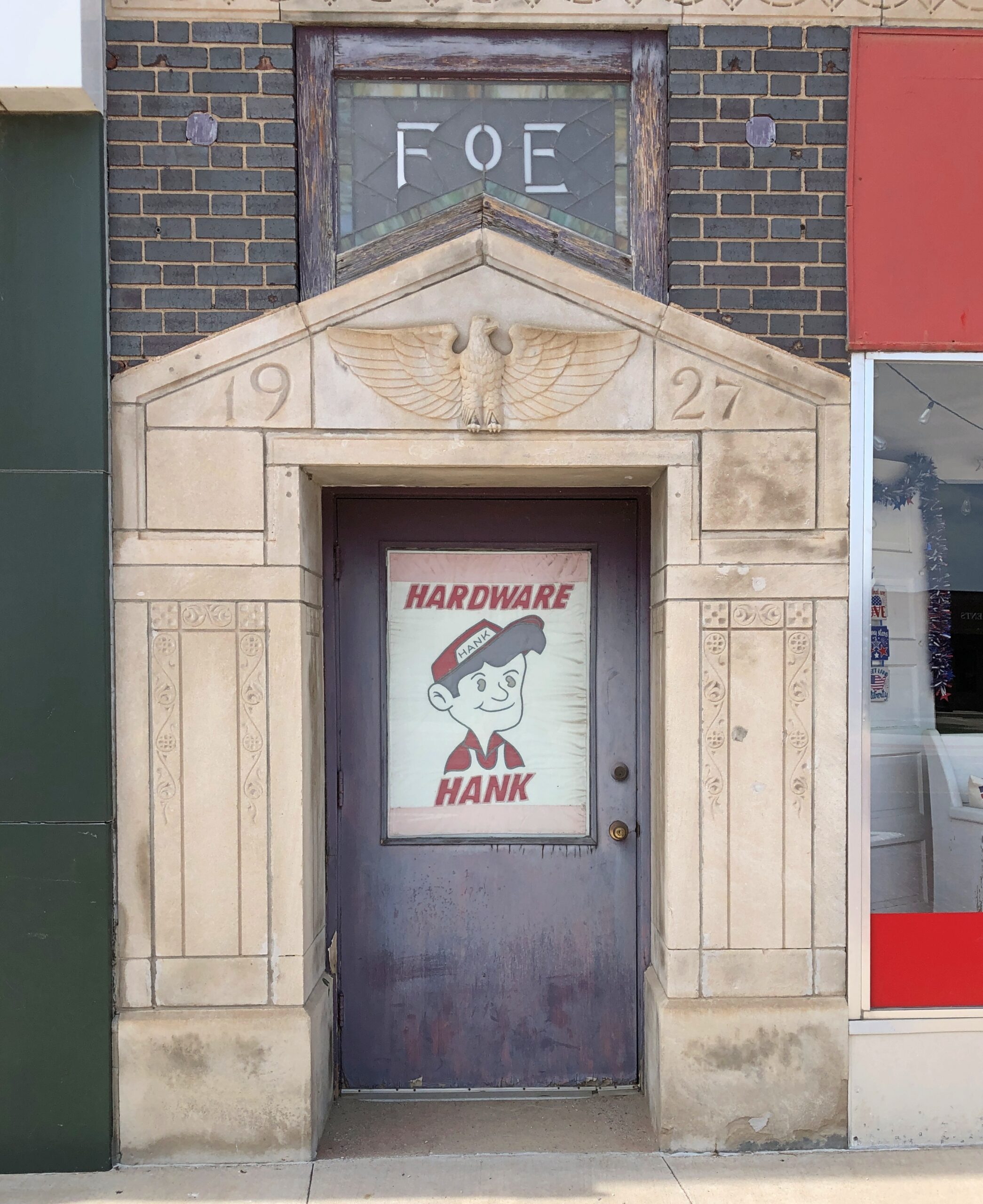
The 1927 Fraternal Order of Eagles Building.
Slacker that I am, I didn’t take many detail shots, but one of this particular building is available (public domain) that shows how seriously the local FOE took its eagles about 100 years ago.
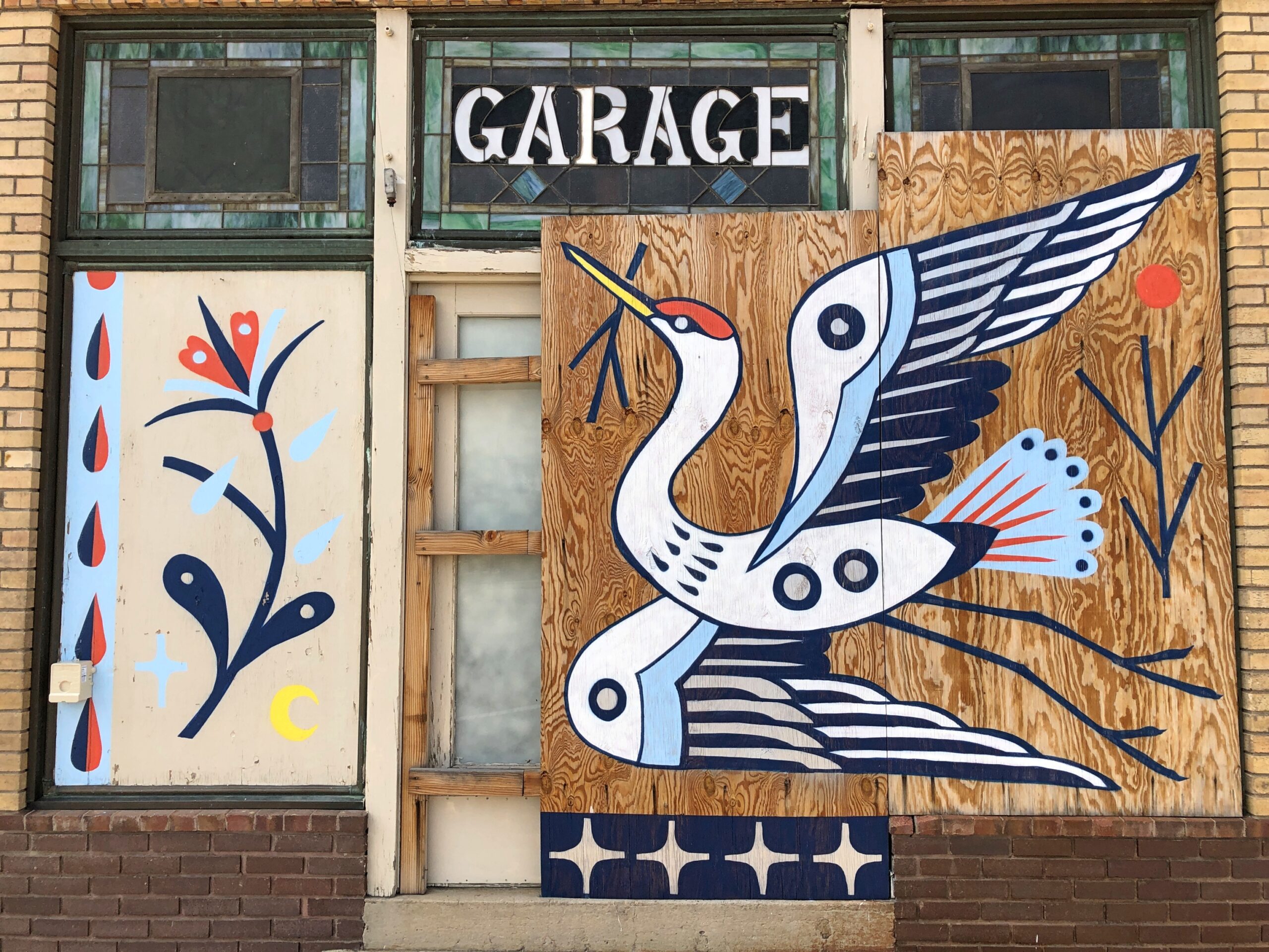
Hardware Hank is a hardware cooperative. New to me, but that only means I need to get out more.
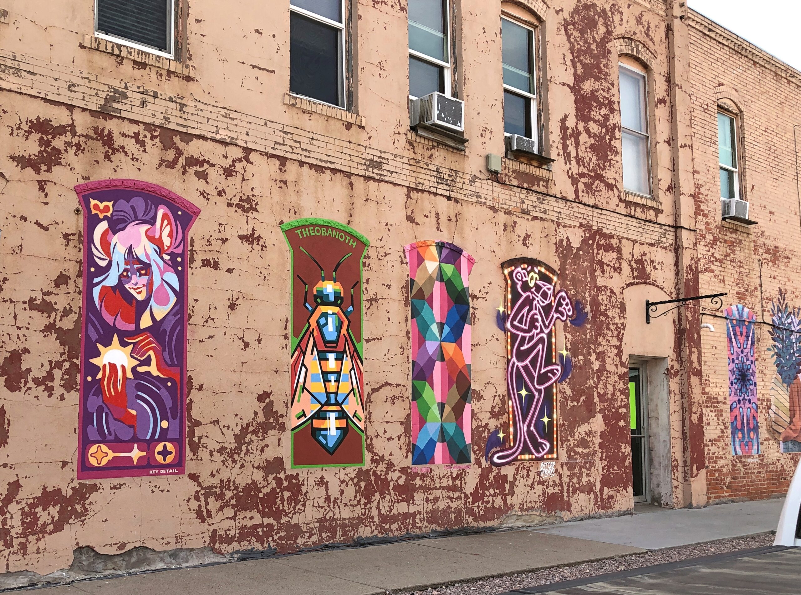
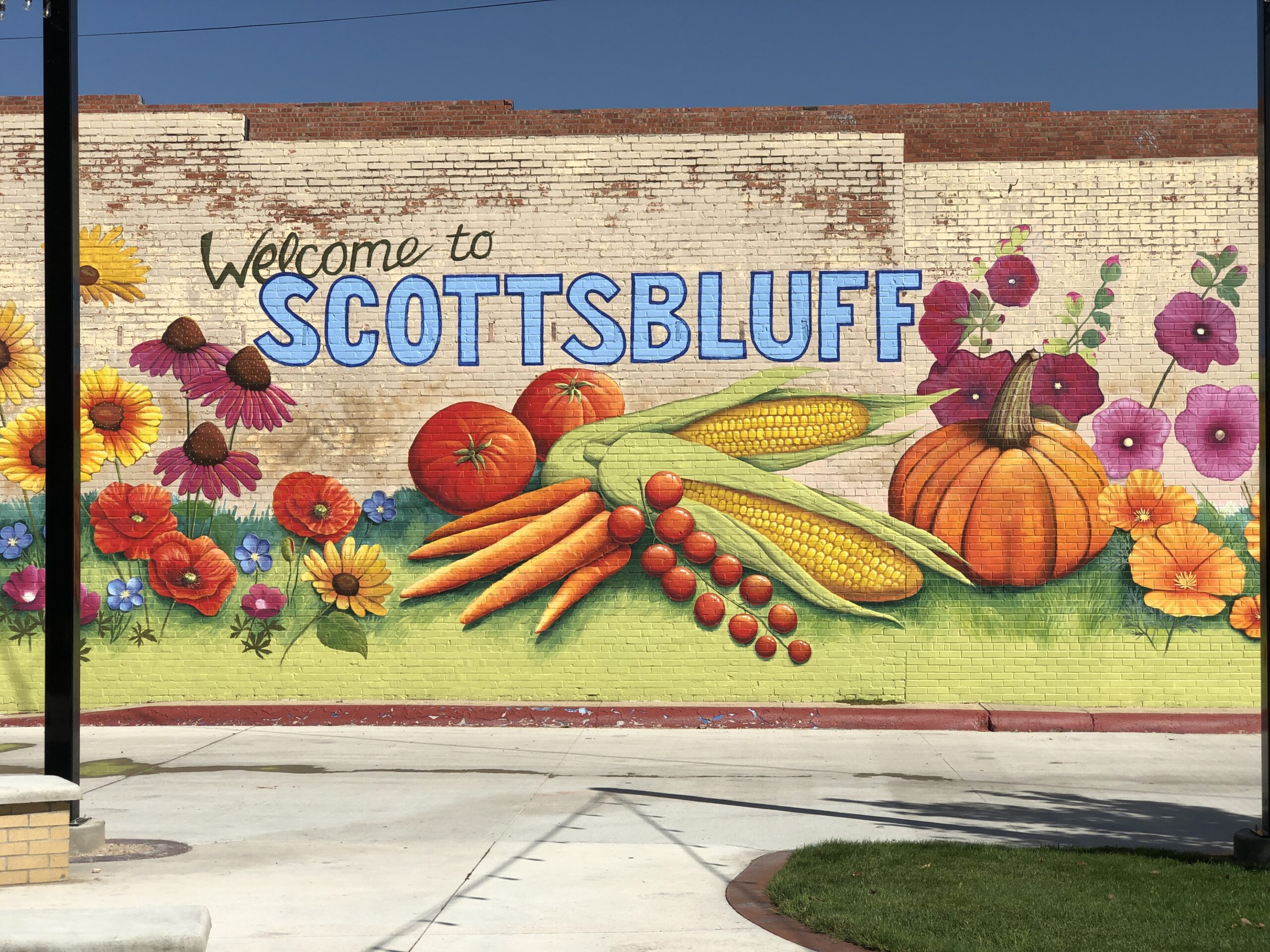
More murals.
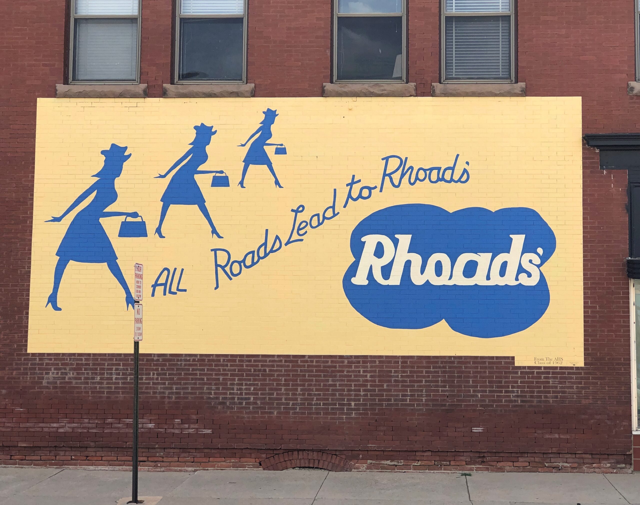
Rhoads’ was a local department store. Gone but not forgotten, at least if you read the mural, which looks refurbished recently. The tag at the bottom says it was a gift of the Alliance High School Class of 1962.
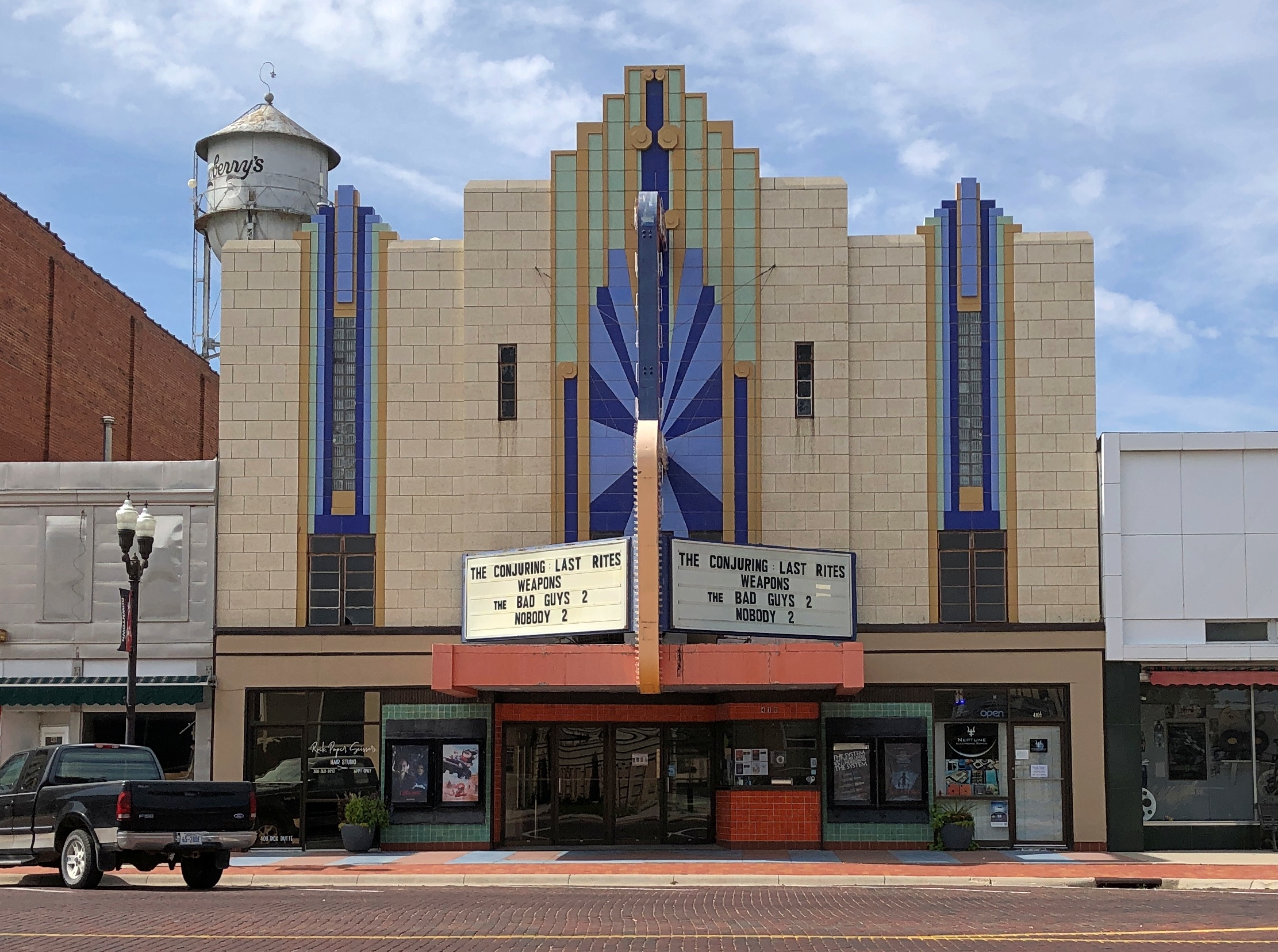
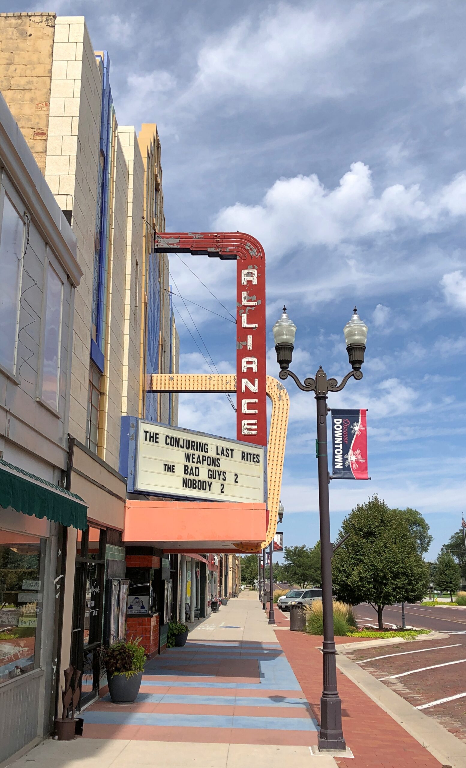
An art deco theater. Nice.
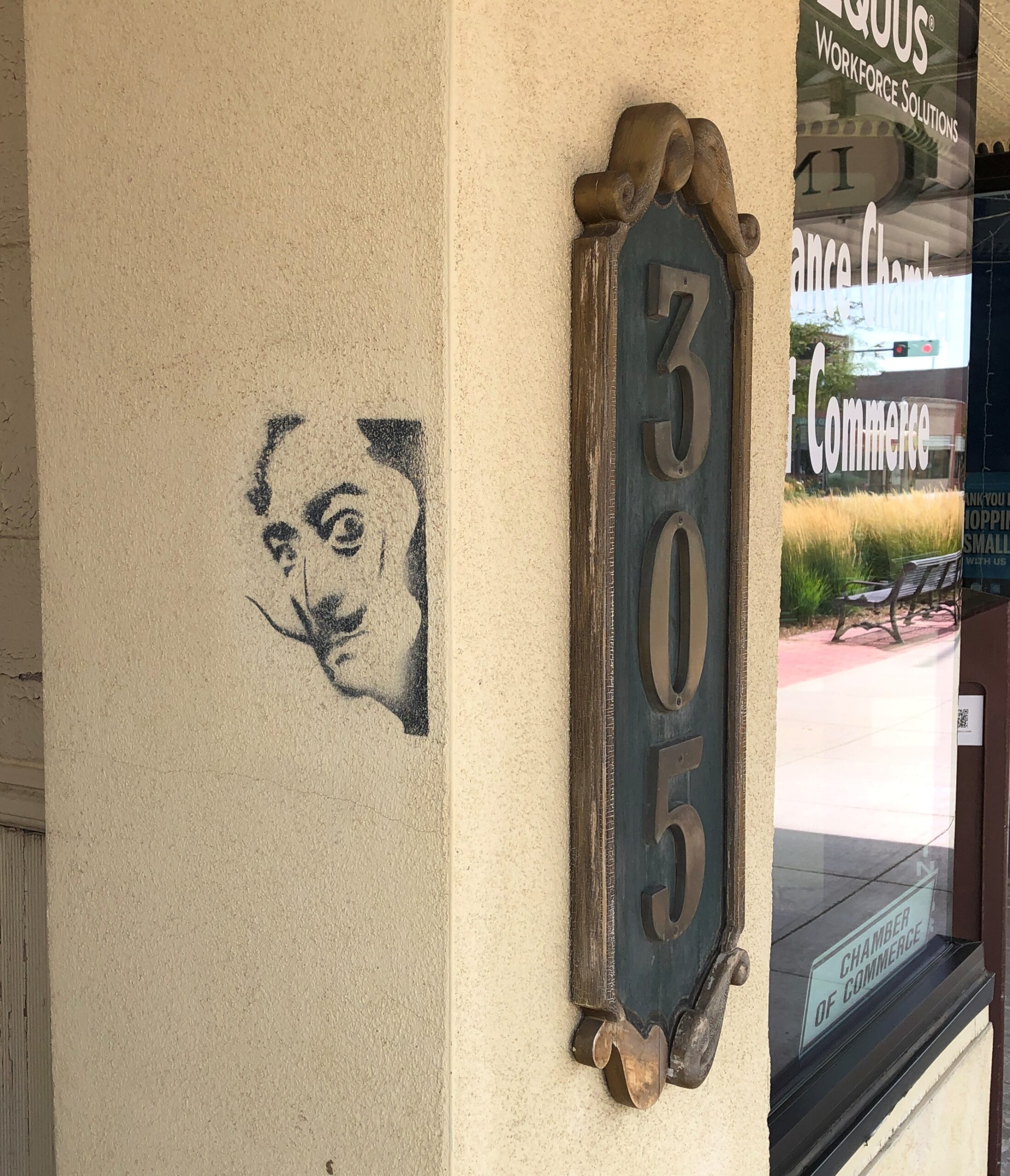
A really cheap way to advertise.
You never know when (and where) Dali will show up. Enigmatic fellow.
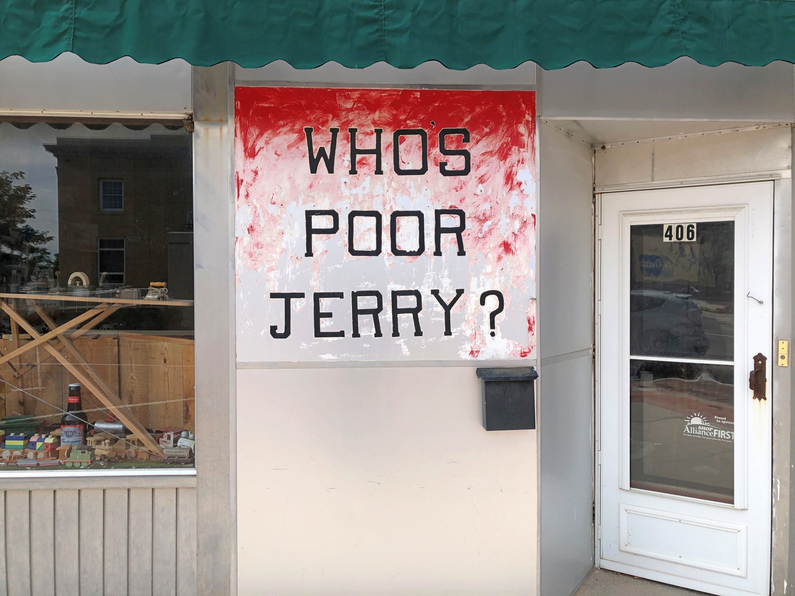
And who is poor Jerry?
Antique shop within? A simple desultory Google search doesn’t reveal much. Street View puts the sign’s appearance between 2007 and 2012 (Google didn’t come that much to Alliance.) Even the Library of Congress wants to know.
I found lunch in Alliance that day at Golden Hour Barbecue, which promised (and provided) Texas-style ‘cue. I enjoyed it thoroughly. Same league as Salt Lick, though a little expensive, considering how close the cattle are. Then again, everything seems expensive these days, and it was such a large lunch that I barely needed to eat that evening in my room in Scottsbluff, so that mitigated the upfront cost.
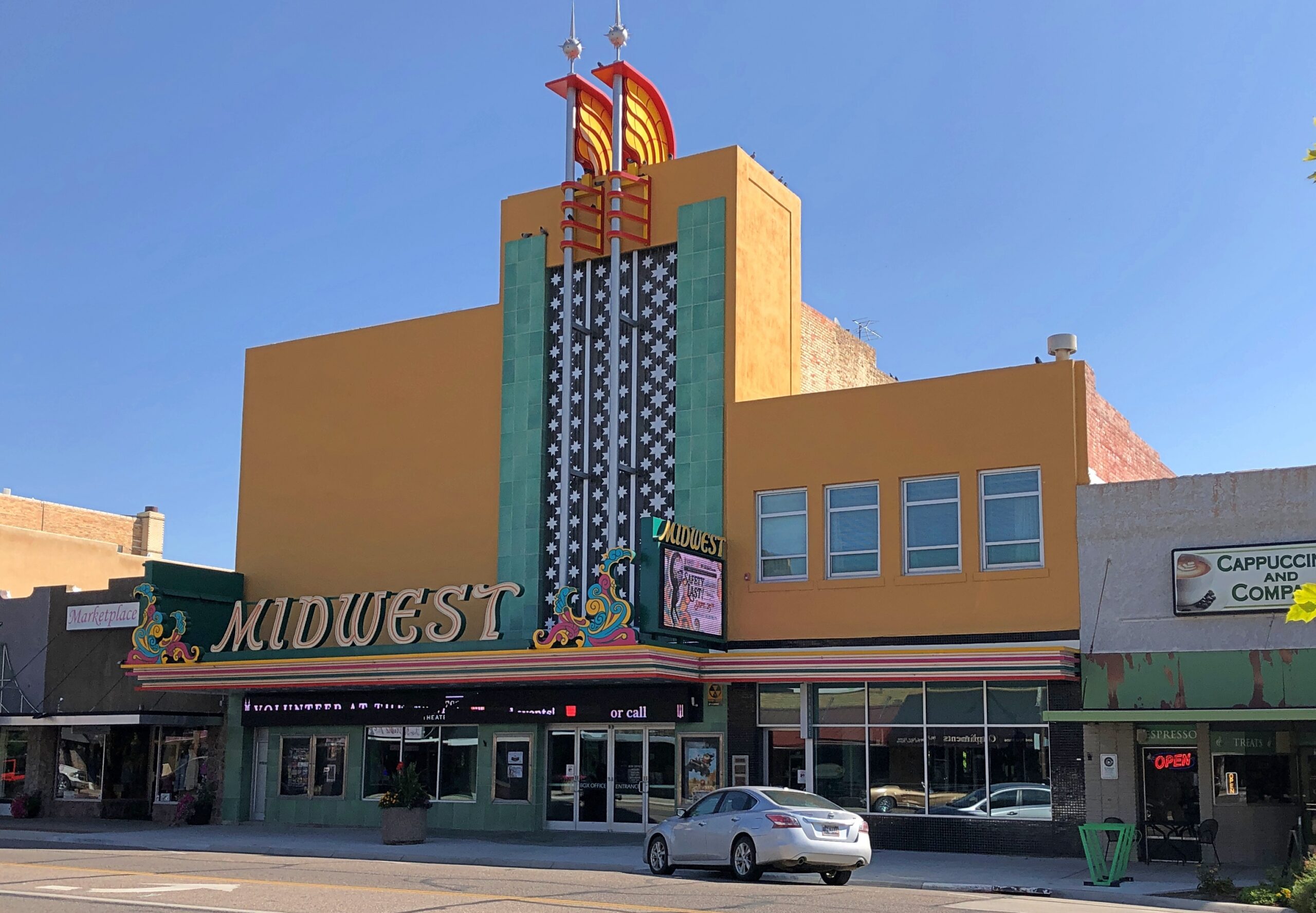
Before heading to the big rocks near Scottsbluff on the morning of the 8th, I took a look around that town as well.
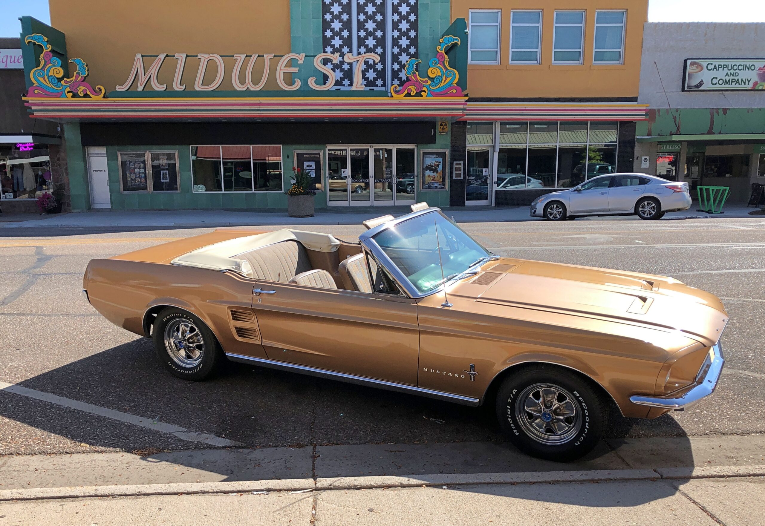
Can’t have too many art deco theaters. When I’ve done image searches for Scottsbluff, the Midwest theater comes up often as not.
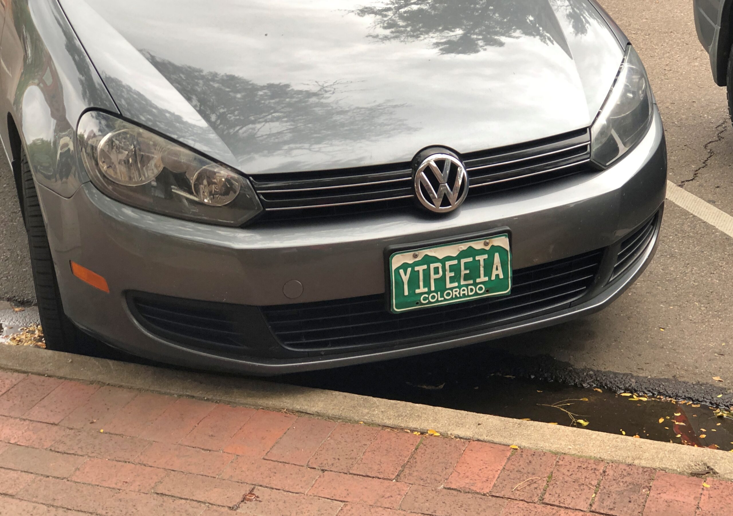
A car to match. At least that morning.
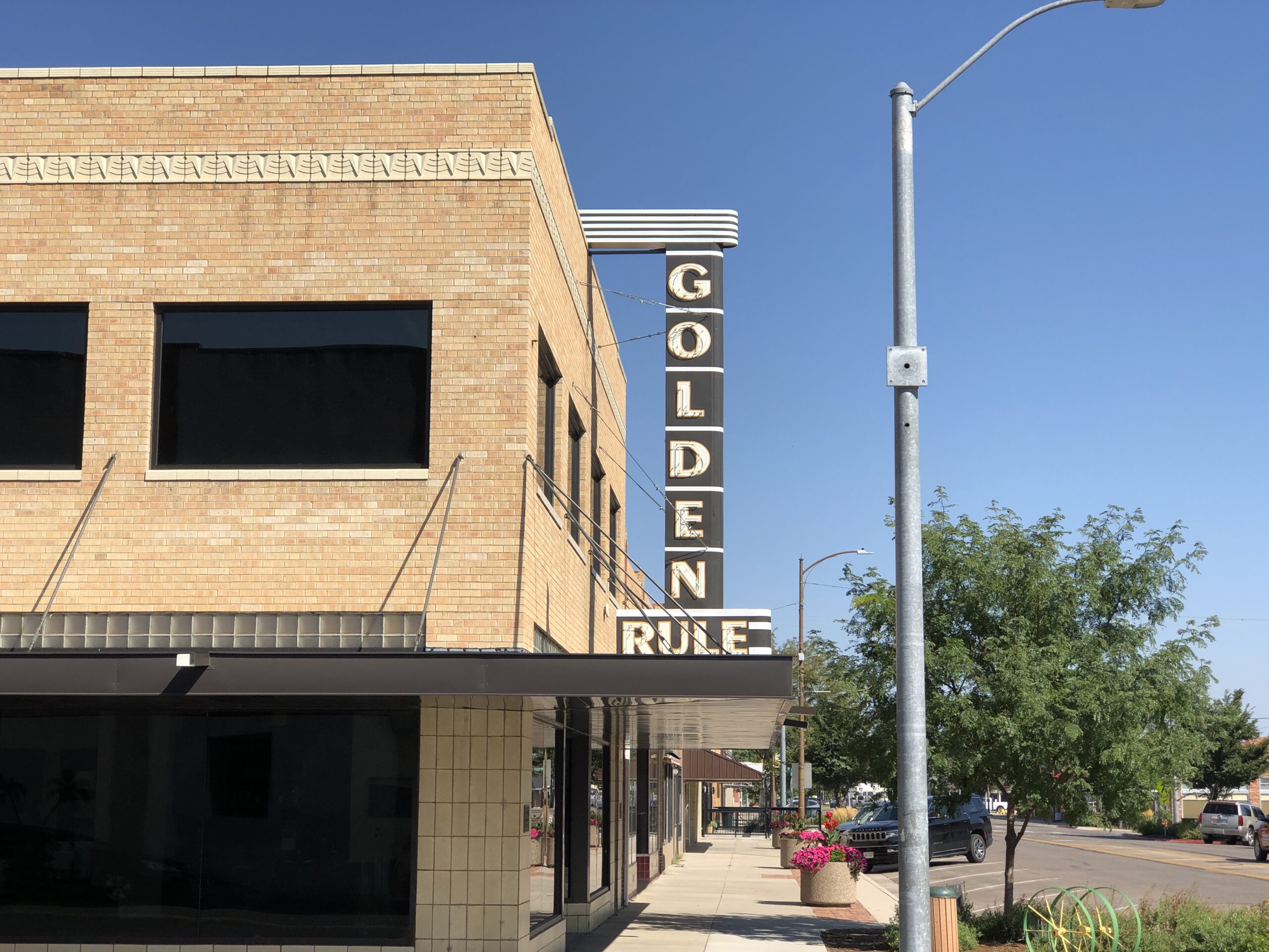
Another former small department store, now private offices.
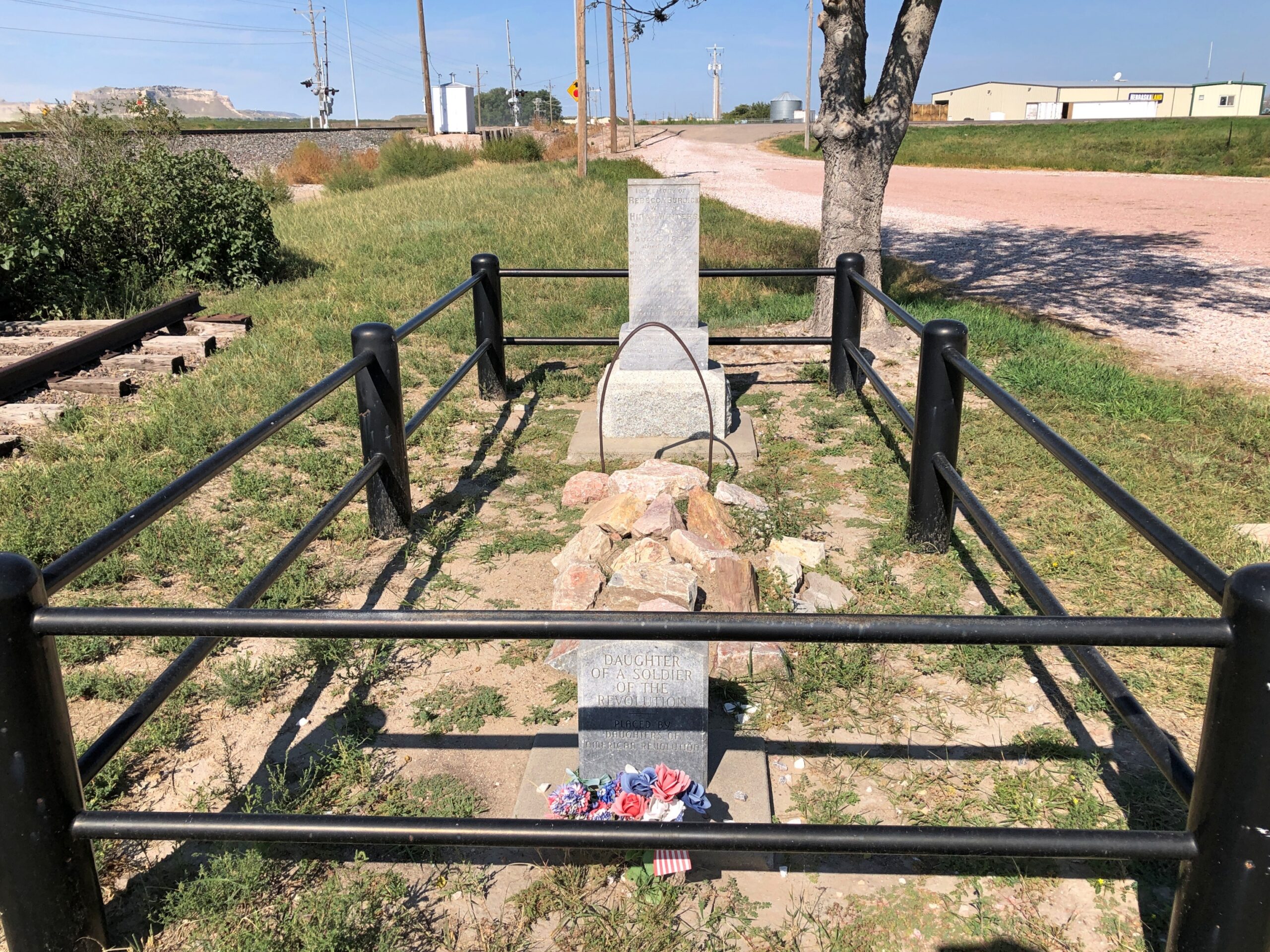
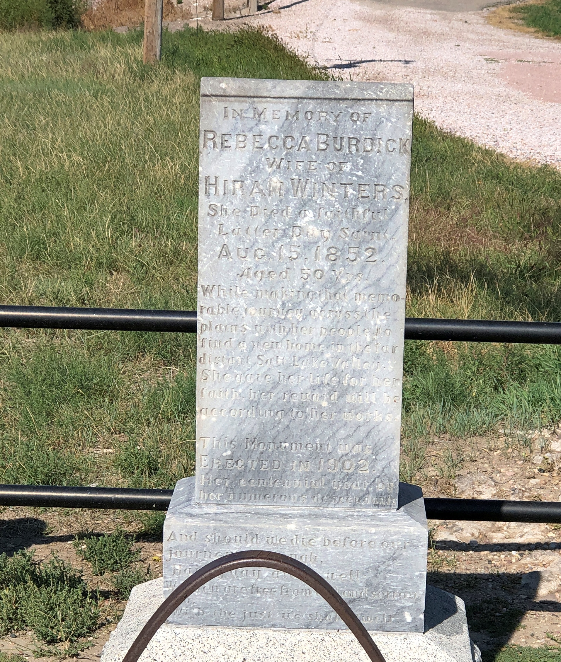
Just outside Scottsbluff is a single grave.
The grave of Rebecca Burdick Winters (d. 1852) She died a faithful Latter-Day Saint, her stone says, on her way to Utah. Officially, it is Rebecca Winters Memorial Park.
“Seven miles northeast of Scotts Bluff National Monument lies a solitary grave,” says Find a Grave. “This site marks the final resting place of Rebecca Winters, who died of cholera on August 15, 1852. Rebecca was only one of thousands of people who succumbed to disease as they made their way west on the overland trails, but her grave is one of only a few that remains identifiable today.”
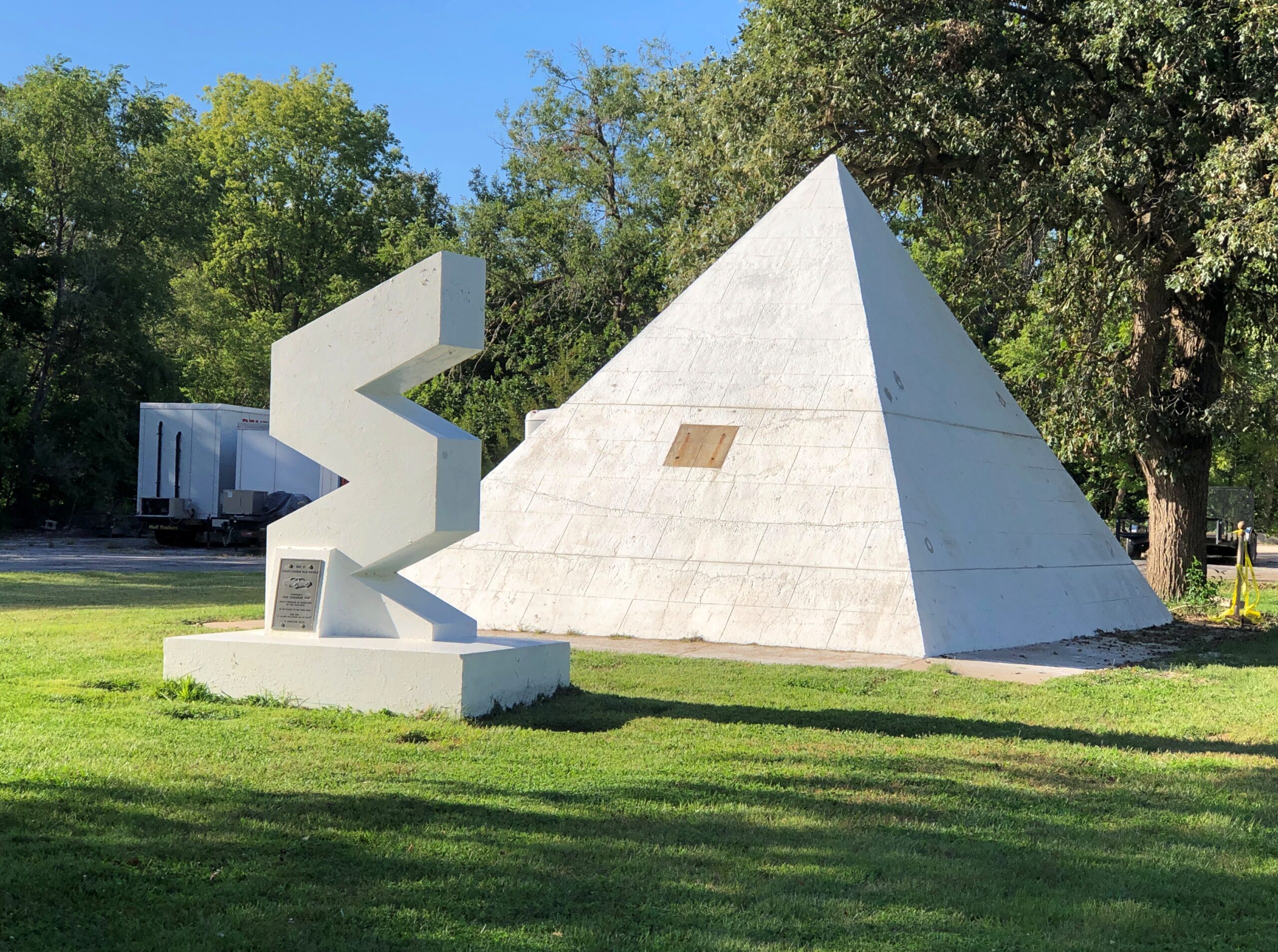
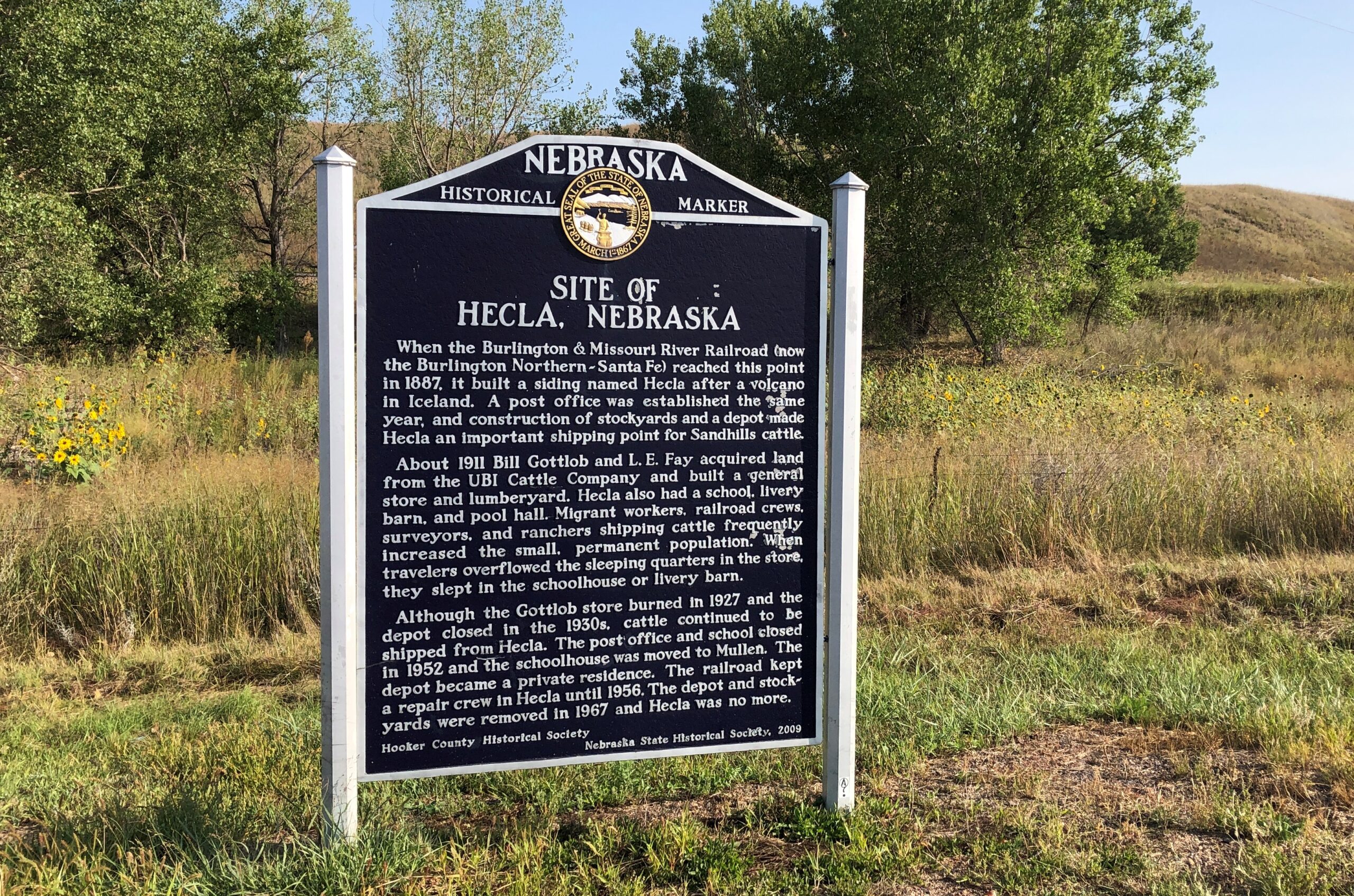
There I was, in Seward, Nebraska, parked on a side street lined with single-family houses. Interrupting the pattern of houses was a large open space, with buildings behind it — a large house, and maybe a workshop. In the open space, which was a green lawn, stood a sigma-shaped structure, and behind that, a white pyramid.
Both taller than a grown man. A plaque was fixed to the sigma. From the point of view of the time capsule, the sigma shape could be a 3. So – third millennium?
World’s Largest Time Capsule.
I wasn’t quite sure what to make of that claim. The world’s largest time capsule would surely be the one entombed in 1939 at the New York World’s Fair for an opening in the year 6939, an exercise in official optimism if I’ve ever heard of one. Wouldn’t it? No. It grew in my memory, but was actually quite small. The Crypt of Civilization instead might be a candidate for largest.
Anyway, there’s no doubt Seward’s is a whopper among time capsules.
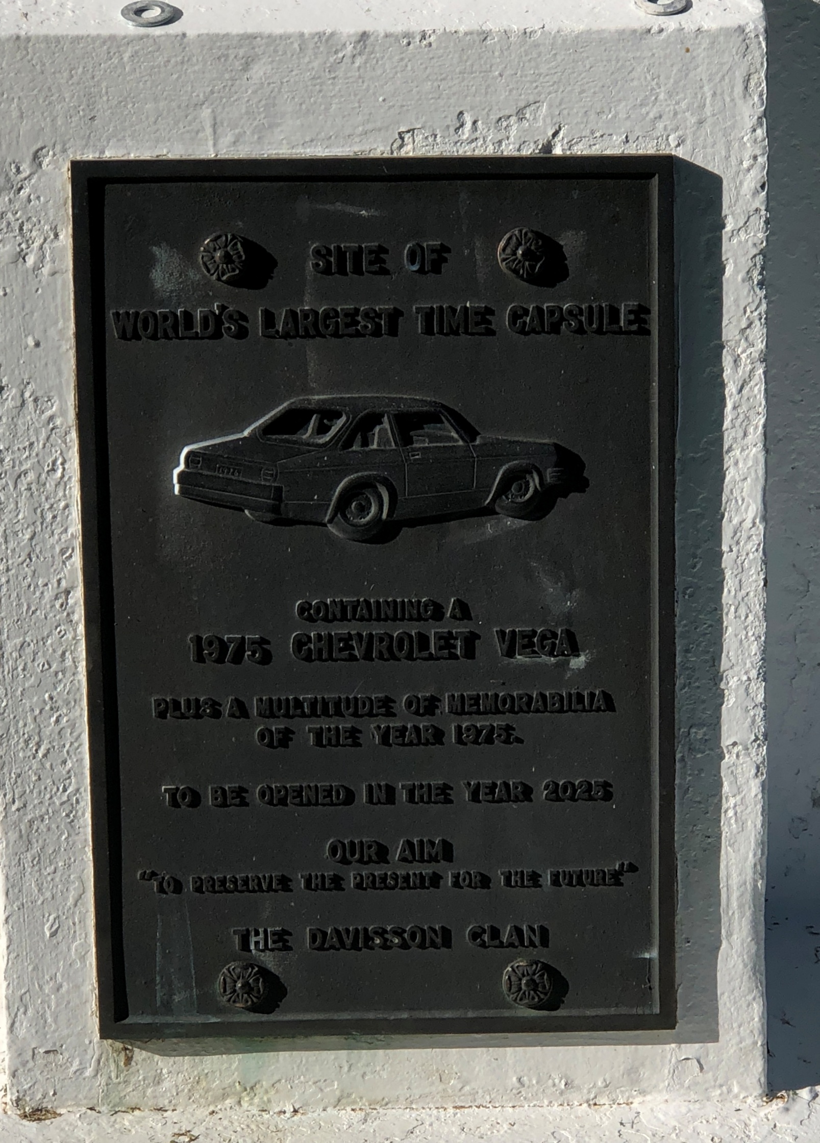
The capsule, buried by Seward resident Harold Davisson, had more modest ambitions, time-wise, than the NY time capsule: only 50 years. Looking at the plaque, I wondered if the opening, promised for this year, was going to happen.
Later I learned that it had already happened, earlier in the summer. NBC reported that the opening revealed “letters, pet rocks, artwork, a groovy teal suit and even a yellow Chevy Vega.” A video of the opening of the time capsule, and the removal of its contents, has been posted to Facebook. The opening including removal of the car, by means of an enormous wench. News reports suggested that Vega was going to be reconditioned and run during the town’s bang-up Fourth of July festivities. Hope so.
The pyramid lid had been put back on. If you look closely, you can see the line marking the bottom of the lid. Put it back on expertly, since you have to look closely to see there was a separation. So I missed the grand opening by a few weeks. As they say in those parts of Nebraska, c’est la vie. Hard to attend an event you’ve never heard of, though not impossible, as I found out years ago when I happened across Northalstead Market Days one summer day. That one was an eye-opener.
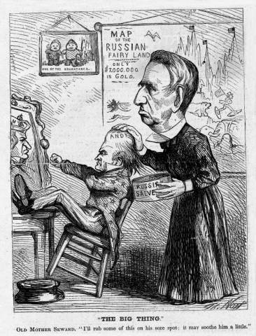
The Big Thing, Thomas Nast, 1867
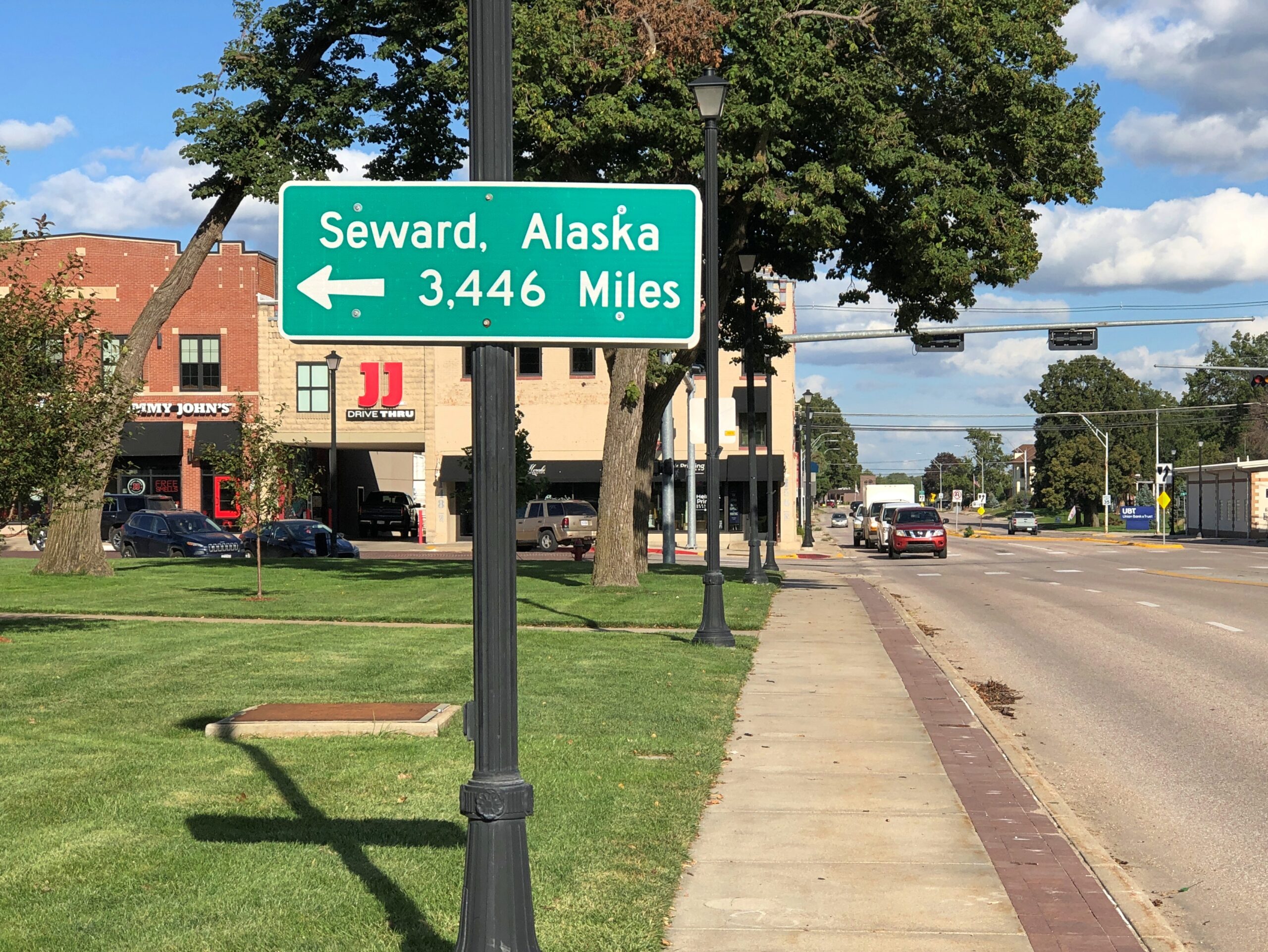
Seward honors the Seward of Alaska purchase fame, though if pressed I’d bet most Americans have sort of maybe heard of him, but don’t remember anything about him, even though he (likely) still gets passing mentions in school.
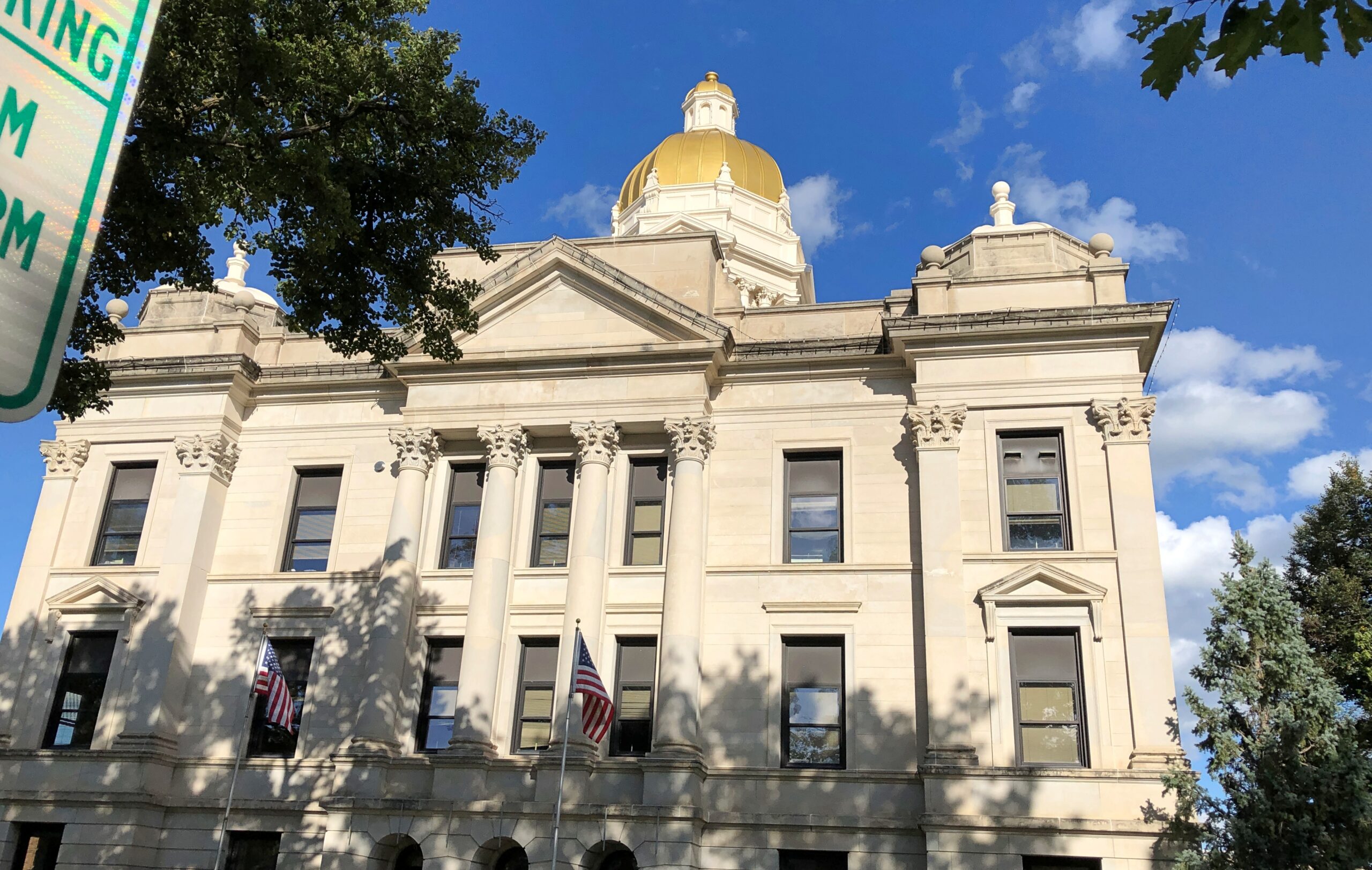
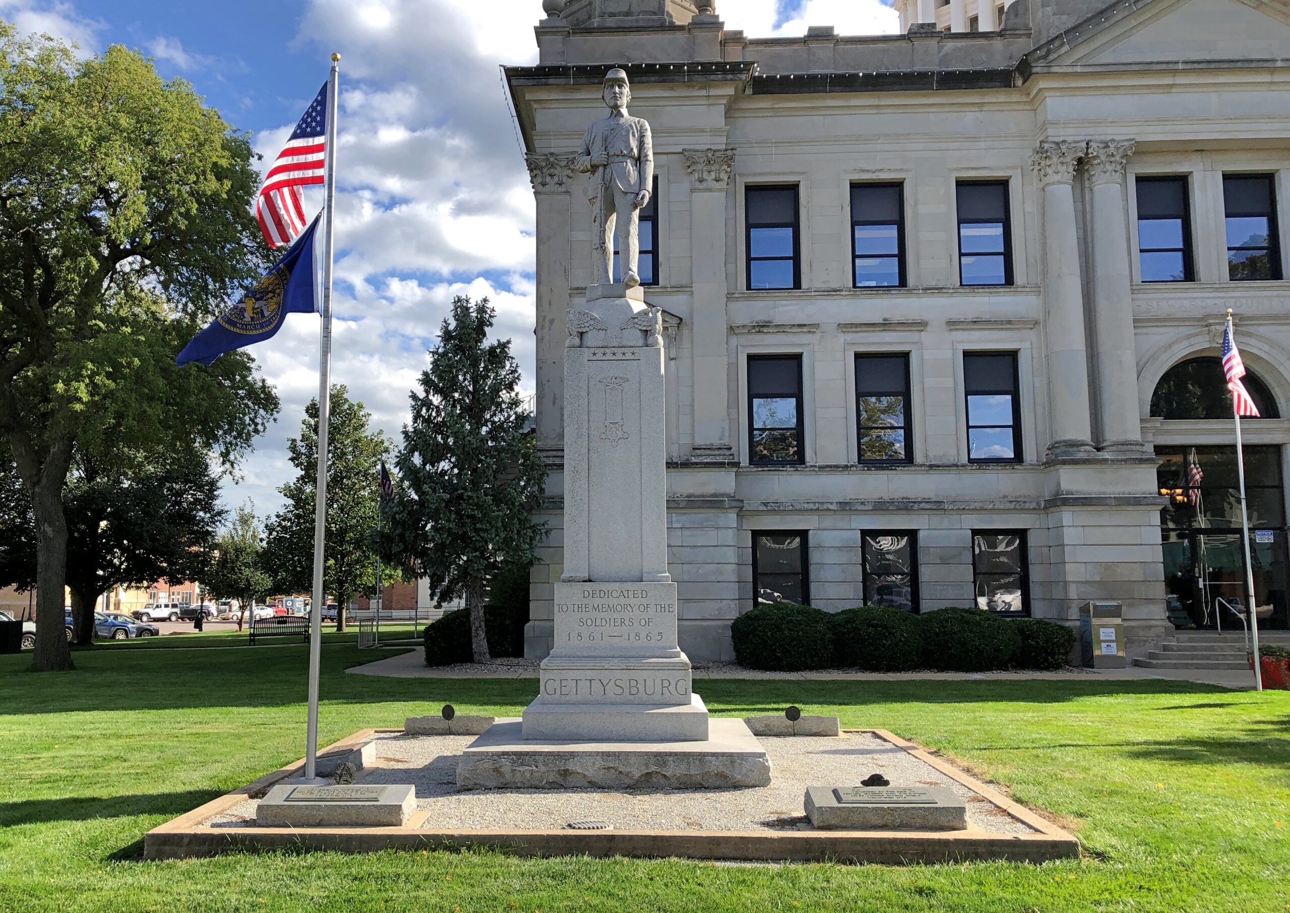
Seward, seat of Seward County, there in the populous (for Nebraska) southeast corner of the state, is close to Lincoln – fitting, isn’t it? – and I-70.
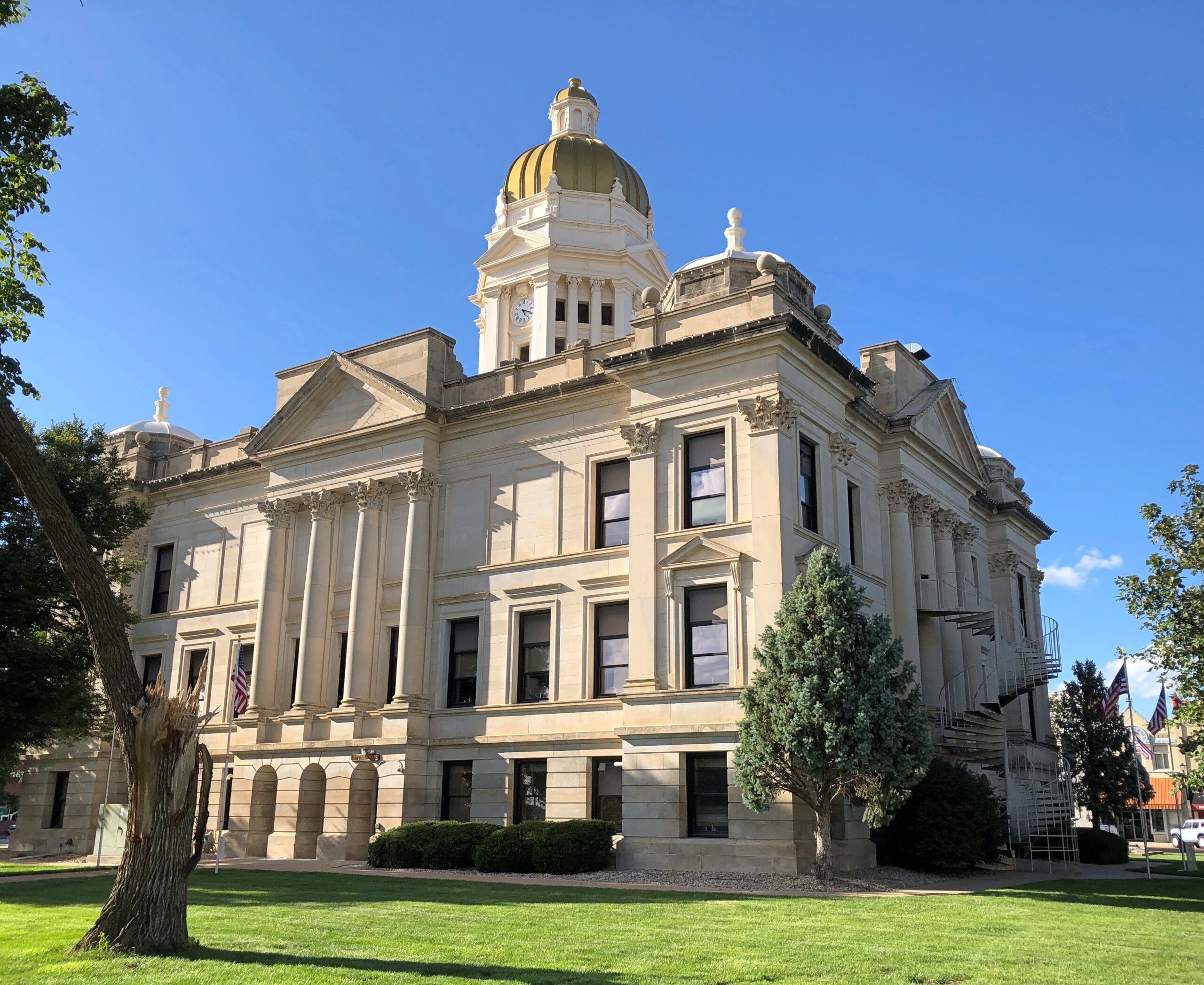
Seward County built itself a handsome courthouse, once upon a time. Classical Revival when the getting was good for that style, in the first decade of the 20th century. It was a popular style around this part of Nebraska at the time, with the National Register of Historic Places Registration Form telling us there are 18 buildings like it still extant in Nebraska. Architect George Berlinghof (d. 1944) designed a lot of them, including this one.
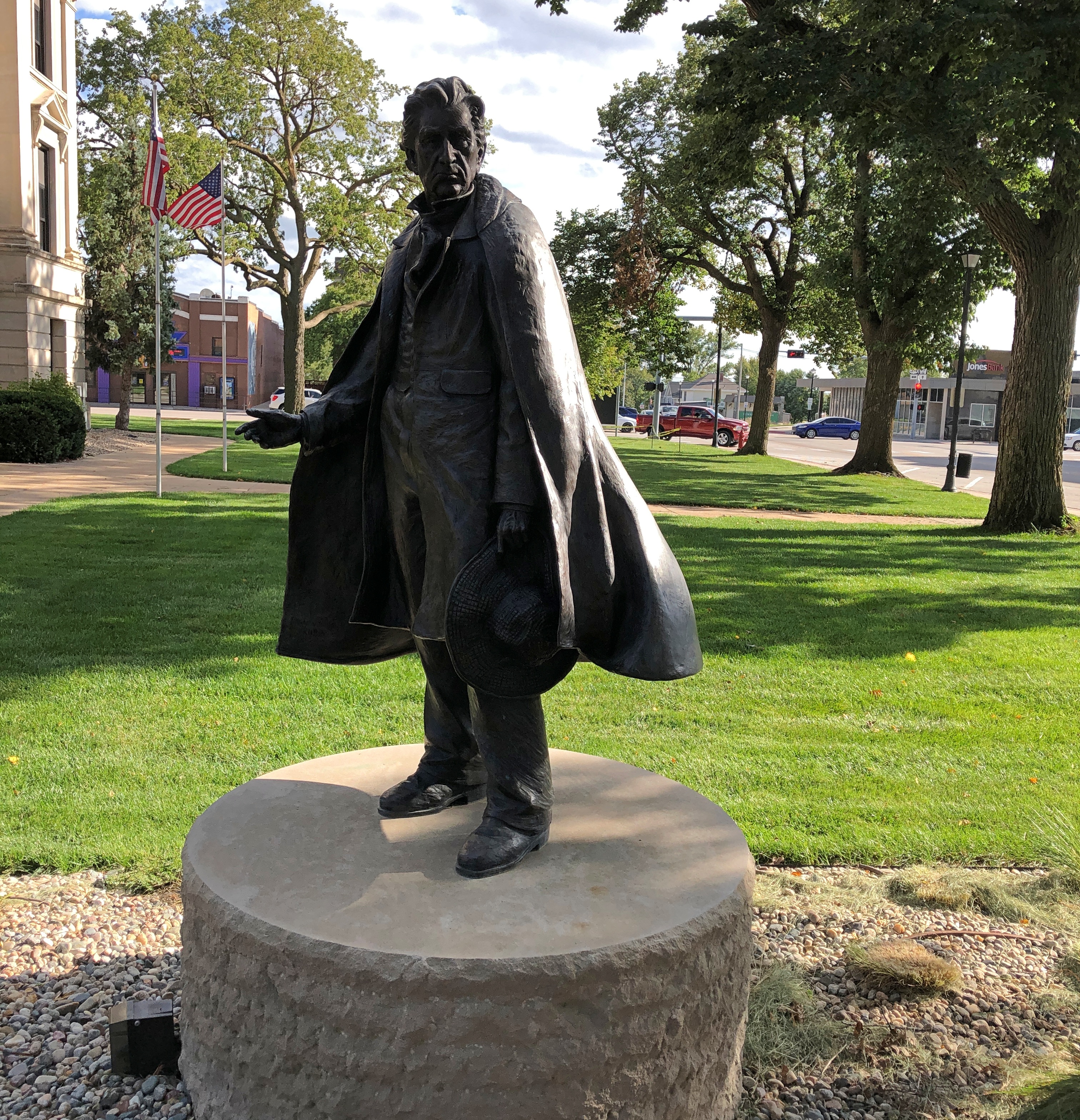
On the grounds, Seward in bronze. I know there are other statues of Sec. Seward, but not that many.
Sporting a cape. How many bronze figures honored with public statues are in capes? More than I know, probably. The Maid of Orleans in New Orleans comes to mind; she’s wearing a cape, over that armor.
A plaque identifies the artists, brother and sister David and Judith Rubin, and the vintage, recent. Alaska commissioned them to do one of Seward for the 150th anniversary (2017) of the sale of Alaska to the United States. Interested parties in Seward, Nebraska, wanted one for the their town, and so commissioned another one.
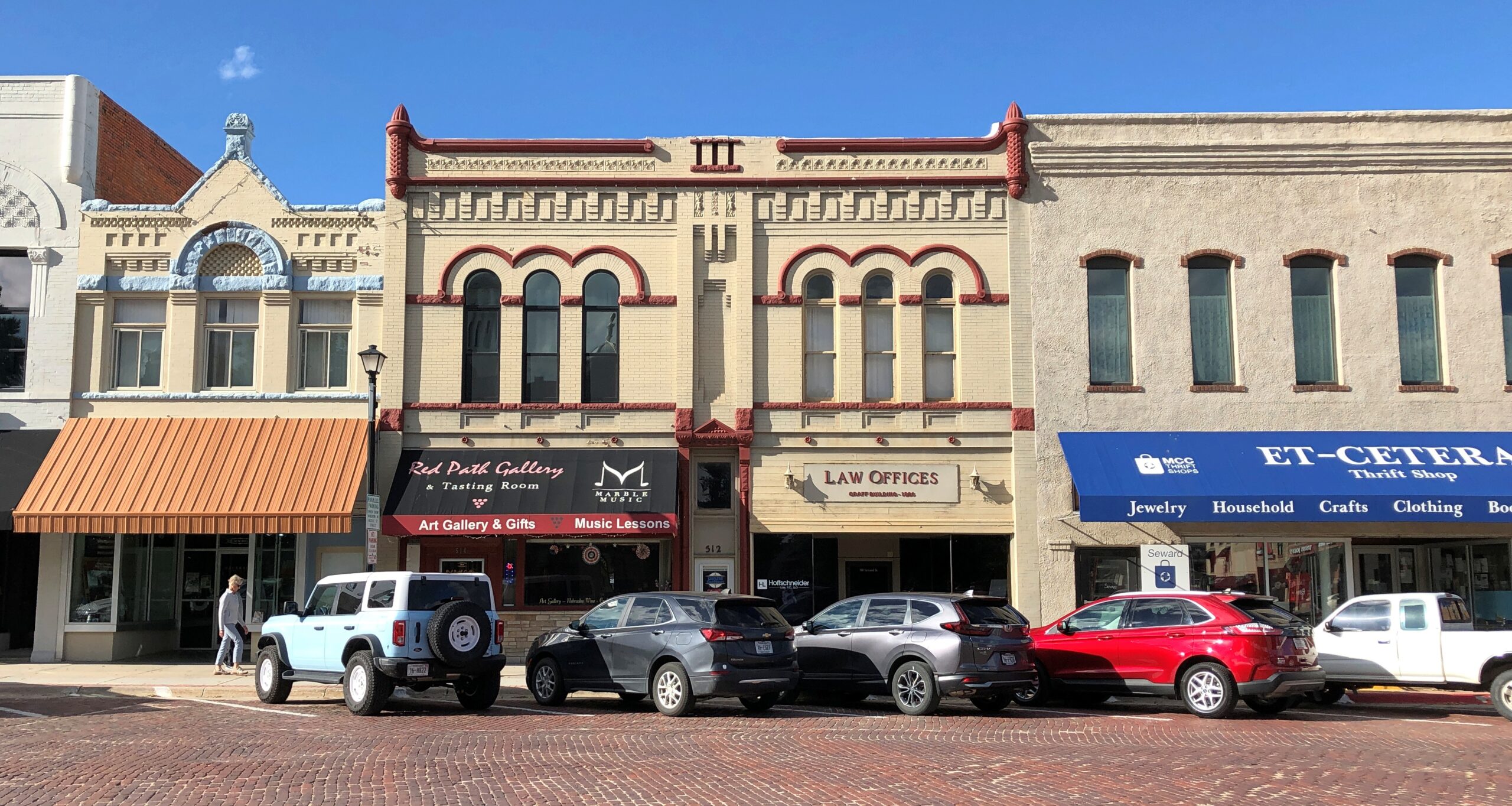
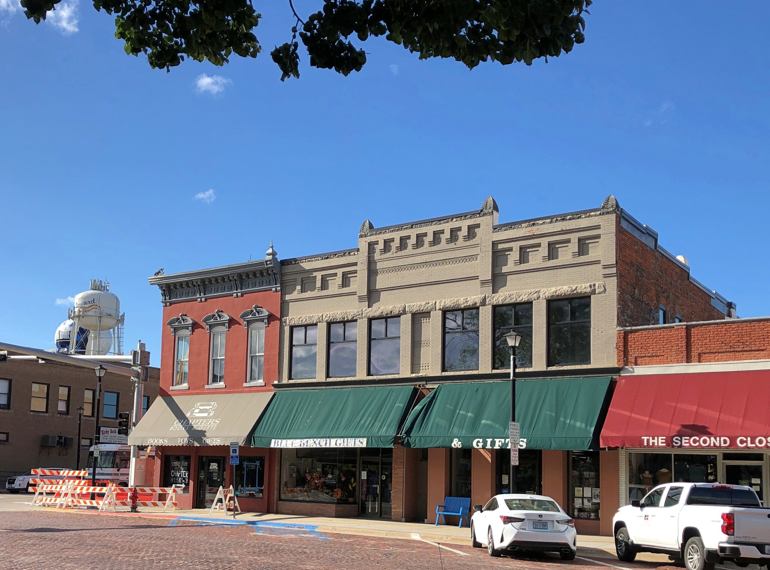
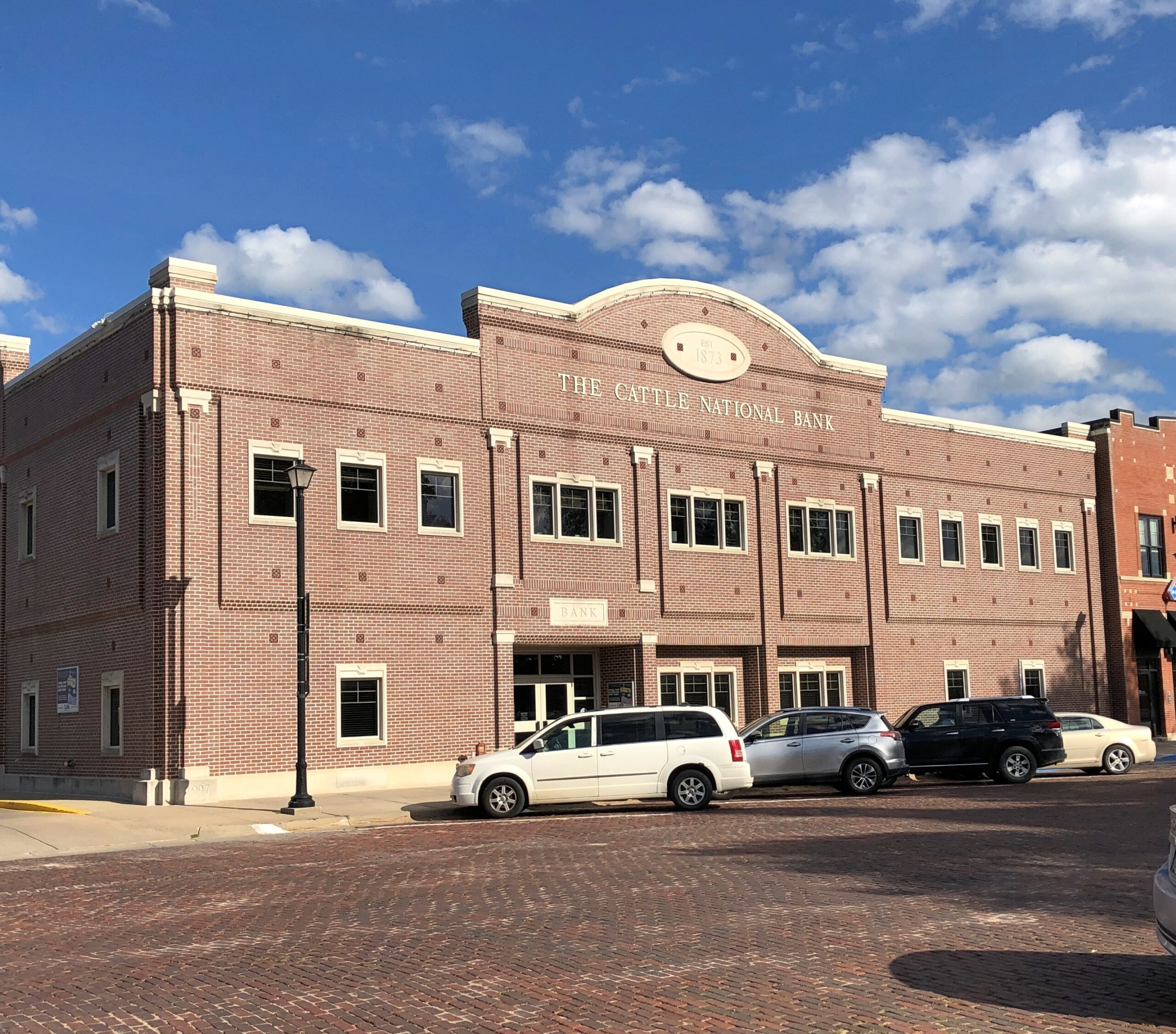
The square is right handsome, too.
Cattle National Bank. Reminds me of Gary Larson, somehow. I’m glad to report that it’s one of four locations for Cattle National Bank & Trust, a community bank owned by the Cattle family. Has been since 1881. If I lived in Seward, I’d bank there just for the name.
One more thing about Seward. This isn’t the one further north.
Seward was a flyby on September 5 on the way to Grand Island, Nebraska, that evening, which would be the jumping off point for my drive through the Sandhills. The highlight of my short stay in Grand Island wasn’t the false alarm that got us all out of our rooms at the motel around 10, thrilling as that was, but the next morning, on my way out of town.
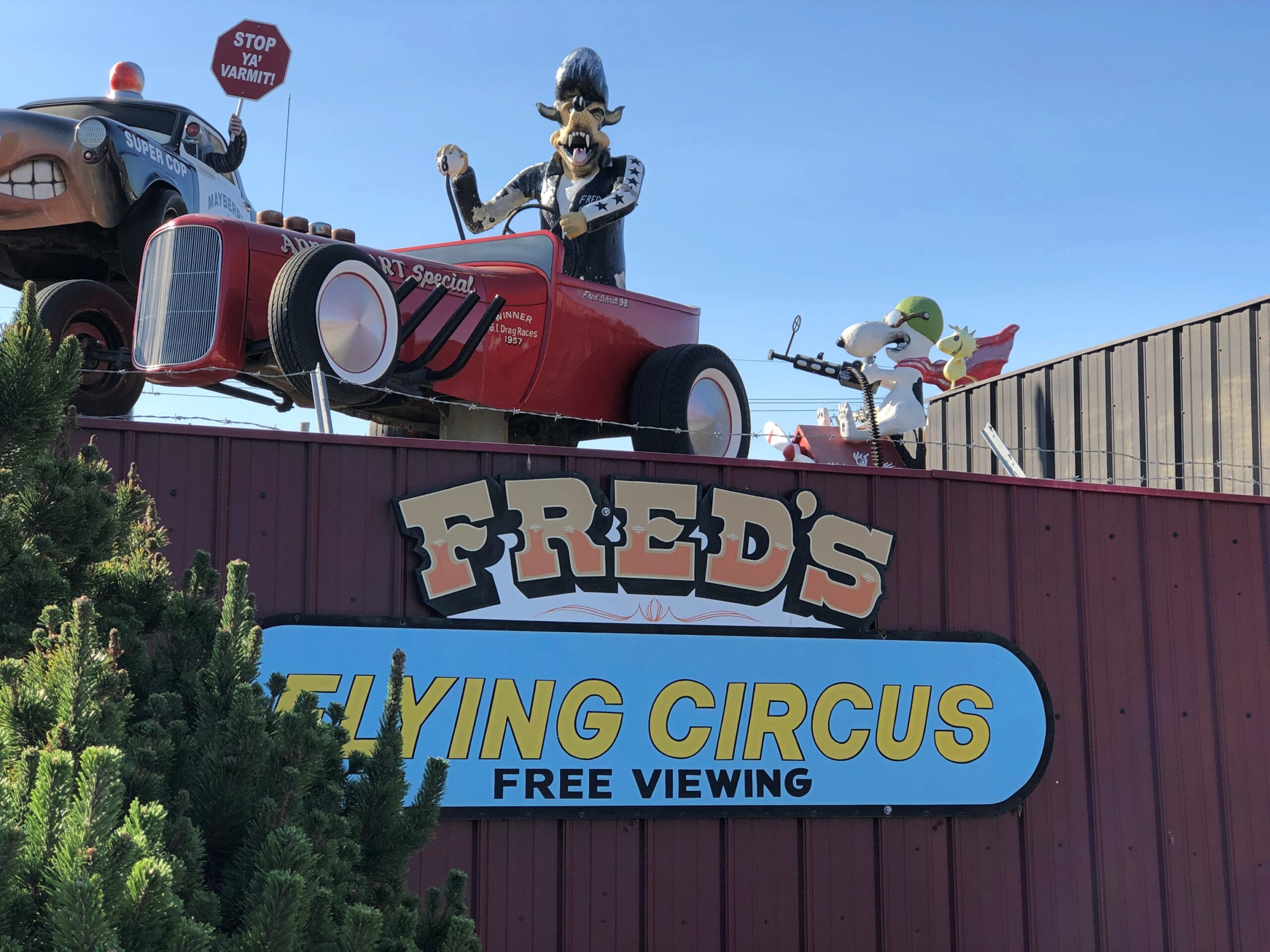
I’ll give credit where it’s due: I found Fred’s Flying Circus on Google Maps. Attaboy, algorithm.
The work of body shop proprietor Fred Schritt (d. 2016), on his place of business, with the shop now run by his daughter and son-in-law. An informal sort of memorial to the old man, I hope they believe. One of the more cheerful memorials you’ll see.
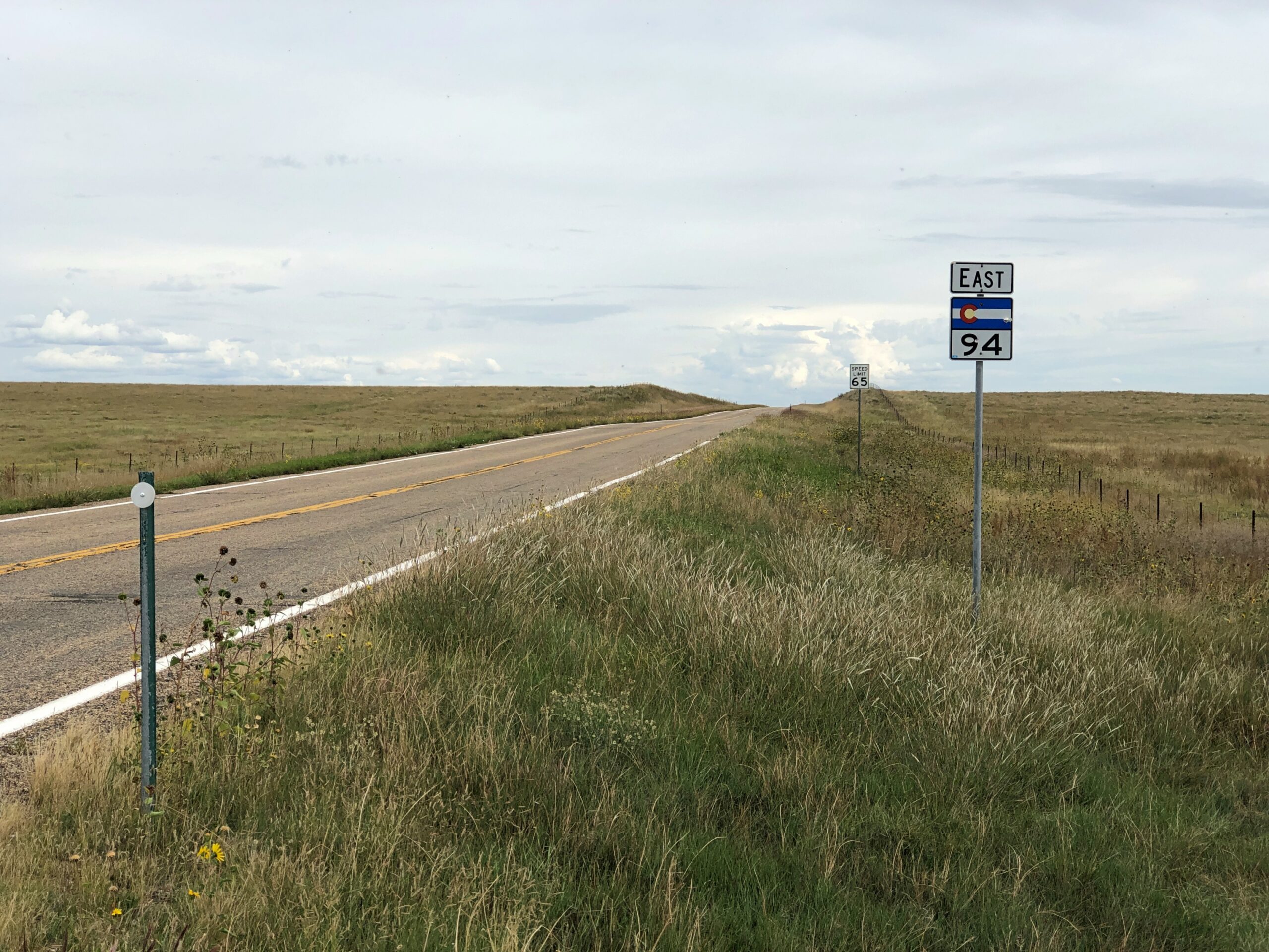
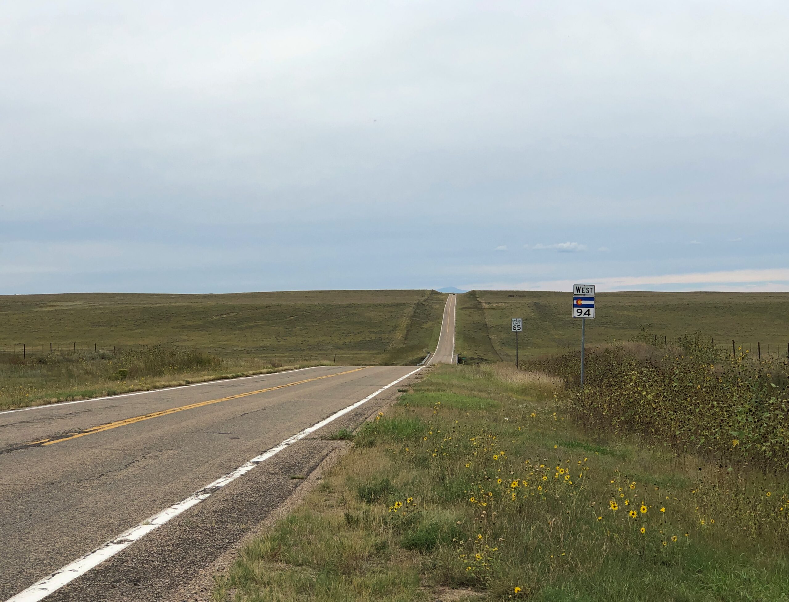
That was the goal about two months ago now, after I left Colorado Springs for a solo drive back to Illinois. The fastest way would be to link with I-70 while still in Colorado. I wasn’t inclined to do that, though I did take that Interstate route through much of Kansas. Instead, I wanted to start remote and stay that way for the length of eastern Colorado.
So east on Colorado 94 it was, which passes through such hamlets as Yoder, Rush and Punkin Center. Mostly, though, there are few signs of people.
I noticed the Front Range growing smaller in my rearview mirror. I wondered at what point they would vanish from sight, and decided to keep track of their shrink, and note the last time I could see them. Naturally, I forgot about that resolve, and next thing I knew, the road backward and forward stretched to both horizons.
This is looking back west, a mountain barely visible, and is also an image illustrating that the eastern Colorado terrain isn’t completely flat.
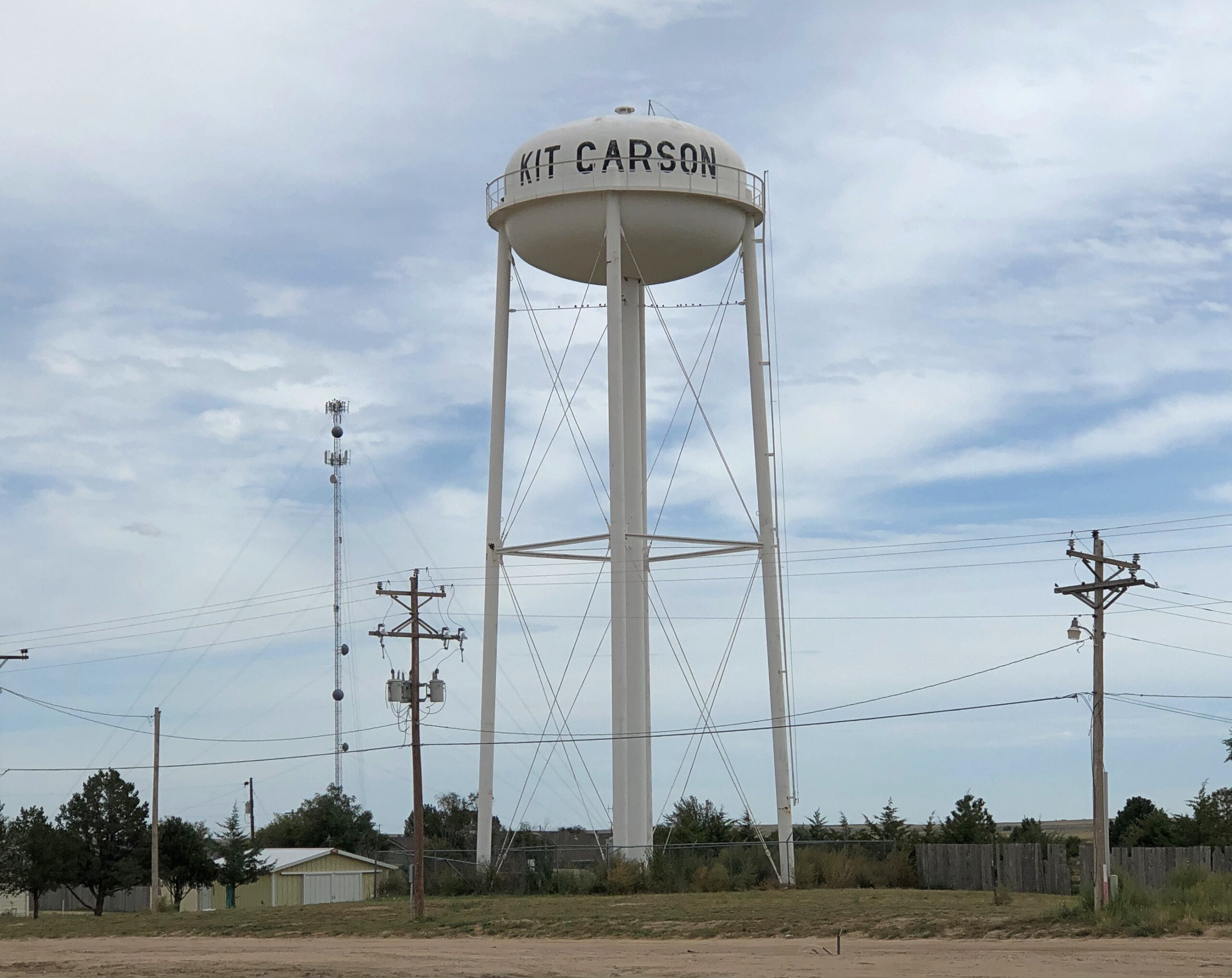
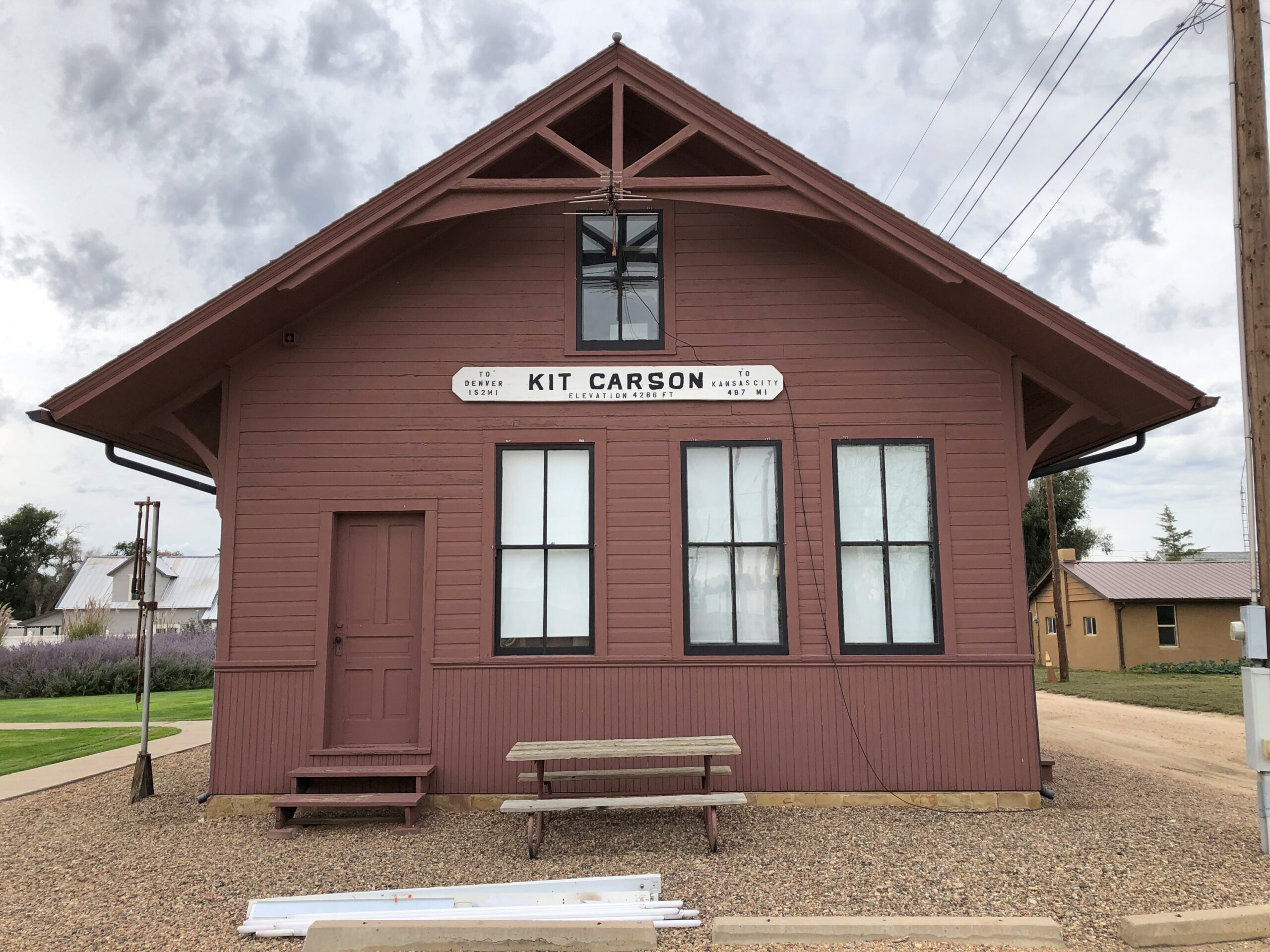
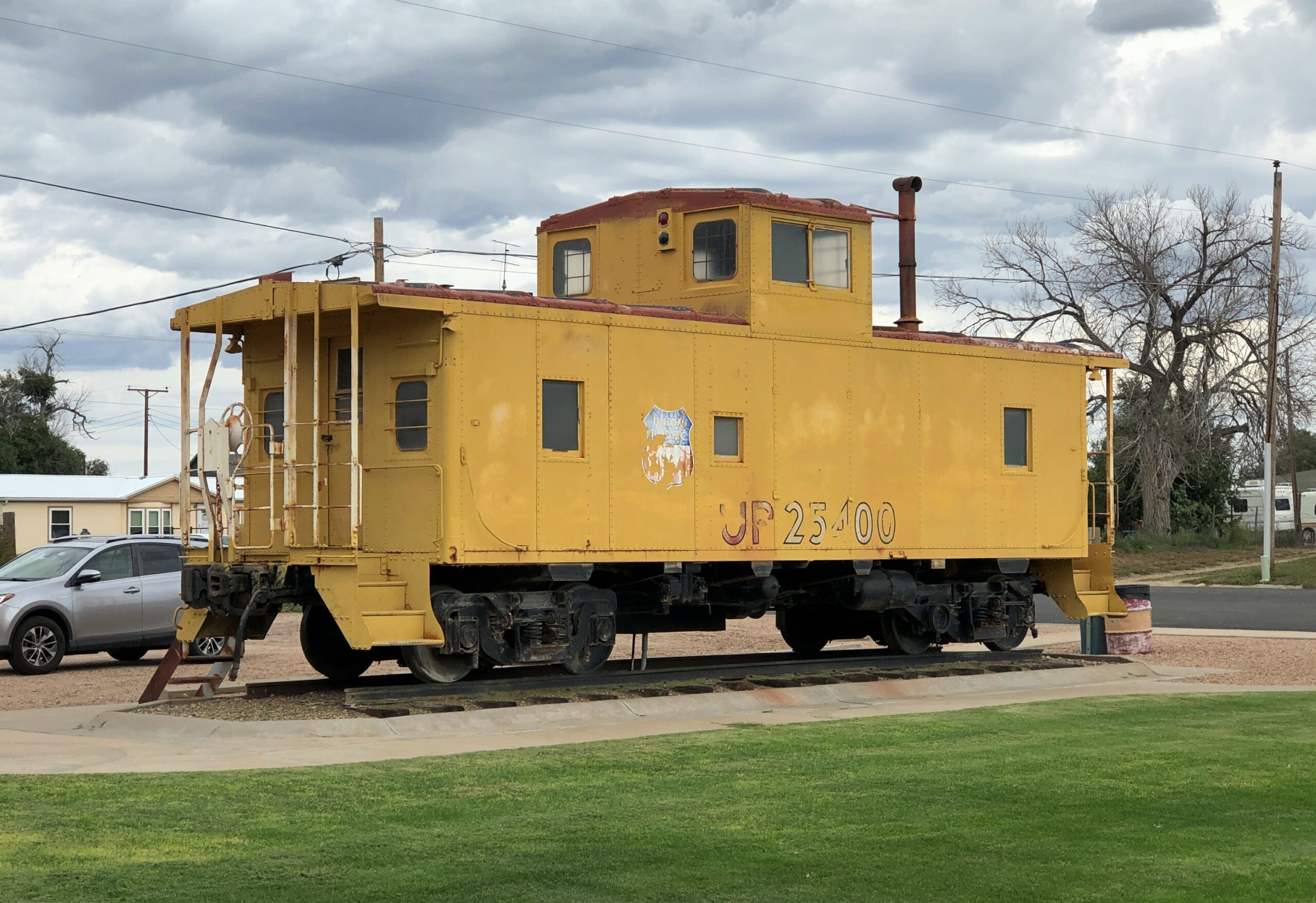
Eastbound Colorado 94 ends near Aroya, where it meets US 40/287. I took that road southeast to Kit Carson (pop. 255).
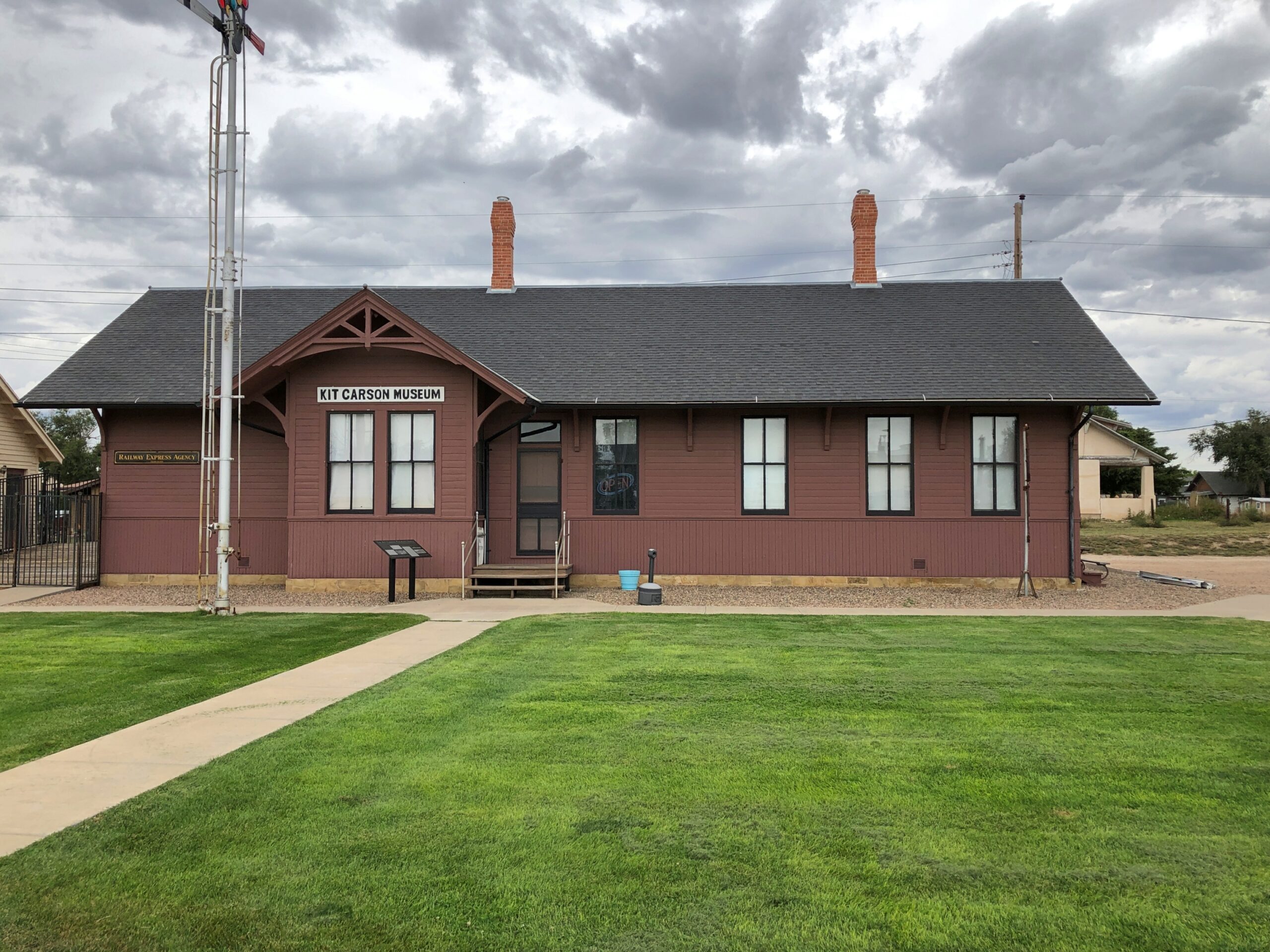
The railroad still comes through Kit Carson. It’s safe to say that without the railroad, the town might be no larger than Punkin Center. The Kit Carson Railroad Depot is now a museum.
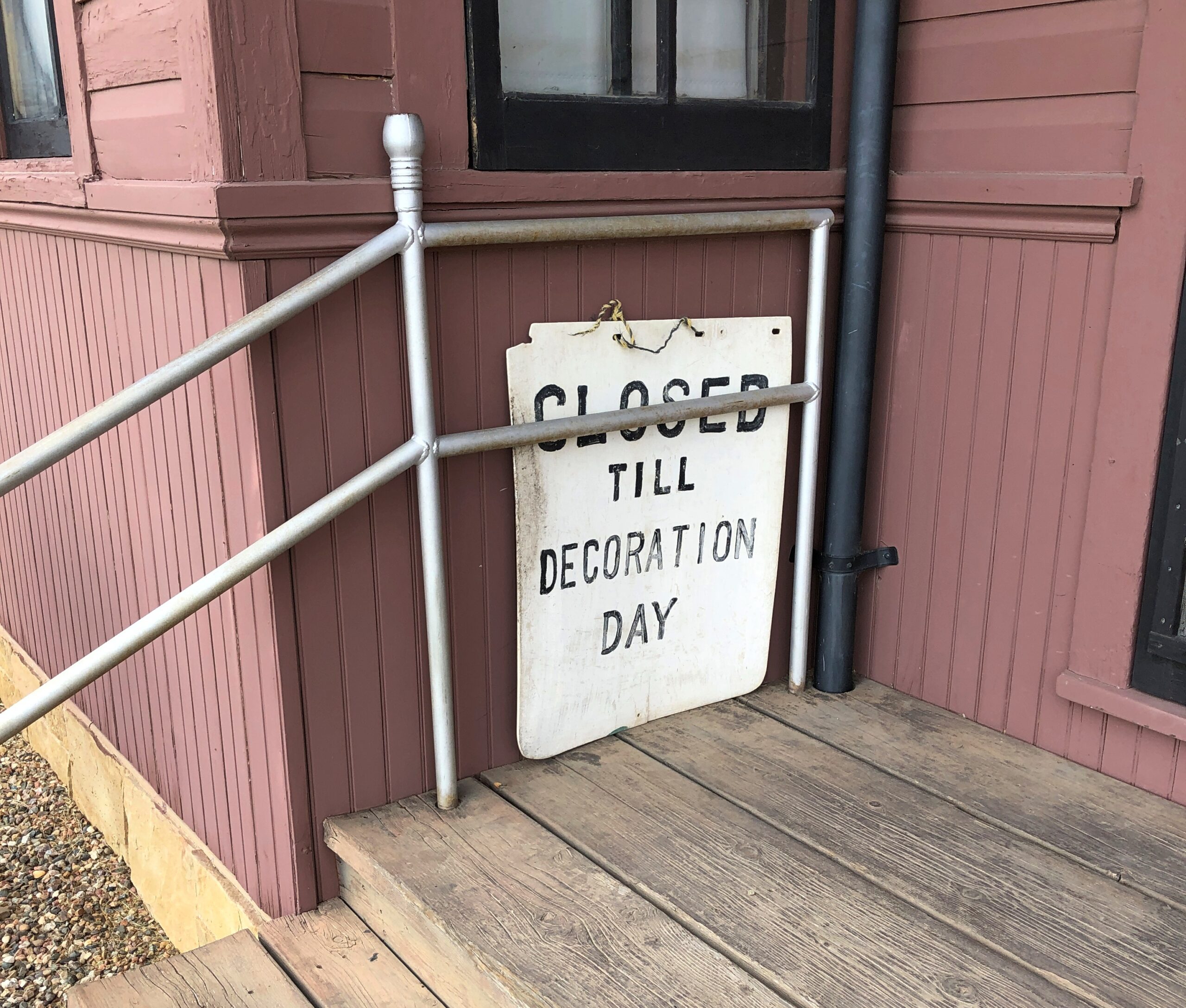
Closed. Till Decoration Day. Really?
In any case, it was closed on September 22.
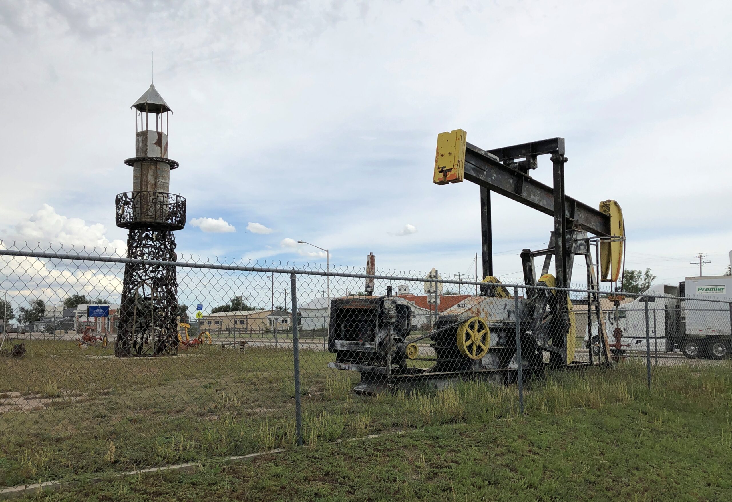
Across the street, metal works. The pump jack is one thing, but the other is a — tower?
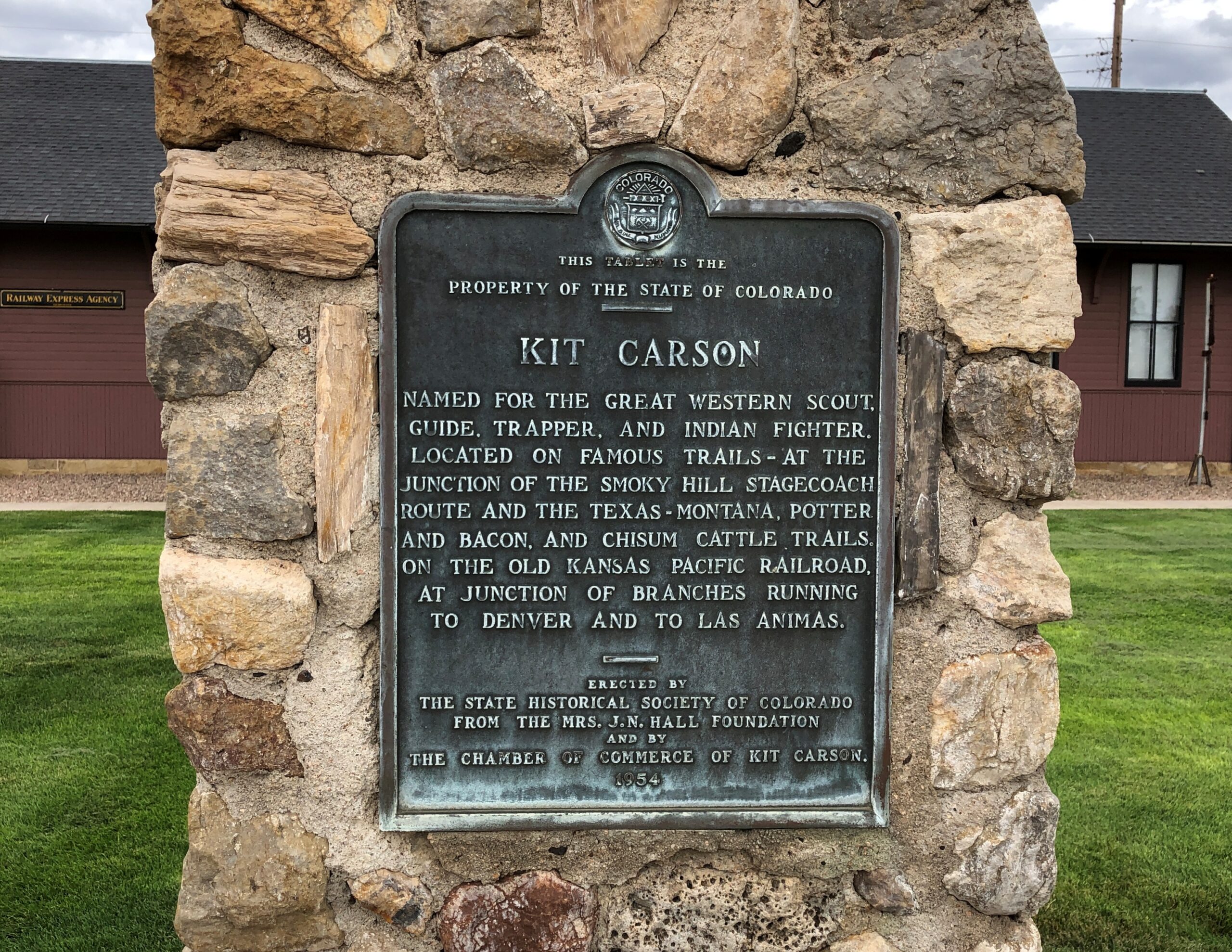
The town of Kit Carson had two locations. The original site was located near the site where Kit Carson traded with the Arapahoe and Cheyenne Indians. The present site was determined by the arrival of the railroad. Destroyed by fire three times, twice by the torches of Indians and once by carousing cowboys, the determined citizens of the town showed their desire to survive by rebuilding.
I can’t help but think those carousing cowboys were actually a gang of rustlers, cutthroats, murderers, bounty hunters, desperados, mugs, pugs, thugs, nitwits, halfwits, dimwits, vipers, snipers, con men, Indian agents, Mexican bandits, muggers, buggerers, bushwhackers, hornswogglers, horse thieves, bull dykes, train robbers, bank robbers, ass-kickers, shit-kickers and Methodists.
Also of note, according to the town: The railroad brought in foreign dignitaries, such as the Grand Duke Alexis [Alexei Alexandrovich] of Russia. The Grand Duke hunted in Kit Carson and was accompanied by his military escort, General George Armstrong Custer on January 20, 1872. [Custer was a lieutenant colonel at the time, but never mind.]
Grand Duke Alexis was on his 1871-72 tour of America. Sounds like he had a fine old time. Could have been the subject of an episode of Death Valley Days, but I don’t think it was. Dom Pedro, emperor of Brazil, made an appearance, as did the Emperor Norton, but I digress.
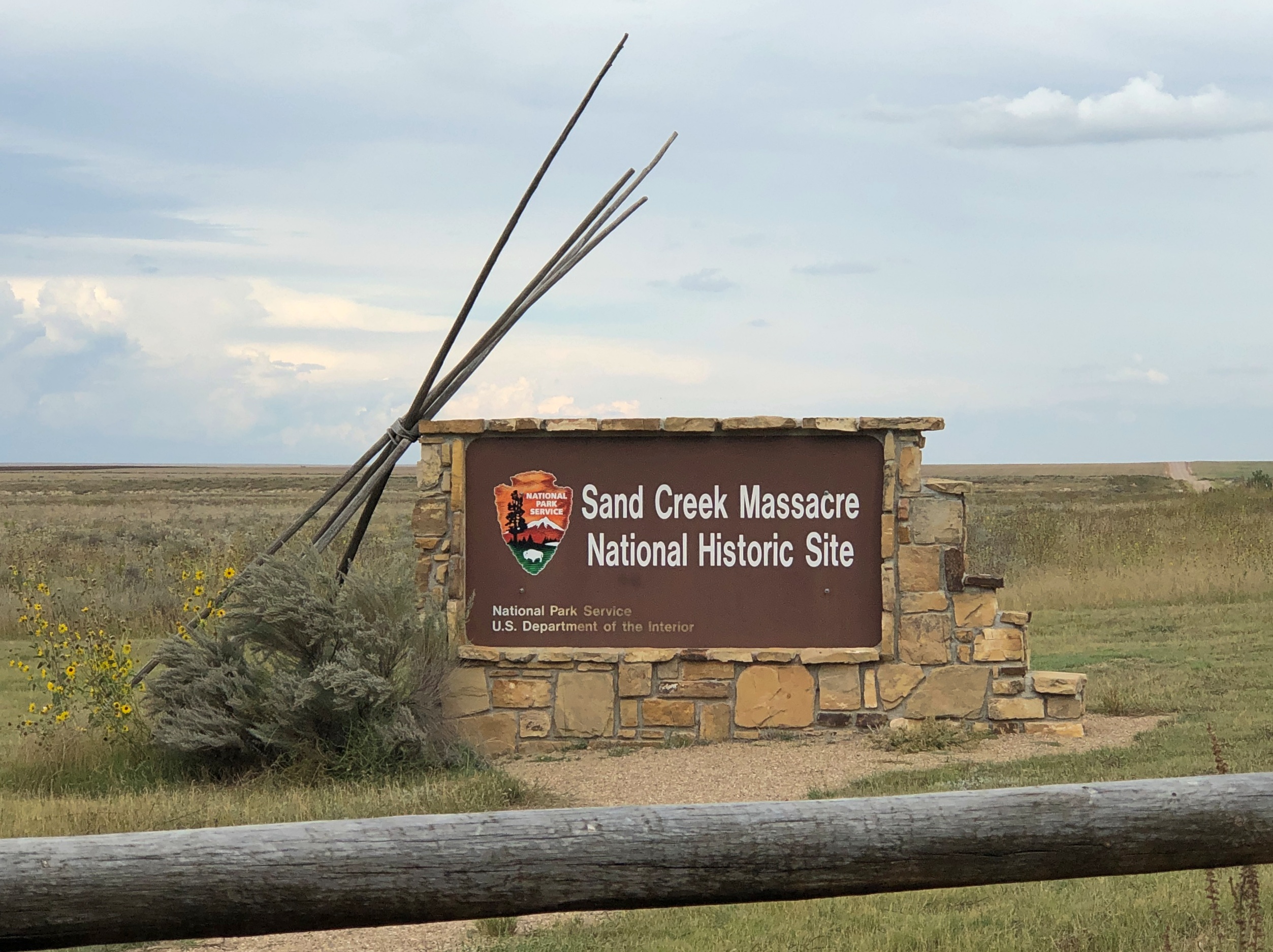
From Kit Carson, I headed south to Eads, still in Colorado, and then east on Colorado 96. I had the idea that I wanted to see the Sand Creek Massacre National Historic Site, which isn’t too far from that road. Just before the turnoff to the historic site, I noticed something odd near the highway.
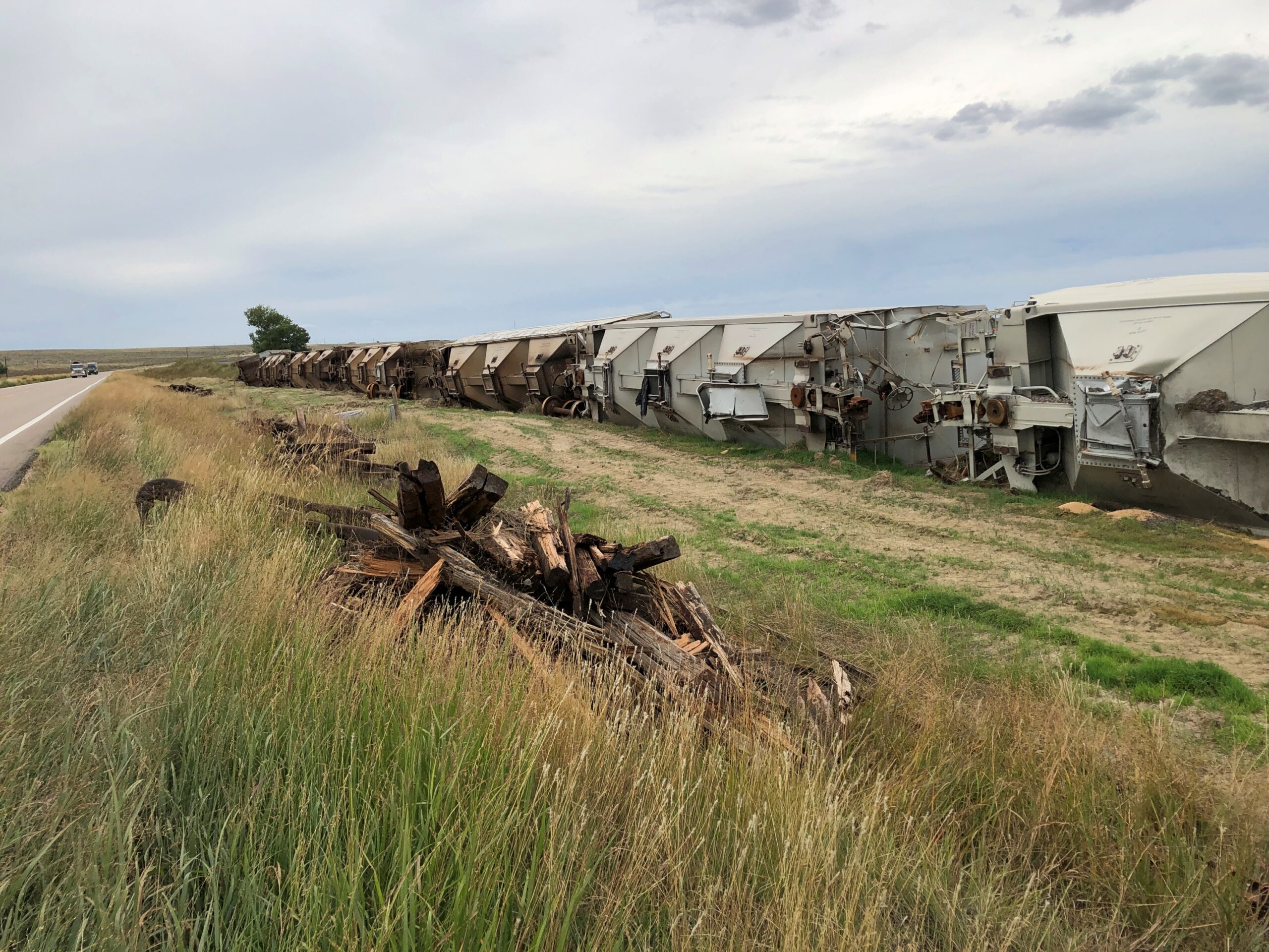
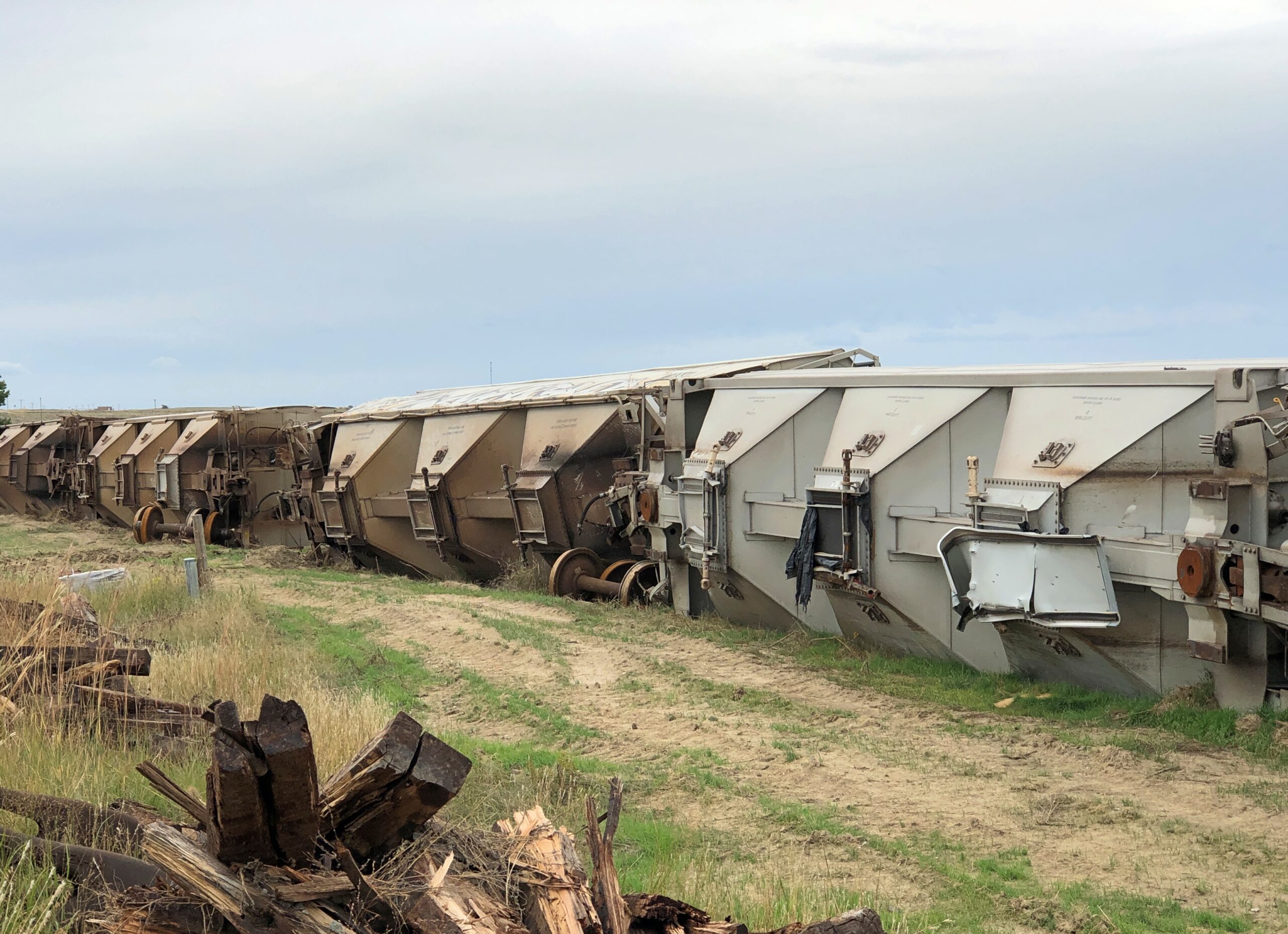
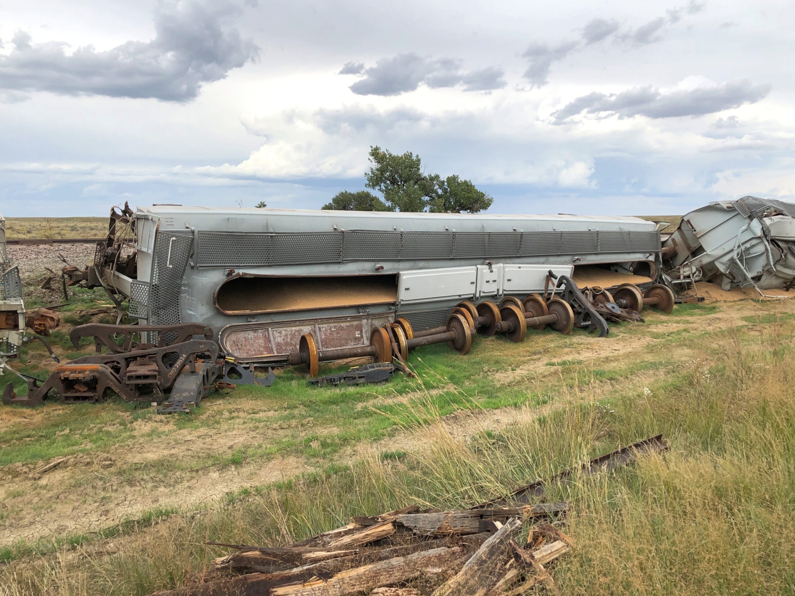
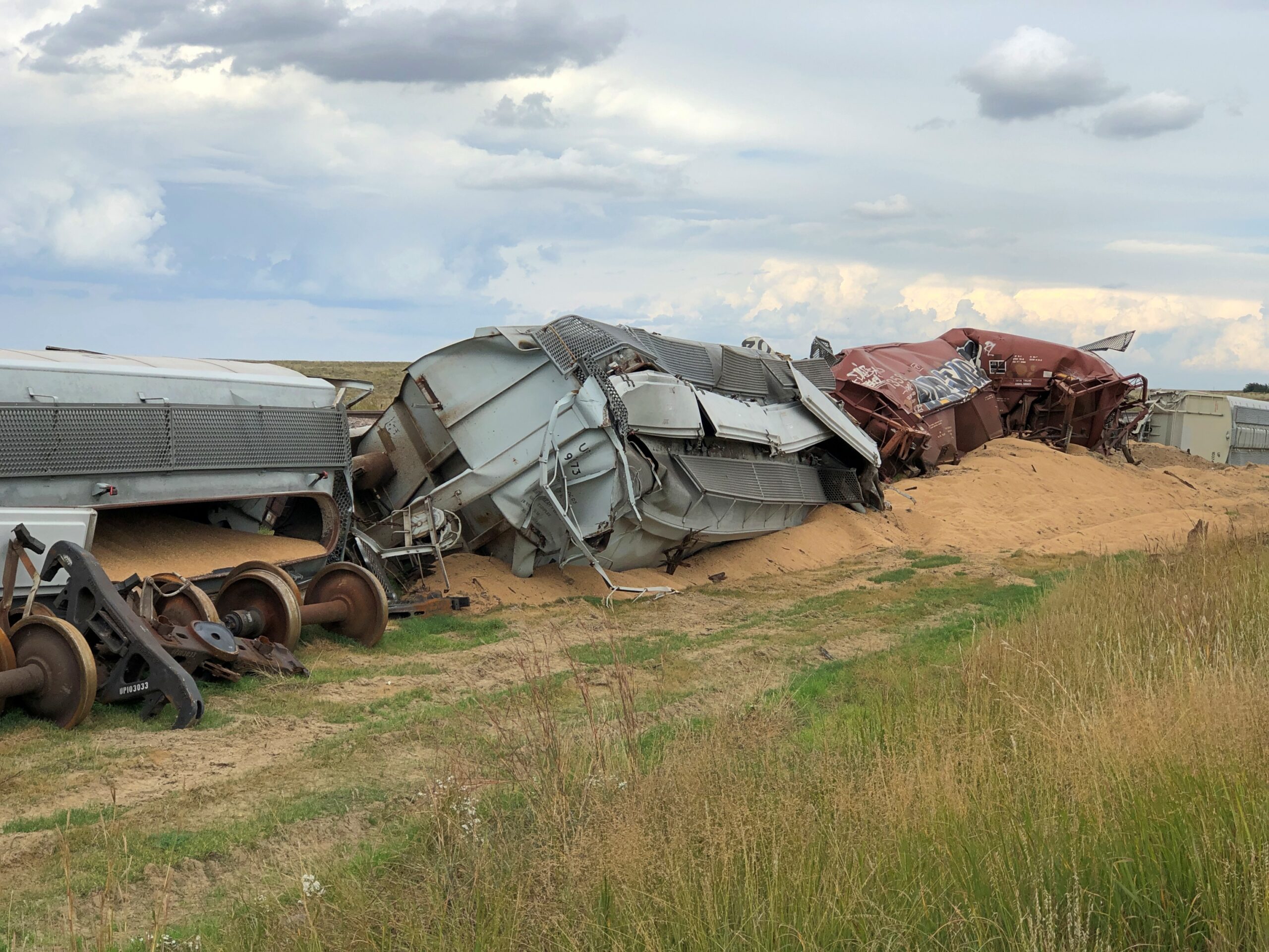
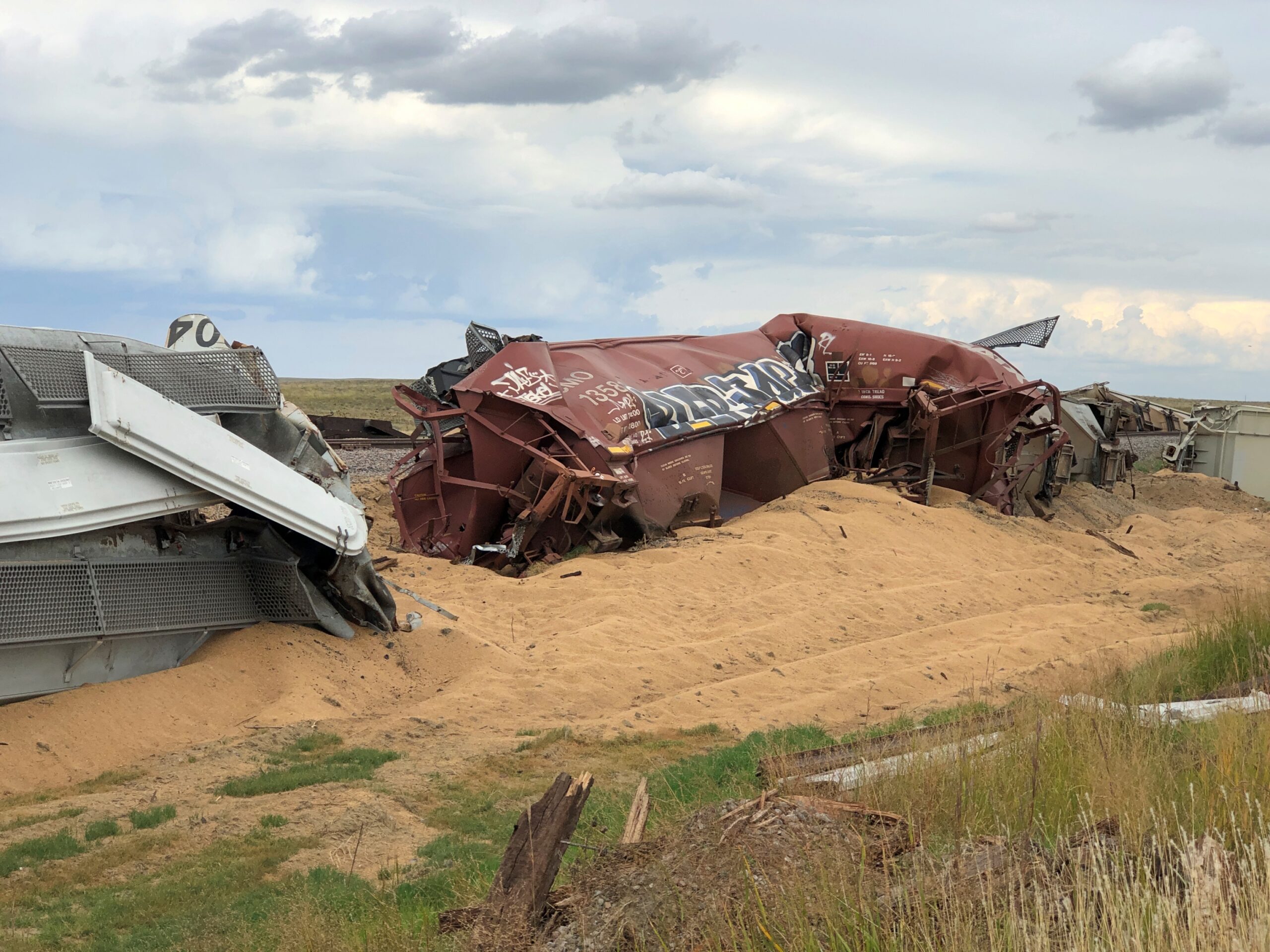
A wrecked train. A long wrecked train. The cars toward to back.
Toward the front.
Nary a clue as to how it happened, or when, except that the cars don’t seem rusted or overgrown. I stayed on the road to take my pictures. The cars are lined up as if they were dumped off the track on purpose. No. Why? Or could it have been some odd accident in which the train essentially fell off in place? Or is that how derailments work? Why are front cars especially mangled?
It didn’t take too much research (later) to find some answers. The Kiowa County Independentreported in August: The heavily laden train was navigating a significant curve and elevation change west of Chivington when 16 covered hopper cars derailed. Each was filled with thousands of bushels of wheat, spilling tons of grain onto the ground along Highway 96, which runs parallel to the rail line.
Oops. Guess everyone would have heard about it if the cargo had been more volatile or toxic.
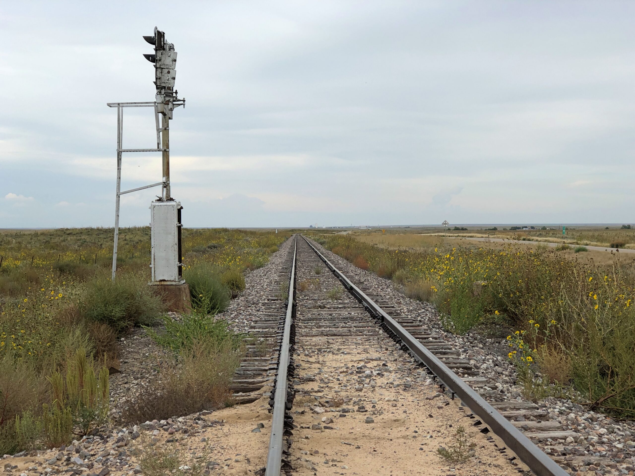
At the turnoff to the historic site, I got a view of the tracks (again, from the road). Far enough away that the mangled train cars aren’t visible.
On to the historic site, via an unpaved road.
Turns out the historic site closes at 4 pm. I got there just as the rangers were leaving, and one of them, who had a remarkable collection of snaggled and bent teeth, told me so politely. I didn’t argue with him, but I also wondered why a site so remote closes at all, except maybe for the visitors center or small museum. Rules is rules, I guess.
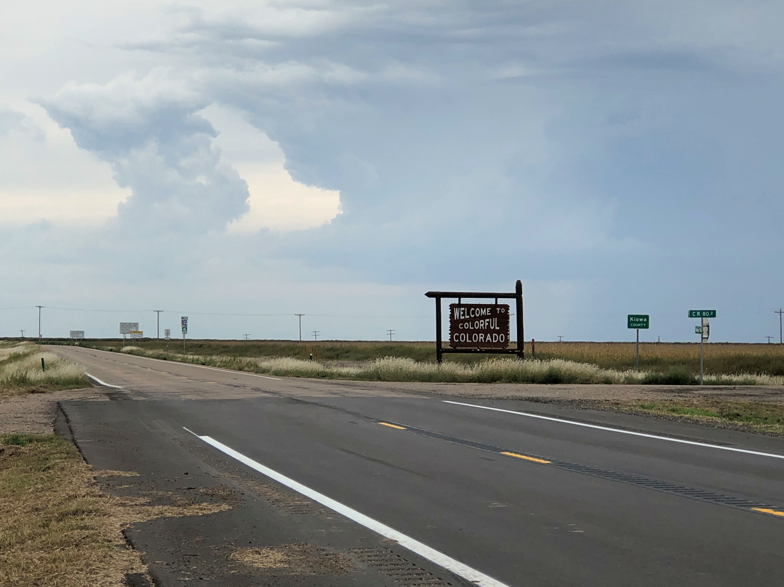
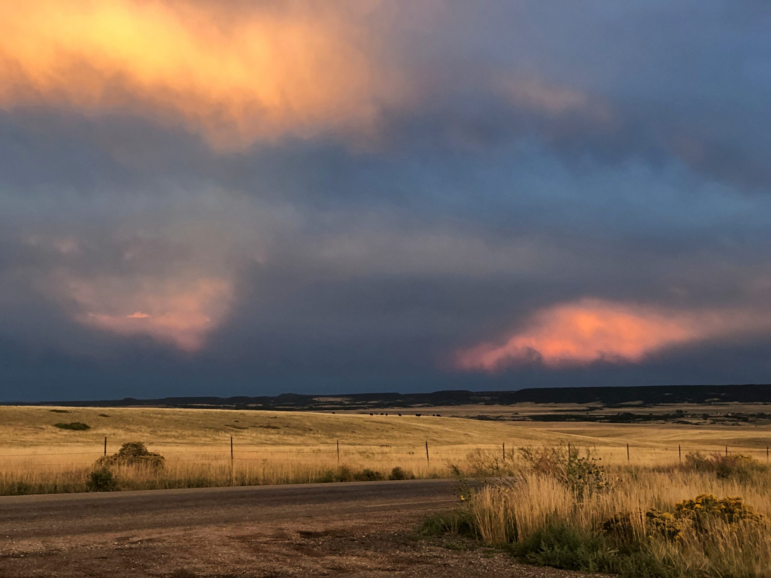
That was pretty much it for Colorado. I got to the border with Kansas not long after, and looked back.
Metro Denver is enormous, much larger than I remembered, even as recently as 2017. Or so it seemed. To the south, Colorado Springs is fairly large, but some orders of magnitude less than the monster metro to its north. Further south, Pueblo doesn’t seem that big, but even so it has 111,000 residents, give or take.
Then you come to Walsenburg. Who has heard of Walsenburg, Colorado (pop. 3,035), even though it too is on I-25 and on the irregular line where prairie and mountains meet? Colorado’s brisk growth over the last few decades seem to have passed it by. Its peak population was in 1940, when more than 5,800 people lived there.
I wish I could say I’d formed an impression of Walsenburg, but we stopped only for gas, and to get off the Interstate.
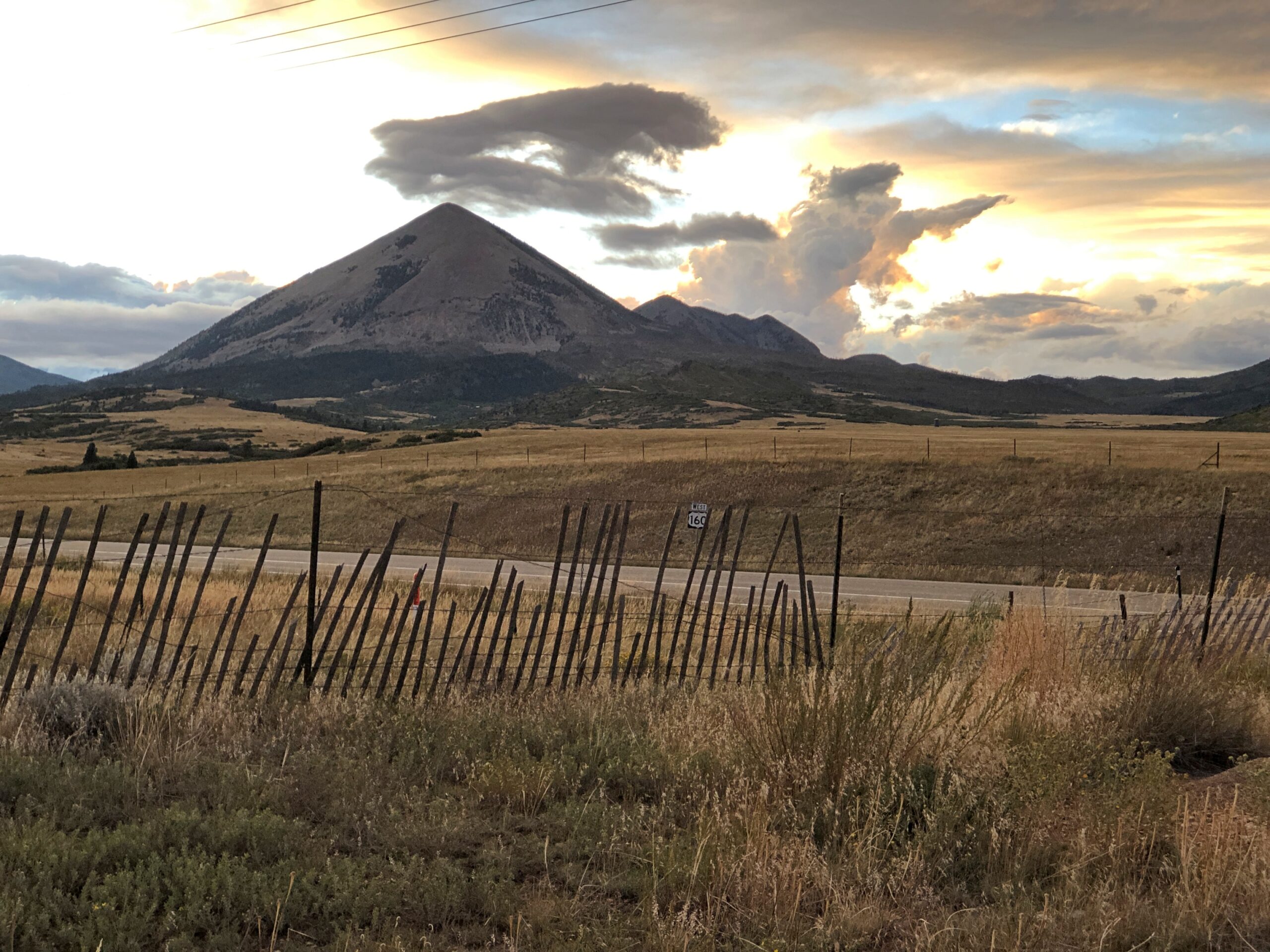
US 160, Walsenburg to Alamosa
Walsenburg has few people, and when you go west on US 160, that dwindles to practically none. The road crosses the Culebra Range of the Sangre de Cristo Mountains at North La Veta Pass, elevation 9,413 feet, into the San Luis Valley. I enjoyed writing that sentence almost a much as I enjoyed the drive itself.
Enjoyable at least until dark. Wish we’d gotten to see more of it. We’d futzed around in Colorado Springs much of that day, September 13, including a fine lunch at Edelweiss German Restaurant. So the sun went down before we got to our destination, Alamosa. But we did stop for a few minutes on US 160 before we lost the light. A chilly wind blew clouds along at quite a speed, and for their part the clouds were catching the sunset in luminous patches. Until I can see the aurora, that will more than do.
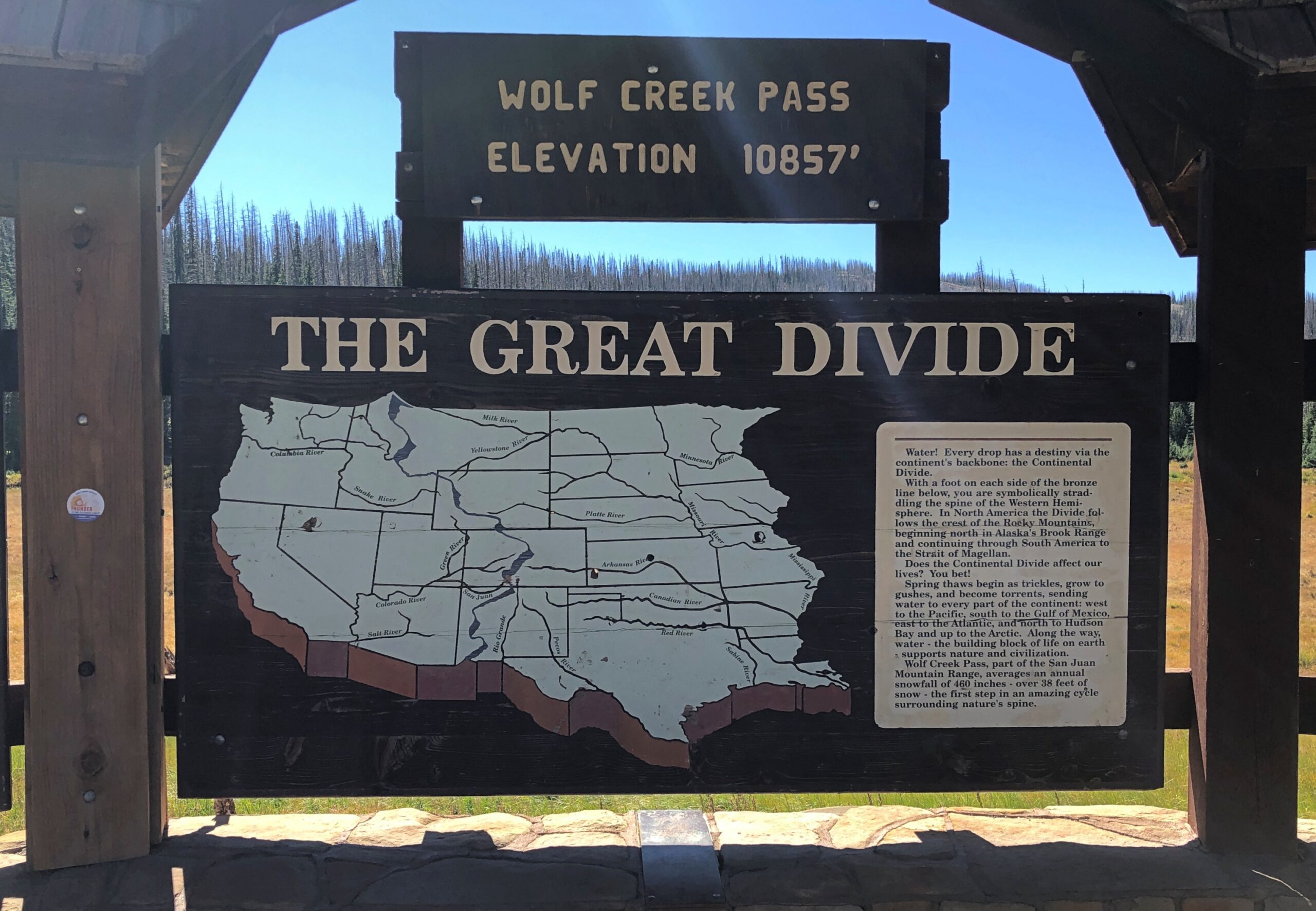
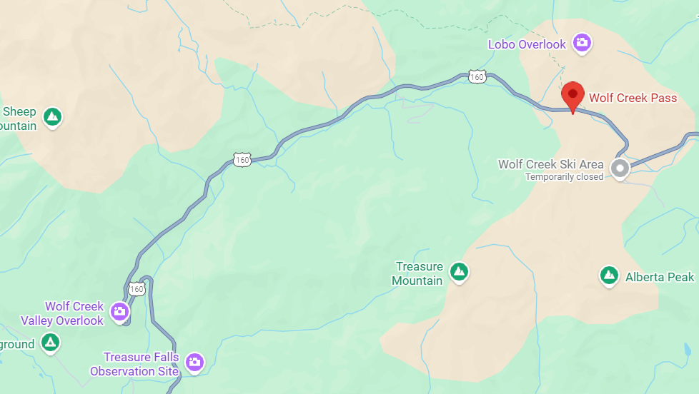
Wolf Creek Pass, Way Up on the Great Divide
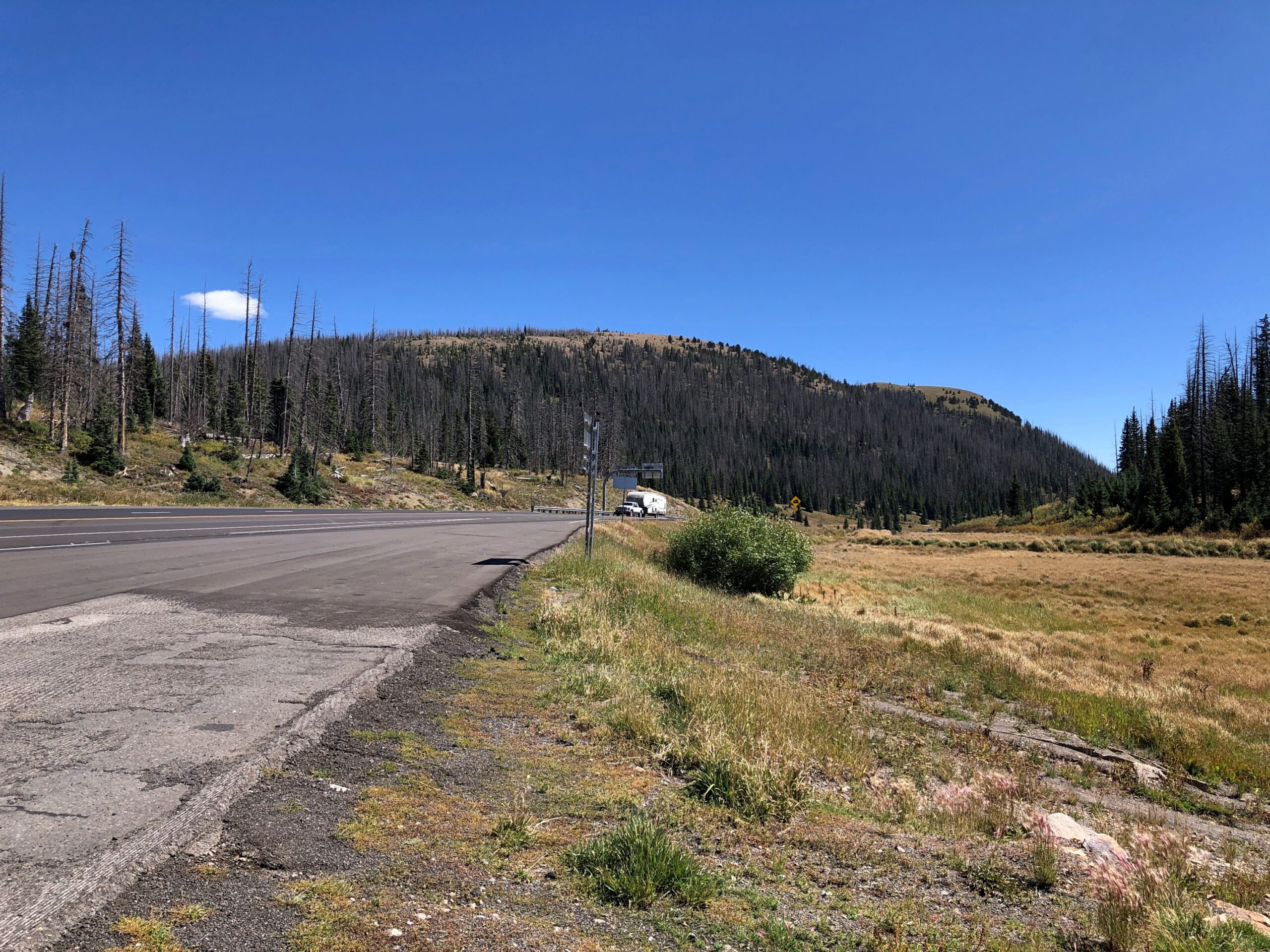
Follow US 160 west from Alamosa and eventually you’ll get to Four Corners. We didn’t go that far on the 15th, just to Durango. The road passes through much of the San Luis Valley, which is wide – the largest alpine valley in the world, they say – so the way is flat until you reach South Fork, Colorado. Then you climb into the San Juan Mountains, until you reach Wolf Creek Pass. Way up on the Great Divide.
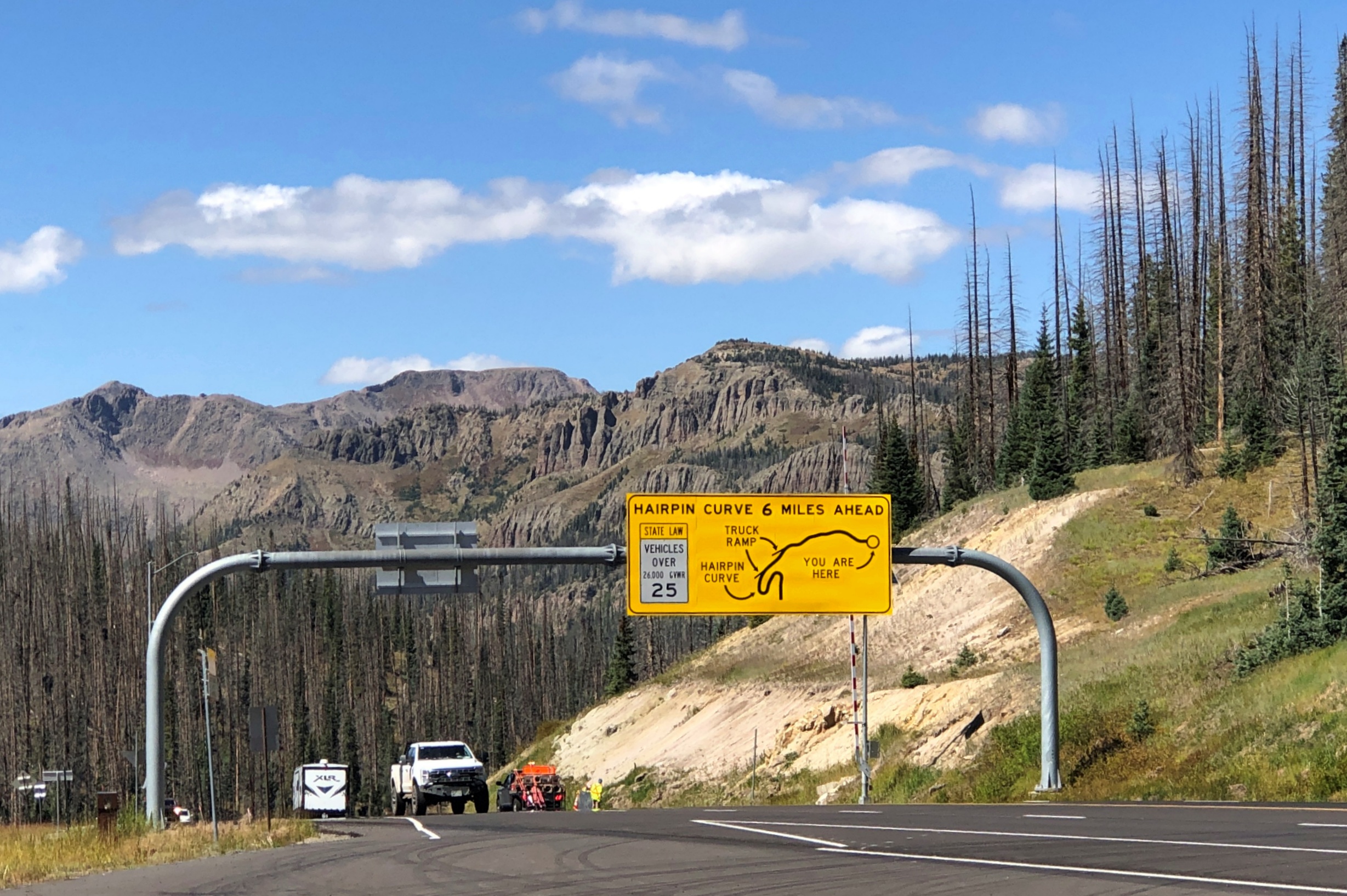
Yuriko had been driving on the ascent to Wolf Creek Pass. Usually she doesn’t care for mountain roads, but she focused on a wide-load vehicle ahead of us, and we followed it up, though not at too close a distance. She thought better of driving down the other side, even though she’s never heard it immortalized by C.W. McCall.
So I drove down. Truth be told, it’s not that bad on a clear day. In our time, US 160 down from Wolf Creek Pass is four lanes, and while curvy, only the hairpin turn – which you are well warned about – is a little tricky. Not that bad in a car, anyway. I couldn’t say about taking a truck down. I’ll bet 50 years ago the route was probably still two lanes and maybe even more winding, so C.W. was only exaggerating for comic effect, not making everything up.
At the end of the drop is Pagosa Springs, whose main street was completely torn up with construction. We found lunch off the main drag at PS FroYo, which is one of those restaurants that makes money for a local charity, in this case Aspen House. We didn’t know that before we ate our sandwiches, just that it was near where we parked and not fast food. A nice bonus to find out.
Lewis Street wasn’t under construction, so that made for a pleasant stroll after lunch, including time at a resale shop. No post cards. Bought some nearly new jeans, which proved their $5 worth (and much more) when I was later deposited briefly in the Kansas mud. They were standing by at that moment, sitting in a bag on top of everything else in the back seat — blankets, sleeping bag, small bags with some winter wear. I didn’t have to dig around looking for them. That never happens, or so it seems, so I thought I’d remember when it did by noting it here.
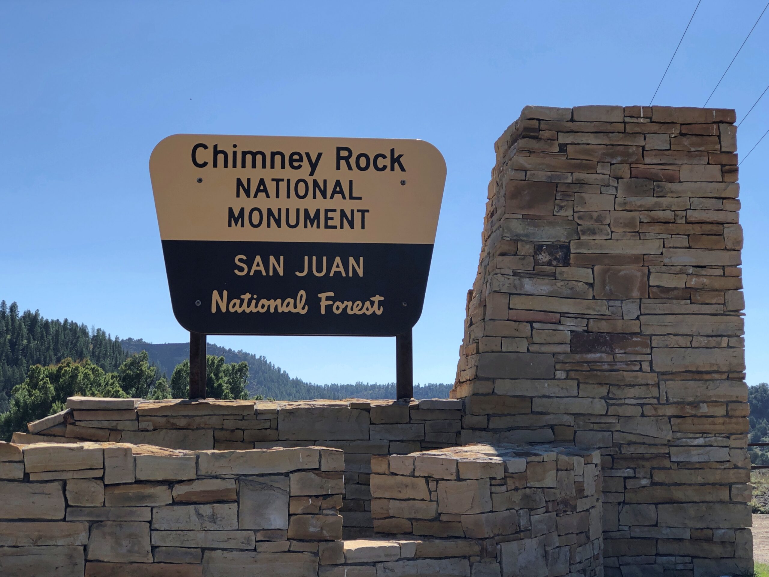
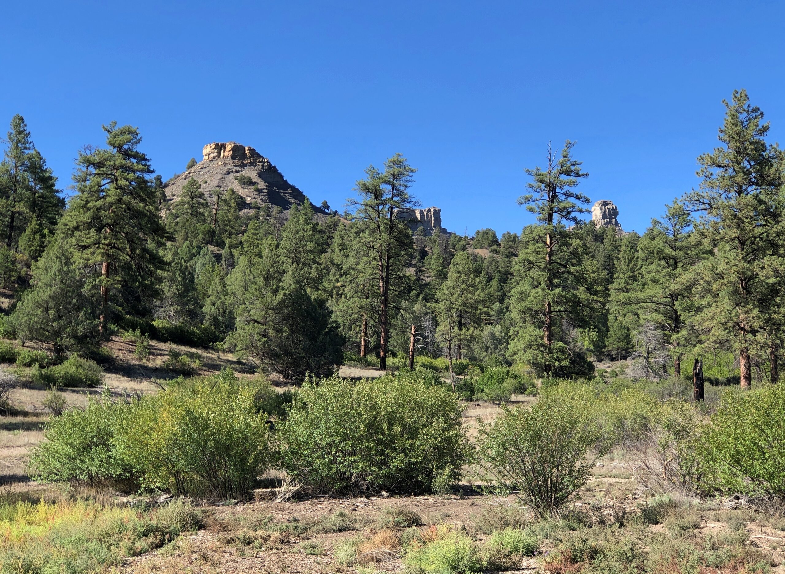
There is a road up to Colorado’s Chimney Rock, a ridge-top archaeological site that is the nucleus of the national monument, but it was closed. The small museum at the base of the rock was still open, so along with our view, we took in a little about the Ancestral Puebloans who used to live there.
Chimney Rock and Companion Rock, foci of the national monument.
“Chimney Rock covers seven square miles and preserves 200 ancient homes and ceremonial buildings, some of which have been excavated for viewing and exploration: a Great Kiva, a Pit House, a Multi-Family Dwelling, and a Chacoan-style Great House Pueblo,” says the Chimney Rock Interpretive Association. “Chimney Rock is the highest in elevation of all the Chacoan sites, at about 7,000 feet above sea level.”
US 550 North from Durango
North from Durango on US 550, the scenery starts pretty soon.
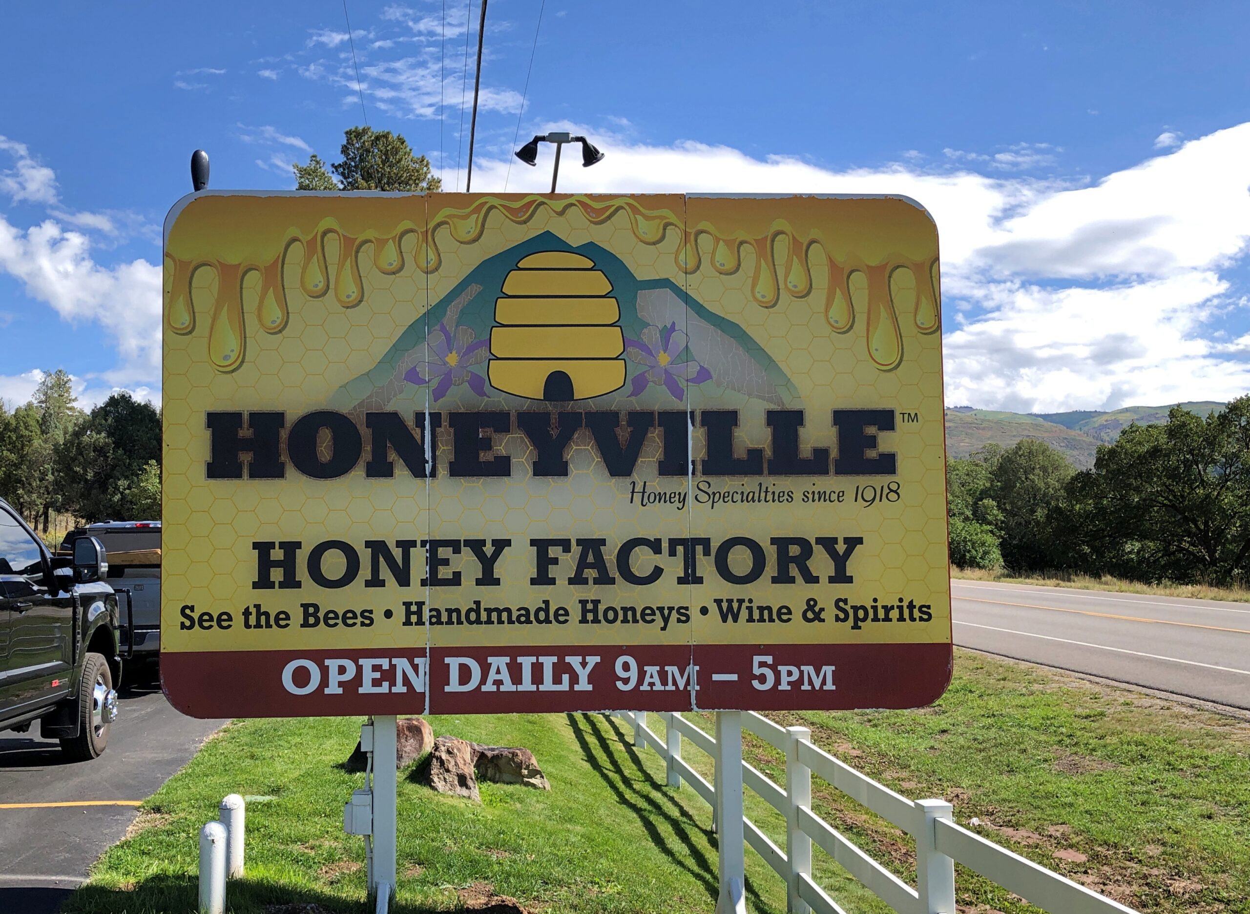
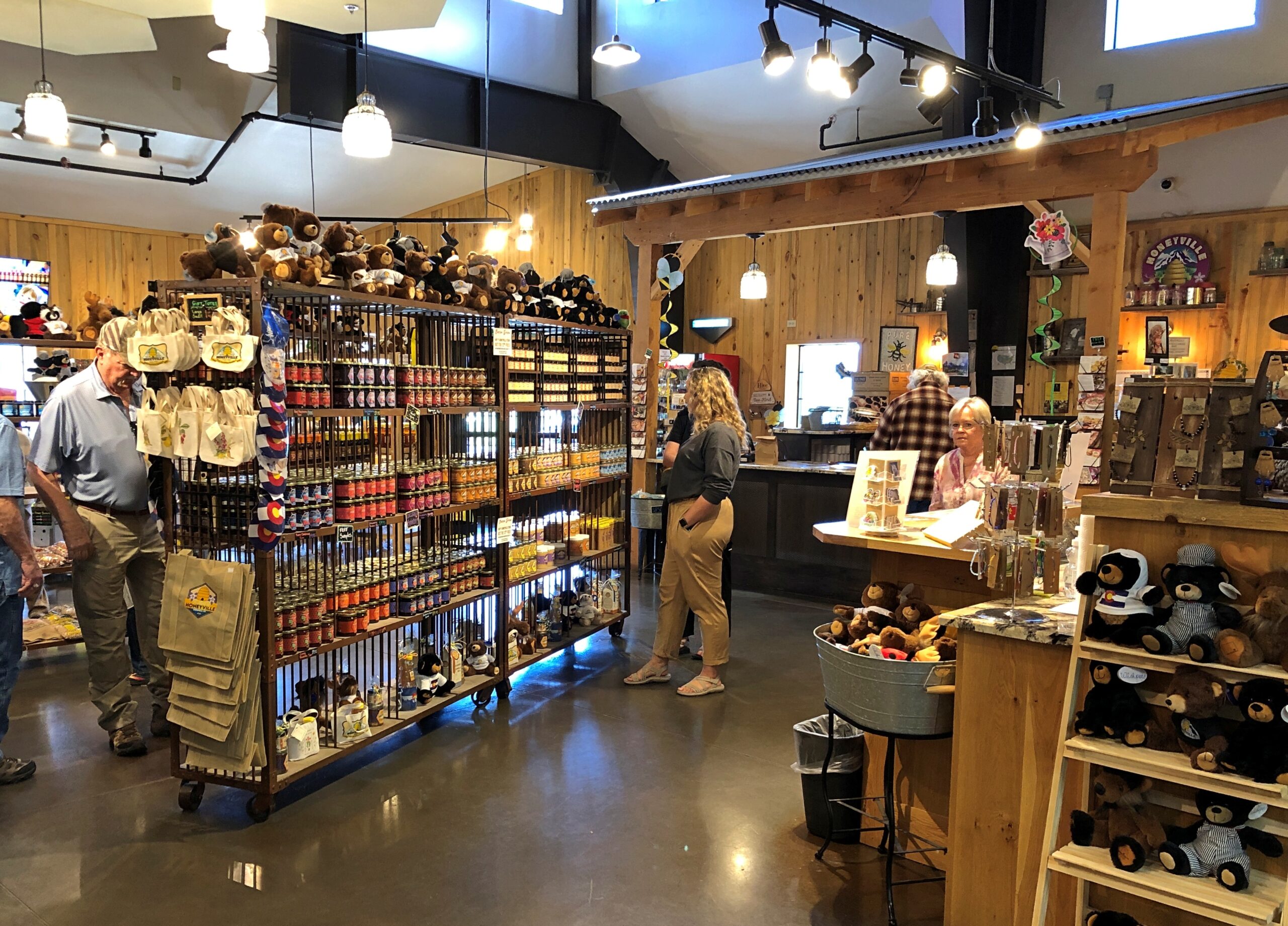
A few miles out of town, Honeyville. It looked like a good place for souvenirs.
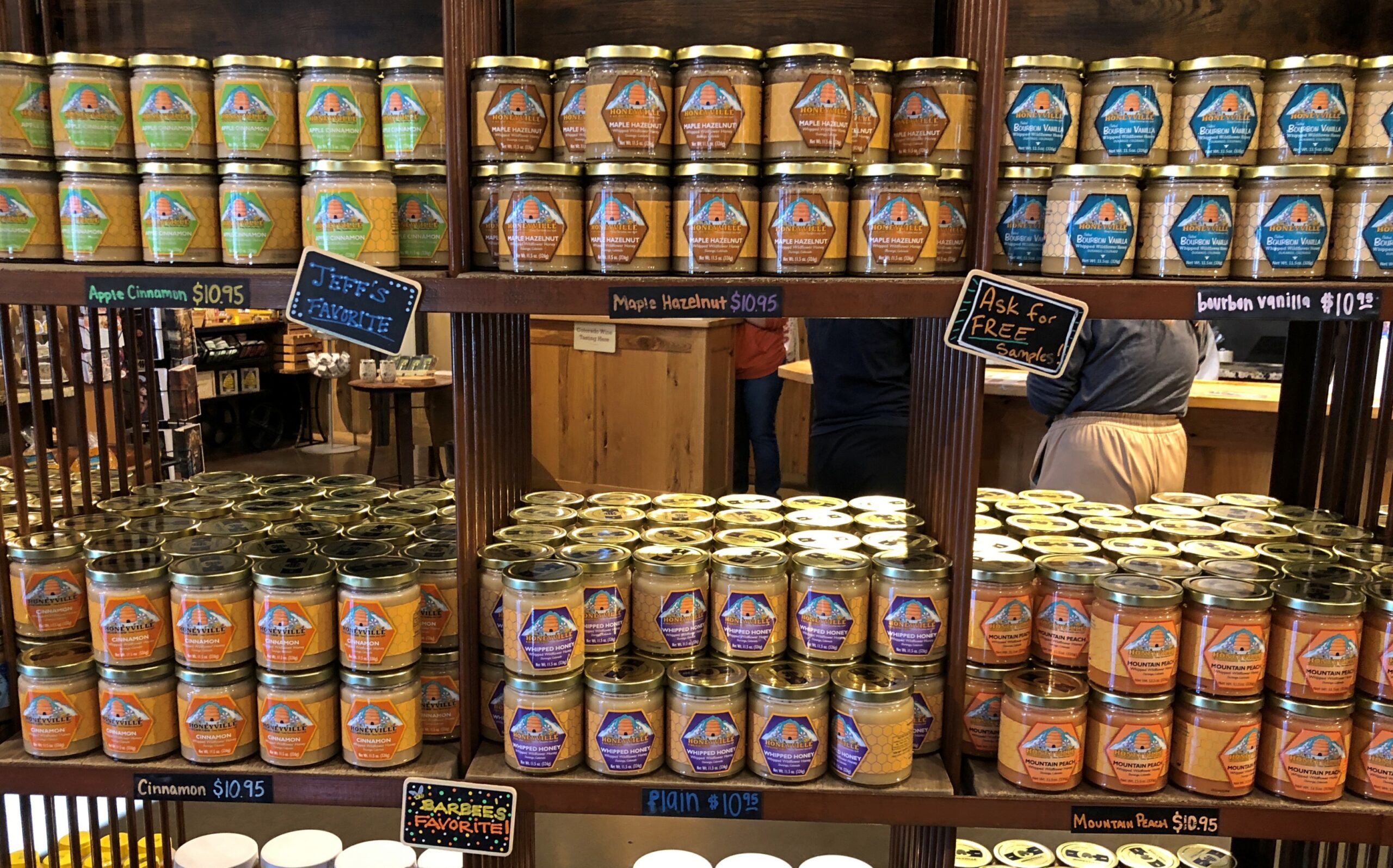
It was. I’m still working on a Honeyville jar of whipped cinnamon honey, which makes a warm biscuit sing.
All sorts of honey products are available.
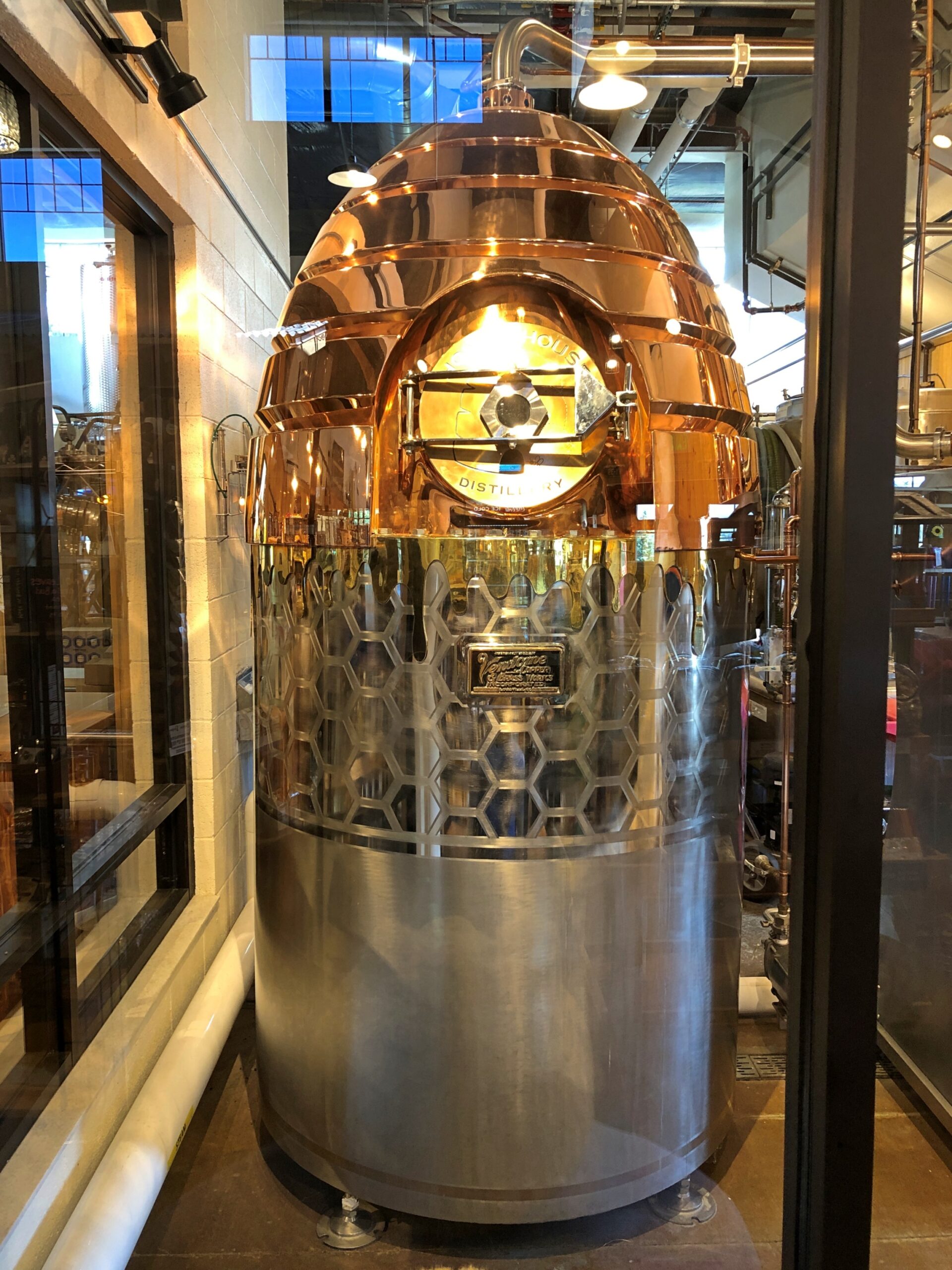
You can watch part of the process.
A warp drive engine fueled by honey? Could be that Zefram Cochrane kept (will keep) bees.
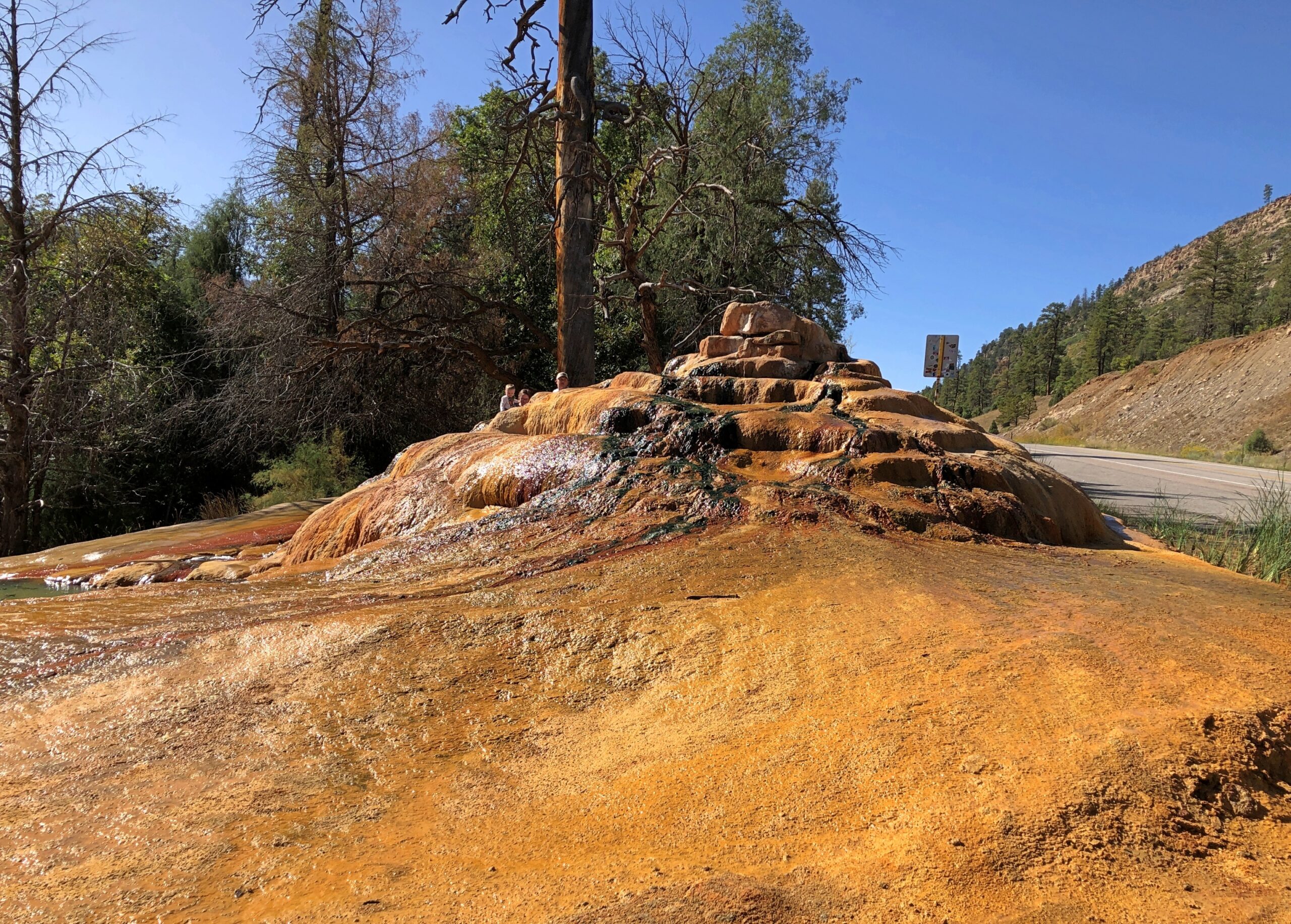
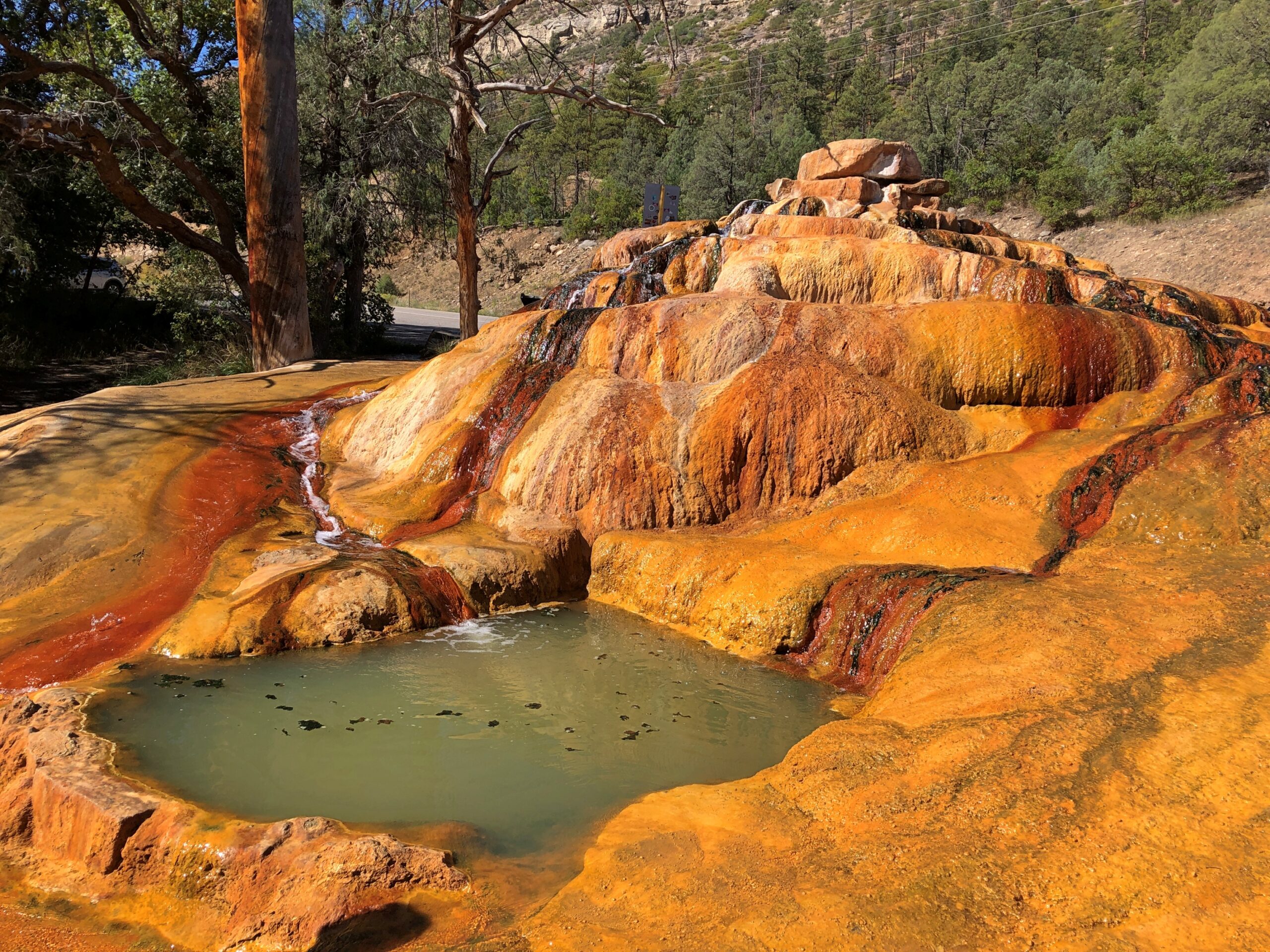
Only a few miles north, just off US 550, is Pinkerton Hot Springs, which is the kind of place that winds up on Atlas Obscura lists (actually, so does Honeyville). We took a look, but not a dip.
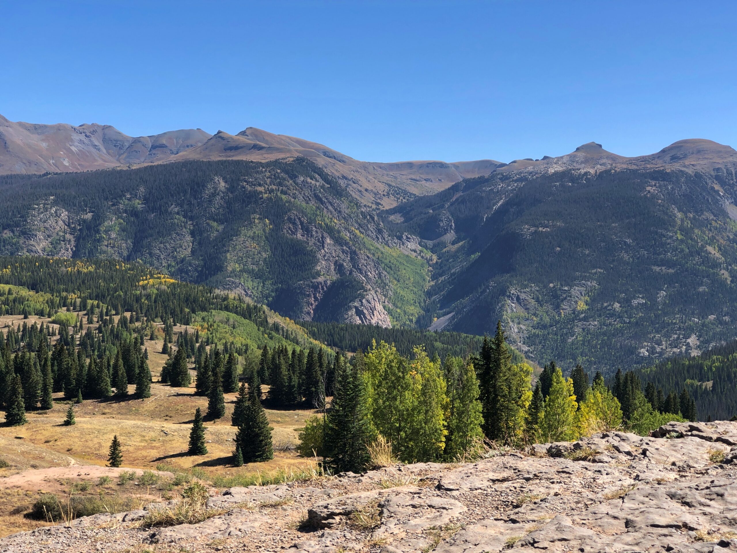
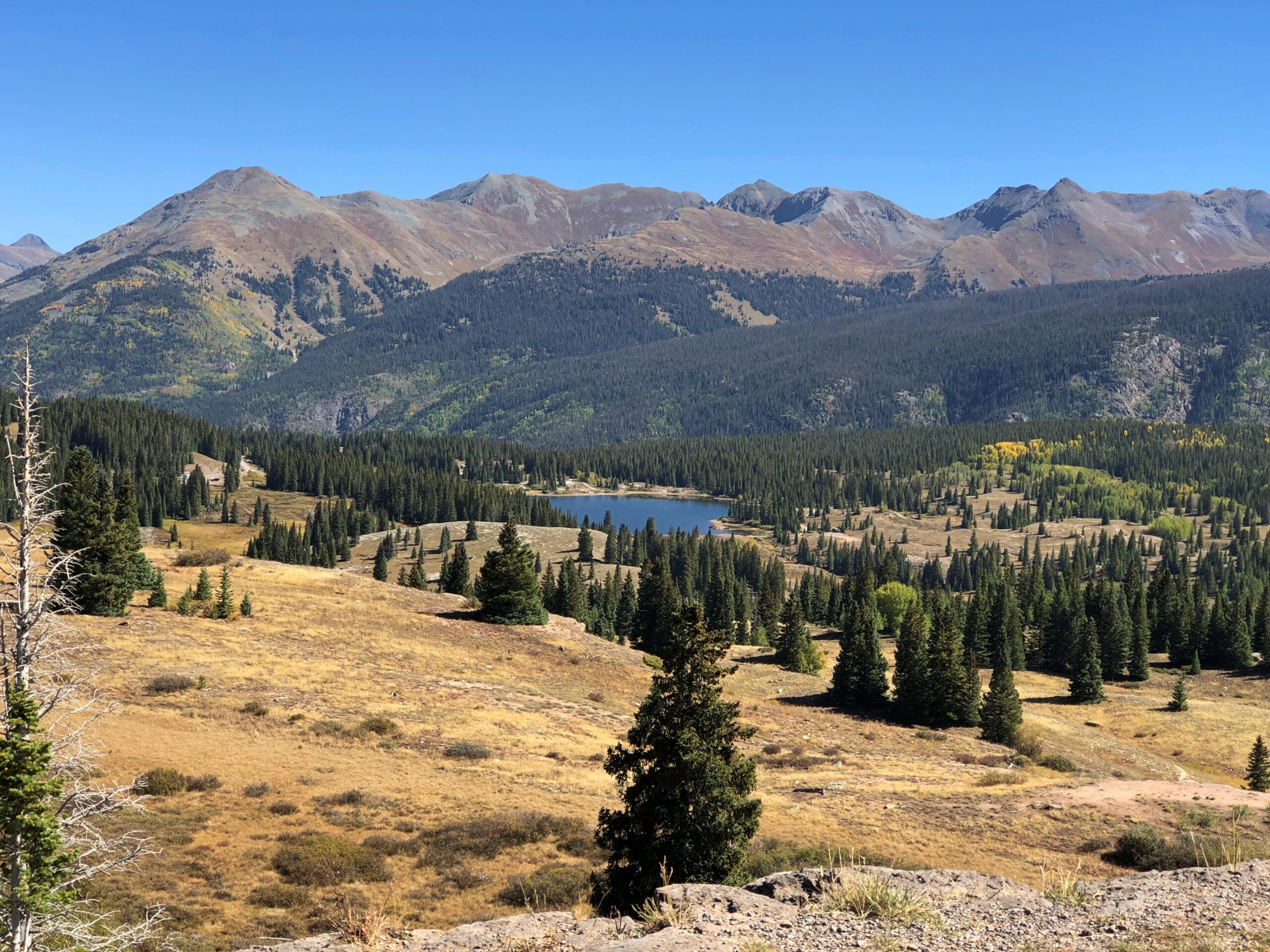
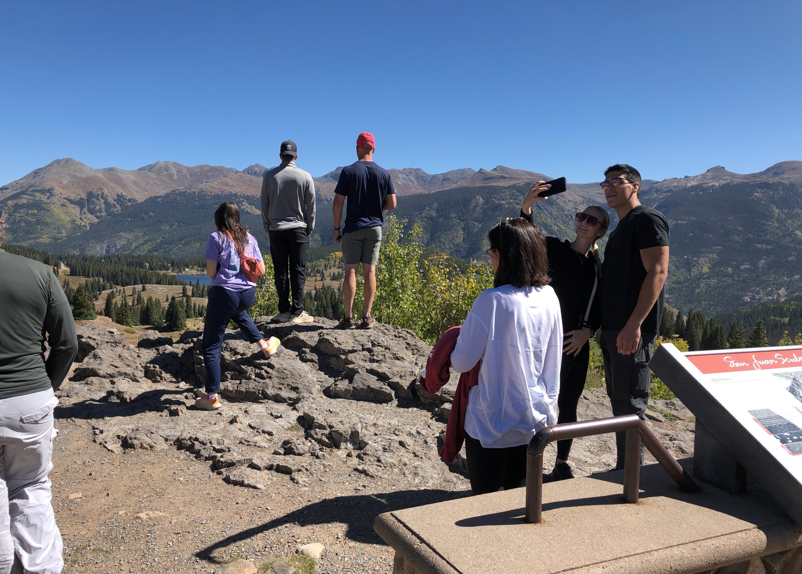
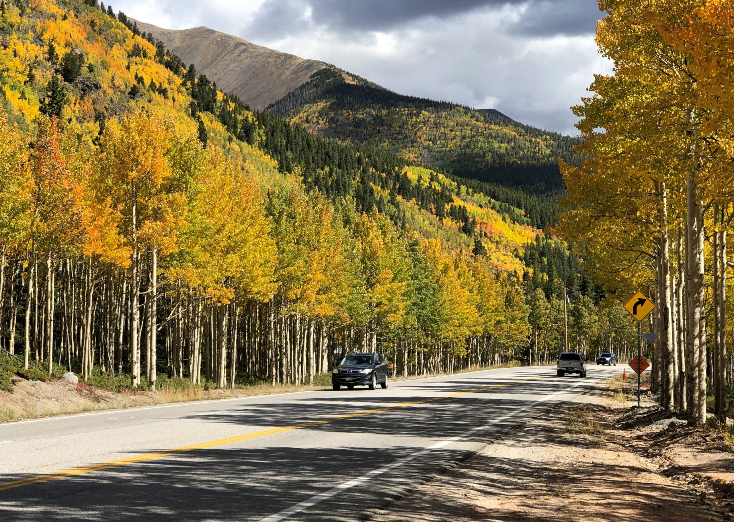
Before you get to Silverton on US 550, you cross Molas Pass, which has some terrific views of the edge of the Weminuche Wilderness. The day, by this time September 18, was clear and not exactly warm, but not that cold yet. Good day for a mountain drive.
Like the highway, the Molas Pass viewpoint was busy, but not overcrowded.
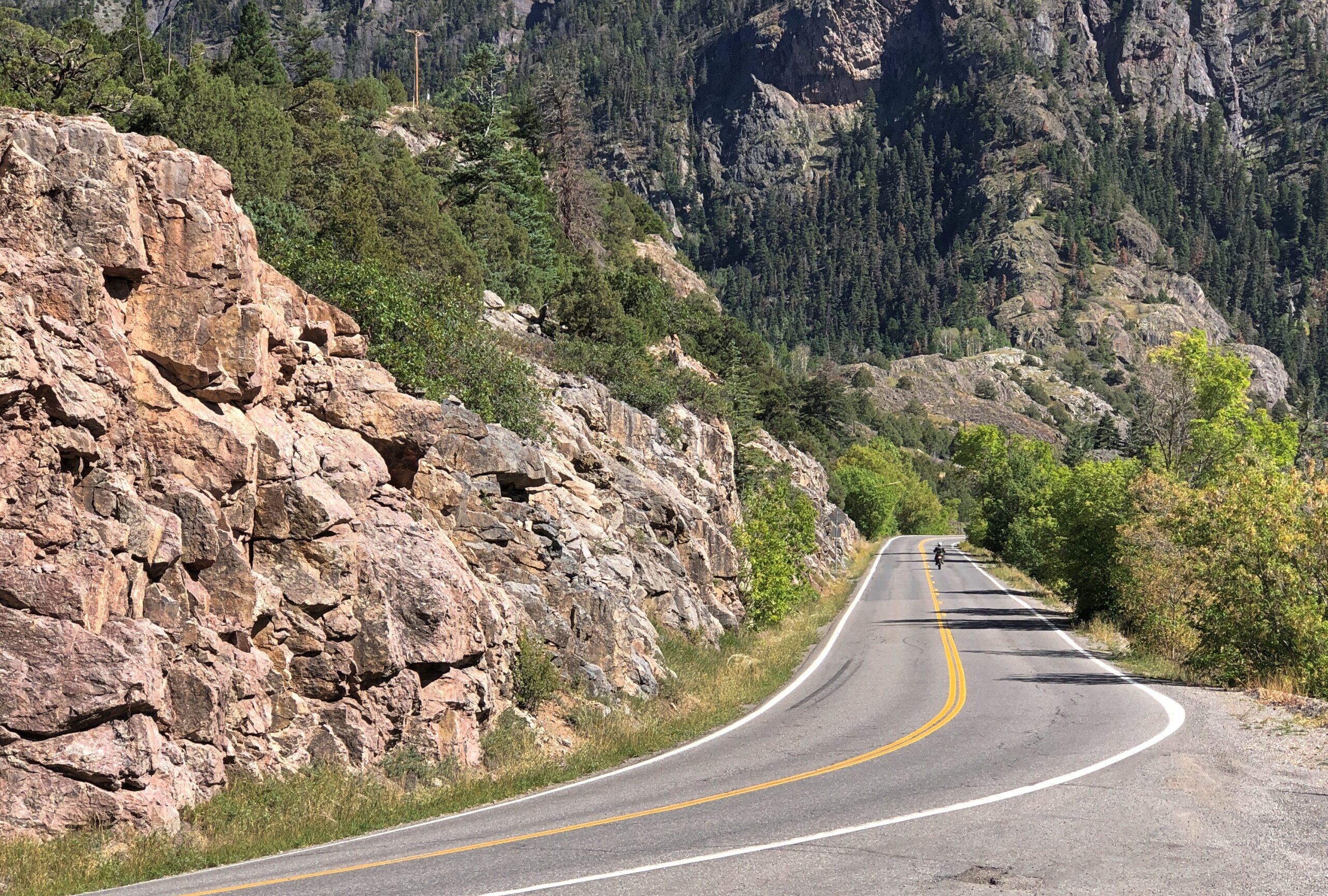
The route from Silverton to Ouray is known as the Million Dollar Highway. There isn’t a consensus about why that might be.
“There are a variety of explanations regarding the source of the name for the ‘Million Dollar Highway,’ says Roadtrip America. “One version claims it is based on the value of the ore-bearing fill that was used to construct the road, and another says it refers to the high cost of building a road over Red Mountain Pass (11,008 feet) and the Uncompahgre Gorge. One thing no one will dispute is the million-dollar views around every turn. This marvel of engineering, designed by Russian immigrant Otto Mears, slices through rugged mountains as it follows old stagecoach routes and former pack trails.”
If you want some twisty mountain road action, Million Dollar’s got it. Also, stretches without guard rails.
“About 40 accidents take place on the Million Dollar Highway each year, with an average of seven deaths per year,” the Durango Herald reported in 2023. “Most of the accidents are caused by careless or fast driving in bad road conditions. Other factors are mudslides, inclement weather and wildlife appearing on the road when there is nowhere to swerve.
“While avalanches used to be a factor, the last reported death on the road because of an avalanche came in 1992.”
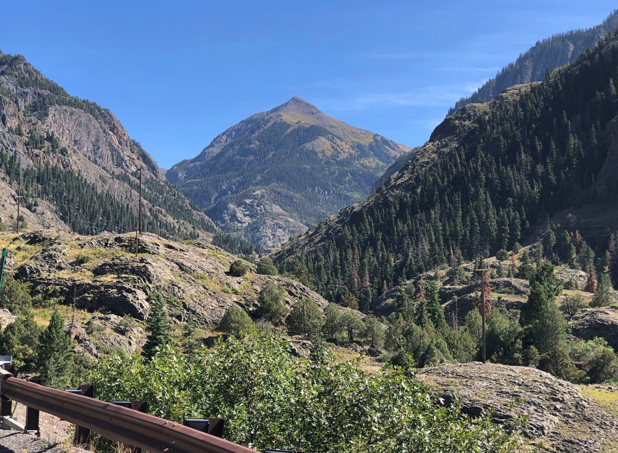
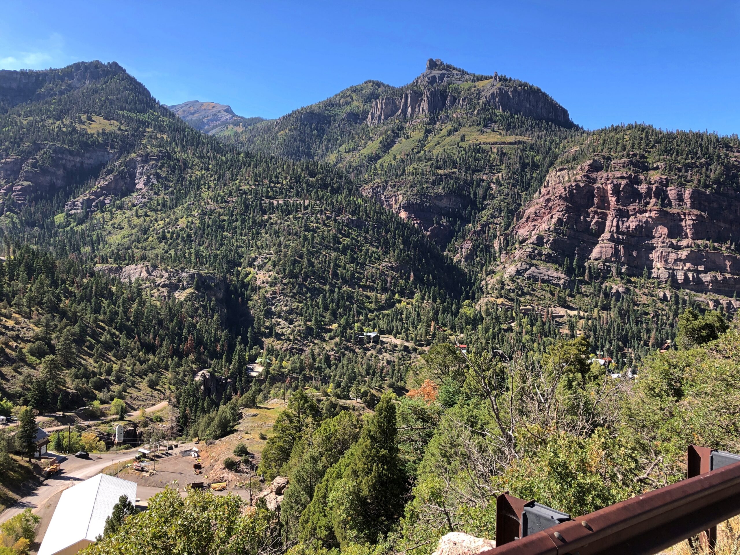
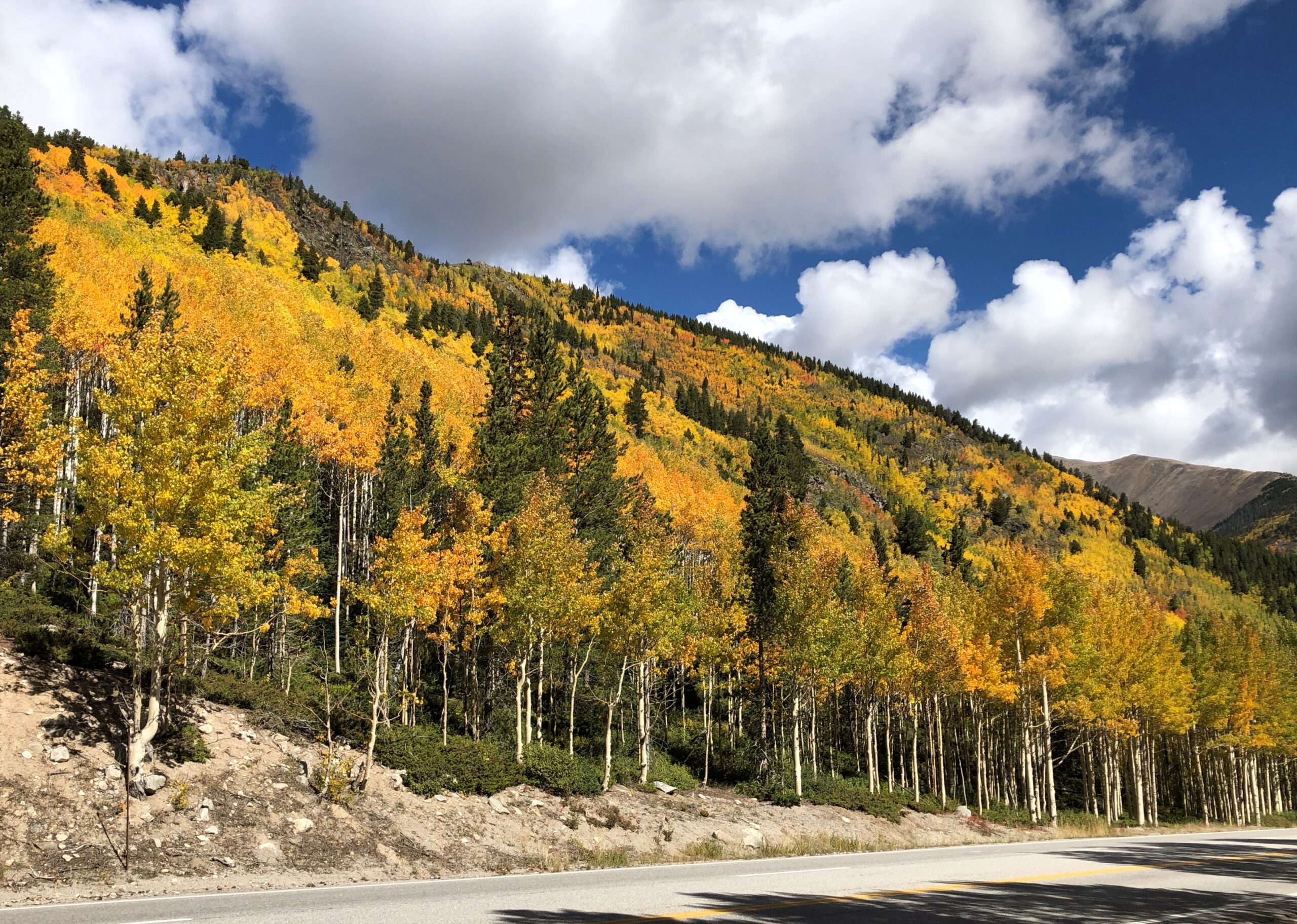
The views are exceptional, both as you move and when you stop. The road near Ouray.
Views near Ouray.
Ouray’s got some handsome buildings.
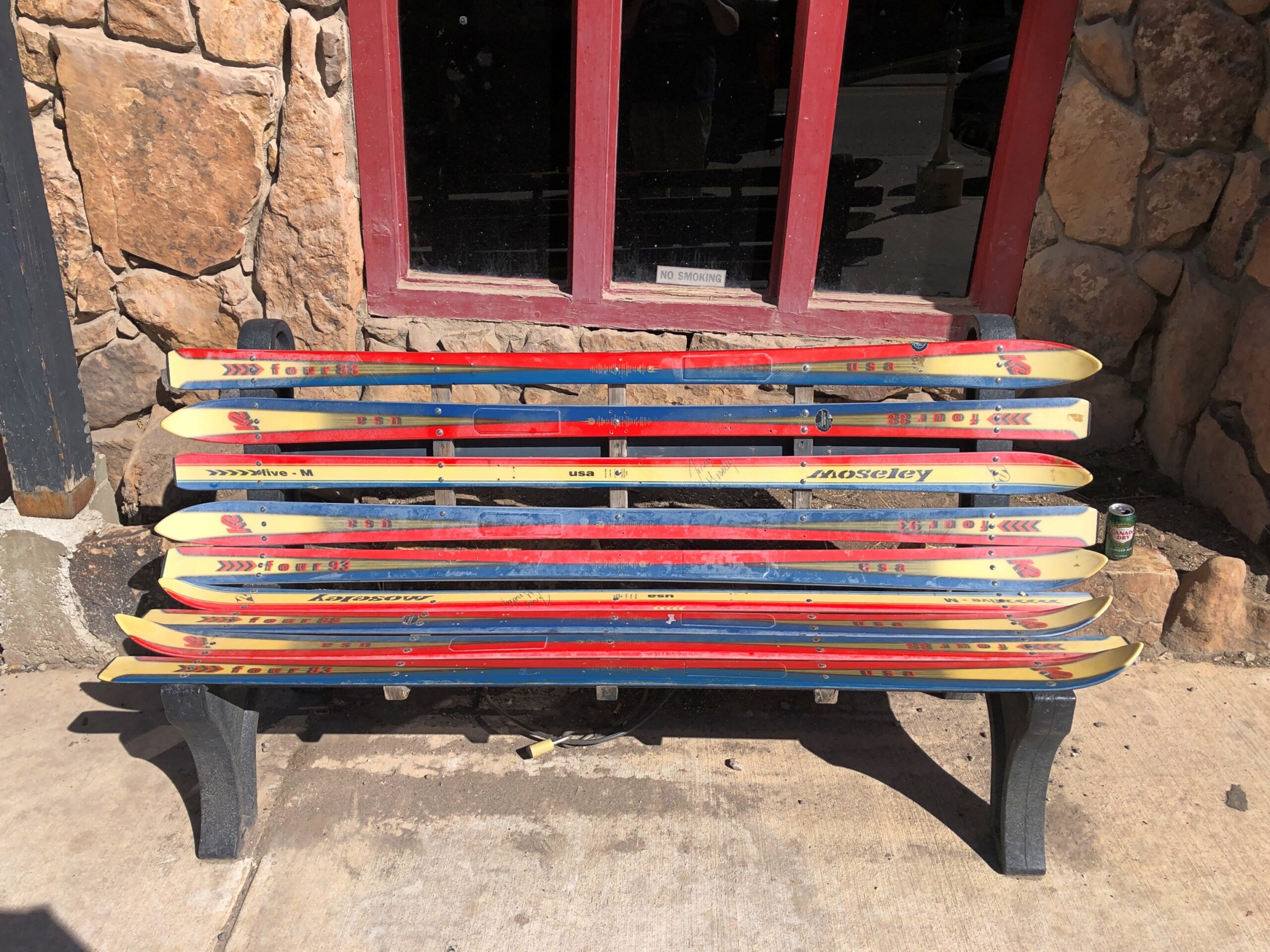
The main street in Ouray is the kind of place that has benches made from skis. Not the only time I saw that in Colorado.
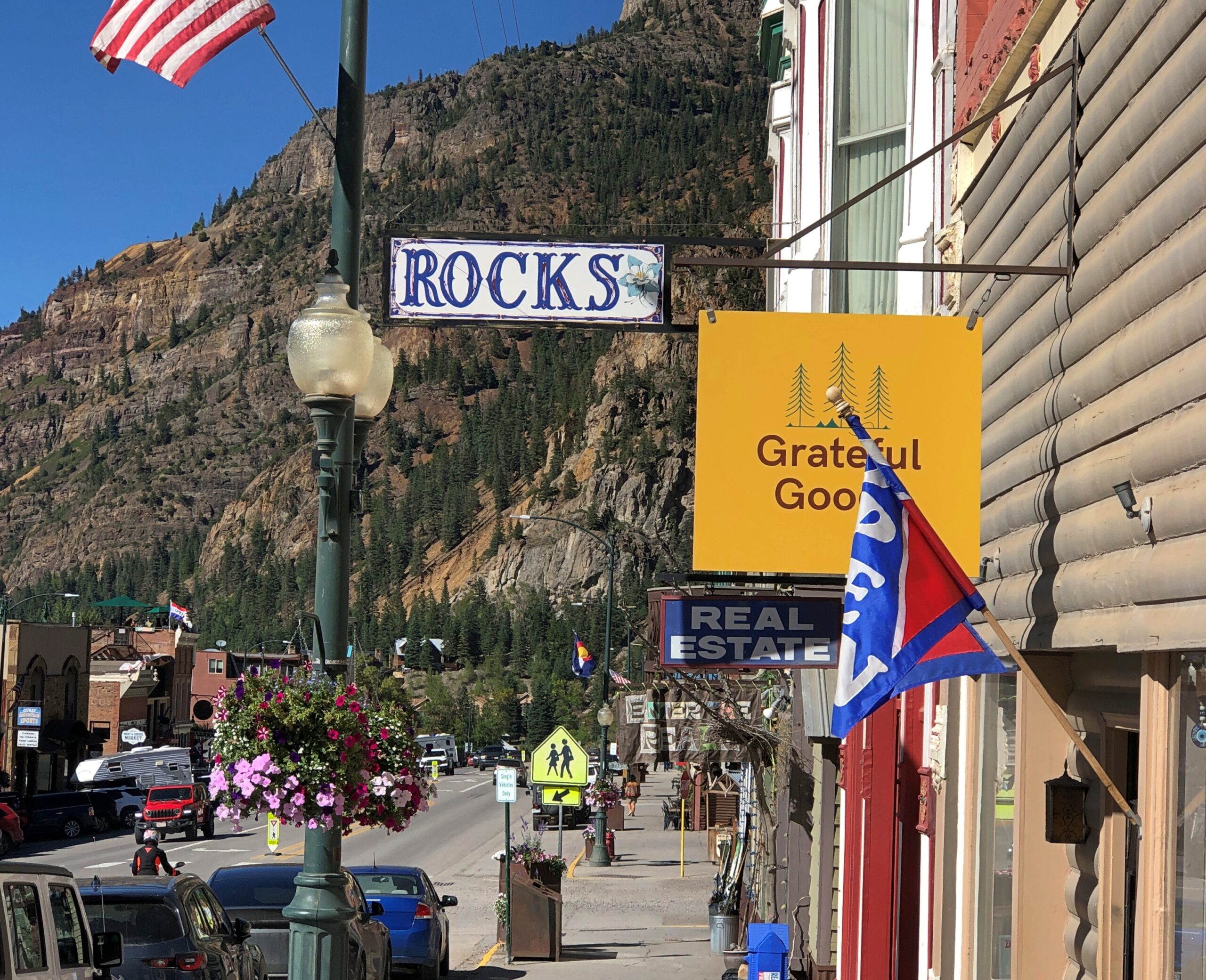
Also, some boutique retail. Good to see that Grateful Goo is available.
Who sells that again? Gwyneth Paltrow? Anyway, hipsters, or more likely plastic surgeons and orthodontists and tech millionaires, seem to have long ago discovered Ouray, close as it is to Telluride. I saw a bumper sticker-like posting on a light pole in town that said: What do you mean there’s an employee housing crisis in Ouray? My 2nd home is always empty.
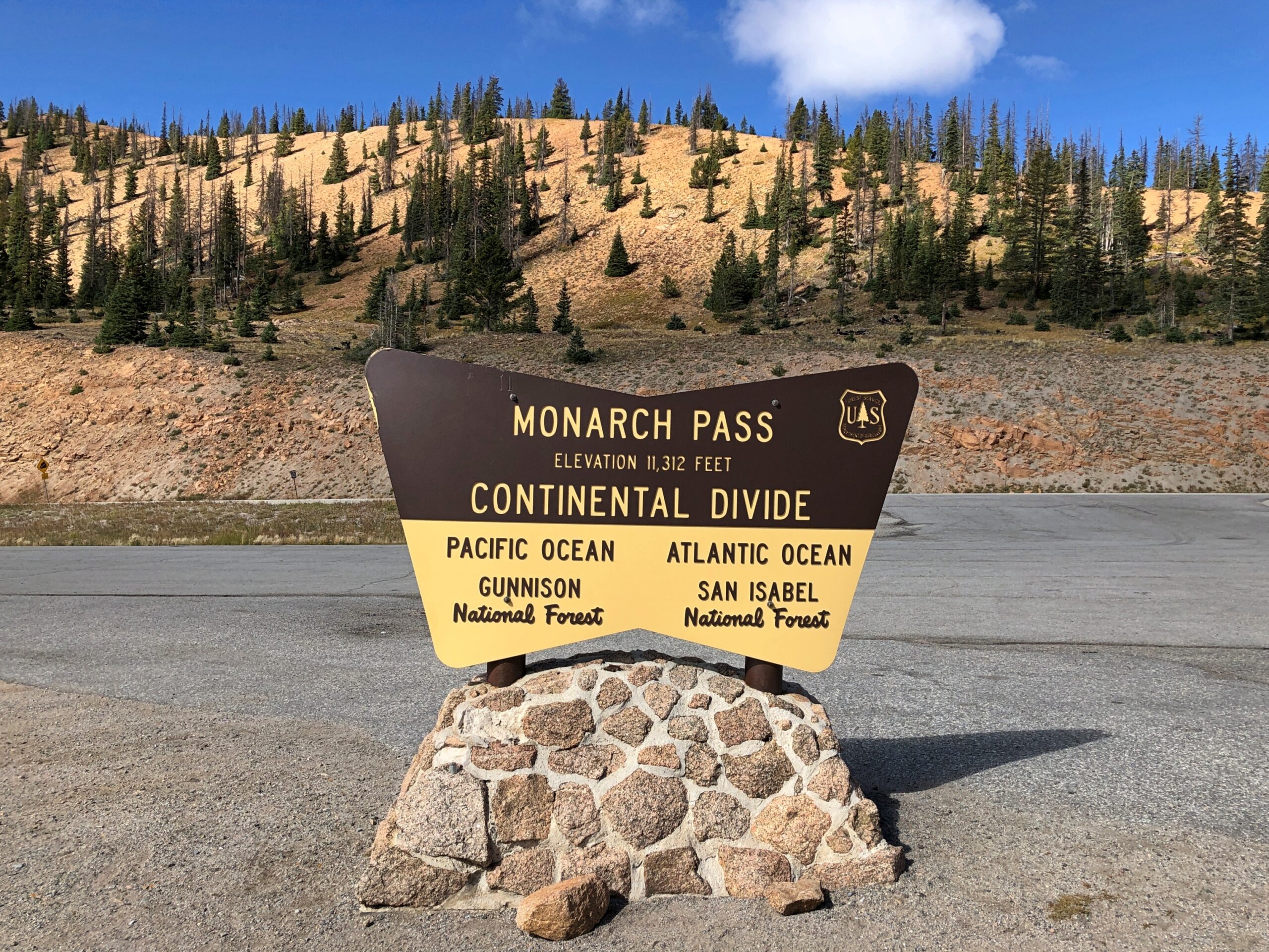
Monarch Pass
On our return to Denver, we headed out of Montrose east on US 50, a route that edges the gorgeous Blue Mesa Reservoir, and on to Gunnison and Salida. Just west of Salida, we took US 285 north, which goes to greater Denver. That highway crosses the Great Divide at Monarch Pass, elevation 11,312 feet.
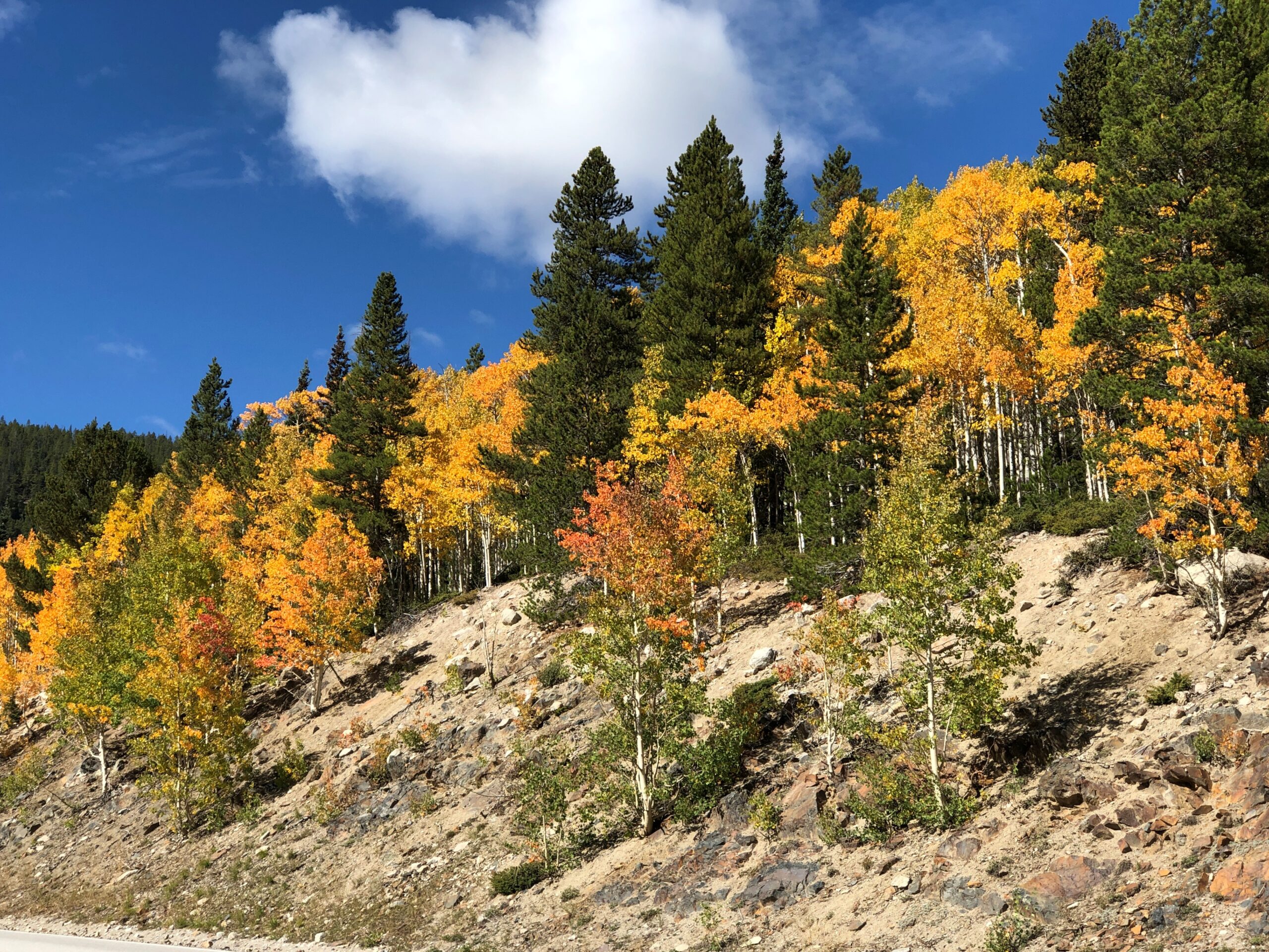
Even as early as September 20, the trees were ablaze.
I suppose that isn’t early for that elevation. We saw trees turning a week earlier, further north at Rocky Mountain NP. I didn’t know it at that time, but we were just beginning a fall season during which we’d see more colors (probably) than any other year. It’s not quite over even yet, with some reds and yellows here in the neighborhood. That isn’t so unusual. Lots of people seek out fall foliage. The odd thing was that it was completely unplanned.
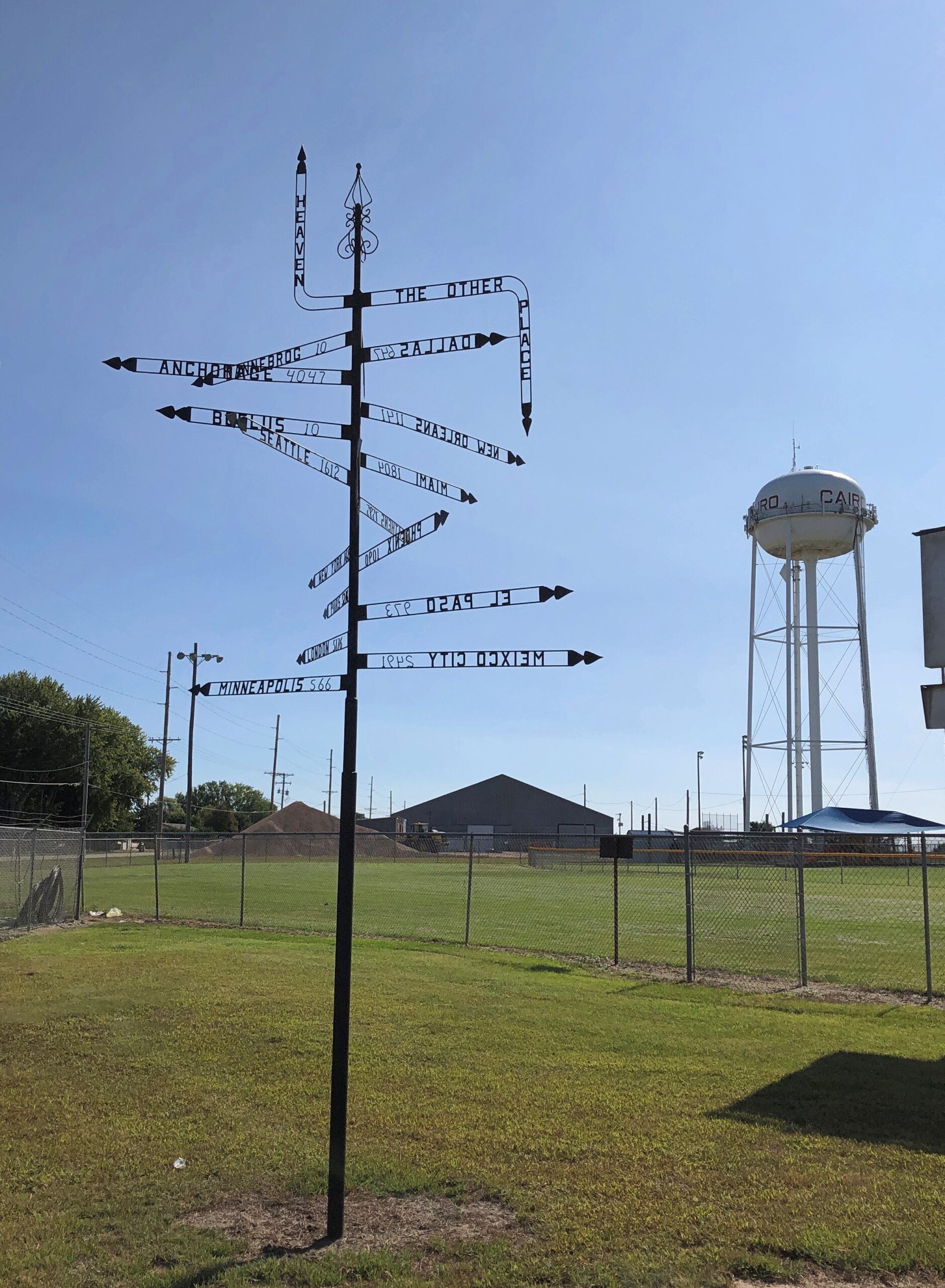
Which of these two destinations aren’t like the others?
That’s a beginner’s-level question. Better question: where can you find this pole, with mileages and – what units measure the distance to Heaven or Hell? – other signs?
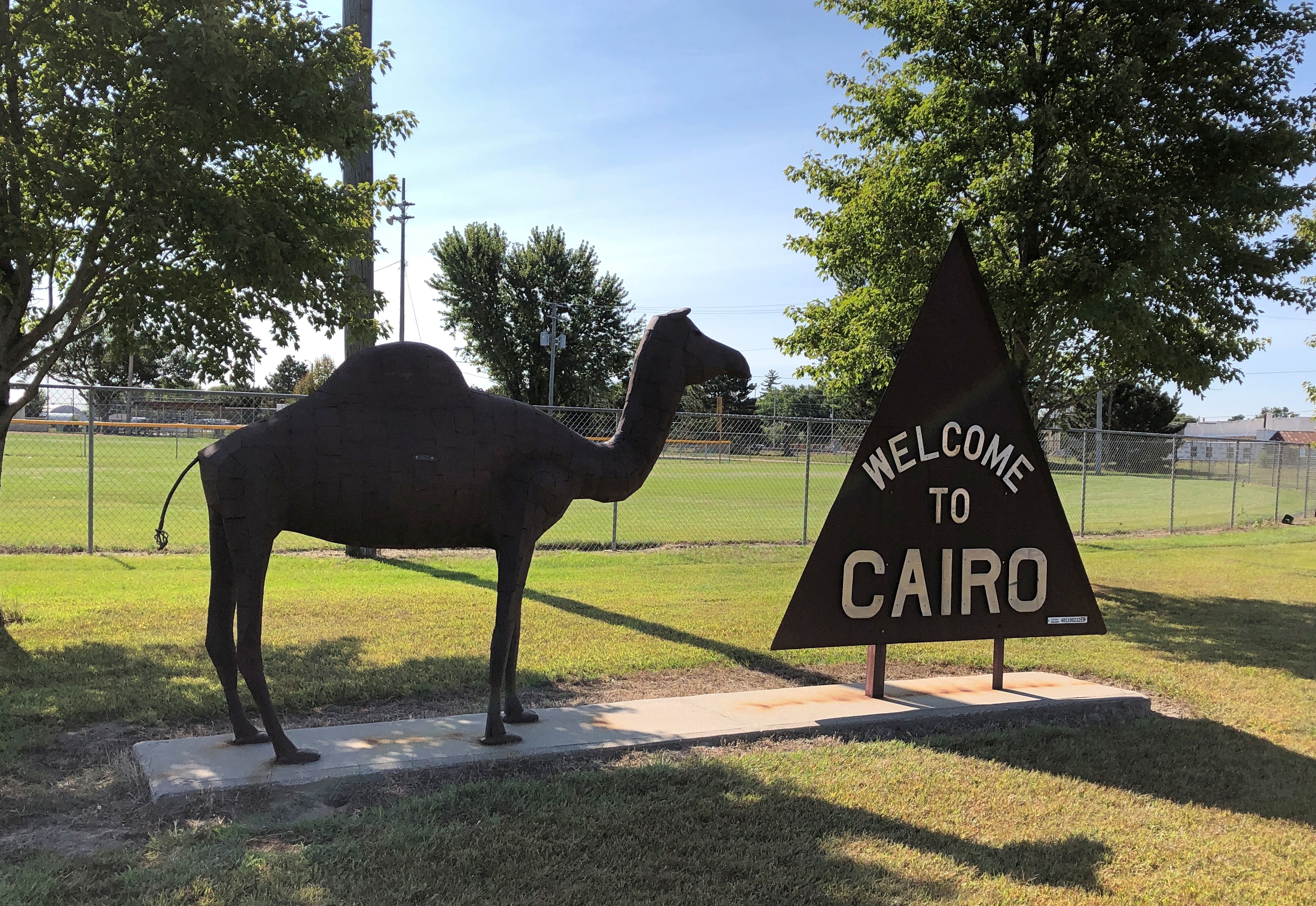
Answer: Cairo, Nebraska.
Maybe a palm tree was in the works, but the city decided not to spend any more money. Cairo (pop. 822) is one of the small chain of small towns on the eastern section of the highway Nebraska 2, which runs westward and north of Grand Island. Cairo is the first place I stopped on my way west on that highway in early September.
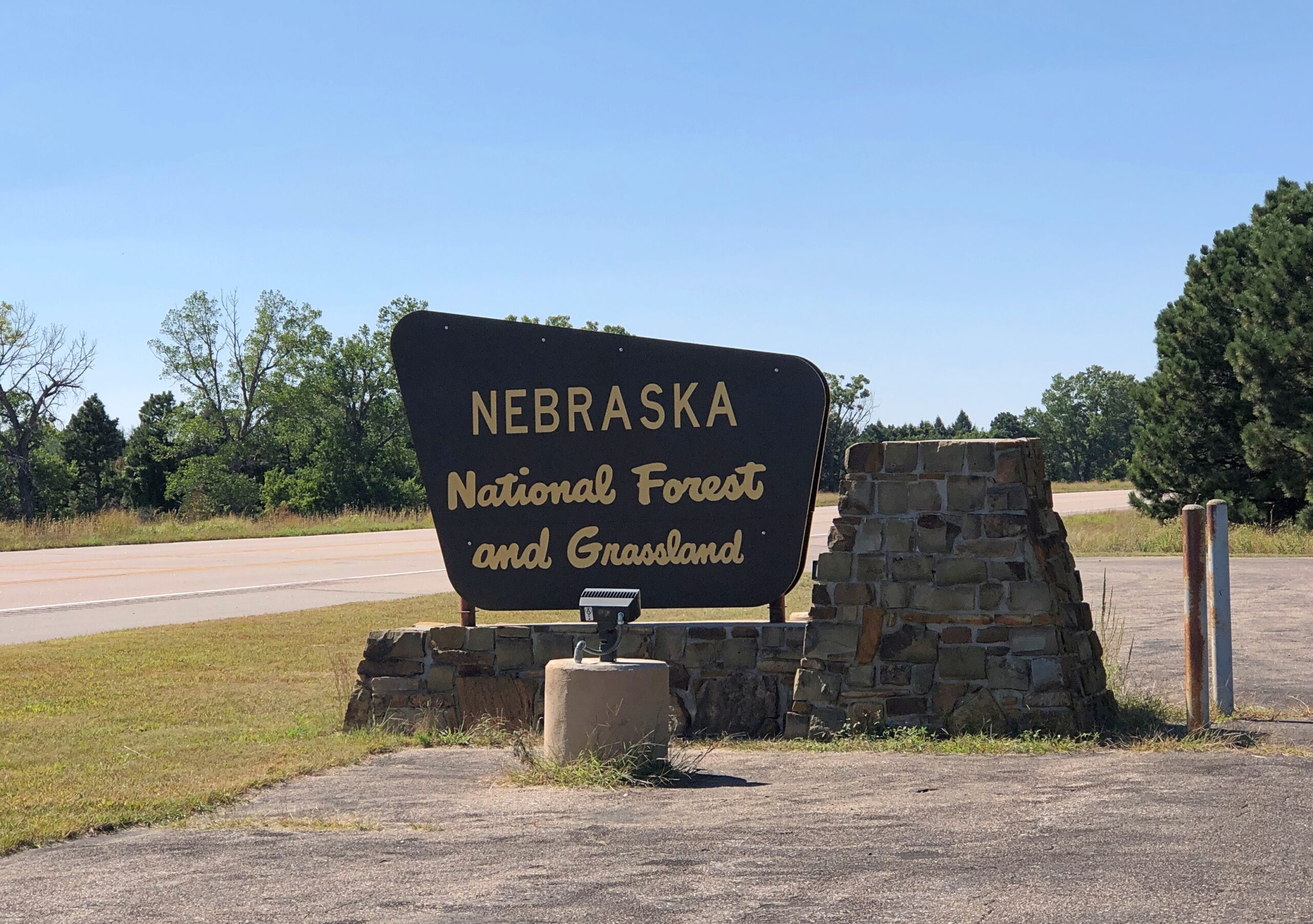
Eventually the highway reaches the Nebraska National Forestand Grassland, a patch of (partly) wooded land that inspires the question, there’s a national forest in Nebraska?
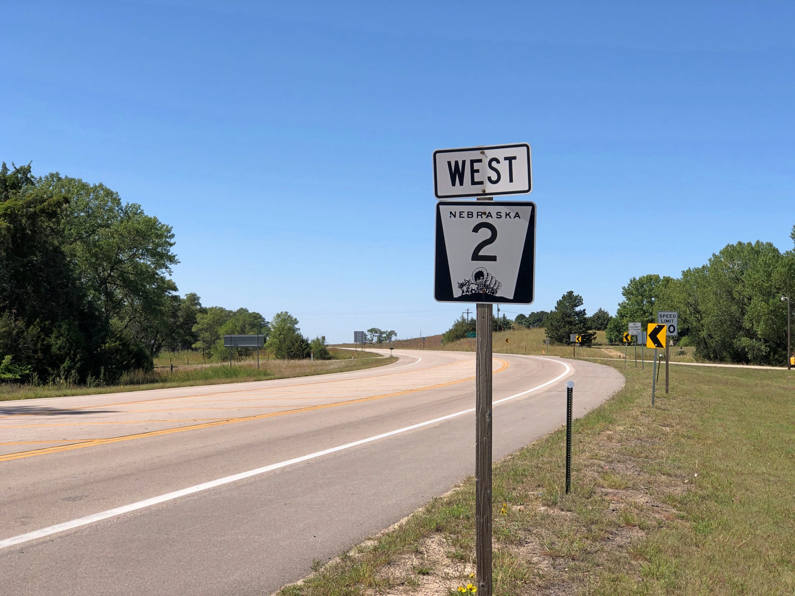
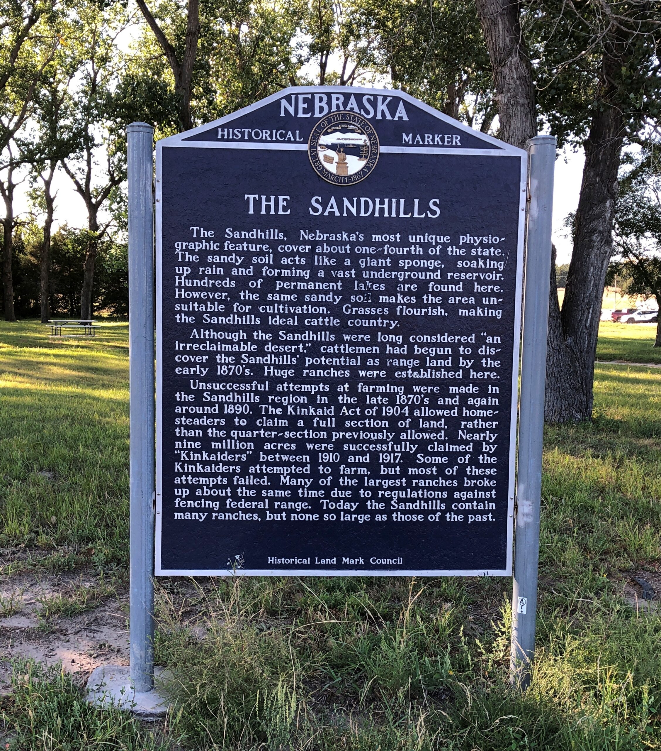
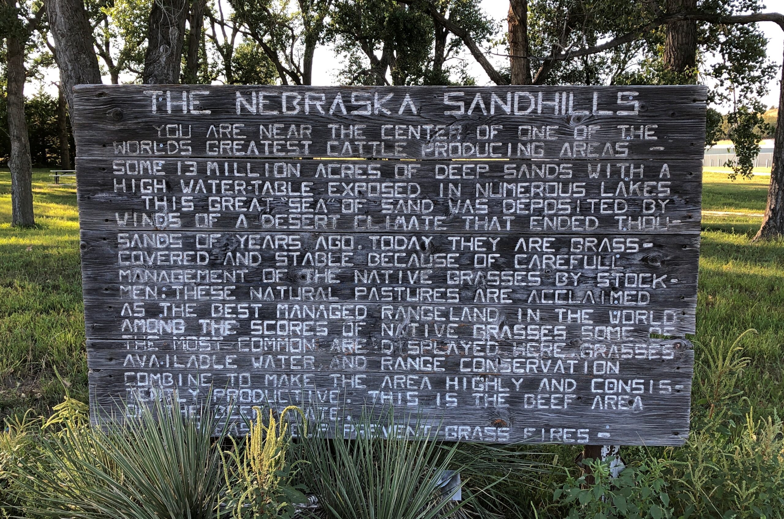
West from the forest, Nebraska 2 crosses the Sandhills, an unusual place here in North America, with the land morphing from cropland to ranch land on sandy steppes. The towns on the way are mere hamlets, and sometimes not even that. On the western edge of the Sandhills, one comes to the sizable town of Alliance, Nebraska, home of Carhenge and railroad staging area for coal trains headed east.
Before I did the drive, I was looking forward to it as much as any of the roads in Colorado. It lived up to expectations. Nice when that happens.
The Fence Postcites Charles Kuralt’s fondness for Nebraska 2: “Highway 2 is not just another highway that goes somewhere. Highway 2 is somewhere,” he’s known to have said. I’d say whatever else his failings, Kuralt had good taste in roads.
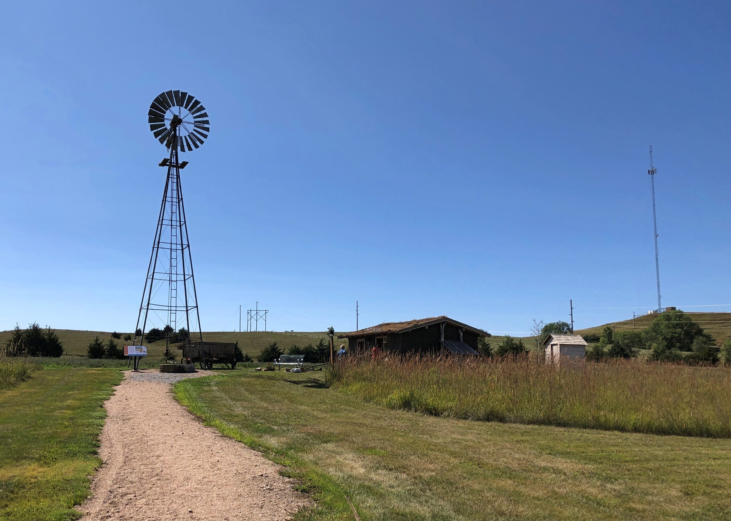
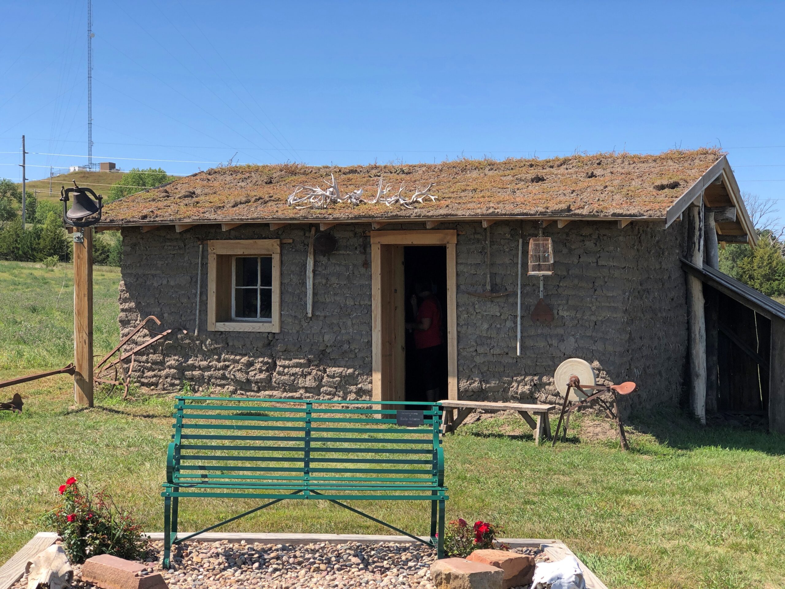
Just outside Broken Bow (pop. 3,491), seat of Custer County and pretty much the only town of any size in that county, the Sandhills Journey Scenic Byway Visitor Center offers a building with bathrooms and pamphlets and displays and, for my visit at least, a grandmotherly and talkative volunteer. Old enough, she said, to remember when the highway was just a road through the countryside that attracted no attention from the outside world. Not a scenic byway, and sand hill cranes were just flocking birds. Now a trickle of tourists and bikers and RVers come this way. She had some solid recommendations, especially a good diner for lunch.
The visitor center grounds include a relocated (or was that reconstructed?) Sandhills cabin. The residences of the farmers trying to scratch out a living in the Sandhills, and finding out that no amount of scratching would make decent crops grow consistently from the land.
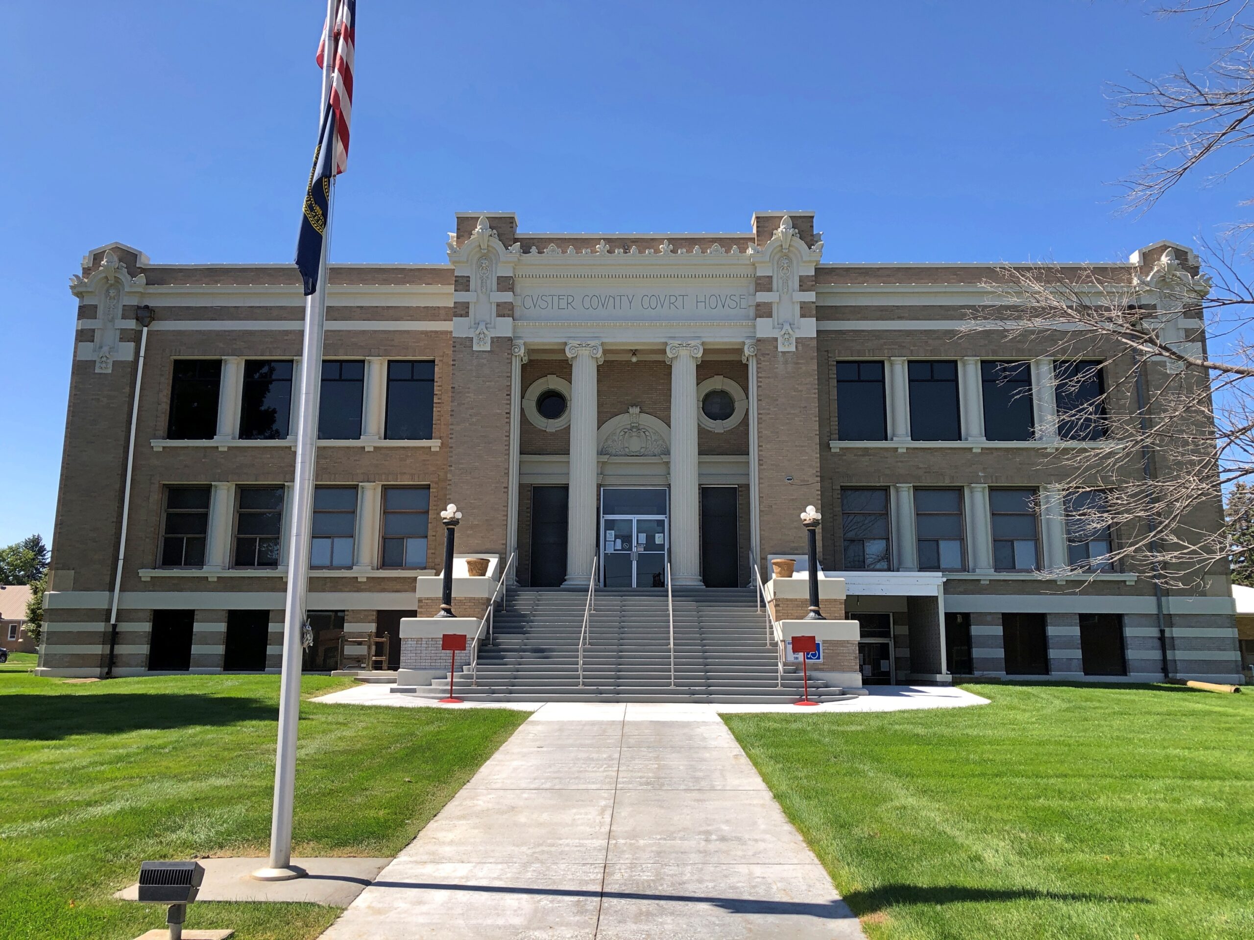
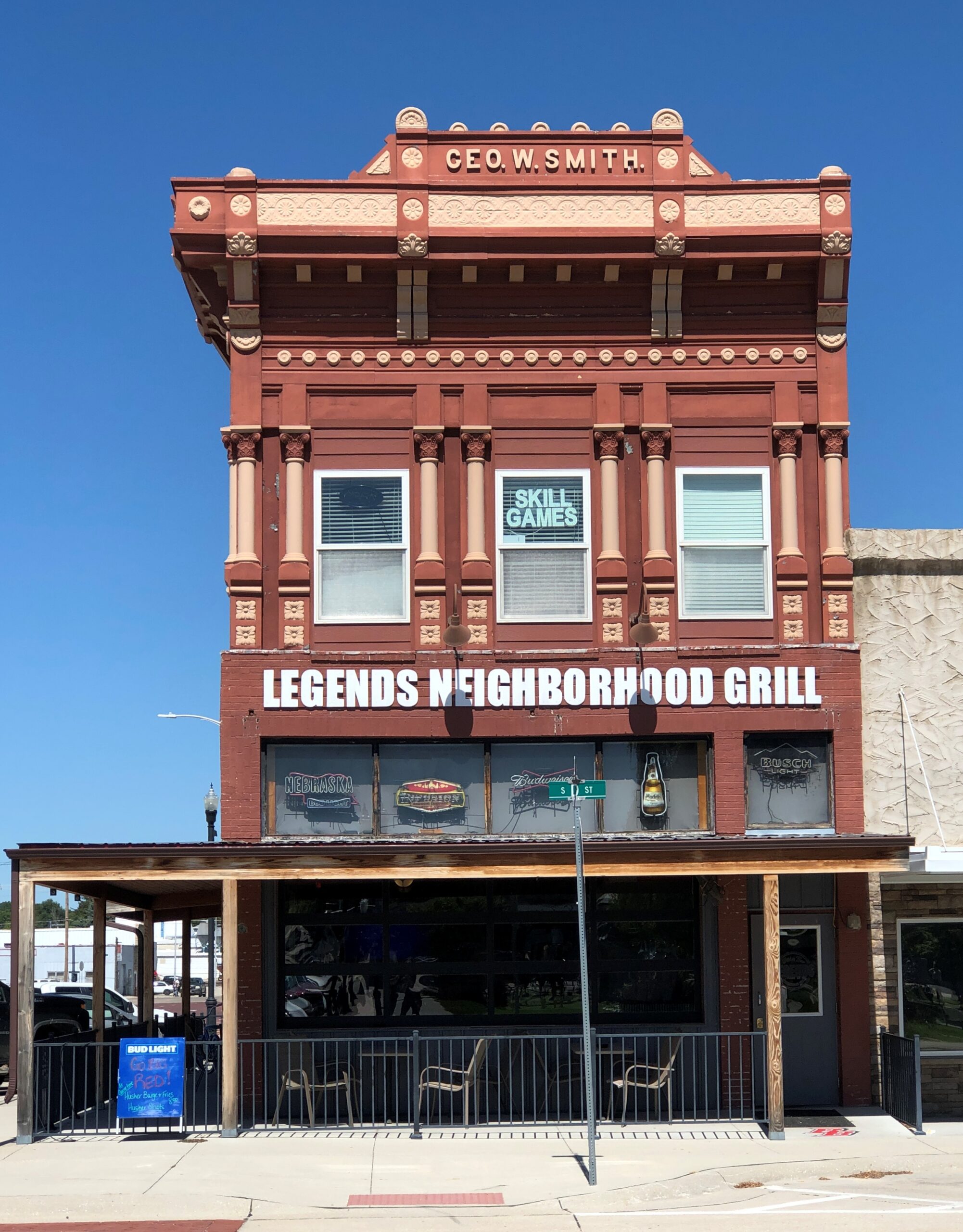
The Custer County Courthouse. Saturday, closed.
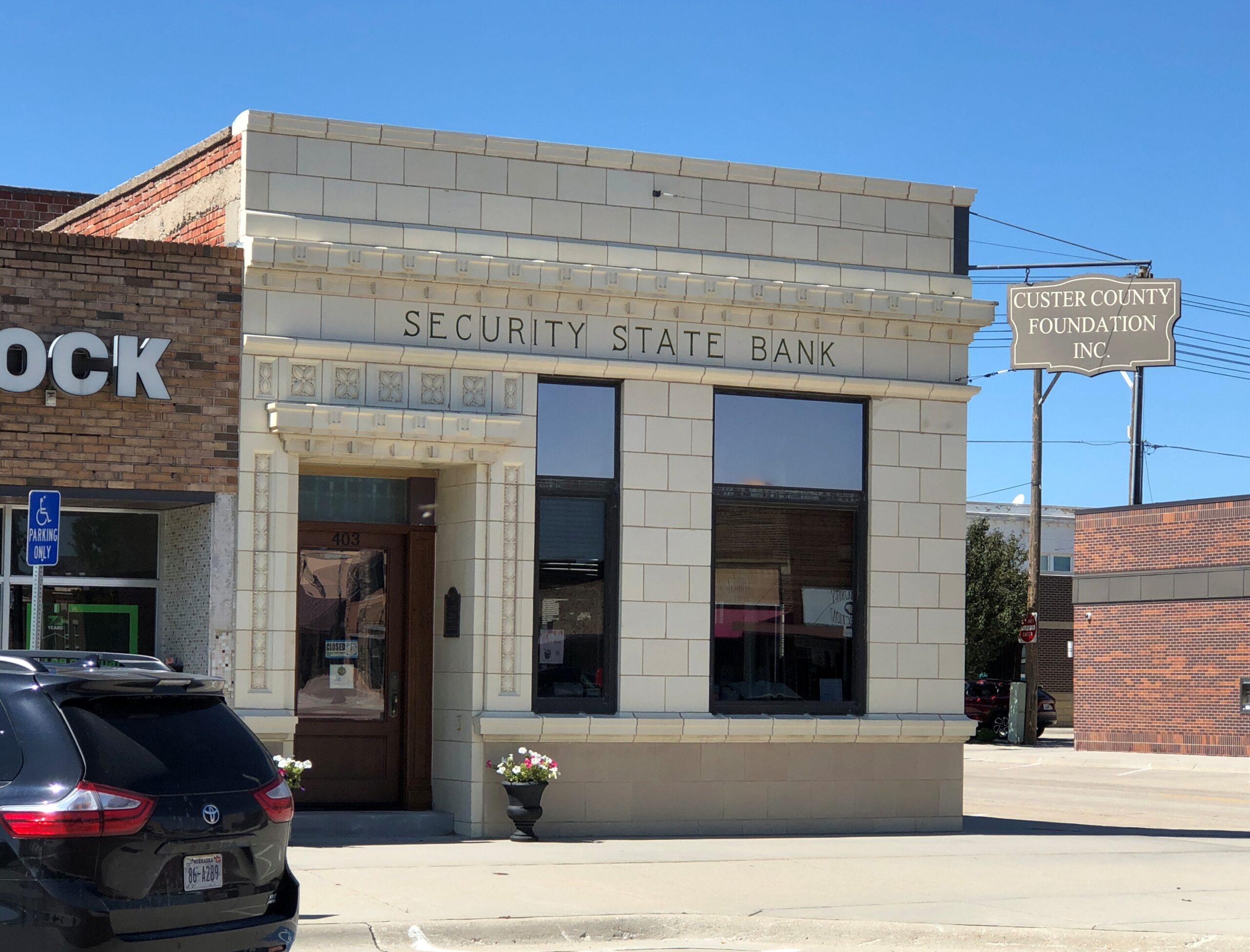
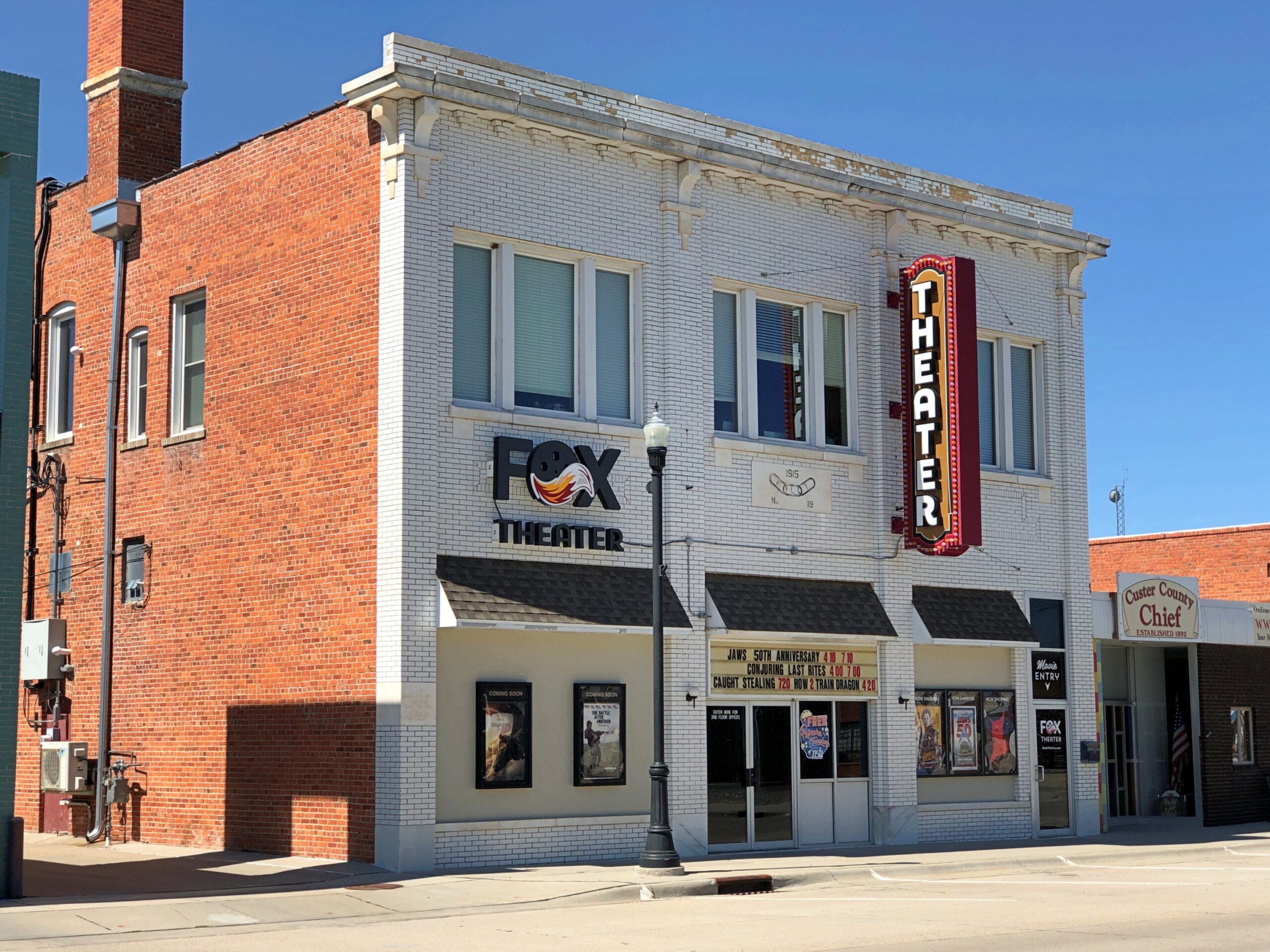
A block from the courthouse, some buildings around City Square Park.
City Square Park is a generic sort of name. Wonder whether there’s anyone from the town who can be honored by renaming the park? Looking at list of notables from Broken Bow, one instantly stands out.
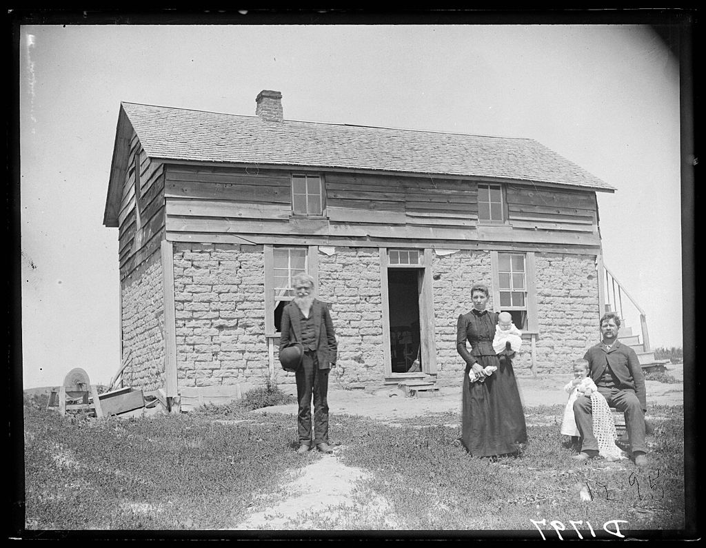
Wiki: “Solomon D. Butcher (January 24, 1856 – March 18, 1927) was an itinerant photographer who spent most of his life in central Nebraska, in the Great Plains region of the United States… he began in 1886 to produce a photographic record of the history of European settlement in the region. Over 3,000 of his negatives survive; more than 1,000 of these depict sod houses.”
Frederic Schreyer and family, Custer County, 1880s, by Solomon Butcher.
Definitely name the park after Butcher, Broken Bow.
One more in that town. I couldn’t be bothered to get out of the car.
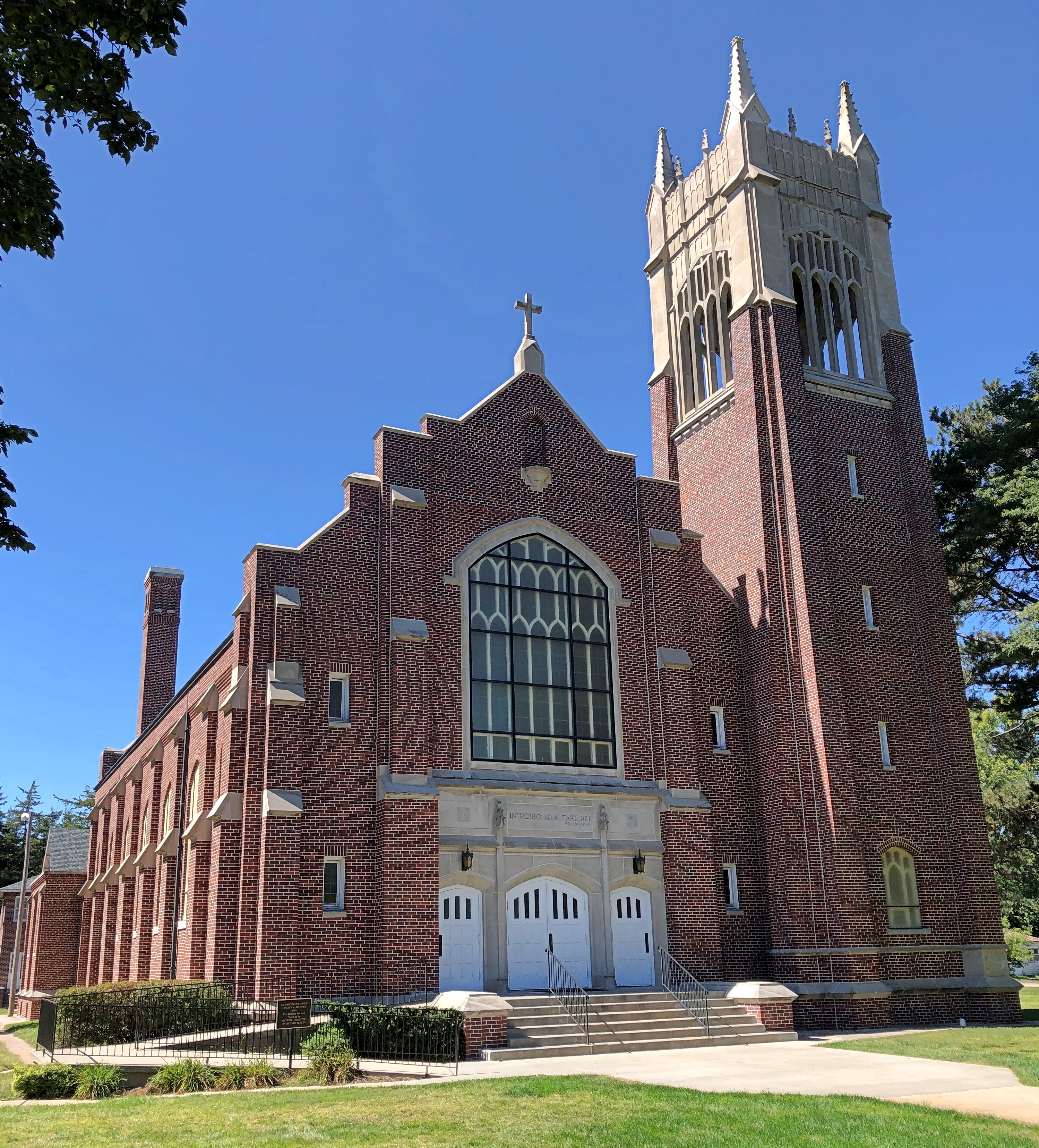
West of Broken Bow is Anselmo (pop. 145), home of this church, St. Anselms Catholic Church, nicknamed Cathedral of the Sandhills. Saturday, closed.
A more common sort of building, not far from the church.
Not the most imposing that I saw, but representative of the many structures like it. The grist of a photo collection. Of course it has been done. I’m pretty sure I saw a room of Bernd Becher’s photos of water towers at the Modern Art Museum of Fort Worth.
Nebraska National Forest and Grassland is in an unexpected place, slap in the middle of Nebraska, not due to a freak of nature, but the efforts of human beings. Specifically, mass plantings of trees by the federal government for more than 100 years, beginning (not a surprise) during the administration of Teddy Roosevelt.
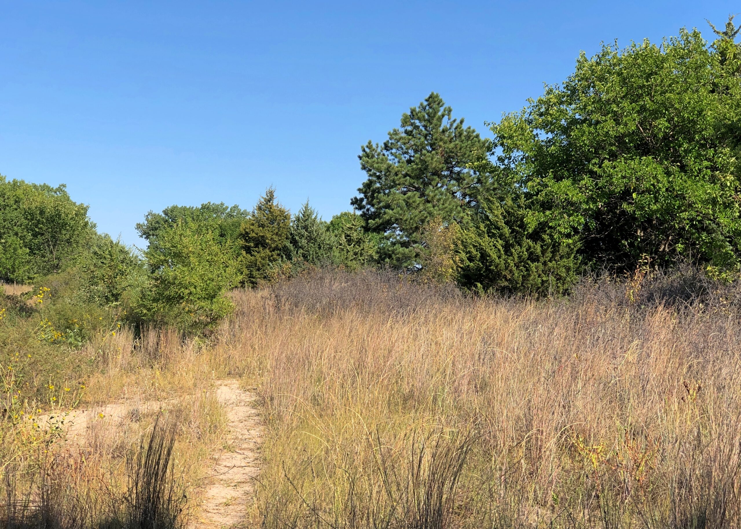
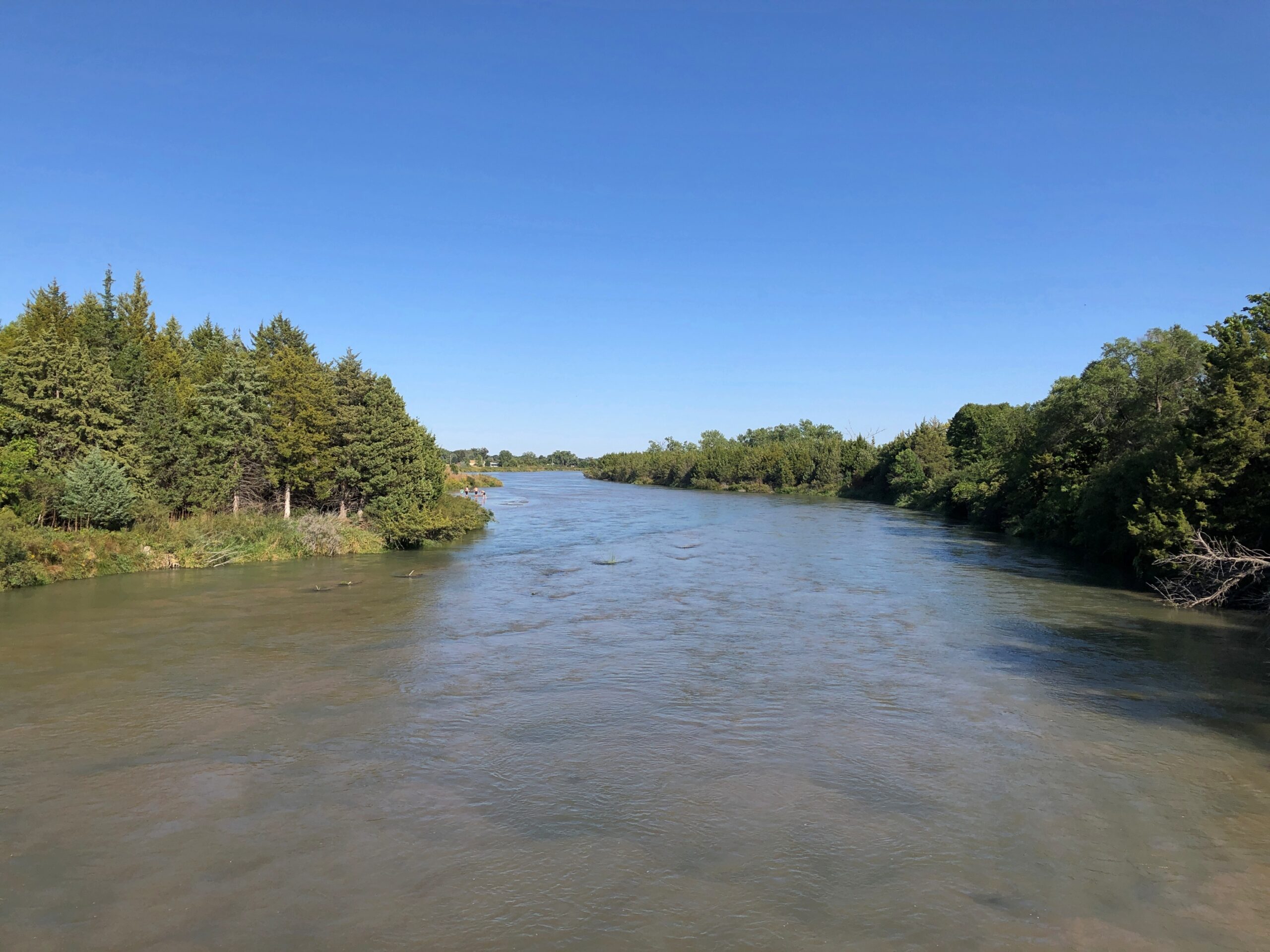
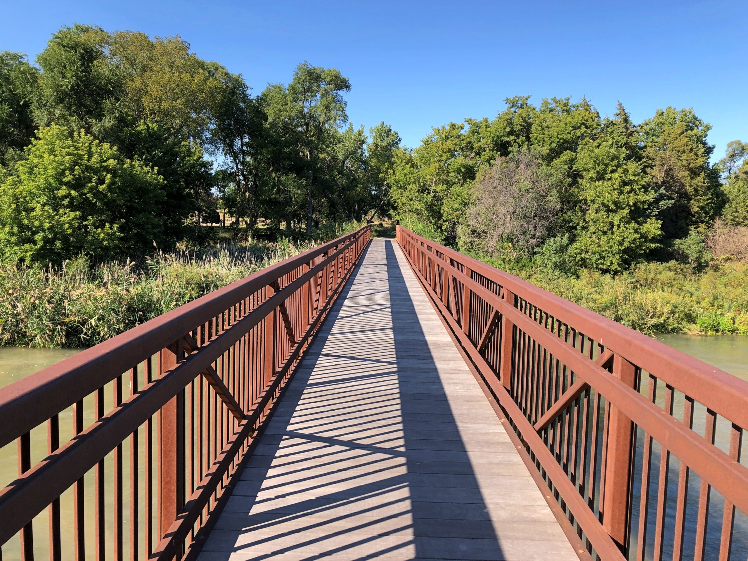
Near the national forest entrance is the Middle Loup River, broad but shallow, and crossable on a foot bridge.
I camped in the national forest. The campgrounds weren’t completely full, but there were more people than I expected for a remote spot in Nebraska. Then again, it was a Saturday night, and soon enough I figured out what brought most of them: the ATV trails. Not long after dawn on Sunday, the campers across from me – a man and a small knot of teenage boys – roared away in a small caravan of ATVs crusted with dust from the day before.
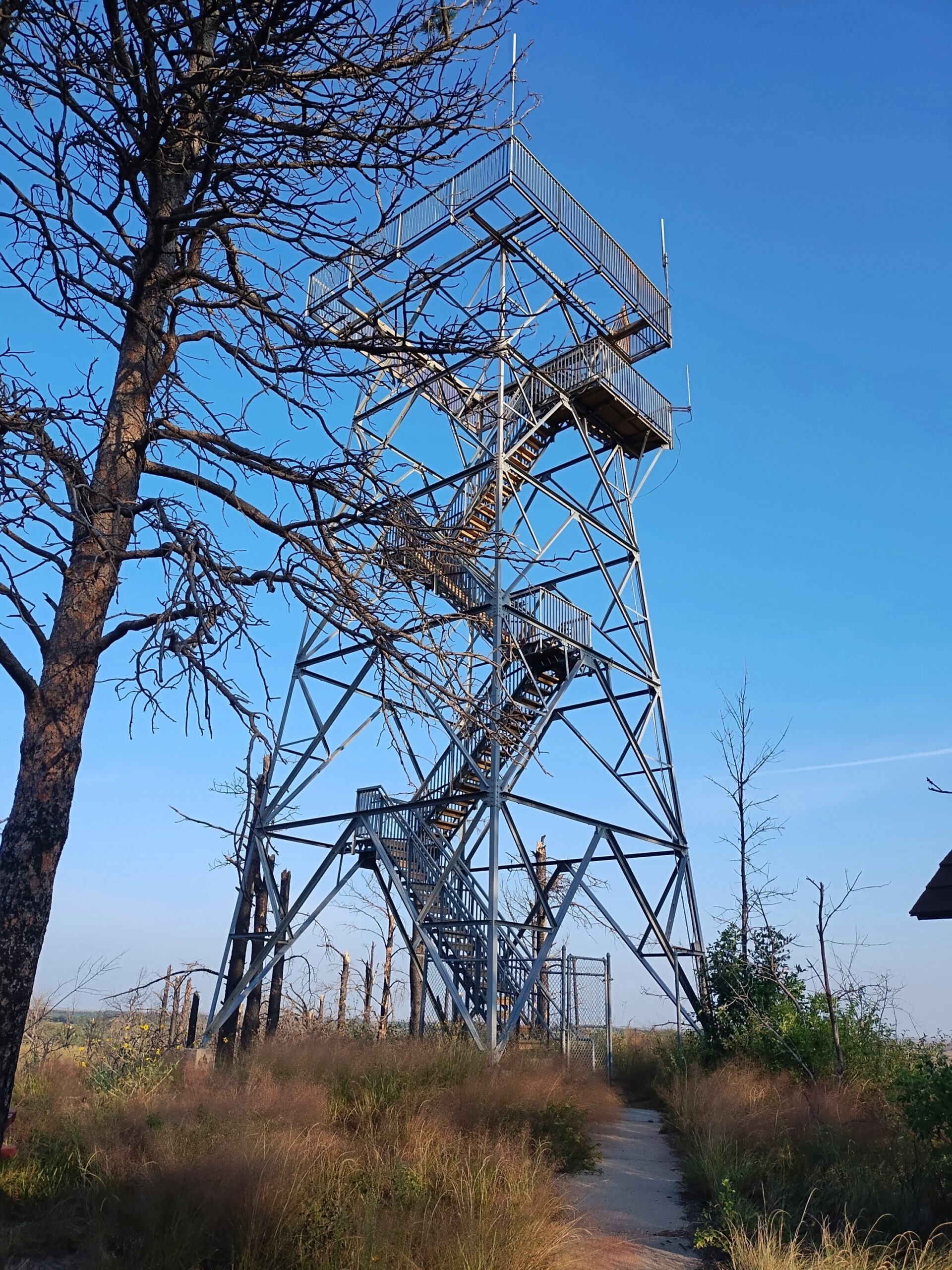
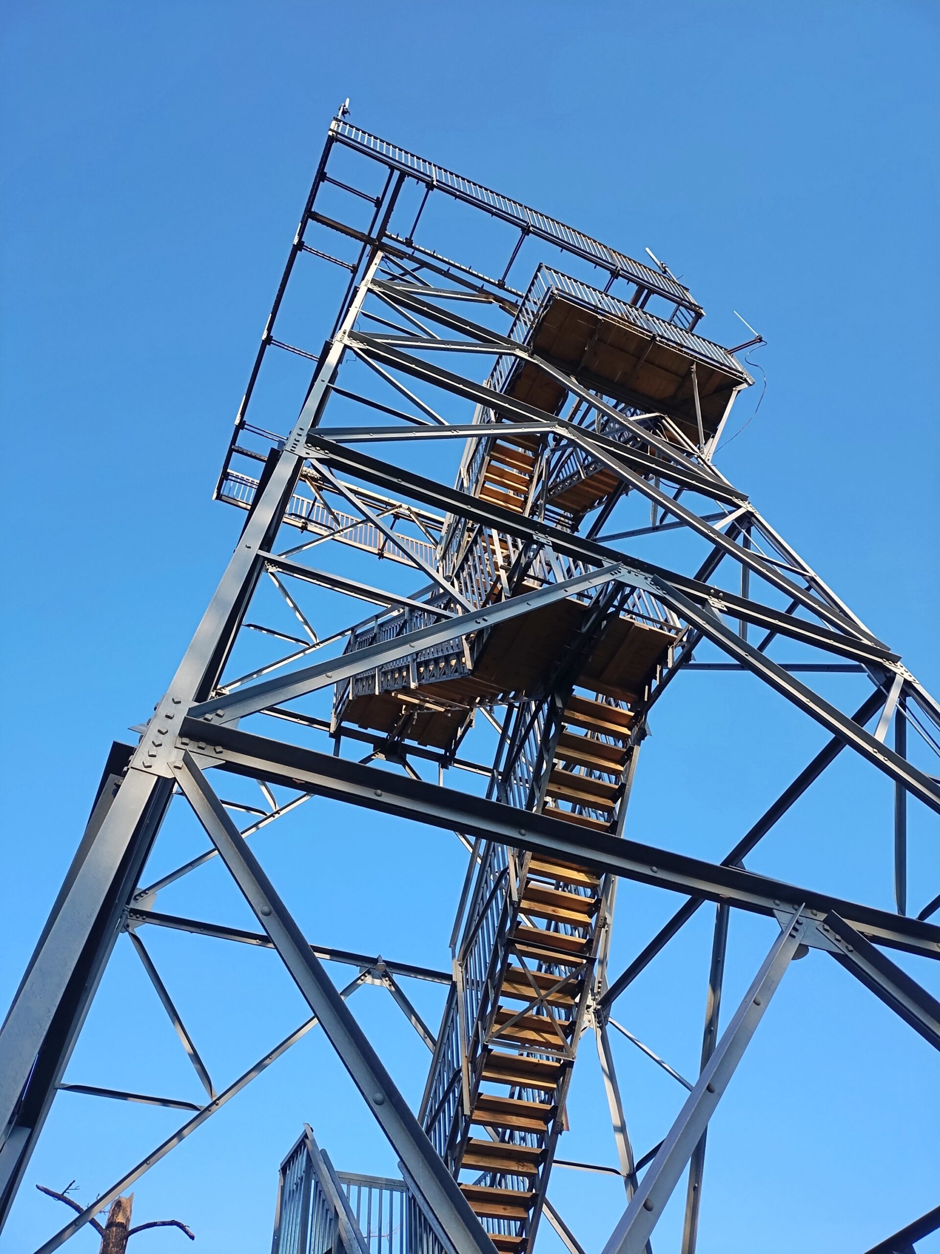
I packed up and sought out a quieter place. A national forest hill with a fire tower and some views. The tower was closed.
But the views were still pretty good.
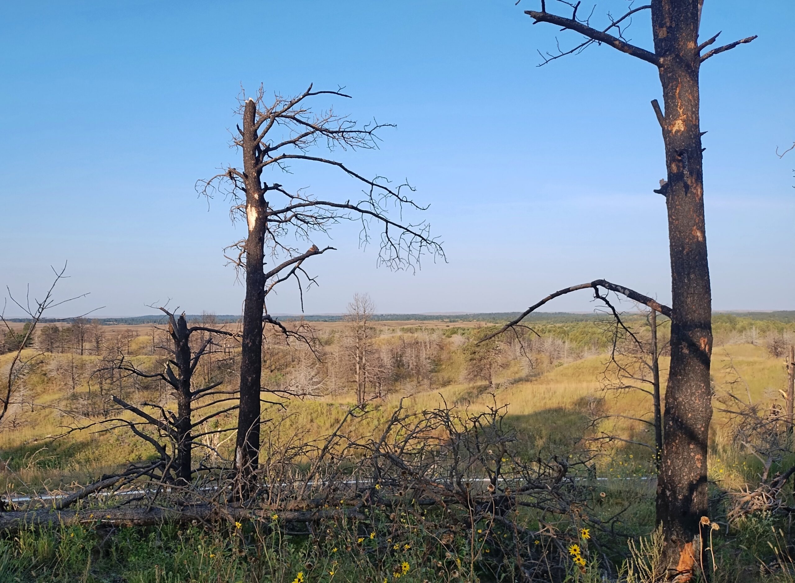
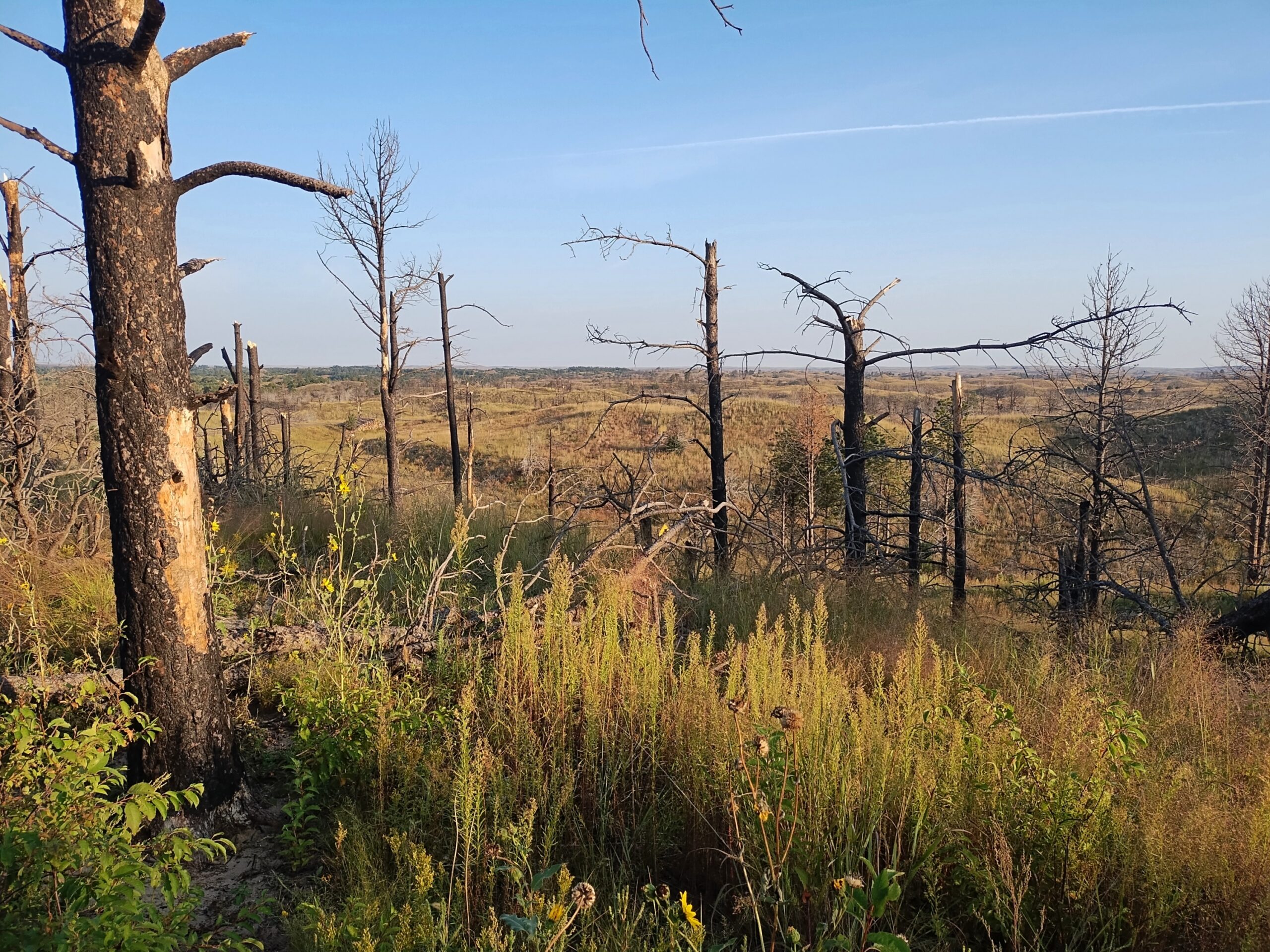
West from the national forest, Nebraska 2 heads into the rolling grassland of the Sandhills proper. In the village of Thedford (pop. 208), varied public interpretations of the Sandhills are available for reading.
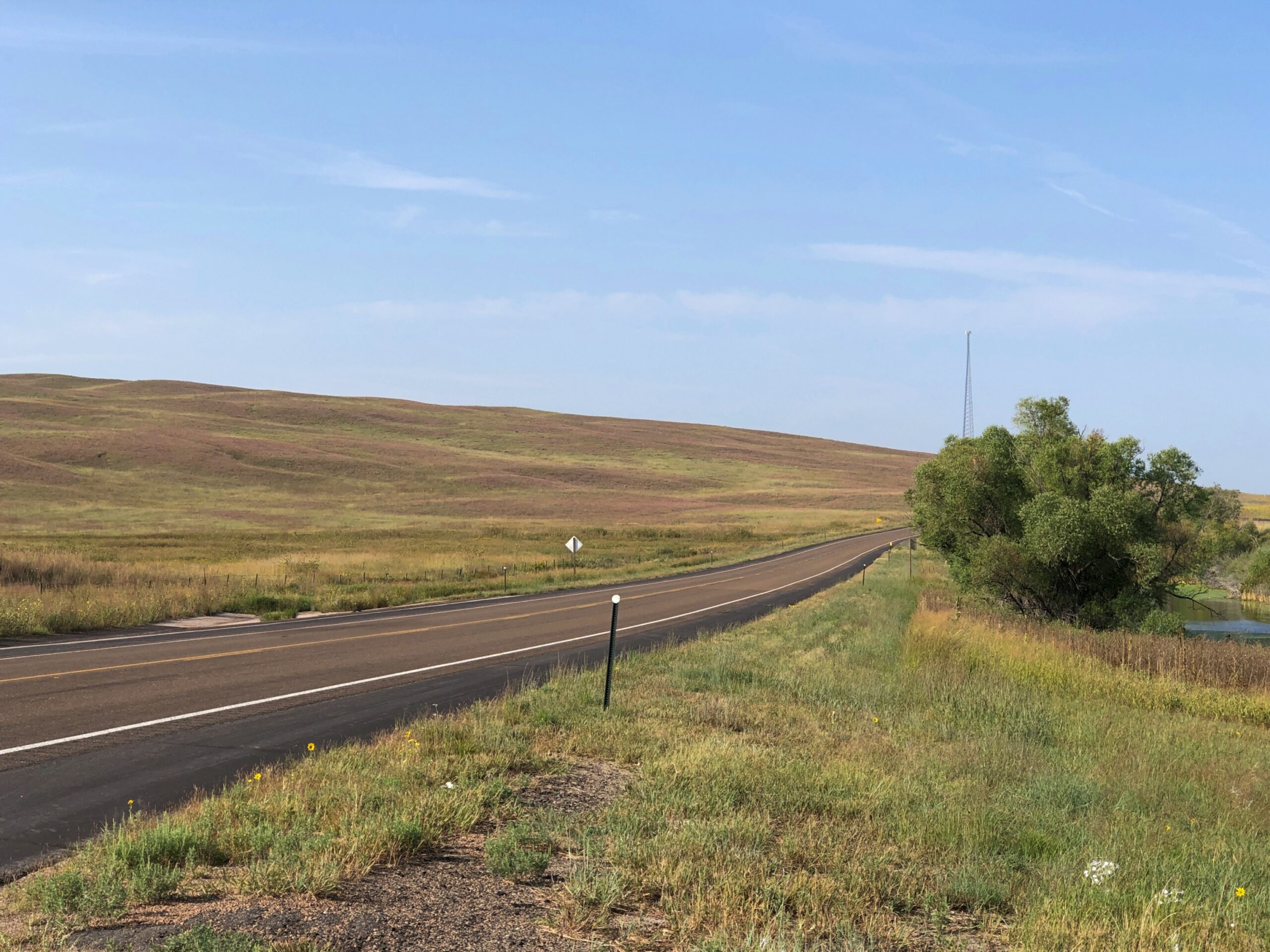
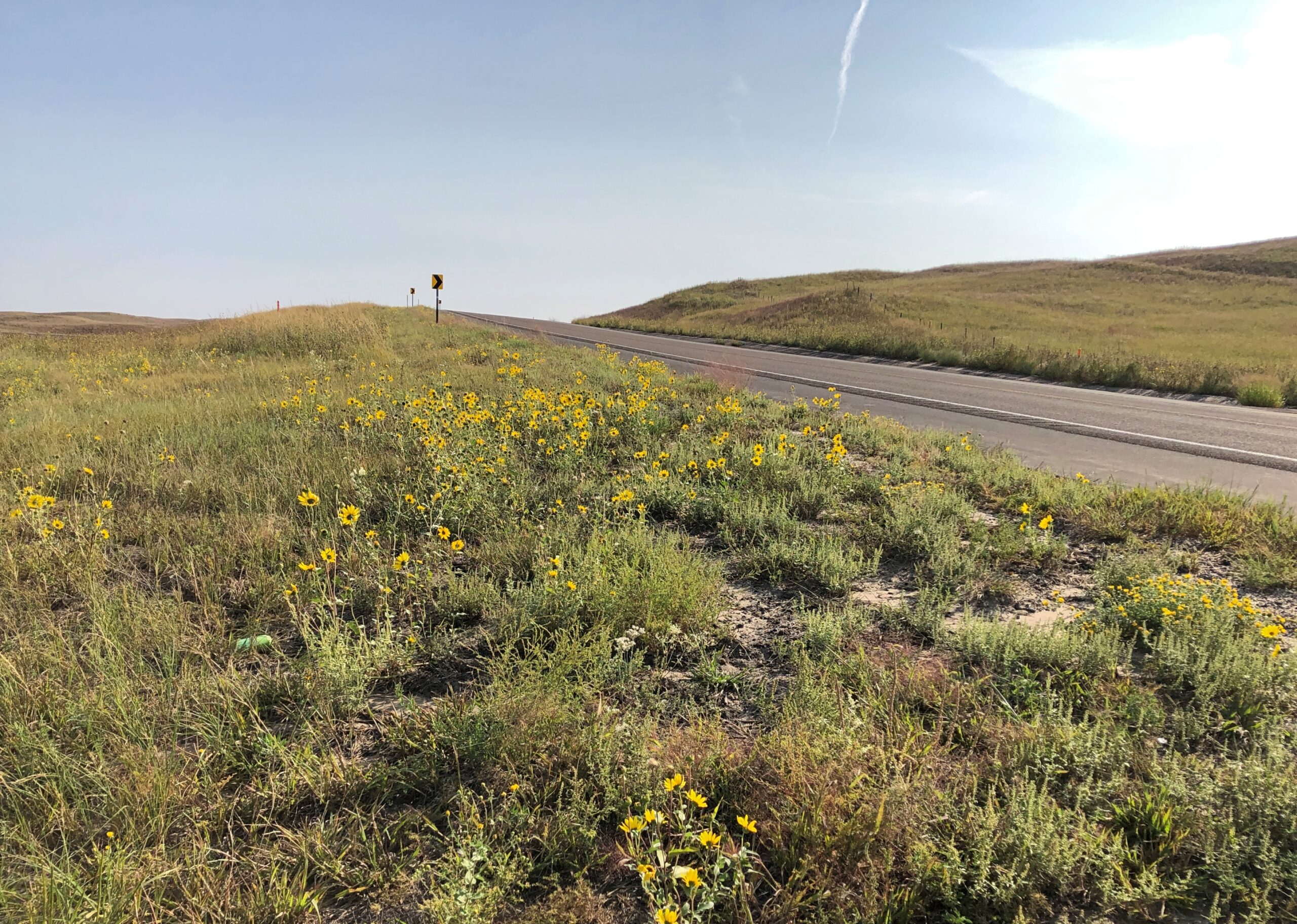
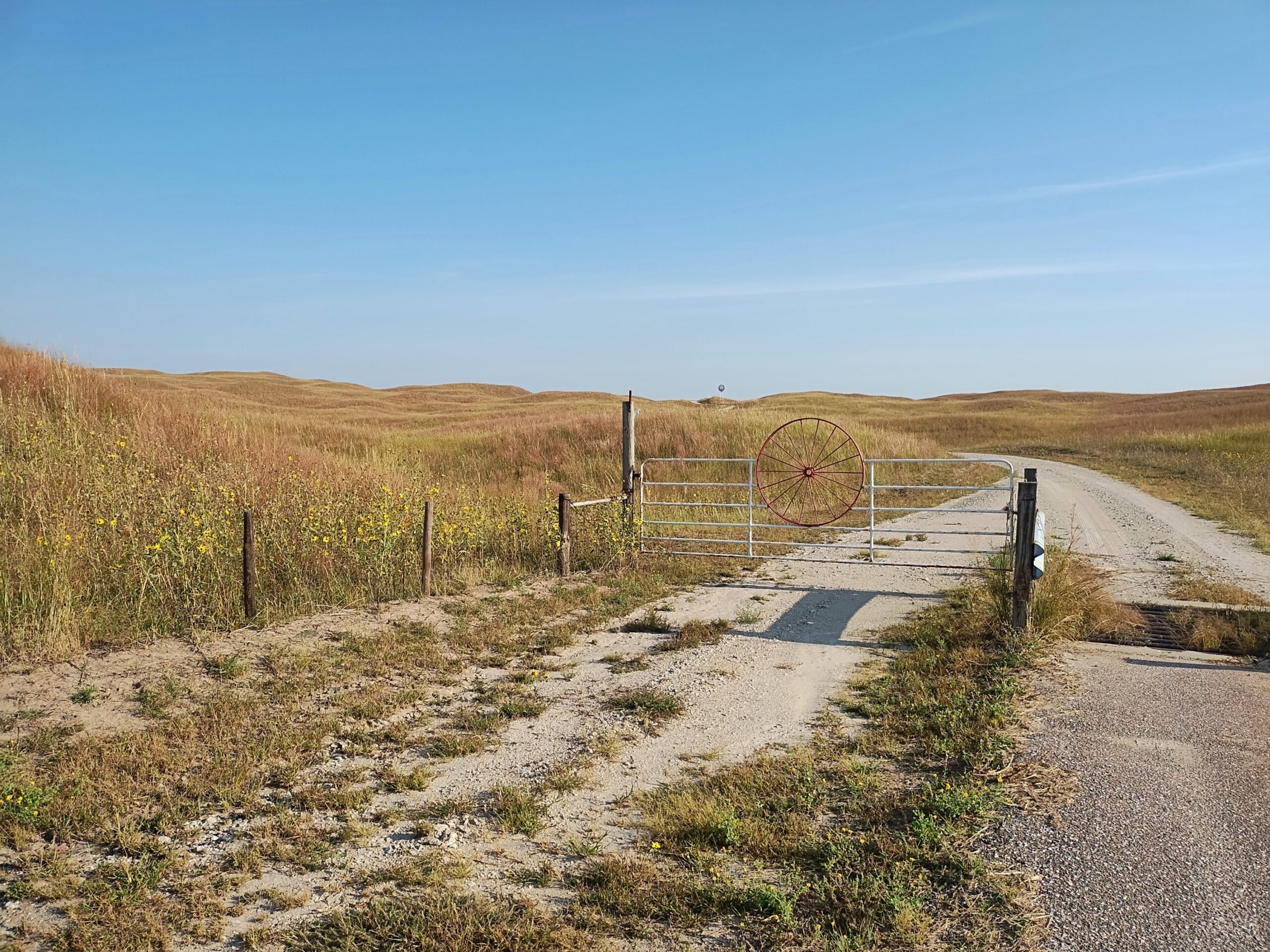
The terrain along the highway Nebraska 2 might seem monotonous to some. Too bad for them. You’re driving across a kind of ocean, terrain all wavy, except that it’s solid ground, marked by occasional trees or manmade structures, and side roads — trails — wandering deeper into the hills.
The handful of towns are really just wide places in the road. Sometimes, not even that.
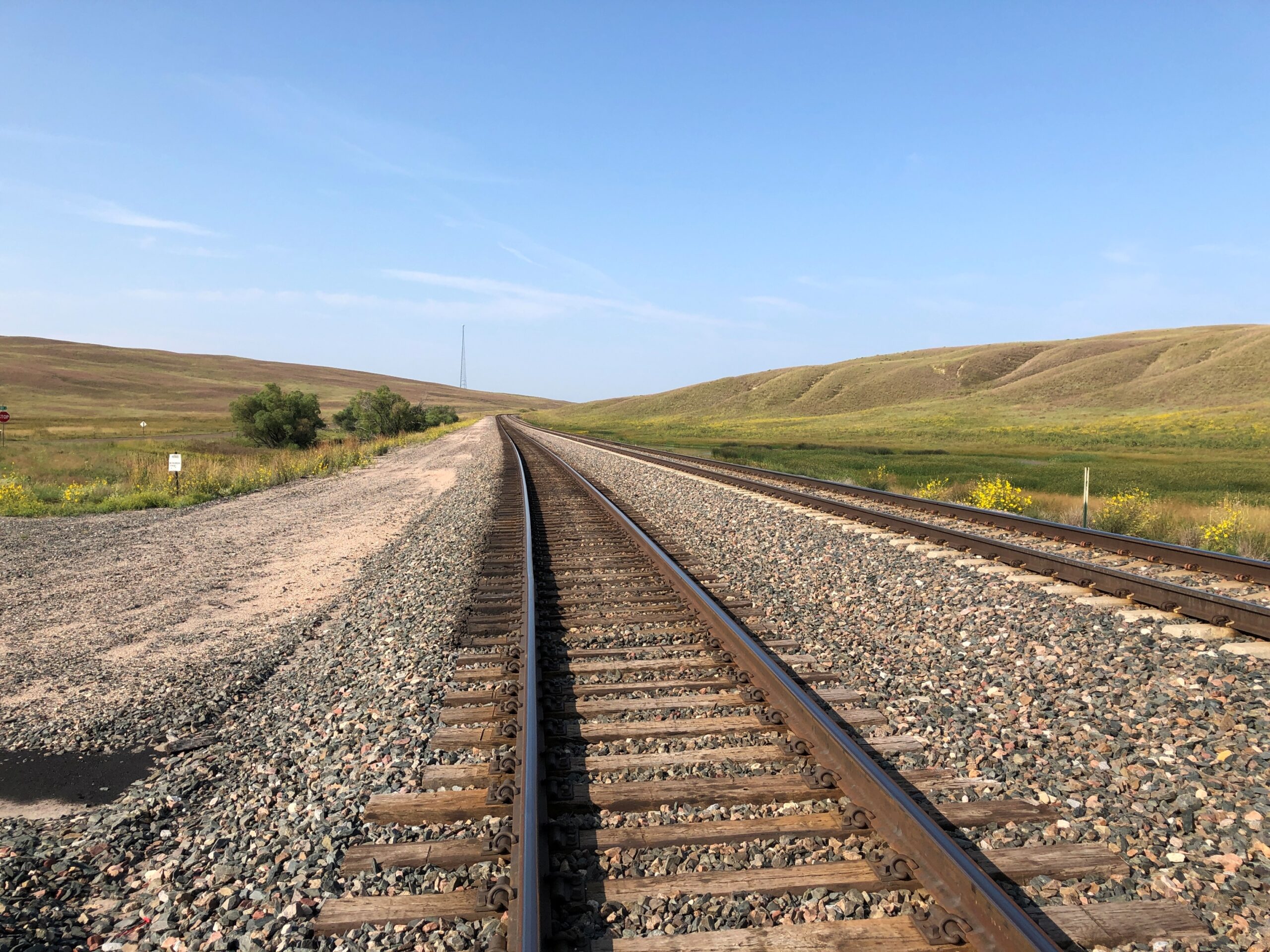
Nebraska 2 parallels the BNSF line, which came first.
Note: I was standing on a public side road to take that picture, as I do with all my RR shots.
Eventually, I took the road to Alliance. But that was merely incidental. Out this far, the road, as Kuralt said, is the destination.


