Jana Seta Tallinn

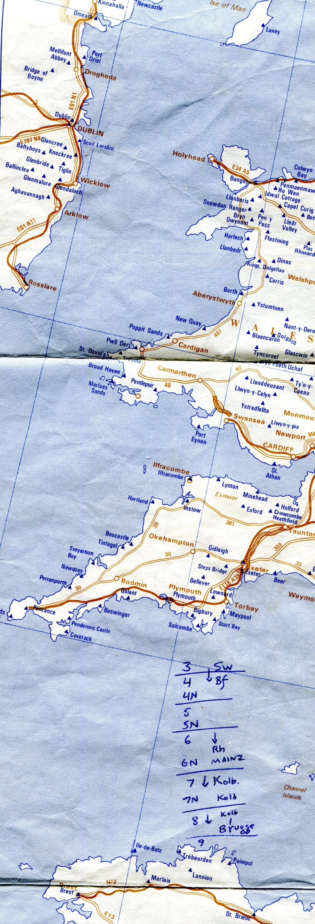
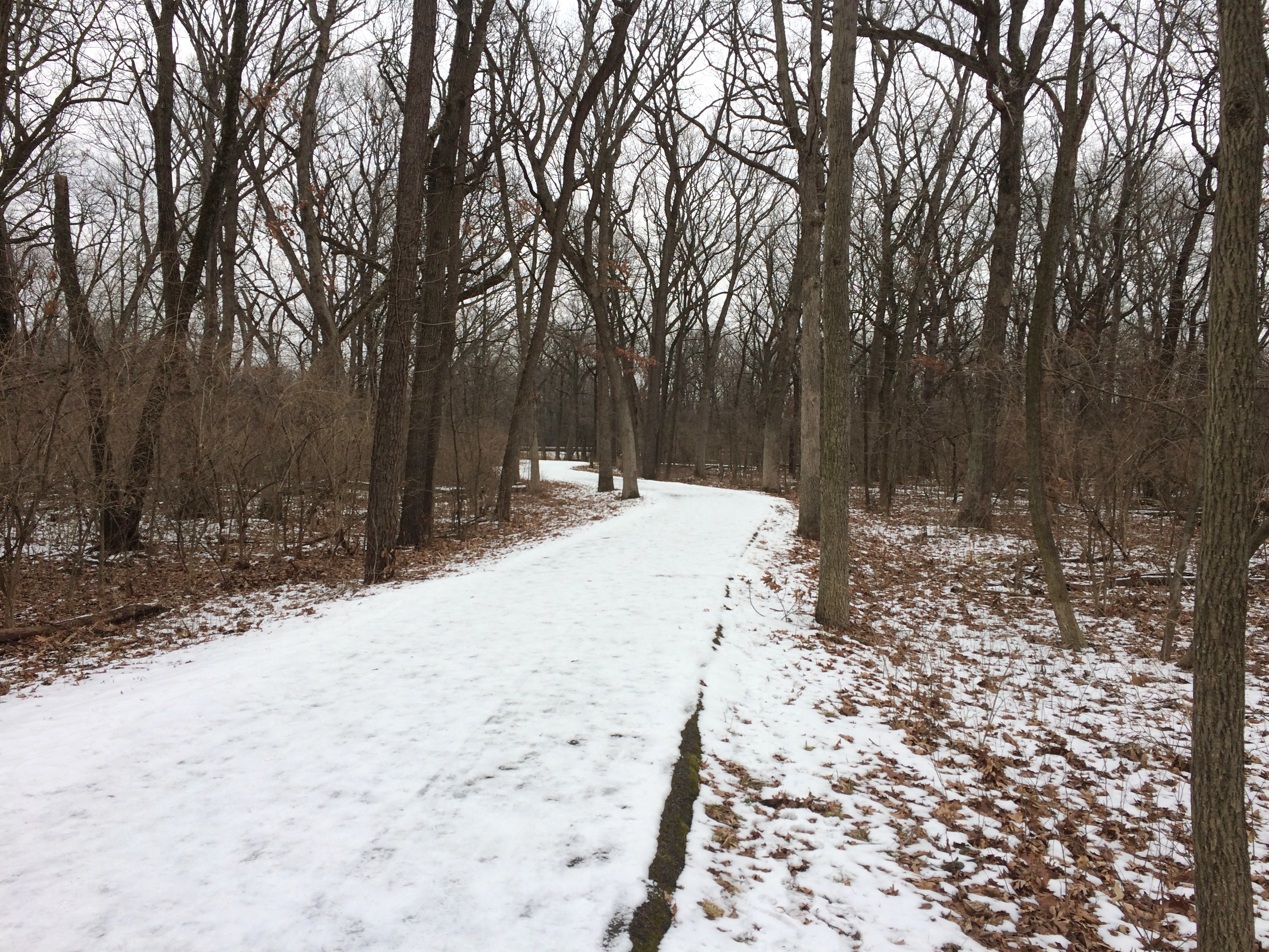
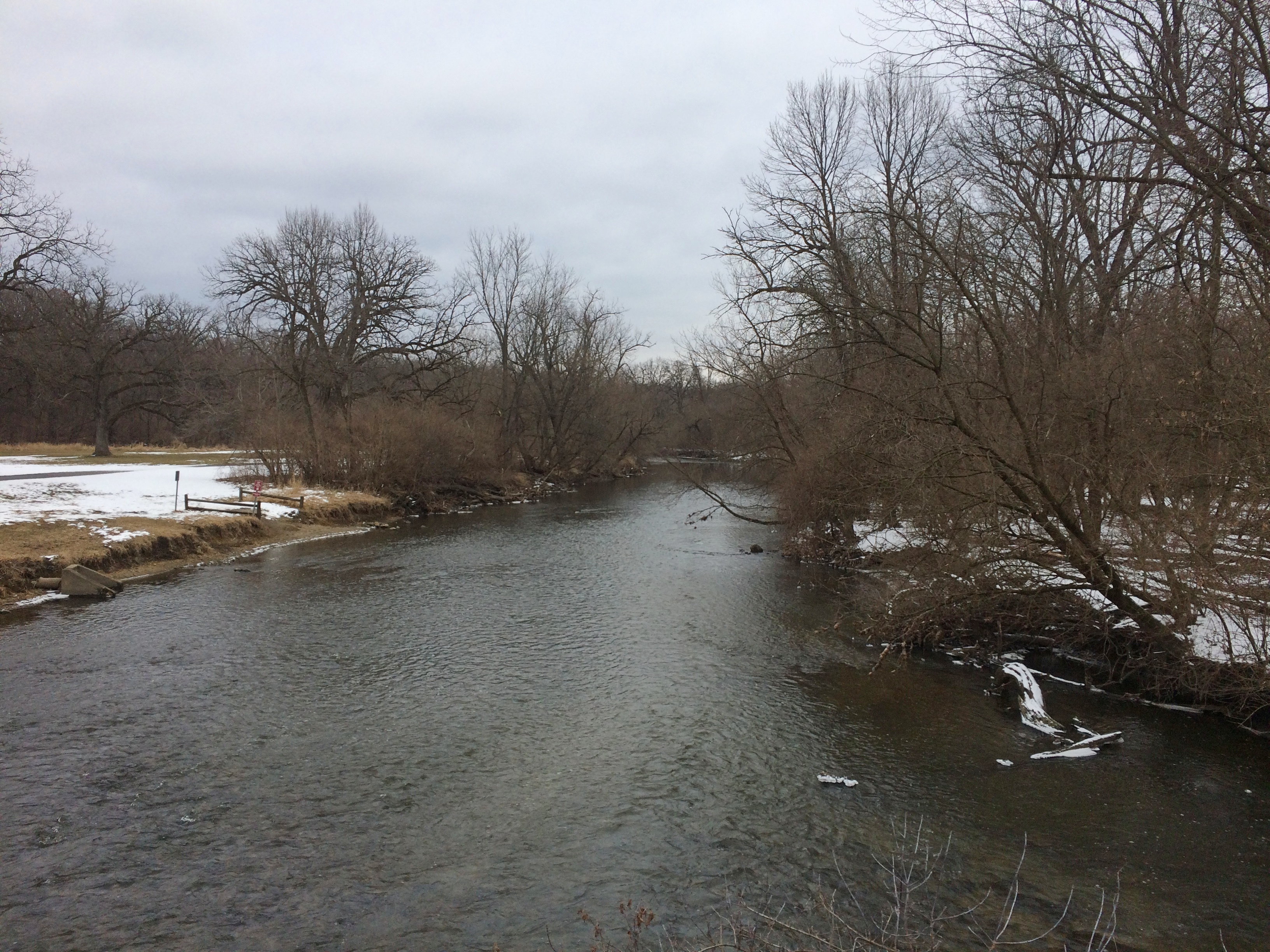
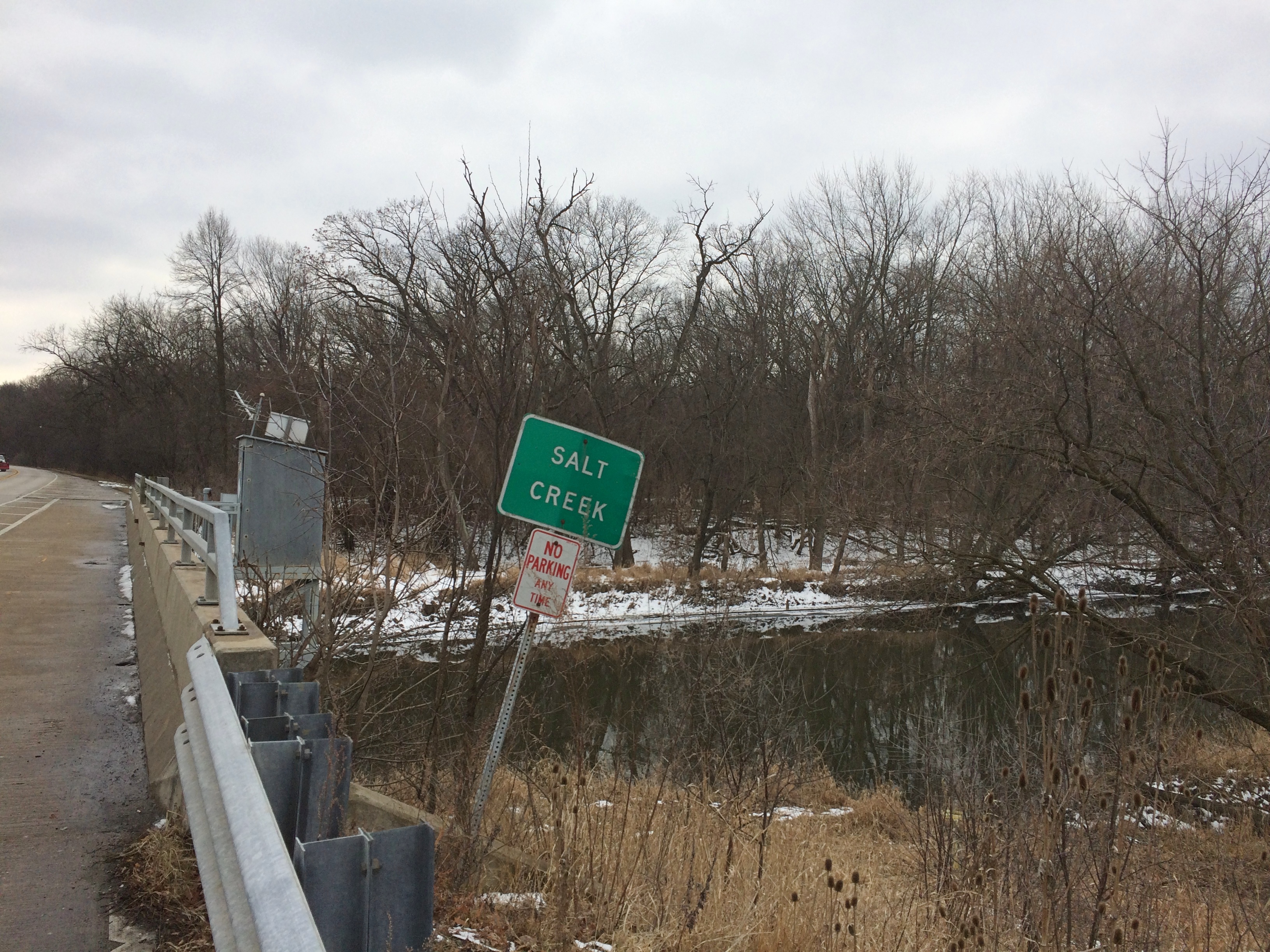
This looks like a promising way to ease into proto-spring. Or, as you notice the crunch of snow under your feet give way to squishing sounds, the Mud Season.

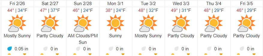
That’s just the near-term weather forecast for where I live, and thus a very narrow focus. I am glad — for any number of reasons, including Siberian weather — I don’t live in Irkutsk. The days ahead for that place:

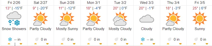
Which pretty much looks like here during February until a few days ago, except we had more snow. Another difference is that I expect the rest of the spring is going be much colder in Irkutsk than here.

Then again, for year-round pleasant weather, I hear the place you want to be is Medellín:

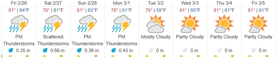
That does look pleasant, just keep a sweater around for the evening. Reminds me of Mexico City in December, except there wasn’t a bit of rain.

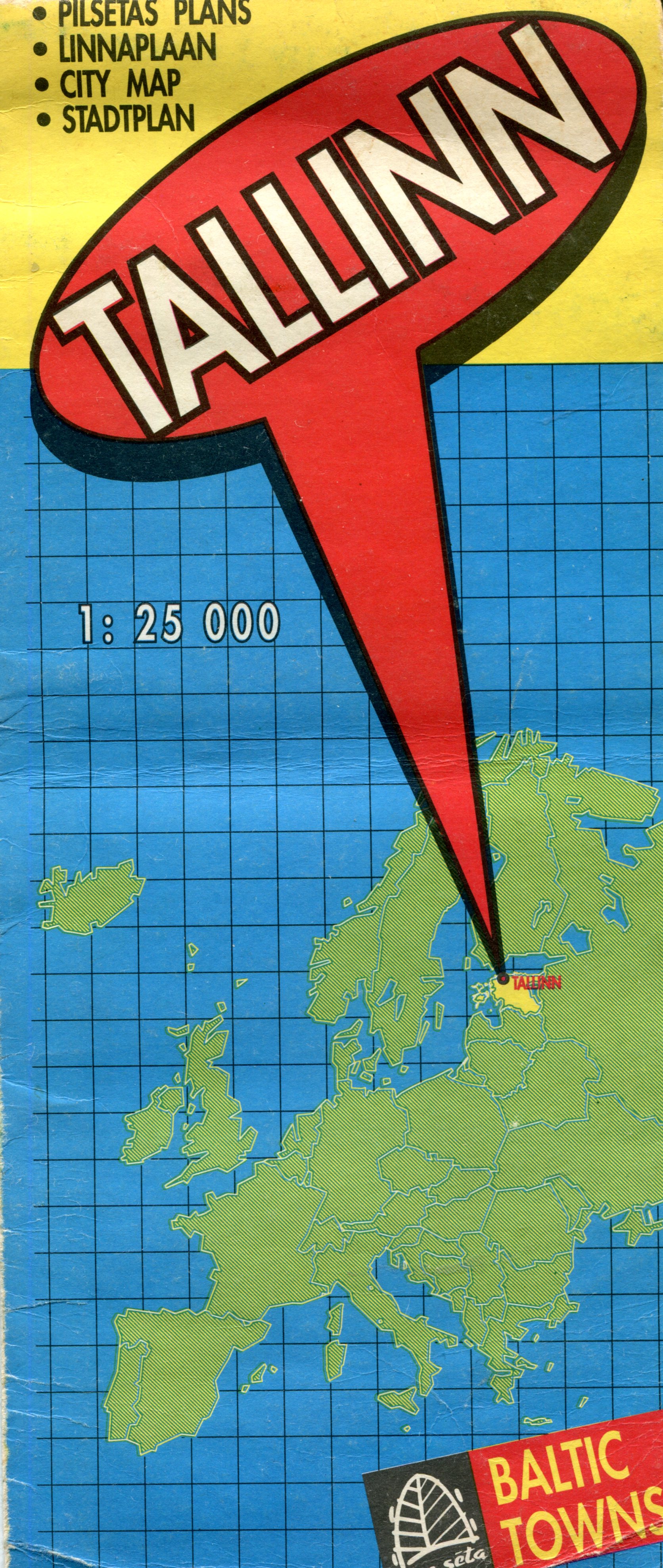
One more map (for now): Tallinn. Nice town, Tallinn, at least in 1994, and I expect it’s done well for itself in the generation since casting off the Soviet yoke.

The map front is simple enough, and reminds everyone where Estonia is in the greater scheme of Europe. Guess some people need to be reminded of that kind of thing.

The map is the product of Jana Seta, “publishing house, maps and art gallery” in Riga. I’m happy to report that it’s still around, and has a web site that tells me that the company had just started business the same year we visited Riga, which was just after we were in Tallinn. Unfortunately, we didn’t visit the map store.

“We started on the 19th of April 1994 when the specialized map and travel literature outlet — Jana Seta Map shop — opened its doors to the first customers in the newly renovated Berg’s Bazaar building in Riga,” the site says. “At that time it was the first and only specialized map shop in the Baltics.

“Together with the constant in-going and out-going tourism development in Latvia, our shop has grown to become one of the leading map shops in the whole of Eastern Europe. Many trips around Latvia and abroad have started at the shelves of our map and tourism literature.

“The former USSR army general staff topographic map and city plans (published 1949-1991) have a special place in our assortment.” Hm.

One side of the map is a wider view of the city, while the other has a detailed map of the historic center, plus an index and advertisements for the kinds of things that tourists and business travelers might want, mostly in English. Looks like Jana Seta was quick to pick up the ways of private enterprise. The map key and other information are in English, Russian and (I assume) Latvian.

This is the inset for the historic center of Tallinn.

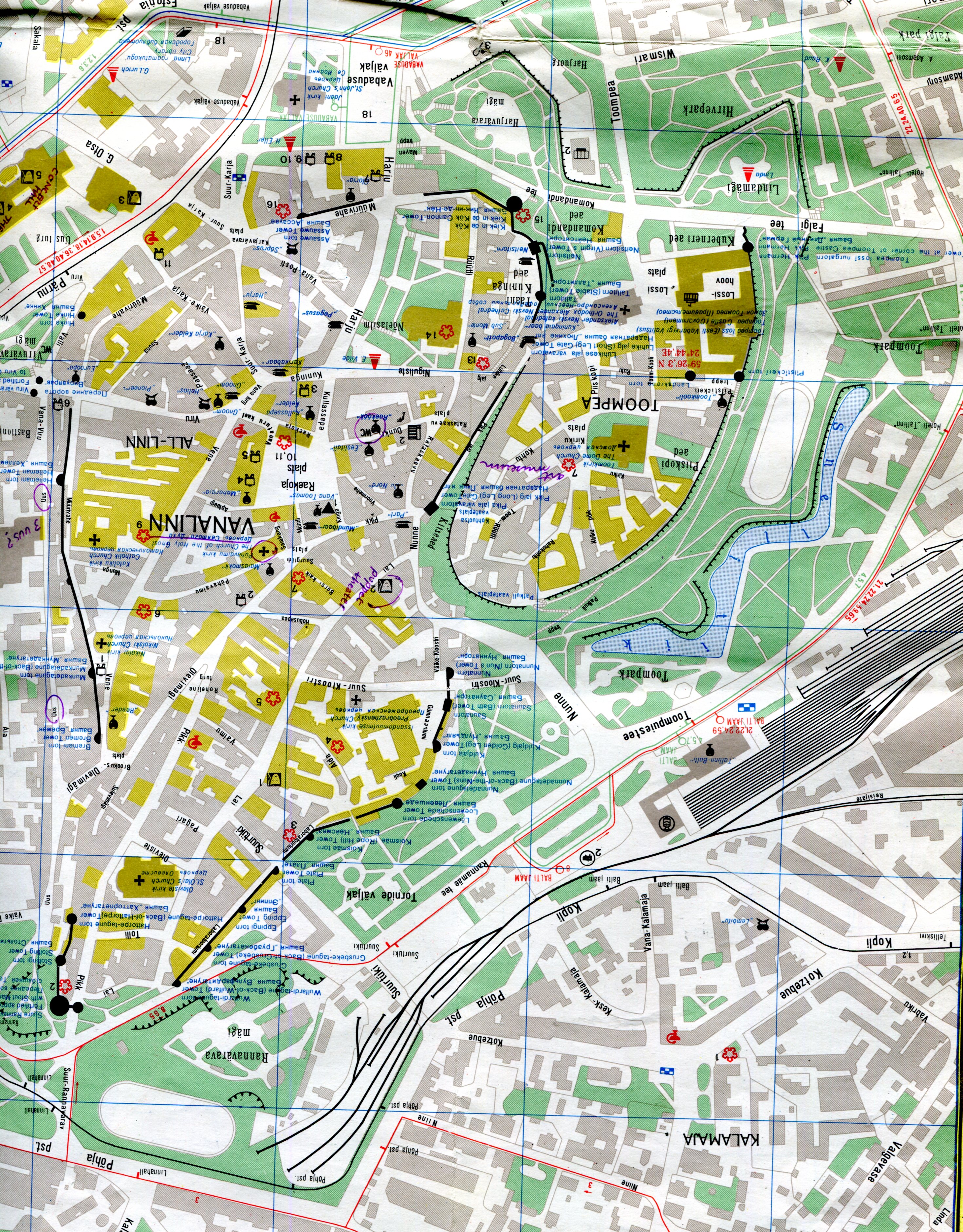
A fine old place to visit, though we stayed in cheaper accommodations out from the center, in a Soviet-era block of flats, and rode the convenient trolley into the old town. I see that I marked a few places of interest in purple ink, including one I labeled “puppet theater.” As much as I’d like to say that we went to a puppet theater in Tallinn, I’m afraid we didn’t.

“The Historic Centre (Old Town) of Tallinn is an exceptionally complete and well-preserved medieval northern European trading city on the coast of the Baltic Sea,” says UNESCO, which put it on the World Heritage list in 1997. “The city developed as a significant centre of the Hanseatic League during the major period of activity of this great trading organization in the 13th-16th centuries.

“The upper town (Toompea) with the castle and the cathedral has always been the administrative centre of the country, whereas the lower town preserves to a remarkable extent the medieval urban fabric of narrow winding streets, many of which retain their medieval names, and fine public and burgher buildings, including town wall, Town Hall, pharmacy, churches, monasteries, merchants’ and craftsmen’ guilds, and the domestic architecture of the merchants’ houses, which have survived to a remarkable degree. The distribution of building plots survives virtually intact from the 13th-14th centuries.”

One more thing I learned just now from Jana Seta’s site: “Mars has three craters named for places in Latvia: Auce, Rauna and Talsi. Now you know.”

Nelles Bangkok

Bangkok is one of those cities hard to navigate even with a map. But I guess the challenge and the thrill of finding your way around in a place where most of the signs aren’t in a roman script is a thing of the past. Even if I ever went back there, I’d take my box, with its connection to nifty electronic maps and transliterations.

We had a good map: Nelles. It wasn’t the only place where we used that brand.

Craenen, a European map distributor, says of Nelles: “Nelles Verlag is a German publisher of maps and guidebooks. The Nelles maps are well known and appreciated for their reference precision and quality…


“Places of interest, including historical sites, beaches, national parks or protected area, etc. are highlighted both on the main map and on the accompanying street plans or enlargements…. The extensive range consists of a large number of destinations for which it is difficult to find other good maps. Asian destinations in particular are very well represented, and in recent years, more coverage has been given to both South America and Africa.”

Tourist Map of Japan

Another yellowing old map in my collection — accumulation — random stash — is one of Japan published by the Japan National Tourist Organization in 1988. I picked it up in 1990 during my early days in the country, and for a while it was thumbtacked to a wall in my flat.Tourist Map of JapanLook closely and you’ll see the thumbtack holes. Along with tears and other damage. Part of the front panel, not far from Tokyo-Yokohama, is missing for some reason.
Tourist Map of Japan
I also seem to have used it for note-taking, at least briefly. Something I learned very early on: the price of a postcard and a first-class letter to the U.S. (¥70 and ¥100, respectively). Not bad, $1 fetched about ¥130 during my first year there. I’m not sure what “Y-779 8361 MCA – Osaka” refers to.
Tourist Map of Japan
Featuring cities, towns, rail lines and roads, spas (very important in Japan; onsen (温泉), perhaps hot spring is a better translation), rivers, lakes, major mountains, national parks and prefecture names. The kanji for larger cities and towns is also included.
Tourist Map of Japan
It wasn’t a map I carried around much, since the scale was too large (1:2,000,000 as it happens) to be useful as a guide. Still, it had a good run on my wall, helping inspire me to get out and about.

Jugendherbergen in Europa und im Mittelmeergebiet

Folded away in my collection of maps is a well-folded and slightly yellow youth hostel guide map of Europe, vintage 1983. Even if I hadn’t carried that map around Europe in the summer of ’83, I would know the date.youth hostel map 1983 youth hostel map 1983

It’s fairly large, 24 x 34 inches, and a little cumbersome to use except in your room, as you planned a future stay. We had guidebooks that might (or might not) mention a particular youth hostel, but there were no websites to tell you what you were getting into, though I never did stay in a bad one, just some mediocre ones. You also never knew whether it had a vacancy, unless you figured out how to call ahead, which could be an involved process. Even in the high season of summer, however, I remember that being an issue maybe only twice, and in those cases the hostel staff recommended somewhere else to stay.

One side includes most of northern Europe, including insets for Ireland and West Germany, where youth hostels were thick on the ground. But not in East Germany in those days. Guess the DDR didn’t take kindly to youth traveling around.youth hostel map 1983Interestingly, most of the other communist countries, at least those that weren’t the Soviet Union, had a system of youth hostels. Bulgaria seemed to have been especially fond of them. Maybe they still are.

The other side features southern Europe and northern Africa, including a fair number in Tunisia and a scattering in Morocco, Egypt and Libya, of all places.
youth hostel map 1983
The map is relatively simple, noting national borders, some of the larger cities and roads and rivers, and each IYHF-affiliated property as a blue triangle to stand out against the browns of the rest of the map.youth hostel map 1983

The German inset.youth hostel map 1983

I took a few notes on the map, such as these between Devon and Brittany.youth hostel map 1983

Looks like I was working out my travel schedule from August 3 to 9, as we headed north from Switzerland to the coast at Oostende. I wrote “Brugge” at the end, but for reasons I don’t remember, and can’t fathom now, we didn’t stop there.

We stayed at hostels in the UK, West Germany, Austria, Switzerland and Denmark. All the more expensive countries, in other words. In Italy, which had any number of cheap guesthouses, we didn’t bother, and sometimes the hostels we stayed at in northern Europe weren’t affiliated with the IYHF.

SoCal Snaps From An Age Ago

Slightly warmer this weekend, but not enough to melt much snow. That may start happening this week, though I expect the last traces of February snow to linger well into March.

It’s been a year since I went anywhere by airplane. Much of the nation can probably say the same. A year ago, I went to southern California and Texas. Seems like an age ago.

At the apex of the Los Angeles Central Library, there’s a small sculpture depicting a handheld torch. That’s the light of knowledge, I’ve read. Guess knowledge can be a flickering thing, rather than a steady shine. The one on top of the building now is a replacement for the original, which is in an alcove in the Cook Rotunda.
Torch at LA Central Library
From one exit of the Bradbury Building in downtown Los Angeles, you can see a sizable mural of Anthony Quinn.
Anthony Quinn mural

Anthony Quinn mural

Artist Eloy Torrez did the work, known as the “Pope of Broadway,” in 1985 and restored it a few years ago.

Grand Park in downtown LA, looking toward City Hall. When we visited the area in 2001, we got closer to the building, but its observation deck was closed.LA City Hall

A Wells Fargo bank in Azusa, California.

In Palm Springs, the “Agua Caliente Women” sculptures, created by Doug Hyde in 1994.
Agua Caliente women Palm Springs
The Agua Caliente Band of Cahuilla Indians have had a long history in the area, very much down to the present. The tribe and its members currently represent the largest single land owner in Palm Springs, according to the tribe’s web site.

1000 Won

I picked up this 1000 won note in South Korea in 1990. (₩ 1,000)
I haven’t done well by holding on it, at least not financially. It seems inflation has been fairly consistent in that country for the last 30 years, and a handy inflation calculator for won — I’m still amazed what’s on line — tells me that you’d need ₩ 2,773 these days to have the same purchasing power.

Then again, ₩ 1000 = about 90 U.S. cents, so I haven’t lost a fortune by letting the value of my note erode over the years. It’s been worth it to me as a collector of small-potatoes banknotes, besides being a souvenir of my week on the Korean peninsula. Also, I like the aesthetics of the note.

Won is a cognate of the Chinese yuan and Japanese yen, essentially meaning “round.” The modern won is technically divided into 100 jeon, just as the Japanese yen is divided into 100 sen, but those are units about as useful as the U.S. mill.

My note is part of an older series, 1983-2002, but I can’t find any indication that it has been demonetized. The gentleman on the obverse is Yi Hwang (1501-1570), a prominent Korean Confucian scholar of his day.

That name is a McCune-Reischauer romanization, and Wiki at least says that he had no fewer than four different names: a Korean name, a pen name, a courtesy name and a posthumous name. In order, these are the names in hangul, just because I can: 이황, 퇴계, 경호, and 문순.

The reverse features, fittingly enough, the Dosan Seowon (Dosan Confucian Academy), established in 1574 in memory of Yi Hwang.

Lately (2019) the place was designated a World Heritage Site.

Sinclair Dinosaur, Eastern Iowa, 2001

Here we are in the Mariana Trench of winter. A little later than usual, but well within the scope of a normal winter.

The headline above pretty much says it all. Twenty years ago this month, when we visited eastern Iowa for a long weekend, I spotted a Sinclair dinosaur in that part of the state.Sinclair dinosaur Iowa 2001

I’d have said at the time that as advertising, the heyday of the Sinclair dinosaur was long over. But I would have been wrong. It’s just that I didn’t see them around much in the Chicago area, so that when I spotted one out of town, it struck me as a novelty, or maybe something left over from an earlier decade. That’s probably why I bothered to take a picture.

Just do a Google image search and plenty of fairly recent green fiberglass dinosaurs appear. Wiki asserts that many of the dinosaur-sporting Sinclair stations are along I-80 in our time, and while I’m not quite sure where in Iowa I took the picture, we weren’t far from that road.

“Sinclair Oil began using an Apatosaurus (then called a Brontosaurus) in its advertising, sales promotions and product labels in 1930. Children loved it,” the blog of the American Oil & Gas Historic Society says, also noting the popular notion at the time that dinosaurs decayed into the oil that mankind had found.

Of course, Sinclair Oil itself has a lot to say about its brontosaurus. I particularly recommend the short video at the Sinclair site about Sinclair at the World’s Fair in 1964.

As a small child, I had a green plastic brontosaurus bank, into whose slot I put pennies, nickels and less frequently other coins. I suspect my mother got it as a premium for buying gas from Sinclair.

The coins in that bank taught me, among other things, that some of the older ones were silver, while the newer ones — not nearly as satisfying as coins — were some weird mix of copper and nickel. I’m fairly sure I actually learned about silver and non-silver coinage from one of my brothers. But having the coins probably promoted me to ask them questions in the first place, such as, why are these different from the others?

Torches Light the Western Sky

Gorgeous sunset today, this early February day in northern Illinois. Much more so for my eyes than a mere photograph indicates. More brilliant pink was mixed in than in this unadjusted shot, for instance.
But I can play with the photographic image, something I can’t do with my eyes. This strikes me as a bit closer to what I saw.
I didn’t see this, but monochrome does bring out some textures.
Luckily I didn’t see it this way, as if a nuclear device has gone off in the distance.
So eyes are the thing. That’s (one) reason to continue to send people into space. No matter how good the mechanical images are — and some are astonishing — that isn’t the same as human eyes beholding a sight.

Thursday Kibble & Bits

Sunny day, but not much meltage. Bitter cold night ahead, and another half-foot of snow forecast for the weekend. Before that, we’ll get Thai takeout at Ann’s request on Friday, and a birthday pie, to make staying at home more pleasant.

Earlier this month, when we were in Naperville, we came across a small park: Central Park. Among other things, there’s a weatherworn obelisk to memorialize local soldiers from the Black Hawk War, the Mexican War, the Civil War and the Spanish-American War. It looked like new wars had been chiseled in as time passed.

Not far from that was a Civil War cannon, looking pretty new, because it was refurbished in this century.
Central Park Naperville cannonIt’s a Confederate cannon.
Central Park Naperville cannonA prize of war, in other words, formerly shot off by the people of Naperville for “Independence Day, parades and other civic activities” in a less safety-conscious (-obsessed?) time. That’s what we could use a little more of in our time, though I suppose in some places edgy folks might mistake it for hostile gunfire, and maybe they’d be right to.

Willard Scott Jr. was this fellow, no relation to the weatherman, it seems. Among other things, this Willard Scott marched through Georgia, doing his bit to invent modern total war.

Shucks. No evidence of life in the clouds of Venus.

Google “Venus floating platform” and one of the first hits is about the Venus Atmospheric Maneuverable Platform (VAMP) at the Northrop Grumman web site. My estimation of that company just went up a notch. It’s at least thinking about flying a plane over Venus.

“The Venus Atmospheric Maneuverable Platform (VAMP) air vehicle is an aeroshell-less hypersonic entry vehicle that transitions to a semi-buoyant, maneuverable, solar-powered air vehicle for flight in Venus’ atmosphere,” NG says. “VAMP AV will be transported to Venus by a carrier/orbiter spacecraft… It is then released and enters the atmosphere, floating down toward the planet almost like a falling leaf.

“During the flight phase, the AV flies in the Venus upper- and mid-cloud layers and collects science data for transmission to Earth. VAMP AV will be capable of orbiting the planet for a long duration — up to a year.”

Of course, the company is no stranger to space, having built the Lunar Module and Pioneer 10, just to name two marquee projects. These days its marquee project is the James Webb Space Telescope, which can’t get into space fast enough, as far as I’m concerned.

Recently I’ve been getting press releases that say these sorts of things:

X will teach you how to:
Reframe your life experiences as growth opportunities
Rewire your mind-set and embrace spirituality as a lifestyle
Connect to your higher self and integrate healthy lifestyle practices
Tap into universal energy and transmute pain into power
Manifest your new reality and claim your authenticity
Change the world!

***
For your upcoming stories on female disruptors, please consider Y, Founder of Z, helping visionaries reconnect to SOUL, and Live FREE to become their most successful, influential and positively impactful versions. Y teaches women to embody the energy of money and become a vibrational match so it flows consistently and predictably.

Hm. My name seems to be drifting onto all sorts of lists, at some distance from commercial real estate. Though I do like that phrase, “energy of money,” and the idea of it flowing “consistently and predictably” certainly has appeal.

Bemis Woods

This is the funniest thing I saw over the weekend.
Bemis WoodsA recycling container belonging to the Forest Preserve District of Cook County. As soon as I saw it, I had the urge to peek inside. You’d expect three separate spaces, right? No. Everything goes into the same large space.

We were at Bemis Woods, a forest preserve in Westchester, Illinois, a western suburb just to the east of the DuPage County line and I-294.
Bemis WoodsWe walked from the parking lot to the green trail, then the red trail, then the purple trail, then on the road back to the parking lot. About a mile and a half in all. The trails were a little treacherous.
Bemis WoodsThe snow cover was thin, and where previous walkers had been, some of the snow had been scuffed enough to re-freeze as ice. Some parts of the trail were well covered with slippery zones, others less so.

Evidence of many other walkers, people and dogs, was easy to spot.
Bemis WoodsStill, it was a good walk through the woods at just below freezing.Bemis Woods

Bemis WoodsBemis WoodsWe crossed Salt Creek twice. Once at a footbridge. The view from there.
Bemis WoodsOnce along Wolf Road.
Bemis WoodsA good walk, but summer’s better on the whole. As it is for most things. The last time I was near Bemis — a little to the west, that time — was in August more than two years ago.