Parke County Dash: Klong

It’s one thing to admire the artistry of a Parke County, Indiana, wooden bridge standing at its entrance, or below near the edge of the creek. Another to wander in and surround yourself with all that wood, from roof –

Parke County, Indiana bridges

– to floor.

Parke County, Indiana bridges

Your eyes spend a few seconds being useless as they adjust, the boards creak and the wood doesn’t exactly smell strongly one way or the other, as it might have when the bridge was new, but even now there’s a faint woody odor, maybe more enhanced after a rain. No recent rain for us, just plodding over dry boards cut well over a century ago.

Being summer, there was a distinct contrast between the brightness outside and the shadows inside a covered bridge. My camera doesn’t interpret the light pouring from the other side of the bridge in quite the way my eyes did. Even so, the camera captured that distinct contrast in its own digital-image way.

Parke County, Indiana bridges

Except for those times its image was closer to the eyes’.

Also inside the bridges: graffiti, of course. The oldest extant covered bridge in Parke County reportedly dates from 1856. I imagine the oldest graffito – what would they use, chalk? – dates from ca. 1856.

Parke County, Indiana bridges

The usual collection of declarations of love, puerile insults, political statements, enigmatic phrases and random nonsense.

Parke County, Indiana bridges

And the whack-a-mole efforts to suppress it.

Klong. That’s my favorite from this round of graffiti spotting. An idiosyncratic item.

A dictionary meaning is canal in Thai. An alternate spelling of that, anyway. Or a Swedish homegoods retailer – reminds me of Ikea, but clearly more upmarket. Hard to know the mind of a graffitist, but I’ll bet it’s neither of those.

Parke County Dash: Bridges

Even though you see enough corn driving through the Midwest, it’s still a little hard to imagine 5.1 million acres of corn (or anything else). Yet that’s how much corn – maize, Zea mays – was planted in Indiana alone in 2024, according to the Indiana Corn Marketing Council, with 5.05 million acres harvested. Even after being in the thick of a summer crop, the thought of that much boggles the mind.

We didn’t go to Parke County, Indiana, in late July to admire the corn, though I did take a moment to make a few higher-than-an-elephant’s-eye corn pictures. You don’t have to go nearly that far to find corn. We came for the covered bridges, spending a Saturday night in the county seat of Rockville, Indiana, and out looking for bridges on Saturday afternoon and Sunday morning. To get to them, you have to take to the small roads crisscrossing the area, some paved, some not, but all pretty high quality.

Parke County, Indiana

Roads lead to bridges, such as Sim Smith Bridge, vintage 1883, which crosses Leatherwood Creek. “Locally, this bridge has the reputation as haunted,” says a guide map I picked up. Uh-huh.

Parke County, Indiana

West-central Indiana is well-watered, a welter of creeks feeding the Wabash River. Covered wooden bridges cross many of them, each of more than a century old. Cedar is the main material. I’d guess being well-watered was good for the farmers here in the late 19th century, except for one thing: they complicated shipping one’s crop to buyers, either to animal feed processors or human-food makers. So, bridges.

Mecca Bridge, near Mecca, Indiana, across the Big Raccoon Creek. 1873.

Crooks Bridge, across Little Raccoon Creek. Competed in 1856.

Parke County, Indiana

Neet Bridge, 1904, also across Little Raccoon Creek.

Local organizations count 31 historic bridges in Parke County, each with a name and known origin. Local organizations promote historic bridge tourism, as well they should, including a give-away paper guide (Parke County Guide) that other guides should aspire to, so detailed and useful is it. But I can also report that even on a summer weekend, when it was hot but not dangerously so, or especially humid, overtourism hasn’t spoiled the place. Most of the time, at the half-dozen or so bridges we visited on a weekend, we were alone. Even the bridges that still carried auto traffic had little, so that walking across each on foot was never an issue.

An carpenter (and lawyer) named J.A. Britton (d. 1929) built many of the bridges in Parke County in the late 19th and early 20th centuries, presumably as the organizer of a small construction crew, but also with the sort of hands-on approach that had him laboring alongside the other men. I like to think so, anyway, but whatever the arrangement, bridge building was his business, and he built them to last. Some are still vehicle bridges. Others are pedestrian bridges. Most are in situ, with a few moved to parks or other places.

Parke County was enough of a market for a few decades that J.A. Britton had a competitor, J.J. Daniels, who left behind some structures as well, such as the Neet and Mecca bridges.

Most of the Parke County bridges are Burr Arch Truss bridges, following a design that combines a truss and an arch, invented by a bridge builder back east in the early 19th century, one Theodore Burr. Seems like the design works really well for this kind of bridge.

Not all the bridges are out in the corn-planted countryside. Bridgeton Bridge, crossing Big Raccoon Creek, is in the small town of Bridgeton, Indiana, which includes a former mill rising over the creek, now retail. Unlike the others we saw, it dates from 2006, a faithful replica of an earlier bridge destroyed by wanker arsonists.

Over a waterfall, for that extra picturesqueness.

Parke County, Indiana

The view from the bridge.

Parke County, Indiana

The creek below was deep enough to allow teenagers, some boys but also at least one girl, to jump off the modern vehicle bridge next to the wooden bridge as a matter of fun, not grievous injury, because while we were around, we saw and heard them doing so. Good to see kids out having fun that didn’t involve small electronic boxes, by gar.

The Bridgehouse Museum, Chicago

Vexillologists, I understand, are fond of the Chicago flag. So are the people of Chicago. I’ll go along with them on that.Bridgehouse Museum Chicago

Walking along the Chicago Riverwalk last Friday, how could I say no to this?Bridgehouse Museum Chicago

By happy chance, I’d arrived at the Bridgehouse Museum, whose entrance is on the Riverwalk level on the Chicago River next to Michigan Avenue bridge, on a free admission day.

Actually not next to the bridge. The museum is part of the bridge, consisting of one of the four bridgehouses at each corner of the Michigan Avenue bridge, which houses the Machine Age equipment that raises and lowers part of the bridge. In full, it is the McCormick Bridgehouse & Chicago River Museum.Bridgehouse Museum Chicago

The museum tells the story of the bridge, completed in 1920, and the Chicago River, which has the distinction (among others) of having its course reversed by the U.S. Army Corps of Engineers in 1909, during the heroic age of American civil engineering. The story arc of the Chicago River is that of a modern urban river beginning as a sluggish, marshy stream in pre-settlement times that gave way to periods as an open sewer and home to a welter of commercial docks and warehouses; long periods of unhealthy levels of pollution and its abandonment (mostly) as a working river; and more recent efforts to remediate the waters.

Mr. Dooley on the river as it was: “Twas the prettiest river f’r to look at that ye’ll iver see …. Green at th’ sausage facthry, blue at th’ soap facthry, yellow at th’ tannery, ye’d not thrade it f’r annything…”

The challenge posed by the river to the free movement of vehicles and pedestrians in downtown Chicago was solved by a raft of bridges, most of which are bascule, as is the one at Michigan Ave. The river sees the life of the city along its shore and on its bridges, and it has seen death, such as the almost comic collapse of the Rush Street bridge under the weight of cattle in 1863 and the nightmarish capsizing of the pleasure vessel Eastland in 1915.

The museum consists of five floors, each a smallish room connected by concrete steps. Brick walls and battleship gray floors form the dominate color palate of the place. There is a fair amount to read and images to see, with each room covering a different subject, such as the bridge itself and the ecology of the river.Bridgehouse Museum Chicago Bridgehouse Museum Chicago

A door from the first-floor room leads to a view of some of the steel equipment that makes the bridge move, such as this massive pinion.Bridgehouse Museum Chicago

Not everyone likes reading at museums, but I do. You just have to be selective. Some bridge facts.Bridgehouse Museum Chicago

A display about a time the Chicago River caught fire. Cleveland shouldn’t be the only place known for that, though of course the incident at the Cuyahoga was recent enough to be on TV news.Bridgehouse Museum Chicago

Antique bridge equipment.Bridgehouse Museum Chicago Bridgehouse Museum Chicago Bridgehouse Museum Chicago

Small windows in the bridgehouse offer large views, especially from the top levels.Bridgehouse Museum Chicago Bridgehouse Museum Chicago

The other three bridgehouses are visible, for one thing. Then I wondered: why four and not two, since the bridge has two leaves that are raised and lowered? Later, I found out that each leaf is actually two separate sections, divided in the middle of the road, so in fact there are four parts being raised and lowered in unison.

There are two reasons, I understand. One is that each quarter section is lighter, and thus easier to move. Another consideration is what happens when a ship hits the bridge — an incident apparently more common in the 1920s than now, with a higher volume of ship traffic on the river in those days. Even if the damaged section has to be raised for repair, its companion on the same side of the bridge can (probably) stay in place, so the bridge wouldn’t need to be completely closed, which would be disruptive indeed for the city.

All in all, a good little museum. I made a small donation. One complaint, though — and I see this much more than I used to — no postcards at the gift shop. Note cards, yes. But not postcards. If there had been reproductions of this one, I would have bought at least one.

The Chicago Riverwalk

Noon, Friday, May 23, 2025, on the Chicago River.Chicago River Downtown

Recently I saw another old acquaintance, in a way. Officially, the water cannon that shoots across the Chicago River on the hour for five minutes at a pop during the warm months of the year is the Nicholas J. Melas Centennial Fountain. The bridge off in the distance is where Lake Shore Drive crosses the river.

I couldn’t remember the last time I’d seen the fountain, but see it I did at some point, because the jet has been arcing across the river for more than 35 years.

Operated by the Metropolitan Water Reclamation District of Chicago, the fountain was built to celebrated the district’s centennial and named for a district functionary. Chicago architect Dirk Lohan – who has a great spy or private eye or assassin name – designed the thing. I was glad to learn that he’s still alive.

By Friday the weather was finally spring-like, clear and warmish, and I took the opportunity to stroll along most of the length of the Chicago Riverwalk, which has a good view of the water cannon. I had some time before meeting an old friend for lunch on Michigan Avenue, so I though it was high time I took that stroll.

I used to go downtown every weekday, but that hasn’t been the case since 2005 – just about the time that the first section of the riverwalk was completed. Other sections have been added since then. Counting a few brief visits over the last 20 years, and a walk along the western section, I’d rarely gotten around to a long stroll along the river, especially the eastern section (east of Michigan Ave.).

As public space infrastructure goes, I have to say that the city did a nice job. I started at the Vietnam Veterans memorial, which isn’t far west of Michigan Avenue on the south bank of the river. In fact, all of the riverwalk in on the south bank.Chicago River Downtown Chicago River Downtown

The fact that the Riverwalk is close to the river enhances the views, I believe.Chicago River Downtown

An old favorite.Chicago River Downtown

Once known as the IBM Building. That’s what I call it anyway. A Mies van der Rohe design. If you’re going to do modernism, that is the way to do it.Chicago River Downtown

Now that I’ve seen the Burj Khalifa, I can appreciated a little better other works by Adrian Smith. No need to mention the building name.Chicago River Downtown

As the day before a holiday weekend, and a spring-like one at that, people were out and about. A half-dozen tour boats at least buzzed by while I was walking.Chicago River Downtown Chicago River Downtown

The walk also provided underviews of Chicago River bridges, such as under Michigan Ave.Chicago River Downtown

Under Columbus Dr.Chicago River Downtown

Cool. Even better if the city painted the steel and iron in various bright colors. They could then be promoted as something unique to Chicago, encouraging tourists to come and Instagram them.

Dotonburi & Hozenji Temple, Osaka

There he is, Glico Man.Dontonburi Dontonburi

A lot of people want to emulate Glico Man.Dontonburi Dontonburi

Or at least acknowledge him.Dontonburi

Gilco Man may be a mascot for the Japanese food conglomerate of that name – the Osaka food conglomerate, maker of Pocky sticks – but he’s pretty much a one-trick pony on the sign at least, exuberant at his racing victory. Still, everyone in Osaka knows him, since the sign in one form or another — LED these days, neon before — has been displayed for 90 years over Ebisu Bridge (Ebisubashi) where it crosses the Dotonbori Canal.

Dotonburi is the name of the canal, which is an early Edo period (17th century) enlargement of a river, but it is also the name of the district. A packed place even by Japanese standards, replete with restaurants, bars and other small business, many of whom advertise themselves in highly visual ways. When photographers, pro and casual, want to take flashy nighttime images of Osaka, with walls of neon and LED advertising and crowds filling the pedestrian avenues, Dotonburi is where they go.

We were there during the day, joining the crowds, both on the bridge and on Dotonburi’s side streets.Dotonburi Dotonburi

Nice view from the bridge.Dotonburi

Something I wouldn’t have expected in February, but we did see something similar in December.Dotonburi

When enthusiastic fans of the Hanshin Tigers baseball team really want to celebrate, they jump into the canal. Forty years ago during an especially exuberant moment, they found a life-sized advertising statue of Col. Sanders at a nearby KFC and dropped that into the canal, where it was unrecovered until 2009. The Tigers were pretty much a doormat team during the period when the Colonel was lost – mere coincidence?

A sort of Ferris wheel, looking out over the canal. It wasn’t there in the 1990s. We considered a ride, but it looked like it was moving awfully slow.Dotonburi Dotonburi

One of my favorite features of Dotonburi is the 3D restaurant advertising.Dotonburi Dotonburi Dotonburi

Hidden away in the nearby streets mostly too small for vehicles but well adorned with odd things —Dotonburi Dotonburi Dotonburi

— is Hozenji Temple.Hozenji Temple Hozenji Temple Hozenji Temple Hozenji Temple

Built in 1637, Hozenji Temple pays homage to Fudo Myoo, one of five guardians of Buddhism,” notes Travel Japan. “During the 1600s, Namba and the surrounding area of Dotonbori were blossoming as a center for entertainment, with dramatic performances of kabuki and bunraku taking place throughout the district. Even the temple catered to the performing arts, with traditional rakugo storytelling and stage plays performed on site.”

One depiction of the Buddha.Hozenji Temple

But the temple is better known for its statue of Fudo Myoo.Hozenji Temple

Covered with moss, he is.Hozenji Temple

Because the thing to do is toss water on the statue. Keeps him hydrated. I took a turn myself, because who I am to deny Fudo Myoo a nice cup of water?

Corpus ’79

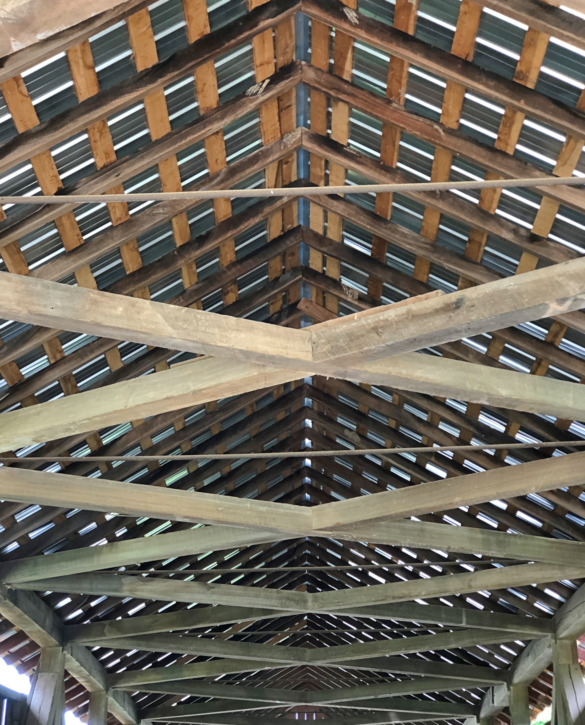
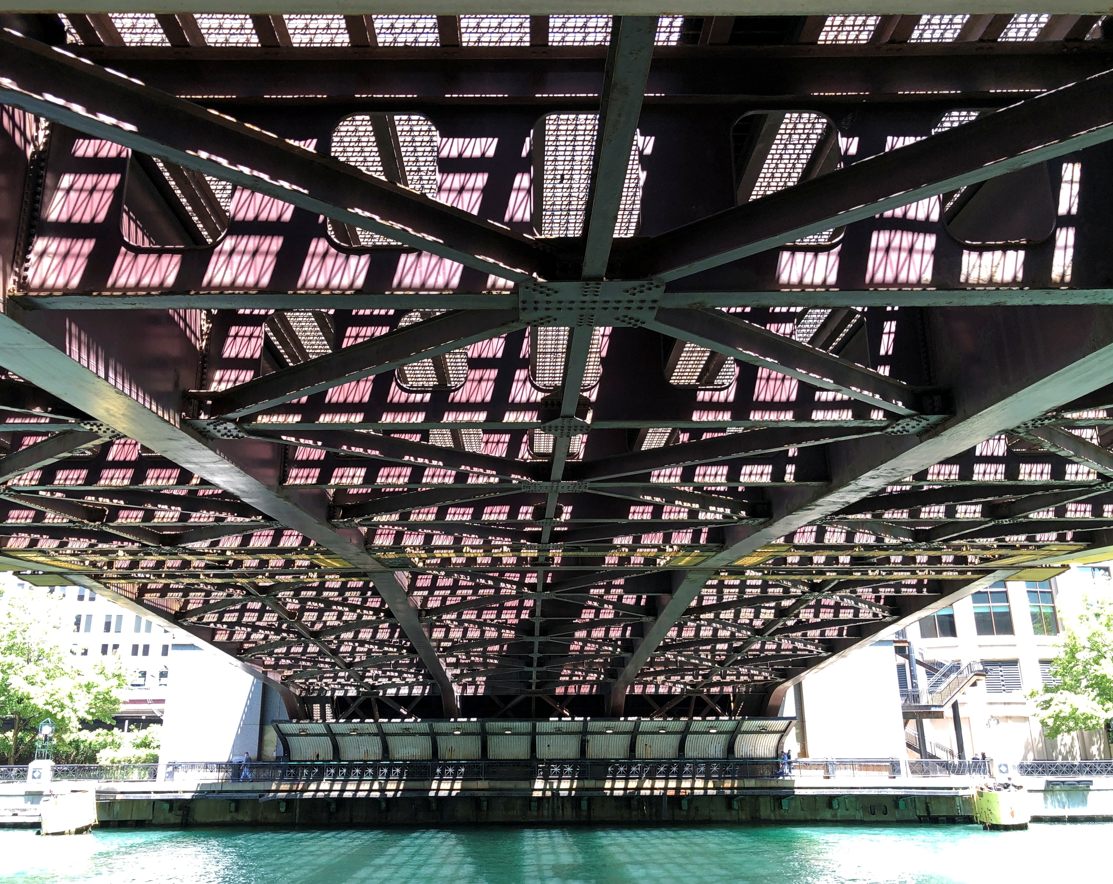
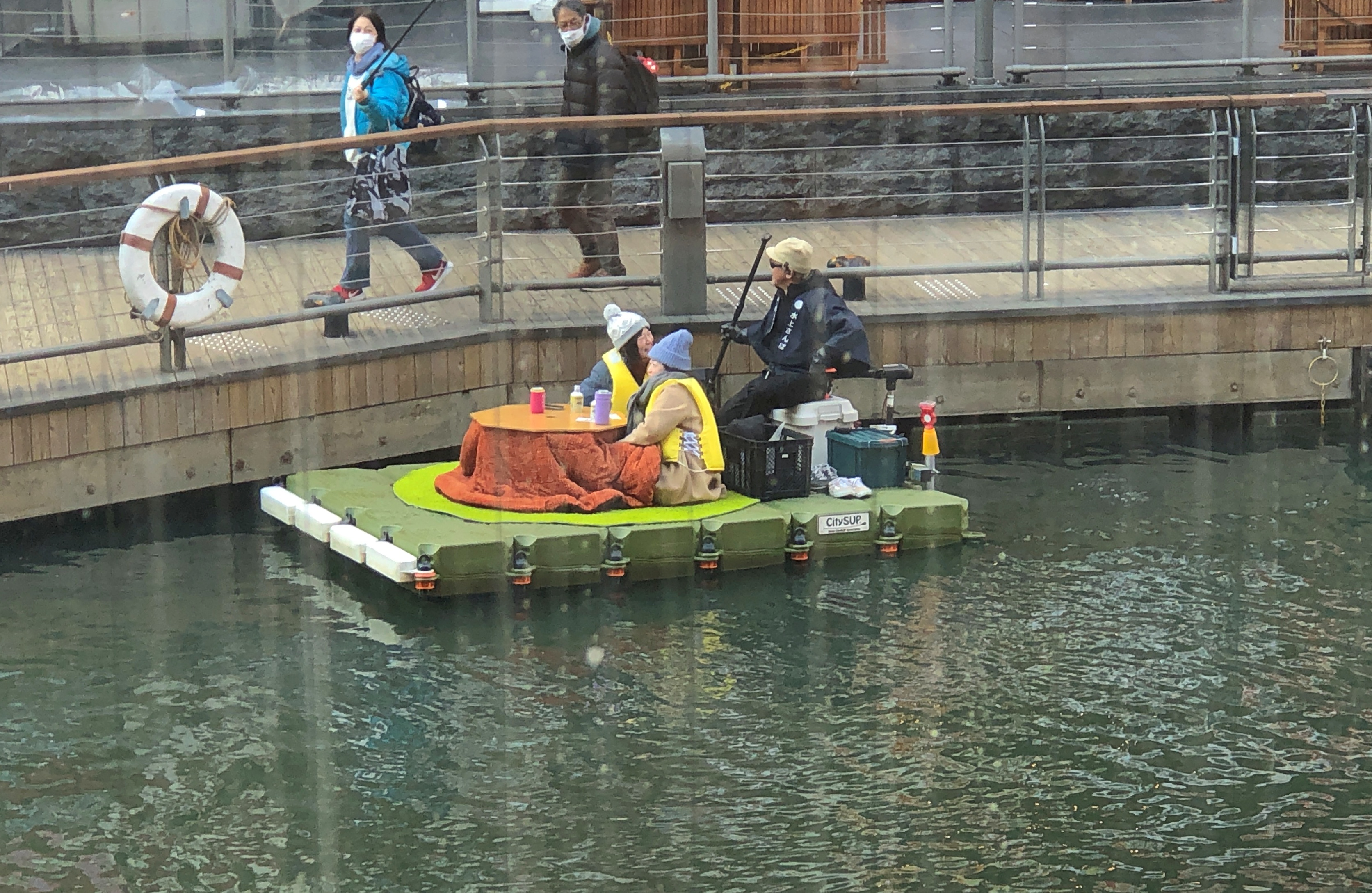
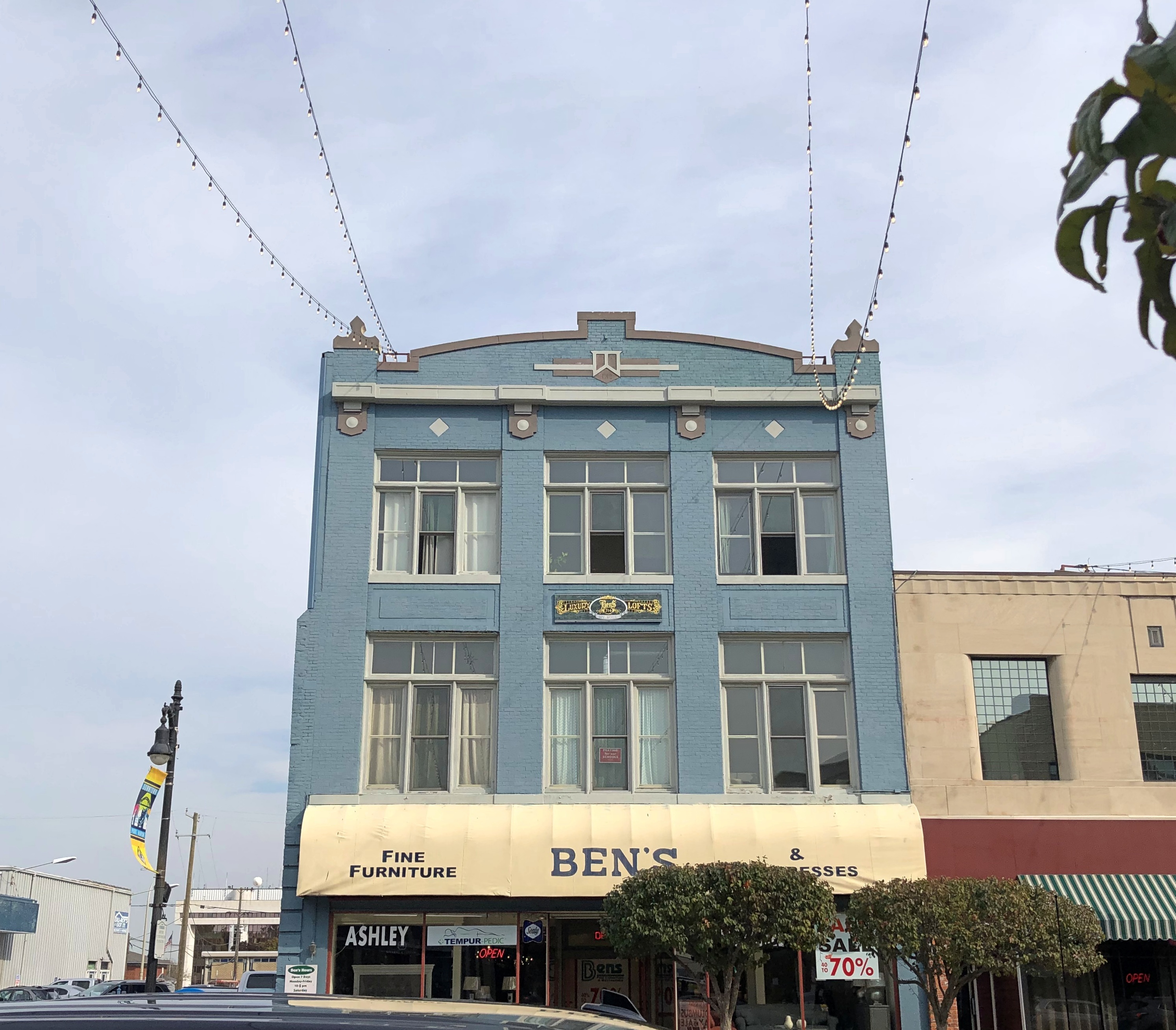
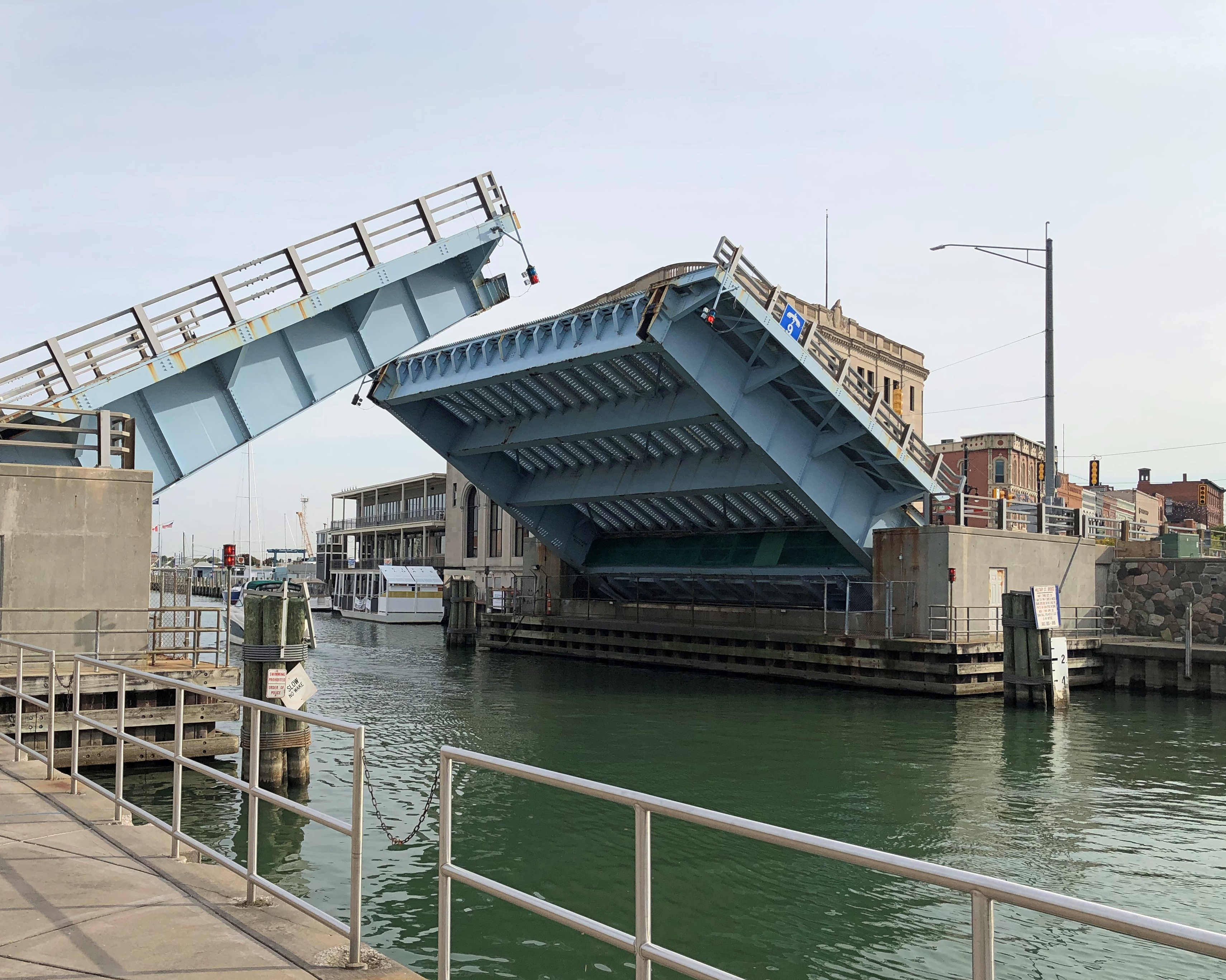
The sparse neighborhood cut off from the rest of Corpus Christi by I-37 at least offers a view of the new bridge, nearly complete, that will connect downtown with the North Beach district. New bridge in the foreground, existing through-type arch bridge in the background.Harbor Bridges, Corpus Christi

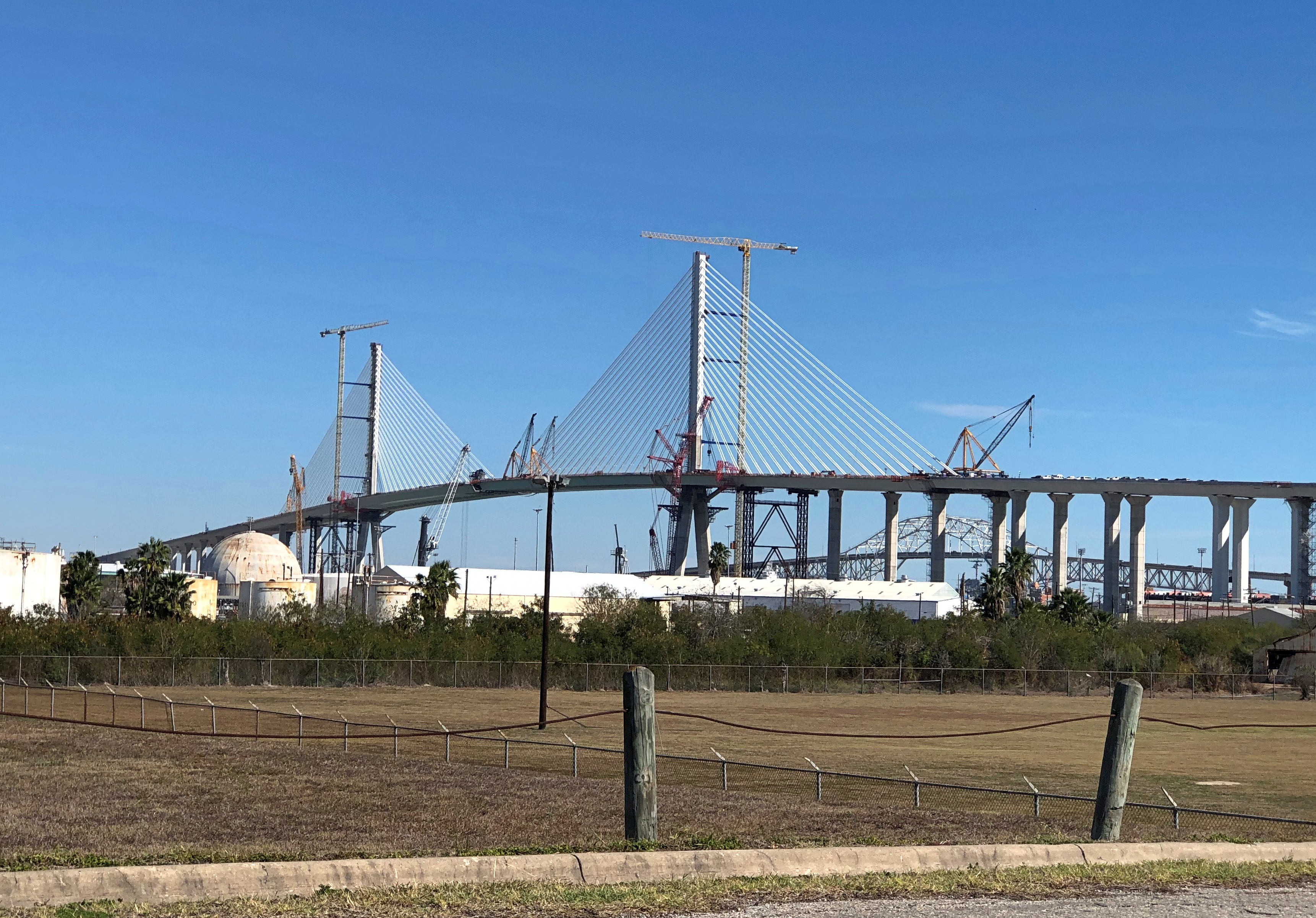
The new bridge has been in the works awhile, including a delay arising from firing FIGG Bridge Engineers from the project part way through. Another FIGG bridge had infamously collapsed in 2018, with the NTSB reporting that “the probable cause of the Florida International University (FIU) pedestrian bridge collapse was the load and capacity calculation errors made by FIGG Bridge Engineers.” Reportedly TexDOT in particular was leery of that company continuing on the Corpus bridge project.

The new bridge will be open by this summer, and soon after the old bridge (vintage 1959) will be demolished. For a narrow window, including January 2025, there are two bridges.

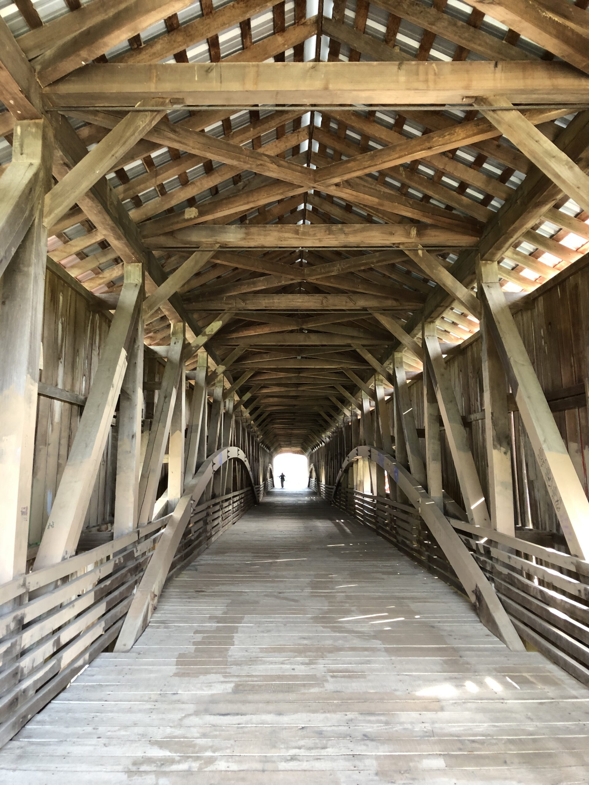
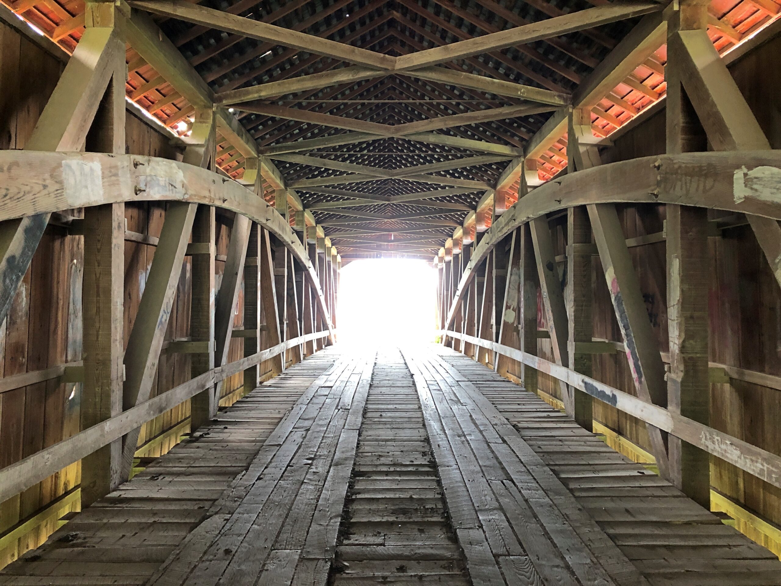
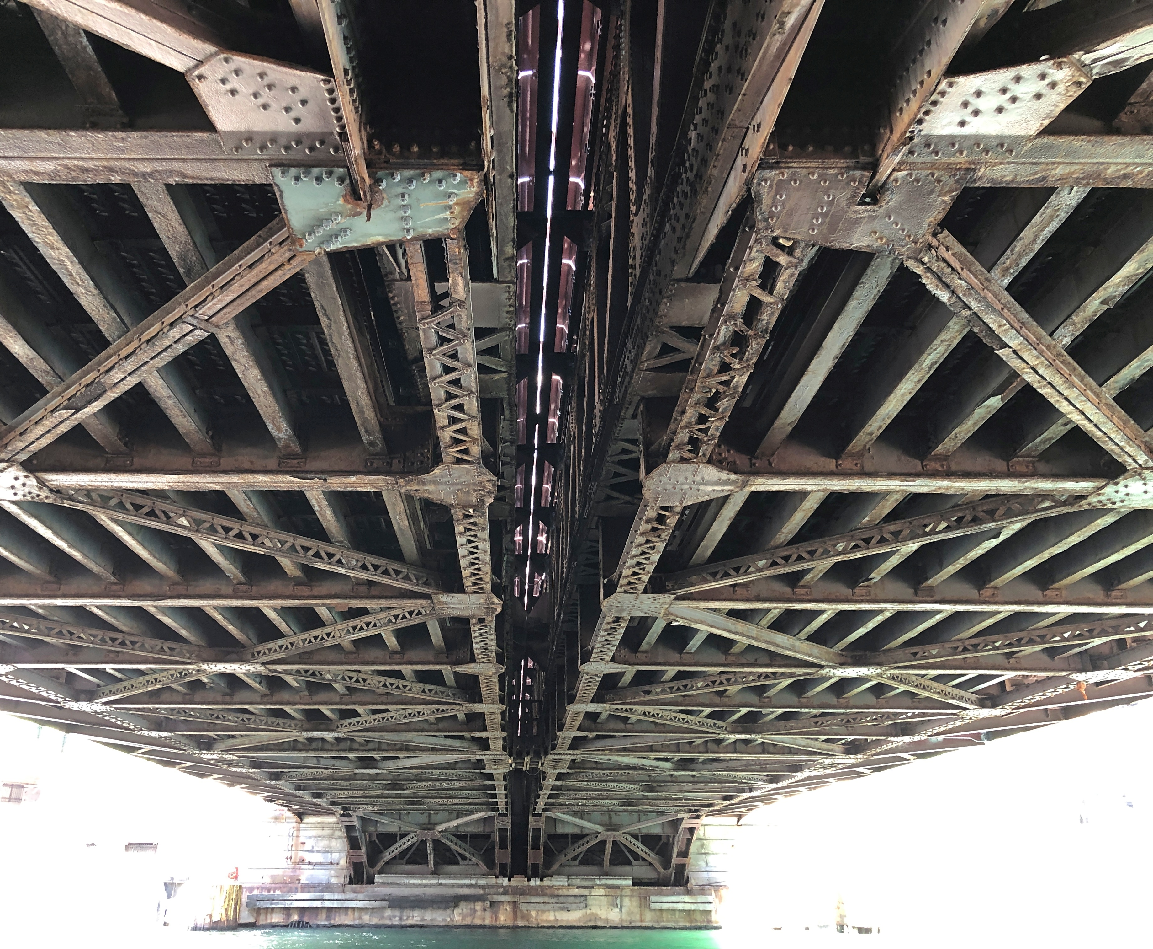
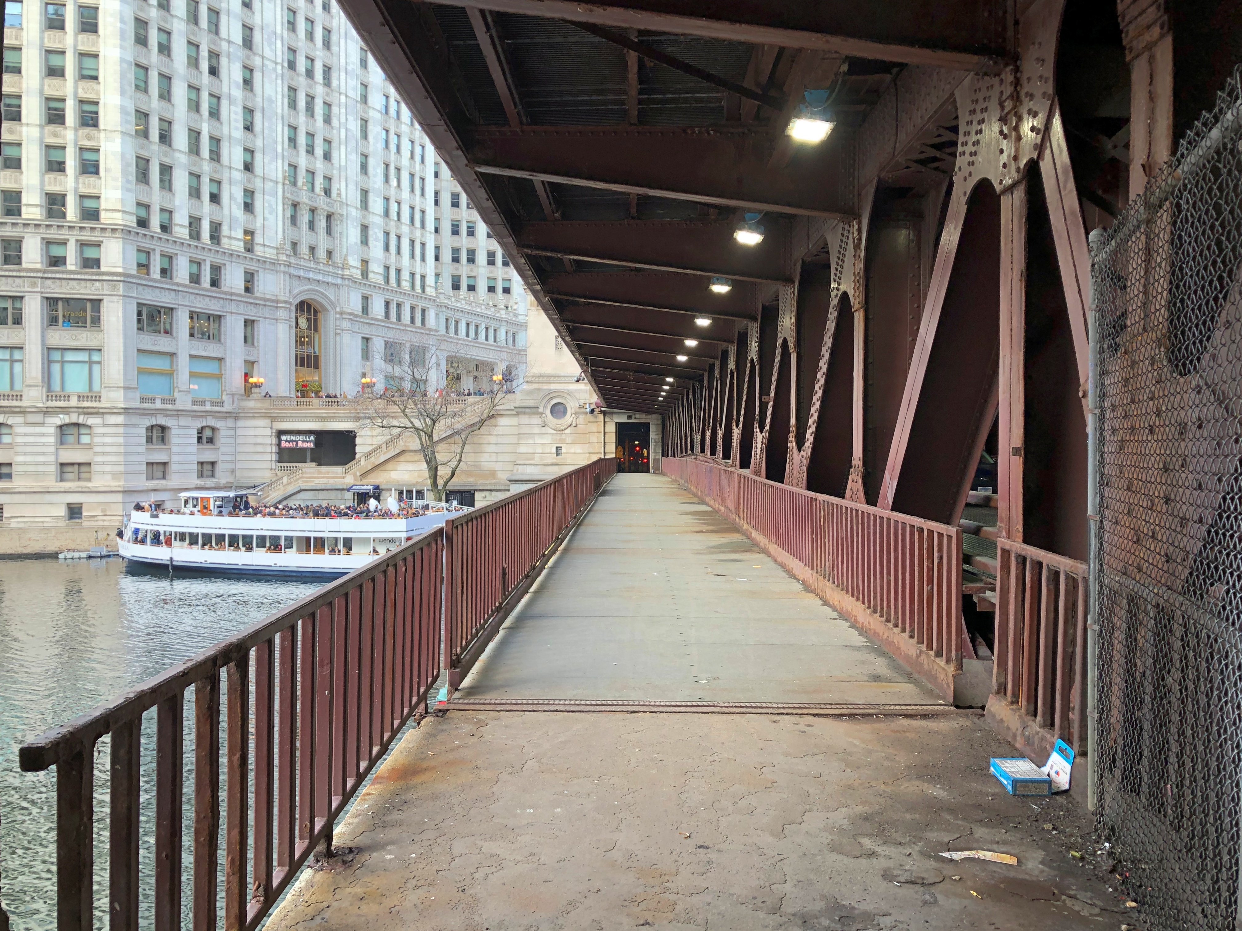
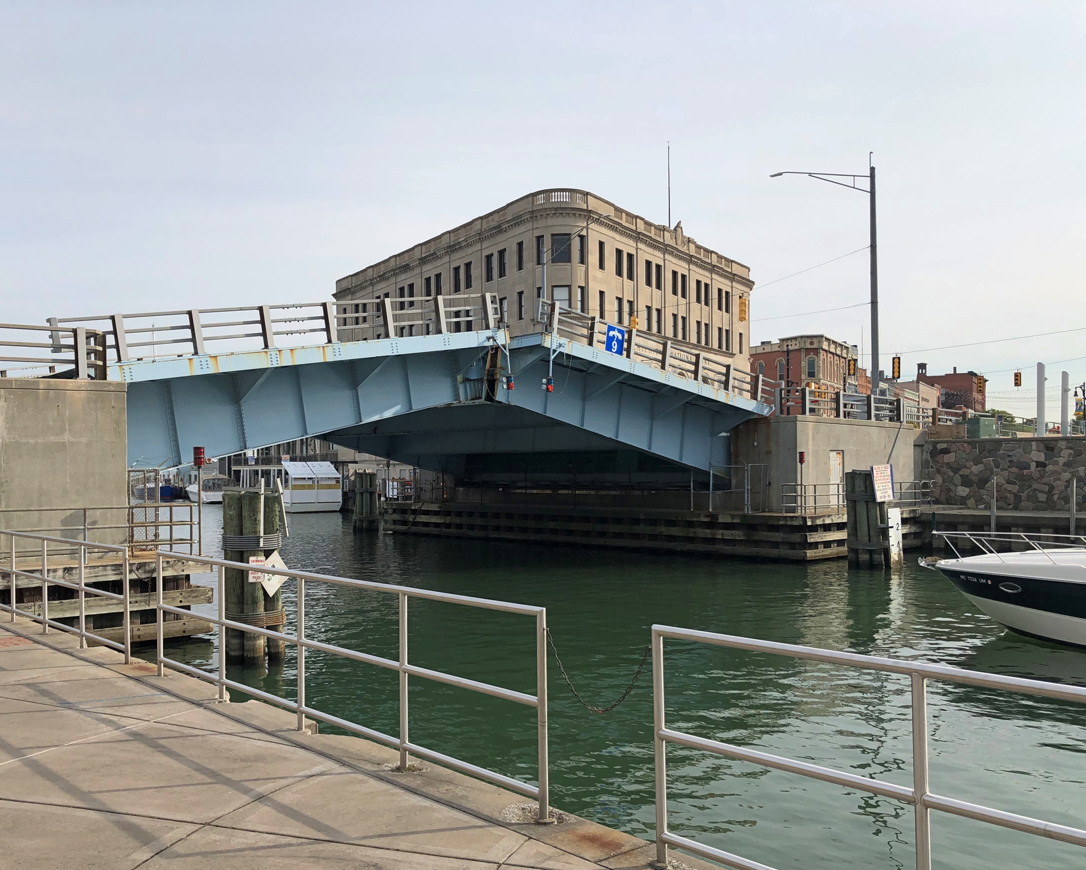
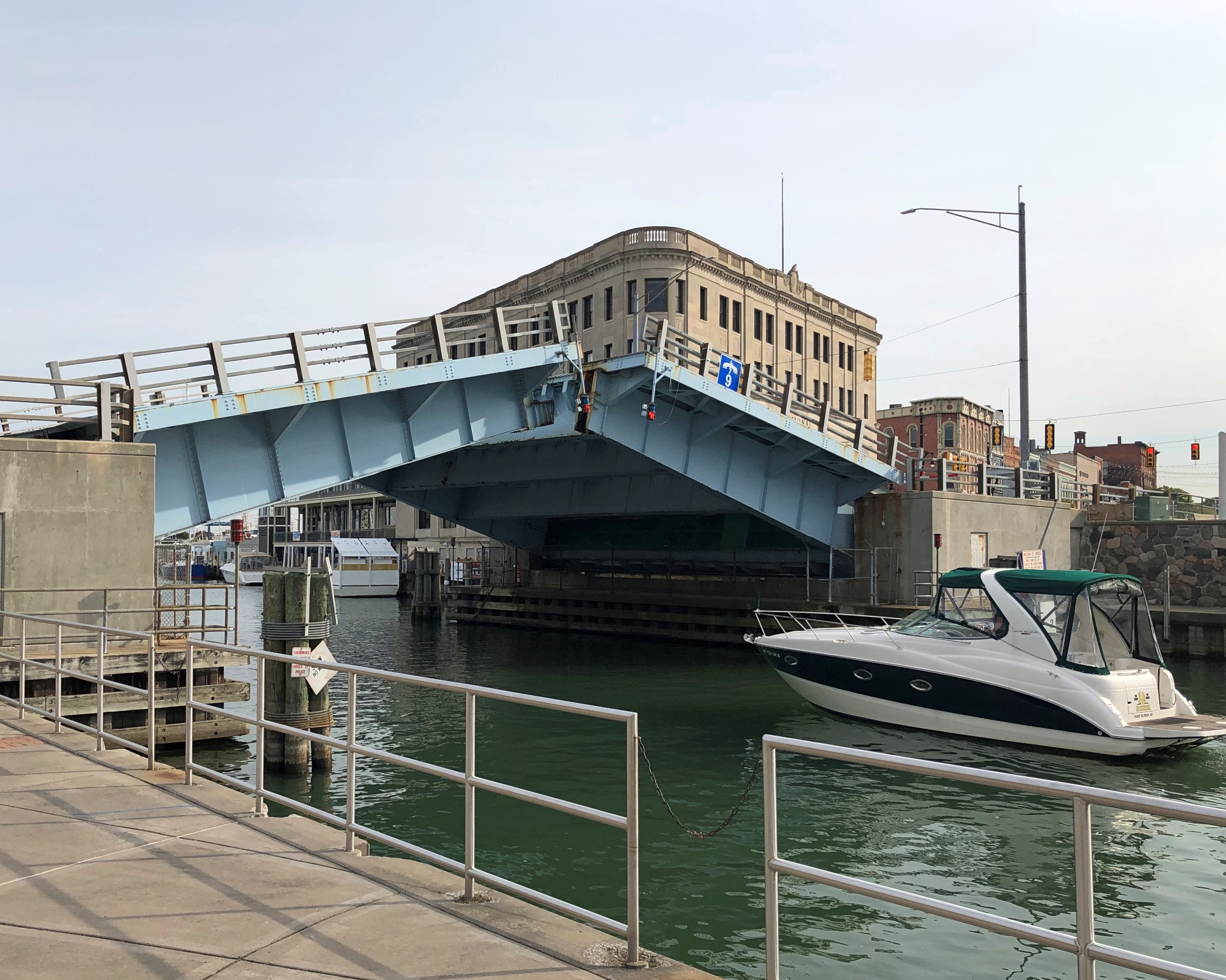
We got a good look at the old bridge from a different vantage.Harbor Bridges, Corpus Christi

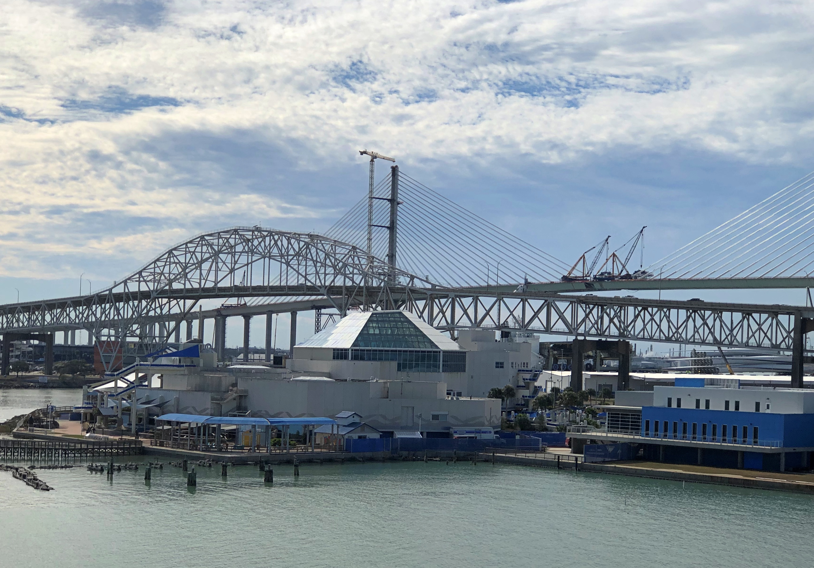
In this case, the Texas State Aquarium is in the foreground. If I’d known that old bridge was coming down so soon, I’d have taken better pictures of it, including from the ground practically under it in North Beach. Never mind. Time flies, things change.

When was the last time I was in Corpus Christi anyway? A question of no importance to anyone else, and not even that much to me, but something I wondered about while visiting the city (January 16). It occurred to me after I returned home that I might have documentation to pinpoint it – the pages of the desk calendars I kept, starting my sophomore year in high school. I used it, as one would, to keep track of things I had to do for school, but I also made notes about social activities, of which there were a fair number. A speech tournament counted as both, and a travel opportunity to boot, even if it were only to other high school campuses in town.

So I checked: I went to a speech tournament at CC Ray (W.B. Ray HS) January 12-13, 1979, and at CC King (Richard King HS) February 16-17, 1979, so the latter is the answer to my question. I don’t ever remember attending a tourney at CC Miller (Roy Miller HS), where my mother graduated in 1943, when the school was simply Corpus Christi HS, the only one in town.

Early in my sophomore year in high school, I was considering joining the speech club, which mainly would mean debating, and in the fullness of time that’s what I did. I must have mentioned my deliberations to my English teacher, Bill Swinny, who also taught drama at Alamo Heights HS. I can picture him: not as old as I am now, but wrinkled with a slightly leathery face, probably from years under a South Texas sun; silver narrow rim glasses; and a full shock of white hair without a hint of youth.

“If you do debate, your learning is going to go like this,” he said, holding his hands near each other, as if he were about to clap, and then spreading them wide apart – a hell of an effective gesture, with the fact that I remember it after nearly 50 years proving the point. Guess Swinny, who had been on the stage professionally, had that actor’s instinct for gestures.

He was right and it wasn’t long before I realized it. But I probably would have joined debate without his encouragement. Debate meant Friday and Saturday trips to other high schools in San Antonio (I suppose we got all or part of Fridays out of class to go, at least when I didn’t have a football game to go to, and assuming good enough grades). Even better, it sometimes meant going to other cities: Austin, Houston, Dallas, Corpus, even as far as Midland, Texas.

Under the sort of loose supervision that was common in those days. People wax nostalgic for that sort of thing, and they’re right.

I remember traveling by student-filled bus all the way to Stevens Point, Wisconsin in August 1978 for a school club trip (not speech, math) and being completely free to set my schedule once I got there. One day I skipped a few of the organized events and took a long walk around Stevens Point, including a visit to a local church, St. Stanislaus – probably the first time I’d ever looked inside a church, just to see it – and wandering through a large greenbelt around a pond, with fragrant pines that made the place seem intoxicatingly far away. I came home a better person for that amble, and being trusted not to be a moron.

Like band, speech was a social occasion with other members of the club, away from school, away from our families and usual-suspect friends for a little while. It meant nights in motels and occasionally actual hotels, and meals in restaurants beyond our usually haunts – generally organized by the students themselves, such as the time in Corpus we had to put our heads together, in those pre-Internet days, to find and procure food from the known-by-reputation somehow Star Pizza. (Or maybe Starr Pizza, since there’s a street of that name in the city). It might have been middling pizza by later standards, but I’m sure it tasted better for the effort we put into it.

We speech club types were bright but mostly well behaved, and I don’t remember that the teachers ever regretted our loose supervision. There were minor amounts of unreported underage drinking (which I never liked much myself), but no one got too stupid from it, to the point of anyone’s parents having to collect them.

There was the time we sang a few parody songs in one of our hotel rooms. In Houston, maybe. Fairly mild stuff, even then. “Rock Around the Clock” became “Rock Around the Cross,” for instance, with lyrics that would have been offensive, and certainly ridiculous, to some older ears in Texas at that time; but no one else heard it. We might have been loud enough to be heard in the hall, but I doubt in any other rooms. None of us recorded it, either. No one would have thought of that.

That same hotel-room gathering, without any one older around, we talked about what we knew or had heard about some of the other teams from other schools, including opinions about who were the toughest opponents, and otherwise. I don’t remember any details. It would be demented if I did. But I know that that moment was both business and pleasure.

Speech was also an opportunity to meet fairly smart girls who were also exotic. By exotic I don’t mean anything like ethnic background, but rather that they went to other high schools. Even more exotic, other high schools in other cities.

There turned out to be a lot of nuance to that meeting girls thing, something adolescent boys are only dimly aware of. During that single trip to Midland for a speech tourney, I remember my debate partner and I went up against two female partners from who knows what school in an early round of what was called Standard Debate: one team affirmative, the other negative, each partner speaking in turn about whatever the subject was that year. Energy policy? It was the energy-crisis ’70s, after all.

The opposing teams sat across from each other at the front of a classroom, with the judge and any other spectators sitting where students normally would, though in early rounds you could expect few other people besides the judge. So the teams had a pretty good view of each other. One of the opposing girls spent a fair amount of time staring at me. Or so it seemed.

She was lovely. My kind of lovely, as it happened: dark hair, dark eyes, slightly olive complexion. Unusual for those days – an era of straight hair for girls – she sported a lot of curls. Also, she was dressed if not to the nines, pretty close, since nice clothes were mandatory for all debaters, and of course the girls tended to put a lot of effort into how they looked, while it was enough for boys to be in a suit and have taken a shower recently.

I don’t remember anything else about that debate, not even who won. After it was over, the girl debate team was gone in a disappointing flash. No time for small talk, as was sometimes the case.

In conversation not long after with some other (male) debaters, this particular team and its curly-headed debater came up. That’s what she does, I was told, stares at male debaters to distract them. So it was high school-level psyop.

I could have taken a misogynistic lesson from that, but I don’t think I did, and certainly don’t now. She was just using an advantage that was temporarily hers, and, since everyone else seemed to learn about it pretty quickly, probably not that effective. But it was memorable.

One more story: there was that other time that the faculty advisor of the speech club, a youngish woman (early 30s, perhaps) who was with us on a trip to Uvalde, apparently left us completely and went across the border with her boyfriend for an entertaining evening (or night?). The student president of our chapter of the National Forensic League, who did not like her – thought of her as ditzy, if I remember his phrasing right – got wind of that and narked her out to the administration. Soon we had a new advisor. Supervision might have been loose, but it wasn’t supposed to be nil. I don’t know whether there were any other negative professional repercussions for that teacher or not.

Well, maybe that time that was an example of a teacher regretting the loose supervision of a bunch of bright ’70s high school students.

Chicago River Scenes

Above freezing temps in January, or December or February for that matter, mean a good day here in northern Illinois for a walk. That kind of thinking inspired us to go downtown on the Saturday after Christmas, an overcast but dry day without any bitter winter temps or in-your-face wind.Chicago River

It wasn’t exactly warm, just not really cold. That happy condition inspired some people to do a bit more than walk. Spotted in the Chicago River.Chicago River

A hot tub boat. I couldn’t remember whether I’d ever seen such a thing. Human ingenuity takes some odd turns. While I might not ever tool around in one myself, somehow I find it oddly reassuring that such a thing exists.

Looking the other way: one of the excellent bridges of the Chicago area. Or any urban area. The Michigan Avenue Bridge, which has formally been the Du Sable Bridge since 2010, named for the early settler and trade post operator in the vicinity.Chicago River

We crossed bridge twice that day. Once on the upper level, which is always fairly busy, both with cars and trucks, and the flapping of flags, but also people on the wide pedestrian paths on either side. Later we crossed on the lower level. No one else was there.Du Sable Bridge

Just another small example of how close off the beaten path can be. There’s nothing hard about reaching the lower level of Michigan Ave., and in fact there are a number of ways to get there.

The lower level walkway isn’t pretty, but there is urban texture.Du Sable Bridge

It is also a good walk across an impressive steel bridge with a view, and that’s enough.

Kokomo Oddities

Near the courthouse square in Kokomo, standing next to a fairly busy intersection and the parking lot of a small office building, is Kokomantis, all of 17 feet tall and – in late December anyway – decked out for the holidays. That’s a big bug. The kind of thing begs you to look at it.Kokomantis Kokomantis Kokomantis

“Its torso and wings are crafted from World War II fuel pontoons, while the legs are made from stoplight arms, giving her an industrial yet graceful appearance,” Heidi Pruitt writes in The Kokomo Post. Local artist Scott Little and developer Scott Pitcher collaborated on the work, with its creation taking Little a reported total of 220 hours.

I wasn’t sure what a “fuel pontoon” was, so I looked into it and came up with a reasonable definition from a British web site: “a self-contained floating facility for the storage and dispensing of petrol and diesel fuel for coastal sheltered marina environments.” Yep, that would have been useful in WWII.

Kokomatis isn’t the only animal of size in Kokomo. In Highland Park, one of the city’s parks, tucked away behind glass in what amounts to its own exhibition room, is the stuffed steer Old Ben (d. 1910). Impressive taxidermy, considering the age.Old Ben, Kokomo Old Ben, Kokomo

“Old Ben’s story began in 1902 on the farm of Mike and John Murphy between Bunker Hill and Miami near what is known as Haggerty’s crossing,” the city of Kokomo tells us. “He was the offspring of a pure bred registered Hereford bull and an ordinary shorthorn cow. Ben was a prodigy from the very beginning, as he weighed 125 pounds at birth…

“He weighed one ton at 20 months and two tons at the age of 4 in 1906. By that time, he had become quite a celebrity, and his owners exhibited him at many fairs and festivals. The Nickel Plate Railroad even ran a spur line to the Murphy farm just to help Ben in his travels.”

The article is worth reading all the way through, including for the pictures of a woman named Phyllis Hartzell-Talbert posing with stuffed Ben in 1944 at age 22 and again in 2022 at 100.

Not far from Ben, but in a different display room in the same building, is another former living thing famed (at least in Kokomo) for its size: The Sycamore Stump. Complete with explanatory notes on a sign.Sycamore Stump, Kokomo Sycamore Stump, Kokomo

A plaque you don’t see often. At least not as much as the WPA or the CCC. In this case, it’s attached to the structure housing Old Ben and the Sycamore Stump.National Youth Administration

A New Deal jobs program for youth, including not only men, but women, and not only white youth, but blacks. It was part of the WPA for most of its existence.

Yet another item on exhibit in the park is a former Confederate cannon, one of those prizes of war that lingers long after the war. This one is a little unusual in that it isn’t out in the elements, like many.Kokomo Cannon Kokomo Cannon

Made by Leeds Iron Foundry in New Orleans some time before the Union occupation of the city beginning in mid-62. The cannon’s plaque explains: “Leeds made a total of 49 cannons for the South. Nine of these were 12-pound howitzers. Of these nine, only three are known to exist. Two are in the National Park Service and ours!”

One more item in the park, and it’s even bigger than Old Ben or the Sycamore Stump. A relocated covered bridge.Vermont Bridge, Kokomo Vermont Bridge, Kokomo Vermont Bridge, Kokomo

The Vermont Bridge, which doesn’t refer to the New England state, but instead to Vermont, Indiana, near Kokomo, where it crossed Wildcat Creek. When threatened with demolition, the city of Kokomo paid to have the bridge moved to the park in 1957 and the park district has done some renovation over the years. By 2039, it will have been in this location as long as it was in its original location.

When you see a bridge, cross it if you can, especially if traffic is light. Inside included plenty of graffiti.Vermont Bridge, Kokomo Vermont Bridge, Kokomo Vermont Bridge, Kokomo

Lewis Cass? Like the 1848 presidential candidate who lost to Zachary Taylor?Vermont Bridge, Kokomo

Yes. I remembered seeing Lewis Cass High School as we drove through Walton, Indiana, which is up the road a piece from Kokomo.

At the corner of Sycamore and Apperson streets in central Kokomo is Story Book Express.Story Book Express, Kokomo Story Book Express, Kokomo Story Book Express, Kokomo

Outside, a design on the whimsical side, using a lot of repurposed building materials from demolished structures, according to Fortune Cos. Inc., which mostly specializes in historic building restoration — and which is headed by Scott Pitcher, also of Kokomantis fame (at least in Kokomo). Inside, it’s a fairly ordinary convenience store. As the last place we visited in Kokomo, we went in for a look, and I knew I had to support this oddball convenience store in some way, so I bought a pack of gum for the drive back.

Meacham Grove Forest Preserve & The Temporary Tunnel of Gold

Though it’s fairly close, we hadn’t been to the Meacham Grove Forest Preserve in a few years, so on the last Saturday in October, I suggested a walk. Bright, warm and little wind: a good day for it.Meacham FP

The path around Maple Lake – called that on maps, anyway – takes you about halfway before you come to another path: a section of the North Central DuPage Regional Trail. We headed west on that trail. Meacham Forest Preserve October 2024

At first the trail passes Spring Brook and Meacham Marsh. The Meacham brothers were earlier settlers in this part of DuPage County and the village of Bloomington was once known as Meacham’s Grove, as a waystation on the Chicago-Galena Stagecoach Trail.Meacham Forest Preserve October 2024 Meacham Forest Preserve October 2024

At that moment in October, the trail winds into a tunnel of gold. That’s what I’m calling it anyway, mostly formed by a canopy of maple leaves. Canada has no monopoly on them, even if they put it on their flag.Meacham Forest Preserve October 2024 Meacham Forest Preserve October 2024 Meacham Forest Preserve October 2024

Roselle Road divides the preserve. The other section is accessible by footbridge over the road.Meacham Forest Preserve October 2024

All these years in the northwest suburbs, and we’d never ventured across the bridge. In the western section of the preserve, the North Central DuPage Regional Trail connects to a half-mile loop, Savanna Trail. Not quite a tunnel of gold, but not too shabby in its foliage.Meacham Forest Preserve October 2024 Meacham Forest Preserve October 2024 Meacham Forest Preserve October 2024

There’s a metaphor in those leaves somewhere: a brief blaze of glory near the end.Meacham Forest Preserve October 2024 Meacham Forest Preserve October 2024

Or maybe leaves are leaves are leaves.

The Port Huron Blog Post

Every time I visit Ontario, or at least a beach in that province, I scratch a message in the sand for Geof Huth, and promptly send it to him electronically. This time it was from the sandy beach at Bruce Peninsula NP. Why? Why not?

My knowledge of the New Left is fairly sketchy, I must admit. As long ago as my own student days, in the early 1980s, it didn’t seem new, but old hat. I’ve never even read more than a few paragraphs of the Port Huron Statement, though I could get around to it, since it’s easy enough to find. Such a tract doesn’t need to be mimeographed to reach an audience anymore.

At least I’d heard of it when the Dude mentioned his connection to it. As I understand it, there was no second draft, compromised or otherwise. But the Dude inhabits the Coen Brothers universe, where surely there was one.

As for my knowledge of the actual city of Port Huron, Michigan, that’s a little better than it used to be, informed by a short visit on the way home from Ontario earlier this month. It’s one of those places I stopped because I’d never been there, but had long seen it on maps. There’s an endless supply of places like that.

Downtown, especially Huron Ave., made for a pleasant walkabout.Port Huron, Michigan Port Huron, Michigan Port Huron, Michigan

Huron Ave. crosses the Black River – one of a number of rivers called that in Michigan alone – at a drawbridge, just before the river flows into the St. Clair. As we wandered along the riverfront, bells went off.Port Huron, Michigan Port Huron, Michigan Port Huron, Michigan

When you see a drawbridge in motion, watch it if you can. Again and again. Just another of the little maxims I live by.

There are hints that hipsters have discovered Port Huron. Maybe a scattering of them who have been priced out of Ann Arbor.Port Huron, Michigan

We spent some time in a sizable, multi-room antique shop on Huron Ave. Not quite as entropic as Reid’s Corner, but nevertheless stocked with all sorts of interesting stuff, including vinyl records (more evidence of hipsters about).

The First Family was first in a bin, offered for only $2. I didn’t buy it. I have a copy that my brother Jay gave me, and he said that he paid about 80 cents for it. I’m glad to have it around, though we have no record player any more. It functions as a reminder about eggs and baskets.

Two dollars might have been the nominal price in 1962, or a dollar or so more. As a collectible, First Family hasn’t even kept up with its original price in inflation-adjusted terms (nearly $21 now), though if you look at eBay or the like, people are trying to get ridiculous prices for the album. The supply of disks is vast, with 7.5 million units reportedly sold before the president’s death.

1962. The same year that the Port Huron Statement was published. Is it a mere coincidence that I saw this record in Port Huron, or is the universe trying to tell me something? I’ll go with mere coincidence.