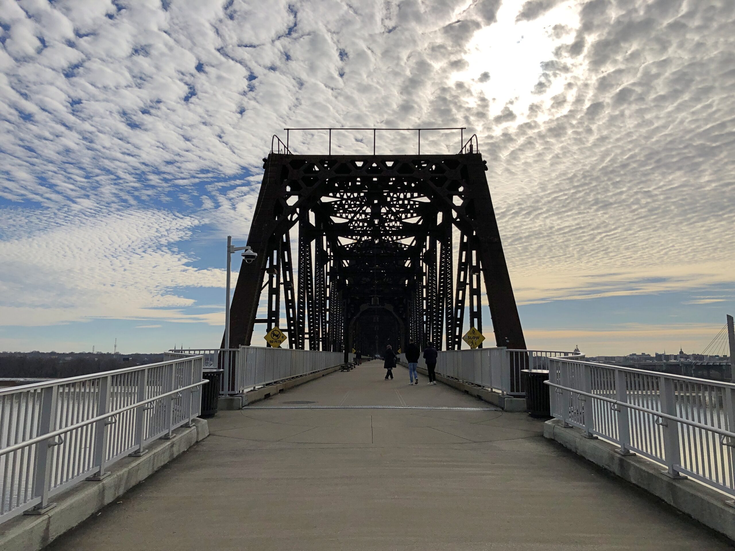
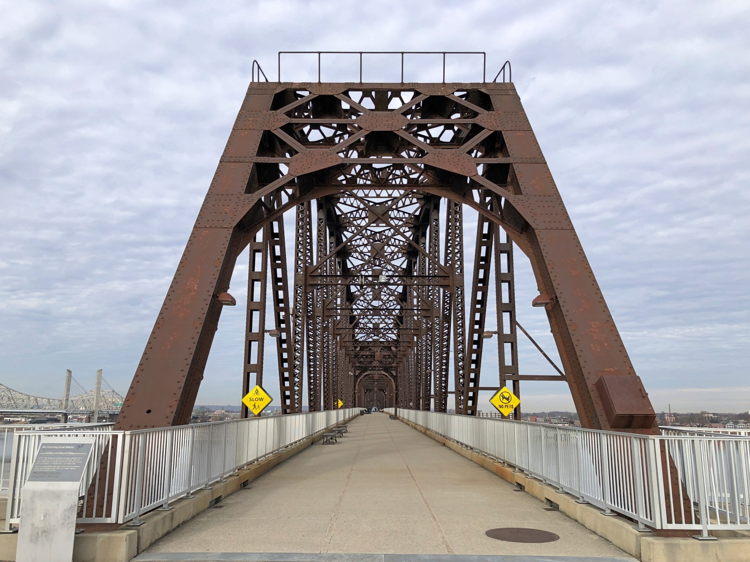
Even the last day of a long trip can include – should include – something to see. With that in mind on December 22, after we crossed the Ohio River from Louisville on the I-65 bridge, which I have done many times, we took the first exit to go to Jeffersonville, Indiana, which I have done only once, in 1990. Then we went back across the river to Louisville, this time on foot on a massive iron structure known as the Big Four Bridge.
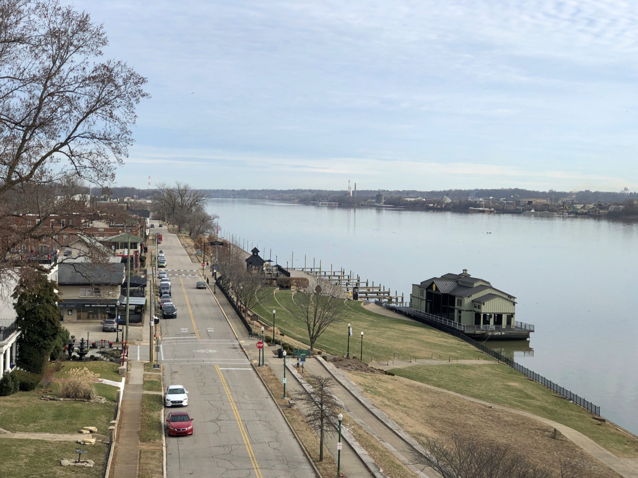
The Jeffersonville side of the bridge offers views of that town and its riverfront, where I took a wintertime stroll all those years ago. At that time, Big Four Bridge was a decaying relic, inaccessible to the public.
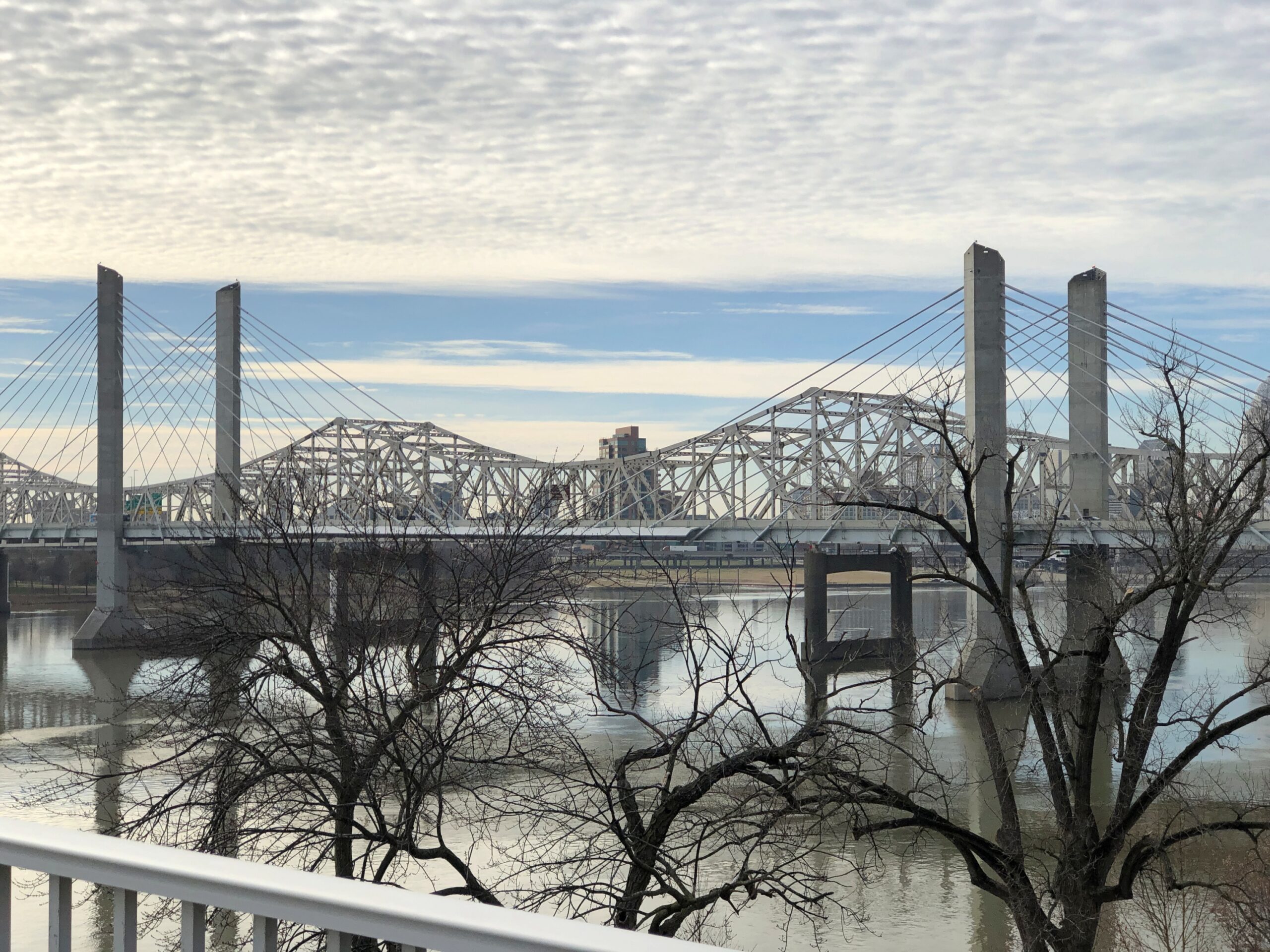
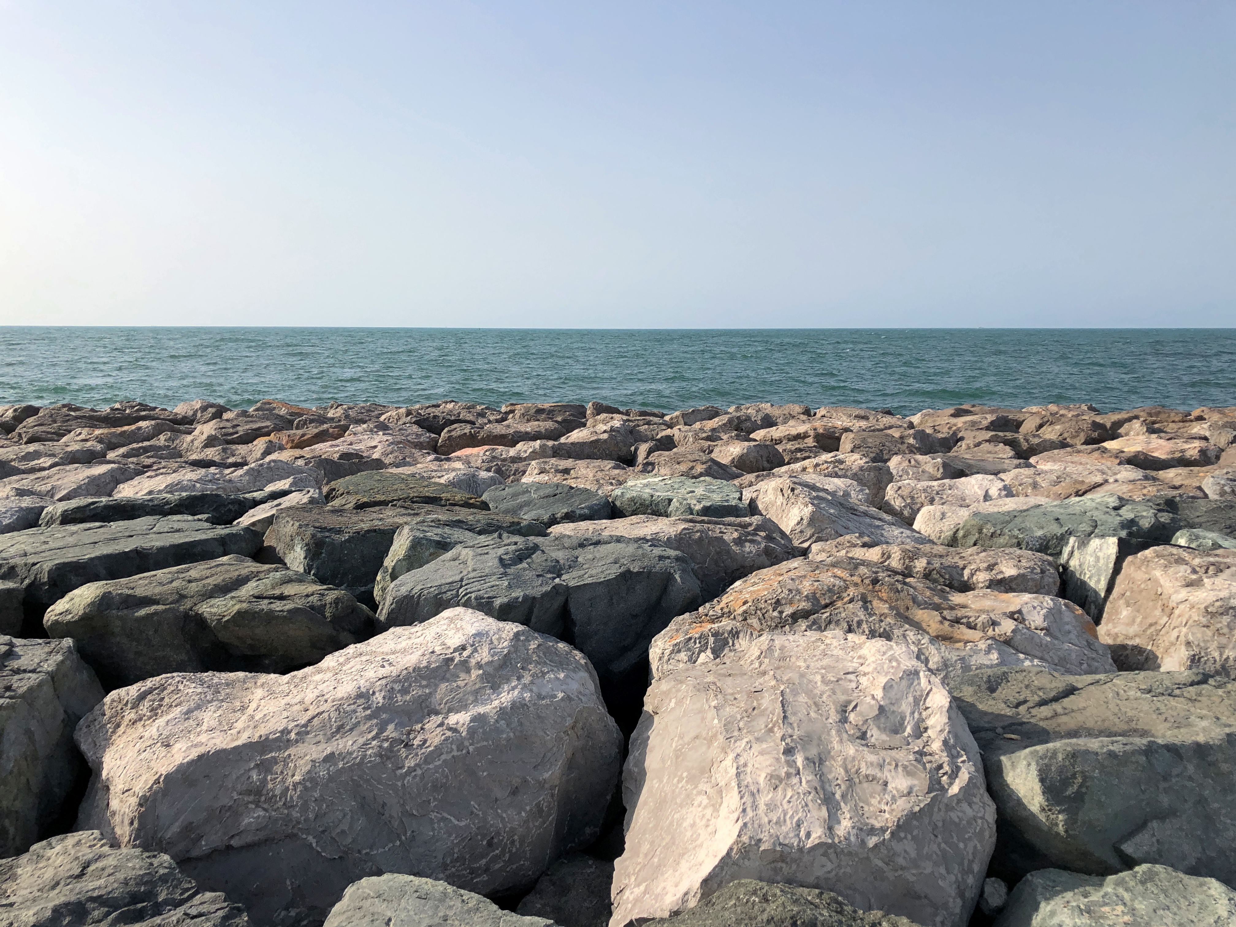
You can also see the I-65 bridge from that vantage. It too is an elegant design.
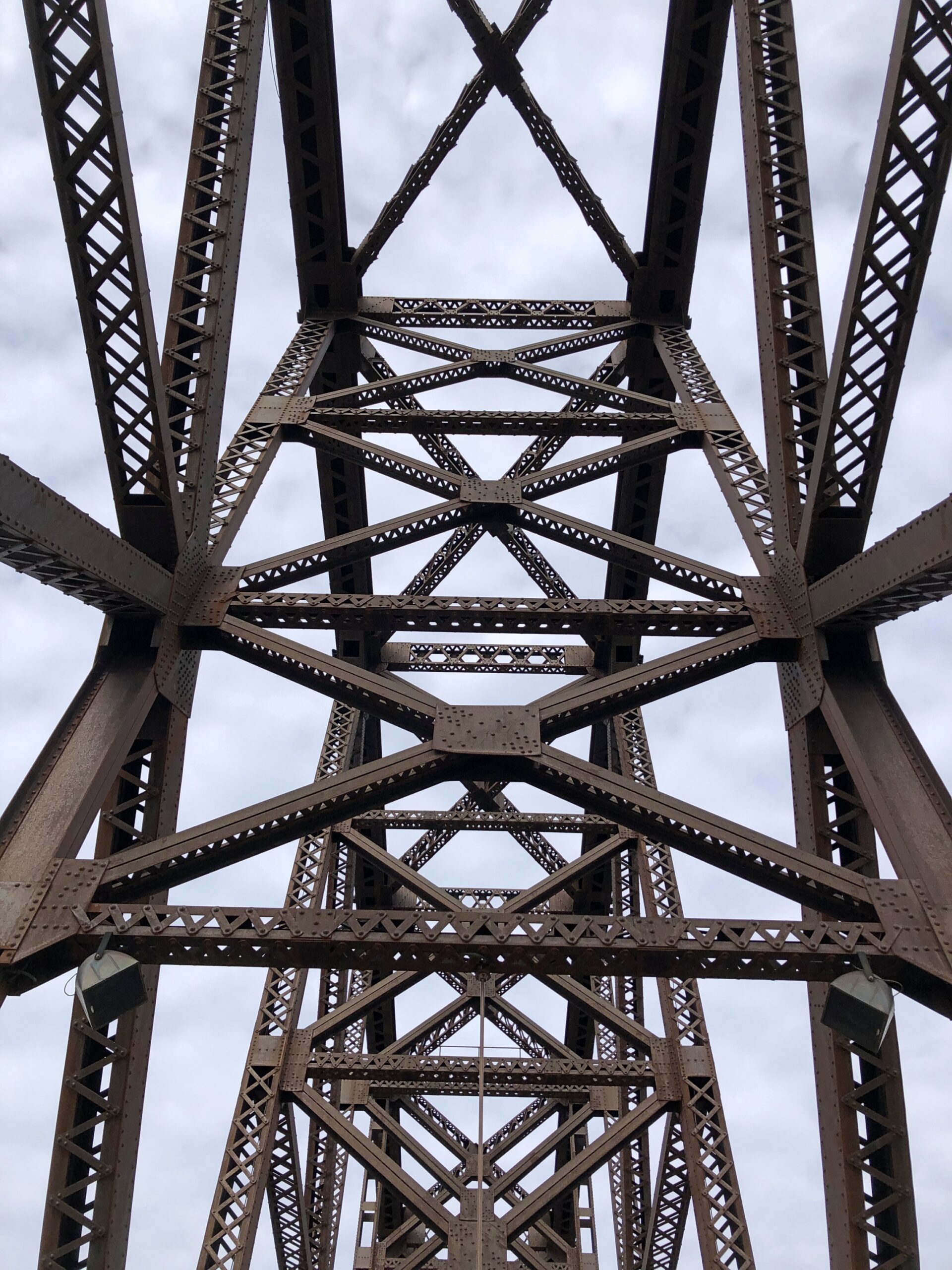
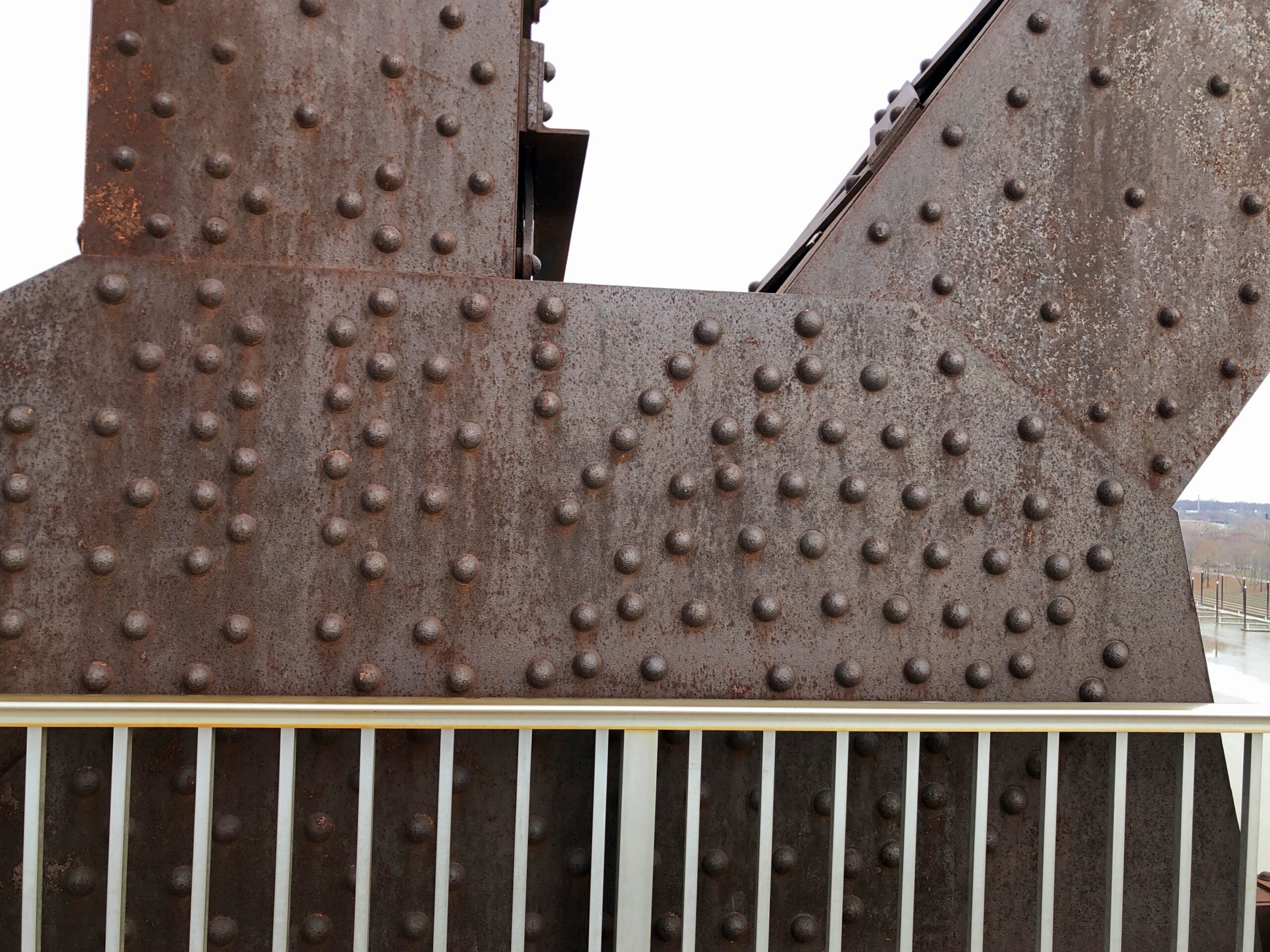
But not as impressive as the sweeping ironwork of Big Four Bridge.
The Ohio sweeps along as well.
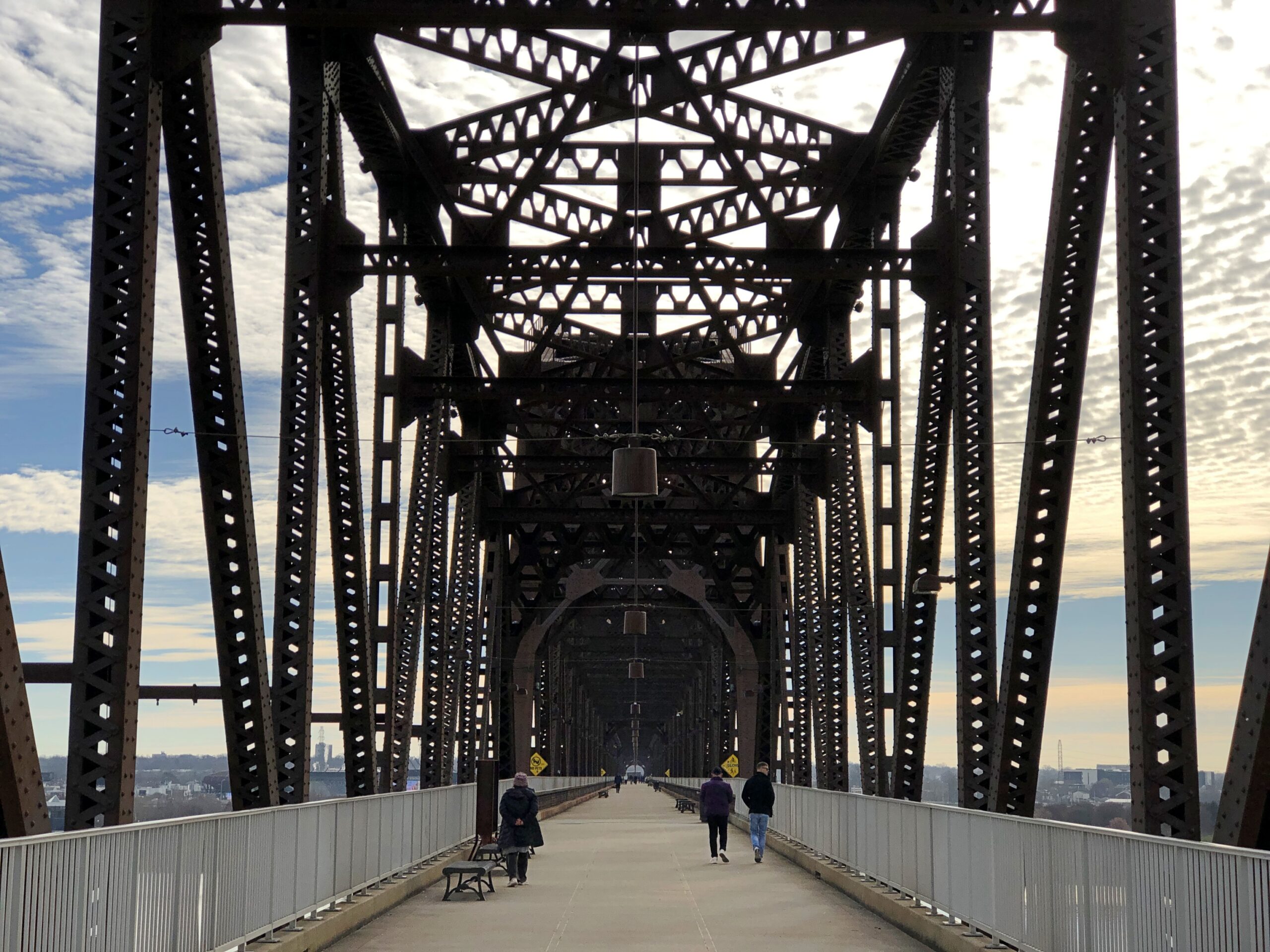
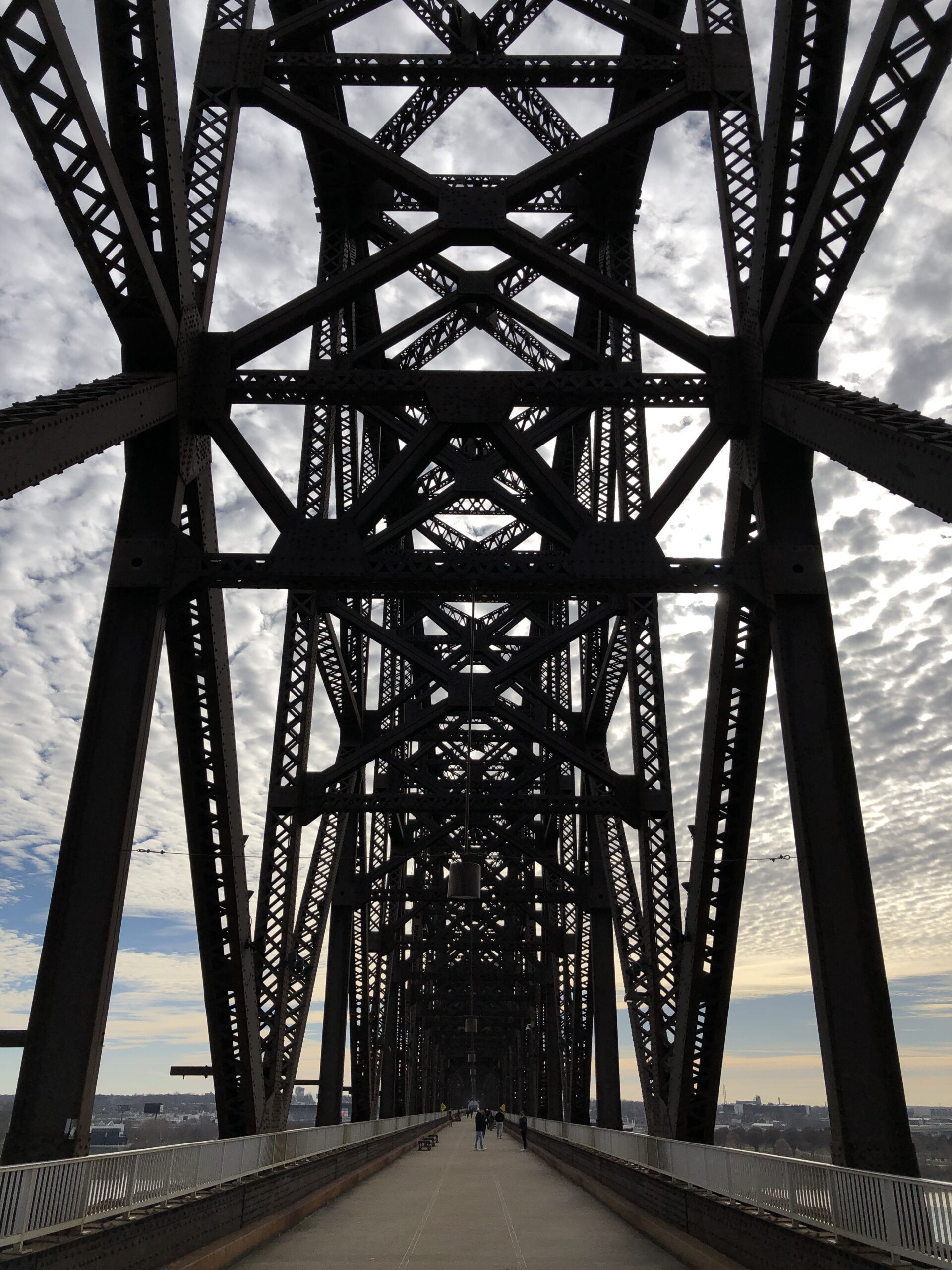
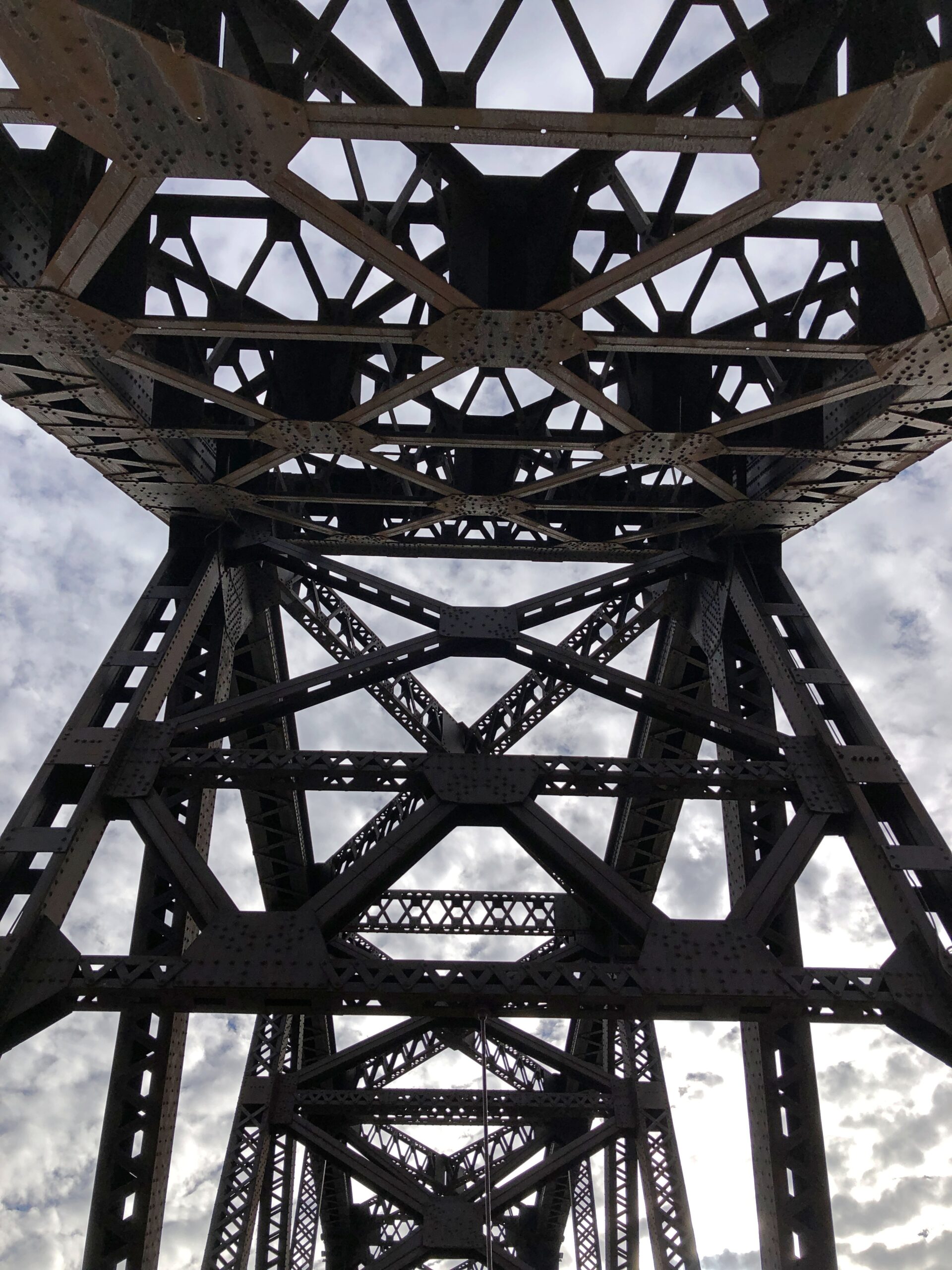
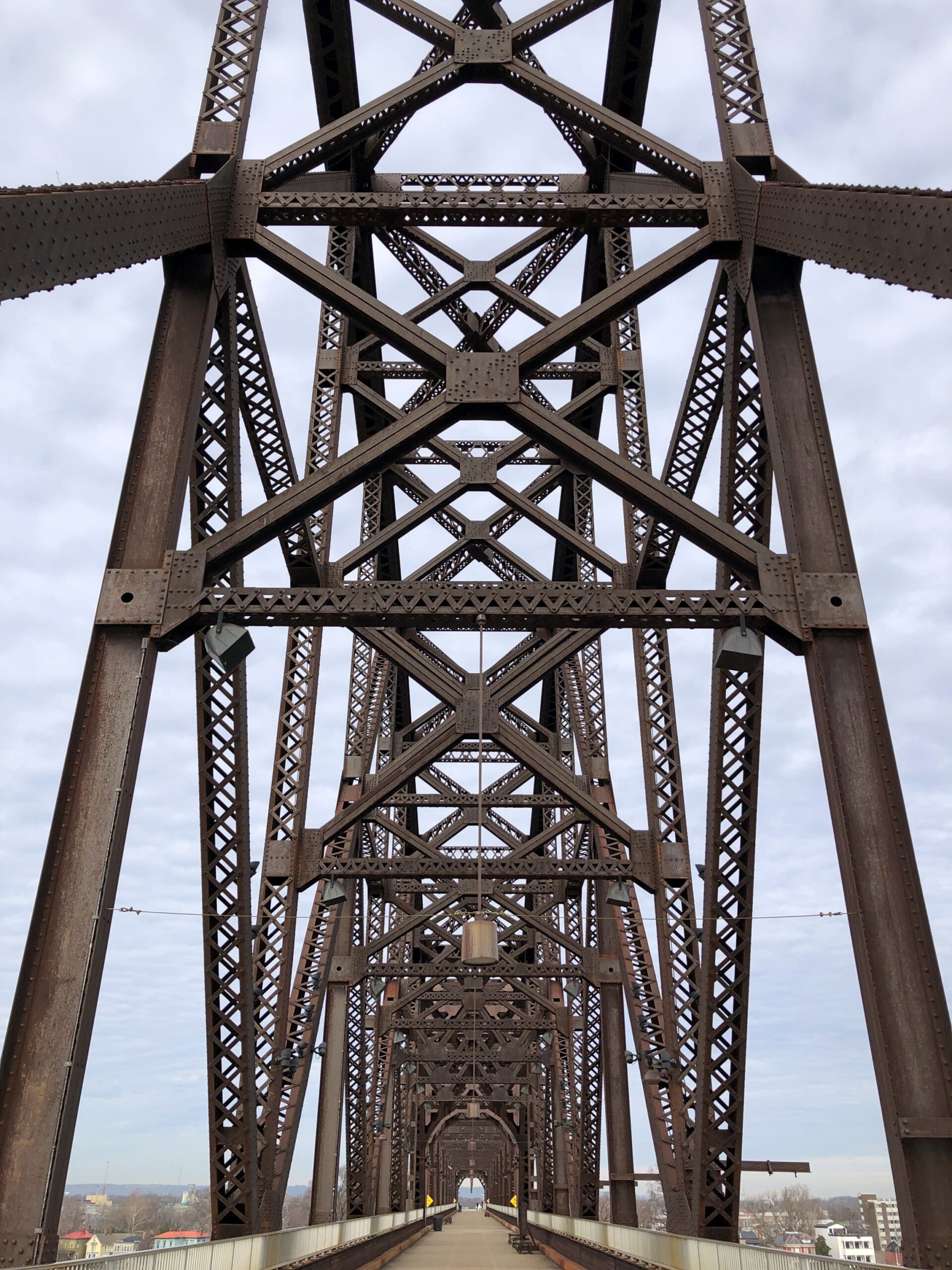
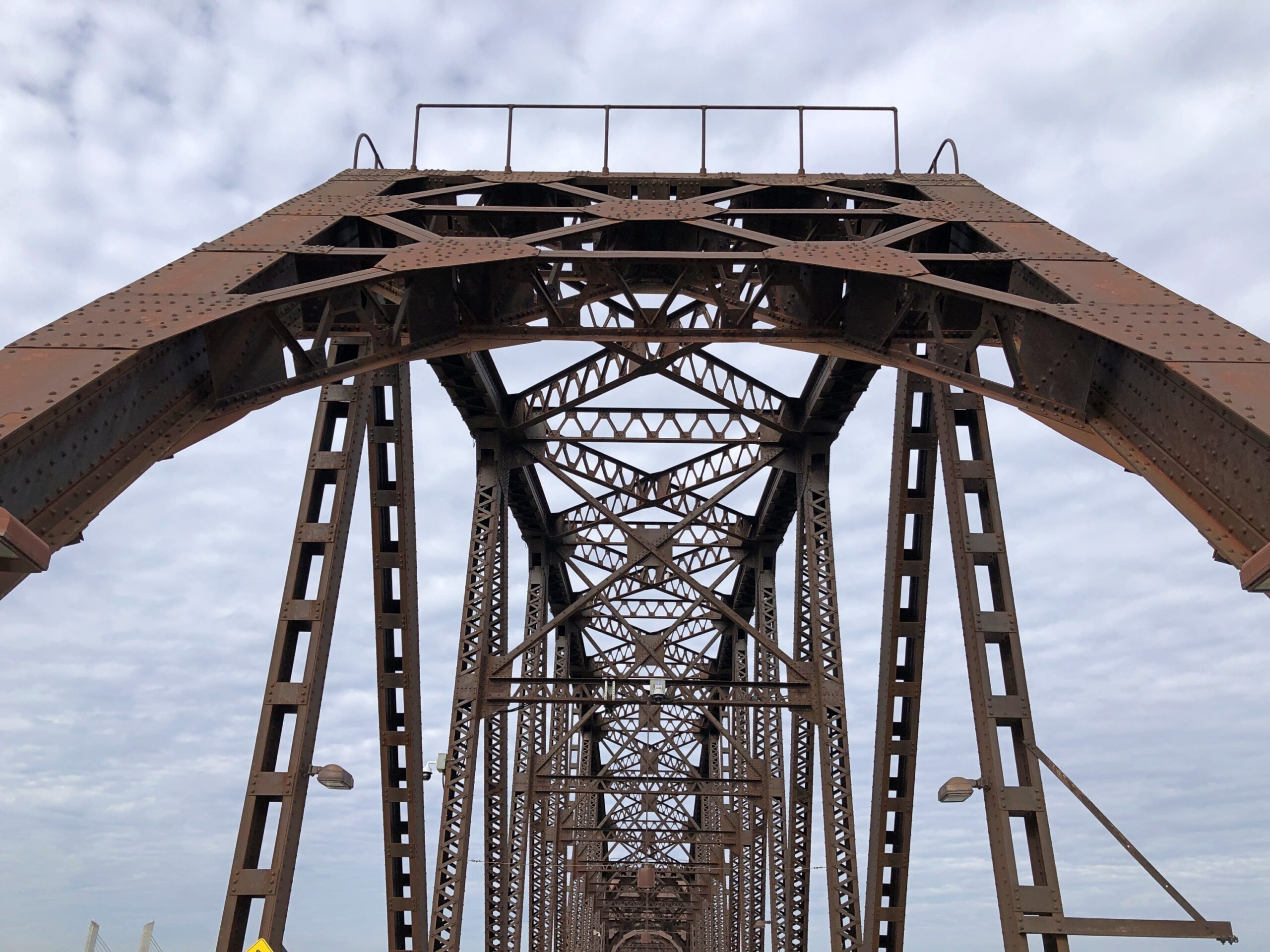
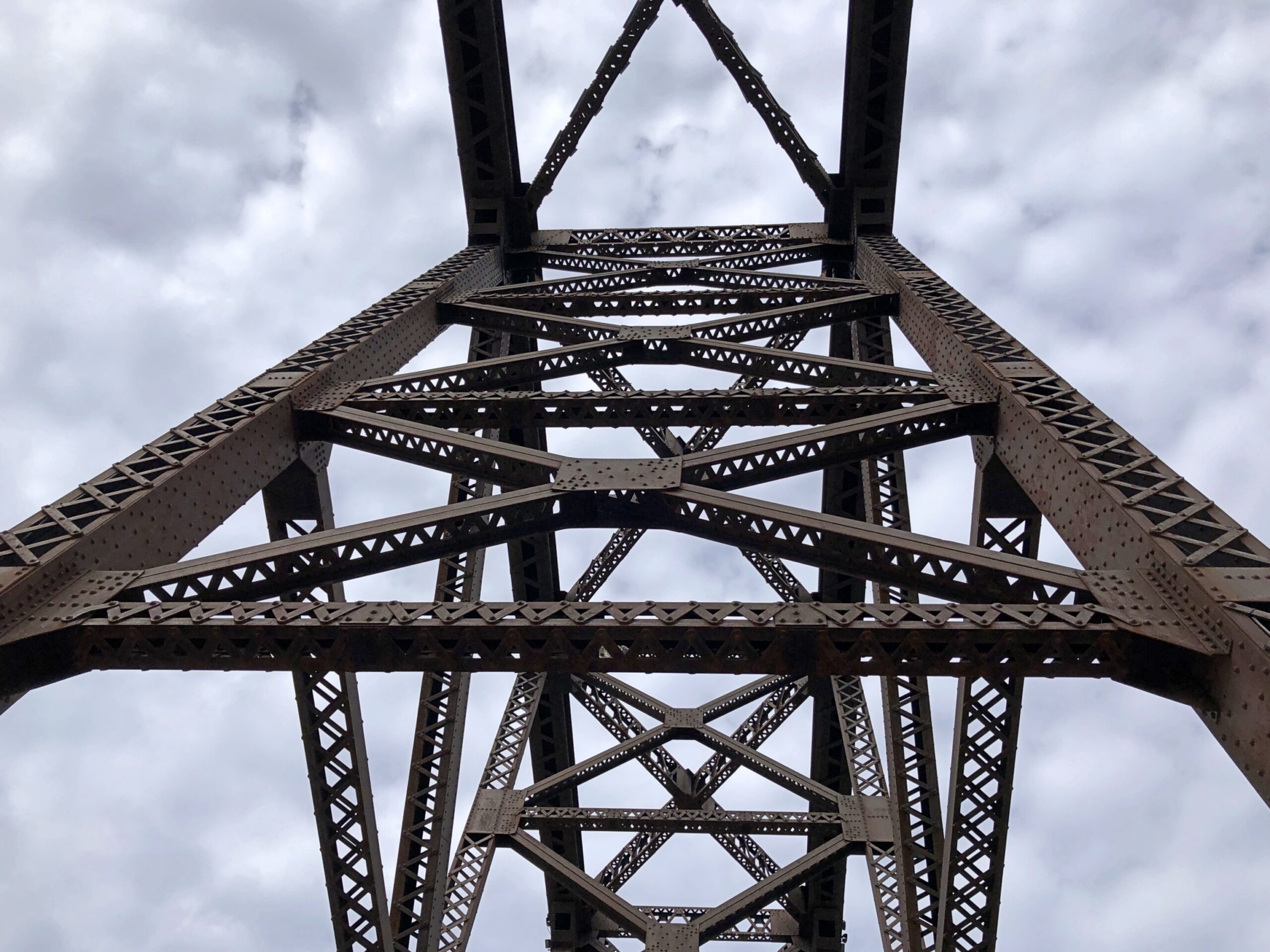
I couldn’t take enough pictures of Big Four.
Once upon a time, Big Four carried the Cleveland, Cincinnati, Chicago and St. Louis Railway, also nicknamed the Big Four Railroad. The 2,525-foot span contains six trusses, beginning as a late 19th-century project, the sort of pre-OSHA work that killed dozens of workers during construction (so why not ghost stories?).
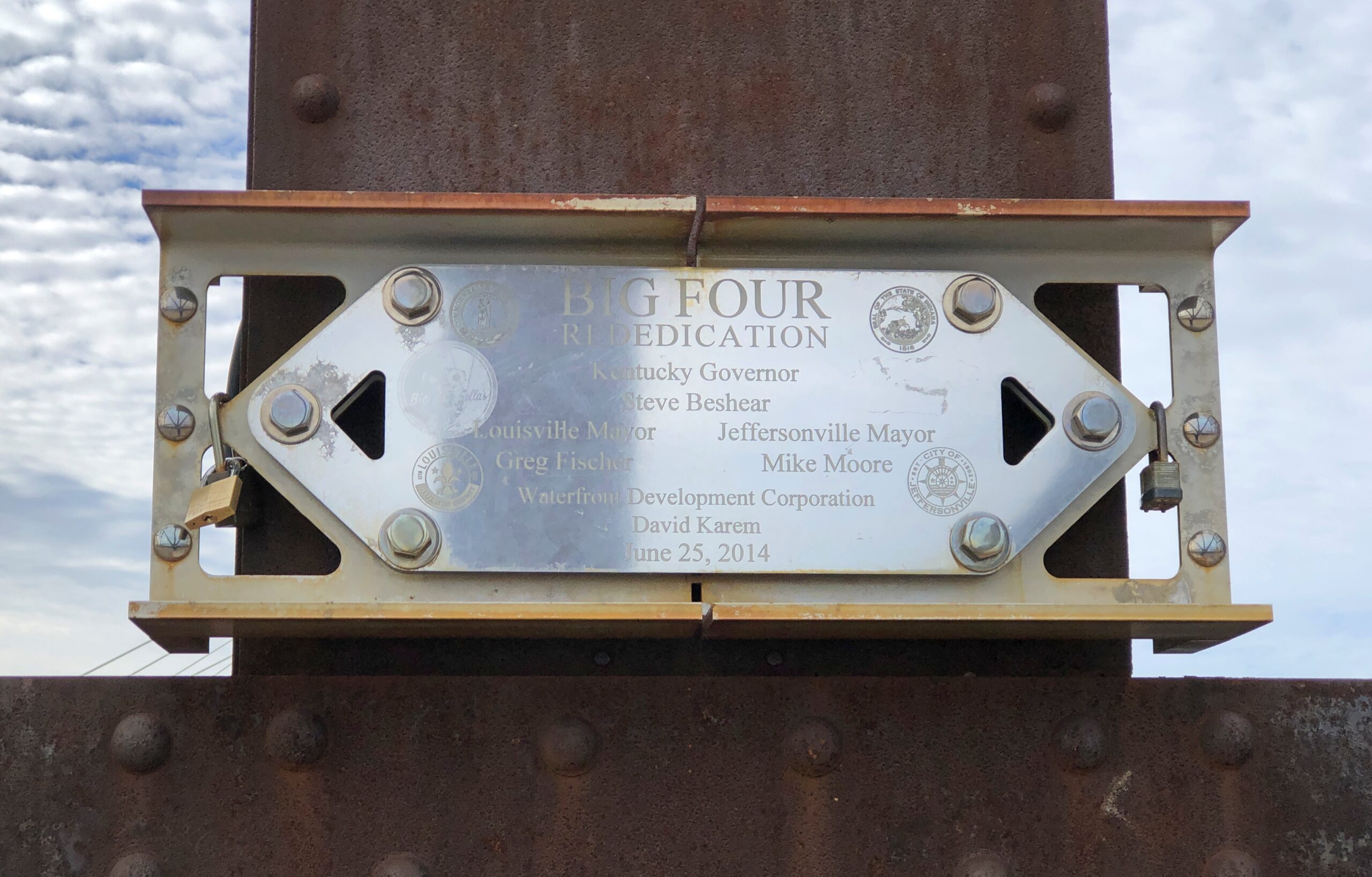
Completed in 1895, “The Big Four Bridge allowed freight traffic to dramatically increase in Louisville, and began carrying high-speed interurbans on September 12, 1905…” says Bridges & Tunnels. “Due to bigger and larger trains, not only in size, but in weight, contracts were let in June 1928 to build a larger Big Four Bridge. The new span, constructed by the Louisville & Jefferson Bridge Co., was built on the piers of the old bridge, while leaving the existing span intact while it was upgraded.”
That is the structure we see today, except that in the early 21st century, it was redeveloped into a pedestrian/bicycle bridge.
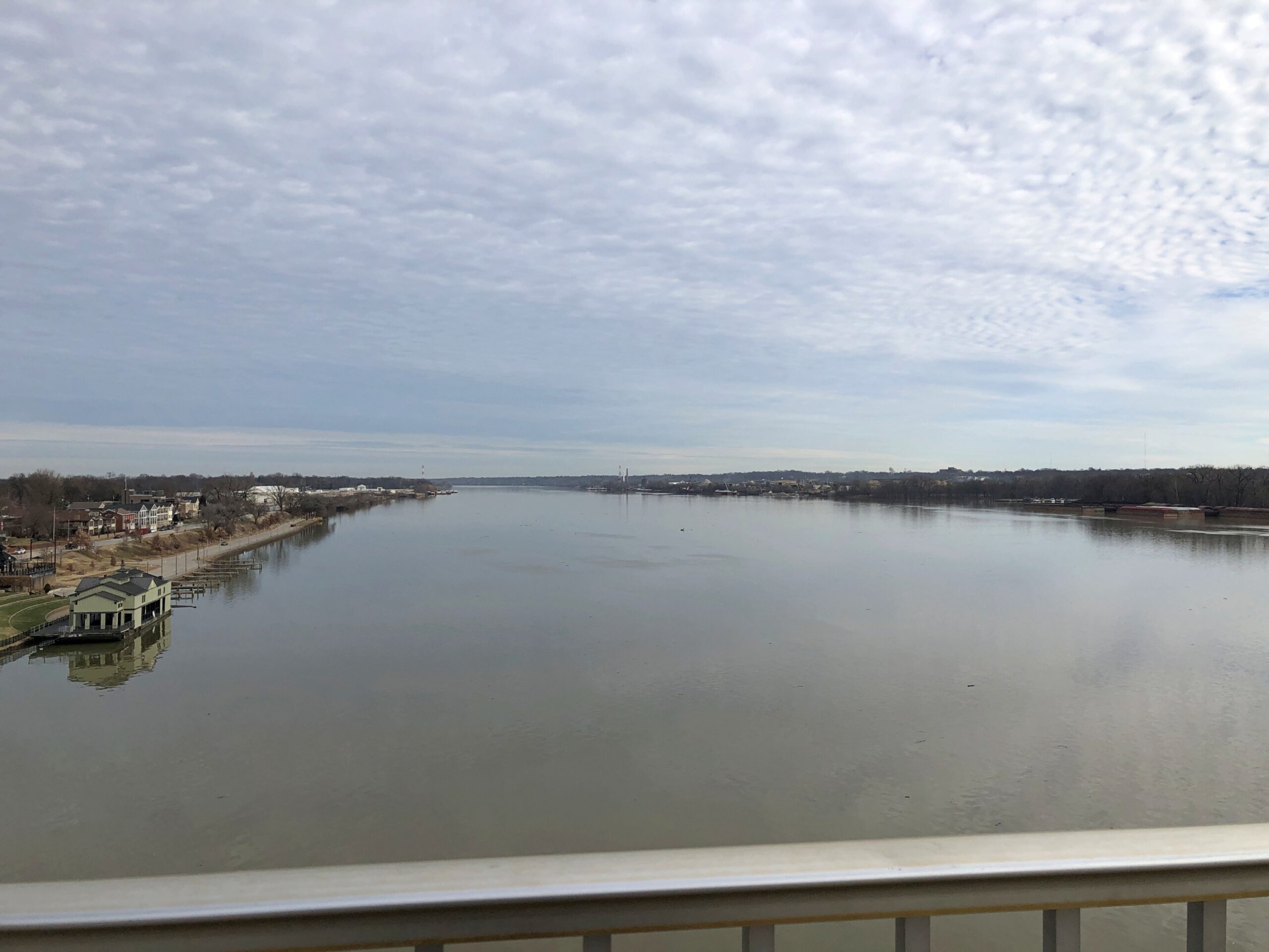
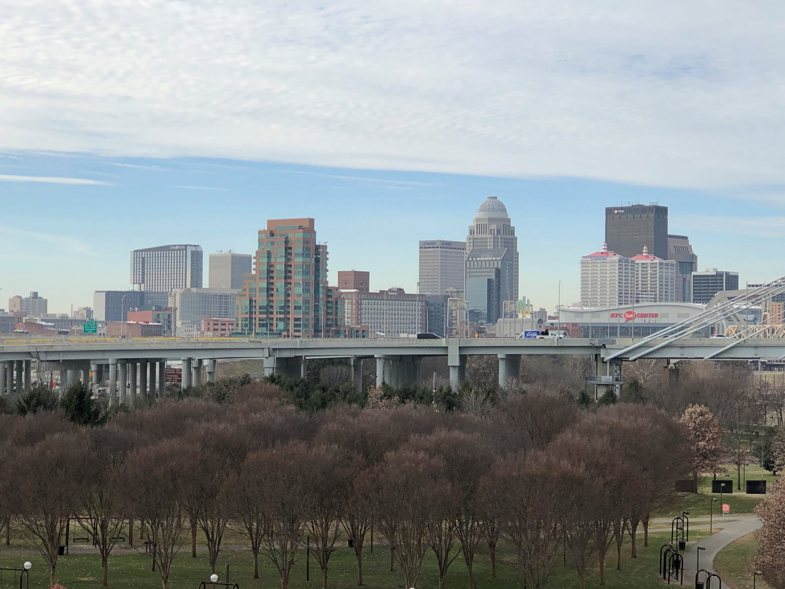
At the Louisville side of the bridge, views of the city.
And looking back at the bridge from the Kentucky (Louisville) side.
We saw the daytime bridge, of course. But “the Big Four Bridge has an LED lighting system that wraps the iron fretwork in vibrant colors,” says Our Waterfront. “The lights can be programmed to have a rainbow effect, highlighting the beauty and strength of the bridge structure. At night, the bridge becomes a colorful beacon in our city. Lights operate daily from twilight until 1 am.”
Another reason to come back to Louisville-Jeffersonville, obviously.
For good reasons. I was only 13 when the movie came out, with no memory of the original reference, and you couldn’t just dial up any old song on your machine in those days. Still, I’m happy to say I saw Young Frankenstein in the theater, as I did Blazing Saddles that same year, which also included some references I didn’t understand until later, notably the names of Lili Von Shtupp and Gov. Le Petomane.
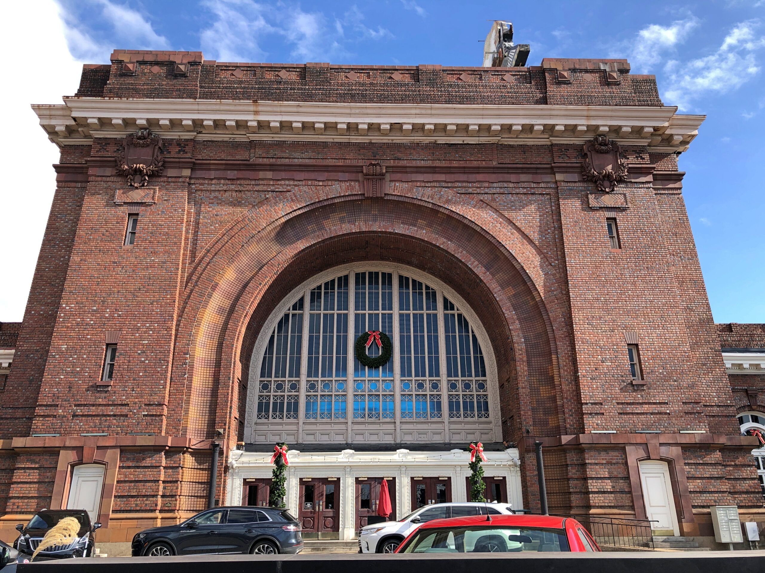
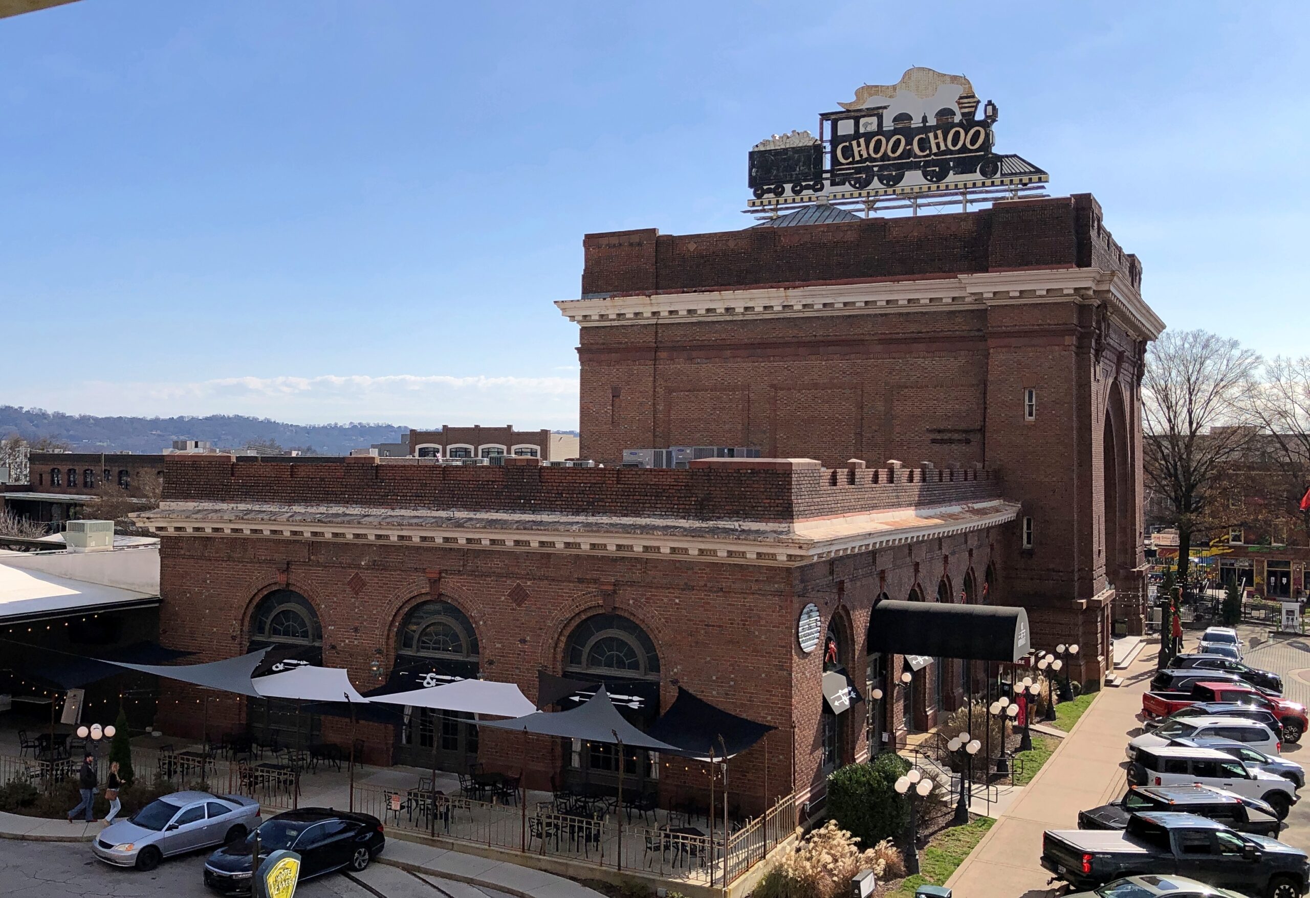
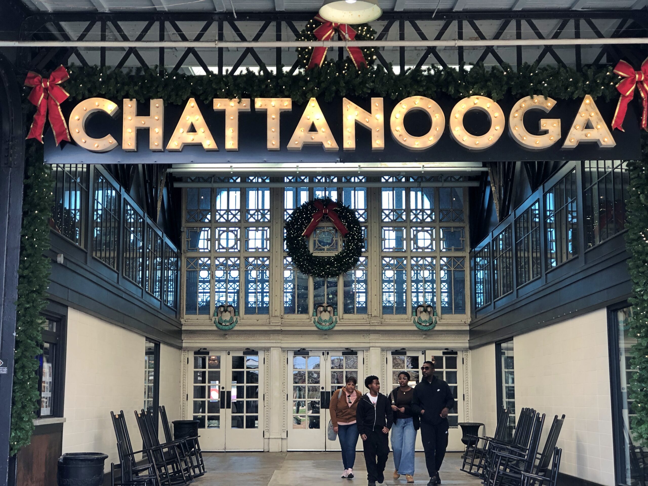
On the road home from Florida, we passed through Chattanooga, a city I hadn’t visited since sometime in the 1980s. I also have handful of memories of Chattanooga during our family road trip around the South in 1969, especially the hotel.
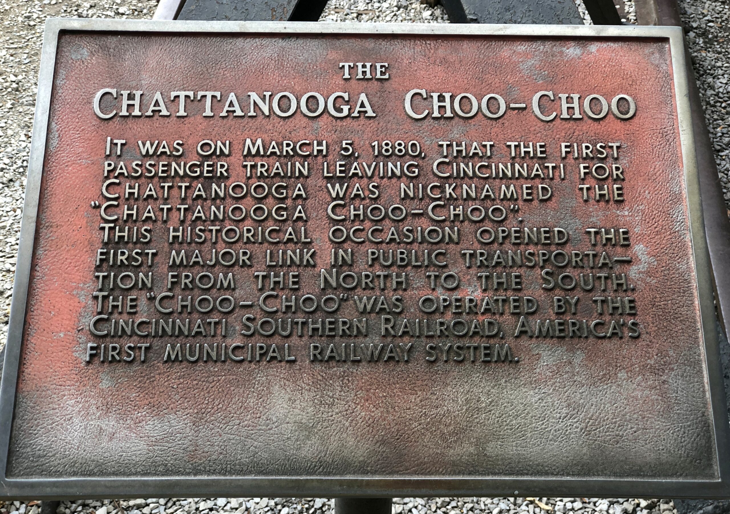
This time I noticed that the Chattanooga Choo-Choo was only a few blocks from the Interstate. So we paused our drive for a short visit.
“This landmark Chattanooga hotel located on Market Street in downtown Chattanooga initially served as the Southern Railway Terminal,” the Tennessee Encyclopedia says. “Designed by Beaux-Arts-trained architect Donn Barber of New York City, this magnificent architectural gateway to the Deep South opened during the Christmas season of 1909.”
With the mid-century decline of passenger rail in the U.S. came the near-demolition of the terminal, but the lesson of Penn Station and the era’s other thoughtless architectural destruction was apparently enough to fuel the Southern Railway Terminal’s preservation. With its redevelopment into a hotel-retail-entertainment complex came a new, instantly recognizable name: the Chattanooga Choo-Choo.
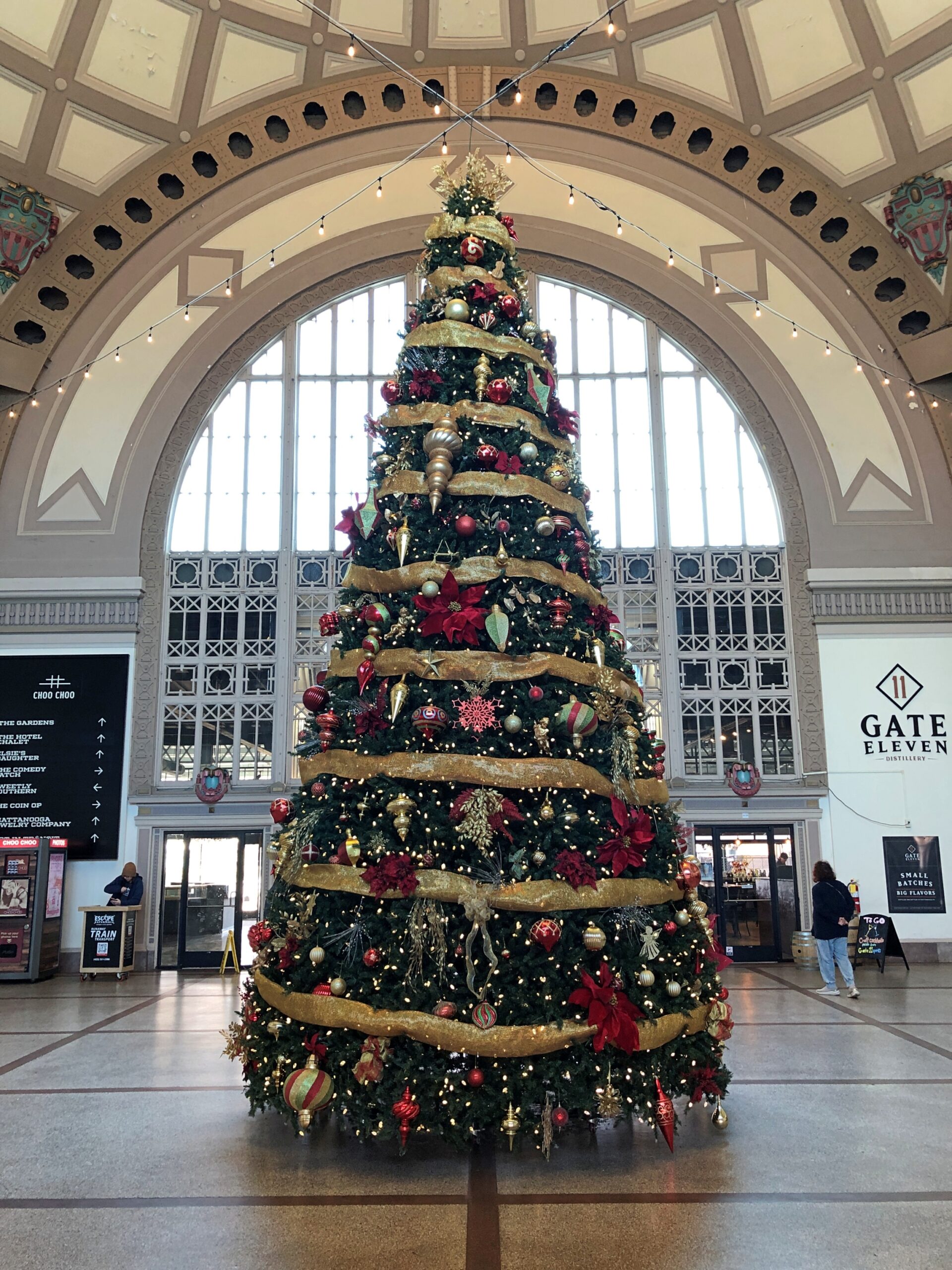
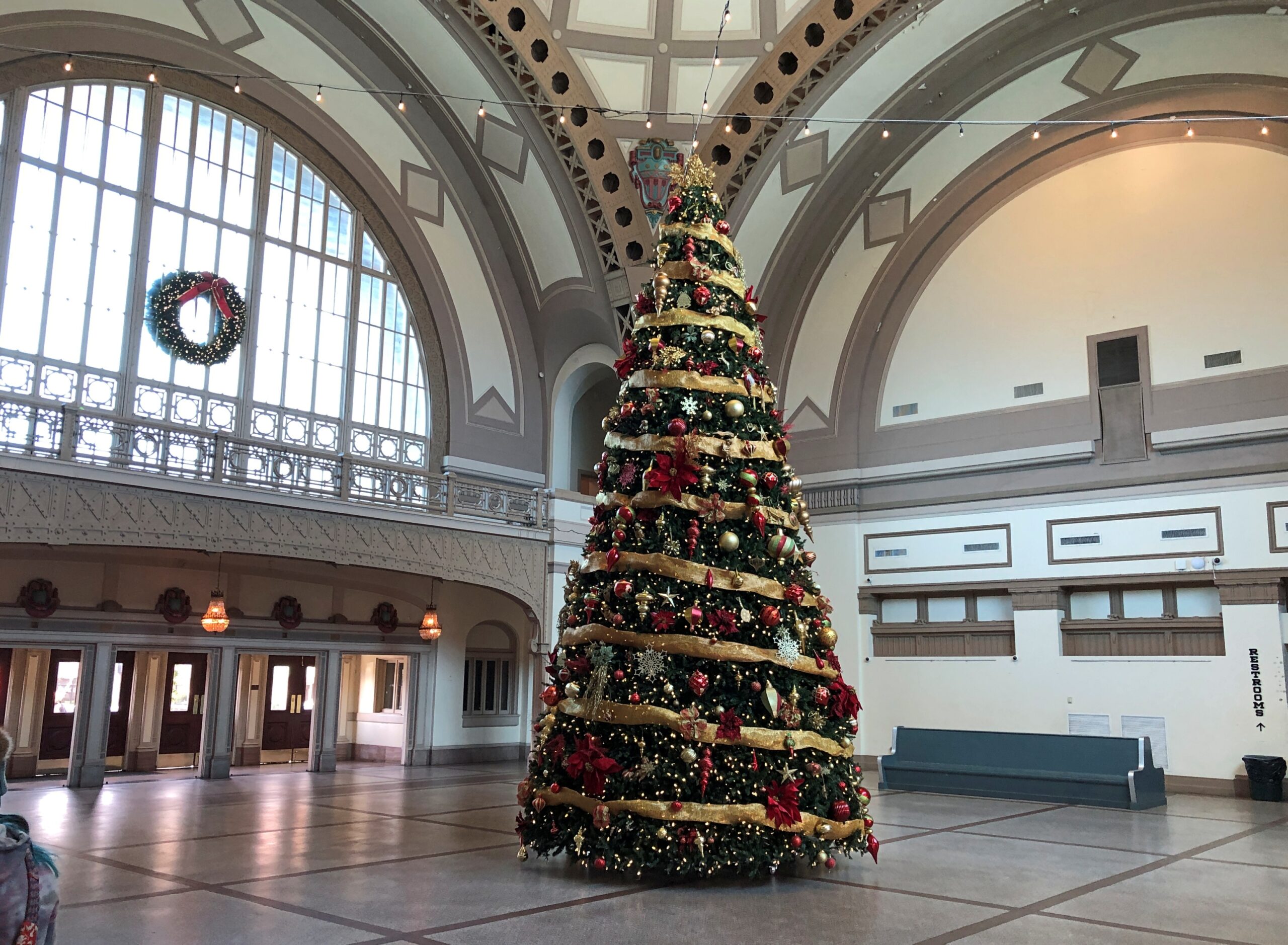
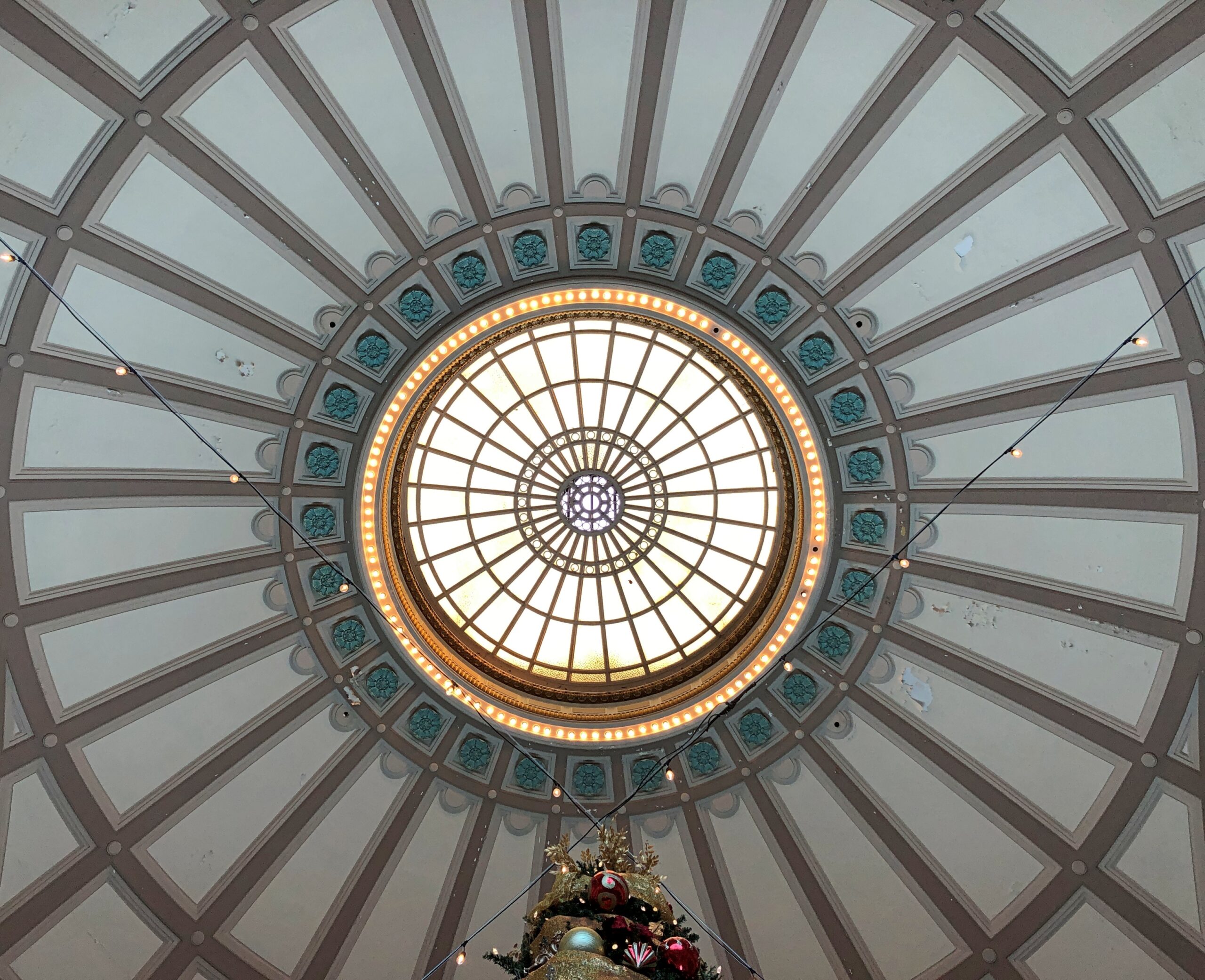
Inside, the sort of grand hall that marks grand old train terminals.
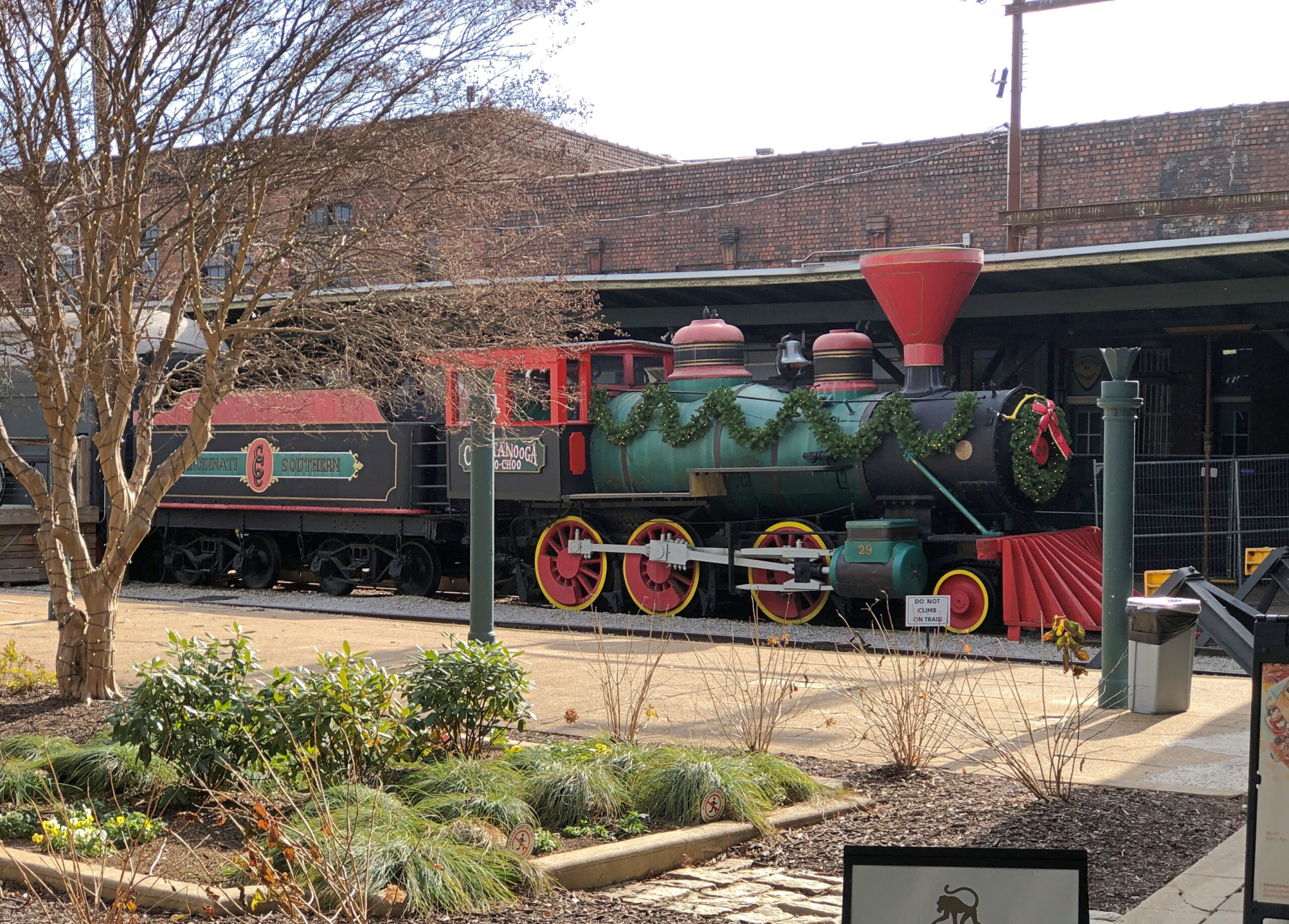
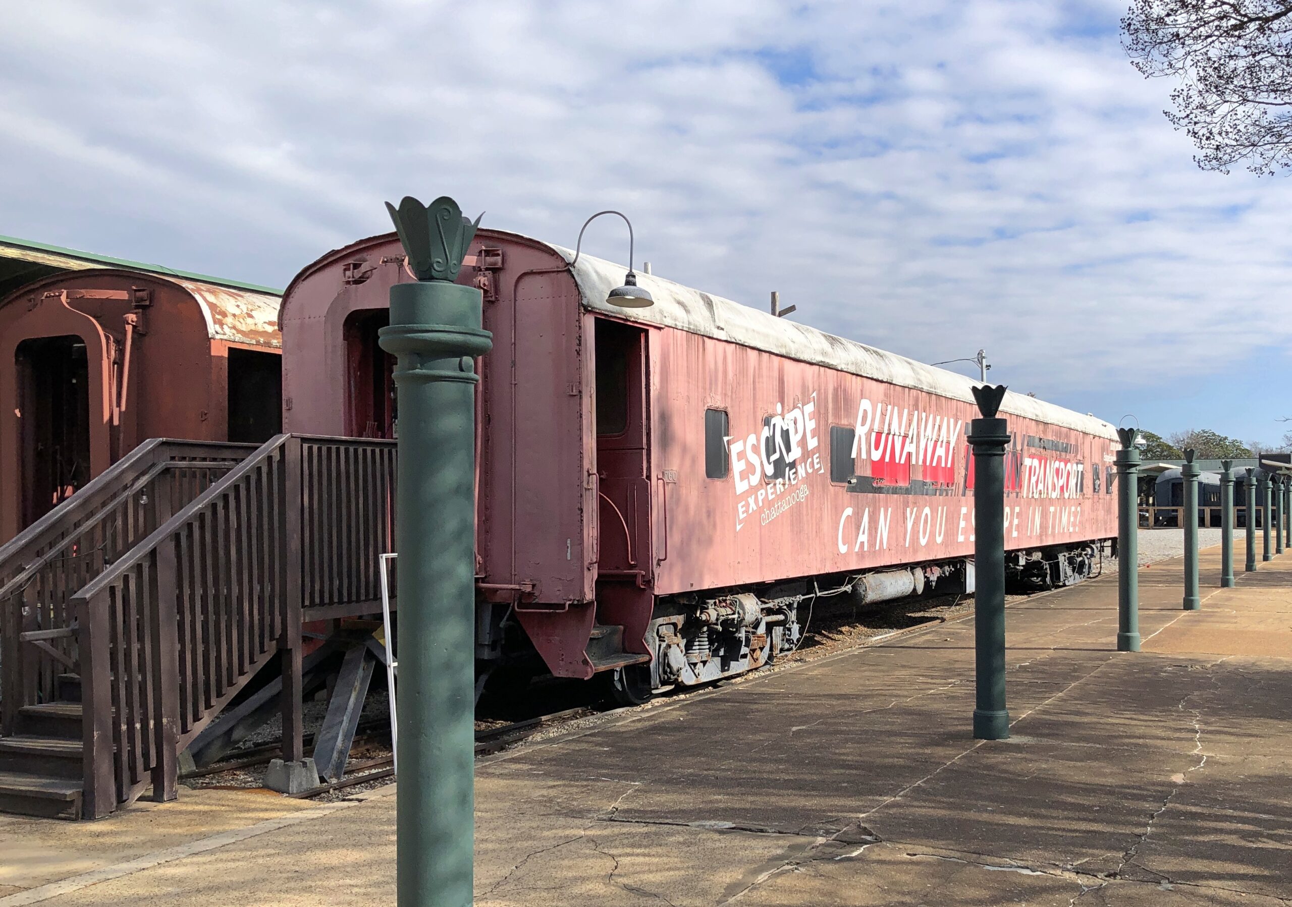
Behind the main building, relics of past choo-choos.
In case you’ve forgotten where you are.
Shovel all the coal in, gotta keep it rollin’ Woo, woo, Chattanooga, there you are
Regards for the New Year. Back to posting four days into 2026, maybe with tales of Florida alligator tourism. The change of the year always brings me the same reaction: how did that number get so high? This time around, I wonder how is it that 1976, a good (mostly) year I remember fairly well for a number of reasons, was 50 years ago?
Orlando, Yuriko was surprised to learn, is an actual city. The day after Universal Epic Universe, we drove from our hotel near that park, past Orlando’s sizable downtown, and to the inner suburb of Winter Park. She marveled that the city had a presence besides the sprawl of the theme parks, which are at some distance from the Orlando CBD. Bet she isn’t the only person, upon leaving the theme park zone, with that reaction.
One could devise a pretty good multi-day visit to Orlando, to see its green spaces and historic sites and museums, and take in a few shops and restaurants and some live music, and never pay the Mouse or Comcast a dime. Maybe one day I will do such a visit, but the pull of the theme parks is pervasive. Even my businesses trips of yore (early 2000s) to central Florida tended to gravitate toward the parks. Why would you skip the theme parks? would be the reaction, even — and most importantly — among members of my family. For now, part of a day away from the Theme Park Industrial Complex will have to do.
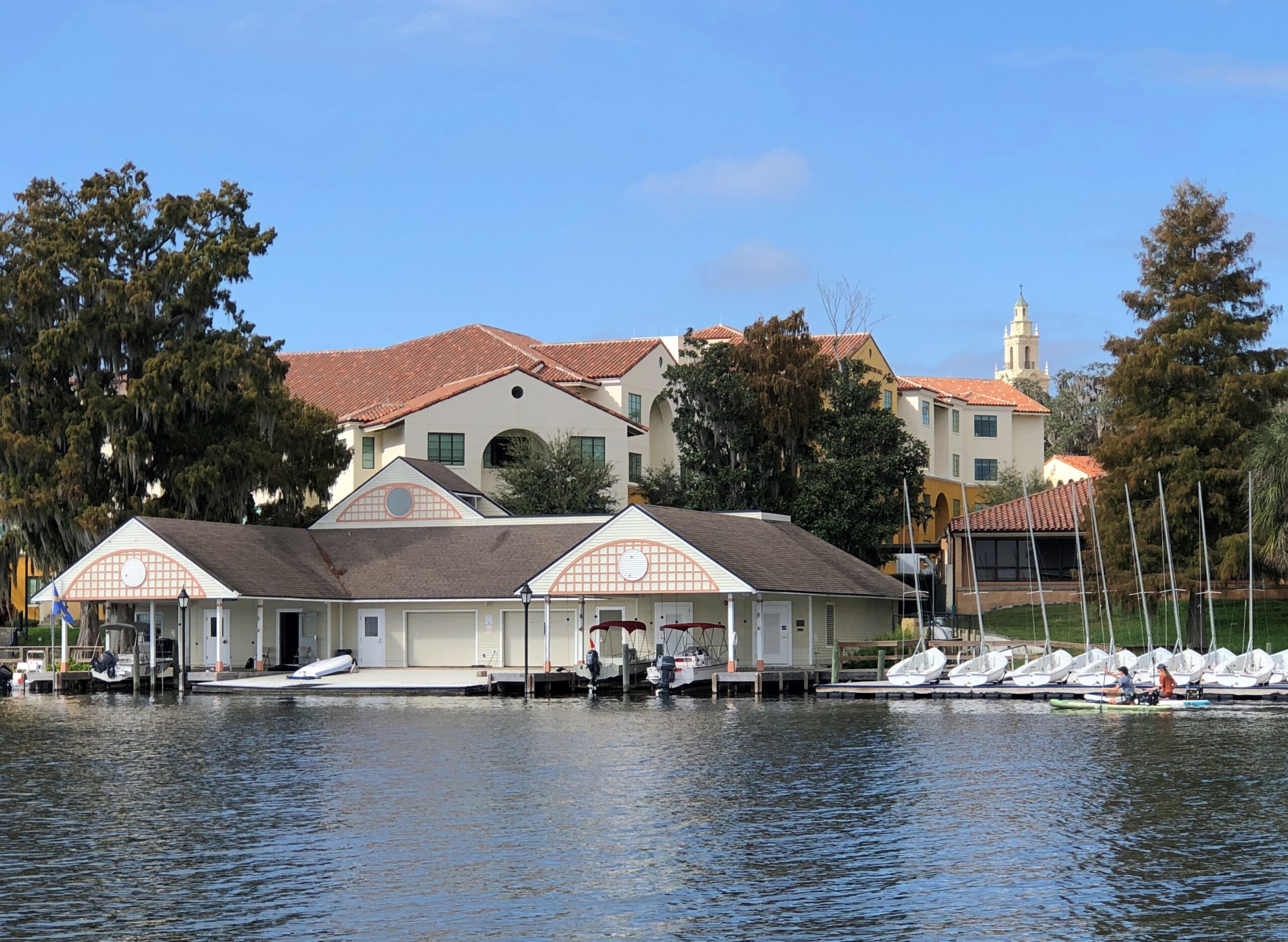
I’d gotten wind of a tour boat ride on Winter Park’s small lakes that (1) wasn’t expensive and only about a hour long; (2) didn’t require reservations or a damned app or the like to access; and (3) most importantly, was something we could do sitting down, after a day of walking and more walking.
We made it for the noon tour. December 10 was as warm and clear a day in Winter Park as you could ask for, a reminder of why a couple of Victorian businessmen were able to found a town in central Florida and attract wealthy property buyers who aspired to escape the frozen North for a few months.
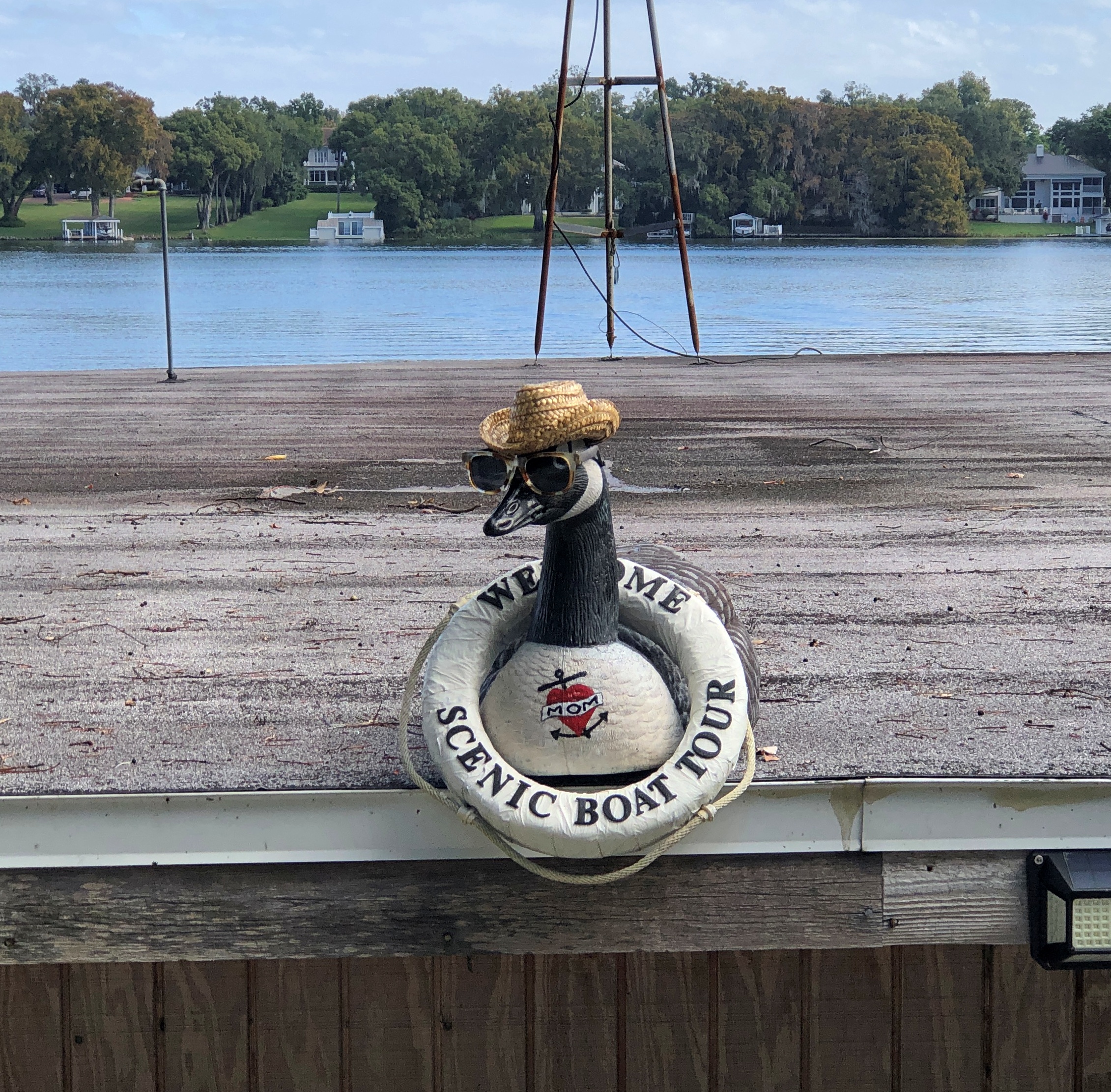
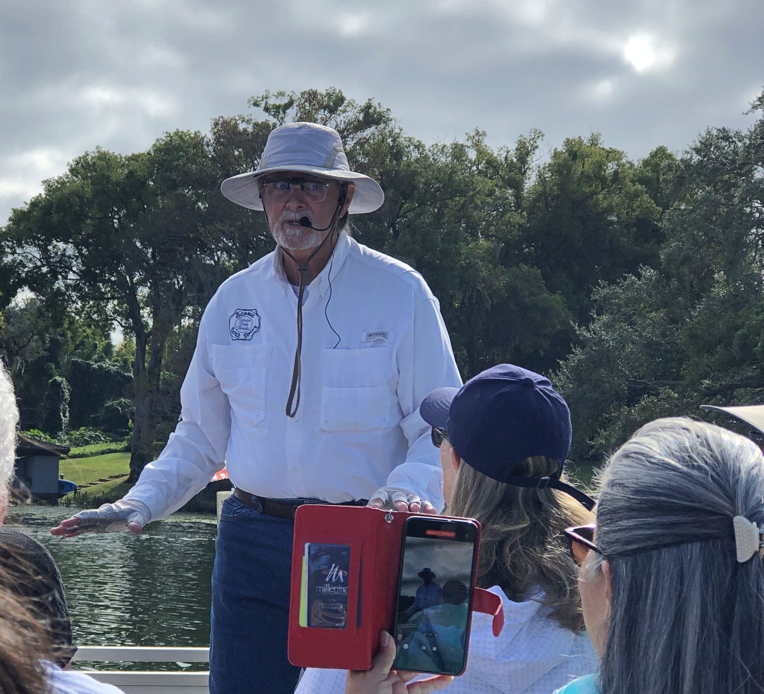
Our skipper for the tour.
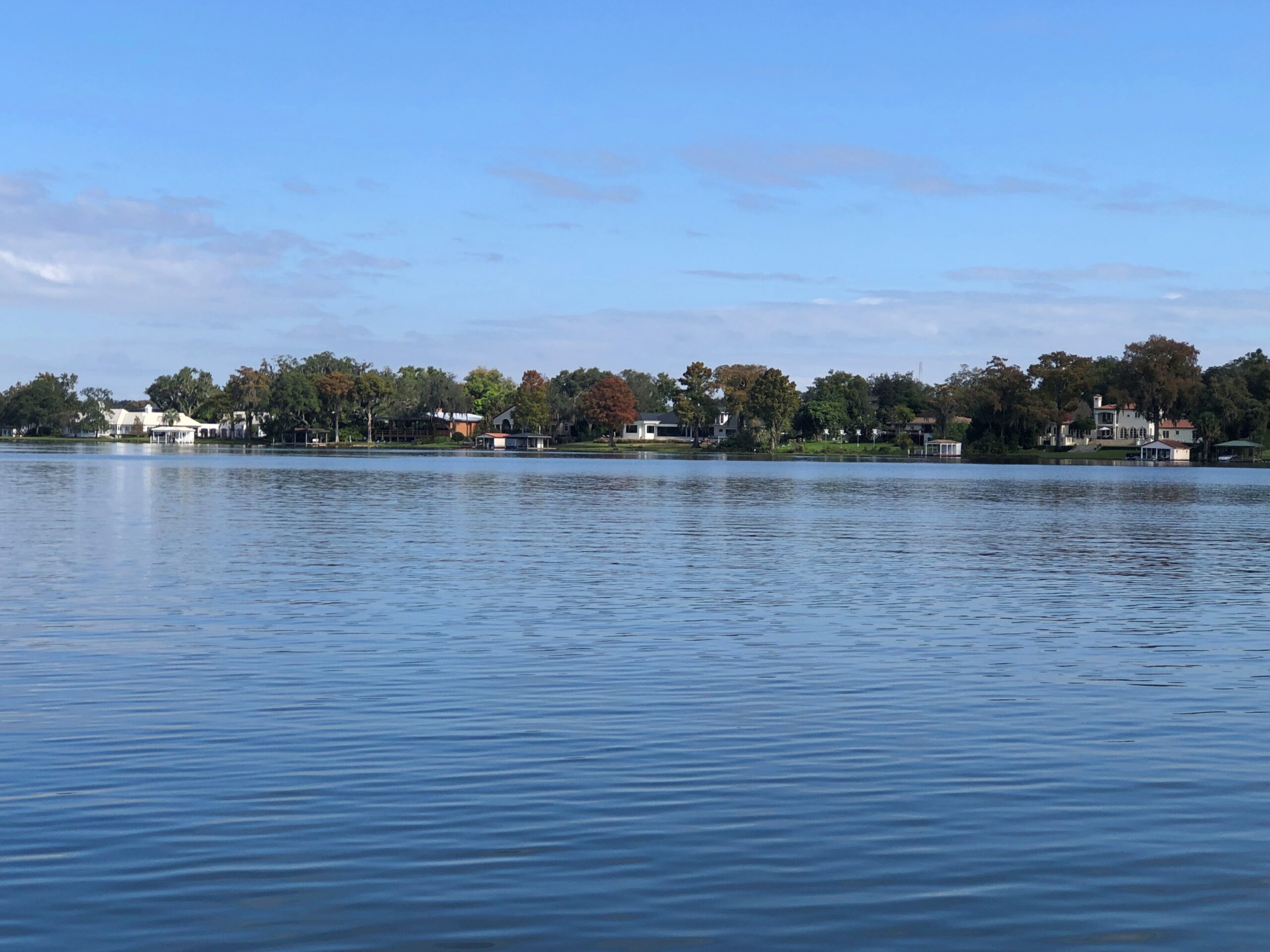
Skipper Bob, let’s call him. He took us from the tour-boat dock on Lake Osceola through a couple of canals to Lake Mizell and Lake Virginia and then back, pointing out some of the posher estates and landmarks along the way, such as the posh boat houses that tend to come with such properties.
Bob also offered up some detail about the history of the area, most of it unfamiliar. I didn’t know, for example, that Fred Rogers was an alumnus of Rollins College, which occupies a sizable chunk of the Lake Virginia shore. I also learned that the college, even in our age of grossly inflated higher-ed tuition, outclasses most others in its high cost.
Out on the lakes, Bob revved up the engine from time to time, spurring the boat forward at a good clip. Wind famously blows long hair into a pleasantly billowing mass at such times, but under the warm sun and blue sky that day, even my shortish hair was picked up by the wind. Felt good.
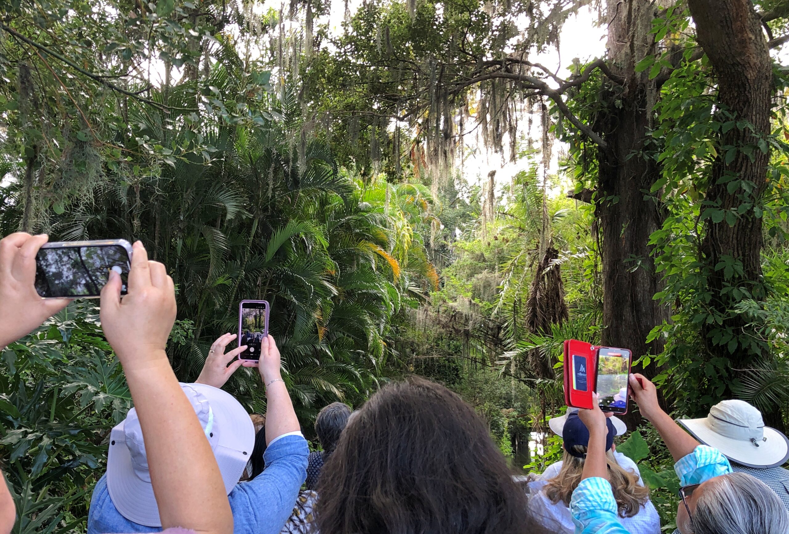
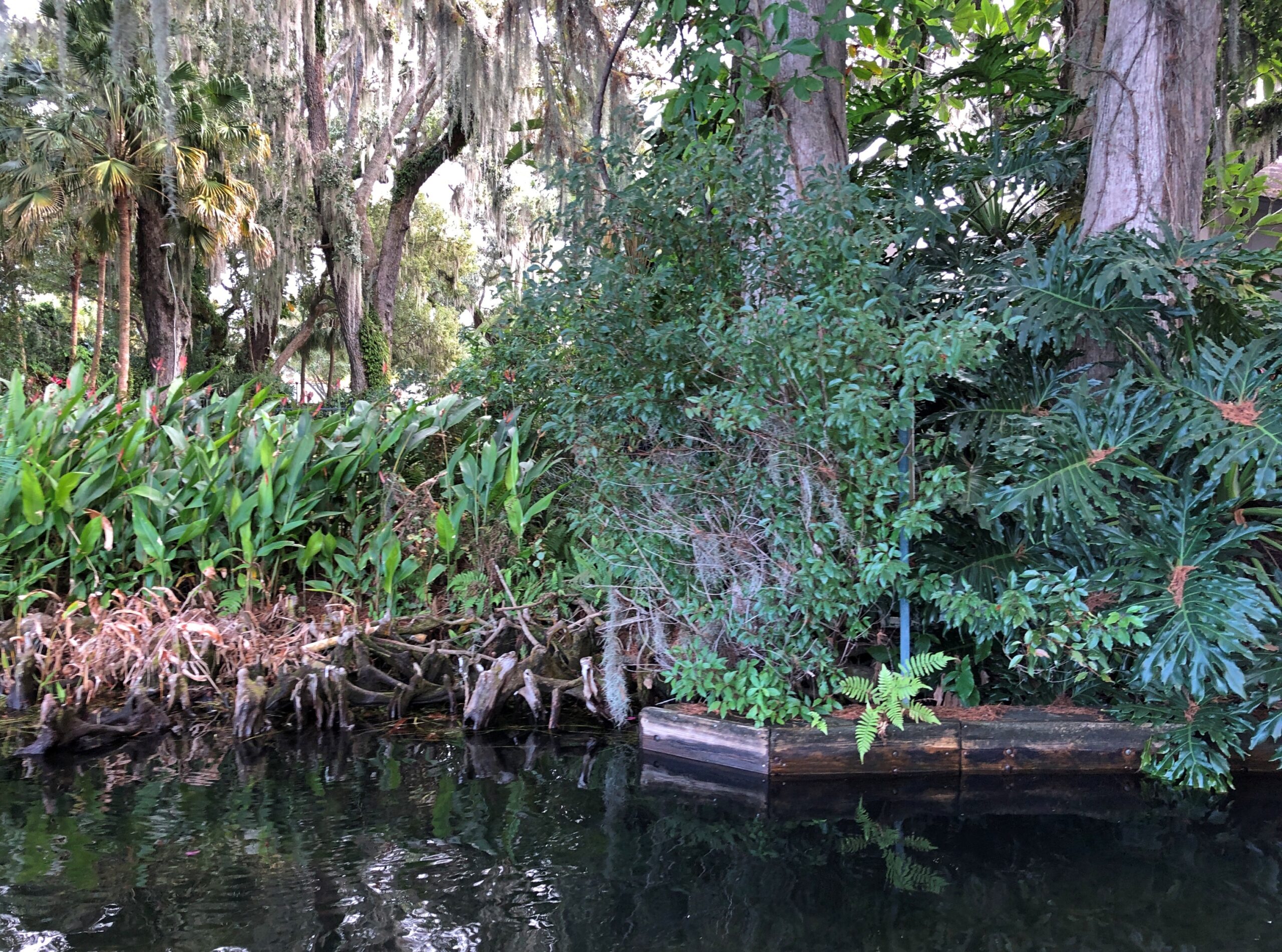
I liked the passages through the canals. I don’t think I was alone in this.
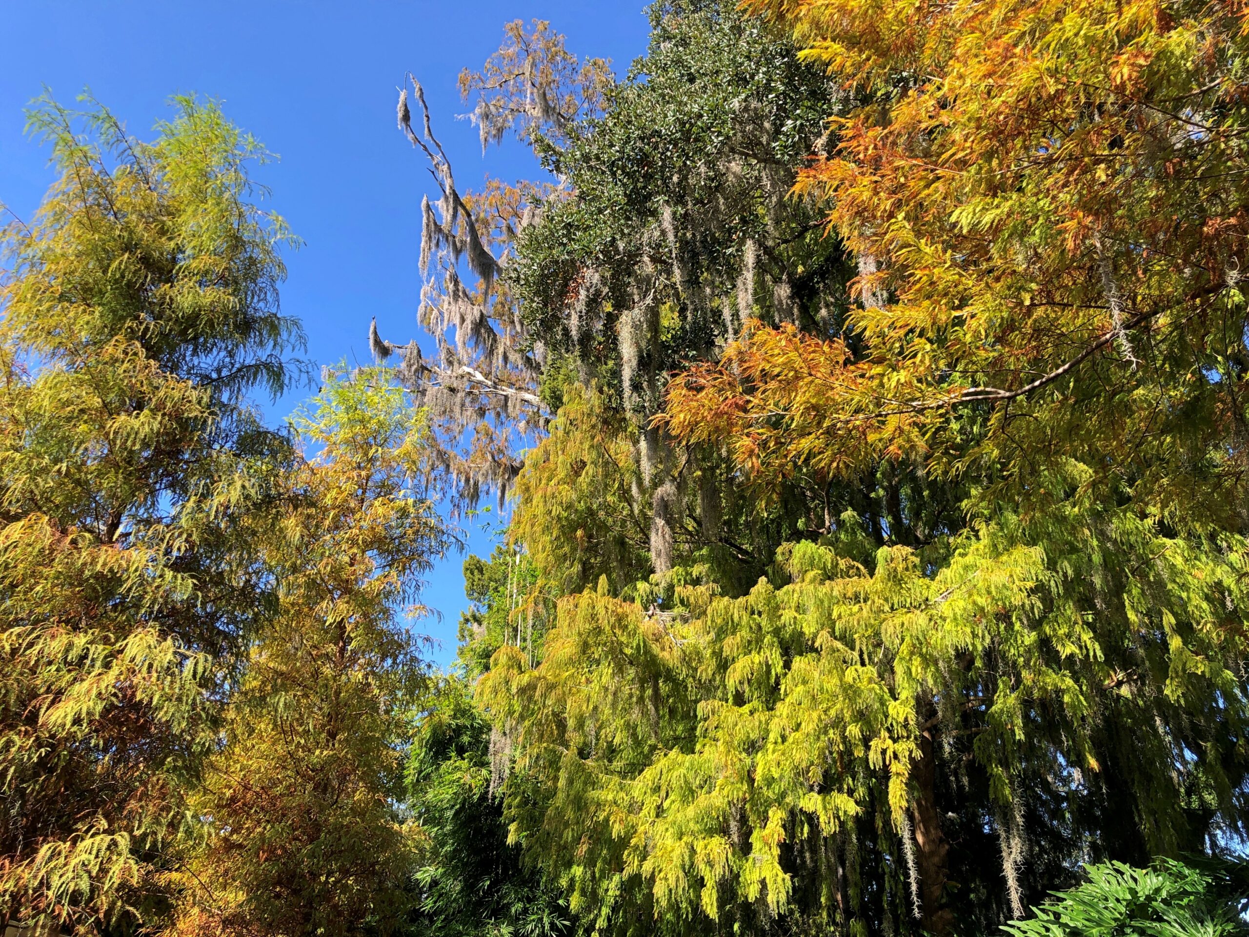
In most of the rest of the country, winter had arrived. In Winter Park, named for the season it is most unlike, you can pass through the tightly packed greenery luxuriating in warm air.
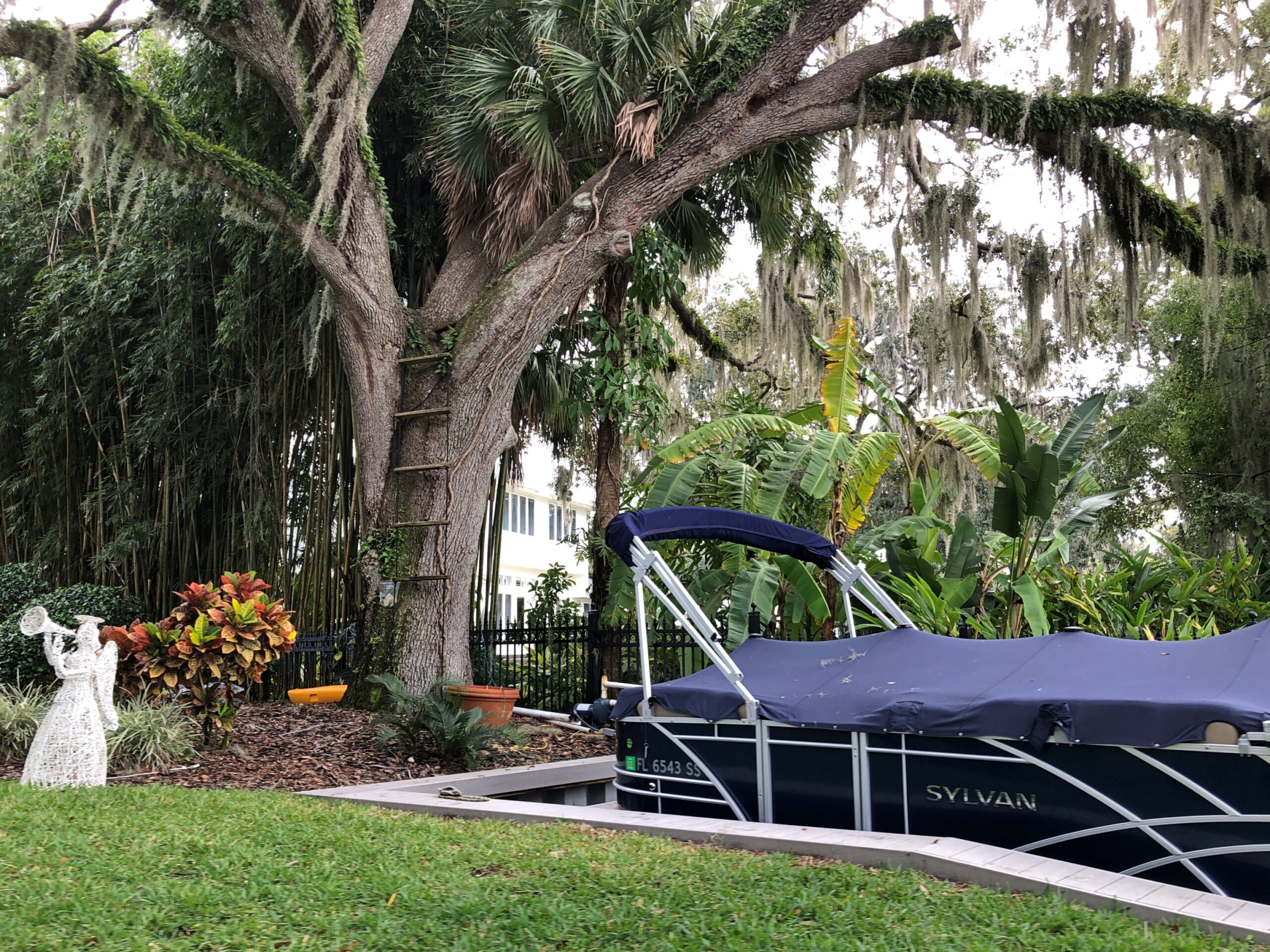
You’re up close to the yards of more modest, but still high-value real estate. Everyone’s got a dock.
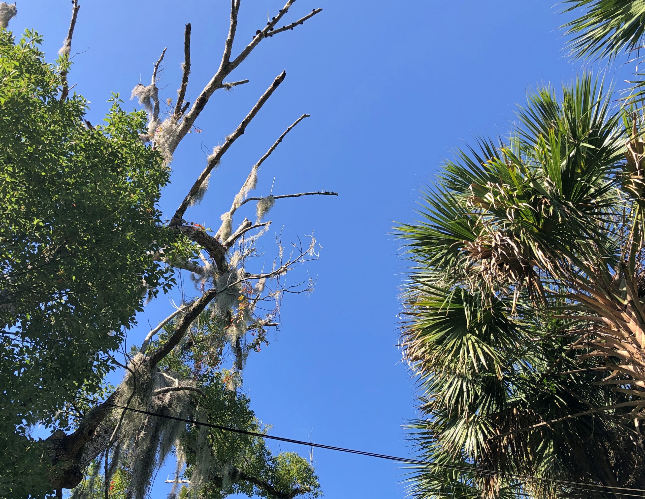
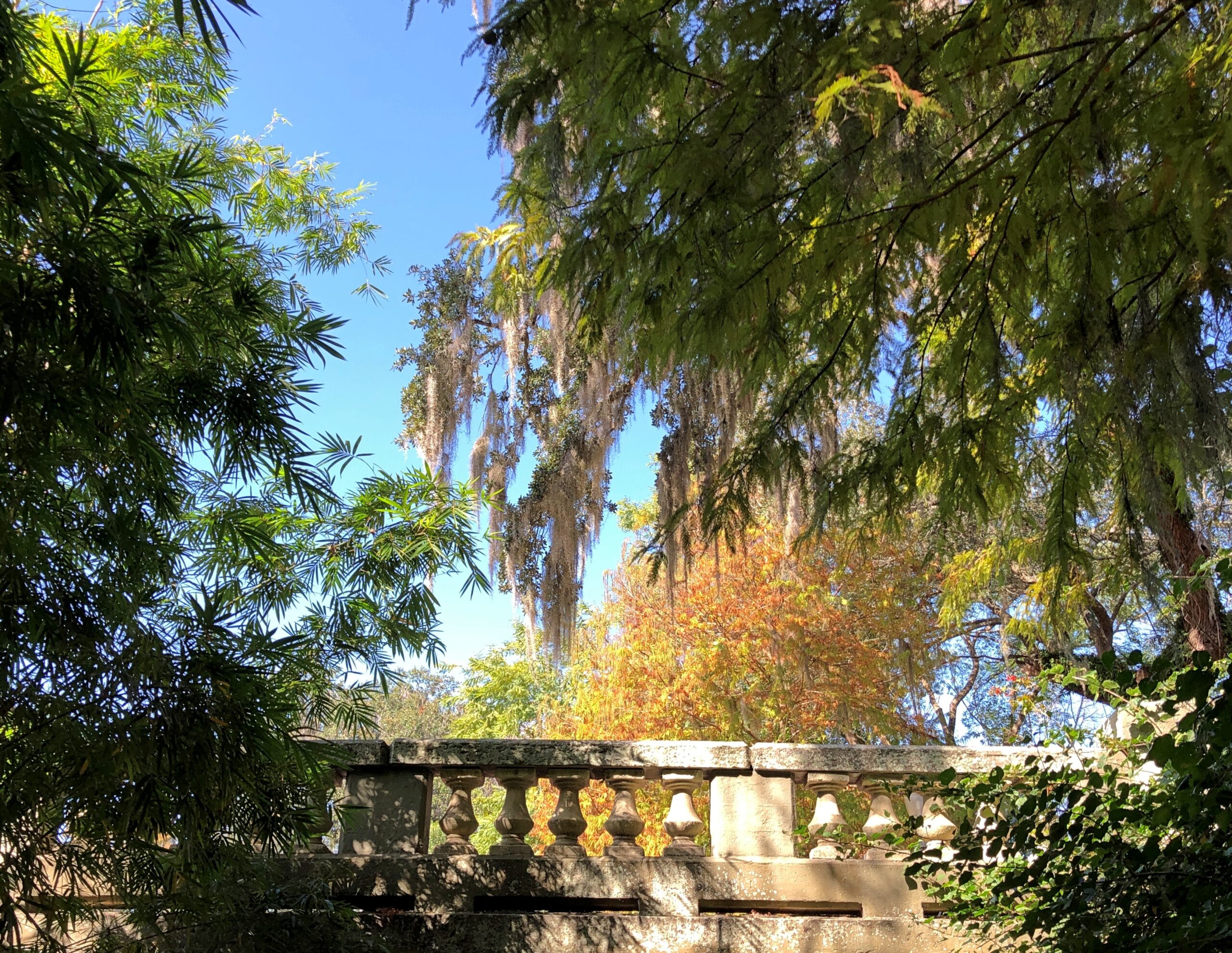
The vantage means views of the canopy above.
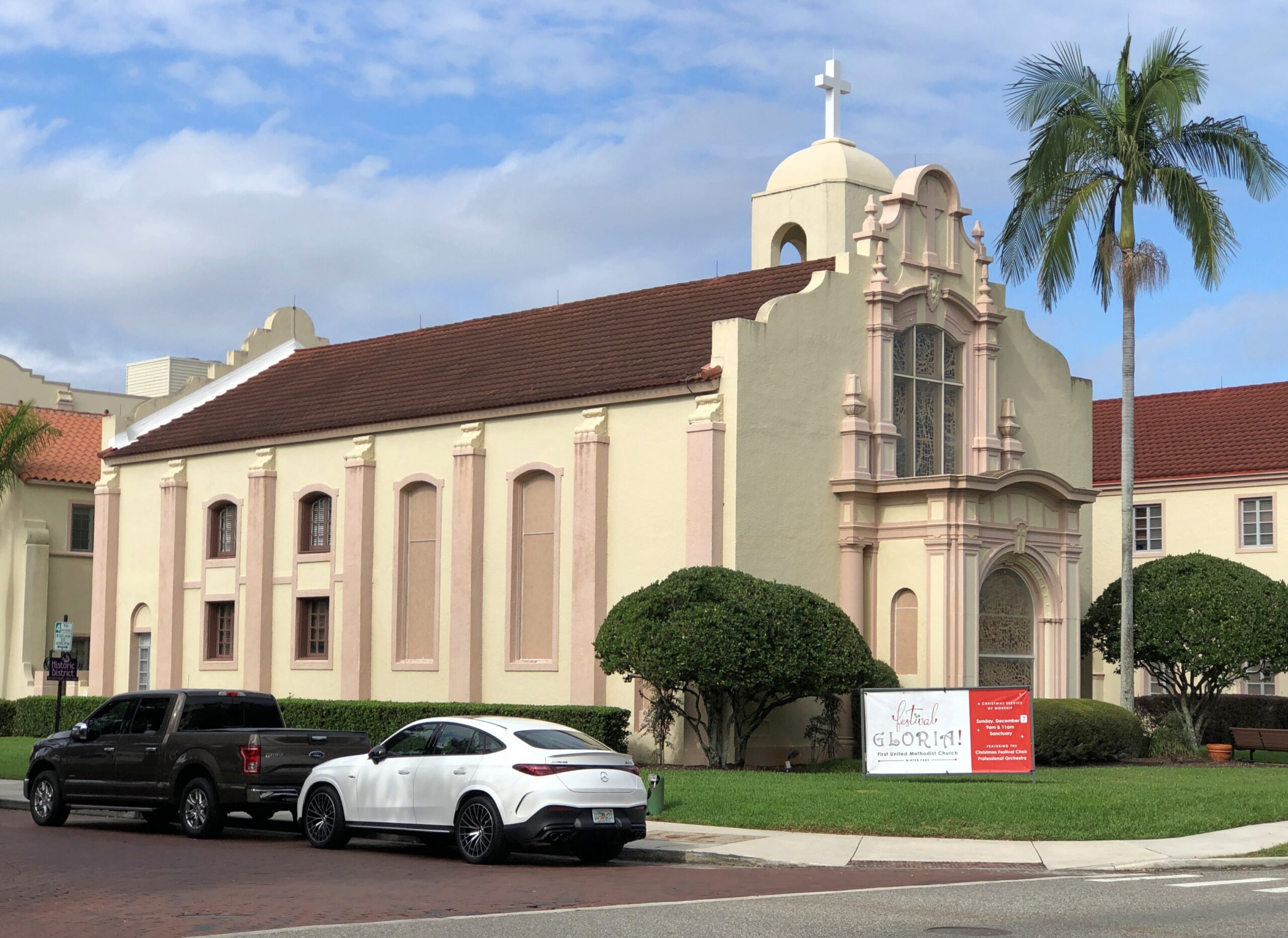
After the boat tour, we walked a few pleasant blocks along Morse Blvd., away from the lake. This handsome church, First United Methodist, didn’t look open. Too bad.
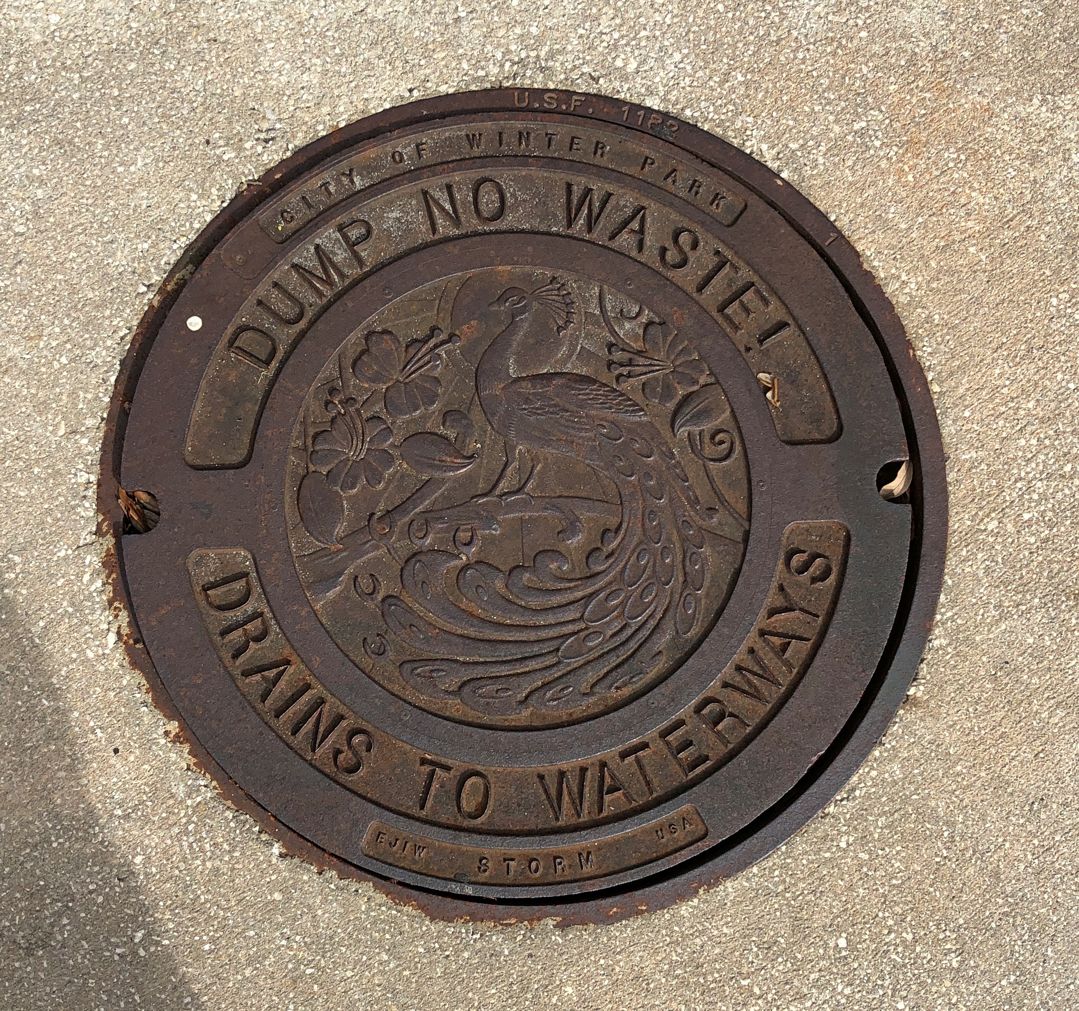
The city is fond of its peafowl, I understand.
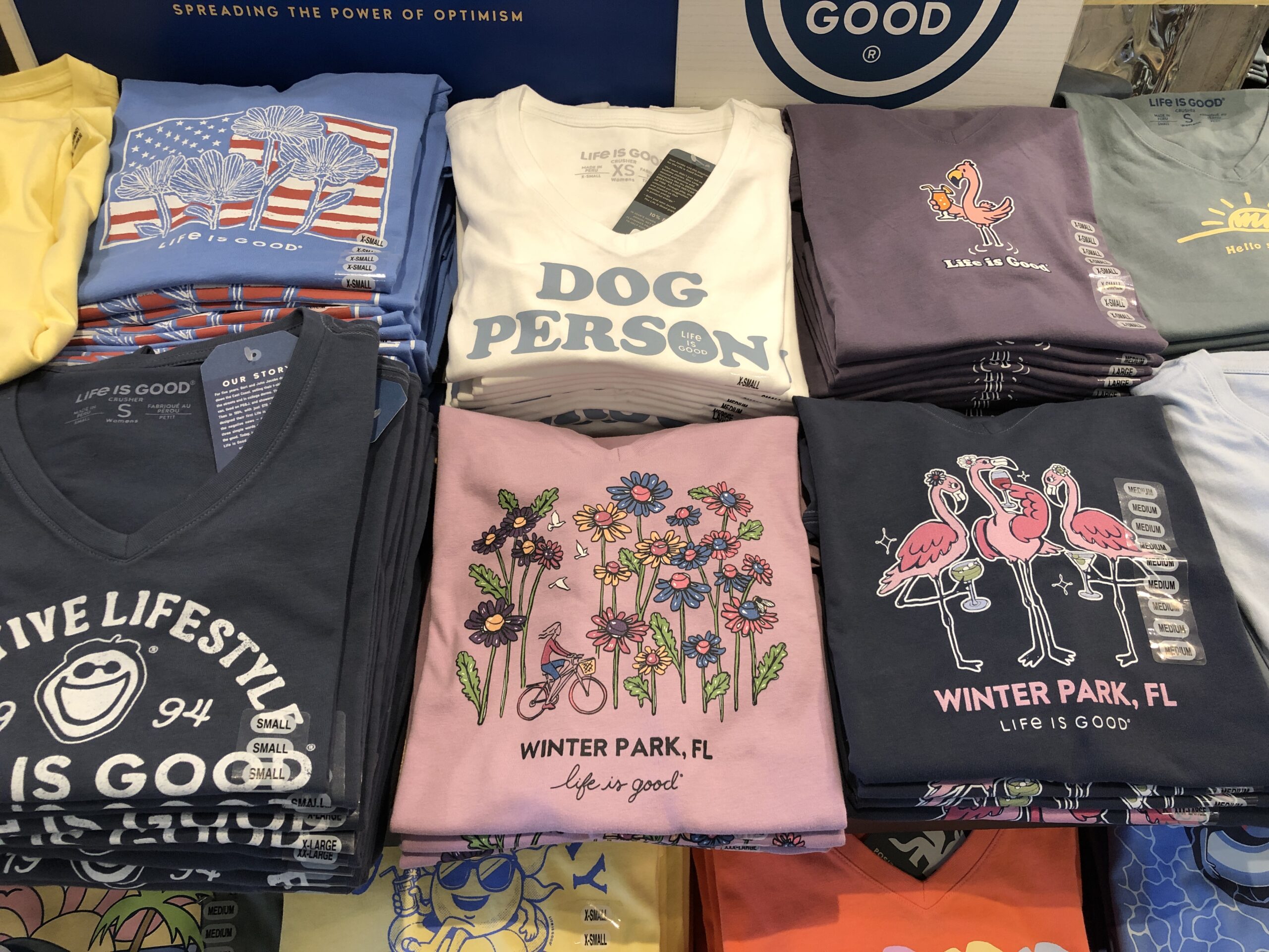
The downtown shopping street in Winter Park is Park Ave. On one side of the street are the likes of Bosphorous Turkish Cuisine, Williams-Sonoma, Ocean Blue Galleries, D’Anne Mica, Fannie Hillman + Associates real estate, Current by John Craig men’s clothing, The Imperial on Park wine bar and Be On Park Fine Jewelry. Life Is Good (registered trademark) products are available on the street.
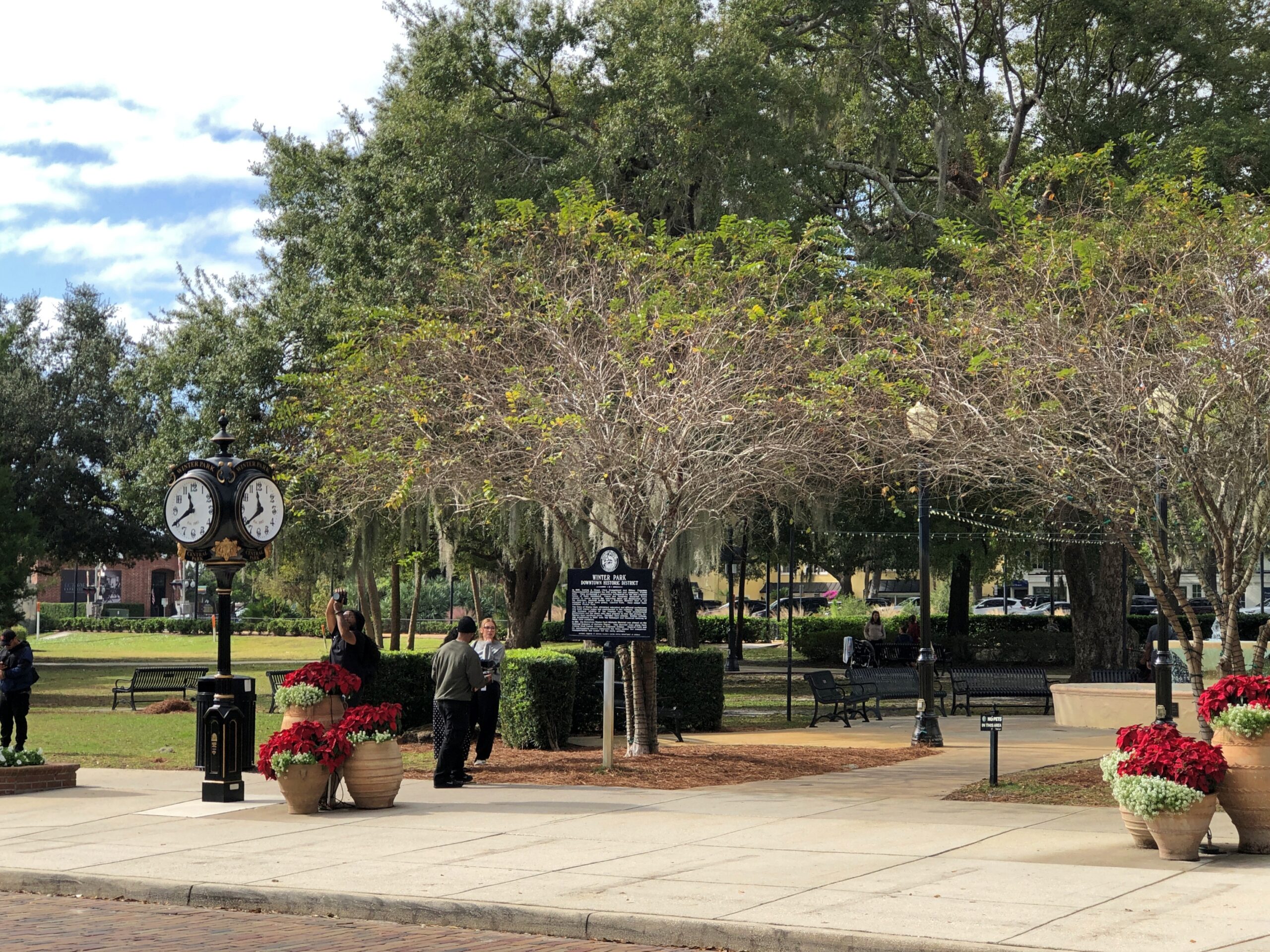
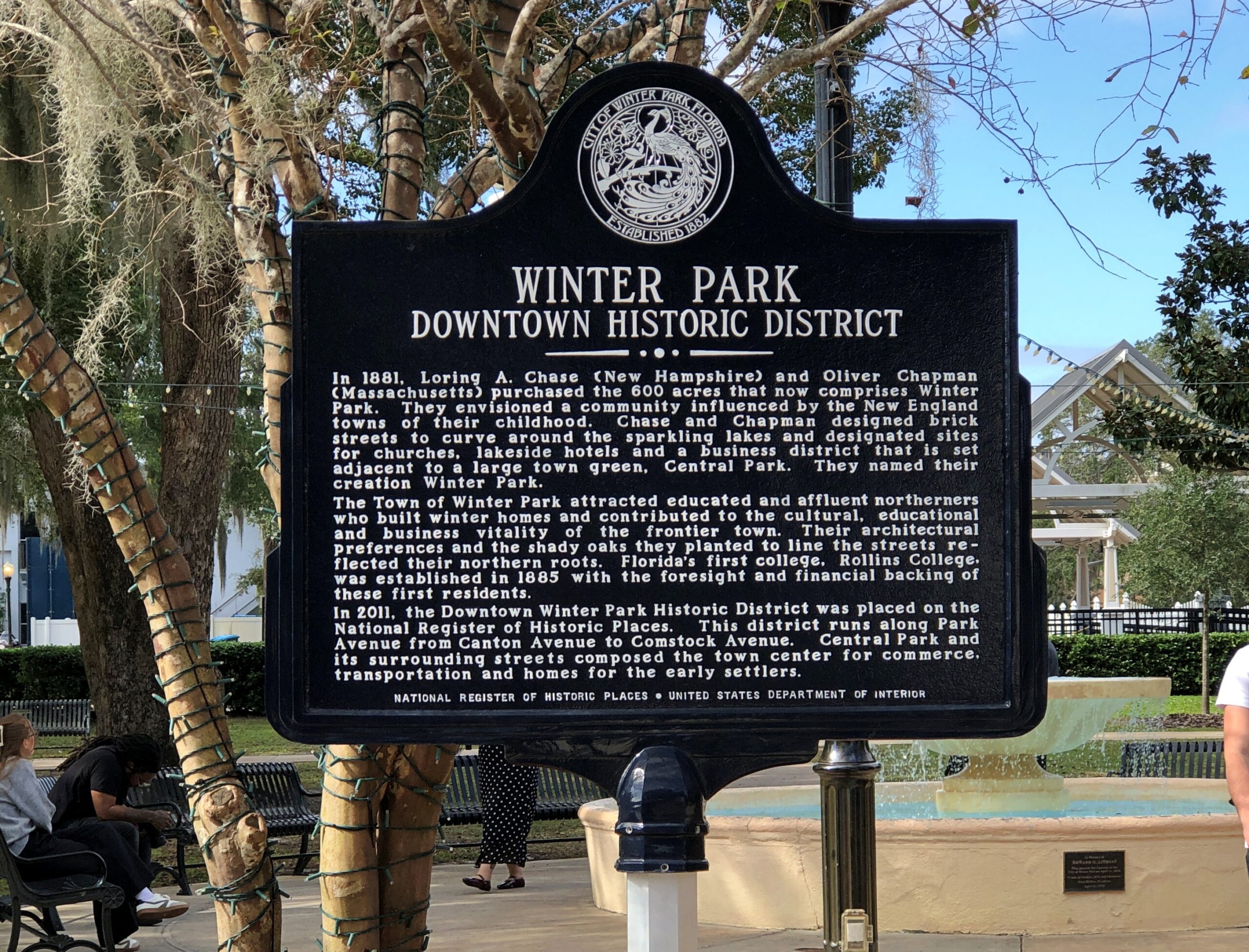
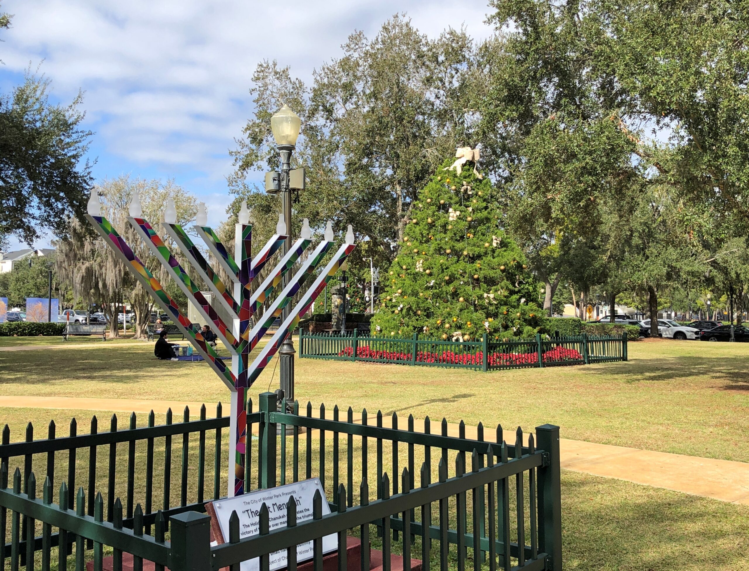
Across the street from the shops is Central Park. The developers were out, I think, to remind New Yorkers of home, but without the likelihood of snow or ice or blizzards like in ’88.
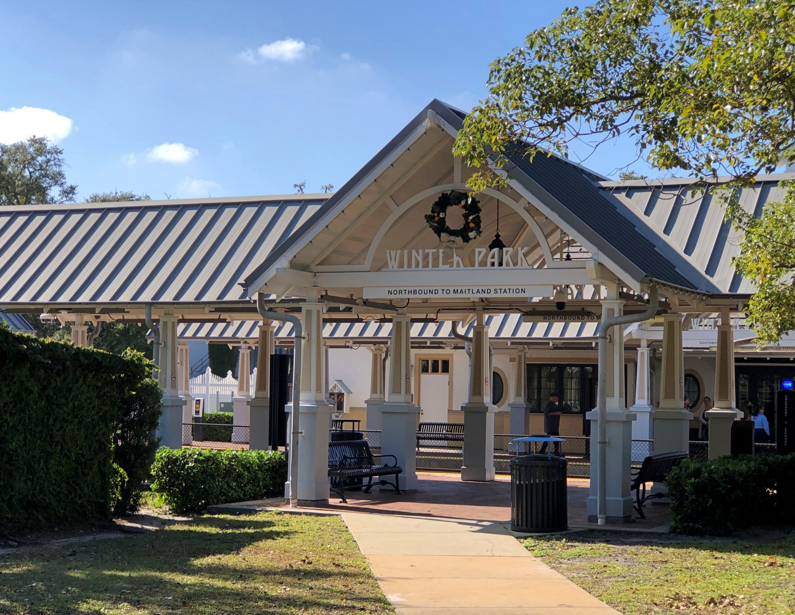
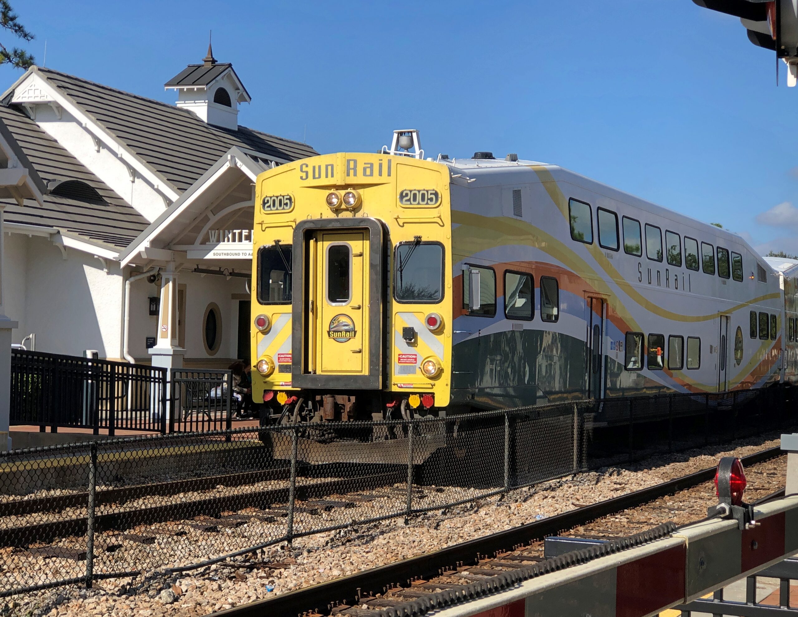
The Winter Park station on the SunRail commuter line is at the park, and a SunRail came while I was idling in the park. Amtrak stops there too.
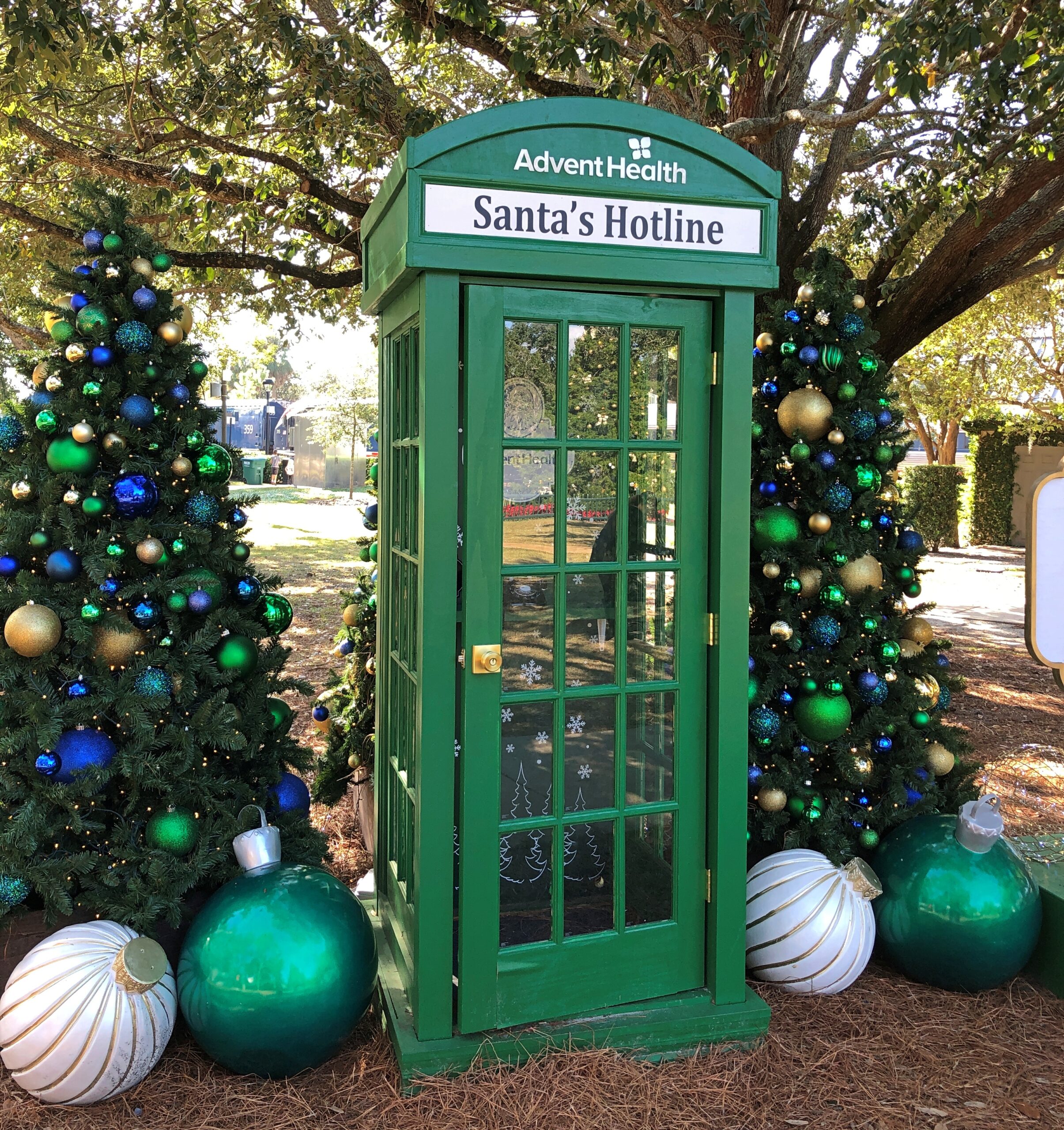
The park was decorated for the holidays, of course. Including a phone booth.
A local tradition. You can call from the booth and leave a message for Santa Claus.
Cold winds rolled through northern Illinois today. Seven inches of snow are forecast for Saturday. What? Right, it’s winter. The winter solstice is just the shortest day of the year.
Back to posting on Sunday. Regards for Thanksgiving.
Something to upset PETA sympathizers.
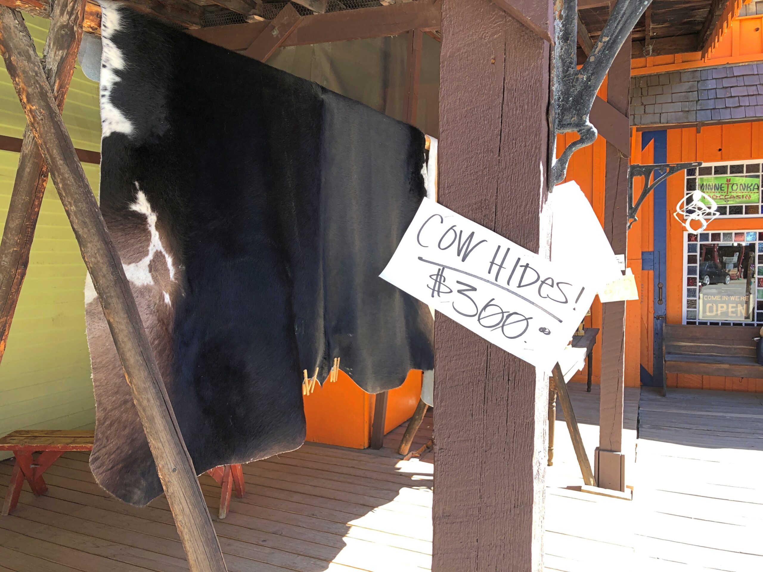
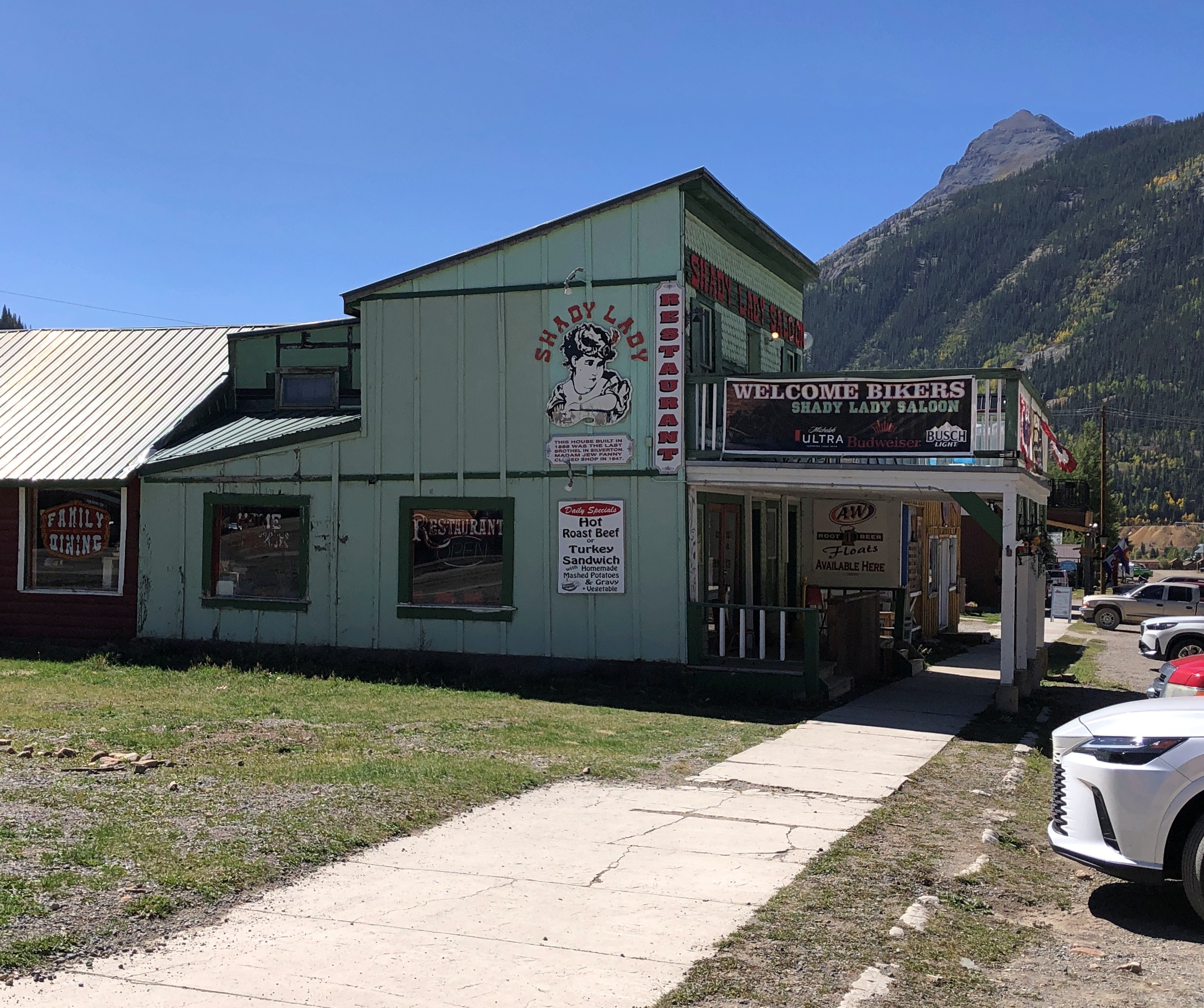
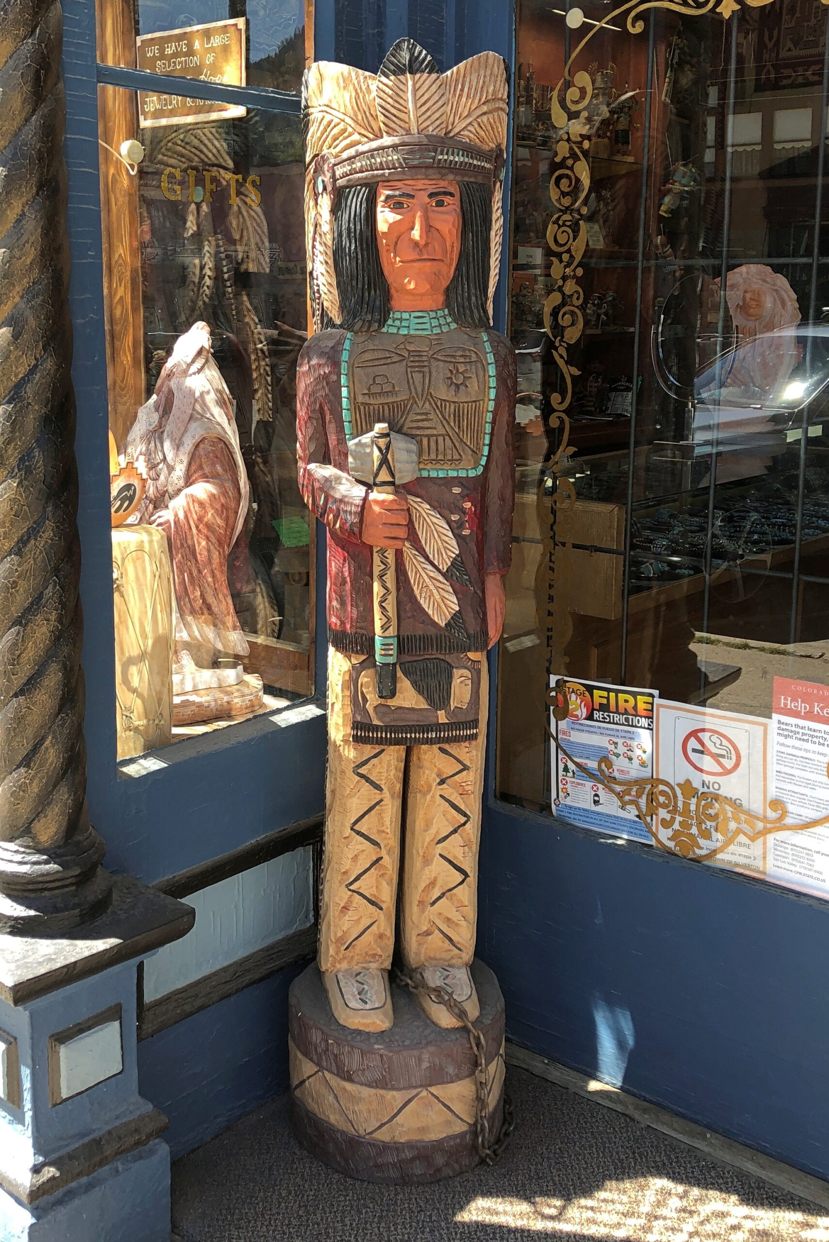
Stroll down Greene St. in the mountain town of Silverton, Colorado, at least in mid-September this year, and you’d have had the opportunity to buy a hide for $300. We did, but declined. Still, it wasn’t just a Colorado detail, but a Western one. The West, where men are men and cow hides hang in the sun. As far as I could tell, you couldn’t buy a hide with Bitcoin, but I suppose you’d have to ask the seller to be sure.
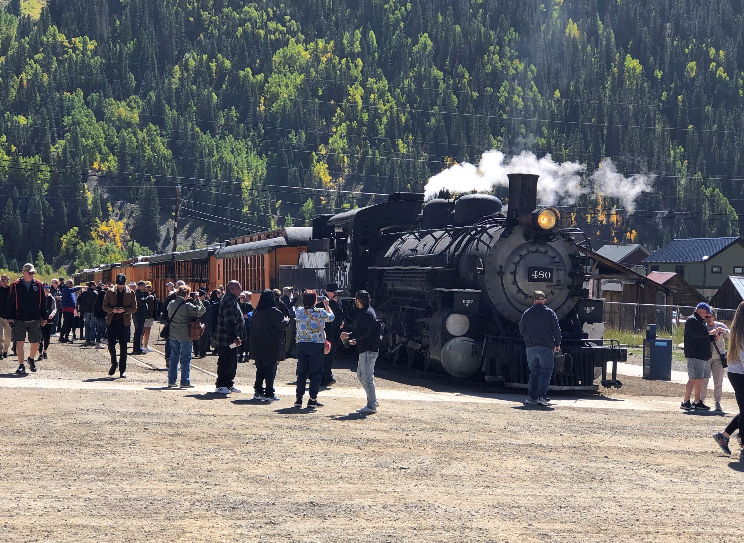
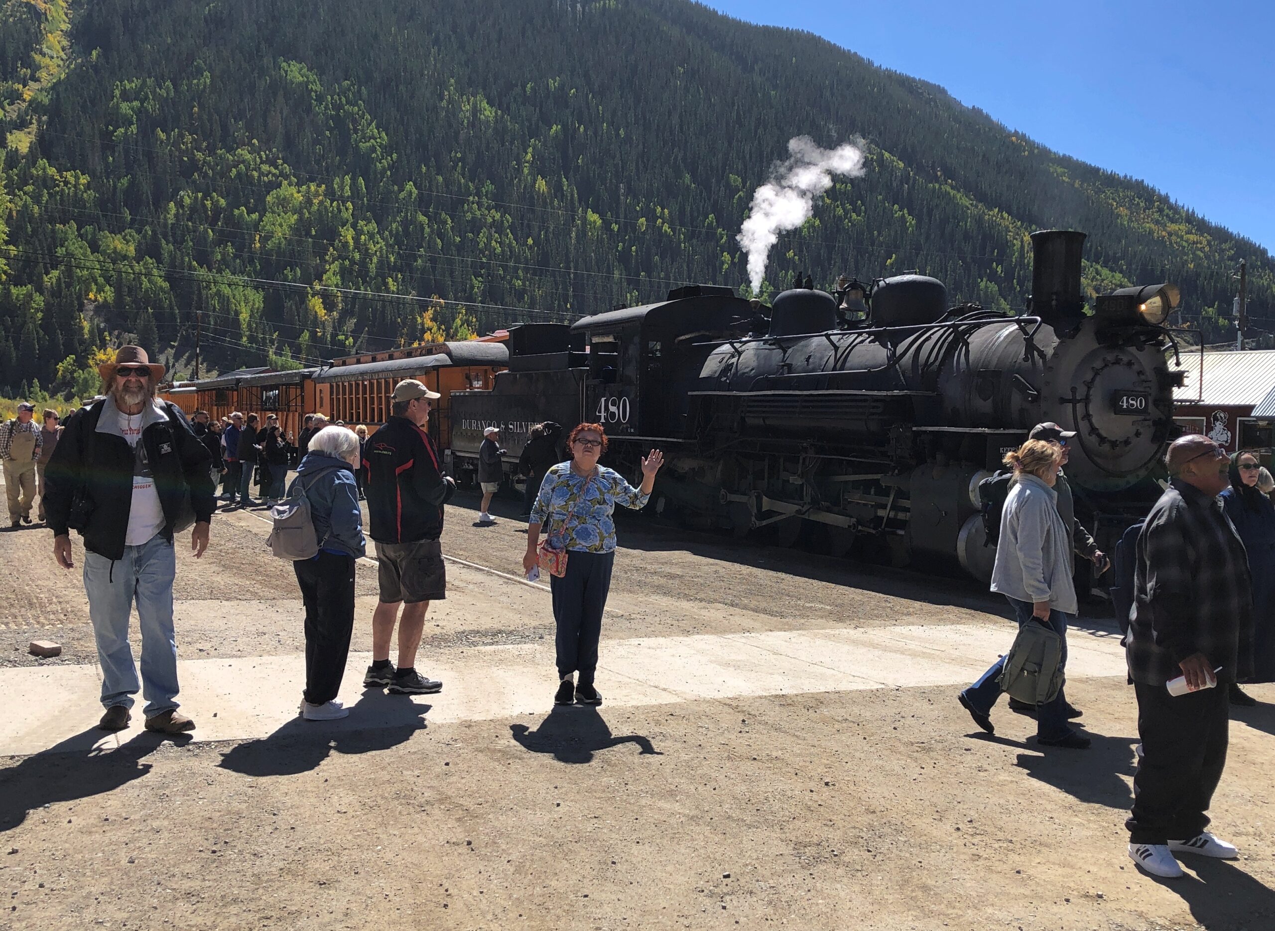
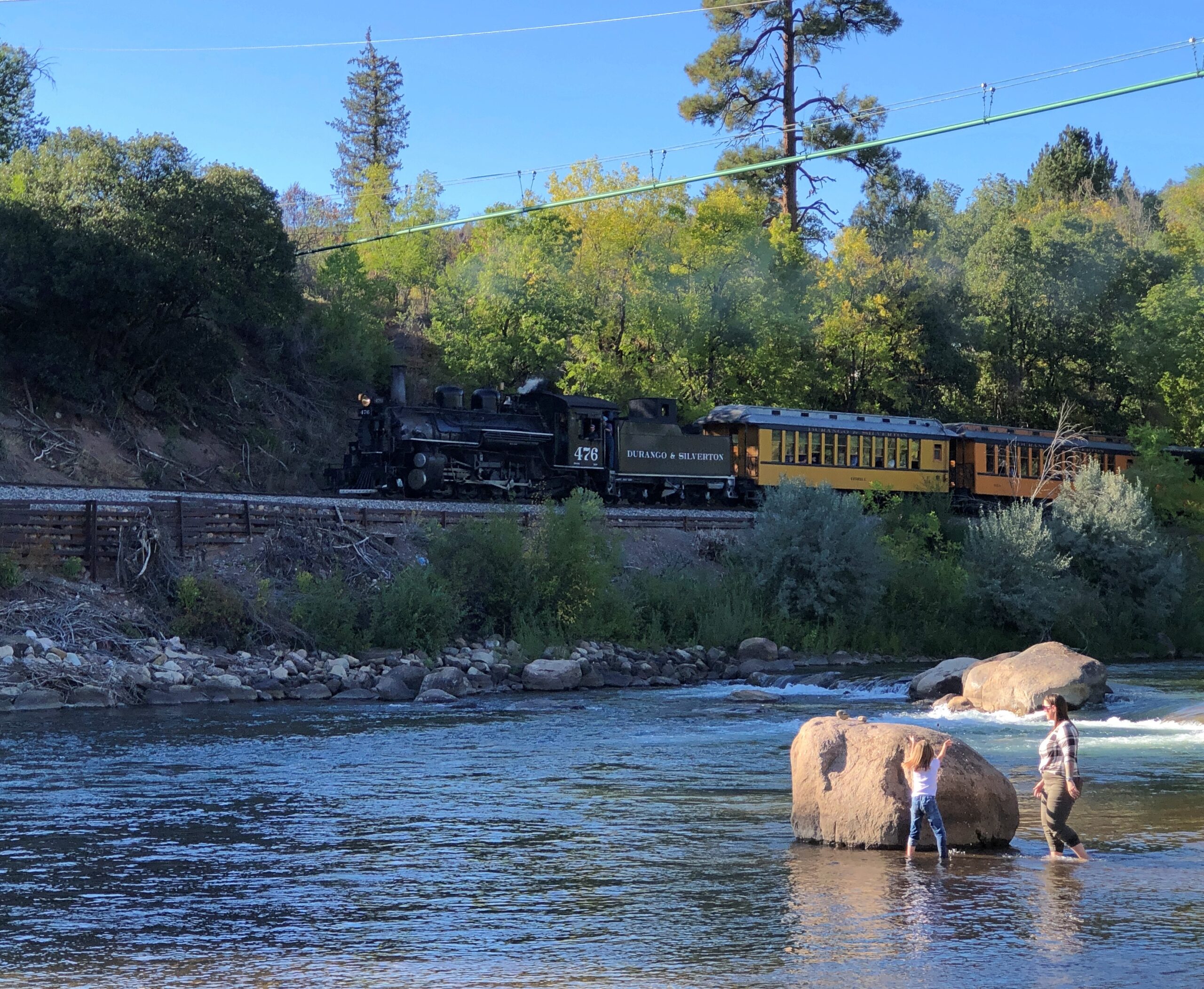
Not five minutes after we’d parked off the main thoroughfare of Greene Street in Silverton, on a large side street, a steam locomotive hauling a valuable cargo — tourists — pulled into town, a block from where we parked. The Durango & Silverton Narrow Gauge RR train from Durango had arrived. Instantly the streets around the train were thick with those same tourists who had paid roughly $100 a head for the scenic ride, though I suppose many, the majority maybe, had gotten a slight discount as seniors.
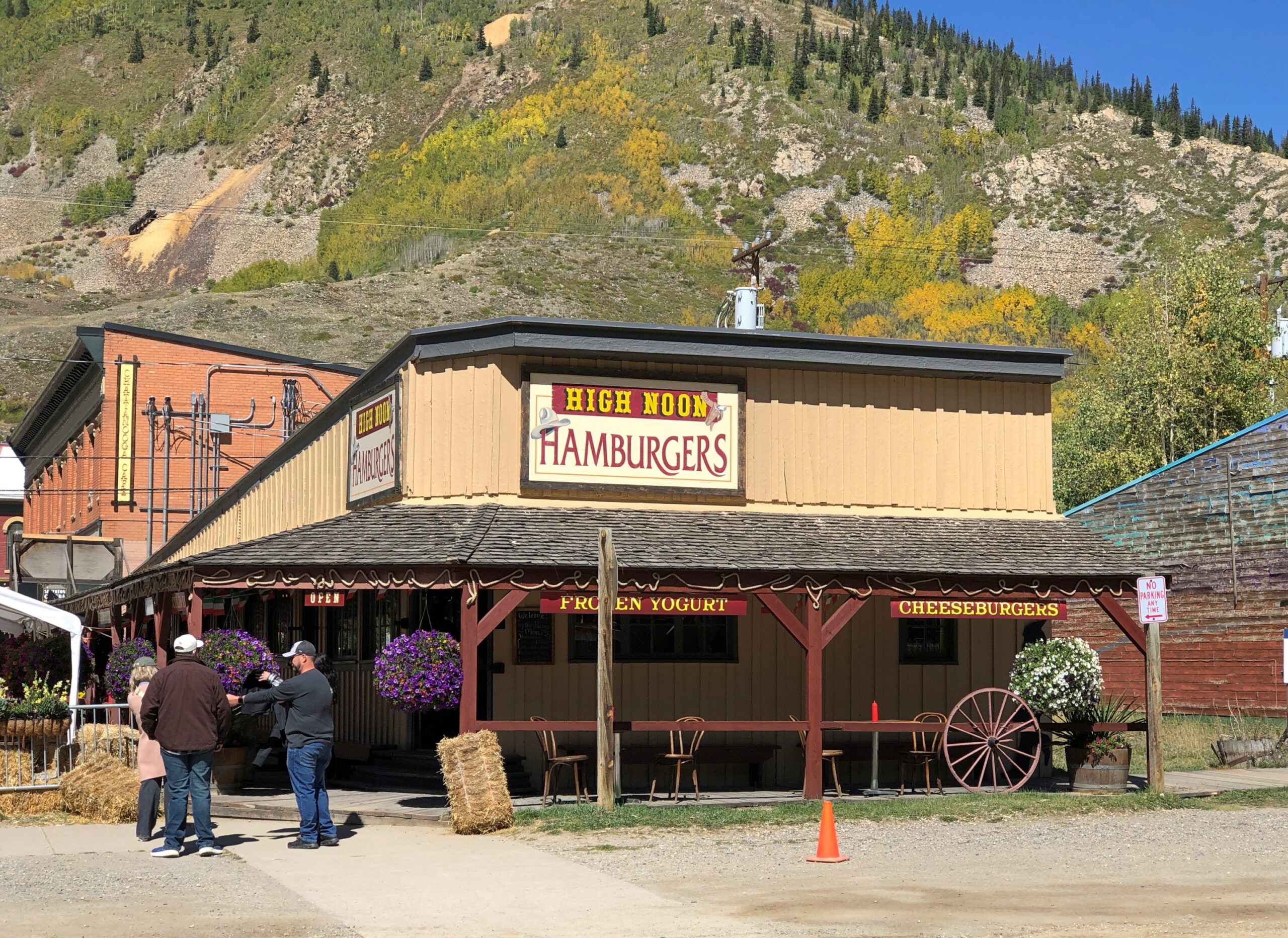
I assume the economy of 21st-century Silverton depends pretty heavily on these arrivals, at least in the warm months, as day after day the line disgorges its many passengers for their layover. No doubt the likes of High Noon Hamburgers or the Shady Lady or a lot of the other businesses in town wouldn’t be viable otherwise.
Blair St., paralleling Greene St. a block away. No need for pavement.
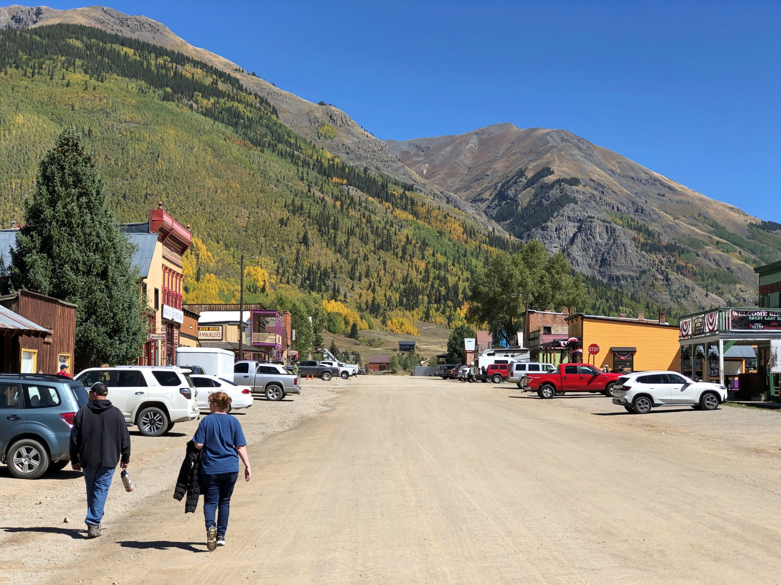
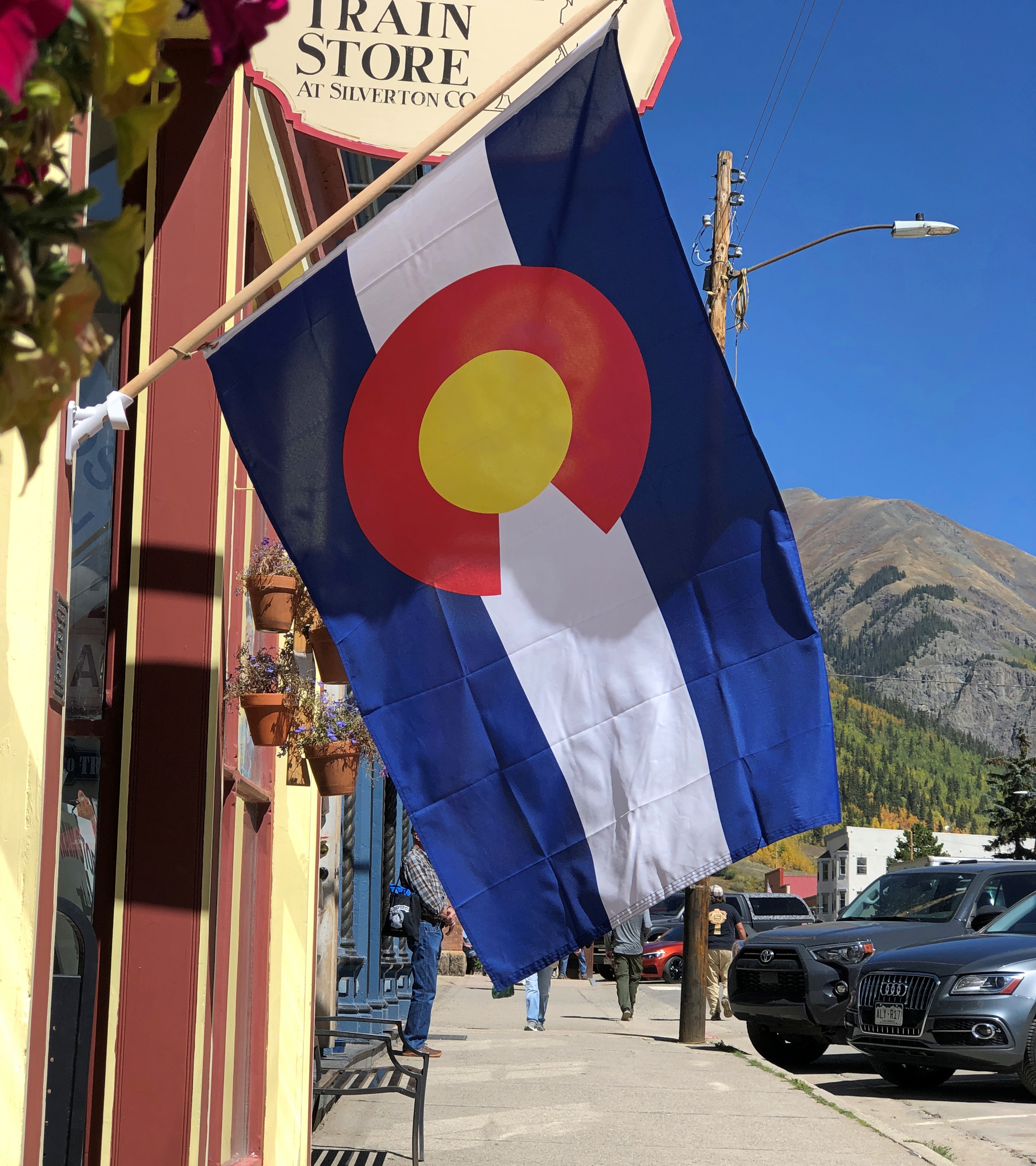
Greene St.
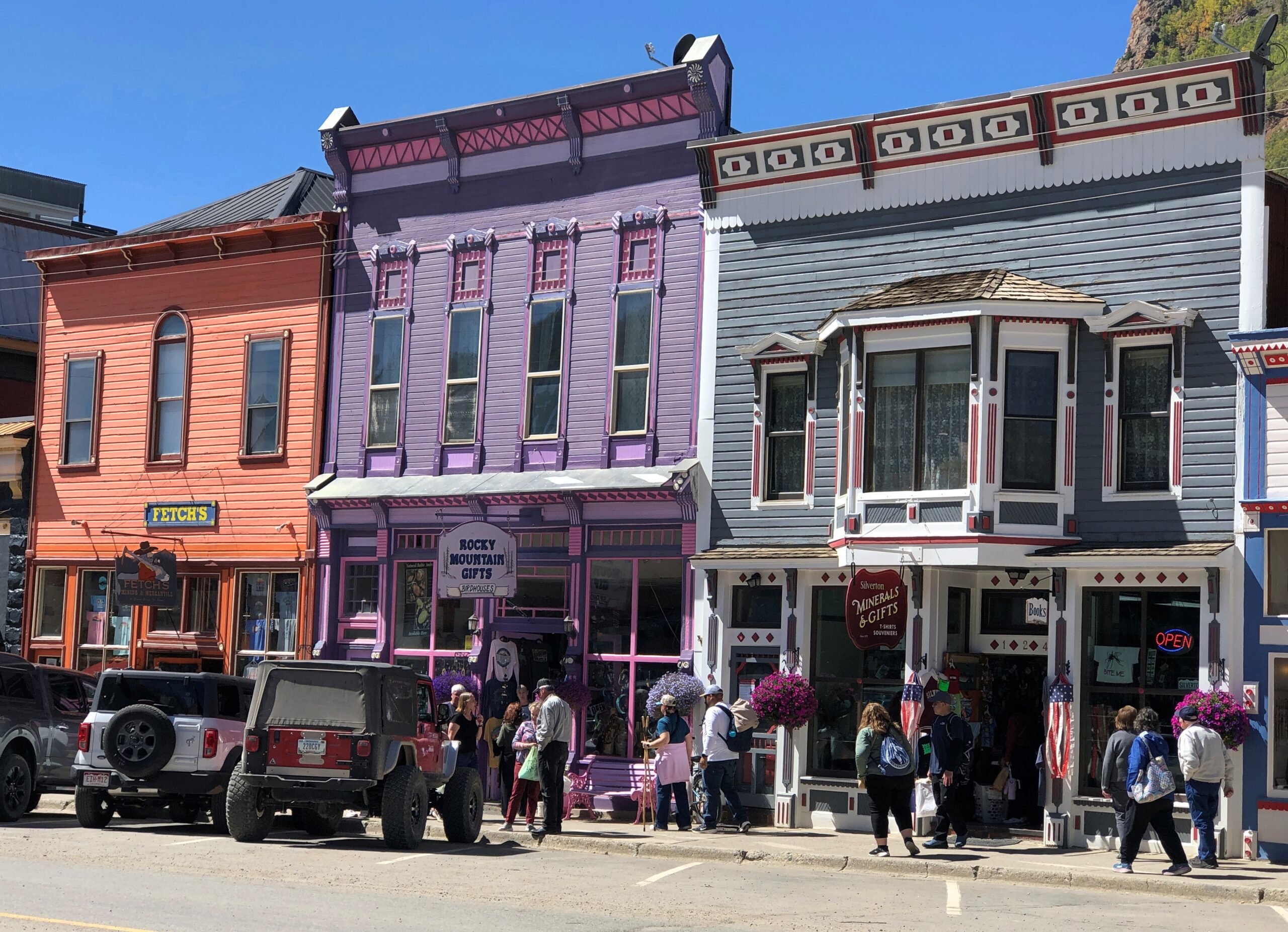
Lots to see on Greene.
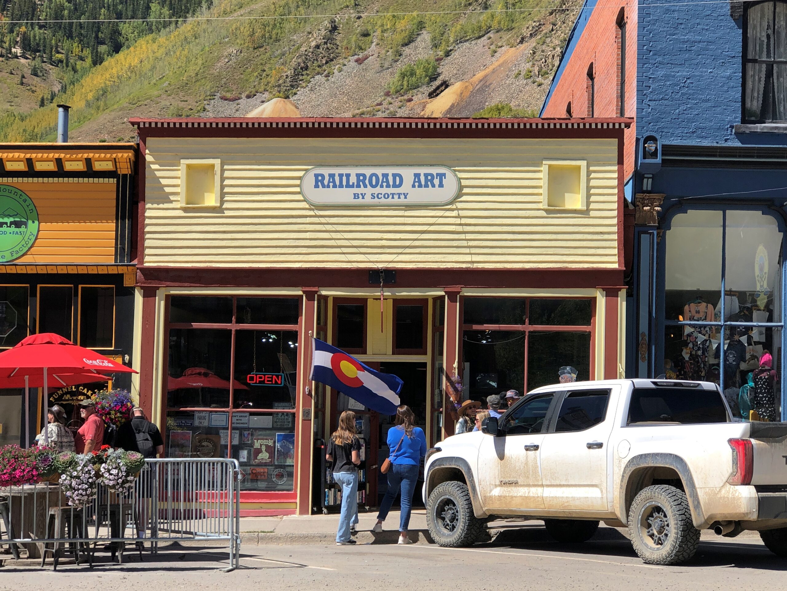
Including the fine Colorado flag, flying at Railroad Art by Scotty, a seriously cool gallery.
“Railroad Art by Scotty presents the custom matted and framed collector Railroad Art Prints by renowned railroad artist H.L. Scott, III,” its web site says. “These are not photographs and they are not created on the computer. These are pen & ink drawings created by Scott using the technique known as STIPPELING or pointillism.”
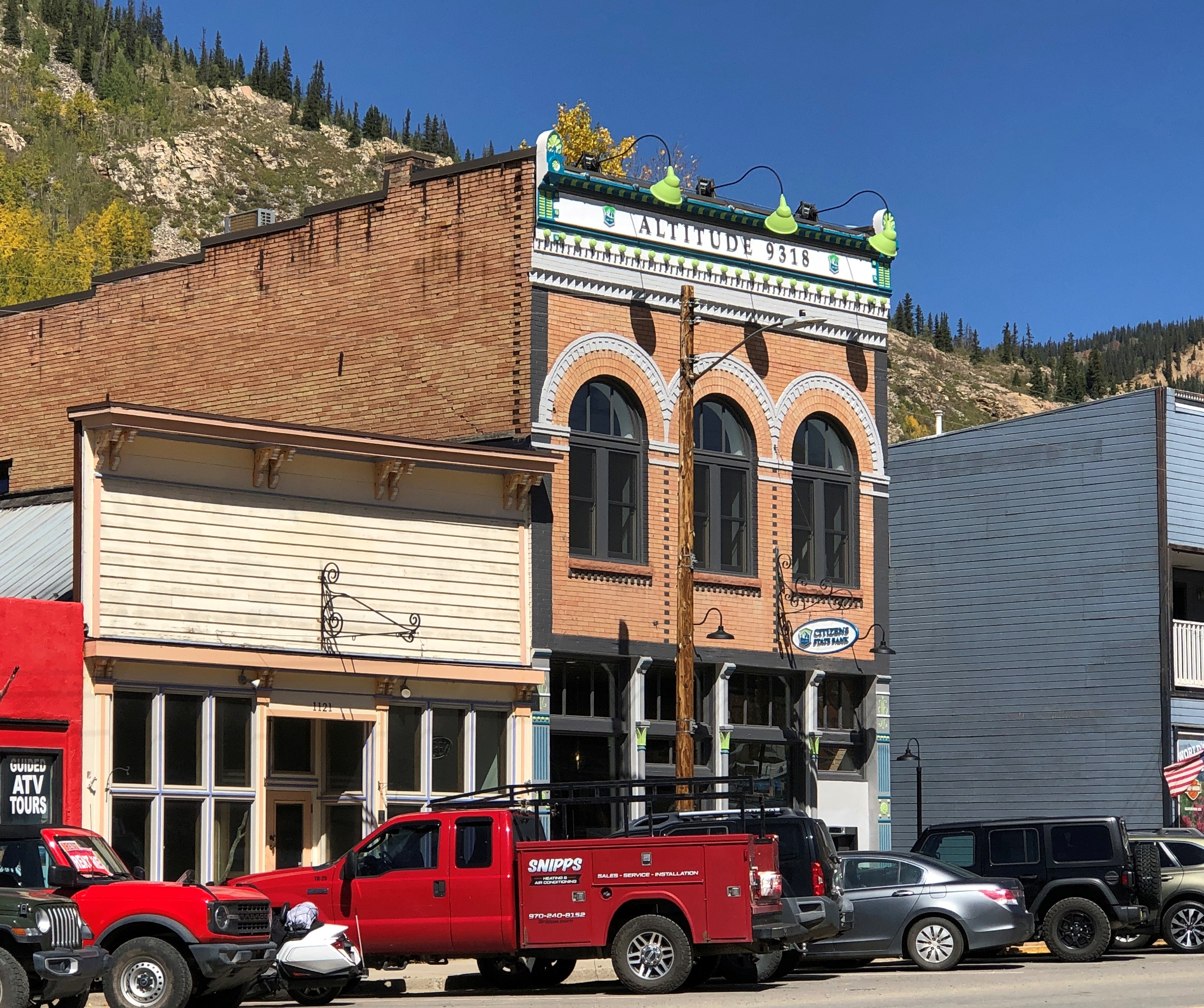
One of the few buildings I’ve seen that clearly states its elevation.
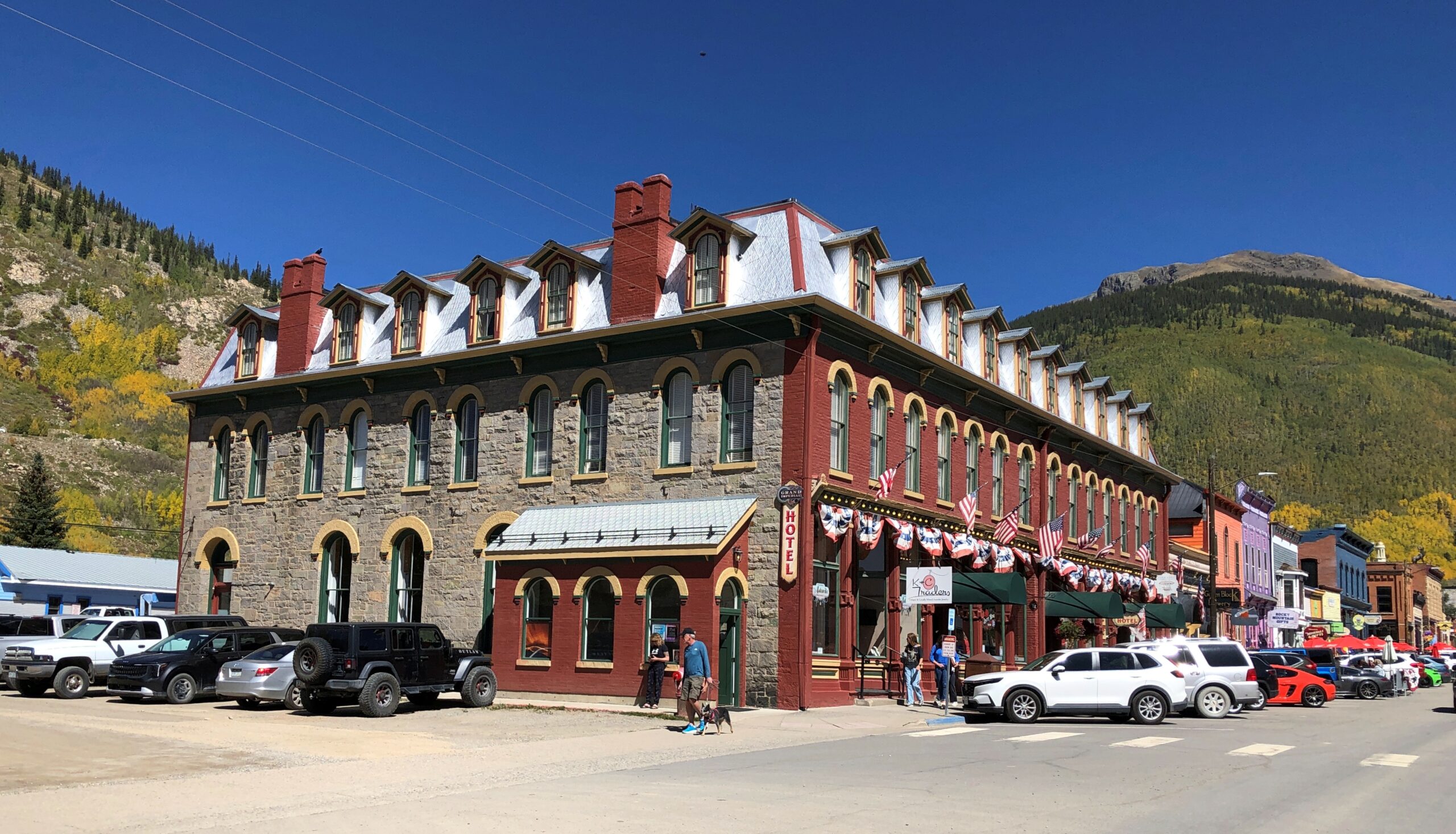
The Grand Imperial Hotel. A lofty name to live up to, but probably posh enough to do so.
Restored to its 1880s appearance in the 2010s, no doubt at considerable expense.
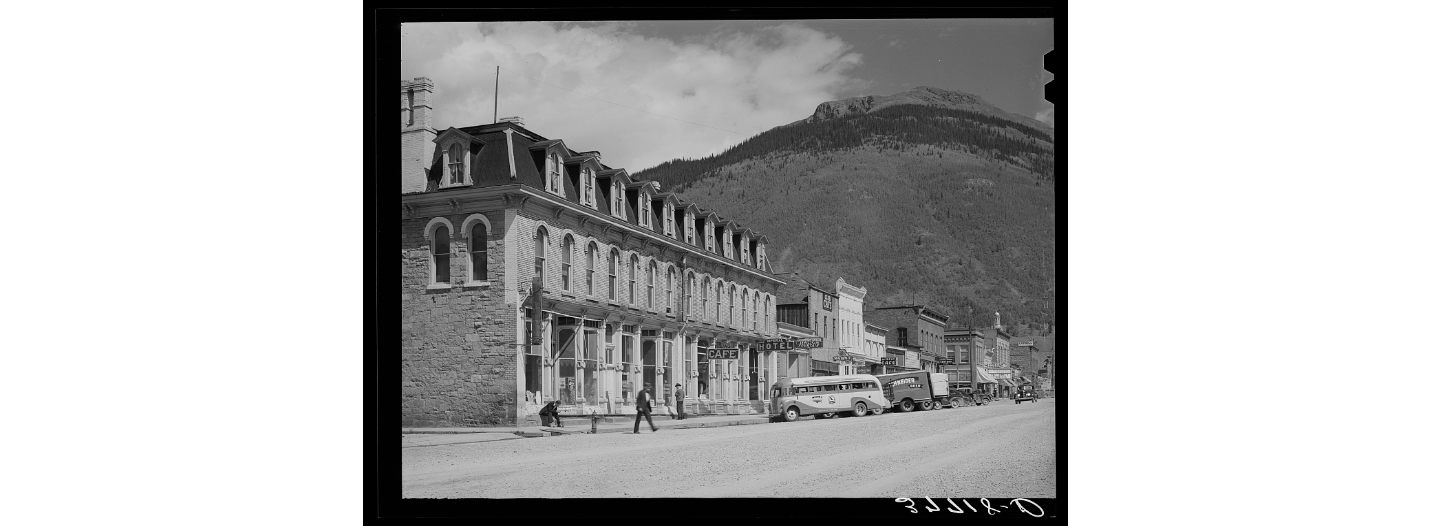
As it looked in 1940, a photo from the Library of Congress, Farm Security Administration-Office of War Information Photograph Collection.
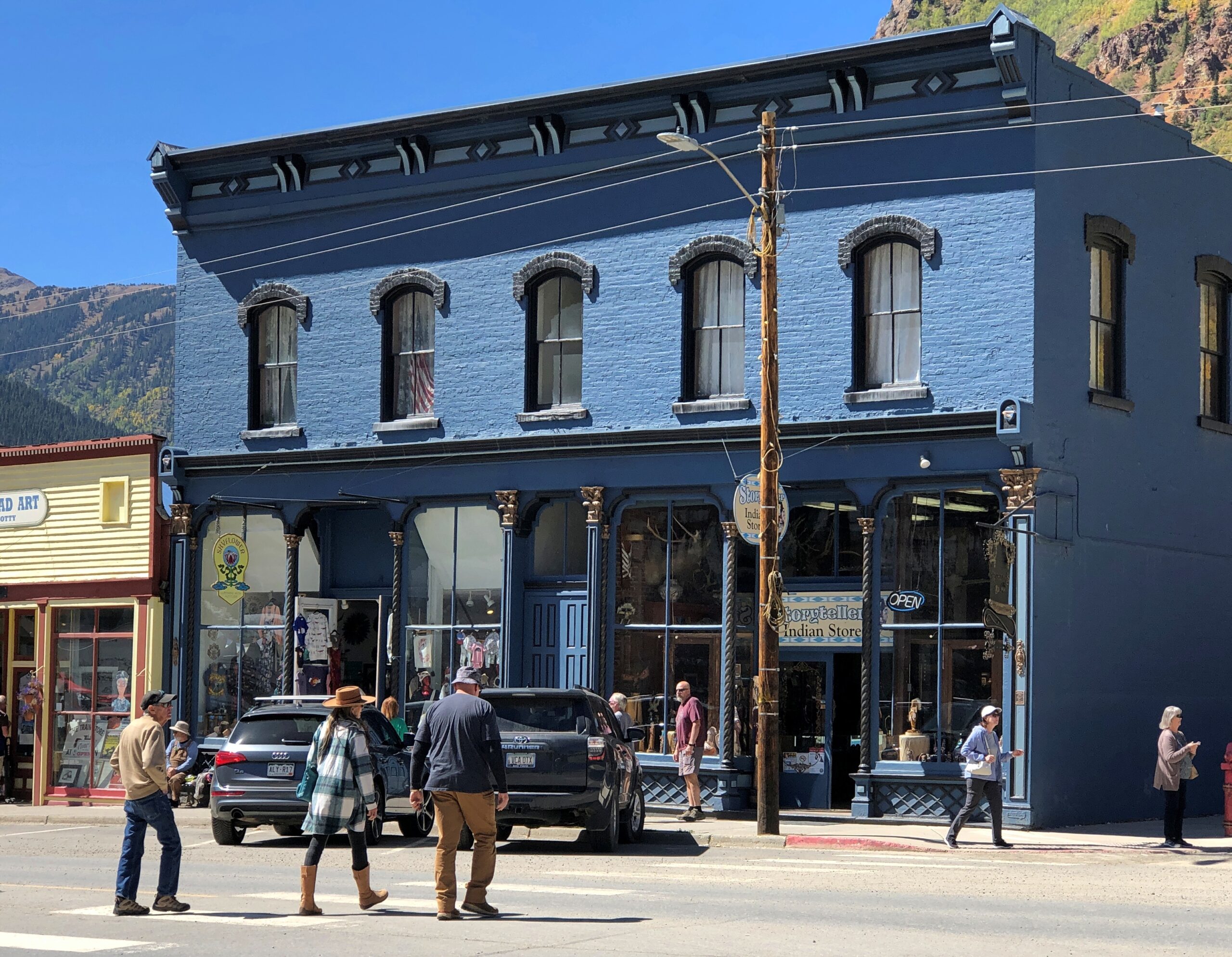
More Greene St.
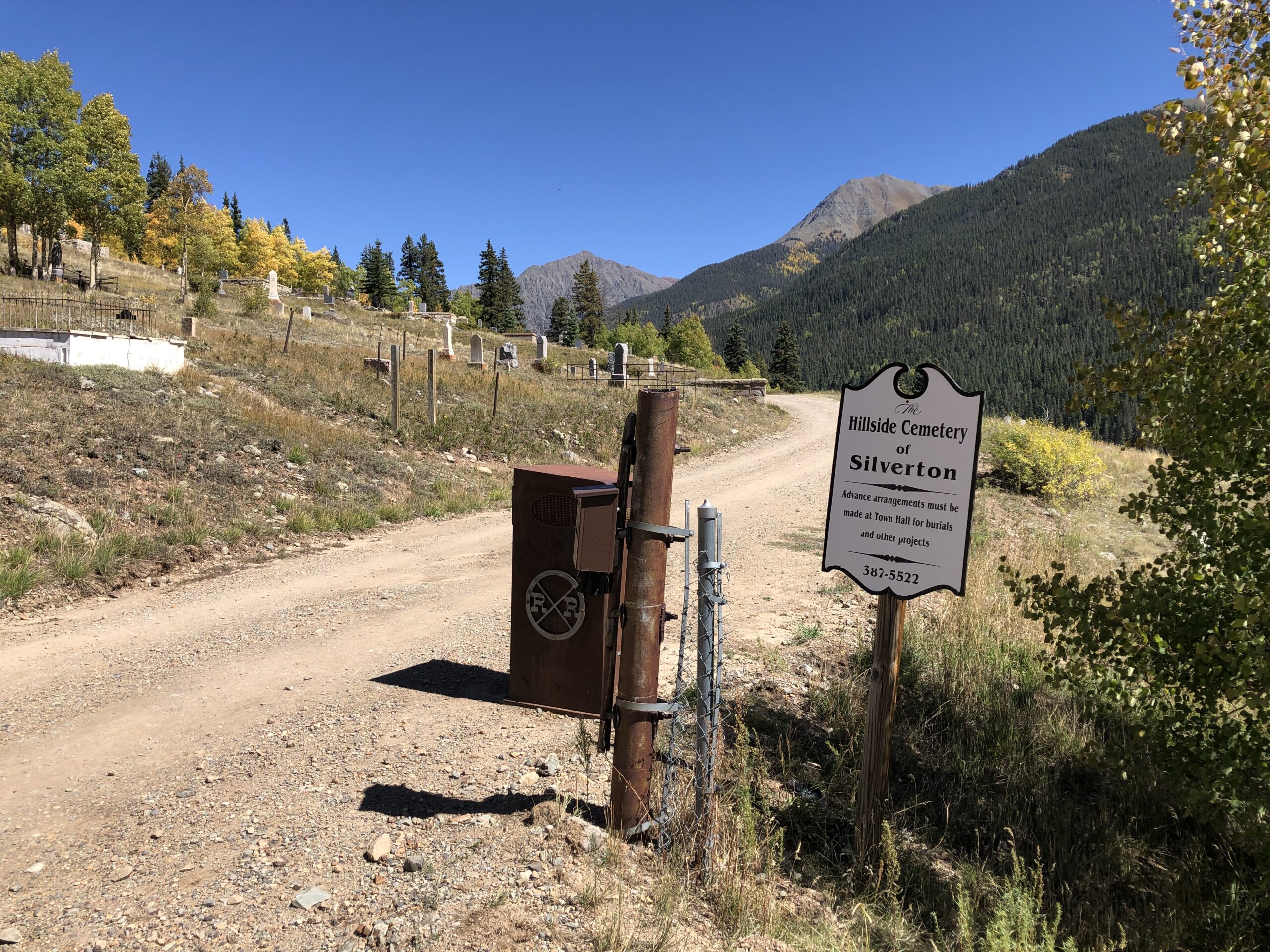
Greene is short, because Silverton isn’t very large, and so the street, now a road, soon heads for the hills.
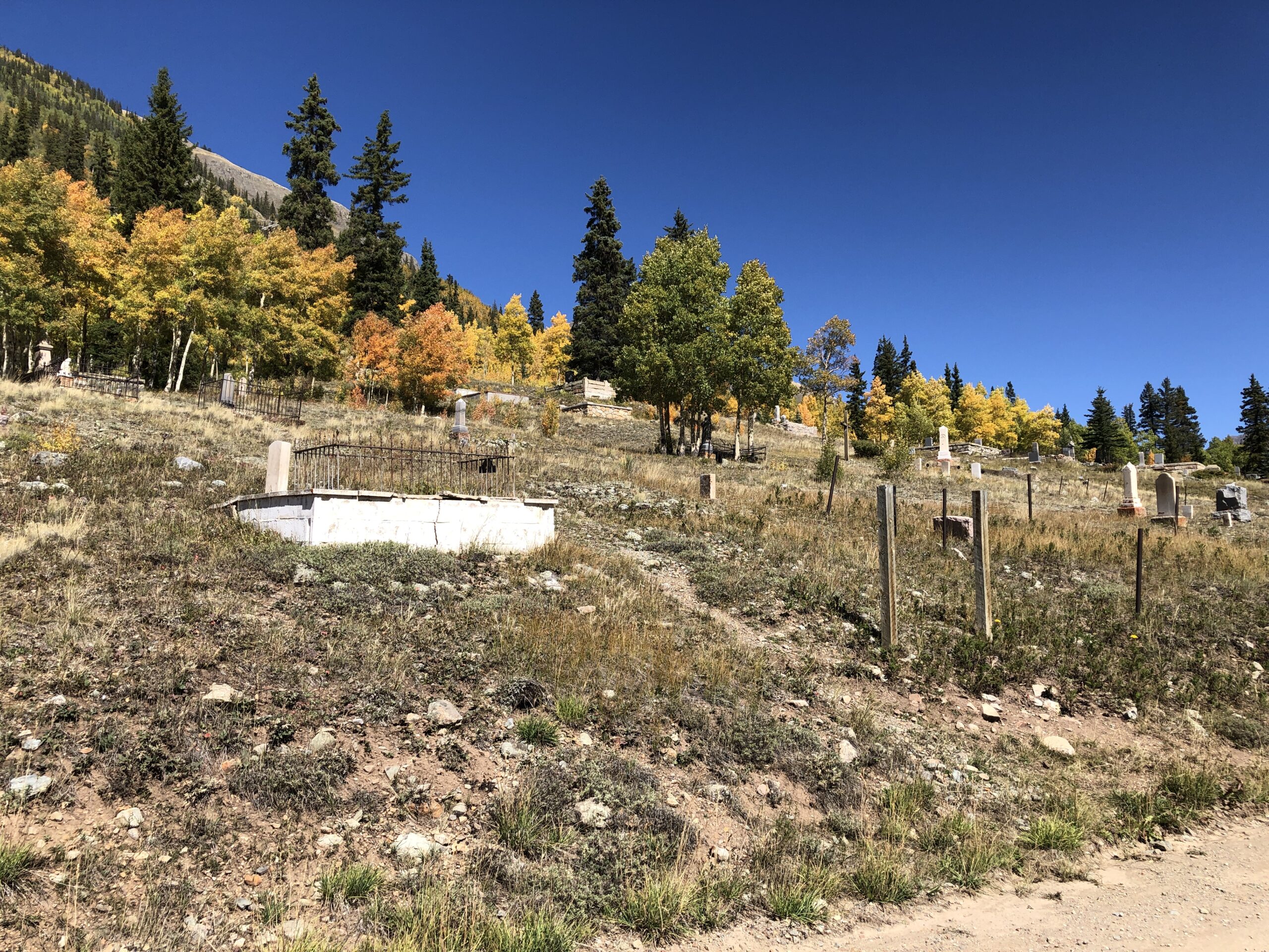
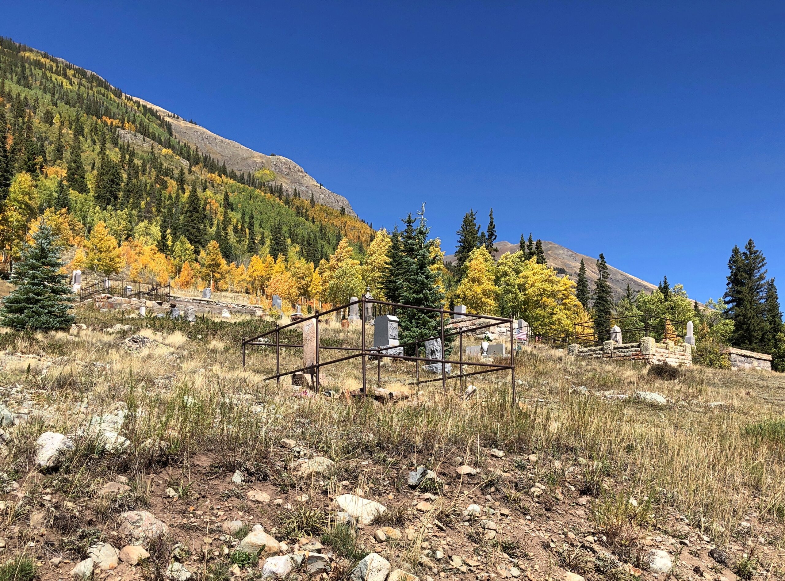
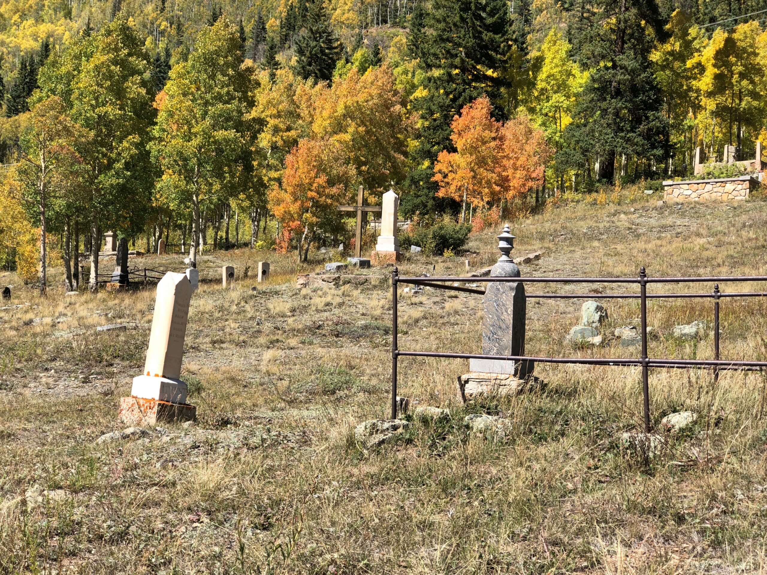
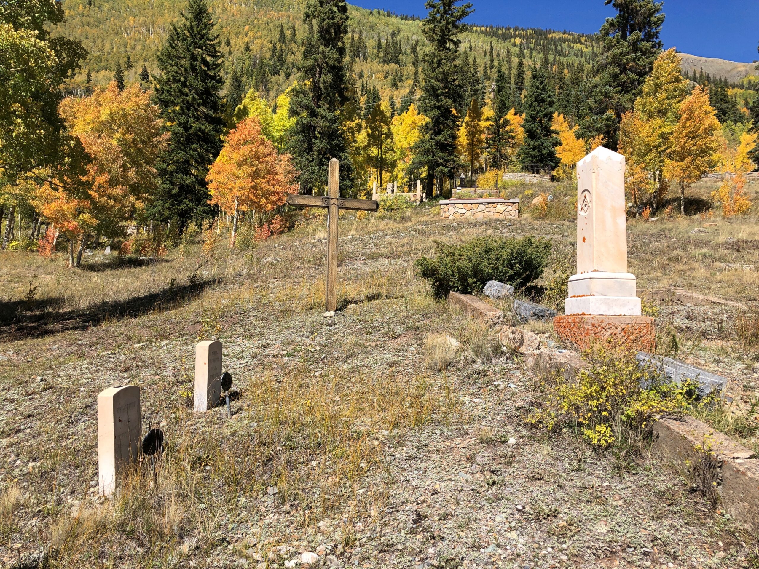
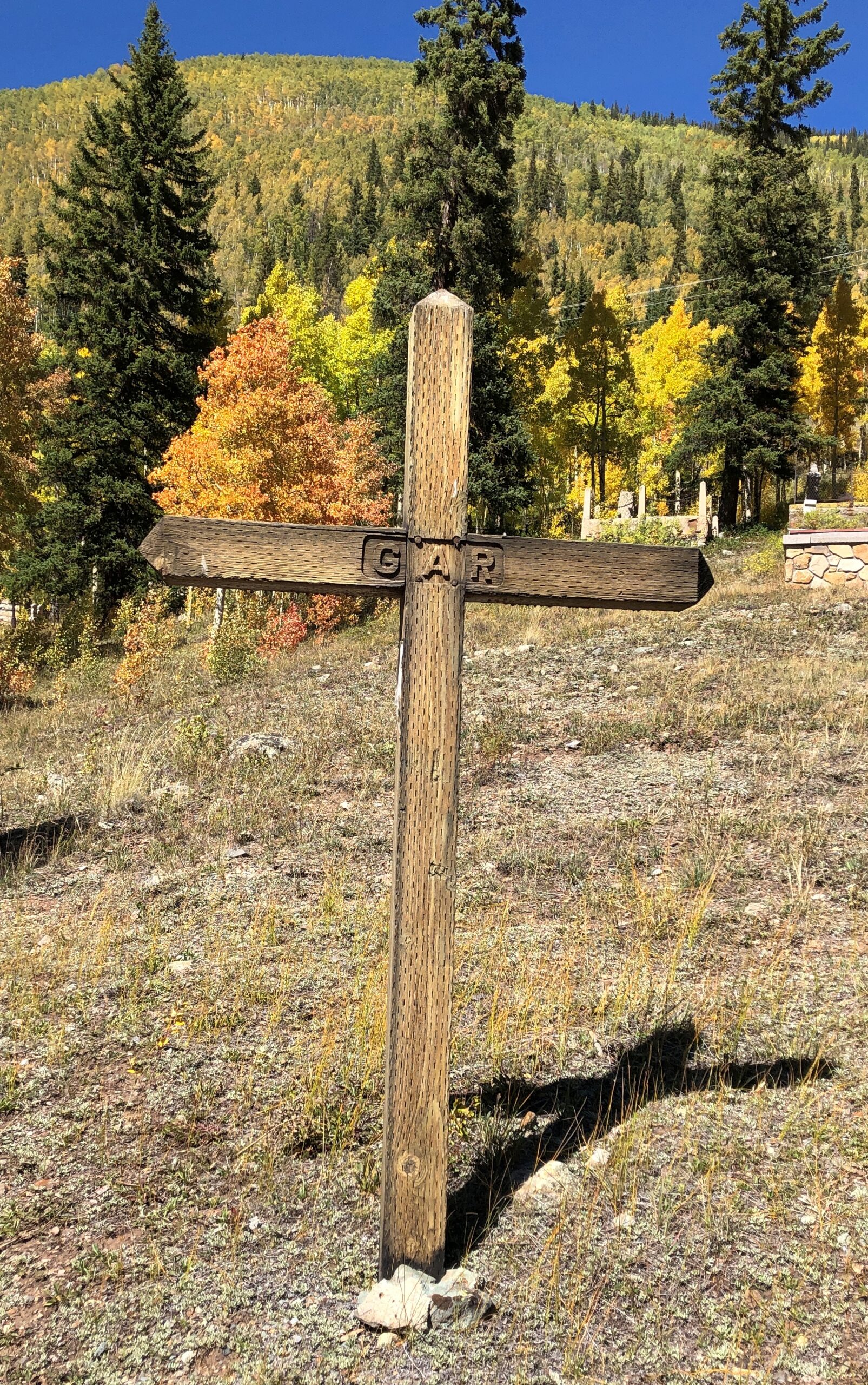
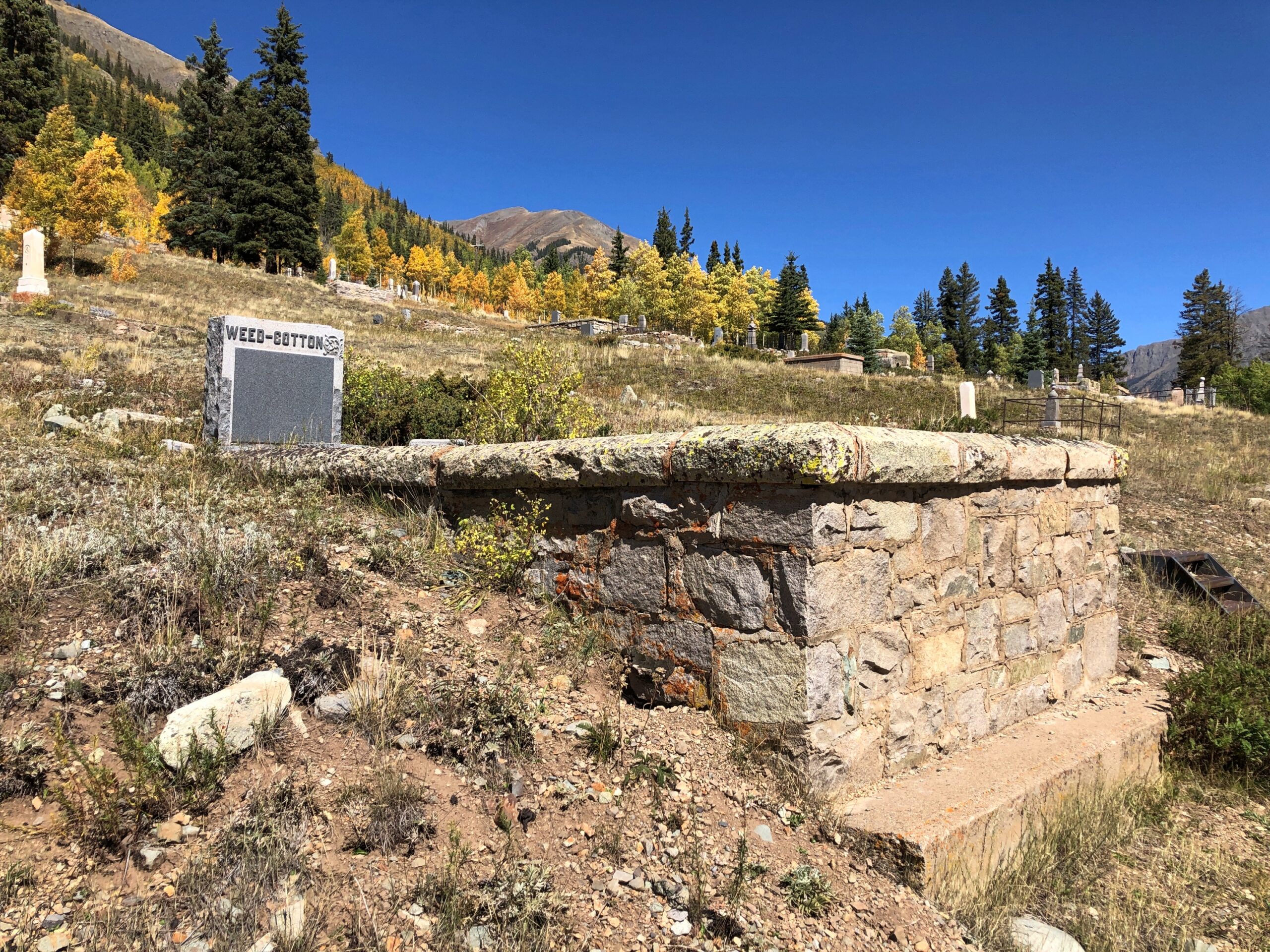
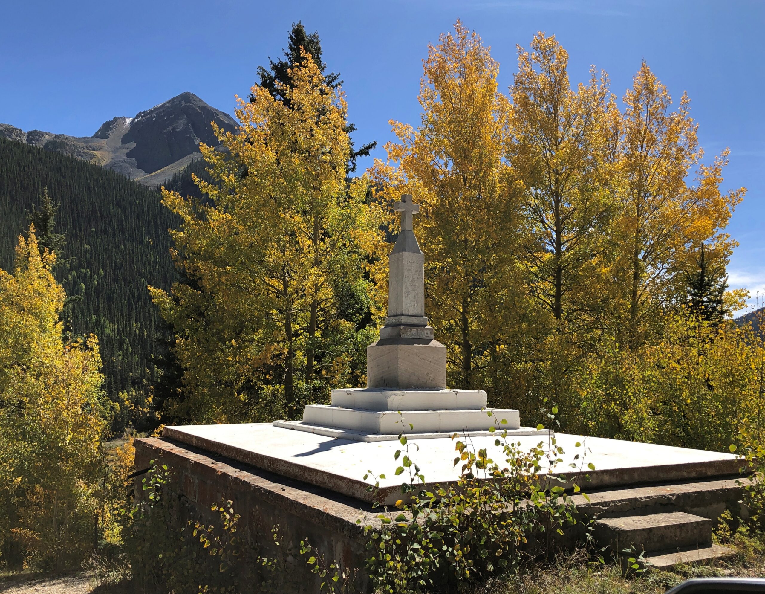
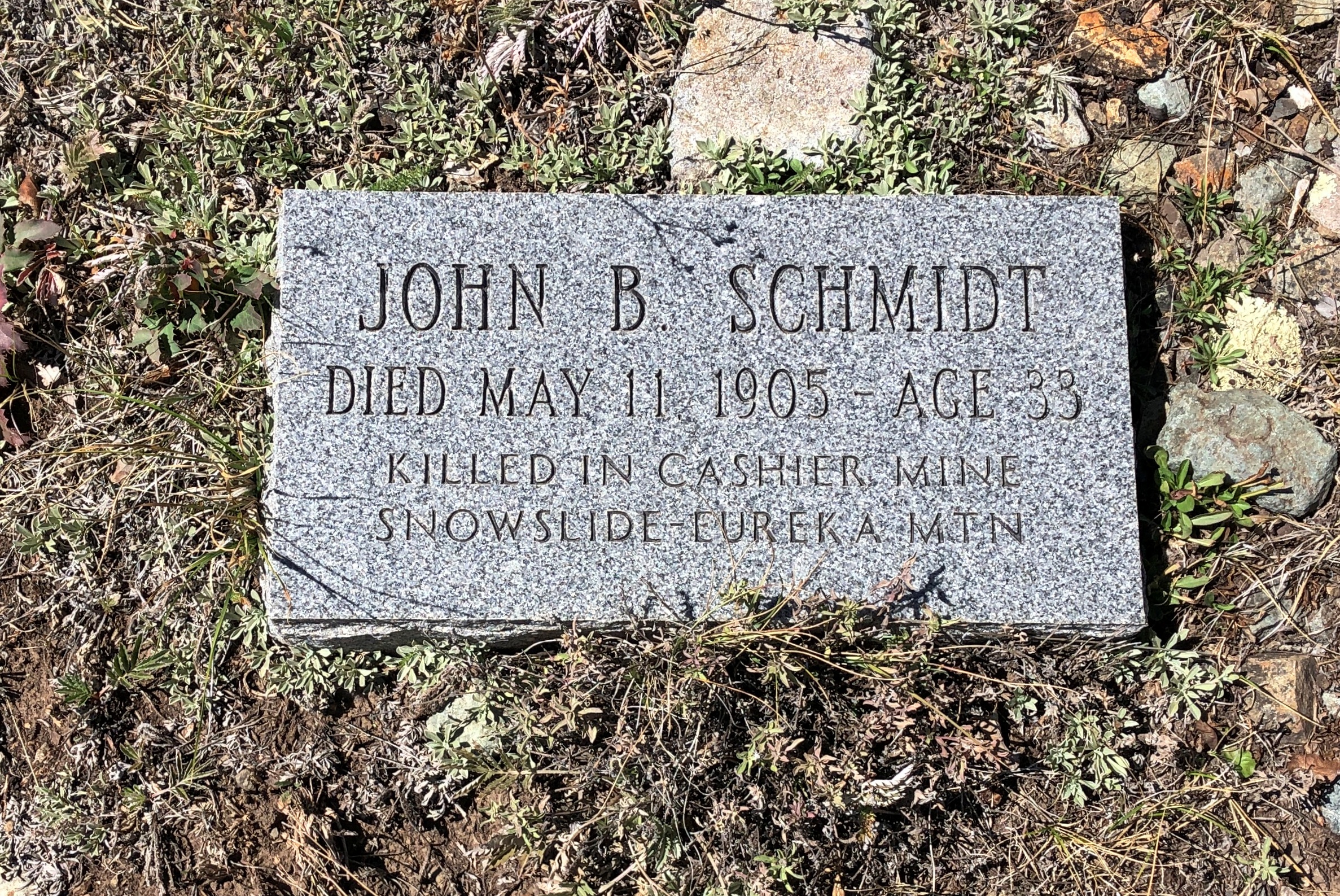
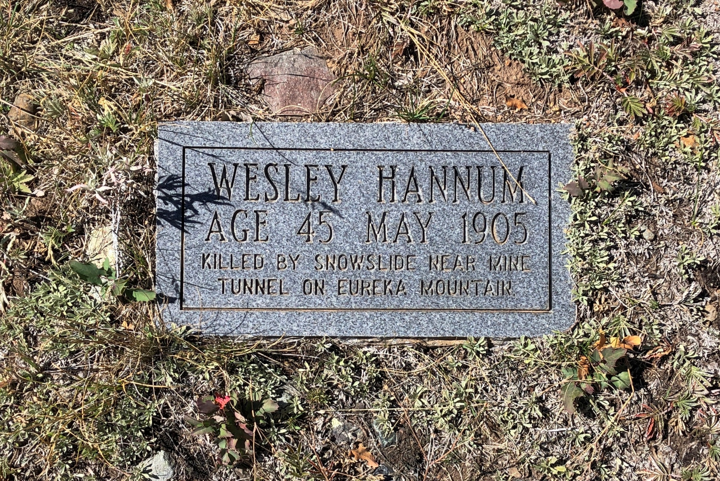
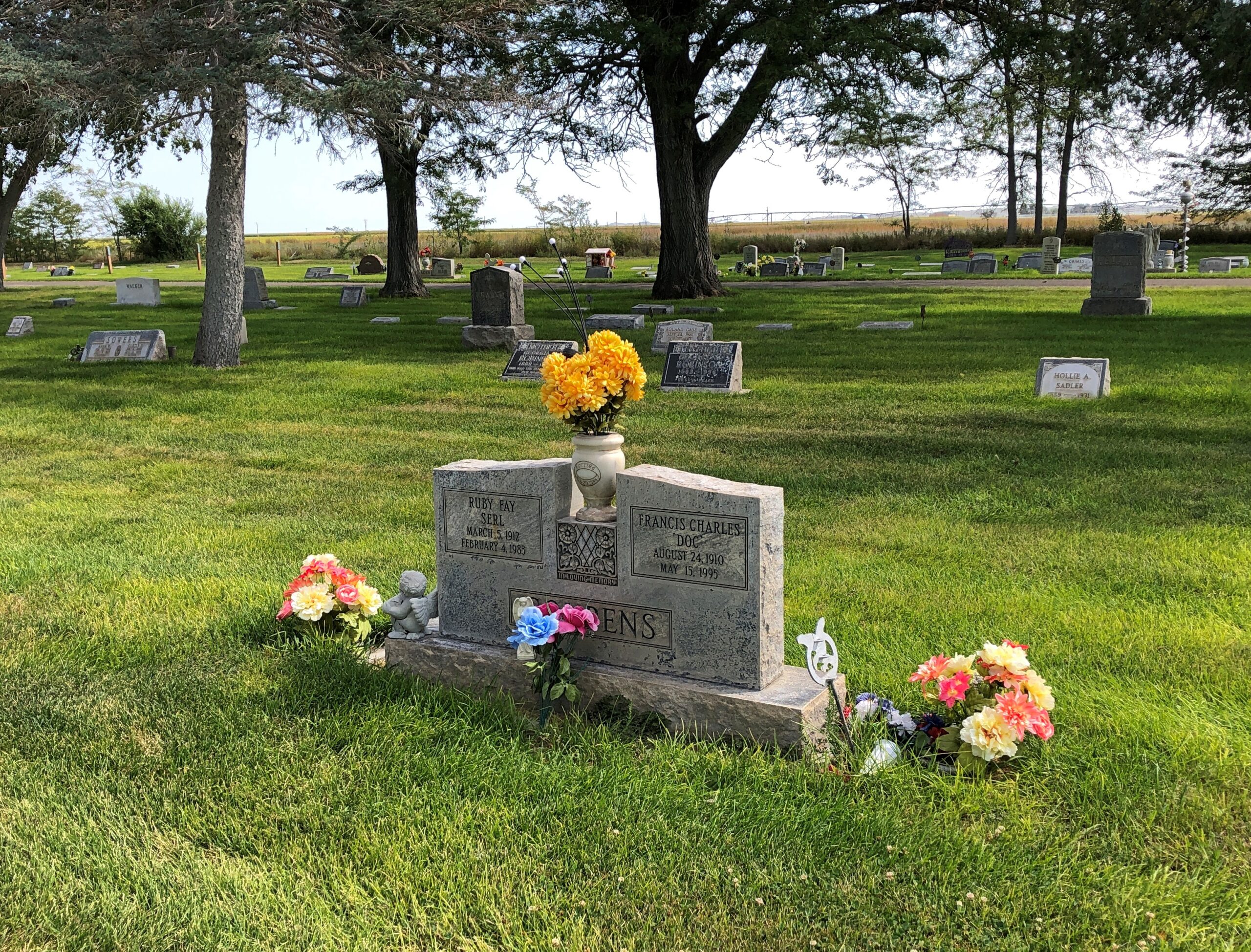
The Hillside Cemetery of Silverton.
An apt name.
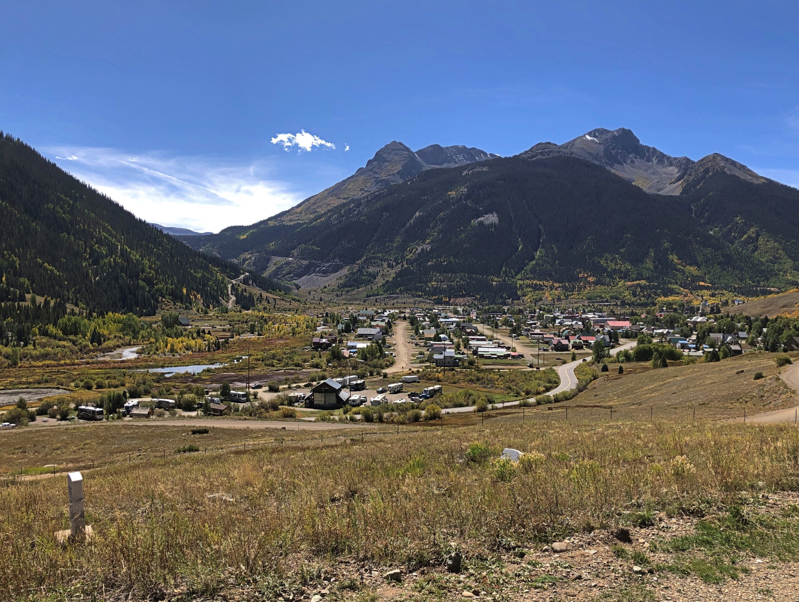
With a good view of the town.
Some sizable memorials.
More modest ones.
Echoes of lost men from another time. Beyond the outstanding beauty of a hillside cemetery in the flush of autumn, reason enough to visit the cemetery.
“Good morning,” Walter said in response to me, but in a hushed tone that somehow made his Austrian accent more distinct. “Do you want to see some bears?”
Yes. I followed him out to the large deck off the large common room of the Country Sunshine B&B. Outside we met with cool air, bright morning sun, and the strong smell of pine. The deck was a floor above the grassy ground, which sloped downward away from the bed and breakfast, shaded by a small copse of enormous pines.
We’d just spent the night at Country Sunshine B&B, the first of three for our visit to Durango, Colorado, a place I’d wanted to visit since the moment, years ago, when I heard Garrison Keillor describe the place in the engaging way that he had. I’d come out of our room – one of the three or four bedrooms off the common room – ahead of Yuriko, to examine the breakfast spread at the main table when Walter asked me about bears.
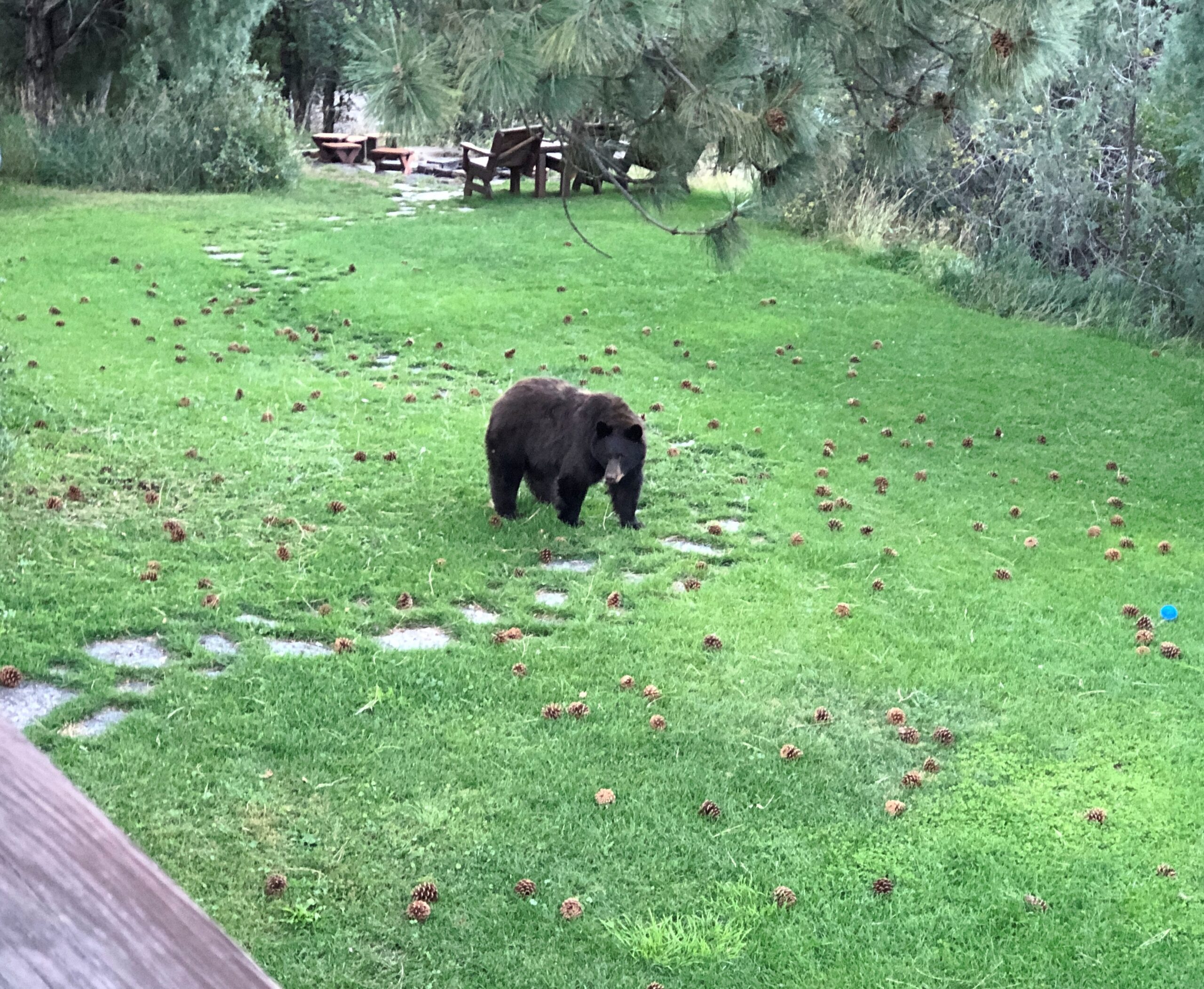
Under one of the tall pines, and among the many pine cones dotting the ground, was something dark and much larger: a bear.
“He isn’t the only one,” Walter said, pointed upward. Another sizable bear was perched part way up the largest pine. I didn’t say anything, or maybe I did. Something along the lines of, How about that. When I spend time on my deck, squirrels are about as large as the animals get, except occasional rabbits and raccoons.
“Look way up,” Walter said.
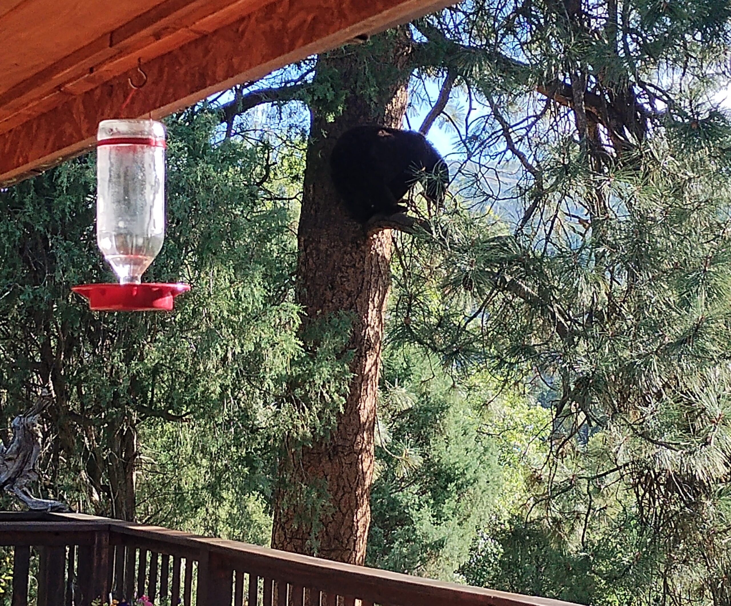
Two more bears – smaller bears, though I wouldn’t want to be face-to-face even with them – clung to the branches toward the top of the tree. They were hard to see, and my photos barely show them, but they were there, not moving a bit.
Soon Yuriko, and some other guests, had come to the deck to see the bears and take pictures. Every few minutes while we watched, the largest of the bears, the one on the ground, would start shimmying up the tree. The bear in the tree snarled at his approach, and, after pausing for a few moments, the first bear returned to the ground.
We were about 10 miles north of Durango, where the human settlement is fairly thin, and bears known to prowl the mountains on either side of the single road, US 550.
In the two decades of so that Walter and his wife Jodi have owned the B&B, he said bears had been sighted. Of course they had. Get careless with closing an outdoor garbage receptacle and bears will make an appearance in the neighborhood. During dry spells, they come for the creek waters near the property, and Walter pointed out that this summer had been fairly dry in the region.
But this was a first, Walter said: probably a male bear out to do harm to some cubs, a female bear standing in his way — a bear drama playing out in the tree near the B&B.
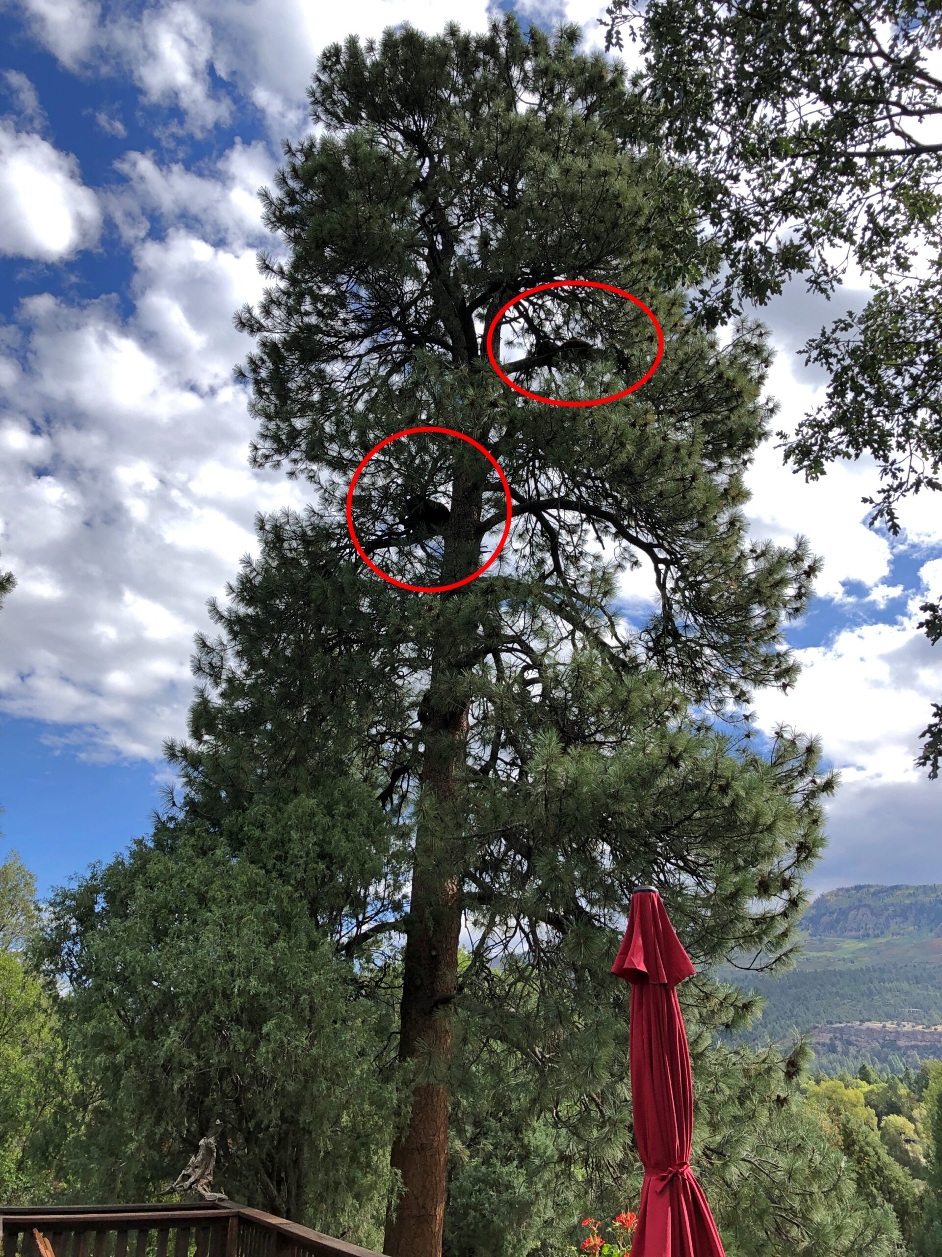
Late that afternoon, we returned to the B&B. Papa Bear, as everyone was calling him now, still lingered under the tree. Mama Bear still watched him from the lower branches, and the cubs still clung to the upper branches. Papa Bear had mostly quit trying to climb the tree, Walter said, but he was still waiting around.
The bears stayed in place through that evening, but when I went to the breakfast table the next morning to examine the bagels and spreads and fruit and hot drinks, the bears – I checked from the deck – they were not to be seen. After their one-day show (from a human point of view), they’d taken their drama somewhere else,
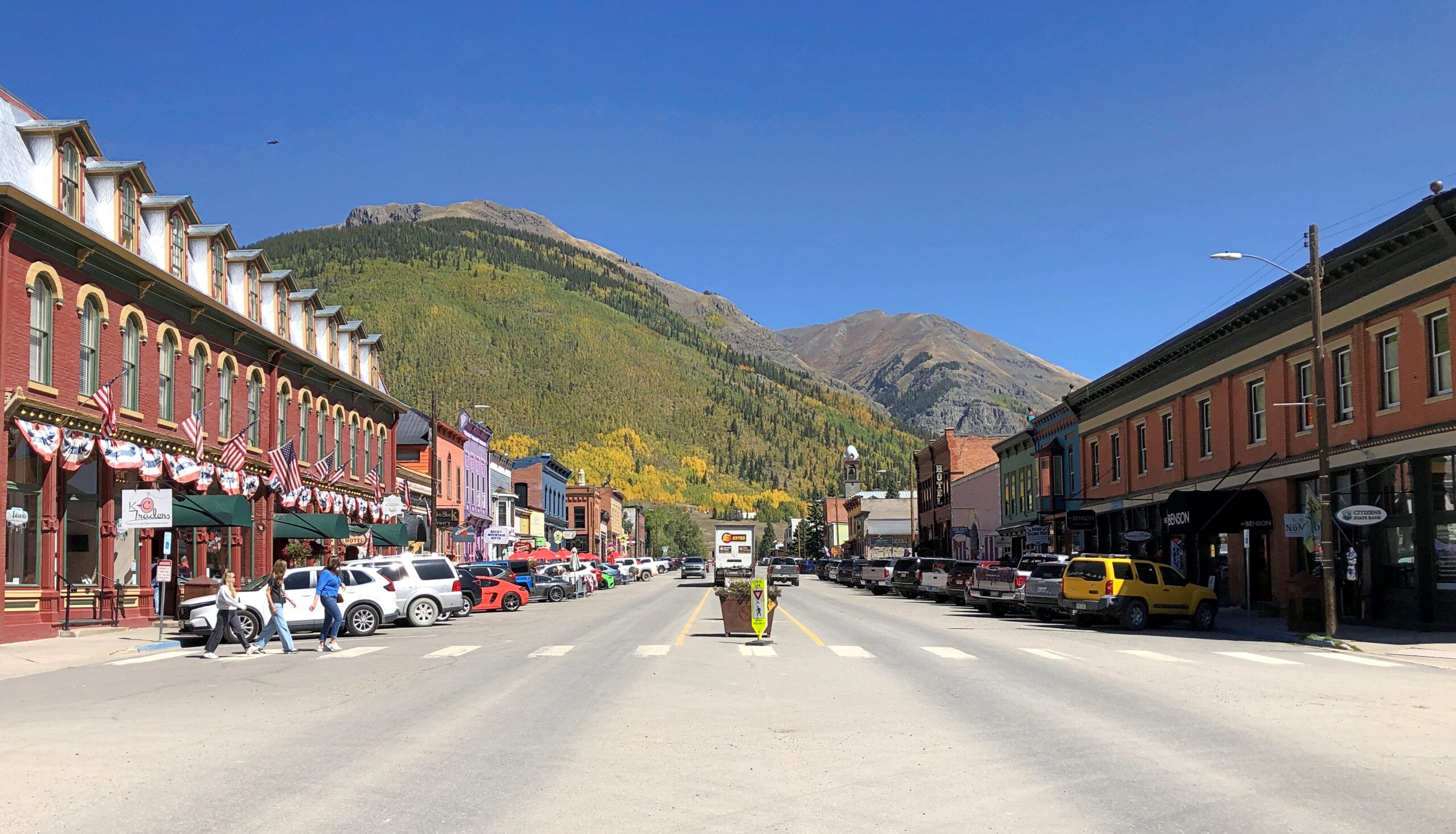
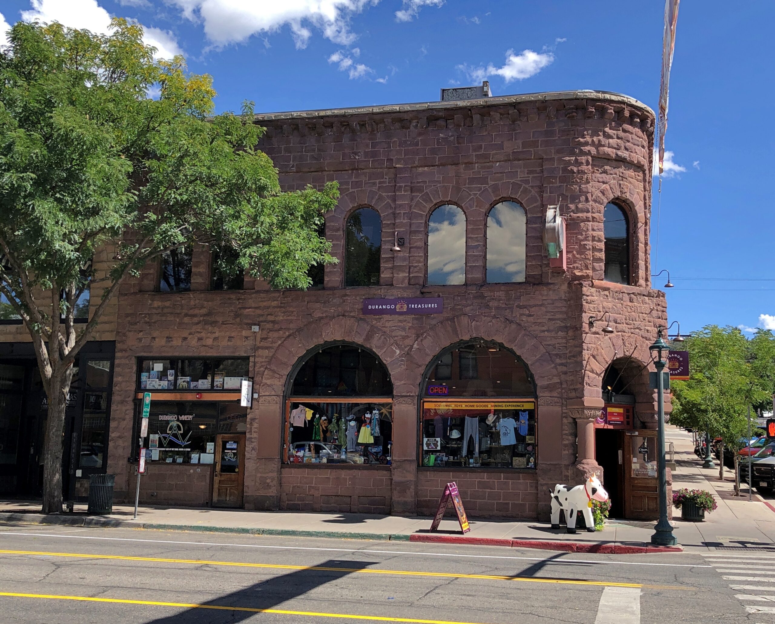
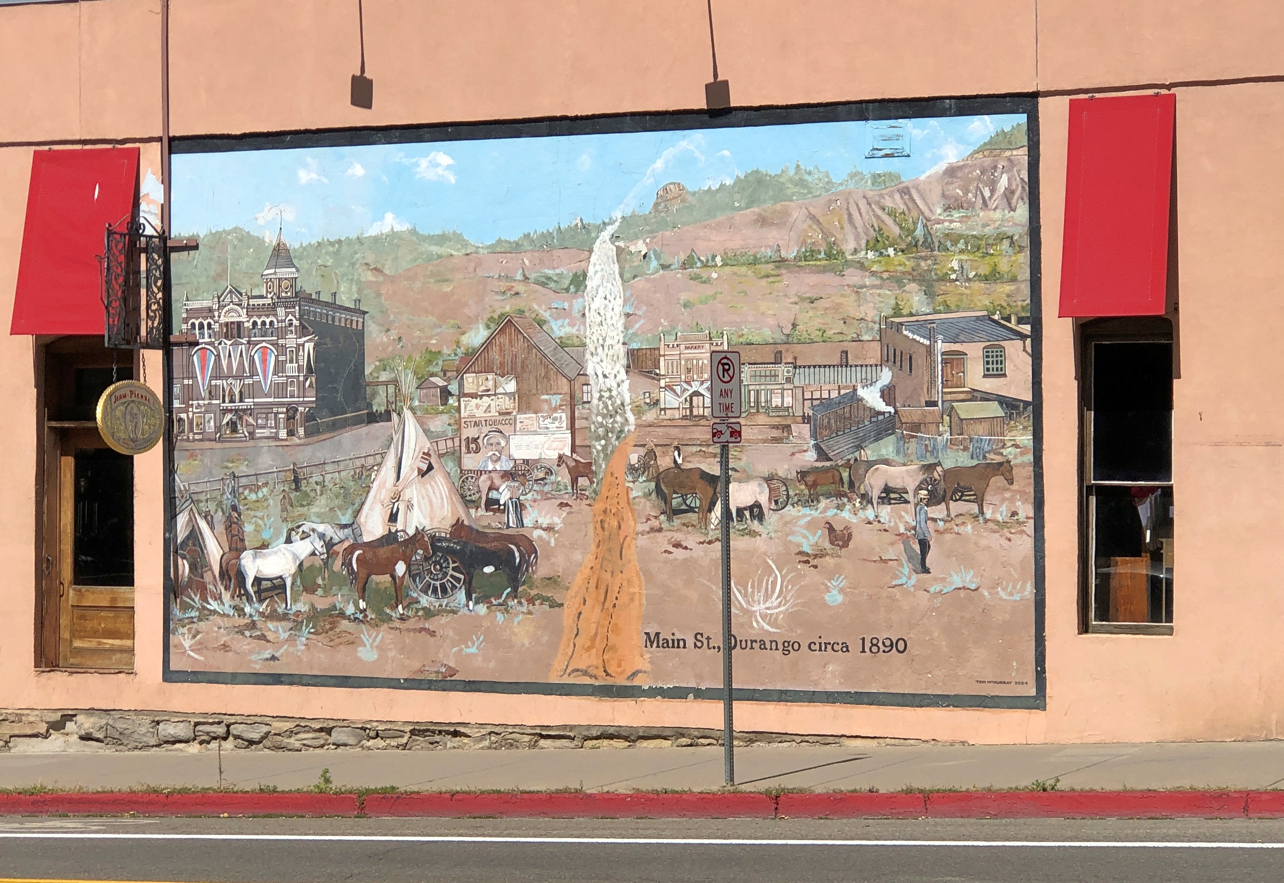
We spent that first day (September 16) wandering around town and nearby. In downtown Durango, small buildings that have endured for more than a century line Main Street.
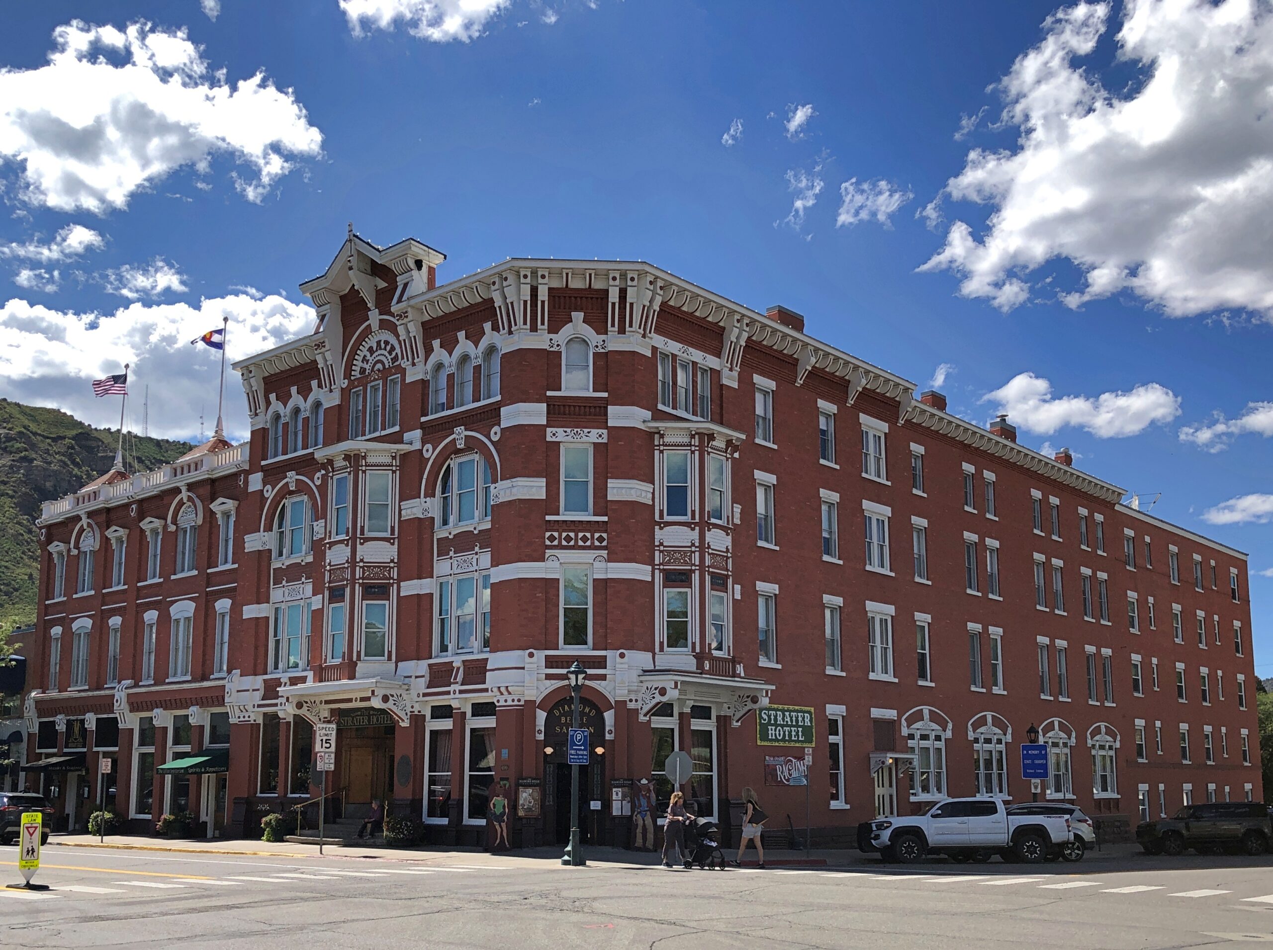
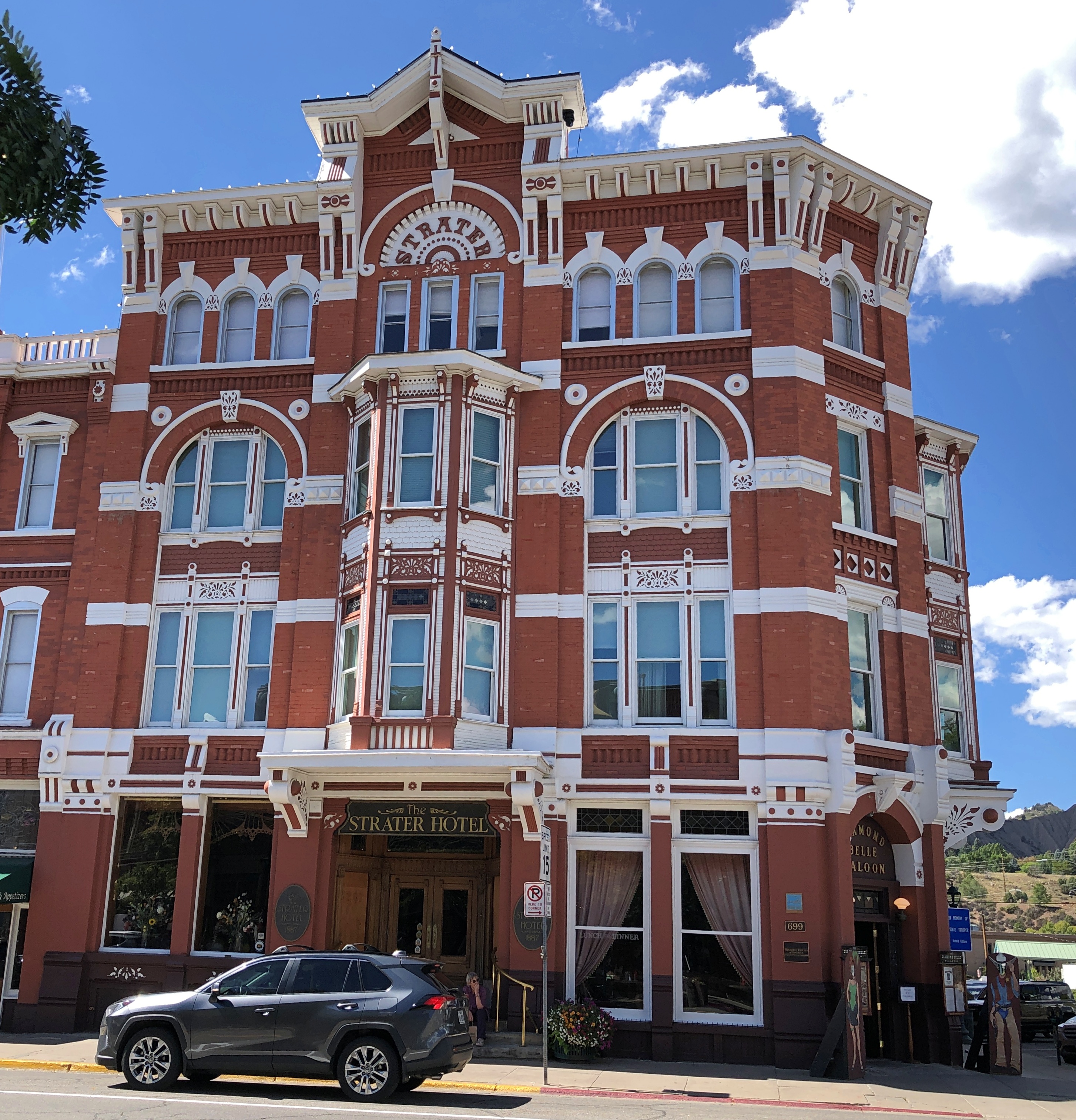
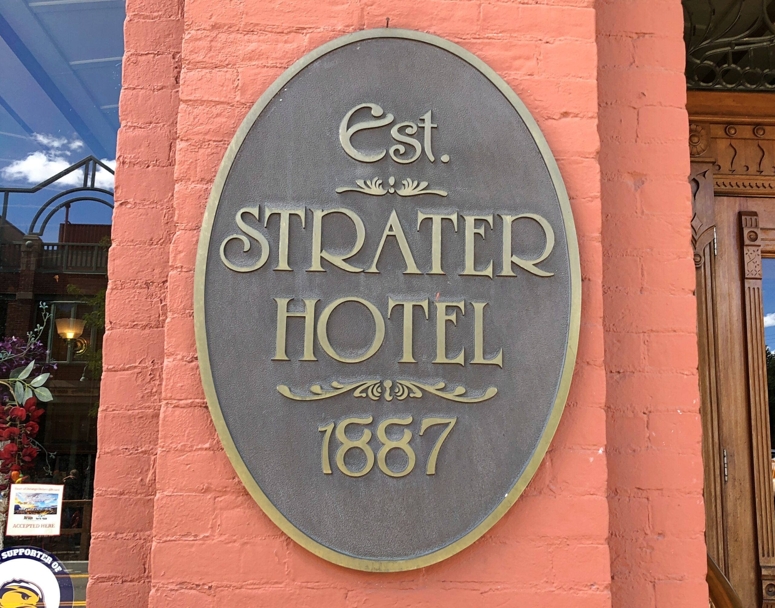
Or not so small. Such as the magnificent Strater Hotel, built in 1887.
The sort of place where presidents stay, or used to. Did any? The hotel web site doesn’t say. I’d ask ChatGPT, but it would probably tell me that FDR stayed there during his Grand Western States Whistle Stop Tour in 1939, a wholly fictional event. Wiki says Gerald Ford stayed there. Louis L’Amour did too, and now has a room named after him.
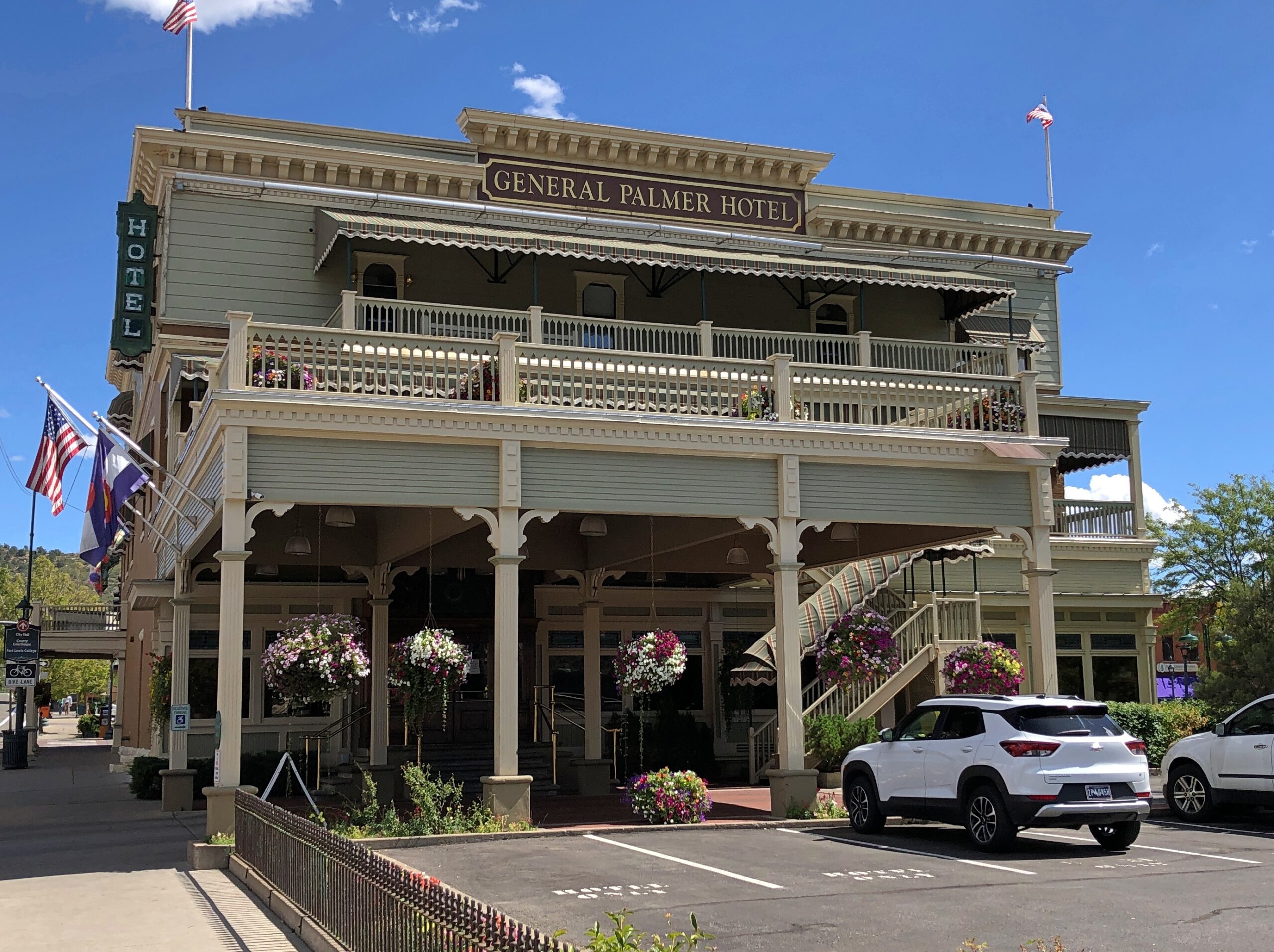
A competitor. Named for this fellow, Union (brevet) brigadier general and railroad man, who co-founded the Denver and Rio Grande RR.
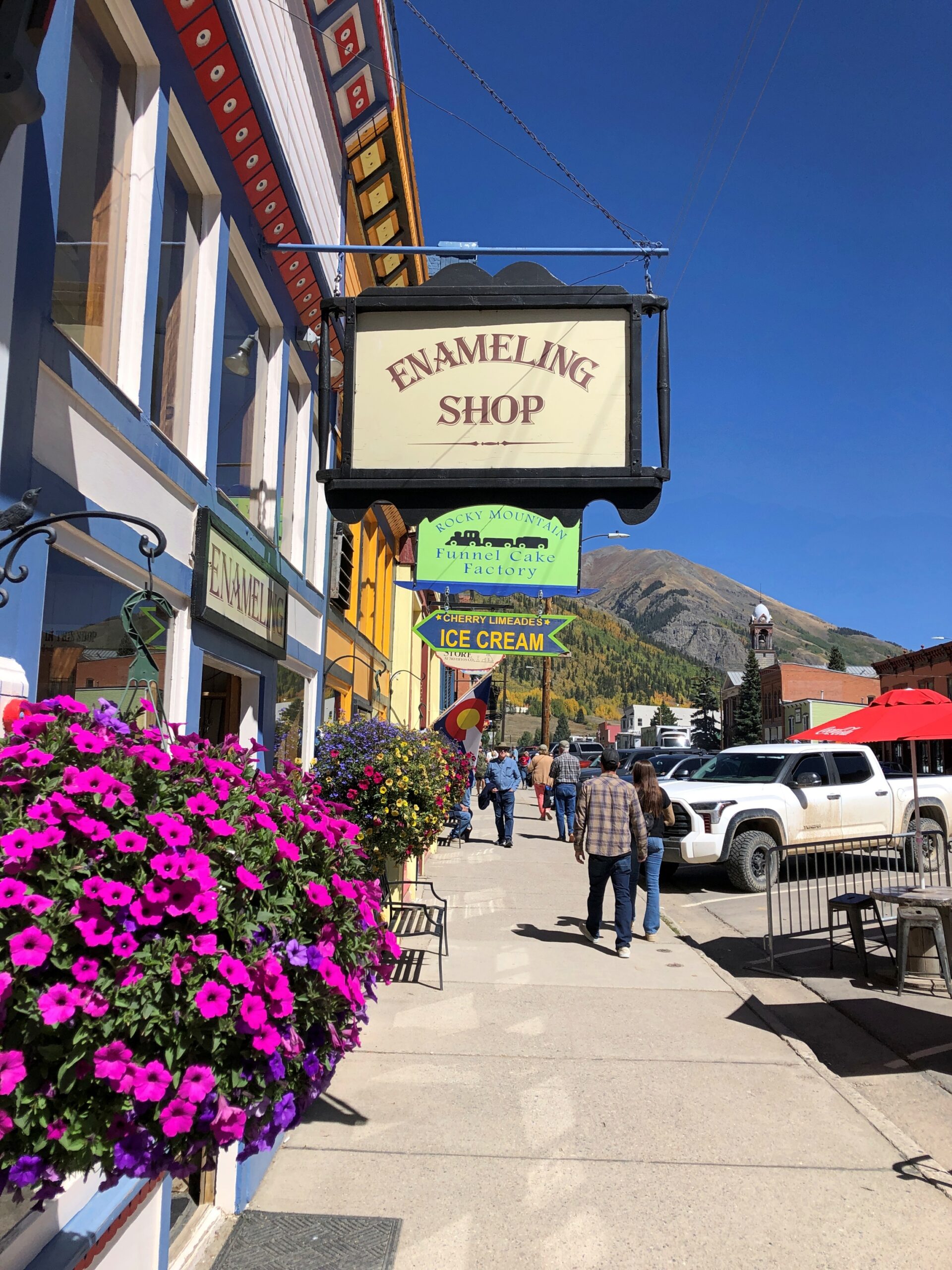
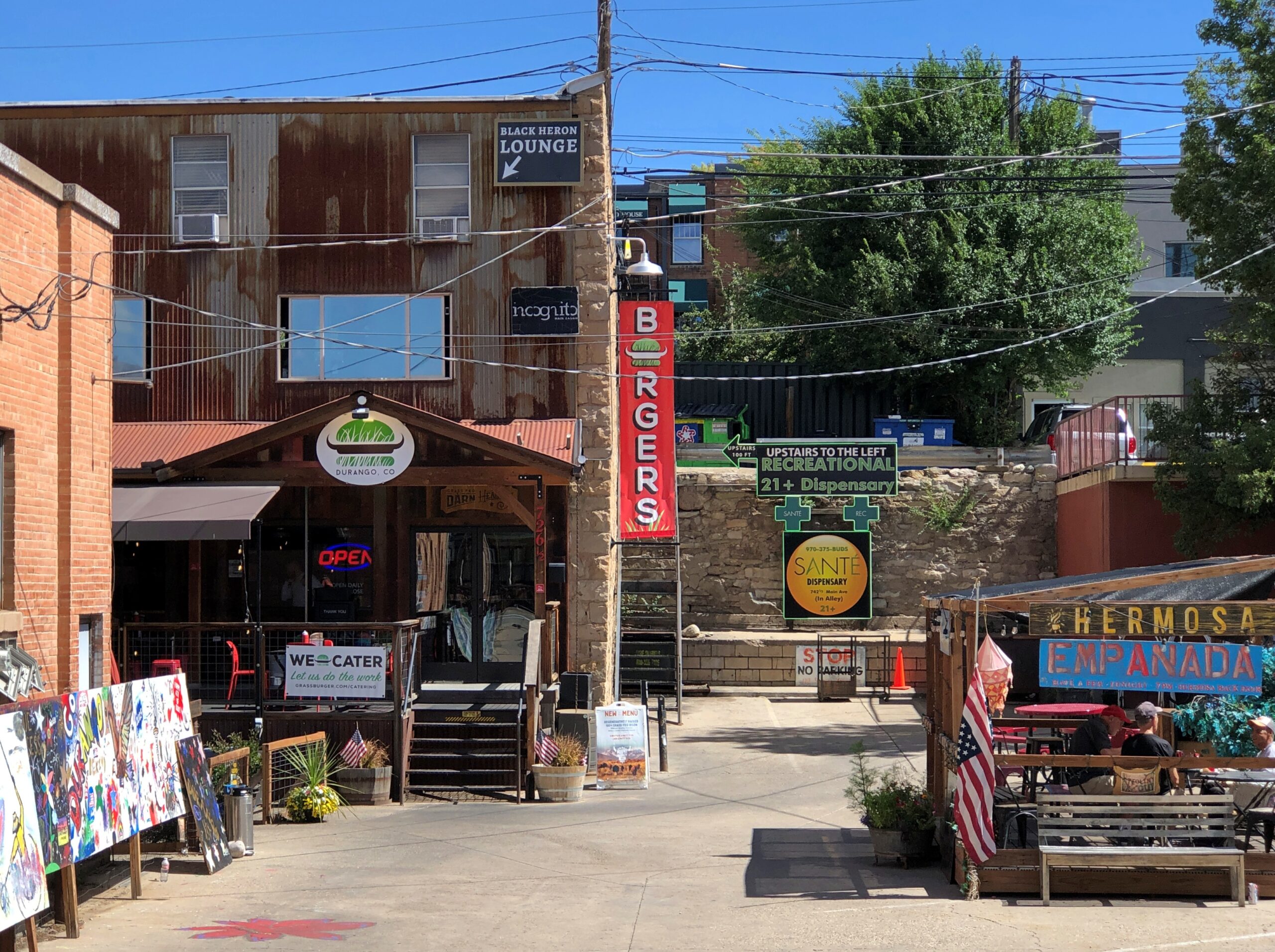
Downtown Durango is well supplied with retail.
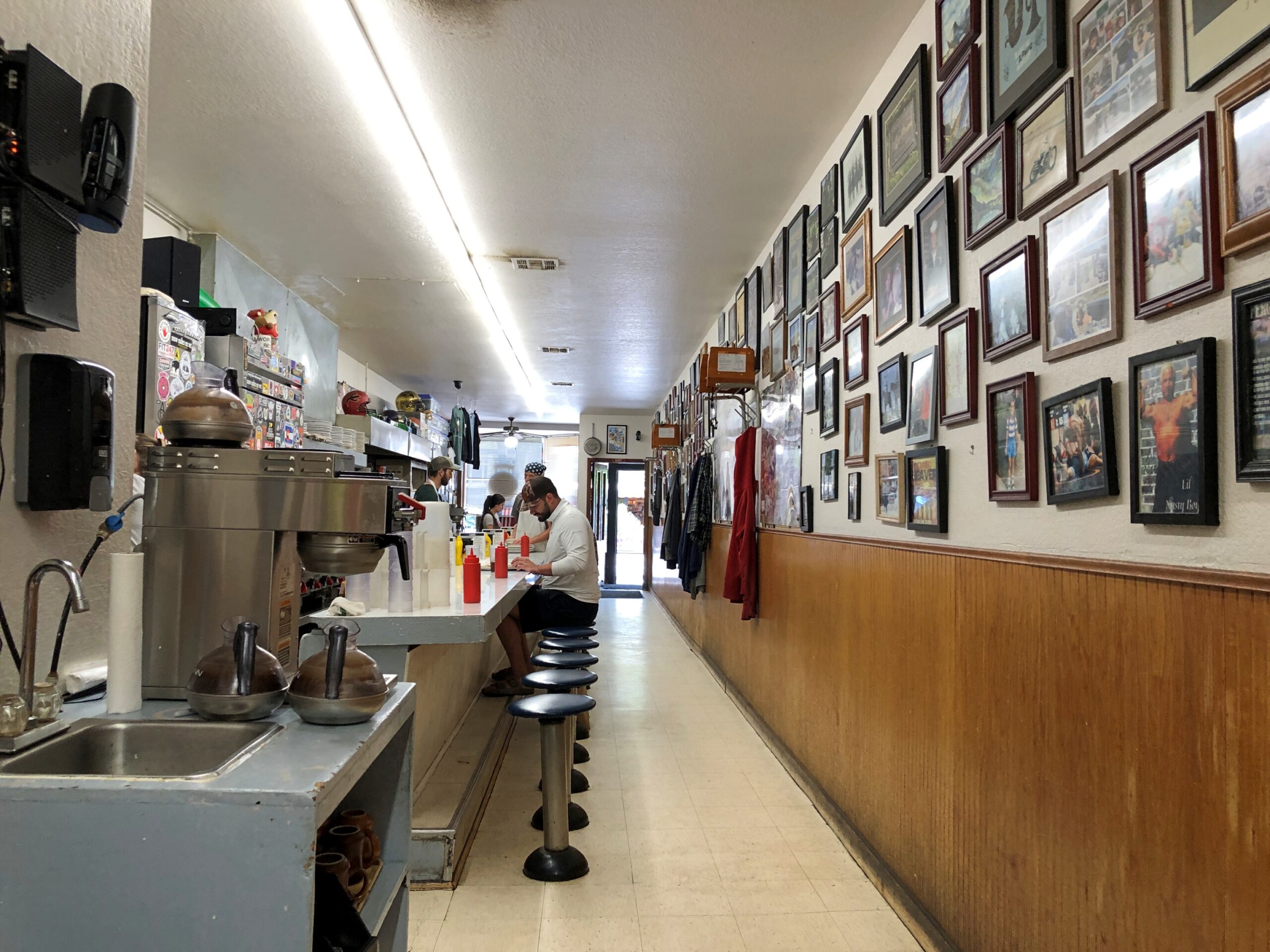
Lunch options, besides burgers and empanadas or a liquid lunch, included the likes of the Diamond Belle Saloon, Seasons of Durango, Chimayo Stone Fired Kitchen, Steamworks Brewing Company, and Eolus Bar & Dining. All very nice, I’m sure, but we chanced on something more to our tastes at that moment: the Durango Diner. In business for 60 years.
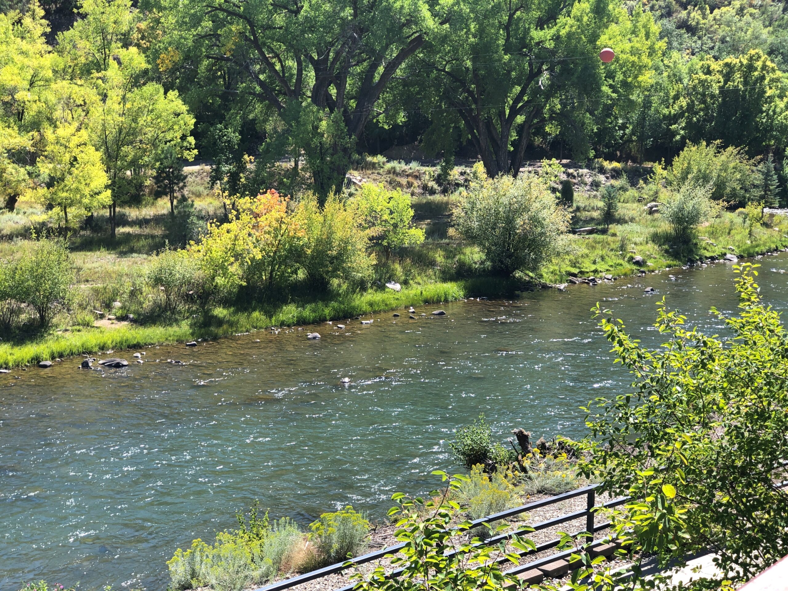
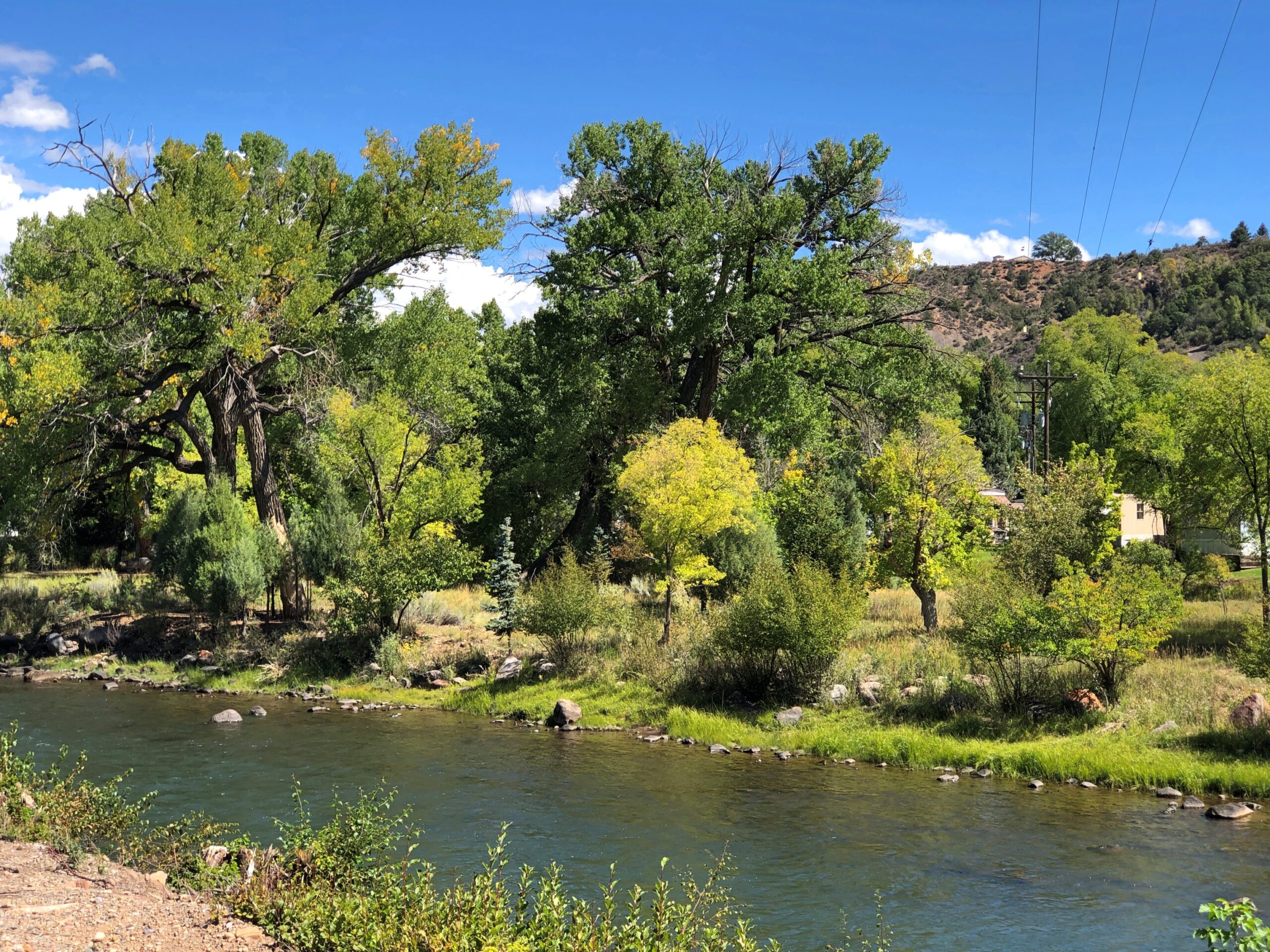
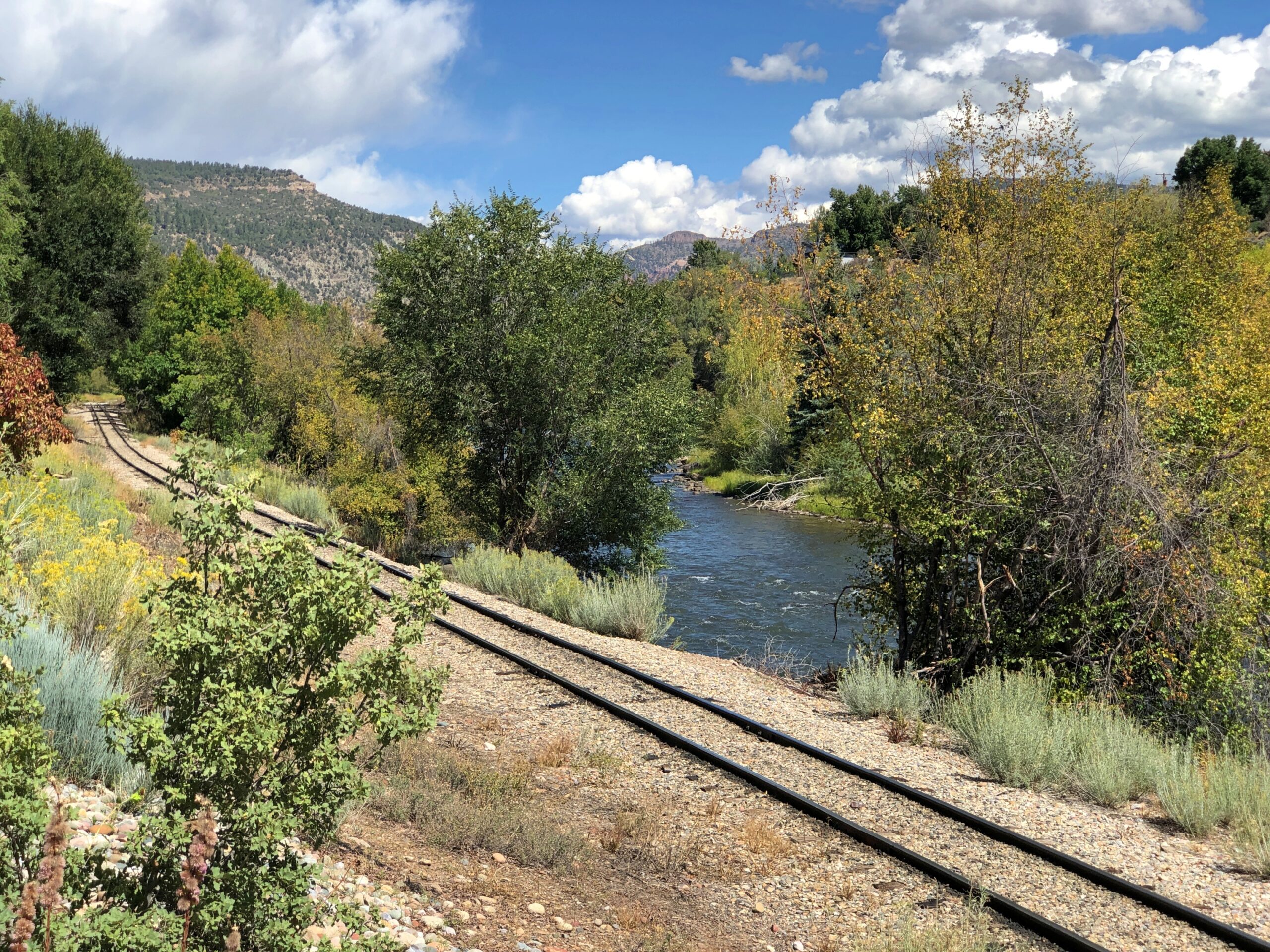
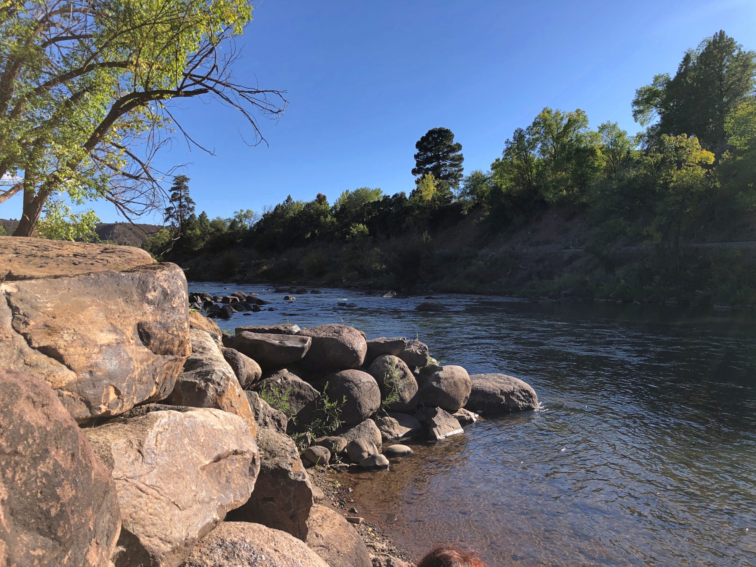
Durango started not so much as a mining town, but a railroad node that served the mines further up the line. Silverton, for instance. One reason Durango is where it is: the Animas River. These days, the river is accessible to pedestrians in a number of places in town. One was near the Durango Library, also the location of a shady sculpture garden.
At this place, the tracks of the Durango & Silverton Narrow Gauge RR run along the river.
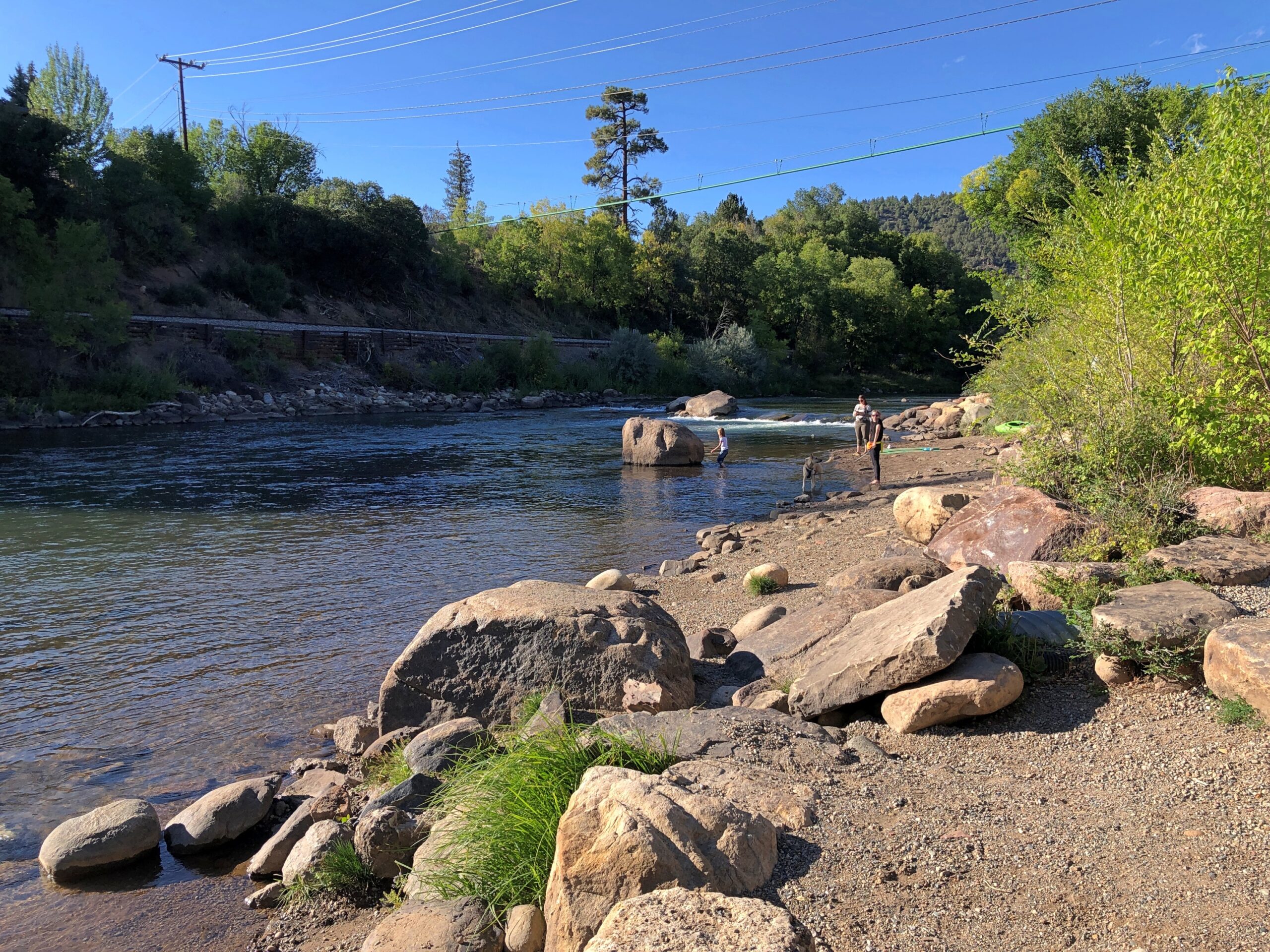
That was also true at the 29th Street Park, though the tracks were on the other side of the river.
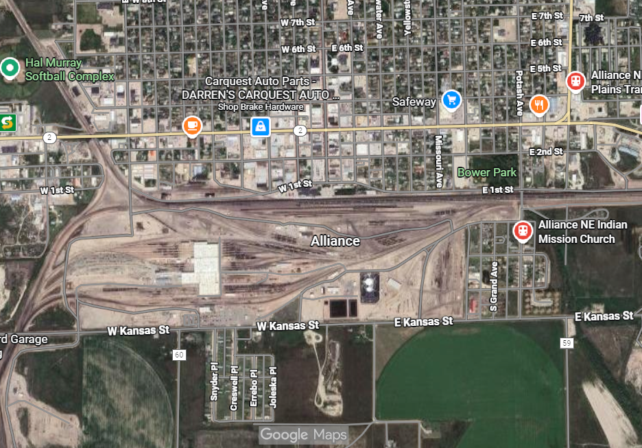
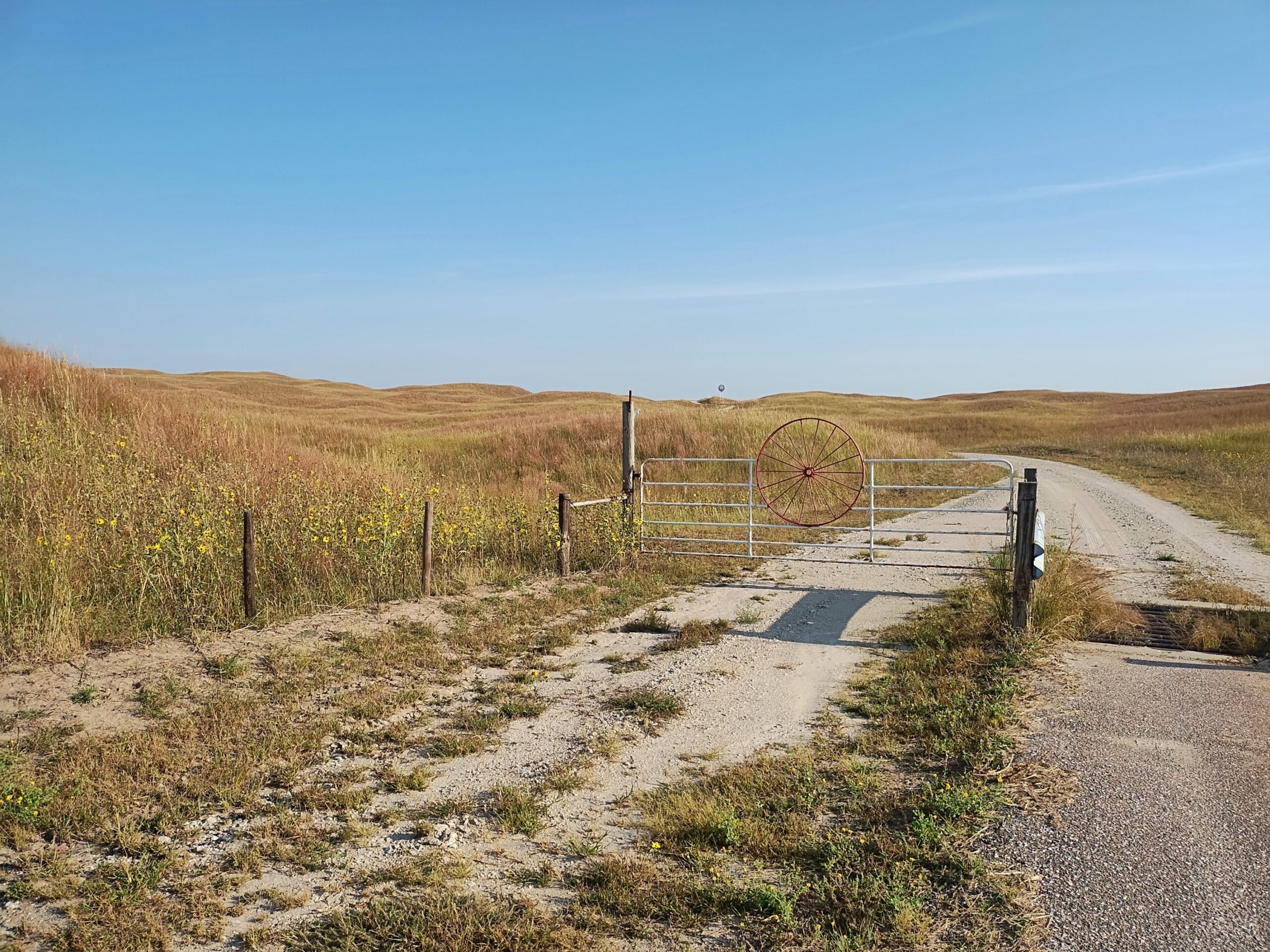
The highway Nebraska 2 passes through the town of Alliance, as do the BNSF railroad tracks paralleling the highway. During my drive across the Sandhills, I saw train after train headed east from Alliance. Long trains, the seemingly endless sort, even though they’re going the opposite direction you are, so they’re passing by at your speed plus their speed: well over 100 mph probably.
Every single one was a coal train. The industry isn’t what it used to be, but it isn’t dead, and much extraction takes place in the Powder River Basin, with rail from there converging in Alliance and then heading to the markets in the east. For a fairly small place, Alliance (pop. 8,150 or so) has a large rail yard.
Back up a little further, and the region reveals clear signs of circle-pivot irrigation.
In ag terms, most production in Box Butte County – a favorite of mine among county names – is actually livestock, raised on non-irrigated grassland, which you can also see driving in. As for the irrigated places, that’s corn and wheat, with a smattering of alfalfa, beans, sunflowers and sugar beets. Somewhere up north is a rock formation called Box Butte, a name that I understand the railroads were using in promoting settlement this way, before it was ever official.
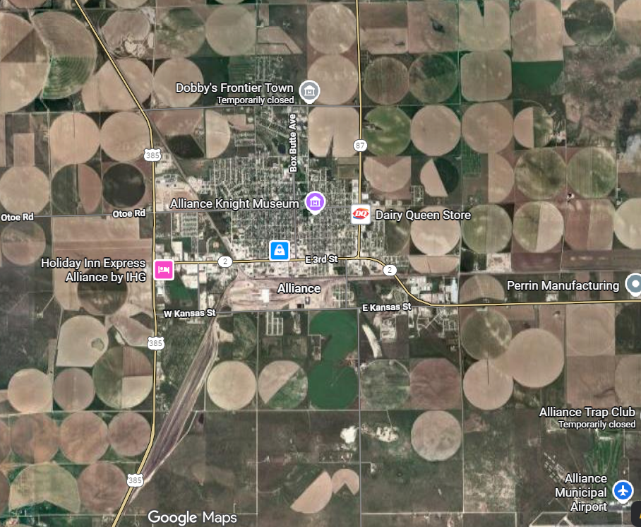
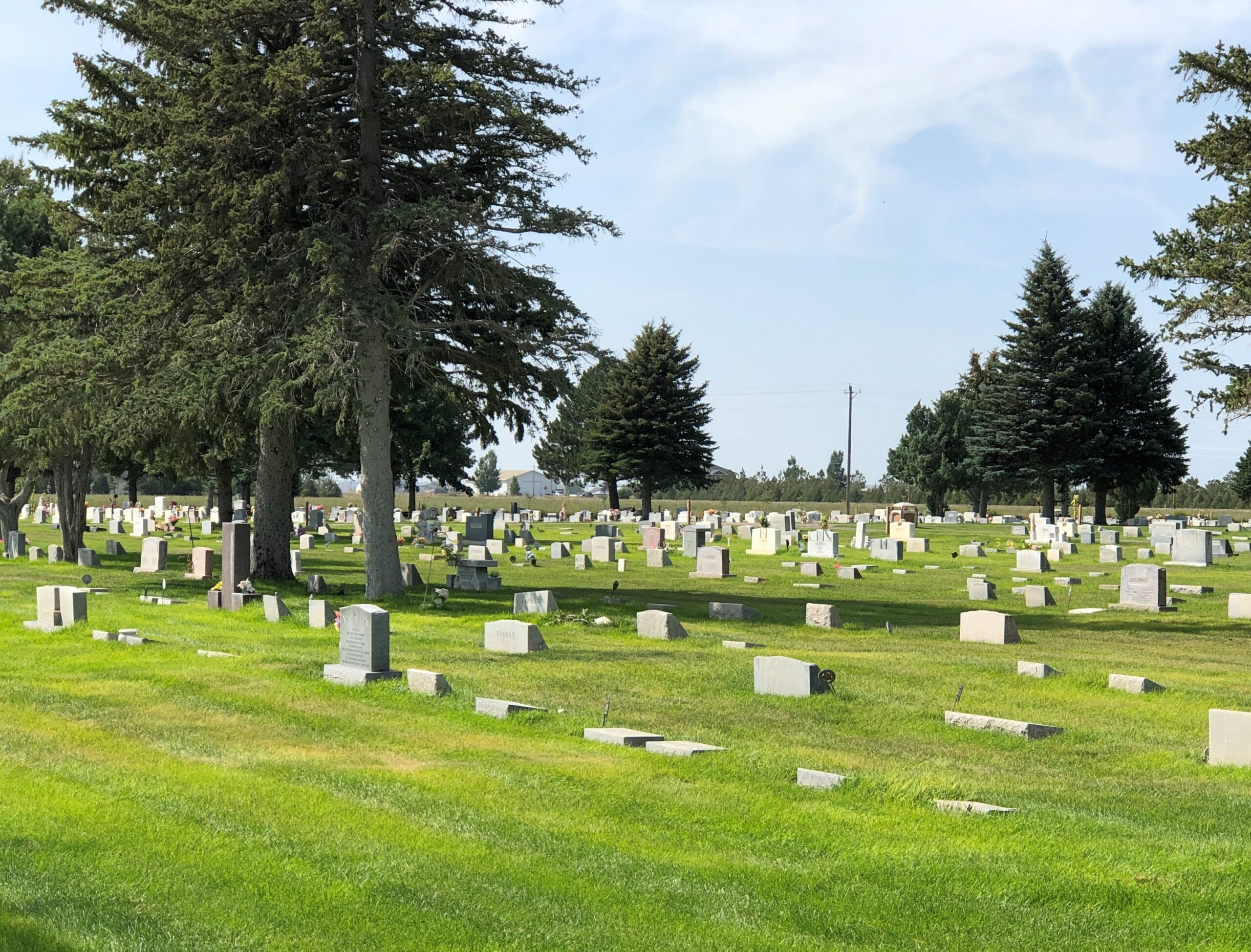
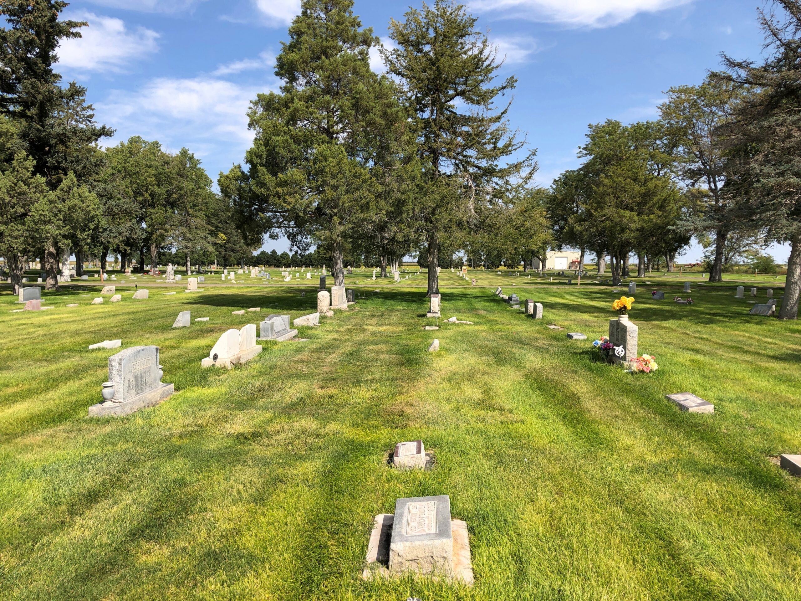
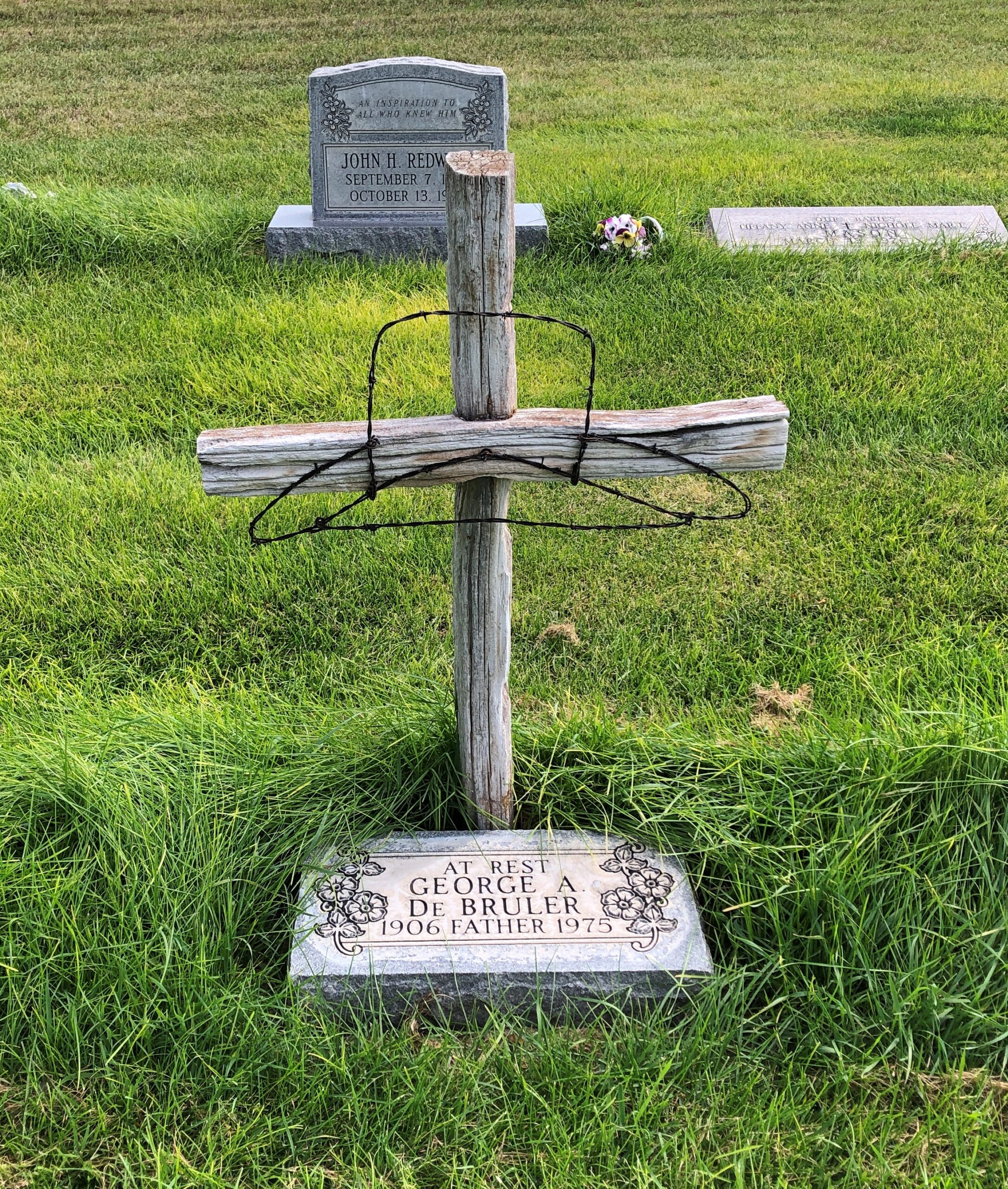
I didn’t come to town to learn all that, but I did later. Mainly I came to see Carhenge. The weather that day, September 7, was clear and very warm, which inspired some further looking around. First stop, Alliance Cemetery.
“Bury me in old Box Butte County.” There’s a western swing title in that.
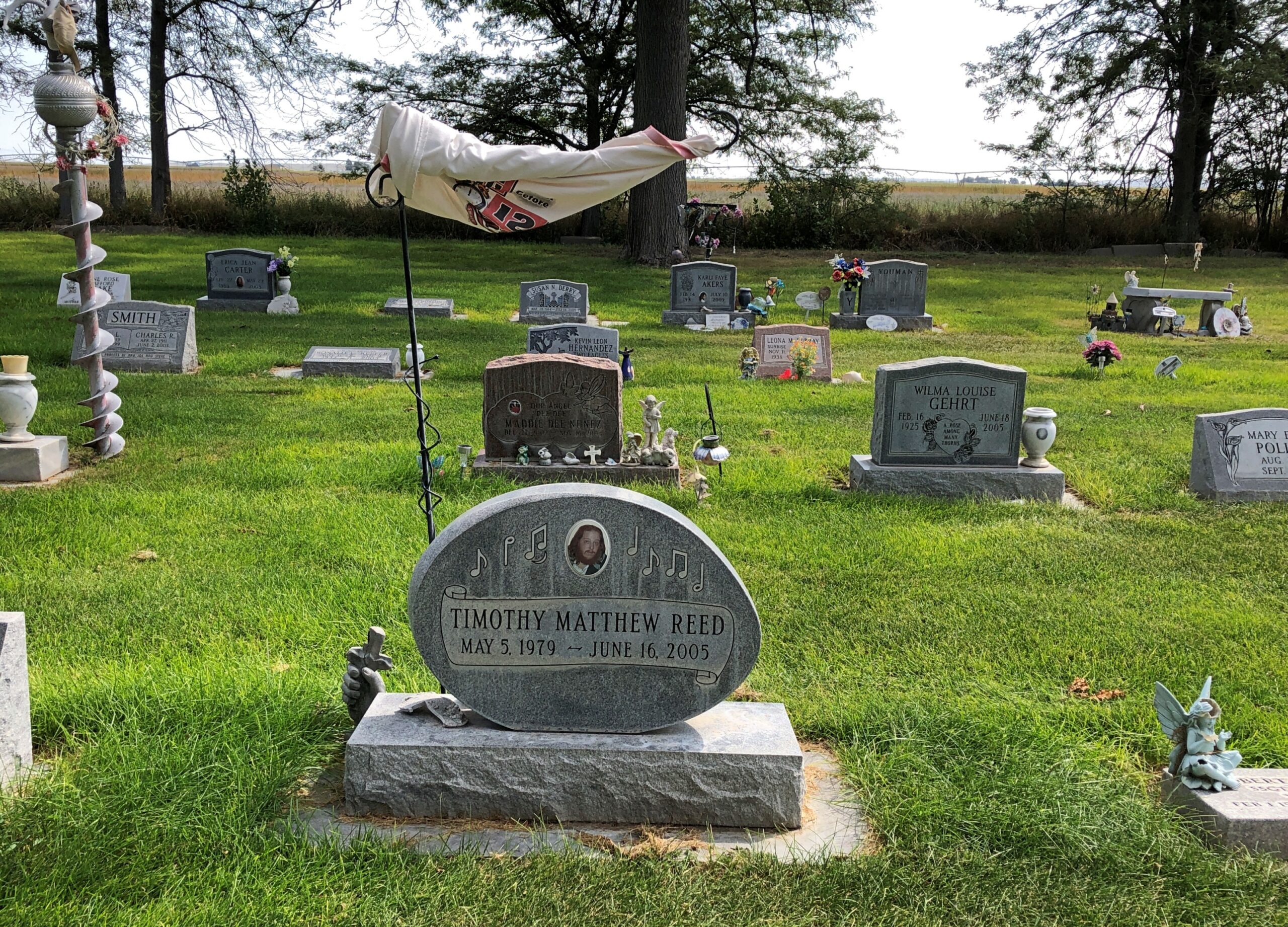
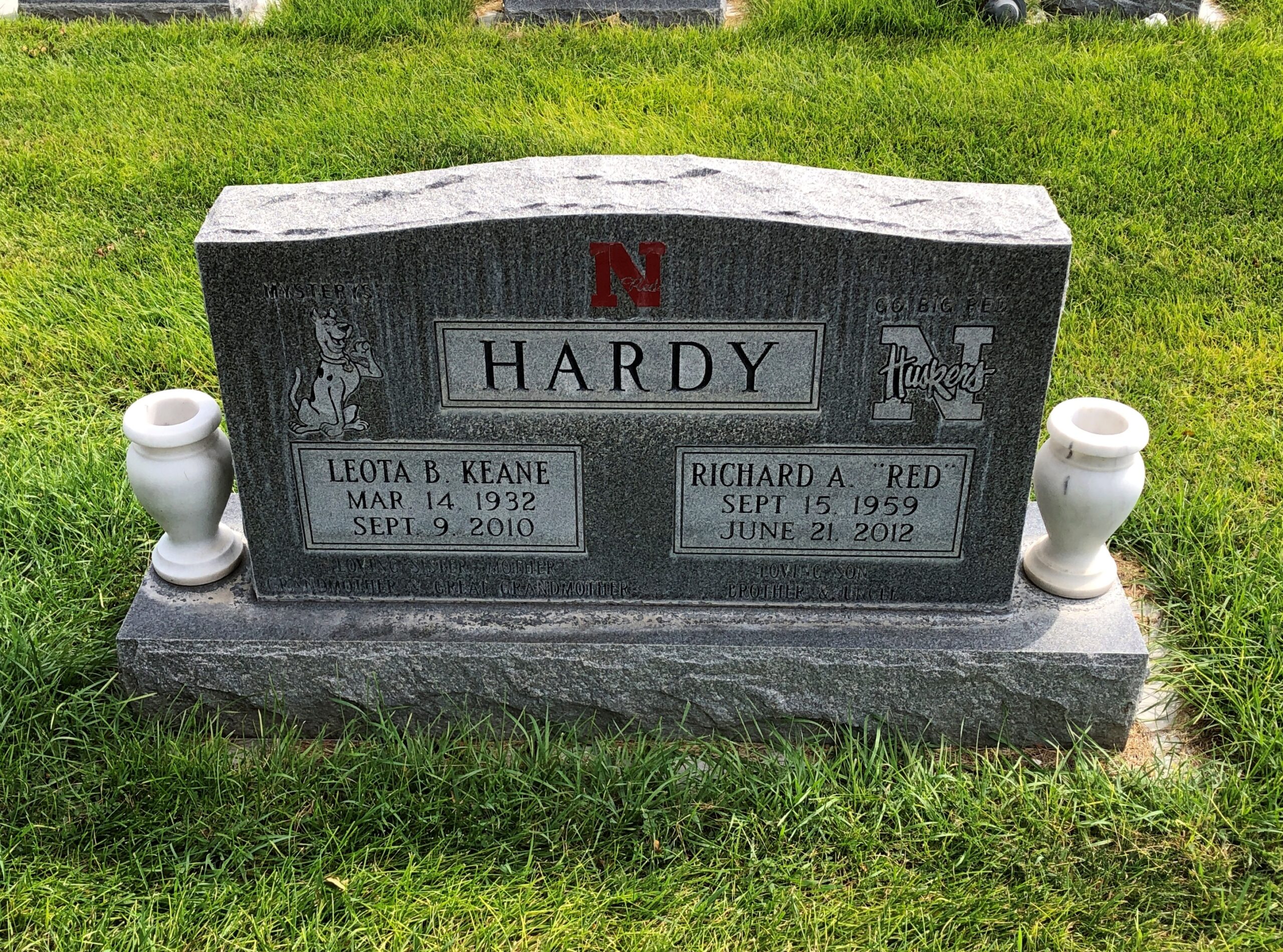
Something I’d never seen on a gravestone before: Scooby-Doo.
Go figure. Maybe Richard “Red” Hardy is the one who wanted it on the stone, since he would have been almost 10 when that cartoon premiered (September 13, 1969), and that’s about the right age to get hooked on such a thing. Then again, I was eight — saw the first episode myself — and yet somehow I’ve remained immune to its charms.
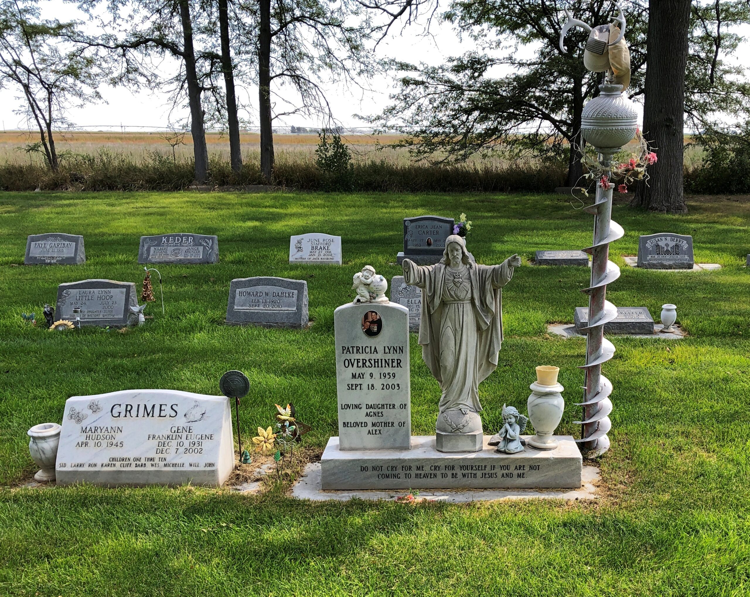
As for the Huskers, I saw them on some other stones in this cemetery. Hardly the only example of fandom from the grave.
I’ve seen cowboy churches and I’ve seen cowboy graves.
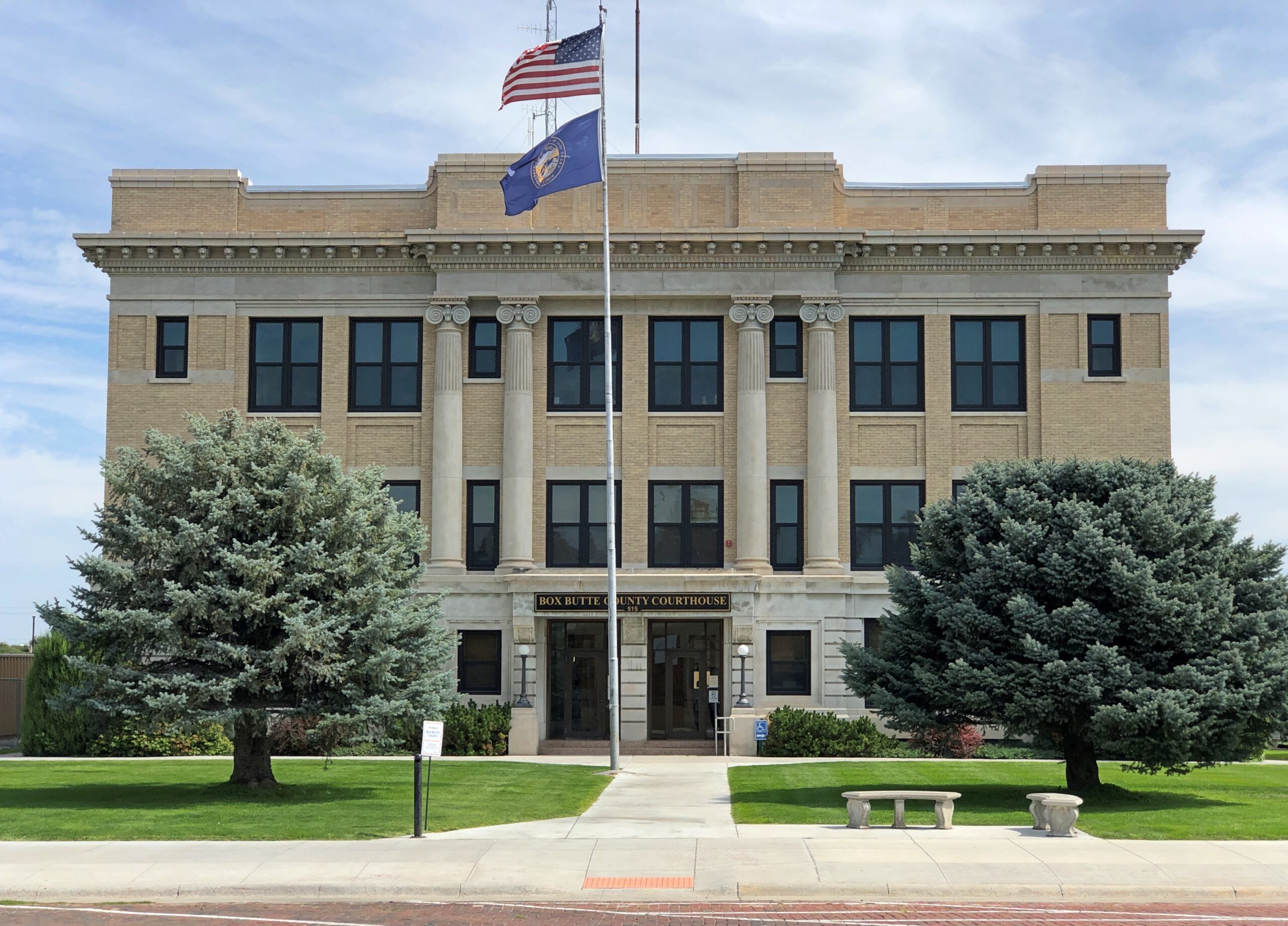
The cemetery is east of downtown Alliance, but not that far away. The Box Butte County Courthouse is on Box Butte Ave.
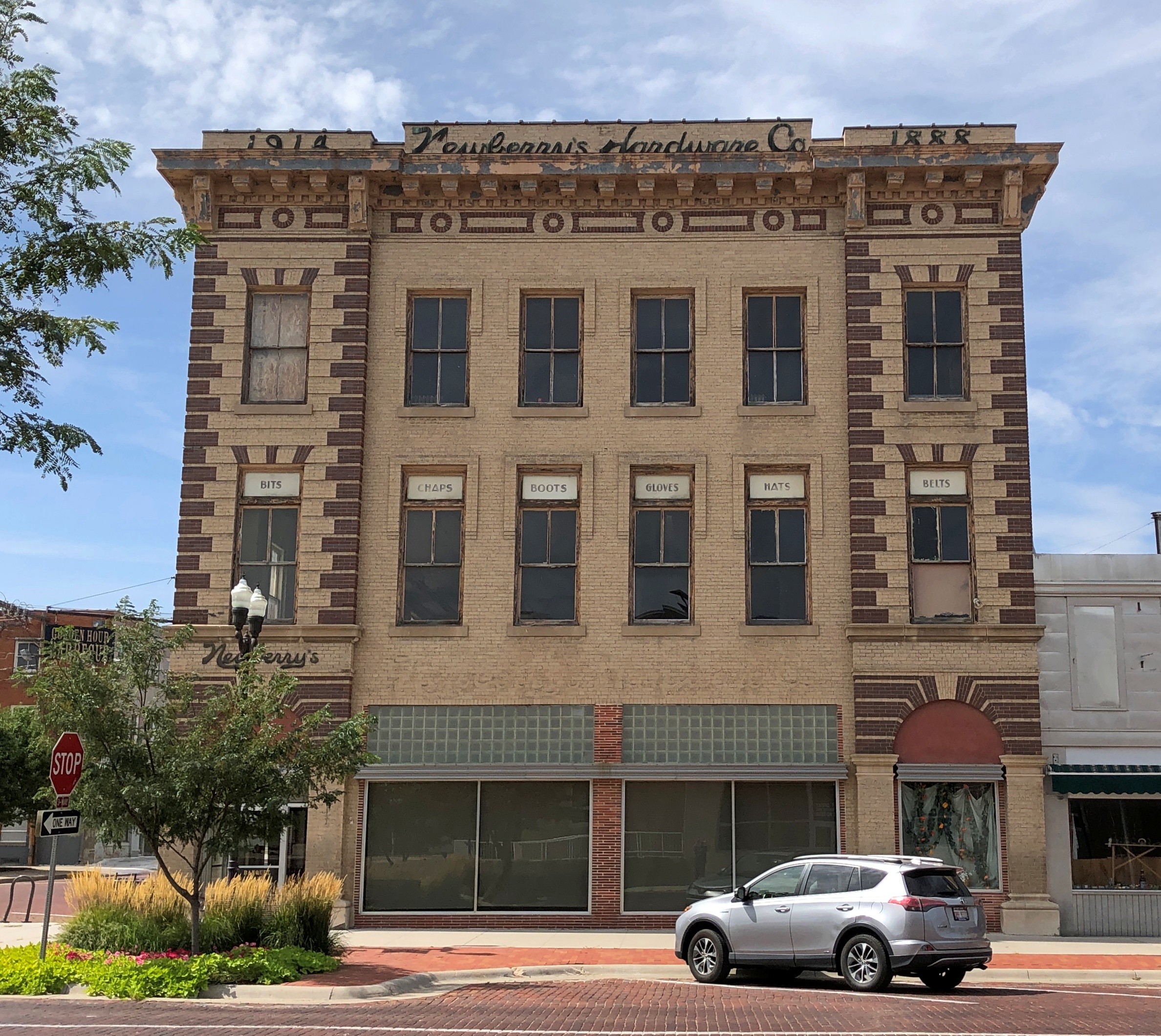
Along with a number of other vintage buildings. Newberry’s Hardware Co., once upon a time, which seems to be 1888 and then maybe an enlargement in 1914? Looks like it needs an occupant.
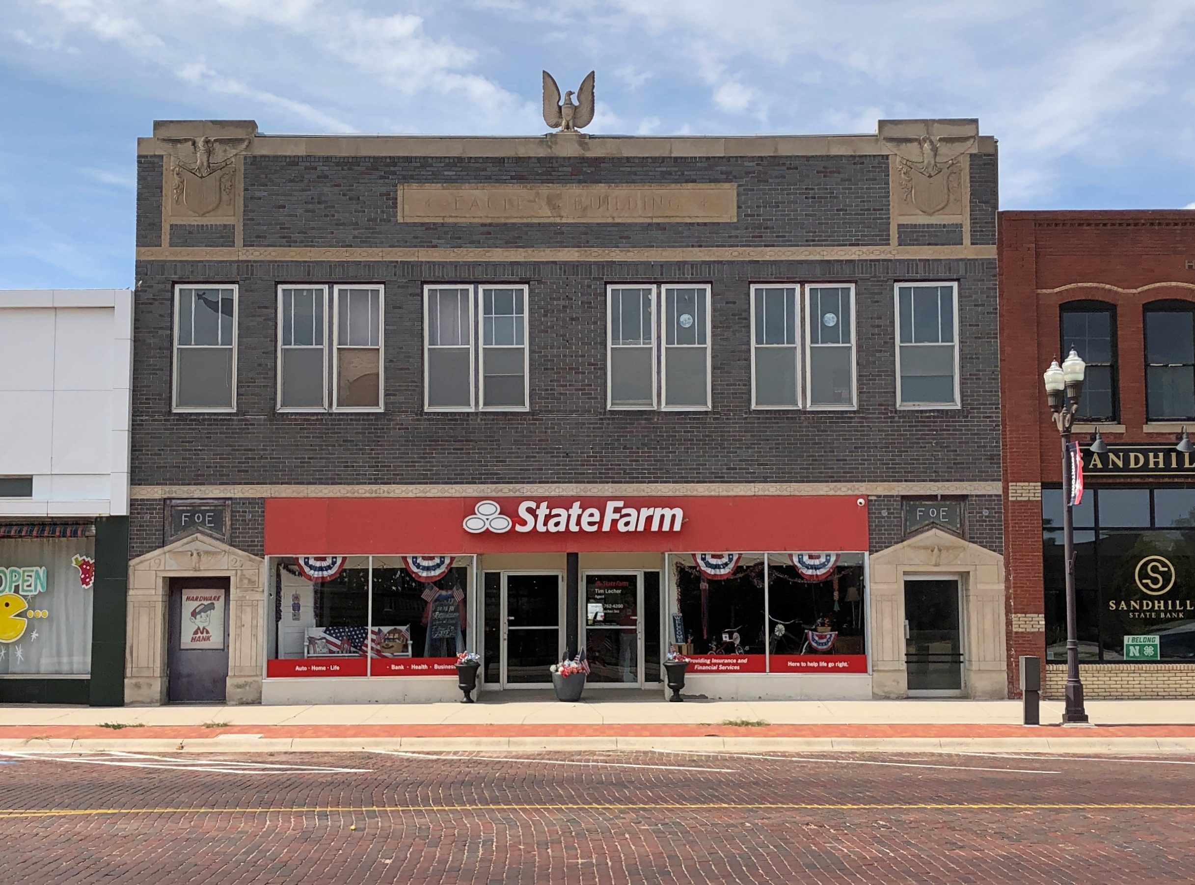
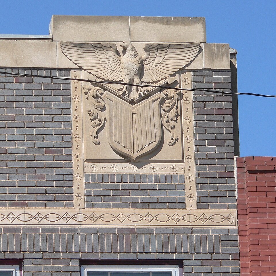
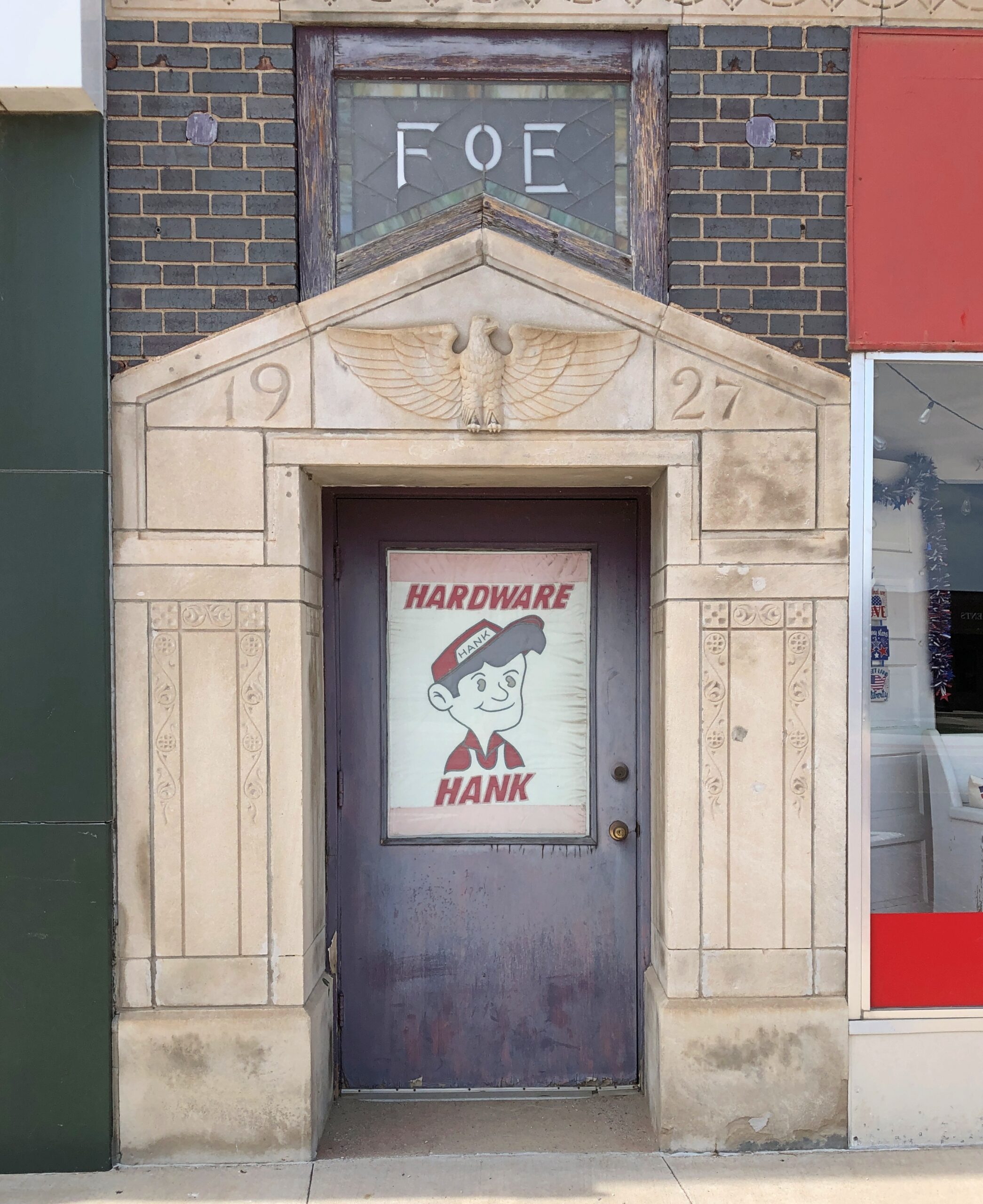
The 1927 Fraternal Order of Eagles Building.
Slacker that I am, I didn’t take many detail shots, but one of this particular building is available (public domain) that shows how seriously the local FOE took its eagles about 100 years ago.
Hardware Hank is a hardware cooperative. New to me, but that only means I need to get out more.
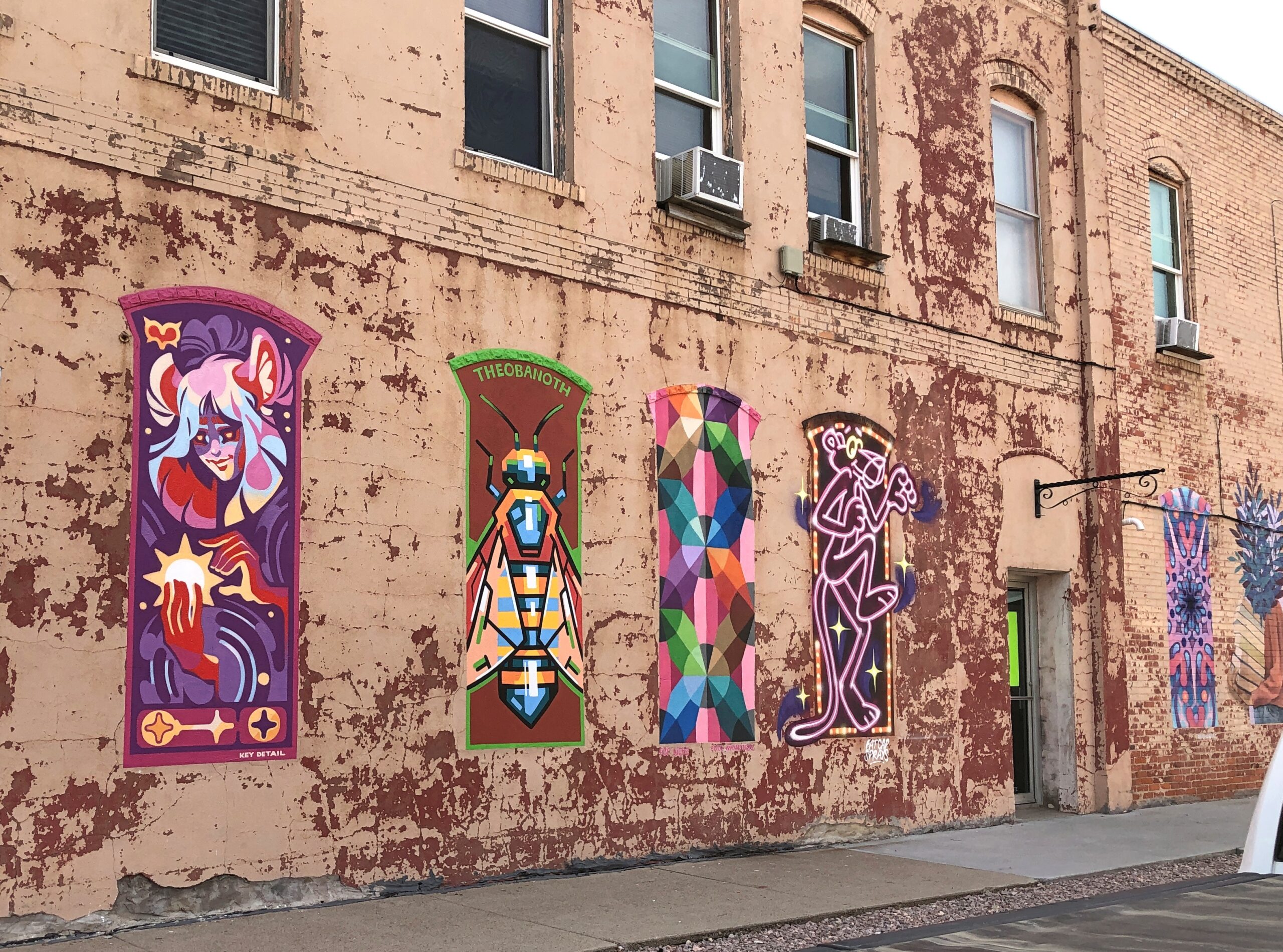
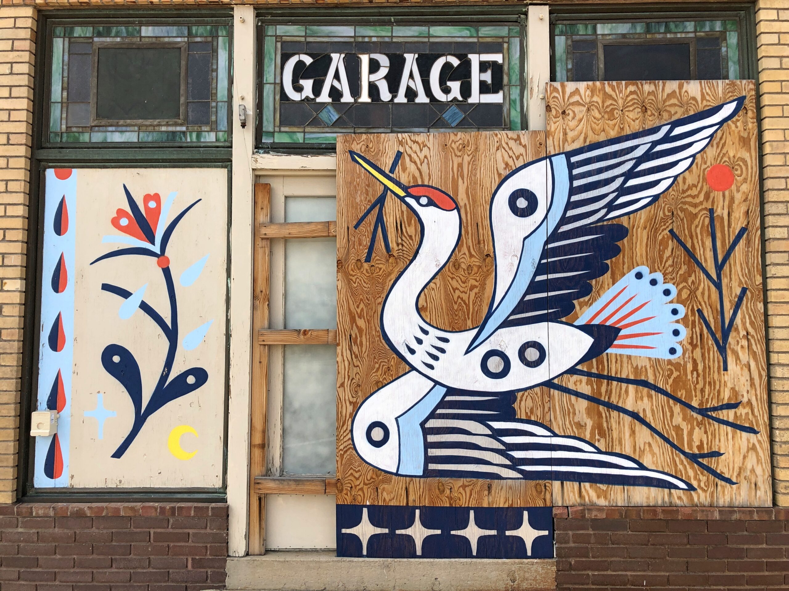
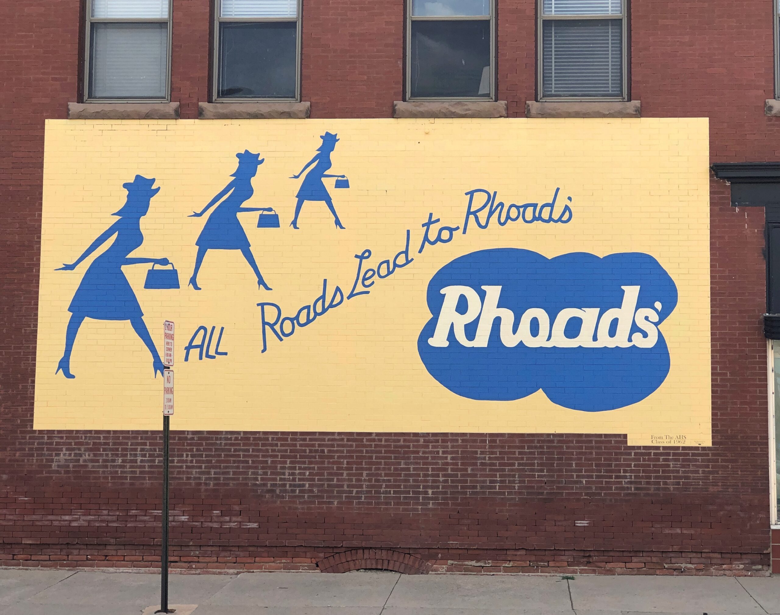
More murals.
Rhoads’ was a local department store. Gone but not forgotten, at least if you read the mural, which looks refurbished recently. The tag at the bottom says it was a gift of the Alliance High School Class of 1962.
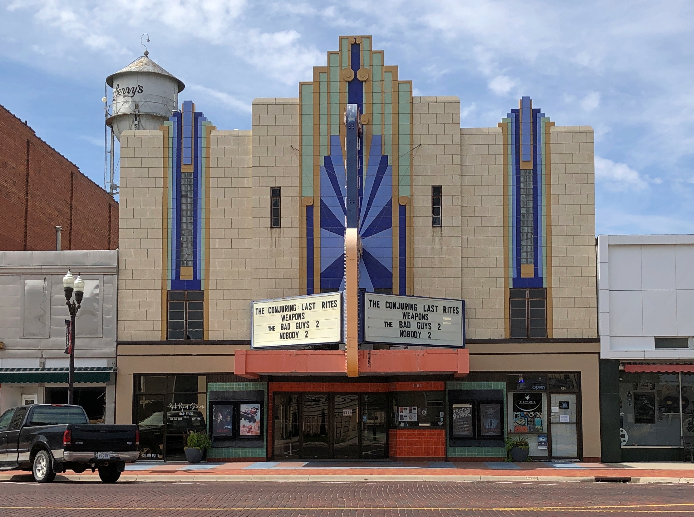
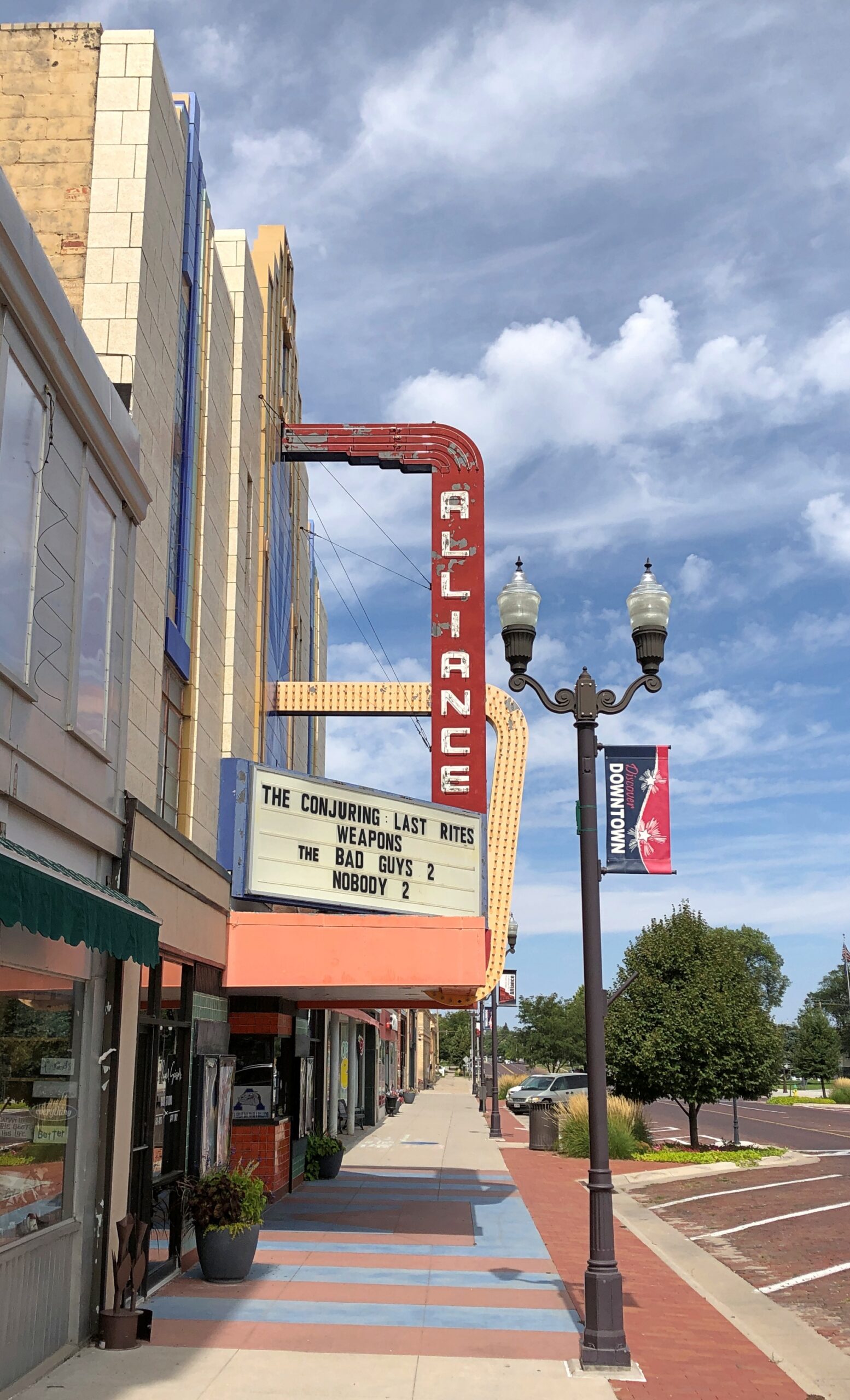
An art deco theater. Nice.
A really cheap way to advertise.
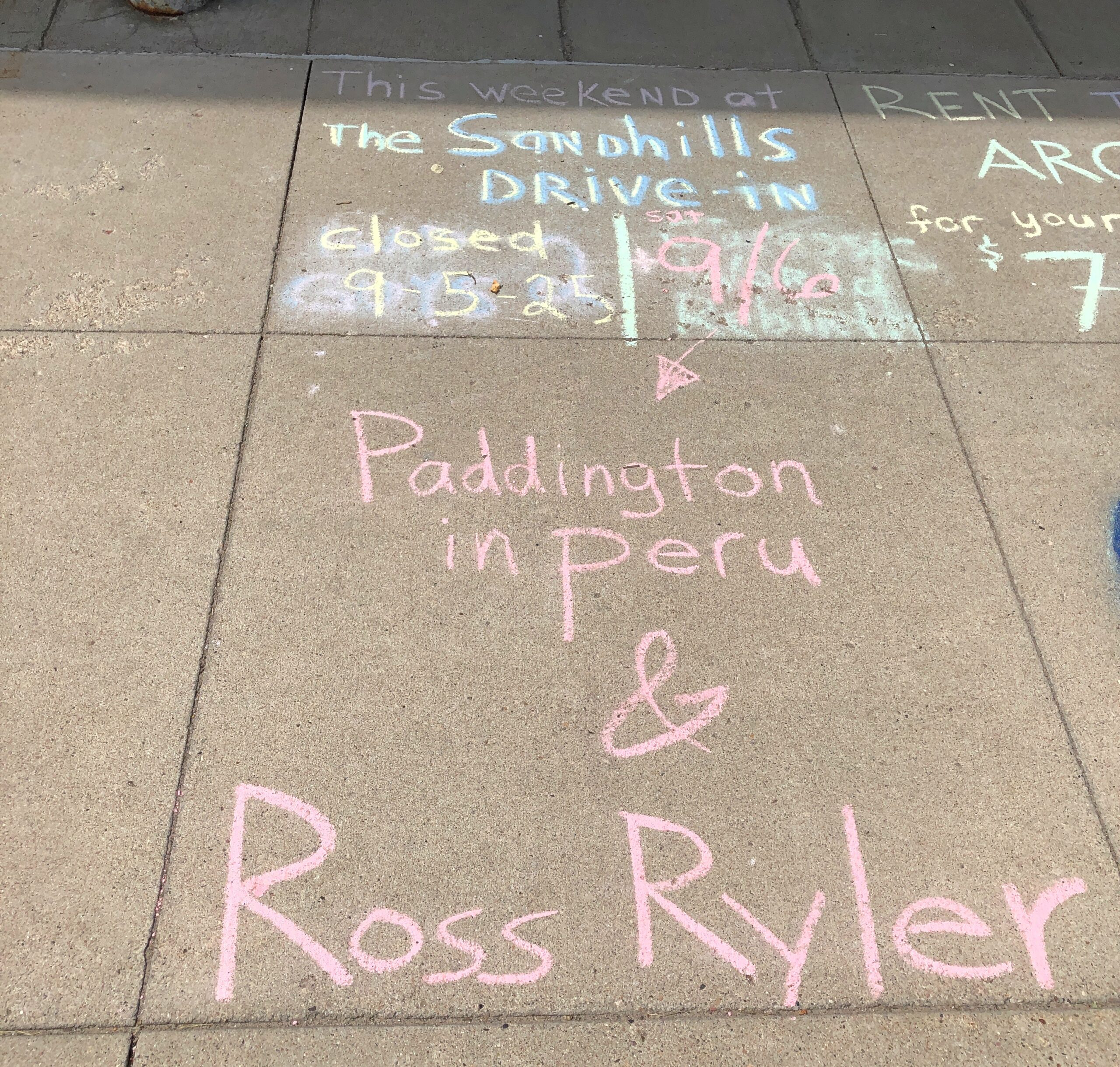
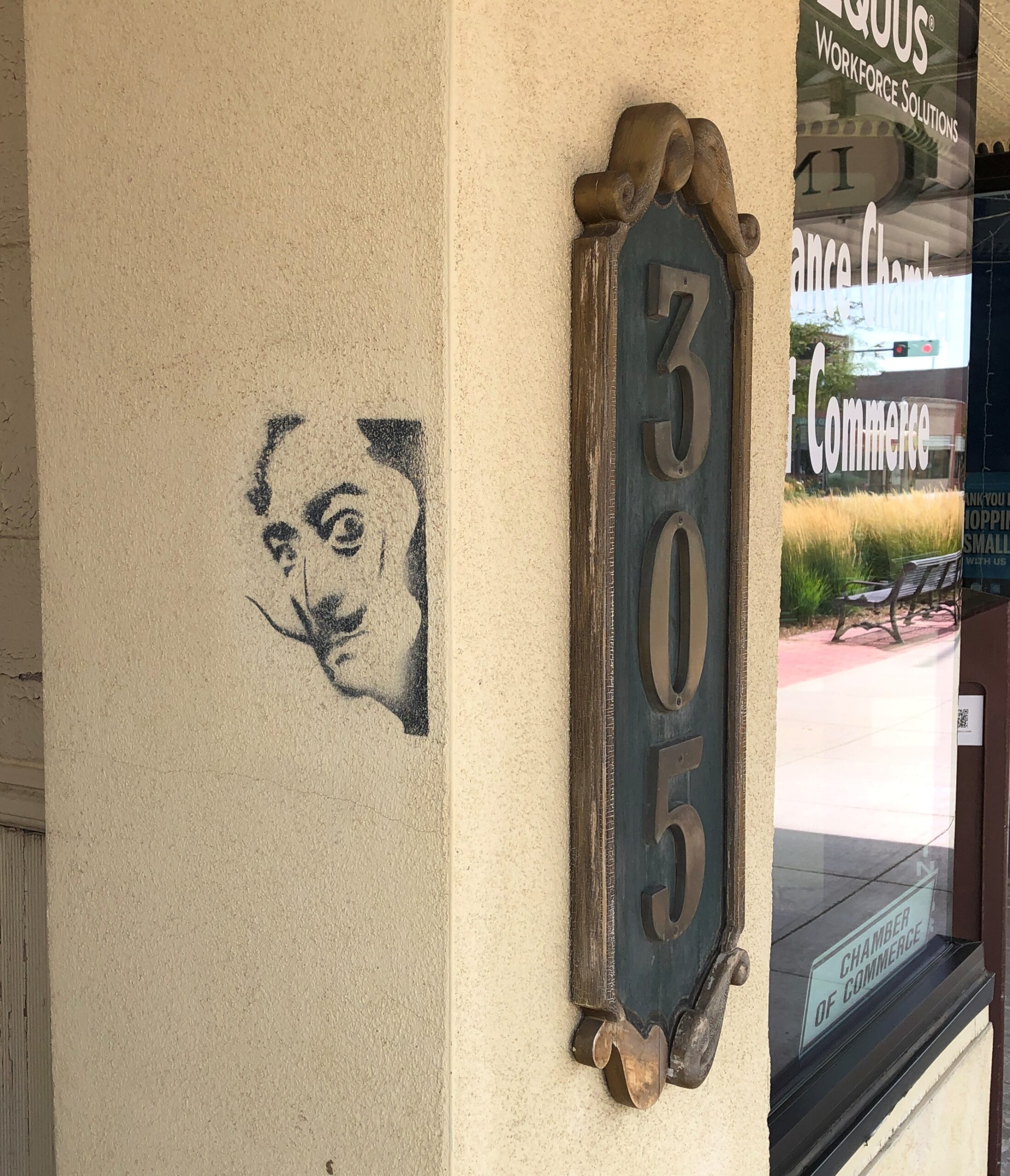
You never know when (and where) Dali will show up. Enigmatic fellow.
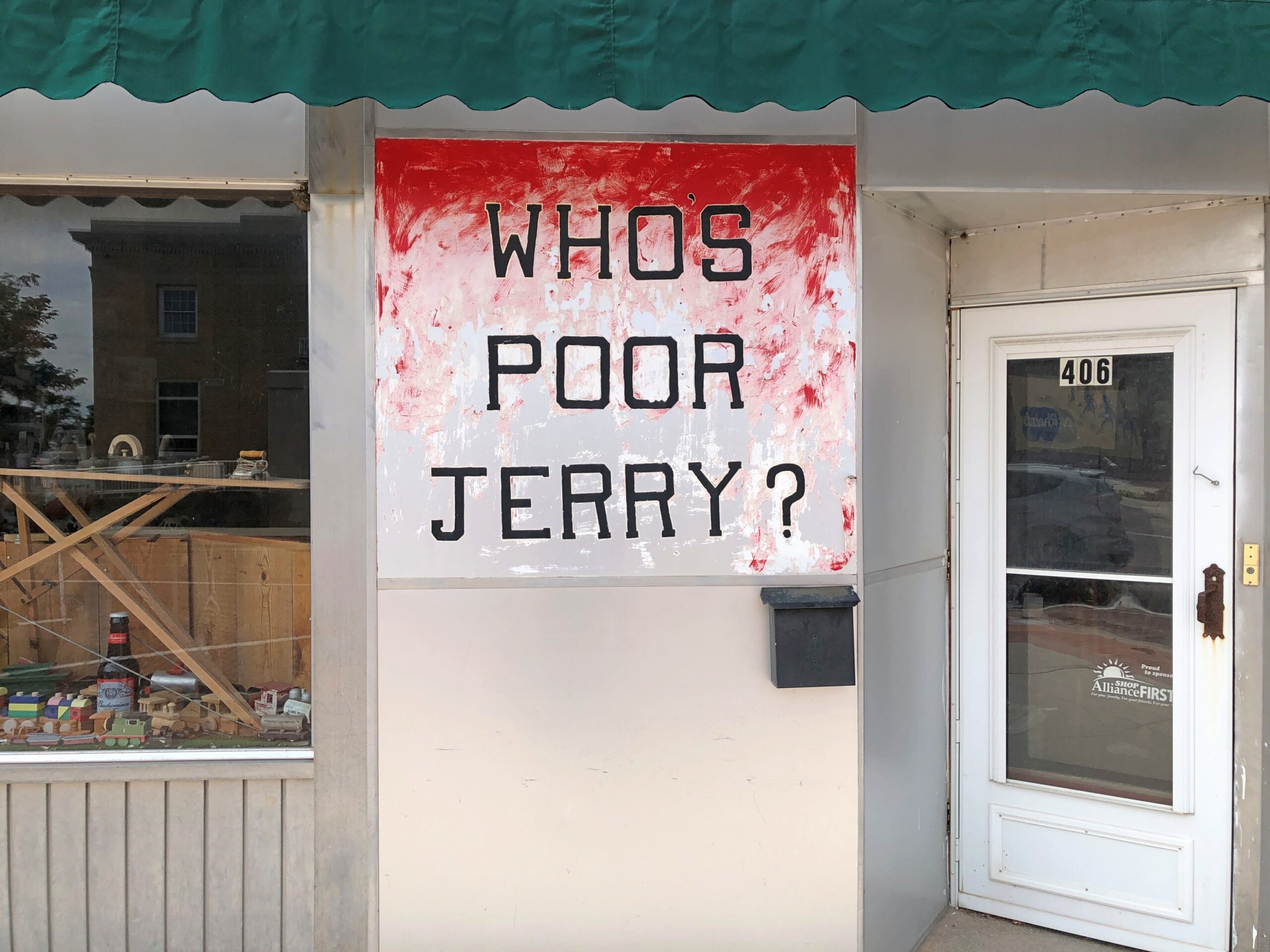
And who is poor Jerry?
Antique shop within? A simple desultory Google search doesn’t reveal much. Street View puts the sign’s appearance between 2007 and 2012 (Google didn’t come that much to Alliance.) Even the Library of Congress wants to know.
I found lunch in Alliance that day at Golden Hour Barbecue, which promised (and provided) Texas-style ‘cue. I enjoyed it thoroughly. Same league as Salt Lick, though a little expensive, considering how close the cattle are. Then again, everything seems expensive these days, and it was such a large lunch that I barely needed to eat that evening in my room in Scottsbluff, so that mitigated the upfront cost.
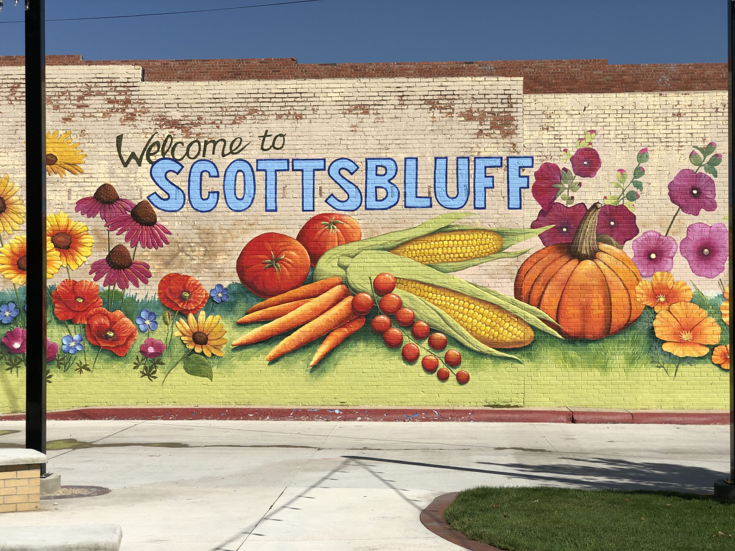
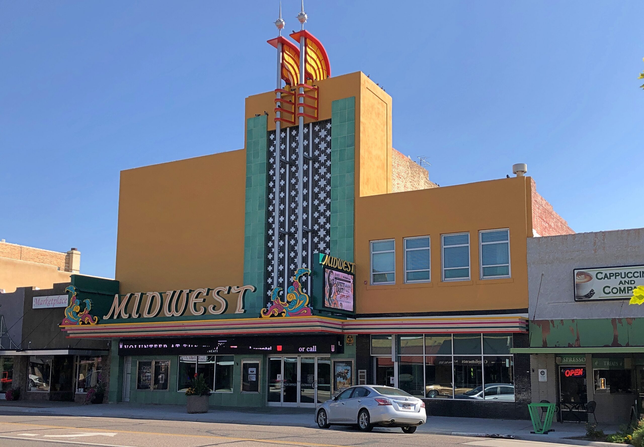
Before heading to the big rocks near Scottsbluff on the morning of the 8th, I took a look around that town as well.
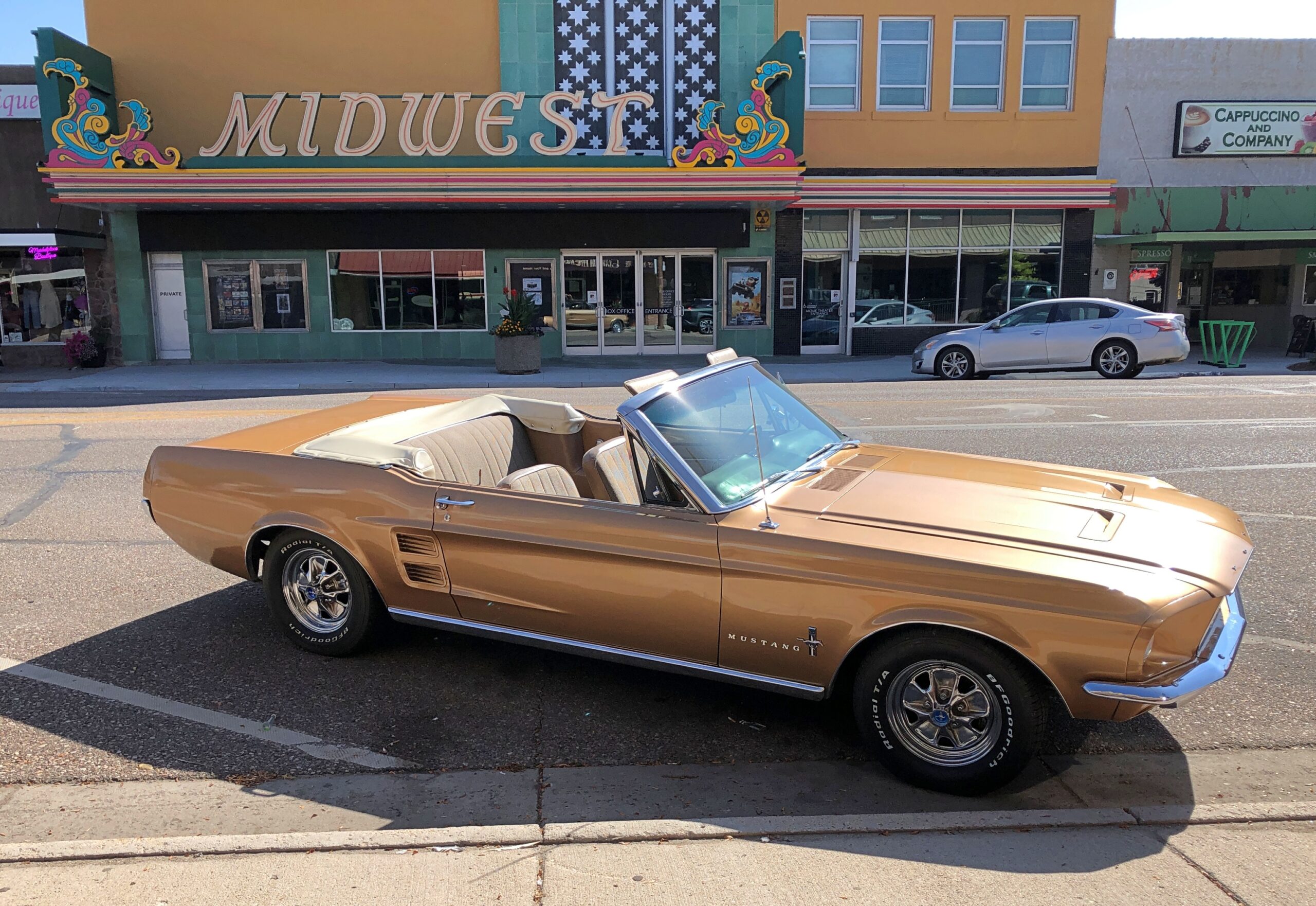
Can’t have too many art deco theaters. When I’ve done image searches for Scottsbluff, the Midwest theater comes up often as not.
A car to match. At least that morning.
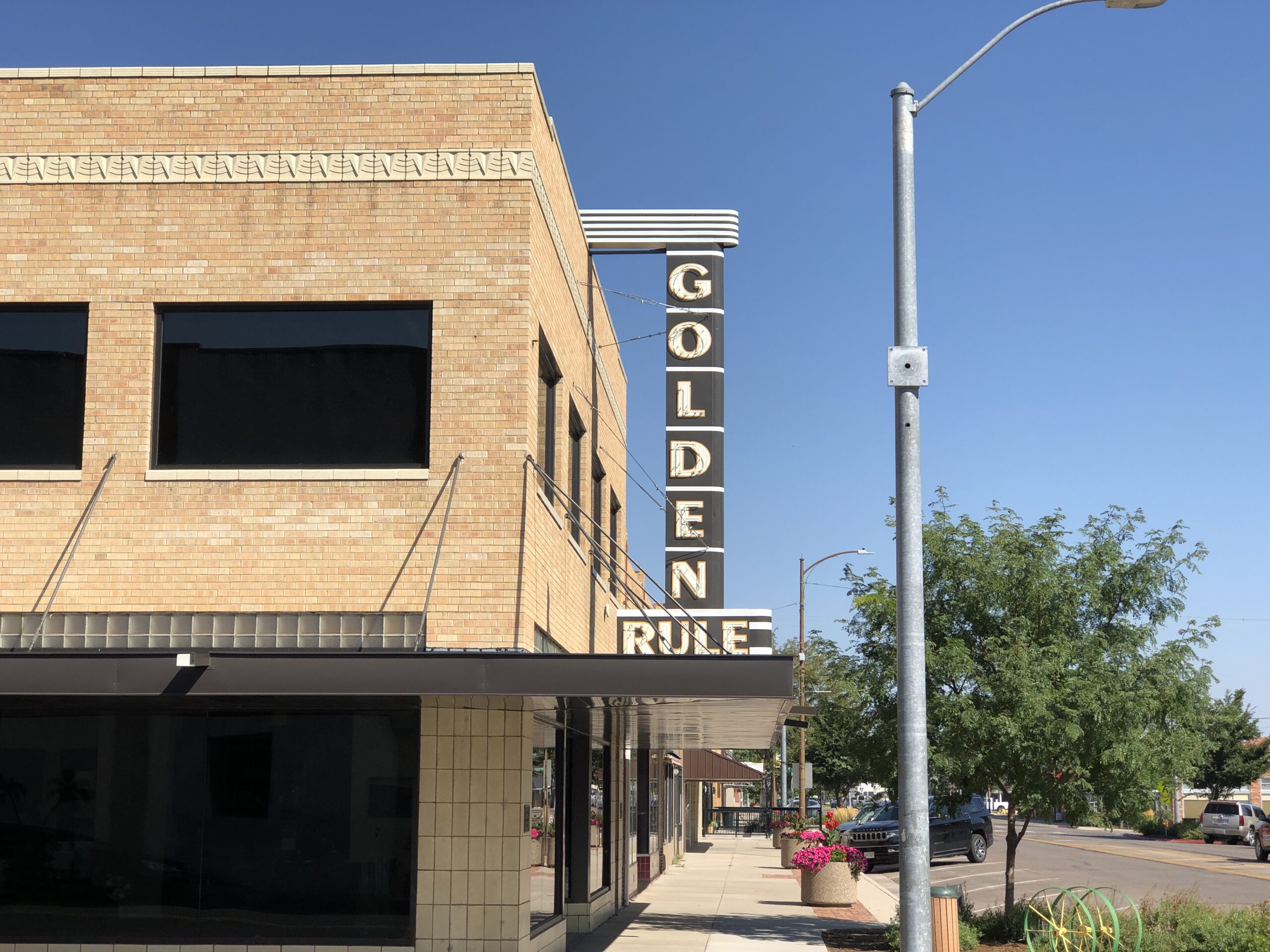
Another former small department store, now private offices.
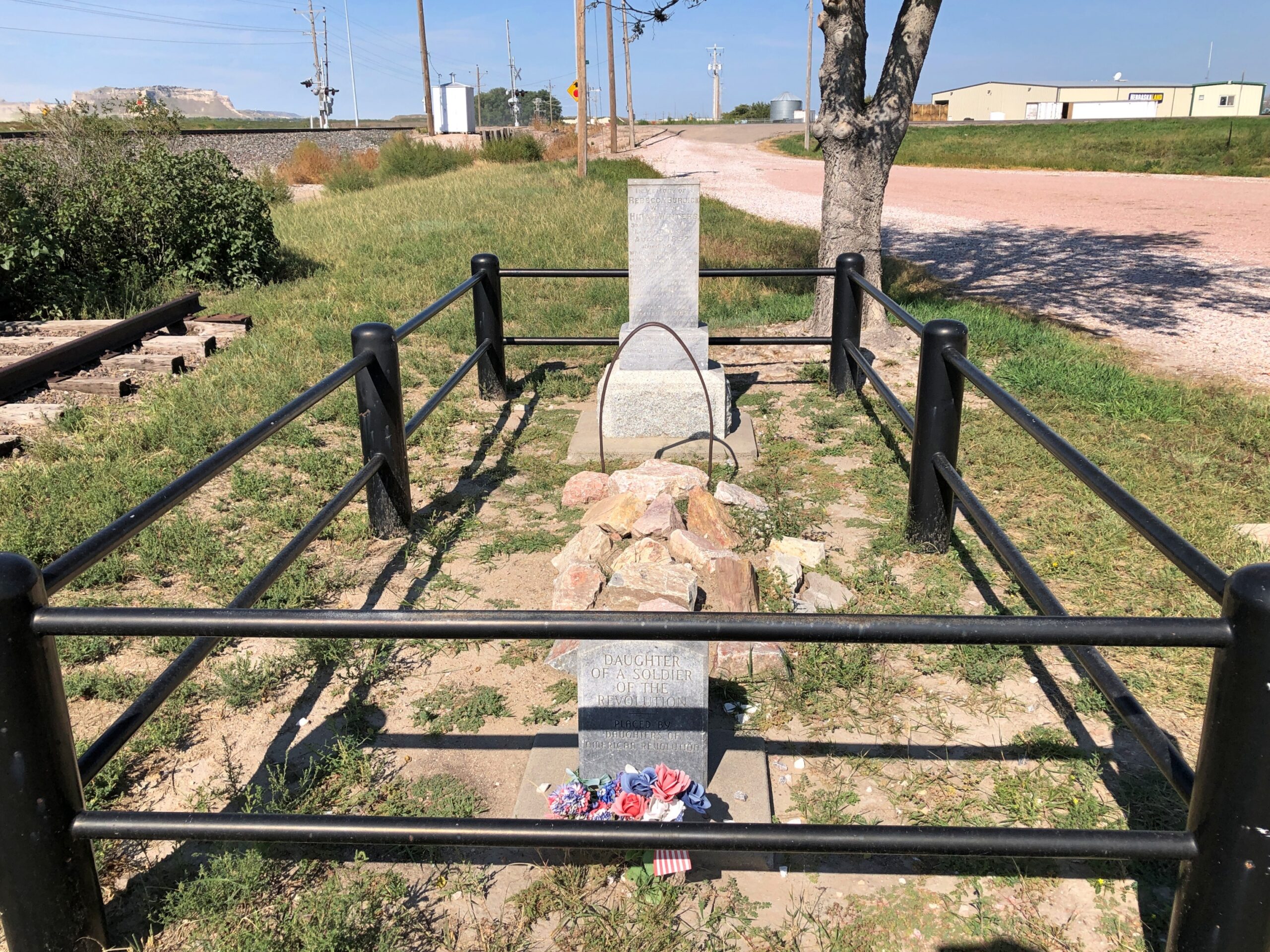
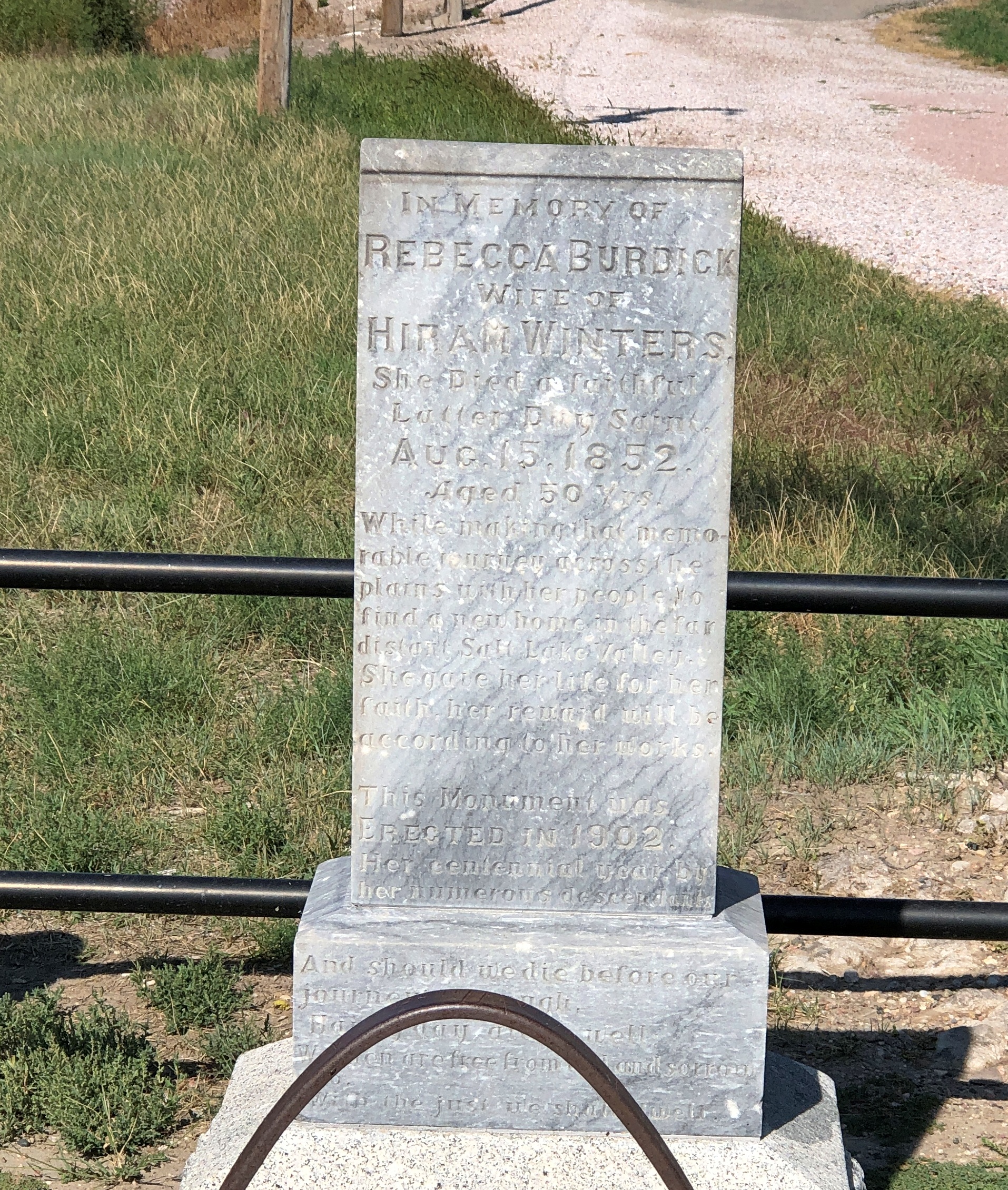
Just outside Scottsbluff is a single grave.
The grave of Rebecca Burdick Winters (d. 1852) She died a faithful Latter-Day Saint, her stone says, on her way to Utah. Officially, it is Rebecca Winters Memorial Park.
“Seven miles northeast of Scotts Bluff National Monument lies a solitary grave,” says Find a Grave. “This site marks the final resting place of Rebecca Winters, who died of cholera on August 15, 1852. Rebecca was only one of thousands of people who succumbed to disease as they made their way west on the overland trails, but her grave is one of only a few that remains identifiable today.”
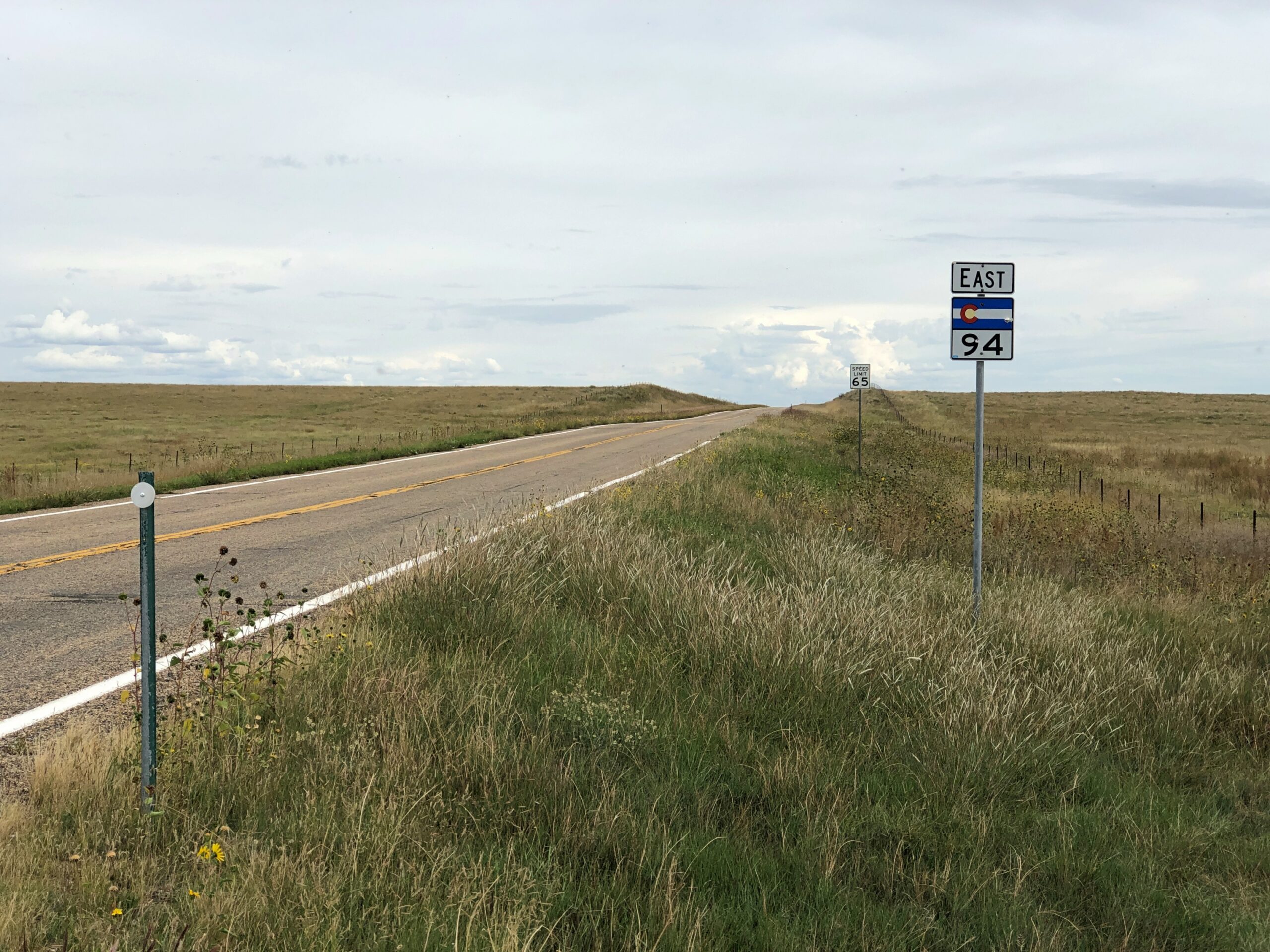
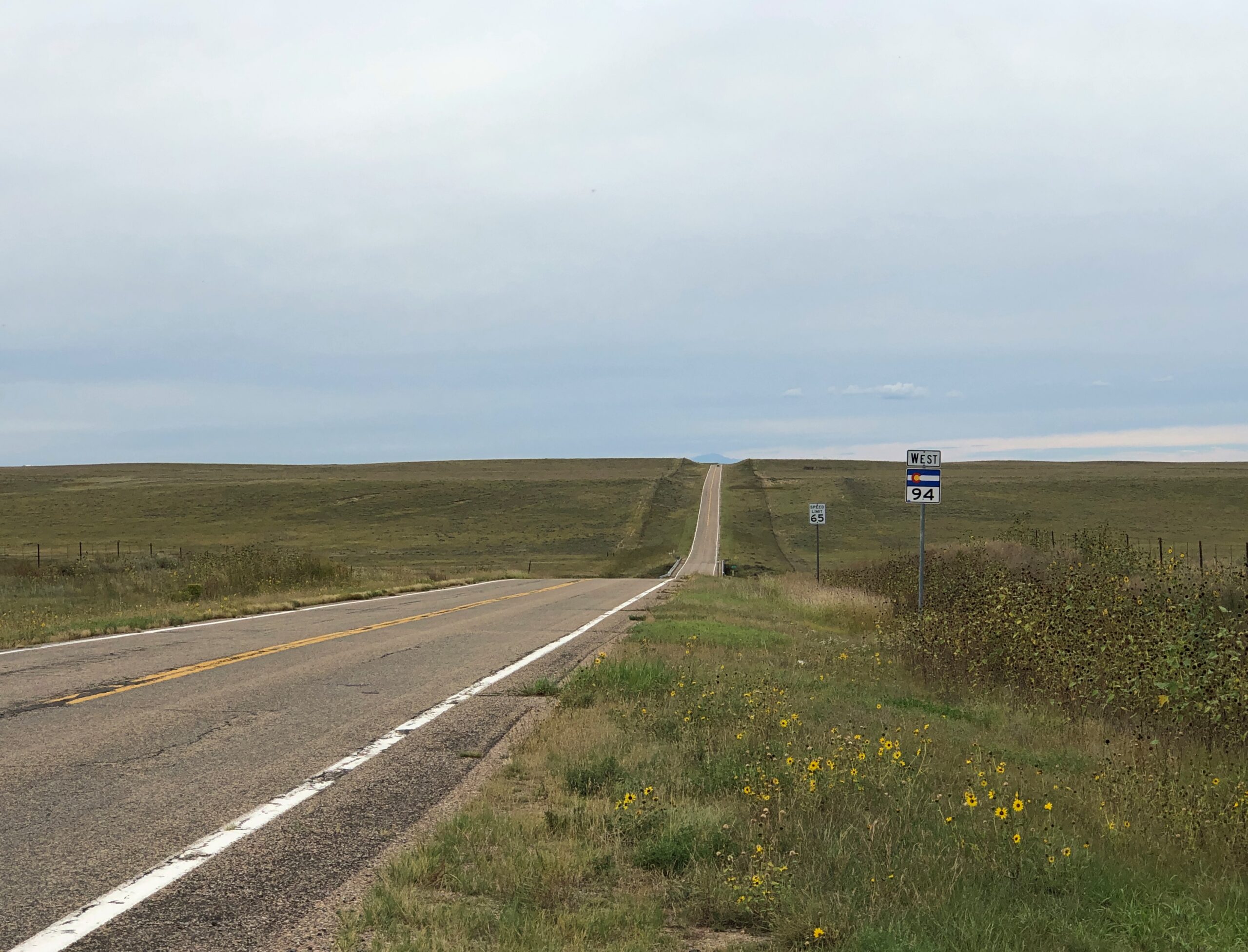
That was the goal about two months ago now, after I left Colorado Springs for a solo drive back to Illinois. The fastest way would be to link with I-70 while still in Colorado. I wasn’t inclined to do that, though I did take that Interstate route through much of Kansas. Instead, I wanted to start remote and stay that way for the length of eastern Colorado.
So east on Colorado 94 it was, which passes through such hamlets as Yoder, Rush and Punkin Center. Mostly, though, there are few signs of people.
I noticed the Front Range growing smaller in my rearview mirror. I wondered at what point they would vanish from sight, and decided to keep track of their shrink, and note the last time I could see them. Naturally, I forgot about that resolve, and next thing I knew, the road backward and forward stretched to both horizons.
This is looking back west, a mountain barely visible, and is also an image illustrating that the eastern Colorado terrain isn’t completely flat.
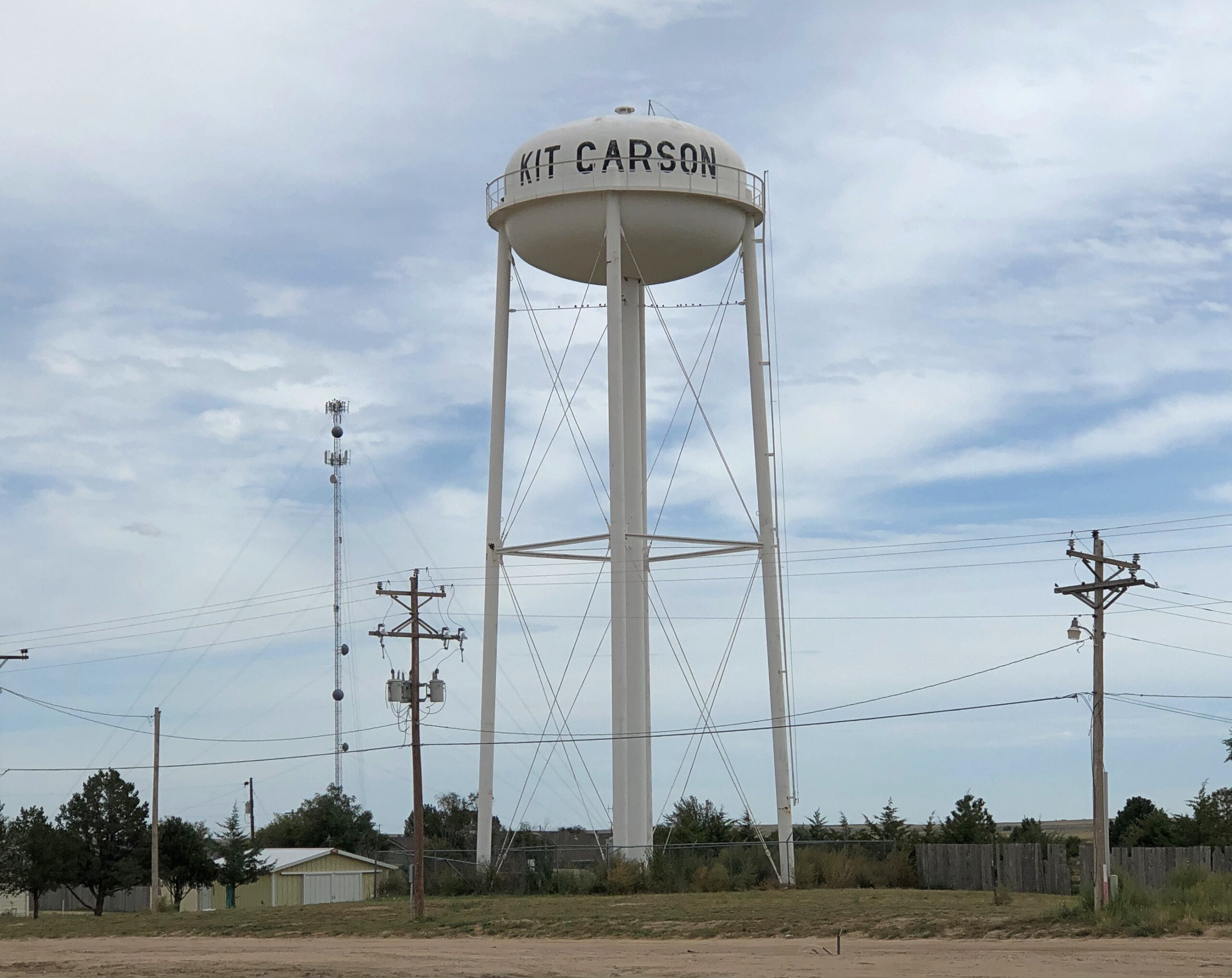
Eastbound Colorado 94 ends near Aroya, where it meets US 40/287. I took that road southeast to Kit Carson (pop. 255).
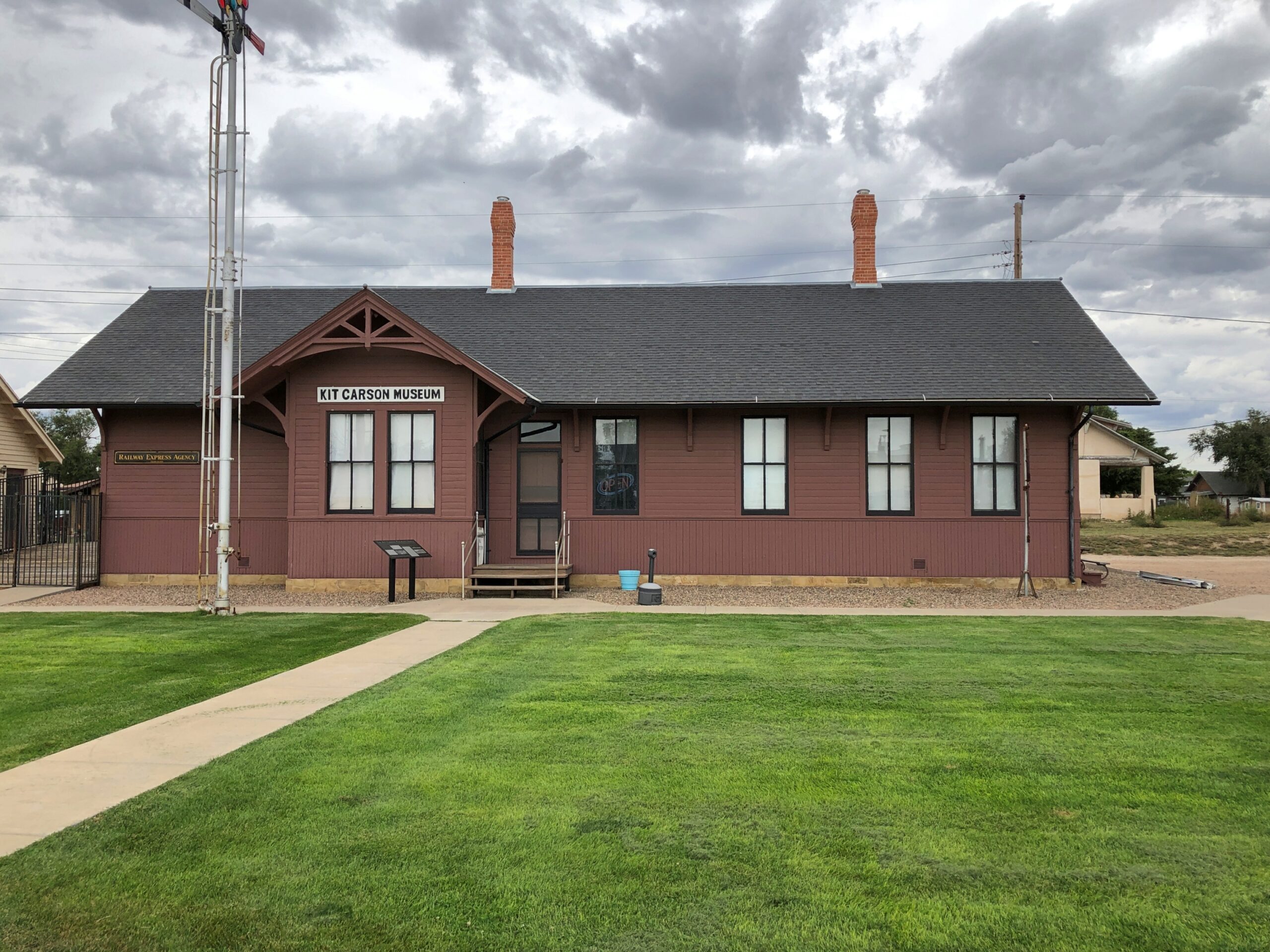
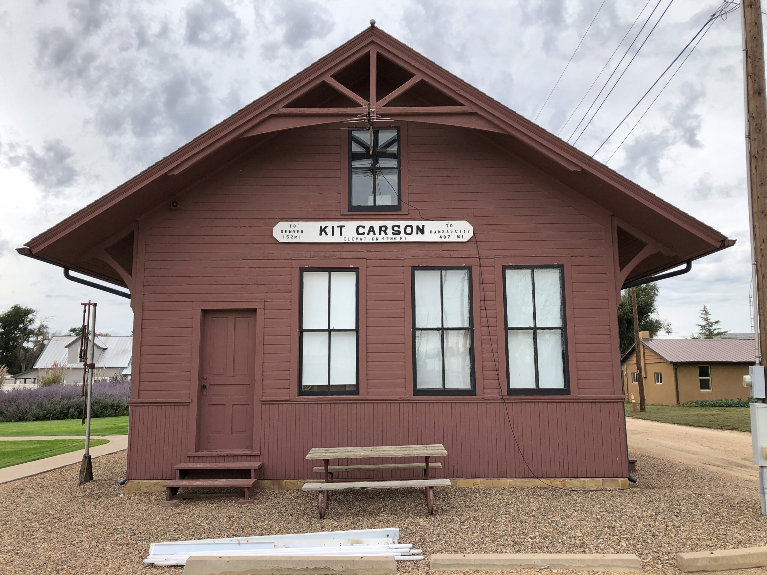
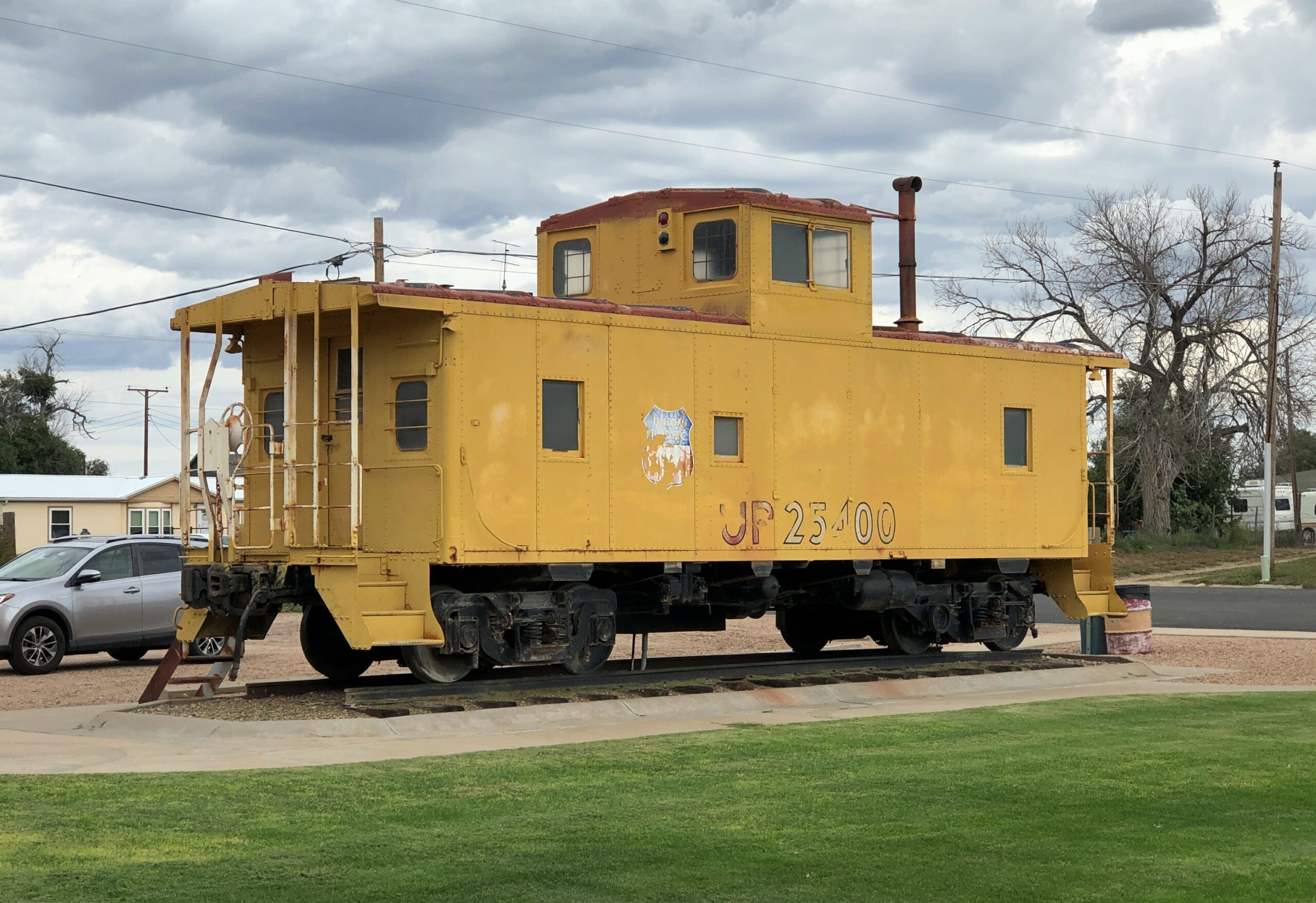
The railroad still comes through Kit Carson. It’s safe to say that without the railroad, the town might be no larger than Punkin Center. The Kit Carson Railroad Depot is now a museum.
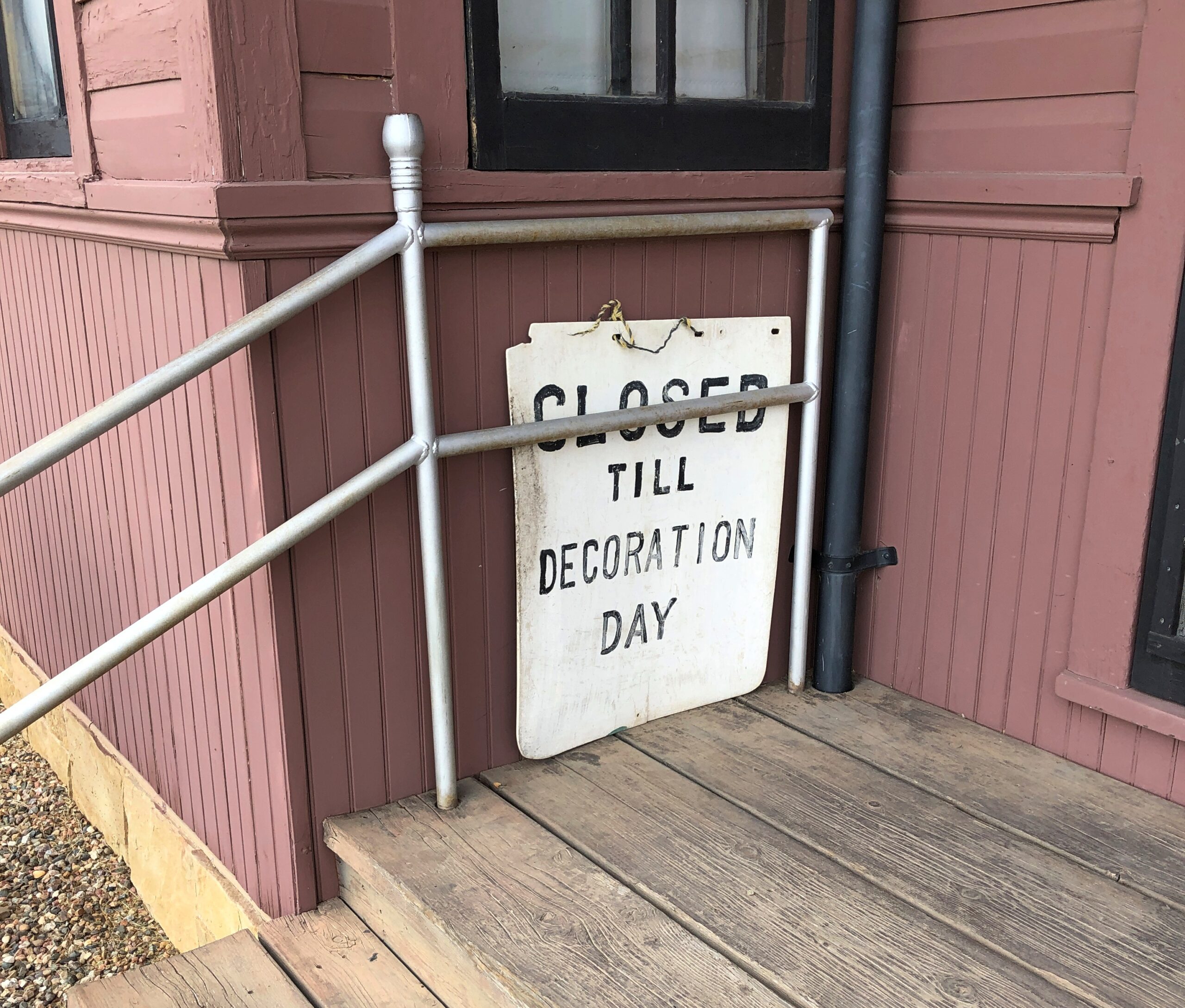
Closed. Till Decoration Day. Really?
In any case, it was closed on September 22.
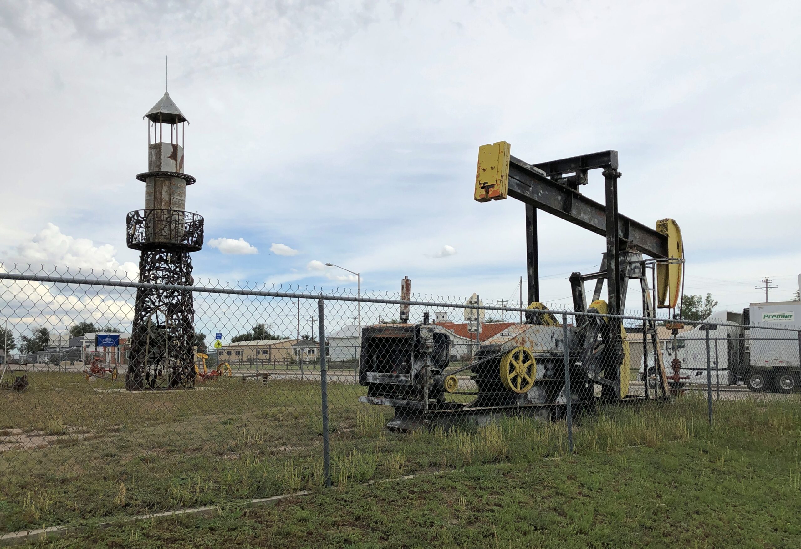
Across the street, metal works. The pump jack is one thing, but the other is a — tower?
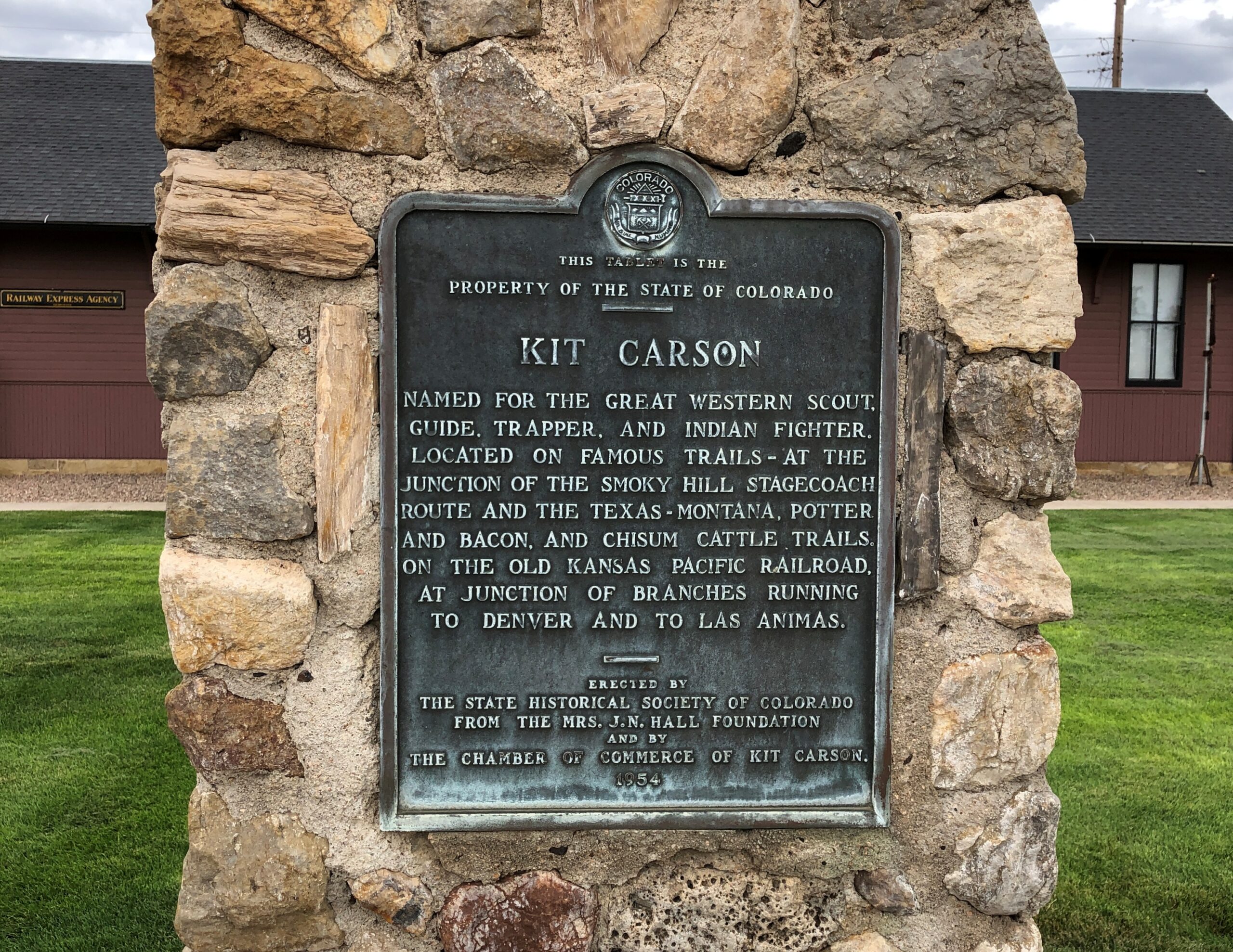
The town of Kit Carson had two locations. The original site was located near the site where Kit Carson traded with the Arapahoe and Cheyenne Indians. The present site was determined by the arrival of the railroad. Destroyed by fire three times, twice by the torches of Indians and once by carousing cowboys, the determined citizens of the town showed their desire to survive by rebuilding.
I can’t help but think those carousing cowboys were actually a gang of rustlers, cutthroats, murderers, bounty hunters, desperados, mugs, pugs, thugs, nitwits, halfwits, dimwits, vipers, snipers, con men, Indian agents, Mexican bandits, muggers, buggerers, bushwhackers, hornswogglers, horse thieves, bull dykes, train robbers, bank robbers, ass-kickers, shit-kickers and Methodists.
Also of note, according to the town: The railroad brought in foreign dignitaries, such as the Grand Duke Alexis [Alexei Alexandrovich] of Russia. The Grand Duke hunted in Kit Carson and was accompanied by his military escort, General George Armstrong Custer on January 20, 1872. [Custer was a lieutenant colonel at the time, but never mind.]
Grand Duke Alexis was on his 1871-72 tour of America. Sounds like he had a fine old time. Could have been the subject of an episode of Death Valley Days, but I don’t think it was. Dom Pedro, emperor of Brazil, made an appearance, as did the Emperor Norton, but I digress.
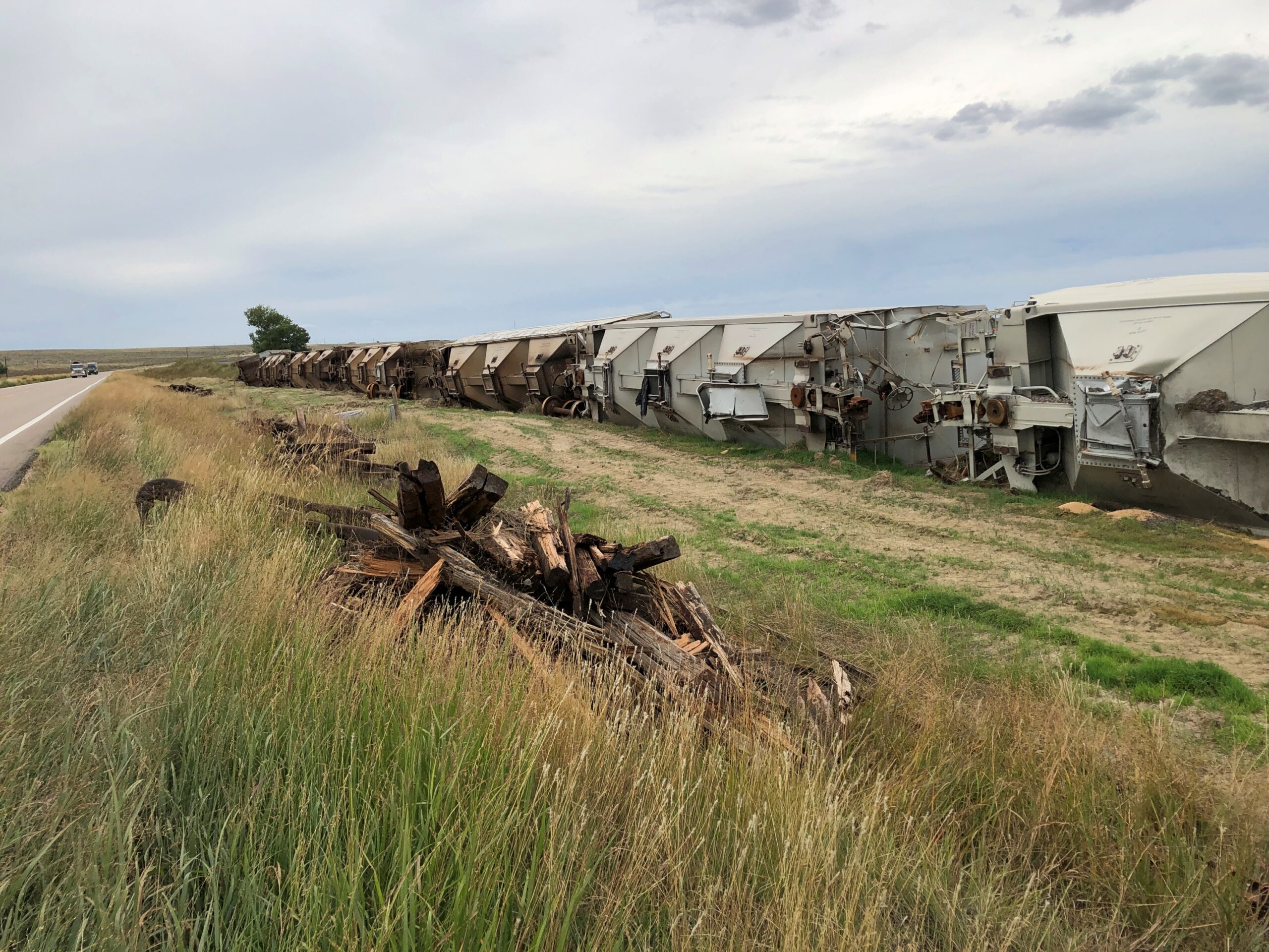
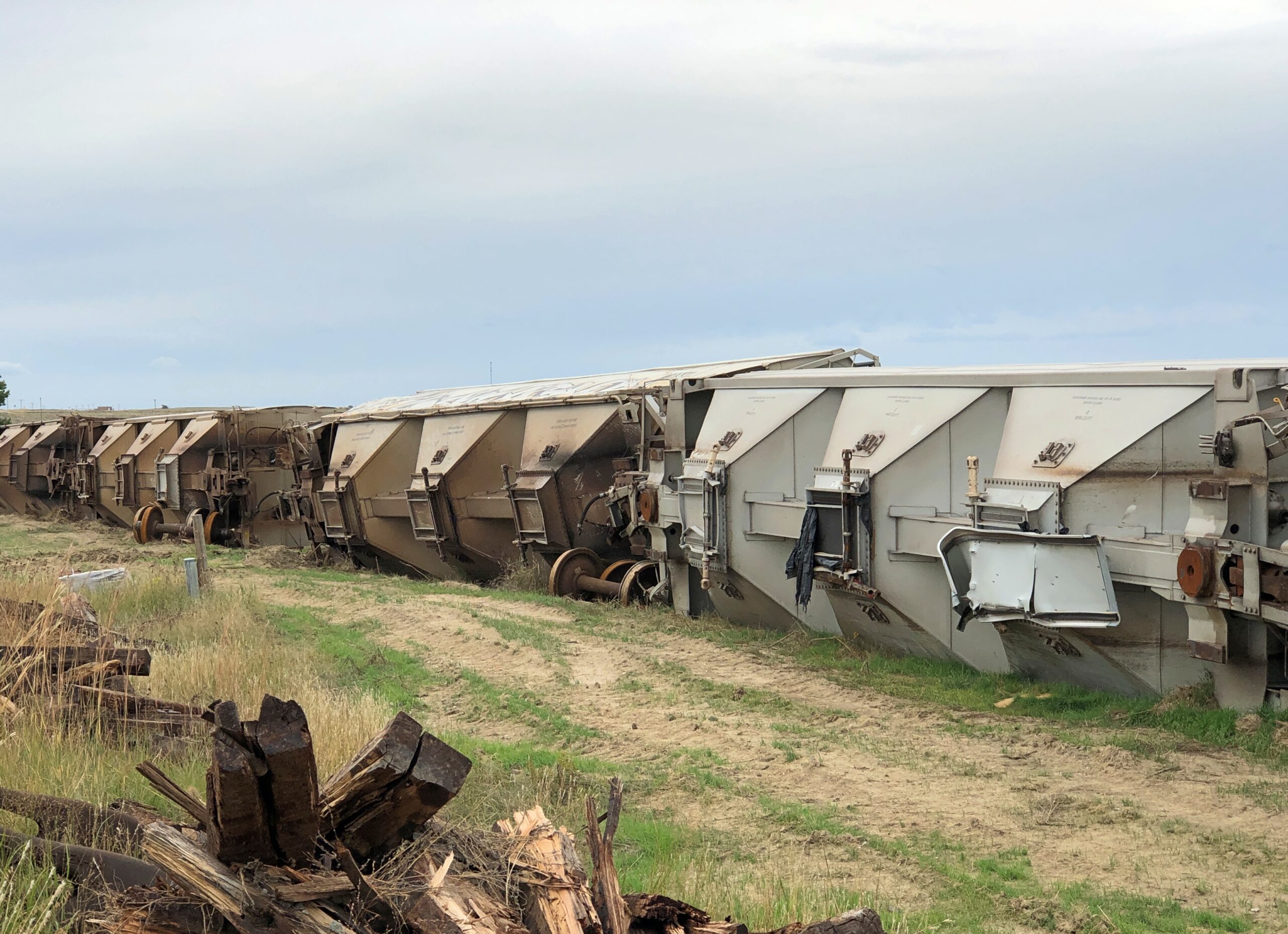
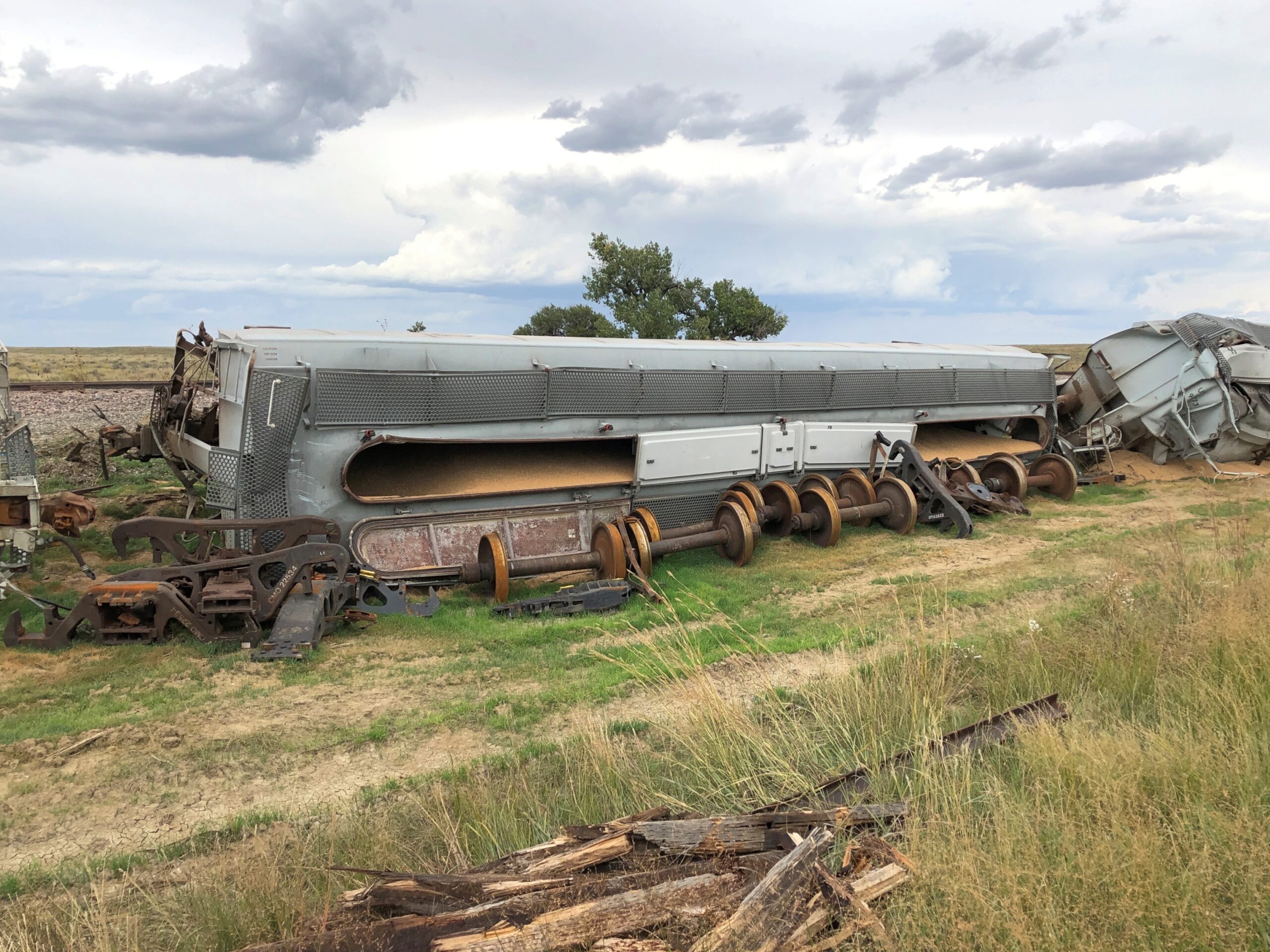
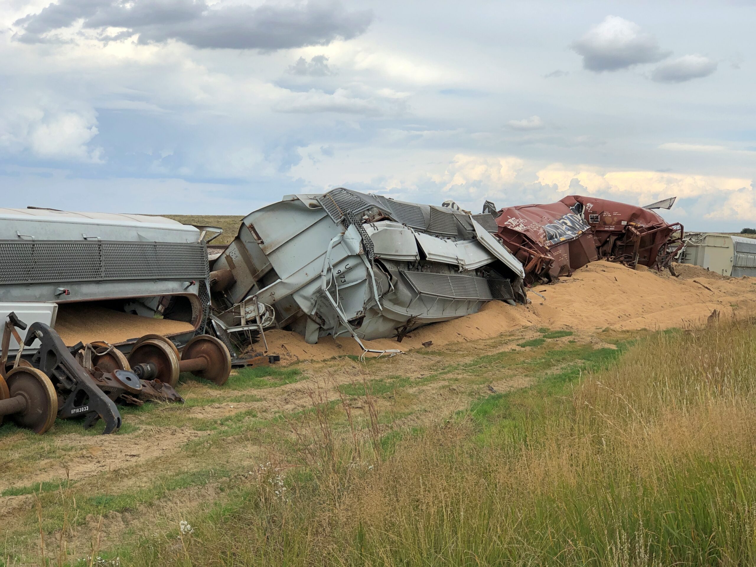
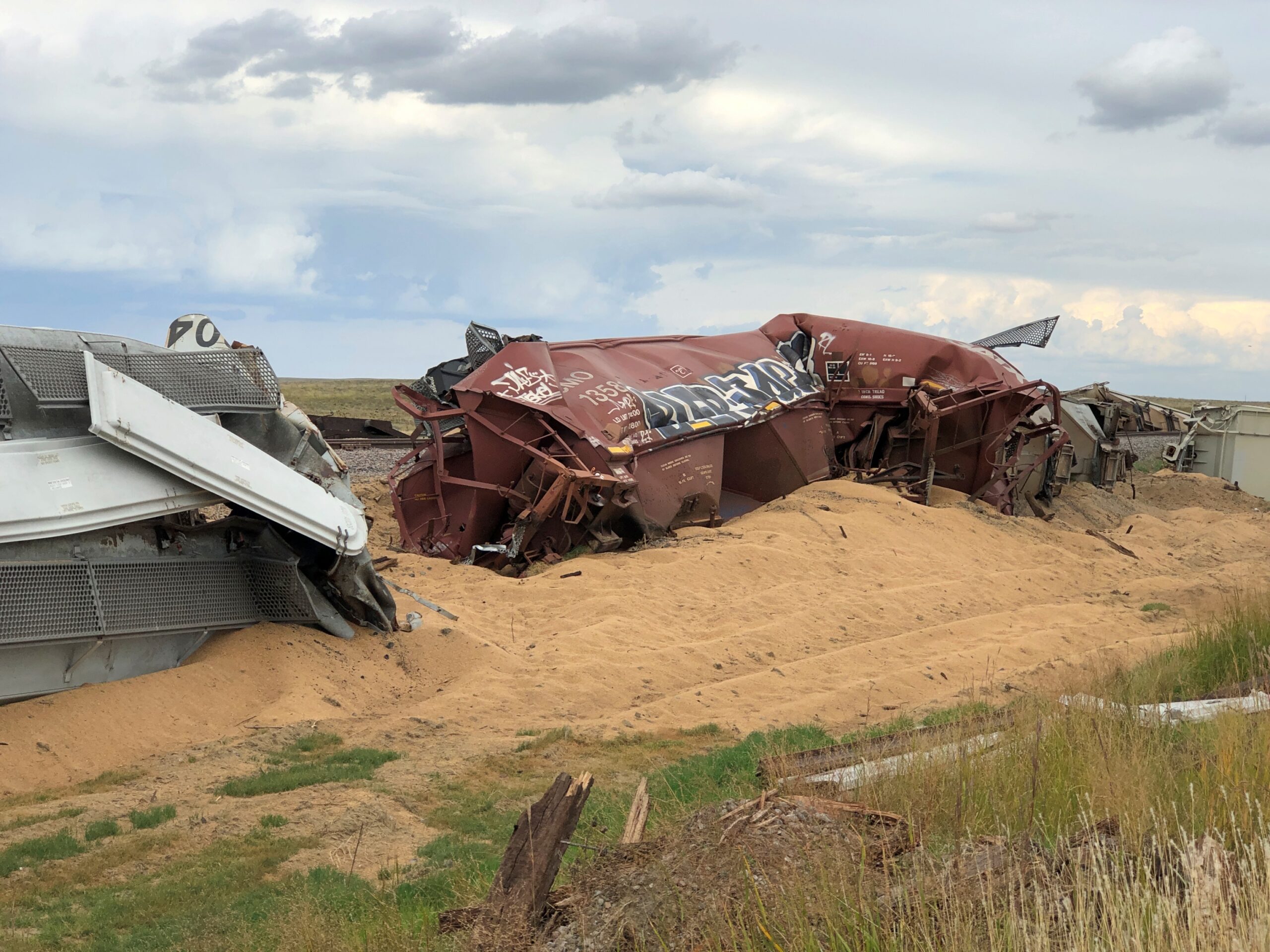
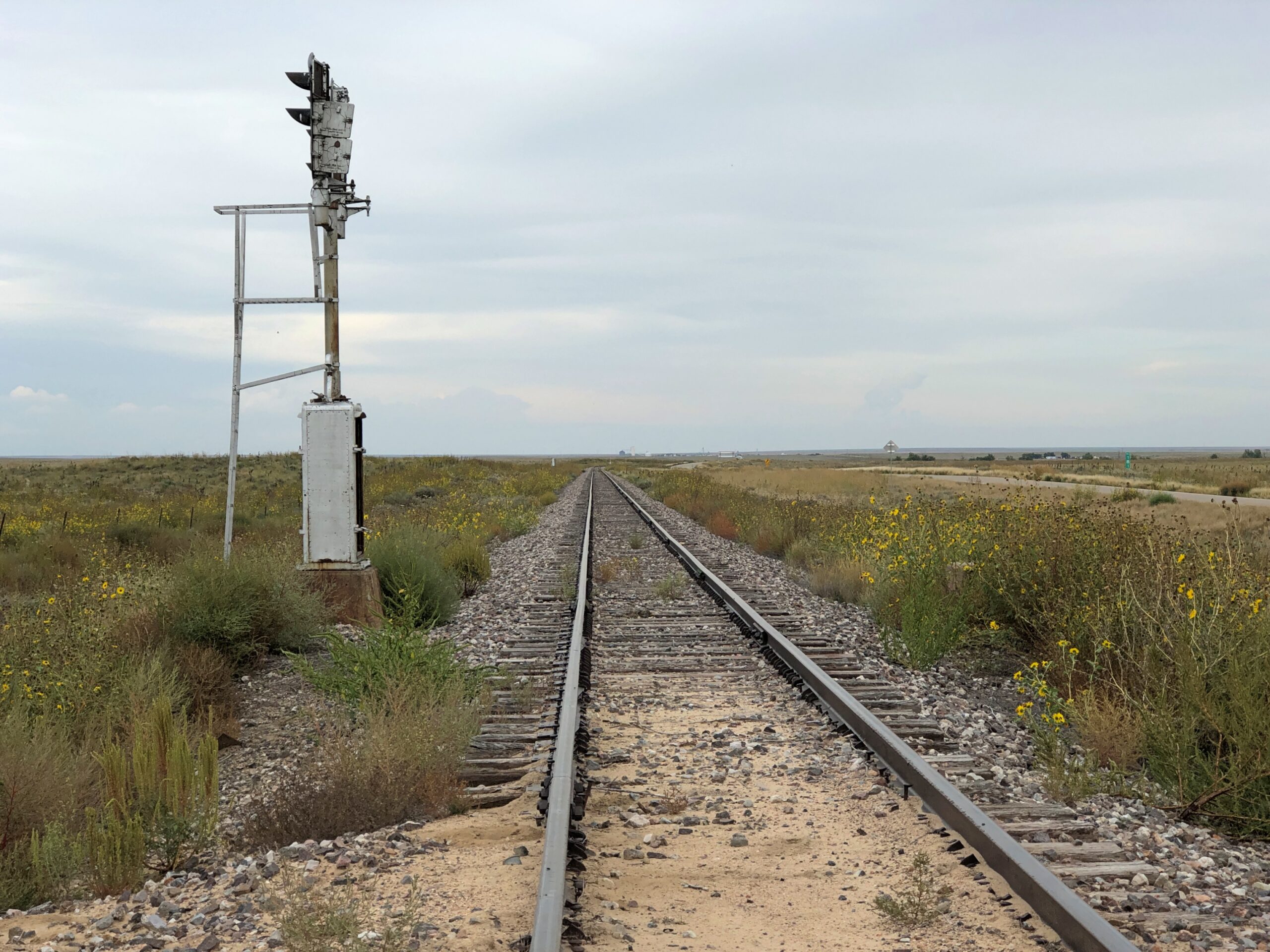
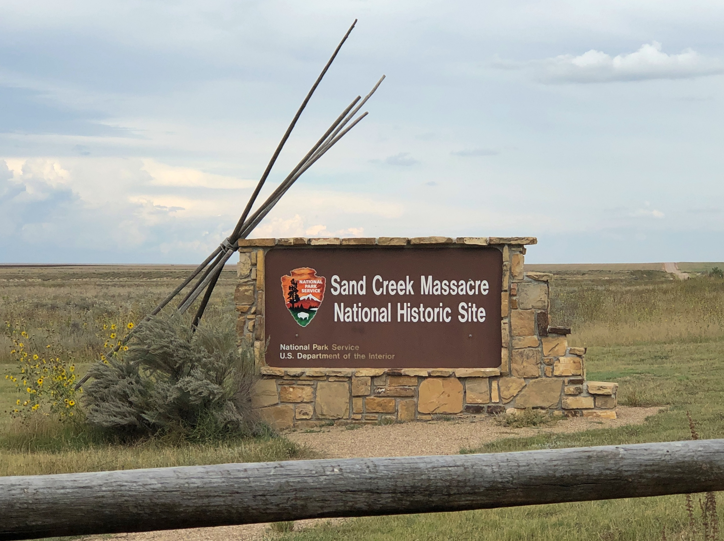
From Kit Carson, I headed south to Eads, still in Colorado, and then east on Colorado 96. I had the idea that I wanted to see the Sand Creek Massacre National Historic Site, which isn’t too far from that road. Just before the turnoff to the historic site, I noticed something odd near the highway.
A wrecked train. A long wrecked train. The cars toward to back.
Toward the front.
Nary a clue as to how it happened, or when, except that the cars don’t seem rusted or overgrown. I stayed on the road to take my pictures. The cars are lined up as if they were dumped off the track on purpose. No. Why? Or could it have been some odd accident in which the train essentially fell off in place? Or is that how derailments work? Why are front cars especially mangled?
It didn’t take too much research (later) to find some answers. The Kiowa County Independentreported in August: The heavily laden train was navigating a significant curve and elevation change west of Chivington when 16 covered hopper cars derailed. Each was filled with thousands of bushels of wheat, spilling tons of grain onto the ground along Highway 96, which runs parallel to the rail line.
Oops. Guess everyone would have heard about it if the cargo had been more volatile or toxic.
At the turnoff to the historic site, I got a view of the tracks (again, from the road). Far enough away that the mangled train cars aren’t visible.
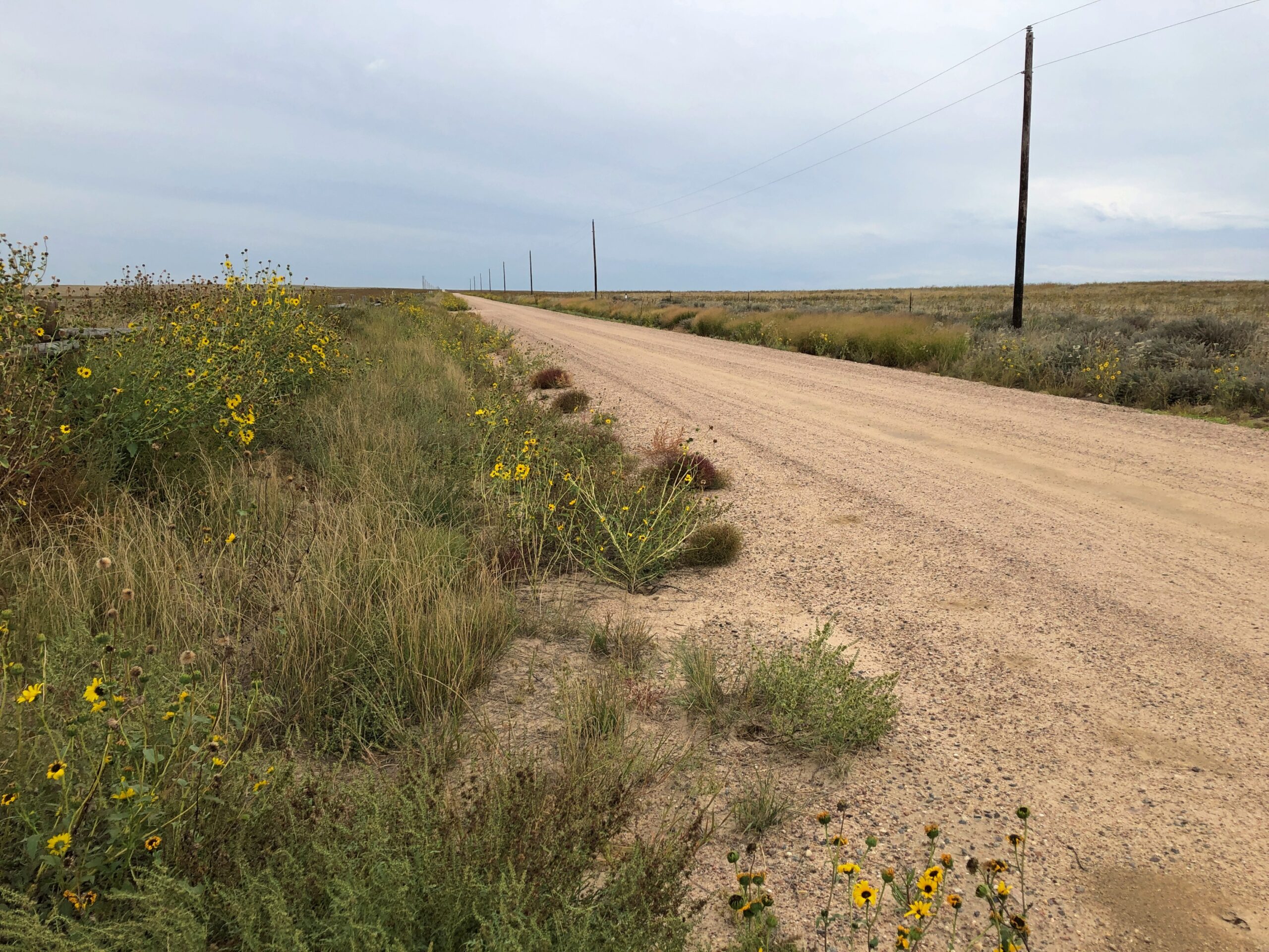
On to the historic site, via an unpaved road.
Turns out the historic site closes at 4 pm. I got there just as the rangers were leaving, and one of them, who had a remarkable collection of snaggled and bent teeth, told me so politely. I didn’t argue with him, but I also wondered why a site so remote closes at all, except maybe for the visitors center or small museum. Rules is rules, I guess.
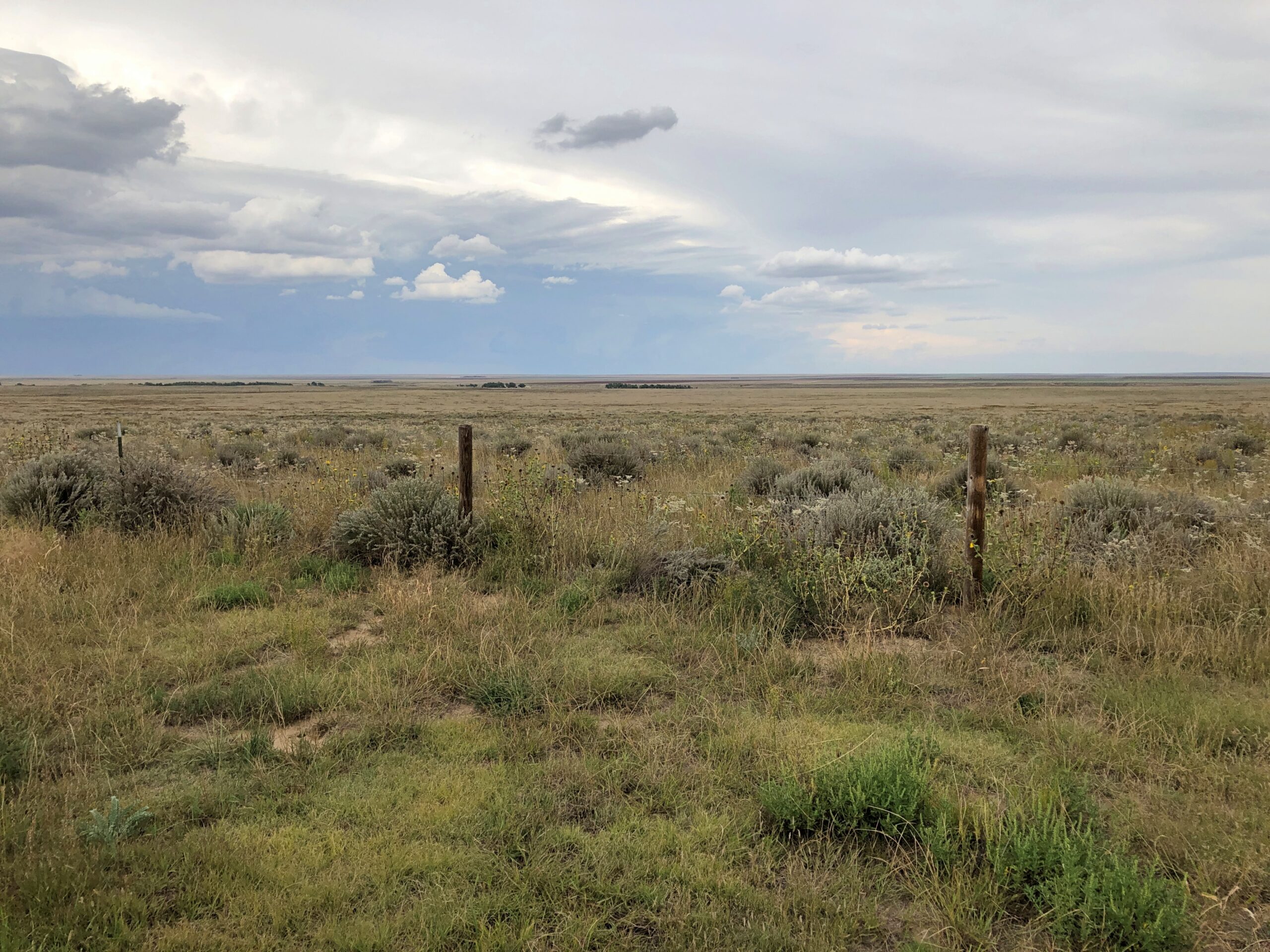
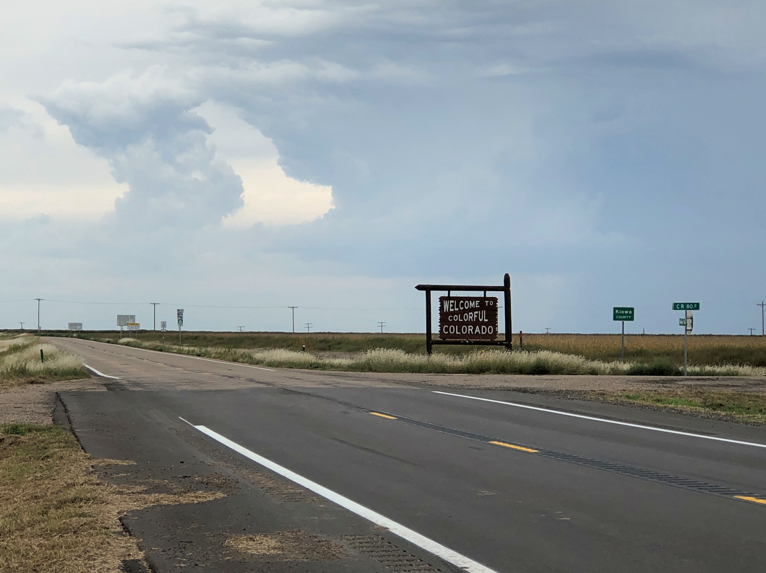
That was pretty much it for Colorado. I got to the border with Kansas not long after, and looked back.
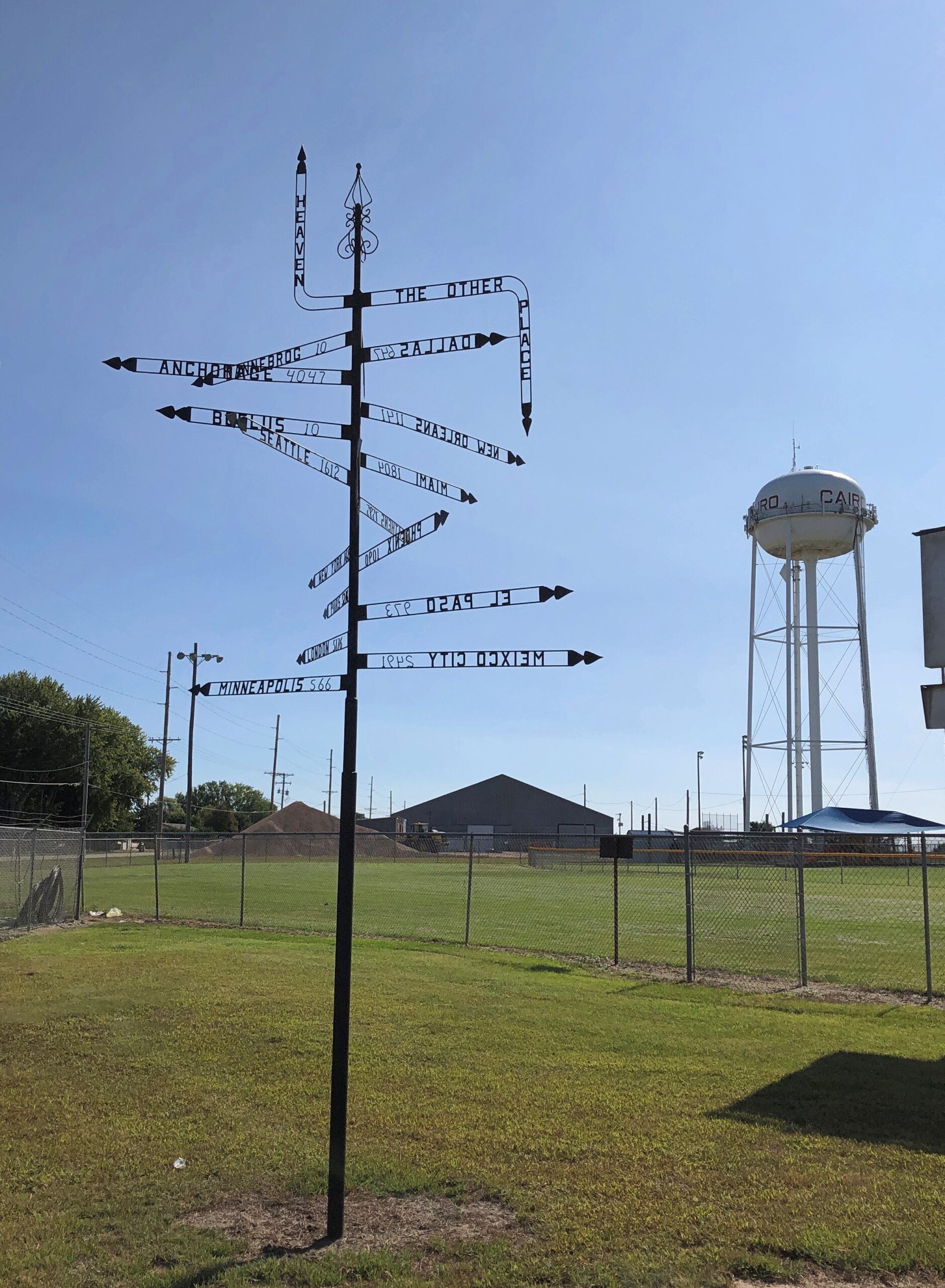
Which of these two destinations aren’t like the others?
That’s a beginner’s-level question. Better question: where can you find this pole, with mileages and – what units measure the distance to Heaven or Hell? – other signs?
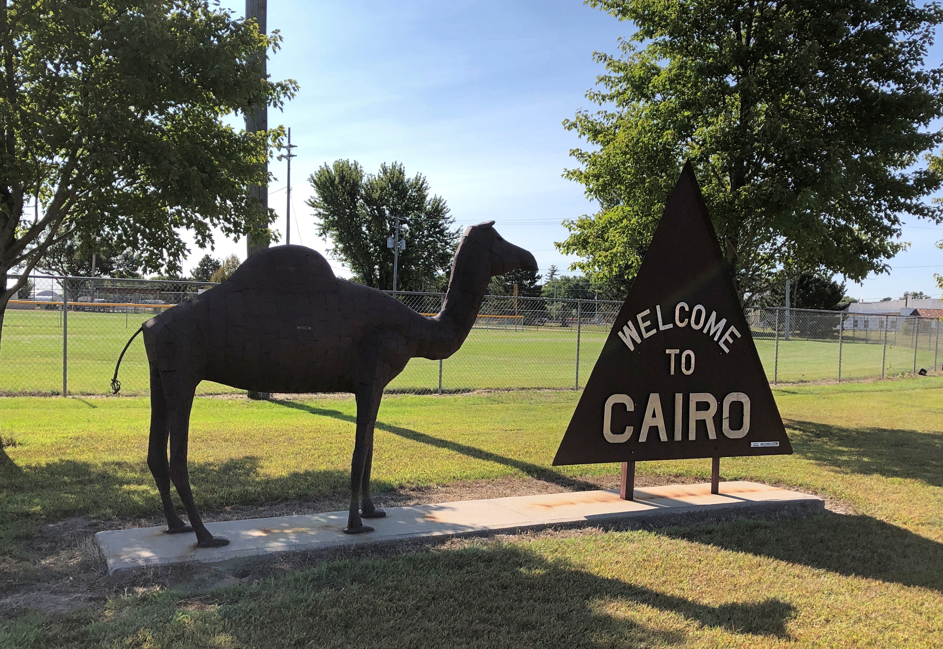
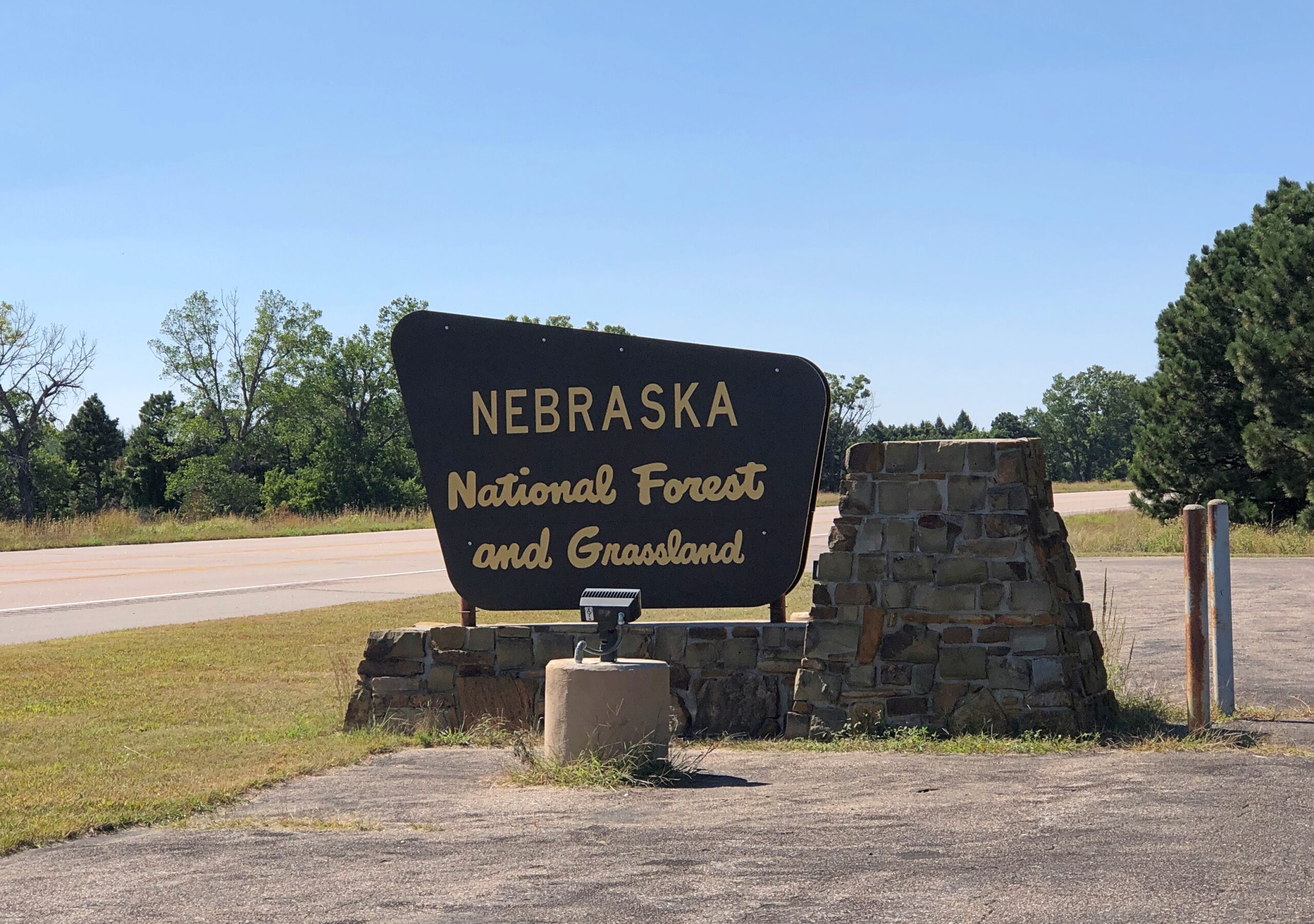
Answer: Cairo, Nebraska.
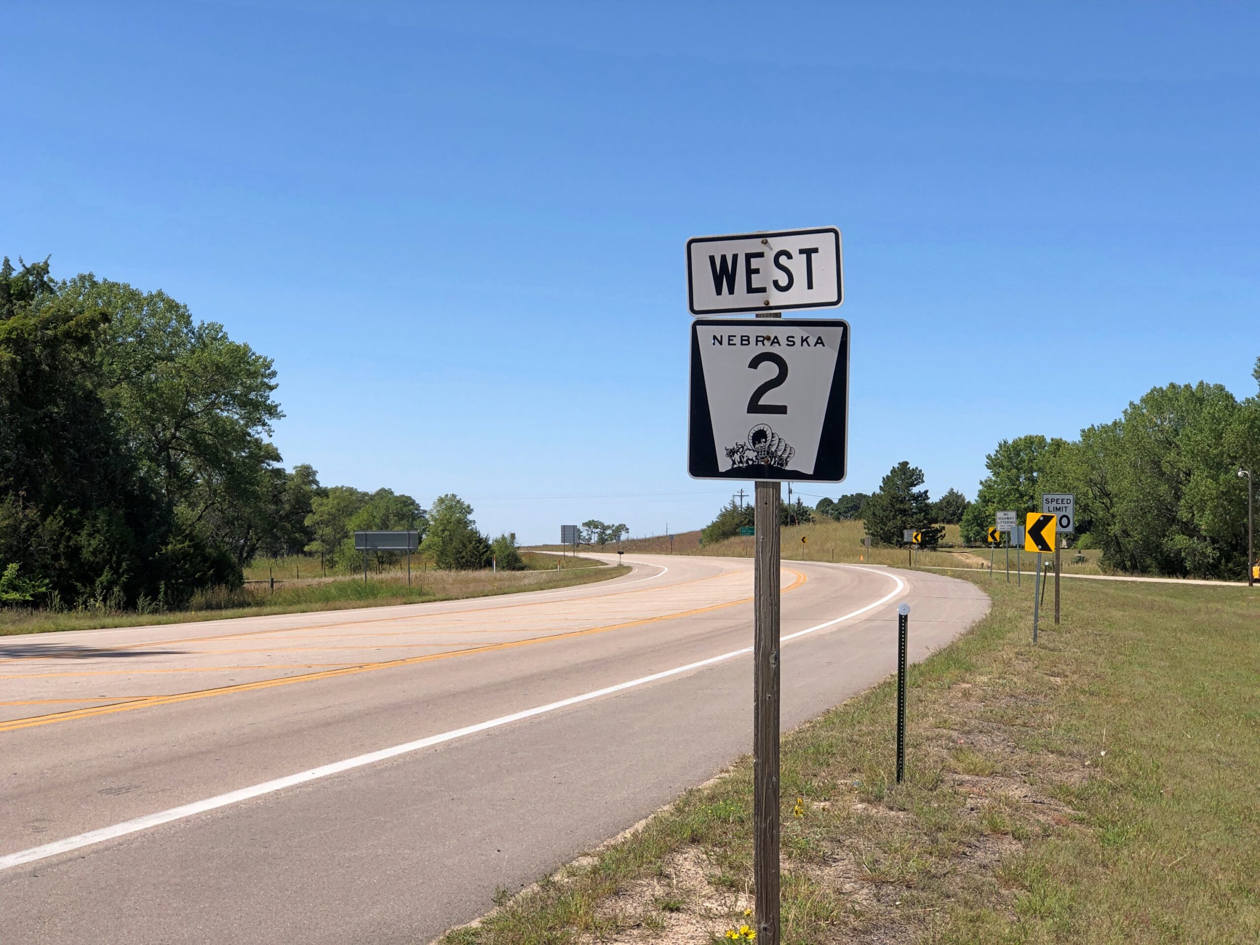
Maybe a palm tree was in the works, but the city decided not to spend any more money. Cairo (pop. 822) is one of the small chain of small towns on the eastern section of the highway Nebraska 2, which runs westward and north of Grand Island. Cairo is the first place I stopped on my way west on that highway in early September.
Eventually the highway reaches the Nebraska National Forestand Grassland, a patch of (partly) wooded land that inspires the question, there’s a national forest in Nebraska?
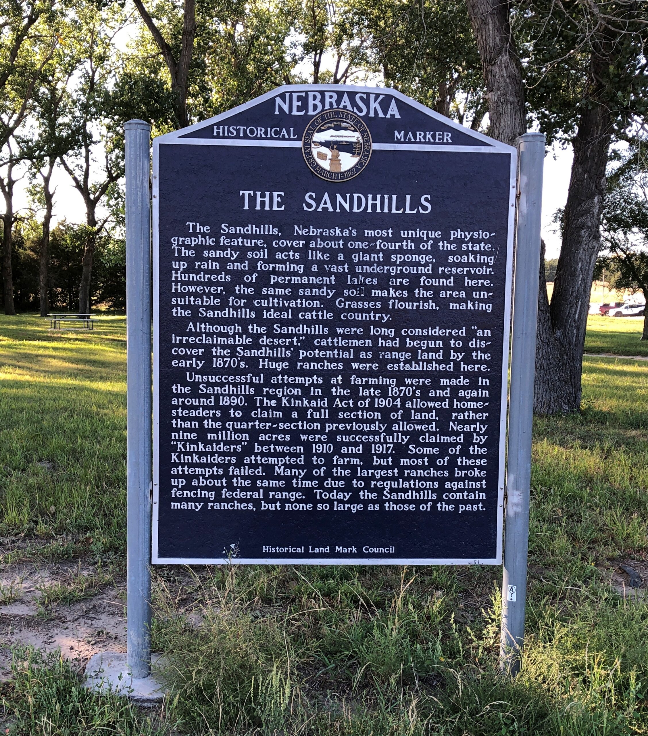
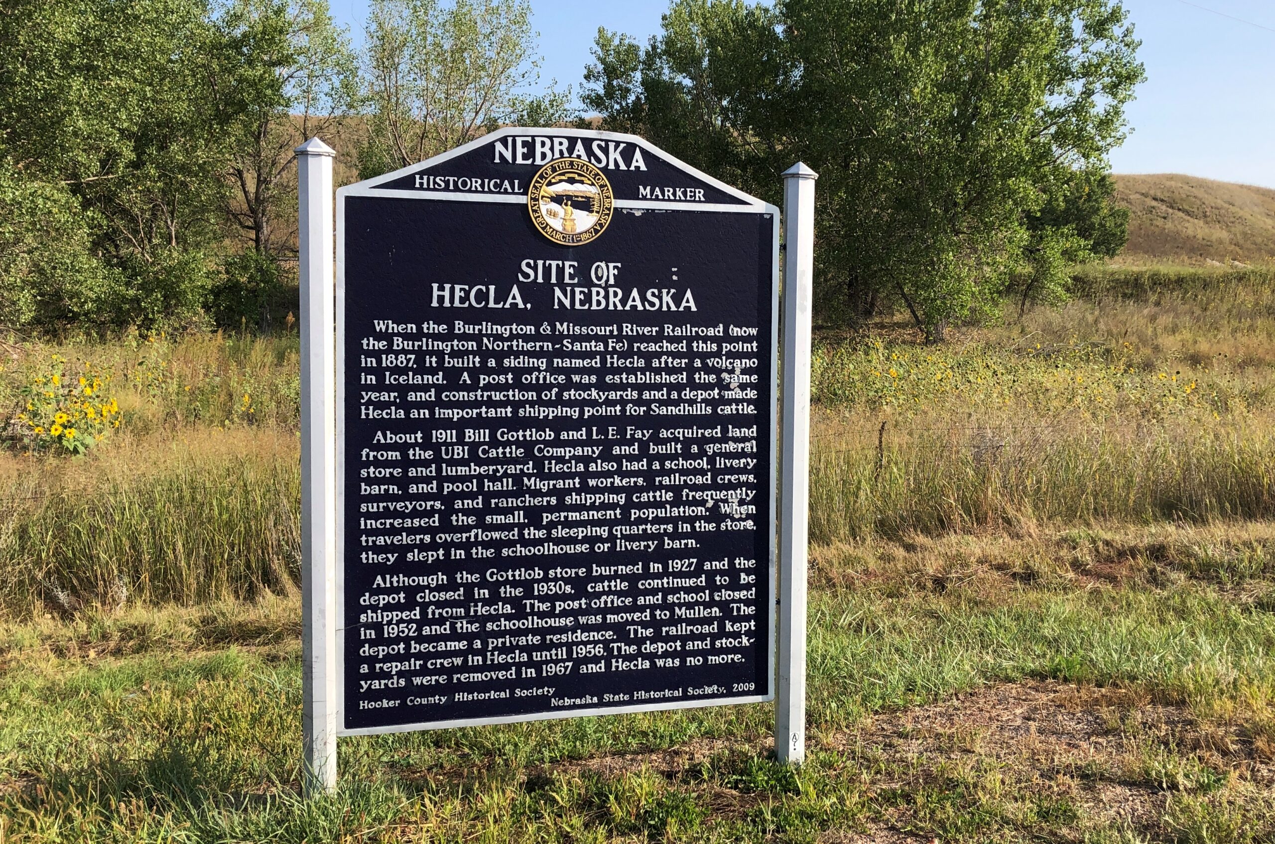
West from the forest, Nebraska 2 crosses the Sandhills, an unusual place here in North America, with the land morphing from cropland to ranch land on sandy steppes. The towns on the way are mere hamlets, and sometimes not even that. On the western edge of the Sandhills, one comes to the sizable town of Alliance, Nebraska, home of Carhenge and railroad staging area for coal trains headed east.
Before I did the drive, I was looking forward to it as much as any of the roads in Colorado. It lived up to expectations. Nice when that happens.
The Fence Postcites Charles Kuralt’s fondness for Nebraska 2: “Highway 2 is not just another highway that goes somewhere. Highway 2 is somewhere,” he’s known to have said. I’d say whatever else his failings, Kuralt had good taste in roads.
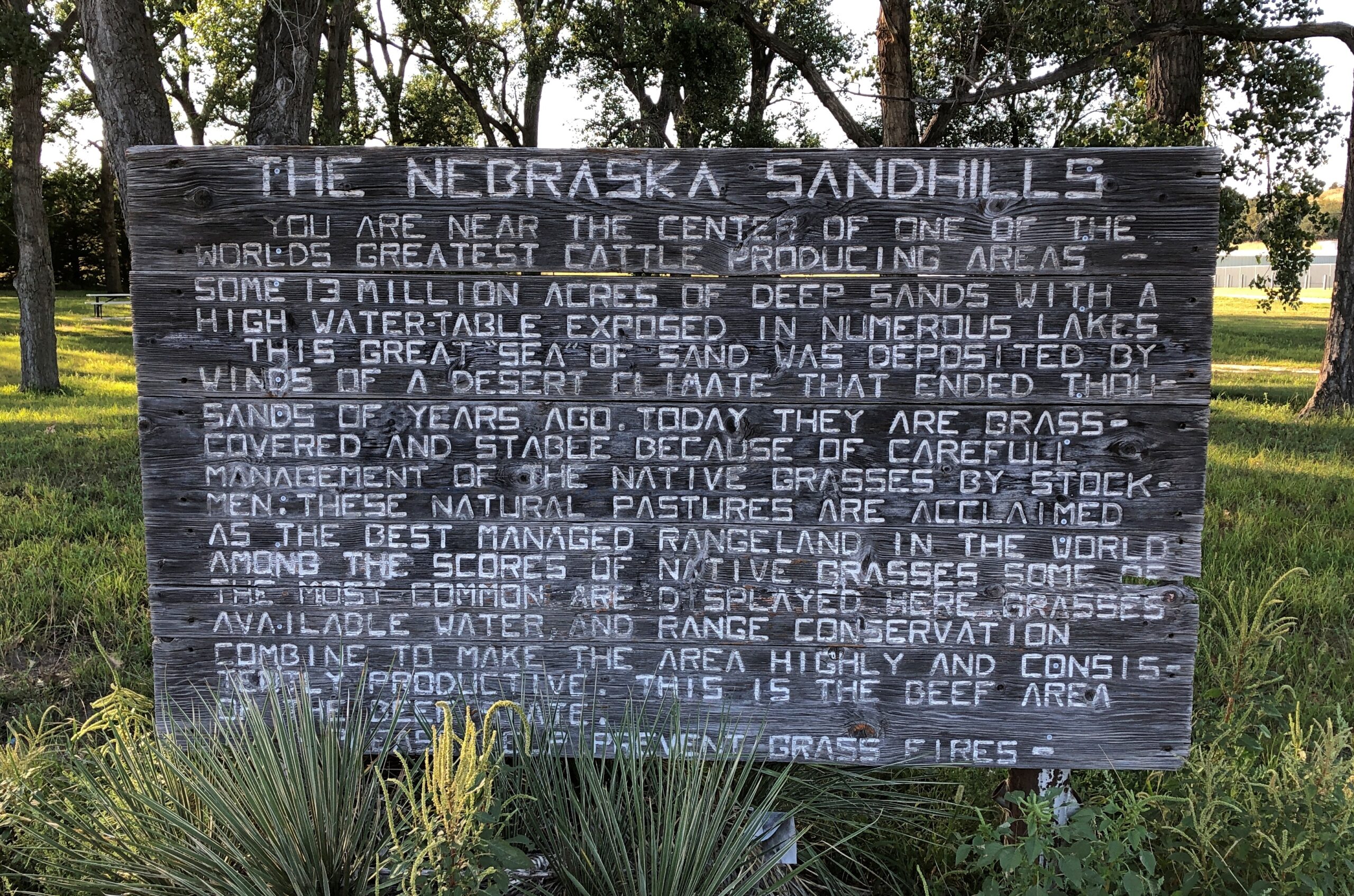
Just outside Broken Bow (pop. 3,491), seat of Custer County and pretty much the only town of any size in that county, the Sandhills Journey Scenic Byway Visitor Center offers a building with bathrooms and pamphlets and displays and, for my visit at least, a grandmotherly and talkative volunteer. Old enough, she said, to remember when the highway was just a road through the countryside that attracted no attention from the outside world. Not a scenic byway, and sand hill cranes were just flocking birds. Now a trickle of tourists and bikers and RVers come this way. She had some solid recommendations, especially a good diner for lunch.
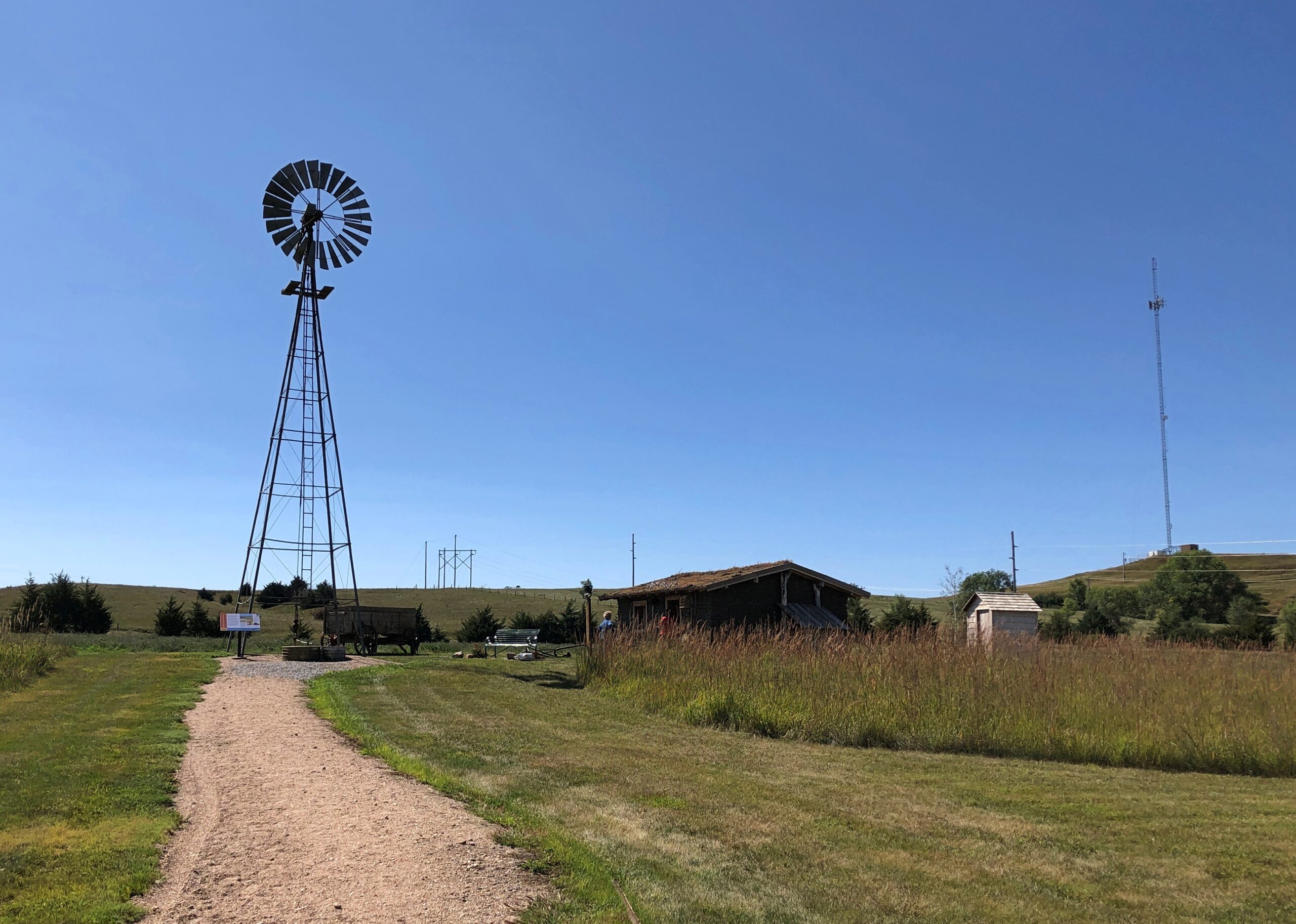
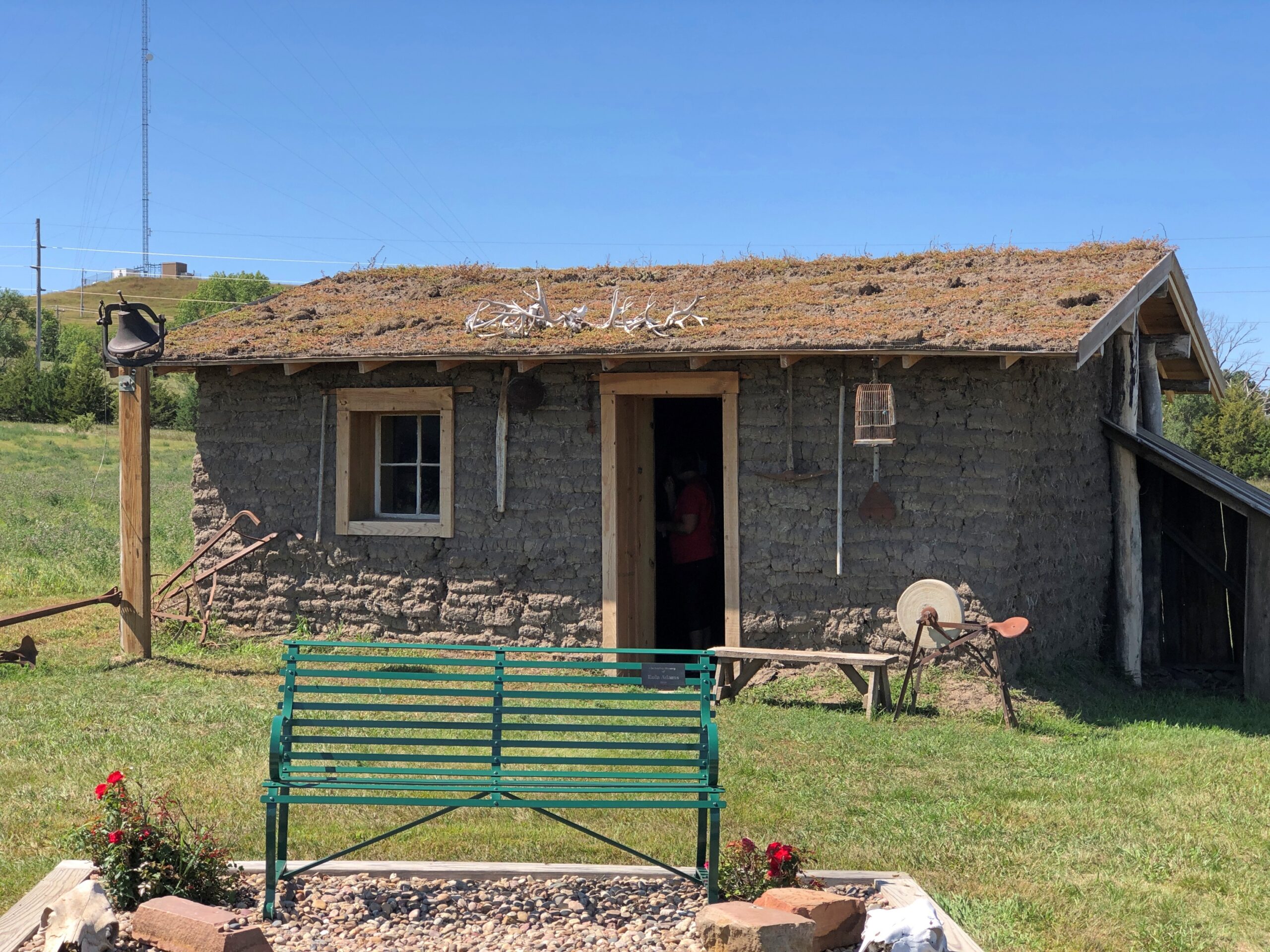
The visitor center grounds include a relocated (or was that reconstructed?) Sandhills cabin. The residences of the farmers trying to scratch out a living in the Sandhills, and finding out that no amount of scratching would make decent crops grow consistently from the land.
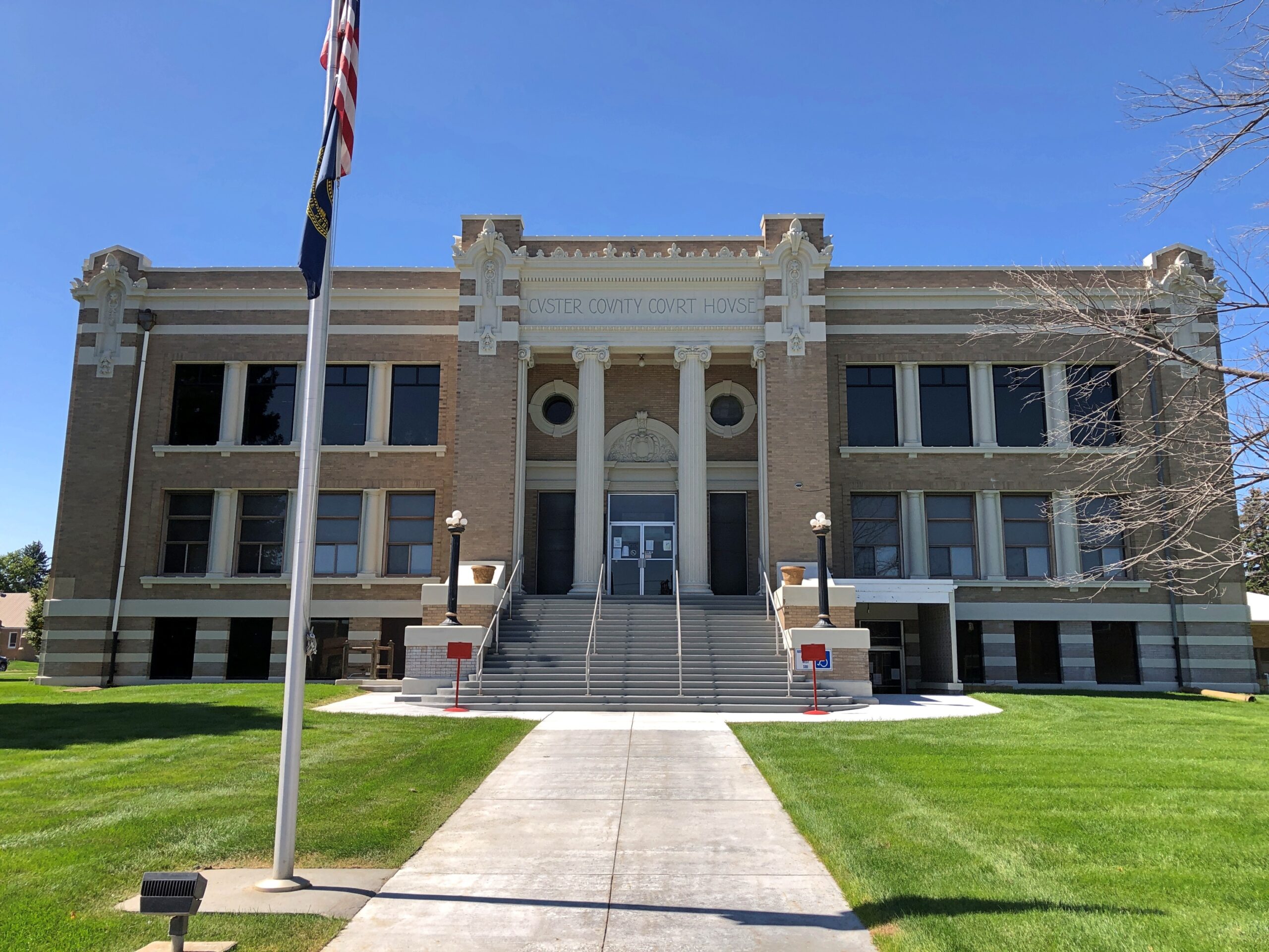
The Custer County Courthouse. Saturday, closed.
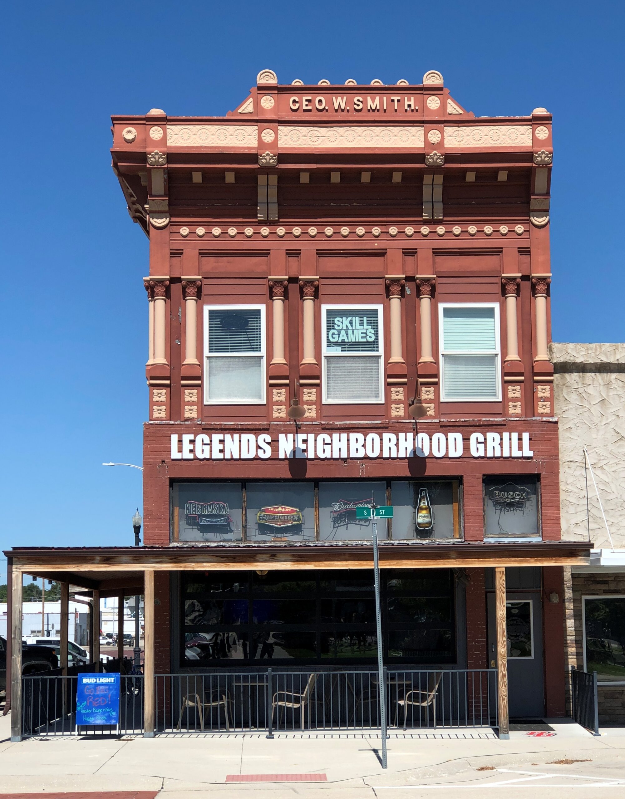
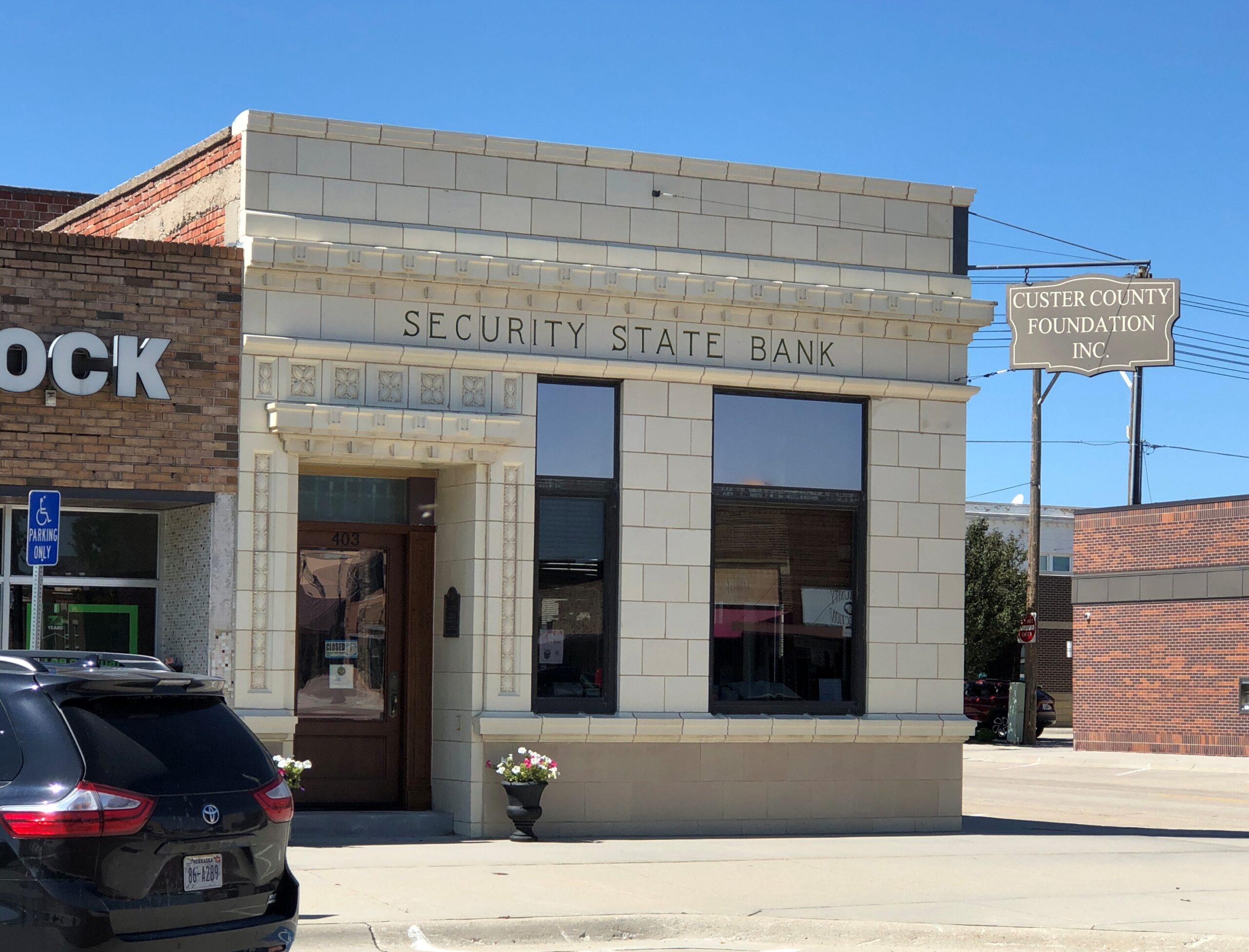
A block from the courthouse, some buildings around City Square Park.
City Square Park is a generic sort of name. Wonder whether there’s anyone from the town who can be honored by renaming the park? Looking at list of notables from Broken Bow, one instantly stands out.
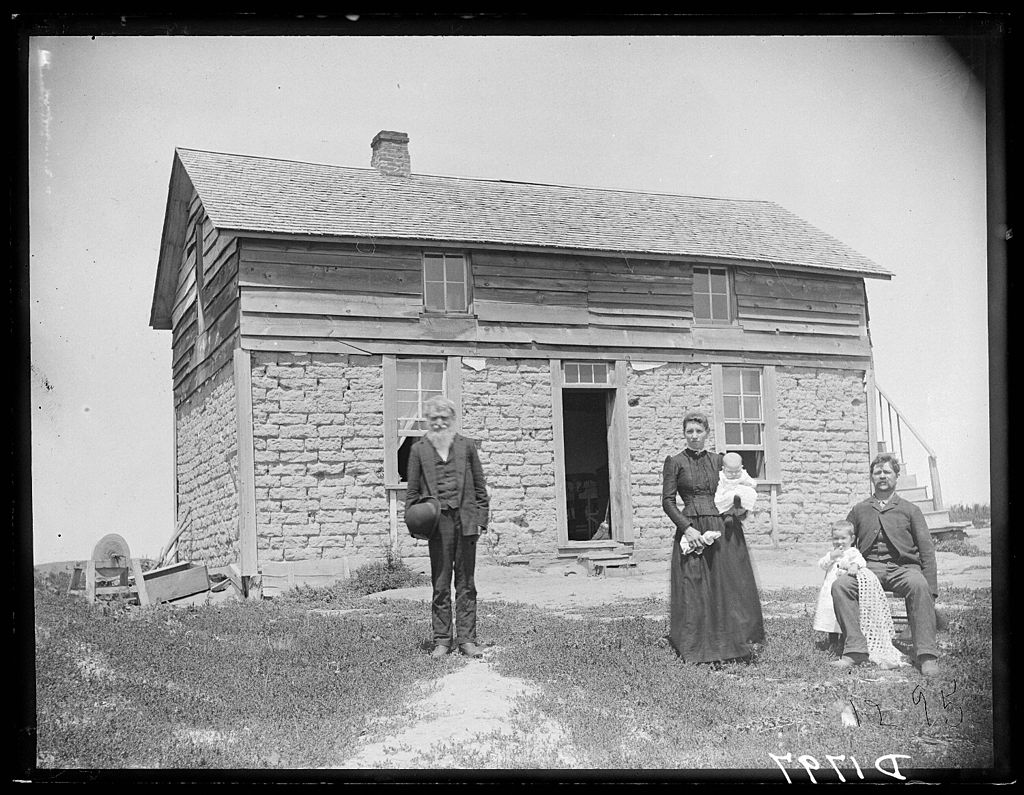
Wiki: “Solomon D. Butcher (January 24, 1856 – March 18, 1927) was an itinerant photographer who spent most of his life in central Nebraska, in the Great Plains region of the United States… he began in 1886 to produce a photographic record of the history of European settlement in the region. Over 3,000 of his negatives survive; more than 1,000 of these depict sod houses.”
Frederic Schreyer and family, Custer County, 1880s, by Solomon Butcher.
Definitely name the park after Butcher, Broken Bow.
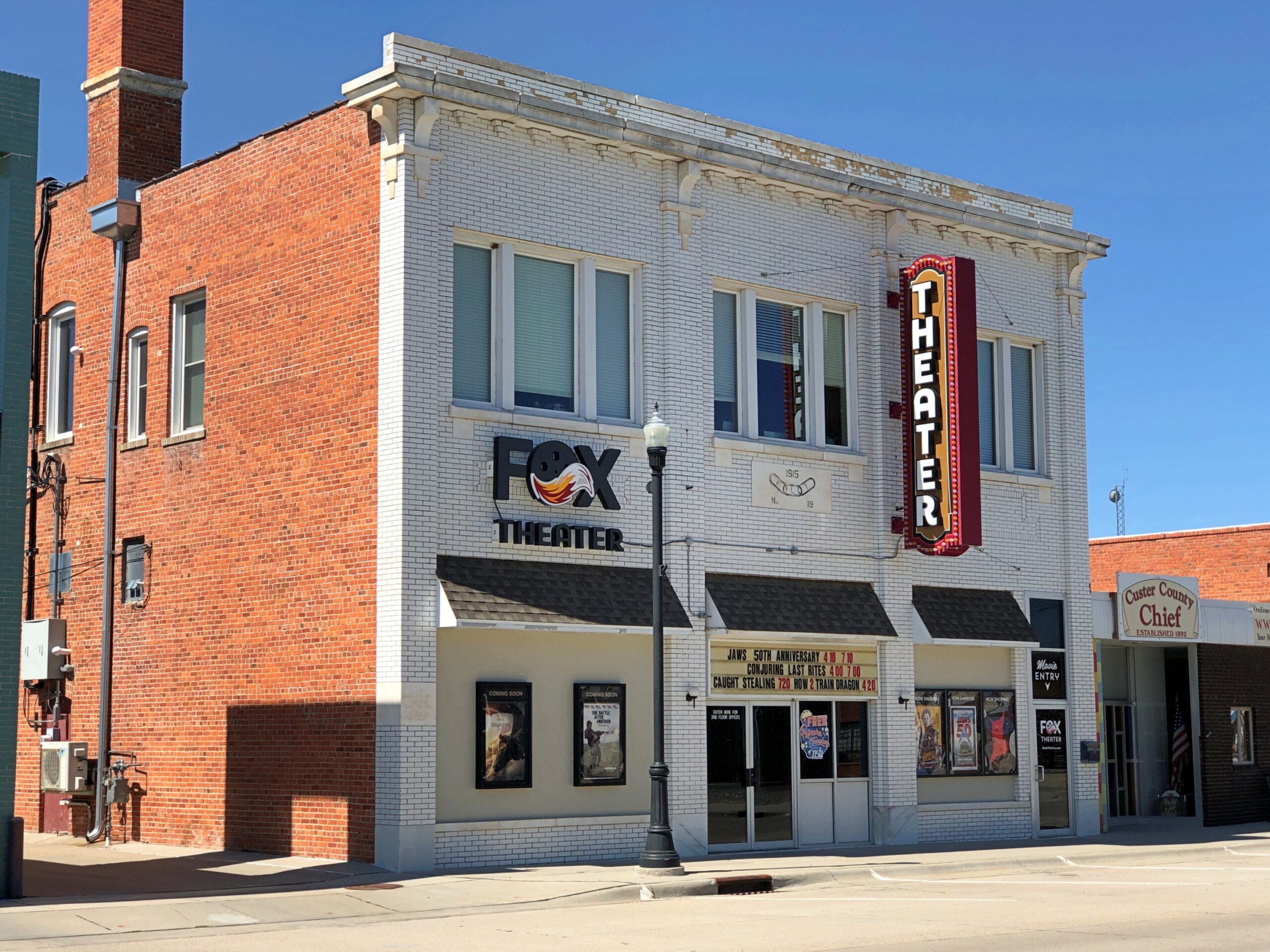
One more in that town. I couldn’t be bothered to get out of the car.
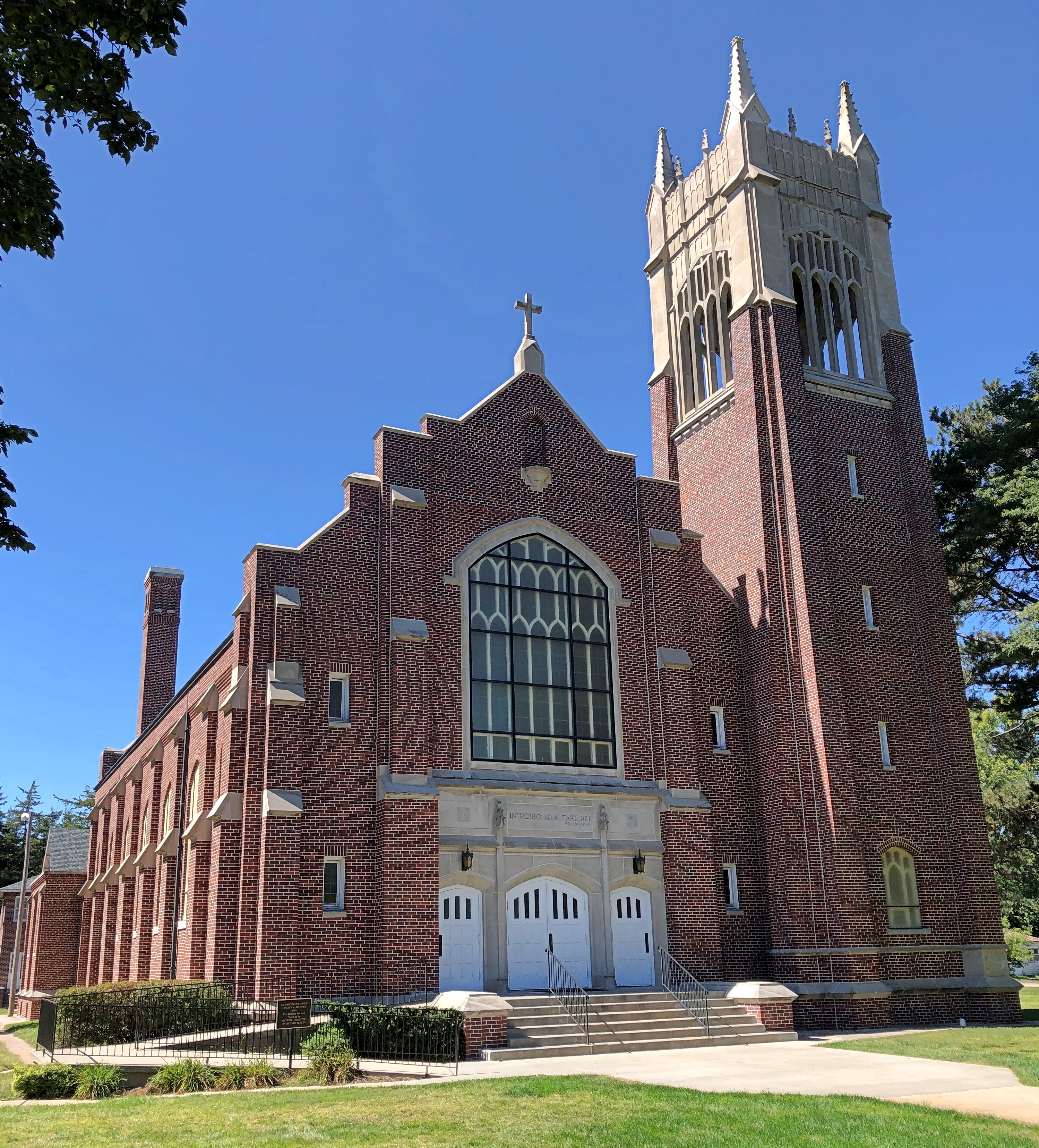
West of Broken Bow is Anselmo (pop. 145), home of this church, St. Anselms Catholic Church, nicknamed Cathedral of the Sandhills. Saturday, closed.
A more common sort of building, not far from the church.
Not the most imposing that I saw, but representative of the many structures like it. The grist of a photo collection. Of course it has been done. I’m pretty sure I saw a room of Bernd Becher’s photos of water towers at the Modern Art Museum of Fort Worth.
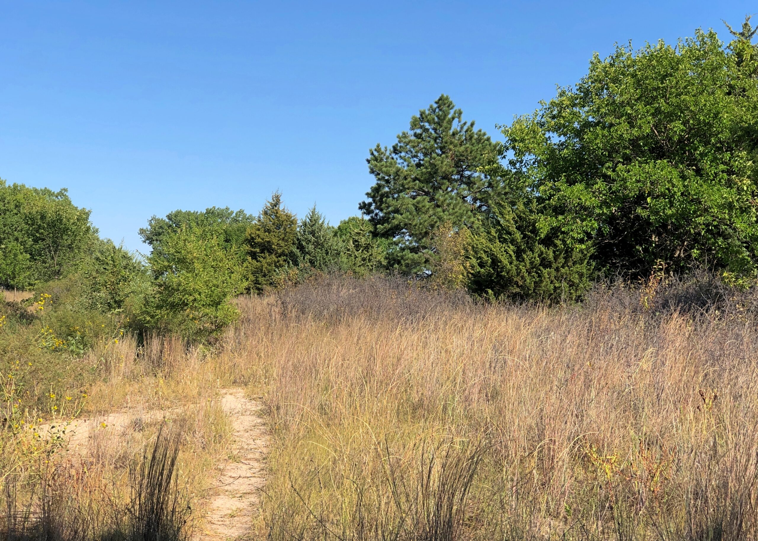
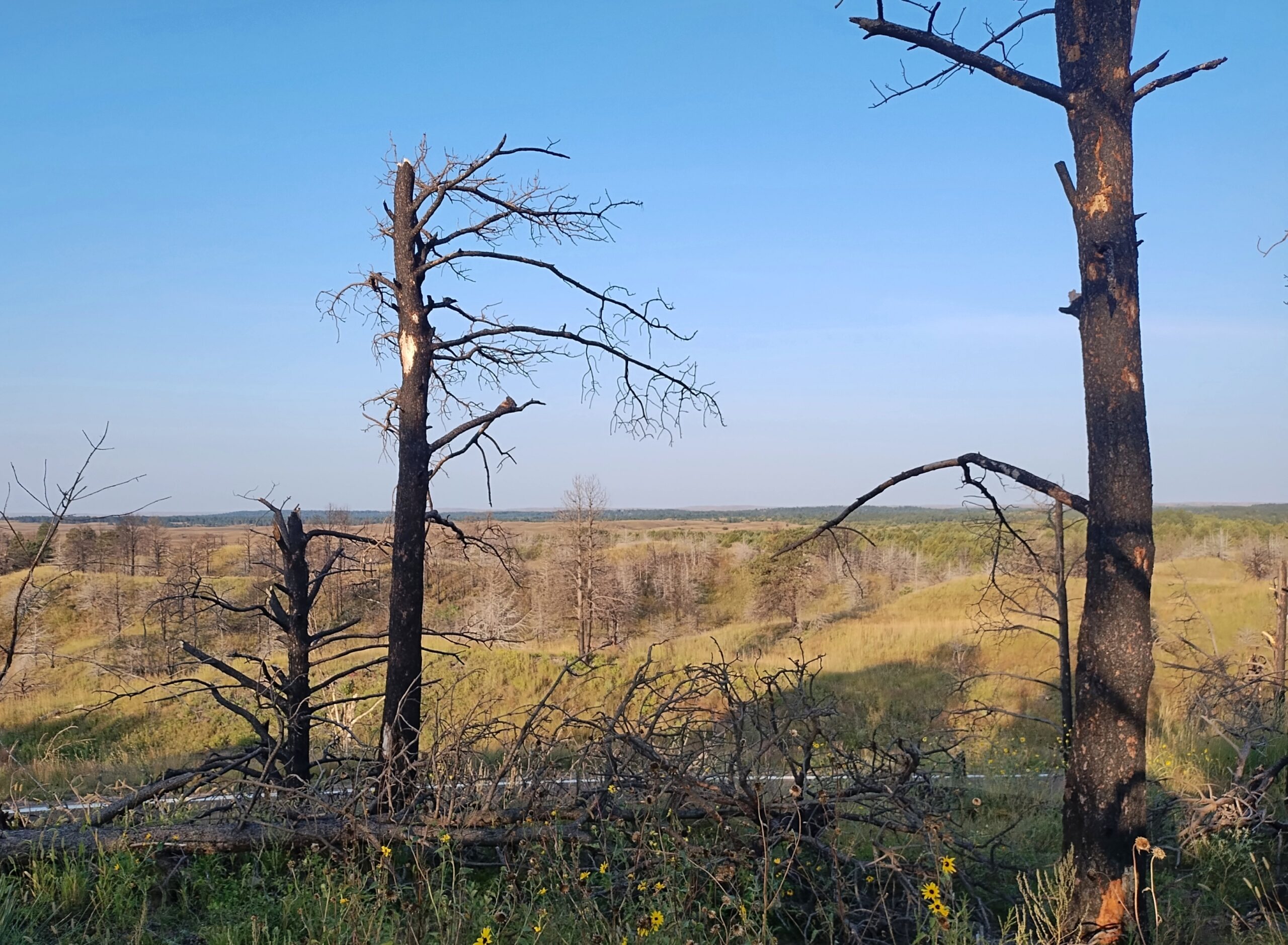
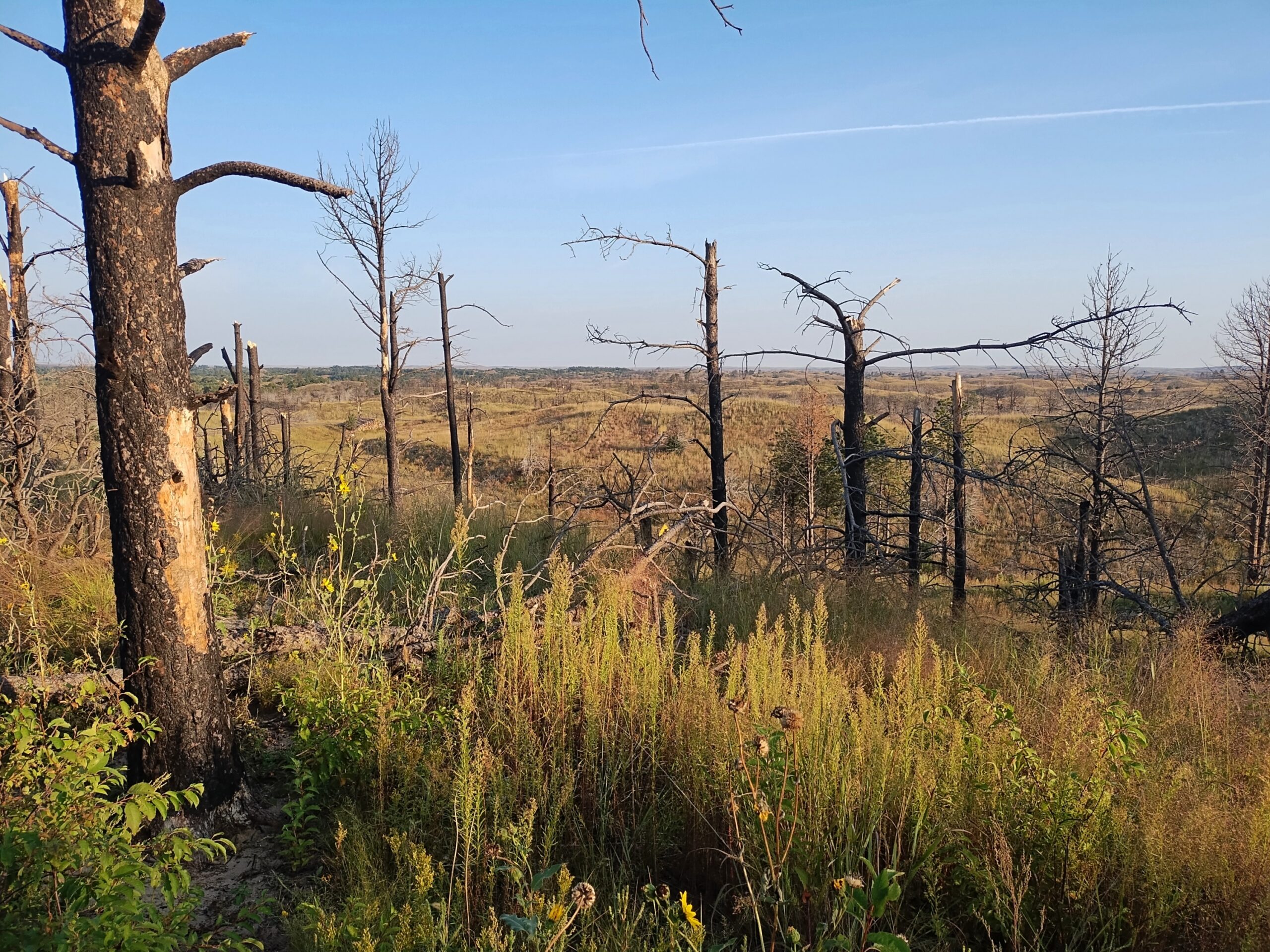
Nebraska National Forest and Grassland is in an unexpected place, slap in the middle of Nebraska, not due to a freak of nature, but the efforts of human beings. Specifically, mass plantings of trees by the federal government for more than 100 years, beginning (not a surprise) during the administration of Teddy Roosevelt.
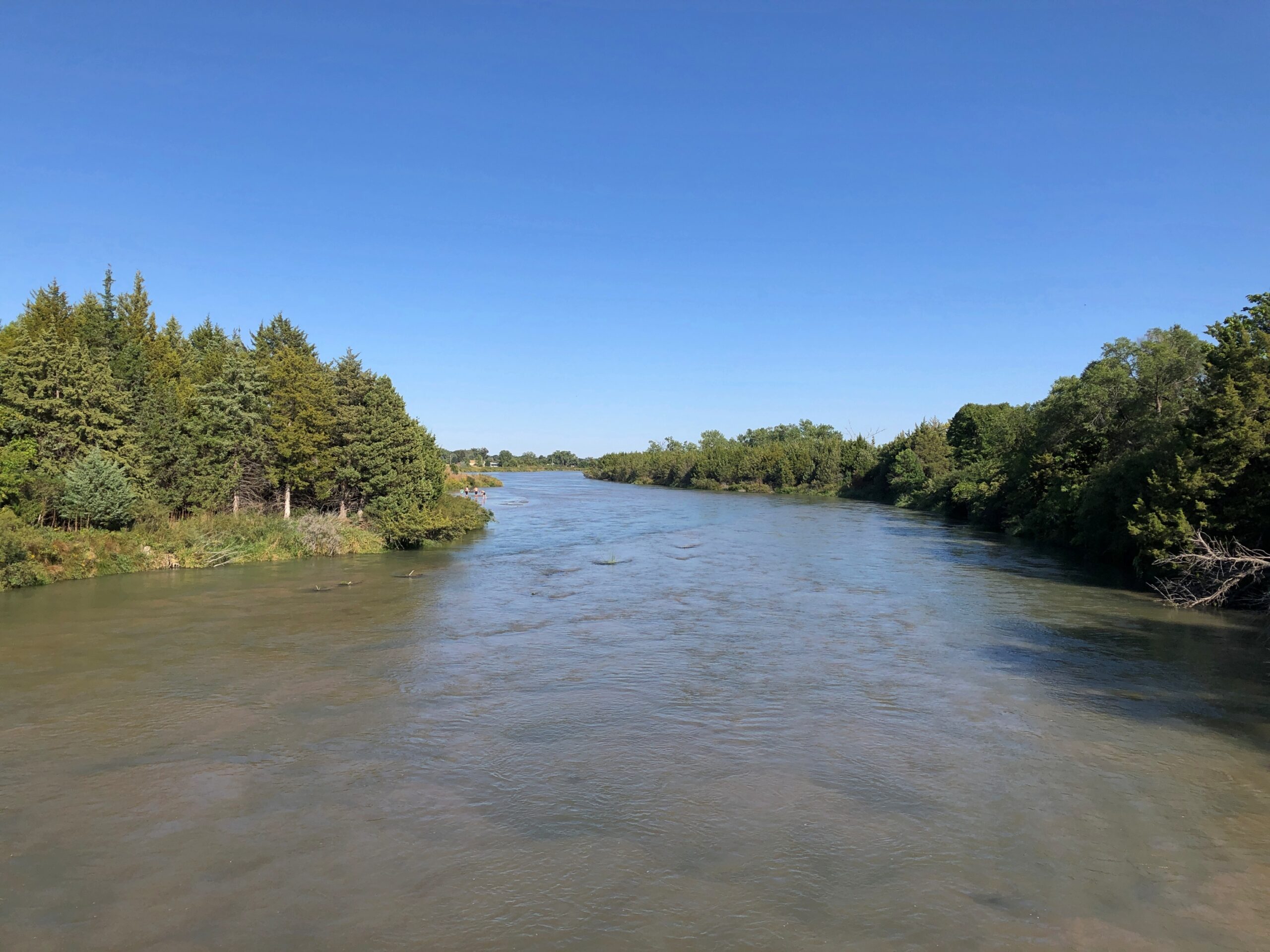
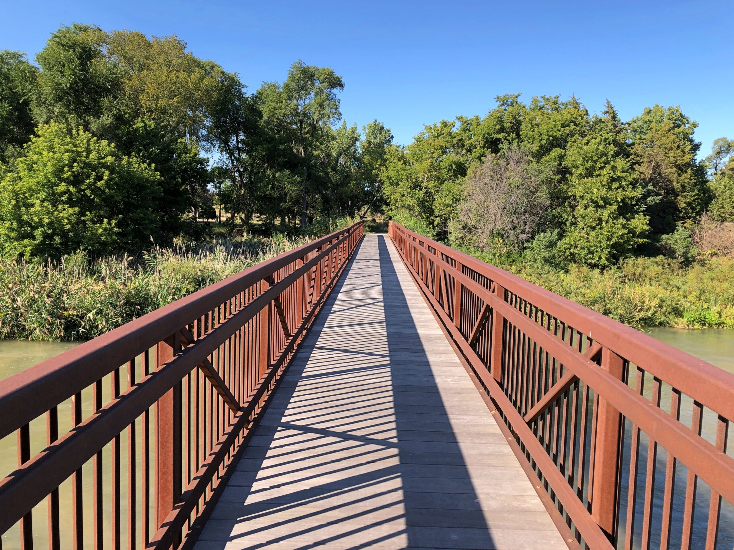
Near the national forest entrance is the Middle Loup River, broad but shallow, and crossable on a foot bridge.
I camped in the national forest. The campgrounds weren’t completely full, but there were more people than I expected for a remote spot in Nebraska. Then again, it was a Saturday night, and soon enough I figured out what brought most of them: the ATV trails. Not long after dawn on Sunday, the campers across from me – a man and a small knot of teenage boys – roared away in a small caravan of ATVs crusted with dust from the day before.
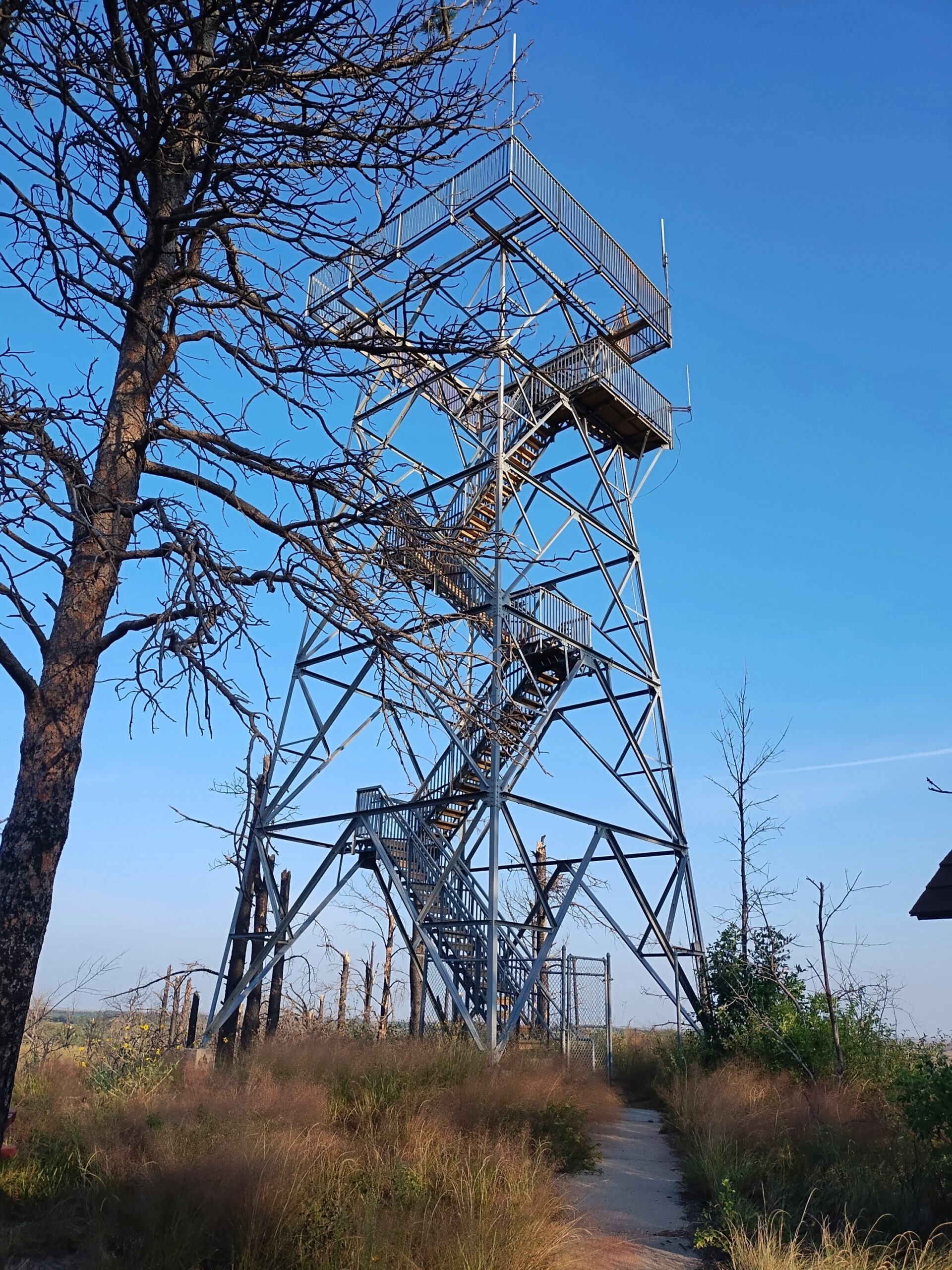
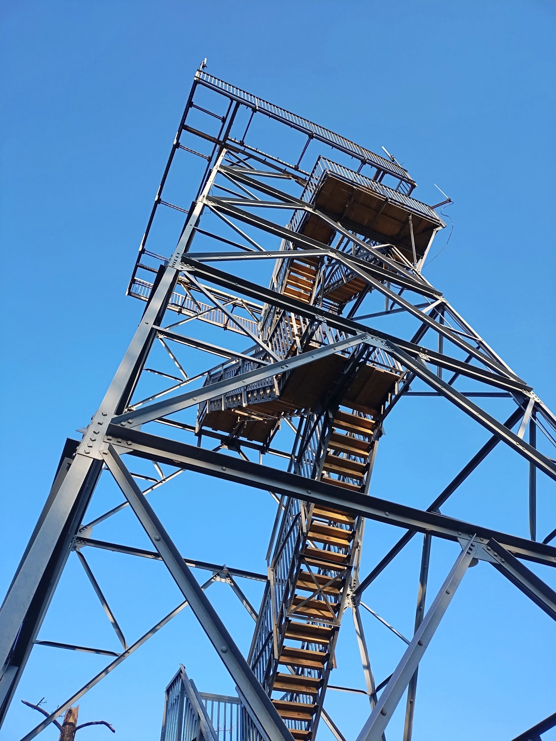
I packed up and sought out a quieter place. A national forest hill with a fire tower and some views. The tower was closed.
But the views were still pretty good.
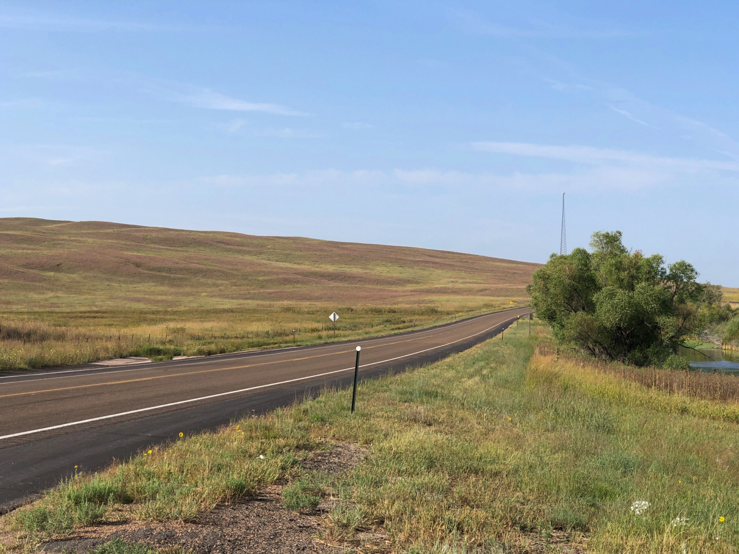
West from the national forest, Nebraska 2 heads into the rolling grassland of the Sandhills proper. In the village of Thedford (pop. 208), varied public interpretations of the Sandhills are available for reading.
The terrain along the highway Nebraska 2 might seem monotonous to some. Too bad for them. You’re driving across a kind of ocean, terrain all wavy, except that it’s solid ground, marked by occasional trees or manmade structures, and side roads — trails — wandering deeper into the hills.
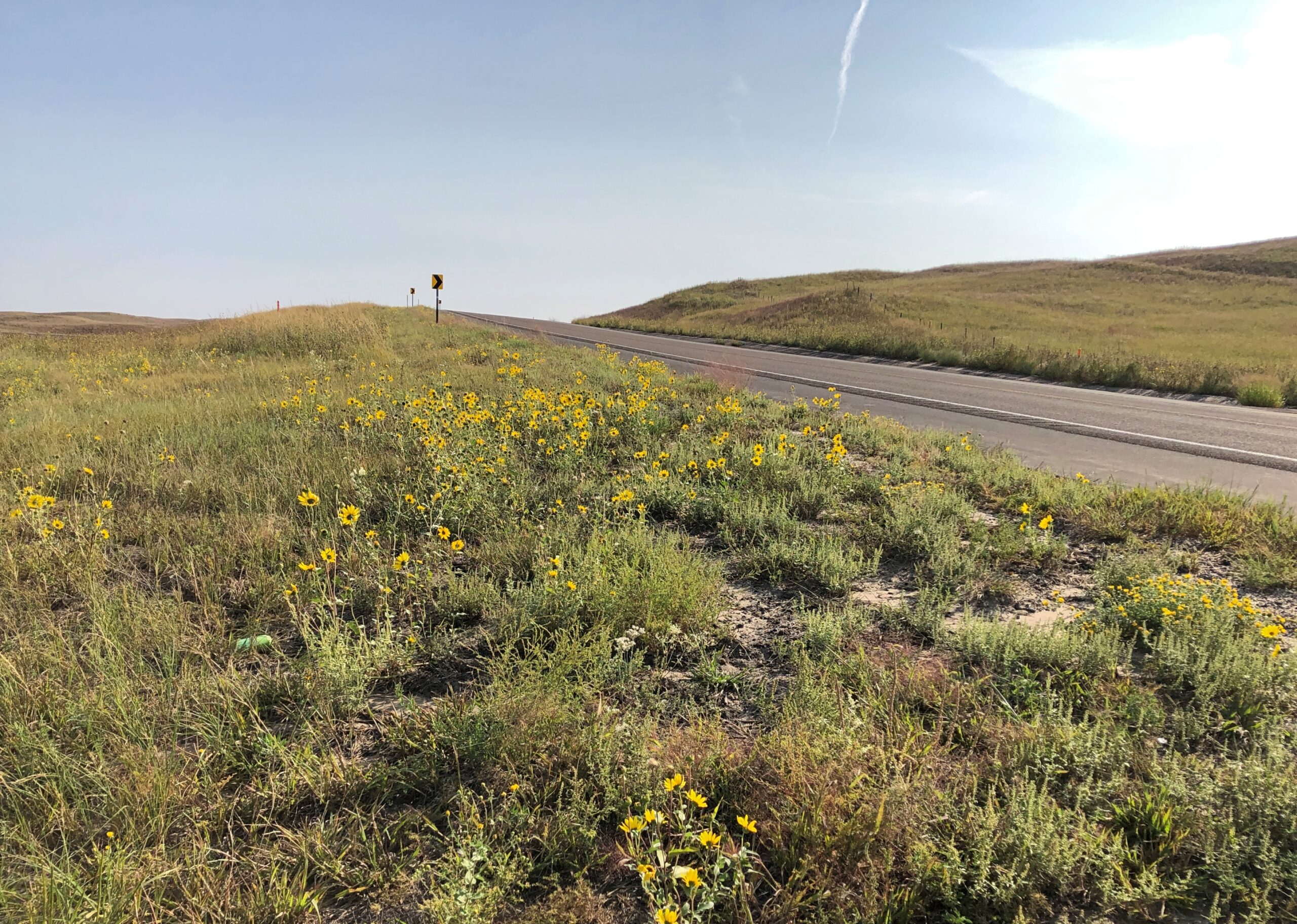
The handful of towns are really just wide places in the road. Sometimes, not even that.
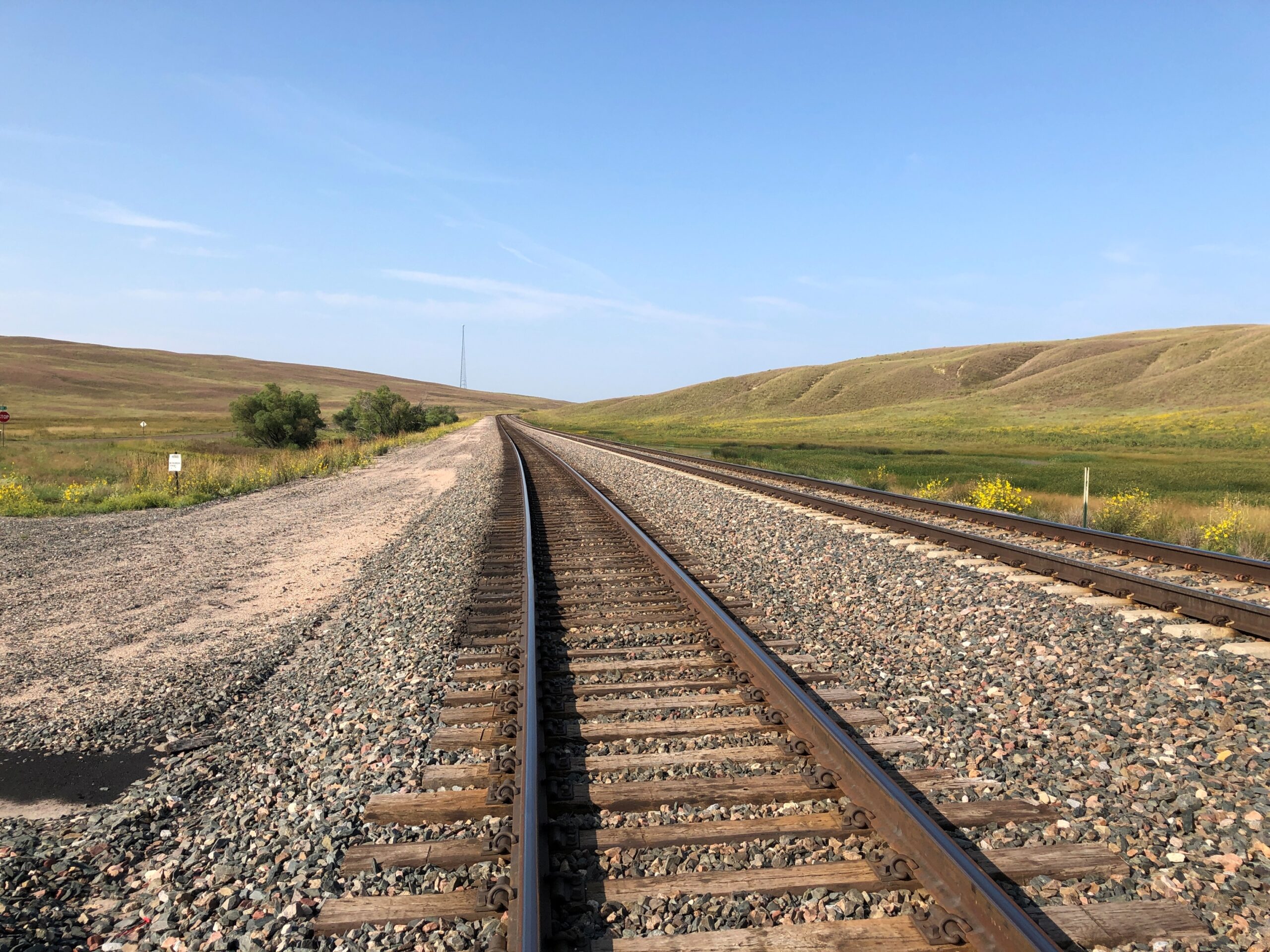
Nebraska 2 parallels the BNSF line, which came first.
Note: I was standing on a public side road to take that picture, as I do with all my RR shots.
Eventually, I took the road to Alliance. But that was merely incidental. Out this far, the road, as Kuralt said, is the destination.
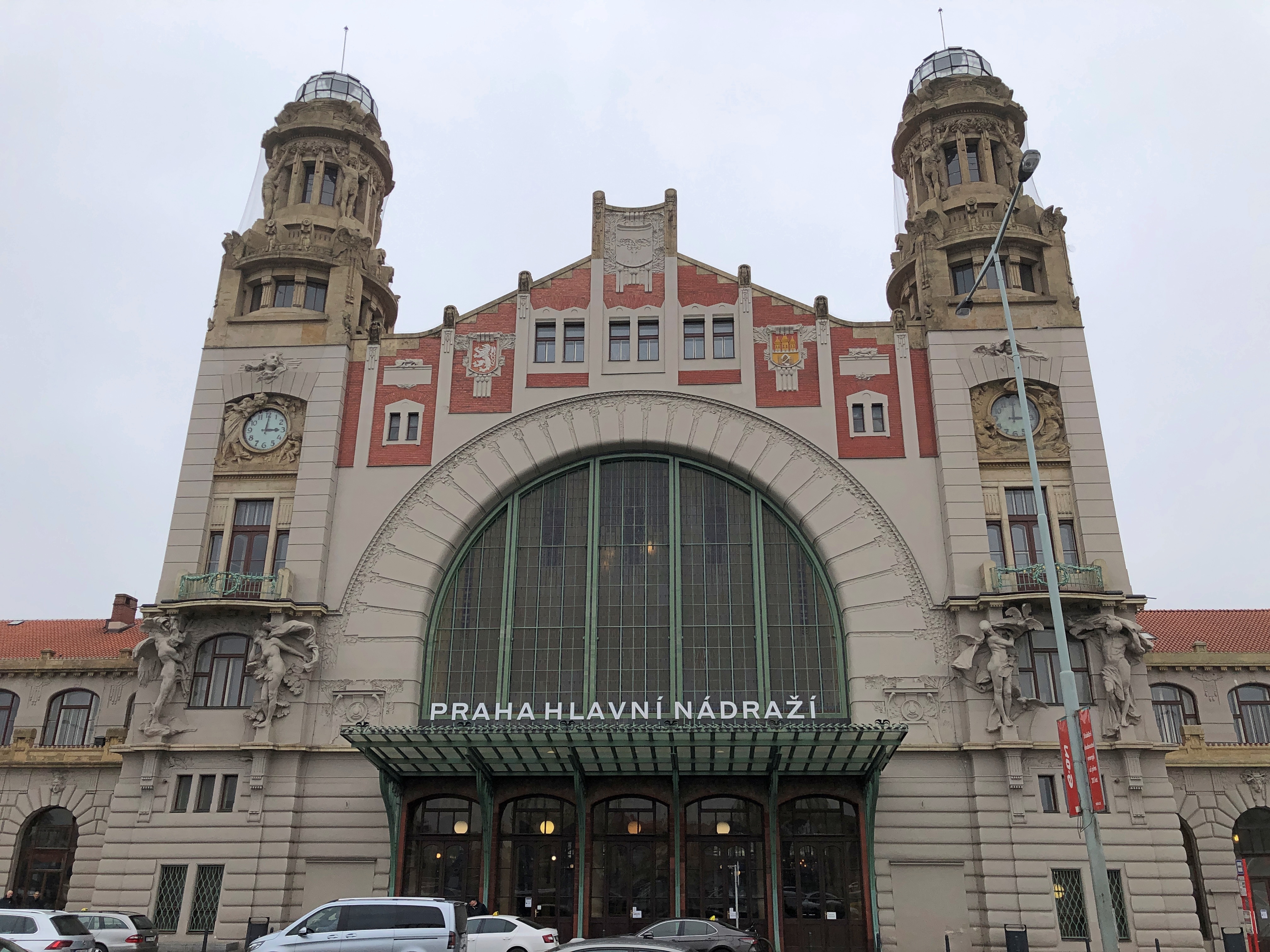
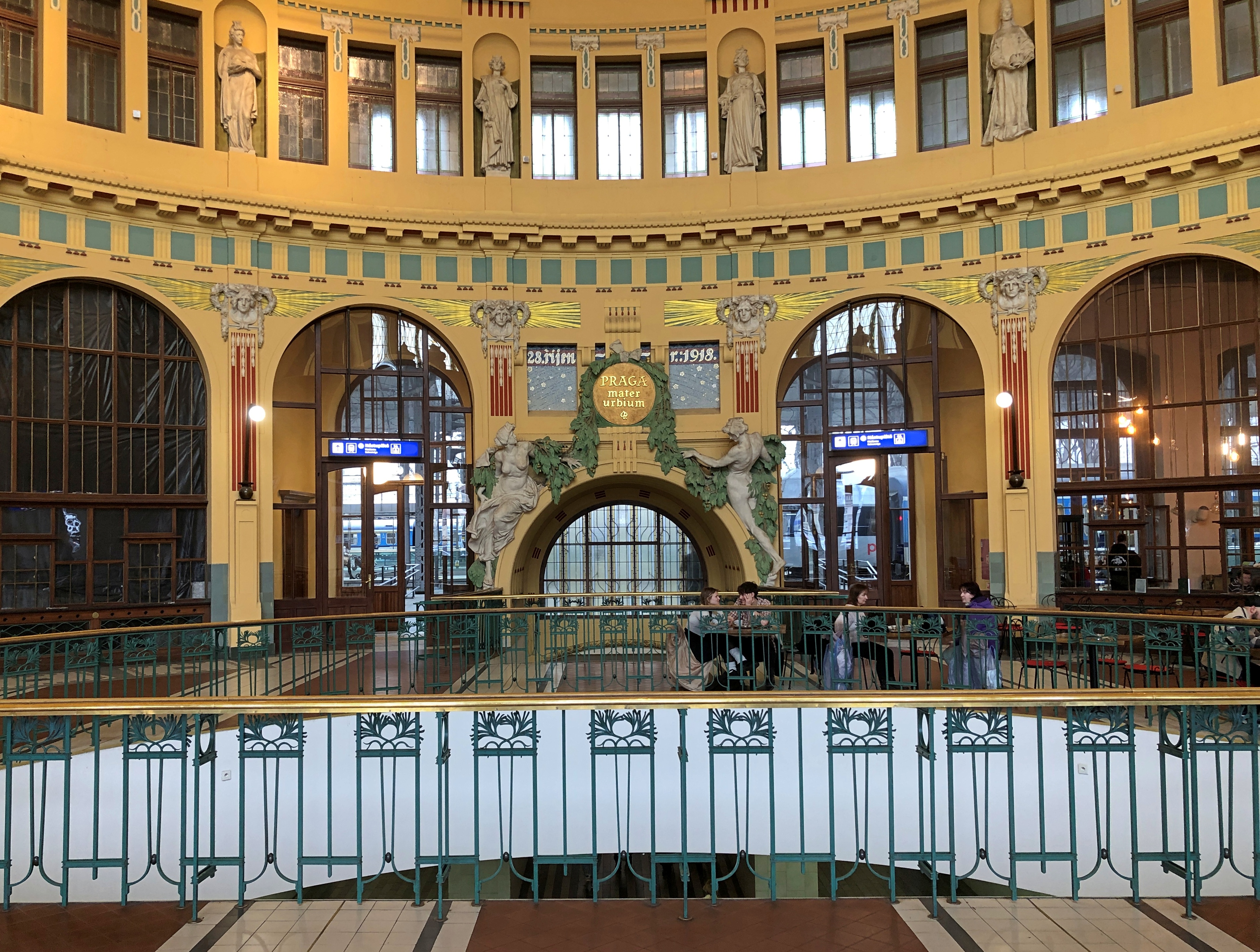
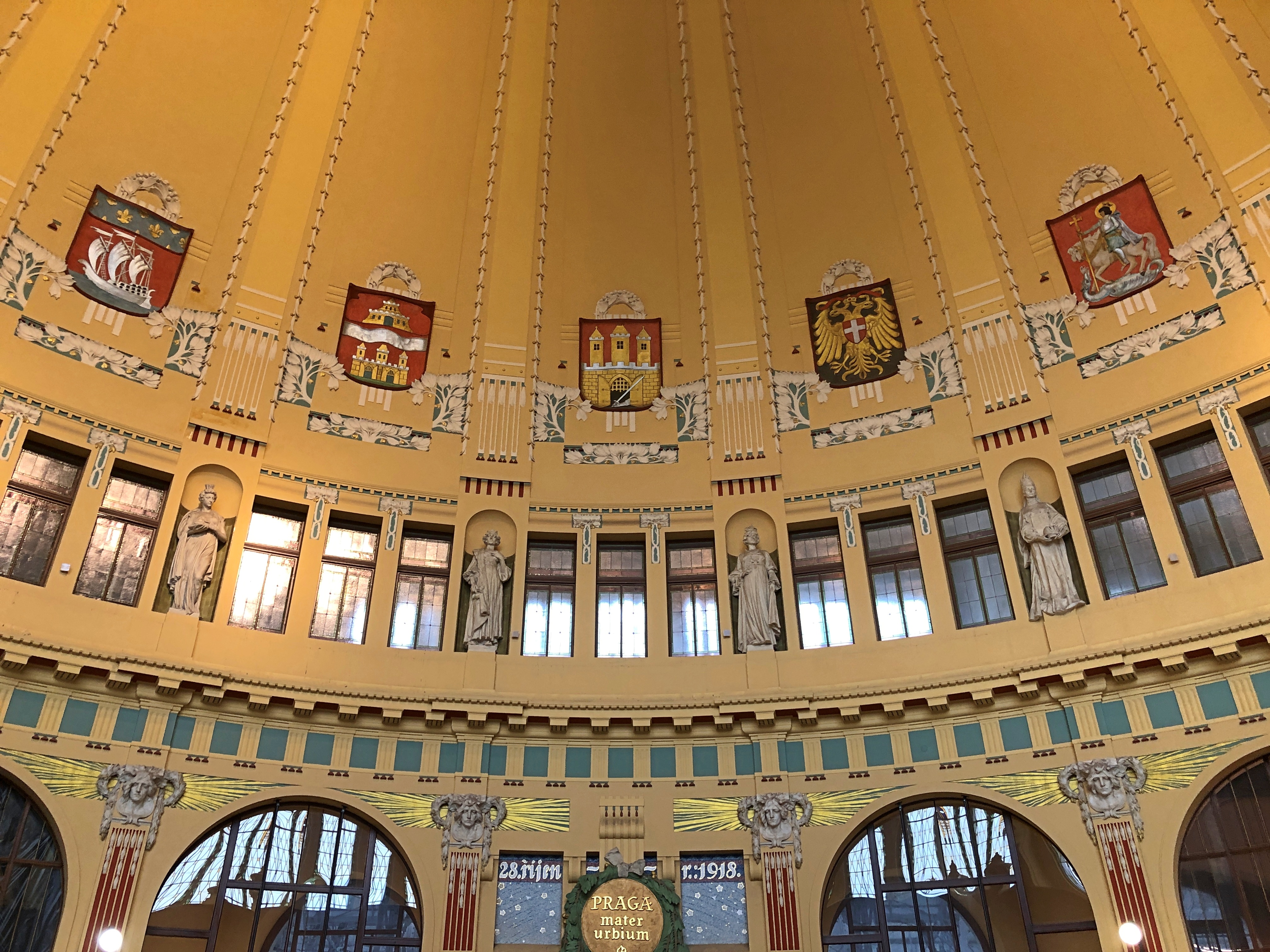
On the afternoon of March 12, a gray, chilly day, Jay and I arrived at the Main Railway Station in Prague (Praha hlavní nádraží) to catch the EC 170 back to Berlin, leaving at 4:28 pm. We were early, and had time to look around the station.
A grand edifice. “One of the final glories of the dying empire,” notes the 2002 Rough Guide to the Czech & Slovak Republics, though perhaps “ramshackle empire” might have been more apt, since who knew the catastrophe of WWI would play out quite the way it did.
“It was designed by Joseph Fanta and officially opened in 1909 as the Franz Josef Station,” the guide book continues. “Arriving in the subterranean modern section, it’s easy to miss the station’s surviving Art Nouveau parts. The original entrance on the Wilsonova still exudes imperial confidence, with its wrought iron canopy and naked figurines clinging to the sides of the towers.”
The grand hall interior is grand indeed.
But largely empty. The crowds were at the more modern lower level, where a long tunnel connects all the train platforms, ticket offices and a fair amount of retail. We boarded our train without any problem and found that our car was nearly empty too. Not many people were headed for Berlin that Wednesday evening.
At one of the suburban stations, however, a young man and young woman got on and sat across the aisle in our car. They had that contemporary Euro-look: casually dressed, visible tattoos here and there, a few studs and earrings for both, and the mandatory beard for the man. They were in a merry mood. Not obnoxiously loud, but making happy-sounding conversations in what I assume was Czech, complete with the universal language of giggling; clearly a couple headed somewhere for some fun. Someone’s wedding, or maybe just a few days off work.
None of that was unusual. Then the woman removed a small air cylinder from her backpack and started using it to blow up balloons, which she and the man proceeded to swat around the car. I’ve been on a lot of trains in a lot of places, but I have to say, that was a first.
That didn’t last long. Soon they got off the train at the last station before the border with Germany, Ústí nad Labem, and the car got quiet again. I hope they continued to have a good time in that town.
On the trip down to Prague on the 10th, in a mostly full car, we had passed the same way going the opposite direction, and it was still daytime. So we got a good look at the hilly territory of the Elbe River Valley south of Dresden, where the train mostly follows the river. A picturesque spot, even in winter.
As for the German-Czech frontier, crossing was perfunctory. Hardly worth calling it a border. No officious or menacing border guards roamed the cars demanding Papers! (Reisepass?) Not in the 21st-century Schengen Area. We were on an Evening Train to Berlin, not a Night Train to Munich. The only indication of entering a new country (either way) was that after crossing each time, our tickets were checked again, electronically, by fairly laid-back workers of the respective railway companies on either side of the line.
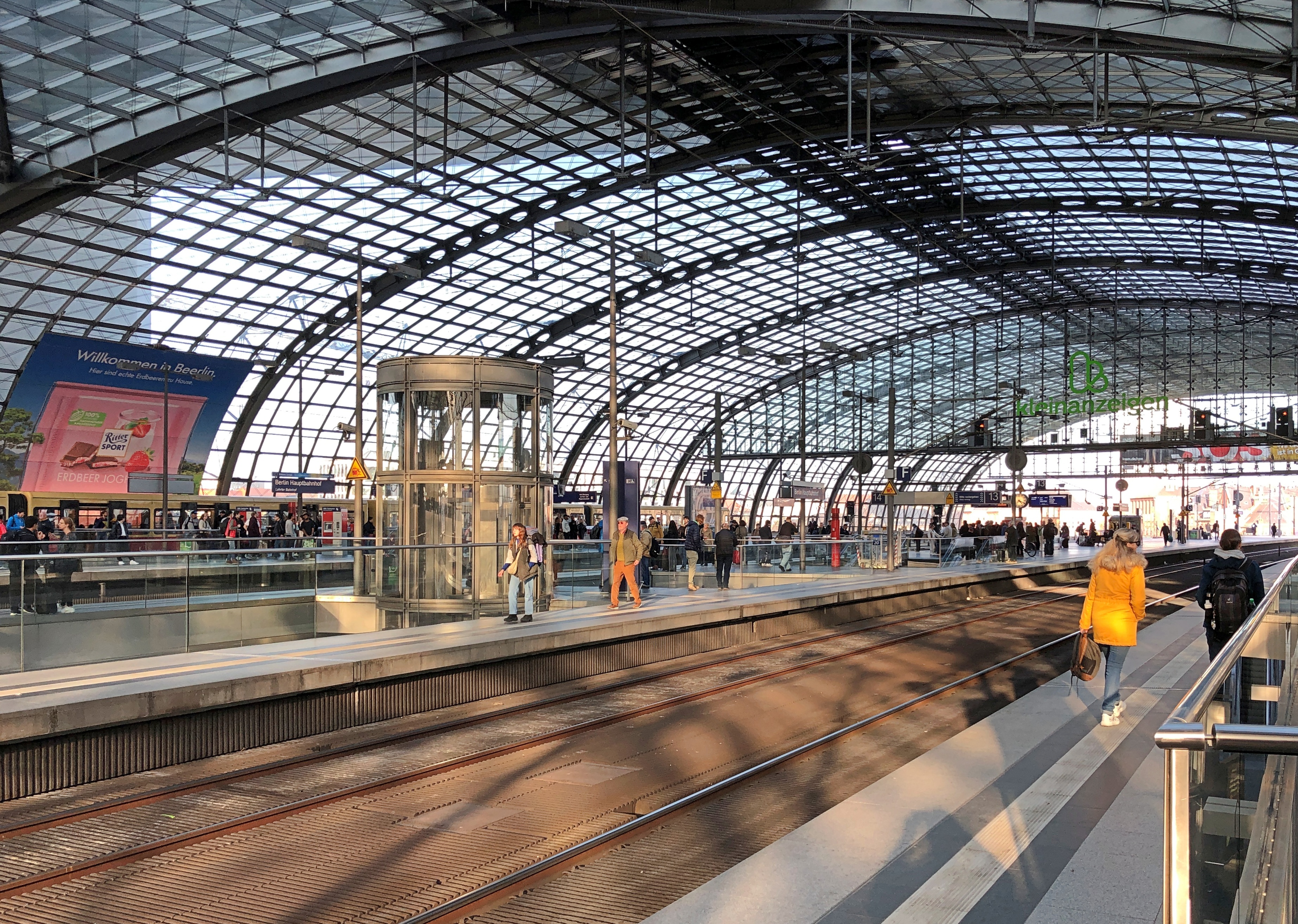
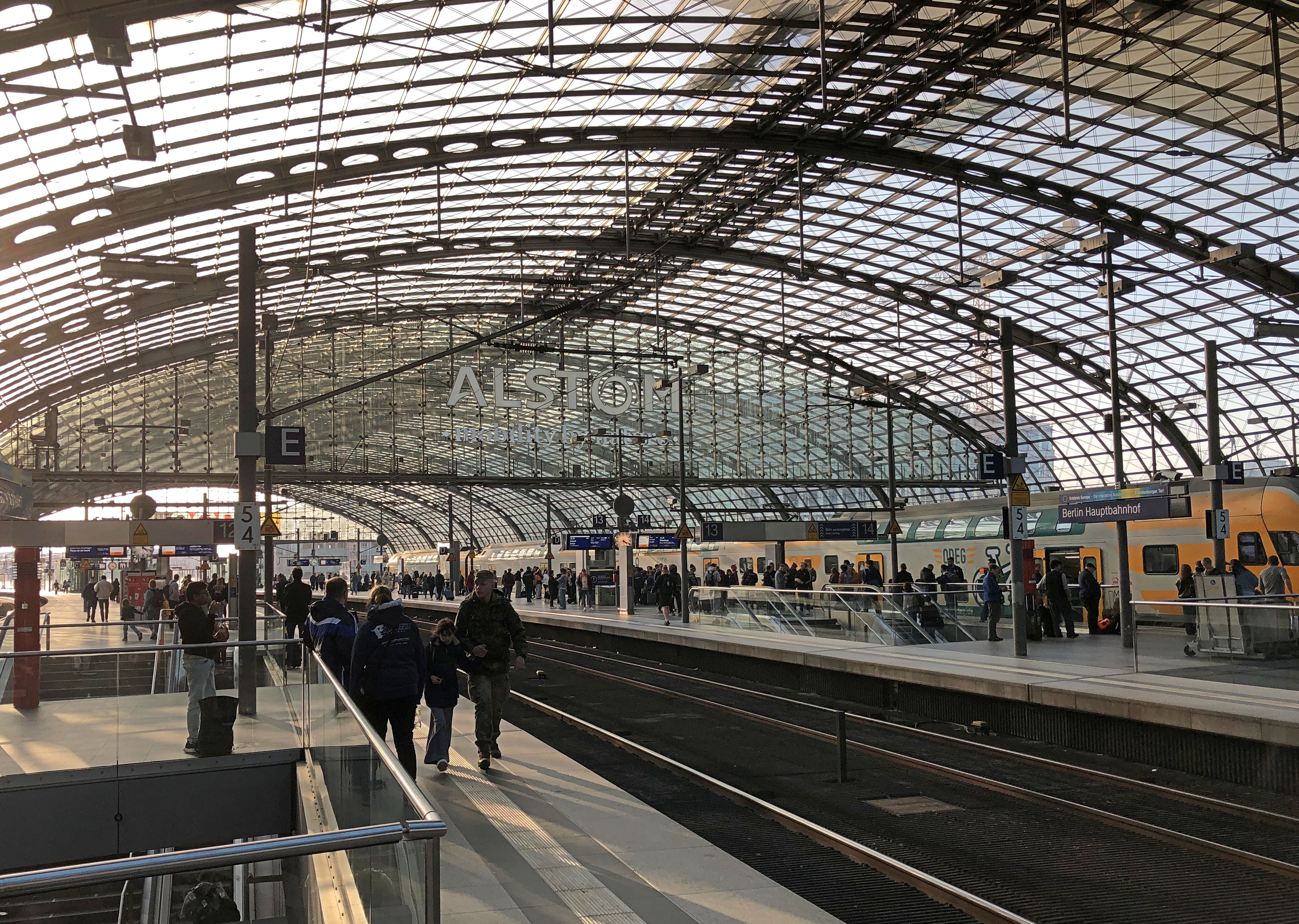
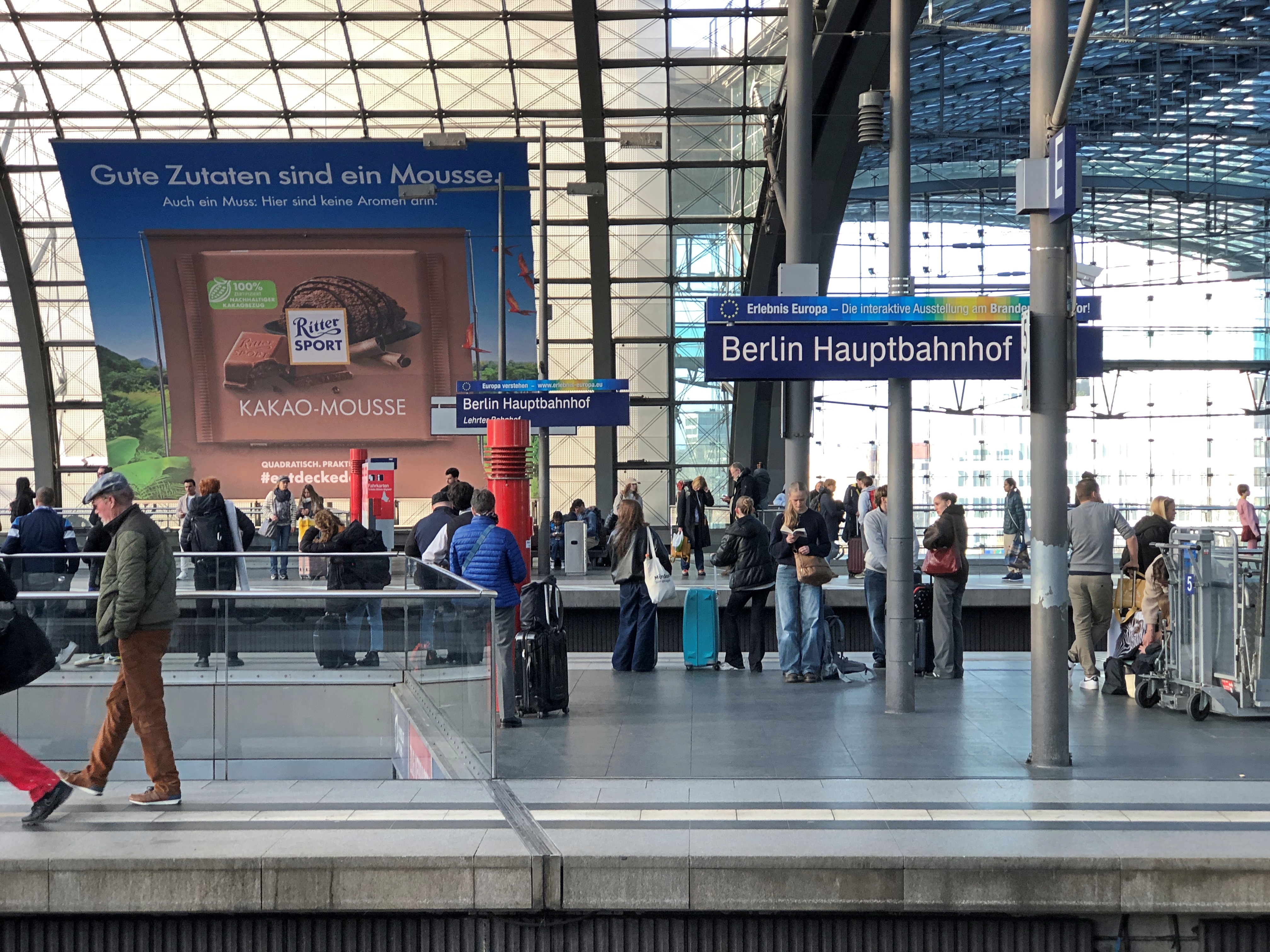
The 175-mile trip to Prague began and ended at the Berlin Hauptbahnhof, a massive station that didn’t exist the first time I went to Berlin. A predecessor station on the site had been badly damaged during the war, and the new station wasn’t developed until the 2000s, as Berlin’s fancy new main multi-modal transit center. Besides intercity trains, Berlin S-bahn and U-bahn trains go there, along with a lot of buses. There is also enough retail at the station to qualify as its own mall.
Berlin Hauptbahnhof isn’t an old style, but it is impressive.
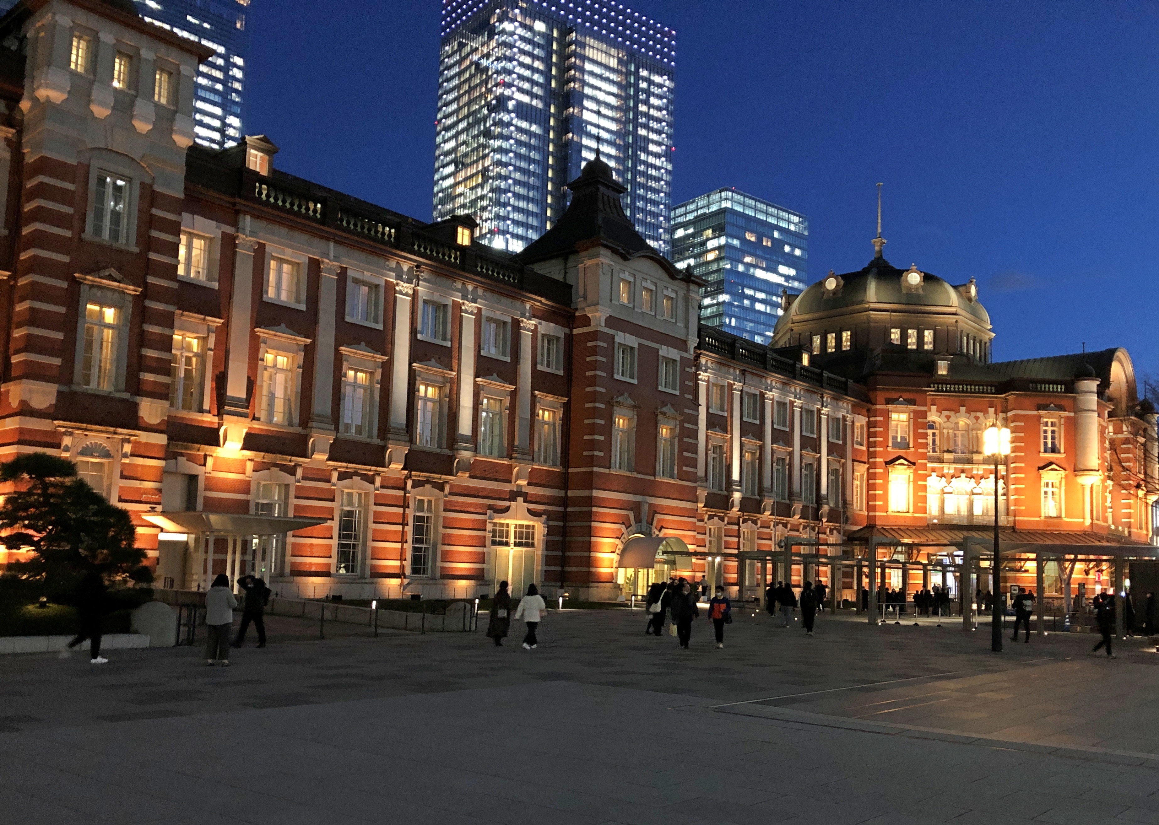
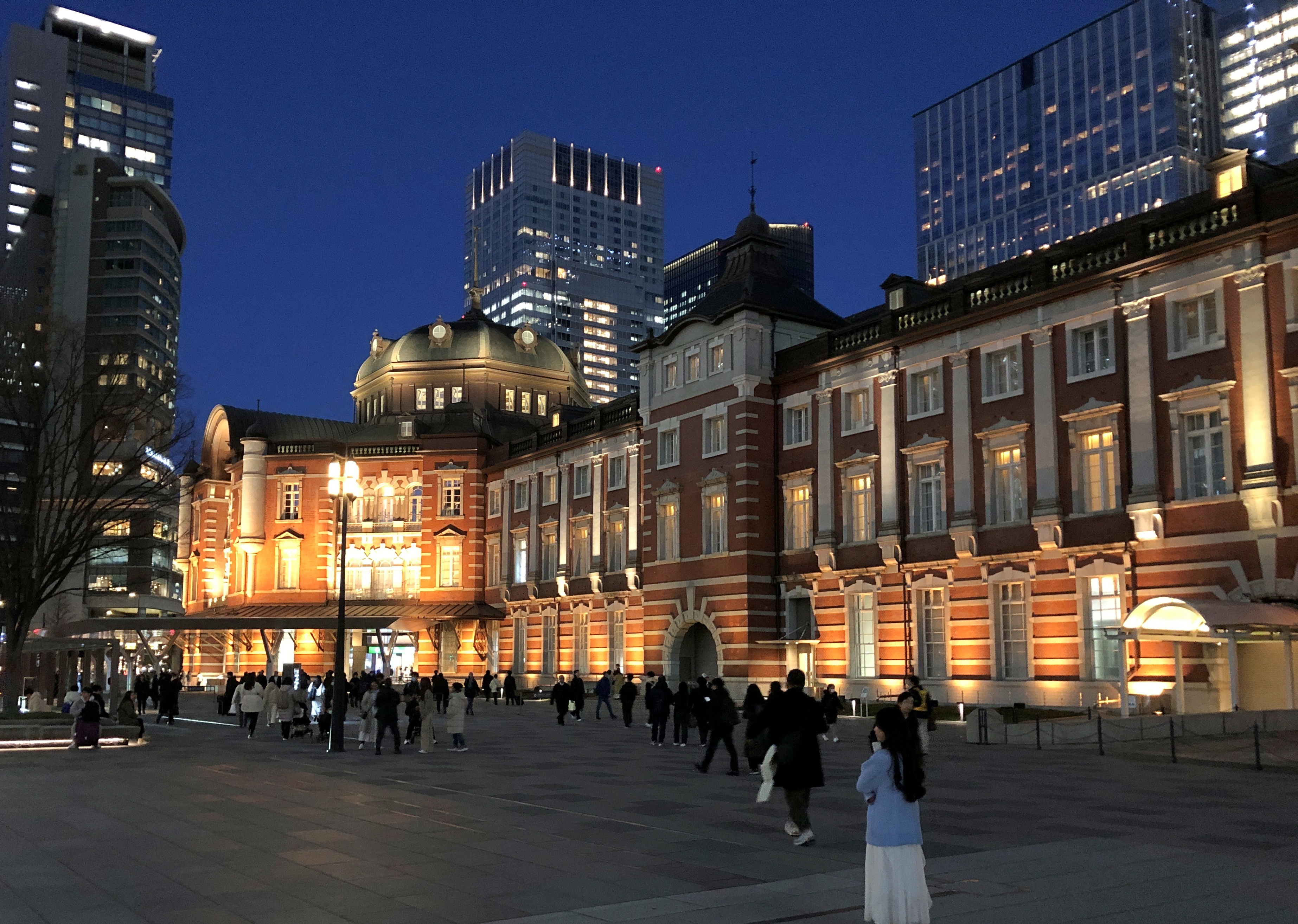
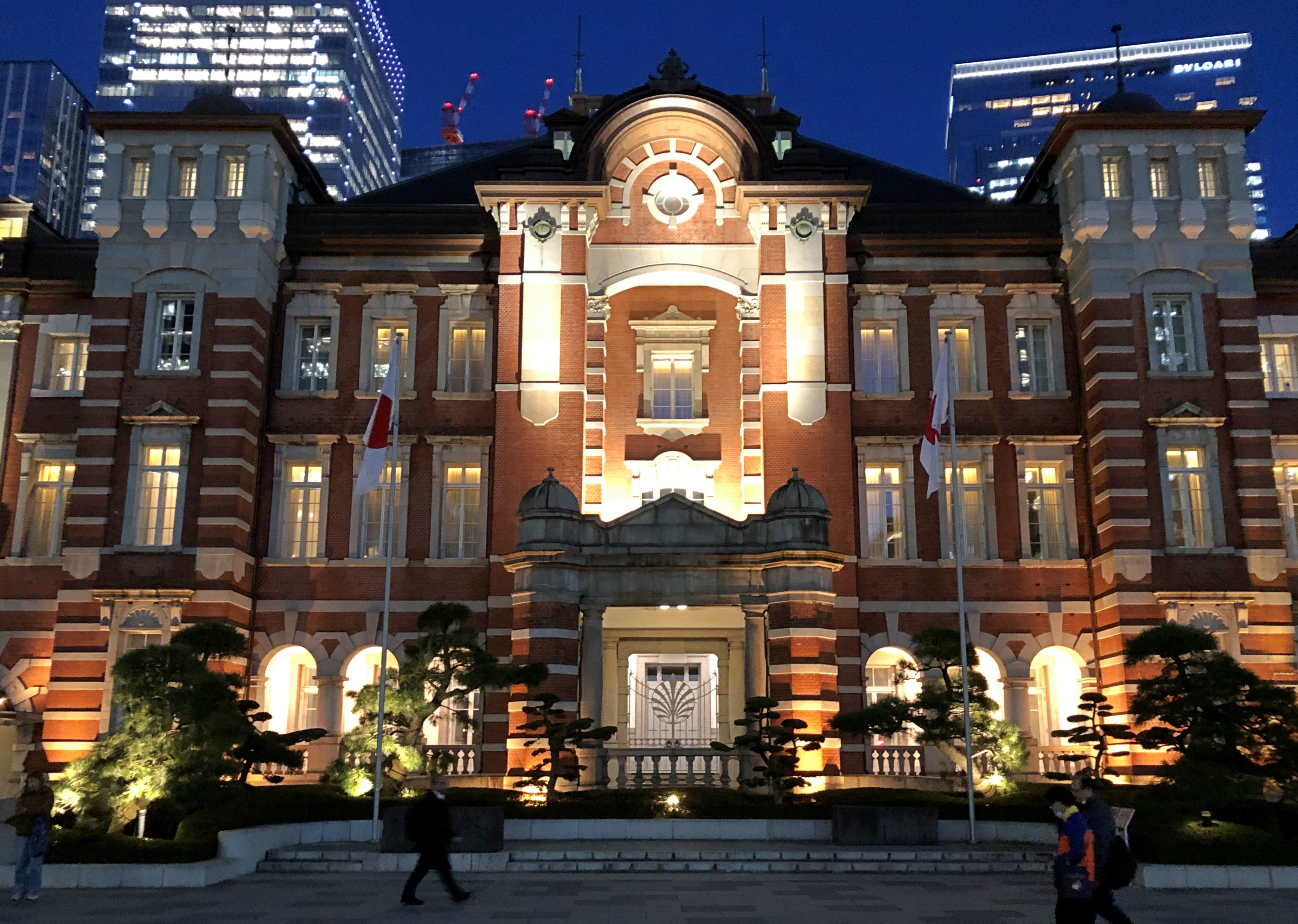
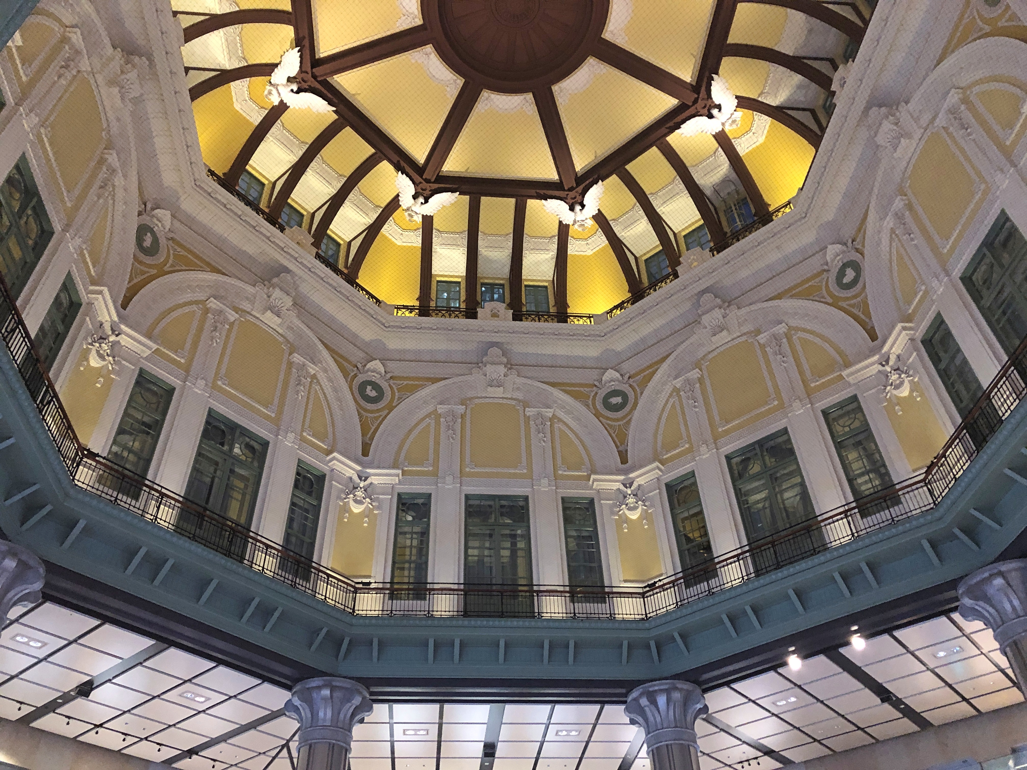
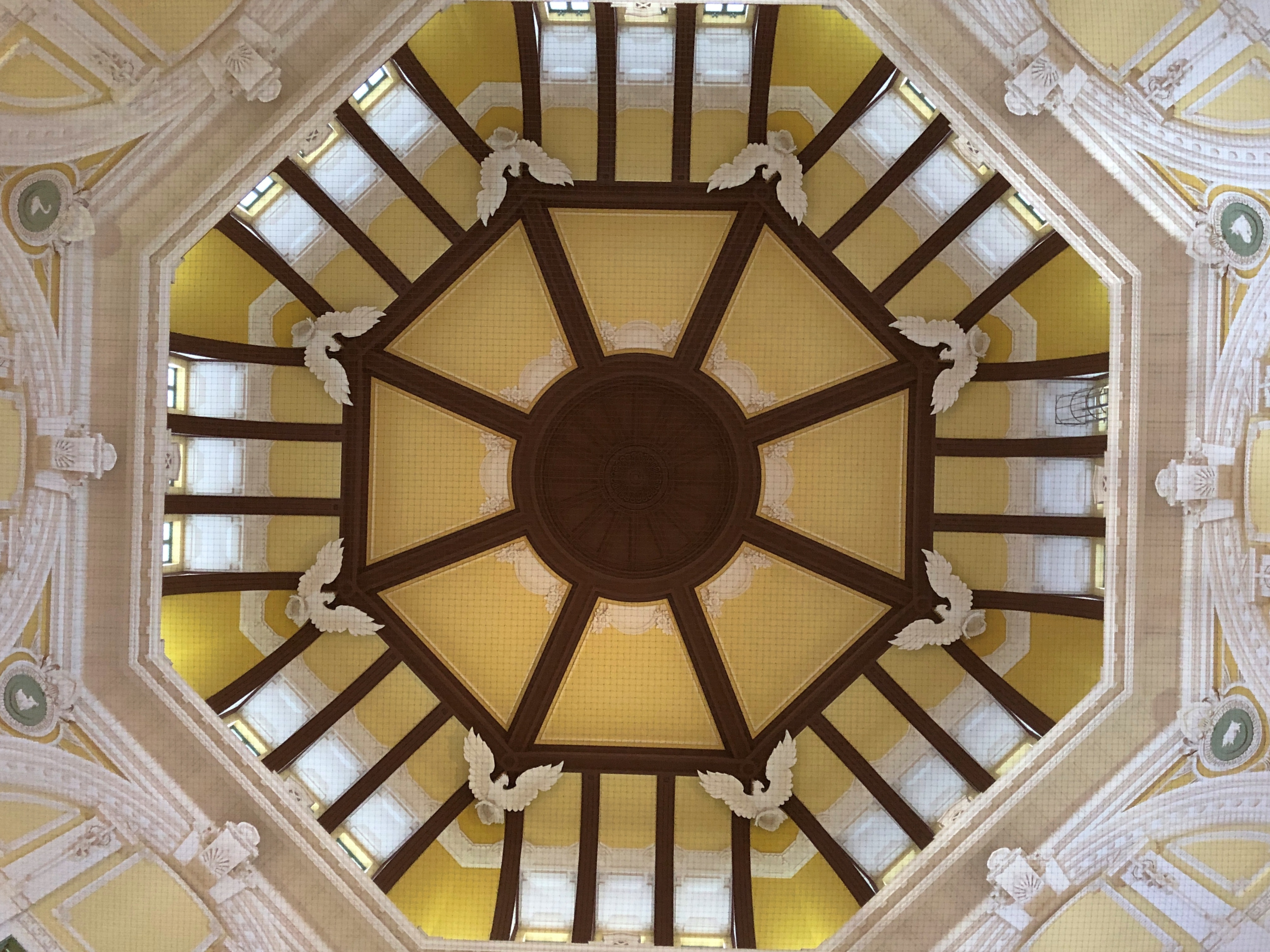
One more impressive rail hub on this trip was a continent away: Tokyo Station, the busiest one in passenger numbers in that urban agglomeration, which is saying something. It too is a multi-modal facility, with various intercity rail lines meeting there, along with subways and buses. The Shinkansen from Osaka goes there, which is how we arrived. The structure dates from 1914 and amazingly survived war in the 1940s – and just as threatening – urban renewal in the 1960s. In more recent years, the station was restored to close to its original design.
Under the main dome.
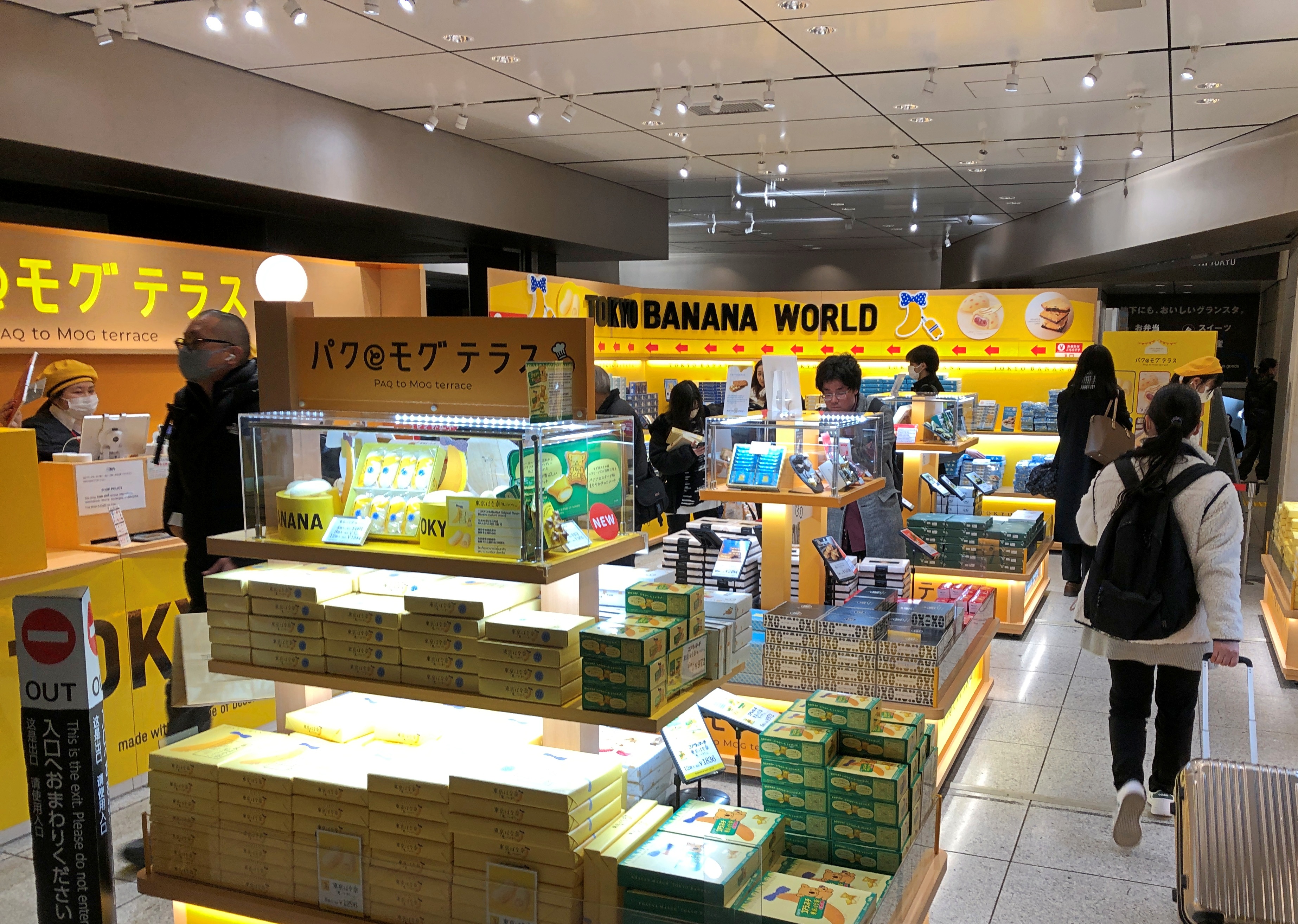
Plenty of retail at Tokyo Station as well. Including some places I’d never seen before. We should have stopped to get something from Tokyo Banana World.
Per Time Out: “Tokyo Banana opened its flagship store called Tokyo Bananas inside Tokyo Station on December 8 [2022], and it’s stocked with exclusive goods. Two of the exclusive products are the Legendary Curry Bread and Cream and Red Bean Paste Doughnut — and yes, banana is the hidden ingredient for both.”
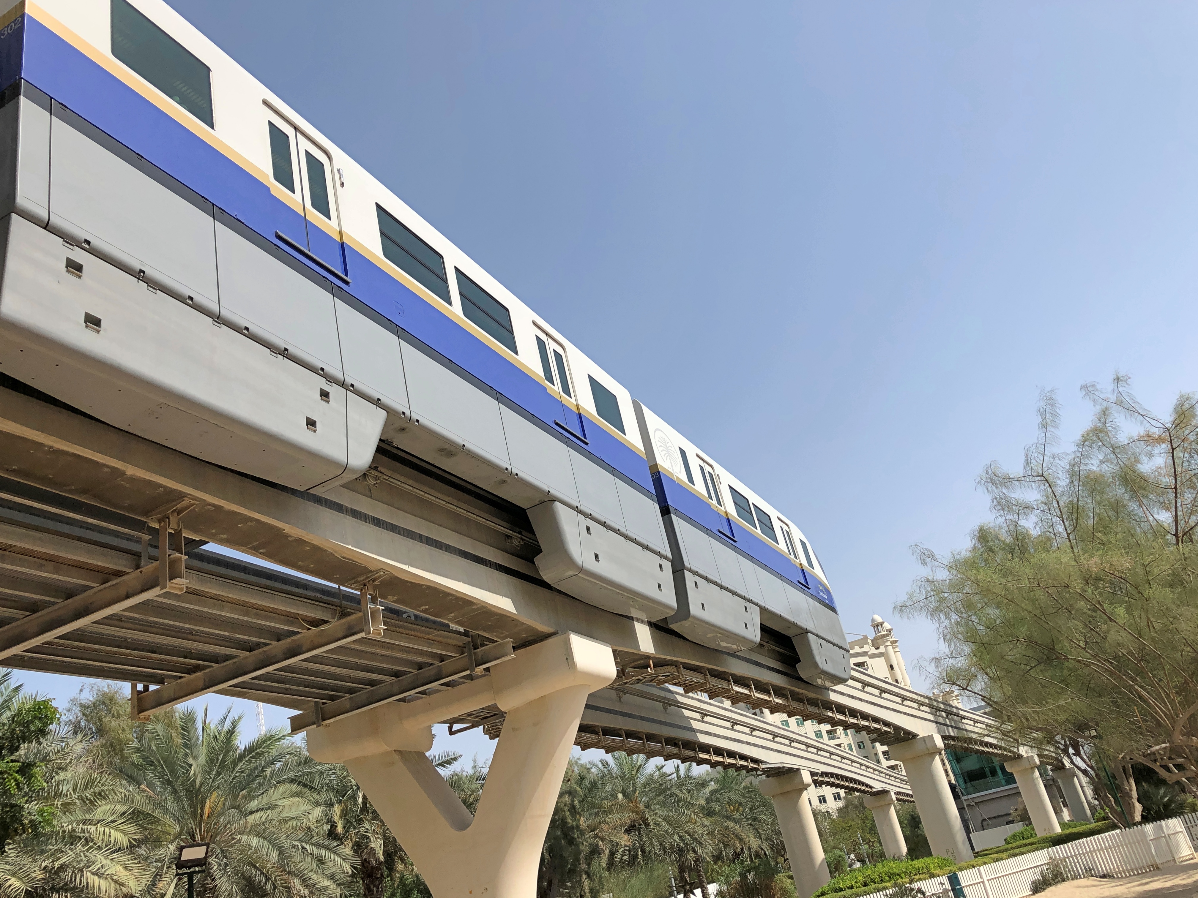
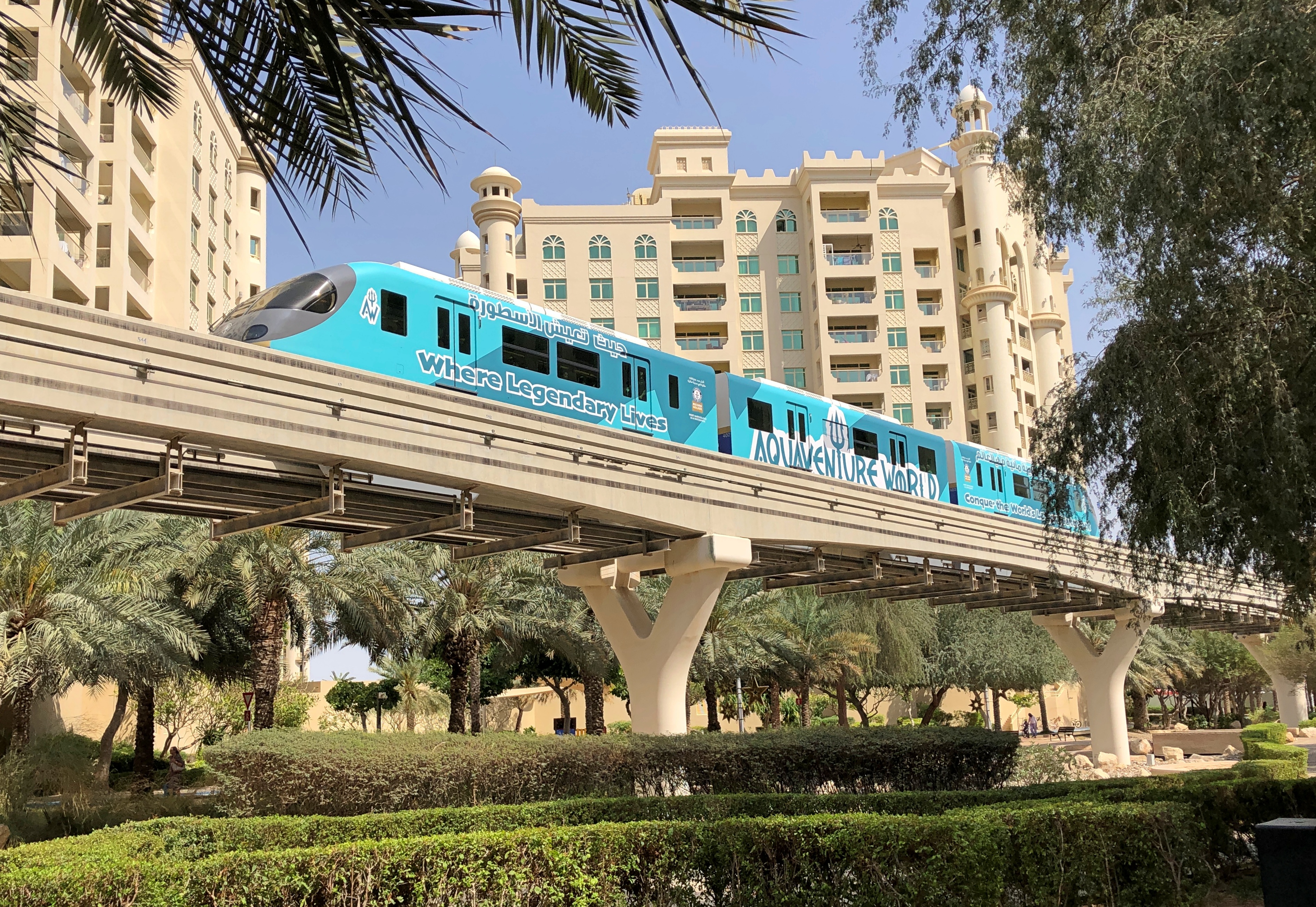
What was the monorail pitch like, for the line that now runs along the trunk of the Palm Jumeirah in Dubai? The Palm Monorail, it’s called.
Well, sir, there’s nothing on Earth like a genuine, bona fide, electrified, six-car monorail!
What’d I say?
Monorail!
What’s it called?
Monorail!
That’s right!
Monorail!
There probably wasn’t that much singing, or that much English, but whatever happened, the line has been up and running for about a decade and a half now. A go-to source (Wiki) tells me that it is the only monorail in the Middle East, which if true ought to spur the likes of Saudi Arabia into some monorail development, maybe in lieu of grander projects.
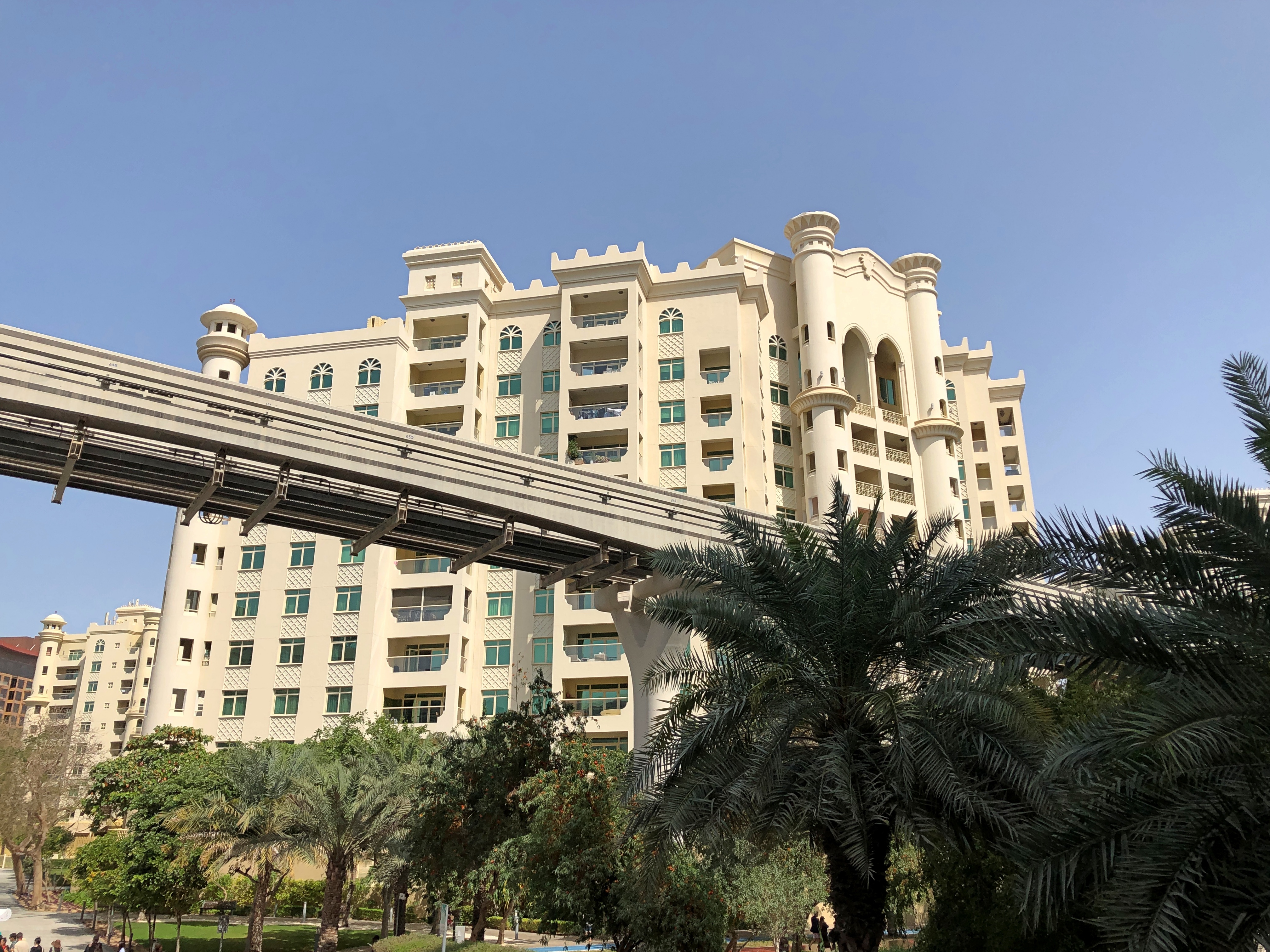
I rode its entire 3.4-mile length and back on March 2, as part of my excursion to Palm Jumeirah. Levity aside, I can report a wholly positive experience. The ride didn’t cost much, the wait wasn’t long, the cars were busy but not packed, and the vantage offered some terrific views of the artificial islands that comprise Palm Jumeirah – the trunk and fronds, as they’re called, and their linear neighborhoods spreading out, always along the ocean.
I also wonder whether the monorail was an important enough component of the overall Palm Jumeirah project for decision-makers toward the very top – even the emir himself – to focus on it. Hard to say, since Palm Jumeirah was an epic project that involved creating a palm-shaped island with seven miles of coastline from 120 million cubic meters of sand and other material dredged from the sea, along with mountain rocks, putting a breakwater mostly around it, plus adding roads, bridges, utility networks and sundry infrastructure.
What set all that in motion was the pronouncement, “So let it be written, so let it be done.”
What’s one monorail in all that?
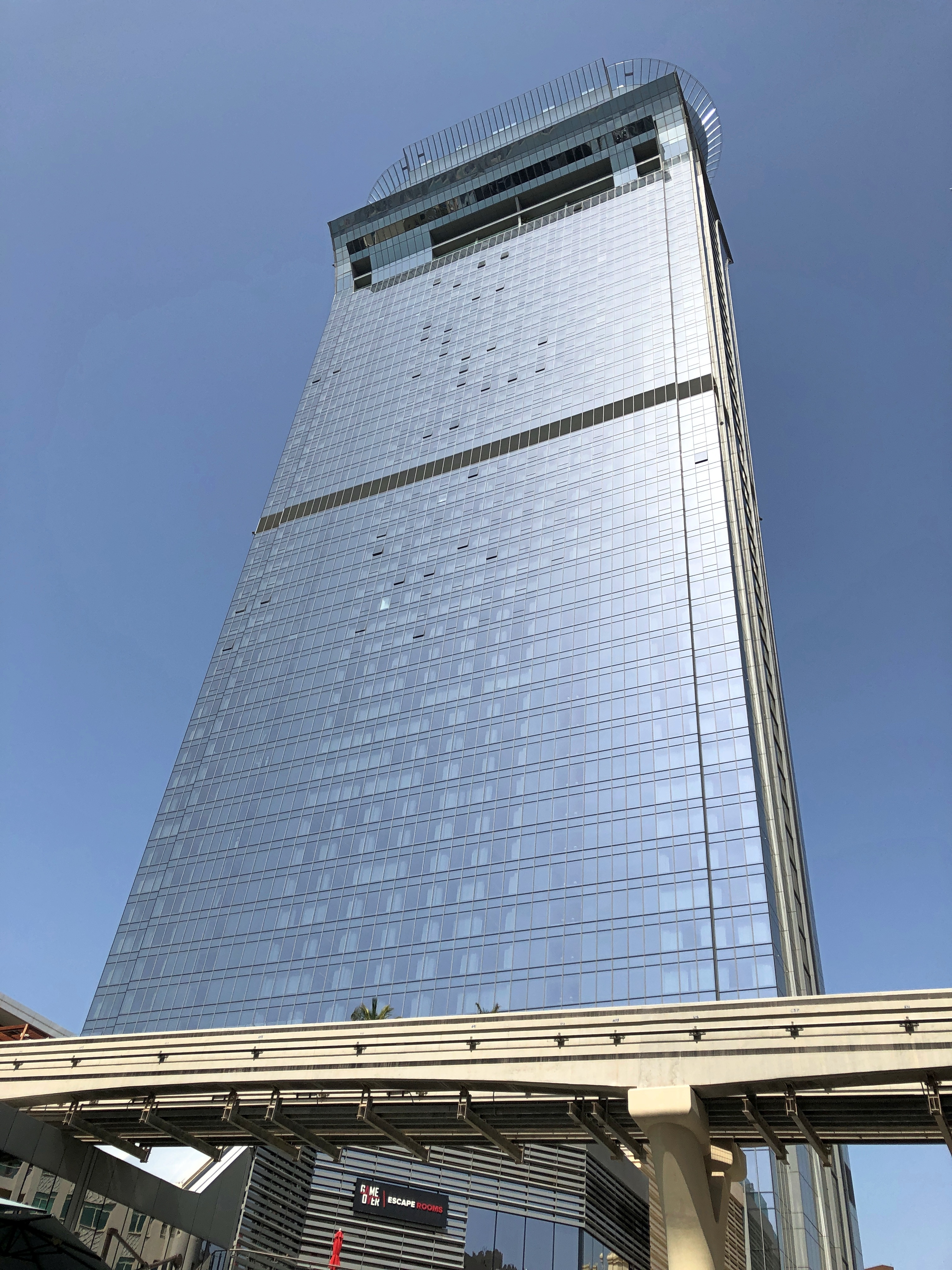
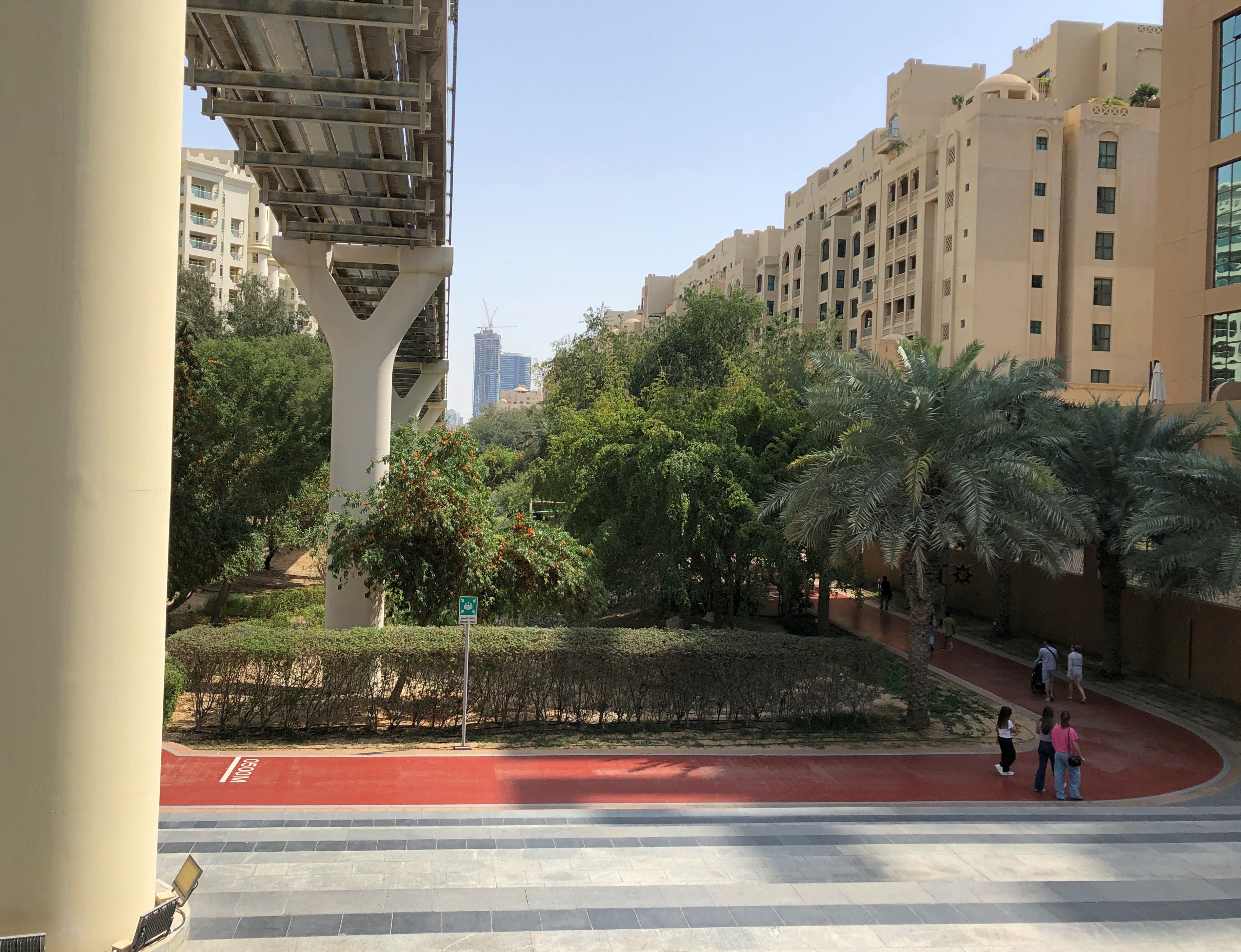
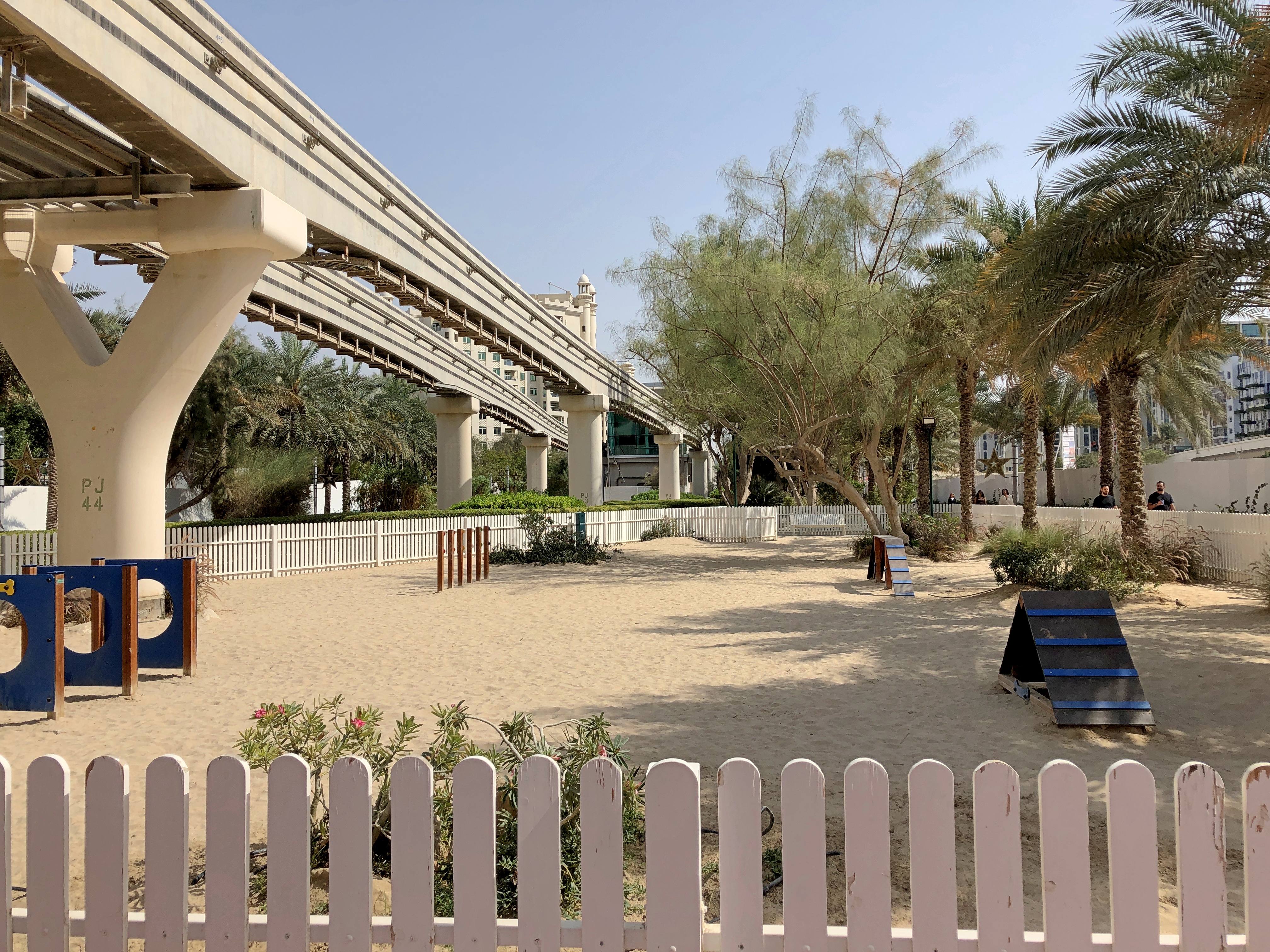
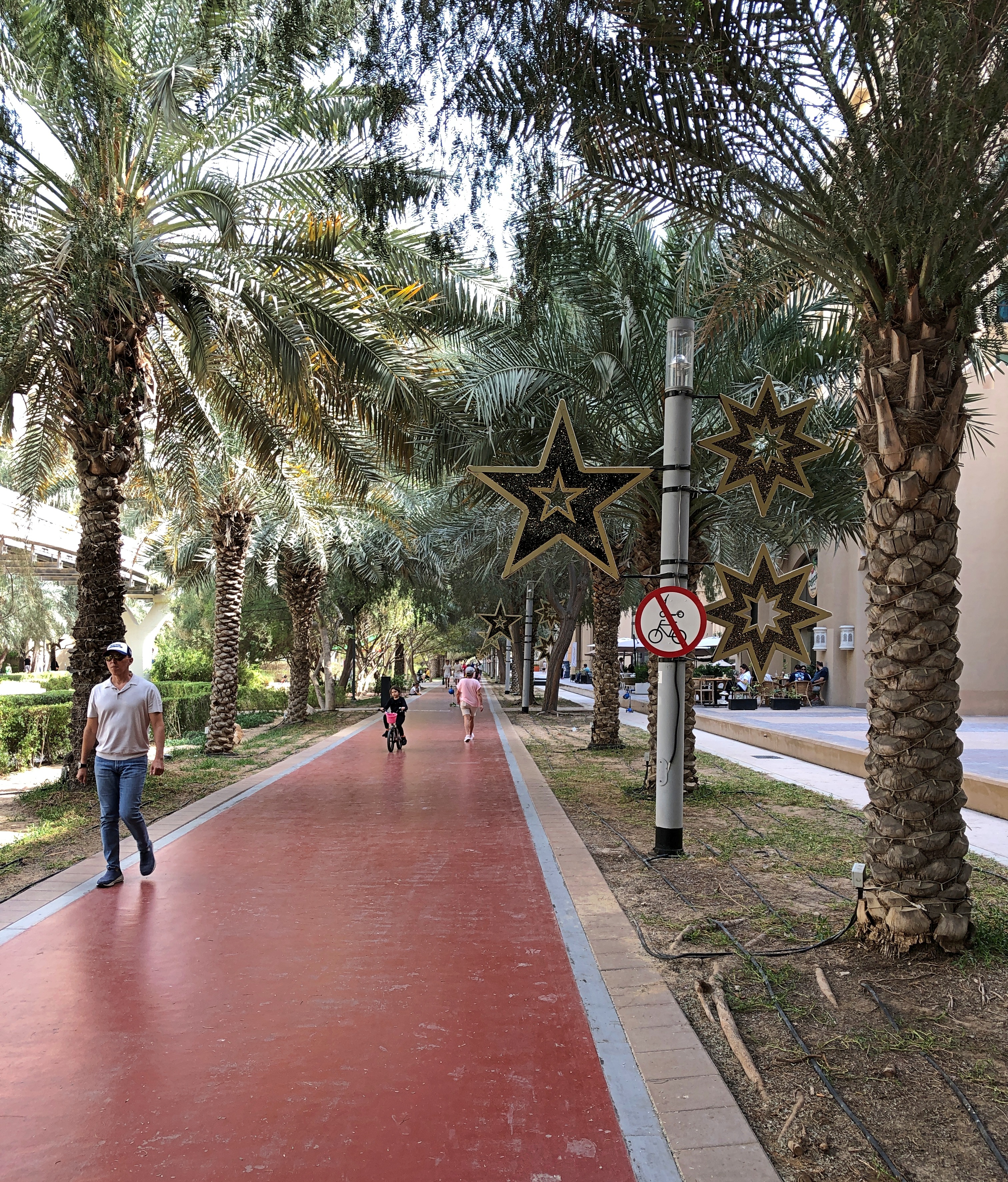
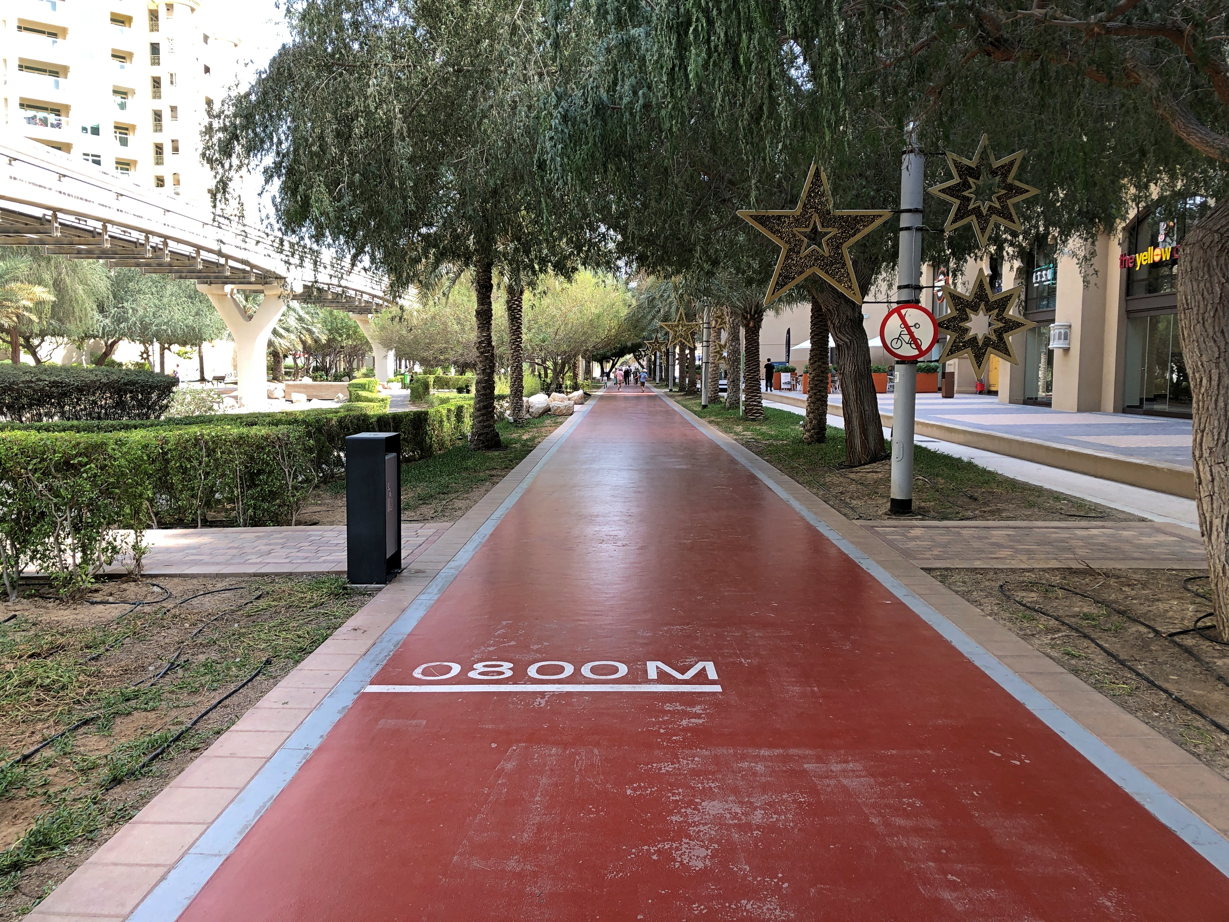
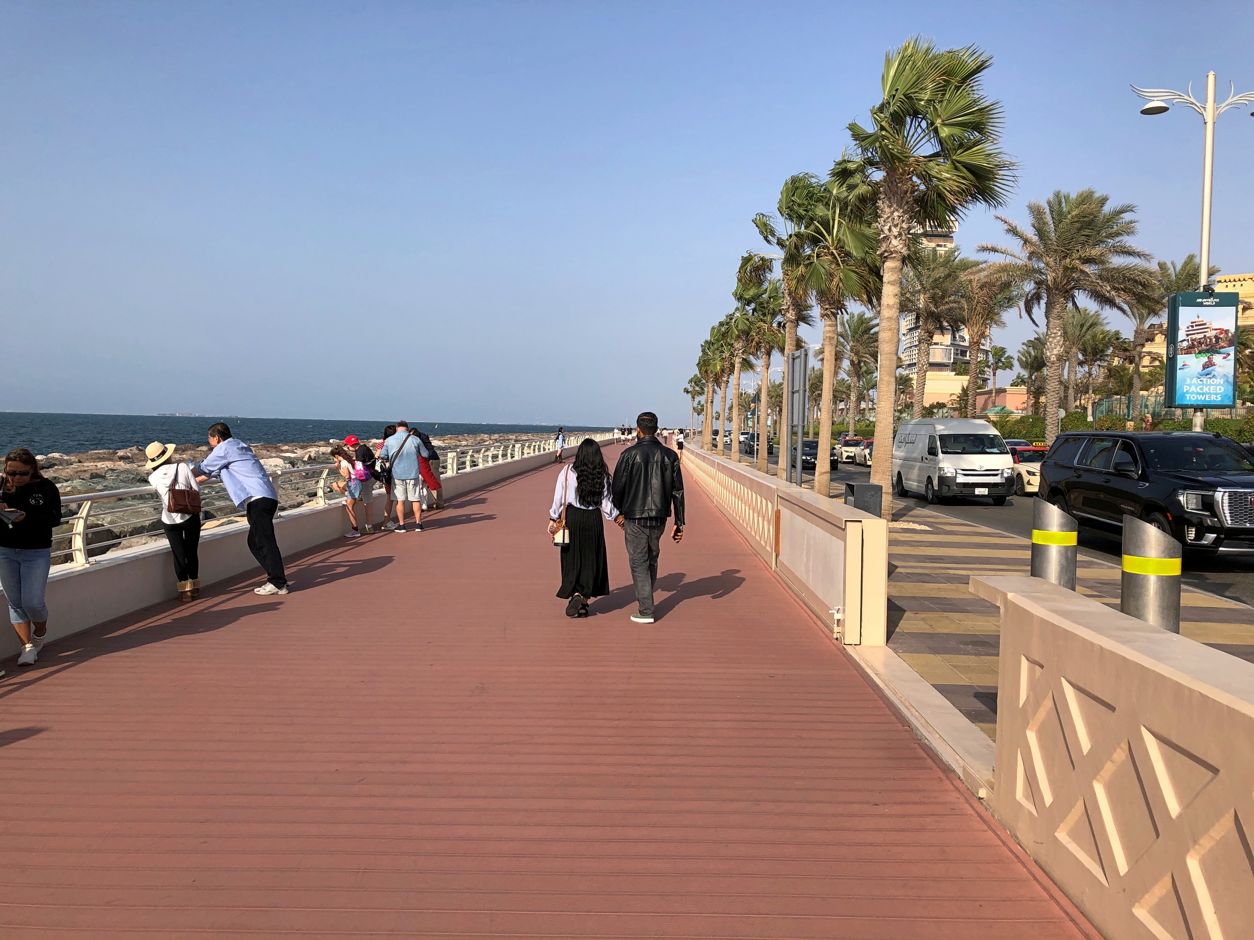
First stop, Nakeel Mall, named for the company that developed the Palm Jumeirah. Large enough, but nothing on the order of Dubai Mall, except for the high count of carriage-trade stores. The mall also provided access, down an outdoor staircase, to Al Ittihad Park, which runs part of the length of the trunk under the monorail.
Two walking-jogging trails run the length of the park as well. I walked.
The park is hemmed in by sizable structures on each side whose first floor (ground floor) is populated by high-end service providers, such as Petsville Palm Jumeirah, The Blowout Bar, The Golden Mile Gallery, Bedashing Beauty Lounge, and KIBERone IT school for children.
There were a fair number of benches for idlers and old men, but not a lot of occupants. I accessed a bench and for a little while watched a steady trickle of people walking the path, and mothers (or nannies) with young children visiting the playgrounds. Foliage blocked part of the sun, which was borderline intense that day.
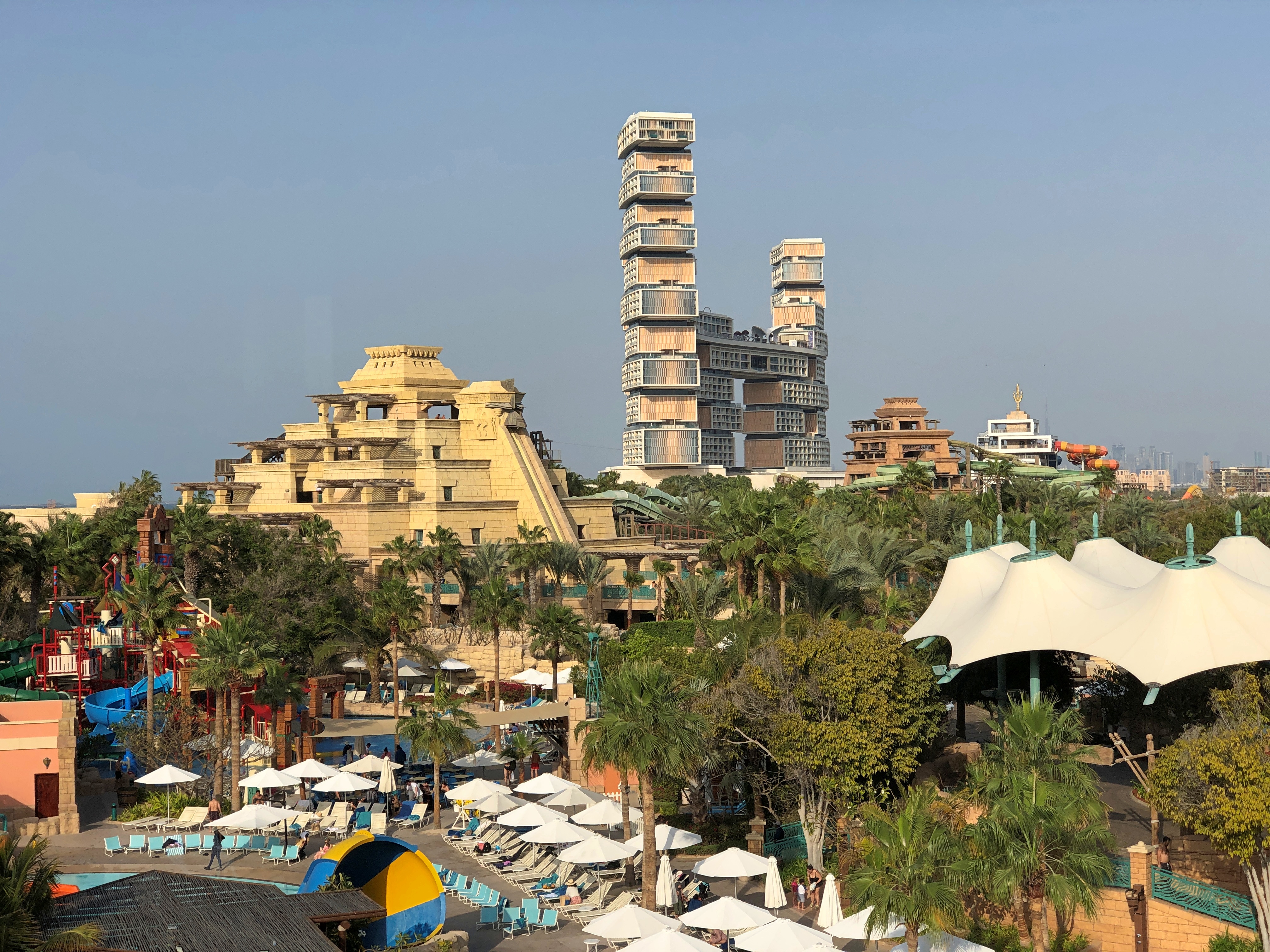
Quite the place, this neighborhood: created out of nothing not long ago, then Money was invited to live here. Money from wherever. And so it has, with an estimated population of about 25,000 out on the trunk and fronds.
You can speculate about some soggy future for such low-lying territory, but for now, it’s prime real estate. That means that engineers, who are paid to do so, are thinking about upgrades. I can’t pretend any knowledge of hydrology, so for all I know, their efforts will match those of King Cnut, but the abstract makes for interesting reading.
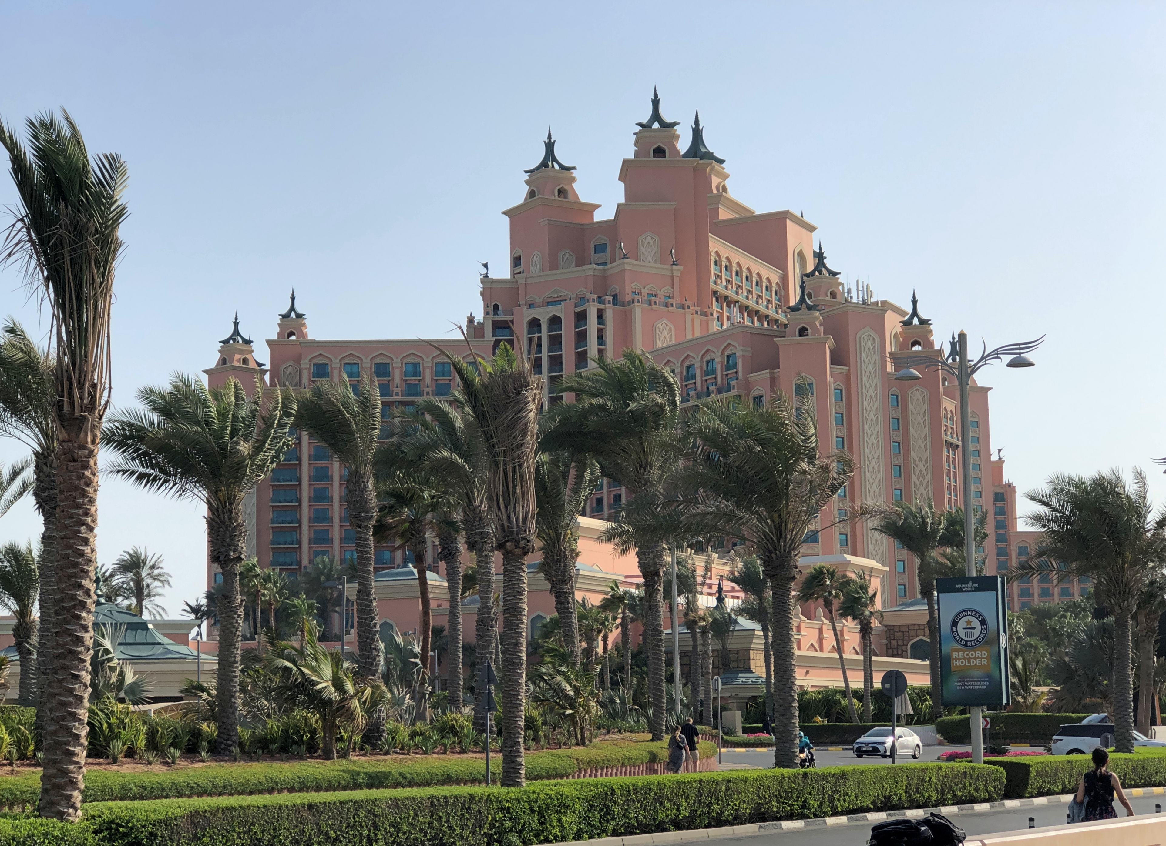
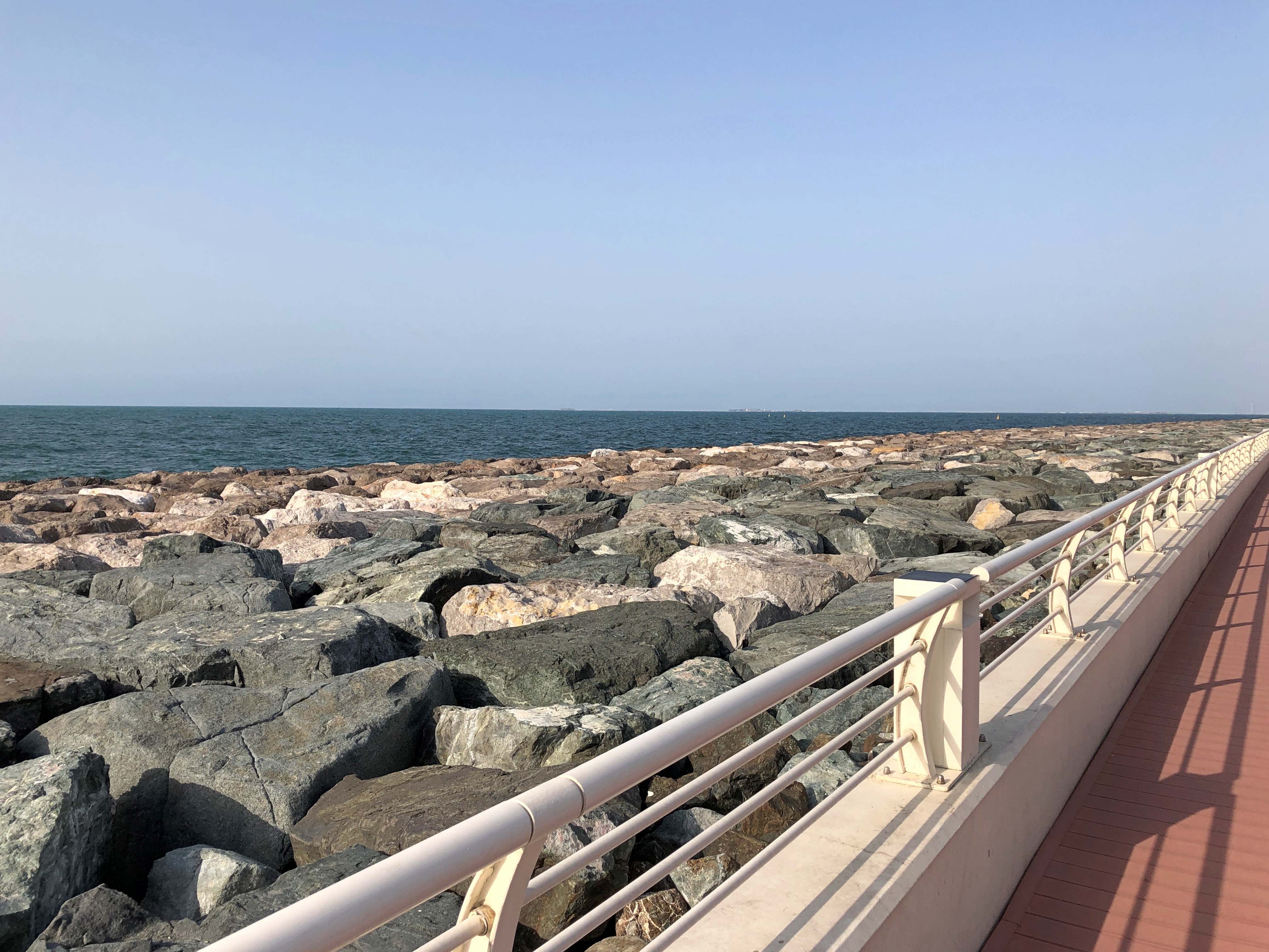
The end of the line for the monorail is at the tip of the Palm. A district of resorts, hotels and more upscale shopping. A short walk takes you from the station to a seaside path within sight of the storied Persian Gulf.
Very storied. Going back at least to Sumer, up the coast a long way, but still on the shore of this sea.
