Black Canyon of the Gunnison National Park

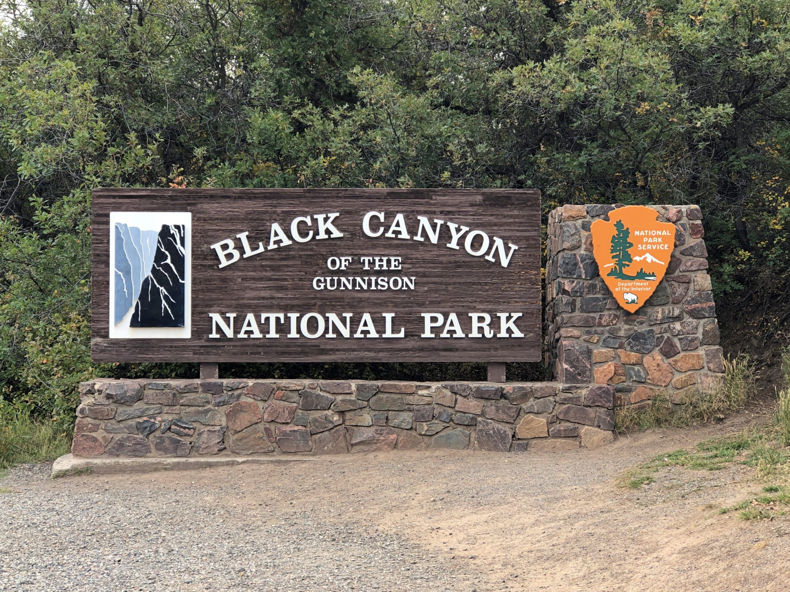
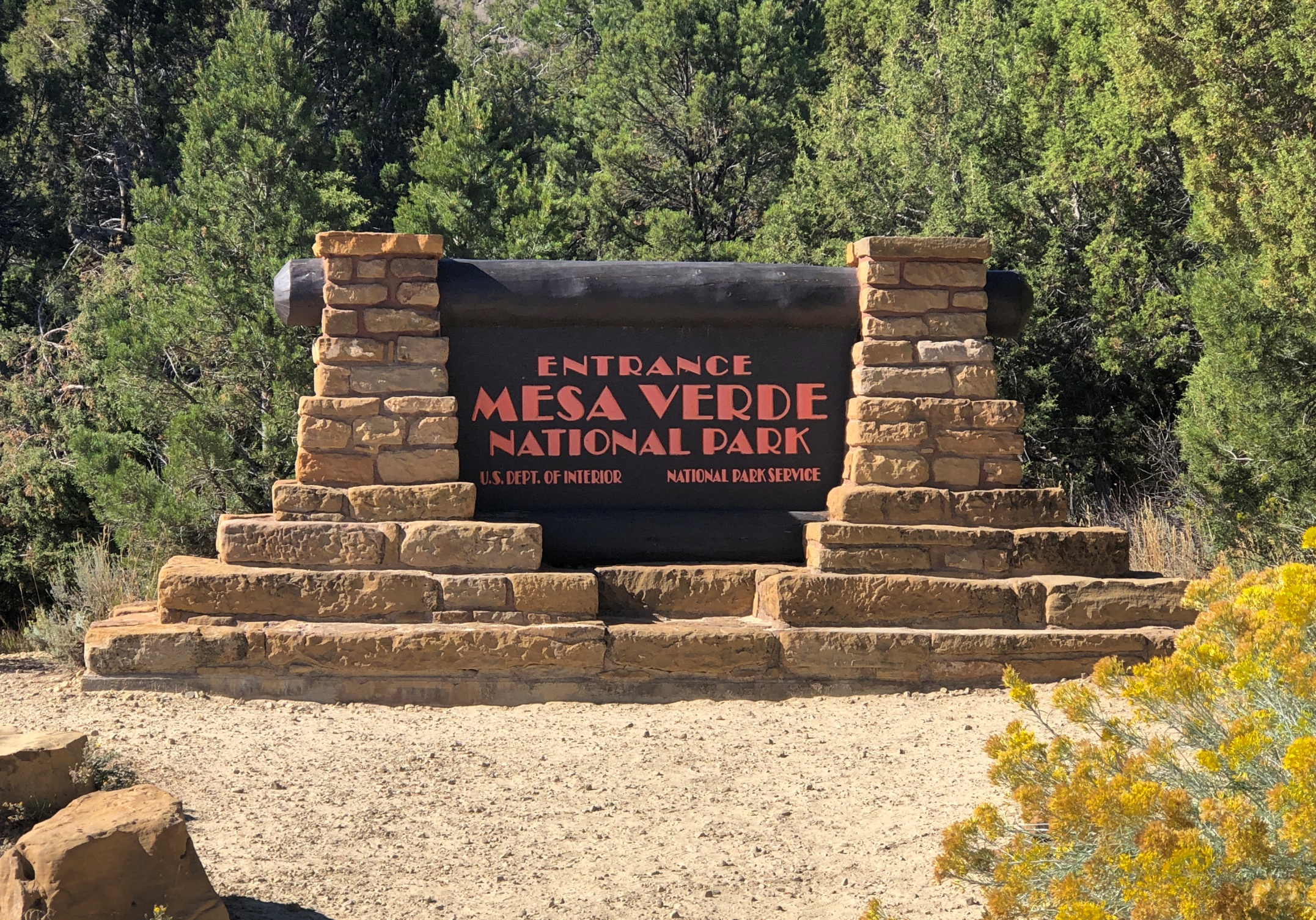
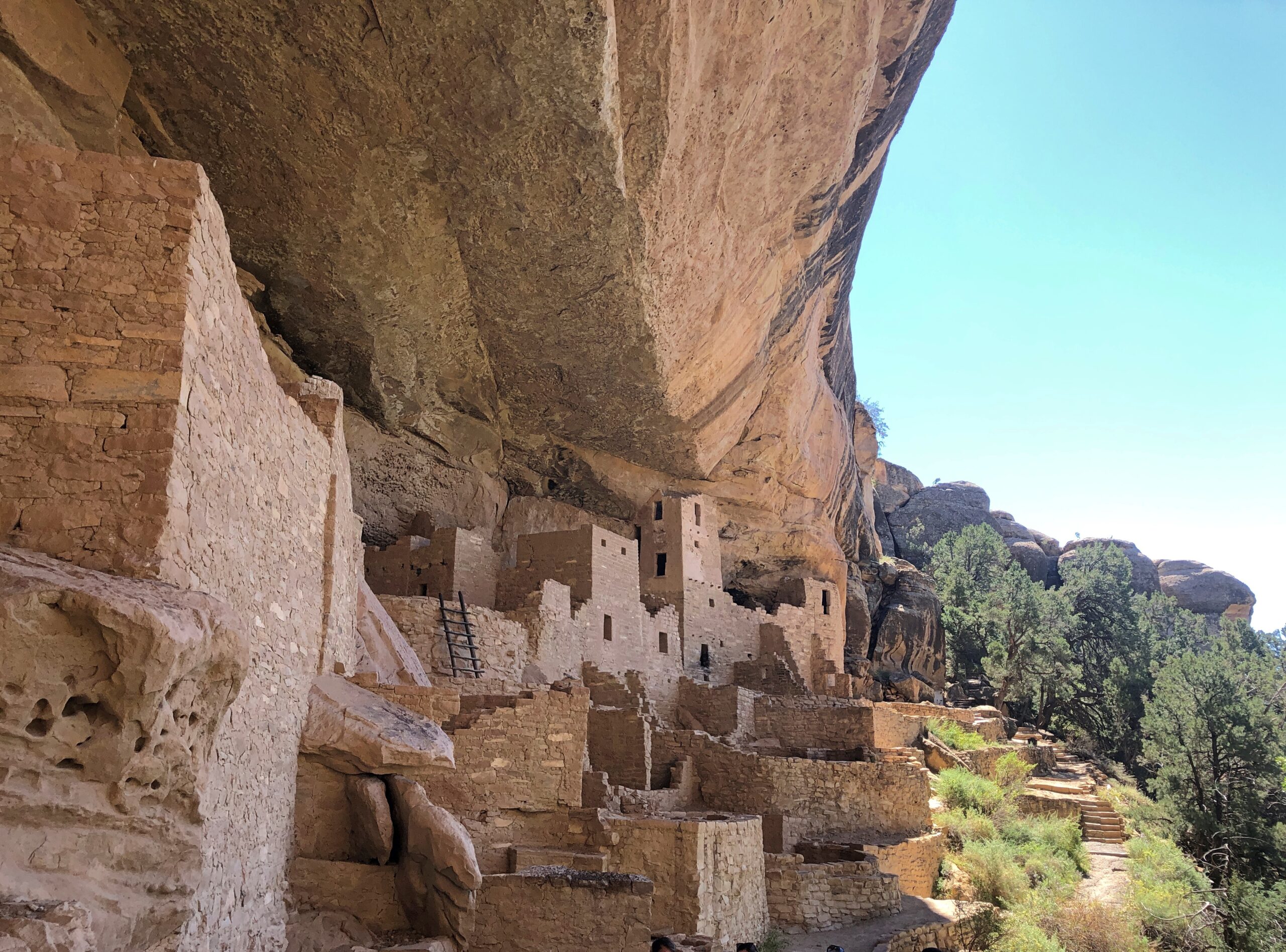
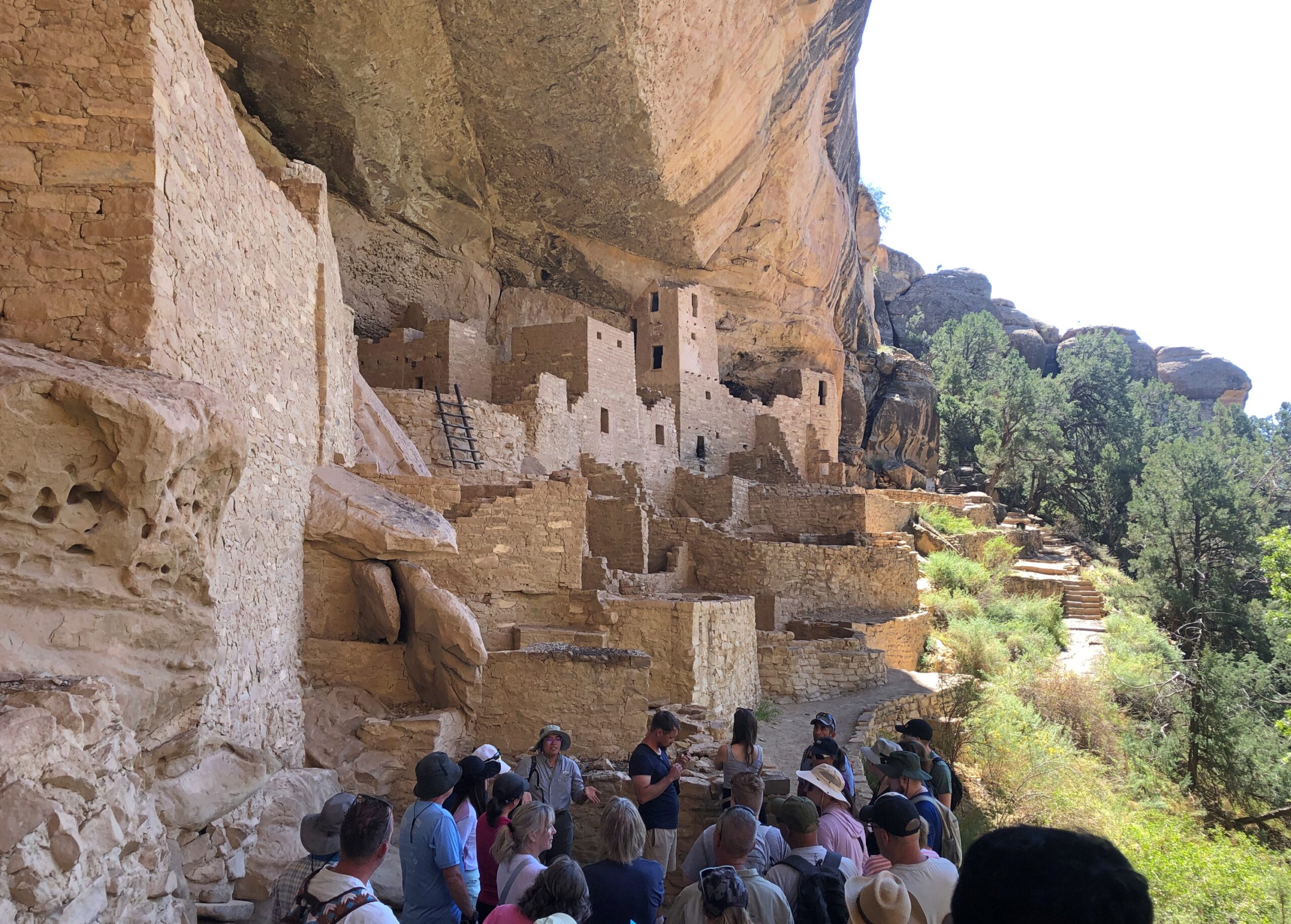
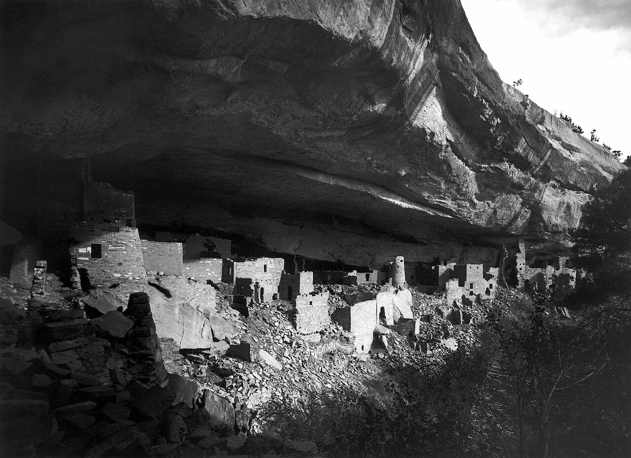
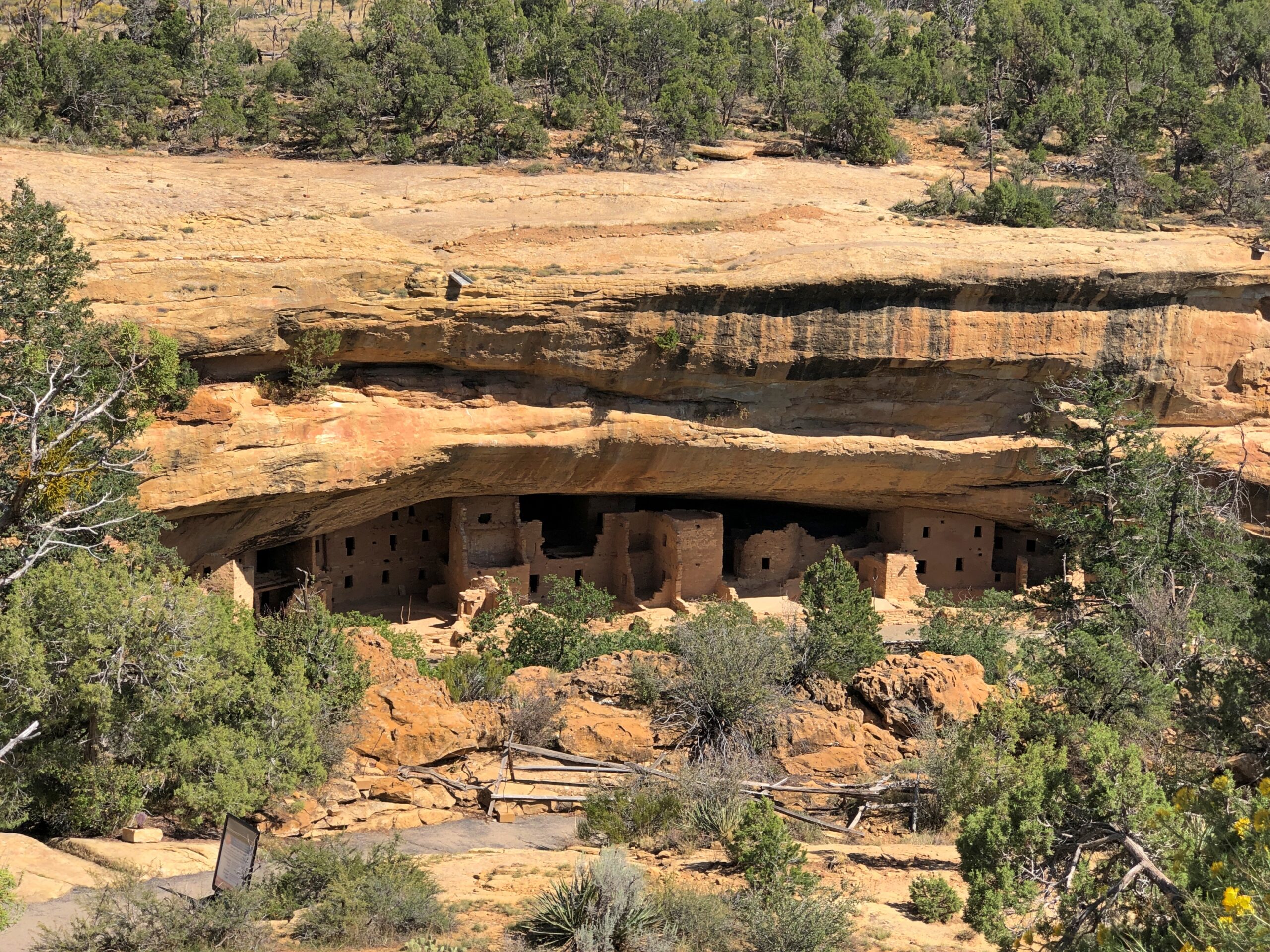
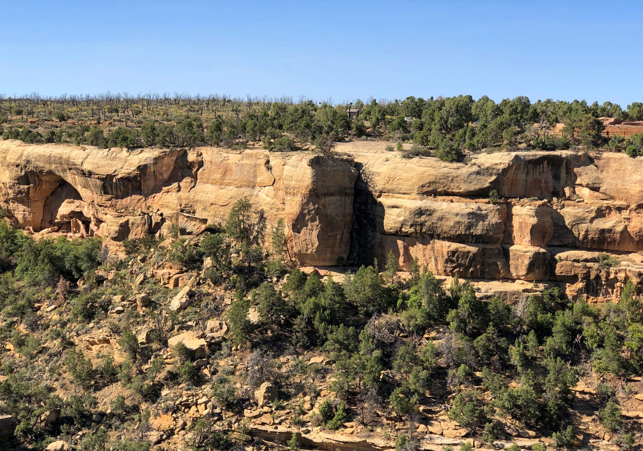
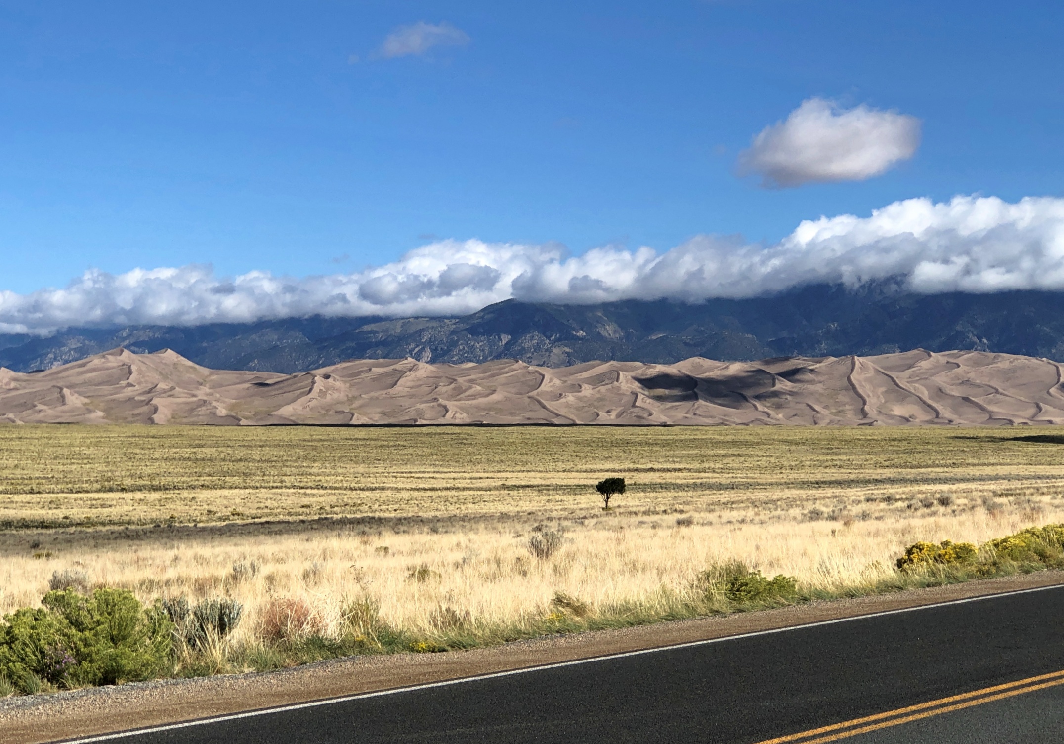
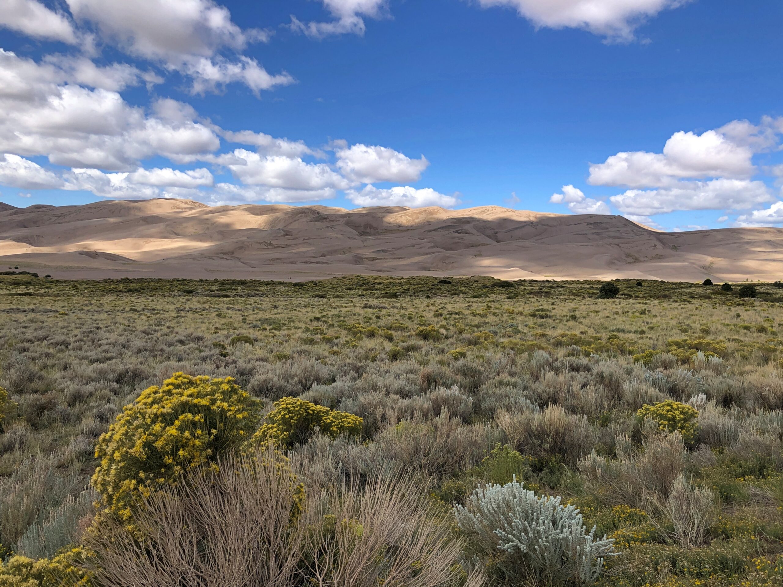
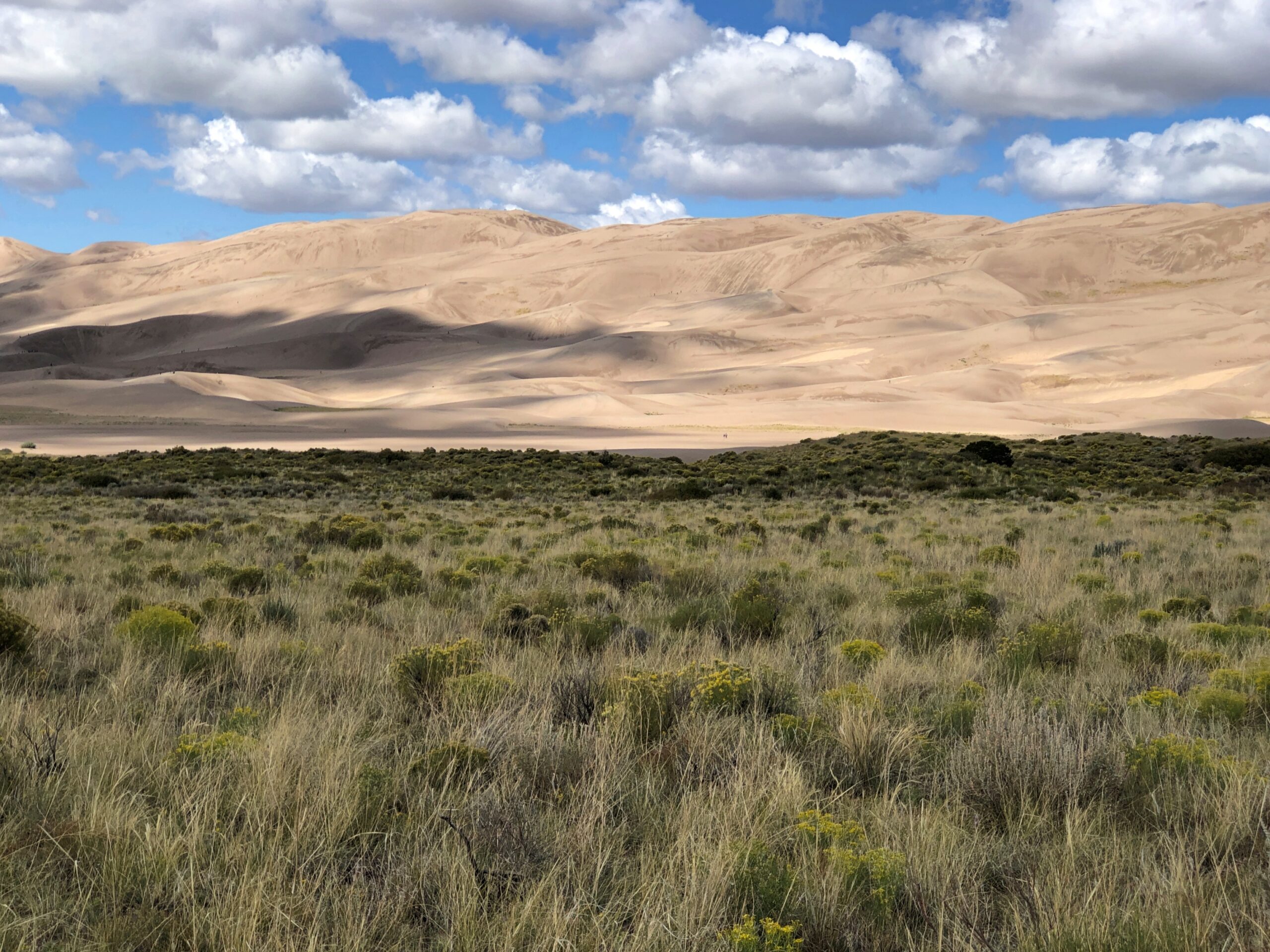
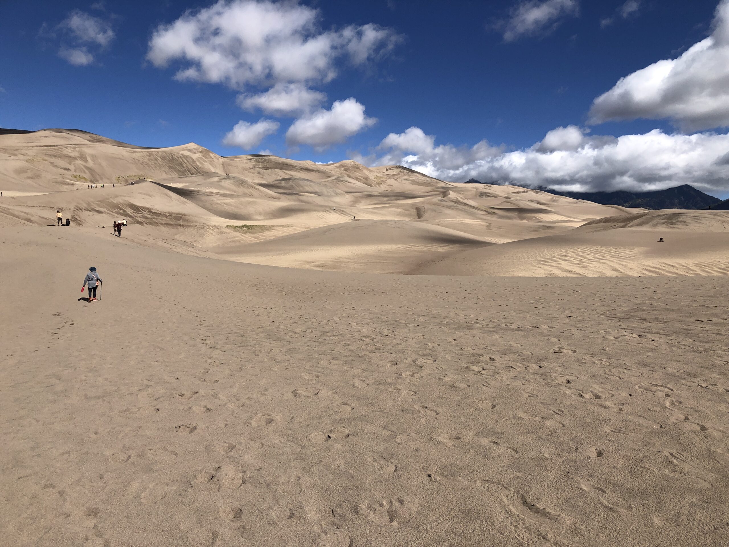
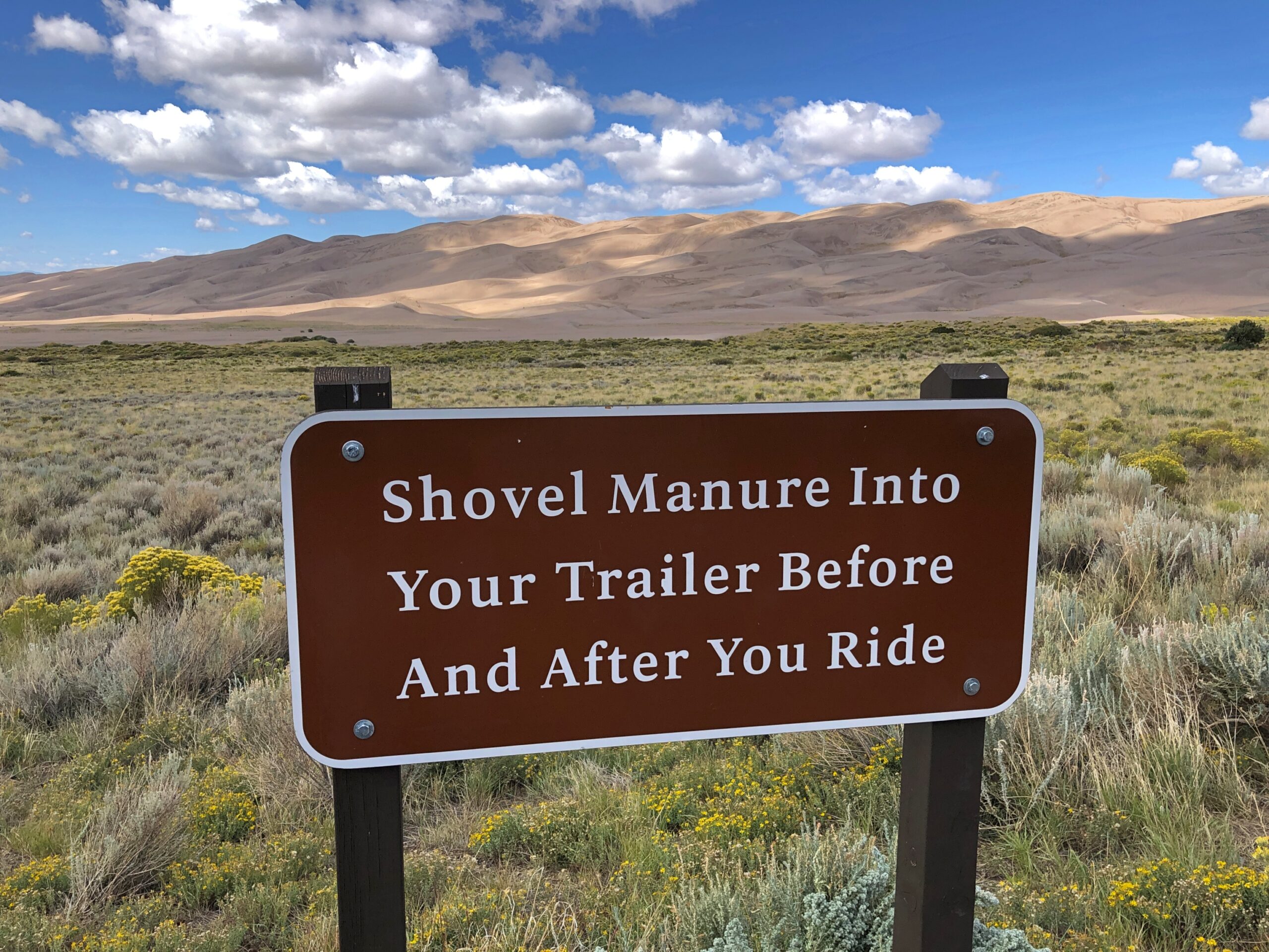
A vast stretch of mountains majesty well over the tree line, a complex mass of sand piled at the edge of rugged mountains, and the well-hewn cliffside relics of a people remote in time but whose presence endures – the first three national parks we visited in Colorado in September all rated as exceptional destinations. But I’m glad, simply because it was last on the clockwise loop I’d planned through the state, that Black Canyon of the Gunnison National Park came last. It would have been a hard act to follow.

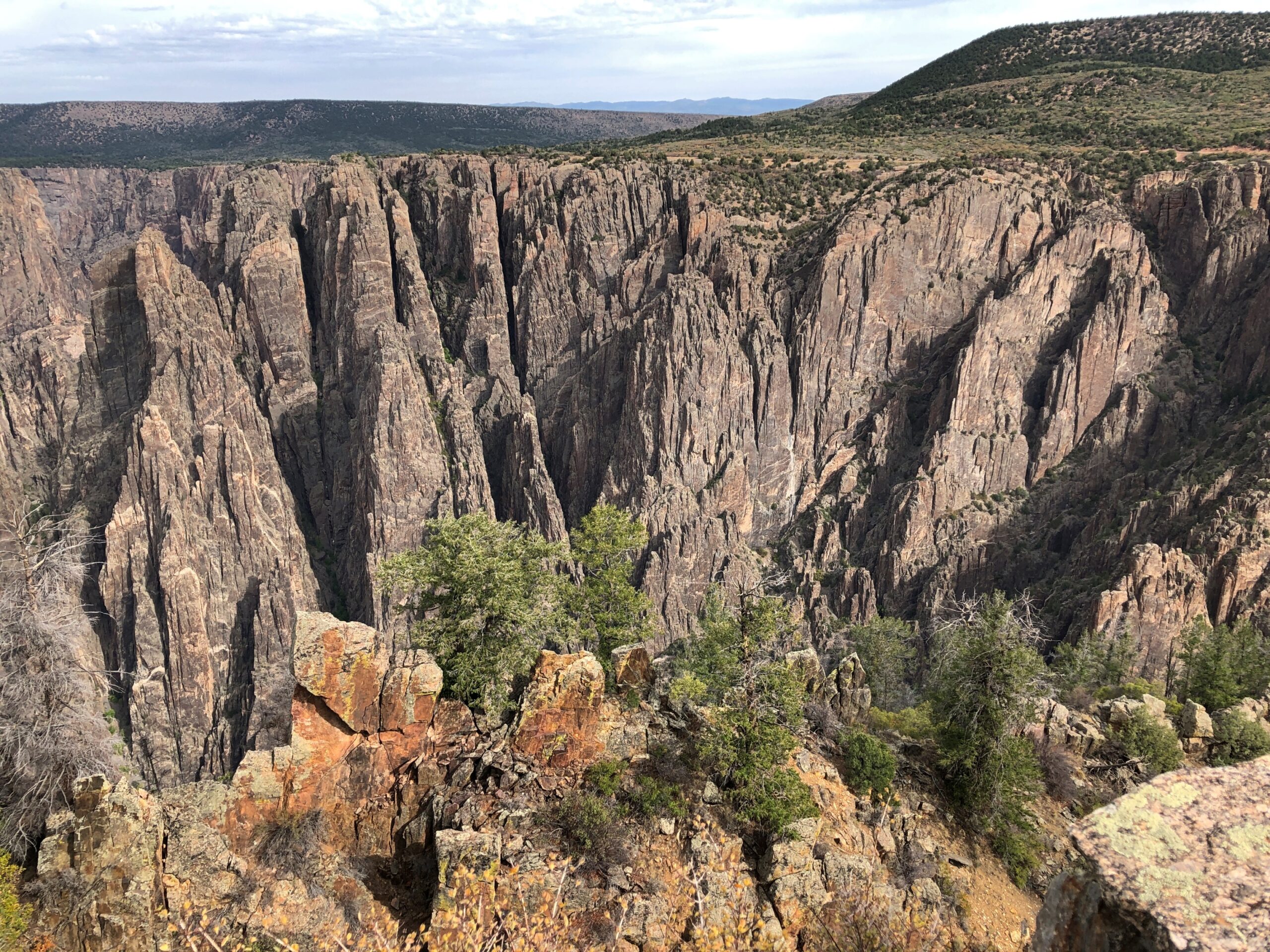
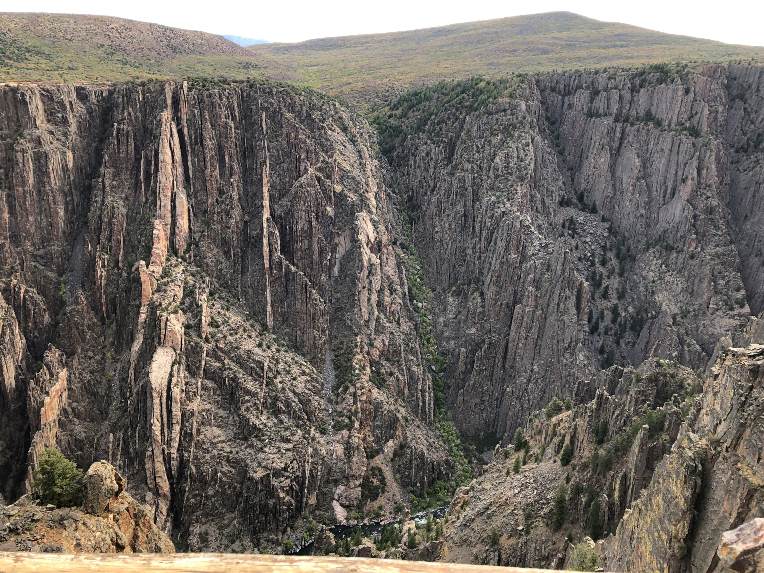
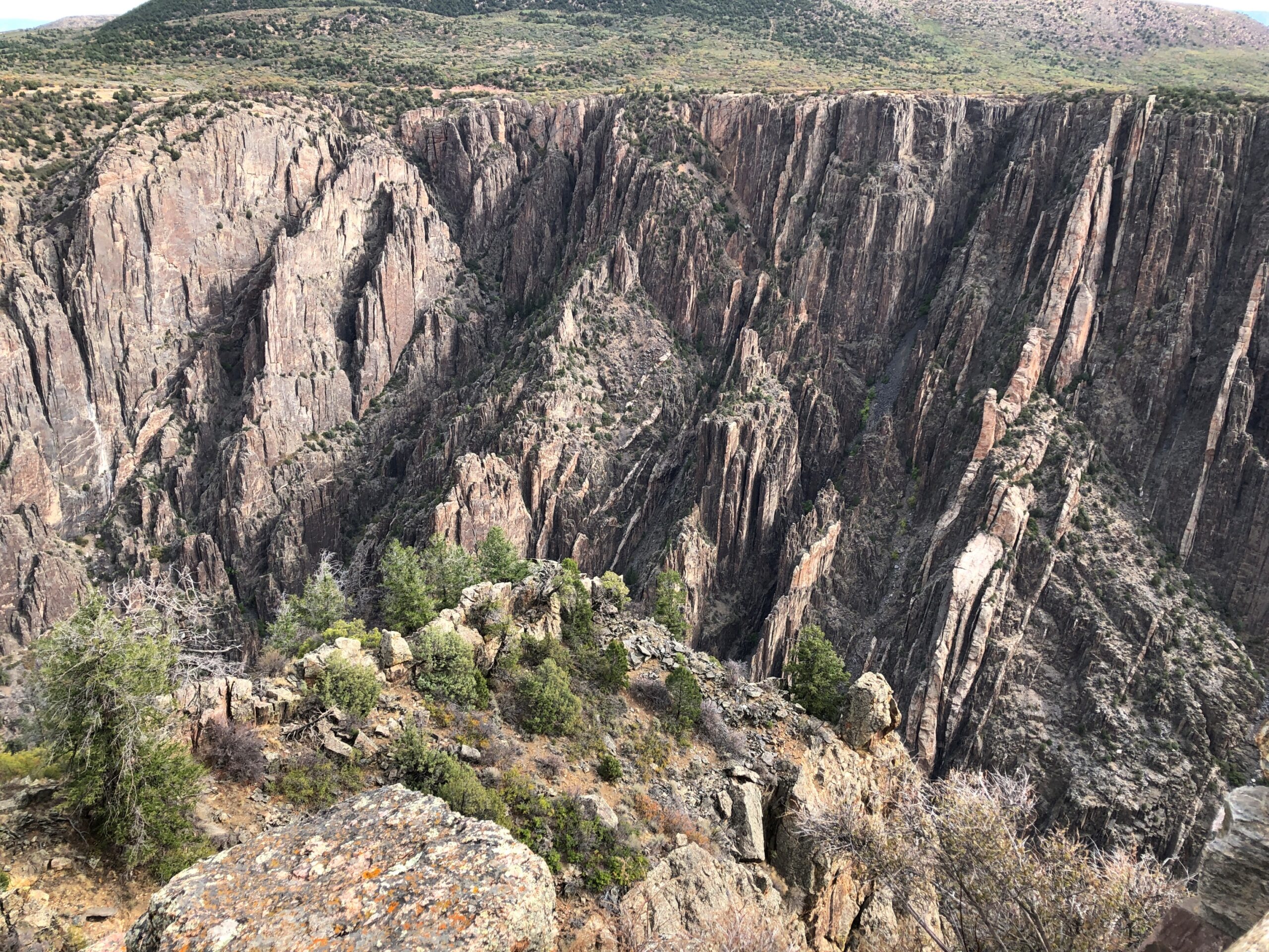
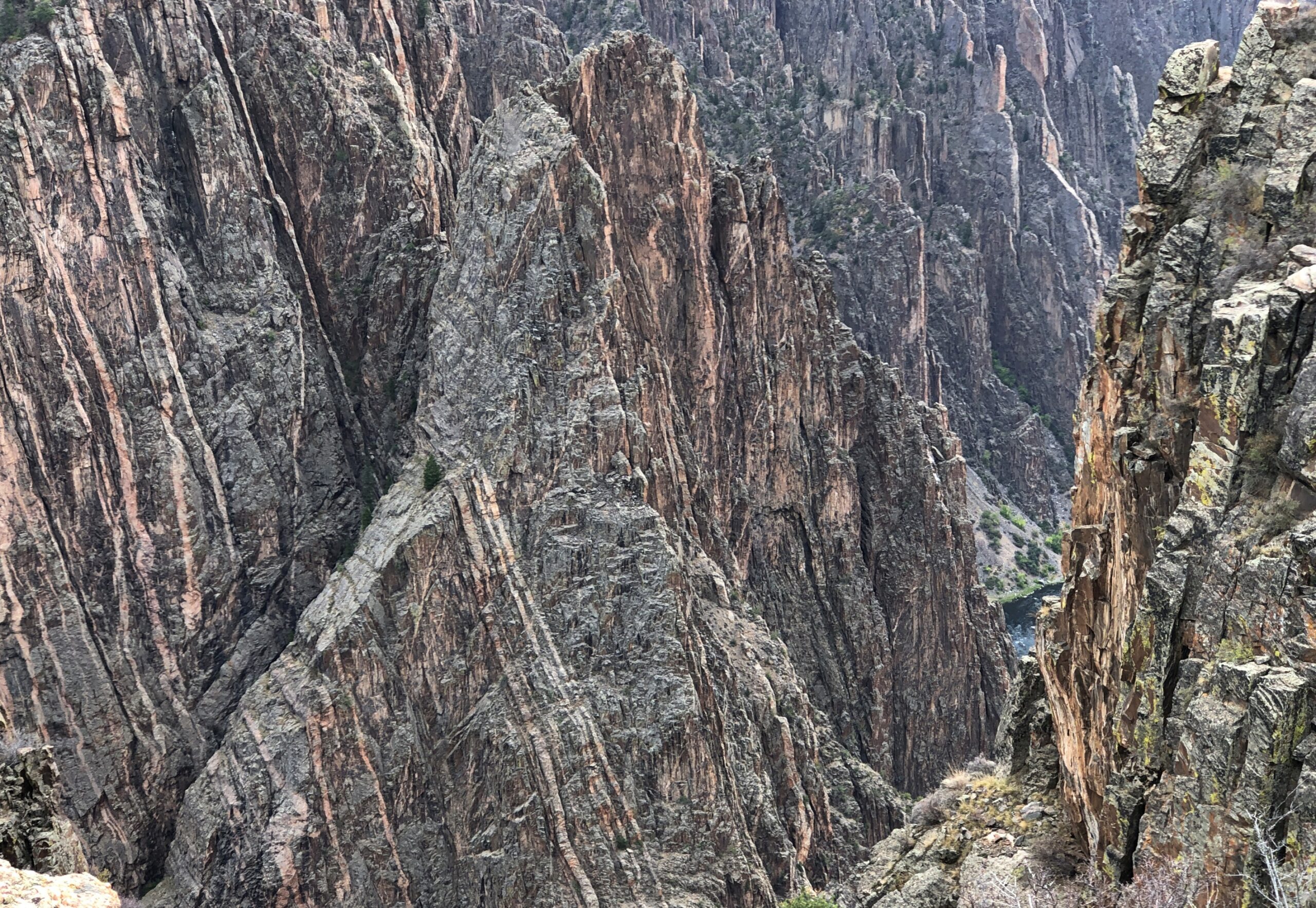
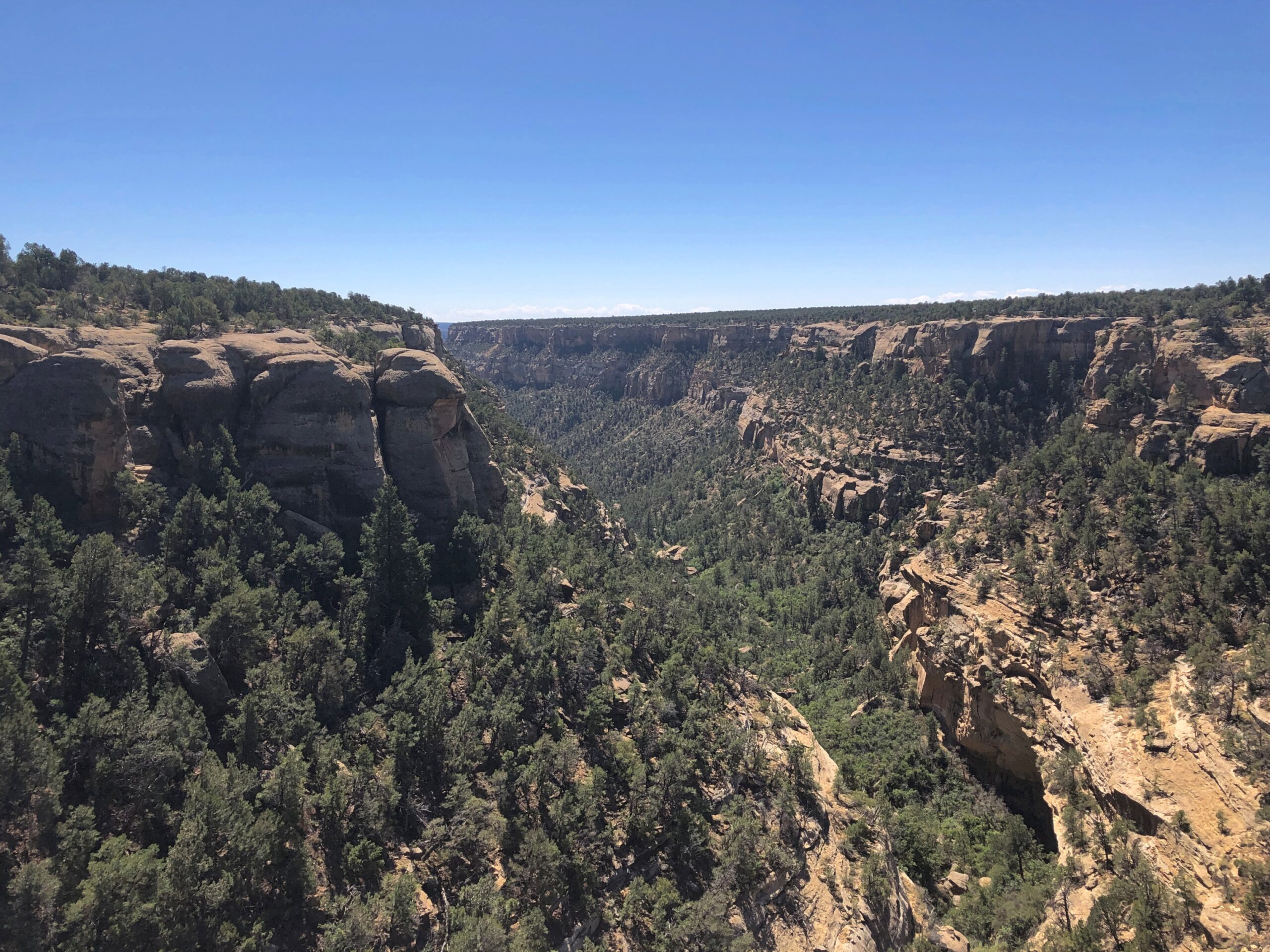
As a steep – and really deep – crack in the earth, the Black Canyon lives up its name, with most of the canyon cast in shadow most of the time, striking in its seeming darkness. But not pitch black all the way down its 2,000-foot cliffs. Far away, a whitish irregular ribbon runs through the gray bottom of the canyon, quickly recognizable as a river in quicksilver motion. The Gunnison, that is.

If there were no other people around, which happened sometimes at this park, you could hear the roar of the river. Faint, but distinct in its power. Mass snow melts and rushing tributary creeks enable the Gunnison to act (on a geological time scale) like a high-powered saw cutting through rocks that are unimaginably ancient. Before long, that is 2 million years, the river gouged the crack you see, exposing rocks 1,000 times older than the time it took to cut the canyon.

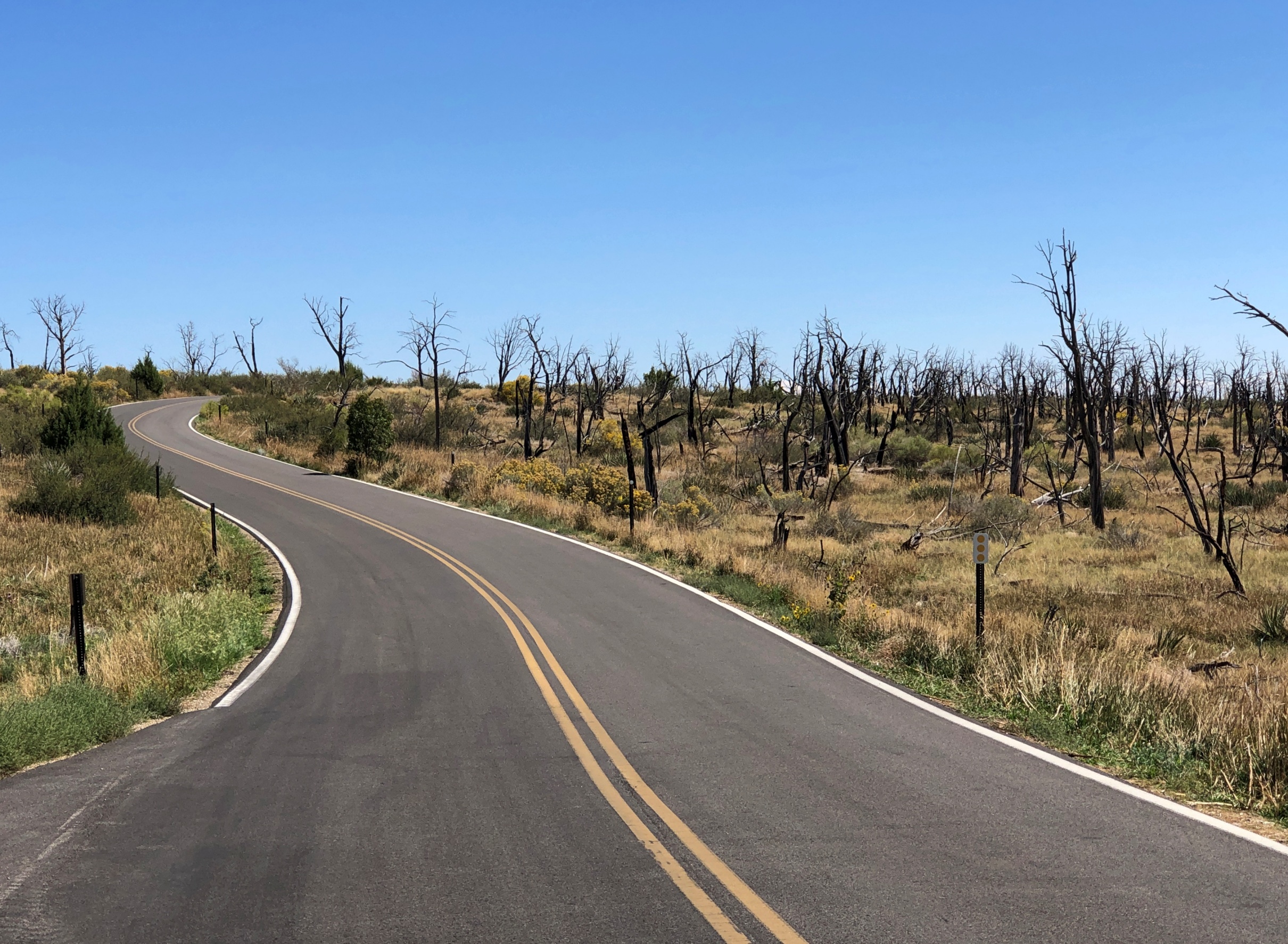
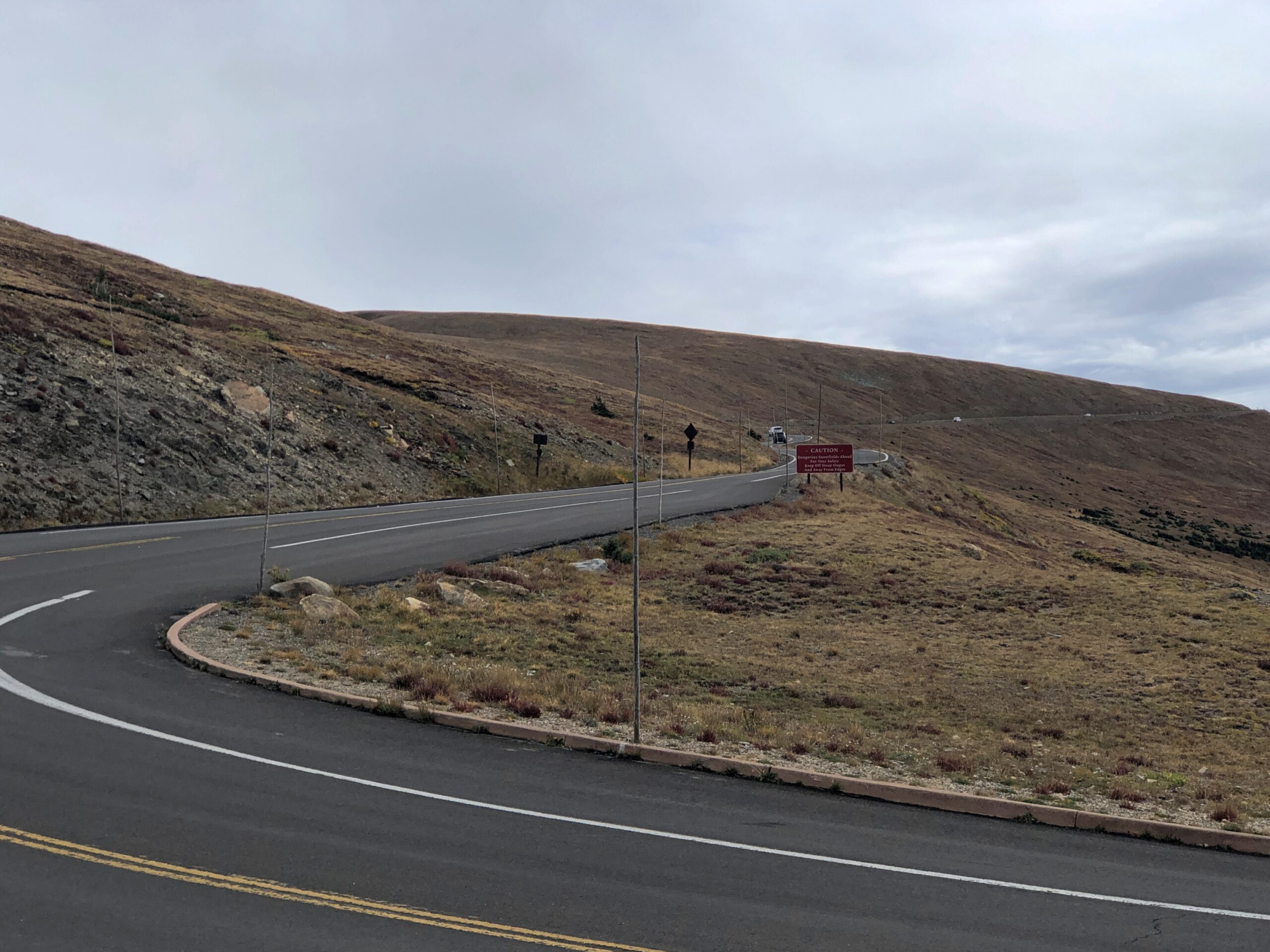
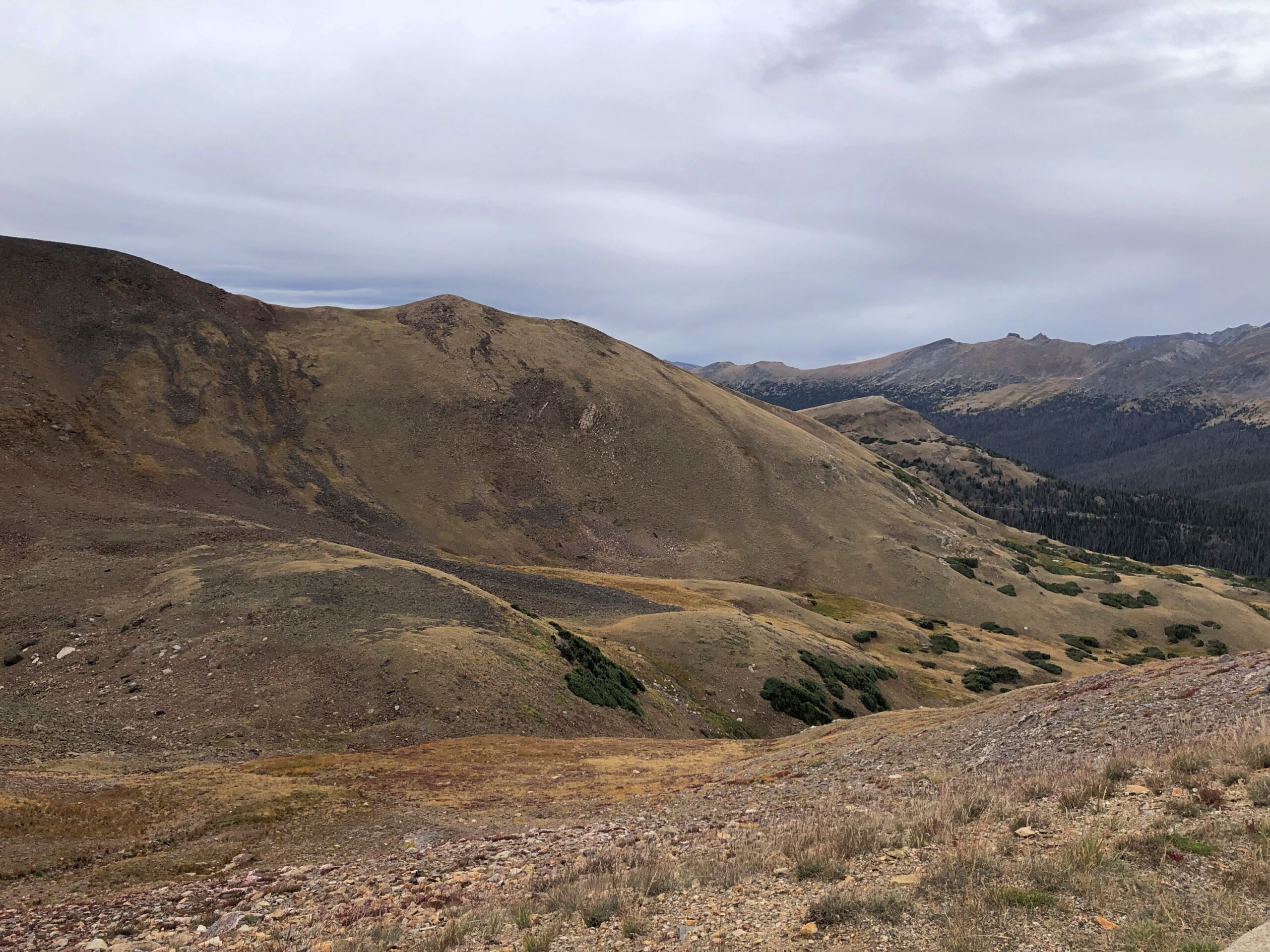
A single two-lane road snakes about seven miles along the south rim of the canyon (should I even have to say it? By the CCC), offering a string of overlooks. Not far from the park entrance, an overlook gives a taste of vistas to come. I might have named the place Gray Canyon, but that isn’t quite as poetic, is it?

Black Canyon of the Gunnison

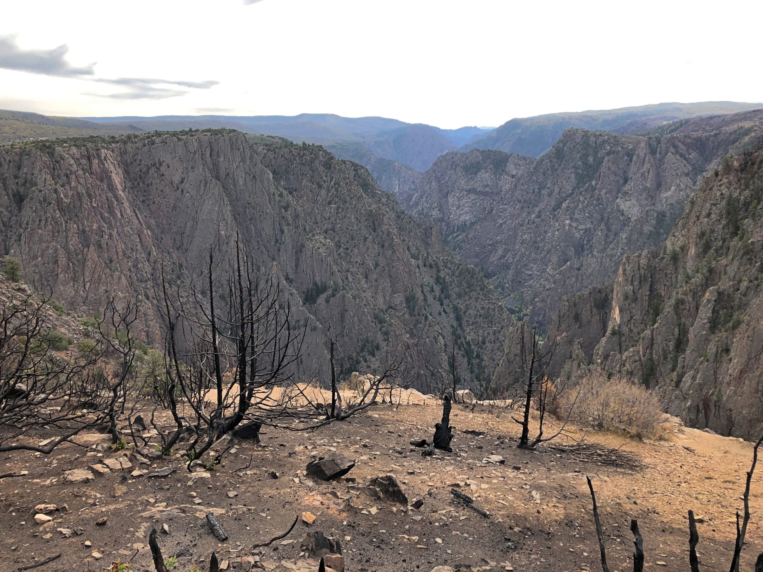
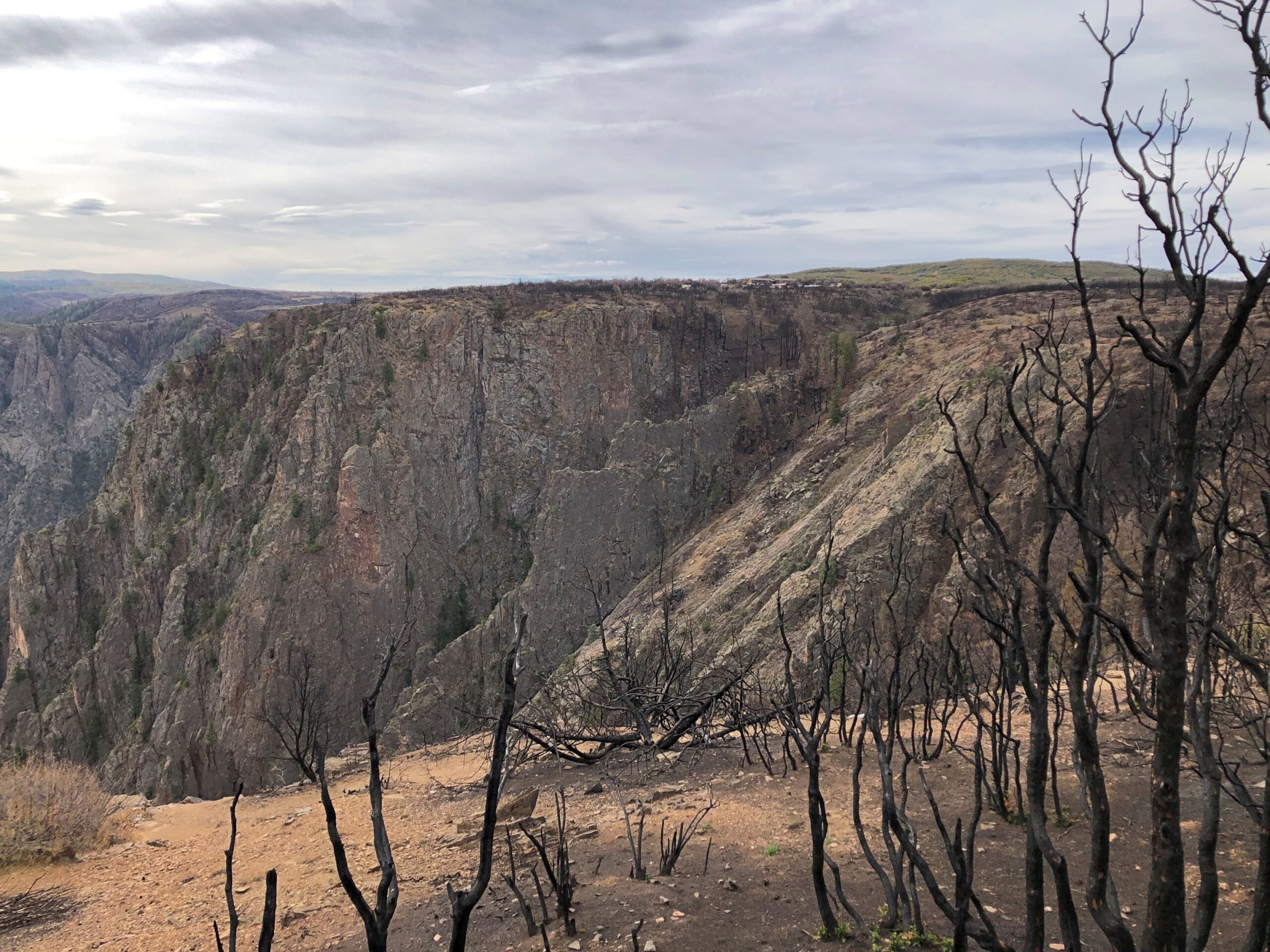
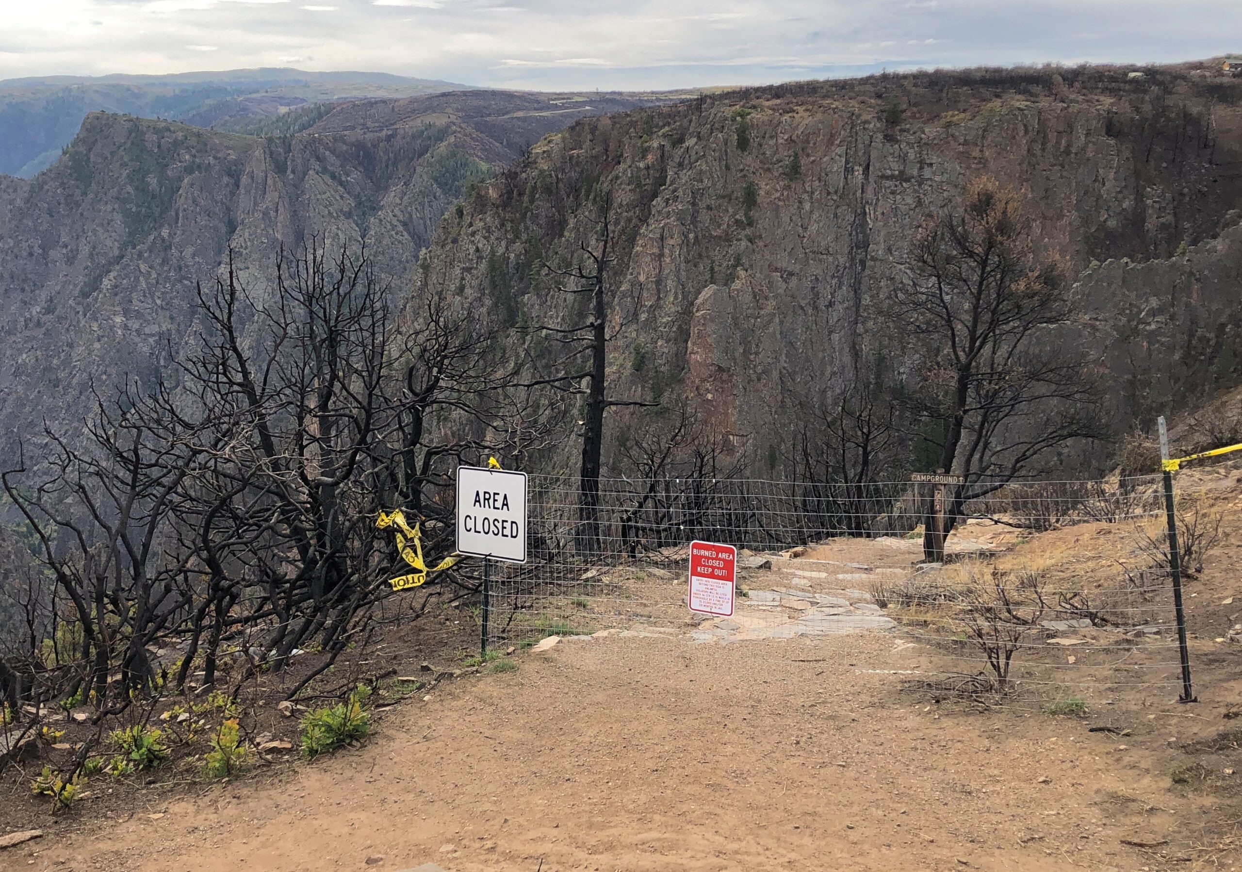
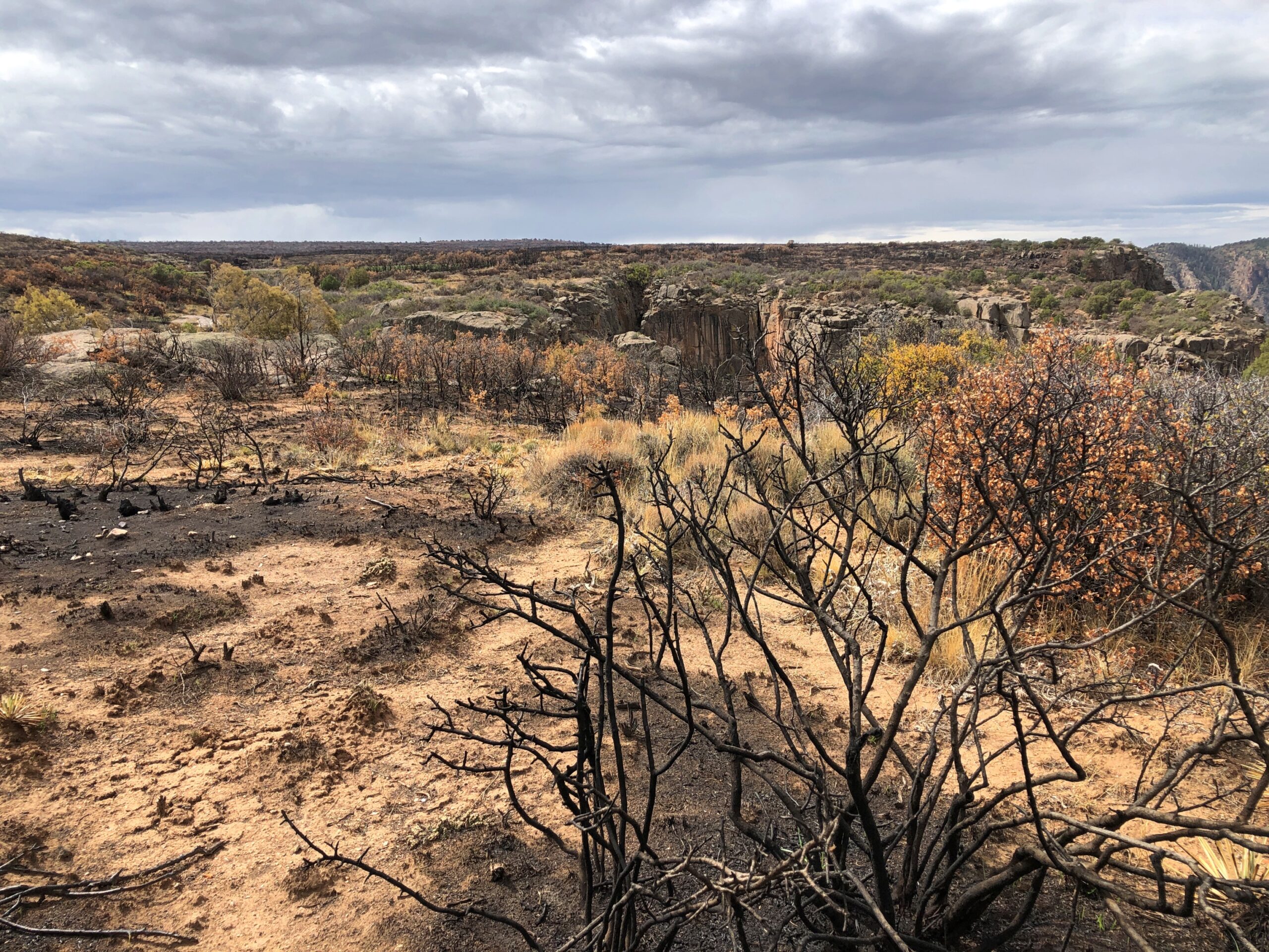
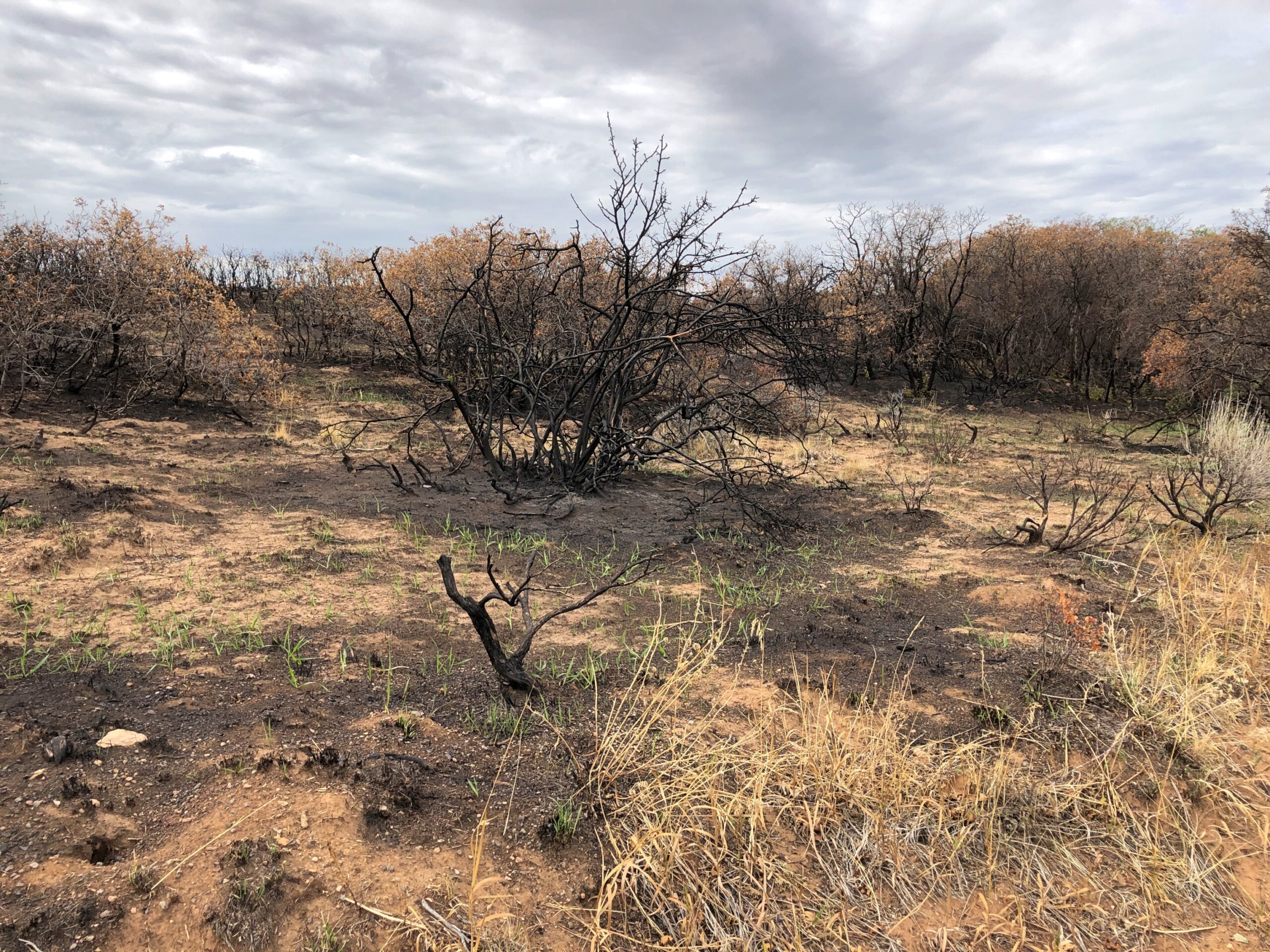
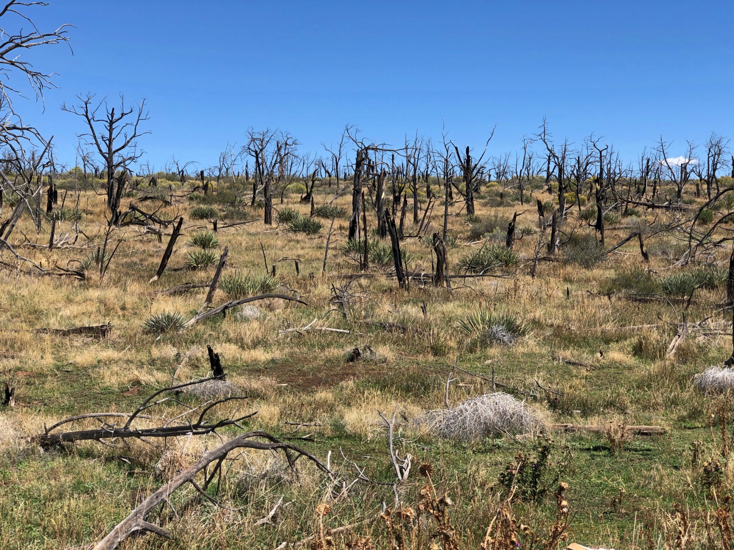
Also, evidence of the fire that swept through the park in July, burning about a total of about 4,000 acres on both the south and north rims, along with some Park Service infrastructure. A number of trails leading away from the south rim overlooks were still closed when we visited the park on September 19, with signs disallowing access to charred grounds and slopes.

Black Canyon of the Gunnison

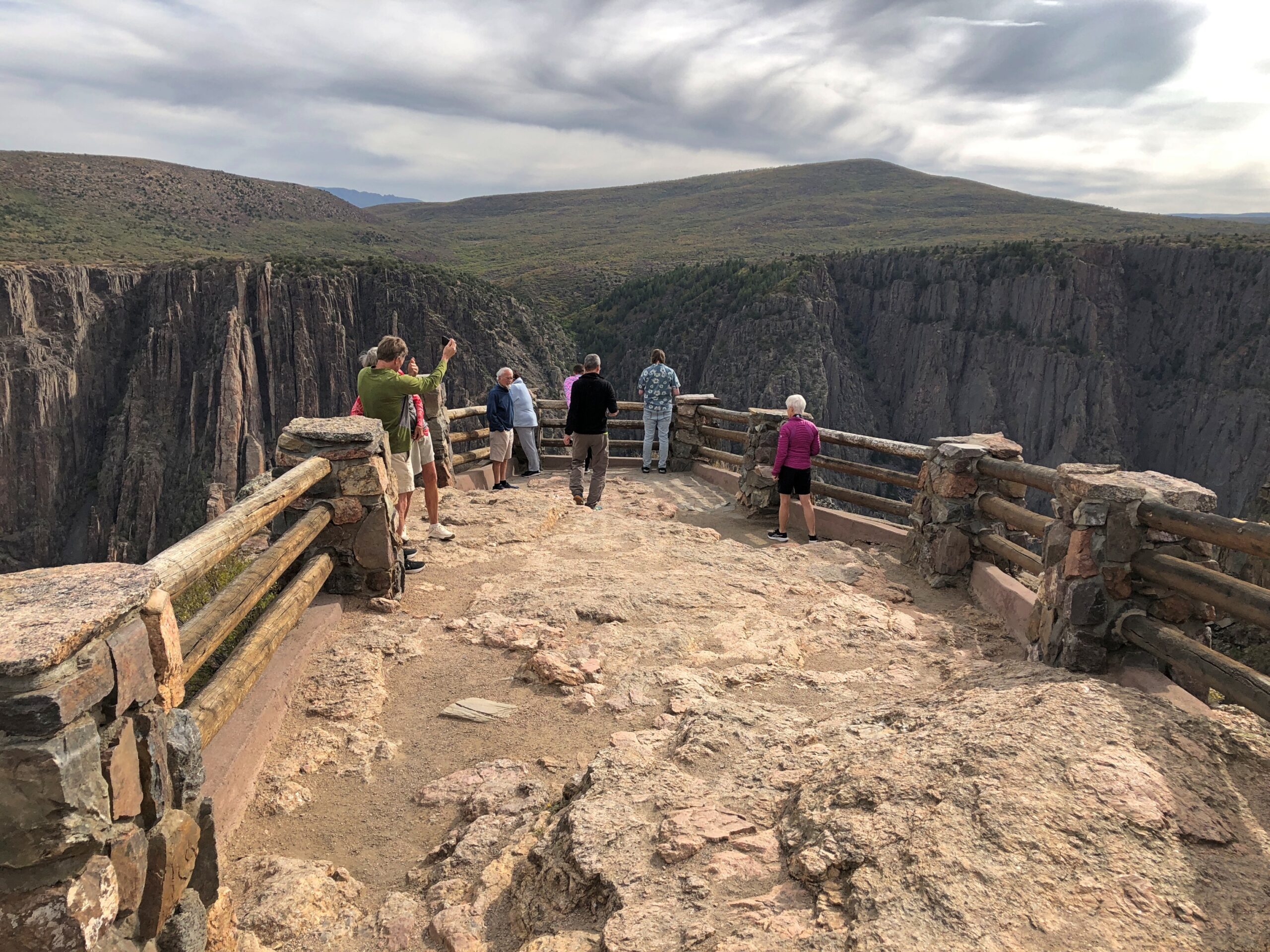
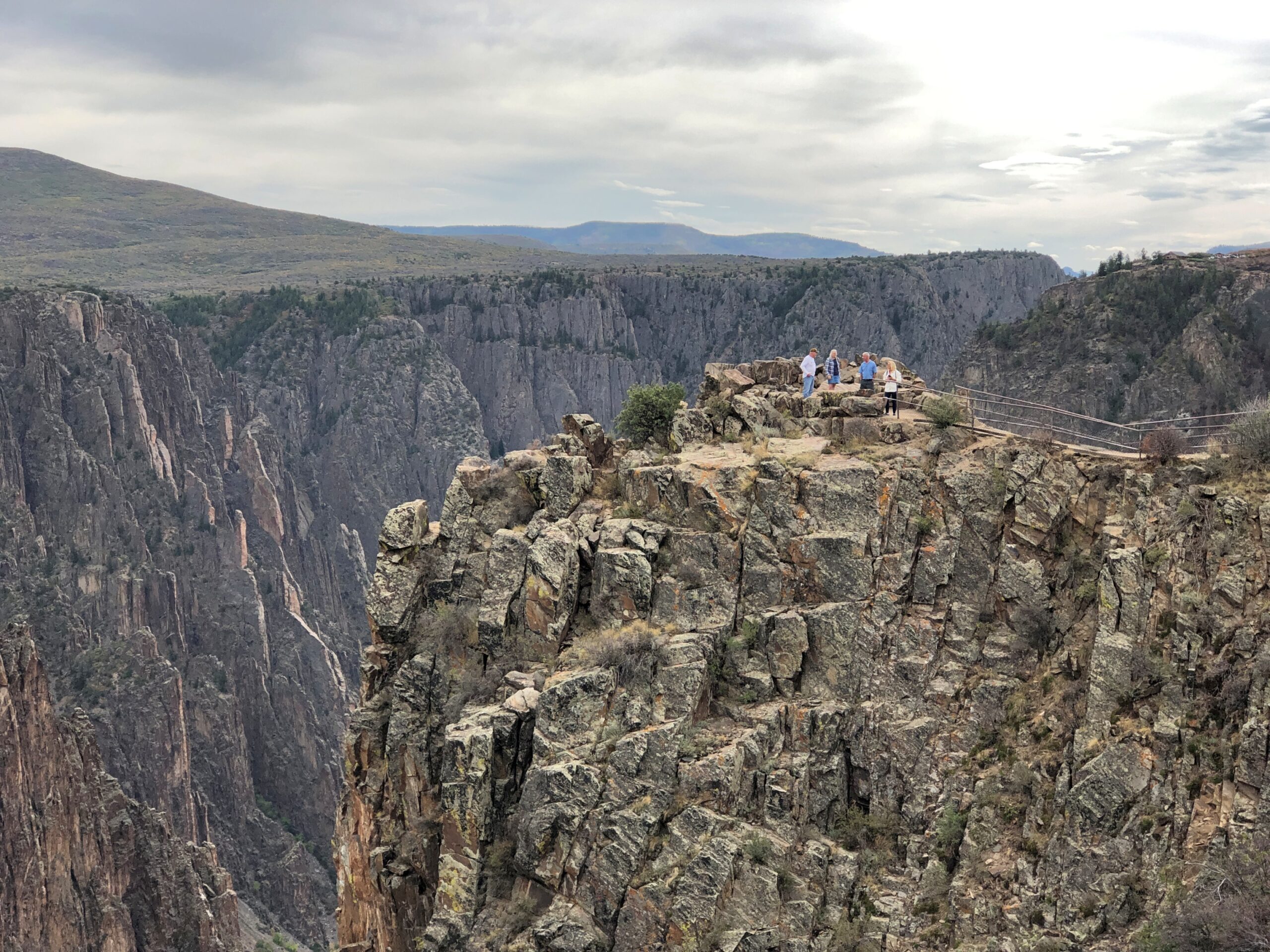
Fortunately for us, we were able to drive the South Rim Road and see what we could see at some of the overlooks. Unless you’re keen on some kind of lunatic climb into the canyon, that seems like a perfectly reasonable ambition. At the main visitor center on the road – which a ranger told us had barely escaped intact, through the efforts of hotshot crews – a path leads to scenic perch, built to accommodate casual visitors. It survived the fire as well.

Black Canyon of the Gunnison

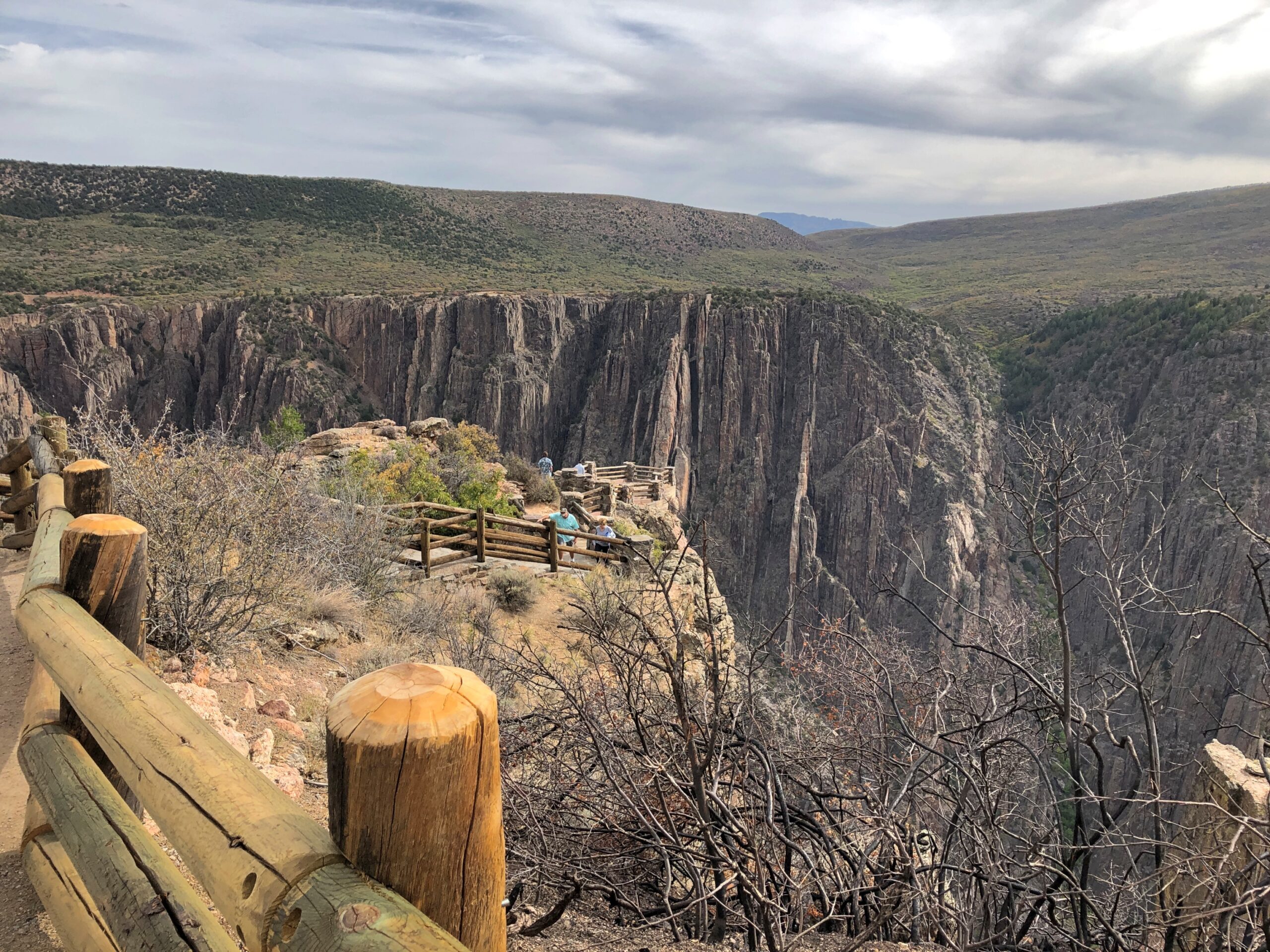
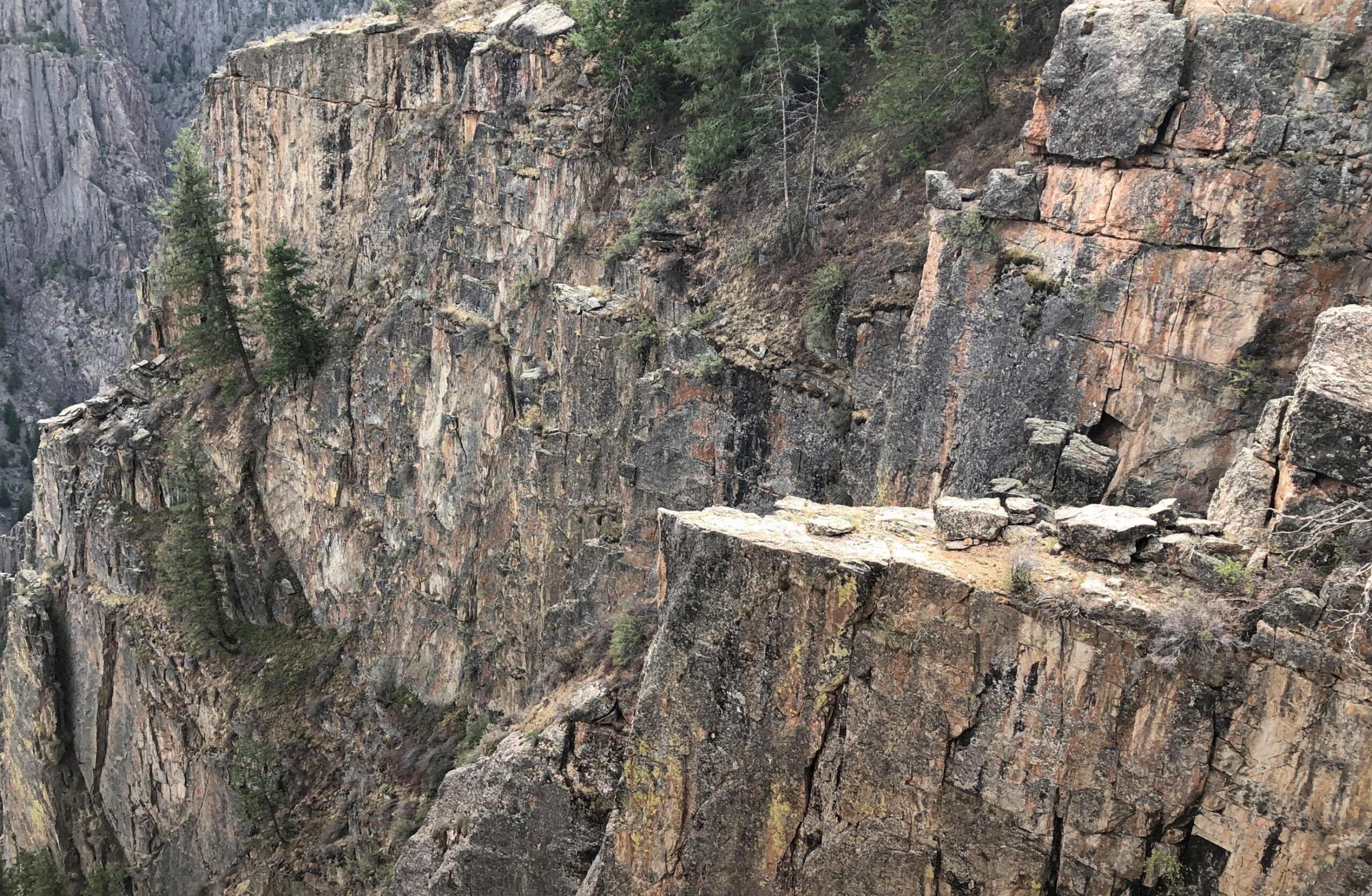
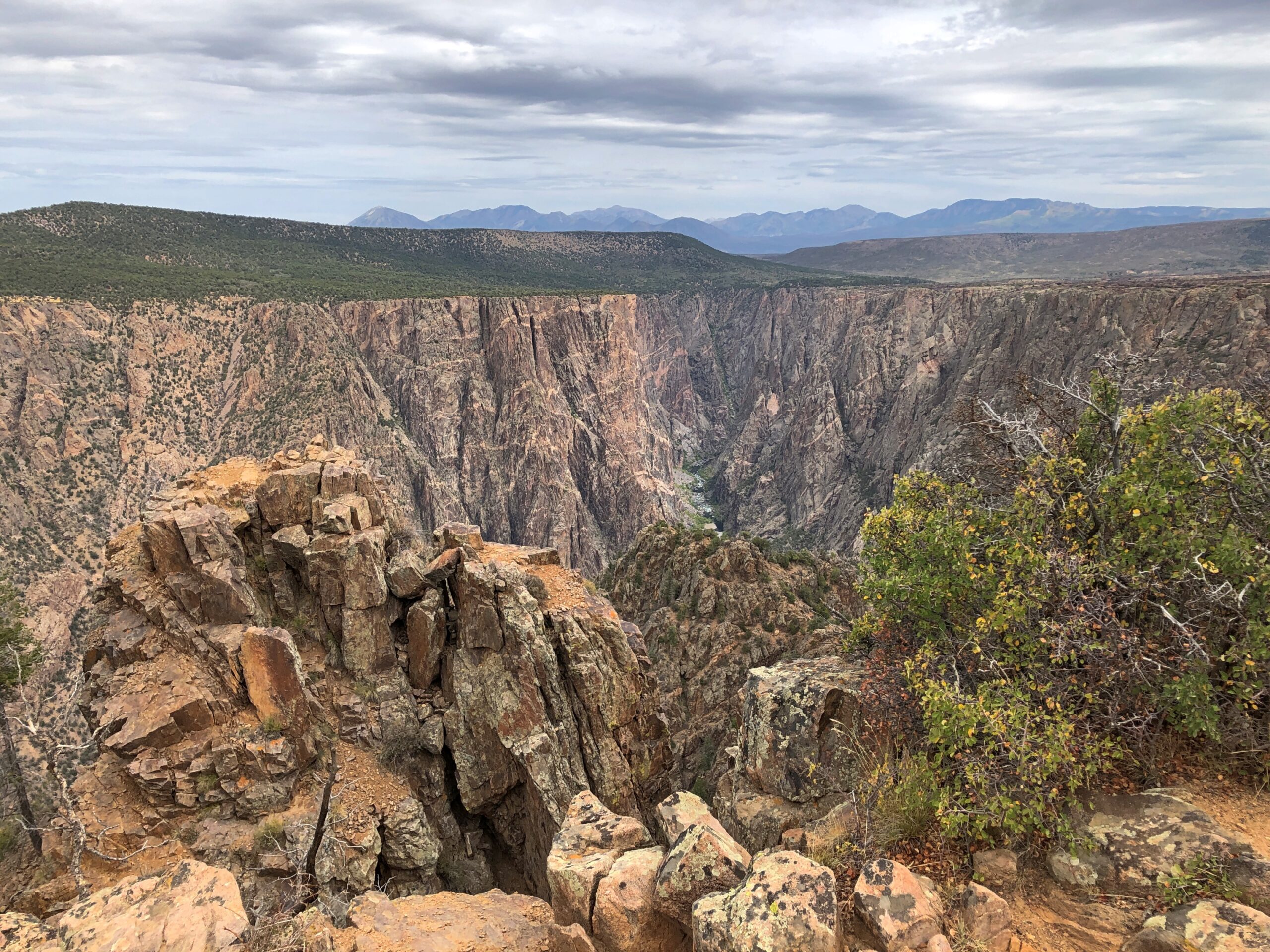
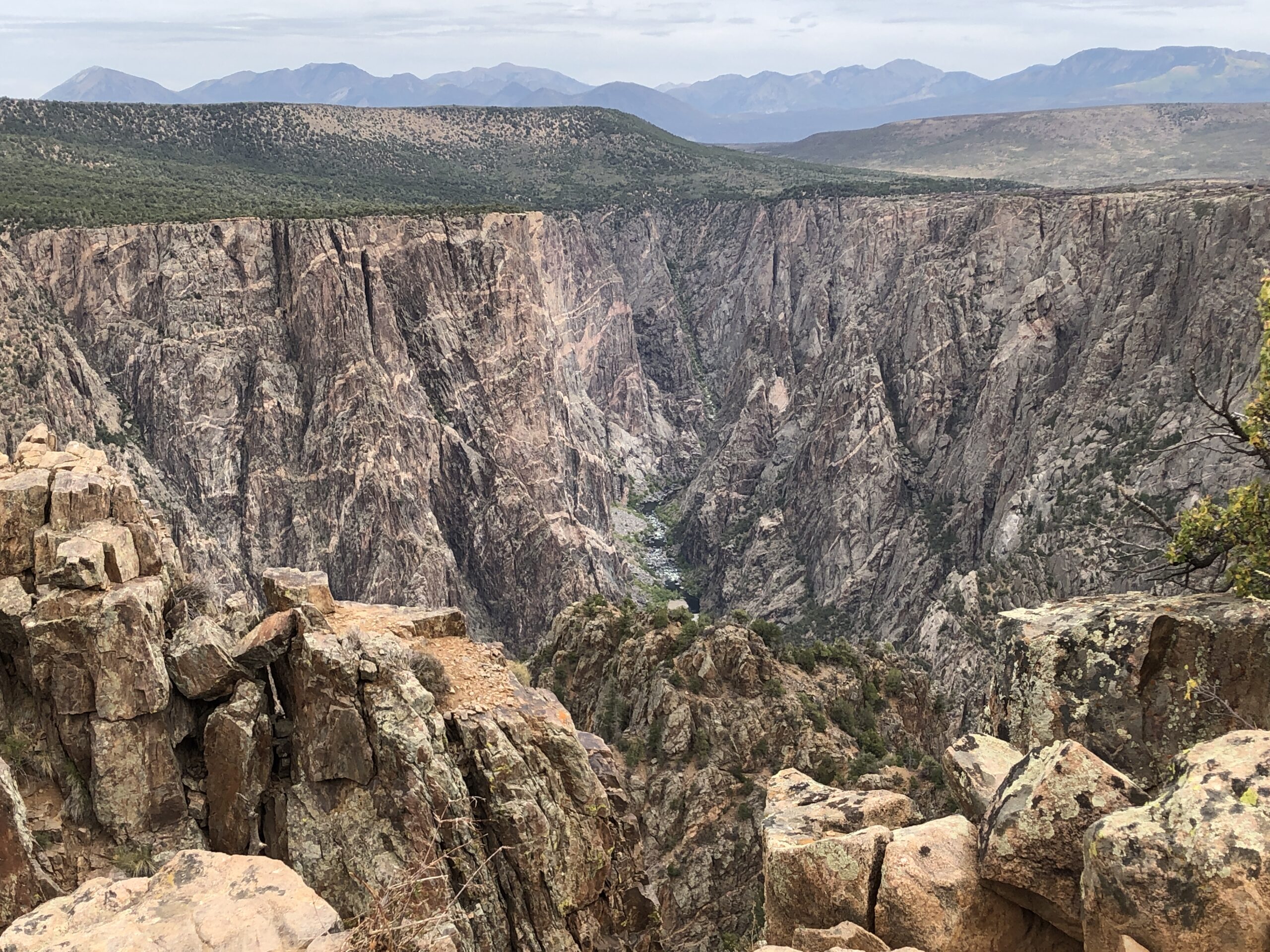
Any photo’s going to be a pale image of this vista, but they will have to do. Believe me, it was a place to drop everything and gawk. And, even while safe behind rails, to experience a touch of vertigo. Nothing incapacitating, just an unsettling mental comparison between little you and the huge yawning drop.

Black Canyon of the Gunnison

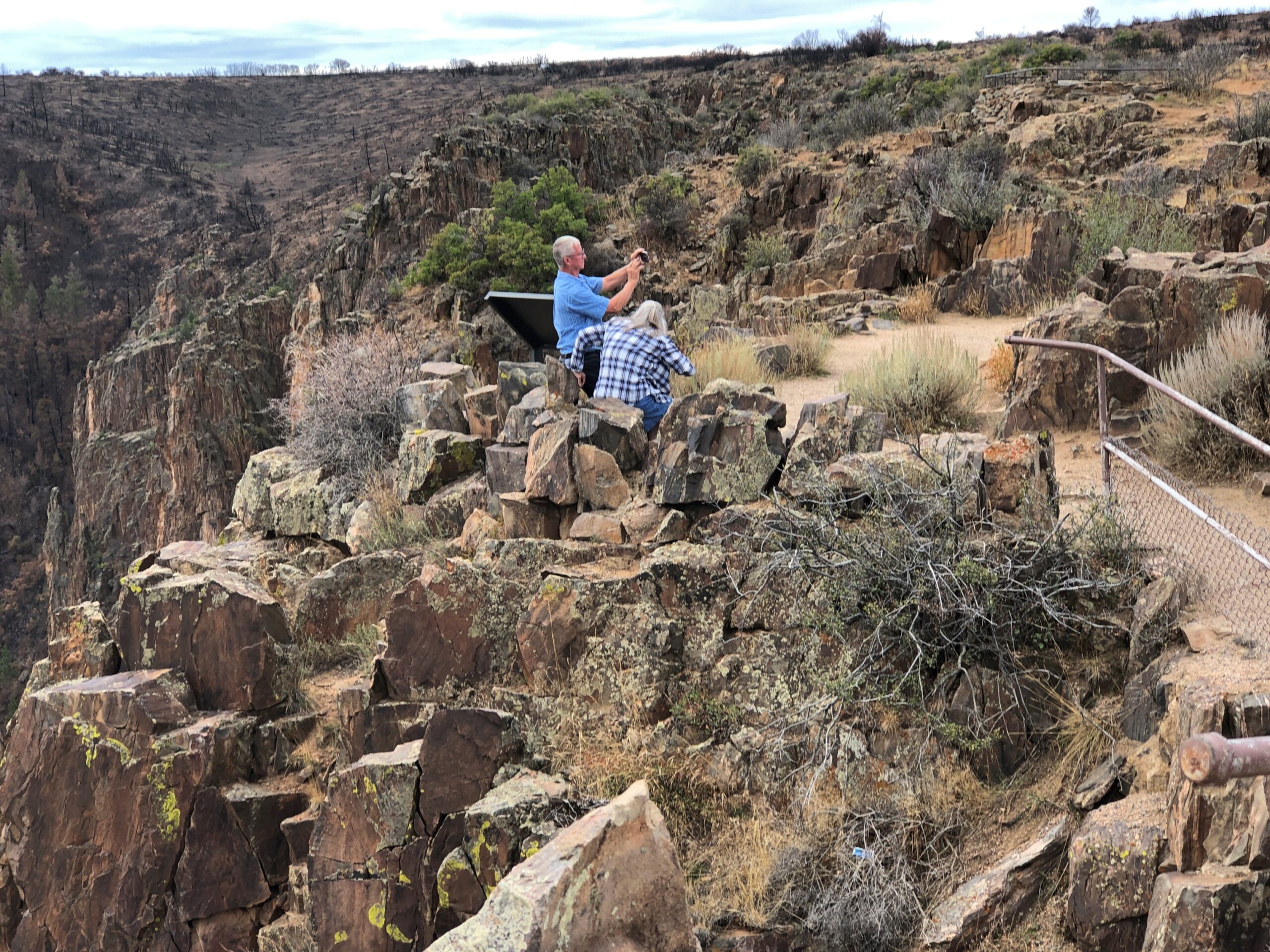
A pointy ledge below. An opportunity for an Instagram death. It was hardly the only one.

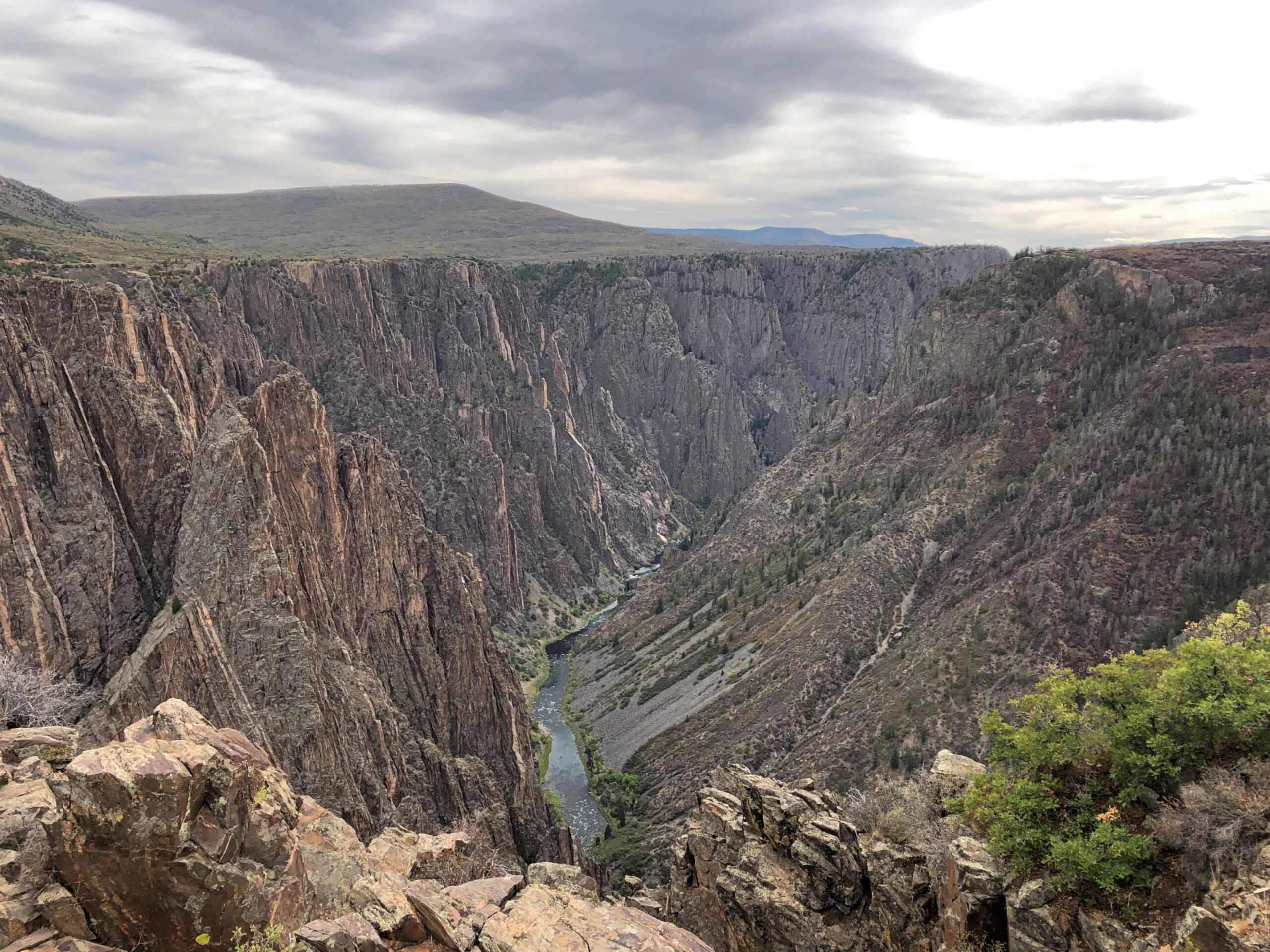
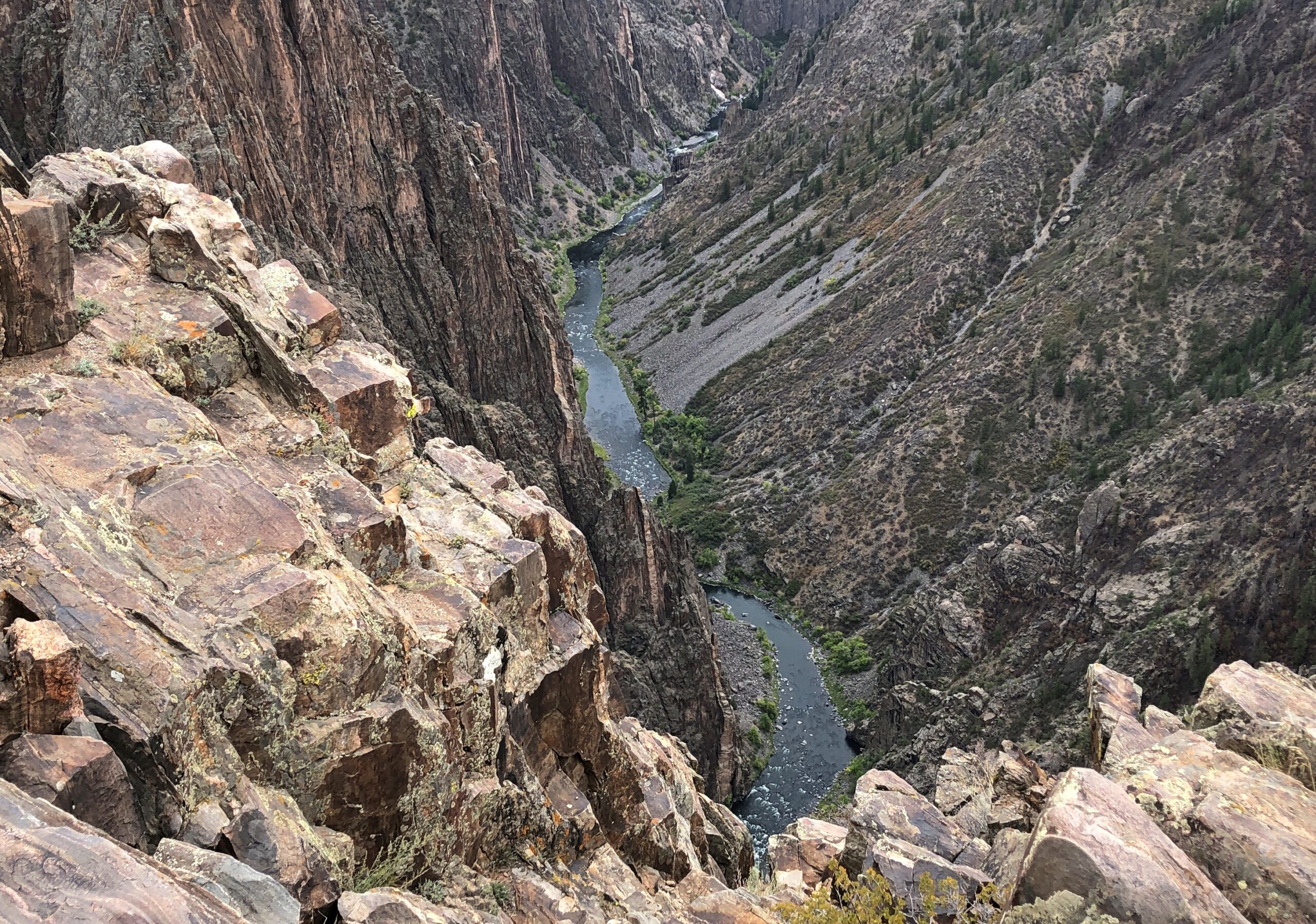
Further down the road, a good view of the Gunnison. It’s hard to tell just by the images, but that’s around 2,000 feet down. Eventually, the water goes into the Colorado River.

Black Canyon of the Gunnison

Capt. John Gunnison is the U.S. Army officer and explorer who came to the canyon in 1853 as part of the effort to find a route for the transcontinental railroad. To sum up his conclusion, in terms he would have never used: Not through the Black Canyon, Secretary Davis. Are you kidding me? Later that year, Gunnison and most of his men got the worst of an encounter with some Ute warriors and, among other places, the river acquired his name as a posthumous honor.

I also have to say that Gunnison’s career also included surveying in the Upper Midwest, such as the Green Bay area, and that he surveyed the border between Wisconsin and Michigan. An underappreciated kind of achievement, I’d say.

None of the viewpoints were crowded. The Grand Canyon, this isn’t. The more accessible south rim of the Black Canyon isn’t crowded, even on a warm Friday afternoon, unlike the more accessible south rim of the Grand Canyon.

Black Canyon of the Gunnison

Near the end of the road is a view of the Painted Wall.

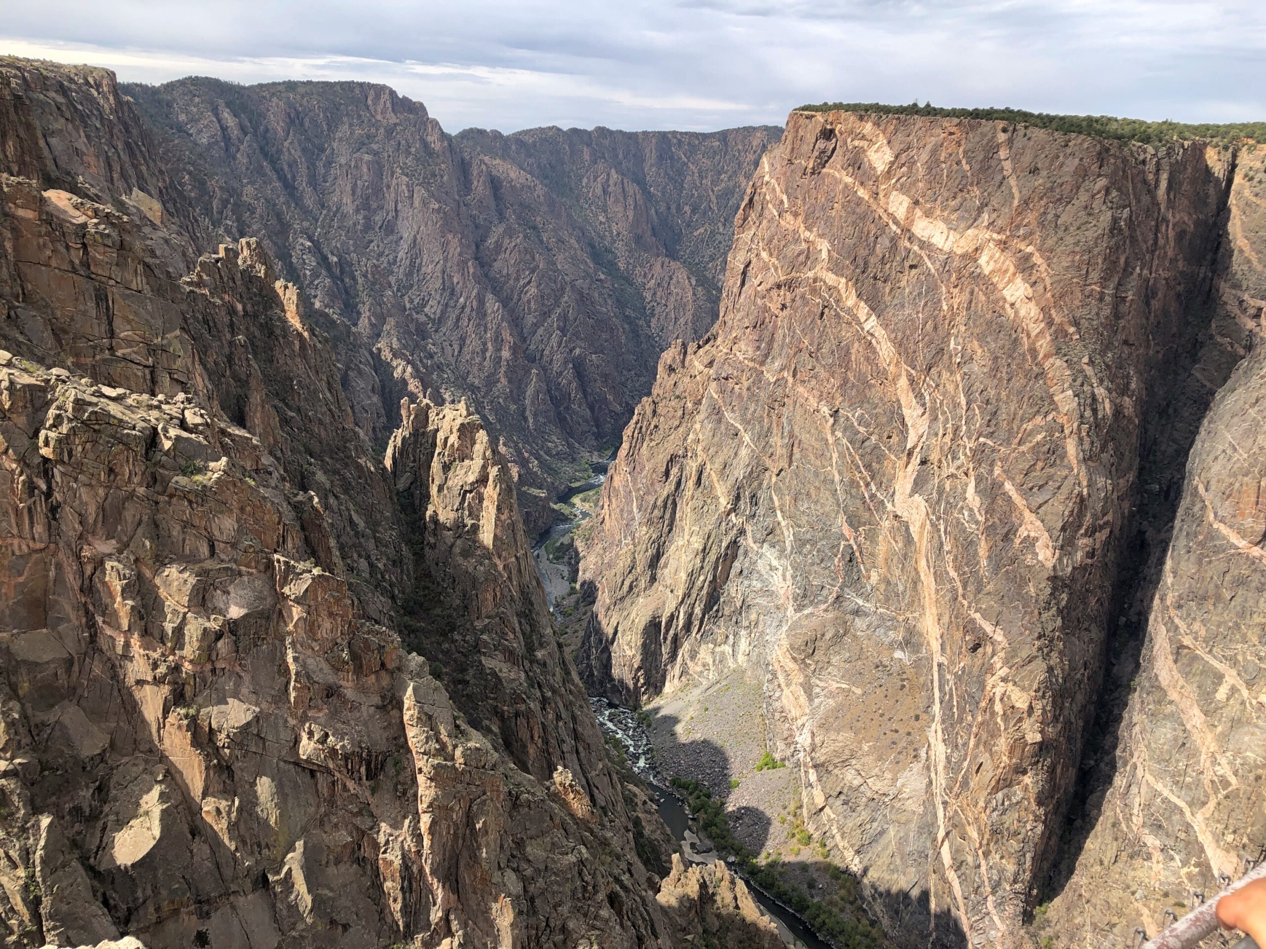
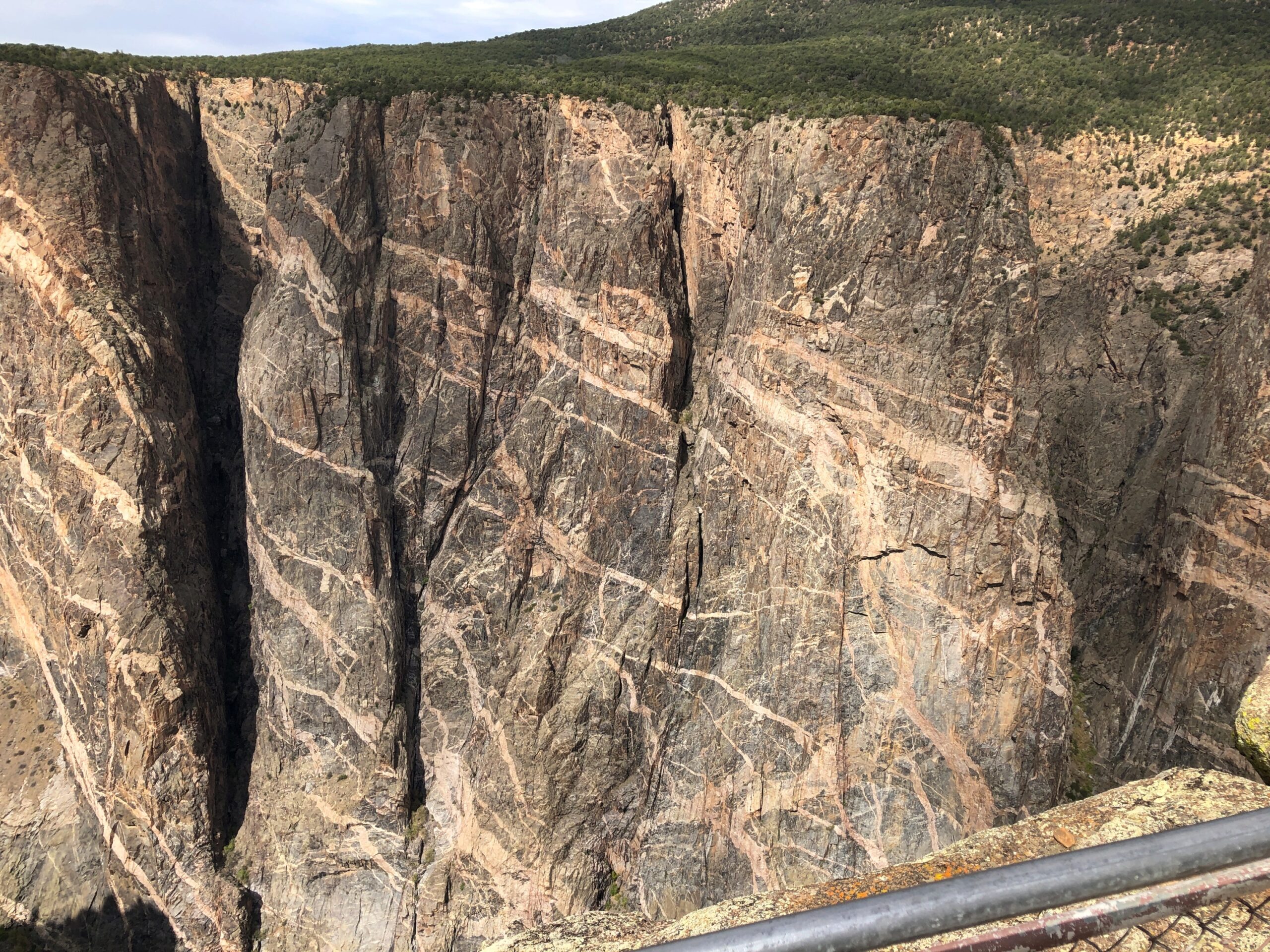
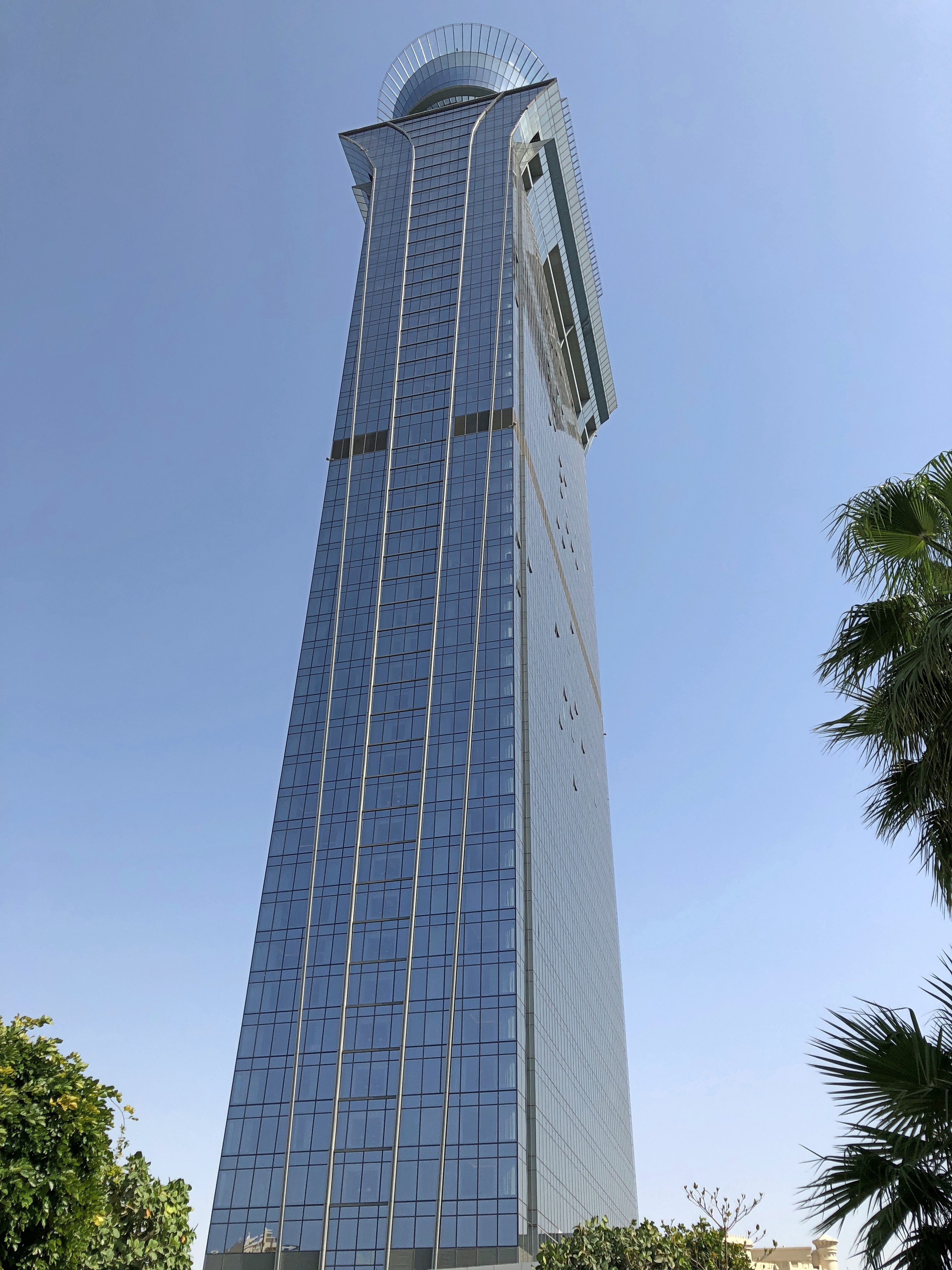
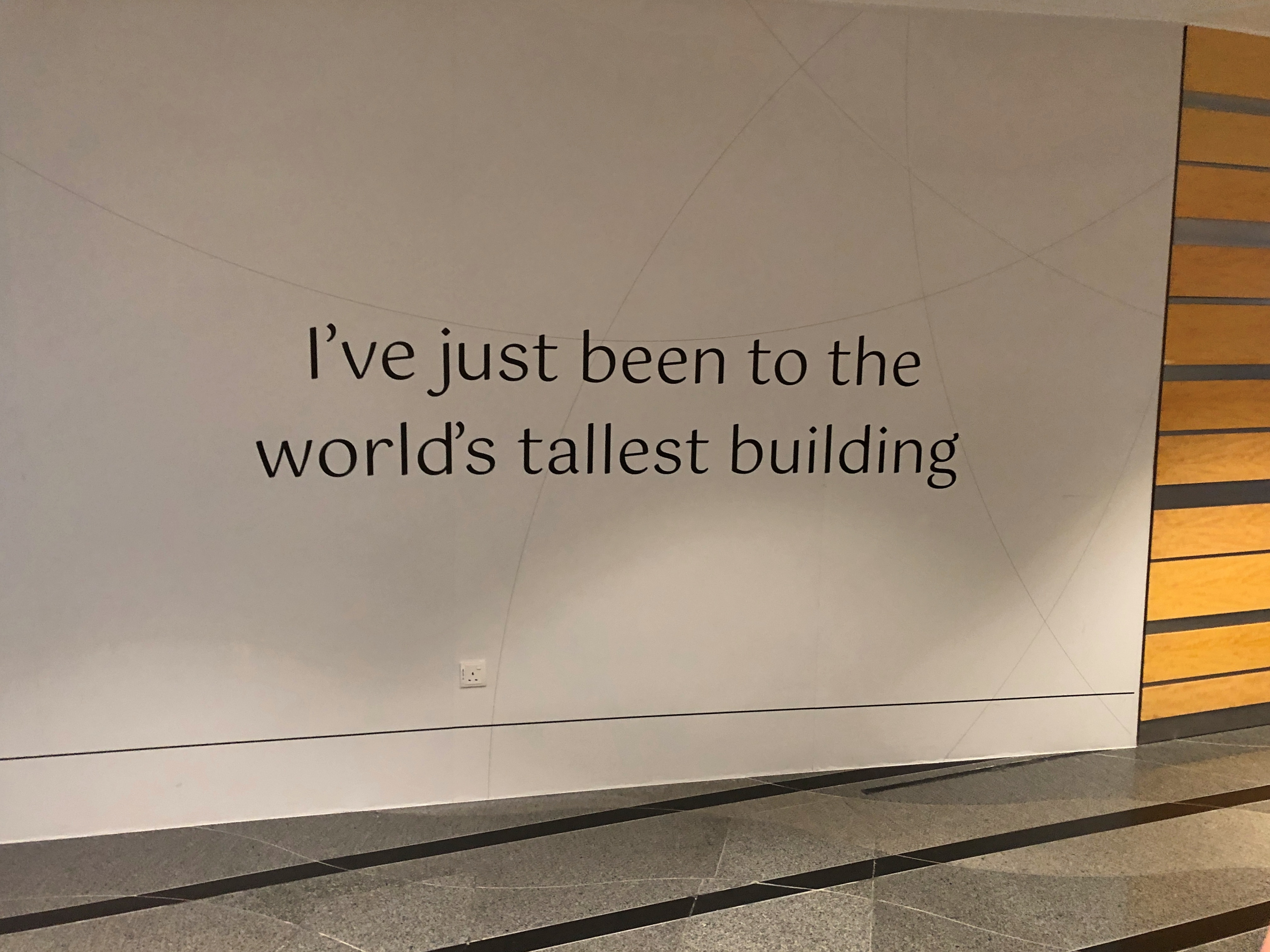
The stripes are not paint, of course, but pegmatite, an igneous rock that solidified after the surrounding rock did, for reasons that a geologist, which would not be me, might be able to explain. A sign at the viewpoint helpfully compares the height of the cliff (2,250 feet) to various manmade structures. The only one that would rise higher than the wall is Burj Khalifa, and that not by much. Note also that the top of the cliff, across on the remote north rim of the canyon, has absolutely nothing in the way of safety infrastructure. The cliff is a cliff, with gravity ready 24/7 to whisk the careless or suicidal to their doom.

I’d be remiss if I didn’t include a few more post-char landscapes: the sort that spread out from South Rim Road for long stretches. It would be a thrill of a road anyway — a little more thrill than I need, actually — with its sporadic few spots where the separation between the road’s edge and an enormous cliff was a single white line.

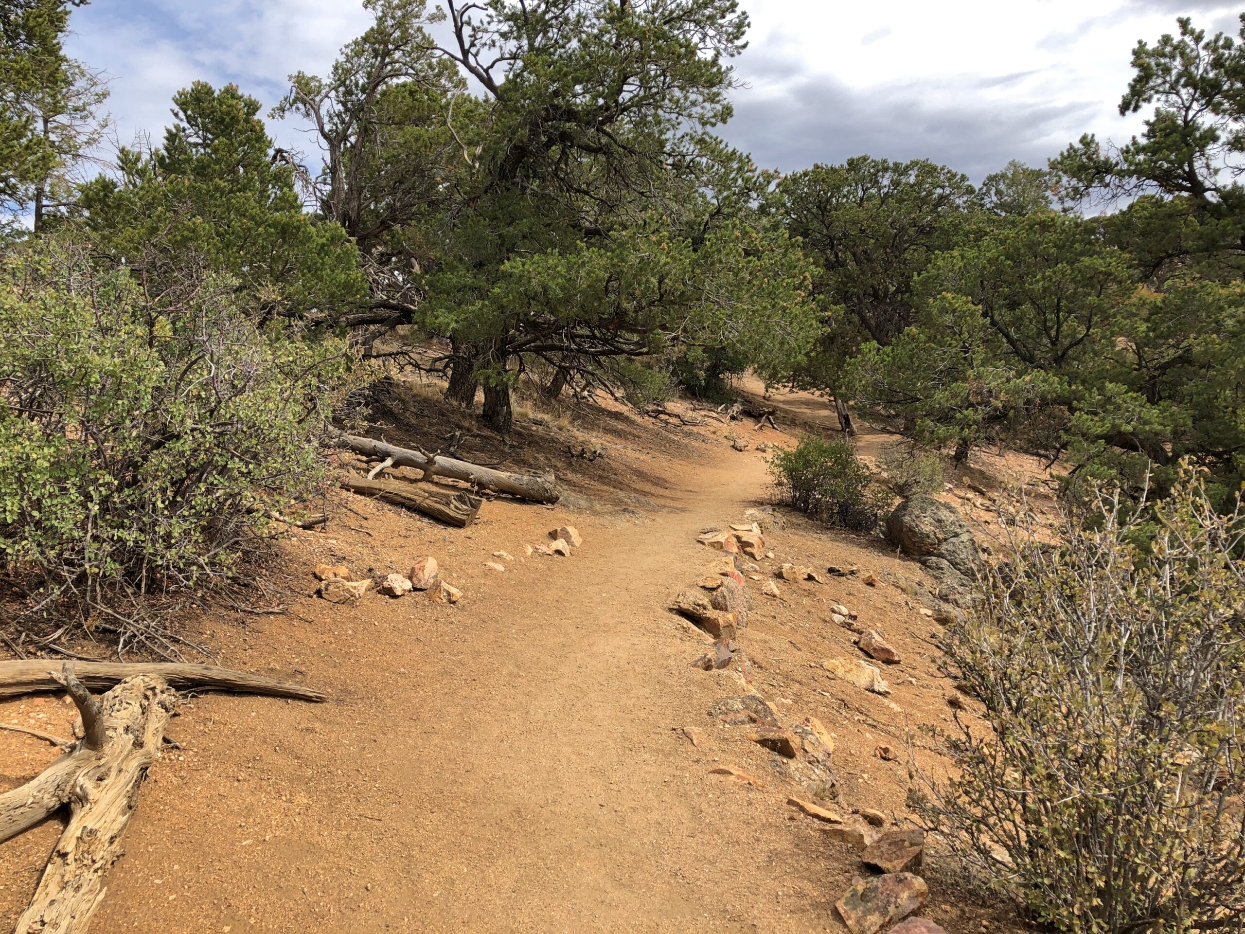
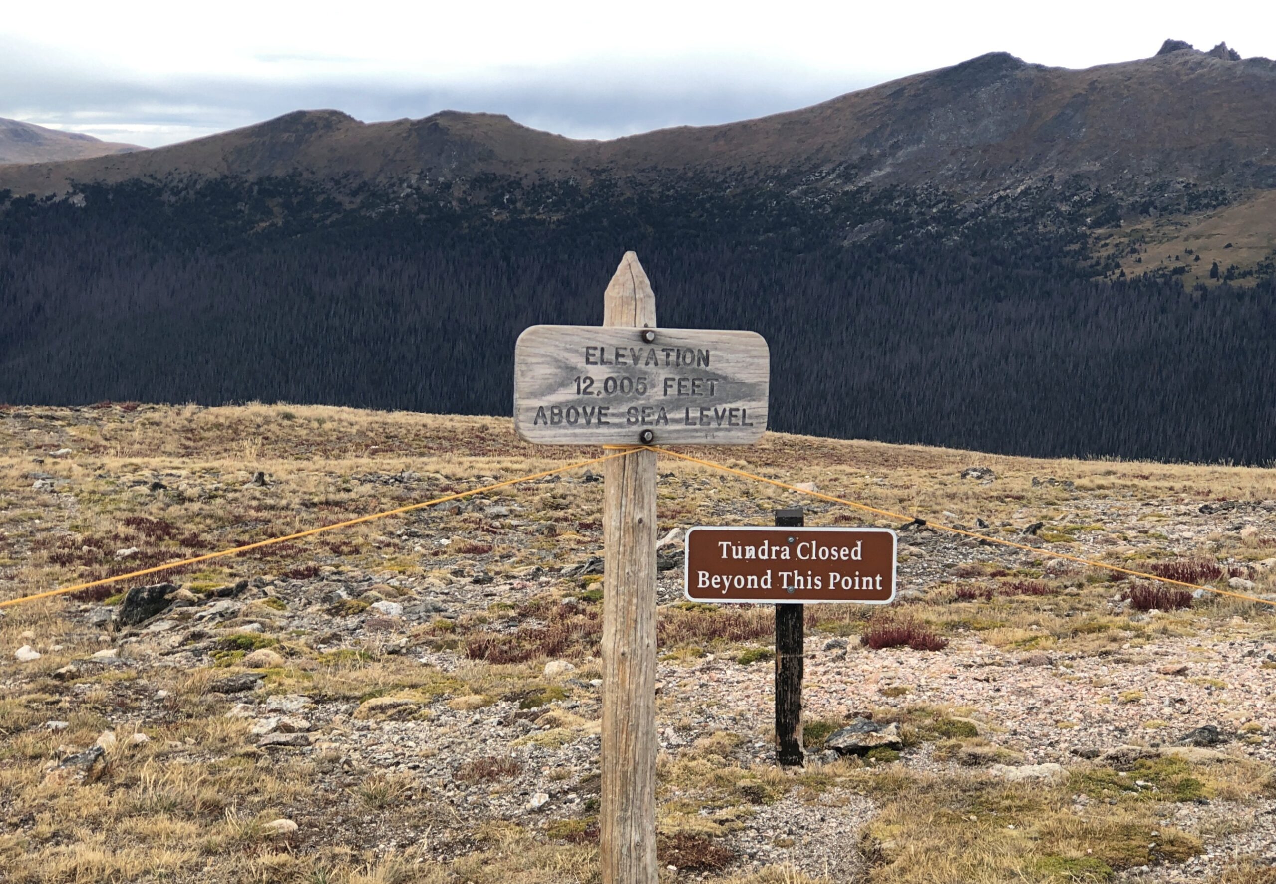
At the end of the road is the trailhead of Warner Point Trail. From the parking lot, according to a sign, the walk is 1,373 yards to the overlook at Warner Point. Near the sign, I heard a couple of young German men obviously working out the distance in meters (you don’t need much German to understand that). No matter how few people are at a U.S. national park, some are going to be Germans.

I preferred to work out the distances in miles. That would be nearly eight-tenths of a mile, so roughly a 1.6 miles there and back. Or 2.5 km for Euro-types. Better shoes on, poles in hands, hats on heads and water in a small backpacks, we set off on the trail. Yuriko and a few other people (including the Germans) got to Warner Point before I did , but get there I did.

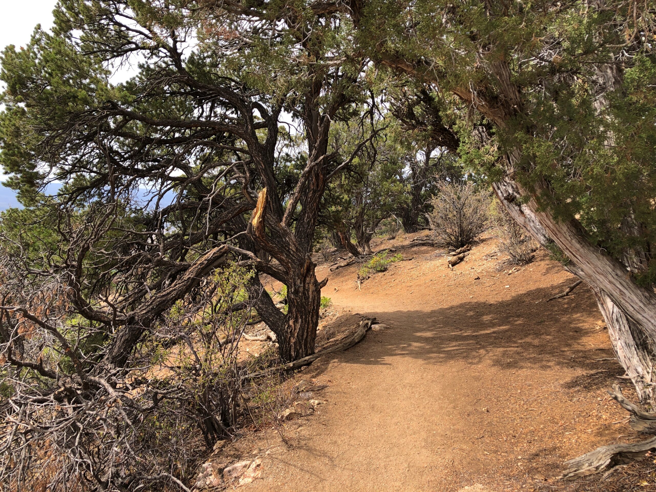
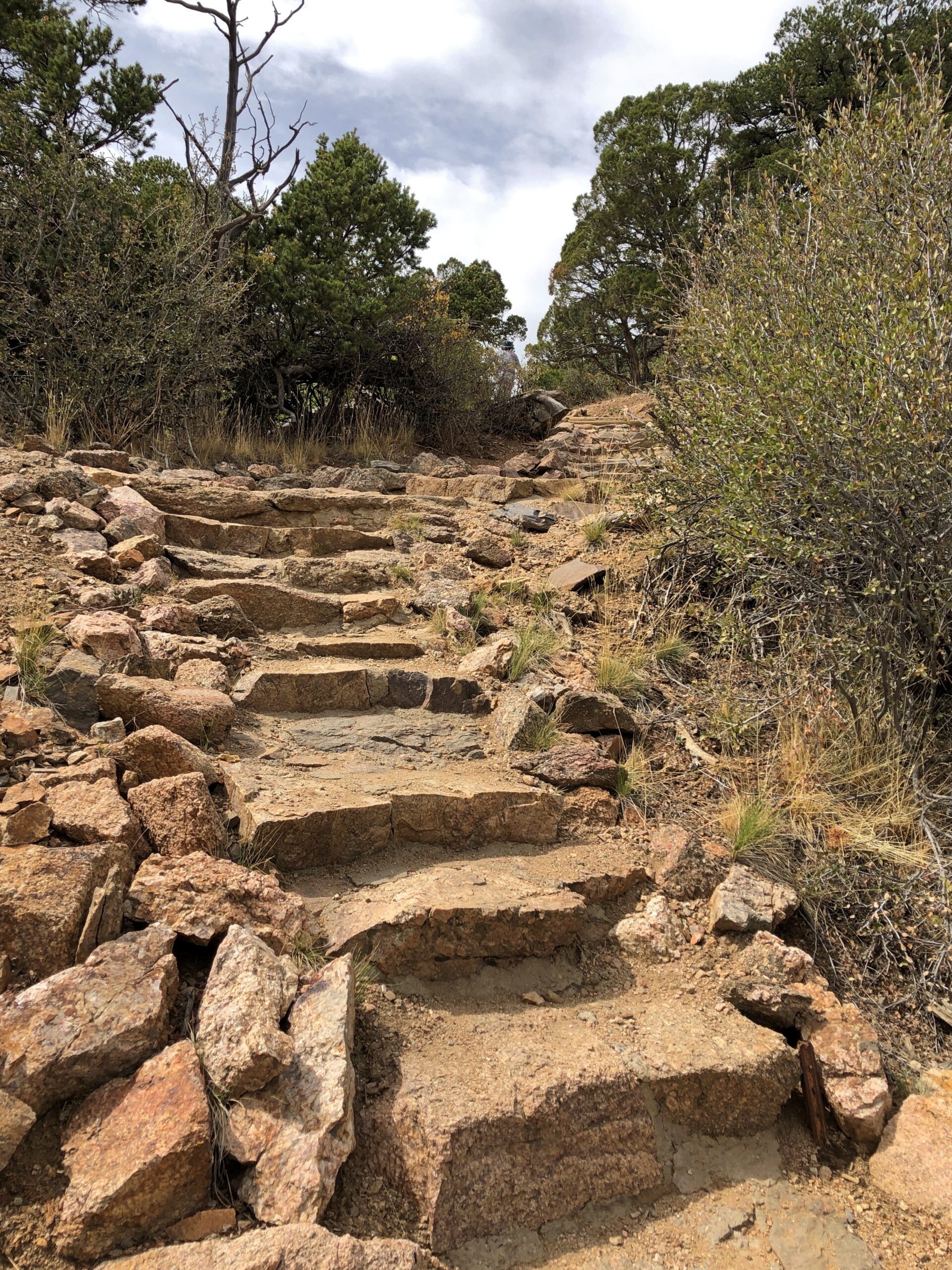
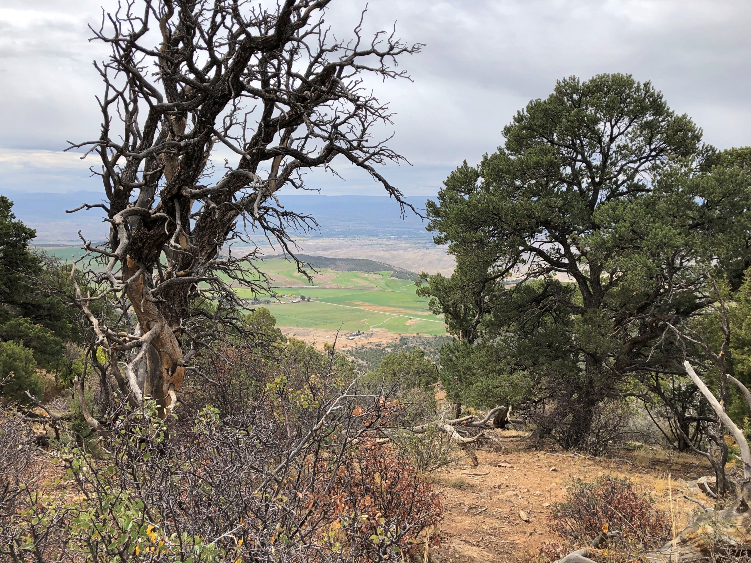
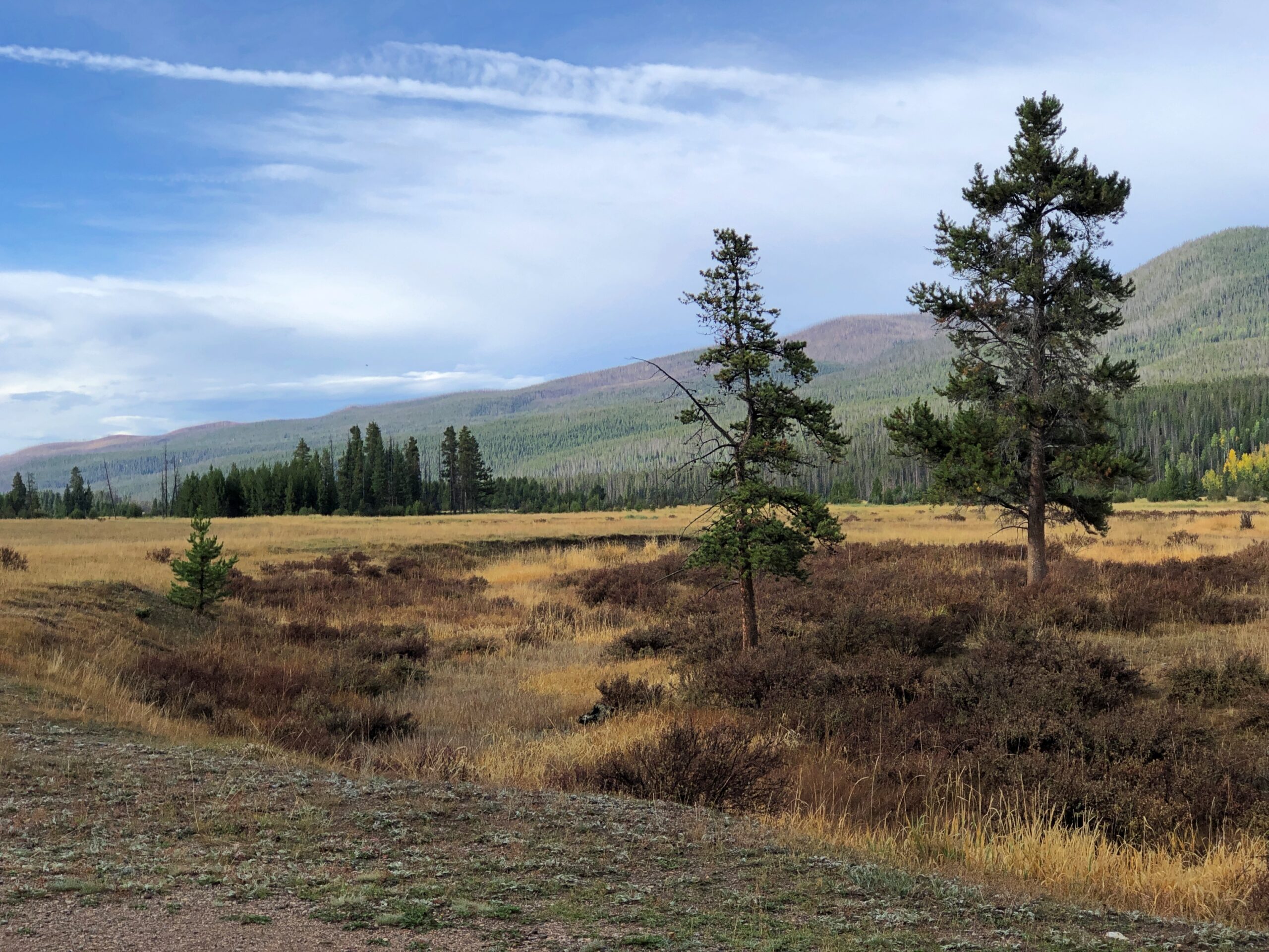
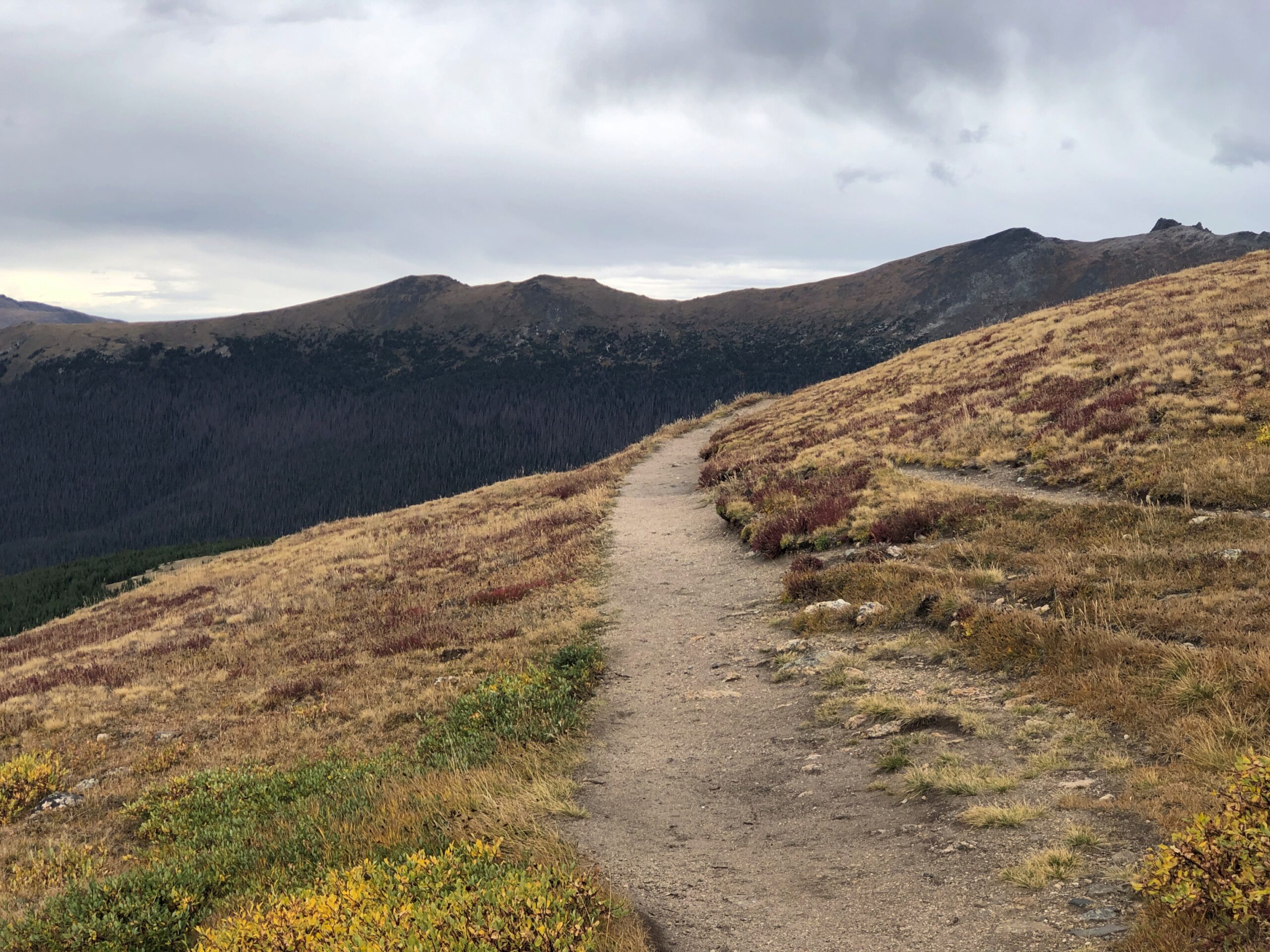
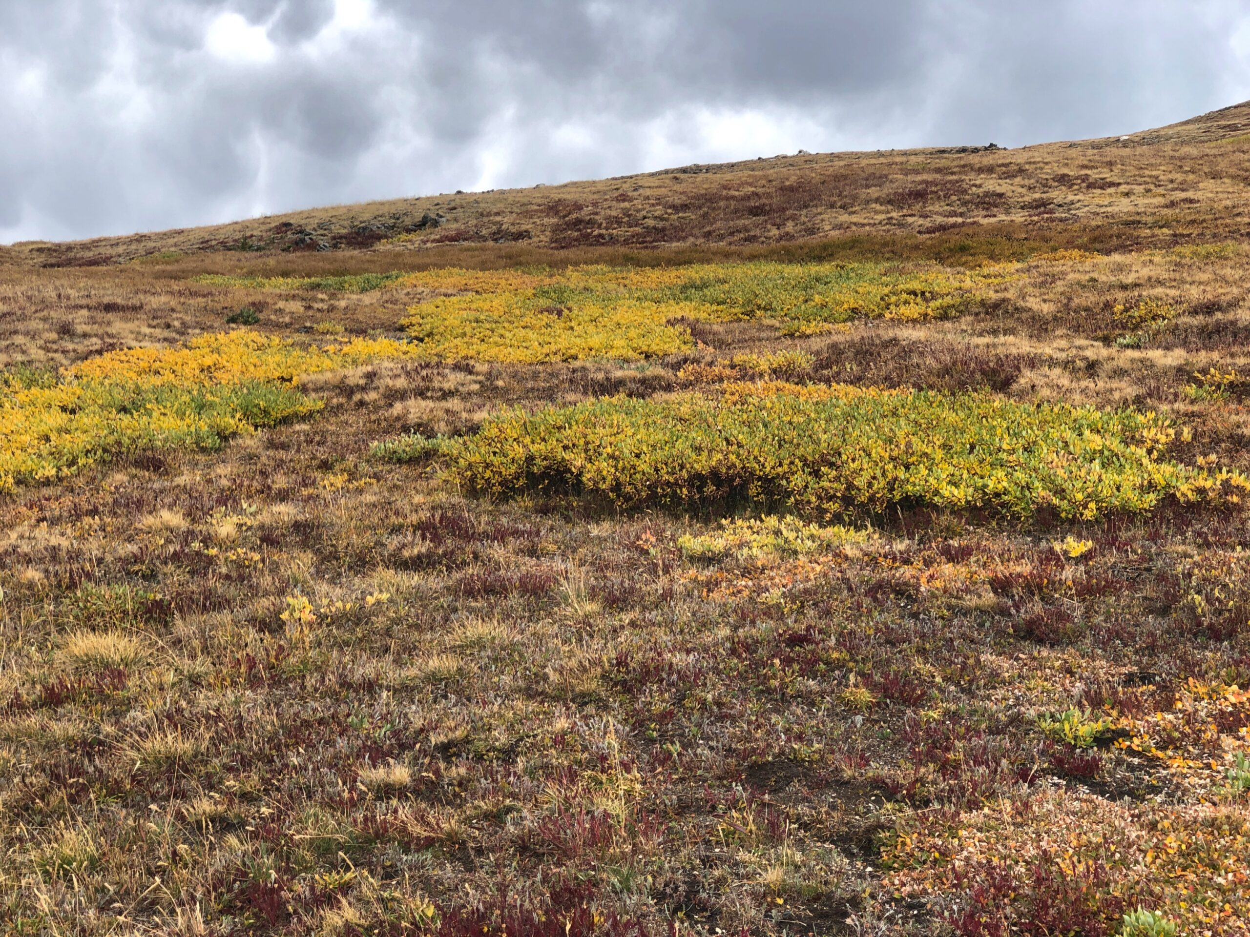
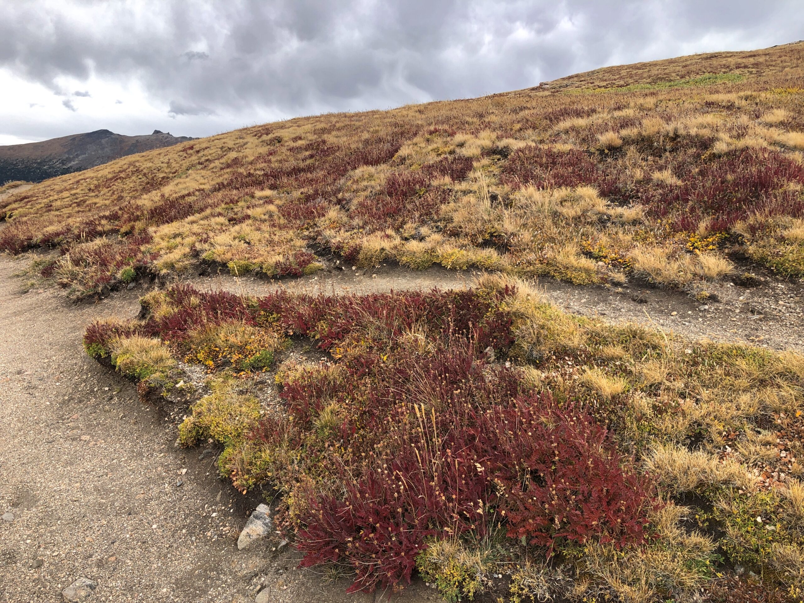
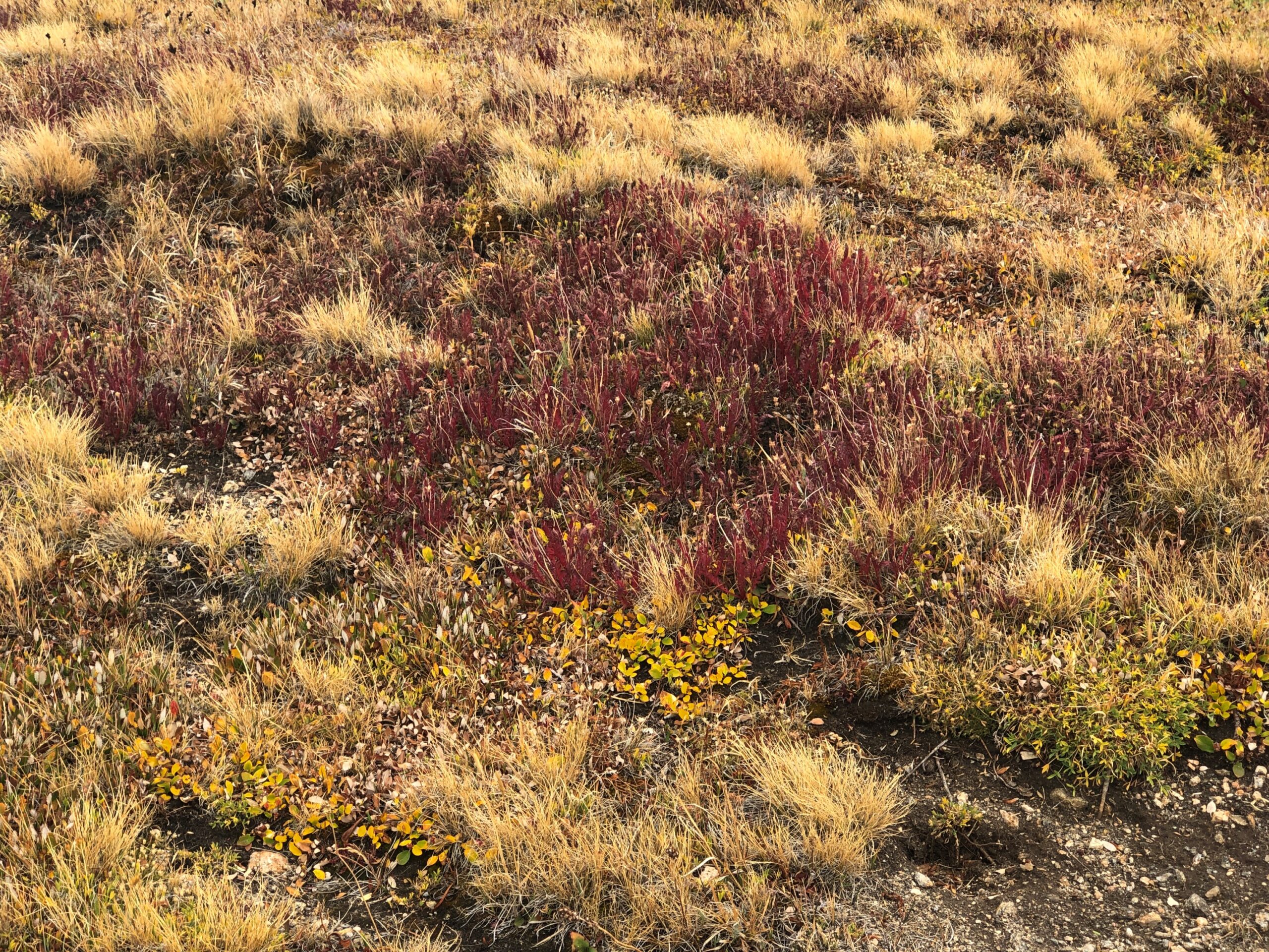
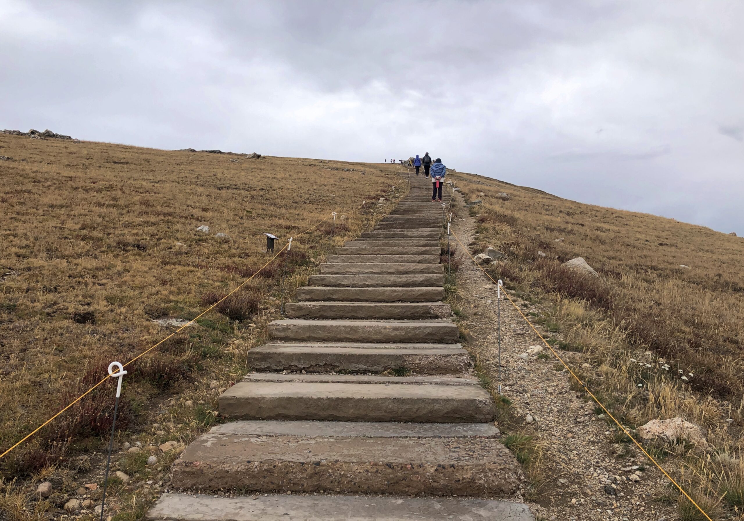
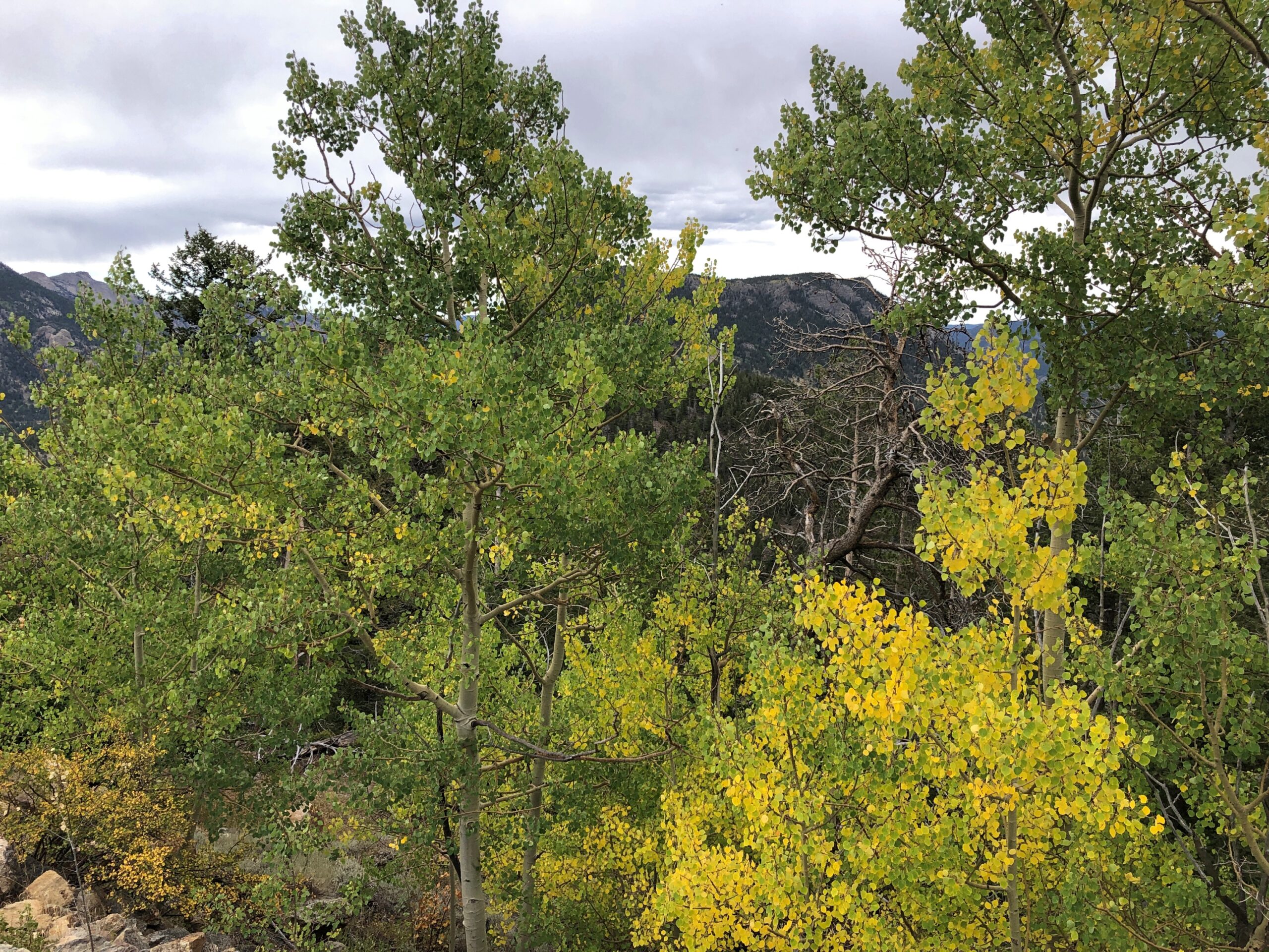
The walk was partly on this kind of trail.

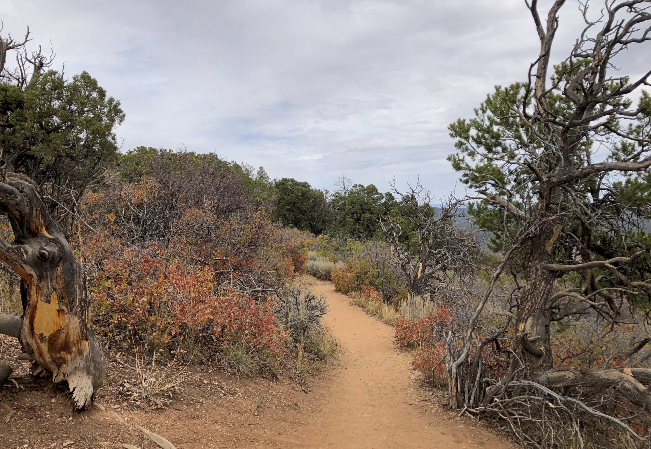
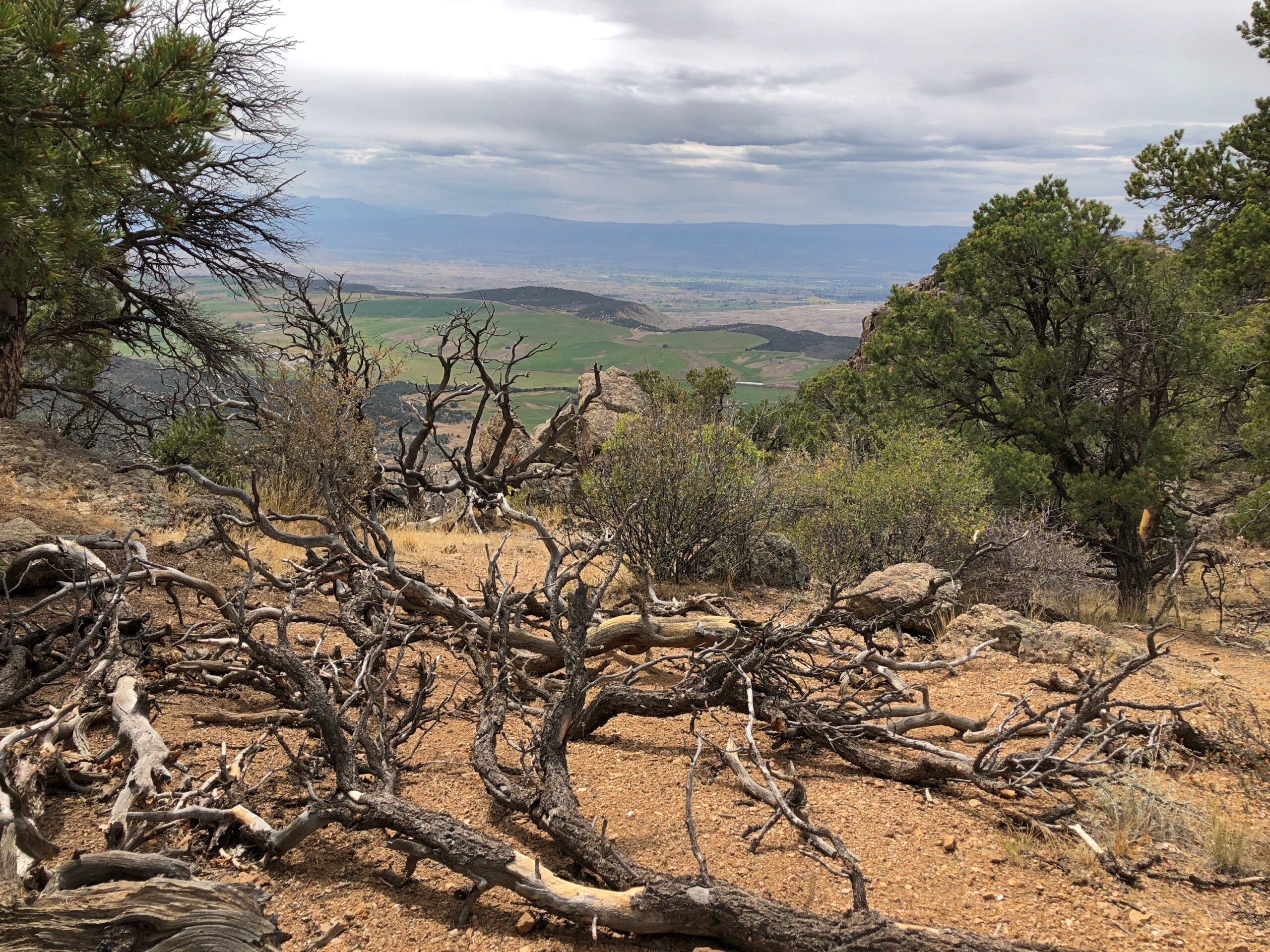
With a fair amount of this kind of thing.

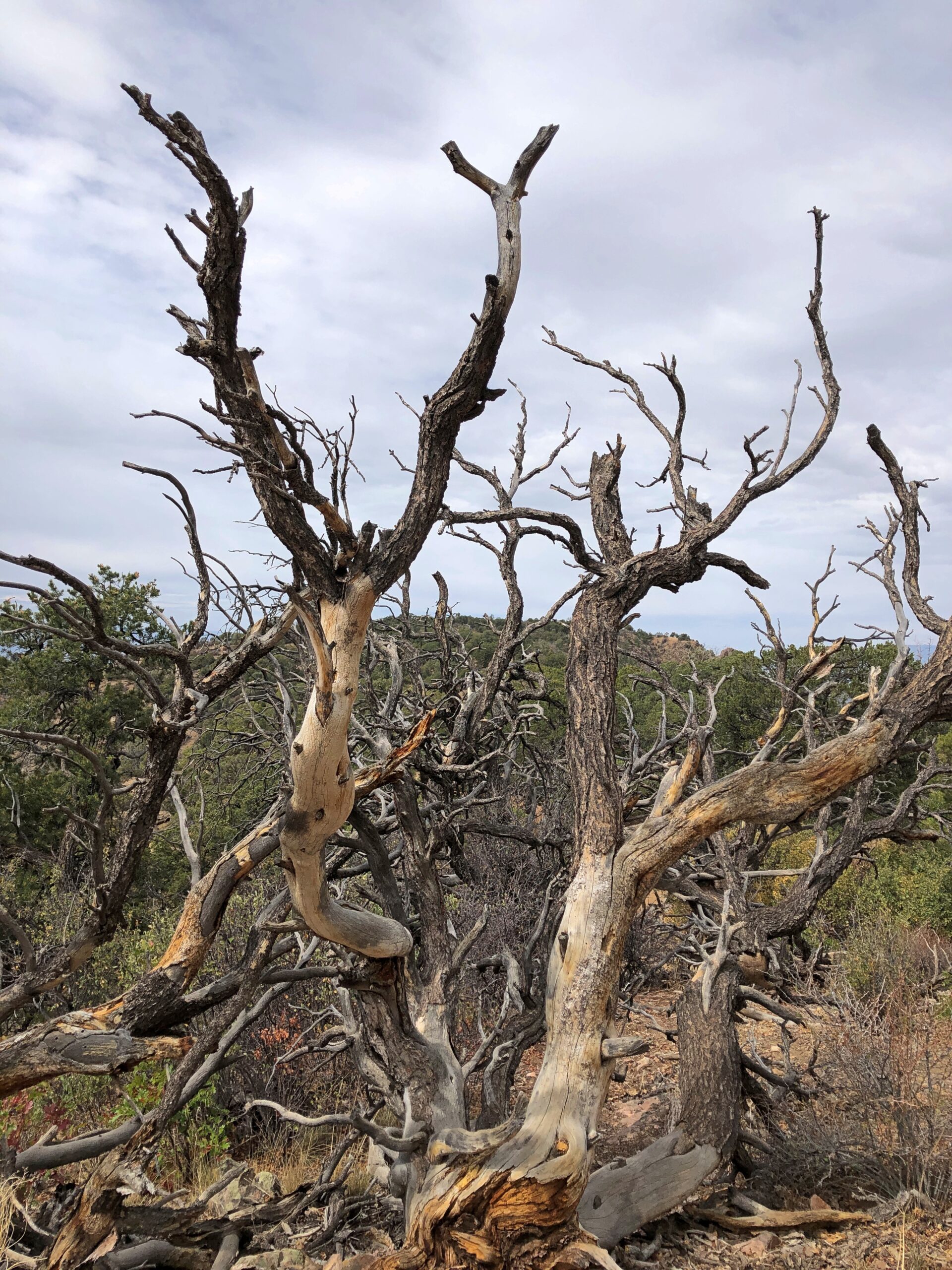
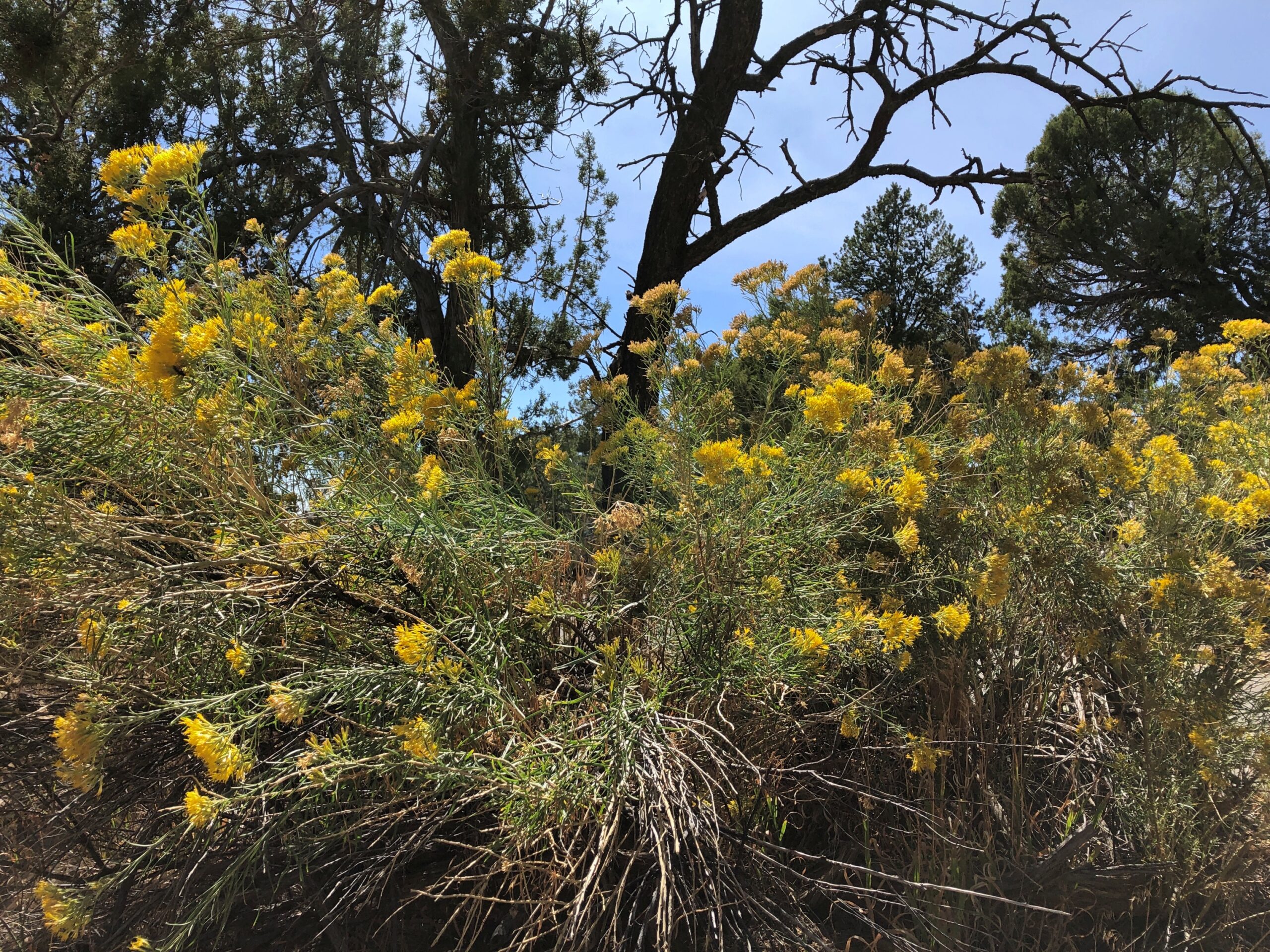
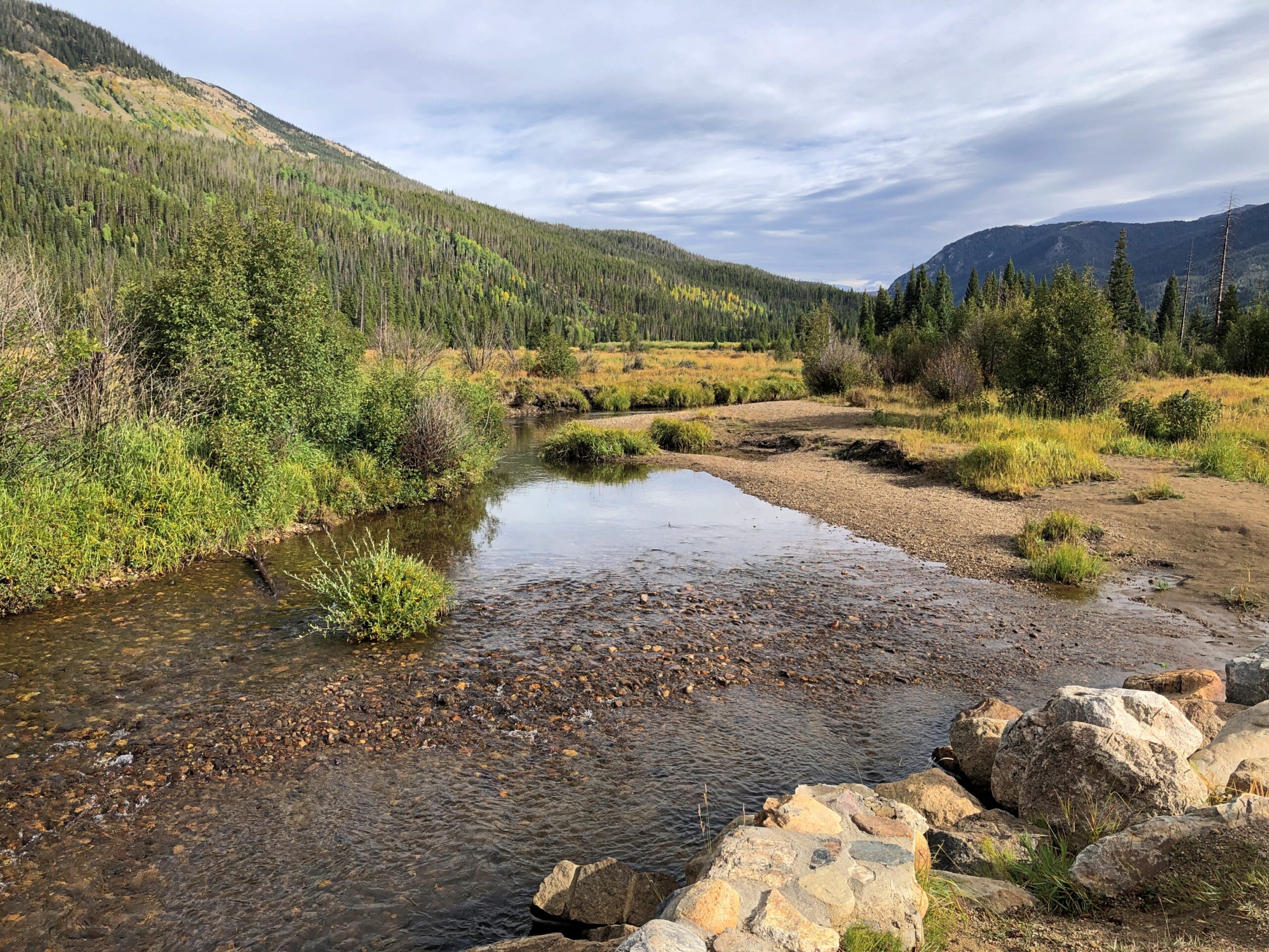
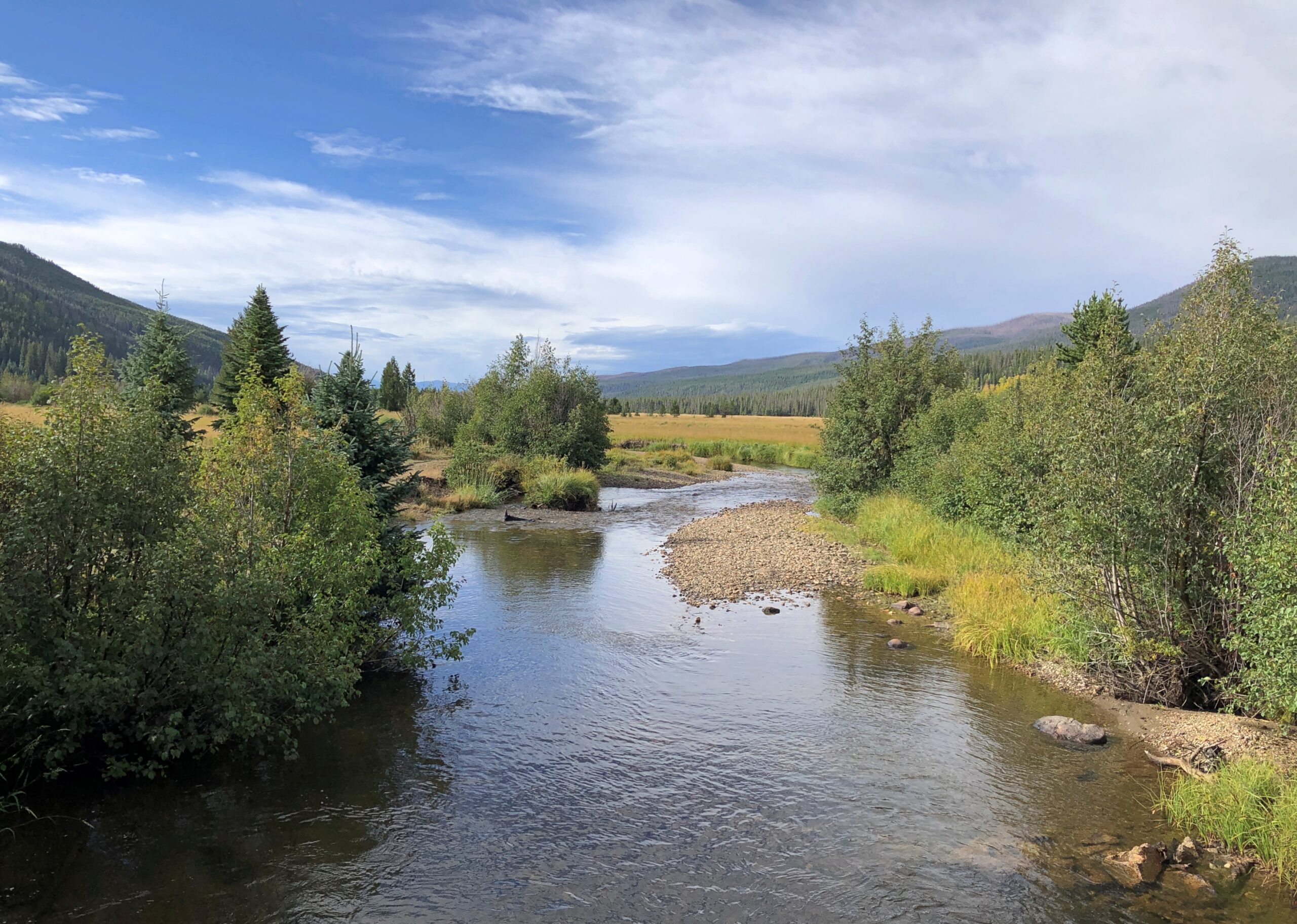
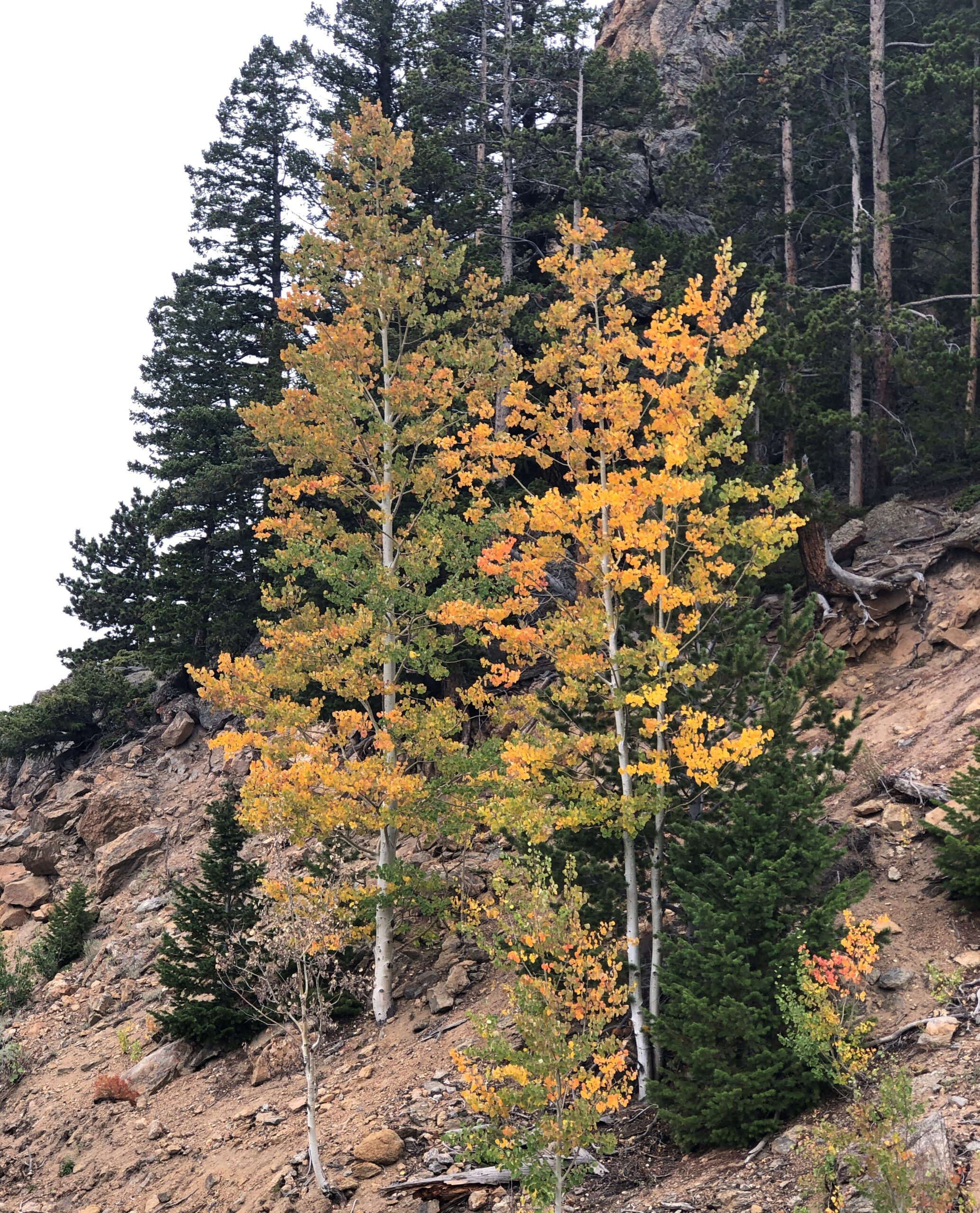
Along the way, an impressive collection of deadwood that the recent fires missed.

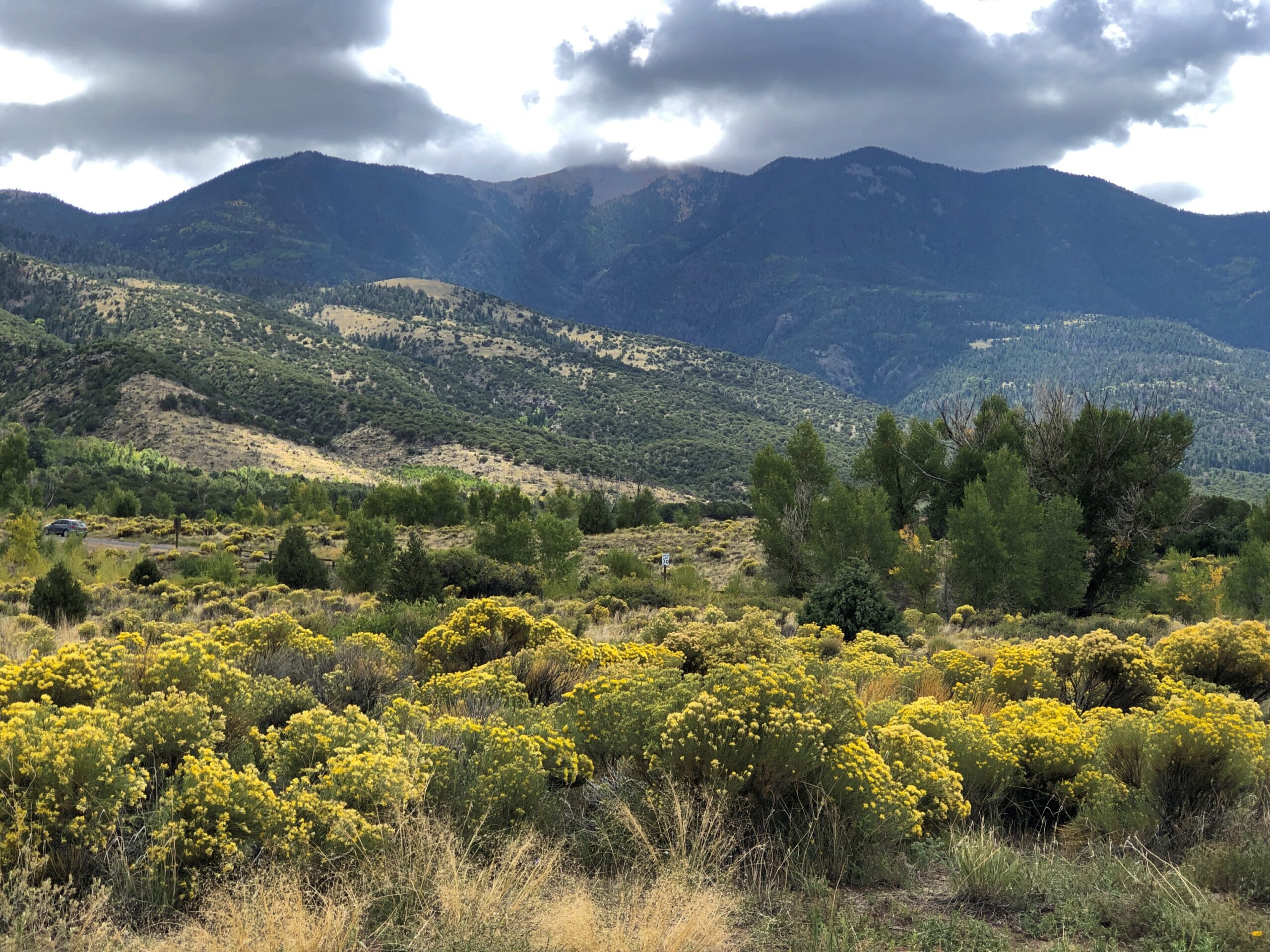
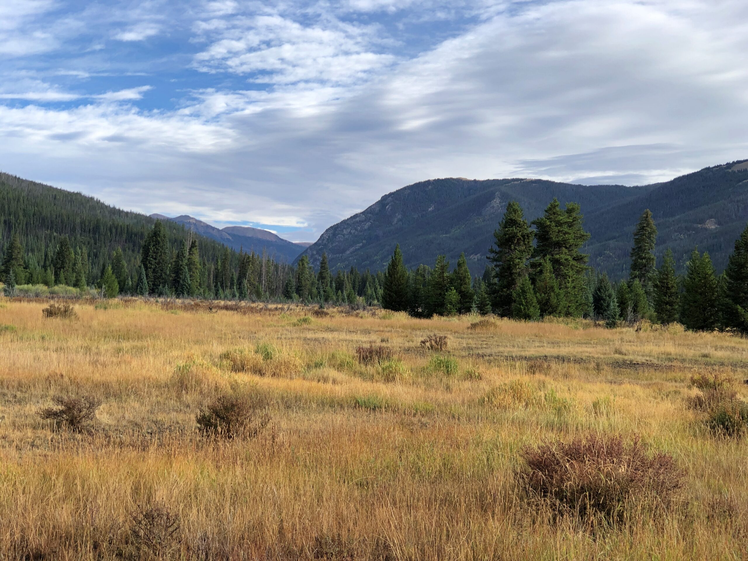
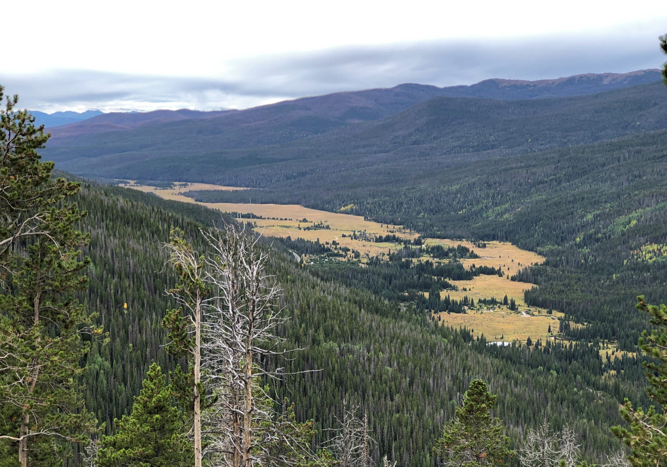
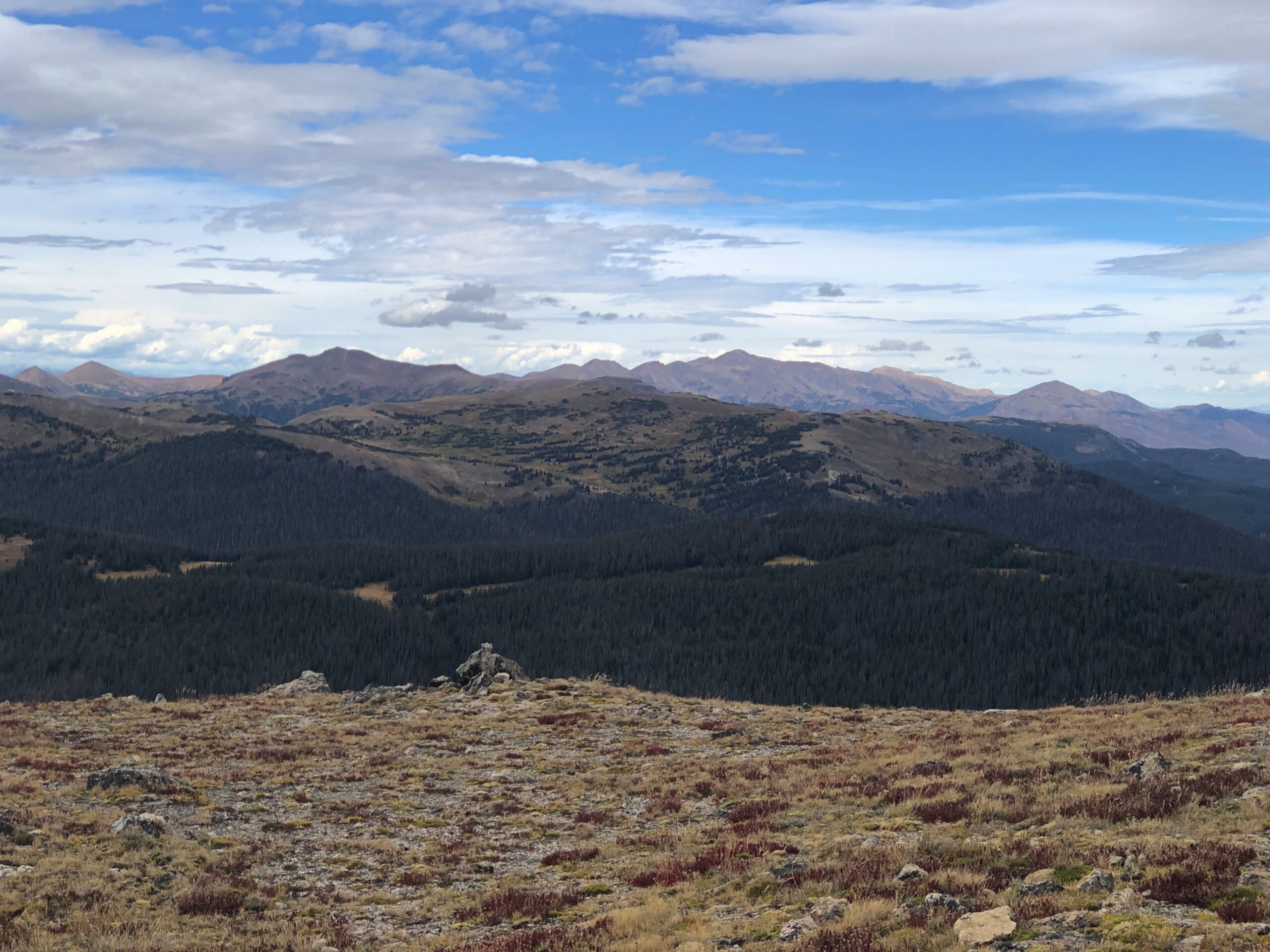
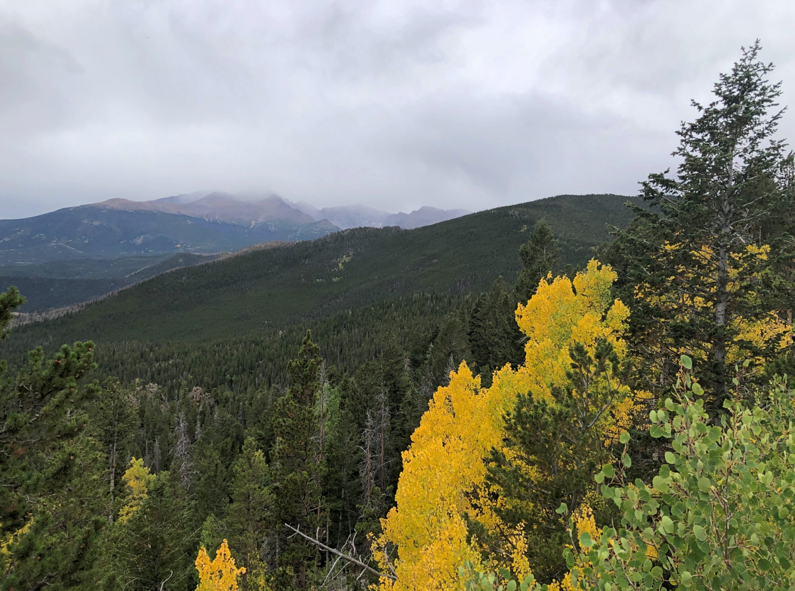
With views of the agricultural valley outside the park..

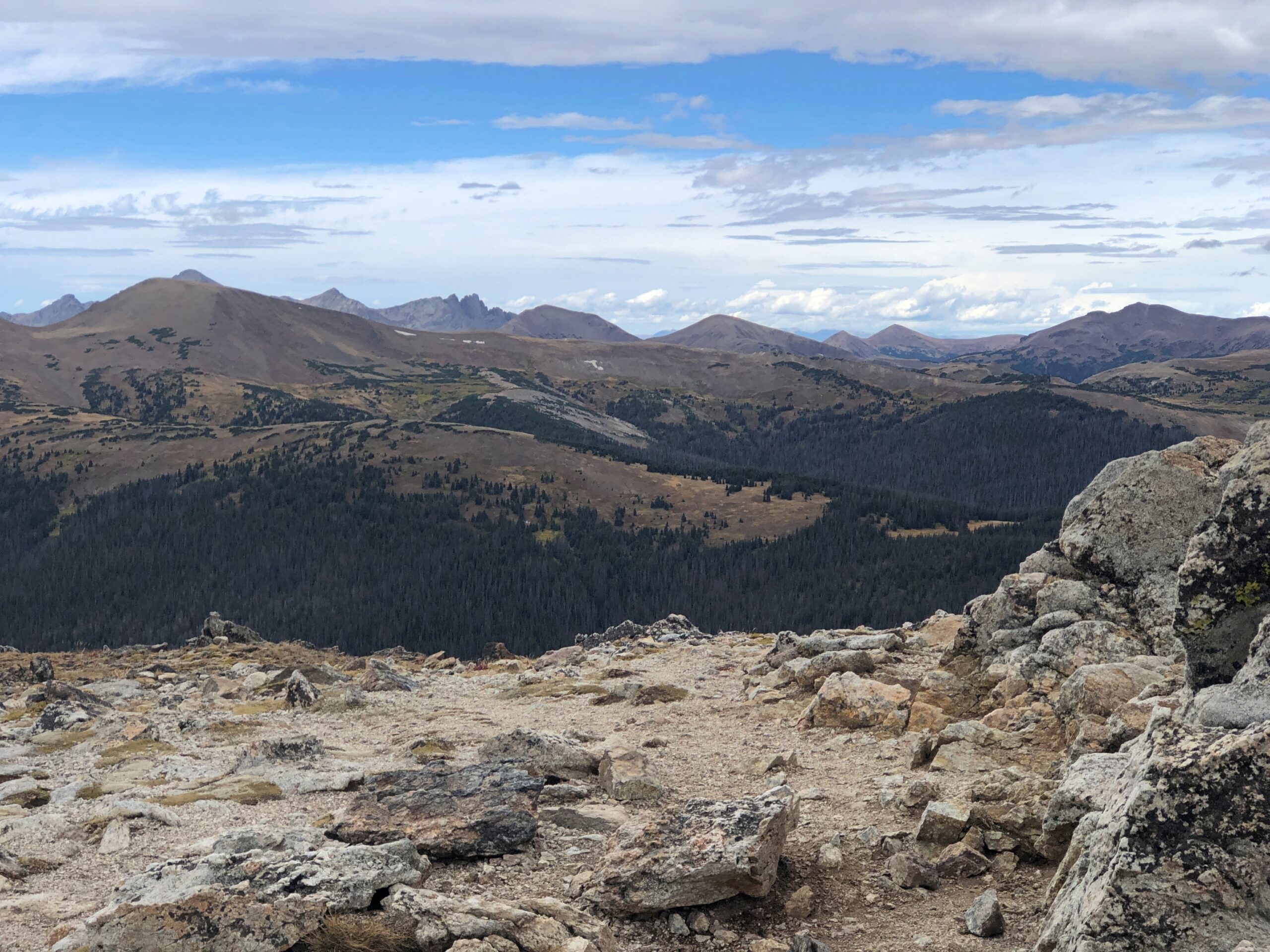
Finally, the end of the trail at Warner Point.

When I got there, Yuriko was waiting. Two other people were there (not the Germans; as athletic sorts, they’d come and gone). Soon they left. So we had the vista to ourselves for about 10 minutes, until another couple came along and we left. When we were quiet, the only sound was the Gunnison far below.

Mesa Verde National Park

In 800 years or so, will people come from significant distances to look at the ruins of my mid-century neighborhood? That doesn’t seem likely for any number of reasons. I’d be surprised if my own house survives until the next century, considering how good people are now at razing and rebuilding. But considering such a long span of time, there’s no way to know.

That’s the kind of thing I wonder about when facing structures of that age, especially those whose inhabitants are known mainly by the structures and other items they long ago cast off.

On September 17, we’d come to the Cliff Palace at Mesa Verde National Park. To get close, you sign up and pay for a ranger-guided tour, which goes down stone stairs, along the edge of the cliff near the dwellings, and then back up some stone stairs (built by the CCC; does that even need to be said?). The elevation is 7,500 feet or so, but that didn’t cool things down that day. It was hot and sweaty.

A shot like that took some effort. We were hardly alone at Cliff Palace.

The ruins, which are most certainly near a cliff, are probably not a palace in the grand sense of a royal residence. More of a neighborhood, one of many in the vicinity, though the largest. Also, not quite as much of a ruin as it used to be. This is an image of the Cliff Palace from 1891, taken by Gustaf Nordenskiöld.

Not as long ago as all that, considering the age of the structures, but before TR inked the bill creating the national park, and back when you could help yourself to whatever was lying around, as the explorer (and photographer) Nordenskiöld apparently did, taking many items back home to Sweden. Eventually, the items made their way to Finland. A few were returned recently.

The ruins aren’t quite as ruined these days. The 20th century was a period of stabilization. Not as many artifacts got nicked either.

Mesa Verde National Park

A kiva. The largest one at the Cliff Palace, I think. A religious site similar to others in the Southwest, such as at Bandelier National Monument (and now I know that was a kiva).

Mesa Verde National Park

The canyon below the Cliff Palace. Imagine having to scramble up and down the walls regularly, to tend to fields or fetch water or escape from marauders.

Mesa Verde National Park

Mesa Verde is of course much more than the Cliff Palace, since the park protects an estimated 5,000 archaeological sites, including 600 cliff dwellings. The main road through the park (built by the CCC, naturally) takes visitors to other overlooks. The dwellings of Spruce Tree House are sizable and also off limits these days, until the overhead rocks are stabilized.

More cliff dwellings. They are a little hard to see, but they are there.

Mesa Verde National Park

On top of the main mesa, the road also goes through areas burned by wildfire at one time or another.

Flora always bounces back.

I had the vague idea that the inhabitants of the cliff dwellings disappeared mysteriously after about 1300, but visiting the park schooled me on more current thinking. They left, but there was nothing mysterious about it. Drought hit them, and hit them hard, so they migrated to find water and other sustenance. Persistent violence was probably a factor, too, as tends to happen in periods of strained resources. So it’s pretty clear that Ancestral Puebloans’ descendants even now live among the tribes along the Rio Grande, not too far away.

I also didn’t realize that the well-known cliff dwellings were only occupied for a relatively short time, in the grand scheme of native inhabitation: only about a century. Before that, most of the inhabitants lived atop the mesas. One such ruin is called Far View, which isn’t far from the road.

Mesa Verde National Park

I heeded this signs and didn’t enter. But you can walk around the perimeter and imagine the passing centuries.

Great Sand Dunes National Park and Preserve

It’s a safe bet that when most Americans think of scenic Colorado, they think of the sort of mountains you see at Rocky Mountain National Park, or many of the other ranges in the state. Less likely to come to mind is 1.5 cubic miles of sand. That much sand is hard to imagine at all.

That’s the amount of sand thought to be piled at Great Sand Dunes National Park in southern Colorado. Naturally, it isn’t a 1.5-mile cube, though the idea is amusing. The NPS notes that the sand is more spread out: “The 30 square mile (78 sq. km) active dunefield is where the tallest dunes reside. It is stabilized by opposing wind directions (southwestly [sic] and northeasterly), creeks that recycle sand back into it, and a 7% moisture content below the dry surface.”

Great Sand Dunes National Park

We approached the park on September 14, heading eastward on Lane 6 North, an Alamosa County road through the flatlands of San Luis Valley, an enormous stretch of land between the San Juan Mountains and the Sangre de Cristo Mountains. At 8,000 square miles, San Luis is the world’s largest alpine valley, the Denver Gazette asserts, with an average elevation at more than 7,600 feet.

Great Sand Dunes was a national monument for longer than it has been a park, though park status represents an enlargement of the monument that President Hoover created. It is Colorado’s newest national park, raised to that status only a little more than 20 years ago.

At a distance of some miles from the park, you notice a pale rim at the foot of the Sangre de Cristo range. As the mountains come better into view, so does the rim, soon looking like a vast pile of sand – which it is – pushed up against the mountains by some enormous broom – which it was not (see above).

Great Sand Dunes National Park

Also on offer: a nice view of the Sangre de Cristo, including flora that thrives in the sandy soil of its foothills.

Great Sand Dunes National Park

The tourist side of GSDNP features a visitor center and a parking lot and, a short ways away, camp sites. Vegetation girds the parking lot. From there – dunes at the other end of a long sand flat.

Great Sand Dunes National Park

No further signs, no trails. Visitors head toward the dunes and wander around wherever they want.

Great Sand Dunes National Park

A major activity is sandboarding. Like snowboarding, I suppose, only without the freezing white stuff. Atop this dune, sandboarders are ready to slide.

Great Sand Dunes National Park

It’s a young person’s and young families’ game. We happened to meet a pair of young men on one of the dune crests, boards in hand. One of them was wearing a Texas A&M cap, and I asked if he’d gone to school there. He had, finishing a few years ago. I wasn’t entirely certain that he believed me when I told him my grandfather was Class of ’16. That is, 1916.

Horseback riding is also allowed on the dunes, under certain conditions.

Great Sand Dunes National Park

We merely took a walk, climbing a few of the smaller dunes. I’d learned my lesson back in 2007, when we clawed our way up a large sand dune in Michigan, at Sleeping Bear Dunes National Lakeshore: “It was a slog. One foot up, then it slides down a bit. After all, it’s warm sand. Make that pretty hot sand. Step, slide back, step, slide back, step, slide back. Rest. Heat. Sweat. Sand in shoes. Remove sand pointlessly, because it comes back. Step, slide back, step, slide back…”

The day at GSDNP wasn’t quite as hot as in Michigan, but the sand was just as sandy. So we admired North America’s largest pile of sand, but not from the top of any particularly large pile.

Rocky Mountain National Park

On September 15, KKTV in Colorado reported that Trail Ridge Road through Rocky Mountain National Park was “briefly closed Sunday [the 14th] due to the wintry weather. This was first time snow and ice shut down the road since it reopened in May.”

We drove that road two days before, on the 12th. As the article notes, the “48-mile highway through the park is North America’s highest continuous paved road and connects the east and west sides of the park… [it] reaches 12,180 feet at its highest point. Alpine Visitor Center, where snowfall was caught on webcam, is located at about 11,796 feet.”

We’d spent the night before in Granby, Colorado, from the looks of it a growing town – complete with large rows of spanking-new townhouses – and from there entered the park from the western, or less crowded side. The eastern entrance near Estes Park, Colorado, has a more direct connection to the mobs coming from greater Denver.

RMNP is a place of majestic vistas. We came for that, and were not disappointed. But I was just as impressed by something we saw near the western entrance at a place called Holzwarth Historic Site, in the Kawuneeche Valley. A picturesque place.

It was the first place we stopped in the park, walking on a path through part of the valley. A small bridge crossed what looked like a creek.

Rocky Mountain National Parl

A sign on the bridge informed us, however, that this was the Colorado River. A flabbergasting moment. I’d known that the Colorado rises in one of the remote parts of the park, but I didn’t know we were going to encounter the river – whose downstream will carve epic canyons and be dammed to the hilt for the water and power needs of millions of people – by crossing it on foot in a few seconds.

The Holzwarths ran a dude ranch on the site for much of the 20th century, before selling it to the Nature Conservancy, which eventually resulted in the area being added to the national park. A number of the dude ranch buildings still exist not far from the baby Colorado River.

From the valley Trail Ridge Road, which is also US 34, heads upward. A look back at the valley.

Soon you reach Milner Pass on the Continental Divide, crossing back to the Atlantic side; we’d crossed to the Pacific side at Berthoud Pass the day before outside the park, on the way to Granby.

From there, the road takes you above the tree line. By that elevation, the warmth down in the valley is just a memory, as brisk chilly winds blow. The air was still above freezing that day, but not by much.

From one of the several pullouts on the road, a path through fields of alpine tundra.

Been a long time since I’d seen any. Back in the Canadian Rockies? No, Alaska. Still, a while ago. We’d reached autumn above the tree line, with the tundra turning.

Rocky Mountain National Park

The road goes on.

Who first built the road? There was none when Rocky Mountain NP became a national park, with President Wilson’s signature on the bill. Improvements came later, and of course they were by the CCC.

At the Alpine Visitor Center, parking was hard but not impossible to find. The views are good from there, but if you want the better vistas, you climb some outdoor stairs. Roughly 200 feet of them.

The air was cold and there wasn’t enough of it. Or so it seemed. I took my hiking pole, put on a sweater and cap and started up. I could have bought a small can of oxygen at the gift shop, had I known about it. I saw a woman, clearly older than me, coming up the stairs as I was headed down, pausing to inhale vigorously from such a can.

Yuriko and Emi made it to the top before I did, but by taking a number of breaks, I managed to get to there myself. Just another thing I should have done 30 (40) years ago. But even then, I’d have been tired at the top.

Rocky Mountain National Park

It’s that extra five feet that leaves you gasping, I think. No matter, the view was worth the gasps. Entirely. The images, as usual for this kind of vista, barely convey the scene in its glory. This is going to be a persistent reality over the next few days’ posts.

Rocky Mountain National Park

Enough to make you burst out with a rendition of “Rocky Mountain High.” If you had the oxygen. I have to say I was glad to repair soon to a lower altitude, one below the tree line. From the Alpine Visitor Center, the road heads toward the eastern entrance to the park, a good many miles away and several thousand feet closer to sea level.

Before we left the parking lot, we saw a fox — guess that would be an alpine fox, pointy snout, pointy ears, billowing with orange and white fur — trot onto the parking lot, as if it had a car parked there. A young ranger, presumably used to the elevation, took chase. Not to catch the fox, which would have been impossible, but probably to prevent the animal from getting run over. Roadkill is one thing, but parking lot kill would have put a small dint in the scenic wonder all around. Anyway, the fox headed for the slopes.

Not only was the air better below tree line, fall foliage was well under way, something we haven’t gotten much of even now here in northern Illinois, though it won’t be long.

Rocky Mountain National Park

One down, three to go. One of the marvels of Colorado’s four national parks is how different each of them are from the others, as we would soon see for ourselves.

Myrtle Beach: Grand Strand & Pier 14

The Grand Strand, it’s called. That would be the wide beach that stretches along the Carolina coast for 60 miles or so, including greater Myrtle Beach. Grand indeed.

Myrtle Beach, SC June 2025

Sounds like a name a newspaperman might invent. A news moniker. That is, a newspaperman back when they pounded print on their typewriters, and so it was, in the late 1940s.

The beach as a leisure destination, or at least the seaside, goes back a little further. No doubt the Romans had some equivalent, but modern beachgoing is just another thing bequeathed to us by the Victorians and their railroads.

Myrtle Beach the beach is more of a creature of the early 20th century, I understand – the dream of a turpentine baron of the late 19th century, one Franklin G. Burroughs (d. 1897), whose original fortune came from the sap-rich pines of the area. His real estate vision wasn’t as grand as that of Florida railroad tycoon Henry Flagler, but the idea was similar: build railroads to the coasts and persuade people to take leisure trips using those lines and, at the end of the lines, using tourist infrastructure that you’ve conveniently provided. Burroughs’ sons were up to the task, opening a rail-serviced hotel by the shore in 1901. Ultimately the rest of Myrtle Beach rose out of that placement on the Grand Strand, a stretch that had long been considered wasteland. Reportedly Burroughs’ widow named the town for its common flora.

I got a kick out of learning that the corporate descendant of Burroughs’ company, now known as Burroughs & Chapin, is a real estate developer active even now in the Carolinas and Georgia, largely building retail space.

It was a fairly hot walk from the boardwalk to the beach itself.

Myrtle Beach, SC June 2025

A row of fixed blue beach umbrellas waits for users.

Myrtle Beach, SC June 2025

And waits. Somebody must use them sometime, but close inspection revealed no one was. Even closer inspection revealed the charge for renting the umbrella and (I believe) two beach chairs with it is $50 a day. Way to price something out of the market, beach umbrella dudes (the city?).

The beach wasn’t particularly busy anyway. It had a lot of sun, which people seem to like, but just a little much in the way of blazing heat. Still, a few people ventured into the smooth waves.

We did too, briefly. Ahh.

Jutting out into the ocean, as piers do, is Pier 14.

Myrtle Beach, SC June 2025 Pier 14

It’s been a fishing pier a long time, despite some serious damage during Hurricane Hugo in 1989, and on the landward end it is home to a decent-looking seafood restaurant. The pier might be a Myrtle Beach institution, but ownership doesn’t seem inclined to gouge leisure fisherfolk, charging only $7 to fish from the pier, and $2 for a second pole (limit two poles). A look around the pier is $1, which you get back in the form of a discount on a purchase from the gift shop, which of course also sells fishing gear. A lesser businessman would gouge on the entrance fee (and no discount) for fisherfolk and tourists, and make them less amenable to spending money at the pier’s store.

“Why 14?” I asked the fellow behind the counter, a big-bearded, capped and Myrtle Beach t-shirted man thick in the middle and thick in middle age, who might have been the owner. For a second it looked like he’d never heard such an odd question, but I had noticed only two other piers, one off fairly far off to the north and the other off to the south. Had there been other piers, lost to storms or urban renewal? Not how I’d have phrased the question, but what I was thinking. I’d seen the like, stubs of ruined piers, in New York.

“No, it’s after 14th Street,” he said, maybe thinking about that obvious thing for the first time in years, and then he pointed out that the pier is actually closer to 13th Street, but who would want Pier 13? We’ve all seen buildings conspicuously missing their 13th floor. Or missing that name, since even if you called it the 14th floor, it would be the 13th. Wasn’t that a Twilight Zone plot element? An unlucky 14th floor, that is. Maybe not. Could have been.

We paid our dollars and out on the hot pier we went.

Myrtle Beach, SC June 2025 Pier 14

Wheel of Fortune?

New wood, new graffiti.

Nice views from both the pier and the beach. Including occasional aircraft.

That would be Axelrod & Associates. Good thing we didn’t need him or his ilk during our SC visit.

The Sunsphere

Something was fitting about visiting the Sunsphere on a hot day in June.

Sunsphere Knoxville

There might have been closer places to park near the structure, but I’m a rank novice when it comes to knowing my way around downtown Knoxville. Luckily, the streets weren’t densely packed with traffic, even on a mid-day weekday, so I made my way easily to surface parking about a quarter mile from the tower. Free parking, the best kind.

A quarter-mile isn’t too far to walk, fortunately. But high heat adds strain to the walk. It didn’t rise to the level of an ordeal, just discomfort, with my head toasty under a hat and my throat irrigated from time to time with bottled water. People might not believe it, but discomfort is an essential ingredient to a good trip. Not unremitting discomfort, just intermittent bursts.

From the parking lot, I followed a street to a corner, rounding to a view of the tower on the other side of the Henley Street Bridge. An ideal sort of bridge for pedestrians, actually, one that carries not only cars but has generous sidewalks, demarked by sizable planters.

Sunsphere Knoxville

The bridge from the other side, just under the Sunsphere. Good work. The colors are a nice touch.

A highly visible legacy of the Knoxville International Energy Exposition, that is, the 1982 World’s Fair, the Sunsphere abides as a goldish homage to Sun. At least, that was the idea that fair organizers (or their publicists) came up with. For an expo about energy, the centerpiece would be the source of all energy here on Earth, though not solar energy per se, certainly not in the early ’80s.

Why Knoxville? Why not? By then worlds fairs were passé anyway, and were regarded with indifference by most Americans. Such as my college-age self, and all my friends as well. More importantly for anyone thinking about organizing one, they tended to be money pits.

I’m of two minds about the decline of worlds fairs. One, tastes change, with information and experiences so widely available that a fair can’t compete, and so what? But I also think there’s much to be said for going places and seeing real physical things. Obviously I think that. Especially as opposed to losing yourself in a slender electronic box.

I’d come that day, passing through Knoxville from Nashville and en route to Charlotte, not just to see the Sunsphere exterior, but to ride the elevator to its observation deck and take in the view, roughly 300 feet up. I’d blown off seeing the fair 40+ years ago, but I wasn’t going to miss its shiny legacy on this trip if I could help it.

I’m glad to report that the interior of the Sunsphere is climate controlled. Also, admission is $10. If by magic the Sunsphere could relocate to any of the much larger U.S. metros, base admission might be three times that much, with a skip-the-line option for an extra fee. The structure is part of Knoxville’s World’s Fair Park, and I’d like to think that park authorities are holding the line on tourist inflation, but I’m sure it’s just what the market will bear.

A Knoxville architect named Don Shell, working for Community Tectonics in the early 1980s, led the design effort. “Much of the work involved structural engineering details, and Community Tectonics sought the consultation of Stan Lindsey and Associates in Nashville,” the Knoxville News Sentinel reported.

“Shell recalled that Lindsey used a new piece of equipment with which most architects at that time were unfamiliar — a computer. Problems were also encountered in trying to find gold-colored glass to represent the sun. In fact, the Rentenbach contracting firm checked with about 60 businesses before locating a company in New Jersey that would manufacture the pieces, Shell said.”

Actual gold is mixed in the glass, in what has to be minute amounts. Always useful, that element gold.

The observation deck is on the bottom half of the sphere, with 360-degree views of the terrain behind the gold-colored glass. In the images I made, that has the effect of bluing everything, creating the illusion that maybe the images are mid-century slides that have been tucked away unseen since then. Of course, these vistas didn’t exist in the mid-century, but never mind.

Sunsphere Knoxville Sunsphere Knoxville Sunsphere Knoxville Sunsphere Knoxville

Getting a look straight down was a little tricky, but doable. The first image is the Tennessee Amphitheater, the only other structure from the fair still standing besides the tower.

One more of the Henley Street Bridge.

Once you’ve seen enough of the vista from the sphere, back on ground level the Knoxville Convention Center, developed on the former site of the U.S. Pavilion next to the tower, is open and showing the World’s Largest Rubik’s Cube. It used to grace the Hungarian Pavilion. I had to look it up: Rubik is still alive at 81, living in Budapest.

As usual with this kind of thing, both the tower and the cube went through a period of neglect in the decades after the fair, though it seems the cube got the worst of it, according to Roadside America: ‘The Cube, ten feet high and 1,200 pounds, constantly changed its color patterns thanks to a complex set of internal motors. When the Fair closed no one in Knoxville knew what to do with the Cube, and it eventually wound up beneath a freeway overpass, abandoned. This dereliction of civic duty was exposed by the Knoxville News Sentinel, and the embarrassed city then had the Cube restored and moved into the city’s Convention Center for the Fair’s 25th anniversary in 2007.”

As for the Sunsphere, it was never neglected so much physically, but otherwise it seems not much attention was paid to it for years until the 2010s, when the observation deck was renovated, adding exhibits about the world’s fair.

I’d actually gone inside the Convention Center to use the restroom. Sunsphere visitors, take note. The recent renovation didn’t include public restrooms, because there are none.

Palm Jumeirah

When I went to the observation deck of Burj Khalifa in Dubai, I expected to see the Palm Jumeirah artificial islands off in the distance. I did, but barely. Its distinctive, palm-like shape was hazy and mostly indistinct off in the distance. So I decided a few days later to get a better look, though not quite like the images seen from space, such as one from the International Space Station.

For a view closer to the surface of the Earth, but not too close, you go to the observation deck of the Palm Tower, which rises nearly 790 feet above the Nakheel Mall at a mid-point on the stem of the Palm Jumeriah. “The View at the Palm,” the place is called in English. I took in the view on March 2.Palm Jumeirah

Access to the elevators, beyond the ticket desk, includes a room with photos and brief text about the building of the Palm Jumeirah. The briefest version: a lot of rocks and sand were dumped into the Persian Gulf – which the UAE calls the Arabian Gulf – and artfully engineered to create dry land, at least for our generation. I’m sticking with the Persian Gulf; there is already an Arabian Sea, which is bigger anyway, but maybe they’re both envious of India, which gets an entire ocean.

At one point on the tower’s lower floor, you pass through a colorful tunnel featuring a painting of colorful undersea life. Maybe it evokes the bottom of the Persian Gulf near Dubai? In a sort of colorful cartoon way?Palm Jumeirah Palm Jumeirah

The elevator whisks you up to a busy observation deck.Palm Jumeirah Palm Jumeirah

Busy for a reason, namely the fine 360-degree view. Once I could work my way through the other vista-takers, I started with the view out to the end of the Palm.

There at the end is Atlantis DubaiActually, the structure with the Arabic dome outline is only part of the Atlantis Dubai resort: Atlantis The Palm.

A little further down the shore is Atlantis: The Royal, “the most ultra-luxury experiential resort in the world,” asserts the web site copy. No doubt it is ultra, but just looking at the design, I couldn’t help thinking of some of the rectangular cuboid building blocks I played with as a small child, stacking them something like that. Palm Jumeirah

I checked, and in theory one can get a rack-rate room at Atlantis: The Palm on some days for around $330 a night, but of course such a number is merely a starting point of a price escalation. As for The Royal, the rate is some hundreds more, thence to the stratosphere.

Views of the palm fronds. Palm Jumeirah

Impressive rows of real estate, especially considering that it was created ex nihilo only in this century. So it isn’t quite true that they aren’t making more real estate. But I guess it is true that no one is making cheap real estate, since I doubt that would be economically feasible, even for oil states.

Ever the curious sort, I checked some of the hotel rates at the properties closer to the Palm Tower, and they are in the same league, roughly, as upper midscale or upscale properties in the United States (my hotel near the airport counted as midscale, I think).Palm Jumeirah Palm Jumeirah Palm Jumeirah

Of course, only some of these views include hotels. There are plenty of apartments and condos too, and I’m sure their price points are mostly elevated as well.

The 360-degree panorama includes a look back at mainland Dubai.Palm Jumeirah

You’d think this would be downtown, but no.

Dubai has a number of building clusters sizable enough to be called downtown elsewhere. But in Dubai, they are just more Dubai. Off in the distance is an equally large cluster that includes (in the midground) the sail-like Burj Al-Arab and (somewhere in the background) the Burj Khalifa.

The creation of Palm Jumeirah also meant the creation of beaches, and from my tourist perch at The View, I could see a large group of moving dots – they must have been children, considering their movements – down below.Palm Jumeirah Palm Jumeirah

I expect it was some kind of resort babysitting (ahem, curated activity), allowing the dots to scamper around while their parents and older relatives drank under large umbrellas. I couldn’t help thinking of Harry Lime’s evil ruminations in The Third Man.

Good thing I’m not, and most people are not, the murdering sort, for fun or profit.

Tokyo Skytree & Senso-ji

I’ve been seeing ads recently for a fine-looking daypack (carryon pack, the ad calls), since the bots surely know that I just did such things as take airplanes to far-flung destinations, use a credit card overseas and bought the likes of an e-sim. The daypack’s array of pockets and their layout seem useful, too. Then there’s the price: $300. No.

As if to try to answer my immediate objection, soon a new ad for the same item appeared: “Why would you buy a $300 pack?” it asks. I don’t stick around for the answer. I have a fine daypack already. More than one, in fact, were pressed into service during the RTW ’25. One went on my back into the airplane, the other, empty, was waiting in the checked bag for light duty during the trip.

For all the years I spent in Japan, Tokyo didn’t represent much of that time. All together I spent maybe a week there, including a delightful visit in November 1993: young marrieds out on a long weekend. Wish I could remember the name of the minshuku where we stayed, somewhere in the sprawl of Tokyo. I close my eyes and I can see its tidy lobby, paper walls, delicate prints, narrow dark stairs, tatami underfoot. Our hosts were most hospitable, from a long line of inn keepers, I think. On the wall was a framed drawing of a banjo by Pete Seeger, along with his signature. Some decades earlier, he had stayed there.

This time we stayed in a guest room at the residence of Kyoko and her husband and two nearly grown children not far from the University of Tokyo, and had a pleasant visit. Good to see old friends, wherever they are. Yuriko and Kyoko go way back. Kyoko spent time in Texas, Corsicana specifically, and we traveled with her to Arizona in ’97. After Lilly was born, she came to Chicago to help out for several weeks.

One thing we missed in the early ’90s was Tokyo Skytree, rising 2,080 feet over Sumida Ward, and for good reason: the tower was completed only in 2012 as a TV tower and a tourist attraction. We arrived in the afternoon of February 14.Tokyo Skytree Tokyo Skytree Tokyo Skytree

Who has the wherewithal to build such things in the early 21st century? In Japan, anyway, railroad companies do, in this case Tobu Railway Co. Ltd., a Kanto regional line that offers some sweet destinations, including the mountain resort of Nikko and the hot springs around Kinugawa Onsen, both of which I only know by reputation. Naturally, Japanese RR companies are never just that, and in this case while transport remains a core business, the conglomerate also includes entertainment venues, hotels, a commercial real estate and construction arm, and retail operations, especially department stores at major terminals.

Judging by my previous and recent experience at the department stores owned by regional RRs, the department store not only isn’t dying in Japan, it flourishes. They are serving a much more dense population, of course, and one that travels by train, but there’s also that matter of stocking goods people want to buy, including basements full of exceptionally good food. The stores’ bustle is something American department stores can only dream about in their dying reverie.

Up in the Tokyo Skytree bulb are a couple of tourist observation decks. The combo ticket, while expensive, isn’t outrageously more than just visiting the lower deck, so we opted for access to the deck at 350 meters and the narrower one at 450 meters, one after the other. It turned out to be easier to take good pictures from the lower level.

Busy, but not sardine-can busy.Tokyo Skytree

Now those are some views, showing just how dense metro Tokyo is.Tokyo Skytree Tokyo Skytree Tokyo Skytree

Below is the Sumida River, which wasn’t always so densely populated.

Night on the Sumida River – Kobayashi Kiyochika, 1881

“Night on the Sumida River” by Kobayashi Kiyochika, 1881

Three hundred fifty meters high? That’s well and good, but nothing as impressive as more than a thousand feet: 1,150, to be almost exact.Tokyo Skytree Tokyo Skytree

Window washers came by as we looked out at 350 meters. Hanging, as far as I could tell, by two wires attached to their car, and not their persons. They seemed pretty blasé about that, but anyone who felt otherwise (like me) would be in the wrong line of work.Tokyo Skytree window washers Tokyo Skytree window washers

On the other side of the river, and visible from the tower, is Senso-ji temple, in the Asakusa neighborhood. We still had some afternoon light after visiting Skytree, so we decided to go to the temple, a short train ride and a longer walk away. A long pedestrian street (Nakamise-dōri) goes through Asakusa to the temple grounds.Nakamise-dōri

Hōzōmon gate.Senso-ji temple, Tokyo Senso-ji temple, Tokyo

The temple’s other gate is known as Kaminarimon, and if I’d known about its noteworthiness, we’d have backtracked a bit to see it. Apparently we entered the Nakamise-dōri at the middle, and so missed Kaminarimon (and it took me a while to figure that out just today). Ah, well.

There has been a Buddhist temple on the site since our 7th century, with the usual history of fires and rebuilding down the centuries, including the most recent cycle in the 20th century. The early 1945 air raids destroyed the temple, but rebuilding was complete by the 1970s. Said to be one of the most-visited religious sites in the world, the temple has the advantage in that regard of being square within the world’s most populous metro.Senso-ji temple, Tokyo

The temple is dedicated to Kannon, the bodhisattva of compassion, which might also help explain its popularity. Who doesn’t need some compassion sometimes? Kannon is popular when it comes temple dedications, with Shitennō-ji, Kiyomizu-dera and Sanjūsangen-dō also dedicated to Kannon, all in the Kansai region, and all of which I visited at one time or another.

The Main Hall.Senso-ji temple, Tokyo Senso-ji temple, Tokyo Senso-ji temple, Tokyo Senso-ji temple, Tokyo

No shortage of visitors.Senso-ji temple Senso-ji temple, Tokyo Senso-ji temple, Tokyo Senso-ji temple, Tokyo

Not a bad afternoon in Tokyo, visiting popular structures from the 21st and 7th centuries, respectively, and being fully alive in the present.

The Burj Khalifa

If it weren’t too much trouble, I’d rummage through my paper archives – paper agglomeration – and dig up a roundtable interview I did in the early 2000s for the magazine I edited at the time. A number of local, meaning Chicago, architects gathered in a meeting room and I recorded their conversation, publishing an edited version. One of the participants was Adrian Smith.

That came to mind in the shadow of the Buji Khalifa in Dubai on the last day of February.Burj Kalifa Burj Kalifa Burj Kalifa

As an architect with HOK, Smith designed the Burj Khalifa (burj = tower). One day I will dig up the interview, to see whether he mentioned it. I’m not sure of the timing, but HOK might have been in discussions for the commission at that very moment, since construction started in 2004. Regardless, quite a thing. A signal achievement for Smith, whatever you think of very tall buildings, and not just for its height, but for its elegant stacking effect.

Dubai is eager to point out that the Buji Khalifa is currently the tallest manmade structure in the world (2,722 feet), taller than any poser in East Asia or obscure TV tower in North Dakota or behind the former Iron Curtain. For casual visitors, two observation decks are advertised, and no doubt there are even more expensive, unadvertised options, including for the rarefied few, going to the very top.

The ordinary tourist deck is at a lower level (floors 124-125) than the one at a significant premium (floor 148), which offers welcome refreshments (coffee and dates), access to a lounge and – mostly importantly – no waiting around in line to get in.

The Burj Khalifa is popular. You will wait in line if you pick the ordinary deck — about 45 minutes in my case — and you’ll see a spot of overselling on the way.Burj Kalifa Burj Kalifa

It wasn’t the waiting itself that was irritating, but the fact I always sensed that the elevators were going to be around the next corner, only to be wrong a half-dozen times. But I’m being churlish. All that grouchiness vanished as soon as I got on the elevator — which was a straight shot up to the deck, no changing cars necessary — and especially as soon as I reached the view.

Looking down at the Dubai Mall, and the massive nearby fountain, which erupts periodically with a height of its own.Dubai

Behind the Dubai Mall (from my vantage).

Next to the Dubai Mall.Dubai

I started losing track of directions. Dubai spreads out in a number of them.Dubai Dubai Dubai

Emaar being a major real estate developer in the region, controlled by this fellow, autocrat of Dubai.Dubai Dubai

Burj Khalifa, opened in 2010, was one of its projects, along with the Dubai Mall. To judge by how often the name Emaar appears on large buildings in Dubai, I’d guess it and legions of guest workers built most of modern Dubai as well.

Open House Chicago ’24

Open House, which in some places is Doors Open, is a wonderful event. The concept is simple: at designated places around town, you can go in and look around during specified hours on a particular weekend for no charge. I’ve been attending Chicago’s most years since 2013.

More American cities ought to do it. Worldwide, almost 60 cities do so under the Open House banner, with only four U.S. cities participating: Chicago, Miami, New York, and San Diego. Others are Doors Open: Baltimore, Buffalo, Milwaukee, Minneapolis, Pittsburgh, and the state of Rhode Island, which is only a little larger than a metropolitan area. Note the many missing from both lists, such as Atlanta, Boston, Dallas, Denver, Los Angeles, Nashville, Philadelphia, San Francisco, Seattle – and I could add more among large and mid-sized cities.

We were thinking of visiting New York this year for its event, which was a week ago, but ultimately decided on the Bruce Peninsula for our October trip. Maybe next year. As it happened, Chicago was the same weekend as New York, October 19 and 20, and since we were back from Canada by then, we went ahead with another Chicago Open House.Open House Chicago 2024

We focused on downtown this year, mostly because I didn’t feel like driving to any other neighborhood, and Metra takes you right to Union Station. Steps away – as real estate listings tend to put it – is the Sears Tower (I’m not calling it anything else). The blue wavy feature is fairly new.Open House Chicago 2024

The ground level of the tower has been redeveloped since the last time I was there, adding a large food hall. Do-Rite Donuts & Chicken looked really tempting, but no. Some other time.

The open part of the Sears Tower for Open House Chicago was the Metropolitan Club, up on the 67th floor. I’d been there before a couple of times, for business lunches in the early 2000s.Open House Chicago 2024

Nice views, but no one was giving away views from the Skydeck up on the 103th floor. Tickets to that are timed, and sell for $32 or more, a fact that irritates me. I remember visiting in 1987 for $3.50, which is the equivalent of a little less than $10 now. Sure, there’s now a glass box jutting out that stands between you and eternity when you admire the vista from that perch. Add a few dollars for that, but that isn’t enough to justify the gouge.

Never mind, we also visited the Chicago Board of Trade Building and the Wintrust Bank Building, both near the intersection of Jackson and LaSalle, as we made our way eastward. Both are marvels of design and familiar — but you can always see something new. After lunch we spent a good long time at the Fine Arts Building on Michigan Ave. Also familiar, but so many details to engage your attention, if you let it. All 10 floors were open, and we rode the manually operated elevator up to the 10th floor and made our way down the stairs.

That was it. Fewer places than in most years because, it seems, word of Open House Chicago has finally gotten around, and each place we visited had a line to get in. So did Symphony Center, which we didn’t want to wait for. If I remember right in 2013, that wasn’t the case, when everyone I mentioned the event to had never heard of it, and you could walk right in each sight.