The Wyoming State Capitol

No skeletons were to be found at the Wyoming State Capitol last month, but you can hardly expect too many bone collections on display at state houses. The state of Wyoming does, however, want to remind visitors that they are in Wyoming.

Wyoming State Capitol

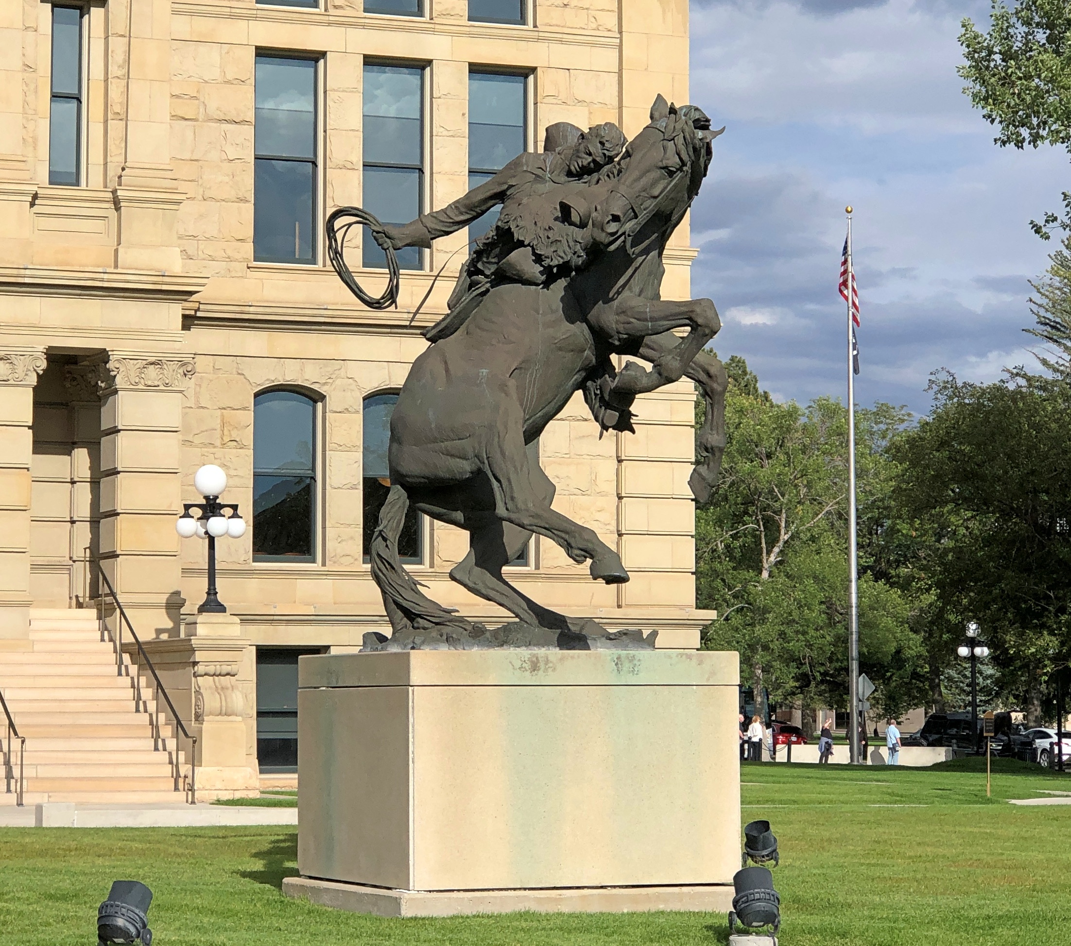
The work is called “Spirit of Wyoming,” and it stands on the capitol grounds, created by artist Edward J. Fraughton (d. 2024). The more I look at it, the more there is to think about. Which I suppose is at least one indication of a good work of art. So the Spirit of Wyoming involves the immediate risk of catastrophic injury by being thrown from a horse? Probably not what the legislature had in mind.

Rather, it might be the determination to hang on, no matter how much or madly the horse bucks. Especially in territorial and early statehood days, that sort of determination applied to a lot of Wyomingites, whether they were cowboys or not.

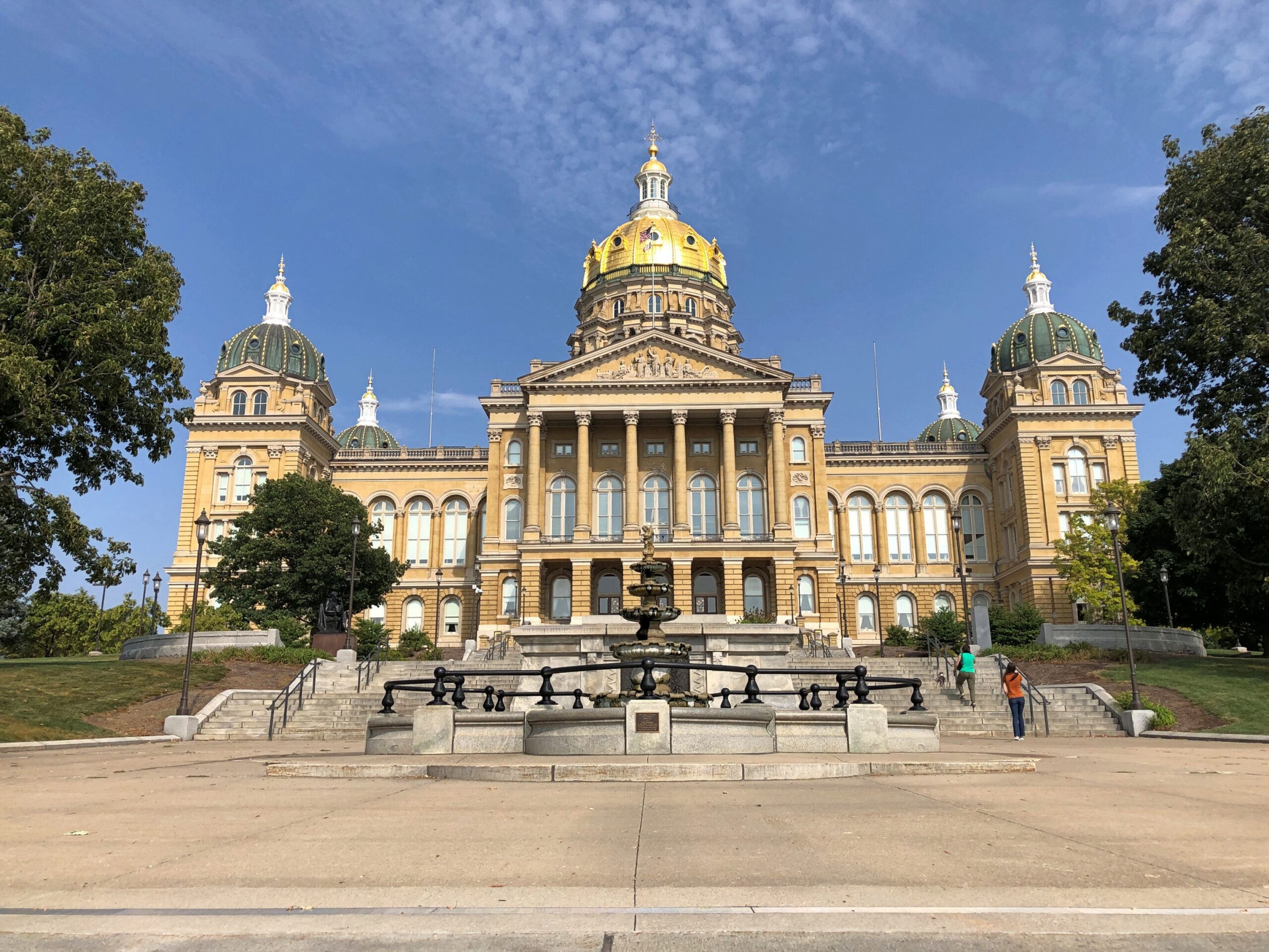
I had the opportunity to walk all the way around the capitol after arriving on the cloudy but warm afternoon of September 8.

WY state capitol
WY state capitol
WY state capitol

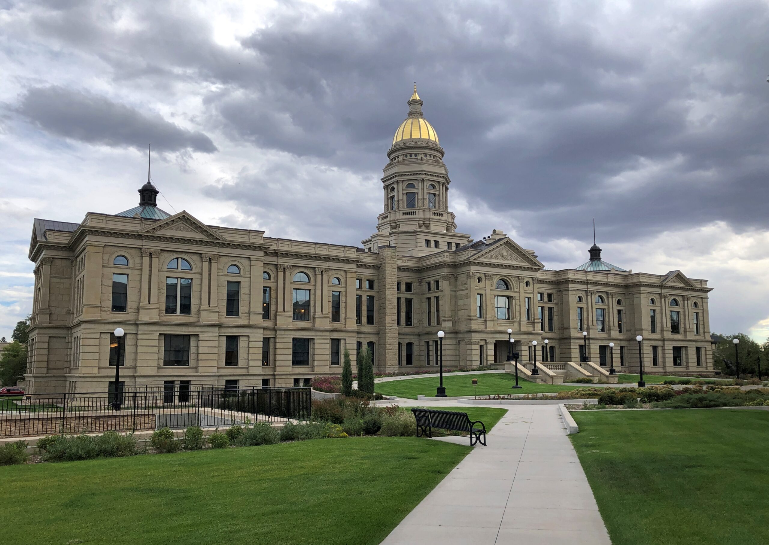
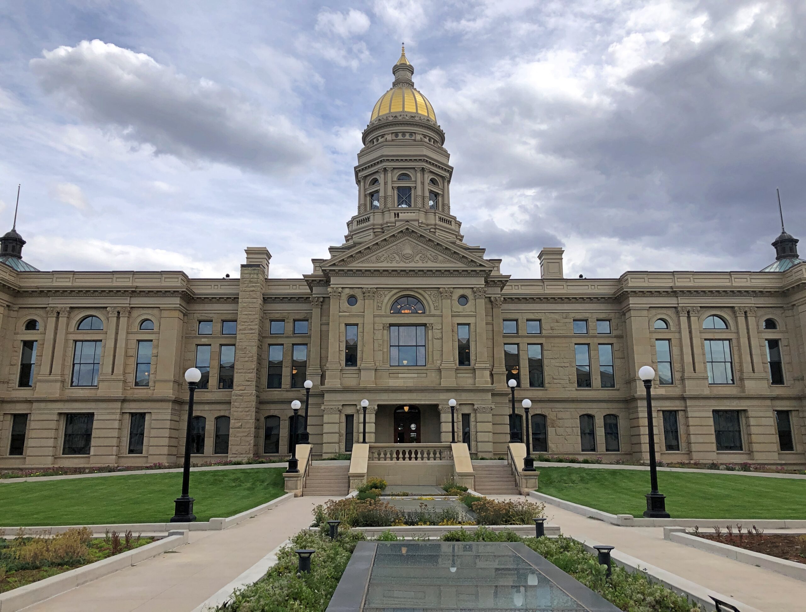
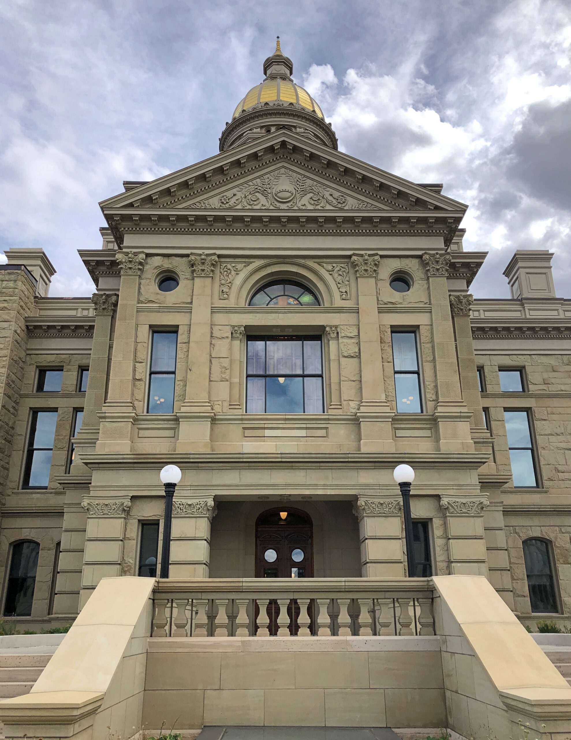
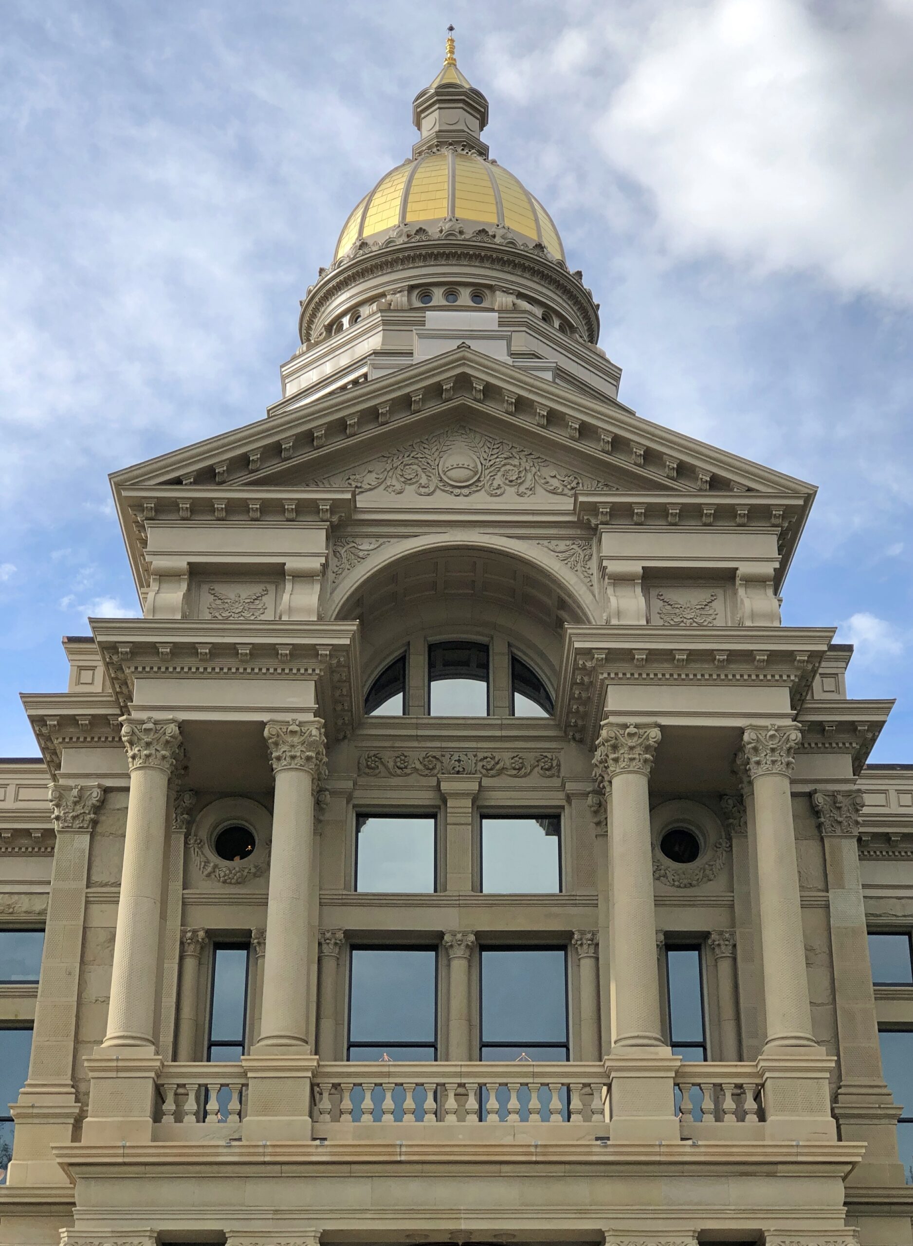
Golf leaf on a copper dome. Gold probably because it’s gold, not because Wyoming has ever produced that much. As of 2025, the state isn’t even among the top 10 all-time U.S. state producers.

I think this was the front.

WY state capitol
WY state capitol

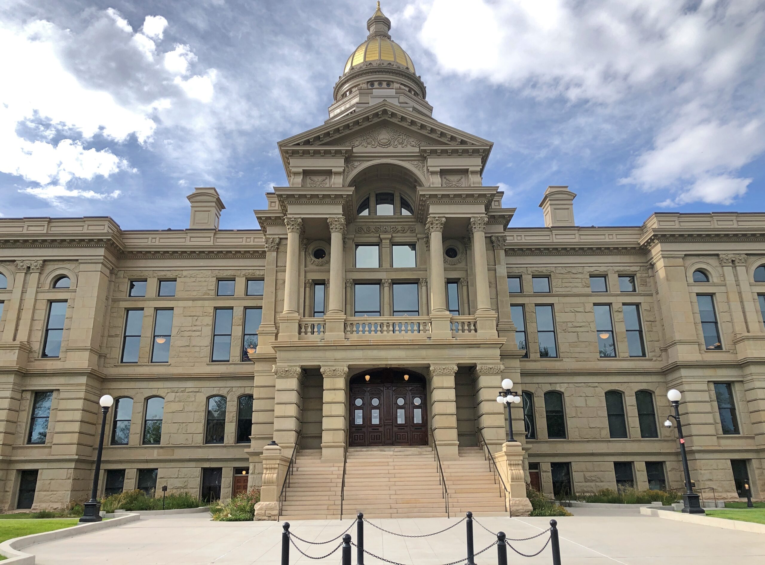
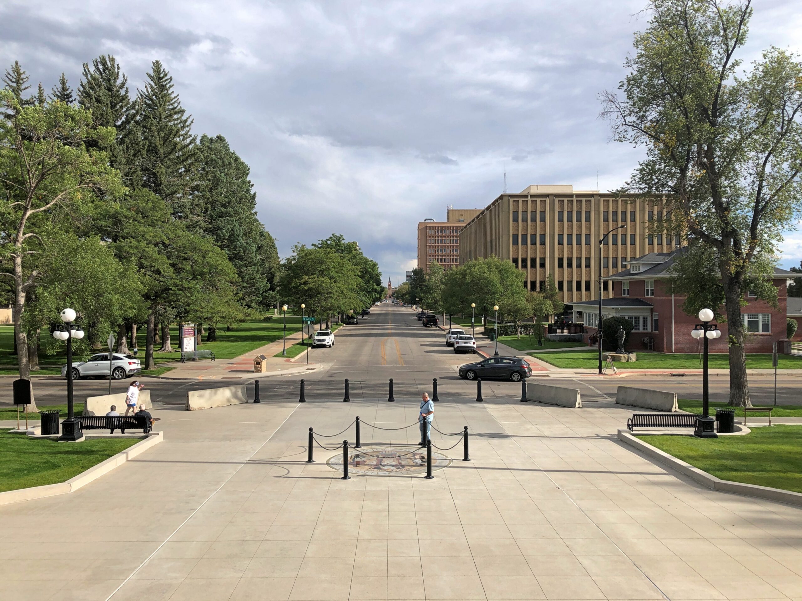
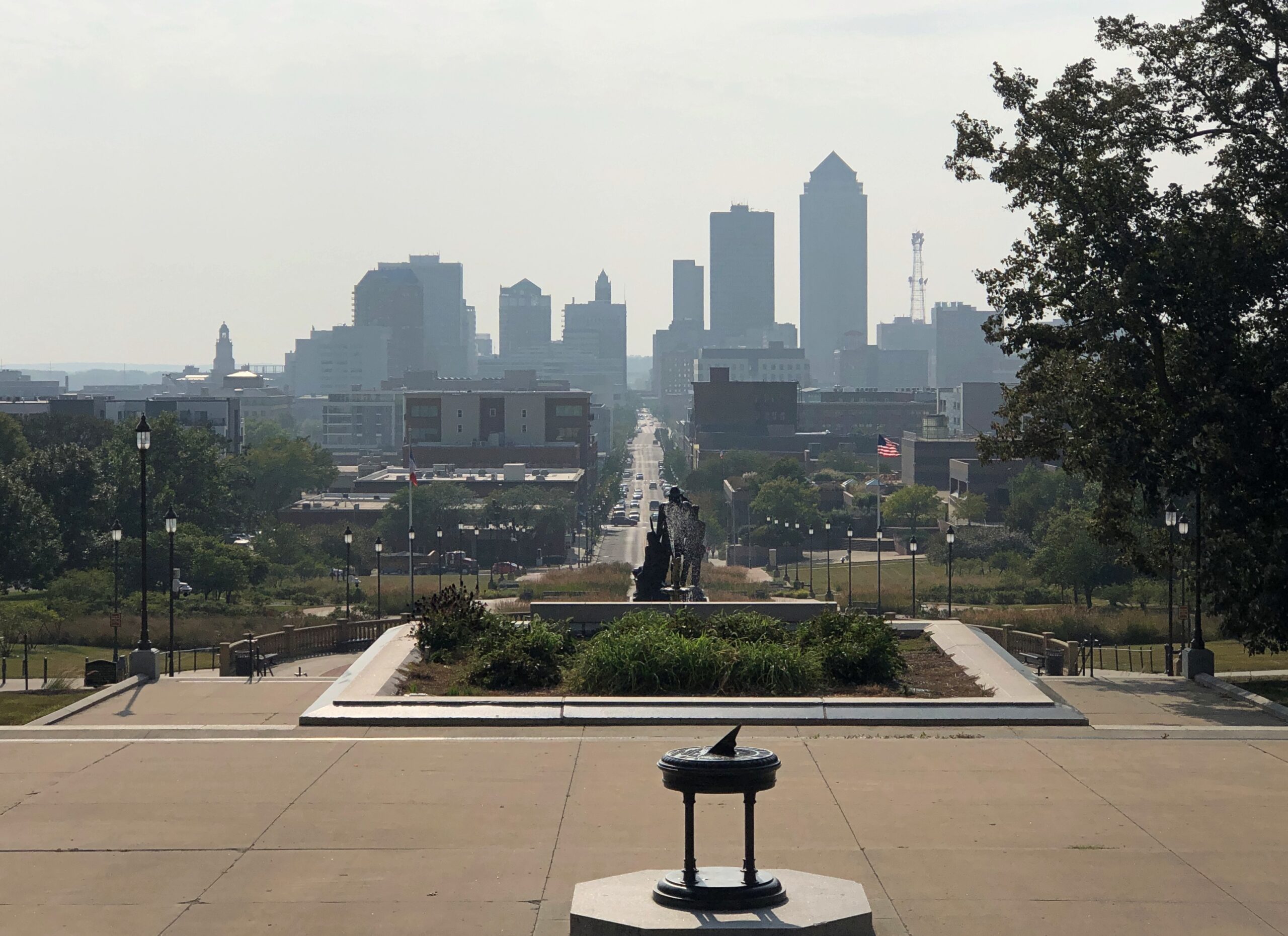
It faces a long avenue. It was a Monday. Cheyenne isn’t, just yet, cursed with heavy traffic.

Cheyenne Wyoming

Also, the Wyoming state seal was to be found on that side of the building, in the sidewalk. Like in Virginia, except that you can walk on that one, like the slain tyrant it depicts. No treading on Wyoming.

WY state capitol

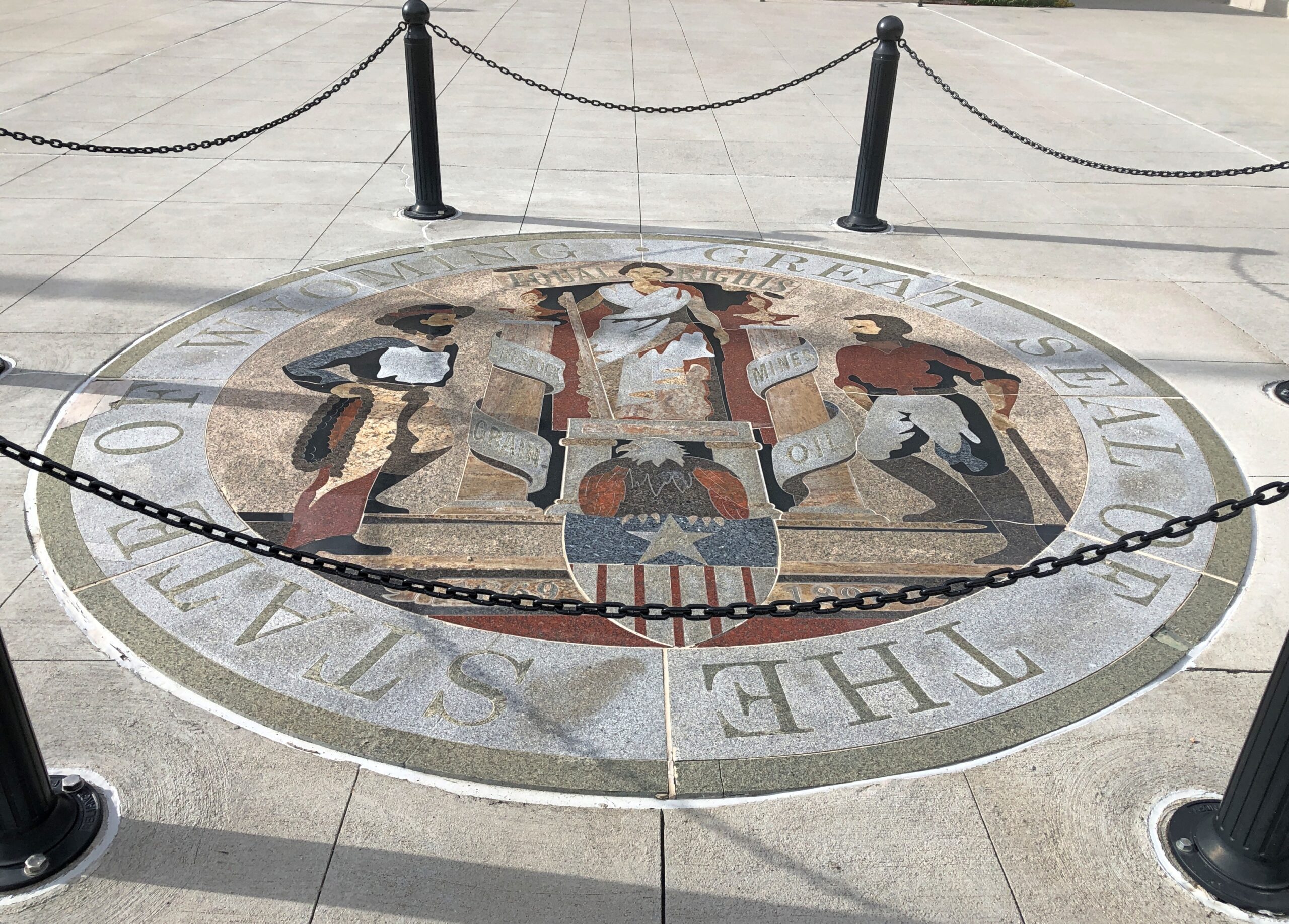
Adopted in 1893, not long after statehood, and revised in 1921, the seal lists four sources of wealth and livelihoods, unusually (I think) for a state seal. They go with the cowboy and miner figures: livestock, grain, mines and oil. In our time, farming and mineral extraction, at least in terms of employment, are declining industries in Wyoming. Maybe the seal will be revised someday to include data centers, as they sprout in the Equality State.

On the other hand, Wyoming is still a major energy producer among the several states, especially when it comes to coal: 41.1 percent of the total nationwide (EIA stats), though national coal output is a much smaller pie – a dirty pie, to be sure – than it used to be. Also worth mentioning: a quarter of net electricity generation in the state is by renewables, roughly the same percentage as nationally. There is no nuclear power generation in Wyoming. When those data centers eventually get small modular reactors, that would change.

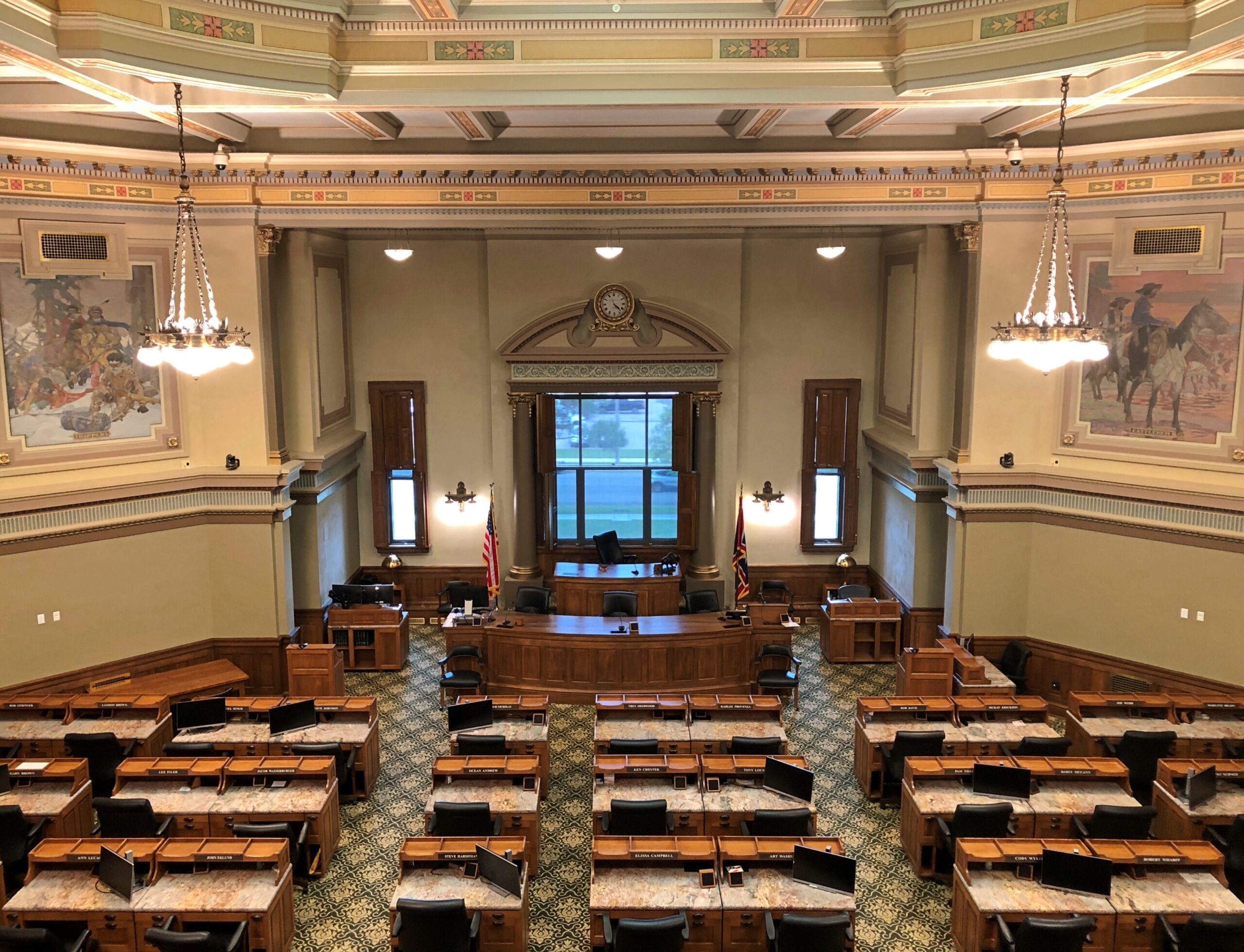
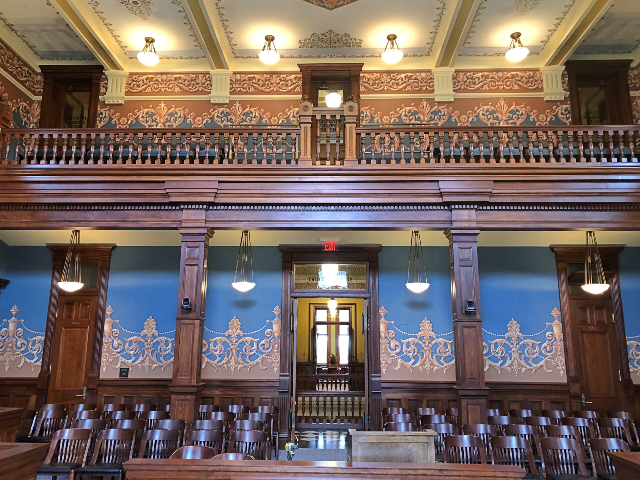
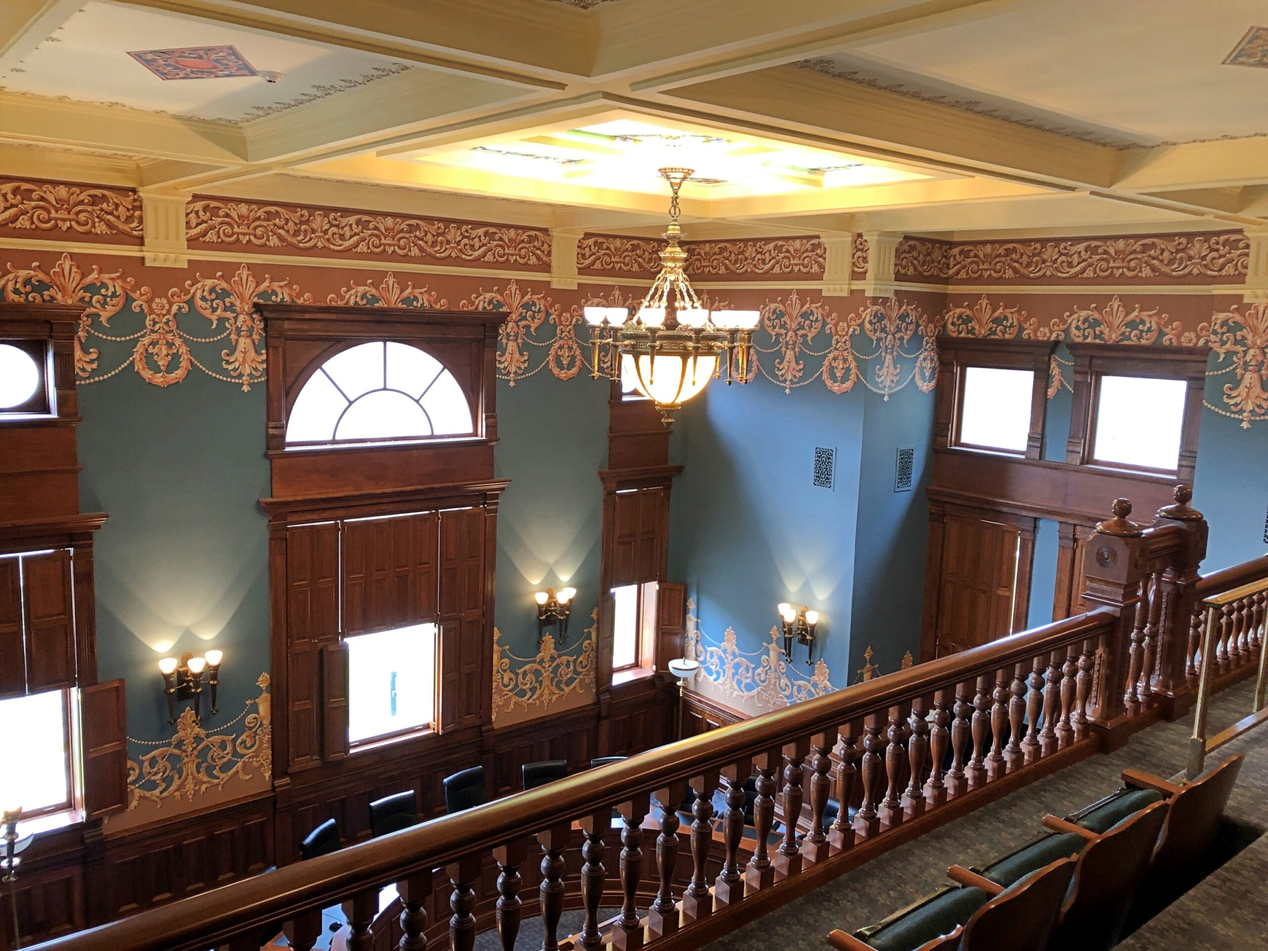
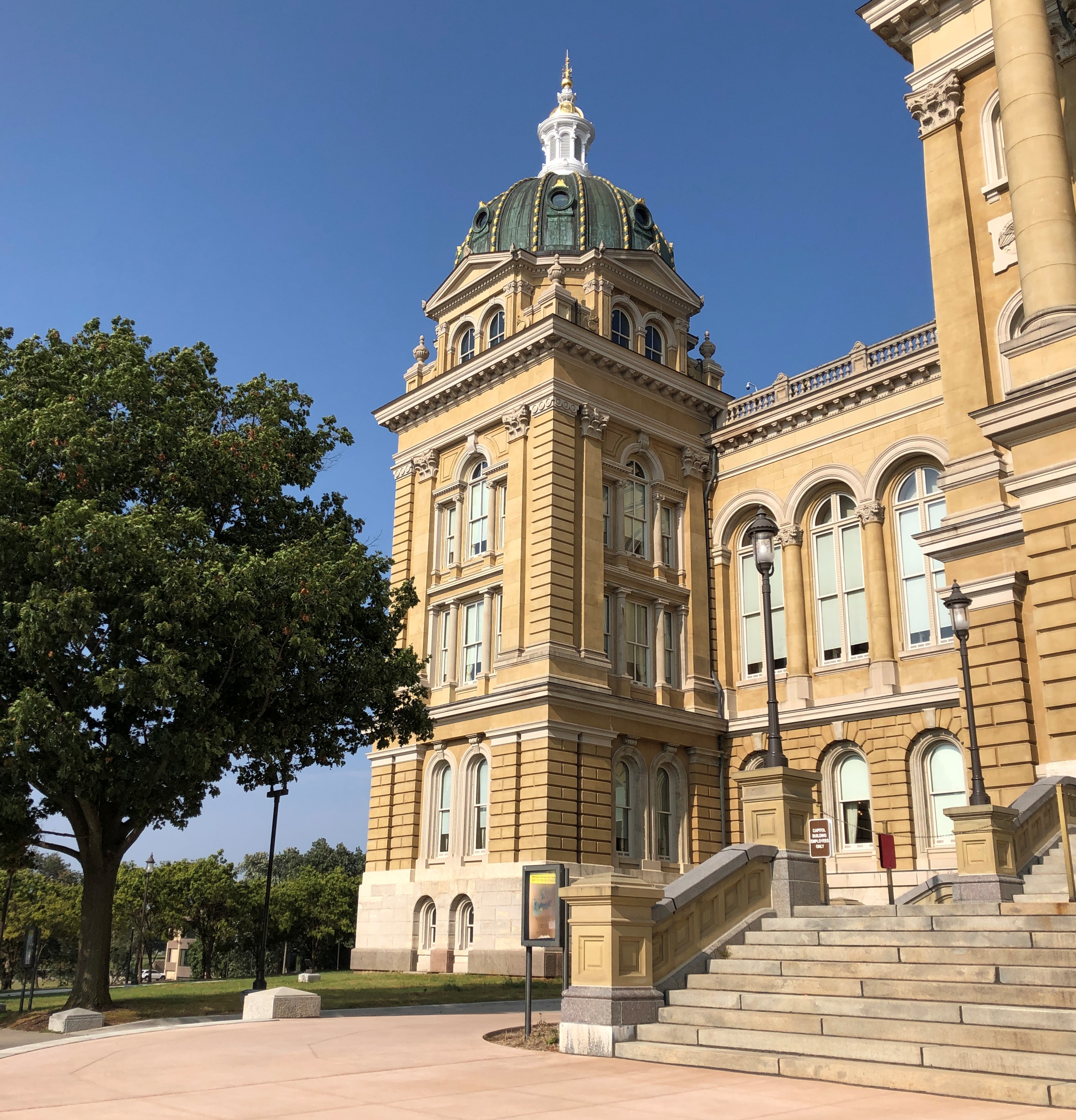
Another distinction of the Wyoming capitol is that work started on it before statehood, with ground broken in 1886. David Gibbs – later mayor of Oklahoma City, of all things – and the prolific William DuBois (a Chicago trained architect) did the design, one of restrained elegance.

It faces a long avenue.

This is one of the four statues at the capitol known as the Four Sisters: Truth. The others are Justice, Courage and Hope.

It faces a long avenue.

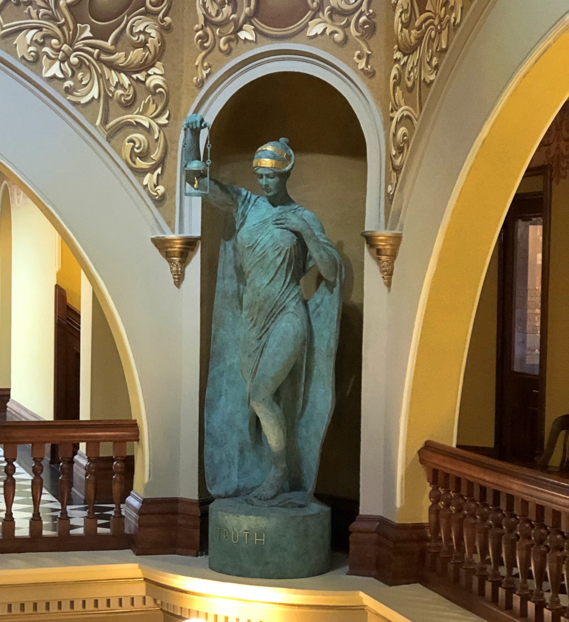
Though they look vintage, their niches remained empty for 131 years “for reasons that remain unclear,” according to a sign in the capitol. In more recent times, the state tapped the mononymous sculptor Delissalde to fill the niches, and the works were unveiled only in 2019.

They’re way up there.

WY state capitol

One more thing to note: a display in the capitol lauds the state – actually the territory – for its enfranchisement of women in 1869, the first place anywhere to do so. Why Wyoming? You could chalk it up to the toughness of frontier women, but certainly women in all the other 19th-century territories were plenty tough. The broader movement to expand the franchise was already underway, though early in the game – and from the sound of things in this article at least, the territory’s move was something of a retroactively happy result “for a large, strange mix of reasons.”

The Iowa State Capitol

Think of the 50 state capitols as, collectively, a giant free museum of U.S. history, complete with grand buildings and a collection of artifacts with some consistent themes, such as images of elected officials, relics of war, and memorials to officially worthwhile individuals or causes. Some capitols explicitly have museum cases or whole museum floors, with a wide variety of stories and items from a state’s early years.

The collections can be a little staid. But sometimes, oddities are tucked away. Not too often, but there was that time I saw a two-headed calf at the Georgia State Capitol, or the miniature Western movie set at the Utah State Capitol. Or a bust of President Benjamin Harrison, carved from a tree stump. In Idaho. Then, at the Iowa State Capitol last month, this fellow.

Iowa State Capitol

Last time I visited the Iowa State Capitol, I arrived about 10 minutes after it closed. So I — we, Ann was with me – looked at an assortment bronzes on the grounds, including the memorable (and mammary) Mother Iowa, and admired the gold-leaf dome. This time around, Des Moines was the destination for my first day of driving, September 4, and I was determined to see the interior.

It’s a grand edifice, as capitols usually are.

Iowa State Capitol
Iowa State Capitol

A series of architects oversaw the design, including Chicagoan John C. Cochrane, who also designed the Illinois State Capitol and, less well known, the handsome stick-style All Saints Episcopal in Chicago.

I’d forgotten that four smaller domes flank the main dome, forming in quincunx of domes. I understand that Iowa is the only such five-domed state capitol in the nation. I’m not sure how important that distinction is, but it is a distinction.

Iowa State Capitol

On a clear day, there’s a good view of downtown Des Moines from the capitol steps (and sundial). It was a hazy day, the result of Canadian wildfires.

Iowa State Capitol

I arrived before closing, and experienced the grandness of the inside. Such as murals.

Iowa State Capitol

Allegories done in mosaic. Law, for instance. There was no backing up further to get a fuller image of Lex, since that would be over the edge of a balcony.

Iowa State Capitol

The House of Representatives.

Iowa State Capitol

The Iowa State Law Library. The most gorgeous of the spaces, I thought. Just like canyon pictures, an image does no justice to the brilliance of the place itself.

Iowa State Capitol
Iowa State Capitol

Note that the skeleton is behind glass in the Law Library.

Iowa State Capitol

What’s he doing in the Law Library? Showing how strict the library used to be about returning materials late? (Or the smartass answer: “Nothing, really.”)

The sign on the case says, This skeleton was originally purchased by the medical branch of the State Library of Iowa to checkout [sic] to Iowa medical educators and students as a learning tool. When the medical library dissolved, the skeleton remained on permanent display with the State Library’s collection. Archaeological experts determined the remains are male, 45+ years old, European ancestry.

Check out a skeleton from a library? Learning that such a thing ever happened was worth the effort, all by itself, to get to the capitol.

The dome is a little unusual, too, a little more representational that you usually see.

Iowa State Capitol

It features a memorial – in this case to the Grand Army of the Republic, with the name of the organization, a 13-star flag, and the dates 1861 and 1865. Considering that the development of the current capitol happened between 1871 and 1886, a GAR memorial of some kind isn’t a surprise, and I suppose the organization had the political heft at the time to get such a prominent spot.

Wiki tells me that more than 76,200 Iowa men fought for the Union out of a population of nearly 675,000 (in 1860), and about 13,000 died for it, two-thirds of whom by disease. Iowans supported the Union by about as lopsided a margin as imaginable. Seventy-six residents of Iowa are known to have served the Confederacy, and very likely most of those had recently moved to Iowa from the South.

Kansas Mud (Or, Three Places in Kansas I Had Practically to Myself)

I returned home from Colorado via Kansas, heading eastward from Colorado Springs on September 22. I took this is a sign that day that I had, in fact, reached the western border of Kansas, created at the time of statehood in 1861.

An 1855 map of “Kanzas” and Nebraska.

It would be cool if the spelling Kanzas had caught on. As it stands, “z” is used only once in all the state names, in Arizona.

The current Colorado-Kansas border is fairly close to 102 degrees West of the prime meridian, but actually follows 25 degrees West of the meridian that once cut through the Old Naval Observatory in Washington, DC, as fixed in 1850, assuming the initial surveys out in remote Kansas-Nebraska were accurate. Until later in the 19th century, and not officially until 1912, it seems the U.S. wasn’t having that limey prime meridian; or the froggy one through Paris. (And I was amused to read that for a long time the French referred to Greenwich Mean Time as “Paris mean time, retarded by 9 minutes and 21 seconds.”)

I spent my first full day in Kansas seeking out obscure sights. In western Kansas, there really aren’t any other kind.

Site of the Battle of Punished Woman’s Fork (Battle Canyon)

Serendipity on the road is your friend, if you let it be. That is, pay attention to signs. Driving north on the 23rd from Scott City, Kansas, on the highway US 83 – on which you could drive to Brownsville, Texas, if you had a mind to – I saw a small sign directing me to a battlefield of the Indian Wars, in this case the last skirmish between Natives and the U.S. Army within the borders of Kansas: the Battle of Punished Woman’s Fork.

This isn’t the sign I saw, but rather another one at a fork in the road, pointing the way to the battlefield, down an unpaved road.

Battle Canyon, Kansas

Unhappy at being forced to live in Oklahoma, 350 or so Cheyenne headed north toward Montana in 1878. The U.S. Army gave pursuit and the two sides fought inconclusively at a lonely spot in Scott County. Lonely then, lonely now.

Battle Canyon, Kansas

But not so remote that there isn’t a monument, with exposition.

Battle Canyon, Kansas

The Cheyenne acquitted themselves well in the skirmish, and while they lost horses and food, were able to escape northward. Eventually some of the group – but not all – did indeed make it to Montana, and were able to stay. The incident is known as the Northern Cheyenne Exodus.

El Cuartelejo

I quote the following at length, because it’s well written, and also happens to be public domain material, published by the National Park Service. Read it while it’s still posted.

[El Cuartelejo] is one of the key sites indicating the far-reaching expansion of Spain beyond New Mexico and her interest in the Great Plains. It consists of the ruins of a seven-room, stone Puebloan structure, probably built by a group of Picuris Indians who in 1696 emigrated from New Mexico to live with the Cuartelejo Apaches. As early as the 1660s, friction between the Pueblo Indians of New Mexico and the Spanish rulers and priests had caused groups of Indians to migrate to El Cuartelejo.

Spanish expeditions under Archuleta (pre-1680 Pueblo Revolt) and Ulibarri (1706) probably came to El Cuartelejo to return groups of Indians to New Mexico. In 1719, Governor Valverde led an expedition northeast from Santa Fe, visited the Cuartelejo Apaches, and learned from them of French penetration into the Plains. As a result, in 1720, the Spanish sent out the Villasur expedition, which passed through El Cuartelejo but was destroyed later by the Pawnees in Nebraska.

Archeological excavation of the site has produced only a few artifacts of Southwestern origin. The pueblo ruin and its typically Southwestern appurtenances — slab-lined hearths, grinding trough, oven, and the like — were directly associated with a material culture complex that was almost entirely Plains Apache. Either the Puebloans stayed in the area only a short time, or they readily adapted themselves to the everyday implements and utensils of the local residents.

I didn’t know all that detail when I decided to go to El Cuartelego. Just that it was the northern- and eastern-most pueblo, which was enough.

El Cuartelejo, Kansas

The site is within Lake Scott State Park, where I had considered camping the night before. My earlier camping experience on the trip, in Nebraska, while not terrible, was exhausting enough to put me off the idea. No more camping, I think, where I have to do absolutely everything myself. In any case, it was a good decision, since on the night of the 22nd, a sizable rainstorm blew through Scott County. I listened to the storm with some satisfaction in my rented room in Scott City.

The ruins.

El Cuartelejo, Kansas

More exposition.

El Cuartelejo, Kansas

Like at the battlefield, I had the place to myself.

Monument Rocks

During the planning for the trip, which naturally meant quality time with maps, I spotted a point-of-interest for Monument Rocks in western Kansas. Sounded interesting, and on September 23 I made the trip, again on unpaved roads. The rain the night before made the driving surface a little dodgy, but the roads, layered with gravel, were generally up to the task. I was rewarded with the sight of rocks that are, in fact, pretty monumental.

Monument Rocks, Kansas

I didn’t quite have the place to myself. When I arrived, another car was there, occupied by an older couple. They left, and soon after that, two young men appeared in an SUV. But that was all.

Washburn U. in Topeka tells us: West of Castle Rock area in Gove County, Kansas, erosion has carved these chalk pyramids from what was once the floor of a vast inland sea. Also called Monument Rocks, this site is the first natural landmark chosen by the US Dept. of the Interior as a National Natural Landmark. This landmark in on private land. The owners are generous to share this site with the public. Treat it with respect.

This limestone was once the floor of a great inland sea, existing some 80 million years ago. The sea dried away over time and the rock was carved by elements of nature to create these formations, which now stretch up to 70 feet in height.

The rain the night before had also made mud all around the rocks. I should have taken the time to put on my better shoes for a walk near the rocks, but no. While making my way through the muck, I lost traction, and down I went, on my butt. Luckily, the soft mud cushioned the fall, which was more of a slide anyway, so I wasn’t even bruised.

The back of my pants were, however, coated with sticky, yellowish Kansas mud. So standing outside my car, I changed my pants. The two other visitors were in another part of the site by that time, so no one was around for the unwelcome spectacle. My shoes were covered with mud too, so much so that even a good soaking when I got home didn’t get it all off. When I wear those shoes now, I take a bit of Kansas with me.

Garden of the Gods

With a name like Garden of the Gods, a place better live up to expectations. I’m glad to say the one in Colorado does.

The park web site conveys the following story, which sounds just a little suspect to me, but never mind: In August 1859, two surveyors started out from Denver City to begin a town site, soon to be called Colorado City. While exploring nearby locations, they came upon a beautiful area of sandstone formations. Surveyor M. S. Beach suggested that it would be a “capital place for a Biergarten” when the country grew up. His companion, Rufus Cable, a “young and poetic man”, exclaimed, “Biergarten! Why it is a fit place for the Gods to assemble. We will call it the Garden of the Gods.” It has been so-called ever since.

Do a casual search for Garden of the Gods and you’ll notice that there’s one in Illinois (which is terrific). Also, articles like these: “Visiting Colorado’s Garden of the Gods: The Complete Guide” and “Ten Things You Can’t Miss at the Gardens of the Gods in Colorado Springs.”

That’s overthinking things. Here’s my guide to the Garden of the Gods in Colorado Springs:

1. Go there. Parking may be hard to find.

2. Look around, especially from a stroll on the Central Garden Trail.

3. Think, ain’t that cool.

One more recommended step, before the others: Drop by the visitors center, which is at some distance from the main complex of rocks, for a view of Pikes Peak. The place was fairly busy. For good reason.

Garden of the Gods, Colorado Springs
Pikes Peak, Colorado

The Central Garden parking lot was nearly full, also on a Monday morning. Give the people something to awe them, for free, and they will come. The trail from the parking lot takes you directly to pointy and picturesque rocks, mostly orange.

Garden of the Gods, Colorado Springs

And among impressive bluffs.

Garden of the Gods, Colorado Springs

A gathering place for centuries, Garden of the Gods wound up in possession of a wealthy local family early in the 20th century, who deeded it to the city of Colorado Springs in 1909 on the condition that its 480 acres remain freely open to the public, and undeveloped, except for park infrastructure. Also, “no intoxicating liquors shall be manufactured, sold, or dispensed” there, and to this day, alcohol is banned.

Some historic detail: historic graffiti. No longer legal to do, you can be sure.

Garden of the Gods, Colorado Springs

Geologically speaking, the formations aren’t that old, only going back to the tumults of the Pleistocene.

Garden of the Gods, Colorado Springs

Glaciation and erosion at work.

Garden of the Gods, Colorado Springs

Away from the Central Garden is another place with a small parking lot, called Balanced Rock, for obvious reasons.

Garden of the Gods, Colorado Springs

Geologically speaking, it’s going to tumble just any time now.

Denver Botanic Gardens

Our only full day in Denver, September 10, was forecast to be a hot one, so we schemed to arrive at the Denver Botanic Gardens when it opened in the morning and stay there until the heat became uncomfortable. We liked the place so much that we stayed well after the heat locked into high.

The place includes a few whimsical installations, but mostly it’s straightforward flora.

The flowers alone were worth the price of admission. Singly.

Denver Botanic Garden

And in profusion.

At 23 acres in the middle of a major metropolitan area, the gardens are enormous, with paths leading off in various directions to a sizable pond garden, a Japanese garden, and a giant tropical conservatory, among other features, such as an alpine garden and a steppe garden and a xeriscape demonstration garden (“Dryland Mesa”). Not to forget cacti.

Denver Botanic Garden

There was no way to see everything, so we focused on various parts, such as the pond.

Denver Botanic Garden

I’d never see lily pads like this.

Built for squadrons of dragonflies to land on.

We also spent time in the Japanese garden, known as Shofu-en, the Garden of Wind and Pines, designed by Koichi Kawana (d. 1990). He did the Japanese garden at the Chicago Botanic Garden and a lot of other places, curiously including Suiho-En, the Garden of Water and Fragrance at the Donald C. Tillman Water Reclamation Plant in Los Angeles.

Denver Botanic Garden

Then there was the conservatory.

Denver Botanic Garden

To listen to the three-minute audio on this page, the place sounds as high-maintenance as you’d expect, especially the watering and pruning that’s done by hand. To keep a slice of the tropics alive in a mile-high temperate location, I’d say it’s worth the effort.

Nebraska Rocks

Pity the people whose job it is to promote tourism in Nebraska. Set ideas are notoriously resistant to change, at least over periods less than a generation, so I expect the idea “nothing to see there” is a constant battle for those who know otherwise.

I didn’t need to be persuaded. A drive across the state – a reward in itself, more about which later – takes you Carhenge (see yesterday) but also to terrain not generally associated with Nebraska.

At the western edge of the state, rocks. Big, impressive rocks that poke out of the still-flat ground, stubborn geological leftovers that refuse to erode as fast as the surrounding terrain. Natives, mountain men, trappers, and wagon trains across the prairie all knew about these rocks, knew that they marked a certain point in their journeys. I’m sure they were hard to miss.

Since 1919, the rocks a few miles from Gering, Nebraska have been known as Scotts Bluff National Monument. I arrived on the morning of September 8.

Scotts Bluff National Monument

On this particular trip, the monument was an appetizer, ahead of the main course in Colorado. The Sandhills of Nebraska, which I’d just driven through, aren’t pancake flat, but waves of grassy hills with scattered outcropings of rock. After a drive like that, the Scotts Bluff seemed to appear suddenly, rising in your field of vision to take over half the sky.

I exaggerate, but only because that’s how I seem to remember it. An outcropping like that in the Rockies would be lost in the crowd, but here in western Nebraska it’s the star of the show.

Scotts Bluff National Monument

The road leading to the monument, the highway Nebraska 92, follows the Oregon Trail at his point.

Scotts Bluff isn’t just a single bluff. A set of them, you might say. A road (yes, CCC built) provides access to the top. From there, any number of fine vistas ring the area. A fair number of people took the drive the same day as I did, but in no way did they amount to a crowd.

Scotts Bluff is no solitary outpost. Turning to the 1911 Enclopdaedia Britannica’s entry on Nebraska: “In the fork of the North and South Platte are the Wild Cat Mountains, with contours rising to 5300 ft., in which Wild Cat Mountain, long reported as the highest point in the state, attains 5038 ft., Hogback Mountain 5082 ft., and various other hills — Gabe Rock (5006), Big Horn Mountain (4718), Coliseum Rock (5050), Scotts Bluff (4662) &c. — rise to heights of 4500 to 5000 ft.

“In the extreme N.W. the White river and Hat Creek have carved canyons in deep lacustrine deposits, creating fantastic cliffs and buttes, bare of vegetation, gashed with drainage channels, and baked by the sun.”

East of Scotts Bluff not far from highway US 26 is a set of rocks known as Courthouse and Jail. There’s something to that name.

If Scotts Bluff was lightly visited, these two were almost completely empty. I stopped by on the afternoon of the 7th, and the only other people in the parking lot were sitting next to their RV, under a tarp, probably shooting the breeze over beer. So I had the trail to myself, though I didn’t go that far under the hot and copper sky.

Offering some views of its own.

Not far away in this part of Nebraska (at least by horseless carriage) is the better known Chimney Rock National Historic Site.

It was later on same day as Courthouse and Jail, and the heat was still on. Again, I didn’t want a personal heat event to interrupt my trip, so I didn’t go as close as the trails would have allowed.

Chimney Rock, Neb

I sent an image of Chimney Rock and a text message to old friend Tom J.:

The aliens decided that Devil’s Tower was a better site.

Then I sent this image from the Chimney Rock gift shop.

Chimney Rock, Neb

Tom answered:

lol. We never even played Oregon Trail and that’s still funny.

Carhenge

Just how many Stonehenges are there in North America? Or rather, Stonehenge-like structures, standing out in the open. For a question like that, consult the expertise of Roadside America. The answer turns out to be that there’s no definitive count – they keep “springing up,” as the web site says (and the article is worth reading in its entirety). A design borrowed from ancient Britain morphs into something distinctly American, again and again.

None is better known than Carhenge in western Nebraska, RA asserts, and I can go along with that. Its fame is international.

Though not a Stonehenge, I visited the Cadillac Ranch once upon a time, so it stands to reason that someday I’d have a strong hankering to see Carhenge. I arrived early in the afternoon of September 7, under partly cloudy and very warm skies.

Carhenge, Alliance, Nebraska

All the cars were painted gray at one time, but that has clearly given way to some being used as metal canvases.

Carhenge, Alliance, Nebraska

The colorful cars are curated works, from the looks of them, to use that word in a literal and correct way.

Carhenge, Alliance, Nebraska

RA: “[Carhenge] was built [in 1987] in a farm field north of Alliance, Nebraska, under the supervision of farmer (and engineer) Jim Reinders [d. 2021], who meant it as a memorial to his dad.

“What makes Carhenge special is that it’s made of cars, 38 of them, rescued from nearby farms and dumps. Reinders noticed that the monolithic dimensions of cars from the 1950s and ’60s nearly equaled the stones at Stonehenge, and he built his monument with a 96-foot diameter to match the proportions of the original.”

One outlying car seems to be reserved for spray painting for anyone who wants to, in the style of all the cars at the Cadillac Ranch.

Carhenge
Carhenge

The undercarriage is particularly vivid.

Carhenge

The graffiti car is apart from the Stonehenge-like array, along with other sculptures that have been added to the grounds in more recent years.

Carhenge
Carhenge, Alliance, Nebraska

Not just an upright old car, but apparently a time capsule, closed in 2003, with a slated opening in 2053.

Carhenge, Alliance, Nebraska
Not just an upright old car, but apparently a time capsule, closed in 2003, with a slated opening in 2053.

Word is that Carhenge wasn’t especially popular locally in its early years, including grunts of “eyesore” and threats to have it condemned and the like. But after a few decades, the townspeople came around, and the town of Alliance acquired the site in 2013, so now it counts as a public park. You go through an open gate, no admission is charged, and you’re free to wander around. Next to the parking lot, a gift shop stands, but visiting is optional. I supported the preservation of Carhenge in the form of a magnet- and postcard-centered purchase at the shop.

Black Canyon of the Gunnison National Park

A vast stretch of mountains majesty well over the tree line, a complex mass of sand piled at the edge of rugged mountains, and the well-hewn cliffside relics of a people remote in time but whose presence endures – the first three national parks we visited in Colorado in September all rated as exceptional destinations. But I’m glad, simply because it was last on the clockwise loop I’d planned through the state, that Black Canyon of the Gunnison National Park came last. It would have been a hard act to follow.

As a steep – and really deep – crack in the earth, the Black Canyon lives up its name, with most of the canyon cast in shadow most of the time, striking in its seeming darkness. But not pitch black all the way down its 2,000-foot cliffs. Far away, a whitish irregular ribbon runs through the gray bottom of the canyon, quickly recognizable as a river in quicksilver motion. The Gunnison, that is.

If there were no other people around, which happened sometimes at this park, you could hear the roar of the river. Faint, but distinct in its power. Mass snow melts and rushing tributary creeks enable the Gunnison to act (on a geological time scale) like a high-powered saw cutting through rocks that are unimaginably ancient. Before long, that is 2 million years, the river gouged the crack you see, exposing rocks 1,000 times older than the time it took to cut the canyon.

A single two-lane road snakes about seven miles along the south rim of the canyon (should I even have to say it? By the CCC), offering a string of overlooks. Not far from the park entrance, an overlook gives a taste of vistas to come. I might have named the place Gray Canyon, but that isn’t quite as poetic, is it?

Black Canyon of the Gunnison

Also, evidence of the fire that swept through the park in July, burning about a total of about 4,000 acres on both the south and north rims, along with some Park Service infrastructure. A number of trails leading away from the south rim overlooks were still closed when we visited the park on September 19, with signs disallowing access to charred grounds and slopes.

Black Canyon of the Gunnison

Fortunately for us, we were able to drive the South Rim Road and see what we could see at some of the overlooks. Unless you’re keen on some kind of lunatic climb into the canyon, that seems like a perfectly reasonable ambition. At the main visitor center on the road – which a ranger told us had barely escaped intact, through the efforts of hotshot crews – a path leads to scenic perch, built to accommodate casual visitors. It survived the fire as well.

Black Canyon of the Gunnison

Any photo’s going to be a pale image of this vista, but they will have to do. Believe me, it was a place to drop everything and gawk. And, even while safe behind rails, to experience a touch of vertigo. Nothing incapacitating, just an unsettling mental comparison between little you and the huge yawning drop.

Black Canyon of the Gunnison

A pointy ledge below. An opportunity for an Instagram death. It was hardly the only one.

Further down the road, a good view of the Gunnison. It’s hard to tell just by the images, but that’s around 2,000 feet down. Eventually, the water goes into the Colorado River.

Black Canyon of the Gunnison

Capt. John Gunnison is the U.S. Army officer and explorer who came to the canyon in 1853 as part of the effort to find a route for the transcontinental railroad. To sum up his conclusion, in terms he would have never used: Not through the Black Canyon, Secretary Davis. Are you kidding me? Later that year, Gunnison and most of his men got the worst of an encounter with some Ute warriors and, among other places, the river acquired his name as a posthumous honor.

I also have to say that Gunnison’s career also included surveying in the Upper Midwest, such as the Green Bay area, and that he surveyed the border between Wisconsin and Michigan. An underappreciated kind of achievement, I’d say.

None of the viewpoints were crowded. The Grand Canyon, this isn’t. The more accessible south rim of the Black Canyon isn’t crowded, even on a warm Friday afternoon, unlike the more accessible south rim of the Grand Canyon.

Black Canyon of the Gunnison

Near the end of the road is a view of the Painted Wall.

The stripes are not paint, of course, but pegmatite, an igneous rock that solidified after the surrounding rock did, for reasons that a geologist, which would not be me, might be able to explain. A sign at the viewpoint helpfully compares the height of the cliff (2,250 feet) to various manmade structures. The only one that would rise higher than the wall is Burj Khalifa, and that not by much. Note also that the top of the cliff, across on the remote north rim of the canyon, has absolutely nothing in the way of safety infrastructure. The cliff is a cliff, with gravity ready 24/7 to whisk the careless or suicidal to their doom.

I’d be remiss if I didn’t include a few more post-char landscapes: the sort that spread out from South Rim Road for long stretches. It would be a thrill of a road anyway — a little more thrill than I need, actually — with its sporadic few spots where the separation between the road’s edge and an enormous cliff was a single white line.

At the end of the road is the trailhead of Warner Point Trail. From the parking lot, according to a sign, the walk is 1,373 yards to the overlook at Warner Point. Near the sign, I heard a couple of young German men obviously working out the distance in meters (you don’t need much German to understand that). No matter how few people are at a U.S. national park, some are going to be Germans.

I preferred to work out the distances in miles. That would be nearly eight-tenths of a mile, so roughly a 1.6 miles there and back. Or 2.5 km for Euro-types. Better shoes on, poles in hands, hats on heads and water in a small backpacks, we set off on the trail. Yuriko and a few other people (including the Germans) got to Warner Point before I did , but get there I did.

The walk was partly on this kind of trail.

With a fair amount of this kind of thing.

Along the way, an impressive collection of deadwood that the recent fires missed.

With views of the agricultural valley outside the park..

Finally, the end of the trail at Warner Point.

When I got there, Yuriko was waiting. Two other people were there (not the Germans; as athletic sorts, they’d come and gone). Soon they left. So we had the vista to ourselves for about 10 minutes, until another couple came along and we left. When we were quiet, the only sound was the Gunnison far below.

Mesa Verde National Park

In 800 years or so, will people come from significant distances to look at the ruins of my mid-century neighborhood? That doesn’t seem likely for any number of reasons. I’d be surprised if my own house survives until the next century, considering how good people are now at razing and rebuilding. But considering such a long span of time, there’s no way to know.

That’s the kind of thing I wonder about when facing structures of that age, especially those whose inhabitants are known mainly by the structures and other items they long ago cast off.

On September 17, we’d come to the Cliff Palace at Mesa Verde National Park. To get close, you sign up and pay for a ranger-guided tour, which goes down stone stairs, along the edge of the cliff near the dwellings, and then back up some stone stairs (built by the CCC; does that even need to be said?). The elevation is 7,500 feet or so, but that didn’t cool things down that day. It was hot and sweaty.

A shot like that took some effort. We were hardly alone at Cliff Palace.

The ruins, which are most certainly near a cliff, are probably not a palace in the grand sense of a royal residence. More of a neighborhood, one of many in the vicinity, though the largest. Also, not quite as much of a ruin as it used to be. This is an image of the Cliff Palace from 1891, taken by Gustaf Nordenskiöld.

Not as long ago as all that, considering the age of the structures, but before TR inked the bill creating the national park, and back when you could help yourself to whatever was lying around, as the explorer (and photographer) Nordenskiöld apparently did, taking many items back home to Sweden. Eventually, the items made their way to Finland. A few were returned recently.

The ruins aren’t quite as ruined these days. The 20th century was a period of stabilization. Not as many artifacts got nicked either.

Mesa Verde National Park

A kiva. The largest one at the Cliff Palace, I think. A religious site similar to others in the Southwest, such as at Bandelier National Monument (and now I know that was a kiva).

Mesa Verde National Park

The canyon below the Cliff Palace. Imagine having to scramble up and down the walls regularly, to tend to fields or fetch water or escape from marauders.

Mesa Verde National Park

Mesa Verde is of course much more than the Cliff Palace, since the park protects an estimated 5,000 archaeological sites, including 600 cliff dwellings. The main road through the park (built by the CCC, naturally) takes visitors to other overlooks. The dwellings of Spruce Tree House are sizable and also off limits these days, until the overhead rocks are stabilized.

More cliff dwellings. They are a little hard to see, but they are there.

Mesa Verde National Park

On top of the main mesa, the road also goes through areas burned by wildfire at one time or another.

Flora always bounces back.

I had the vague idea that the inhabitants of the cliff dwellings disappeared mysteriously after about 1300, but visiting the park schooled me on more current thinking. They left, but there was nothing mysterious about it. Drought hit them, and hit them hard, so they migrated to find water and other sustenance. Persistent violence was probably a factor, too, as tends to happen in periods of strained resources. So it’s pretty clear that Ancestral Puebloans’ descendants even now live among the tribes along the Rio Grande, not too far away.

I also didn’t realize that the well-known cliff dwellings were only occupied for a relatively short time, in the grand scheme of native inhabitation: only about a century. Before that, most of the inhabitants lived atop the mesas. One such ruin is called Far View, which isn’t far from the road.

Mesa Verde National Park

I heeded this signs and didn’t enter. But you can walk around the perimeter and imagine the passing centuries.