Badlands National Park ’24

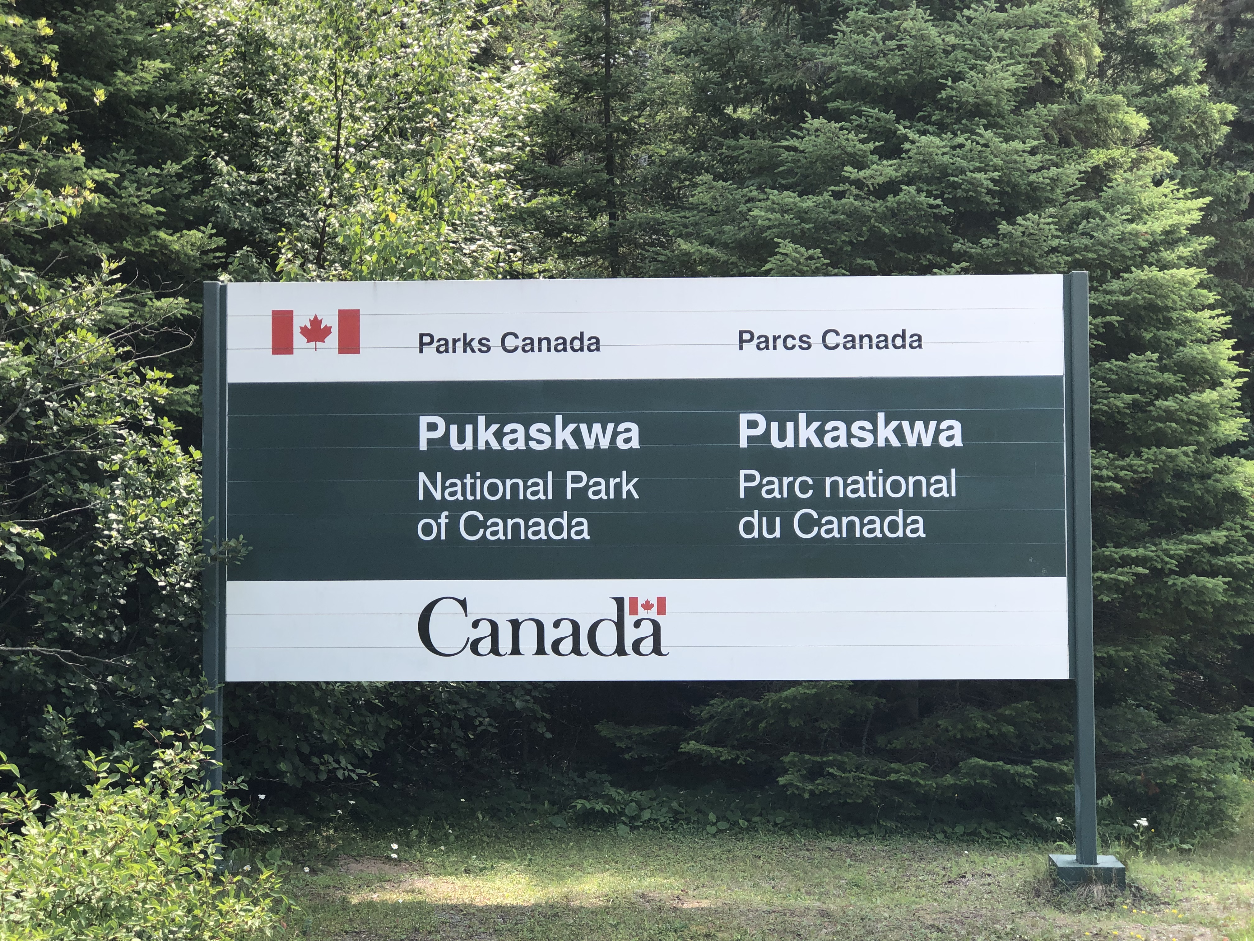
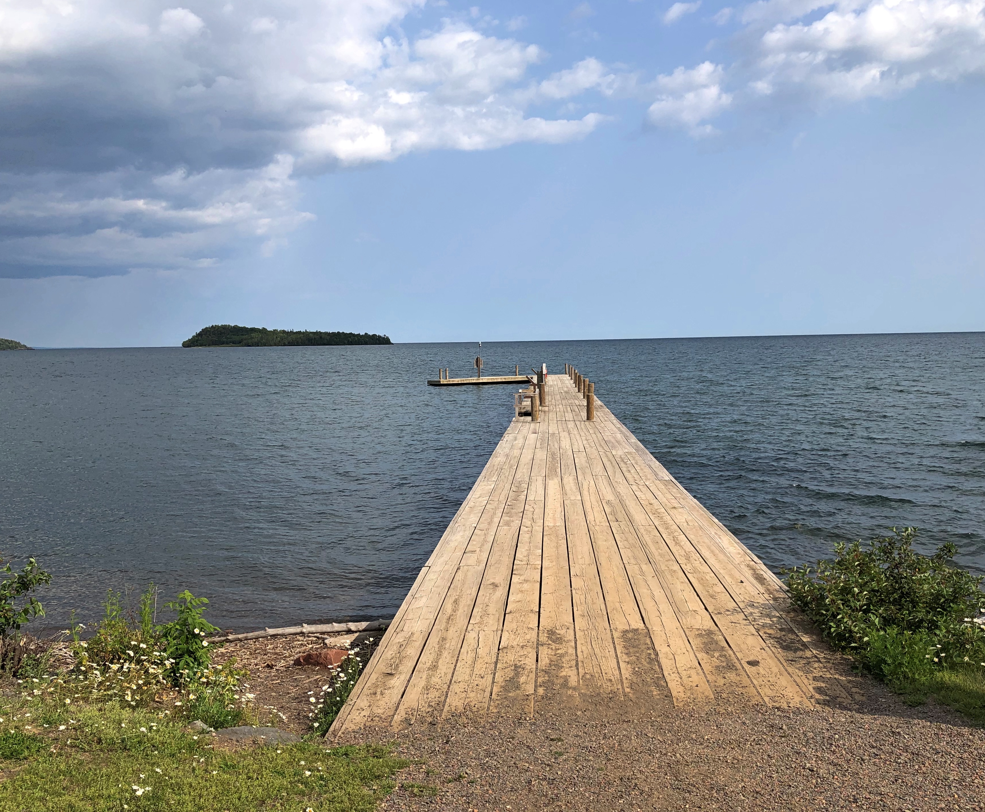
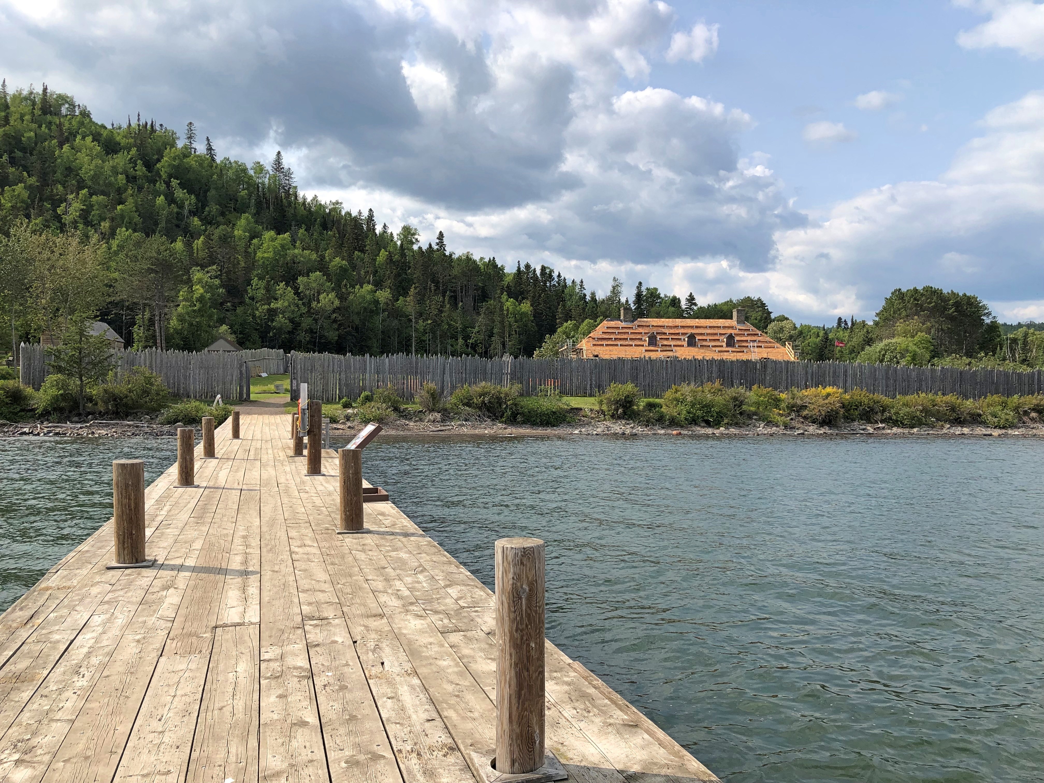
A little over 19 years ago, we visited Badlands National Park, which is easily accessible from I-90. Our visit ended up being short.

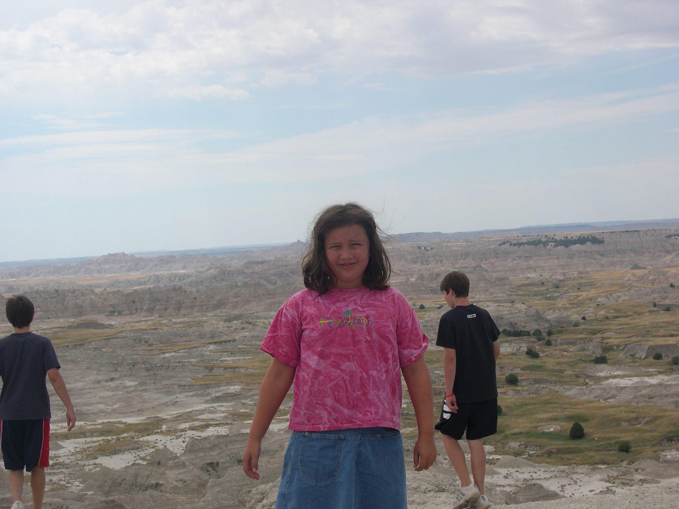
Lilly wasn’t impressed. Could have been the heat. Must of been pushing 100 F. pretty hard. Also, the austere beauty might have been lost on a seven-year-old.

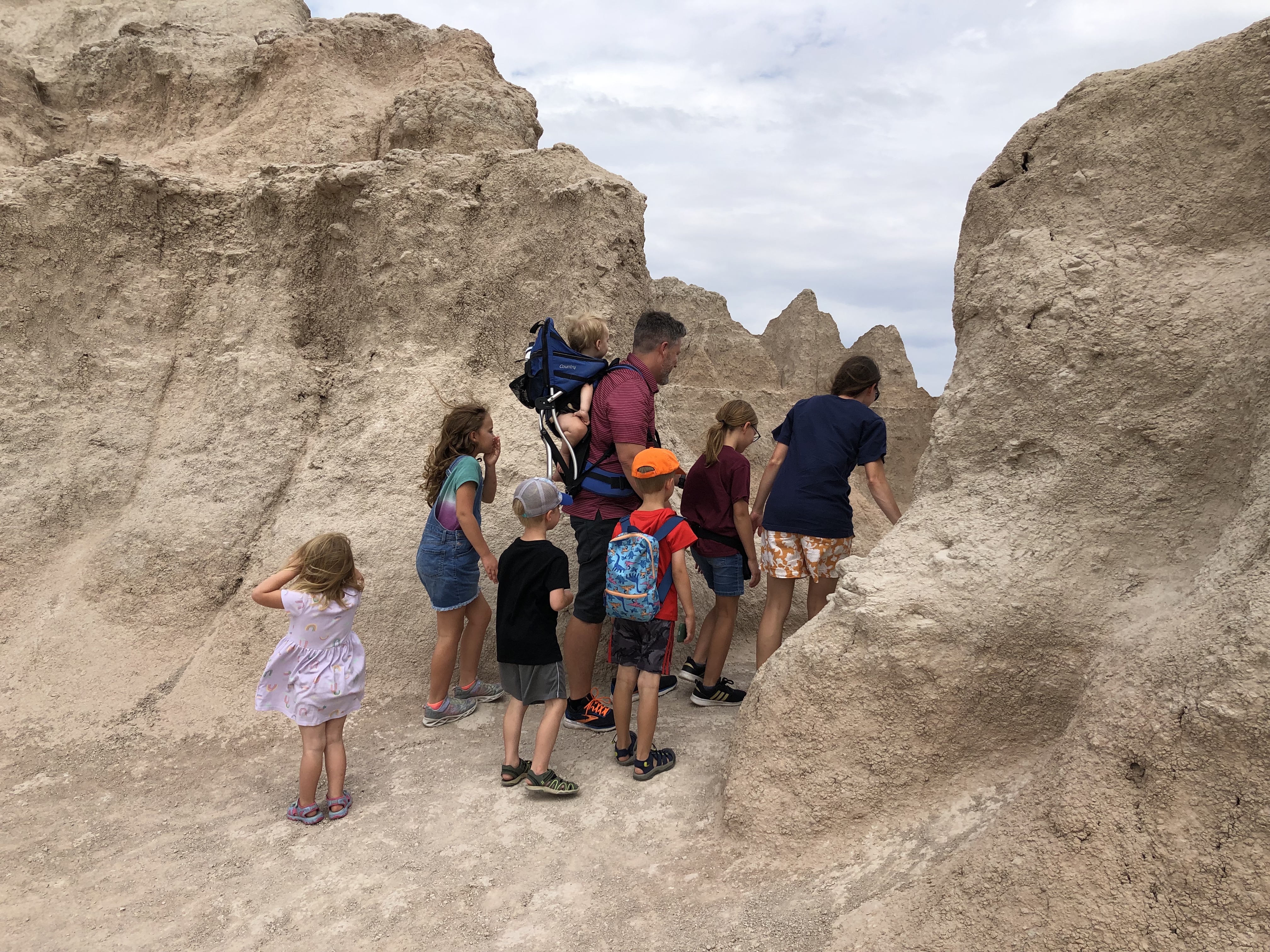
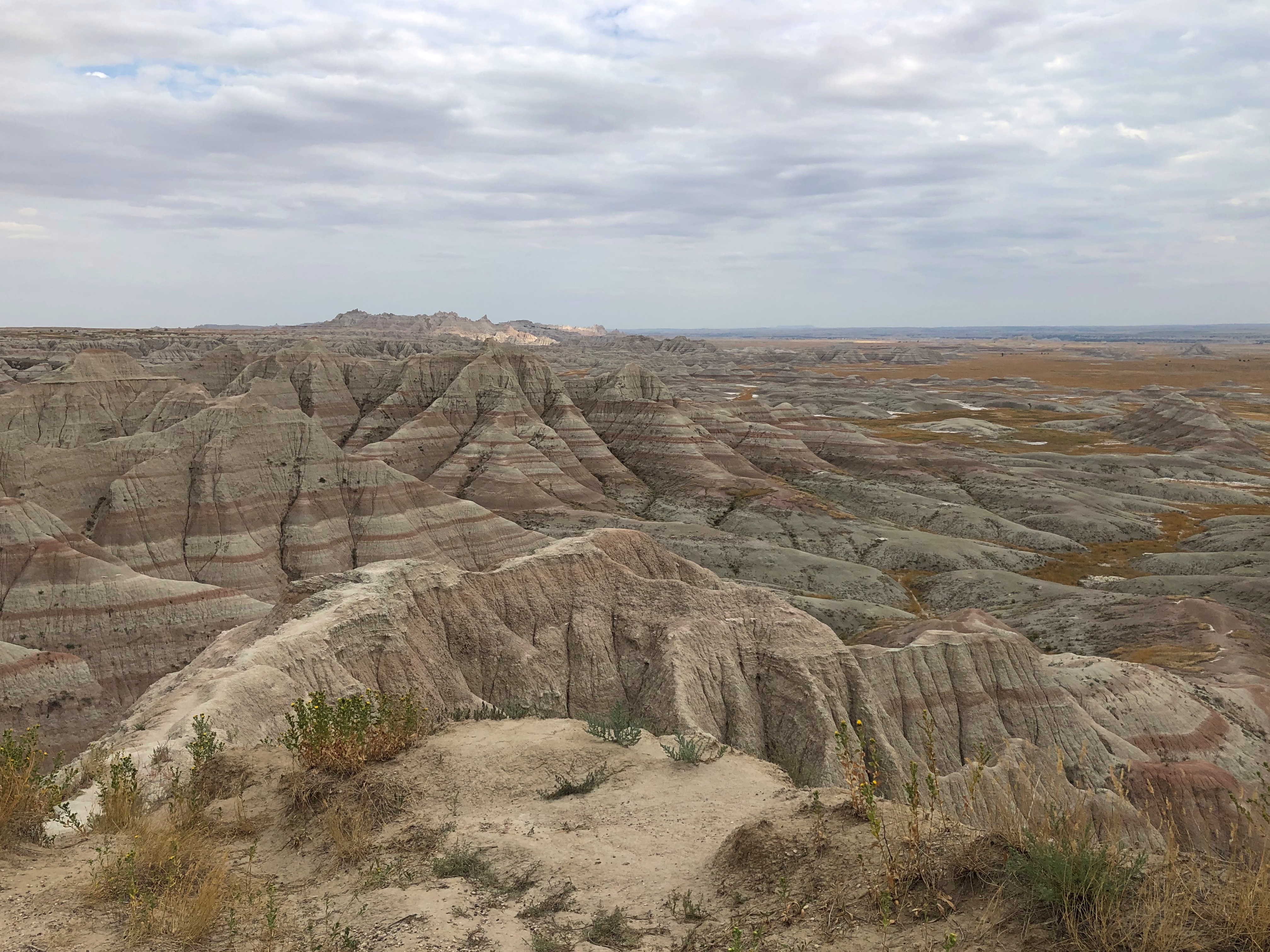
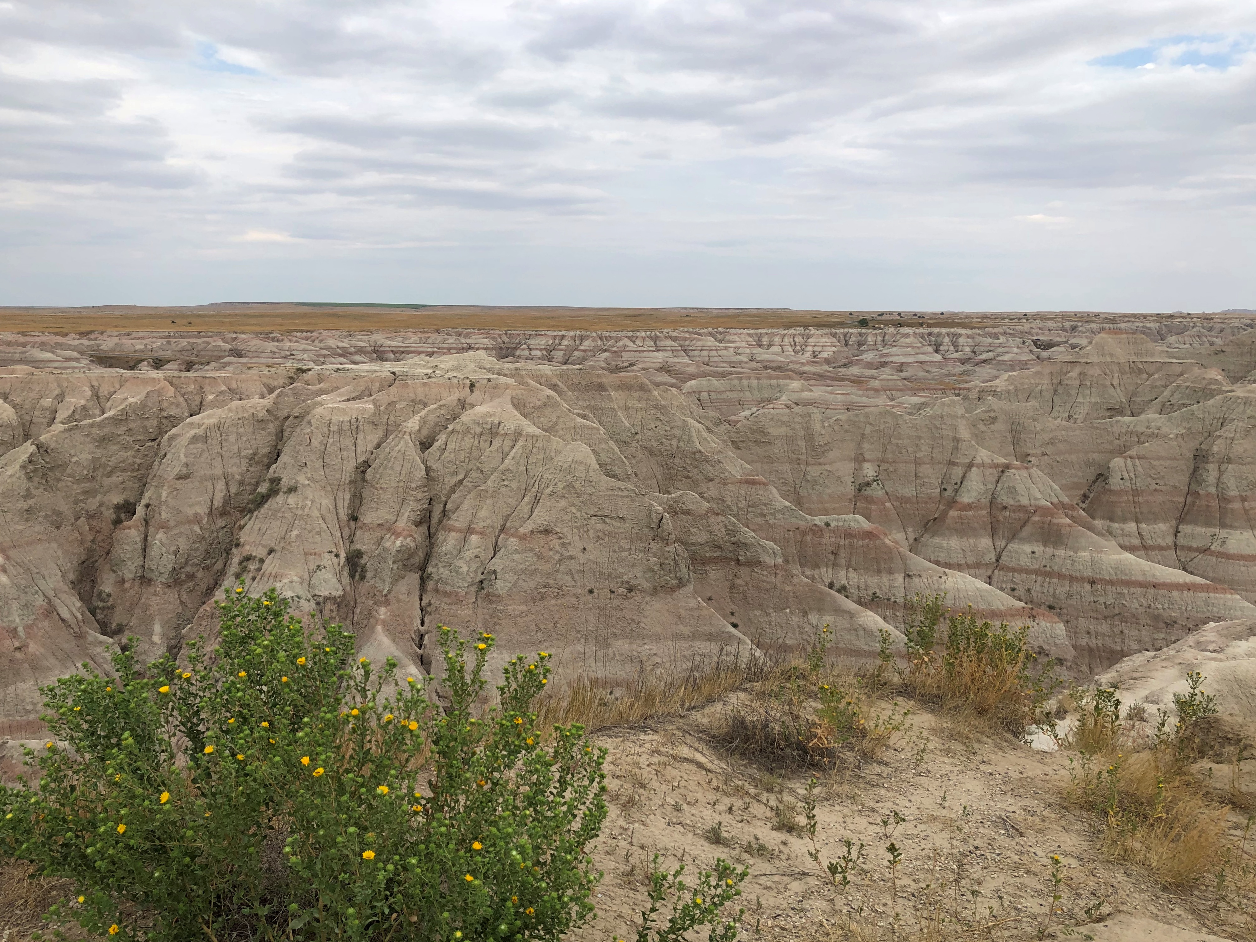
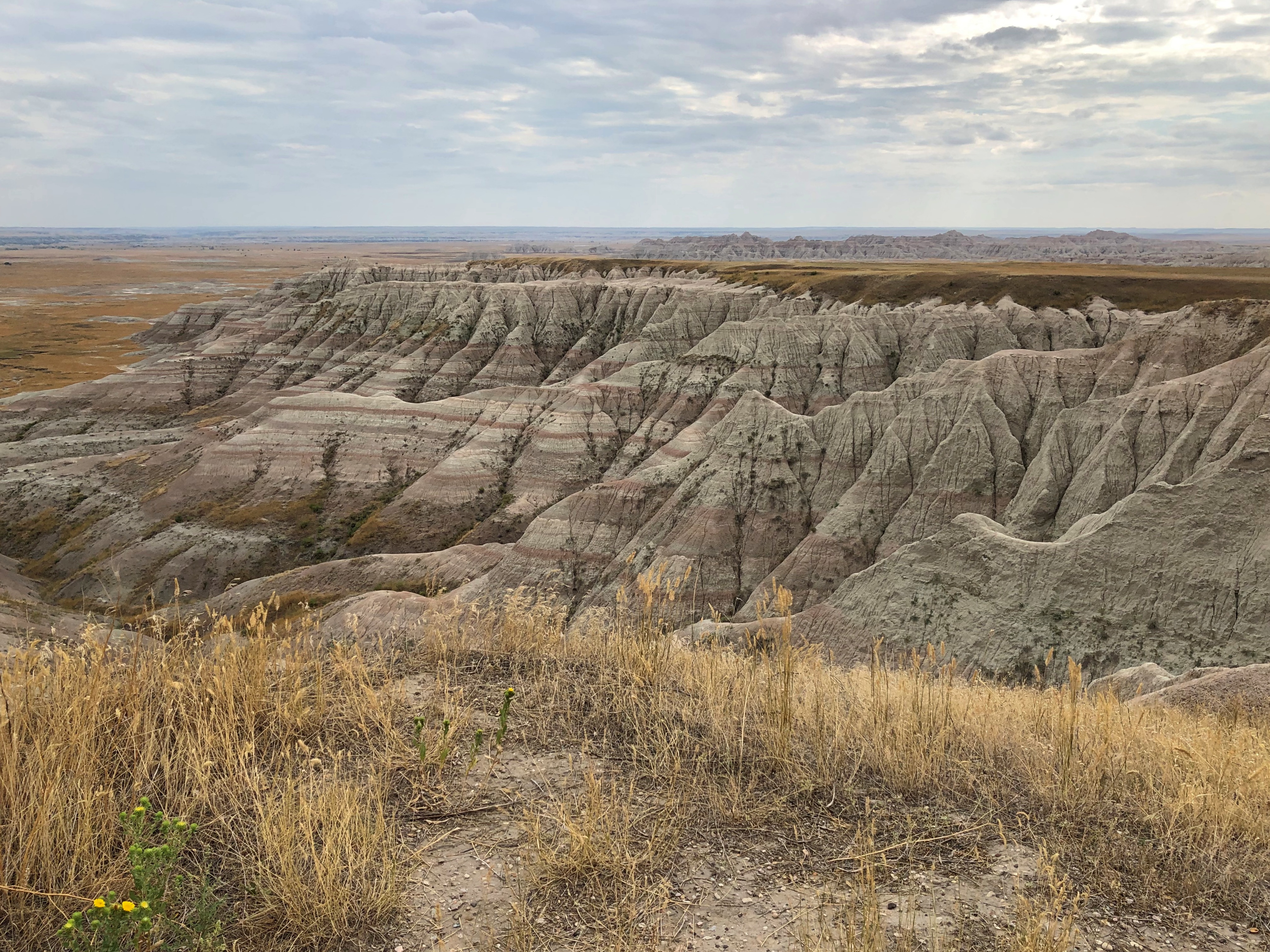
On the afternoon of August 19 this year, conditions were dry and warm at Badlands, but not oppressively hot. This time we spent a few hours longer.Badlands National Park

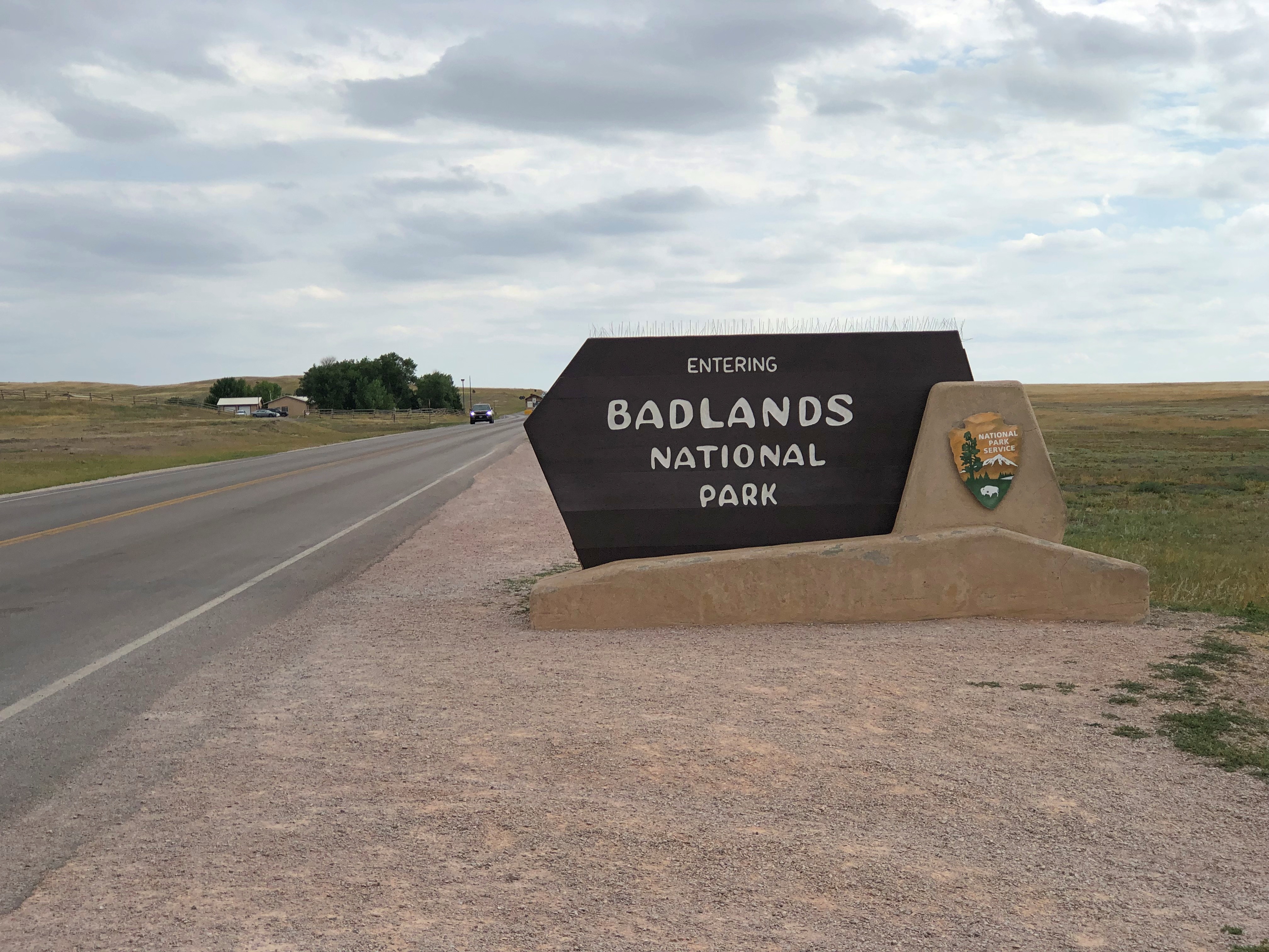
At the entrance, I also made an investment in my future travels. One that has already paid off: an America the Beautiful National Parks and Federal Recreational Lands Pass, of the Senior Lifetime variety. You need to be 62 or older to get one, but if you are, the NPS employee at the entrance station can issue you one on the spot. If I can keep track of the physical card – which is exactly the same size and composition as a credit card – I can use for admission to NPS units until I go to that jurisdiction beyond federal oversight, namely the Great Beyond.

All for $80. Considering that vehicular admission to this particular park is ordinarily $30, I was already on my way to my money’s worth. Later on just this trip, we used the pass for admission to Glacier National Park (ordinarily $35), Olympic National Park ($30), Craters of the Moon National Monument ($20), Grand Teton National Park ($35) and Yellowstone National Park ($35). A good deal. You’d think the government was encouraging old people to travel.

I don’t need the encouragement.Badlands National Park
Badlands National Park

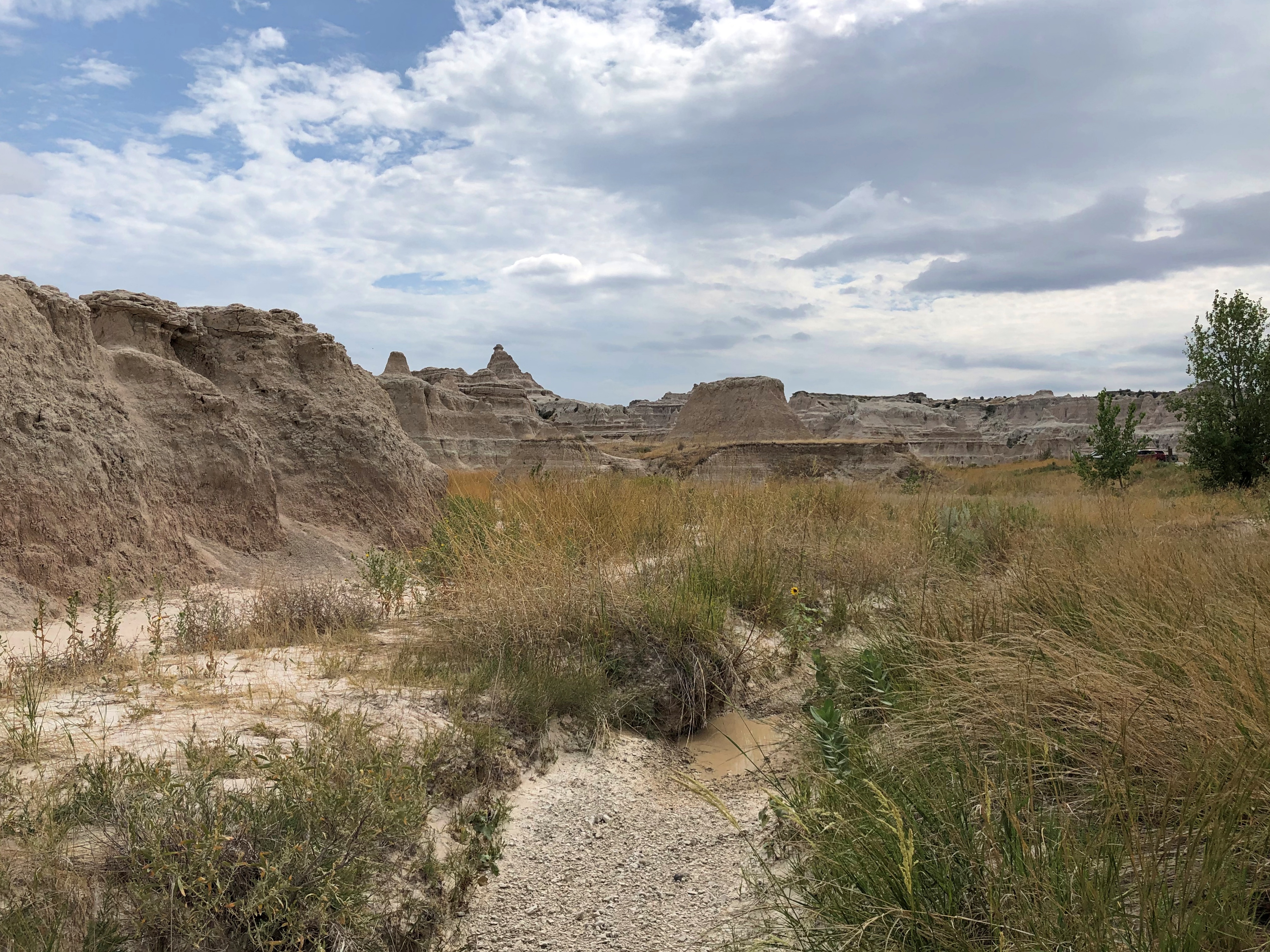
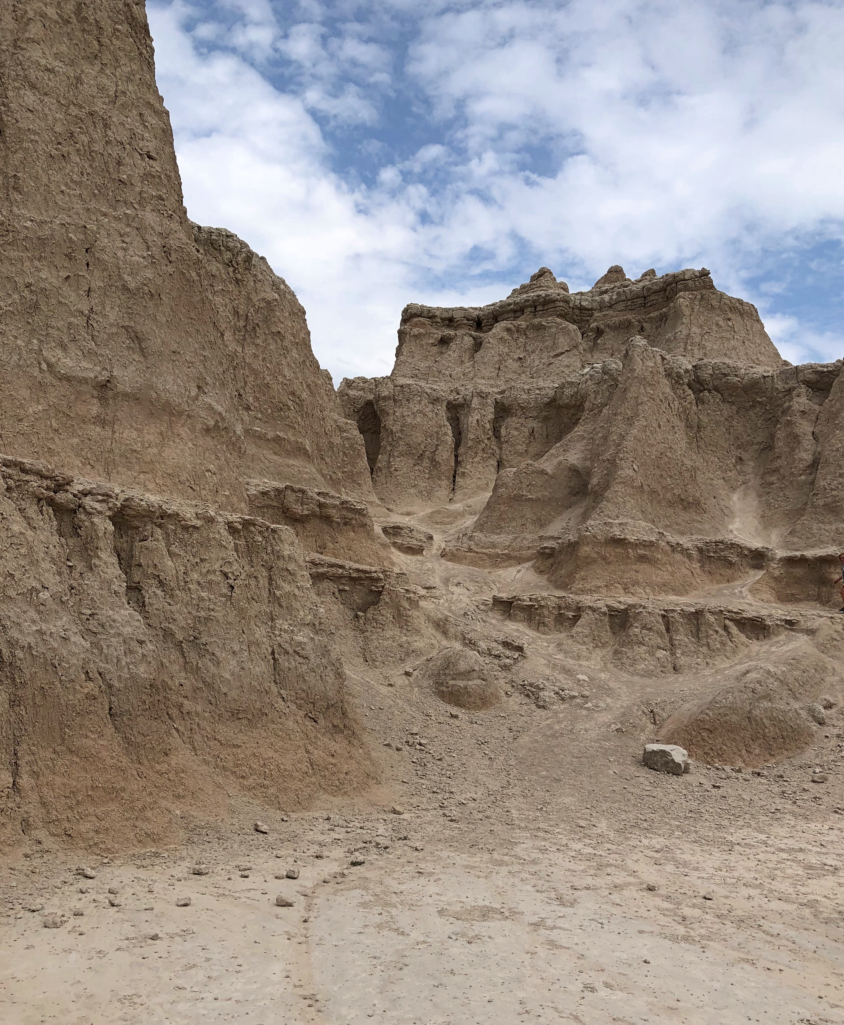
“For hundreds of years, the Lakota people have called this area mako sica, which literally translates to ‘bad lands,’ the NPS notes. “When early French fur trappers passed through this area, they called the area les mauvaises terres a traveser (‘bad lands to travel across’). Since the French trappers spent time with the Lakota, it is likely that the French name is derived directly from the Lakota one. Badlands National Park Badlands National Park

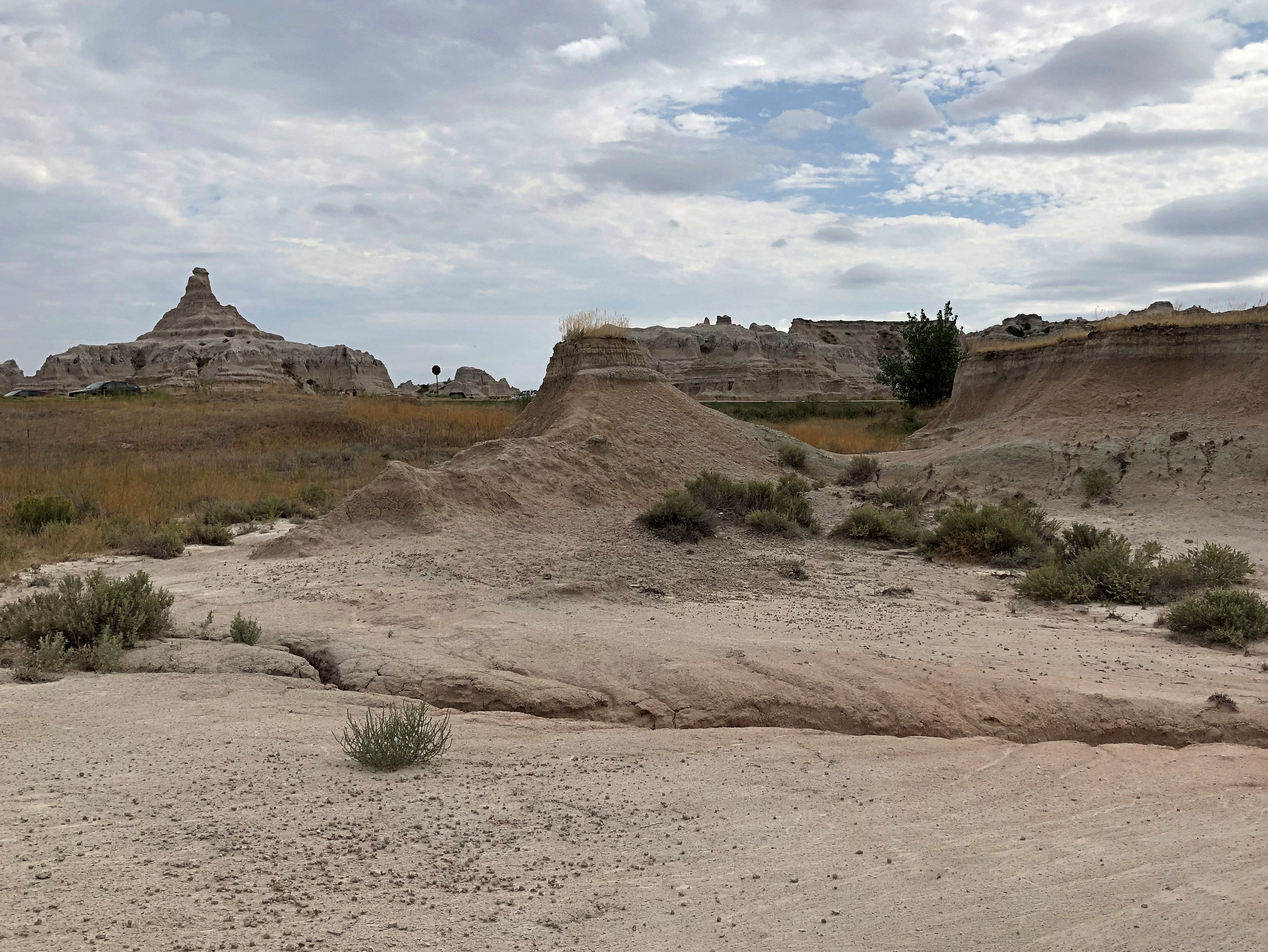
“The Badlands presents many challenges to easy travel,” the NPS publication notes wryly. (Government pubs get to be wry?)

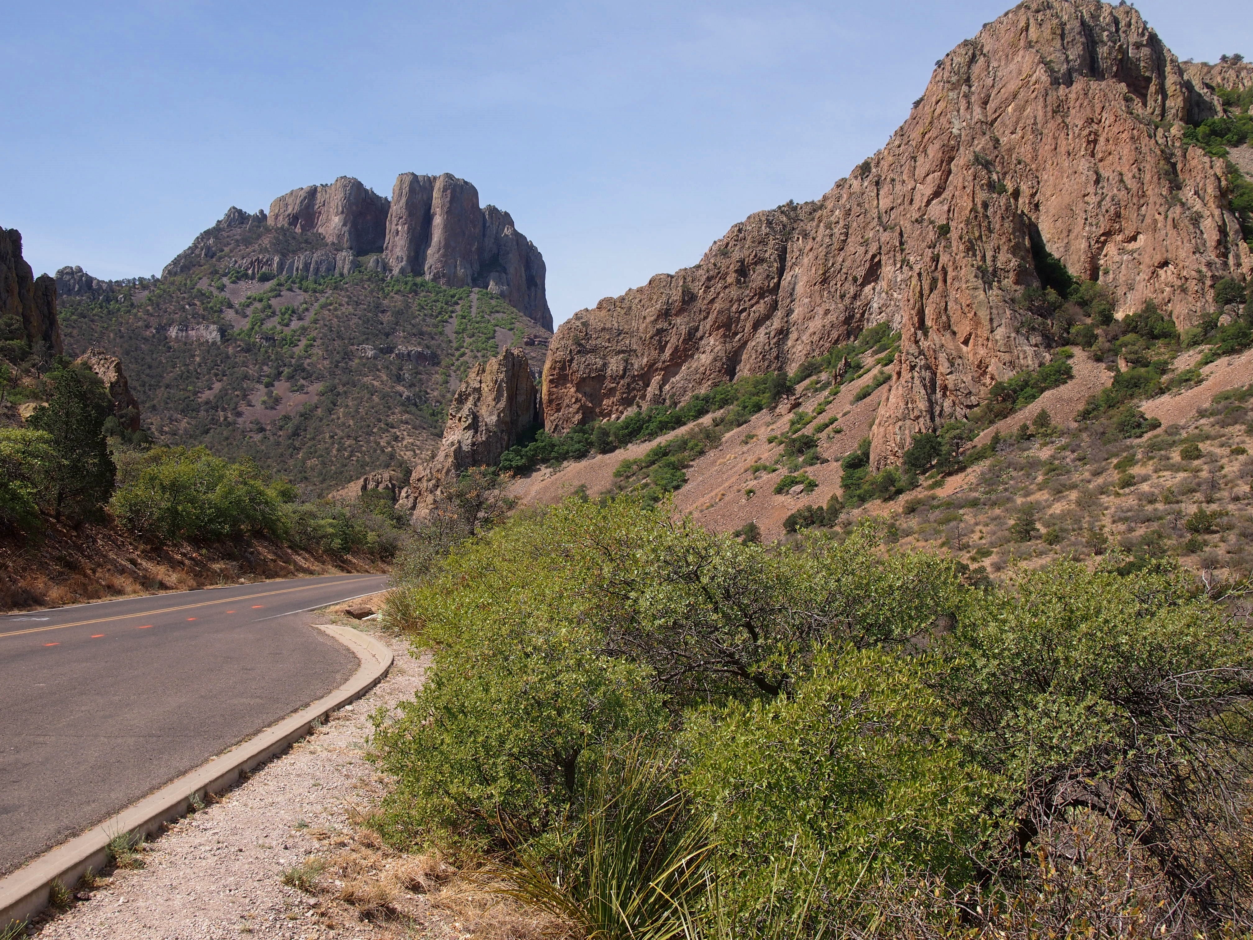
Except, of course, for the road that dips into the park and runs through the North Unit. Other parts of the park, which extends to the southwest away from the reach of paved roads, look remote indeed.Badlands National Park

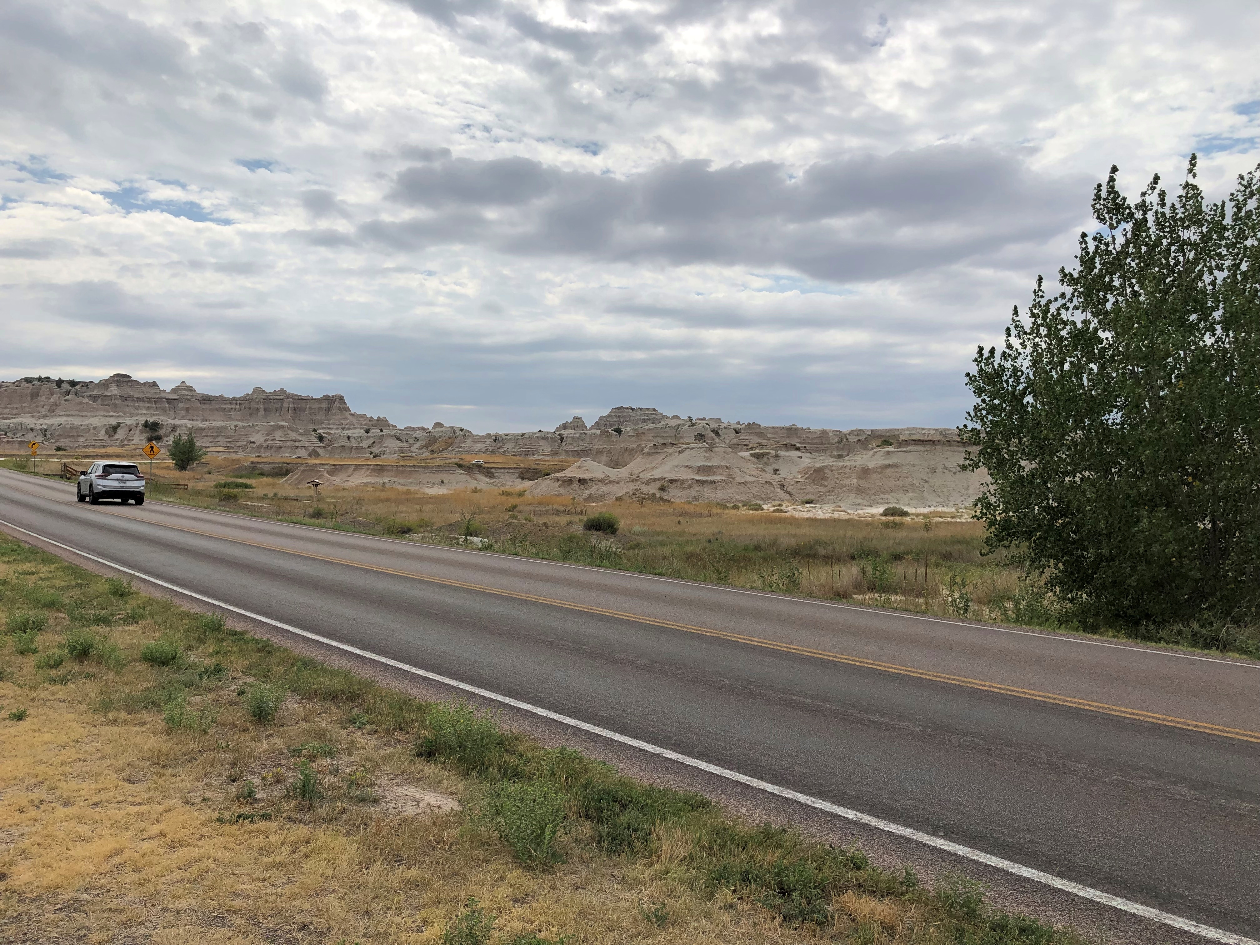
“When it rains in the Badlands, the wet clay becomes slick and sticky, making it very difficult to cross. The jagged canyons and buttes that cover the landscape also make it hard to navigate. The winters are cold and windy, the summers are hot and dry, and the few water sources that exist are normally muddy and unsafe to drink. These factors make the land difficult to survive in, and evidence of early human activity in the Badlands points to seasonal hunting rather than permanent habitation.

‘In 1922, when Badlands was first proposed as a national park, the suggested name was Wonderland National Park!”Badlands National Park Badlands National Park Badlands National Park Badlands National Park

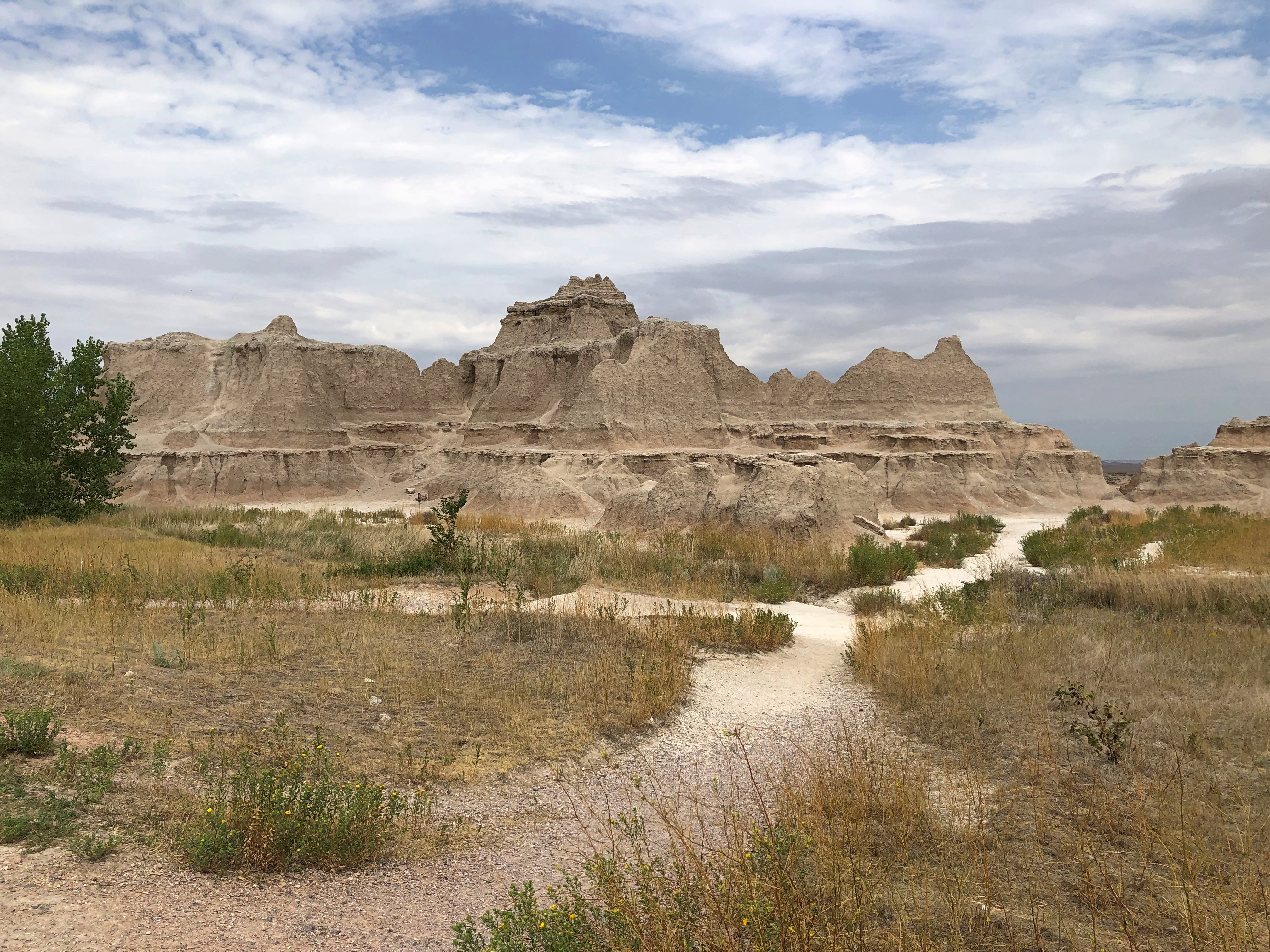
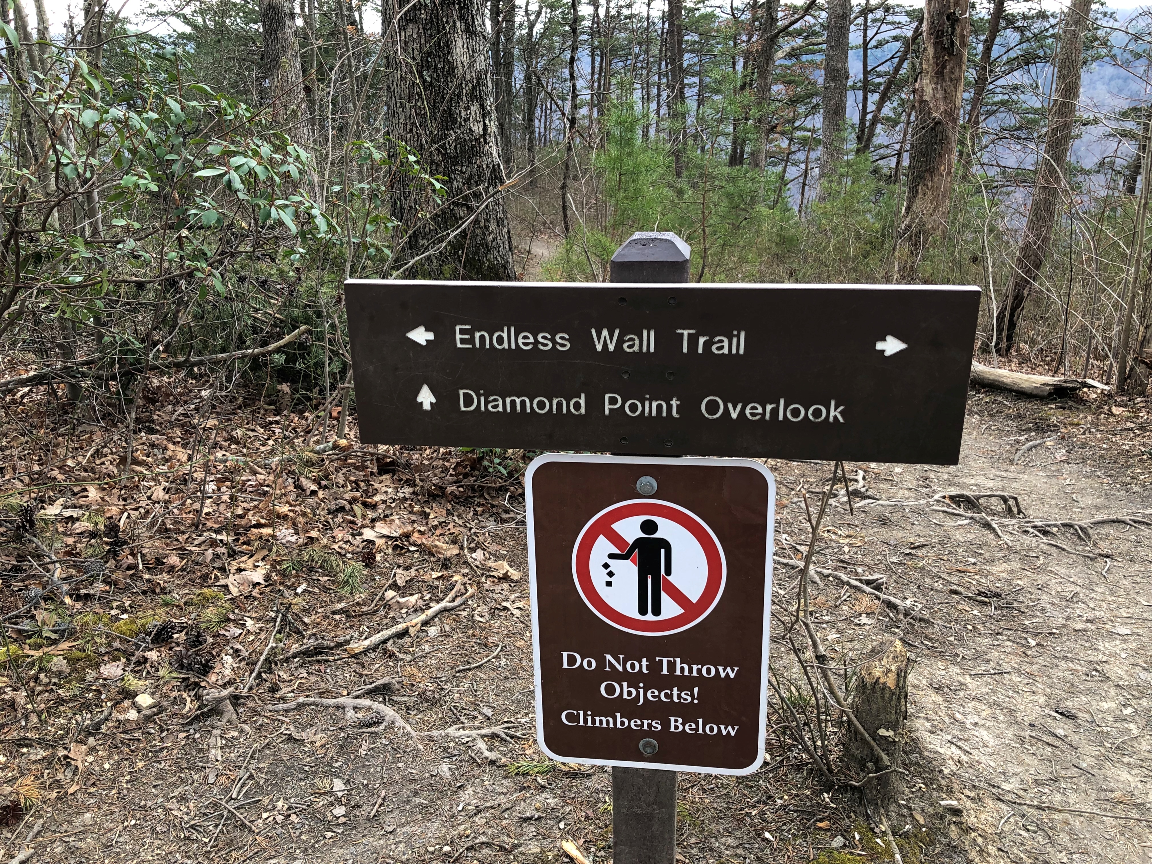
One more detail. A little more bad in the badlands. Badlands National Park

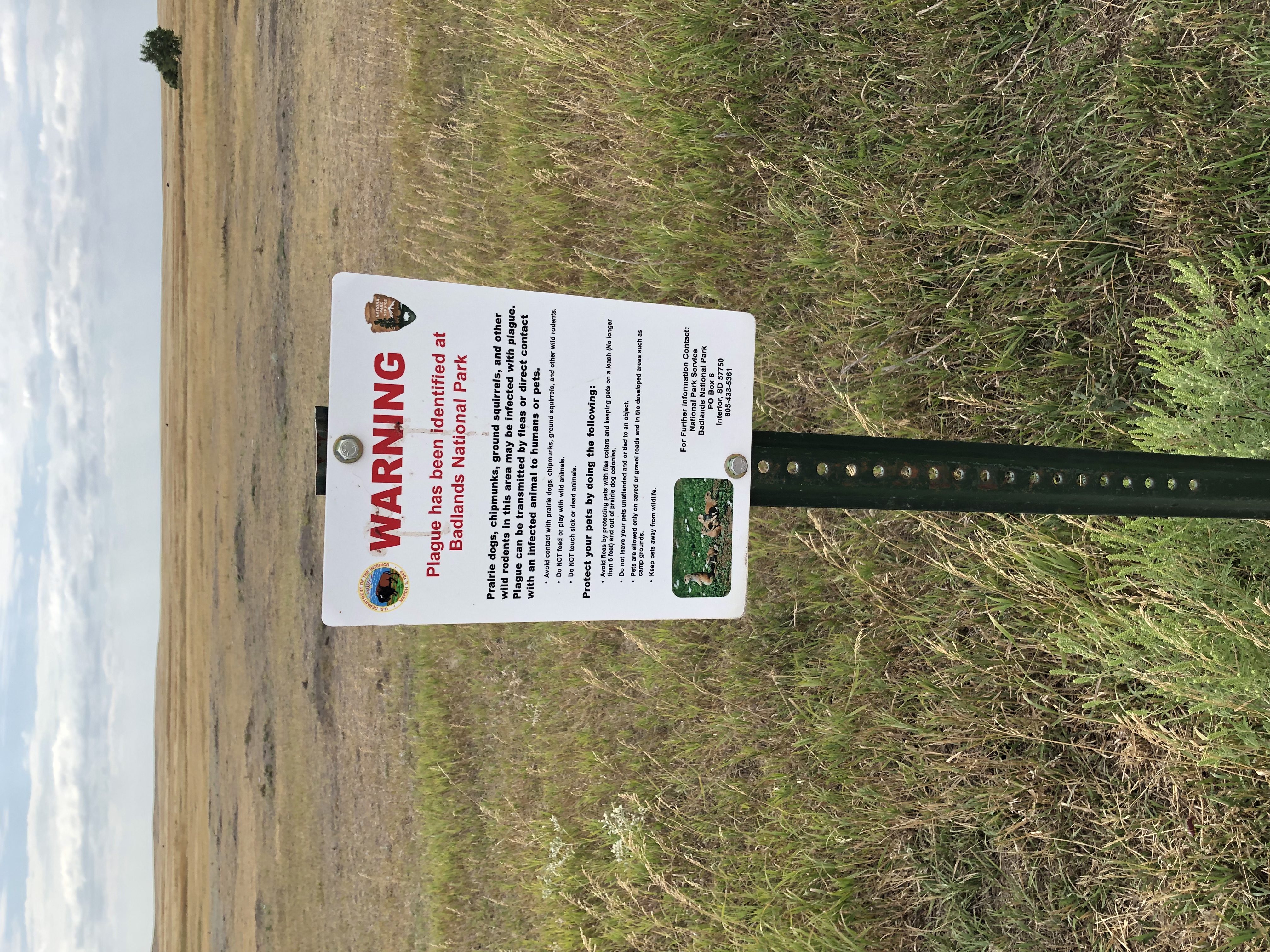
No buboes so far, so I figure we’ve avoided the plague for now. But I can’t say I wasn’t warned. In case you’re curious: The three most endemic countries for plague are the Democratic Republic of the Congo, Madagascar, and Peru, according to WHO. Not South Dakota, at least not yet.

Camden Hills State Park, 1995

Somewhere in our boxes of physical prints are some from Maine in August 1995. At some point, I scanned one of them.Camden Hills State Park, Maine

The view looks toward the town of Camden, and out into West Penobscot Bay. Camden Hills State Park surrounds the town, and we camped there, though not exactly at this vista. I don’t think so, anyway.

I don’t remember a lot about Camden Hills SP, but even so I was reminded of that place when I found out that August 4 is a free day at all national parks, reportedly in honor of the anniversary of the passage of the Great American Outdoors Act four years earlier.

Not because Camden was a national park – obviously not, it was a state park – but because it was close to Acadia National Park, which hugs the coast of Maine just a little further to the east. The visit to Camden was a weekend trip, so there wasn’t another day for Acadia, though we knew it was there. No worries, we’ll visit later, was the thinking.

So far that hasn’t happened. Maine was close in 1995; now it’s a little far. But still possible. I did a count and among the actual national parks (not other kinds of park service units) in the Lower 48, I’ve visited 26 out of 51. None of those was on a free day, including August 4, 2024. Major events that day including mowing the lawn and sweeping out the garage.

Hot Springs National Park ’24

We arrived at Quapaw Baths in Hot Springs National Park on April 14 in time for a late-afternoon soak.Hot Springs NP

Or rather, a series of soaks in its indoor pools, which are heated at various temperatures. I might have skipped it, but Yuriko is keen on hot soaks, having come of age in Japan, where they take their hot springs seriously. The bathhouse has been well well restored, considering its former decrepitude.

Good to see Bathhouse Row again after so many years. All together, eight bathhouse structures line Central Avenue in the town of Hot Springs, and are part of the national park; two offer baths. In 2007, because the Quapaw was still unrestored, only one did, so we took the waters at the Buckstaff, which was a more formalized experience than at the Quapaw.Hot Springs NP

The Lamar.Hot Springs NP Hot Springs NP

“[The Lamar] opened on April 16, 1923 replacing a wooden Victorian structure named in honor of the former U. S. Supreme Court Justice Lucius Quintus Cincinnatus Lamar,” says the NPS, a fact that amuses me greatly, for idiosyncratic reasons. Mostly it’s NPS offices and other space these days, but I bought some postcards and a refrigerator magnet in its NP gift shop.

The Maurice.Hot Springs NP

And of course, The Fordyce, now the park’s visitors center and a free museum highlighting its bathhouse amenities. Named for its founder, Samuel Fordyce, one of those roaringly successful business men that the late 19th century unleashed.Hot Springs NP Hot Springs NP

“He was a major force behind the transformation of Hot Springs (Garland County) from a small village to major health resort,” the Encyclopedia of Arkansas says. “The town of Fordyce (Dallas County) is named for him, as is the Fordyce Bath House in Hot Springs.

“He enjoyed friendships with Presidents Rutherford B. Hayes, Benjamin Harrison, and William McKinley, all of whom asked his advice on matters concerning appointments and regional issues.” Ah, there’s the trip’s presidential site, however tenuous.

As for the building, it was “designed by Little Rock architects Mann and Stern and constructed under the supervision of owner Sam Fordyce’s son John, [and] the building eventually cost over $212,000 to build, equip, and furnish.” That’s 212 grand in fat 1910s dollars, or $6.5 million in present value.

I believe I took somewhat better pictures this time around. Maybe.Hot Springs NP Hot Springs NP

Directly over Hernando de Soto and the maiden is the Fordyce’s famed stained glass aquatic-fantasy skylight.Hot Springs NP

Not the only stained glass around.Hot Springs NP

The Fordyce is an expansive place, and in fact, the largest of the bathhouses, according to the NPS.Hot Springs NP Hot Springs NP Hot Springs NP

Mustn’t forget the spring that made it all possible, whose presence is noted in the basement.Hot Springs NP

Bathhouse Row is at the base of a steep slope. Climb some outdoor stairs and soon you’re at the Hot Springs Grand Promenade behind and above the row. Not many people were out promenading. True, by the time we got there, it was the morning of April 15, a Monday. Still, people were missing out on one pleasant walk.Hot Springs NP Hot Springs NP

The bricked trail was an early project (1933) of the lesser-known but no less remarkable Public Works Administration.

“Unlike the Civilian Conservation Corps and the Works Progress Administration, the PWA was not devoted to the direct hiring of the unemployed,” the Living New Deal says. “Instead, it administered loans and grants to state and local governments, which then hired private contractors to do the work.

“Some prominent PWA-funded projects are New York’s Triborough Bridge, Grand Coulee Dam, the San Francisco Mint, Reagan National Airport (formerly Washington National), and Key West’s Overseas Highway.”

Further up the hill is the abandoned Army Navy Hospital, whose therapeutic heyday was WWII.Hot Springs NP Hot Springs NP

The promenade passes by some of Hot Springs’ hot springs.Hot Springs NP Hot Springs NP

The path also offers views of the back of some of the bathhouses, including the wonderful Quapaw dome.Hot Springs NP

The crowning bit (literally) on a marvelous piece of work.

Pukaskwa National Park

My old friend Geof Huth has been known to post images of figures – glyphs – he draws in the sand, and so I took some inspiration from him. His glyphs are unique, probably in the history of the world. My are a touch more conventional.Pukaskwa National Park

I took a similar image on my crummy cell phone camera, but one good enough for snaps, and sent it to Geof. From the edge of the wilderness in northwest Ontario to a tower in Lower Manhattan, the message went.

It might look like the wilderness.Pukaskwa National Park Pukaskwa National Park Pukaskwa National Park

But no. Edge it was. I might have been within the bounds of Pukaskwa National Park, but only a few miles in, with access by road.Pukaskwa National Park

Pukaskwa (PUK-ə-saw), a sizable slice of Ontario (725 sq. mi.) on the shore of Lake Superior, is mostly back country. Rugged is the inevitable term for its back country, so much so that the mostly wooded terrain mostly thwarted efforts to mine and even log it, back when that was legally possible. The park reportedly protects the longest undeveloped stretch of coastline on Lake Superior and, indeed, the Great Lakes.

A feature of the park: there are clusters of Pukaskwa Pits at remote locations. Wiki is succinct on those human-made structures: they are “rock-lined depressions near the northern shore of Lake Superior dug by early inhabitants, ancestors of the Ojibwa. Estimates of their age range from as recent as 1100-1600 CE to as ancient as 3000-8000 BCE.”

That’s a pretty wide range of age estimates. You might say their origin is “lost in the mists of time,” but that lacks academic rigor. Modern Canada created the park in the 1970s.

I wasn’t anywhere near the pits. At least, I don’t think so. The park’s single road leads to a few trailheads, such as Southern Headland.Pukaskwa National Park

It winds around some hills near Lake Superior, with a variety of under-foot topography as you walk along. Nothing that hard. This time around, I had a walking stick and water to go with my decent hiking shoes.Pukaskwa National Park Pukaskwa National Park Pukaskwa National Park

The trail eventually leads to a deadwood-strewn beach.Pukaskwa National Park Pukaskwa National Park

A different, much shorter trail from the beach leads to another beach. I spent a few hours there, cooling my heels and drawing a few words in the sand. That is, I did once I’d crossed a horizontal forest of driftwood.Pukaskwa National Park

A long stretch along Superior.Pukaskwa National Park

There were about ten people on the whole beach. And as few on the Southern Headland trail, where the rocks meet the water and sky. From the beach, I captured an image of hikers on the rock outcropping where I’d been earlier in the day.Pukaskwa National Park

Rocks meeting water and wind and sun, because the sun came out in the afternoon. The four elements all together.

Grand Portage National Monument

So far since taking office, President Biden has proclaimed five new national monuments under the authority granted him by the Antiquities Act of 1906, including one only last week, with the lengthy name of Baaj Nwaavjo I’tah Kukveni – Ancestral Footprints of the Grand Canyon National Monument, which is in Arizona near the Grand Canyon. (For those keeping score, his immediate predecessor proclaimed five over four years.)

How can we keep up with all the new ones? For now, there are 133 national monuments, with more coming, I’ve read.

Grand Portage National Monument has been around a little longer. Longer than me, but not much, being one declared by President Eisenhower. It occupies land very near the tip of the arrowhead region of Minnesota, within a few miles of the Canadian border, which happens to the Pigeon River at that point.

I arrived fairly late in the afternoon of July 30. The U.S. flag, Minnesota and – what’s the other one?Grand Portage National Monument

The flag of the Grand Portage Band of Chippewa; the national monument is entirely within their reservation. More about them is hereGichi Onigaming = The Great Carrying Place.

“Grand Portage was a fur-trade depot and route of the voyageurs at the western extremity [sic] of Lake Superior,” says the Canadian Encyclopedia. “It was the first and most strenuous of the 29 portages from Lake Superior west to Lac La Croix, requiring that each voyageur carry four loads of 80 kg over some 14 km of rocky trails around the cascades of the Pigeon River.

“The North West Co. (NWC) established an extensive post at the mouth of the river, which by 1784 was the wilderness capital of the fur trade, providing a meeting place for the voyageurs bringing supplies from Montréal (porkeaters) and the traders bringing furs from the North West (winterers). Within the post, which was protected by a 5-m high palisade, reinforced with a bastion and a heavy gate, were the Great Hall, living quarters, shops, warehouses and a stone powder magazine.”

The NWC packed up and left after it was finally determined that, according to the Jay Treaty of 1794, the site was in the United States rather than British North America, though it took some time for the company to actually leave (1802). In more recent times, the United States reconstructed the Grand Hall and the wooden palisades.Gichi Onigaming: The Great Carrying Place

Along with Native structures of the period outside the palisade.Gichi Onigaming: The Great Carrying Place

Inside the palisade, work still seems to be under way, or at least renovation. The Great Hall wasn’t open.Gichi Onigaming: The Great Carrying Place Gichi Onigaming: The Great Carrying Place

The North West Co. flag still flies. Gichi Onigaming: The Great Carrying Place

As you’d expect, the Great Hall faces Grand Portage Bay. Once upon a time, it was a busy place in the short northern summers. Now, not so much.Gichi Onigaming: The Great Carrying Place Gichi Onigaming: The Great Carrying Place Gichi Onigaming: The Great Carrying Place

Another view of Grand Portage Bay from the edge of the national monument.Gichi Onigaming: The Great Carrying Place

Way off in the distance – though not really that far, about 20 miles – is Isle Royale National Park, a large island in Lake Superior, which was more distinct with the naked eye than in the digital image.

Still, I was a little surprised that it is visible at all. Except for some of the Alaskan properties, it’s pretty much the definition of remote among national parks, with only a few more than 25,400 visitors in 2022, according to the NPS. The fifth-least visited park in the system.Gichi Onigaming: The Great Carrying Place

Since getting there and staying there is an involved process, I couldn’t make Isle Royale work logistically as a destination. This time.

Big Bend Camera Failure

Though I grew up in Texas, I never got around to visiting Big Bend NP until five years ago in April. Didn’t give it much thought while I schemed to go other places. The distance to the park is more psychological than geographic, I think. From San Antonio, for example, it’s a full-ish day’s drive to the park (six hours), but since when have Texans ever said, That’s too far to drive?

I had two cameras with me on the trip. One, my sturdy Olympus, model number I can’t remember, a standard and not especially expensive digital camera I acquired in 2012 so I could take pictures at events for a new freelance job. It took good pictures, better than I expected. The other digital image-maker at Big Bend was my camera phone. It was newer than the Olympus, since I got it to go to Mexico City a few months earlier. Even so, it only intermittently produced good pictures.

I started capturing the Big Bend scenery with the Olympus, as usual. It started taking vastly overexposed images, often the second or third of the same scene.Big Bend NP Big Bend NP

A thing that made me go hm.Big Bend NP Big Bend NP

Still, I got some decent images with the Olympus. It’s hard to go wrong in Big Bend.Big Bend NP Big Bend NP

By the time I got to Santa Elena Canyon on the Rio Grande, the Olympus had quit taking anything but overexposures. So I resorted to using the camera phone, producing lower-quality pictures that were sometimes OK.Big Bend NP

The Olympus revived to create some good images later in the trip, but was increasingly unreliable. That was its last trip. Later I checked its settings, tried different settings, tried different data storage cards, and poked around online for some reason for it taking overexposures, to inconclusive results.

Once upon a time, you’d have taken your broken camera to a shop for examination and possible repair, but now? I figured I’d gotten my money’s worth out of the Olympus, and soon acquired just as good camera — better in some ways — in the form of a used iPhone that was no longer a communication device.

The failure of my camera on a trip was a kind of inconvenience, though barely even that. Back when Ann went to Washington, D.C., with a junior high group, some camera error or other meant she returned with few images. This upset her. I told her I was sorry she lost the images. But as worthwhile as capturing images can be, or sharing them, seeing a place yourself is the important thing.

West Virginia, #48

One thing you’ll find in Moundsville, West Virginia, which is in the panhandle not far south of Wheeling, is a mound of impressive height – 62 feet. The Grave Creek Mound.Moundsville, West Virginia

Look carefully enough and you’ll note that a footpath leads to the top. We were too tired for it at that moment, but it was a moot point anyway, since the Grave Creek Mound Archaeological Complex had just closed for the day when we arrived, though the gift shop was still open.Moundsville, West Virginia

“The Grave Creek Mound is one of the largest Adena mounds and an impressive sight for any visitor to Moundsville,” says the West Virginia Department of Arts, Culture and History. “A massive undertaking, the total effort required the movement of more than 57,000 tons of sand and earth. Construction of the mound took place from about 250-150 B.C. and included multiple burials at different levels within the structure.

“Although Grave Creek Mound is today an isolated feature on the landscape, the flat area now occupied by the city of Moundsville was once covered with small and large mounds and associated earthworks. Unfortunately, these structures and many others all over the region have been destroyed by treasure-hunters and farmers who plowed over these in the past.”

The complex takes up a large town block in Moundsville, but even larger is the West Virginia Penitentiary, which is across the street from the mound. I’d asked the clerk at the Grave Creek Mound gift shop about its hulking presence, and she told me it had once been a state prison, but was long closed as a prison.Moundsville, West Virginia

I was reminded instantly of Joliet, and it seems that the state of West Virginia took direct inspiration for its new pen from the Illinois prison.

“No architectural drawings of the West Virginia Penitentiary have been discovered, so an understanding of the plan developed by the Board of Directors must be obtained through their 1867 report, which details the procurement of a title for ten acres of land and a proposal to enclose about seven acres,” says the prison web site.Moundsville, West Virginia Moundsville, West Virginia

No cons have occupied this particular stony lonesome since the 1990s and now the old pen supports a cottage industry of tours, many stressing the macabre or supernatural stories clinging to a place that saw the execution of dozens of men. Seems like a good use for the imposing old structure, whatever you think of ghost stories. We’d have been in the market for a daylight (non-spook) tour ourselves, but again the timing was wrong.

We passed through Moundsville twice.Moundsville, West Virginia

Once on a cold, windy day, then a few days later when it was warmer, when we were able to eat at a picnic shelter in a small park along the Ohio River. The park has a view of the elegant Moundsville Bridge, which crosses to Mead Township, Ohio.Moundsville, West Virginia

Officially, it’s the Arch A. Moore Bridge, named for the longest-serving governor of West Virginia, who also did a spell in stir for corruption. Moore was in office, still unindicted, when the bridge opened in 1986. He was a Moundsville native son, so perhaps a little corruption isn’t enough to scrub his name from the bridge – if in fact anyone calls it that anyway.

In the southern reaches of New River Gorge NP, near Grandview, a trail wanders through outcroppings of what I take for sedimentary rock.Grandview, New River Gorge NP Grandview, New River Gorge NP

Reminded me a bit of Cuyahoga NP, though that park’s rock formations seemed larger and more extensive.

Near Gauley Bridge, West Virginia, and just off U.S. 60 – which follows the Midland Trail at this point, another lost-to-time road – is a wide place in the road that marks access to Cathedral Falls.

Easy access, since it’s less than a minute from the parking lot to a close view of the falls.Cathedral Falls

Nearby is a homemade memorial to one Hugh Rexroad, who is clearly this person. Did Hugh die here, say of natural causes while admiring the fall, or was he merely very fond of the place? Whatever your story, RIP, Hugh.Hugh Rexroad memorial Cathedral Falls

The channel takes the waterfall flow to the Kanawha River, which U.S. 60 follows into Charleston.

Kanawha was a proposed name for a breakaway entity from Virginia, but in the event the more pedestrian West Virginia was picked.

A number of memorial statues rise near the West Virginia capitol, but rain kept me from lingering too long. I did see the coal miner, dating from 2002.

Sorry about your mistreatment, especially before you were able to organize. Here’s your statue.

The industry has contracted in recent decades, of course, not just in West Virginia, but the entire country. Still, in 2020, West Virginia provided about 5% of the nation’s total energy, more than one-third of it from coal production, the U.S. Energy Information Agency reports.

“However, because of increases in natural gas and natural gas liquids production from the Marcellus and Utica shales in northern West Virginia, natural gas surpassed coal for the first time in 2019 and became the largest contributor to the state’s energy economy.”

After spending a couple of nights in West Virginia, it occurred to me that I now haven’t spent the night in only two states: Delaware and Rhode Island.

Thurmond, West Virginia

I was thinking ghost town, but the data says otherwise. Someone lives in Thurmond, West Virginia — five people as of the 2020 Census. They must be in the few houses perched on the enormous slope over the historic core of the town, which is formed by a string of commercial buildings and railroad structures at a flat place next to the New River.Thurmond, West Virginia

Thurmond was a small railroad town at a waystation, back when that meant coal-burning giants among locomotives, which came to pick up shipments of coal, or acquire coal, water and sand for their own use. Maybe the shades of long-gone people wander Thurmond, if you believe that sort of thing, and if so, the rattle of pouring coal, the venting of steam, the screech of metal on metal, are echoing on as well.

What does every railroad town need?Thurmond, West Virginia Thurmond, West Virginia

The National Bank of Thurmond failed in 1931, but there were successor banking entities of some kind in the building into in the 1950s, when the town essentially shut down. The fact that the last bank paid 3 percent reminds me of a shorthand for the way mid-century savings and loans did their business: 3-5-3. Pay 3 percent to depositors, charge borrowers 5 percent interest, and close up to go play golf at 3 pm.

Other commercial buildings fronting the tracks, with the river just a little beyond them.Thurmond, West Virginia Thurmond, West Virginia

The mostly hidden ruins of a grand hotel on the slope. Burned down.Thurmond, West Virginia

The bridge that brings trains and motor vehicles to Thurmond over the New River. One track, one lane.Thurmond, West Virginia Thurmond, West Virginia

The station. I thought it was merely for tourist use now, but no: it’s an active Amtrak station, reportedly the second-least used, after one in West Texas. So not that active.Thurmond, West Virginia

The steam went out of Thurmond pretty much when the steam went out of Thurmond. That is, coal-fired steam locomotives disappeared, replaced by diesel, and the contracting coal industry as natural gas gained a foothold nationally probably didn’t help either.

Trains still transit Thurmond, but the land around — most of it, anyway, as boundaries are invisible — belongs to the national park. The star of modern Thurmond, I believe, is the ruin of the coaling tower.Thurmond, West Virginia Thurmond, West Virginia

Near the coaling tower. Maybe where the crew boss stayed, and members of the crew when no trains were in town.Thurmond, West Virginia

Both are full of the ravages of time, but still standing. Barely? I’m not engineer enough to make an assessment, but my layman’s opinion is that chunks of stone drop off the tower now and then, so watch out.

A selection of graffiti.Thurmond, West Virginia Thurmond, West Virginia

Bleak, O.G. Bleak.

New River Gorge National Park and Preserve: The Vistas

Late morning on our first full day in West Virginia, we found ourselves at the Endless Wall Trail. It’s not only a place for horizontal walking motion across the landscape, but the vertical motion of rock climbing too, as the park sign points out.New River Gorge NP

How we got there (that is, besides driving in our car to the trail head) is best characterized as a misreading or misunderstanding of a map on my part. So the trail wasn’t the one we’d been looking for, but it seemed like a good trail, so we headed in, with a place called Diamond Point as the goal.

Not a particularly difficult trail, for the most part, though there were roots and rocks and mud patches, but they never rose past the level of sometime annoyance. Nowhere was it steep, but the trail rose slowly in elevation much of the time.New River Gorge NP New River Gorge NP New River Gorge NP

It takes a fairly healthy old man about 30 minutes to get to Diamond Head. I mean, Diamond Point. Odd the things you think about sometimes, such as a land form in the tropics while tramping through some temperate zone mud, just because of a coincidental name.New River Gorge NP New River Gorge NP

Close to the destination.New River Gorge NP

Some of the glories that were Diamond Point.New River Gorge NP New River Gorge NP
New River Gorge NP

There isn’t agreement on the exact age of New River among scientists, but it is measured in the hundreds of millions of years. Guess it was worth climbing a slope to take a look into deep time.

But you don’t need to walk that far to see a sweeping vista at Grandview, in a part of the park that’s some miles south-southeast of Diamond Point. We went there toward the end of the same pleasantly warm day, driving on local roads through Beckley, as well as short stretches of I-64 and West Virginia 9, to get to a large NPS parking lot, playground and ball field, occupied that day by small groups of parents and kids.

A walk of five minutes or so led from the play area to Grandview overlook. It is.New River Gorge NP New River Gorge NP

Nothing like a horseshoe bend, large or small.

New River Gorge National Park and Preserve: The Bridges

I didn’t appreciate the New River Gorge Bridge in West Virginia until I’d driven across it more than once, and more importantly, seen it from a distance.

A handsome design for a magnificent setting. Elegant. Sturdy. Spanning the gorge spider-web like. Imagine a species of large, intelligent arachnids that can extrude metal and spin webs of steel across the many gorges on their forested planet. Artful shapes like the New Gorge River Bridge, maybe.

Even better, such an artful shape was made by us clever apes here on Earth. Within my lifetime, completed in October 1977. If I’d been in that part of West Virginia then, I could have driven across the newly minted bridge carrying my newly minted drivers license, obtained in some haste that summer to take a girl I’d recently met on dates. But I wasn’t anywhere near the bridge in my South Texas adolescent driving days, and never heard of it till much later.

“The bridge reduced a 40-minute drive down narrow mountain roads and across one of North America’s oldest rivers to less than a minute,” the park service says. “When it comes to road construction, mountains do pose a challenge. In the case of the New River Gorge Bridge, challenge was transformed into a work of structural art — the longest steel span in the Western Hemisphere and the third-highest in the United States.

“The West Virginia Division of Highways chose the Michael Baker Co. as the designer, and the construction contract was awarded to the American Bridge Division of U.S. Steel. In June 1974, the first steel was positioned over the gorge by trolleys running on three-inch diameter cables. The cables were strung 3,500 feet between two matching towers. Cor-ten steel, with a rust-like appearance that never needs painting, was used in construction.”

Good to know, but if anything, the experience of driving across the bridge is too detached from the sense that you’re passing over an 800-foot void. The opaque fences along the edges of the bridge obscure the drop, though you do get a glimpse of the far-away cliffs of the gorge.

The bridge transits New River Gorge National Park and Preserve land on either side. A few minutes walk from the park’s visitor center takes you to a view of the bridge, which we saw on the morning of March 23, the brightest, warmest day of the trip.New River Gorge NP New River Gorge NP

The gorge, looking away from the bridge.New River Gorge NP

The old way to cross the gorge by vehicle involved spending 40 minutes or more on small roads that switchbacked their way down into the gorge, to just a few feet above the river, where there’s a much shorter bridge.

Stop there and you see the postcard-Instagram view of the New River Gorge Bridge in all its glory.New River Gorge NP

We drove down to the river the morning of March 24, the day after we’d seen the bridge from near the visitors center. Cold rain fell periodically and clouds clung to the side of the gorge.

A small aside. I saw that a number of things are named after Sen. Byrd in West Virginia, and I’m sure if I’d stayed longer, I’d have seen more. Why not this grandest of Mountaineer State bridges? Than again, maybe the thought of it being the “Byrd Bridge” has given policymakers second thoughts on a renaming.

The bridge down near the banks, where a few generations of West Virginians before 1977 made the crossing, does have a name: Tunny Hunsaker Bridge.New River Gorge NP

I had to look him up. I thought, local politico? A local man who didn’t return from a war? No, he was a prizefighter who later was police chief of nearby Fayetteville, West Virginia (d. 2005). I’m not up on the history of boxing. Now I’ve read that Muhammad Ali’s first professional win, in 1960, was against Hunsaker.

The current bridge dates from 1997, built to replace an earlier iteration. You can’t walk across the New River Gorge Bridge (except on Bridge Day), but you can walk across Tunny Hunsaker any time. So we did in turn. When you can cross an interesting bridge in an epic setting, you should.