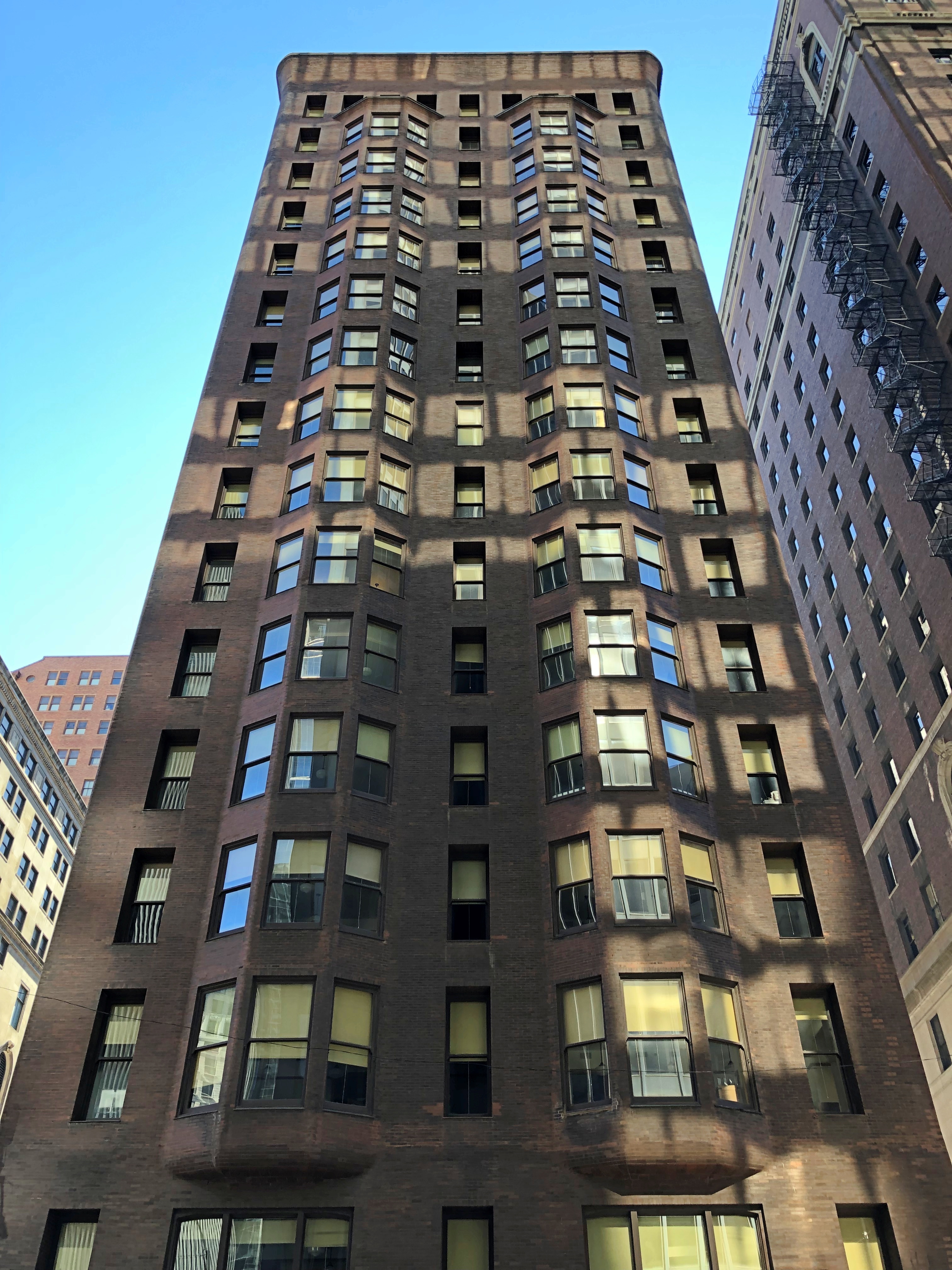
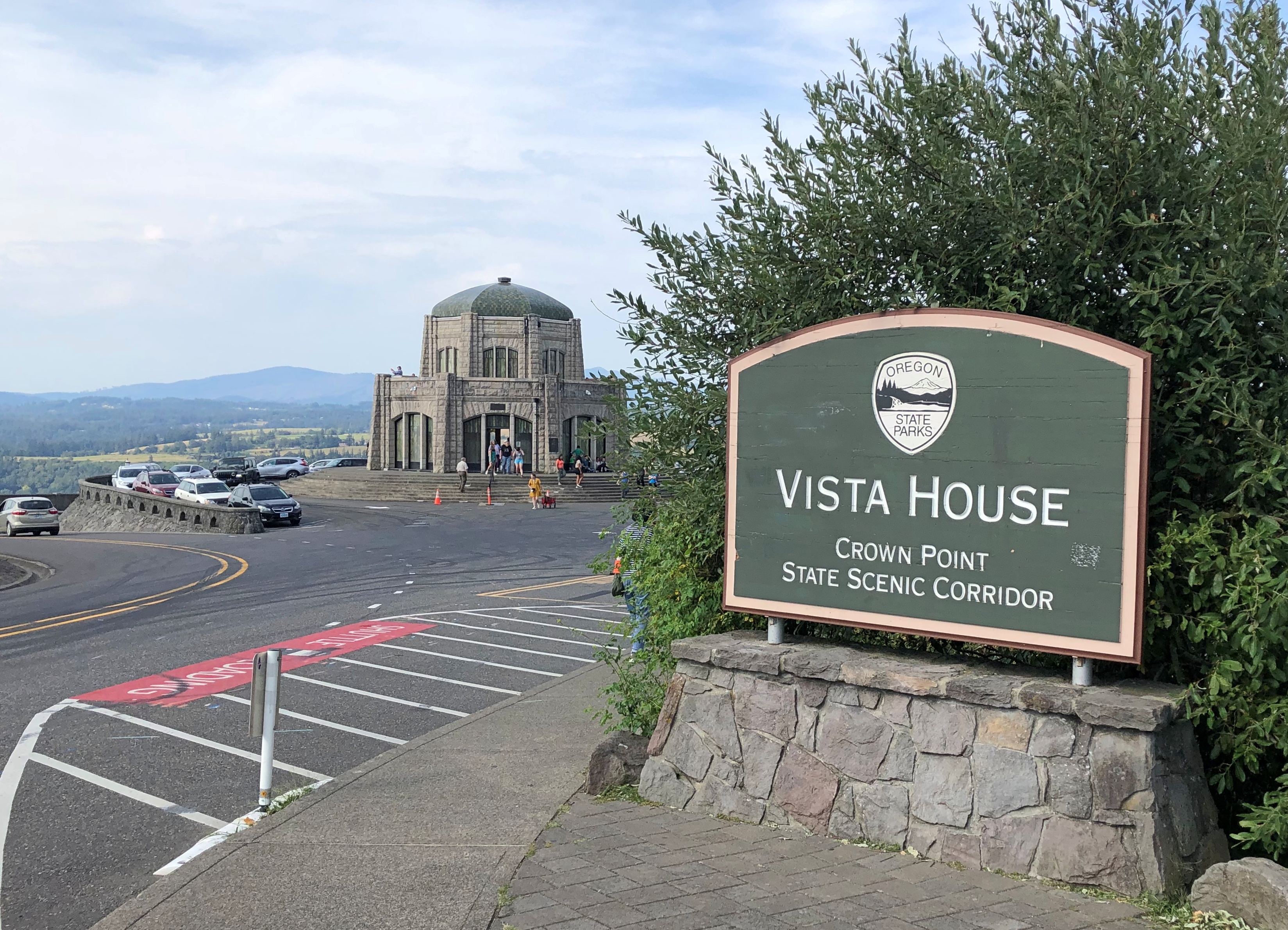
Not far east of the Chicago Board of Trade at 53 W. Jackson Blvd. is the hulking brown-brick Monadnock Building, one of the great old skyscrapers of Chicago. We passed by on the way to Michigan Ave. during our Open House peregrination. It wasn’t open for the event, but no matter. We’d both been inside, even taken a tour once upon a time.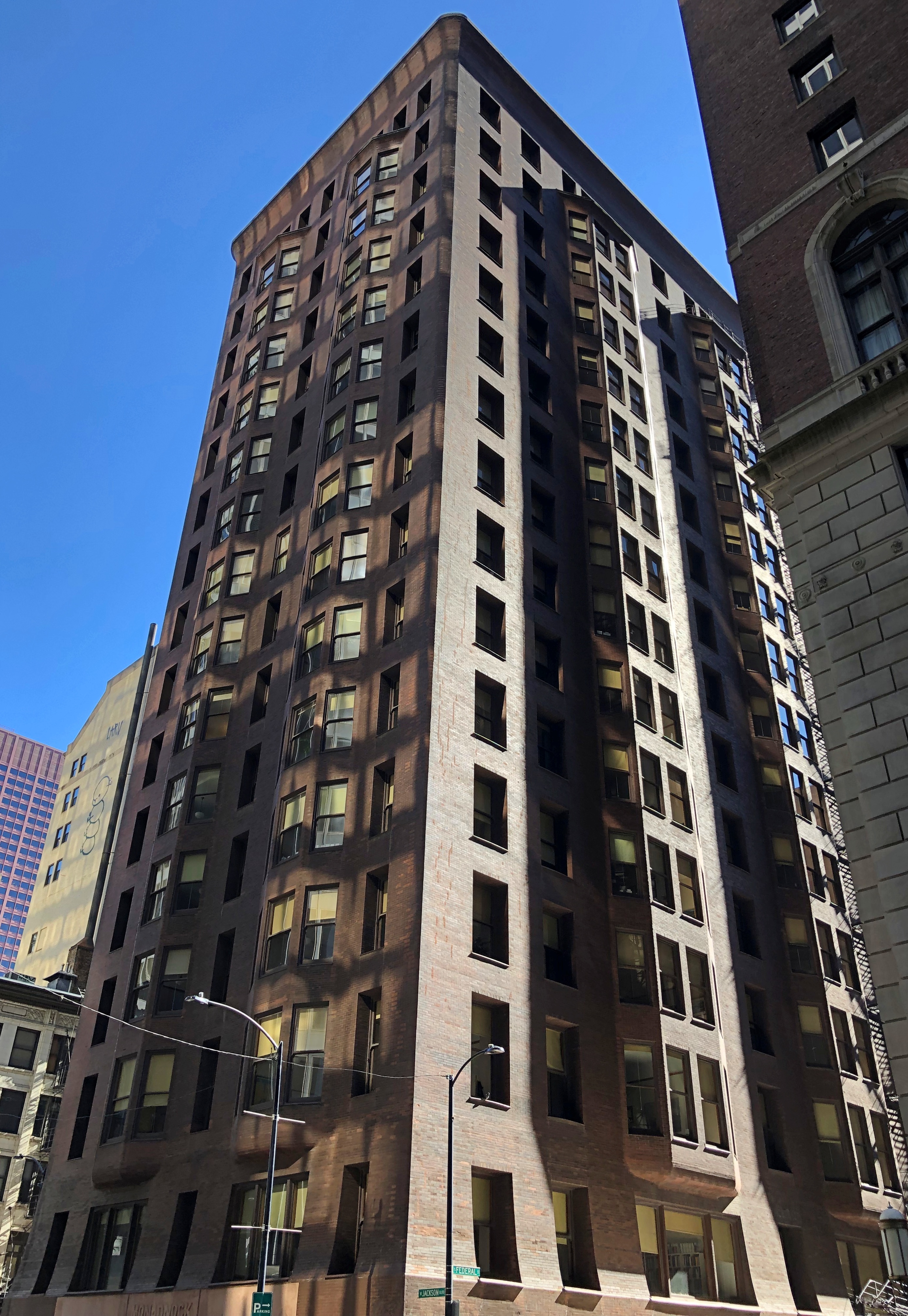
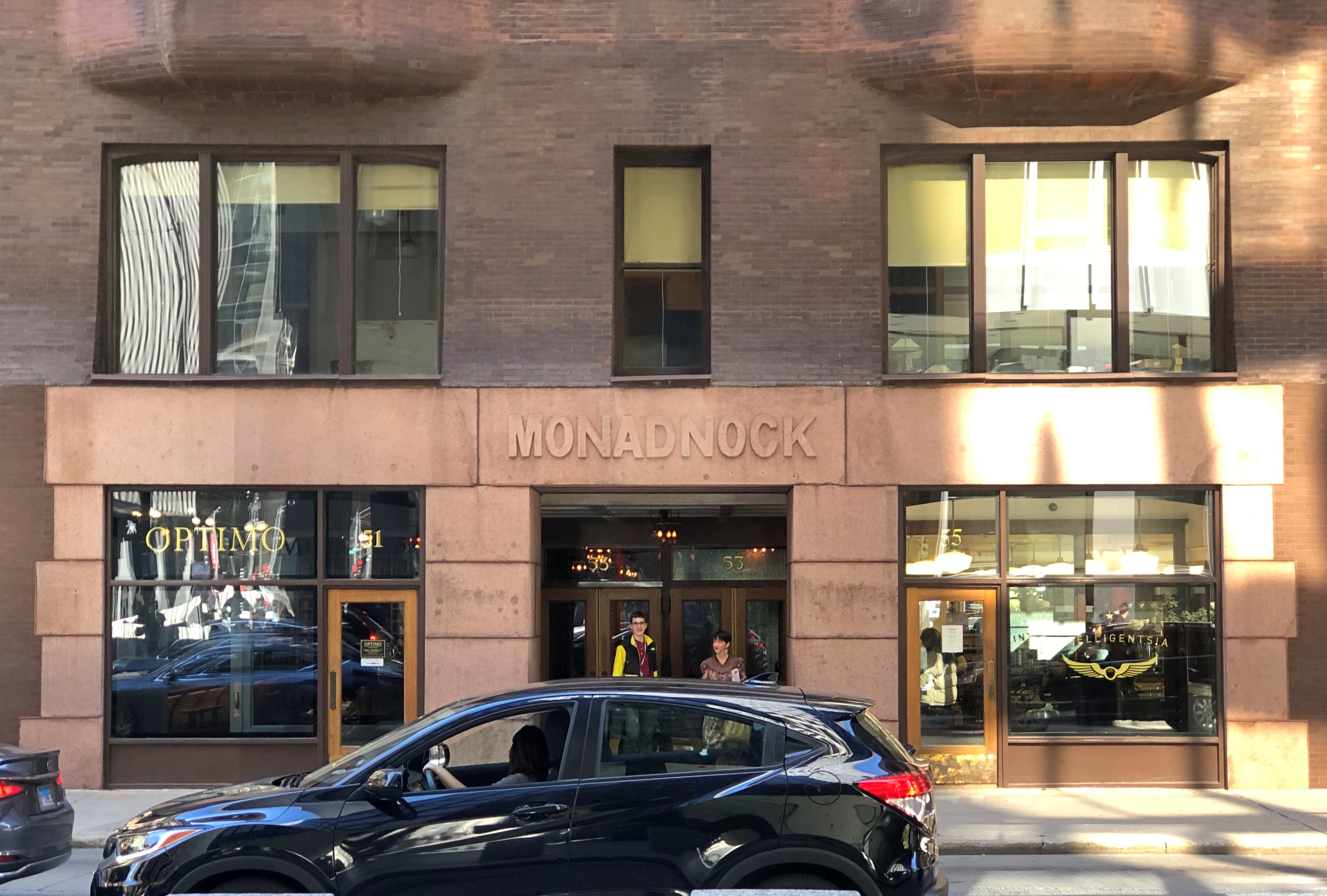
I also knew a fellow who worked for a nonprofit for a while in the ’90s whose office was in the Monadnock. He said he considered going to work there every day a fringe benefit.
“The northern half has always been the subject of attention and wonder,” the AIA Guide to Chicago says, regarding the Monadnock, which is actually two structures fused into a whole: a load-bearing northern half designed by Burnham and Root (1891), and a steel-framework southern half by Holabird & Roche (1893).
“It was constructed as a thick walled brick tower, 66 feet wide, 200 feet long and 200 feet high,” the AIA Guide continues. “The American Architect in 1892 described it as a chimney. Two cross walls divide the interior space into three, flu like cavities, the centers of which are open from street to roof. A freestanding staircase spirals down from the brilliance of the sky lit 16th floor to the dark lobby cut lengthwise through the ground floor. Around this open stairwell, a light structural grid sustains stacks of rental floors. From these extend the modular alcoves pushing through the facade become bay windows.”
The late 19th century was a time of transition for tall buildings, with the Home Insurance Building in Chicago showing the way as the first building its height (10 stories) to use a weight-bearing structural steel frame to support itself. That building, on West Adams, was a mere diagonal block and a half away the Monadnock. Home Insurance is long gone; but the Monadnock stands. Or maybe I should say, abides.
Further eastward — the direction we were going that day — at Jackson and State is the DePaul Center, originally (1912) the A. M. Rothschild & Company Store, by Holabird & Roche (them again).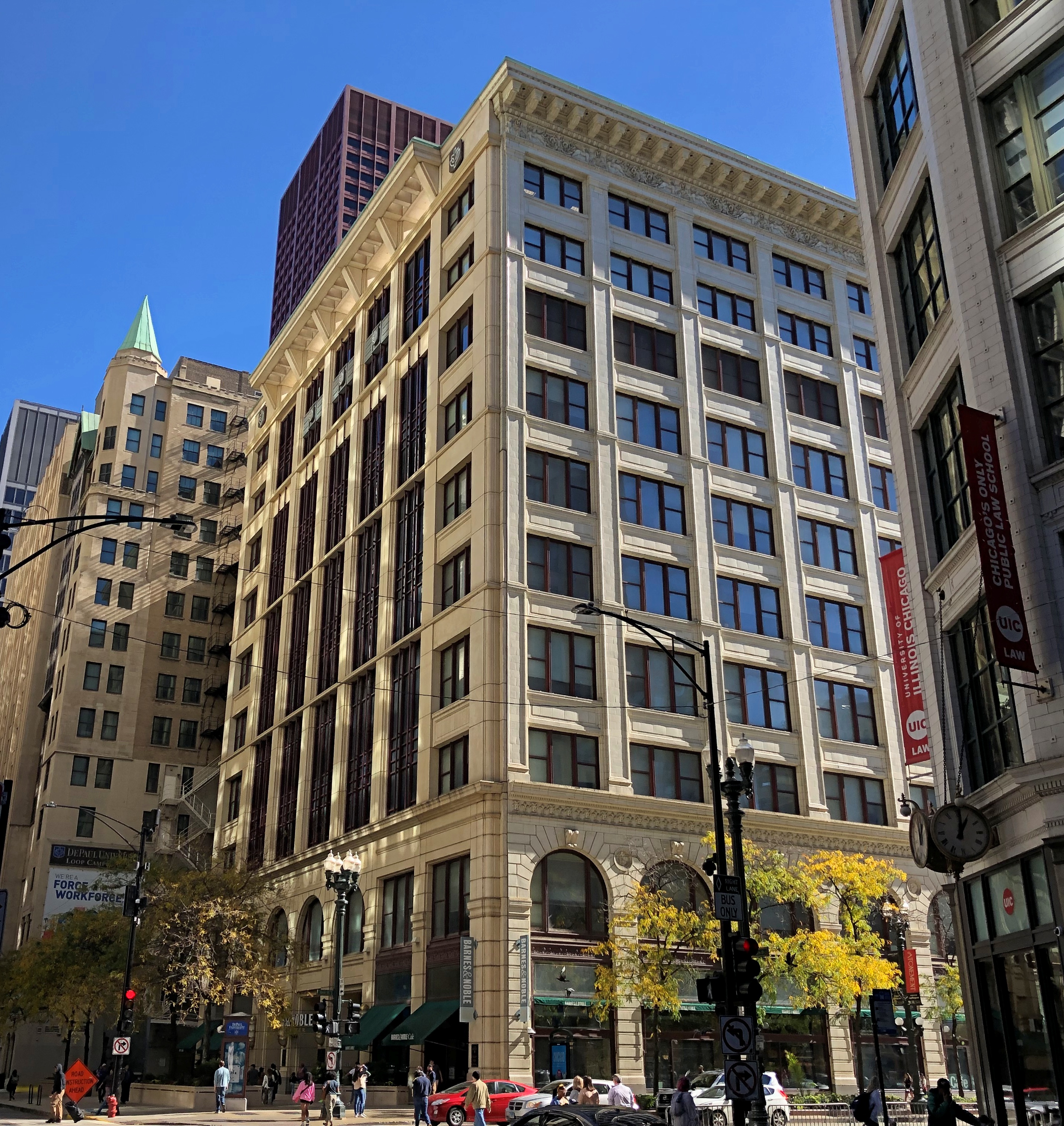
At the turn of the 20th century, A. M. Rothschild & Co. was a department store rivaling Marshall Field on State Street in Chicago, founded by a German immigrant of that name who also married into one of the richest families in Chicago, the meatpacking Morrises. Abram M. Rothschild didn’t live to see the 1912 building, however. By 1902, his in-laws, who controlled the store, had forced him to retire due to financial problems at the retailer, though he was kept on as a figurehead.
“July 28, 1902 started out like any other day for A.M. Rothschild,” explains chicago.designslinger. “The recently retired 49-year-old retailer visited the sixth floor office of his namesake department store in downtown Chicago that morning, and after a few hours left for home accompanied by his son 16-year-old son Melville. Rothschild’s wife Gusta greeted both of them in the front hall of the family’s large house on Michigan Avenue at 37th Street, and Abram Rothschild headed upstairs to freshen up. He went into his bedroom, retrieved his revolver, went into the bathroom, and shot himself in the head.”
Later, after spending a decade or so putting together the land for it, the Morris family hired Holabird & Roche for a new, 11-story retail building that eventually became the building you can see now, which belongs to DePaul University. Back in 1912, a department store could conceivably use such a building. Hard to imagine now.
“The architectural firm had a number of projects along the State Street corridor, but A.M. Rothschild & Co. would be their largest,” chicago.designslinger notes. “And although the family had a troubled history with the founder, they paid lasting tribute to him by having the architects incorporate the letter ‘R’ into the massive cream-colored, terra cotta facade which was repeated down the entire length of the building.”
As they are to this day, though since I only took an image of (mostly) the Jackson Blvd. elevation, the letters aren’t much visible. The building deserved a closer look, but we were operating on the lunch imperative as we wandered by, more focused on finding victuals. Maybe some other time. No matter how often I go downtown, something there is always worth another look.


