Lilly posted it, so I might as well repost it here. I believe she’s making a good choice.
Gray Farm Park & Conservation Area
On Saturday, we had high heat and wall-of-water thick humidity. I woke to a bit of thunder on Sunday morning, followed mostly by drizzle. By Sunday afternoon, sunny conditions were back, but not so much heat. Or humidity. Chamber of commerce weather, as an old colleague of mine used to call it.
Today was a little hot for ideal c-of-c weather, but I like it. Cicadas have returned in the late afternoons, followed by just a hint of crickets after dark. We still have fireflies.
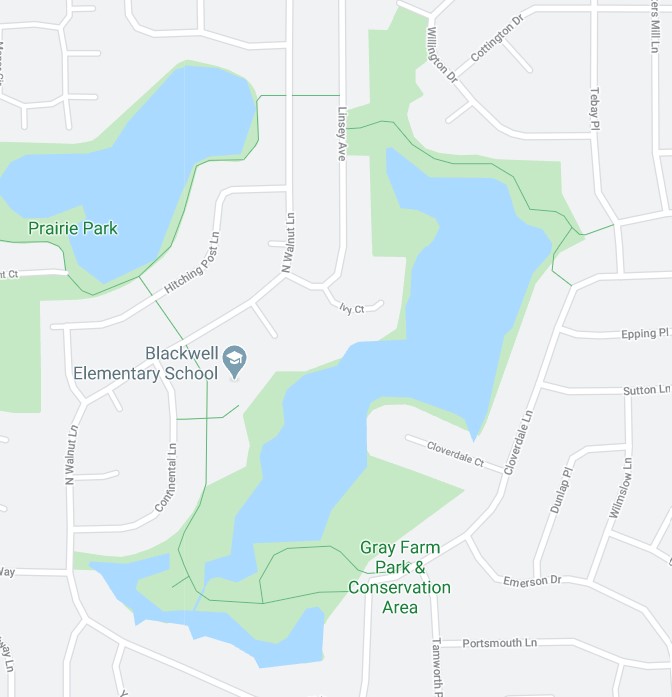
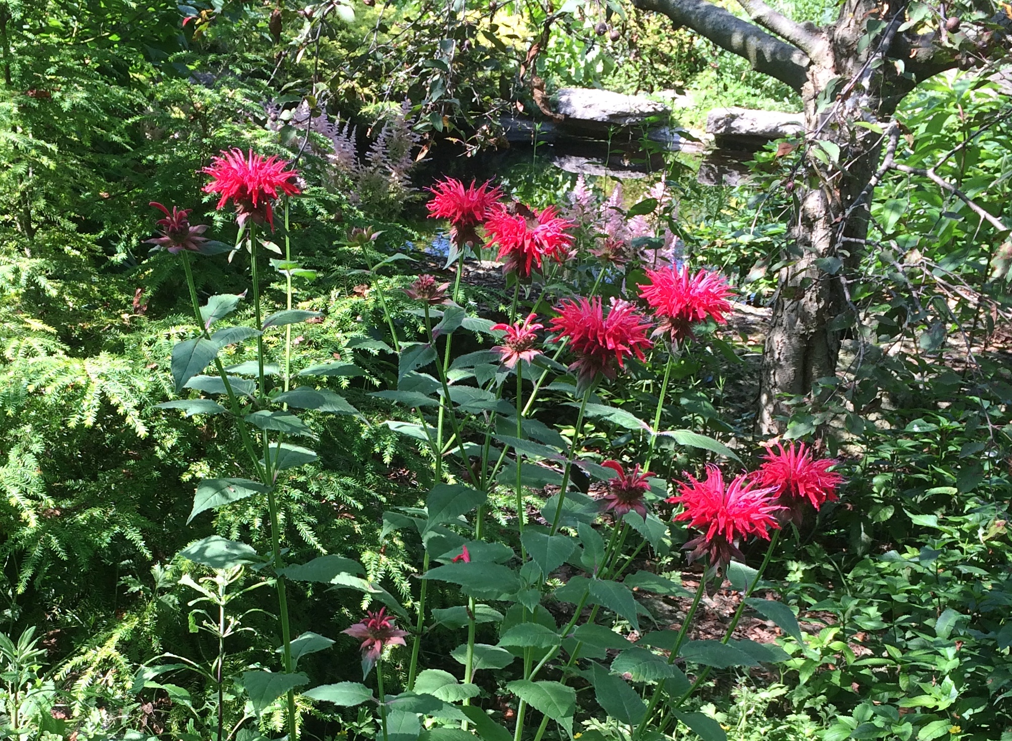
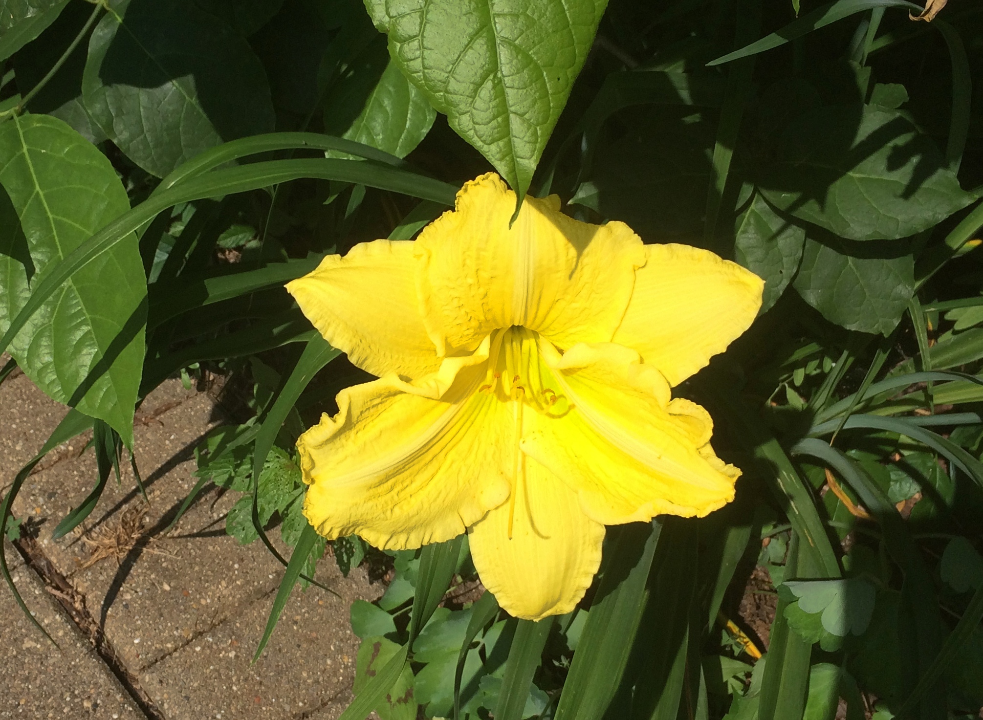
One late afternoon last week we went to Gray Farm Park & Conservation Area, which is 47 acres tucked away off any main street here in the northwest suburbs. Even though it has a large water feature, I expect it’s mostly unknown except to nearby residents.
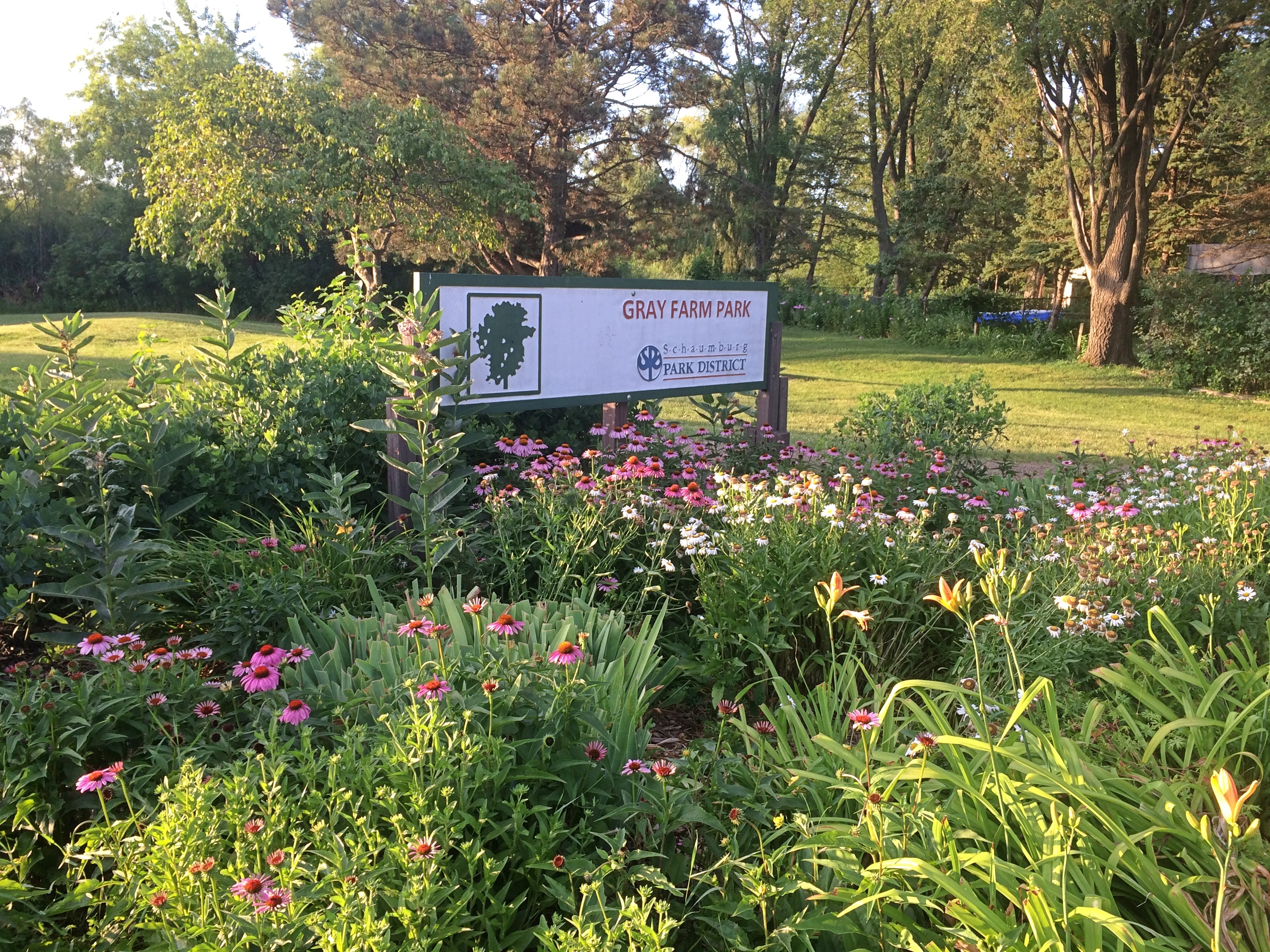 I know about it because I troll maps. The only kind of trolling I do. We entered the park from Cloverdale Lane, and then walked as far as the elementary school.
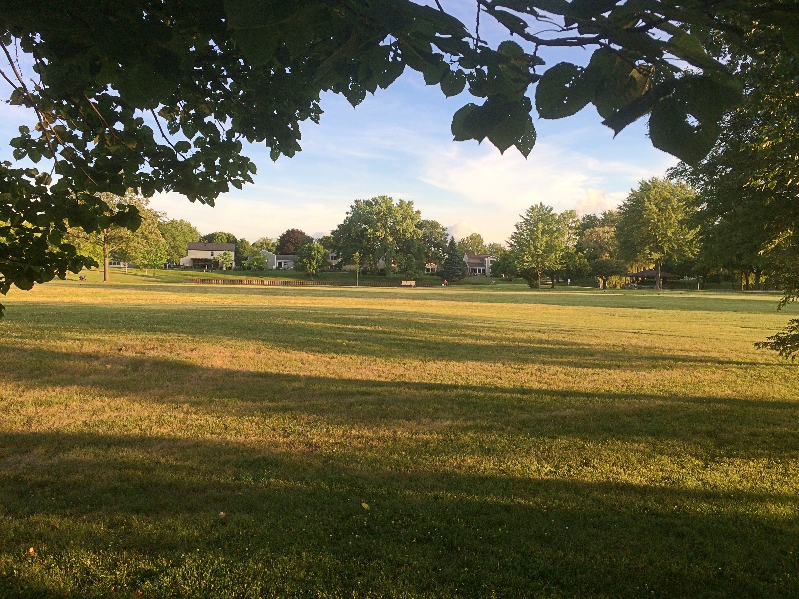
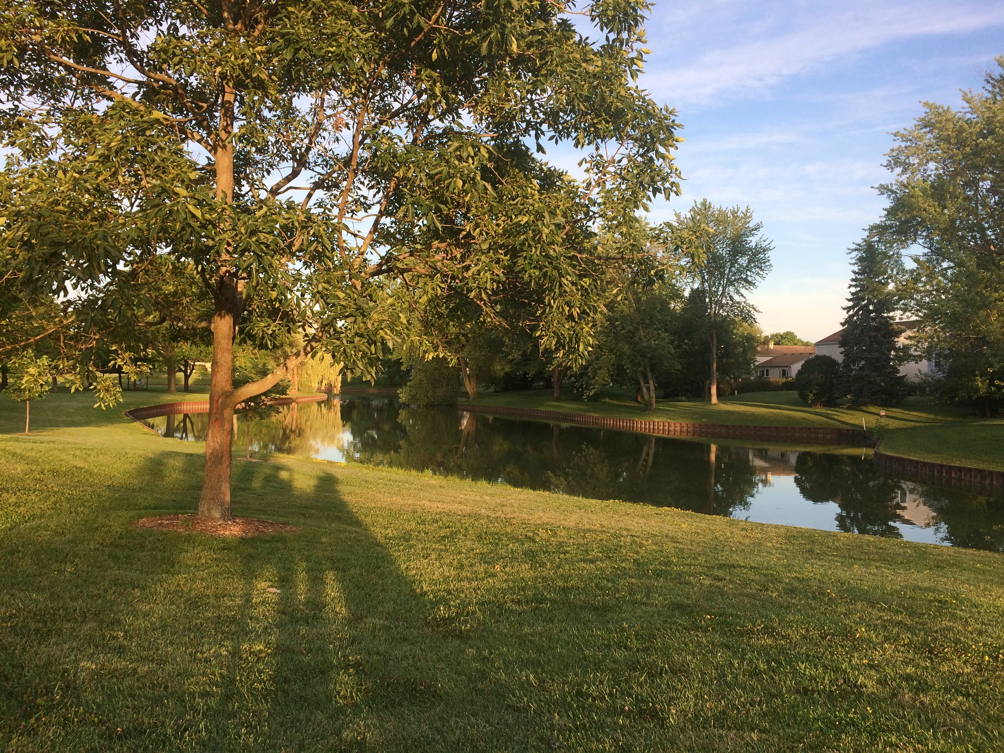
 Much of the park is an open field, though some is a long pond edged by metal bracing.
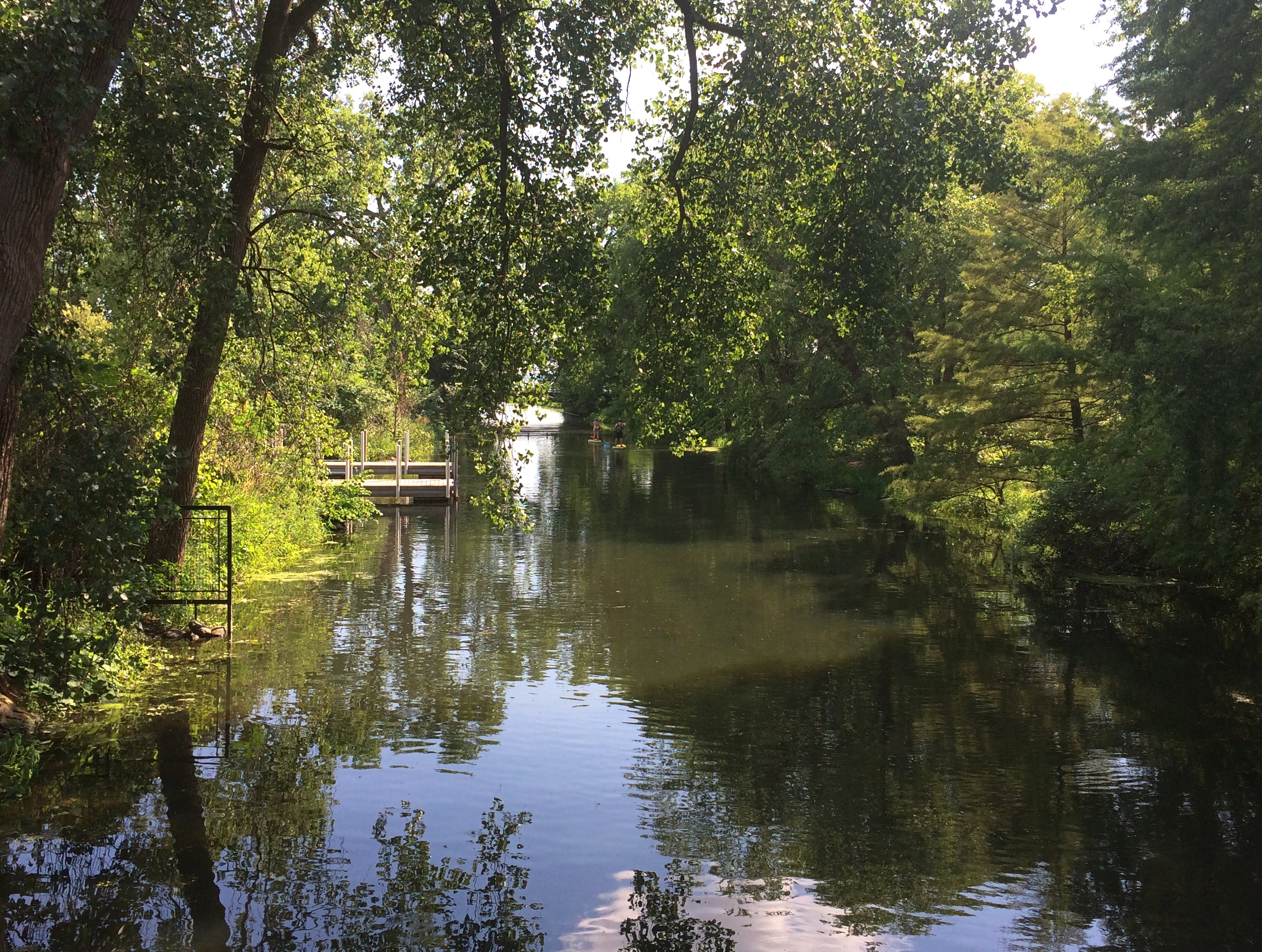
 The conservation area — which is mostly large open-water cattail marsh — is behind tall grass this time of year.
 Though if you look carefully enough, you can find a path through the tall grass just behind the nearby elementary school. The path leads to a boardwalk.
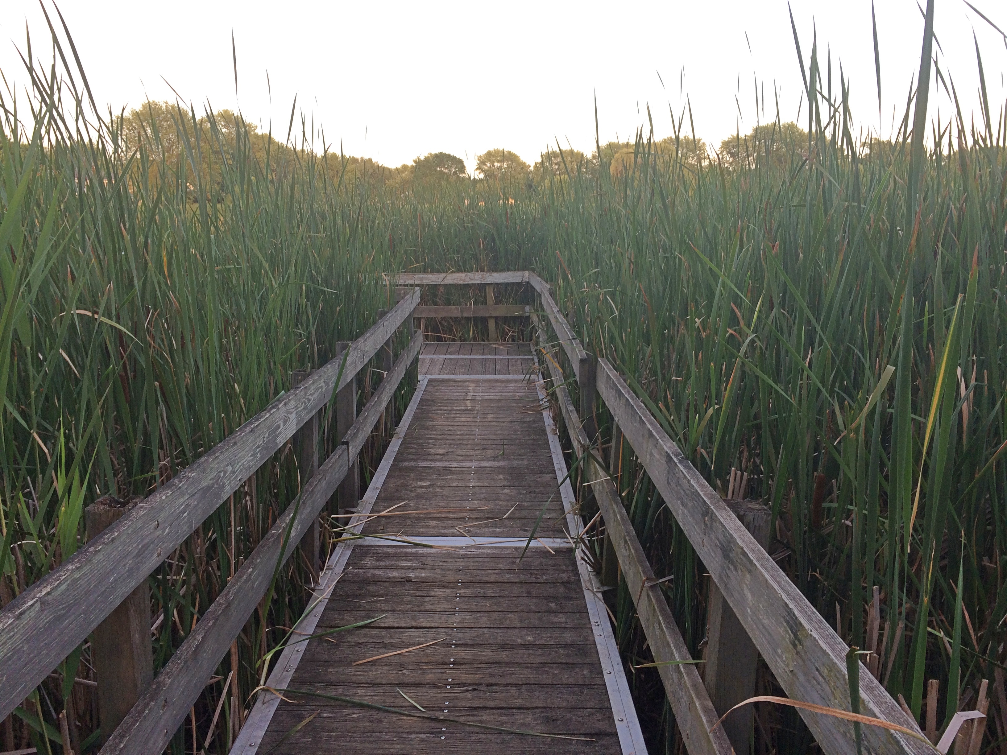 The boardwalk dead ends before long, but it does offer a view of the much larger pond — the cattail marsh. A grassy view, but a view all the same.
 I’ve read that Gray Farm is a good place for bird watching. But my impulse to watch birds doesn’t go much beyond, hey, that’s an interesting-looking bird. What’s it called? I don’t know either. Never mind.
Keith Jarrett, Piazza del Campidoglio
July 16, 1983, was quite a day for me. In the morning my friend Steve and I visited the Castel Sant’Angelo (the Mausoleum of Hadrian), followed by an afternoon at the Vatican. As in, the Vatican Museums, the Sistine Chapel and finally St. Peter’s itself, including a climb to the dome.
That should have been enough for any day, but at some point, Steve spotted a poster advertising an outdoor concert by Keith Jarrett that very evening at the Piazza del Campidoglio. I would have blown it off, having only a faint notion of who he was, but Steve knew more and insisted we go. It was standing room only.
Remarkably, I found a recording of that concert on YouTube.
The recording is about 25 minutes long. Not because whoever recorded it didn’t capture it all, but because right in the middle of things, the known-to-be-prickly Jarrett — maybe bothered by the persistent ambient noise of the setting — stormed off, never to return.
Beavers Attack! Olde Schaumburg Centre Park
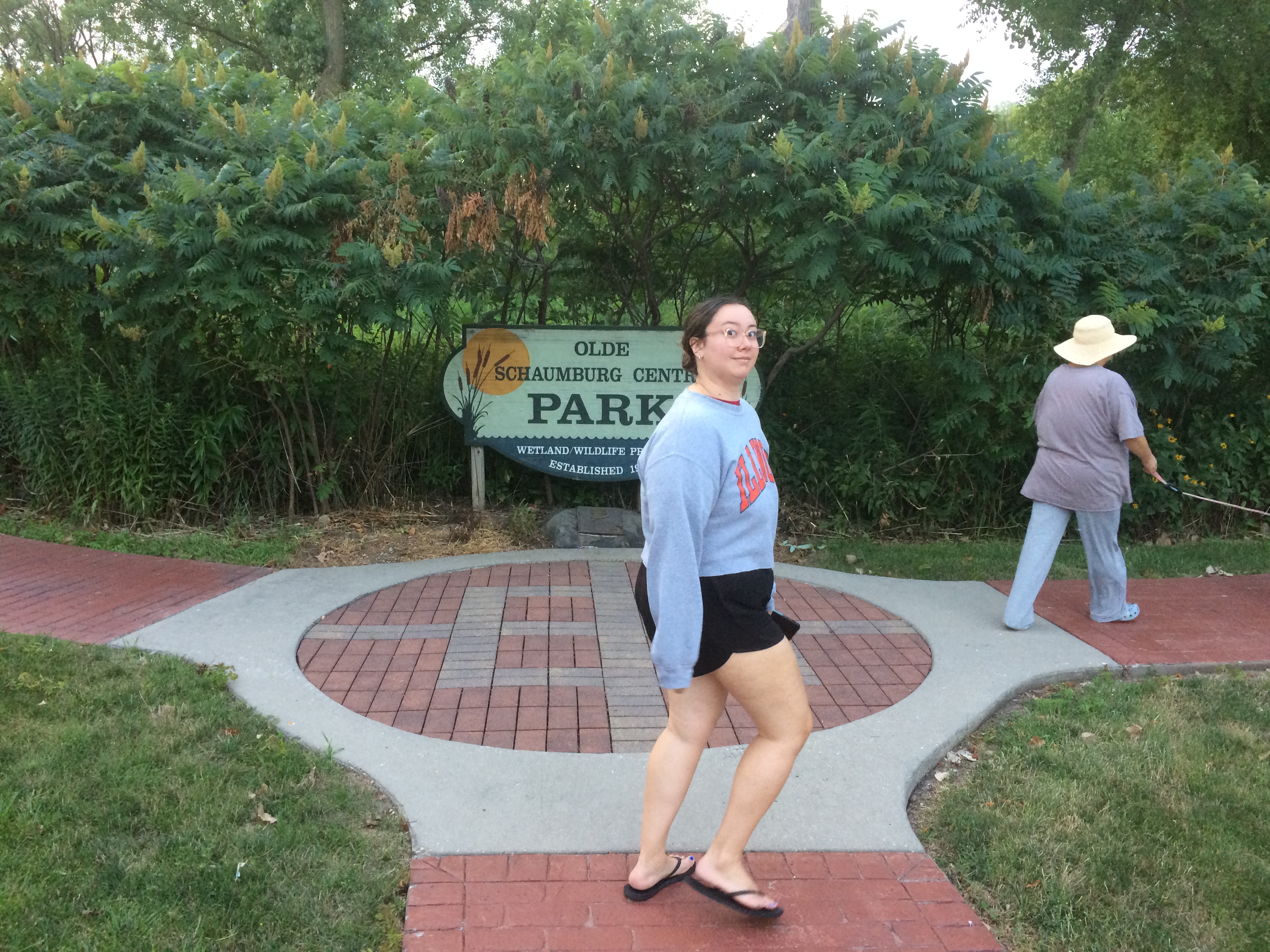
Tucked off a busy northwest suburban street is Olde Schaumburg Centre Park. We were there not long ago just before sunset. Here in July, days are noticeably shorter, though not that much shorter yet.
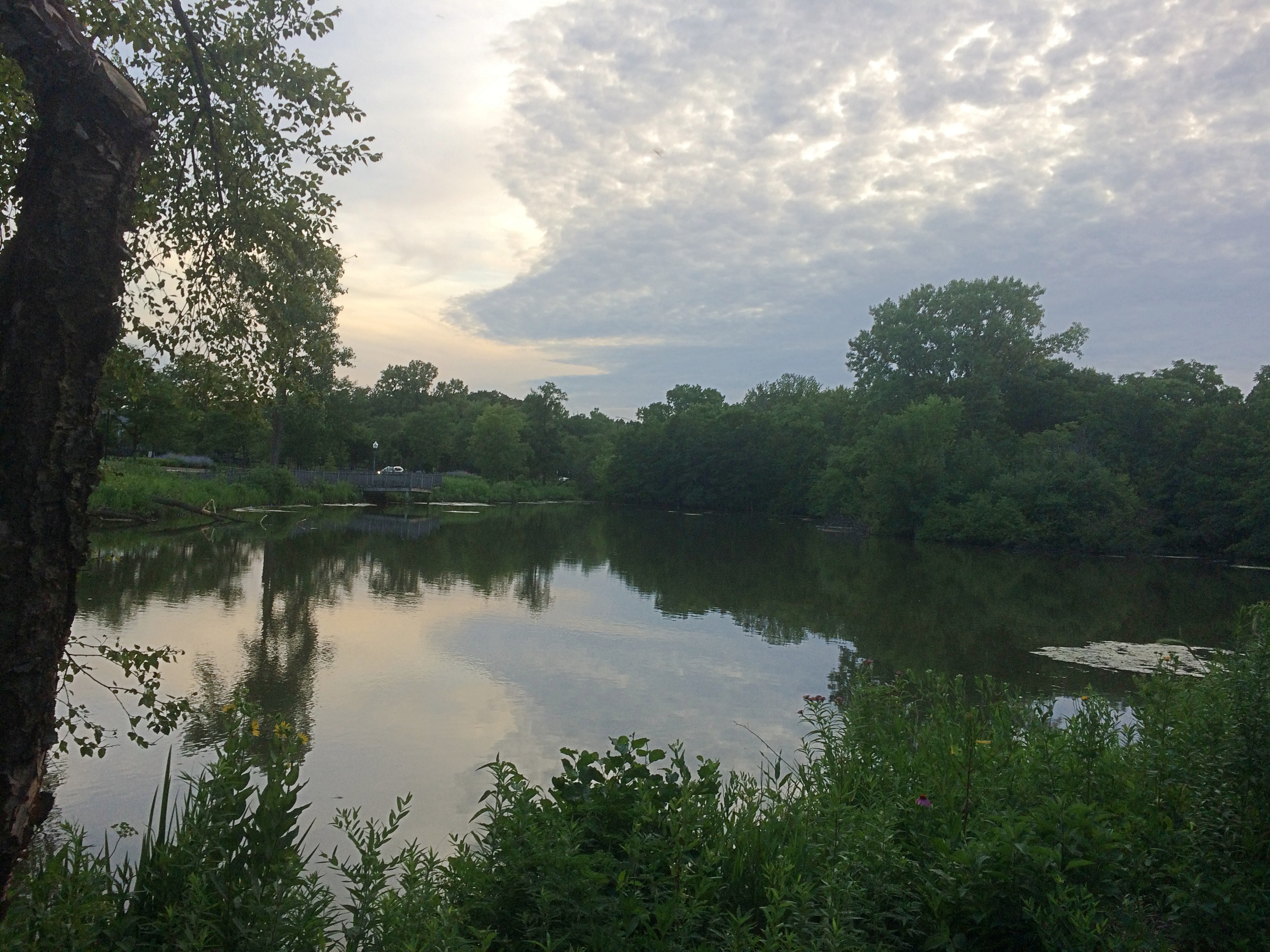
 Though modest in scope, Olde Schaumburg Centre Park is a pleasant green space in the summer, and a lush wetland and wildlife preserve besides. The focus is a pond. That’s the wetland part of the equation.
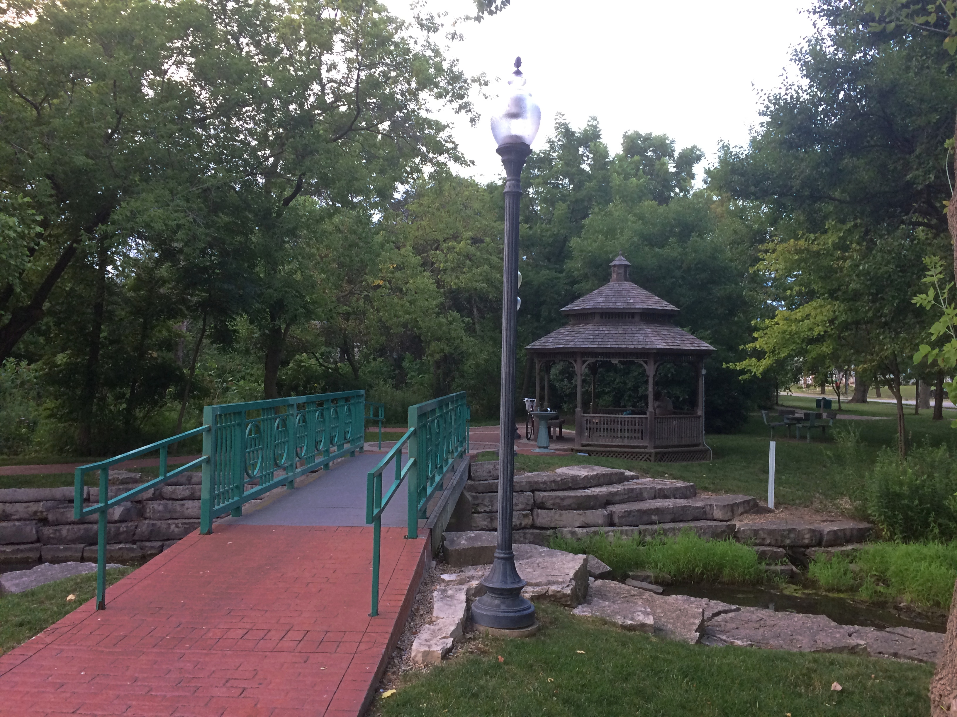
 There are trails and a gazebo. Schaumburg wouldn’t be a proper suburb without a public gazebo.
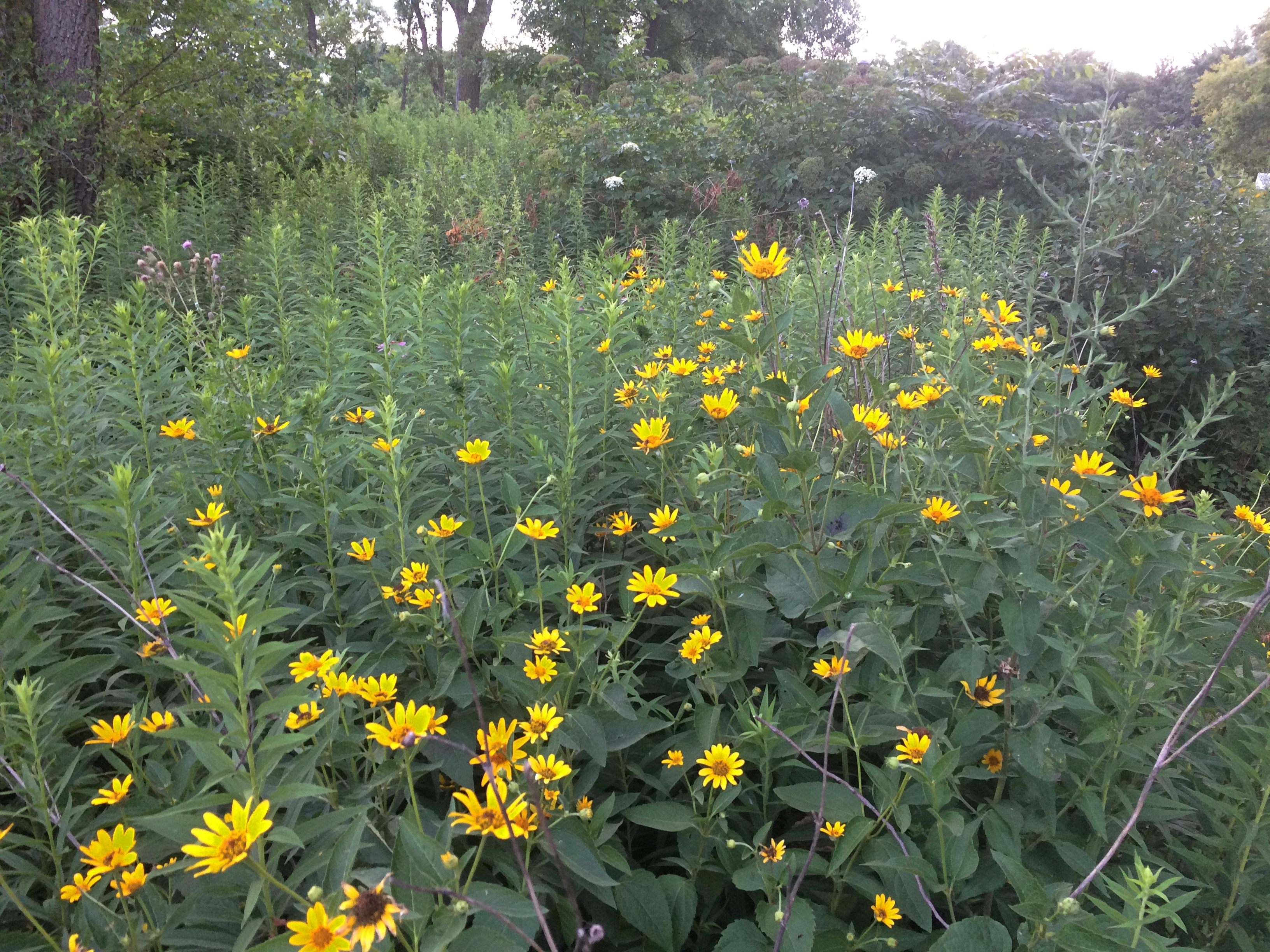
 Plus flourishes of flowers.
 As for being a wildlife preserve, we saw clear evidence of beavers in the area.
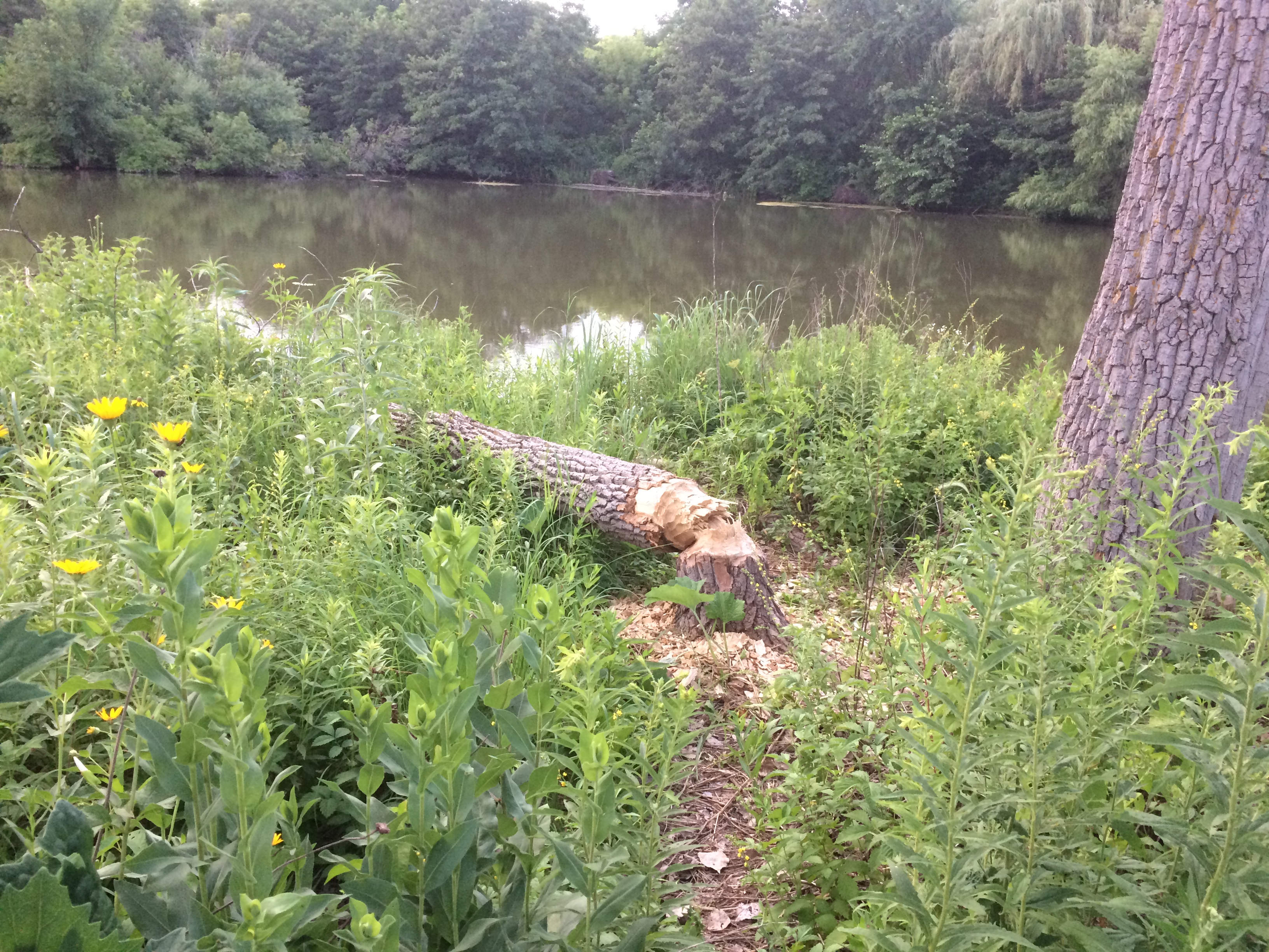 Doing what beavers do. Gnaw marks appeared on other trees, though no others were toppled. Does the village consider beavers a nuisance? They do seem to be attacking park trees, which take a long time to grow, but then again they might be a protected species in these parts.
The animals are a village concern, because the park is village property, not part of the Schaumburg Park District — something I didn’t realize until recently, despite all the years I’ve driven past the park.
The park is also part of a formally designated area called Olde Schaumburg Centre, which is an historic district: the OSC Overlay District, established in 1978. Much information about that and early Schaumburg has been published by the village community development department.
In the mid-19th century, the small farm village that would become a major Chicago suburb was known as Sarah’s Grove. Later, German farmers came in numbers, and Schaumburg schall et heiten!
The name Sarah’s Grove lingers. The subdivision across the street from in Olde Schaumburg Centre Park is called Sarah’s Grove, and so is a park district park near the subdivision.
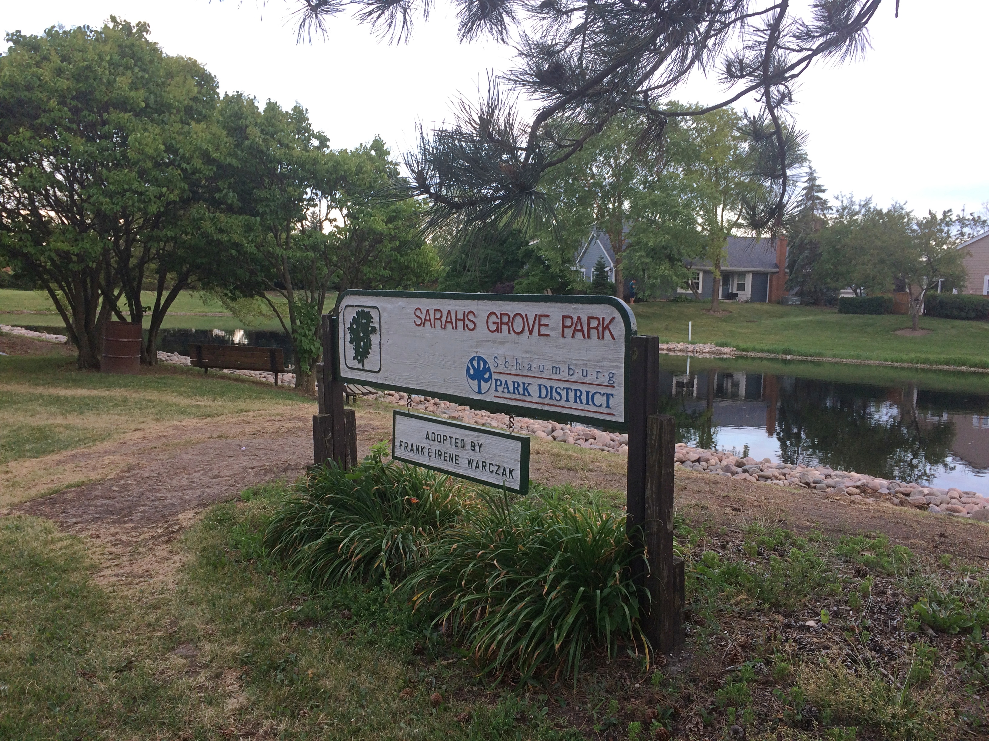 It too focuses on a water feature, but without many trees or thickets.
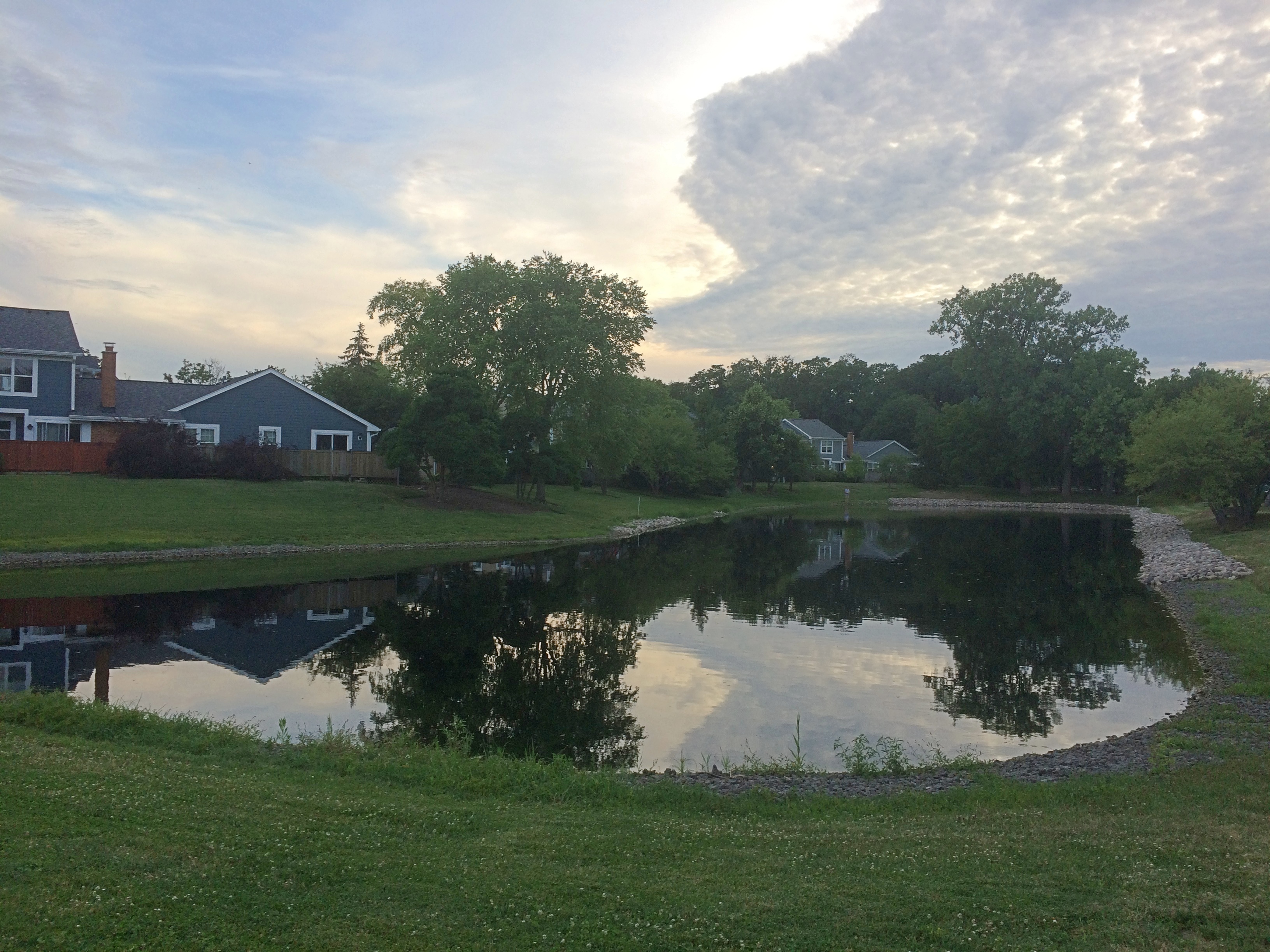 Though no one was there at that moment, I see people fishing at the pond pretty often.
Nike Park, Addison
What do I get for reading the likes of Atlas Obscura? Ideas about obscure places to go. Or to stop if I’m already nearby, because naturally some places are worth seeing, but not worth going to see, to paraphrase Dr. Johnson.
Not long ago I was near Nike Park in west suburban Addison, so I dropped by. It’s accessible via a short street tucked between two light industrial properties and lined with trucks, and as a park, it isn’t much to write about. At about seven acres, the park has a small baseball field, playground, picnic table and a portable toilet.
There’s also this.
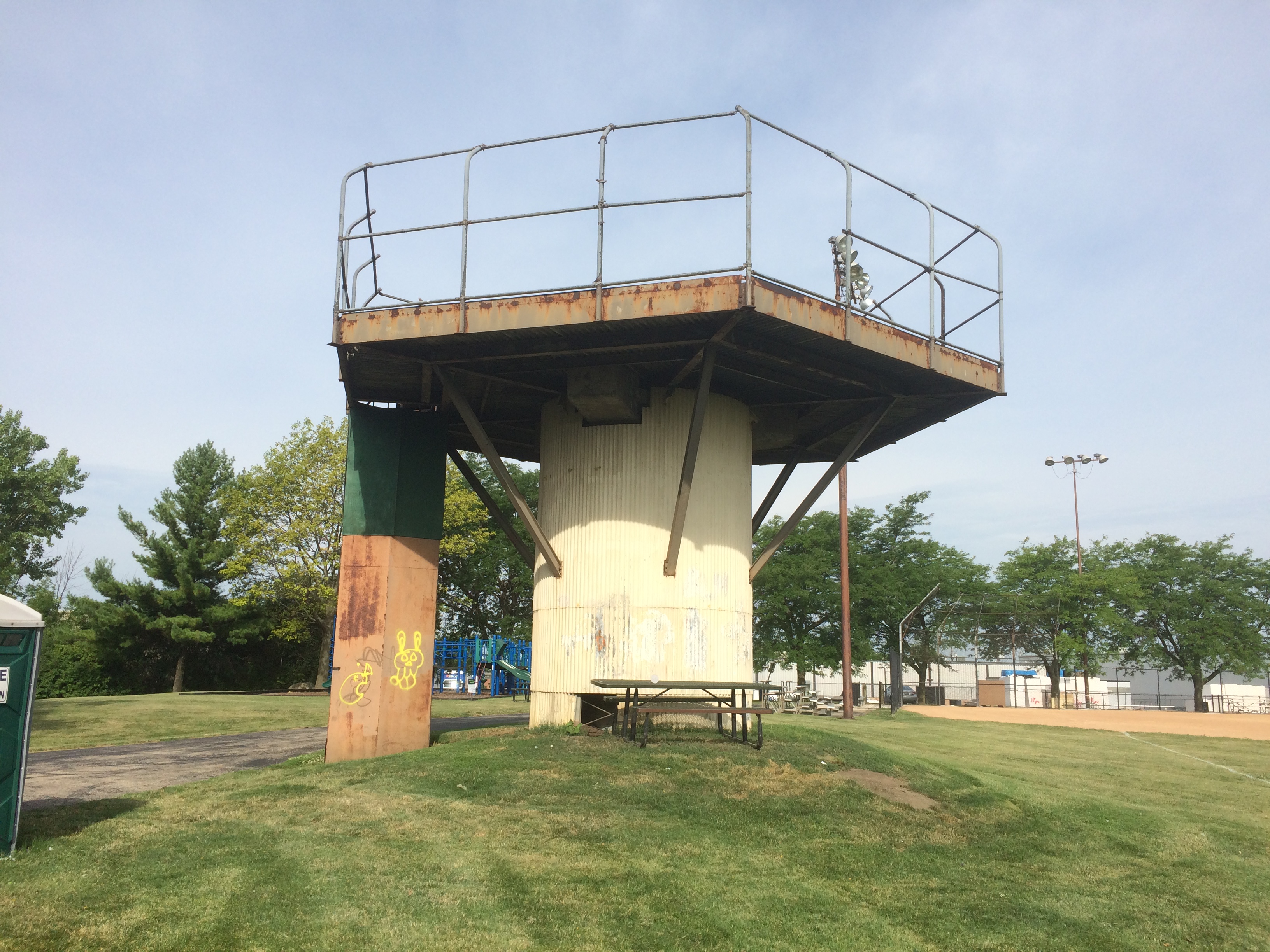
To quote Atlas Obscura: “Once part of a larger Nike Missile complex (Nike C-72), the Nike Park land was given over to the Addison Park District after the missiles, launchers, and most of the equipment was removed, and the site decommissioned.
“Unfortunately, no evidence of the launch site exists any longer, as it now part of the Fullerton County Forest Preserve. The radar installation and control tower located on the northwest end of the base, however, still stand in what is now Nike Park…”
As a Cold War relic, worth seeing, but not going to see, I’d say.
Boscobel & Fennimore, Wisconsin
Road trips aren’t just about the destination, but sights and oddities along the way. Recently in southwestern Wisconsin, for instance, we stopped in Boscobel, looking for takeout. We found it at Udder Brothers Creamery. How could we pass up a place with a giant cow? Also, a giant wild turkey?
Note that the turkey not only proclaims Boscobel as Wisconsin’s Turkey Hunting Capital, but as Birthplace of the Gideon Bible as well. We wanted to be on our way, so we didn’t investigate that further at the time.
But now I know: “The birthplace of the Gideons was the Central House Hotel on September 14, 1898, in Boscobel, Wisconsin,” says Wisconsin Historical Markers. “Traveling salesmen John H. Nicholson of Janesville, Wisconsin, and Samuel E. Hill of Beloit, Wisconsin, shared a room in the crowded hotel because of a lumberman’s convention.
“In Room 19, the men discovered that they were both Christians; they talked about starting a Christian traveling men’s association. The following May the two salesmen, joined by a third, William J. Knights, rekindled that idea, and on July 1, 1899, founded the Gideons.”
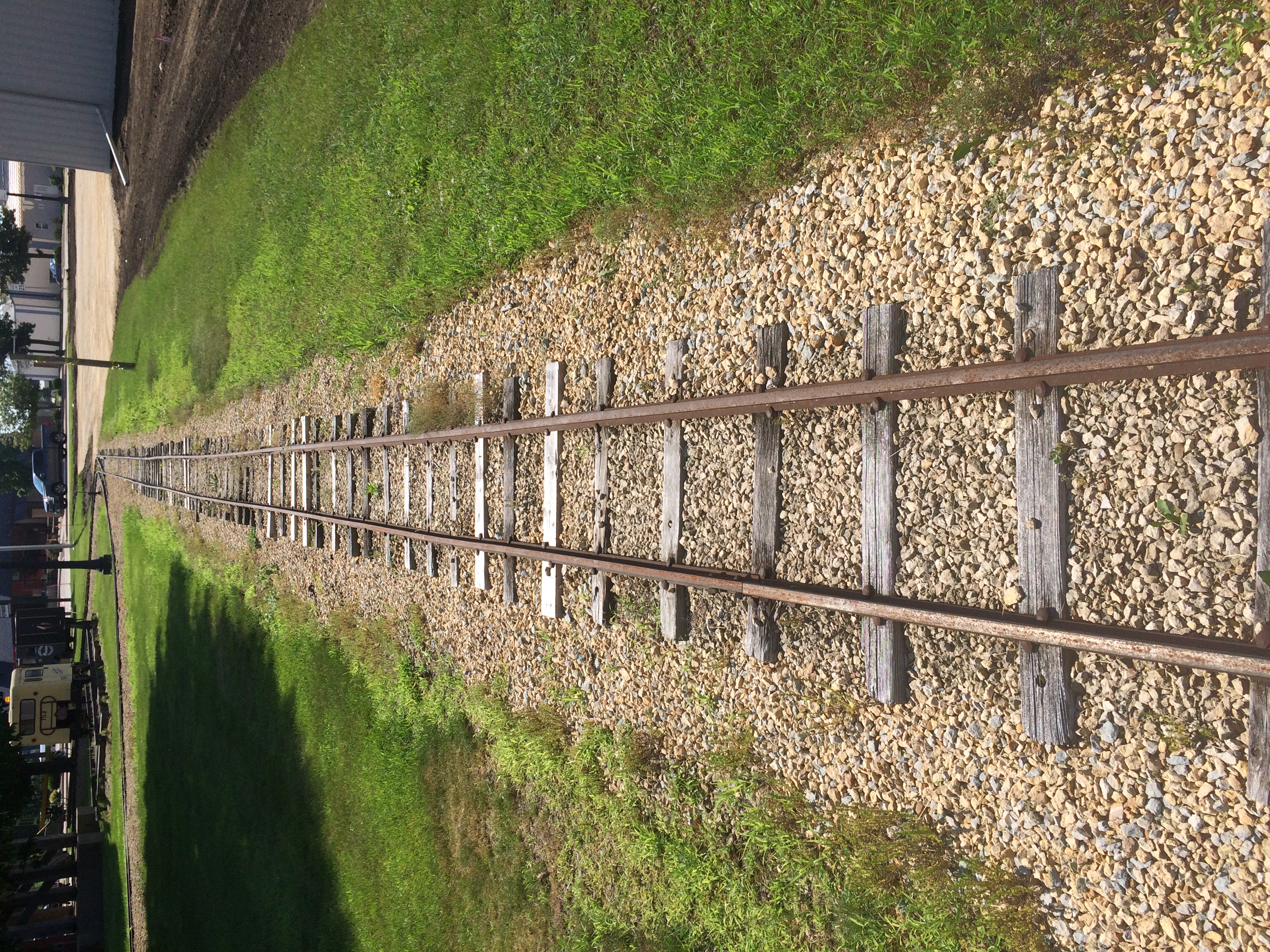
Dang. I should have at least found the plaque. Down the road from Boscobel is Fennimore, another Badger State burg we passed through. Hunger wasn’t the main consideration there, so we spent a little more time, especially at a small park featuring The Dinky.
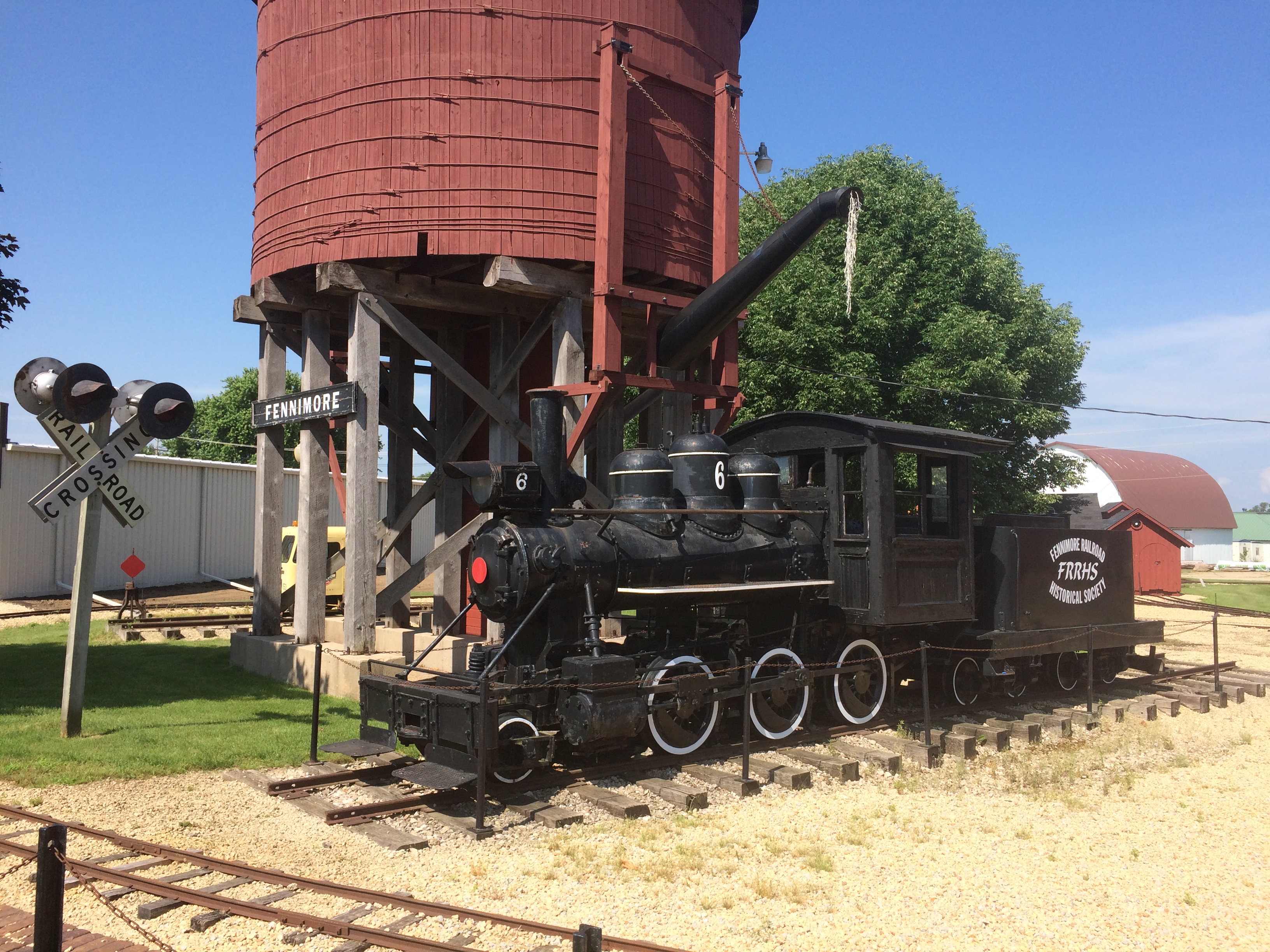
It’s a narrow-gauge (3-ft.) locomotive in operation from 1878 to 1926. “Trains ran daily between Fennimore and Woodman by way of Werley, Anderson Mills and Conley Cut, meandering 16 miles through the Green River Valley,” its historical marker says.
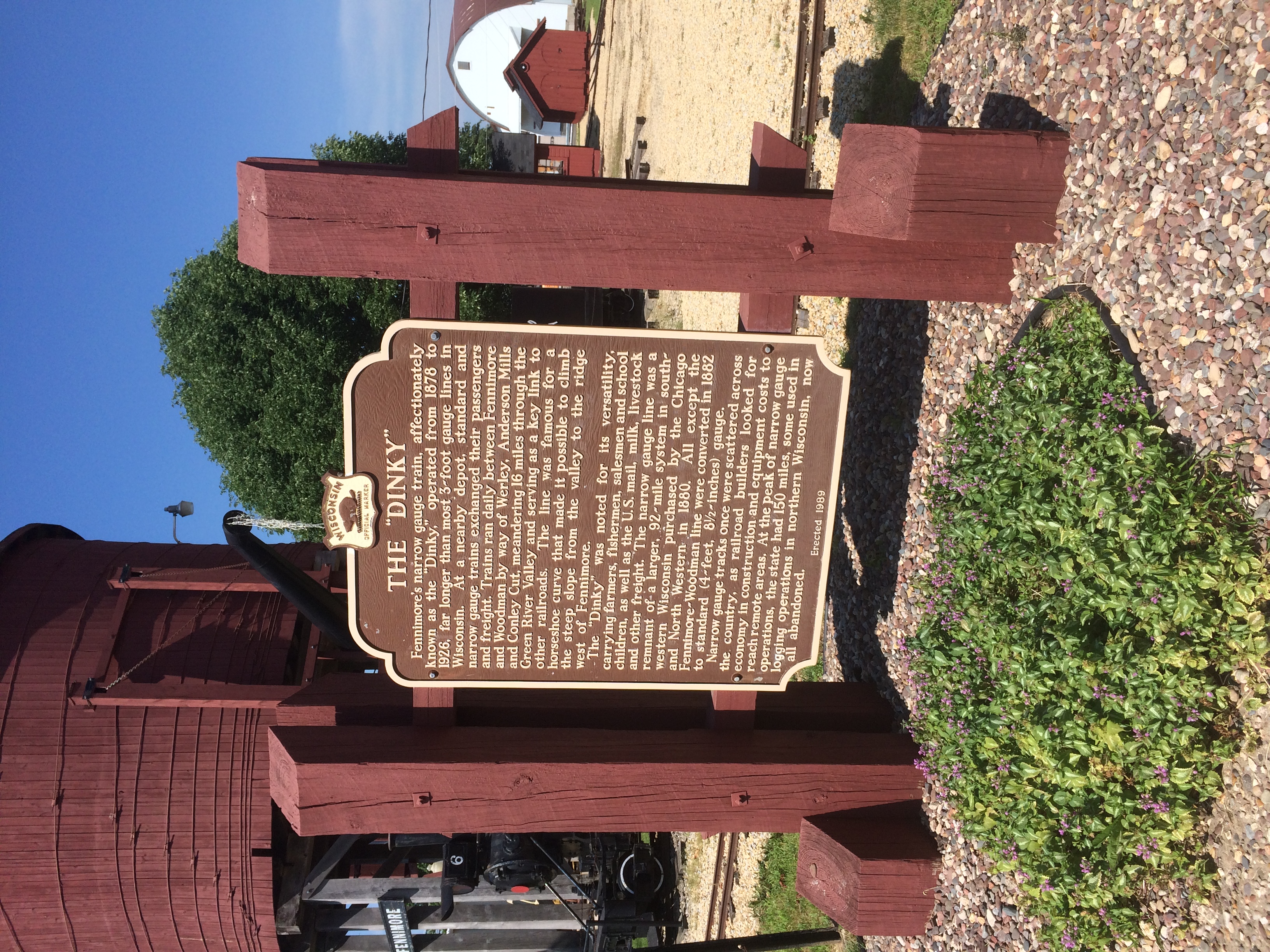
“At the peak of narrow gauge operations, the state had 150 miles, some used in logging operations in northern Wisconsin, now all abandoned.”
Narrow gauge, for sure.
Olbrich Botanical Gardens
High heat over the weekend, but come this morning, pleasant upper 70s F. Heat returns later in the week, I hear. That’s a northern summer for you.
On the way back from Prairie du Chien last week, we stopped briefly in Madison. Good old Madison — been going there since the late ’80s, and I think of it as the Austin of the North. Yet I don’t know it all that well.
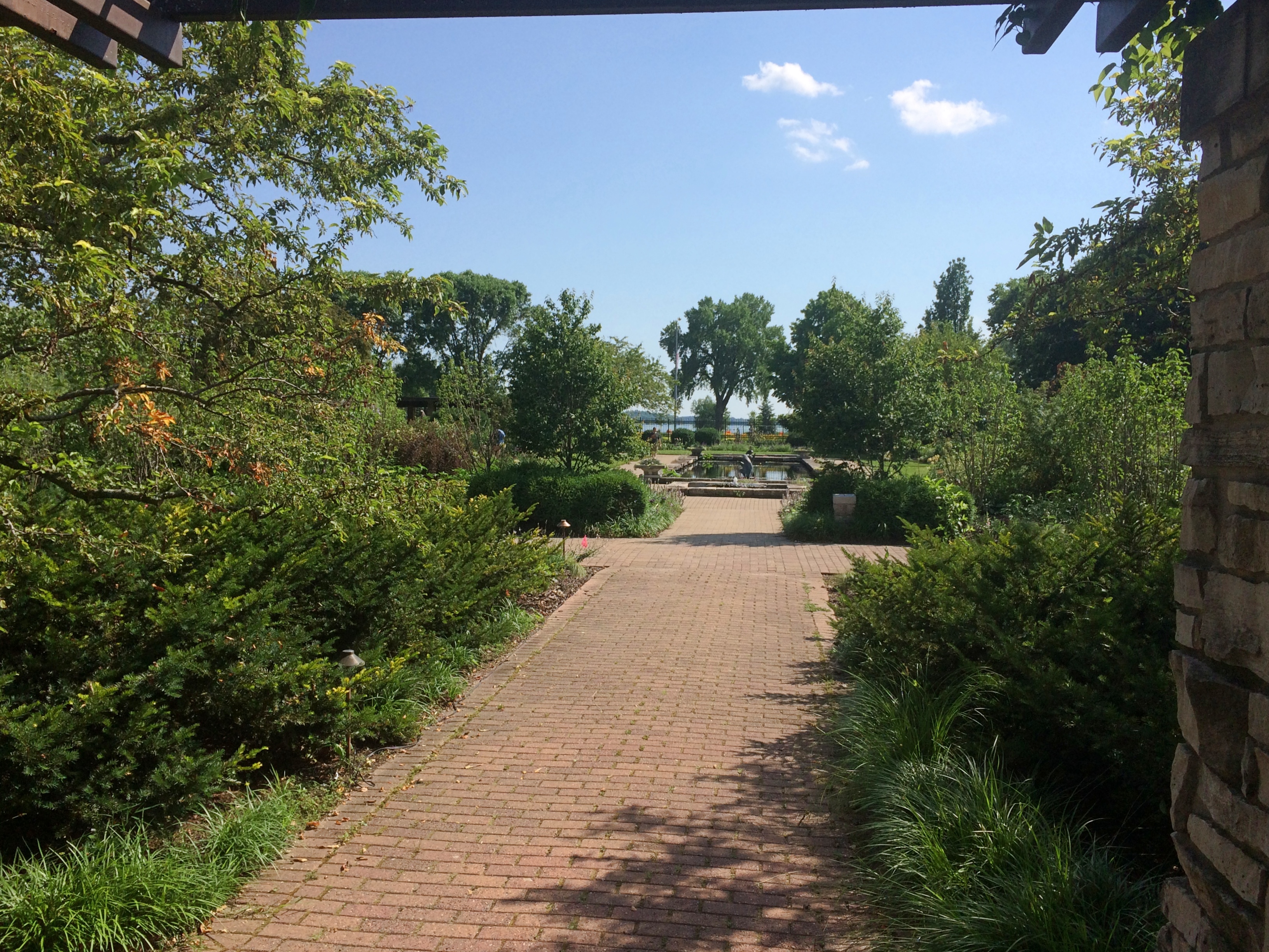
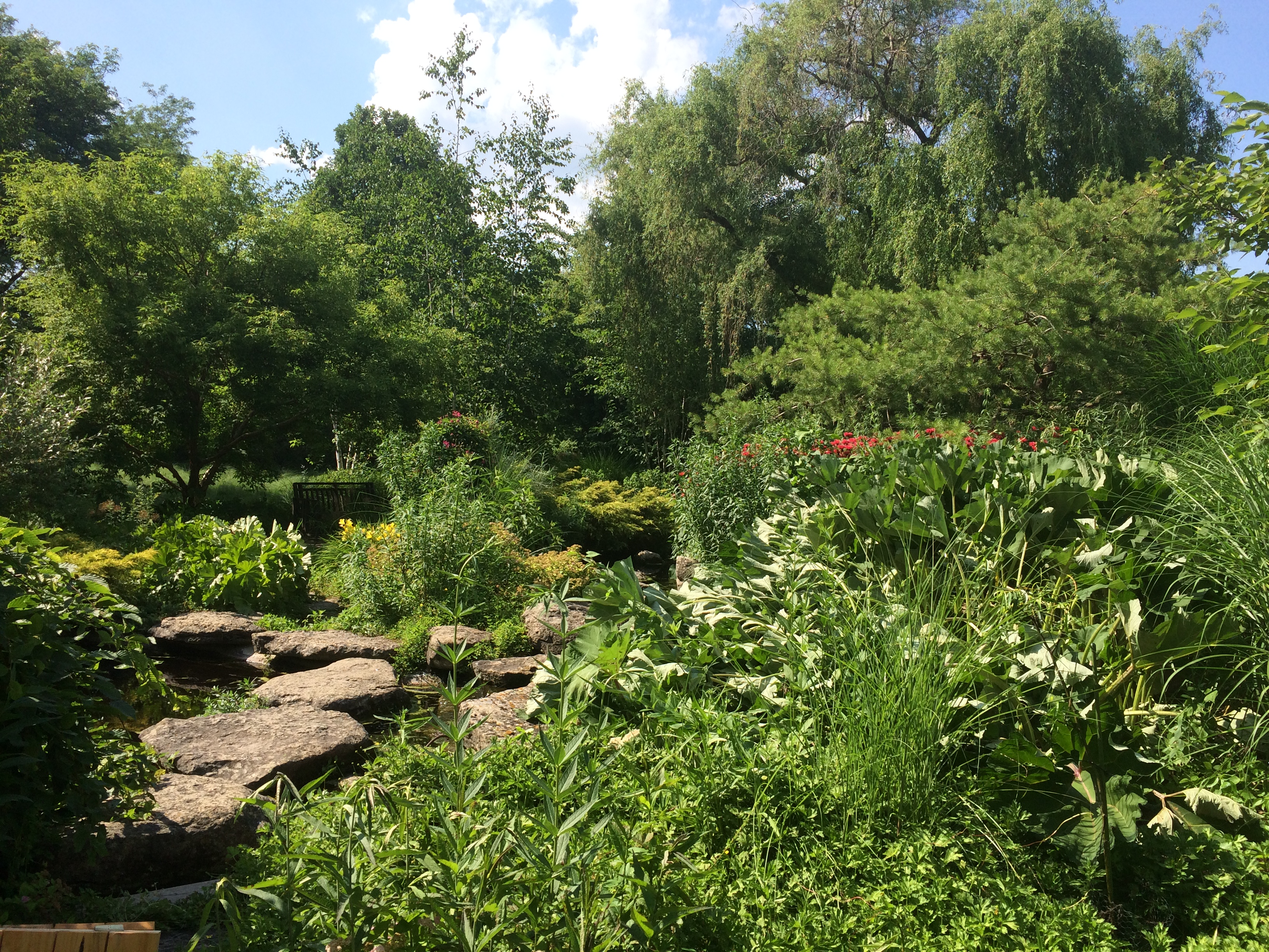
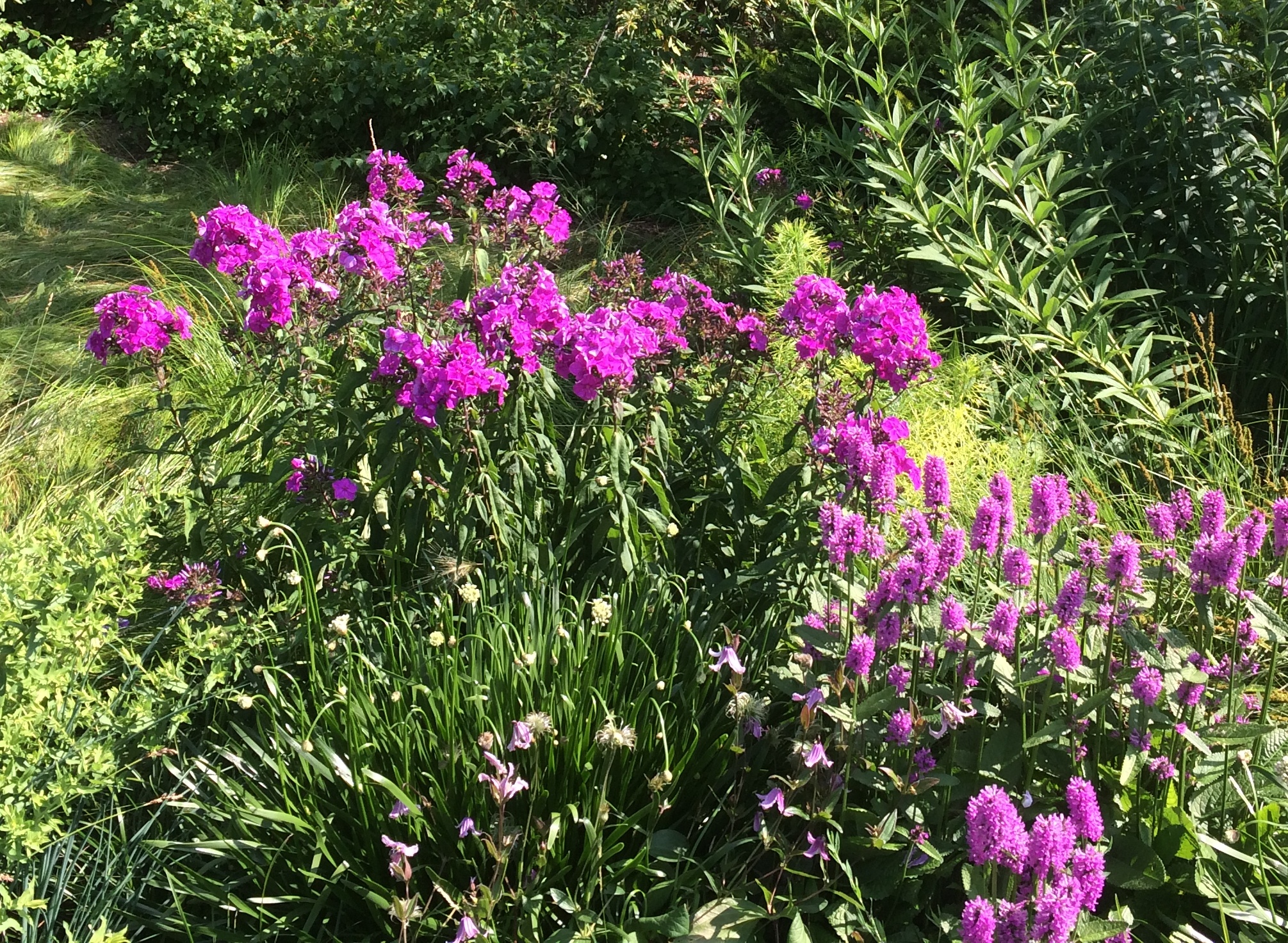
This time we visited Olbrich Botanical Gardens, another spot in Madison I’d never seen. These days, its indoor components, especially the tropical conservatory, are closed. But the lush outdoor gardens are open to walk around for no admission.
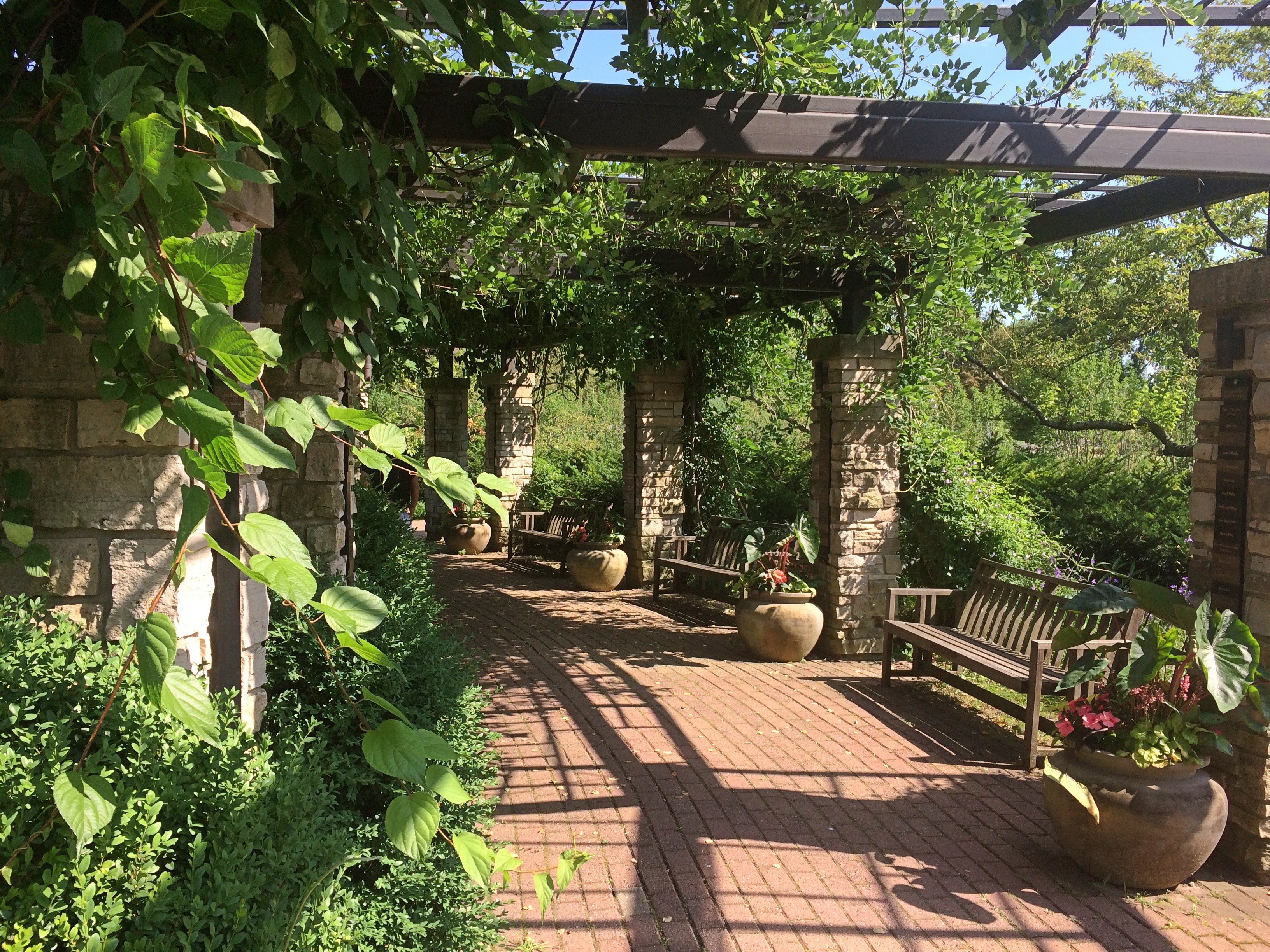
Like most botanic gardens, there were signs. But not that many, and mostly I didn’t bother with plant names. It was too hot to concentrate on that anyway.
I hadn’t done much preparation for the visit, so I was pleasantly surprised when we crossed a water feature — Starkweather Creek, which flows into Lake Monona —
— and passed by some curious sculpture —
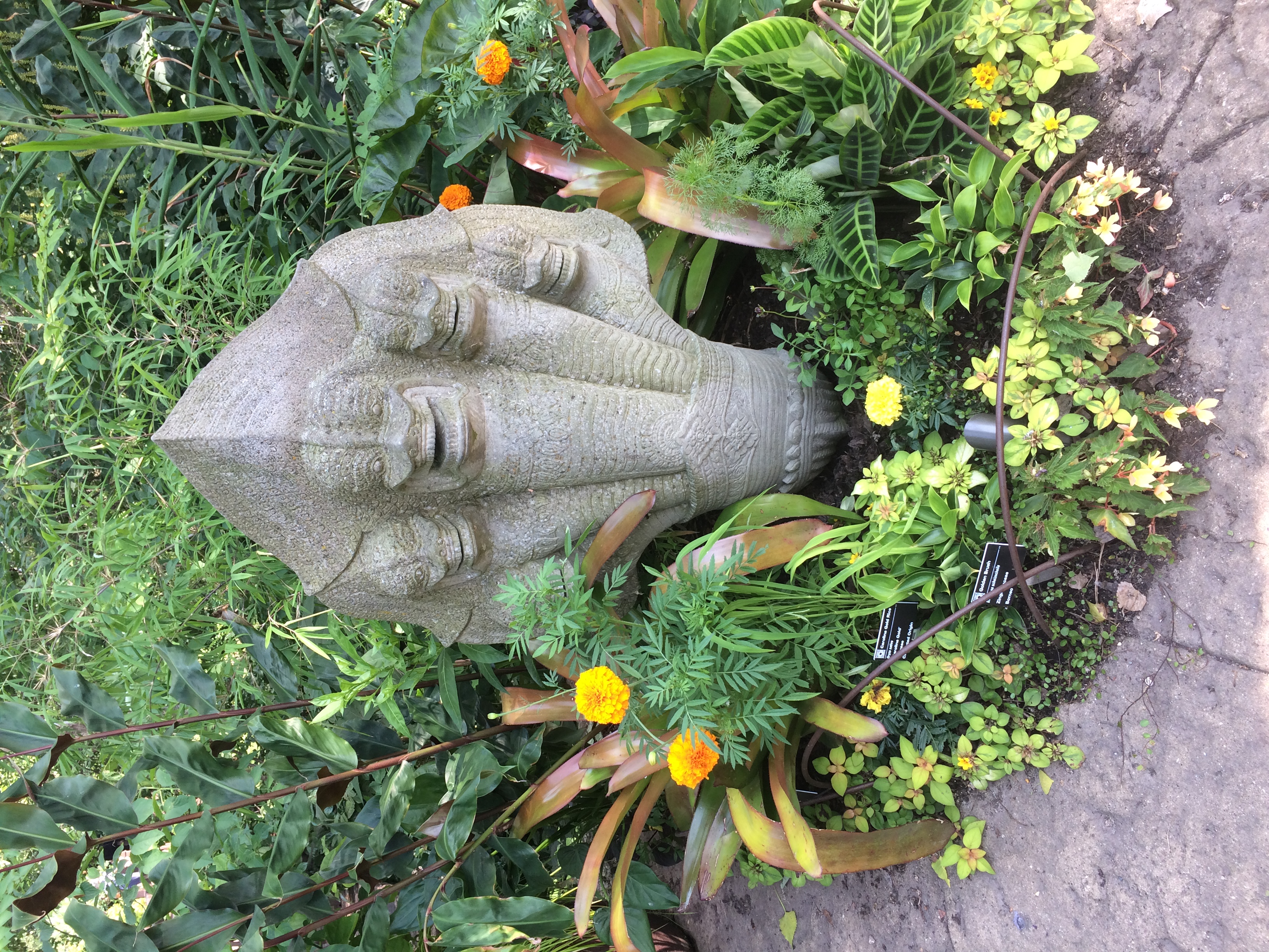
— and came to the Thai Pavilion and Garden.

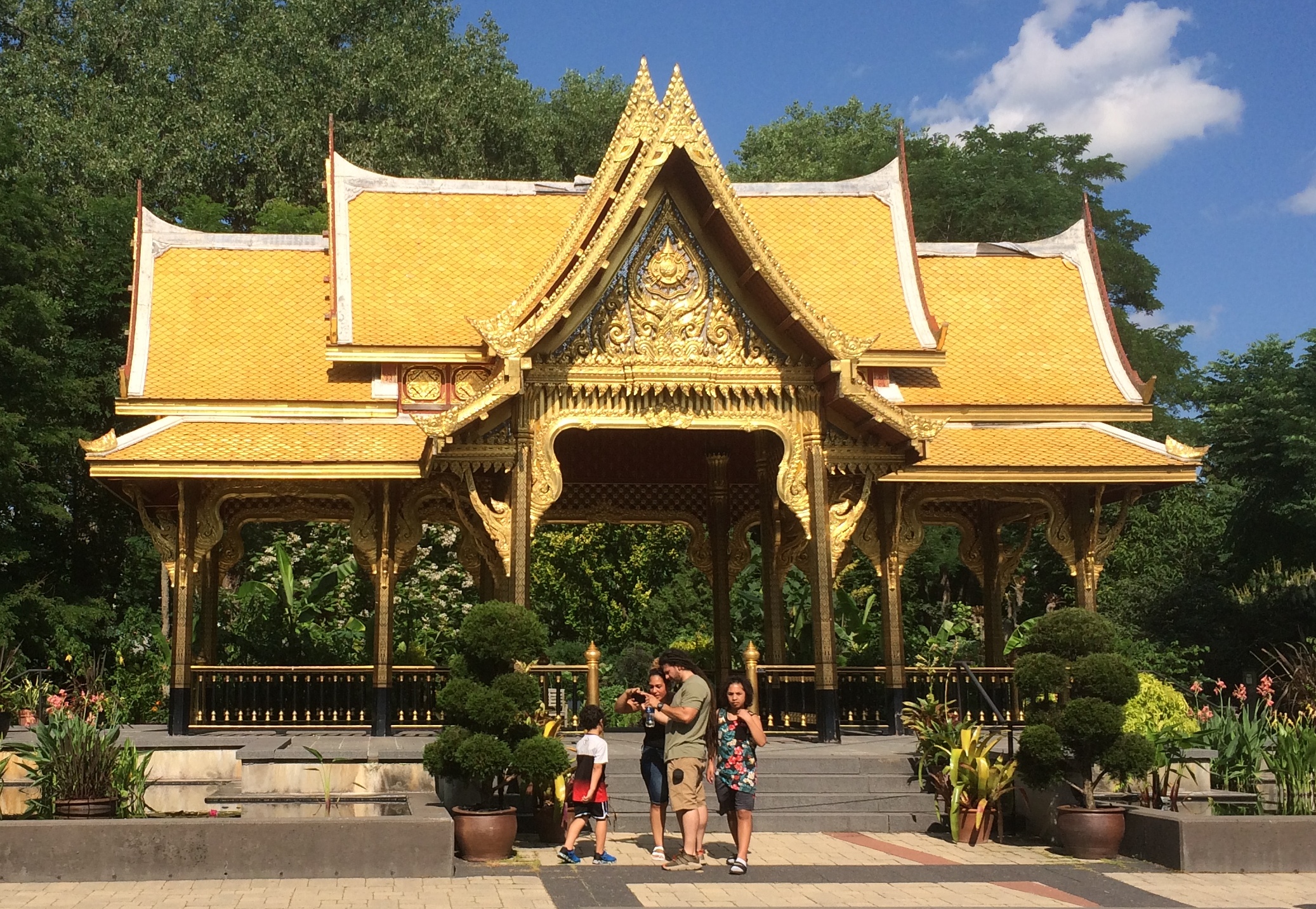
“A pavilion, or sala, is a common structure in Thailand generally used as a shelter from rain and heat. Olbrich’s pavilion is more ornate than most roadside salas in Thailand and represents those found at a temple or on a palace grounds,” the garden web site says. “However, Olbrich’s pavilion is not a religious structure.
“The pavilion was a gift to the University of Wisconsin-Madison from the Thai Government and the Thai Chapter of the Wisconsin Alumni Association. UW-Madison has one of the largest Thai student populations of any U.S. college or university.”
I’d have never guessed that last fact. As I stood gawking at the thing, sun beating down on me, I felt just an inkling of being in Thailand again, near one of its impressive shiny structures, whose glint always seemed to accentuate the heat.
“The pavilion was built in Thailand, then disassembled and packed in shipping crates,” the garden continues. “The pavilion traveled seven weeks by sea, then by rail to Chicago, and to Madison by truck. Nine Thai artisans traveled to Madison to reassemble the pavilion after building it in Thailand. It took three weeks to reconstruct [in 2001].
“Amazingly, the pavilion is able to withstand the winter weather of Wisconsin with no protection because it is constructed of plantation-grown teak and weather-resistant ceramic roof tiles. The gold leaf, however, is delicate and not able to withstand the oils of the human hand.”
A pavilion and a garden, as the name says.
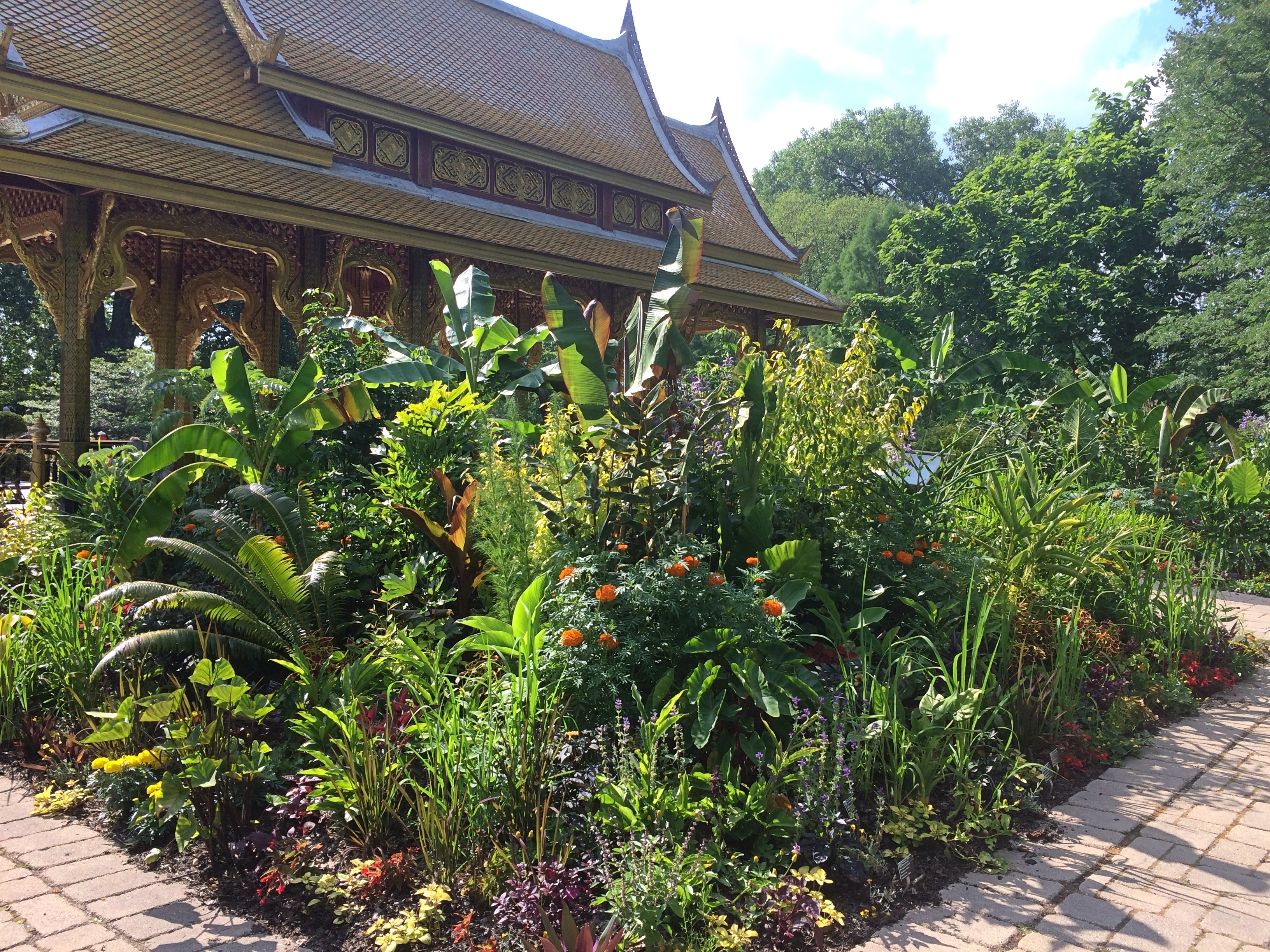
Remarkable simulation of tropical lushness, there in the distinctly non-tropical Wisconsin.
Kek Lok Si Temple, Penang
In July 1994 we spent a pleasant, and sweaty, few days in Panang. In George Town, that is. To avoid confusion: Panang is one of the 13 states of the federation of Malaysia, consisting of Penang Island in the Straits of Malacca, and a mainland component called Seberang Perai. George Town is capital of the state, located on Penang Island. UNESCO tapped its historic core — long after we visited — as a World Heritage Site, along with Malacca. I just thought it was a charming old dump.
“Georgetown turned out to be a low-rise, whitewashed, somewhat seedy town, good for walking after the heat of the day died down, and early in the morning,” I wrote about the visit. “I took a couple of good walks before Yuriko woke. Over the next few days [we] took in Ft. Cornwallis (nice clock tower), wandered around the Komtar Mall, saw the Kek Lok Sri [sic] temple, climbing its pagoda, swam at Batu Ferringhi beach, and rode the cable railway up Penang Hill.”
Here’s the view of George Town from Kek Lok Si, which is on a high hill in the suburb of Air Itam.
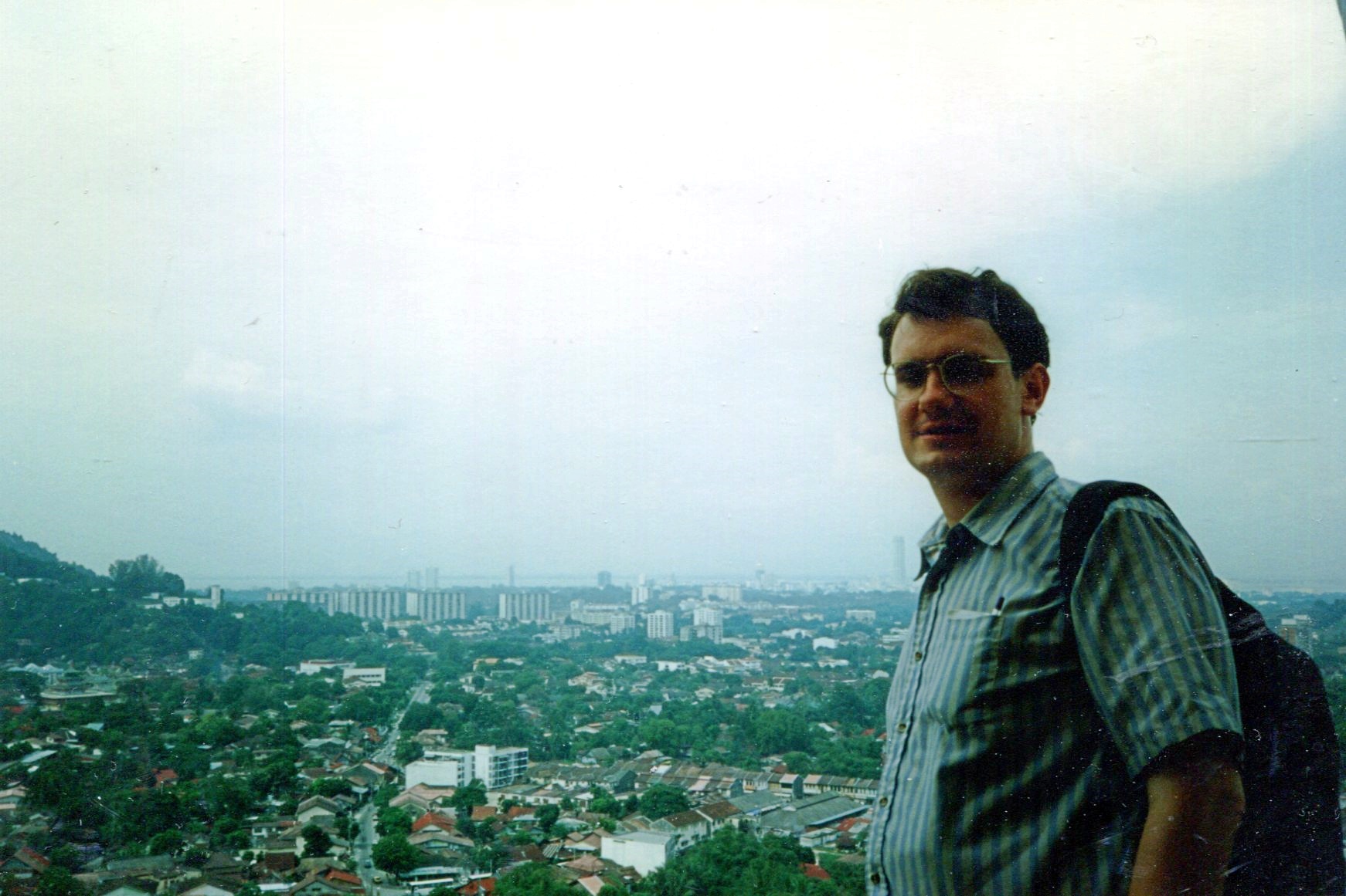
I’m surprised I didn’t take a picture from below, but that’s the way things were in those days — limited film, as opposed to the practical infinity of digital images.
“Ayer Itam’s most recognizable landmark is the Kek Lok Si temple. Also known as the Temple of Supreme Bliss, it is the largest Buddhist temple in Malaysia,” says Penang 500 Early Postcards. “The founder of KLS was Abbot Beow Lean (1844-1907), from the Kushan Abbey in Fujian, China… The KLS, sited at the foot of the Penang hills, consists of many prayer halls, pavilions, carved pillars, tortoise and fish ponds, and flower gardens linked by winding and ascending pathways.”
Along with a pagoda in a mix of styles: Chinese, Thai and Burmese. It’s behind Yuriko here.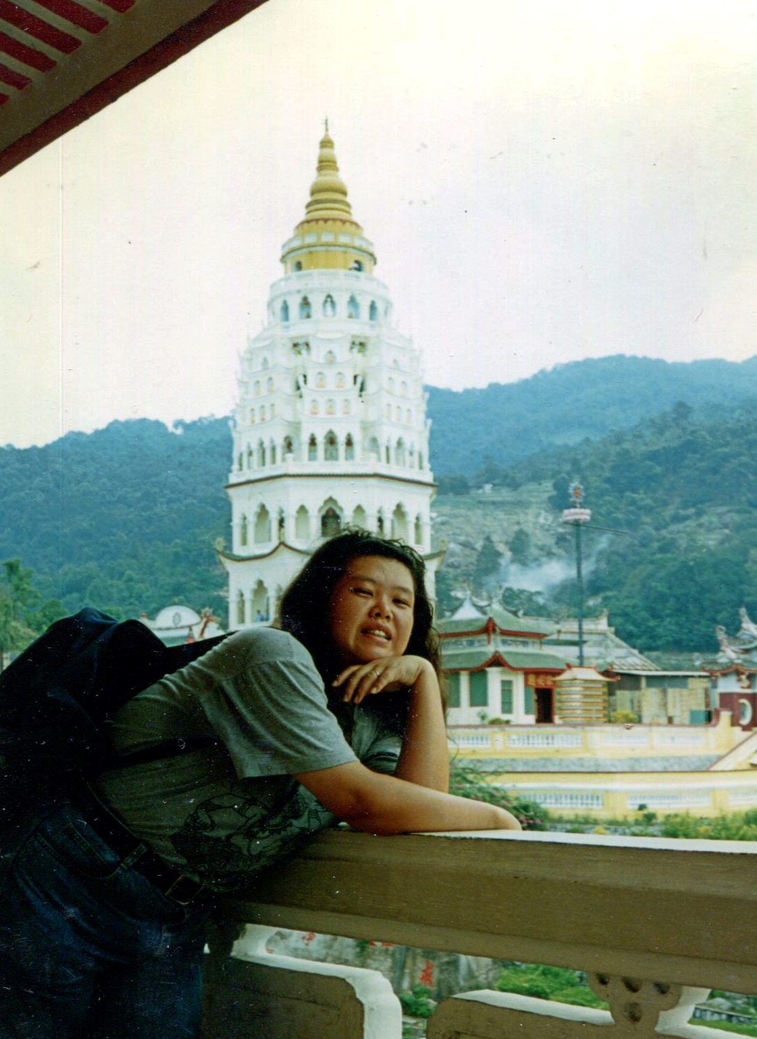
And what’s a Buddhist temple without some Buddharūpa?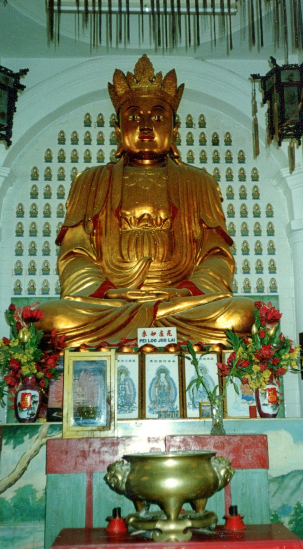
This monumental statue, depicting Guanyin, didn’t exist — or at least wasn’t in its present physical form — when we visited. As I understand it, Guanyin is a bodhisattva associated with compassion. Sounds like a good fellow to have around.
Prairie du Chien: Fort Crawford Military Cemetery, Trail of Presidents &c.
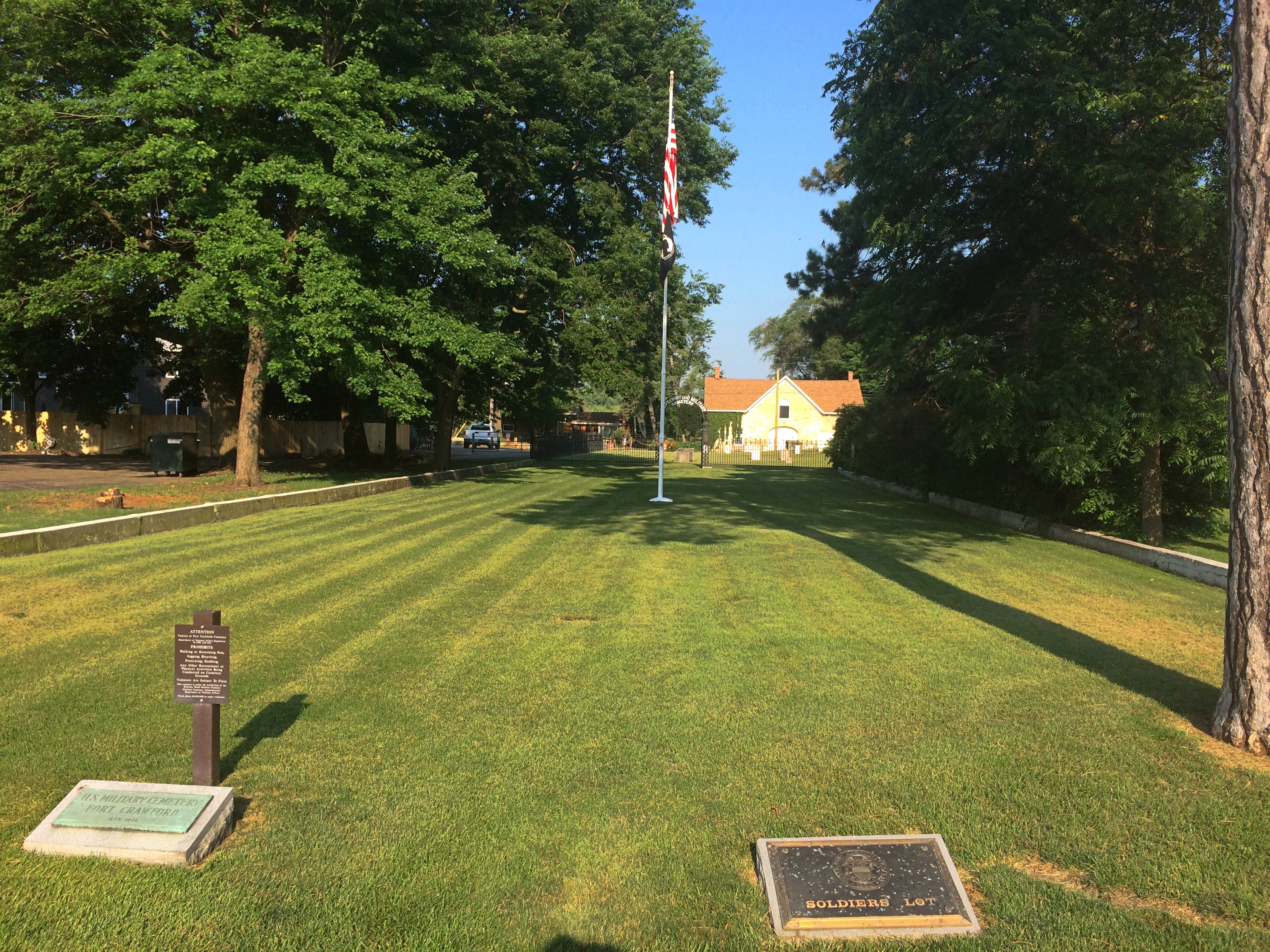
Not all road trips include visits to cemeteries or presidential sites, but I’m glad when they do. Our recent visit to the Driftless Area included both. On Saturday morning, I got up a little early to put gas in the car by myself. Yuriko knows what this means: I visit a local cemetery, too, if I can. She dozed on in the room while I drove a short distance to the Fort Crawford Military Cemetery, also known as the Fort Crawford Cemetery Soldiers’ Lot.
The entrance to the cemetery is a narrow patch of land in the residential section of mainland Prairie du Chien, with the burial ground at some distance behind an iron fence. Or maybe soldiers are buried in patch of ground, but I didn’t see any indication of it.
“Fort Crawford Cemetery is located on the former site of the Fort Crawford Military Reservation in Prairie du Chien, Wisconsin,” says the National Cemetery Administration, which is part of the VA.
“There were two subsequent Fort Crawfords in Prairie du Chien during the 1800s. The original Fort Crawford, built in 1816, was situated adjacent to the Mississippi River. Repeated flooding led to its abandonment in 1826. Rebuilt on higher ground in 1830, the second incarnation of Fort Crawford operated until 1856.
“The first burials here were of the members of the 1st and 5th Infantry regiments stationed at the fort. The soldiers’ lot includes eight above-ground box-tombs that were likely erected by the regiments. The United States received the title for the lot in 1866. There are approximately 64 interments in the 0.59-acre soldiers’ lot…”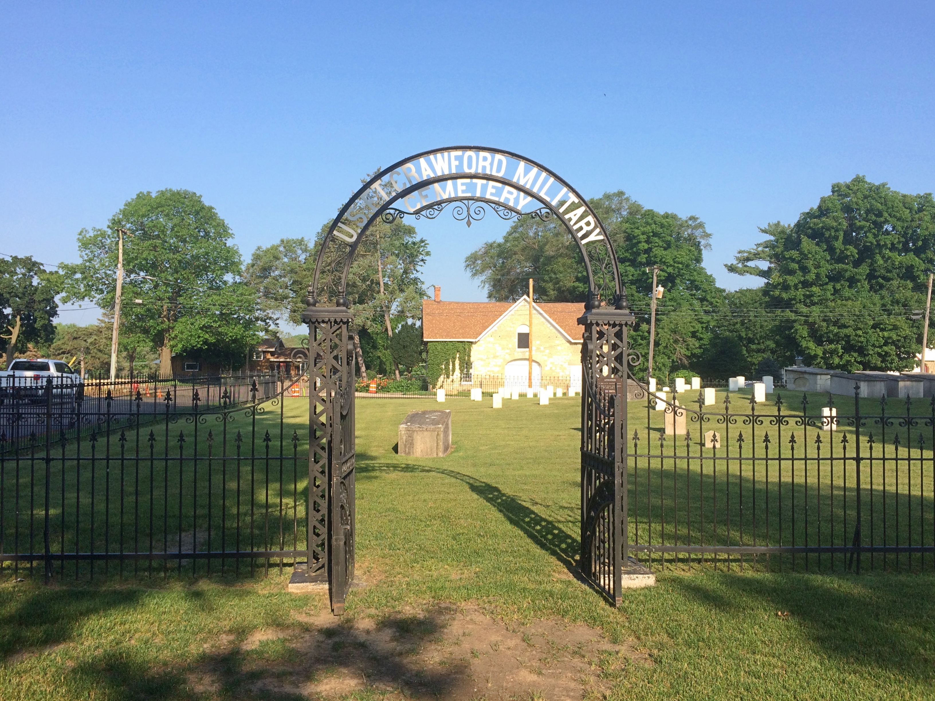
It’s sparsely populated.
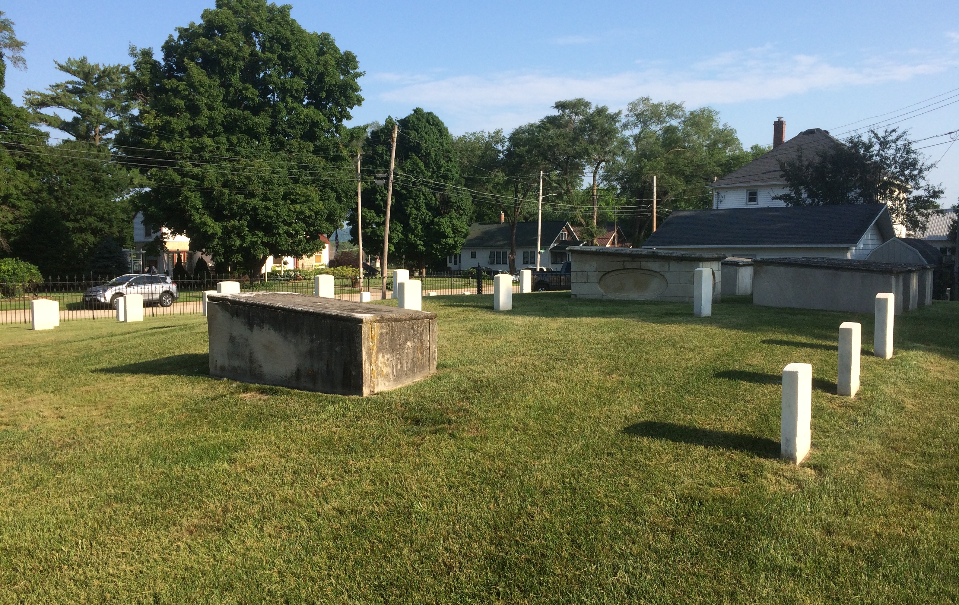
With some of the inscriptions practically illegible.

Others were legible, but conveyed only anonymity. This looks like a latter-day stone, dedicated to an unknown. There were a sprinkling of these in the cemetery.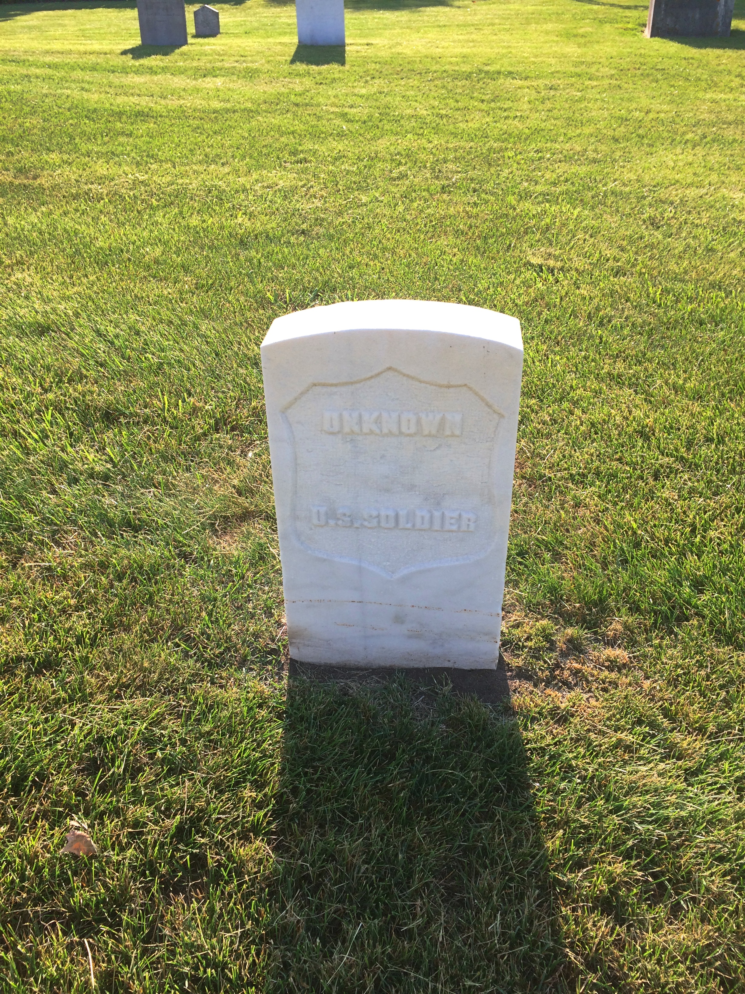
As I left, I spotted this near the entrance, attached to a boulder.
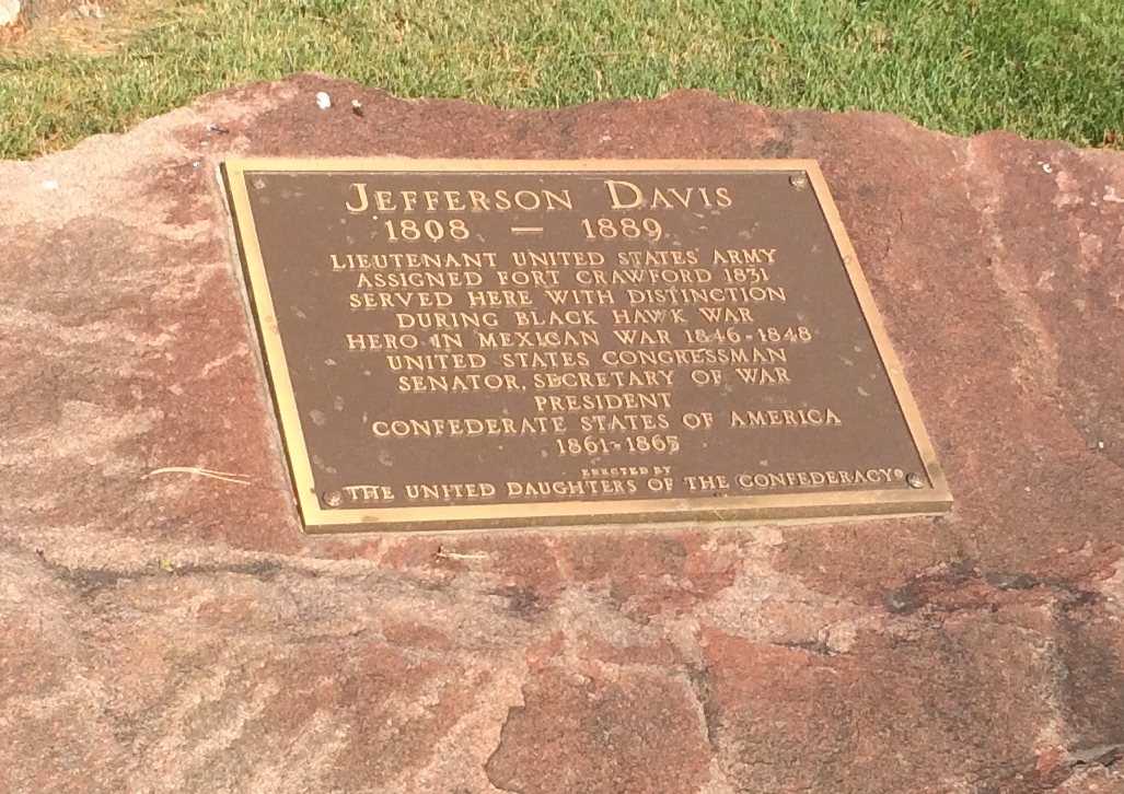
Just goes to show you how thorough the Daughters were. A memorial so obscure that no one has called for its removal? Not so.
On St. Feriole Island, I happened across a presidential site of sorts: Trail of Presidents. Trees in honor of presidents, arrayed in two rows to form a path, and originally planted in 2014.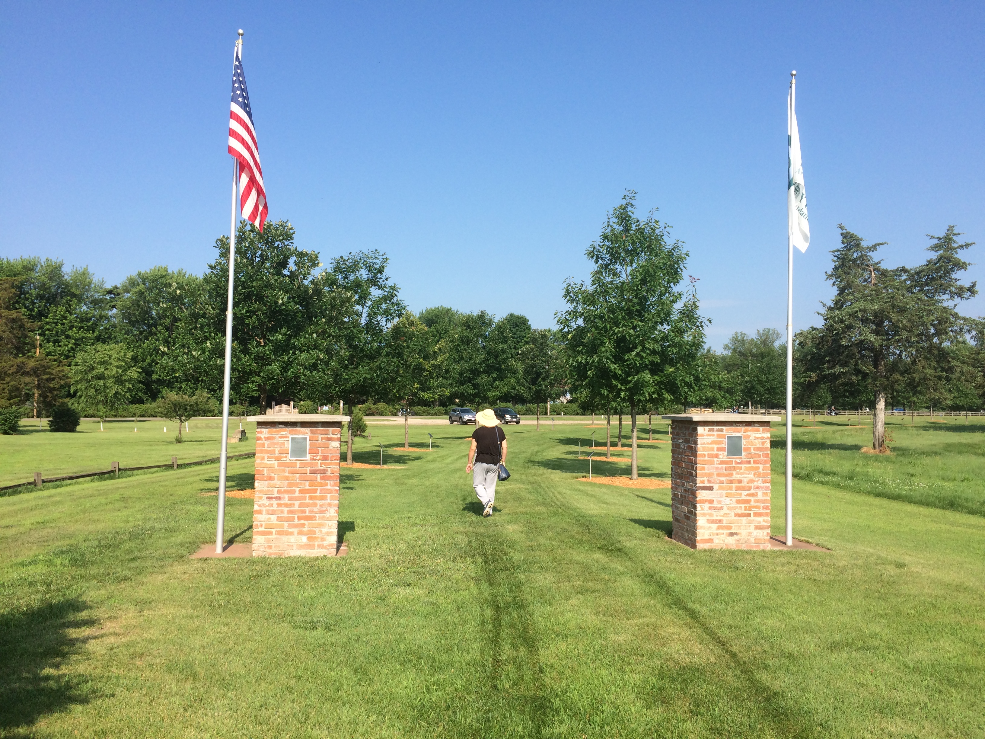
I expected a tree planted for every U.S. president, which would have been the standard approach. But in fact the trees only honor presidents who visited Prairie du Chien either in or out of office, and includes two presidents of other entities besides the United States. I was surprised.
The full and semi-literate text of the sign at Trail of Presidents is here.
The honored U.S. presidents include: Andrew Jackson, William Henry Harrison, Zachary Taylor, Millard Fillmore, James Buchanan, Abraham Lincoln, Ulysses Grant, James Garfield, Grover Cleveland, Benjamin Harrison, William McKinley, Woodrow Wilson, Calvin Coolidge, Herbert Hoover, Harry Truman, Dwight Eisenhower, John Kennedy, Richard Nixon, Jimmy Carter, George H.W. Bush, Bill Clinton and George W. Bush.
For instance, President Fillmore has a white oak.
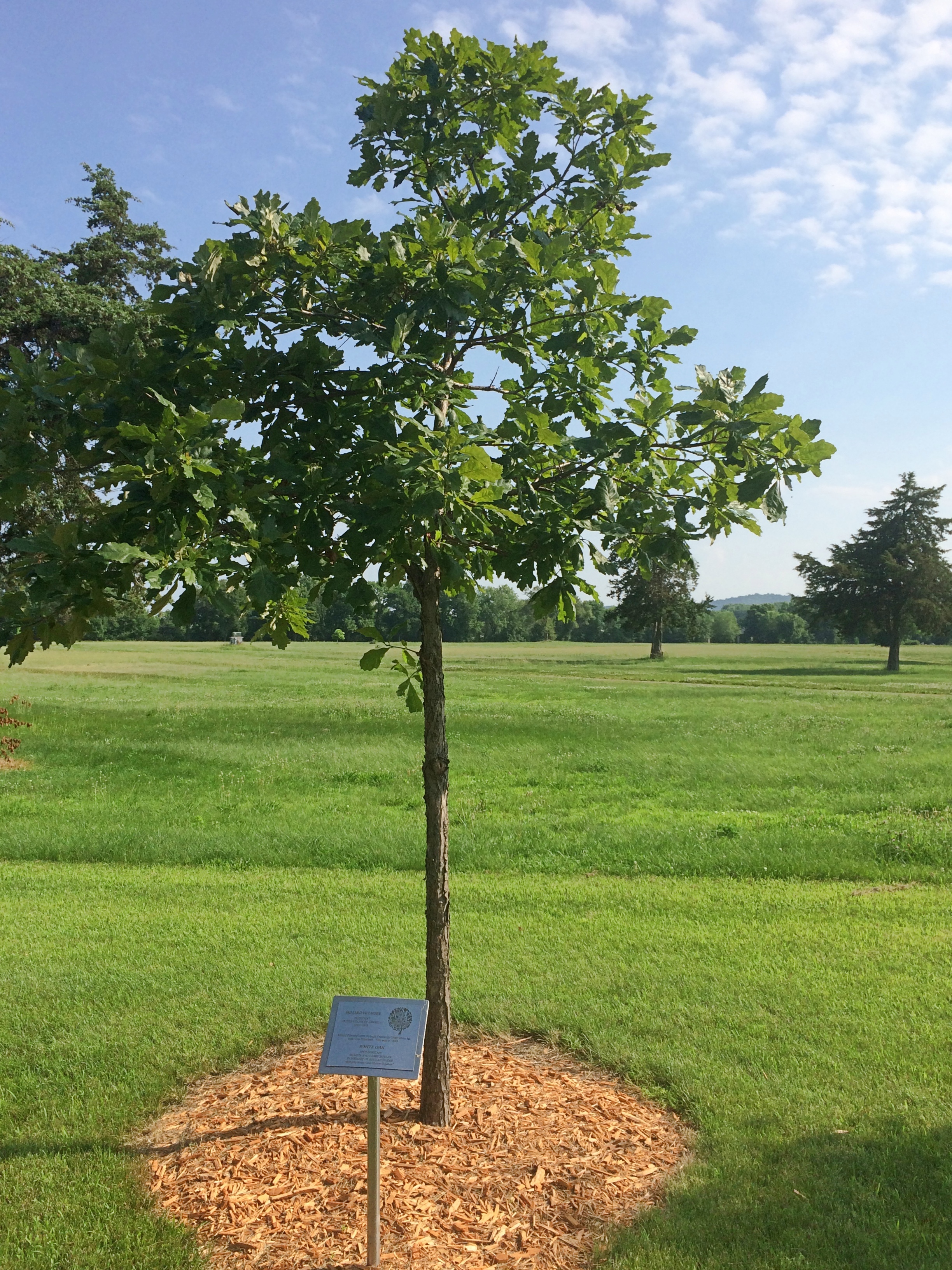 His plaque explains that he passed through Prairie du Chien when he was vice president in 1849. I haven’t ever seen anything about the travels of Vice President Fillmore — and out to the spanking-new state of Wisconsin that year would have been far afield — but I assume there’s some source for this buried in Fillmore’s papers, or maybe local news accounts.
The non-U.S. presidents? One was him again. He was stationed here, after all.
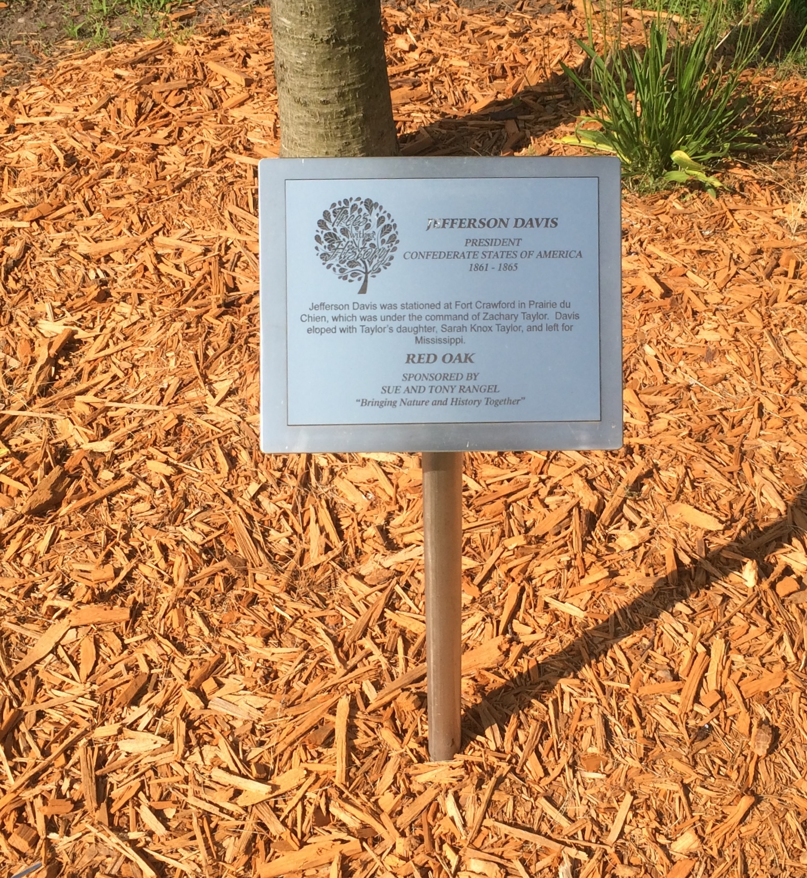
Also, curiously, Vicente Fox also has a tree, a red oak. “Vicente Fox attended Campion High School in Prairie du Chien in the 1960s,” the plaque says. “He then returned to Mexico.”
The last tree has been reserved for the next president to visit, so it isn’t too late for the most recent living officeholders.
One more Prairie du Chien sight I came across was overlooking the Mississippi, but not on St. Feriole Island. Rather, a statue of Marquette stands atop a tall column near the local chamber of commerce, and also not far from the bridge connecting Prairie du Chien with the town of Marquette, Iowa.

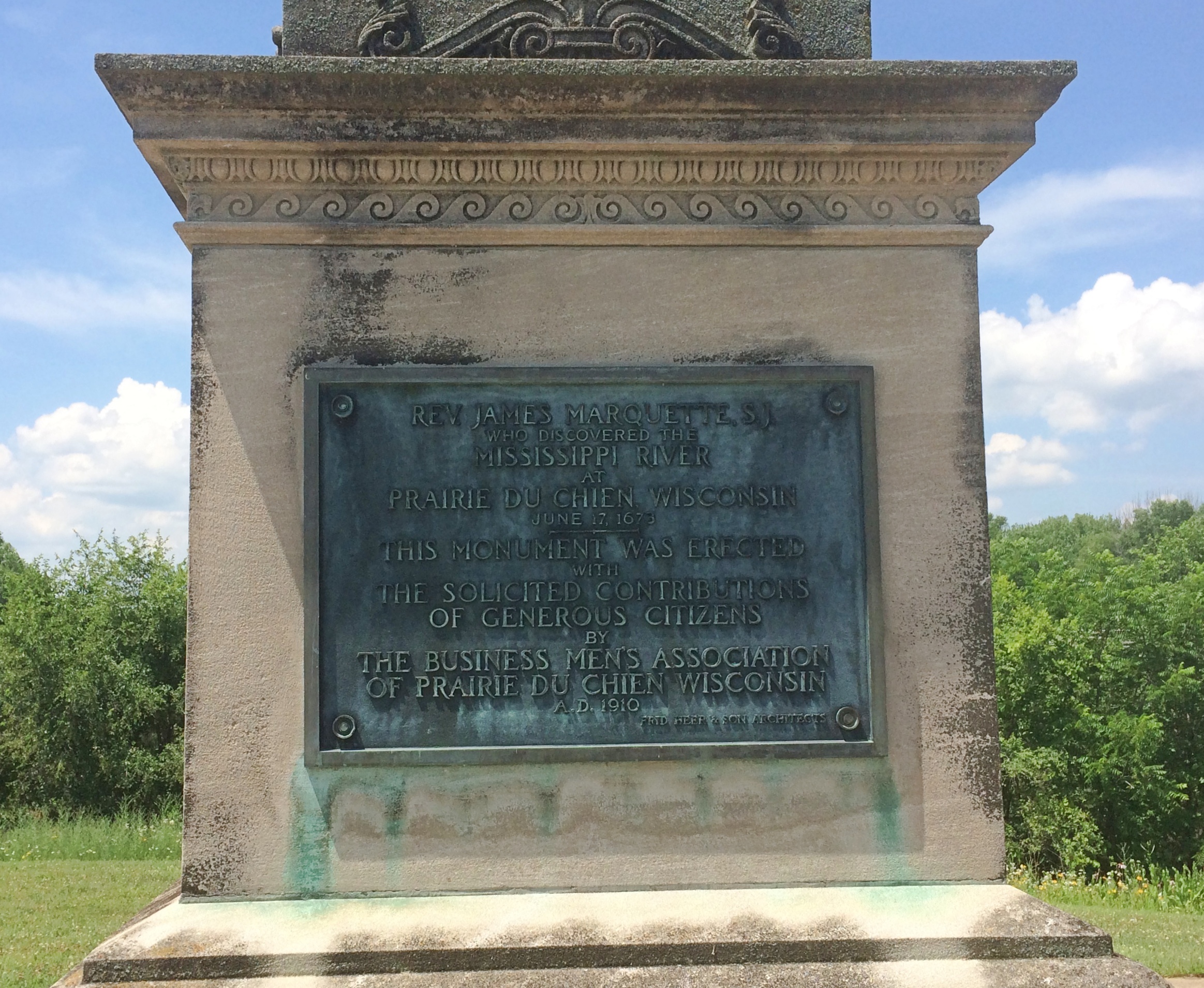
Rev. James Marquette, S.J.
Who discovered the
Mississippi River
at
Prairie du Chien, Wisconsin
June 17, 1673
This monument was erected
with
The solicited contributions
of generous citizens
by
The Business Men’s Association
Of Prairie du Chien, Wisconsin
A.D. 1910
Fred Herber & Son Architects
Unusual to see him called “James,” which doesn’t sound very French. We’ve seen him honored elsewhere around the Great Lakes; Pere Marquette got around, back when muscle power (yours or an animal’s) was the only way to do it.
Prairie du Chien: St. Feriole Island
One thing I wanted to find out from our most recent road trip was how to pronounce Prairie du Chien, pop. 5,600 and seat of Crawford County, Wisconsin. Or more exactly, how to say the local version of Chien. However that turned out, it was bound to be more elegant than Dog Prairie.
Sure, I could have looked it up any time. The Internet overflows with such minutiae. But sometimes random web sites are wrong.
According to what I heard many times on local radio, this is correct. Prairie du SHEEN, as in a soft luster or the actors Martin and Charlie. Maybe the 17th-century Frenchmen who founded the place said it some other way, but that hardly matters.
Marquette Road (Wisconsin 35) is the commercial spine of the modern town, featuring chain stores, restaurants, motels, gas stations and other businesses. Residential Prairie du Chien is a few blocks on either side. Perpendicular to Marquette Road is a much shorter shopping/tourist street, Blackhawk Ave., sporting the likes of Bob’s Bar, Jim’s Bar, Cafe Hope, the Blackhawk and Rowdy’s (more bars), Something for Everyone (a thrift store) and Pete’s Hamburger Stand.
During the day on July 3, Blackhawk Ave., which we drove down a few times, was fairly busy. Among other things, a long line of people were waiting to buy takeout from Pete’s. Guess it’s a local favorite.
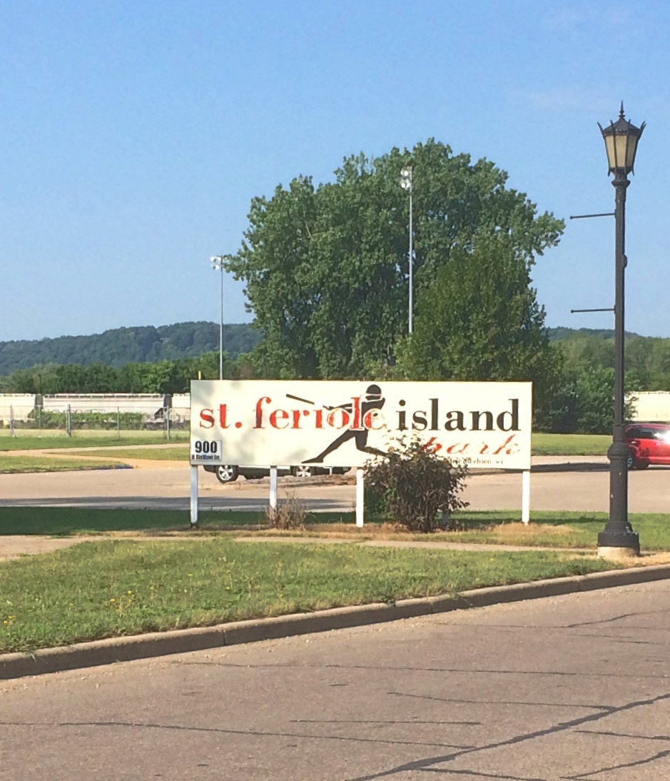
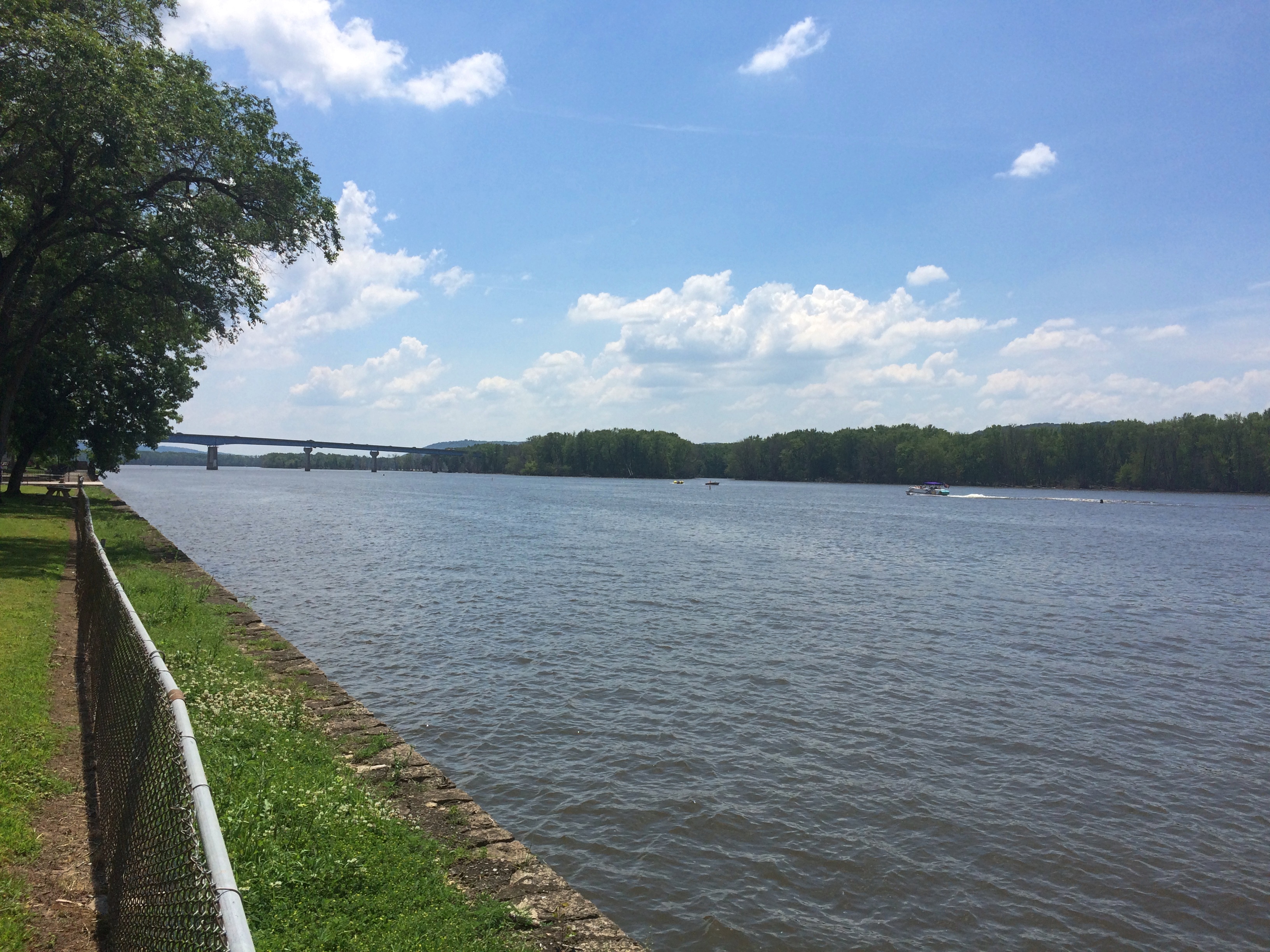
Much less crowded — not crowded at all — was St. Feriole Island, an island in the Mississippi that’s part of Prairie du Chien and just to the west of the rest of the town. We spent some time there looking around, both before and after we visited Effigy Mounds NM.
The island is prominent on this map, published in Madison, Wisconsin, in 1870.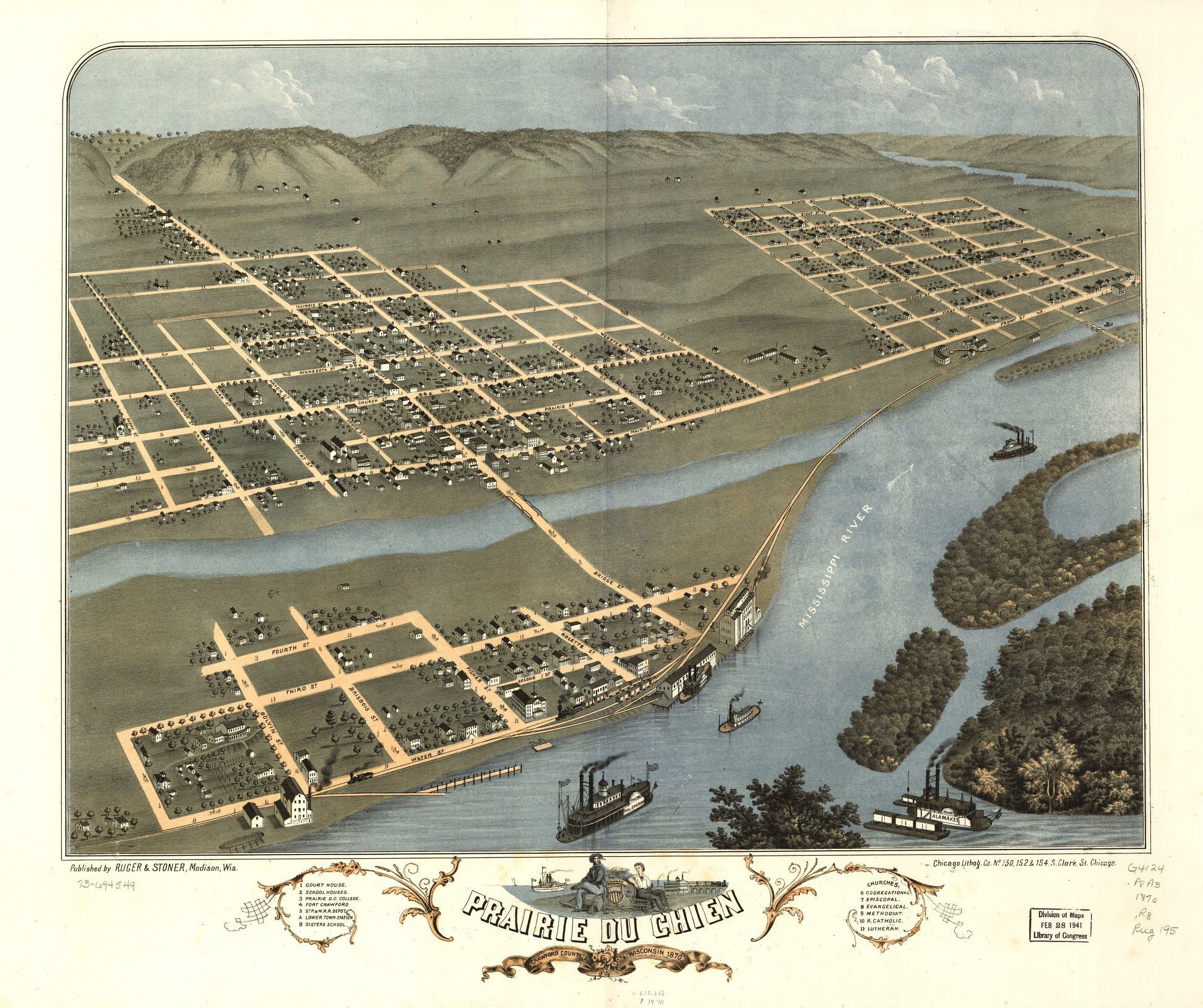 Note that the 1870 town isn’t connected to the rest of the world by a state highway system, but by a rail line and, more importantly, the Father of Waters. Also, what is now Blackhawk Ave. was then called Bluff St.
“Prairie du Chien had its beginnings on this island,” the town web site says. “It was the first location of Fort Crawford, which was involved in the War of 1812, and is the home of the historic Villa Louis mansion, the origin of which goes back to Joseph ‘King’ Rolette and Hercules Dousman, who made fortunes in fur trading and land dealings…
“This is where the industry that supported the city in the 1800s was located, so rail access was installed in 1890 [sic, the map clearly shows a rail line 20 years earlier, which still runs near the river]. After repeated floods and fires, the city was relocated to the mainland on the Wisconsin side, which was higher and far less prone to flood. Industry remained on the island, gradually closing down or moving to the mainland until well past World War II.”
The Mississippi River Flood of 1965 was apparently the final straw for the neighborhood. These days, the island is mostly St. Feriole Island Park, with sports and recreation facilities, a few historic structures, and a lot of open land, though still divided in part by a grid of streets.
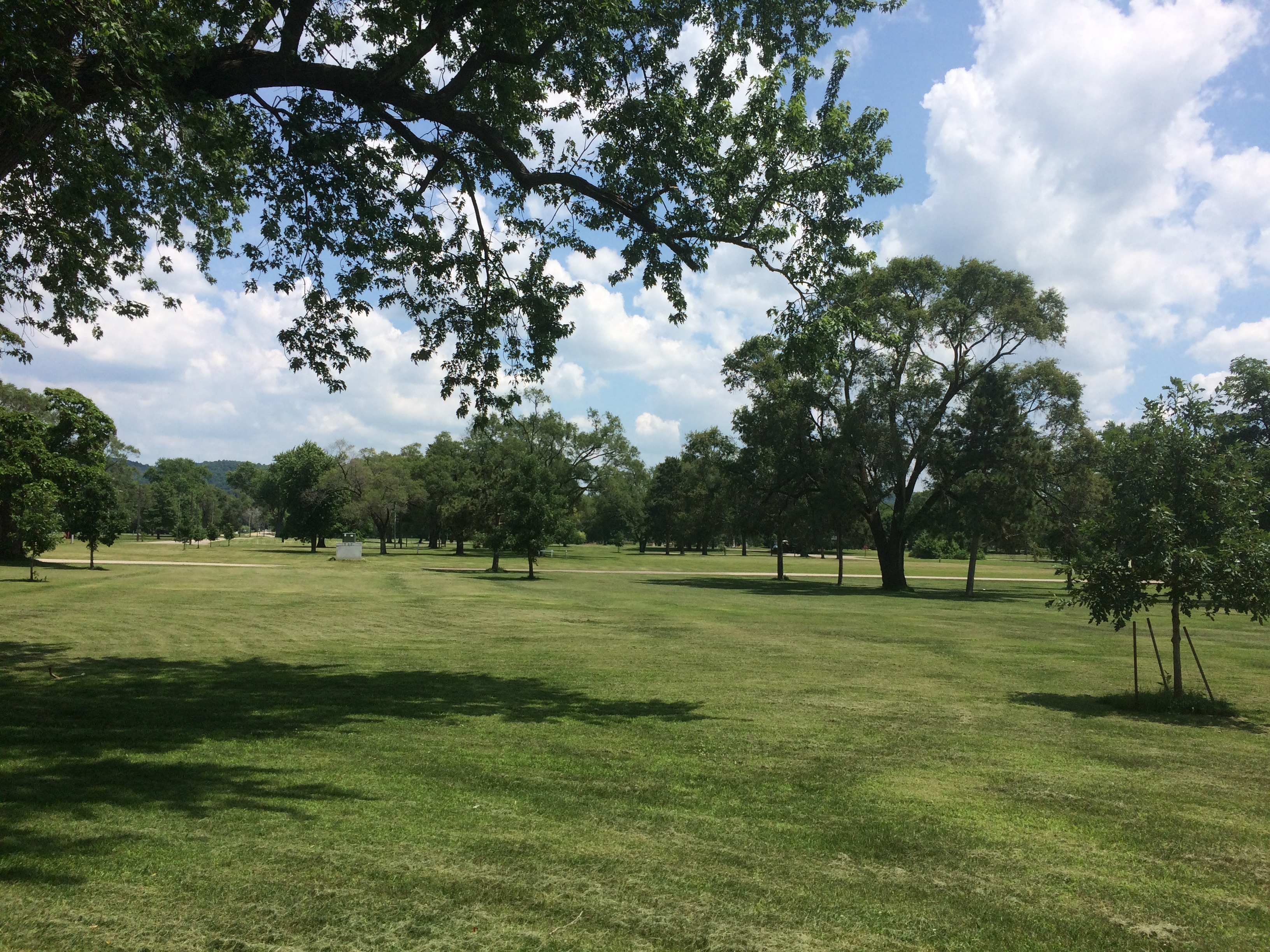
We had lunch on Friday at one of the picnic tables with a view of the Mississippi.
The Brisbois House is one of the park’s historic structures, dating from 1837 (though other sources put its construction in 1815).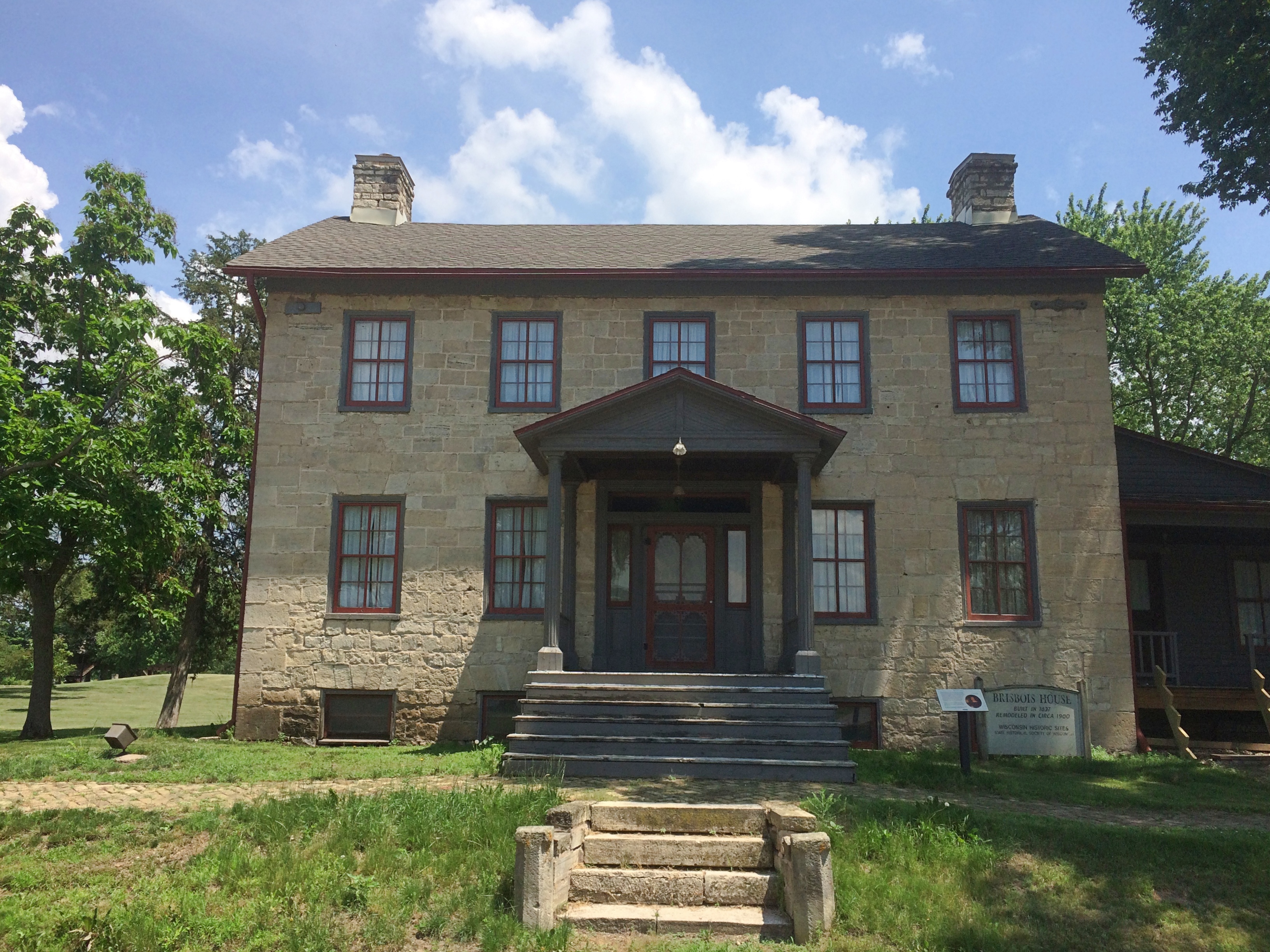 In any case, it isn’t open now. Neither is the Villa Louis, nor the Fur Trade Museum on the island.
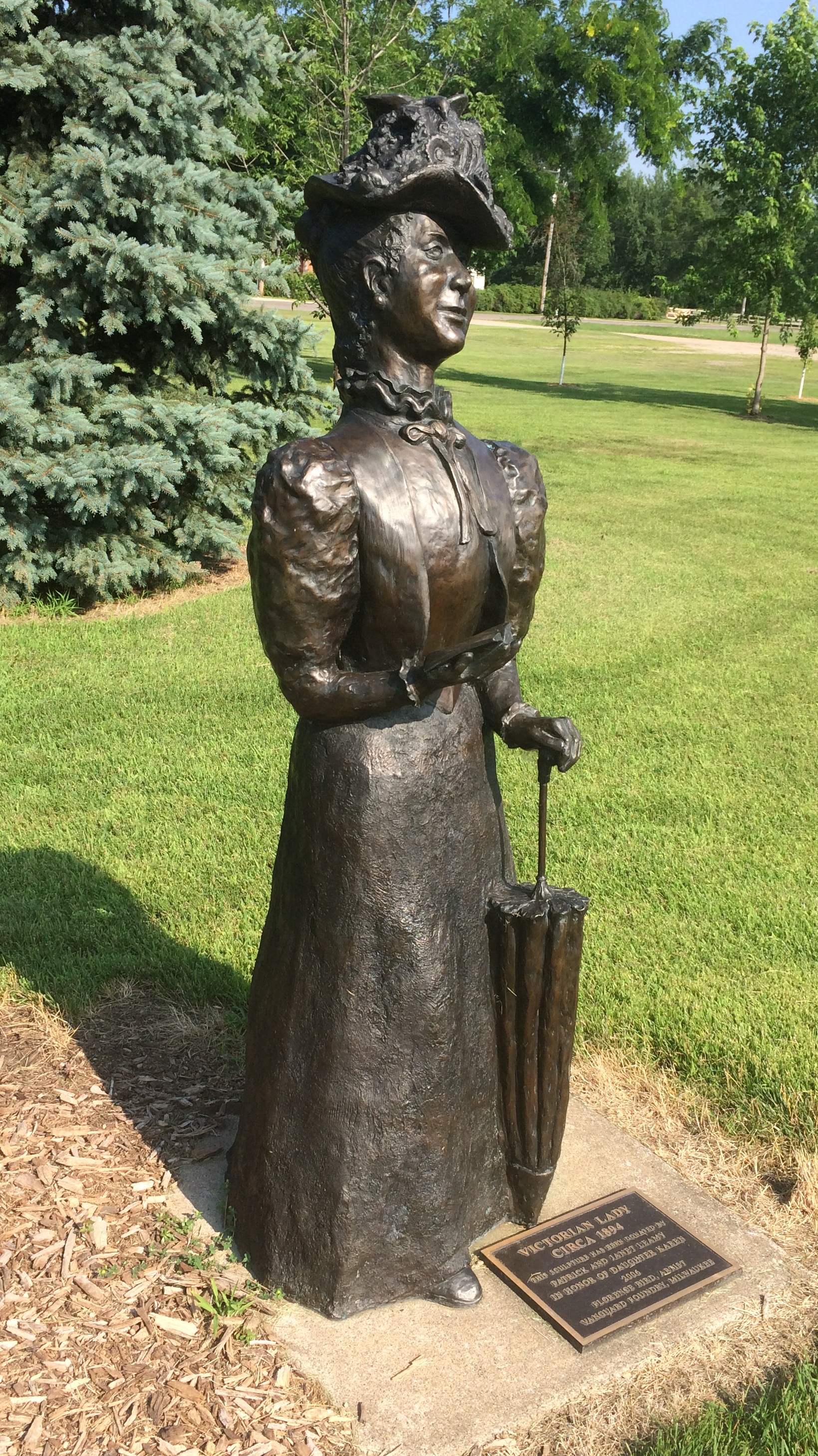
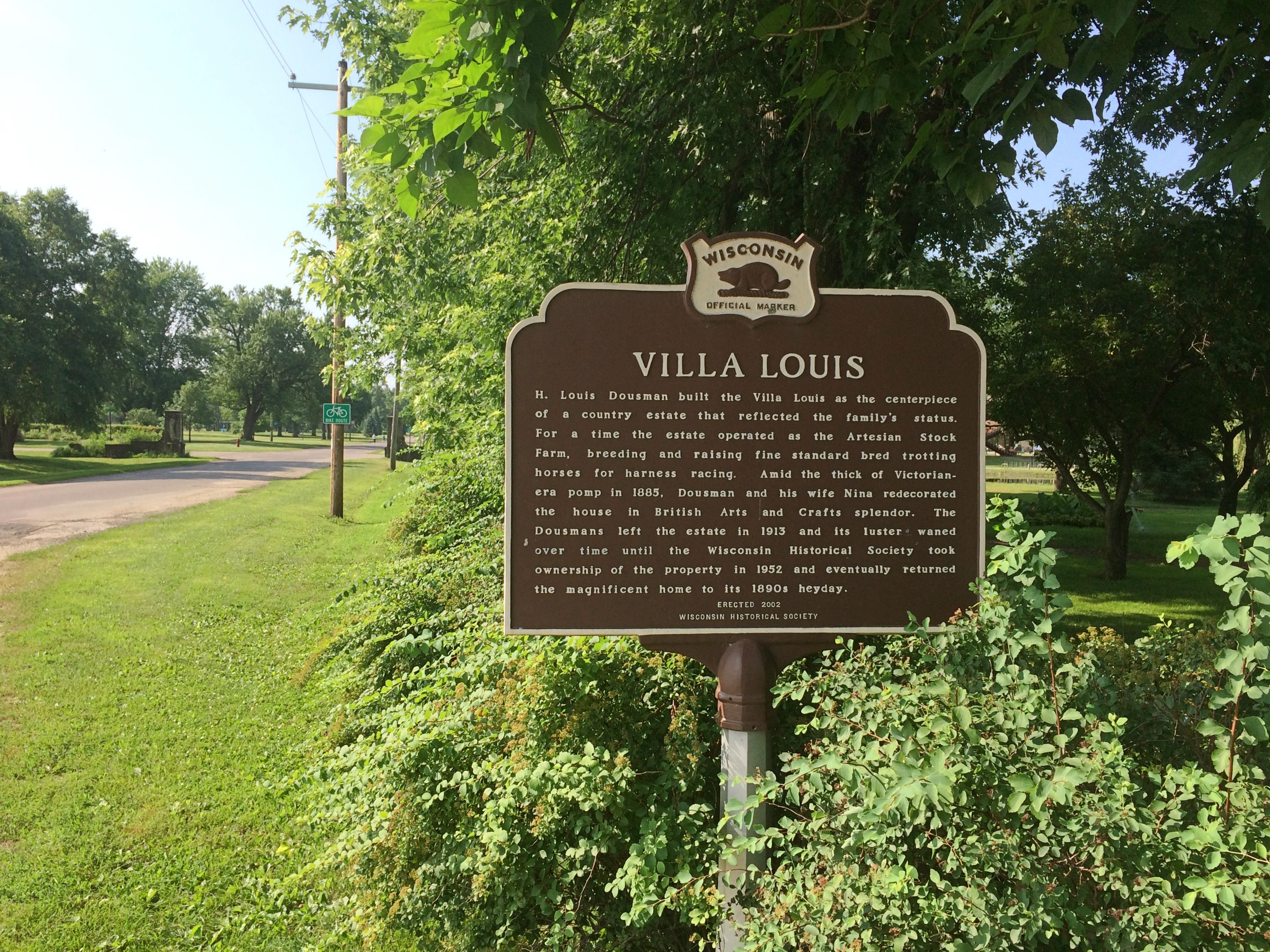 The Mississippi River Sculpture Park on the island is open. Unlike most sculpture parks, which feature a variety of works by a variety of artists, this one includes only works by sculptor Florence Bird, which are depictions of people associated with the history of Prairie du Chien.
Such as the park’s most recent addition — less than a month ago — of a bronze of Marianne LaBuche, a frontier doctor (“community healer,” her sign says) of the early 19th century.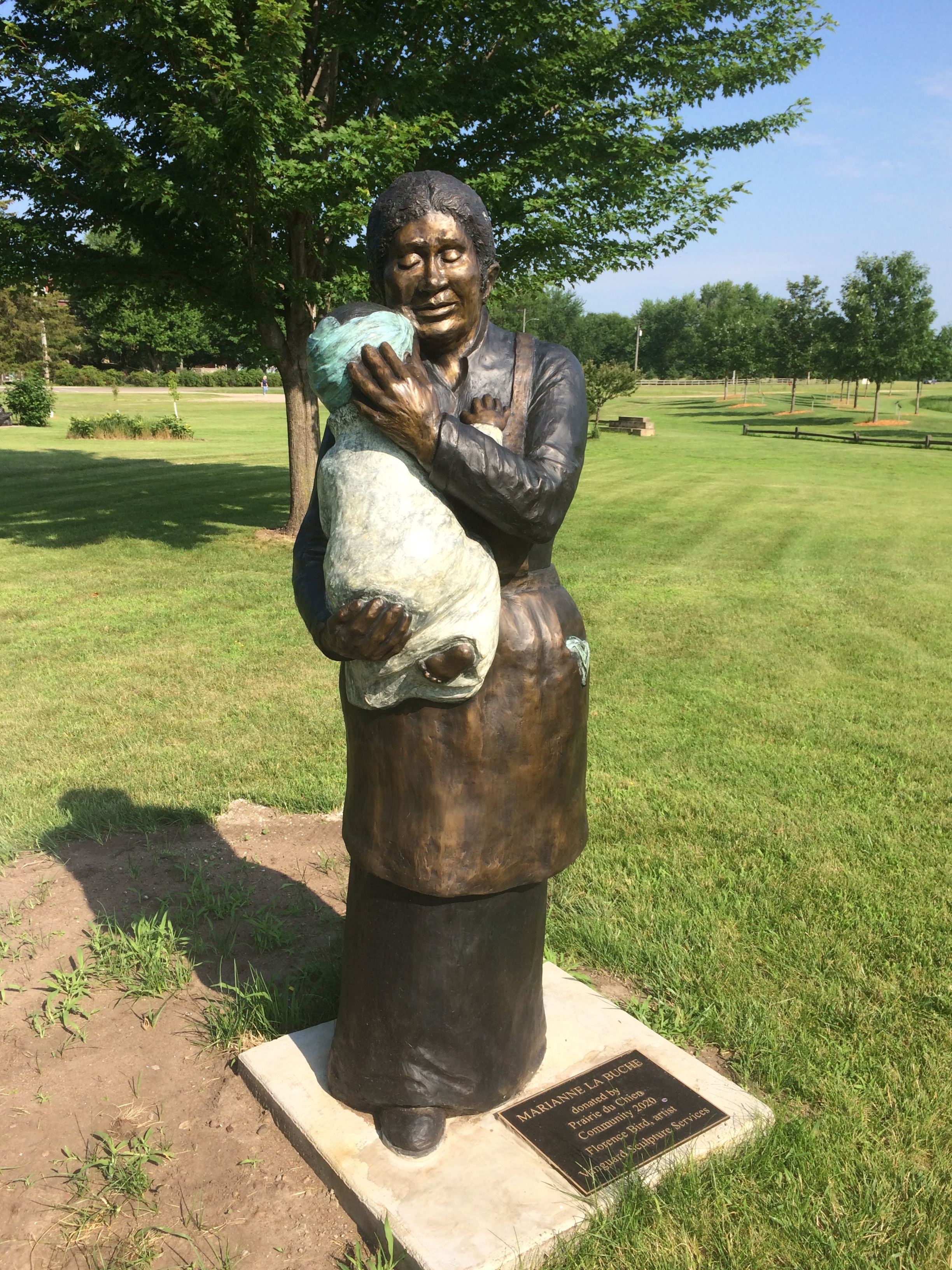
Also depicted: Julian Coryer, voyageur, though it looks like he’s between voyages.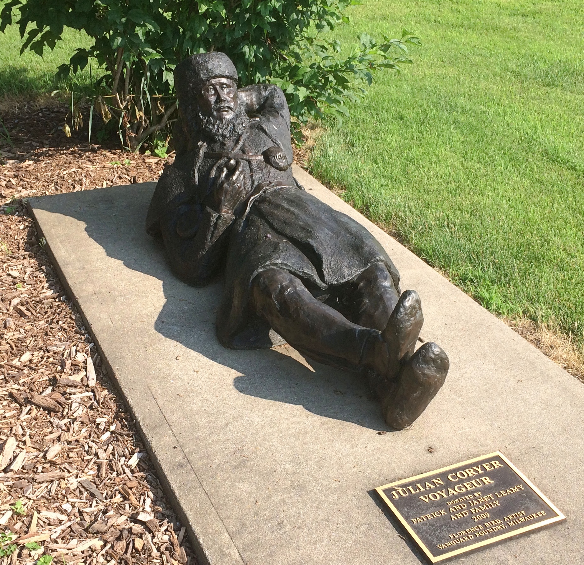
A “Victorian lady.”
Emma Big Bear, basketmaker.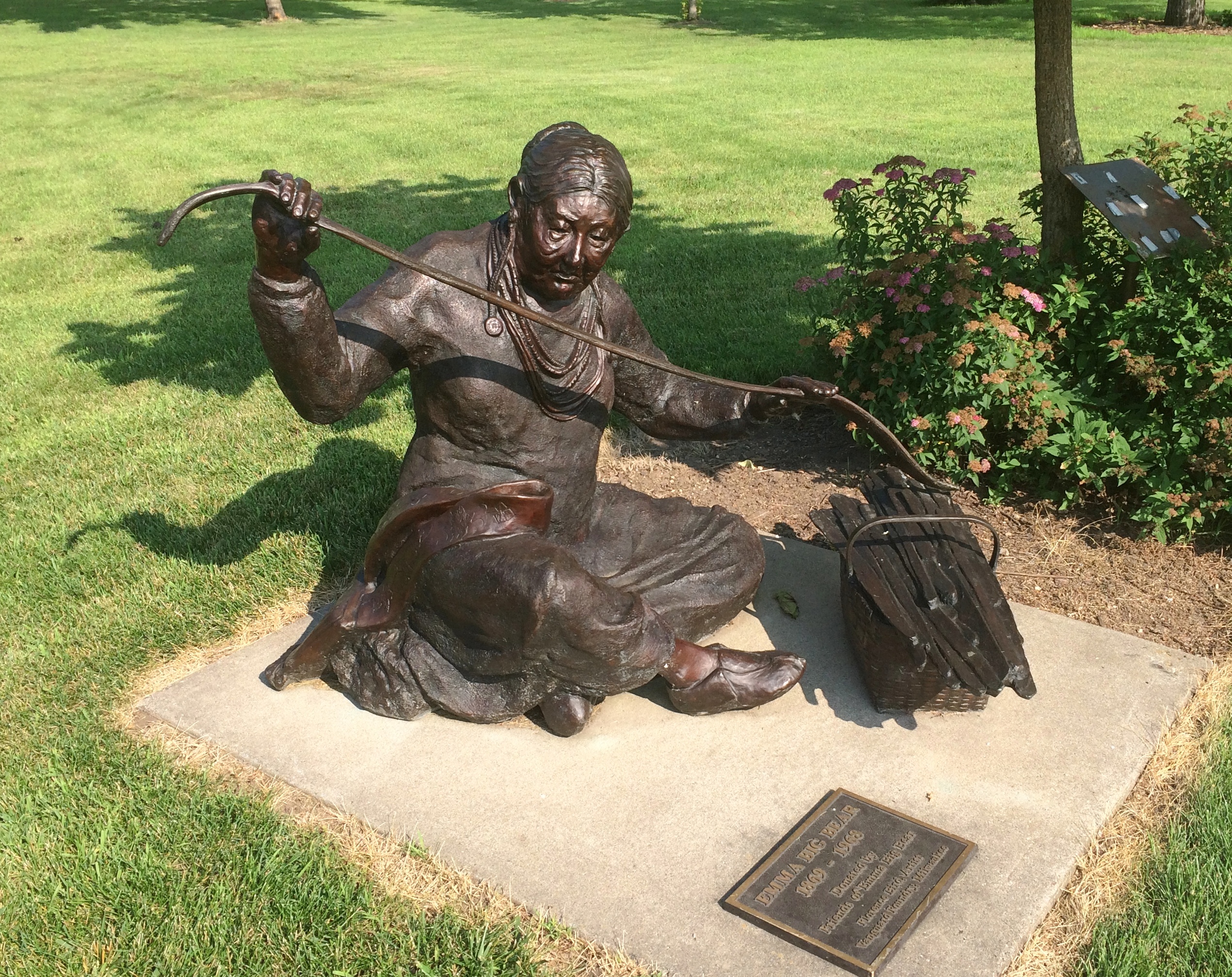
Here’s Black Hawk (Ma-ka-tai-me-she-kia-kiak).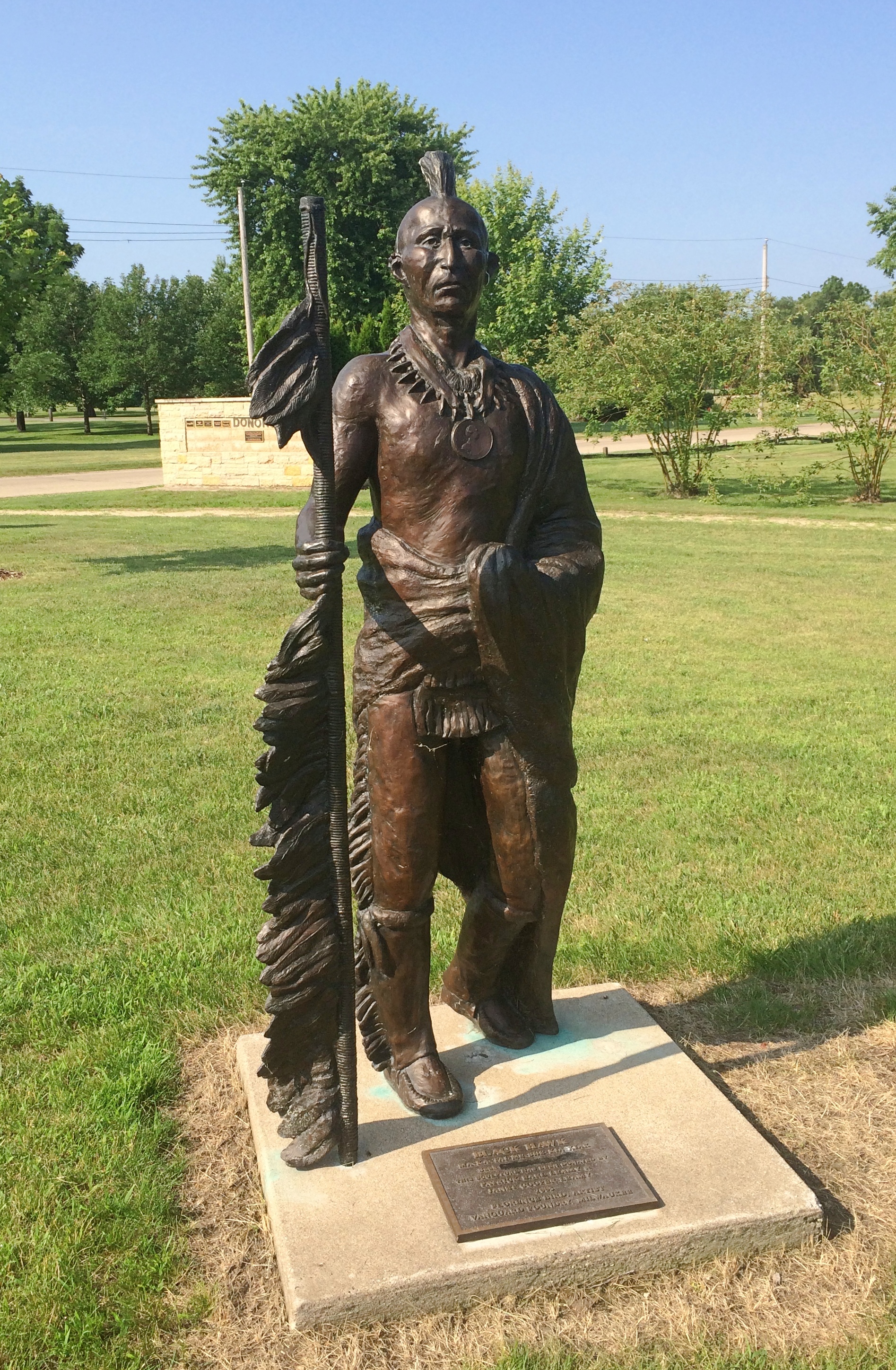 Note his medallion.
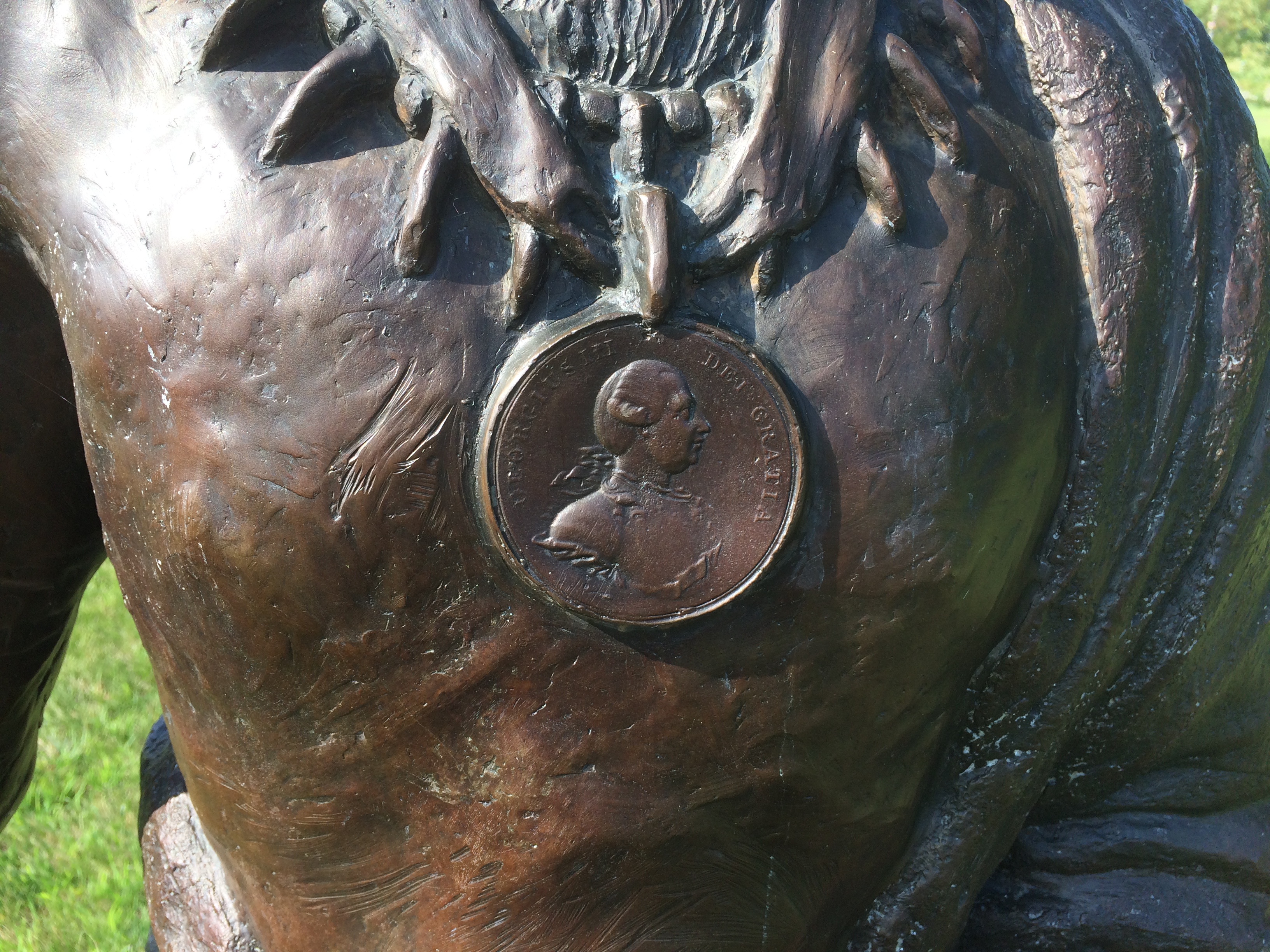
His plaque has been edited, either officially or unofficially, since 2005.
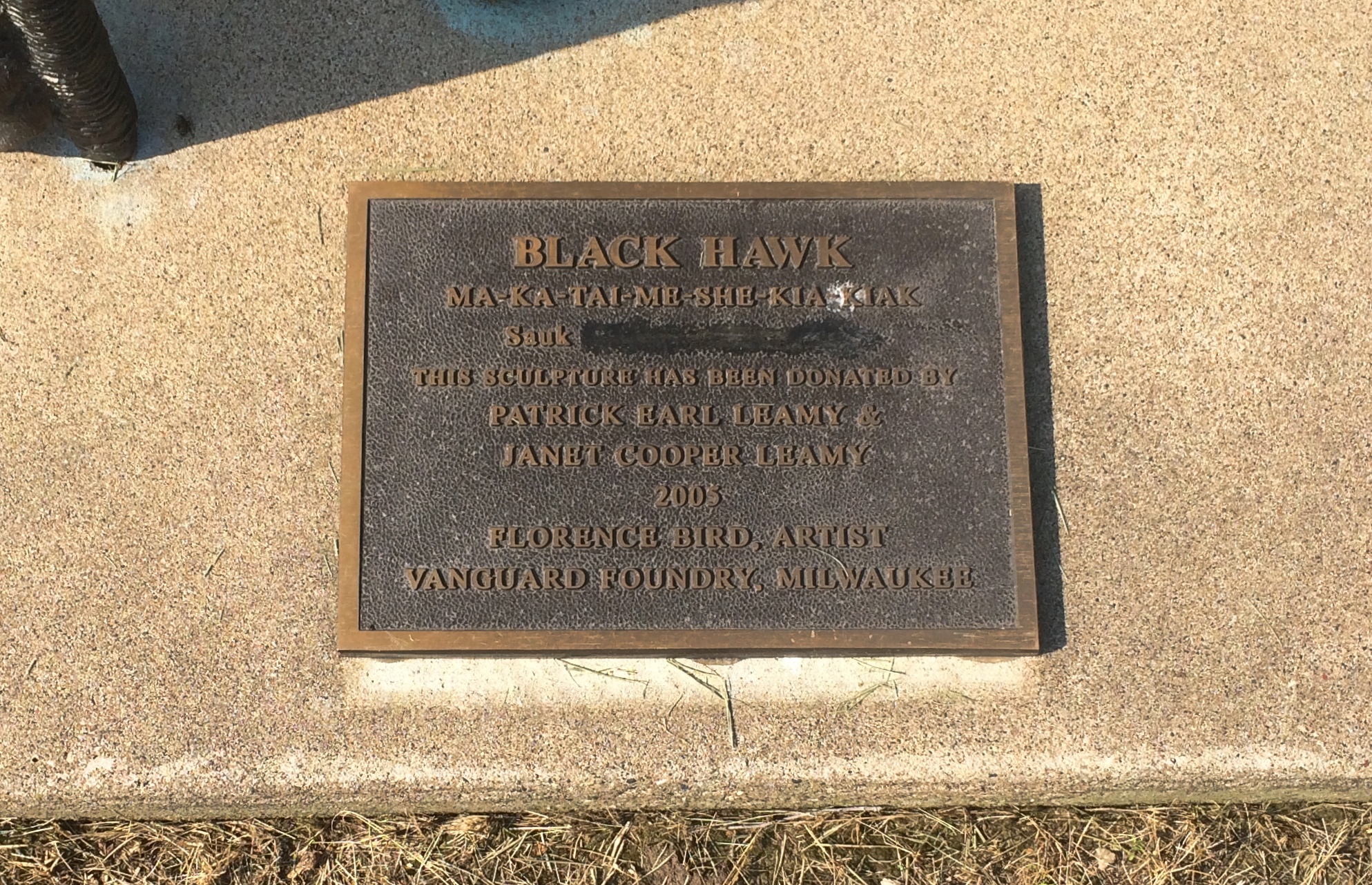
Not sure what was blocked out or why. But these times make me attuned to statue revisionism, however minor.