Part of a letter I wrote to Ed about 13 years ago, with a few relevant pictures and hindsight notes in brackets.
Aug 22, 2005
Time to start another letter, which I might as well subhead “Things About My Recent Travels That Didn’t Make It Into the Blog.” If letters had subheads, that is.
In some ways, I hope this is a pattern for future travels [mostly it wasn’t]. Of the nine nights we spent on the road, six were in a tent, three in a motel. Better still, of the six nights in a tent, four cost nothing. Call me a cheapskate, but it did me good to return every night to Yankee Jim Canyon about 15 miles north of Yellowstone, in Gallatin Nat’l Forest land, and crawl into the tent knowing that I paid nothing. Well, no extra charge, no insidious “user’s fee,” because some small bit of my taxes must go to support the Gallatin Nat’l Forest.
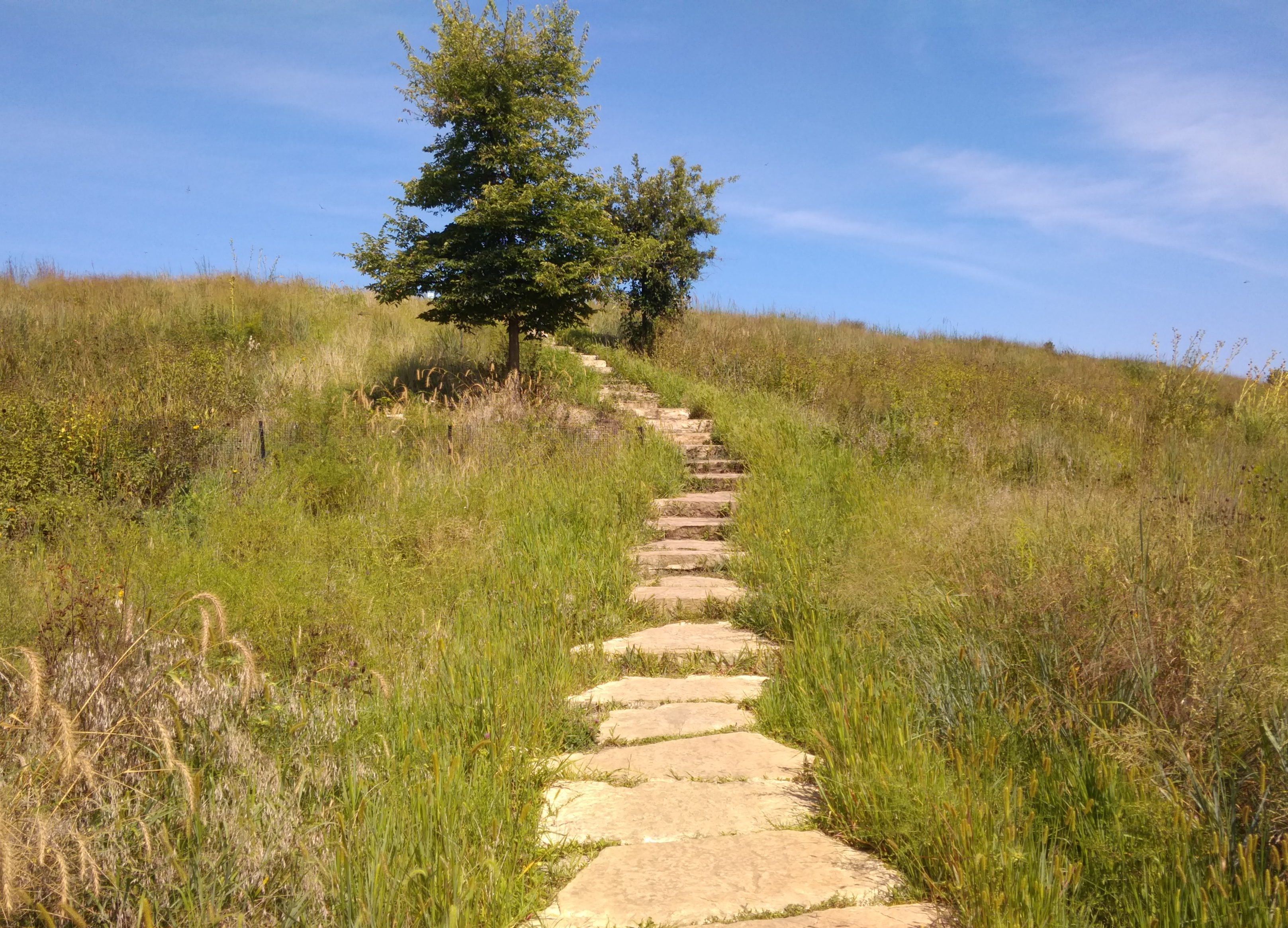
Some of the most striking things about the many striking things in Yellowstone were the places — whole mountainsides, in some cases — that had clearly burned down in 1988. Hundreds of grey-dead trunks, stripped of anything remotely alive, still stand, lording — if such be possible among trees — over forests of mid-sized pines, very much alive, the spawn of the great fire. In other places, hundreds of tree corpses have tumbled into random piles, also interlarded with young living trees. You can drive for miles and miles and see scene after scene like these. They say it was a hell of a fire, a complex of hell-fires, really, and I believe it.
[A post-fire landscape in Yellowstone in 2005, 17 years later.]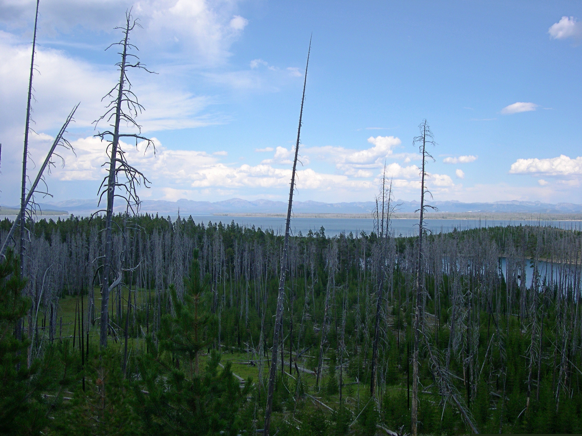
I saw something in South Dakota that the rest of the nation can emulate: two kinds of X signs, marking traffic deaths I think. One says: “WHY DIE? Drive carefully.” And the other: “THINK: X marks the spot. Drive carefully.” For such a sparse population, South Dakotans seem to kill themselves often enough on the roads. Long winters, cheap booze, almost empty roads.
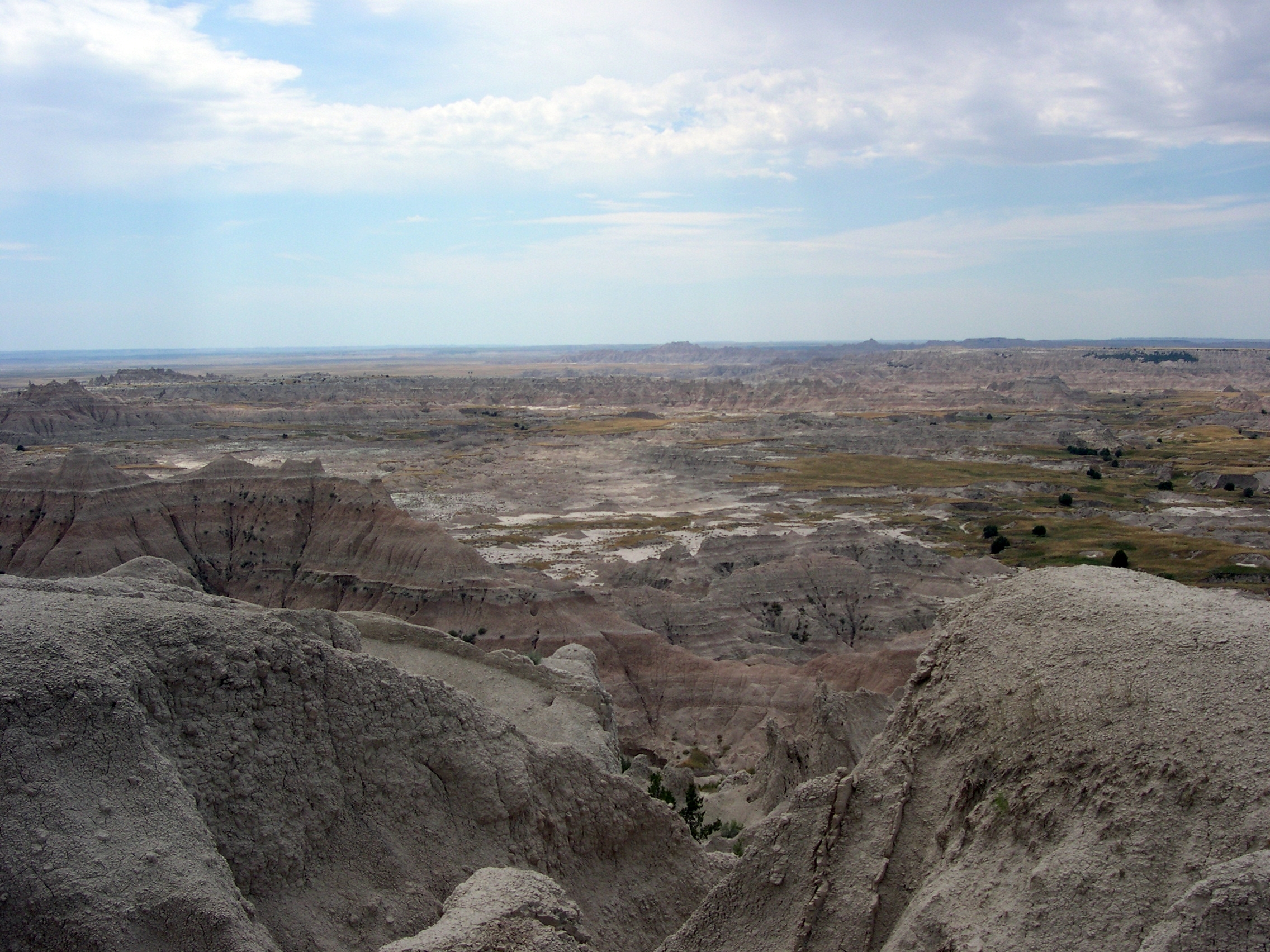
I recommend the drive along the Missouri River from I-90 to Pierre, SD — along state roads 50, 10, and mostly 1806, all of which also form a National Scenic Byway. Hilly, bleak territory largely given over to Indian reservations, though not quite as bleak-looking as Badlands NP.
[Badlands NP, 2005]
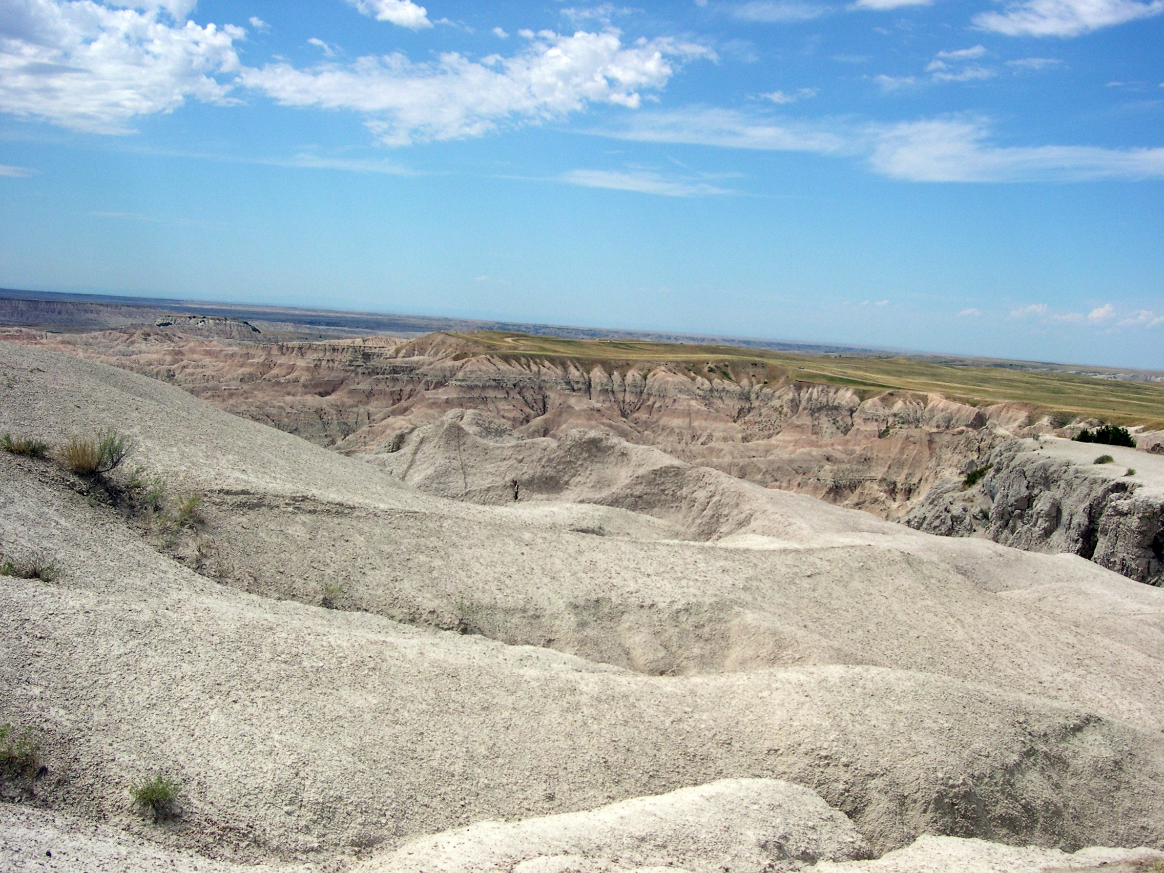
In places, except for the road, it couldn’t have been that much different than what Lewis and Clark saw. I never can remember, without looking it up, which one probably blew his brains out a few years after co-leading the Corps of Discovery. [Lewis] Clinically depressed, before there were clinics worth visiting, and before melancholia became depression. Anyway, if I remember right, there’s a monument to him near where he died, on the Natchez Trace. I saw it years ago. A lonely place to die.
We spent the first night out at a campground near Albert Lea, Minnesota. According to me (and only me), Albert Lea is important for two things. One I just noticed: it’s the closest town to the junction of I-35, the U.S. branch of the Pan-American Highway, and I-90, the Boston-Seattle transcontinental epic of a highway. [I’ve since learned that no U.S. road is officially called the Pan-American; it’s just custom that attaches the name to I-35.]
The other thing is that I was visiting Albert Lea for the second time, after a span of 27 years. What was I, a south Texas lad of 17, doing in south Minnesota en route to Wisconsin one August day in 1978? Am I repeating myself here? Maybe I mentioned that epic bus trip before. It was an important one for me. No family, distant states — Wisconsin seemed wildly exotic. Christmas trees grew in people’s yards.
Anyway, in 1978 we stopped for lunch in Albert Lea. I went with the bus driver and some other kids to Godfather’s Pizza, a place I’d never heard of. After that, I walked around a little, relishing the remoteness of the place.
In 2005, we encountered wildlife at the campground near Albert Lea, namely mosquitoes in great numbers. The place was fairly green and lush, so I guess southern Minnesota hasn’t had the drought that Illinois has had this year. When we were leaving the next morning, we drove down the town’s main drag and there it was: Godfather’s Pizza, looking like not much maintenance had been done since the late 1970s, though of course I had no memory of how it looked then, just that I was there. [In Eau Claire this year, we ordered a pizza from a Godfather’s and ate it in our room. I ordered from there because of my experience 40 years earlier. And it was close.]
One other note, for now: Hot Springs, SD, is a lovely town. Near much of the main street flows a river, and alongside most of the main street across from the river are picturesque sandstone buildings, vintage pre-WWI. Evidently, it was locally inexpensive building material.
I left the family at a spring-fed swimming complex while I looked for a pay phone, since my cell phone refused to transcend the hilly surroundings. Argh, what an odyssey that was – “Yeah, we used to have a phone…” I’d foolishly agreed to do an interview that day, figuring I could use my cell. Anyway, after much to-do, I found a phone, did the interview, and then relaxed by the riverside, which has a sidewalk and a hot spring (Kidney Spring) under a gazebo. Free for all to drink, with a metal plaque describing its properties. Not bad. A little salty, but not bad, even on a hot day in South Dakota.
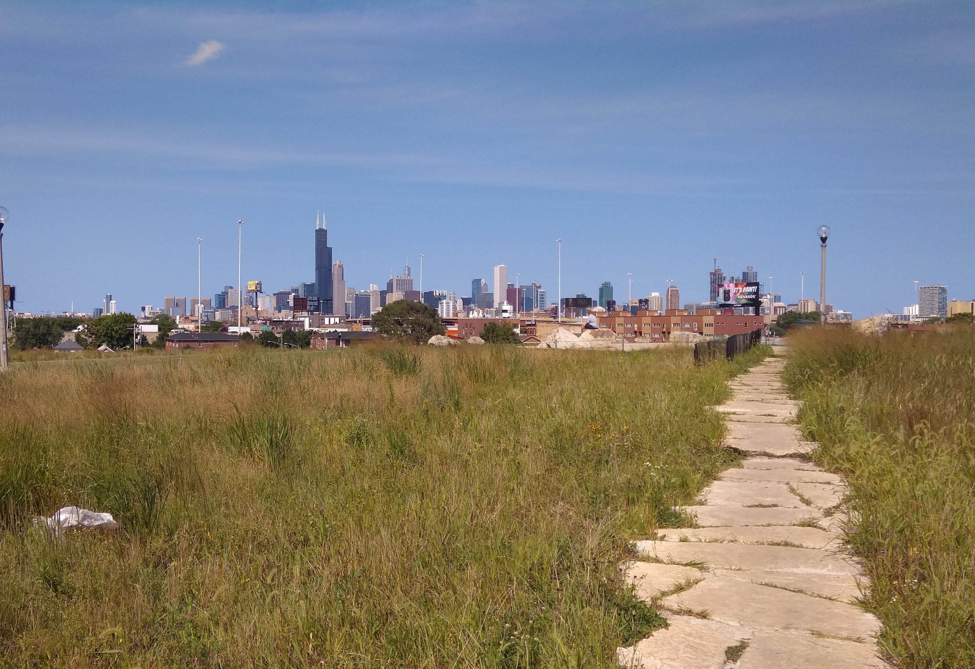
 To the south-southwest, roughly. The tower formerly known as Sears rises above all, including annoying reflections.
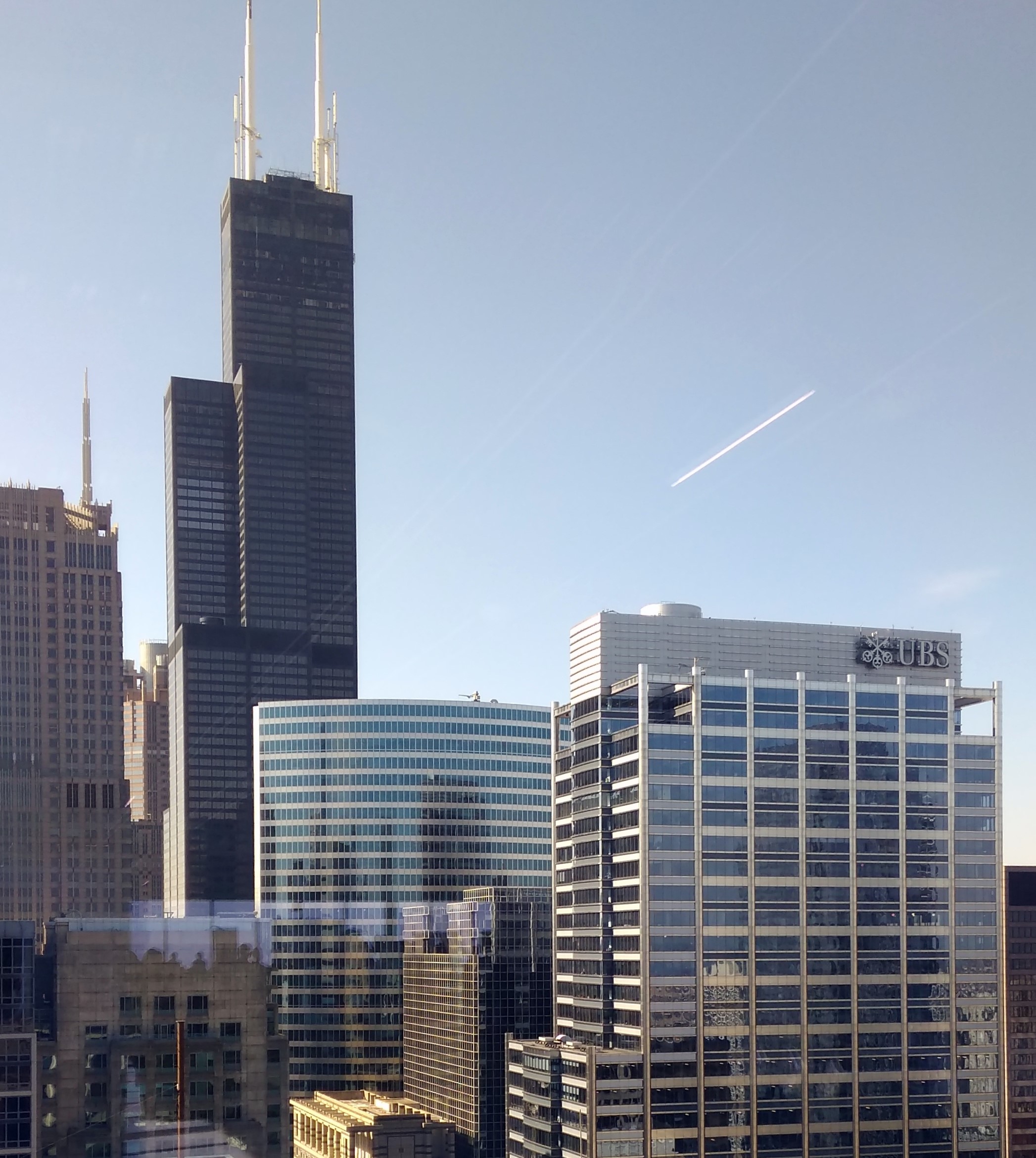
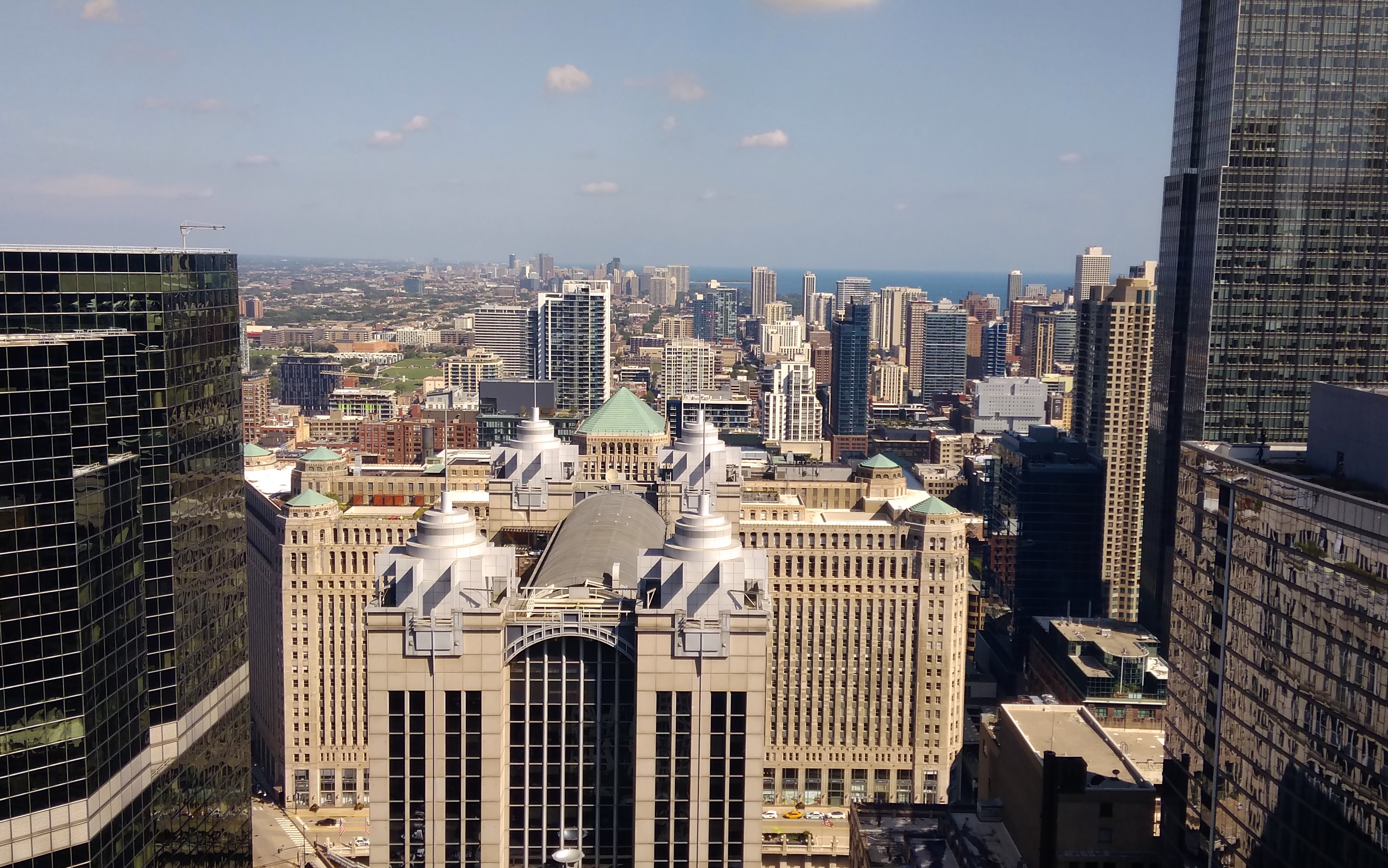
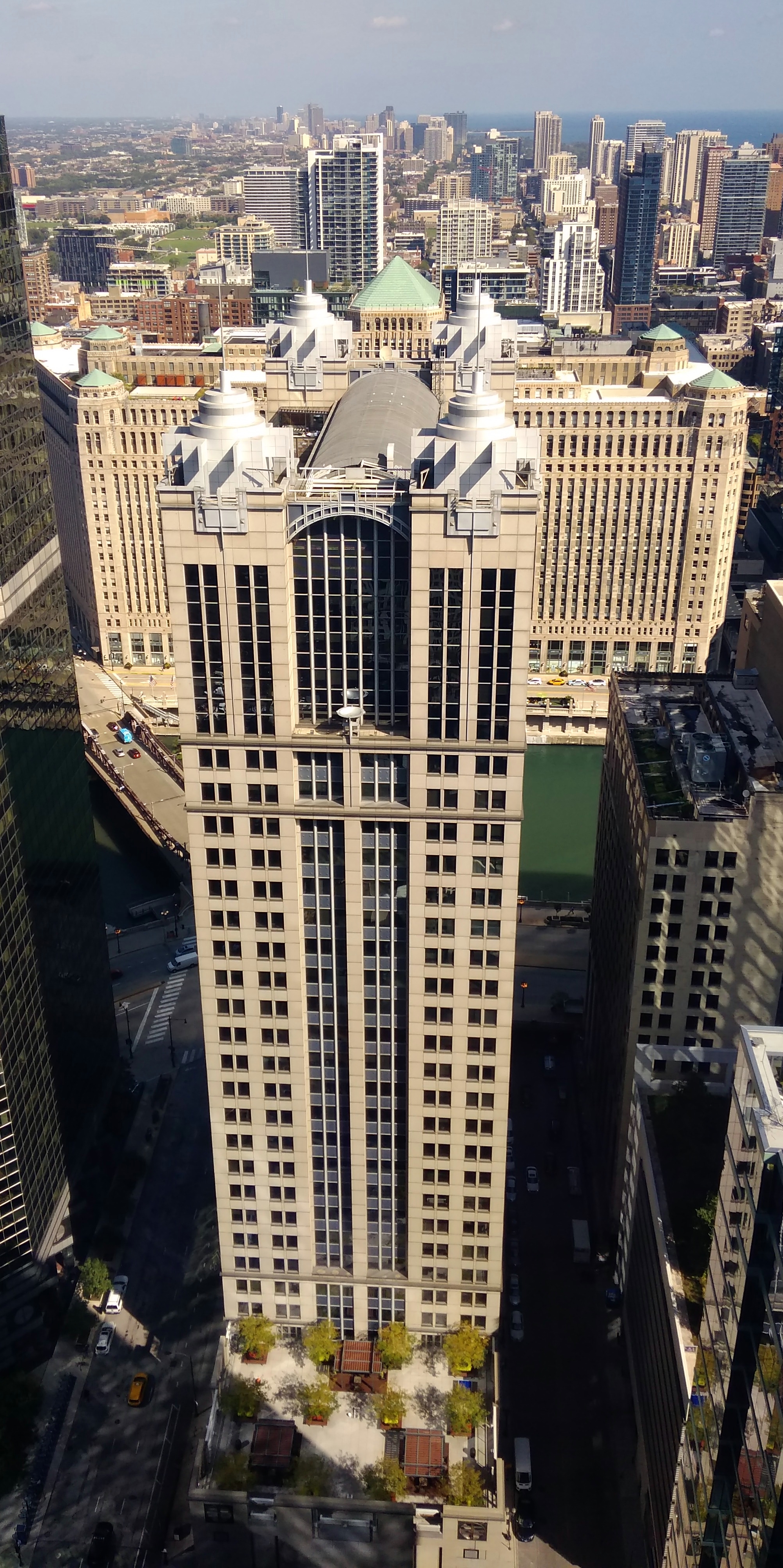 Behind it, or rather to the north, across the Chicago River, is the much more horizontal Merchandise Mart.
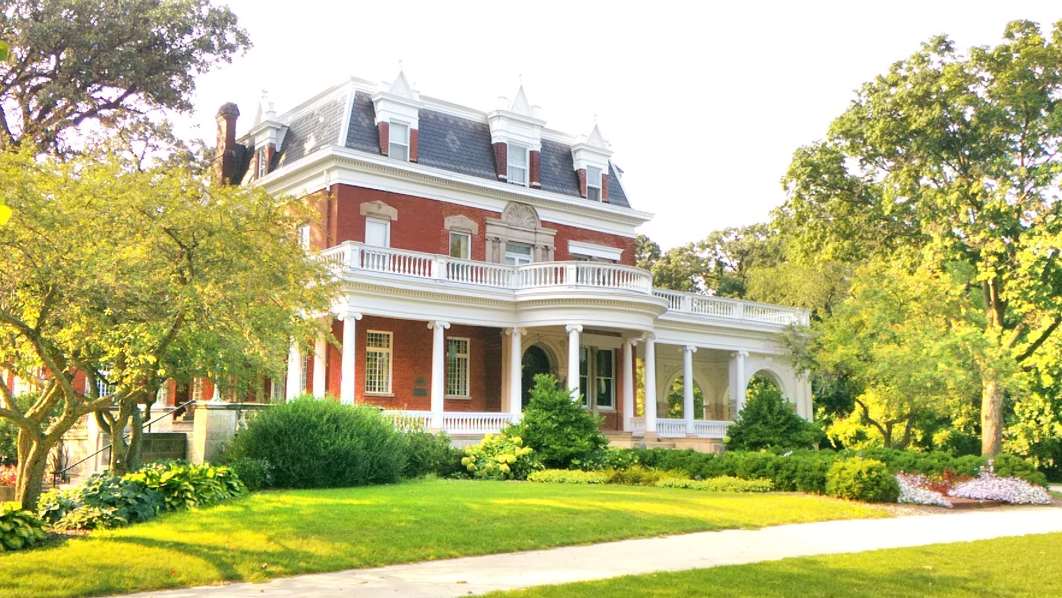
 Actually, it’s the dog who uses the deck for its fullest lounging potential.
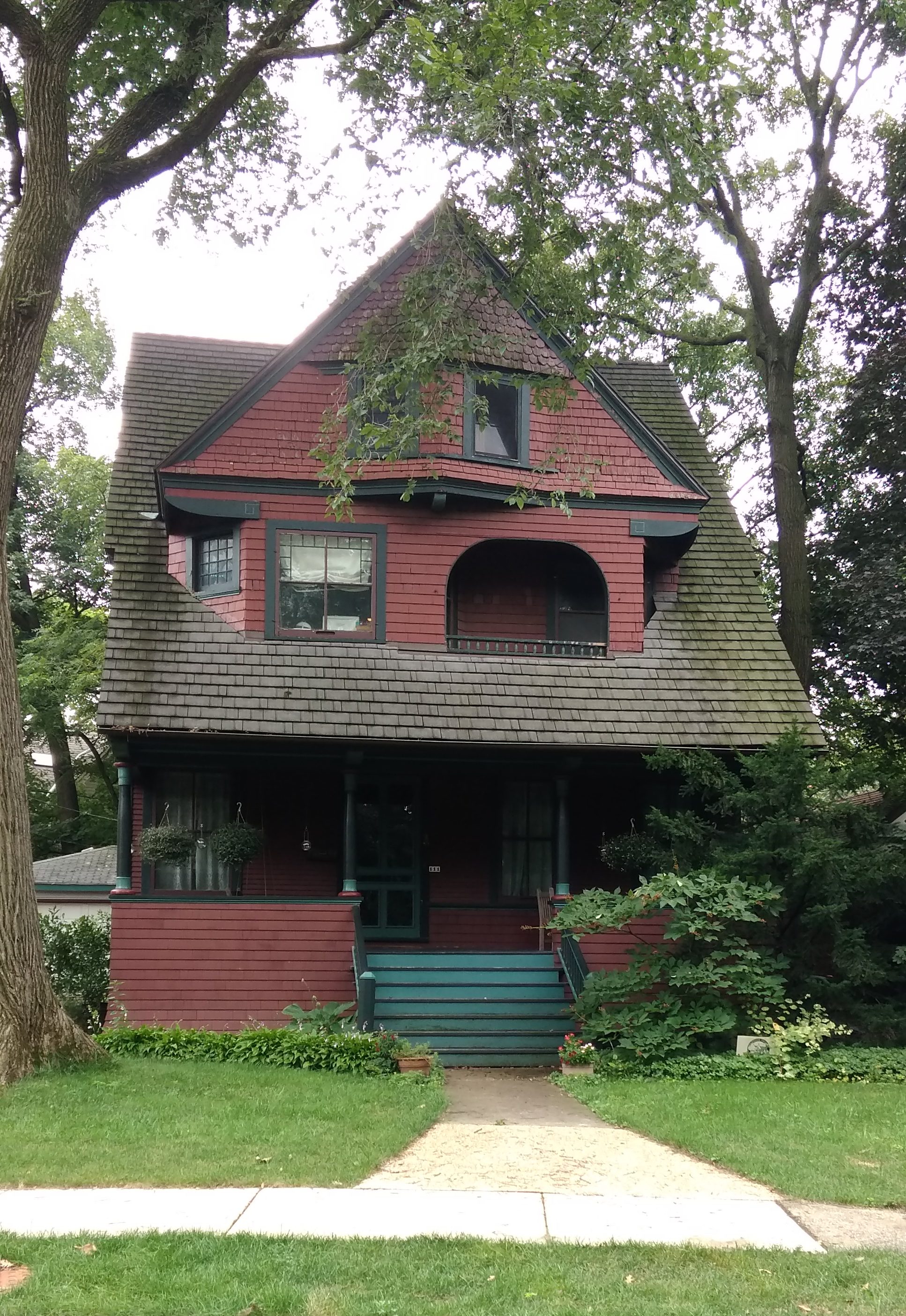
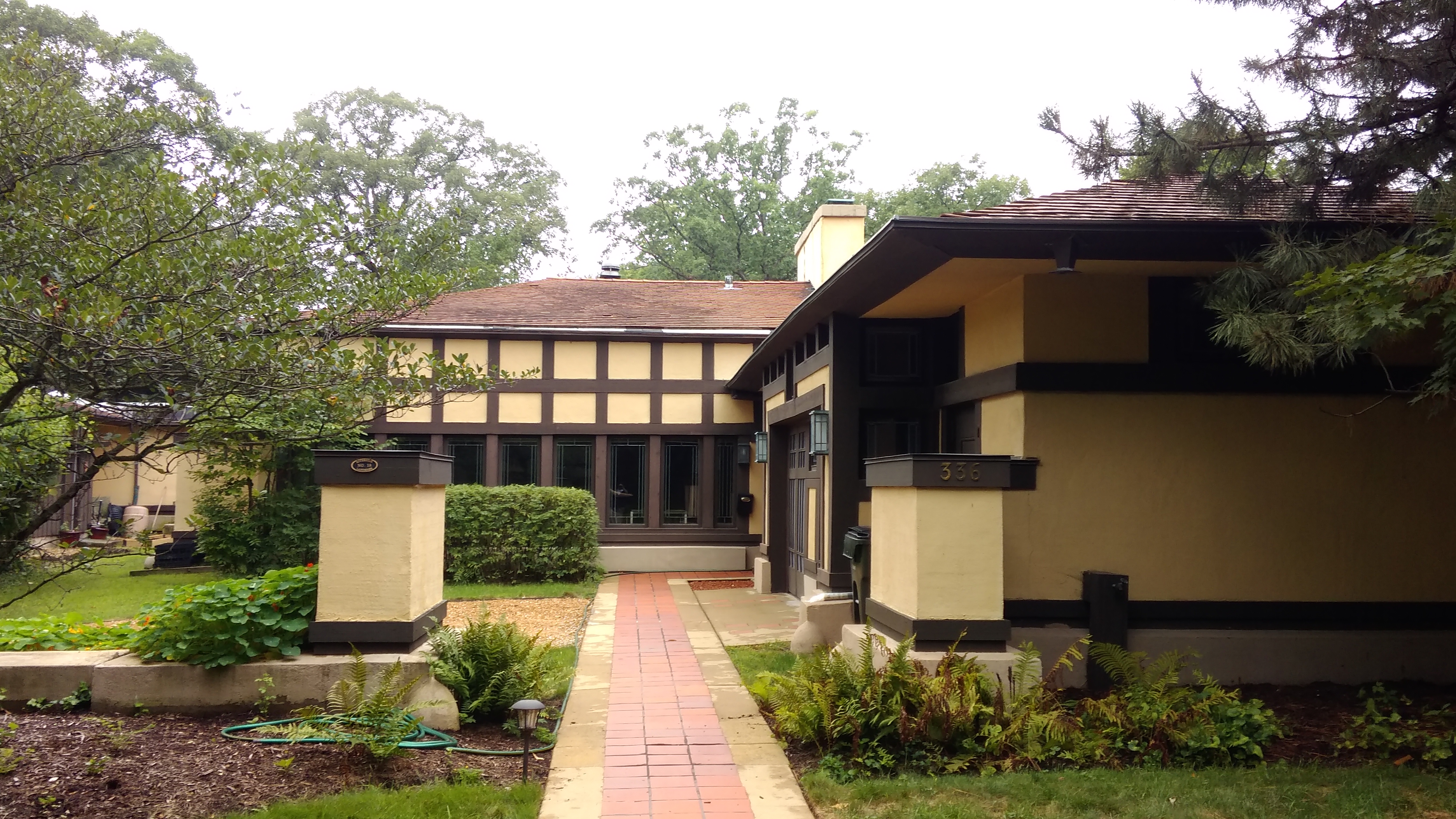
 The John C. Smith House, 1907 American Four Square. That’s a nice porch.
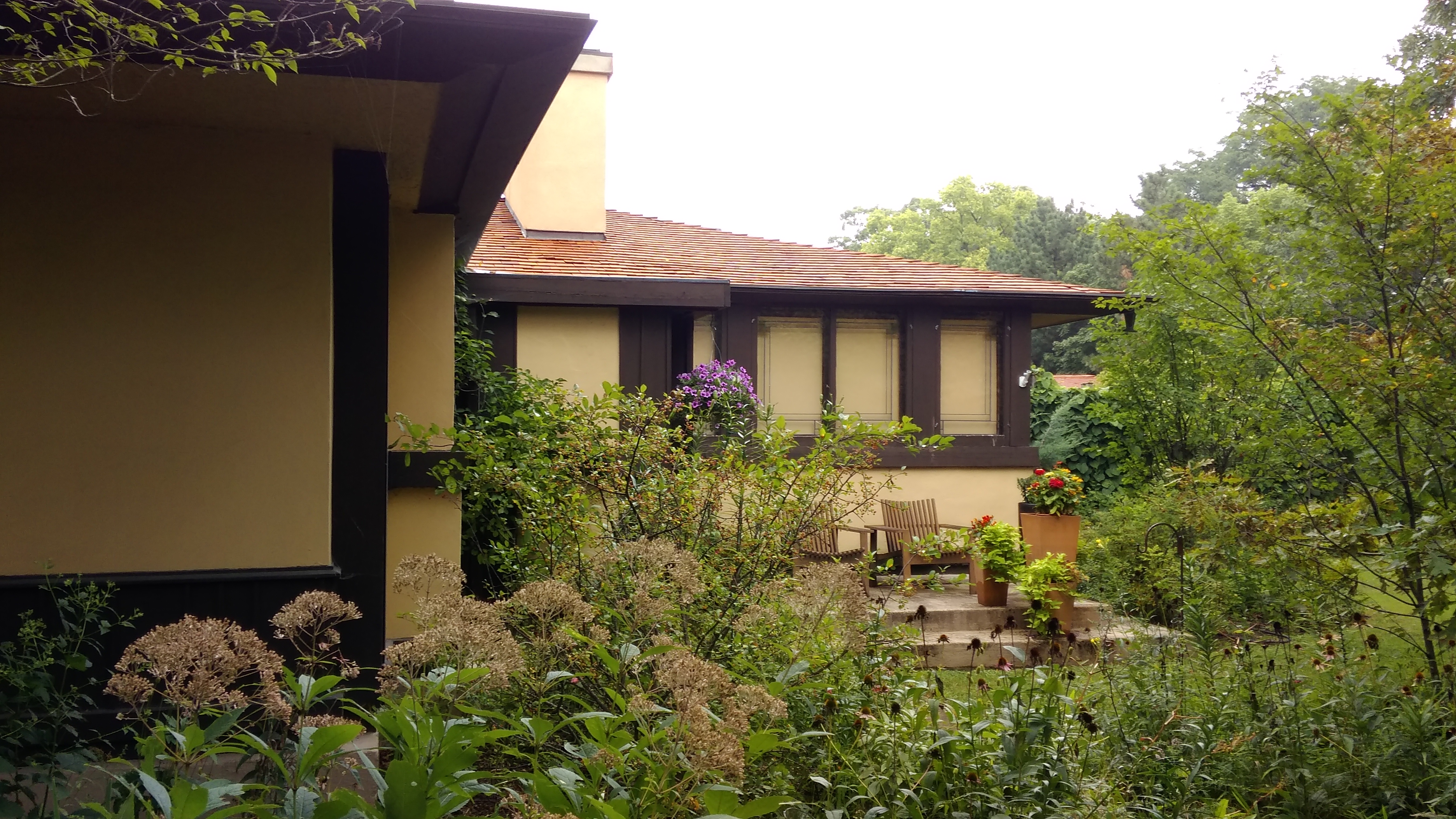
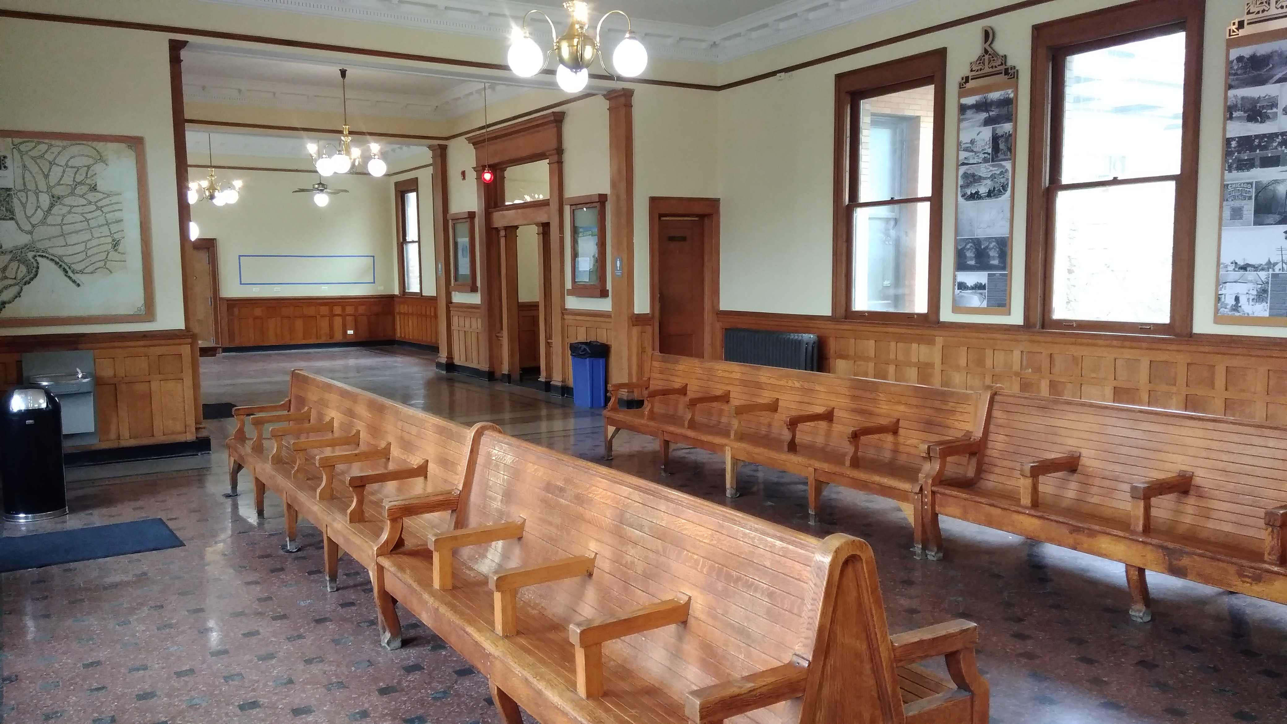
 Not the best view of the house. That would be
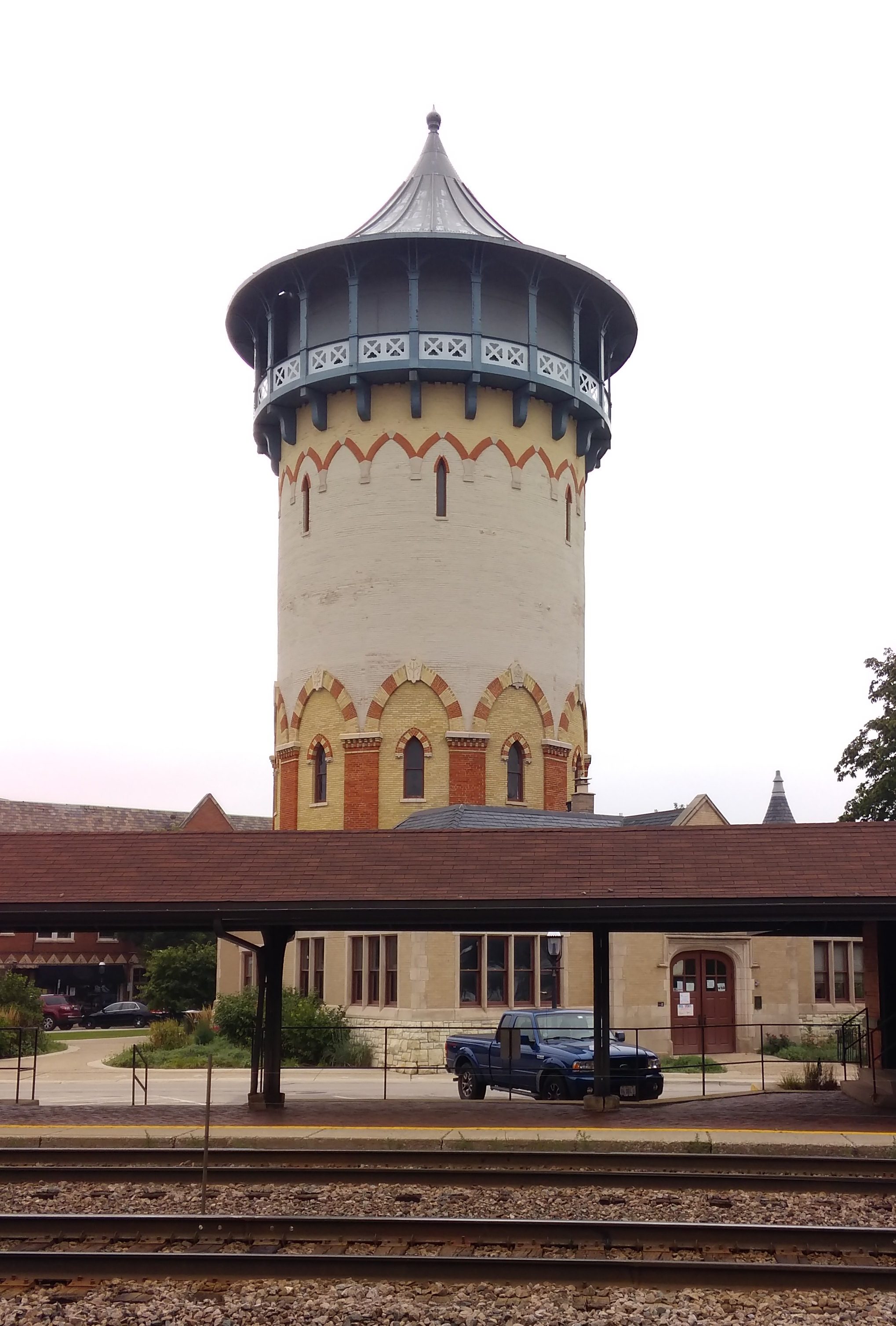
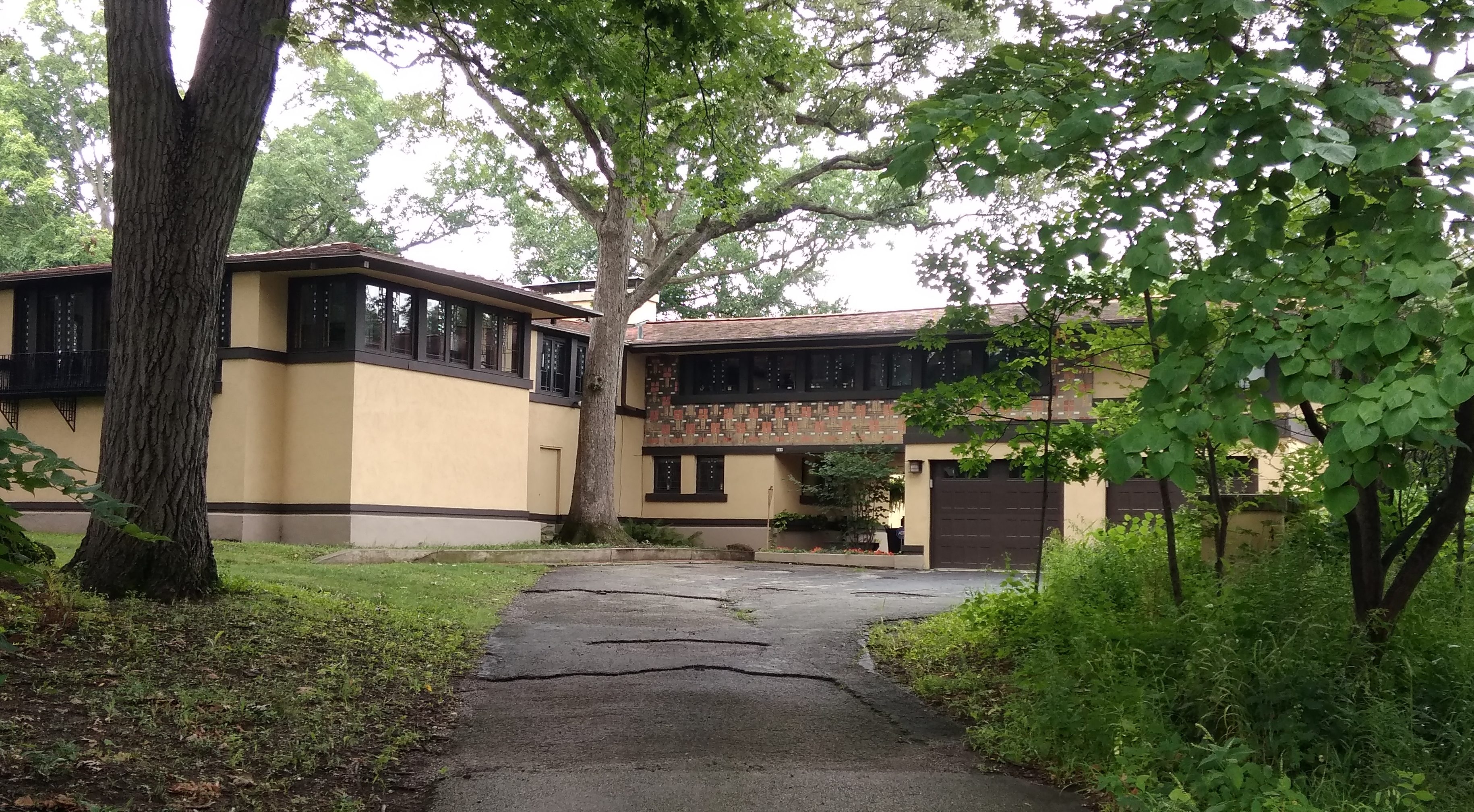
 As well as a closer look at the former water tower.
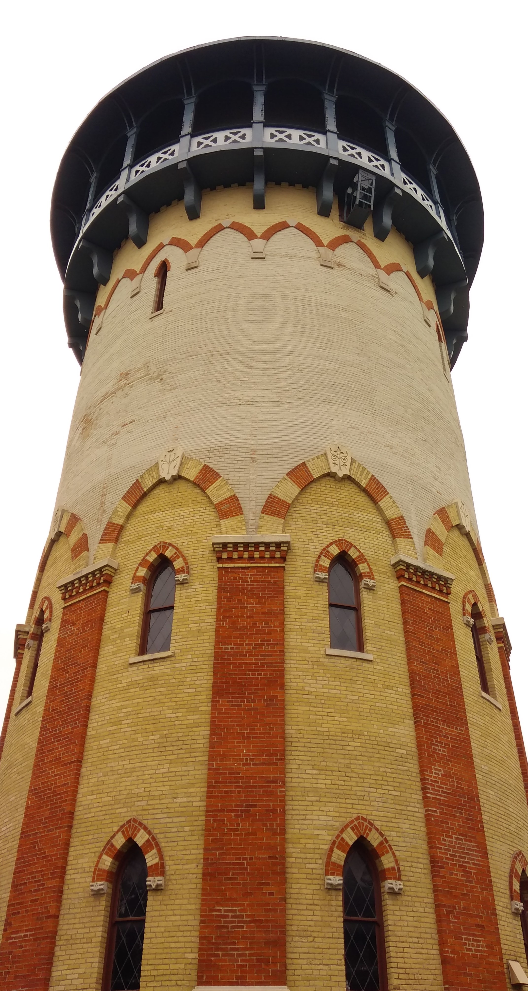
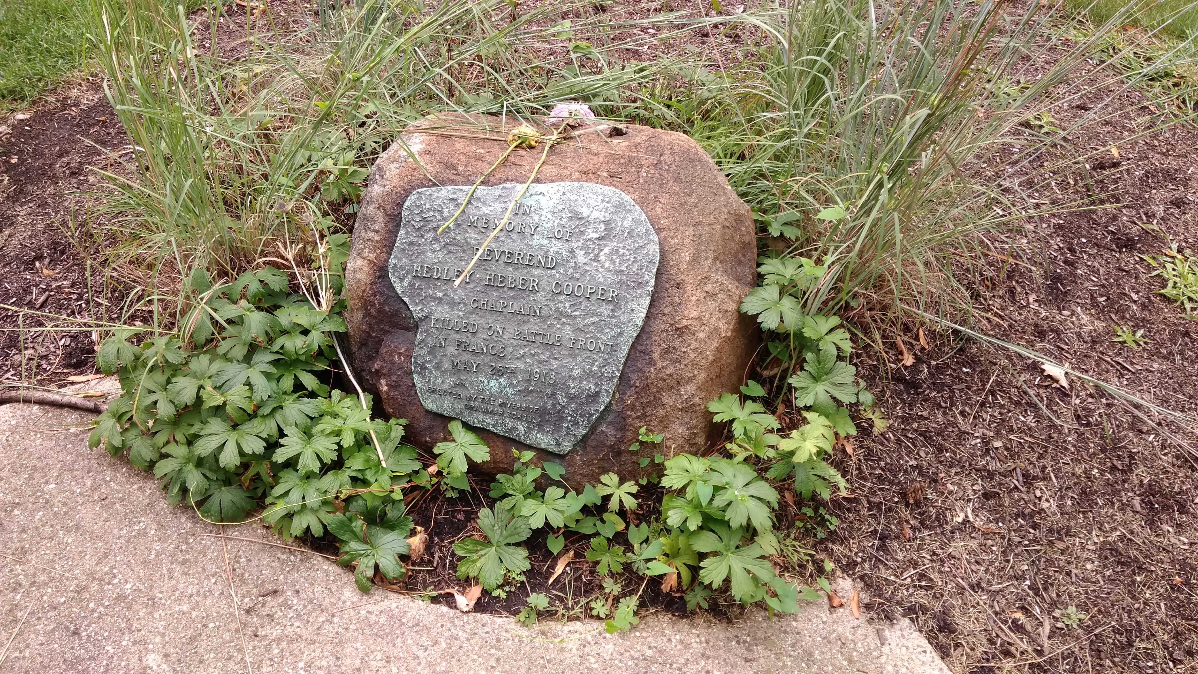
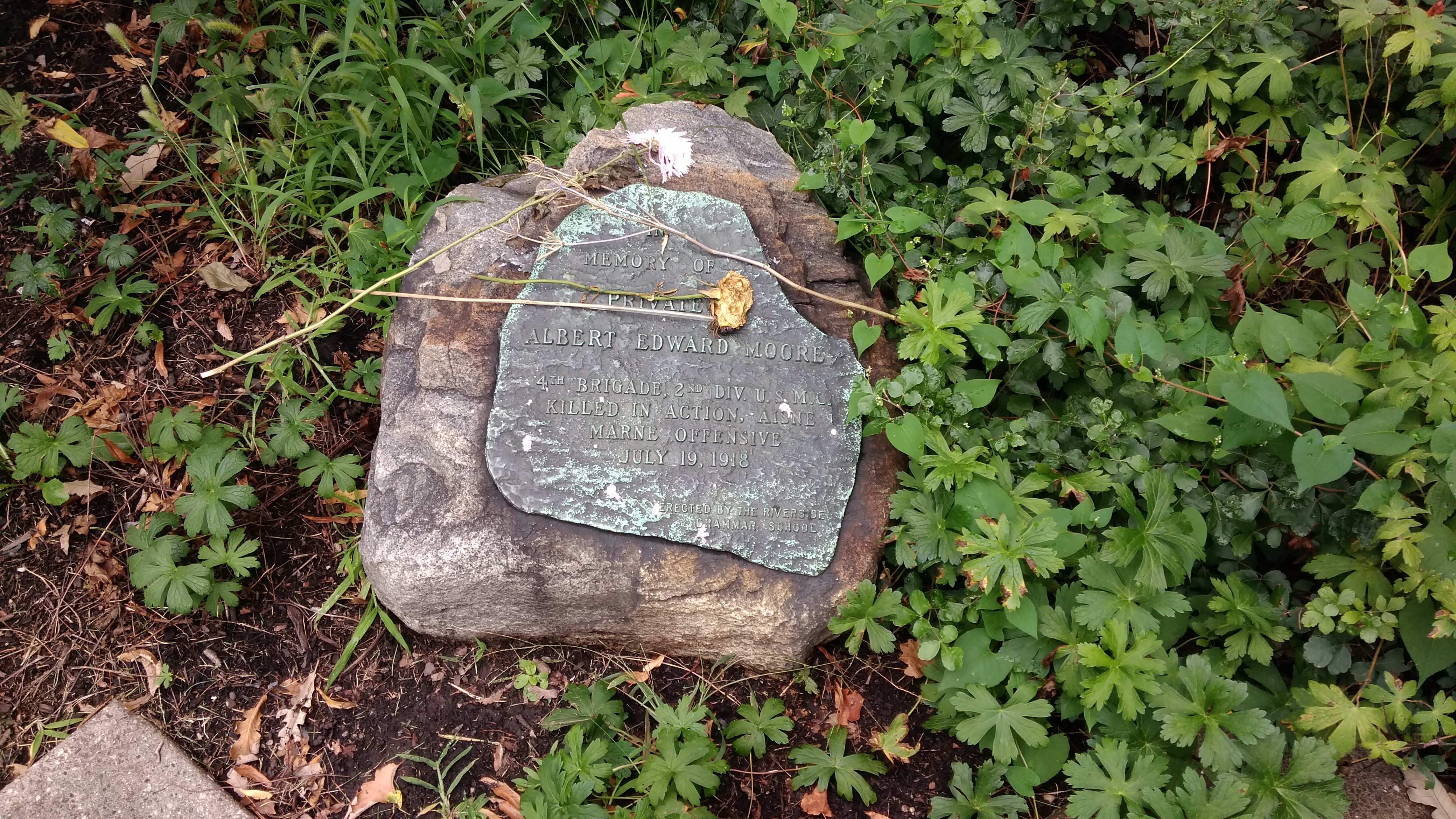 There’s also a plaque for a soldier who died not long after the Armistice, but here at home. A little late for the flu, but still possible. Accident, maybe.
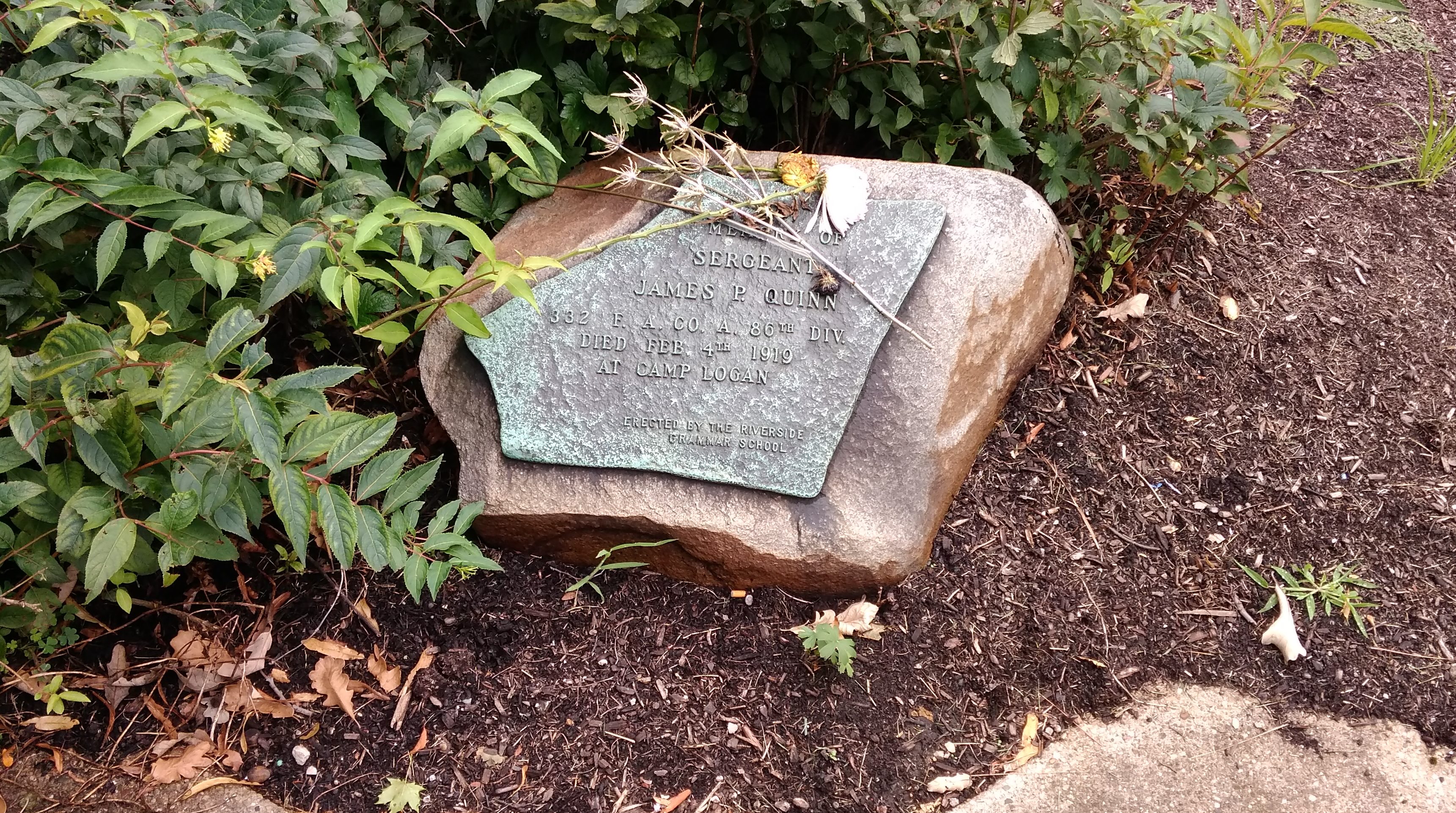
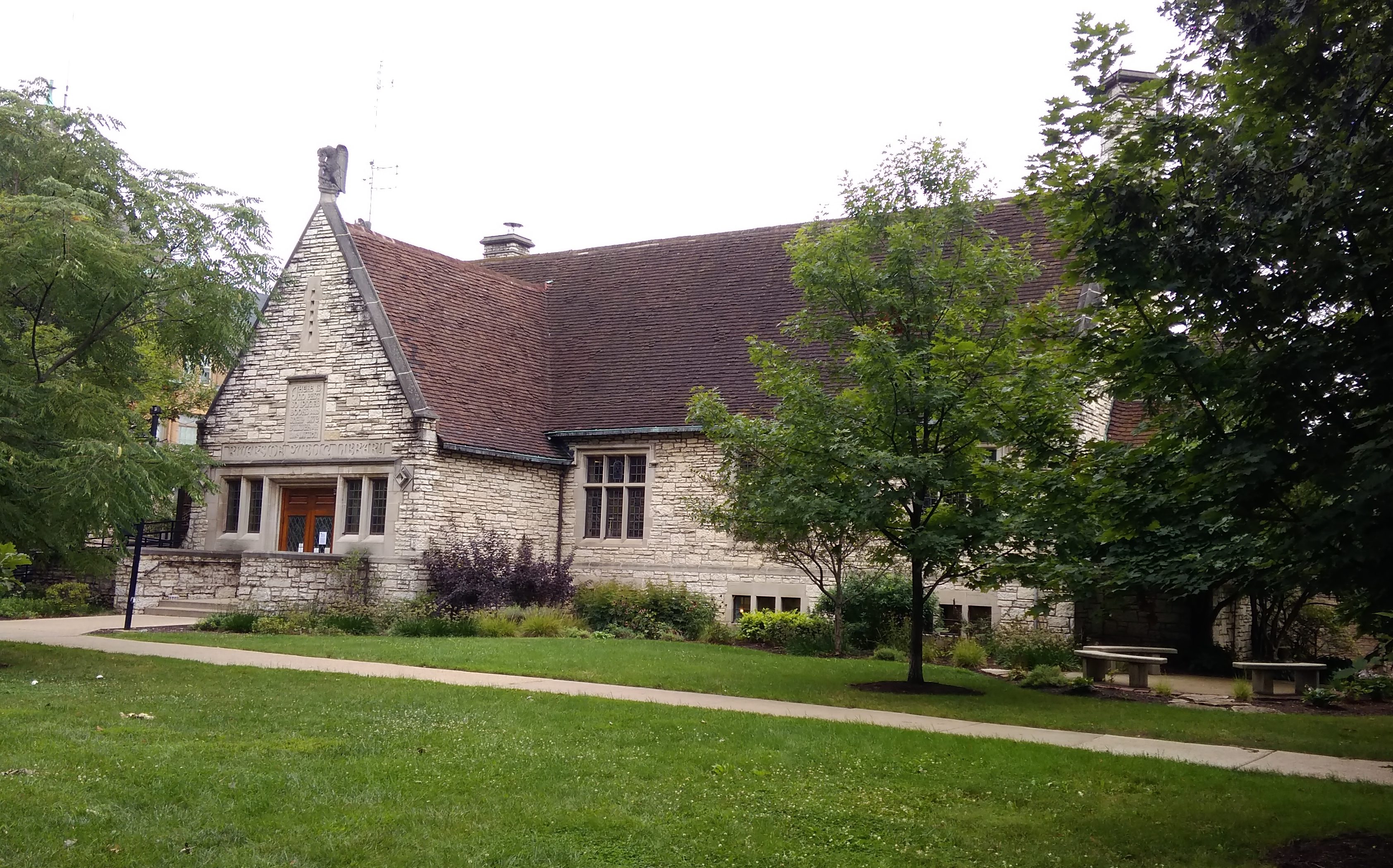
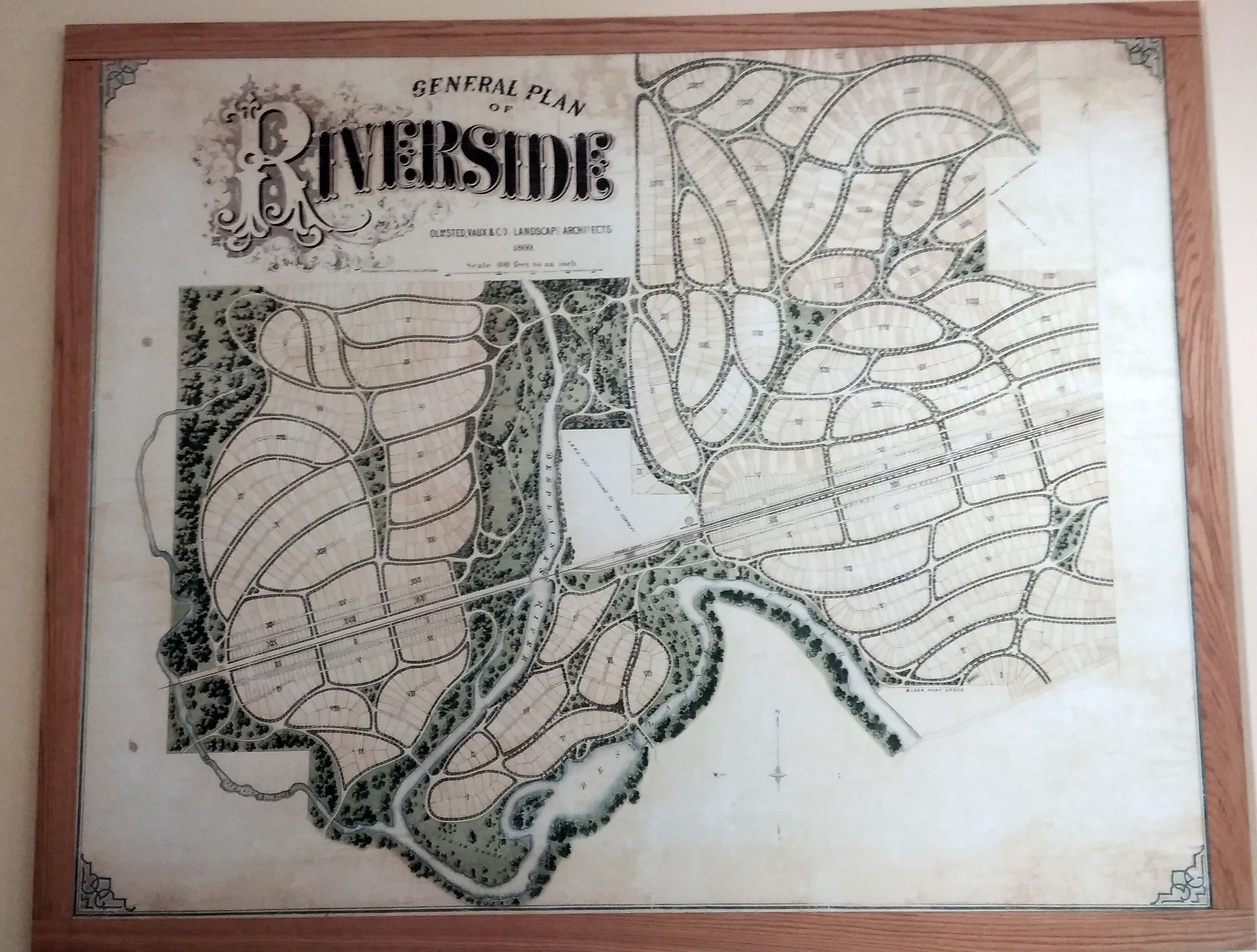
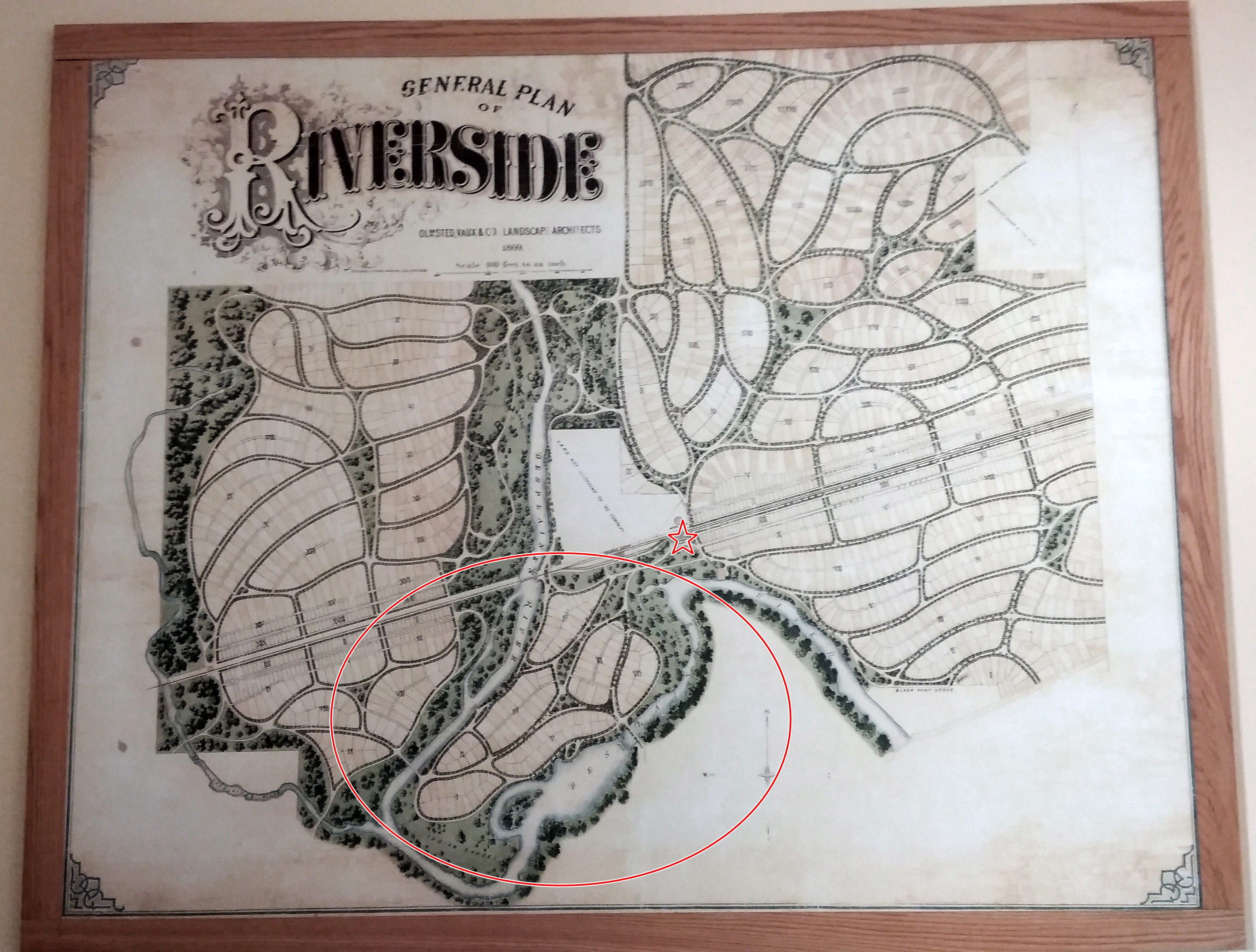
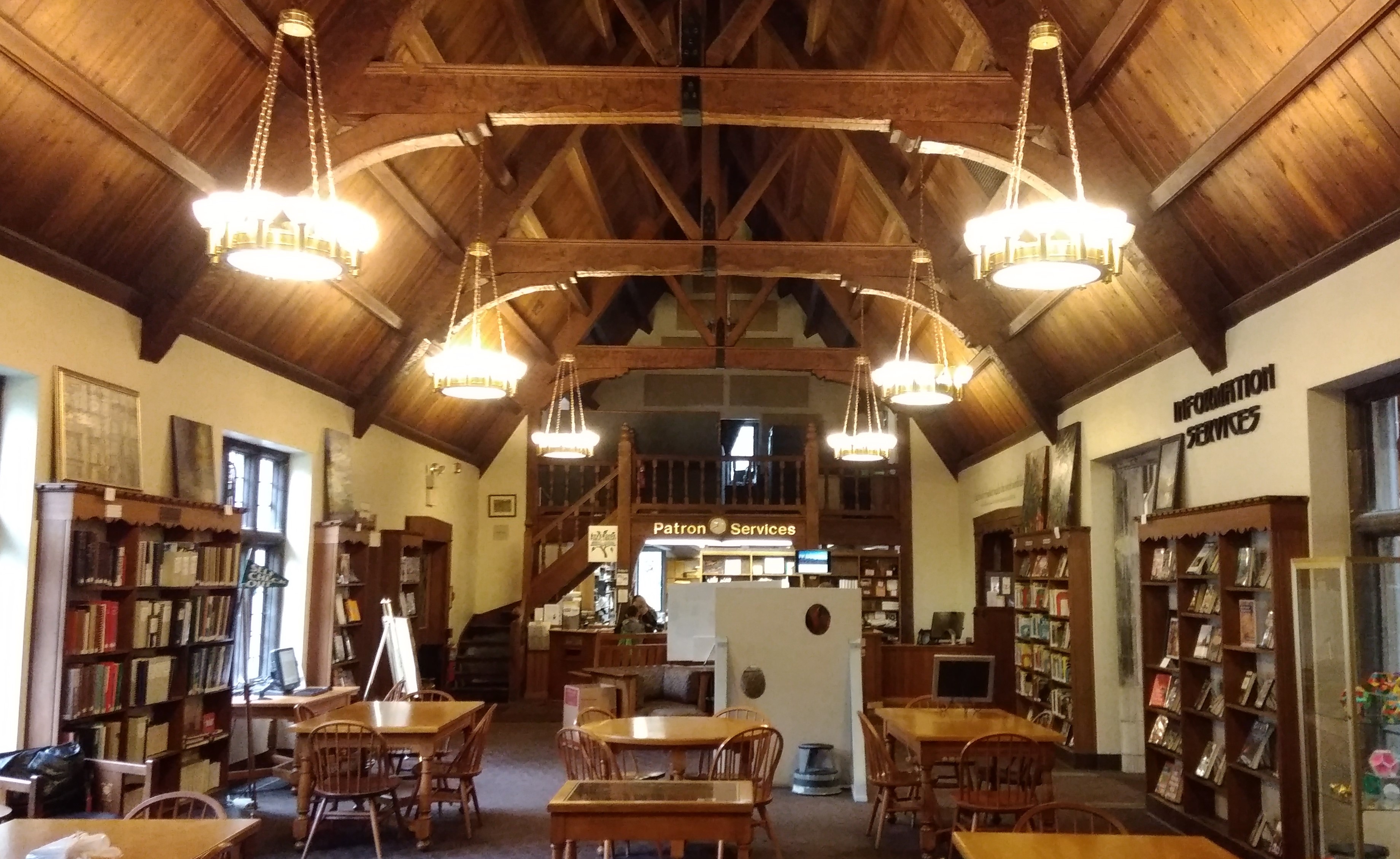 The library is the only one I’ve ever seen with an Olmsted collection.
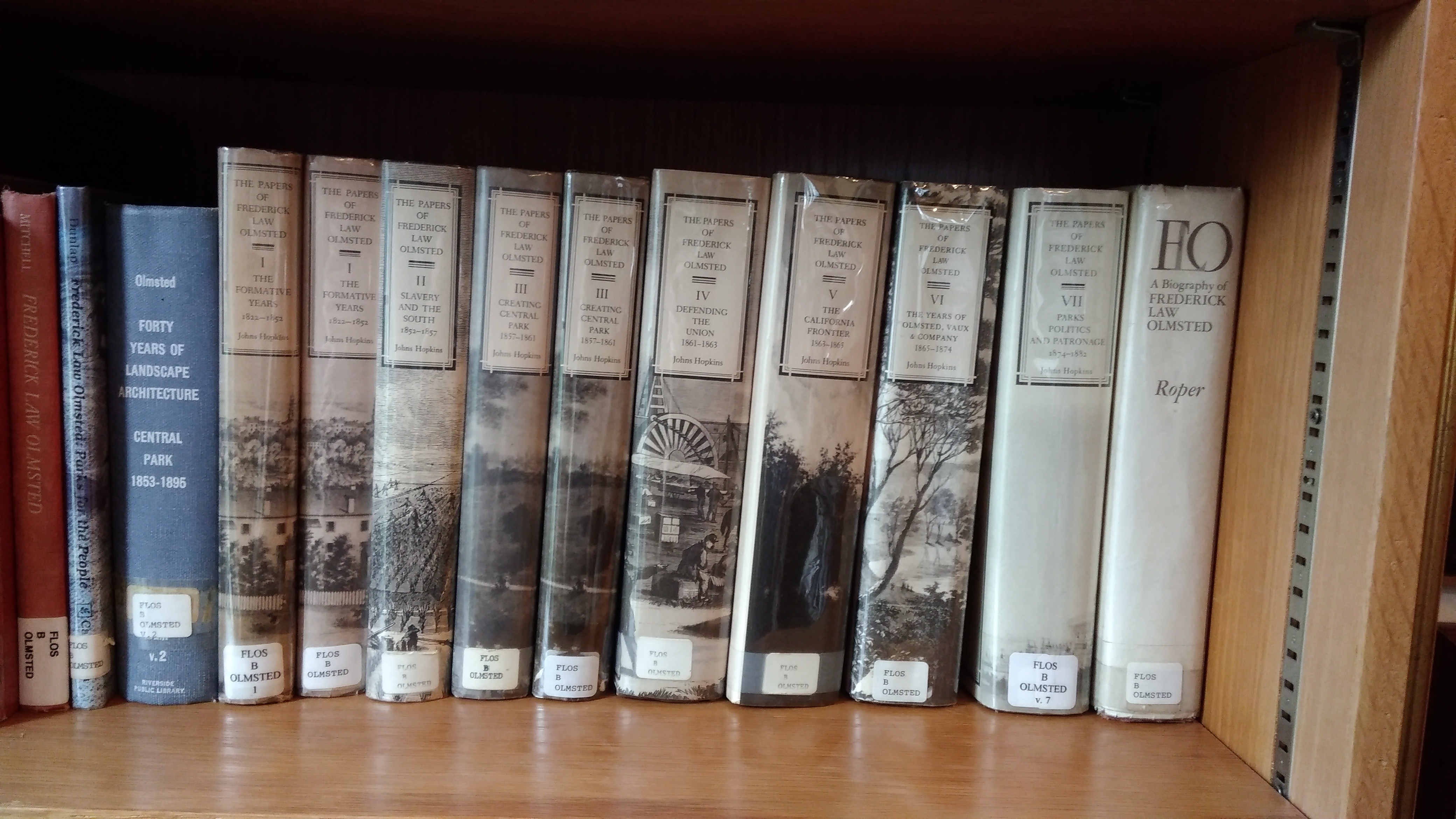 The collection takes up a number of shelves in its own special niche.