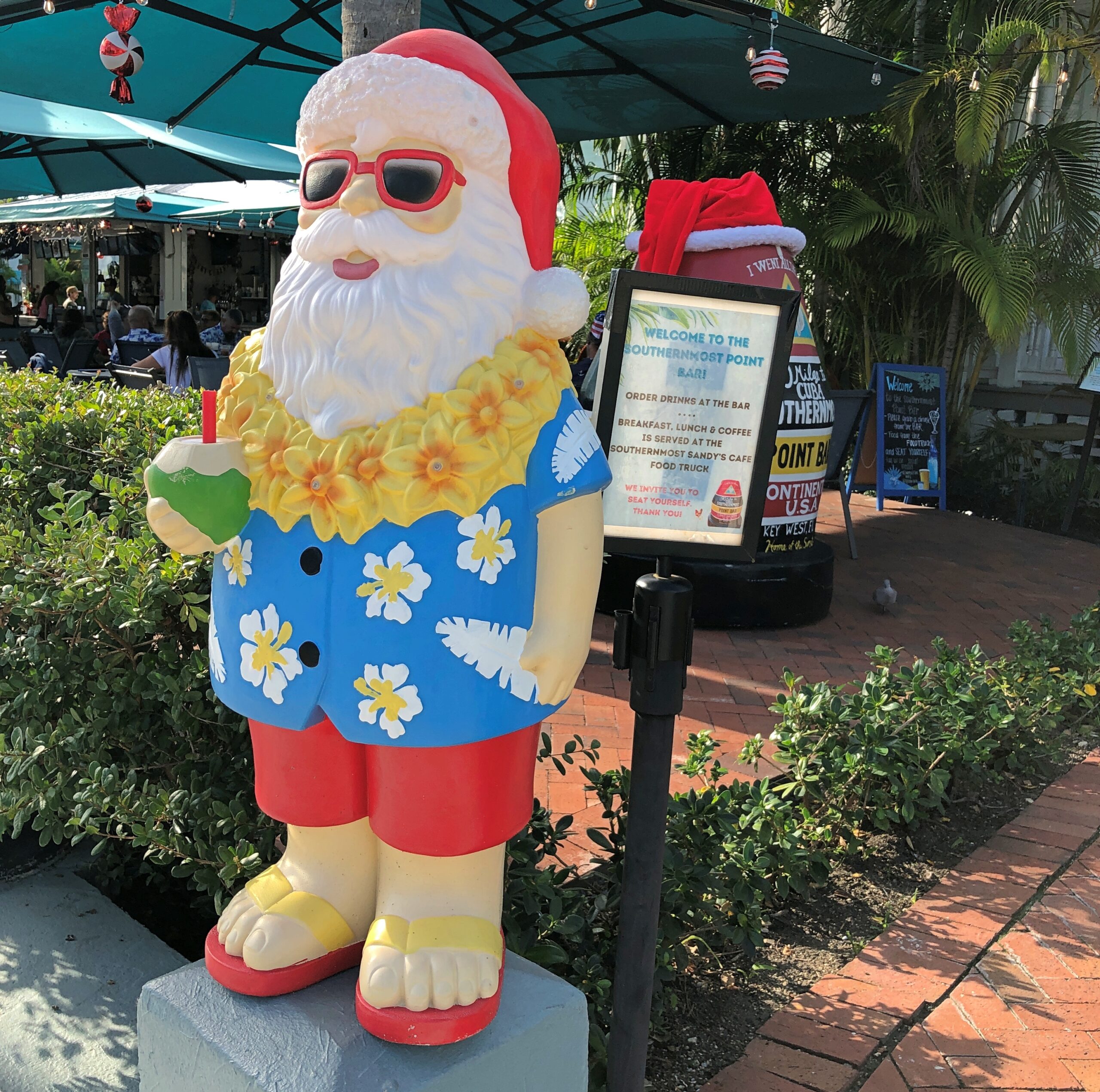
Island-vibe Santa Claus can be found in Key West in mid-December. In fact, I was expecting more such Santas. Even he needs to vacation, preferably somewhere warm (see #13).
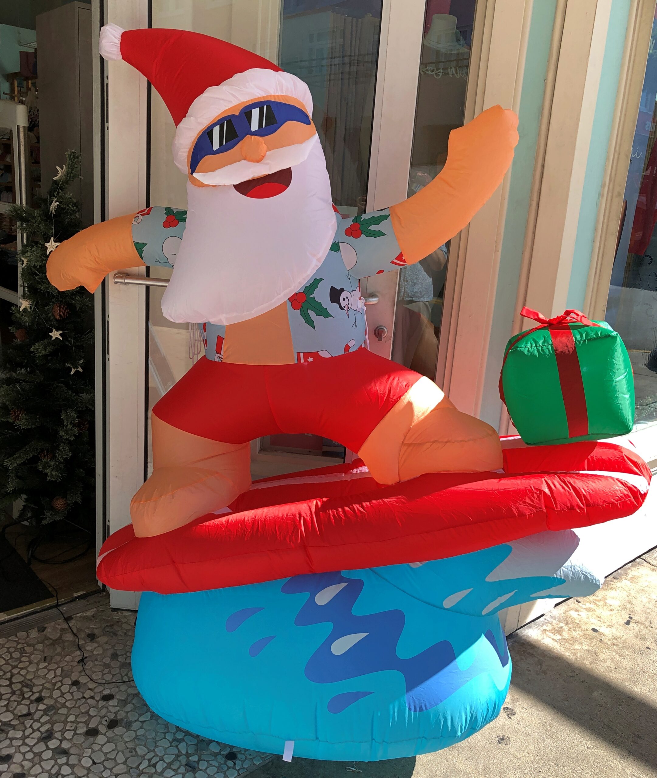
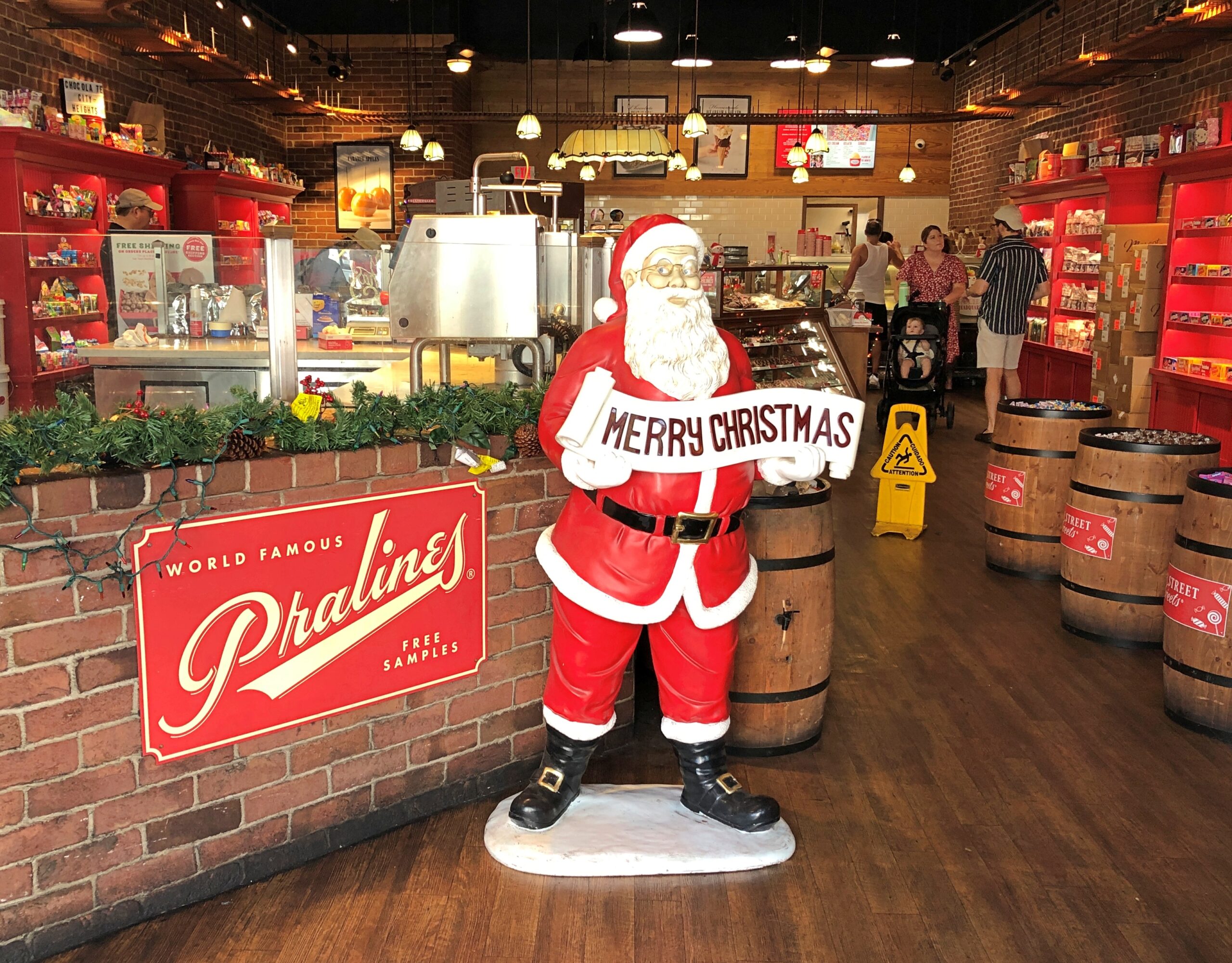
We spent two days walking around Old Town in Key West, which is time enough to cover a fair amount of ground, considering the small size of the place. More conventional St. Nicks were also to be seen, some of them finding their place in a place of business.
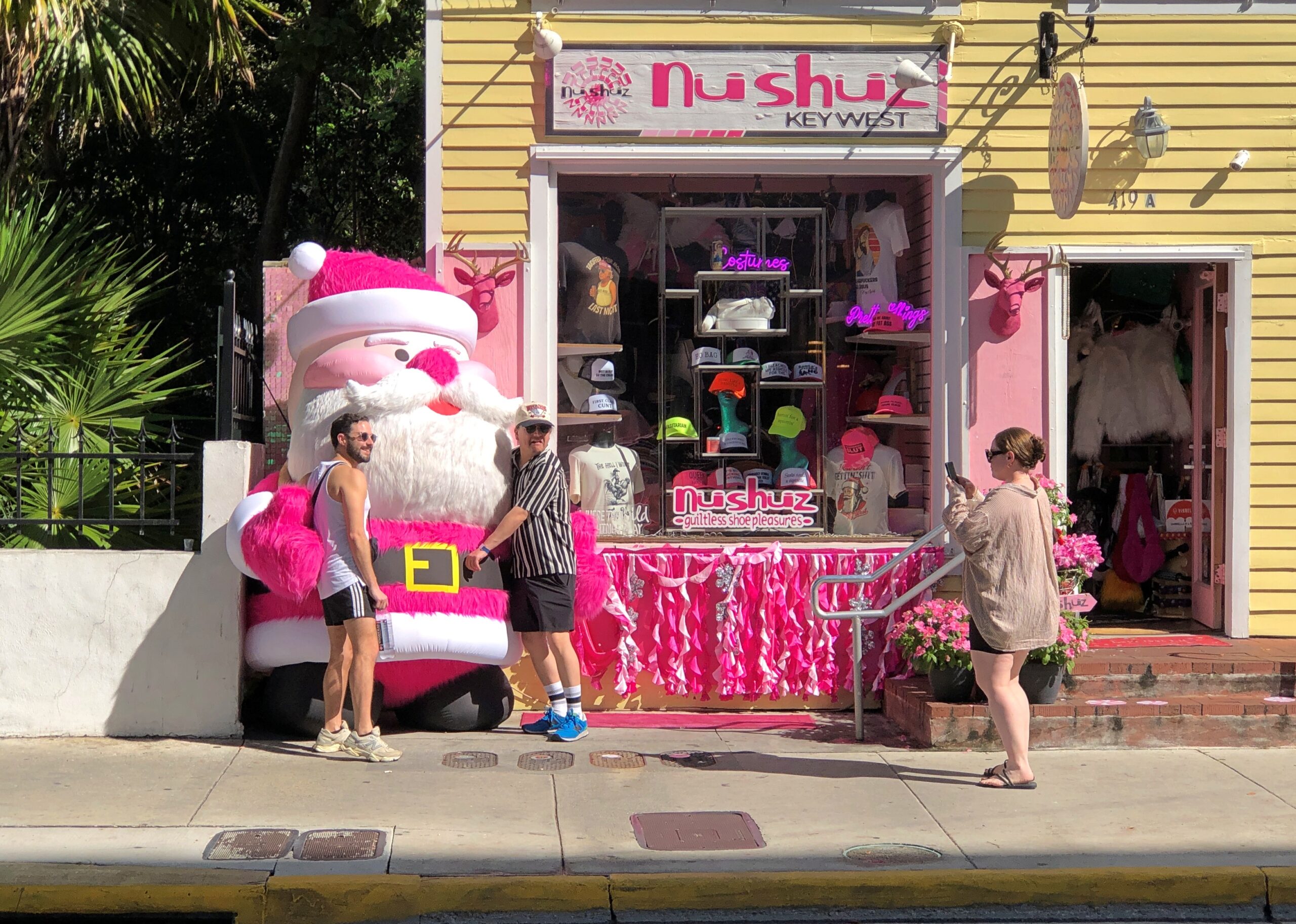
Not sure if pink counts as conventional Santa Claus. Usually he’s red, of course, a depiction of jolly old elf owes to Coca-Cola, but pink is pretty close. Anyway, pink Santa had a few fans.
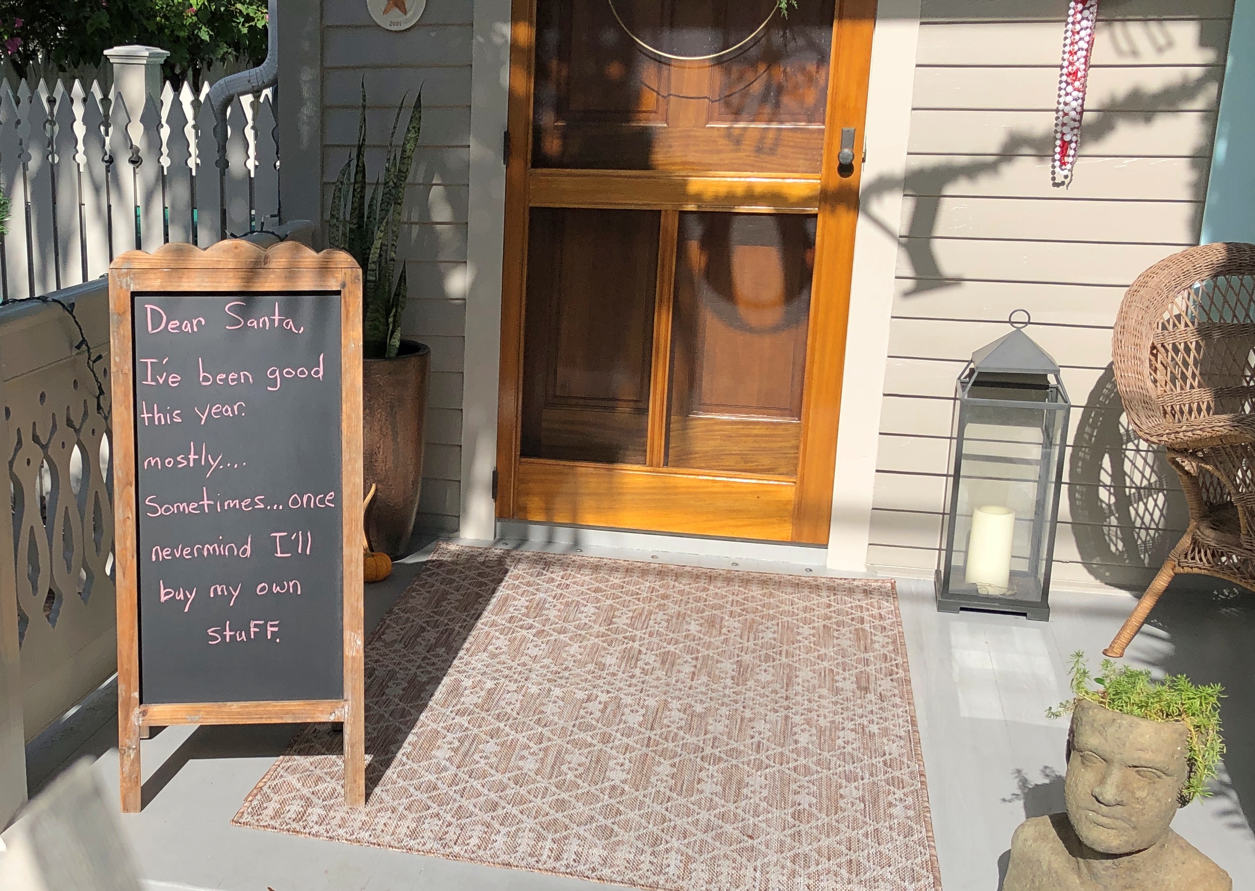
A message for Santa, going for ha ha ha, rather than ho ho ho.
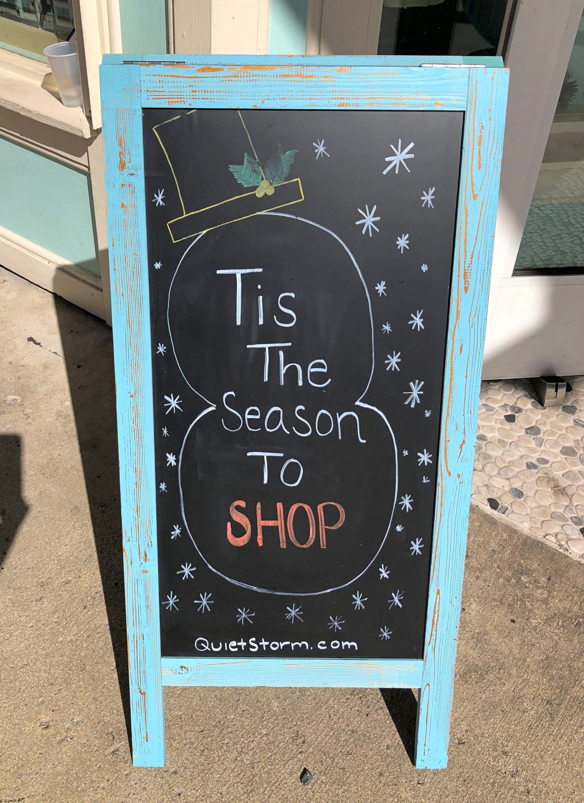
This retailer gets right to the point.
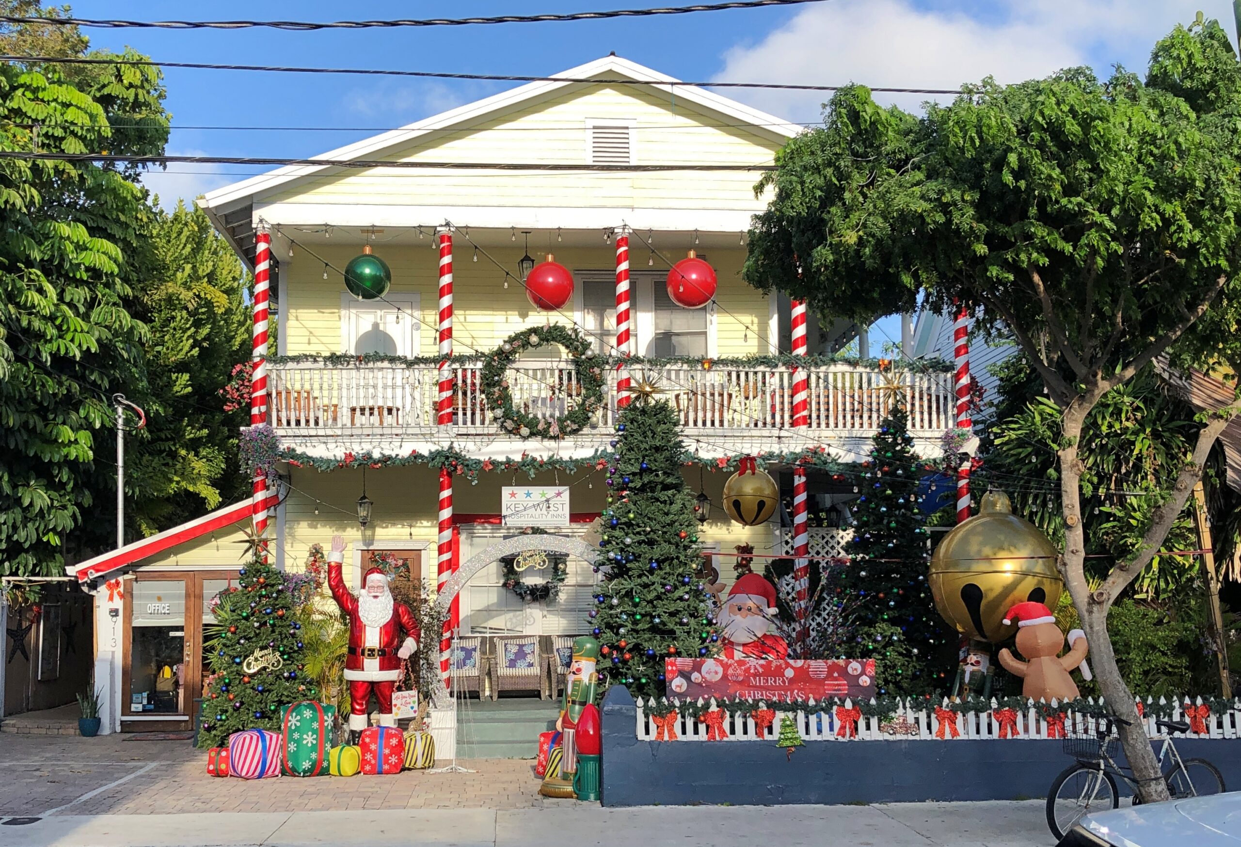
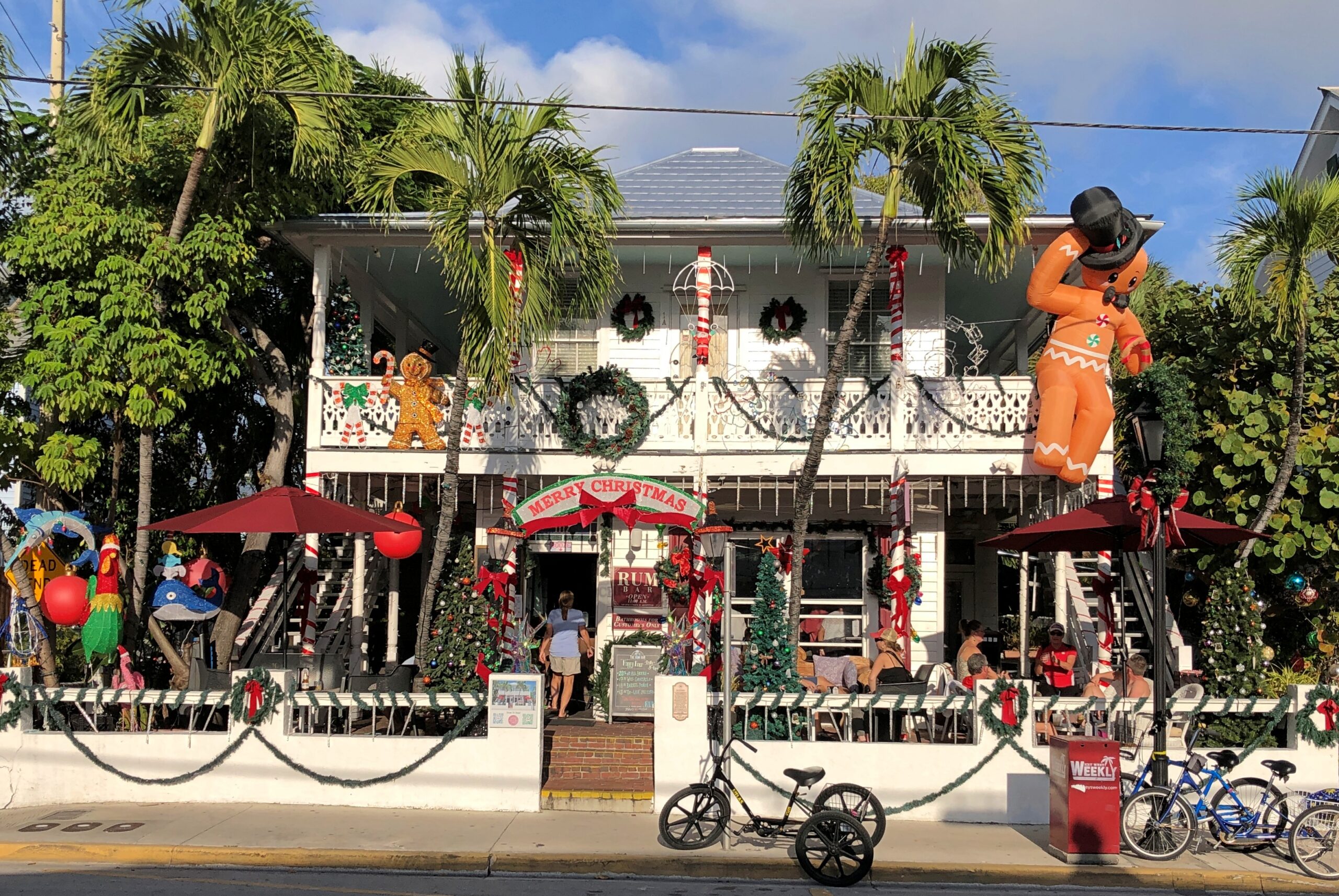
Maybe not the full Griswold, but decked out in quantity.
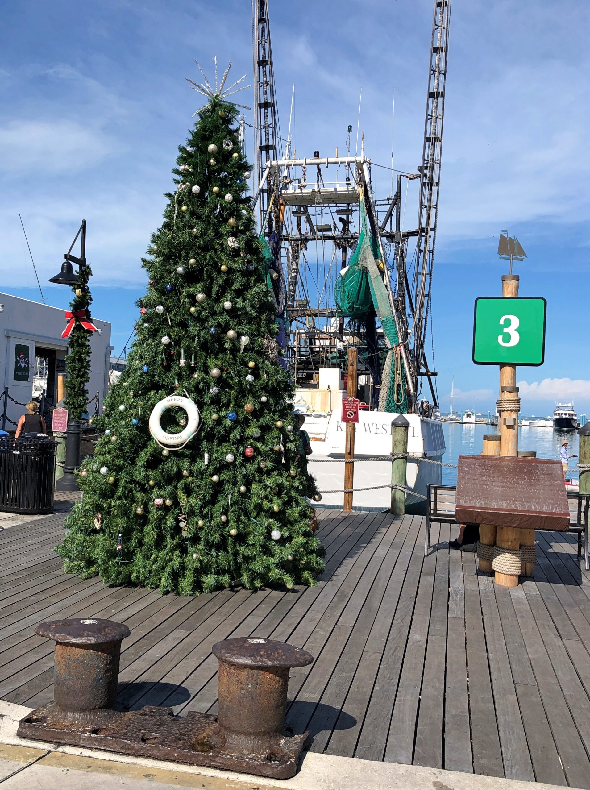
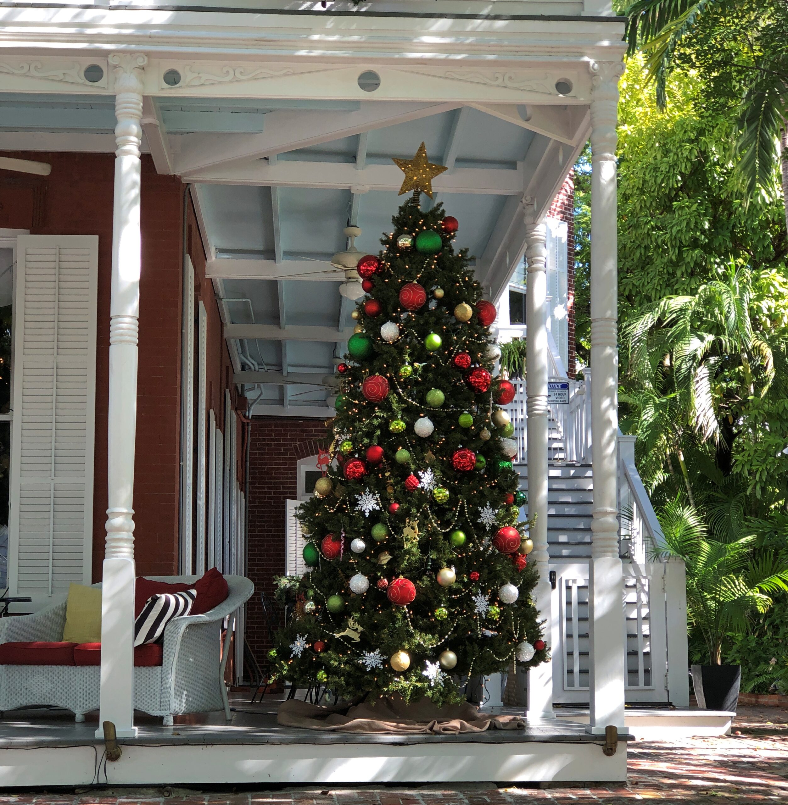
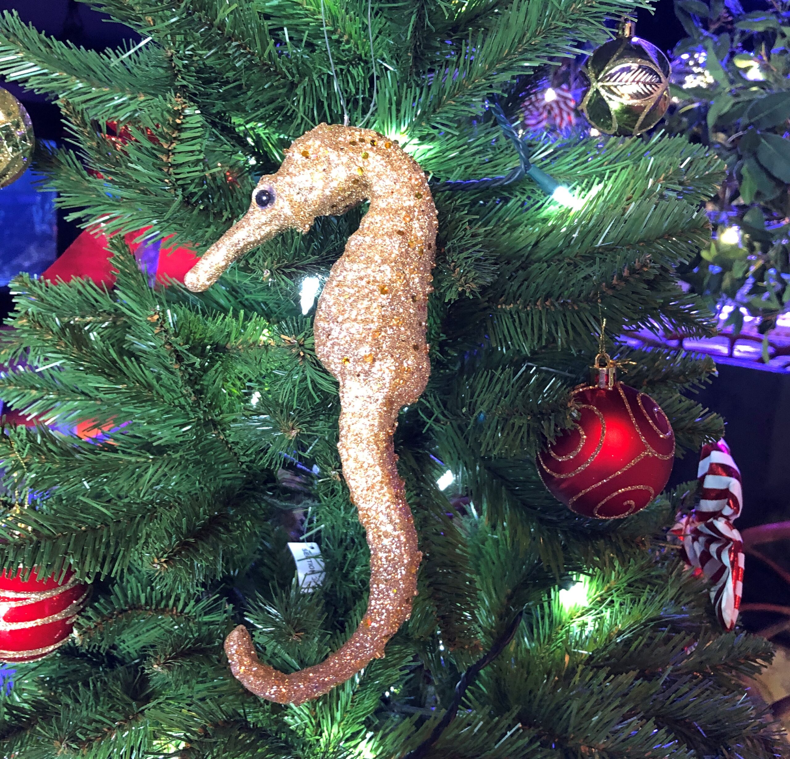
Trees: evergreen simulations, which seem a little out of place. But why not?
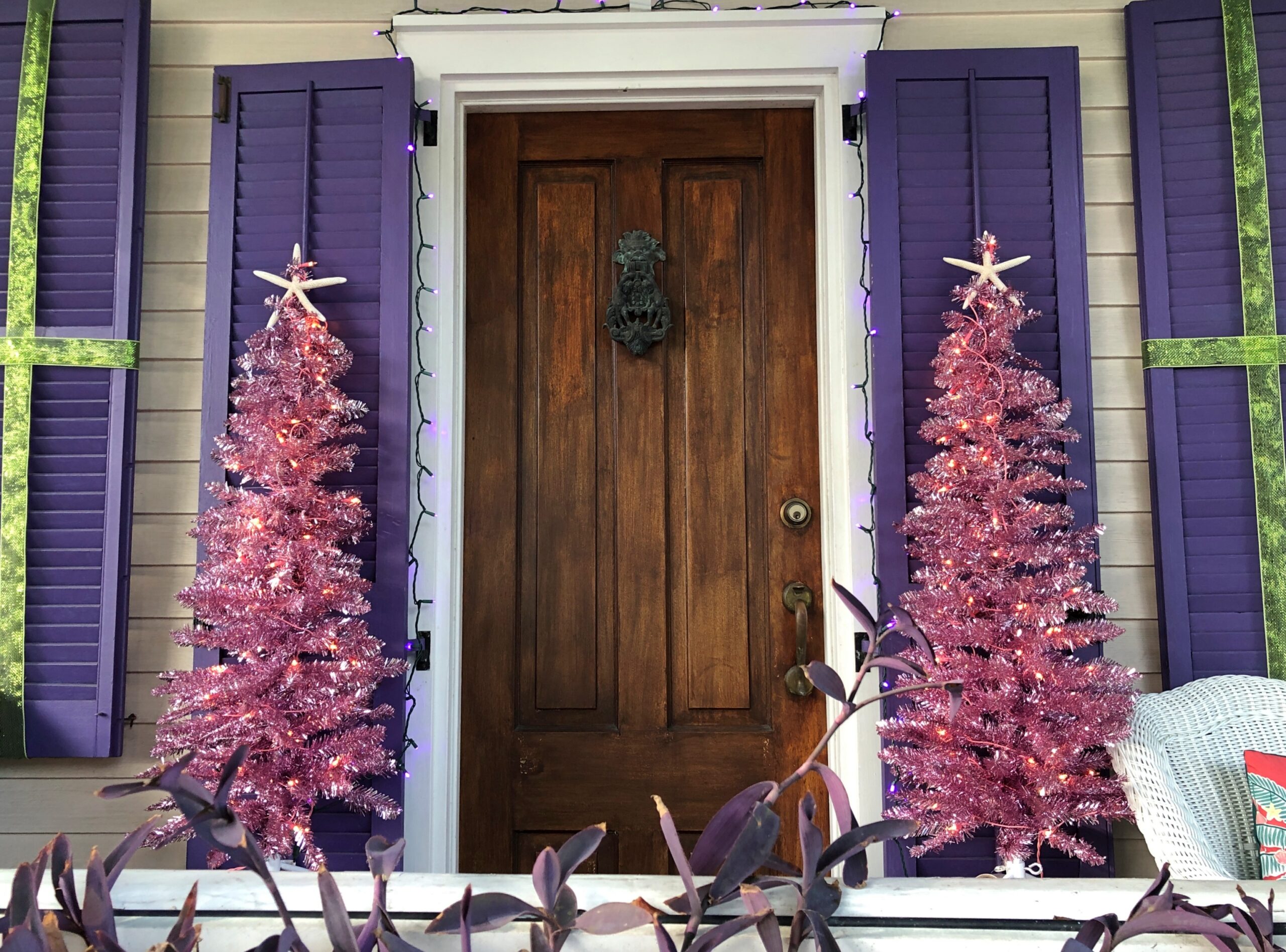
A pair of pink aluminum trees.
We need a revival of the aluminum tree. Not everywhere during the season, but up a notch in the Xmas décor world. Unless that’s already happened. It might have and I wouldn’t have noticed.
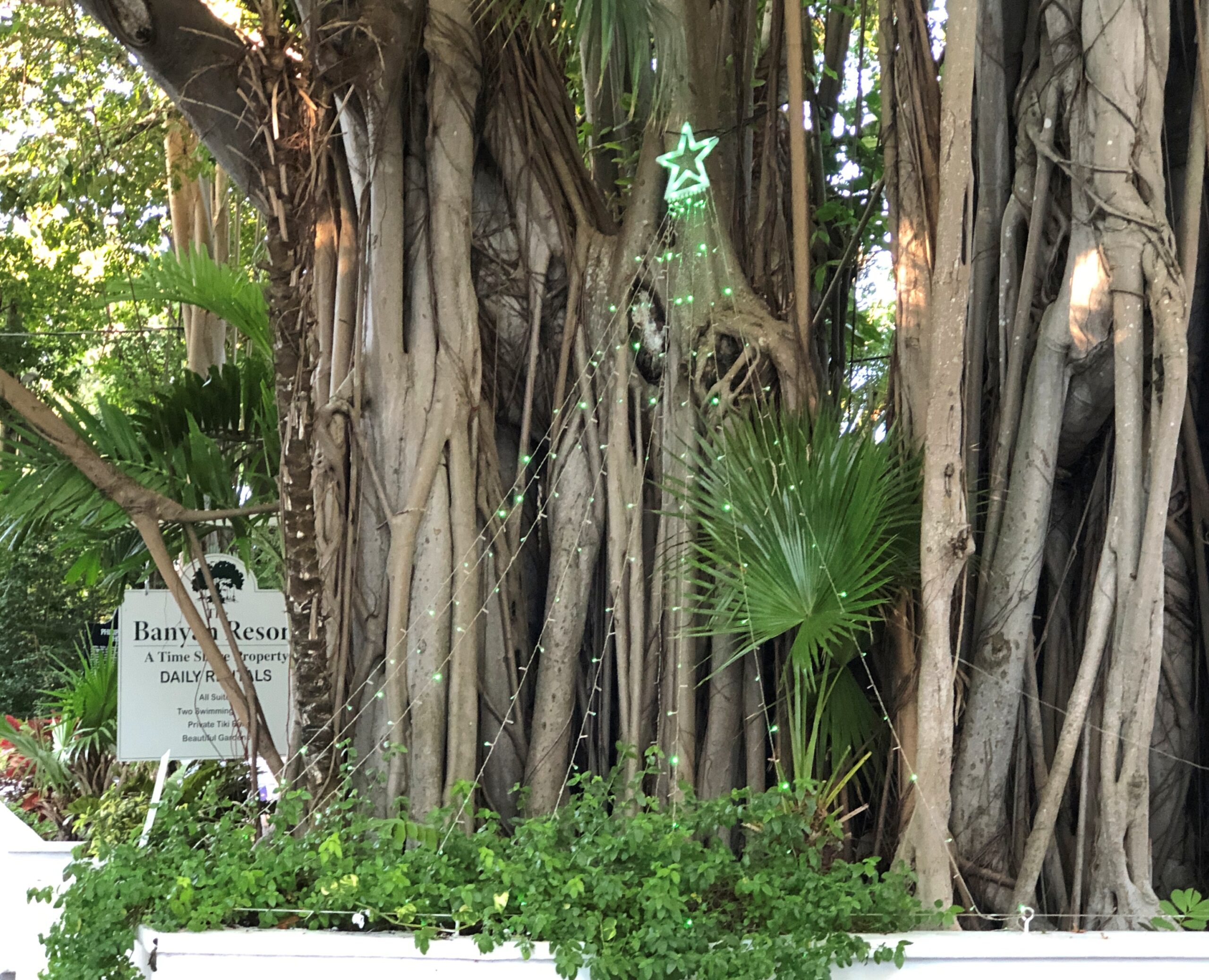
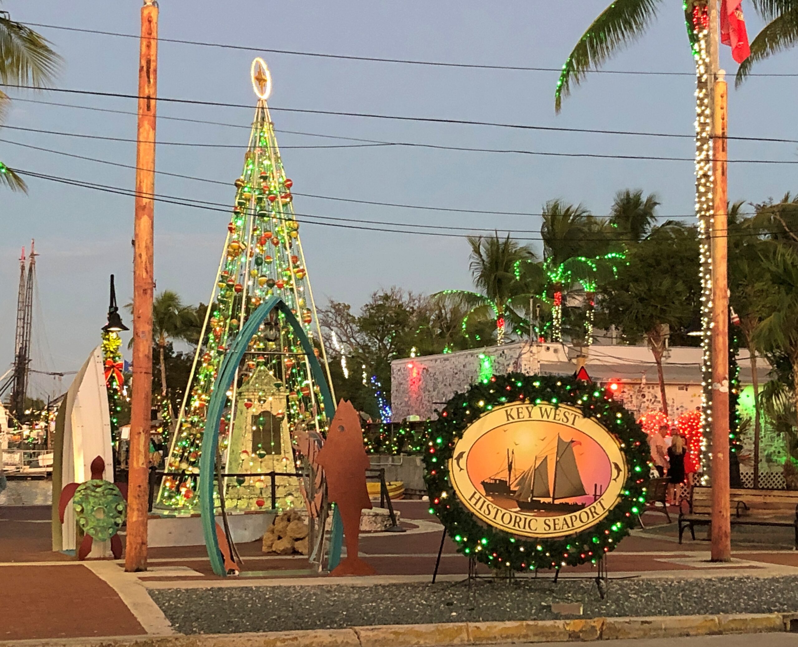
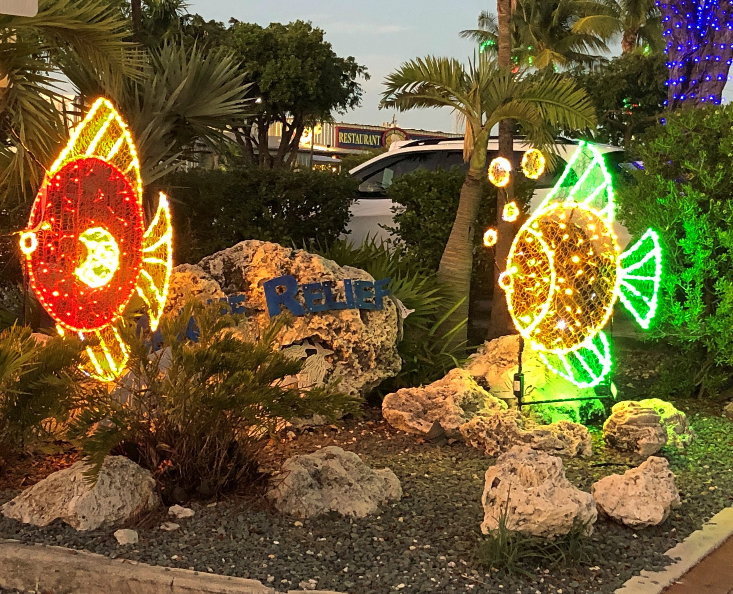
Tree in the abstract. Fronting a banyan. That, I think, counts as Key West local.
So does this.
Near dusk the first day was a good time to see lights.
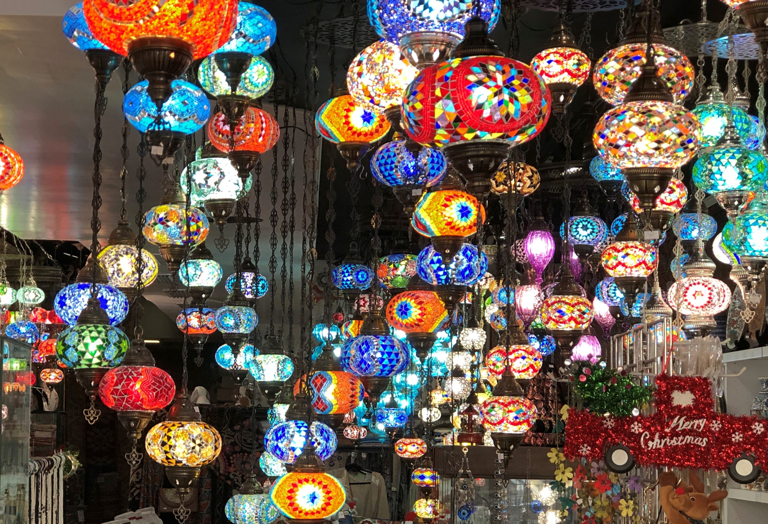
Not Christmas lights, but colorful all the same, and available to take home. We didn’t.
Not specifically Christmas either, but also colorful.
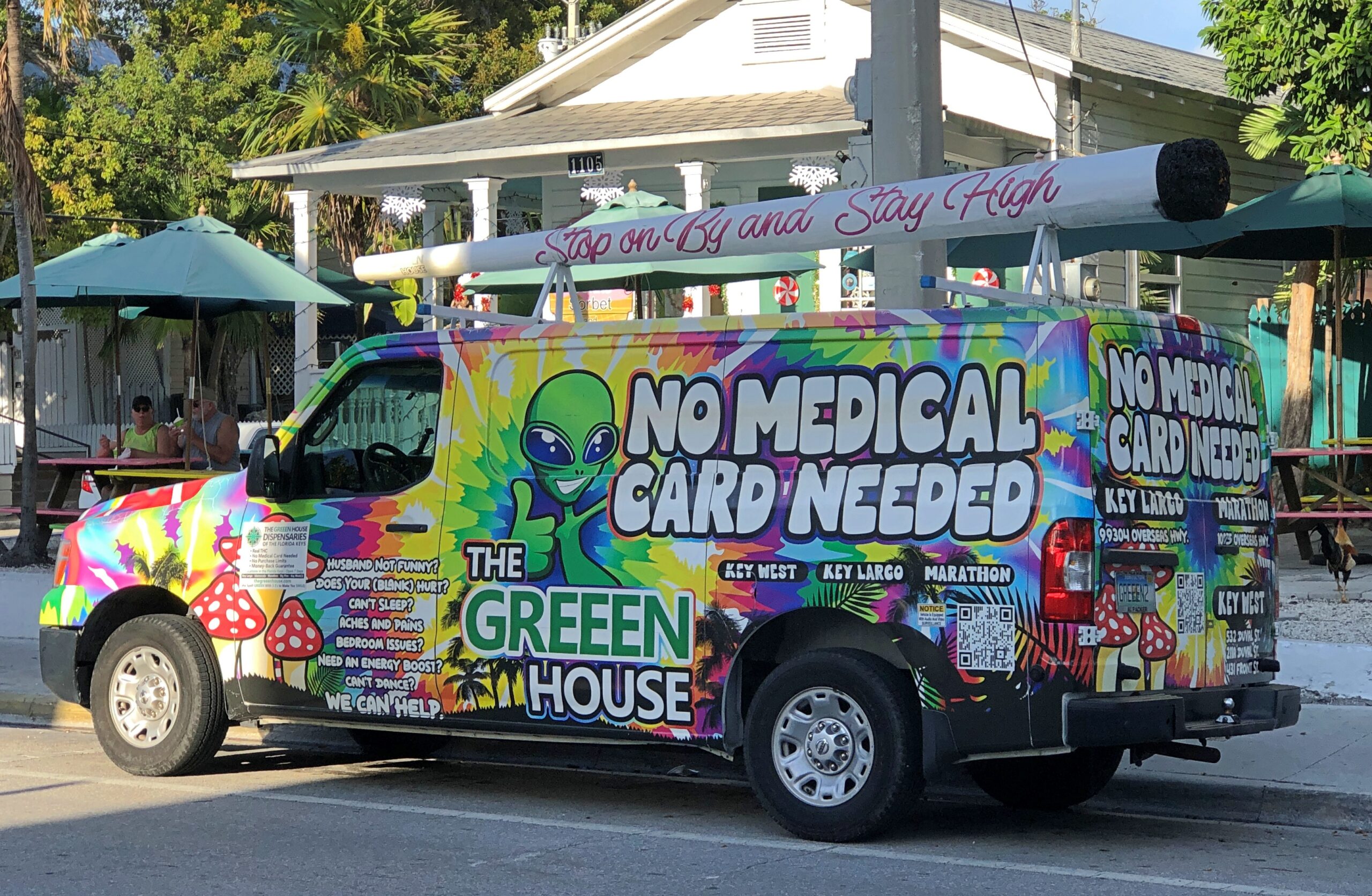
Countering the spirit of Florida cannabis law, if not the letter? Not sure. This truck wasn’t the only one we saw. Didn’t patronize them either. Ho ho ho.
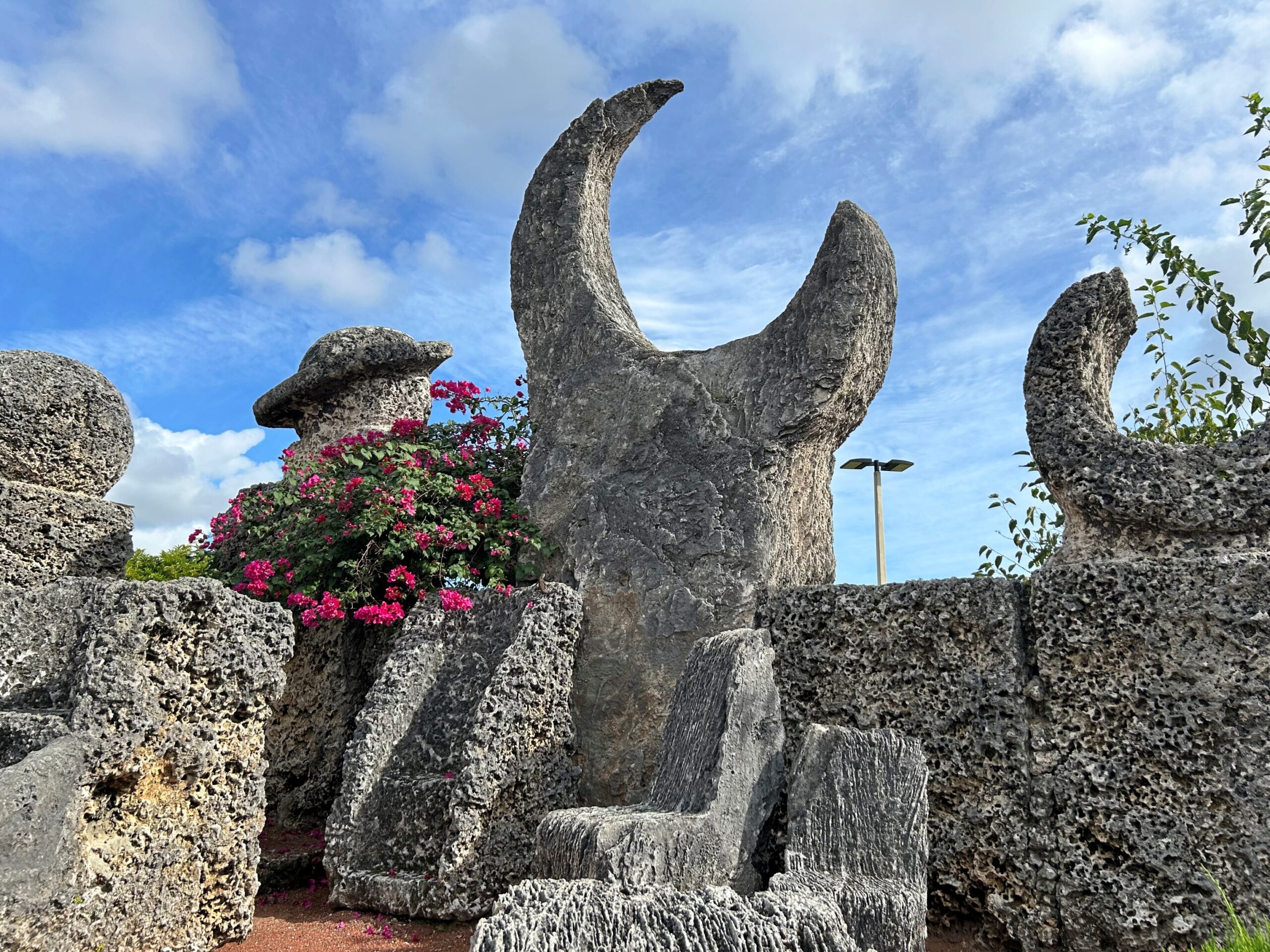
Where does eccentricity come to flourish? America, you could argue. Even more specifically, Florida. That might be too much of a generalization, and these might not be the best of times (or the worst) for American eccentricity, but the example I have in mind actually reaches back a century or so: Ed Leedskalnin, immigrant from Latvia who single-handedly built the Coral Castle in Homestead, Florida.
The story goes that his fiancée left him at the altar back in Latvia and that Leedskalnin, born into a family of stonemasons, built the place to remind himself of his lost love once he’d settled in Florida. Since he lived and worked alone, an undergrowth of lore grew around his creation, some stories more ridiculous than others.
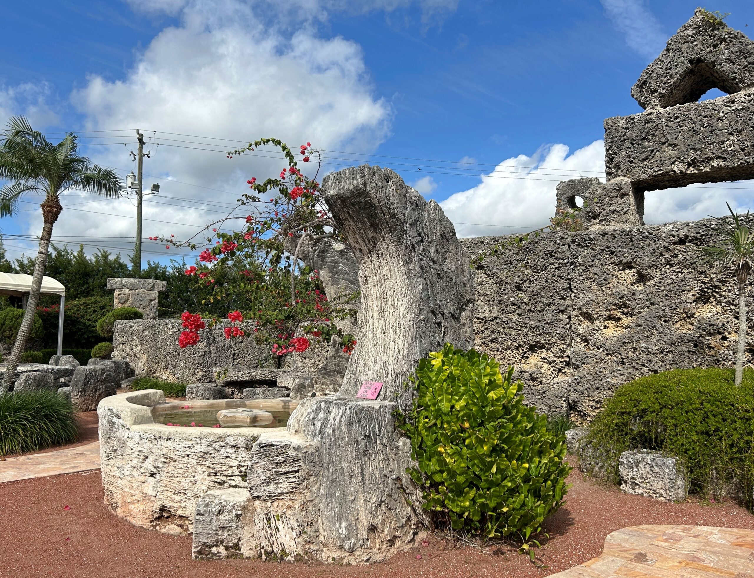
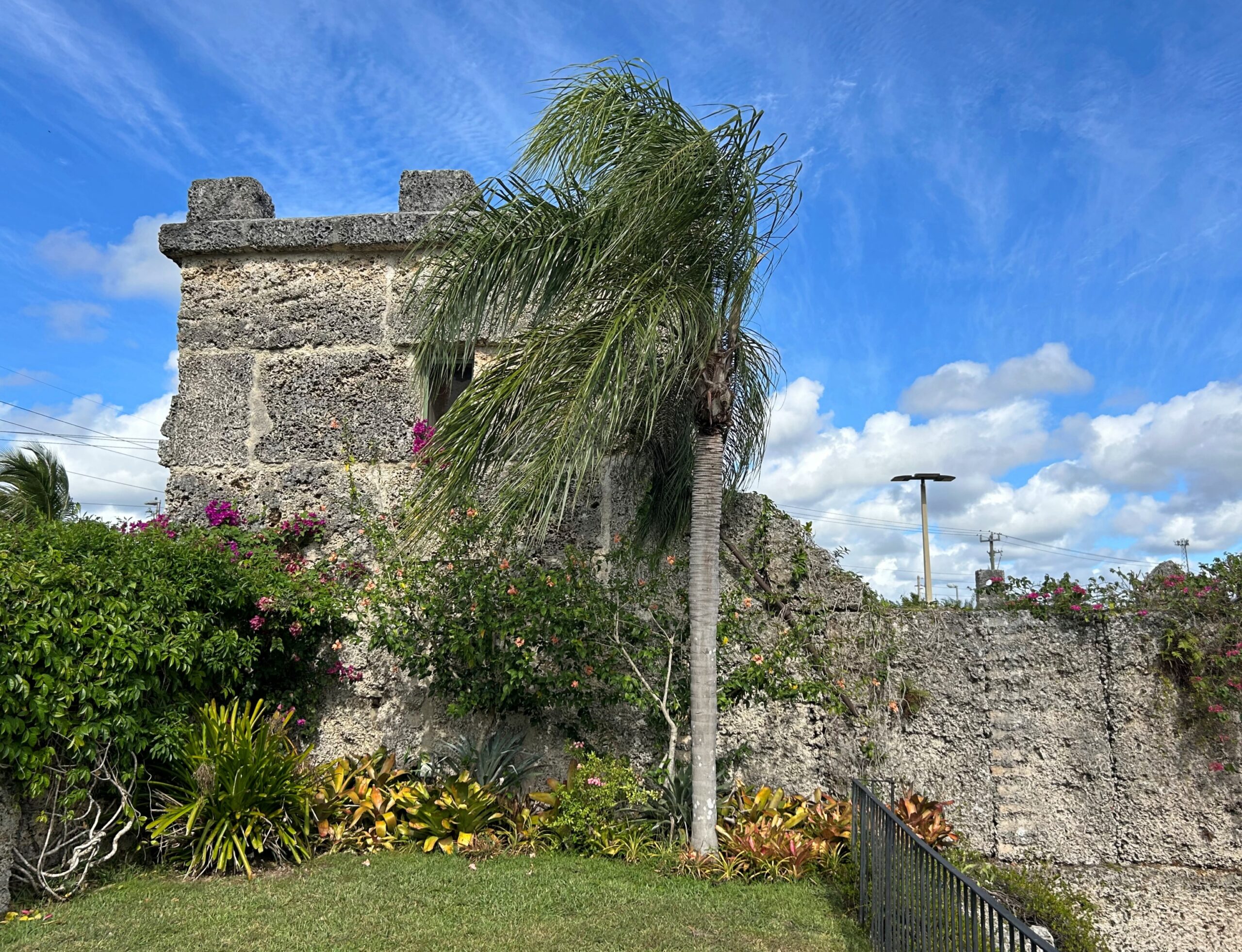
Actually, he called it the Rock Gate, and started building it in the 1920s in Florida City, not far away. Considering that some of the oolite limestone structures weigh some tons, one of the amazing parts of the story – just one among many – is that Leedskalnin decided to move them in the late 1930s to their current location on US 1. After that, he added more structures, and the whole thing stands today as a somewhat overpriced tourist attraction, but also a monument to eccentric, determined monomania, the kind that leaves behind a place to gawk at.
I was willing to pay. We took the tour, which is the only way to legally visit inside Coral Castle’s stone walls, just before we left Homestead for the Keys.
“The castle contains many wonders including a sundial, a stone rocking chair, a 500-pound heart-shaped stone table (a ‘Valentine’ for his lost love), and a 9-ton gate made to spin with just a light touch,” Atlas Obsura notes. “Ed was secretive, working on the castle mostly at night, and keeping to a policy of letting no one see his working methods. This led to much speculation that Ledeskalnin used some magical or ancient power to move the giant stones.”
Magical power, eh?
As a more detailed article published by the Skeptics Society points out, Ledeskalnin clearly knew the “principles of levers and fulcra.” I’ll go along with that. If anything, that’s more of an achievement than using magical powers. For all I know about levers and fulcra, it might as well be magic.
And what of Latvia? Our tour group was about 10 people, including a young couple who said they were from Latvia when the guide asked where everyone was from. This answer didn’t surprise him. Apparently they weren’t the first.
Toward the end of the tour, I asked the Latvian man if Ledeskalnin was known in his home country after all these years, and for something so odd (not quite how I phrased it). Oh yes, he said. Maybe not famous, exactly, but people had heard of him (not quite how he phrased it), enough that a steady trickle of Letts come to see his creation while in distant Florida.
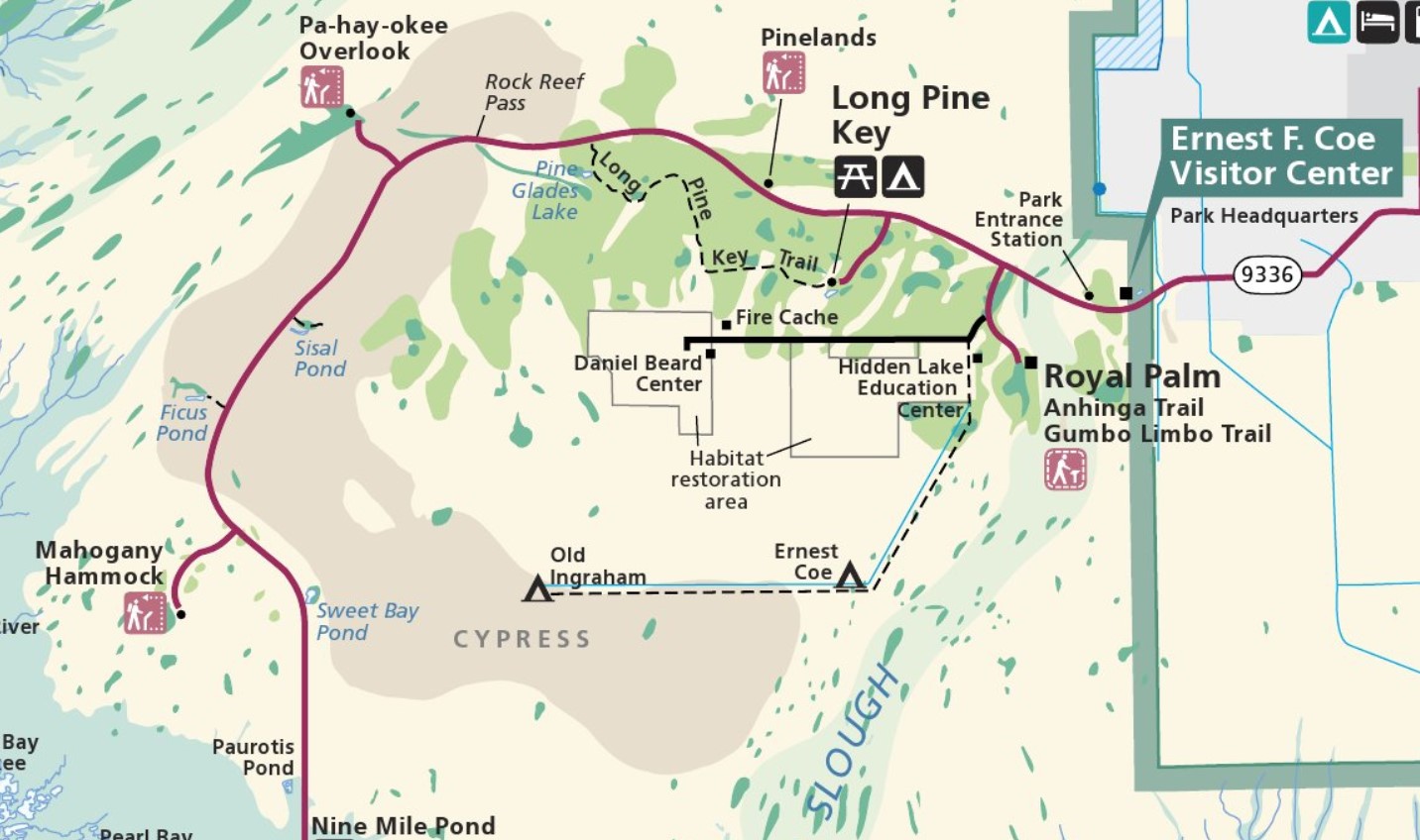
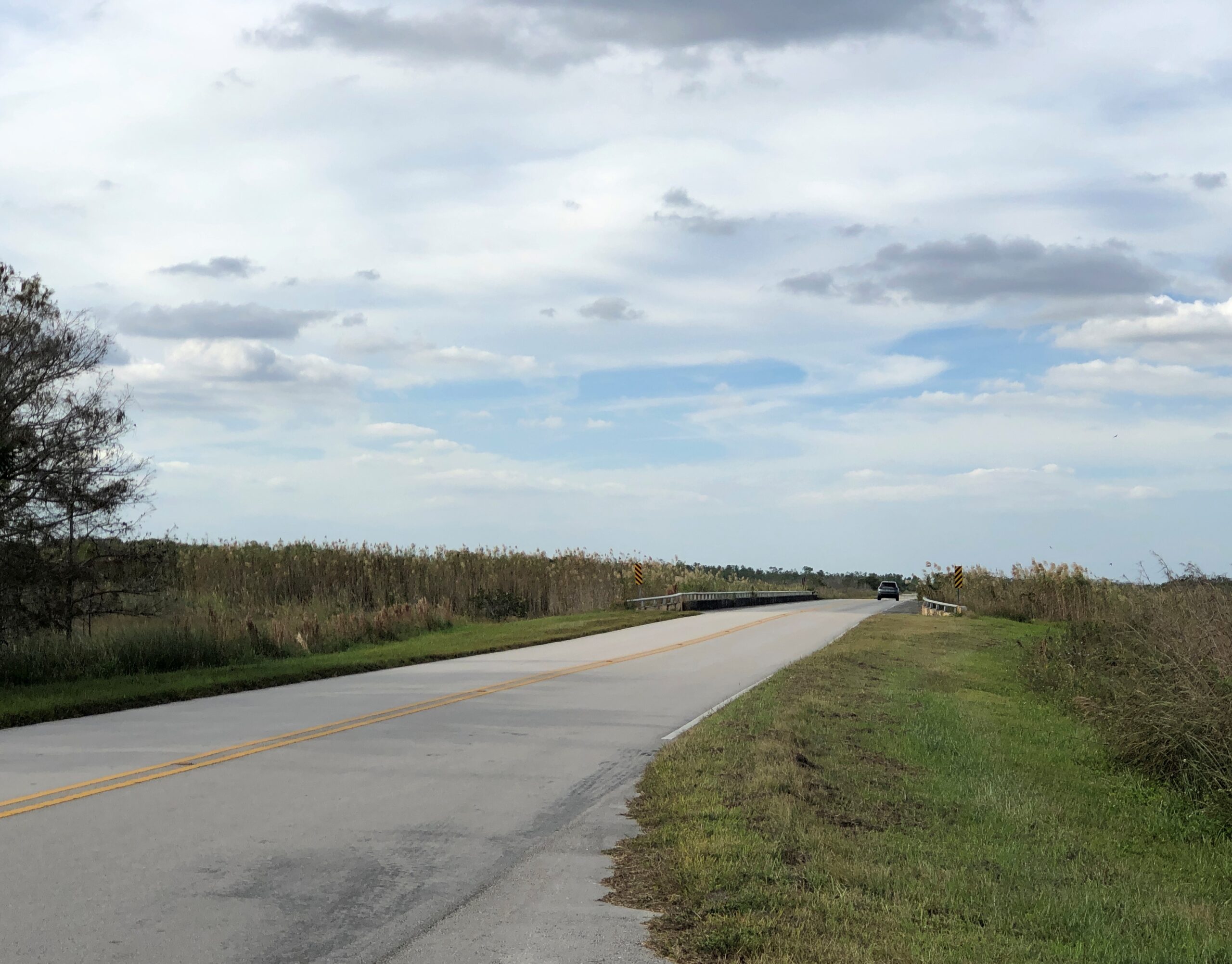
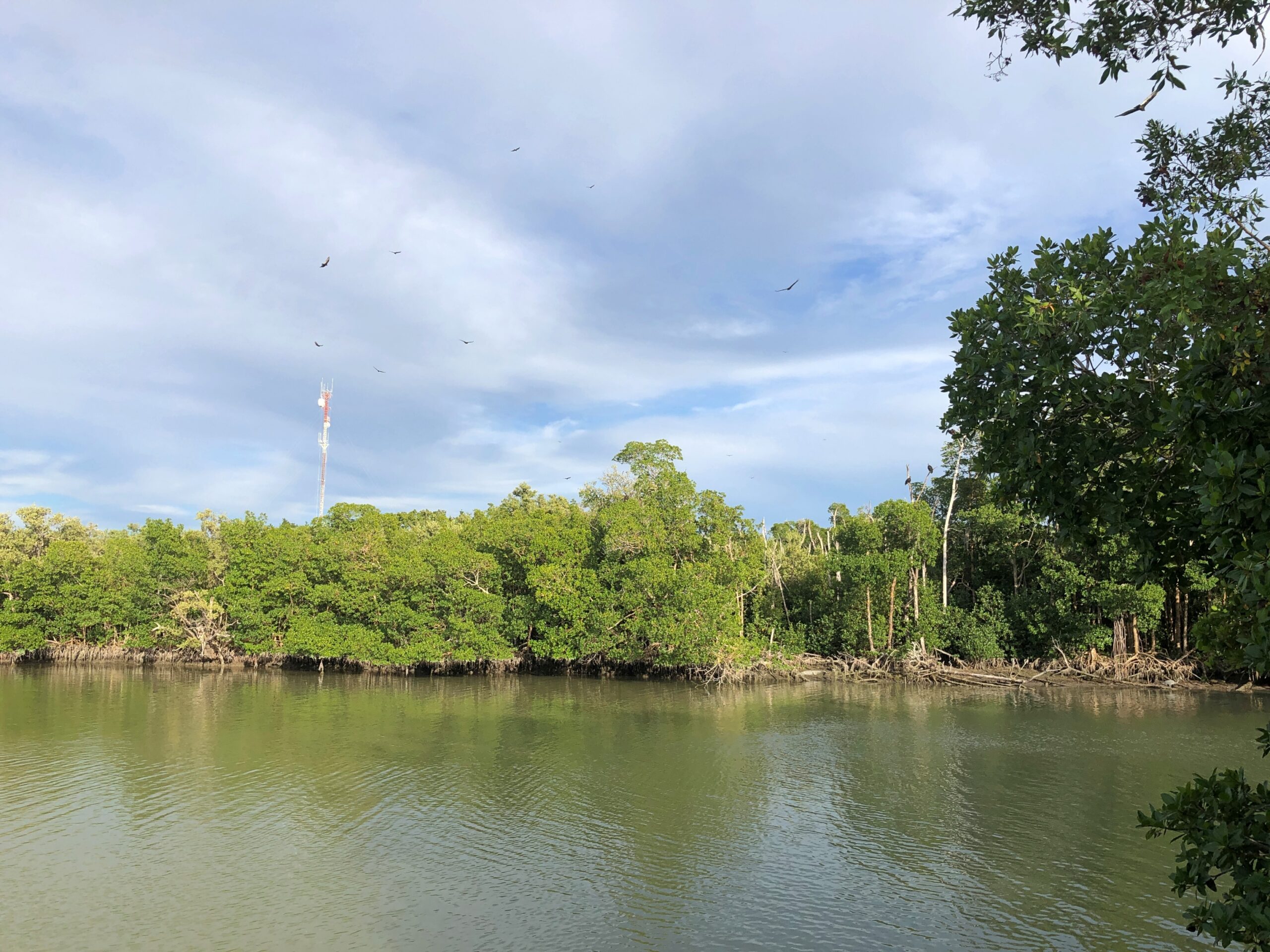
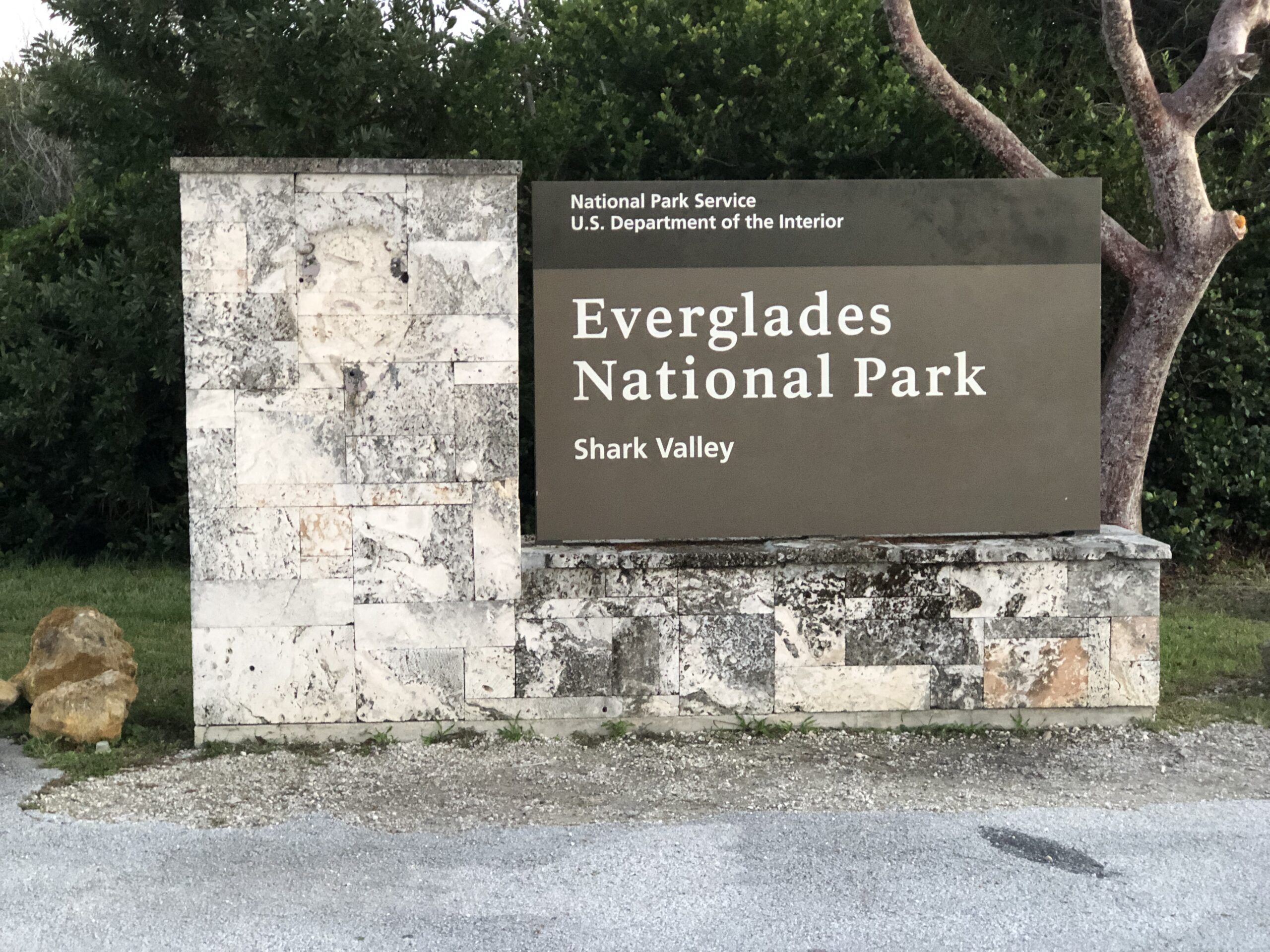
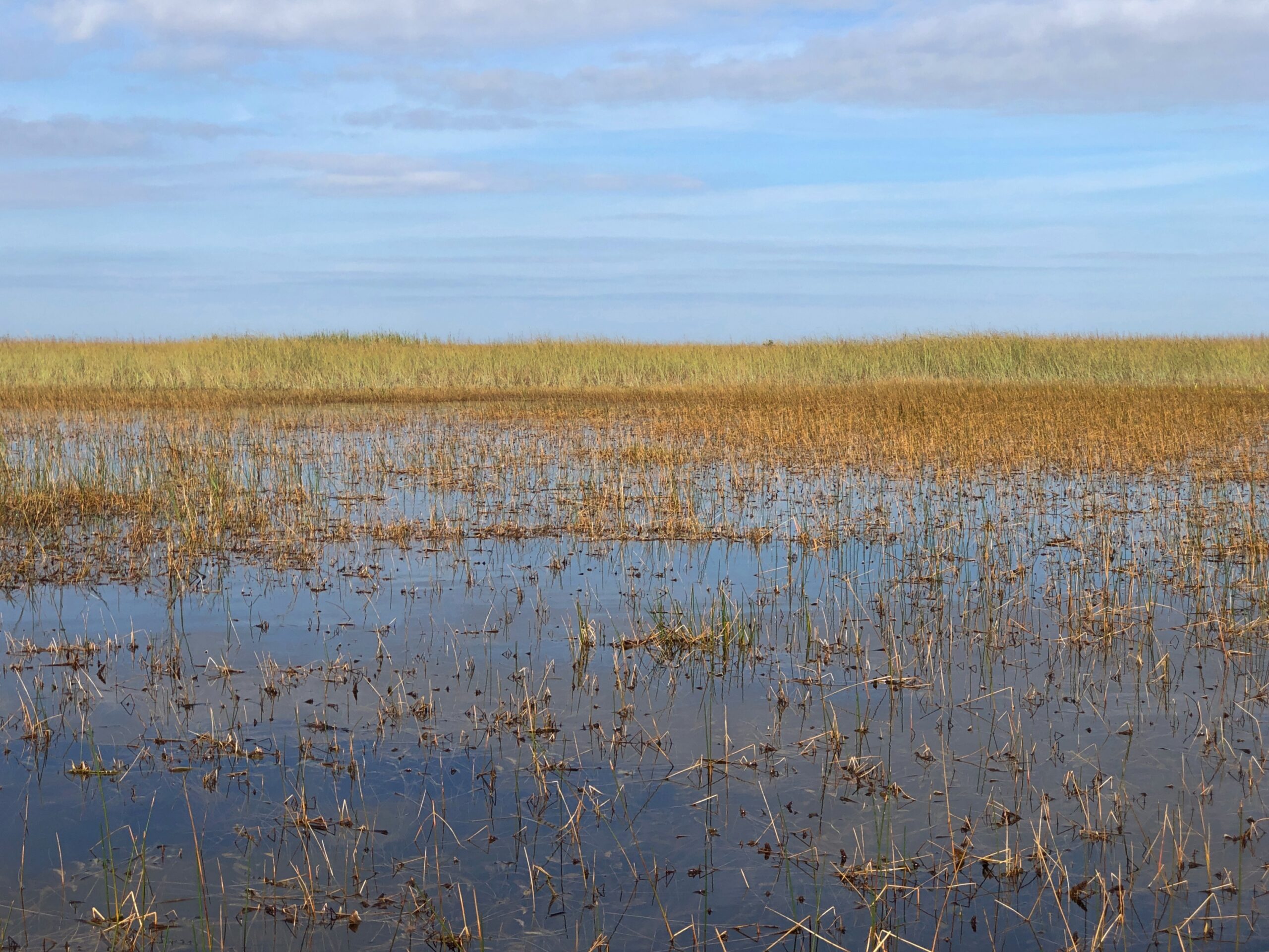
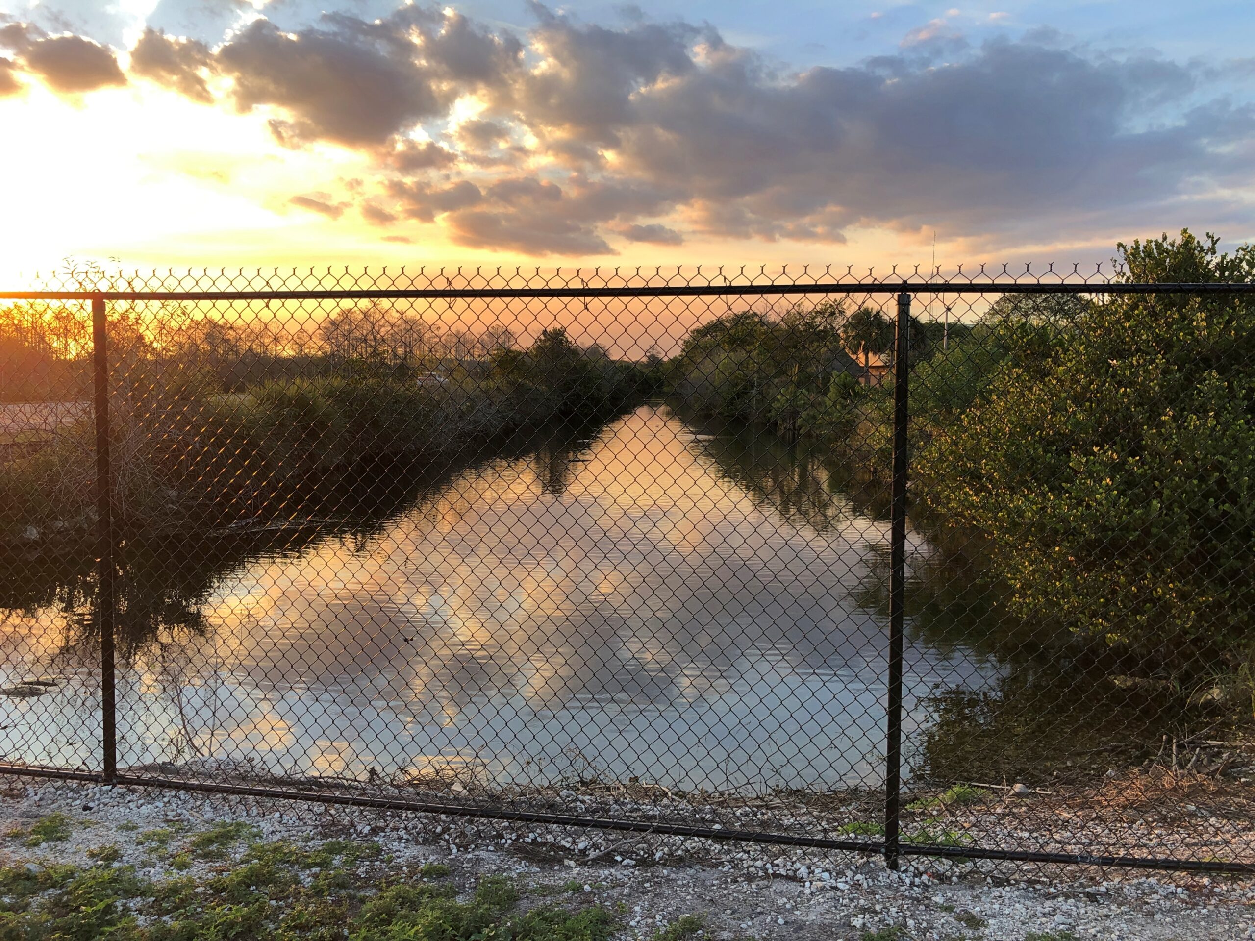
I’ve seen maps of Everglades National Park for years, and noted with great interest the main road snaking through the park, from the southern part of greater Miami to a point on the peninsula’s south coast. It was a road I’d long wanted to drive (in red, below), and on the afternoon of December 12, that’s what we did. Only about 40 miles each way in the park, so not too long a drive.
We stayed in Homestead, as far south as metro Miami goes, for the purpose of visiting the Everglades. Outside the park, the road is Florida 9336. Inside the park, it’s the less interestingly named Main Park Road. Odd, considering that some examples of nearby features are named Gumbo Limbo Trail, Hells Bay Canoe Trail, Alligator Creek, Snake Bight Trail and Coot Bay and Coot Bay Pond.
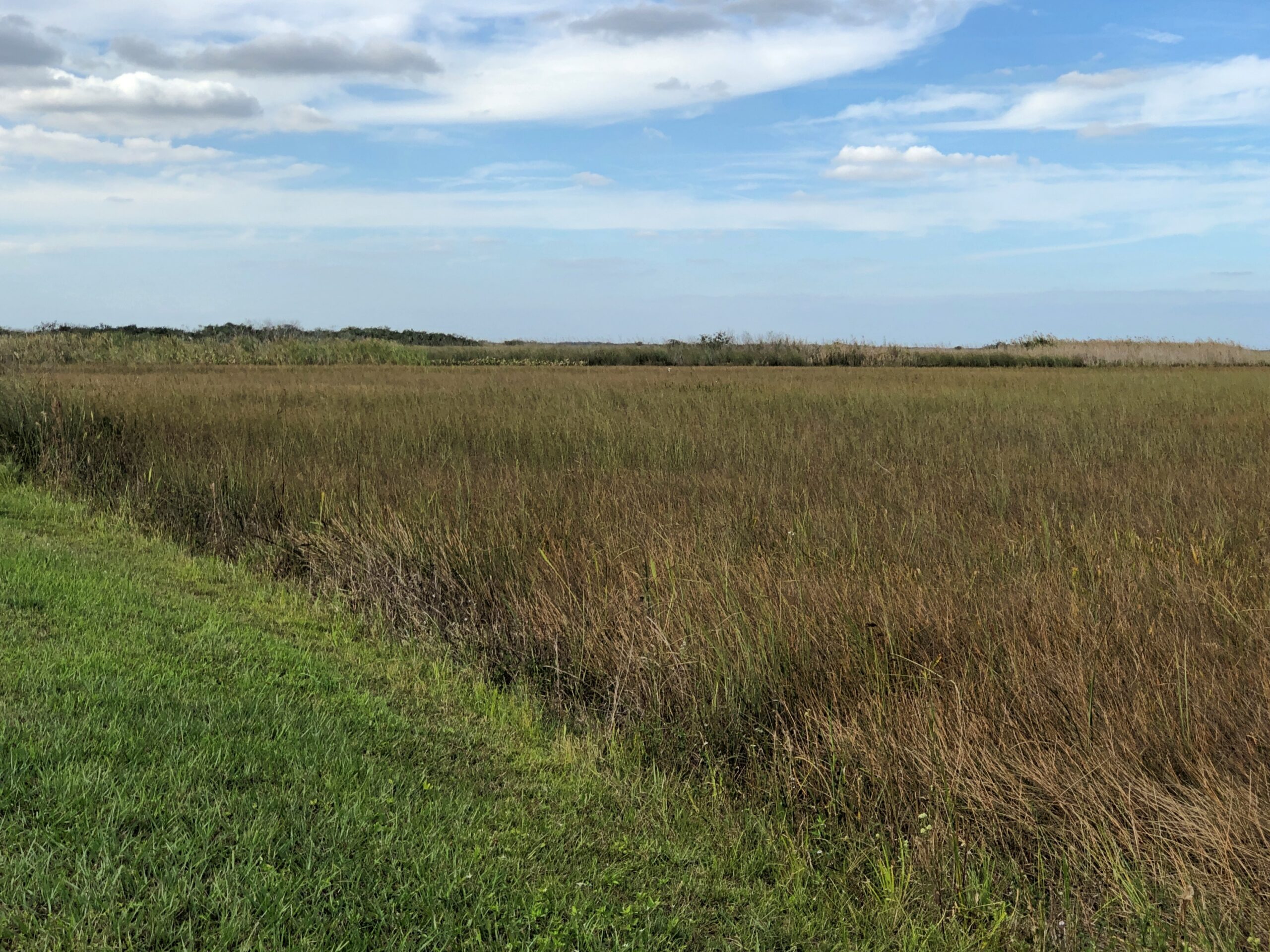
Almost no one else was around, which is the secret sauce for most enjoyable drives. My only minor complaint is that Pa-hay-okee Overlook, at the edge of a cypress zone, was closed. Considering how flat the terrain is, that view would have been expansive.
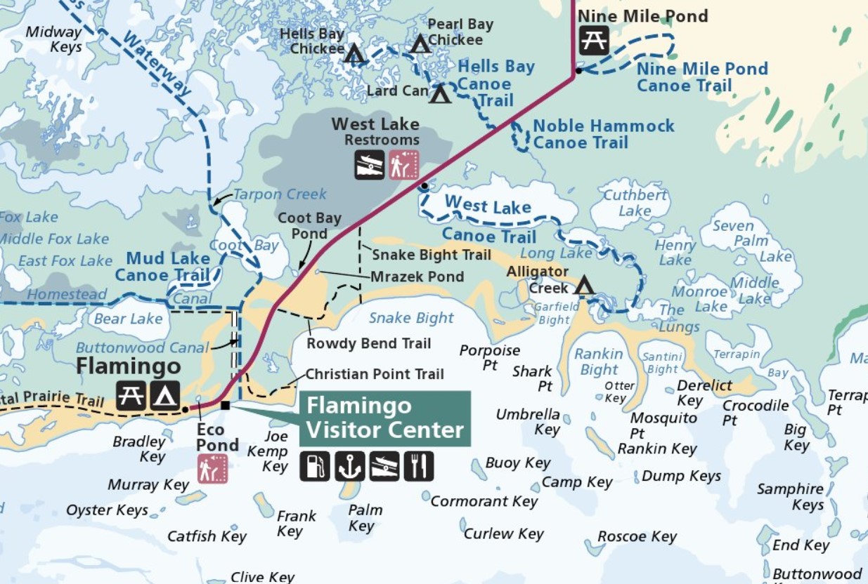
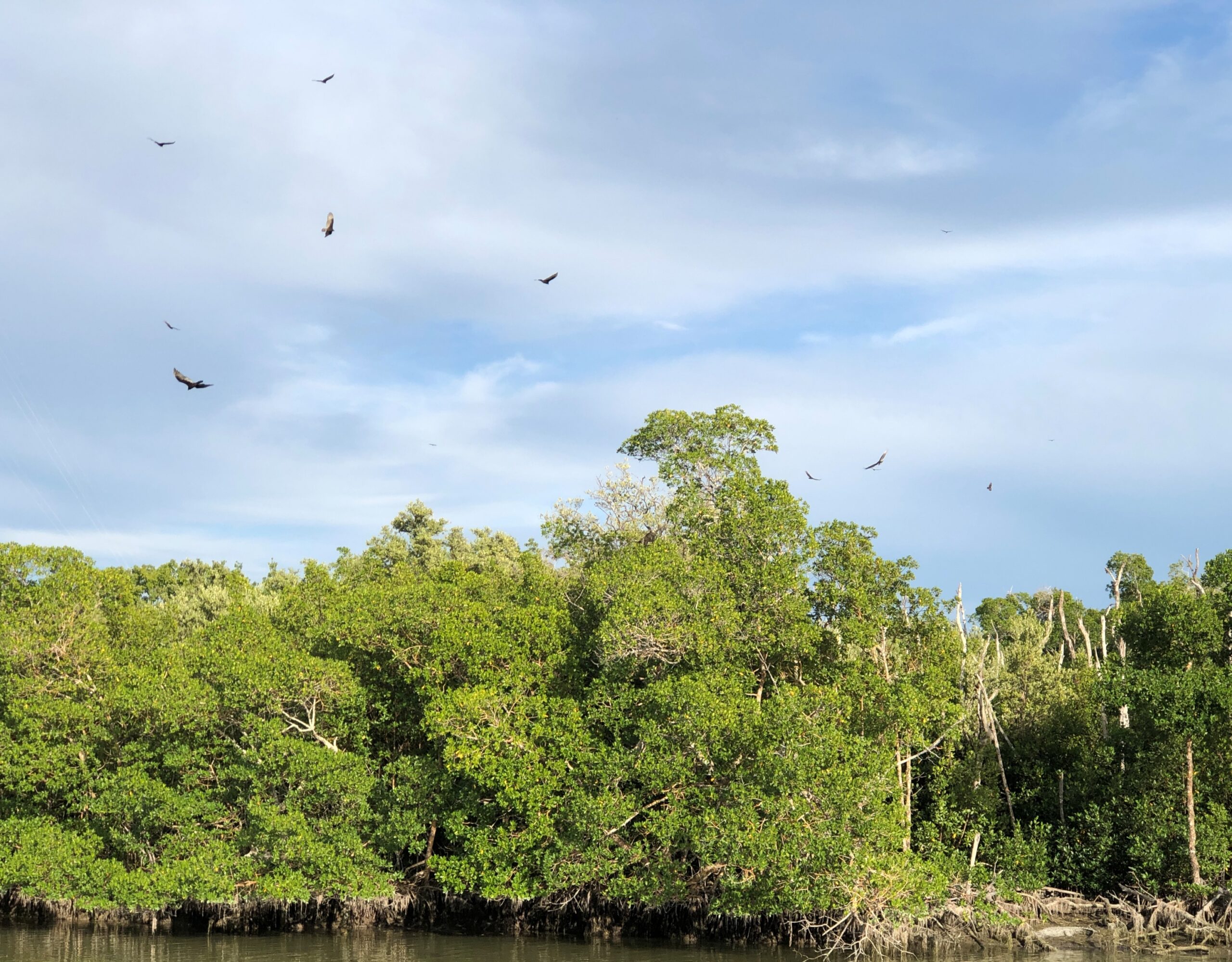
The park road takes you to Flamingo, Florida, which has no current human population unless you count park staff, who must stay nearby somewhere at least sometimes. Flamingo has no flamingos, according to a park ranger we met, whom I’ll call Bobbie. There seem to have been some of the birds in the late 19th century, she said, but they moved on when hunters showed up, looking for a source of colorful feathers for women’s hats fashionable at the time.
Plenty of other birds are still around, looking for a meal. Hadn’t seen that many circling birds since we were in north-central India.
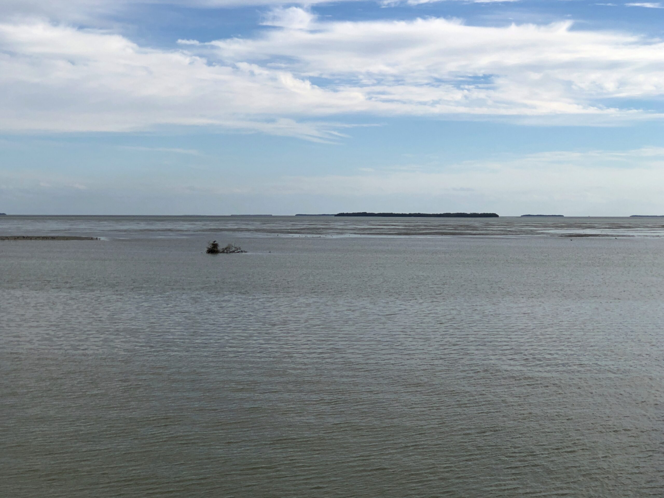
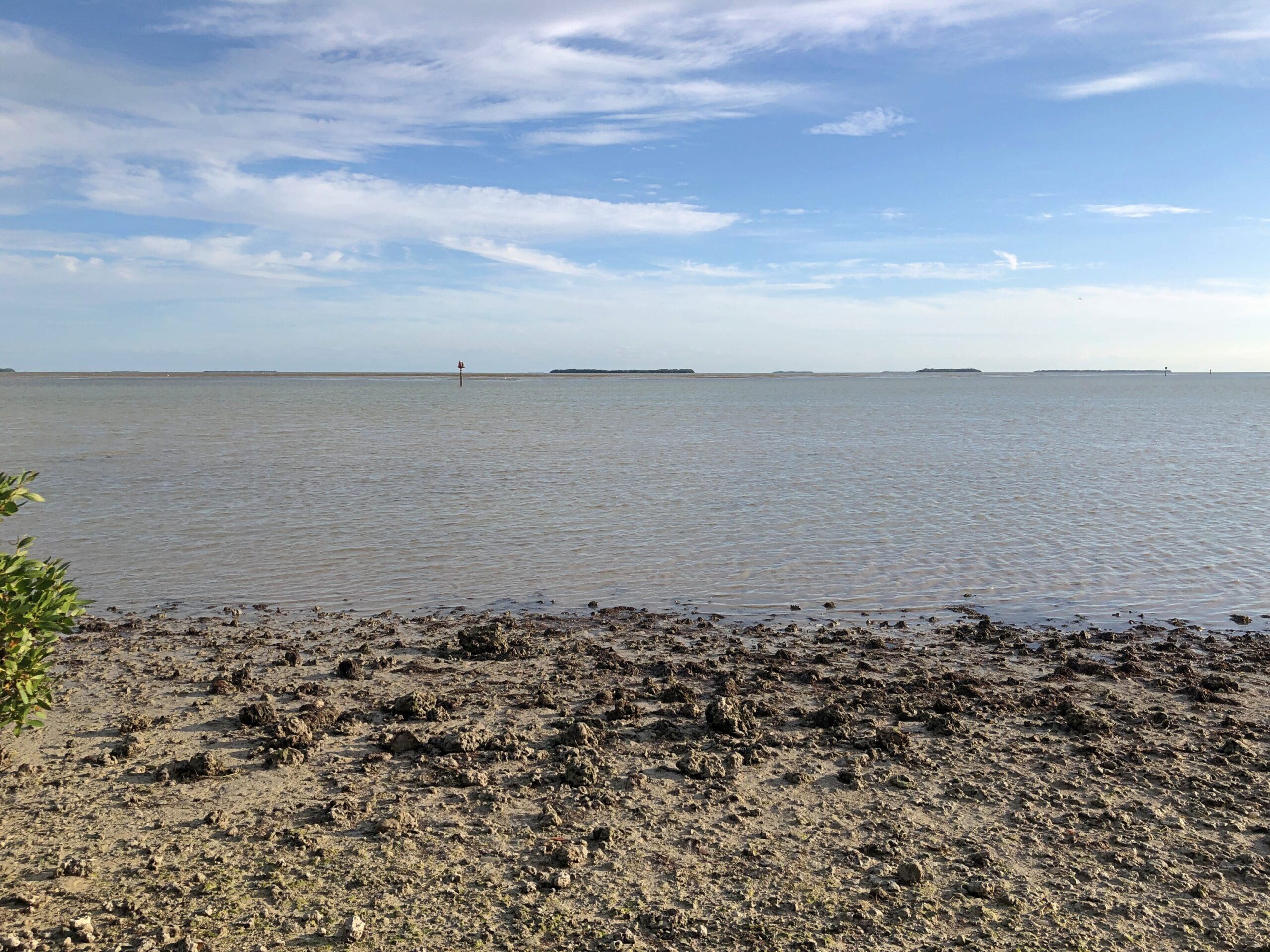
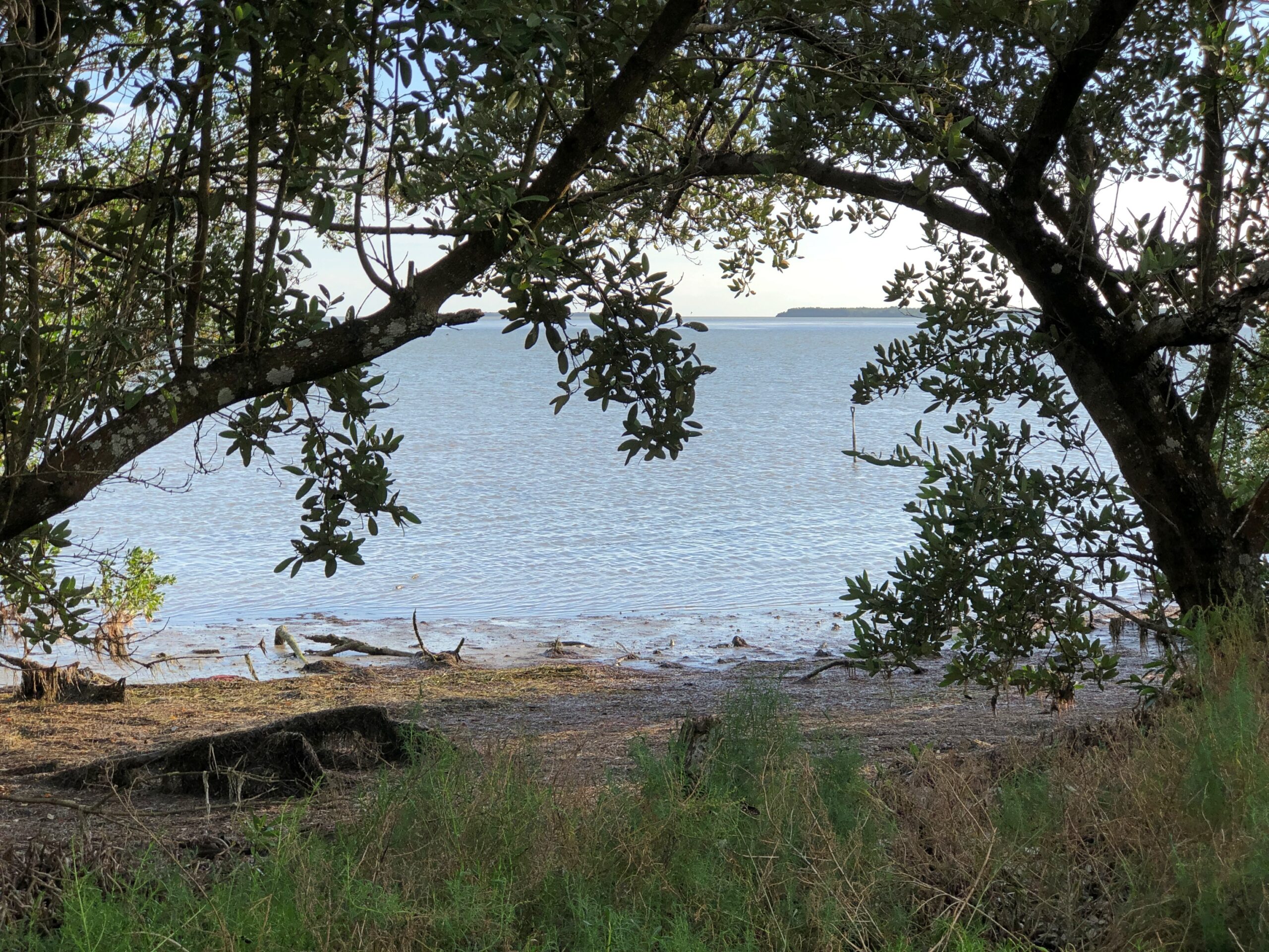
Flamingo, which is mostly the visitors center, lodging and campgrounds, offered views of Florida Bay and a few of its many keys, a term not limited to the chain of islands connected by the Overseas Highway.
We saw a manatee. Or at least a manatee nose poking out of the water near one of the docks at the park, then ducking underwater with an occasional small splash. The barest outline of its bulk was visible below.
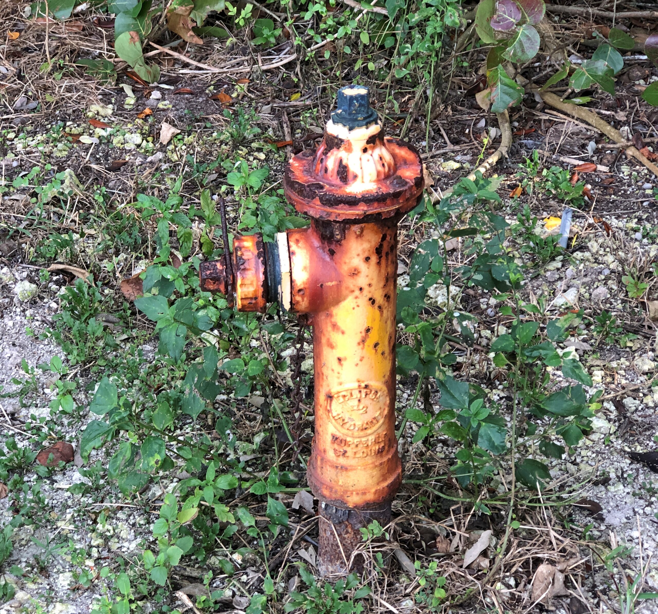
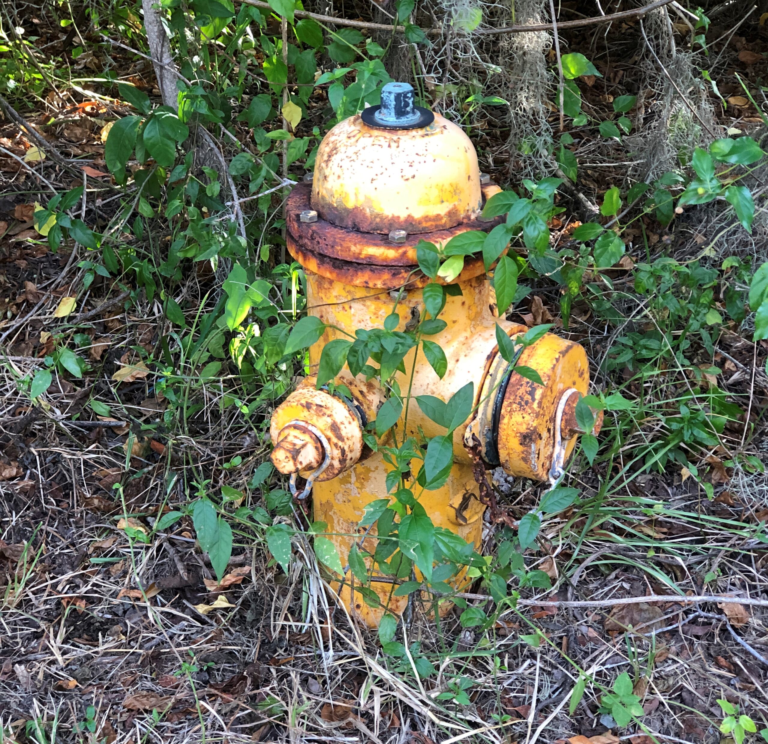
For some reason, the rusty fire hydrants on the park service property caught my attention.
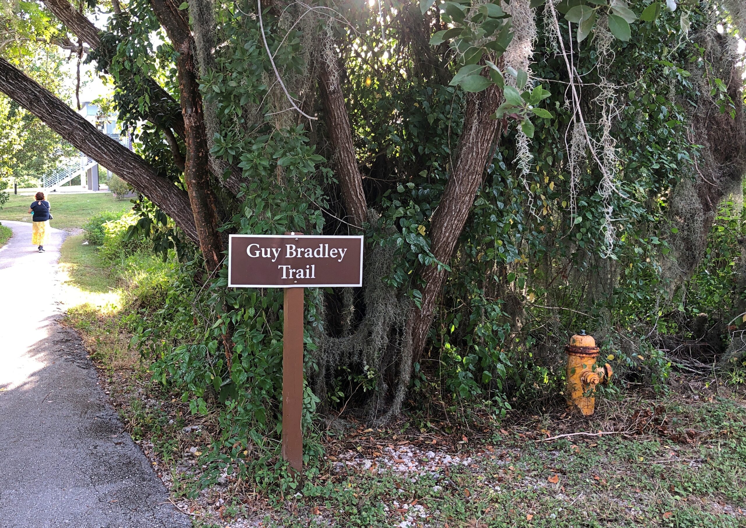
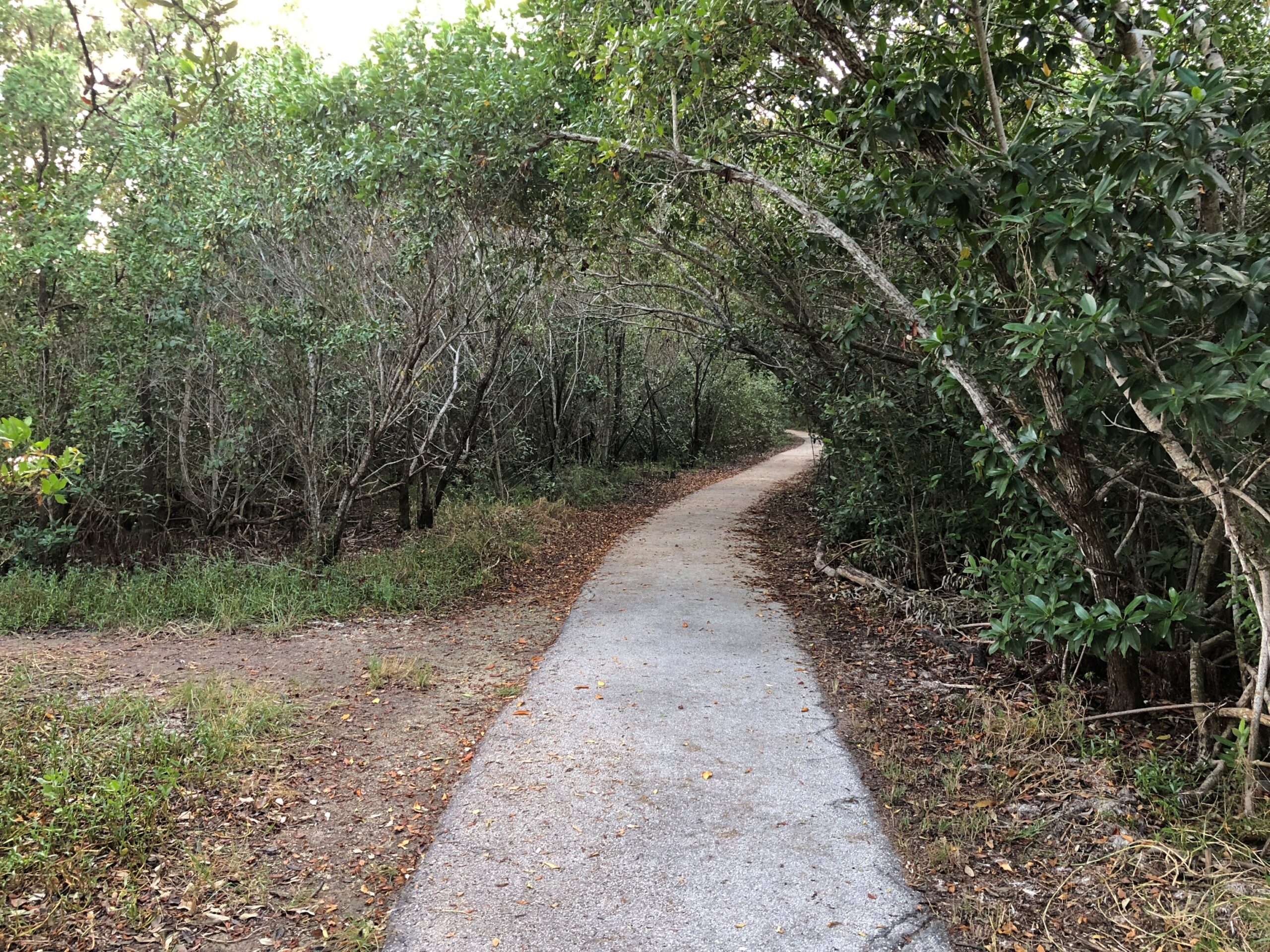
We walked the Guy Bradley Trail. The Flamingo visitors center is also named for Bradley, an early game warden in the area who died in 1905 at the hands of poachers.
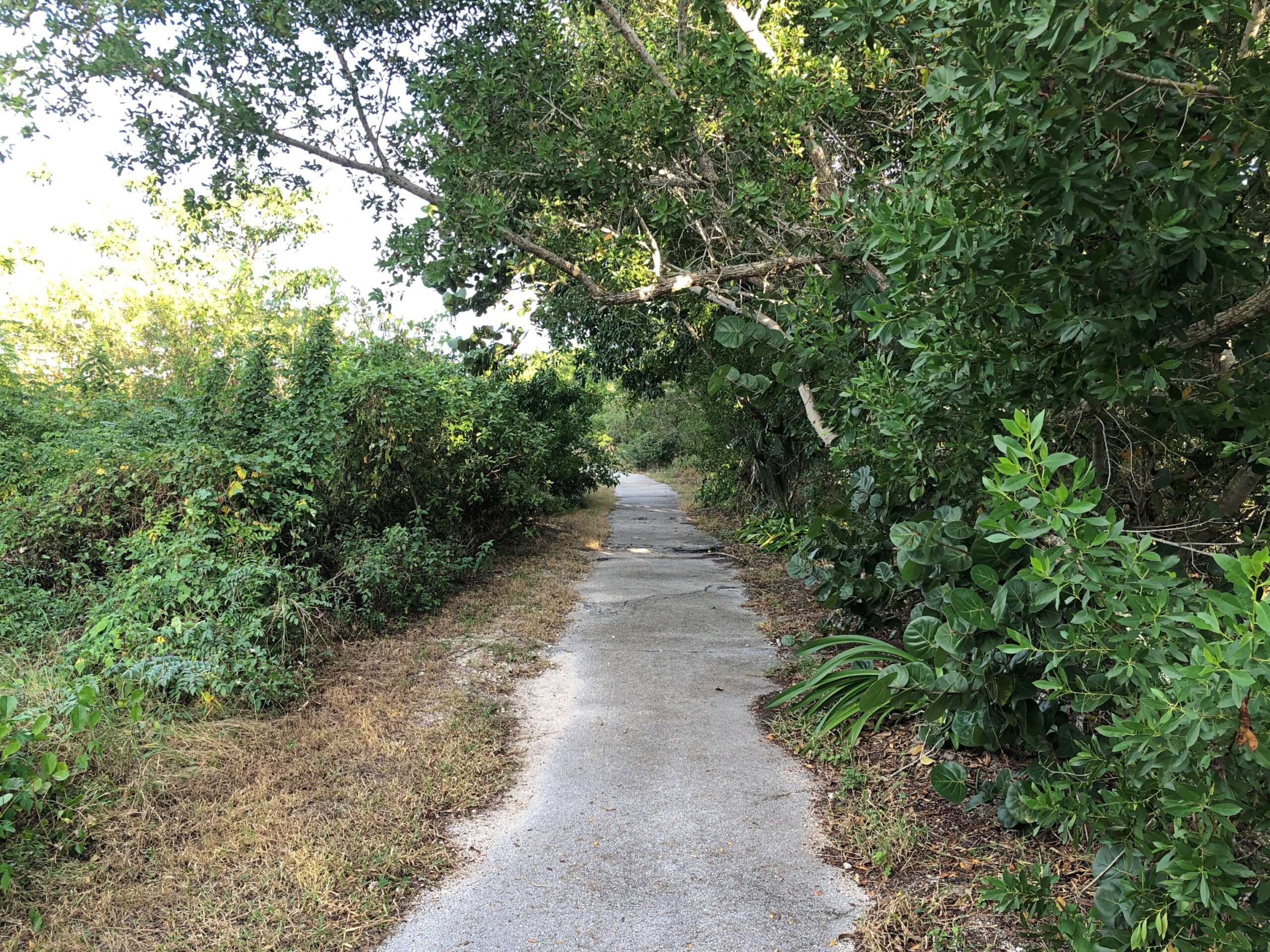
The trail, paved and mostly in good shape, was an easy one.
With some views of its own, including the ocean and not including the ocean.
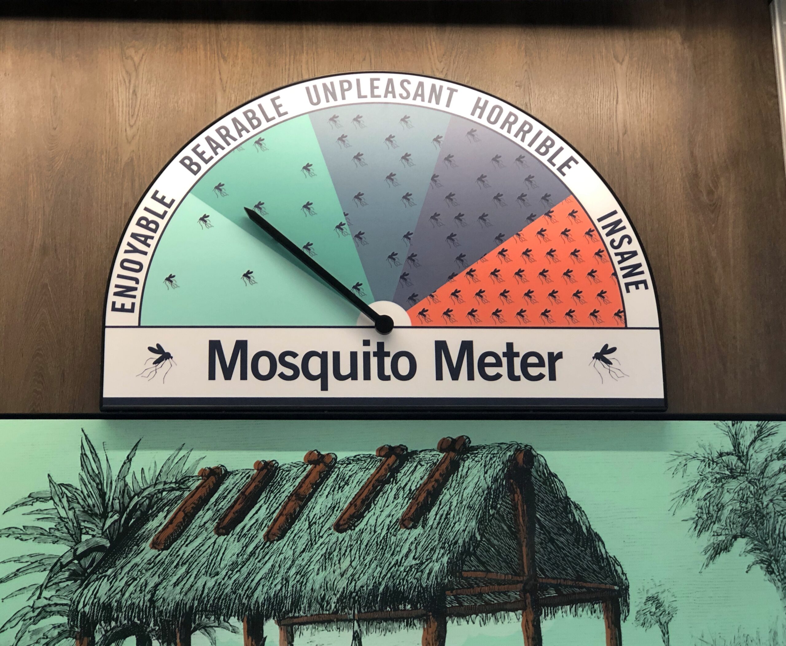
One reason to visit the Everglades during the winter months, maybe the number-two reason right after the absence of searing heat, is the absence of mosquitoes. Make that the relative absence of mosquitoes. During our walk through the greenery around Guy Bradley Trail, a small number of winter mosquitoes were there to greet us.
Even in an age of DEET and whatever has mostly replaced DDT, you will find mosquitoes and more importantly, they will find you. That’s my experience over the years.
I close my eyes and I can recall those Pusan nights in ’90 in my non-climate controlled room, drinking the tea available in pots just outside everyone’s door, swatting mosquitoes that had clearly feasted on me moments before they died, and listening to the irregular beep-BEEP-beep-beeps of auto horns wafting in through the damaged window screens, along with more mosquitoes.
The only creature I run into regularly while camping is one or another kind of mosquito. The weather had been dryish in Jasper NP, so there weren’t that many there. Things had been even drier at Theodore Roosevelt NP, and we encountered only a very few hardy mosquitoes who managed to survive wrigglerhood in the risk-of-wildfire badlands this summer.
The plains near Regina, Saskatchewan, were another story. On the evening of July 3, we found a private campground a few miles east of Regina for a reasonable C$14. The place was sparse with people, probably since the Canada Day long weekend was winding down, but well populated with blood-drinking vermin. Their main diet likely came from the livestock on the surrounding ranches, but they weren’t above snacking on human beings. Once a cloud of them followed me, so I had to zig-zag back to our camp to lose them. Others buzzed intensely around the tent door until I sprayed it with Off.
I got out of my car to look around. The forest seemed even more oppressively dense with rain clouds gathering overhead. The air was warm and a little steamy. All I heard was the crunching of my footsteps, the mild rush of the wind, the twitter of birds and, suddenly, the buzz of mosquitoes. Mammals as large as human beings must be a tasty treat for the mosquitoes of the Apalachicola River Basin, because they attacked with terrific speed and in increasing numbers. For all I know, there are a dozen kinds, part of the wonderful biodiversity of the area. I had no chemical protection. I’d forgotten to pack anything with DEET in it, and the TSA might have taken it away anyway.
I took a short look at an interpretive kiosk that had some artifacts behind glass, and another look at the Milly Francis marker, but within a few minutes I retreated to the car. A couple of the mozzies followed me in, but I managed to dispatch the bastards in a pop of my blood.
Other national parks have majestic mountains or picturesque glaciers or striking deserts or epic coastlines or an important history of human activity. They have high-profile wildlife and ecosystems unique in the world. Congaree does count as a special place, preserving a tiny fraction of the floodplain forests that used to cover much of the Southeast, but that’s a little hard to appreciate on the ground, especially as the target of its high-profile wildlife, mosquitoes.
Text to a friend, along with the image: Now, what’s the bump in the water? Ah, it’s an alli AHHHGH
Reply from friend: Ha. Ha.
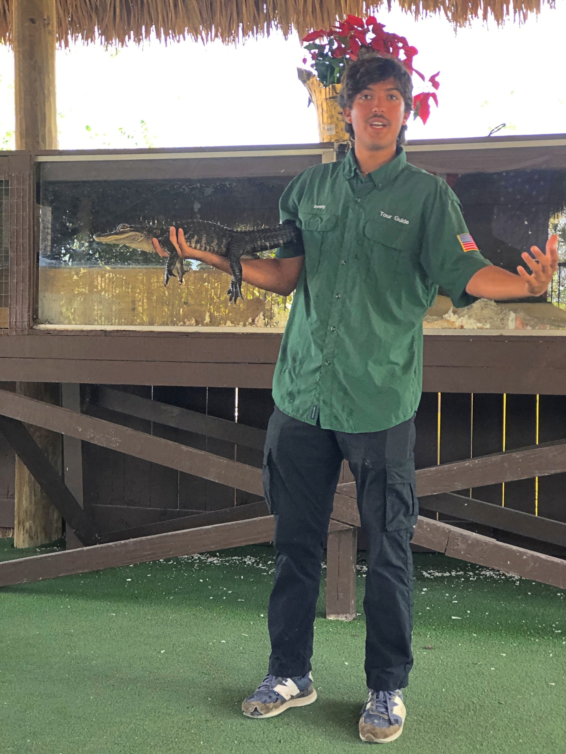
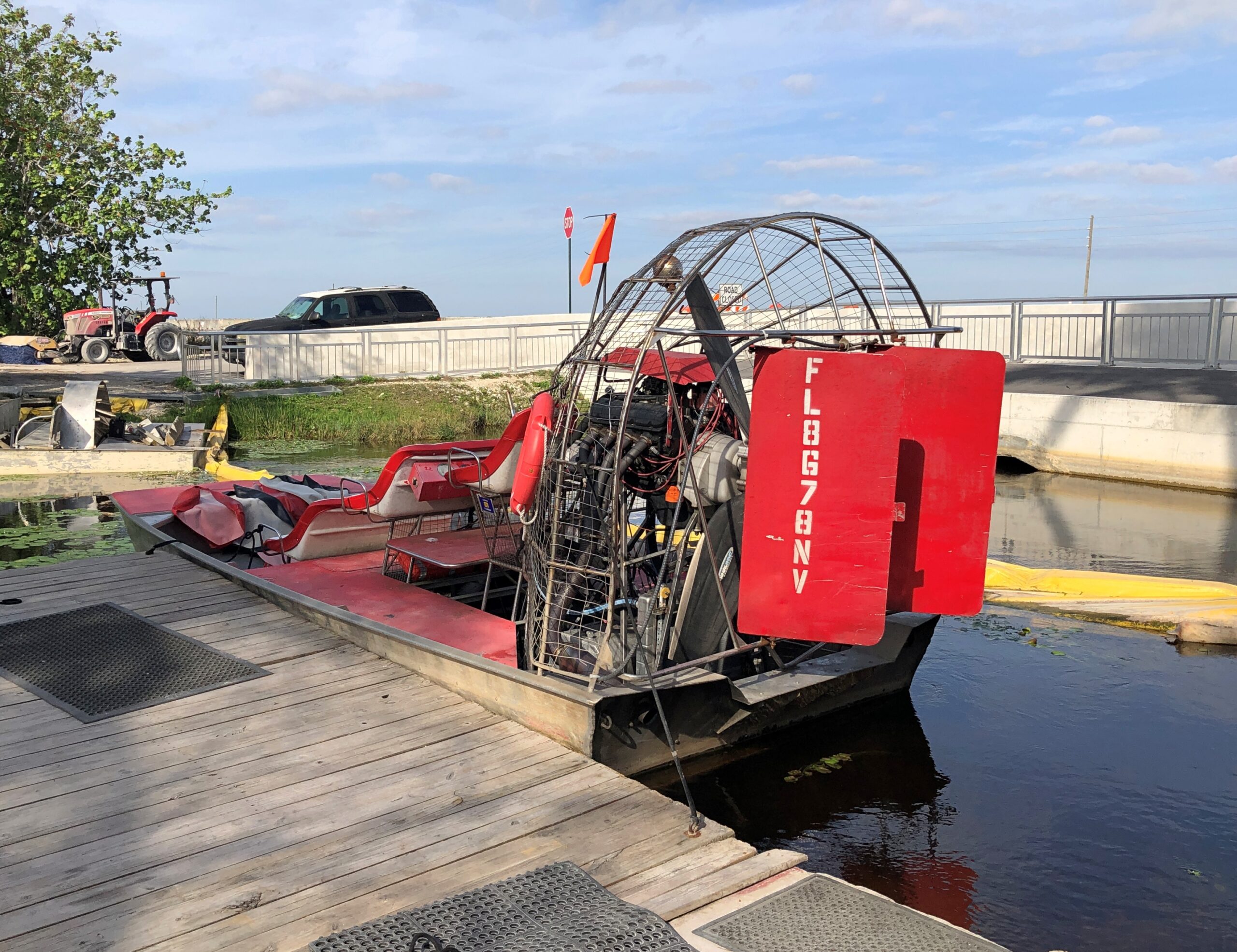
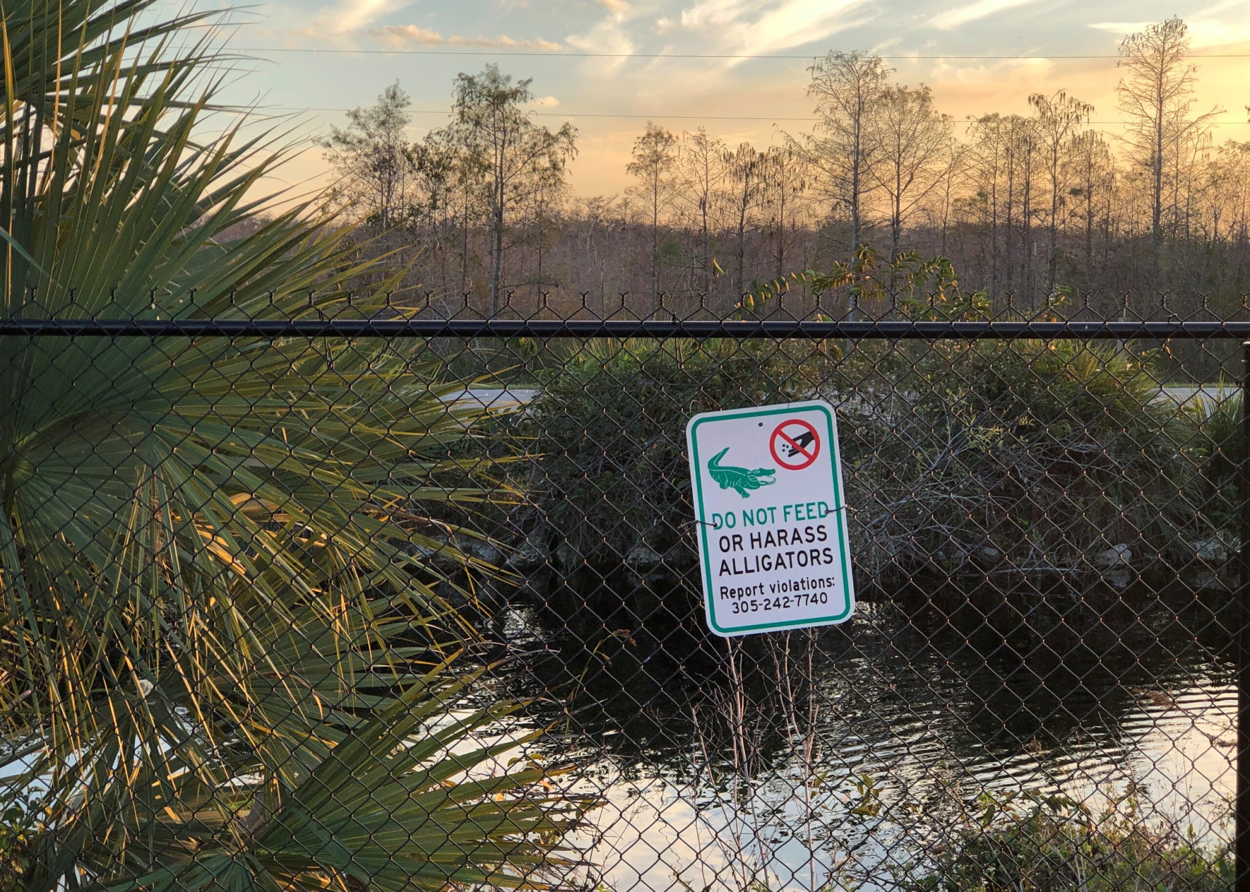
I thought it was funny, even though the joke depends on an alligator canard. As Bob the alligator wrangler told us the next day after our boat tour of the northern reaches of Everglades National Park, the creatures are actually “pretty chill.”
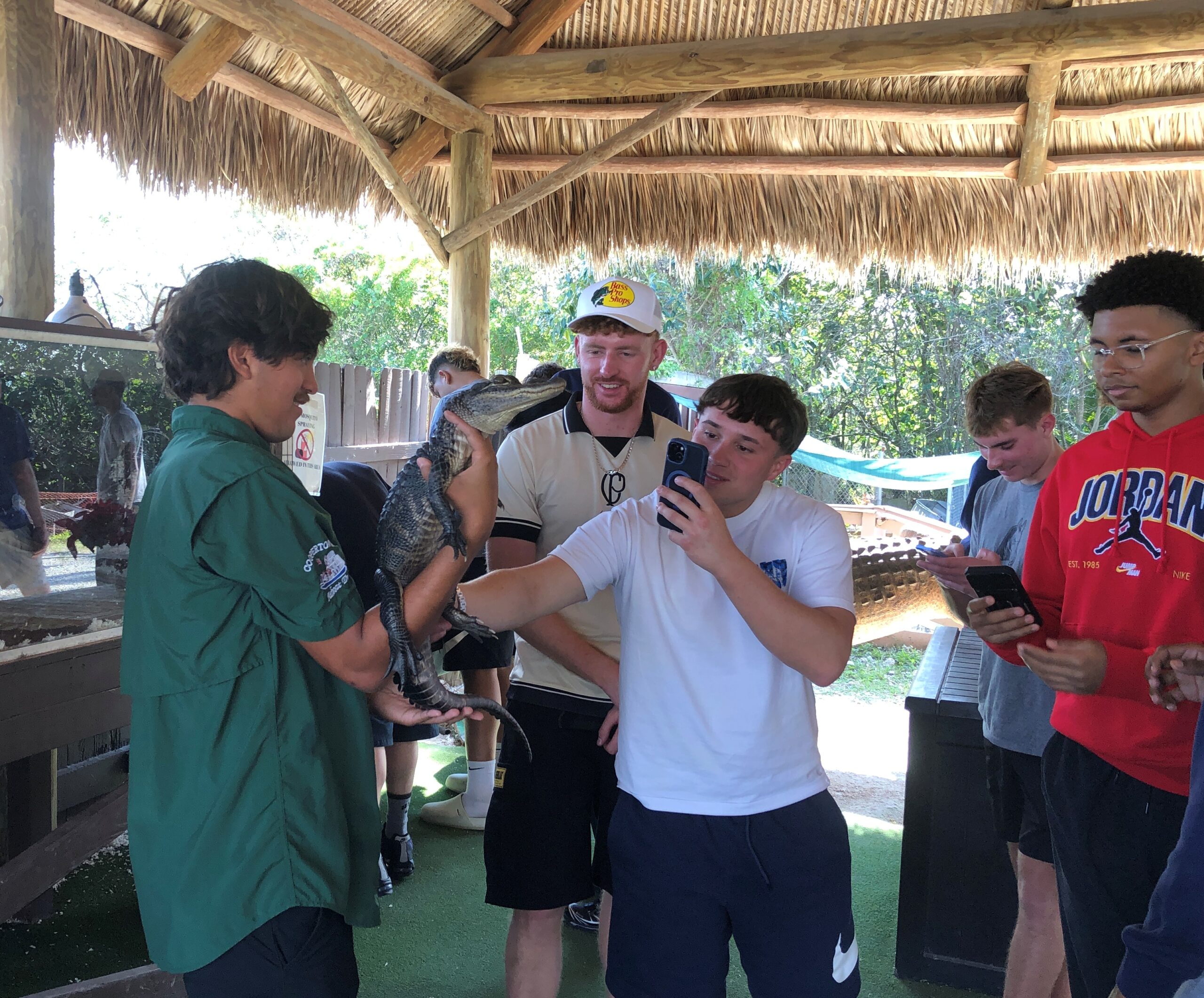
It’s those lowlife crocs that will attack you for no good reason and, I have to report, south Florida is one of the few places where alligators and crocodiles share a habitat. Of course it is. Bob worked for Coopertown Airboats, which is on US 41 and whose tours ply the nearby sawgrass waters, and have since 1945.
The company also has a few alligators lounging around the grounds in cement ponds, and some baby gators, one of which Bob handled with no problem. “Just keep you fingers away from his mouth,” he said, inviting us to touch the alligator. I don’t know why I was surprised to find that a living alligator’s skin feels pretty much like an alligator skin purse or wallet.
Behind glass at Coopertown was the Everglades’ real menace, anyway, a fat, pale ugly-as-can-be python, an inert reptilian Sydney Greenstreet whose countless cousins have claimed much of the biomass of the Everglades as their own, one nightmarish swallow at a time. The python is king of invasive species in Florida, which is saying quite a lot.
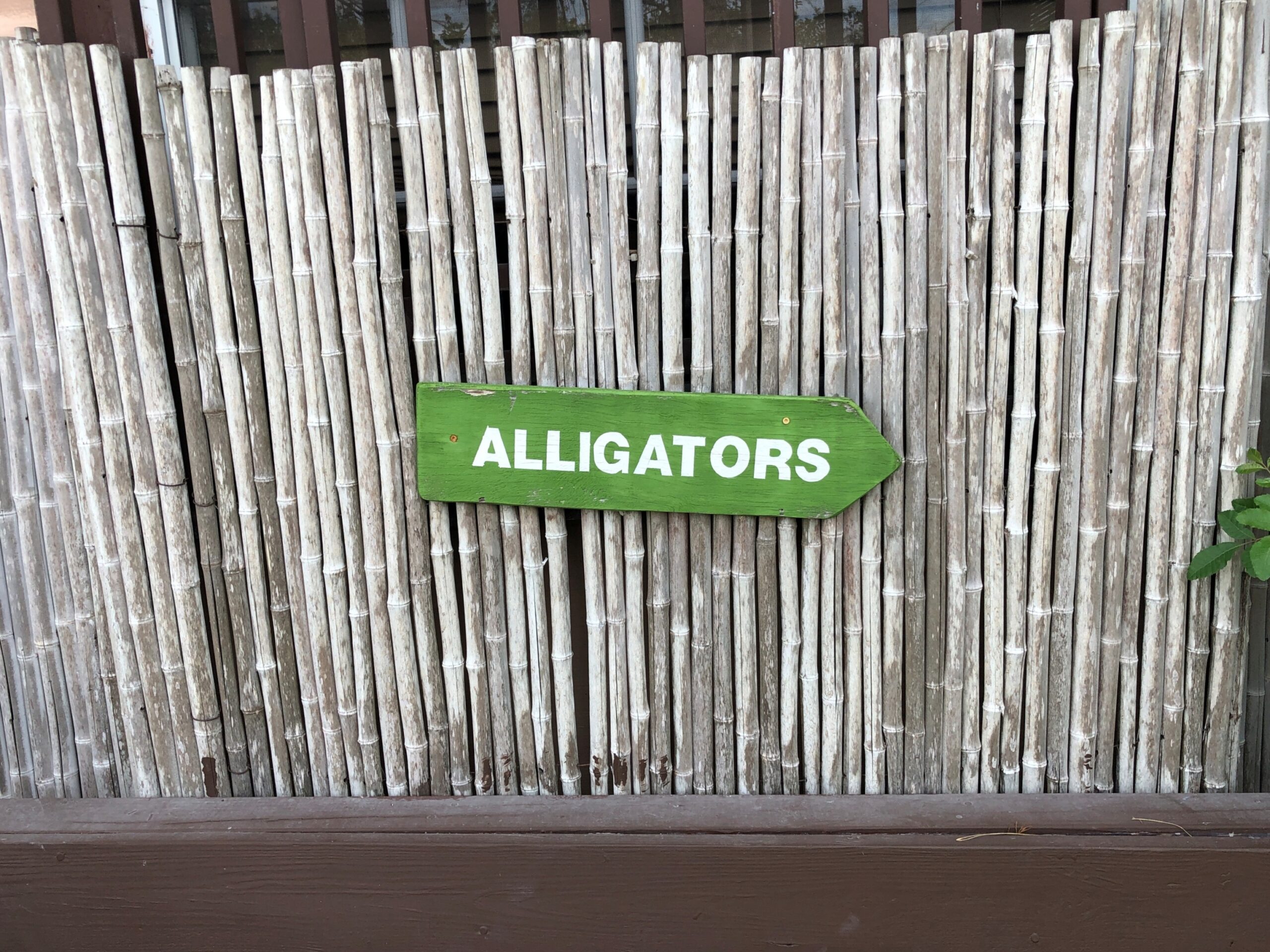
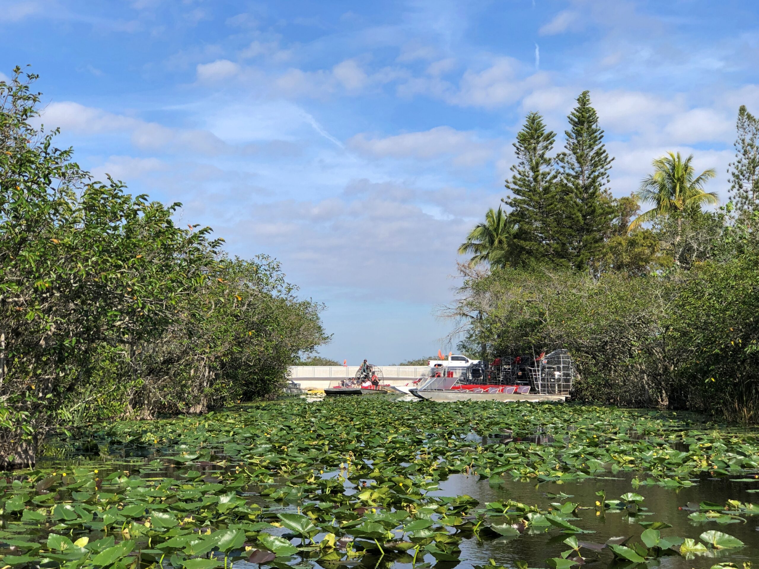
The Coopertown gators weren’t hard to find.
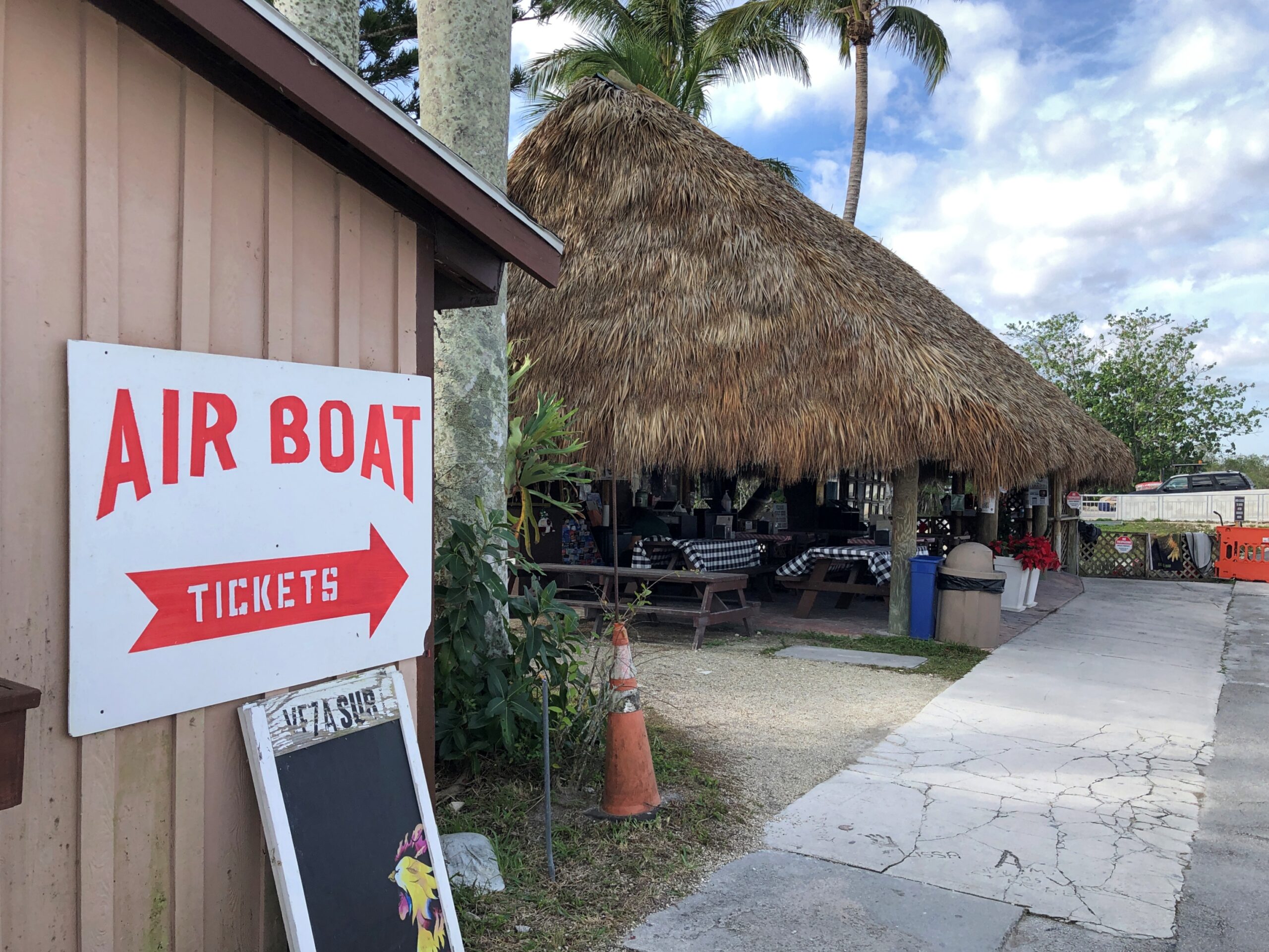
Neither were the boats. Nice, simple wayfinding.
I expected the tour boat to look something like this, which was tied up at one of the docks.
The kind you see, or used to see, on TV. The sawgrass and alligator encounters made me think (a few days later) of Flipper for the first time in many long decades. It wasn’t a show we watched much in our house in the mid-60s, but I have a very vague memory of it, maybe from repeats but also reinforced by the saccharine theme song as included on one of the TV Toons records I owned in the ’80s. Reading about the show, I found that it was set in the Keys and not the Everglades, and the characters tooled around in a more standard motorboat. Still, it might have been the first time I ever heard about the Keys.
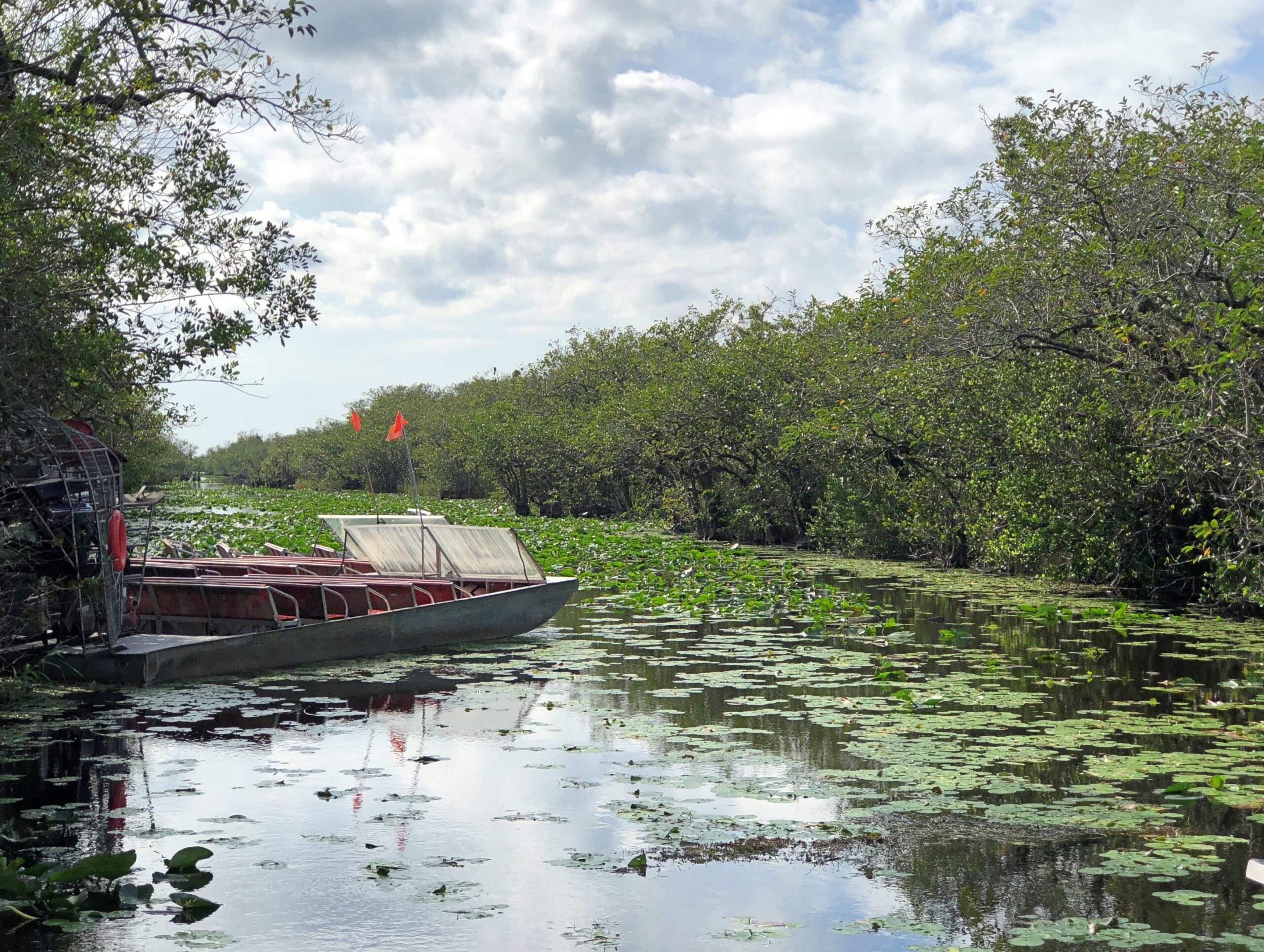
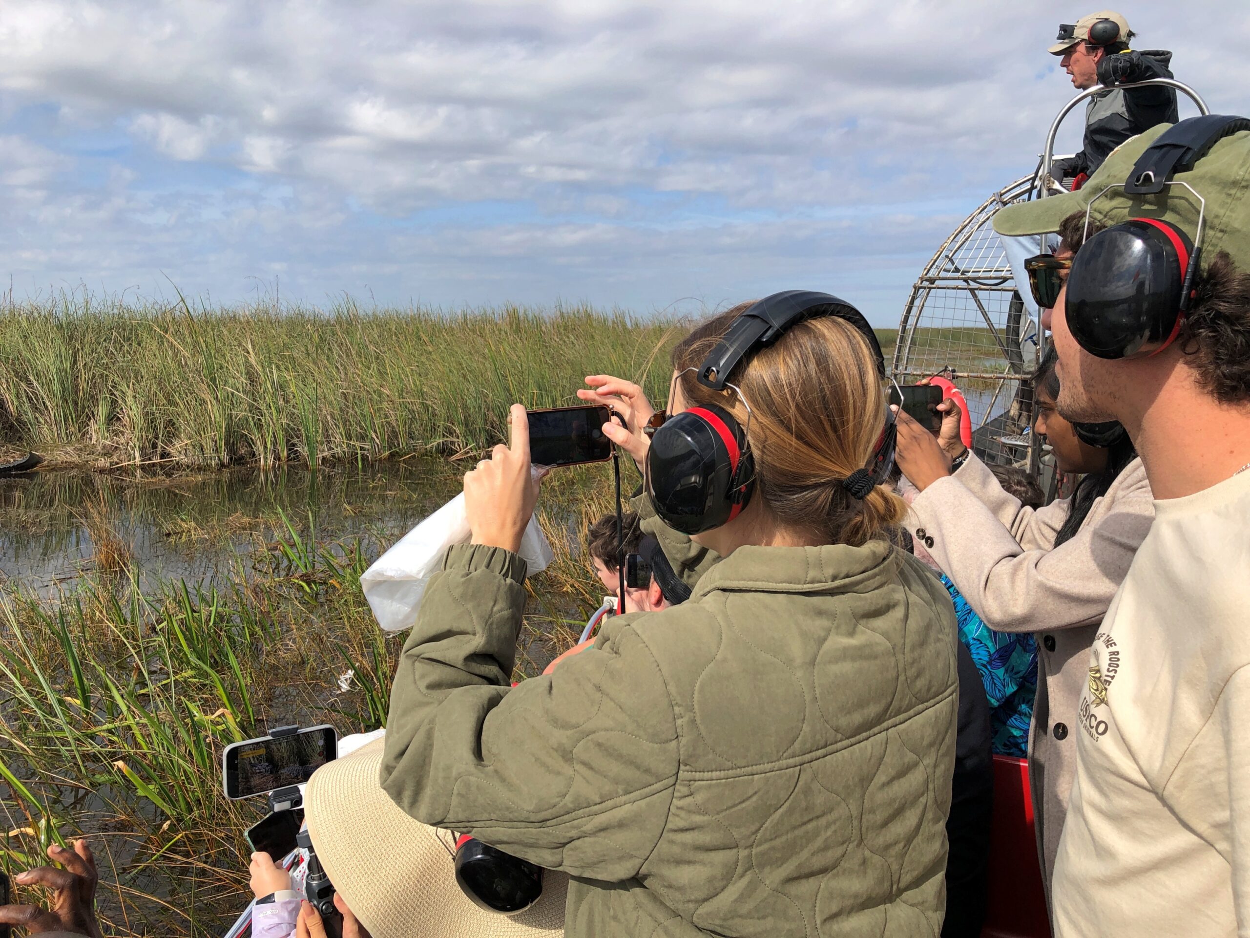
Those spiffy airboats are for the more expensive tours, I think. Ours was a larger flatbottom with a few rows of metal benches for regular tourists.
But it was pretty good seating for the half hour or so, especially since we got the front row.
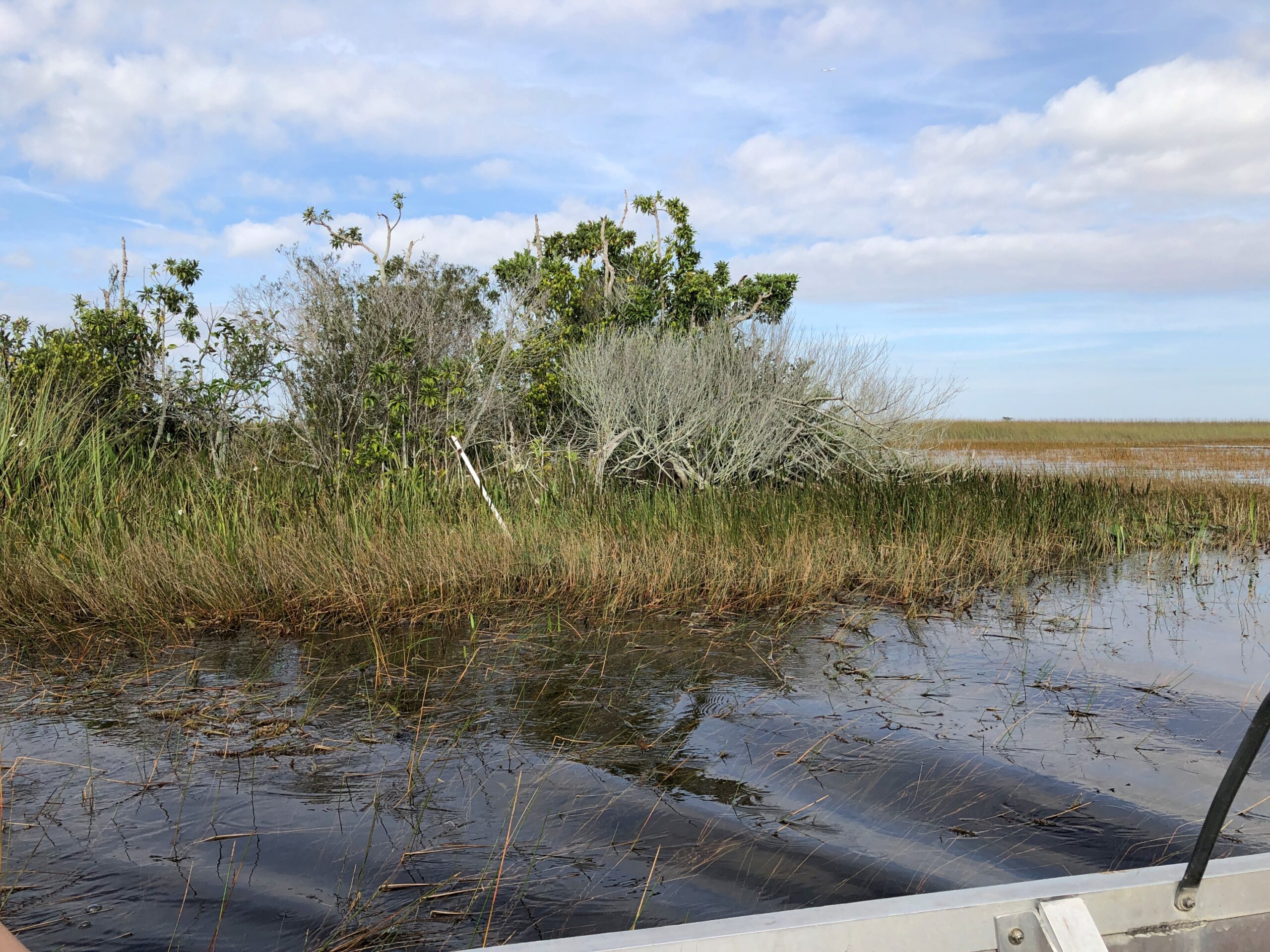
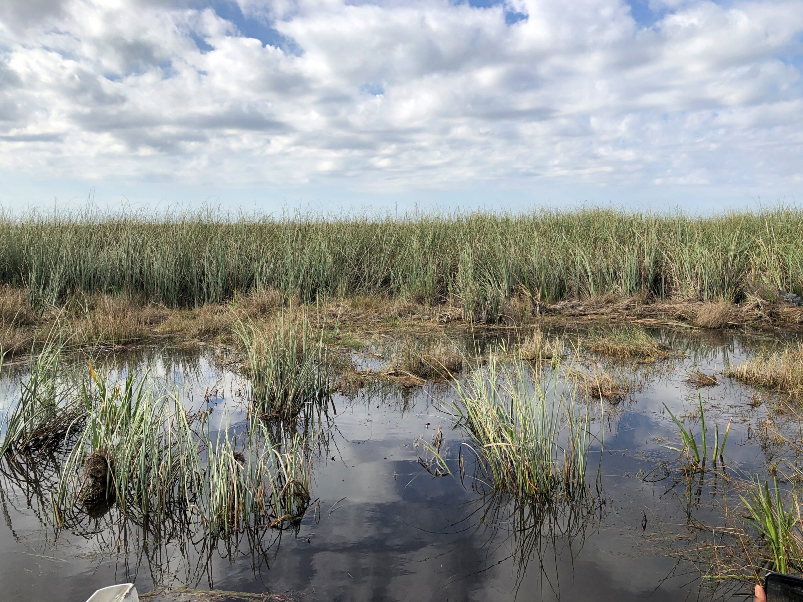
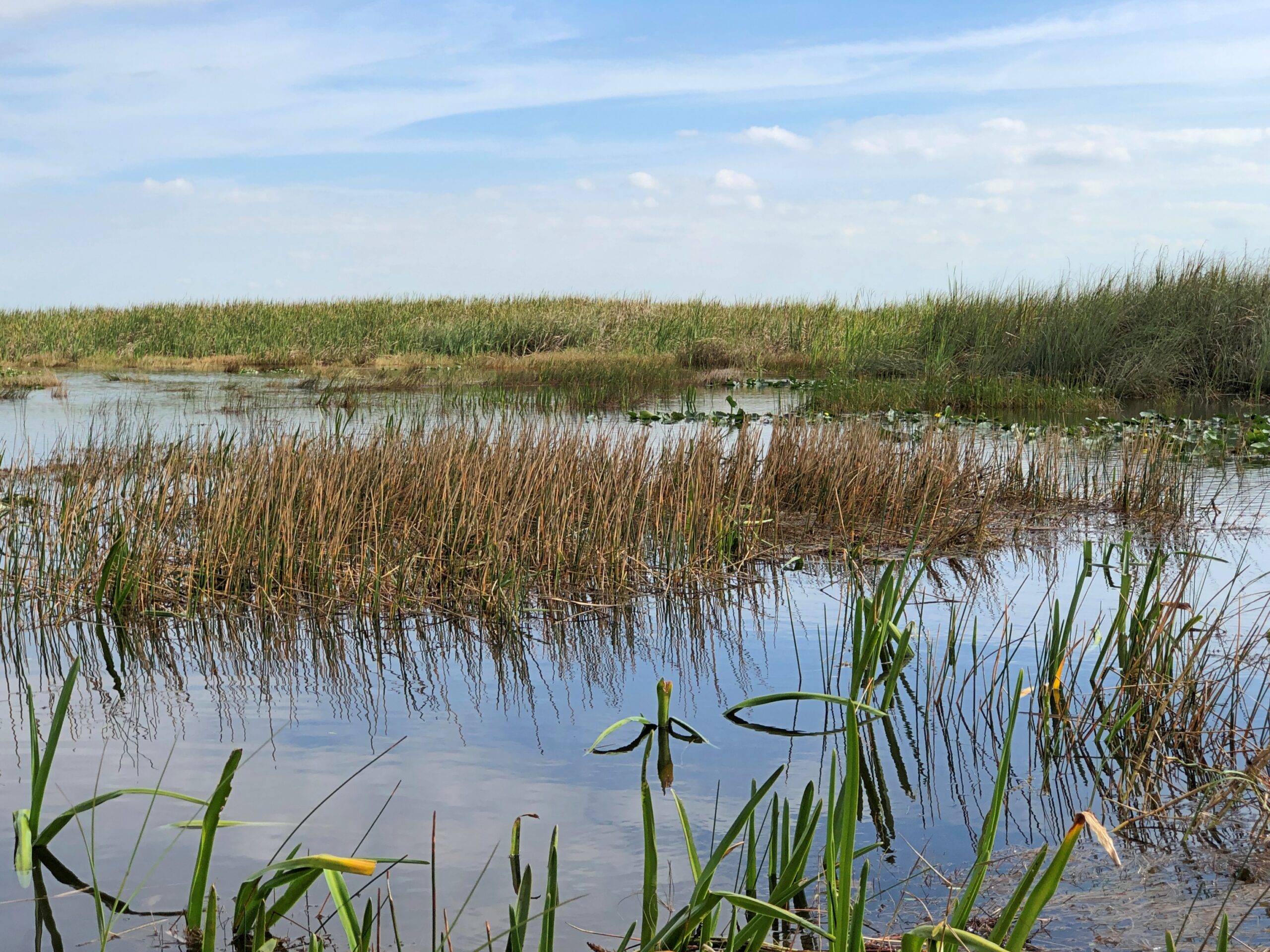
Off we went into the grassy water, dotted by quasi-islands sprouting trees. Soon the scenery looked like this.
And this.
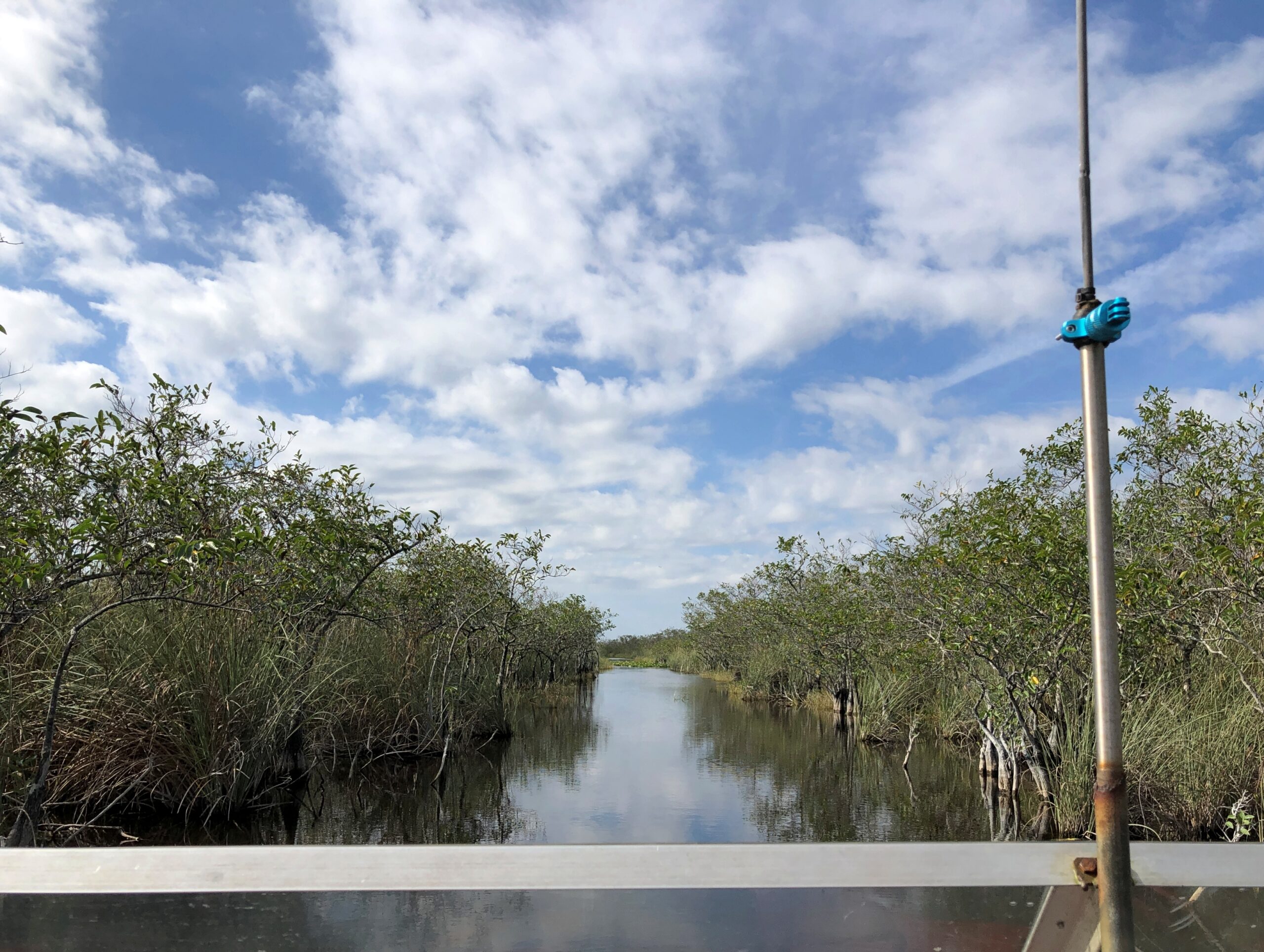
Leaving me to wonder, I’m glad the guide knows his way around, because I’d be lost instantly. The boat guide wasn’t Gator Bob, incidentally, but an older fellow perched in the pilot’s cage.
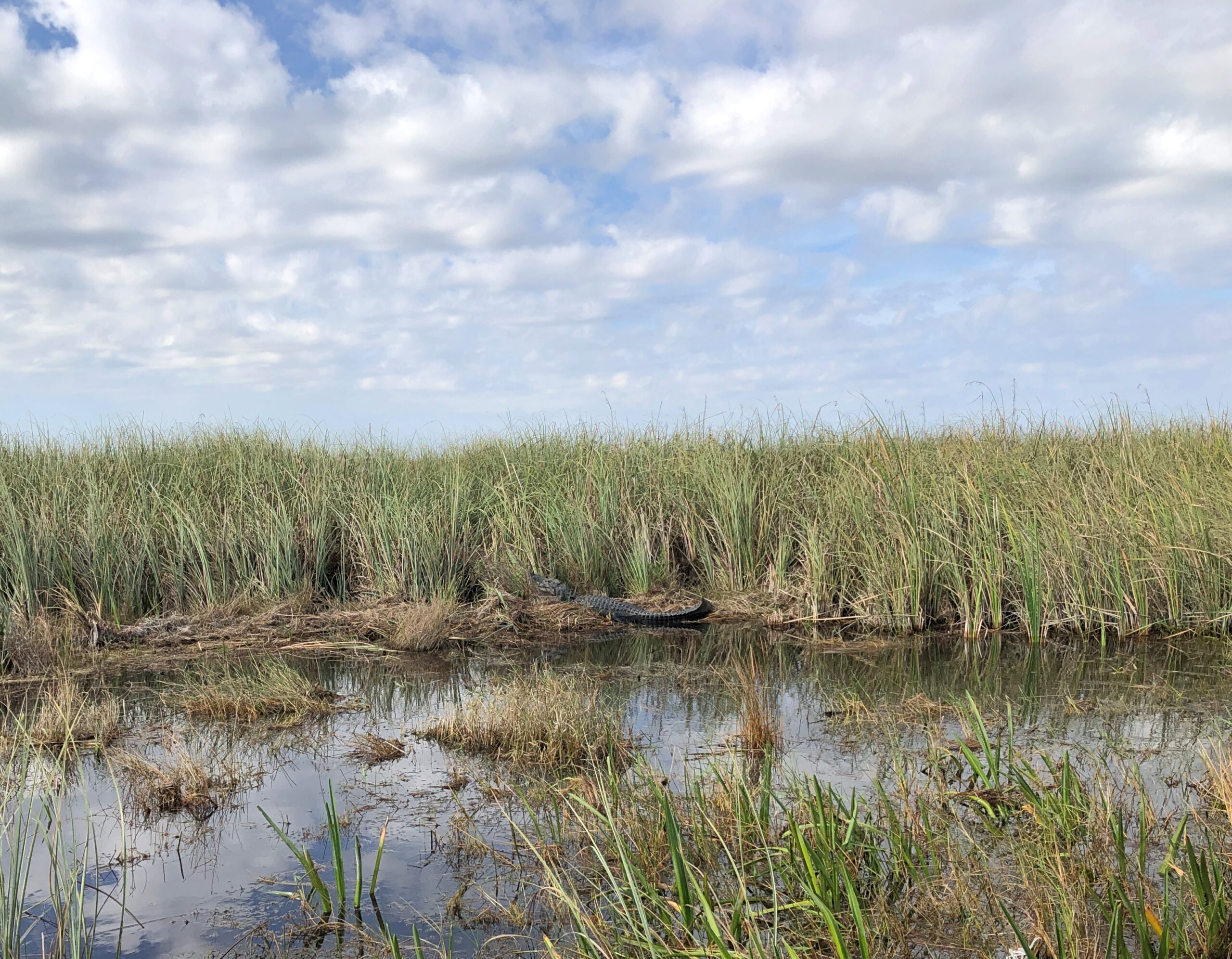
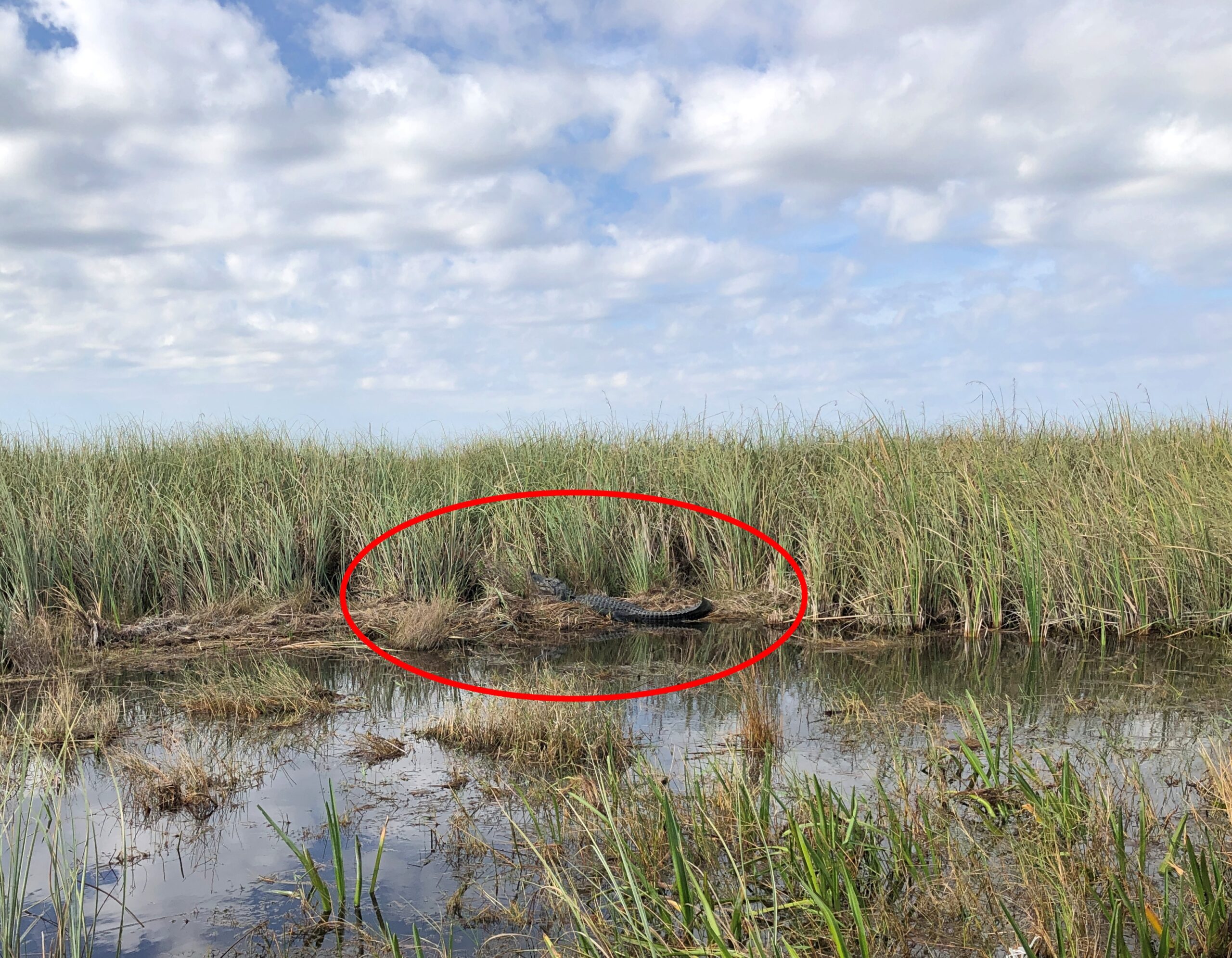
Before long, we found a lounging alligator in the wild.
December is part of the sluggish season for local reptiles, the guide explained. Not too cold for alligators, naturally, but cool enough that lying around in the sun is a good option for them. Regardless, the gator – let’s call him Bob – had his own paparazzi for a few moments.
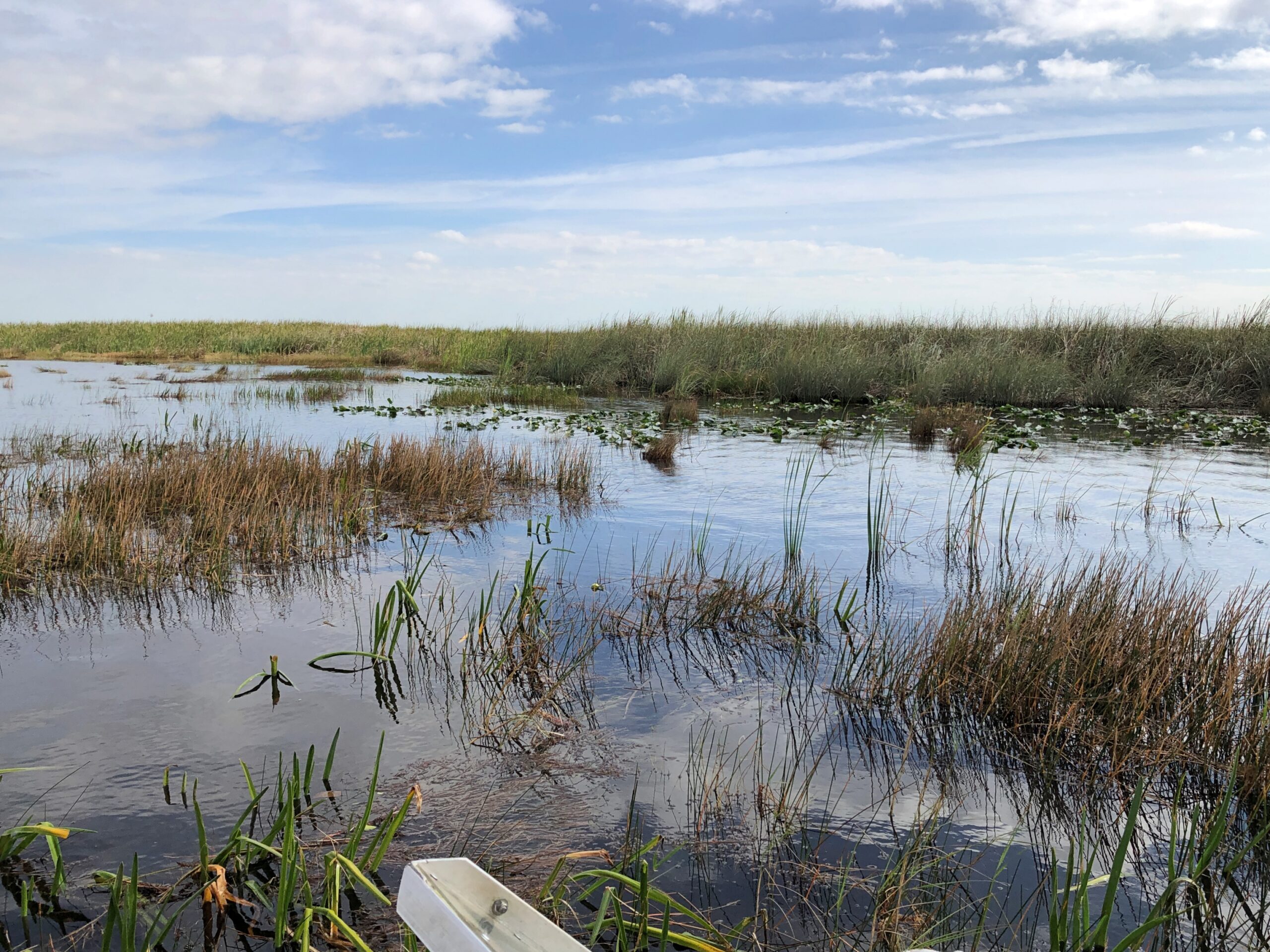
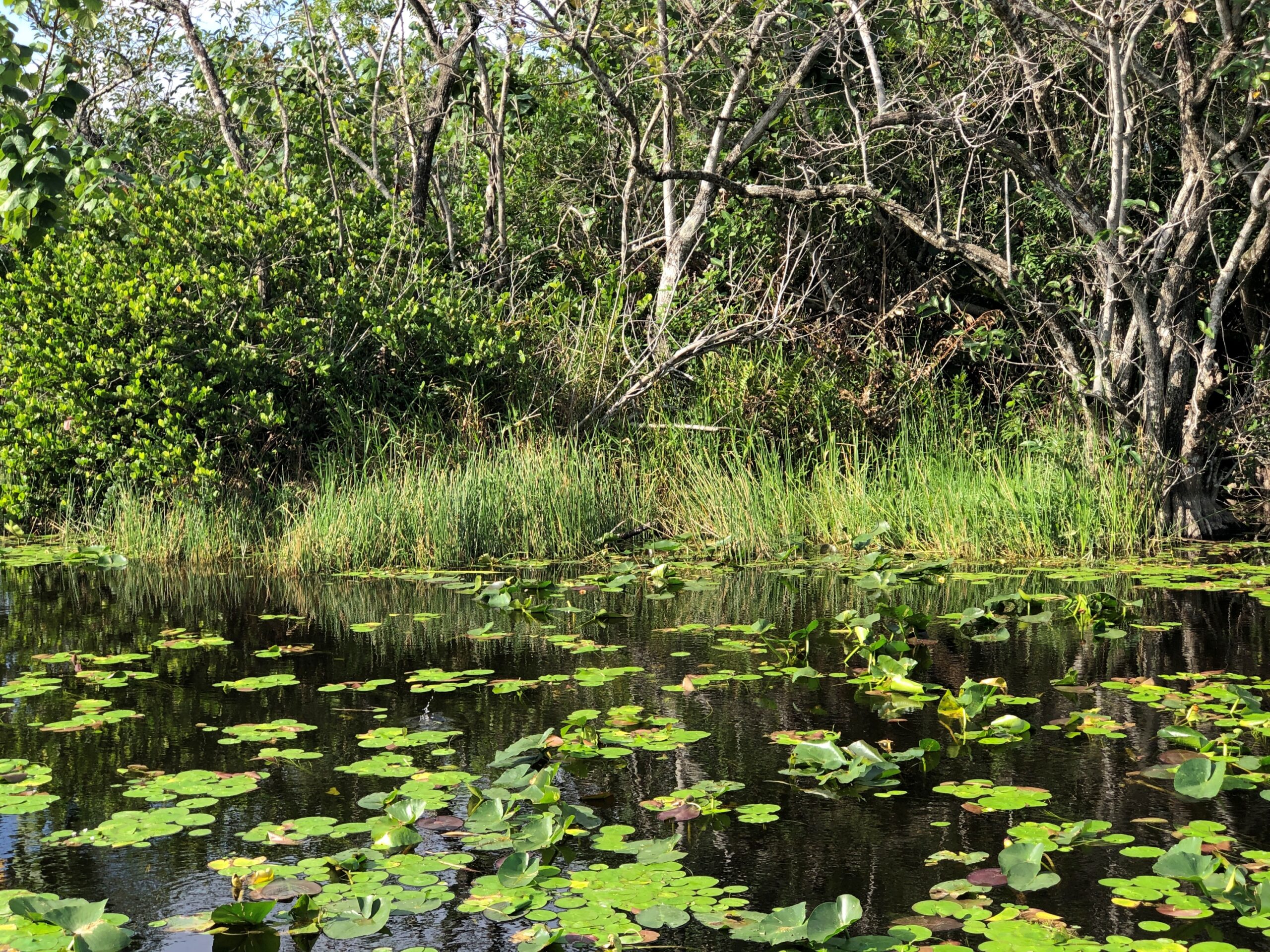
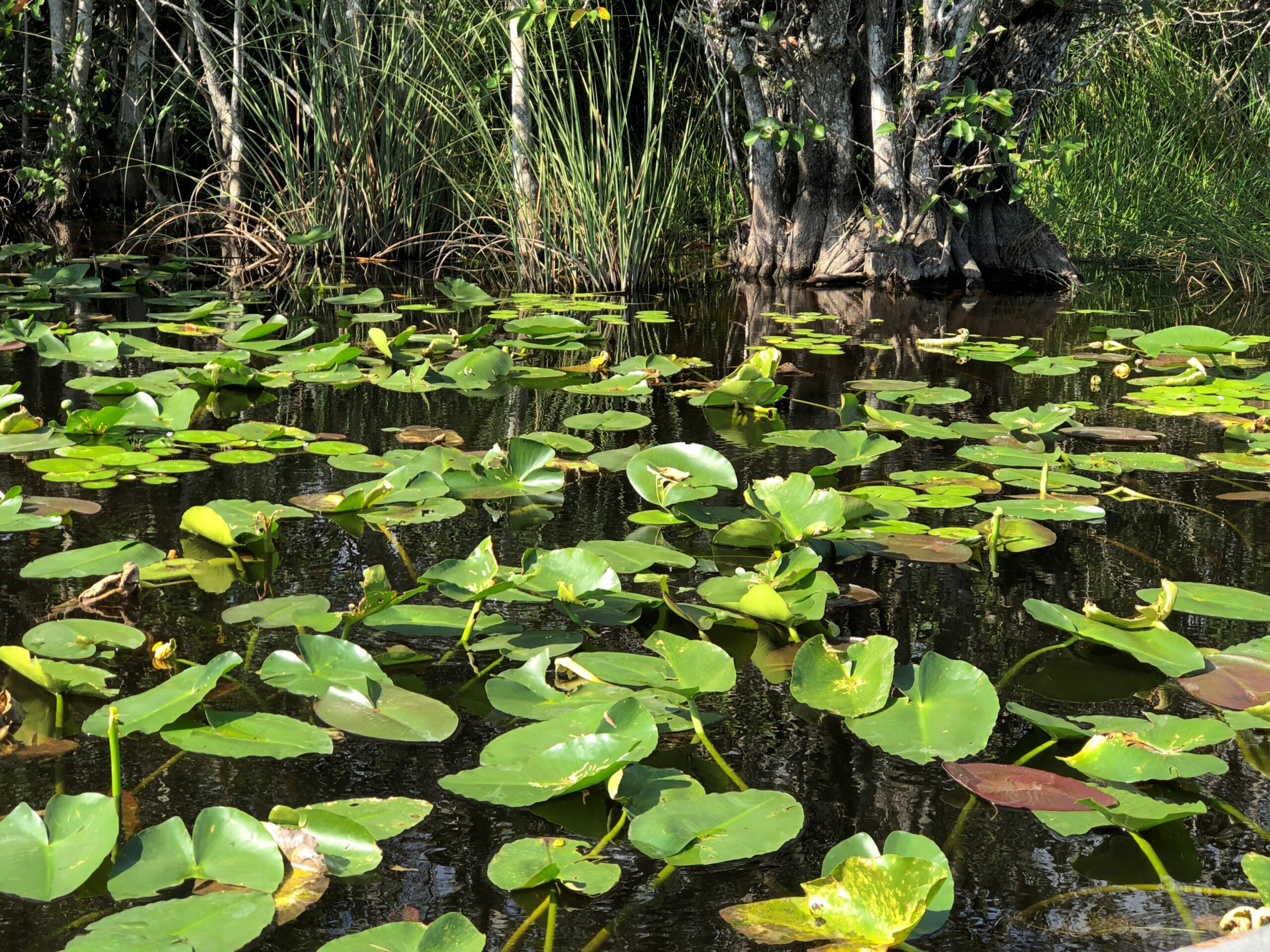
Our return took us through thick patches of lily pads. They moved aside without tangling or anything complicating that would happen if I were piloting the boat.
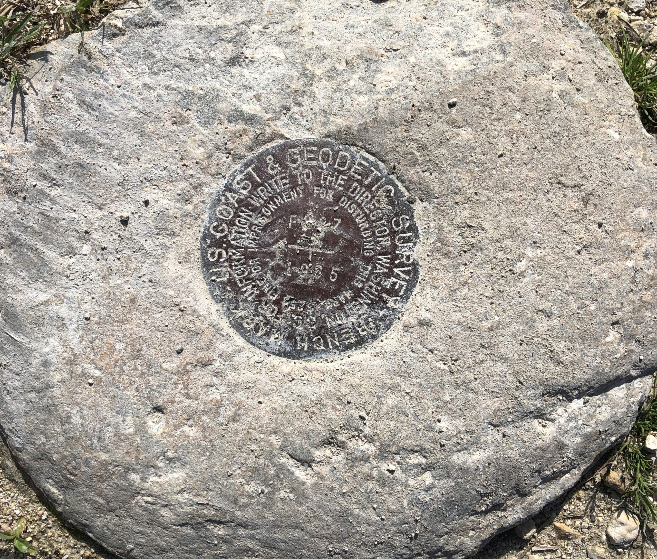
Bonus at Cooperville, out near the parking lot. A US Coast & Geodetic Survey Bench Mark, dating from 1965 if I read that right.
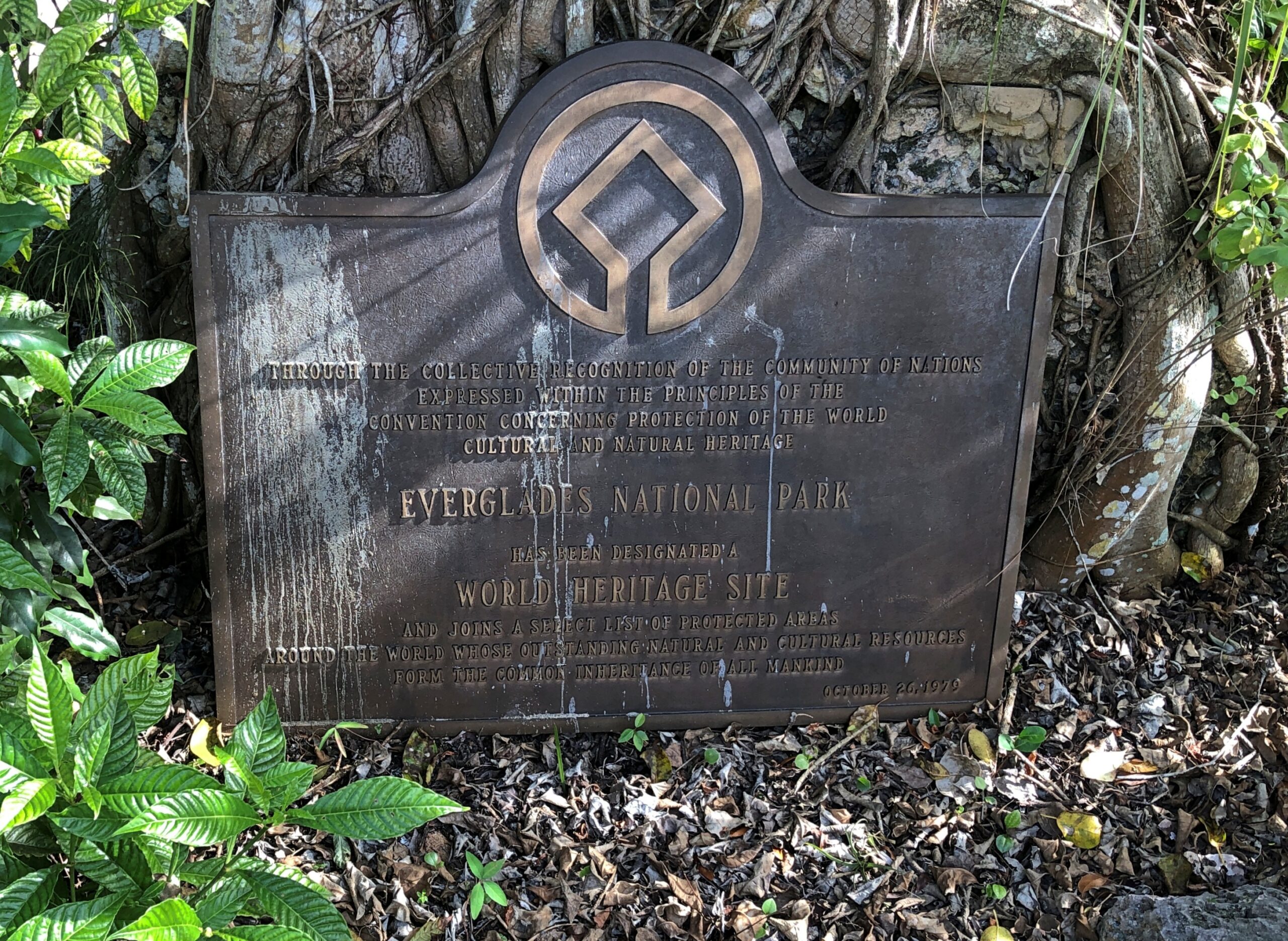
Another bonus: A World Heritage Site plaque, complete with comments by birds.
“Everglades National Park is the largest designated sub-tropical wilderness reserve on the North American continent,” UNESCO says. “Its juncture at the interface of temperate and sub-tropical America, fresh and brackish water, shallow bays and deeper coastal waters creates a complex of habitats supporting a high diversity of flora and fauna. It contains the largest mangrove ecosystem in the Western Hemisphere, the largest continuous stand of sawgrass prairie and the most significant breeding ground for wading birds in North America.”
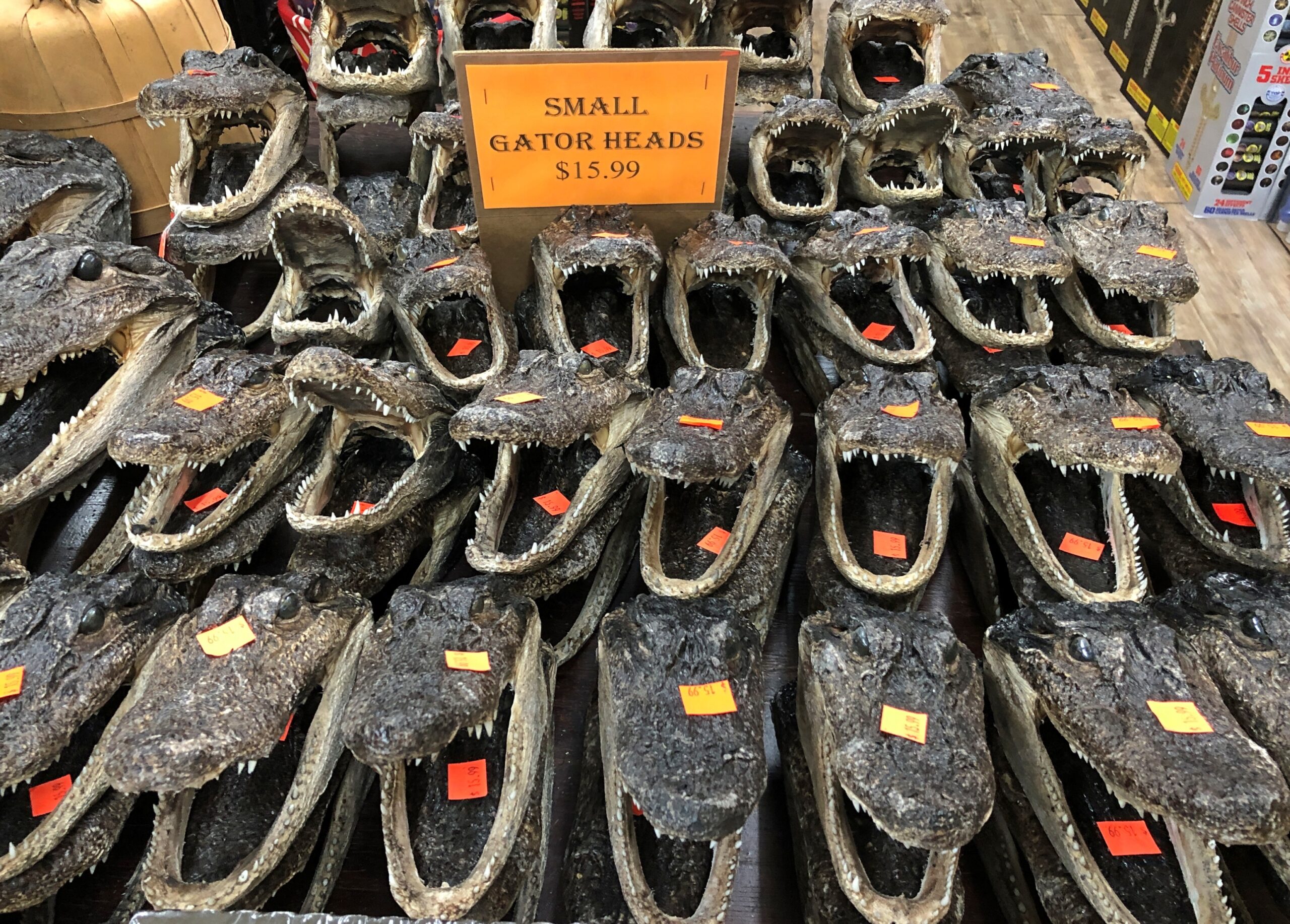
Good old wading birds. Still, that isn’t what people come to see. That would be gators. How do I know this? Consider a scene from a souvenir shop I visited later in our trip.
Americans know their national parks – the famous ones, anyway – but how about their national preserves? A similar, yet different sort of designation by Congress. I don’t know all the details myself, but one thing is that resource extraction seems to be possible in limited ways at least some of the 21 preserves, but not at all (?) in the 63 parks. Regardless, preserves are different places on the maps, though they are often adjacent to parks.
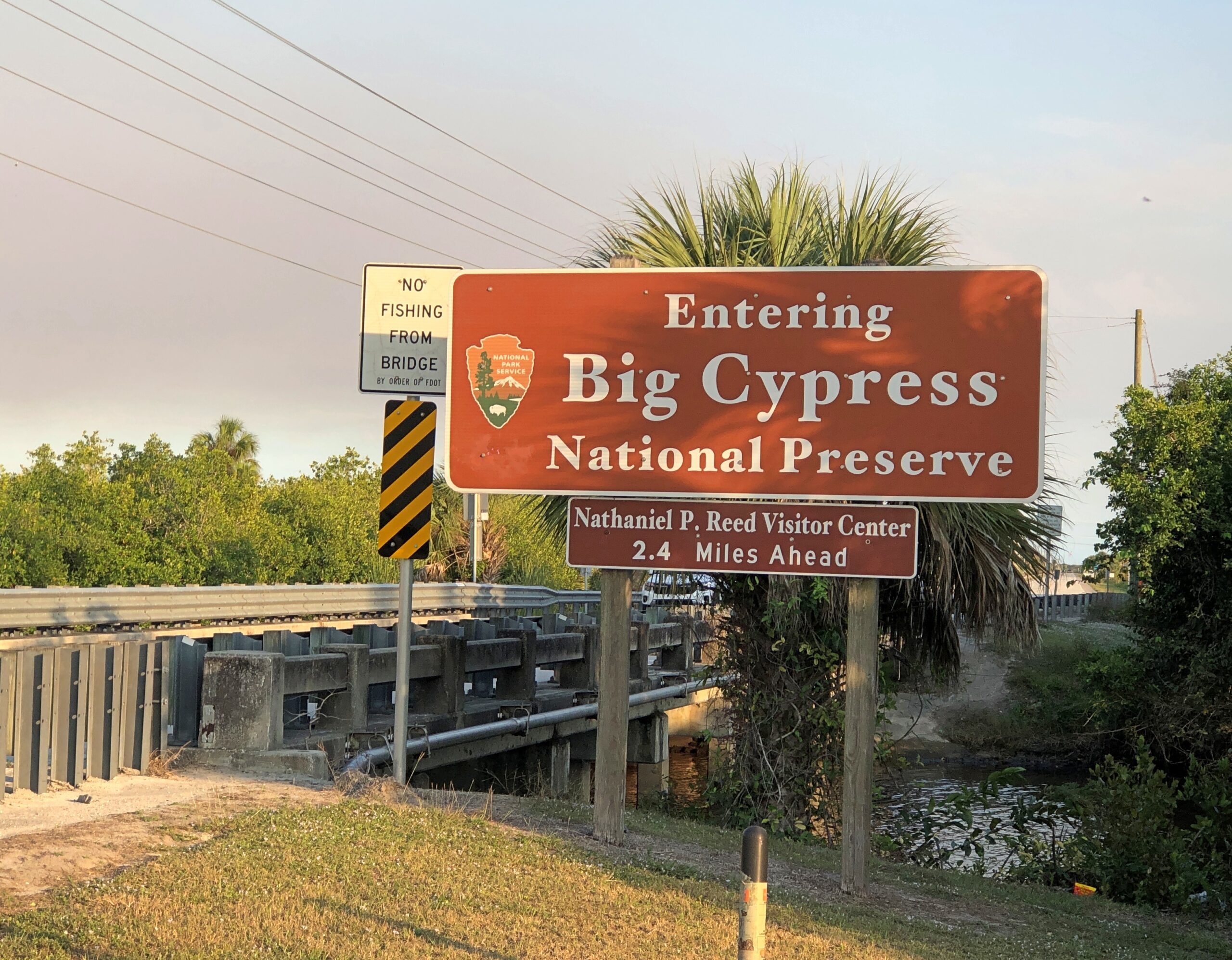
Such as Big Cypress National Preserve, which is a large chunk of Florida next to Everglades NP.
Head south from metro Orlando on US 27 and eventually – and it takes a while – the suburban aspects peter out and give way to agriculture, especially citrus and sugarcane. At a hamlet called Palmdale, the highway Florida 29 continues the trek south, meeting both I-75 (Everglades Parkway, Alligator Alley) and US 41. By that time, agriculture has given away to (mostly) undeveloped wetlands. Swamp, in the old days, but in fact the preserve and the park don’t qualify as such. We picked US 41 and headed east, into the thick in the Big Cypress.
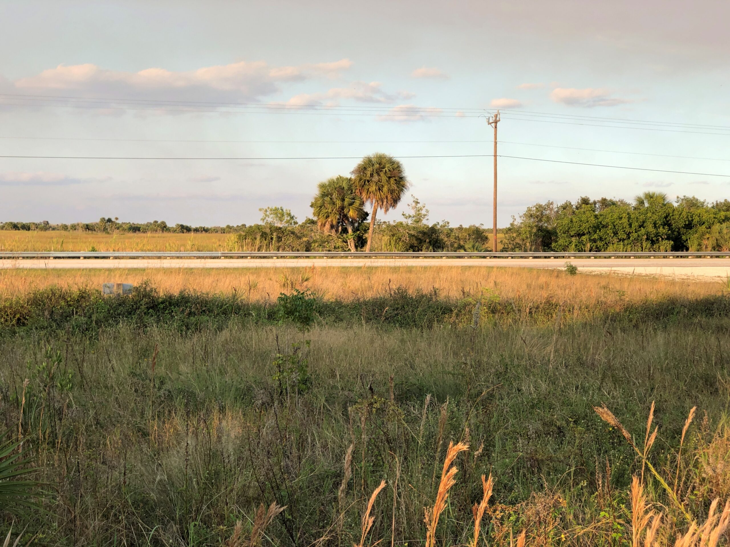
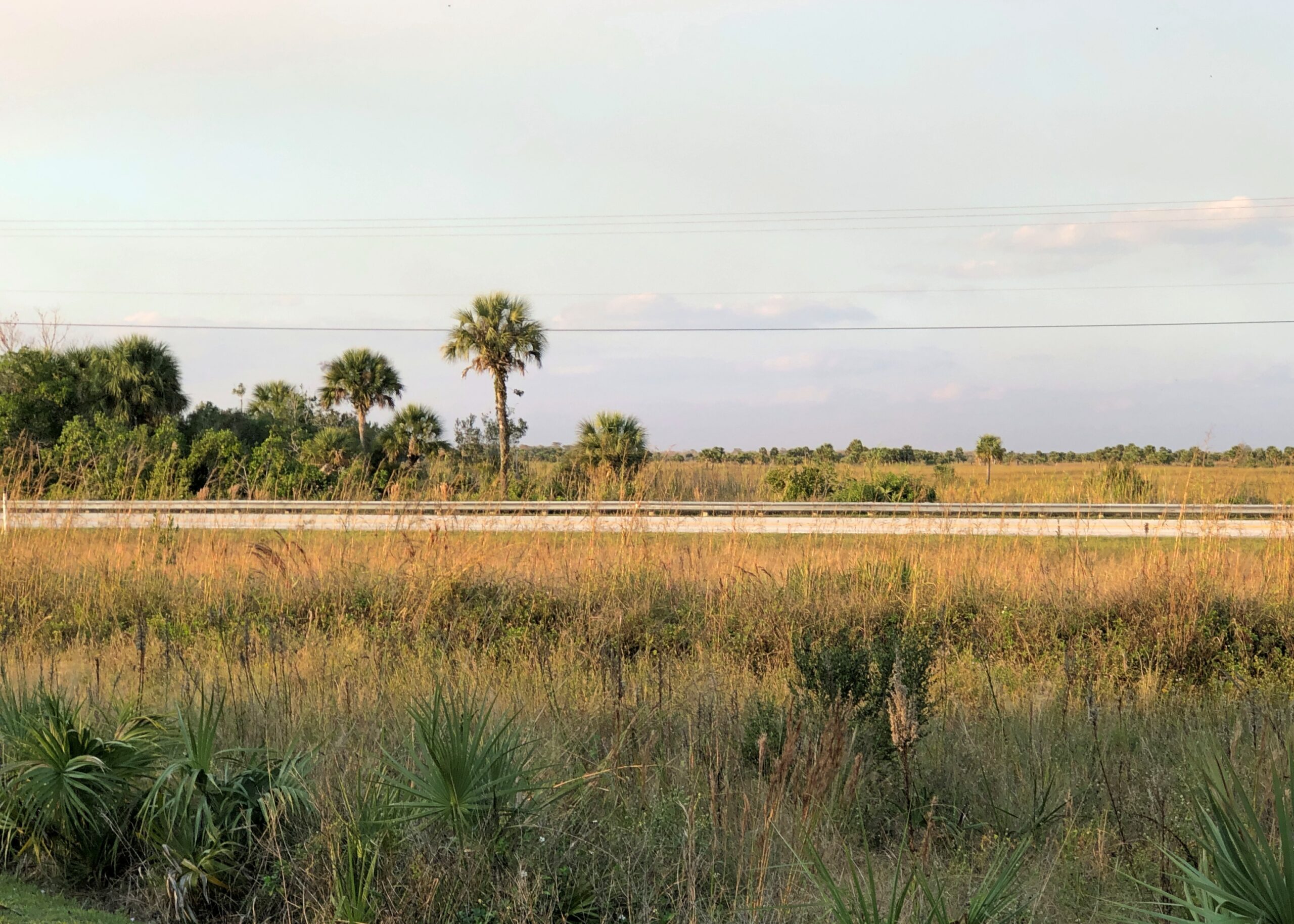
Daylight is short in December, even in southern Florida, so we barely had time to traverse US 41 before losing the light. But we managed a few stops.
The territory was behind fences in some spots.
Mostly not.
By dark, we’d passed out of the preserve and on to the edge of the national park. Much of US 41 – known as the Tamiami Trail in part of Florida according to various sources, but not on any signs that I saw – is under construction toward its eastern end, meaning a tight drive through concrete barricades, everyone’s least favorite kind of driving. Under reconstruction, that is, and for good reason.
“The Tamiami Trail (U.S. Highway 41) has long been recognized as one of the primary barriers to flow of water through the ecosystem,” the NPS notes. “The need to eliminate barriers to overland flow of water in the Everglades is considered one of the indisputable tenets of restoration. Much scientific information amassed in recent decades reinforces the importance of removing these barriers to water flow in order to restore natural marsh connectivity.
“In 2009, Congress authorized implementation of the plan selected in the 2008 Modified Water Deliveries to Everglades National Park, Tamiami Trail Modifications, Limited Reevaluation Report (LRR) … The LRR plan would improve potential marsh connectivity, reduce sharp changes in water velocity, and improve rainy season depths and durations. In addition, these modifications will improve the ridge and slough landscape and fish productivity, which could result in increased foraging success for wading birds.”
It makes for a temporarily unpleasant drive, but I think we can all get behind increased foraging success for wading birds and other worthwhile eco-goals for the much abused Everglades. Now only if the plan could do something about Everglades pythons.
Regards for the New Year. Back to posting four days into 2026, maybe with tales of Florida alligator tourism. The change of the year always brings me the same reaction: how did that number get so high? This time around, I wonder how is it that 1976, a good (mostly) year I remember fairly well for a number of reasons, was 50 years ago?
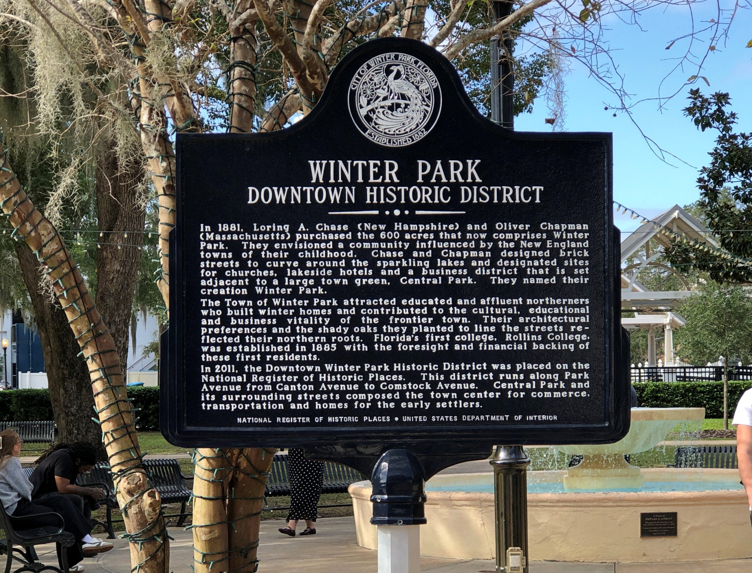
Orlando, Yuriko was surprised to learn, is an actual city. The day after Universal Epic Universe, we drove from our hotel near that park, past Orlando’s sizable downtown, and to the inner suburb of Winter Park. She marveled that the city had a presence besides the sprawl of the theme parks, which are at some distance from the Orlando CBD. Bet she isn’t the only person, upon leaving the theme park zone, with that reaction.
One could devise a pretty good multi-day visit to Orlando, to see its green spaces and historic sites and museums, and take in a few shops and restaurants and some live music, and never pay the Mouse or Comcast a dime. Maybe one day I will do such a visit, but the pull of the theme parks is pervasive. Even my businesses trips of yore (early 2000s) to central Florida tended to gravitate toward the parks. Why would you skip the theme parks? would be the reaction, even — and most importantly — among members of my family. For now, part of a day away from the Theme Park Industrial Complex will have to do.
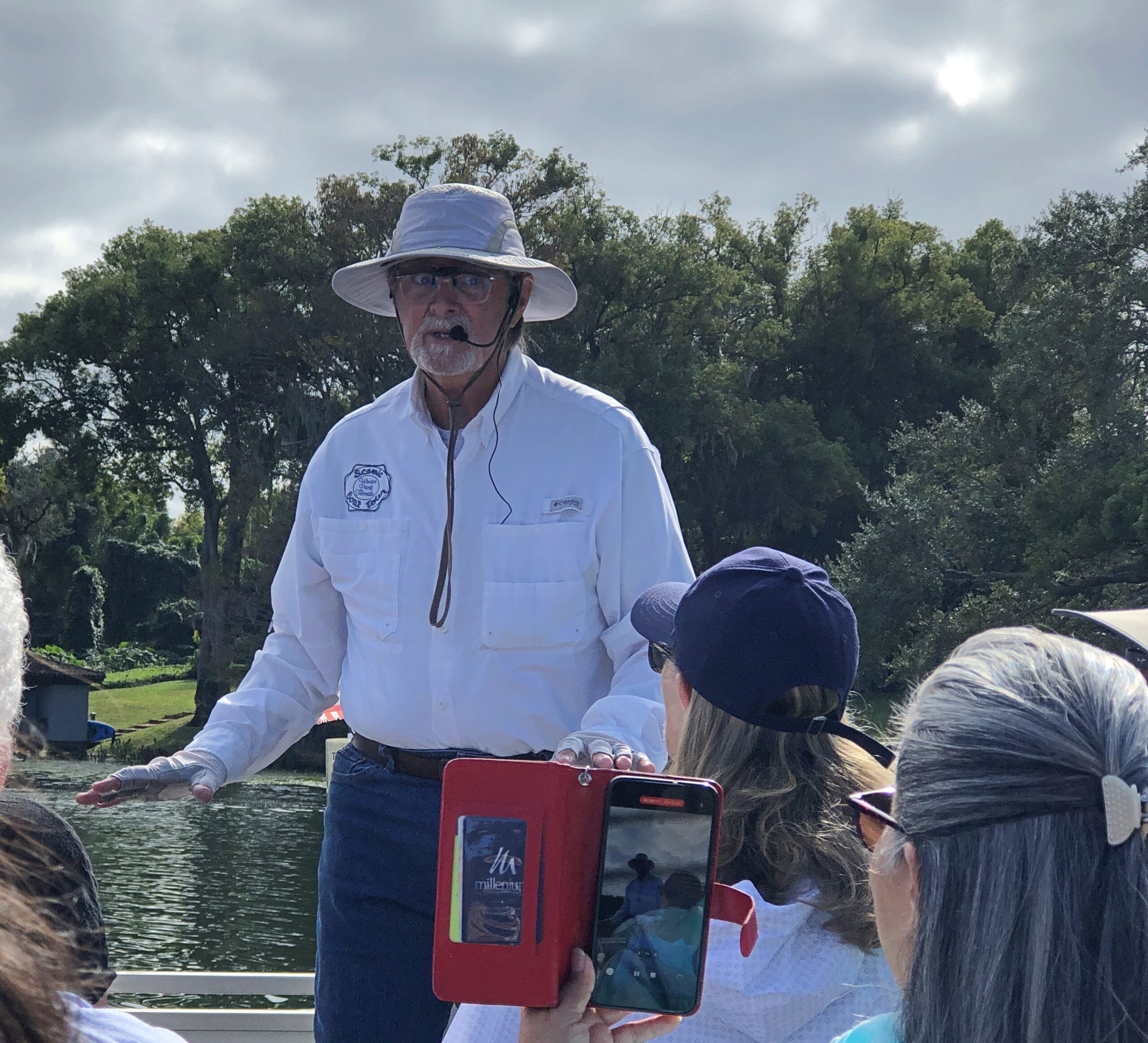
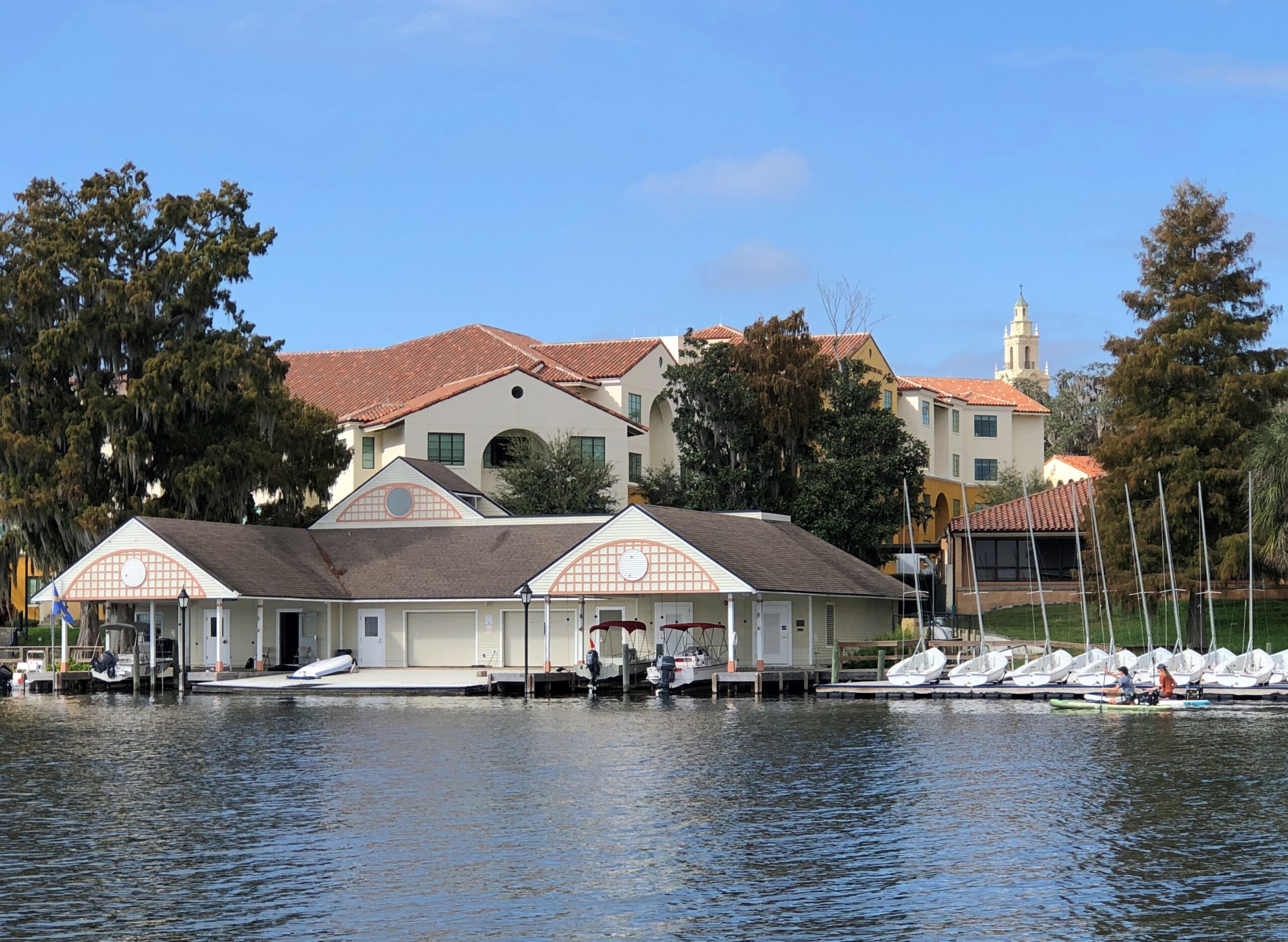
I’d gotten wind of a tour boat ride on Winter Park’s small lakes that (1) wasn’t expensive and only about a hour long; (2) didn’t require reservations or a damned app or the like to access; and (3) most importantly, was something we could do sitting down, after a day of walking and more walking.
We made it for the noon tour. December 10 was as warm and clear a day in Winter Park as you could ask for, a reminder of why a couple of Victorian businessmen were able to found a town in central Florida and attract wealthy property buyers who aspired to escape the frozen North for a few months.
Our skipper for the tour.
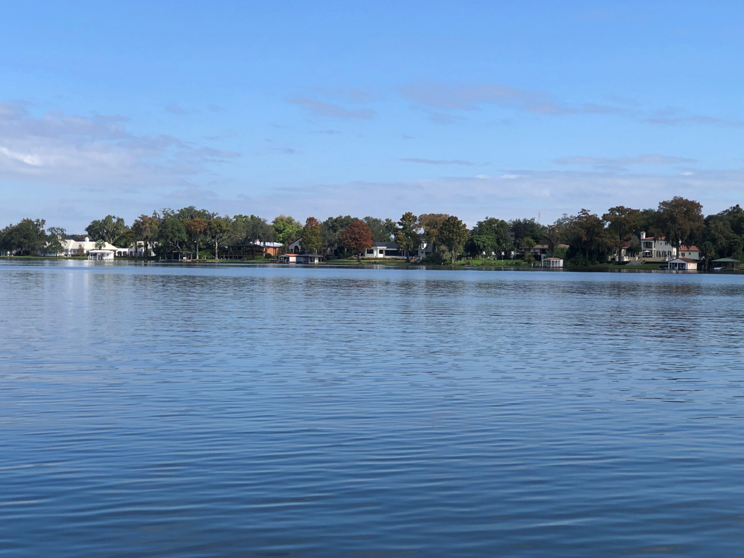
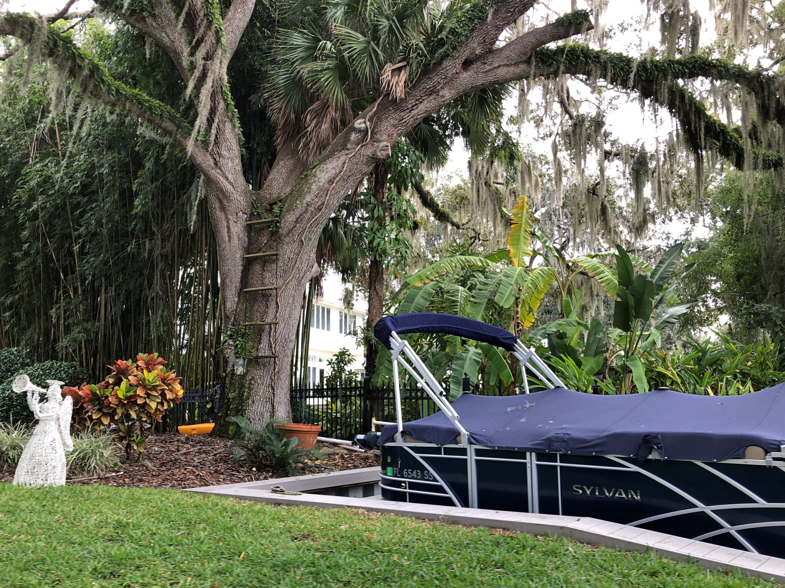
Skipper Bob, let’s call him. He took us from the tour-boat dock on Lake Osceola through a couple of canals to Lake Mizell and Lake Virginia and then back, pointing out some of the posher estates and landmarks along the way, such as the posh boat houses that tend to come with such properties.
Bob also offered up some detail about the history of the area, most of it unfamiliar. I didn’t know, for example, that Fred Rogers was an alumnus of Rollins College, which occupies a sizable chunk of the Lake Virginia shore. I also learned that the college, even in our age of grossly inflated higher-ed tuition, outclasses most others in its high cost.
Out on the lakes, Bob revved up the engine from time to time, spurring the boat forward at a good clip. Wind famously blows long hair into a pleasantly billowing mass at such times, but under the warm sun and blue sky that day, even my shortish hair was picked up by the wind. Felt good.
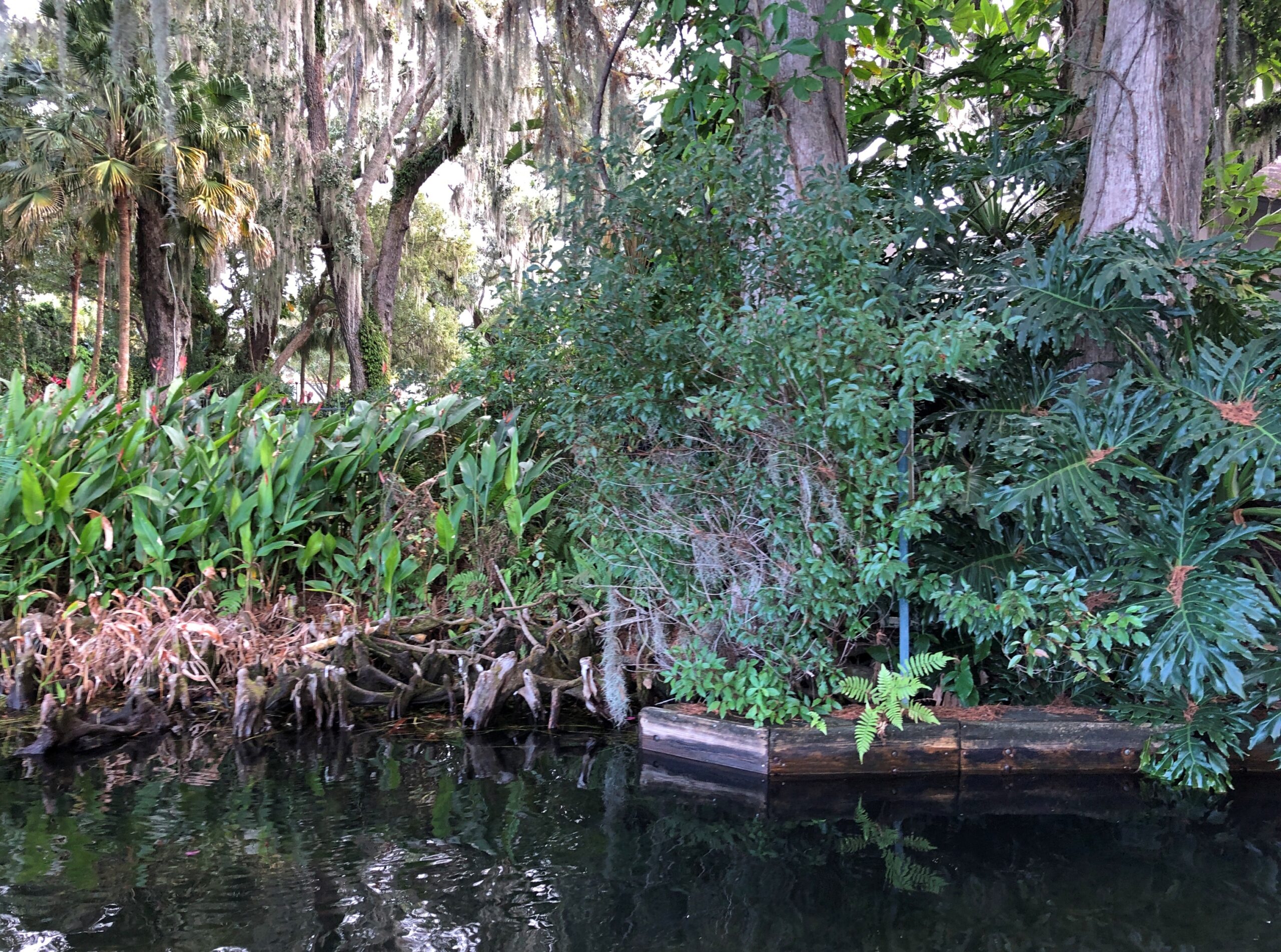
I liked the passages through the canals. I don’t think I was alone in this.
In most of the rest of the country, winter had arrived. In Winter Park, named for the season it is most unlike, you can pass through the tightly packed greenery luxuriating in warm air.
You’re up close to the yards of more modest, but still high-value real estate. Everyone’s got a dock.
The vantage means views of the canopy above.
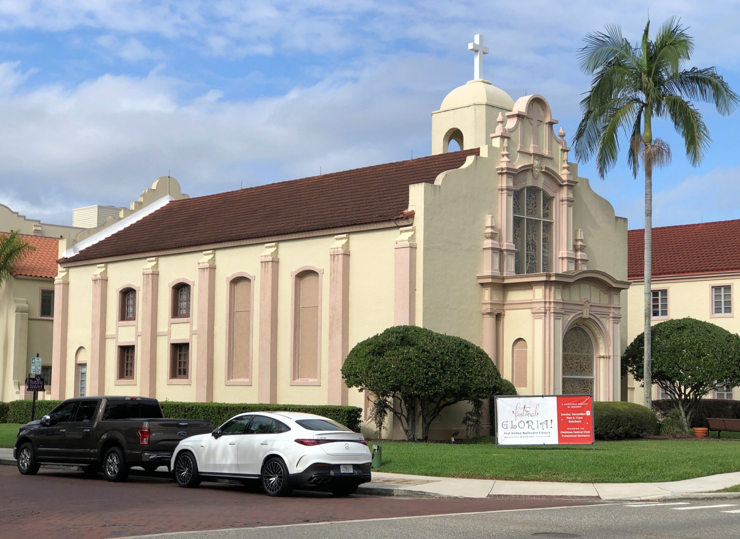
After the boat tour, we walked a few pleasant blocks along Morse Blvd., away from the lake. This handsome church, First United Methodist, didn’t look open. Too bad.
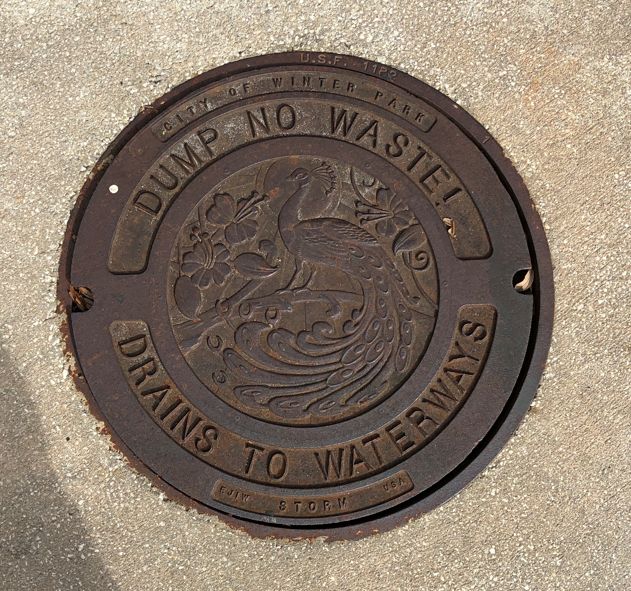
The city is fond of its peafowl, I understand.
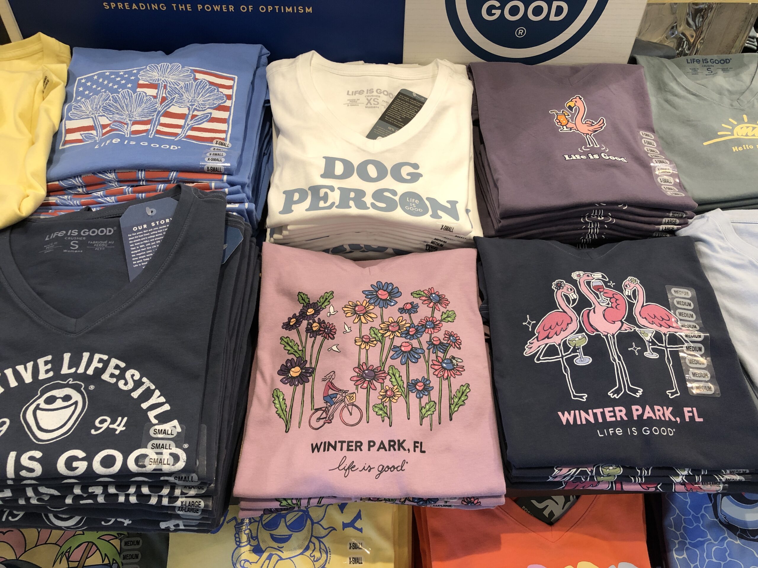
The downtown shopping street in Winter Park is Park Ave. On one side of the street are the likes of Bosphorous Turkish Cuisine, Williams-Sonoma, Ocean Blue Galleries, D’Anne Mica, Fannie Hillman + Associates real estate, Current by John Craig men’s clothing, The Imperial on Park wine bar and Be On Park Fine Jewelry. Life Is Good (registered trademark) products are available on the street.
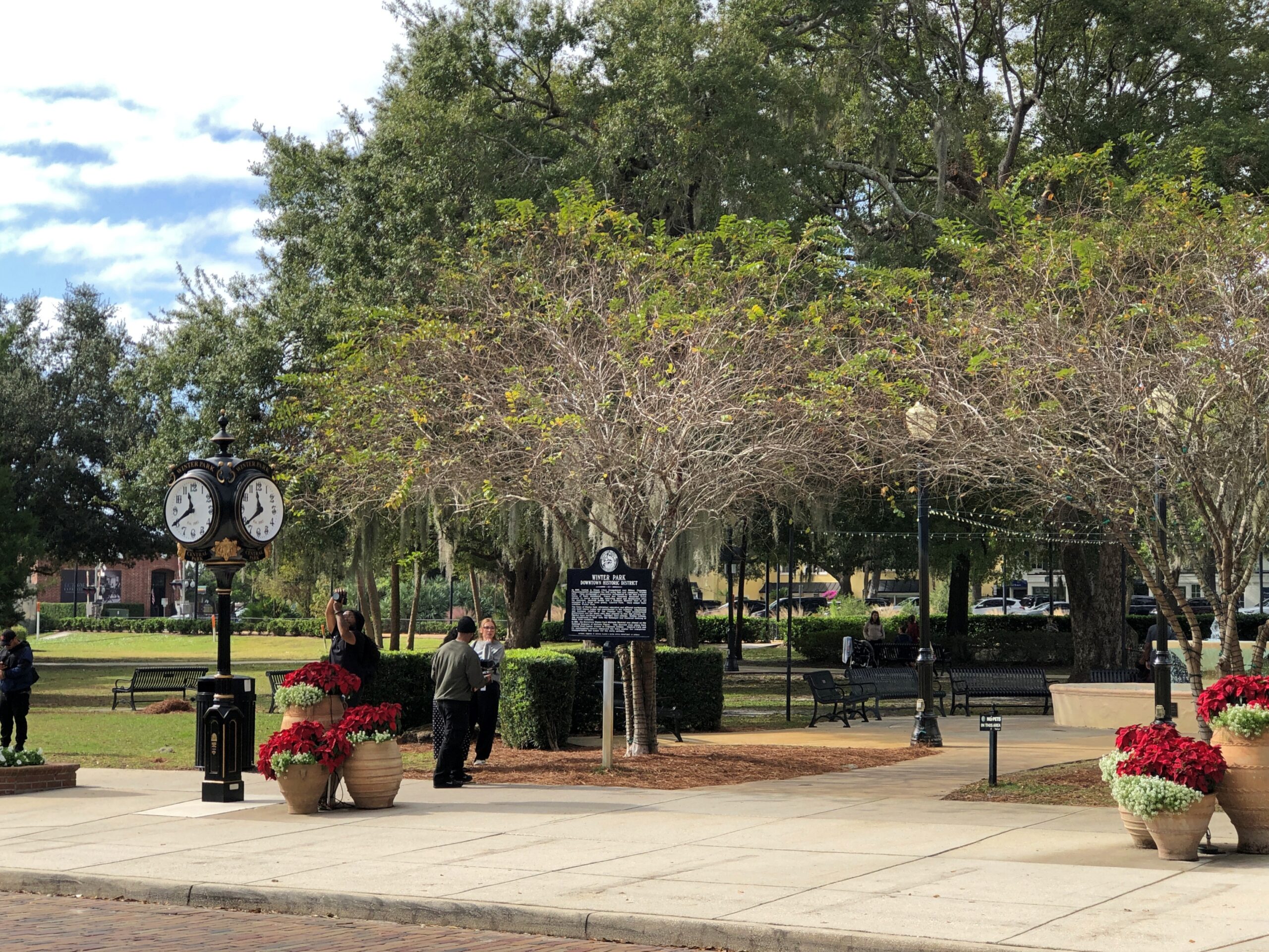
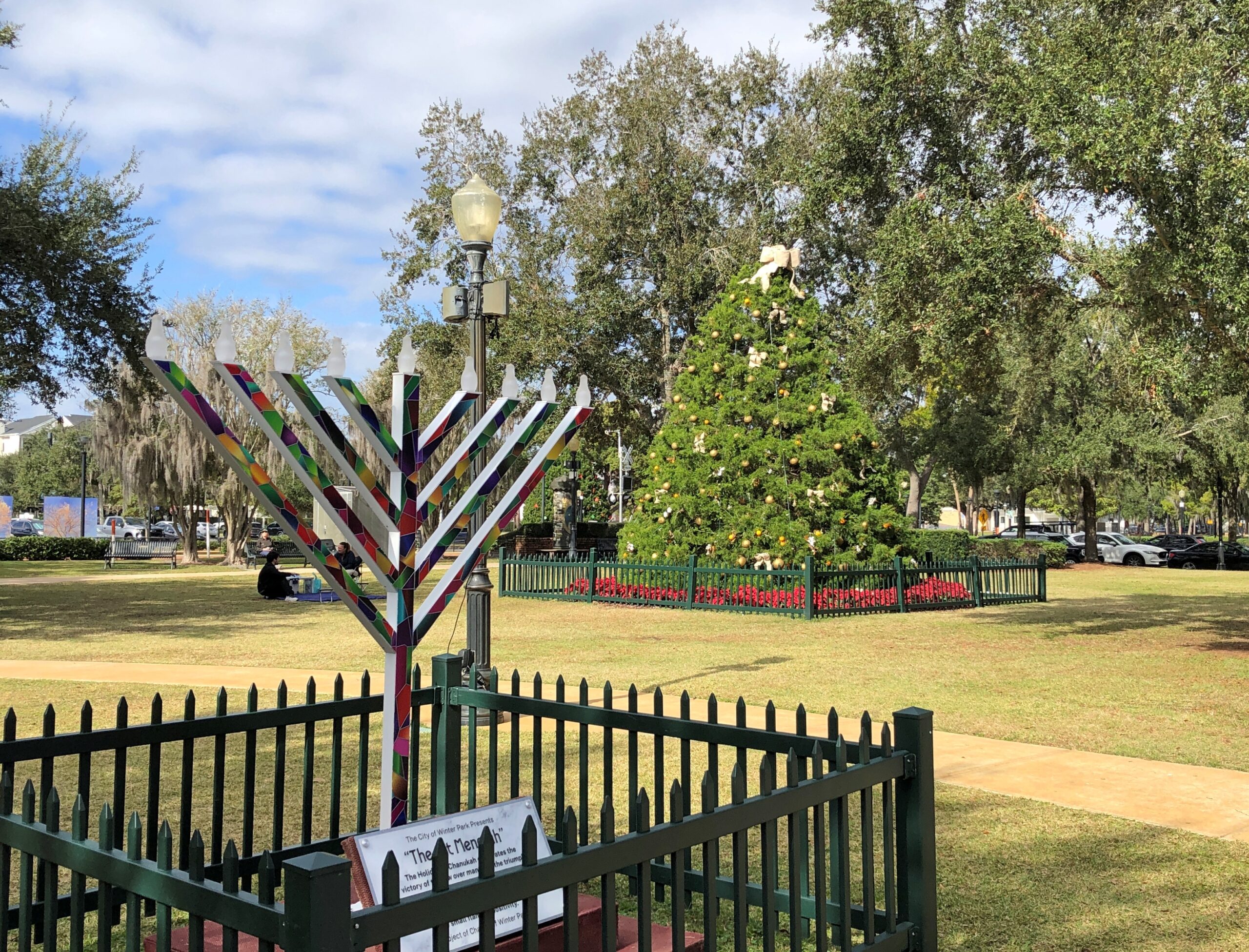
Across the street from the shops is Central Park. The developers were out, I think, to remind New Yorkers of home, but without the likelihood of snow or ice or blizzards like in ’88.
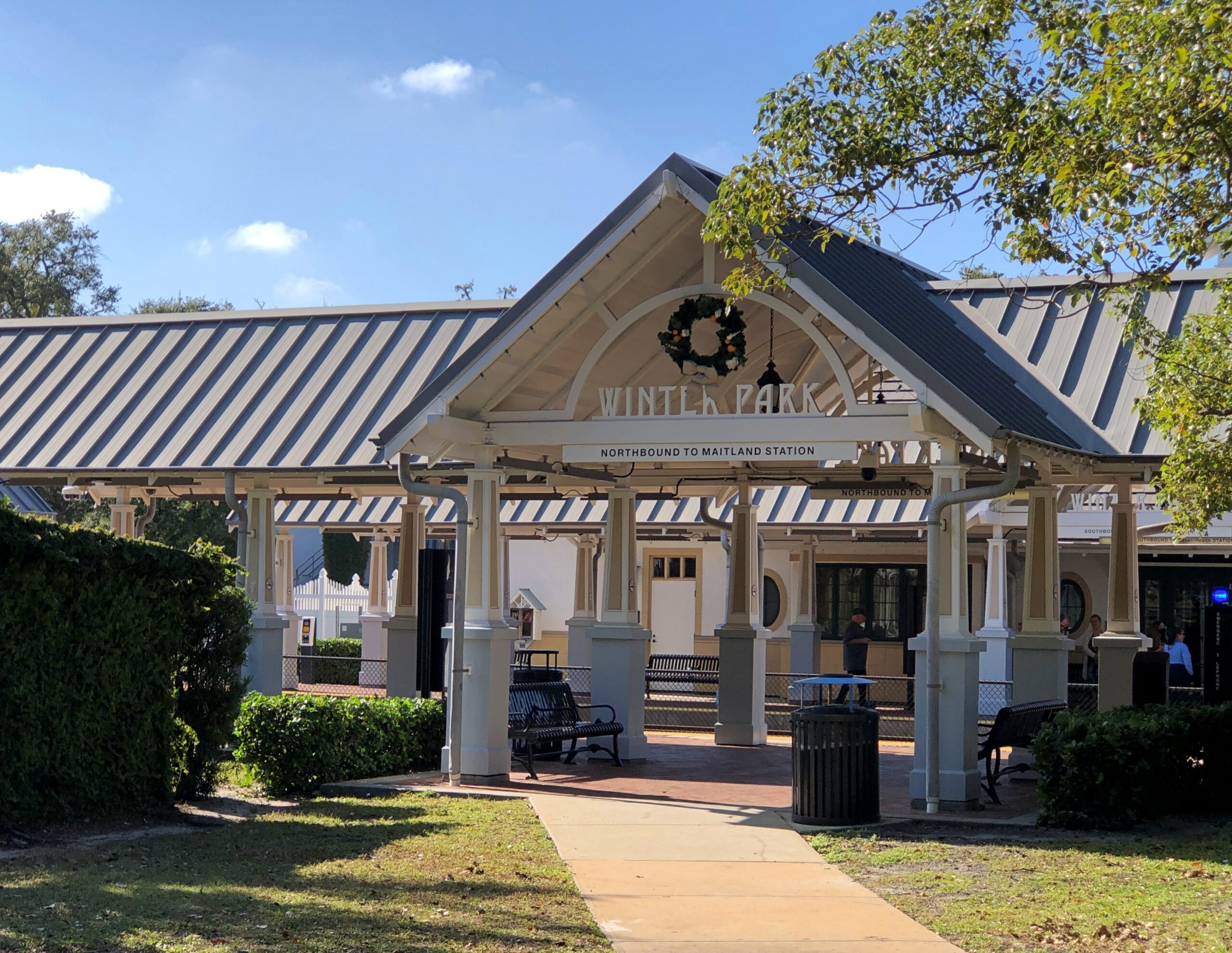
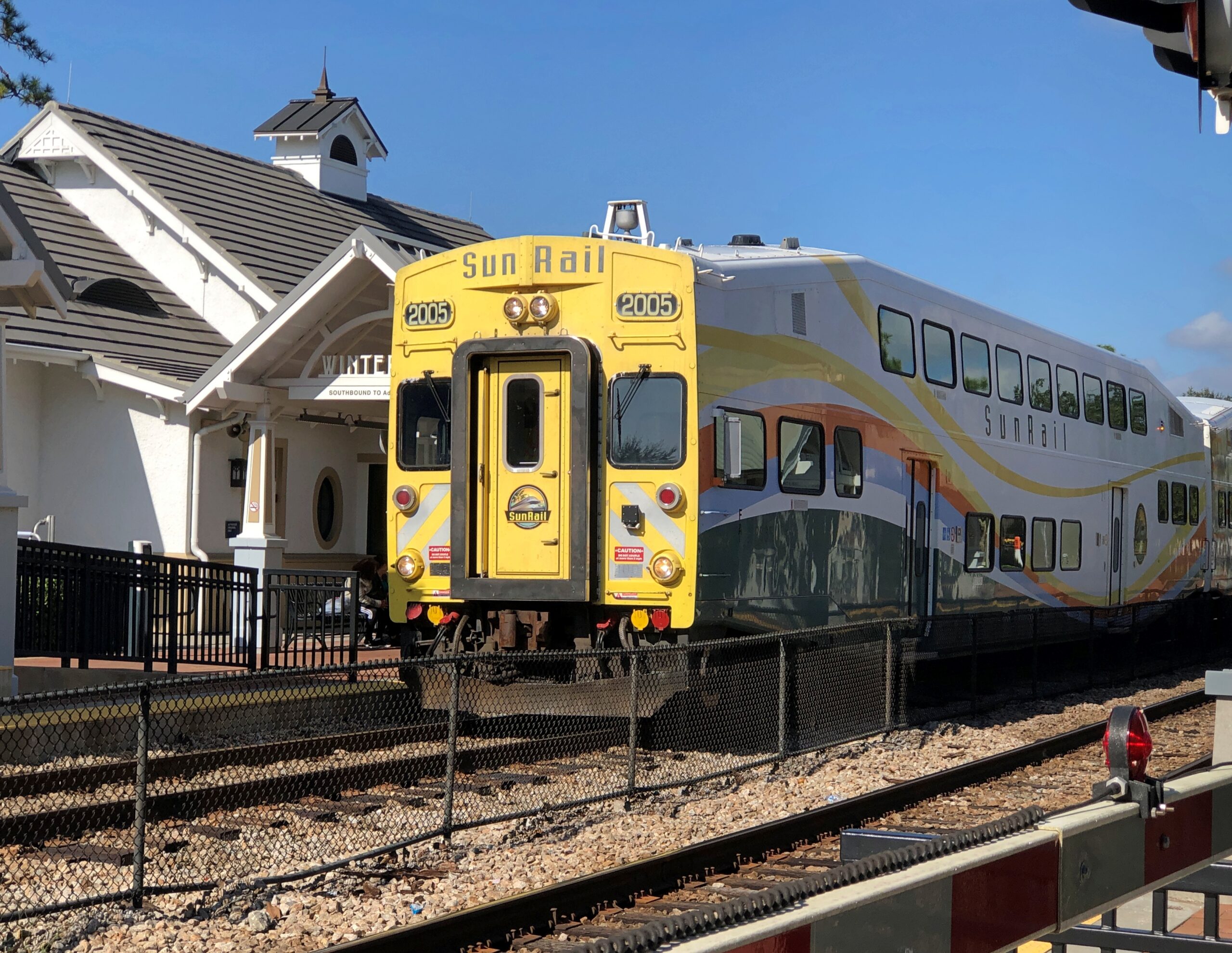
The Winter Park station on the SunRail commuter line is at the park, and a SunRail came while I was idling in the park. Amtrak stops there too.
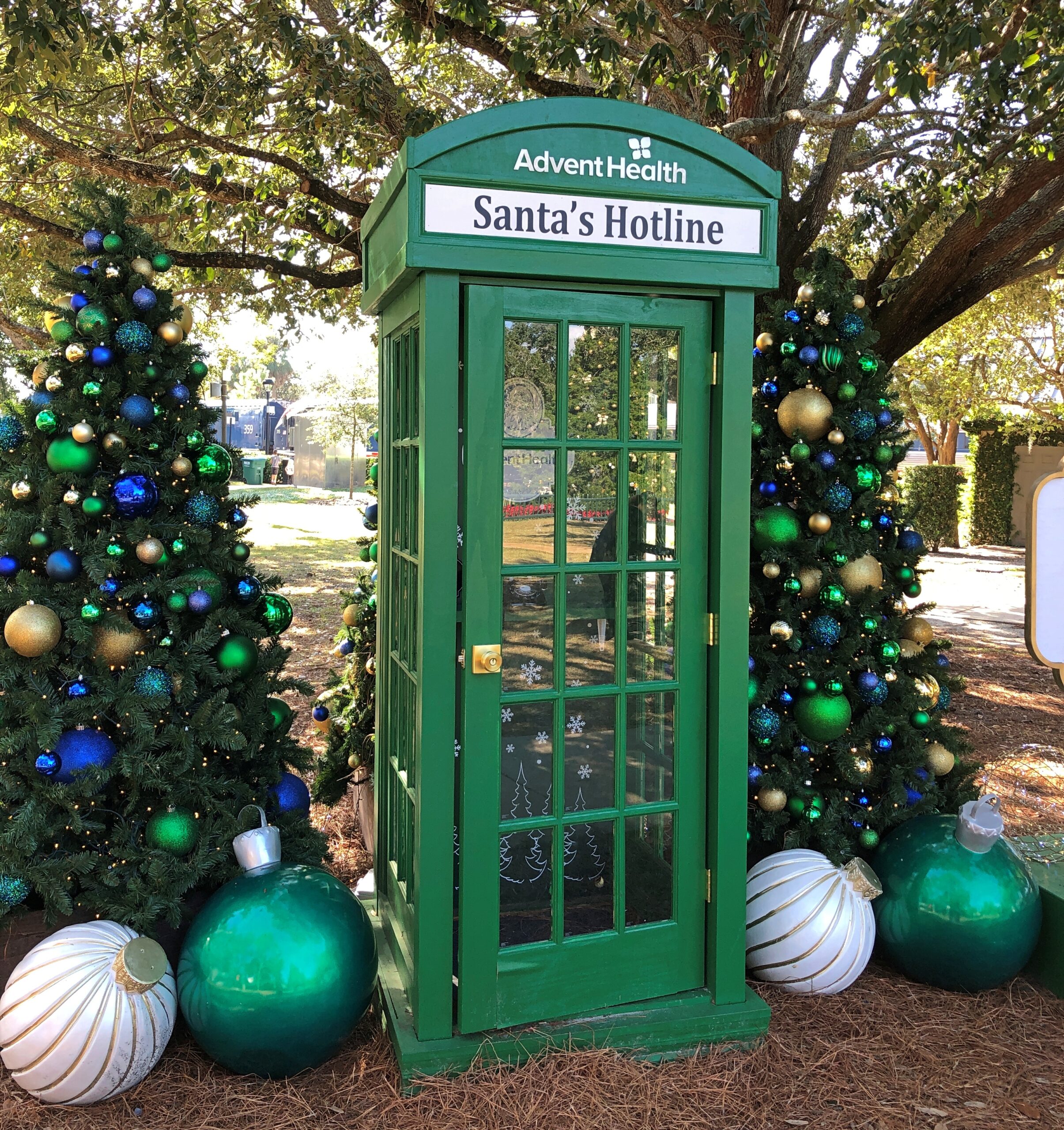
The park was decorated for the holidays, of course. Including a phone booth.
A local tradition. You can call from the booth and leave a message for Santa Claus.
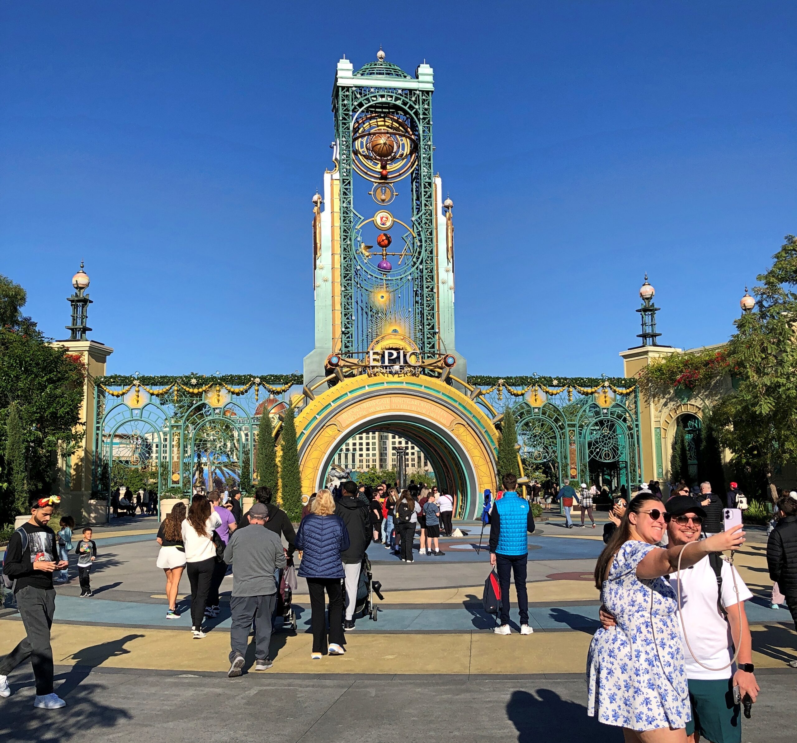
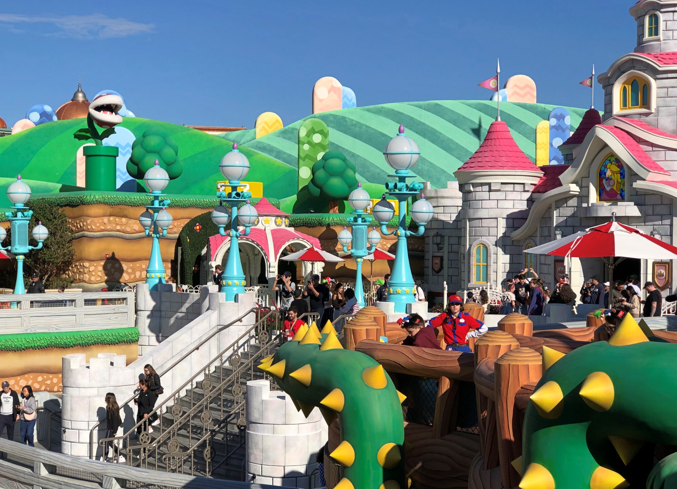
A theme park should have a theme, right? As far as I could tell, the theme of Universal Epic Universe, the most recently opened park in central Florida, is We Own These Valuable Intellectual Properties. Namely, such globally successful entertainment franchises as Harry Potter and Mario Bros. and How to Tame Your Dragon. I mean, How to Train Your Dragon. Shows you what I know about these properties, which is a lot less than many people.
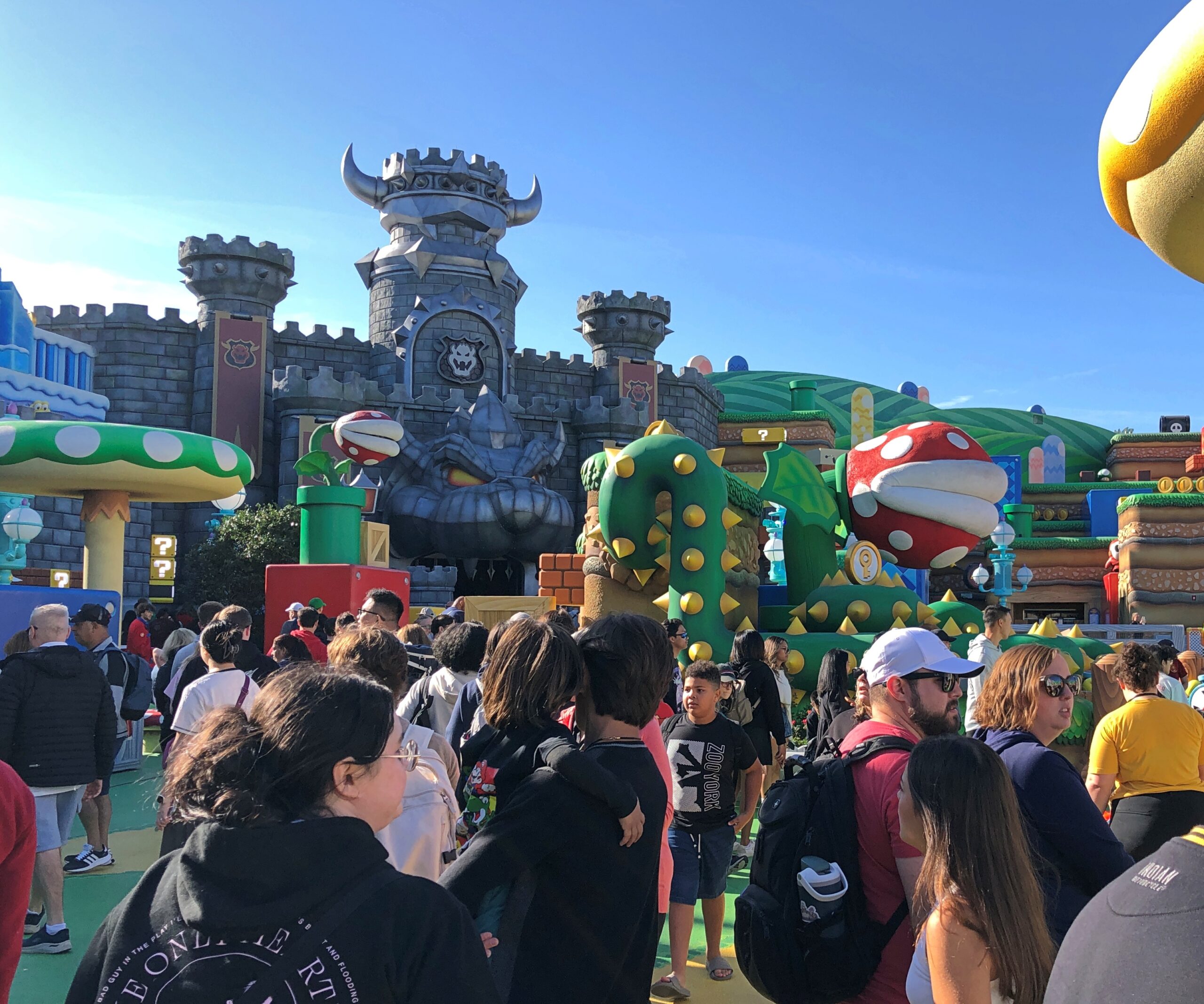
For instance, Ann had to school me on who Bowser was, which she was happy to do as we waited in line for the first ride of the day at Universal Epic Universe, in the area of the park devoted the world’s most famous cartoon building supers. Even I know Mario and Luigi. I was around to see their arcade games appear in the early ’80s. I’d heard of Princess Peach. Word of damsels and their distress tends to get out.
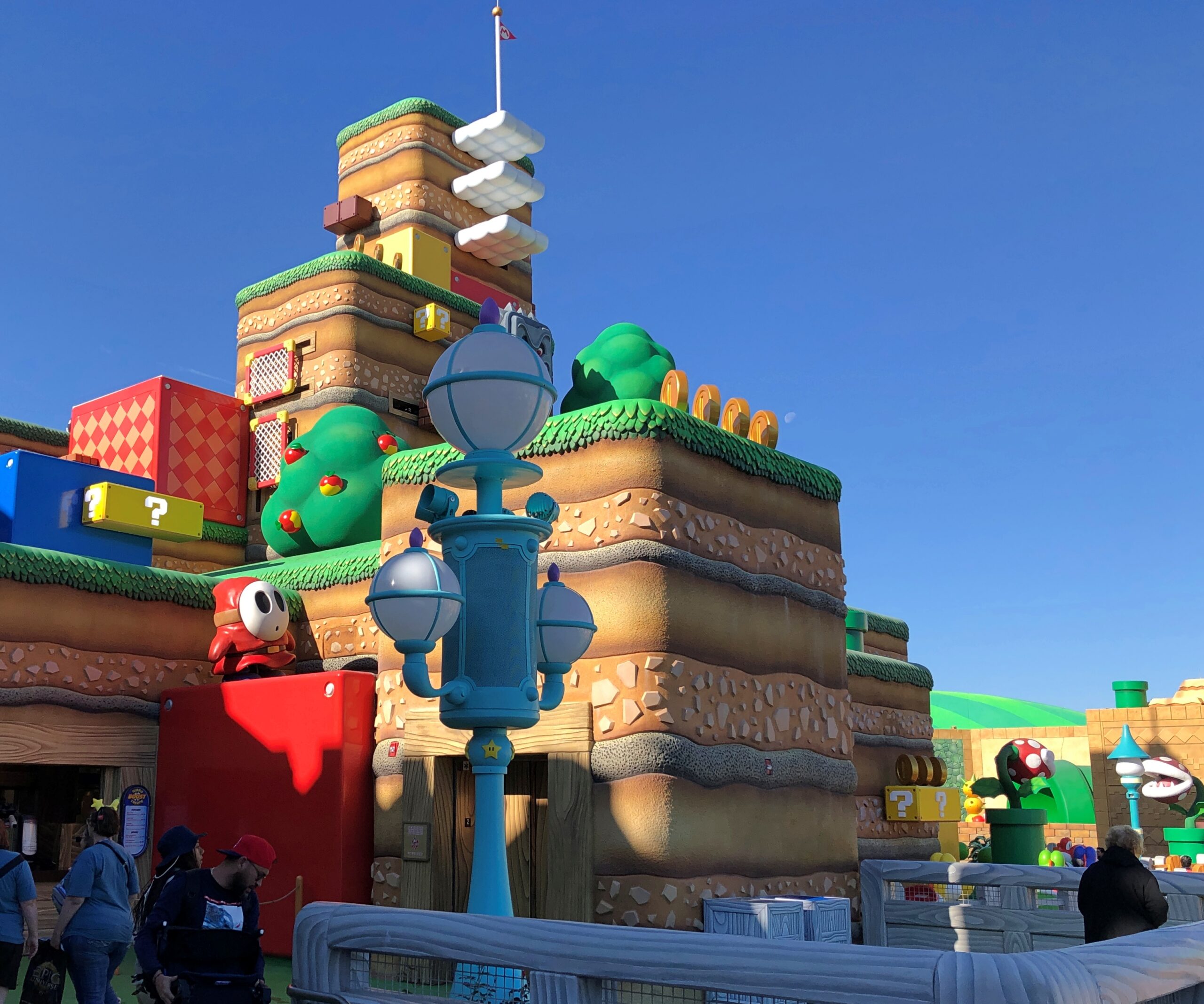
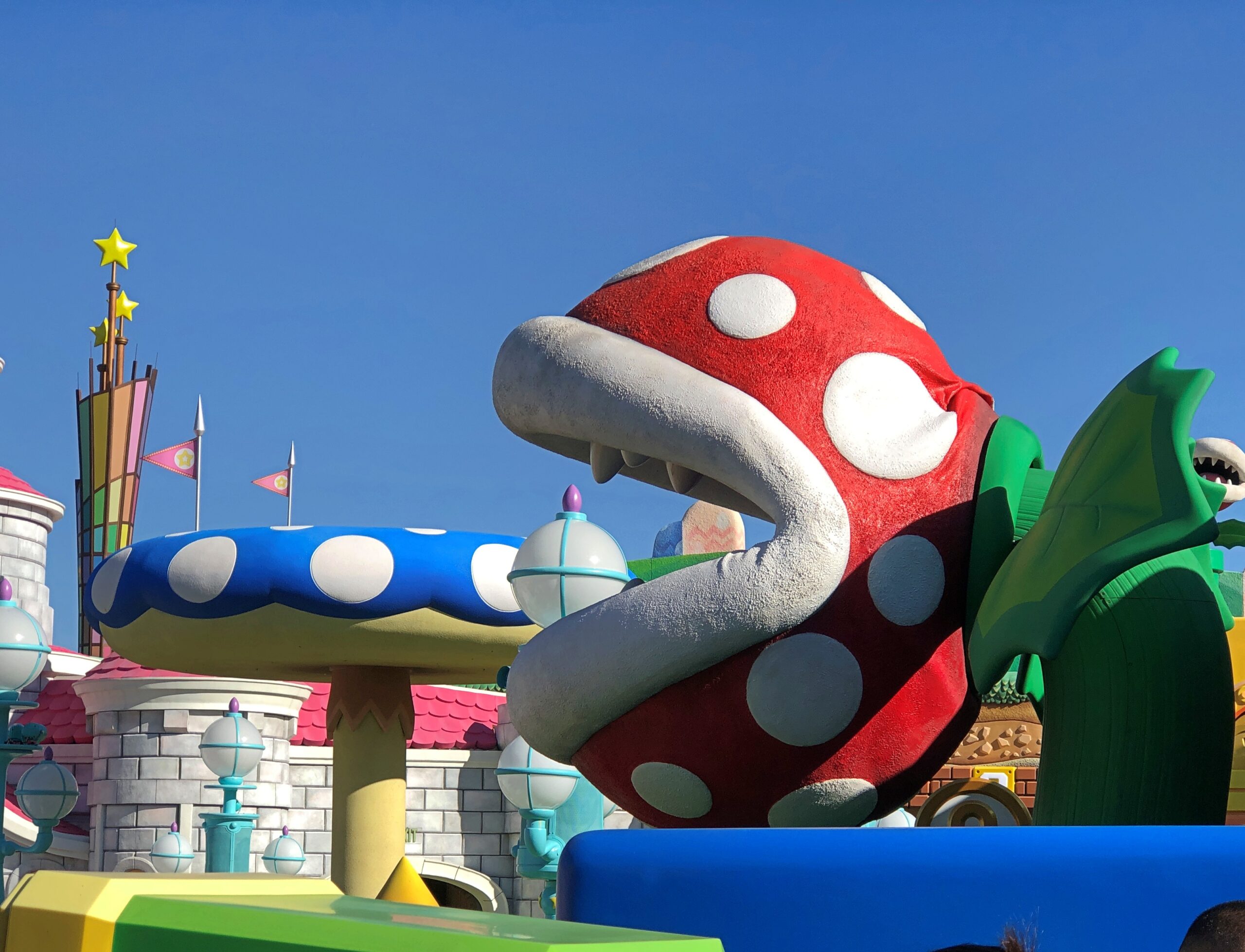
Bowser is the main antagonist of franchise, turns out. The line snaked through his castle or lair or the Bowser secret scheming room, since he seems like a fellow that schemes a lot. But I will say this: Universal went to a lot of trouble to give you something to look at as you waited for the ride, including in this case giant faux library books with such titles as Why Good Things Happen to Bad People, The Second Place Banana and Other Horror Stories, and Sibling Rivalries and How to Exploit Them, and many more, all in-universe jokes, some of which were amusing even if you didn’t know the back story. A committee of Mario Bros. experts must have spent months on dreaming up the titles, marveling every day that they were paid to do so.
The overflow of things to see while you wait repeats itself in the other major rides: the Gothic detail that evoked the monochromic worlds of the early Universal horror pictures, and the positively palatial hall ahead — a long time ahead — of the Harry Potter-adjacent wizard swooshing ride.
We’d arrived fairly early on the morning of December 9 for our day at Universal.
The weather was ideal for the visit. The crowds were less than ideal, but not bad. I can’t imagine the hordes at the park, say, today – one of the days between Christmas and New Year’s, when many more people are off, and kids aren’t in school.
We opted not to do the line-skipping scheme, after I determined that adding it to the ticket prices for three people would involve roughly the same amount of money as the accommodation budget for the entire trip. Universal, which is to say Comcast, was already getting enough of my money.
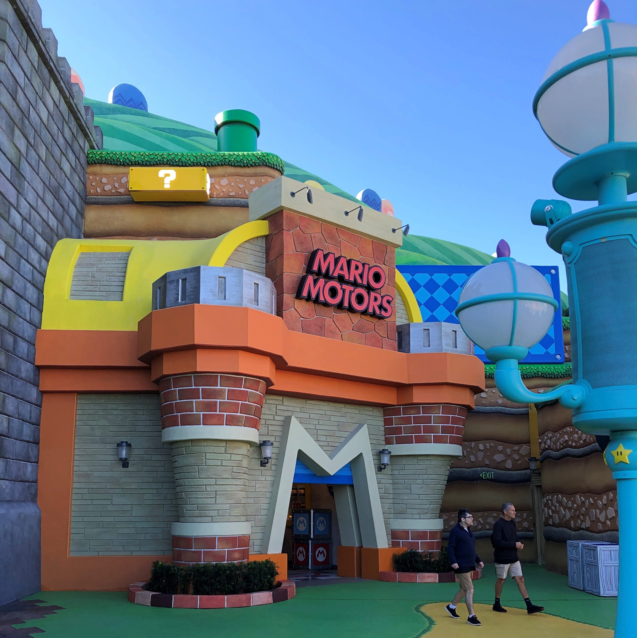
But I carp. Regular tickets by themselves aren’t cheap, but the quality of the attractions is very high, even if you aren’t particularly interested in the franchises. Mario-world is pretty interesting, even before you do the ride, which offered sensory-overload that involved a blur of simulated kart racing. I can’t actually remember much more than that after more than two weeks, but there was a lot of light and motion and grabbing of that wheel.
The plaza outside the ride. Like stepping into the game, yes? A big hit, anyway.
Who knows? These very buildings might be the inspiration of a wildly popular architectural style in the 22nd century.
When we got to ride entrance, there was a posted 60-minute wait. Ann insisted we go right then. When we exited, we noticed that the wait time had more than doubled. Good call, Ann.
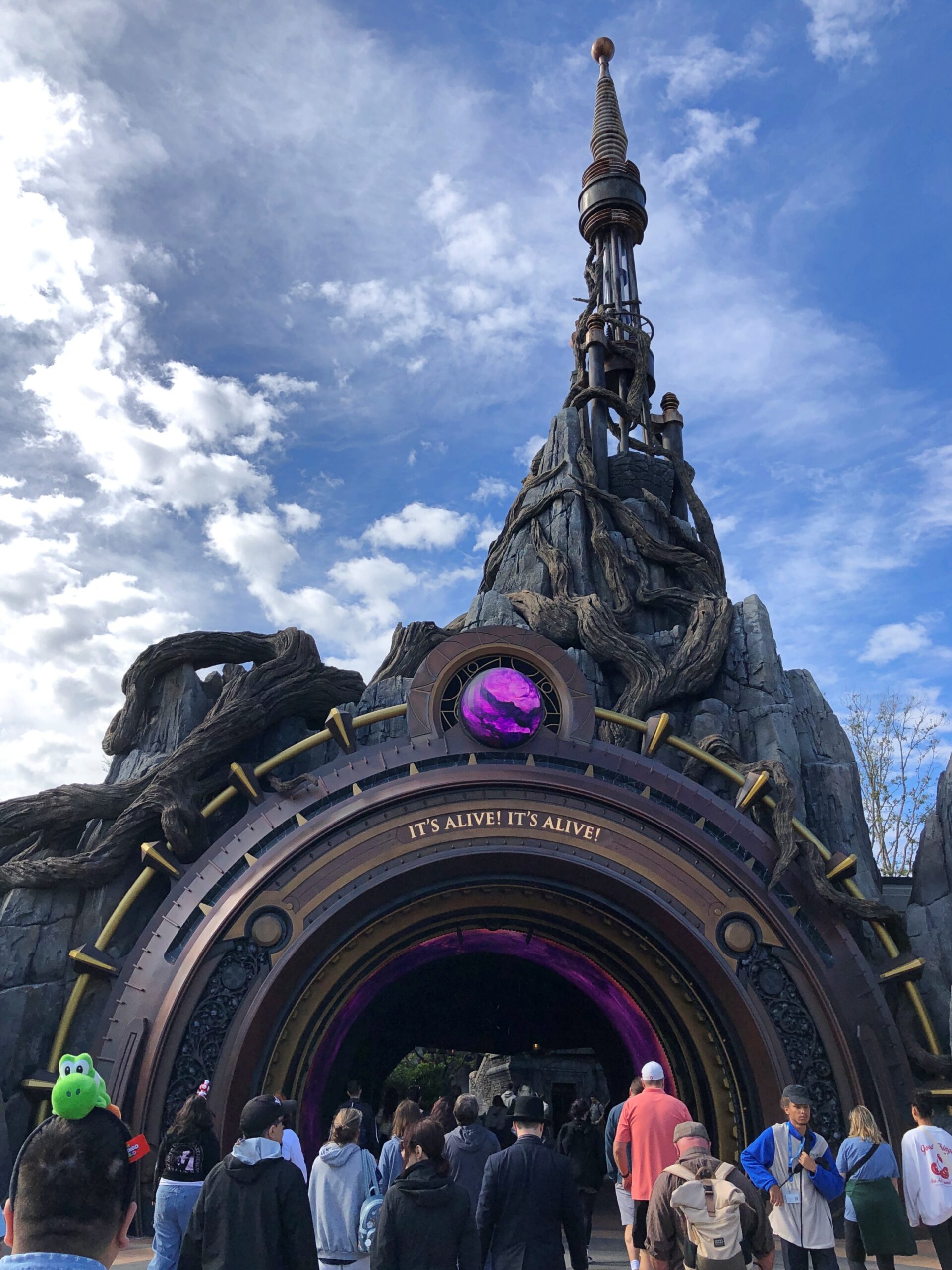
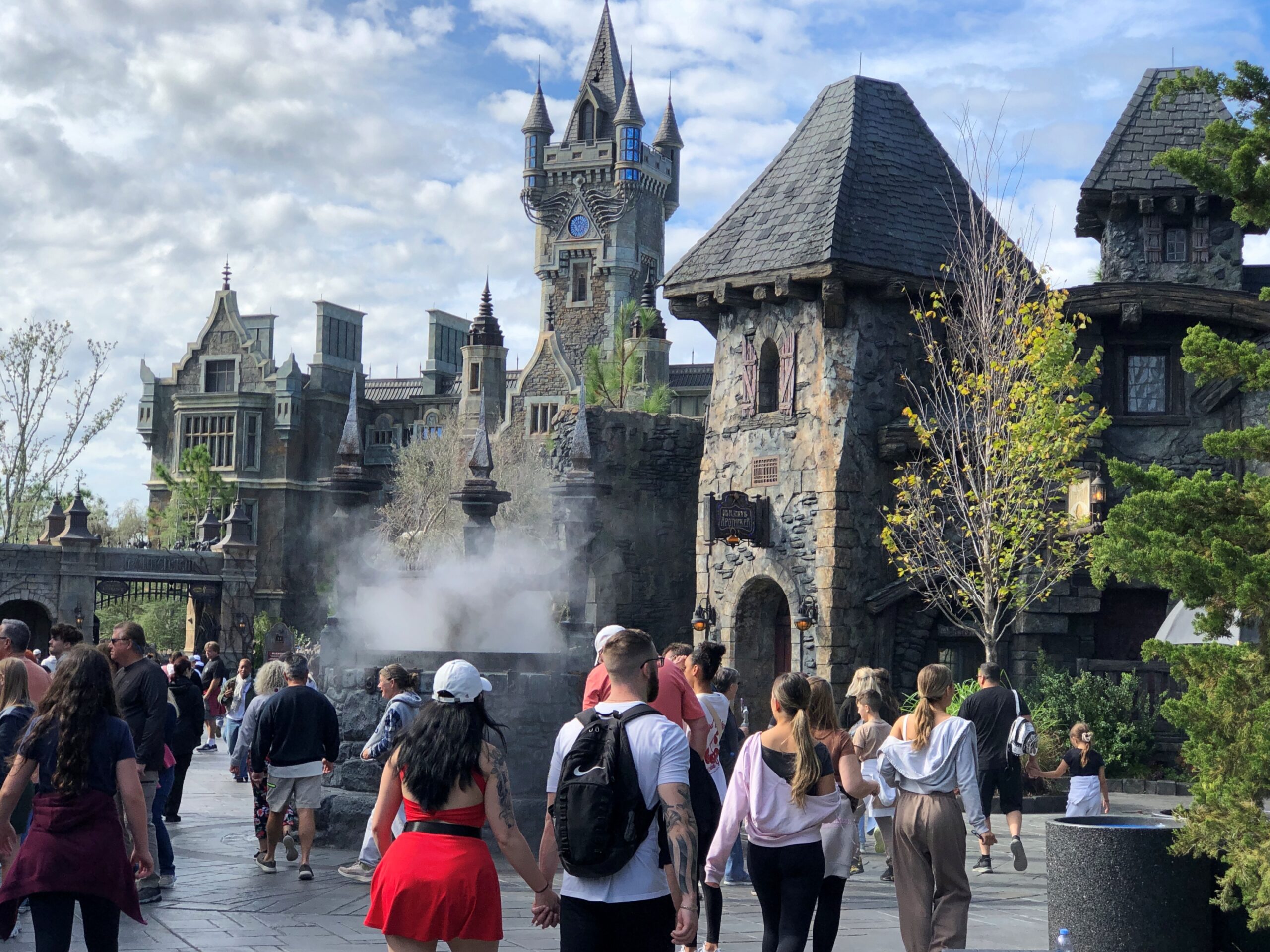
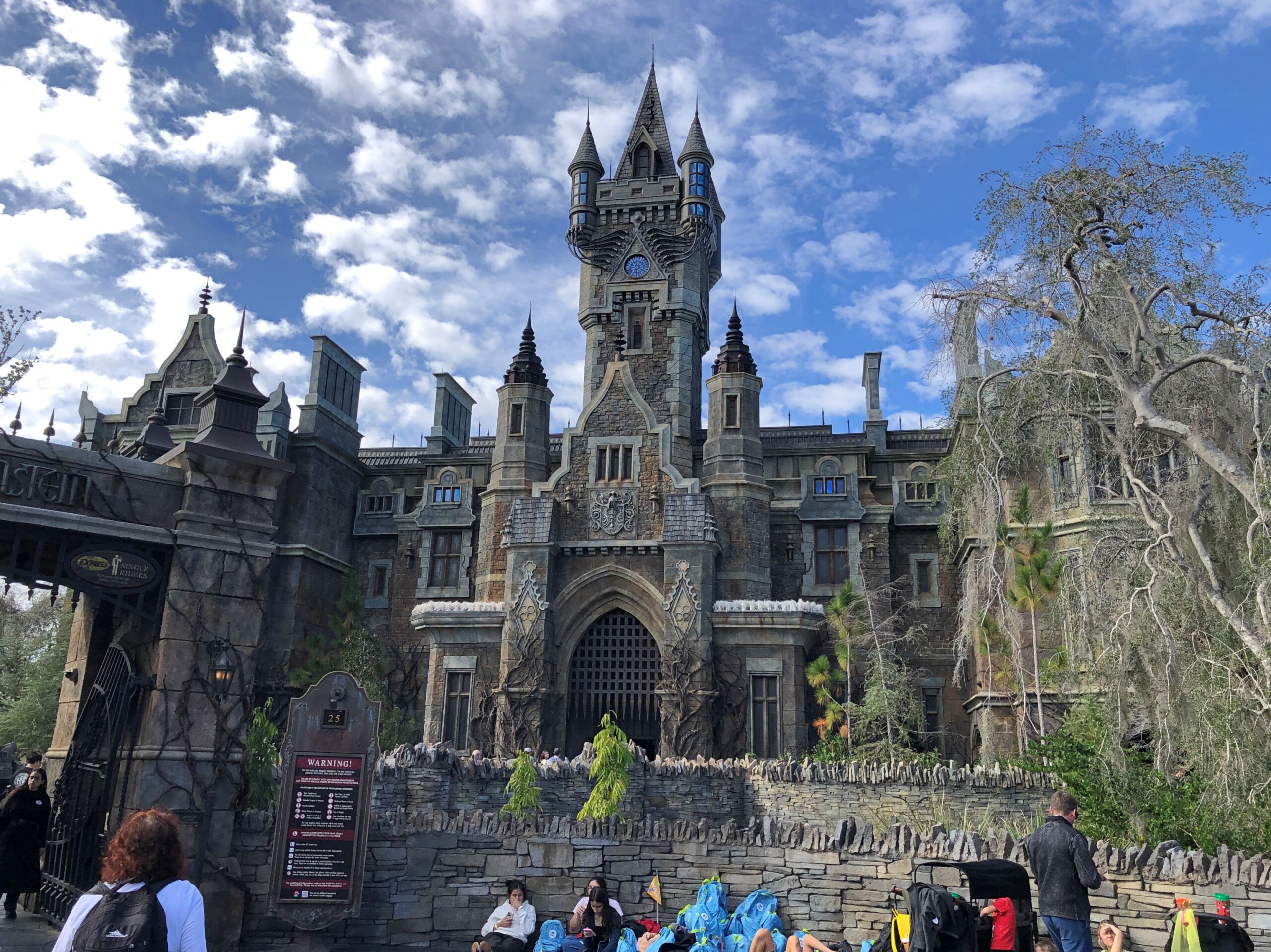
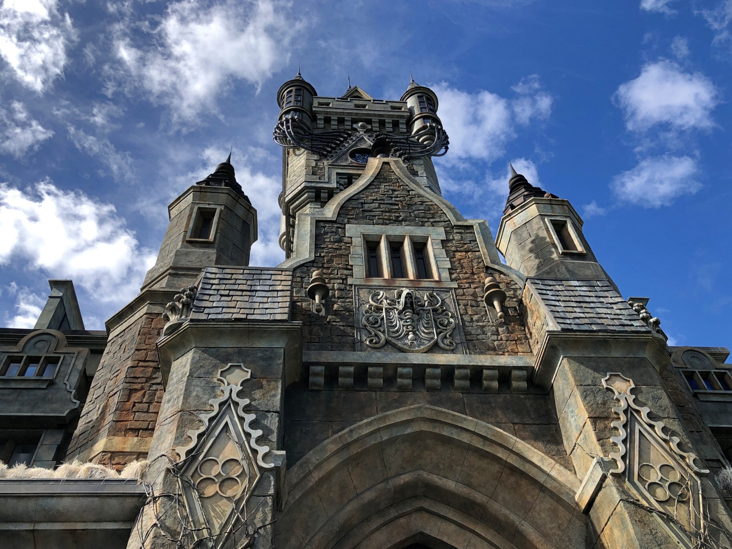
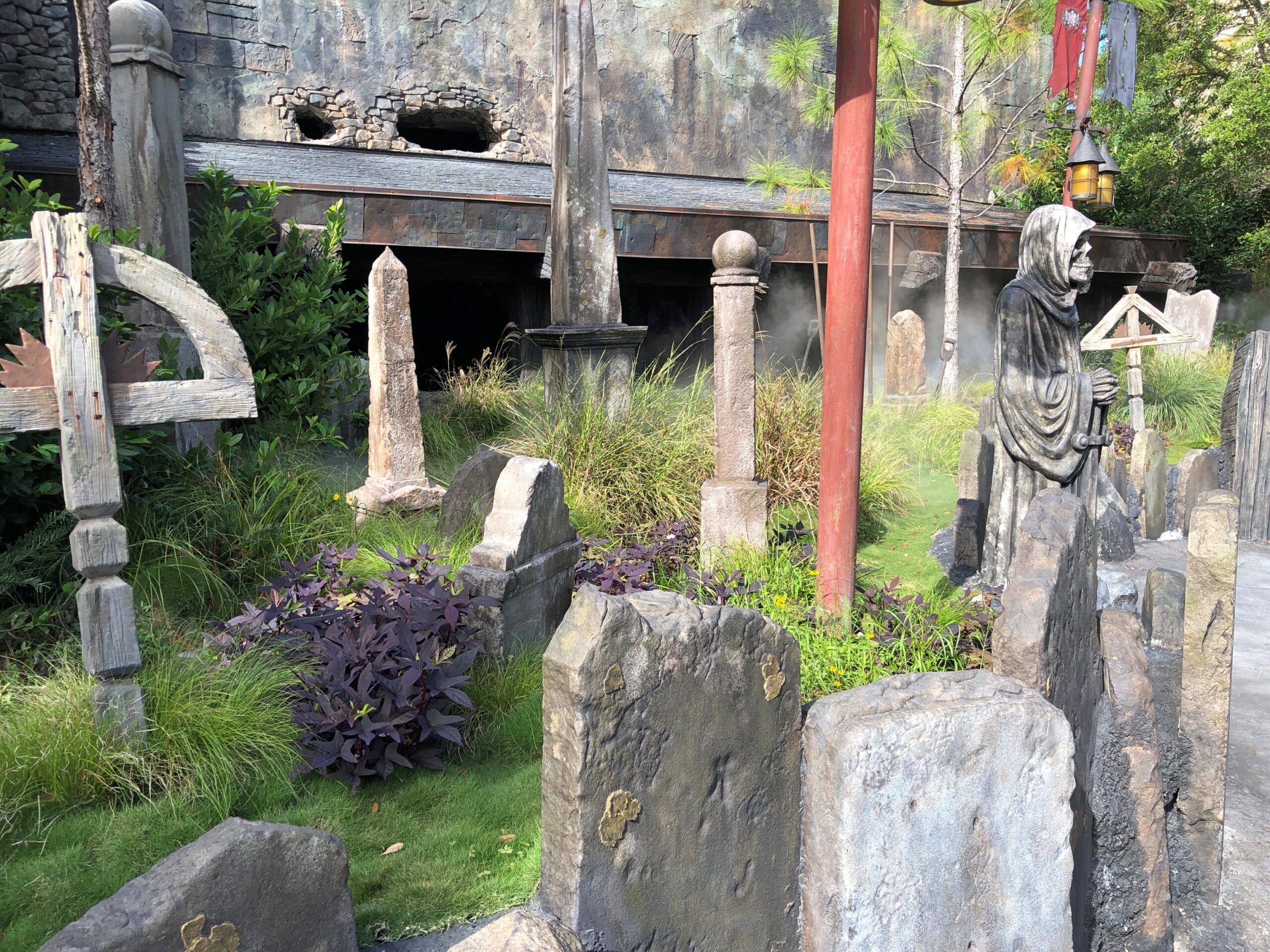
Our second ride involved a faux Transylvanian castle and the various monsters from Universal’s 1930s and ‘40s monster heyday. The style, amusement park Gothic. From the towering castle of Frankenstein renown to the details in faux stone and faux headstones.
Faux it may be, but that’s no cheap structure. Add to that the ride at the heart of the building, and you’ve got some impressive entertainment engineering.
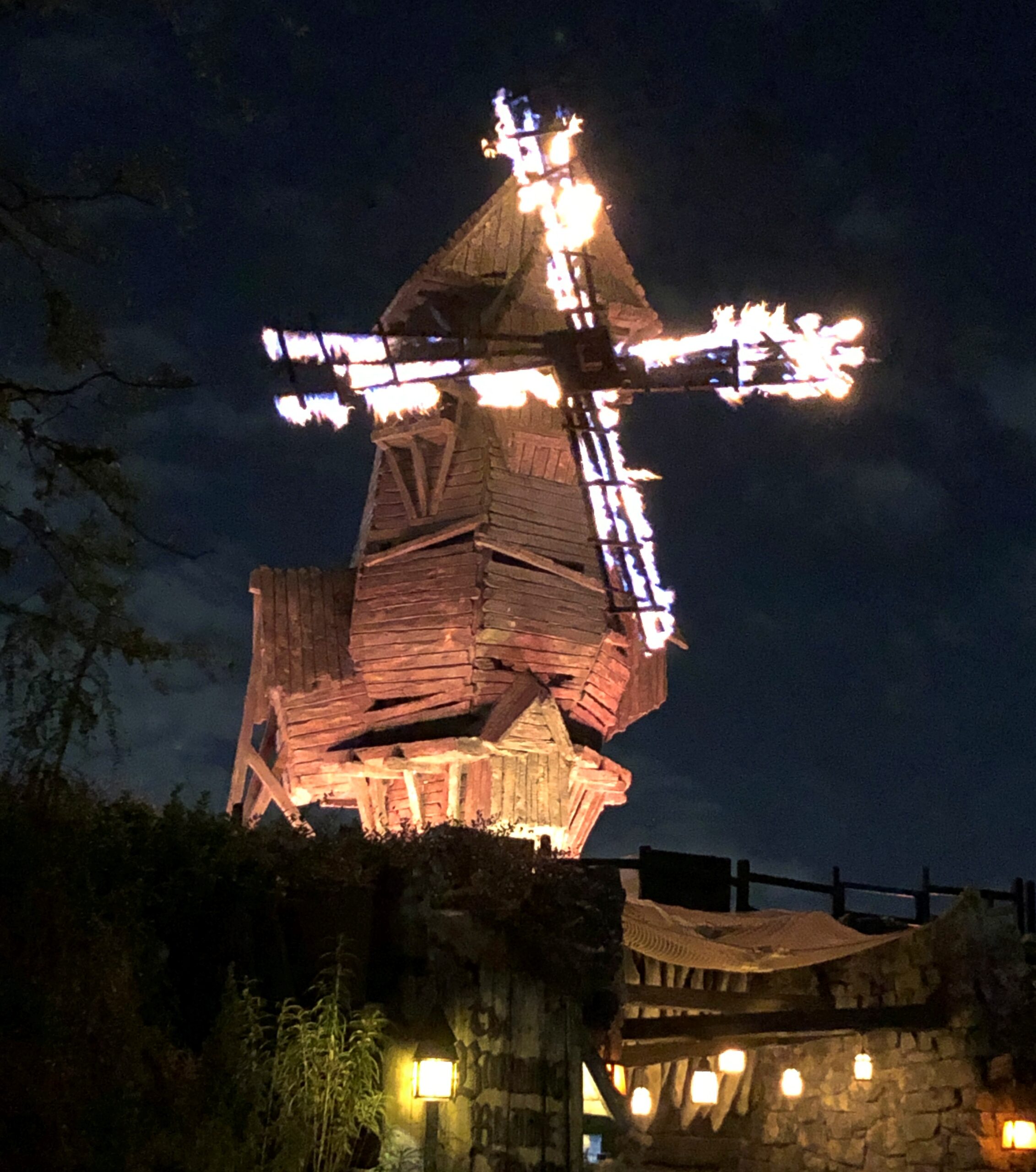
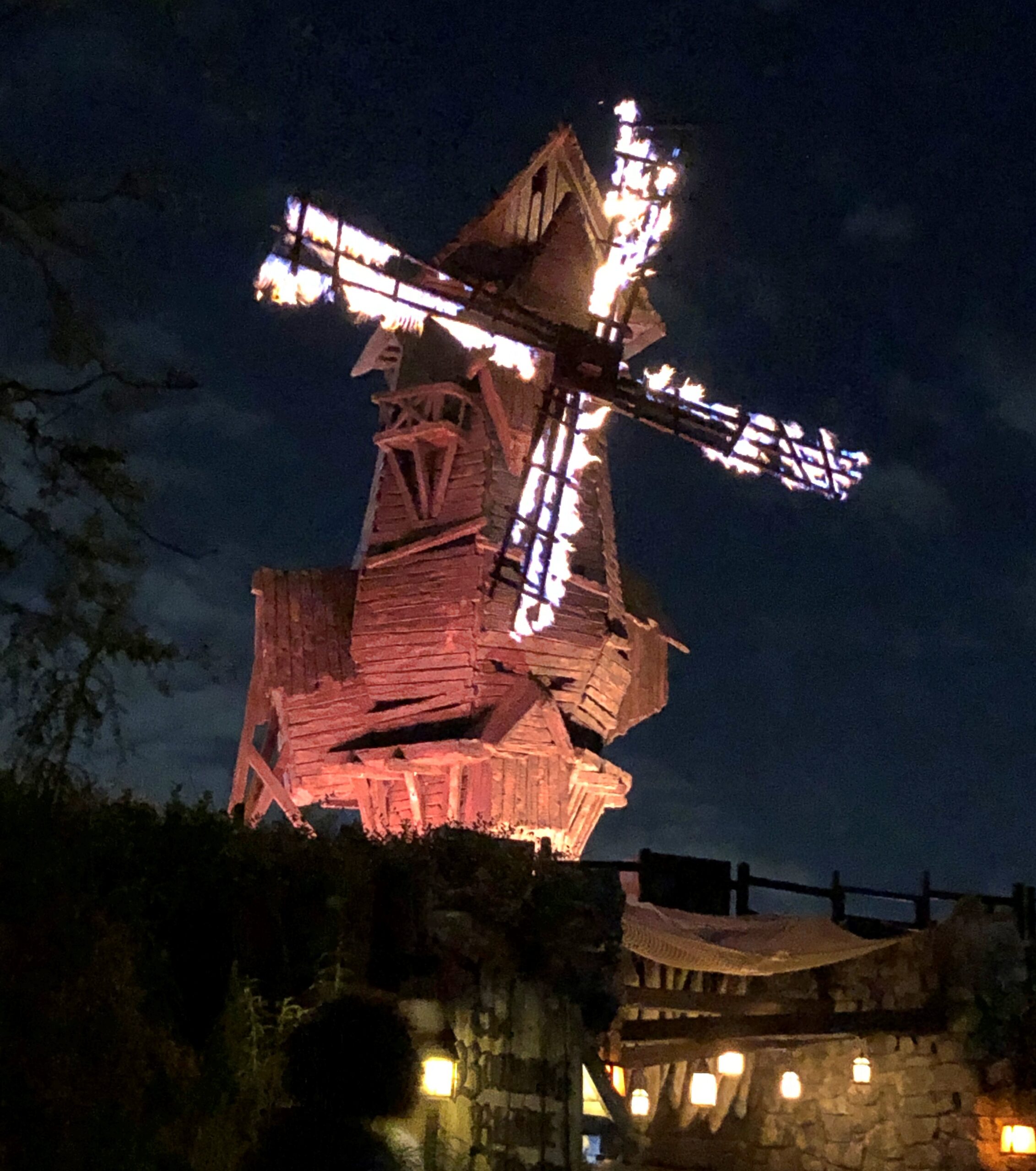
We came back after dark for the roller coaster in the Frankenstein part of the park. Ann wanted to go back for the roller coaster, that is, a separate ride from the one in the Gothic castle. While Y and I waited on a nearby bench we saw, by chance, the burning windmill. Nice touch. It didn’t collapse, naturally, and would re-ignite every 15 minutes or so.
The Frankenstein ride wasn’t quite as intense, in lights or motion, as Mario Bros., but was it was about as loud, with a character purporting to be Victor Frankenstein’s great-granddaughter directing the monster to fight Count Dracula — or was it the Werewolf? The Creature from the Black Lagoon also made an cameo appearance, but the details of the ride are a little fuzzy. Entertaining hubbub, that’s what it was.
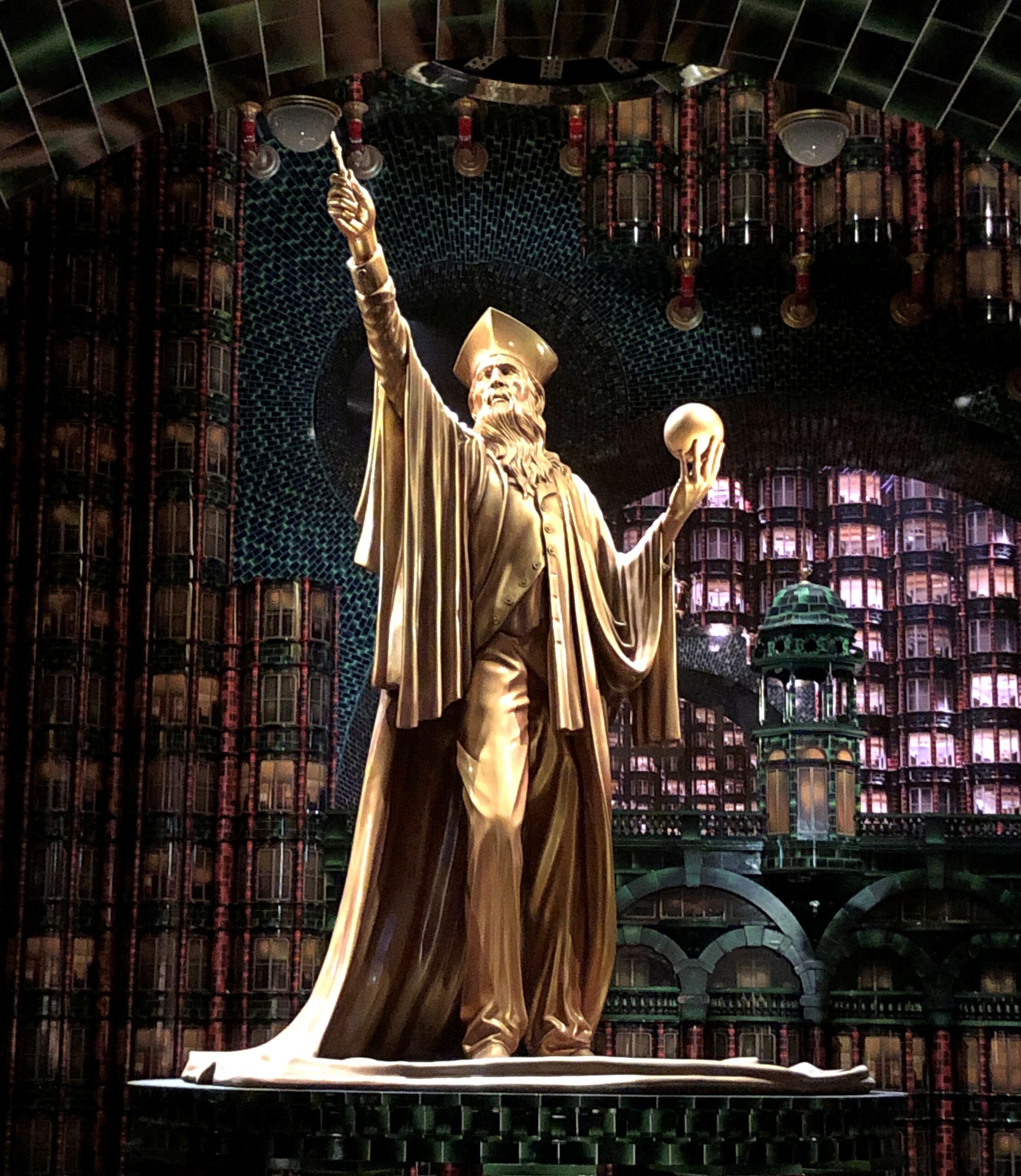
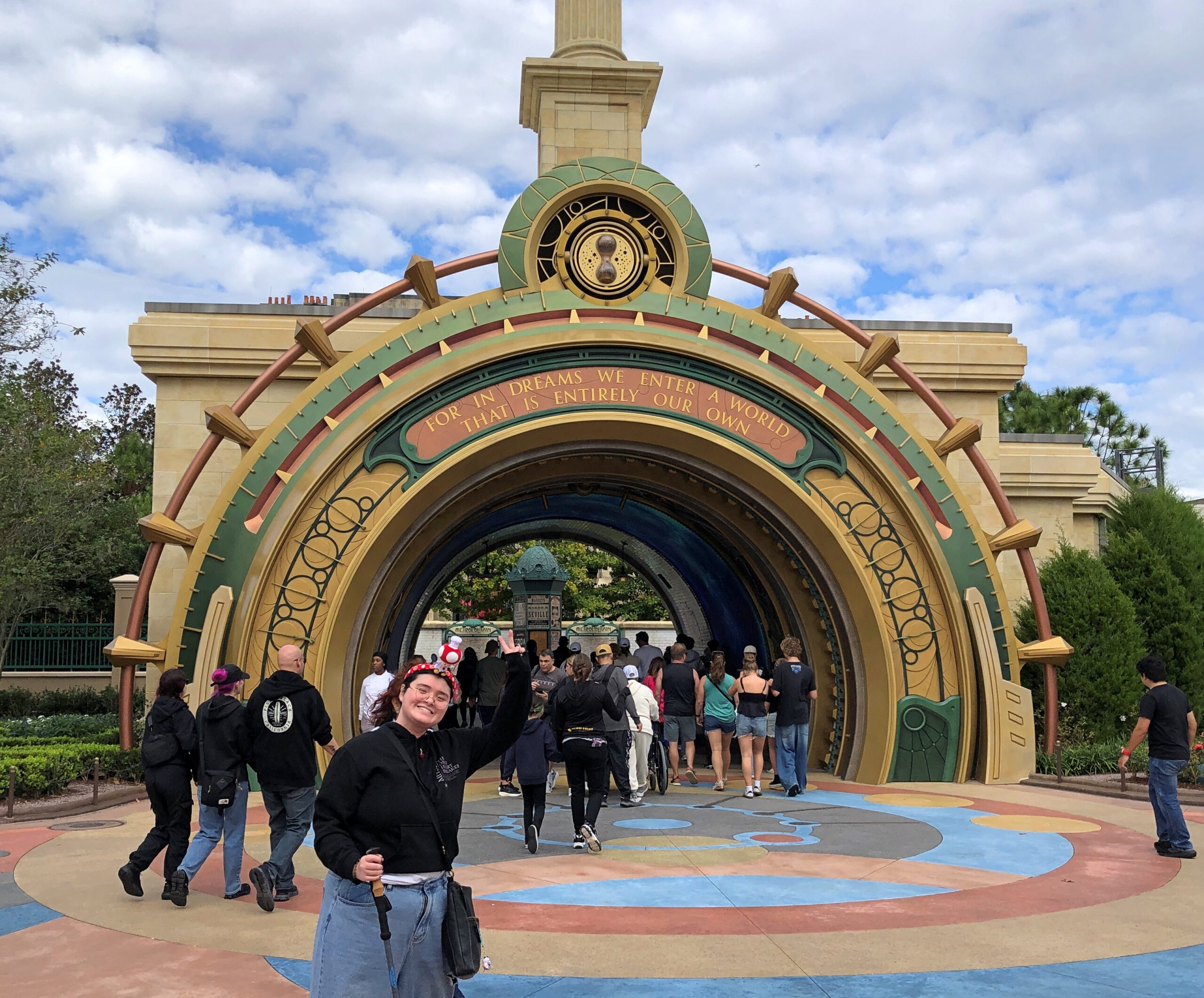
The line for the Harry Potter-ish ride was the longest. Around an old-fashioned amusement park waiting pen, down a long hall, though “portholes” foggy with dry ice emissions, into a vast hall, around a cluster of gigantic gilded statues, under several floors worth of faux offices, near another gigantic gilded statue (below) into another hall, and there you were. Ready to go up some stairs, along another couple of hallways, and down some more stairs. You did have things to read along the way, such as Wanted Posters for villainous wielders of the Dark Arts.
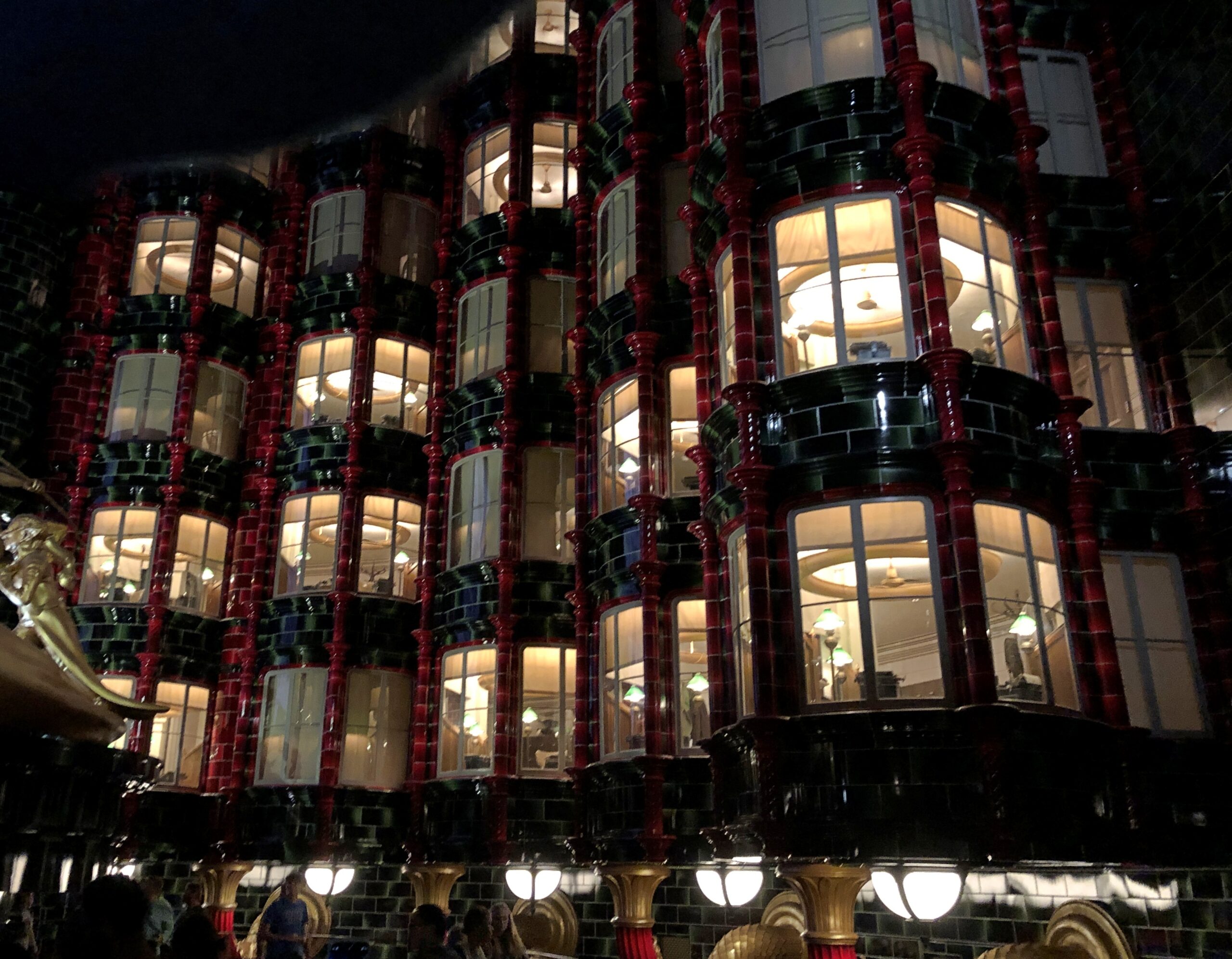
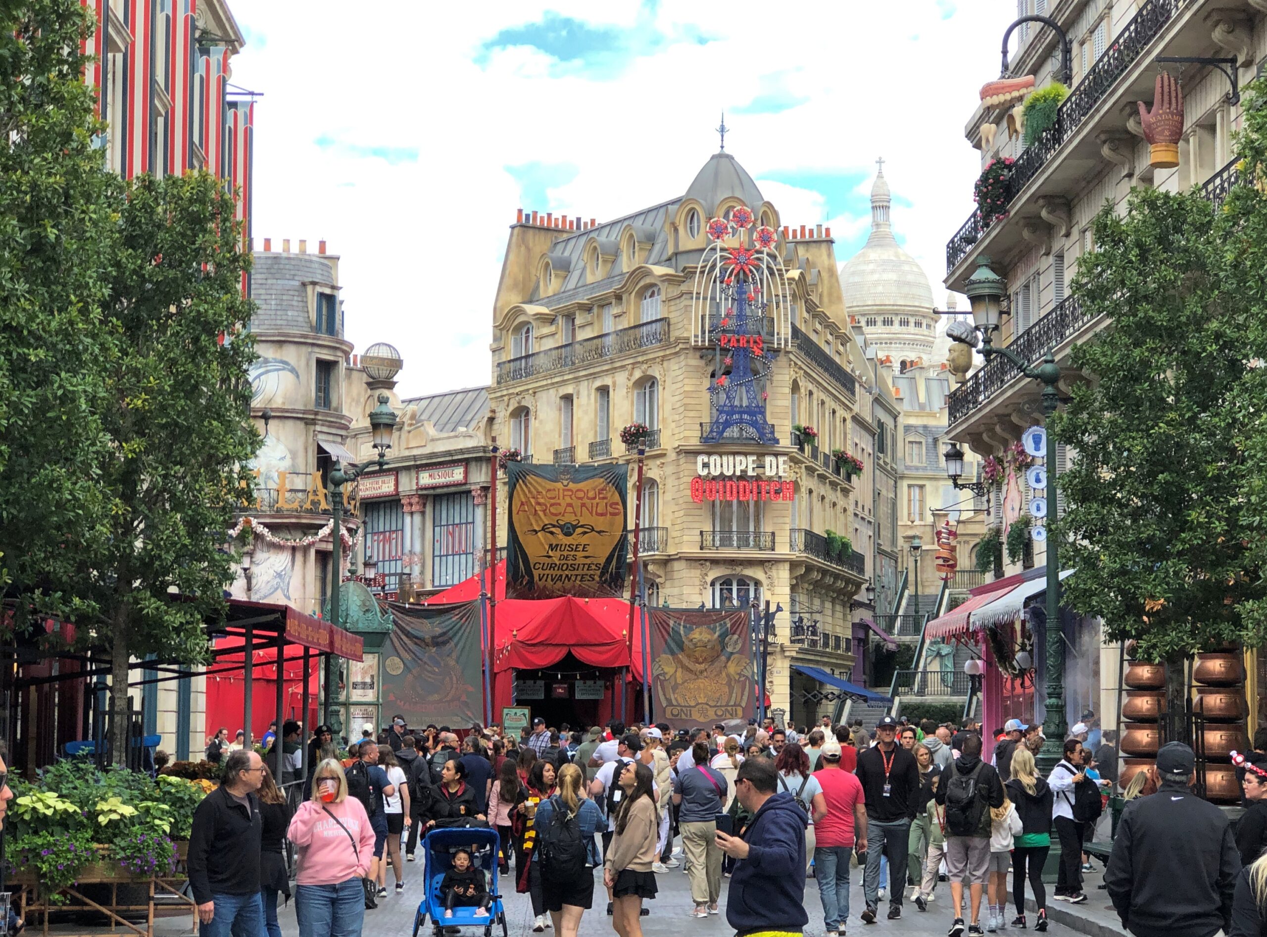
The ride was also ensconced in a faux Paris, in a building that was supposed to be the French magic ministry in the early 20th century (it is a prequel), down to a warren of small offices with lamps and typewriters of the period.
Why Paris? Even Ann wasn’t quite sure, but thought it had something to do with one of the prequels, which has something to do with the French Ministry of Magic or the like. Say, does the minister report to the President of the Third Republic? Or is he not part of representative government? Regardless, I was impressed by faux Paris – the most Parisian place I’ve seen except for the actual city of Paris.
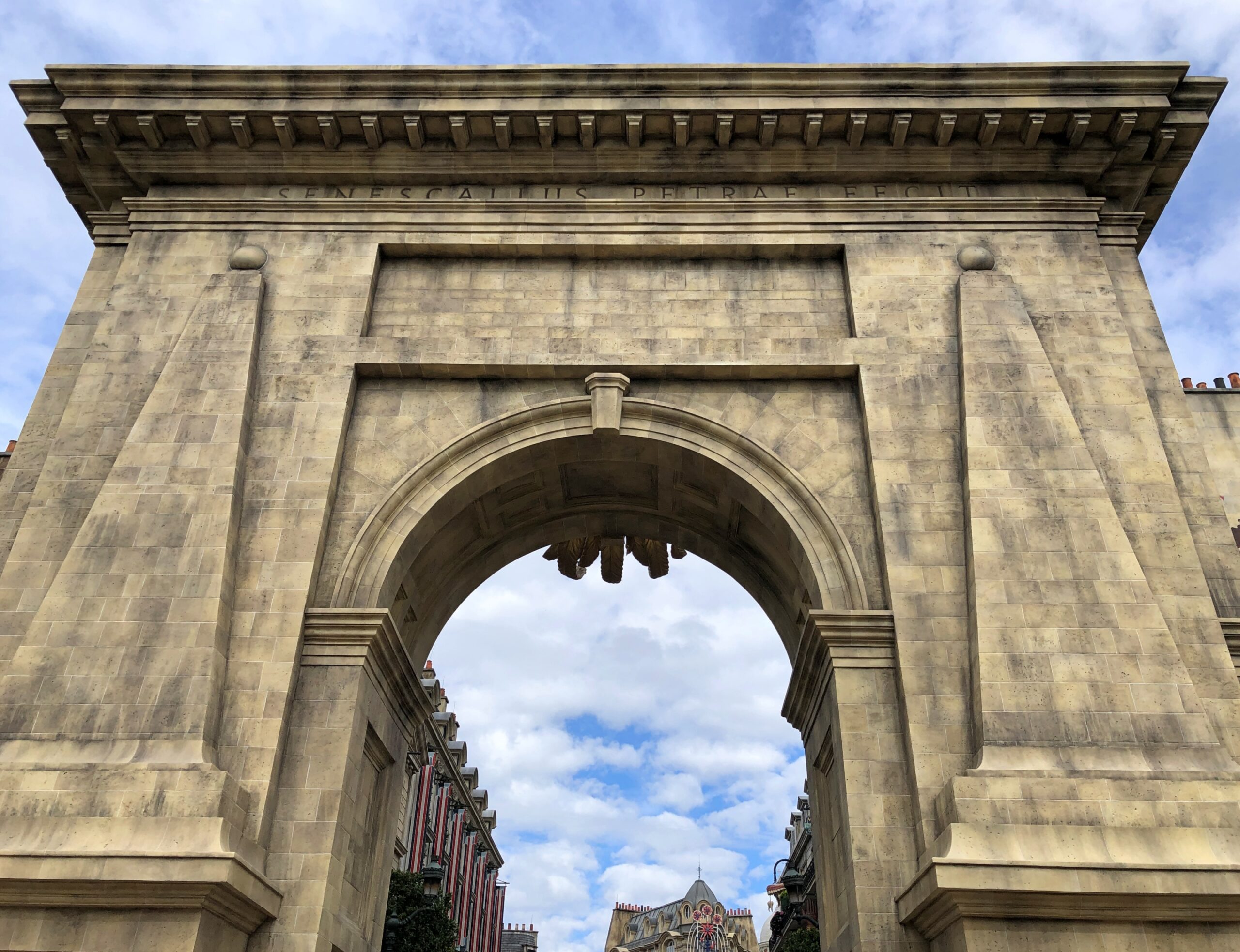
The entrance, which led to —
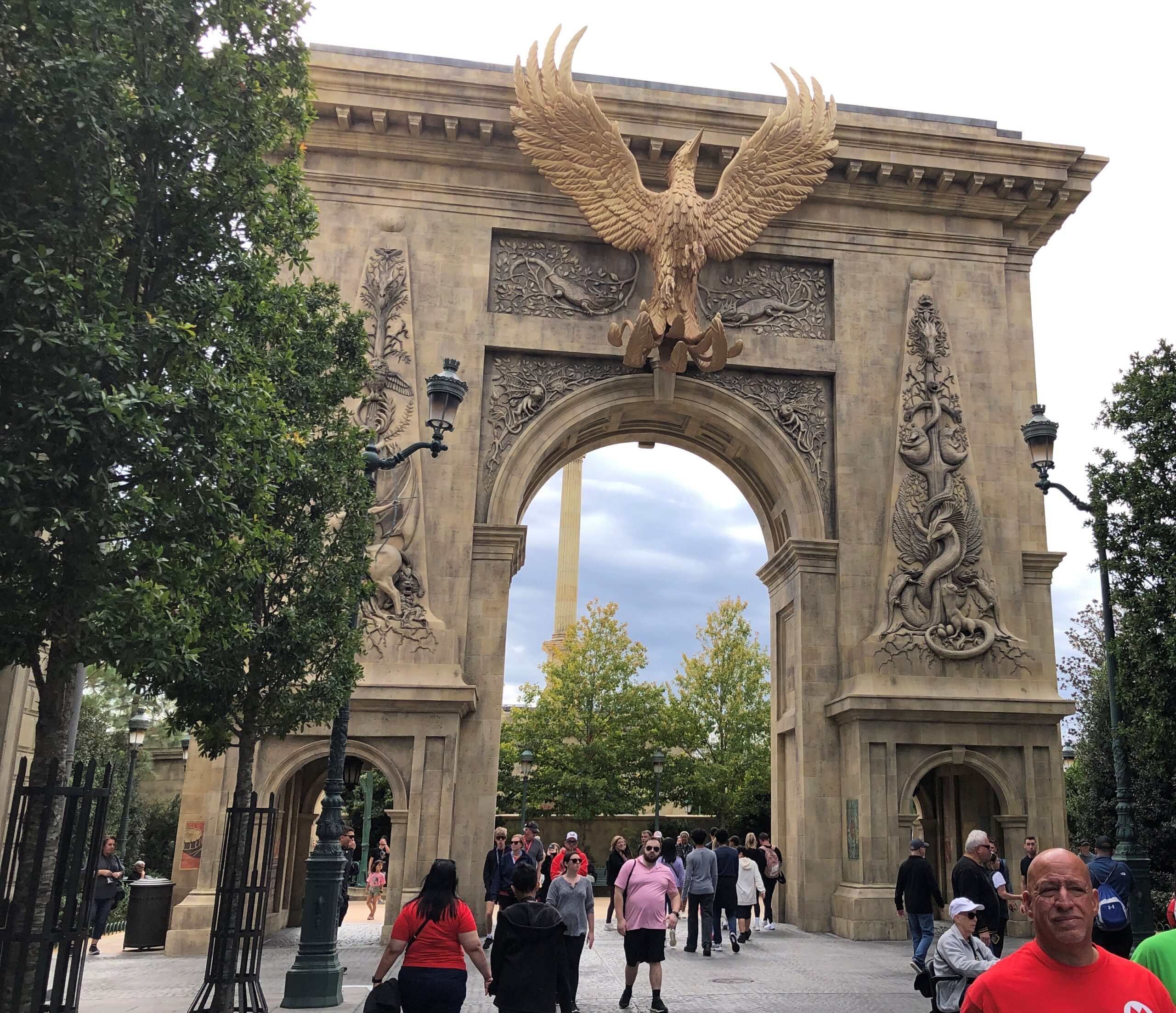
— to a truly monumental arch, front and back.
Leading to faux Paris streets in their faux glory. I keep using that word, but it doesn’t mean I wasn’t impressed.
Details, details.
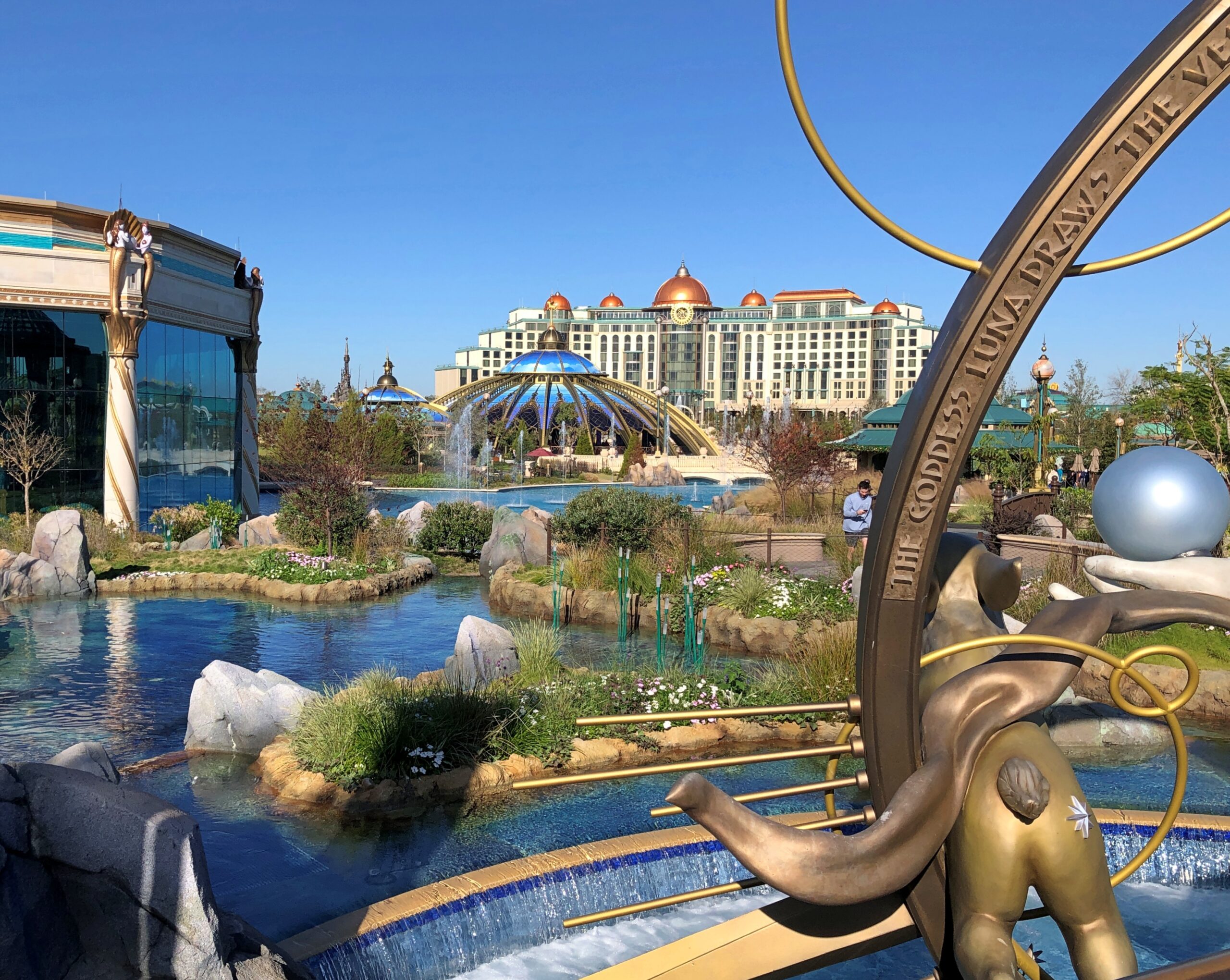
The 110-acre Universal Epic Universe, a name that doesn’t quite click, seems to have been designed to be compact enough to do in a day. There is a hub, there are spokes, the aforementioned themed areas, which included their main rides, but also other rides and plenty of shops and eateries. Yet none of the areas was overly large, and all of them were marked by a distinctive tower for each that could be seen from a distance. Nice bit of waymarking.
We had lunch at one of the faux-Paris restaurants. At a Olde World Europe-themed restaurant at which you ordered food via an app. The food was good, but that business with the app, which we had to figure out on the fly, didn’t please me at all. I can only hope that isn’t the future of food service.
Once we got to the Harry Potter ride — remember, it is located in Paris, for reasons, and Harry himself seemed to be only a minor presence — the long line was instantly forgotten in the shaking and lurching and whizzing. Characters etched of light came and went, following a script set down in computer code. It reminded me of a roller coaster, even though most of the sensation of motion was done via special effects, especially active lighting. Supposedly we were sitting in a jury box – one of the characters was on trial for something or other. I used to like roller coasters, but age has taken that pleasure from me.
I have to admit it, we bought gas at Buc-ee’s more than once on our trip to Florida. Turns out that the chain’s gas prices are comparable with Costco. That is, 20 to 30 cents cheaper per gallon than most standard gas stations. Costco tends to be on main thoroughfares in densely populated places, which is sometimes convenient, sometimes not. Buc-ee’s is the flip of that, tending to be on major highways at some distance from densely populated places. Sometimes convenient, sometimes not.
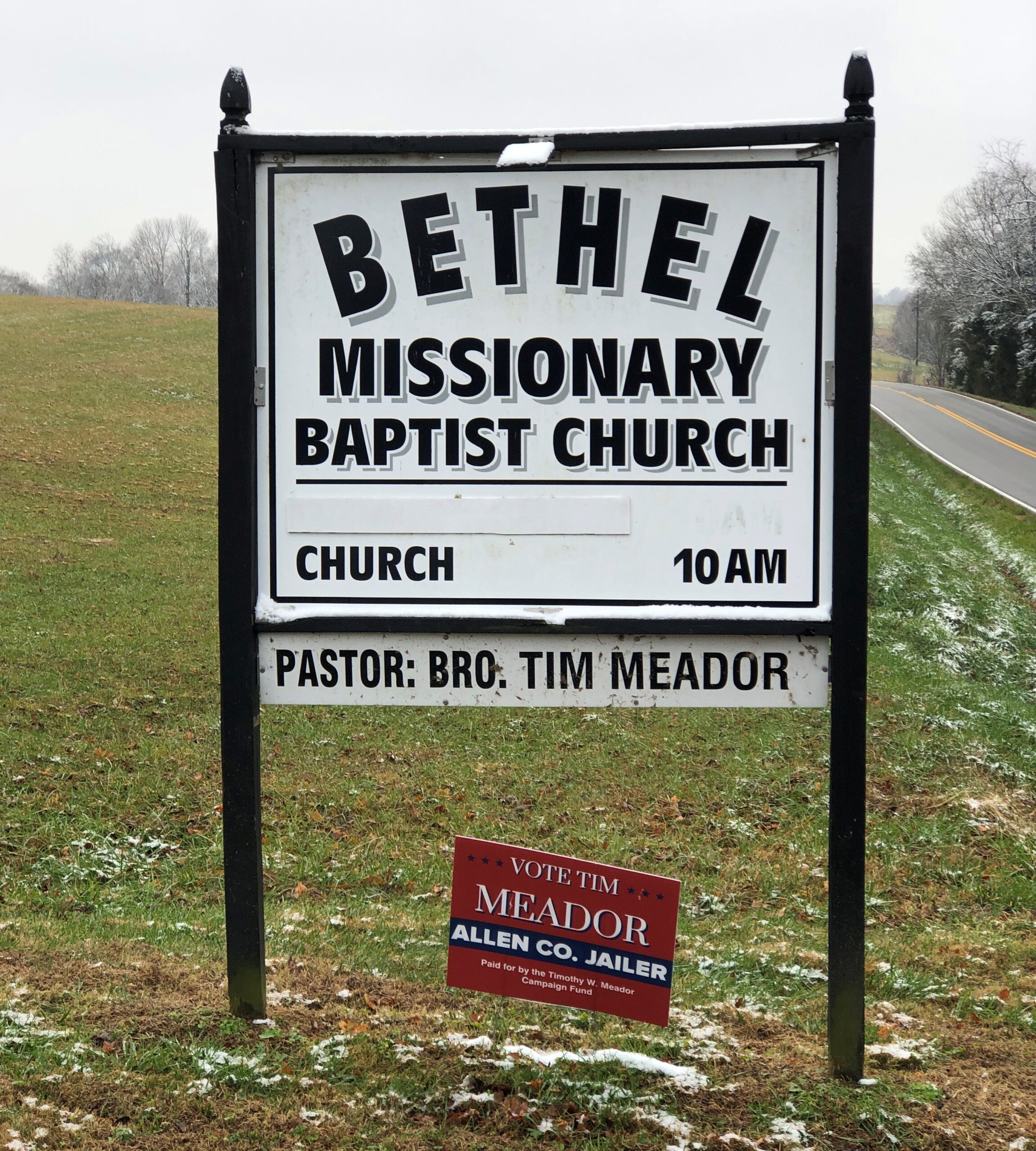
We gassed up at the Smiths Grove, Kentucky Buc-ee’s just off I-65 on December 5, early in our trip. We had to make a decision on how to proceed from there. One choice: continue on I-65 to Nashville, take I-40 east from there roughly to Cookeville, Tennessee, and take smaller roads into Jackson County, to reach our friends’ home in the holler. Or: take smaller roads across southern Kentucky and into Tennessee, bypassing metro Nashville and going through towns and hamlets and farmland and woods we’d never seen before, ultimately connecting to the appropriate small roads in Jackson County. It isn’t too hard to guess what we did.
Kentucky 101
It so happened that exiting from Buc-ee’s in Smiths Grove takes you to Kentucky 101, a two-lane highway that can either take you back to I-65 or south through Warren and Allen counties. Coming from the crowds of Buc-ee’s, people and cars, the contrast of heading south on Kentucky 101 is clear.
As of now, at least, Bro. Tim Meador is the Allen County Jailer, so I assume he won the most recent election.
I know that’s a county job that probably involves a fair amount of paperwork. Still, I picture the Jailer as an official who, like in a movie, puts offenders in the jug himself, turning a skeleton key (one of a few jangling on a big ring) to lock the cell.
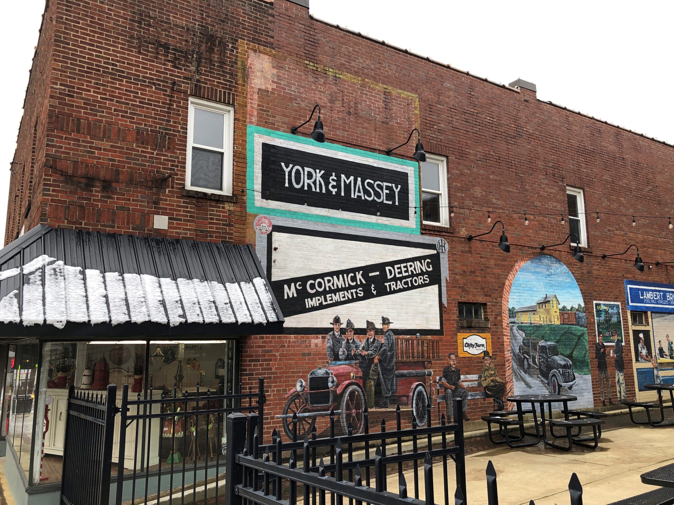
Scottsville, Kentucky
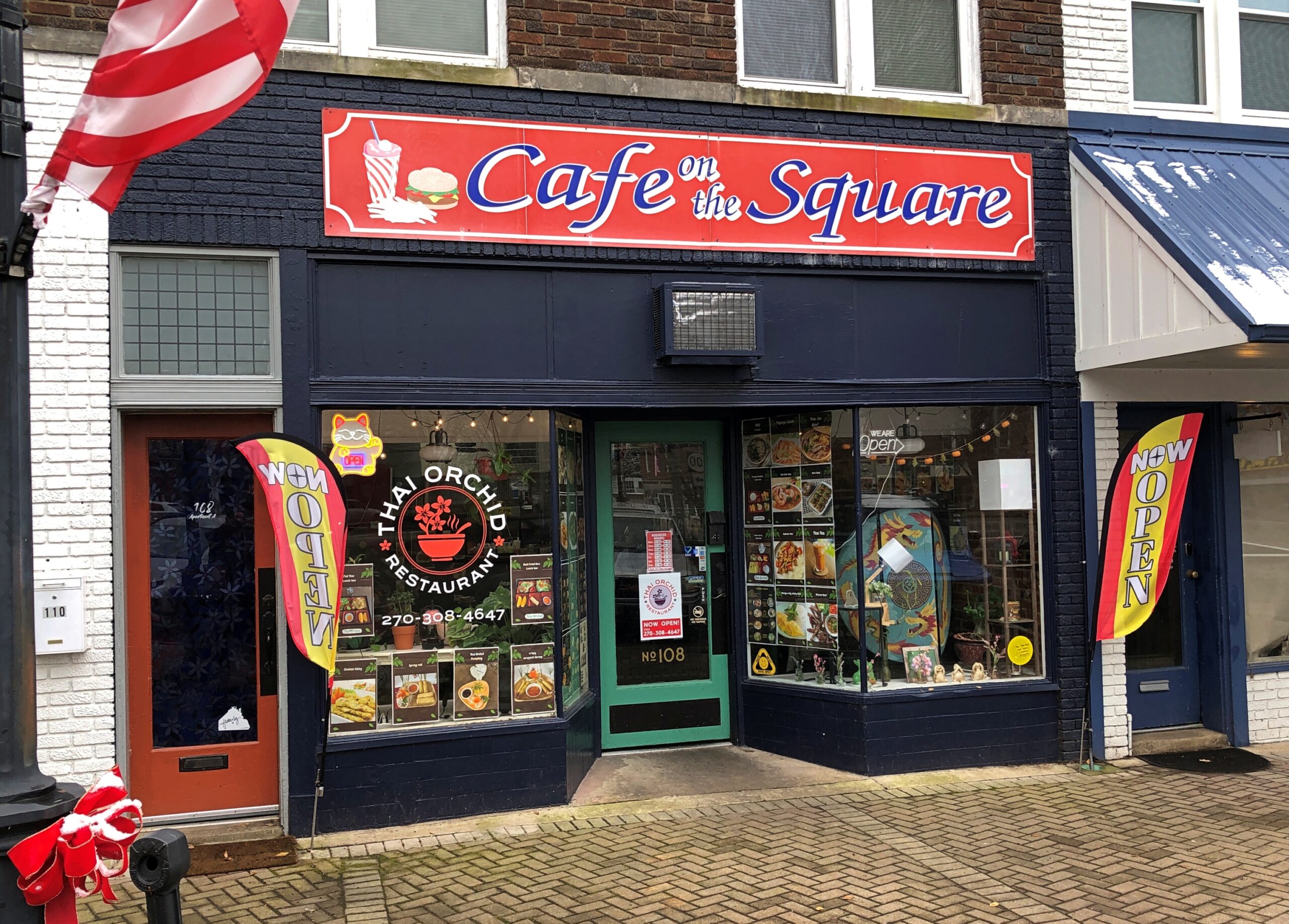
The main traffic hub of Scottsville (pop. 4,300), the seat of Allen County, is the junction of Kentucky 101 and 98, known as Main and Court streets locally. Instead of a county courthouse, the hub is in the form of a square with businesses around it and a lot of traffic passing through. More than I would have guessed.
It was lunchtime. I can report that Thai Orchid is as good as you might find in a larger town. In our time, Thai has pretty much joined the tapestry of American cuisine as thoroughly as Chinese or Mexican food did in previous generations.
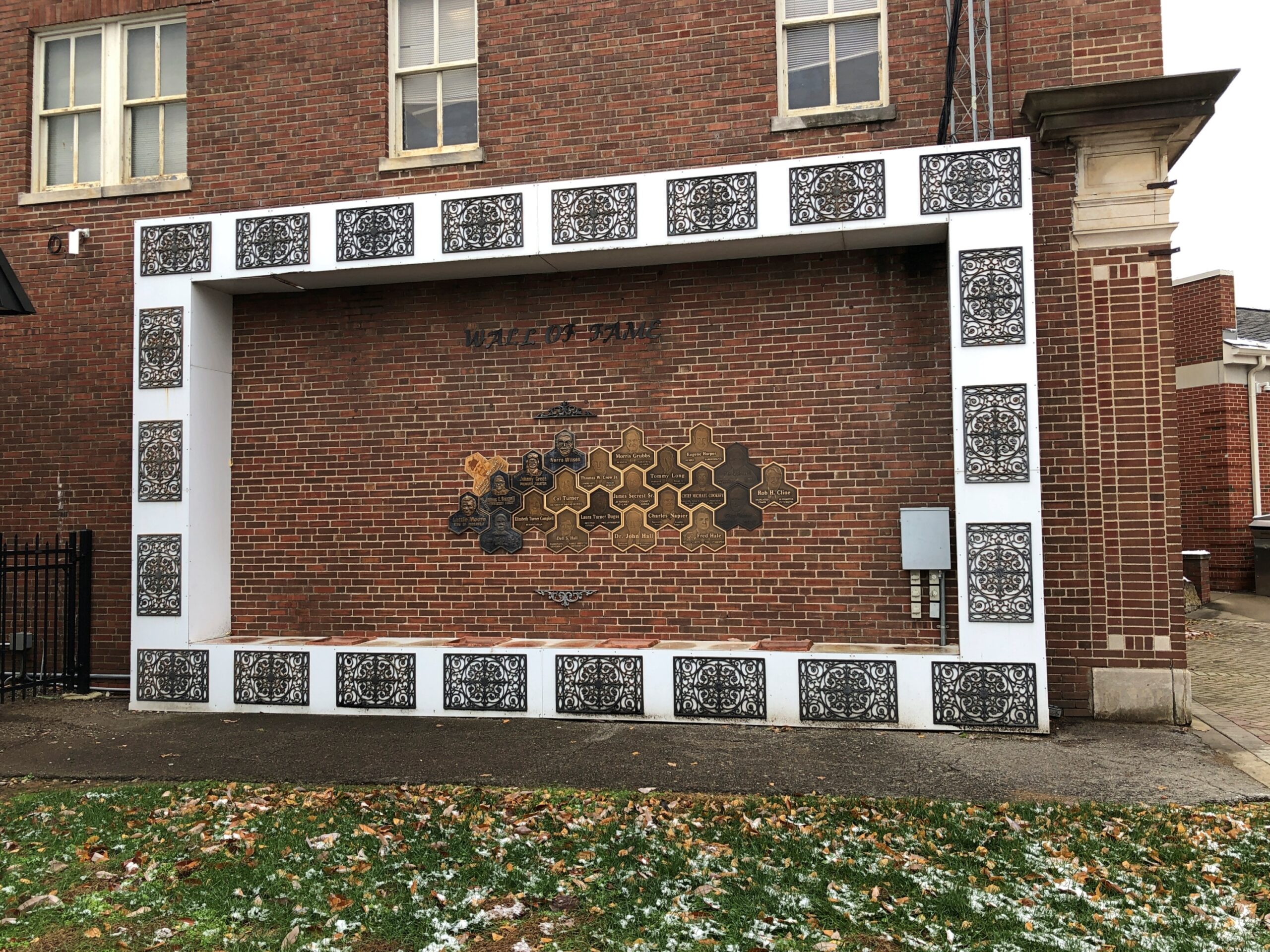
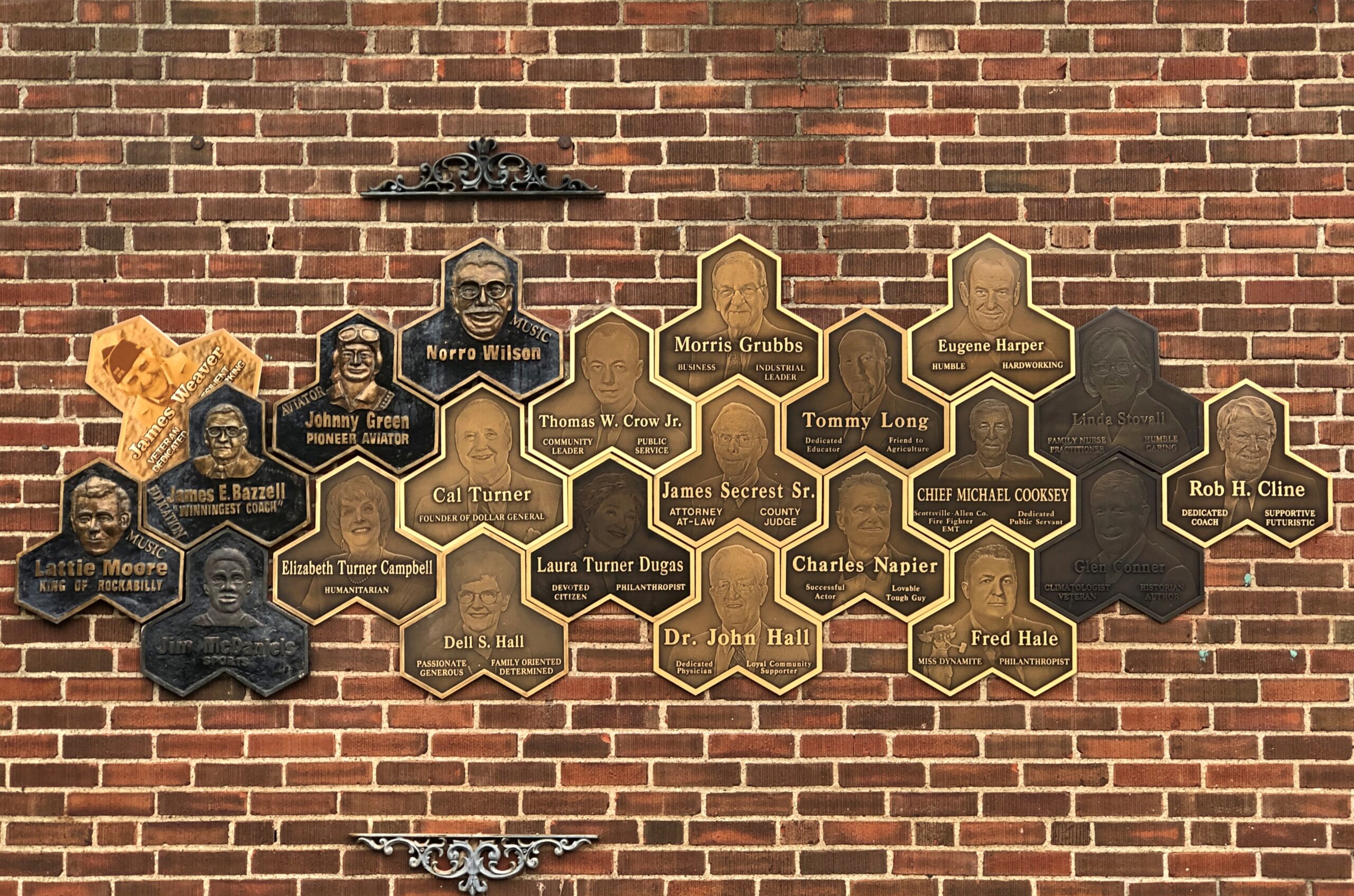
The main public library is near the square, sporting a local Wall of Fame.
The names include Lattie Moore, who sang, “I’m Not Broke but I’m Badly Bent,” a song with pretty much the same theme as Al Dexter’s “Wine, Women and Song.”
I won’t look all the names up, but the Scottsville Wall of Fame also includes Johnny Green, pioneer aviator, who did the first commercial flights between Florida and Cuba, apparently.
Red Boiling Springs, Tennessee
We drove on Kentucky 98 east to the near-border town of Gamaliel, pop. 391, still on the Kentucky side of the line. A lesser-known Biblical name, but I also can’t help thinking of the G. in Warren G. Harding.
South from there, Kentucky 63 turns into Tennessee 56 after a few miles. There’s no sign marking the border, just one announcing the Tennessee highway number. Pretty casual for a line that might have been an international border, had the secessionists had their way (unless, of course, Kentucky left the old US).
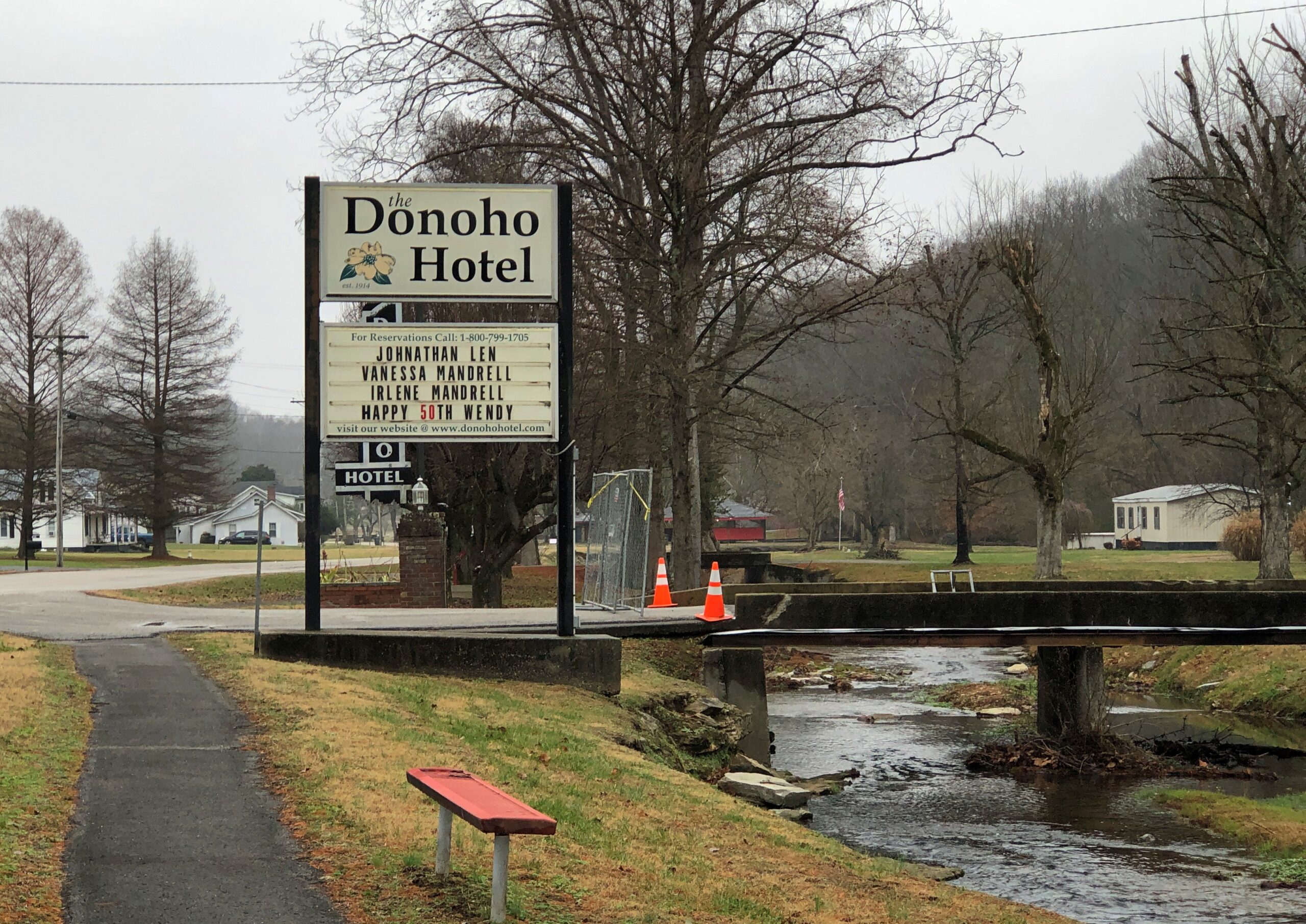
Besides a cool name, Red Boiling Springs (pop. 1,205), Tennessee, has a history. As the name suggests, people took the waters there.
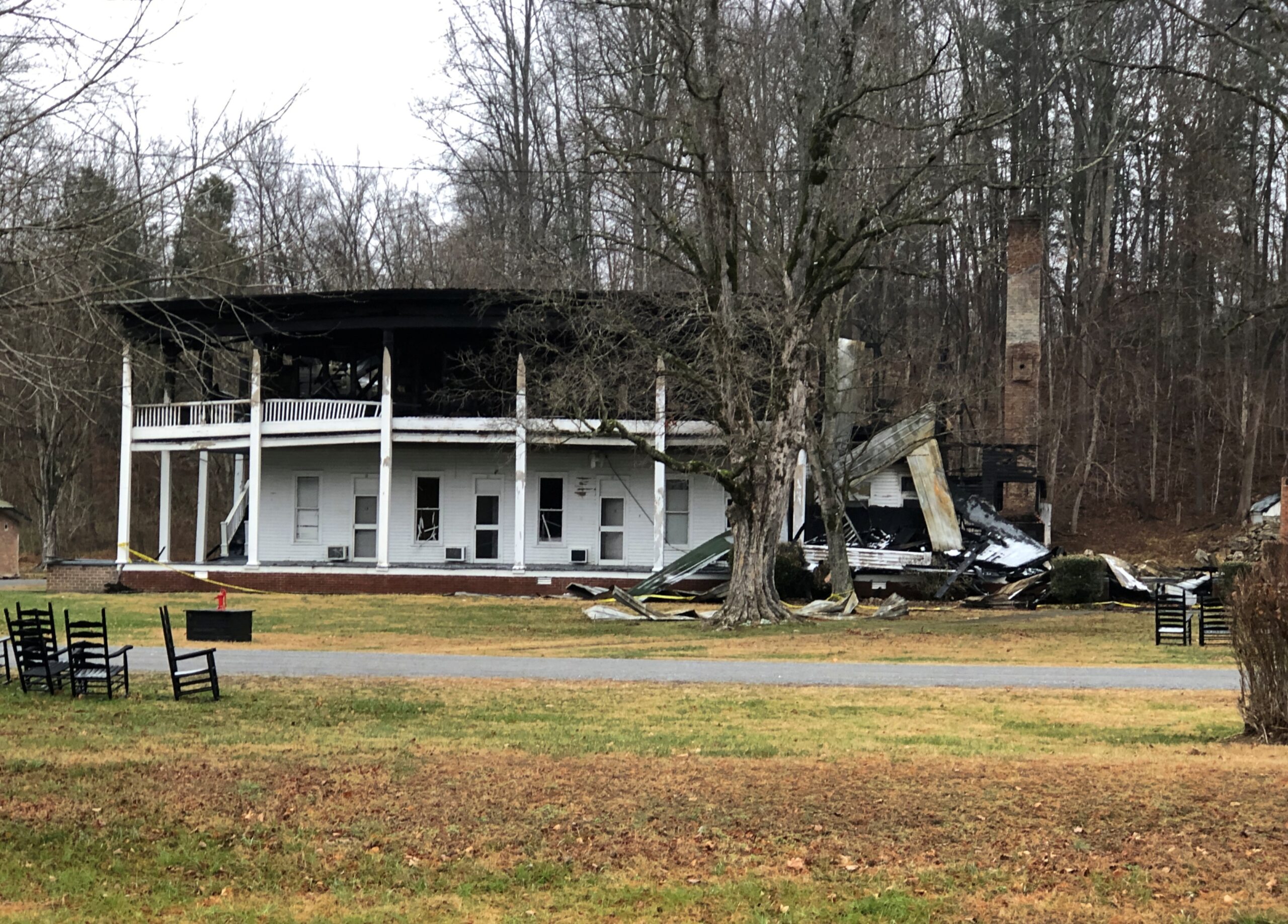
“As recently as 1920, Red Boiling Springs had about a dozen places in which visitors could stay,” The Tennessee Magazinereported a few years ago. “The largest was the Palace Hotel, which had 180 rooms. Over the next several generations, business declined… and… a 1969 flood destroyed large parts of the town. However, three of the Red Boiling Springs resort hotels are still open. They were in (nearly) continuous operation throughout the 20th century and still reflect more of the lifestyle of the late 19th century than they do the 21st.”
Make that two hotels. One of those mentioned in the article, the Donoho, burned down in November.
The gray, chilly day somehow fit the scene of a wrecked historic hotel.
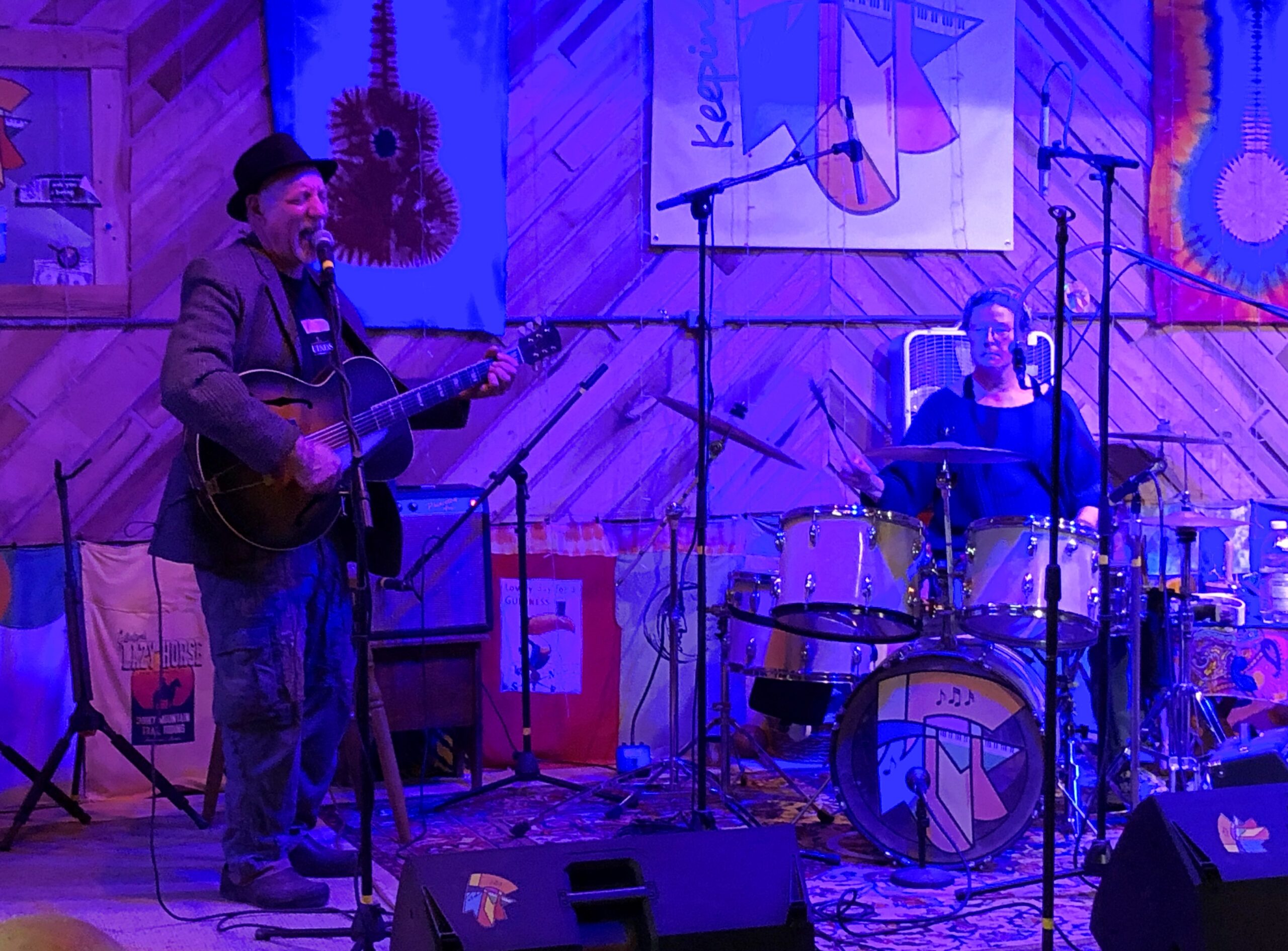
Damned shame. I can’t leave it at that. Soon after passing through Red Boiling Springs, we arrived at our destination in eastern Middle Tennessee. The next day, we enjoyed a Tennessee hootenanny.
Our hosts, Dave and Margaret, on guitar and drums.
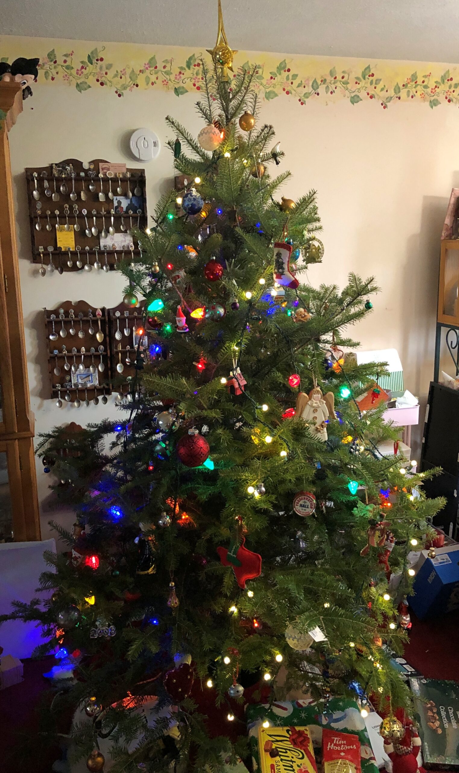
Decorating for Christmas this year meant a rapid set-up. We spent a fair number of hours on the 23rd making the living room ready for a tree – moving clutter, mostly. On Christmas Eve, I brought the tree in from the garage, and Ann mostly decorated it. Finishing touches, by me, were in progress even on the morning of Christmas Day, but since that moment in the life of our family doesn’t involve an early-morning rush downstairs by children anticipating Santa’s bounty any more, that was doable.
Ann did a fine job of decorating, in the style of our family: fill up the tree with a wide variety of glowing and glinting objects accumulated across the decades.
We got a late start on decorating for Christmas, though when I think about, decorating after the Solstice discourages the sort of front-loading of Christmas that a lot of people complain about, but which they do anyway.
We had a good reason for the late start: a drive to Florida and back, beginning on December 4 and ending on the 22nd. Not just to Florida, but as far as you can go in that state, at least by car, namely to Key West and back. Early to mid-December seemed like a good time to do such a thing, after any traveling people do for Thanksgiving but before the worst of the Christmas-New Year’s rush. A short shoulder season in other words, but a good one, with room rates not quite subject to surge pricing, and crowds thick in some high-volume tourist destinations, but not impossible.
Also, Florida has few mosquitoes this time of year. Not no mosquitoes, as we found out one day in the southern reaches of the peninsula, just a “bearable” number.
Sometime earlier this year, I got the idea that I wanted to take four long drives after turning 64. Four for 64, you could say. Doing so by the end of 2025 wasn’t part of the idea, but that’s how things worked out. The drive to Florida and back, by way of such places as Indianapolis, Louisville, Chattanooga and Atlanta, totaled 3,682 miles. For all four trips since June, the total is about 14,300 miles.
That could be made to sound impressive, but in fact American men my age average more than that every year, about 15,000 miles, at least according to this source, which cites US DOT data. Younger men drive even more annually. Most of that is commuting, however. My commuting mileage by car has been exactly zero this year, and while I drive locally to stores and such, it couldn’t be more than a few thousand miles. So it seems clear that, as an American man, it was my duty to get out and drive.
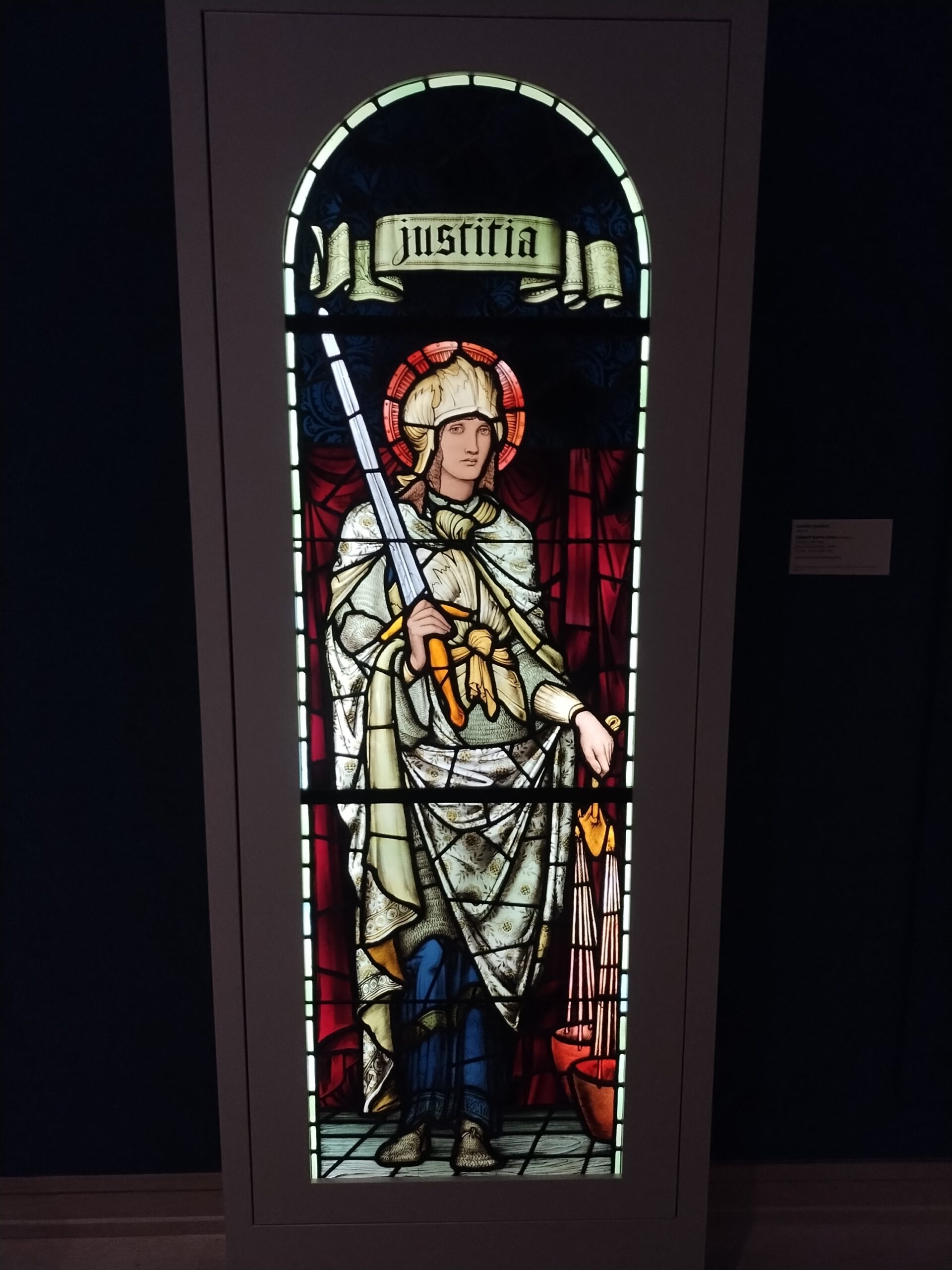
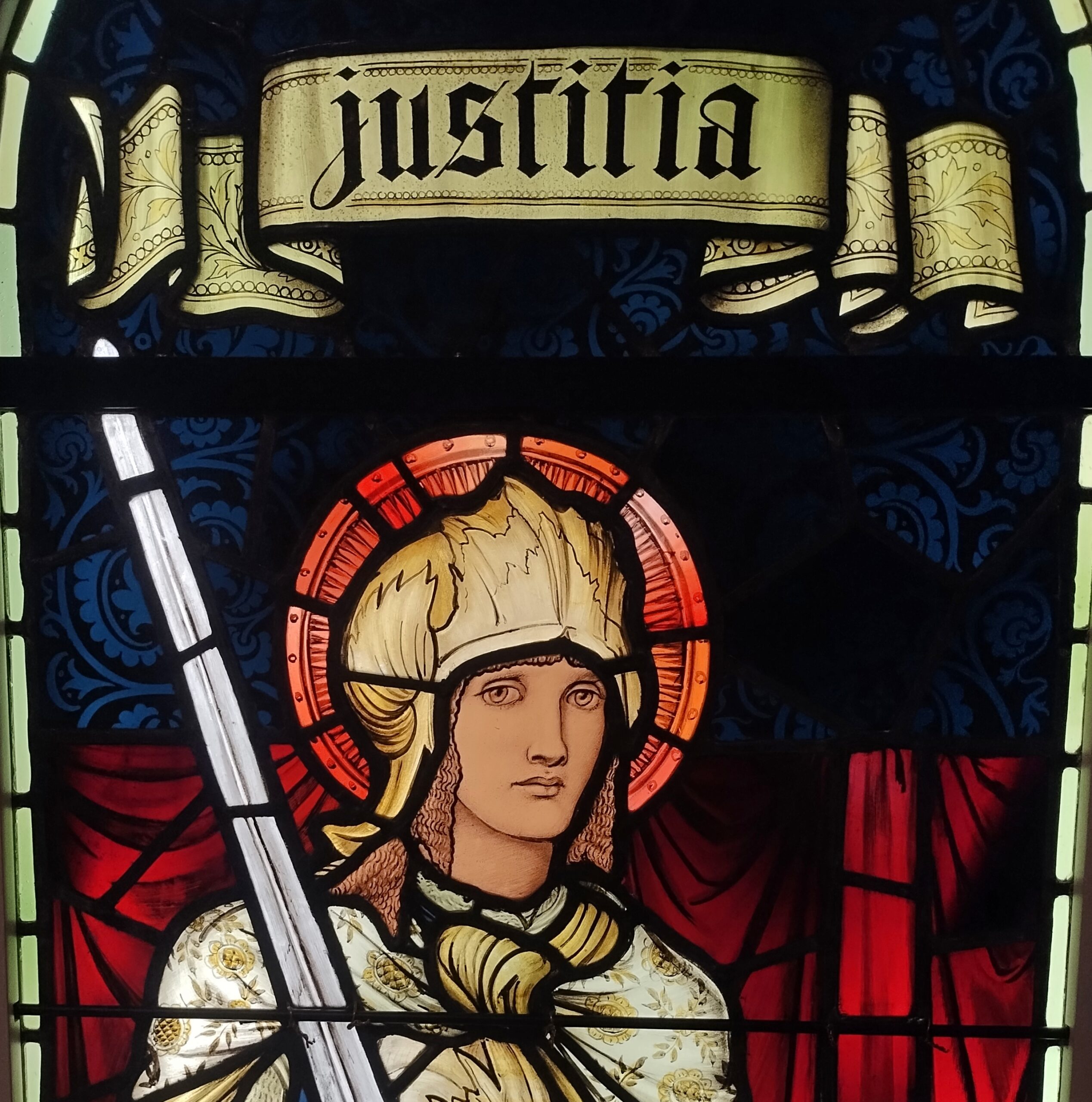
When we headed south in early December, snow covered the ground all the way past Indianapolis, where we stopped for a few hours at the Indianapolis Museum of Art, which is part of a larger campus called Newfields – and better examined in summer, I think. But the museum is a good one, with a solid collection, especially 19th-century American and European works. Such as “Justitia,” a Morris & Co. work from the 1890s.
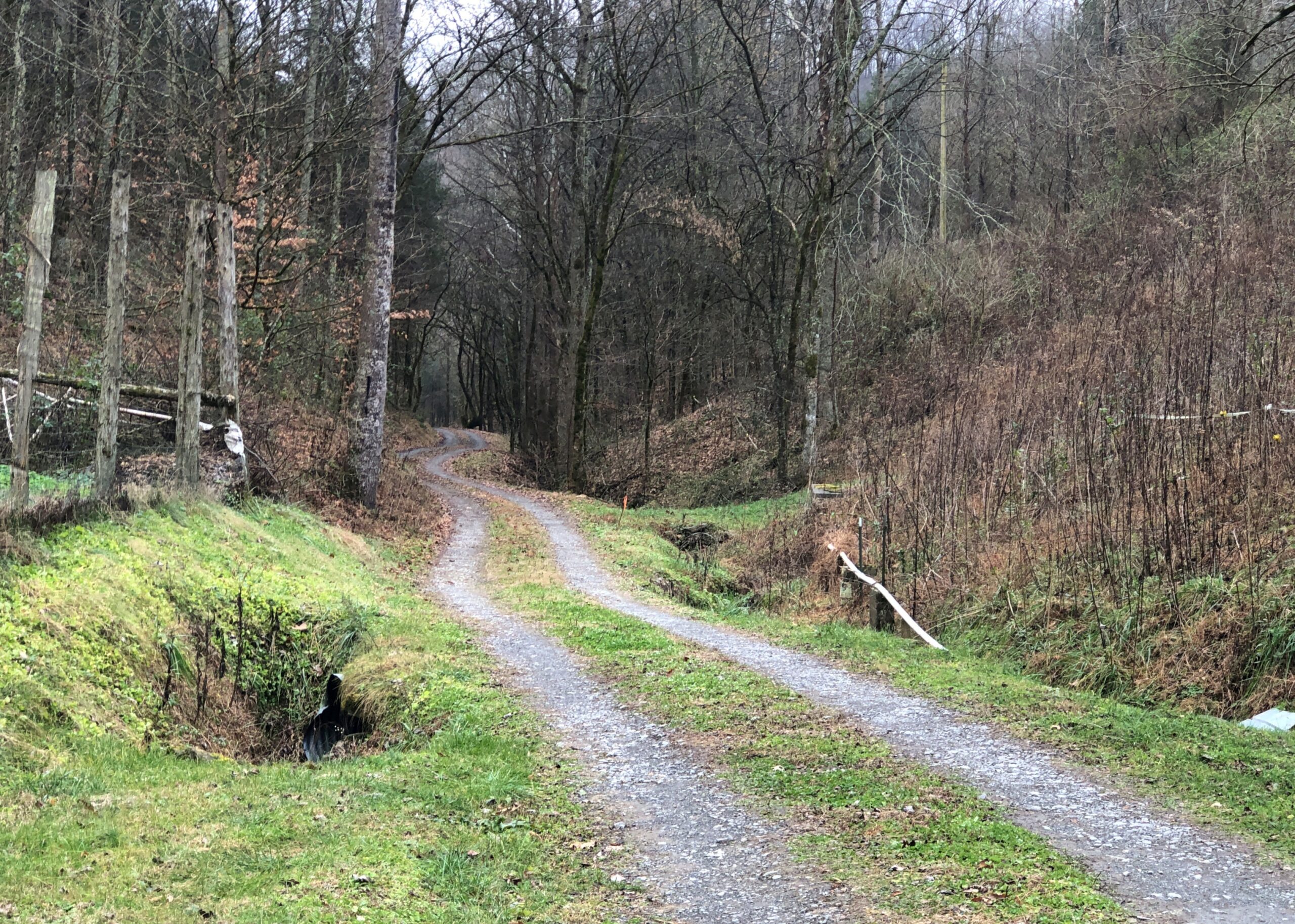
After overnighting south of Louisville, we diverted from I-65 and took smaller roads through southern Kentucky and into Tennessee to a holler in Jackson County, where we were the guests of dear friends. Tennessee musicians from those parts — some professional, others skilled amateurs — gathered on the the evening of Saturday the 6th, for one of the periodic jams in our friends’ barn, which houses no animals these days, but a small stage and some sound equipment and a fair number of folding chairs. A joyful jam it was. Food was potluck. I like to think we went to a hootenanny.
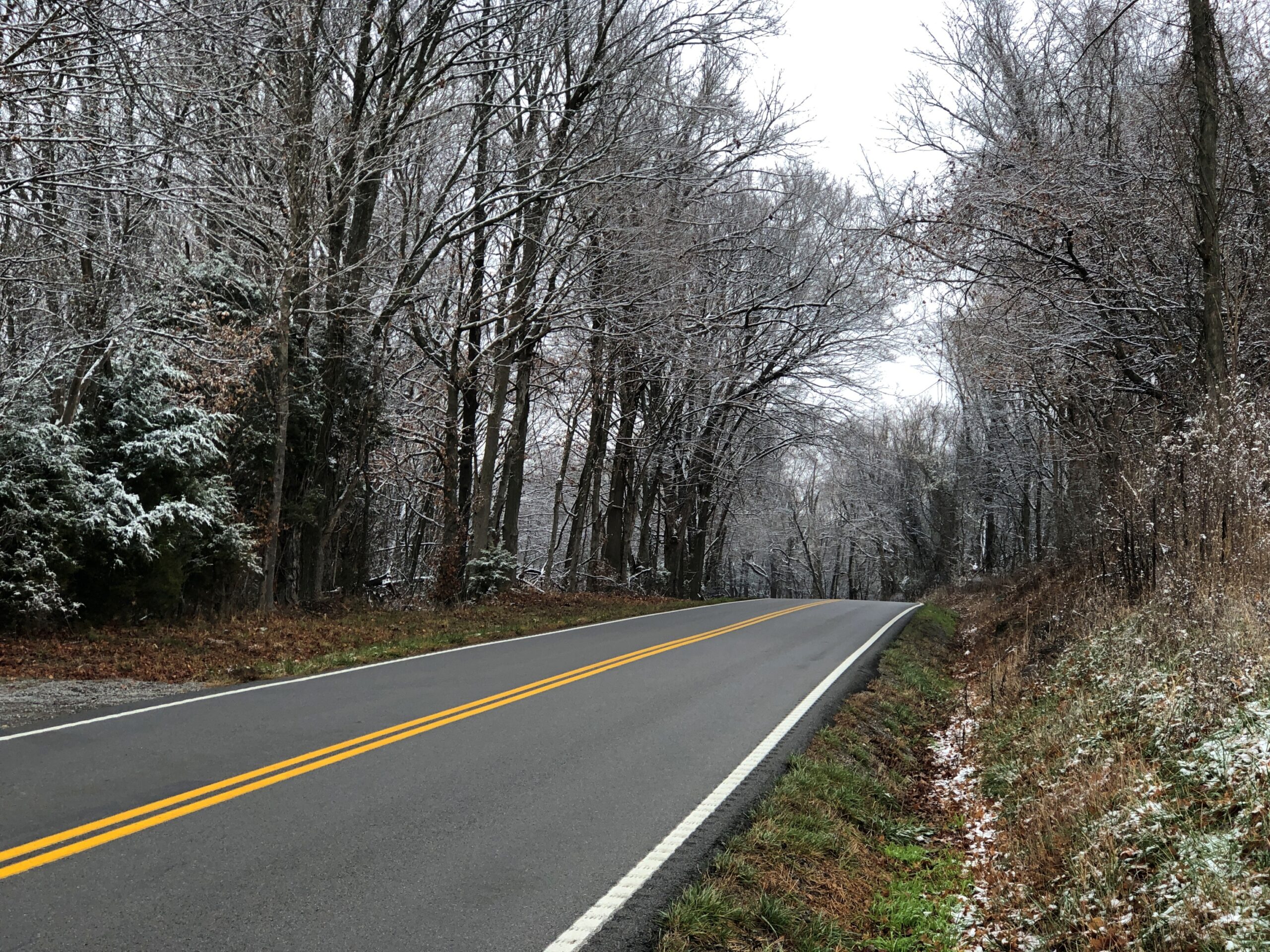
The road through the holler. By this point, no snow. We were trading cold for warmth. That was one of the goals of the trip. Maybe the main one.
From there it was mostly a straight shot down through Georgia on I-75 to Florida, and eventually US 27 to Orlando by way of non-coastal Florida places like Gainesville, Ocala and Lady Lake, a string of settlement less agricultural and less pastoral now than ever, more like an endless outer suburb. Heavy traffic is an invasive species in this part of Florida, surely as pythons are in damper parts of the state. Not just masses of cars and trucks, either, but also golf carts. We passed close enough to The Villages to see billboards advertising legal representation in the event of golf cart accidents. Carts, I’ve heard, provide transport in great numbers in that sprawl of a settlement.
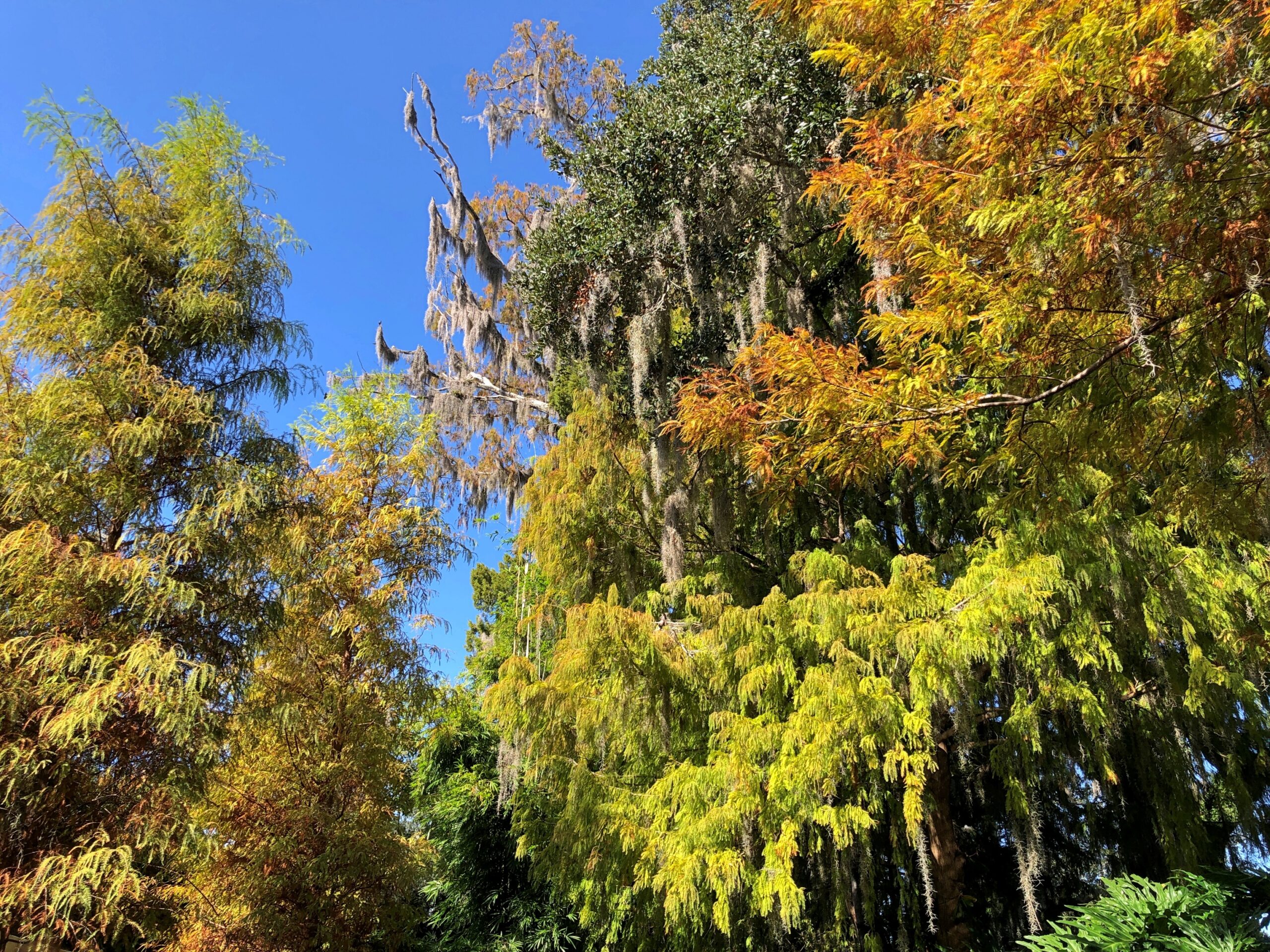
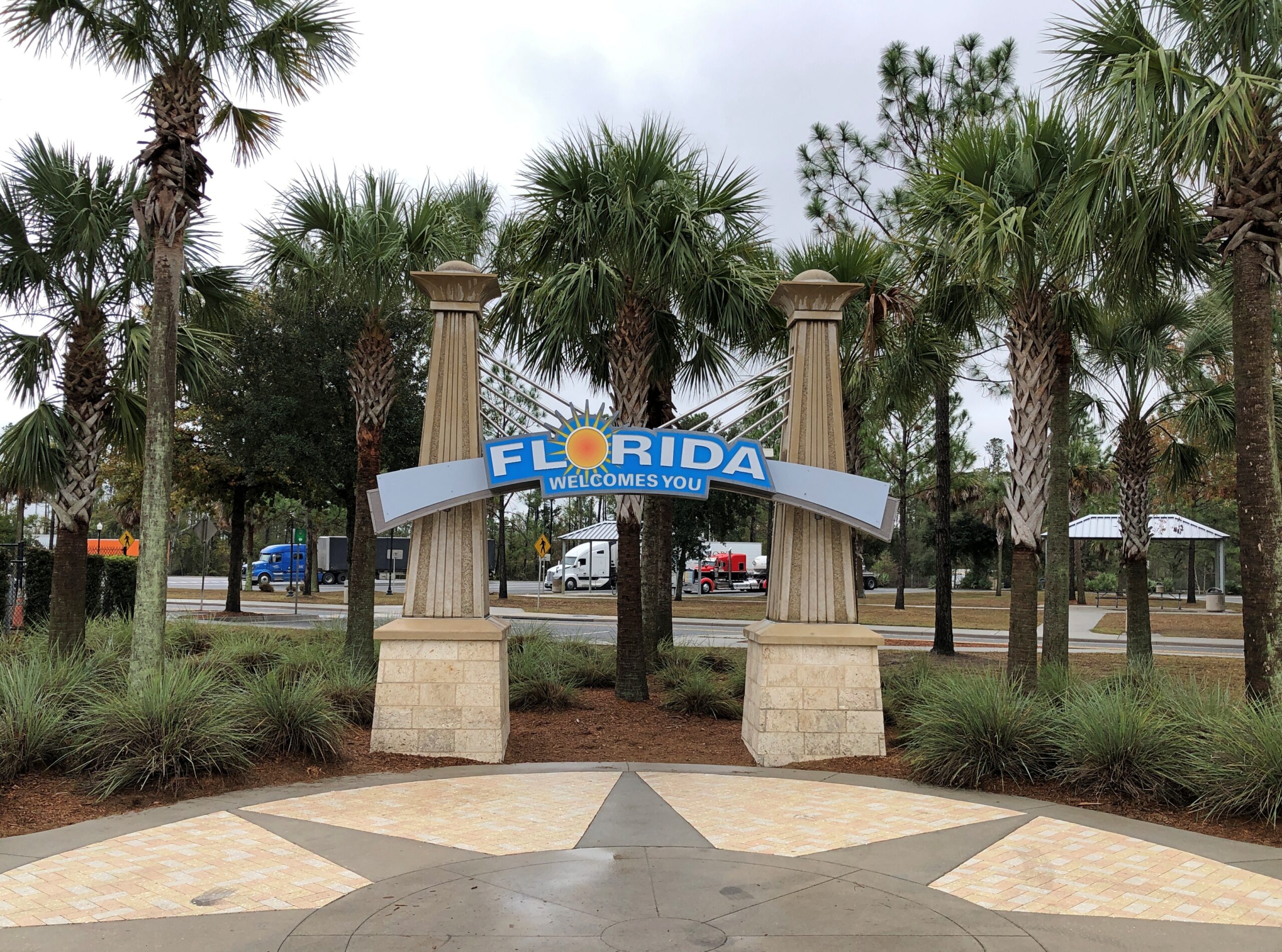
The drive to and in Florida involved the usual North American mix of large and small roads, smooth and ragged, grid-like and irregular, though Florida cities tended toward the irregular (except for Key West), and as crowded as can be and as empty as can be. Snow lined the way up north, thinning out the further south we went, giving way to brown landscapes and bare trees. Then we came into greenery – evergreens and palms and even deciduous species turning color. We crossed mighty bridges over mighty rivers, small culverts over alligator haunts, and the string of bridges that make up the civil engineering marvel known as the Overseas Highway (US 1). We crossed barely acknowledged borders and signs at the Florida visitor center on I-75 proclaiming The Free State of Florida.
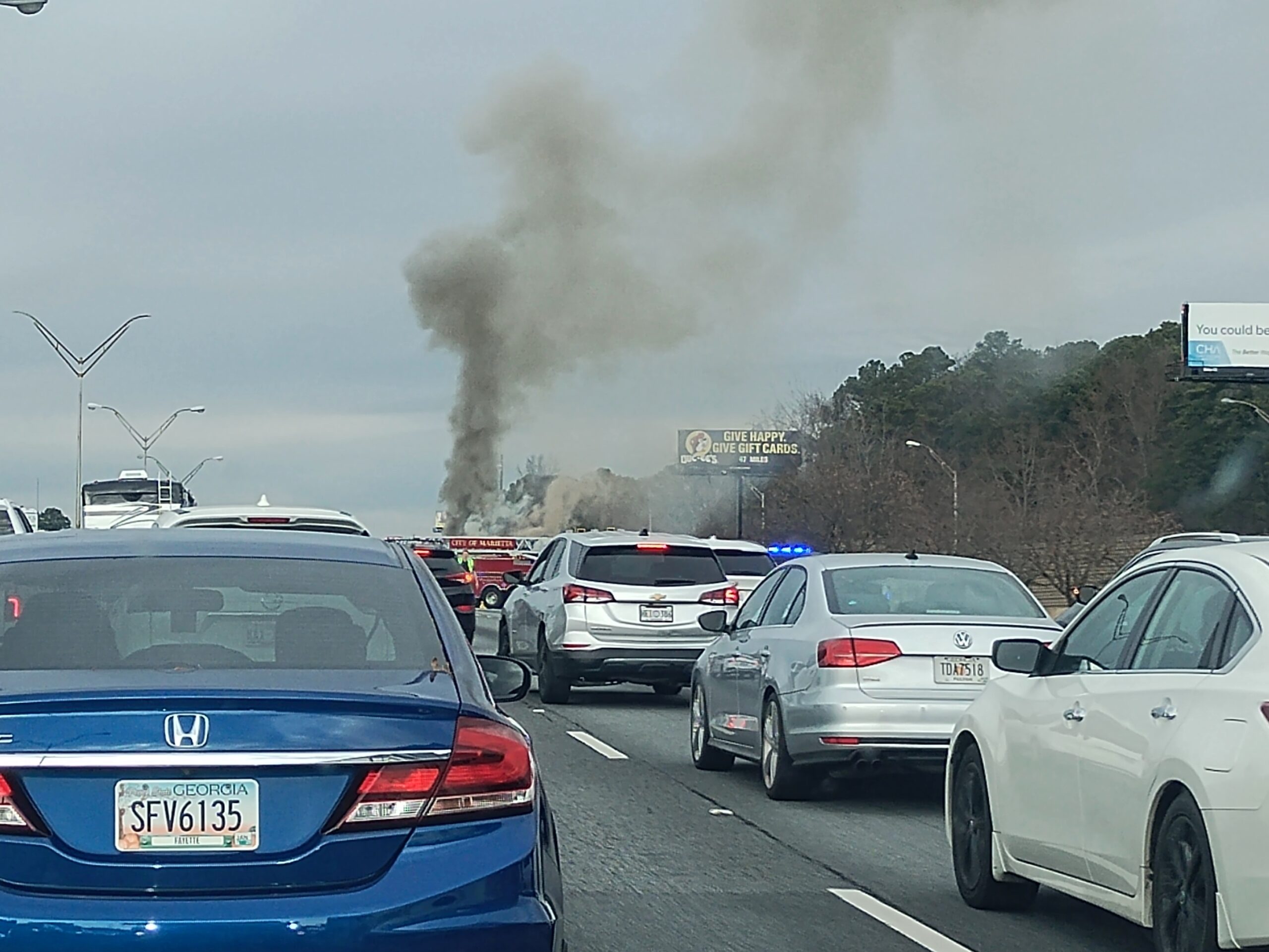
Florida Man was out and about, weaving in and out of high-speed traffic, pushing 100 and pretty sure that physics doesn’t apply to him, though I have to admit that Florida isn’t different from any other state in that way. Traffic stopped cold more than once: for a banged up, upside-down SUV; for a raging RV fire, attended by a half-dozen firemen; for a serious two- or maybe three-car wreck on the other side of a divided highway; for construction, usually without any workers in sight; and once for no reason that we could tell at all.
In Orlando, we spent all December 9 at Universal Epic Universe, a theme park that only opened in May. Ann flew in the day before we went to the park and flew home the day afterward, taking advantage of the low prices that discount airlines offer to high-volume places in a shoulder season, if you take no bags and buy nothing to eat or drink at sky-high prices, literally and figuratively. A small bag of hers had been stowed in our car for the visit.
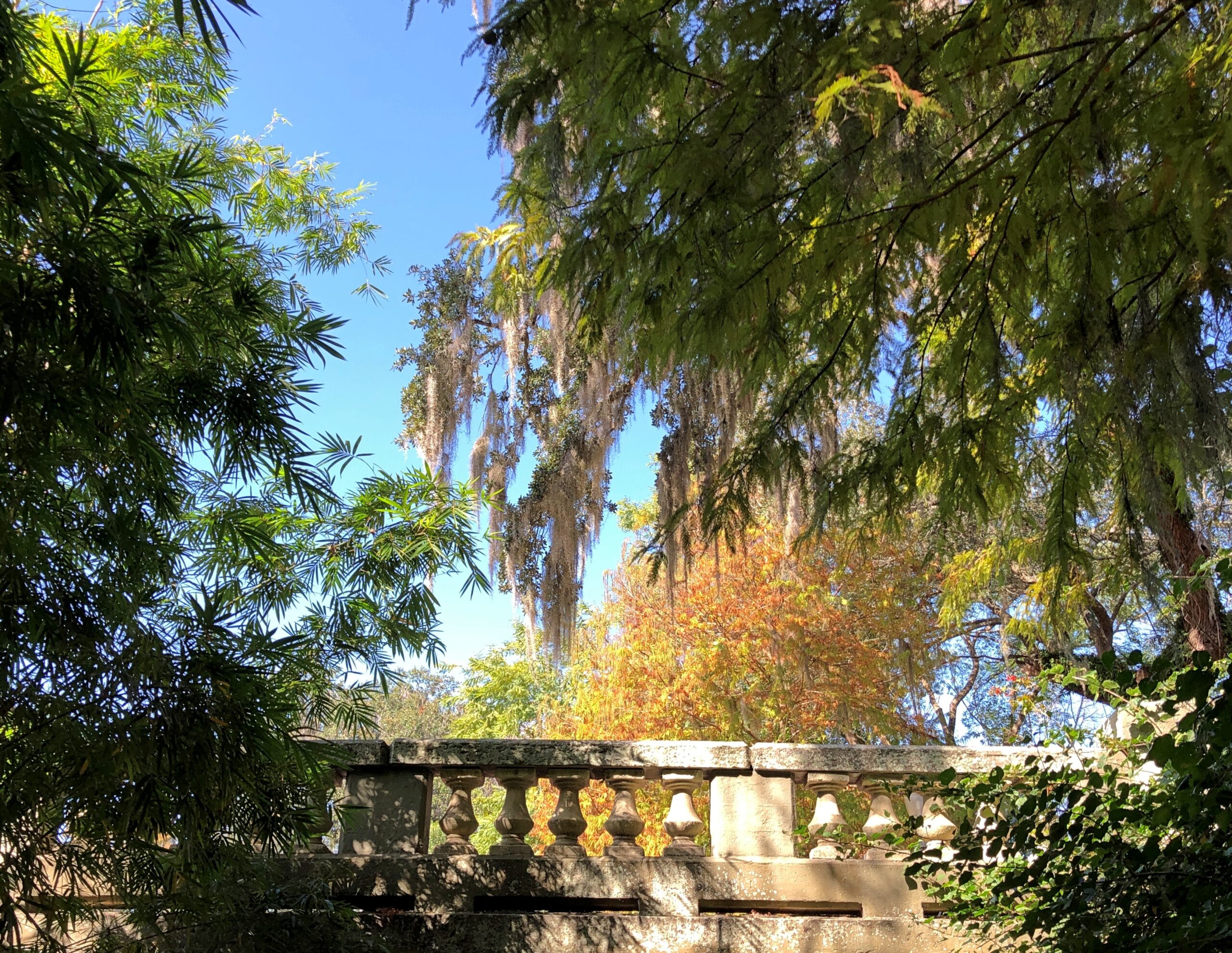
A theme park is one thing, but I wanted a look at Orlando, at least a sliver of it, the next day. Ann’s flight was fairly late that day, so we were able to spend part of it in posh Winter Park, including a tour boat ride through the town’s small lakes, lush with greenery and expensive houses on their banks, and connected by canals.
A drive that included the stretch of US 41 that passes through the Everglades took us to Homestead, Florida, and the mid-century charms of The Floridian motel. A day in Everglades NP followed, including an airboat tour and a drive to the coast at Florida Bay. The next day, before leaving Homestead for a drive in the rain across the Overseas Highway to Key West and while the sun still shined, we toured the Coral Castle, a one-man construction project using 1,000 tons of oolite to make walls, carvings, stone furniture, and a castle tower.
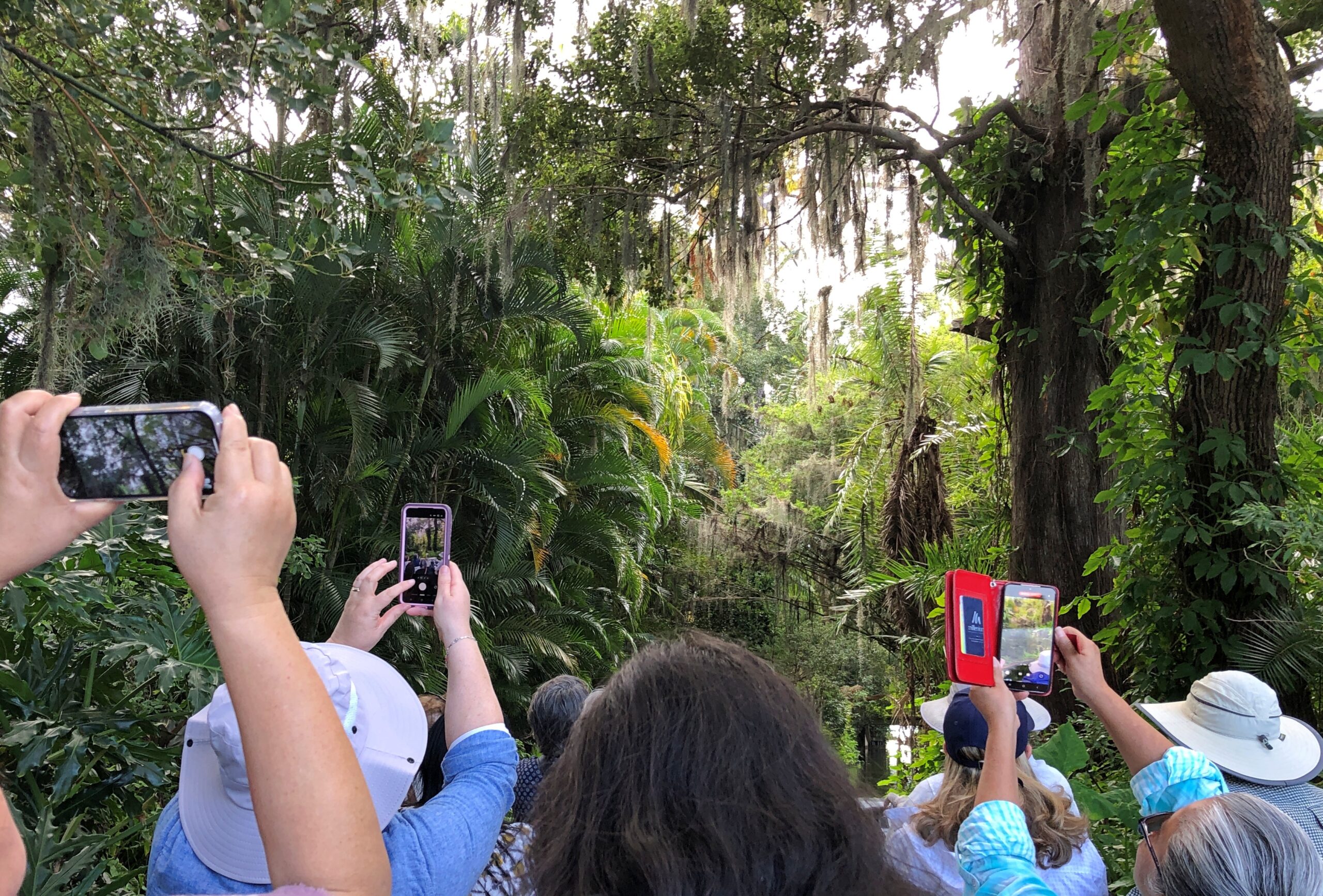
Key West was a two-day, three-night mid-December ramble on the busy and less busy streets of Old Town, including humans but also chickens, taking in the likes of the Hemingway House, the Little White House, Mallory Square, the San Carlos Institute, the Key West Aquarium, and the Key West Cemetery. Also, tourist shops, boutiques and the building where Pan-Am was founded. We ate and drank, though as our wont, nothing alcoholic. Key West was decked out for the holidays but not over the top. We walked and walked some more. It felt like a couple of pleasant summer days.
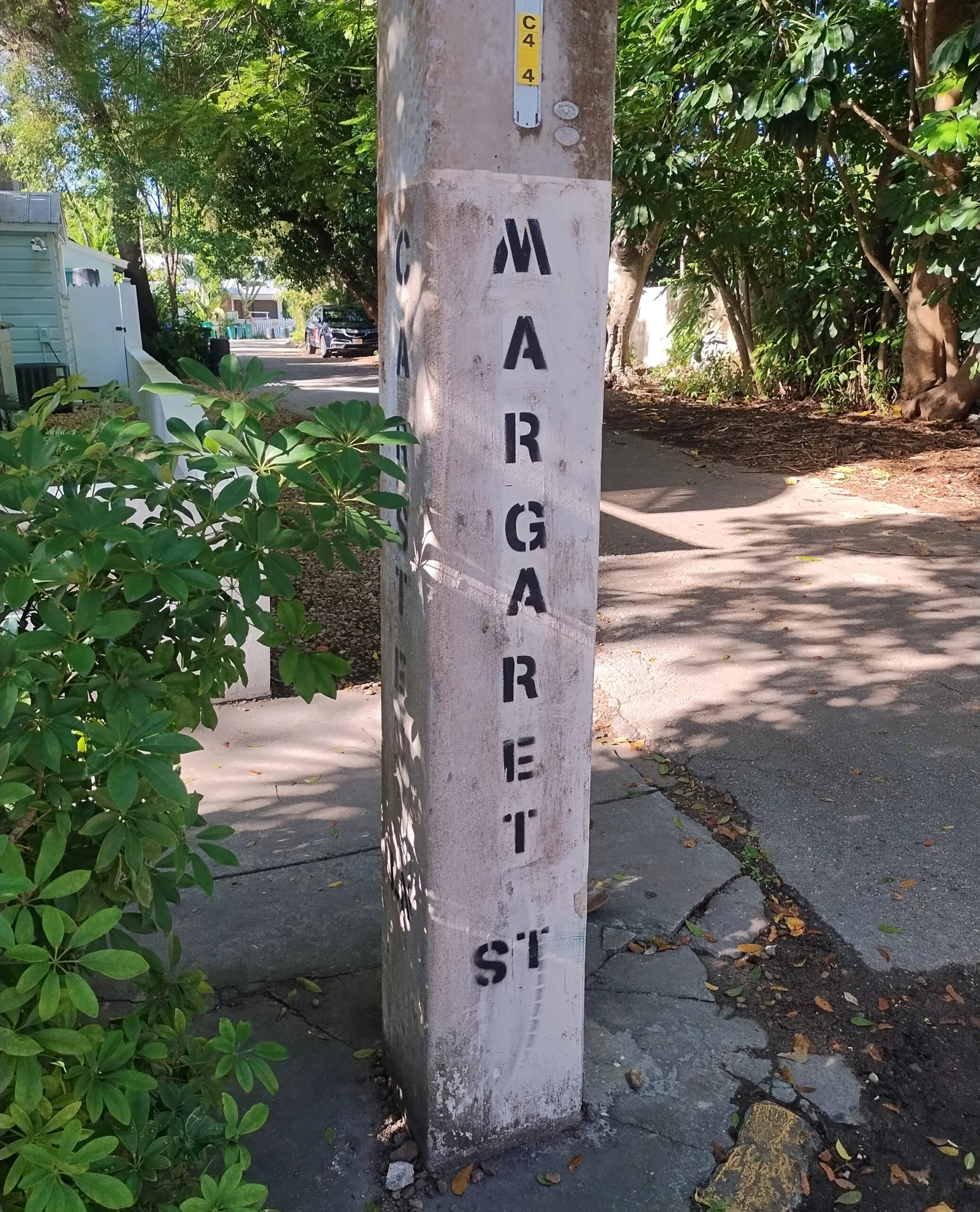
From my 2014 visit, I knew that on the back streets near the little-visited cemetery, parking was possible on an otherwise cramped island. So it was. On Margaret Street, within sight of the cemetery.
The return drive took us up the eastern coast of Florida, but avoiding the worst traffic in Miami-Dade by taking Florida’s Turnpike. By December 17, we’d arrived in Orange Park, a large suburb of Jacksonville, for a stay with two other dear friends, former Austinites now in northern Florida. Part of the next day was in and near downtown Jacksonville, one of the larger U.S. cities I’d never visited before (I believe San Jose is now the largest on that list). During our downtown stroll, we encountered the coolest building in Jacksonville and certainly one of the coolest in Florida.
We quit Florida on the 19th, but weren’t quite done with the trip. Yuriko had never been to Atlanta and wanted to go. Though I’d been however many times since 1982, I was happy to oblige, so we spent two nights and a day there, using the day to see the astonishing Georgia Aquarium and the impressive but somewhat overpriced World of Coca-Cola.
The last legs of the trip were long drives: Atlanta to Elizabethtown, Kentucky; and from there to home the next day. I wasn’t about to let them be completely dull drives, so we stopped on the second-to-last day in Chattanooga, to see the conveniently located, blocks-from-the-highway Chattanooga Choo-Choo redevelopment. On the last day of the trip, we stopped in Jeffersonville, Indiana, and walked across the Big Four Bridge, a former RR bridge across the wide Ohio, now serving pedestrians and bicyclists.
Home and then — Christmas, when things slow down for a week or so. Good timing.
At least a foot of snow covers the ground outside, so it’s good to be inside. Winter has fully returned, but at least the early part, when the holidays are yet to come, and not the post-New Year grind of January or the interminable days of February, the alleged shortest month.
Thanksgiving was low key. I expect that’s actually true for most people, however many anecdotes there are about fractious Thanksgivings. Low key doesn’t get into sitcoms or in real or made-up tales on a Thanksgivingishell subreddit.
Back to posting after Christmas, maybe the first Sunday after. Got a lot to do before then.
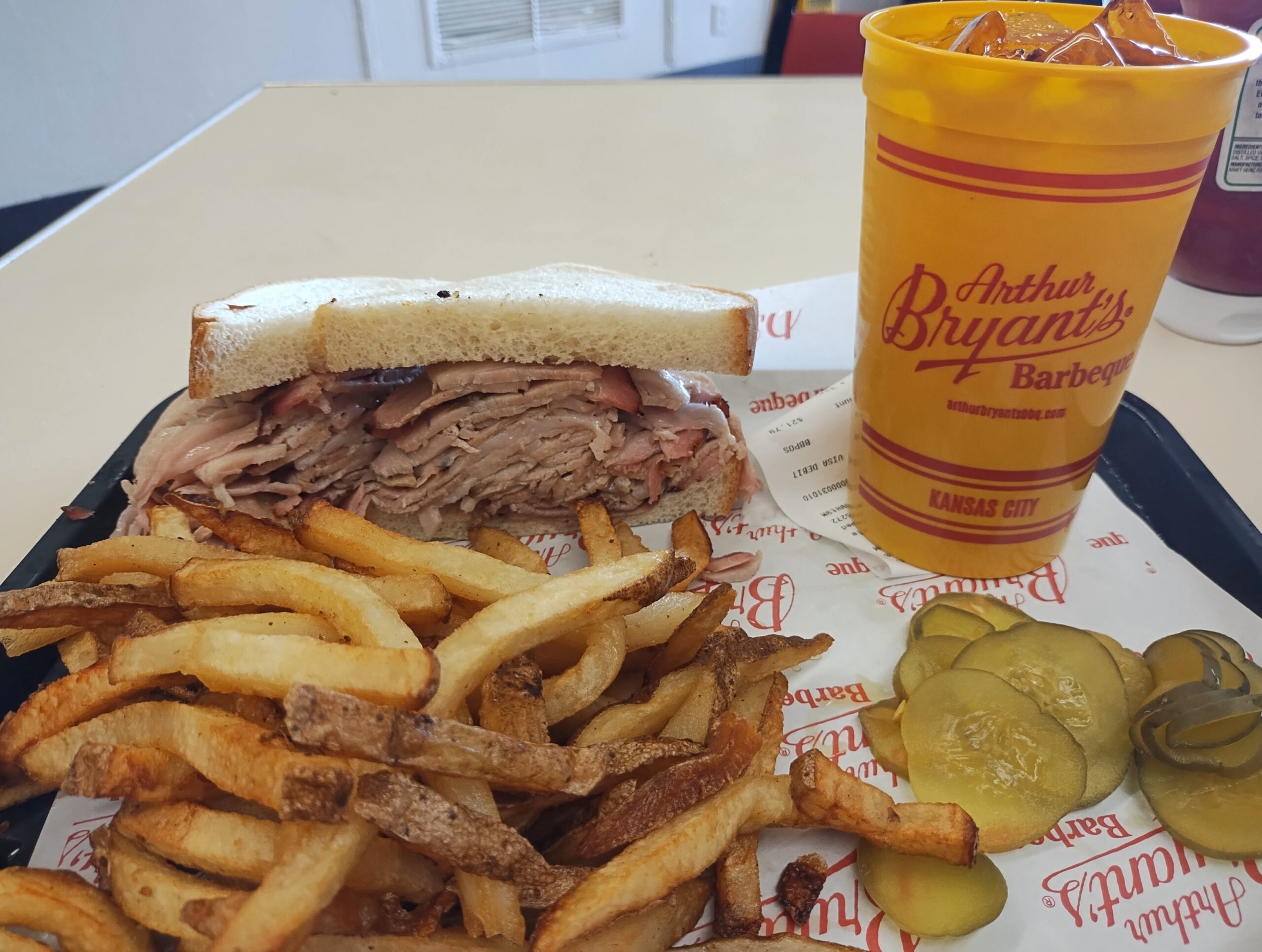
One more note about Kansas City in September. Besides the World War I Museum and Memorial, there was one more place I wanted to be during my visit: Arthur Byrant’s, for the barbecue I remembered so fondly from the late 1990s. Good ‘cue has sustained AB long after the pitmaster of that name died in 1982.
I’d go again.
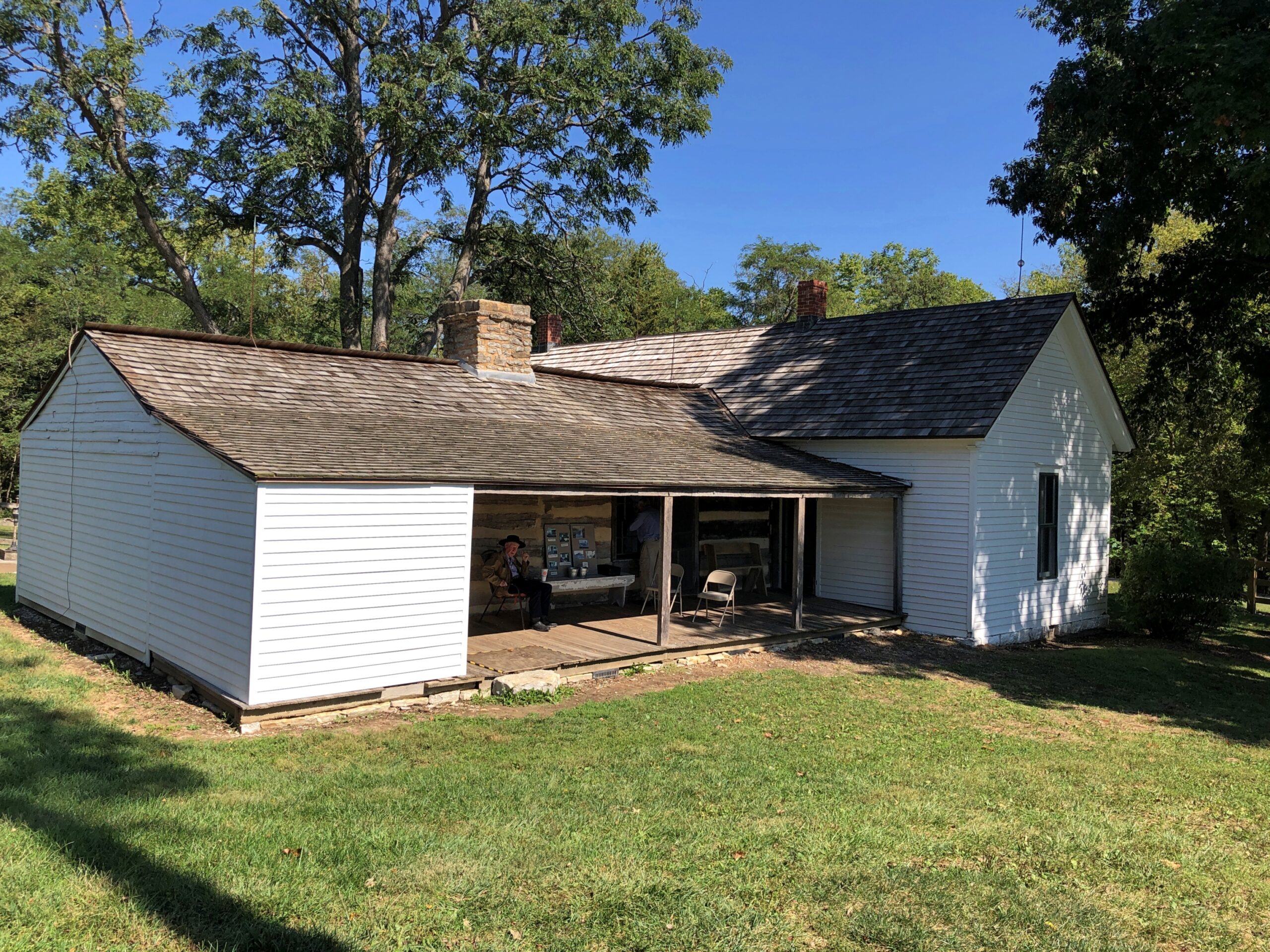
After I left KC, I headed not too far northeast to the Jesse James Birthplace Museum.
The birthplace museum, like the house, isn’t a large place, but it does convey some of the life and times of the famed outlaw, with some good artifacts and reading. Posters, too. I hadn’t realized that Jesse James was a character in the very last Three Stooges theatrical release, The Outlaws is Coming (1965), but there was the poster, along with ones advertising better-known biopics or Jesse James-adjacent movies. Somehow I missed that Stooges picture on TV as an impressionable kid, though I saw the likes of The Three Stooges Meet Hercules.
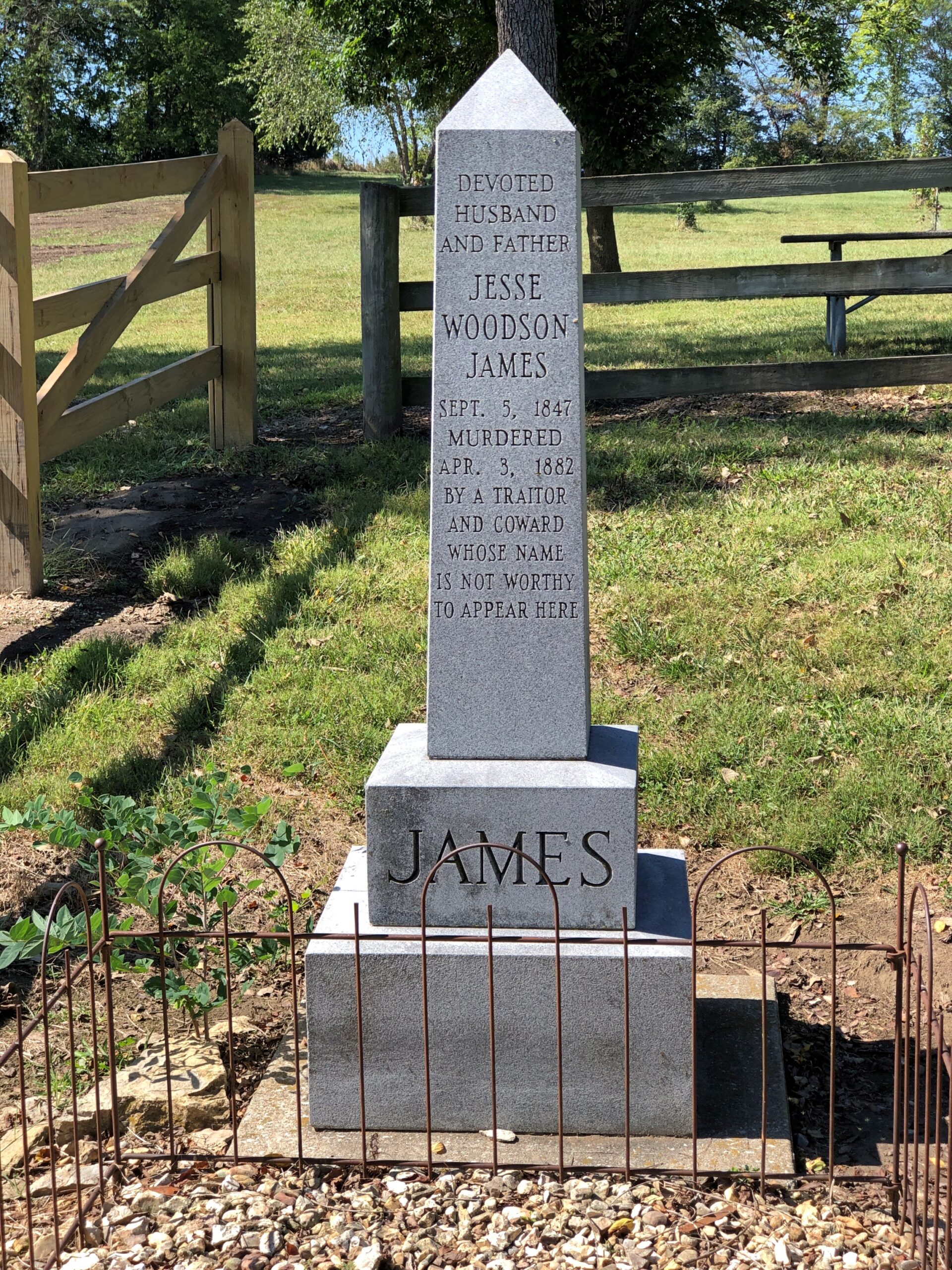
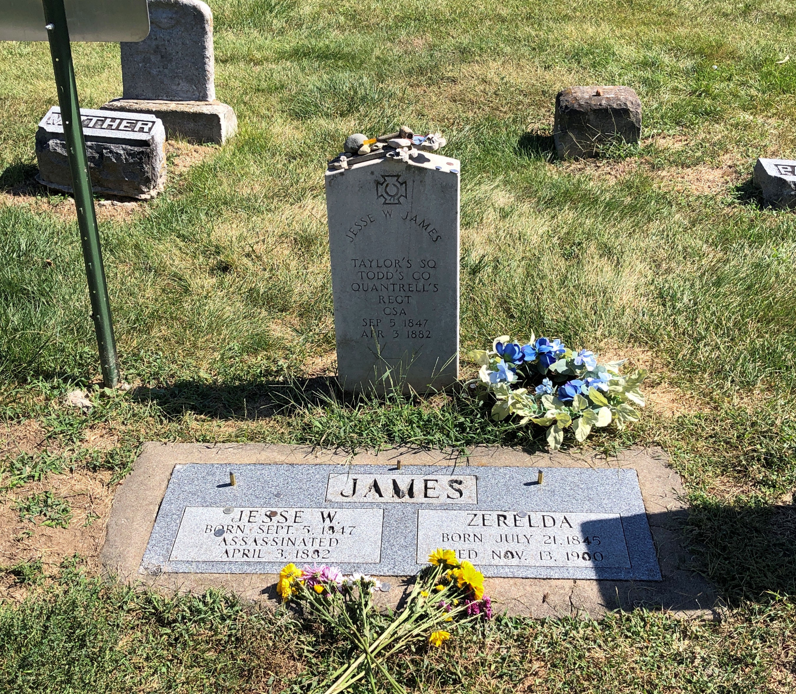
Jesse used to be buried at the homestead.
But at some point he was moved to Mount Olivet Cemetery in nearby Kearney, Missouri. Jesse receives rocks and flowers and coins from visitors 140+ years after his assassination by the Coward Robert Ford (“coward” capitalized, because the word is welded to his name in popular memory). As for Jesse, not a bad posthumous haul for a train robber.
Just as an example, do the Newton Boys get that kind of attention? No, they do not.
“The Newton boys were a criminal gang composed of brothers Willis, Joe, Jess and Wylie (Doc), who operated mostly in Texas during the 1920s,” says Texas State Historical Association. “Willis ‘Skinny’ Newton robbed over eighty banks and six trains from Texas to Canada with his brothers and other outlaws, including the single biggest train robbery in United States history. By the time they were captured, they may have stolen more money than all other outlaws at that time combined.”
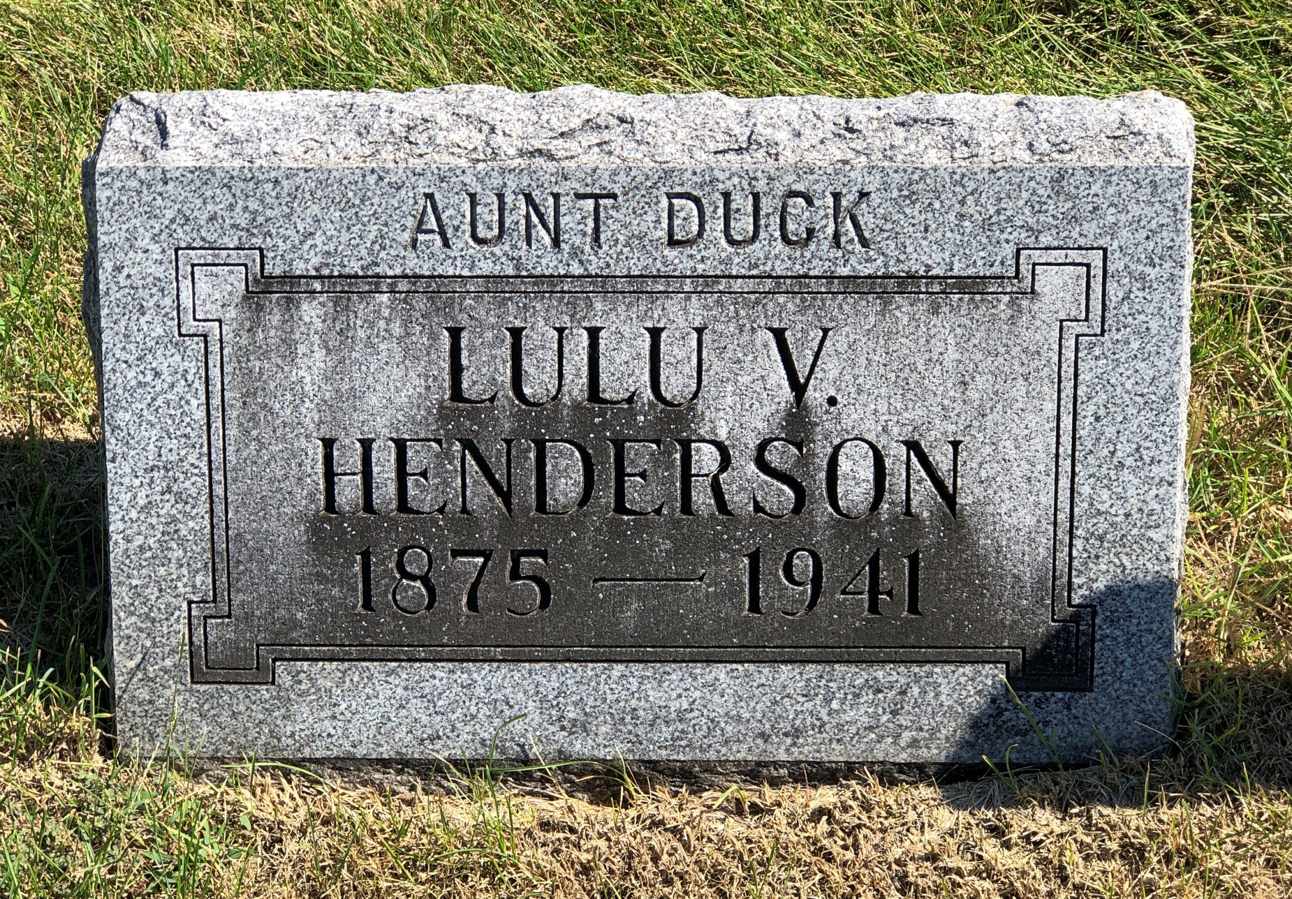
I liked Mount Olivet. Got some stones of yore.
Aunt Duck had to have been a character.
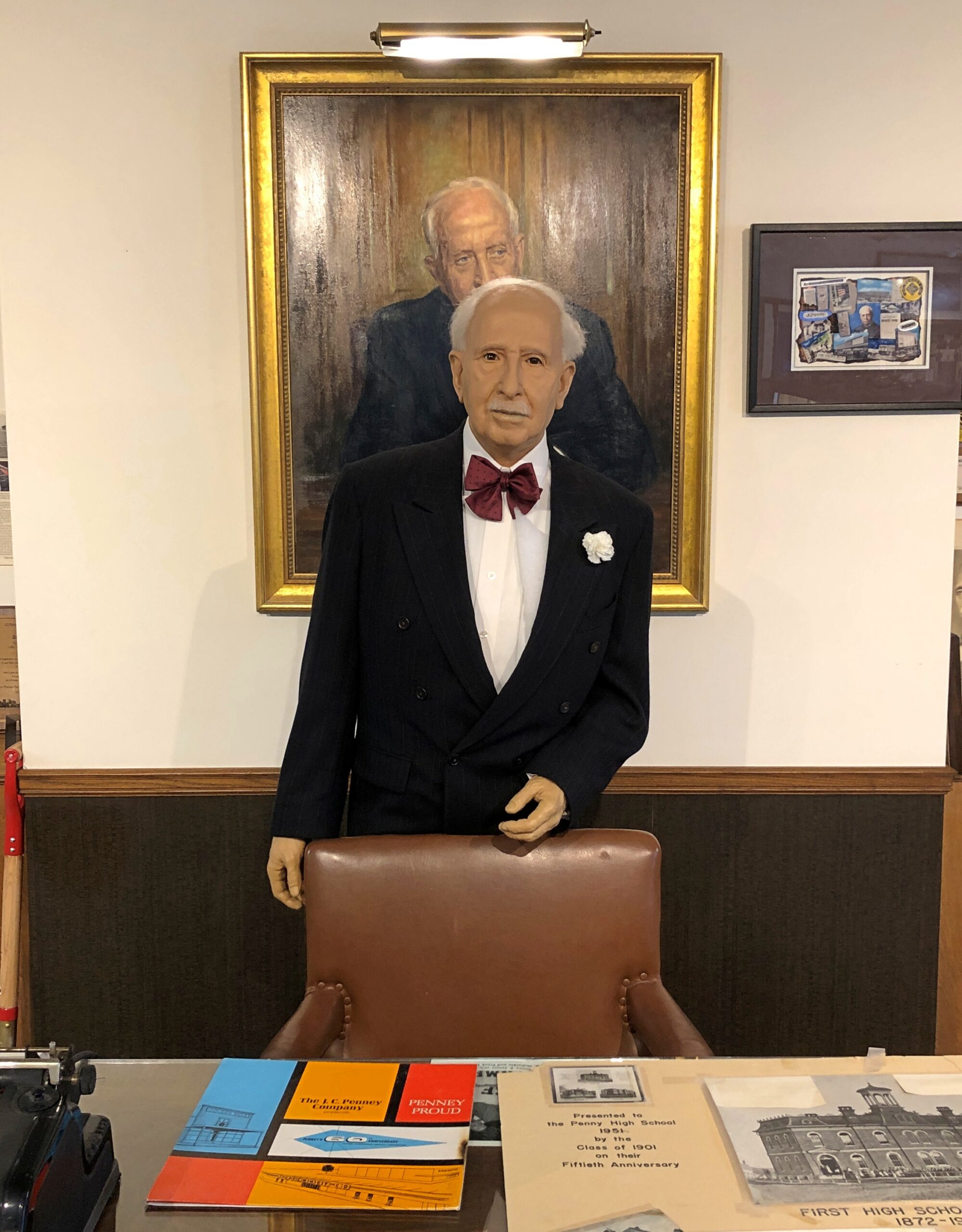
Further east, along U.S. 36 in Hamilton, Missouri, is the two-roomed JC Penney Library and Museum. The town library is in one room, the museum in the other. Most of the Penney artifacts are under glass. A wax JC Penney stands in front of a portrait of the department store mogul.
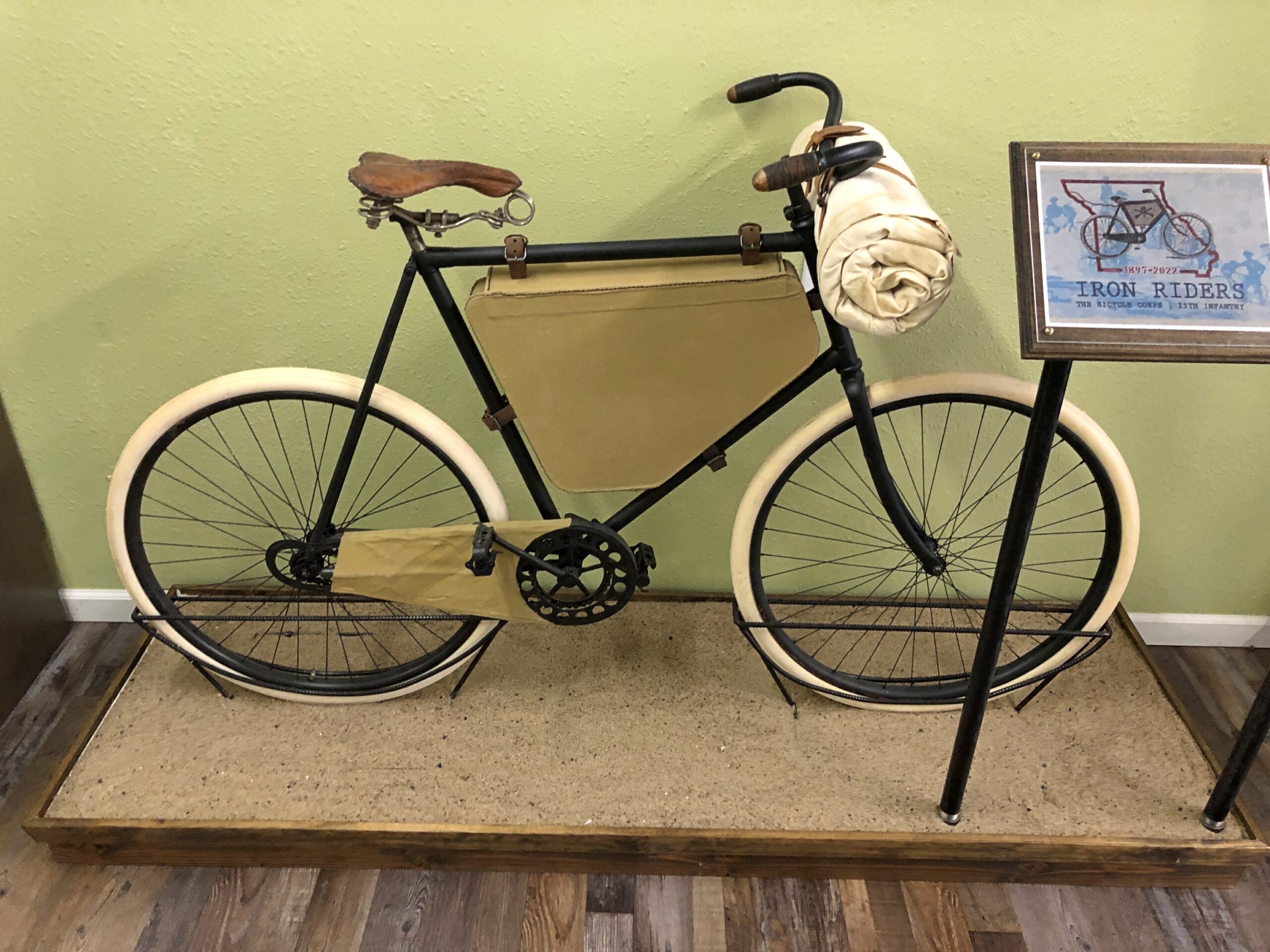
In Laclede, Missouri, is the Gen. John J. Pershing Boyhood Home State Historic Site. A fine museum about the General of the Armies, including an exhibit on something unknown to me, the Twenty-Fifth Infantry Bicycle Corps — the Iron Riders. The Army tested long-distance bicycling in 1897 as a strategy for troop movement, with the corps riding from Missoula, Montana to St. Louis. Pershing wasn’t involved in that effort, but it did happen during his time in the military. Quite a story. Deserves to be better known.
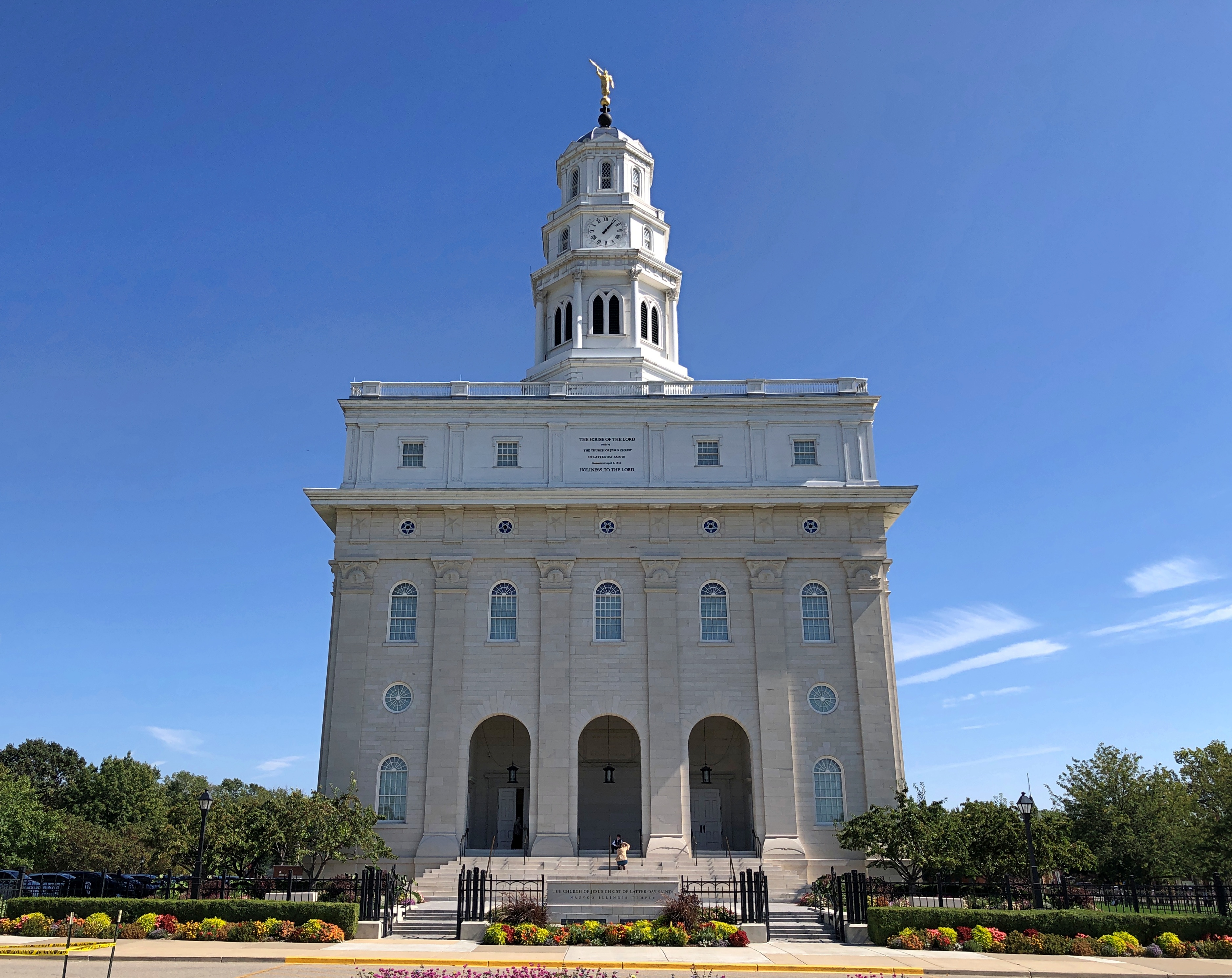
One the last day of my driving, I didn’t want to stop for much, but I did spend a while in Nauvoo, Illinois.
There’s a LDS temple there now. It wasn’t the last time I came this way, in 1997. I couldn’t go in, of course. For that you’d have to join the club.