How does the saying go? Wherever there is Don Quixote –
– there is Sancho Panza.
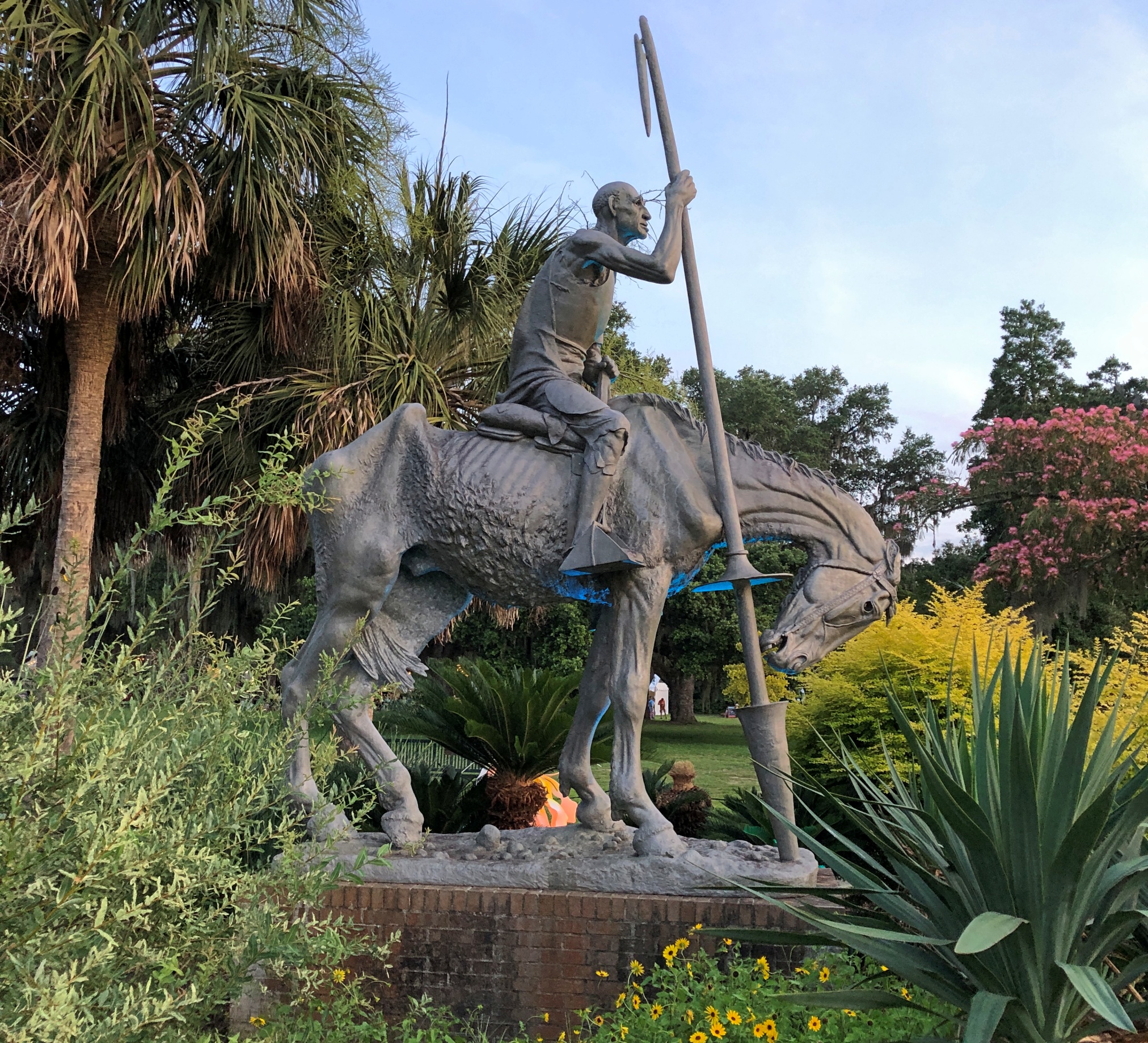
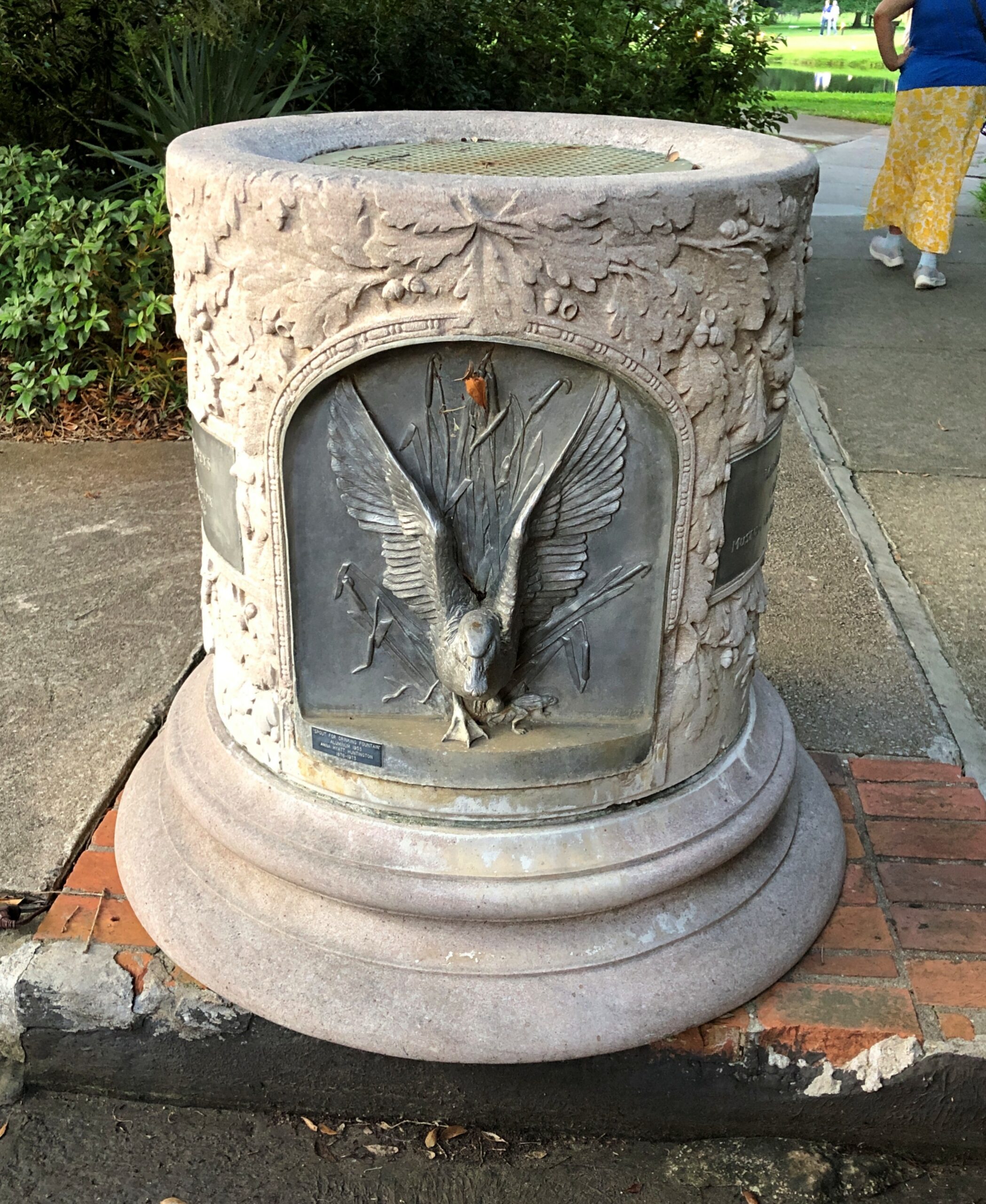
No one says that as far as I know. But you could. Anna Hyatt Huntington (d. 1973) created “Don Quixote” in 1947, and eventually Carl Paul Jennewein (d. 1978) did the companion “Sancho Panza” in 1971, apparently at Huntington’s request. You can find the famed literary pair in aluminum among many other artworks at Brookgreen Gardens in South Carolina – over 2,000 works by 430 artists, according to the garden. We arrived late in the afternoon of the 21st, dodging most of that day’s heat by timing it that way.
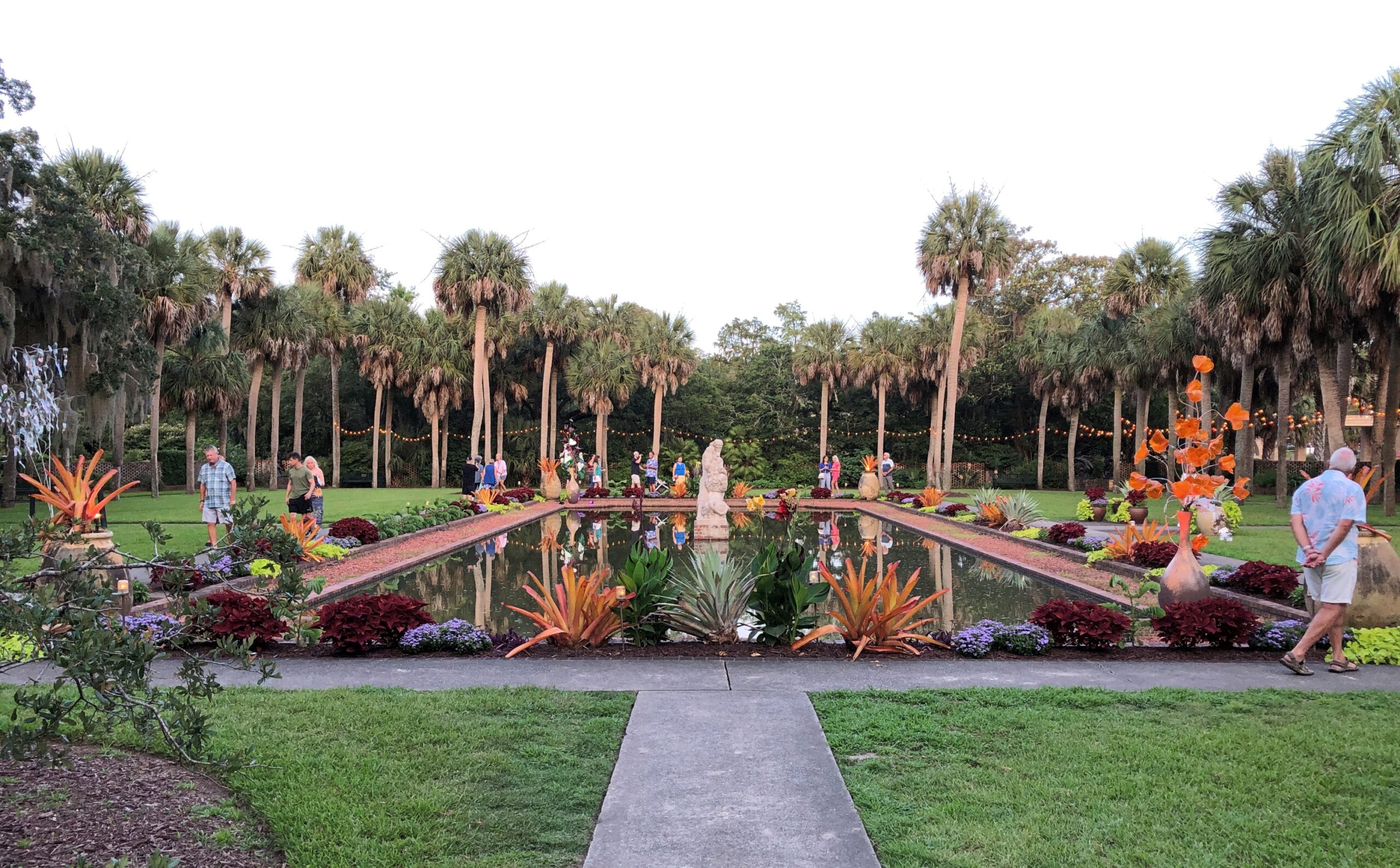
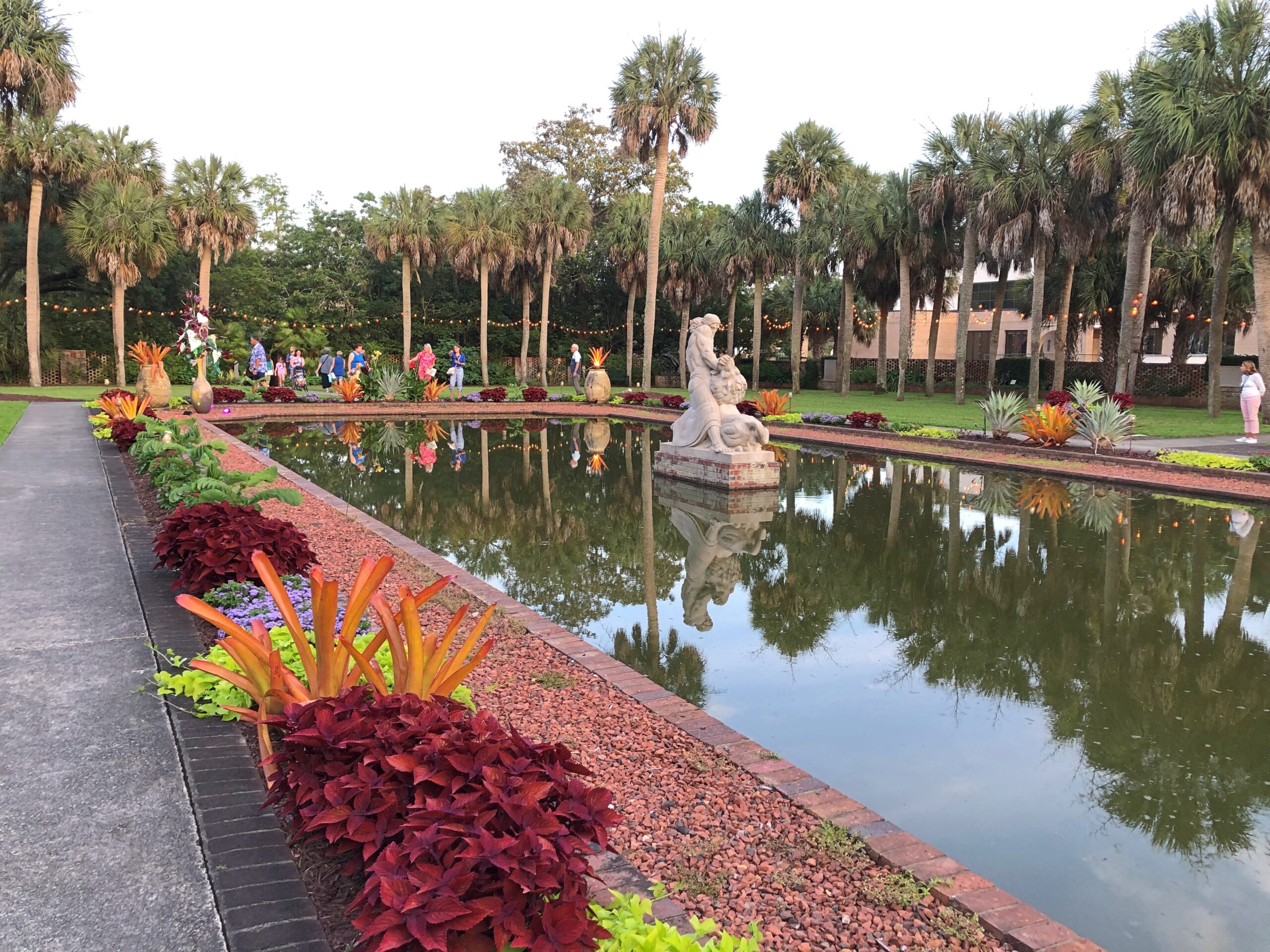
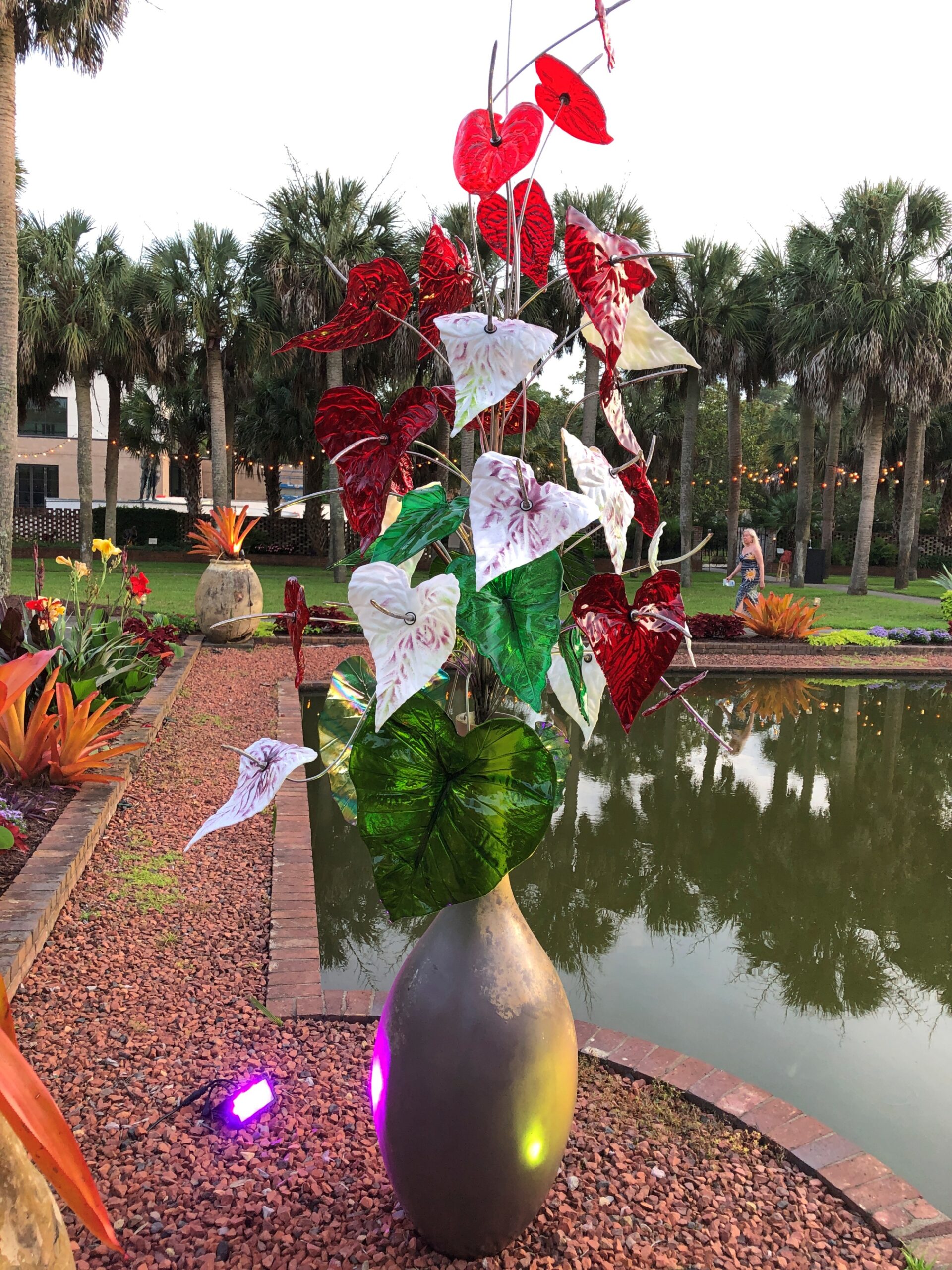
Some works are larger than the Cervantes characters.
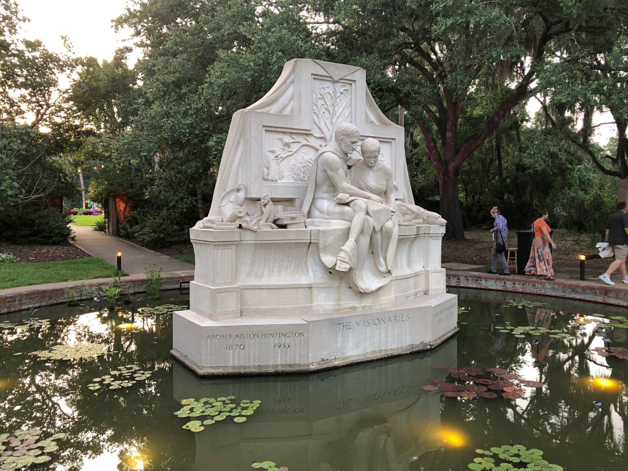
Archer Milton Huntington (d. 1955) isn’t entombed in that artwork, as much as it looks like it. He’s in a mausoleum in the Bronx befitting a very wealthy man, so this one just honors him. Along with his wife Anna, a successful artist in her own right, railroad heir and scholar Archer acquired the land and planned the gardens.
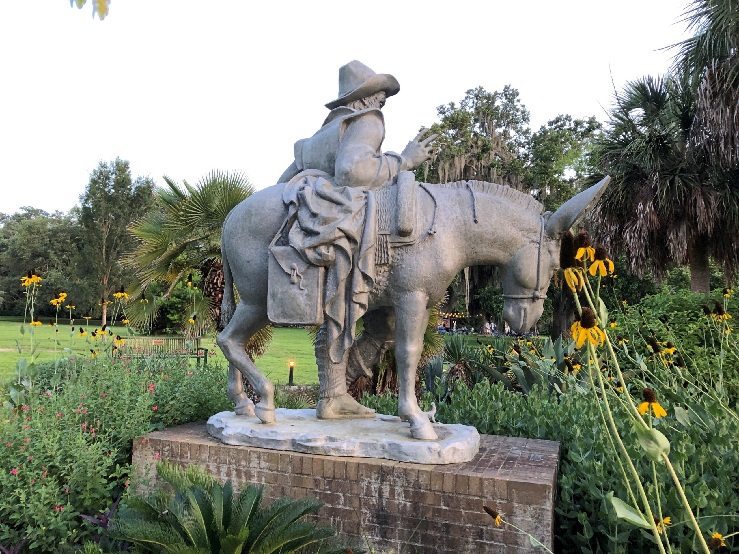
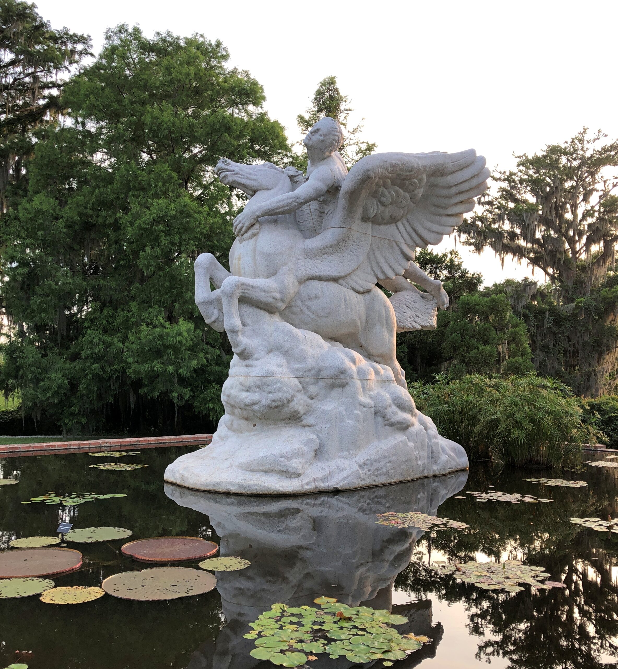
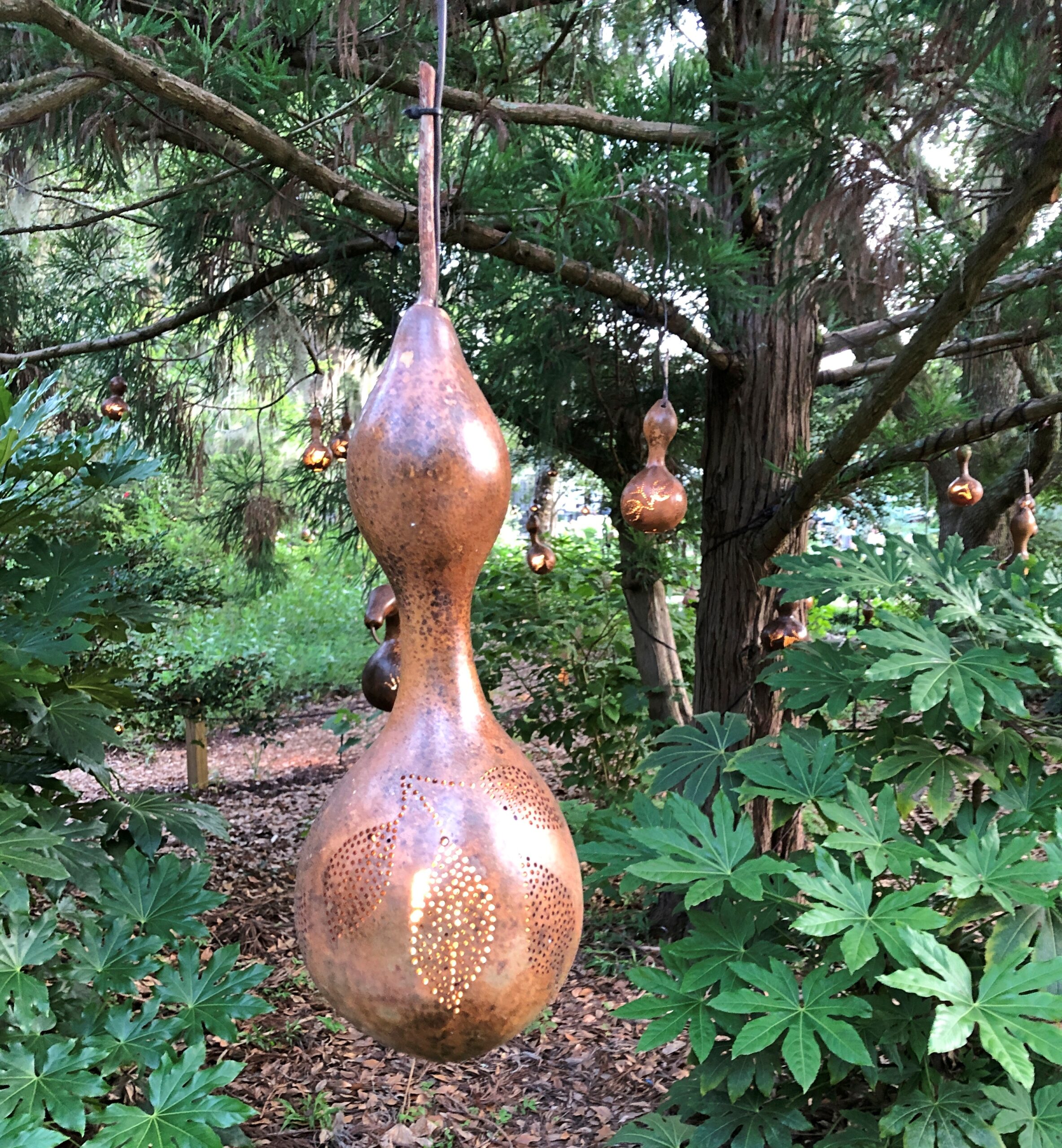
Others works aren’t as large, or as conventional.
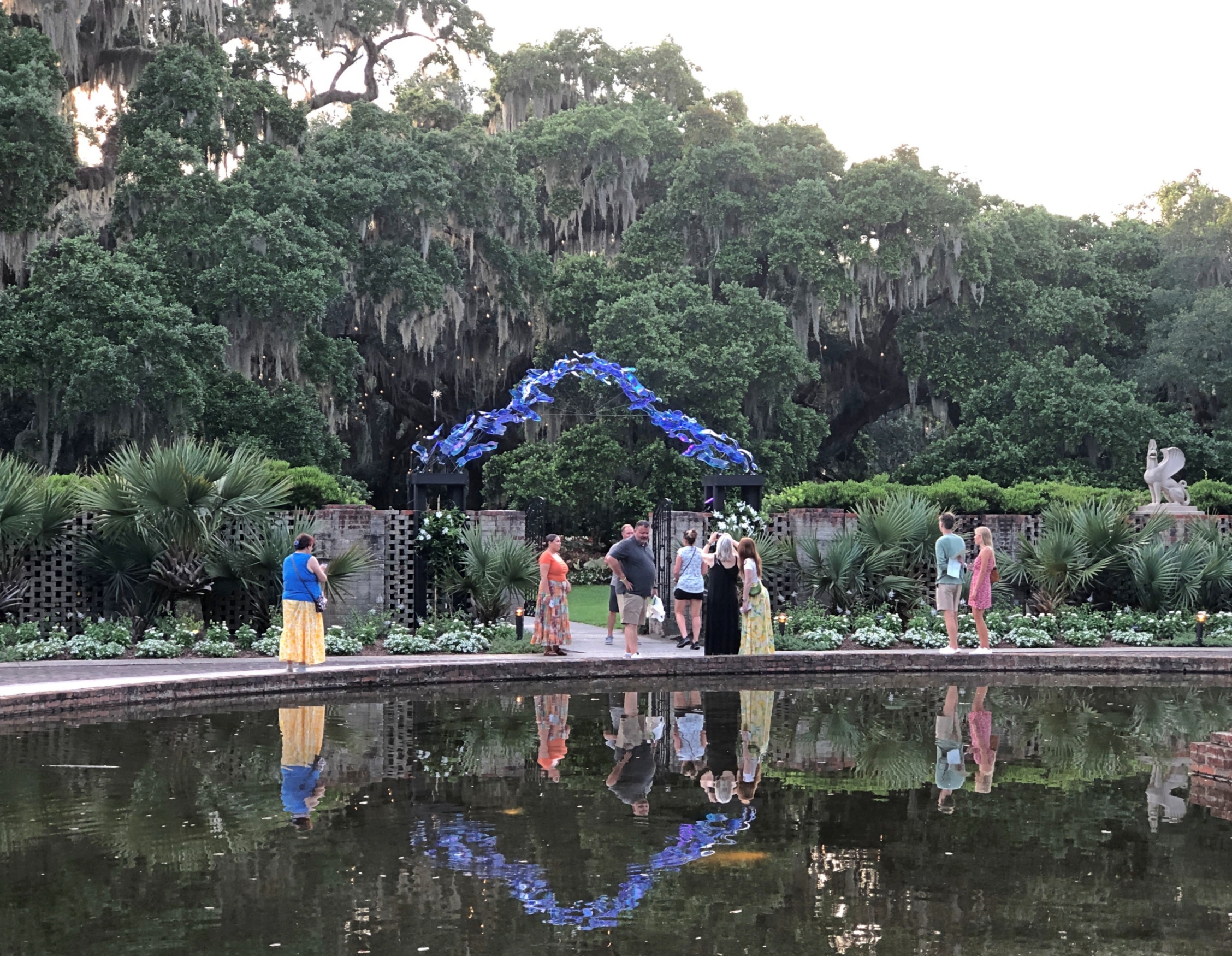
The sculpture garden, formally known as Archer & Anna Hyatt Huntington Sculpture Garden, is only part of Brookgreen Gardens. Spanning 9,100 acres, the grounds also count as a botanical garden, and there is a zoo and wilderness areas, all teased out of the swampland, rice fields, woods and beaches that marked the site before the 20th century. Some historic sites still exist on the land, especially relating to the rice plantations that used to be there.
“From its inception [in 1931], Brookgreen had a three-pronged purpose: first, to collect, exhibit, and preserve American figurative sculpture; second, to collect, exhibit, and preserve the plants of the Southeast; and third, to collect, exhibit, and preserve the animals of the Southeast,” the garden’s web site explains.
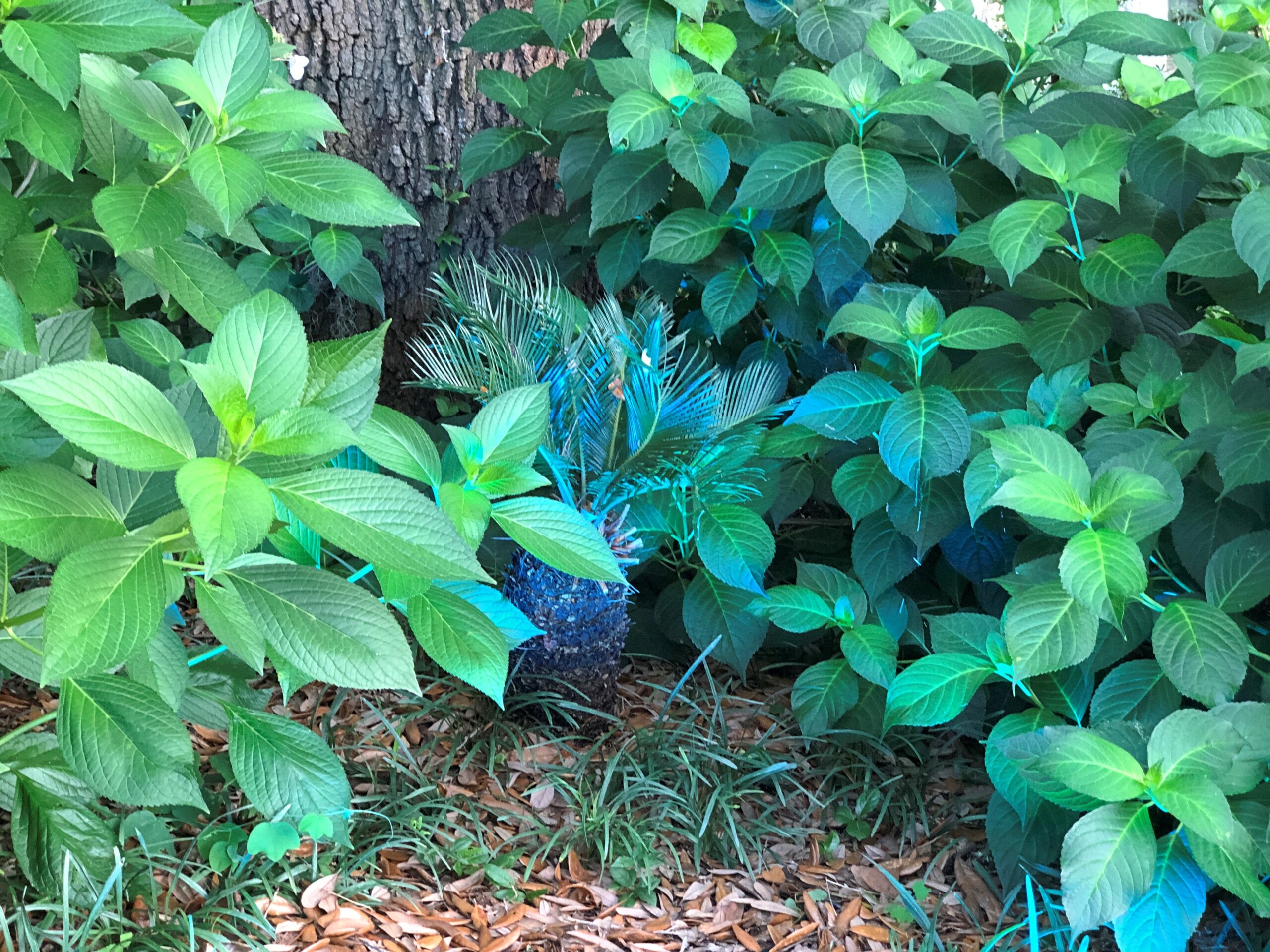
Paths wind through the lush landscapes.
And under towering oaks bearded with Spanish moss.
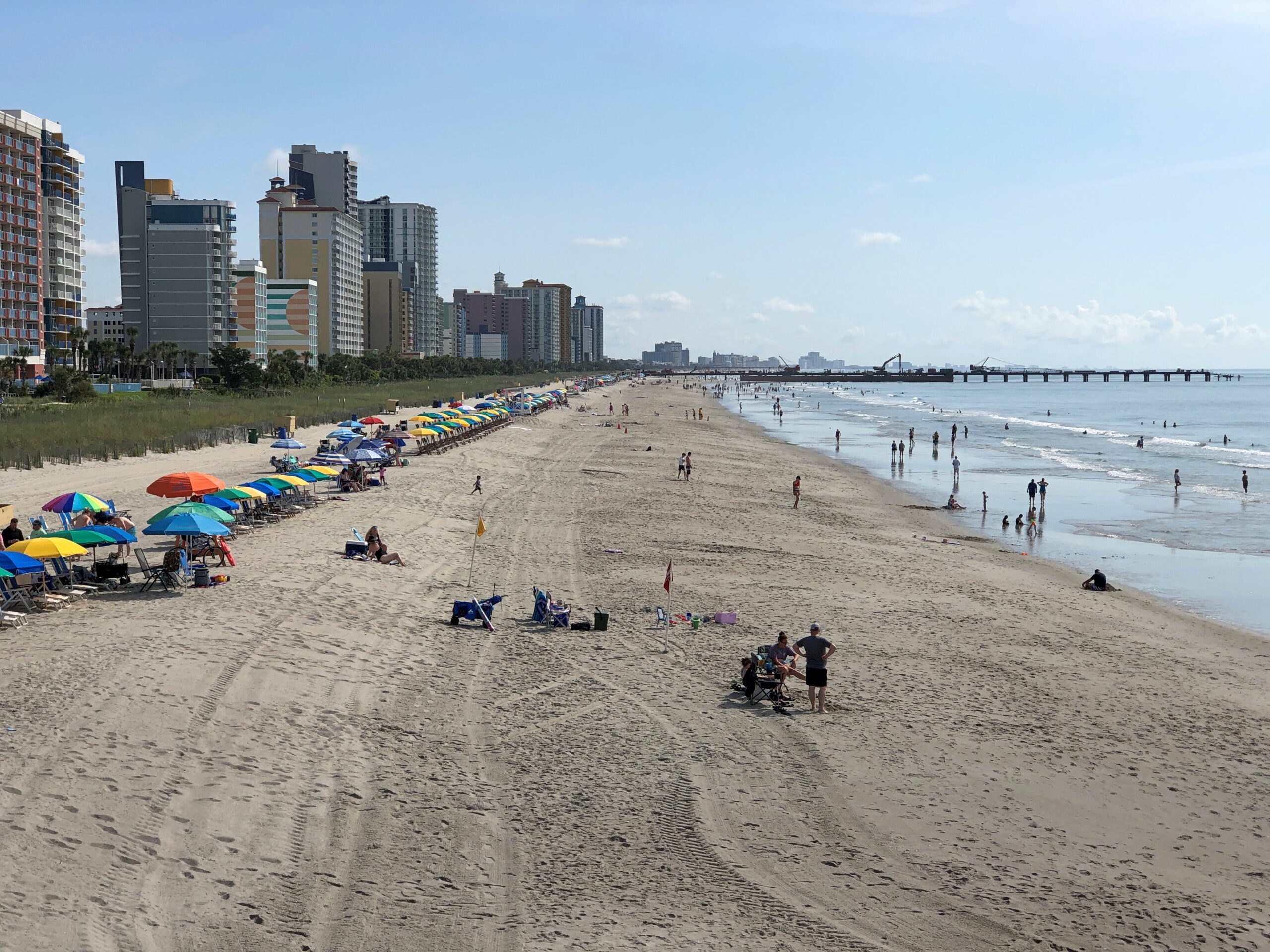
The Grand Strand, it’s called. That would be the wide beach that stretches along the Carolina coast for 60 miles or so, including greater Myrtle Beach. Grand indeed.
Sounds like a name a newspaperman might invent. A news moniker. That is, a newspaperman back when they pounded print on their typewriters, and so it was, in the late 1940s.
The beach as a leisure destination, or at least the seaside, goes back a little further. No doubt the Romans had some equivalent, but modern beachgoing is just another thing bequeathed to us by the Victorians and their railroads.
Myrtle Beach the beach is more of a creature of the early 20th century, I understand – the dream of a turpentine baron of the late 19th century, one Franklin G. Burroughs (d. 1897), whose original fortune came from the sap-rich pines of the area. His real estate vision wasn’t as grand as that of Florida railroad tycoon Henry Flagler, but the idea was similar: build railroads to the coasts and persuade people to take leisure trips using those lines and, at the end of the lines, using tourist infrastructure that you’ve conveniently provided. Burroughs’ sons were up to the task, opening a rail-serviced hotel by the shore in 1901. Ultimately the rest of Myrtle Beach rose out of that placement on the Grand Strand, a stretch that had long been considered wasteland. Reportedly Burroughs’ widow named the town for its common flora.
I got a kick out of learning that the corporate descendant of Burroughs’ company, now known as Burroughs & Chapin, is a real estate developer active even now in the Carolinas and Georgia, largely building retail space.
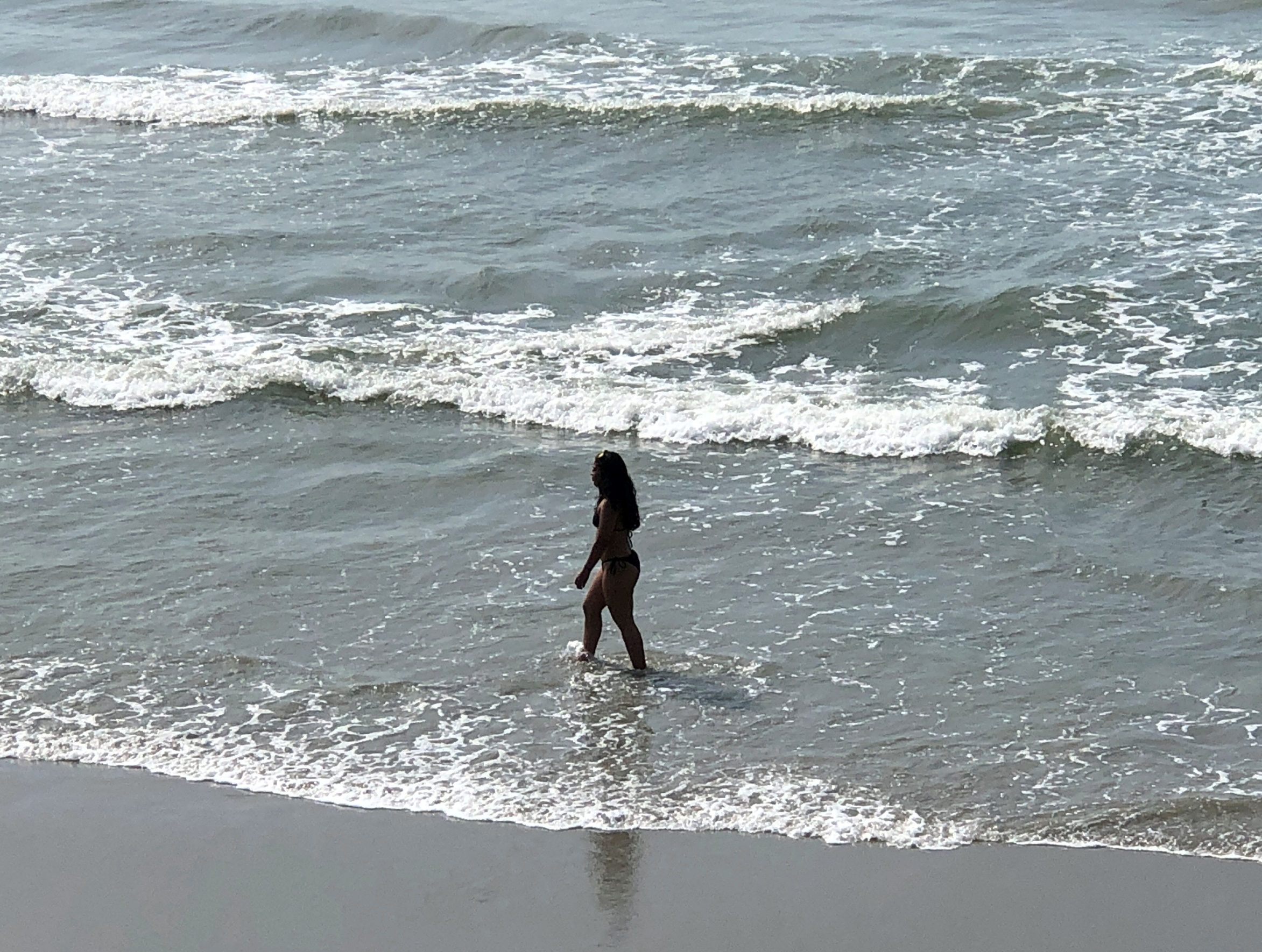
It was a fairly hot walk from the boardwalk to the beach itself.
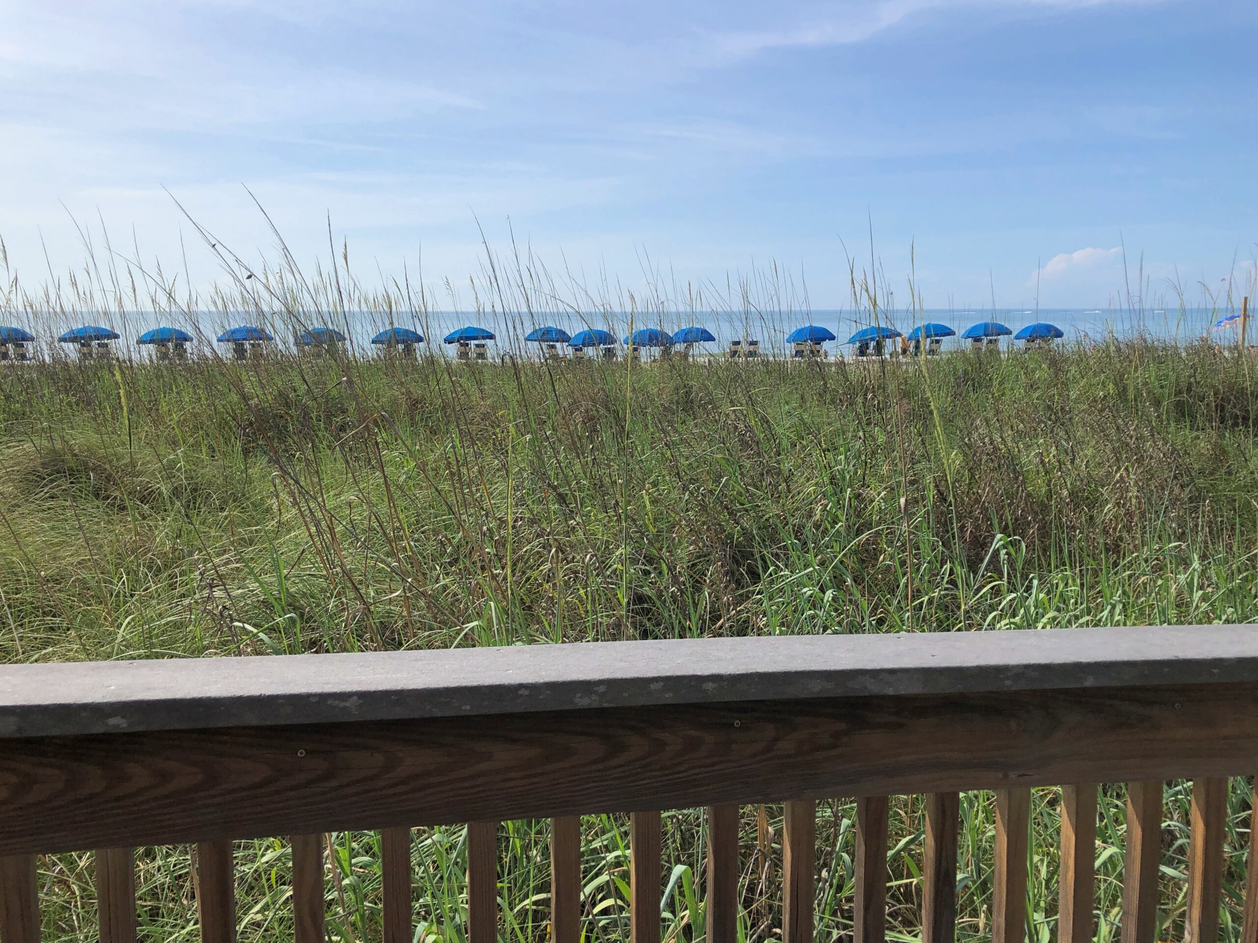
A row of fixed blue beach umbrellas waits for users.
And waits. Somebody must use them sometime, but close inspection revealed no one was. Even closer inspection revealed the charge for renting the umbrella and (I believe) two beach chairs with it is $50 a day. Way to price something out of the market, beach umbrella dudes (the city?).
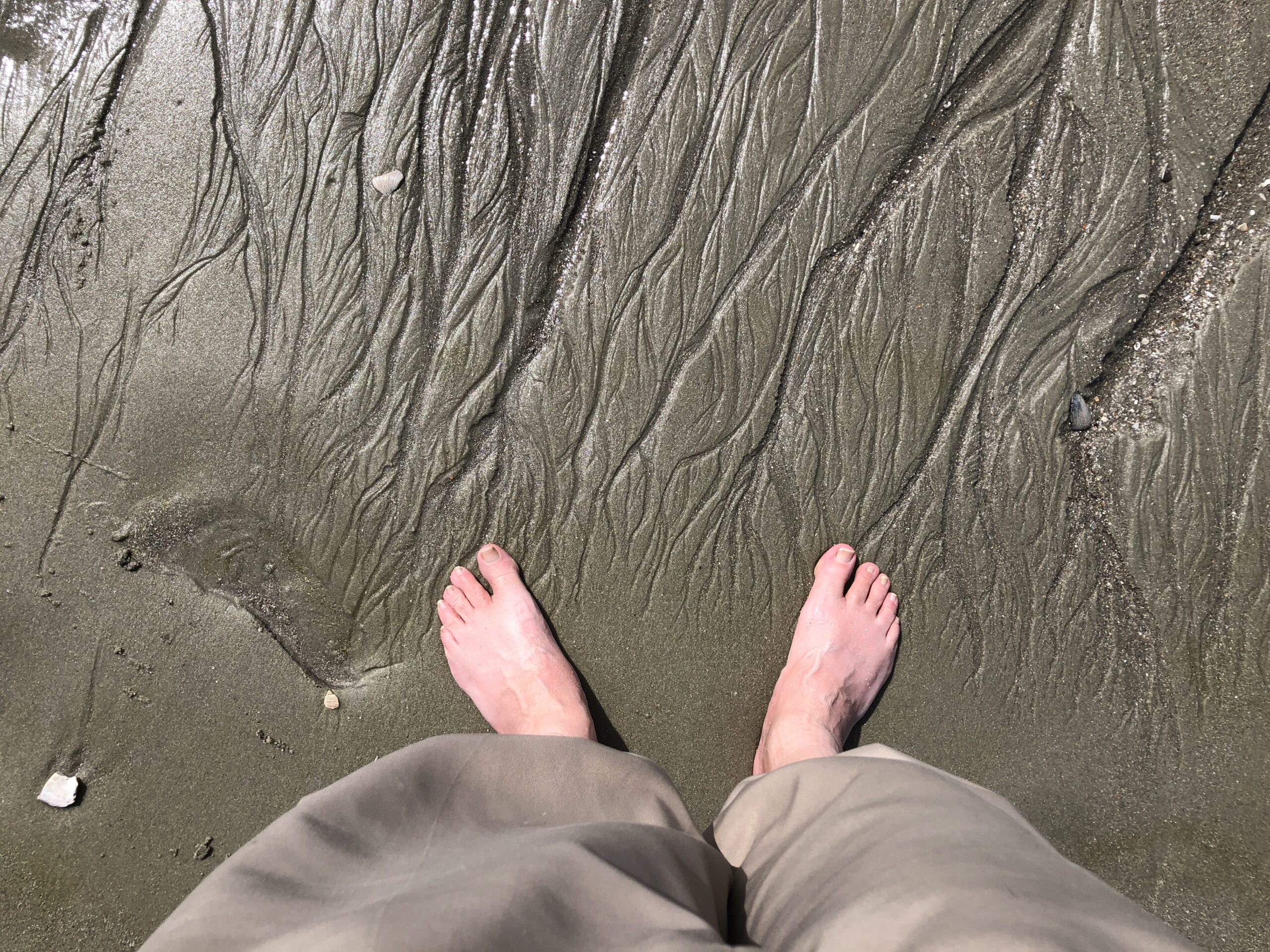
The beach wasn’t particularly busy anyway. It had a lot of sun, which people seem to like, but just a little much in the way of blazing heat. Still, a few people ventured into the smooth waves.
We did too, briefly. Ahh.
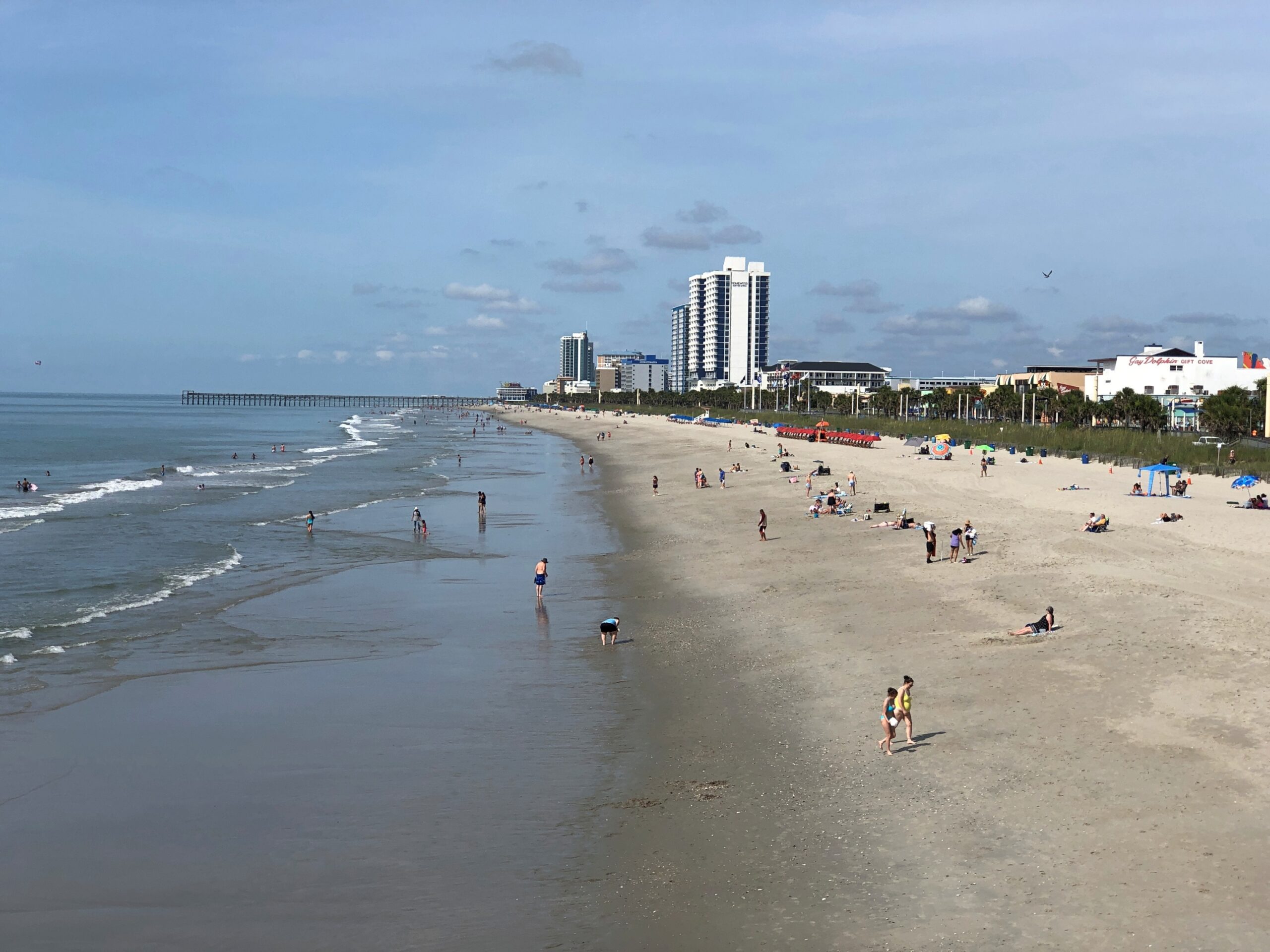
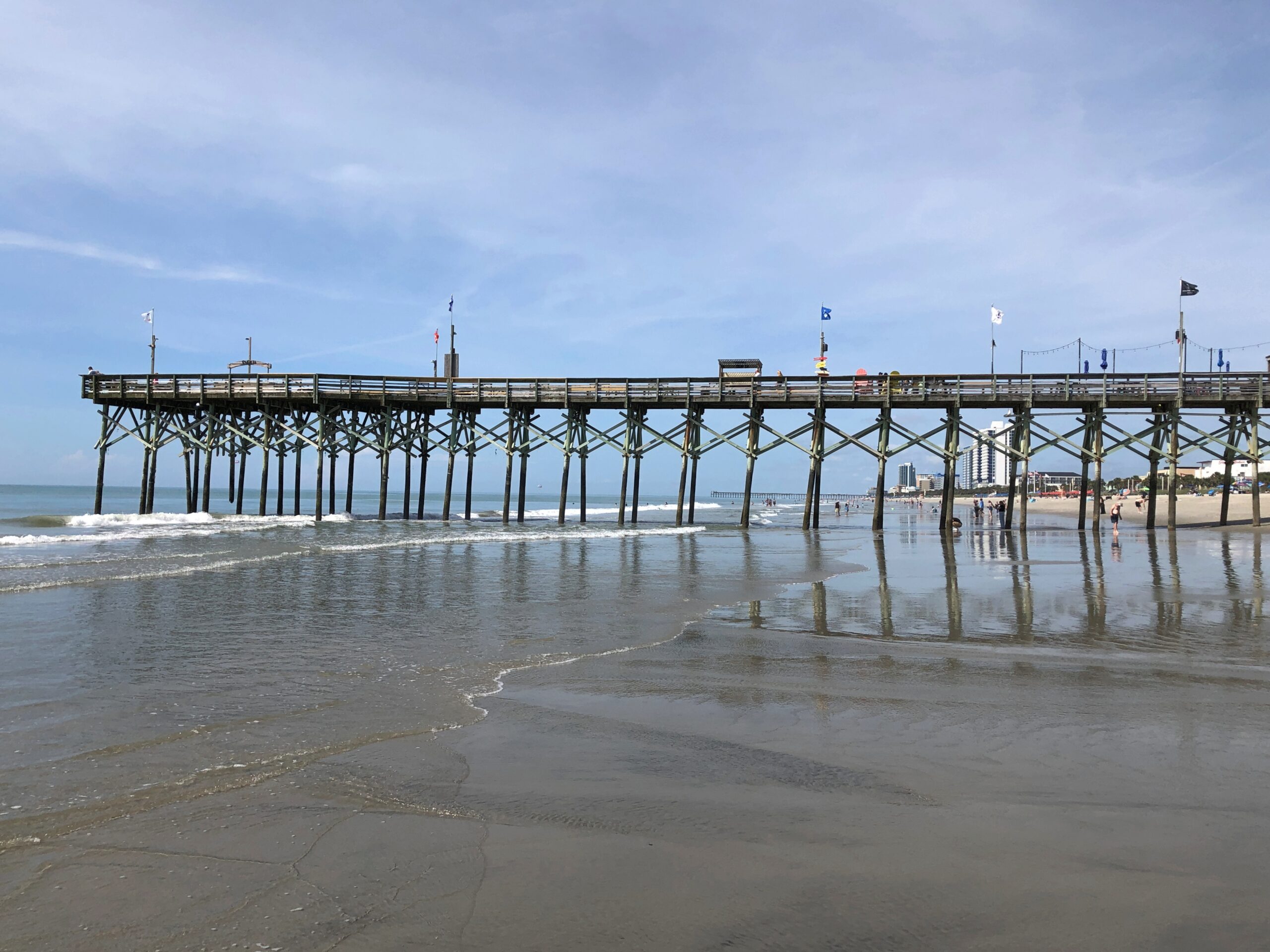
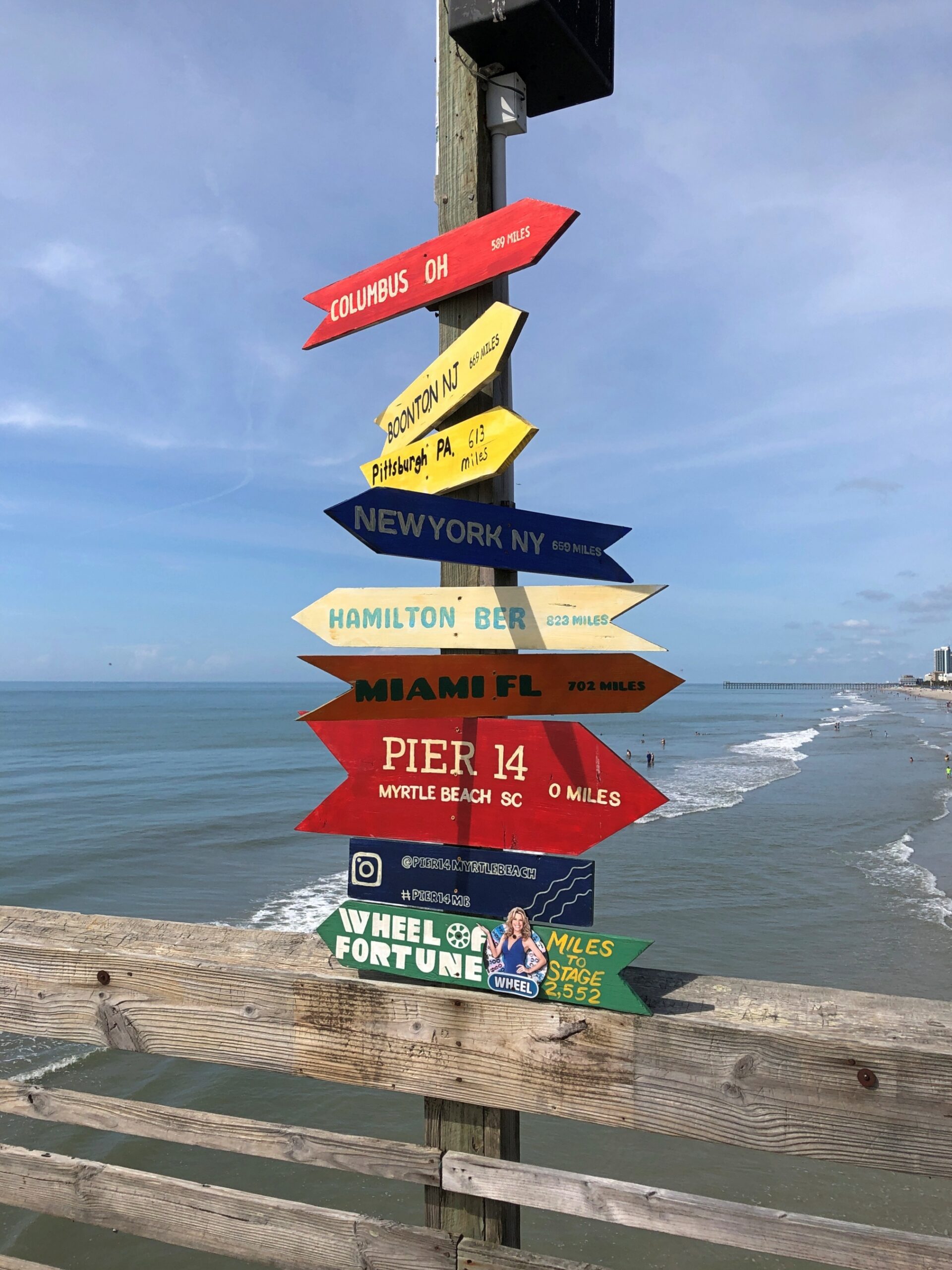
Jutting out into the ocean, as piers do, is Pier 14.
It’s been a fishing pier a long time, despite some serious damage during Hurricane Hugo in 1989, and on the landward end it is home to a decent-looking seafood restaurant. The pier might be a Myrtle Beach institution, but ownership doesn’t seem inclined to gouge leisure fisherfolk, charging only $7 to fish from the pier, and $2 for a second pole (limit two poles). A look around the pier is $1, which you get back in the form of a discount on a purchase from the gift shop, which of course also sells fishing gear. A lesser businessman would gouge on the entrance fee (and no discount) for fisherfolk and tourists, and make them less amenable to spending money at the pier’s store.
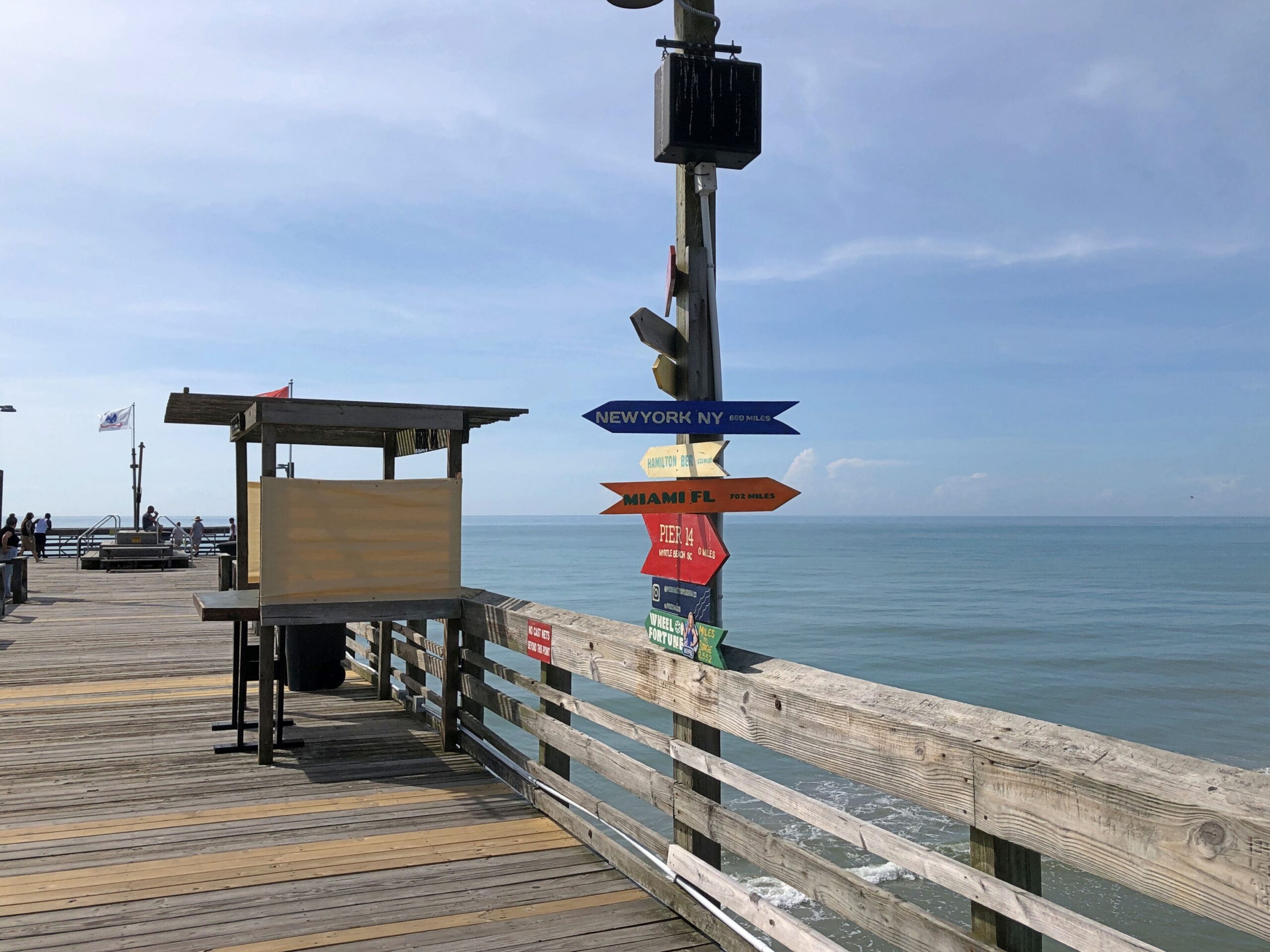
“Why 14?” I asked the fellow behind the counter, a big-bearded, capped and Myrtle Beach t-shirted man thick in the middle and thick in middle age, who might have been the owner. For a second it looked like he’d never heard such an odd question, but I had noticed only two other piers, one off fairly far off to the north and the other off to the south. Had there been other piers, lost to storms or urban renewal? Not how I’d have phrased the question, but what I was thinking. I’d seen the like, stubs of ruined piers, in New York.
“No, it’s after 14th Street,” he said, maybe thinking about that obvious thing for the first time in years, and then he pointed out that the pier is actually closer to 13th Street, but who would want Pier 13? We’ve all seen buildings conspicuously missing their 13th floor. Or missing that name, since even if you called it the 14th floor, it would be the 13th. Wasn’t that a Twilight Zone plot element? An unlucky 14th floor, that is. Maybe not. Could have been.
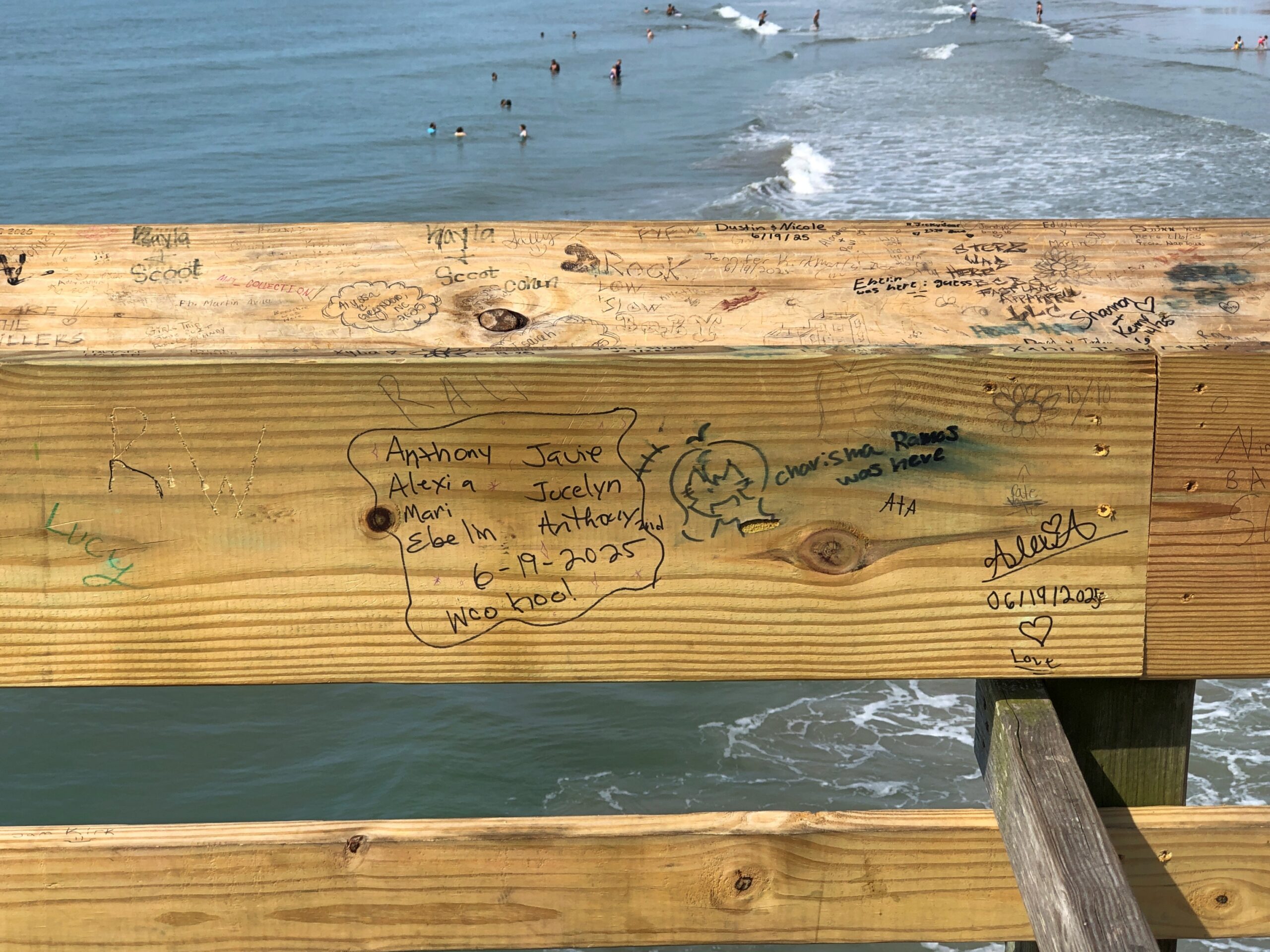
We paid our dollars and out on the hot pier we went.
Wheel of Fortune?
New wood, new graffiti.
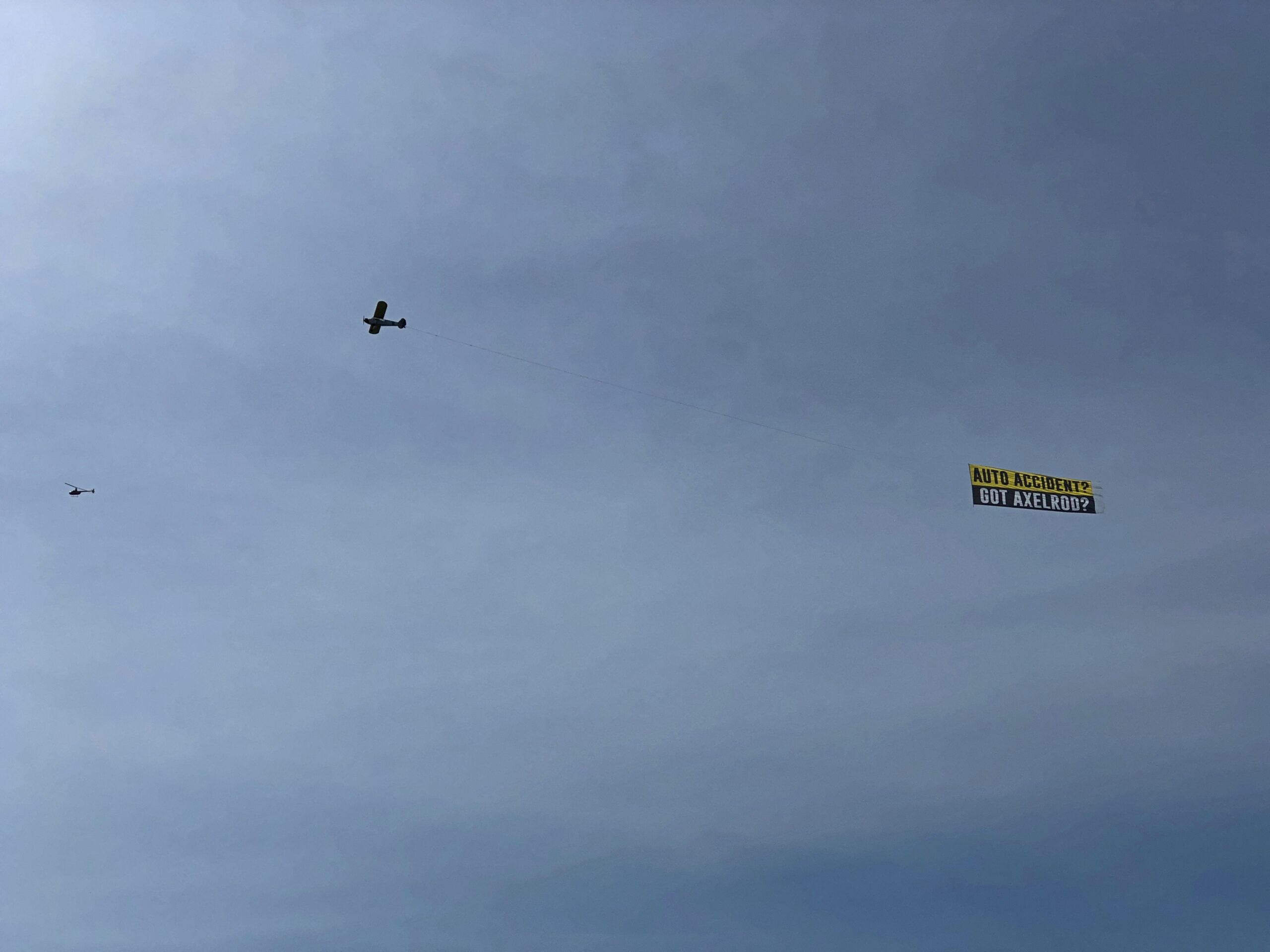
Nice views from both the pier and the beach. Including occasional aircraft.
That would be Axelrod & Associates. Good thing we didn’t need him or his ilk during our SC visit.
My spring break trip in March 1981 with Neal and Stuart involved time on the Outer Banks of North Carolina, and we planned to cross into South Carolina for a visit to Myrtle Beach. But because of the ferry schedule between islands, we spent a memorable night on Ocracoke Is., and determined that there was no time for Myrtle Beach. We made it as far as Wilmington, NC.
I thought of that on my drive between New Bern and Myrtle Beach last month, which was mostly, but not entirely, on US 17. Just another example of how I think: When I miss a planned destination for some reason or other, something doesn’t quite sit right until I go there eventually. At 44 years and some months, the lag between planning to go to Myrtle Beach and realizing that visit was unusually long, but in any case I finally made it on June 20, 2025, a Friday, and I stayed until the following Monday. Yuriko joined me those days.
Crossing into SC on US 17, you first encounter North Myrtle Beach, which seemed every bit as developed and tourist-oriented as Myrtle Beach itself, replete with restaurants and motels and retailers, including a wide variety of beach retailers whose large-letter marquees made bold and nearly worthless promises about low prices.
North MB is also where I started noticing the area’s miniature golf courses. Or, as the industry seems to call it, mini golf, because there is such a thing as the American Mini Golf Alliance and the US ProMiniGolf Association (pro?). Then again, a simple search also turns up the World Minigolf Sport Federation and Miniature Golf Association of America, along with the Professional Putters Association (professional?). There’s clearly a lot I don’t know about miniature golf.
In North MB, you drive by Hawaiian Village Mini Golf, Hawaiian Rumble (home of the Mini Golf Masters tournament), Mayday Golf, Professor Hacker’s Dinosaur Adventure and Professor Hacker’s Lost Treasure Golf, among others. In Myrtle Beach proper, among others, there’s Broadway Grand Prix, Captain Hook’s Adventure Golf, Jungle Safari Mini Golf, Jurassic Mini Golf, Popstroke, Red Dragon Cove Adventure Golf, Aloha Mini Golf, and one that was truly hard to miss, Mt. Atanticus Minotaur Golf.
Visit Myrtle Beach says there are over 30 mini golf courses in the area, their faux oddities rising near major thoroughfares – artificial landforms, cartoonish pirate ships, weird sea creatures and so many dinosaurs, at least in my memory. Had daytime temps been anything less than 90° F. or so, we might have picked one and putted some balls around for a lark. Or, failing that, I might have spend time on sidewalks outside their fences, taking pictures. There’s a coffee table book in all the Myrtle Beach mini golf spectacle, or at least an extensive Flickr page.
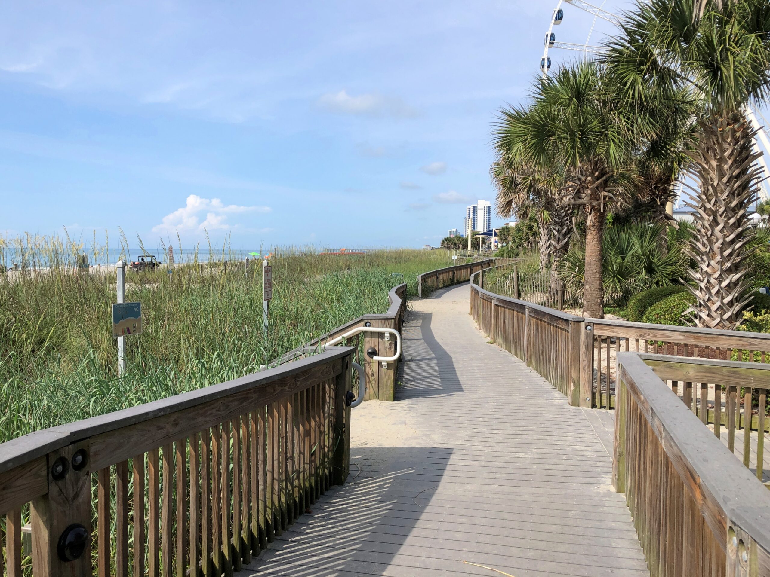
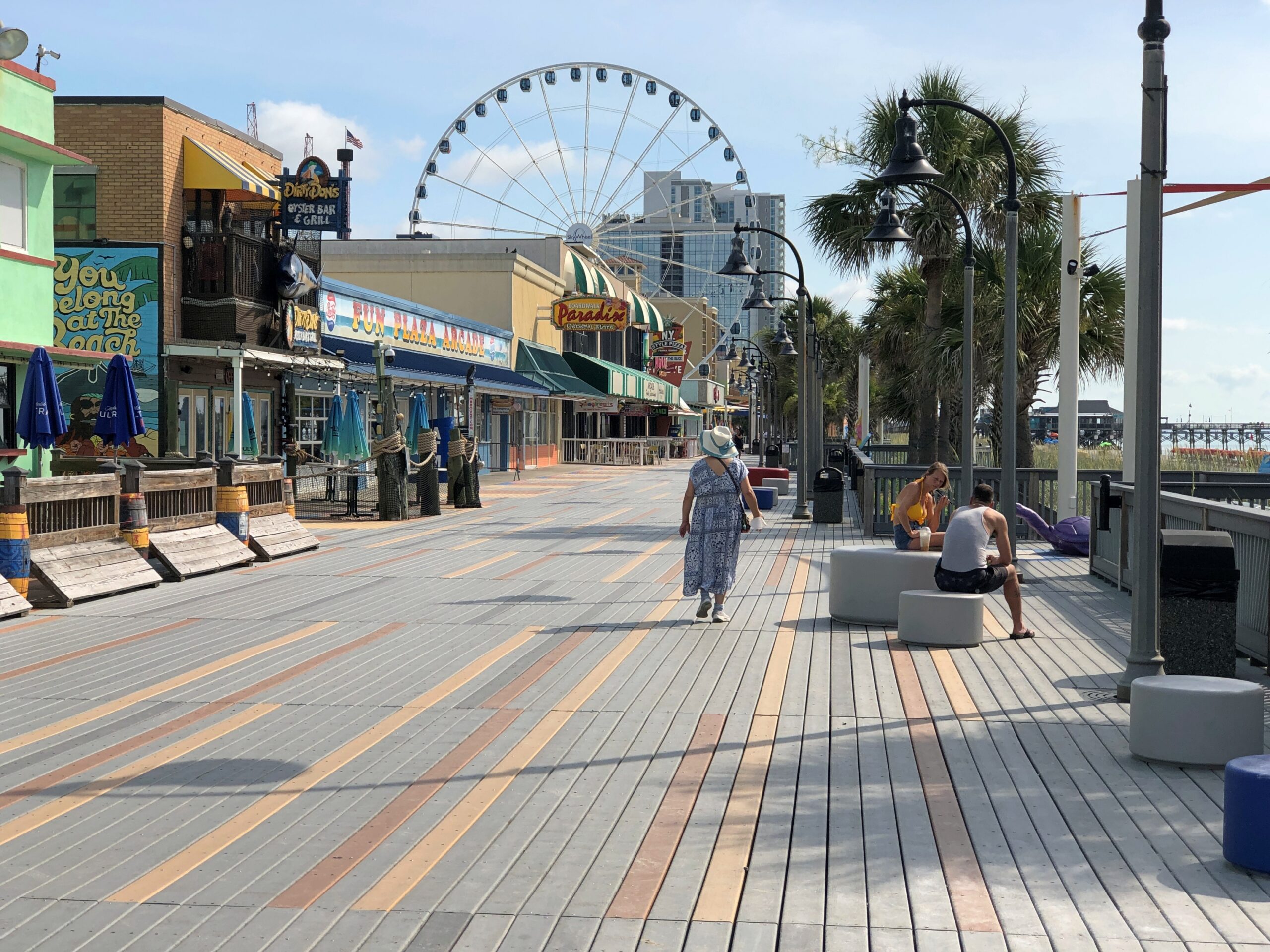
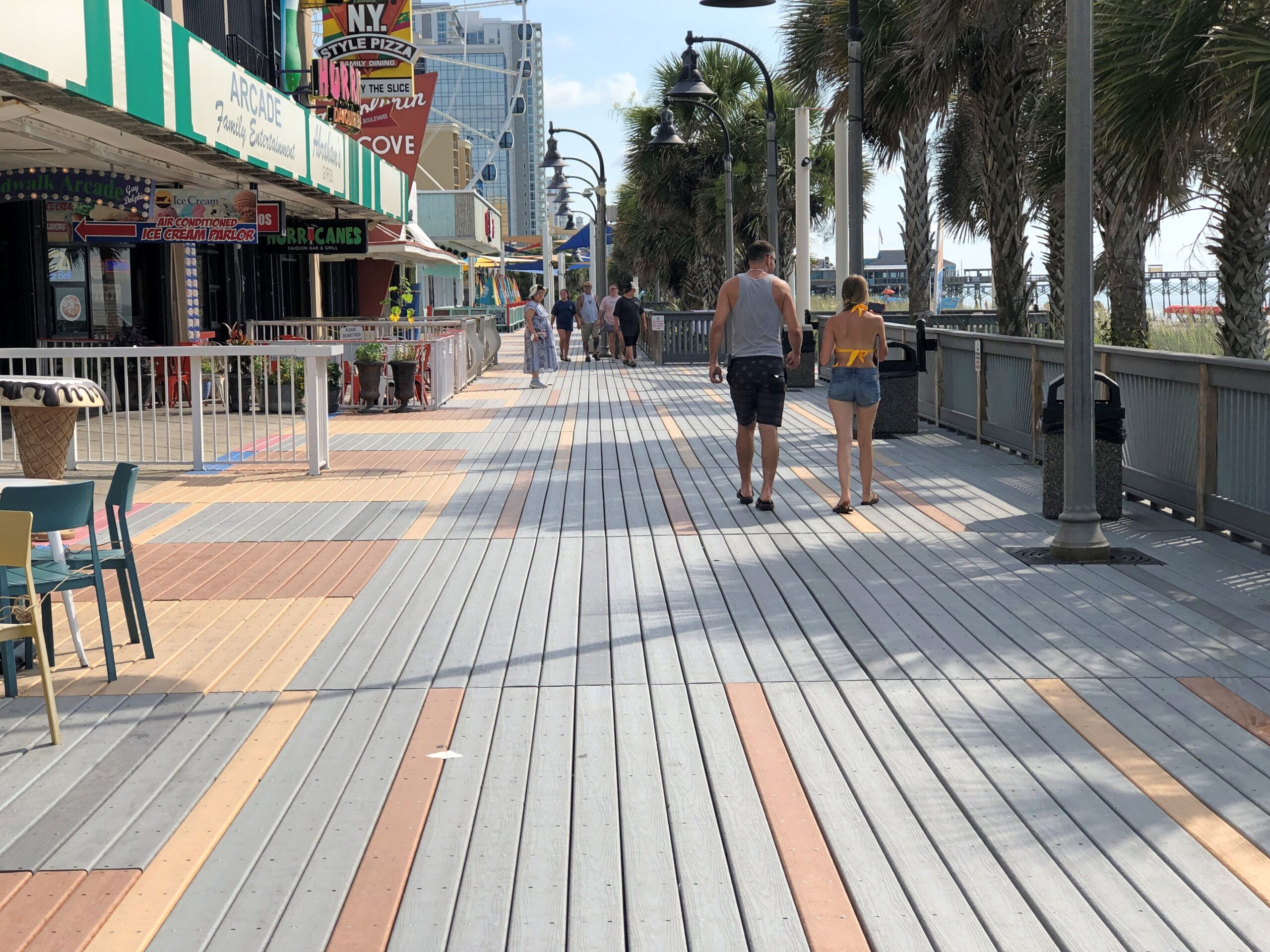
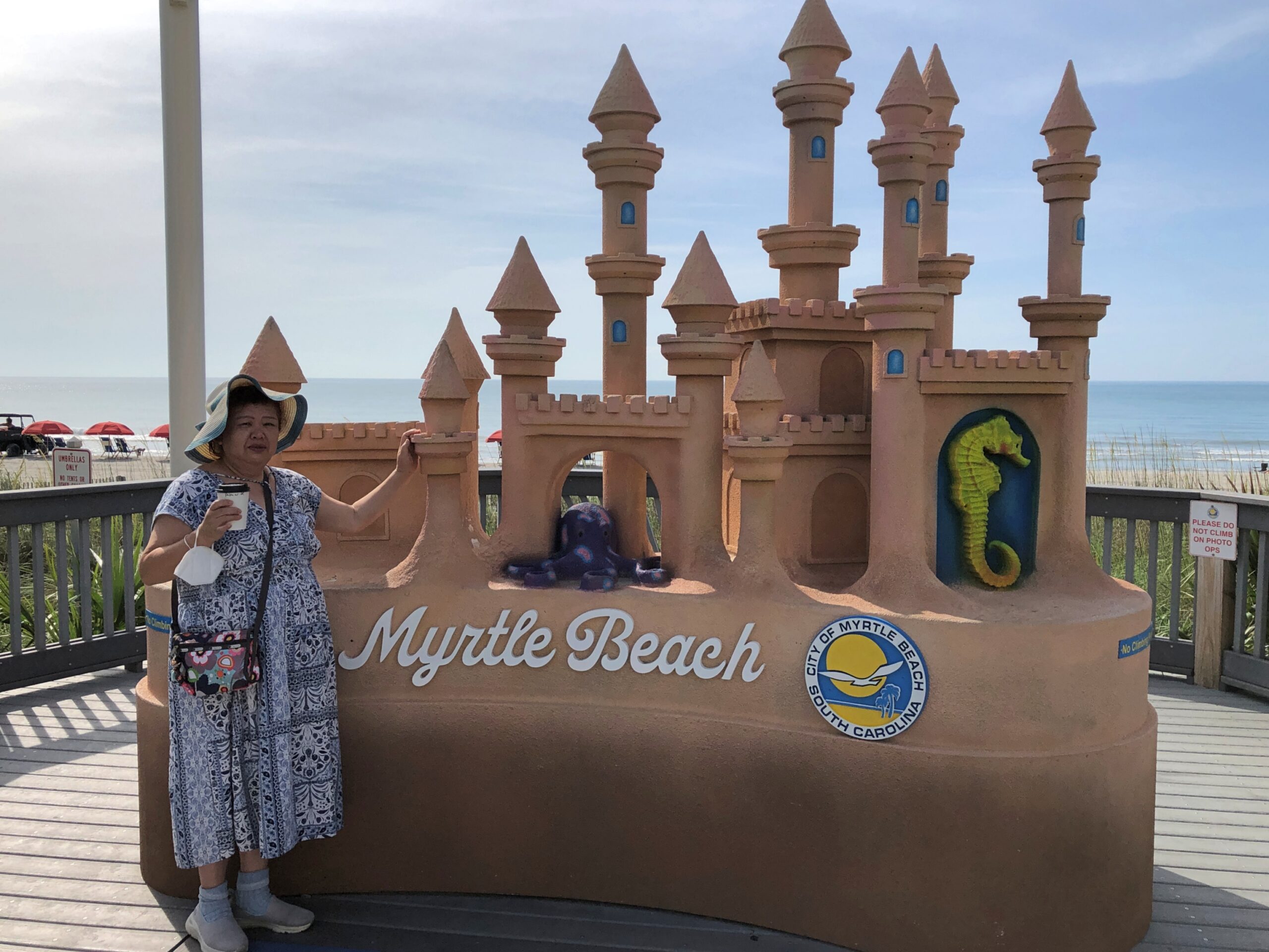
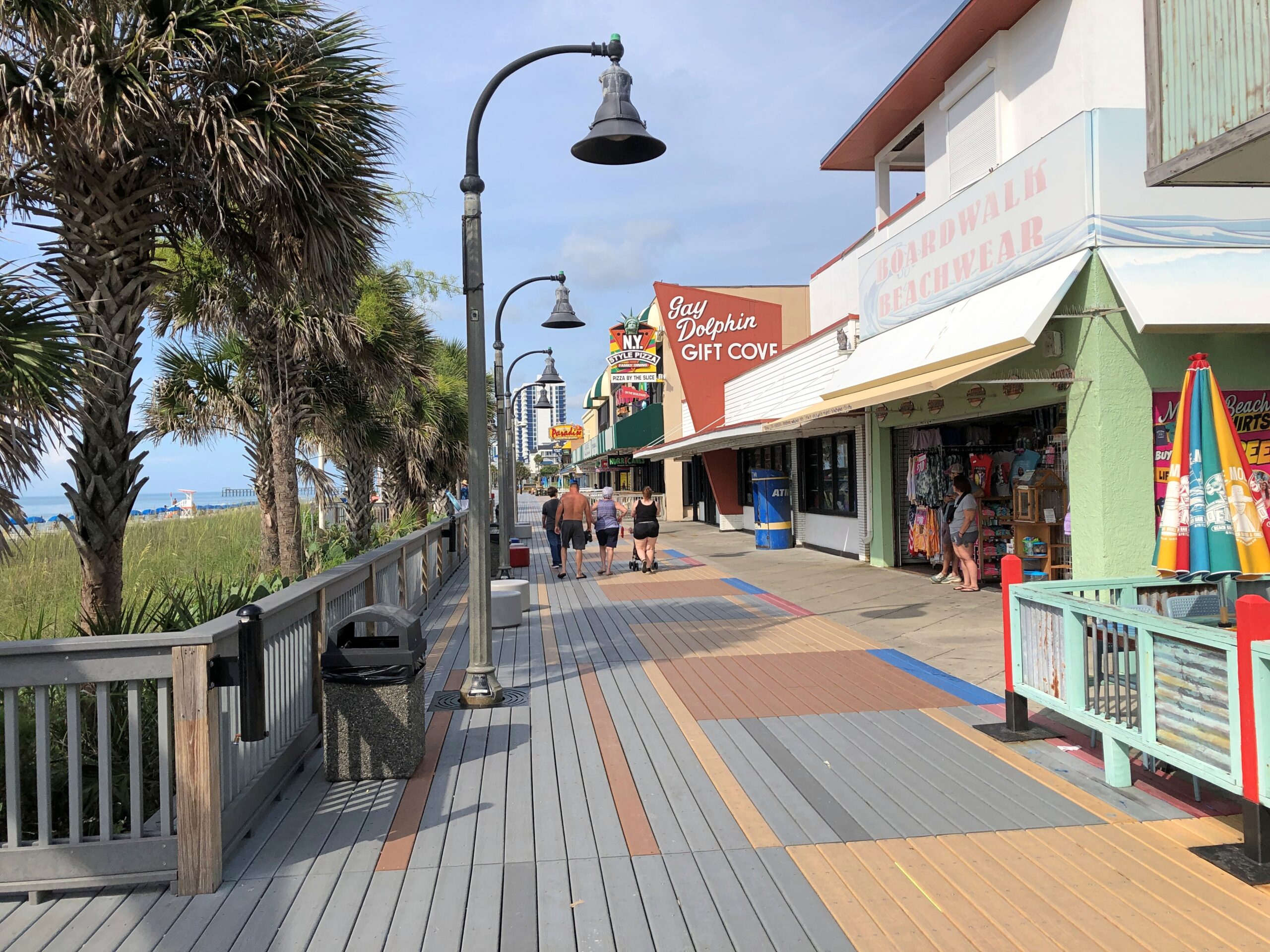
We decided instead to spend our limited amount of daytime outdoor time at Myrtle Beach’s actual beach, which is bordered by a boardwalk.
Late that Sunday morning in June, the boardwalk wasn’t particularly busy. Could have been the heat dome. I figure the place is hopping around spring break time, or the month after Thanksgiving, for instance.
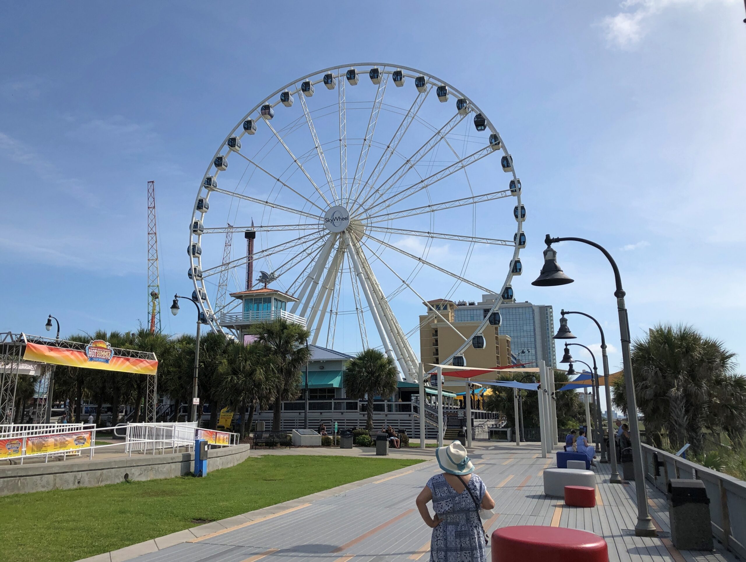
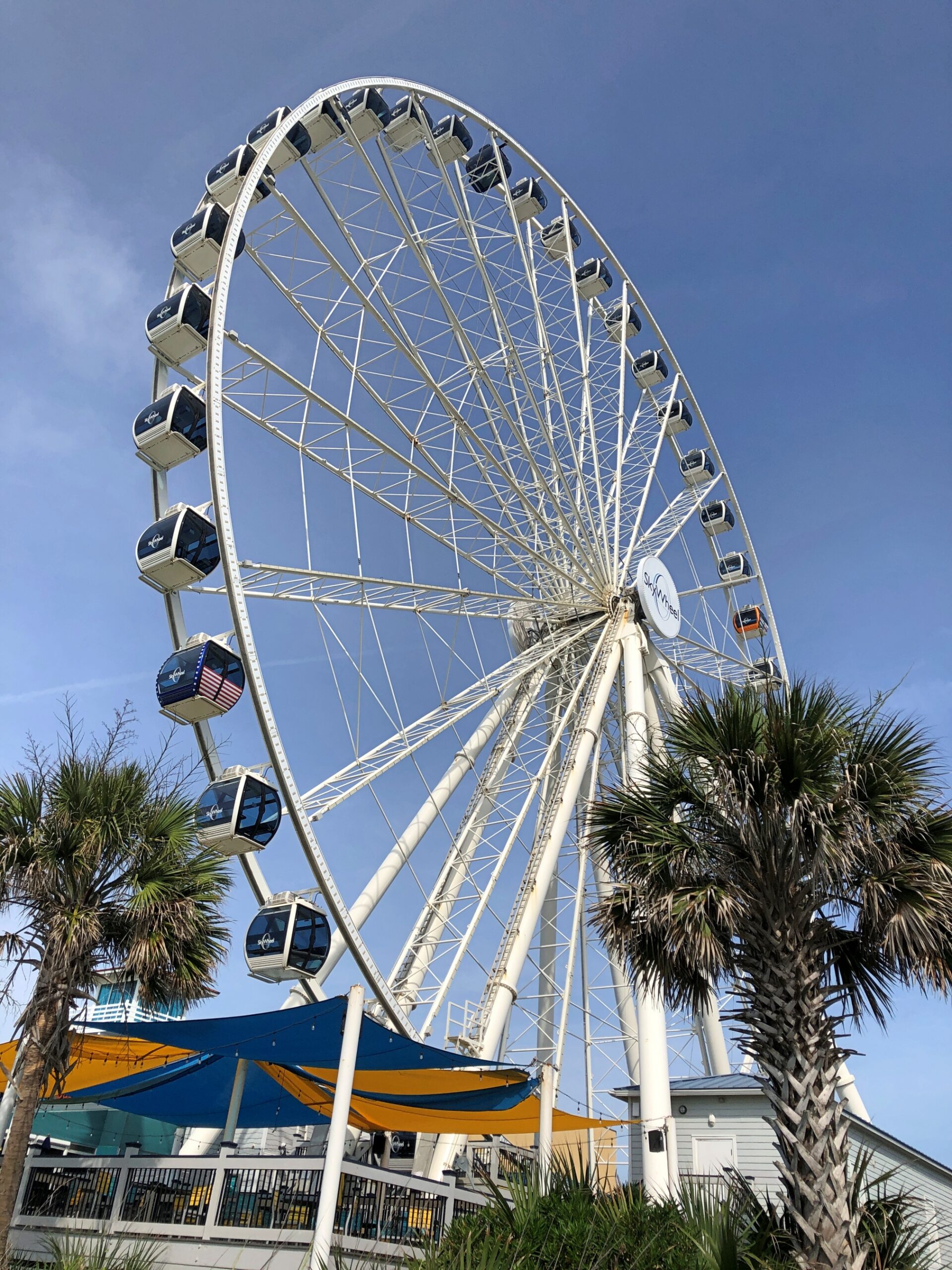
Any boardwalk with its salt is going to include a Ferris wheel in the vicinity. Officially, it’s the SkyWheel Myrtle Beach.
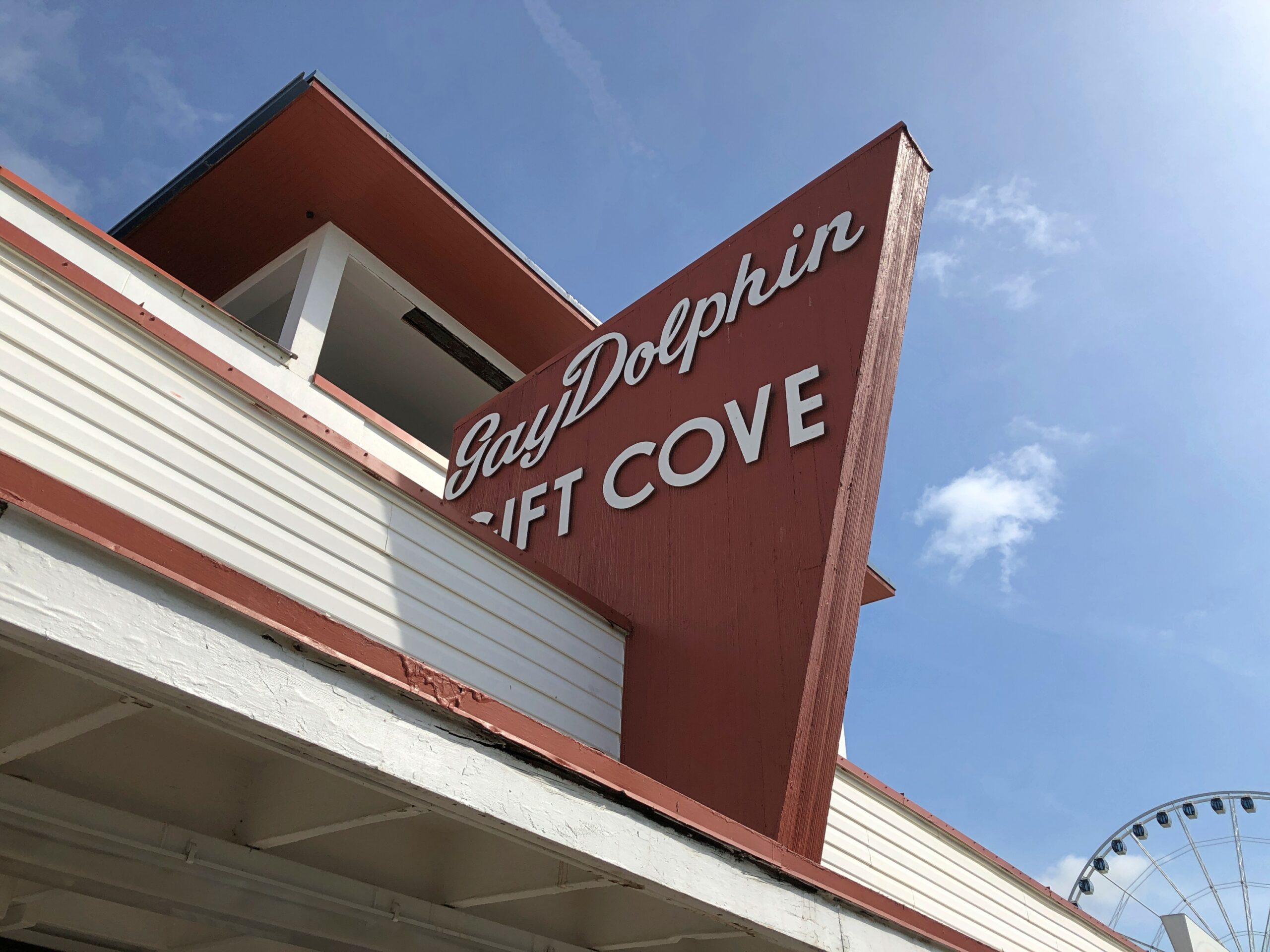
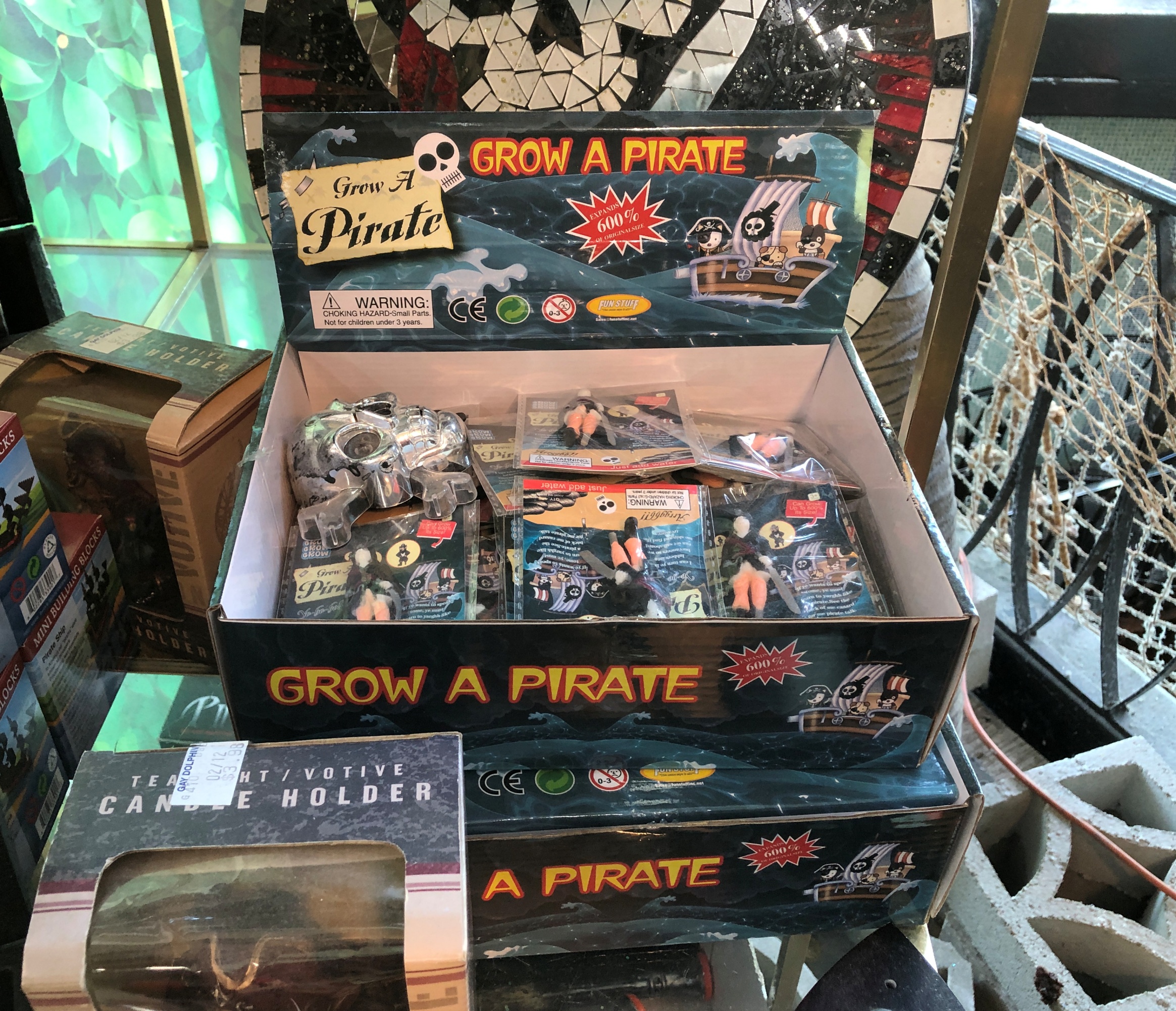
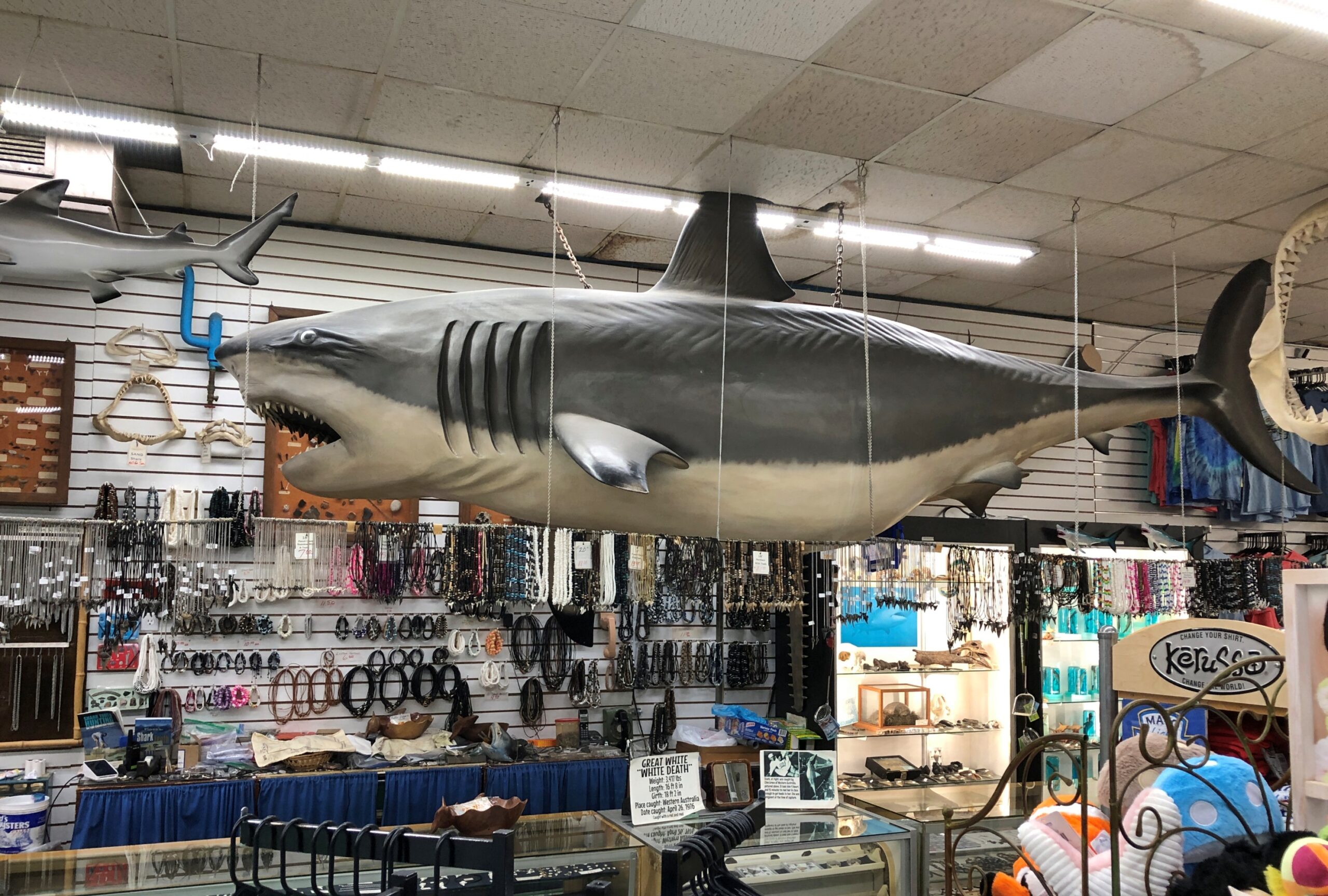
We decided that the $40+ for the two of us on the wheel would be better spent on lunch. It was, at tourist prices at a restaurant-bar open to the boardwalk, but not completely sky high. Then we found our way to the Gay Dolphin Gift Cove, whose fame preceded it. That is, I read about it online before the trip.
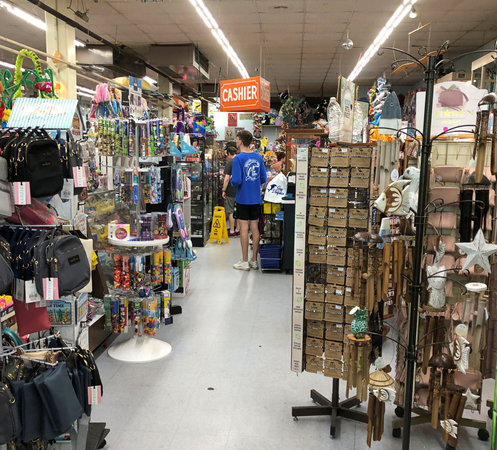
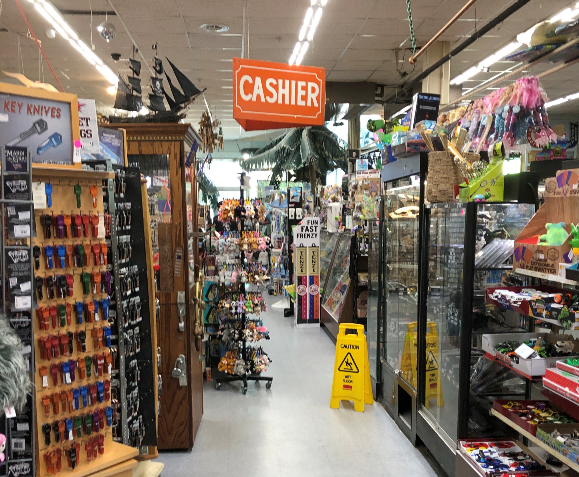
As a souvenir emporium, four stories stocked with gewgaws and gimcracks, the Gay Dolphin doesn’t disappoint. A store of that name has been on this site since 1946, though Hurricane Hazel destroyed the original in 1954, along with much of the rest of Myrtle Beach.
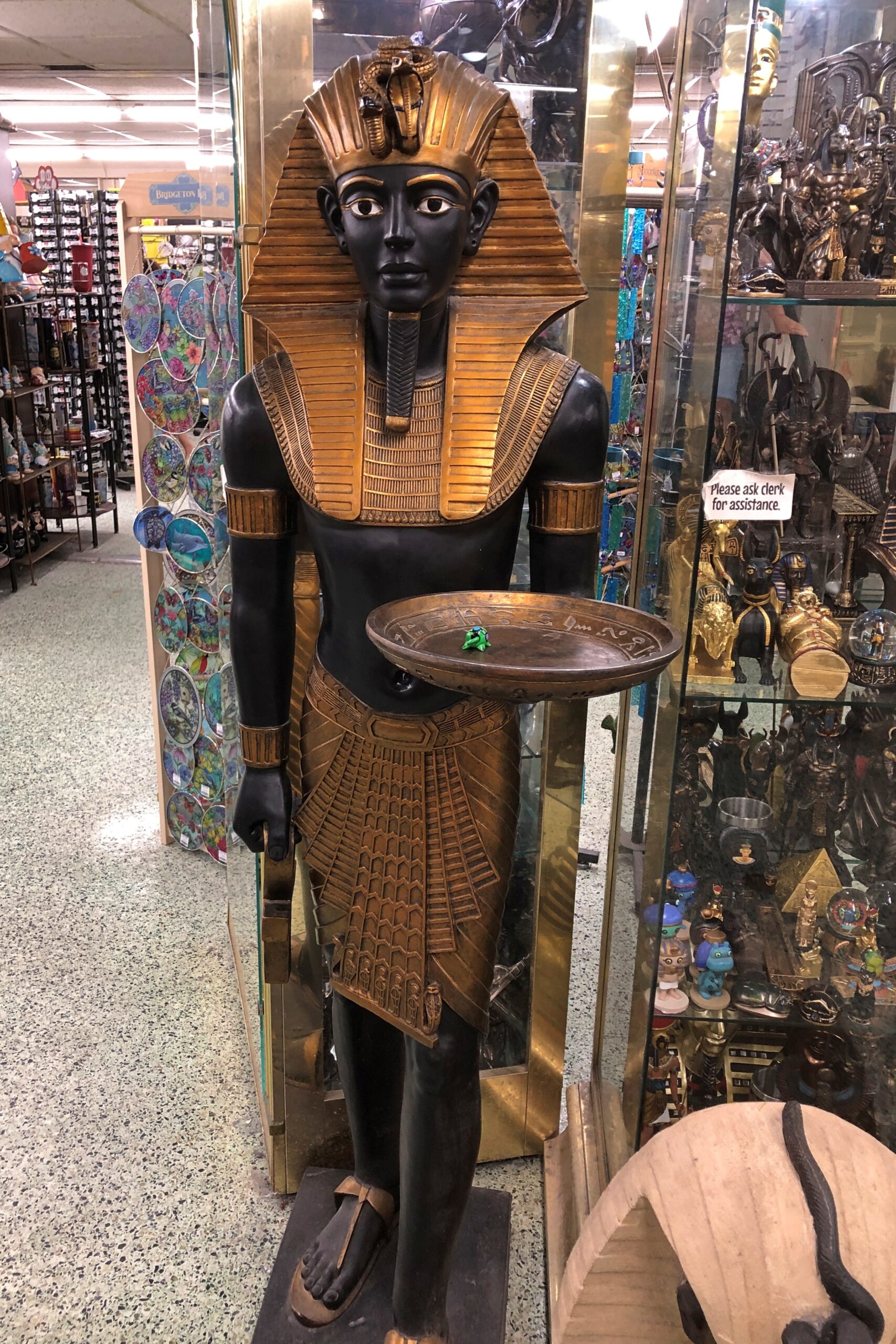
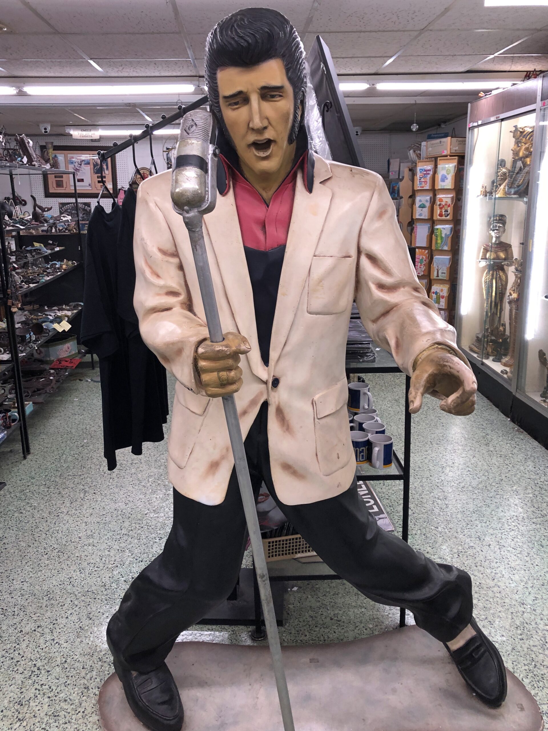
Things I never imagined would be for sale, or even exist, are for sale there.
Not just small items, either, but sizable ones. Maybe this shark is for sale. It must be, just at a price I’d never want to pay.
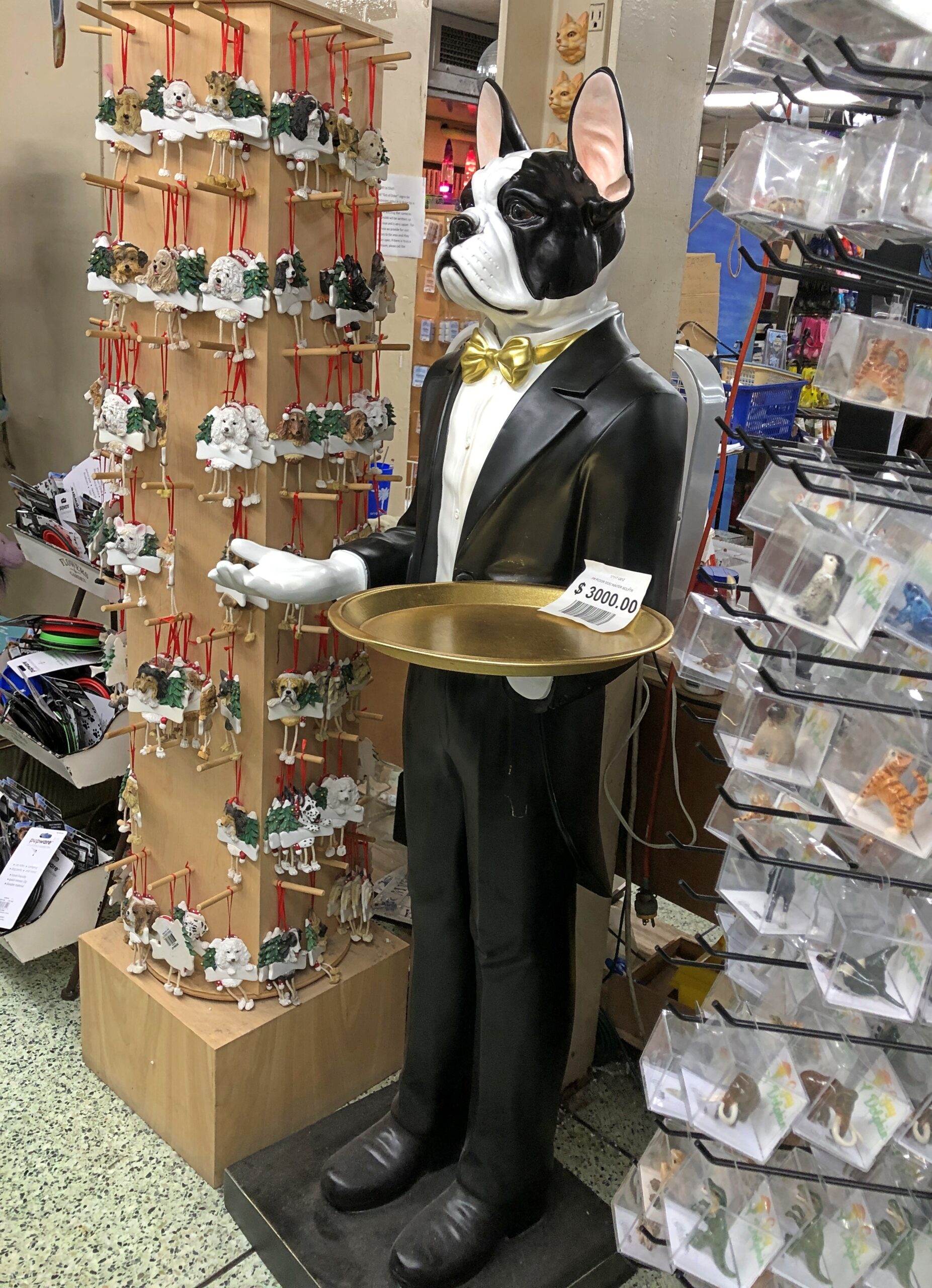
Same for these figures.
Looks like the list price for the man-dog in formal wear is $3,000. So yes, more than I’d care to pay. We weren’t much in the market for souvenirs anyway, but I will say this for the Gay Dolphin: it had a large rack of postcards. New cards, but also vintage, mid-century cards for all of 50 cents each. I bought a bunch. Good for you, Gay Dolphin.
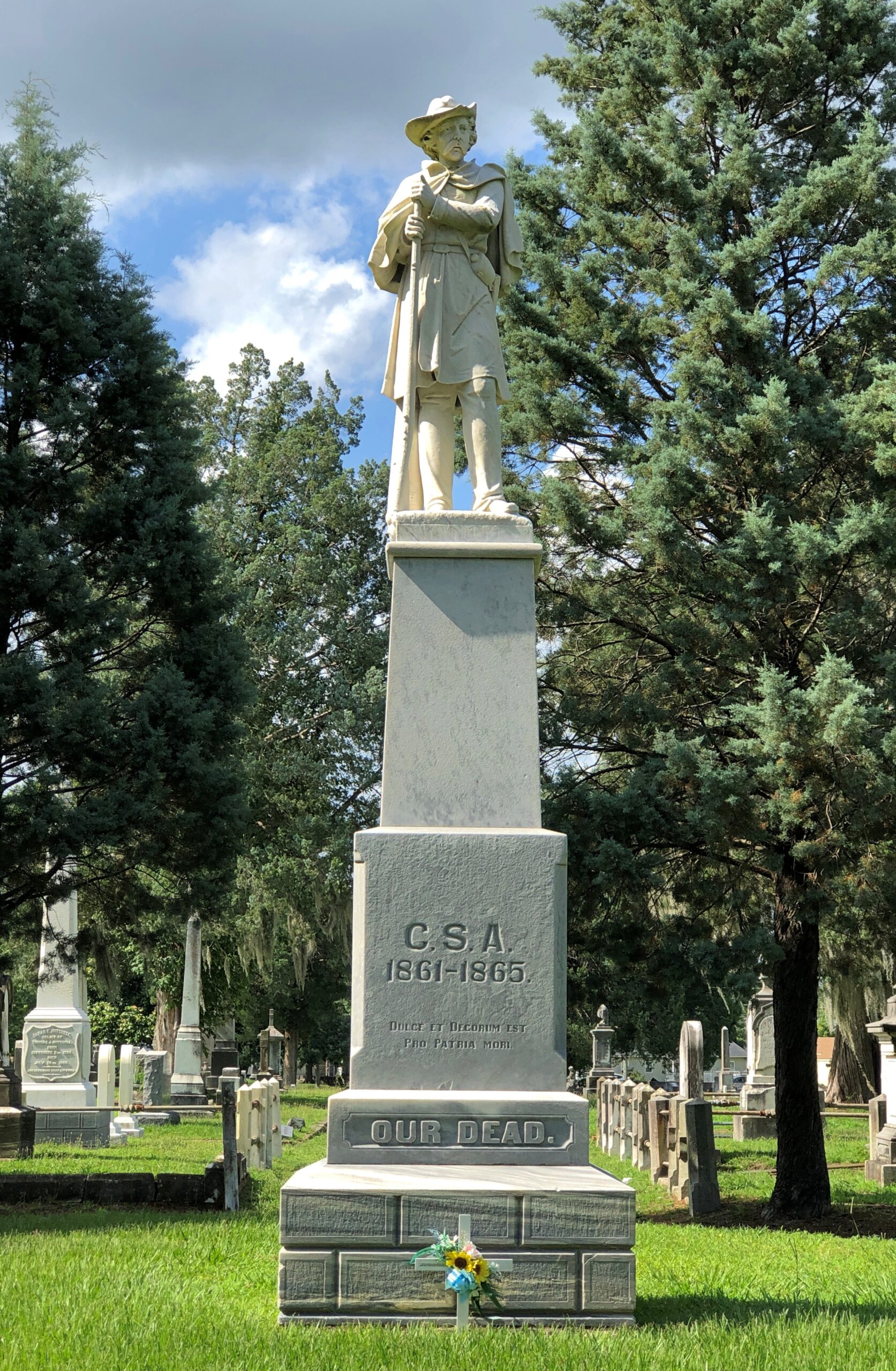
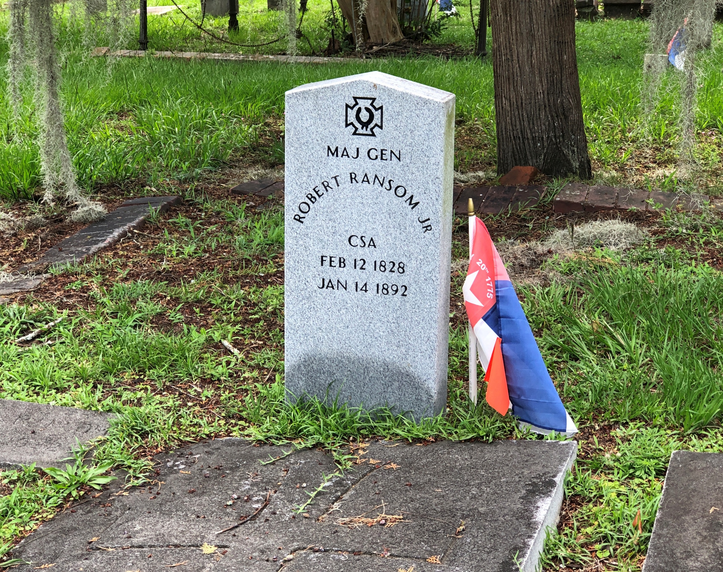
Back to the WPA North Carolina guide, vintage 1939 (p. 230): “Cedar Grove Cemetery… was opened in 1800 by the Episcopalians and turned over to the city in 1854… The Confederate Monument, a 15-foot marble shaft, identifies a mass Confederate grave. Tradition says that his law desk and chair were buried in this cemetery with the body of William Gaston. Interred here are William J. Williams, who pained the Masonic portrait of Washington owned by the Alexandria, Va., lodge, a photograph of which is in the New Bern Public Library, and Moses Griffin, benefactor of city schools.”
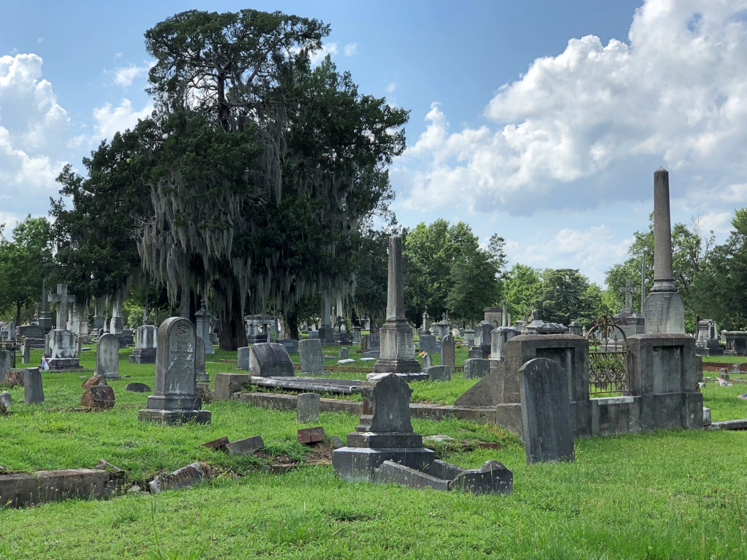
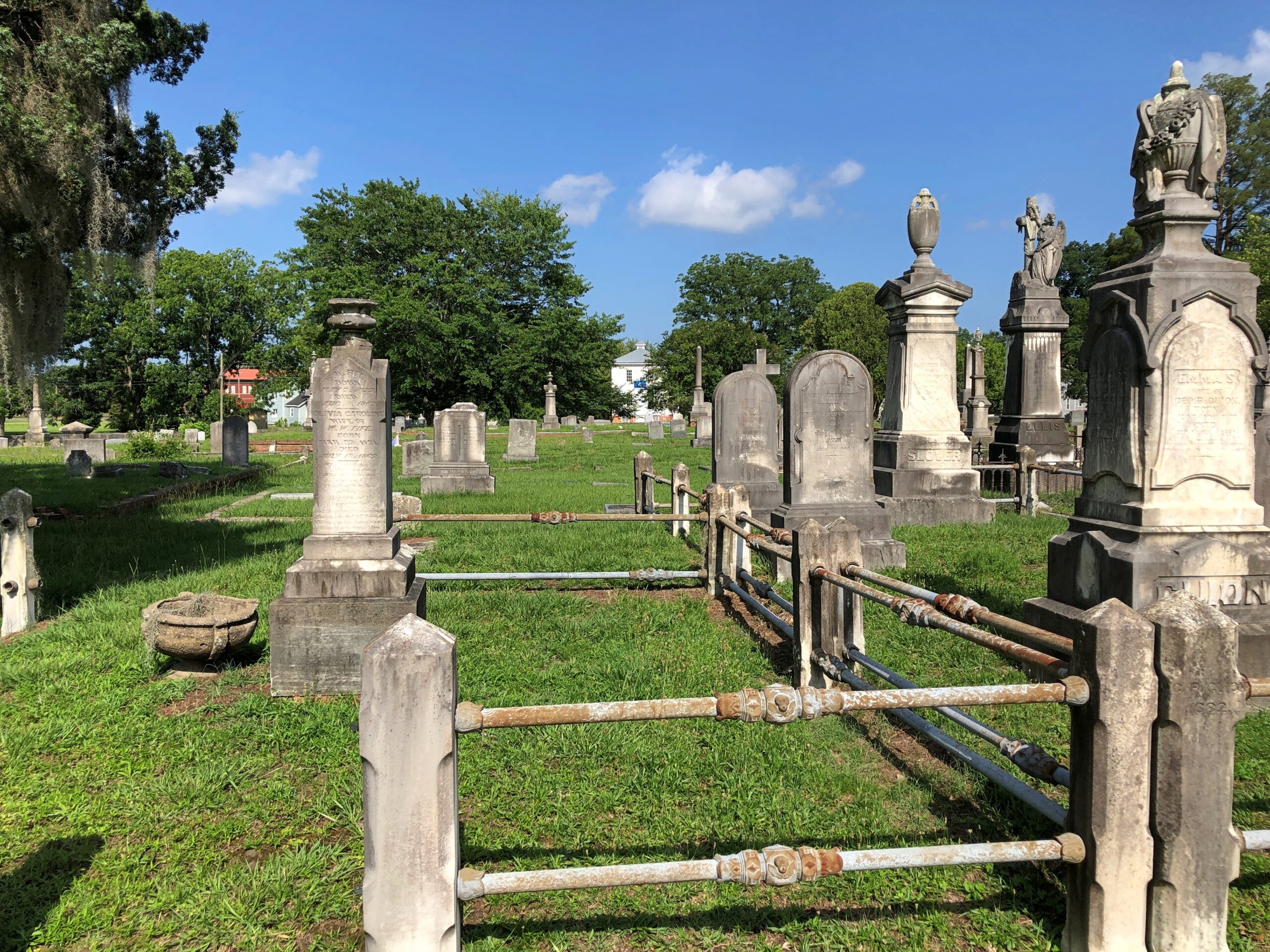
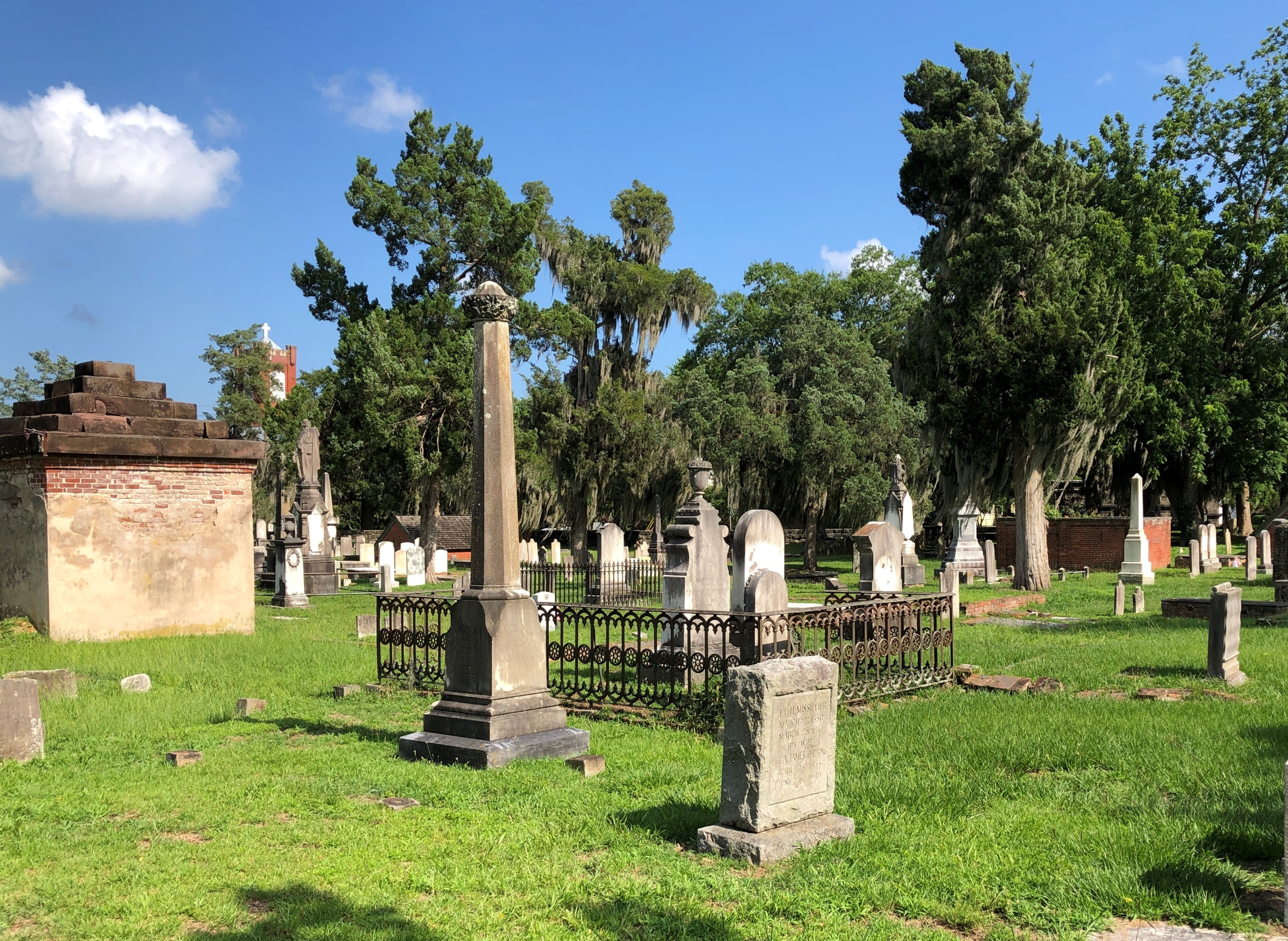
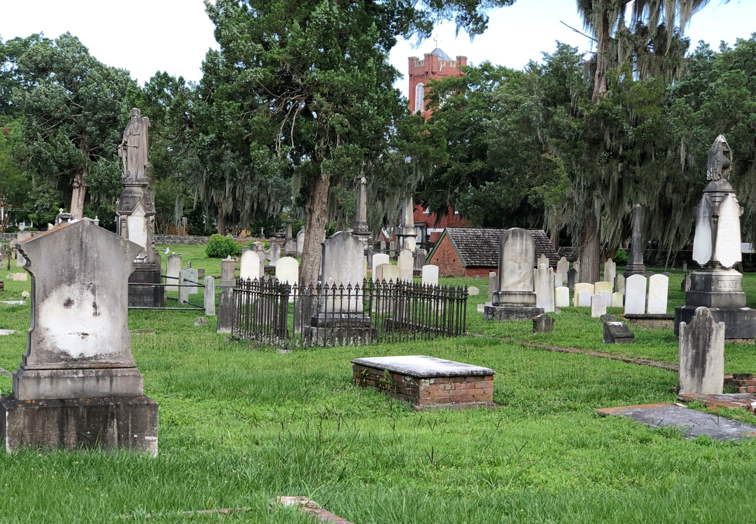
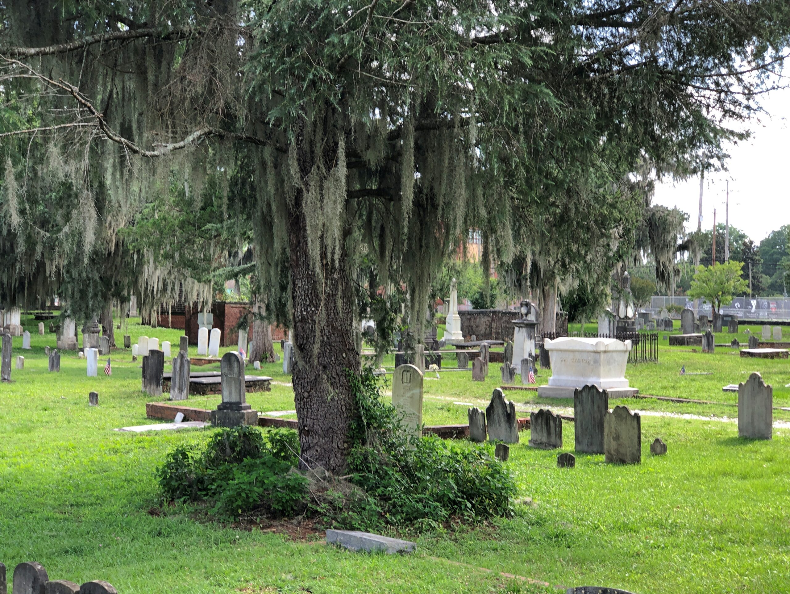
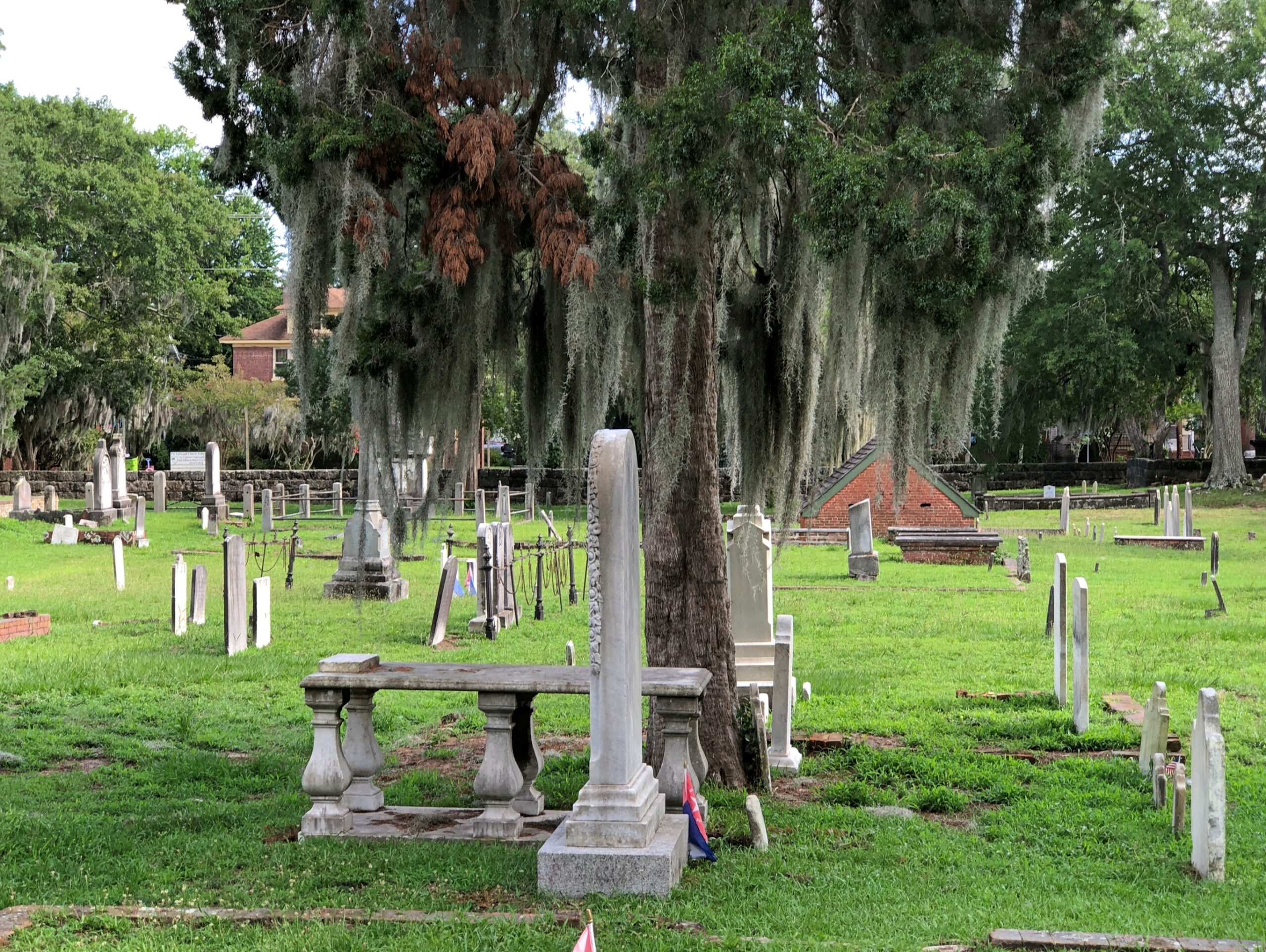
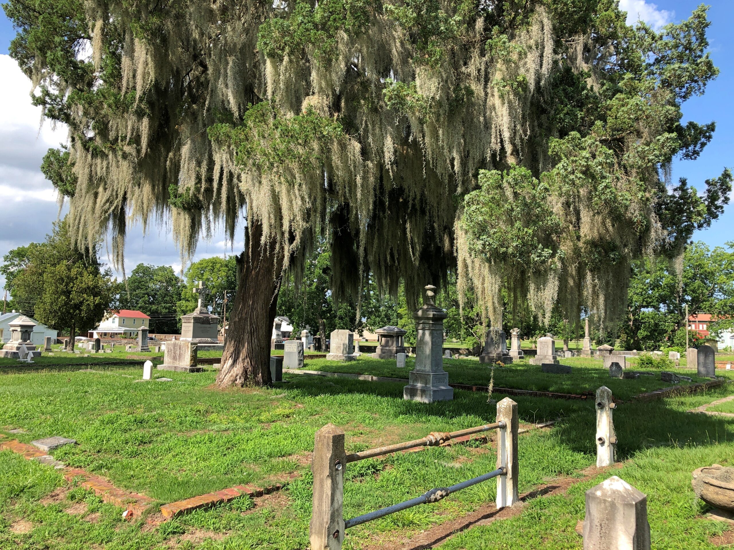
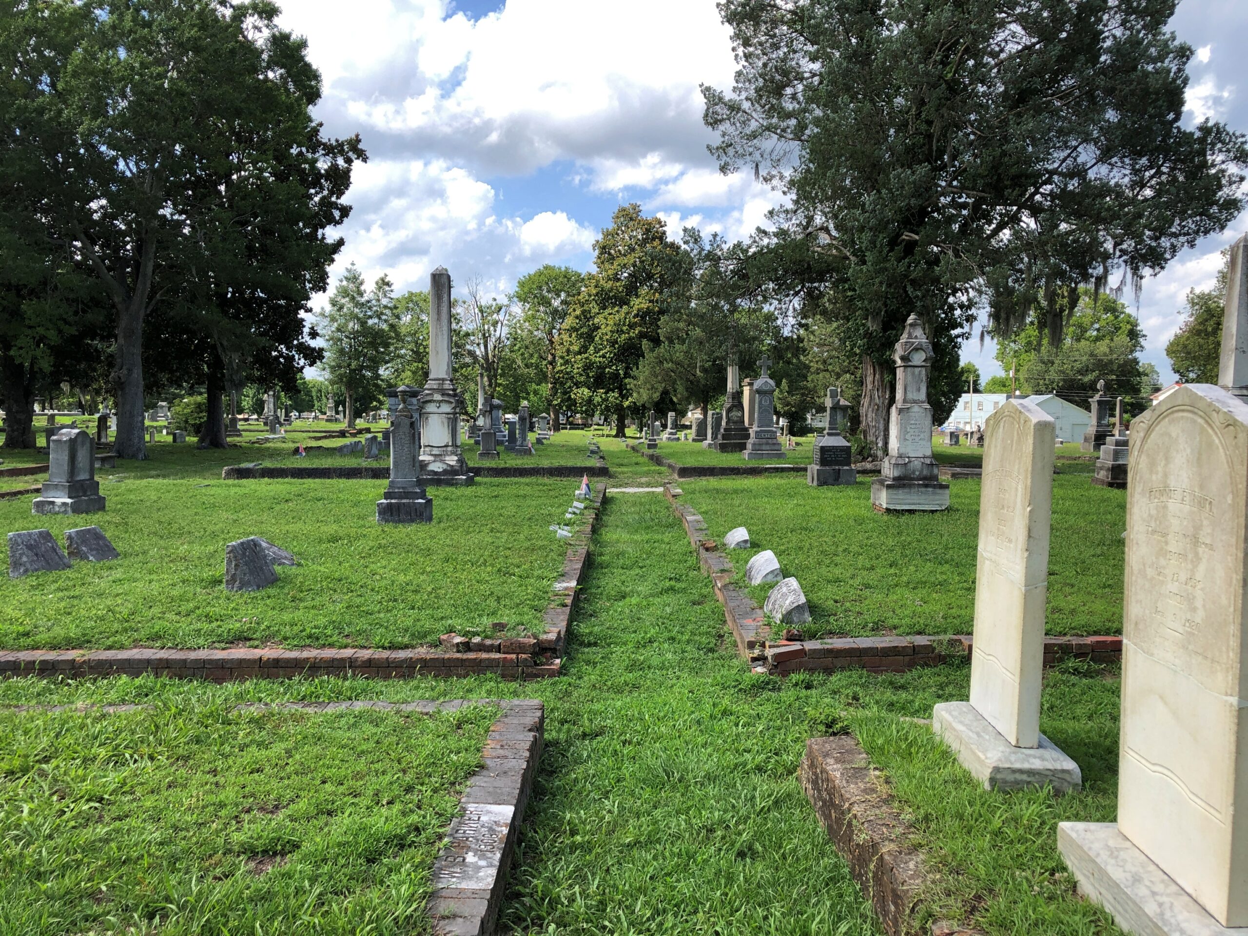
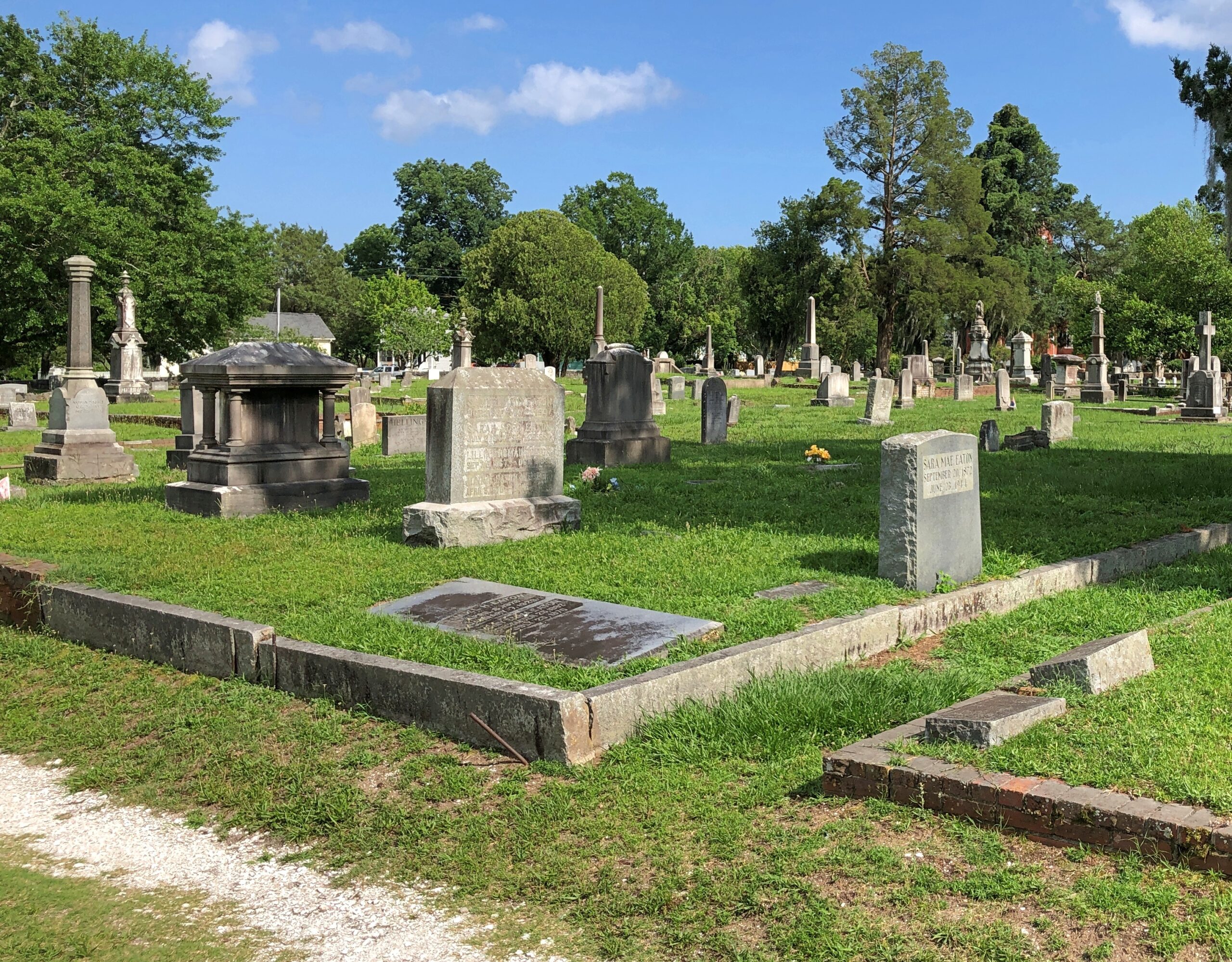
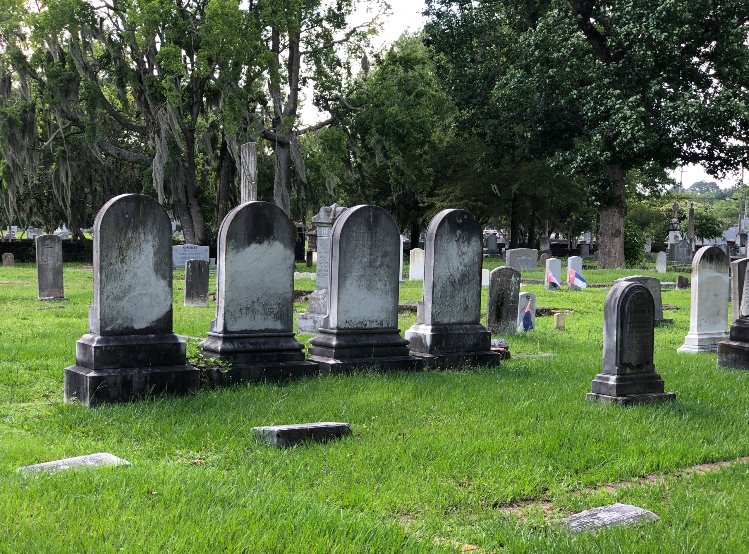
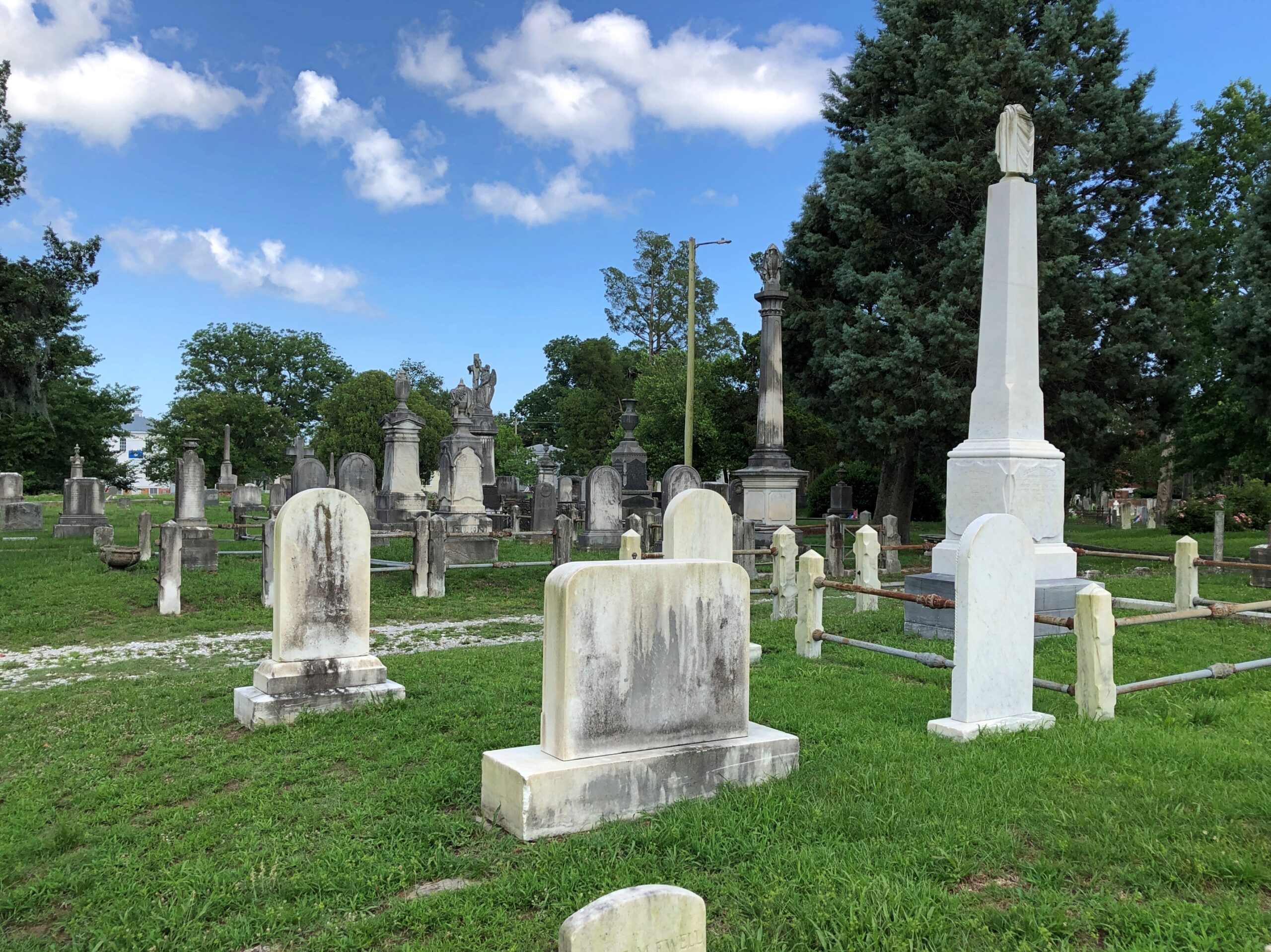
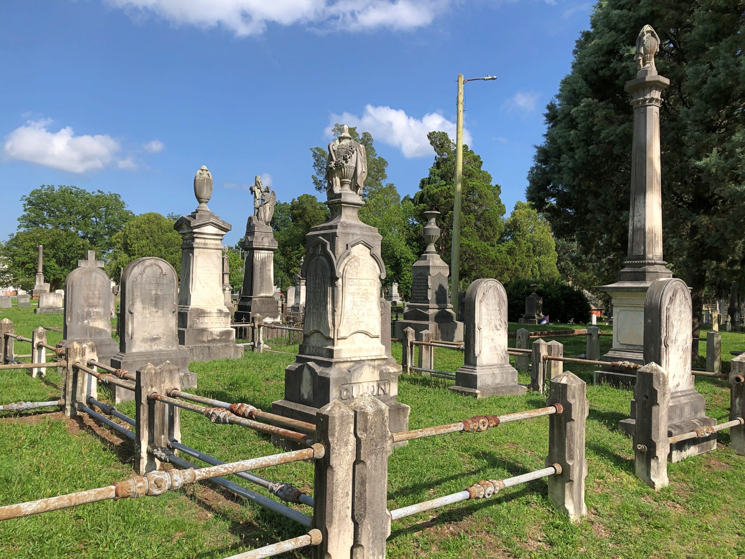
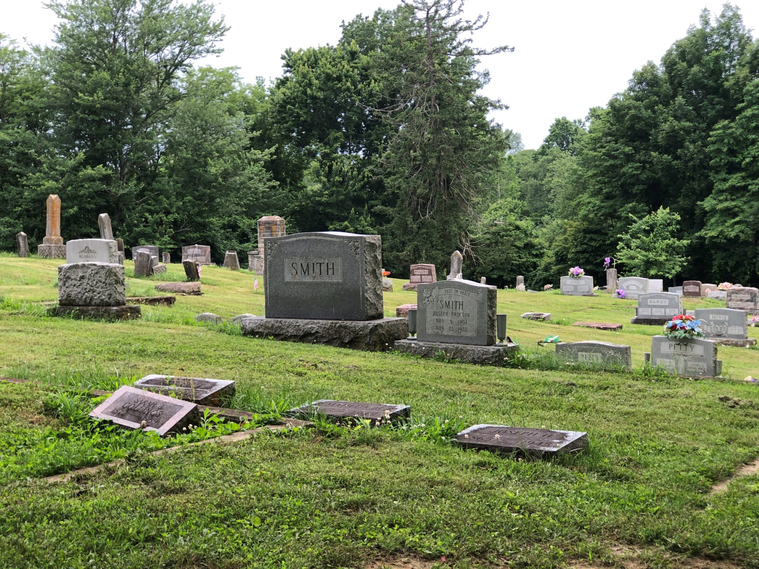
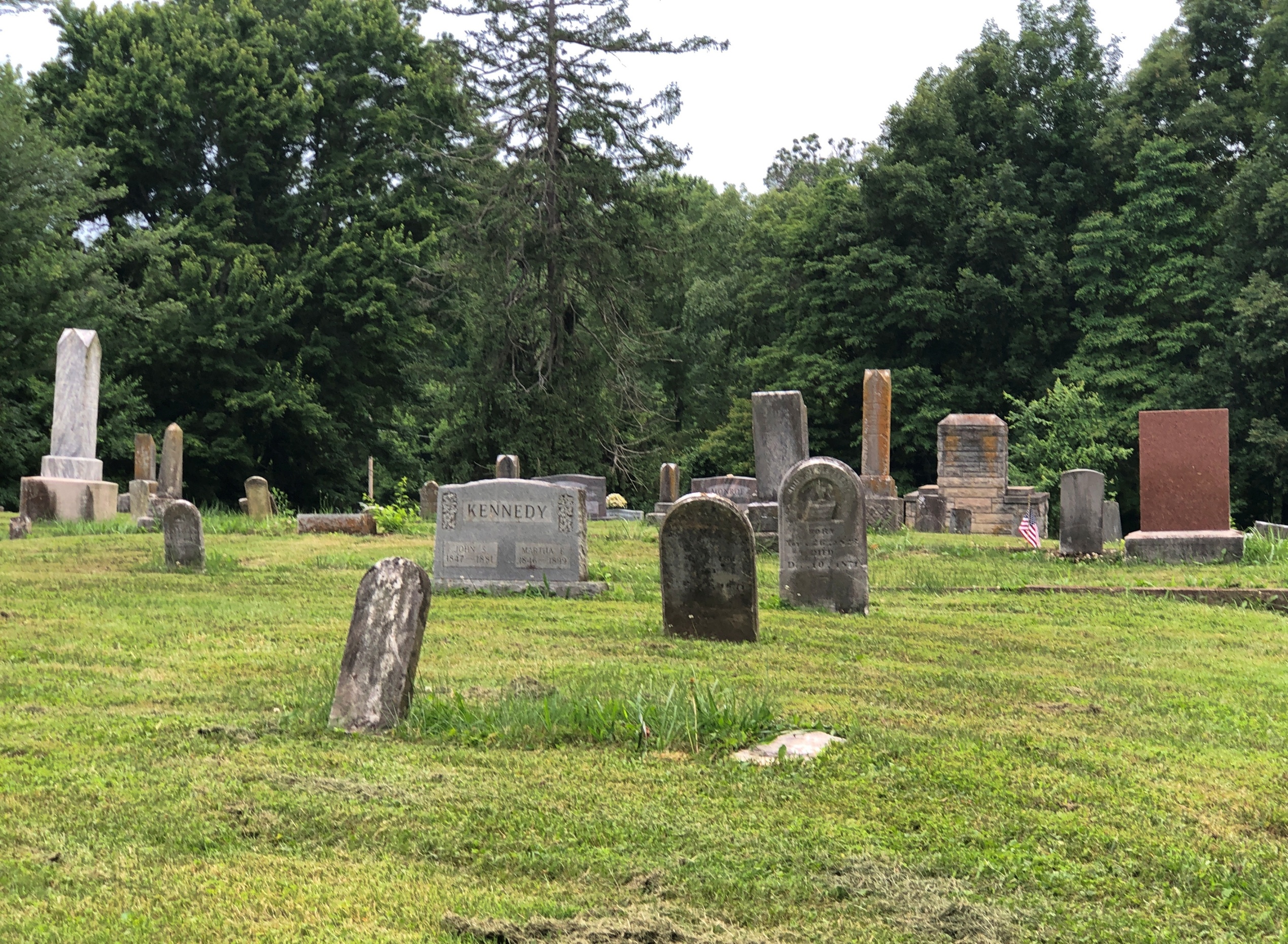
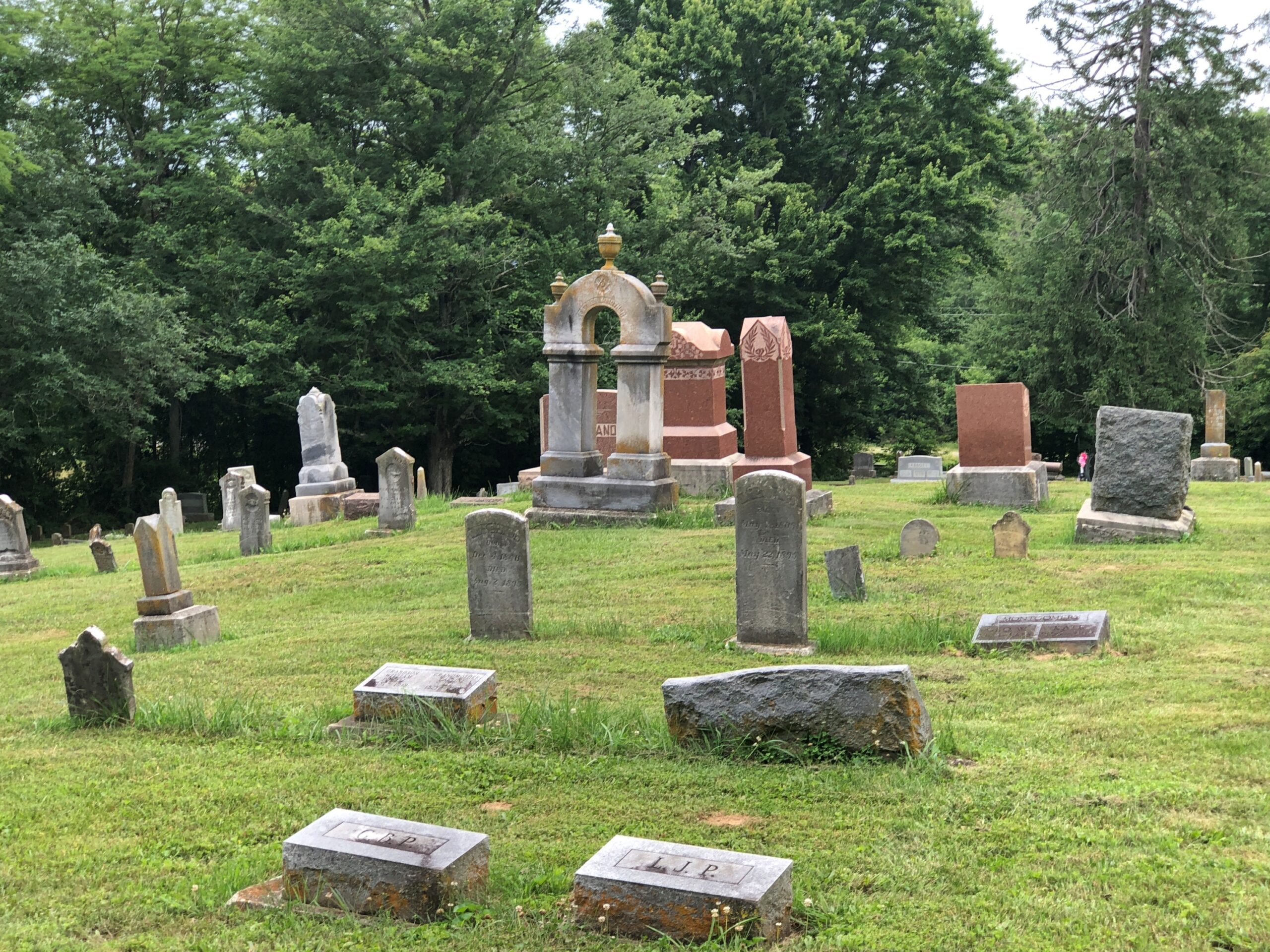
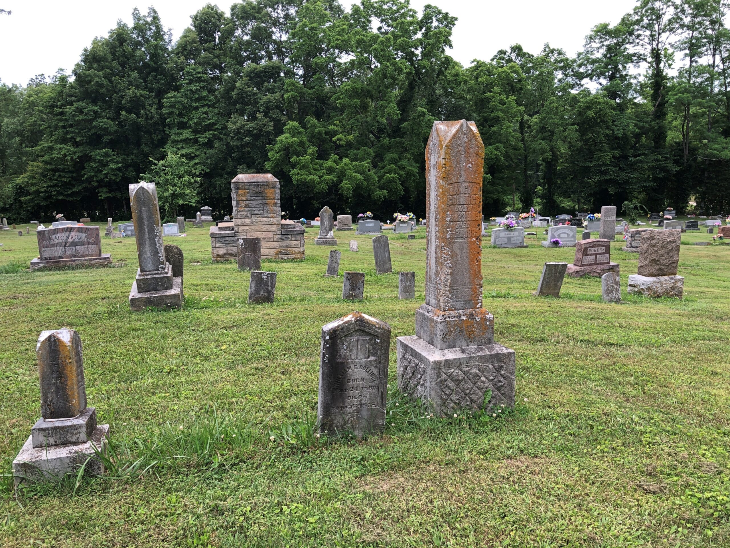
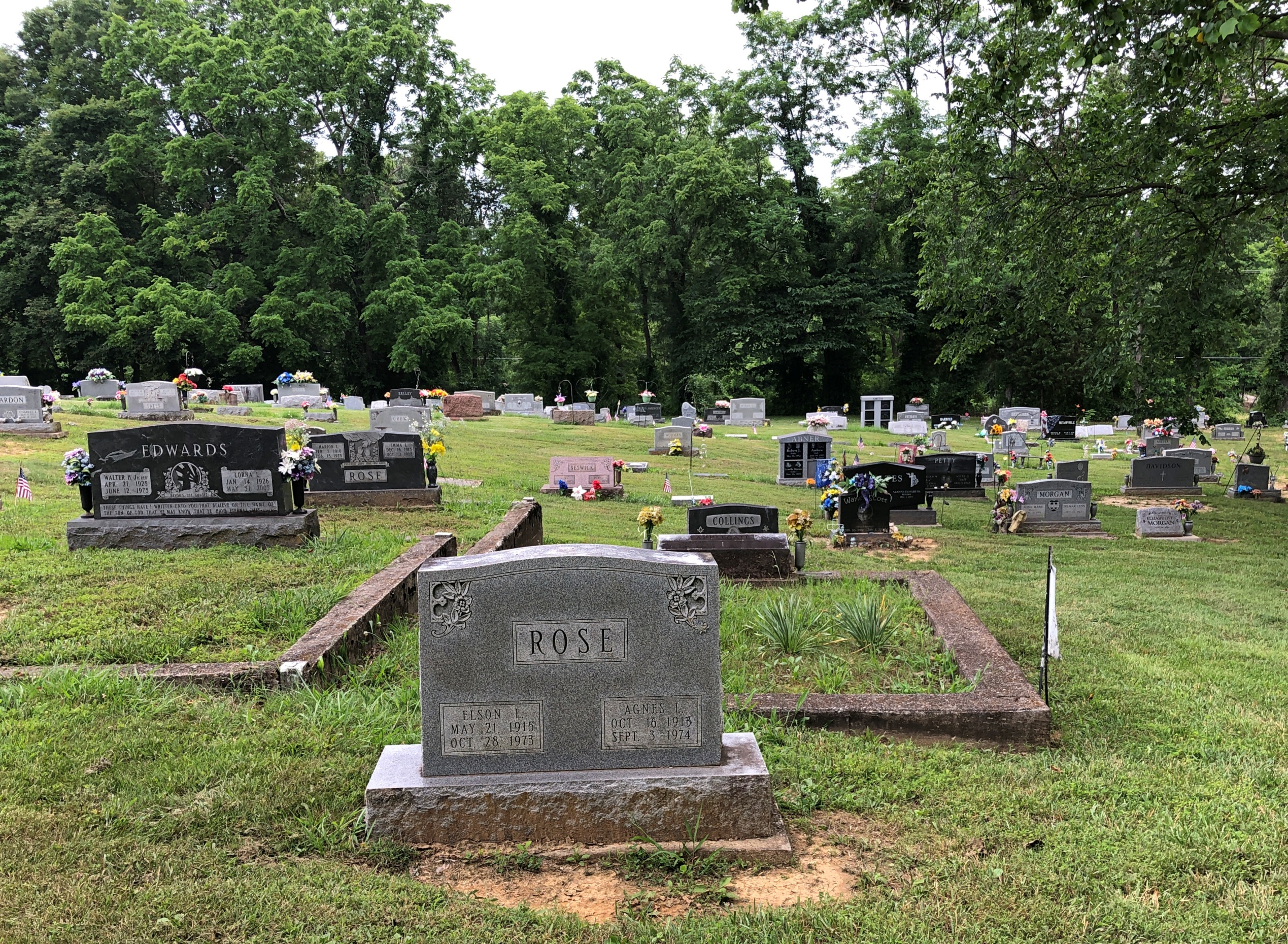
As the day’s heat began to wane, we made our way to Cedar Grove. The place has a good contour, created by the diversity of stones, ironwork and greenery.
All in all, Cedar Grove is a Southern cemetery along the lines of Magnolia Cemetery in Charleston or Bonaventure in Savannah, though not quite as watered as the former or wooded as the latter, or as large as either. But cut from the same sort of lush, low-lying coastal territory, with trees draped with Spanish moss and flat spots thick with stones of the Old South.
Good old Spanish moss. The Carolina coast, and even up into coastal Virginia, is within its range.
Didn’t see the painter William J. Williams or any of the other permanent residents mentioned by the WPA guide, but of course the Confederate Monument was easy enough to spot.
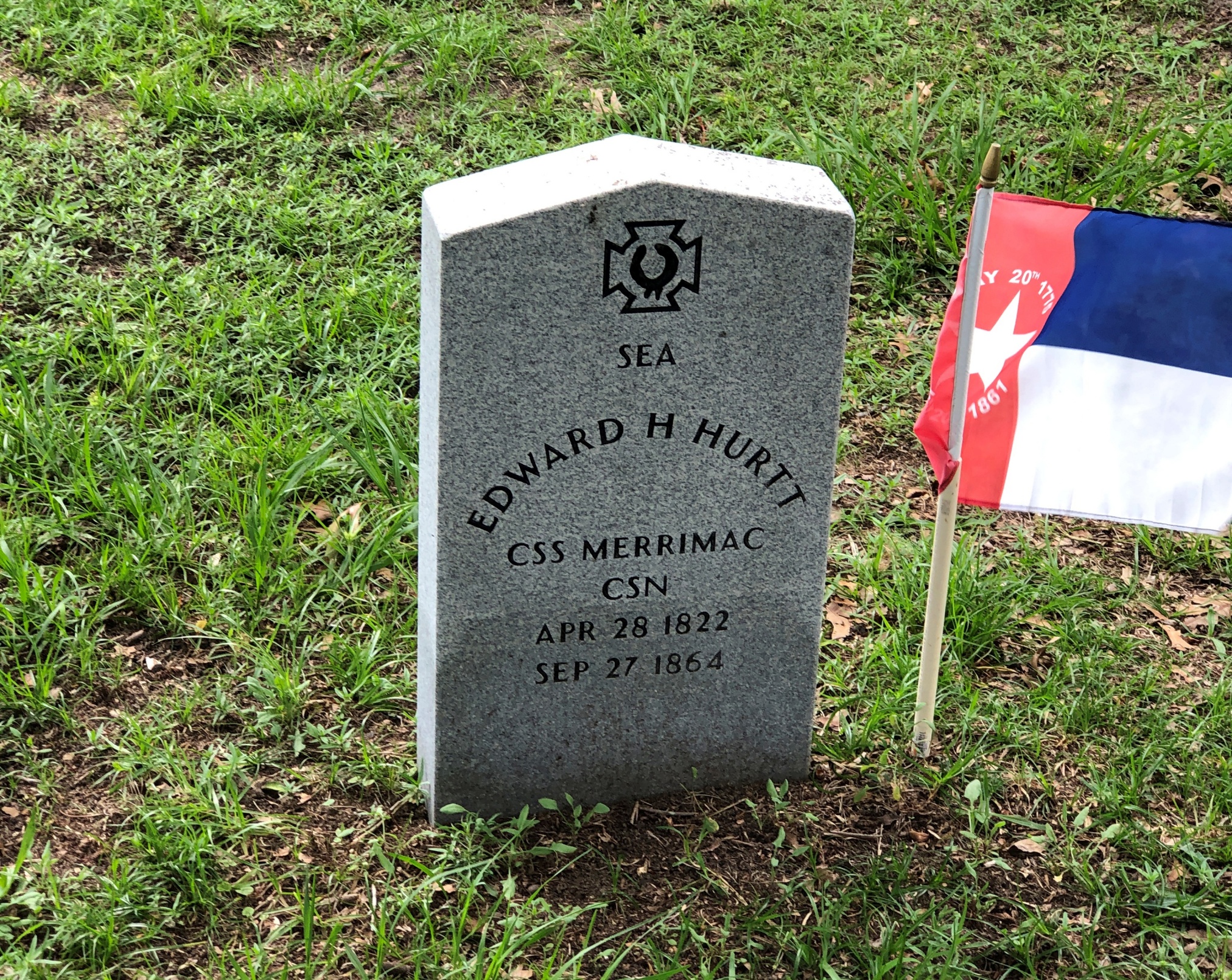
Many Confederate veterans had their own stones, of course.
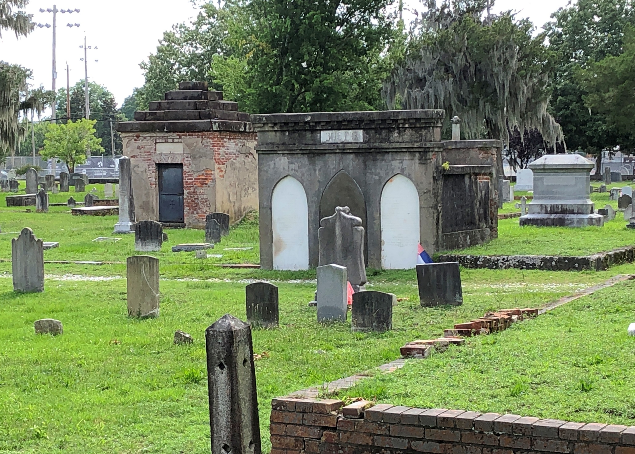
From the looks of it, these are wagon driveways that allowed hearses to traverse the cemetery.
Among those “streets,” plenty of other fine stones.
Some mausoleums, but none of the monumental ilk you see in places historically with more money.
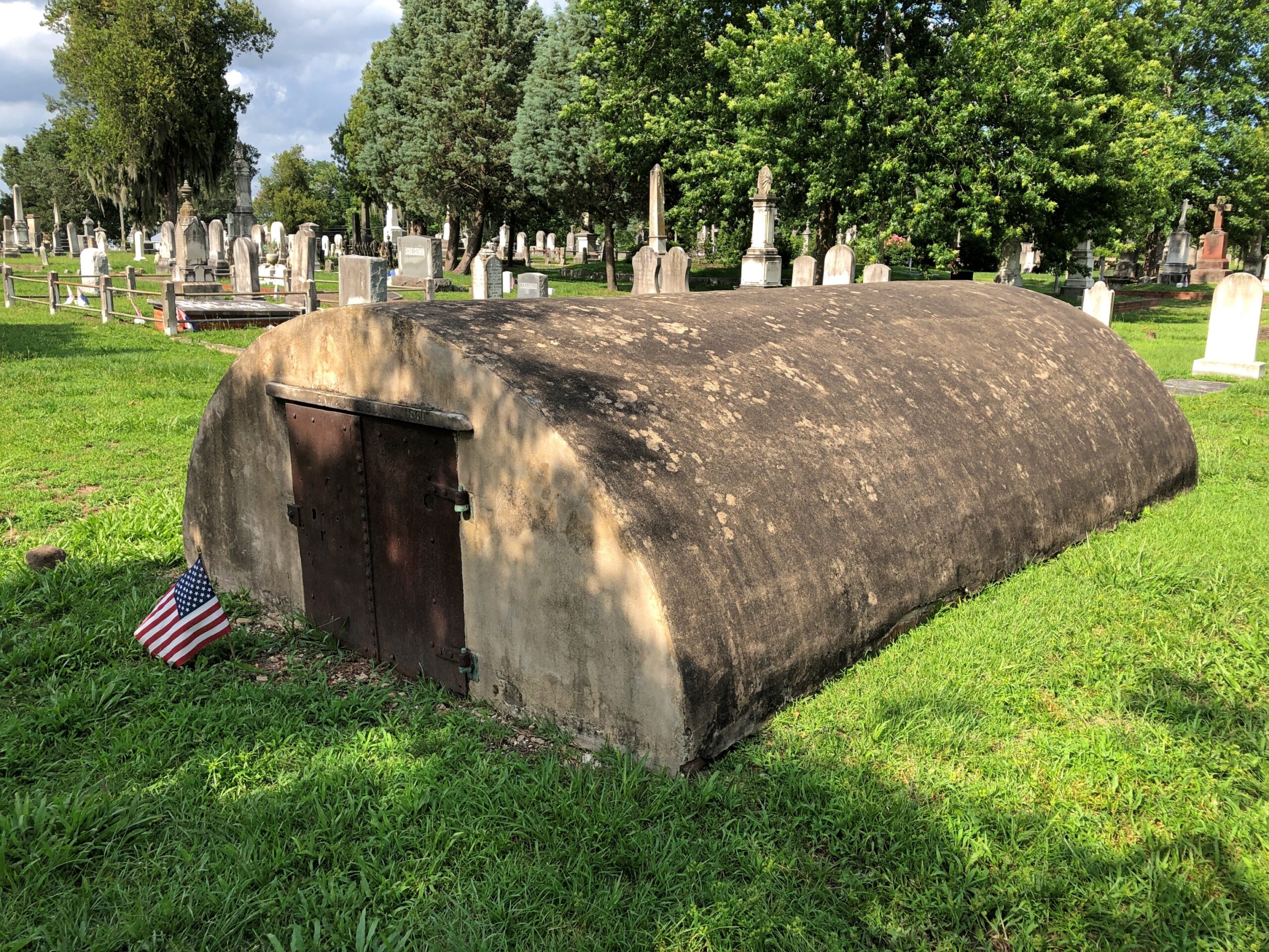
The last one is a little unusual, though I think I’ve seen similar structures occasionally here and there. Going for that concrete Quonset hut look, though considering its age, I’d bet that reference would be anachronistic.
While waiting to be seated for brunch on Middle Street in downtown New Bern on Juneteenth, Dan and I had time for a stroll. The day was warming up, but not quite to a scorcher, and the sidewalks along Middle and Pollack Sts. are often in shade. That part of New Bern, shady and old, is quite the charmer.
“New Bern, one of North Carolina’s oldest towns, retains the flavor of past centuries,” North Carolina: A Guide to the Old North State (1939), p. 221, tells us. Information from the WPA Guide series is of course a little old, but mostly stands the test of time.
“The community, which processes a domestic architecture of charm and distinction, is spread across a bluff at the confluence of the Neuse and Trent rivers, 35 miles from the Atlantic Ocean. Massive brick townhouses, stately Georgian residences and wisteria-curtained clapboard cottages line narrow streets shadowed by oaks, poplars, elms and pecan trees. Many of the old streets retain their original brick pavements.”
All that would be downtown New Bern these days, as the town’s population – given as 11,981 by the WPA in 1939 – had expanded to 31,291 by 2020, according to the Census Bureau. So much of the town is actually late 20th-early 21st-century sprawl punctuated by parking lots and familiar retail.
Still, at the historic core, there is “domestic architecture of charm and distinction,” even now, with the older buildings mostly occupied by the likes of The Black Cat Shoppe, Faulkenberry Auctions, Anchored in New Bern (gift shop), Carolina Creations, Bear City Fudge Co., Curls & Lace Bridal Hair, and such restaurants as Cypress Hall, MJ’s Raw Bar and Grille, and Baker’s Kitchen, where we eventually brunchified (and it was delicious).
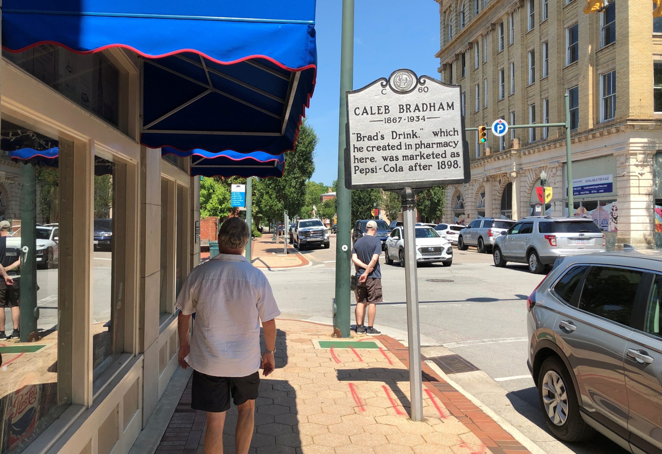
We visited a few shops and strolled by other spots, such as the former corner drug store credited as the invention-place of Pepsi-Cola.
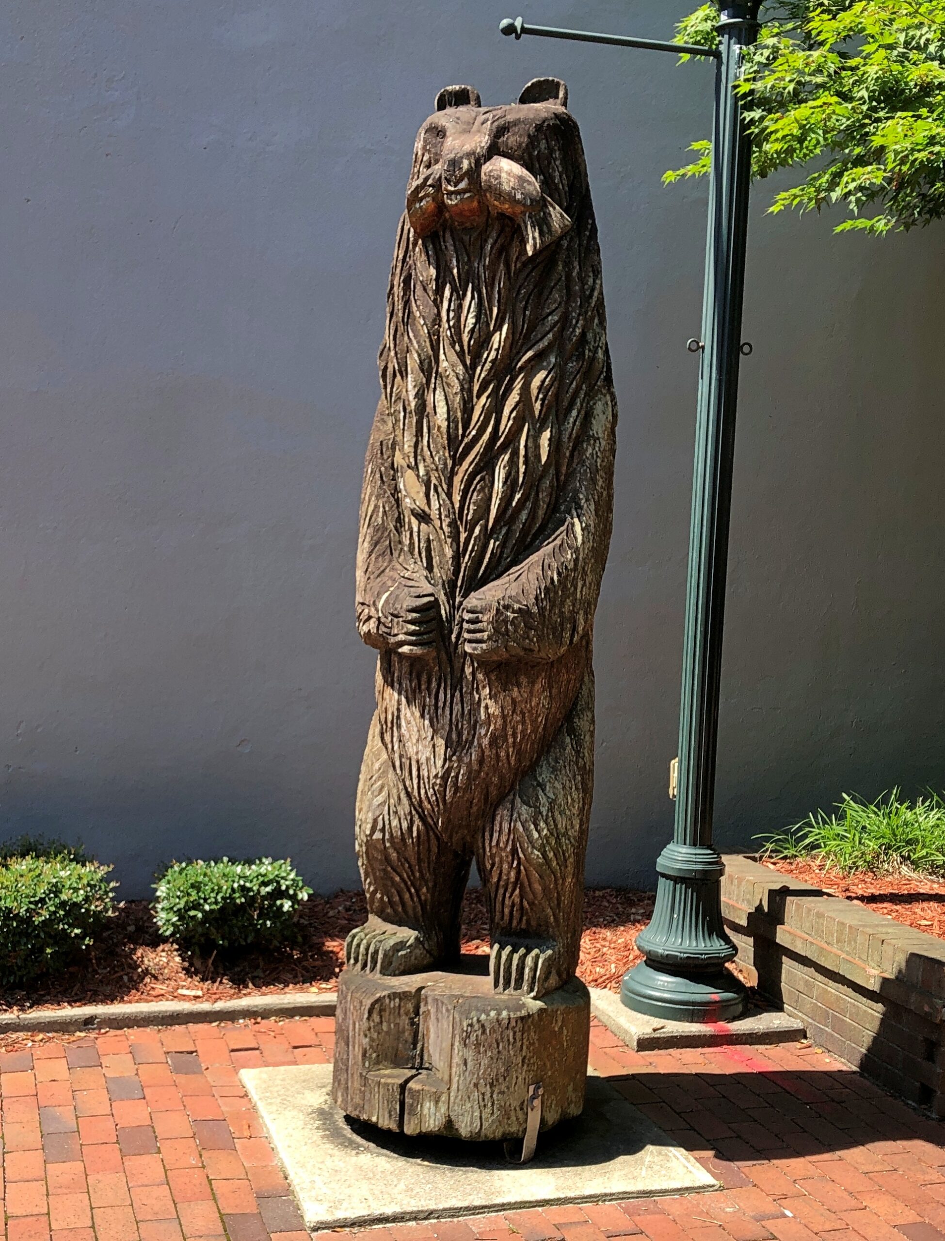
A pleasant alley off Middle St. is known as Bear Plaza. Good thing living bears aren’t found there, but you are reminded of bears.
Bears are front and center as pawed, powerful symbols of the Bern towns, old and new, Swiss and American. As posted previously, the New Bern flag –
— looks a lot like the old Bern flag, with certain small but important modifications. Old Bern:
The WPA guide points out that the very first European settlers in the area were not in fact Swiss, though led by a Swiss. The colonists were German and had a harrowing experience getting here.
“The first settlers were survivors of an expedition of 650 German Palatines, Protestants expelled from Baden and Bavaria. Under the leadership of Swiss Baron Christopher de Graffenried, and aided by a gift of £4000 from Queen Anne of England, this group planned a colony in America. De Graffenried placed Christopher Gale and John Lawson in charge of the expedition.
“In January 1710, two ships sailed from Gravesend, England. Storms impeded the vessels and disease ravaged the voyagers, more than half of whom succumbed. A French vessel captured one of the transports as it entered Chesapeake Bay in April, and plundered the colonists. Fever further reduced the number and only a sickly remnant reached the Chowan River, where Thomas Pollock, a wealthy planner, provided them with transport to the Neuse and Trent rivers.”
De Graffenreid himself came a little later with some Swiss colonists, buying land from the Lords Proprietors of Carolina and paying off the local Tuscarora Indian chief as well. The natives were not mollified, however.
“In September 1711, the settlement was almost wiped out by a Tuscarora uprising. In the first attack, 80 settlers were slain. Lawson and de Graffenreid were taken to the Indian fort, Nohoroco, where Lawson was tortured to death, and de Graffenreid was held prisoner for six months. The war raged intermittently for two years, and the colonists were reduced such desperation that in 1713 many of them returned with de Graffenreid to Switzerland. The settlement made a new start on the leadership of Colonel Thomas Pollock, proprietary governor…”
Just one damn thing after another in early America. But the town survived, eventually becoming important enough to be the capital of North Carolina, as detailed yesterday.
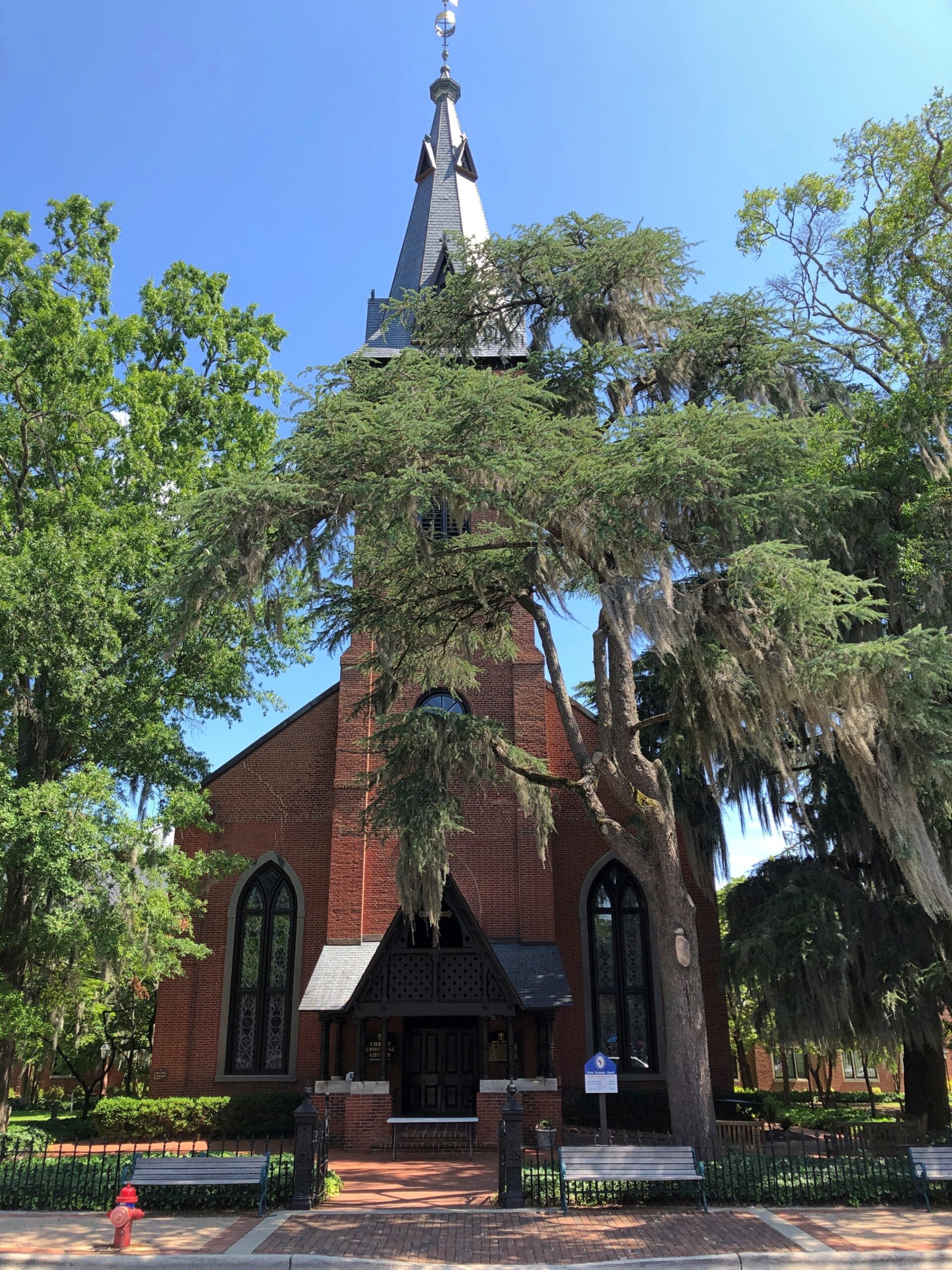
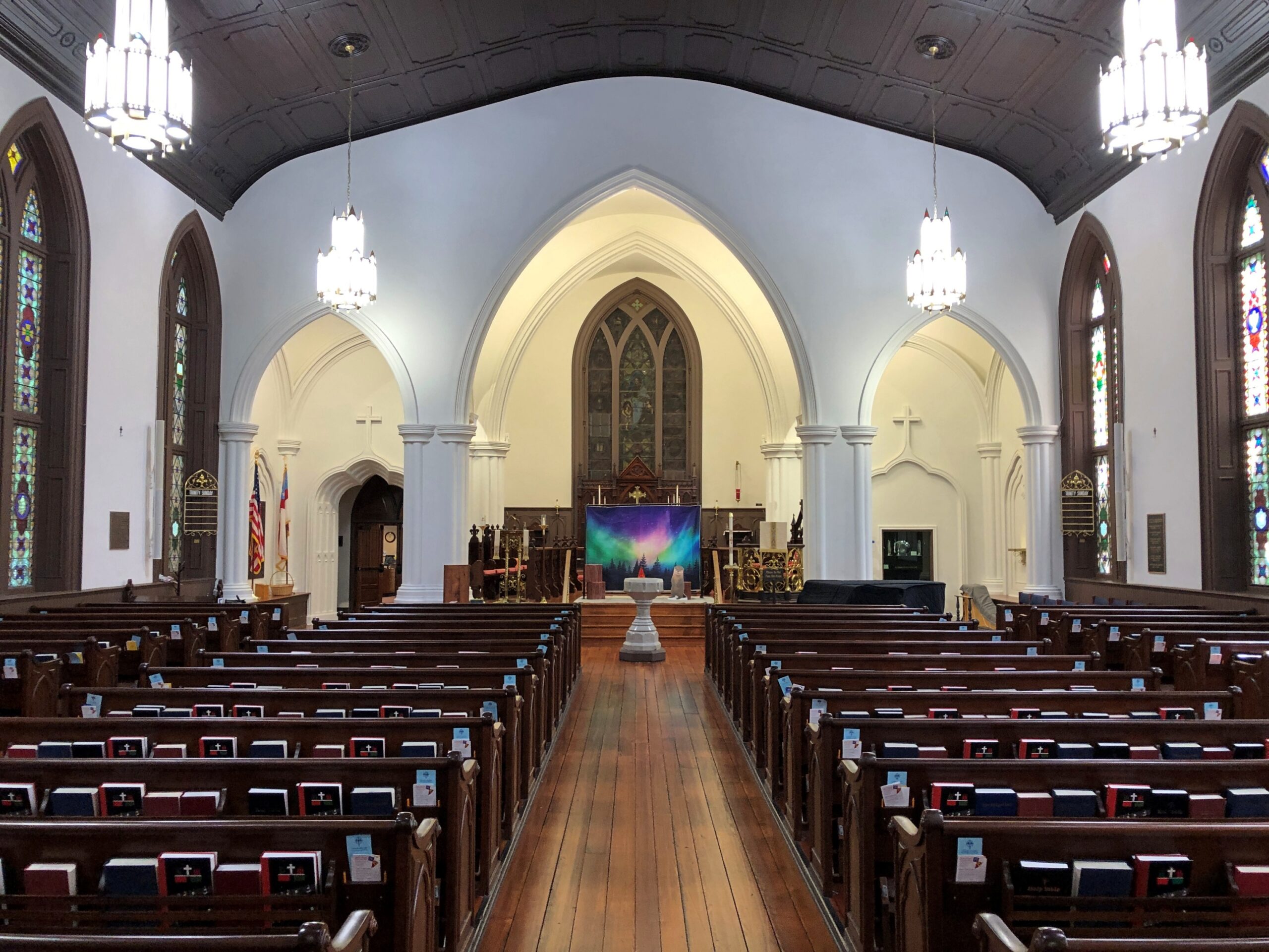
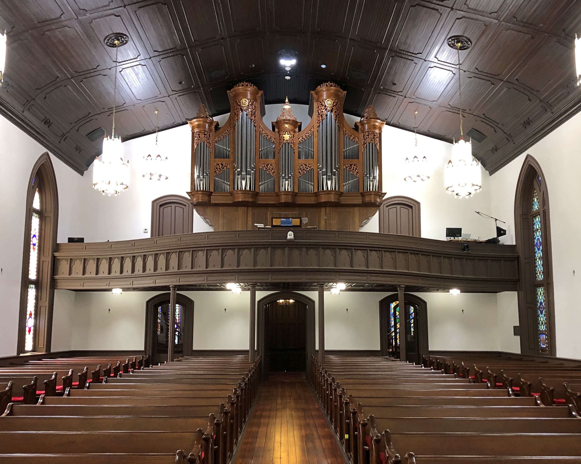
Christ Church Episcopal rises above Pollock St.
Other churches clustered in the area, but Christ Church had the advantage of being open that weekday and holiday morning.
Back to the WPA guide, p. 228, on Christ Church: “[At the] NE corner Pollock and Middle streets, a weathered red brick edifice whose lofty, gold-crowned spire rises above great trees shading an old graveyard, was erected in 1873 upon the site of two earlier churches. The parish was organized in 1715 the first church was built in 1750. A Bible, Book of Common Prayer and silver communion service given by George II are retained, though royal Governor Martin attempted to take them with him when he fled town in 1775.
“When Parson Reed, the royalist rector, prayed for the king, lads prompted by patriot parents drummed at the door and shouted ‘Off with his head!’ This church was razed during the Revolution, reputedly because the brick had been brought from England. [Sounds like a likely story.] The second church was erected in 1825. Its outer walls were used for construction of the present building. In a corner of the churchyard fence, with its muzzle embedded in the ground, is the the Lady Blessington Cannon taken from the British ship Lady Blessington, captured in the Revolution.”
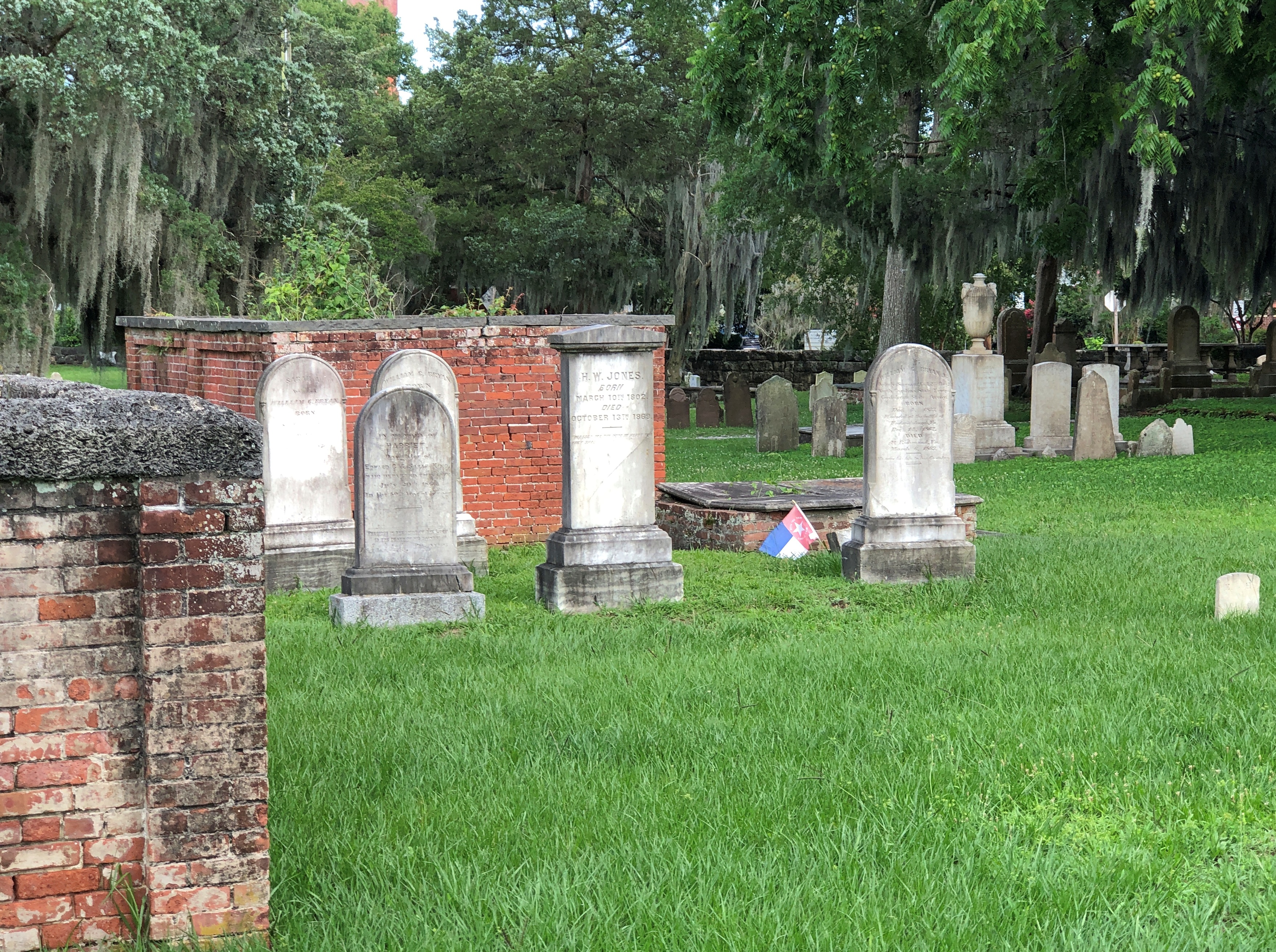
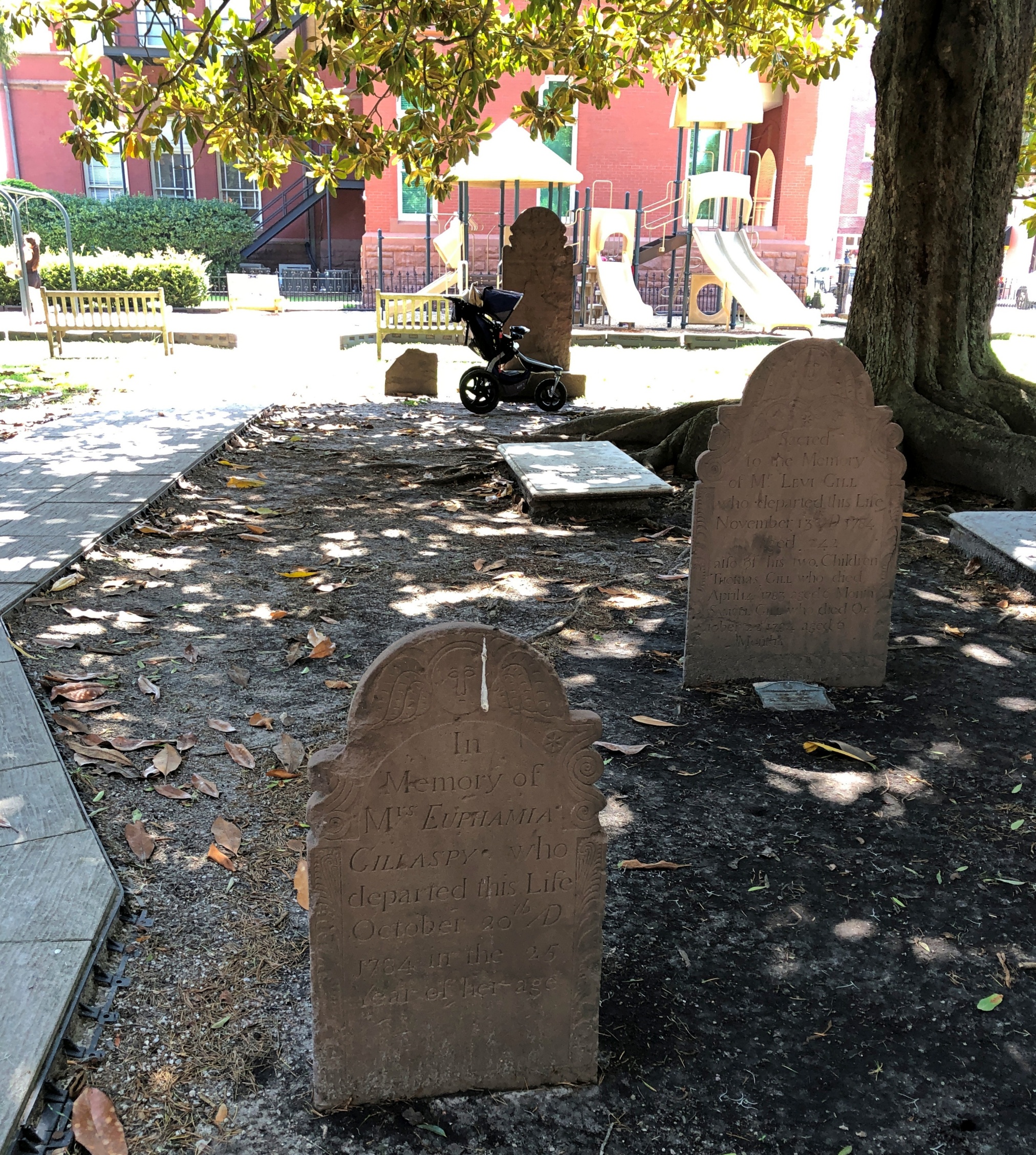
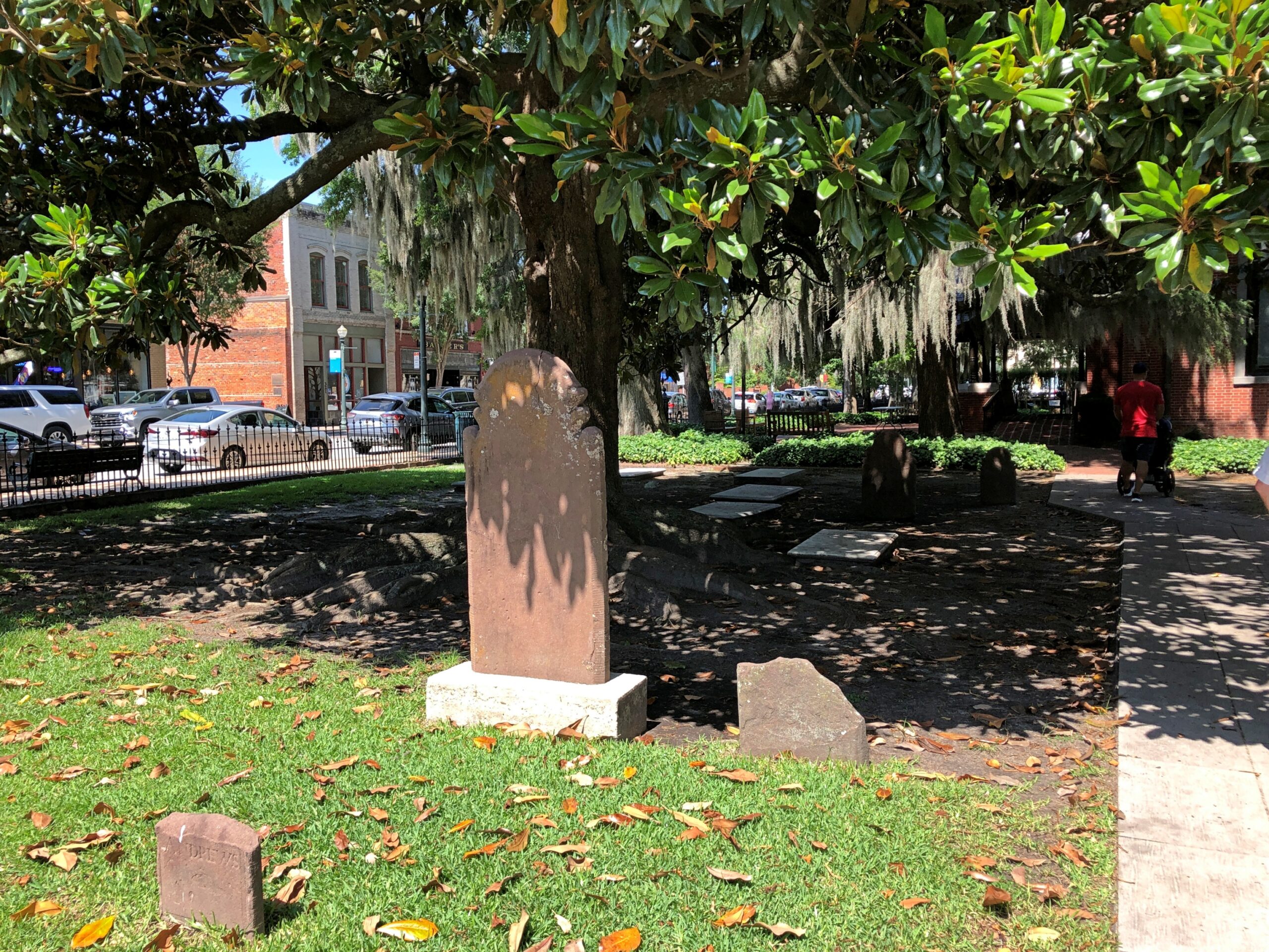
We didn’t see any embedded cannon, but on church land outside the Christ Church building were a cemetery and a playground. Not a combination you see much, but maybe there should be more places like that to remind us that the the arc of a lifespan is all too brief.
It’s a handsome Southern church burial yard, complete with magnolias and Spanish moss.
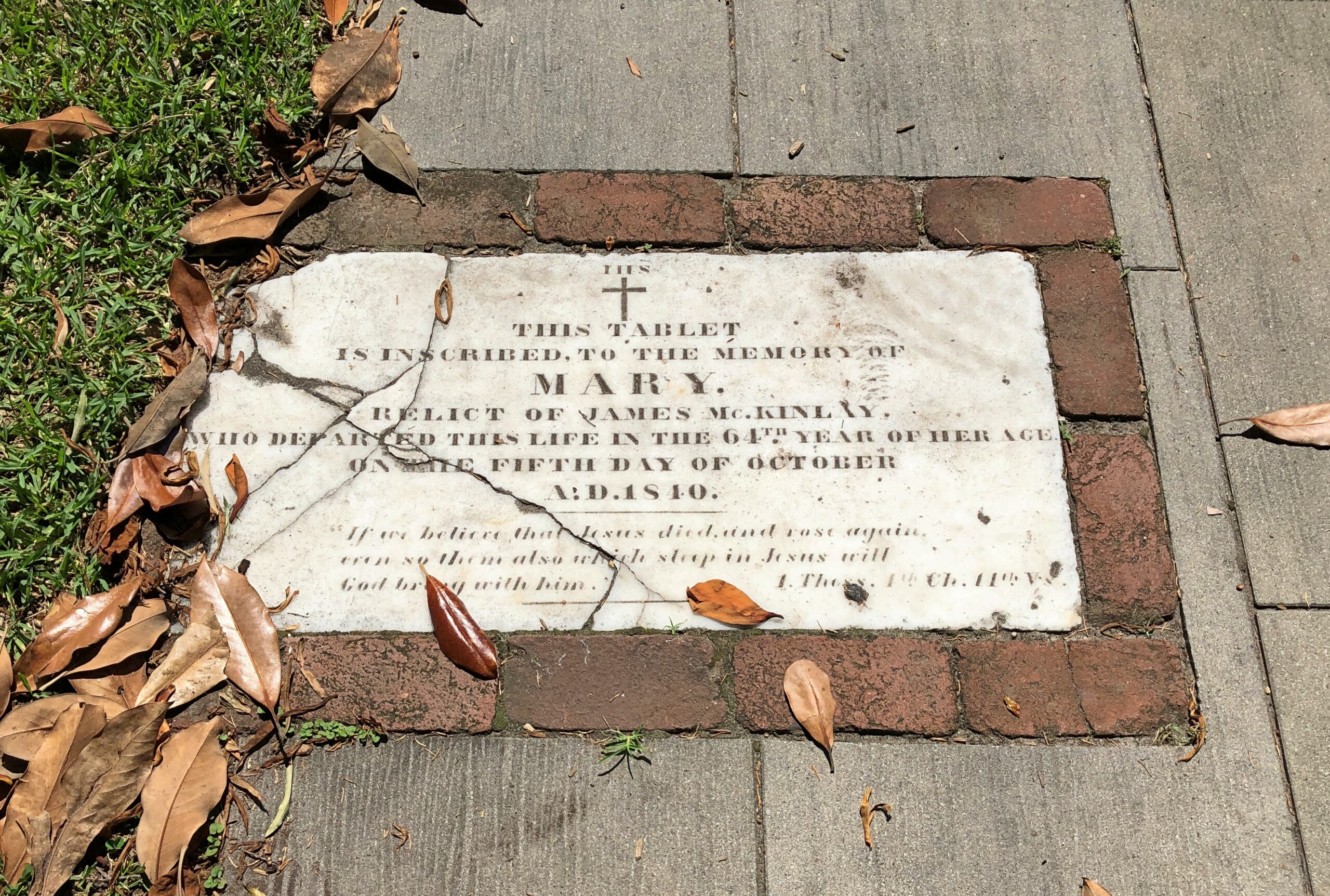
Included are stones reflecting older language usage, as you sometimes find in older cemeteries. “Relict,” as in widow, isn’t one you see much these days.
A wordy memorial. I hope the stone carver was paid by the letter.
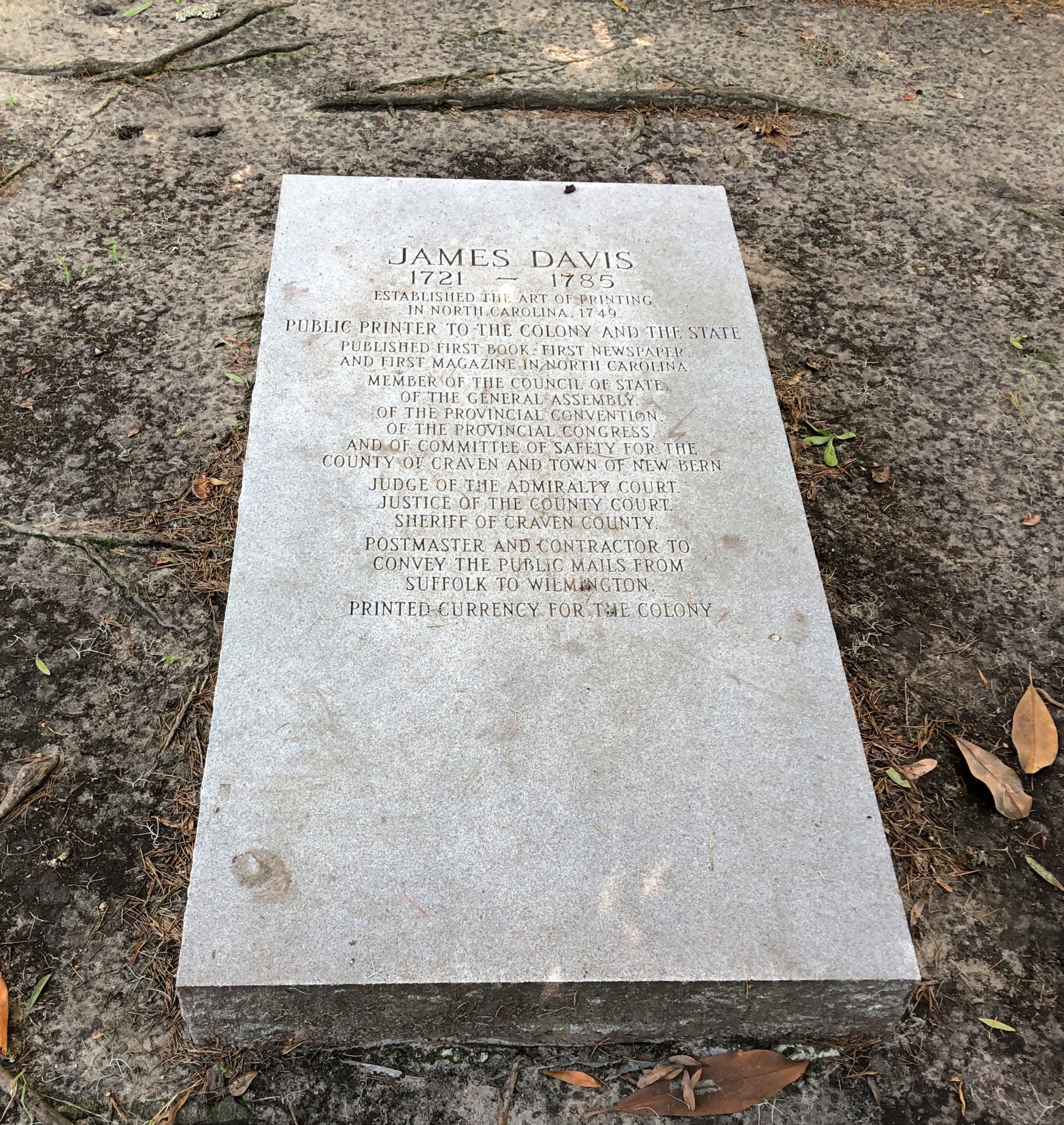
But he’s notable enough: James Davis, quite a busy fellow in colonial North Carolina and later the state.
Talk much about colonial North Carolina and Blackbeard is going to come up – at least when talking with my old friend Dan, who had a fascination with the buccaneer even back in college. An artful storyteller, which surely helped him in his former career as an ad man, Dan can regale you with Blackbeard stories, detailing his short but colorful pirate career, including the fiery display he made of his person to scare onlookers witless. A pirate needs to be known for more than mere thievery on the high seas.
“In battle [Edward] Teach would have a sling over his shoulders that held at least three flintlock pistols and would often stick lit matches under his hat to give a smokey and fearsome appearance,” the Golden Age of Pirates explains, though without the Dan’s storytelling gusto, illustrating Blackbeard’s pyrotechnical flair with gestures all his own.
Dan and his wife Pam recently moved to New Bern, NC, very near Blackbeard’s haunts, including the site of his swashbuckler’s death in action off Okracoke Island. I don’t believe their retirement move from Alabama was to be near Blackbeard, but it certainly couldn’t have hurt during site selection. On the first evening of my visit to New Bern, Dan and I spent had a fine time out on his deck, perched near a small inlet ultimately connected to the wider ocean, watching the stars slowly emerge and talking of old times and newer things but not, at that moment, about Blackbeard.
That was the next day, as we toured Tryon Palace, even though the original structure was built many decades after Blackbeard’s newly severed head wound up tied to the bowsprit of the sloop Jane, put there by pirate hunter Robert Maynard. One colonial subject leads to another.
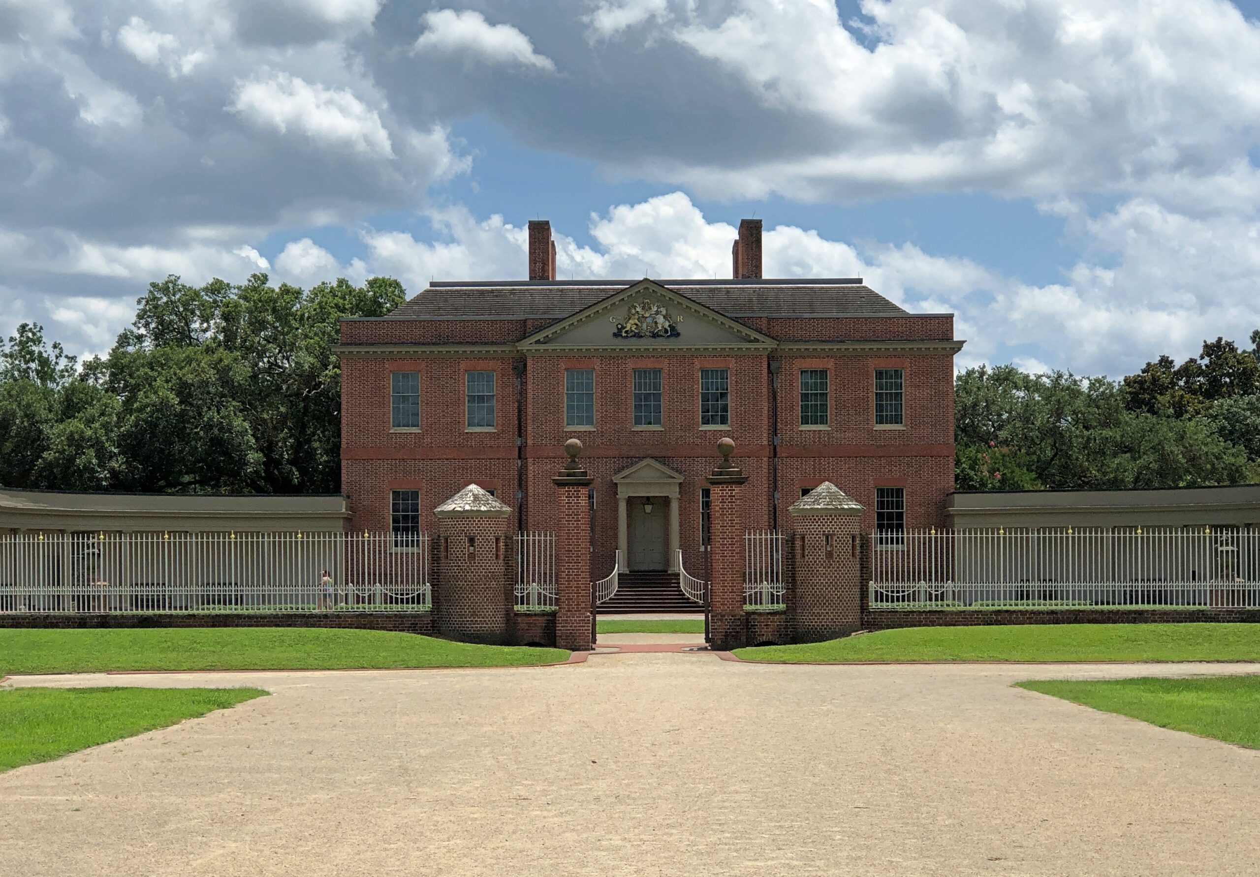
Tryon Palace is crown jewel of historic sites in New Bern, except that it’s actually a recreation of the 20th century. Somehow that doesn’t take away from its historic appeal.
When you stand in front of it, you’re peering not only back to 1770, when the colonial government of North Carolina completed, at great expense, a structure that looked like this one. You’re also looking at a building completed within living memory, in 1959, which is considered a faithful restoration of the one that NC Gov. William Tryon had erected.
“When the colonial Assembly convened in [New Bern] on 8 Nov. 1766, Tryon presented a request for an appropriation with which to construct a grand building that would serve as the house of colonial government as well as the governor’s residence,” says the Encyclopedia of North Carolina.
“Less than a month later, the Assembly acceded to the governor’s wishes by earmarking £5,000 for the purchase of land and the commencement of construction. The appropriated sum was borrowed from a fund that had been established for the construction of public schools. To replenish the depleted school fund, a poll tax and a levy on alcoholic beverages were imposed.”
Just about the worst kind of taxes when it came to irritating the non-coastal non-elites of the colony, a discontent that eventually erupted as the Regulator Rebellion. Ultimately Gov. Tryon, in personal command of the colony’s militia, crushed the Regulators – untrained men who seem to have been foolish enough to meet Tryon’s trained men in an open field at the Battle of Alamance in 1771. (Which isn’t entirely forgotten.)
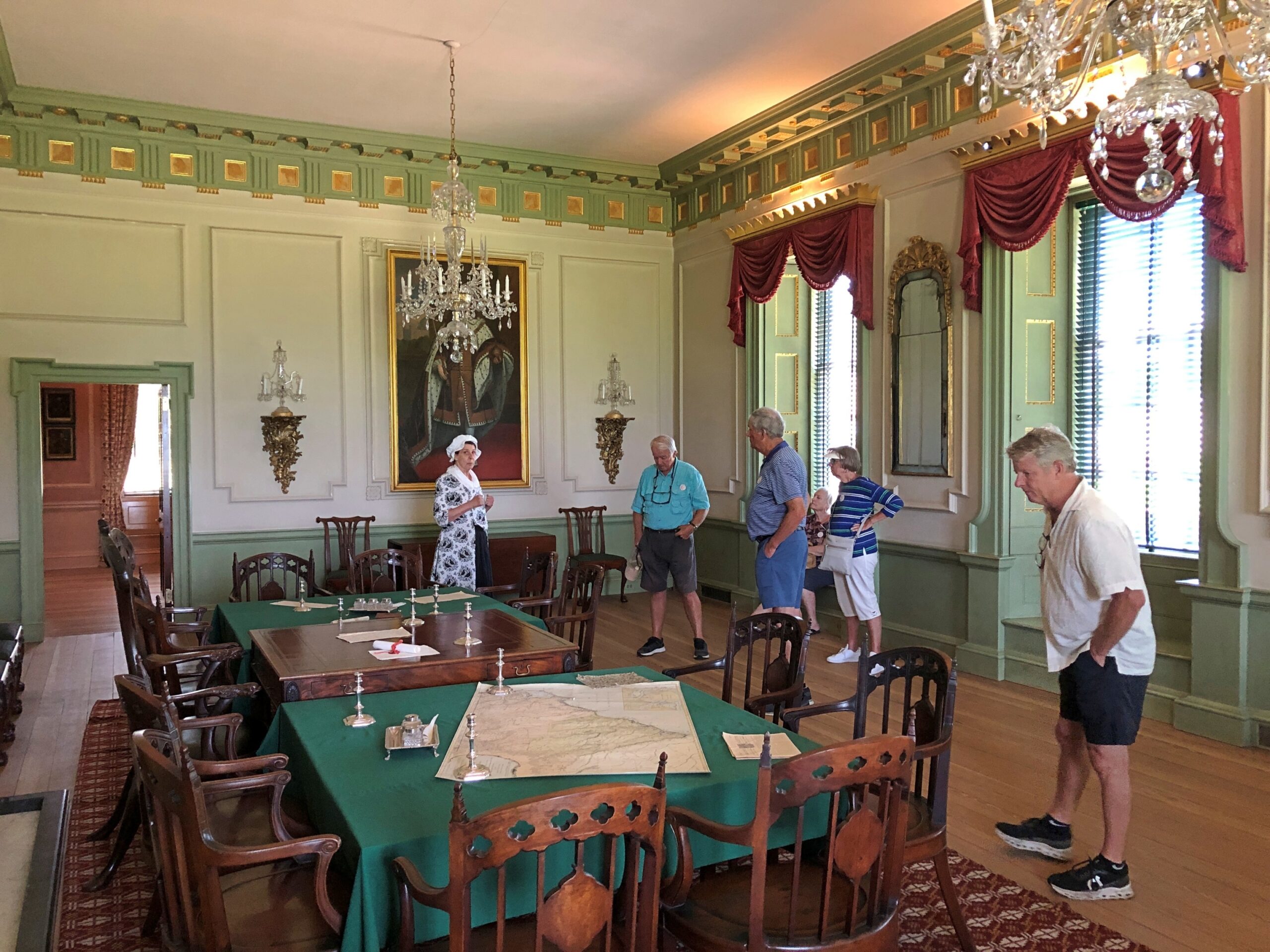
We took an early afternoon tour of Tryon Palace, guided by a woman in period costume. She told us about Tryon – no mention of Alamance, however – and his successor, Josiah Martin, the only other royal governor to use the palace. Gov. Martin spent more on furnishing the place, only to be obliged to skedaddle come the Revolution. We also heard about architect and master builder John Hawks (d. 1790), who came to North Carolina from England to build the palace which, of course, is only a palace by canebrake standards of the colony. It is a stately manor house, however.
The colonial legislature and the new state legislature both used the palace for a while, so it counts as the first capitol of North Carolina. That meant I was visiting yet another state capitol, without realizing it at first. A former capitol, that is, including ones I’ve seen in Illinois, Texas (counting Washington-on-the-Brazos as such), Virginia, Florida and Iowa. Abandoned as a government building after the NC capital left New Bern, fire consumed most of Tryon Palace just before the end of the 18th century. Its west wing survived for other uses over the next century-plus.
In the 20th century, along came Maude Moore Latham, a wealthy local woman with a taste for historic restoration. If much of colonial Williamsburg up in Virginia could be restored, so could colonial New Bern in North Carolina. Despite the fact that a road and houses had been built on the site of old Tryon Palace, she eventually facilitated the restoration, made possible (or at least more accurate) by the fact that John Hawks’ plans for the building had survived.
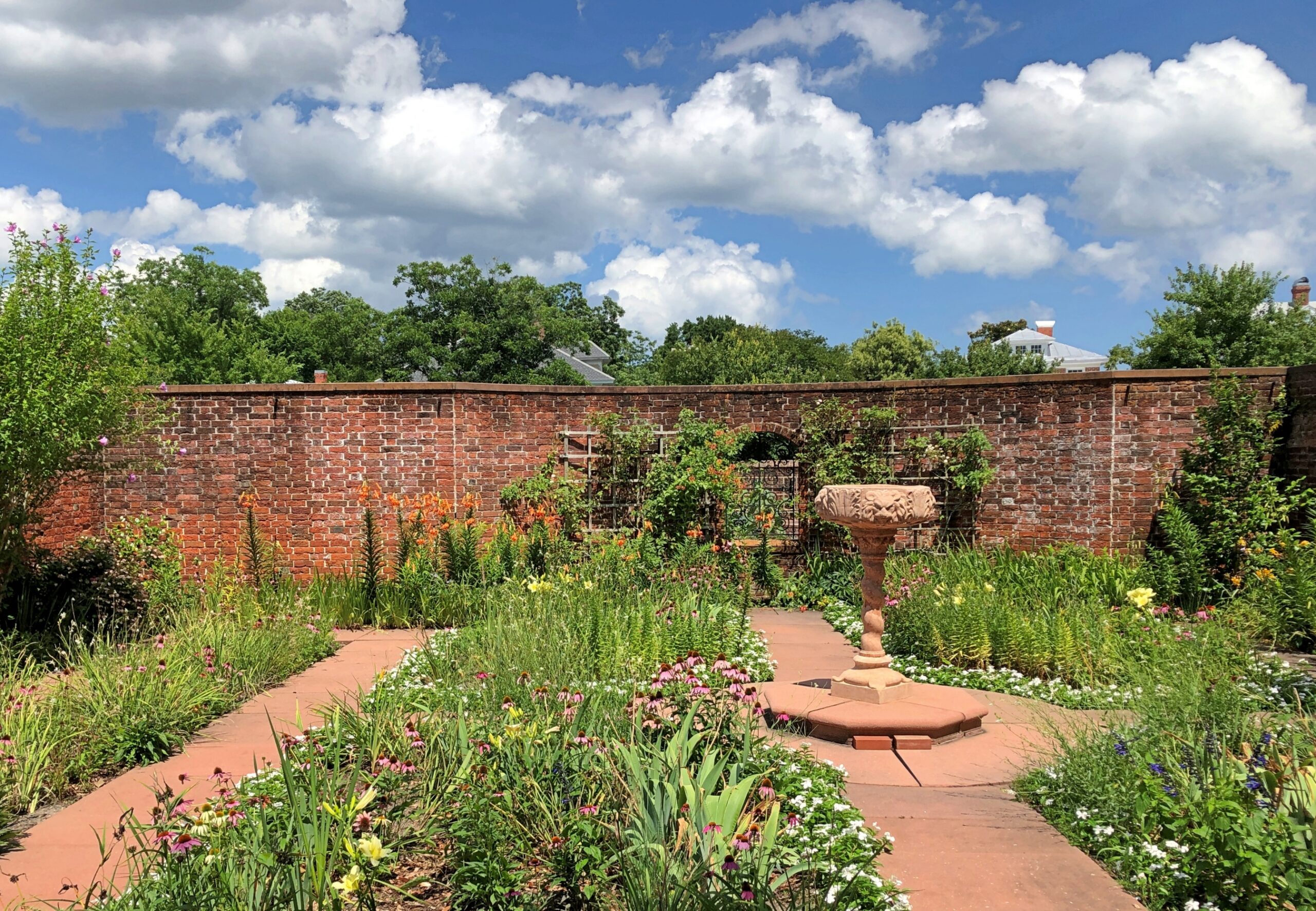
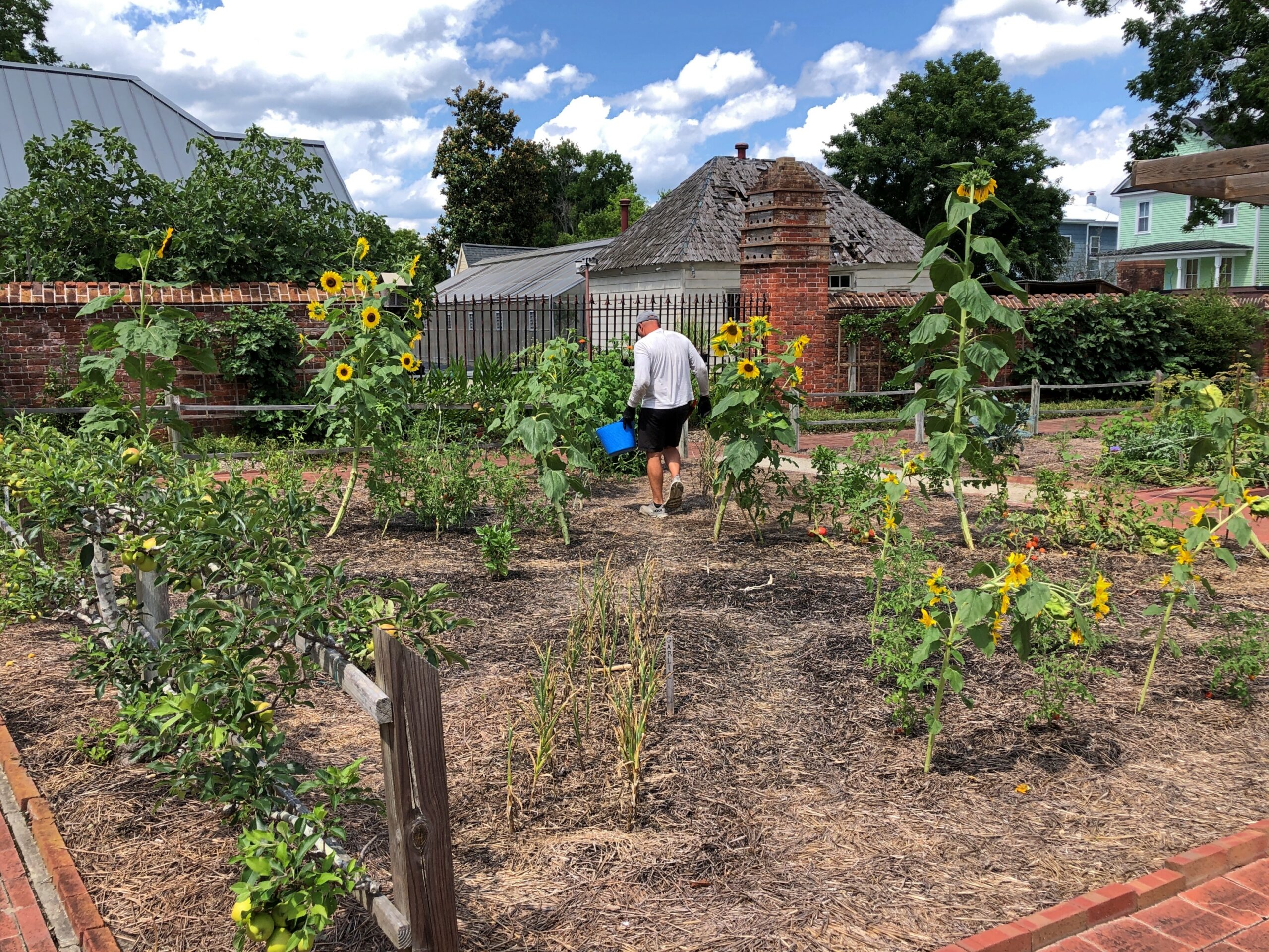
Also restored: The gardens of Tryon Palace, flower and vegetable. Despite the heat, we couldn’t miss that.
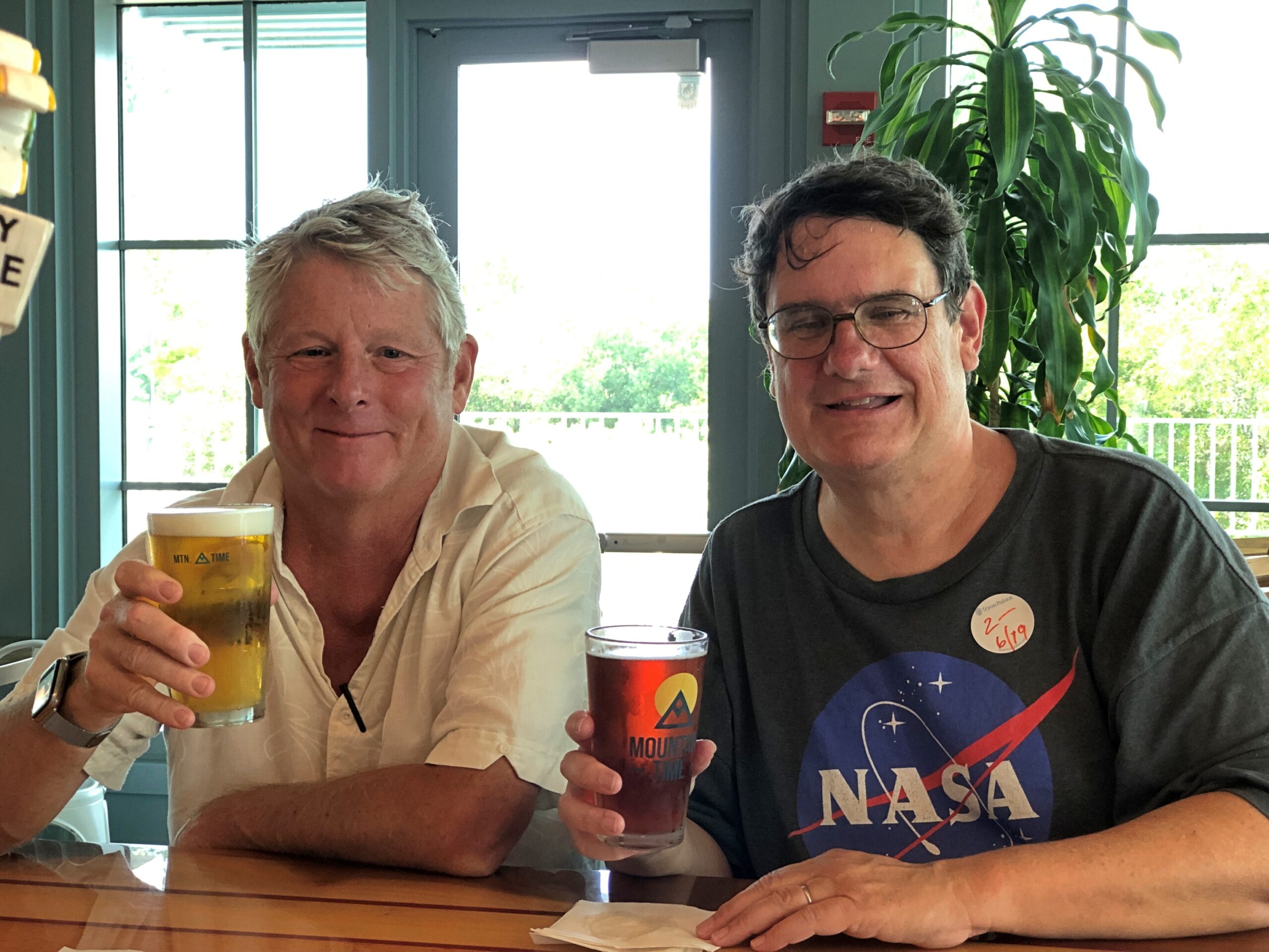
After our sweaty visit to the palace and gardens, Dan and I repaired to the restaurant in the nearby North Carolina History Center, called Lawson’s On The Creek, for refreshing beverages and more talk of Blackbeard and many other things. We closed the joint down over beer, at 4 p.m.
Downing a beer was just the thing. That was our homage to those days of yore. In colonial America, beer was no mere refreshing beverage, but an essential one.
Maybe I should have looked at something like this before driving between Knoxville and Charlotte last month.
Note the array of Construction Zone markers along I-40. Turns out travelers are lucky to be able to drive the road at all, considering that Hurricane Helene last year did so much damage that the highway – an Interstate of considerable importance regionally – was closed for five months, only reopening on March 1.
Reopening as a two-lane road, with each lane bounded on the outside by those concrete barriers you never want to see when driving. Separating the lanes is what amounts to a curb, painted yellow. This goes on for about 12 miles, as reconstruction work goes on. That isn’t a long stretch of road under normal conditions, but when you’re between barriers, behind a truck and in front of a truck, with traffic (many trucks) coming the other way just on the other side of a yellow curb, and little margin for error on anyone’s part, your reaction as a driver is going to be: when will this end?
That was my reaction, anyway. Had some nice drives on this trip. Western North Carolina I-40 wasn’t one of them.
“The hurricane washed away about 3 million cubic yards of dirt, rock and material from the side of I-40,” NCDOT reported. I’m having trouble visualizing a million cubic yards, much less three, but I’m sure it was a staggering amount.
“The stabilization process involved driving steel rods into the bedrock, filling the rods with grout, applying a metal screen then sprayable concrete to the face of the walls. There were four different rigs operating at the same time.
“Crews installed 90,000 square feet of soil-nail walls across the 10 different damage locations in less than 130 days. They also drilled nearly 2,100 feet of nails and fortified 4 miles of the shoulder for truck traffic.”
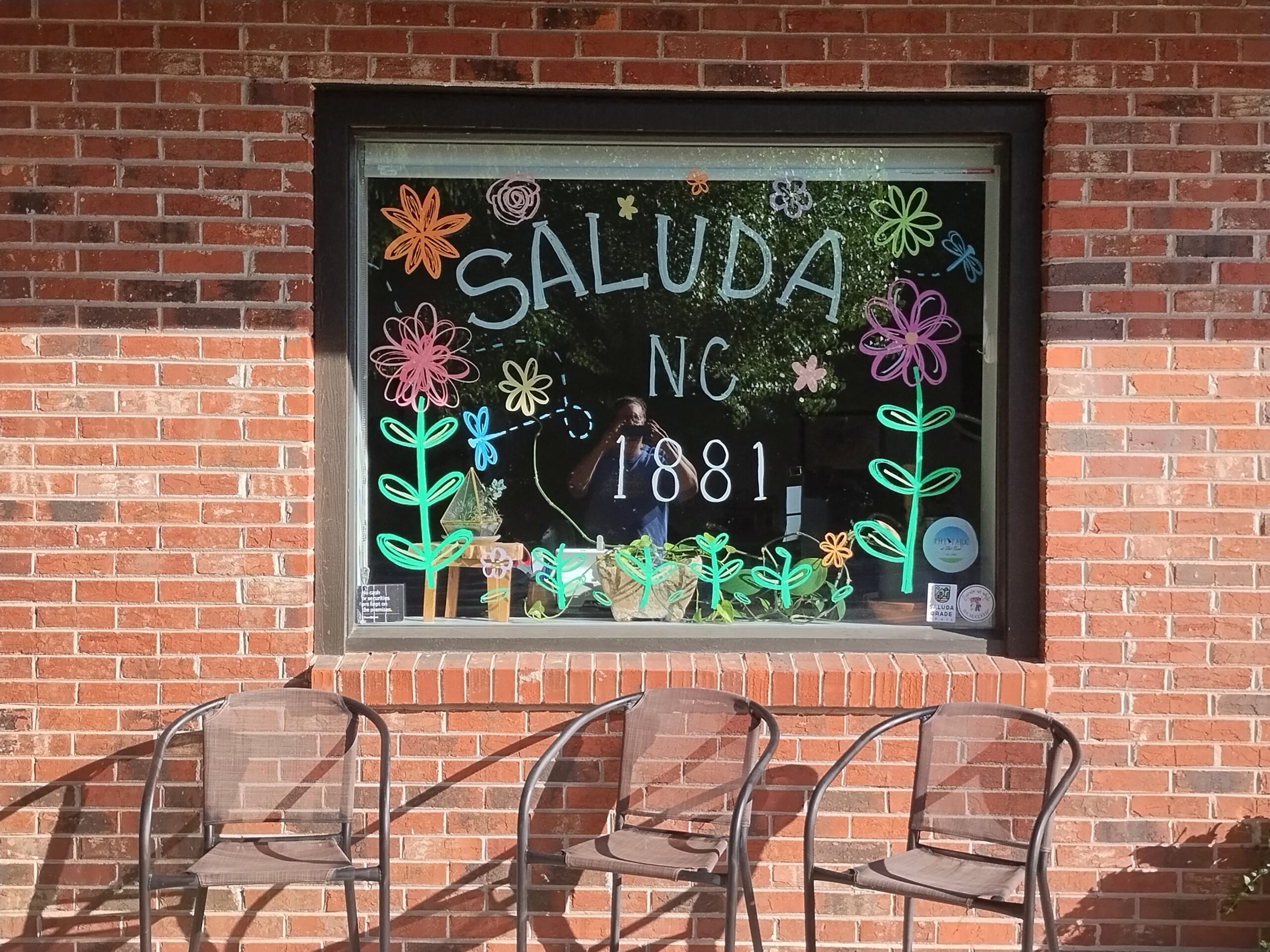
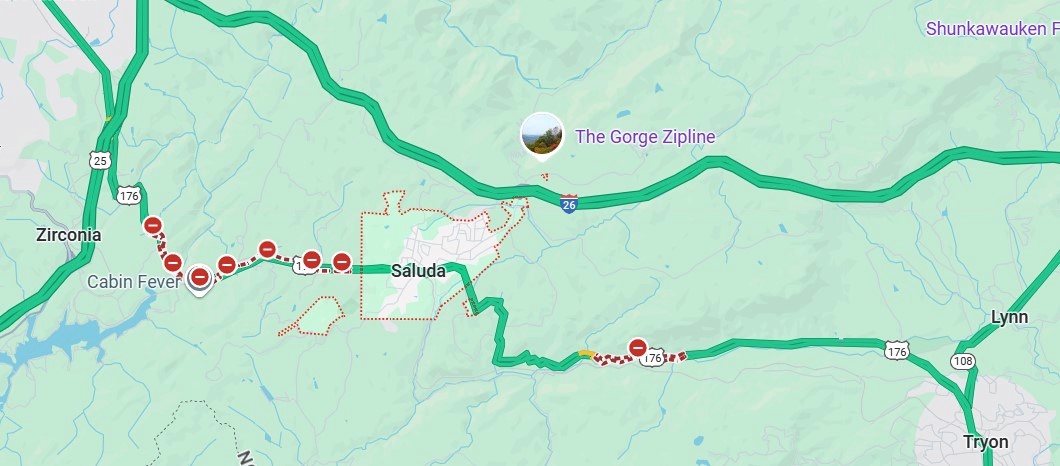
My goal for the afternoon had been to take I-40 from Knoxville to Asheville and then I-26 south to its junction with South Carolina 11, which is Cherokee Foothills Scenic Highway, and take that road east. I’d been advised that the town of Saluda, NC, on US 167, was a pleasant place to stop, and it was, though most of the shops were closed by the time I got there.
I had the idea that I would drive US 176 to the next town, Tryon, NC. Oops, no. Road closed. Maybe the hurricane did that as well.
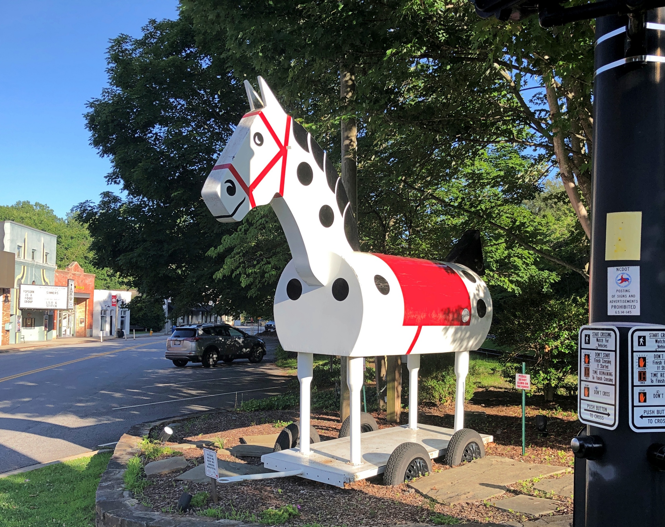
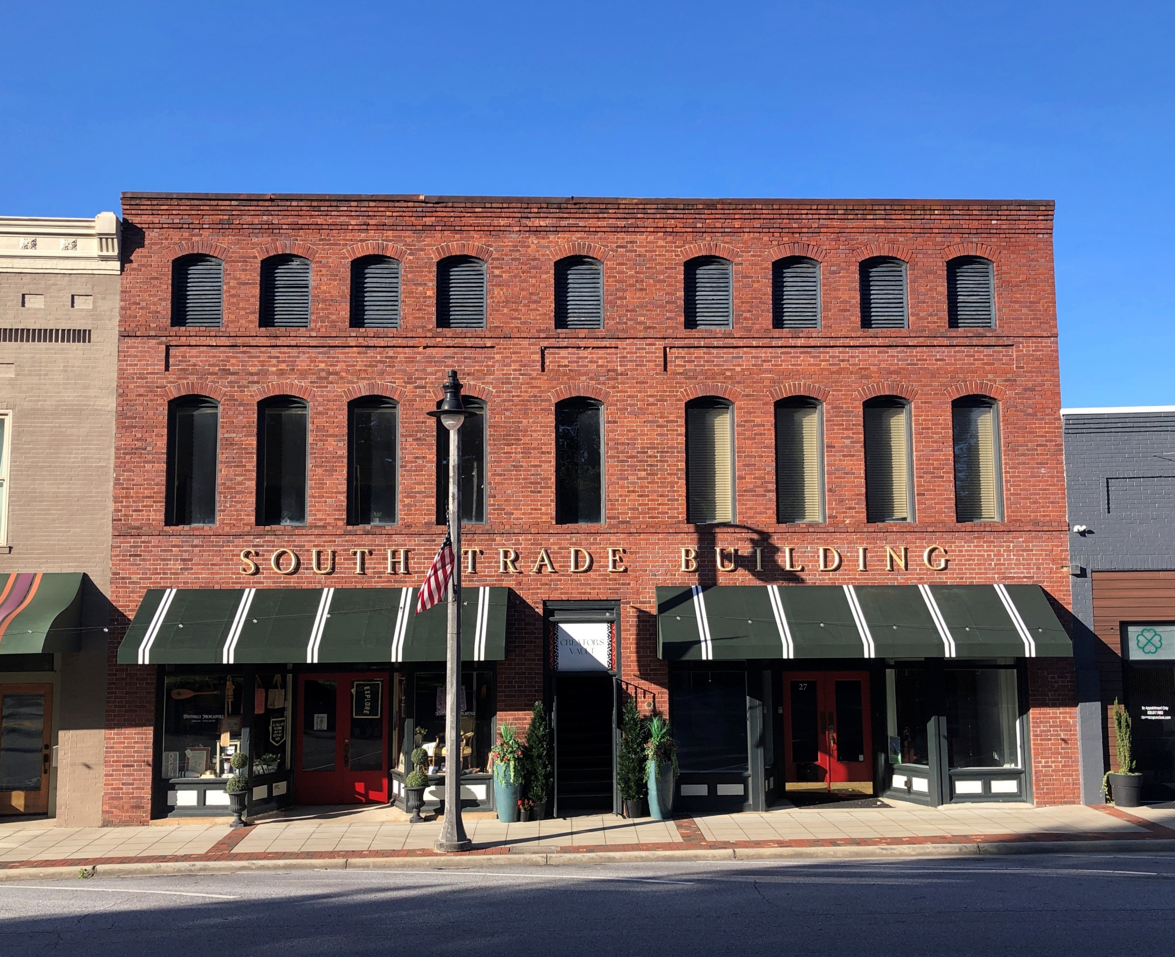
So I got back on I-26 and went to the Tryon exit. I didn’t have any idea what to expect in Tryon, certainly not the Tryon Horse, which is a large toy horse on wheels. It stands on US 176, known as South Trade St. at that point. This is the fifth iteration of the horse in nearly 100 years.
“[The first Tryon Horse] was originally designed as an advertisement for the first horse show held in Tryon at Harmon Field in 1928,” says the Tryon History Museum. “It came from a drawing done by Eleanor Vance, based on an idea from Romaine Stone, who was active in the Tryon Riding and Hunt Club, and from then seventeen-year-old master builder Meredith Lankford.
“The Tryon Horse was built in the basement of Miss Vance and Miss Yale’s house by Meredith Lankford and Odell Peeler and was assembled in the driveway… The Tryon Horse… was brought out for future horse shows and parades, and was stored in the Paper Box Factory located on Depot Street. Unfortunately, the first horse was destroyed when the factory burned in the 1930s.”
It was no accident that the talent was available locally in the 1920s to build such a thing. At the time, Tryon was noted for a company that made toys, especially high-end wooden toys.
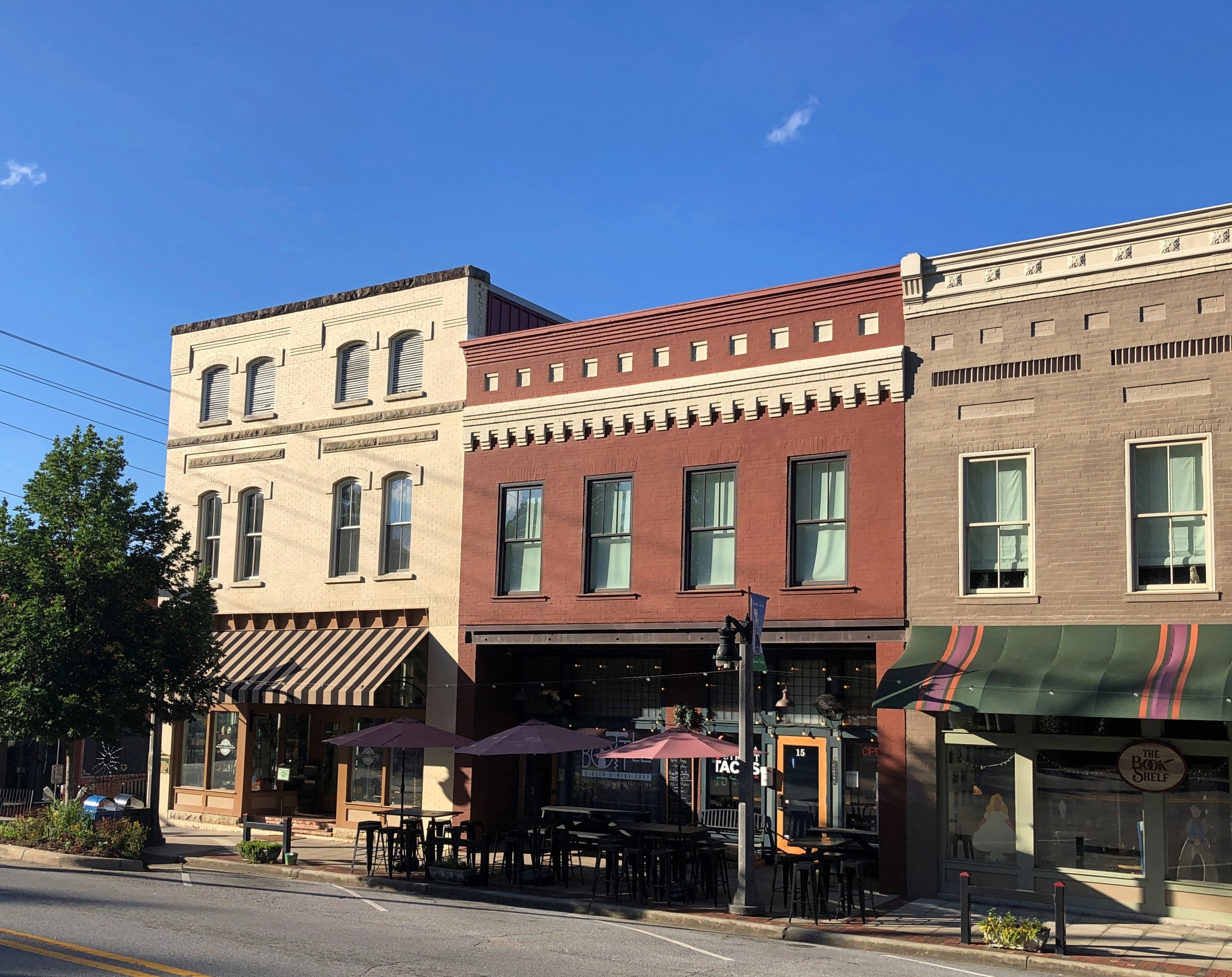
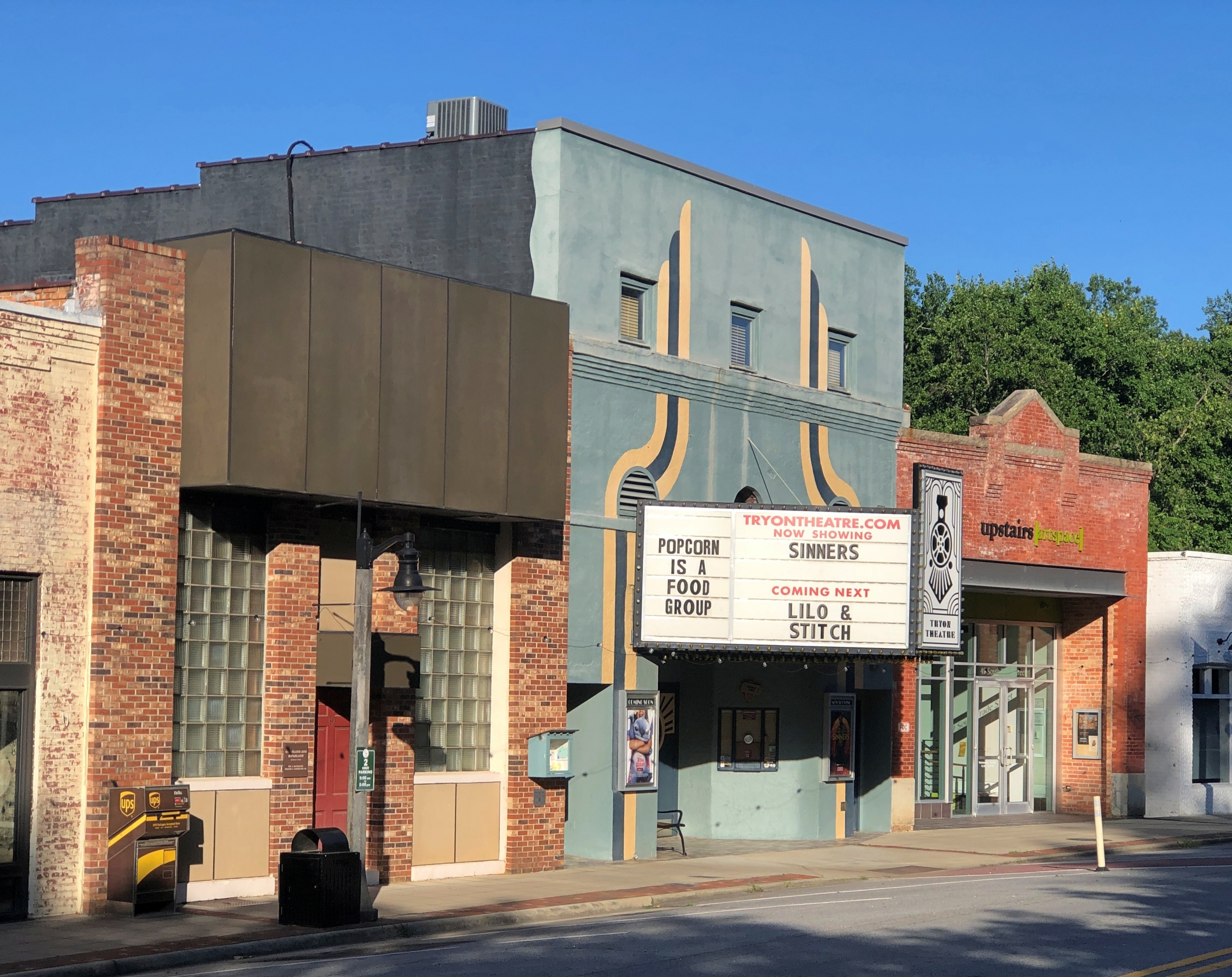
South Trade St. is a handsome thoroughfare, populated by older buildings developed to support trade.
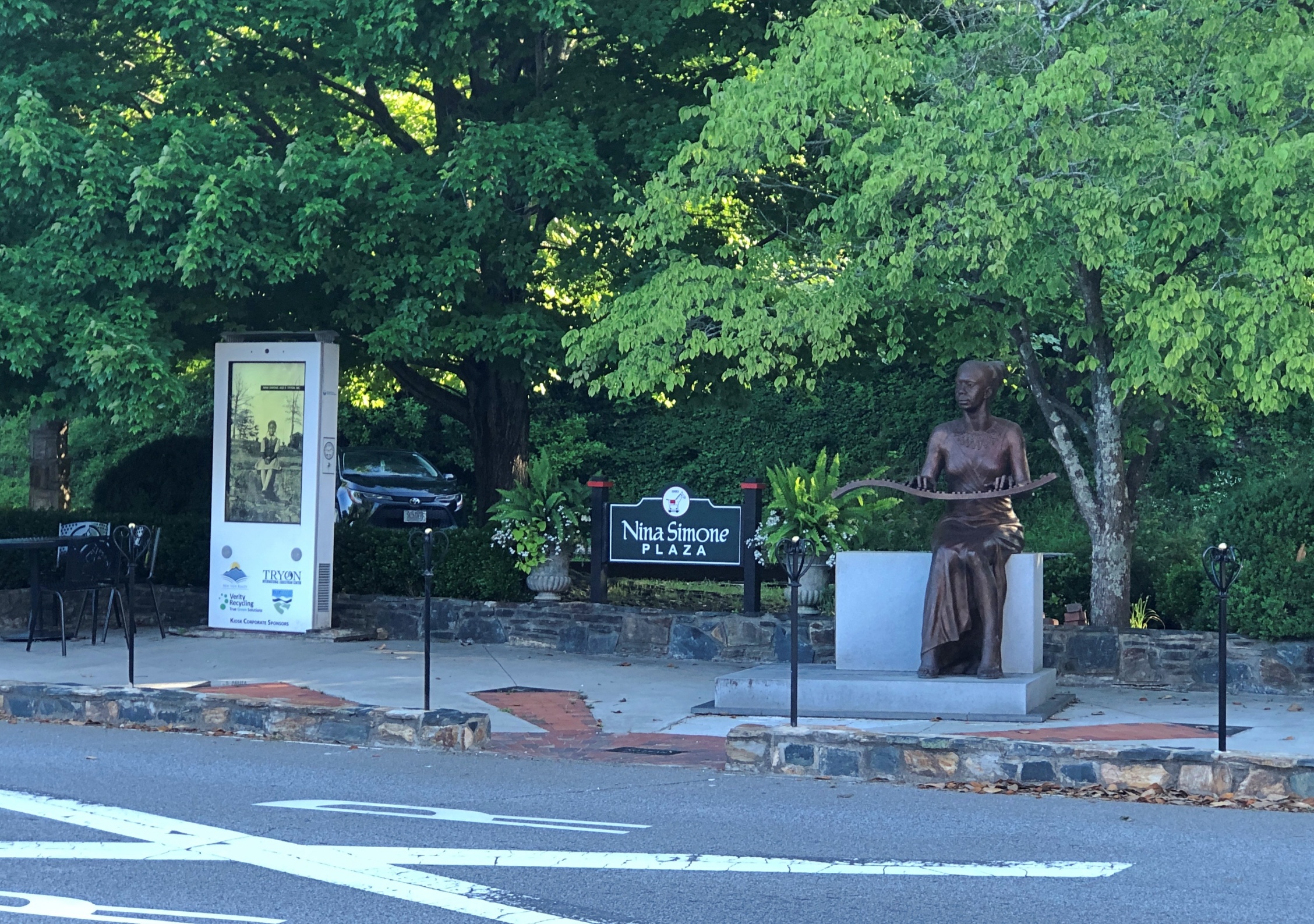
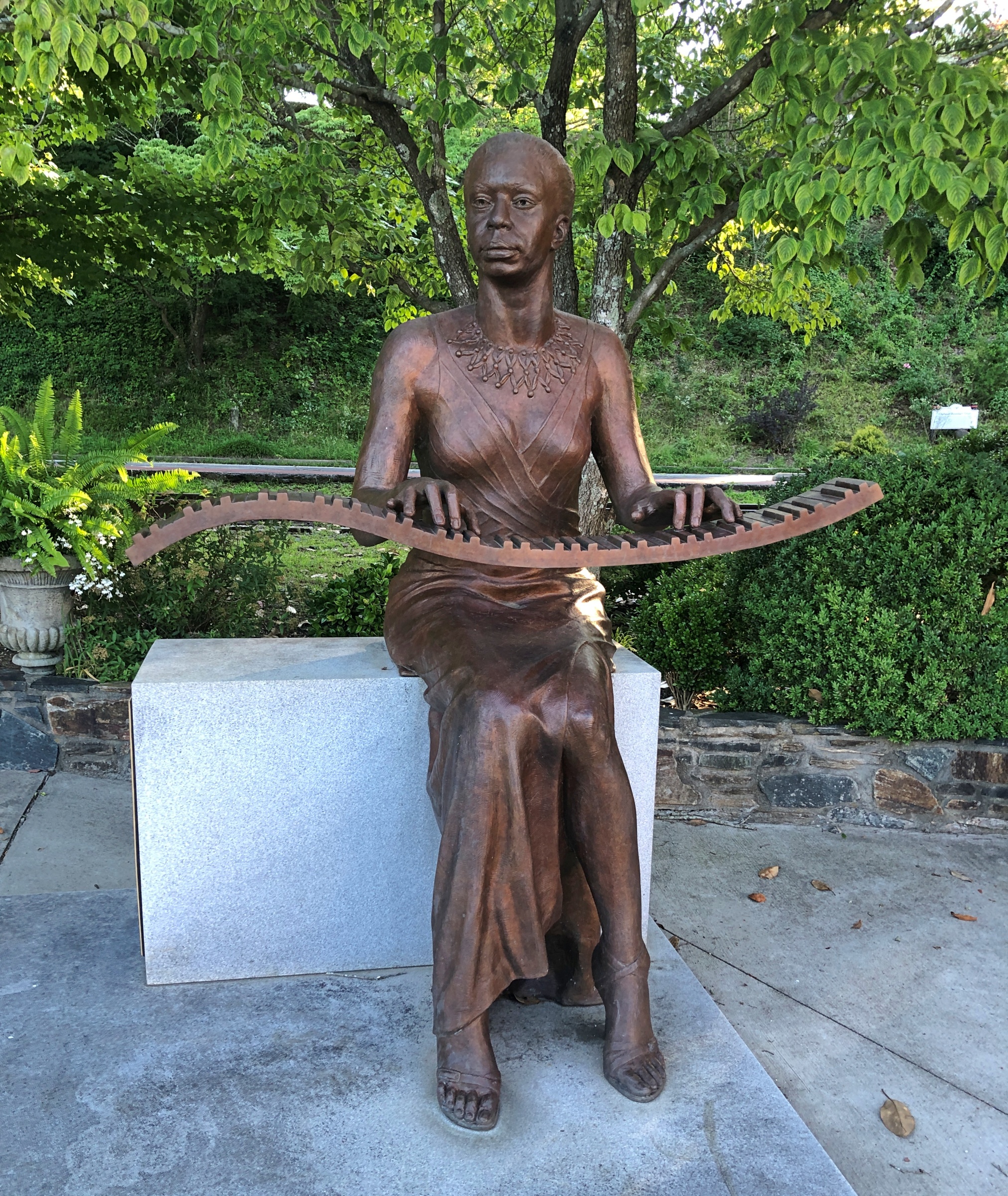
Something else I didn’t expect on the street: Nina Simone Plaza.
Complete with a bronze of the musician and activist, who grew up in Tryon, and who no doubt got out as soon as her talents allowed. She died in 2003; the statue was dedicated in 2017.
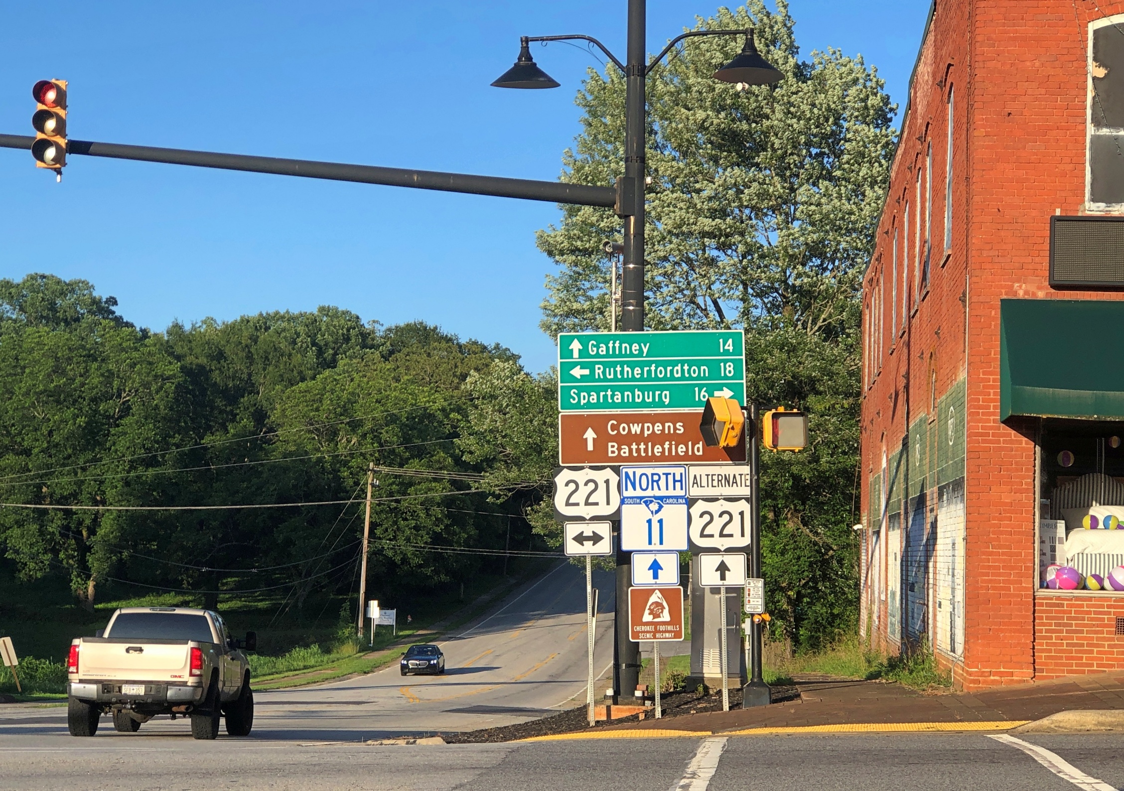
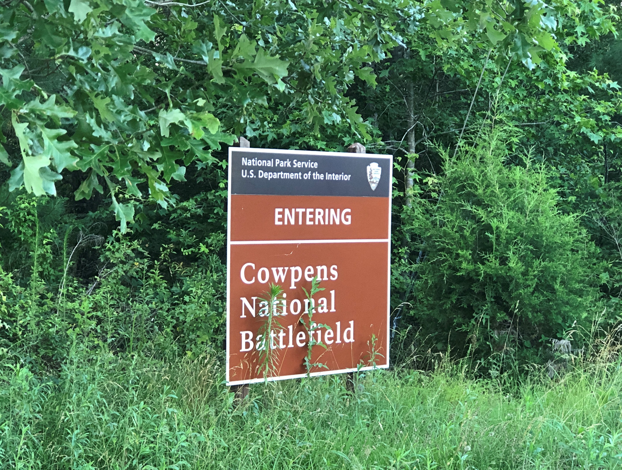
Later in the day, I eventually made it to South Carolina 11 at Campobello, SC, and drove east to its end for 50 miles or so to Gaffney, SC. I’d intended to visit Cowpens National Battlefieldalong the way.
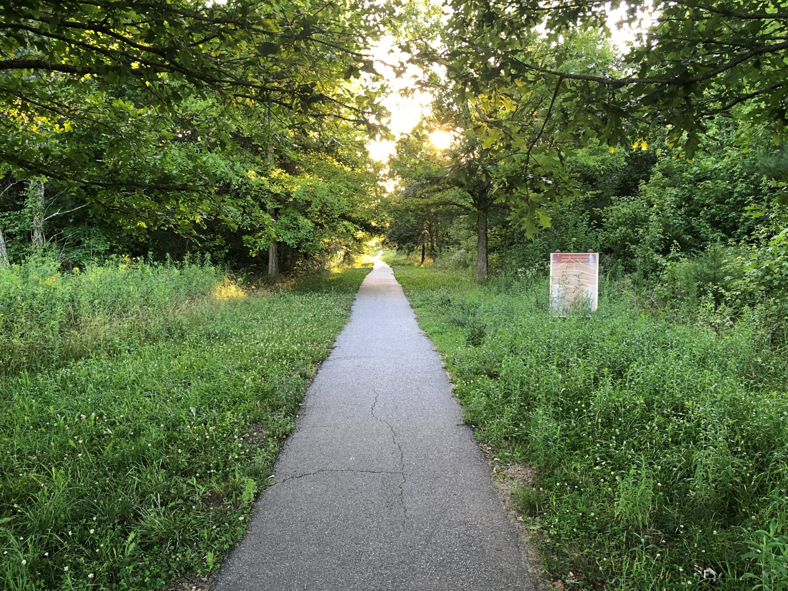
No dice. The main entrance to Cowpens was closed by the time I arrived. I understand closing the visitors center at the end of the day, but the entire place? A mile or so east on SC 11 was an alternate entrance, so I stopped there.
I walked down the path toward the battlefield, but thought better of it after about 10 minutes.
I wanted to get to Charlotte before the end of the day. Summer days are long, but not endless. Also, mosquitoes.
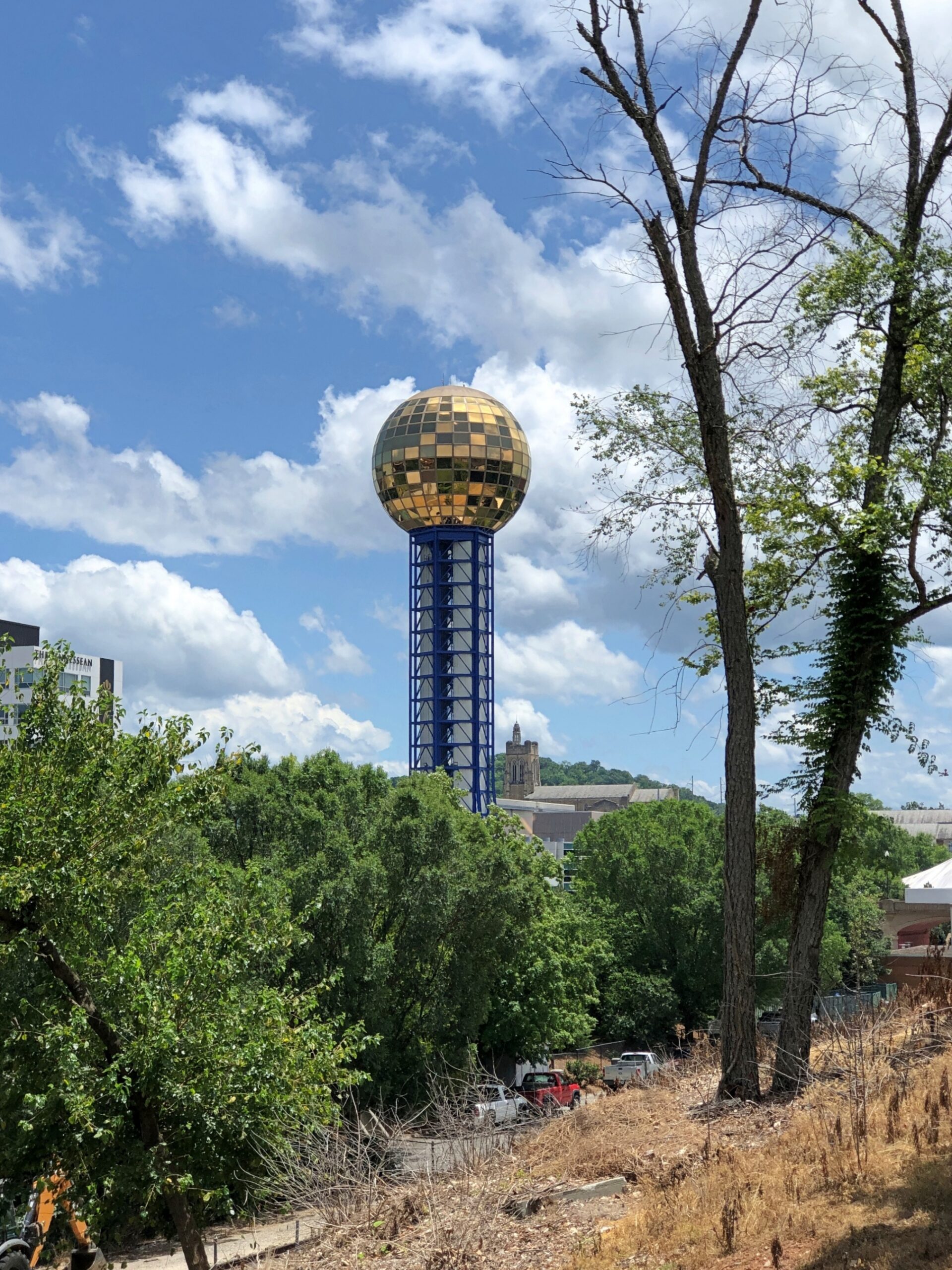
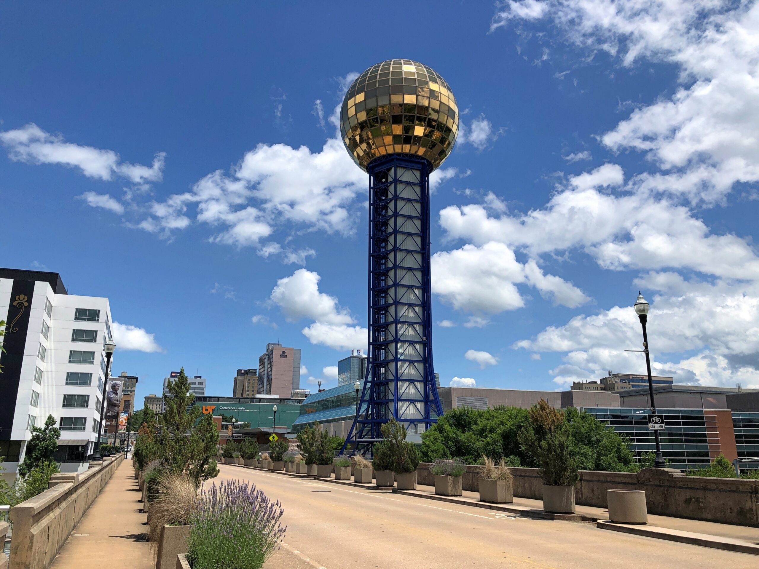
Something was fitting about visiting the Sunsphere on a hot day in June.
There might have been closer places to park near the structure, but I’m a rank novice when it comes to knowing my way around downtown Knoxville. Luckily, the streets weren’t densely packed with traffic, even on a mid-day weekday, so I made my way easily to surface parking about a quarter mile from the tower. Free parking, the best kind.
A quarter-mile isn’t too far to walk, fortunately. But high heat adds strain to the walk. It didn’t rise to the level of an ordeal, just discomfort, with my head toasty under a hat and my throat irrigated from time to time with bottled water. People might not believe it, but discomfort is an essential ingredient to a good trip. Not unremitting discomfort, just intermittent bursts.
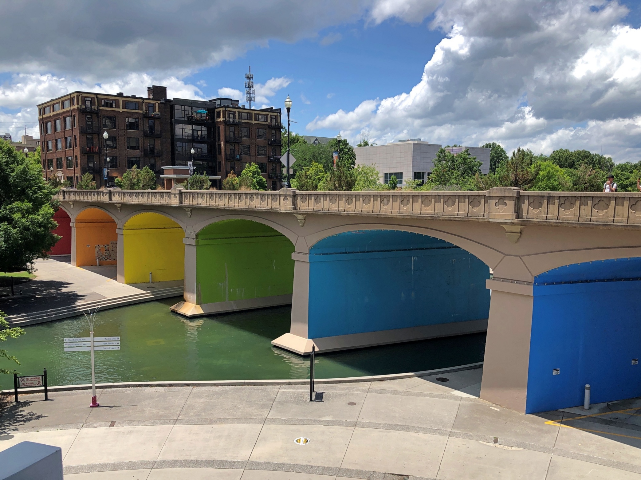
From the parking lot, I followed a street to a corner, rounding to a view of the tower on the other side of the Henley Street Bridge. An ideal sort of bridge for pedestrians, actually, one that carries not only cars but has generous sidewalks, demarked by sizable planters.
The bridge from the other side, just under the Sunsphere. Good work. The colors are a nice touch.
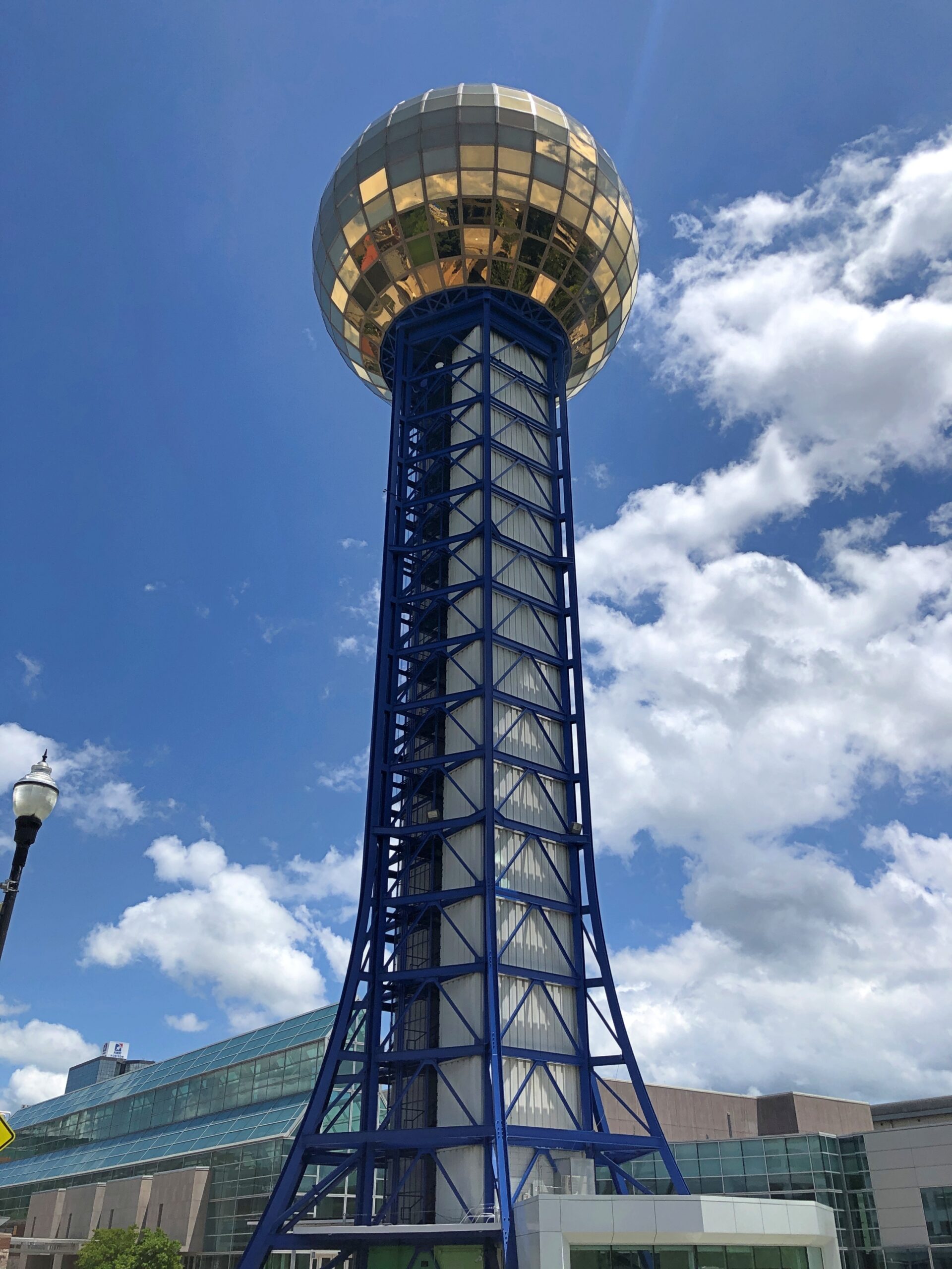
A highly visible legacy of the Knoxville International Energy Exposition, that is, the 1982 World’s Fair, the Sunsphere abides as a goldish homage to Sun. At least, that was the idea that fair organizers (or their publicists) came up with. For an expo about energy, the centerpiece would be the source of all energy here on Earth, though not solar energy per se, certainly not in the early ’80s.
Why Knoxville? Why not? By then worlds fairs were passé anyway, and were regarded with indifference by most Americans. Such as my college-age self, and all my friends as well. More importantly for anyone thinking about organizing one, they tended to be money pits.
I’m of two minds about the decline of worlds fairs. One, tastes change, with information and experiences so widely available that a fair can’t compete, and so what? But I also think there’s much to be said for going places and seeing real physical things. Obviously I think that. Especially as opposed to losing yourself in a slender electronic box.
I’d come that day, passing through Knoxville from Nashville and en route to Charlotte, not just to see the Sunsphere exterior, but to ride the elevator to its observation deck and take in the view, roughly 300 feet up. I’d blown off seeing the fair 40+ years ago, but I wasn’t going to miss its shiny legacy on this trip if I could help it.
I’m glad to report that the interior of the Sunsphere is climate controlled. Also, admission is $10. If by magic the Sunsphere could relocate to any of the much larger U.S. metros, base admission might be three times that much, with a skip-the-line option for an extra fee. The structure is part of Knoxville’s World’s Fair Park, and I’d like to think that park authorities are holding the line on tourist inflation, but I’m sure it’s just what the market will bear.
A Knoxville architect named Don Shell, working for Community Tectonics in the early 1980s, led the design effort. “Much of the work involved structural engineering details, and Community Tectonics sought the consultation of Stan Lindsey and Associates in Nashville,” the Knoxville News Sentinel reported.
“Shell recalled that Lindsey used a new piece of equipment with which most architects at that time were unfamiliar — a computer. Problems were also encountered in trying to find gold-colored glass to represent the sun. In fact, the Rentenbach contracting firm checked with about 60 businesses before locating a company in New Jersey that would manufacture the pieces, Shell said.”
Actual gold is mixed in the glass, in what has to be minute amounts. Always useful, that element gold.
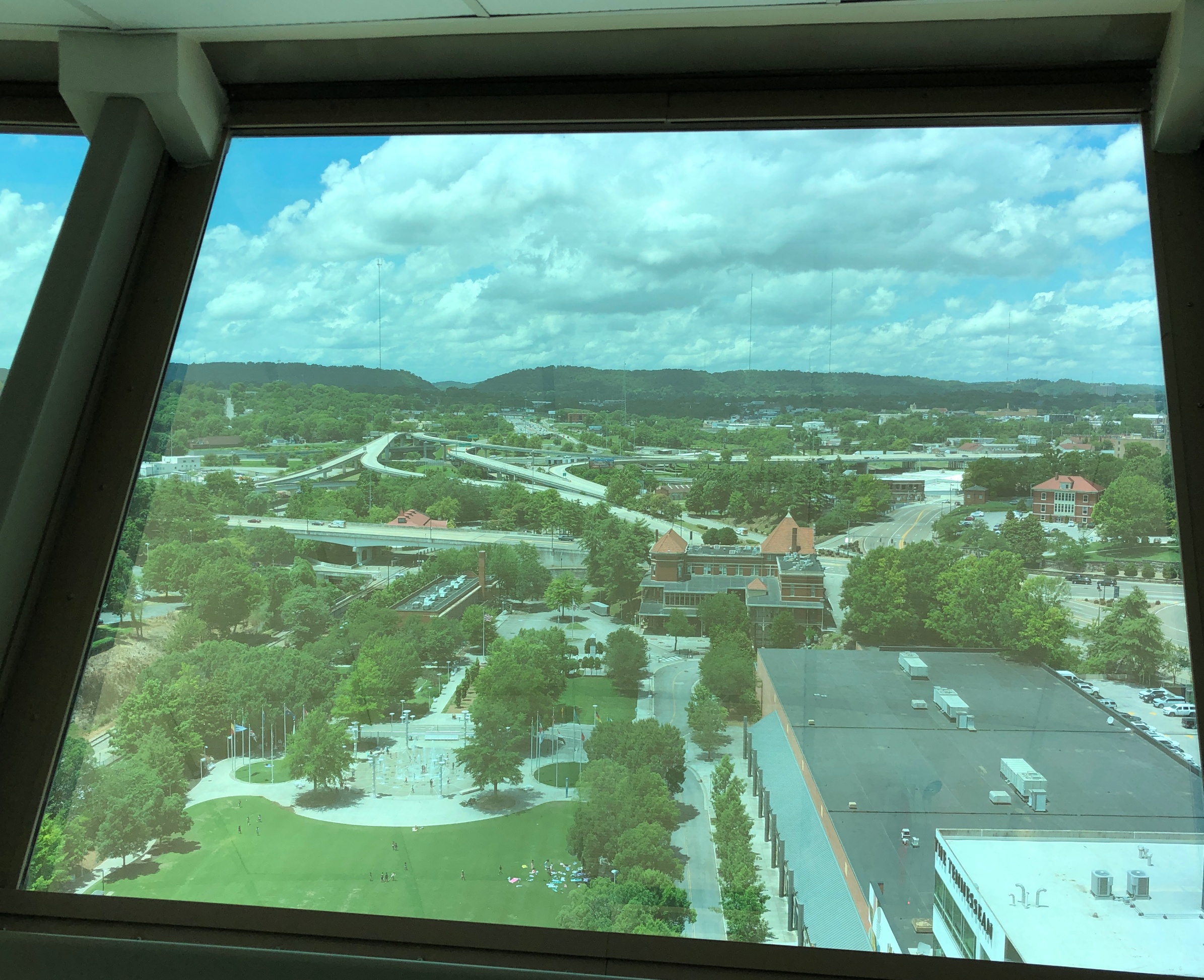
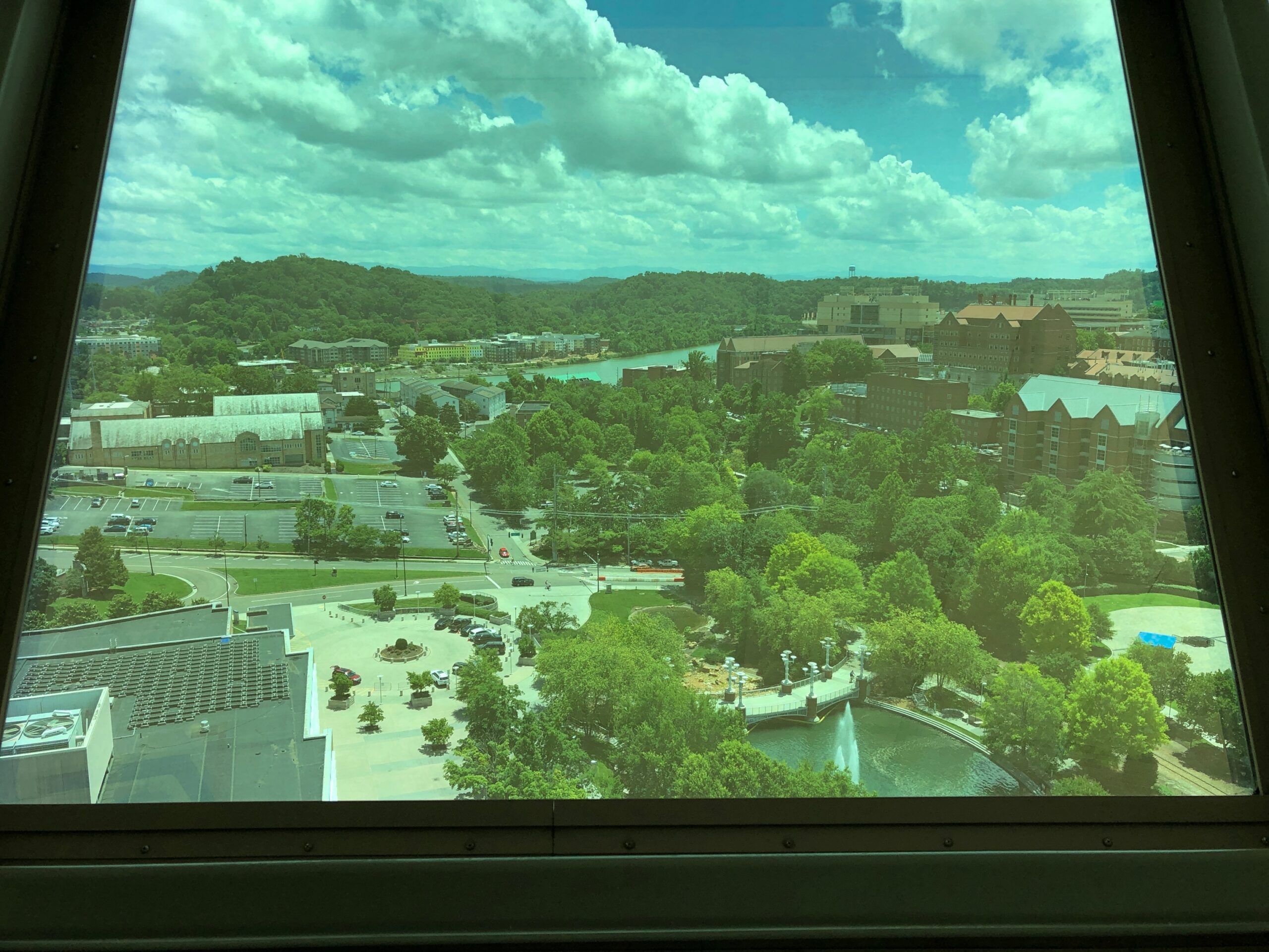
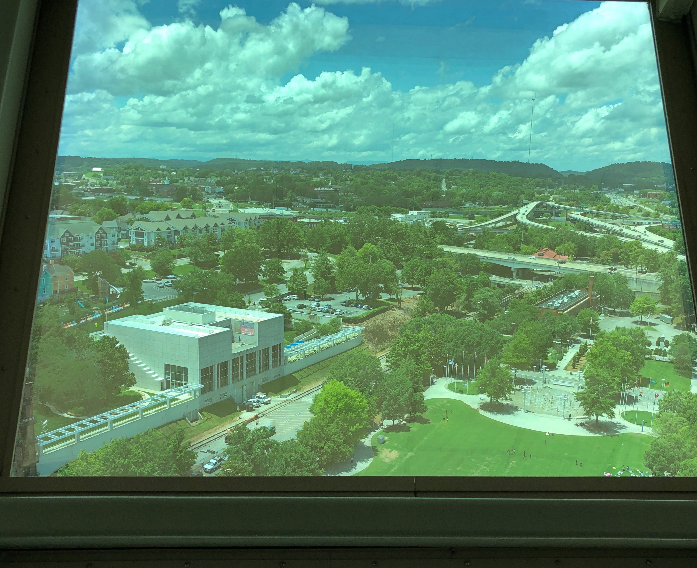
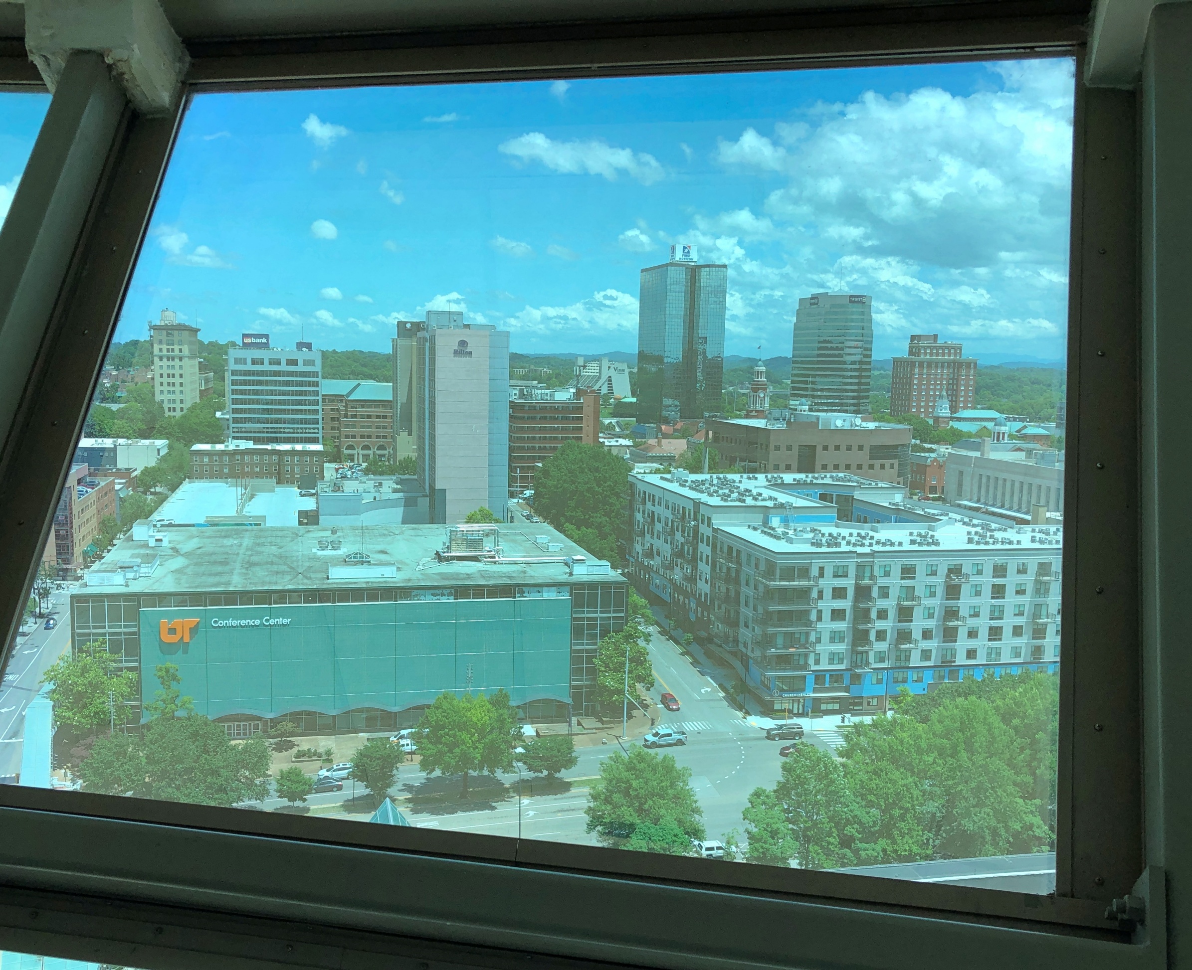
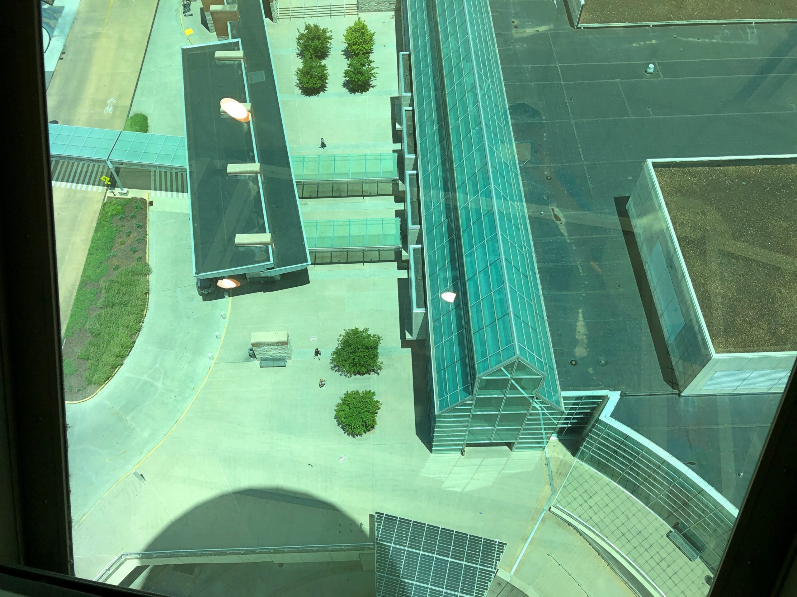
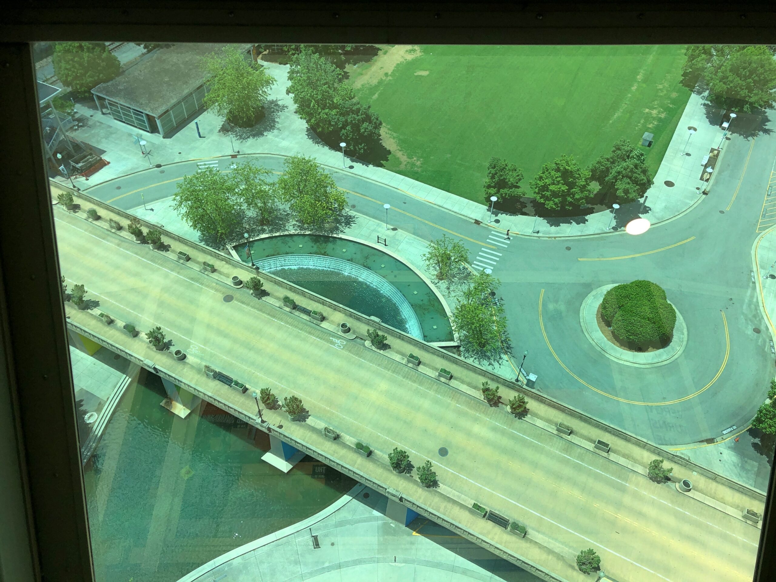
The observation deck is on the bottom half of the sphere, with 360-degree views of the terrain behind the gold-colored glass. In the images I made, that has the effect of bluing everything, creating the illusion that maybe the images are mid-century slides that have been tucked away unseen since then. Of course, these vistas didn’t exist in the mid-century, but never mind.
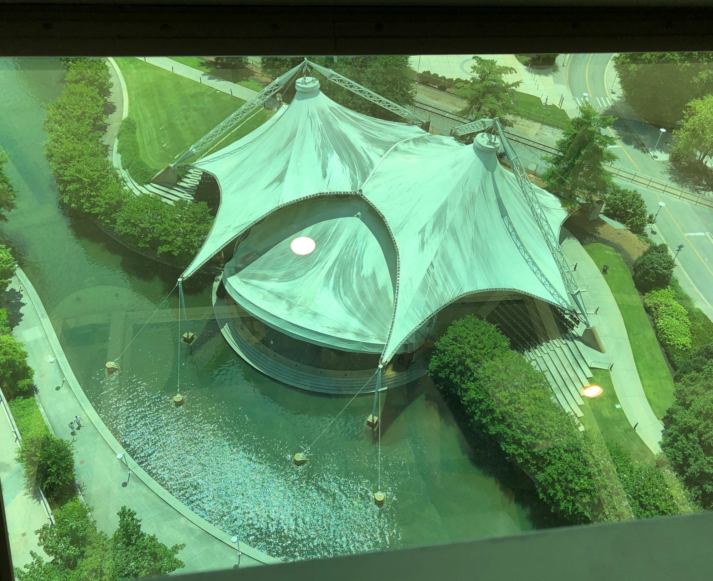
Getting a look straight down was a little tricky, but doable. The first image is the Tennessee Amphitheater, the only other structure from the fair still standing besides the tower.
One more of the Henley Street Bridge.
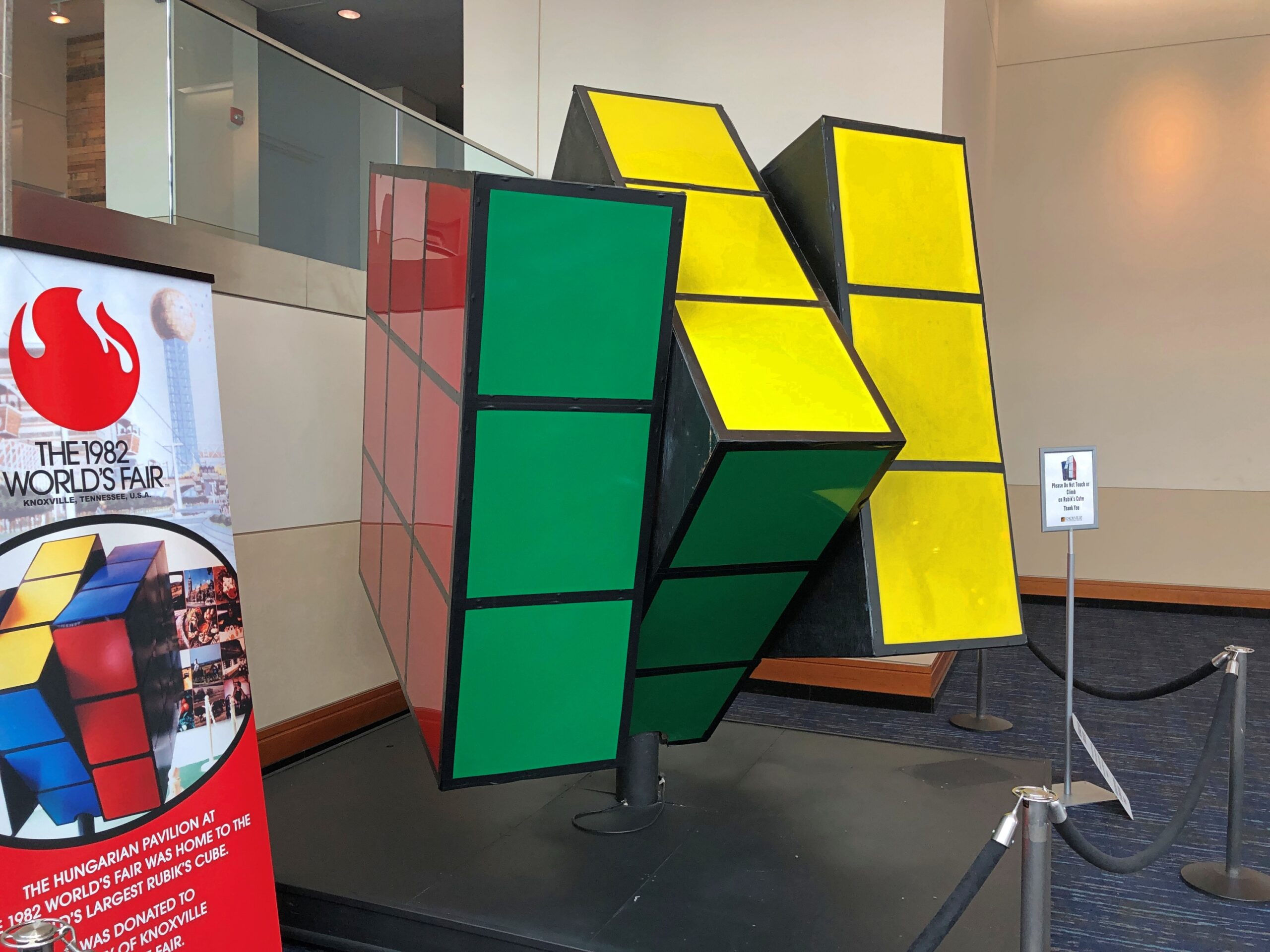
Once you’ve seen enough of the vista from the sphere, back on ground level the Knoxville Convention Center, developed on the former site of the U.S. Pavilion next to the tower, is open and showing the World’s Largest Rubik’s Cube. It used to grace the Hungarian Pavilion. I had to look it up: Rubik is still alive at 81, living in Budapest.
As usual with this kind of thing, both the tower and the cube went through a period of neglect in the decades after the fair, though it seems the cube got the worst of it, according to Roadside America: ‘The Cube, ten feet high and 1,200 pounds, constantly changed its color patterns thanks to a complex set of internal motors. When the Fair closed no one in Knoxville knew what to do with the Cube, and it eventually wound up beneath a freeway overpass, abandoned. This dereliction of civic duty was exposed by the Knoxville News Sentinel, and the embarrassed city then had the Cube restored and moved into the city’s Convention Center for the Fair’s 25th anniversary in 2007.”
As for the Sunsphere, it was never neglected so much physically, but otherwise it seems not much attention was paid to it for years until the 2010s, when the observation deck was renovated, adding exhibits about the world’s fair.
I’d actually gone inside the Convention Center to use the restroom. Sunsphere visitors, take note. The recent renovation didn’t include public restrooms, because there are none.
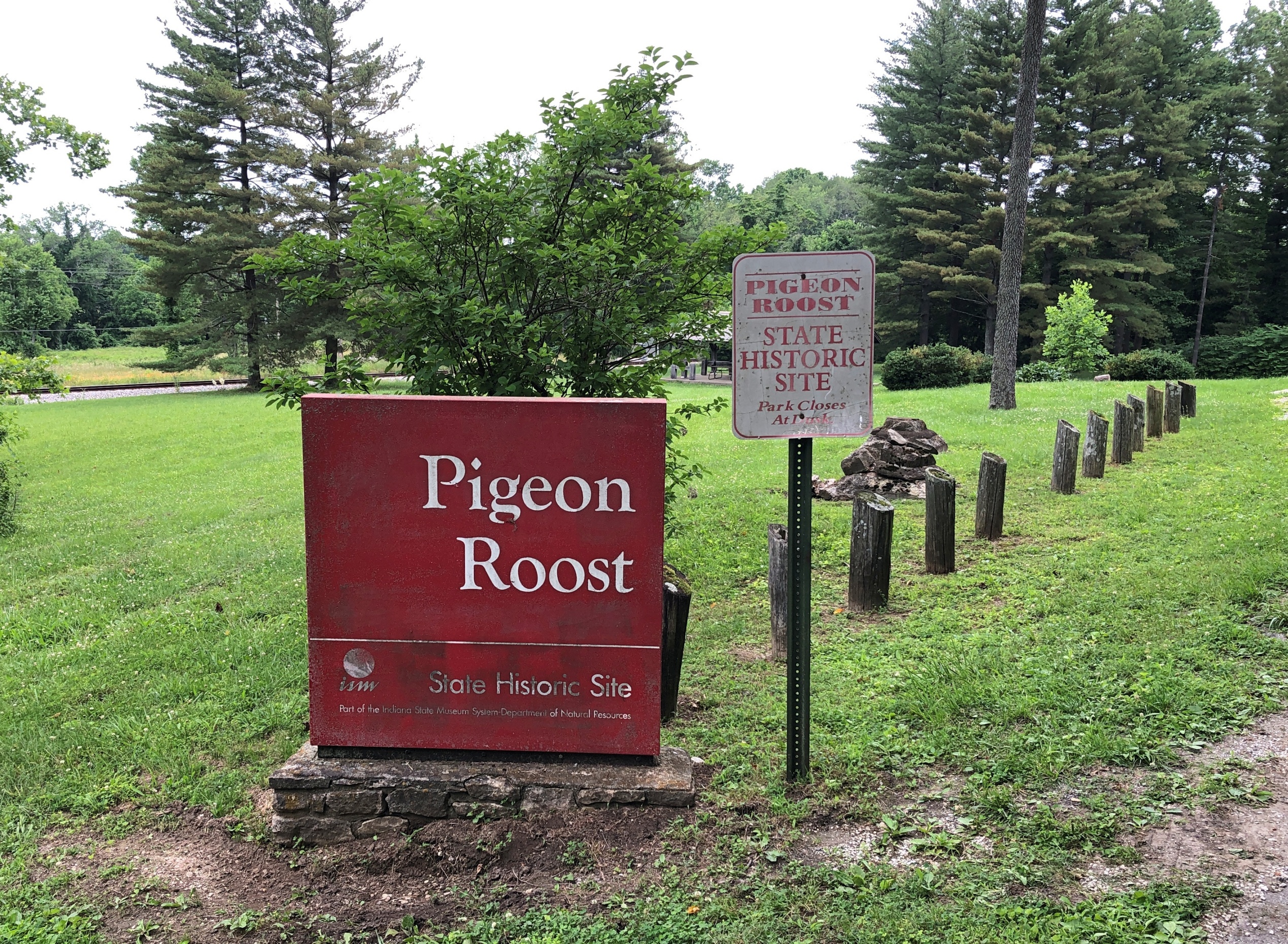
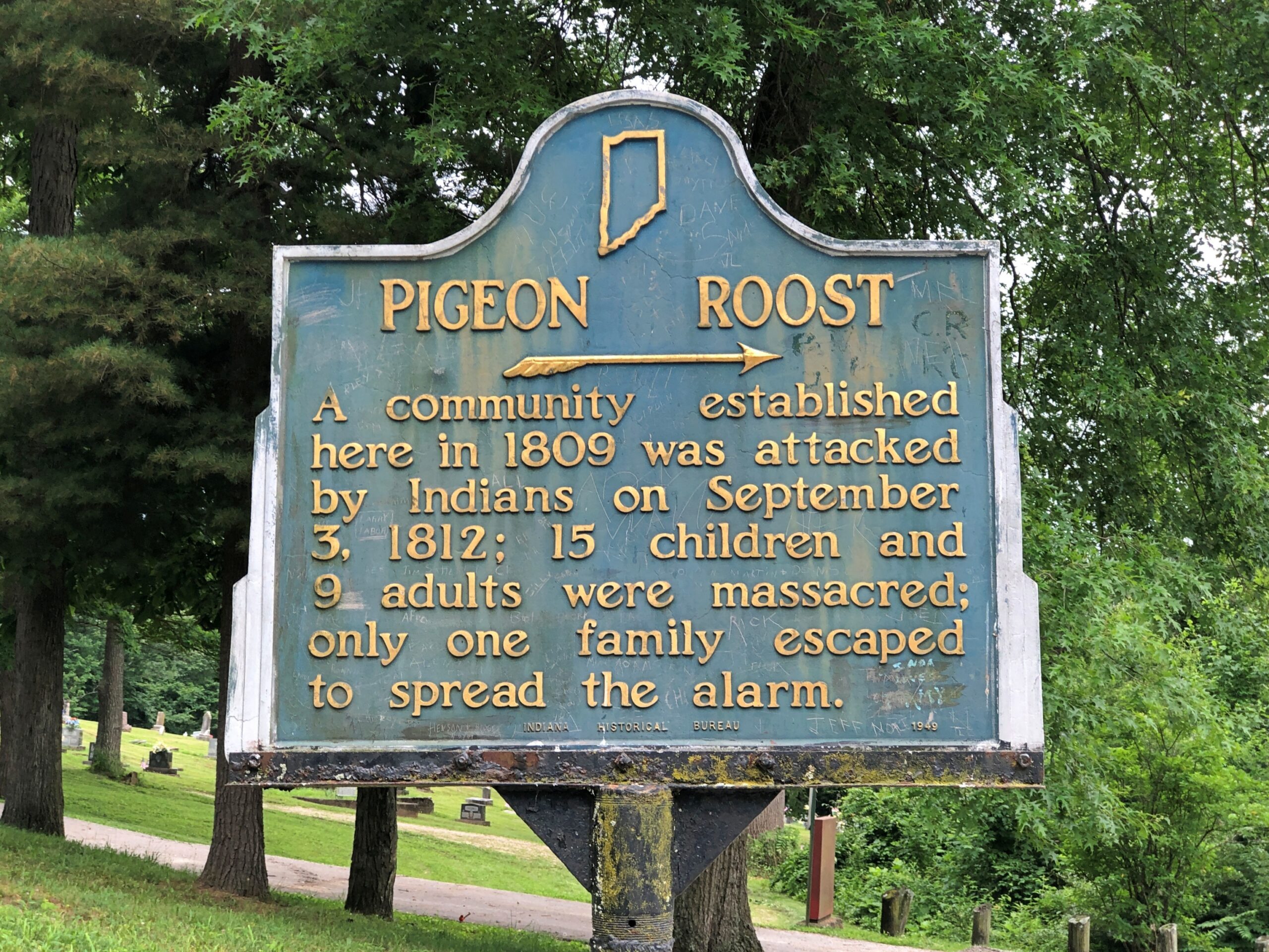
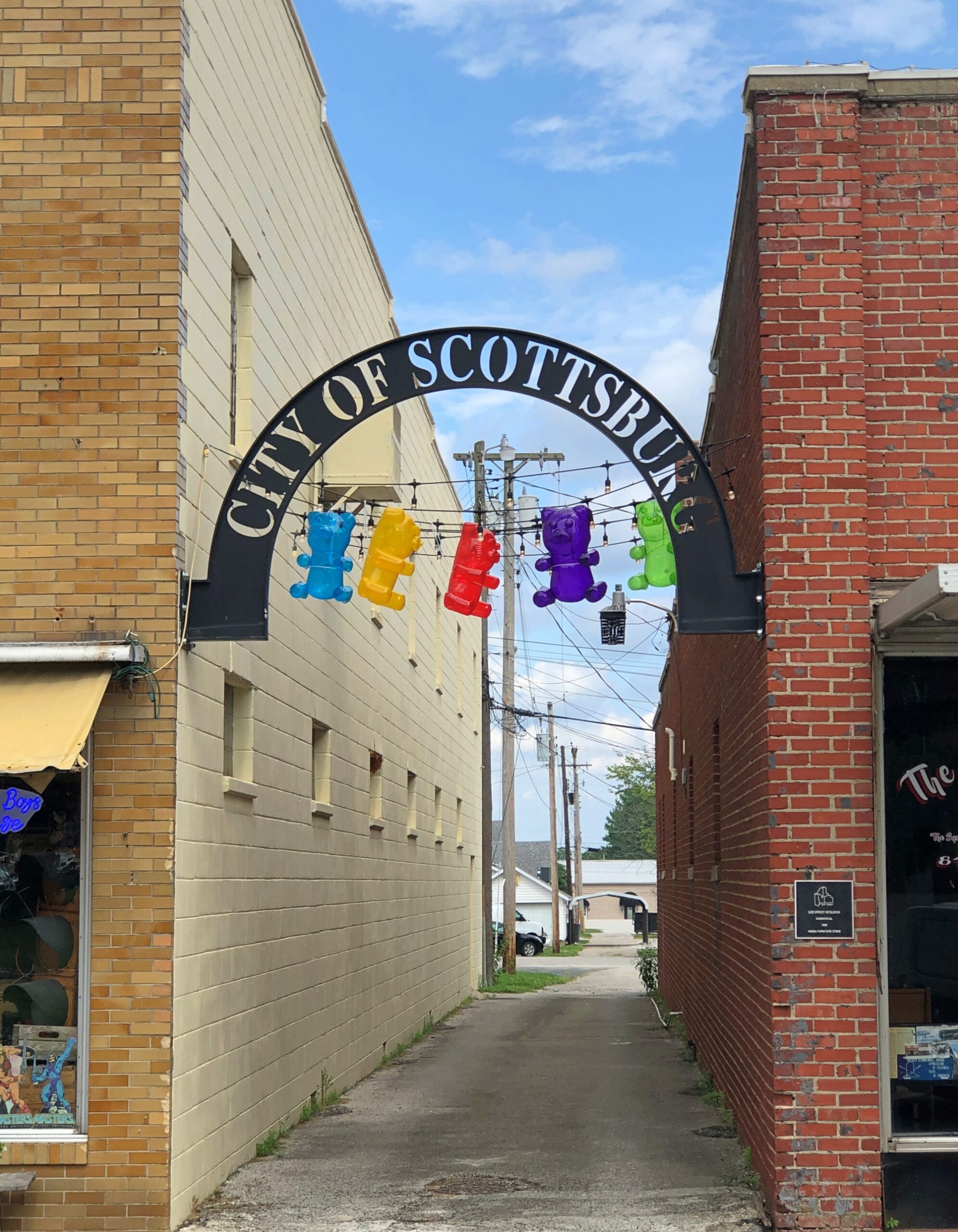
My stop in Scottsburg, Indiana, wasn’t entirely random. If you have a mind to visit Pigeon Roost State Historic Site, which is just south of town, you need to get off the Interstate and proceed to the site on US 31, and Scottsburg is a good place to do that.
As a point of interest red spot on highway maps, Pigeon Roost had intrigued me for years, but not enough to stop there. Unless I did sometime in the 1980s. Or maybe the ’90s. I’ve arrived at that point in life at which I can’t quite remember all the things I’ve seen, especially obscure memorials in obscure places. In a related trick of an aging memory, I sometimes have fairly distinct memories of places, but no memory of exactly where I was.
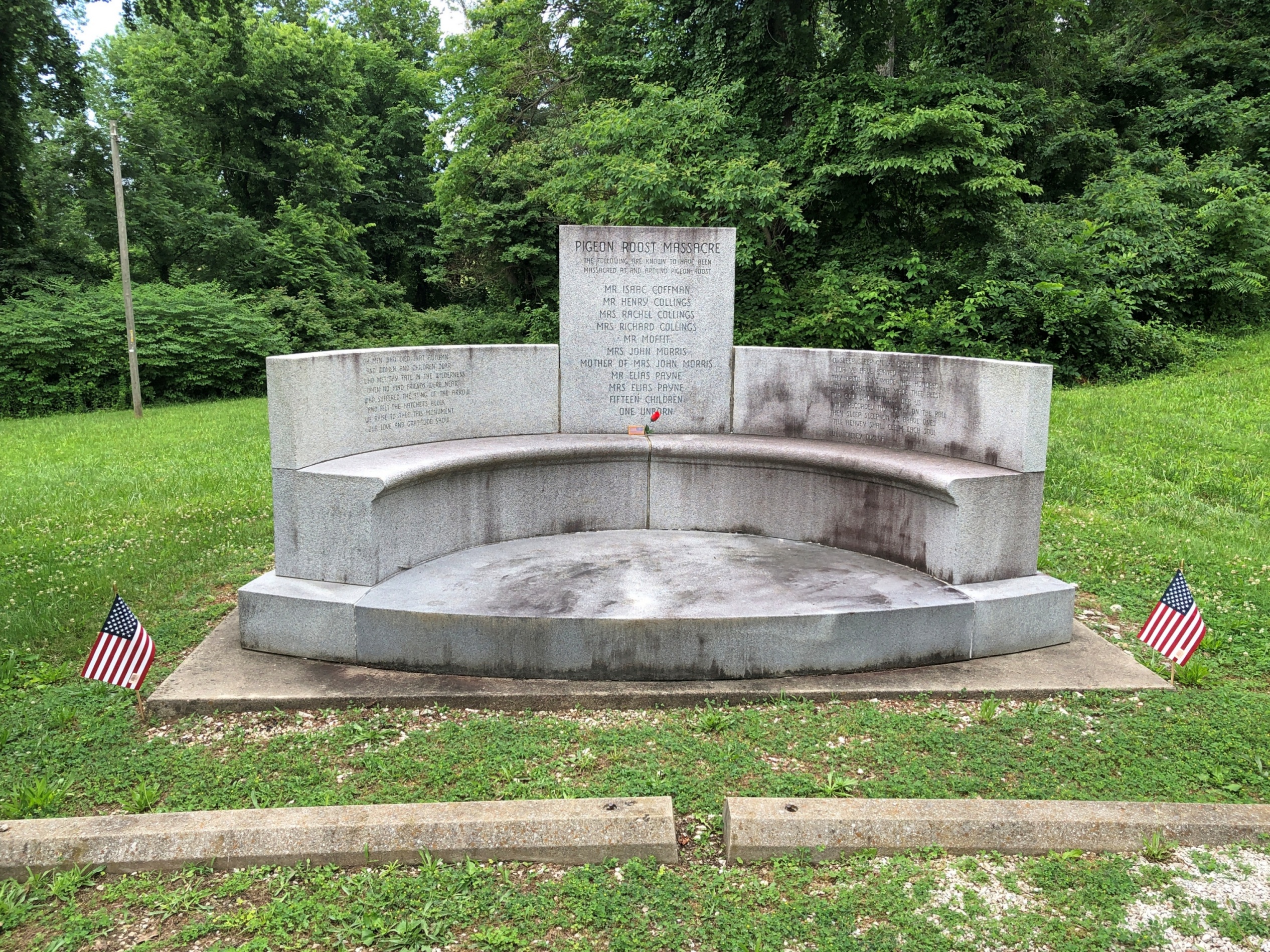
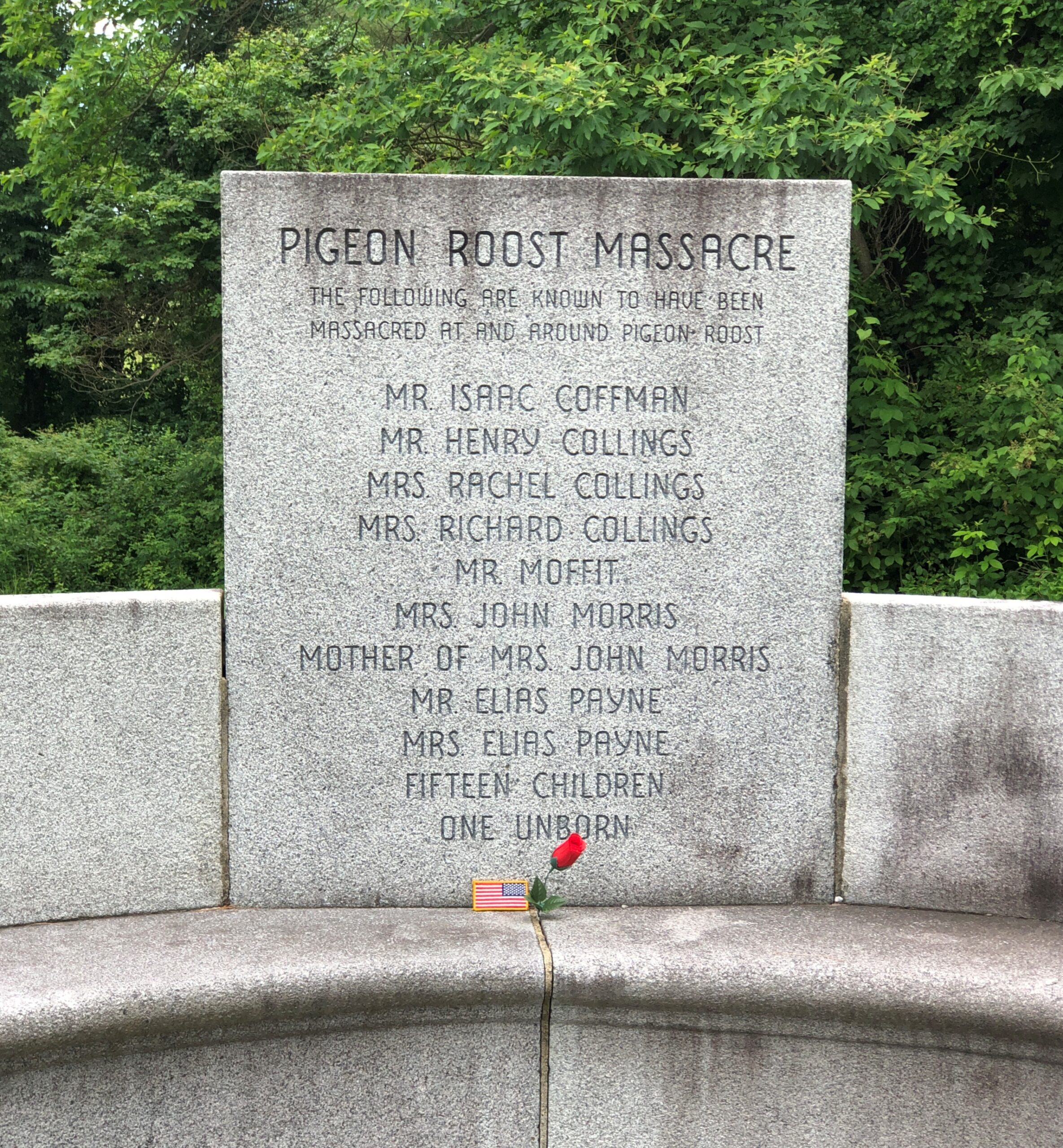
There are at least two layers of history at work at a place like Pigeon Roost. One is the massacre itself, whose longstanding interpretation sees it as a bloody incident in the War of 1812, with the Indians taking the opportunity – and British weapons – to fight the tide of settlement in the Northwest Territory, though they were already doing that, ultimately in vain. There also seems to be a revisionist idea that the Indians were out to settle a score with a particular group of whites and didn’t give a fig about the geopolitics of the situation, which certainly sounds plausible.
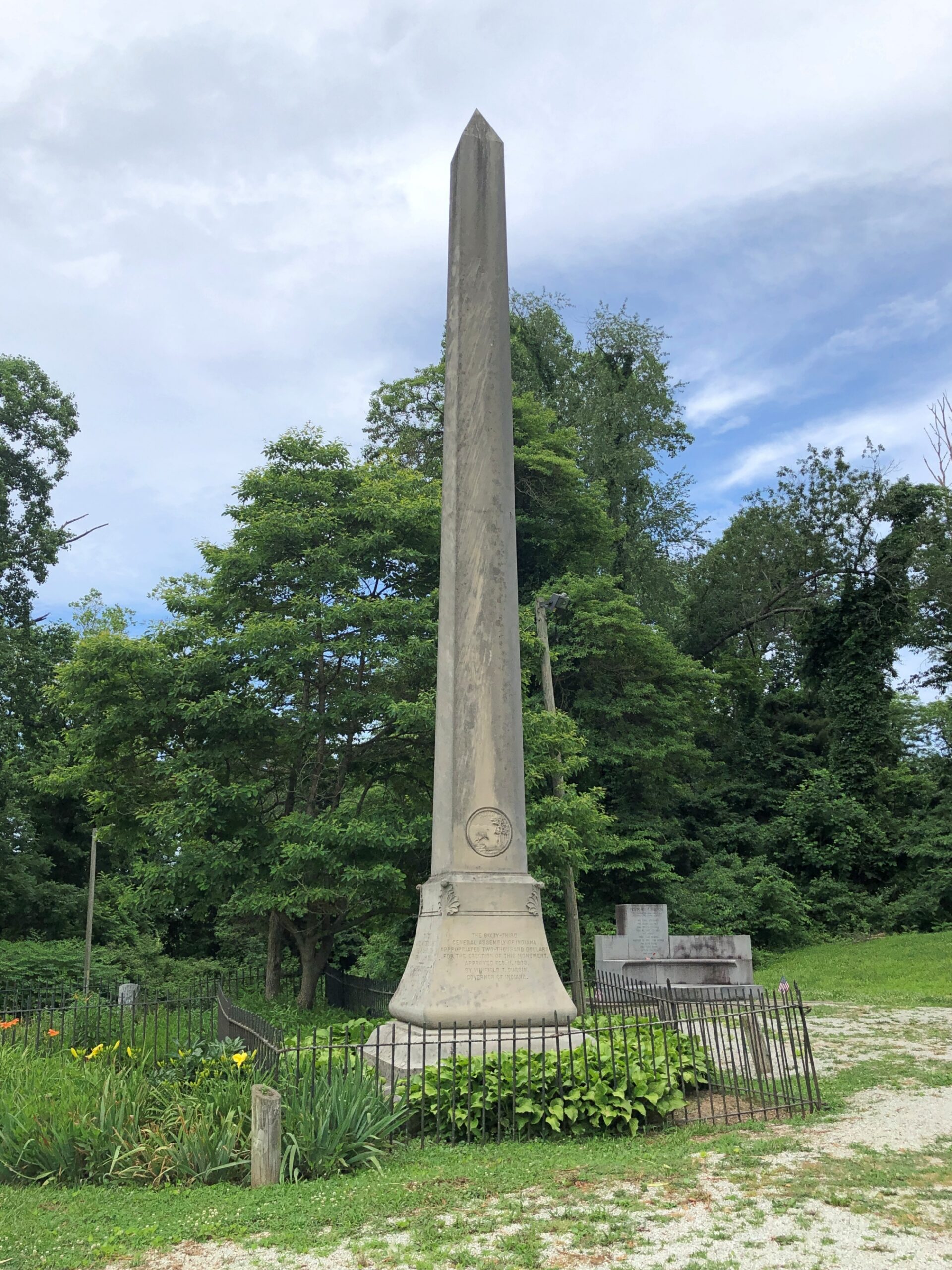
The other layer is the fact that it wasn’t until 1904 that the state of Indiana dedicated a memorial to the victims of the massacre, including what must have been a tidy sum to pay for an obelisk. Somewhere in the minutes of the legislature, and maybe in letters or newspaper reports, or maybe in a local history archive, is some inkling of why that might be: why then and not some other time. But it seems unlikely that anyone will ever take such a granular interest in the subject. Certainly not me, so I’ll have to leave it at that.
These days, Pigeon Roost is quiet and, I suspect, rarely visited. I had the place all to myself.
At some other point in the past, locals started burying their dead near the site.
Google Maps calls it Pigeon Roost Cemetery, aka Sodom Cemetery. The latter seems like an odd choice, but a quick look reveals a few others of that name, in Georgia, Ohio and Minnesota.
Google Local Guide Gary Collins has this to say about the place: This pioneer cemetery holds the remains of some of Southern Indiana’s earliest settlers, including some of the survivors of the infamous Pigeon Roost Massacre. At the time of the massacre, this cemetery had yet to be established, and some of the victim’s [sic] final resting places are unknown. It is generally well kept, and interments still occasionally take place.
What, no ghost stories about Pigeon Roost? Seems like perfect fodder for such tales: not only violent death, but the violent death of children and indeed entire families. There’s an opportunity here for making stuff up — I mean, paranormal investigations. What does Bachelor’s Grove Cemetery have that Pigeon Roost doesn’t?
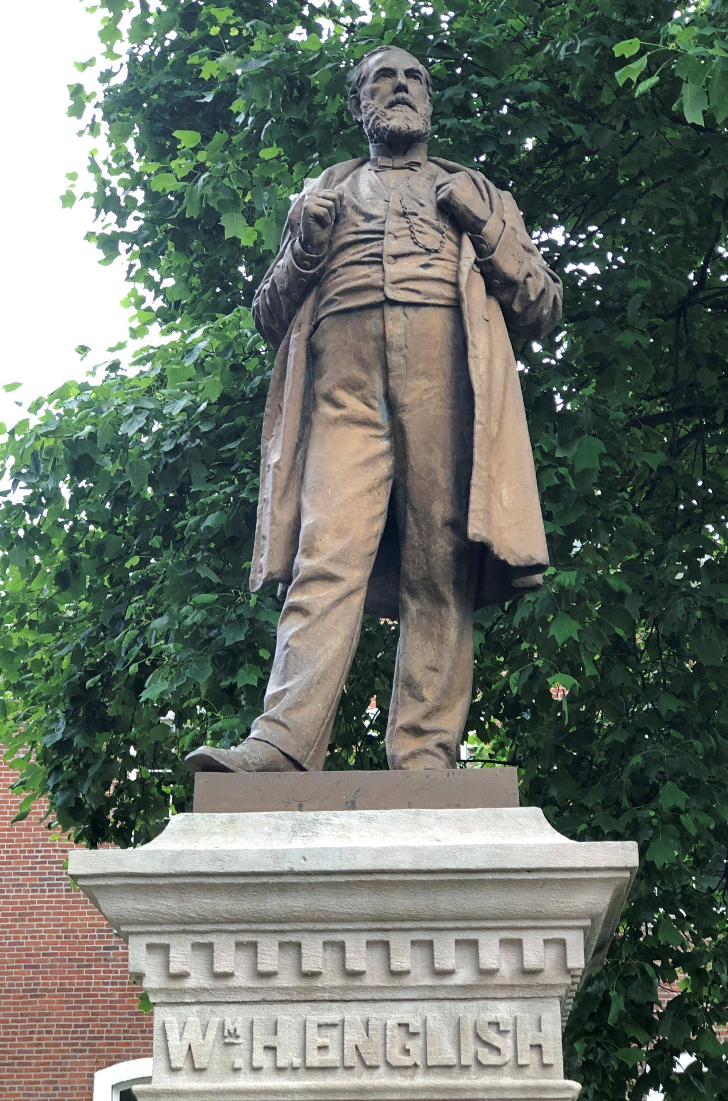
The heat was already on by the time I arrived in Scottsburg, Indiana on the first day of the trip, June 16. But not enough to keep me from taking a stroll around the Scott County courthouse, where I found native son William H. English.
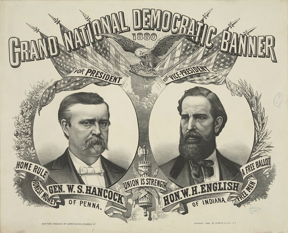
After only a few hours on the road, by chance, I’d come across a presidential sight. Presidential adjacent, anyway, since English (d. 1896) is that most obscure of obscurities, someone who ran for vice president and lost – in 1880 in his case, on the Democratic ticket with Winfield Scott Hancock, who himself isn’t going to ring any bells outside presidential history buffs. The statue went up in 1908.
That was the election James Garfield won, which he no doubt regretted before long.
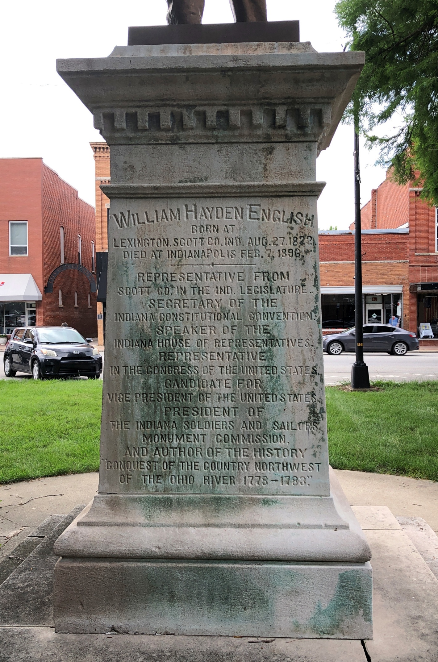
English, or his heirs, felt that a book he wrote, Conquest of the Country Northwest of the Ohio River 1778-1783, was worth a mention along with the offices he held or aspired to. The marvel here in the 21st century is that the work is just about instantly accessible (Vol. 1 and Vol. 2). An illustration facing the Vol. 1 title page (on the optitle page?) not only falls into the They Don’t Make ‘Em Like That Anymore category, it’s squarely in, No One Would Think of It territory. Just as well, I figure.
To get to Nashville from metro Chicago, the direct route is via I-65, which cuts across Indiana. Considering the importance of both of those cities to me, I’ve driven the route more times than I can count. But I have to report that it isn’t one of the more interesting drives in the nation, and at eight to nine hours drive time in the best of conditions, you feel it yawn beneath your wheels when you yourself yawn.
So the strategy over the years has been to break up the trip. Such as a place like Scottsburg, pop. 7,300. The town is close enough to Louisville to be its exurb – maybe. I haven’t spend enough time in Louisville, as interesting as it is, to have any sense of its greater co-prosperity sphere, or at what distance that might peter out.
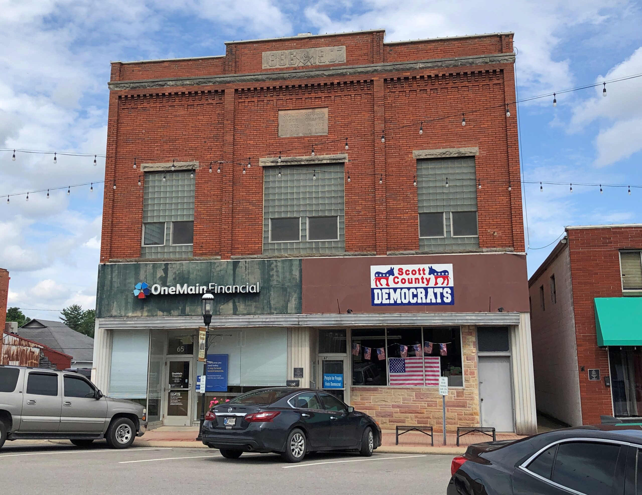
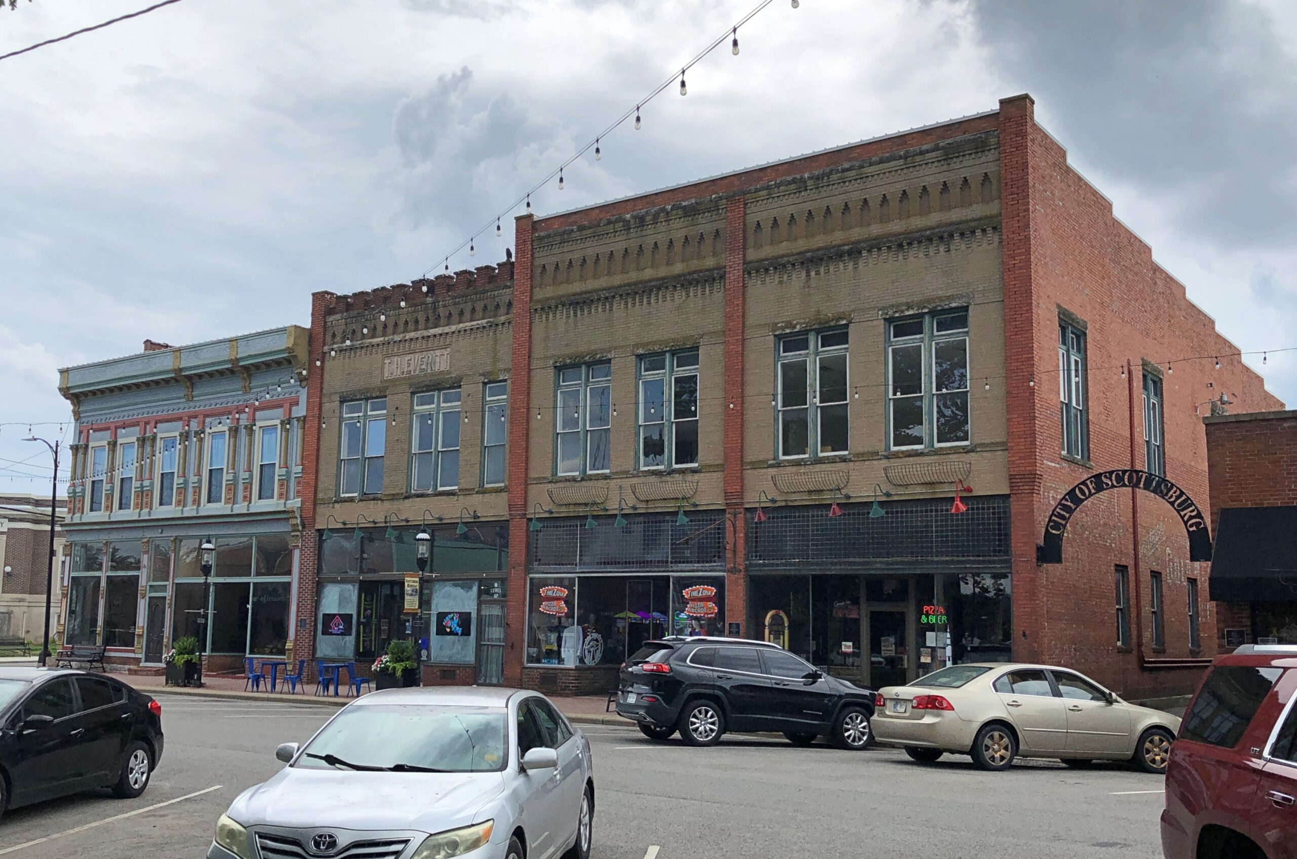
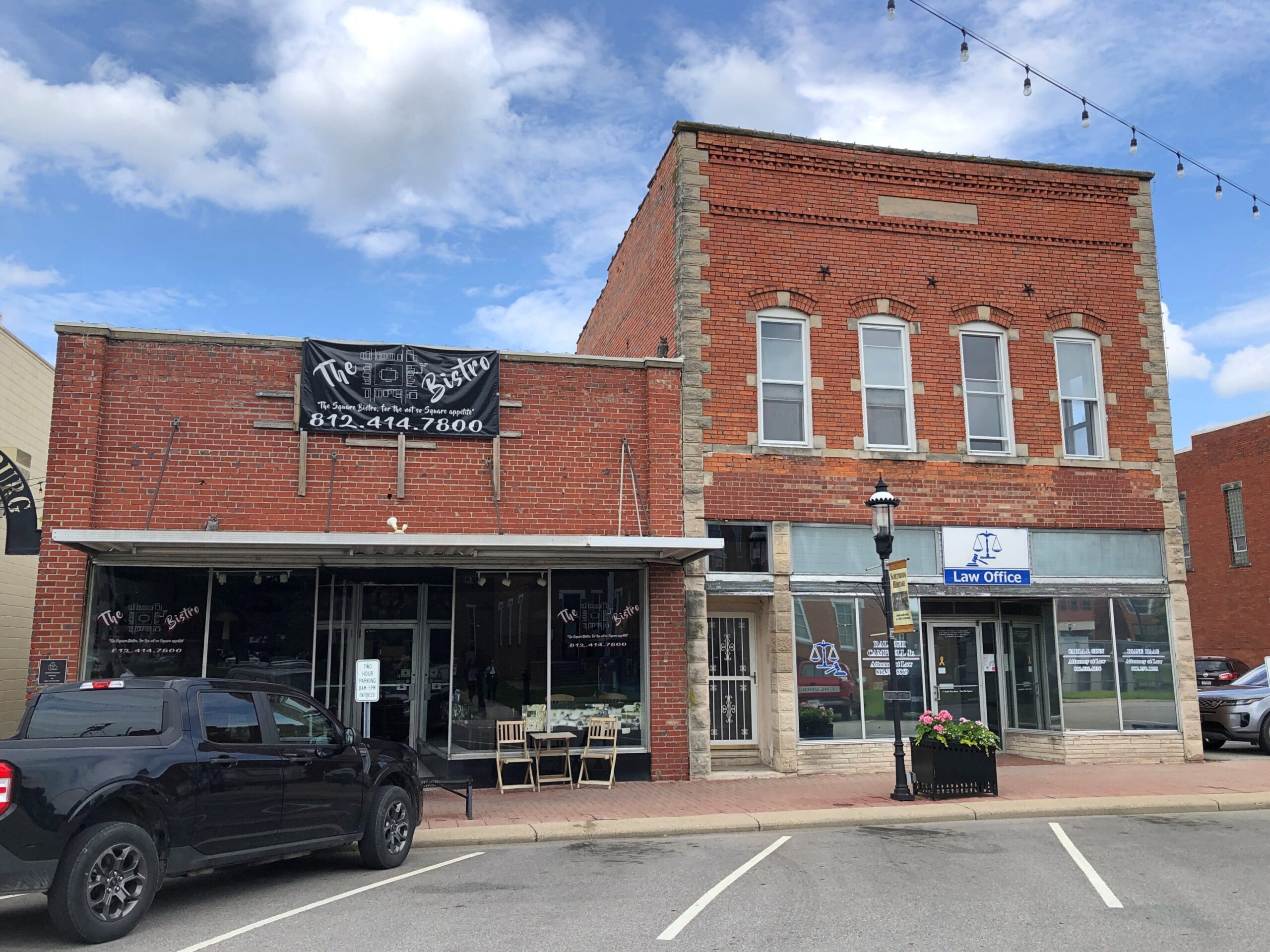
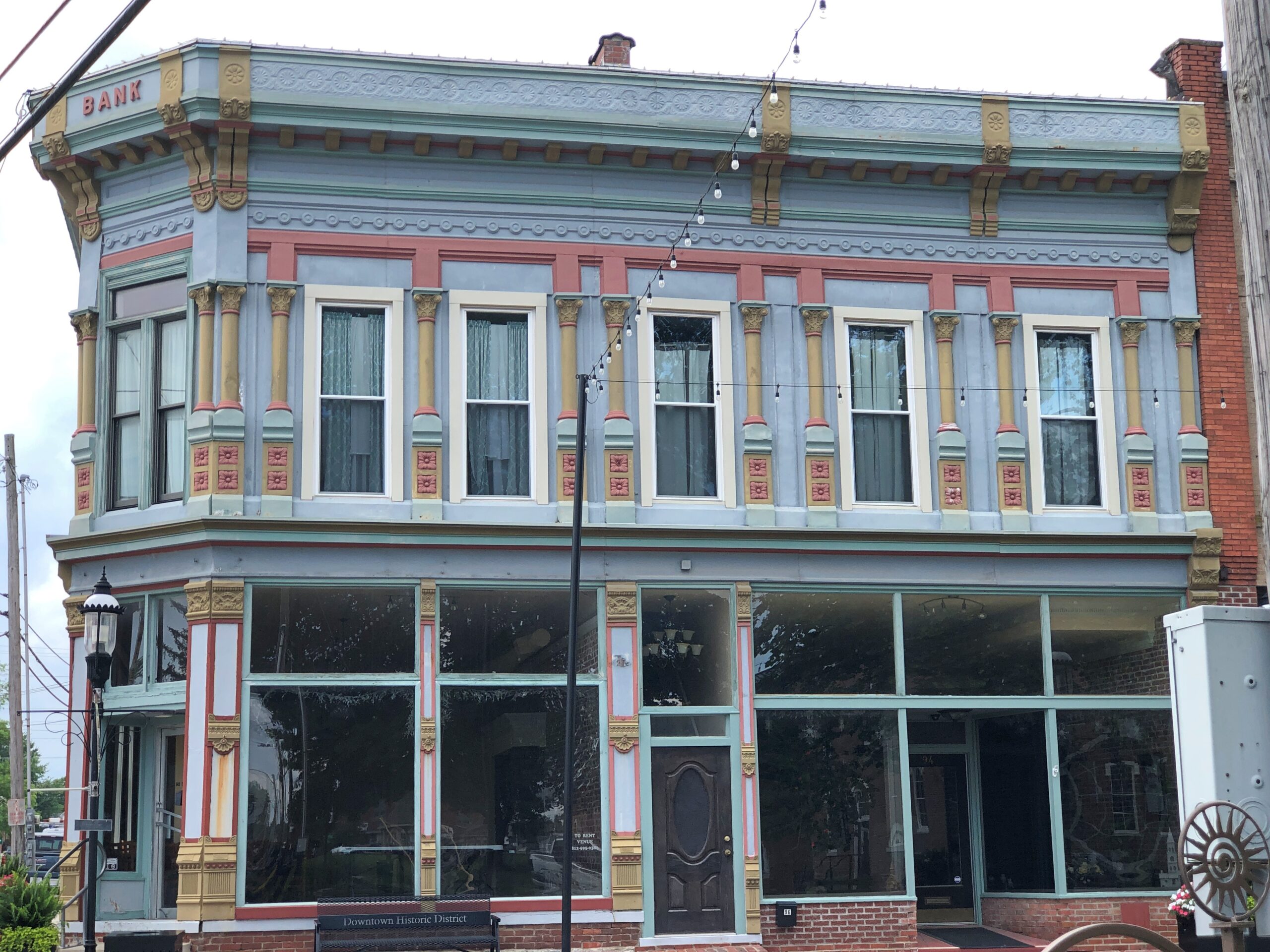
Scottsburg has one thing a picturesque exurb needs: a picturesque courthouse square. Or at least elements of it.
Downtown is in fact a national historic district: Scottsburg Courthouse Square Historic District. I get a kick out of discovering that kind of thing retroactively, which I did this time.
“The district is composed of one-, two-, two-and-a-half and three-story brick and stone commercial structures with zero setbacks, which form an essentially contiguous perimeter to the wooded courthouse lawn,” its registration form on file with the U.S. Interior Department says. “There are a total of 48 contributing buildings within the district. The character of the district is defined by late 19th and early 20th century commercial architecture with significant examples of the Italianate, so Richardsonian Romanesque, Renaissance Revival, Colonial Revival, and Art Moderne styles.
“The predominant building material is red brick, as evidenced by the courthouse and 29 commercial buildings within the district. Secondary materials include Indiana limestone and various shades of buff and yellow brick, decorative brick work, cast iron, ornamental pressed metal and glazed tile and Carrera glass…”
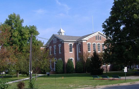
In the heat of the moment (literally), I neglected to get a decent shot of the courthouse itself, but someone called Bedford thoughtfully put an image in the public domain.
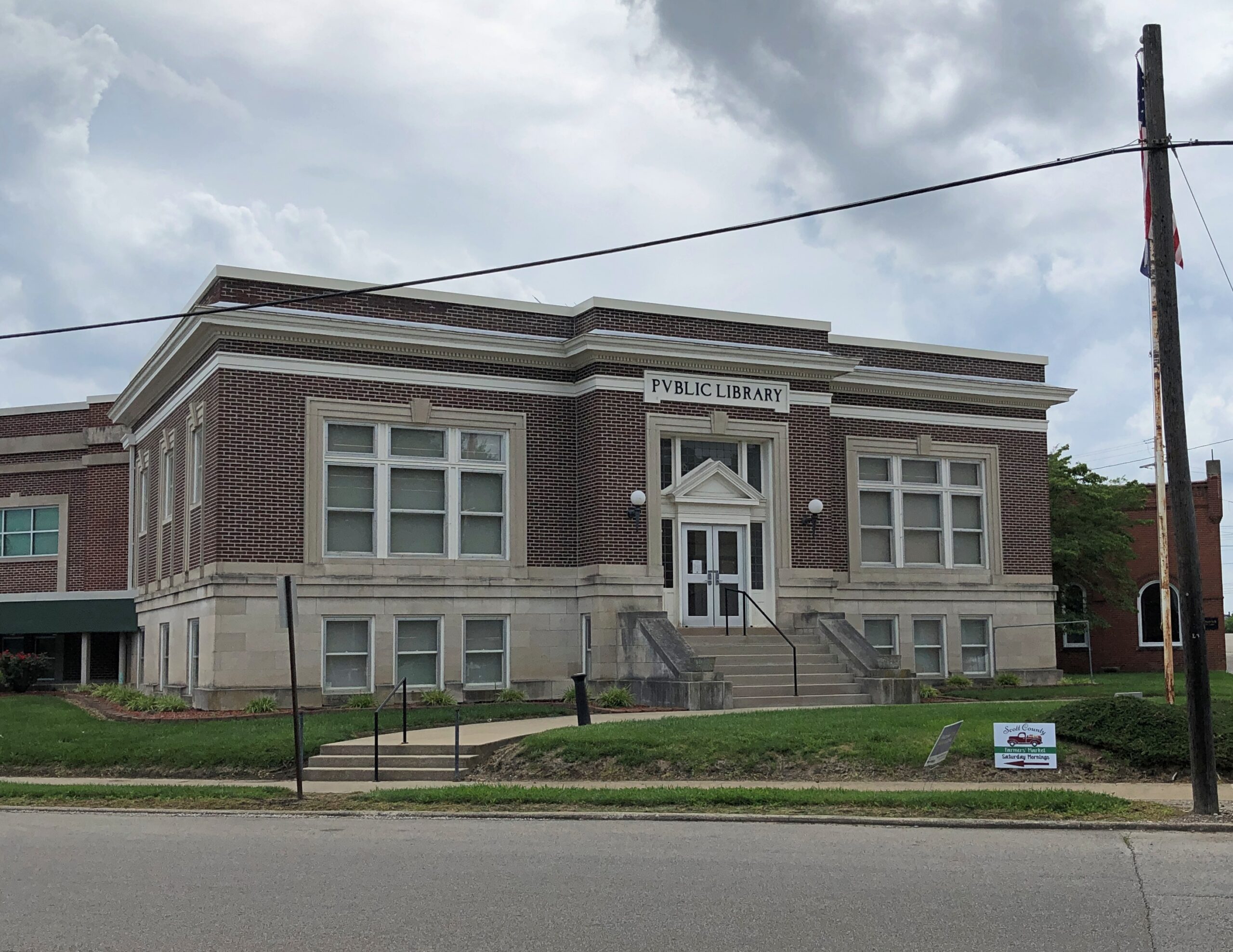
Could it be a Carnegie Library?
Yes. Completed 1917, still a library. One of the more than 1,680 in the United States funded by the robber baron, many of which endure after a century plus.
Some courthouse square details.
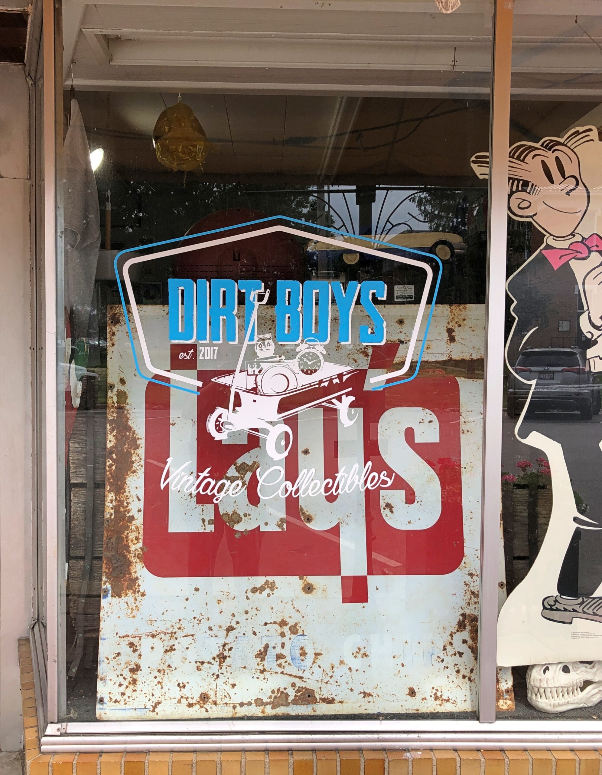
Dirt Boys Vintage Collectibles joins the likes of city offices and law offices, but also Warriors Den coffee shop, Time Zone Pizza Arcade, Chicago City Pizza and Bootlegger’s Bar & Grill. Those not needing to eat can visit Wildflowers Boutique, Moxie Music Center or Working Class Tattoo Parlor, all there on the square.
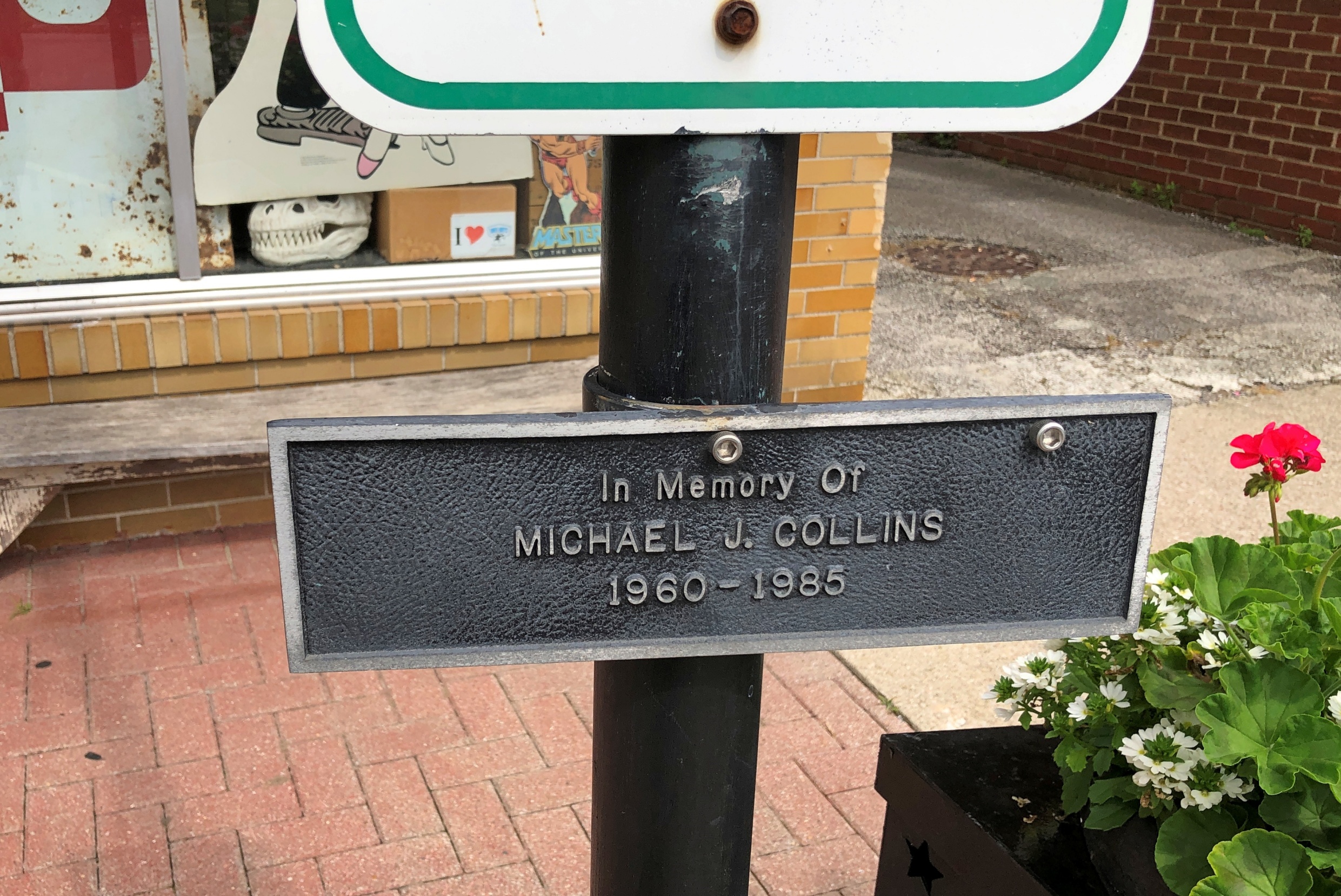
So is a plaque to the memory of one Michael J. Collins (d. 1985).
A contemporary of mine who didn’t make it far out of the gate. RIP, Michael, whoever you were. Are.


