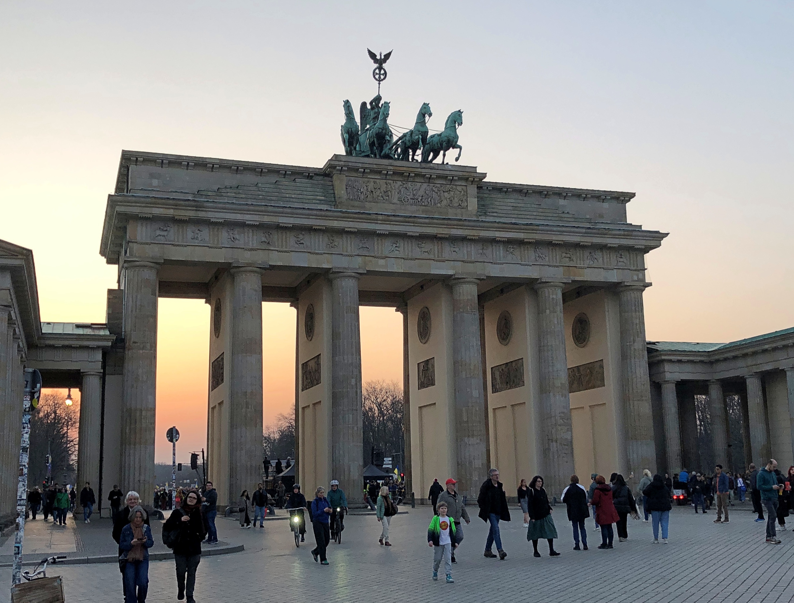
Bruce Peninsula ’24

We visited the Bruce Peninsula of Ontario last week in time for some windy weather, but otherwise not inclement. The wind would ultimately require us to change our travel plans somewhat, more about which later, but it also kept flags in a spirited motion. This one snapped over a small lakeside park in Kincardine, Ontario, within sight of Lake Huron.Maple Leaf Flag, west Ontario

That was on Tuesday as we headed north along the eastern side of the lake, and by then I’d already formed the impression that Canadians fly more national flags than they used to. Just an impression from visiting on and off for nearly 40 years, spending maybe a month in country all together, but in no way based on anything more than my feeling. There have always been flags flying during my visits to Canada, of course. It’s just that there seemed to be more this time, though not as many as generally flag-happy Americans hoist.

The first day of the trip, Monday, October 7, we crossed Michigan to made it to Sarnia, Ontario, arriving at after dark, so there were few Canadian flags visible. The next day took us to the tip of the Bruce Peninsula, to a town called Tobermory, where we spent two nights. I started taking note of Canadian flags along that route, such as the one vigorously catching the wind in Kincardine.
A flag flies at Little Tub Harbour in Tobermory.Maple Leaf Flag, west Ontario

At the entrance of our motel in that town. Stands out pretty well. On the whole, that’s true of this particular flag in most any setting. Maple Leaf Flag, west Ontario

On the fourth day, October 10, we drove south much of the way we’d come, though ended up (by plan) near London, Ontario for the night. We stopped in places we’d bypassed on the way up, such as Wiarton. It wasn’t as windy that day.Maple Leaf Flag

A flag I didn’t see that often was the flag of the province of Ontario. I spotted one at Haley Hall, home of the Royal Legion of Canada, branch #208. hanging in front of Haley Hall on Wiarton's main street,

There seem to be grumblings about a redesign of that flag, but not much movement toward it now. Could be that many Ontarians’ attitude toward the question is eh, with a sizable number who care a lot for the current flag, but what do I know.

Flags on commercial structures.Maple Leaf flag Maple Leaf flag Maple Leaf flag

Note the red spot on the Golden Arches. The image doesn’t capture it well, but that’s the Canadian Maple Leaf. You’re not fooling anyone, McDonald’s.
Along our drives I also noticed that pasting a Maple Leaf on a wall or sign was very common as well: a business declaring its Canadian bone fides, even if they run no deeper than having a Canadian franchisee. Using the Maple Leaf as a shorthand for Canada has a long history, and in fact came long before the Maple Leaf flag, as detailed by a Canadian government web site.

The current national flag was the work of a committee in parliament in the 1960s. Usually committee-made implies substandard work, but I’d say they hit it out of park in the case of creating the immensely popular Maple Leaf flag.

I also have to say that the three-leaf design’s pretty cool, too. It was in the running to be Canada’s flag. But maybe the symbolism isn’t right; Canada isn’t like Gaul or a giant Tennessee, with three distinct parts.

Or maybe it is. Everything west of Quebec, everything east of Quebec, and that Francophone province all by its lonesome. I’m not enough of a Canadian — not one at all — to know if that division makes any sense, but I might as well throw it out there.

Our trip to the Bruce Peninsula snapped into place only the week before we went, an unusually short time for planning (at least for me), but it turned out well. Up to the tip of the peninsula and back: four nights and five days. A longer trip would be Around Lake Huron, but it was not to be. We decided on short. That was a good decision, I think. Short but we saw a lot, and enjoyed the Bruce and other places along the way a lot.

Small roads near Ontario’s Lake Huron shore take you to small towns, long lakeshores and modest rises; vistas that can offer great beauty; and expansive farmland, well-watered woods, provincial parks and Bruce National Park, a unit of Parks Canada. Except for the Canadian flags and a few other details (such as km/h speed limits, which Canadians mostly ignored), the vibe was Door County – the counterpart peninsula on the Niagara Escarpment, jutting into Lake Michigan, the counterpart of Lake Huron.

To my way of thinking, after you’ve been to Door County and the UP – the U.S. parts of the escarpment, that is – the next logical thing to do is visit some of the Canadian parts. I’ve found that other Americans I’ve spoken to about the destination have little to no knowledge of it.

Since there is a well-developed tourist infrastructure in those parts, clearly the Canadians have heard of the Bruce, and visit in droves in the summer. That was another reason to go in shoulder-season October. Those droves were gone, and sometimes it felt like we had the place to ourselves, though that was far from literally true. Which you wouldn’t want anyway, since that would be like finding yourself in a Canadian version of The Last Man on Earth.

An added bonus: the U.S. dollar is still unaccountably strong against the Canadian dollar, which fetches about 75 U.S. cents, like it did last year (but not in 2006, when it was close to parity). Pay your bill and with no effort, get a 25 percent discount. None of those cash-back schemes so widely advertised can hold a candle to that.

Speaking of money, and national symbols, receiving this coin was a first for me, namely getting Charles in change. Minted in 2023.  Got it along with some Elizabeth coins, obviously still the vast majority.

King Charles taking his place on coinage, hewing to a custom as ancient as King Croesus, yet in a remote part of his realm that’s not really his realm that much any more. I don’t have strong feelings about him as sovereign, but it is nice to see something new on a coin, like the recent redesigns of the obverses of the U.S. Washington quarter and Jefferson nickel.

Craters of the Moon National Monument

Among the western states, Idaho’s got one of the more interesting shapes, the result of decades of negotiations, schemes and the arcane doings of Congress in the 19th century, which are summarized nicely in an article in Idaho magazine, though it could use a few more maps. Not every is happy with the current Oregon-Idaho border, though I’m not holding my breath waiting for a change.

Idaho’s flag is less interesting; another state seal.Idaho flag

At least the seal has some Latin: Esto perpetua, let it be forever; it is forever. I assume that’s a wish for the existence of Idaho, or Idaho’s status as a state, not the seal or flag itself. New state flag designs for Idaho are kicking around on the likes of Reddit, but nothing official seems to be in the works yet. Pocatello has had a new flag since 2017, however, and it did need one.

We headed east from Boise on September 3. The easy way is on I-84. We drove to Mountain Home and then turned off on US 20, as previously mentioned. Go that way and you’ll eventually come to Craters of the Moon National Monument and Preserve. It’s a big blob on the map (753,000 acres) that has long intrigued me.Craters of the Moon National Monument

The monument was originally created in 1924 by President Coolidge partly due to the publicizing efforts of an interesting Idahoan, Bob Limbert, who explored the area, previously ignored as a wasteland, and wrote about it. President Clinton expanded Craters of the Moon greatly in 2000 and I’ve read that the Idaho legislature has asked Congress to make it a national park.

I’d be against it. Not that anyone has asked me, but it’s time to stop national park bloat. Sixty-three is more than enough. Sixty is fine, for that matter, a nice round number with ancient resonance. There’s nothing wrong with a place being a national monument. It’s an honorable old designation, the brainchild that most conservation-minded president, TR. I need to visit more of them myself: only 21 out of 134 so far, counting Craters of the Moon and Devils Tower.

The part of Craters of the Moon accessible to casual tourists is only a sliver, but quite a sliver. One trail leads over the aftermath of ancient lava flows, and a road leads to cones.Craters of the Moon National Monument Craters of the Moon National Monument Craters of the Moon National Monument Craters of the Moon National Monument

The terrain just cries out for a monochromatic treatment.Craters of the Moon National Monument Craters of the Moon National Monument

The day was warm enough to wear a hat and carry water, but not blazing hot. A scattering of other tourists were around, but nothing like the more popular trails of the national parks.

The place looks barren, but it isn’t so, since life adapts.Craters of the Moon National Monument Craters of the Moon National Monument Craters of the Moon National Monument

Except where it doesn’t. Yet.Craters of the Moon National Monument Craters of the Moon National Monument Craters of the Moon National Monument Craters of the Moon National Monument

We decided not to climb the enormous black cone, but if you look carefully, you can see a fellow who did. Note the trail on one of the smaller cones. That we did climb, reaching a view of the maw of the cone, though it has a grate blocking the way, to limit the erosive effect of a constant trickle of people clambering down.

More monochrome.Craters of the Moon NM Craters of the Moon NM

“The craters of Craters of the Moon… are definitely of volcanic origin,” explains the NPS paper guide, noting also that the name dates from long before anyone knew what the actual craters of the Moon looked like, at least up close. I don’t think any of the Apollo astronauts were reminded of Idaho. No matter, the name’s got some panache.

“But where is the volcano? These vast volumes of lava issued not from one volcano but from a series of deep fissures – known collectively as the Great Rift – that crosses the Snake River Plain. Beginning 15,000 years ago, lava welled up from the Great Rift to produce this vast ocean of rock. The most recent eruption occurred a mere 2,000 years ago, and geologists believe that future events are likely.”

Not to be confused with the Great Rift Valley, over in East Africa. The Digital Atlas of Idaho calls it the Great Rift system, “a series of north-northwest trending fractures… The total rift system is 62 miles long and may be the longest known rift zone in the conterminous United States.”

In other places, life has returned more robustly. There’s an easy trail through that as well.Craters of the Moon National Monument Craters of the Moon National Monument

A difficult place for trees, looks like.Craters of the Moon National Monument Craters of the Moon National Monument

We spent longer than planned at Craters of the Moon, which meant that we didn’t get to Victor, Idaho, our next destination, until well after dark. No big deal, it was worth it, and the nighttime winding road was a smaller version of the twisty drive near Sheridan, Wyo., so not bad either.

The Idaho State Capitol & Bits of Boise

Boise is a growth town. I know that because the Census Bureau reported a population of about 235,600 in 2020, compared with 205,600 in 2010. Not only that, driving in downtown Boise was a pain in the ass last month, considering how many streets were closed for construction. That’s usually a growth indicator. Boise Idaho

Adding to the irritation is the fact that many of downtown’s one-way streets (that are still open) go opposite of the way you want to go. But when you’ve found a place to park, and arrive at a restaurant like Bacon in downtown Boise, you forget all that. Nice tip before we left Seattle from Dan, who has spent some time in the area.Boise Idaho Bacon

Maybe not good to eat in the long run, but in the short run, it makes you glad you spent the night in Boise and headed out for breakfast the next day. Also, downtown Boise looked interesting, especially on foot.Boise Idaho Boise Idaho Boise Idaho

The former Idanha Hotel, which opened exactly at the turn of the 20th century – January 1, 1901 – and is now a multifamily residential property. Its architect, a Scotsman named W.S. Campbell, founded a firm in the late 19th century in Boise that’s still around: CSHQA.Idaho State Capitol

Everywhere has one of these murals, though usually they say, Welcome to…Idaho State Capitol

Eventually, by way of Boise’s unpredictable streets, we made our way to the Idaho State Capitol. I saw it briefly in ’89, but only from the outside. A grand edifice.Idaho State Capitol Idaho State Capitol Idaho State Capitol

Grand inside as well.Idaho State Capitol Idaho State Capitol Idaho State Capitol

John E. Tourtellotte & Co. designed the capitol, completing much of it in 1912, though the House and Senate wings came a few years later. Tourtellotte is another one of those architects of yore who did a lot of work.

The Idaho State Capitol has a gilded Washington on a gilded horse.Idaho State Capitol

“Austrian immigrant [Charles Ostner] carved George Washington from a single pine tree,” the capitol web site says. “With a postage stamp to guide him, Ostner took four years to create his masterpiece. His young son was said to have frequently held a candle to light his workroom after darkness fell.

“Once completed, Ostner gave his rendition of our first president to the Territory in 1869. In return, Idaho’s leadership paid him $2,500.” Later, it was gilded and much later, restored.

Any capitol can have an image of George Washington. But how many have a Benjamin Harrison?Idaho State Capitol

Idaho is, of course, another of the six Benjamin Harrison states, entering the union with his signature in 1890 as number 43, just days ahead of Wyoming. A nearby sign says the Harrison bust was carved in 2009 by one Steve Ussing using wood from a red oak planted by the president himself.

The Columbia River Gorge

A happy birthday to Jimmy Carter, president of my adolescence, who some years ago outlasted every other holder of that high office, now reaching 100. I can’t presume to know the secret of his longevity, but can speculate that lasting long enough to vote against you-know-who might have been an inspiration to hang on.

While reading about President Carter today, I came across the conclusion of a speech at the dedication of the Carter Presidential Library in Atlanta on October 1, 1986.

I must tell you, Mr. President, that your countrymen have vivid memories of your time in the White House still. They see you working in the Oval Office at your desk with an air of intense concentration, repairing to a quiet place to receive the latest word on the hostages you did so much to free, or studying in your hideaway office for the meeting at Camp David that would mark such a breakthrough for peace in the Middle East. Others will speak today, Mr. President, of all phases of your political career and your policies. For myself, I can pay you no higher honor than to say simply this: You gave of yourself to this country, gracing the White House with your passion and intellect and commitment. And now you have become a permanent part of that grand old house, so rich in tradition, that belongs to us all. For that, Mr. President, I thank you, and your country thanks you.

Who said that? Ronald Reagan.

A month ago today we headed east from Portland on US 30, which soon becomes the Historic Columbia River Highway, beginning at the sizable town of Troutdale, an intriguing place that seems to count as exurban Portland. As highways go, the road is antediluvian, first surveyed in the 1910s, partly following a 19th-century wagon route. Old, but well maintained, it’s a smooth drive in our time, though fairly busy.

The highway’s engineer, Samuel C. Lancaster, got himself a plaque along the way, which calls the road a highway of “poetry and drama.” He collaborated with business tycoon and good roads promoter Sam Hill to get the road built.Columbia River Gorge

That is, he left a legacy of vistas. One could do a lot worse.

At Chanticleer Point.Columbia River Gorge

Further east is Crown Point, a promontory more than 700 feet high, with an even more sweeping view of the mighty Columbia. The builders of the highway knew this too, and included an observation tower: Vista House.Columbia River Gorge Columbia River Gorge

Designed by Edgar M. Lazarus and completed in 1918. Elegant stonework, and an expensive development, I’ve read. I’d say worth it, for providing more than a century of vistas.Columbia River Gorge Columbia River Gorge

Inside Vista House is a small museum, gift shop, and an information kiosk where we got helpful information from the person at the desk. She said that the highway (US 30) was closed for construction a few miles to the east, and that if we wanted to visit Multnomah Falls, we’d need to backtrack a few miles and then take I-84, the modern road that also passes through the Columbia River Gorge.

That we did.Columbia River Gorge

To see the falls, at least on September 1, you needed to book a slot, and we did that as well. Tall falls near a highway draws a crowd, though that isn’t apparent at a distance.Multnomah Falls

If you edit just so, that isn’t apparent closer up either.Multnomah Falls Multnomah Falls

But on a visit to the falls, which drop 635 feet in two plunges, you won’t be alone.Multnomah Falls Multnomah Falls Multnomah Falls

A stone footbridge 100 feet above the lower pool is the place to climb to and point your camera.Multnomah Falls

“Formed by the cataclysmic Missoula Floods beginning 15,000 years ago and fed mainly by underground springs, Multnomah Falls drops… in two major tiers down basalt cliffs,” says the office of the Oregon Secretary of State. “It ranks as the tallest waterfall in Oregon and is one of the most visited tourism sites in the state.”

Two million visits a year, to quantify that statement. As I’ve noticed in a fair number of other places, that’s not much of an issue, since the crowd is in a pretty good mood.

Missoula Floods?

“After millennia of relative calm, the colossal Missoula Floods crashed through the [Columbia River] gorge several times between 12,000 and 18,000 years ago,” wrote science writer Richard Hill in the Oregonian. “The source of the floods was the 2,000-foot-deep, 200-mile-wide Glacial Lake Missoula. Until the last ice age started to thaw, an ice sheet at the mouth of the Clark Fork River in northern Idaho and Montana blocked it.

“But slowly, melted water cut a channel into or under the ice, collapsing the dam and unleashing the lake’s 500 cubic miles of water. It sped into the narrower confines of the gorge at 75 mph and submerged Crown Point. The ice dam repeatedly would reform, and the flood process would start again.

“Recent studies… found evidence of at least 25 massive floods. They calculated the largest flood discharged roughly 2.6 billion gallons a second — about 2,000 times larger than the Columbia’s 1996 flood.”

1996 flood?

Another one of those things I’m sure I heard about, but memory of it has evaporated as surely as the flood waters. Epic, the Oregonian calls it.

Willie Keil’s Journey

On the last day of August 2024, we found a set of unusually informative point-of-interest display signs on the side of highway Washington 6, near the town of Raymond. Tucked in the southwest corner of Washington state, that is, out in sparsely populated Pacific County, which encompasses Willapa Bay. Reportedly about a quarter of the oysters eaten by Americans in any given year are from Willapa Bay. And how did I miss this?

The mound is inland some miles, and up top is the grave of Wille Keil. Willie Keil's Grave State Park Heritage Site

Officially it’s Willie Keil’s Grave State Park Heritage Site. Willie Keil was an Oregon pioneer settler in the 1850s, but a most unusual one, considering that he arrived in Oregon after he died. The three signs, installed only in 2020, tell the tale, if a little sappily on the third sign.

The Story of Willie KeilWillie Keil's Grave State Park Heritage Site

On November 26, 1855, Willie Keil, aged 19, was buried atop the hill in front of you after crossing the Oregon Trail inside a barrel of whiskey. Willie had fallen ill and died 6 months earlier and more than 2,000 miles away in Bethel, Missouri, just days before his family was set to depart. Willie’s father, Dr. Wilhelm Keil, ordered a metal coffin for Willie. It was placed inside a tightly banded wooden vat filled with Golden Rule Whiskey, produced by members of the Bethel Colony. Willie’s casket was placed at the head of the leading wagon and the colonists followed him across the entire trail.

Willie Keil’s JourneyWillie Keil's Grave State Park Heritage Site

Worth looking at in detail. Nice work. A map to evoke time and place, and detail a curious set of circumstances.Willie Keil's Grave State Park Heritage Site Willie Keil's Grave State Park Heritage Site

Willie Keil Lives Among UsWillie Keil's Grave State Park Heritage Site

In this untimely death, Willie Keil gained eternal life. Over time, he has grown up into a folk hero. As Willie’s story has been told and retold, distilling truth from fiction has become ever more difficult. The strange tale has come to symbolize the sanctity of a promise. Willie’s dying wish, the story goes, was to lead the wagon trail and his father assured him that he would – no matter what. Today, Willie lives among legends. And here, at the heart of the Willapa Hills, the spirit of the Pickled Pioneer” endures.

The Washington State Capitol

My travels in ’85 took me through Olympia, Washington, for a visit to the Washington state capitol. Thinking back on that, the visit is mostly a blank.

Nearly 40 years will do that. But I remember a lot of other things about that trip. Driving on small rural roads through unfamiliar kinds of woods, dodging log trucks, I admired the brilliant gold Scotch broom in bloom in profusion on the roadside without knowing it is an invasive species in North America. Along a not-difficult hike under the tallest trees I’d ever seen, I remember that the trail passed by a van-sized fallen tree trunk marked by graffiti reporting itself to be from the 1930s. I remember that Butchart Gardens, gem of parks and light show in Victoria, BC, wowed me completely; so did Victoria and the drive to Duncan, BC where I bought lunch in a diner that immediately reminded me of a favorite diner in Nashville, and acquired a dictionary in a nearby bookshop that promised to be authoritative in Canadian English. Know what else British Columbia had? Really good Hungarian food. I remember visiting the Space Needle on my 24th birthday, watching David Letterman destroy watermelons on late-night TV while staying with my Seattle friends, listening to Laurie Anderson talk-sing on the radio (from United States Live) as we took a ferry to Bainbridge Island, our car the last one shoed into that particular vessel. While on the island we discussed the uses of Slug Death – a product that I’d never heard of, and was glad of it. I heard about geoducks for the first time as my companions tried to dig one up on the beach, fruitlessly.

It so happened that the first two nights on the return from Seattle would be in Portland. It also happens that Olympia, Washington, is pretty much on the way to Portland, just a stop on I-5. Stop we did, arriving late in the morning of the last day of August.Washington State Capitol

The crowning dome is the tallest self-supporting masonry dome in the United States, and among the tallest in the world, up there with the likes of the famed high points of St. Peter’s Basilica and St. Paul’s Cathedral.Washington State Capitol

A protest was going on in front, an assemblage waving Cambodian flags and signs in Khmer script. The speech must have been in Khmer. Of course that’s unintelligible to the likes of me, but no language skills were necessary to hear the stridency in his voice. Protesting the current authoritarian government in their country would be my guess.Washington State Capitol

Forty-two steps to the entrance, Washington being the 42nd state to join the union, in 1889. One of the Benjamin Harrison states. He signed bills for six, more than any other president.

The capitol took a while to build, delayed by the Panic of 1893, a fit of austerity on the part of the executive branch, and other disputes about this and that for a few decades. The domed structure wasn’t finished until 1927, a little late for that style. If the delay had been longer, Washington might have gotten something like Nebraska’s capitol.

Inside.Washington State Capitol Washington State Capitol

The chandelier under the dome is by Tiffany & Co. The largest thing that studio ever made, I’ve read, and the last job Louis Tiffany oversaw himself. With 200+ bulbs, it’s a massive thing, dangling up there, full of potential energy at a weight of five tons.Washington State Capitol Washington State Capitol

Tiffany also did the Roman fire pots, something I don’t believe I’ve seen in any other capitol, despite how well they evoke republican government. There are four all together, one each at the four corners of the room, and each surrounded by flags from Washington counties. Never actually used to hold fire these safety-conscious (-paranoid?) days.Washington State Capitol

On the floor, straight below the dome. Roped off from feet that would casually tread on President Washington.Washington State Capitol

The House chamber.Washington State Capitol

Him again. Who do they think he was, the Father of Our Country?Washington State Capitol

The 2001 Nisqually earthquake moved the Washington state capitol dome by three inches or so. Since then anchors besides gravity have been retro-engineering into the dome. The quake also left cracks on the floor stone. A capitol might convey permanence to the human mind, but impermanence has already gained a foothold.Washington State Capitol

A capitol isn’t built of stone and bronze alone. The Olmsted brothers, sons of Frederick Law Olmsted, did the landscaping of the capitol grounds, with earth and vegetation as their raw materials. Anything by father or sons is usually worth a stroll through, especially on a warm summer day with blooms all around.Washington State Capitol campus Olmsted Washington State Capitol campus Olmsted Washington State Capitol campus Olmsted Washington State Capitol campus Olmsted

I knew at once it was a monument to those from Washington who died in the Great WarWashington State Capitol campus WWI memorial

Sure enough. “Winged Victory,” by Alonzo Victor Lewis (d. 1946), known in the Pacific Northwest for his works.

One more feature of the capitol grounds: a view. Capitol Lake, created by the damming of the Deschutes River in 1951.Washington State Capitol

One of these days – as a larger movement to de-dam U.S. waterways is under way – the dam might be removed, returning to the estuary it once was. Naturally, there are arguments against taking the dam down. As much as I admired the behemoth likes of Bonneville and Grand Coulee, I could also be persuaded that a lot of the smaller dams were built simply because that’s what you did, and whatever economic justification they once had is long gone.

Dam It

Plenty of people visit places simply because they’ve been in some famous bit of entertainment, and can’t say I’m immune to the impulse. Still, my choices are a little more – obscure. Eccentric? I’ll bet the Grand Coulee Dam never appears on formulaic lists like these, mainly because the compiler (he, she or it) has never heard of the Woody Guthrie song of that name.

Or the version I like best, by the King of Skiffle himself.

I’d probably have heard of the Grand Coulee Dam anyway, but would we have gone maybe an hour out of our way in eastern Washington to see it, but for the song? I’m going to say no, because how many dams are there, even very large ones, on the rivers of North America? A lot. How many had skillful publicists like Grand Coulee? Not as many.

The Bonneville Power Administration paid Guthrie to write some songs about the mighty Columbia, and write he did, including “Grand Coulee Dam.” Fairly obscure, maybe, but not unknown more than 80 years later. I’d say the agency got its money’s worth.

They got some extraordinary verse.

In the misty crystal glitter of that wild and windward spray,
Men have fought the pounding waters and met a watery grave,
Well, she tore their boats to splinters but she gave men dreams to dream
Of the day the Coulee Dam would cross that wild and wasted stream.

The dam doesn’t disappoint, if you’ve a eye for infrastructure.Grand Coulee Dam Grand Coulee Dam

How is it that human beings can building something that large?

“Grand Coulee Dam, The Eighth Wonder of the World” gets right to the point of awe-inspiring comparisons.

“Holding in check the mighty Columbia, at a point where the river flows through a lava-rimmed, 1600-foot-deep chasm on its way to the sea, the dam dwarfs the efforts of the Builder Cheops, to whom is accredited the largest of the pyramids at Gizah, Egypt,” the booklet says.

“The ancient sepulcher of kings is surpassed in size nearly four times by the Grand Coulee Dam…”

The payoff.Grand Coulee Dam

Roosevelt Lake provides irrigation and recreation, but the core function is its hydropower generation capacity, which is 6,645 MW. Number-one in the United States and still among the top dams worldwide, on a list that’s mostly crowded with Chinese structures these days.

By the time Guthrie wrote the song, he was able to include this rousing verse.

Now in Washington and Oregon you can hear the factories hum,
Making chrome and making manganese and light aluminum,
And there roars the flying fortress now to fight for Uncle Sam,
Spawned upon the King Columbia by the big Grand Coulee Dam.

The dam has a visitor center with a mid-sized museum about the dam, including such artifacts as building tools, enormous corona rings, the wheelchair available to President Roosevelt when he came to dedicate the dam, bottles that held water from each state and territory that were used in a ceremony at the dam in 1951, and film and stills from the construction itself. Woody Guthrie and the song get a mention, as did ordinary dam workers and people displaced by the creation of Roosevelt Lake. There is a map illustrating the 31 dams of the Federal Columbia River Power System and a plaque for workers who died on the job.Grand Coulee Dam

Grand Coulee wasn’t the only dam we saw. On our return trip, we paid a visit to the Bonneville Dam, also on the mighty Columbia, just further downstream.Bonneville Dam Bonneville Dam

Also mentioned in a Woody Gurthrie song, “Jackhammer Blues.” The one I prefer is a late Weavers’ modified version.

Hammered on the Bonneville, hammered on the Butte
Columbia River to the five mile chute…

Hammered on the Boulder, Coulee, too
Always broke when the job was through

One more dam, much smaller, but impressive in its way. The Jackson Lake Dam in Grand Teton NP.

Holds back the Snake River to form an enlargement of a natural lake.Lake Jackson

Not mentioned in any song that I know of, but a tip of a massive reservoir system.

Riverfront Park, Spokane

Until we took a stroll through Riverfront Park in Spokane, I’d forgotten about Expo ’74. Turns out the park is a legacy of that world’s fair.Riverfront Park, Spokane

I’ve enjoyed visiting world’s fair legacies over the years, beginning with the many times I visited Hemisfair Plaza in San Antonio, but also the Expo ’70 Commemorative Park in Osaka, the Biosphere in Montreal, the Unisphere in New York, the Space Needle in Seattle, the Palace of Fine Arts in San Francisco, Forest Park in St. Louis, the Parthenon in Nashville, the Museum of Science and Industry in Chicago, and even the Eiffel Tower, if you want to go back that far. If the Crystal Palace had been still standing, I’d have gone to see that.

I’m sure I heard about Expo ’74 at the time, but it was in distant Spokane, which I’d only ever seen on maps. With no likelihood of a visit, I probably didn’t give it much thought at 13. Or afterward. Not until 50 years after the event, on August 25, 2024, when we decided to spend a few hours in downtown Spokane before heading to Seattle.Riverfront Park, Spokane

A river runs through it. Namely, the Spokane River, which is a tributary of the mighty Columbia. (Every time I write about that river, I will use “mighty” just as “stately” always comes before Wayne Manor.) The Spokane roars around an island, formerly known as Canada Island, and still called that according to Google Maps, dividing the upper falls.Riverfront Park, Spokane

In 2017, the Spokane Parks Board decided that “snxw meneɂ” (sin-HOO-men-huh), a Salish word, would be a more fitting name. Salmon People, to render it in English. Once upon a time, the Salish caught salmon there.

The river travels over a small dam, then to the lower falls.Riverfront Park, Spokane Riverfront Park, Spokane Riverfront Park, Spokane

Back in the late 19th century, the area was industrial.

The location wasn’t quite as valuable for industry by the 1960s, so it was picked as the site for the world’s fair, whose formal name was the International Exposition on the Environment, Spokane 1974. Some 5.6 million people showed up for it, compared with 6.3 million for HemisFair in 1968 (and I was among those).

The legacy park.

A pleasant place to stroll on a summer Sunday. Lots to see, such as site of the former U.S. Pavilion.Riverfront Park, Spokane

The handsome Washington Water Power Co. building, dating from 1907. Not actually in the park, but highly visible from the park.Riverfront Park, Spokane

A reminder of long-ago native inhabitants of the area.Riverfront Park, Spokane

For even better views of the river, there’s a sky ride. Its course parallels the river near the lower falls, and then turns around and comes right back, taking 20 or so minutes.Riverfront Park, Spokane

We took a ride. Of course we did. That’s how I was able to take photos of the lower falls, posted above.

Going-to-the-Sun Road

No point in burying the lead. Going-to-the-Sun Road in Glacier NP is famed for its splendid mountain scenery, and for good reason.  Going to the Sun Road Going to the Sun Road Going to the Sun Road Going to the Sun Road

The road is also an epic feat of civil engineering. With its large pullouts for auto tourism, it dates from what you might call the golden age of road building in national parks, which was spurred by the prospect of auto tourism. Beginning about 100 years ago, that is, and a key factor in making Glacier a tourist magnet over the years.

Nearly or over 3 million visitors have visited each year since 2016, except for 2020. In 2022, Glacier was tenth-most visited of the 63 national parks.

On August 24, we drove westward on the two-lane Going-to-the-Sun Road, which winds across Glacier for 50 miles or so. Hard to believe that such a poetic name is government sanctioned, but so it is, named for the nearby Going-to-the-Sun Mountain, which in turn had been named that by the remarkable, and mostly forgotten, James Willard Schultz. Apparently he took it upon himself to name features in the future Glacier National Park long before it was a park, which it became in 1910, with President Taft’s signature on the bill.

The eastern entrance to the road has a visitor center, which flies two flags of nearby nations, along with the Stars and Stripes.

The less familiar one is the Blackfeet Nation.

The Blackfeet Reservation, at 1.5 million acres, is half again as large as Glacier NP, which comes in at about a million acres. The reservation is due east of the park, and in fact they share a border on the eastern side of the park. Indeed, much of the park was part of the reservation until the tribe was obliged to cede the land in the 1890s.

Another digression: “The Chief Mountain Hotshots are a Native American elite firefighting crew based out of the Blackfeet Indian Reservation located at Browning, MT with Glacier National Park as their backyard,” the Bureau of Indian Affairs says.

“The Chief Mountain Hotshots are a highly trained self-sufficient hotshot crew working in wildland firefighting. On average, the Crew works 15-20 large fire incidents and travels 10,000-20,000 miles a year.” More about the hotshots is here.

All good to know, but I’m glad there were no wildfires in the vicinity for them to fight. As the road passes along the north shore of cold-water Saint Mary Lake — Going to the Sun Road

— clearly there has been some wildfire.

The road rises from the lake, elevation 4,484 feet, toward the Continental Divide at Logan Pass, elevation 6,646 feet.Going to the Sun Road Going to the Sun Road Going to the Sun RoadGoing to the Sun Road

Logan Pass is the kind of place we would stop, but there was no available parking. This pic was taken by a photographer named Ken Thomas, who thoughtfully put it in the public domain.

No trucks or RVs allowed on the road, since they wouldn’t fit in some (many) places. That doesn’t keep drivers off the road, however. During the warm months when it’s open, Going-to-the-Sun is a busy place.

Even so, much of it still has that classic mountain appeal of low traffic.Going to the Sun Road

Except when there are knots of traffic. Just a few.Going to the Sun Road

Mountain scenery has a broad appeal.Going to the Sun Road Going to the Sun Road Going to the Sun Road

Toward the east end of the park, the road parallels McDonald Creek for a number of miles before it connects with Lake McDonald, the larger of the park’s two major lakes, and the lower, at 3,153 feet elevation. Some of the creek has more of a river look.Going to the Sun Road

Closer to the lake, the creek is rocky.Going to the Sun Road Going to the Sun Road Going to the Sun Road

The water is bound for the Flathead River, a tributary of the mighty Columbia. We stopped at a wooden bridge across the creek.Going to the Sun Road

Pedestrians can cross, but a sign warns that horse traffic has the right of way.Going to the Sun Road

Not something you see too often. I assume that’s horses with riders, as part of a horse-riding trail, though maybe wild horses might have the right of way too. Like bears or moose, they’re large and might insist.

The Montana State Capitol & Helena Stroll

Missing a hike around Devils Tower meant we had time for other things, including a fine second breakfast in Hulett, Wyoming (pop. 300+). I asked the waitress what it was like a few weeks earlier, during the Sturgis Rally.

“Crazy,” she said, adding that the rally started on her third day on the job, for that extra measure of crazy.

She and her husband and daughter had been living on a boat for five years until recently, she also said, including a sail through the Panama Canal once. She mentioned that almost in passing, as if five years on a boat is something people often do, followed by relocating far away from any oceans. Though not Sturgis-busy, the place had more than a few customers, so I wasn’t able to get more detail.

We had time to look around Sundance, Wyoming before we left. Turns out Harry A. Longabaugh spent some time in the local jug for a bit of thieving near Sundance, and so he became known as the Sundance Kid. The town of Sundance (pop. just over 1,000) wants you to know this, communicating it to passersby with a memorial in the town’s main municipal park.Sundance, Wyoming

Despite his long history of criminal shenanigans, that was apparently the only time he was imprisoned. Guess you can get away with a lot when you have the dashing good looks and vim of a young Robert Redford.

The drive from Sundance into Montana and on to Helena took up most of the day on August 21.Montana flag

Billings, Montana, bears further investigation if we’re ever out that way again. All it takes to impress me sometimes is a terrific lunch, and that we found at Spitz Mediterranean Street Food in downtown Billings. It didn’t seem like a chain – and I’d never heard of it – but there are about 20 of them, and it seems that Billings can support one. Other locations are in such usual-suspect retail markets as southern California, Denver, Portland, Ore. and DFW.

We spent the night in Helena and woke the next morning to more than a hint of a wildfire in the air, from elsewhere in Montana, but less than an air action day.

We planned to drive to the entrance of Glacier NP that day, but we couldn’t leave the capital of Montana without seeing the capitol. Front and back.Montana State Capitol Montana State Capitol

Inside.Montana State Capitol Montana State Capitol

Stained glass is a little unusual in a capitol, but not unheard of.Montana State Capitol

Murals are more common. Some clearly from an earlier period.Montana State Capitol Montana State Capitol

More recent murals depict scenes like this, the cooperative spirit between native and settler women.Montana State Capitol

On display in the Montana House of Representatives chamber – and the reason its door is always locked, to protect it, a sign said – is the painting “Lewis and Clark Meeting the Flathead Indians at Ross’ Hole,” by Montana artist Charlie Russell (d. 1926). It is a highly esteemed work of his.

In situ:Montana State Capitol

Only a few blocks from the capitol is the Cathedral of St. Helena, which is undergoing exterior renovation.Cathedral of St. Helena Cathedral of St. Helena Cathedral of St. Helena

It was open.Cathedral of St. Helena Cathedral of St. Helena

Some magnificent stained glass.Cathedral of St. Helena

Before leaving town, we visited downtown Helena. Helena, Montana

Soon we made our way to N. Last Chance Gulch Street, which is a pedestrian thoroughfare. At least, that’s what Google Maps calls it.

The Helena As She Was web site says of this street, in answer to what its real name is:

“The answer is: Both. Last Chance Gulch is the name of the actual gulch in which gold was discovered in 1864. The thoroughfare which was built down the Gulch was originally named Main Street. It remained that way for some 85 years, until July 20 1953, when acting Helena Mayor Dr. Amos R. Little, Jr. signed an ordinance officially changing the name of Main Street to Last Chance Gulch. Both names are still used locally for what was once the grand thoroughfare of Helena’s business district.

“Last Chance Gulch meanders as it does because it was originally routed between mining claims; it was not designed that way to lower fatalities from stray bullets, as some promotional literature has claimed.”

Stray bullets, eh? Helena wouldn’t be the only place that trades on a history of (fortunately) long-ago violence. That kind of thing is a dime a dozen west of the Mississippi, and not unknown to the east.

Along N. Last Chance Gulch. And there is a S. Last Chance Gulch, though we didn’t walk that far.Helena, Montana Helena, Montana Helena, Montana

We found Taco del Sol on N. Last Chance Gulch. Unlike Spitz, a standalone operation.

If you want tasty nachos in Helena, Montana, Taco del Sol is your place.