Chapel of the Transfiguration

The place to contemplate the great outdoors is usually outdoors. But not quite always.Chapel of the Transfiguration, Wyoming

About a month ago, we entered Grand Teton National Park at the Moose Entrance. Not far inside the park is the Chapel of the Transfiguration.Chapel of the Transfiguration, Wyoming Chapel of the Transfiguration, Wyoming

Rustic, the style is called. A picture window behind the altar, looking toward the Cathedral Group of mountains, was clearly no accident. Liturgical east in this case points to the grandeur of Creation.

The chapel has stood in this spot in Wyoming for nearly 100 years, built to serve guests at the various dude ranches that existed in the area before it was a national park. Grand Teton became a national park in 1929, with President Coolidge inking the bill at the tail end of his administration, but even then the chapel wasn’t in the park, which didn’t expand down to Moose until 1950.

Transfiguration is an Episcopal chapel, associated with St. John’s Episcopal Church in Jackson, Wyoming. St John’s, a large log structure over 100 years old, is just off the busy main street in that town, a little apart from the many shops and restaurants and attractions. We spent a while in Jackson before entering the Grand Teton NP, including a visit to St. John’s.St John's Episcopal, Jackson, Wyoming St John's Episcopal, Jackson, Wyoming St John's Episcopal, Jackson, Wyoming St John's Episcopal, Jackson, Wyoming

The church was open, but no one else was there. If any place qualifies as the beaten path, Jackson, Wyoming is it. And as usual, it took about a minute to get off the beaten path.

Craters of the Moon National Monument

Among the western states, Idaho’s got one of the more interesting shapes, the result of decades of negotiations, schemes and the arcane doings of Congress in the 19th century, which are summarized nicely in an article in Idaho magazine, though it could use a few more maps. Not every is happy with the current Oregon-Idaho border, though I’m not holding my breath waiting for a change.

Idaho’s flag is less interesting; another state seal.Idaho flag

At least the seal has some Latin: Esto perpetua, let it be forever; it is forever. I assume that’s a wish for the existence of Idaho, or Idaho’s status as a state, not the seal or flag itself. New state flag designs for Idaho are kicking around on the likes of Reddit, but nothing official seems to be in the works yet. Pocatello has had a new flag since 2017, however, and it did need one.

We headed east from Boise on September 3. The easy way is on I-84. We drove to Mountain Home and then turned off on US 20, as previously mentioned. Go that way and you’ll eventually come to Craters of the Moon National Monument and Preserve. It’s a big blob on the map (753,000 acres) that has long intrigued me.Craters of the Moon National Monument

The monument was originally created in 1924 by President Coolidge partly due to the publicizing efforts of an interesting Idahoan, Bob Limbert, who explored the area, previously ignored as a wasteland, and wrote about it. President Clinton expanded Craters of the Moon greatly in 2000 and I’ve read that the Idaho legislature has asked Congress to make it a national park.

I’d be against it. Not that anyone has asked me, but it’s time to stop national park bloat. Sixty-three is more than enough. Sixty is fine, for that matter, a nice round number with ancient resonance. There’s nothing wrong with a place being a national monument. It’s an honorable old designation, the brainchild that most conservation-minded president, TR. I need to visit more of them myself: only 21 out of 134 so far, counting Craters of the Moon and Devils Tower.

The part of Craters of the Moon accessible to casual tourists is only a sliver, but quite a sliver. One trail leads over the aftermath of ancient lava flows, and a road leads to cones.Craters of the Moon National Monument Craters of the Moon National Monument Craters of the Moon National Monument Craters of the Moon National Monument

The terrain just cries out for a monochromatic treatment.Craters of the Moon National Monument Craters of the Moon National Monument

The day was warm enough to wear a hat and carry water, but not blazing hot. A scattering of other tourists were around, but nothing like the more popular trails of the national parks.

The place looks barren, but it isn’t so, since life adapts.Craters of the Moon National Monument Craters of the Moon National Monument Craters of the Moon National Monument

Except where it doesn’t. Yet.Craters of the Moon National Monument Craters of the Moon National Monument Craters of the Moon National Monument Craters of the Moon National Monument

We decided not to climb the enormous black cone, but if you look carefully, you can see a fellow who did. Note the trail on one of the smaller cones. That we did climb, reaching a view of the maw of the cone, though it has a grate blocking the way, to limit the erosive effect of a constant trickle of people clambering down.

More monochrome.Craters of the Moon NM Craters of the Moon NM

“The craters of Craters of the Moon… are definitely of volcanic origin,” explains the NPS paper guide, noting also that the name dates from long before anyone knew what the actual craters of the Moon looked like, at least up close. I don’t think any of the Apollo astronauts were reminded of Idaho. No matter, the name’s got some panache.

“But where is the volcano? These vast volumes of lava issued not from one volcano but from a series of deep fissures – known collectively as the Great Rift – that crosses the Snake River Plain. Beginning 15,000 years ago, lava welled up from the Great Rift to produce this vast ocean of rock. The most recent eruption occurred a mere 2,000 years ago, and geologists believe that future events are likely.”

Not to be confused with the Great Rift Valley, over in East Africa. The Digital Atlas of Idaho calls it the Great Rift system, “a series of north-northwest trending fractures… The total rift system is 62 miles long and may be the longest known rift zone in the conterminous United States.”

In other places, life has returned more robustly. There’s an easy trail through that as well.Craters of the Moon National Monument Craters of the Moon National Monument

A difficult place for trees, looks like.Craters of the Moon National Monument Craters of the Moon National Monument

We spent longer than planned at Craters of the Moon, which meant that we didn’t get to Victor, Idaho, our next destination, until well after dark. No big deal, it was worth it, and the nighttime winding road was a smaller version of the twisty drive near Sheridan, Wyo., so not bad either.

Going-to-the-Sun Road

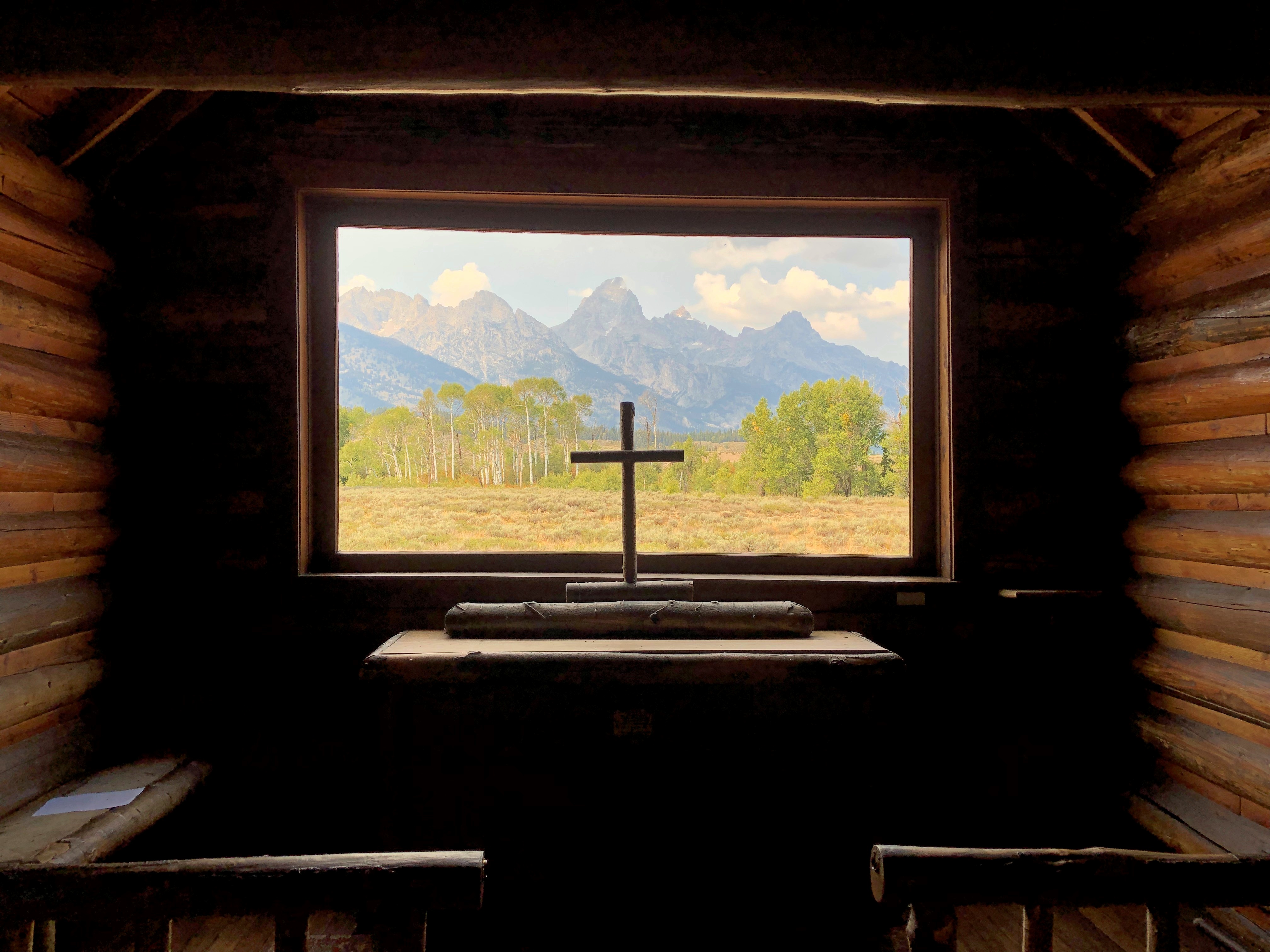
No point in burying the lead. Going-to-the-Sun Road in Glacier NP is famed for its splendid mountain scenery, and for good reason.  Going to the Sun Road Going to the Sun Road Going to the Sun Road Going to the Sun Road

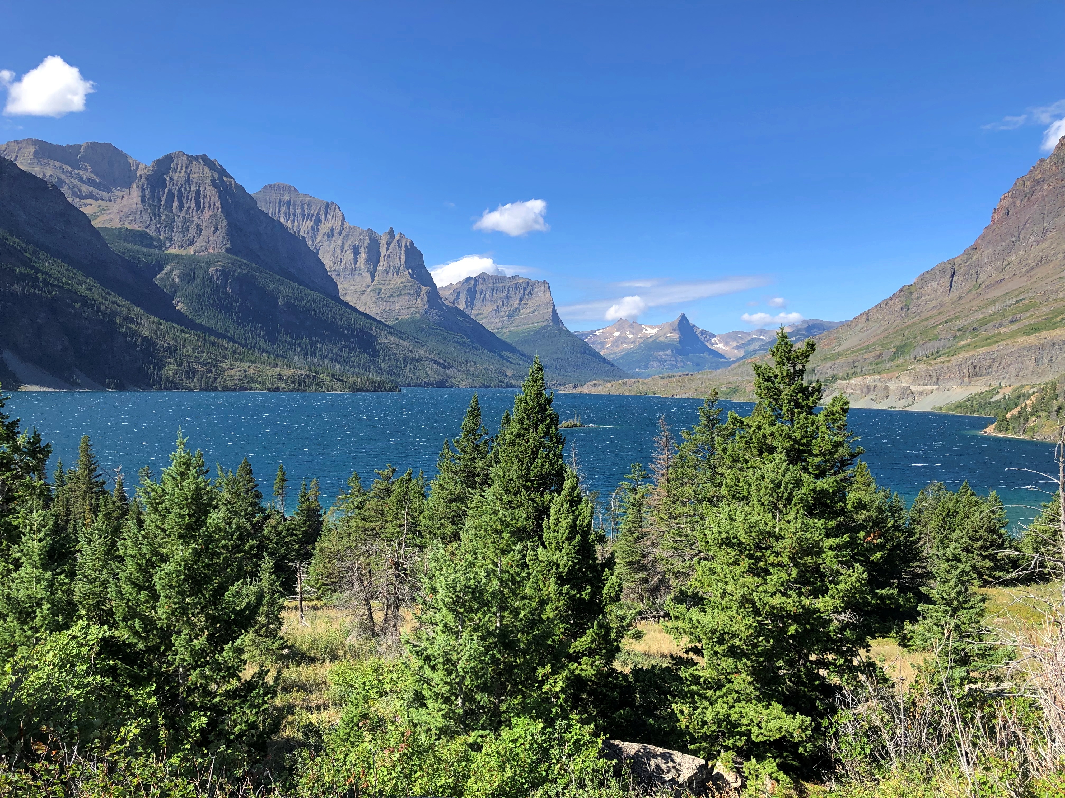
The road is also an epic feat of civil engineering. With its large pullouts for auto tourism, it dates from what you might call the golden age of road building in national parks, which was spurred by the prospect of auto tourism. Beginning about 100 years ago, that is, and a key factor in making Glacier a tourist magnet over the years.

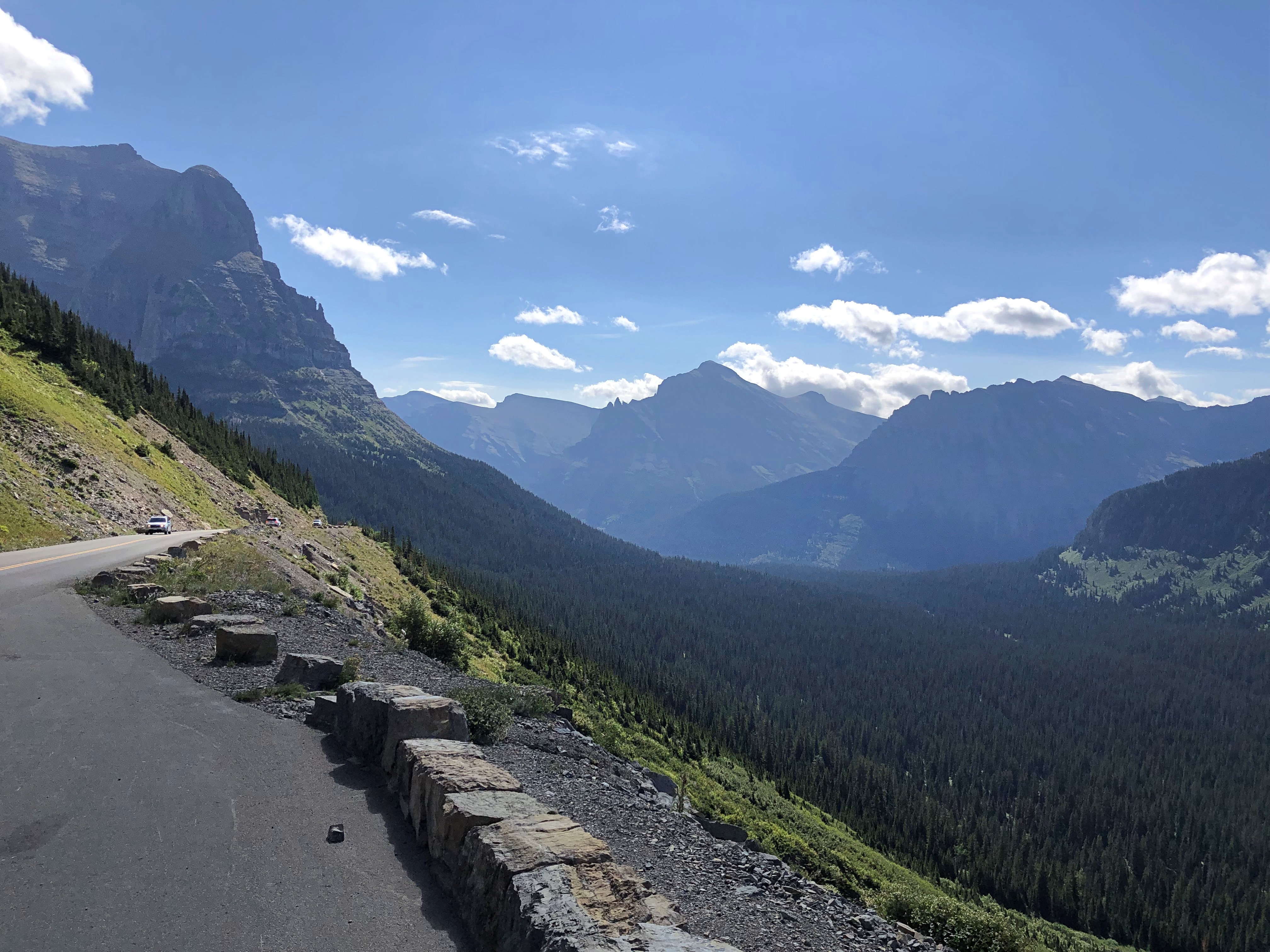
Nearly or over 3 million visitors have visited each year since 2016, except for 2020. In 2022, Glacier was tenth-most visited of the 63 national parks.

On August 24, we drove westward on the two-lane Going-to-the-Sun Road, which winds across Glacier for 50 miles or so. Hard to believe that such a poetic name is government sanctioned, but so it is, named for the nearby Going-to-the-Sun Mountain, which in turn had been named that by the remarkable, and mostly forgotten, James Willard Schultz. Apparently he took it upon himself to name features in the future Glacier National Park long before it was a park, which it became in 1910, with President Taft’s signature on the bill.

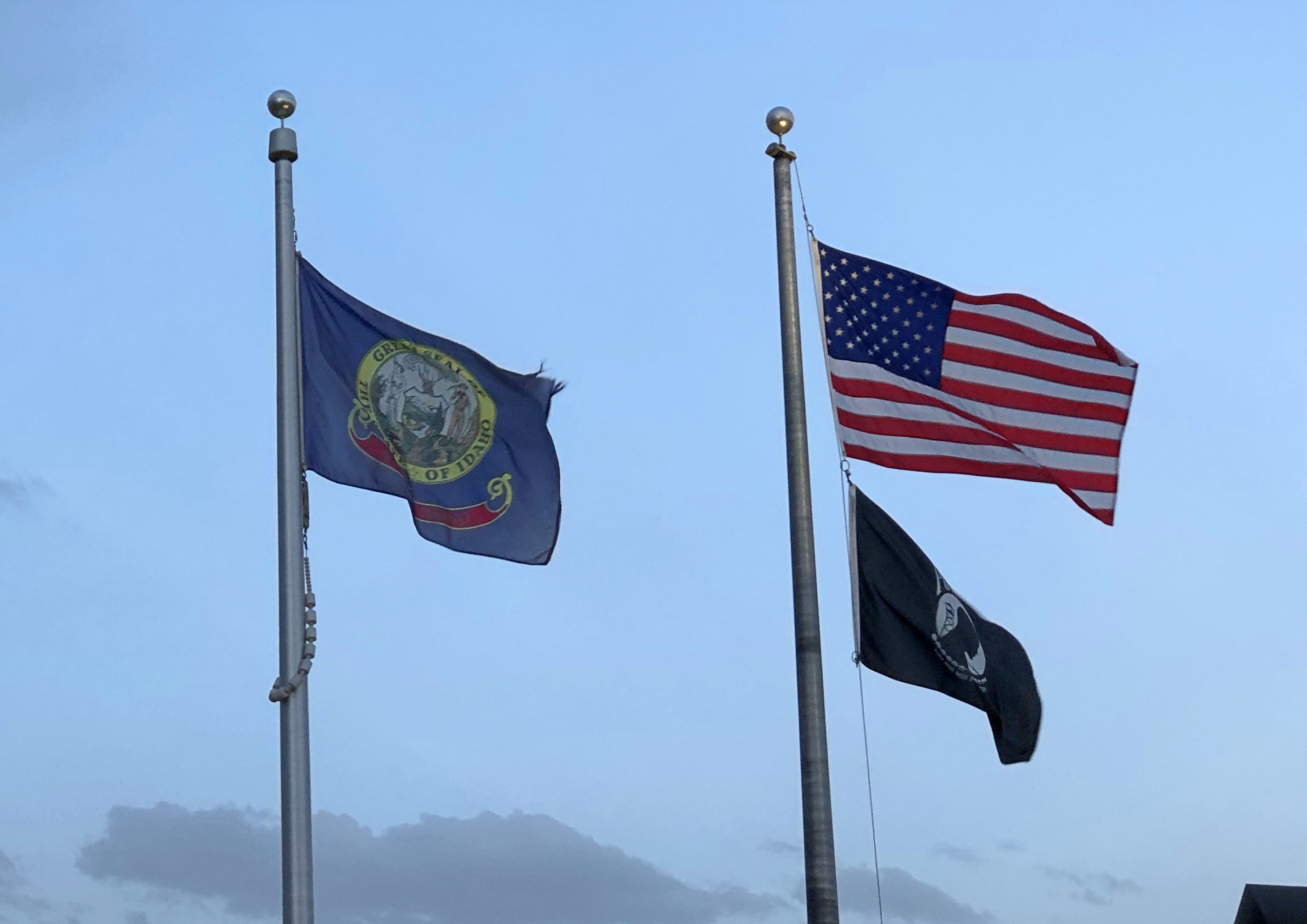
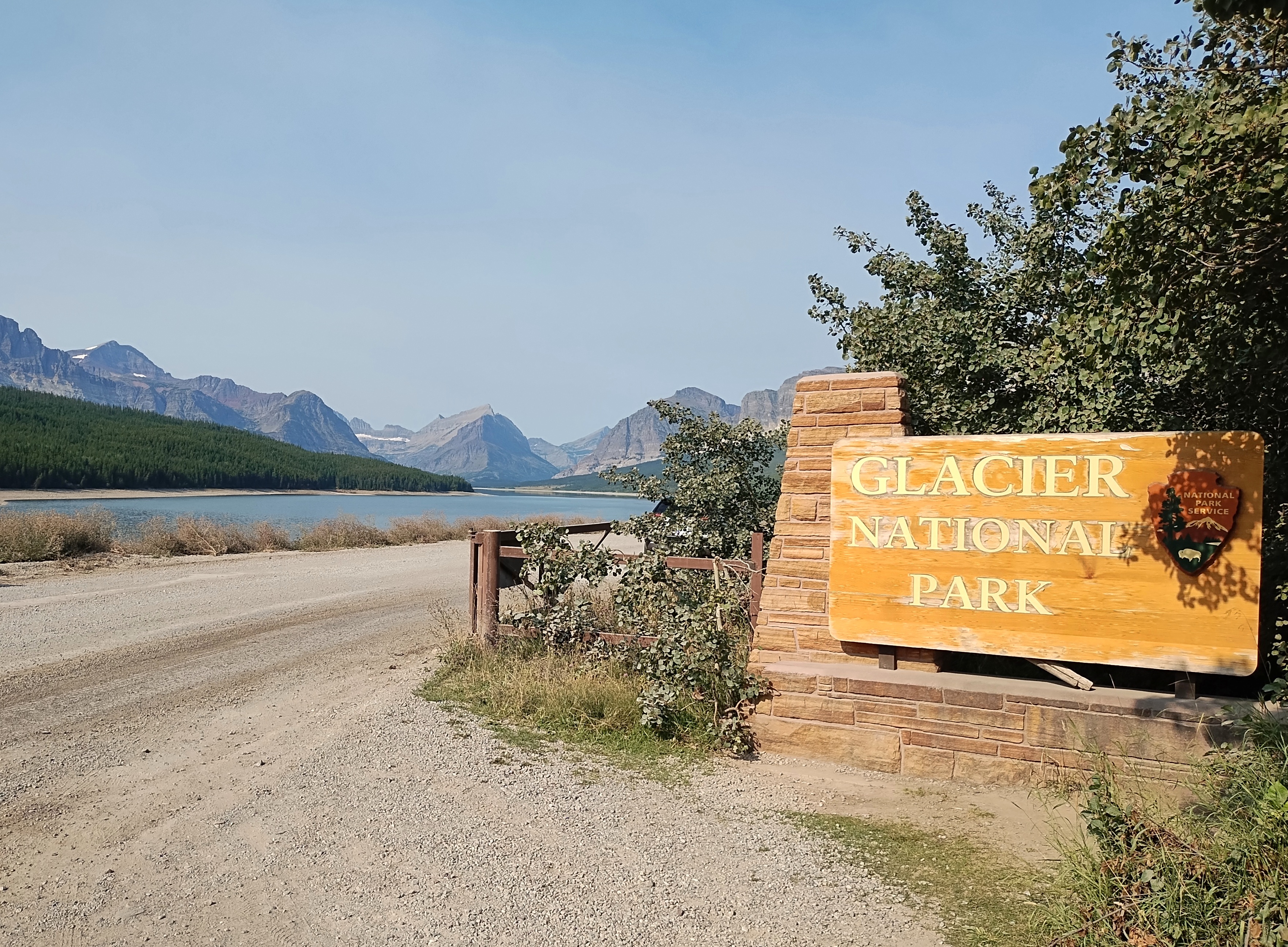
The eastern entrance to the road has a visitor center, which flies two flags of nearby nations, along with the Stars and Stripes.

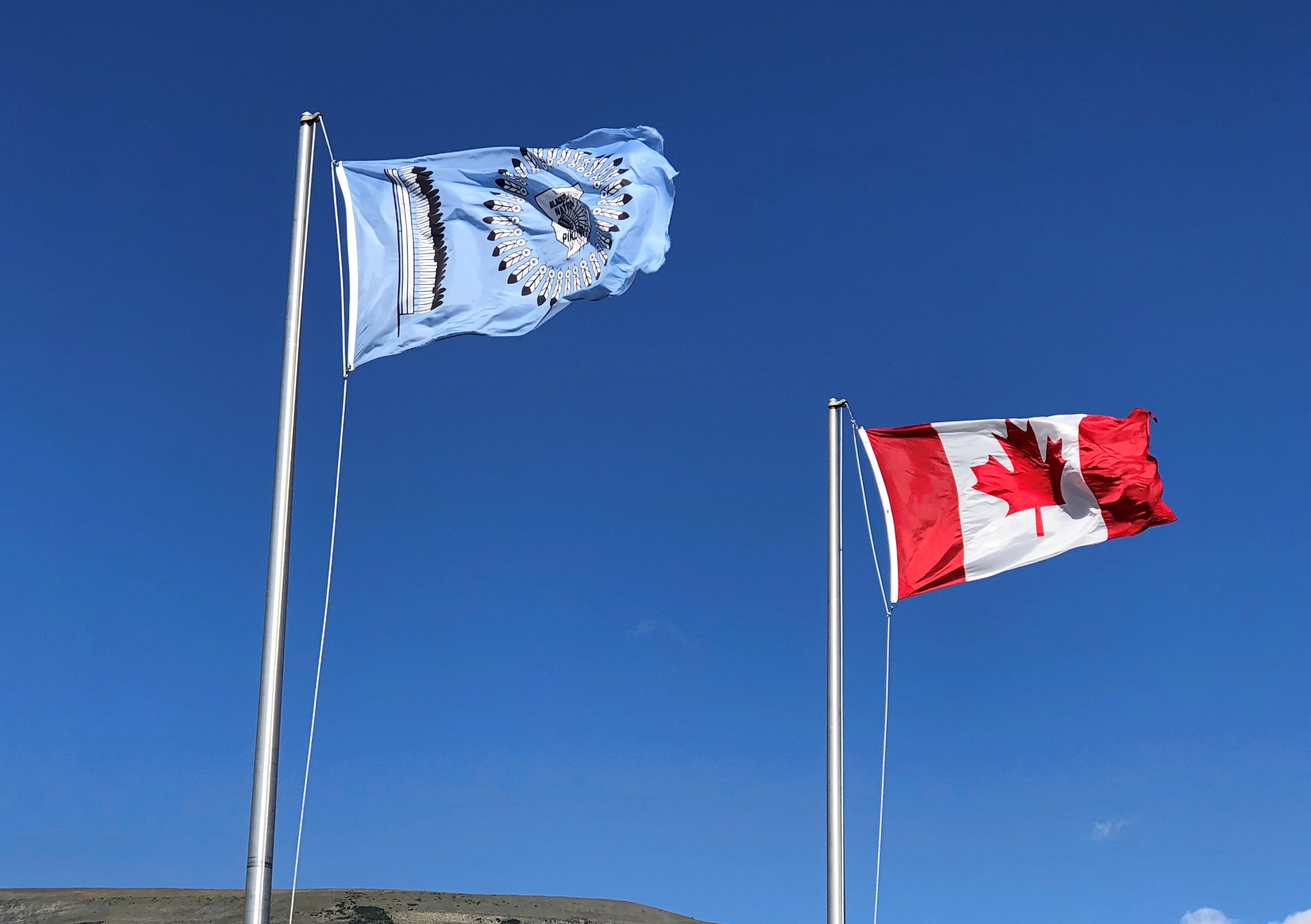
The less familiar one is the Blackfeet Nation.

The Blackfeet Reservation, at 1.5 million acres, is half again as large as Glacier NP, which comes in at about a million acres. The reservation is due east of the park, and in fact they share a border on the eastern side of the park. Indeed, much of the park was part of the reservation until the tribe was obliged to cede the land in the 1890s.

Another digression: “The Chief Mountain Hotshots are a Native American elite firefighting crew based out of the Blackfeet Indian Reservation located at Browning, MT with Glacier National Park as their backyard,” the Bureau of Indian Affairs says.

“The Chief Mountain Hotshots are a highly trained self-sufficient hotshot crew working in wildland firefighting. On average, the Crew works 15-20 large fire incidents and travels 10,000-20,000 miles a year.” More about the hotshots is here.

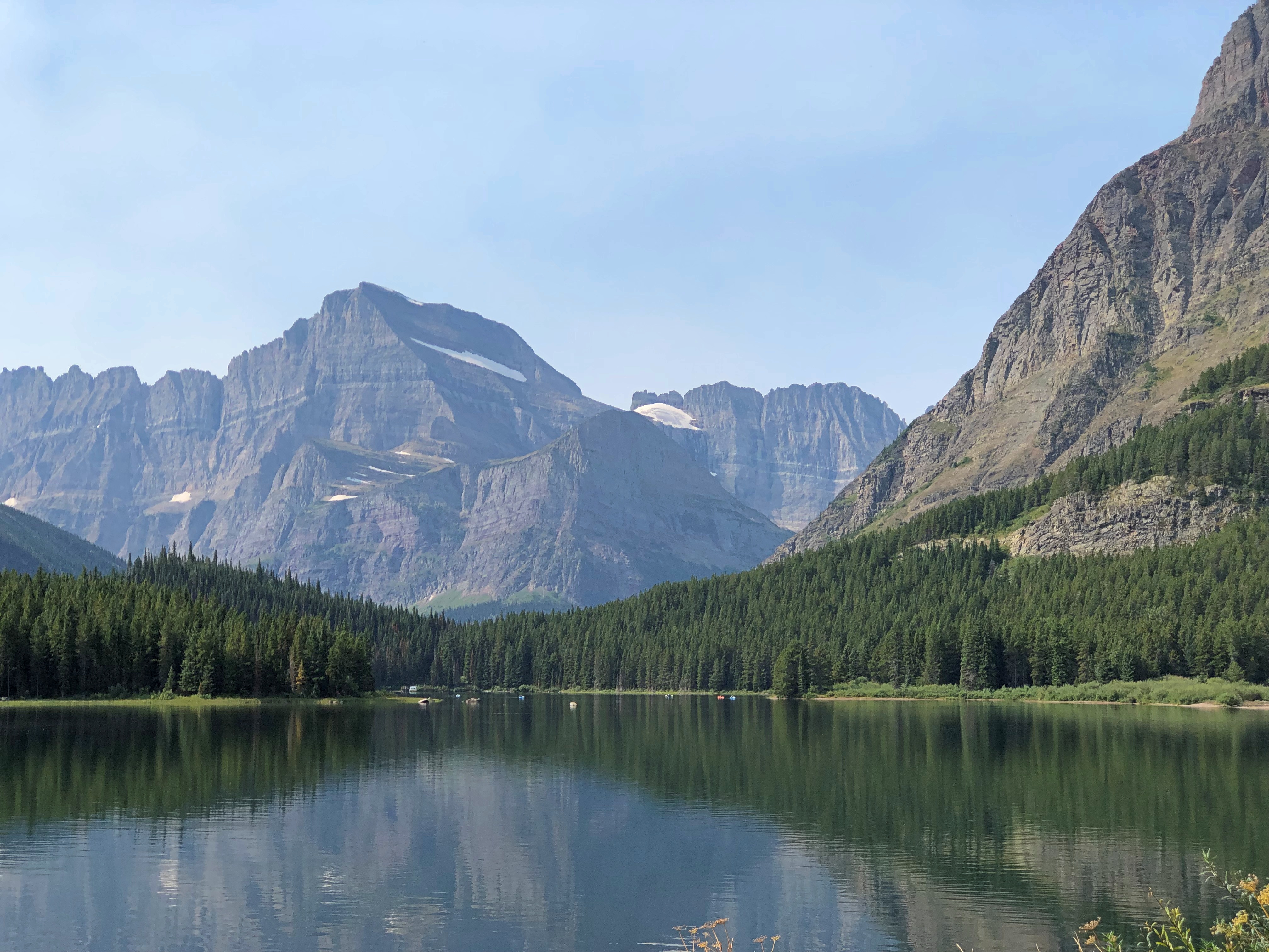
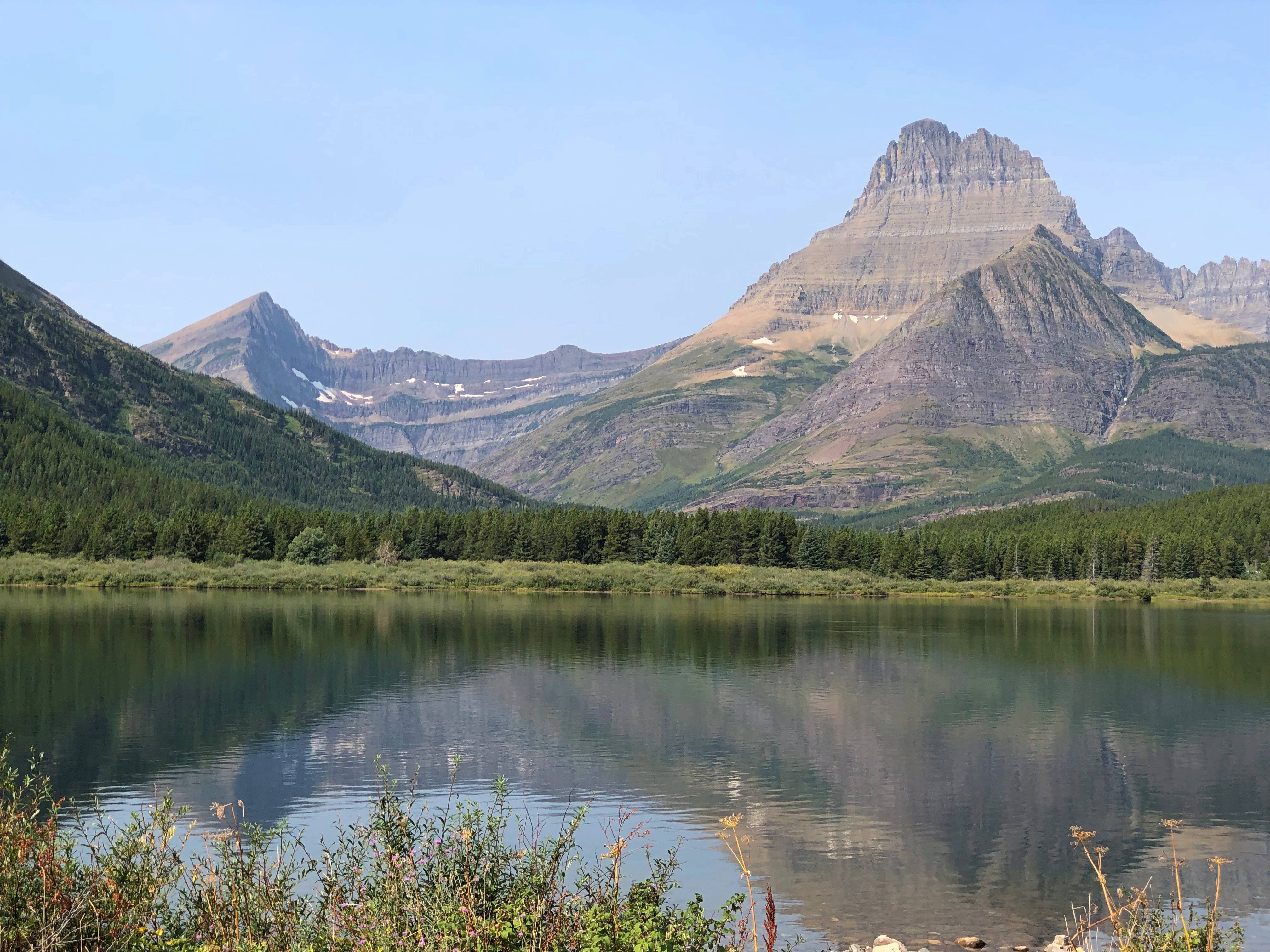
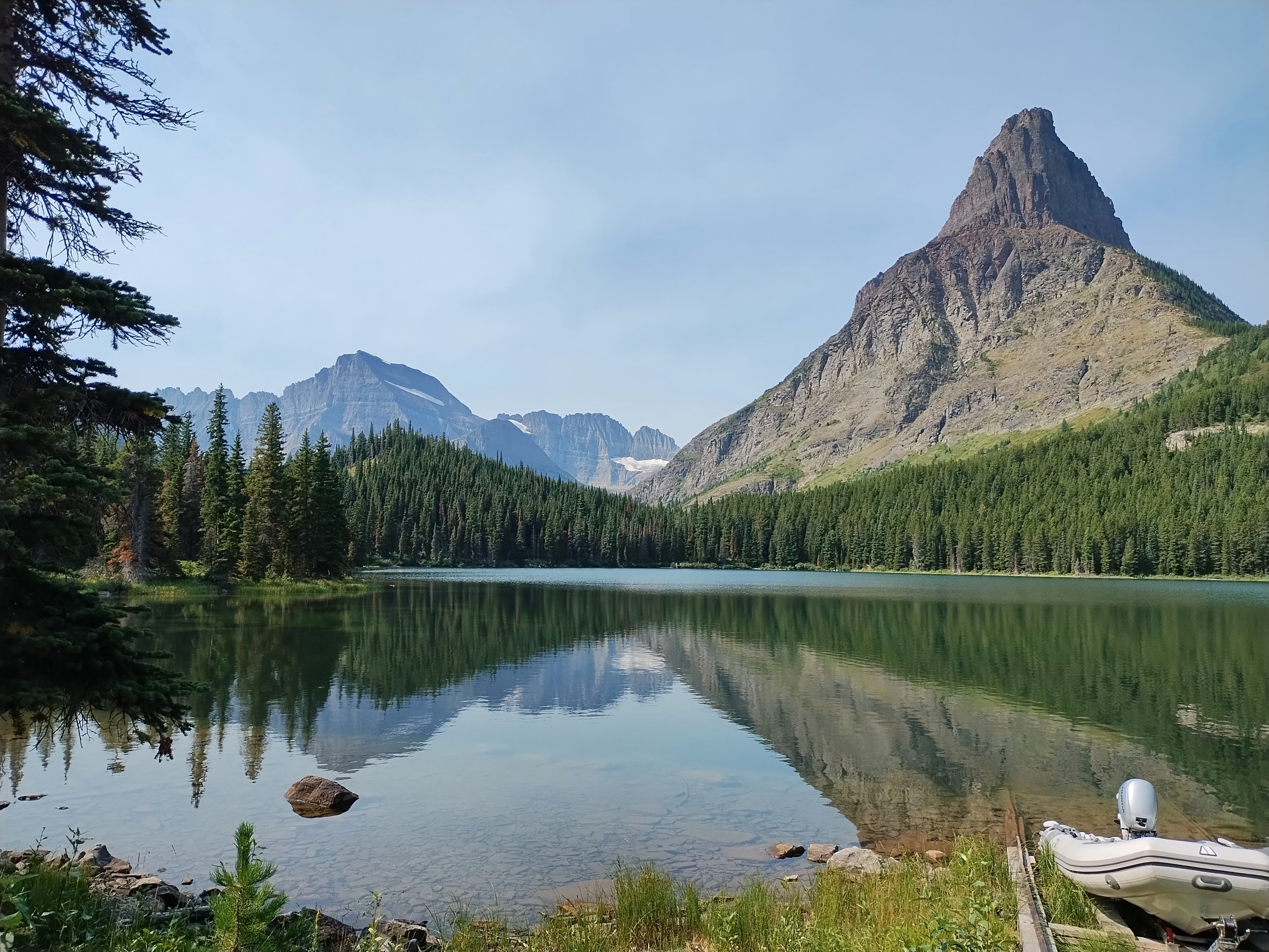
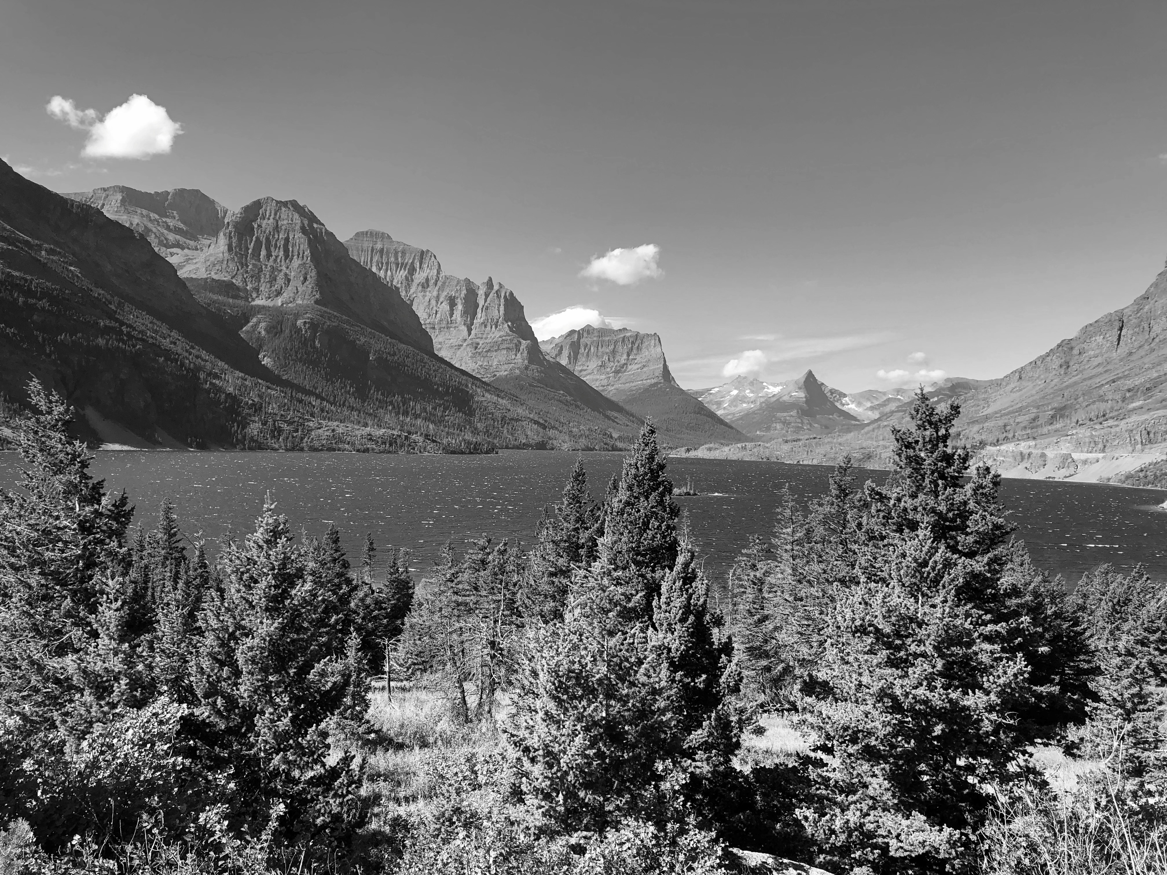
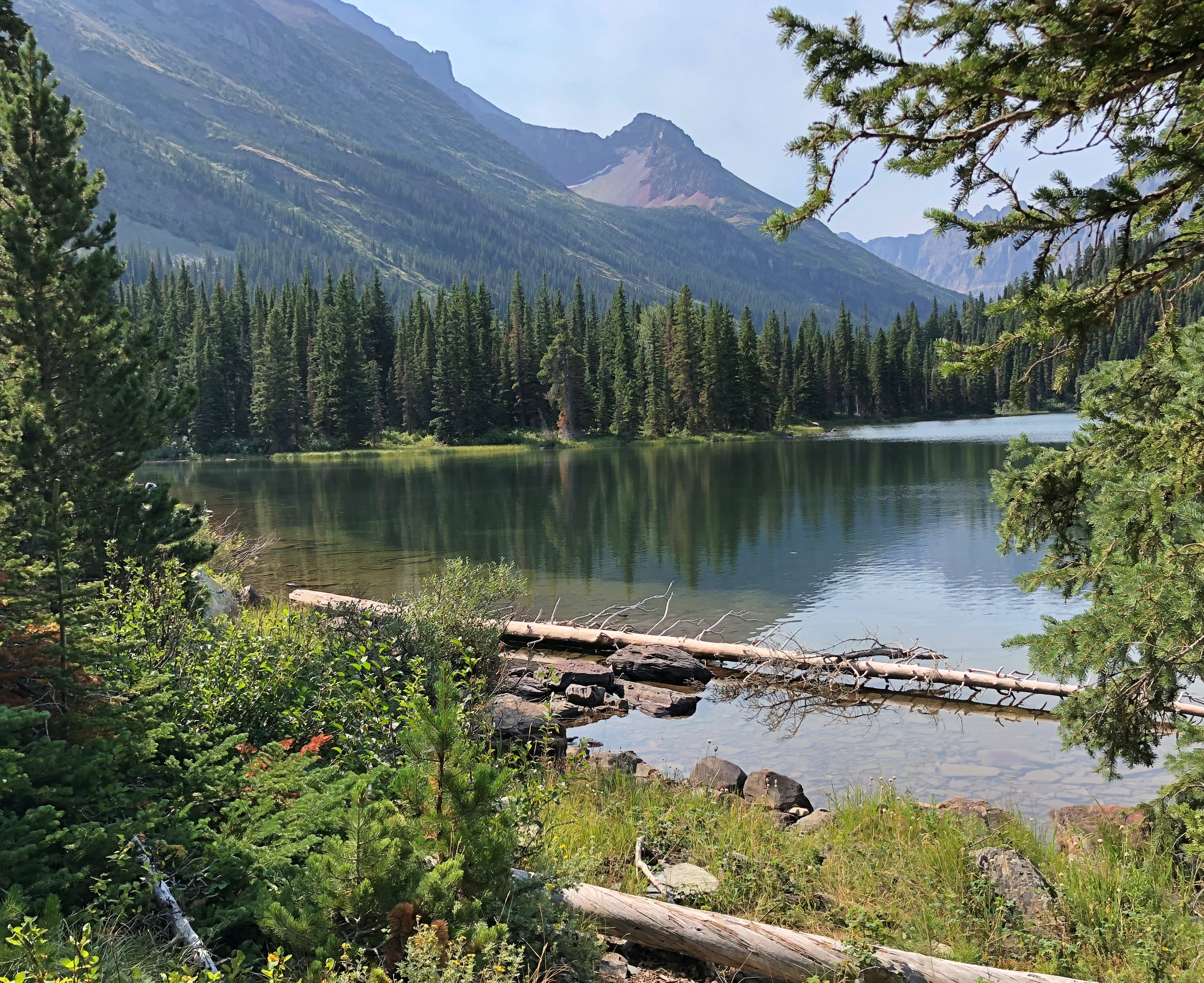
All good to know, but I’m glad there were no wildfires in the vicinity for them to fight. As the road passes along the north shore of cold-water Saint Mary Lake — Going to the Sun Road

— clearly there has been some wildfire.

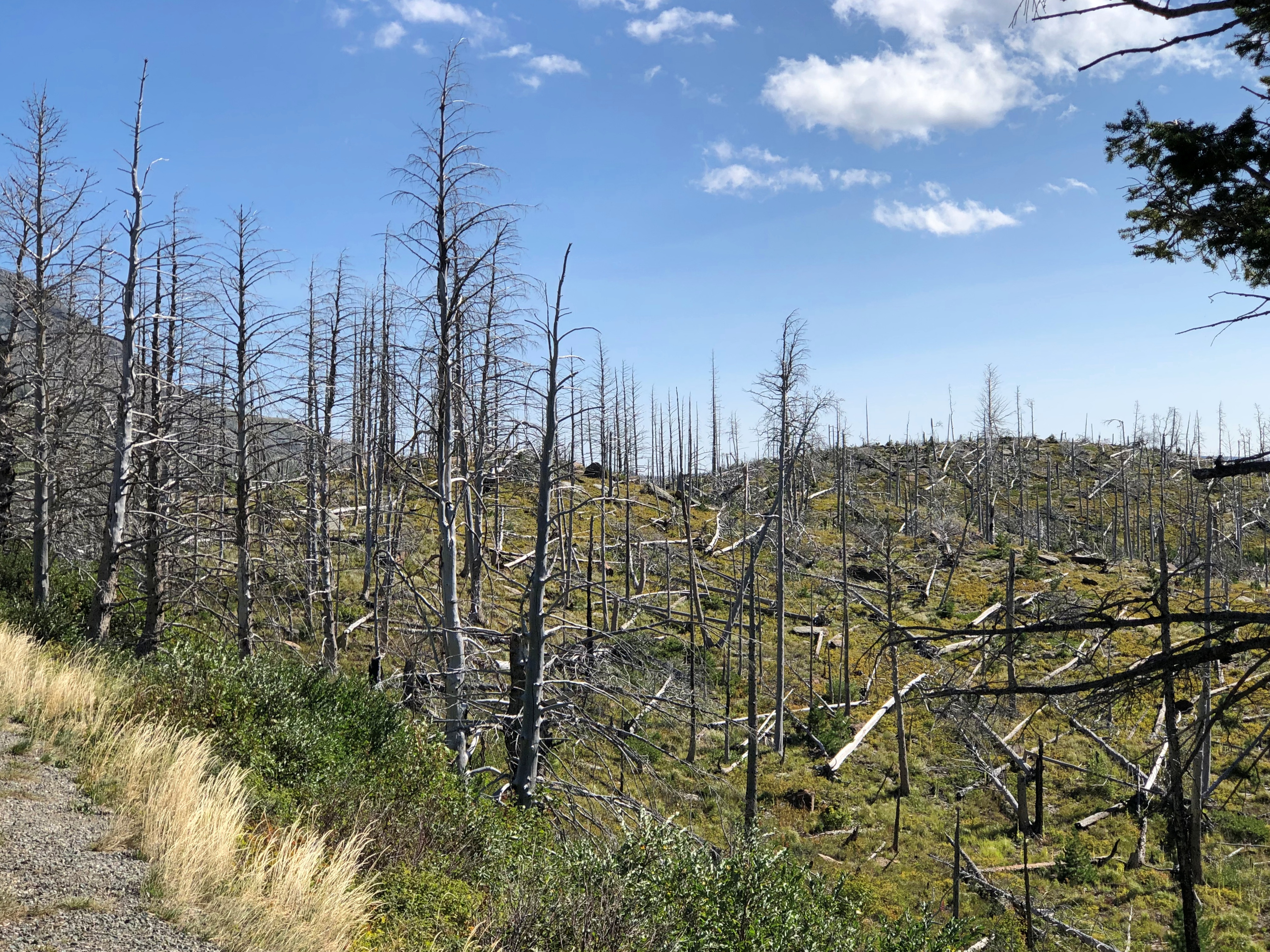
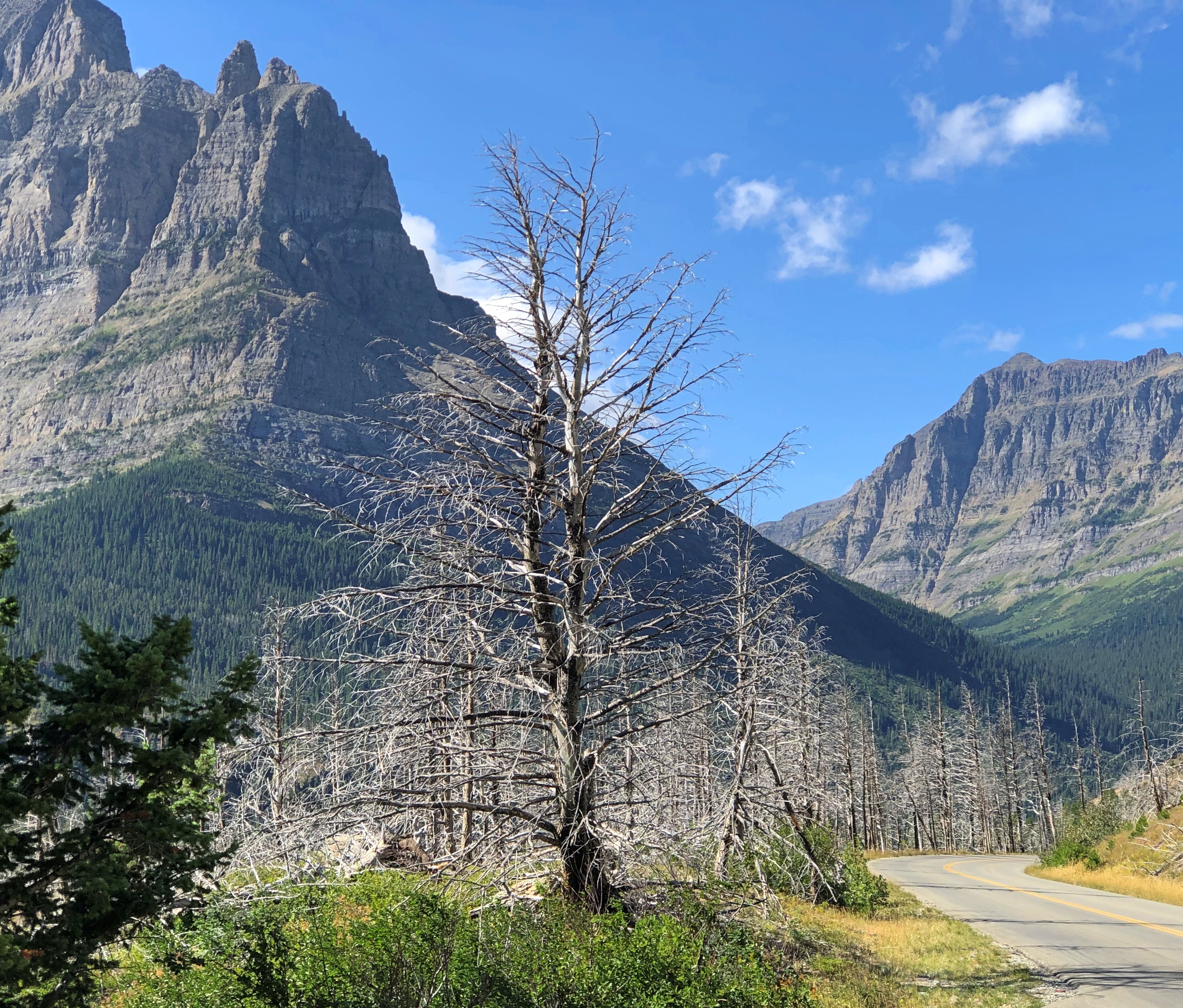
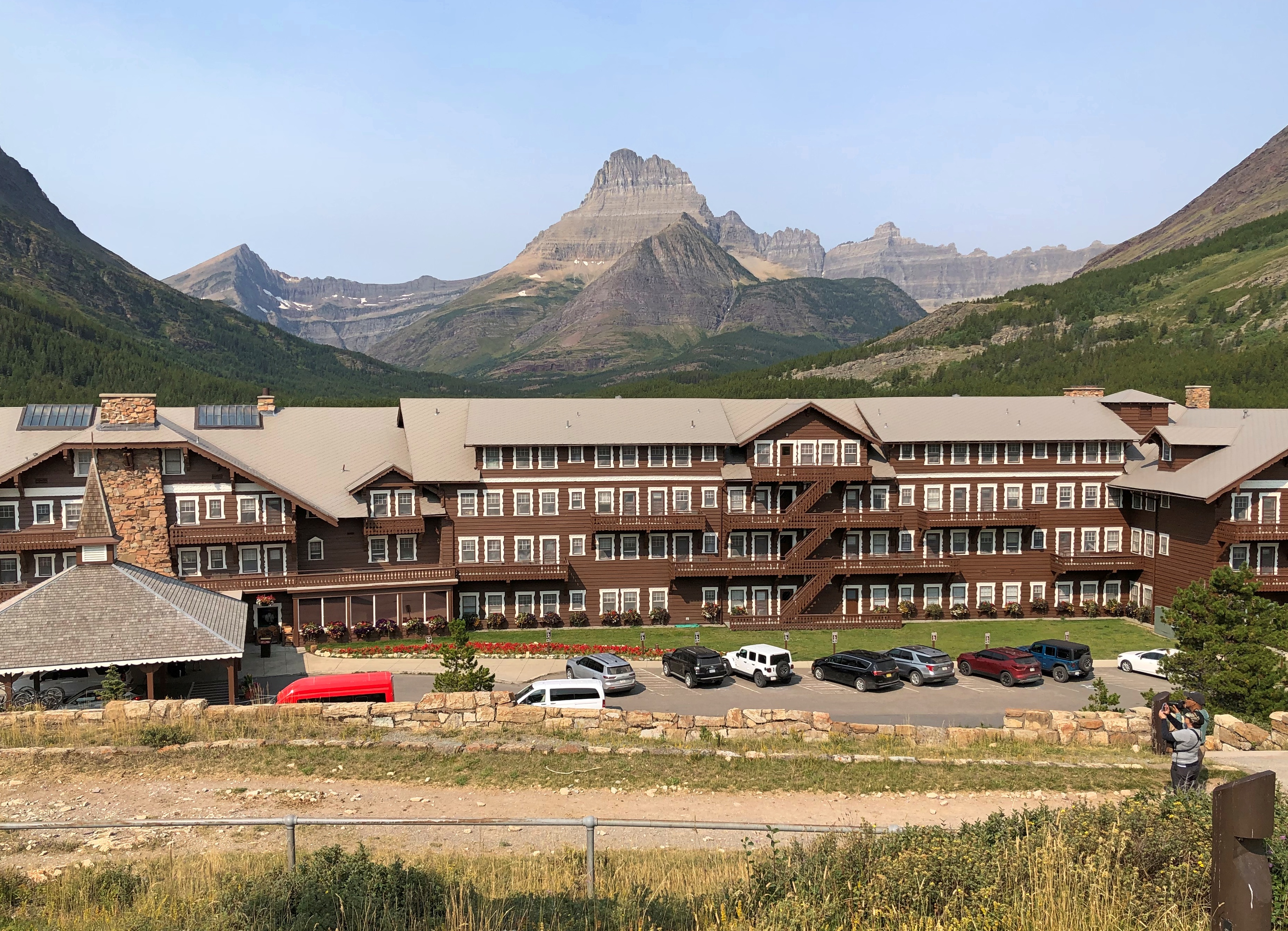
The road rises from the lake, elevation 4,484 feet, toward the Continental Divide at Logan Pass, elevation 6,646 feet.Going to the Sun Road Going to the Sun Road Going to the Sun RoadGoing to the Sun Road

Logan Pass is the kind of place we would stop, but there was no available parking. This pic was taken by a photographer named Ken Thomas, who thoughtfully put it in the public domain.

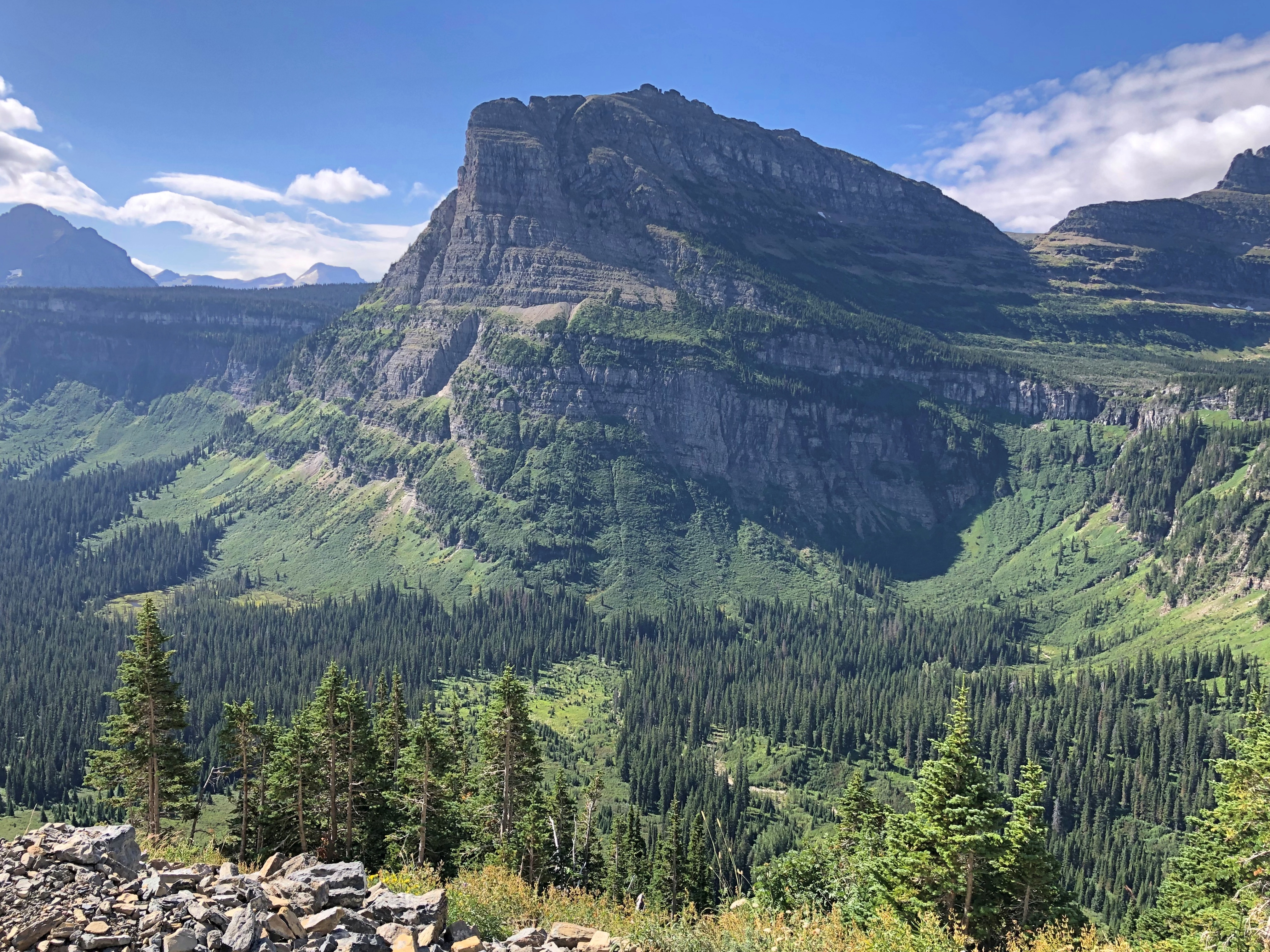
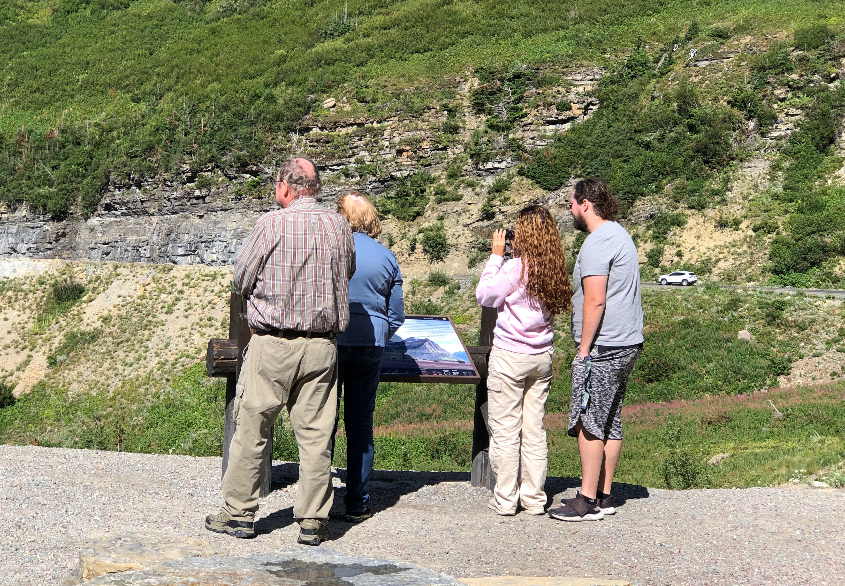
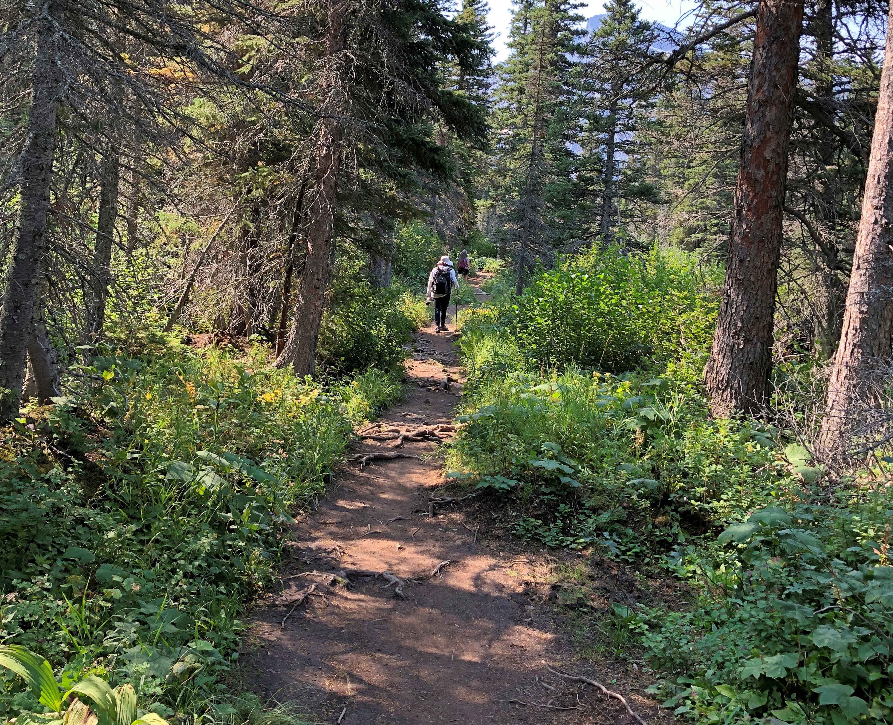
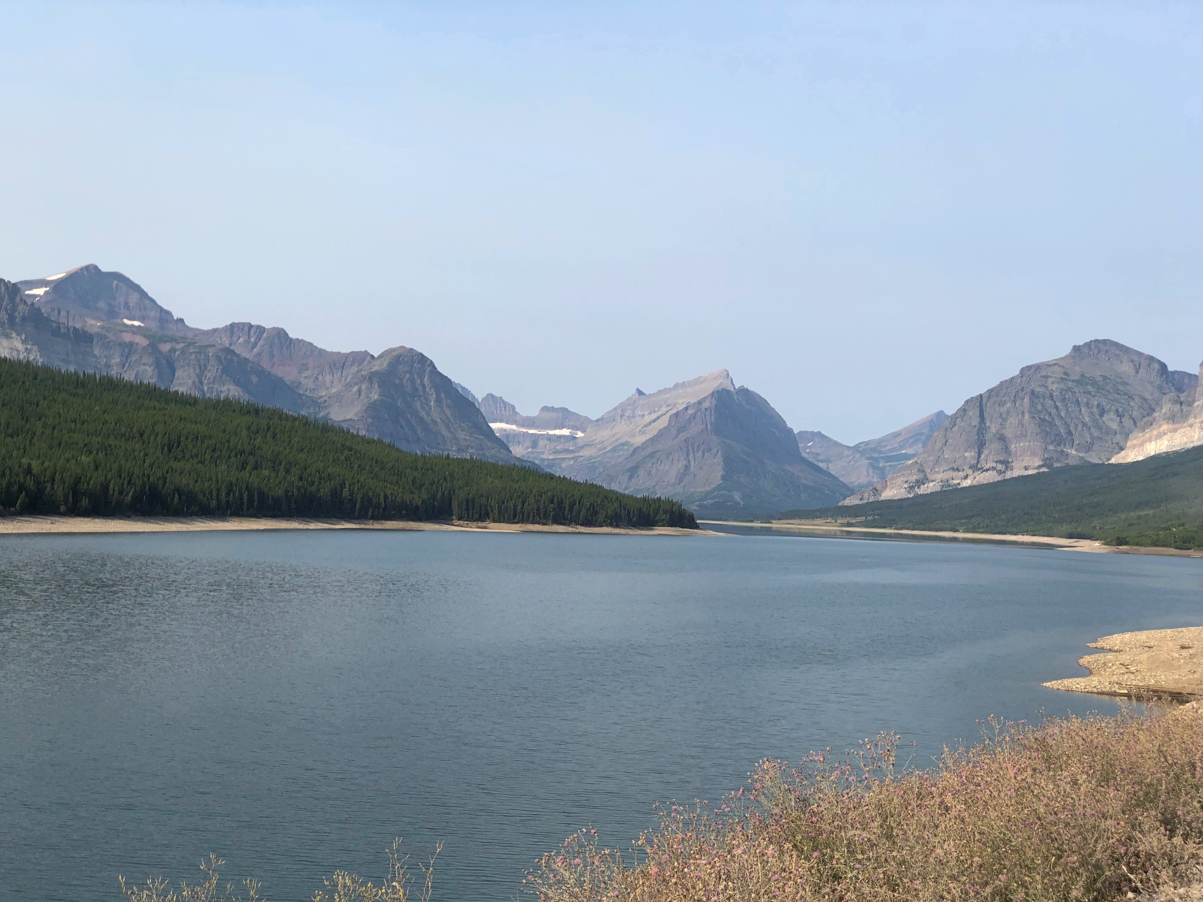
No trucks or RVs allowed on the road, since they wouldn’t fit in some (many) places. That doesn’t keep drivers off the road, however. During the warm months when it’s open, Going-to-the-Sun is a busy place.

Even so, much of it still has that classic mountain appeal of low traffic.Going to the Sun Road

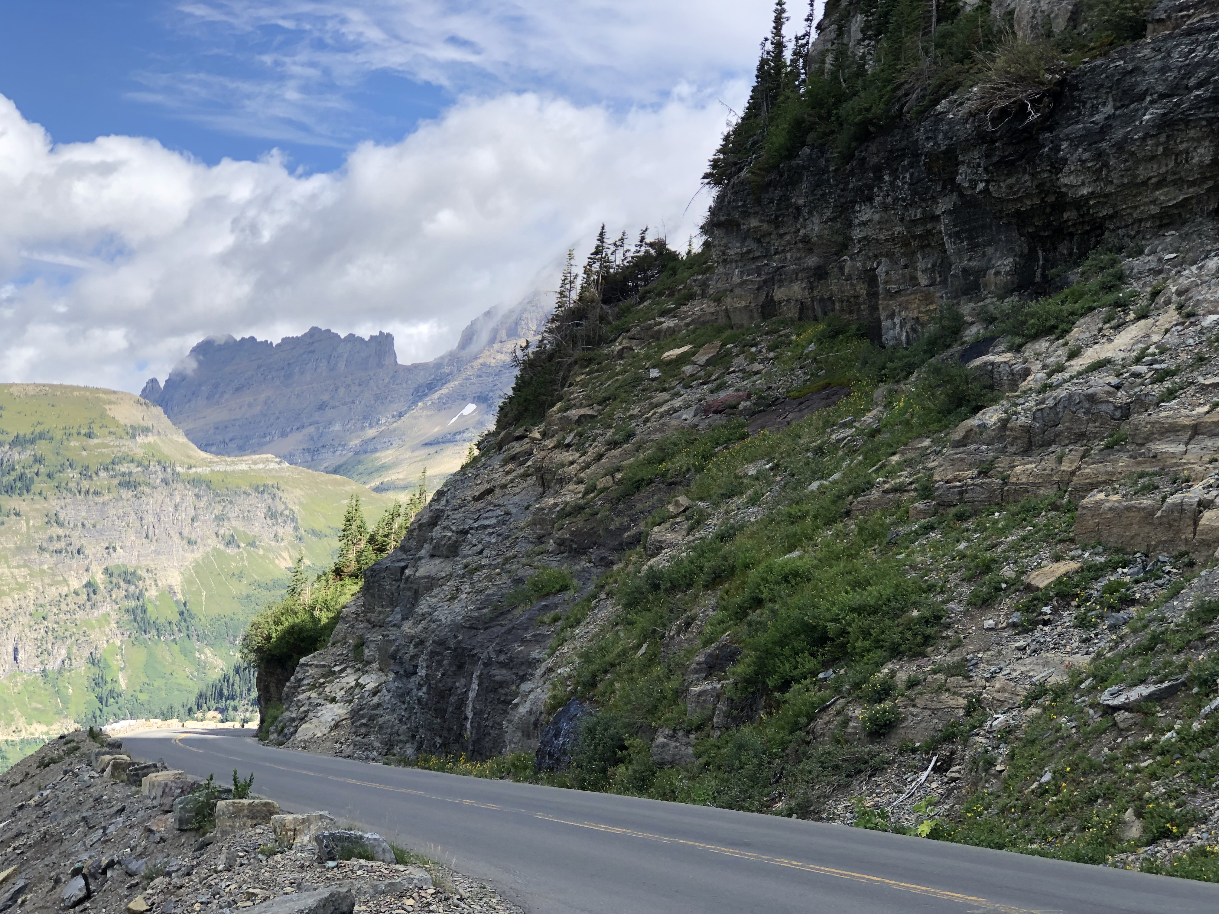
Except when there are knots of traffic. Just a few.Going to the Sun Road

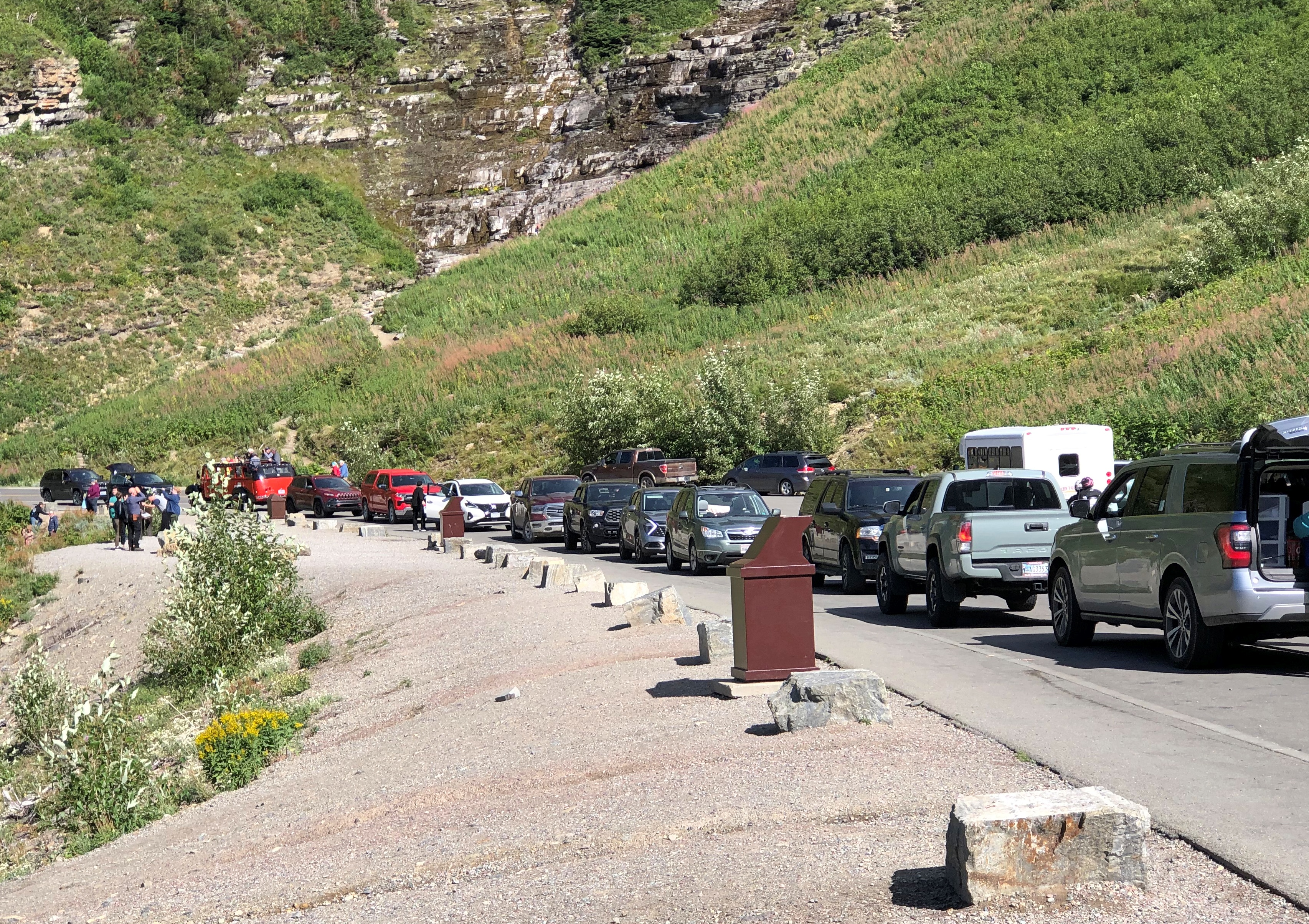
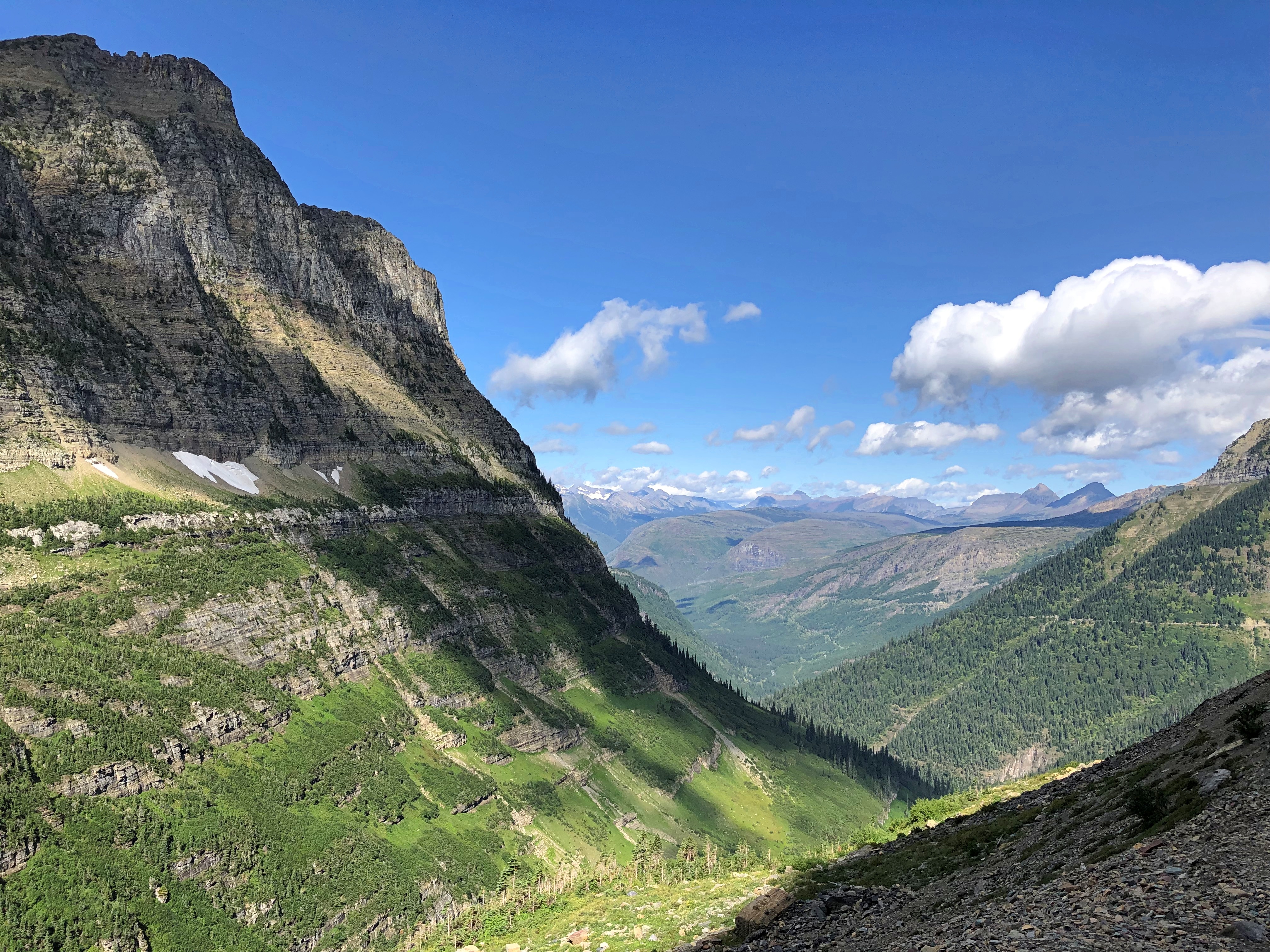
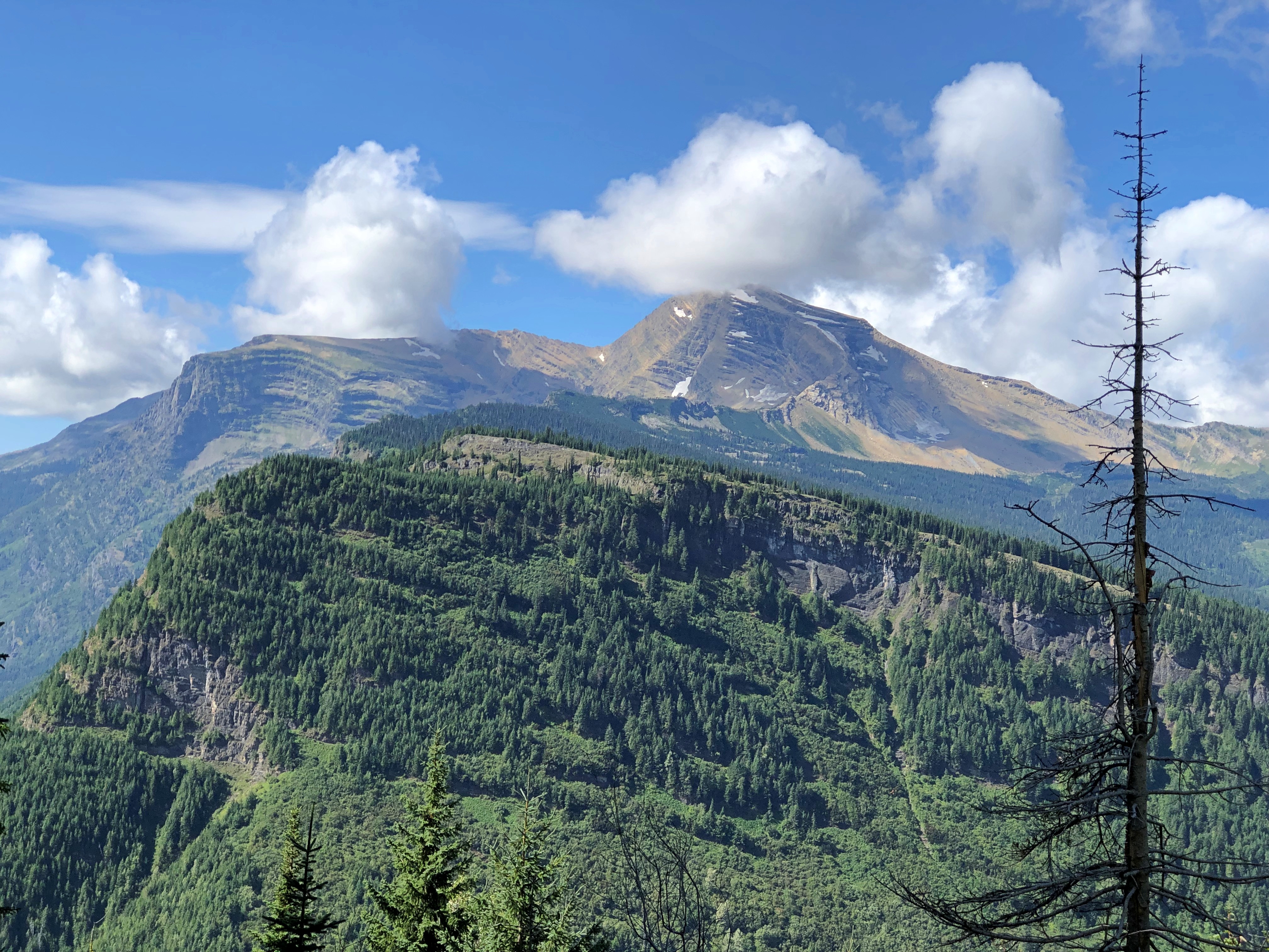
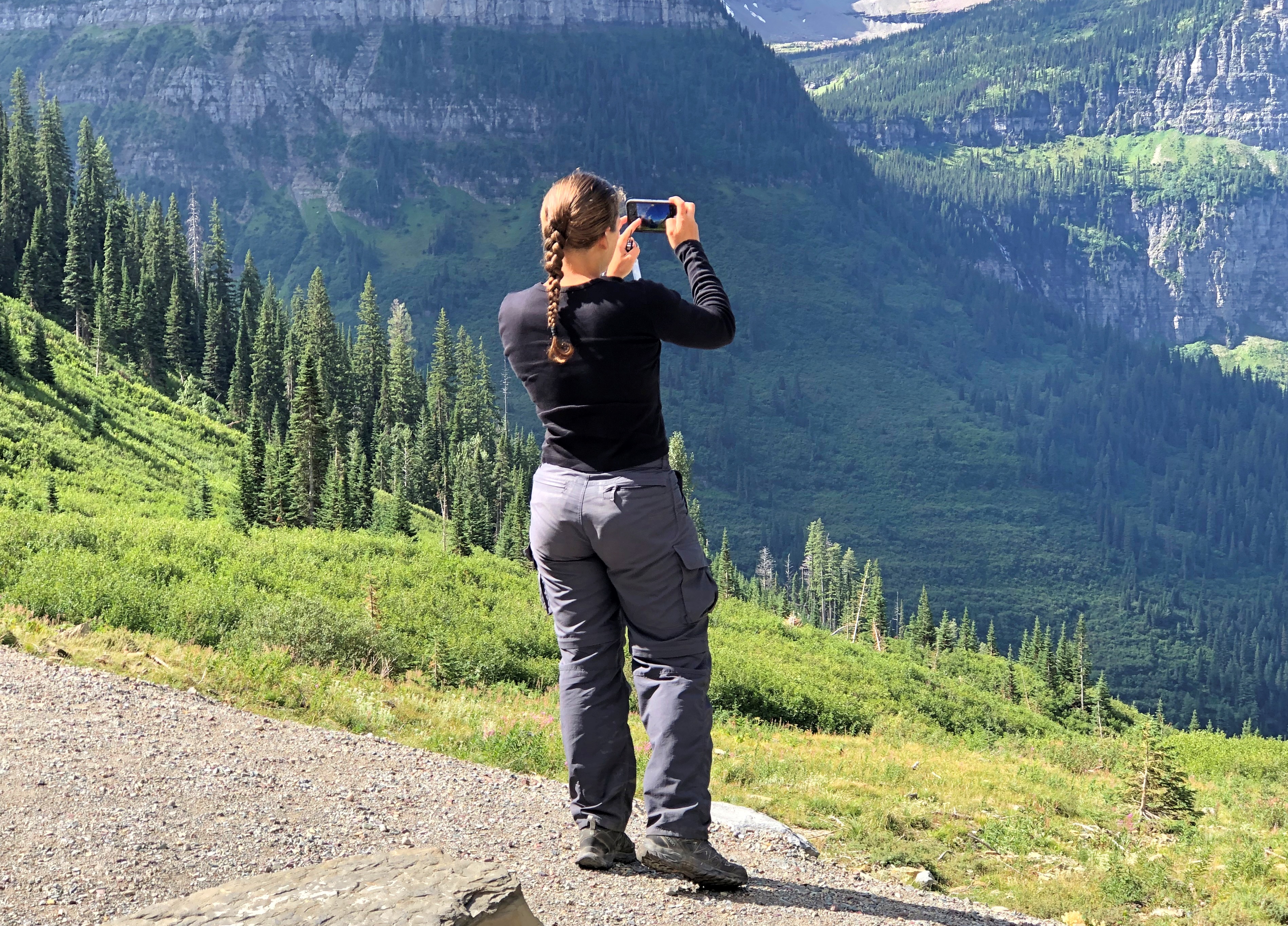
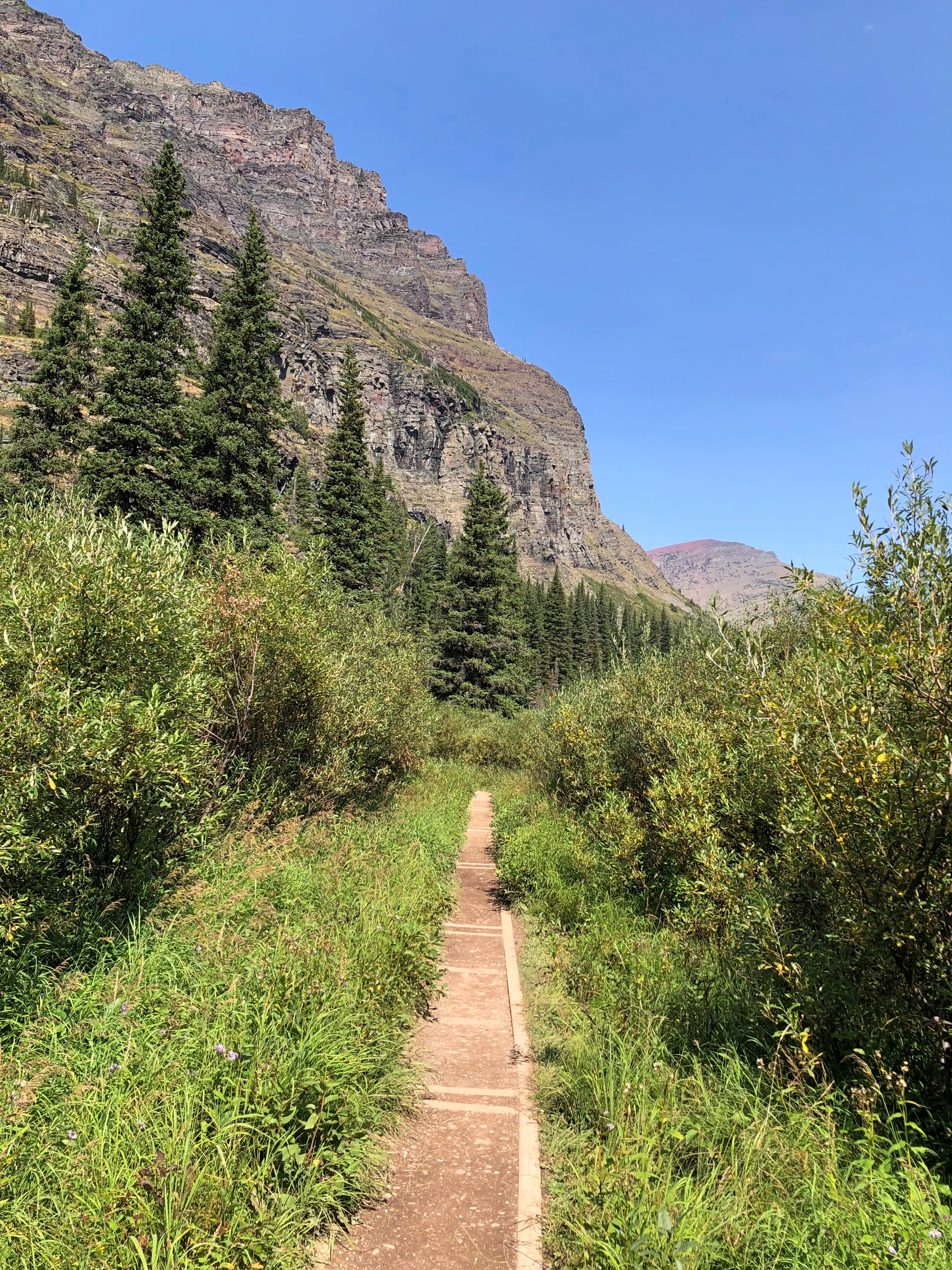
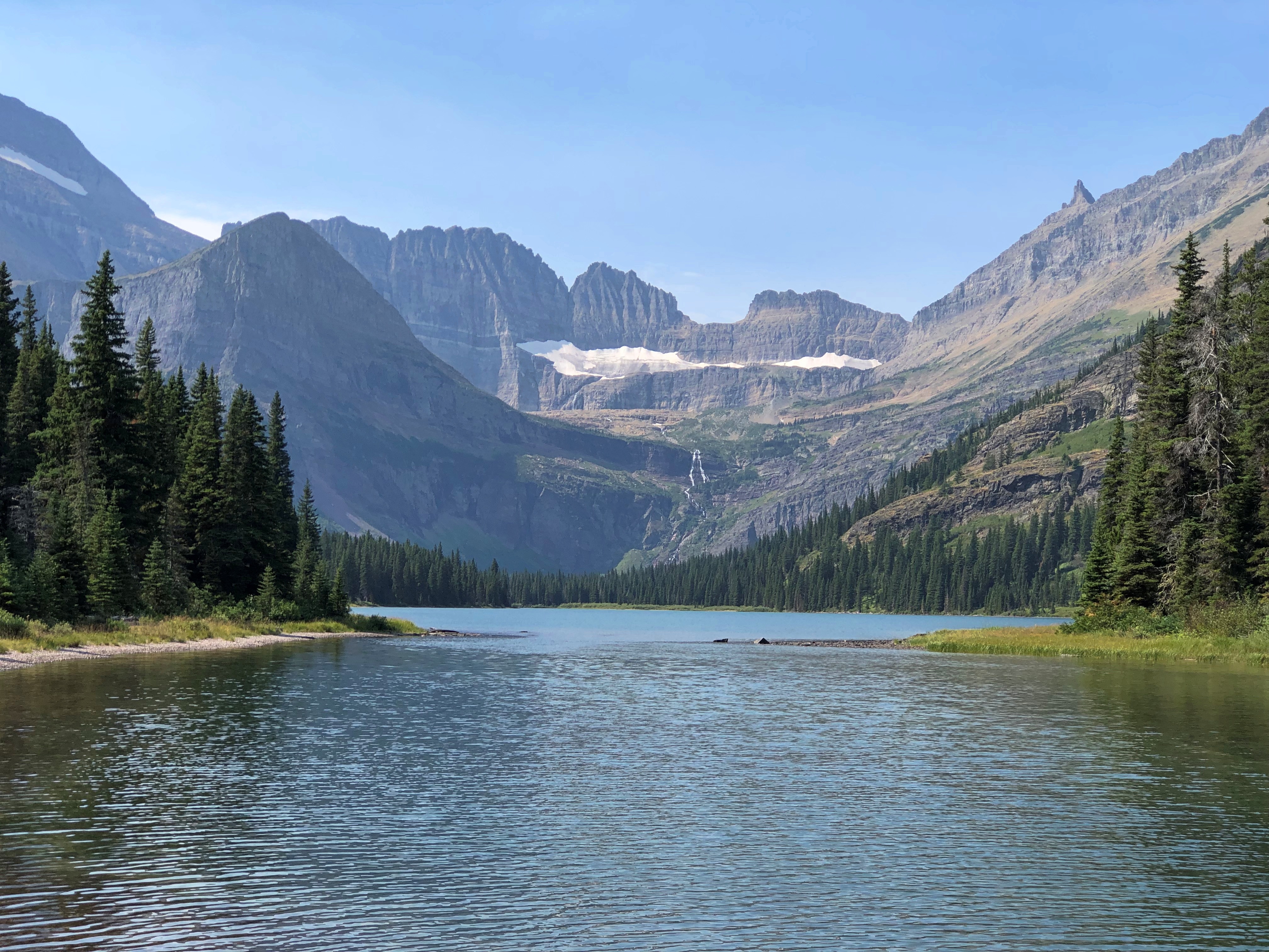
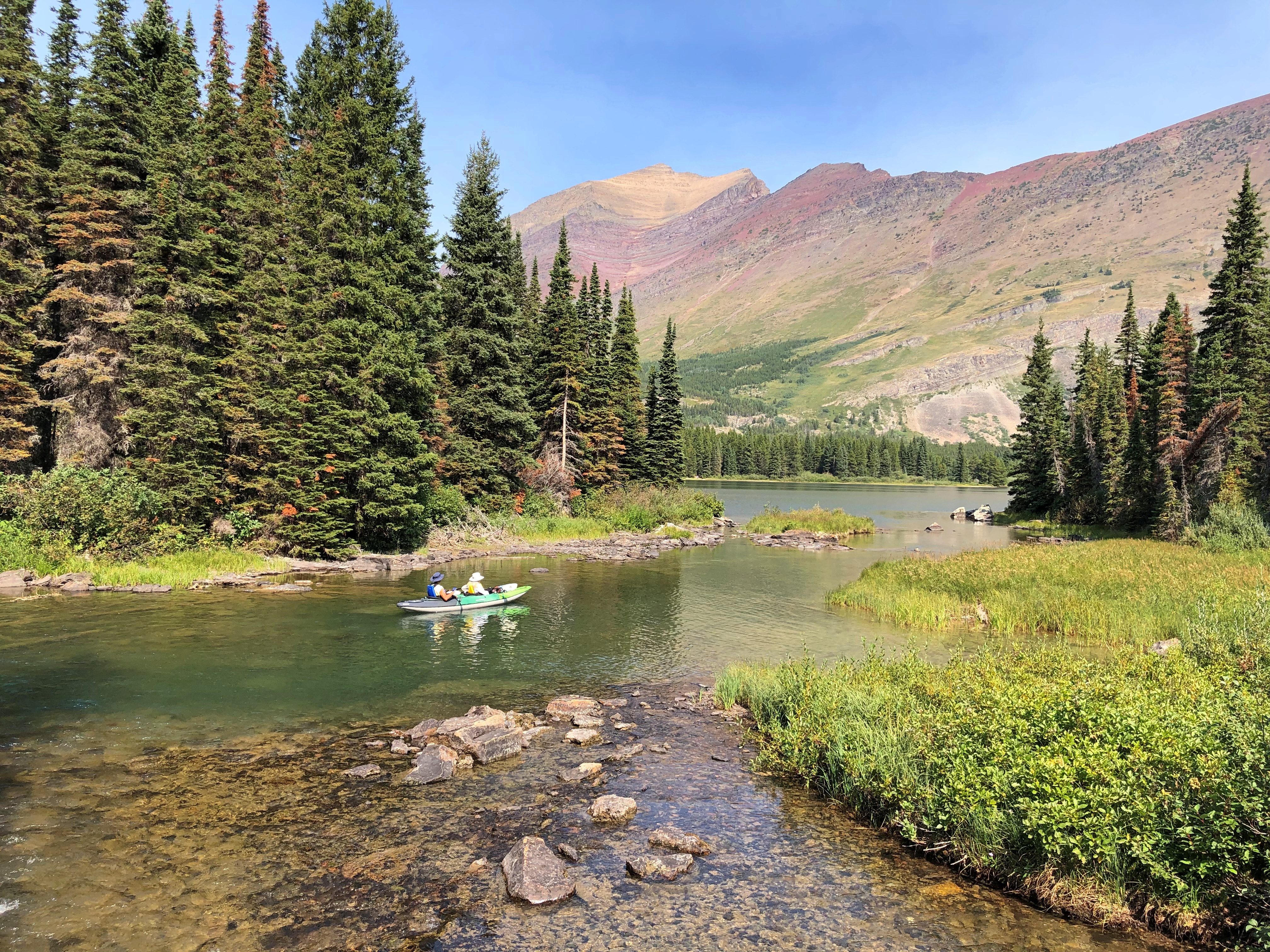
Mountain scenery has a broad appeal.Going to the Sun Road Going to the Sun Road Going to the Sun Road

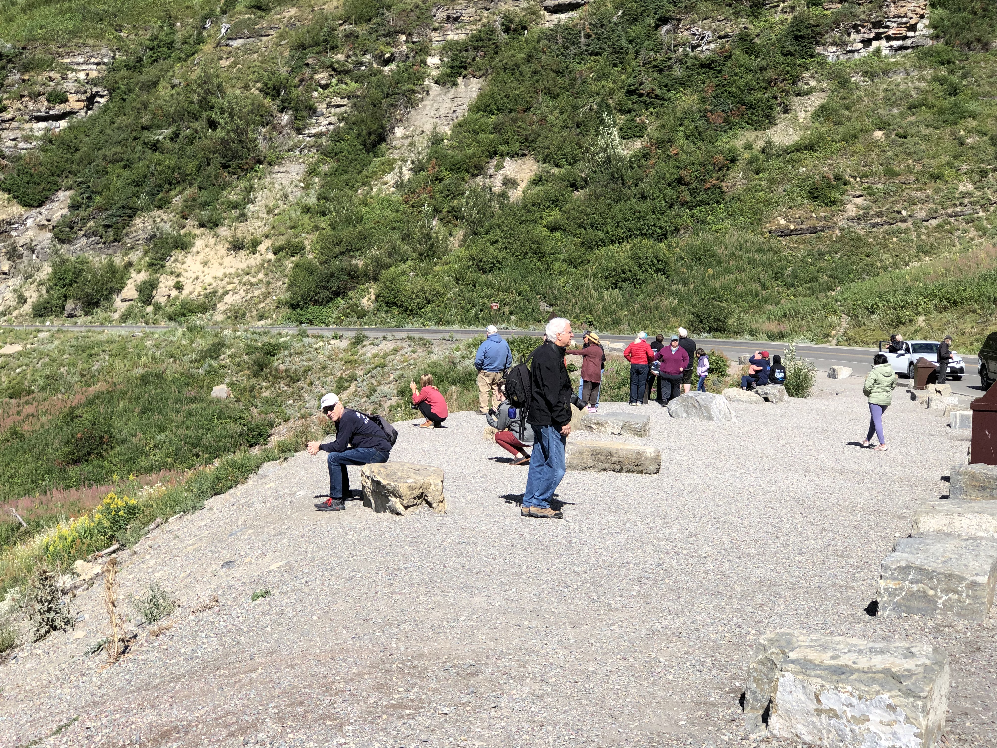
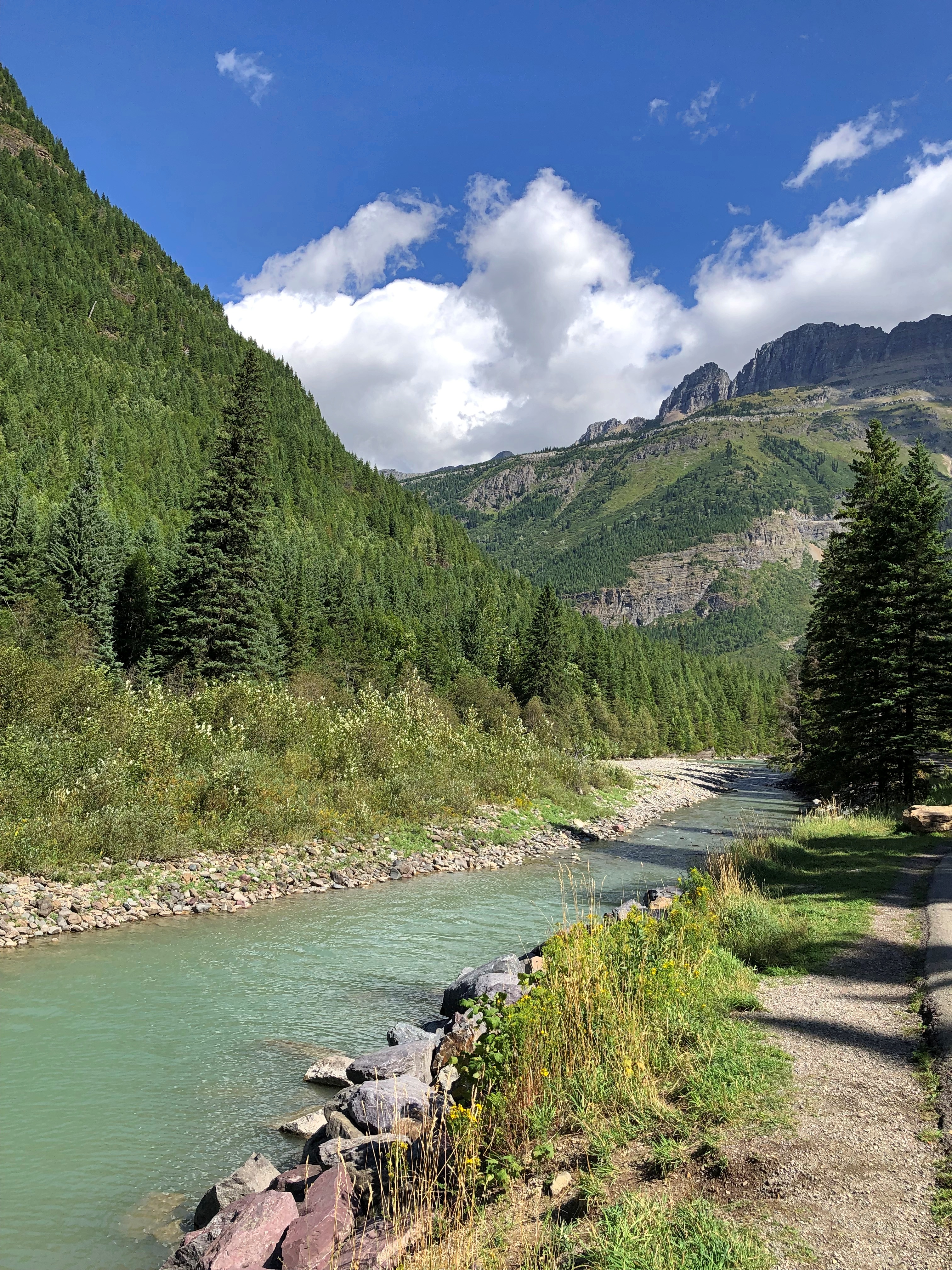
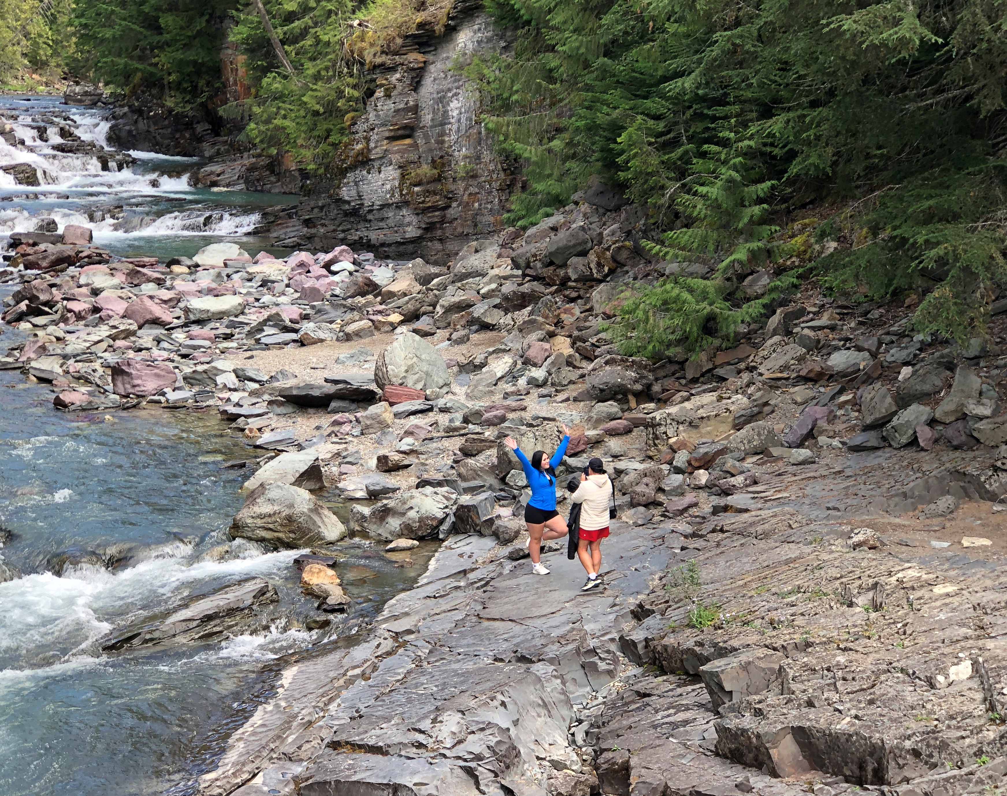
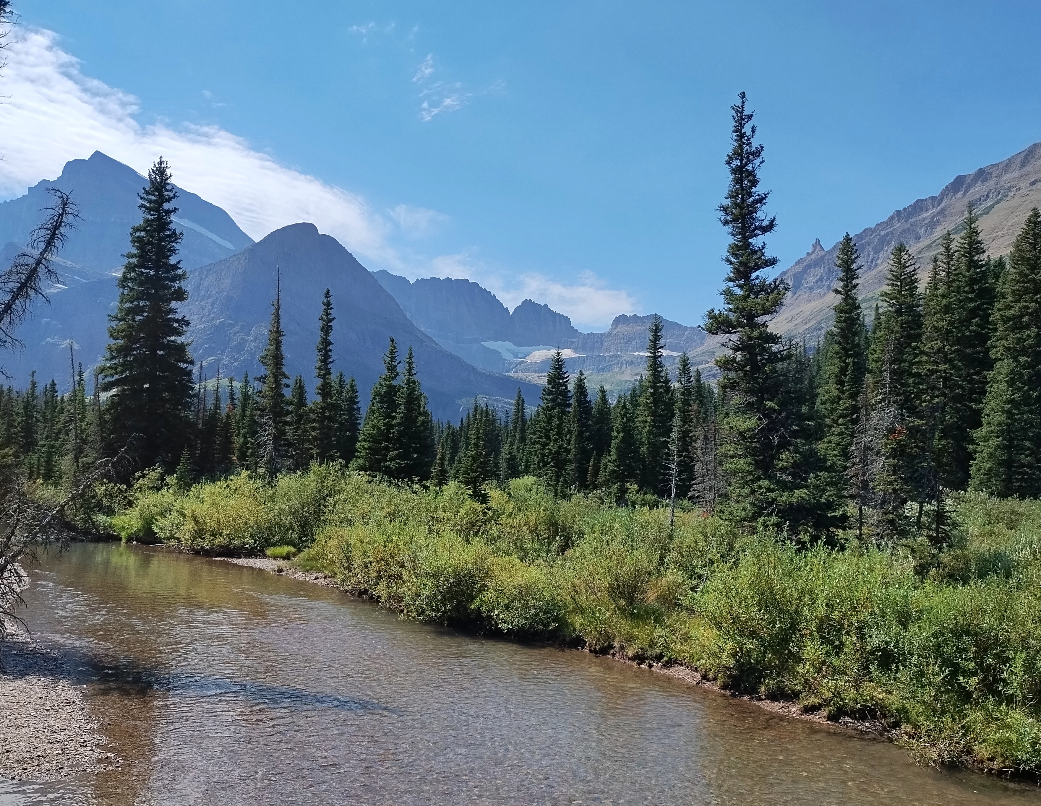
Toward the east end of the park, the road parallels McDonald Creek for a number of miles before it connects with Lake McDonald, the larger of the park’s two major lakes, and the lower, at 3,153 feet elevation. Some of the creek has more of a river look.Going to the Sun Road

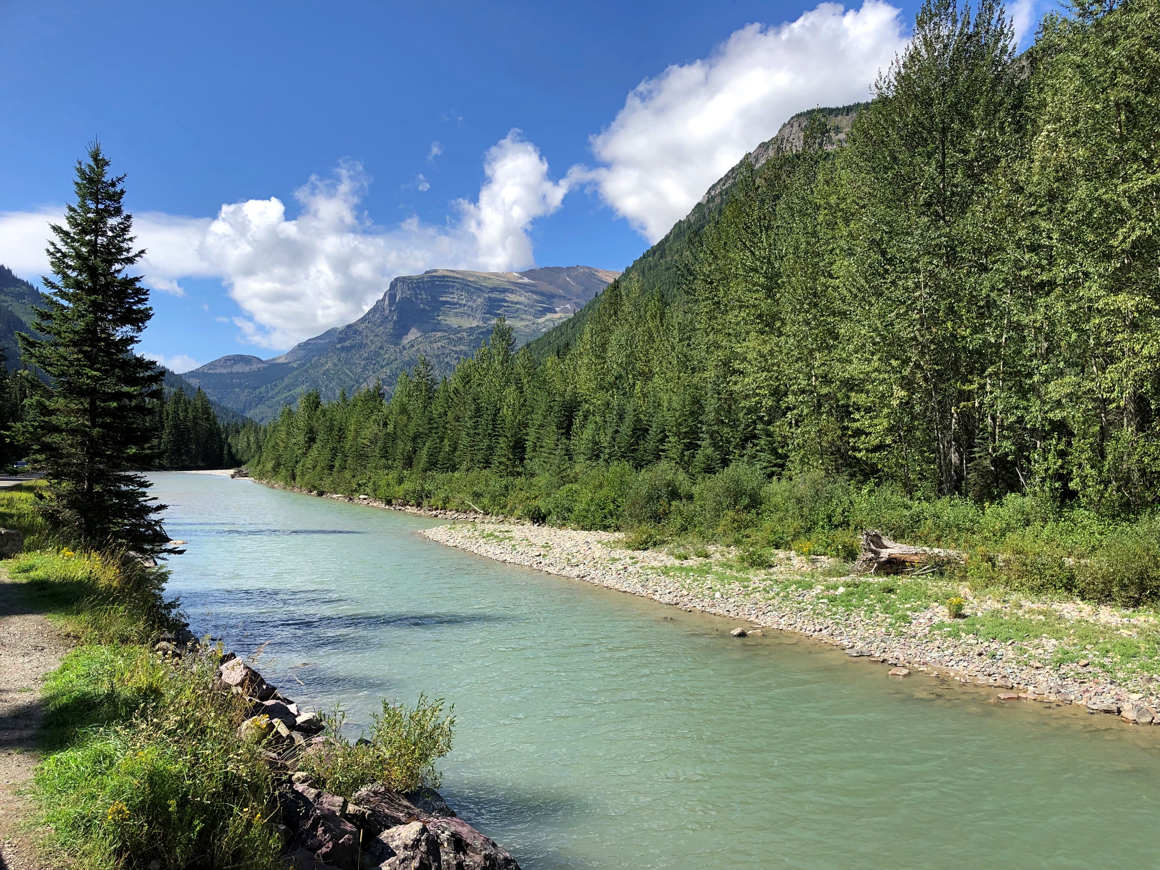
Closer to the lake, the creek is rocky.Going to the Sun Road Going to the Sun Road Going to the Sun Road

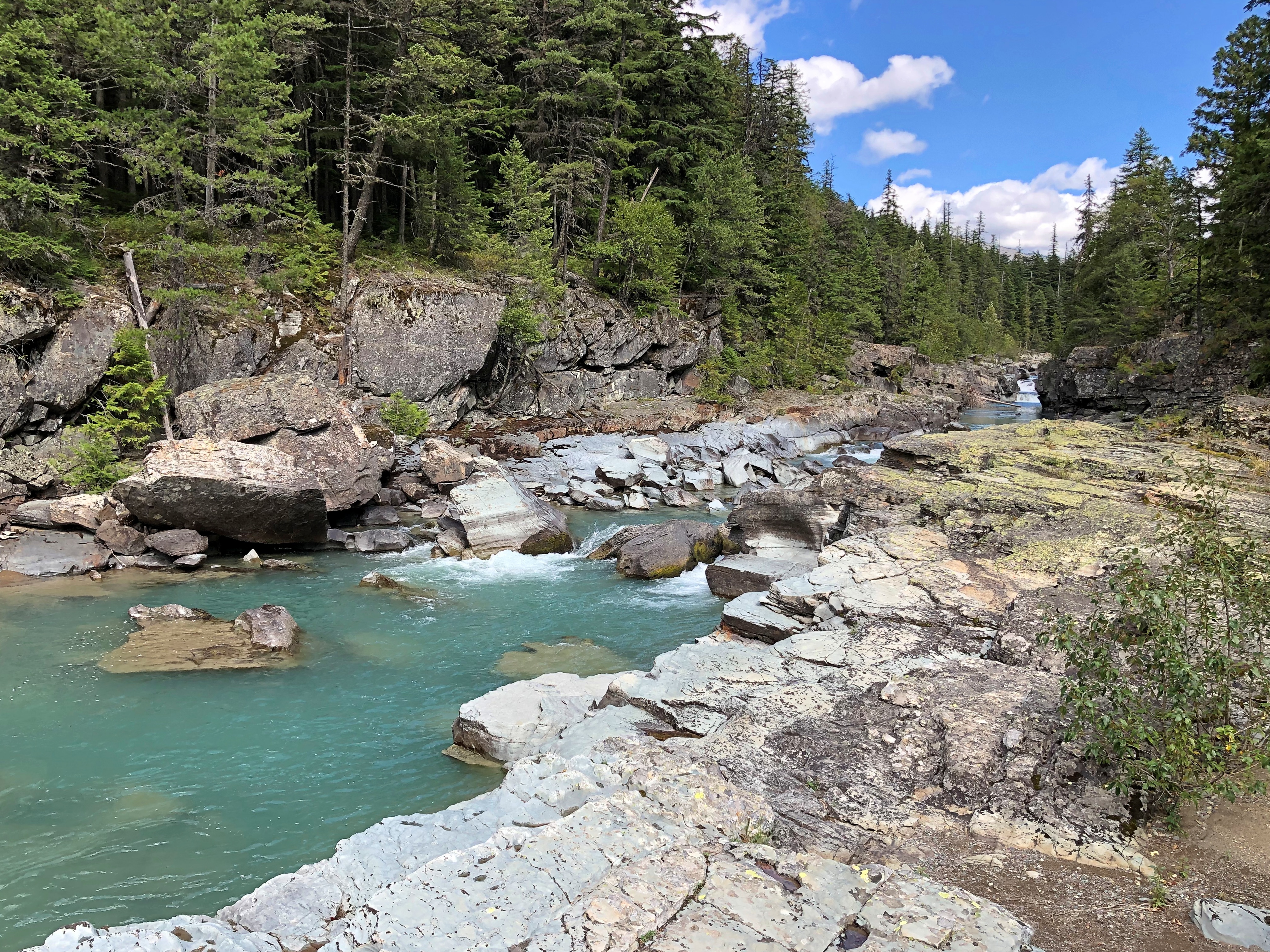
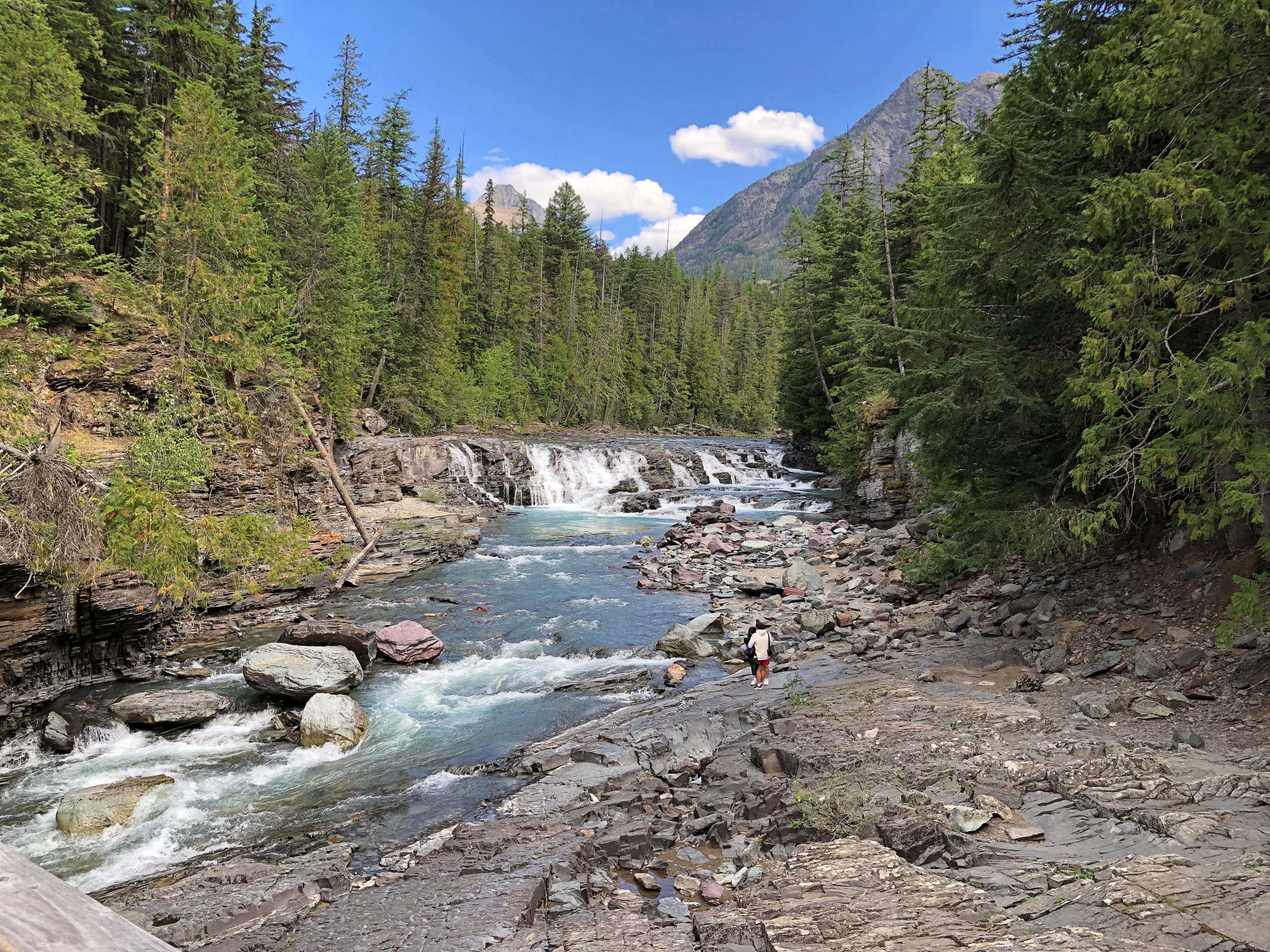
The water is bound for the Flathead River, a tributary of the mighty Columbia. We stopped at a wooden bridge across the creek.Going to the Sun Road

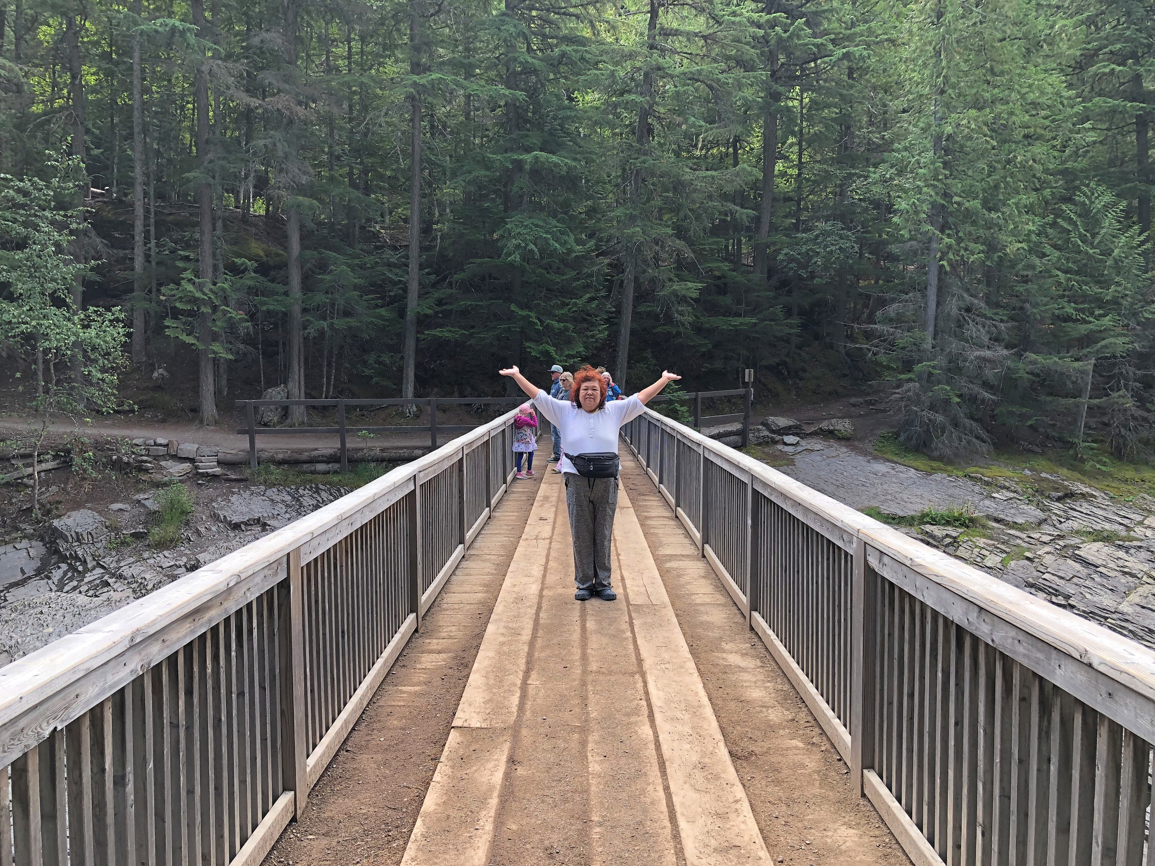
Pedestrians can cross, but a sign warns that horse traffic has the right of way.Going to the Sun Road

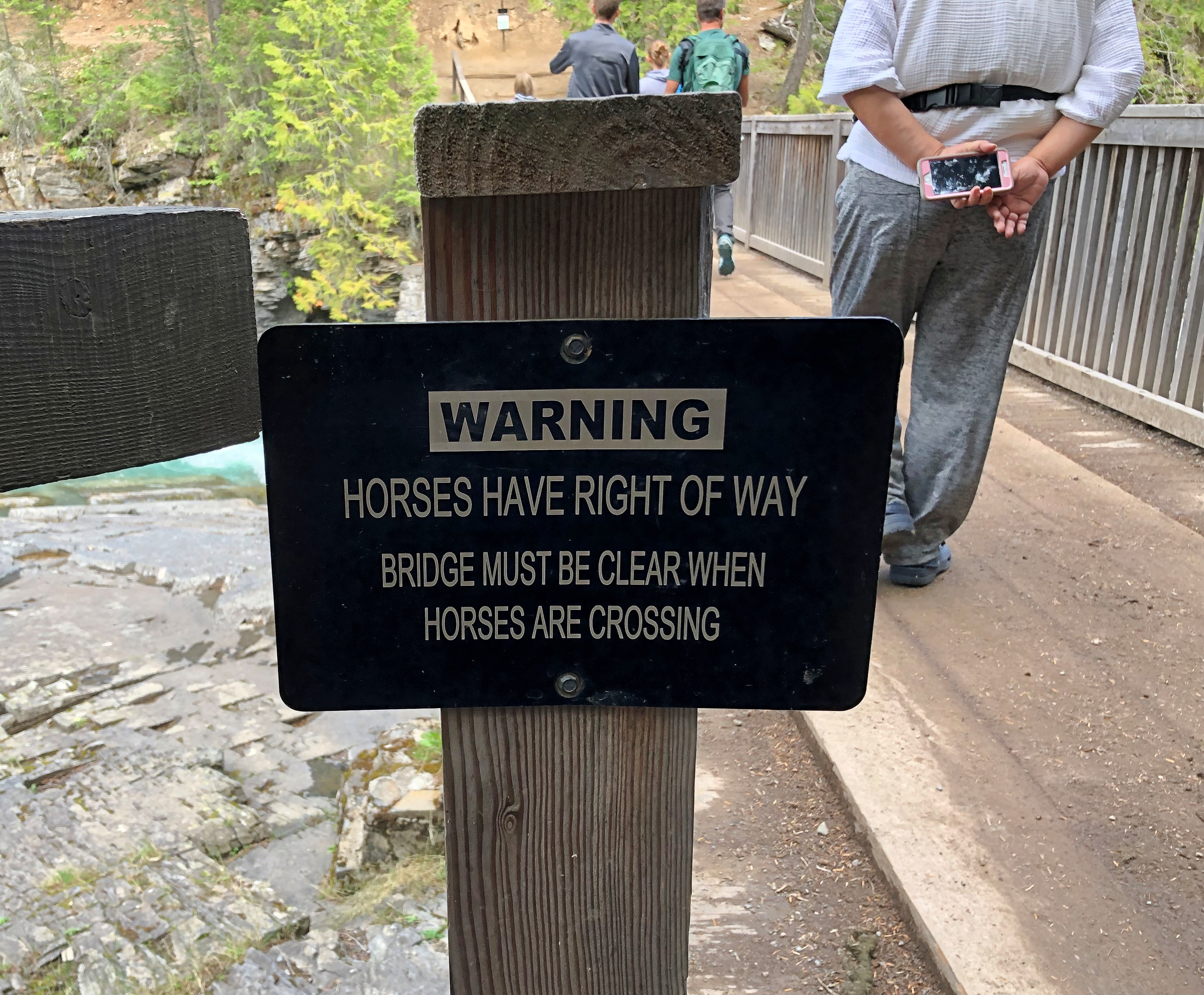
Not something you see too often. I assume that’s horses with riders, as part of a horse-riding trail, though maybe wild horses might have the right of way too. Like bears or moose, they’re large and might insist.

Bears!

Nosing around the other day, I was a little surprised to find a National Park Service web page called “Deaths in National Parks,” which details mortality in the wider universe of NPS properties, which is about 430 locations, not just the 63 formal national parks. For a six-year period including calendar years 2014 to 2019.

Among other factoids, taken verbatim: motor vehicle crashes, drownings, and falls are the top three leading causes of unintentional deaths in parks, in that order; half of medical deaths (50%) occurred while the individual was engaged in a physical activity (e.g., hiking, biking, swimming); suicides account for 93% of all reported intentional deaths.

People die while hiking and walking, and swimming and boating, in other words, but the number-one risk is driving. The graph for Unintentional Deaths by Cause affirms that auto accidents are indeed number one, but drowning and falls are popular ways to die, too. A very rare way to die, on the other hand – only three times in six years – is “wildlife.” Which could involve an angry bear, but maybe not. Could be a mountain lion or even be a poisonous snake.

Even so, we boldly took our hikes out West, at Glacier NP and later Grand Teton NP, armed with bear spray. So did a lot of other people. The distinctive shape of the can, with the spray nozzle up top, was attached to a lot of people’s belts or, as we did, in an exterior pocket of a backpack. Though attacks are very rare, better to have one, I figured. I don’t want my last thought to be about how statistically unlikely my death is. Bears aren’t known to care about statistics. Rather, I want my last thought to be, There, I just sprayed the bear! Doesn’t seem to be working…

This is quite the rabbit hole. (Bear cave?) Bear encounters used to be a worse problem, at least in Yellowstone NP. The site Bear Aware has an article called “History of Bear Feeding in Yellowstone National Park,” which includes some astonishing information.

“In the 1920s, the National Park Service began actively encouraging bear feeding as a way to attract visitors and generate revenue for the park,” the article explains. “Feeding stations were set up throughout the park, and rangers would even bring food to bears in order to ensure their presence in certain areas.

“As the popularity of bear feeding grew, so did concerns about the impact on the bears and their natural behavior. Bears became increasingly habituated to humans and dependent on handouts, leading to a rise in aggressive behavior and dangerous interactions with park visitors.”

By 1970, the NPS had figured out that decades of feeding bears was a bad idea, and ended the practice.

“Since the 1960s, the recorded number of negative encounters between humans and bears has dropped from 48 to 1 annually,” the article notes. I like that term, “negative encounters.” I suppose just seeing the bears at a distance, and safely moving away, as we did at Glacier, would be a “positive encounter,” or maybe neutral.

But do Yellowstone bears, in as much as they remember their history — maybe more that we realize — recall the days of ranger-sanctioned feeding with warm nostalgia? Stealing picnic baskets was no big deal, the older bears tell the younger ones. Yogi was a role model.

Glacier National Park

“Did you see the weather forecast for today?” the young-faced NPS ranger said to us at the Many Glacier entrance station of Glacier National Park on August 23. Skies were clear that morning and the air had the makings of a warm day, but I confessed that we hadn’t. That was a bit of carelessness, considering that we were planning to take a hike. I think he wanted to tell us that, but thought better of it.

“There might be a thunderstorm this afternoon,” he continued politely. “Or not. Weather’s unpredictable here.”

I thanked him and we went on our way. What to do with that information, anyway? Cower somewhere dry? No. The hike was on.Glacier National Park

Another way to refer to Glacier is Waterton-Glacier International Peace Park, since the much smaller Waterton Lakes NP, a Parks Canada unit, is just north of Glacier on the other side of the Canadian border. Single park, my foot. You still need a passport to go to Waterton, at least if you drive, and I assume you pay separate admission. Still, the road to Waterton has a cool name: Chief Mountain International Highway (Montana 17 and then Alberta 6).

The part of Glacier NP we first visited was about 20 miles south of the border, and I think the closest we came to Canada on this trip. We had our passports, in case we wanted to go. It’s good to have options. But we didn’t have the energy for the rigmarole of two border crossings.

A short drive from the Many Glacier entrance is the Many Glacier Hotel.Glacier National Park

The hotel has views. Looking out on Swiftcurrent Lake.Glacier National Park Glacier National Park

Many Glacier Hotel dates from the 1910s, the handsome sort of place railroads were building at the time. Swiss style, to go with the notion of Glacier NP as the Switzerland of America. These days it is priced as a luxury property, only open in the summer. This year, it closed just this week. During the winter, I suppose, management hires a fellow like Jack Torrance as a caretaker. Well, maybe not quite like him.

A trail starts at the hotel and goes around Swiftcurrent Lake, as well as the adjoining Josephine Lake, making connections with harder trails that lead into the mountains. Packing water, hats, walking sticks, plastic ponchos, and bear spray obtained at a big-box retailer in Helena, we headed off to do a circuit around Josephine Lake. To get there, you hike around the southern edge of Swiftcurrent.Glacier National Park Glacier National Park

It ended up being about a four-mile walk, with views of the mountains.Glacier National Park Glacier National Park

Anyone with a smartphone can now do homages to Ansel Adams. Pretty good ones, too.Glacier National Park

There are still glaciers in Glacier NP, but they are receding. One forecast of their total disappearance is by 2030.Glacier National Park

Views of the water.Glacier National Park Glacier National Park Glacier National Park

Møøse!A moose bit my sister once

Toward the end of the walk around Lake Josephine, we spotted bears frolicking in the water, too. At just the right distance. That is, pretty far away, especially because it was a mother and two cubs.

Eventually, the trail leads back to the hotel. We were fairly tired by then, so it was a good thing to see.Many Glacier Hotel

After the hike was over, we saw bison.

On my plate at one of the hotel restaurants. A nice buffalo burger, if a little expensive. You know what they say about room for all of God’s creatures, except that I didn’t have any mashed potatoes with that meal. Next to the French fries, then.

Remember the weather forecast? During our hike, and the meal afterward, skies were clear and temps warm. We needed those hats and that water. As we were leaving Many Glacier Hotel, however, we noticed dark clouds massing to the north. A moisture invasion from Alberta-British Columbia.

By the time we (almost) got back to our campground outside the St. Mary entrance to the park, the thunderstorm had arrived. Rain and then a few minutes of hail. I pulled over under a tree that offered some protection, but luckily the hailstones weren’t as big as in Wyoming, and didn’t even put any dints in the roof of the car.

Badlands National Park ’24

A little over 19 years ago, we visited Badlands National Park, which is easily accessible from I-90. Our visit ended up being short.

Lilly wasn’t impressed. Could have been the heat. Must of been pushing 100 F. pretty hard. Also, the austere beauty might have been lost on a seven-year-old.

On the afternoon of August 19 this year, conditions were dry and warm at Badlands, but not oppressively hot. This time we spent a few hours longer.Badlands National Park

At the entrance, I also made an investment in my future travels. One that has already paid off: an America the Beautiful National Parks and Federal Recreational Lands Pass, of the Senior Lifetime variety. You need to be 62 or older to get one, but if you are, the NPS employee at the entrance station can issue you one on the spot. If I can keep track of the physical card – which is exactly the same size and composition as a credit card – I can use for admission to NPS units until I go to that jurisdiction beyond federal oversight, namely the Great Beyond.

All for $80. Considering that vehicular admission to this particular park is ordinarily $30, I was already on my way to my money’s worth. Later on just this trip, we used the pass for admission to Glacier National Park (ordinarily $35), Olympic National Park ($30), Craters of the Moon National Monument ($20), Grand Teton National Park ($35) and Yellowstone National Park ($35). A good deal. You’d think the government was encouraging old people to travel.

I don’t need the encouragement.Badlands National Park
Badlands National Park

“For hundreds of years, the Lakota people have called this area mako sica, which literally translates to ‘bad lands,’ the NPS notes. “When early French fur trappers passed through this area, they called the area les mauvaises terres a traveser (‘bad lands to travel across’). Since the French trappers spent time with the Lakota, it is likely that the French name is derived directly from the Lakota one. Badlands National Park Badlands National Park

“The Badlands presents many challenges to easy travel,” the NPS publication notes wryly. (Government pubs get to be wry?)

Except, of course, for the road that dips into the park and runs through the North Unit. Other parts of the park, which extends to the southwest away from the reach of paved roads, look remote indeed.Badlands National Park

“When it rains in the Badlands, the wet clay becomes slick and sticky, making it very difficult to cross. The jagged canyons and buttes that cover the landscape also make it hard to navigate. The winters are cold and windy, the summers are hot and dry, and the few water sources that exist are normally muddy and unsafe to drink. These factors make the land difficult to survive in, and evidence of early human activity in the Badlands points to seasonal hunting rather than permanent habitation.

‘In 1922, when Badlands was first proposed as a national park, the suggested name was Wonderland National Park!”Badlands National Park Badlands National Park Badlands National Park Badlands National Park

One more detail. A little more bad in the badlands. Badlands National Park

No buboes so far, so I figure we’ve avoided the plague for now. But I can’t say I wasn’t warned. In case you’re curious: The three most endemic countries for plague are the Democratic Republic of the Congo, Madagascar, and Peru, according to WHO. Not South Dakota, at least not yet.

Camden Hills State Park, 1995

Somewhere in our boxes of physical prints are some from Maine in August 1995. At some point, I scanned one of them.Camden Hills State Park, Maine

The view looks toward the town of Camden, and out into West Penobscot Bay. Camden Hills State Park surrounds the town, and we camped there, though not exactly at this vista. I don’t think so, anyway.

I don’t remember a lot about Camden Hills SP, but even so I was reminded of that place when I found out that August 4 is a free day at all national parks, reportedly in honor of the anniversary of the passage of the Great American Outdoors Act four years earlier.

Not because Camden was a national park – obviously not, it was a state park – but because it was close to Acadia National Park, which hugs the coast of Maine just a little further to the east. The visit to Camden was a weekend trip, so there wasn’t another day for Acadia, though we knew it was there. No worries, we’ll visit later, was the thinking.

So far that hasn’t happened. Maine was close in 1995; now it’s a little far. But still possible. I did a count and among the actual national parks (not other kinds of park service units) in the Lower 48, I’ve visited 26 out of 51. None of those was on a free day, including August 4, 2024. Major events that day including mowing the lawn and sweeping out the garage.

Hot Springs National Park ’24

We arrived at Quapaw Baths in Hot Springs National Park on April 14 in time for a late-afternoon soak.Hot Springs NP

Or rather, a series of soaks in its indoor pools, which are heated at various temperatures. I might have skipped it, but Yuriko is keen on hot soaks, having come of age in Japan, where they take their hot springs seriously. The bathhouse has been well well restored, considering its former decrepitude.

Good to see Bathhouse Row again after so many years. All together, eight bathhouse structures line Central Avenue in the town of Hot Springs, and are part of the national park; two offer baths. In 2007, because the Quapaw was still unrestored, only one did, so we took the waters at the Buckstaff, which was a more formalized experience than at the Quapaw.Hot Springs NP

The Lamar.Hot Springs NP Hot Springs NP

“[The Lamar] opened on April 16, 1923 replacing a wooden Victorian structure named in honor of the former U. S. Supreme Court Justice Lucius Quintus Cincinnatus Lamar,” says the NPS, a fact that amuses me greatly, for idiosyncratic reasons. Mostly it’s NPS offices and other space these days, but I bought some postcards and a refrigerator magnet in its NP gift shop.

The Maurice.Hot Springs NP

And of course, The Fordyce, now the park’s visitors center and a free museum highlighting its bathhouse amenities. Named for its founder, Samuel Fordyce, one of those roaringly successful business men that the late 19th century unleashed.Hot Springs NP Hot Springs NP

“He was a major force behind the transformation of Hot Springs (Garland County) from a small village to major health resort,” the Encyclopedia of Arkansas says. “The town of Fordyce (Dallas County) is named for him, as is the Fordyce Bath House in Hot Springs.

“He enjoyed friendships with Presidents Rutherford B. Hayes, Benjamin Harrison, and William McKinley, all of whom asked his advice on matters concerning appointments and regional issues.” Ah, there’s the trip’s presidential site, however tenuous.

As for the building, it was “designed by Little Rock architects Mann and Stern and constructed under the supervision of owner Sam Fordyce’s son John, [and] the building eventually cost over $212,000 to build, equip, and furnish.” That’s 212 grand in fat 1910s dollars, or $6.5 million in present value.

I believe I took somewhat better pictures this time around. Maybe.Hot Springs NP Hot Springs NP

Directly over Hernando de Soto and the maiden is the Fordyce’s famed stained glass aquatic-fantasy skylight.Hot Springs NP

Not the only stained glass around.Hot Springs NP

The Fordyce is an expansive place, and in fact, the largest of the bathhouses, according to the NPS.Hot Springs NP Hot Springs NP Hot Springs NP

Mustn’t forget the spring that made it all possible, whose presence is noted in the basement.Hot Springs NP

Bathhouse Row is at the base of a steep slope. Climb some outdoor stairs and soon you’re at the Hot Springs Grand Promenade behind and above the row. Not many people were out promenading. True, by the time we got there, it was the morning of April 15, a Monday. Still, people were missing out on one pleasant walk.Hot Springs NP Hot Springs NP

The bricked trail was an early project (1933) of the lesser-known but no less remarkable Public Works Administration.

“Unlike the Civilian Conservation Corps and the Works Progress Administration, the PWA was not devoted to the direct hiring of the unemployed,” the Living New Deal says. “Instead, it administered loans and grants to state and local governments, which then hired private contractors to do the work.

“Some prominent PWA-funded projects are New York’s Triborough Bridge, Grand Coulee Dam, the San Francisco Mint, Reagan National Airport (formerly Washington National), and Key West’s Overseas Highway.”

Further up the hill is the abandoned Army Navy Hospital, whose therapeutic heyday was WWII.Hot Springs NP Hot Springs NP

The promenade passes by some of Hot Springs’ hot springs.Hot Springs NP Hot Springs NP

The path also offers views of the back of some of the bathhouses, including the wonderful Quapaw dome.Hot Springs NP

The crowning bit (literally) on a marvelous piece of work.

Pukaskwa National Park

My old friend Geof Huth has been known to post images of figures – glyphs – he draws in the sand, and so I took some inspiration from him. His glyphs are unique, probably in the history of the world. My are a touch more conventional.Pukaskwa National Park

I took a similar image on my crummy cell phone camera, but one good enough for snaps, and sent it to Geof. From the edge of the wilderness in northwest Ontario to a tower in Lower Manhattan, the message went.

It might look like the wilderness.Pukaskwa National Park Pukaskwa National Park Pukaskwa National Park

But no. Edge it was. I might have been within the bounds of Pukaskwa National Park, but only a few miles in, with access by road.Pukaskwa National Park

Pukaskwa (PUK-ə-saw), a sizable slice of Ontario (725 sq. mi.) on the shore of Lake Superior, is mostly back country. Rugged is the inevitable term for its back country, so much so that the mostly wooded terrain mostly thwarted efforts to mine and even log it, back when that was legally possible. The park reportedly protects the longest undeveloped stretch of coastline on Lake Superior and, indeed, the Great Lakes.

A feature of the park: there are clusters of Pukaskwa Pits at remote locations. Wiki is succinct on those human-made structures: they are “rock-lined depressions near the northern shore of Lake Superior dug by early inhabitants, ancestors of the Ojibwa. Estimates of their age range from as recent as 1100-1600 CE to as ancient as 3000-8000 BCE.”

That’s a pretty wide range of age estimates. You might say their origin is “lost in the mists of time,” but that lacks academic rigor. Modern Canada created the park in the 1970s.

I wasn’t anywhere near the pits. At least, I don’t think so. The park’s single road leads to a few trailheads, such as Southern Headland.Pukaskwa National Park

It winds around some hills near Lake Superior, with a variety of under-foot topography as you walk along. Nothing that hard. This time around, I had a walking stick and water to go with my decent hiking shoes.Pukaskwa National Park Pukaskwa National Park Pukaskwa National Park

The trail eventually leads to a deadwood-strewn beach.Pukaskwa National Park Pukaskwa National Park

A different, much shorter trail from the beach leads to another beach. I spent a few hours there, cooling my heels and drawing a few words in the sand. That is, I did once I’d crossed a horizontal forest of driftwood.Pukaskwa National Park

A long stretch along Superior.Pukaskwa National Park

There were about ten people on the whole beach. And as few on the Southern Headland trail, where the rocks meet the water and sky. From the beach, I captured an image of hikers on the rock outcropping where I’d been earlier in the day.Pukaskwa National Park

Rocks meeting water and wind and sun, because the sun came out in the afternoon. The four elements all together.

Grand Portage National Monument

So far since taking office, President Biden has proclaimed five new national monuments under the authority granted him by the Antiquities Act of 1906, including one only last week, with the lengthy name of Baaj Nwaavjo I’tah Kukveni – Ancestral Footprints of the Grand Canyon National Monument, which is in Arizona near the Grand Canyon. (For those keeping score, his immediate predecessor proclaimed five over four years.)

How can we keep up with all the new ones? For now, there are 133 national monuments, with more coming, I’ve read.

Grand Portage National Monument has been around a little longer. Longer than me, but not much, being one declared by President Eisenhower. It occupies land very near the tip of the arrowhead region of Minnesota, within a few miles of the Canadian border, which happens to the Pigeon River at that point.

I arrived fairly late in the afternoon of July 30. The U.S. flag, Minnesota and – what’s the other one?Grand Portage National Monument

The flag of the Grand Portage Band of Chippewa; the national monument is entirely within their reservation. More about them is hereGichi Onigaming = The Great Carrying Place.

“Grand Portage was a fur-trade depot and route of the voyageurs at the western extremity [sic] of Lake Superior,” says the Canadian Encyclopedia. “It was the first and most strenuous of the 29 portages from Lake Superior west to Lac La Croix, requiring that each voyageur carry four loads of 80 kg over some 14 km of rocky trails around the cascades of the Pigeon River.

“The North West Co. (NWC) established an extensive post at the mouth of the river, which by 1784 was the wilderness capital of the fur trade, providing a meeting place for the voyageurs bringing supplies from Montréal (porkeaters) and the traders bringing furs from the North West (winterers). Within the post, which was protected by a 5-m high palisade, reinforced with a bastion and a heavy gate, were the Great Hall, living quarters, shops, warehouses and a stone powder magazine.”

The NWC packed up and left after it was finally determined that, according to the Jay Treaty of 1794, the site was in the United States rather than British North America, though it took some time for the company to actually leave (1802). In more recent times, the United States reconstructed the Grand Hall and the wooden palisades.Gichi Onigaming: The Great Carrying Place

Along with Native structures of the period outside the palisade.Gichi Onigaming: The Great Carrying Place

Inside the palisade, work still seems to be under way, or at least renovation. The Great Hall wasn’t open.Gichi Onigaming: The Great Carrying Place Gichi Onigaming: The Great Carrying Place

The North West Co. flag still flies. Gichi Onigaming: The Great Carrying Place

As you’d expect, the Great Hall faces Grand Portage Bay. Once upon a time, it was a busy place in the short northern summers. Now, not so much.Gichi Onigaming: The Great Carrying Place Gichi Onigaming: The Great Carrying Place Gichi Onigaming: The Great Carrying Place

Another view of Grand Portage Bay from the edge of the national monument.Gichi Onigaming: The Great Carrying Place

Way off in the distance – though not really that far, about 20 miles – is Isle Royale National Park, a large island in Lake Superior, which was more distinct with the naked eye than in the digital image.

Still, I was a little surprised that it is visible at all. Except for some of the Alaskan properties, it’s pretty much the definition of remote among national parks, with only a few more than 25,400 visitors in 2022, according to the NPS. The fifth-least visited park in the system.Gichi Onigaming: The Great Carrying Place

Since getting there and staying there is an involved process, I couldn’t make Isle Royale work logistically as a destination. This time.