Three Missouri Museums Along the Way

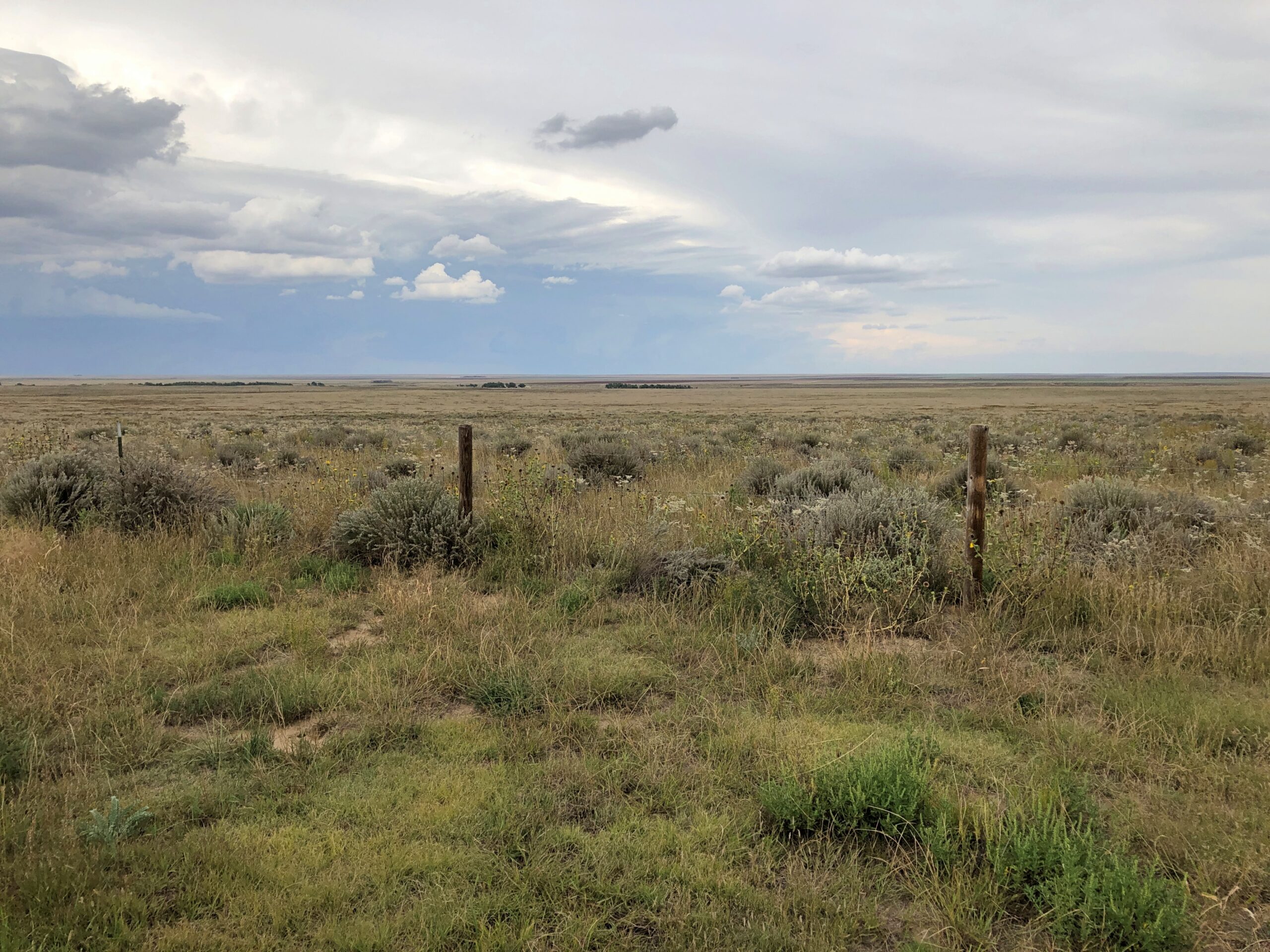
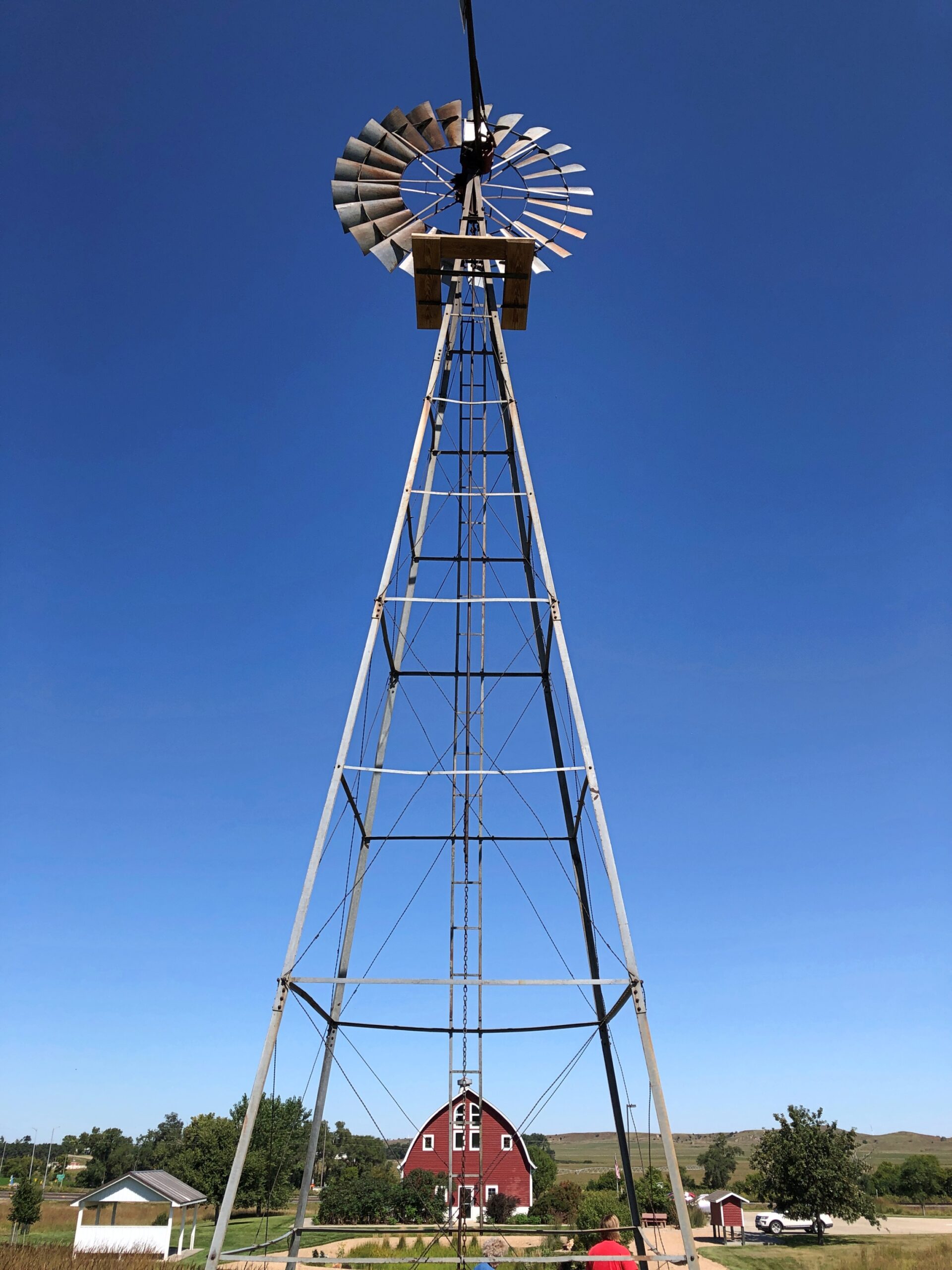
At least a foot of snow covers the ground outside, so it’s good to be inside. Winter has fully returned, but at least the early part, when the holidays are yet to come, and not the post-New Year grind of January or the interminable days of February, the alleged shortest month.

Thanksgiving was low key. I expect that’s actually true for most people, however many anecdotes there are about fractious Thanksgivings. Low key doesn’t get into sitcoms or in real or made-up tales on a Thanksgivingishell subreddit.

Back to posting after Christmas, maybe the first Sunday after. Got a lot to do before then.

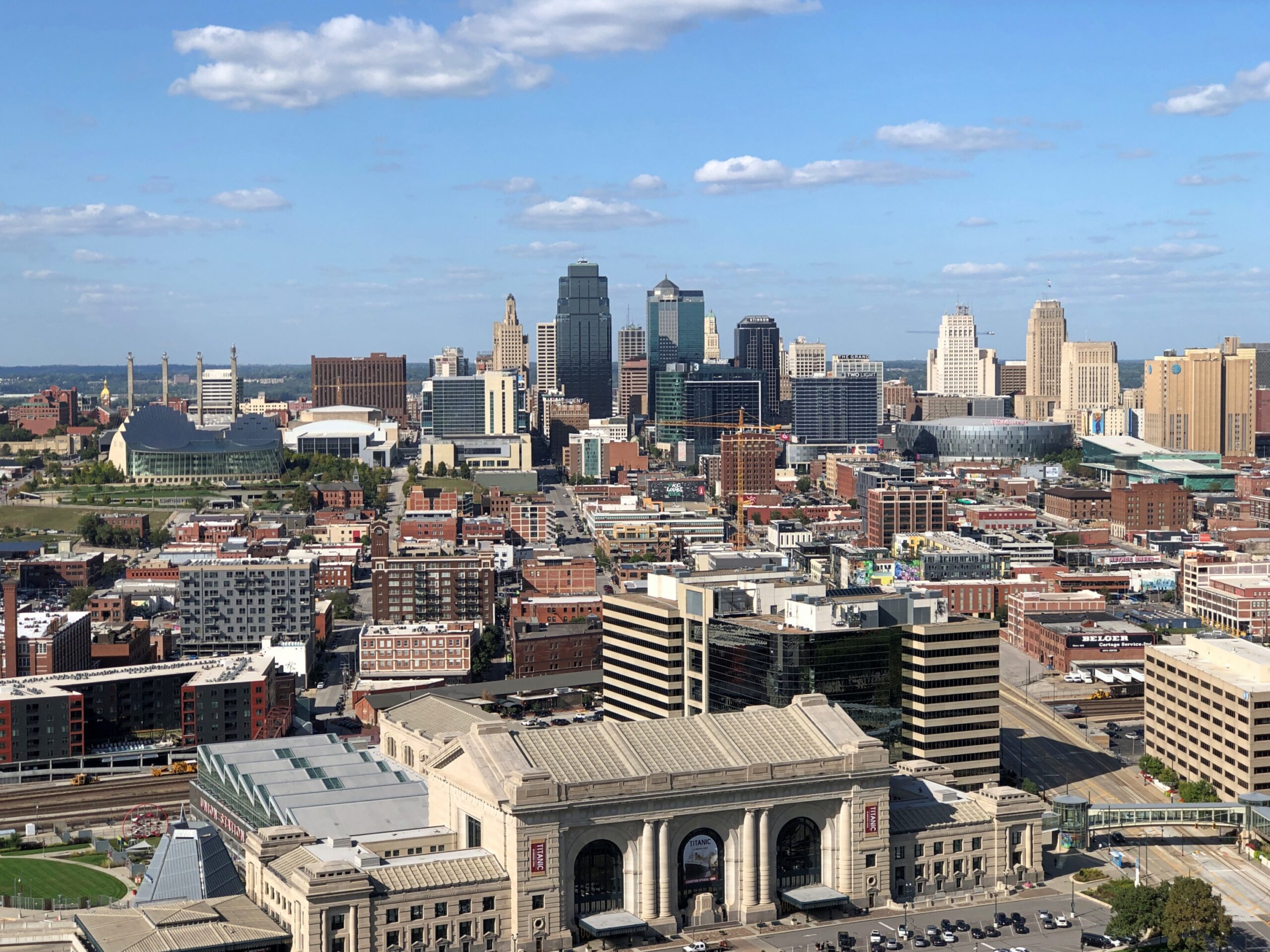
One more note about Kansas City in September. Besides the World War I Museum and Memorial, there was one more place I wanted to be during my visit: Arthur Byrant’s, for the barbecue I remembered so fondly from the late 1990s. Good ‘cue has sustained AB long after the pitmaster of that name died in 1982.
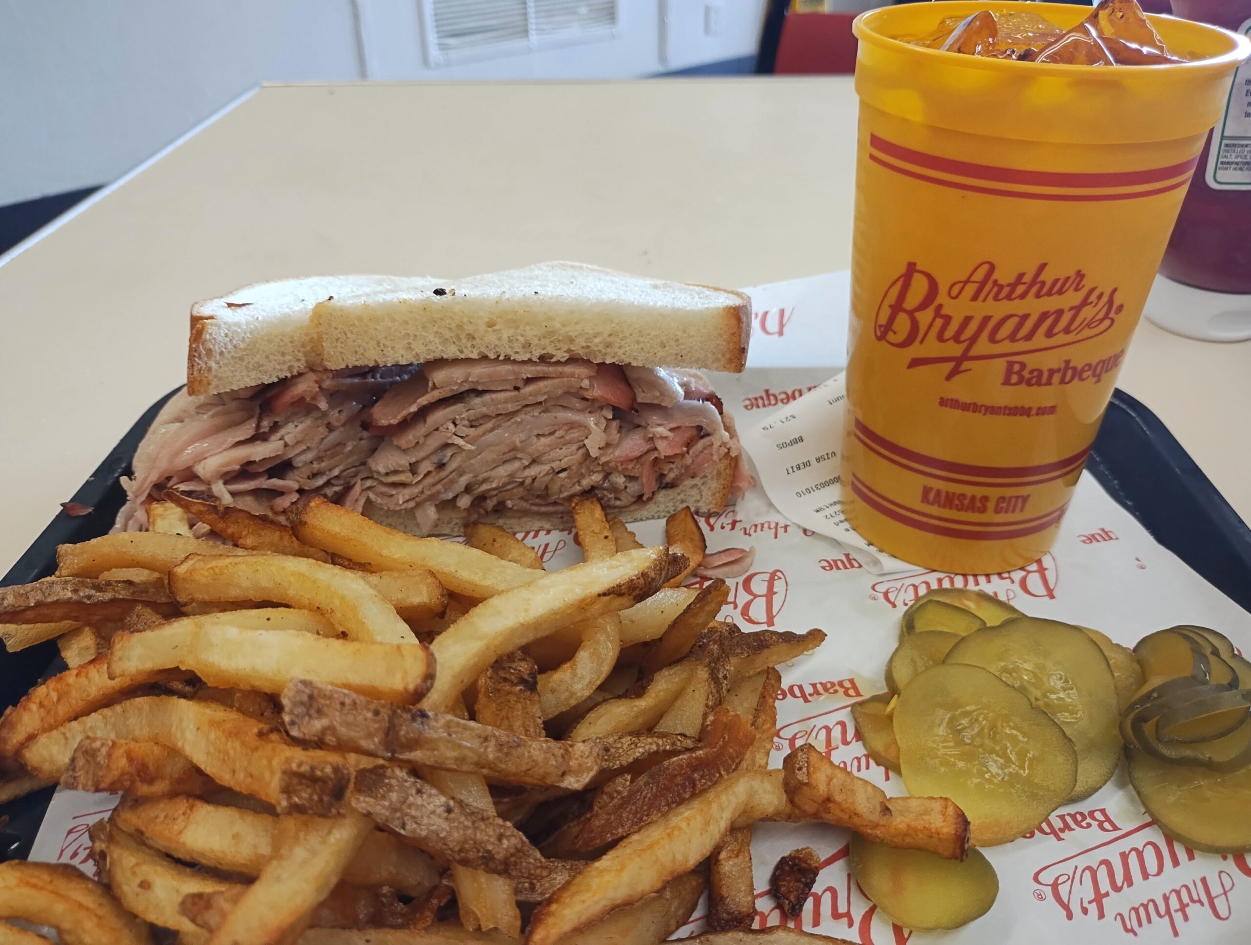
Kansas City

I’d go again.

After I left KC, I headed not too far northeast to the Jesse James Birthplace Museum.

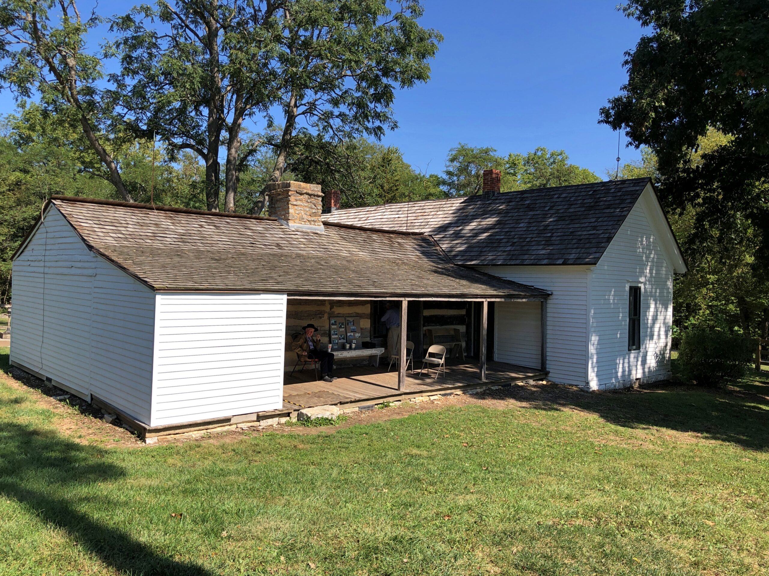
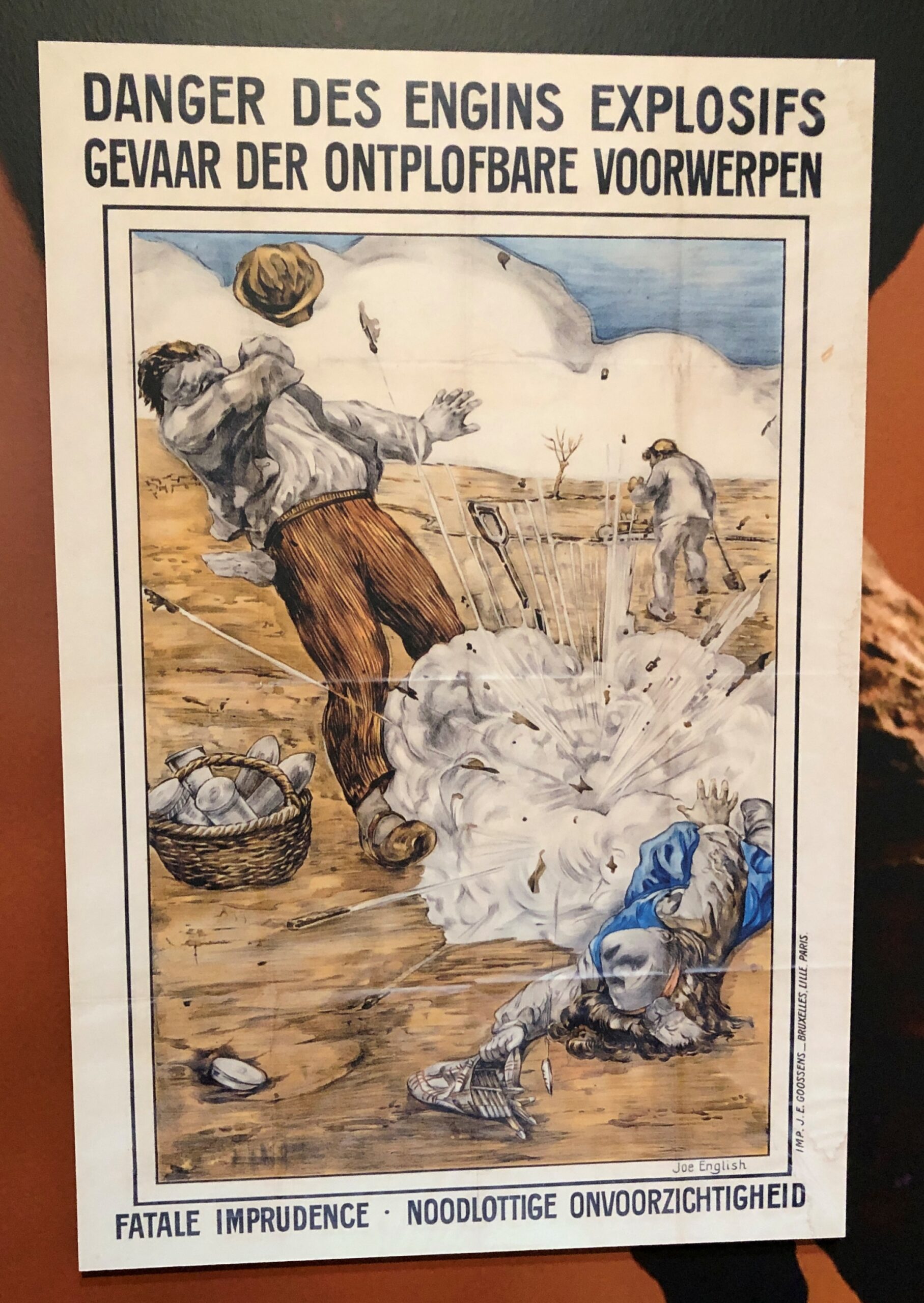
The birthplace museum, like the house, isn’t a large place, but it does convey some of the life and times of the famed outlaw, with some good artifacts and reading. Posters, too. I hadn’t realized that Jesse James was a character in the very last Three Stooges theatrical release, The Outlaws is Coming (1965), but there was the poster, along with ones advertising better-known biopics or Jesse James-adjacent movies. Somehow I missed that Stooges picture on TV as an impressionable kid, though I saw the likes of The Three Stooges Meet Hercules.

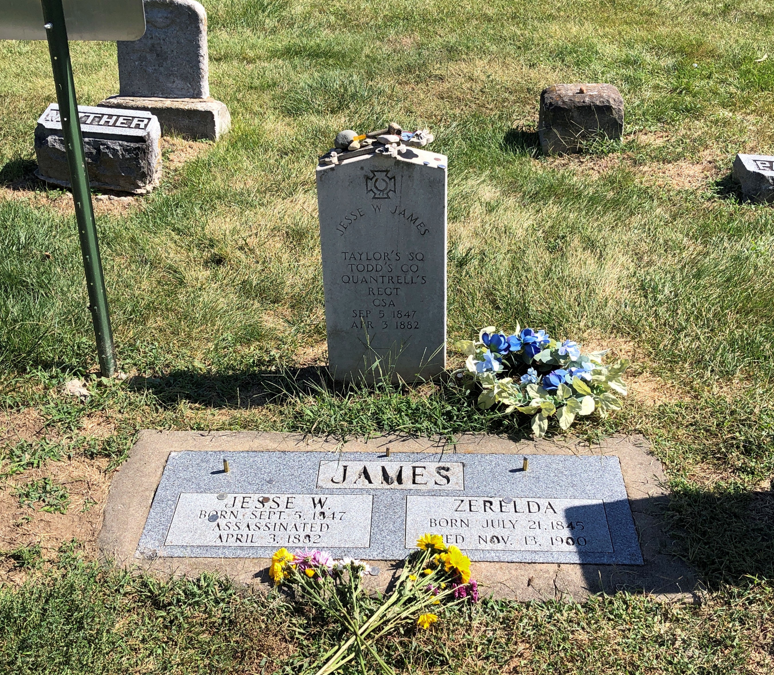
Jesse used to be buried at the homestead.

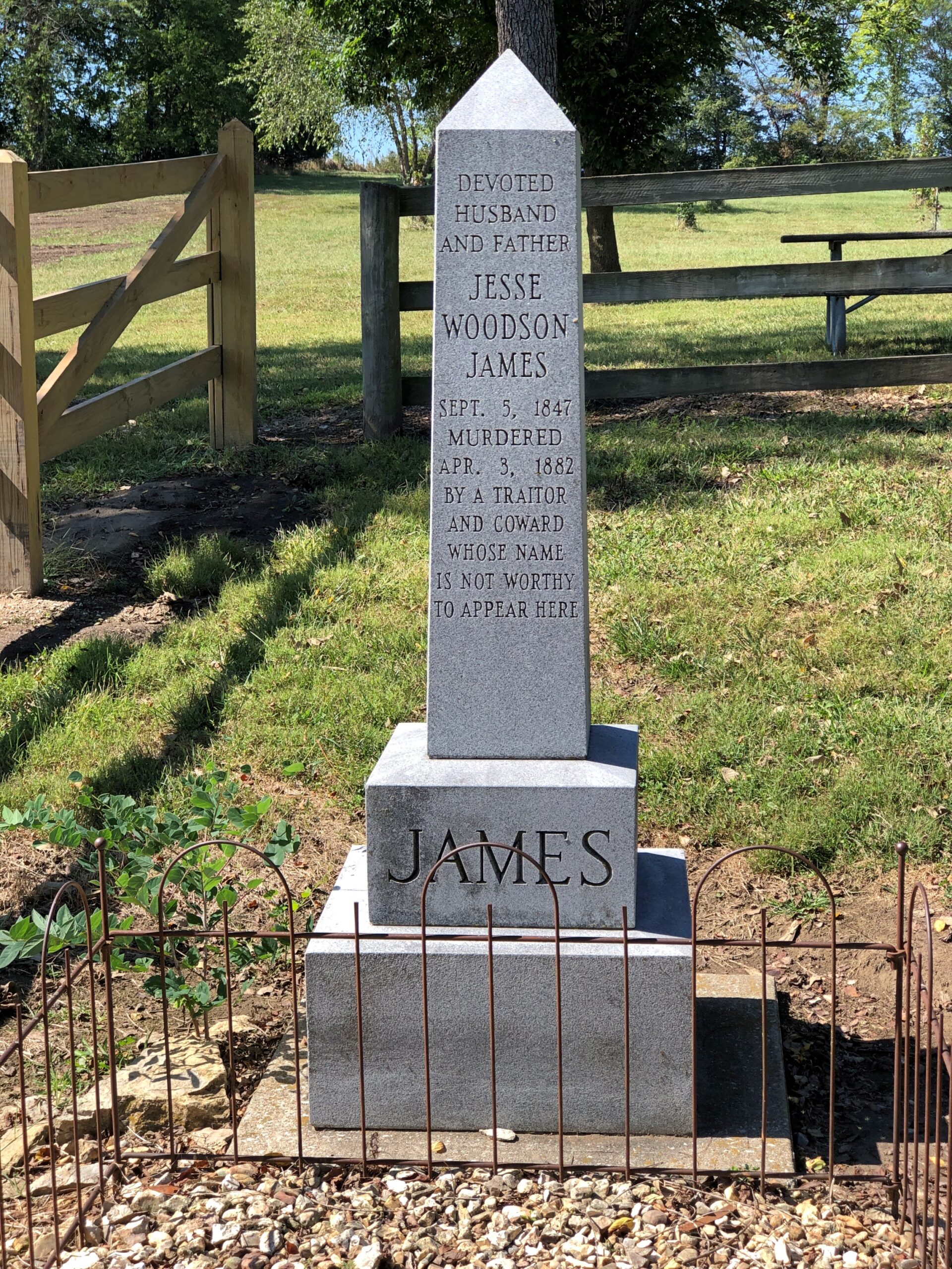
But at some point he was moved to Mount Olivet Cemetery in nearby Kearney, Missouri. Jesse receives rocks and flowers and coins from visitors 140+ years after his assassination by the Coward Robert Ford (“coward” capitalized, because the word is welded to his name in popular memory). As for Jesse, not a bad posthumous haul for a train robber.

Just as an example, do the Newton Boys get that kind of attention? No, they do not.

“The Newton boys were a criminal gang composed of brothers Willis, Joe, Jess and Wylie (Doc), who operated mostly in Texas during the 1920s,” says Texas State Historical Association. “Willis ‘Skinny’ Newton robbed over eighty banks and six trains from Texas to Canada with his brothers and other outlaws, including the single biggest train robbery in United States history. By the time they were captured, they may have stolen more money than all other outlaws at that time combined.”

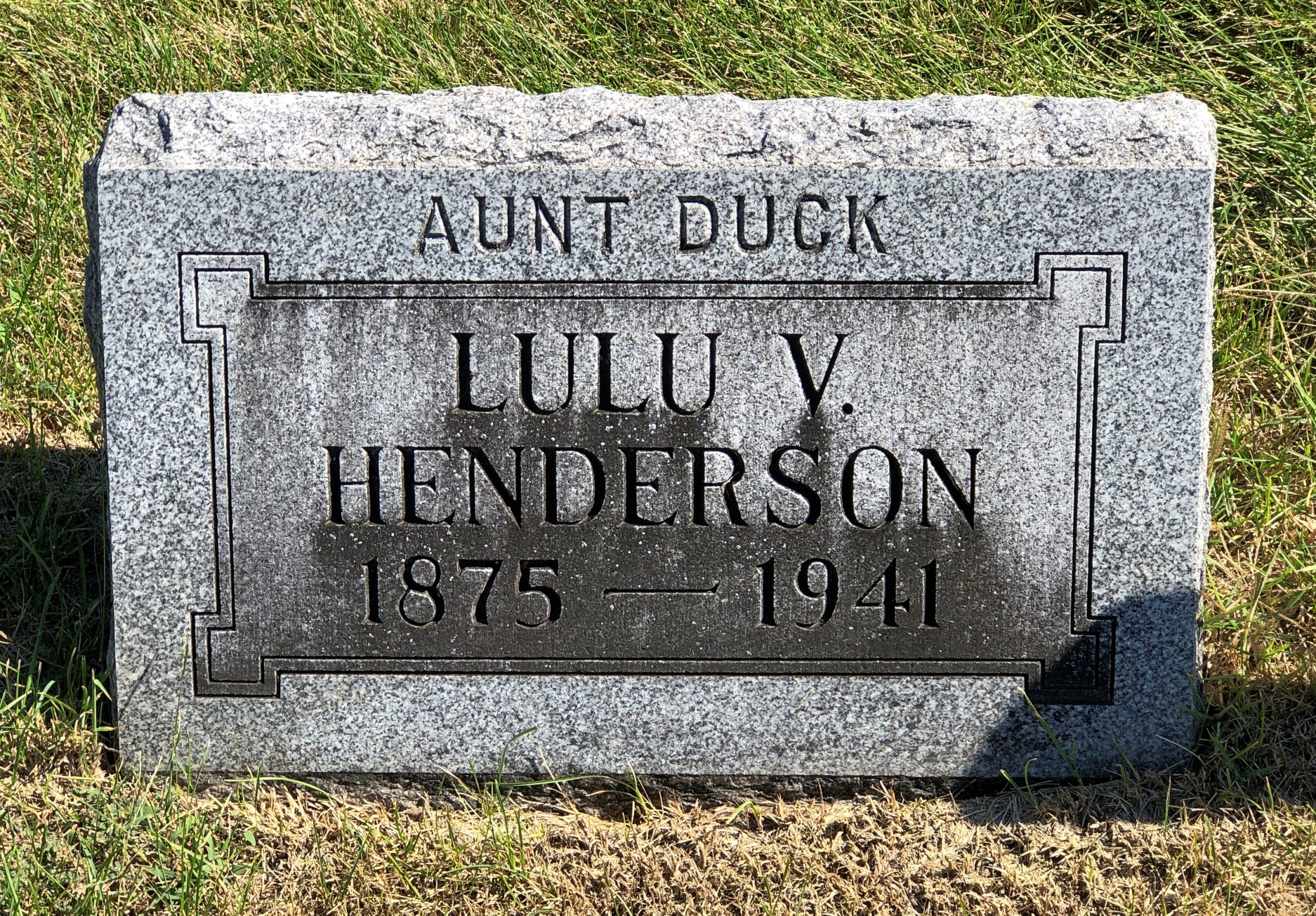
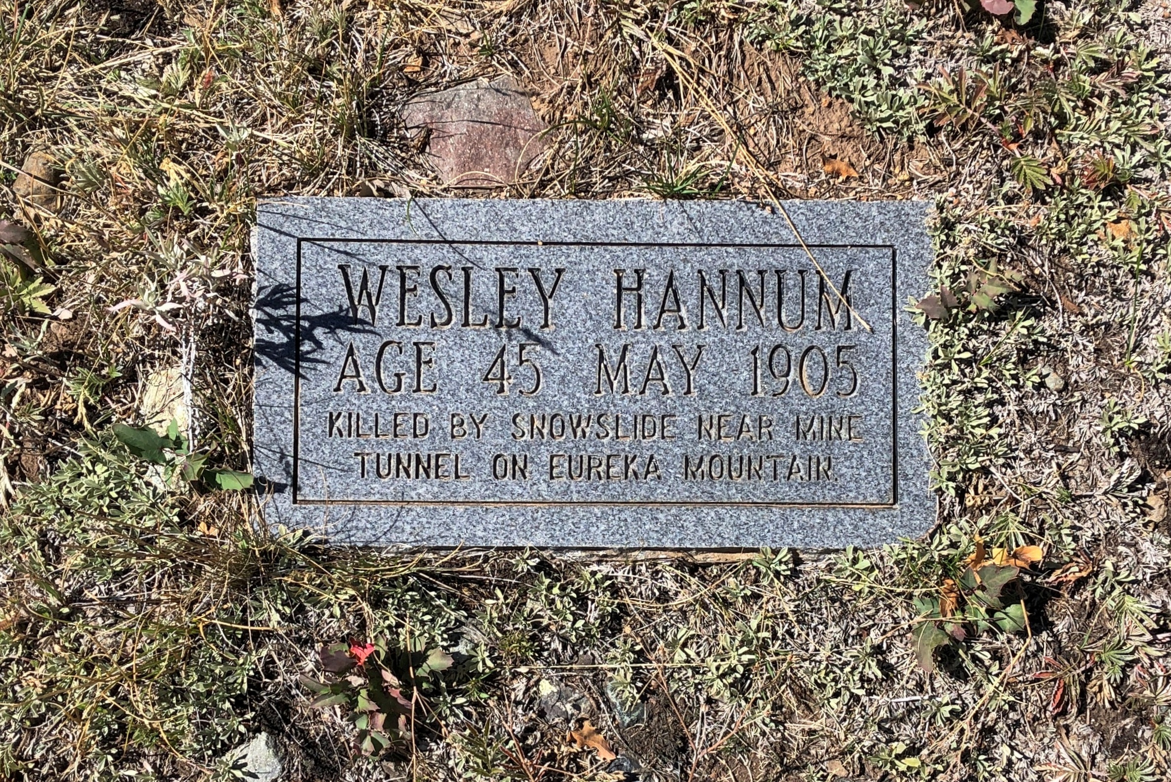
I liked Mount Olivet. Got some stones of yore.

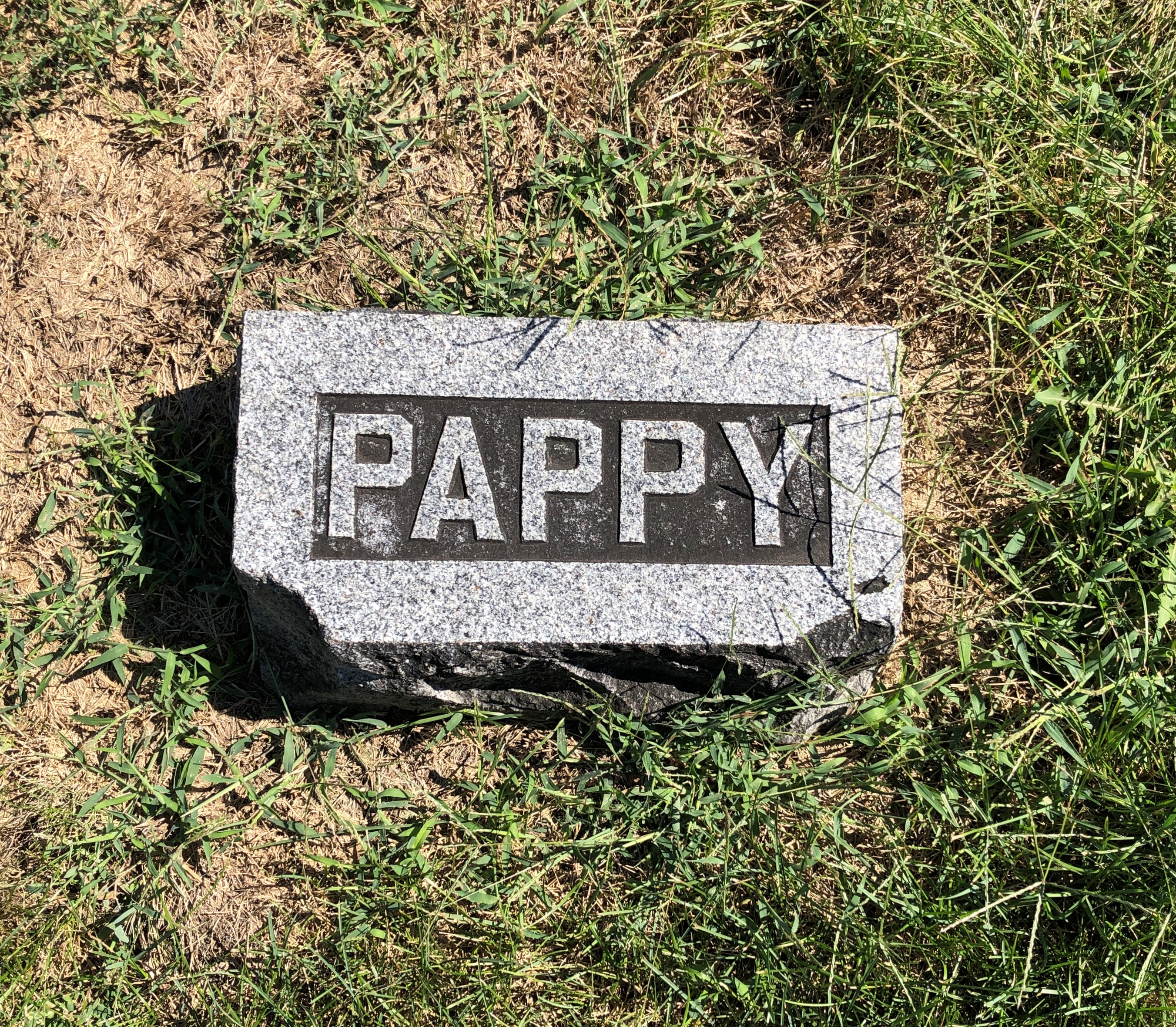
Aunt Duck had to have been a character.

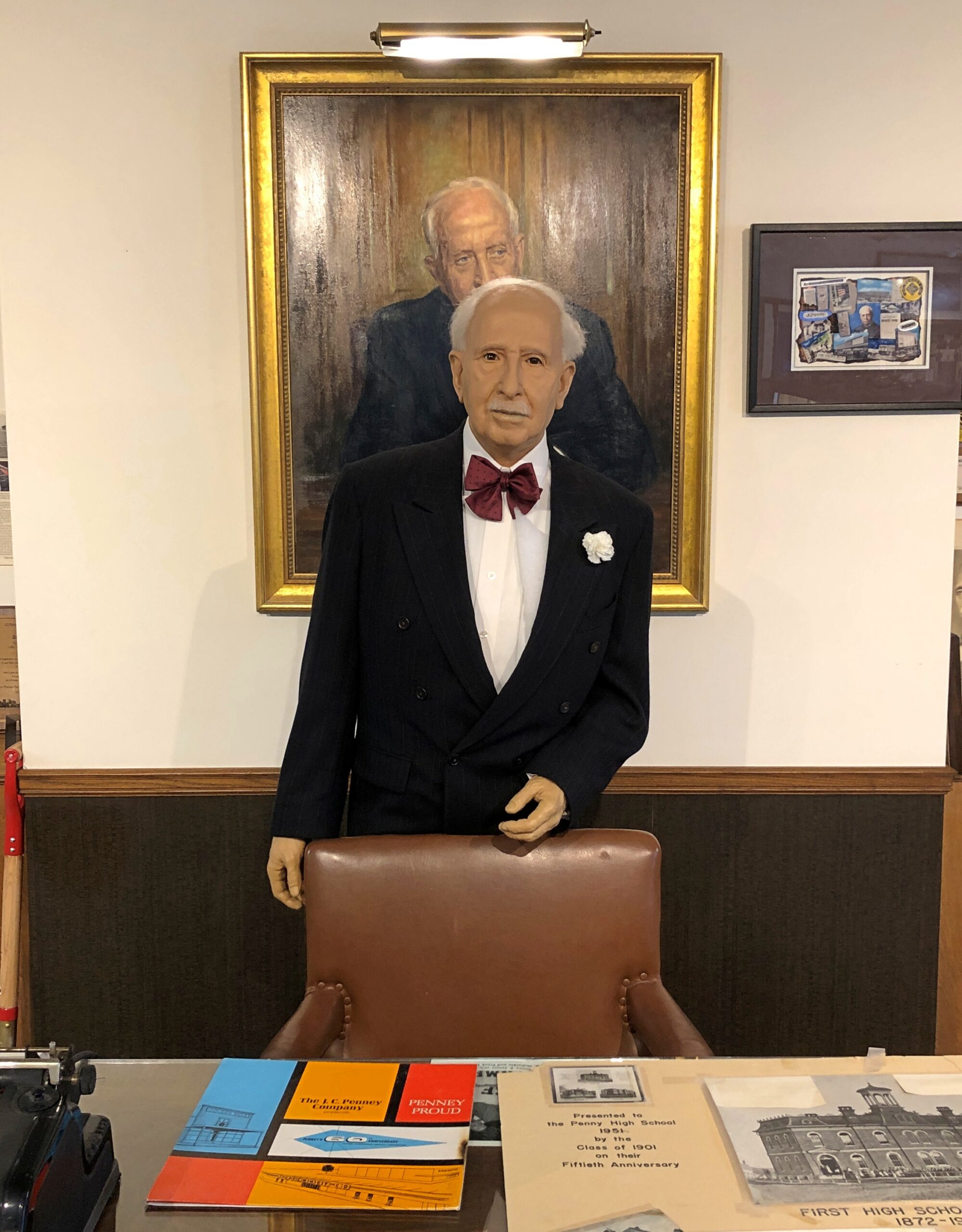
Further east, along U.S. 36 in Hamilton, Missouri, is the two-roomed JC Penney Library and Museum. The town library is in one room, the museum in the other. Most of the Penney artifacts are under glass. A wax JC Penney stands in front of a portrait of the department store mogul.

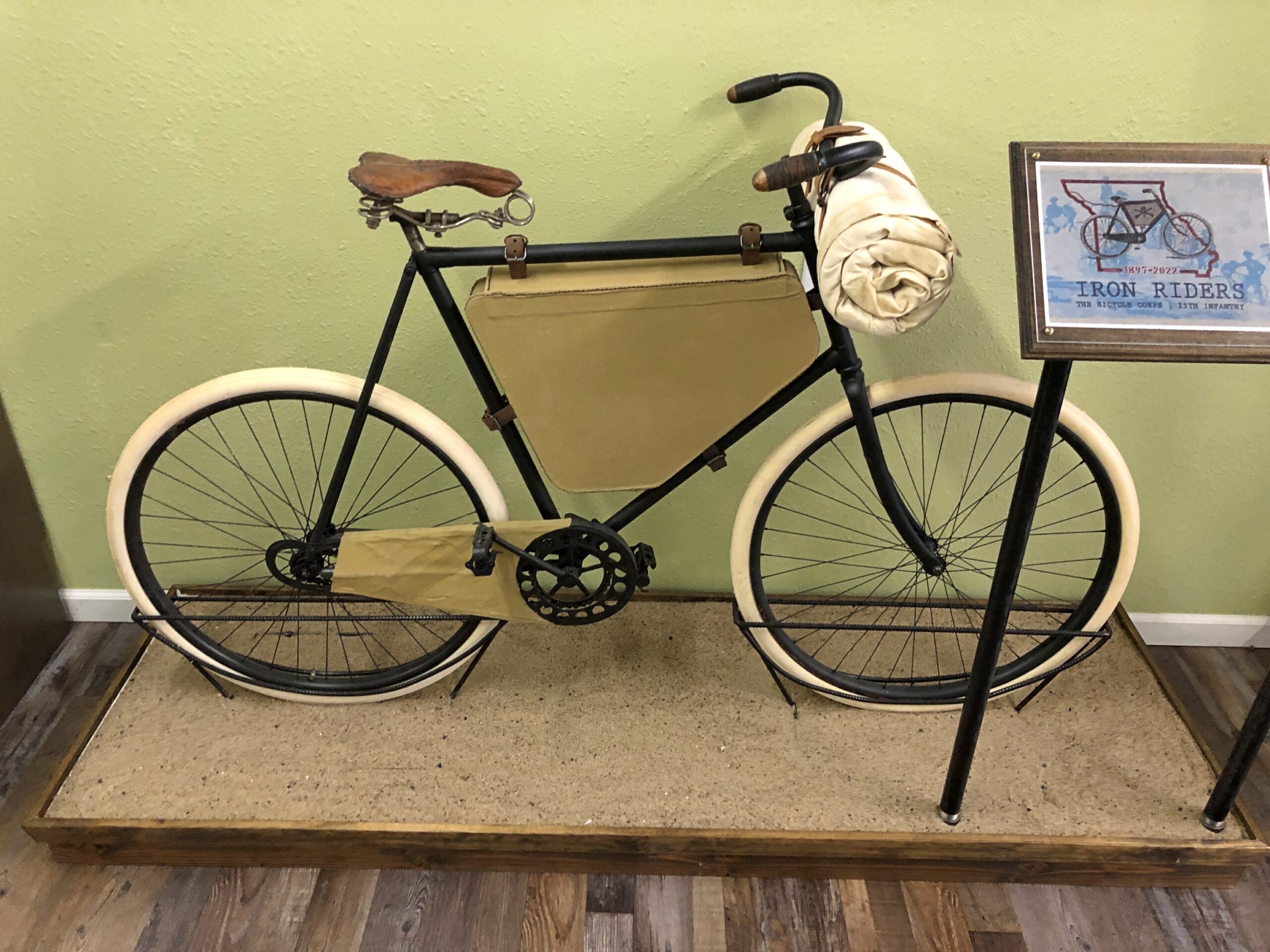
In Laclede, Missouri, is the Gen. John J. Pershing Boyhood Home State Historic Site. A fine museum about the General of the Armies, including an exhibit on something unknown to me, the Twenty-Fifth Infantry Bicycle Corps — the Iron Riders. The Army tested long-distance bicycling in 1897 as a strategy for troop movement, with the corps riding from Missoula, Montana to St. Louis. Pershing wasn’t involved in that effort, but it did happen during his time in the military. Quite a story. Deserves to be better known.

One the last day of my driving, I didn’t want to stop for much, but I did spend a while in Nauvoo, Illinois.

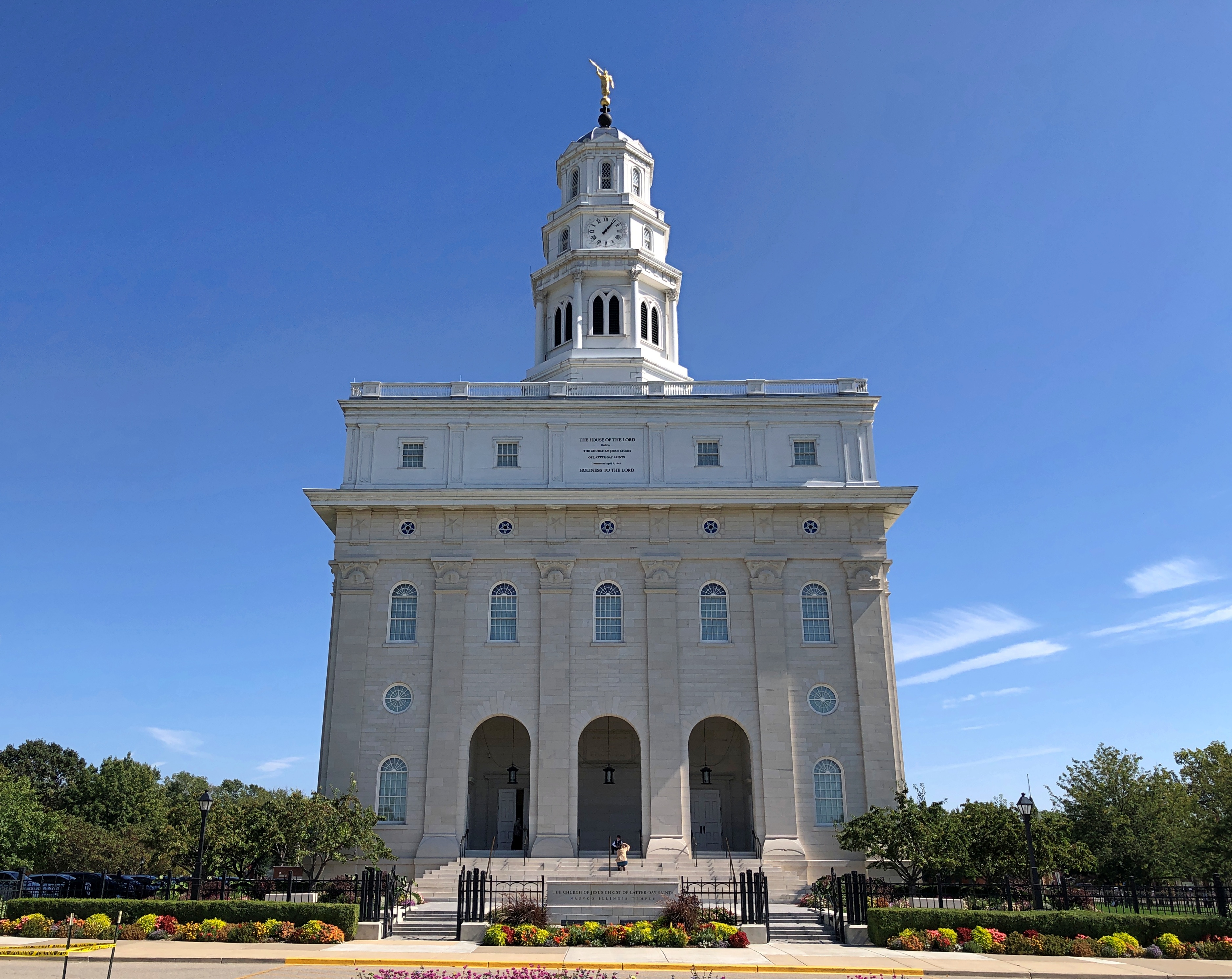
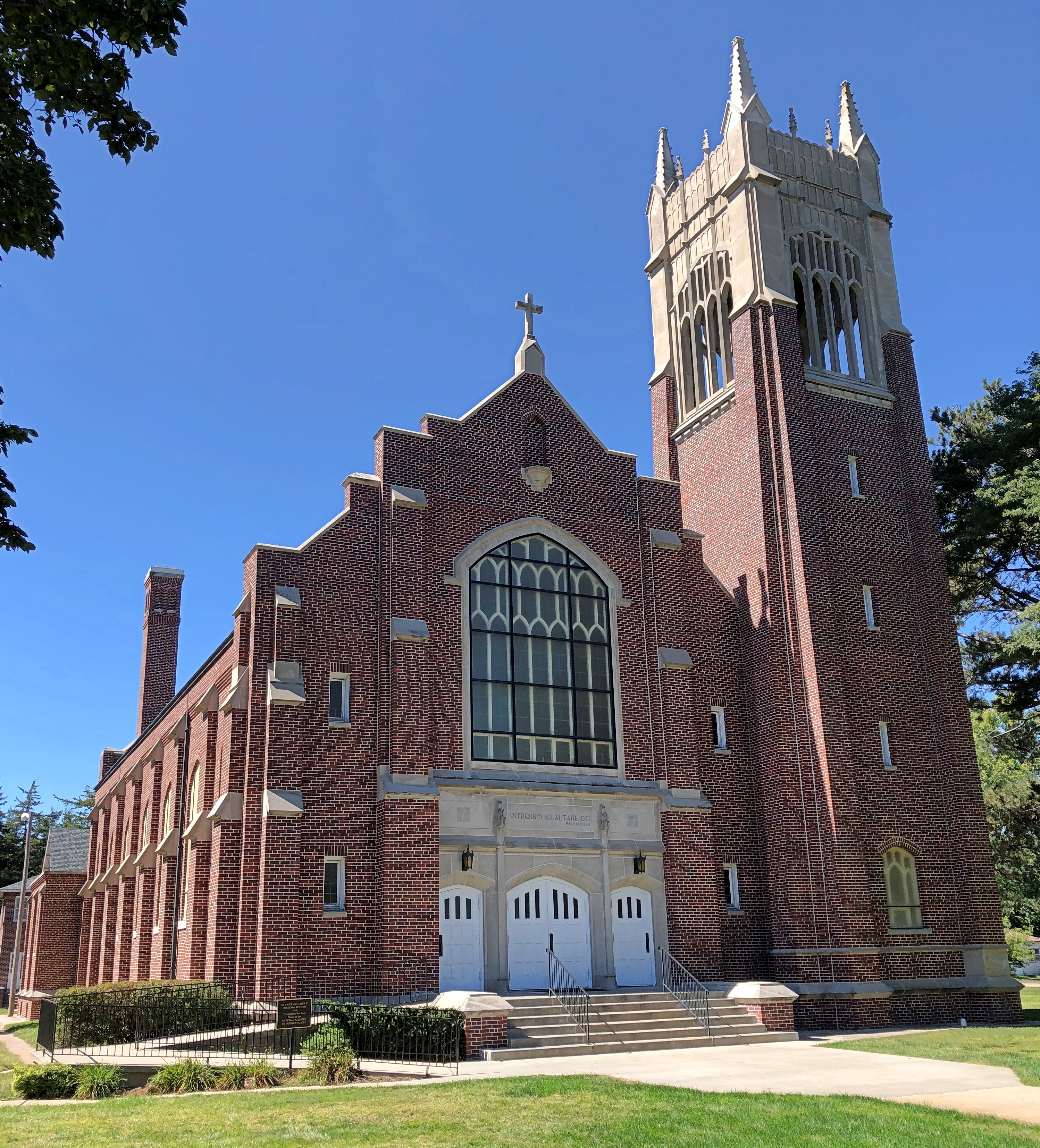
There’s a LDS temple there now. It wasn’t the last time I came this way, in 1997. I couldn’t go in, of course. For that you’d have to join the club.

The National World War I Memorial and Museum

As a kid, that is as a kid in the late ’60s and early ’70s, I took an unusual interest in WWI. My grandfather, my mother’s father, had been with U.S. Army Corps of Engineers in France, but it was more than that, since he was gone by the time I could remember, and I only heard bits and pieces about his service from family members who knew him. Some of his gear was still around, such as a bent-up canteen and some binoculars, and a panoramic photo of his regiment, but that was about it.

My interest was more likely sparked by The American Heritage History of World War I, a book we had around the house, along with the Civil War and WWII titles by the same publisher. The WWI volume, a weighty tome lavishly illustrated, had such chapter headings as When the Lights Went Out, Appointment at the Marne, Deadlock, Ordeal of Nations, Crisis in the Allied Camp, Enter the Yanks and Eleventh Hour. I spent quality time with that book.

Just as important, there was a companion record to go with the book: World War I, Historic Music and Voices. I listened to it many times, fascinated by the music and voices from an age that seemed to have nothing to do with the time and place I found myself. That was an illusion of youth. Growing up in the 20th century meant you were in the shadow of that war, know it or not. I’d argue that’s still true. Anyway, I ended up knowing such songs as “Over There,” “It’s a Long Way to Tipperary,” “Keep the Home Fires Burning,” and even “K-K-K-Katy.” all of which were mostly unknown to my contemporaries.

I’m glad to report that the record is available on line. The narrator, Charles Collingwood, had just the right earnest, commanding voice for the record. It was years before I knew anything else about him – his time covering WWII for radio, especially, but also as a TV journalist for CBS.

Like many boyhood interests, WWI carried over into adulthood, faded but never quite gone. I knew, for instance, of the shameful neglect when it came to memorializing the war in the U.S., especially in Washington, DC. The first time I ever visited the National Mall, in 1982, I noticed a (relatively) small memorial, the District of Columbia War Memorial, off to the side at some distance, forlorn and badly aged, though I understand it was finally renovated in the 2010s. The memorial honors the “residents and citizens” of DC who performed military service in the Great War.

There was nothing else in the nation’s capital to honor anyone else in that war, not until National World War I Memorial was completed last year, and even it isn’t on the National Mall.

I haven’t seen the new DC memorial, though I’m sure it’s a worthwhile effort. Still, for a memorial really worthy of the event, go to Kansas City, Missouri.

National WWI Museum & Memorial

The National World War I Museum and Memorial started as a local memorial soon after the war ended. Long enough ago that Vice President Coolidge was at the groundbreaking, as was Gen. Pershing and a number of other Allied military luminaries. Local, perhaps, but with the heft of a national memorial, designed by Harold Van Buren Magonigle, who was known for his memorial work.

Magonigle’s limestone tower soars.

National WWI Museum & Memorial

Sphinxes crouch near the shaft, supposedly covering their eyes from the horrors of war.

WWI Museum and Memorial

Naturally the memorial went through a period of neglect, and the museum came later, as the site evolved from a local to a national memorial, finally acknowledged as such by Congress in 2004. I’m glad to report that now the memorial stands renewed, and the museum, built under the memorial, is first rate. Beginning at the entrance: One enters the museum over a glass bridge that crosses a field of 9,000 red poppies, each representing 1,000 combatant deaths during the war.

As usual with any good museum, there is more than you can absorb in one go, organized in two wings: the war before U.S. entry, and after. All together, it holds more than 350,000 items, a collection comparable with the likes of the Imperial War Museum or the Musée de la Grande Guerre du pays de Meaux.

The museum’s scope is wide ranging as well, including not just the U.S. part, but perspectives and memories from people from all of the major participating nations, and some smaller ones. There was even a small display, including a map that explained things well, about the Japanese participation in the war. Japan joined the Allied side early in the game, taking the opportunity to kick the Germans out of China and seize Germany’s scattered possessions in the Pacific. A low cost, high-gain exercise for Japan, unlike the next war in the Pacific.

Artifacts were large and small.

Nat WWI Museum
Nat WWI Museum
Nat WWI Museum

There are only a few life-sized dioramas – there are more to be found at the National WWII Museum in New Orleans – but the WWI museum did a good job of it.

Nat WWI Museum

I was particularly taken with the posters. I’d never seen most of them.

Nat WWI Museum
Nat WWI Museum

The 10 Whiz Bangs, even though there are only nine names listed. Then I realized that, at least symbolically and maybe literally, the 10th man hadn’t made it home, like so many.

10 Whiz Bangs

Remarkably, you can listen to an article about the Whiz Bangs (in the Whiz Bangs Articles).

After visiting the museum, the thing to do is take the elevator to the top of the memorial, for a modest extra fee. Elevator, then iron circular stairs, actually, for an excellent view of downtown Kansas City.

Kansas City, hey hey hey

Hey Hey Hey Hey!

I Like Ike, And Abilene Wasn’t Too Bad Either

In Abilene, Kansas, not long ago, I found myself wondering, whatever happened to Manus Hand? That’s because I stood at that moment near the graves of President and Mrs. Eisenhower, Ike and Mamie.

Eisenhower

The 34th President of the United States and the First Lady repose in a chapel-like structure on the grounds of the Dwight D. Eisenhower Presidential Library, Museum and Boyhood Home in Abilene, pop. 6,400 or so, the town where the president came of age.

Eisenhower

I’ve been told I visited before, with my family during a trip to Kansas when I was a wee lad, but I don’t remember that at all. So I count this as a new visit to a presidential sight, including a grave site, which makes 21 presidential graves all together. But for the federal shutdown in October, there would be four more at least: Adams père et fils, FDR and TR.

I thought of Manus Hand because, back in the Neolithic age of the Internet, he had a web site featuring photos of him at presidential grave sites. In my own dead presidents days, I found Hand’s site at some point. He had visited almost all of them by then, 36 by his count. His site is still in existence, without much change, except an update to note that George H.W. Bush had died (2018), but not Jimmy Carter.

The Eisenhower Boyhood Home, moved to the site. No tours available when I came by.

Eisenhower

The Eisenhower Museum.

Midcentury, and what could be more fitting for Eisenhower? It’s chronologically organized: early Ike in Abilene; his Army career before WWII, including his cross-country epic; during that war and right after the war; his presidency and post-presidency, and a gallery about Mamie. Well organized, interesting artifacts, but (for me) none more interesting than a titanium sphere.

Eisenhower luna 2

The sphere is a replica of the pennant sphere that traveled to the Moon in 1959 aboard the Soviet spacecraft Luna 2, which was the first manmade object to reach the lunar surface, or any celestial body. The sphere was a detail that I remembered from long-ago reading about space exploration. I didn’t realize one existed any more, even in replica form. Khrushchev presented it to Eisenhower during his famed visit to the U.S. that year (Khrushchev’s due at Idlewild!).

Luna 2 carried two spheres filled with liquid and an explosive charge, designed to burst apart on impact and scatter pentagonal pennants, the Moon Registry says. The pennants were imprinted with: 1) Sentiabr 1959 (September 1959); CCCP… ; and the state seal of the USSR, a wreath of grain around the hammer and sickle. It is theorized that the medallions vaporized on impact.

Russia is still shooting Luna missions to the Moon. The most recent, Luna 25, crashed near the lunar south pole in 2023 but, unlike Luna 2, not on purpose. Oops. More about the many pennants the Soviets sent into space is here. On display next to the sphere is a lunar rock, which must have been a posthumous gift, since Ike didn’t live quite long enough to benefit from astronauts rock-gathering on the surface, though he was still alive during Apollo 7, 8 and 9.

A close second excellent artifact was a dagger Marshal Zhukov presented to General Eisenhower on the occasion of the defeat of Germany, a good-looking blade with an ivory hilt and gold decorations. I picture an exuberant Zhukov, as in The Death of Stalin, handing the knife to Ike and saying something earthy. Apparently the two, Ike and Zuke, got along well in the early months of the joint occupation of Germany. Differences aside, they had job experience in common. I don’t remember seeing anything about that in the museum, but there was a lot of material, so that could have been easily missed. That and any reference to Kay Summersby.

It was hot that day, September 24, but after visiting the museum, I took a look around Abilene anyway. The town hasn’t forgotten its most famous native son. Also, Donut Palace was closed.

Eisenhower luna 2

A lot of the detail would be different, but I’ll bet Ike would still feel at home with the scale of Abilene. Small town, small buildings, but some solid touches.

Abilene< KS

Including at least one building Ike would have known.

Abilene< KS
Abilene< KS+

Chicago had cows, Abilene has cowboy boots.

The Hotel Sunflower. Former hotel, that is, now apartments.

The Sunflower State. The flower looks a little ominous, peering down at the settlers.

Kanzas

Structures that aren’t grand, but stately even so. Petite stately, you might call them.

Abilene
Abilene
Abilene

The third one is a Carnegie library. Though the Carnegie grant was large, other fundraising for the library’s erection had been done in the early 1900s, including a benefit lecture by William Jennings Bryan.

Out near the highway: truth in naming. But note also, the bowling alley is closed. I could go either way on the reopening of an alley in that location, but I really want the sign to stay.

One more thing Abilene is known for, at least since 2022.

The World’s Largest Belt Buckle. Says so right there on it. How large would that belt have to be?

“Designed by local artist Jason Lahr, Fluter’s Creek Metal Works, the buckle features Dwight D. Eisenhower, Wild Bill Hickok, Abilene & Smoky Valley Railroad, Historic Seelye Mansion, C.W. Parker carousel horse, C.L. Brown telephone, a racing Greyhound and Chisholm Trail longhorn inlaid with blue quartz,” says the city of Abilene, Kansas.

“The buckle is a project of the Abilene Convention and Visitors Bureau which hopes the new roadside attraction will entice travelers to stop and visit the Best Historic Small Town.”

No Brasher Doubloon, Dammit. (The Money Museum)

This might be unfair to the Money Museum in Colorado Springs, Colorado, but its collection disappointed me in one key way: No Brasher Doubloon.

It is unfair. The place is great: wall-to-wall coins rare and common, beautiful and crude, familiar and strange, a vast domestic collection (USA!) and a sizable array of coinages from other nations past and present. Much familiar to me, but not all, and much new and strange to Yuriko.

I’d known about the museum, which is owned and operated by the American Numismatic Association, since years ago, when I collected the sort of cheap coins I could afford on my allowance. I followed, in a lackadaisical adolescent way, numismatic news. Big coin deals in those days involved tens and maybe hundreds of thousands of dollars. Coins like the 1909S VDB cent and the 1916D Mercury dime commanded sizable premiums, but the major money was in even rarer strikes or errors.

The Money Museum and the ANA offices are in a boxy structure, brutalist lite, dating from 1967. It isn’t a large museum, with a few living room-sized galleries on its first floor, another in the basement, with each floor attended by bored-looking security guards. U.S. coins beckoned from their own gallery, with vertical coin displays behind glass on all the walls, along with paper money displays and a generous amount of exposition.

The displays had themes: early U.S. gold coins, coins struck in California and Colorado during their gold rushes – including $50 California Territorial Gold piece (!) — uncut paper money, Federal and Confederate tokens and paper, Gilded Age paper money (a riot of design), the various representations of George Washington on medals struck down the years, and many more. There was a 1933 eagle (gold $10) and a flawless set of 1915 Panama Pacific Exposition commemoratives, which are a wow in just about every way imaginable.

Next to Americana Gallery, another gallery housed an incredibly detailed exhibit featuring coins used on the Silk Road across the centuries, something I can’t say I’d given much thought to, despite the enormity of the subject. Such as coins from the time of Alexander, whose empire was home, briefly, to around 25 mints. They say the treasury at Persepolis alone guarded 3,000 tons of gold and silver, but not from the conqueror, since it was just the thing to feed those mints once Alexander had made the Persian empire his own.

Or Parthian drachms, which feature a ruler observe and a seated archer reverse. Or the hemidrachms, obols and hemiobols of the Sassanids. Or Chinese coinage: “Made by the bureaucracy, for the bureaucracy, coins were tools to facilitate minor trade and local business. Because precious metals and high-value denominations posed the threat of wealth accumulation, low-value bronze pieces sufficed.”

Those are only a few examples. The exhibit also had early Chinese non-coin money, Islamic coinage and the coinage of the Kushans, whose central Asian empire faded from memory until its coins were unearthed.

It was all too much. Coin overload had kicked in. We spent a little while in the basement – given over to the broad sweep of the history of money – and then to the crown jewels of the place, to cap off the visit.

An 1804 U.S. dollar.

Actually made in the 1830s, in as convoluted a coin story as you’re likely to find.

The 1913 Liberty Head nickel.

A coin that goes to show that the entire game isn’t just gold and silver, but base metal coins can have their shot at being priceless collectibles. Famed in story, and maybe an eccentric will write a song about the 1913 Liberty Head, predecessor to the Buffalo nickel. The last year for minting the Liberty Head was to have been 1912, and there are scads of those, except for those made at the San Francisco mint. Only five 1913 specimens are known to exist, all with a mysterious origin at the U.S. Mint and history of trading at ever-increasing prices, with one most recently fetching $5 million. They are such a part of numismatic lore that each specimen has its own name.

We were getting ready to go, when I noticed a museum employee talking to the volunteers behind the front desk. I asked him whether the museum had a Brasher Doubloon. I’d looked, but I could easily have missed it, among the many coins on display.

He knew what that was. Of course he did. Unfortunately, no, he told me. Someday someone might donate one, but otherwise it would be beyond the museum’s budget. Someday, maybe, he said, a little wistfully. Good man, a true coin nerd.

Strategic Air Command & Aerospace Museum

Not far outside Omaha, along I-80, it’s possible to stop and see, under two very large roofs, such marvels of aeronautical engineering as a B-17, B-29, B-36 and B-52, a Lockheed SR-71 Blackbird, a Douglas C-47 Skytrain and a Douglas C-54 Skymaster, a Convair F-102, and a Fairchild C-119 Flying Boxcar, among many others. Along side the airplanes are exhibits about the Tuskegee Airmen, Doolittle’s Raid, the Berlin Airlift and Francis Gary Powers.

There are also space artifacts at the Strategic Air Command & Aerospace Museum, as the name says, but not that many. Still, my favorite artifact at that museum, the coolest bit of space hardware I’d seen since the Kansas Cosmosphere, was a Vela satellite.

SAC Museum Vela
SAC Museum Vela

Looks like something you’d see on the set of Space: 1999, but the Vela is more than just a curious glassy polyhedron. In September 1979, a Vela satellite noticed the characteristic flash – actually a double flash – of a nuclear explosion in the atmosphere, near the remote Price Edward Islands in the ocean south of Africa, roughly half way to Antarctica. It wasn’t long before the press got wind of the event, and I remember a widely held suspicion that Israel had tested a nuclear warhead, with the cooperation of South Africa, whose island it was. It seems likely that this was the case.

Besides that, “in 1967, the satellites were the first to detect extra-terrestrial gamma-ray bursts, thought to be the brightest and most energetic electromagnetic events in the universe,” the Space Force notes.

I arrived at the museum on September 5 heading westward, bypassing Omaha in favor of it.

SAC Museum
SAC Museum

Most of the artifacts are aircraft used in one way or another by SAC, on display under sprawling ceilings. Leo A. Daly, a longstanding Omaha architect, did the museum’s design, completed in 1998.

SAC Museum

A fine collection, only outdone by Smithsonian Air & Space and the US Air Force Museum, since after all, SAC was only part of the Air Force.

SAC Museum

A named aircraft, the Lucky Lady, a B-29 Superfortress.

SAC Museum
SAC Museum

“The bomber was manufactured by Bell Aircraft, in Marietta, Georgia and delivered to the U.S. Army Air Force on August 4, 1945,” Airplanes Online says. “Its initial assignment was to Walker AAF (Second Air Force), Victoria, Kansas.” Lucky all right, as in manufactured too late in the war to get shot at, unless there’s something about 1940s Kansas I don’t know.

Smaller items, though not actually that small.

SAC Museum
SAC Museum

Besides the Vela satellite, other space items include spaceman gear and leftovers from the early days of manned space flight, such as a boilerplate Apollo, which wasn’t actually a capsule, but had the size, shape and mass of a command module, for testing.

SAC Museum

Picked up cheap after the dissolution of the Soviet Union?

SAC Museum

Probably something non-astronauts wonder about a great deal.

SAC Museum

A little space whimsy.

SAC Museum
SAC Museum

Even the Air Force needs a little.

Silverton, Colorado

Cold winds rolled through northern Illinois today. Seven inches of snow are forecast for Saturday. What? Right, it’s winter. The winter solstice is just the shortest day of the year.

Back to posting on Sunday. Regards for Thanksgiving.

Something to upset PETA sympathizers.

Silverton, Colorado

Stroll down Greene St. in the mountain town of Silverton, Colorado, at least in mid-September this year, and you’d have had the opportunity to buy a hide for $300. We did, but declined. Still, it wasn’t just a Colorado detail, but a Western one. The West, where men are men and cow hides hang in the sun. As far as I could tell, you couldn’t buy a hide with Bitcoin, but I suppose you’d have to ask the seller to be sure.

Not five minutes after we’d parked off the main thoroughfare of Greene Street in Silverton, on a large side street, a steam locomotive hauling a valuable cargo — tourists — pulled into town, a block from where we parked. The Durango & Silverton Narrow Gauge RR train from Durango had arrived. Instantly the streets around the train were thick with those same tourists who had paid roughly $100 a head for the scenic ride, though I suppose many, the majority maybe, had gotten a slight discount as seniors.

Silverton, Colorado
Silverton, Colorado

I assume the economy of 21st-century Silverton depends pretty heavily on these arrivals, at least in the warm months, as day after day the line disgorges its many passengers for their layover. No doubt the likes of High Noon Hamburgers or the Shady Lady or a lot of the other businesses in town wouldn’t be viable otherwise.

Silverton, Colorado

Blair St., paralleling Greene St. a block away. No need for pavement.

Silverton, Colorado

Greene St.

Silverton, Colorado

Lots to see on Greene.

Silverton, Colorado
Silverton CO

Including the fine Colorado flag, flying at Railroad Art by Scotty, a seriously cool gallery.

Silverton CO
Silverton CO

“Railroad Art by Scotty presents the custom matted and framed collector Railroad Art Prints by renowned railroad artist H.L. Scott, III,” its web site says. “These are not photographs and they are not created on the computer. These are pen & ink drawings created by Scott using the technique known as STIPPELING or pointillism.”

One of the few buildings I’ve seen that clearly states its elevation.

Silverton CO

The Grand Imperial Hotel. A lofty name to live up to, but probably posh enough to do so.

Silverton CO

Restored to its 1880s appearance in the 2010s, no doubt at considerable expense.

As it looked in 1940, a photo from the Library of Congress, Farm Security Administration-Office of War Information Photograph Collection.

More Greene St.

Silverton CO
Silverton CO

Greene is short, because Silverton isn’t very large, and so the street, now a road, soon heads for the hills.

Silverton CO

The Hillside Cemetery of Silverton.

Hillside Cemetery of Silverton

An apt name.

Hillside Cemetery of Silverton

With a good view of the town.

Silverton

Some sizable memorials.

Hillside Cemetery of Silverton

More modest ones.

Hillside Cemetery of Silverton

Echoes of lost men from another time. Beyond the outstanding beauty of a hillside cemetery in the flush of autumn, reason enough to visit the cemetery.

Durango, Colorado

“Good morning.”

“Good morning,” Walter said in response to me, but in a hushed tone that somehow made his Austrian accent more distinct. “Do you want to see some bears?”

Yes. I followed him out to the large deck off the large common room of the Country Sunshine B&B. Outside we met with cool air, bright morning sun, and the strong smell of pine. The deck was a floor above the grassy ground, which sloped downward away from the bed and breakfast, shaded by a small copse of enormous pines.

We’d just spent the night at Country Sunshine B&B, the first of three for our visit to Durango, Colorado, a place I’d wanted to visit since the moment, years ago, when I heard Garrison Keillor describe the place in the engaging way that he had. I’d come out of our room – one of the three or four bedrooms off the common room – ahead of Yuriko, to examine the breakfast spread at the main table when Walter asked me about bears.

Under one of the tall pines, and among the many pine cones dotting the ground, was something dark and much larger: a bear.

Durango, Colorado

“He isn’t the only one,” Walter said, pointed upward. Another sizable bear was perched part way up the largest pine. I didn’t say anything, or maybe I did. Something along the lines of, How about that. When I spend time on my deck, squirrels are about as large as the animals get, except occasional rabbits and raccoons.

Durango, Colorado

“Look way up,” Walter said.

Two more bears – smaller bears, though I wouldn’t want to be face-to-face even with them – clung to the branches toward the top of the tree. They were hard to see, and my photos barely show them, but they were there, not moving a bit.

Durango, Colorado

Soon Yuriko, and some other guests, had come to the deck to see the bears and take pictures. Every few minutes while we watched, the largest of the bears, the one on the ground, would start shimmying up the tree. The bear in the tree snarled at his approach, and, after pausing for a few moments, the first bear returned to the ground.

We were about 10 miles north of Durango, where the human settlement is fairly thin, and bears known to prowl the mountains on either side of the single road, US 550.

In the two decades of so that Walter and his wife Jodi have owned the B&B, he said bears had been sighted. Of course they had. Get careless with closing an outdoor garbage receptacle and bears will make an appearance in the neighborhood. During dry spells, they come for the creek waters near the property, and Walter pointed out that this summer had been fairly dry in the region.

But this was a first, Walter said: probably a male bear out to do harm to some cubs, a female bear standing in his way — a bear drama playing out in the tree near the B&B.

Late that afternoon, we returned to the B&B. Papa Bear, as everyone was calling him now, still lingered under the tree. Mama Bear still watched him from the lower branches, and the cubs still clung to the upper branches. Papa Bear had mostly quit trying to climb the tree, Walter said, but he was still waiting around.

The bears stayed in place through that evening, but when I went to the breakfast table the next morning to examine the bagels and spreads and fruit and hot drinks, the bears – I checked from the deck – they were not to be seen. After their one-day show (from a human point of view), they’d taken their drama somewhere else,

We spent that first day (September 16) wandering around town and nearby. In downtown Durango, small buildings that have endured for more than a century line Main Street.

Durango, Colorado
Durango, Colorado
We spent that first day (September 16) wandering around town.

Or not so small. Such as the magnificent Strater Hotel, built in 1887.

Strater Hotel, Durango

The sort of place where presidents stay, or used to. Did any? The hotel web site doesn’t say. I’d ask ChatGPT, but it would probably tell me that FDR stayed there during his Grand Western States Whistle Stop Tour in 1939, a wholly fictional event. Wiki says Gerald Ford stayed there. Louis L’Amour did too, and now has a room named after him.

A competitor. Named for this fellow, Union (brevet) brigadier general and railroad man, who co-founded the Denver and Rio Grande RR.

General Palmer Hotel

Downtown Durango is well supplied with retail.

Lunch options, besides burgers and empanadas or a liquid lunch, included the likes of the Diamond Belle Saloon, Seasons of Durango, Chimayo Stone Fired Kitchen, Steamworks Brewing Company, and Eolus Bar & Dining. All very nice, I’m sure, but we chanced on something more to our tastes at that moment: the Durango Diner. In business for 60 years.

Durango Diner

Durango started not so much as a mining town, but a railroad node that served the mines further up the line. Silverton, for instance. One reason Durango is where it is: the Animas River. These days, the river is accessible to pedestrians in a number of places in town. One was near the Durango Library, also the location of a shady sculpture garden.

At this place, the tracks of the Durango & Silverton Narrow Gauge RR run along the river.

Animas River, Durango

That was also true at the 29th Street Park, though the tracks were on the other side of the river.

Animas River, Durango

We waved. A few waved back.

Seward, Nebraska

There I was, in Seward, Nebraska, parked on a side street lined with single-family houses. Interrupting the pattern of houses was a large open space, with buildings behind it — a large house, and maybe a workshop. In the open space, which was a green lawn, stood a sigma-shaped structure, and behind that, a white pyramid.

Seward Nebraska

Both taller than a grown man. A plaque was fixed to the sigma. From the point of view of the time capsule, the sigma shape could be a 3. So – third millennium?

Seward Nebraska

World’s Largest Time Capsule.

I wasn’t quite sure what to make of that claim. The world’s largest time capsule would surely be the one entombed in 1939 at the New York World’s Fair for an opening in the year 6939, an exercise in official optimism if I’ve ever heard of one. Wouldn’t it? No. It grew in my memory, but was actually quite small. The Crypt of Civilization instead might be a candidate for largest.

Anyway, there’s no doubt Seward’s is a whopper among time capsules.

The capsule, buried by Seward resident Harold Davisson, had more modest ambitions, time-wise, than the NY time capsule: only 50 years. Looking at the plaque, I wondered if the opening, promised for this year, was going to happen.

Later I learned that it had already happened, earlier in the summer. NBC reported that the opening revealed “letters, pet rocks, artwork, a groovy teal suit and even a yellow Chevy Vega.” A video of the opening of the time capsule, and the removal of its contents, has been posted to Facebook. The opening including removal of the car, by means of an enormous wench. News reports suggested that Vega was going to be reconditioned and run during the town’s bang-up Fourth of July festivities. Hope so.

The pyramid lid had been put back on. If you look closely, you can see the line marking the bottom of the lid. Put it back on expertly, since you have to look closely to see there was a separation. So I missed the grand opening by a few weeks. As they say in those parts of Nebraska, c’est la vie. Hard to attend an event you’ve never heard of, though not impossible, as I found out years ago when I happened across Northalstead Market Days one summer day. That one was an eye-opener.

The Big Thing
The Big Thing, Thomas Nast, 1867

Seward honors the Seward of Alaska purchase fame, though if pressed I’d bet most Americans have sort of maybe heard of him, but don’t remember anything about him, even though he (likely) still gets passing mentions in school.

Seward, seat of Seward County, there in the populous (for Nebraska) southeast corner of the state, is close to Lincoln – fitting, isn’t it? – and I-70.

Seward County built itself a handsome courthouse, once upon a time. Classical Revival when the getting was good for that style, in the first decade of the 20th century. It was a popular style around this part of Nebraska at the time, with the National Register of Historic Places Registration Form telling us there are 18 buildings like it still extant in Nebraska. Architect George Berlinghof (d. 1944) designed a lot of them, including this one.

Seward
Seward
Seward

On the grounds, Seward in bronze. I know there are other statues of Sec. Seward, but not that many.

Seward bronze

Sporting a cape. How many bronze figures honored with public statues are in capes? More than I know, probably. The Maid of Orleans in New Orleans comes to mind; she’s wearing a cape, over that armor.

A plaque identifies the artists, brother and sister David and Judith Rubin, and the vintage, recent. Alaska commissioned them to do one of Seward for the 150th anniversary (2017) of the sale of Alaska to the United States. Interested parties in Seward, Nebraska, wanted one for the their town, and so commissioned another one.

The square is right handsome, too.

Seward

Cattle National Bank. Reminds me of Gary Larson, somehow. I’m glad to report that it’s one of four locations for Cattle National Bank & Trust, a community bank owned by the Cattle family. Has been since 1881. If I lived in Seward, I’d bank there just for the name.

One more thing about Seward. This isn’t the one further north.

Seward was a flyby on September 5 on the way to Grand Island, Nebraska, that evening, which would be the jumping off point for my drive through the Sandhills. The highlight of my short stay in Grand Island wasn’t the false alarm that got us all out of our rooms at the motel around 10, thrilling as that was, but the next morning, on my way out of town.

John Cattle and his sons, Robert, John and Walter, were farmers in England and came to Nebraska in the 1870’s, lured by the chance to invest in inexpensive land. The British Steamship Company and the Burlington Railroad promoted land on the Great Plains, and the oldest Cattle son, Robert, took advantage of the company’s offer of a free trip to come to Nebraska and see the prospects for himself. Robert thought the land and opportunities looked good and the rest of the family followed him to Seward County where they bought railroad land north and west of Seward.

I’ll give credit where it’s due: I found Fred’s Flying Circus on Google Maps. Attaboy, algorithm.

Fred's Flying Circus

The work of body shop proprietor Fred Schritt (d. 2016), on his place of business, with the shop now run by his daughter and son-in-law. An informal sort of memorial to the old man, I hope they believe. One of the more cheerful memorials you’ll see.

Colorado Flatland Drives

Go east, old man.

Eastern Colorado

That was the goal about two months ago now, after I left Colorado Springs for a solo drive back to Illinois. The fastest way would be to link with I-70 while still in Colorado. I wasn’t inclined to do that, though I did take that Interstate route through much of Kansas. Instead, I wanted to start remote and stay that way for the length of eastern Colorado.

So east on Colorado 94 it was, which passes through such hamlets as Yoder, Rush and Punkin Center. Mostly, though, there are few signs of people.

Eastern Colorado

I noticed the Front Range growing smaller in my rearview mirror. I wondered at what point they would vanish from sight, and decided to keep track of their shrink, and note the last time I could see them. Naturally, I forgot about that resolve, and next thing I knew, the road backward and forward stretched to both horizons.

This is looking back west, a mountain barely visible, and is also an image illustrating that the eastern Colorado terrain isn’t completely flat.

Eastern Colorado

Eastbound Colorado 94 ends near Aroya, where it meets US 40/287. I took that road southeast to Kit Carson (pop. 255).

Kit Carson, Colorado

The railroad still comes through Kit Carson. It’s safe to say that without the railroad, the town might be no larger than Punkin Center. The Kit Carson Railroad Depot is now a museum.

Kit Carson, Colorado

Closed. Till Decoration Day. Really?

Kit Carson, Colorado

In any case, it was closed on September 22.

Across the street, metal works. The pump jack is one thing, but the other is a — tower?

Kit Carson, Colorado

The Kit Carson town web site has a few things to say about itself:

The town of Kit Carson had two locations. The original site was located near the site where Kit Carson traded with the Arapahoe and Cheyenne Indians. The present site was determined by the arrival of the railroad. Destroyed by fire three times, twice by the torches of Indians and once by carousing cowboys, the determined citizens of the town showed their desire to survive by rebuilding.

I can’t help but think those carousing cowboys were actually a gang of rustlers, cutthroats, murderers, bounty hunters, desperados, mugs, pugs, thugs, nitwits, halfwits, dimwits, vipers, snipers, con men, Indian agents, Mexican bandits, muggers, buggerers, bushwhackers, hornswogglers, horse thieves, bull dykes, train robbers, bank robbers, ass-kickers, shit-kickers and Methodists.

Also of note, according to the town: The railroad brought in foreign dignitaries, such as the Grand Duke Alexis [Alexei Alexandrovich] of Russia. The Grand Duke hunted in Kit Carson and was accompanied by his military escort, General George Armstrong Custer on January 20, 1872. [Custer was a lieutenant colonel at the time, but never mind.]

Grand Duke Alexis was on his 1871-72 tour of America. Sounds like he had a fine old time. Could have been the subject of an episode of Death Valley Days, but I don’t think it was. Dom Pedro, emperor of Brazil, made an appearance, as did the Emperor Norton, but I digress.

From Kit Carson, I headed south to Eads, still in Colorado, and then east on Colorado 96. I had the idea that I wanted to see the Sand Creek Massacre National Historic Site, which isn’t too far from that road. Just before the turnoff to the historic site, I noticed something odd near the highway.

A wrecked train. A long wrecked train. The cars toward to back.

train wreck, Colorado

Toward the front.

train wreck, Colorado

Nary a clue as to how it happened, or when, except that the cars don’t seem rusted or overgrown. I stayed on the road to take my pictures. The cars are lined up as if they were dumped off the track on purpose. No. Why? Or could it have been some odd accident in which the train essentially fell off in place? Or is that how derailments work? Why are front cars especially mangled?

It didn’t take too much research (later) to find some answers. The Kiowa County Independent reported in August: The heavily laden train was navigating a significant curve and elevation change west of Chivington when 16 covered hopper cars derailed. Each was filled with thousands of bushels of wheat, spilling tons of grain onto the ground along Highway 96, which runs parallel to the rail line.

Oops. Guess everyone would have heard about it if the cargo had been more volatile or toxic.

At the turnoff to the historic site, I got a view of the tracks (again, from the road). Far enough away that the mangled train cars aren’t visible.

Eastern Colorado

On to the historic site, via an unpaved road.

Eastern Colorado
Eastern Colorado
Eastern Colorado

Turns out the historic site closes at 4 pm. I got there just as the rangers were leaving, and one of them, who had a remarkable collection of snaggled and bent teeth, told me so politely. I didn’t argue with him, but I also wondered why a site so remote closes at all, except maybe for the visitors center or small museum. Rules is rules, I guess.

That was pretty much it for Colorado. I got to the border with Kansas not long after, and looked back.

Colorado-Kansas Border

Colorful Colorado. I’ll go along with that.

Nebraska 2

Which of these two destinations aren’t like the others?

Cairo, Neb

That’s a beginner’s-level question. Better question: where can you find this pole, with mileages and – what units measure the distance to Heaven or Hell? – other signs?

Answer: Cairo, Nebraska.

Cairo, Neb

Maybe a palm tree was in the works, but the city decided not to spend any more money. Cairo (pop. 822) is one of the small chain of small towns on the eastern section of the highway Nebraska 2, which runs westward and north of Grand Island. Cairo is the first place I stopped on my way west on that highway in early September.

Eventually the highway reaches the Nebraska National Forest and Grassland, a patch of (partly) wooded land that inspires the question, there’s a national forest in Nebraska?

West from the forest, Nebraska 2 crosses the Sandhills, an unusual place here in North America, with the land morphing from cropland to ranch land on sandy steppes. The towns on the way are mere hamlets, and sometimes not even that. On the western edge of the Sandhills, one comes to the sizable town of Alliance, Nebraska, home of Carhenge and railroad staging area for coal trains headed east.

Before I did the drive, I was looking forward to it as much as any of the roads in Colorado. It lived up to expectations. Nice when that happens.

Nebraska 2

The Fence Post cites Charles Kuralt’s fondness for Nebraska 2: “Highway 2 is not just another highway that goes somewhere. Highway 2 is somewhere,” he’s known to have said. I’d say whatever else his failings, Kuralt had good taste in roads.

Just outside Broken Bow (pop. 3,491), seat of Custer County and pretty much the only town of any size in that county, the Sandhills Journey Scenic Byway Visitor Center offers a building with bathrooms and pamphlets and displays and, for my visit at least, a grandmotherly and talkative volunteer. Old enough, she said, to remember when the highway was just a road through the countryside that attracted no attention from the outside world. Not a scenic byway, and sand hill cranes were just flocking birds. Now a trickle of tourists and bikers and RVers come this way. She had some solid recommendations, especially a good diner for lunch.

The visitor center grounds include a relocated (or was that reconstructed?) Sandhills cabin. The residences of the farmers trying to scratch out a living in the Sandhills, and finding out that no amount of scratching would make decent crops grow consistently from the land.

Broken Bow, Neb
Broken Bow, Neb
Broken Bow, Neb
Broken Bow, Neb

The Custer County Courthouse. Saturday, closed.

Broken Bow, Neb

A block from the courthouse, some buildings around City Square Park.

Broken Bow, Neb
Broken Bow, Neb
Broken Bow, Neb

City Square Park is a generic sort of name. Wonder whether there’s anyone from the town who can be honored by renaming the park? Looking at list of notables from Broken Bow, one instantly stands out.

This guy: Solomon Butcher.

Wiki: “Solomon D. Butcher (January 24, 1856 – March 18, 1927) was an itinerant photographer who spent most of his life in central Nebraska, in the Great Plains region of the United States… he began in 1886 to produce a photographic record of the history of European settlement in the region. Over 3,000 of his negatives survive; more than 1,000 of these depict sod houses.”

Frederic Schreyer and family, Custer County, 1880s, by Solomon Butcher.

Definitely name the park after Butcher, Broken Bow.

One more in that town. I couldn’t be bothered to get out of the car.

Broken Bow, Neb

West of Broken Bow is Anselmo (pop. 145), home of this church, St. Anselms Catholic Church, nicknamed Cathedral of the Sandhills. Saturday, closed.

Anselmo, Neb

A more common sort of building, not far from the church.

Anselmo, Neb

Not the most imposing that I saw, but representative of the many structures like it. The grist of a photo collection. Of course it has been done. I’m pretty sure I saw a room of Bernd Becher’s photos of water towers at the Modern Art Museum of Fort Worth.

Nebraska National Forest and Grassland is in an unexpected place, slap in the middle of Nebraska, not due to a freak of nature, but the efforts of human beings. Specifically, mass plantings of trees by the federal government for more than 100 years, beginning (not a surprise) during the administration of Teddy Roosevelt.

Nebraska National Forest

Near the national forest entrance is the Middle Loup River, broad but shallow, and crossable on a foot bridge.

Nebraska National Forest

I camped in the national forest. The campgrounds weren’t completely full, but there were more people than I expected for a remote spot in Nebraska. Then again, it was a Saturday night, and soon enough I figured out what brought most of them: the ATV trails. Not long after dawn on Sunday, the campers across from me – a man and a small knot of teenage boys – roared away in a small caravan of ATVs crusted with dust from the day before.

I packed up and sought out a quieter place. A national forest hill with a fire tower and some views. The tower was closed.

Nebraska National Forest

But the views were still pretty good.

Nebraska National Forest

West from the national forest, Nebraska 2 heads into the rolling grassland of the Sandhills proper. In the village of Thedford (pop. 208), varied public interpretations of the Sandhills are available for reading.

Sandhills of Nebraska

The terrain along the highway Nebraska 2 might seem monotonous to some. Too bad for them. You’re driving across a kind of ocean, terrain all wavy, except that it’s solid ground, marked by occasional trees or manmade structures, and side roads — trails — wandering deeper into the hills.

Sandhills of Nebraska

The handful of towns are really just wide places in the road. Sometimes, not even that.

Sandhills of Nebraska

Nebraska 2 parallels the BNSF line, which came first.

Sandhills of Nebraska

Note: I was standing on a public side road to take that picture, as I do with all my RR shots.

Eventually, I took the road to Alliance. But that was merely incidental. Out this far, the road, as Kuralt said, is the destination.