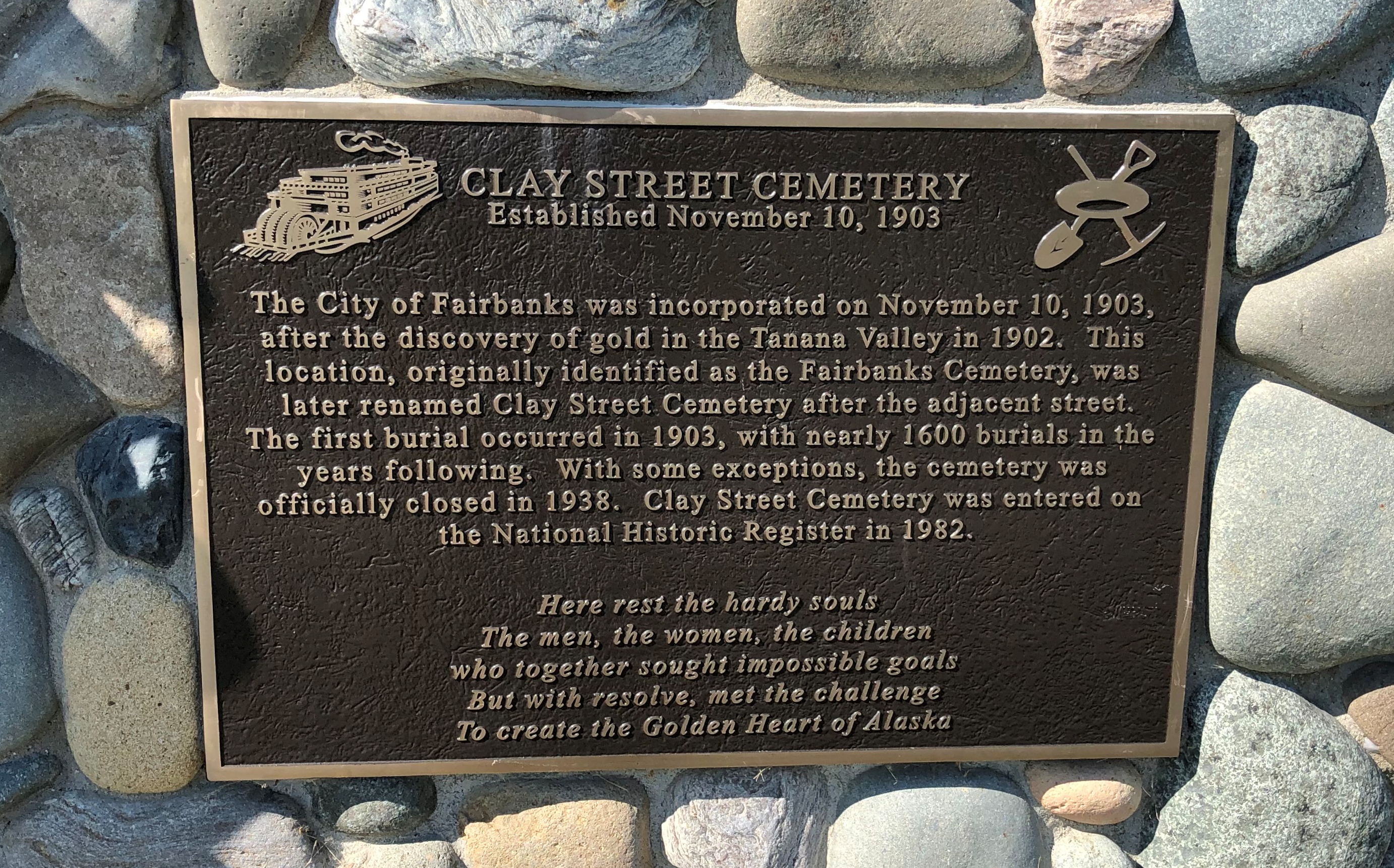
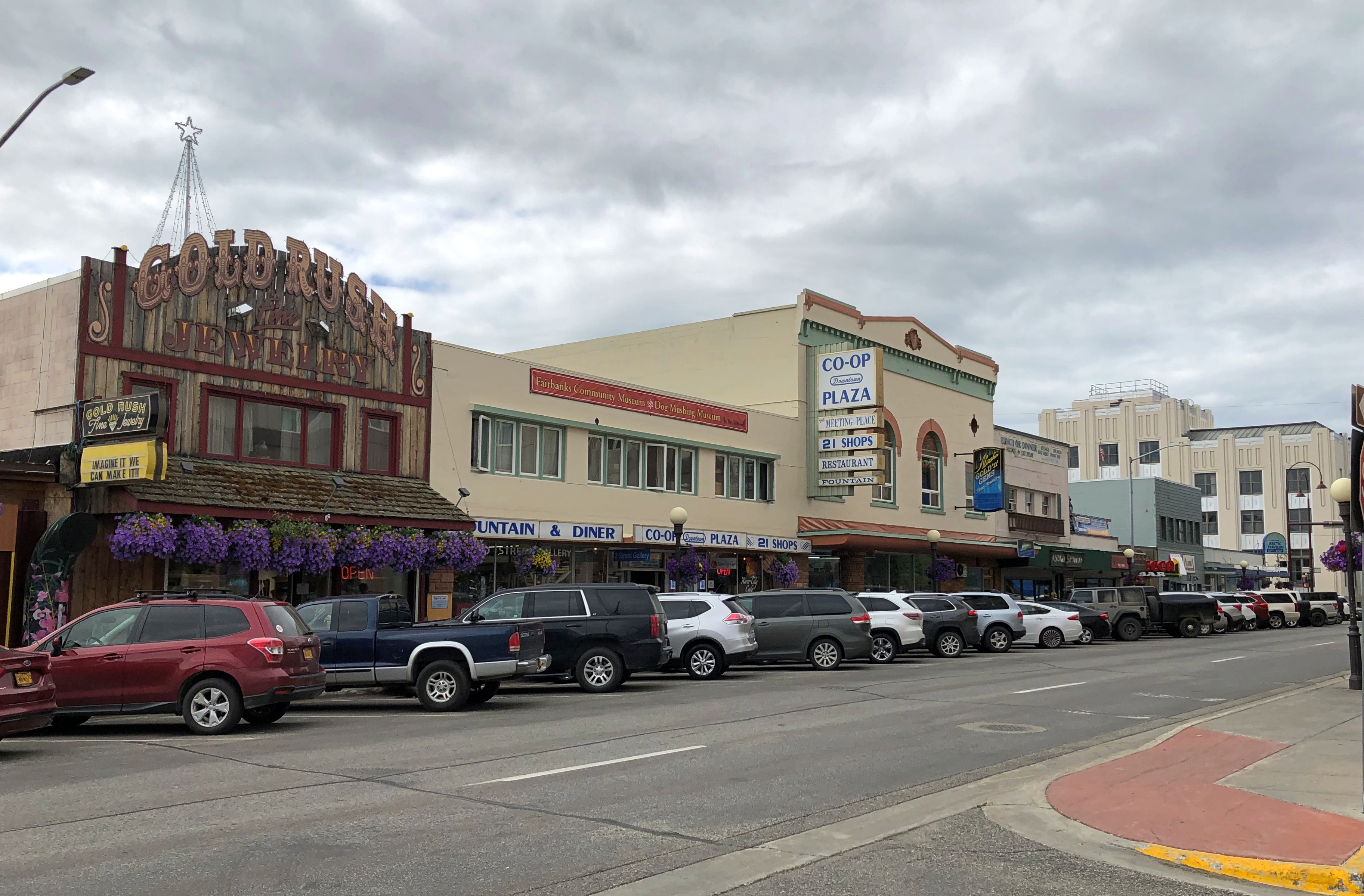
One way to get from Fairbanks to the entrance of Denali NP is to ride the Alaska Railroad. In fact, that was the original route for tourism into the interior of Alaska, though I suspect from the 1920s to the early ’70s, most people came up from the port of Seward to access the grandeur of McKinley NP, as it was then known.
I considered taking the train down from Fairbanks myself — the wonderfully named Denali Star. That would have been a cool ride. But the pandemic bollixed up its schedule. Last year, the passenger trains didn’t run. This year, at least as I planned things back in April, service was more limited than it had been before 2020, such that I couldn’t make the train work for me logistically.
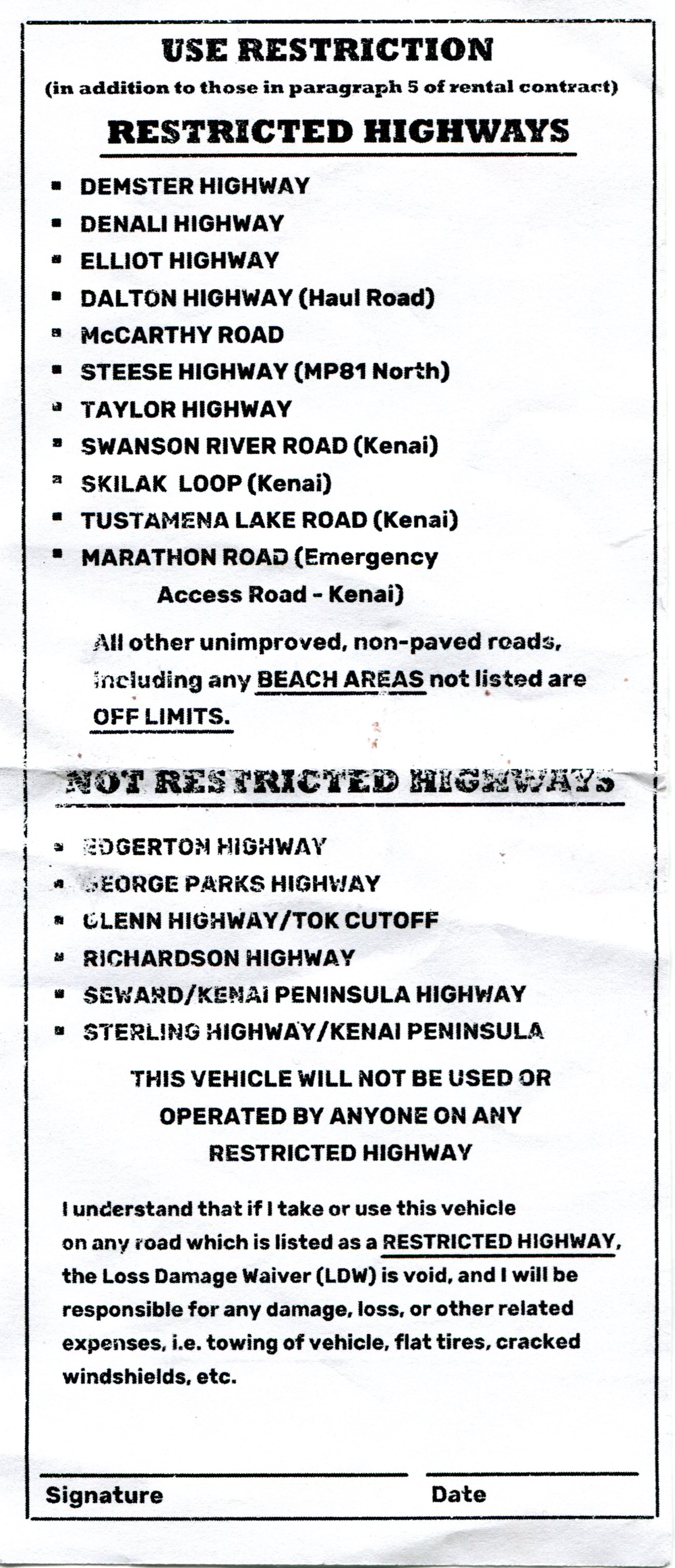
 That’s how, on July 28, I came to be in a rental car heading west and then south from Fairbanks on the route Alaska 3. I picked the car up at the airport in Fairbanks at noon that day. Along with the other documents, the rental company gave me a list of proscribed roads.
Mostly gravel roads. During my ride on the Dalton Highway the day before, the driver told us that if you look closely, you’ll notice that a lot of cars and trucks in Alaska have cracked windshields. Insurance typically doesn’t cover that kind of damage, since gravel roads tend to dish it out too regularly.
The list is interesting for another reason, in that it gives names instead of route numbers. Most Alaska highways, it seems, are known by their names rather than numbers. I asked the bus driver on the Dalton whether that road had a number, and he had to think before he told me. It’s Alaska 11, but no one calls it that, and I didn’t see any signs along the way using the number.
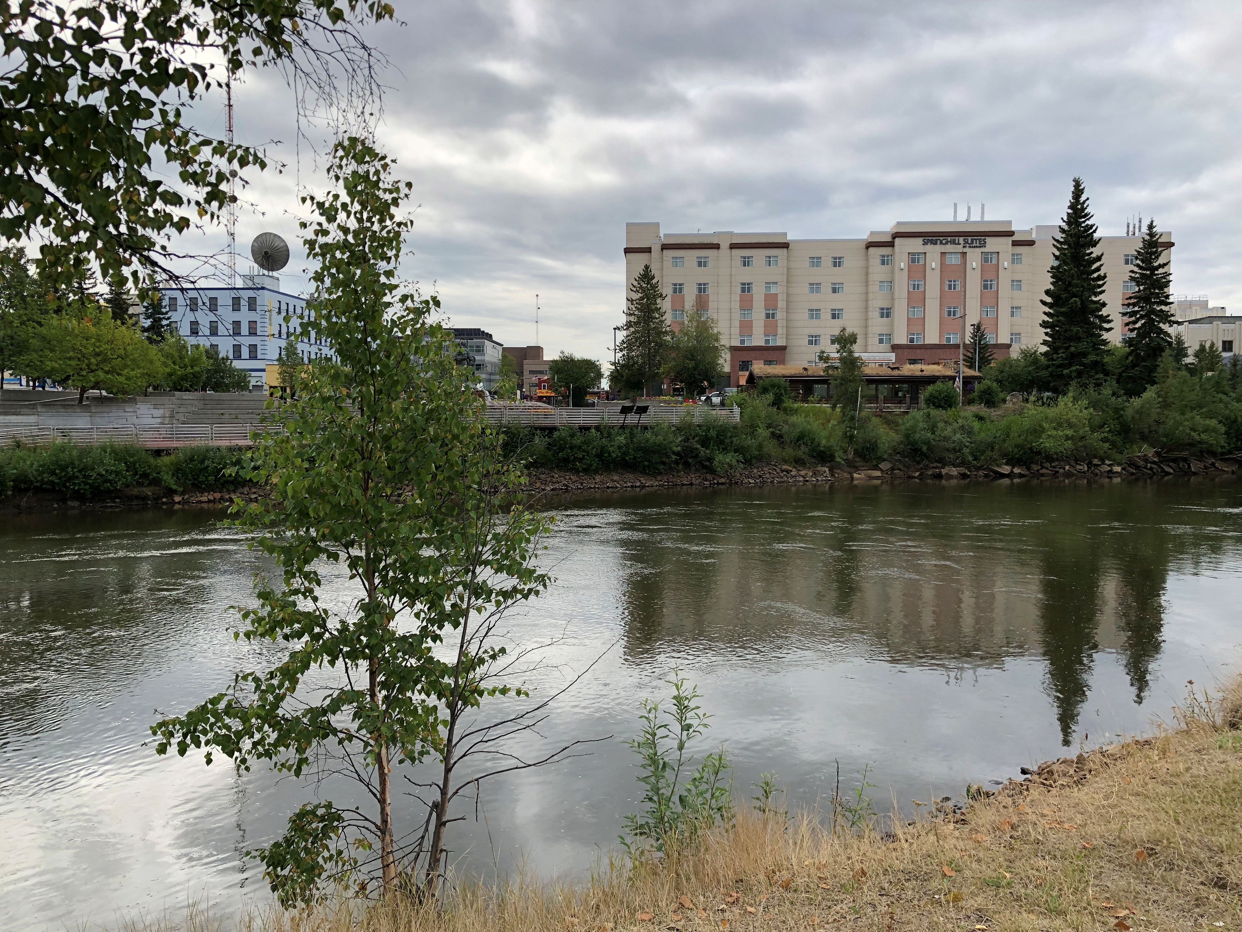
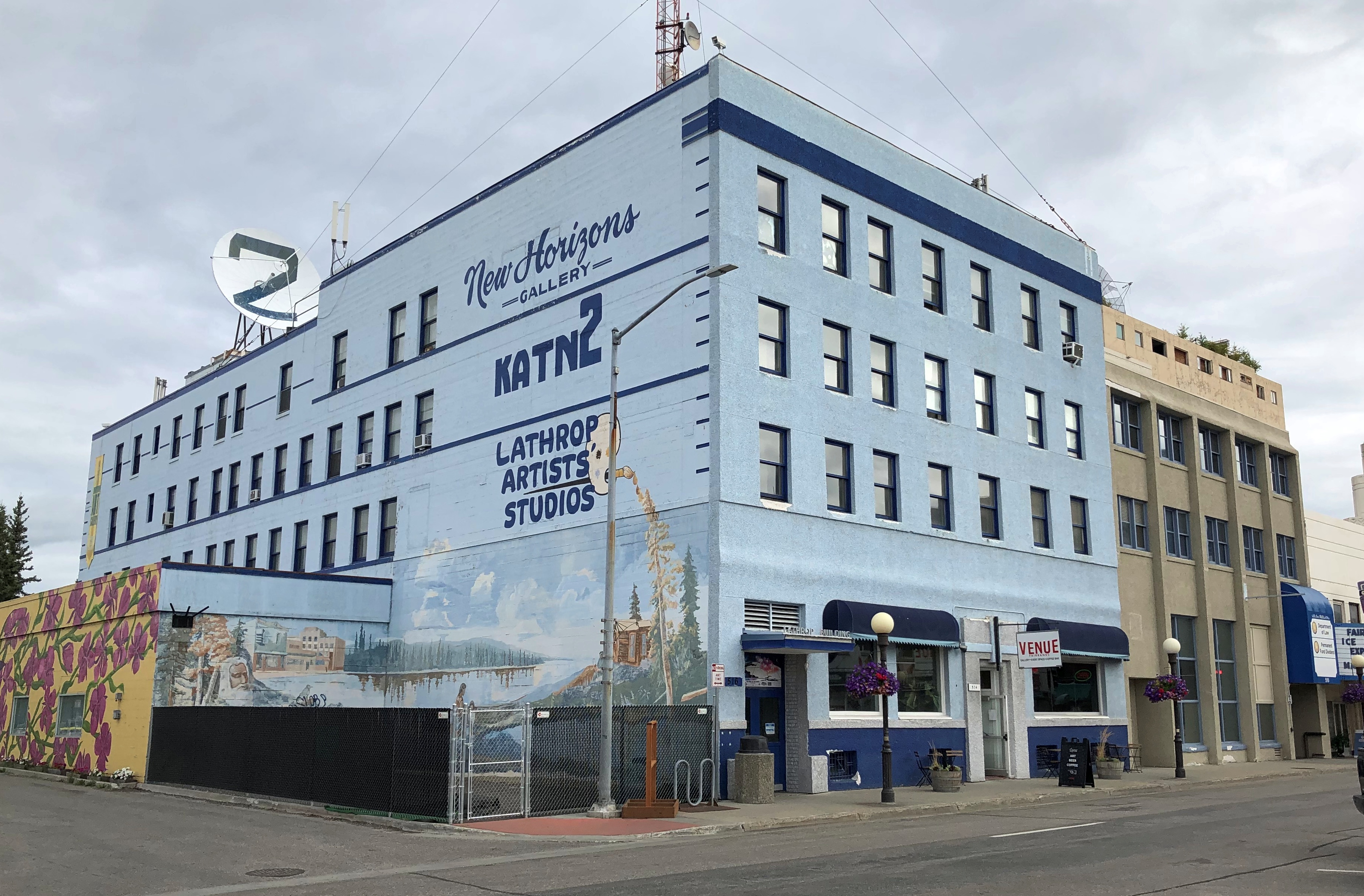
In Fairbanks and a little ways south, I also drove on Alaska 2, but the signs called it the Steese Highway (not to worry, I was well south of Mile Post 81).
Later I learned that Alaska 2, the Steese, is the Alaskan portion of the Alaska Highway. I smile at the thought that I’ve driven on the Alaska Highway, even if only about 12 miles of it between Fairbanks and the town of North Pole.
As for the road between Fairbanks and Denali NP, its name is the George Parks Highway, named for a mining engineer and governor of the Alaska Territory in the 1920s and ’30s. Remarkably, he lived to see his name attached to the road, since he died at age 100 in 1984.
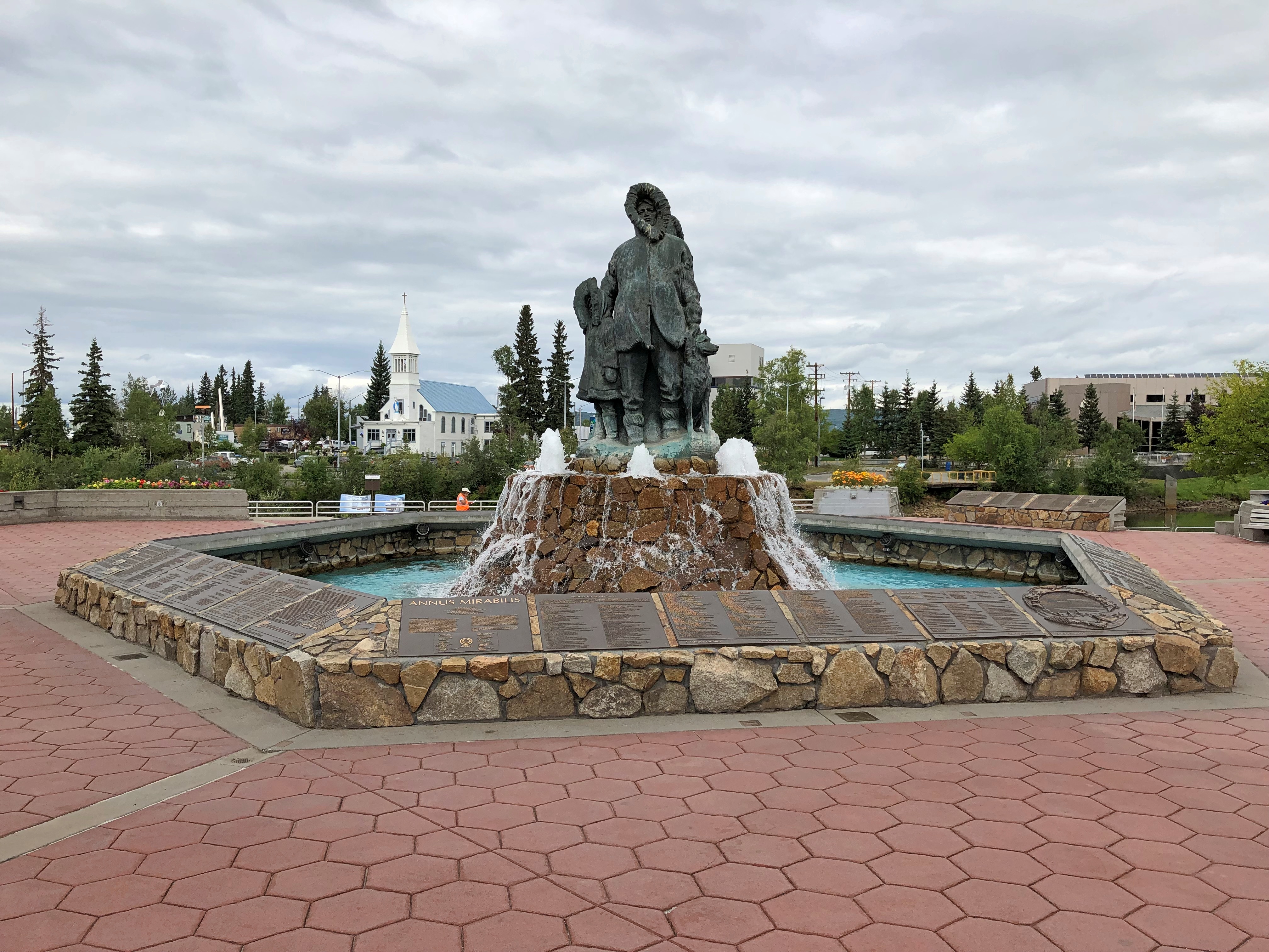
I didn’t see too many signs calling it the Parks Highway, though. Mostly I saw the Alaska 3 signs, featuring the state name, the number, and the Big Dipper and Polaris, arrayed as they are in the northern sky and the Alaska flag. An excellent design, one that made me think, damn — I’m in Alaska. For miles at a time, those were the only signs I saw. The road the was remarkably free of most the signage you might see elsewhere: directional signs, mileage signs, billboards and so on.
Alaska 3 was mostly a two-lane shot through the boreal forest. The terrain between Fairbanks and Denali NP, which runs about 125 miles, follows the Tanana River, and then passes by the Minto Flats and the Tanana Flats, so it isn’t a mountainous crossing. I suppose that facilitated the road’s construction, completed only 50 years ago.
That isn’t a long drive, certainly not for someone who learned to drive in Texas. But it was mesmerizing in a way that few roads are. Traffic was light, so my eyes were able to wander sometimes from the road ahead to the forested expanse on either side.
The were a few directional signs. My favorite.
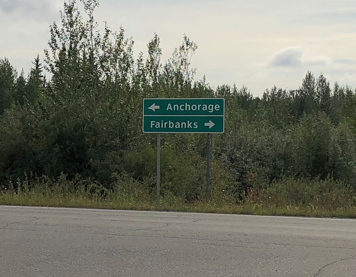
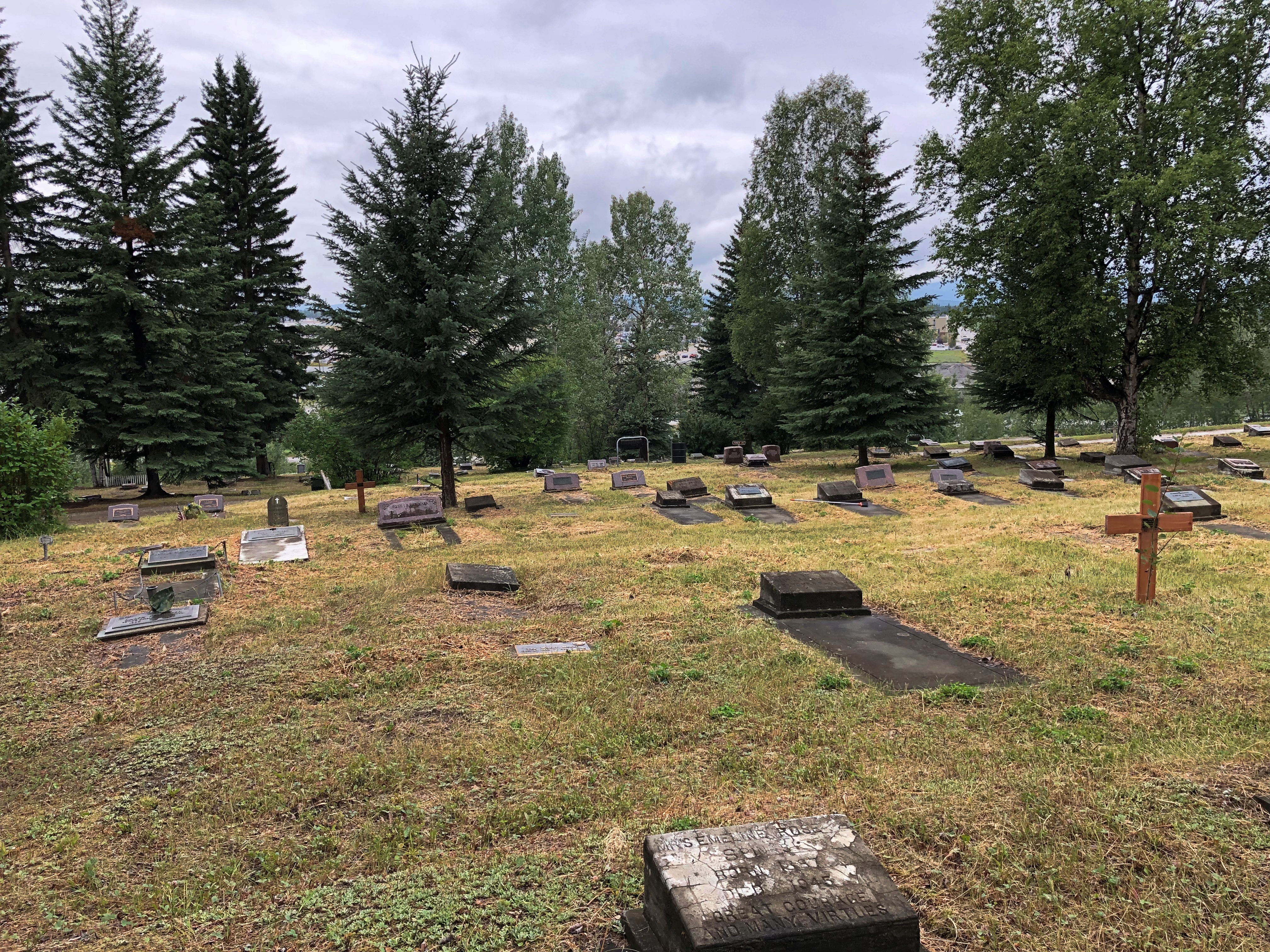
That was at an intersection with Alaska 3 in the town of Nenana, the only settlement of any size (pop. 341) between suburban Fairbanks and the tourist town of Healy, just north of the entrance to Denali NP.
The road crosses the Tanana River at the town of Nenana, very near where the Nenana River — which I would see later, near the national park — joins the Tanana, on its way to the Yukon River.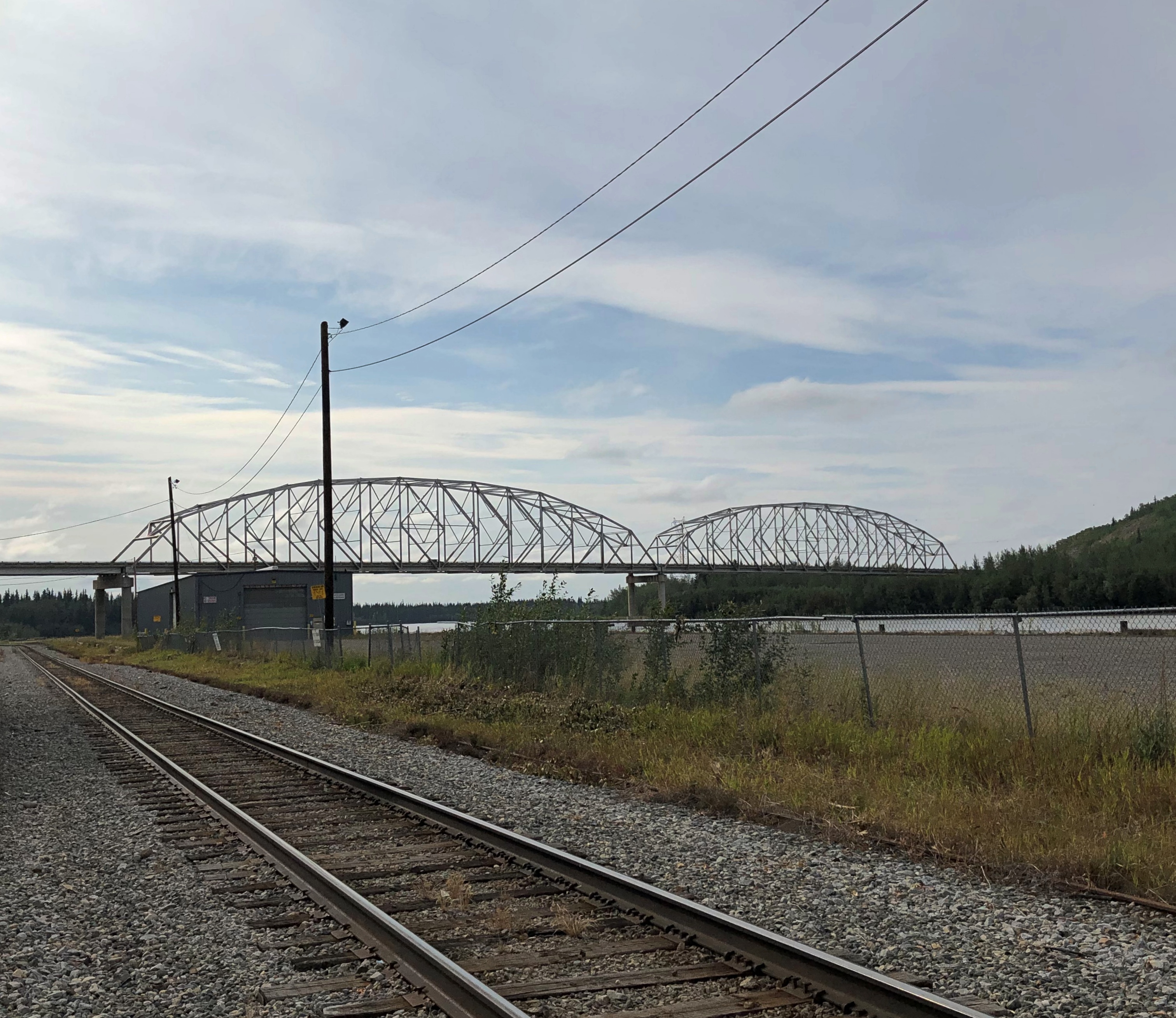
The other bridge in the town of Nenana (across the Tanana River) is the Mears Memorial Bridge, which takes the railroad across the river. More about that shortly.
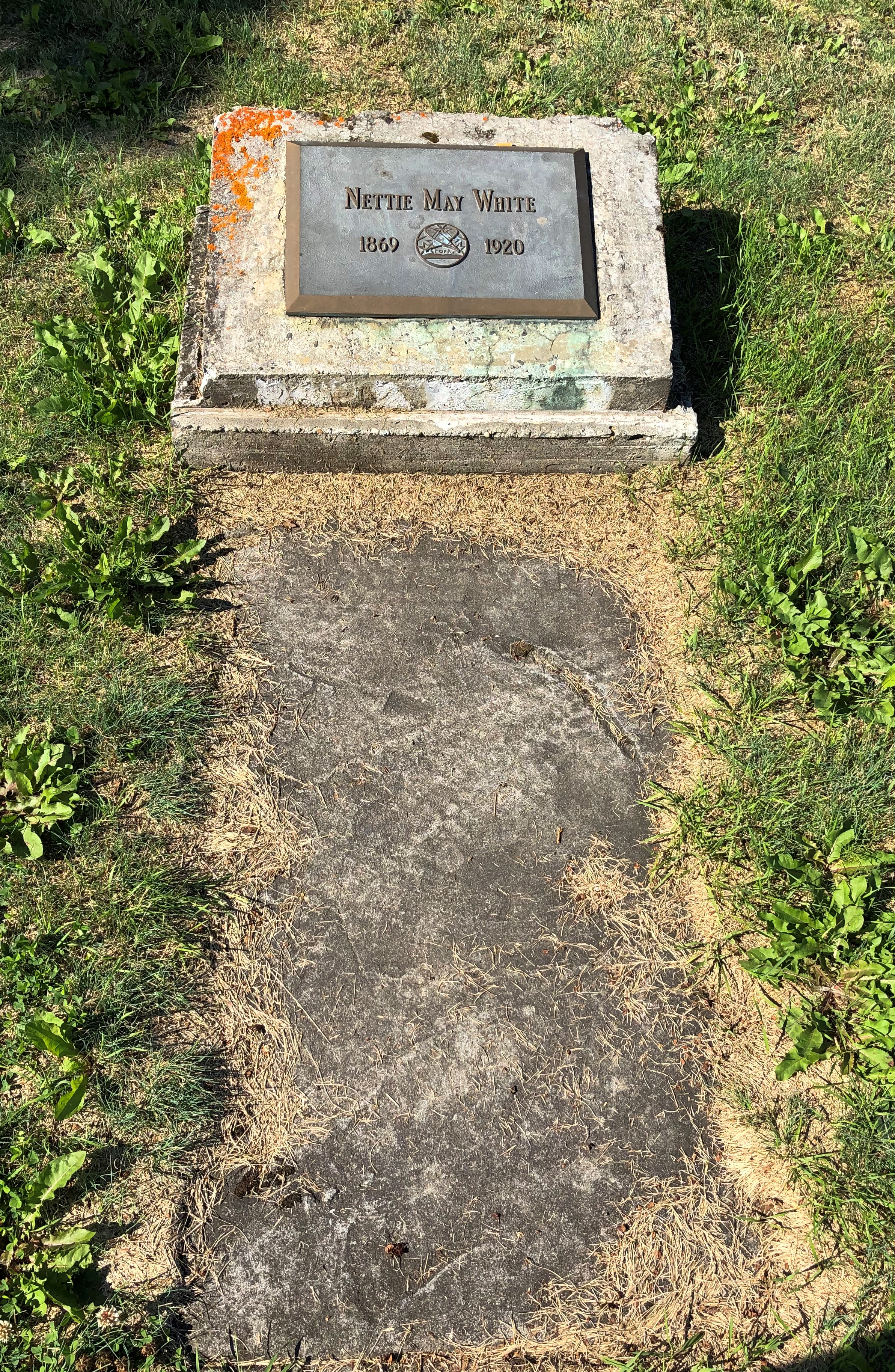
Nenana seemed like a good place to look around. Near the highway is a cluster of tourist and memorial structures, including a boat out of water, the Taku Chief.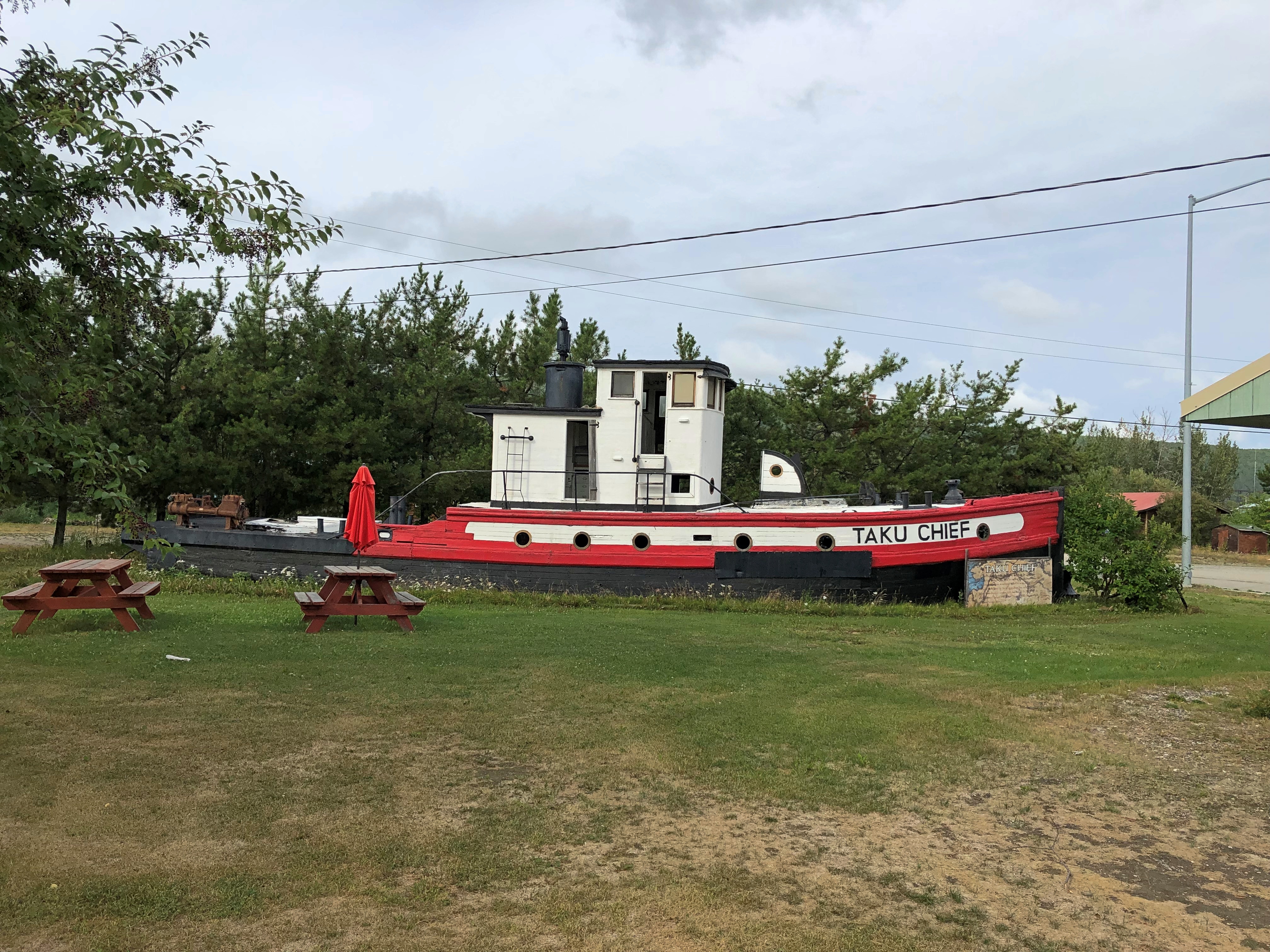
The nearby sign says: “The last commercial wooden tug to ply the Yukon and Tanana River Basins, the Taku began her career in 1938 in Southeast Alaska. After 7 years in service she was requisitioned by the CAA for use on the rivers of the Interior. In 1956, she joined the fleet of Yutana Barge Lines, and after a colorful history, the sandbars and sweepers finally took their toll. On July 18, 1978, she was condemned. She rests in her last port, Nenana, a tribute to the heartbeat of Alaska transportation.”
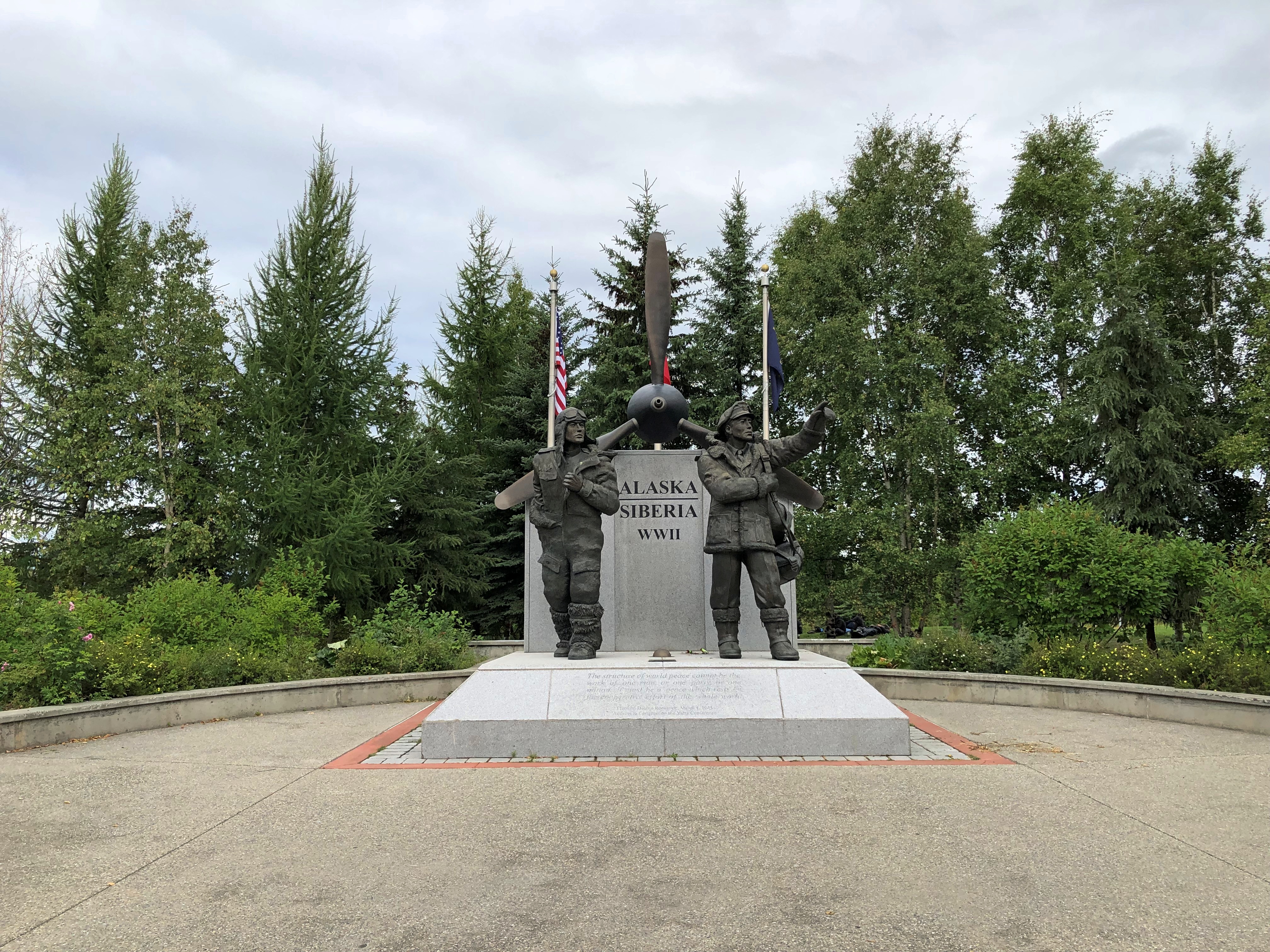
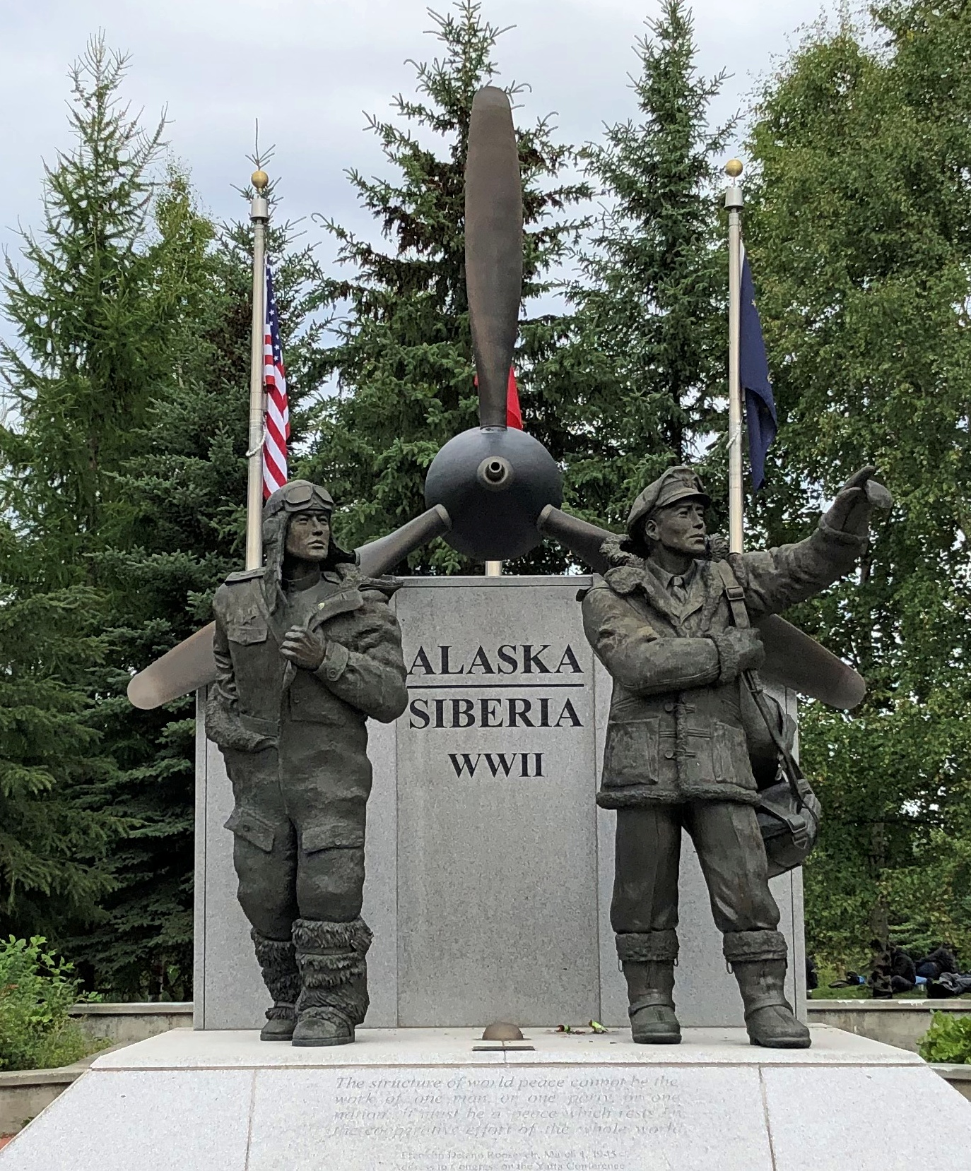
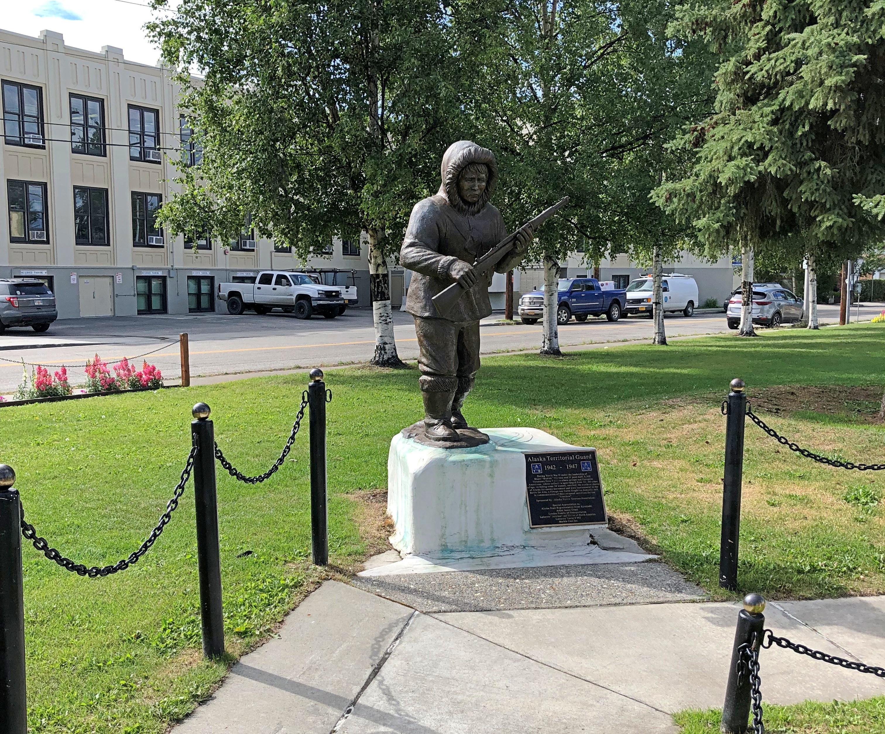
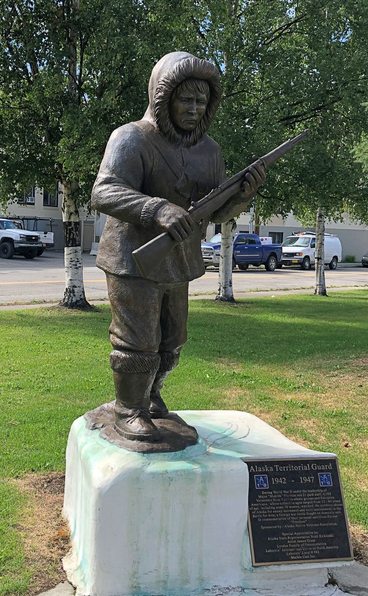
Near the ship is another casting of the James Grant work memorializing the Alaska Territorial Guard, 1942-47.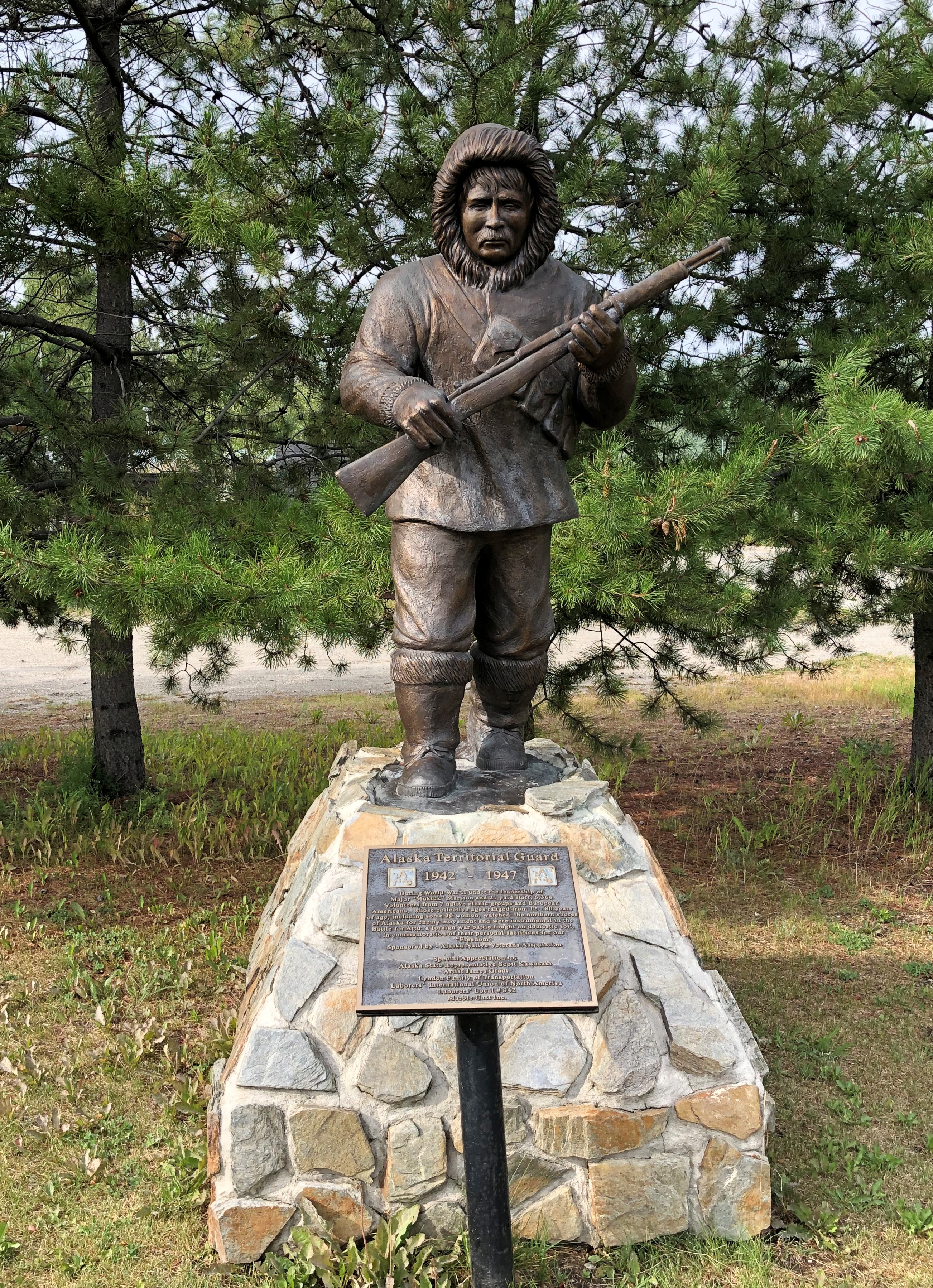
The town’s main street (besides the highway) is A Street, with a scattering of houses, buildings, abandoned buildings and empty lots. The pandemic might have done in this business; or maybe it closed before then.
St. Mark’s Mission church.
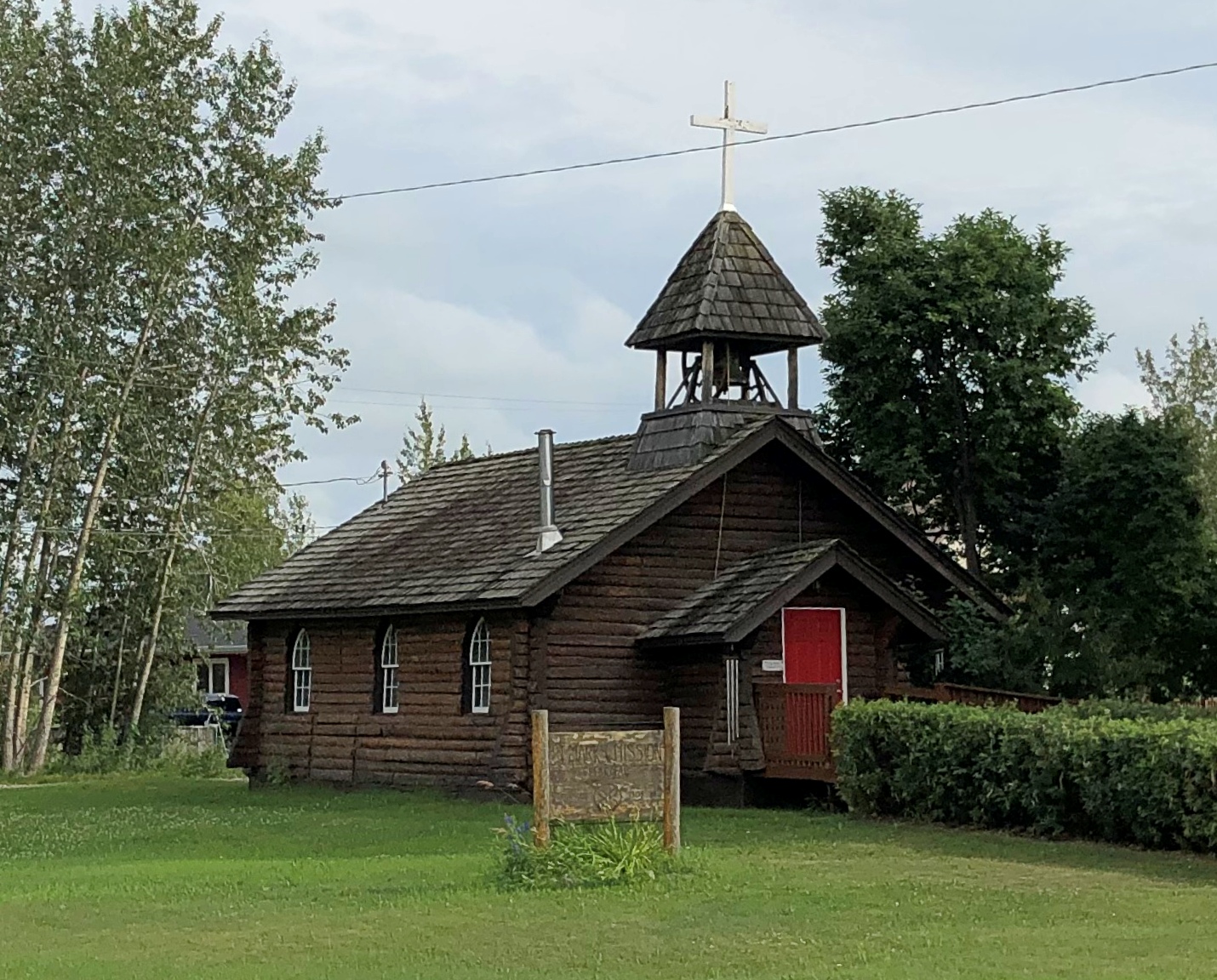
“The Episcopal Church, continuing work done by Episcopal and Anglican missionaries along the Yukon River, envisioned a series of missions throughout the Tanana basin to serve its Native population,” Sketches of Alaska says. “Eventually four missions were established: St. Barnabas at Chena Native Village, Luke’s at Salcha, St. Timothy’s at Tanacross (near Tok), and St. Mark’s at Nenana…
“The picturesque church is similar in design to other Episcopal mission churches throughout Interior Alaska — a log structure with gable front and bell tower. The 22-foot by 28-foot building is constructed of logs squared on three sides, with the bottom courses of logs flaring outwards. Gothic arched windows contain stained glass, and the building is topped by a shake roof.”
At A Street and Front Street near the Tanana River is a curious tower.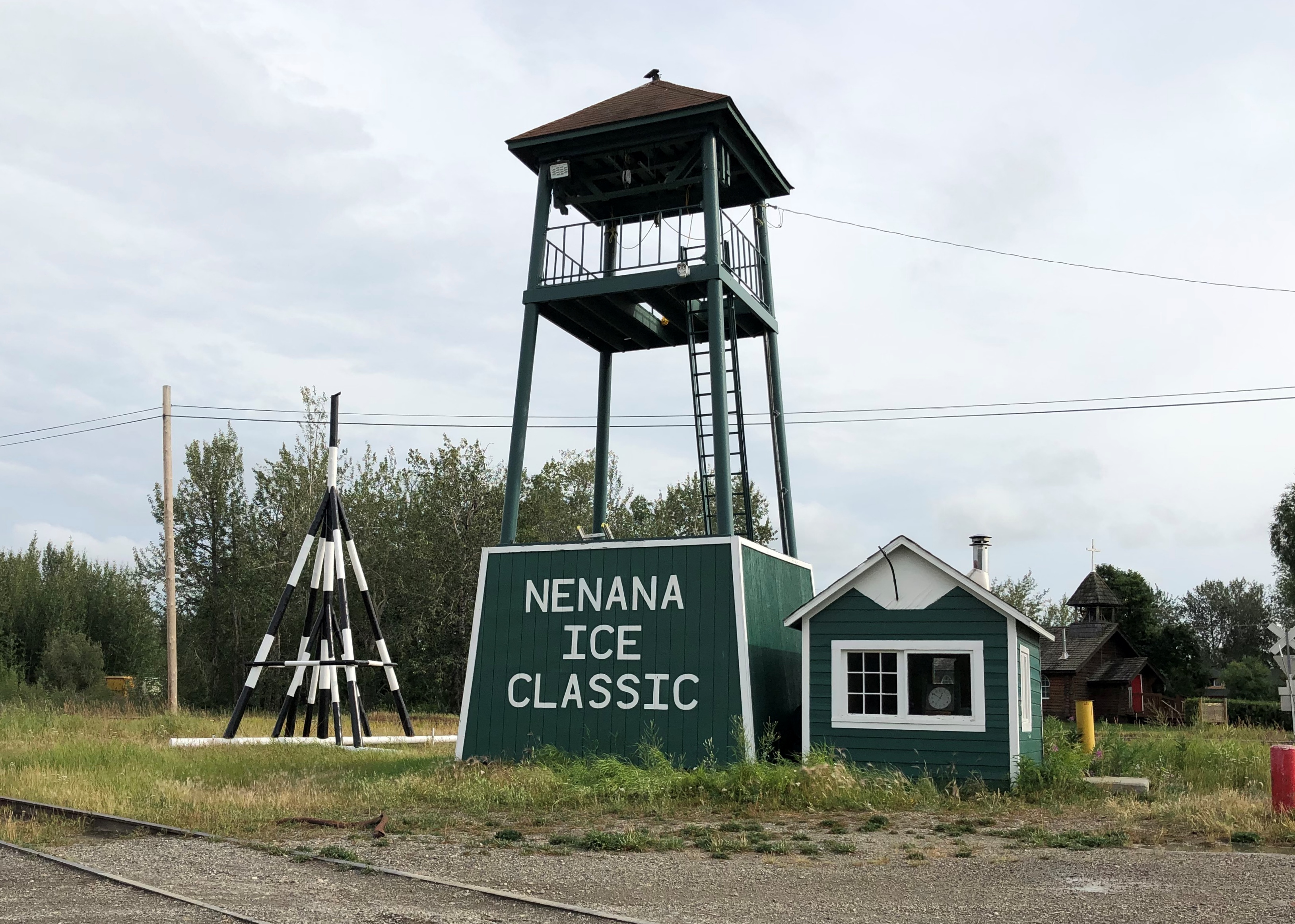
I didn’t look that up till I got home. I’d assumed it was some kind of winter sporting event, but no. Wiki: “The Nenana Ice Classic is an annual ice pool contest held in Nenana, Alaska. It is an event in which individuals attempt to guess the exact time the Tanana River ice will break up at Nenana.
“The ‘tripod,’ which actually has four supports, is planted on the river ice between the highway and railroad bridges in Nenana, 300 ft from the shore… A line is attached to the top of the tripod and once that end is anchored the other end is taken to the Ice Classic tower nearby on the banks of the river. Attached there to the clock inside the tower, when the ice goes out and moves the tripod 100 feet the line breaks and stops the clock.”
The pool is no small potatoes. According to the pool web site, the prize money in 2021 totaled $233,591. The clock stopped on April 30 at 12:50 pm and the prize was split among 12 winners. The rest of the funds generated by the pool go to local charities.
The Wiki photo of the tripod looked awfully familiar. Then I remember that I’d seen the tripod, standing next to the tower (and there was another one near the Taku Chief). There was nothing to explain what they were. Tourist photographer that I am, I took a picture of one of them anyway.
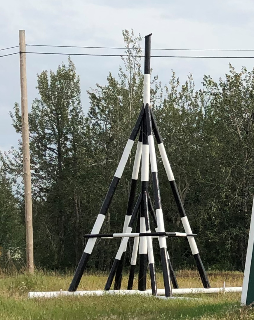
Finding out what it was produced a bit of mild amazement, here during the post-trip writeup. What a fun thing to learn about, like the Sopchoppy Worm Gruntin’ Festival. How often do we look at things on the road, or near home for that matter, without the slightest idea what they are?
At the meeting of A Street and Front is the handsome Nenana depot, which still seems to be a stop on the Alaska Railroad, but it’s also the State of Alaska Railroad Museum. It was closed when I got there.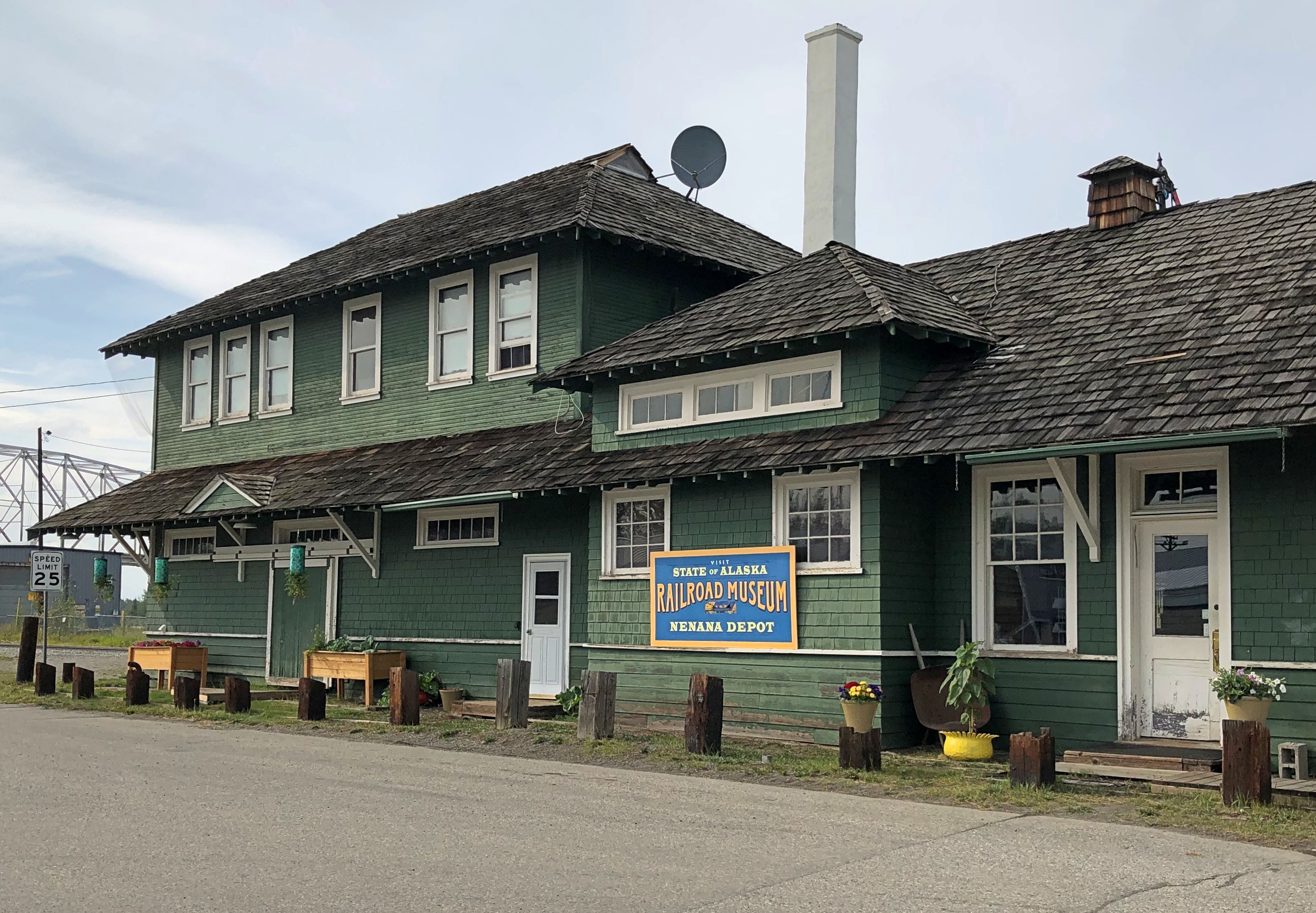
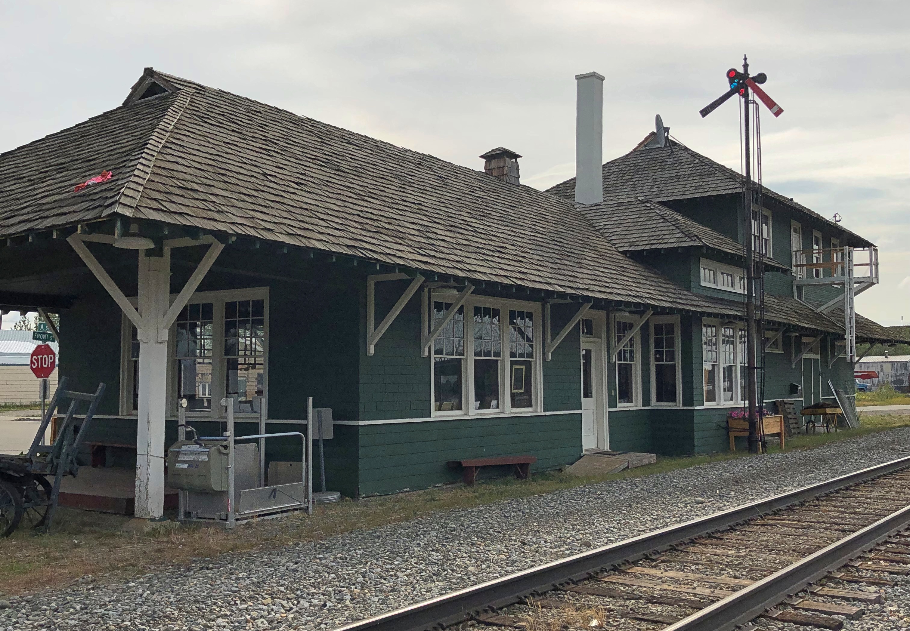
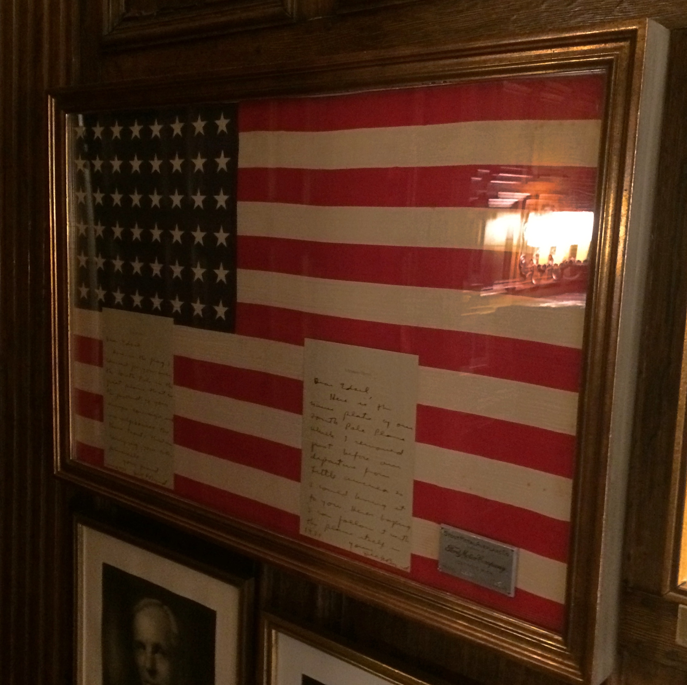
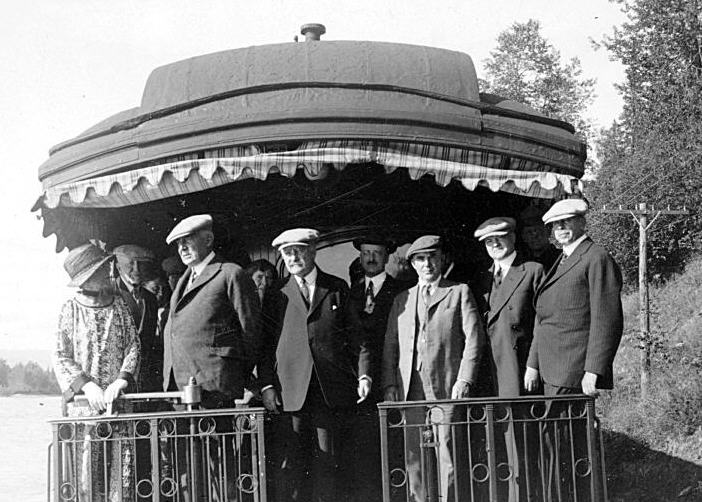
Next to the depot is a plaque and, I assume, the same golden (colored) spike that Warren G. Harding pounded on July 15, 1923, to mark the completion of the railroad. The last part completed was the Mears Memorial Bridge.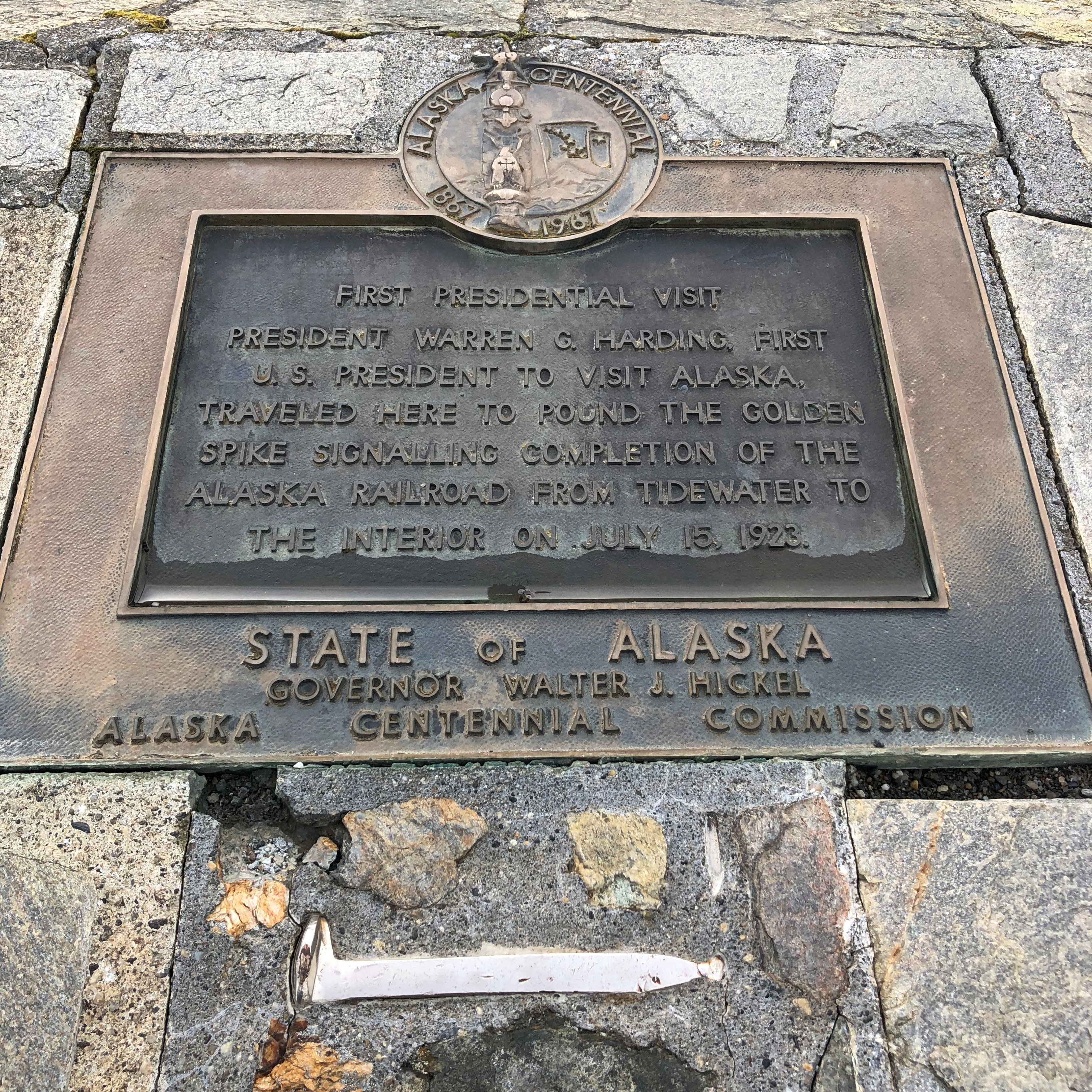
The Anchorage Daily News published an article a few years ago about presidential visits to Alaska. “The most ambitious trip to Alaska, by far, was Harding’s,” the article says. “He departed from Seattle on July 5, 1923, and returned to Vancouver, British Columbia, on July 16, 1923. During his tour he spoke in Metlakatla, Ketchikan, Juneau, Skagway, Valdez, Seward, Anchorage, Nenana and Fairbanks, among other stops.”
At that moment, he was running out of days, though neither he nor the nation knew it. President Harding died in San Francisco on August 2, 1923, not long after his visit to Alaska.