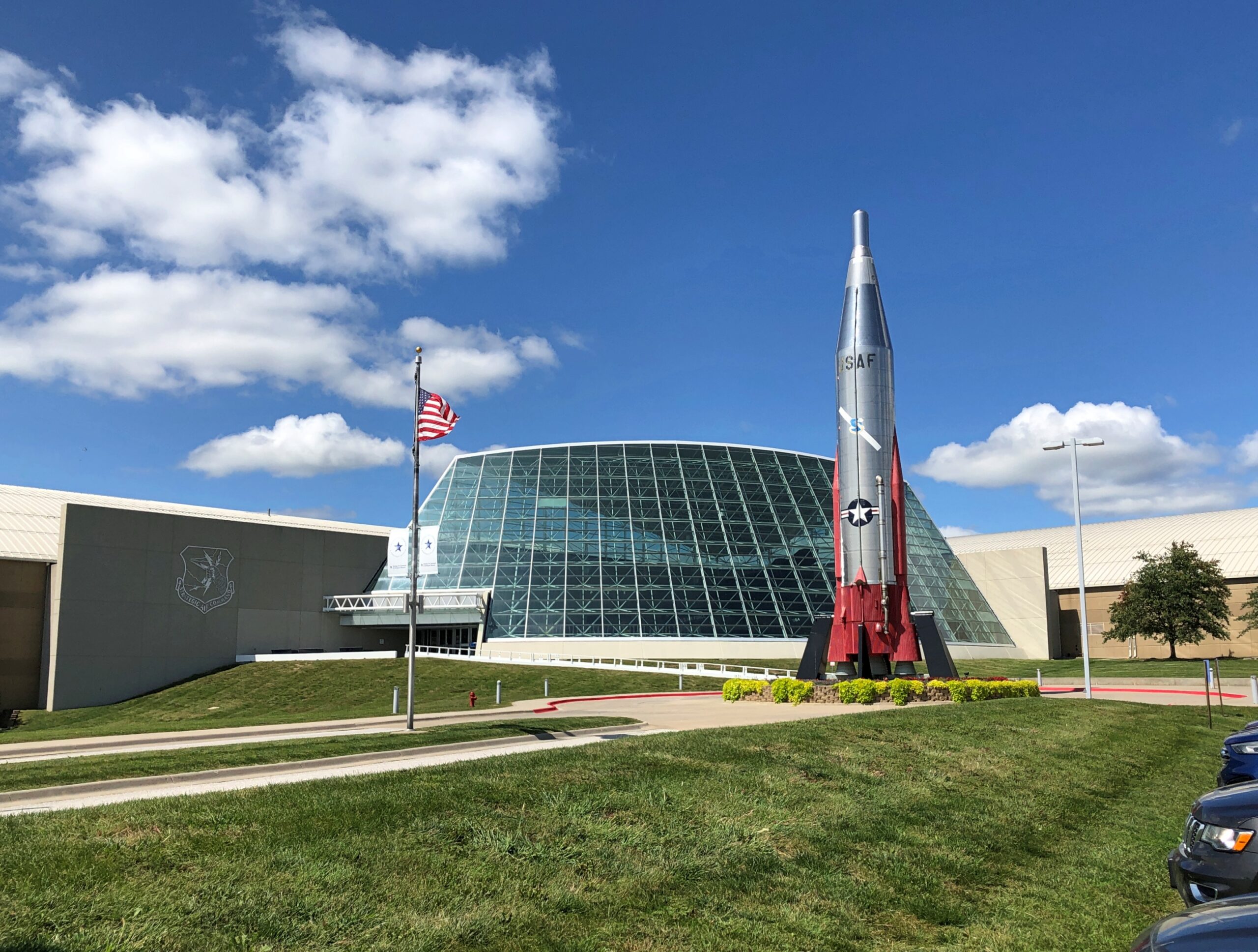
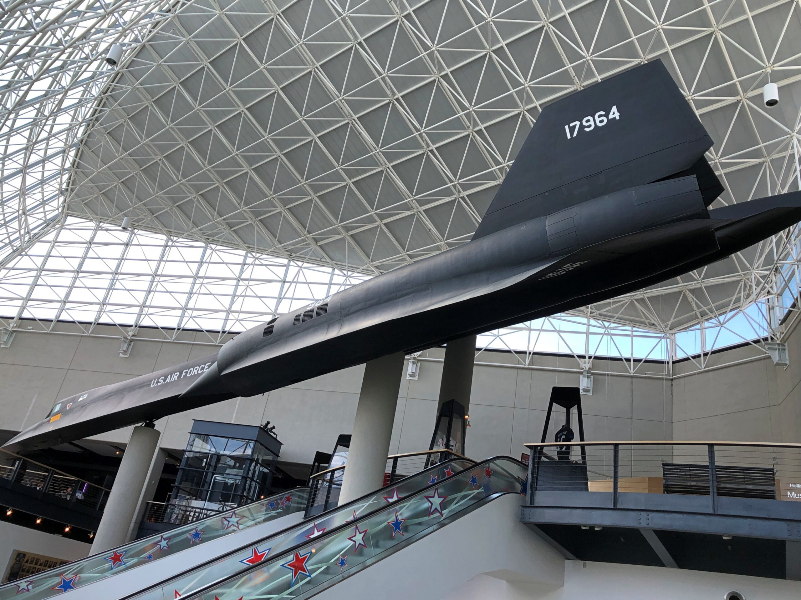
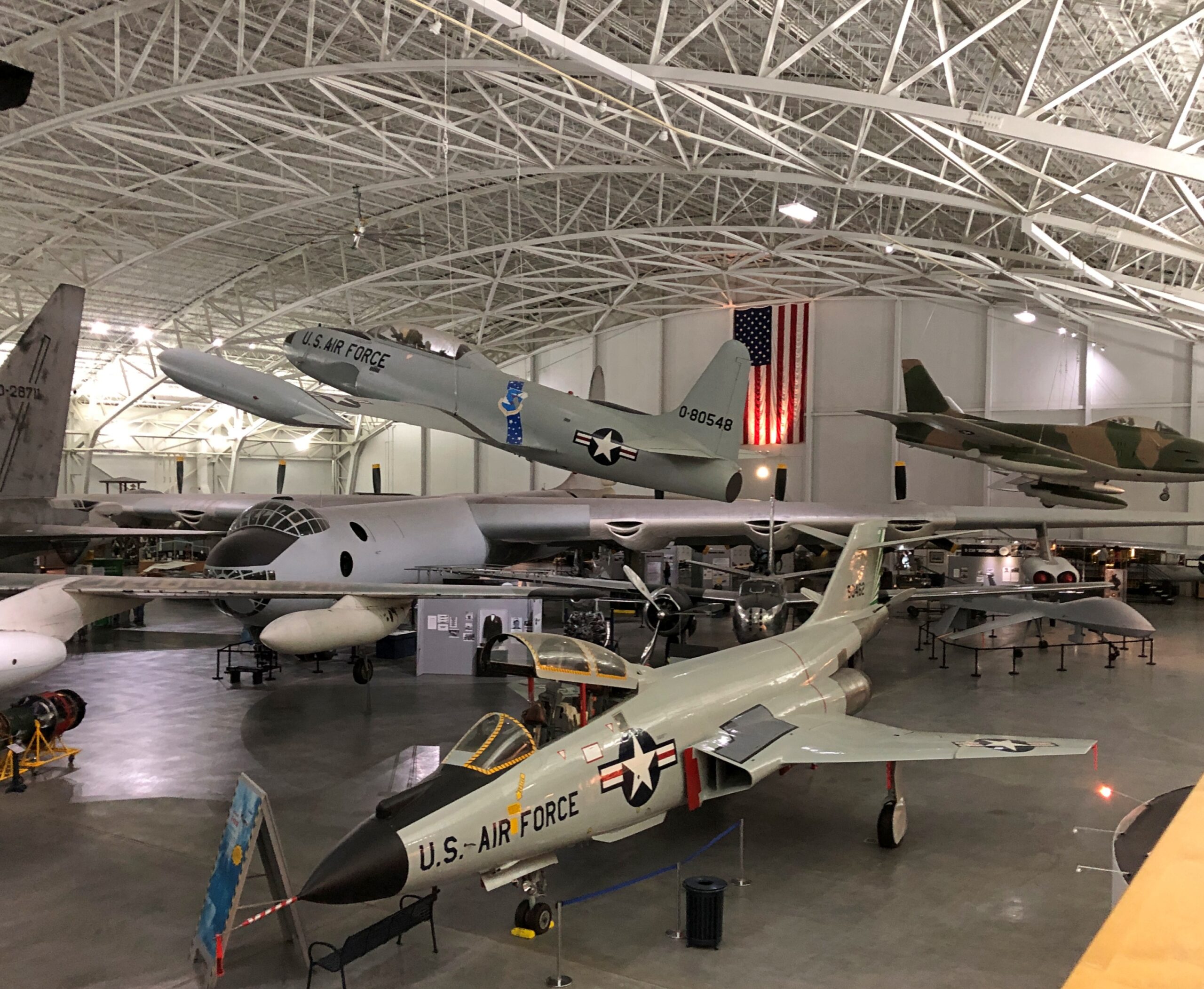
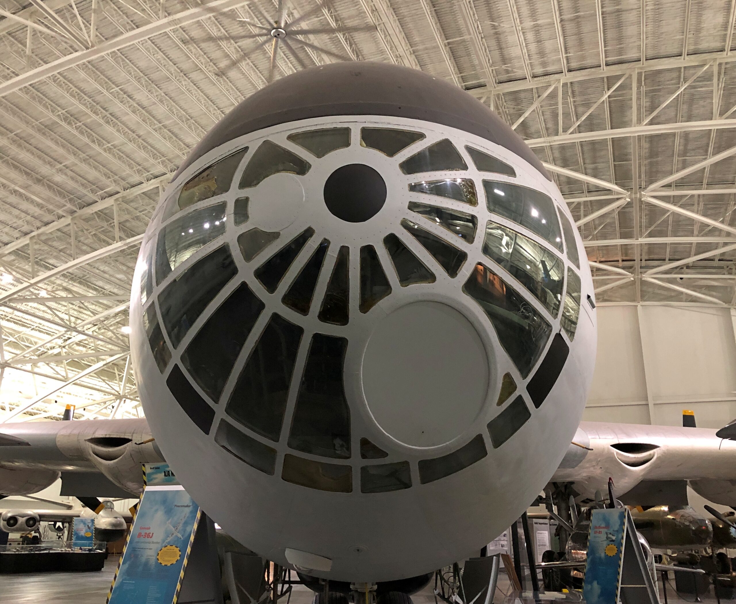
Not far outside Omaha, along I-80, it’s possible to stop and see, under two very large roofs, such marvels of aeronautical engineering as a B-17, B-29, B-36 and B-52, a Lockheed SR-71 Blackbird, a Douglas C-47 Skytrain and a Douglas C-54 Skymaster, a Convair F-102, and a Fairchild C-119 Flying Boxcar, among many others. Along side the airplanes are exhibits about the Tuskegee Airmen, Doolittle’s Raid, the Berlin Airlift and Francis Gary Powers.
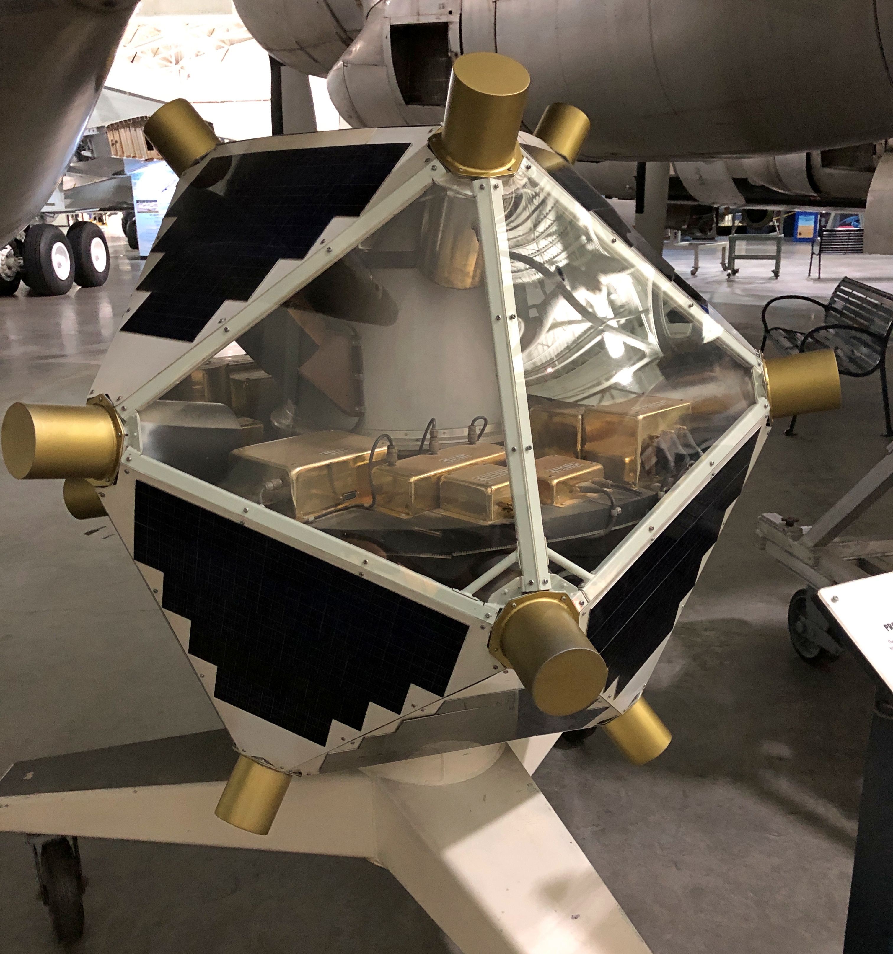
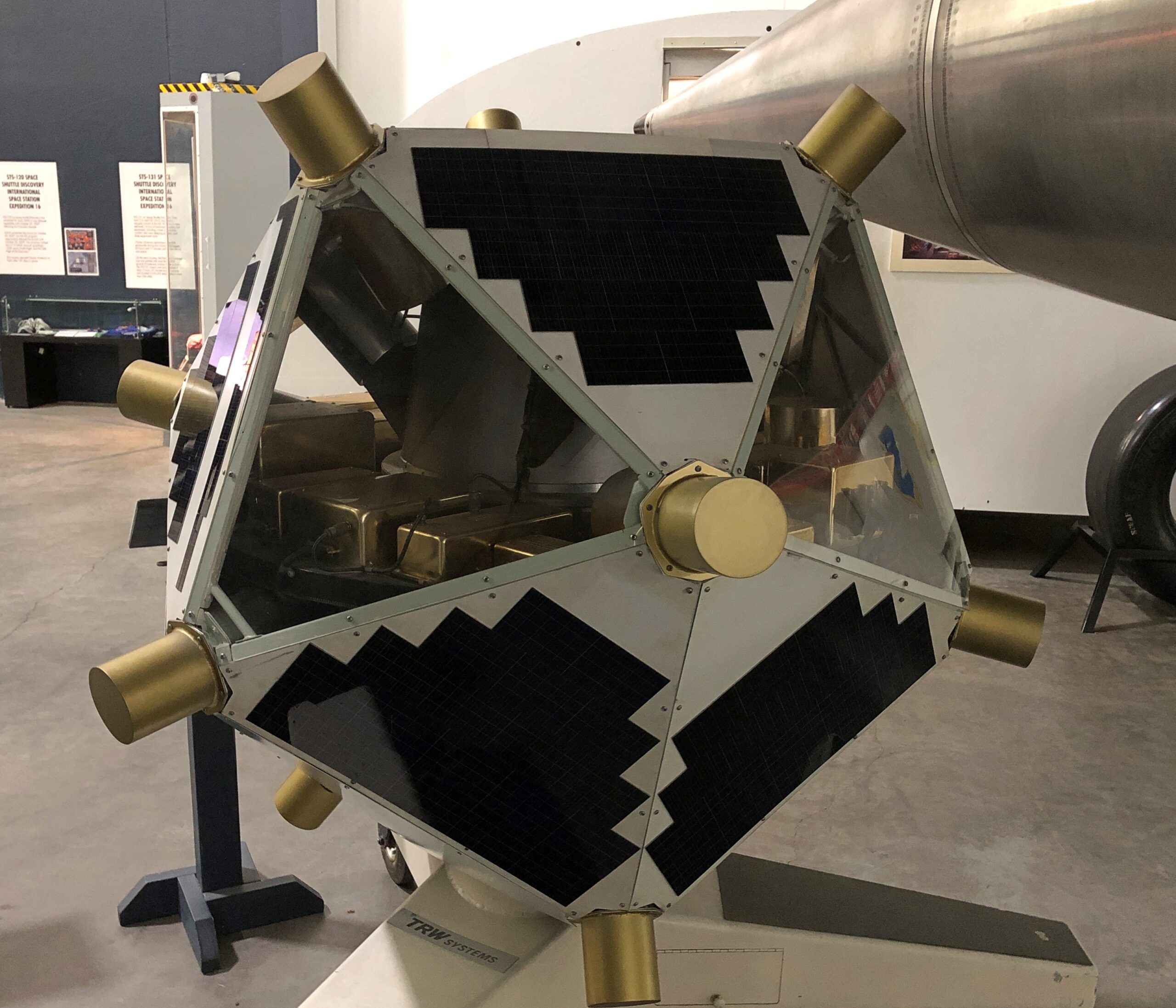
There are also space artifacts at the Strategic Air Command & Aerospace Museum, as the name says, but not that many. Still, my favorite artifact at that museum, the coolest bit of space hardware I’d seen since the Kansas Cosmosphere, was a Vela satellite.
Looks like something you’d see on the set of Space: 1999, but the Vela is more than just a curious glassy polyhedron. In September 1979, a Vela satellite noticed the characteristic flash – actually a double flash – of a nuclear explosion in the atmosphere, near the remote Price Edward Islands in the ocean south of Africa, roughly half way to Antarctica. It wasn’t long before the press got wind of the event, and I remember a widely held suspicion that Israel had tested a nuclear warhead, with the cooperation of South Africa, whose island it was. It seems likely that this was the case.
Besides that, “in 1967, the satellites were the first to detect extra-terrestrial gamma-ray bursts, thought to be the brightest and most energetic electromagnetic events in the universe,” the Space Force notes.
I arrived at the museum on September 5 heading westward, bypassing Omaha in favor of it.
Most of the artifacts are aircraft used in one way or another by SAC, on display under sprawling ceilings. Leo A. Daly, a longstanding Omaha architect, did the museum’s design, completed in 1998.
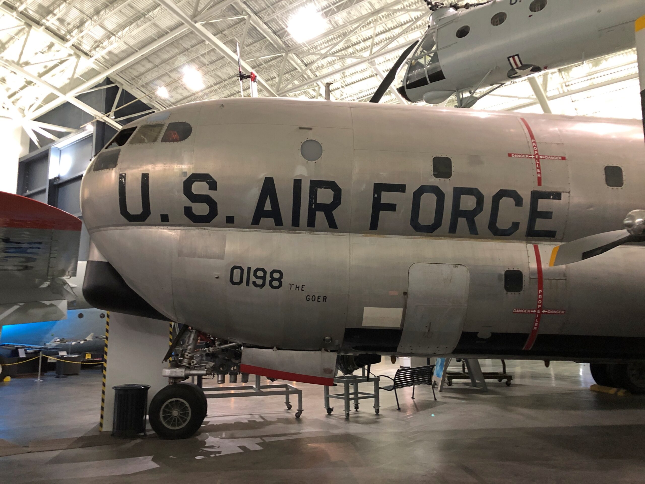
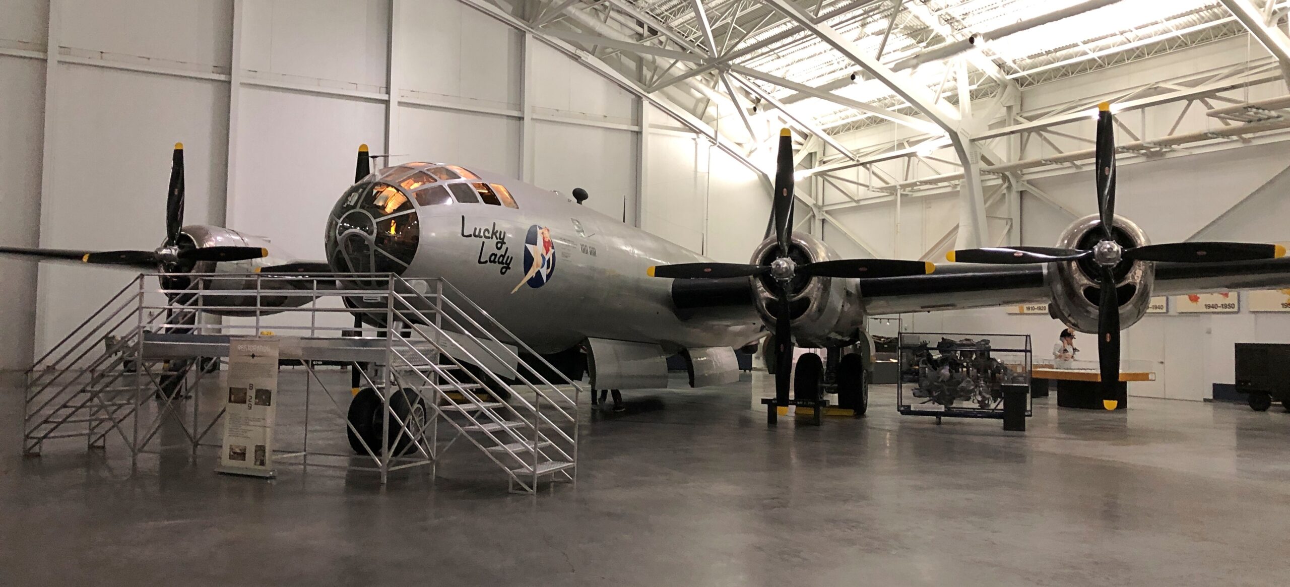
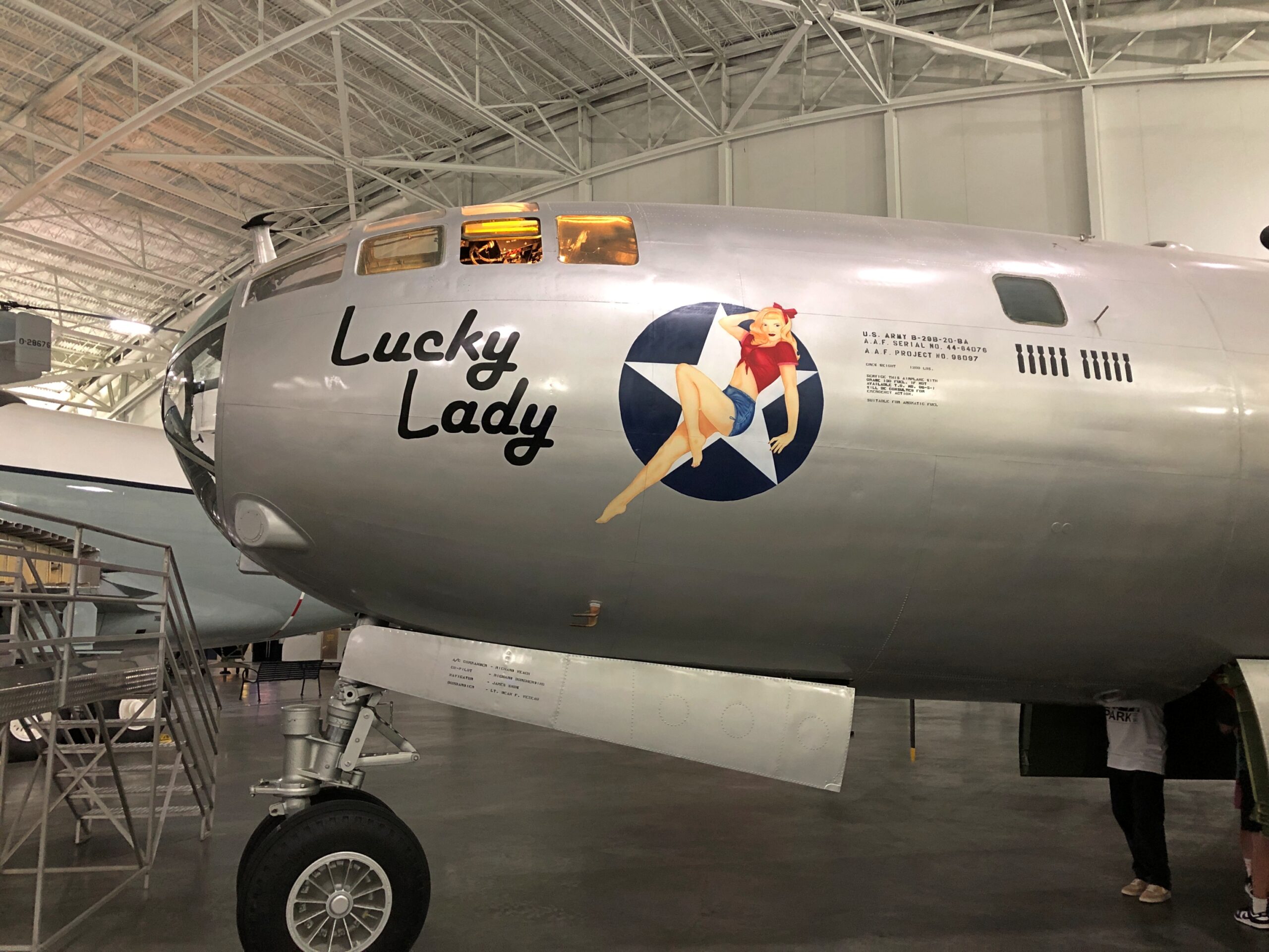
A named aircraft, the Lucky Lady, a B-29 Superfortress.
“The bomber was manufactured by Bell Aircraft, in Marietta, Georgia and delivered to the U.S. Army Air Force on August 4, 1945,” Airplanes Online says. “Its initial assignment was to Walker AAF (Second Air Force), Victoria, Kansas.” Lucky all right, as in manufactured too late in the war to get shot at, unless there’s something about 1940s Kansas I don’t know.
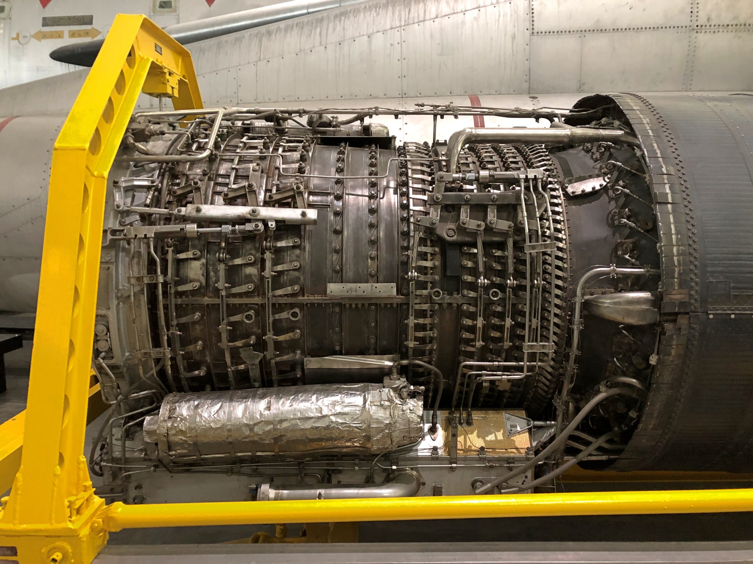
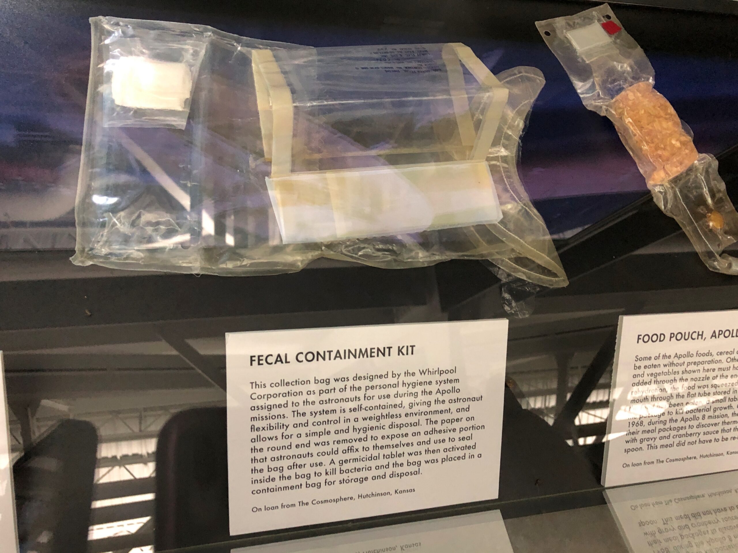
Smaller items, though not actually that small.
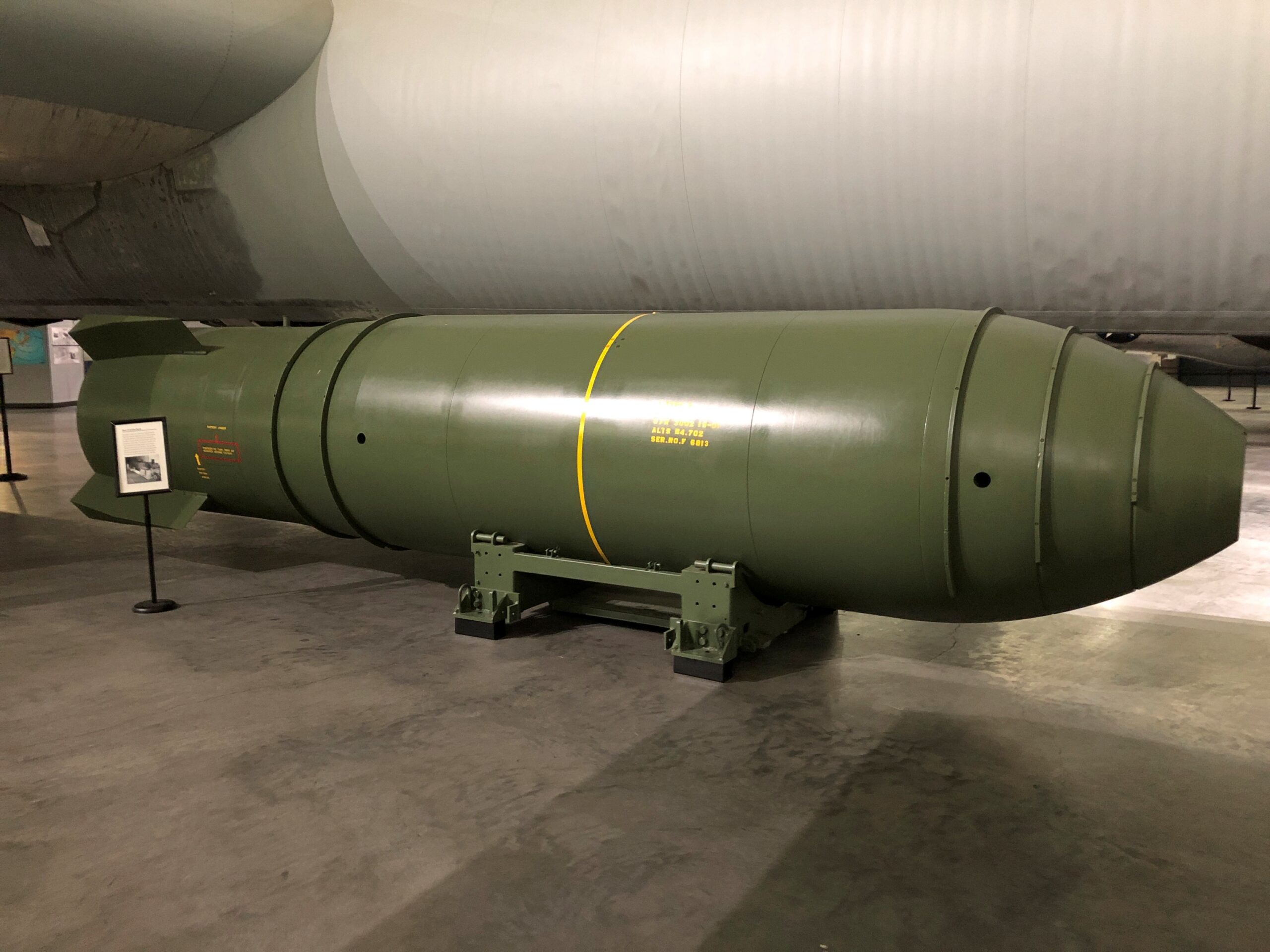
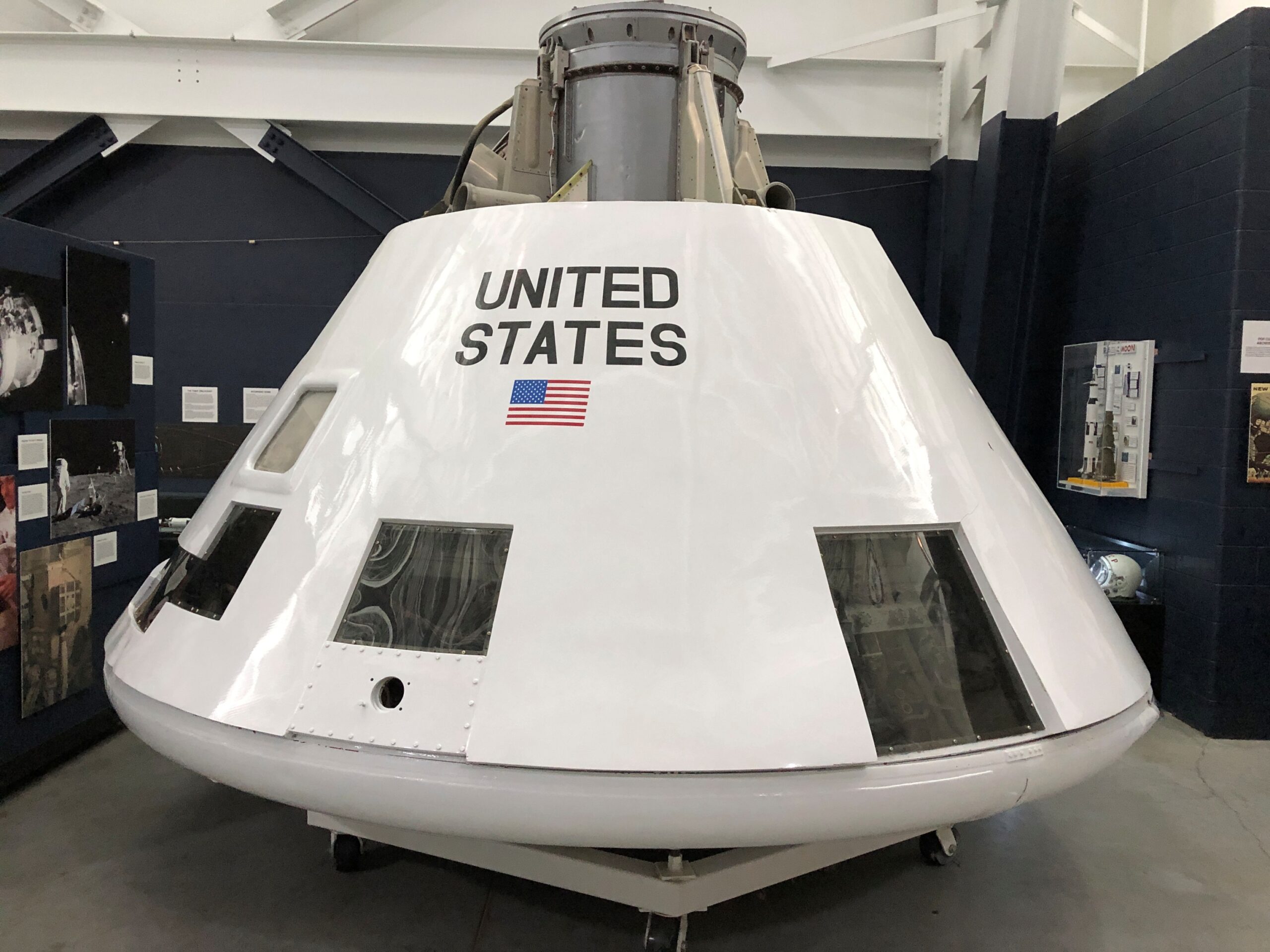
Besides the Vela satellite, other space items include spaceman gear and leftovers from the early days of manned space flight, such as a boilerplate Apollo, which wasn’t actually a capsule, but had the size, shape and mass of a command module, for testing.
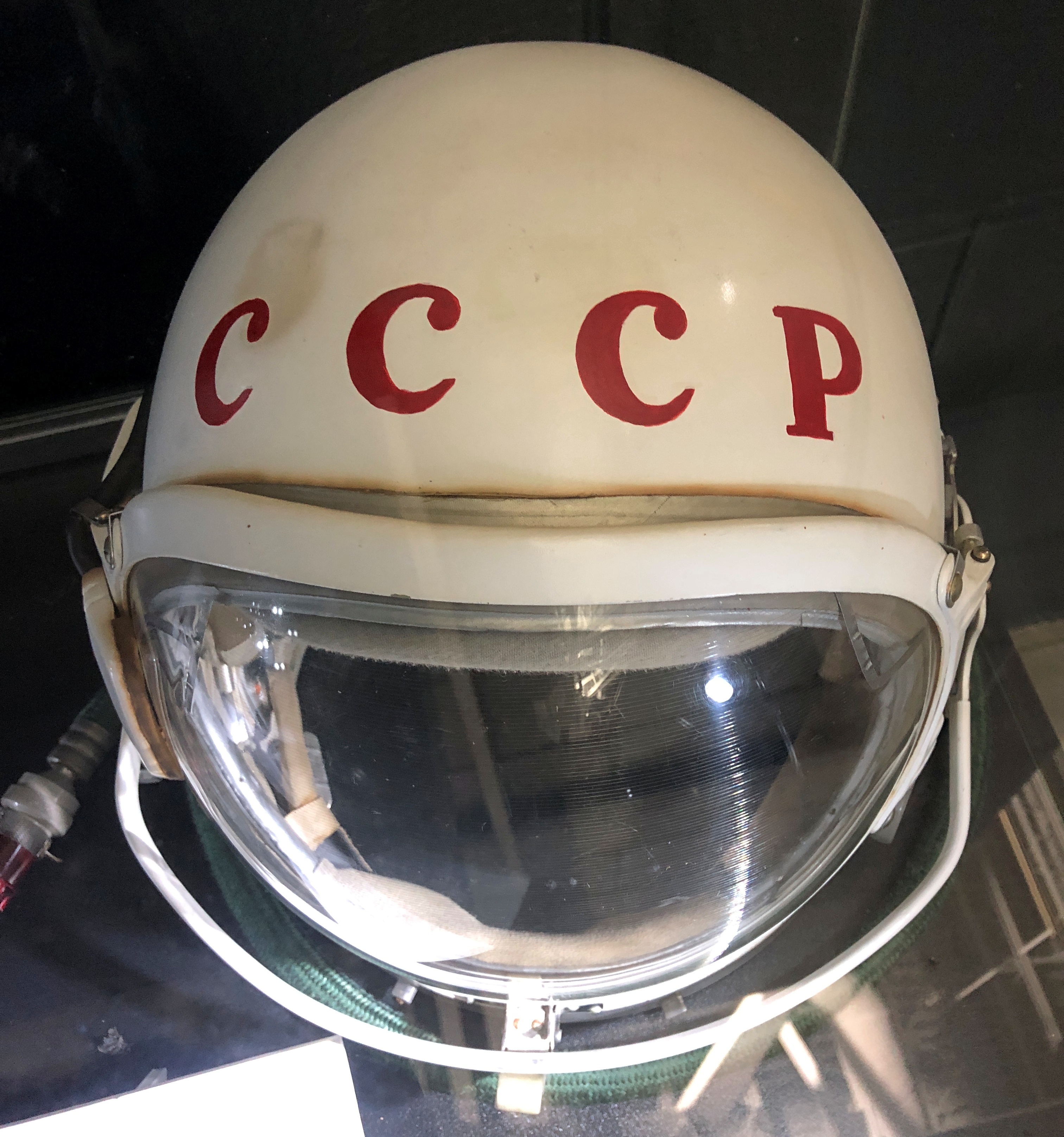
Picked up cheap after the dissolution of the Soviet Union?
Probably something non-astronauts wonder about a great deal.
The highway Nebraska 2 passes through the town of Alliance, as do the BNSF railroad tracks paralleling the highway. During my drive across the Sandhills, I saw train after train headed east from Alliance. Long trains, the seemingly endless sort, even though they’re going the opposite direction you are, so they’re passing by at your speed plus their speed: well over 100 mph probably.
Every single one was a coal train. The industry isn’t what it used to be, but it isn’t dead, and much extraction takes place in the Powder River Basin, with rail from there converging in Alliance and then heading to the markets in the east. For a fairly small place, Alliance (pop. 8,150 or so) has a large rail yard.
Back up a little further, and the region reveals clear signs of circle-pivot irrigation.
In ag terms, most production in Box Butte County – a favorite of mine among county names – is actually livestock, raised on non-irrigated grassland, which you can also see driving in. As for the irrigated places, that’s corn and wheat, with a smattering of alfalfa, beans, sunflowers and sugar beets. Somewhere up north is a rock formation called Box Butte, a name that I understand the railroads were using in promoting settlement this way, before it was ever official.
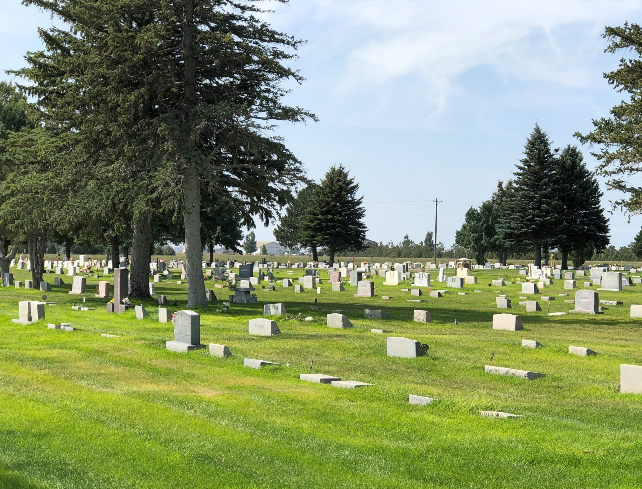
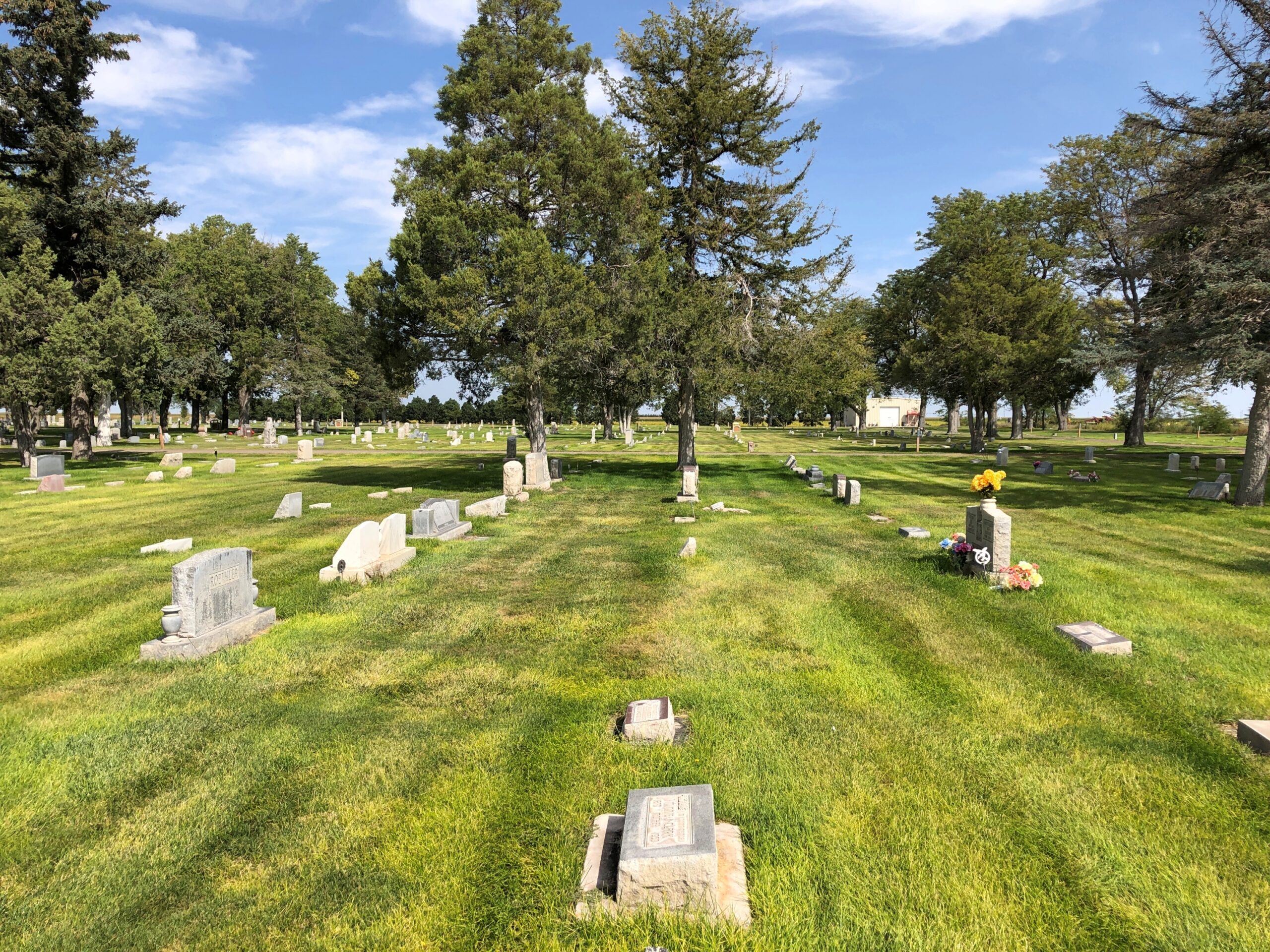
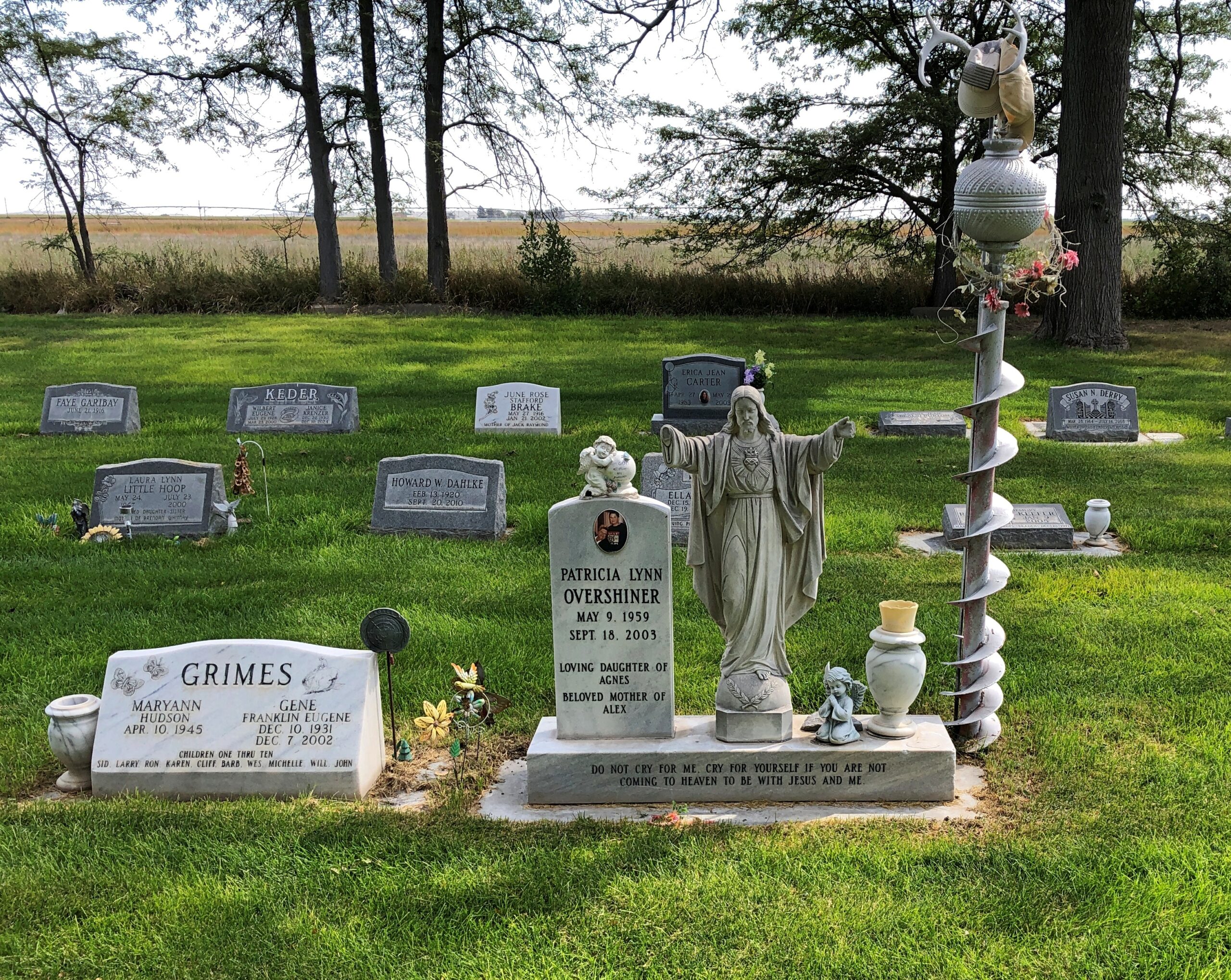
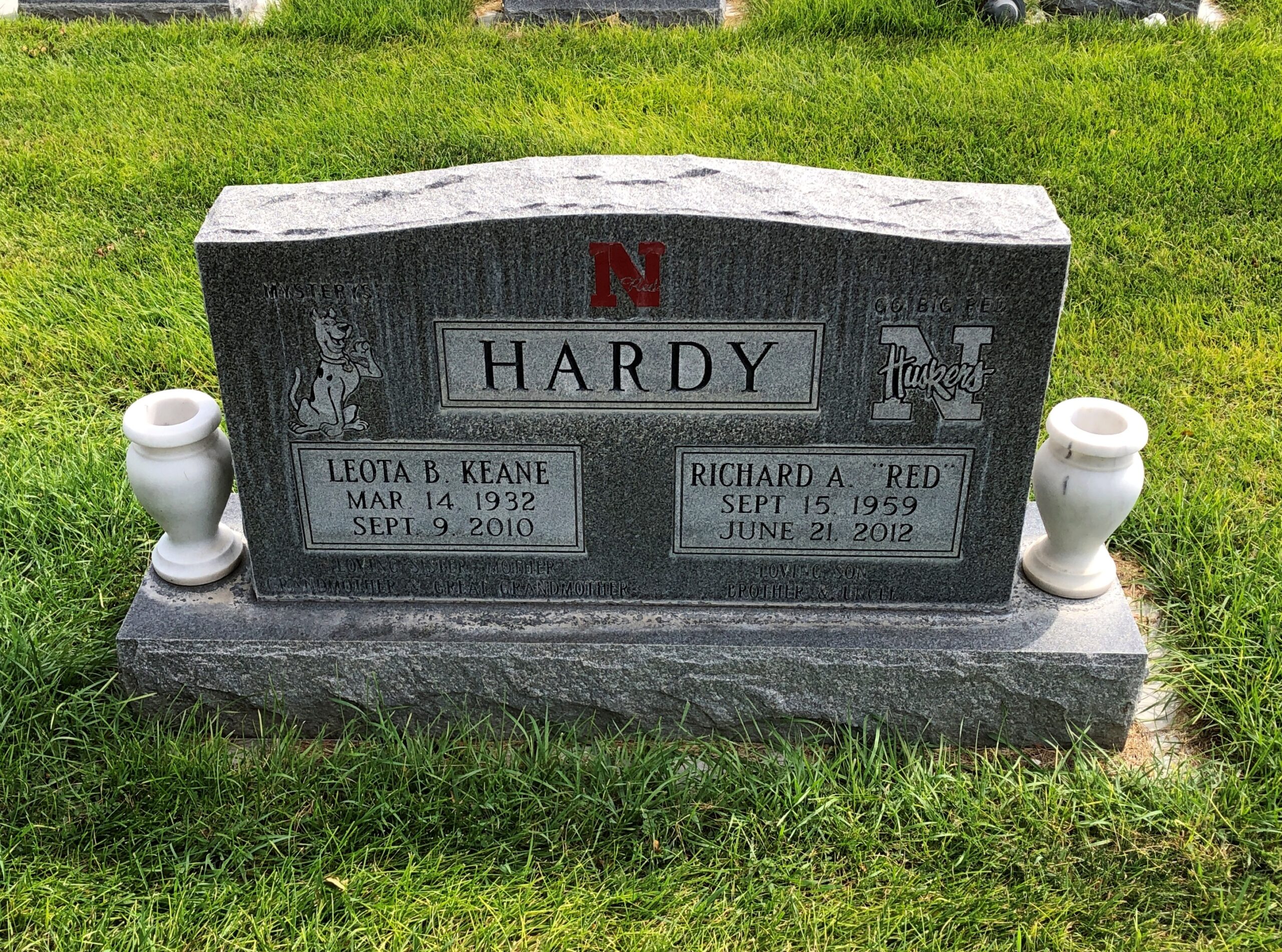
I didn’t come to town to learn all that, but I did later. Mainly I came to see Carhenge. The weather that day, September 7, was clear and very warm, which inspired some further looking around. First stop, Alliance Cemetery.
“Bury me in old Box Butte County.” There’s a western swing title in that.
Something I’d never seen on a gravestone before: Scooby-Doo.
Go figure. Maybe Richard “Red” Hardy is the one who wanted it on the stone, since he would have been almost 10 when that cartoon premiered (September 13, 1969), and that’s about the right age to get hooked on such a thing. Then again, I was eight — saw the first episode myself — and yet somehow I’ve remained immune to its charms.
As for the Huskers, I saw them on some other stones in this cemetery. Hardly the only example of fandom from the grave.
I’ve seen cowboy churches and I’ve seen cowboy graves.
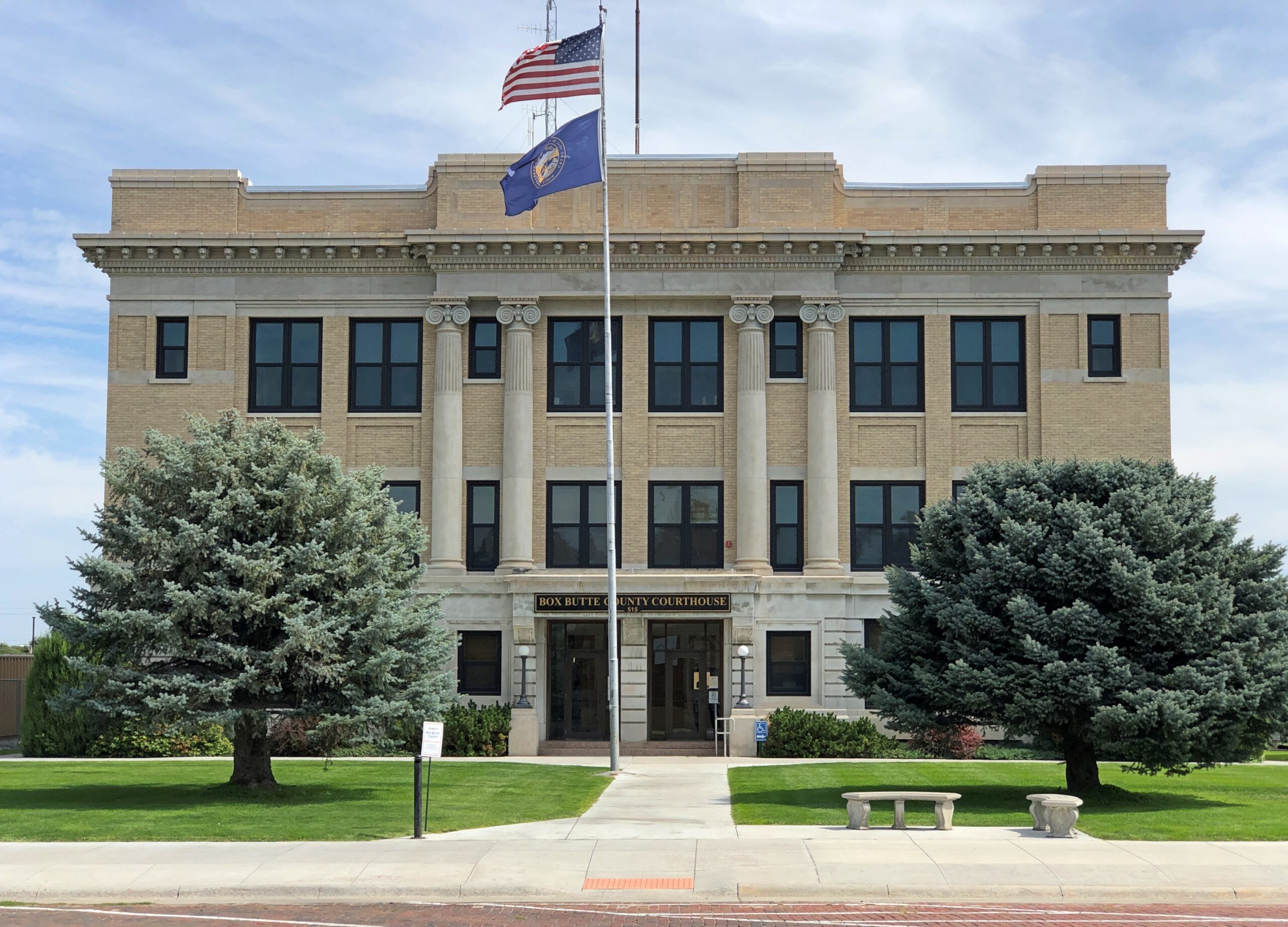
The cemetery is east of downtown Alliance, but not that far away. The Box Butte County Courthouse is on Box Butte Ave.
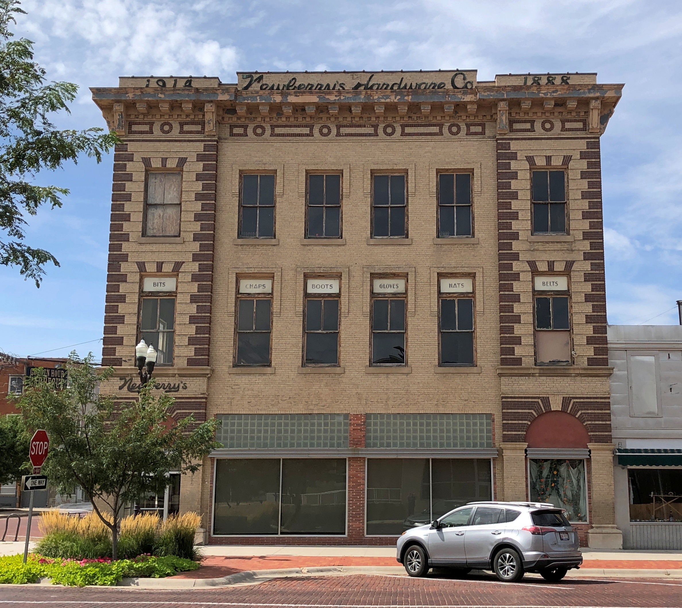
Along with a number of other vintage buildings. Newberry’s Hardware Co., once upon a time, which seems to be 1888 and then maybe an enlargement in 1914? Looks like it needs an occupant.
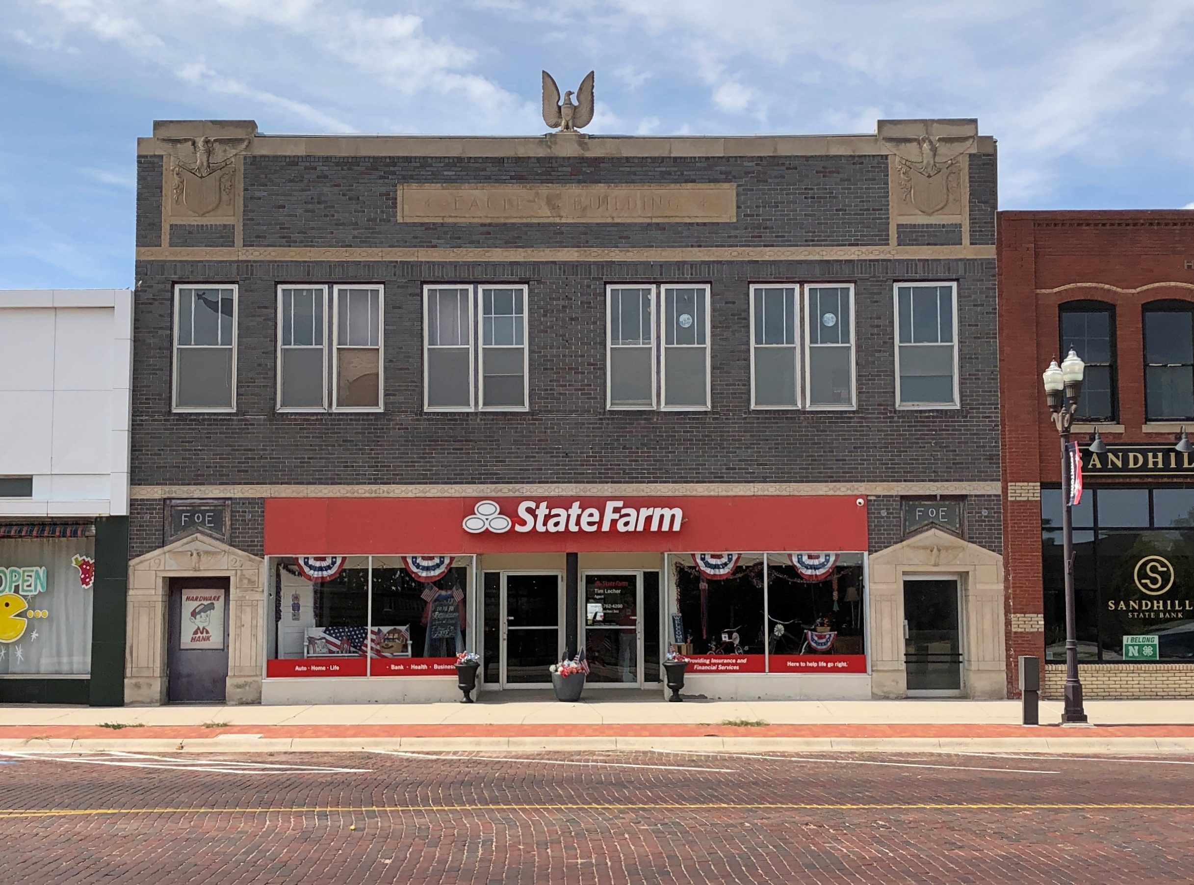
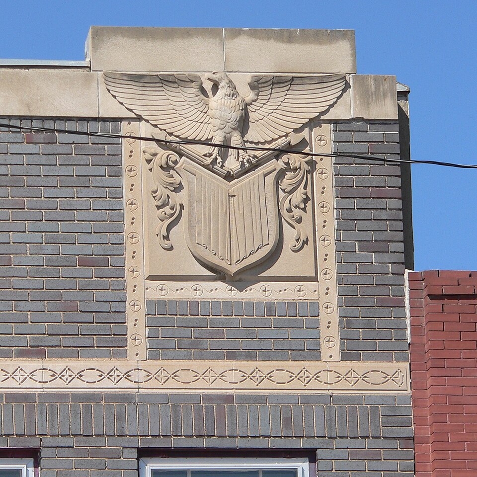
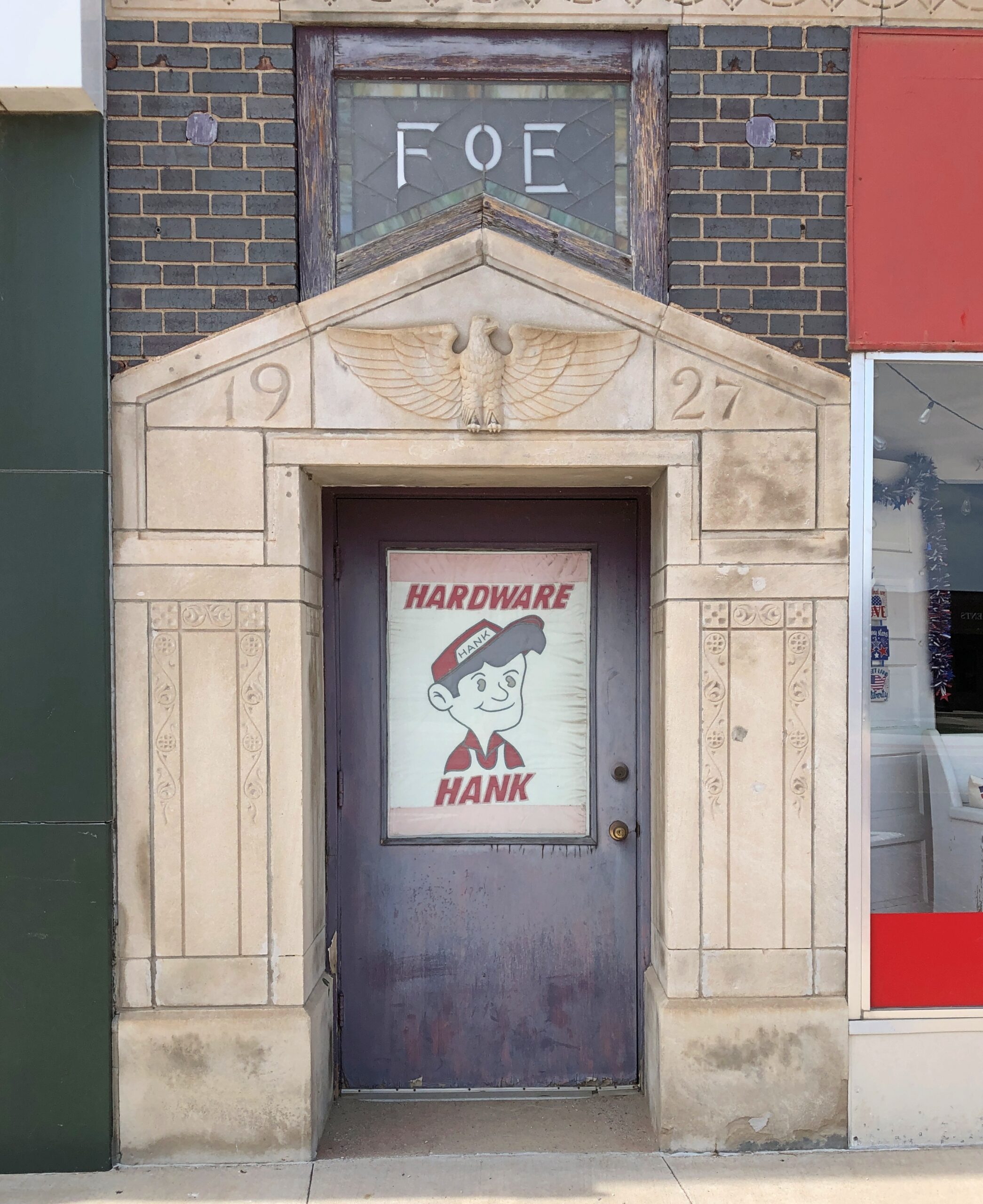
The 1927 Fraternal Order of Eagles Building.
Slacker that I am, I didn’t take many detail shots, but one of this particular building is available (public domain) that shows how seriously the local FOE took its eagles about 100 years ago.
Hardware Hank is a hardware cooperative. New to me, but that only means I need to get out more.
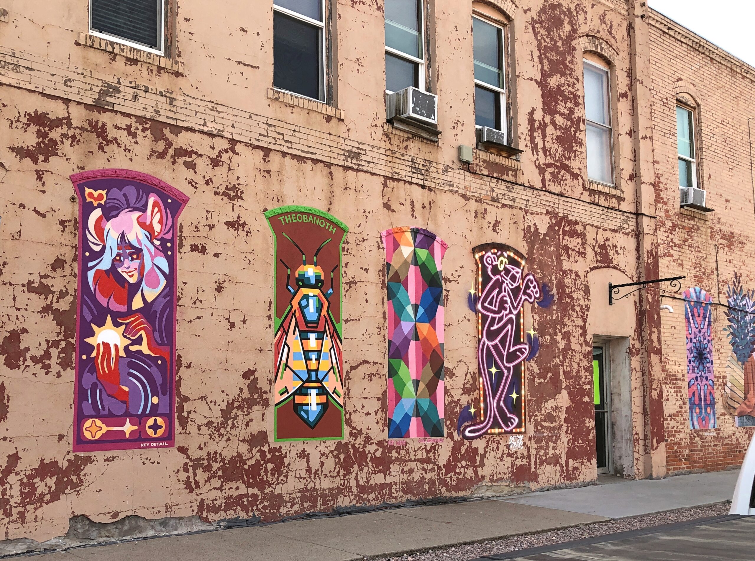
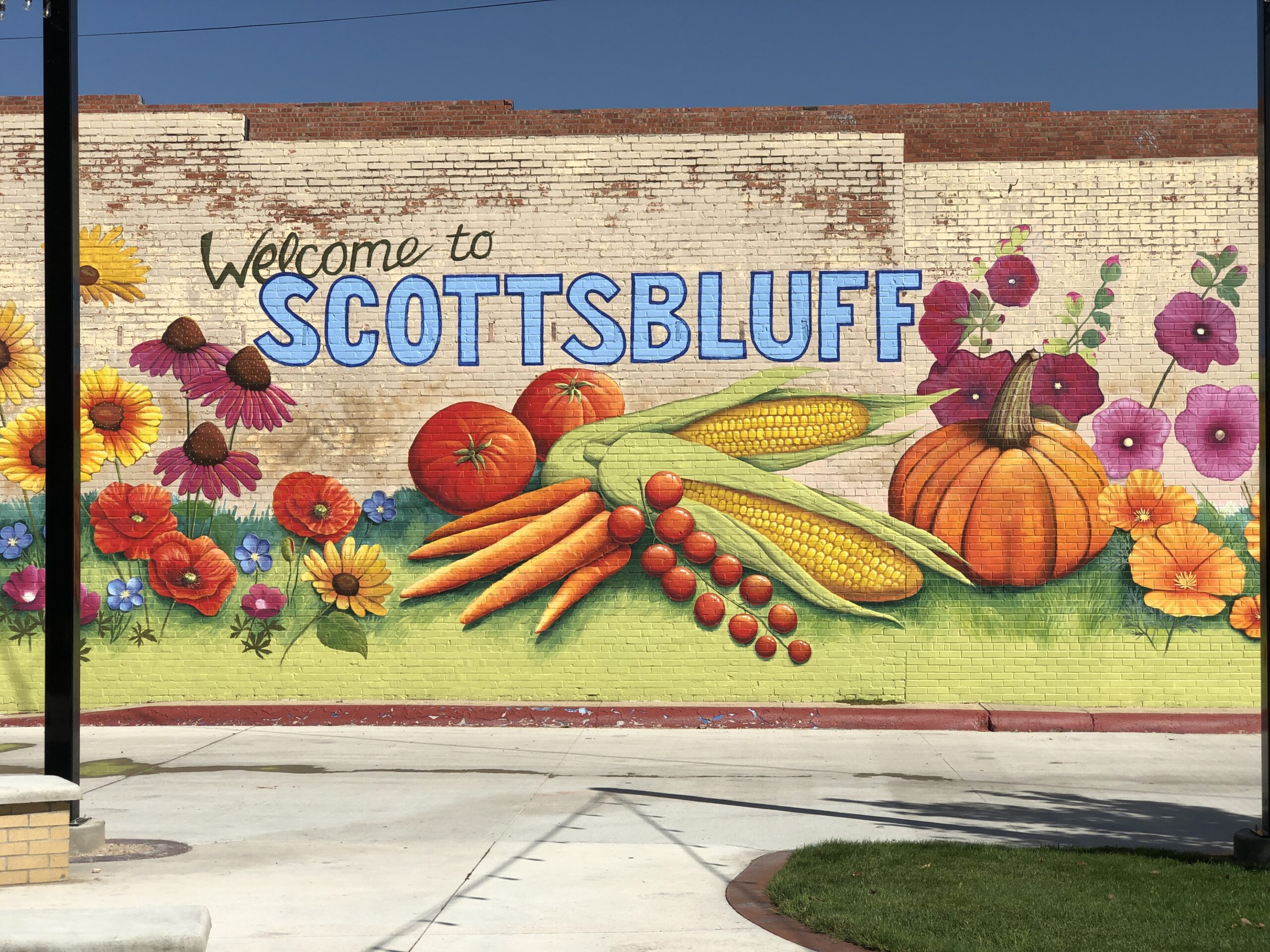
More murals.
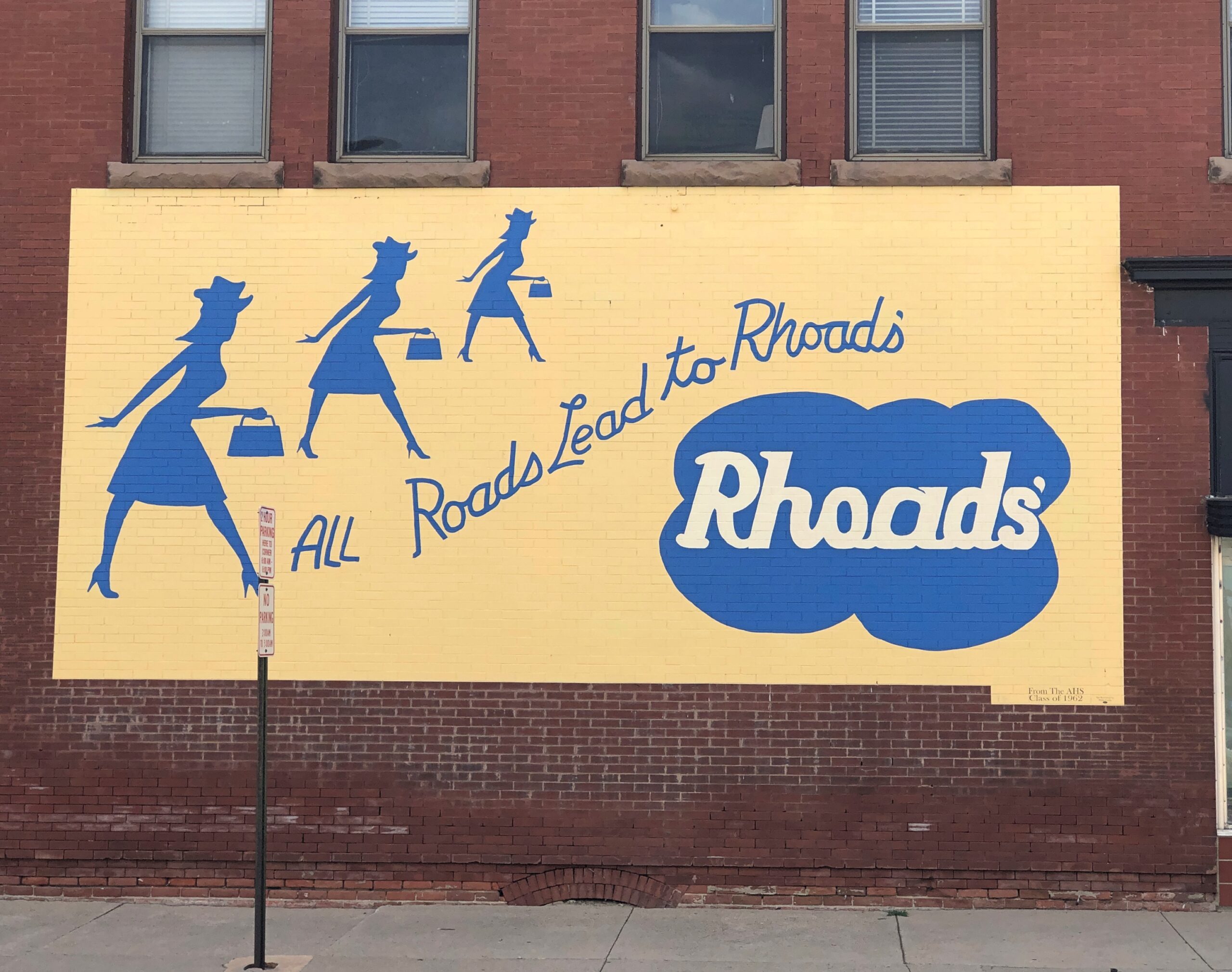
Rhoads’ was a local department store. Gone but not forgotten, at least if you read the mural, which looks refurbished recently. The tag at the bottom says it was a gift of the Alliance High School Class of 1962.
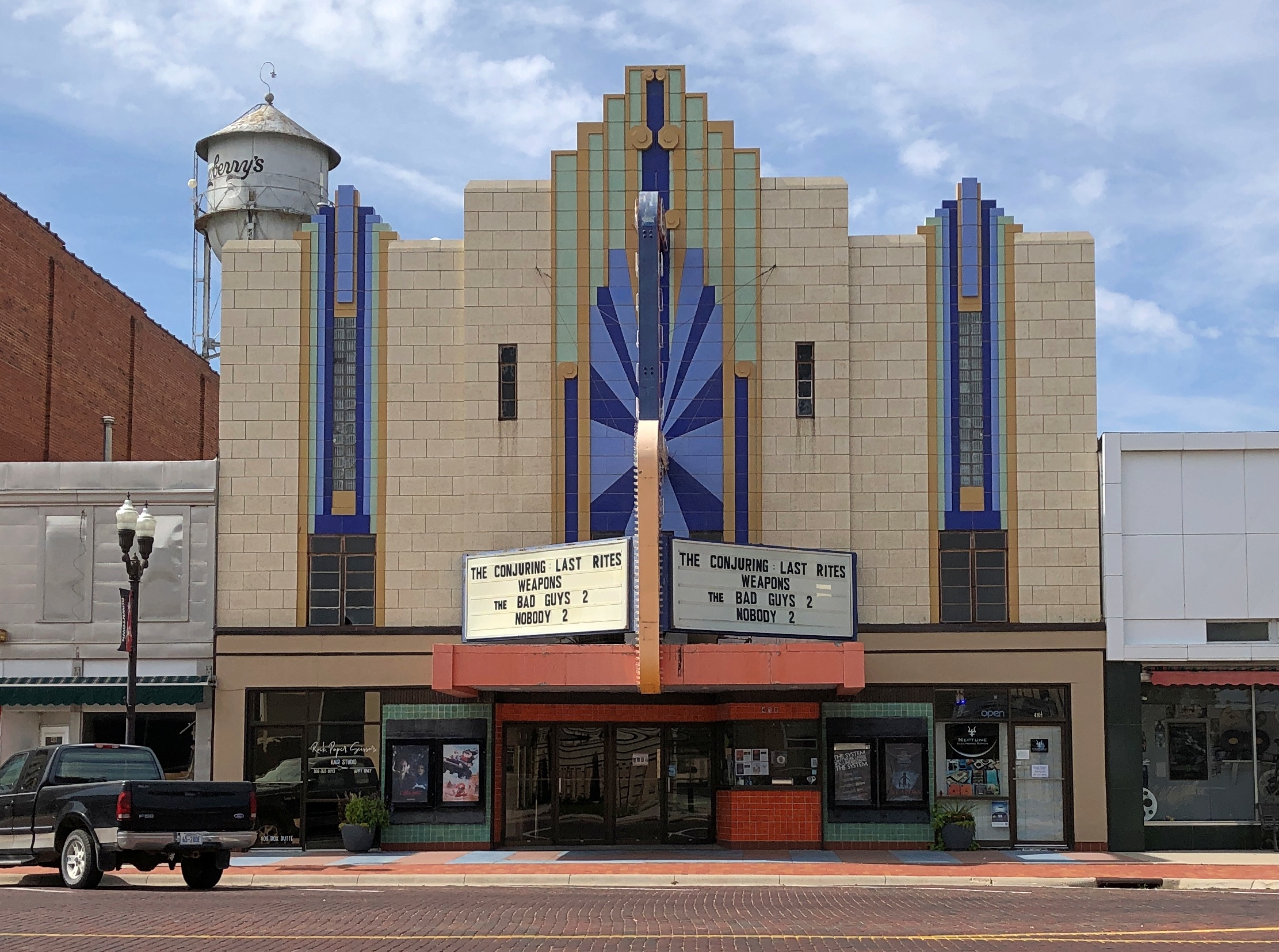
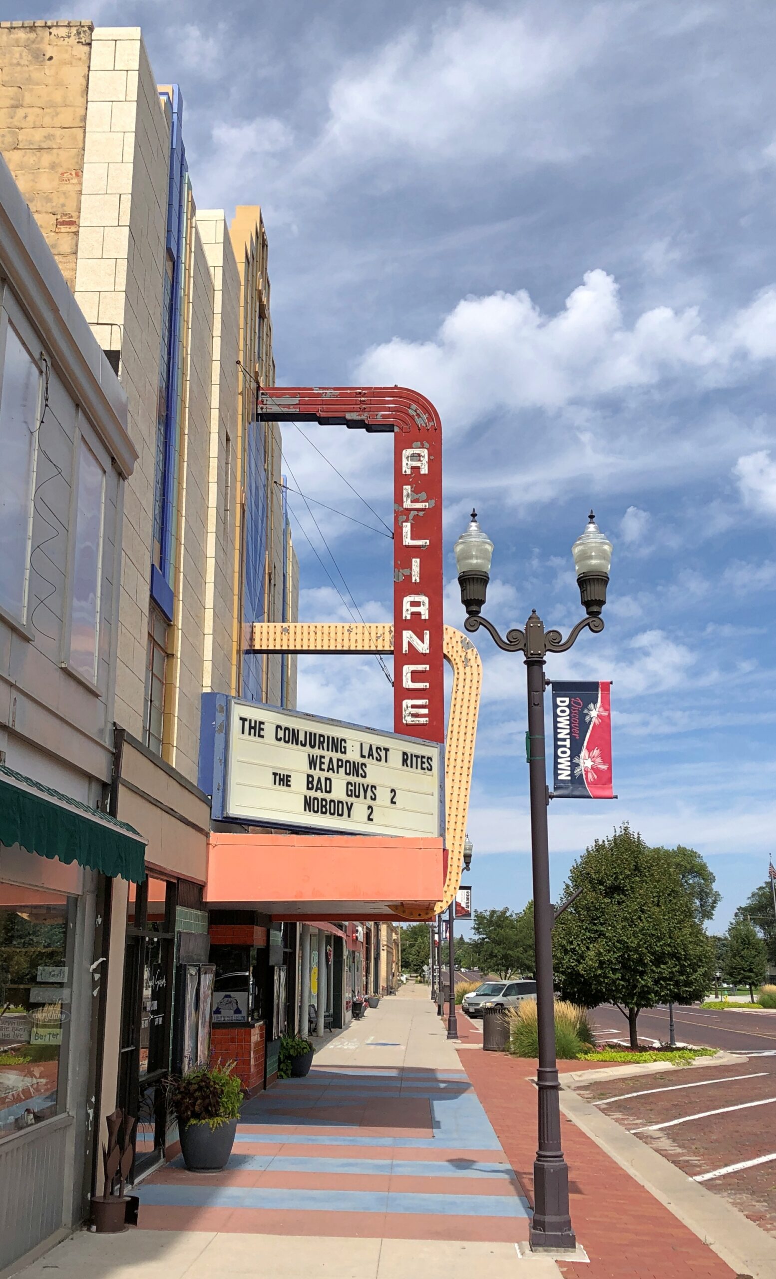
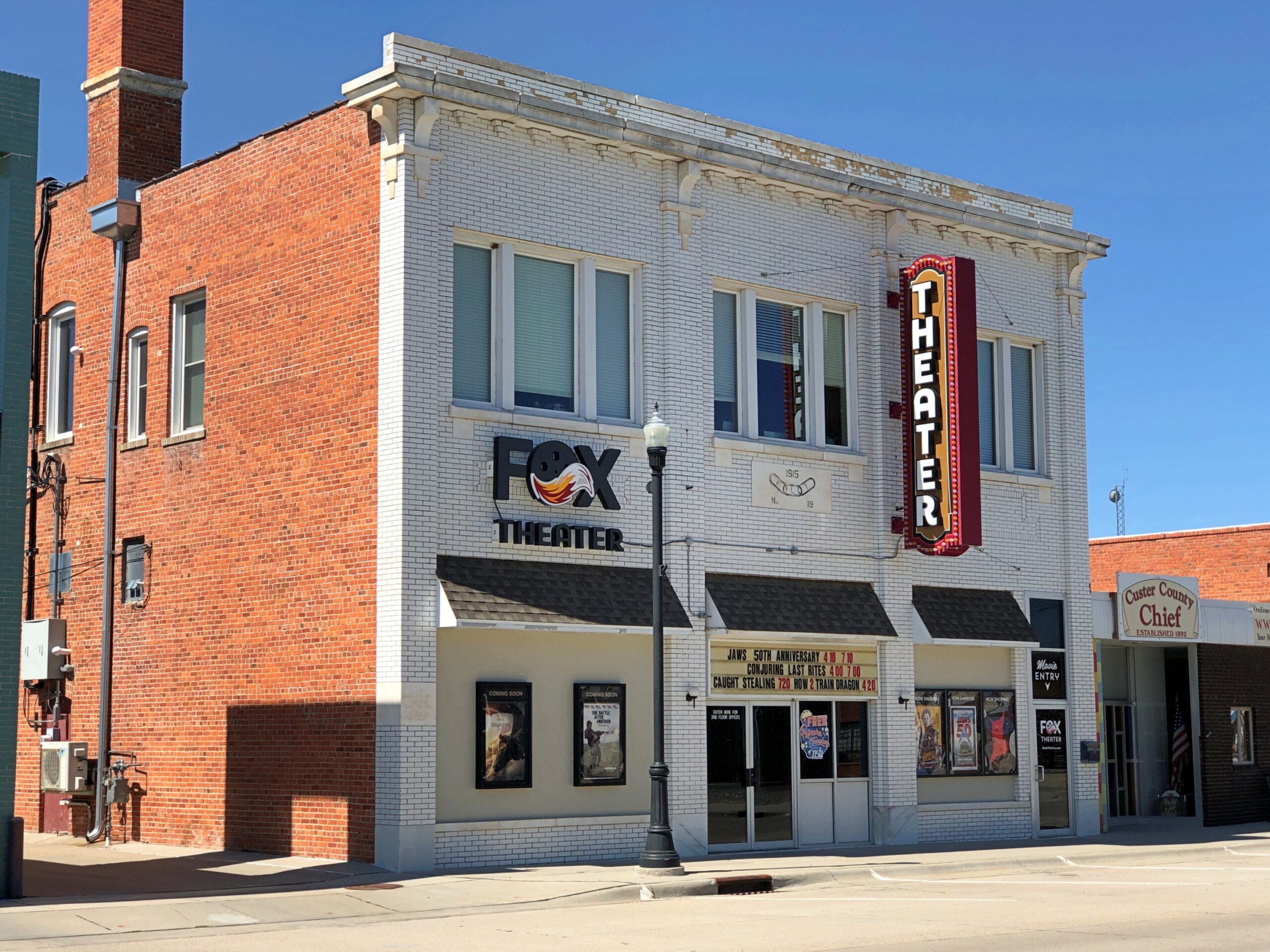
An art deco theater. Nice.
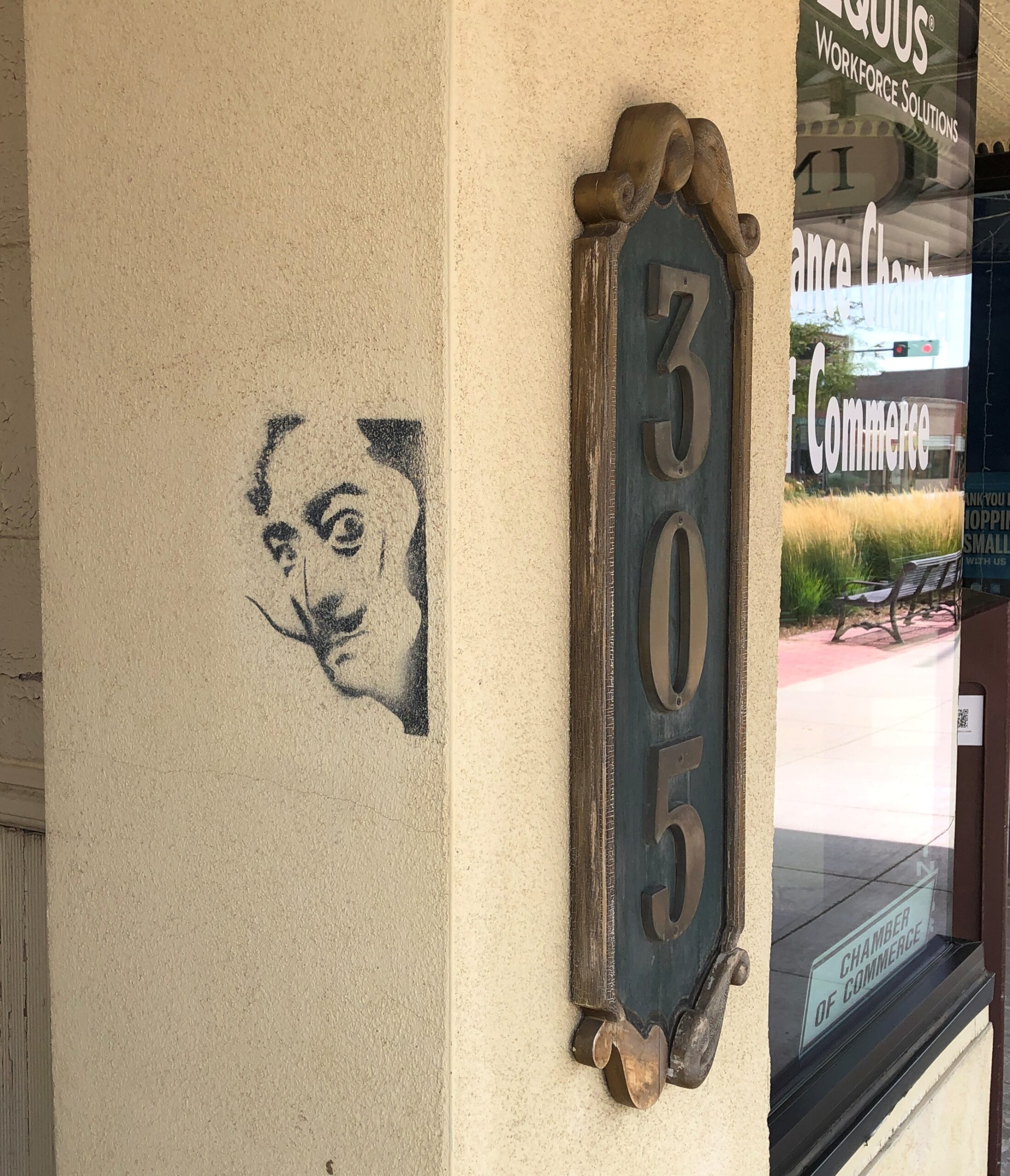
A really cheap way to advertise.
You never know when (and where) Dali will show up. Enigmatic fellow.
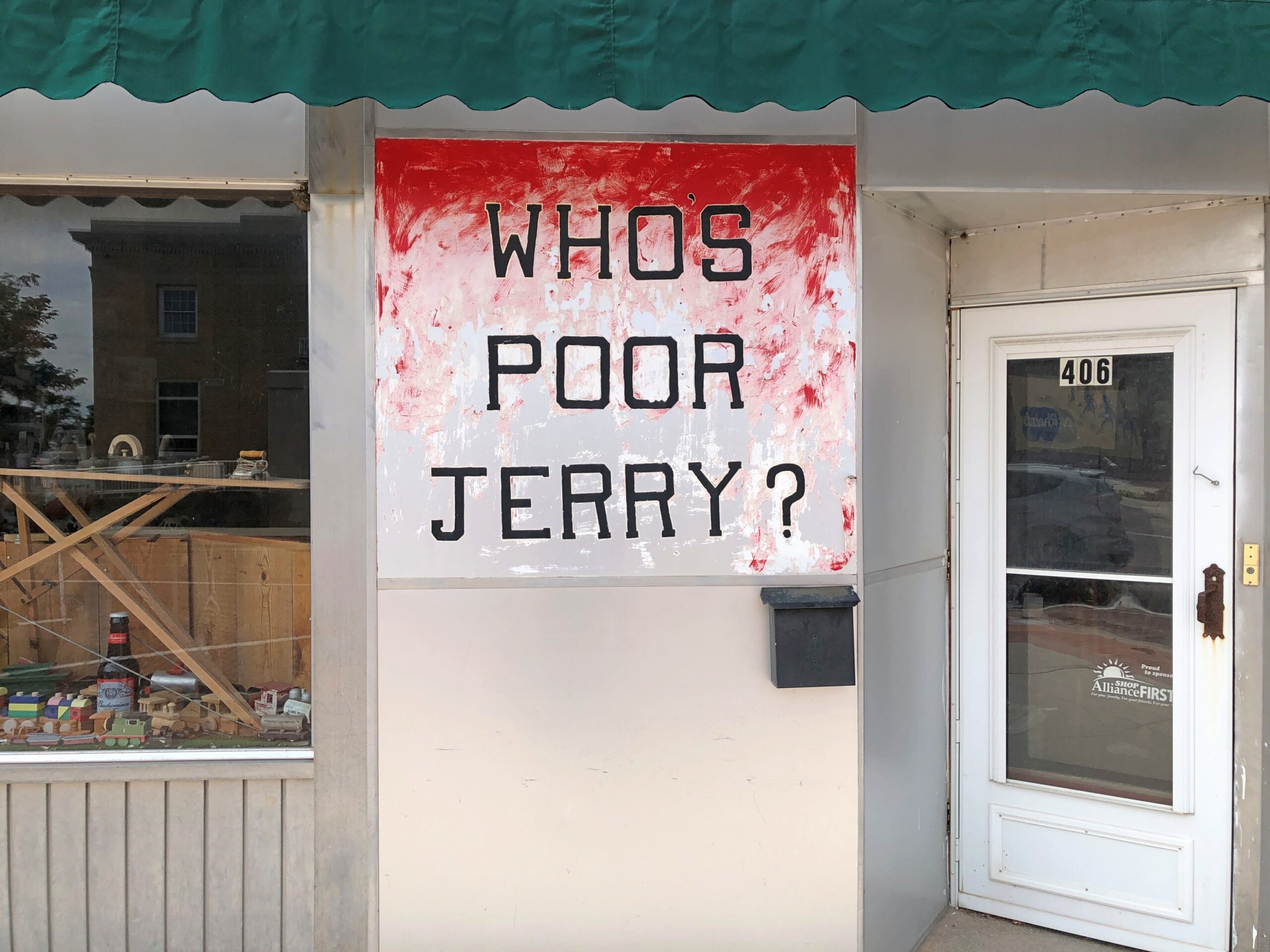
And who is poor Jerry?
Antique shop within? A simple desultory Google search doesn’t reveal much. Street View puts the sign’s appearance between 2007 and 2012 (Google didn’t come that much to Alliance.) Even the Library of Congress wants to know.
I found lunch in Alliance that day at Golden Hour Barbecue, which promised (and provided) Texas-style ‘cue. I enjoyed it thoroughly. Same league as Salt Lick, though a little expensive, considering how close the cattle are. Then again, everything seems expensive these days, and it was such a large lunch that I barely needed to eat that evening in my room in Scottsbluff, so that mitigated the upfront cost.
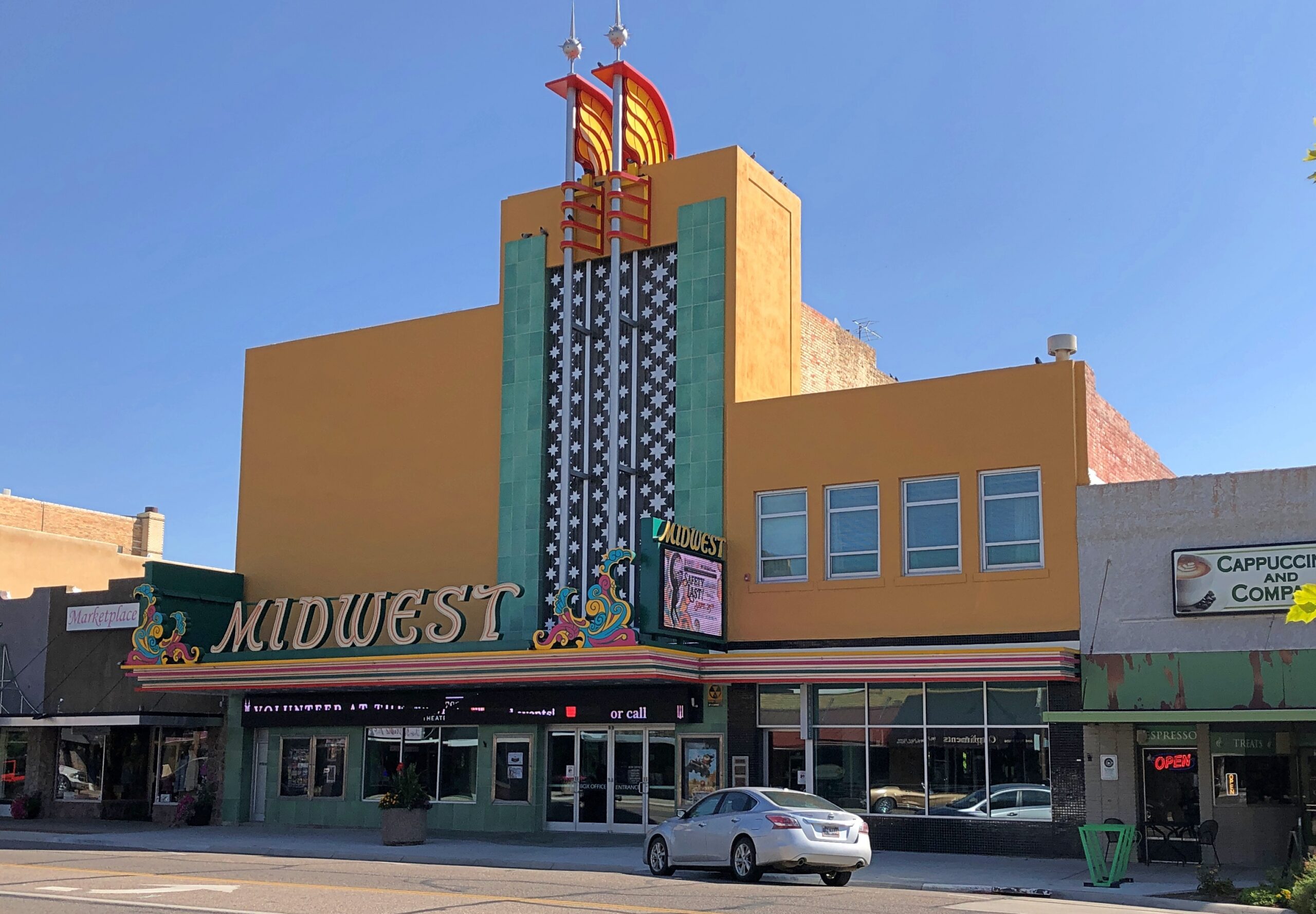
Before heading to the big rocks near Scottsbluff on the morning of the 8th, I took a look around that town as well.
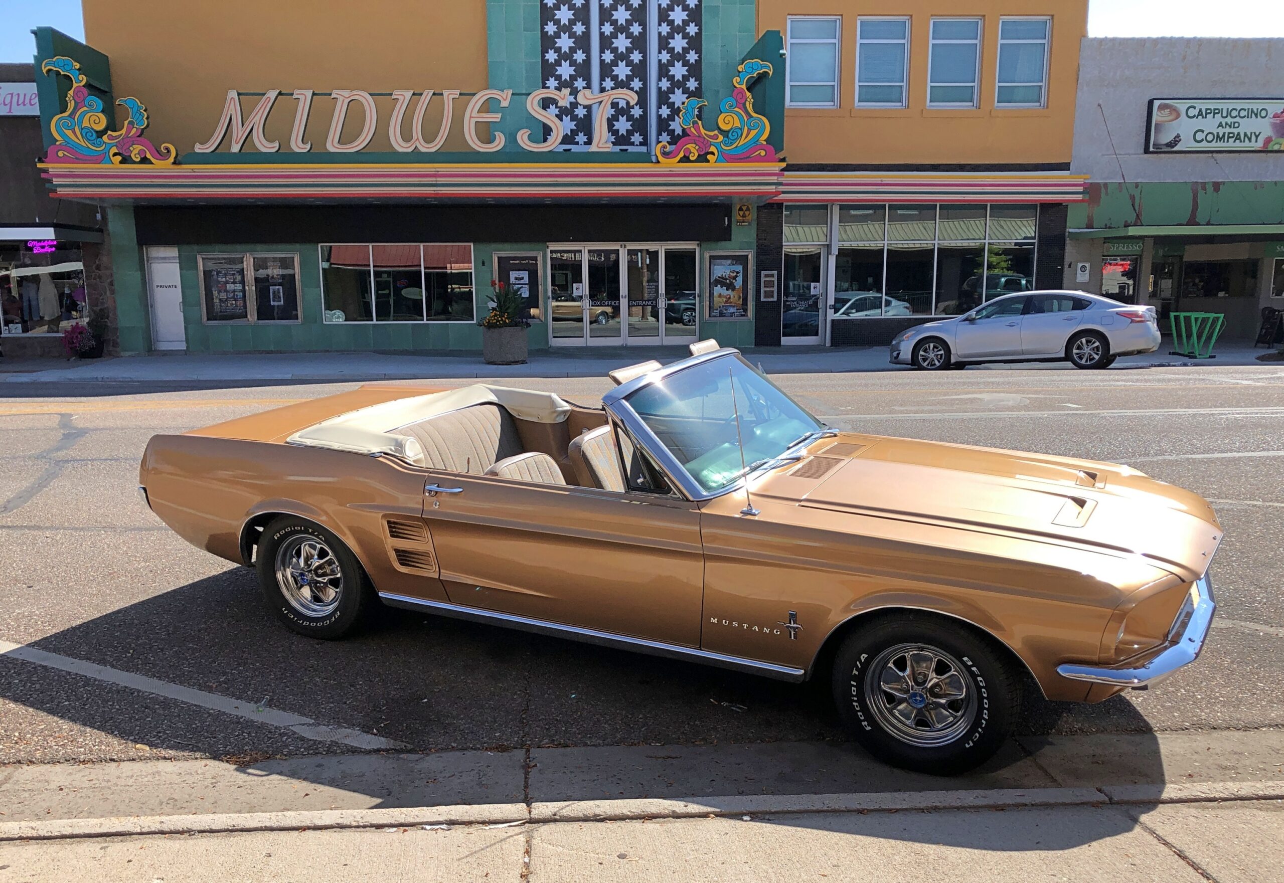
Can’t have too many art deco theaters. When I’ve done image searches for Scottsbluff, the Midwest theater comes up often as not.
A car to match. At least that morning.
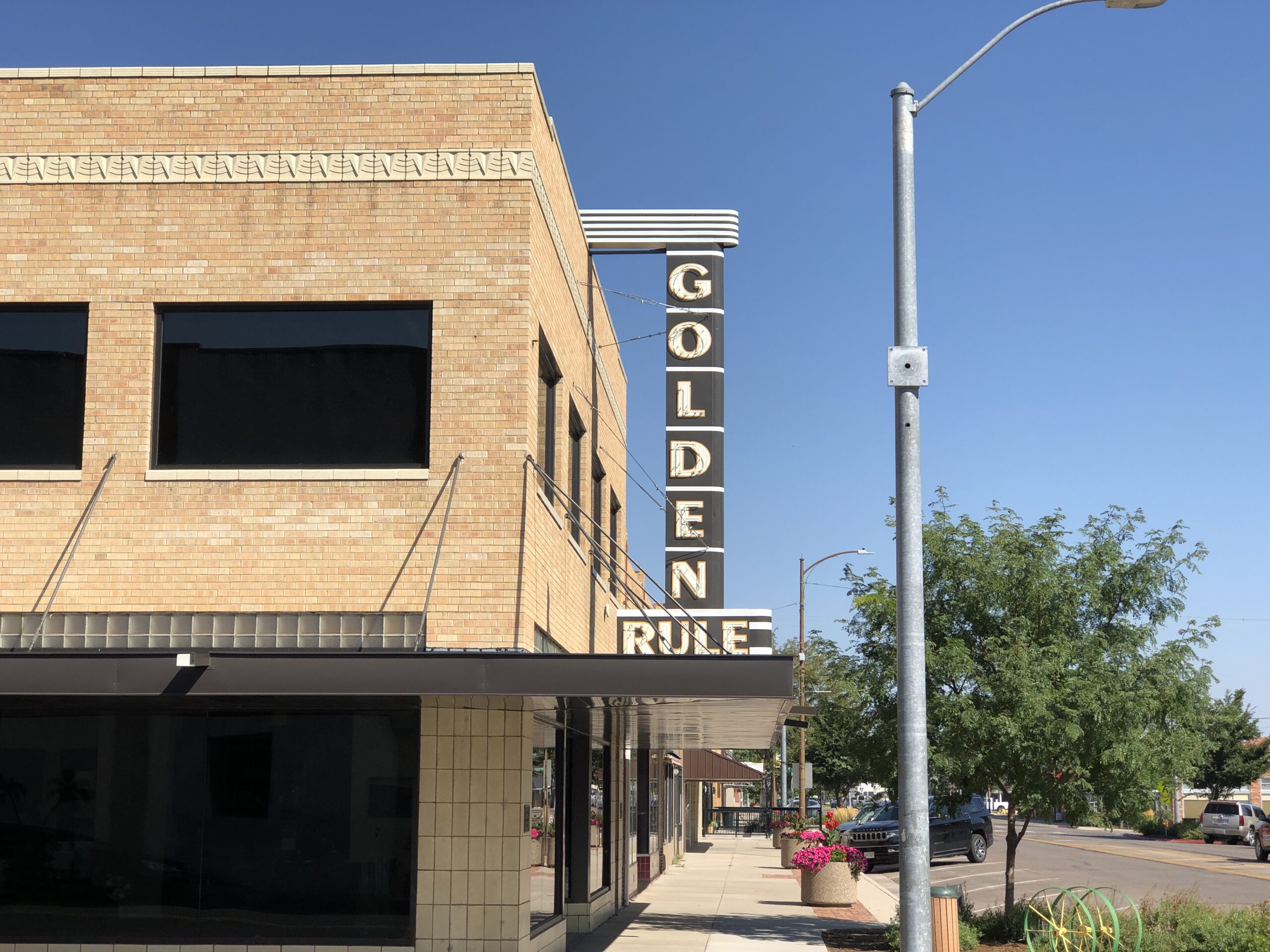
Another former small department store, now private offices.
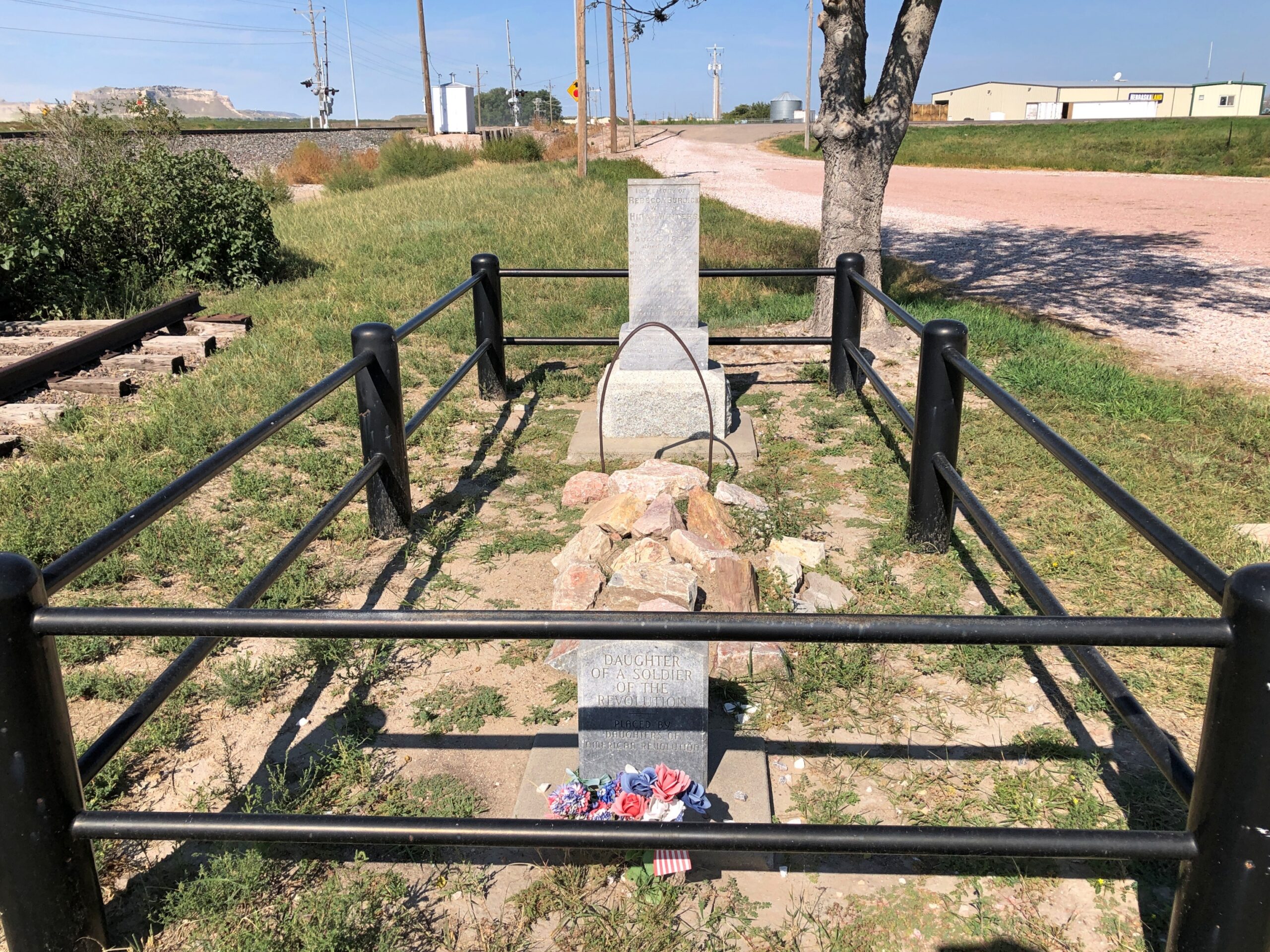
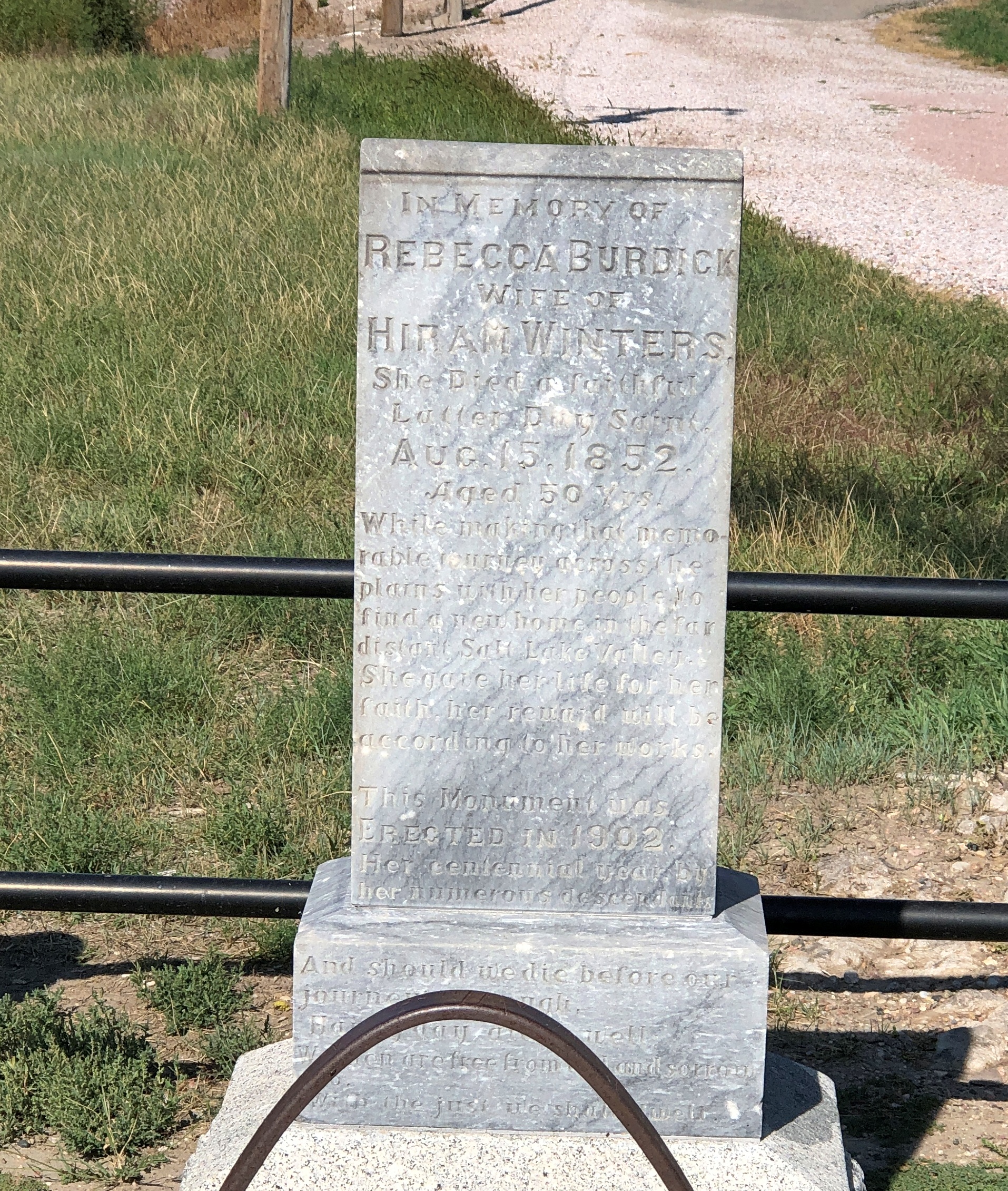
Just outside Scottsbluff is a single grave.
The grave of Rebecca Burdick Winters (d. 1852) She died a faithful Latter-Day Saint, her stone says, on her way to Utah. Officially, it is Rebecca Winters Memorial Park.
“Seven miles northeast of Scotts Bluff National Monument lies a solitary grave,” says Find a Grave. “This site marks the final resting place of Rebecca Winters, who died of cholera on August 15, 1852. Rebecca was only one of thousands of people who succumbed to disease as they made their way west on the overland trails, but her grave is one of only a few that remains identifiable today.”
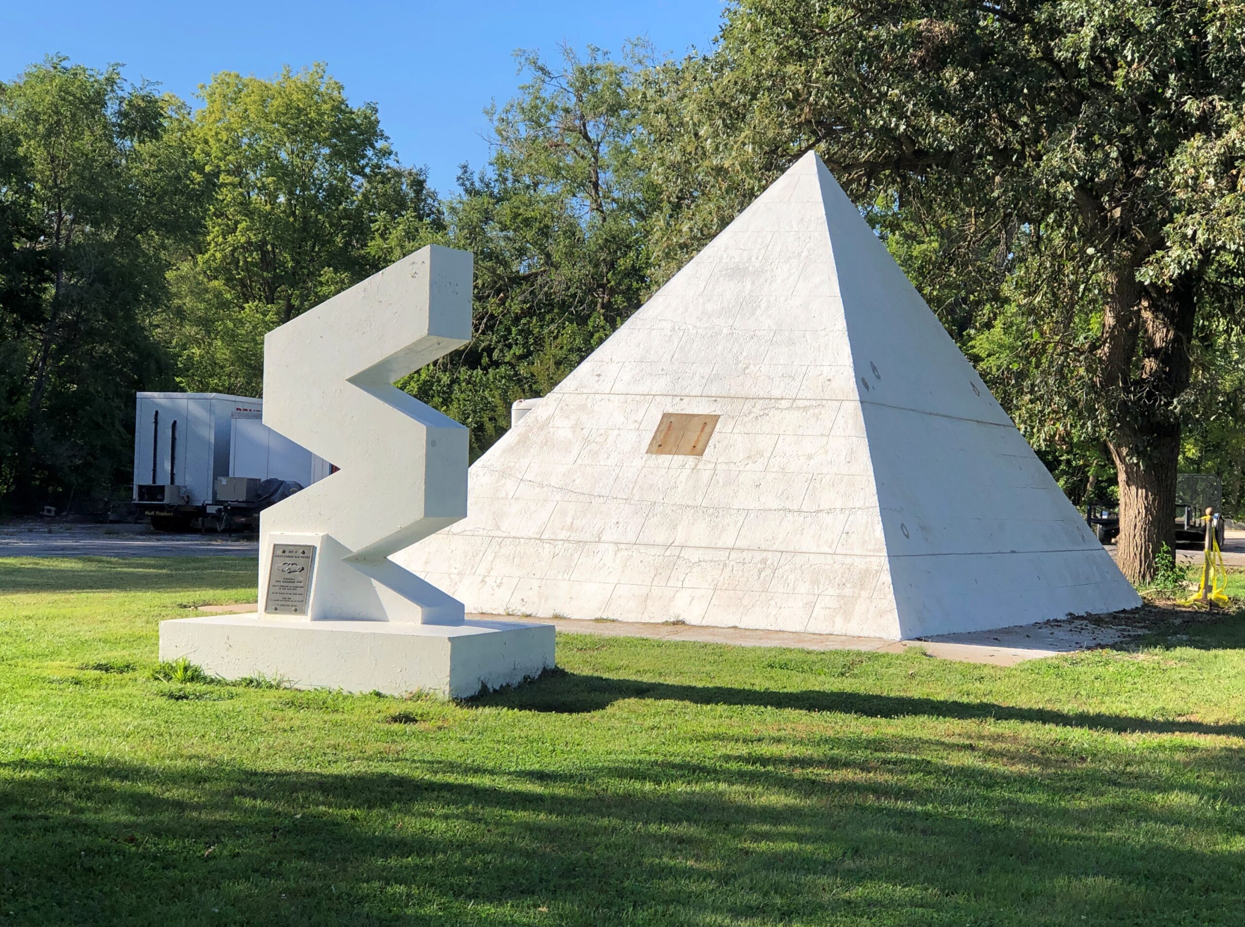
There I was, in Seward, Nebraska, parked on a side street lined with single-family houses. Interrupting the pattern of houses was a large open space, with buildings behind it — a large house, and maybe a workshop. In the open space, which was a green lawn, stood a sigma-shaped structure, and behind that, a white pyramid.
Both taller than a grown man. A plaque was fixed to the sigma. From the point of view of the time capsule, the sigma shape could be a 3. So – third millennium?
World’s Largest Time Capsule.
I wasn’t quite sure what to make of that claim. The world’s largest time capsule would surely be the one entombed in 1939 at the New York World’s Fair for an opening in the year 6939, an exercise in official optimism if I’ve ever heard of one. Wouldn’t it? No. It grew in my memory, but was actually quite small. The Crypt of Civilization instead might be a candidate for largest.
Anyway, there’s no doubt Seward’s is a whopper among time capsules.
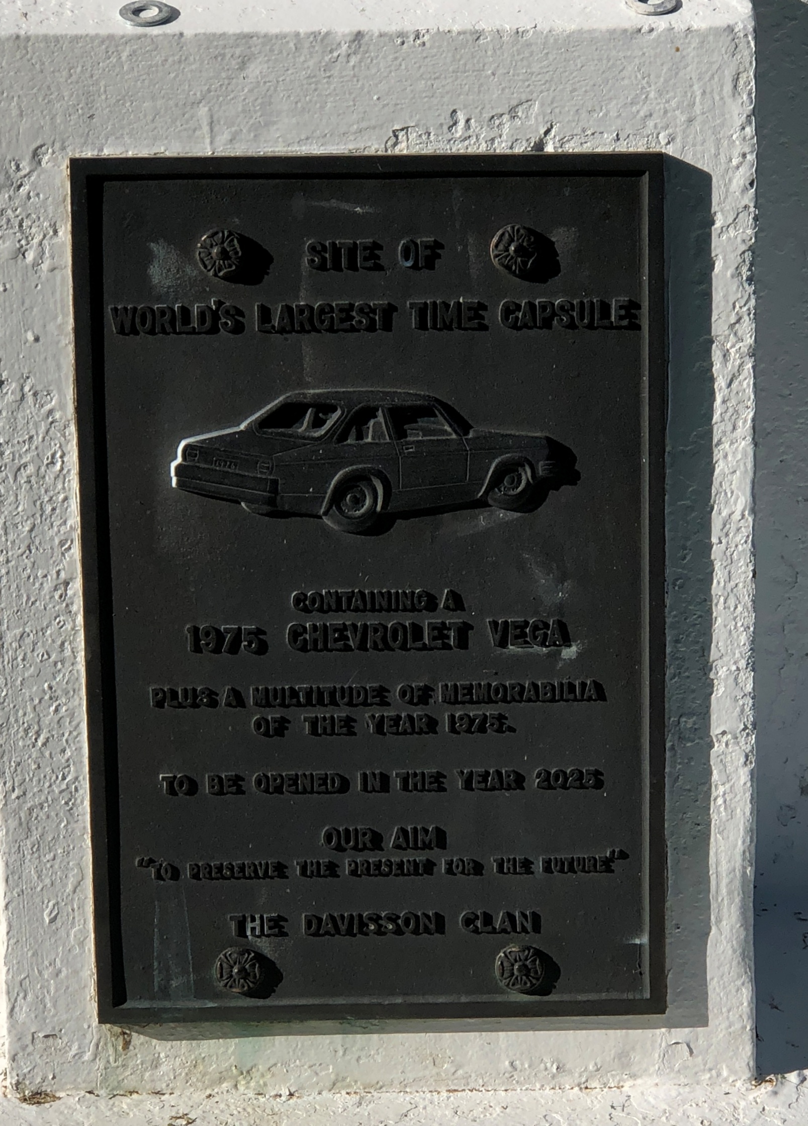
The capsule, buried by Seward resident Harold Davisson, had more modest ambitions, time-wise, than the NY time capsule: only 50 years. Looking at the plaque, I wondered if the opening, promised for this year, was going to happen.
Later I learned that it had already happened, earlier in the summer. NBC reported that the opening revealed “letters, pet rocks, artwork, a groovy teal suit and even a yellow Chevy Vega.” A video of the opening of the time capsule, and the removal of its contents, has been posted to Facebook. The opening including removal of the car, by means of an enormous wench. News reports suggested that Vega was going to be reconditioned and run during the town’s bang-up Fourth of July festivities. Hope so.
The pyramid lid had been put back on. If you look closely, you can see the line marking the bottom of the lid. Put it back on expertly, since you have to look closely to see there was a separation. So I missed the grand opening by a few weeks. As they say in those parts of Nebraska, c’est la vie. Hard to attend an event you’ve never heard of, though not impossible, as I found out years ago when I happened across Northalstead Market Days one summer day. That one was an eye-opener.
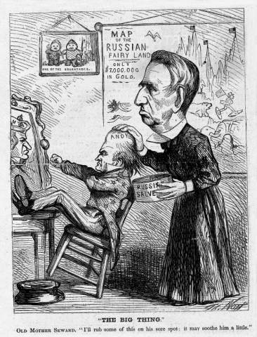
The Big Thing, Thomas Nast, 1867
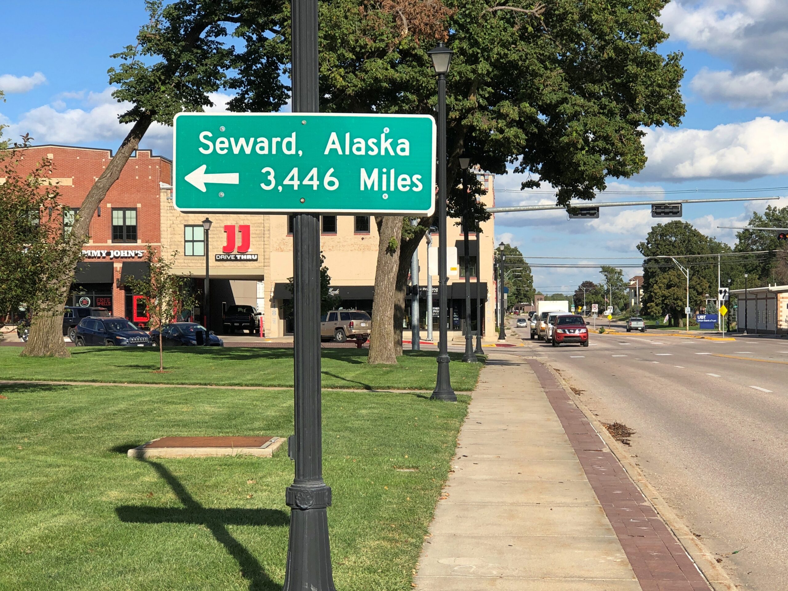
Seward honors the Seward of Alaska purchase fame, though if pressed I’d bet most Americans have sort of maybe heard of him, but don’t remember anything about him, even though he (likely) still gets passing mentions in school.
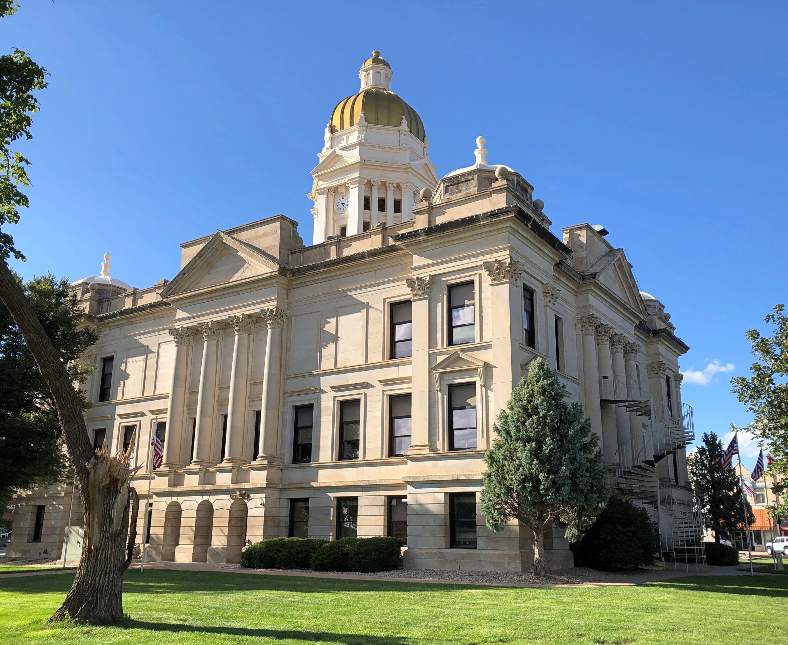
Seward, seat of Seward County, there in the populous (for Nebraska) southeast corner of the state, is close to Lincoln – fitting, isn’t it? – and I-70.
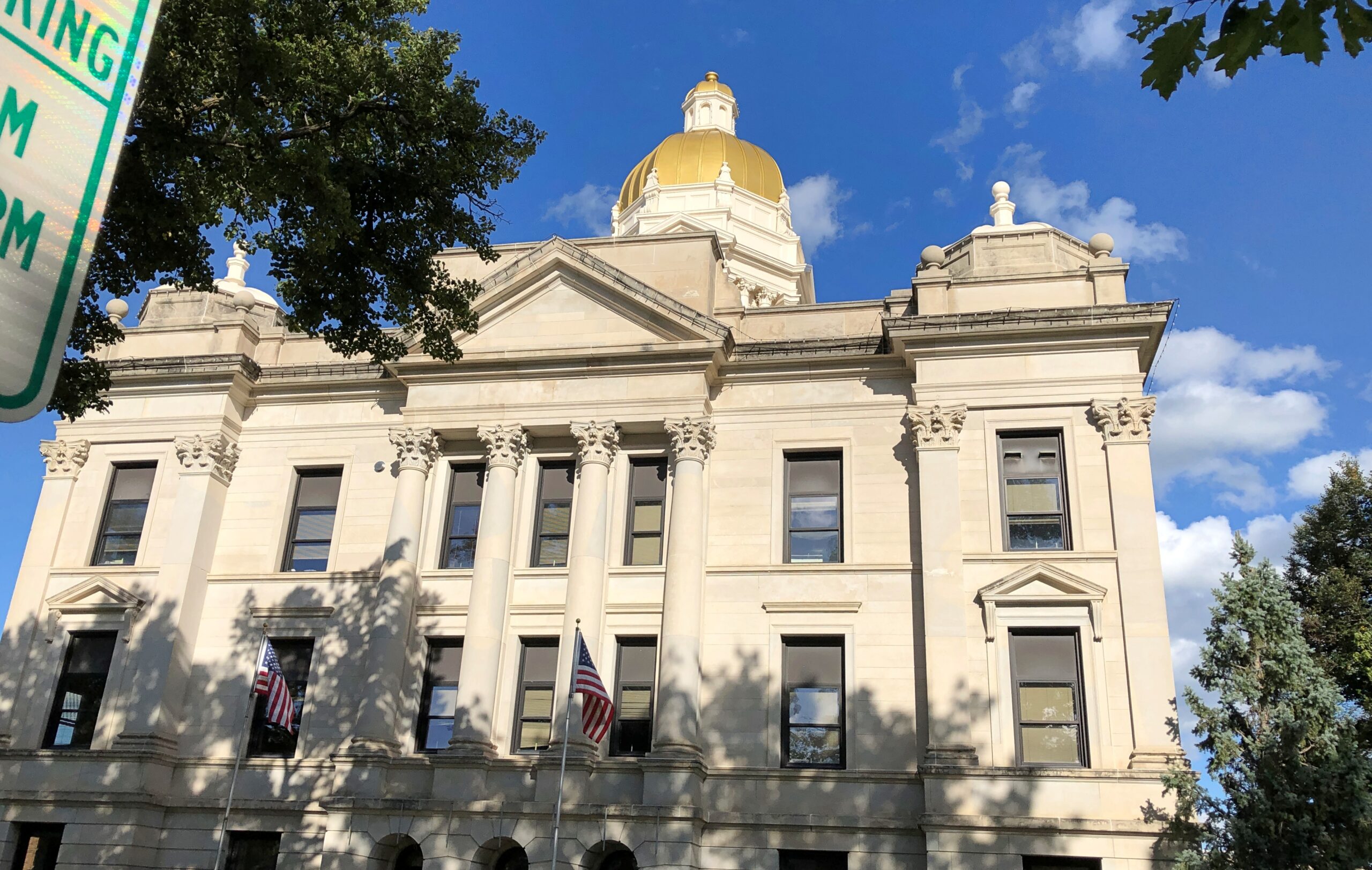
Seward County built itself a handsome courthouse, once upon a time. Classical Revival when the getting was good for that style, in the first decade of the 20th century. It was a popular style around this part of Nebraska at the time, with the National Register of Historic Places Registration Form telling us there are 18 buildings like it still extant in Nebraska. Architect George Berlinghof (d. 1944) designed a lot of them, including this one.
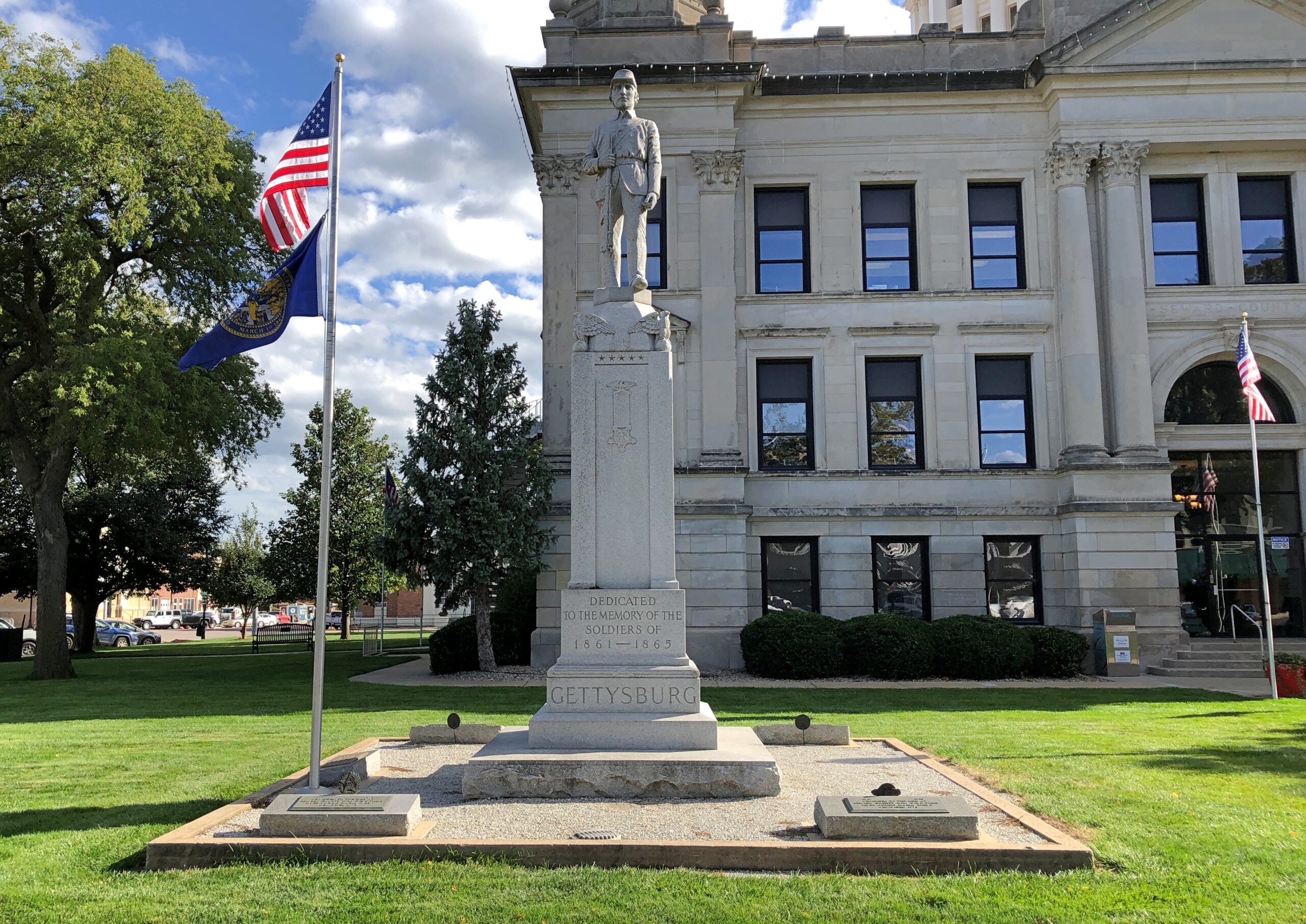
On the grounds, Seward in bronze. I know there are other statues of Sec. Seward, but not that many.
Sporting a cape. How many bronze figures honored with public statues are in capes? More than I know, probably. The Maid of Orleans in New Orleans comes to mind; she’s wearing a cape, over that armor.
A plaque identifies the artists, brother and sister David and Judith Rubin, and the vintage, recent. Alaska commissioned them to do one of Seward for the 150th anniversary (2017) of the sale of Alaska to the United States. Interested parties in Seward, Nebraska, wanted one for the their town, and so commissioned another one.
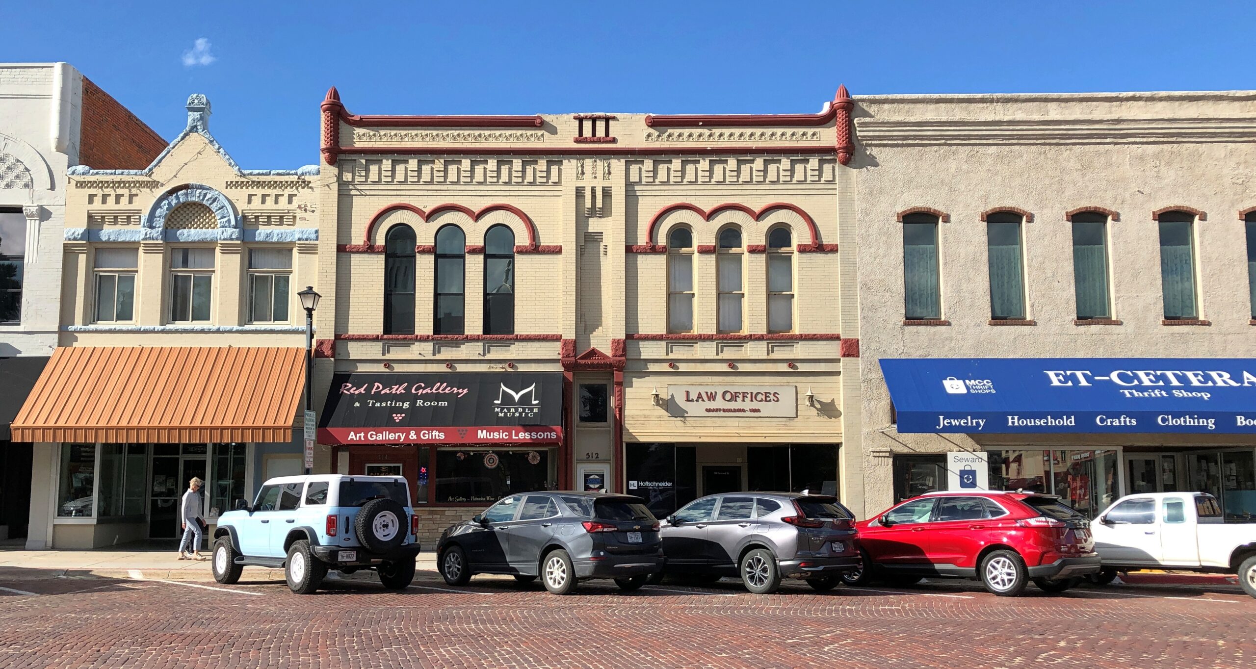
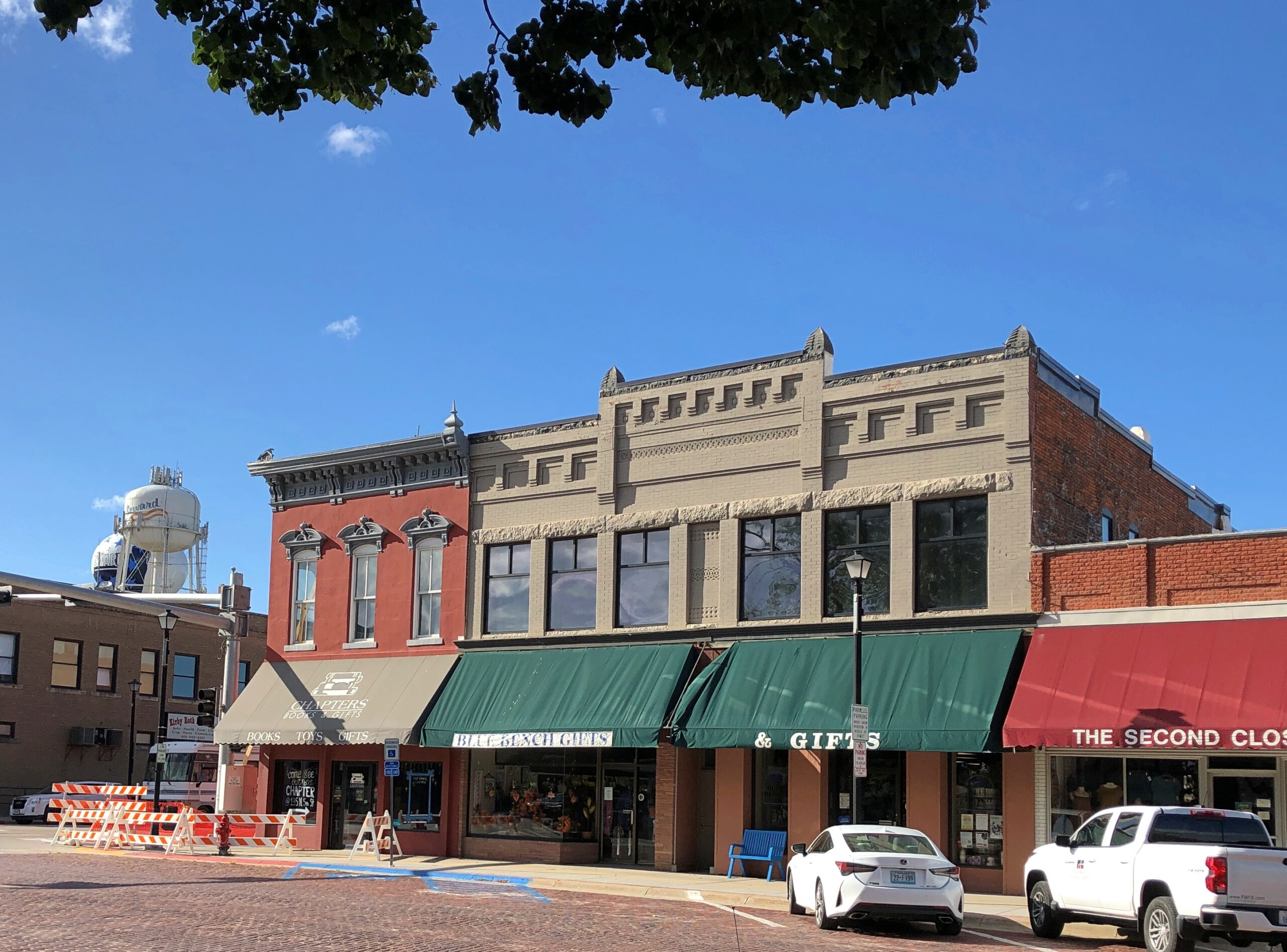
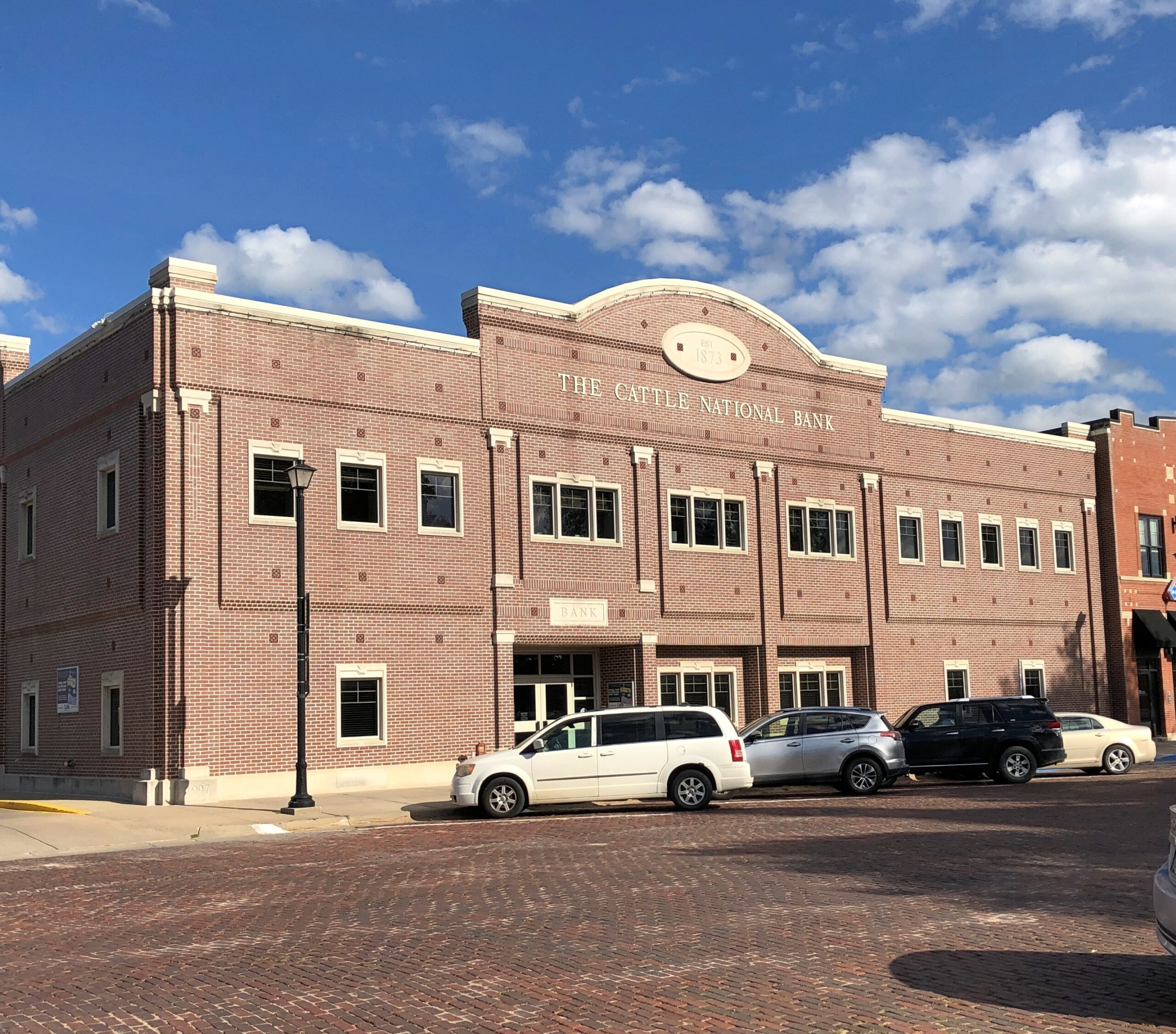
The square is right handsome, too.
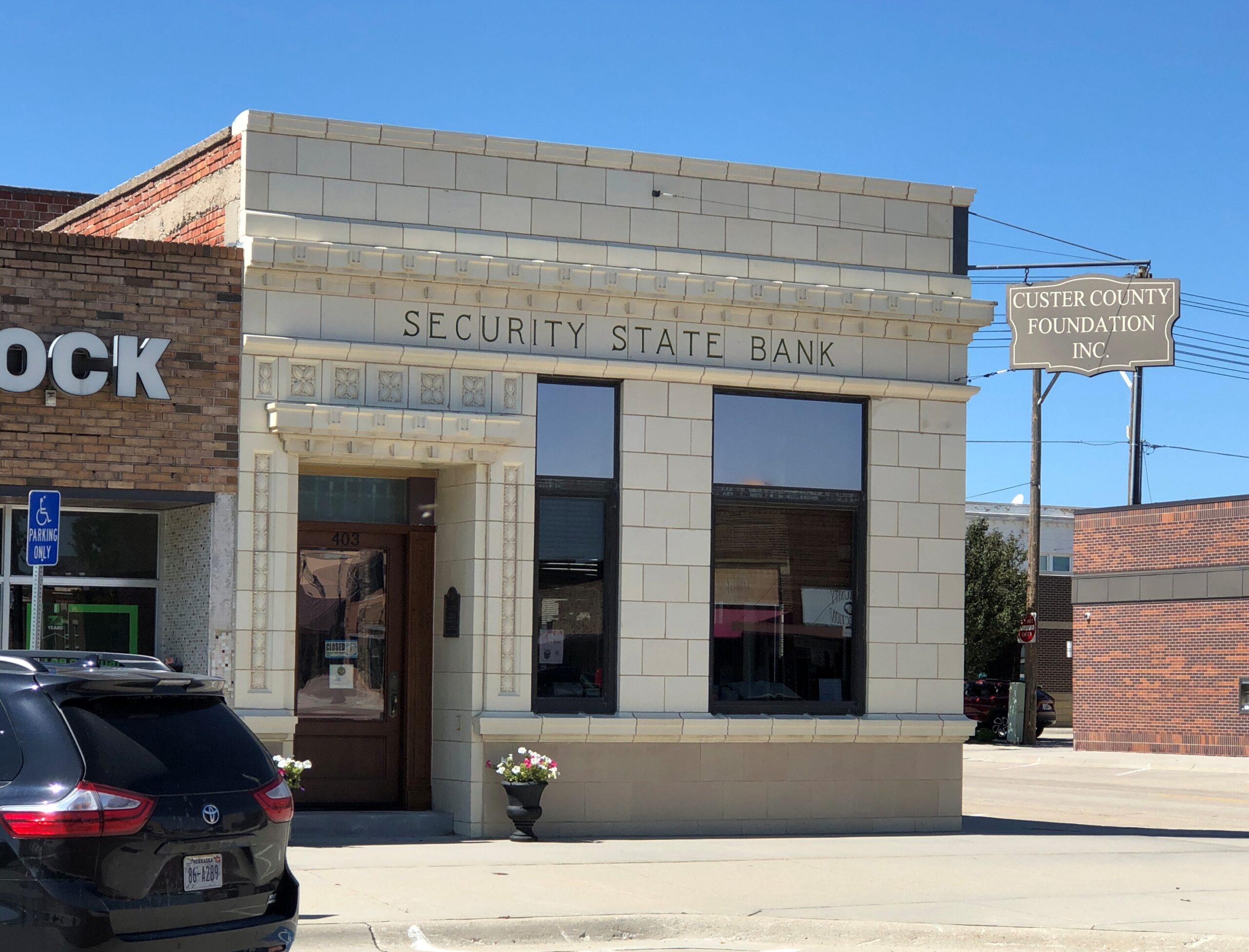
Cattle National Bank. Reminds me of Gary Larson, somehow. I’m glad to report that it’s one of four locations for Cattle National Bank & Trust, a community bank owned by the Cattle family. Has been since 1881. If I lived in Seward, I’d bank there just for the name.
One more thing about Seward. This isn’t the one further north.
Seward was a flyby on September 5 on the way to Grand Island, Nebraska, that evening, which would be the jumping off point for my drive through the Sandhills. The highlight of my short stay in Grand Island wasn’t the false alarm that got us all out of our rooms at the motel around 10, thrilling as that was, but the next morning, on my way out of town.
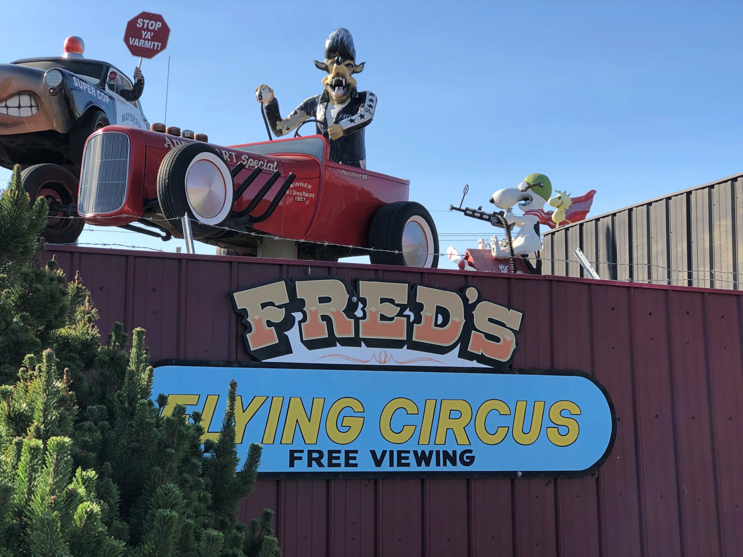
I’ll give credit where it’s due: I found Fred’s Flying Circus on Google Maps. Attaboy, algorithm.
The work of body shop proprietor Fred Schritt (d. 2016), on his place of business, with the shop now run by his daughter and son-in-law. An informal sort of memorial to the old man, I hope they believe. One of the more cheerful memorials you’ll see.
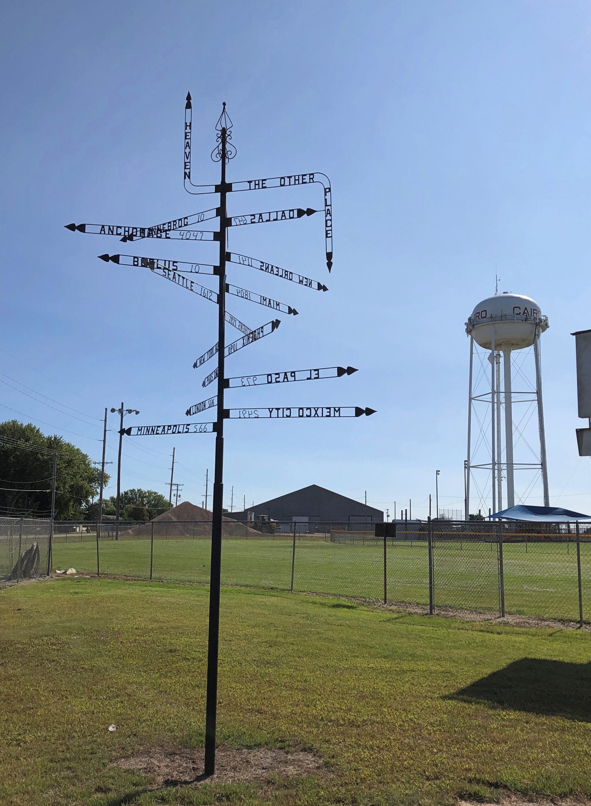
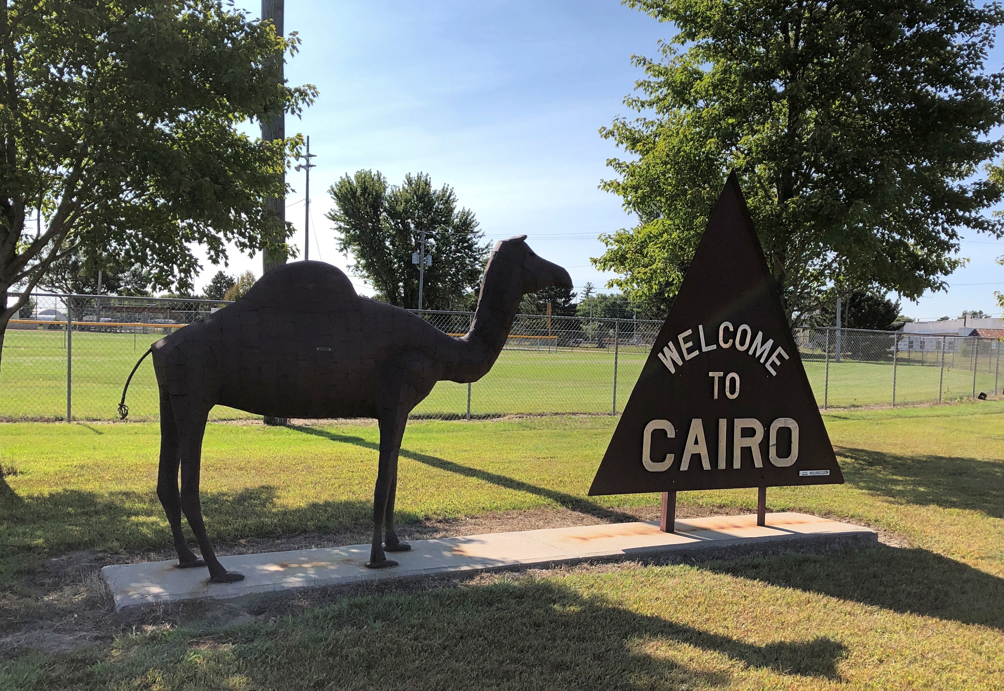
Which of these two destinations aren’t like the others?
That’s a beginner’s-level question. Better question: where can you find this pole, with mileages and – what units measure the distance to Heaven or Hell? – other signs?
Answer: Cairo, Nebraska.
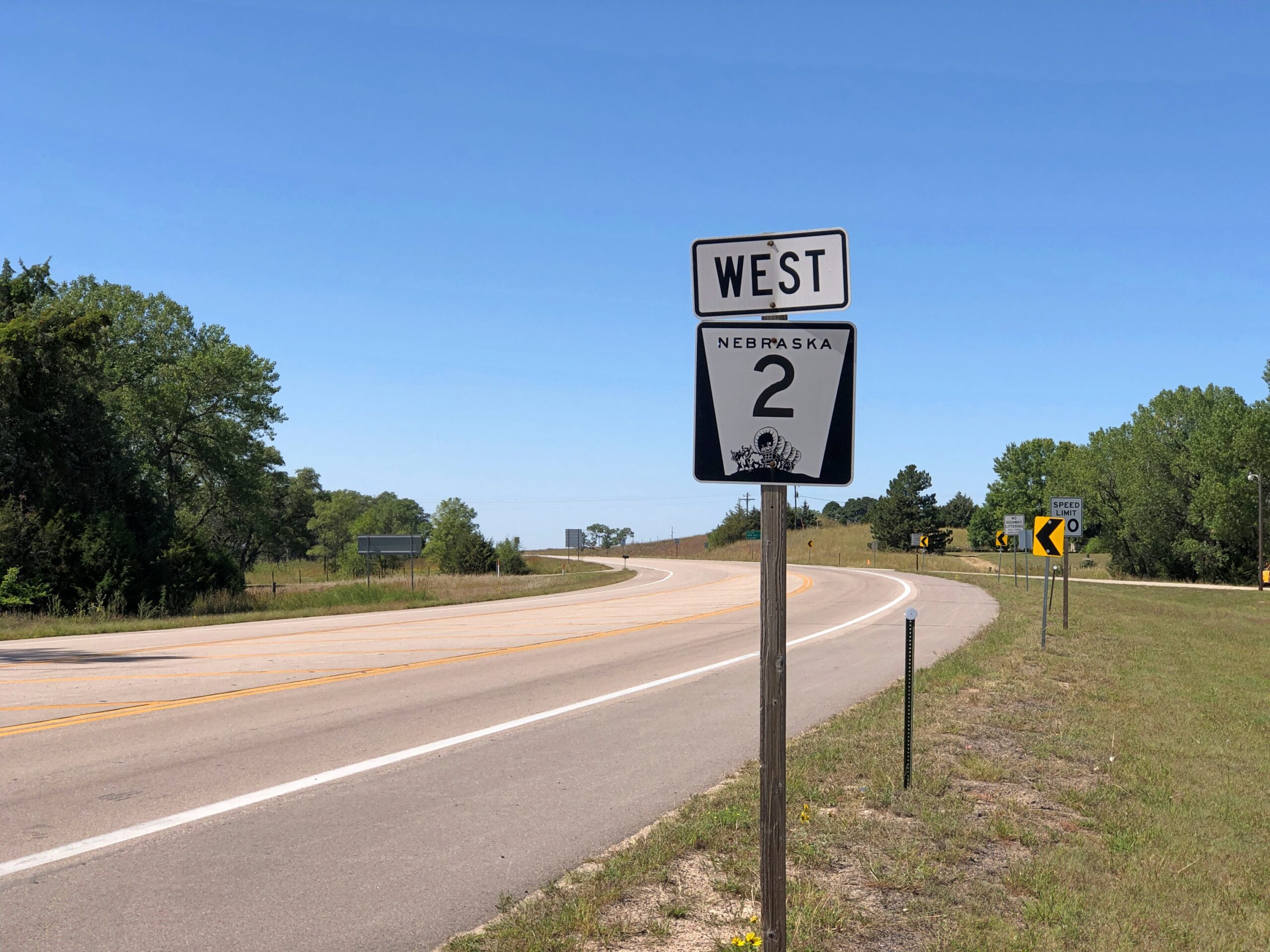
Maybe a palm tree was in the works, but the city decided not to spend any more money. Cairo (pop. 822) is one of the small chain of small towns on the eastern section of the highway Nebraska 2, which runs westward and north of Grand Island. Cairo is the first place I stopped on my way west on that highway in early September.
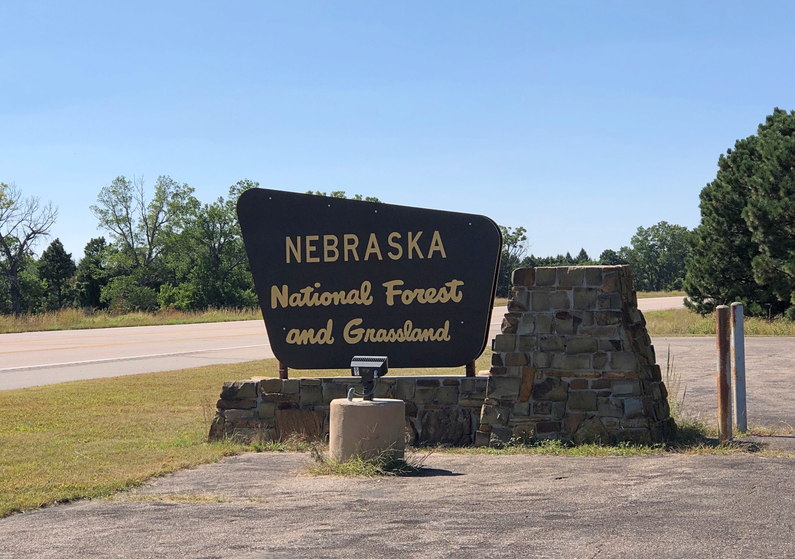
Eventually the highway reaches the Nebraska National Forestand Grassland, a patch of (partly) wooded land that inspires the question, there’s a national forest in Nebraska?
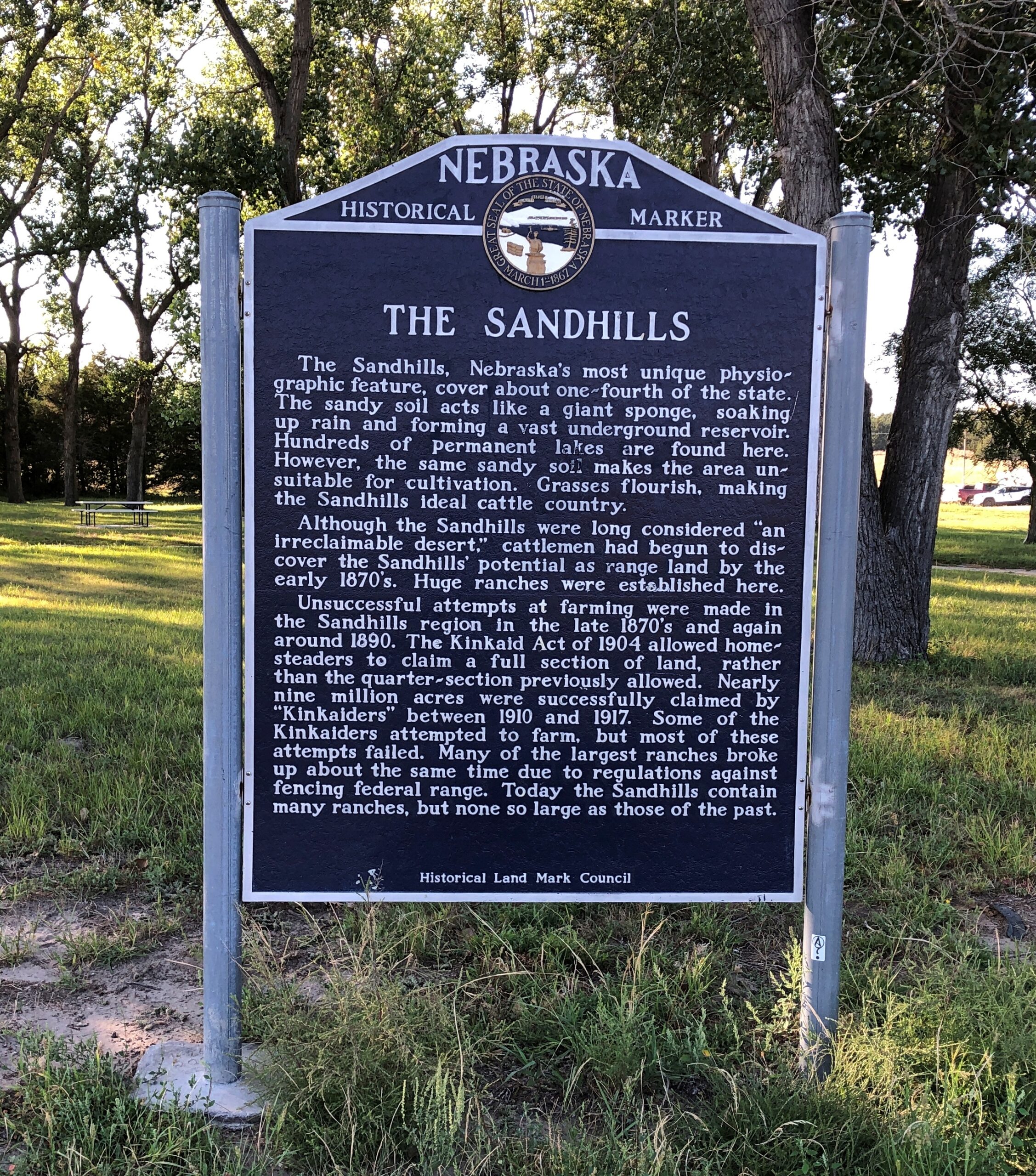
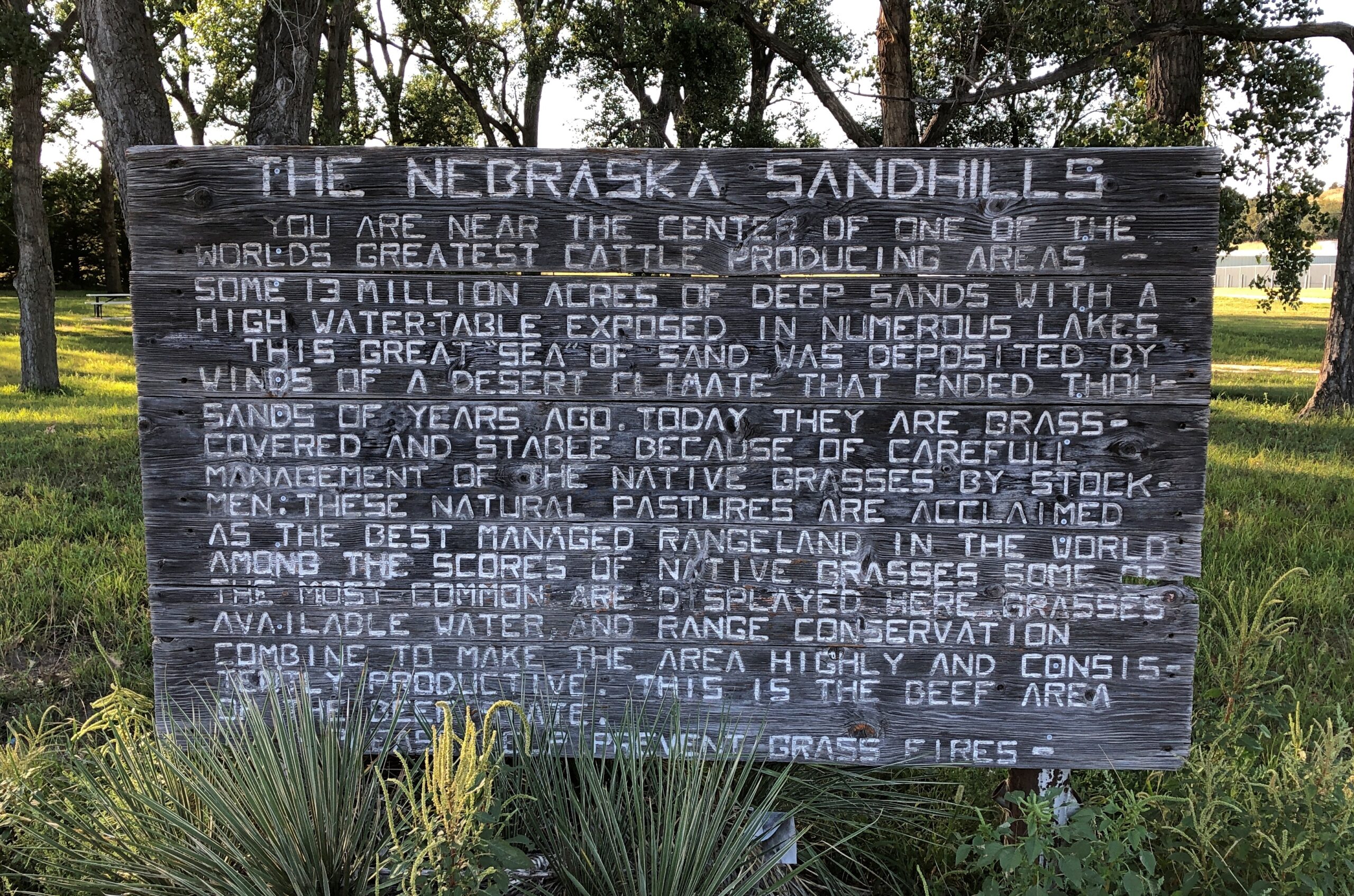
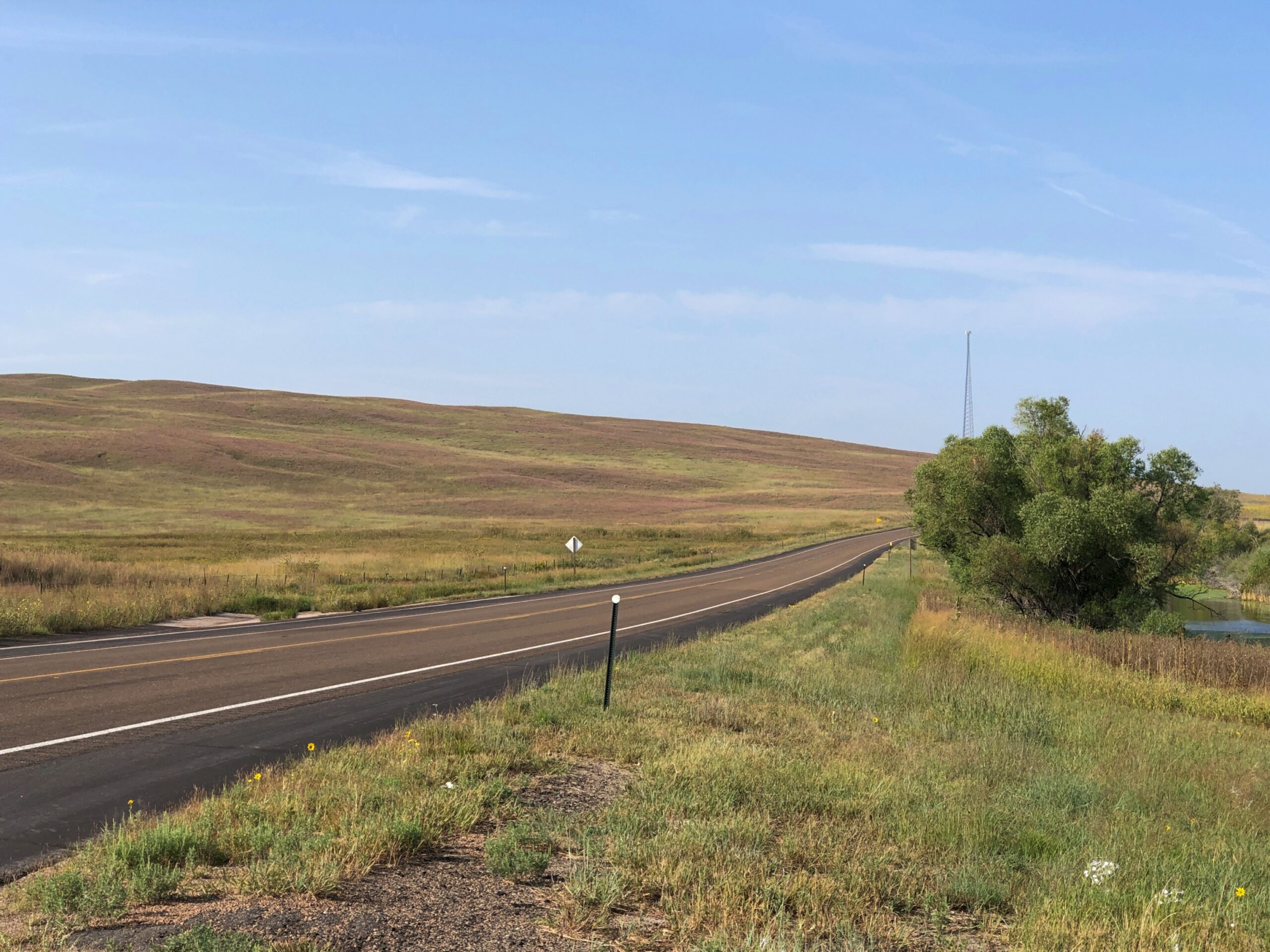
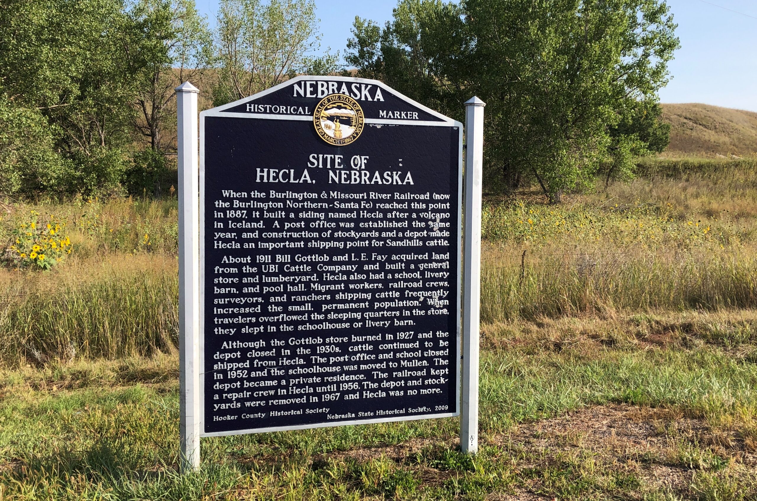
West from the forest, Nebraska 2 crosses the Sandhills, an unusual place here in North America, with the land morphing from cropland to ranch land on sandy steppes. The towns on the way are mere hamlets, and sometimes not even that. On the western edge of the Sandhills, one comes to the sizable town of Alliance, Nebraska, home of Carhenge and railroad staging area for coal trains headed east.
Before I did the drive, I was looking forward to it as much as any of the roads in Colorado. It lived up to expectations. Nice when that happens.
The Fence Postcites Charles Kuralt’s fondness for Nebraska 2: “Highway 2 is not just another highway that goes somewhere. Highway 2 is somewhere,” he’s known to have said. I’d say whatever else his failings, Kuralt had good taste in roads.
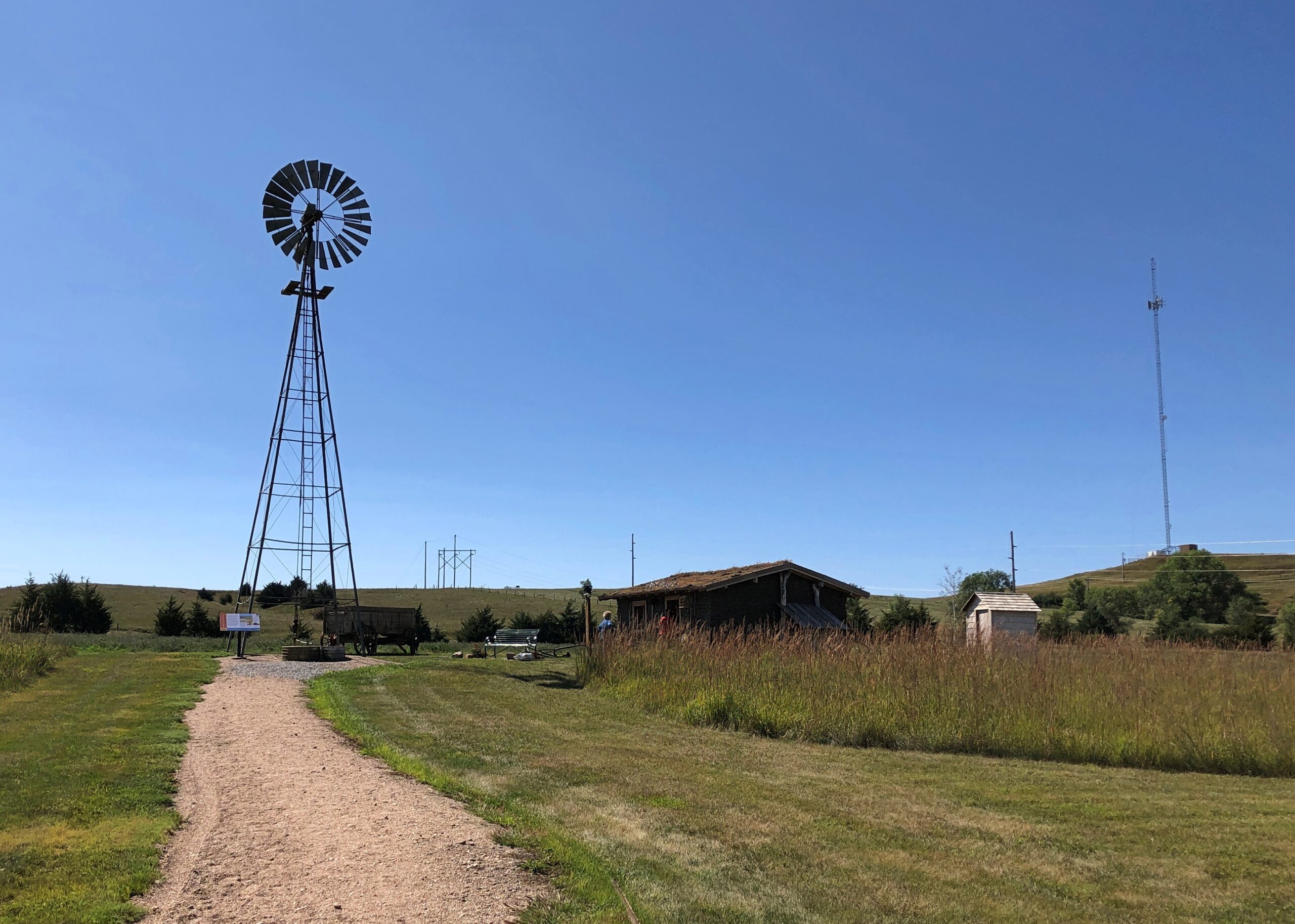
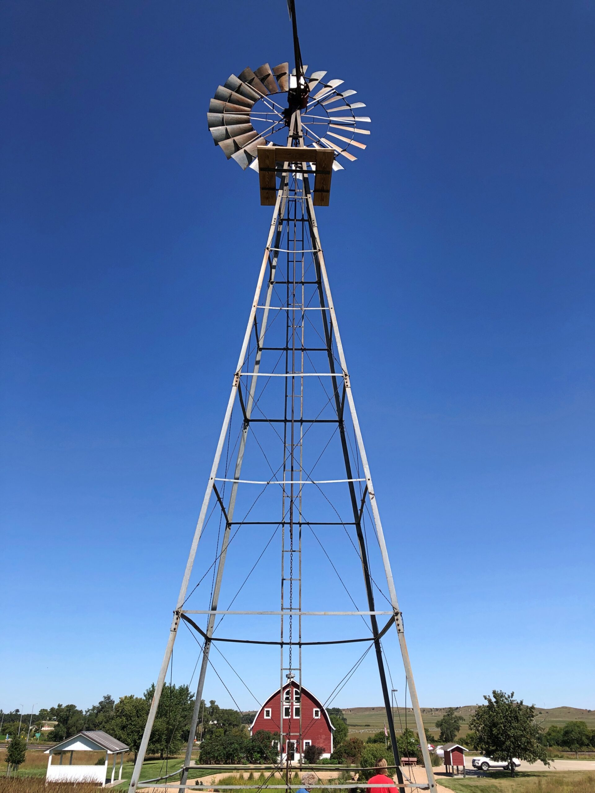
Just outside Broken Bow (pop. 3,491), seat of Custer County and pretty much the only town of any size in that county, the Sandhills Journey Scenic Byway Visitor Center offers a building with bathrooms and pamphlets and displays and, for my visit at least, a grandmotherly and talkative volunteer. Old enough, she said, to remember when the highway was just a road through the countryside that attracted no attention from the outside world. Not a scenic byway, and sand hill cranes were just flocking birds. Now a trickle of tourists and bikers and RVers come this way. She had some solid recommendations, especially a good diner for lunch.
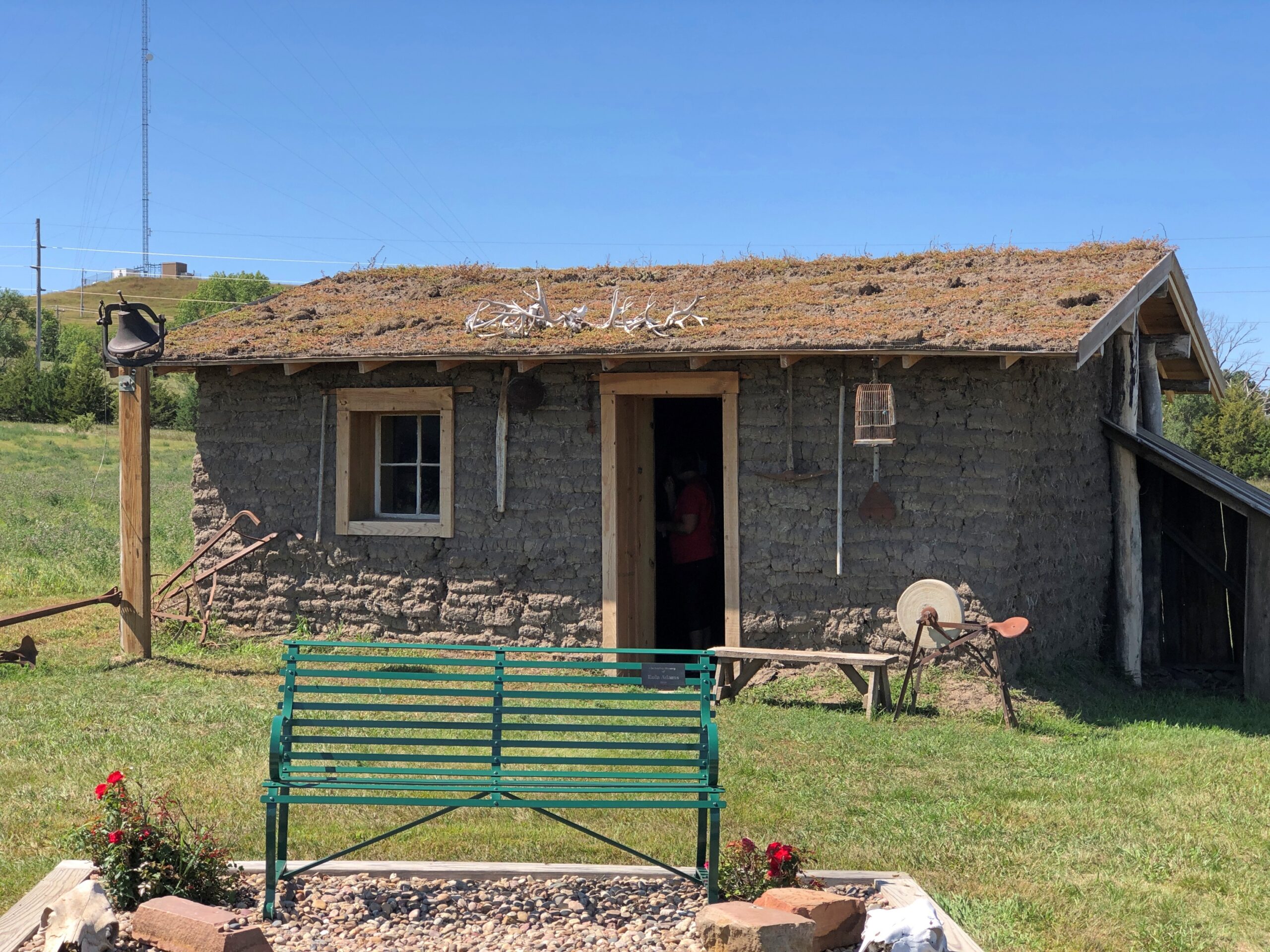
The visitor center grounds include a relocated (or was that reconstructed?) Sandhills cabin. The residences of the farmers trying to scratch out a living in the Sandhills, and finding out that no amount of scratching would make decent crops grow consistently from the land.
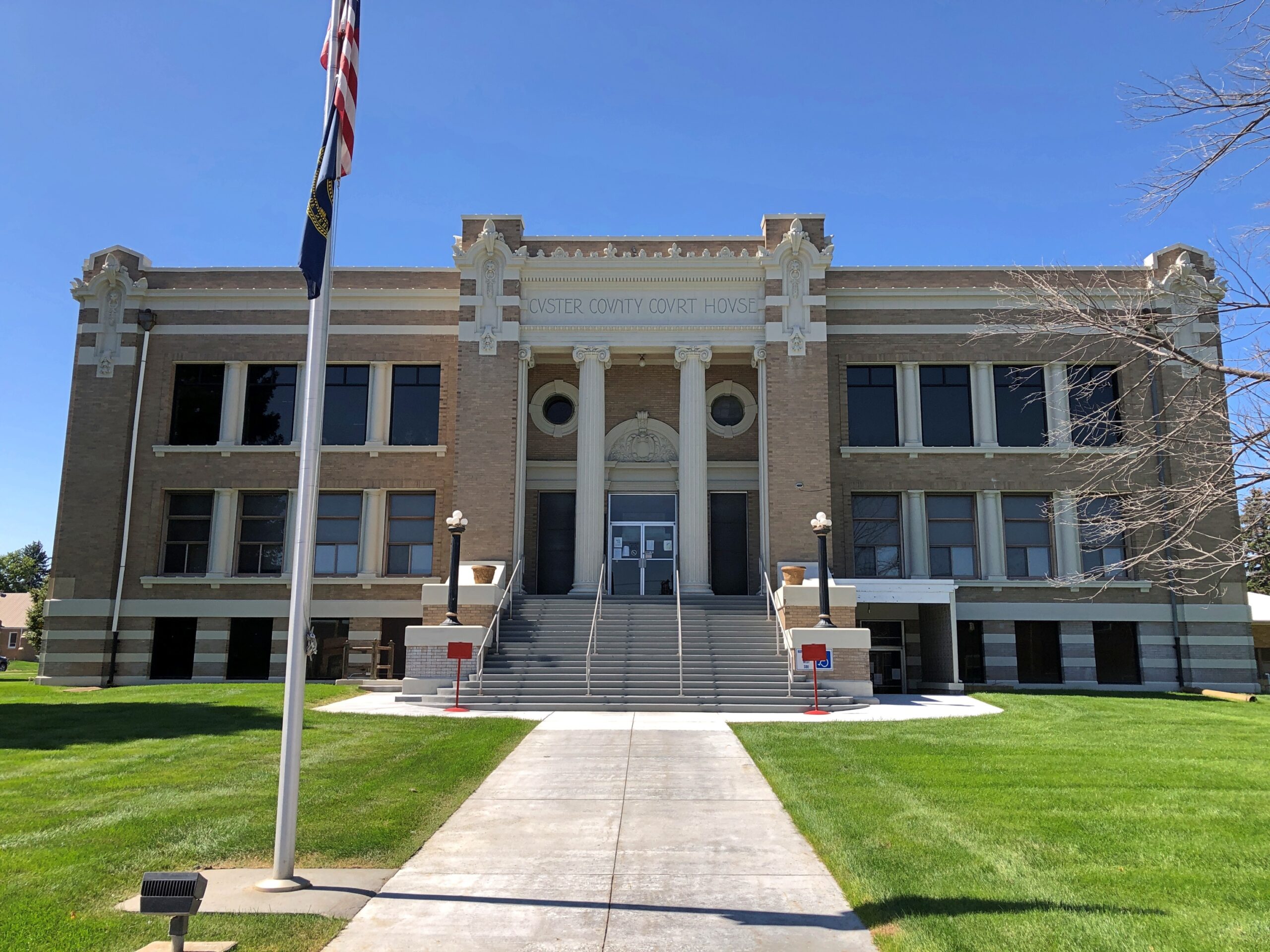
The Custer County Courthouse. Saturday, closed.
A block from the courthouse, some buildings around City Square Park.
City Square Park is a generic sort of name. Wonder whether there’s anyone from the town who can be honored by renaming the park? Looking at list of notables from Broken Bow, one instantly stands out.
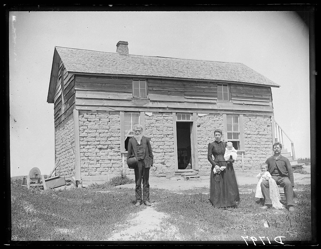
Wiki: “Solomon D. Butcher (January 24, 1856 – March 18, 1927) was an itinerant photographer who spent most of his life in central Nebraska, in the Great Plains region of the United States… he began in 1886 to produce a photographic record of the history of European settlement in the region. Over 3,000 of his negatives survive; more than 1,000 of these depict sod houses.”
Frederic Schreyer and family, Custer County, 1880s, by Solomon Butcher.
Definitely name the park after Butcher, Broken Bow.
One more in that town. I couldn’t be bothered to get out of the car.
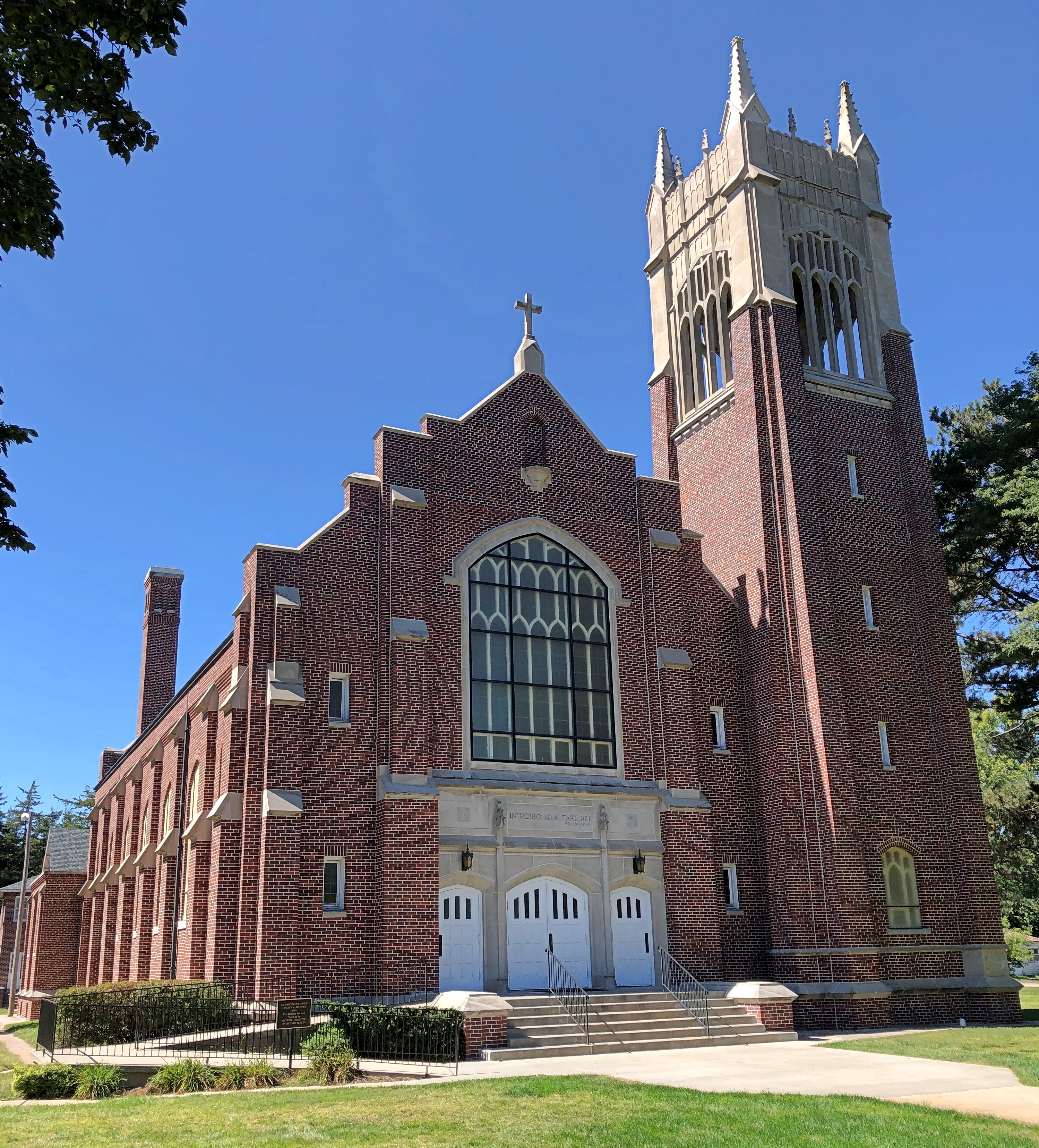
West of Broken Bow is Anselmo (pop. 145), home of this church, St. Anselms Catholic Church, nicknamed Cathedral of the Sandhills. Saturday, closed.
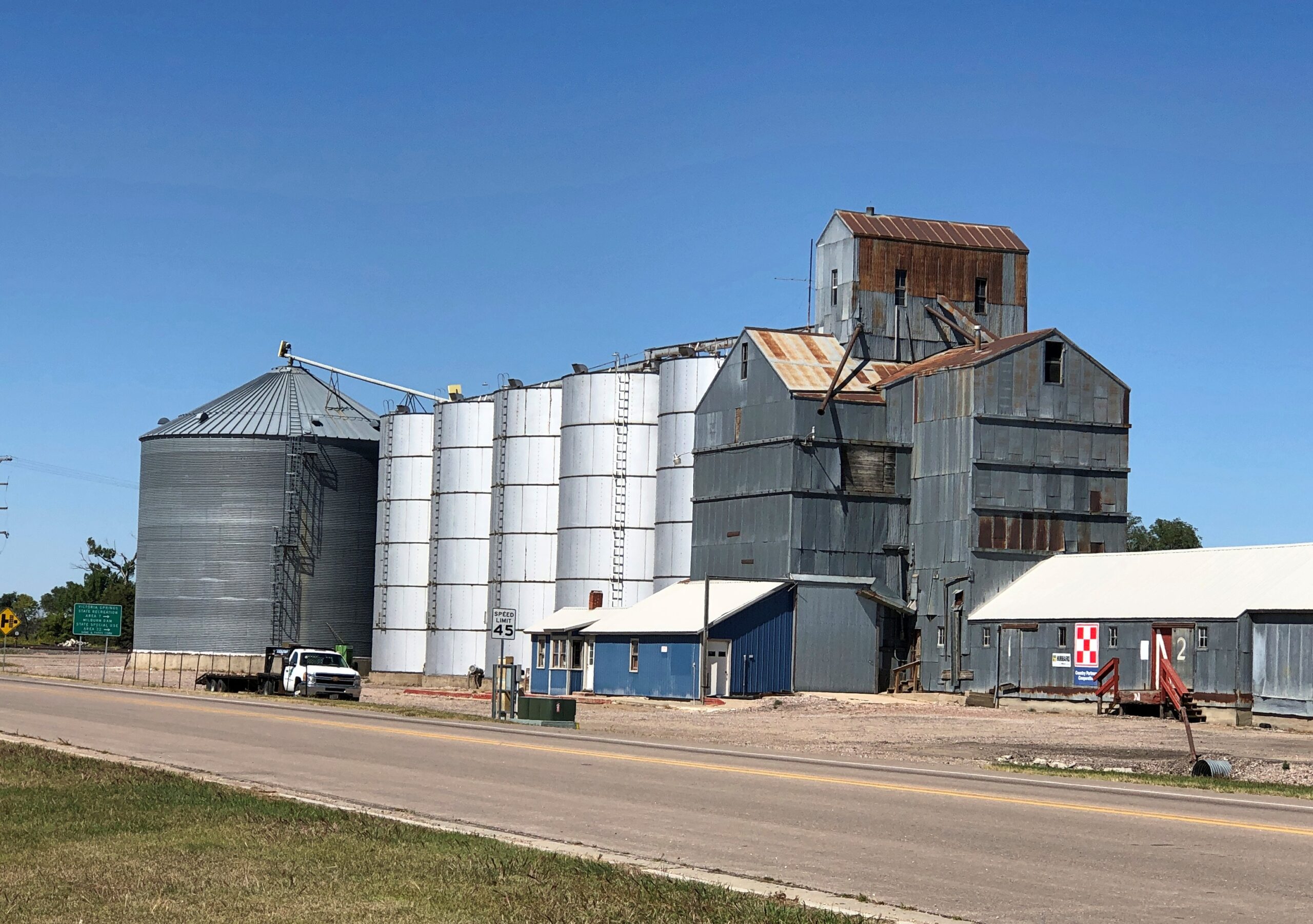
A more common sort of building, not far from the church.
Not the most imposing that I saw, but representative of the many structures like it. The grist of a photo collection. Of course it has been done. I’m pretty sure I saw a room of Bernd Becher’s photos of water towers at the Modern Art Museum of Fort Worth.
Nebraska National Forest and Grassland is in an unexpected place, slap in the middle of Nebraska, not due to a freak of nature, but the efforts of human beings. Specifically, mass plantings of trees by the federal government for more than 100 years, beginning (not a surprise) during the administration of Teddy Roosevelt.
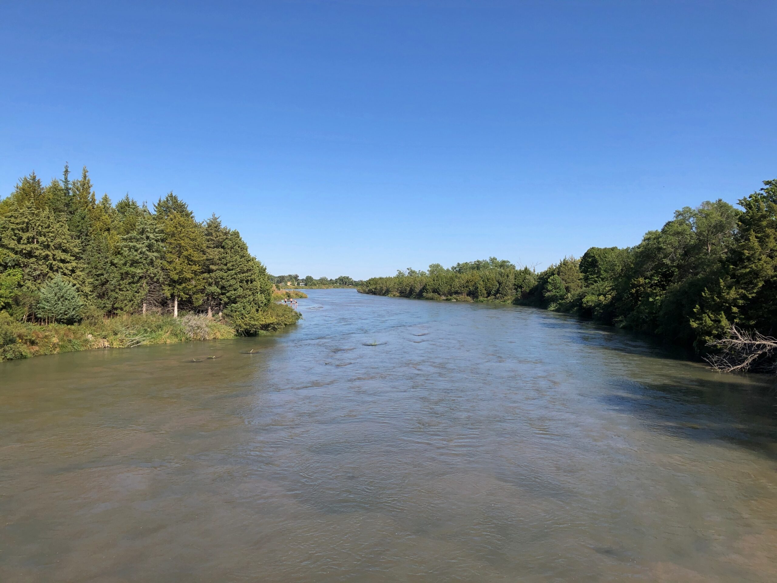
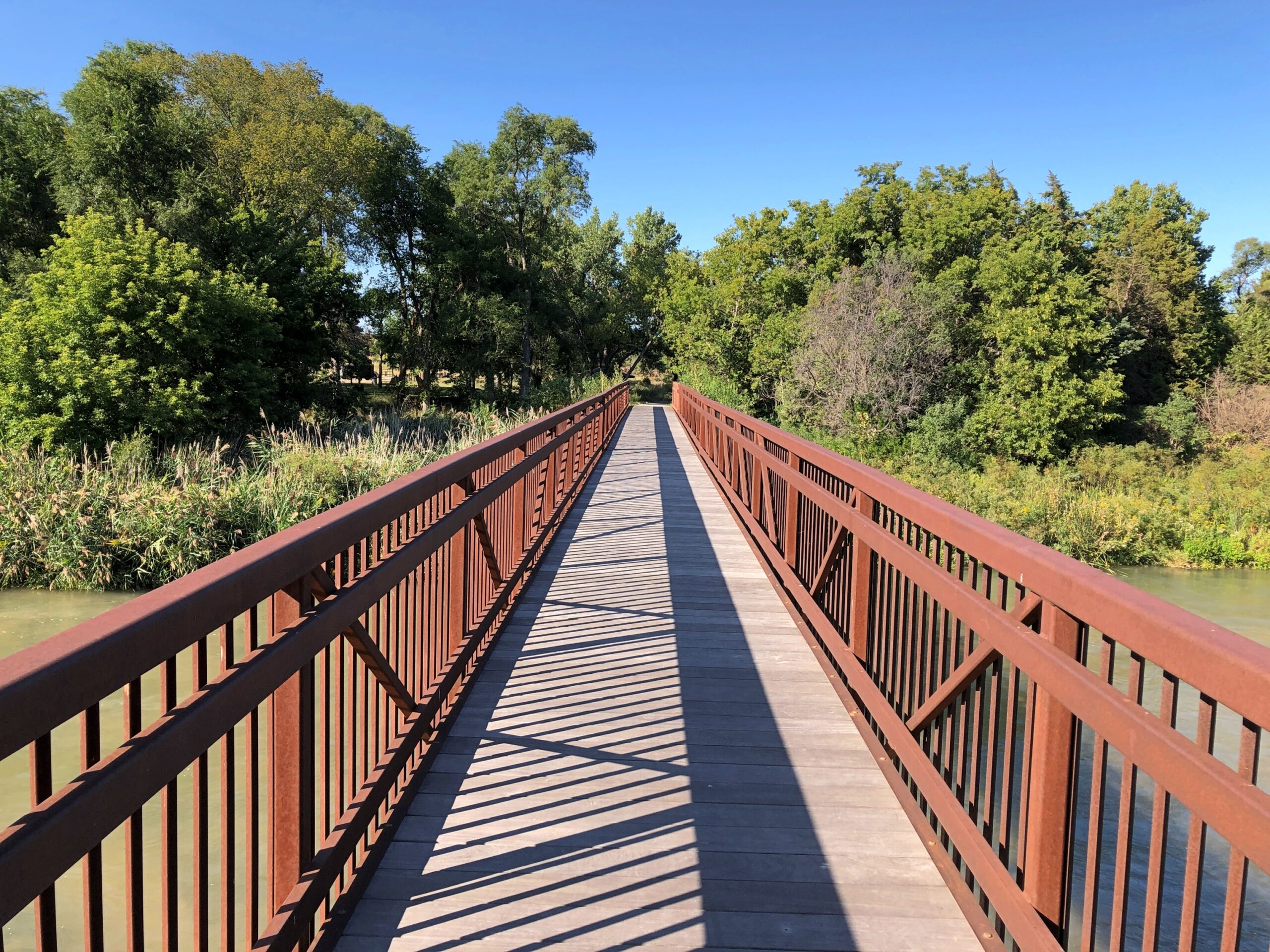
Near the national forest entrance is the Middle Loup River, broad but shallow, and crossable on a foot bridge.
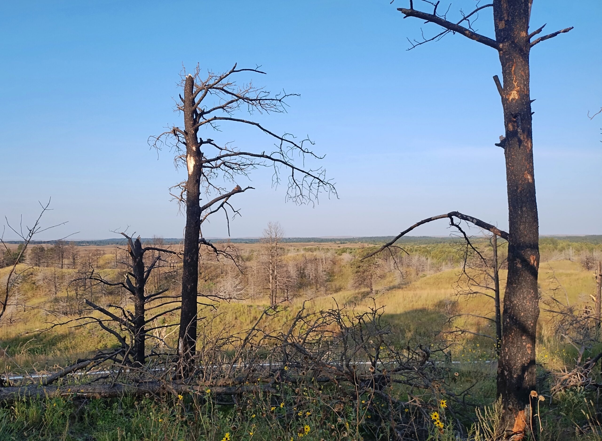
I camped in the national forest. The campgrounds weren’t completely full, but there were more people than I expected for a remote spot in Nebraska. Then again, it was a Saturday night, and soon enough I figured out what brought most of them: the ATV trails. Not long after dawn on Sunday, the campers across from me – a man and a small knot of teenage boys – roared away in a small caravan of ATVs crusted with dust from the day before.
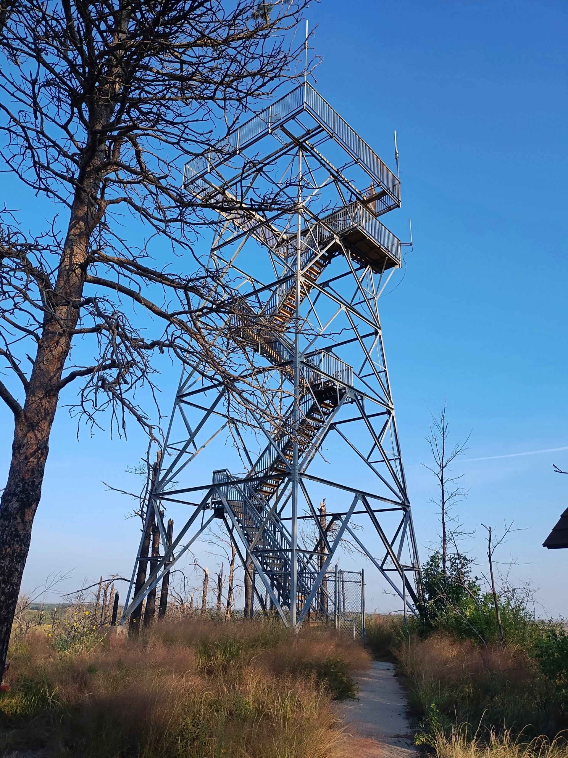
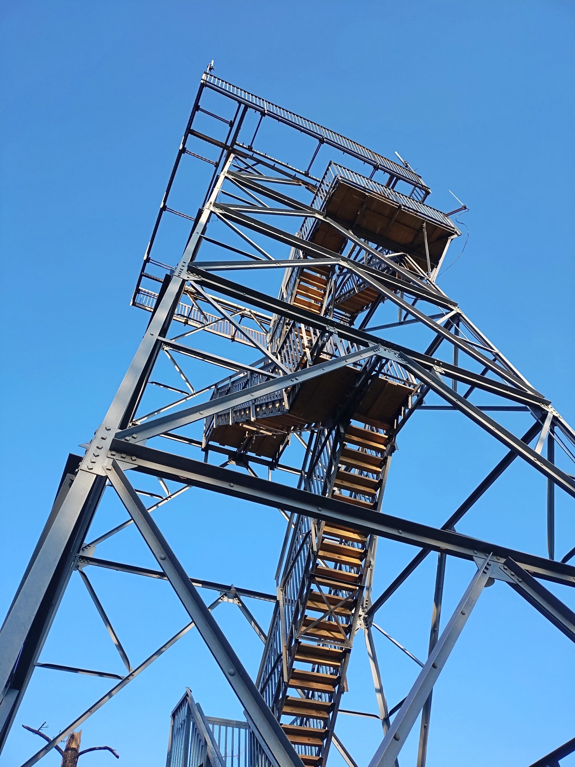
I packed up and sought out a quieter place. A national forest hill with a fire tower and some views. The tower was closed.
But the views were still pretty good.
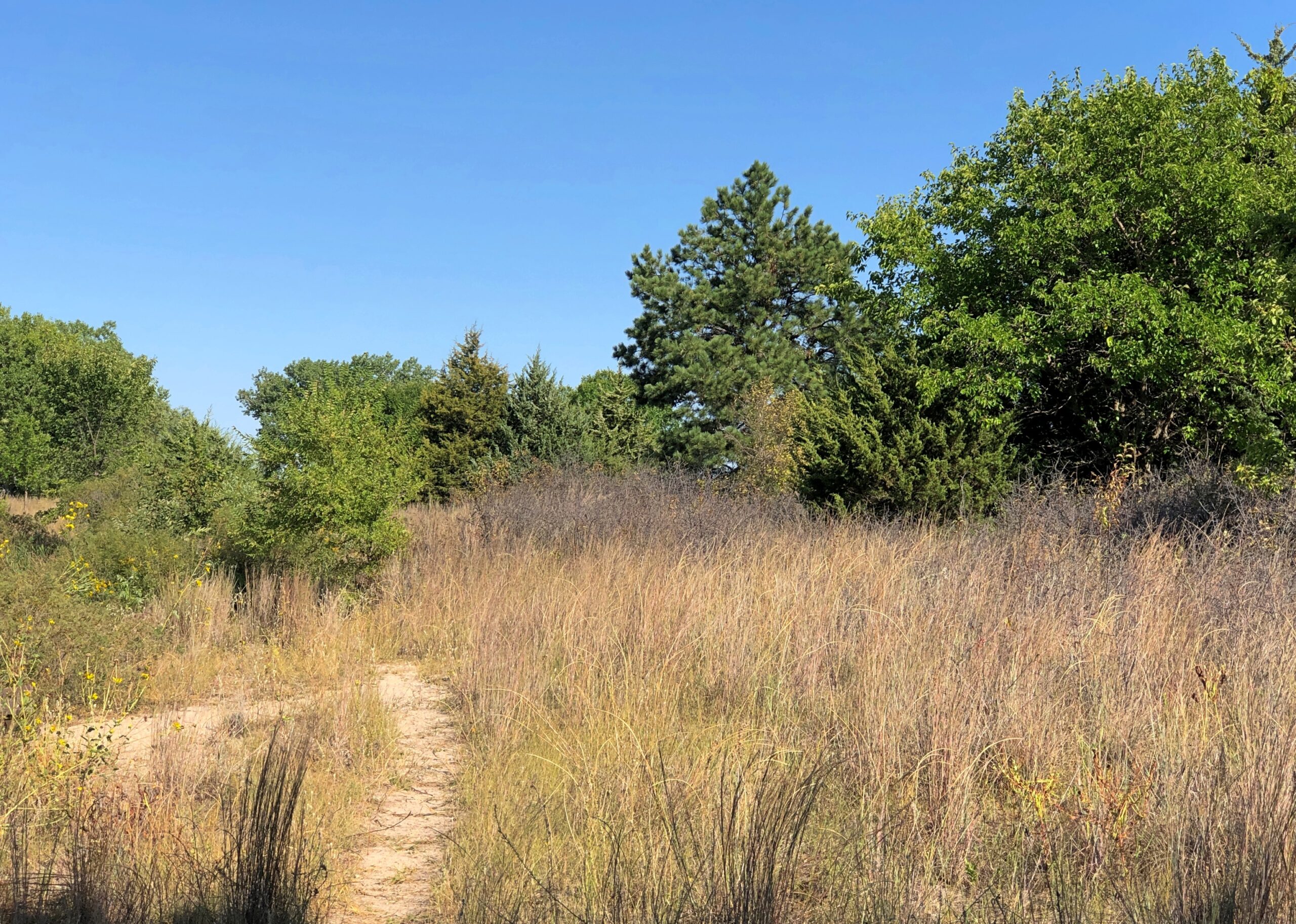
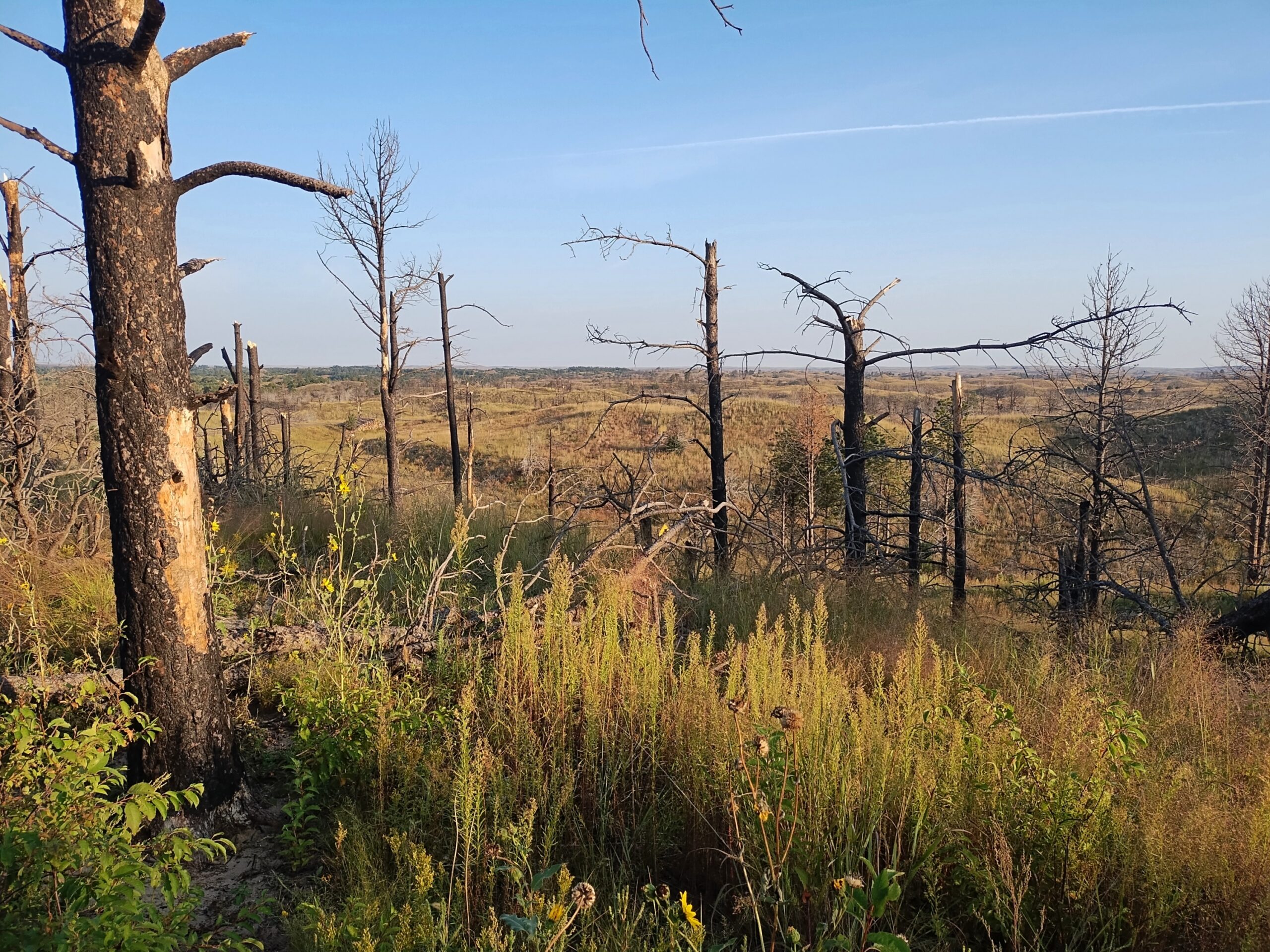
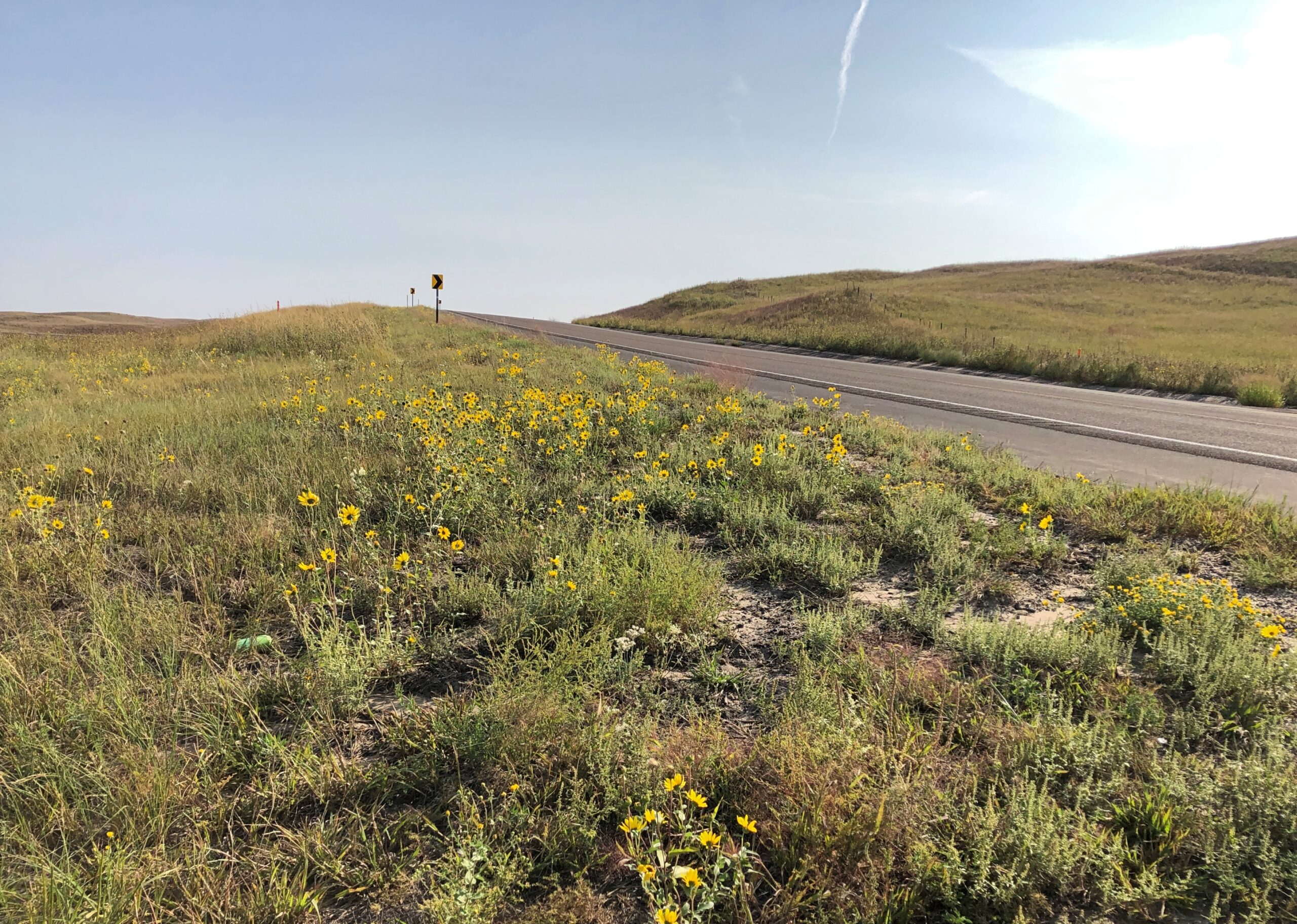
West from the national forest, Nebraska 2 heads into the rolling grassland of the Sandhills proper. In the village of Thedford (pop. 208), varied public interpretations of the Sandhills are available for reading.
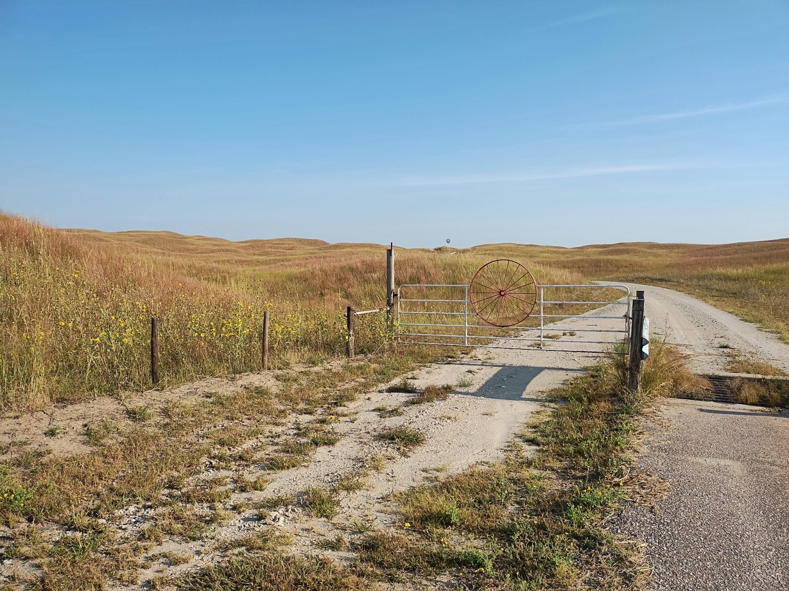
The terrain along the highway Nebraska 2 might seem monotonous to some. Too bad for them. You’re driving across a kind of ocean, terrain all wavy, except that it’s solid ground, marked by occasional trees or manmade structures, and side roads — trails — wandering deeper into the hills.
The handful of towns are really just wide places in the road. Sometimes, not even that.
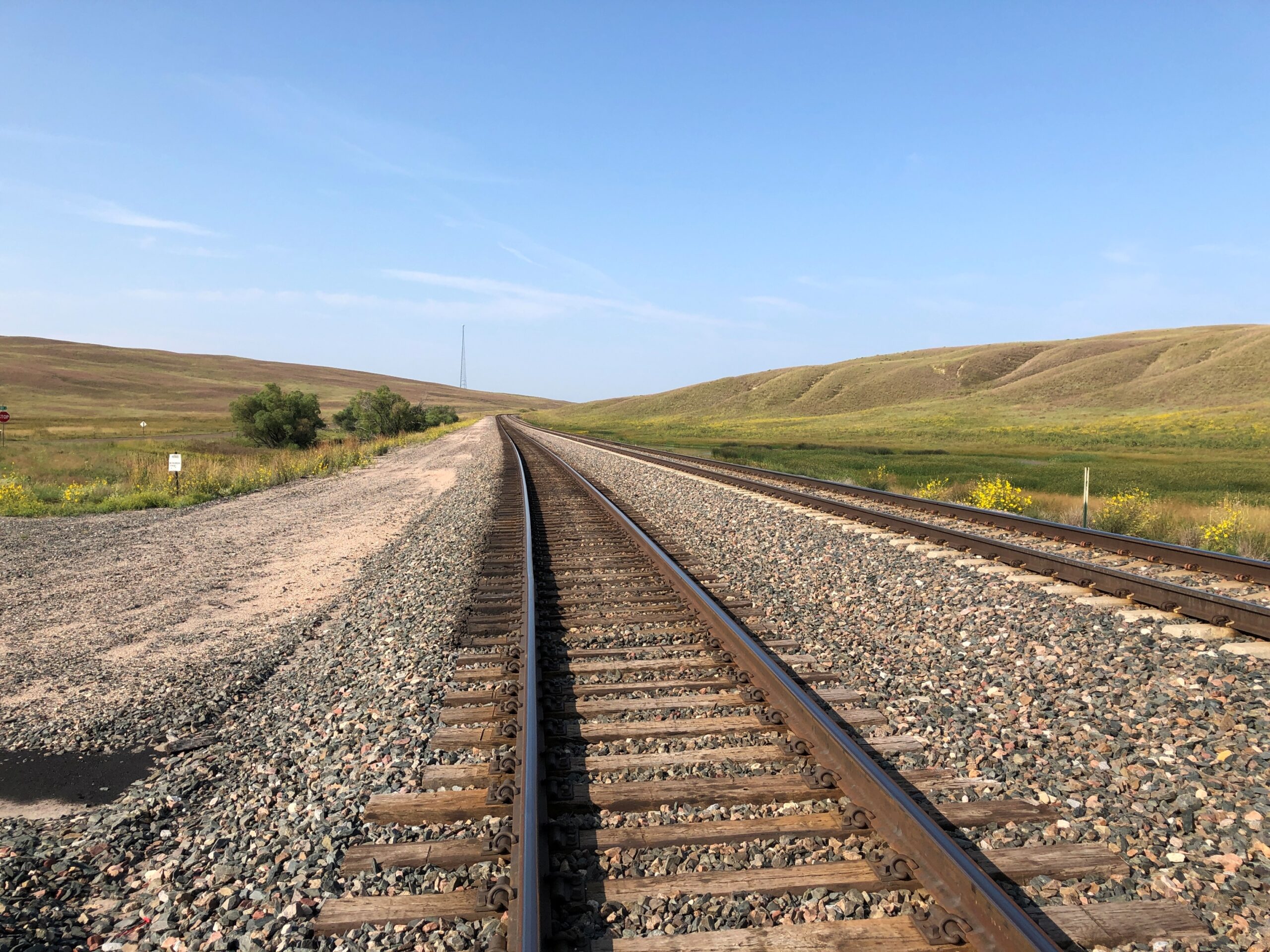
Nebraska 2 parallels the BNSF line, which came first.
Note: I was standing on a public side road to take that picture, as I do with all my RR shots.
Eventually, I took the road to Alliance. But that was merely incidental. Out this far, the road, as Kuralt said, is the destination.
Pity the people whose job it is to promote tourism in Nebraska. Set ideas are notoriously resistant to change, at least over periods less than a generation, so I expect the idea “nothing to see there” is a constant battle for those who know otherwise.
I didn’t need to be persuaded. A drive across the state – a reward in itself, more about which later – takes you Carhenge (see yesterday) but also to terrain not generally associated with Nebraska.
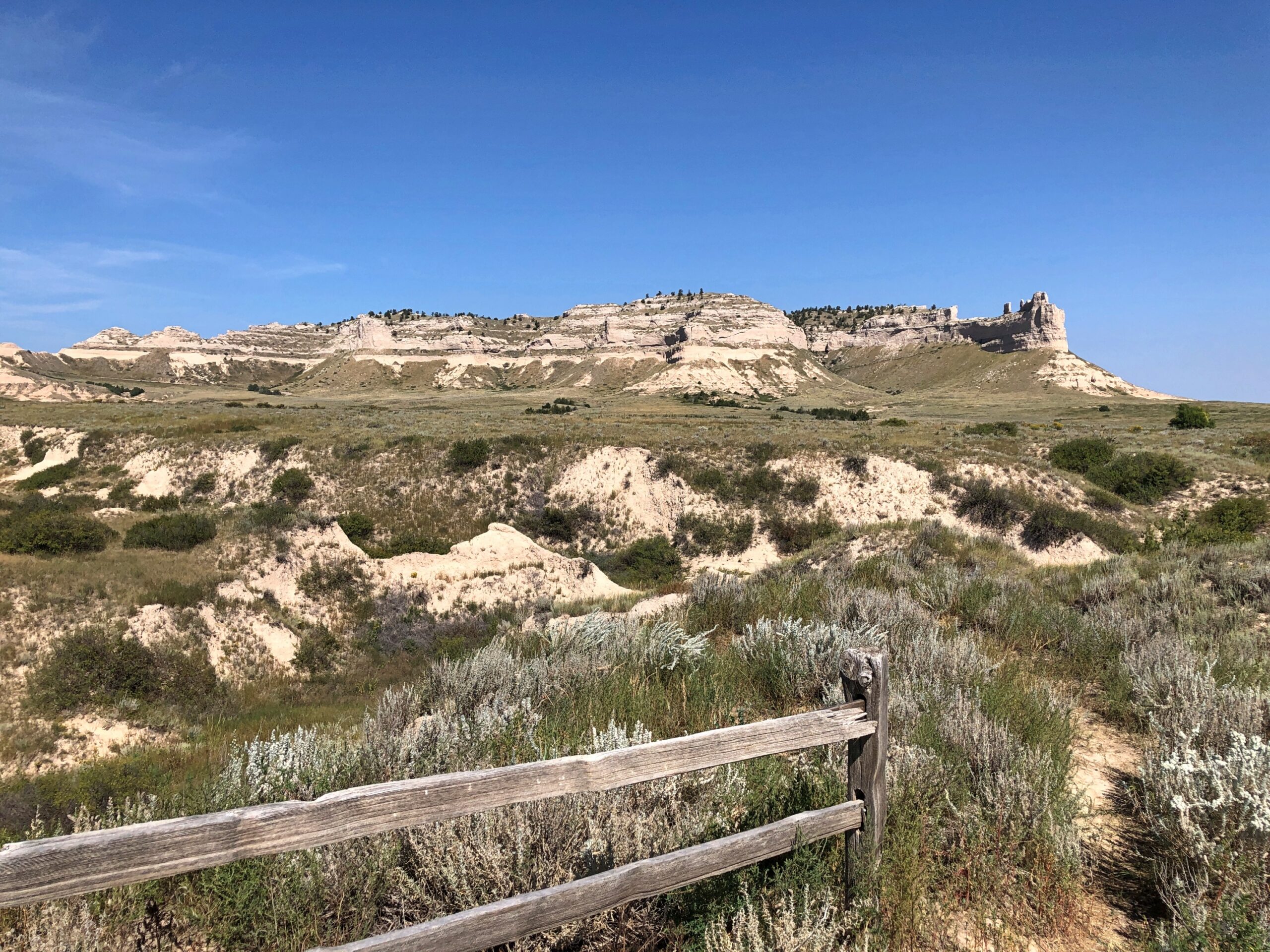
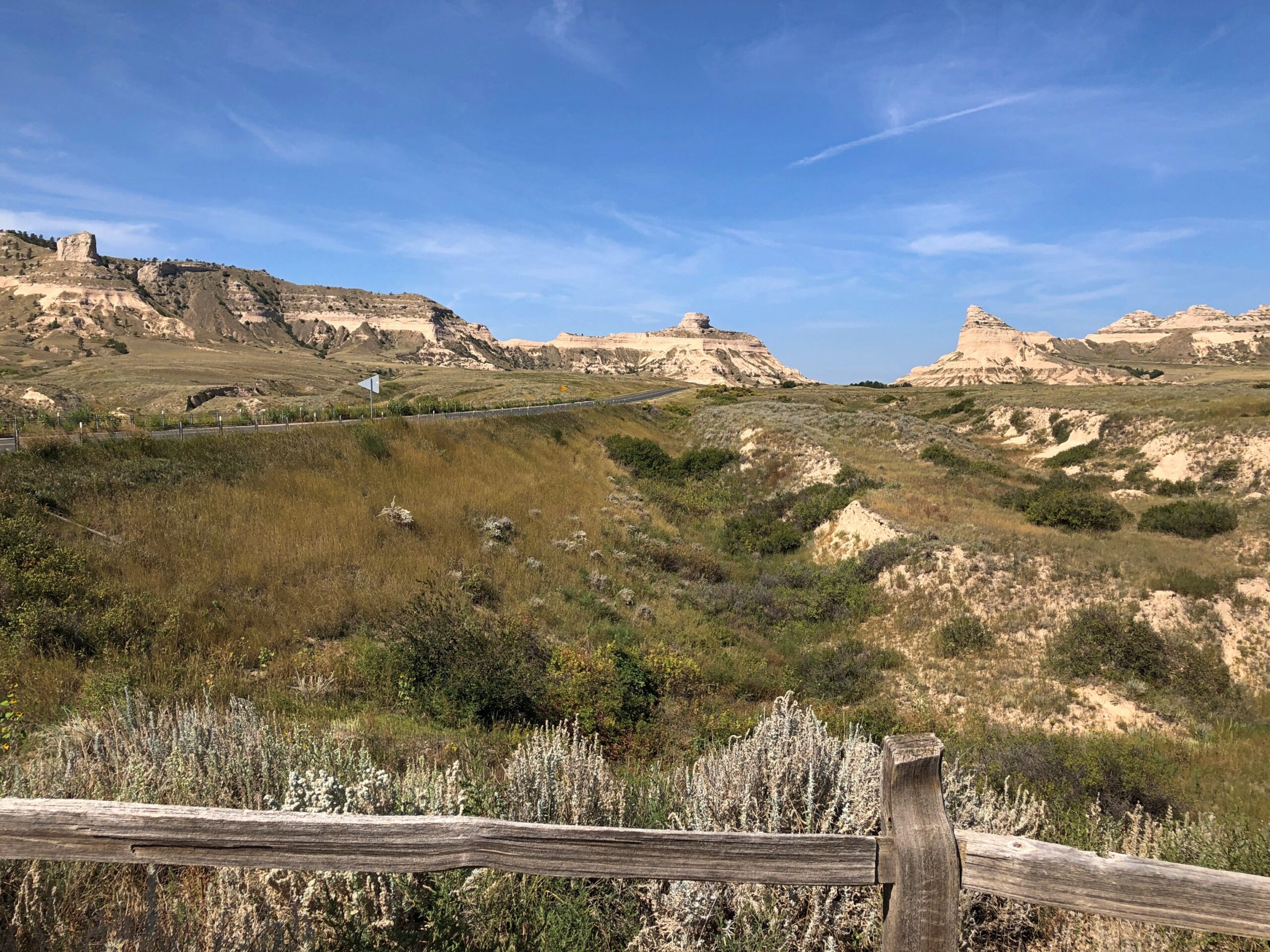
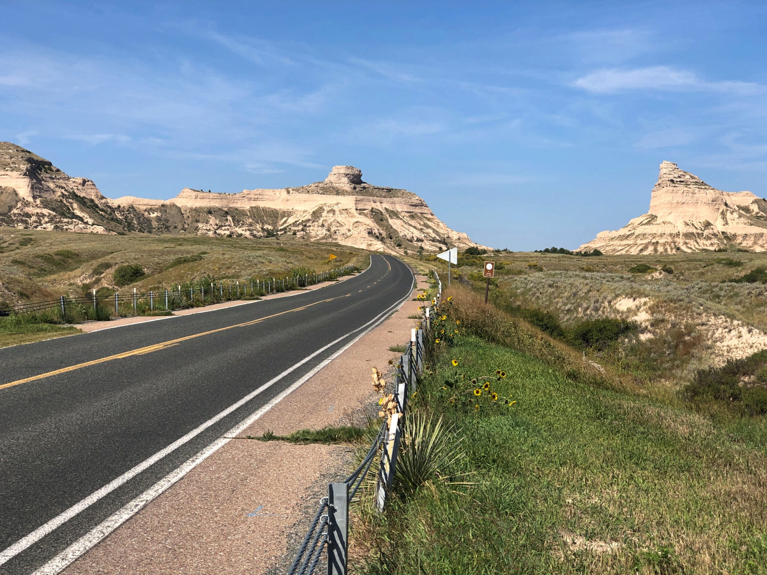
At the western edge of the state, rocks. Big, impressive rocks that poke out of the still-flat ground, stubborn geological leftovers that refuse to erode as fast as the surrounding terrain. Natives, mountain men, trappers, and wagon trains across the prairie all knew about these rocks, knew that they marked a certain point in their journeys. I’m sure they were hard to miss.
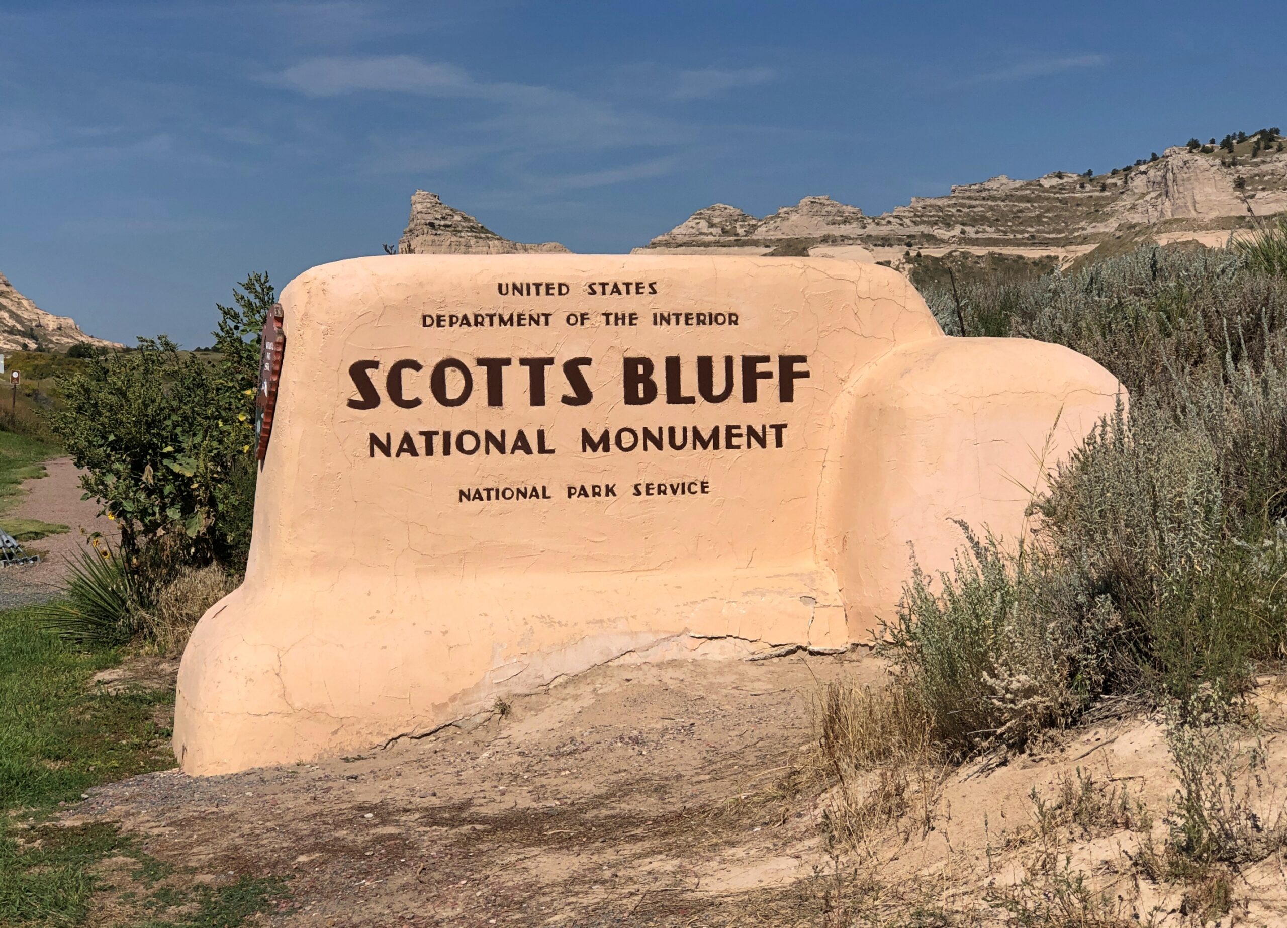
Since 1919, the rocks a few miles from Gering, Nebraska have been known as Scotts Bluff National Monument. I arrived on the morning of September 8.
On this particular trip, the monument was an appetizer, ahead of the main course in Colorado. The Sandhills of Nebraska, which I’d just driven through, aren’t pancake flat, but waves of grassy hills with scattered outcropings of rock. After a drive like that, the Scotts Bluff seemed to appear suddenly, rising in your field of vision to take over half the sky.
I exaggerate, but only because that’s how I seem to remember it. An outcropping like that in the Rockies would be lost in the crowd, but here in western Nebraska it’s the star of the show.
The road leading to the monument, the highway Nebraska 92, follows the Oregon Trail at his point.
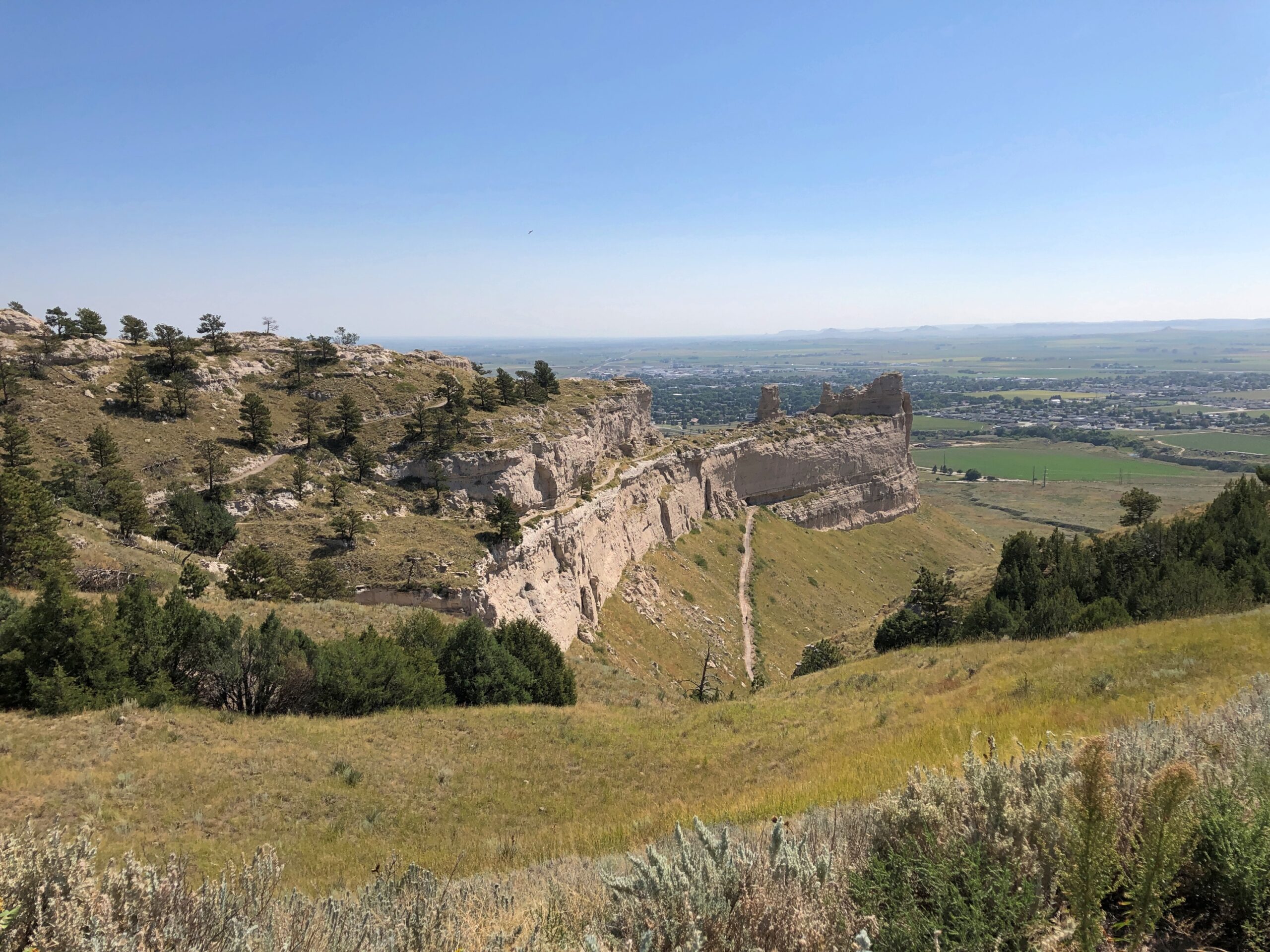
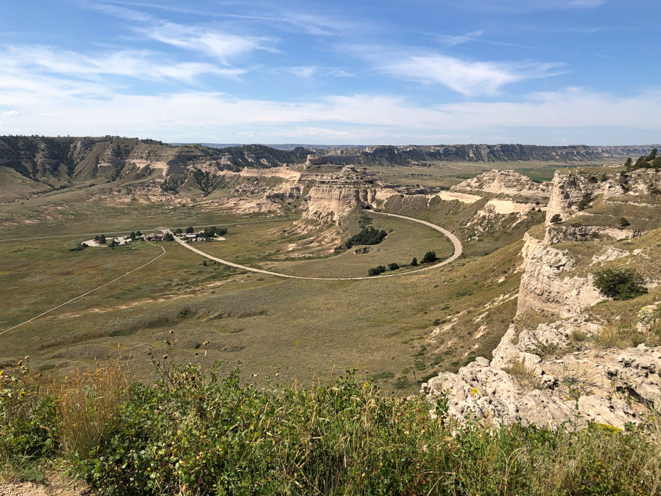
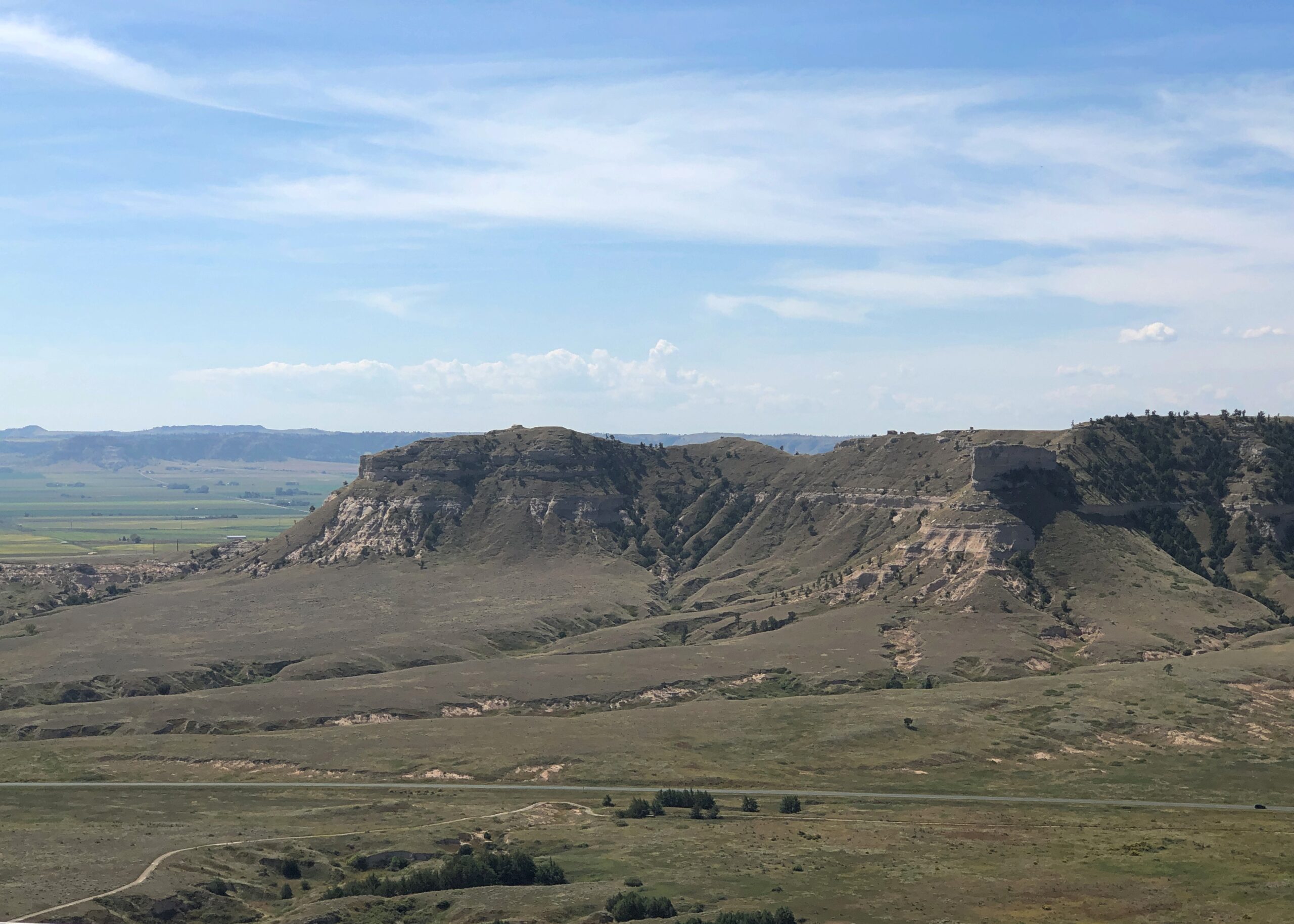
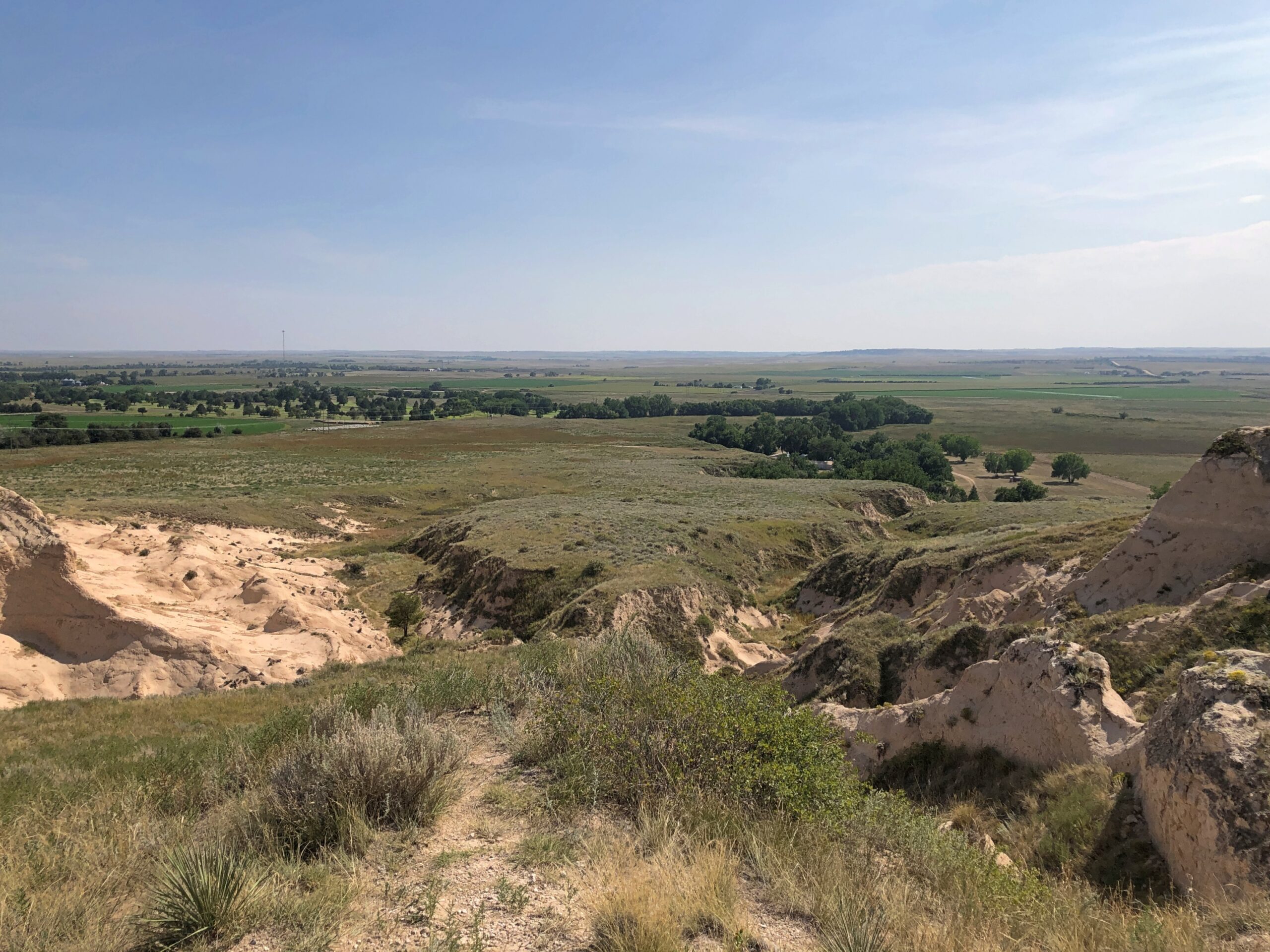
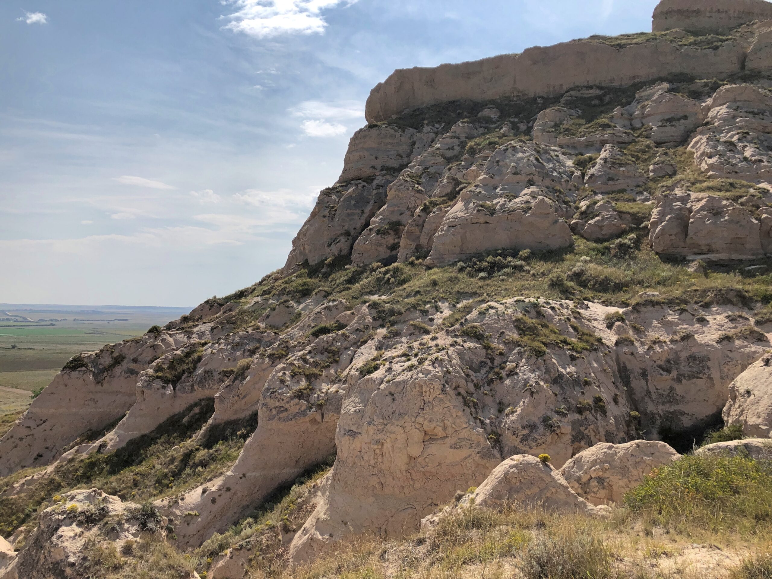
Scotts Bluff isn’t just a single bluff. A set of them, you might say. A road (yes, CCC built) provides access to the top. From there, any number of fine vistas ring the area. A fair number of people took the drive the same day as I did, but in no way did they amount to a crowd.
Scotts Bluff is no solitary outpost. Turning to the 1911 Enclopdaedia Britannica’s entry on Nebraska: “In the fork of the North and South Platte are the Wild Cat Mountains, with contours rising to 5300 ft., in which Wild Cat Mountain, long reported as the highest point in the state, attains 5038 ft., Hogback Mountain 5082 ft., and various other hills — Gabe Rock (5006), Big Horn Mountain (4718), Coliseum Rock (5050), Scotts Bluff (4662) &c. — rise to heights of 4500 to 5000 ft.
“In the extreme N.W. the White river and Hat Creek have carved canyons in deep lacustrine deposits, creating fantastic cliffs and buttes, bare of vegetation, gashed with drainage channels, and baked by the sun.”
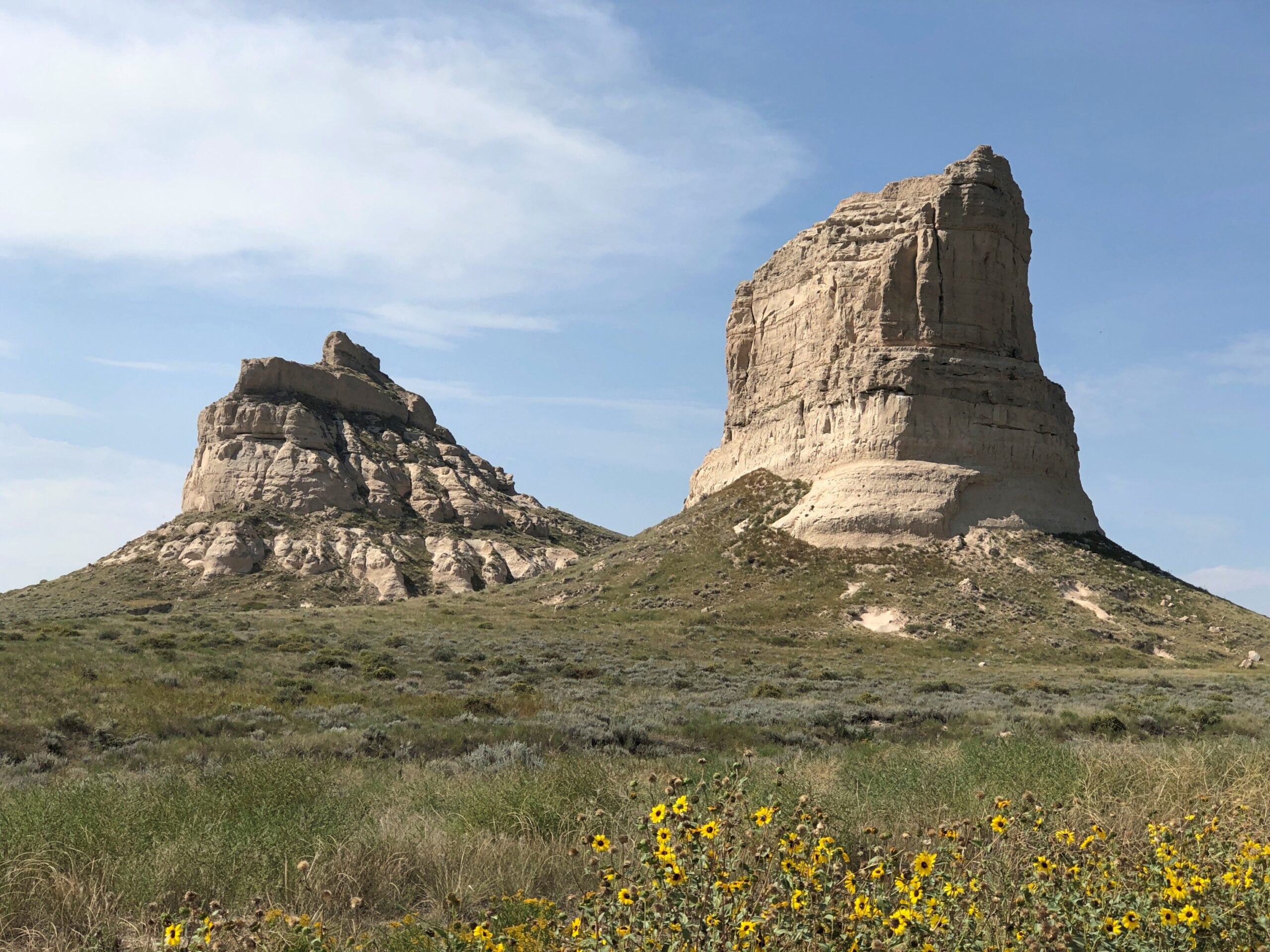
East of Scotts Bluff not far from highway US 26 is a set of rocks known as Courthouse and Jail. There’s something to that name.
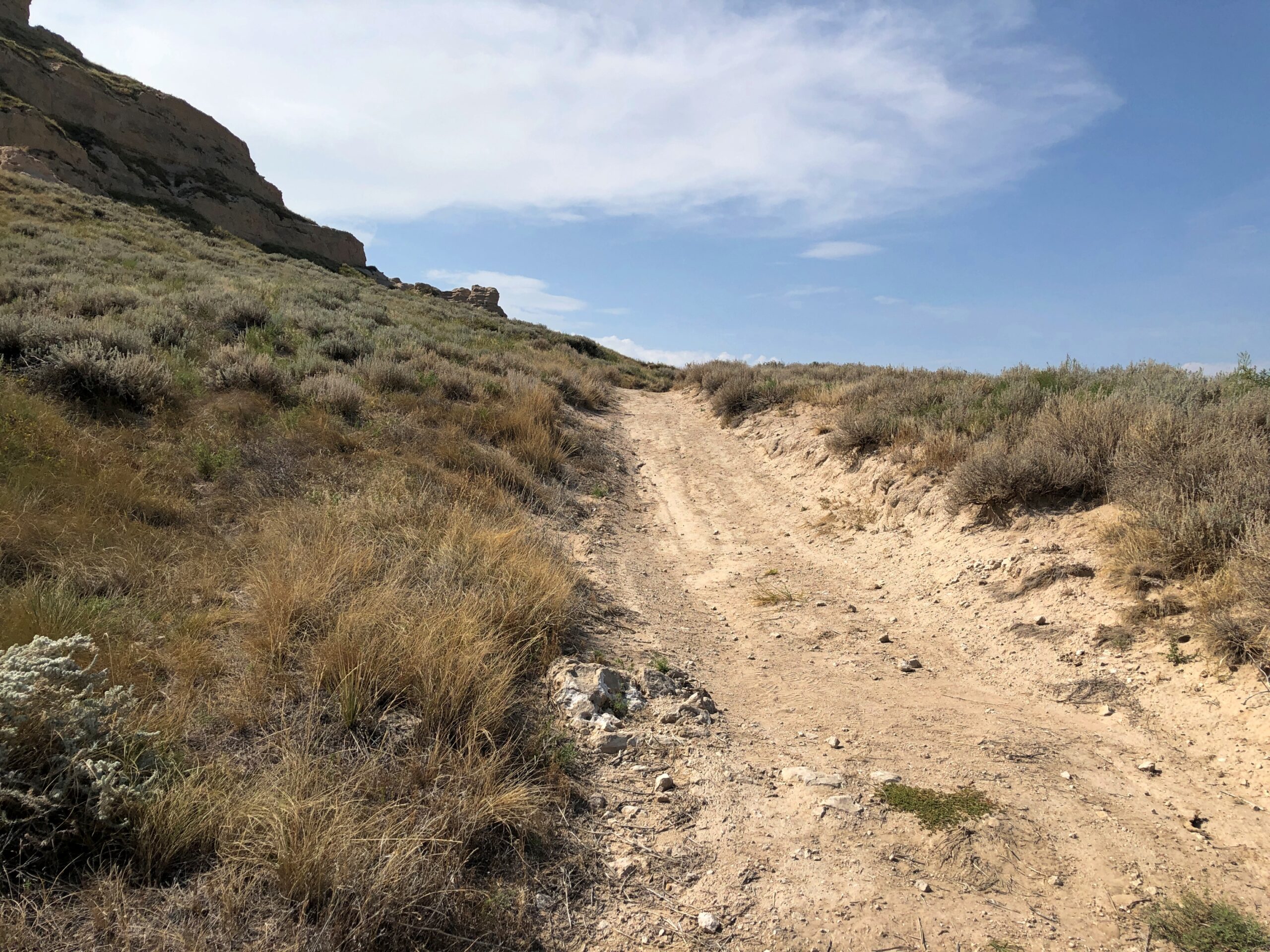
If Scotts Bluff was lightly visited, these two were almost completely empty. I stopped by on the afternoon of the 7th, and the only other people in the parking lot were sitting next to their RV, under a tarp, probably shooting the breeze over beer. So I had the trail to myself, though I didn’t go that far under the hot and copper sky.
Offering some views of its own.
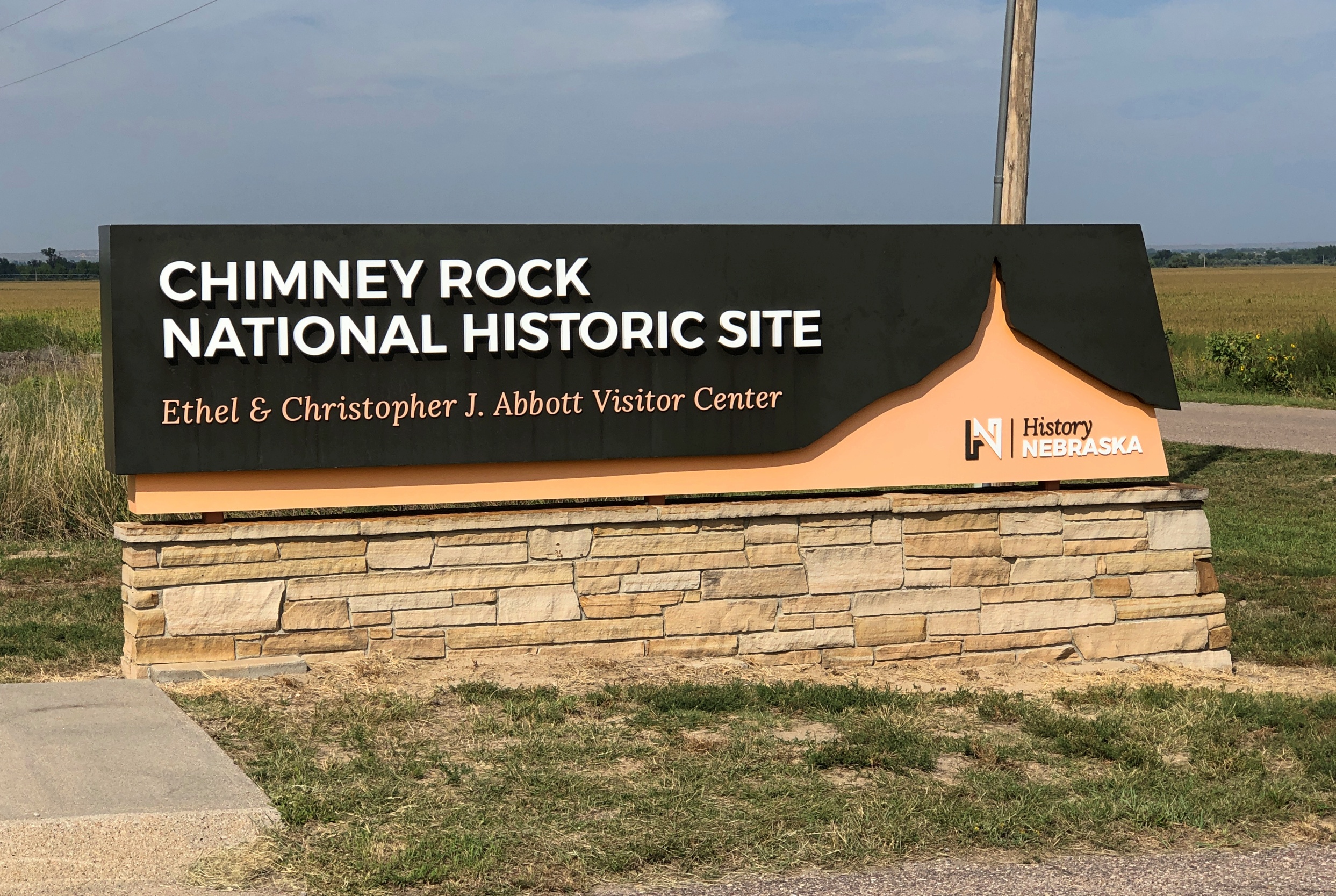
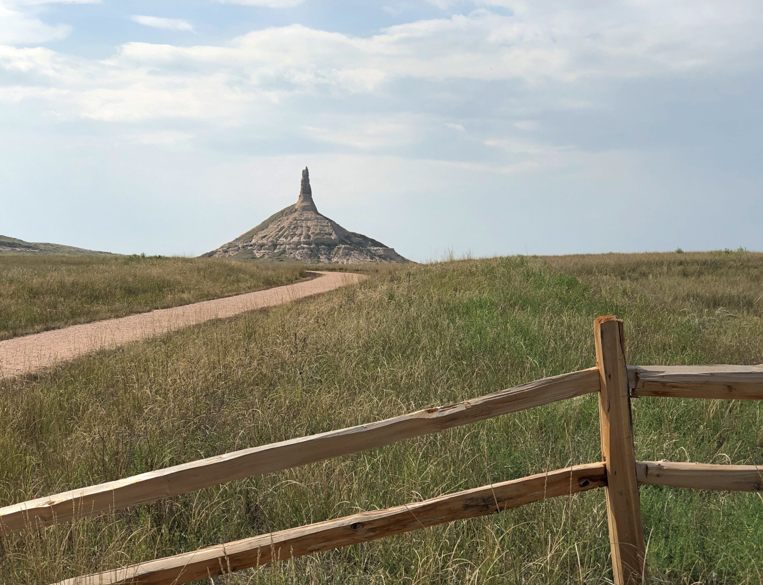
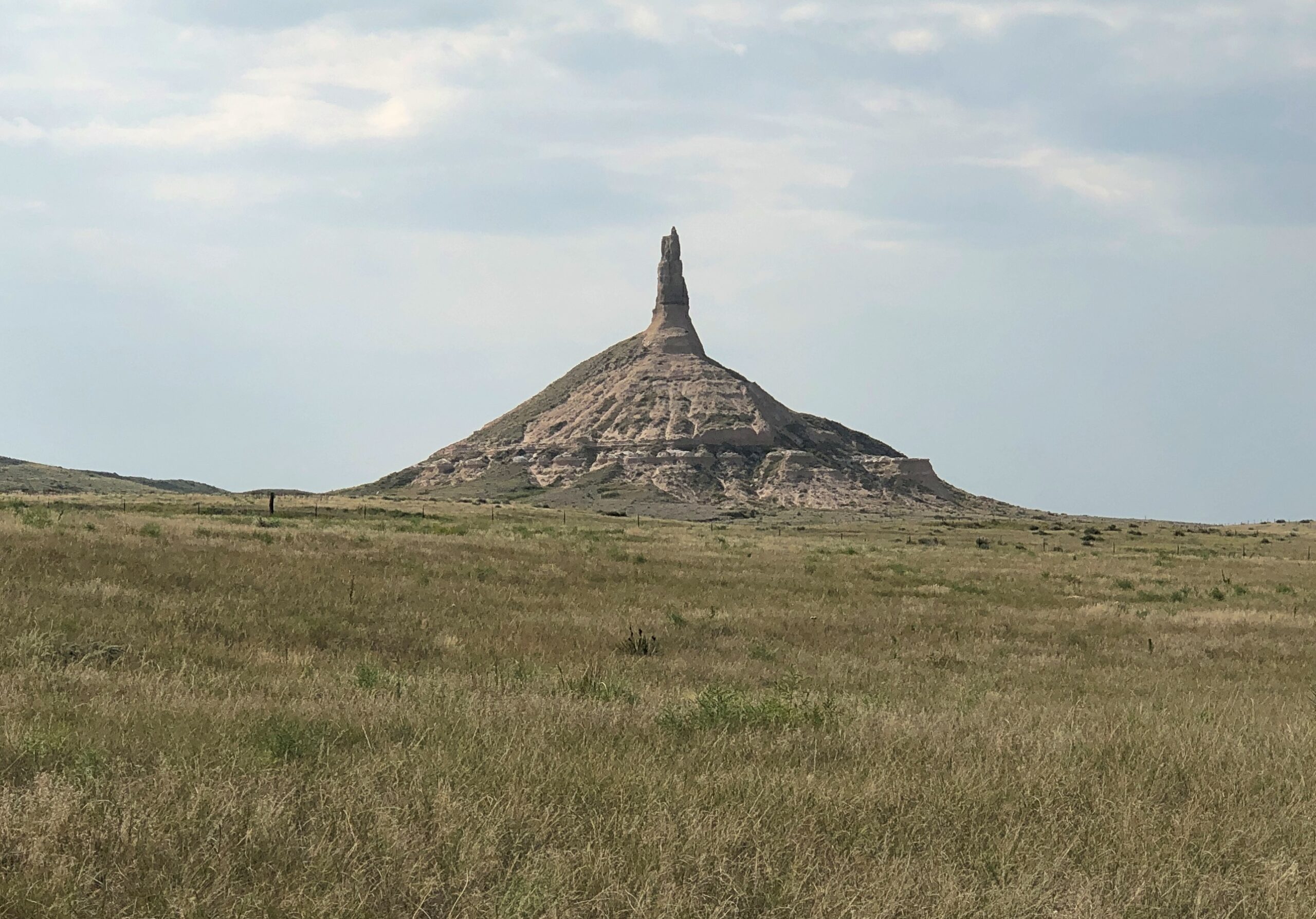
Not far away in this part of Nebraska (at least by horseless carriage) is the better known Chimney RockNational Historic Site.
It was later on same day as Courthouse and Jail, and the heat was still on. Again, I didn’t want a personal heat event to interrupt my trip, so I didn’t go as close as the trails would have allowed.
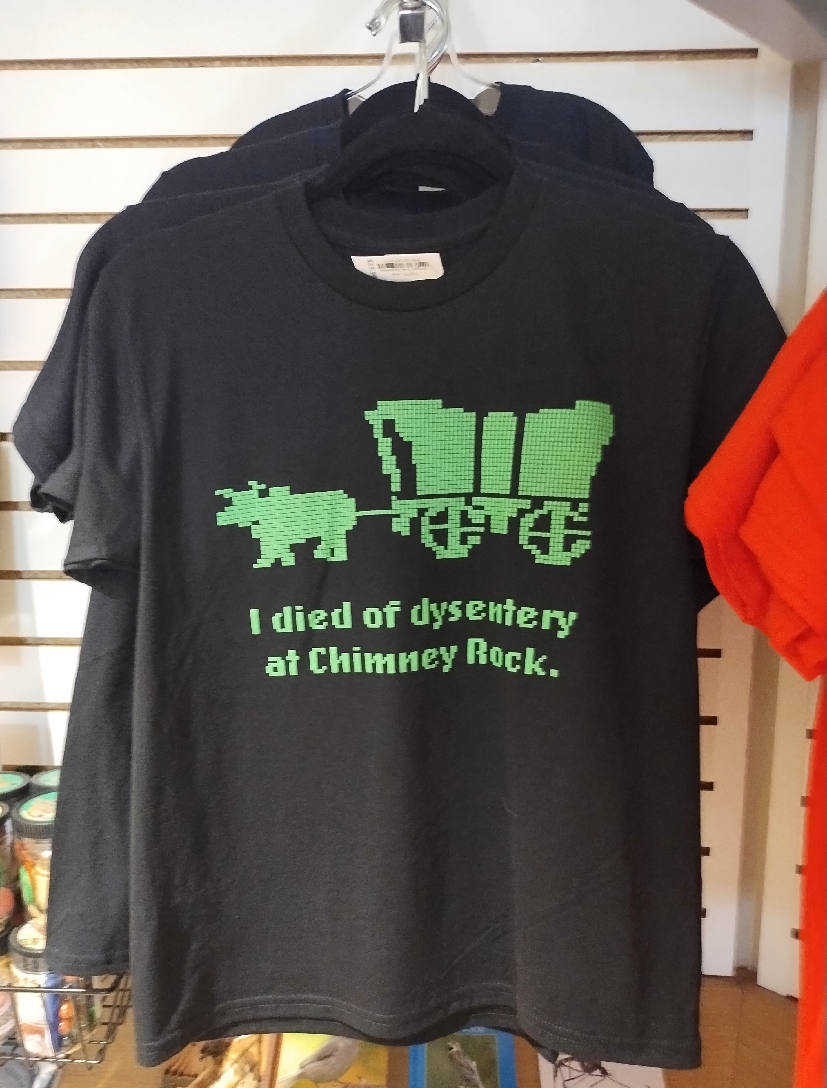
I sent an image of Chimney Rock and a text message to old friend Tom J.:
The aliens decided that Devil’s Tower was a better site.
Then I sent this image from the Chimney Rock gift shop.
Tom answered:
lol. We never even played Oregon Trail and that’s still funny.
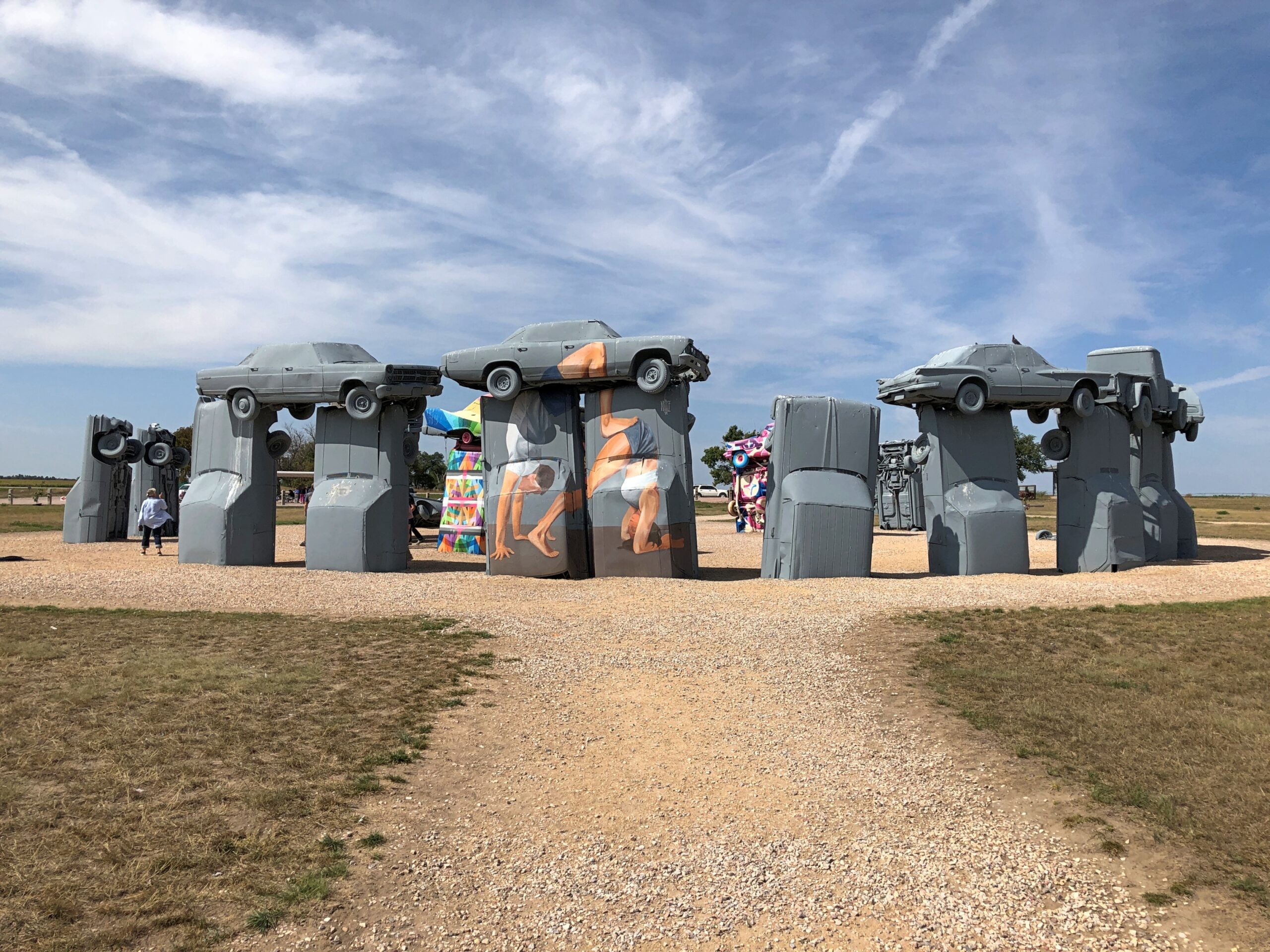
Just how many Stonehenges are there in North America? Or rather, Stonehenge-like structures, standing out in the open. For a question like that, consult the expertise of Roadside America. The answer turns out to be that there’s no definitive count – they keep “springing up,” as the web site says (and the article is worth reading in its entirety). A design borrowed from ancient Britain morphs into something distinctly American, again and again.
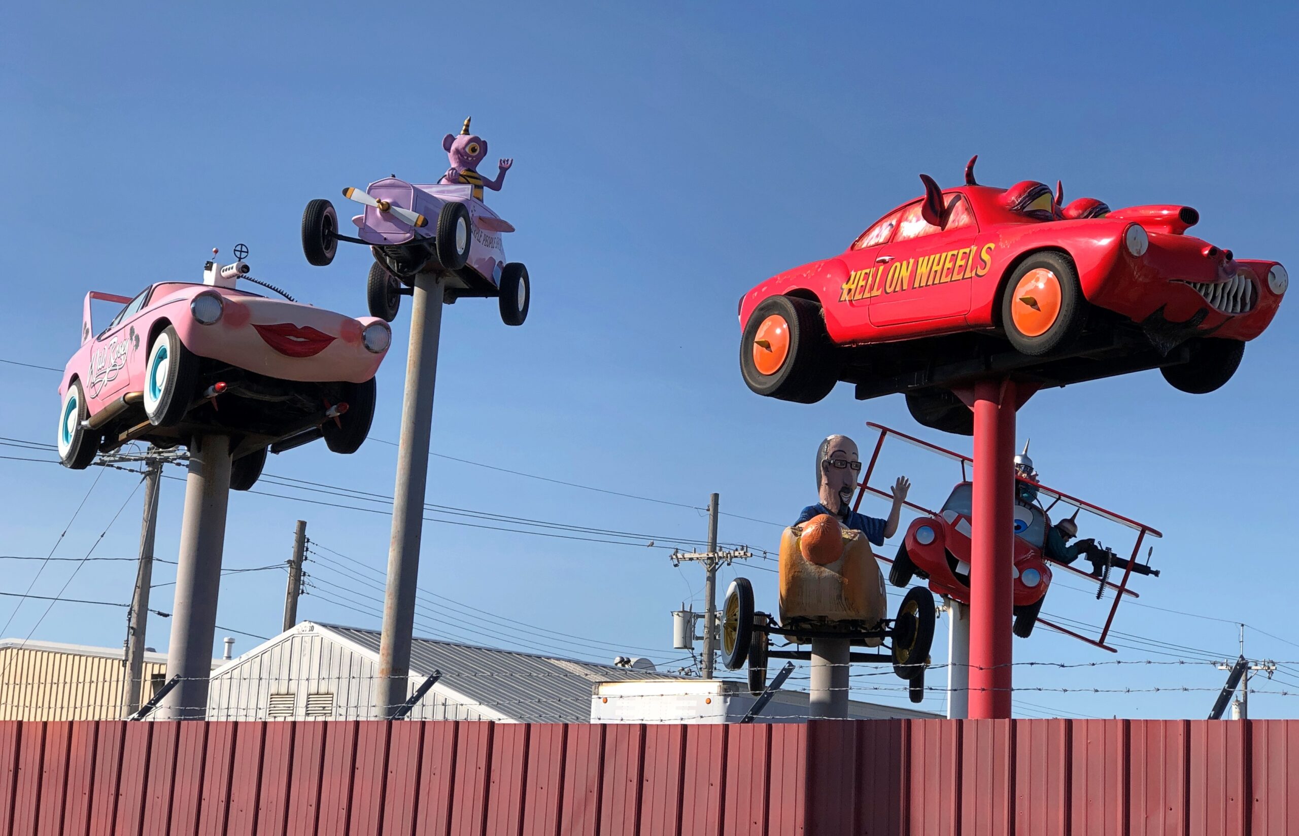
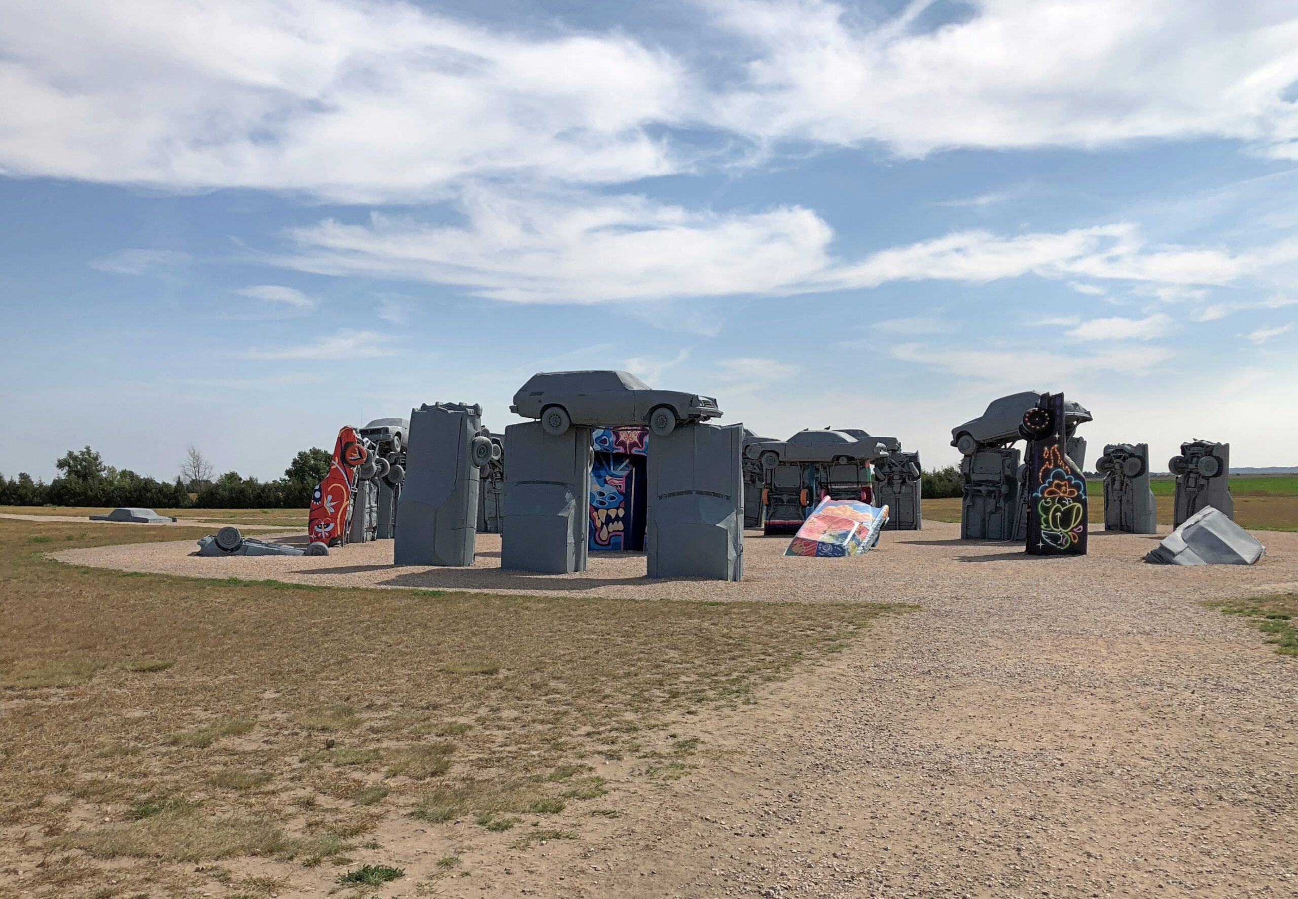
None is better known than Carhenge in western Nebraska, RA asserts, and I can go along with that. Its fame is international.
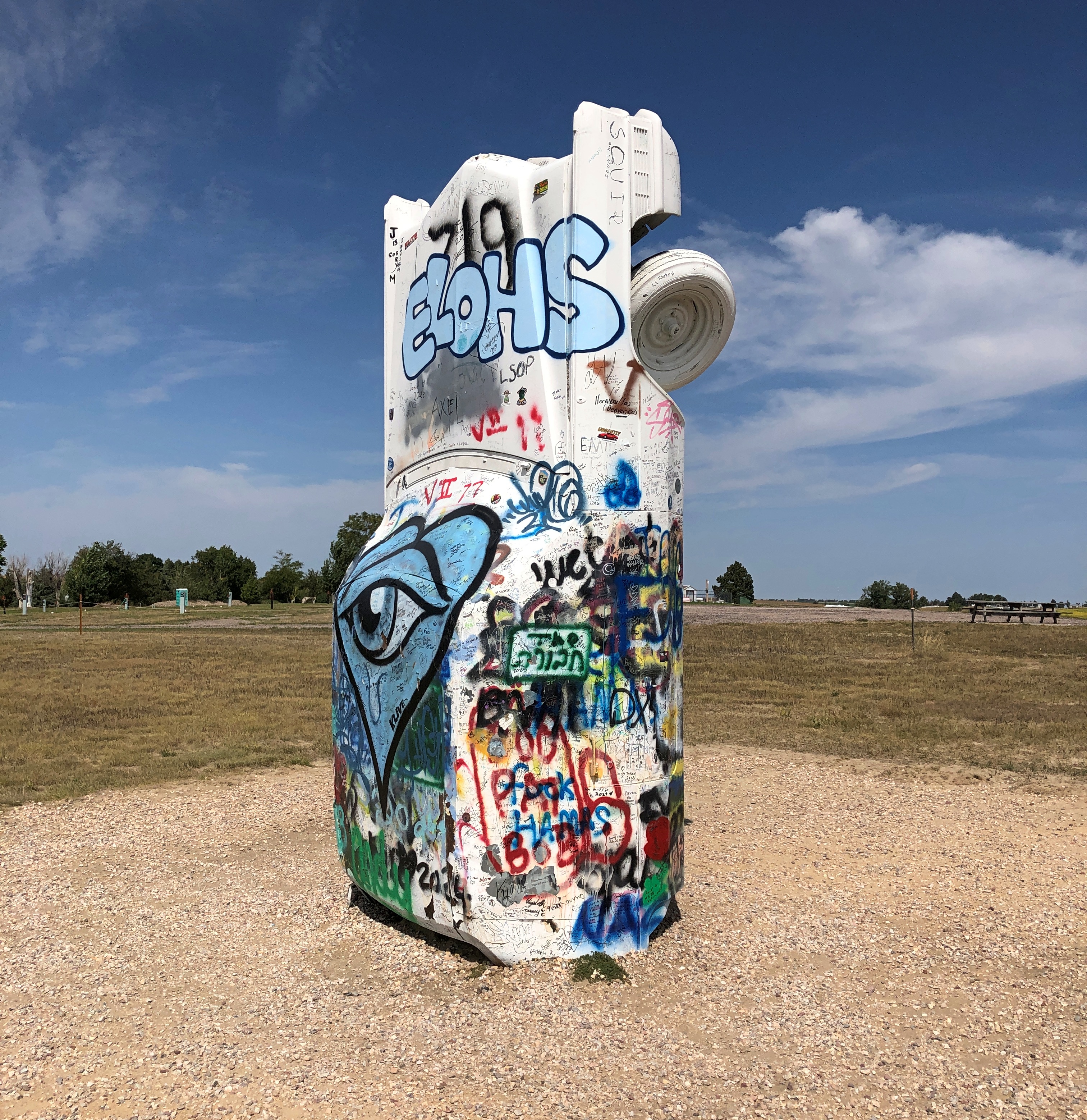
Though not a Stonehenge, I visited the Cadillac Ranch once upon a time, so it stands to reason that someday I’d have a strong hankering to see Carhenge. I arrived early in the afternoon of September 7, under partly cloudy and very warm skies.
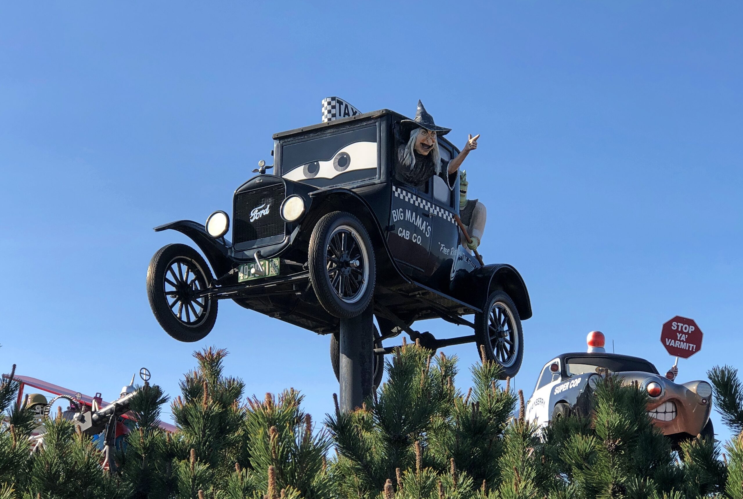
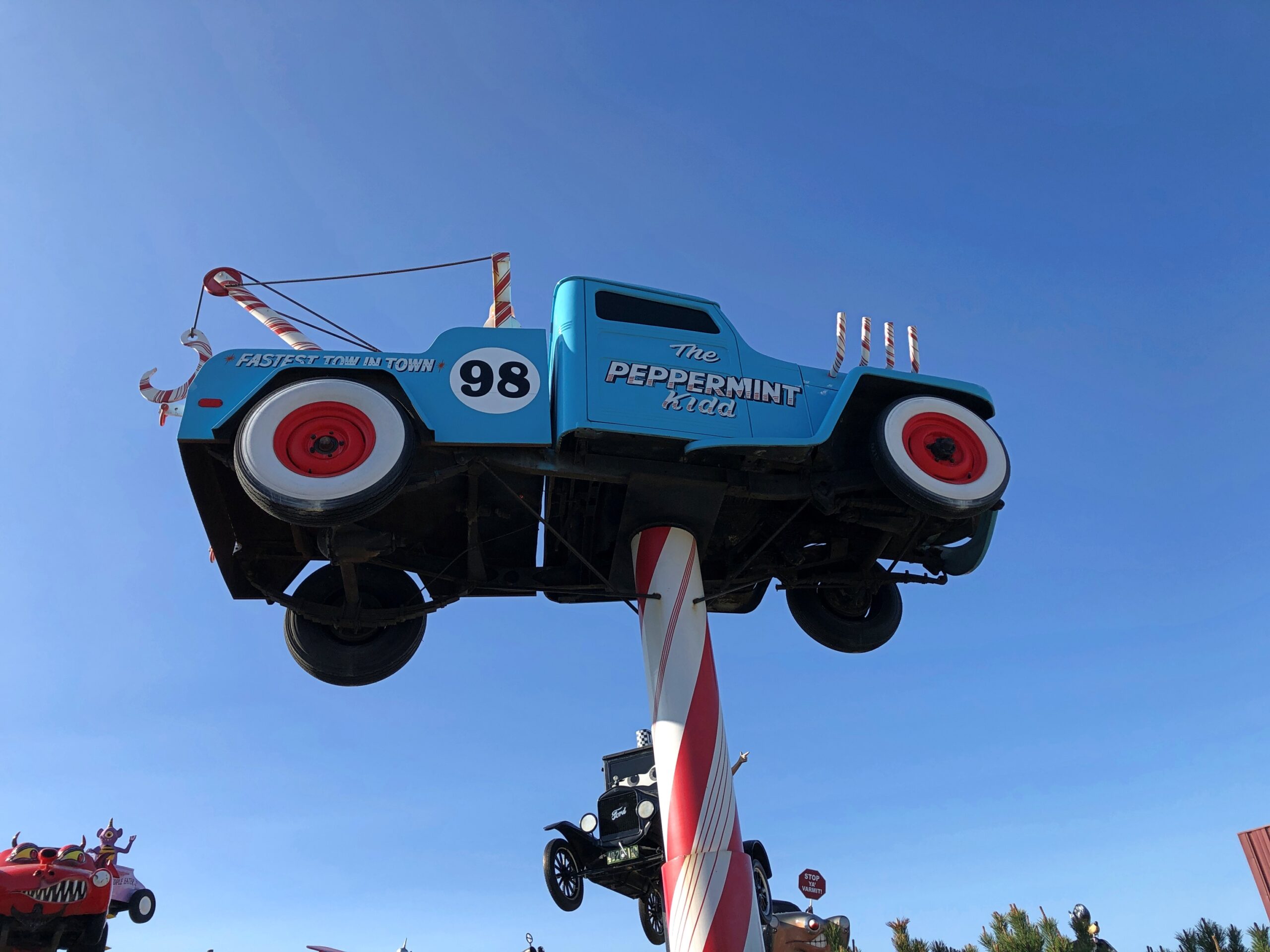
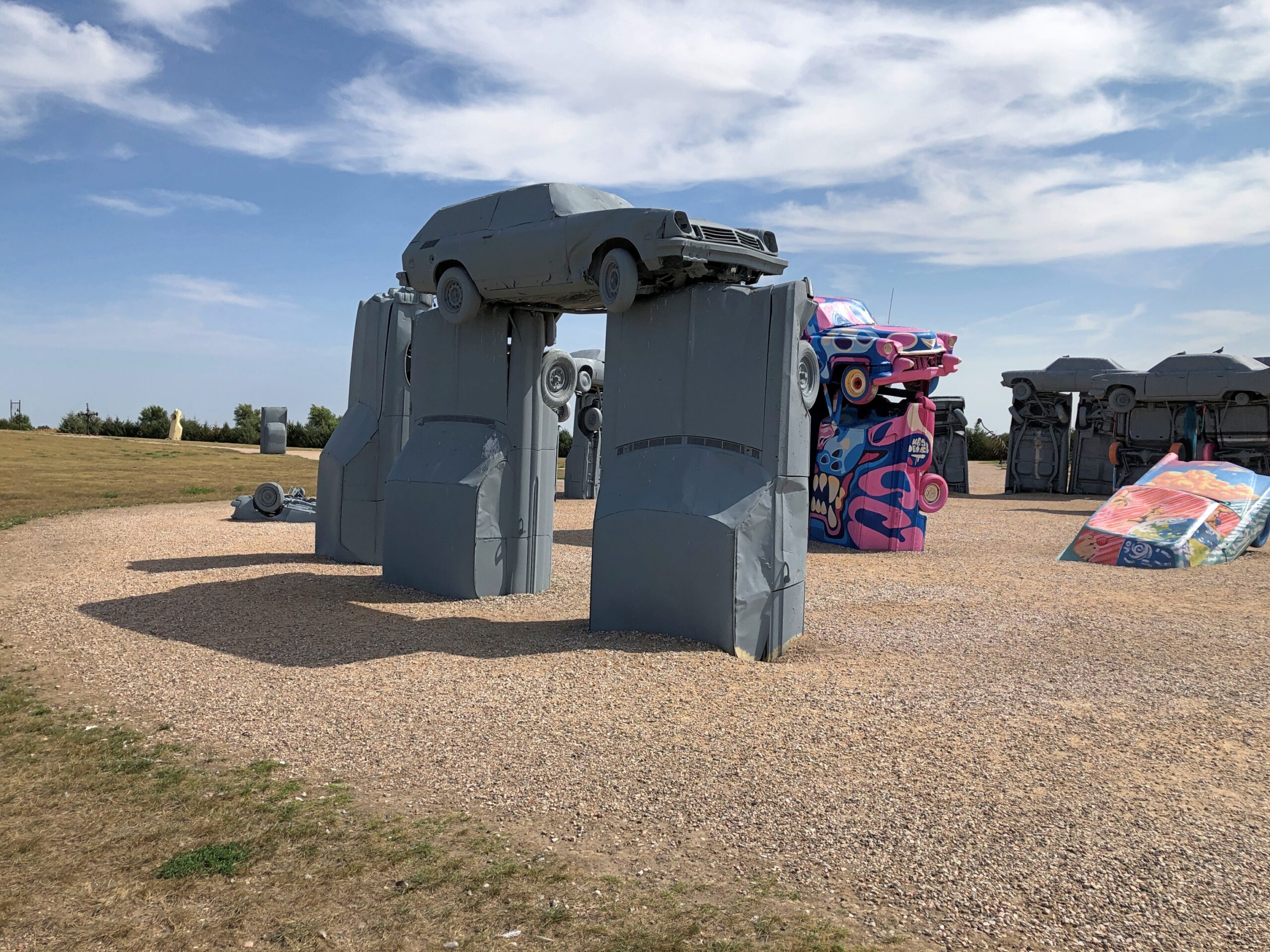
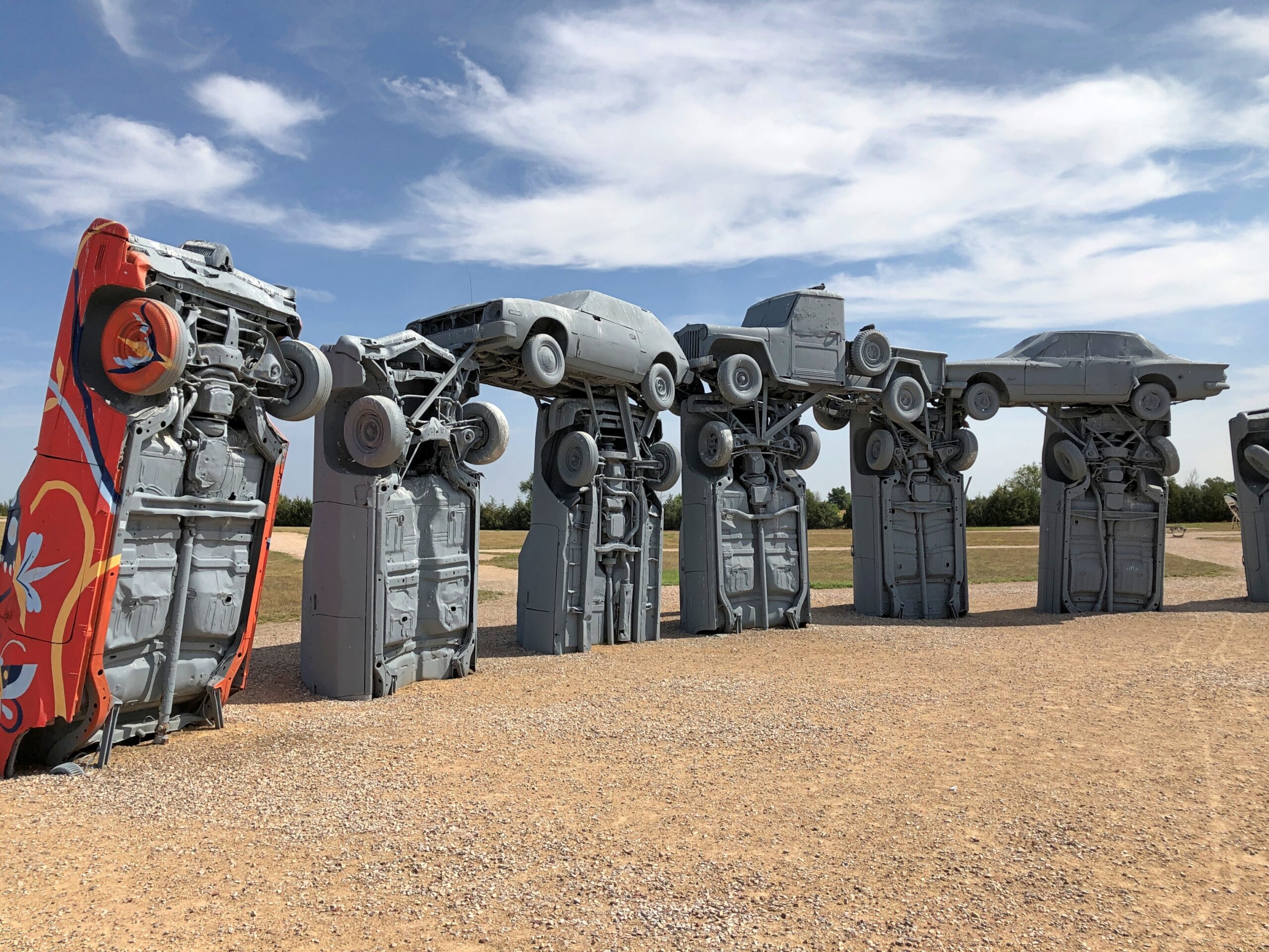
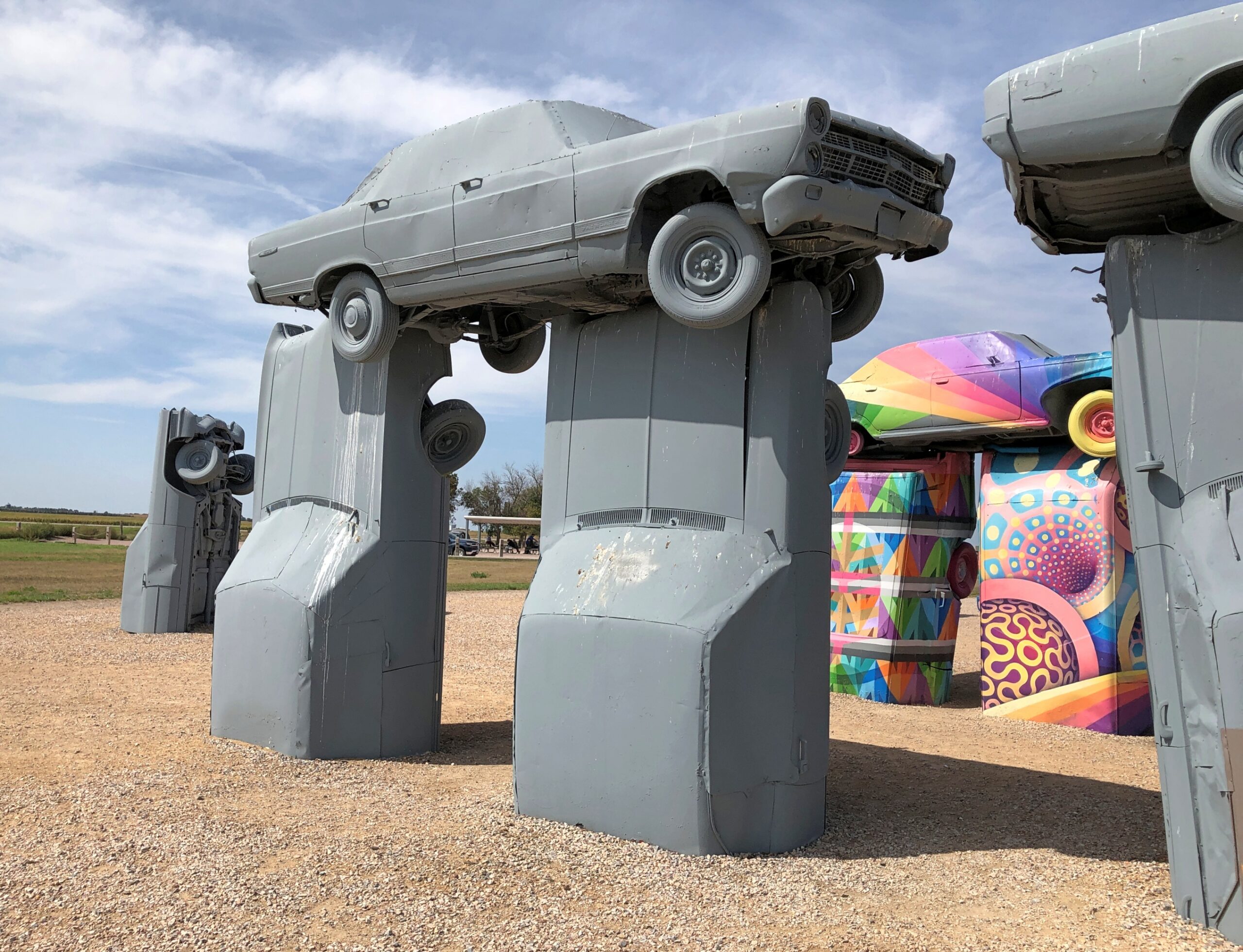
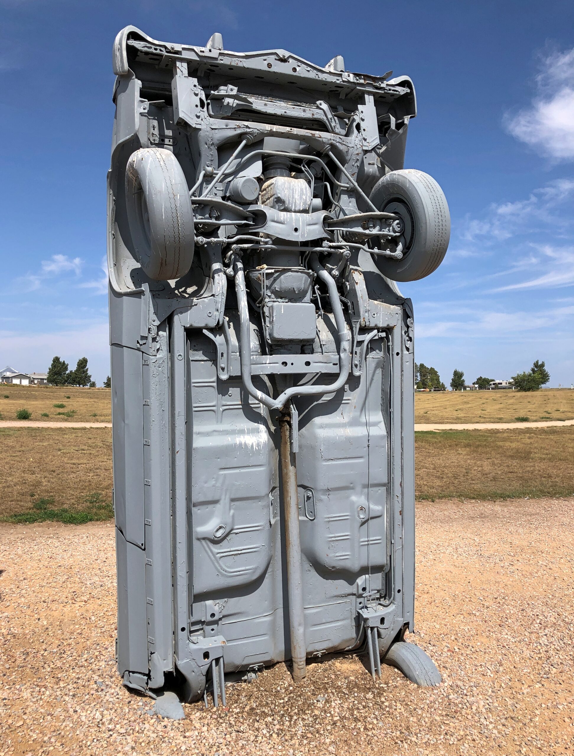
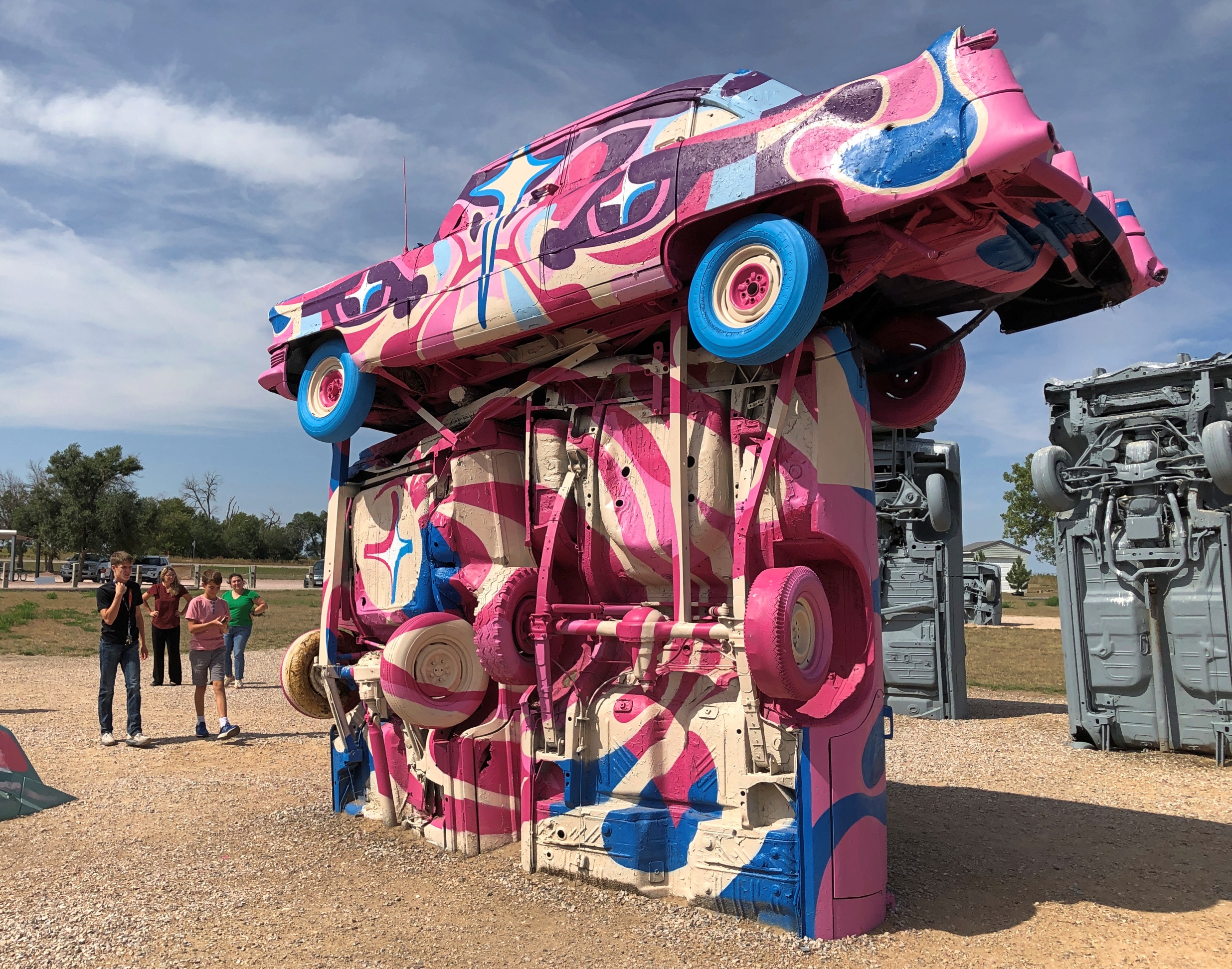
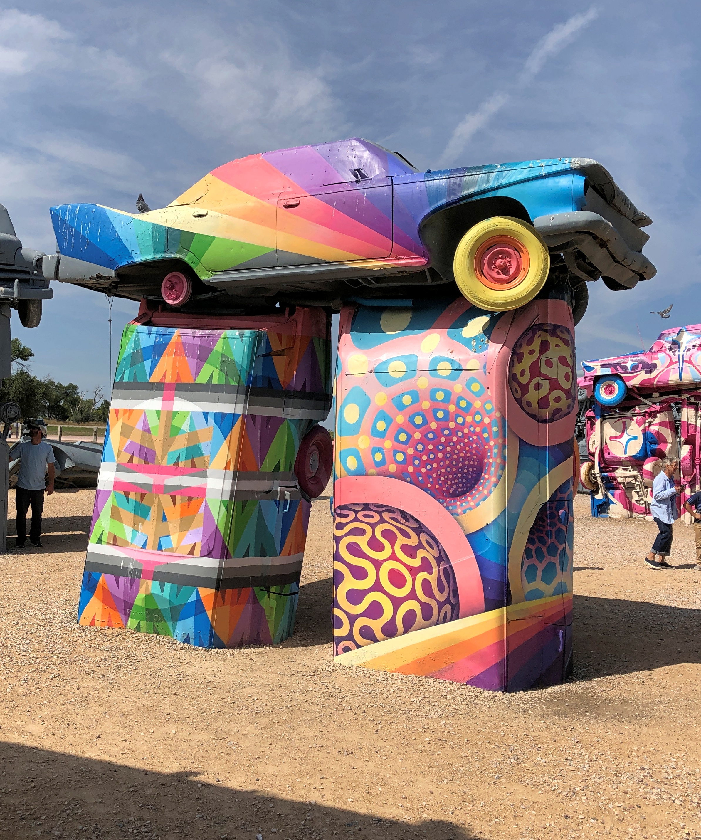
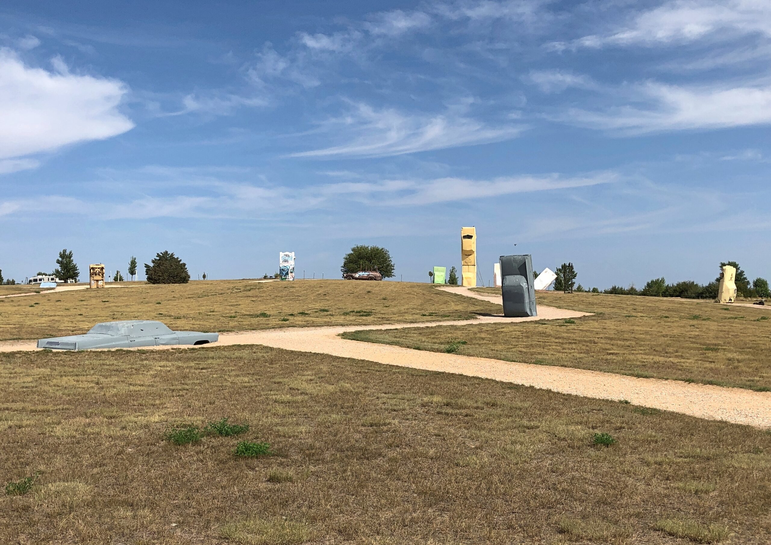
All the cars were painted gray at one time, but that has clearly given way to some being used as metal canvases.
The colorful cars are curated works, from the looks of them, to use that word in a literal and correct way.
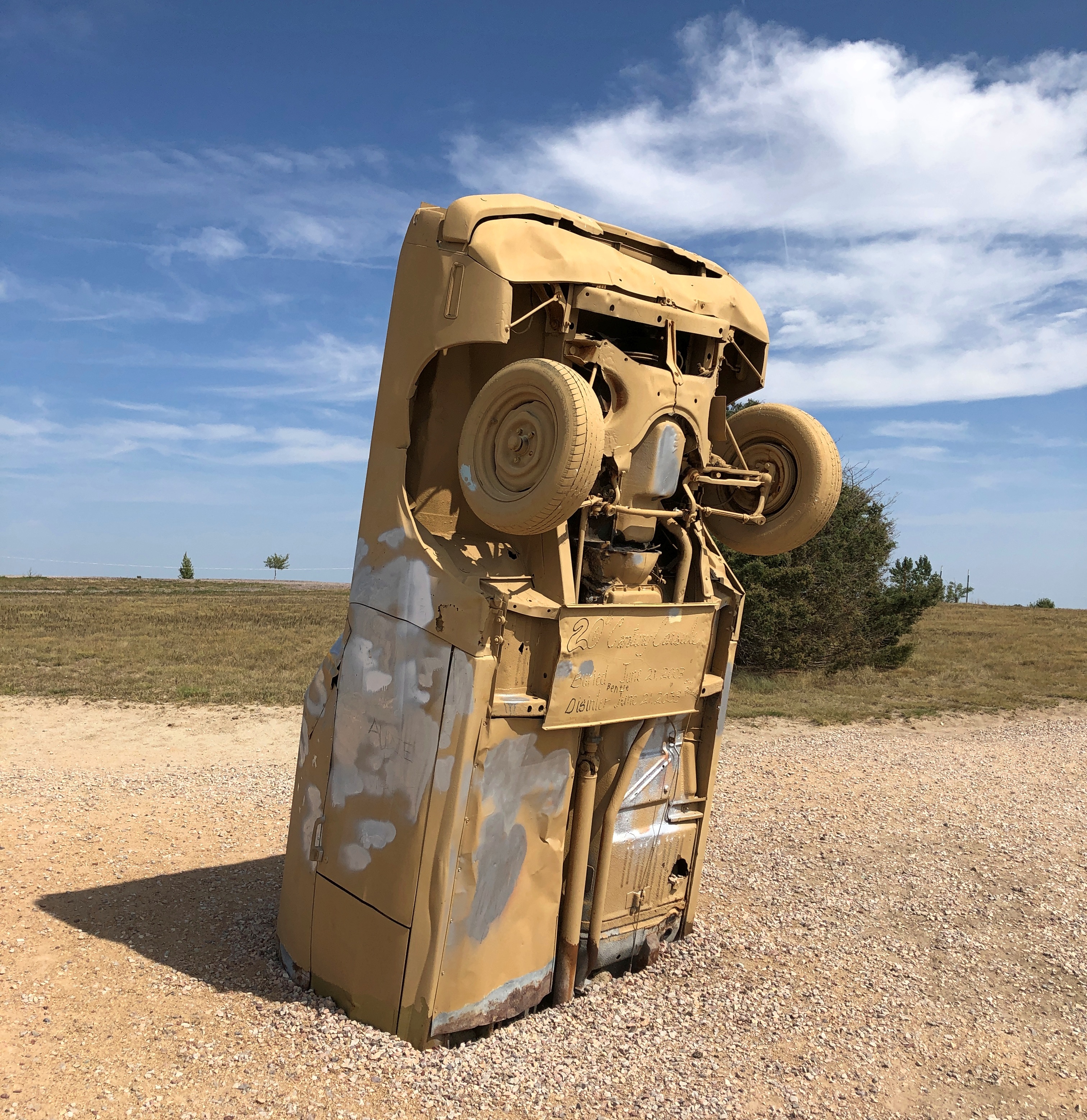
RA: “[Carhenge] was built [in 1987] in a farm field north of Alliance, Nebraska, under the supervision of farmer (and engineer) Jim Reinders [d. 2021], who meant it as a memorial to his dad.
“What makes Carhenge special is that it’s made of cars, 38 of them, rescued from nearby farms and dumps. Reinders noticed that the monolithic dimensions of cars from the 1950s and ’60s nearly equaled the stones at Stonehenge, and he built his monument with a 96-foot diameter to match the proportions of the original.”
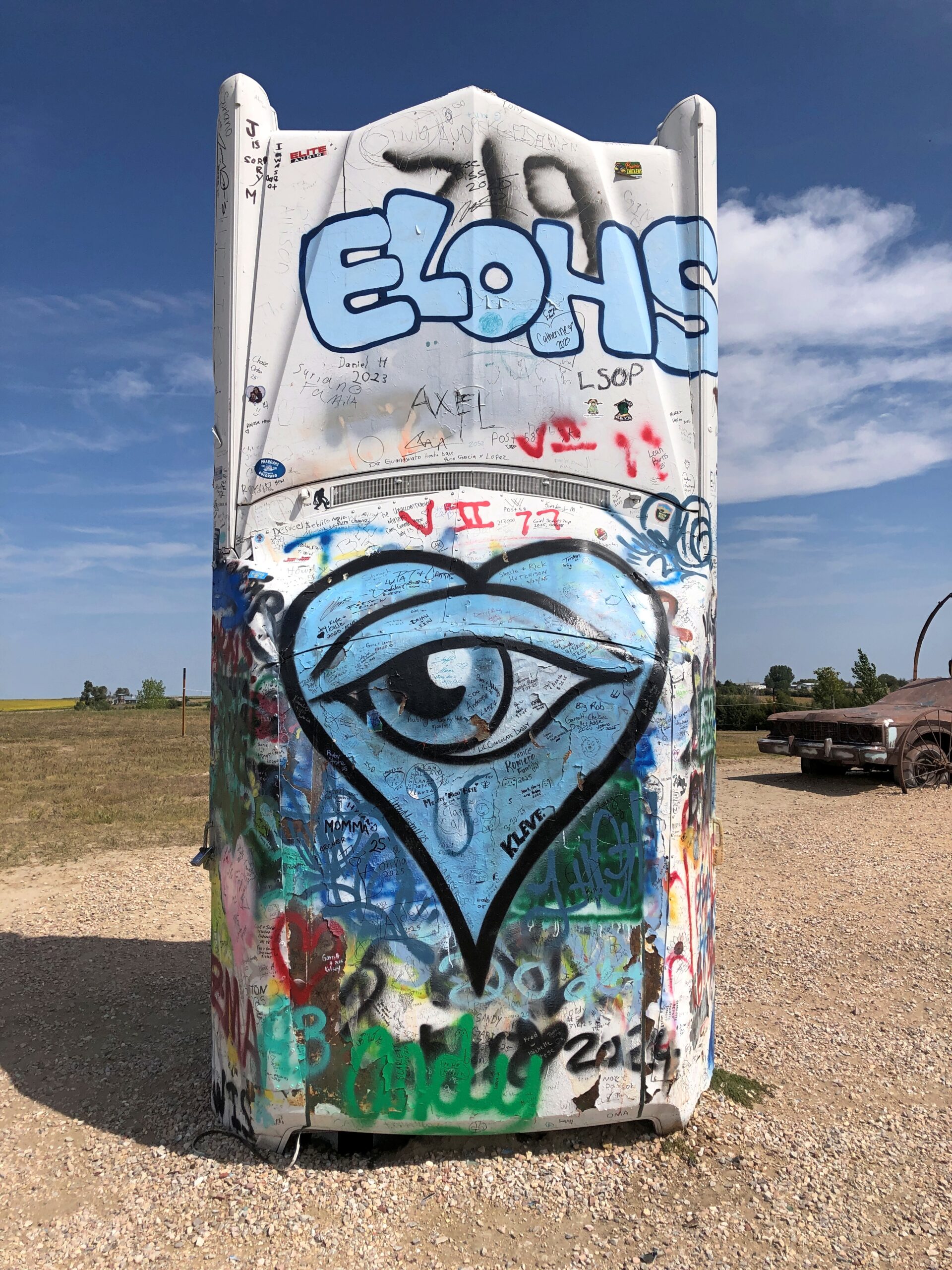
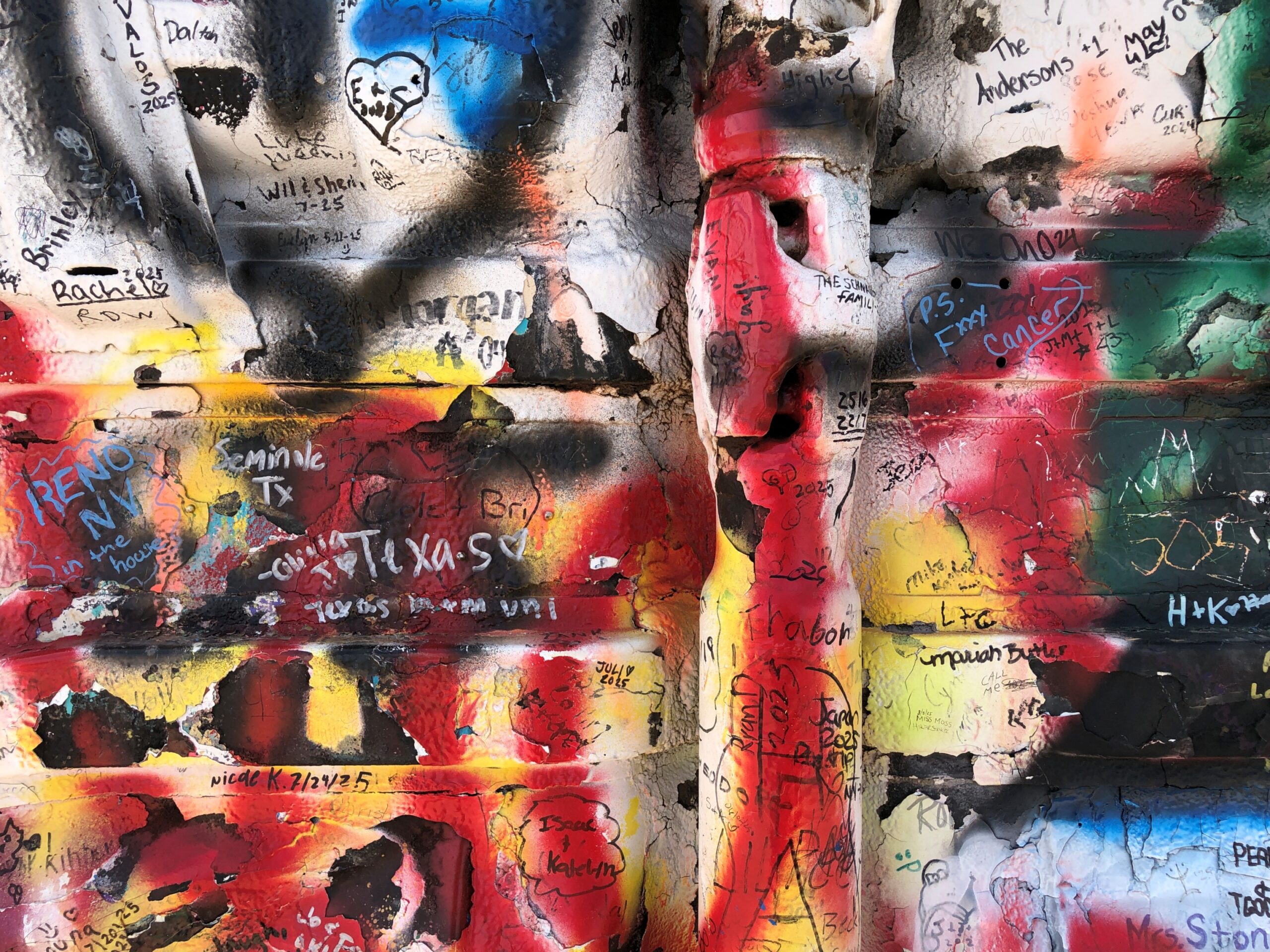
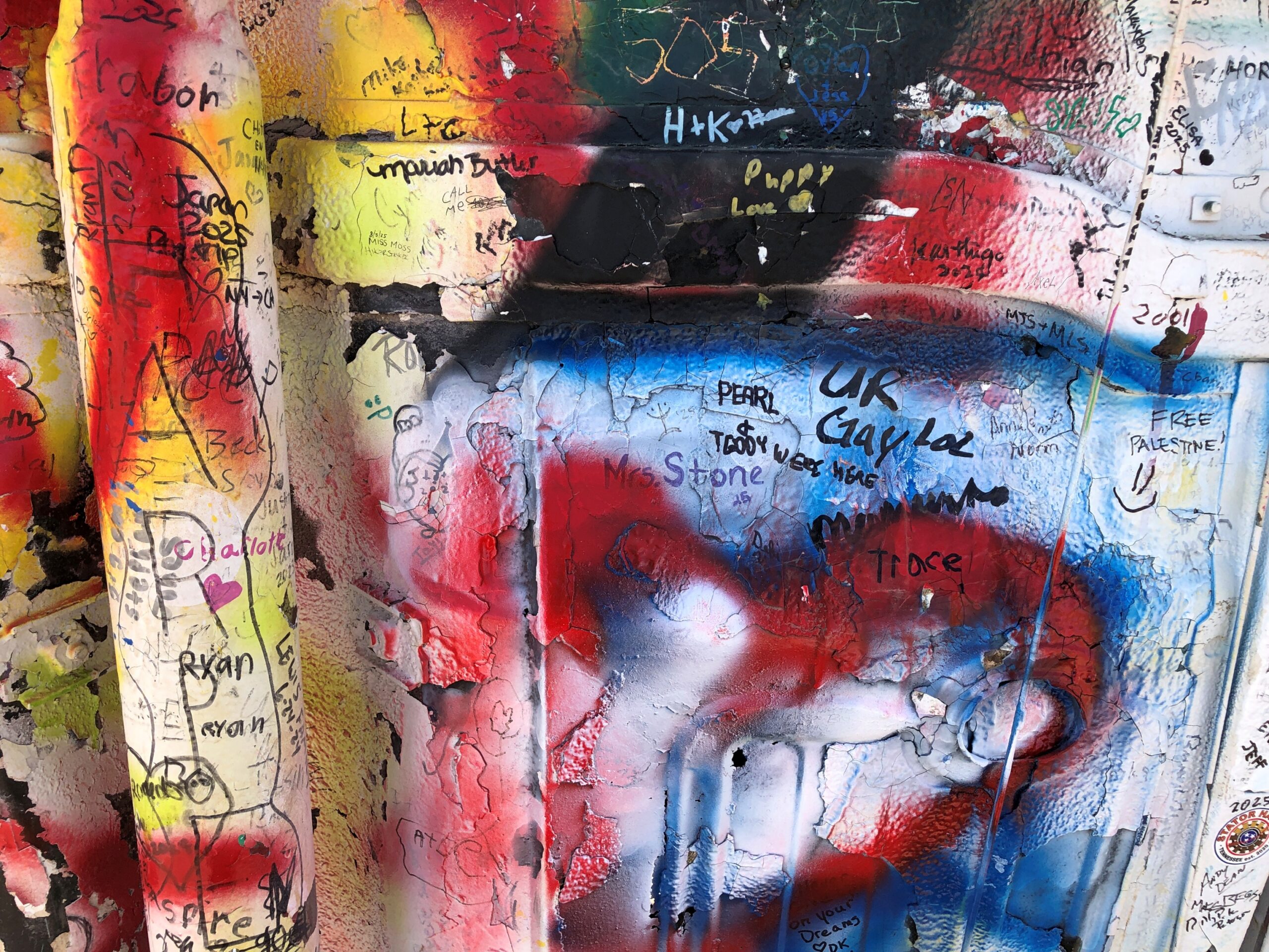
One outlying car seems to be reserved for spray painting for anyone who wants to, in the style of all the cars at the Cadillac Ranch.
The undercarriage is particularly vivid.
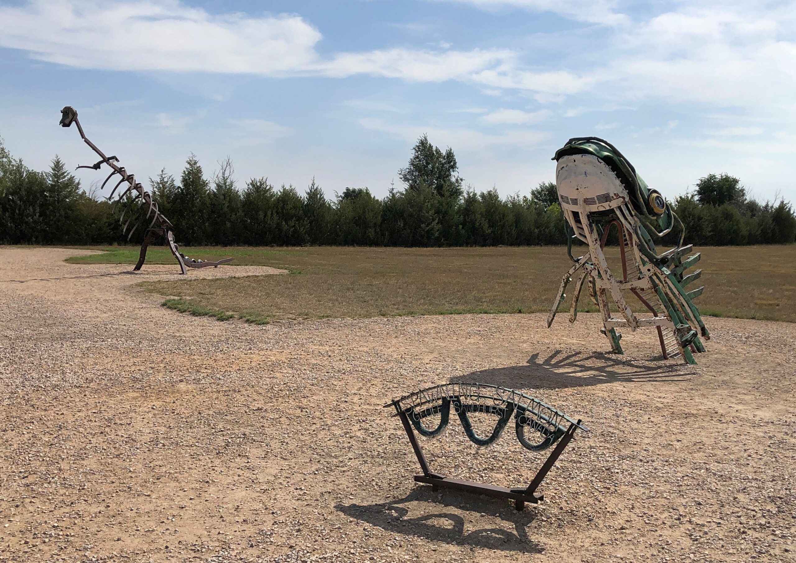
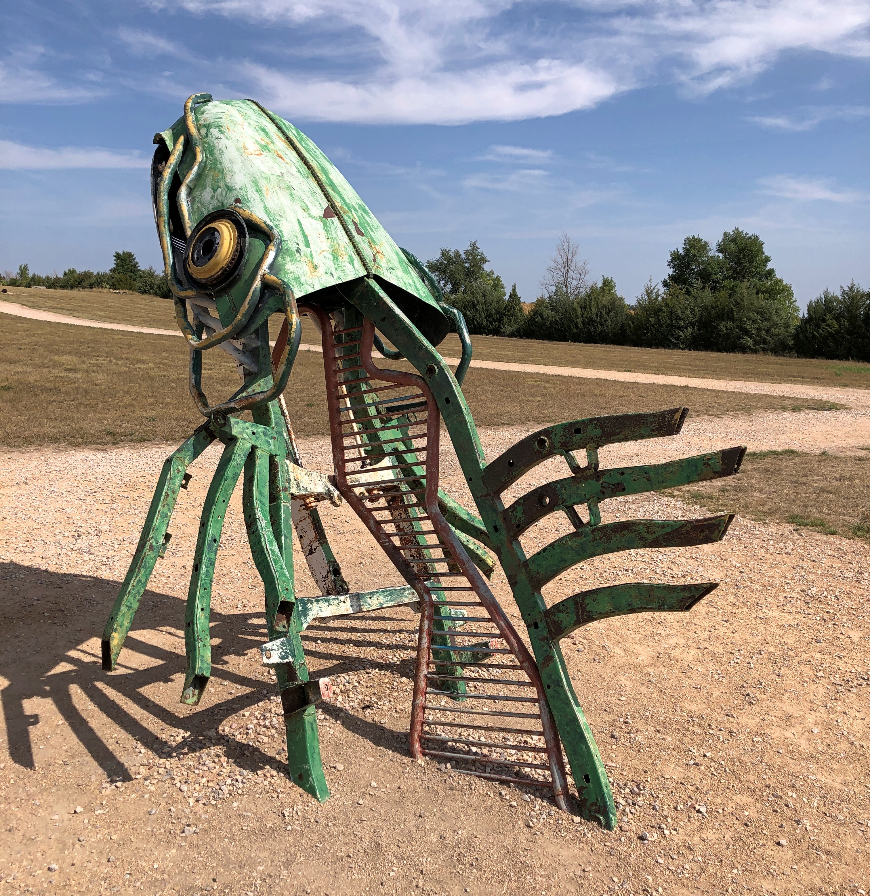
The graffiti car is apart from the Stonehenge-like array, along with other sculptures that have been added to the grounds in more recent years.
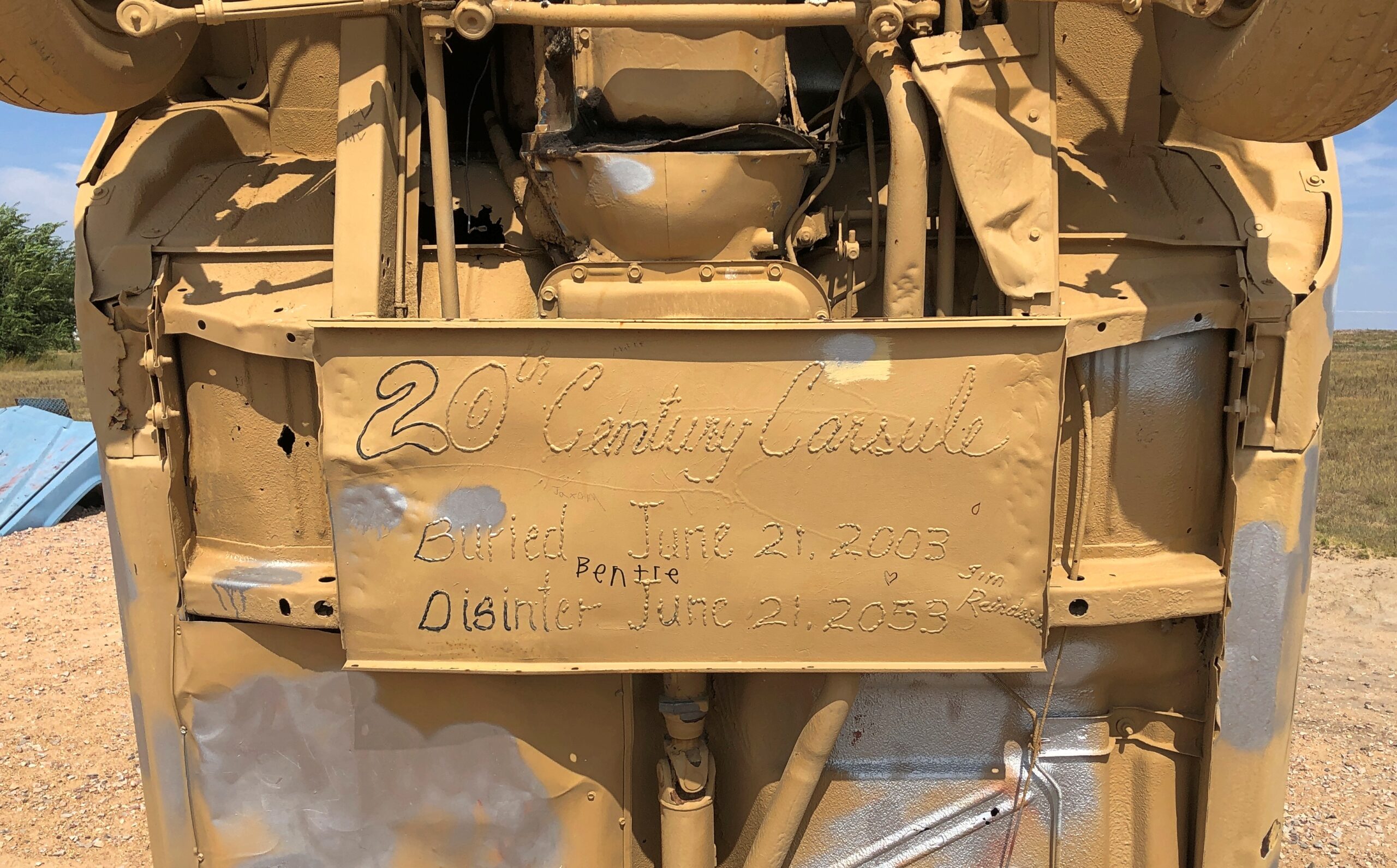
Not just an upright old car, but apparently a time capsule, closed in 2003, with a slated opening in 2053.
Word is that Carhenge wasn’t especially popular locally in its early years, including grunts of “eyesore” and threats to have it condemned and the like. But after a few decades, the townspeople came around, and the town of Alliance acquired the site in 2013, so now it counts as a public park. You go through an open gate, no admission is charged, and you’re free to wander around. Next to the parking lot, a gift shop stands, but visiting is optional. I supported the preservation of Carhenge in the form of a magnet- and postcard-centered purchase at the shop.
Driving down from the alpine wonders of Rocky Mountain National Park a couple of weeks ago on highway US 36, I realized we’d be passing through Boulder, Colorado. So during one of the moments of standstill traffic on that highway as it winds into Boulder — it’s a crowded road, especially on a weekend during warm weather — a thought occurred to me. More of a memory-thought, since it harkened back almost 50 years.
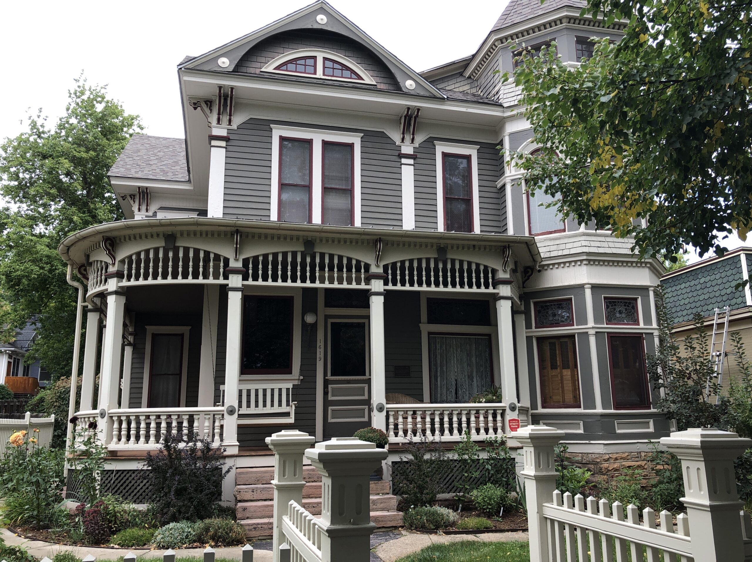
At zero mph, I had time to consult Google for more information. (Remarkably, the signal was strong.) Google Maps pinpointed the location I’d thought of, on a leafy street in Boulder. That day I expended some tourist energy, of which I don’t have quite as much as I used to, to find Mork’s house.
That is, the house used in establishing shots in Mork & Mindy to show their home, since the show was set in Boulder. I know I’d seen Boulder on maps. Funny name, I thought as a kid. Really Big Rock City. It’s still a little funny. But other than as a spot on the map, the show was probably the first time I’d heard anything else about the place.
The passengers in my car, Yuriko and Emi, having grown up outside of the orbit of ’70s American sitcoms, didn’t particularly appreciate the place. At least not until I conveyed the information that the show made Robin Williams famous. He’s a known quantity. I read a bit about the house later, and there seems to be no consensus about whether the owner cares whether anyone stops by the take a picture. My guess would involving factoring in a dwindling number of people coming by. You know, because the show went off the air over 40 years ago.
Then again, if my U.S. travels have taught me nothing else, it’s that retirees are out being tourists. They have the time they didn’t used to, and currently are just the right age to take a peek at Mork’s house at 1619 Pine Street, which is easy enough to find. Even if, like me, their fondness for that show was lukewarm at best.
Boulder and Mork came early in the second leg of my three-legged, 4,498-mile drive, which seemed to kill that many bugs on the windshield and front hood and bumper. The house counted as merely one spot in a trip that took me through hundreds of places. I spend most of September on the road, heading west from Illinois early in the month along I-80 and smaller roads, especially Nebraska 2 through the Sandhills, and spending time in western Nebraska and its rocky outcroppings and in southeast Wyoming, before going to Denver. That would be the first leg. Which, I’m very happy to say, included a good look at Carhenge.
Yuriko flew to Denver on the last of the points I got from SWA for the Christmastime FUBAR a few years ago and we met there. (New motto for the airline: Now We’re Just Another Airline!) After an overnight jaunt to Rocky Mountain NP in the company of our friend Emi, the two of us then spent more than a week taking a clockwise circle-(like) course — a lasso, you might call it, a straight line connected to a loop — from Denver to Colorado Springs to Pueblo to Walsenburg to Alamosa to (coming down from Wolf Creek Pass) Pagosa Springs to Durango to Silverton to Ouray to Montrose to Salida and back to Denver, where Yuriko flew home. That was the second leg. The drives were varied and gorgeous.
You’d think that would be enough, but I had to drive home, loosely following I-70 this time, making my way from Colorado through Kansas, Missouri and Illinois, and making a number of stops, big and small, such as Kit Carson, Colorado; Abilene, Kansas; and Kansas City, Missouri, for a third and final leg. No single small road took me through Kansas, but a series of them did, some as empty as, well, eastern Colorado and western Kansas. That’s some fine driving. Mountains are great, but after a week or so of their twisty ups and downs on two lanes, flat is all right. More relaxing, even.
For reasons that will soon be obvious, not long ago I looked up 2024 visitation statistics for the four national parks in Colorado: Rocky Mountain, Mesa Verde, Great Sand Dunes, and Black Canyon of the Gunnison.
Far and away the top national park draw in Colorado is Rocky Mountain NP, which received 4.2 million people last year, according to the NPS. In fact, it’s a top ten among most-visited U.S. parks. That isn’t so much of a surprise, considering the monster population that lives nearby in greater Denver and other parts of the Front Range. Indeed, for a lot of people, RMNP is easily a day trip.
That isn’t true for the other three national parks, but even so I was surprised to learn how few people actually visit any of them. They aren’t that remote. We aren’t talking Gates of the Arctic NP or American Samoa NP remote. Still, out of the 63 current U.S. national parks, last year Mesa Verde ranked 41st, Great Sand Dunes 44th, and Black Canyon 49th. The three of them combined saw only about 30 percent as many visitors as Rocky Mountain in 2024.
We set out to see all four of the national parks in Colorado. And we did. You could call it a national park trip, along the lines of the one a few years ago mostly on the Colorado Plateau. But the parks were only a framework, never the total picture, over mountains and across plains. We saw a lot else besides, such a male bear outside our window about 10 miles north of Durango, a female in a tall nearby pine snarling at him, and cubs higher up in the tree. More detail to come on that, in the fullness of time.
Rocky Mountain NP is an exercise in rising above the tree line, by vehicle but also on foot, up a path, into to a satisfying exhaustion before majestic mountains. The pale sand dunes of the Great Sand Dunes NP rise from a valley and back up against a mountain range, as if a giant broom swept it off to corner, and for visitors amounts to a giant sand box. Mesa Verde NP, where the stone dwellings of the Ancient Ones are tucked away in steep stone canyons, shows how much effort people will put into making a home for themselves. Black Canyon of the Gunnison NP is a scenic great unknown, a great dark crack in the earth that reminds you that gravity is in charge, its ragged cliff edges rife with opportunities to die for an Instagram image.

